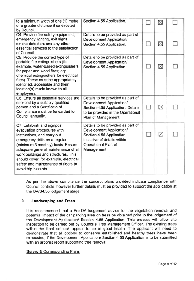
Cumberland Local Planning Panel Meeting
14 August 2019
A
meeting of the Cumberland Local Planning Panel
will be held at 11:30am at the Merrylands Administration Building, 16
Memorial Avenue, Merrylands on Wednesday, 14 August 2019.
Business as below:
Yours faithfully
Hamish McNulty
General
Manager
ORDER OF BUSINESS
1. Receipt of Apologies
2. Confirmation of Minutes
3. Declarations of Interest
4. Address by invited
speakers
5. Reports:
- Development
Applications
- Planning
Proposals
6. Closed Session Reports
Cumberland Local Planning Panel Meeting
14 August 2019
CONTENTS
Report No. Name of Report Page
No.
Development Applications
LPP053/19... Development Application -
58-60 Berwick Street, Guildford......................... 5
LPP054/19... Section 4.56 Modification
Application - 331 Blaxcell Street, South Granville 185
LPP055/19... Development Application -
40 - 42A Park Road, Auburn......................... 317
LPP056/19... Development Application -
96 Chiswick Road, Auburn........................... 499
LPP057/19... Section 4.56 Modification
Application - 1/181 McCredie Road, Guildford West 549
Cumberland Local Planning Panel Meeting
14 August 2019
Item No: LPP053/19
Development
Application - 58-60 Berwick Street, Guildford
Responsible
Division: Environment
& Planning
Officer: Executive
Manager Development and Building
File
Number: DA
2019/11/1
|
Application lodged
|
16 January 2019
|
|
Applicant
|
Baini Design
|
|
Owner
|
Anrite Holdings Pty Ltd, Chrisyl Holdings Pty Ltd
& Manmark Holdings Pty Ltd
|
|
Application No.
|
2019/11/1
|
|
Description of Land
|
58-60
Berwick Street, Guildford
|
|
Proposed Development as
amended
|
Demolition of existing structures and construction of a 4
storey building comprising of a 76 place child care centre on the ground
floor with 18 residential units above with two basement car parking levels
for 36 vehicles; pursuant to Affordable Rental Housing SEPP 2009
|
|
Site Area
|
1,349.08m² (1,236.18m² post road widening
dedication)
|
|
Zoning
|
R4 High Density Residential
|
|
Principal Development Standards
|
Floor Space Ratio:
Max. 1.2:1 permitted (HLEP) + ARH % Bonus
· Proposed FSR = 1.53:1 (27.5% variation to
FSR standard)
· Affordable units not identified to
determine ARH % Bonus
· No Clause 4.6 Written Variation Request
submitted for the departure sought to FSR
Height of Buildings:
Max. 15m permitted
· Proposed Max. 16.5m (10% variation
sought)
· Clause 4.6 Written Variation Request
submitted for the departure sought to building height
|
|
Disclosure of political donations and gifts
|
Nil disclosure
|
|
Heritage
|
The subject site is located within the vicinity of a
heritage item of local significance being “Kelvin”,
Federation/Queen Anne bungalow at No. 67 Berwick Street, Guildford (I33)
|
|
Issues
|
· Floor Space Ratio (SEPP ARH
2009 & HLEP 2013)
· Landscaped Area (SEPP ARH
2009)
· Deep Soil Zone (SEPP ARH
2009)
· Solar Access (SEPP ARH 2009
& HDCP 2013)
· Variation to maximum 15m
building height (HLEP 2013)
· Visual Privacy / Building
Separation (ADG & HDCP 2013)
· Outdoor play space (SEPP
Education & Child Care) 2017
· Site Coverage (HDCP 2013)
· Setbacks (HDCP 2013)
· Character
· Flooding
· Acoustic Privacy
· Traffic and Parking
|
On 16 January 2019, development
application (DA2019/11) for demolition of existing structures, and construction
of a 4 storey building comprising of a 76 place child care centre on the ground
floor with 18 residential units above with two basement car parking levels for
36 vehicles made pursuant to Affordable Rental Housing SEPP 2009; was lodged
with Council.
The application was publicly
notified to adjoining and opposite owners, a notice was placed in the local
press and a notice placed on the site for 21 days from 20 February 2019 to 13
March 2019. In response, three submissions were received.
Correspondence was sent to the
applicant on 31 May 2019 advising that the application could not be supported,
and inviting its withdrawal. That correspondence also set out Council’s
concerns with the application in detail. The issues included inadequate
information relating to accuracy of levels within the submitted survey plan,
flood levels, identification of “site area”, deficient landscaped
area and deep soil area, solar access, unacceptable streetscape presentation
and compatibility with the character of the local area, compliance with child
care centre provisions, and traffic matters. The applicant elected not to withdraw
the application.
The subject application has been
assessed against the relevant provisions of the Environmental Planning and
Assessment Act 1979, State Environmental Planning Policy (Affordable Rental
Housing) 2009 (SEPP ARH), State Environmental Planning Policy No 65
– Design Quality of Residential Apartment Development (SEPP 65), State
Environmental Planning Policy (Educational Establishments and Child Care
Facilities) 2017, Child Care Planning Guideline (the Guideline) 2017, Holroyd
Local Environmental Plan 2013 (HLEP), Apartment Design Guide and Holroyd
Development Control Plan 2013 (HDCP).
The proposal seeks the following
numerical non-compliances which are not considered supportable as discussed in
detail elsewhere in the report:
|
Control
|
Required
|
Proposed
|
% Variation
|
|
Floor Space Ratio (SEPP ARH & HLEP 2013)
|
Max.
permitted = 1.2:1 (HLEP) + ARH % Bonus
Note: Affordable units have not been nominated to
determine ARH% Bonus
|
FSR = 1.53:1 (1,895.5m²)
|
27.78%
|
|
Landscaped Area
(SEPP ARH)
|
Min. 30% =
370.85m²
|
337.3m² (27.28%)
|
9%
|
|
Deep Soil Zone
(SEPP ARH)
|
Min. 15% =
185.43m²
|
27.2m² (2.22%)
|
85.33%
|
|
Solar Access
(SEPP ARH)
|
Min. 70% of
units receive 3 hours direct sunlight
|
12 out of 18 units
(66.7%)
|
7.69%
|
|
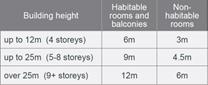
Building Separation
(ADG)
|
Min. 6m up
to 4 storeys
Min. 9m for
5-8 storeys
|
Levels 1-3:
Eastern Boundary
Balconies = 5.5m
Southern Boundary
Habitable rooms = 5.5m
Balconies = 4.8m
Eastern Boundary
COS = 6m
|
8.33%
8.33%
20%
33.33%
|
|
Unencumbered outdoor space
SEPP Education & Child Care 2017
|
76 children
x 7m²
= 532m²
|
510m²
|
4.13%
|
|
Building Height
(HLEP 2013)
|
Max. 15m
|
Max. 16.5m (RL 38.395) to
the roof of lift core and stairwell
|
10%
|
|
Driveway Setback (HDCP 2013)
|
Min. 1.5m
|
1.225m
|
18.33%
|
|
Bicycle Parking Spaces
(HDCP 2013)
|
11 spaces
|
7 spaces
|
36.36%
|
|
Site Coverage
(HDCP 2013)
|
Max. 30%
(370.85m²)
|
472.4m² (38%)
|
27.38%
|
|
Front Setbacks
(HDCP 2013)
|
6m to
Berwick Street
4m to
Beaufort Street
|
Balconies = 5.5m
Balconies = 3.5m
|
8.33%
12.5%
|
|
Internal building depth
(HDCP 2013)
|
Max. 18m
|
Max. 19.4m
|
7.78%
|
The application is being reported
to the Cumberland Local Planning Panel (CLPP) for determination as it is a
development with more than 4 storeys to which the State Environmental Planning
Policy No 65 – Design Quality of Residential Apartment Development applies.
The application is recommended for
refusal for the reasons provided in the draft Notice of Determination at
Attachment 8.
History
On 28 February 2018, DA2017/81
granted development consent for the construction of a 4 storey residential flat
building comprising 21 units above basement parking accommodating 26 car
parking spaces at 58-60 Berwick Street, Guildford.
This is an active consent which
applies to the land. The date of expiry of DA2017/81 is 28 February 2023.
Introduction
The subject site is known as 58-60
Berwick Street, Guildford; and is legally described as Lots 29-34, Sec 9 in
DP734. The site has an area of 1,349.08m² and frontage of 40.235m and
33.53m to Berwick Street and Beaufort Street respectively. The site is regular
in shape and has a depth of 40.235m to the eastern boundary and depth of 33.53m
to the southern boundary.
The property is subject to 1.5m
road widening to both Beaufort Street and Berwick Street, with 3m x 3m splay at
the corner of both streets; as identified within Map 1 – Appendix K
– Locations Subject to Road Widenings and Splay Corners in Part A of HDCP
2013. The site area will be reduced to 1,236.18m² post dedication of land
along Beaufort Street and Berwick Street for road widening.
The property is occupied by two
dwelling houses, ancillary structures, outbuildings and mature trees.
The site is located approximately
800m from Guildford Railway Station.
The subject site and neighbouring
allotments directly to the east and south are zoned R4 – High Density Residential.
Properties located on the northern side of Beaufort Street and western side of
Berwick Street are zoned R3 – Medium Density Residential. Opposite the
subject site at the corner of Beaufort Street and Berwick Street are Beaufort
Street Park and Berwick Street Reserve.
The existing developments
surrounding the subject site are residential flat building directly to the
south and south-east, and primarily dwelling houses and low to medium density
housing. However, the locality is transitioning to medium to higher density
development consistent with the planning controls that currently apply, and
evident with the recently constructed development in the area.
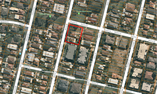
Figure
1 - Aerial view of the locality with subject site shown highlighted in red.
Source: NearMap 7 April 2019
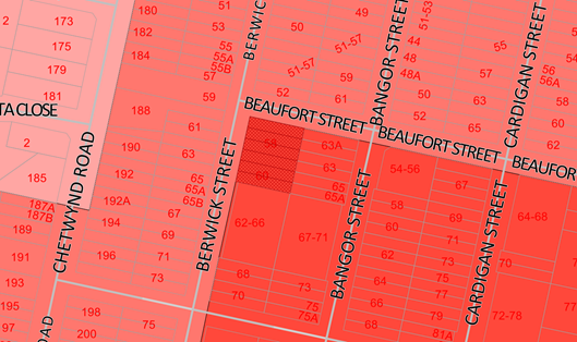
Figure
2 – Zoning map with subject site shown hatched. Source: Cumberland
Council 2018
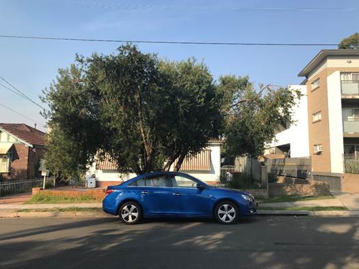
Figure
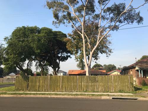
3 – No. 60 Berwick Street (subject site) and adjoining residential flat
building south of the site at No. 62-66 Berwick Street. Source: Cumberland
Council 2019
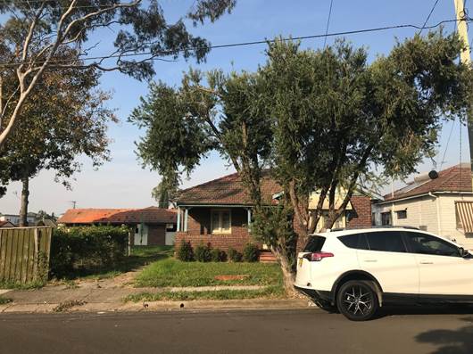
Figure
4 – No. 58 Berwick Street (subject site). Source: Cumberland Council 2019
Figure
5 – View of No. 58 Berwick Street (subject site) from Berwick Street.
Source: Cumberland Council 2019
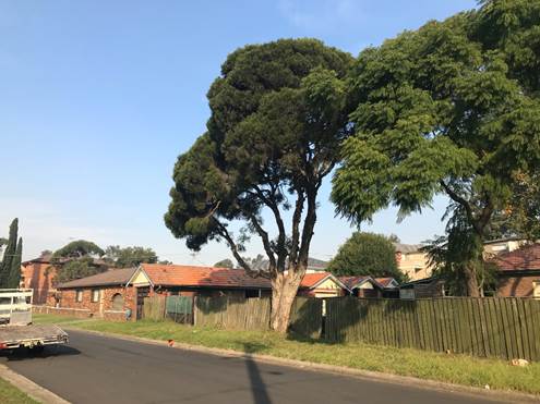
Figure
6 – View of No. 58 Berwick Street (subject site) from Beaufort Street and
adjoining property No. 63A Bangor Street. Source: Cumberland Council 2019
Description of The Proposed
Development
DA 2019/11/1 seeks consent for
demolition of existing structures, and construction of a 4 storey building
comprising of a 76 place child care centre on the ground floor with 18
residential units above with two basement car parking levels for 36 vehicles
made pursuant to Affordable Rental Housing SEPP 2009.
Key features of the development
proposal are as follows:-
|
Level
|
Details
|
|
Basement 2
|
17 residential car spaces (including 1 accessible parking
spaces)
3 motorbike spaces
7 bicycle spaces
Lift and fire stairs
|
|
Basement 1
|
19 car spaces for child care centre (including 1
accessible parking space)
Bin room, lift and fire stairs
|
|
Ground level
|
Child care centre comprising 3 indoor play areas with
outdoor play areas proposed within the front setback area and along the
eastern and southern boundaries.
Pedestrian access to child care centre from Beaufort Street
Pedestrian access to residential units from Berwick Street
Lift, fire stairs and landscaping
|
|
Level 1
|
6 residential units
|
|
Level 2
|
6 residential units
|
|
Level 3
|
6 residential units
|
|
Level 4
|
Rooftop terrace / communal open space
|
The dwelling mix of the proposal
is as follows:
· 6
x 1-bedroom/studio units (33%)
· 9
x 2-bedroom units (50%)
· 3
x 3-bedroom units (17%)
The child care centre will
accommodate a maximum capacity of 76 children placement as follows:
· 16
children – 0-2 yrs
· 30
children – 2-3 yrs
· 30
children – 3-5 yrs
The proposed centre will operate
from 7.00am to 6.00pm Monday to Friday, and will employ 12 staff.
There is no signage proposed as
part of the application.
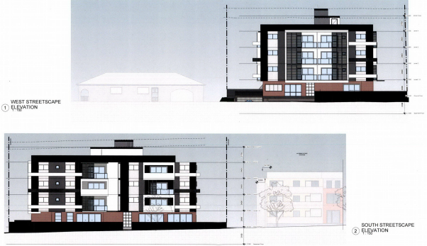
Figure
7 – Perspectives of proposed development – Beaufort St &
Berwick St frontage
Application History
|
Date
|
Action
|
|
16 January 2019
|
The subject development application was lodged with
Council.
|
|
12 February 2019
|
The application was referred to the following internal and
external sections:
· Development Engineering
· Traffic
Engineering
· Children’s
Services
· Environmental
Health
· Landscaping/Tree
Management
· Waste Management
· Endeavour Energy
|
|
20 February 2019 to 13 March 2019
|
Application placed on public notification. In response, 3
submissions were received.
|
|
31 May 2019
|
Correspondence was sent to the Applicant advising that the
application could not be supported, and inviting its withdrawal. That
correspondence also set out Council’s concerns with the application in
detail. The issues included inadequate information relating to accuracy of
levels within the submitted survey plan, flood levels, identification of
“site area”, deficient landscaped area and deep soil area, solar
access, unacceptable streetscape presentation and compatibility with the
character of the local area, compliance with child care centre provisions,
and traffic matters.
|
|
5 June 2019
|
Meeting held with Applicant to discuss matters raised in
Council’s letter dated 31 May 2019. The Applicant advised at the
meeting that the DA will not be withdrawn.
|
|
14 August 2019
|
Application referred to CLPP for determination.
|
Applicant’s Supporting
Statement
A Statement of Environmental
Effects prepared by Think Planners dated 20 December 2018 was submitted with
the application.
A written request to vary the
building height standard, prepared in accordance with Clause 4.6 of HLEP 2013
by Think Planners, dated 20 December 2018, in support of the application.
Contact With Relevant
Parties
The assessing officer has
undertaken an inspection of the subject site and has been in contact with the
applicant throughout the assessment process.
Internal Referrals
Development Engineer
The subject site is identified as
a flood control lot. The proposal was referred to Council’s Development
Engineer for comment who has outlined that the submitted survey plan does not
correspond with levels as identified in Council’s mapping system –
The variation of levels being in the extent of approximately 6.0m. In addition,
the proposal comprises of a child care centre which is identified within the
sensitive land use category in Table 7 – Land Use Categories for
Development upon Flood Prone Land – Section 8 – Flood Prone Land in
Part A of HDCP 2013. In this regard, the finished floor level (FFLs) shall be
equal to or greater than the PMF level in accordance with the Flood Risk
Precincts (FRPS) in Part A of HDCP 2013. Given the submitted survey plan is
incorrect, the proposal fails to provide the required levels for the proposal
and there is inadequate information to support the development. In this regard,
the proposal is not supported and engineering matters raised form part of the
reasons for refusal contained within the draft notice of determination.
Traffic Engineer
The development application was
referred to Council’s Traffic Engineer for comment who raised issues
relating to functionality and non-compliance of the basement car parking with
respect to the internal layout, manoeuvring, driveways and traffic measures
required. In this regard, the proposal is not supported and parking and traffic
matters raised form part of the reasons for refusal contained within the draft
notice of determination.
Children’s Services
The development application was
referred to Council’s Children’s Services section for comment who
has advised that the development is not supportable in regards to compliance
with the provisions of Education and Care Services National Regulations and
Law, specifically with regard to the location and provision of outdoor space,
amenity of indoor space, landscape buffer, storage and laundry facilities.
Matters raised relating to the child care centre form part of the reasons for
refusal contained within the draft notice of determination.
Environmental Health Officer
The development application was
referred to Council’s Environmental Health Officer for comment with
respect to contamination and acoustic matters. Council’s Environmental
Health Officer has advised that following review of the submitted Preliminary
Site Investigation, the site is considered suitable for the proposed child care
and residential development, subject to the imposition of conditions should
consent be granted.
With respect to acoustic impacts,
the submitted acoustic report provides no consideration for the use/impacts of
noise from the child care facility. The report also did not have consideration
of the use/impacts from the proposed 76 place child care centre on the tenants
on the site as well as adjoining neighbours, car park noise, noise from
mechanical plant, noise impacts from the demolition/construction activities
(including noise and vibration intrusion) and the overall cumulative acoustic
impacts of the proposed use.
The proposal is not supportable
with regards to acoustic impacts and this forms part of the reasons for refusal
contained within the draft notice of determination.
Landscaping/Tree Management
The development application was
referred to Council’s Tree Management Officer for comment who has advised
that the development is supportable in regards to the removal of the street
tree and property trees, protection of existing trees on the adjoining
properties, and replacement tree planting subject to conditions.
Waste Management Officer
The development application was referred
to Council’s Waste Management Officer for comment who has advised that
the development is unsatisfactory with regard to the ongoing management of
waste. No bin storage rooms have been provided for the child care centre or for
residential apartments. The proposal is not supportable with regards to waste
management and this forms part of the reasons for refusal contained within the
draft notice of determination.
External Referrals
Transgrid
The development application was
referred to Transgrid for comment pursuant to Clause 45 of State Environmental
Planning Policy (Infrastructure) 2007 for comment, who advised that the
development is supportable, and no conditions are recommended to be imposed.
Endeavour Energy
The development application was
referred to Endeavour Energy for comment pursuant to Clause 45 of State
Environmental Planning Policy (Infrastructure) 2007 for comment, who raised
issues relating to adequate safety clearances to existing electricity lines,
which have included as part of the reasons for refusal contained within the
draft notice of determination.
Planning Assessment
Section 4.15 of the
Environmental Planning and Assessment Act 1979
State Environmental
Planning Policies
The following Environmental
Planning Instruments are relevant to the assessment of the subject application:
(a) State
Environmental Planning Policy (Affordable Rental Housing) 2009 (ARH SEPP)
The proposal falls under Part 2
New affordable rental housing – Division 1 In-fill affordable housing.
The following table sets out the
SEPP ARH non-compliances:
|
Standard
|
Required / Permitted
|
Provided
|
Compliance
|
|
Clause 13
|
Floor space ratios
At least 20% of GFA must be for affordable housing.
Where existing max FSR is 2.5:1 or less, & percentage
of GFA used for affordable is less than 50%, the max permitted FSR is
existing plus bonus based upon % proposed.
Note: Calculations are based on the post-dedication
site area
Site Area = 1,236.18m² (post-dedication)
|
Max. FSR permitted = 1.2:1 (HLEP 2013)
Max. GFA permitted
= 1.2 x 1,236.18m²
= 1,483.41m²
Provided FSR = 1.53:1
Provided GFA = 1,895.5m²
Ground Floor = 433.4m²
Level 1 = 483.6m²
Level 2 = 483.6m²
Level 3 = 483.6m²
Rooftop terrace = 11.3m²
|
No – Affordable units have not been identified to
confirm the percentage of affordable housing provided, and to determine
overall FSR compliance inclusive of any FSR bonus applicable.
|
|
Clause 14
Standards that cannot be used to refuse consent
|
c) Landscaped Area
At least 30% of the site area to be landscaped
Required = Min. 370.85m²
|
Provided = 337.3m² (27.28%)
Ground Floor = 148.7m²
Planter boxes on Levels 1-3 = 134.7m²
Rooftop planters = 53.9m²
|
No – Deficient by 33.55m²
|
|
|
d) Deep Soil zone
At least 15% of site area is deep soil, with 3m dimensions
Required = Min. 185.43m²
If practical, at least 2/3 of the area should be to the
rear of the development.
|
Provided = 27.2m² (2.22%)
The deep soil area provided is within the front setback
area along Beaufort St, adjacent to the child care centre entry.
|
No – Deficient by 158.23m²
|
|
|
e) Solar Access
If living rooms & private open spaces for at least 70%
of units (13 units) receive a minimum of 3 hours direct sunlight between 9am
& 3pm in mid-winter
|
12 out of 18 units (66.7%) receive the minimum 3 hours
solar access
|
No – deficient by 1 unit
|
A comprehensive assessment against
ARH SEPP is attached to this report – Attachment 1.
16A Character of Local Area
A consent authority must not
consent to development to which this Division applies unless it has taken into
consideration whether the design of the development is compatible with the
character of the local area. The SEPP (ARH) does not contain any guidance for
assessing whether a proposal is compatible with the character of the local
area. However, a planning principle for assessing compatibility in the urban
environment was established by Senior Commissioner Roseth of the Land and
Environment Court in the judgement for Project Venture Developments Pty Ltd v Pittwater
Council [2005] NSWLEC 191. This involves asking the following two questions:
· Are
the proposal’s physical impacts on surrounding development acceptable?
The physical impacts include constraints on the development potential of
surrounding sites.
· Is
the proposal’s appearance in harmony with the buildings around it and the
character of the street?
· A
merit assessment of the character of the local area should consider the
following 3 steps:
· Step
1 – Identify the ‘local area’.
· Step
2 – Determine the character of the ‘local area’.
· Step
3 – Determine whether the design of the proposed development is
compatible with the character of the ‘local area’.
An assessment against each step is
provided below:
Step 1 – Identify the
local area
This assessment identifies the
local area as primarily the visual catchment of the site (hatched in red) as
viewed from within the site and directly adjacent to the site on the street
which is defined by the yellow line in Figure 8, and white line in Figure 9 below:

Figure
8 – Local Area catchment as identified on Aerial Map
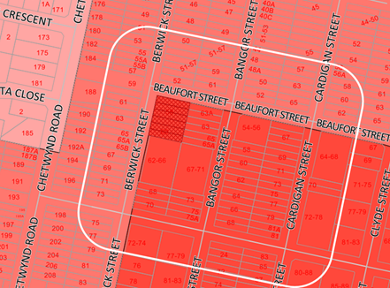
Figure
9 – Local Area catchment as identified on Zoning Map
Step 2 – Determine the
character (present and future) of the local area.
The zoning of the broader locality
and immediate area comprises R4 High Density Residential adjoining the site
directly to the south and east, and R3 Medium Density Residential for
properties located on the western side of Berwick Street and northern side of
Beaufort Street; under the Holroyd Local Environmental Plan (HLEP) 2013.
Present character of the area
The character of the local area
comprises the visual catchment of allotments viewed from and surrounding the
subject site, which includes:-
Berwick Street
1. Three
(3) storey residential flat building (62-66 Berwick Street).
2. Detached
dwelling houses and attached dual occupancies located on the western side of
Berwick Street.
3. Opposite
the subject site at the corner of Beaufort Street and Berwick Street are
Beaufort Street Park and Berwick Street Reserve.
Bangor Street
4. Detached
dwellings houses and attached dual occupancies located on both sides of Bangor
Street; and both sides of Berwick Street north of the site.
5. Three
(3) storey residential flat buildings at the corner of Berwick Street and Bangor
Street with Stimson Street – 72-74 Berwick Street & 77-79 Bangor
Street respectively.
6. Three
(3) storey walk up residential flat building at the corner of Bangor Street and
Beaufort Street (54-56 Bangor Street).
7. Three
(3) storey residential flat building (67-71 Bangor Street).
Cardigan Street
8. Two
(2) storey walk up residential flat building at the corner of Beaufort Street
and Cardigan Street (67 Cardigan Street).
9. Part
2 and part 3 storey residential flat building at the corner of Beaufort Street
and Cardigan Street (64-68 Cardigan Street).
10. Three
(3) storey residential flat buildings at the corner of Cardigan Street and
Stimson Street (72-78 Cardigan Street).
11. A
part 2 and part 3 storey residential flat building has been approved at 69-77
Cardigan Street (DA2006/226). The DA is operative but construction has not yet
commenced.
12. The
remaining sites on Cardigan Street comprise of detached dwellings and dual
occupancies.
Future character of the area
Whilst there are a number of one
and two storey dwellings within the locality, the area is transitioning to
higher density developments in accordance with the planning controls that
currently apply. The area zoned R4 High Density Residential is subject to a
maximum height limit of 15m and maximum floor space ratio (FSR) of 1.2:1. The
emerging character of the area is generally that of small, 3 to 4 storey
residential flat buildings. The locality is in transition particularly to
support the increasing demand of affordable housing within the close proximity
of a public transport hub and major commercial centre. The transition issue is
clear with regard to FSR and height limits applicable to sites within the local
area.
Step 3 - Determine if the
development is compatible with the character of the local area.
In accordance with the Land and
Environment Court’s ‘Planning Principle’ and case law
compatibility is best defined as ‘capable of existing together in
harmony’. In order to test compatibility two questions are to be considered.
These questions, as well as a response to each, are provided below:
· Are
the proposal’s physical impacts on surrounding development acceptable?
The physical impacts include constraints on the development potential of
surrounding sites.
In terms of the physical impacts
of the development:
o The proposal has a site coverage of
38% of the site area. HDCP 2013 provides for maximum site coverage of 30% of
total site area for residential flat buildings. The excessive site coverage is
associated with limited side setbacks and inadequate landscaping to the side
boundaries. Together, these non-compliances result in unacceptable visual and
acoustic privacy outcomes for occupants of the existing adjoining dwellings, as
well as future residents of the development.
o Shadows from the proposed
development fall on the property to the south (62-66 Berwick Street) and
indicate that north facing living rooms and balconies of units within the
neighbouring property will not receive adequate solar access at mid-winter.
· Is
the proposal’s appearance in harmony with the buildings around it and the
character of the street?
The subject site and surrounding
properties are subject to a 4 storey control under HDCP 2013. The surrounding
flat buildings sit well below the 15m height limit, and the majority (including
all the buildings within the visual catchment of the subject site) have a
maximum of 3 storeys. The proposal is 4 storey in height with roof top communal
open space (COS), and exceeds the maximum 15m height limit. The COS provided on
the rooftop is not representative of development within the area (existing and
future built form).
With respect to streetscape
presentation, the proposal provides inadequate setbacks to both Beaufort Street
and Berwick Street, and both street setback areas comprise of the outdoor play
space for the child care centre and front fencing to a height of 2m with shrubs
in front, which is uncharacteristic with landscaping treatment of properties
within the visual catchment of the site. The lack of landscaping within the
front setback area of both streets is inconsistent with the prevailing
landscape character of the area, and does not serve to soften the visual impact
of the development either from the street, or from adjacent properties, or
promote an active street edge.
To be compatible, a development
should contain, or at least respond to, the key aesthetic elements that make up
the character of the surrounding area. The size of the basement and location of
the outdoor space of the child care centre does not maximise landscaping and
deep soil zones on site. Generous setbacks to the street and neighbouring sites
have not been provided to be consistent with the existing streetscape.
In summary, the design and
presentation of the proposed development, as well as its relationship to the
site and the surrounding developments is not considered to be in harmony with
the character of the local area. This is included as a reason for refusal in
the draft determination.
(b) State
Environmental Planning Policy No 65 – Design Quality of Residential
Apartment Development (SEPP 65)
The proposal is classified as a
residential apartment development and SEPP 65 applies. A design verification
statement signed by registered architect Ben Vitale was submitted with the
application. A comprehensive assessment against the Apartment Design Guide
(ADG) controls is provided at Attachment 2.
The following table sets out the
ADG non-compliances.
|
3B
|
Orientation
|
|
3B-1
|
Building types and layouts respond to the streetscape and
site while optimising solar access within the development.
|
The proposed
building presentation to the street is not considered satisfactory. The
massing of the building and additional height sought results in an
unacceptable built form having regard to streetscape impacts as the reduced
setbacks provide for a bulk and scale greater than that desired for the
immediate area.
|
|
3B-2
|
Overshadowing of neighbouring properties is minimised
during mid-winter.
|
It has not been
demonstrated that the adjoining property to the south will retain adequate
solar access having regard to the inadequate side setback and building
separation provided. A minimum of 50% of the private open space areas of
adjacent dwellings to have access to 3 hours of direct sunlight between
9.00am and 4.00pm at the winter solstice (22 June) (which is the requirement
for residential flat buildings in control C8 of Part B clause 1.8
‘Sunlight Access’ of HDCP 2013).
The proposed
building will stand an additional storey higher than the neighbouring
residential flat building (RFB) at 62-66 Berwick St, and also proposes a roof
top terrace; which will adversely impact solar access to north facing private
open space and living areas of 6 out of 17 units, and portions of the ground
floor communal open space of the adjoining RFB.
The proposal has
not provided a detailed assessment for overshadowing impact. No elevational
shadow diagrams have been submitted to demonstrate that the proposed building
will not adversely overshadow the adjoining 3 storey residential flat
building to the south at 62-66 Berwick St between 9am-3pm.
Where a proposal
significantly reduces the solar access of neighbours, building separation
should be increased beyond minimums contained in Section 3F Visual Privacy.
The proposal provides an inadequate building separation of 5.4m to the
southern boundary and results in adverse overshadowing of the neighbouring
property.
In this regard, it
is considered that the amenity of north-facing units at 62-66 Berwick St will
be compromised, which is considered unacceptable. The above non-compliance is
included as a reason for refusal in the draft of determination.
|
|
3C
|
Public Domain Interface
|
|
3C-1
|
Transition between
private and public domain is achieved without compromising safety and
security.
|
Transition between
the public and private domain is considered not satisfactory. The public
domain along both street frontages comprise of groundcover and shrub planting
forward of the outdoor play spaces of the childcare centre, enclosed by high
acoustic fencing. The landscape treatment proposed to both street frontages
does not promote an active street edge and conceal direct view of the
building entrances.
|
|
3C-2
|
Amenity of the public domain is retained and enhanced.
|
The outdoor play
space of the child care centre is proposed within the front setback area of
both street frontages. Planting or other design measures are not in place to
soften the visual impact of the acoustic fencing bounding the child care
centre outdoor play spaces when viewed from the street.
|
|
3E
|
Deep Soil Zones
|
|
|
Deep soil zones
are to meet the following minimum requirements:
Required: Min.
86.53m² (7%)
|
Provided: 27.2m²
(2.22%)
The proposal is
made pursuant to SEPP ARH and requires min. 15% of deep soil area to be
provided.
|
|
3F
|
Visual Privacy
|
|
3F-1
|
Separation
between windows and balconies is provided to ensure visual privacy is
achieved. Minimum required separation distances from buildings to the side
and rear boundaries are as follows:
Note:
Separation
distances between buildings on the same site should combine required building
separations depending on the type of room.
Gallery access
circulation should be treated as habitable space when measuring privacy
separation distances between neighbouring properties.
|
Building is 4 storey in height, with roof top terrace.
West: Berwick Street
North: Beaufort Street
East / Rear:
Ground Floor – Child care centre
Levels 1-3:
Requires a min. 6m setback to boundary.
Bedrooms and bathrooms setback 6m to boundary.
Balconies setback 5.5m to boundary (measured from outer
face of balcony).
5th storey
Requires a min. 9m setback to boundary.
COS setback 6m to boundary (measured from outer face of
planter boxes)
South:
Ground Floor – Child care centre
Levels 1-3:
Requires 6m setback.
Bedrooms and bathrooms setback 5.4m to boundary.
Balconies setback 4.8m to boundary (measured from outer
face of balcony).
5th storey
Requires a min. 9m setback to boundary.
COS setback 9.2m to boundary (measured from outer face of
planter boxes)
Inadequate building separation is provided between
habitable rooms and balconies of the subject proposal and adjoining RFB at
62-66 Berwick St.
|
|
3G
|
Pedestrian Access and Entries
|
|
3G-1
|
Building entries and pedestrian access connects to and
addresses the public domain.
|
The building entry to apartments from Berwick St is not
clearly defined or easily identifiable. The residential pedestrian access is
narrow and hidden between two outdoor play spaces of the child care centre
and as such can be easily mistaken as the entry for the child care centre.
|
|
3G-2
|
Access, entries and pathways are accessible and easy to
identify.
|
|
4D
|
Apartment
Size and Layout
|
|
4D-1
|
The layout
of rooms within an apartment is functional, well organised and provides a
high standard of amenity.
|
The central single facing east
apartment (“Unit 01.06”) is replicated on Levels 1-3 inclusive
and proposes a snorkel bedroom (being the master bedroom). The snorkel
bedroom is positioned in between the southern wall (2m depth) of the second
bedroom and balcony of the adjoining apartment, and as such receives poor
sunlight and ventilation.
|
|
4J
|
Noise and Pollution
|
|
4J-
|
In noisy or hostile environments
the impacts of external noise and pollution are minimised through the careful
sitting and layout of buildings.
|
The noise impacts from the
proposed 76 place child care centre located on the ground floor has not been
considered within the design and siting of apartments. The submitted acoustic
report provides no consideration for the use/impacts of noise from the child
care facility.
|
|
4M
|
Façades
|
|
4M-1
|
Building facades provide
visual interest along the street while respecting the character of the local
area.
|
The building’s
presentation along both street frontages, at the street level is not
considered acceptable as it comprises of the outdoor play spaces of the child
care centre and does not address or is consistent with the existing
streetscape and changing character of the local area. The building entries
are also not clearly defined.
|
|
4M-2
|
Building functions are
expressed by the façade.
|
|
4O
|
Landscape
Design
|
|
40-2
|
Landscape
design contributes to the streetscape and amenity.
|
Landscape design proposed at
the ground level is minimal and limited to a width of 1m and 2m along
Beaufort St and Berwick St respectively, forward of the child care
centre’s outdoor play space. In addition, the proposed landscape
treatment of the front setback area has not been distributed within the front
setback to provide adequate visual softening of the building.
|
|
4W
|
Waste
Management
|
|
4W-1
|
Waste storage facilities are
designed to minimise impacts on the streetscape, building entry and amenity
of residents.
|
Separate bin rooms have not been provided for the child
care or residential apartments.
|
|
|
|
|
(c) State
Environmental Planning Policy (Educational Establishments and Child Care
Facilities) 2017
The relevant provisions of the
SEPP have been considered in the assessment of the Application.
It is noted that State
Environmental Planning Policy (Educational Establishments and Child Care
Facilities) 2017 commenced on 1 September 2017. The SEPP applies to any
proposals for new schools or child care centres or proposed alterations and
additions to existing centres. The relevant provisions of the SEPP have been
considered in the assessment of the Application.
A comprehensive assessment and
compliance table is attached to this report in Appendix A, which indicates that
there are non-compliances with the SEPP 2017 with regard to number of children
proposed and outdoor unencumbered space as under:
|
Control
|
Required
|
Provided
|
|
Number of children and outdoor unencumbered
space (regulation 108 SEPP 2017 and part 4.9 the Guideline)
|
7m² x 76 = 532m²
|
The application indicates that
an unencumbered area of 564m² is provided. However, this has not taken
consideration of OSD pits, retaining walls and dense planting.
The assessment officer’s
calculation of the unencumbered outdoor space equates to 510m². This
will accommodate only 72 children.
|
(d) State
Environmental Planning Policy (Infrastructure) 2007
Clause 45 – Development
likely to affect an electricity transmission or distribution network
The development application was
referred to Endeavour Energy for comment, who raised concerns relating to
adequate safety clearances to existing electricity power lines, which have
included as part of the reasons for refusal contained within the draft notice
of determination.
(e) State
Environmental Planning Policy No 55 – Remediation of Land (SEPP 55)
The requirement at Clause 7 of
SEPP No. 55 for Council to be satisfied that the site is suitable or can be
made suitable to accommodate the proposed development has been considered in
the following table:
|
Matters for consideration
|
Yes
|
No
|
N/A
|
|
Does the application involve
re-development of the site or a change of land use?
|
|
|
|
|
Is the development going to be
used for a sensitive land use (e.g.: residential, educational, recreational,
childcare or hospital)?
|
|
|
|
|
Does information available to
you indicate that an activity listed below has ever been approved, or
occurred at the site?
acid/alkali plant and
formulation, agricultural/horticultural activities, airports, asbestos
production and disposal, chemicals manufacture and formulation, defence
works, drum re-conditioning works, dry cleaning establishments, electrical
manufacturing (transformers), electroplating and heat treatment premises,
engine works, explosive industry, gas works, iron and steel works, landfill
sites, metal treatment, mining and extractive industries, oil
production and storage, paint formulation and manufacture, pesticide
manufacture and formulation, power stations, railway yards, scrap yards,
service stations, sheep and cattle dips, smelting and refining, tanning and
associated trades, waste storage and treatment, wood preservation.
|
|
|
|
|
Is the site listed on Council's
Contaminated Land Database?
|
|
|
|
|
Is the site subject to EPA
clean-up order or other EPA restrictions?
|
|
|
|
|
Has the site been the subject of
known pollution incidents or illegal dumping?
|
|
|
|
|
Does the site adjoin any
contaminated land/previously contaminated land?
|
|
|
|
|
Has the appropriate level of
investigation been carried out in respect of contamination matters for
Council to be satisfied that the site is suitable to accommodate the proposed
development or can be made suitable to accommodate the proposed development?
|
|
|
|
|
Details of contamination
investigations carried out at the site:
The site
is not identified in Council’s records as being contaminated. Council’s Environmental
Health Officer has advised that following review of the submitted Preliminary
Site Investigation, the site is considered suitable for the proposed
childcare and residential development, subject to the imposition of
conditions should consent be granted.
|
(f) State
Environmental Planning Policy (Building Sustainability Index: BASIX) 2004
BASIX certificate 987245M dated 21
December 2018 was submitted with the application. The certificate achieves
target scores and is consistent with the architectural plans.
Regional Environmental Plans
(Deemed State Environmental Planning Policies)
(g) Sydney
Regional Environmental Plan (Sydney Harbour Catchment) 2005
The subject site is identified as
being located within the area affected by the Sydney Regional Environmental
Plan (Sydney Harbour Catchment) 2005. The proposed development raises no issues
as no impact on the catchment is envisaged.
Note: The subject site is not
identified in the relevant map as land within the ‘Foreshores and
Waterways Area’ or ‘Wetland Protection Zone’, is not a
‘Strategic Foreshore Site’ and does not contain any heritage items.
Hence the majority of the SREP is not directly relevant to the proposed
development.
Local Environmental Plans
(h) Holroyd
Local Environmental Plan 2013 (HLEP 2013)
The proposal comprises of a child
care centre located on the ground floor with residential apartments above. The
proposal is considered to be a ‘centre based child care facility’
and ‘residential flat building’ under the provisions of HLEP 2013;
both of which are permitted consent in the R4 – High Density Residential
zone which applies to the land.
The proposal seeks the following
variations to HLEP 2013:
Height of Buildings
The proposal seeks a variation to
Clause 4.3 – Height of Buildings that stipulates that the height of
building is not to exceed 15m on the subject site.
The proposed building has an
overall height of 16.5m (RL 38.395) to the roof of the lift core and stairwell.
The proposal breaches the height by 1.5m to the roof of the lift core, representing
a variation of 10%. The majority of the height breach is a result of the
provision of the communal open space on the roof, and access to the roof via
the lift and stairwell.
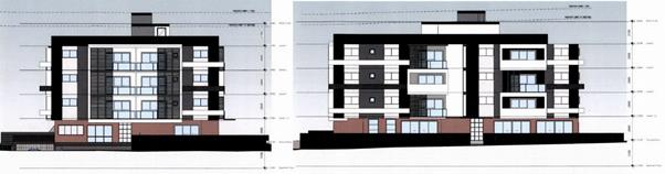
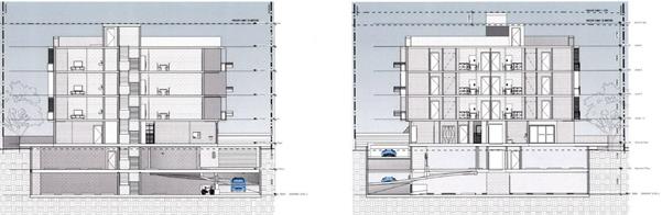
Figure
10 – Elevation plans showing height exceedance. Left: Northern elevation
as viewed from Beaufort Street; Right: Western Elevation as viewed from Berwick
Street.
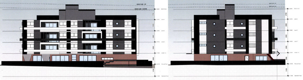
Figure
11 – Elevation plans showing height exceedance. Left: Eastern/rear
elevation; Right: Southern Elevation.
Figure
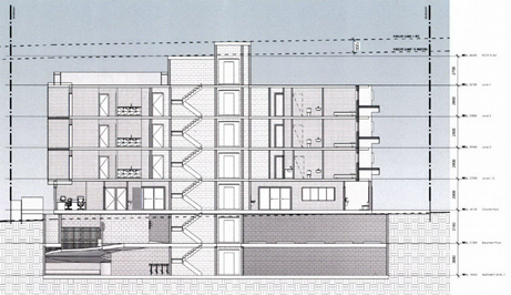
12 – Section A-A Plan showing extent of height variation sought
Figure
13 – Section C-C & D-D Plans showing extent of height variation
sought
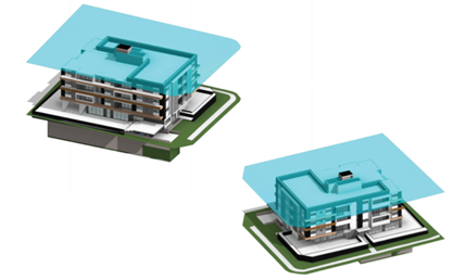
Figure
14 – 3D Perspectives showing extent of height variation sought
Clause 4.6 – Variation to
Building Height
Clause 4.6 allows the consent
authority to vary development standards in certain circumstances and provides
an appropriate degree of flexibility to achieve better design outcomes. The
consent authority may grant the exception as the Secretary’s concurrence
can be assumed where clause 4.6 is adopted as per the Department of Planning
Circular PS 18-003, dated 21 February 2018.
The applicant has submitted a
written request to vary the development standard for building height –
Refer to Attachment 7.
Based on various case laws
established by the Land and Environment Court of NSW such as Four2five P/L v
Ashfield Council [2015] NSWLEC 9, Randwick City Council v Micaul Holdings P/L
[2016] NSW LEC7 and Zhang and anor v Council of the City of Ryde [2016] NSWLEC
1179, a 3 part assessment framework for a variation request proposed under
clause 4.6 has been considered and an assessment of the proposed variance,
following the 3 part test is discussed in detail below.
The 3 preconditions which must be
satisfied before the application can proceed are as follows:
1. Is
the proposed development consistent with the objectives of the zone?
Zone R4 High Density Residential
1 Objectives
of zone
· To
provide for the housing needs of the community within a high density
residential environment.
· To
provide a variety of housing types within a high density residential
environment.
· To
enable other land uses that provide facilities or services to meet the day to
day needs of residents.
Applicant’s
justification:
The proposal ensures that the high
density nature of the zone is retained and there is not a significant change to
the character of the locality. In addition, the proposal complements and
enhances the local streetscape by virtue of careful siting of the development.
Planner’s Comment:
The proposal is for a ‘centre
based child care facility’ and ‘residential flat building’
which are both permissible land uses within the zone with consent. The proposal
meets the objectives of the zone, as it provides housing within a high density
residential context, and the child care centre caters for and provides a
service which meets the needs of the community.
2. Is
the proposed development consistent with the objectives of the development
standard which is not met?
Clause 4.3 Height of building
(1) The objectives of this
clause are as follows:
(a) to minimise the visual
impact of development and ensure sufficient solar access and privacy for
neighbouring properties,
(b) to ensure development is
consistent with the landform,
(c) to provide appropriate
scales and intensities of development through height controls.
Applicant’s
justification:
The current development proposal
is predominantly consistent with the building height, with the exception of a
small portion of the building and lift overrun. The proposal remains consistent
with the objectives based on the following:
· Non-compliance
is minor in nature with the majority of the building being compliant with the
building height control and with the lift and stairwell overrun recessed, its
impact to the streetscape is negligible as it will be visually unnoticeable
when viewed from the street level.
· Due
to the minor nature of the variation it will not have any adverse amenity
impacts. In this regard it is noted:
o The variation will be visually
unnoticeable and will have no adverse impact on the physical bulk, height or
scale of the development.
o The variation will not lead to
a reduction in solar penetration on site or to adjoining properties nor will it
lead to sunlight loss or overshadowing.
o The proposed variation will
not lead to view loss or interrupt on views to and from the site.
o The proposed variation will
not lead to a reduction in privacy afforded to existing residents or future
residents of the proposal.
· The
proposal has been designed to ensure that privacy impacts are mitigated that
the proposal will not obstruct existing view corridors.
· The
proposed development will permit the site to develop to its full zoning
potential whilst complementing the future vision envisioned for the site by
providing an attractive mixed use building that provides good address to the
street frontage and complying with key planning controls applying to the
proposal.
· The
proposal is not located within a low-density area and the proposal represents
an appropriate built form on the site.
As outlined above, the proposal
remains consistent with the underlying objectives of the control and as such
compliance is considered unnecessary or unreasonable in the circumstances. The
above discussion demonstrates that there are sufficient environmental planning
grounds to justify the departure from the control.
Planner’s comment:
The objectives of the building
height standard are to enable appropriate development density to be achieved
and to ensure that the height of the building is compatible with the character
of the locality. The additional height sought is excessive and results in
adverse impacts on the streetscape and neighbouring properties with respect to
bulk and scale and unacceptable overshadowing.
The proposed building will stand
an additional storey higher than the neighbouring residential flat building at
62-66 Berwick Street, and also proposes a roof top terrace; which will
adversely impact solar access to north facing private open space and living
areas of 6 out of 17 units, and portions of the ground floor communal open
space of the adjoining residential flat building.
The application has not adequately
demonstrated that the variation to the height would allow the development to
maintain the provision of adequate solar access for the subject site or the
adjoining property to the south. With inadequate provision of building
separation and setbacks, the excessive height is therefore not considered
appropriate as it will result in a building that is inconsistent with the
desired future character of the area.
In addition, the building is
massed in a way that presents an excessively bulky form in the side setbacks
and the additional height sought contributes to the visual bulk of the proposed
development, which is in excess of the bulk and scale as well as site coverage.
The departure sought is
significant and would unreasonably impact on adjoining properties. The
additional height results in the appearance of bulk when viewed from the
existing streetscape and would impinge on the changing streetscape that is
anticipated for the immediate area. Given that the proposed development does
not respond to the site or fails to comply with relevant built form controls,
and compromises relationships with adjoining development, the proposal is
considered to be inconsistent with the objectives of height requirements and
development within the R4 zone.
3. a)
Is compliance with the development standard unreasonable or unnecessary in the
circumstances of the case?
Applicant’s
justification:
Strict compliance with the
prescriptive building height requirement is unreasonable and unnecessary in the
context of the proposal and its particular circumstances. The proposed
development meets the underlying intent of the control and is a compatible form
of development that does not result in unreasonable environmental amenity
impacts.
The proposal will not have any
adverse effect on the surrounding locality, which will be characterised by
residential development of comparable height and character. The proposal
promotes the economic use and development of the land consistent with its zone
and purpose.
Planner’s comment:
The applicant’s request has
not demonstrated that compliance with the standard is unreasonable or
unnecessary in this instance, or that there are sufficient environmental
planning grounds to justify the contravention. The proposal is not in the public
interest given the poor amenity outcome for the subject development, its
overshadowing impact to the adjacent site and the excessive bulk and scale of
the building. It is considered, therefore, that the compliance with the
Development Standard is not unreasonable or unnecessary in the circumstances of
the case.
b) Are there sufficient
environmental planning grounds to justify contravening the development standard
and therefore is the applicant’s written justification well founded?
Given that the proposed development
does not respond to the site, and results in adverse amenity impacts to
neighbouring sites, the proposal is considered to be inconsistent with the
objectives of building height and development within the R4 zone, and as such
does warrant support of the departure. In this regard, the exception is not
well founded and cannot be supported.
Conclusion:
The applicant’s written
request has not adequately addressed the matters required to be demonstrated by
Clause 4.6 subclause (3). Council is further dissatisfied that the proposed
development will be in the public interest because it is inconsistent with the
objectives of the particular standard and the objectives for development within
the R4 zone in which the development is proposed to be carried out.
It is the view of Council officers
that justification provided is unsatisfactory and having considered the
application on its merit, the exception to the maximum building height
development standard is not supported.
Draft Environmental Planning
Instruments
(a) Draft
Environment State Environmental Planning Policy
The draft SEPP will combine seven
existing SEPPs into one accessible instrument. The new SEPP will repeal and
replace:
· State
Environmental Planning Policy No. 19—Bushland in Urban Areas
· State
Environmental Planning Policy (Sydney Drinking Water Catchment) 2011
· State
Environmental Planning Policy No. 50—Canal Estate Development
· Greater
Metropolitan Regional Environmental Plan No. 2—Georges River Catchment
· Sydney
Regional Environmental Plan No. 20—Hawkesbury-Nepean River (No.2-1997)
· Sydney
Regional Environmental Plan (Sydney Harbour Catchment) 2005
· Willandra
Lakes Regional Environmental Plan No. 1—World Heritage Property.
Comment:
The draft SEPP has been considered
for the proposed development and is only affected by Greater Metropolitan
Regional Environmental Plan No. 2—Georges River Catchment which has
already been assessed as above.
Development Control Plans
(b) Holroyd
Development Control Plan 2013
HDCP 2013 contains general controls
which relate to all developments under Part A, residential controls under Part
B, and child care centre controls under Part I.
A comprehensive HDCP compliance
table is attached to this report at Attachment 6. A summary of the DCP
non-compliances is provided in the following table.
|
PART
A – GENERAL CONTROLS
|
|
3
|
Car
Parking
|
|
|
Minimum Parking Spaces
|
|
|
Bicycle Parking - Residential
Minimum residential spaces required:
· Studio
/ 1 bed. unit = 0.5
· 2
bed unit = 0.5
· 3+
bed unit = 0.5
· Visitor
= 0.1 per unit.
|
Residential = 18 x 0.5 = 9
Visitor = 18 x 0.1 = 1.8
Total required = 10.8 (rounded up to 11)
Provided = 7 bicycle spaces
|
|
3.5
|
Access, Manoeuvring and Layout
|
|
|
Driveways shall be setback a minimum of 1.5m from the side
boundary.
|
Driveway is setback 1.255m from eastern boundary.
|
|
7
|
Stormwater Management
|
Council’s Development Engineer has reviewed the
proposal and outlined that proposed development cannot be supported.
Engineering matters raised form part of the reasons for refusal within the Draft
Notice of Determination.
|
|
8
|
Flood Prone Land
|
The site is identified as flood prone in Council’s
mapping. The proposal was
referred to Council’s Development Engineer for comment who has outlined
that the submitted survey plan does not correspond with levels as identified
in Council’s mapping system – The variation of levels being in
the extent of approximately 6.0m. In addition, the proposal comprises
of a child care centre which is identified within the sensitive land use
category in Table 7 – Land Use Categories for Development upon Flood
Prone Land – Section 8 – Flood Prone Land in Part A of HDCP 2013.
In this regard, the finished floor level (FFLs) shall be equal to or greater
than the PMF level in accordance with the Flood Risk Precincts (FRPS) in Part
A of HDCP 2013. Given the submitted survey plan is incorrect, the proposal
fails to provide the required levels for the proposal and there is inadequate
information to support the development. In this regard, the proposal is not
supported and engineering matters raised form part of the reasons for refusal
contained within the draft notice of determination.
|
|
10
|
Safety and Security
|
|
|
Design new development to reduce the attractiveness of
crime by minimising, removing or concealing crime opportunities.
|
The building entries for the child care centre and
residential apartments are not easily identifiable from the street and hidden
between the outdoor play spaces and create opportunities for concealment also
due to the narrow width of the pedestrian accesses.
|
|
|
Incorporate and/or enhance opportunities for effective
natural surveillance by providing clear sight lines between public and
private places, installation of effective lighting, and the appropriate
landscaping of public areas.
|
Design does not provide for passive surveillance with
clear sightlines between public domain and building entrances as a result of
the outdoor spaces within the front setback areas.
|
|
|
When incorporating crime prevention measures in the design
of new buildings and spaces, apply subtle design techniques to blend into
facades and places, and to be sympathetic with the quality of the
streetscape.
|
Proposal is not considered to provide adequate crime
prevention measures through design which are sympathetic to the quality of
the streetscape.
|
|
11
|
Waste Management
|
Council’s Waste Management Officer has reviewed the
proposal and advised that the waste arrangements are unsatisfactory. The
proposal is not supportable with regards to waste management and this forms
part of the reasons for refusal contained within the draft notice of
determination.
|
|
PART
B – RESIDENTIAL CONTROLS
|
|
1.2
|
Fences
|
Front fencing is proposed in
the form of 1.5m-2m high fencing bounding the outdoor play spaces along both
street frontages. This fencing is setback 1m and 2m from Beaufort St and
Berwick St respectively.
The proposed fencing is solid in construction with
landscaping forward of the fencing. The front fencing proposed exceeds the
maximum 1.5m height permitted for fencing of solid construction.
|
|
1.8
|
Sunlight Access
|
|
|
1 main living area of existing
adjacent dwellings to receive 3 hours direct sunlight between 9am and 4pm, 22
June
|
The proposal has
not provided a detailed assessment for overshadowing impact. No elevational
shadow diagrams have been submitted to demonstrate the proposal will not
adversely overshadow the adjoining three storey residential flat building to
the south at 62-66 Berwick St between 9am-3pm, mid-winter.
Plan form shadow diagrams are
provided for 9am, 12pm, 1pm and 3pm and identify the north facing private
open space and living areas of 6 out of 17 units, of the adjoining RFB at
62-66 Berwick St as not receiving the minimum 3 hours sunlight, mid-winter,
as required.
|
|
Min. 50% of required POS of
existing adjacent dwellings to receive 3 hours direct sunlight between 9am
and 4pm, 22 June.
|
|
6.2
|
Site Coverage
|
|
|
Maximum site coverage of any
residential flat development shall not exceed 30% (Max. 370.85m²)
|
472.4m² (38%)
|
|
6.3
|
Setbacks
|
|
|
Front setback from principal street minimum 6m
|
6m provided to Berwick St to external walls
Outdoor play spaces encroach within front setback area.
Balconies of apartments on Levels 1-3 encroach within the
front setback area.
|
|
|
Front setback from secondary street minimum 4m
|
4m provided to Beaufort St to external walls.
Outdoor play spaces encroach within front setback area.
Balconies of apartments on Levels 1-3 encroach within the
front setback area.
|
|
6.5
|
Building Depth
|
|
|
Maximum internal depth of a RFB shall be 18m
|
Max. internal depth = 19.4m
|
|
6.8
|
Building entry and
pedestrian access
|
|
|
Building entries shall be visible from the street,
sheltered and well lit
|
The building entry to apartments from Berwick St is not
clearly defined or easily identifiable. The residential pedestrian access is
narrow and hidden between two outdoor play spaces of the child care centre
and as such can be easily mistaken as the entry for the child care centre.
|
|
PART
I – CHILDCARE CENTRES
|
|
2
|
Vehicular Access and
Parking
|
|
|
Separate entry and exit
driveways shall be provided where safe and convenient on street parking is
not
otherwise available, to
Council’s satisfaction, for the setting down and picking up of
children. The design of such driveways shall ensure that inbound and outbound
vehicles are separated and that
vehicles enter and leave the site in a forward direction.
|
Separate entry/exit driveways
are not provided.
Council’s
Traffic Engineer has reviewed the proposal and accompanying Traffic Report
and raised issues relating to functionality and non-compliance of the
basement car parking with respect to the internal layout, manoeuvring,
driveways and traffic measures required. In this regard, the proposal is not
supported and parking and traffic matters raised form part of the reasons for
refusal contained within the draft notice of determination.
|
|
3
|
Acoustic and Visual Privacy
|
|
|
An acoustic assessment must be
completed by a suitably qualified person.
|
With respect to acoustic impacts, the submitted
acoustic report provides no consideration for the use/impacts of noise from
the child care centre. The report also did not have consideration of the
use/impacts from the proposed 76 place child care centre on the residents on
the site as well as adjoining neighbours. As such, projected noise levels
have not been identified for the child care centre, and no acoustic fencing
has been recommended or incorporated within the design of the centre to
minimise the impact of noise generated by the child care centre on
surrounding properties.
|
|
4
|
Indoor Spaces
|
|
|
Where
achievable, windows of indoor play areas are to be located with a northern
orientation and should receive at least three hours of sunlight between the
hours of 9am and 3pm on June 21.
For locations
where a northern orientation for indoor play areas is not achievable, they
should be located where they will receive a minimum of 3 hours of sunlight,
where possible.
|
It has not been adequately demonstrated that indoor spaces
receive a minimum 3 hours of sunlight between 9am and 3pm, mid-winter as
required by Section 4 – Indoor Spaces – Part I – Child Care
Centres of HDCP 2013. In this regard, the design does not ensure that solar
access to indoor spaces is optimised.
|
|
5
|
Outdoor Spaces
|
|
|
|
a) Located
away from the main entrance of the child care centre, car parking areas or
vehicle
circulation
areas;
e) If the child care centre is located in a predominantly
residential area, outdoor spaces are to be located away from the
living/bedroom windows of surrounding dwellings;
g)
Located away from areas where objects can be projected down onto play areas;
|
a) The outdoor play areas are
located away from the main entrance to the childcare centre. Outdoor spaces
are proposed adjacent to the basement car parking entry and within the front
setback areas which is not supported,
e) The outdoor areas are located
away from the bedrooms/living area of surrounding dwellings, however acoustic
measures are not proposed to mitigate any potential noise impacts,
g) Apartments are located above
the centre and there is potential for objects to fall onto the outdoor play
spaces.
|
|
7
|
Fencing
|
|
|
Acoustic
fences should not be higher than 2m. If a fence higher than 2m is unavoidable
it must be contained within the development site with a 1.8m traditional
lapped and capped boundary fence and the remaining height to be of thick, transparent
perspex to ensure any views are maintained.
|
Acoustic fencing has not been
considered and is proposed to minimise noise impacts.
|
|
8
|
Fire Safety & Emergencies
|
|
|
An
evacuation plan complying with AS3745-2002 Emergency Control
Organisation and Procedures for Buildings, Structures and Workplaces shall be
submitted as part of the Development Application
|
The evacuation plan indicates that there is only one
emergency exit via the entry of the centre. This appears to be impractical
having regard to the number of children proposed for the centre. An
additional point of exit is not provided to assist with evacuation in the
event of an emergency noting that there are also apartments above.
|
Any planning agreement that has
been entered into under section 7.4, or any draft planning agreement that a
developer has offered to enter into under section 7.4
There is no planning agreement or
draft planning agreement associated with the subject Development Application.
The provisions of the
Regulations
The regulations do not proscribe
any relevant matters for consideration.
Any coastal zone management
plan (within the meaning of the Coastal Protection Act 1979)
There is no Coastal Zone
Management Plan applicable to the subject site.
The likely impacts of the
development
The likely environmental, social
and economic impacts of the development have been assessed and are considered
satisfactory.
The suitability of the site for
the development
The site is considered suitable
for the proposed development.
Submissions made in accordance
with the Act or Regulation
Advertised (newspaper) Mail Sign Not
Required
In accordance with Part E - Public
Participation of HDCP 2013, the proposal was publicly notified from 20 February
2019 to 13 March 2019. As a result of the notification, three (3) submissions
were received.
The submissions are included at
Attachment 13 to this report. The issues raised in the submissions are as
follows:
Concern:
Overlooking to living areas and
rear yards from proposed balconies and rooftop terrace. It is recommended that
fixed louvre screens and high windows be provided in bedrooms and toilets.
Response:
The southern and eastern elevation
of the proposal comprise of living rooms, balconies and bedrooms. Inadequate
building separation is provided to both the southern and eastern boundaries.
Planter boxes are provided along
all edges of the rooftop terrace which obstructs direct overlooking from
rooftop to neighbouring sites. However, as a result of the inadequate
separation provided to the eastern boundary from the communal open space,
visual privacy impacts from the roof top is considered unacceptable.
Visual privacy between properties
is considered unacceptable having regard to the inadequate building separation
provided between properties. Accordingly, this is included as a reason for
refusal within the Draft Notice of Determination.
Concern:
Location of basement car park
entry/exit in close proximity to the boundary and noise impacts associated with
the basement car park.
Concern is also raised with
respect to the location of the basement driveway noting that Beaufort Street is
intended to be closed in the future.
It is recommended that the
basement entry be moved to another location.
Response:
Council’s Traffic Engineer
has reviewed the proposal and raised concerns regarding the basement design and
vehicular access arrangement. The setback of the driveway from the common
boundary with 63A Bangor Street is 1.225m and does not comply with the minimum
1.5m driveway setback requirement as outlined within Holroyd Development
Control Plan. Accordingly, the basement design and vehicular access is not
supported and is included as a reason for refusal within the Draft Notice of
Determination.
Council’s Traffic Engineer
has raised no objections to the vehicular access to the basement being provided
from Beaufort Street, having regard to the future closure of Beaufort Street
further east of the site, and closure of Bangor Street at the intersection with
Beaufort Street; as identified by Map 1 – Appendix K of Holroyd
Development Control Plan.
With respect to acoustic impacts,
the submitted acoustic report provides no consideration for car park noise or
noise from mechanical plant. As such, the proposal does not implement any
measures to mitigate noise impacts from the basement, which is unacceptable.
Concern:
Noise impacts from the child care
centre.
Response:
With respect to acoustic impacts,
the submitted acoustic report provides no consideration for the use/impacts of
noise from the child care facility. The report also did not have consideration
of the use/impacts from the proposed 76 place child care centre on the tenants
on the site as well as adjoining neighbours, and the overall cumulative
acoustic impacts of the proposed use.
The proposal is not supportable
with regards to acoustic impacts and this forms part of the reasons for refusal
contained within the draft notice of determination.
Concern:
Congestion that will occur in
Beaufort Street as a result of pick up and drop off times associated with the
child care centre, and employees and residents parking in Beaufort Street.
Beaufort Street is a narrow street and concerns are also raised with regard to
loss of on-street parking on Beaufort Street.
Response:
In accordance with Part A of
Holroyd Development Control Plan, the minimum parking spaces required a child
care centre is 1 per 4 children. The proposed child care centre is for a
placement of 76 children and requires 19 parking spaces. The required 19
parking spaces for the child care centre is provided within Basement 1, and as
such, all pickup and drop-off is expected to take place within the basement.
Should consent be granted, an
Operational Management Plan (OMP) shall be enforced by way of conditions to
encourage the use of the basement parking facility. The OMP shall detail how
the child care centre will be managed to minimise impact on neighbouring
properties (particularly on-street parking).
Concern:
Concern is raised to residents and
parents parking vehicles at Berwick Street Reserve, which is a flood affected
area, and parked vehicles blocking access to Duck Creek which transverses the reserve.
Response:
Vehicles are not permitted to park
in Berwick Street Reserve. Vehicles that are parked in Berwick Street Reserve
shall be reported to Council’s Compliance Team for investigation and
action.
Section 7.11 of the
Environmental Planning & Assessment Act 1979
The subject development requires
the payment of contributions in accordance with Holroyd Section 94 Development
Contributions Plan 2013.
In accordance with the currently
indexed rates for the Guildford Centre contribution area, the following
contributions apply:
· 6
x 1-bedroom dwellings – $8,694 x 6 = $52,164
· 9
x 2-bedroom dwellings – $14,703 x 9 = $132,327
· 3
x 3-bedroom dwellings – $20,000 x 3 = $60,000
· credit
for the existing 2 x 3-bedroom dwellings = $40,000
The required Section 7.11
contribution payable for the proposal is $204,491.
If consent were to be granted, a
condition could be imposed requiring the payment of the contributions prior to
the issue of a construction certificate.
The Public Interest
The public interest is served by
permitting the orderly and economic use of land, in a manner that is sensitive
to the surrounding environment and has regard to the reasonable amenity
expectations of surrounding land users. In view of the foregoing analysis, it
is considered that approval of the proposed development would be contrary to
the public interest.
Disclosure of Political
Donations and Gifts
The NSW Government introduced The
Local Government and Planning Legislation Amendment (Political Donations) Act
2008 (NSW). This disclosure requirement is for all members of the public
relating to political donations and gifts. The law introduces disclosure
requirements for individuals or entities with a relevant financial interest as
part of the lodgement of various types of development proposals and requests to
initiate environmental planning instruments or development control plans.
The application and notification
process did not result in any disclosure of Political Donations or Gifts.
The Application has been assessed
in accordance with the relevant requirements of the Environmental Planning and
Assessment Act 1979, State Environmental Planning Policy No. 55 –
Remediation of Land, State Environmental Planning Policy (Affordable Rental
Housing) 2009, State Environmental Planning Policy No. 65 – Design
Quality of Residential Apartment Development, State Environmental Planning
Policy (Educational Establishments and Child Care Facilities) 2017, Education
and Care Services National Regulations, State Environmental Planning Policy
(Infrastructure) 2007, Holroyd Local Environmental Plan 2013 and the Holroyd
Development Control Plan 2013. Based on this assessment, the application is
considered to be unsatisfactory.
There are no further consultation
processes for Council associated with this report.
There are no further financial
implications for Council associated with this report.
There are no policy implications
for Council associated with this report.
Communication /
Publications:
The final outcome of this matter
will be notified in the newspaper. The objectors will also be notified in
writing of the outcome.
|
That Development
Application 2019/11/1 for demolition of existing structures and construction
of a 4 storey building comprising of a 76 place child care centre on the
ground floor with 18 residential units above with two basement car parking
levels for 36 vehicles; pursuant to Affordable Rental Housing SEPP 2009 be
refused due to the reasons provided within the draft Notice of Determination
contained at Attachment 8.
|
1. SEPP
ARH 2009 Compliance Table ⇩ 
2. ADG
Compliance Table ⇩
3. SEPP
(Educational Establishments & Child Care Facilities) Compliance Table ⇩ 
4. HLEP
2013 Compliance Table ⇩ 
5. Child
Care Planning Guideline Compliance Table ⇩
6. HDCP
2013 Compliance Table ⇩
7. Accompanying
Clause 4.6 Variation Request to Building Height ⇩
8. Draft
Notice of Determination ⇩
9. Internal
Architectural Plans ⇩
10. External
Architectural Plans ⇩
11. Landscape
Plans ⇩ 
12. Acoustic
Report ⇩
13. Public
Submissions ⇩
DOCUMENTS
ASSOCIATED WITH
REPORT LPP053/19
Attachment 1
SEPP ARH 2009 Compliance Table
Cumberland Local Planning Panel Meeting
14 August 2019
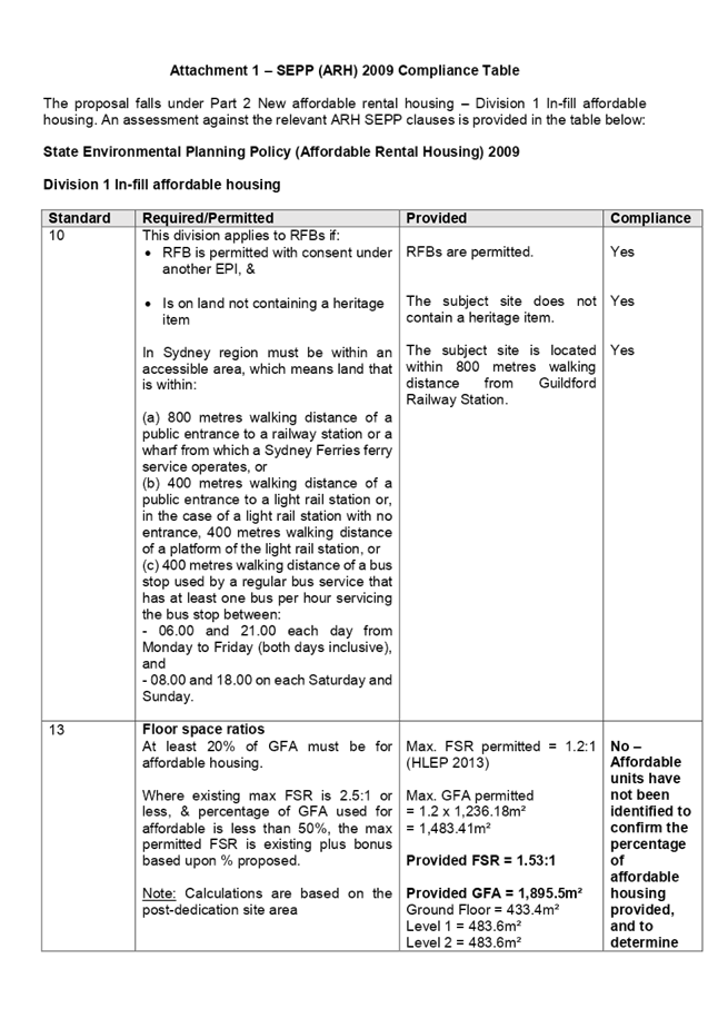
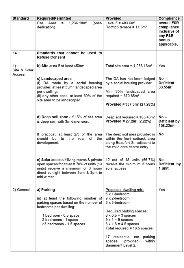
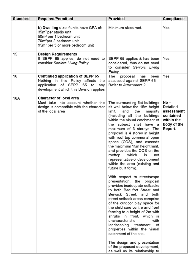
DOCUMENTS
ASSOCIATED WITH
REPORT LPP053/19
Attachment 2
ADG Compliance Table
Cumberland Local Planning Panel Meeting
14 August 2019
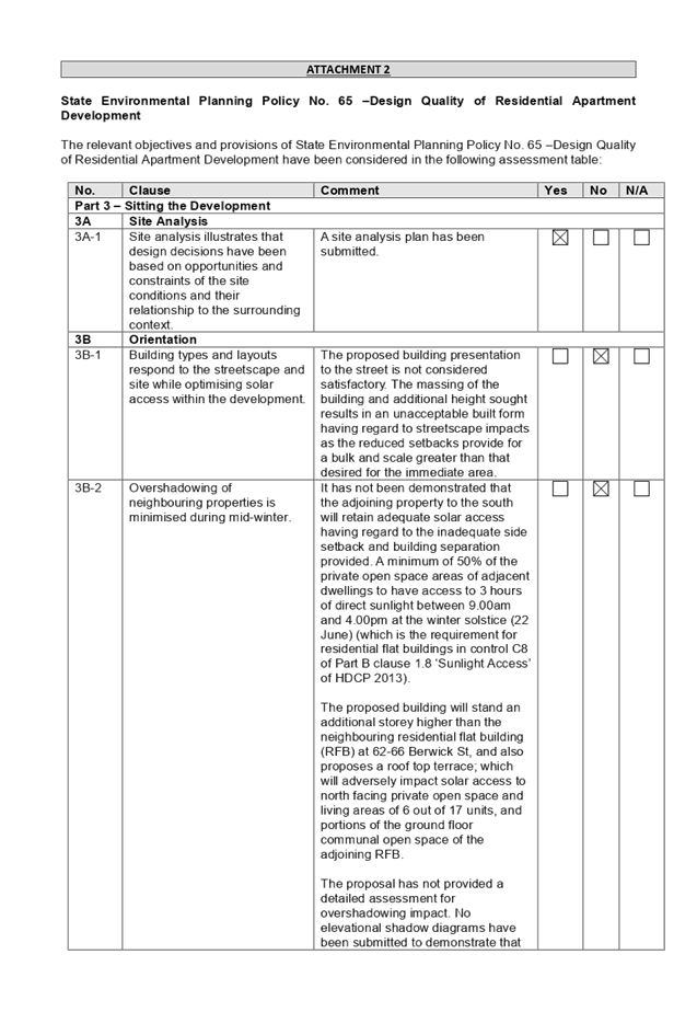
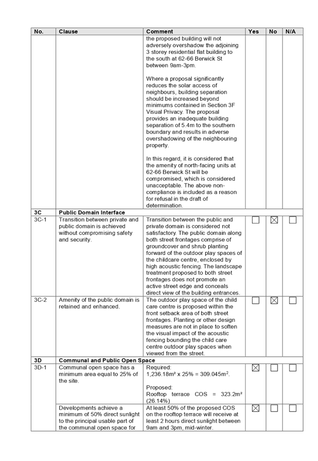
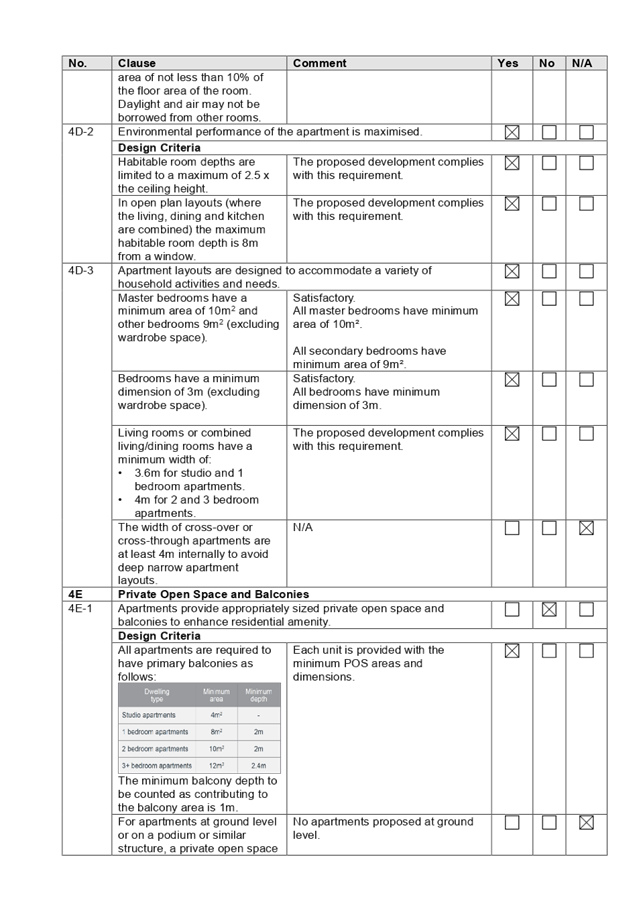
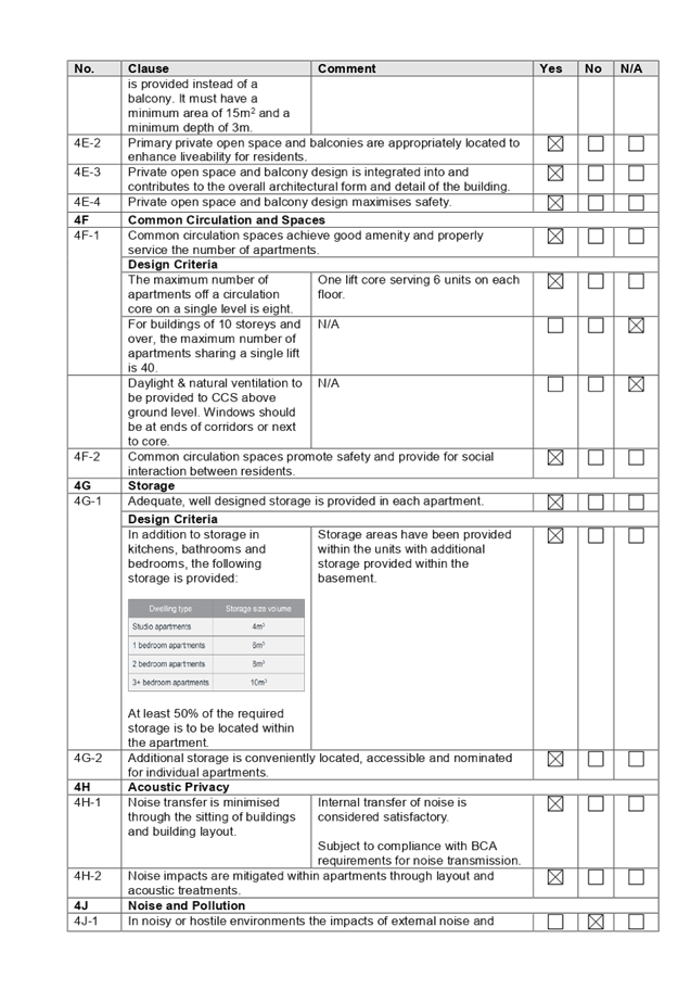
DOCUMENTS
ASSOCIATED WITH
REPORT LPP053/19
Attachment 3
SEPP (Educational Establishments & Child Care
Facilities) Compliance Table
Cumberland Local Planning Panel Meeting
14 August 2019
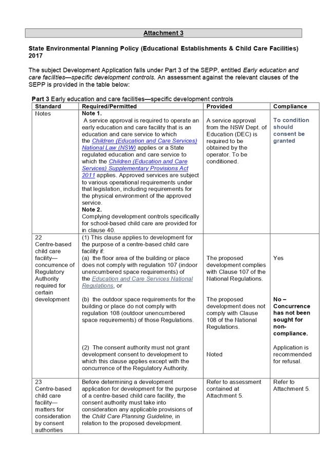
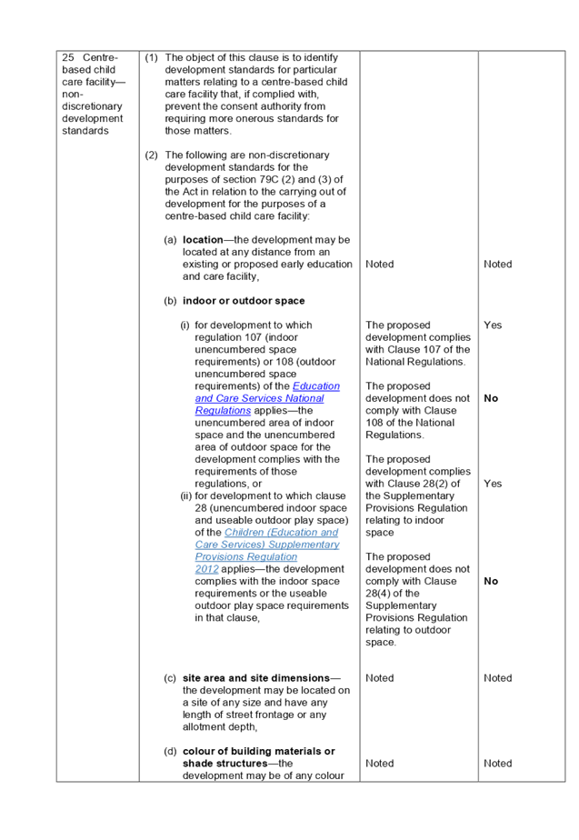
DOCUMENTS
ASSOCIATED WITH
REPORT LPP053/19
Attachment 4
HLEP 2013 Compliance Table
Cumberland Local Planning Panel Meeting
14 August 2019
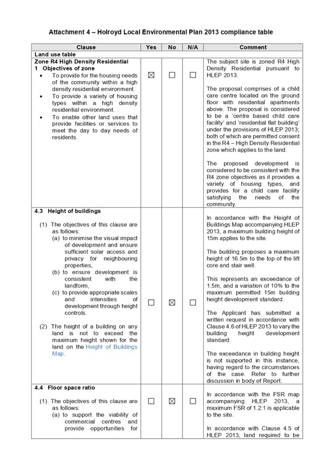
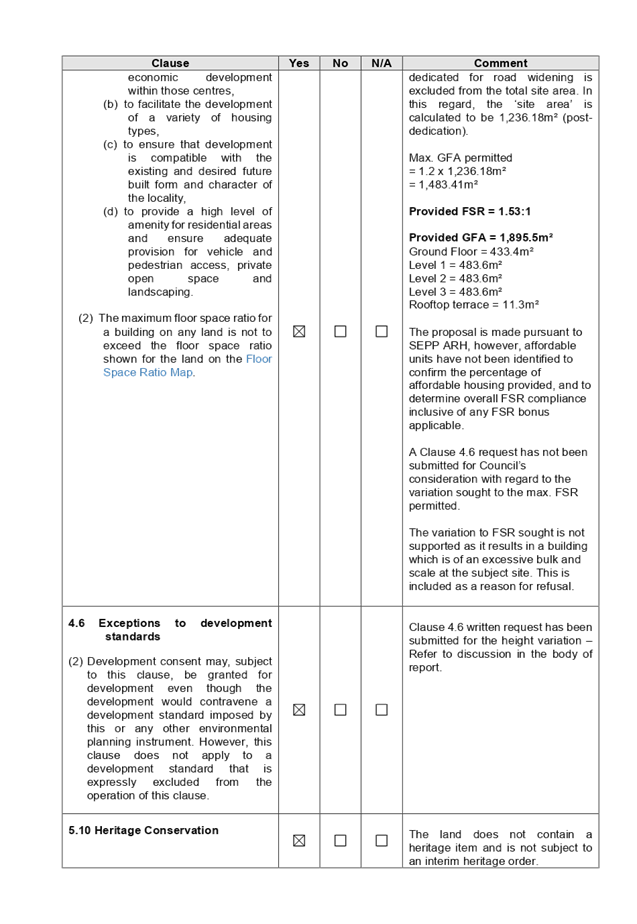
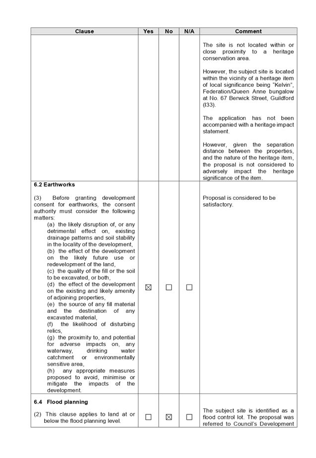
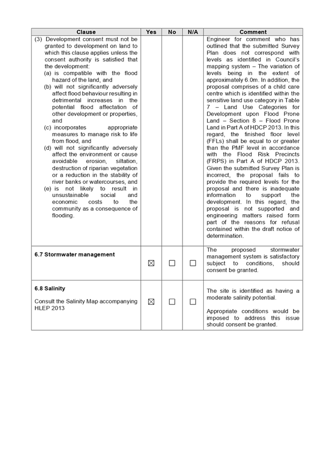
DOCUMENTS
ASSOCIATED WITH
REPORT LPP053/19
Attachment 5
Child Care Planning Guideline Compliance Table
Cumberland Local Planning Panel Meeting
14 August 2019
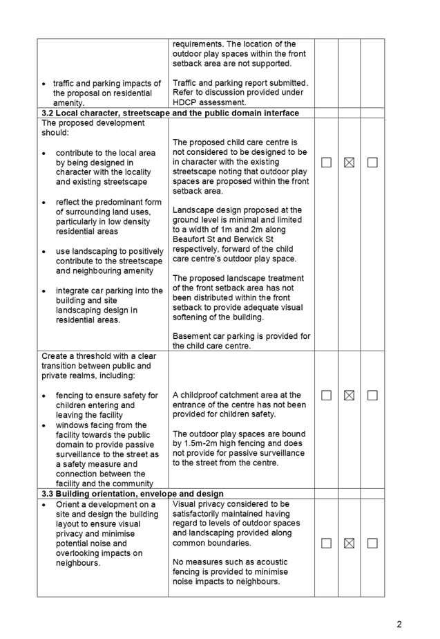
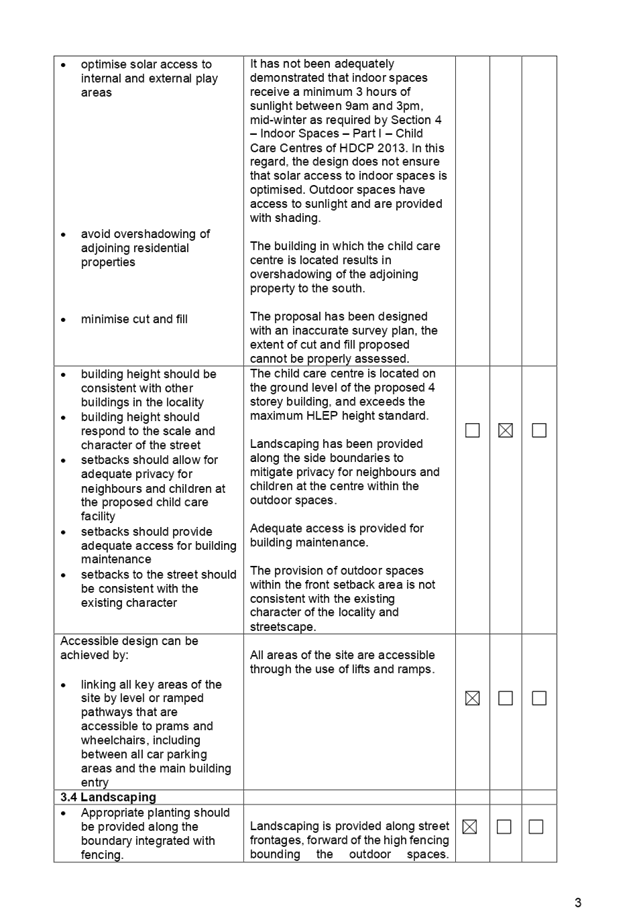
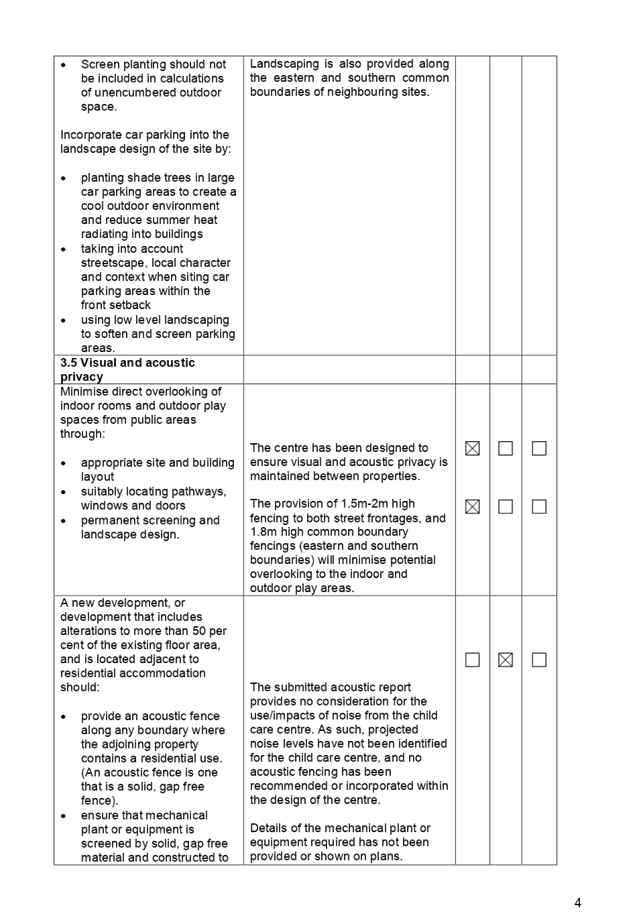
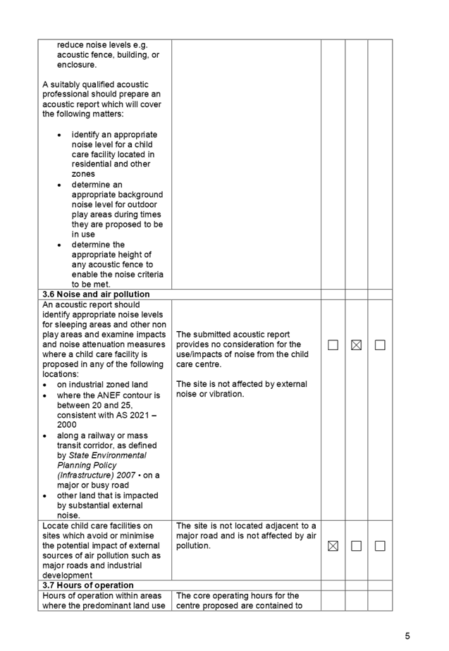
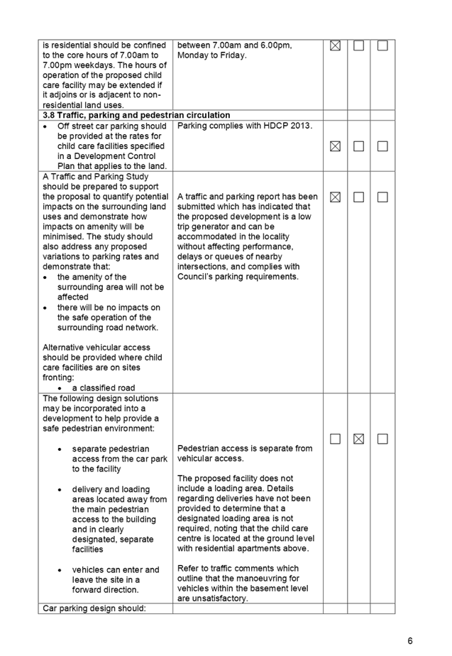
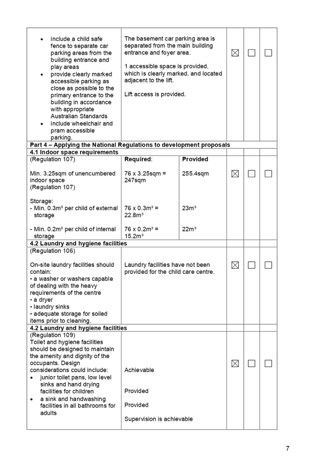
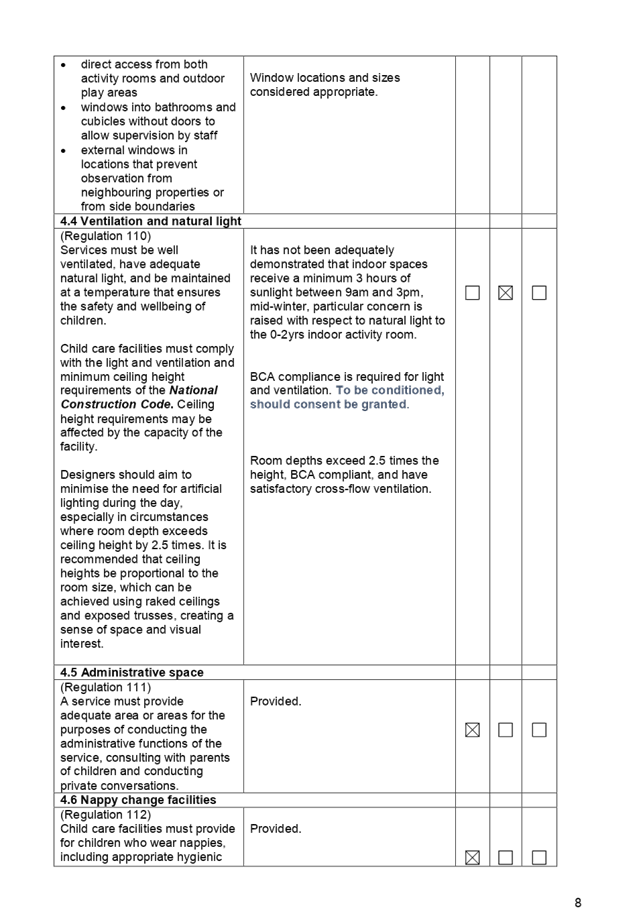
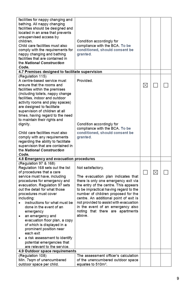
DOCUMENTS
ASSOCIATED WITH
REPORT LPP053/19
Attachment 6
HDCP 2013 Compliance Table
Cumberland Local Planning Panel Meeting
14 August 2019
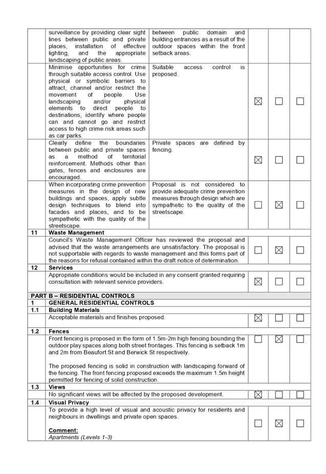
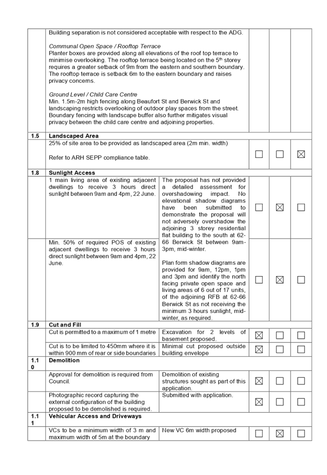
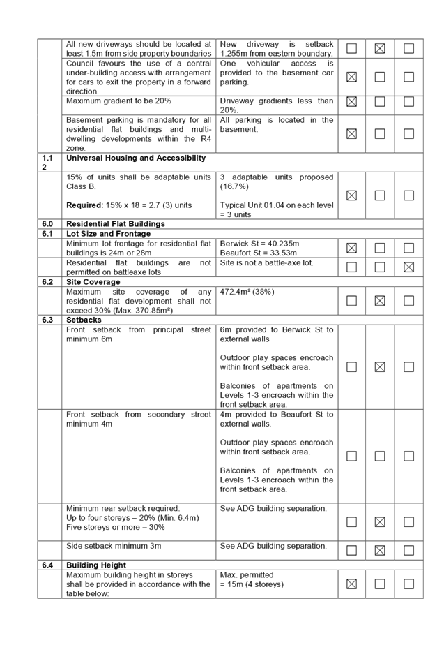
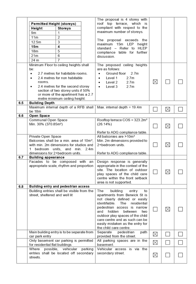
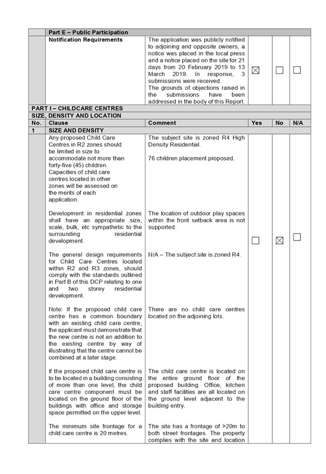
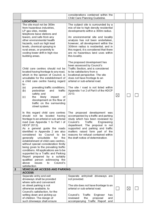
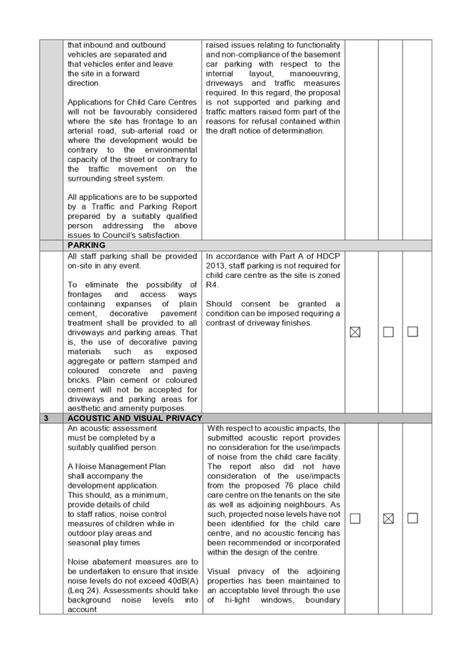
DOCUMENTS
ASSOCIATED WITH
REPORT LPP053/19
Attachment 7
Accompanying Clause 4.6 Variation Request to Building
Height
Cumberland Local Planning Panel Meeting
14 August 2019
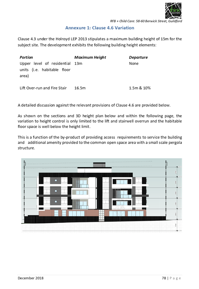
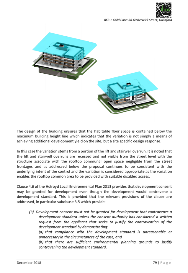
DOCUMENTS
ASSOCIATED WITH
REPORT LPP053/19
Attachment 8
Draft Notice of Determination
Cumberland Local Planning Panel Meeting
14 August 2019
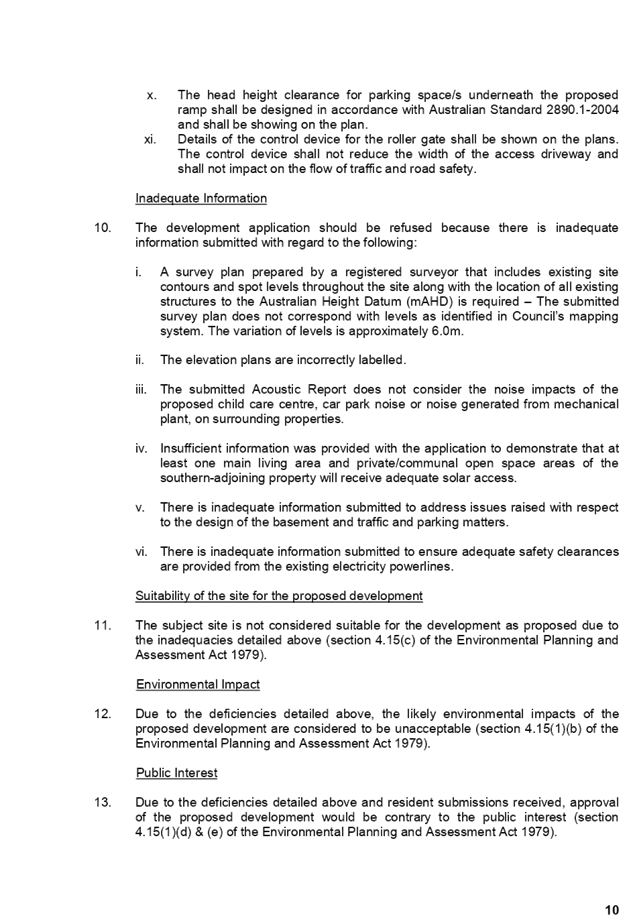

DOCUMENTS
ASSOCIATED WITH
REPORT LPP053/19
Attachment 9
Internal Architectural Plans
Cumberland Local Planning Panel Meeting
14 August 2019
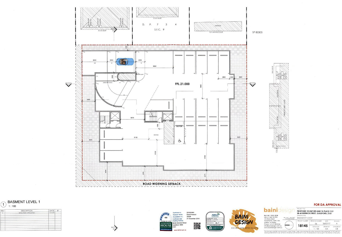
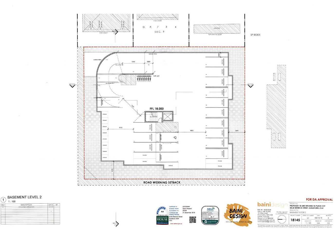
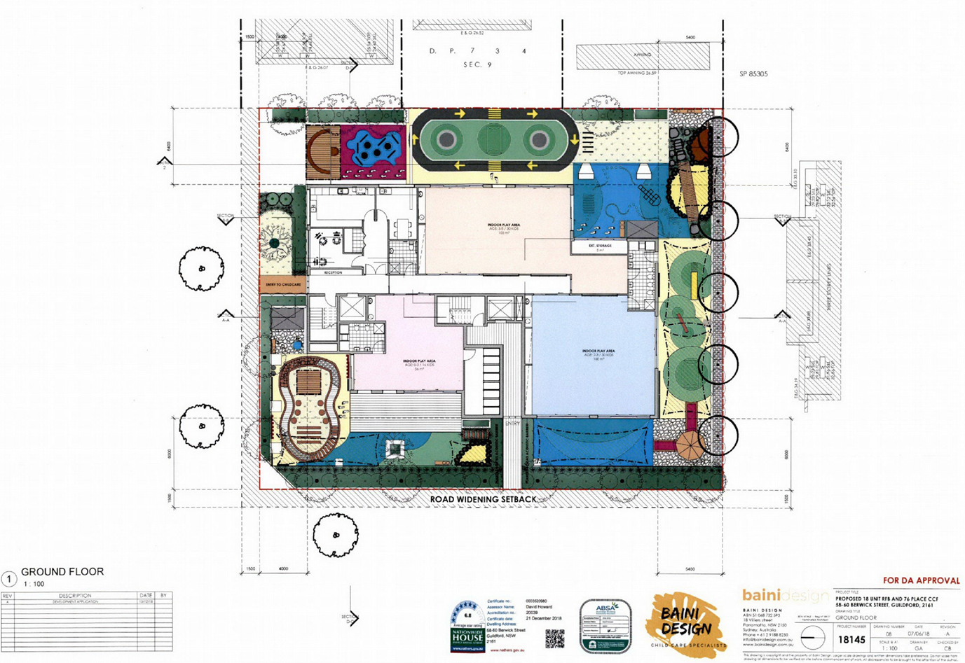
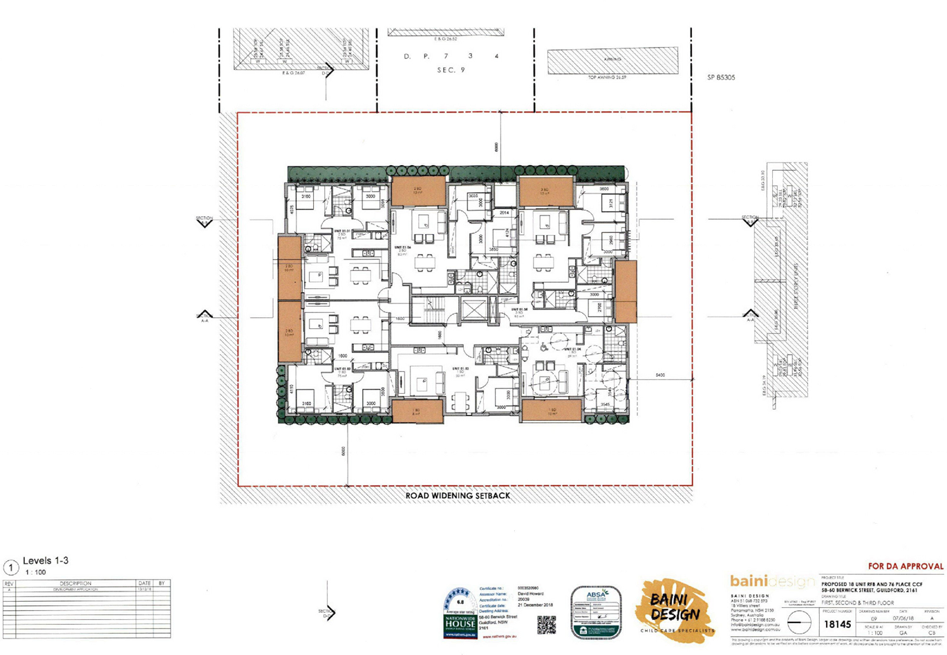

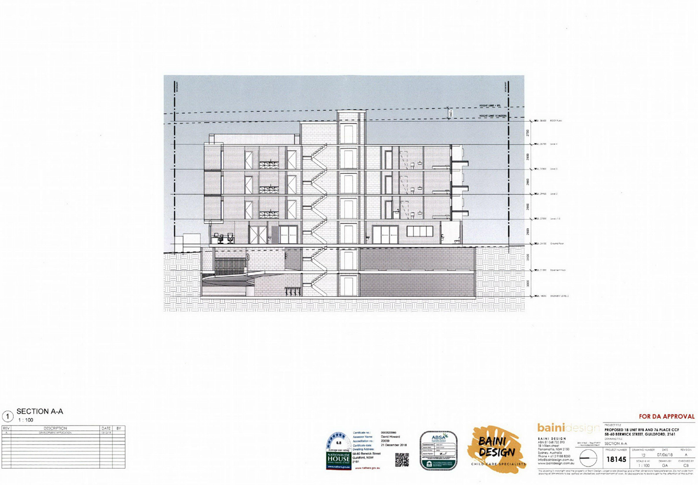
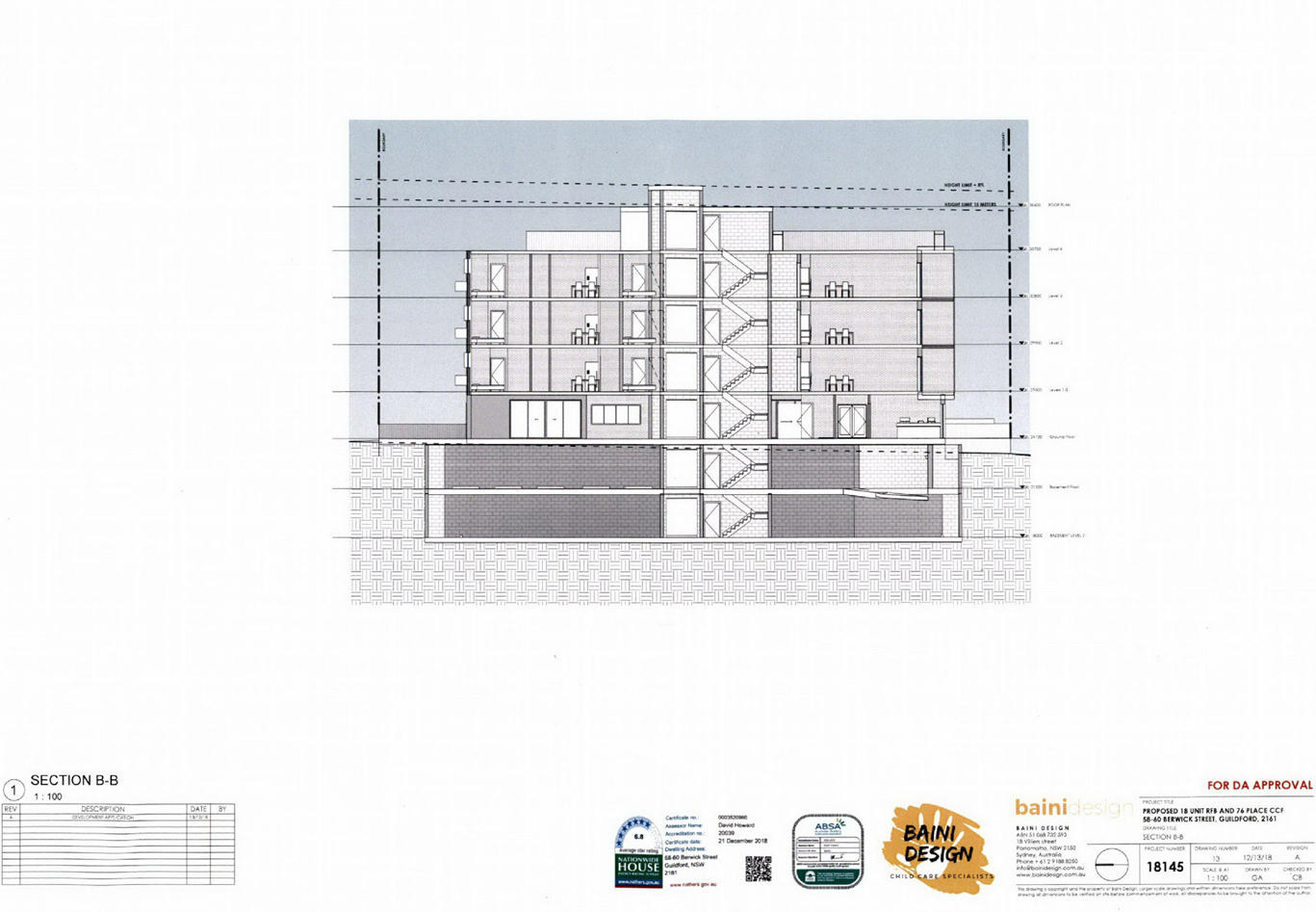
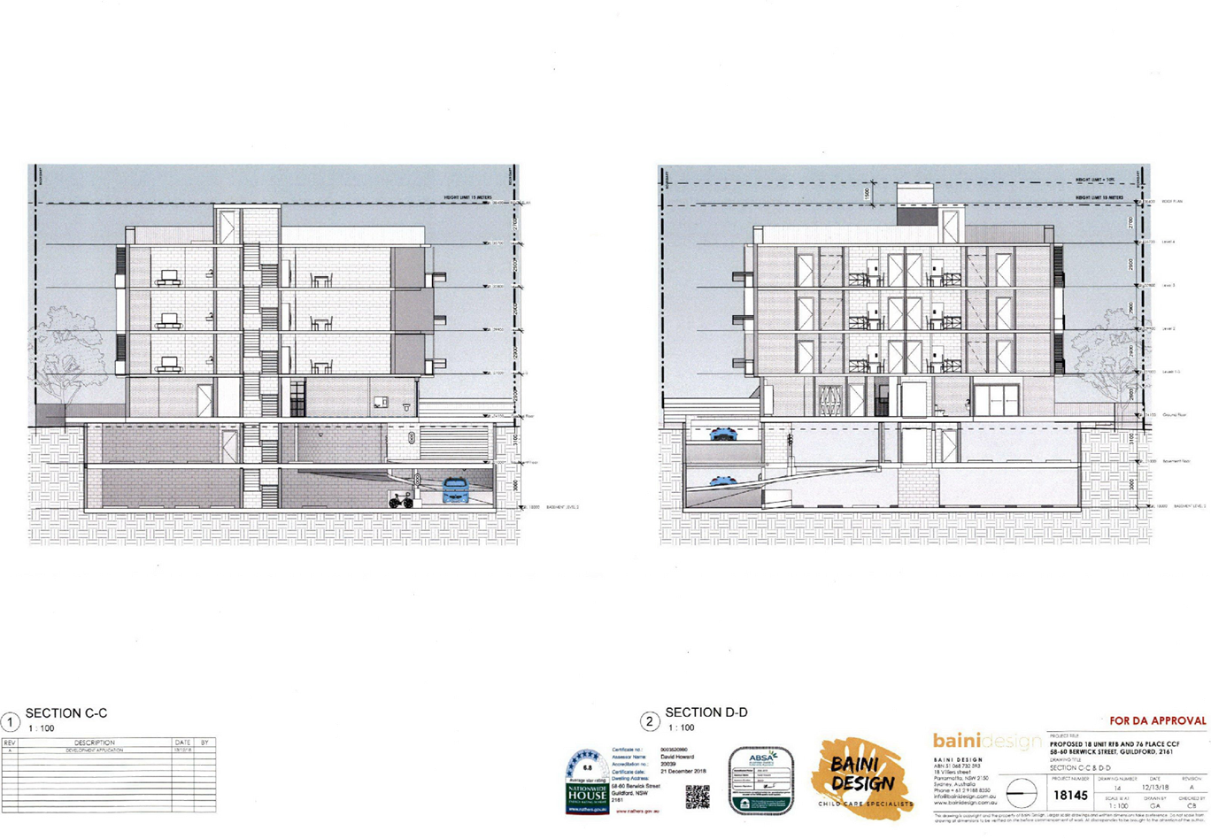
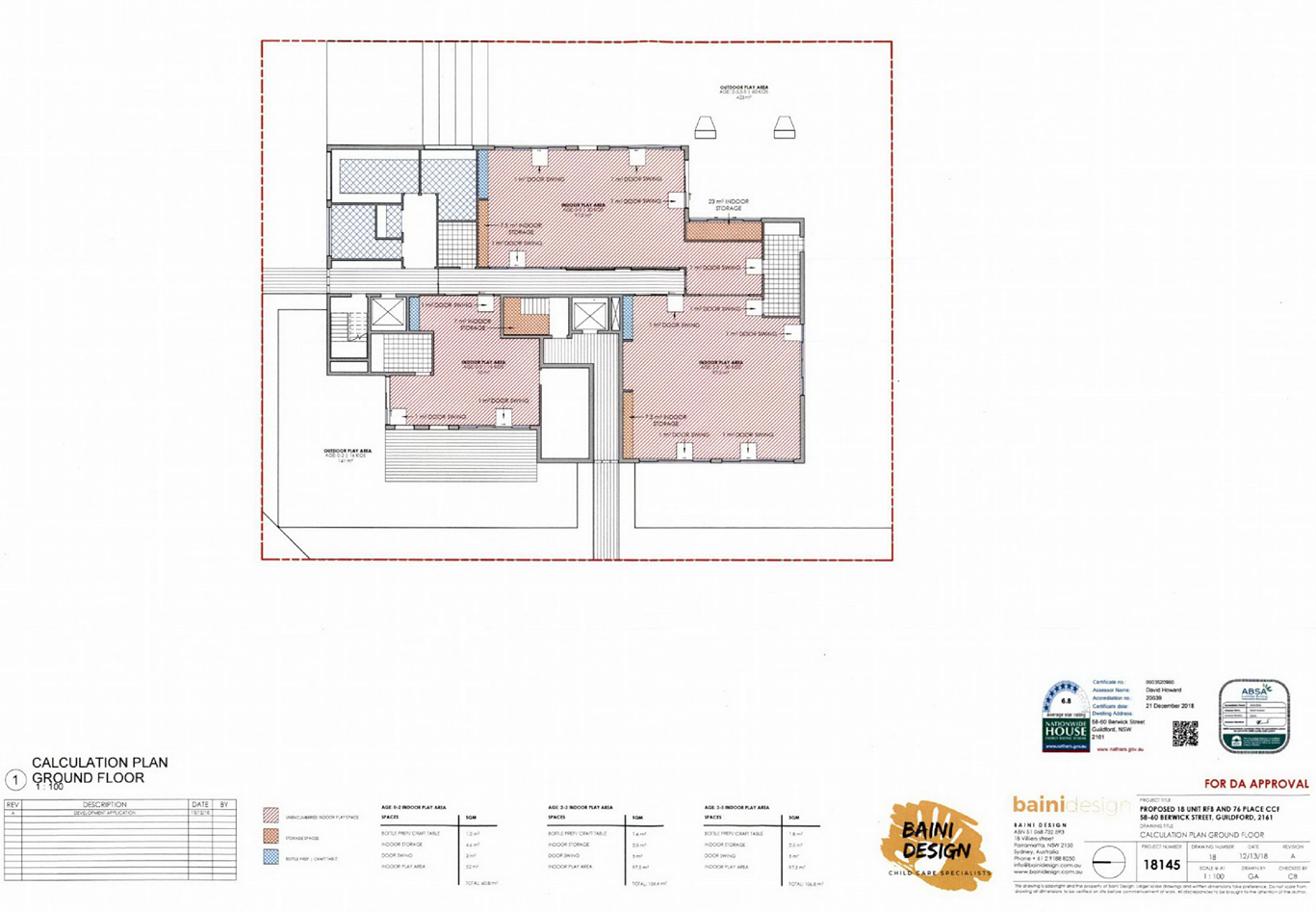
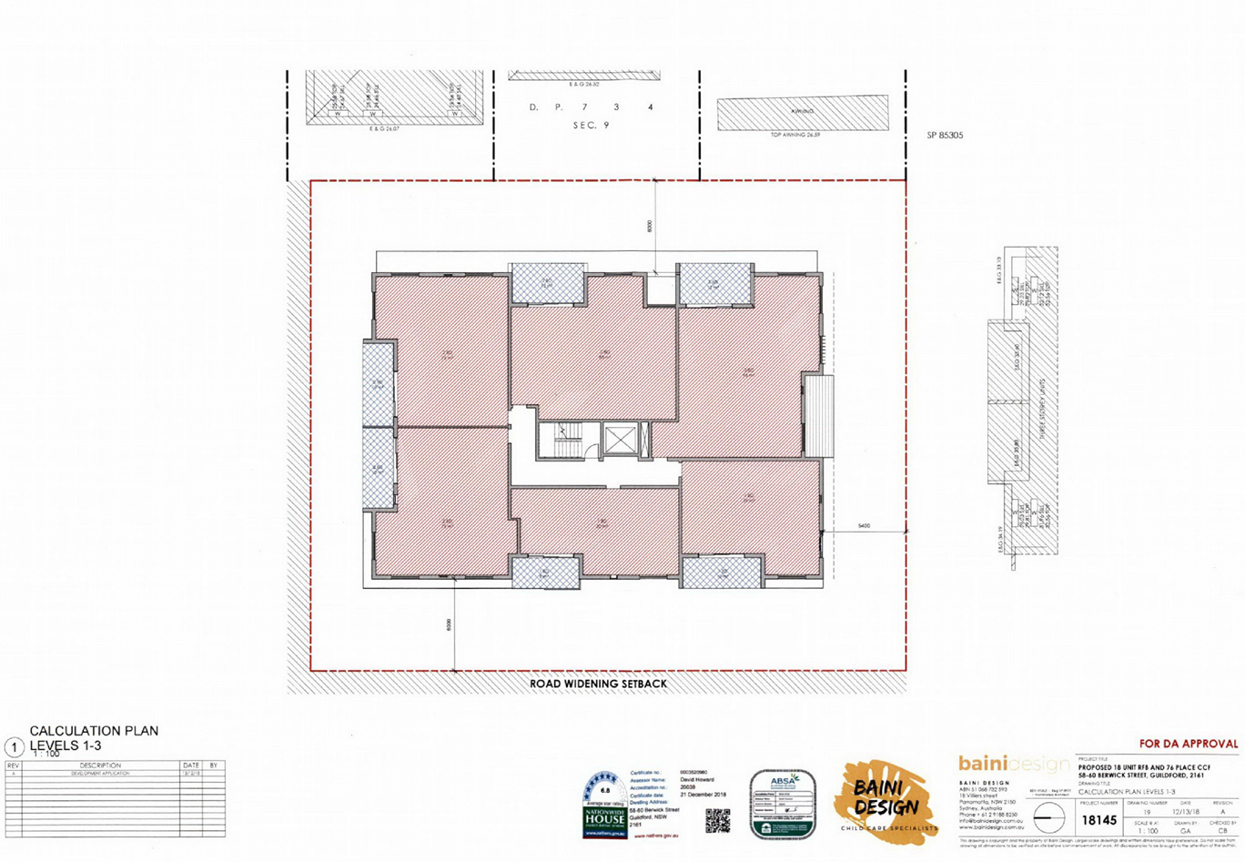
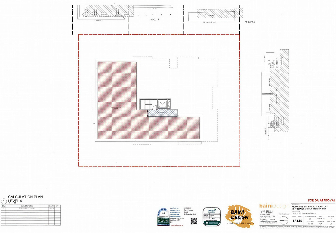
DOCUMENTS
ASSOCIATED WITH
REPORT LPP053/19
Attachment 10
External Architectural Plans
Cumberland Local Planning Panel Meeting
14 August 2019
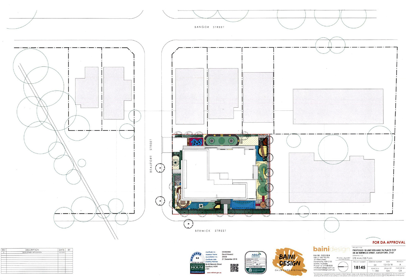
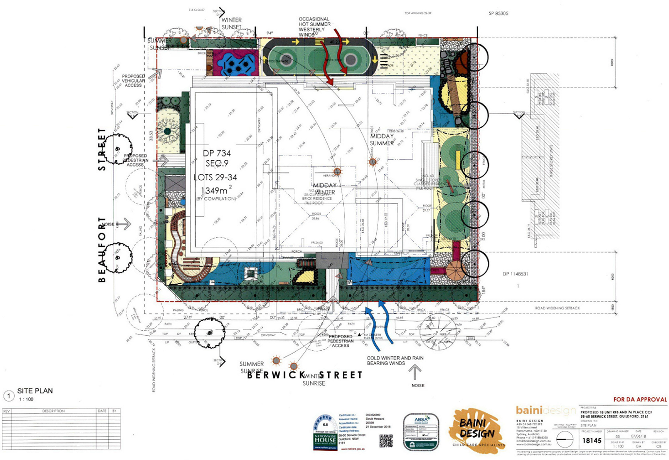
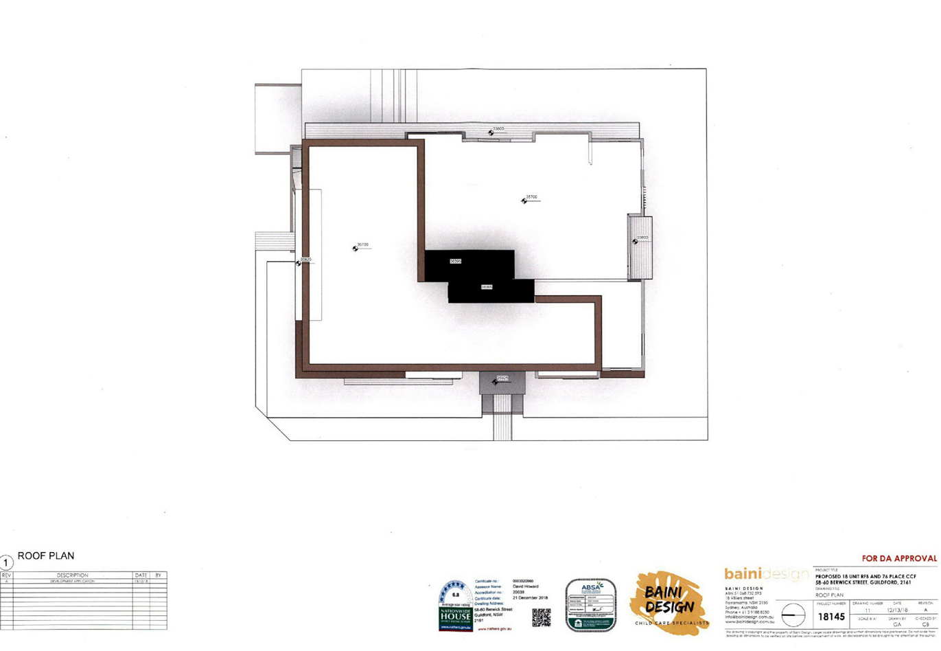
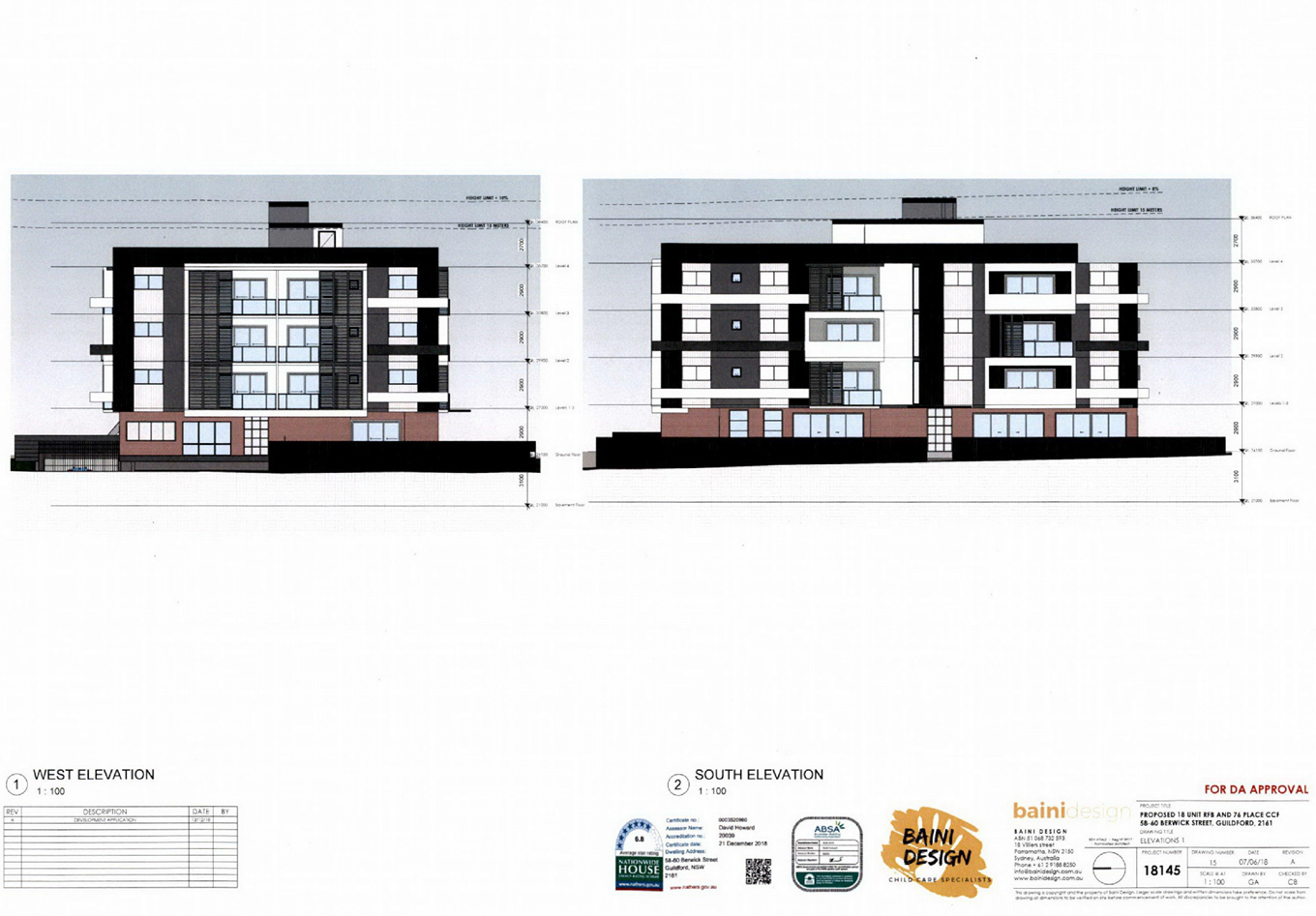
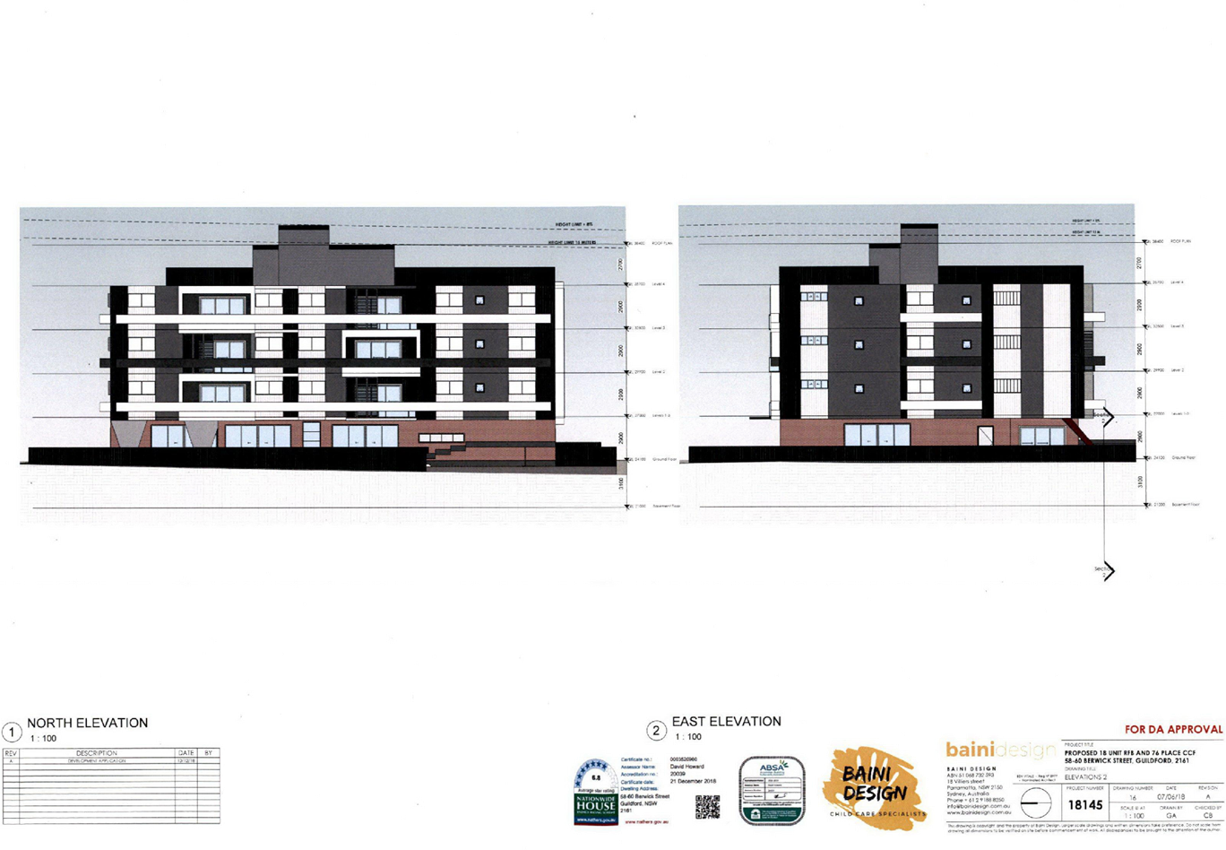
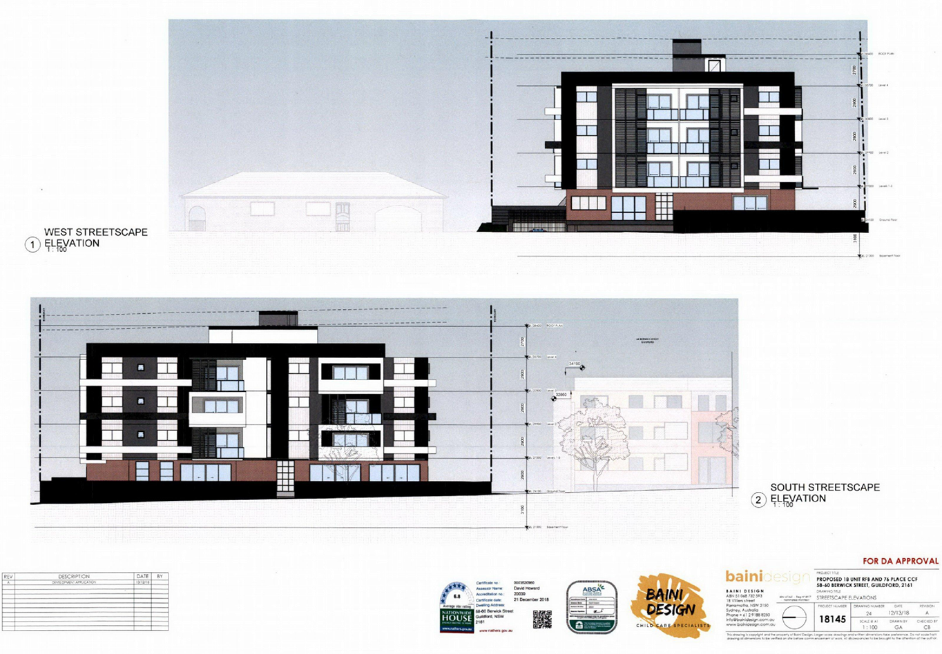
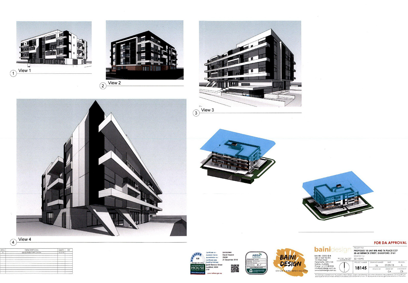
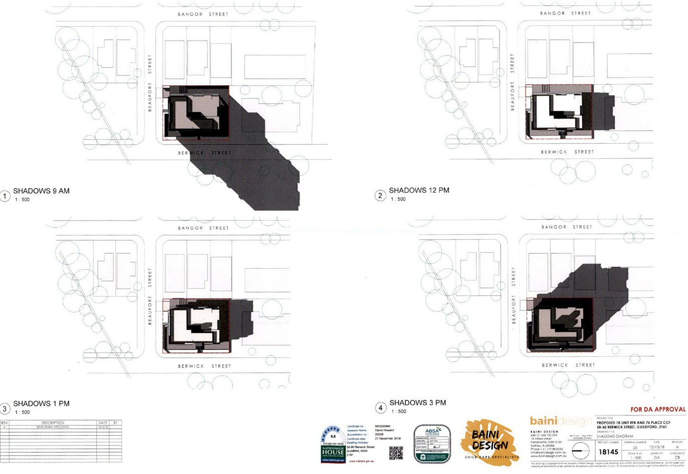
DOCUMENTS
ASSOCIATED WITH
REPORT LPP053/19
Attachment 11
Landscape Plans
Cumberland Local Planning Panel Meeting
14 August 2019
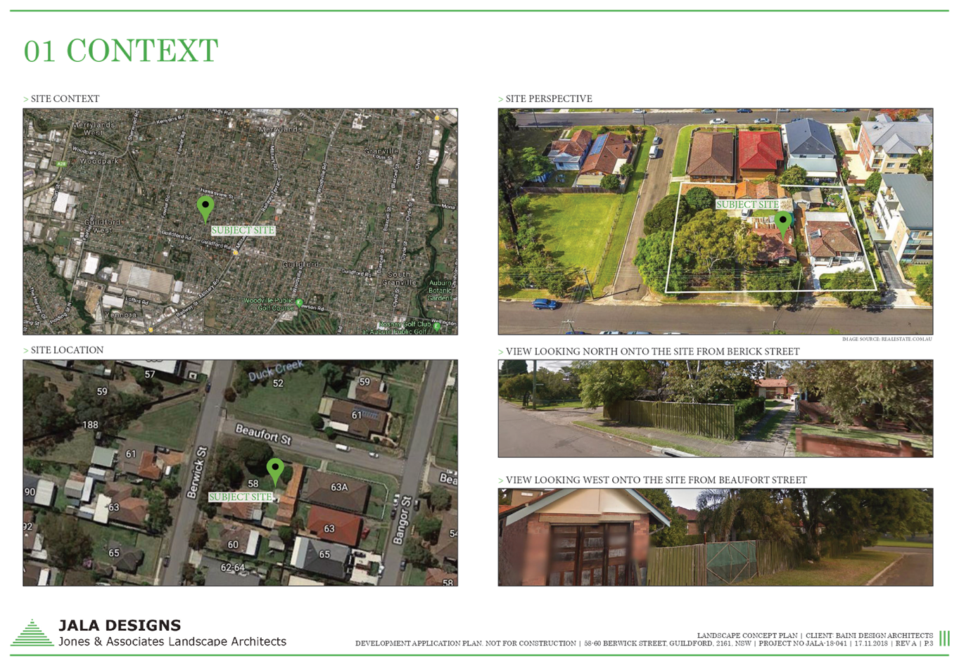
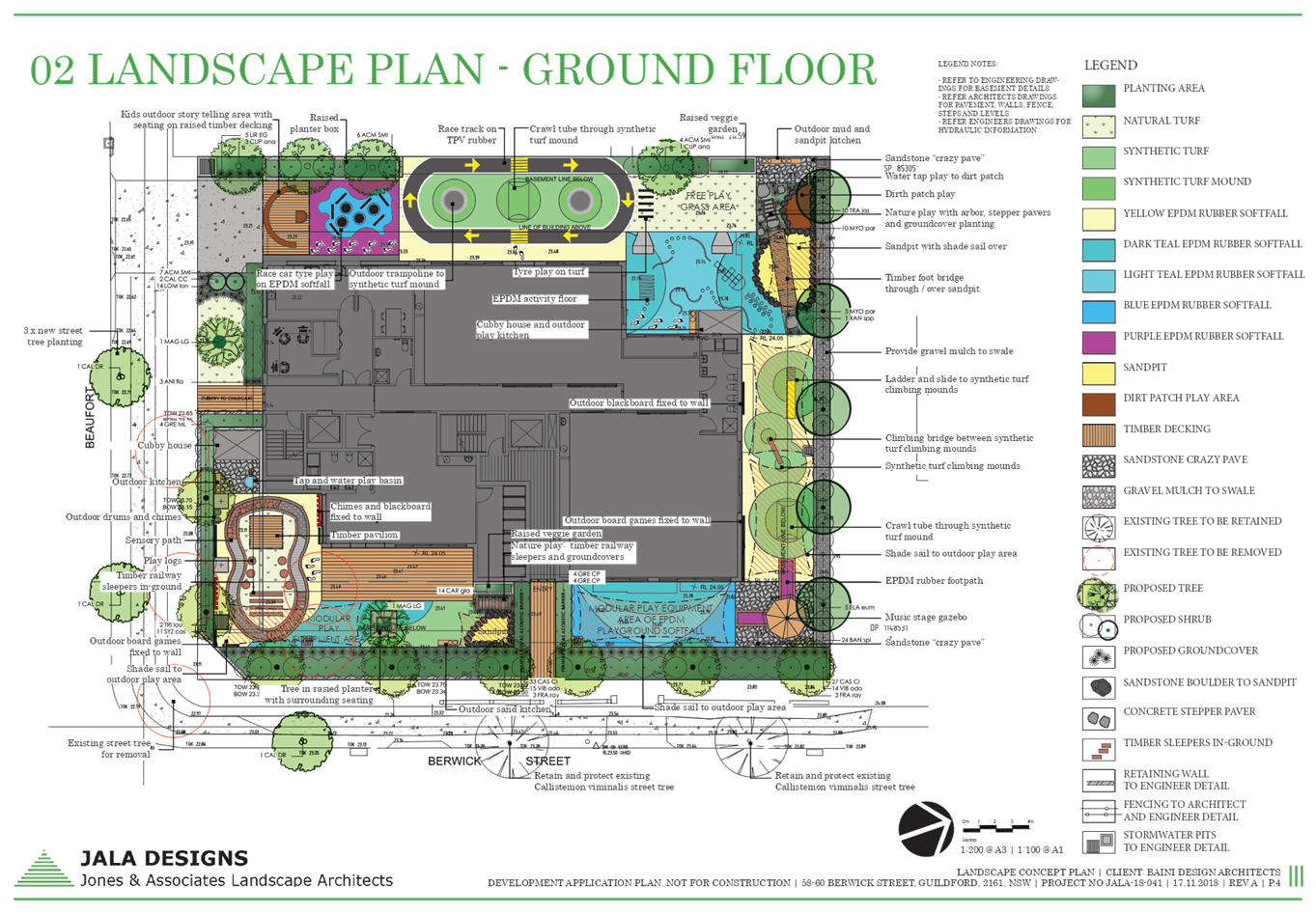
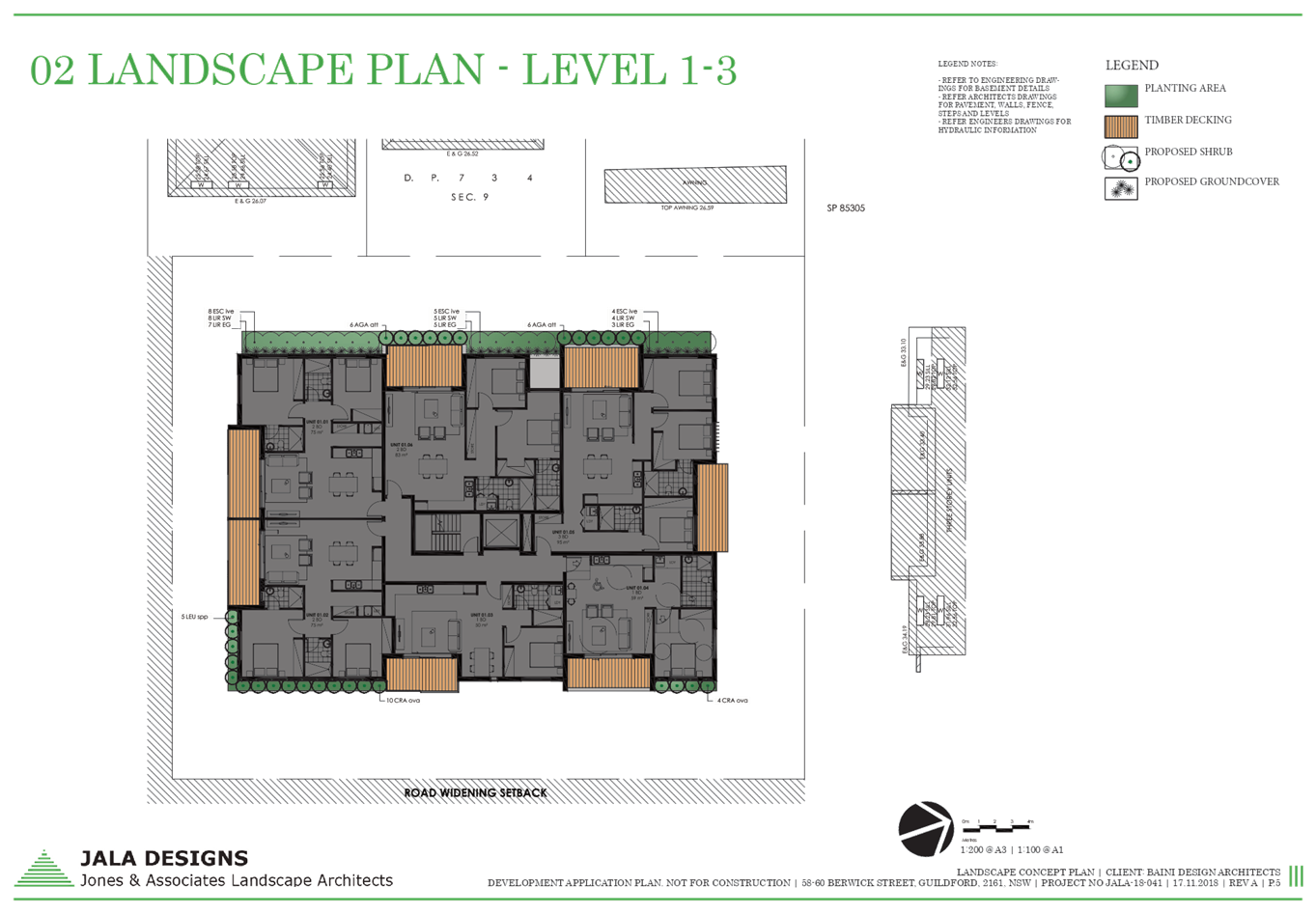
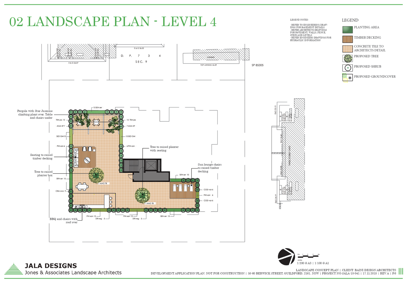
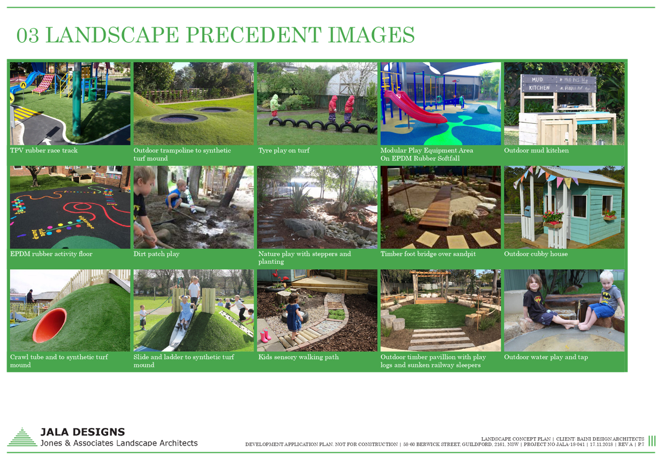
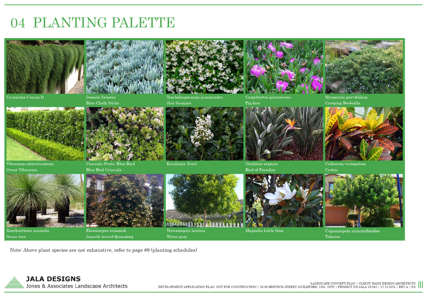
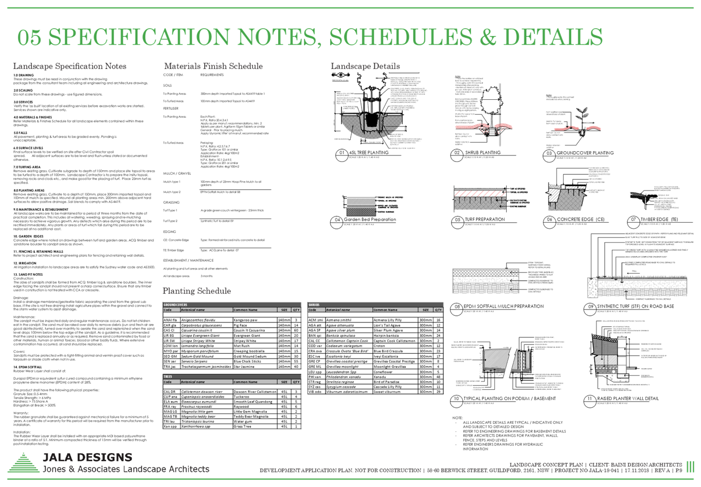
DOCUMENTS
ASSOCIATED WITH
REPORT LPP053/19
Attachment 12
Acoustic Report
Cumberland Local Planning Panel Meeting
14 August 2019

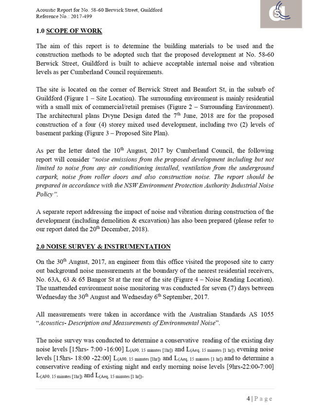
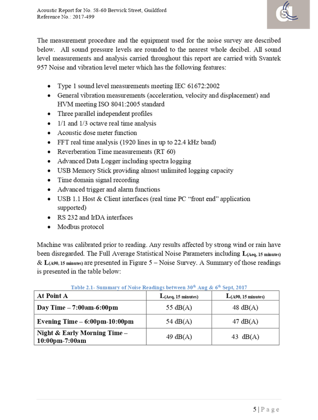
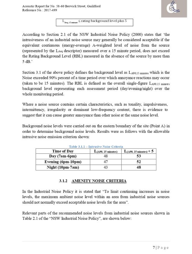
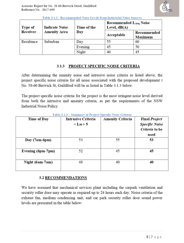
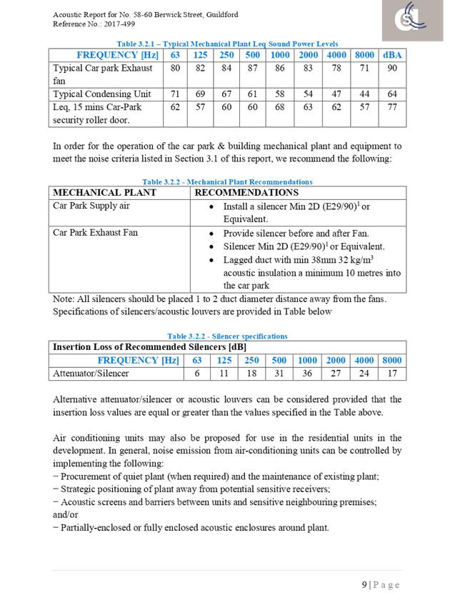

Cumberland Local Planning Panel Meeting
14 August 2019
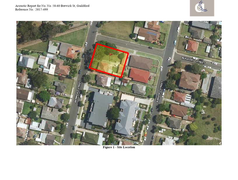
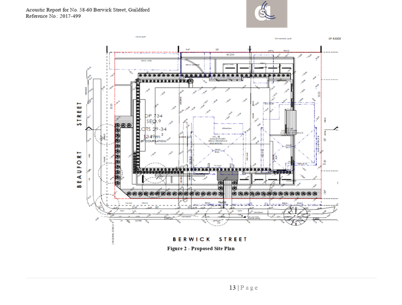
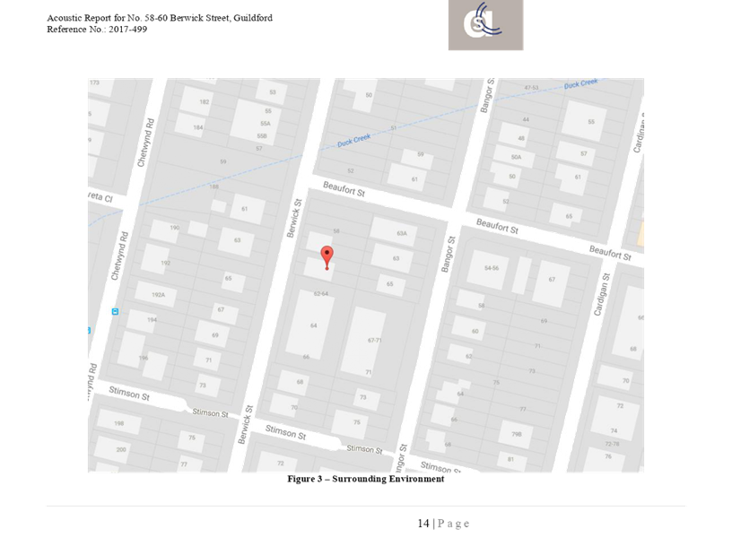
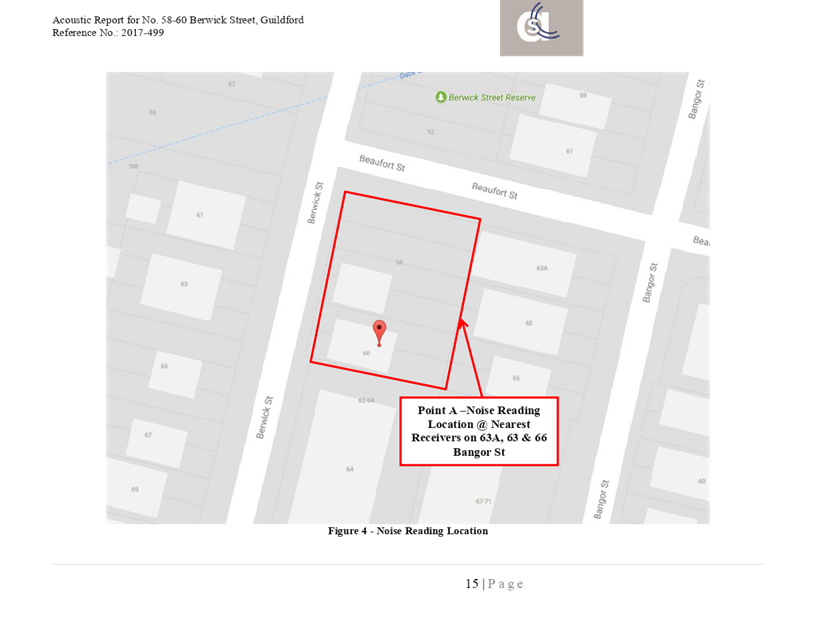
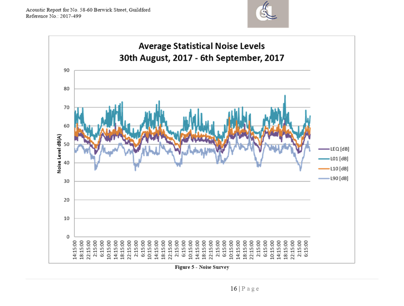
DOCUMENTS
ASSOCIATED WITH
REPORT LPP053/19
Attachment 13
Public Submissions
Cumberland Local Planning Panel Meeting
14 August 2019
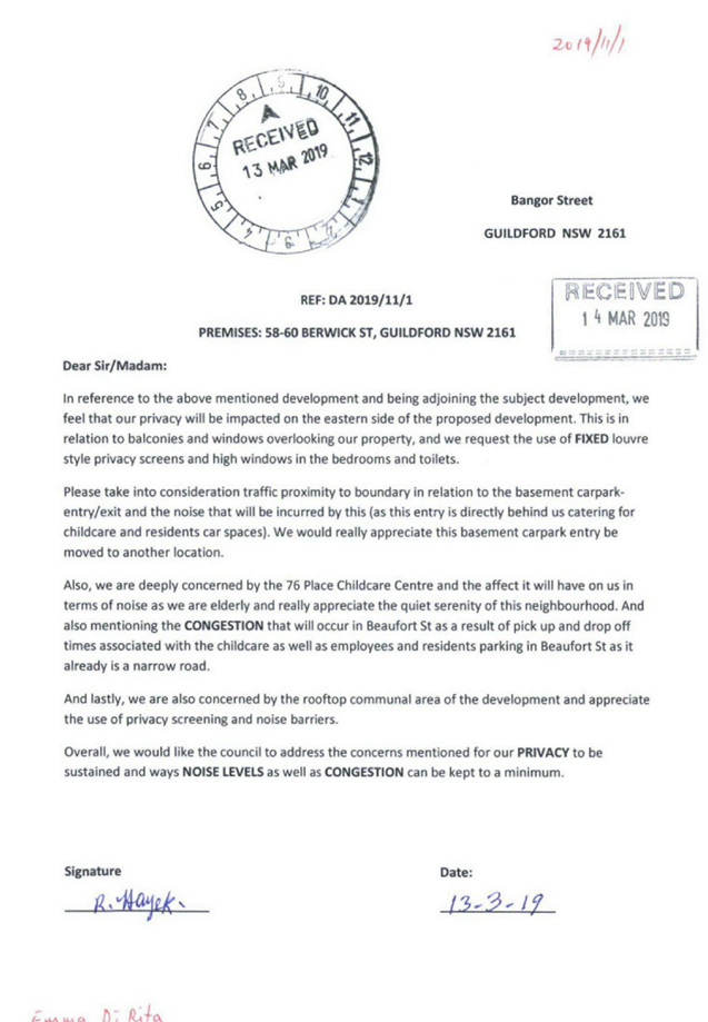
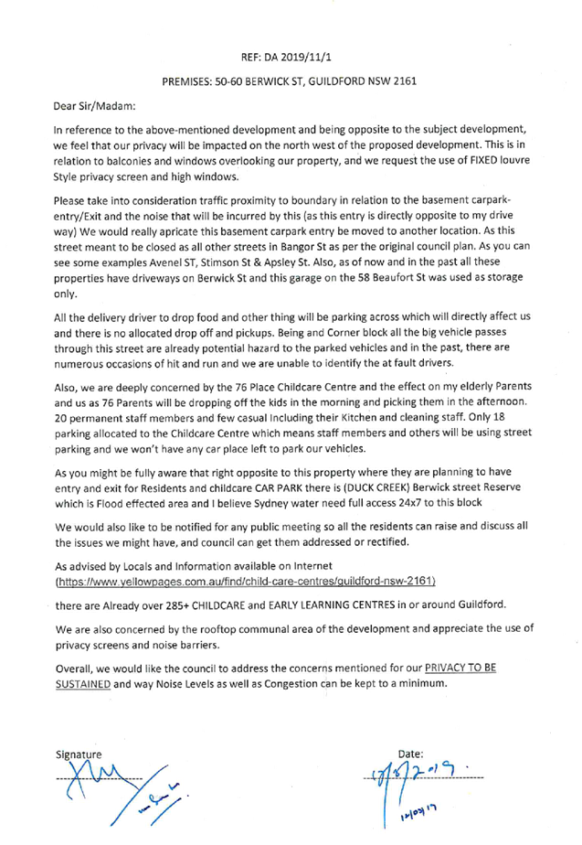
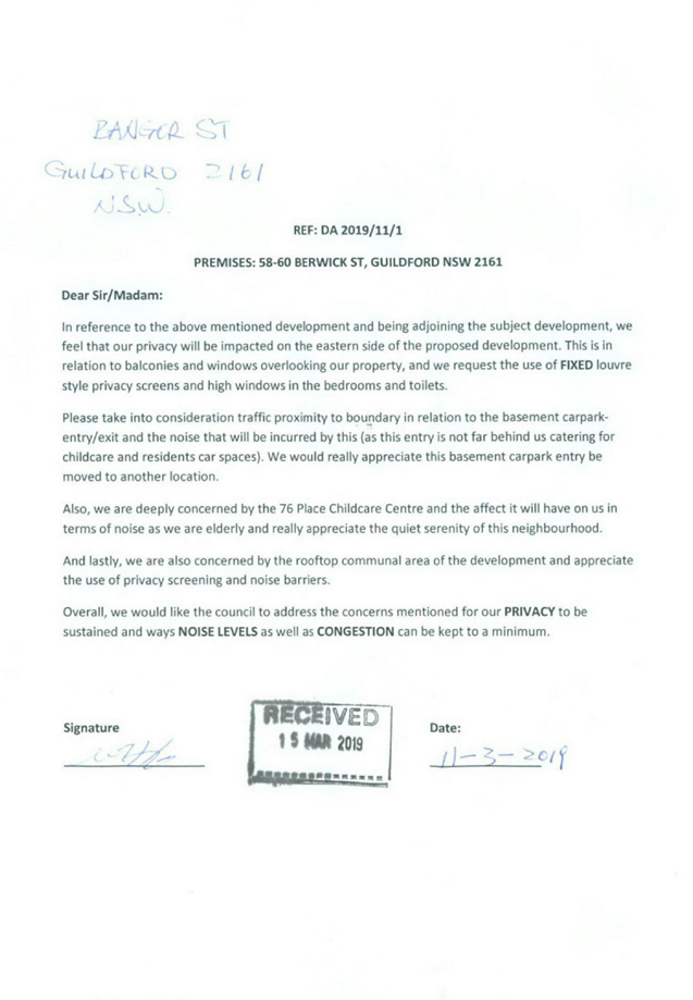
Cumberland
Local Planning Panel Meeting
14 August 2019
Item No: LPP054/19
Section 4.56
Modification Application - 331 Blaxcell Street, South Granville
Responsible
Division: Environment
& Planning
Officer: Executive
Manager Development and Building
File
Number: DA-290/2017/A
|
Application lodged
|
31-May-2019.
|
|
Applicant
|
Zinnia Group C/- Navon
Solutions.
|
|
Owner
|
Ms I Itaoui.
|
|
Application No.
|
DA-290/2017/A.
|
|
Description of Land
|
331 Blaxcell Street, South
Granville being Lots 40 and 41 Sec 1 in DP 5121.
|
|
Proposed Development
|
Section 4.56 application to
modify an approved child care facility to provide additional general purpose
rooms and a rooftop outdoor play area.
|
|
Site Area
|
1,340.6 Square metres.
|
|
Zoning
|
R4 High density residential
zone.
|
|
Disclosure of political
donations and gifts
|
Nil disclosure.
|
|
Heritage
|
Site is not heritage listed.
|
|
Principal
Development Standards
|
Height of Building
Permissible: 11 metres.
Proposed: 13.6 metres.
And
Floor space ratio
Permissible: 0.8:1.
Proposed: 0.798:1.
|
|
Issues
|
Height of the child care
centre building.
|
1. Development
application Number 290/2017 was approved by the Land and Environment Court on
the 9 February 2018 for demolition of the existing structures and construction
of a three storey child care centre with ancillary signage as deferred
commencement consent subject to conditions.
2. 2The
deferred commencement compliance notice for the development was issued on 8
April 2019.
3. A
Section 4.56 modification application Number 290/2017/A was received on the 27
May 2019 to modify an approved child care facility to provide additional
general purpose rooms and a rooftop outdoor play area to the centre.
4. The
application was publicly notified to occupants and owners of the adjoining
properties for a period of 14 days between Tuesday 11 June and Tuesday 25 June
2019. In response, there were no submissions received.
5. The
variations are as follows:-
|
Control
|
Required
|
Provided
|
% variation
|
|
Height control of the Parramatta
Local Environmental Plan 2011 Clause 4.3.
|
11 metres.
|
13.6 metres.
|
23.6%
|
6. The
application is recommended for conditional approval subject to the conditions
as provided in the attached schedule.
7. The
application is referred to the Panel for determination as the modified
development contravenes the height requirement by more than 10%.
Subject Site And Surrounding
Area
The subject site is legally
described as Lots 40 and 41 Section 1 in DP 5121 and is known as 331 Blaxcell
Street, South Granville. The site is located on the eastern side of Blaxcell Street,
within the R4 - High Density Residential zone, between Eve Street to the
north-west and Markey Street to the south-west. The site has a frontage of
24.36 metres to Blaxcell Street and occupies an area of 1,340.6 square metres.
The site has a fall towards the
rear by between 1.17 and 1.24 metres.
There is a single storey dwelling
house with a detached garage on the site. A small garden shed is situated
within the rear yard.
There is a mixture of housing
types within the locality ranging from older style post World War 2 housing to
recently constructed medium density developments. There are multi dwelling
developments close by situated at 319 to 325, 335 to 339 and 334 to 336
Blaxcell Street.
The Dellwood Street Neighbourhood
Shopping Centre is situated approximately 220 metres to the north.
The location of the site is shown
below.
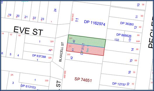
The
aerial photo of the site is shown below.
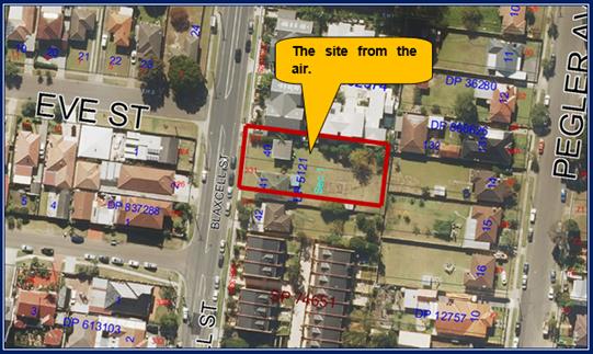
Photos
of the site are shown below.
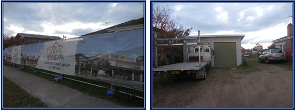
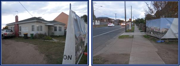
History
Development application 290/2017
was approved as a deferred commencement consent by the Land and Environment
Court on 9 February 2018. The deferred commencement compliance notice
(Operational consent) associated with the consent was issued on 8 April 2019.
Pre lodgement Application
The applicant had a pre lodgement
meeting on the 13 February 2019 and the applicant was advised that the height
of the modified development breached the height limitation applying to the
land. Furthermore, the applicant was also advised that noise impacts and
privacy would need to be addressed as part of the proposal.
Description of the Proposed
Development
Council has received a Section
4.56 modification application to undertake changes to the approved child care
centre including alterations to the second storey and the addition of a rooftop
outdoor play area for the children and associated access stairwell and lift.
The ground floor and first floor
of the approved child care centre is not subject to any change and there is no
increase in the number of children to attend the centre. In detail, the changes
are:-
Second floor
The children’s outdoor play
area is reduced in area from 260 square metres to 140 square metres being a
reduction of 120 square metres.
The size of the General Purpose
rooms 1 and 2 are modified / reduced in area as follows:-
|
Approved General Purpose Rooms
|
Modified General Purpose Rooms
|
|
1 - 32.96
square metres.
|
1 - 24.11
square metres (Reduction of 8.85 square metres).
|
|
2 - 40.49
square metres.
|
2 - 32.06
square metres (Reduction of 8.43 square metres).
|
There are three new General
purpose rooms proposed as follows:-
General Purpose Room 3 - 31.5
square metres.
General Purpose Room 4 - 32.29
square metres.
General Purpose Room 5 - 30.68
square metres.
Hence there are now five general
purpose rooms which will be used for unsettled children, a library, lego room,
consultation and parent room. The five rooms are part of the overall service to
be offered by the centre.
Roof top
The top floor comprises a
children’s outdoor play area occupying 285 square metres, which is a net
increase of 165 square metres over and above the initial playground approval.
The rooftop playground consists of
a lift and small utility area at the north east corner of the play area, a
stairwell at the south east corner and a second stairwell access at the north
west corner of the play area.
The play area is shown to
incorporate landscaping via the use of planter boxes, a light weight shade sail
structure, open pergola, seating and soft fall areas.
The cross section plans are
showing the playground area having parapets and or screens that are 1.390
metres in height.
The rooftop play area has greater
setbacks from the side and rear boundaries than the ground and first storey of
the building to address potential issues of privacy and solar efficiency loss
towards the south.
The intention of the proposal is
to enhance the learning experience to the approved facility by providing for an
additional outdoor play area. The outdoor play area will be useful for children
with special needs who will attend the centre.
Car park area
The approved car park is not
subject to any change because there is no increase in the number of children to
attend the centre.
Applicants Supporting
Statement
The applicant has provided a
Statement of Environmental Effects prepared by Navon Solutions and dated 19 May
2019 which was submitted on May 27 in support of the application. In addition,
a separate statement similar to a Clause 4.6 variation to the height variation
has been prepared by Navon Solutions and dated June 2019.
Contact with Relevant
Parties
The assessing officer has
undertaken a site inspection of the subject site and surrounding properties and
has been in regular contact with the applicant throughout the assessment process.
Internal Referrals
Development Engineer
The modification application was
referred to Council’s Development Engineer for comment who has advised
that there is no objection to the modification sought and no engineering
conditions are required to be altered.
Environment and Health
The modification application was
referred to Council’s Environment and Health Officer for comment who has
advised that the changes sought are acceptable. There are no objections to the
modification sought and conditions are provided addressing matters of noise,
plan of management and site operations.
Children’s Services
The modification application was
referred to Council’s Children’s Services team who have advised
that there are no significant objections to the changes that are sought.
External Referrals
The modification application was
not required to be referred to any external government authorities for comment.
Planning Comments
Section 4.56 of the Environmental
Planning and Assessment Act 1979 (as amended) allows Council to modify a
development consent granted by the Court if:-
a) it
is satisfied that the development to which the consent as modified relates is
substantially the same development as the development for which the consent was
originally granted and before that consent as originally granted was modified
(if at all)
Comment
The modification seeks minor
alterations to the second storey of the child care centre as well as an
addition of a roof top play area with amenities for children. The additions are
considered as being additional amenities for the child care centre. The number
of children, the car park area, the ground floor and first floor are not
subject to any change. It is considered that the development is substantially
the same as that initially approved.
b) it
has notified the application in accordance with:
i. the
regulations, if the regulations so require, or
ii. a
development control plan, if the consent authority is a council that has made a
development control plan that requires the notification or advertising of
applications for modification of a development consent
Comment
The modification application was
notified as per the requirements of the Parramatta Development Control Plan
guidelines between Tuesday 11 June and Tuesday 25 June 2019. There were no
submissions to the modification that is sought.
c) it
has notified, or made reasonable attempts to notify, each person who made a
submission in respect of the relevant development application of the proposed
modification by sending written notice to the last address known to the consent
authority of the objector or other person
Comment
There were two objections to the
original development application. Council records show that both residents who
previously objected were notified of the modification application. The
residents who previously objected to the development did not object to the
modification that is being sought.
d) it
has considered any submissions made concerning the proposed modification within
any period prescribed by the regulations or provided by the development control
plan, as the case may be.
Comment
There were no submissions received
to the modification that is being sought.
The provisions of any
Environmental Planning Instruments (EP&A Act s4.15 (1)(a)(i))
State Environmental Planning
Policies
The proposed development is
affected by the following State Environmental Planning Policies:
(a) State
Environmental Planning Policy No. 55 - Remediation of Land (SEPP 55)
Clause 7 of SEPP 55 requires
Council to be satisfied that the site is suitable or can be made suitable to
accommodate the proposed development. This is a modification to the original
development application. Appropriate reports have been submitted addressing
land contamination matters within the initial development application.
There are no changes to site
conditions and there is no change to any environmental conditions attached to
the development consent issued. As such, the matters addressing the State
Policy do not require further review for the purpose of this application.
(b) State
Environmental Planning Policy 64 – Advertising and Signage
The approved development includes
the erection of one sign being a business identification sign facing Blaxcell
Street. There is no change to the sign as part of the modification. A detailed
assessment of any sign on site is not required in this instance.
(c) State
Environmental Planning Policy (Educational Establishments and Child Care
Facilities) 2017
State Environmental Planning
Policy (Educational Establishments and Child Care Facilities) 2017 is
applicable to the modification application. An assessment shows that the
modification application is compliant with the relevant provisions of the State
Policy. A detailed assessment of the modification application using the State
Policy is attached within Appendix A.
Child Care Planning Guideline
(August 2017) Planning and Environment
The Child Care Planning Guideline
associated with the State Policy is also relevant to the modification
application and this part addresses the Design Quality Principles. The
modification application is found to be compliant with all the Design Quality
Principles 1 to 7. A detailed assessment of the Design Quality Principles is
addressed at Appendix 1.
Considerations C1 to C38
A number of considerations prevail
within the Guidelines with the development being compliant with all the
relevant provisions specified at Parts C1 to C38. Further to the above under
Parts C1 to C38, the following comments are provided:-
· The
development minimises adverse impacts on neighbouring properties in terms of
excessive privacy and overshadowing. In this regard, adequate levels of privacy
is provided. Furthermore, there is no significant increase in the level of
shadowing created by the addition.
· The
site does not front onto an arterial road or a Classified Road. The site is not
located adjacent to a railway line.
· The
site is located close to the Dellwood Shopping Centre and adjacent to a local
bus stop.
· There
are no known natural hazards situated on the site or adjoining to the site.
· An
acoustic report has been submitted with the development application which
demonstrates that the modified development would be satisfactory in relation to
noise impacts.
· The
approved hours of operation are 7 am to 6 pm Monday to Friday and consistent
with the Guidelines. The hours of operation are outlined in condition 56 of the
development consent which is not subject to change.
· There
is no change to the car park and there is no change to the number of children
to be placed on site.
Under Part C12, the building
height should be consistent with other buildings within the locality. In this
situation, a three storey building has been approved on site. The application
now seeks to incorporate a rooftop play area into the design. The rooftop play
space is open to the elements although it includes a lift access, stairwell,
shade structure, parapet and planting, all of which varies from the building
height limit of 11 metres.
The modified child care centre is
still three storeys in height and consistent with the expected height of any
future residential apartment building that could be developed on land along
Blaxcell Street on land that is within the R4 High Density Residential zone.
Land to the south east is within
zone R3 (Medium Density Residential), however the planning controls also allows
for buildings to reach 11 metres in height (Also equivalent to three storeys).
Generally, the height of the child
care centre in storeys is consistent with the planning controls for the
locality.
The elements forming the roof top
play area, varies from the building height limit imposed by the Parramatta
Local Environmental Plan 2011 in metres however the height variation is
determined as being acceptable. The applicant has lodged an appropriate statement
addressing the variation to the Parramatta Local Environmental Plan which is
determined as being acceptable. The matter is addressed under the Parramatta
Local Environmental Plan 2011 below.
Part 4
Part 4 of the Guidelines comprises
various controls specific to the National Regulations. The modification
application is assessed as being compliant with the various guidelines. The
guidelines is addressed at the Appendix A attached to the report.
(d) Sydney
Regional Environmental Plan (Sydney Harbour Catchment) 2005
The site is located within the
Sydney Harbour Catchment area and SREP (Sydney Harbour Catchment) 2005 is
applicable to the modification application. The modification application raises
no issues as to consistency with the requirements and objectives of the
planning instrument and associated development control plan.
(Note: the subject site is not
identified in the relevant map as ‘land within the ‘Foreshores and
Waterways Area’ or ‘Wetland Protection zone’, is not a
‘Strategic Foreshore Site’ and does not contain any heritage items.
Hence the majority of the SREP is not directly relevant to the modification
sought).
Local Environmental Plans
Permissibility
The approved use is defined as a
“Centre Based Child Care Facility” under the Parramatta Local
Environmental Plan 2011 and defined as:-
(a) a
building or place used for the education and care of children that provides any
one or more of the following:-
(i) long day
care,
(ii) occasional
child care,
(iii)
out-of-school-hours care (including vacation care),
(iv) preschool
care, or
(b) an
approved family day care venue (within the meaning of the Children (Education
and Care Services) National Law (NSW)),
Note.
An approved family day care venue
is a place, other than a residence, where an approved family day care service
(within the meaning of the Children (Education and Care Services) National Law
(NSW)) is provided.
but does not include:
(c) a
building or place used for home-based child care or school-based child care, or
(d) an
office of a family day care service (within the meanings of the Children
(Education and Care Services) National Law (NSW)), or
(e) a
babysitting, playgroup or child-minding service that is organized informally by
the parents of the children concerned, or
(f) a
child-minding service that is provided in connection with a recreational or
commercial facility (such as a gymnasium) to care for children while the
children’s parents are using the facility, or
(g) a
service that is concerned primarily with providing lessons or coaching in, or
providing for participation in, a cultural, recreational, religious or sporting
activity, or providing private tutoring, or
(h) a
child-minding service that is provided by or in a health services facility, but
only if the service is established, registered or licensed as part of the
institution operating in the facility.
A “Centre Based Child Care
Facility” is a permitted land use within the R4 High Density Residential
zone that applies to the land. A business identification sign attached to the
child care centre is also permitted with consent.
The relevant matters to be
considered under the Parramatta Local Environmental Plan 2011 and the
applicable clauses for the proposed development are summarised below.
|
DEVELOPMENT STANDARD
|
COMPLIANCE
|
DISCUSSION
|
|
4.3 Height of Buildings
11 metres
Propose 13.6 metres.
|
No
|
The variation is 23.6%.
The variation occurs across
the entire top floor area being the children’s playground, lift access,
stair access, pergola and shade sail, planter boxes and shrubs.
A justification statement
similar to a Clause 4.6 variation request has been lodged to support the
modification application which is addressed below.
|
|
4.4 Floor space ratio
0.8:1
Propose 0.798:1.
|
Yes
|
Compliance is achieved.
|
(a) Clause
4.6 - Exceptions to Development Standards of the Parramatta Local Environmental
Plan
The clause will not be applicable
to this application. In accordance with case law, as outlined in the Land
Environment Court Case of Gann & Anor v Sutherland Shire Council [2008]
that there is power to modify a development application where the modification
would result in the breach of development standards. The court took the view
that development standards within an LEP did not operate to prohibit the grant of
consent if they were not complied with (and no objection pursuant to SEPP No. 1
(now cl 4.6) had been lodged). Notwithstanding, the court held that despite a
SEPP No. 1 objection not being required, Section 96(3) (now known as cl
4.55(3)) of the Environmental Planning and Assessment Act 1979 (The Act) still
requires the consent authority to take into consideration those matters
referred to in Section 79C (now Cl4.15) of the Act. This case law has been
applied to Clause 4.6 of the Standard instrument (on which the Parramatta Local
Environmental Plan 2011 is derived).
Variation to building height
The maximum building height
permitted on the site is 11 metres. The original development application was
approved at 11 metres or less (three storeys) and hence the height of the child
care centre was fully compliant with the provision. Under the S4.56
modification application, the number of storeys within the centre remain the
same; however, the roof top play area being the lift access, stairwell, shade
structure, parapet and planting reaches a maximum height of 13.6 metres being a
maximum variation of 23.6%.
Generally, the rooftop play area
is open to the elements and neither of the elements form a defined fourth
storey to the building.
The applicant has addressed the
objectives of Clause 4.3 as follows:
Applicant’s
comments
Objective (a):
The site and adjoining properties
are prescribed with an 11 metre high building height limit which generally
indicates 3 storey buildings within the area. Sites located towards the
commercial area to the north comprise an increased building height to 15 metres
and properties to the south comprise 2 storey building heights.
The modification maintains the
three storey building form with the variation being the parapet / screen, lift well,
utility area, shade sail structure and stairwells. The parapet comprises a
minor variation of 356 mm or 2.5% to the west elevation and 502 mm or 3.6% to
the east elevation. The proposed parapet is indistinguishable in the greater
context of surrounding building height transitions and is considered suitable
on this site and surrounding area. The building height variation also comprises
the following components:-
· The
proposed lift well and utility area is setback approximately 9 metres from the
rear boundary and 6 metres from the northern side setback.
· The
proposed eastern stairwell is setback approximately 9 metres from the rear
boundary and 4.5 metres from the southern side setback.
· The
proposed western stairwell is setback approximately 19.5 metres from the front
boundary and 6 metres from the northern side setback.
· The
proposed shade structure is setback approximately 8 metres from the northern
side setback, 6.5 metres from the southern side setback and 19.5 metres from
the rear boundary.
The features identified are
setback from the surrounding property boundaries and streetscape. The features
are setback further from the boundaries than the storeys below which limits any
visibility of these features from the neighbouring properties.
Objective (b):
There is minimal visual impact and
there is reasonable view sharing, solar amenity and privacy outcomes. The
proposed rooftop area is setback from the property boundaries which minimises
impacts to the adjoining properties.
The rooftop is accessible but the
privacy of the surrounding area is maintained. The rooftop is setback from the
side boundaries and acoustic and visual separation between properties is
provided. Furthermore, the landscape plan discourages the use of the periphery
of the rooftop area. Any outlook is oriented over the roof of any surrounding
properties.
Children with access to the
rooftop area are no older than 6 years and would reach an average height of
1.25 metres. The parapet is 1.4 metres in height and thus privacy is maintained.
The child care centre operates from 7 am to 6 pm but with intermittent use of
the rooftop area.
Overshadowing of adjoining
properties is minimal as shown within the shadow diagrams.
Objective (c):
The development is designed to be
sympathetic to the nearest heritage conservation area located approximately 100
metres to the south and 150 metres to the north. The proposed building height
variation maintains the visual curtilage of the heritage items and areas in the
surrounding area.
Objective (d):
There is minimal impact to any
historic views within the locality.
Objective (e):
The site is located within the R4
High Density residential zone but adjoins the R3 Medium Density Residential
zone. The proposed building is designed to maintain the character and scale of
the low density residential area located to the south.
Objective (f):
The development retains reasonable
solar access and sky exposure to the surrounding area including the public
domain. Overshadowing of the adjoining properties is minimal as demonstrated
within the shadow diagrams.
Planning comment
The discussion provided by the
applicant is supported. In this regard, the development is consistent with the
objectives of the height standard as the height of the modified child care
centre in storeys is consistent with the height of future buildings with the R4
(High Density Residential zone) and the R3 (Medium Density Residential zone)
within the locality.
The variation is limited to the
playground elements being the parapet / screen, lift well, utility area, shade
sail structure and stairwells. These are utilities or amenities to support the
rooftop playground and do not function as an additional storey. In addition:-
· There
is no appreciable increase in shadowing to the south.
· The
rooftop playground has a smaller footprint than the ground, first and second
floors of the child care centre below.
· The
rooftop playground is setback away from the side boundaries of the site to
minimise adverse impacts such as solar access and privacy issues.
· The
degree of privacy is satisfactory to all boundaries.
· The
rooftop playground does not contributes to mass, bulk and scale of the
building.
· The
floor space ratio of the building is compliant with the standard applying to
the site.
When considering the above, the
variation sought is considered as being acceptable to the site.
The provisions of any proposed
instrument that is or has been the subject (EP&A Act s4.15 (1)(a)(ii))
(a) Draft
State Environmental Planning Policy (Environment)
There are no draft State
Environmental Planning Policies that will apply to the Section 4.56
modification application.
The provisions of any
Development Control Plans (EP&A Act s4.15 (1)(a)(iii))
The Parramatta Development Control
Plan provides guidance for the design and operation of development to achieve
the aims and objectives of the Parramatta Local Environmental Plan 2011.
Parramatta Development Control
Plan 2011
a) Section
5.2 - Child Care Centres
The relevant objectives and
requirements of the Child Care Centres Part of Parramatta Development Control
Plan 2011 have been considered and a relevant assessment is provided at
Appendix A.
The Child Care Planning Guideline
will over ride many of the controls specified and as such, the controls now
have limited applicability to any child care centre.
When considering the relevant
controls, it is identified that the application is not compliant with Part
5.2.3.2 - Building Height and Design. This is related to the height variation
of the roof top play area under Clause 4.3 of the Parramatta Local
Environmental Plan 2011. The height matter has been comprehensively addressed
above and determined as being acceptable.
The modification is compliant with
the remaining relevant provisions of the Parramatta Development Control Plan
2011 addressing child care centres.
The provisions of any planning
agreement that has been entered into under section 7.4, or any draft planning
agreement that a developer has offered to enter into under section 7.4
(EP&A Act s4.15(1)(a)(iiia))
There is no draft planning
agreement associated with the subject Development Application.
The provisions of the
Regulations (EP&A Act s4.15 (1)(a)(iv))
The modified development raises no
concerns as to the relevant matters arising from the Environmental Planning and
Assessment Regulations 2000 (EP&A Reg).
The Likely Environmental,
Social or Economic Impacts (EP&A Act s4.15 (1)(b))
It is considered that the modified
development will have no significant adverse environmental, social or economic
impacts in the locality.
The suitability of the site for
the development (EP&A Act s4.15 (1)(c))
The subject site and locality is
not known to be affected by any natural hazards or other site constraints
likely to have a significant adverse impact on the proposed development.
Accordingly, it is considered that the modified development is suitable in the
context of the site and surrounding locality.
Submissions made in accordance
with the Act or Regulation (EP&A Act s4.15 (1)(d))
Advertised (newspaper) Mail Sign Not Required
In accordance with Council’s
Notification requirements contained within the Parramatta Development Control
Plan 2011 and Clause 119(2) and (4) of the Environmental Planning and Assessment
Regulation 2000, the modification application was publicly notified for a
period of fourteen (14) days between Tuesday 11 June and Tuesday 25 June 2019.
There were no submissions to the modification that is sought.
The public interest (EP&A
Act s4.15(1)(e))
In view of the foregoing analysis,
it is considered that the modified development, if carried out subject to the
conditions set out in the recommendation below, will have no significant
adverse impacts on the public interest.
Section 7.12 (Formerly S94a)
Fixed Development Consent Levies
This part of the Act relates to
the collection of monetary contributions from applicants for use in developing
key local infrastructure.
Comments:
The modified development would
require the payment of contributions in accordance with Council’s Section
94A Contributions Plans. In this regard, the additional cost of the development
is reflected in an increase in contributions of $908.15. The new contribution
amount is $19,424.85. Should the Panel support the modification application,
Condition 4 of the development consent would need to be updated to reflect the
change made.
Disclosure of Political
Donations and Gifts
The applicant and notification
process did not result in any disclosure of Political Donations and Gifts.
The modification application has
been assessed in accordance with the relevant requirements of the Environmental
Planning and Assessment Act 1979, State Environmental Planning Policy
(Educational Establishments and Child Care Facilities) 2017, the Parramatta
Local Environmental Plan 2011 and associated Parramatta Development Control
Plan 2011. A variation to Clause 4.3 of the Parramatta Local Environmental Plan
2011 specific to height is sought.
Having regard to the assessment of
the proposal from a merit perspective, Council may be satisfied that the
development has been responsibly designed and provides for acceptable levels of
amenity for future residents. It is considered that the proposal successfully
minimises adverse impacts on the amenity of neighbouring properties. Hence the
development, irrespective of the departure noted above, is consistent with the
intentions of Council’s planning controls and represents a form of
development contemplated by the relevant statutory and non-statutory controls
applying to the land.
For these reasons, it is
considered that the proposal is satisfactory having regard to the matters of
consideration under Section 4.15 of the Environmental Planning and Assessment
Act 1979, and the modification may be approved subject to conditions.
There are no further consultation
processes for Council associated with this report.
There are no further financial
implications for Council associated with this report.
There are no policy implications
for Council associated with this report.
Communication /
Publications:
The final outcome of this matter
will be notified in the newspaper. The objectors will also be notified in
writing of the outcome.
|
That the modification
application Number 290/2017/A being a Section 4.56 application to modify an
approved child care facility to provide additional general purpose rooms and
a rooftop outdoor play area on land at 331 Blaxcell Street, South Granville
be approved subject to the attached modified conditions.
|
1. Draft Notice
of Determination ⇩ 
2. Architectural
Plans - Part 1 ⇩
3. Architectural
Plans - Part 2 ⇩ 
4. Variation
to height of buildings Statement under Clause 4.3 ⇩
5. Appendix
A ⇩ 
6. Original
Deferred Commencement Consent ⇩ 
7. Original
Architectural Plans ⇩
DOCUMENTS
ASSOCIATED WITH
REPORT LPP054/19
Attachment 1
Draft Notice of Determination
Cumberland Local Planning Panel Meeting
14 August 2019
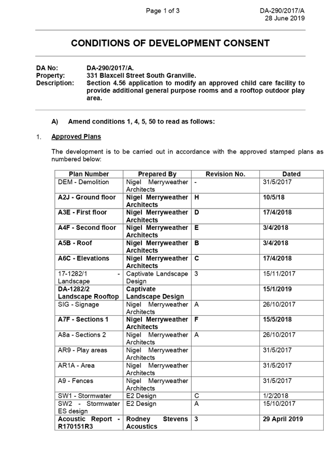
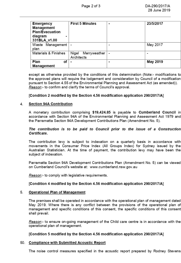
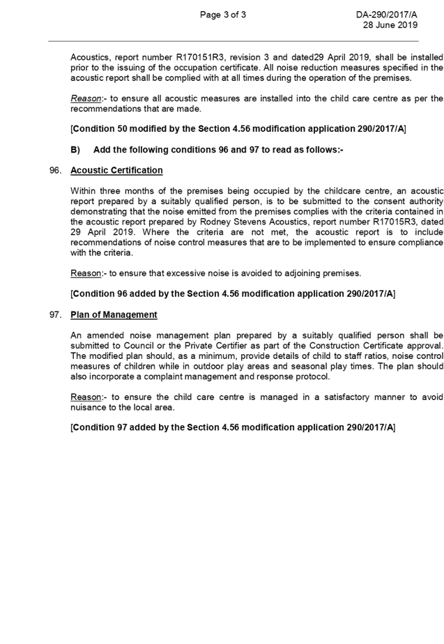
DOCUMENTS
ASSOCIATED WITH
REPORT LPP054/19
Attachment 2
Architectural Plans - Part 1
Cumberland Local Planning Panel Meeting
14 August 2019
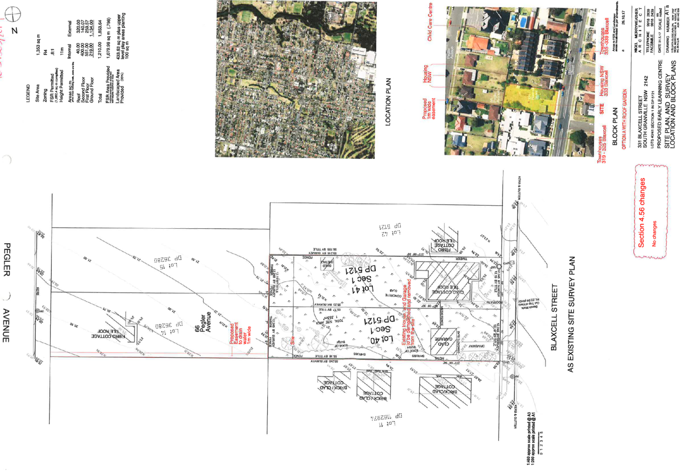
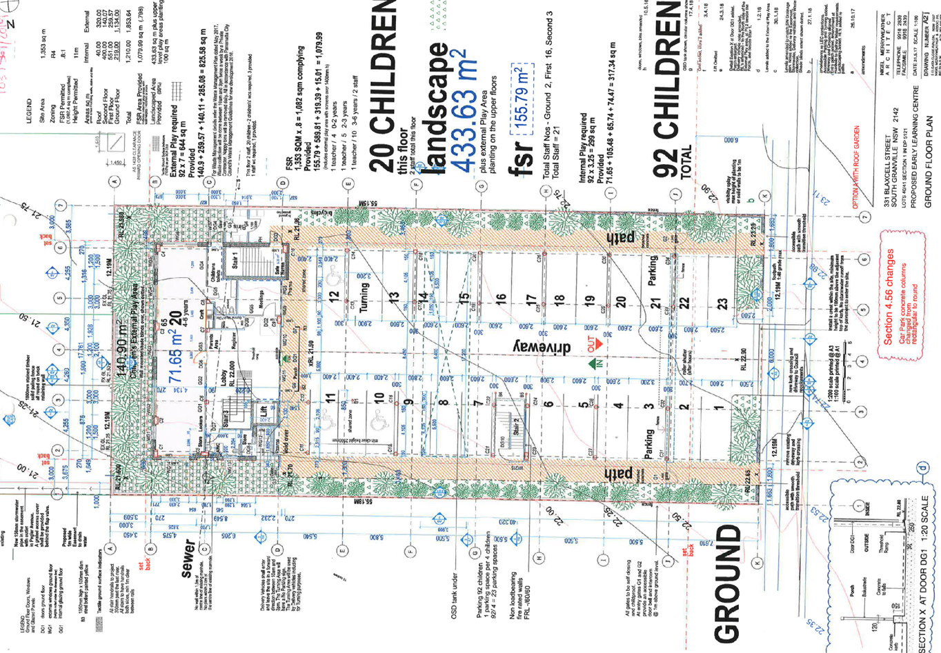
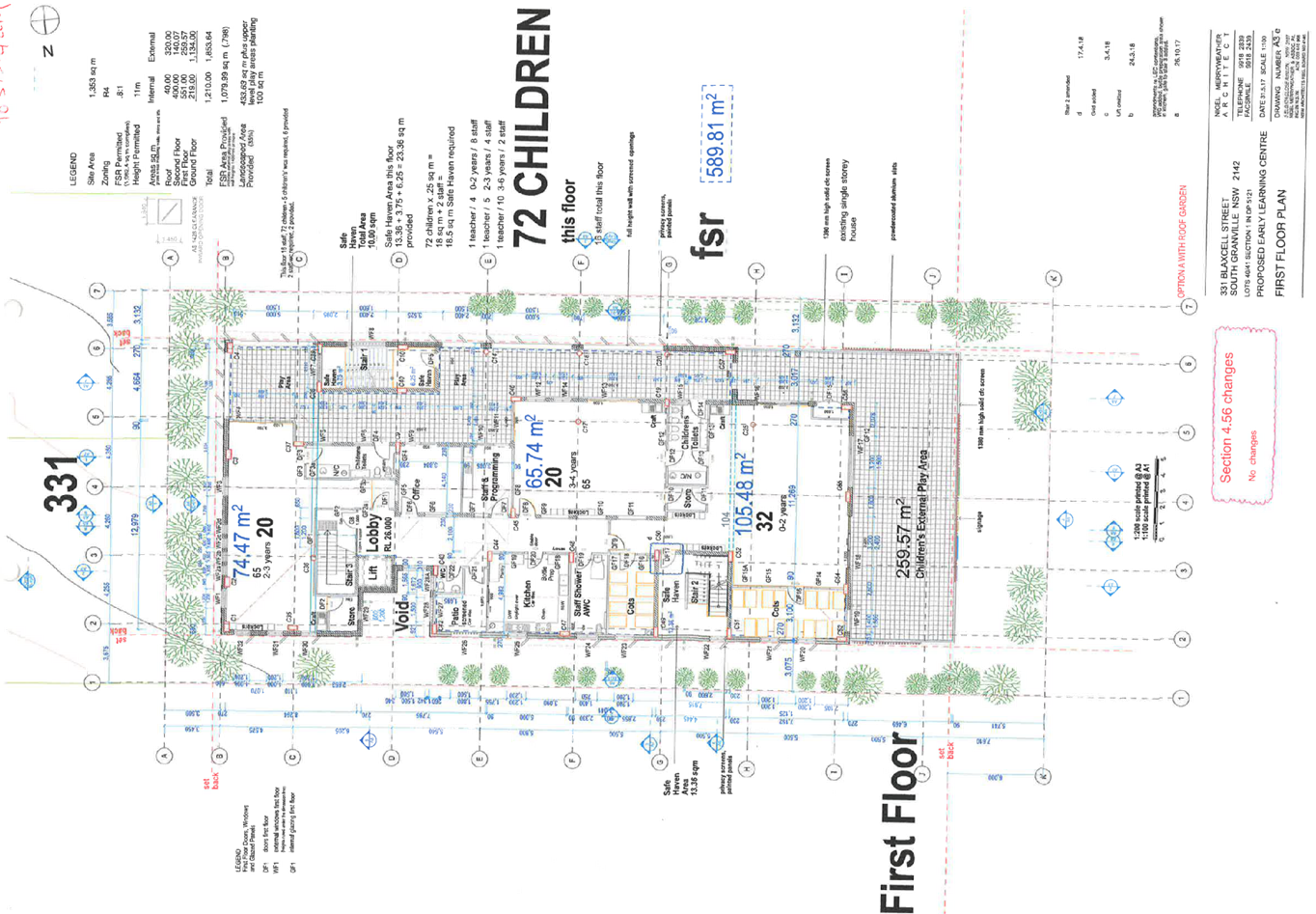
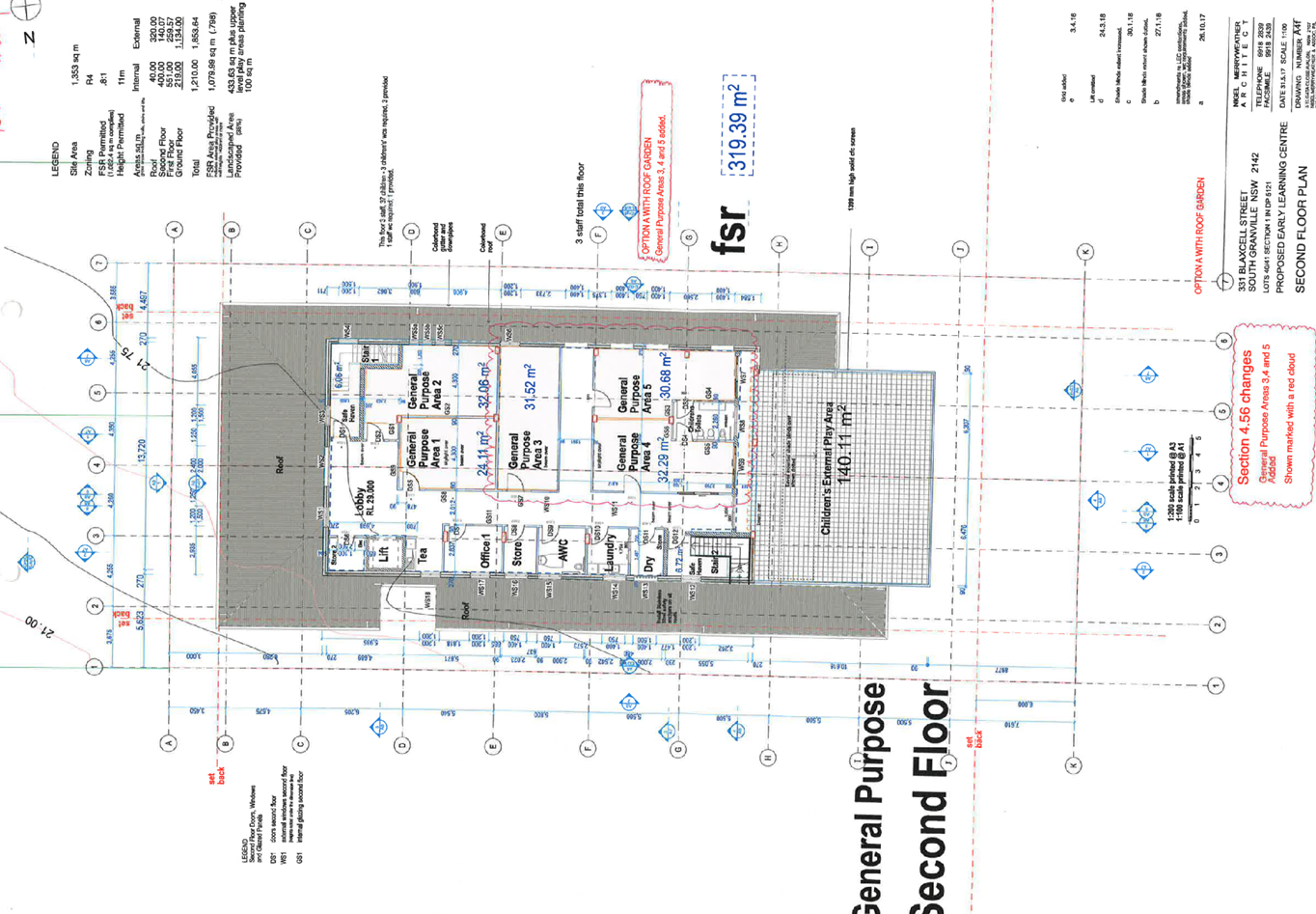
DOCUMENTS
ASSOCIATED WITH
REPORT LPP054/19
Attachment 3
Architectural Plans - Part 2
Cumberland Local Planning Panel Meeting
14 August 2019
DOCUMENTS
ASSOCIATED WITH
REPORT LPP054/19
Attachment 4
Variation to height of buildings Statement under
Clause 4.3
Cumberland Local Planning Panel Meeting
14 August 2019
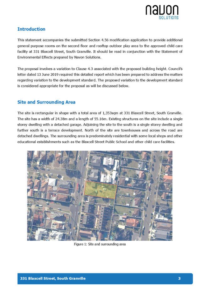
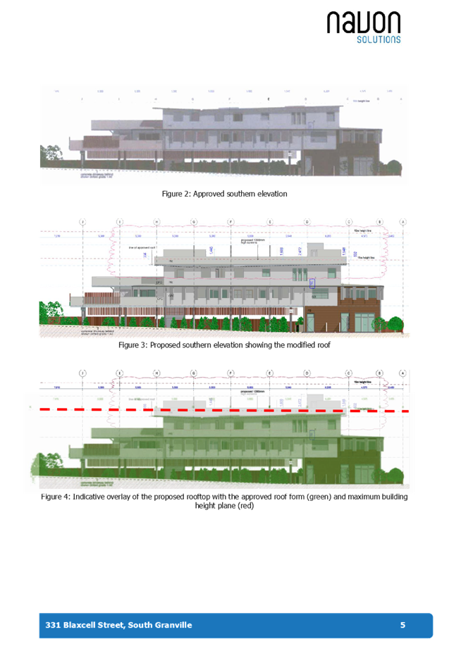
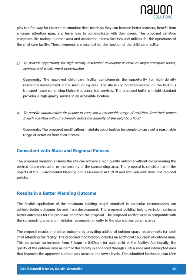
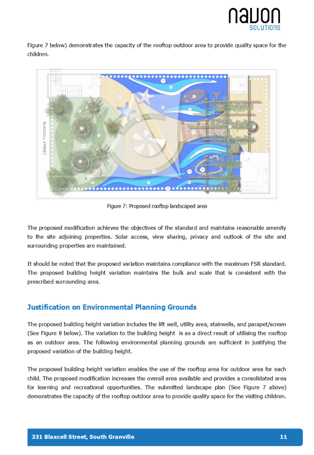
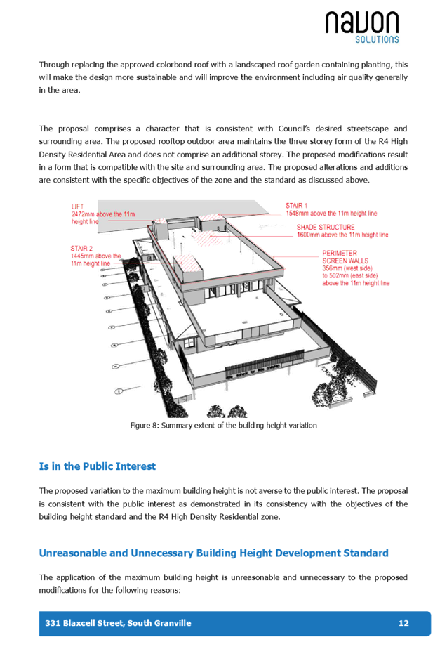
DOCUMENTS
ASSOCIATED WITH
REPORT LPP054/19
Attachment 5
Appendix A
Cumberland Local Planning Panel Meeting
14 August 2019
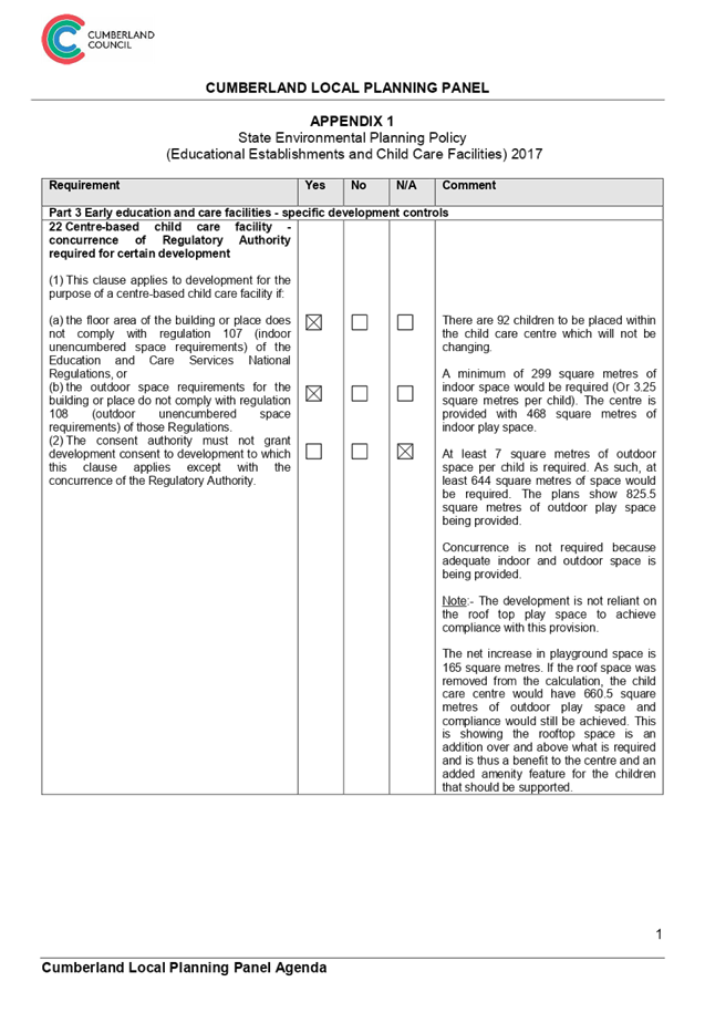
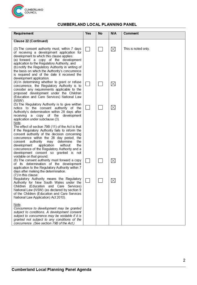
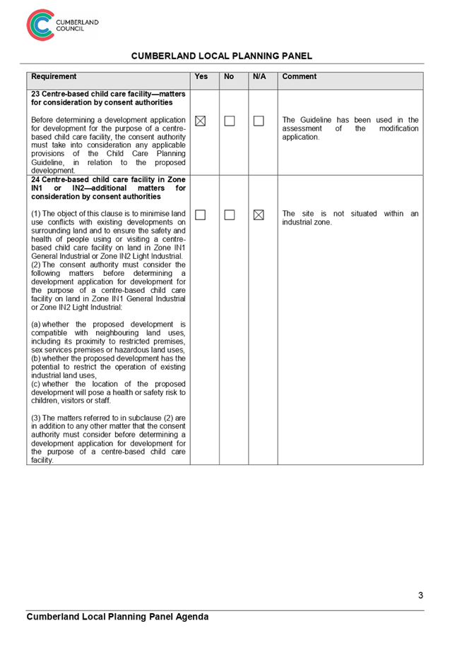

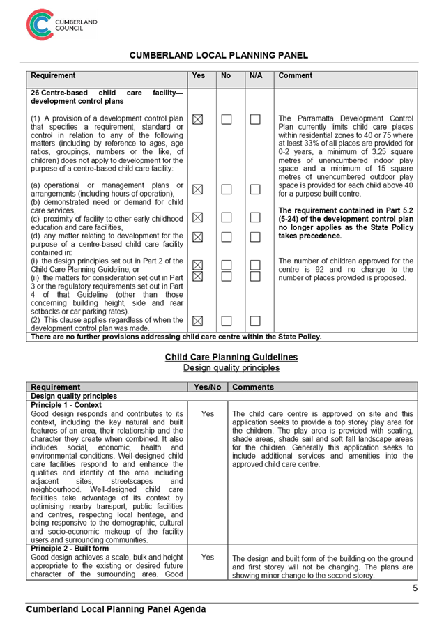


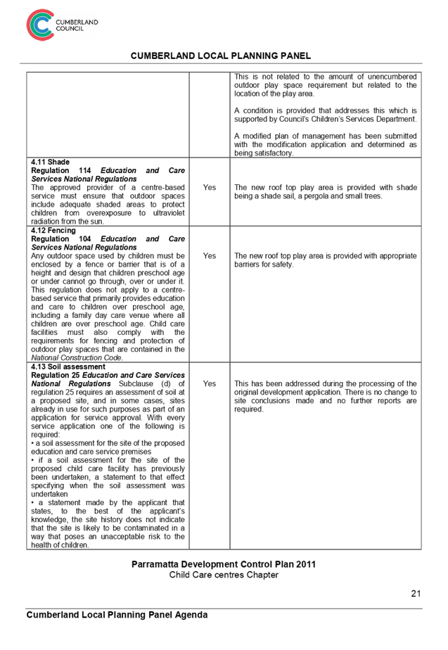
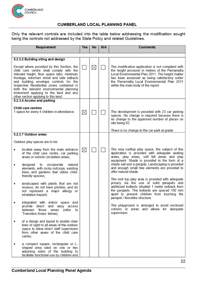
DOCUMENTS
ASSOCIATED WITH
REPORT LPP054/19
Attachment 6
Original Deferred Commencement Consent
Cumberland Local Planning Panel Meeting
14 August 2019
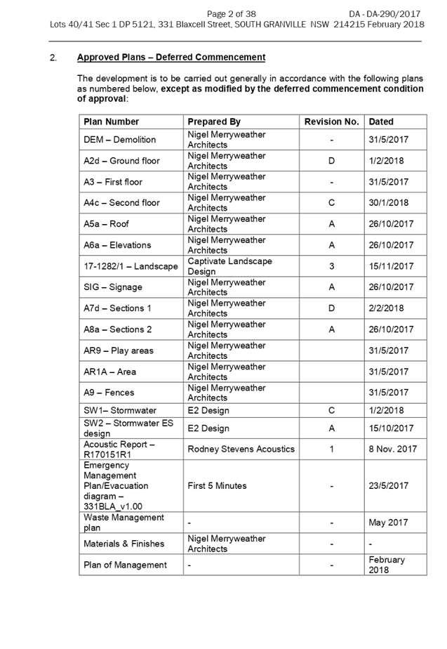
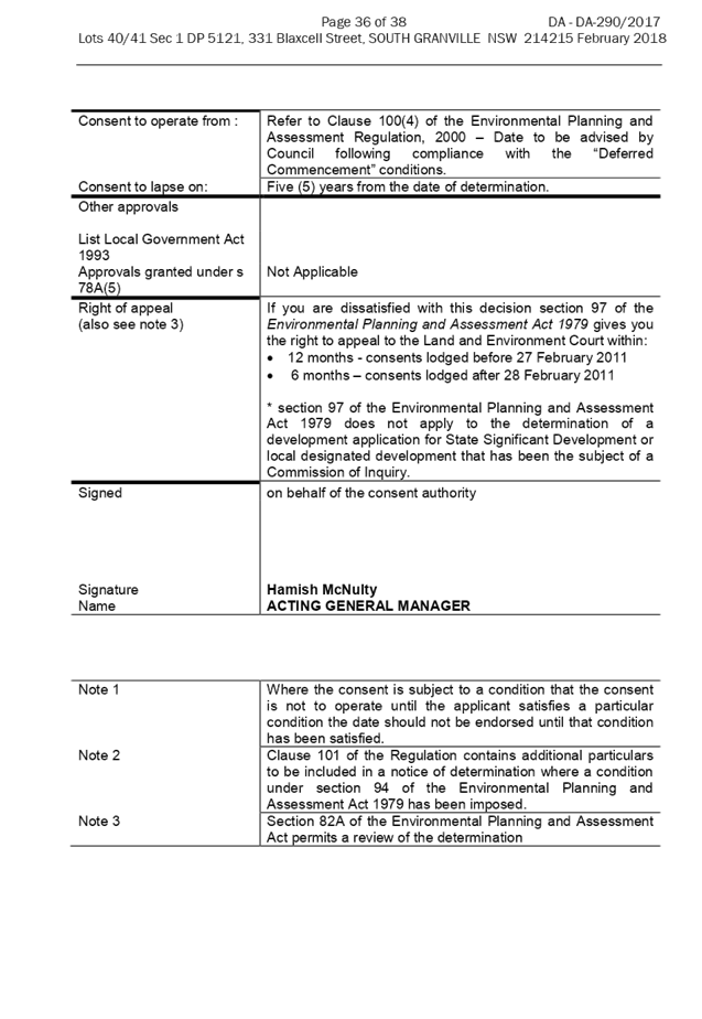
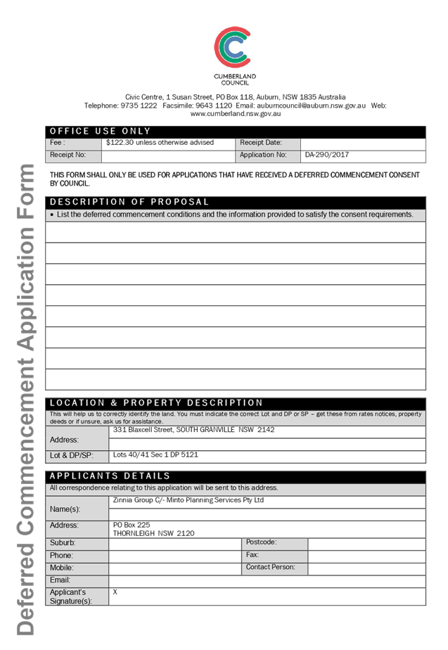
DOCUMENTS
ASSOCIATED WITH
REPORT LPP054/19
Attachment 7
Original Architectural Plans
Cumberland Local Planning Panel Meeting
14 August 2019
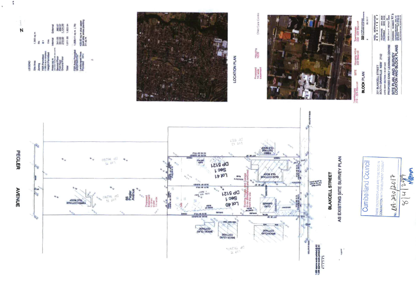
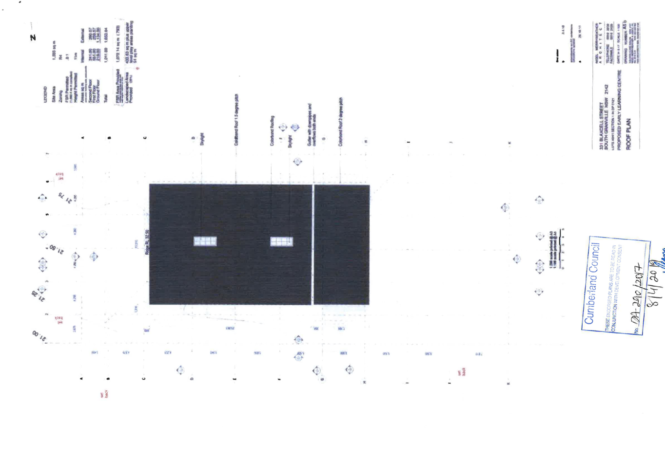
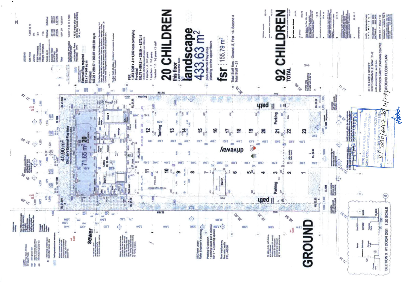
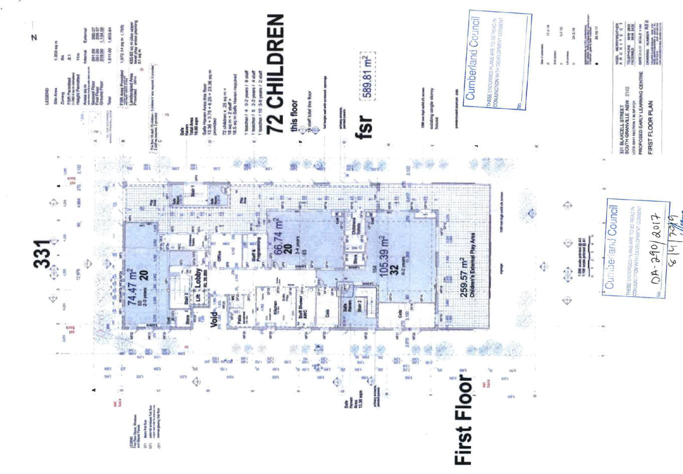
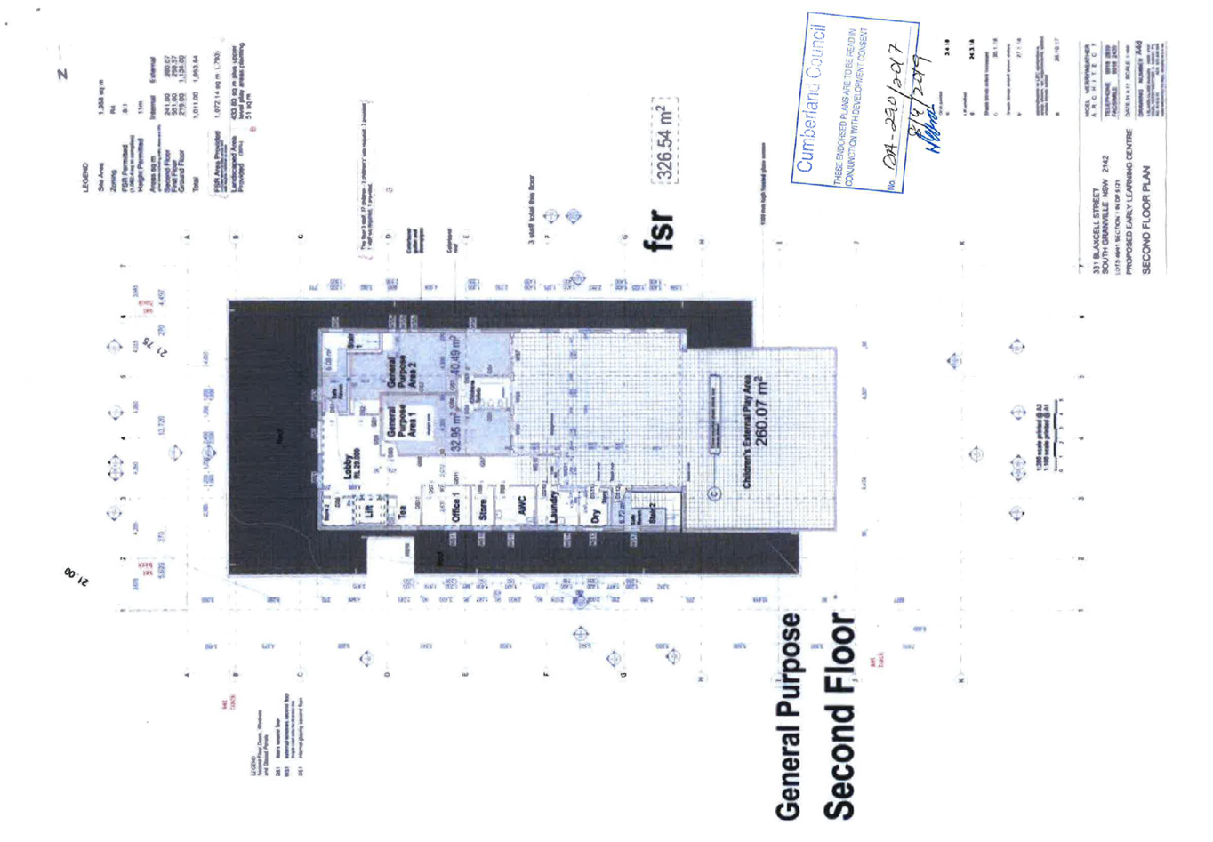
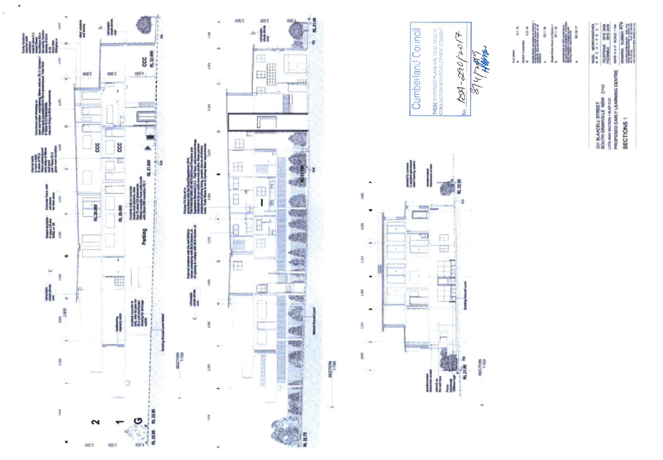
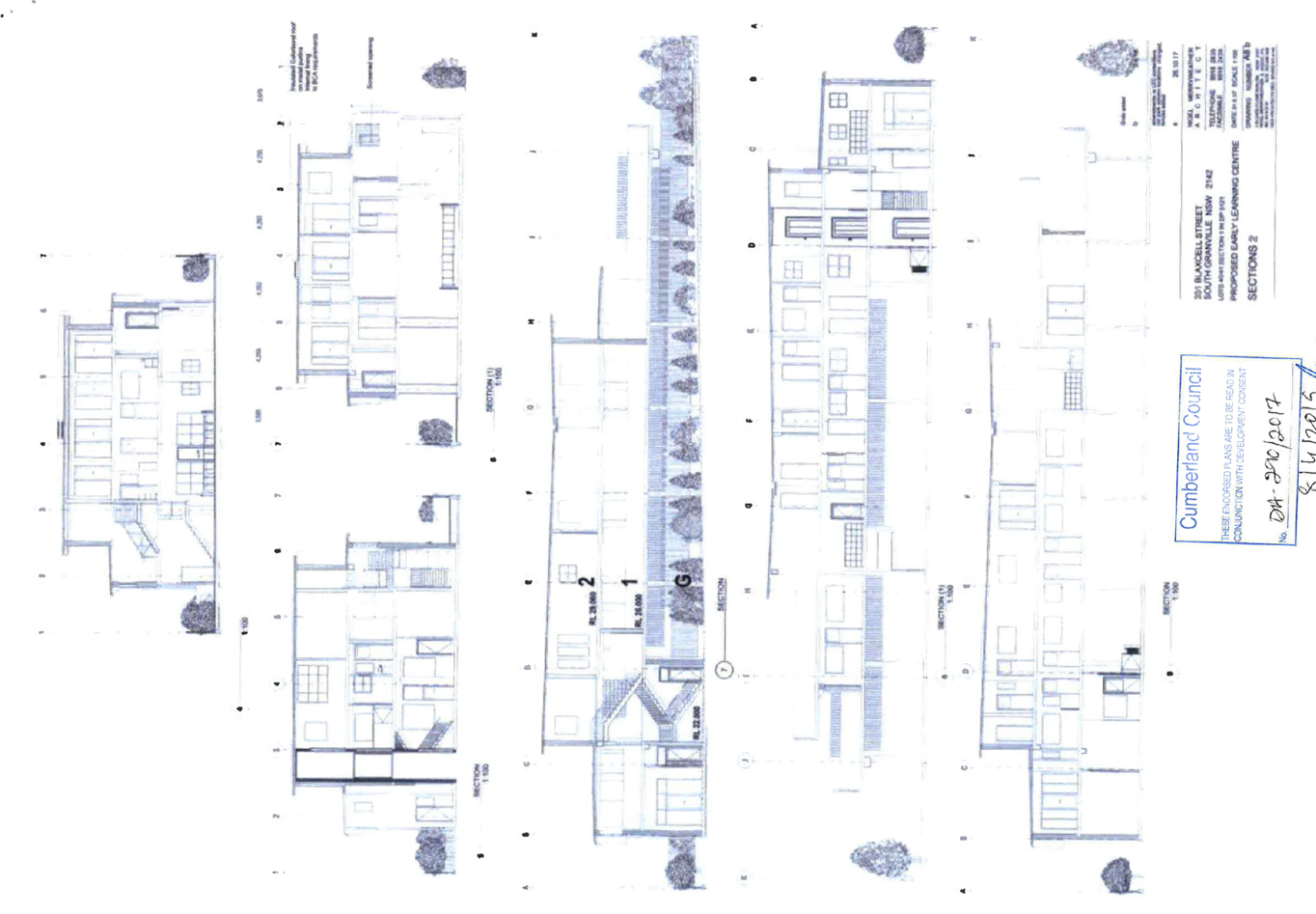
Cumberland
Local Planning Panel Meeting
14 August 2019
Item No: LPP055/19
Development
Application - 40 - 42A Park Road, Auburn
Responsible
Division: Environment
& Planning
Officer: Executive
Manager Development and Building
File
Number: DA-51/2019
|
Application lodged
|
13 March 2019
|
|
Applicant
|
F & A Property Development
Pty Ltd
|
|
Owner
|
F & A Property Development
Pty Ltd and Just Ahead Pty Ltd
|
|
Application No.
|
DA-51/2019
|
|
Description of Land
|
40 – 42A Park Road,
AUBURN NSW 2144, Lot 4 DP 440764, Lot 1 DP 798616, Lot 30 DP
75014
|
|
Proposed
Development
|
Demolition of existing
dwellings and construction of a six storey residential flat building
comprising 32 units above two levels of basement car parking for 36 vehicles
pursuant to State Environmental Planning Policy (Affordable Rental Housing)
2009
|
|
Site
Area
|
1536.8m2
|
|
Zoning
|
R4 High Density Residential
|
|
Disclosure
of political donations and gifts
|
Nil disclosure
|
|
Heritage
|
Yes – site is located
adjacent to 25 Harrow Road, Auburn, a heritage listed property of local
significance
|
|
Principal
Development Standards
|
Clause 4.3 Height of Buildings
Permissible: 18
metres
Proposed: 19.99 metres
Clause 4.4 Floor Space Ratio
Permissible: 1.7:1
Proposed: 1.91:1
|
|
Issues
|
· Building
height exceedance (ALEP 2010)
· Solar
access
· Submissions
|
1. Development
Application No.DA-51/2019 was received on 13 March 2019 for the demolition of existing
dwellings and construction of a six storey residential flat building comprising
32 units above two levels of basement car parking for 36 vehicles, pursuant to
State Environmental Planning Policy (Affordable Rental Housing) 2009.
2. The
application was publicly notified to occupants and owners of the adjoining
properties for a period of fourteen (14) days between 2 April 2019 and 16 April
2019. In response, two (2) submissions were received, including one (1)
petition.
3. The
subject site is located adjacent to 25 Harrow Road, Auburn, a heritage item of
local significance.
4. The
development is generally compliant with the provisions of the Auburn
Development Control Plan 2010.
5. The
development is generally in compliance with the provisions of the Auburn Local
Environment Plan, with the exception of a proposed variation to the maximum
building height. The variation is as follows:
Figure 1
– Auburn LEP 2010 Compliance Table
|
Control
|
Required
|
Provided
|
Variation
|
|
4.3 Height of buildings
|
18 metres
|
Lift overrun 19.99
metres
|
11%
|
6. The
application is recommended for deferred commencement approval, subject to the
conditions as provided in the attached schedule.
7. The
application is referred to the Panel as the proposal is considered to be
sensitive development and contravenes a development standard by more than 10
percent.
Subject Site And Surrounding
Area
The site forms Lot 4 DP 440764,
Lot 1 DP 798616 and Lot 30 DP 75014 and is known as 40, 42 and 42A Park Road,
Auburn NSW 2144. The site has an area of 1536.8m2 and a frontage to
Park Road of 30.82 metres. The site has a gradual fall to the street.
Current improvements on the site
comprise a single storey clad and metal roof dwelling and a single storey brick
and tile roof dwelling and associated outbuildings. There are several trees
scattered across the site. The site is traversed by existing Sydney Water
stormwater and sewer pipelines.
Existing development adjoining and
surrounding the site include a mix of low to medium density residential
development, with the area being in the process of transitioning to higher
density land uses. The site is located in proximity to the Auburn Town Centre,
to the north and east, refer to Figure 3 below. The Auburn Town Centre is
characterised by a mix of commercial and retail land uses, community uses and
higher density residential built forms.
The following table identifies
existing development immediately adjoining the site.
Figure
2 – Adjoining development
|
ADDRESS
|
EXISTING
DEVELOPMENT
|
|
38 Park Road,
Auburn
Adjoining to the
north (side)
|
Semi-detached dwelling, built to
the southern boundary. This dwelling was formerly attached to the dwelling on
40 Park Road, Auburn. This dwelling was demolished in accordance with a
complying development certificate (CDC) approval in response to an Emergency
Order issued by Council in relation to structural fire damage
(EPA-95/2017).
|
|
44 Park Road,
Auburn
Adjoining to the
south (side)
|
Three storey ‘walk-up’ residential flat
building.
|
|
21 Harrow Road,
Auburn
Adjoining to the
east (rear)
|
Single storey brick and tile
dwelling currently operating as a pre-school.
|
|
23 Harrow Road,
Auburn
Adjoining to the
east (rear)
|
Single storey brick and tile
dwelling with detached secondary dwelling.
|
|
25 Harrow Road,
Auburn
Adjoining to the
east (rear)
|
Single storey brick and tile
‘Victorian’ dwelling listed as a heritage item of local
significance.
|
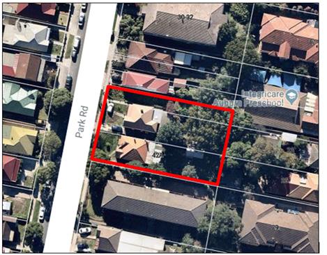
Figure
3 – Aerial view of subject site (Nearmap)
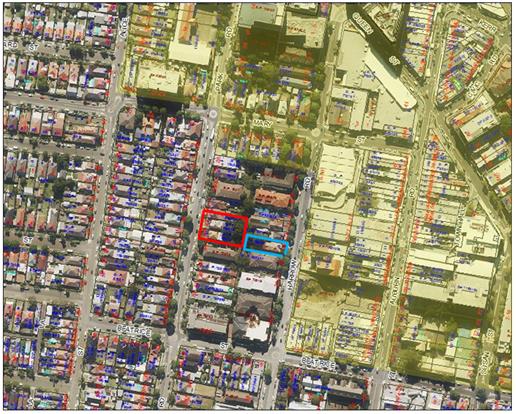
Figure
4 – Locality Plan of subject site, outlined red with adjoining heritage
item outlined blue and Auburn Town Centre shaded yellow (Exponare)
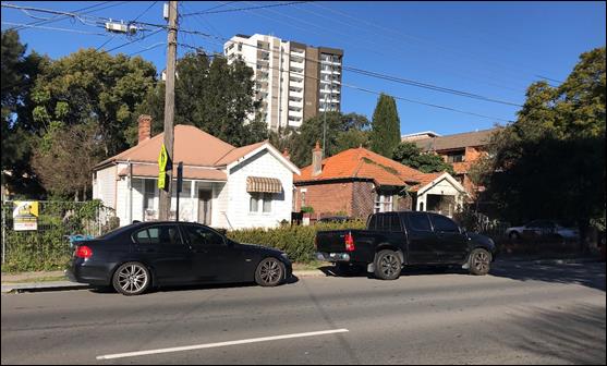
Figure
5 – Street view of subject site, mixed use development at 93-105 Auburn
Road, Auburn, within the Town Centre visible in background
Description of the Proposed
Development
Council is in receipt of a
development application lodged on 13 March 2019, seeking approval for the
demolition of existing dwellings and construction of a six storey residential
flat building comprising 32 units above two levels of basement car parking for
36 vehicles pursuant to State Environmental Planning Policy (Affordable Rental
Housing) 2009 at 40-42A Park Road, Auburn.
The development comprises a total
of 32 residential units across six (6) levels, with a mix of 2 x one bedroom,
21 x two bedroom and 9 x three bedroom units.
A total of eight (8) units are to
be allocated as affordable housing, i.e. G05, 102, 103, 105, 106, 107, 205 and
503. Four (4) units are capable of being converted to adaptable dwellings, i.e.
G05, 105, 106 and 208.
The communal open space area is
distributed across the ground level and Level 5, with a total communal open
space area of 441.24m2 provided.
There is a bin chute for the
disposal of waste generated on each of the upper levels of the development,
which feeds into the bin room on the ground level. The bin room also includes
an area for bulky waste storage.
A vehicular access driveway off
Park Road provides access to the basement carpark which proposes a total of 36
car parking spaces, including four (4) accessible car parking spaces, across
two levels. Basement 02 also includes storage areas.
History
On 13 January 2017 a development
application was submitted to Council seeking consent for the demolition of
existing dwellings, removal of several trees, construction of 2 x double storey
attached townhouses and a 7 storey residential flat building containing 27
units over two levels of basement car parking at 42-42A Park Road, Auburn
(DA-9/2017).
DA-9/2017 was assessed and a
deferral letter issued to the Applicant seeking additional information,
including amendments to the design of the development to facilitate compliance
with the ALEP 2010 and ADCP 2010 as well as details of the diversion of the
Sydney Water stormwater pipe traversing the site. The Applicant was unable to
provide the requested information to Council in a timely manner and the
application was subsequently withdrawn on 14 November 2017.
The currently vacant 40 Park Road,
Auburn was the subject of an Emergency Order issued by Council in relation to
structural fire damage of the attached dwelling (EPA-95/2017). The
dwelling on 40 Park Road, Auburn, was subsequently demolished in accordance
with a complying development certificate (CDC) approval.
Applicants Supporting
Statement
The applicant has provided a
Statement of Environmental Effects prepared by Morphology Design Associates
dated February 2019, received by Council on 13 March 2019, in support of the
application.
Contact with Relevant
Parties
The assessing officer has
undertaken a site inspection of the subject site and surrounding properties and
has been in regular contact with the applicant throughout the assessment
process.
Internal Referrals
Development Engineer
The development application was
referred to Council’s Development Engineer for comment on 27 March 2019
and issues were raised in respect to flooding and stormwater, having particular
regard to the proposed deviation of the Sydney Water stormwater pipe traversing
the subject site. A meeting was held with Council staff and the Applicants
stormwater engineer and an amended Flood Study Report and amended Stormwater
Plans were subsequently lodged with Council on 2 July 2019.
Council’s Development
Engineer reviewed the amended documentation and advised, on 17 July 2019, that
the development could be supported, subject to deferred commencement conditions
of consent, relating to flooding and stormwater. The conditions are required to
be deferred commencement conditions as they relate to stormwater and drainage
arrangements over neighbouring properties for which separate approvals and
owners consent is required to be obtained.
Environment and Health
The development application was
referred to Council’s Environment and Health Officer for comment on 27
March 2019, who has advised on 9 April 2019 that the development proposal is
satisfactory having regard to contamination and acoustic impacts and therefore
can be supported subject to recommended conditions of consent.
Landscape Architect/Officer
The development application was
referred to Council’s Tree Management Officer for comment on 27 March
2019, who has advised on 12 April 2019 that the development proposal is
satisfactory, subject to the recommendation of a deferred commencement
condition to address the retention of trees on the adjoining properties, with a
Tree Protection Plan to be submitted to Council. The development proposal
therefore can be supported subject to recommended conditions of consent. The
conditions are required to be deferred commencement conditions as they relate
to tree protection arrangements which may impact on stormwater design and are
required to be finalised before the consent becomes operative.
Waste Management
The development application was
referred to Council’s Waste Management Officer on 5 June 2019 for
comment, who raised issues with respect to clarifying the specifications of the
garbage chute system proposed and ensuring that there is a separate bulky waste
storage area provided for the development.
An amended Waste Management Plan
(WMP) and Ground Floor Plan, with a revised layout of the bin room was
subsequently submitted to Council on 2 July 2019. Council’s Waste
Management Officer reviewed the amended information and advised on 8 July 2019
that the development proposal is satisfactory, subject to the recommendation of
a condition of consent to ensure the bulky waste storage area does not obstruct
the transfer of general waste and recycling bins to the main collection area.
External Referrals
Ausgrid
Consultation was undertaken with
Ausgrid, pursuant to the provisions of Clause 45(2) of the ISEPP, as the
development involves works within 5 metres of an exposed overhead electricity
power line. The development application was referred to Ausgrid, however, to
date, no comments have been received.
Sydney Water
The development application was
referred to Sydney Water who advised that, due to the proximity of the proposed
development to Sydney Water assets, conditions of development consent relating
to the Sydney Water easement, stormwater, building plan approval and a Section
73 Certificate are recommended.
Conditions of consent have been
recommended to address the matters raised by Sydney Water.
Planning Comments
The provisions of any
Environmental Planning Instruments (EP&A Act s4.15 (1)(a)(i))
State Environmental Planning
Policies
The proposed development is
affected by the following State Environmental Planning Policies:
(a) State
Environmental Planning Policy No. 55 – Remediation of Land (SEPP 55)
Clause 7 of SEPP 55 requires
Council to be satisfied that the site is suitable or can be made suitable to
accommodate the proposed development. The matters listed within Clause 7 have
been considered in the assessment of the development application.
Figure
6 – SEPP 55 Compliance Table
|
Matter for Consideration
|
Yes/No
|
|
Does the application involve re-development of the site or
a change of land use?
|
Yes
No
|
|
Is the development going to be used for a sensitive land
use (e.g.: residential, educational, recreational, childcare or hospital)?
|
Yes
No
|
|
Does information available to you indicate that an
activity listed below has ever been approved, or occurred at the site?
acid/alkali plant and
formulation, agricultural/horticultural activities, airports, asbestos
production and disposal, chemicals manufacture and formulation, defence
works, drum re-conditioning works, dry cleaning establishments, electrical
manufacturing (transformers), electroplating and heat treatment premises,
engine works, explosive industry, gas works, iron and steel works, landfill
sites, metal treatment, mining and extractive industries, oil production and
storage, paint formulation and manufacture, pesticide manufacture and
formulation, power stations, railway yards, scrap yards, service stations,
sheep and cattle dips, smelting and refining, tanning and associated trades,
waste storage and treatment, wood preservation
|
Yes
No
|
|
Is the site listed on
Council’s Contaminated Land database?
|
Yes
No
|
|
Is the site subject to EPA
clean-up order or other EPA restrictions?
|
Yes
No
|
|
Has the site been the subject of
known pollution incidents or illegal dumping?
|
Yes
No
|
|
Does the site adjoin any
contaminated land/previously contaminated land?
|
Yes
No
|
|
Has the appropriate level of
investigation been carried out in respect of contamination matters for
Council to be satisfied that the site is suitable to accommodate the proposed
development or can be made suitable to accommodate the proposed development?
|
Yes
No
|
|
A Phase 1 Contamination
Assessment report prepared by Ground Technologies Pty Ltd was submitted with
the application. The report did not reveal any potential matters of concern
with regard to contamination and concludes that the site is suitable for its
intended use.
Council’s Environmental
Health Officer has reviewed the report and determined that the site is
suitable to support such a development, given that the report provides that
the site is suitable for the development for the proposed use and that no
further action or remediation action is required.
A condition of consent has been
recommended, should any new information come to light during demolition or
construction works, which has the potential to alter previous conclusions
about site contamination.
|
(b) Statement
Environmental Planning Policy No. 65 - Design Quality of Residential Apartment
Development (SEPP 65)
SEPP 65 applies to the development
as the building is 3 storeys or more, and contains more than 4 dwellings. A
design statement addressing the design quality principles prescribed by SEPP 65
was prepared by the project architect. Integral to SEPP 65 is the Apartment
Design Guide (ADG), which sets benchmarks for the appearance, acceptable impacts
and residential amenity of the development.
The proposal is generally
compliant with the provisions of SEPP 65 and the ADG, with the exception of
building separation distances. This variation is discussed below:
The ADG relevantly provides:
Design Criteria
Separation between windows and
balconies is provided to ensure visual privacy is achieved. Minimum required
separation distances from buildings to the side and rear boundaries are as
follows:
Figure
7: Extract of ADG
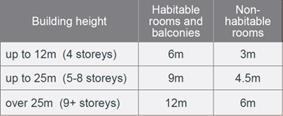
The building is six (6) storeys in
height and maintains the following separation distances:
Figure
8: ADG Non-compliance Table
|
Building Elevation
|
Level
|
Separation Distance
|
Complies
|
|
South (side)
|
Ground
01
02
03
04
05
|
2.963m – 6m
3m – 7m
3m – 7m
3m – 7m
4.5m – 9.09m
4.5m – 9.09m
|
No
|
|
East (rear)
|
Ground
01
02
03
04
05
|
6m
6m
6m
6m
9m
9m
|
Yes
|
|
North (side)
|
Ground
01
02
03
04
05
|
6m
6m
6m
6m
9m
9m
|
Yes
|
The variations to the building
separation distances along the southern elevation are considered acceptable,
for the following reasons:
· The
ground floor building elevation, with a setback of 2.963m to the southern
boundary, comprises the bedroom and bathroom of Unit G05. The bedroom does not
have any openings and the bathroom along this elevation, proposes a highlight
window. There is a sliding door to the second bedroom of Unit G05, along the
southern elevation. An increased setback of 4.246m has been applied to this
elevation of the building. It is also noted that the bin room maintains a
setback of 6m to the southern boundary.
· The
southern building elevation of Levels 1 to 3, with a setback distance of 3m,
does not have any openings to the habitable rooms. There is a bathroom window,
however this window comprises a highlight window configuration. Where there is
a window to the habitable rooms along this elevation, a minimum building
setback of 6m has been applied. Where there is a balcony along this elevation a
setback distance of 7m has been applied to the sliding door and a setback of 3m
applied to the edge of the balcony. Privacy louvres have been proposed to the
balcony to mitigate any overlooking impacts.
· The
southern building elevation of Levels 4 and 5, which maintain a minimum 4.5m
setback, comprises habitable rooms, with no openings. There are balconies to
bedrooms along this elevation, with a side setback of 4.5m to the edge of the
balcony. Privacy louvres have been proposed to mitigate any impacts on the
adjoining property to the south. The sliding doors accessing these balconies
are on the western (front) elevation of the building. Where there are windows
to the study, kitchen and dining rooms, a minimum building setback of 5.8m has
been applied. This is considered a minor variation to the minimum 6m
requirement. It is noted that the splayed configuration of the bedroom walls of
Units 404 and 502 result in an encroachment of 1m into the 5.8m setback. Due to
the splay of the wall, the windows face south-west and maintain a minimum 8.5m
setback from the southern boundary. Where windows are proposed to the bedrooms
of Unit 403 and 503, an increased setback of 9.09m has been applied.
A comprehensive assessment against
SEPP 65 and the ADG is contained in Appendix A.
(c) State
Environmental Planning Policy (Infrastructure) 2007 (ISEPP)
The provisions of the ISEPP 2007
have been considered in the assessment of the development application.
Clause 45 - Development likely
to affect an electricity transmission or distribution network
The subject development occurs
within 5 metres of an overhead electricity power line. As such, the Consent
Authority is required to give written notice to an electricity supply
authority.
The application was referred to
Ausgrid on 1 April 2019 to seek concurrence in accordance with Clause 45. No
response has been received to date and concurrence has been assumed.
Clause 85 – Development
adjacent to railway corridors
The application is not subject to
clause 85 of the ISEPP, because the subject site is not in or adjacent to a
railway corridor.
Clause 86 – Excavation
in, above, below or adjacent to rail corridors
The application is not subject to
clause 86 of the ISEPP as the proposed redevelopment of the site does not
involve excavation to a depth of at least 2m below ground level (existing), on
land within, below or above a rail corridor, or within 25m (measured
horizontally) of a rail corridor.
Clause 87 – Impact of
rail noise or vibration on non-rail development
The application is not subject to
clause 87 of the ISEPP as the site is in or adjacent to a rail corridor or is
not likely to be adversely affected by rail noise or vibration.
Clause 101 – Frontage to
classified road
The portion of Park Road that the
site maintains a frontage to is not a classified road. In the January 2010
Gazette No. 11, the section of Park Road between the intersection of Park Road
and South Parade and the intersection of Park Road and Vaughan Street was
reclassified from a regional road to a local road.
Clause 101 is therefore not
applicable to the development.
Clause 102 – Impact of
road noise or vibration on non-road development
The application is not subject to
clause 102 of the ISEPP as the annual average daily traffic volume is not
greater than 40,000 vehicles.
Clause 104 – Traffic
generation developments
The application is not subject to
clause 104 as the proposal does not trigger the requirements for traffic
generating developments listed in Schedule 3 of the ISEPP.
(d) State
Environmental Planning Policy (Building Sustainability Index: BASIX) 2004
(BASIX SEPP)
BASIX Certificate 972830M issued
on 14 February 2019 prepared by Sustainable Thermal Solutions has been
submitted to Council and is considered to be satisfactory.
(e) State
Environmental Planning Policy (Affordable Rental Housing) 2009 (ARH SEPP)
The proposal is subject to the
provisions of Part 2 (New affordable rental housing) Division 1 (In-fill
affordable housing) of the ARH SEPP.
Following is a discussion of the
relevant Clauses, a detailed assessment is provided at Appendix B.
13 Floor space ratios
(1) This
clause applies to development to which this Division applies if the percentage
of the gross floor area of the development that is to be used for the purposes
of affordable housing is at least 20 per cent.
Based on the total proposed GFA of
2,936.59m2, a minimum GFA of 587.32m2 is required to be
used for the purpose of affordable housing to meet the minimum 20 per cent
requirement of Clause 13.
The development proposes to
allocate an area of 619.67m2 of the total building GFA to affordable
housing, i.e. Units G05, 102, 103, 105, 106, 107, 205 and 503. This equates to
a total of 21.1 per cent of the total building GFA.
A maximum floor space ration (FSR)
of 1.7:1 is applicable to the subject site, pursuant to the provisions of ALEP
2010. This equates to a maximum gross floor area (GFA) of 2,612.56m2.
As the existing maximum FSR is
less than 2.5:1 and the percentage of GFA of the development that is used for
affordable housing is less than 50 per cent, the following formula applies:
Bonus = % of GFA used for ARH /
100
% of GFA used for ARH = 21.1% /
100
Bonus = 0.211:1
Applying the ARH Bonus (represents
a maximum GFA of 2,936.82m2)
Max. GFA permitted:
= 2,936.82m2 (1.911:1)
Provided GFA = 2,936.59m2
FSR = 1.91:1
The proposal is compliant with the
maximum FSR, subject to the ARH SEPP bonus.
It should be noted that the
proposal fully complies with the key planning controls contained within the ARH
SEPP including site area, landscaped area, parking, accommodation size and
prescribed standards for in-fill affordable housing.
16A Character of local area
A consent authority must not
consent to development to which this Division applies unless it has taken into
consideration whether the design of the development is compatible with the
character of the local area. The SEPP (ARH) does not contain any guidance for
assessing whether a proposal is compatible with the character of the local
area. However, a planning principle for assessing compatibility in the urban
environment was established by Senior Commissioner Roseth of the Land and
Environment Court in the judgement for Project Venture Developments Pty Ltd v
Pittwater Council [2005] NSWLEC 191. This involves asking the following two
questions:
· Are
the proposal’s physical impacts on surrounding development acceptable?
The physical impacts include constraints on the development potential of
surrounding sites.
· Is
the proposal’s appearance in harmony with the buildings around it and the
character of the street?
A merit assessment of the
character of the local area should consider the following 3 steps:
· Step
1 – Identify the ‘local area’.
· Step
2 – Determine the character of the ‘local area’.
· Step
3 – Determine whether the design of the proposed development is
compatible with the character of the ‘local area’.
An assessment against each step is
provided below:
Step 1 – Identify the
local area.
This assessment identifies the
local area as primarily the visual catchment of the site (hatched in red) as
viewed from within the site and directly adjacent to the site on the street
which is defined by the blue outline in Figure 9 and the white line in Figure
10.
The
local area
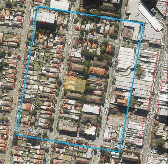
Figure
9 – Local Area catchment as identified on Aerial Map (Exponare)
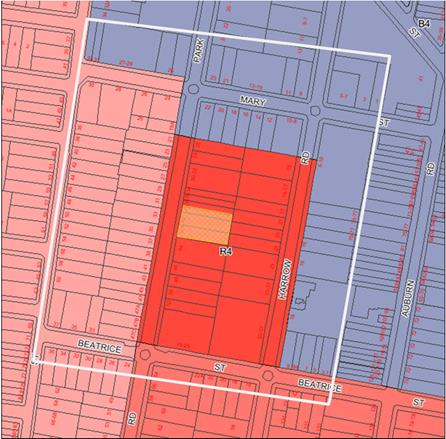
Figure
10 – Local Area catchment as identified on Zoning Map (Exponare)
Step 2 – Determine the
character (present and future) of the local area.
The zoning of the broader locality
and immediate area comprises R4 High Density Residential, B4 Mixed Use, R2 Low
Density Residential, and R3 Medium Density Residential under the Auburn Local
Environmental Plan 2010 (ALEP 2010).
Present Character of the area
The character of the local area
comprises the visual catchment of regular shaped allotments viewed from and
surrounding the subject site, which includes:
1. Existing
low to medium density built forms on the western side of Park Road and
adjoining the site to the north, east and south, comprising standard dwelling
houses and medium multi dwelling and walk-up residential flat building
development.
2. Recently
constructed residential flat building to the north of the site at 13-19 Mary
Street, Auburn.
3. Recently
constructed mixed use development to the rear of the site to the east at 93
Harrow Road, Auburn.
4. Established
residential flat building at the corner of Beatrice Street and Park Road at
19-25 Beatrice Street, Auburn.
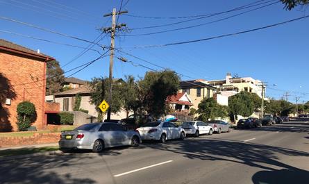
Figure
11 – Existing low to medium density development on the western side of
Park Road and adjoining site to the north, east and south, existing RFB at the
corner of Beatrice Street and Park Road in the distance
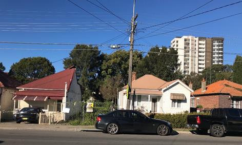
Figure
12 – View of the subject site with recently constructed RFB in the
distance to the east
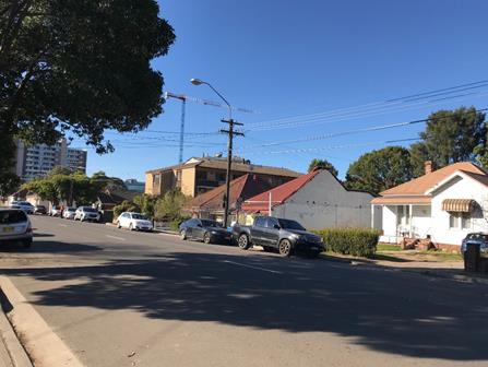
Figure
13 – Looking north along Park Road with recently constructed RFB at 13-19
Mary Street visible in the distance
Future
character of the area
Given the proximity of the subject
site to the Auburn Town Centre and Auburn Railway Station, it is considered
that the height, bulk and scale of the proposed development is not out of
character with the recently approved, commenced and completed newer residential
flat buildings being constructed within the locality. The proposed scale and
design of the development is considered to be consistent with the desired
future character of the locality.
The R4 land use zoning of the land
immediately surrounding the site and the B4 land use zone to north envisage a
higher density residential and commercial built form. The R2 low density
residential land to the west of the site presents a transition from the higher
density built forms to the north and east as you move further west into the
established residential areas of the suburb of Auburn, away from the Town
Centre.
Step 3 - Determine if the
development is compatible with the character of the local area.
In accordance with the Land and
Environment Court’s ‘Planning Principle’ and case law
compatibility is best defined as ‘capable of existing together in
harmony’. In order to test compatibility two questions are to be considered.
These questions, as well as a response to each, are provided below:
· Are
the proposal’s physical impacts on surrounding development acceptable?
The physical impacts include constraints on the development potential of
surrounding sites.
The building height, FSR, building
setbacks and landscaping of the proposed development are designed to maintain
the harmony within the streetscape, whilst contributing to the site context and
constraints. The proposal being a permissible land use, meets the FSR
requirement (in accordance with ARH SEPP) and contributes to the provision of
affordable housing within the close proximity of public transport hub and
Auburn Town Centre. Appropriate setbacks and privacy treatments are provided to
minimise any adverse impacts to the adjoining properties. The fifth storey does
not comply with the requirement for an increased front setback in ADCP 2010,
however, the proposed development is appropriately articulated to complement
the existing and future streetscape within the local area.
· Is
the proposal’s appearance in harmony with the buildings around it and the
character of the street?
To be compatible, a development
should contain, or at least respond to the key aesthetic elements that make up
the character of the surrounding area. The size of the basement maximises
landscaping and deep soil zones on site. The front setbacks are generous and
consistent with the existing streetscape. The proposal is considered to
maintain an appropriate residential character which is consistent with the
streetscape. As indicated, the local area is in the process of transitioning to
a high density residential built form, as such, the proposed development is not
considered to be inconsistent with the existing streetscape character of the
immediate area surrounding the subject site.
In conclusion, the proposal will
maintain the harmony within the general streetscape, and suitably fits in the
local character of the locality.
Regional
Environmental Plans
The proposed development is affected
by the following Regional Environmental Plans:
(a) Sydney Regional
Environmental Plan (Sydney Harbour Catchment) 2005 (SREP 2005)
The subject site is identified as
being located within the area affected by the Sydney Regional Environmental
Plan (Sydney Harbour Catchment) 2005. The proposed development raises no issues
as no impact on the catchment is envisaged.
(Note: - the subject site is not
identified in the relevant map as ‘land within the ‘Foreshores and
Waterways Area’ or ‘Wetland Protection zone’, is not a
‘Strategic Foreshore Site’ and does not contain any heritage items.
Hence the majority of the SREP is not directly relevant to the proposed
development).
Local
Environmental Plans
Auburn
Local Environmental Plan 2010 (ALEP 2010)
The provisions of the ALEP 2010
are applicable to the development proposal. It is noted that the development
generally achieves compliance with the key statutory requirements of the ALEP
2010 and the objectives of the R4 High Density Residential land use zone.
(a) Permissibility:-
The proposed development is
defined as a residential flat building and is permissible in the R4 High
Density Residential land use zone, with consent.
residential
flat building means a building containing 3 or more dwellings, but does not
include an attached dwelling or multi dwelling housing.
The relevant matters to be
considered under ALEP 2010 and the applicable clauses for the proposed
development are summarised below. A comprehensive LEP assessment is contained
in Appendix C.
Figure
14 – Auburn LEP 2010 Compliance Table
|
DEVELOPMENT STANDARD
|
COMPLIANCE
|
DISCUSSION
|
|
4.3 Height of Buildings
Maximum 18m
|
N
|
The
maximum building height exceeds 18 metres at the following points:
Roof
slab 19.38 metres
Lift
overrun 19.99 metres
Variation
to this development standard is sought as part of a Clause 4.6 variation
request, refer to following discussion under Clause 4.6.
|
|
4.4 Floor
Space Ratio (FSR)
Maximum 1.7:1
|
Y
|
The development provides a FSR of 1.91:1. This includes
the bonus pursuant to the provisions of Clause 13 (Floor space ratios) of the
ARH SEPP.
|
|
5.6 Architectural roof features
|
Y
|
The building design incorporates
an architectural roof feature which comprises a decorative element on the
uppermost portion of a building. This projection is not an advertising
structure, and does not include floor space area and is not reasonably
capable of modification to include floor space area. The roof feature does
not cause overshadowing impacts. Having regard to the above, a variation to the
maximum building height, to facilitate the architectural roof feature is
considered acceptable.
|
|
5.10 Heritage conservation
|
Y
|
The site is not identified
as a heritage item and is not located within a heritage conservation area.
The site adjoins a heritage item of local significance to the east at 25
Harrow Road, Auburn. Item I22 comprises a ‘Victorian Dwelling’ of
local heritage significance. The site is also in the vicinity of the
following items of local significance:
· I2 at 16 harrow
Road, Auburn ‘Auburn Baptist Church’
· I10 at 8 Mary
Street, Auburn ‘’Dwelling’
· I17 at 24 Mary
Street, Auburn ‘Lea’s Temperance Hall (former)’
The application was accompanied by a Heritage Impact
Statement (HIS) prepared by Edwards Heritage Consultants dated 21 February
2019.
Whilst the site is not identified as a heritage item, the
Consent Authority is required to consider the provisions of Clause 5.10(4) to
consider the effect of the proposed development on the heritage significance
of the item or area concerned.
The HIS relevantly concludes that demolition of the
existing dwellings at Nos. 42 and 42A Park Road is supported as they are
considered of little architectural interest and value and they have a silent
relationship to the adjoining heritage item at 25 Harrow Road as they do not
significantly feature in the visual curtilage to the heritage item.
Subject to recommendations, the proposal is considered
to have an entirely acceptable heritage impact in terms of its relationship
to the heritage item at 25 Harrow Road and is recommended to Council for
approval.
Conditions of consent have been recommended to ensure that
the recommendations of the HIS are implemented as they relate to photographic
archival recording and structural integrity.
|
|
6.3 Flood planning
Site
is within a flood planning area affected by the flood planning level of a
1:100 ARI (average recurrent interval) flood event plus 0.5 metre freeboard
|
Y
|
The development has been
designed to have regard to the 1 in 100-yr ARI flood level plus 0.5 metre
freeboard, providing a habitable floor level of 26.5 metres.
|
(b) Clause
4.6 – Variation to Building Height
Clause 4.6 allows the consent
authority to vary development standards in certain circumstances and provides
an appropriate degree of flexibility to achieve better design outcomes. The
consent authority may grant the exception as the Secretary’s concurrence
can be assumed where clause 4.6 is adopted as per the Department of Planning
Circular PS 18-003, dated 21 February 2018.
The applicant has submitted a
written request to vary the development standards for maximum building height.
Based on various case laws established by the Land and Environment Court of NSW
such as Four2five P/L v Ashfield Council [2015] NSWLEC 9, Randwick City Council
v Micaul Holdings P/L [2016] NSW LEC7 and Zhang and anor v Council of the City
of Ryde [2016] NSWLEC 1179, a 3 part assessment framework for a variation
request proposed under clause 4.6 has been considered and an assessment of the
proposed variance, following the 3 part test is discussed in detail below.
The three (3) preconditions which
must be satisfied before the application can proceed are as follows:
1. Is
the proposed development consistent with the objectives of the zone?
Applicant’s
justification:
The development is consistent with
the objectives of the R4 High Density Residential land use as the proposed
residential flat building will increase the local housing supply to meet the
additional housing needs in the growing community in the Auburn area. The
development has been designed with a variety of dwelling types, including
1-bedroom, 2-bedroom and 3-bedroom dwellings and accessible dwellings to meet
resident needs. The development is located within 800 metres of Auburn Railway
Station and accessible to public transport.
Planner’s comment:
The proposed development is
consistent with the R4 High Density Residential land use zone objectives as the
residential flat building contributes to the provision of affordable housing
within an accessible area; given the site’s proximity to public
transport, including the Auburn Railway Station. The development provides a
range of dwelling types, including a mix of one, two and three bedroom to meet
the varying needs of future residents. In an area that is currently in the
process of transitioning to a higher density built form, the development is of
a design and scale that contributes positively to the future intended
streetscape, whilst also not offending the existing established
streetscape.
2. Is
the proposed development consistent with the objectives of the development
standard which is not met?
Applicant’s
justification:
Despite the numerical
non-compliance with the building height standard, the six-storey residential
flat building is within the permitted floor space ratio (FSR) and the building
is compatible with the future character of the area.
Planner’s comment:
The objectives of the building
height standard are to enable appropriate development density to be achieved
and to ensure that the height of the building is compatible with the character
of the locality. The proposal is compliant with the maximum FSR; inclusive of
the bonus provision under the ARH SEPP. The increased height does not achieve
any additional level for residential use, and comprises portions of the roof of
the building and the top of the lift core.
The subject site is also
identified to be impacted by the 100-yr ARI flood level across the site, and as
such the proposal is required to achieve minimum FFLs above the 100-yr ARI
flood level plus 500mm freeboard. In this regard, the building is raised higher
in response to the conditions of the site and to achieve the required FFLs,
which has contributed to the non-compliance with the maximum building height
standard.
The departure sought is considered
to be modest and does not unreasonably impact on adjoining properties. The
additional height does not result in the appearance of bulk when viewed from
the existing streetscape and would not impinge on the evolving streetscape that
is anticipated for the immediate area. Given that the proposed development responds
to the site without compromising relationships with adjoining development, and
does not unduly compromise other relevant controls, the proposal is considered
to be consistent with the objectives of height requirements and development
within the R4 land use zone.
3. a)
Is compliance with the development standard unreasonable or unnecessary in the
circumstances of the case?
Applicant’s
justification:
The subject site is located within
the flood plan area. According to the Flood Study prepared by SGCE, the subject
site is flood affected with 100-yr flood level occurring at RL 26.00m at the
north-western corner of the site. The Auburn Council’s DCP requires the
flood planning level to be 500mm above the calculated 100-yr ARI flood levels
and 0.15m basement entry. The proposed development has adopted the flood
planning levels and set the Ground Floor level at RL26.50m, as well as the
basement crest at RL26.15m.
The proposed roof element is
designed for decorative purpose and does not contain any additional floor space
for the GFA. The height exceedance is a combined outcome of both flood
affection and architectural roof feature design. The roof element is not an
advertising structure and is not capable to be transformed into future
additional floor space. The proposal is consistent with the objectives of
Clause 5.6 Architectural roof feature.
The proposed residential flat
building is under SEPP Affordable Rental Housing 2009. To accommodate the
additional density in the development it is better to place the extra density
higher than compromising the side setbacks.
In addition, the applicable 18m
height limit would anticipate six-storey development to occur. The proposed
residential flat building has a consistent floor to floor height of 3m among
the proposed six storeys. The proposed development has provided a rationalised
level for each storey.
Planner’s comment:
Given the flooding affectation of
the site and the requirement for a minimum habitable floor level of 26.5
metres, strict compliance with the maximum building height on this site is
considered unreasonable. Further, the architectural roof feature which exceeds
the maximum building height, contributes to reducing the bulk and scale of the
development and adds articulation to the building, without creating additional
floor area.
b) Are there sufficient
environmental planning grounds to justify contravening the development standard
and therefore is the applicant’s written justification well founded?
Applicant’s
justification:
The proposed maximum variation to
the development standard is 1.99m (11% of the 18 metre height limit). With the
variation of height, the proposed development is capable of providing a high
level of amenity in terms of sufficient setbacks, good direct sunlight and
contributing to the streetscape as well as consistency with the relevant
objectives of both the height standard and the R4 High Density Residential
zone. Therefore, the exception sought is in line with the public interest.
Planner’s comment:
Having regard to the justification
provided for the contravention of the development standard, the variation to
the maximum building height is supported, for the reasons discussed
above.
Conclusion:
Council is satisfied that the
applicant’s written request has adequately addressed the matters required
to be demonstrated by clause 4.6 subclause (3). Council is further satisfied
that the proposed development will be in the public interest because it is
consistent with the objectives of the particular standard and the objectives
for development within the zone in which the development is proposed to be
carried out.
It is the view of Council officers
that justification provided is satisfactory and, having considered the
application on its merit, the exception to the maximum building height
development standard is considered acceptable in this instance.
The provisions of any proposed
instrument that is or has been the subject (EP&A Act s4.15 (1)(a)(ii))
(a) Draft
State Environmental Planning Policy (Environment)
The draft SEPP relates to the
protection and management of our natural environment with the aim of
simplifying the planning rules for a number of water catchments, waterways,
urban bushland, and Willandra Lakes World Heritage Property. The changes
proposed include consolidating the following seven existing SEPPs:
· State
Environmental Planning Policy No. 19 – Bushland in Urban Areas
· State
Environmental Planning Policy (Sydney Drinking Water Catchment) 2011
· State
Environmental Planning Policy No. 50 – Canal Estate Development
· Greater
Metropolitan Regional Environmental Plan No. 2 – Georges River Catchment
· Sydney
Regional Environmental Plan No. 20 – Hawkesbury-Nepean River (No.2-1997)
· Sydney
Regional Environmental Plan (Sydney Harbour Catchment) 2005
· Willandra
Lakes Regional Environmental Plan No. 1 – World Heritage Property.
The draft policy will repeal the
above existing SEPPs and certain provisions will be transferred directly to the
new SEPP, amended and transferred, or repealed due to overlaps with other areas
of the NSW planning system.
Changes are also proposed to the
Standard Instrument – Principal Local Environmental Plan. Some provisions
of the existing policies will be transferred to new Section 117 Local Planning
Directions where appropriate.
The provisions of any
Development Control Plans (EP&A Act s4.15 (1)(a)(iii))
The Auburn DCP 2010 provides
guidance for the design and operation of development to achieve the aims and
objectives of the Auburn LEP 2010.
A comprehensive assessment and
compliance table is contained in Appendix D.
The following table highlights
non-compliances with the DCP, which relate primarily to front setback, rear
setback, building depth and number of car parking spaces. The variations sought
are considered satisfactory on merit in this instance:
Figure
15 – Auburn DCP 2010 Variations Table
|
Clause
|
Control
|
Proposed
|
Complies
|
|
2.4.1 Front setback
|
D6 In all residential zones, levels above 4 storeys
are to be setback for mid-block sites.
|
Level 5 maintains the same front building setback of the
levels below. Variations in the façade treatment of this level,
coupled with the lack of encroachment of the balconies into the 6m building
setback result in the development presenting an acceptable bulk and scale
when viewed from Park Road. The proposed variation is supported.
|
No – but
justified
|
|
2.4.3 Rear setback
|
D1 Rear setbacks shall be a minimum of 10m from the
property boundary.
|
The rear setback of the development ranges from between 6m
to 9m. Having regard to the impact of the development on adjoining properties
to the rear, this variation is considered acceptable. Privacy screens are
provided to the balconies to the rear.
|
No – but
justified
|
|
2.5 Building depth
|
D1 The maximum depth of a residential flat building
shall be 24m (inclusive of balconies and building articulation but excluding
architectural features).
|
The building maintains a maximum building depth of 38m.
Given that the development achieves adequate setbacks and FSR, a variation to
this control is supported.
|
No – but
justified
|
|
4.4.1 Number of parking spaces
|
D1 Car parking for residential flat buildings shall
comply with the requirements:
1 bedroom dwelling 1.0 parking space
2 bedroom dwelling 1.0 parking space
3 bedroom dwelling 2.0 parking space
4 bedroom dwelling 2.0 parking space
Visitor spaces 0.2
parking space
Note: Resident and visitor car parking calculations are to
be rounded up separately.
|
The DCP rate for parking would ordinarily require a total
of 41 spaces inclusive of visitor parking.
The development is however, made under the ARH SEPP which
prescribes a lesser parking rate and requires a total of 36 spaces.
|
N/A – car
parking is compliant with provisions of ARH SEPP which requires a total of 36
resident spaces. There is no requirement for visitor parking under the ARH
SEPP. Provided a minimum 36 car parking spaces are provided, the development
cannot be refused pursuant to the provisions of Clause 14(2)(a)(ii) of ARH
SEPP.
|
These non-compliance are
considered acceptable as the proposal will protect the amenity of adjoining
sites, permit adequate solar access and minimise overshadowing, and will
provide for a landscaped residential setting including generous communal and
private open space proposed as part of this development.
The provisions of any planning
agreement that has been entered into under section 7.4, or any draft planning
agreement that a developer has offered to enter into under section 7.4
(EP&A Act s4.15(1)(a)(iiia))
There is no draft planning
agreement associated with the subject Development Application.
The provisions of the
Regulations (EP&A Act s4.15 (1)(a)(iv))
The proposed development raises no
concerns as to the relevant matters arising from the Environmental Planning and
Assessment Regulations 2000 (EP&A Reg).
The Likely Environmental,
Social or Economic Impacts (EP&A Act s4.15 (1)(b))
It is considered that the proposed
development will have no significant adverse environmental, social or economic
impacts in the locality.
The suitability of the site for
the development (EP&A Act s4.15 (1)(c))
The subject site and locality is
not known to be affected by any natural hazards or other site constraints
likely to have a significant adverse impact on the proposed development.
Accordingly, it is considered that the development is suitable in the context
of the site and surrounding locality.
Submissions made in accordance
with the Act or Regulation (EP&A Act s4.15 (1)(d))
Advertised (newspaper) Mail Sign Not
Required
In accordance with Council’s
Notification requirements contained within the Auburn DCP 2010, the proposal
was publicly notified for a period of fourteen (14) days between 2 April 2019
and 16 April 2019. The notification generated two (2) submissions, including
one (1) petition, in respect of the proposal with no submissions disclosing a
political donation or gift. A copy of the submissions is provided at Attachment
4. The issues raised in the public submissions are summarised and commented on
as follows:
1. Issue:
Overlooking of development into adjoining properties.
Planner’s comment: Where
balconies are proposed on the northern and southern sides of the building, a
minimum setback of 6 metres is proposed. In addition, these balconies provide
privacy louvres, to minimise the potential for overlooking impacts.
2. Issue:
Overshadowing impacts of the development on adjoining properties.
Planner’s comment: It is
acknowledged that the development will have an overshadowing impact on the
existing adjoining residential flat building to the south, including the
balconies along the northern elevation of the building. The balconies maintain
a setback in the order of 7 metres from the northern property boundary. The
proposed development maintains a southern boundary side setback which varies
from 2.963 metres at the ground level to 3 metres to 9.09 metres at the upper
levels. Having regard to the existing and proposed building separation
distances of the adjoining site and the subject site and the future built form
envisaged for the area, i.e. high density residential development, the impacts
are considered acceptable.
3. Issue:
Negative impacts on the amenity of adjoining properties through noise,
overlooking, smell, loss of privacy, dust and late night activities.
Planner’s comment: Refer to
earlier discussion regarding overlooking. With respect to amenity impacts,
including noise, odour and dust, conditions of consent have been recommended to
ensure that the development does not give rise to adverse environmental impacts
during the demolition, construction and on-going use stages of the development.
4. Issue:
Traffic impacts as a result of traffic generation of the proposed development.
Planner’s comment: A Traffic
Impact Assessment prepared by PDC Consultants, dated: 18 February 2019 was
submitted and reviewed by Council’s Development Engineer. The development
is supported having regard to traffic impacts.
5. Issue:
Excessive building height – 6 storey development. Would constitute an
unbalancing of the already established buildings nearby and be out of
proportion in both height and appearance.
Planner’s comment: The
development comprises 6 storeys, with a maximum building height of 19.99
metres, at uppermost part of the lift core. The variation to the maximum 18
metre building height has been justified by the Applicant through a Clause 4.6
variation request pursuant to the provisions of the ALEP 2010. The height and
scale of the building is consistent with the future desired built form for the
area, having regard to the R4 High Density Residential land use zone of the
site and surrounding land.
6. Issue:
Generation of additional foot and vehicle traffic created by way of
unauthorised persons and vehicles entering adjoining properties and disturbing
the residents and neighbouring homes.
Planner’s comment: Whilst
the development will result in increased pedestrian and vehicle movements, the
boundaries of the development are well defined, as is the building’s
pedestrian and vehicular access entrances.
7. Issue:
The development provides a lack of open space at ground level for environmental
amenities, such as landscaping. This will have an adverse impact on the
streetscape.
Planner’s comment: The
development provides a total landscaped area of 596.31sqm at the ground level,
equating to 42.4% of the site area. Further, the Landscape Plan for the
development provides an area for mass planting at the site’s Park Road
frontage and landscaping throughout the site, to enhance the proposed communal
open space area to be utilised by residents of the development and to enhance
the aesthetic of the development when viewed from Park Road.
8. Issue:
There is no need for this type of development, it is of no economic,
environmental or social benefit.
Planner’s comment: The
proposed development is contributing to the provision of affordable rental
housing within an accessible location. The built form is consistent with the R4
High Density Residential land use zone. The development provides positive
social, economic and environmental benefits to the immediate area and the wider
community.
9. Issue:
Community facilities and services are currently inadequate to meet the needs of
the existing and future residents.
Planner’s comment: The
development generates the requirement for the payment of a Section 7.11
contribution to Council to be put towards community facilities, the public
domain works and accessibility and traffic. This has been imposed as a
recommended condition of consent.
10. Issue:
The development has the potential to generate the dumping of household rubbish
on nature strips, footpaths and road drainage
areas.
Planner’s comment: The
development is serviced by a Bin Room at ground level, which also provides a
bulky waste storage area. Conditions of consent have been recommended to ensure
that waste management is undertaken in appropriate manner and that waste is
contained to the Bin Room, subject to collection.
11. Issue:
Even though this land is zoned for high density affordable rental housing,
using the land for this type of dwelling will conflict with the already established
single storey residences nearby and compatibility of nearby land uses.
Planner’s comment: The area
is currently in process of transitioning to a higher density residential built
form and the proposed development is consistent with this vision. Development
for the purposes of a residential flat building is permitted with consent in
the R4 High Density Residential land use zone and the development has been
deemed appropriate for the site, having regard to the provisions of Section
4.15 of the EP&A Act.
12. Issue:
There is concern that the excavation of the proposed basement car parking area
will further add irreversible long-term damage to adjoining properties, posing
an unacceptable risk to safety of residents.
Planner’s comment: A
condition of consent has been recommended requiring the preparation of a
Dilapidation Report prior to the commencement of the excavation works for the
basement.
The public interest (EP&A
Act s4.15(1)(e))
In view of the foregoing analysis
it is considered that the development, if carried out subject to the conditions
set out in the recommendation below, will have no significant adverse impacts
on the public interest.
Section 7.11 (Formerly S94)
Contribution Towards Provision or Improvement of Amenities or Services
This part of the Act relates to
the collection of monetary contributions from applicants for use in developing
key local infrastructure.
Comments:
The development requires the
payment of contributions in accordance with Council’s Section 94
Contributions Plan.
As at 19 July 2019, the fee
payable is $188,657.96. This figure is subject to indexation as per the
relevant plan. The draft determination attached includes a condition requiring
payment of the contribution prior to issue of a Construction Certificate.
Disclosure of Political
Donations And Gifts
The applicant and notification
process did not result in any disclosure of Political Donations and Gifts.
The development application has
been assessed in accordance with the relevant requirements of the Environmental
Planning and Assessment Act 1979, ARH SEPP, ISEPP, BASIX SEPP, SEPP 55, SEPP
65, ALEP 2010 and ADCP 2010, and is considered to be satisfactory for approval
subject to conditions.
The proposed development is
appropriately located within the R4 High Density Residential land use zone
under the relevant provisions of the ALEP 2010, however a variation in relation
to the maximum building height under the ALEP 2010 are sought.
Having regard to the assessment of
the proposal from a merit perspective, Council may be satisfied that the
development has been responsibly designed and provides for acceptable levels of
amenity for future residents. It is considered that the proposal successfully
minimises adverse impacts on the amenity of neighbouring properties. Hence the
development, irrespective of the departures noted above, is consistent with the
intentions of Council’s planning controls and represents a form of
development contemplated by the relevant statutory and non-statutory controls
applying to the land.
For these reasons, it is
considered that the proposal is satisfactory having regard to the matters of
consideration under Section 4.15 of the Environmental Planning and Assessment
Act 1979, and the development may be approved subject to conditions.
There are no further consultation
processes for Council associated with this report.
There are no further financial implications
for Council associated with this report.
There are no policy implications
for Council associated with this report.
Communication /
Publications:
The final outcome of this matter
will be notified in the newspaper. The objectors will also be notified in
writing of the outcome.
|
1. That
Development Application No. DA-51/2019 for the demolition of existing
dwellings and construction of a six storey residential flat building
comprising 32 units above two levels of basement car parking for 36 vehicles,
pursuant to State Environmental Planning Policy (Affordable Rental Housing)
2009 on land at 40-42A Park Road, AUBURN NSW 2144 be granted deferred
commencement approval, subject to recommended conditions of consent at
Attachment 1.
2. Persons
whom have lodged a submission in respect to the application be notified of
the determination of the application.
|
1. Draft Notice
of Determination ⇩ 
2. Architectural
Internal and Landscape Plans ⇩ 
3. Architectural
External and Shadow Plans ⇩
4. Stormwater
Plans ⇩
5. Submissions
Received ⇩
6. Clause
4.6 Variation Request ⇩
7. ADG
Compliance Table ⇩
8. ARH
SEPP Compliance Table ⇩
9. ALEP
2010 Compliance Table ⇩
10. ADCP
2010 Compliance Table ⇩
DOCUMENTS
ASSOCIATED WITH
REPORT LPP055/19
Attachment 1
Draft Notice of Determination
Cumberland Local Planning Panel Meeting
14 August 2019

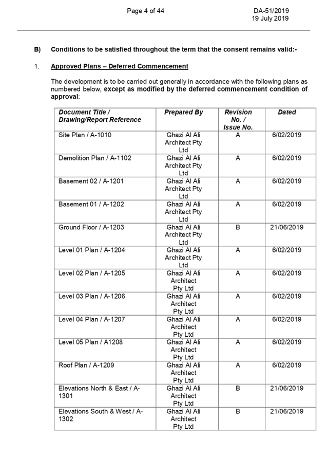

DOCUMENTS
ASSOCIATED WITH
REPORT LPP055/19
Attachment 2
Architectural Internal and Landscape Plans
Cumberland Local Planning Panel Meeting
14 August 2019
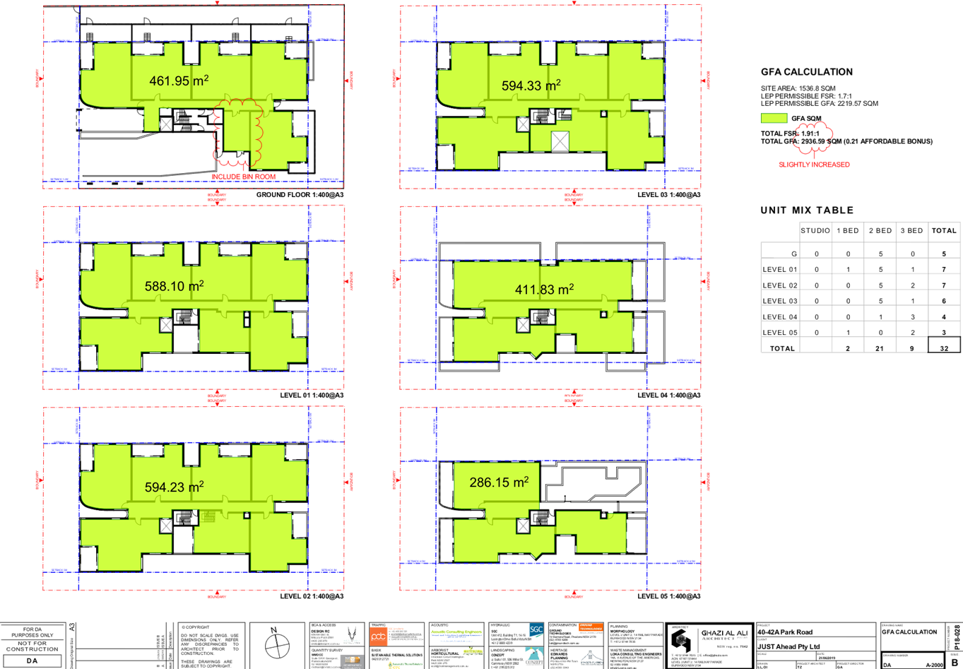
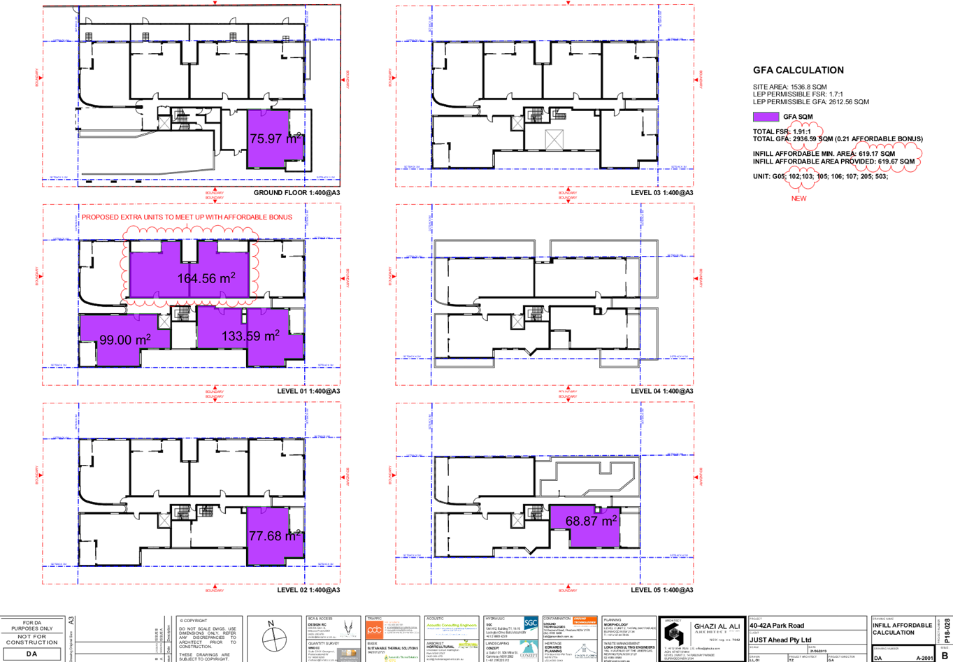
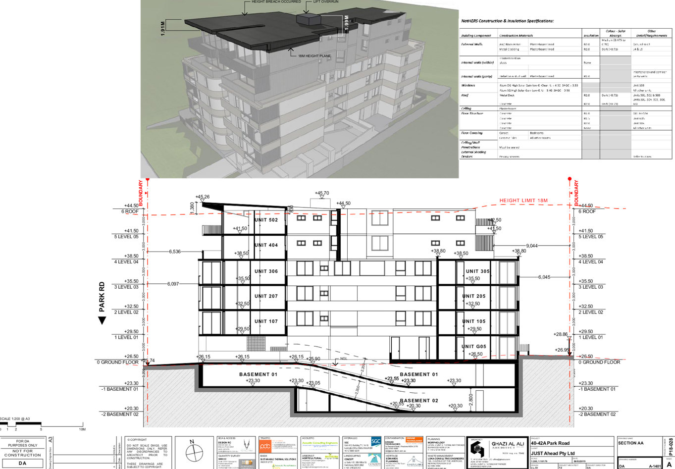
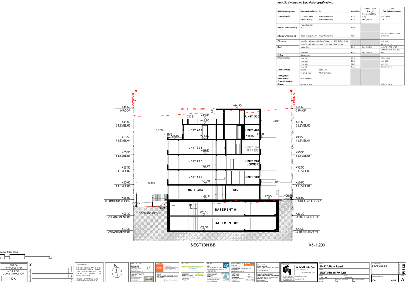
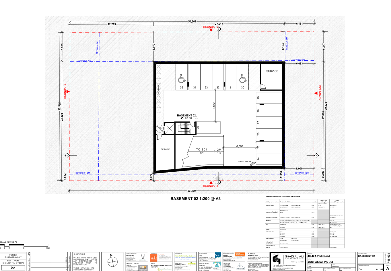
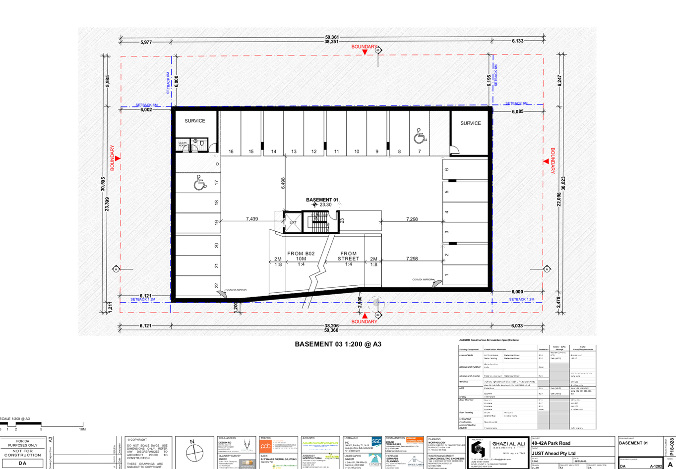
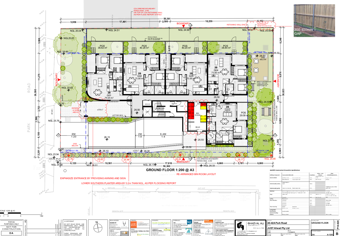
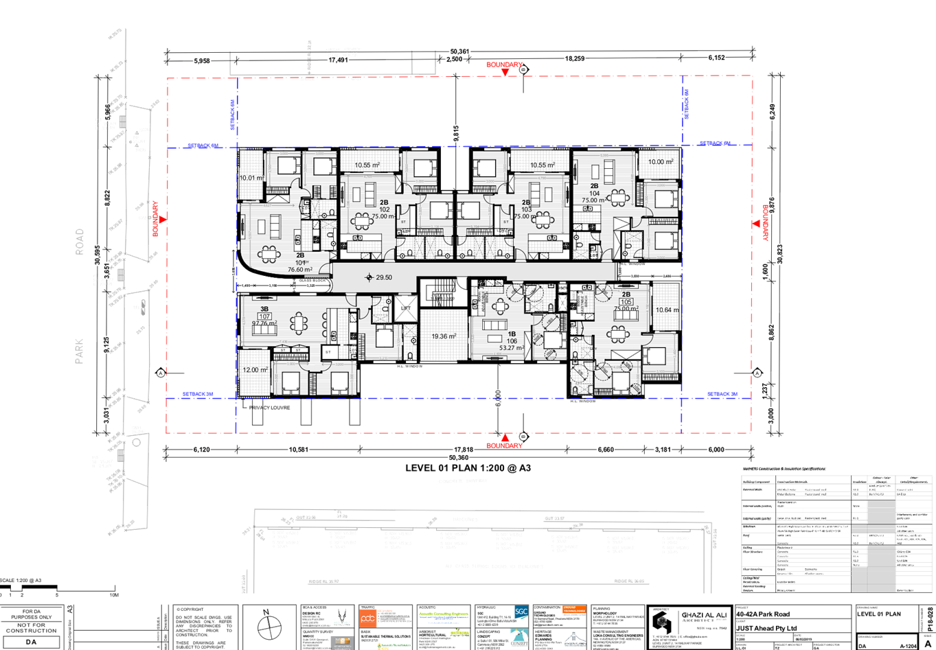
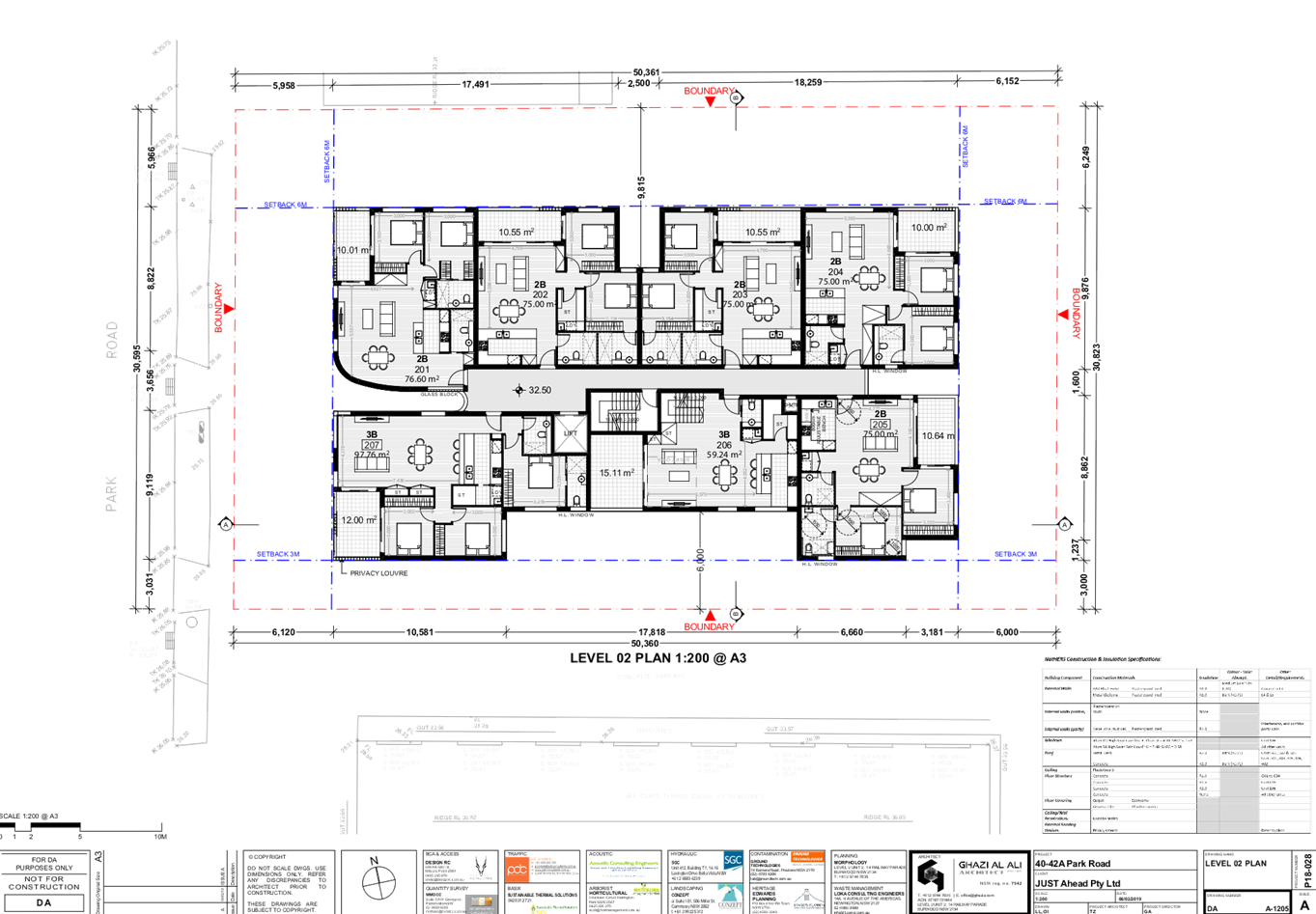
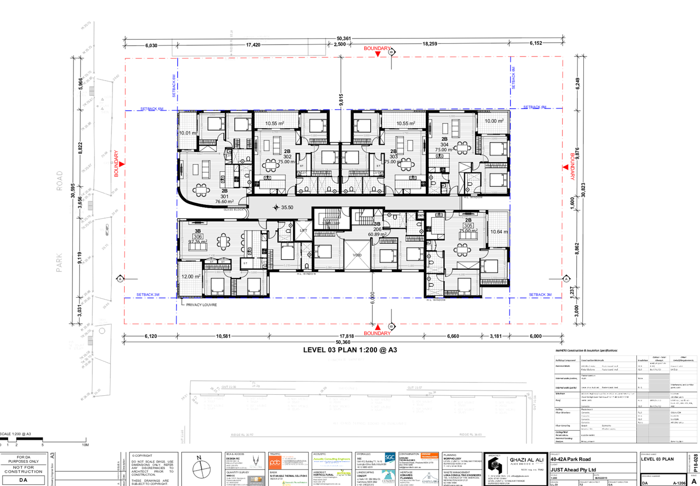
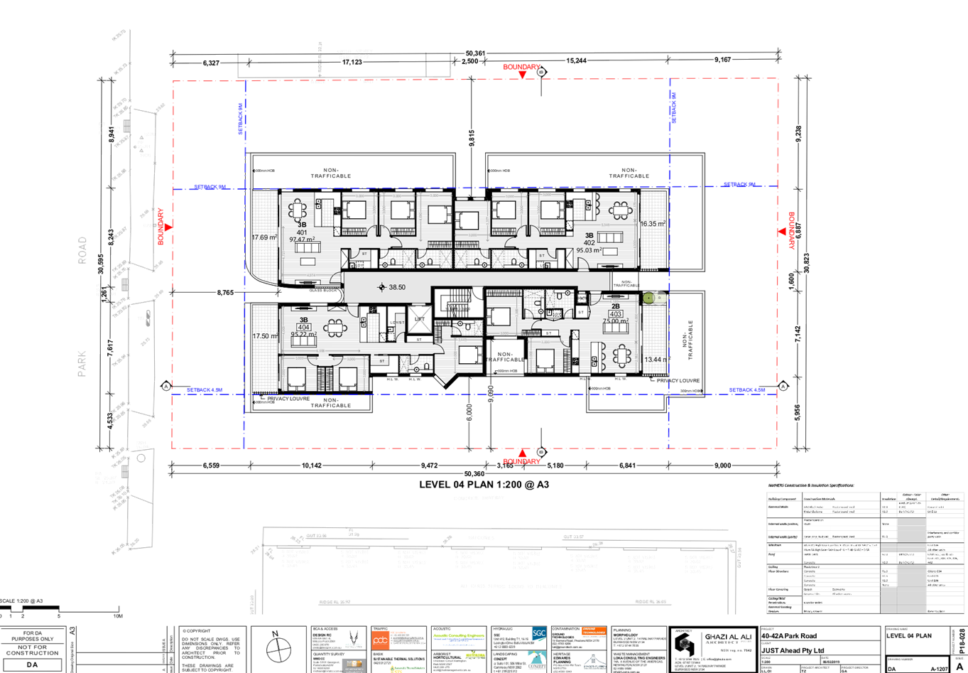
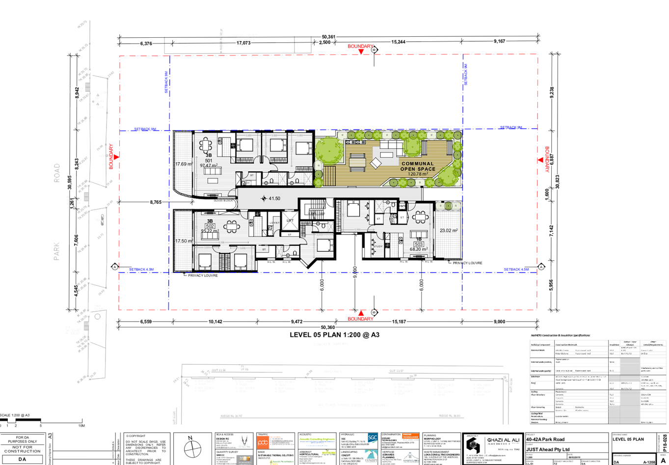
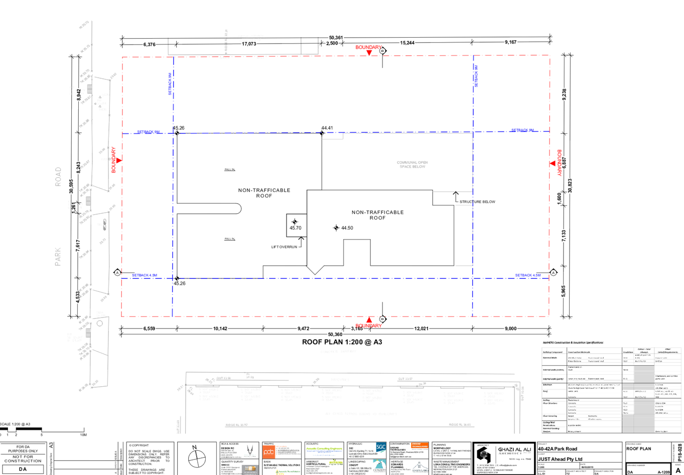
DOCUMENTS
ASSOCIATED WITH
REPORT LPP055/19
Attachment 3
Architectural External and Shadow Plans
Cumberland Local Planning Panel Meeting
14 August 2019
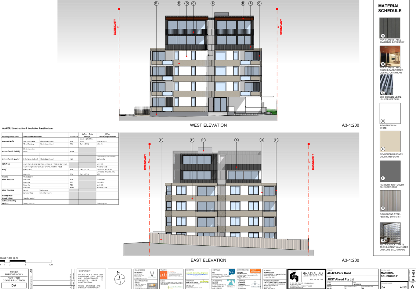
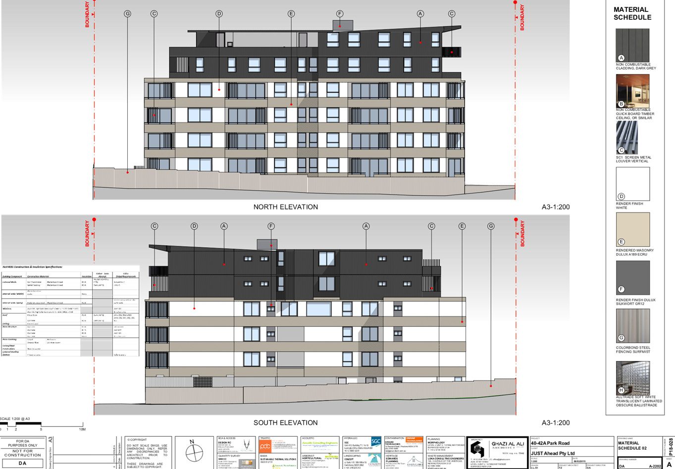
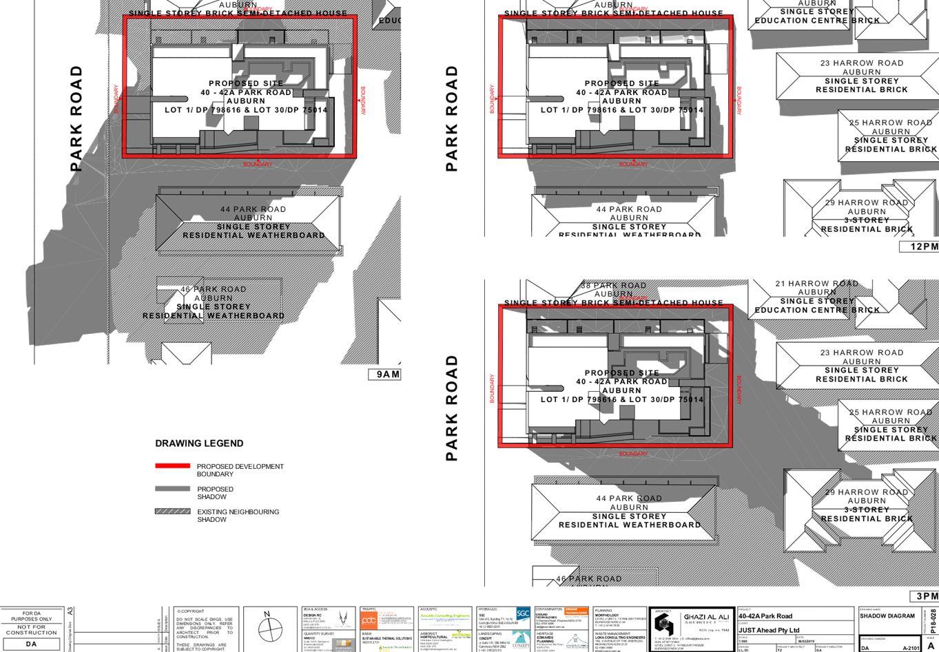
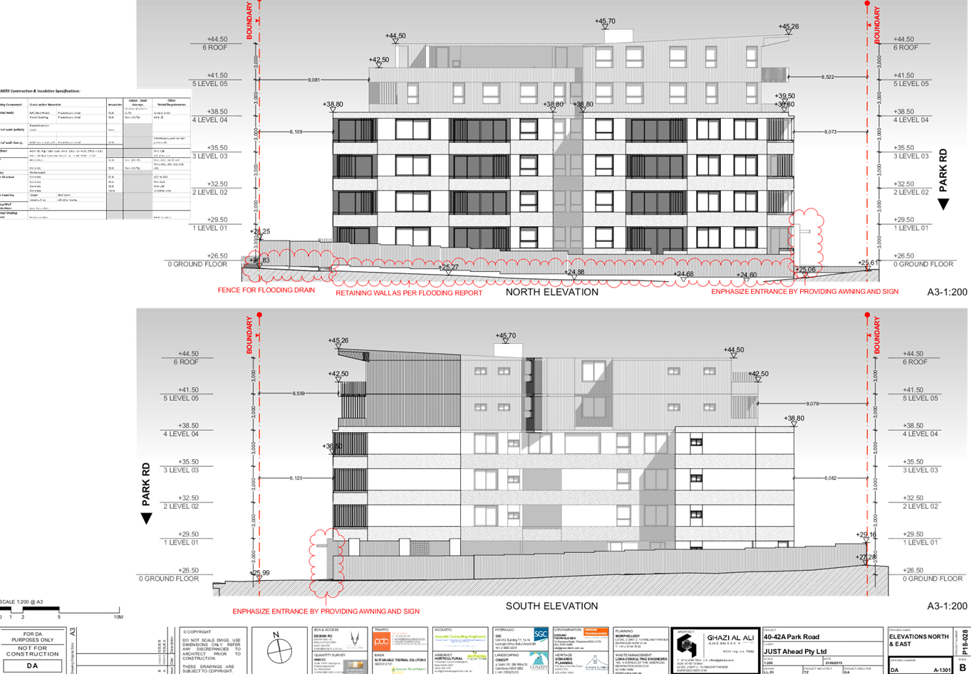
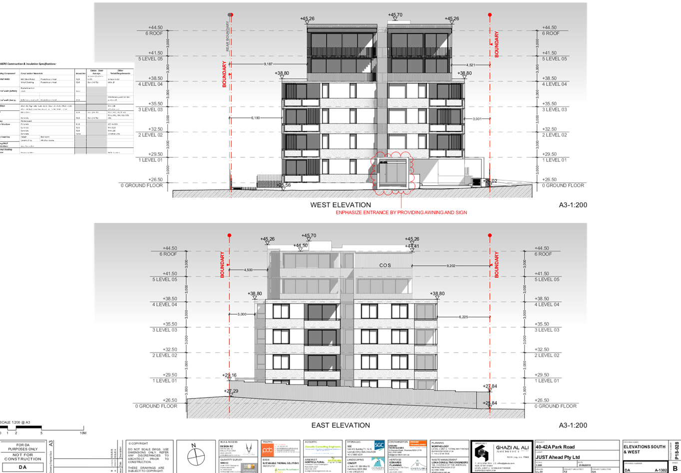
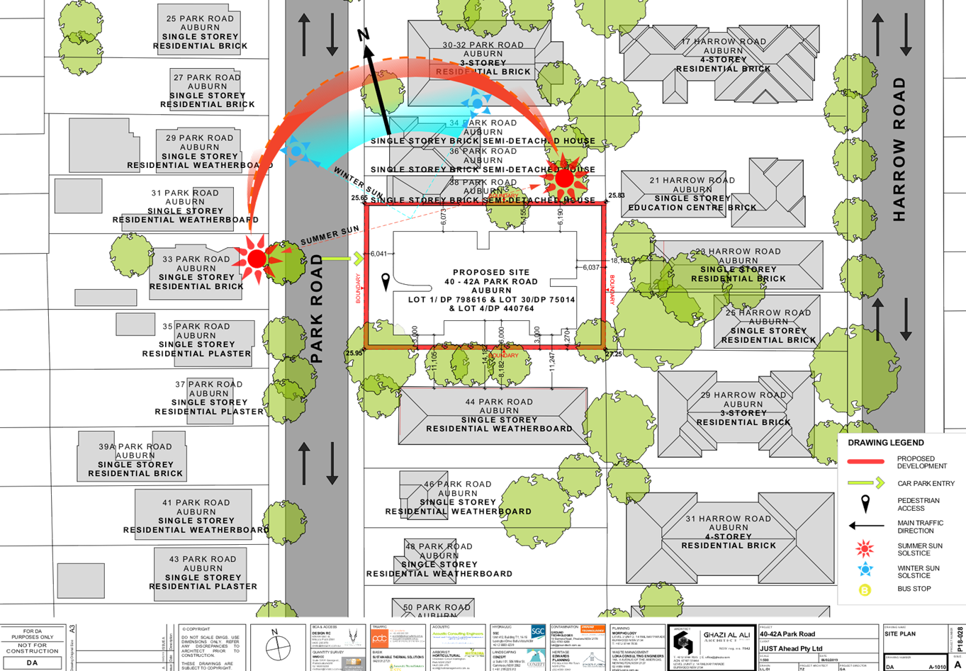
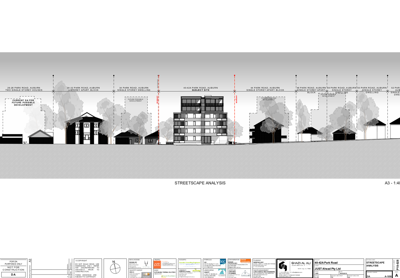
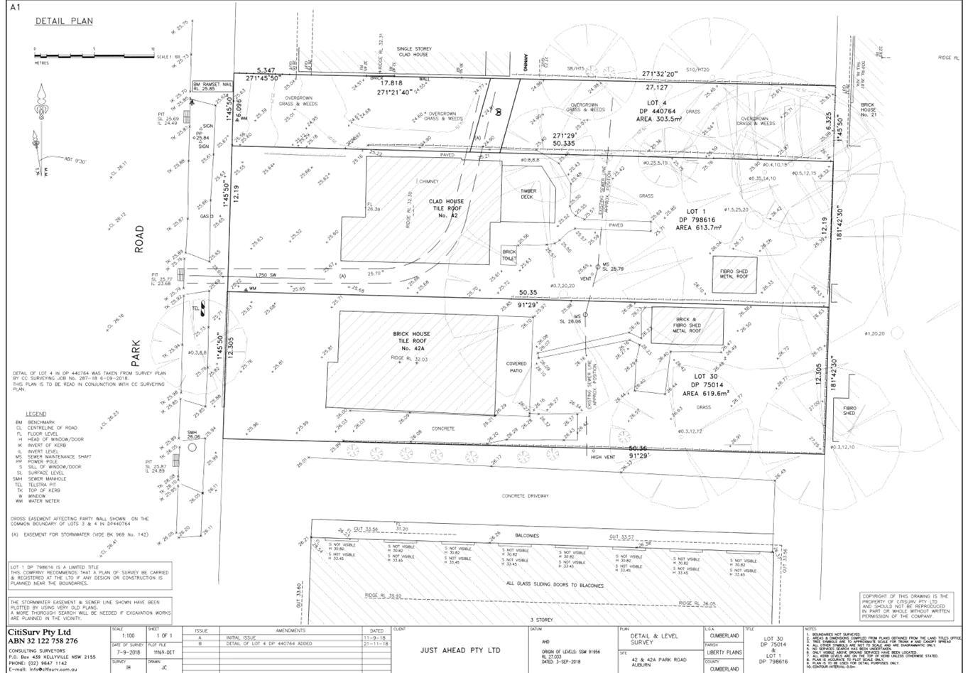
DOCUMENTS
ASSOCIATED WITH
REPORT LPP055/19
Attachment 4
Stormwater Plans
Cumberland Local Planning Panel Meeting
14 August 2019
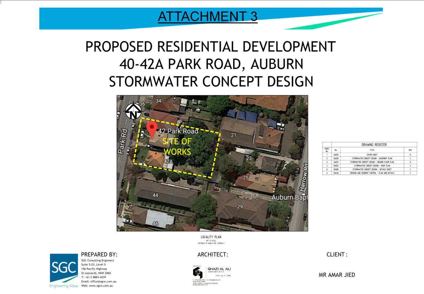
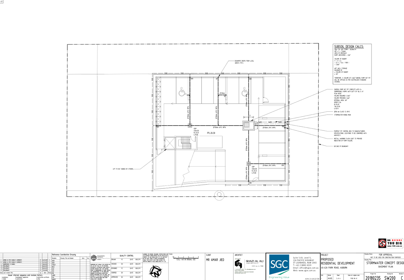
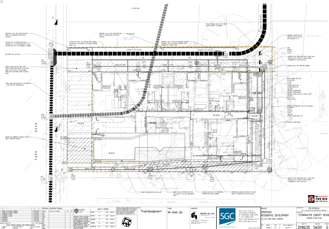
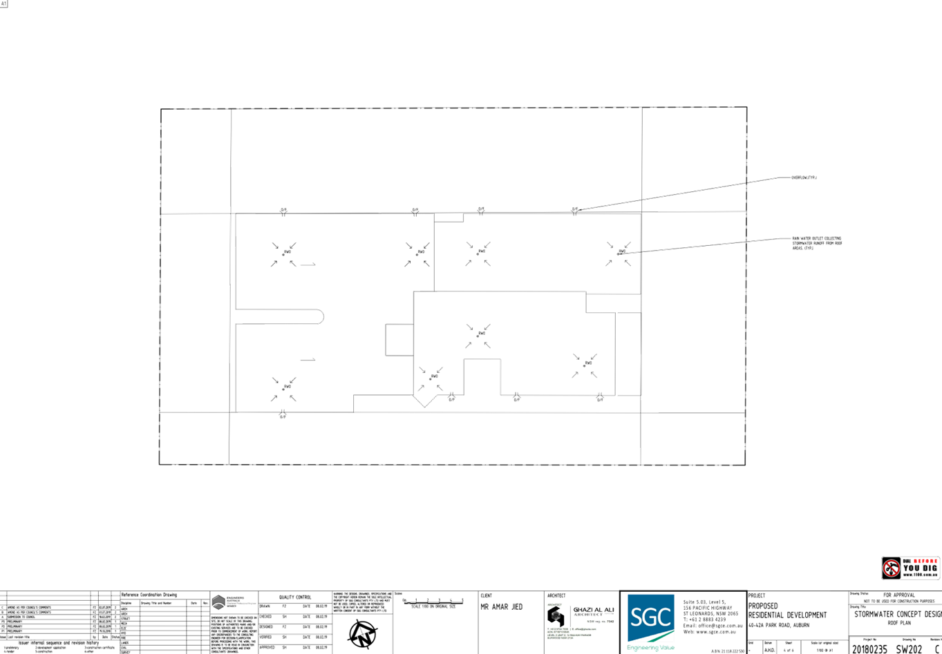
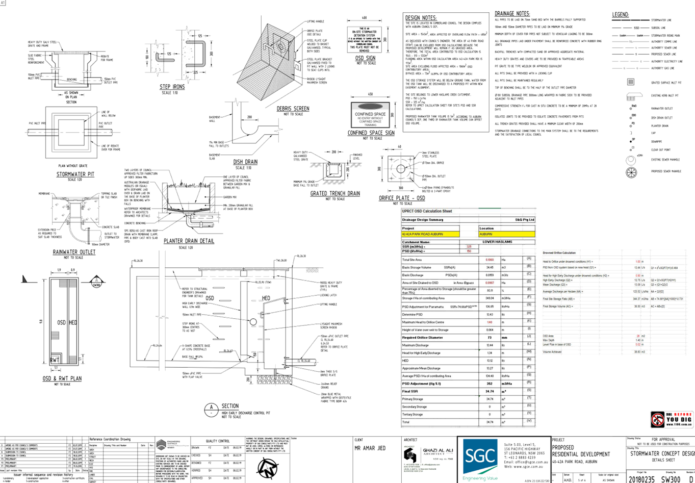
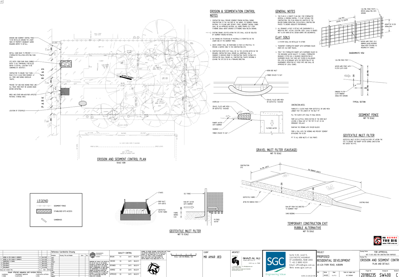
DOCUMENTS
ASSOCIATED WITH
REPORT LPP055/19
Attachment 5
Submissions Received
Cumberland Local Planning Panel Meeting
14 August 2019

DOCUMENTS
ASSOCIATED WITH
REPORT LPP055/19
Attachment 6
Clause 4.6 Variation Request
Cumberland Local Planning Panel Meeting
14 August 2019
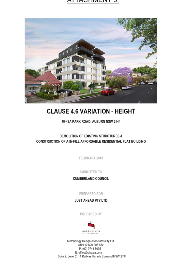

DOCUMENTS
ASSOCIATED WITH
REPORT LPP055/19
Attachment 7
ADG Compliance Table
Cumberland Local Planning Panel Meeting
14 August 2019
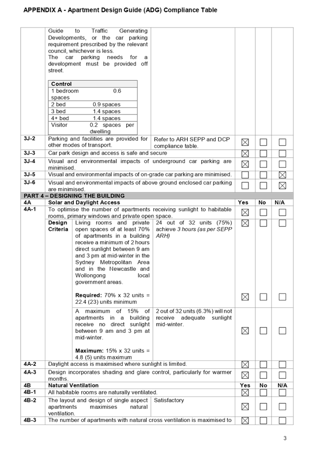
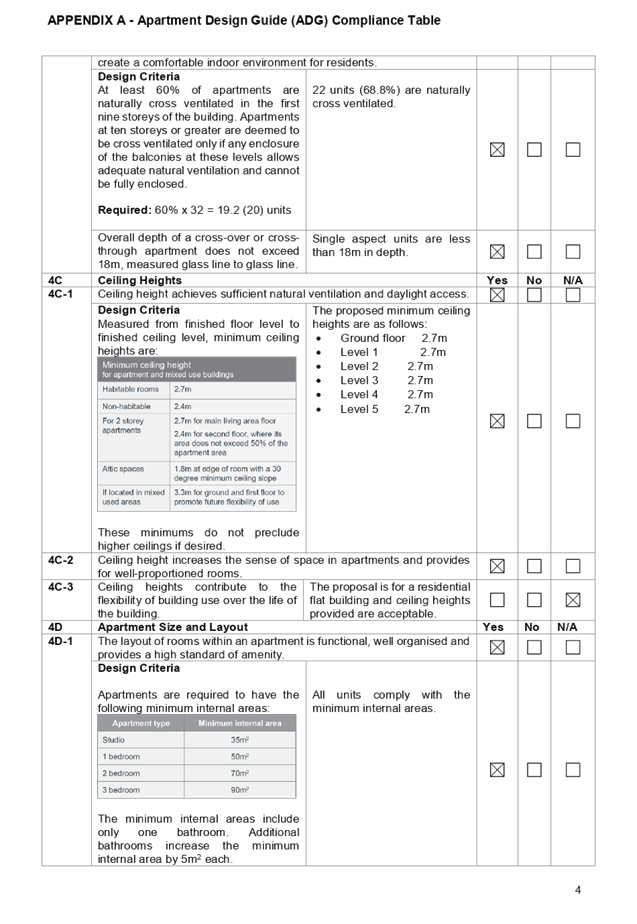
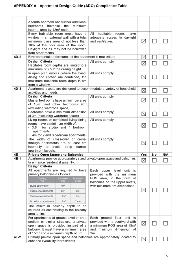
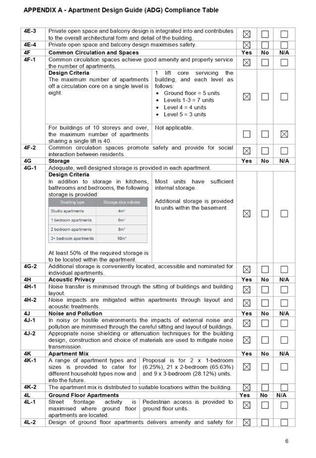
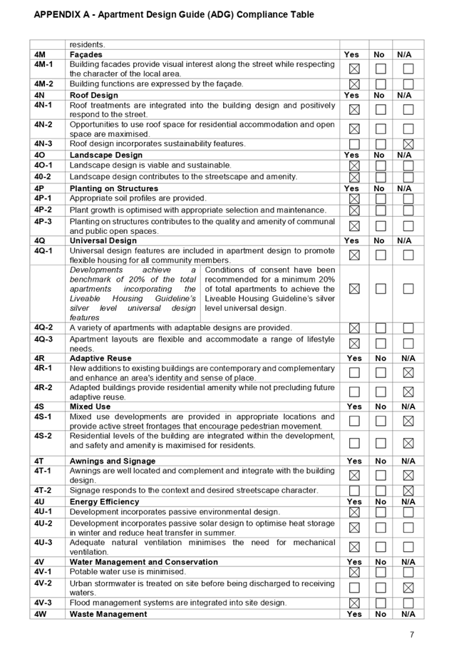
DOCUMENTS
ASSOCIATED WITH
REPORT LPP055/19
Attachment 8
ARH SEPP Compliance Table
Cumberland Local Planning Panel Meeting
14 August 2019
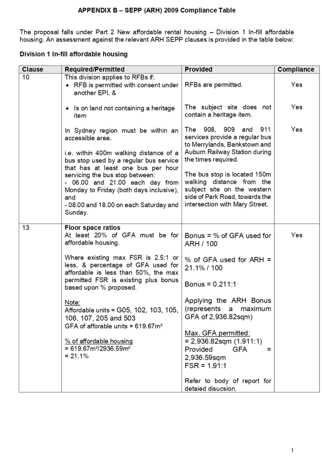
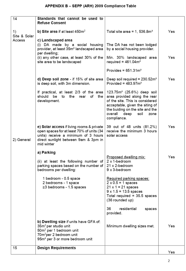
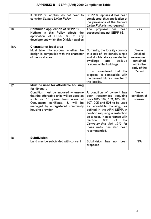
DOCUMENTS
ASSOCIATED WITH
REPORT LPP055/19
Attachment 9
ALEP 2010 Compliance Table
Cumberland Local Planning Panel Meeting
14 August 2019
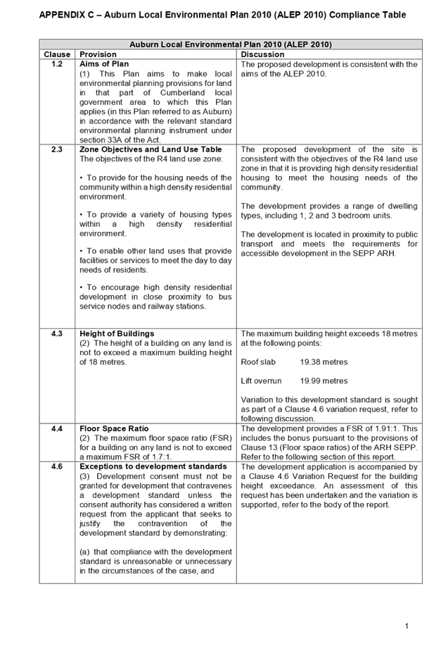
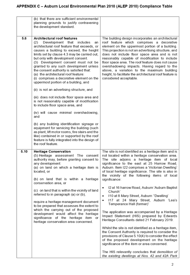
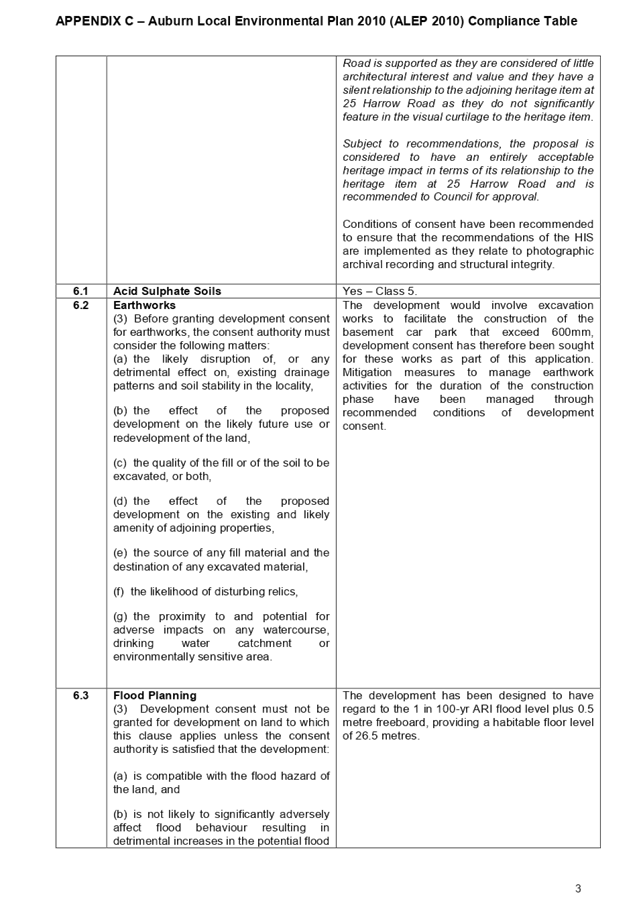
DOCUMENTS
ASSOCIATED WITH
REPORT LPP055/19
Attachment 10
ADCP 2010 Compliance Table
Cumberland Local Planning Panel Meeting
14 August 2019
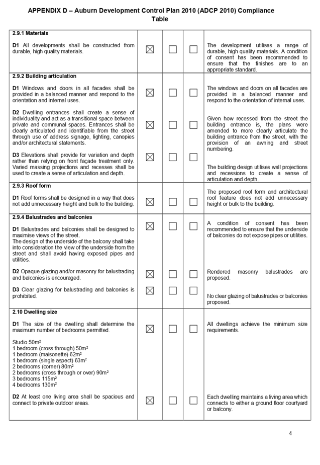
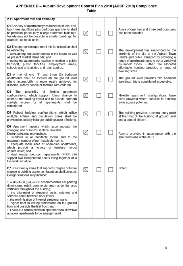
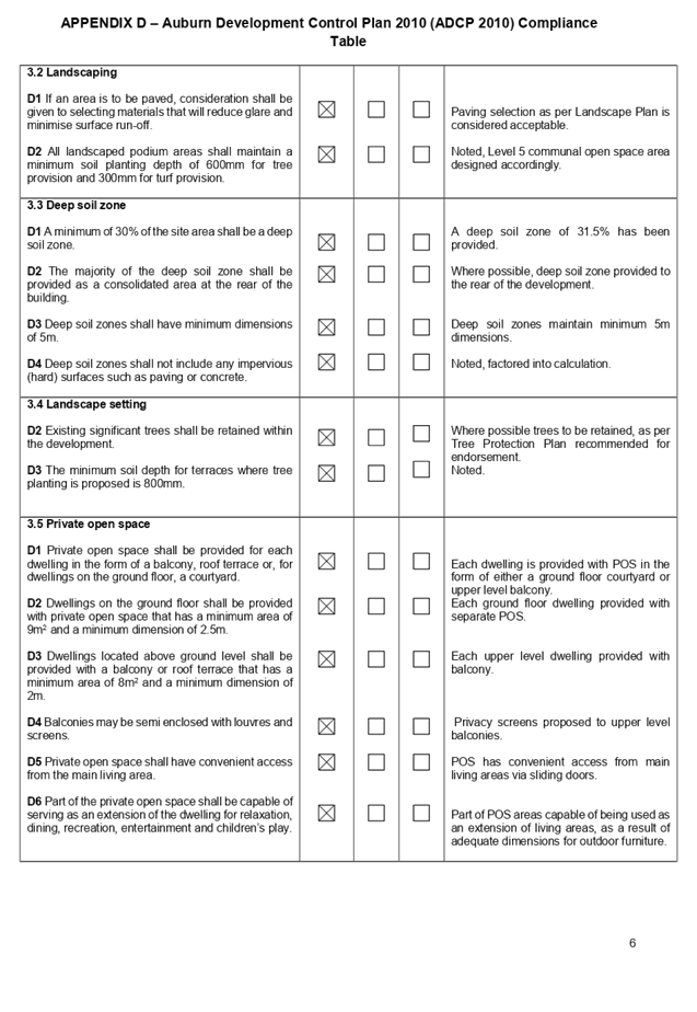
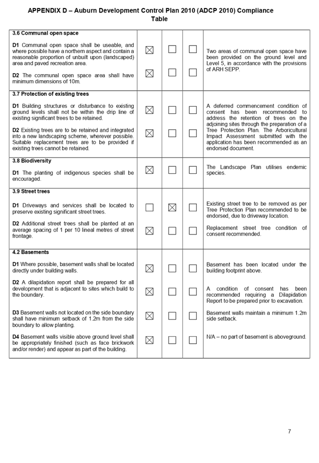
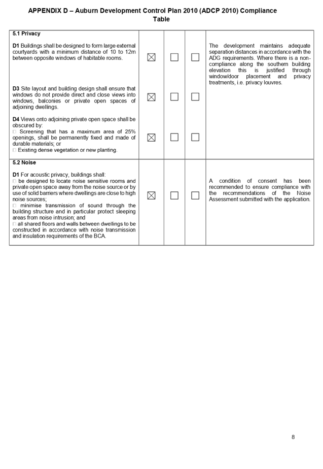
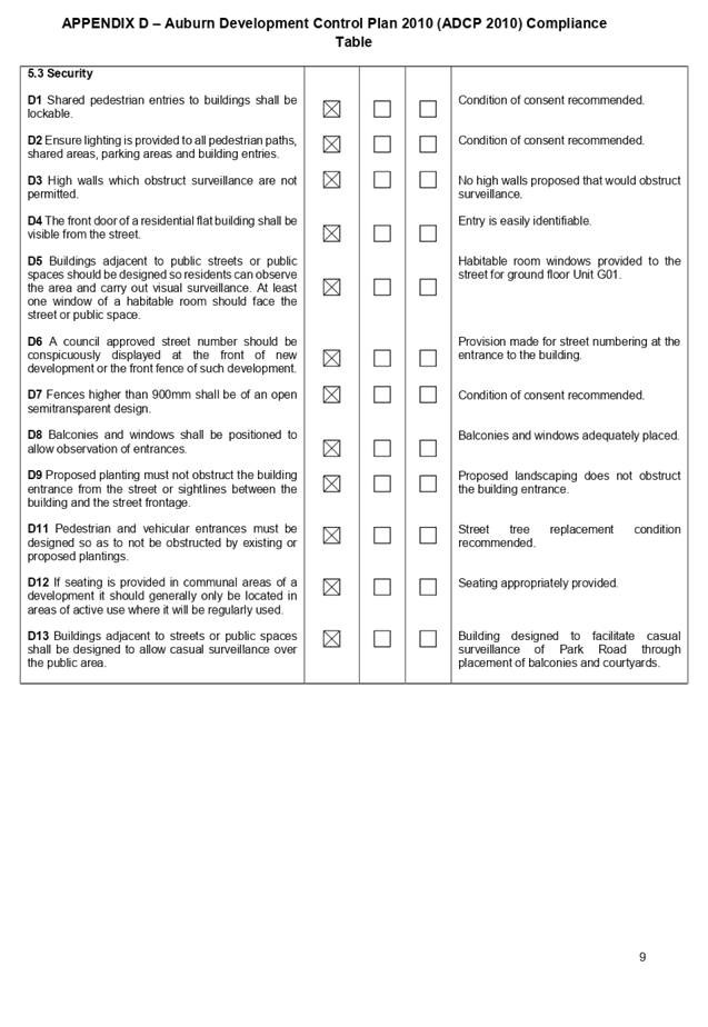
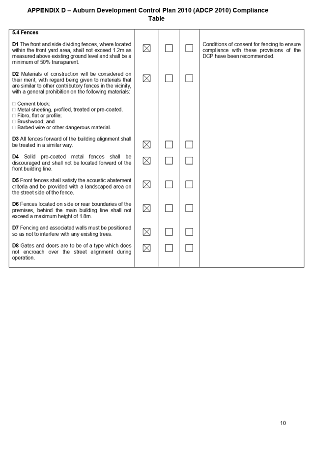
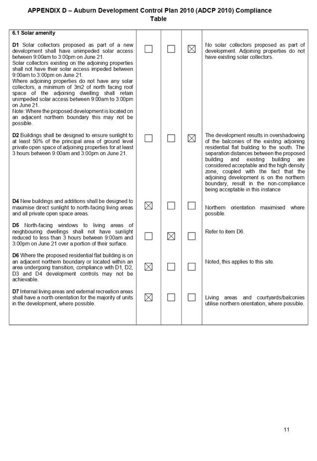
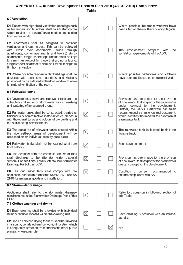
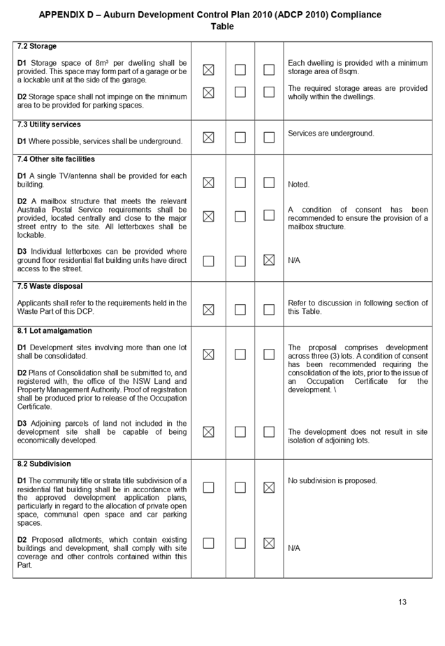
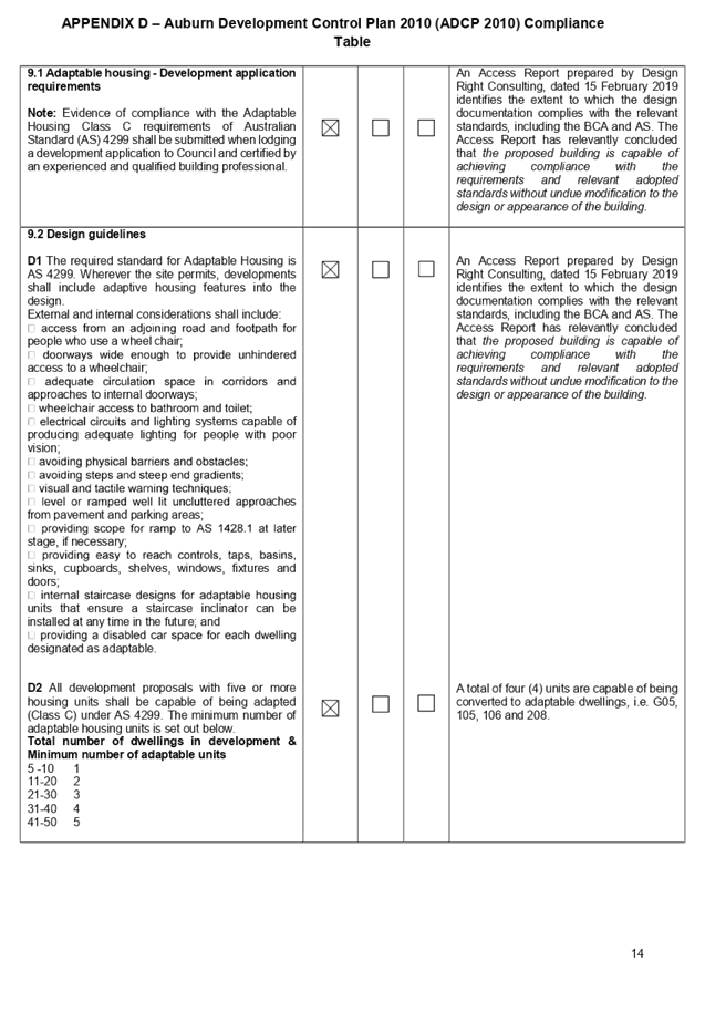

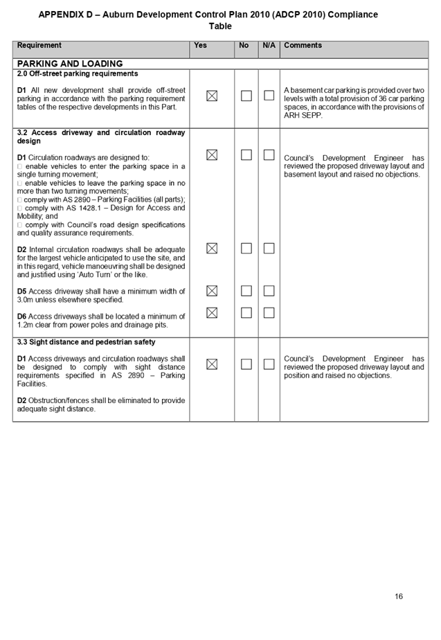
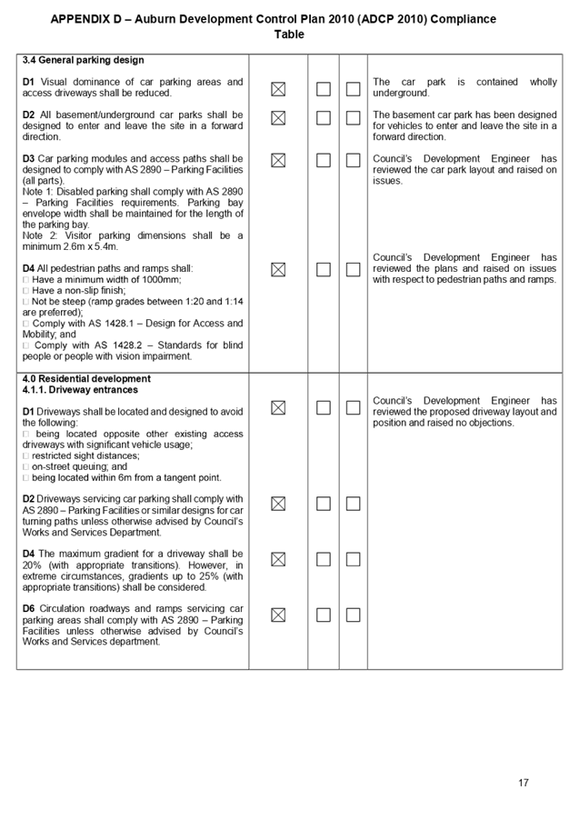
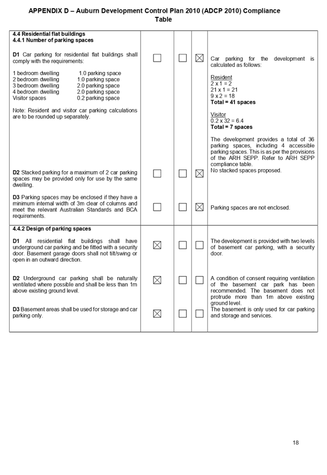
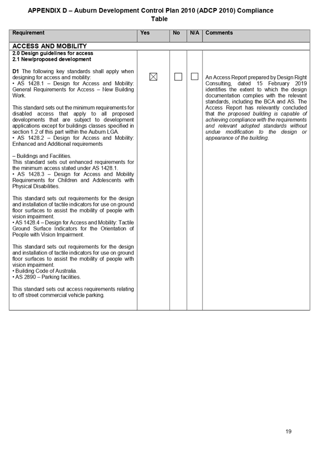
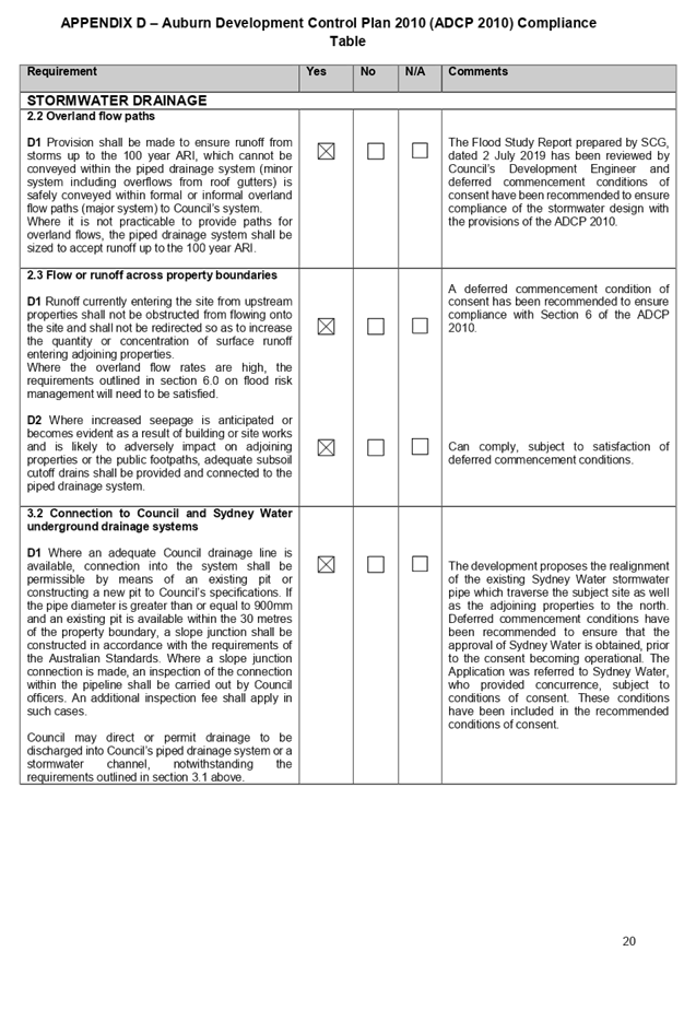
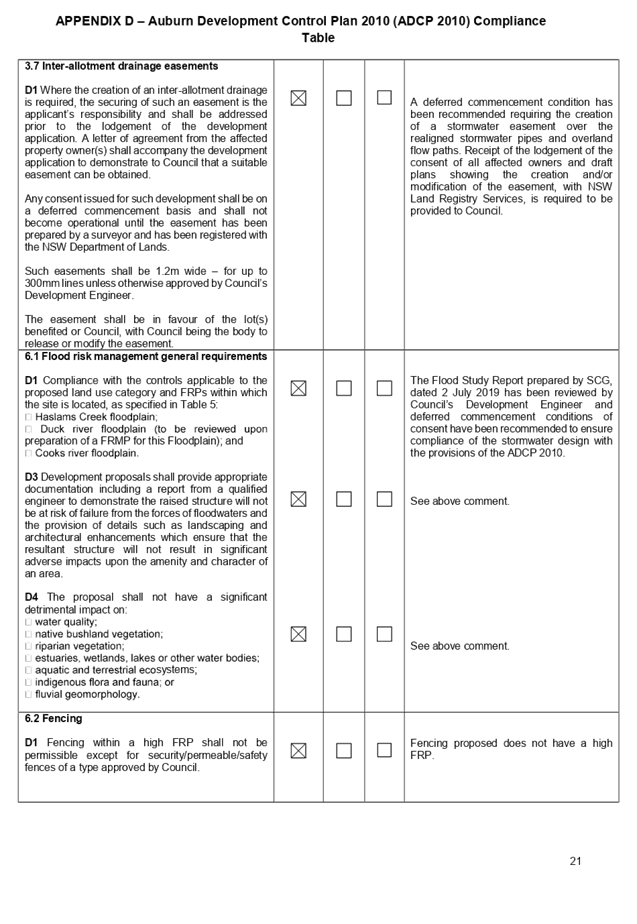
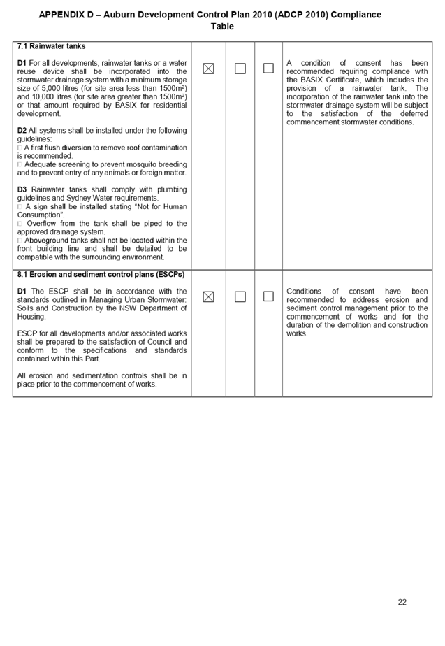
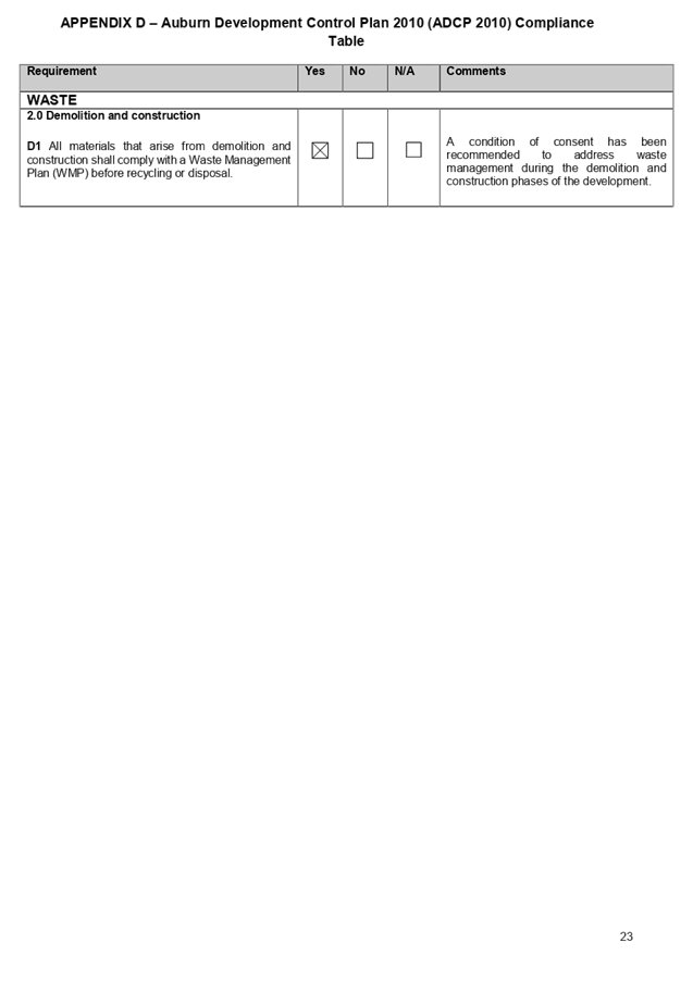
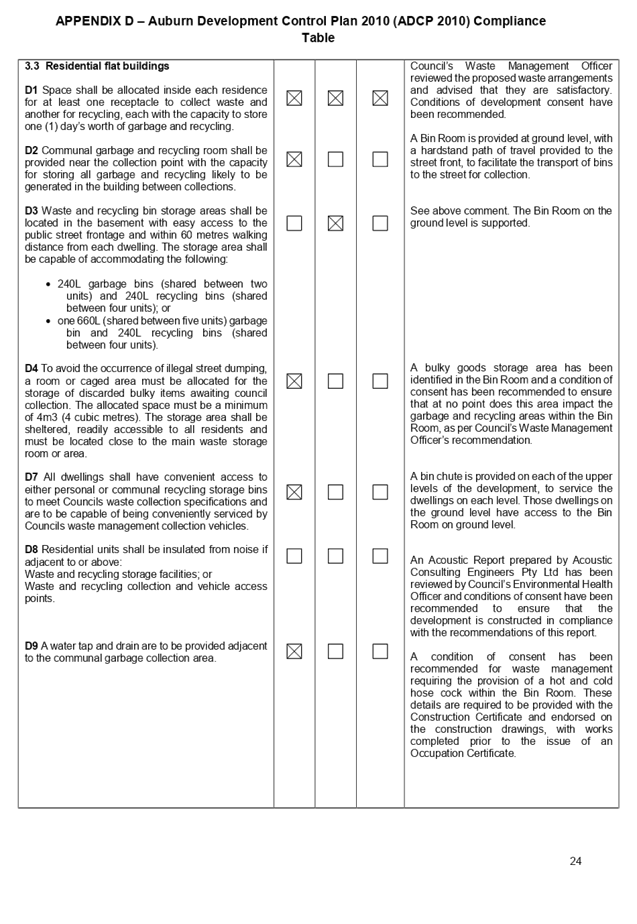
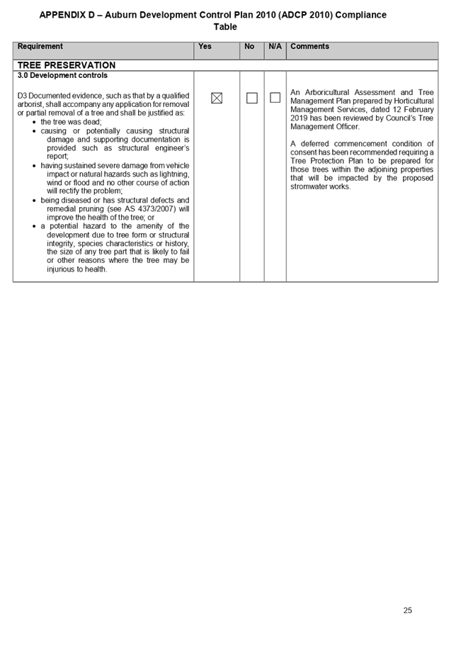
Cumberland
Local Planning Panel Meeting
14 August 2019
Item No: LPP056/19
Development
Application - 96 Chiswick Road, Auburn
Responsible
Division: Environment
& Planning
Officer: Executive
Manager Development and Building
File
Number: DA-122/2019
|
Application lodged
|
16-April-2019
|
|
Applicant
|
Mr G Blackwell
|
|
Owner
|
Cumberland Council
|
|
Application No.
|
DA-122/2019
|
|
Description of Land
|
96 Chiswick Road, Auburn
NSW 2144 (Lot 2 in DP 235351)
|
|
Proposed Development
|
Demolition of a glasshouse,
part of a perimeter wall, a timber wall, turnstiles and a pond and rock
edging at the Auburn Botanic Gardens
|
|
Site Area
|
13,720sqm
|
|
Zoning
|
RE1 – Public Recreation
|
|
Disclosure of political
donations and gifts
|
Nil disclosure
|
|
Heritage
|
Yes – The structures to
be demolished are located within the local heritage item identified as
‘Auburn Botanic Gardens’ (Item ‘I3’) in Schedule 5 of
Auburn LEP 2010
|
|
Principal Development
Standards
|
Nil
|
|
Issues
|
Heritage impact of the
development
|
1. Development
Application No.122/2019 was received on 16-April-2019 for the ‘Demolition
of a glasshouse, part of a perimeter wall, a timber wall, turnstiles and a pond
and rock edging at the Auburn Botanic Gardens’.
2. The
application was publicly notified to occupants and owners of the adjoining
properties for a period of fourteen (14) days between 28 May 2019 and 11 June
2019. In response, no submissions where received.
3. The
subject site is located within the Auburn Botanic Gardens which is listed as a
heritage item in the Auburn Environmental Plan 2010 (Item no. I3). The heritage
significance of the items to be demolished has been assessed with regard to the
heritage provisions of Council’s LEP, the NSW Heritage significance
criteria and advice provided by Paul Davies Heritage Consultants. The proposed
demolition is considered to result in minimal impact on the heritage
significance of the Auburn Botanic Gardens.
4. The
application has been referred to the Cumberland Local Planning Panel (CLPP) for
determination as Council is the land owner of the subject property which
constitutes a ‘conflict of interest’.
5. The
application is recommended for Approval.
The subject site occupies part of
a lot located on the southern side of Chiswick Road as shown in Figure 1 and 2.
The subject lot forms part of the Auburn Botanic Gardens which is a local
heritage item under Schedule 5 of Auburn LEP 2010.
The site is located adjacent to an
art gallery and workshop known as the Peacock Gallery and Auburn Arts Studio
and comprises an area defined by perimeter brick walls, a rudimentary timber
wall and pedestrian turnstiles. A greenhouse in a partially dilapidated state,
a pond, rock outcrop and three (3) trees currently exist within the area. The
extent of the area is highlighted in red in Figure 2.
Figure
1 – Locality Plan of subject lot
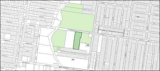
Figure
2 - Aerial Plan of subject site
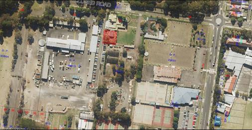
Description of the Proposed
Development
Council has received a development
application for ‘Demolition of a glasshouse, part of a perimeter wall, a
timber wall, turnstiles and a pond and rock edging at the Auburn Botanic
Gardens’.
The structures are proposed to be
removed to facilitate the establishment of art studios as part of a planned
expansion of the adjacent Peacock Gallery and Auburn Arts Studio building.
Figure
3 – Structures to be removed are highlighted in red
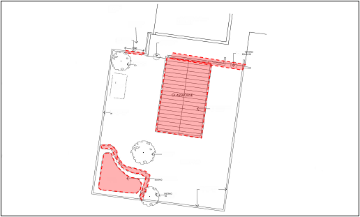
History
On 26 August 2009, DA-254/2009 for
‘Change of use of existing kiosk to arts and culture facility, exhibition
gallery, meeting and storage room’ was approved under delegated
authority.
On 5 August 2011, DA-199/2011 for
‘Change of use and internal refurbishment of existing fernery to art
gallery (Peacock Gallery & Auburn Arts Studio – Auburn Botanic Gardens)’
was approved under delegated authority.
Applicants Supporting
Statement
The applicant has provided a
Statement of Environmental Effects prepared by Graham Bakewell dated April 2019
and was received by Council on 16 April 2019 in support of the application.
Contact with Relevant
Parties
The assessing officer has
undertaken a site inspection of the subject site and surrounding properties and
has been in regular contact with the applicant throughout the assessment
process.
Internal Referrals
Heritage Consultant
The development application was
referred to an external Heritage Consultant who has advised that the structures
to be demolished are considered to have ‘minimal heritage impact on the
local heritage significance of the Auburn Botanic Gardens, as the affected
structures are considered to have low to moderate heritage significance’.
Therefore the proposal can be supported.
Tree Officer
The development proposal was
referred to Council’s Tree Officer for comment as three (3) onsite trees
are to be retained as part of the development. No issue was raised by
council’s Tree Officer, subject to the imposition of tree protection
conditions in any consent.
External Referrals
The application was not required
to be referred to any external government authorities for comment.
Planning Comments
The provisions of any
Environmental Planning Instruments (EP&A Act s4.15 (1)(a)(i))
State Environmental Planning
Policies
The proposed development is
affected by the following State Environmental Planning Policies:
(a) State
Environmental Planning Policy No. 55 – Remediation of Land (SEPP 55)
Clause 7 of SEPP 55 requires
Council to be satisfied that the site is suitable or can be made suitable to
accommodate the proposed development. The matters listed within Clause 7 have
been considered in the assessment of the development application.
|
Matter for Consideration
|
Yes/No
|
|
Does the application involve re-development of the site or
a change of land use?
|
Yes
No
|
|
Does
the application involve re-development of the site or a change of land use?
|
Yes
No
|
|
In the development going to be used for a sensitive land
use (e.g.: residential, educational, recreational, childcare or hospital)?
|
Yes
No
|
|
Does information available to you indicate that an
activity listed below has ever been approved, or occurred at the site?
acid/alkali plant and
formulation, agricultural/horticultural activities, airports, asbestos
production and disposal, chemicals manufacture and formulation, defence
works, drum re-conditioning works, dry cleaning establishments, electrical
manufacturing (transformers), electroplating and heat treatment premises,
engine works, explosive industry, gas works, iron and steel works, landfill
sites, metal treatment, mining and extractive industries, oil production and
storage, paint formulation and manufacture, pesticide manufacture and
formulation, power stations, railway yards, scrap yards, service stations,
sheep and cattle dips, smelting and refining, tanning and associated trades,
waste storage and treatment, wood preservation
|
Yes
No
|
|
Is the site listed on
Council’s Contaminated Land database?
|
Yes
No
|
|
Is the site subject to EPA
clean-up order or other EPA restrictions?
|
Yes
No
|
|
Has the site been the subject of
known pollution incidents or illegal dumping?
|
Yes
No
|
|
Does the site adjoin any
contaminated land/previously contaminated land?
|
Yes
No
|
|
Has the appropriate level of
investigation been carried out in respect of contamination matters for
Council to be satisfied that the site is suitable to accommodate the proposed
development or can be made suitable to accommodate the proposed development?
|
Yes
No
|
|
Details of contamination investigations carried out at the
site:
The site has historically been
used as a garden and as such may have been subjected to pesticides and
chemicals. Notwithstanding, the proposal relates to demolition only and there
will be no significant soil disturbance. It is anticipated that any future
construction works on the site may require the preparation of a contamination
report.
|
Regional Environmental Plans
The proposed development is
affected by the following Regional Environmental Plans:
(a) Sydney
Regional Environmental Plan (Sydney Harbour Catchment) 2005
The subject site is identified as
being located within the area affected by the Sydney Regional Environmental
Plan (Sydney Harbour Catchment) 2005. The proposed development raises no issues
as no impact on the catchment is envisaged.
Local Environmental Plans
Auburn Local Environmental Plan
2010 (LEP)
The provision of the Auburn Local
Environmental Plan 2010 is applicable to the development proposal. It is noted
that the development achieves compliance with the key statutory requirements of
the LEP and the objectives of the RE1 Public Recreation land use zone.
(a) Permissibility:-
The proposed development is
defined as a demolition works which will facilitate the future redevelopment of
the site and is therefore permissible in the RE1 Public Recreation zone with
consent.
The relevant matters to be
considered under Auburn Local Environmental Plan 2010 and the applicable
clauses for the proposed development are summarised below. A comprehensive LEP
assessment is contained in Attachment 4.
Figure
4 – Auburn LEP 2010 Compliance Table
|
DEVELOPMENT STANDARD
|
COMPLIANCE
|
DISCUSSION
|
|
2.7 Demolition requires
development consent
|
Yes
|
The proposed demolition works
relate to structures located within a local heritage listed item and as such,
is precluded from being undertaken as ‘exempt’ development under
Subdivision 13, clause 2.24 of State Environmental Planning Policy (Exempt
and Complying Development Codes) 2008.
Development consent is therefore
required.
|
|
5.10 Heritage conservation
|
Yes
|
The proposal complies with the
Objectives and relevant requirements of this clause. A full assessment is
provided in Attachment 5.
|
The provisions of any proposed
instrument that is or has been the subject (EP&A Act s4.15 (1)(a)(ii))
(a) Draft
State Environmental Planning Policy (Environment)
The draft SEPP relates to the
protection and management of our natural environment with the aim of
simplifying the planning rules for a number of water catchments, waterways,
urban bushland, and Willandra Lakes World Heritage Property. The changes
proposed include consolidating the following seven existing SEPPs:
· State
Environmental Planning Policy No. 19 – Bushland in Urban Areas
· State
Environmental Planning Policy (Sydney Drinking Water Catchment) 2011
· State
Environmental Planning Policy No. 50 – Canal Estate Development
· Greater
Metropolitan Regional Environmental Plan No. 2 – Georges River Catchment
· Sydney
Regional Environmental Plan No. 20 – Hawkesbury-Nepean River (No.2-1997)
· Sydney
Regional Environmental Plan (Sydney Harbour Catchment) 2005
· Willandra
Lakes Regional Environmental Plan No. 1 – World Heritage Property.
The draft policy will repeal the
above existing SEPPs and certain provisions will be transferred directly to the
new SEPP, amended and transferred, or repealed due to overlaps with other areas
of the NSW planning system.
Changes are also proposed to the
Standard Instrument – Principal Local Environmental Plan. Some provisions
of the existing policies will be transferred to new Section 117 Local Planning
Directions where appropriate.
The provisions of any
Development Control Plans (EP&A Act s4.15 (1)(a)(iii))
The Auburn DCP 2010 provides
guidance for the design and operation of development to achieve the aims and
objectives of the Auburn LEP 2010. The proposal raises no issue of compliance
with regard to Auburn DCP 2010. A comprehensive assessment and compliance table
is contained in Attachment 5.
The provisions of any planning
agreement that has been entered into under section 7.4, or any draft planning
agreement that a developer has offered to enter into under section 7.4
(EP&A Act s4.15(1)(a)(iiia))
There is no draft planning
agreement associated with the subject Development Application.
The provisions of the
Regulations (EP&A Act s4.15 (1)(a)(iv))
The proposed development raises no
concerns as to the relevant matters arising from the Environmental Planning and
Assessment Regulations 2000 (EP&A Reg).
The Likely Environmental,
Social or Economic Impacts (EP&A Act s4.15 (1)(b))
It is considered that the proposed
development will have no significant adverse environmental, social or economic
impacts in the locality.
The suitability of the site for
the development (EP&A Act s4.15 (1)(c))
The subject site and locality is
not known to be affected by any natural hazards or other site constraints
likely to have a significant adverse impact on the proposed development.
Accordingly, it is considered that the development is suitable in the context
of the site and surrounding locality.
Submissions made in accordance
with the Act or Regulation (EP&A Act s4.15 (1)(d))
Advertised (newspaper) Mail
Sign
Not Required
In accordance with Council’s
Notification requirements contained within the Auburn DCP 2010, the proposal
was publicly notified for a period of fourteen (14) days between 28 May 2019
and 11 June 2019. No submissions were received in respect of the proposed
development.
The public interest (EP&A
Act s4.15(1)(e))
In view of the foregoing analysis
it is considered that the development, if carried out subject to the conditions
set out in the recommendation below, will have no significant adverse impacts
on the public interest.
Section 7.11 (Formerly S94)
Contribution Towards Provision or Improvement of Amenities or Services
The development does not require
the payment of contributions in accordance with Council’s Section 94
Contributions Plans.
Disclosure of Political
Donations and Gifts
The applicant and notification
process did not result in any disclosure of Political Donations and Gifts.
The development application has
been assessed in accordance with the relevant requirements of the Environmental
Planning and Assessment Act 1979, SEPP 55 – Remediation of Land, SREP
(Sydney Harbour Catchment) 2005, Auburn LEP 2010 and Auburn DCP 2010 and is
considered to be satisfactory for approval subject to conditions.
For these reasons, it is
considered that the proposal is satisfactory having regard to the matters of
consideration under Section 4.15 of the Environmental Planning and Assessment
Act 1979, and the development may be approved subject to conditions.
There are no further consultation
processes for Council associated with this report.
There are no further financial
implications for Council associated with this report.
There are no policy implications
for Council associated with this report.
Communication /
Publications:
The final outcome of this matter
will be notified in the newspaper. The objectors will also be notified in
writing of the outcome.
|
That Development Application No.
122/2019 for ‘Demolition of a glasshouse, part of a perimeter wall, a
timber wall, turnstiles and a pond and rock edging at the Auburn Botanic
Gardens’ on land at 96 Chiswick Road, AUBURN be approved subject to
attached conditions.
|
1. Draft Notice
of Determination ⇩ 
2. Architectural
Plans ⇩ 
3. Heritage
Consultant Comments ⇩
4. Auburn
LEP 2010 Assessment ⇩
5. Auburn
DCP 2010 Assessment ⇩
DOCUMENTS
ASSOCIATED WITH
REPORT LPP056/19
Attachment 1
Draft Notice of Determination
Cumberland Local Planning Panel Meeting
14 August 2019

DOCUMENTS
ASSOCIATED WITH
REPORT LPP056/19
Attachment 2
Architectural Plans
Cumberland Local Planning Panel Meeting
14 August 2019
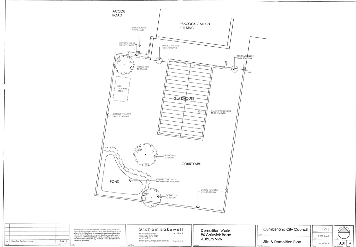
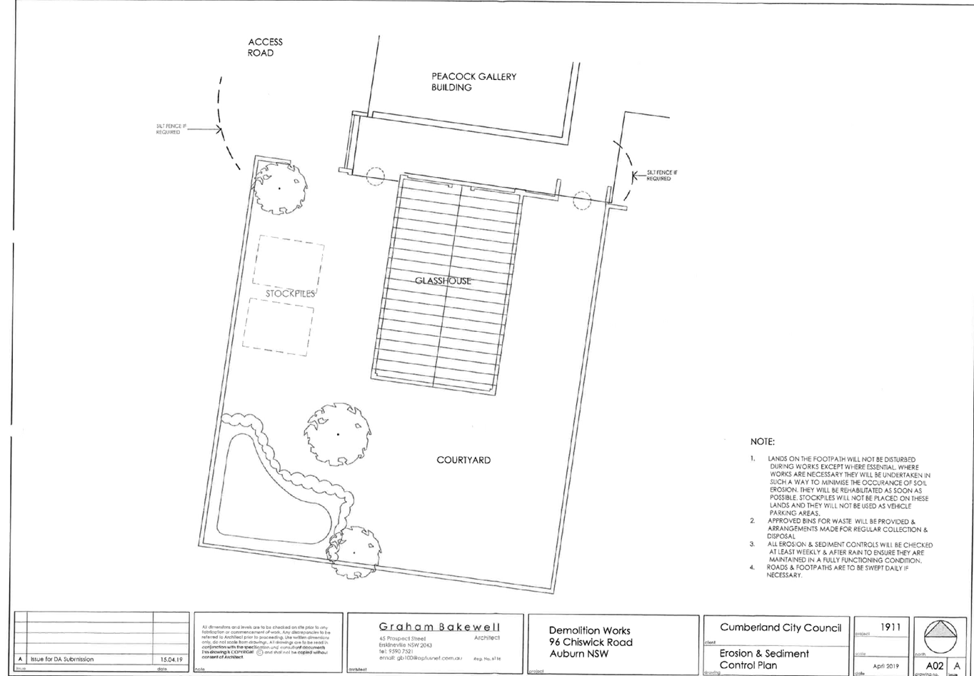
DOCUMENTS
ASSOCIATED WITH
REPORT LPP056/19
Attachment 3
Heritage Consultant Comments
Cumberland Local Planning Panel Meeting
14 August 2019
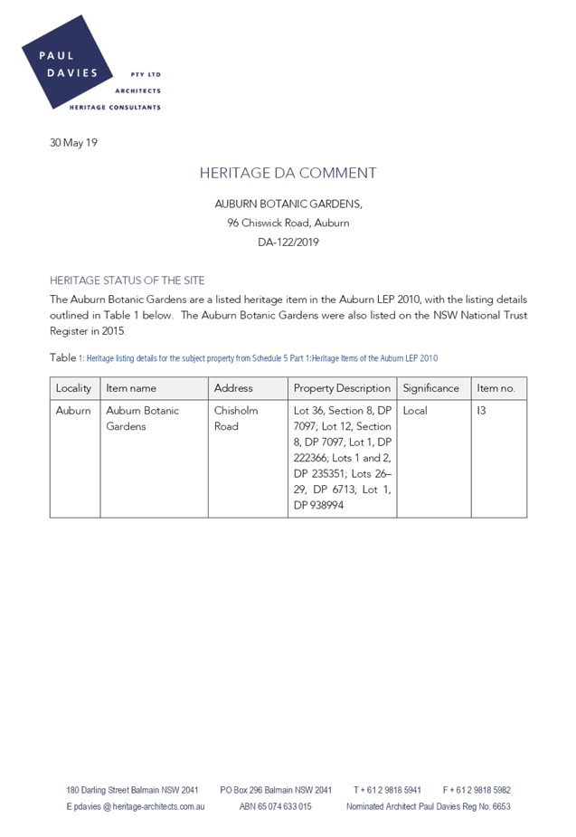
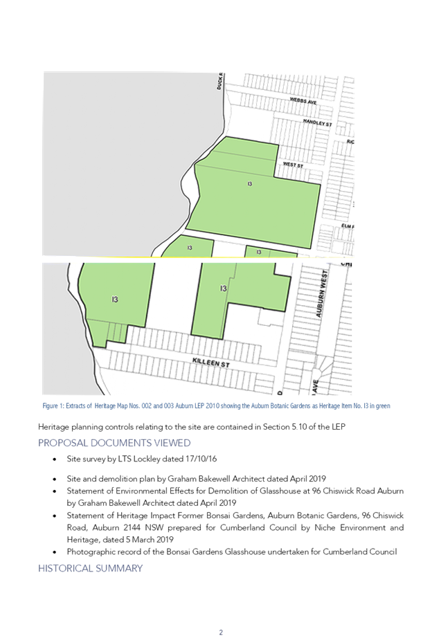
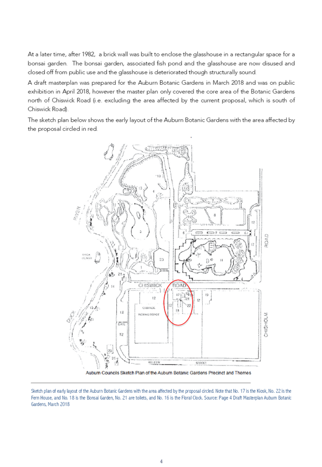


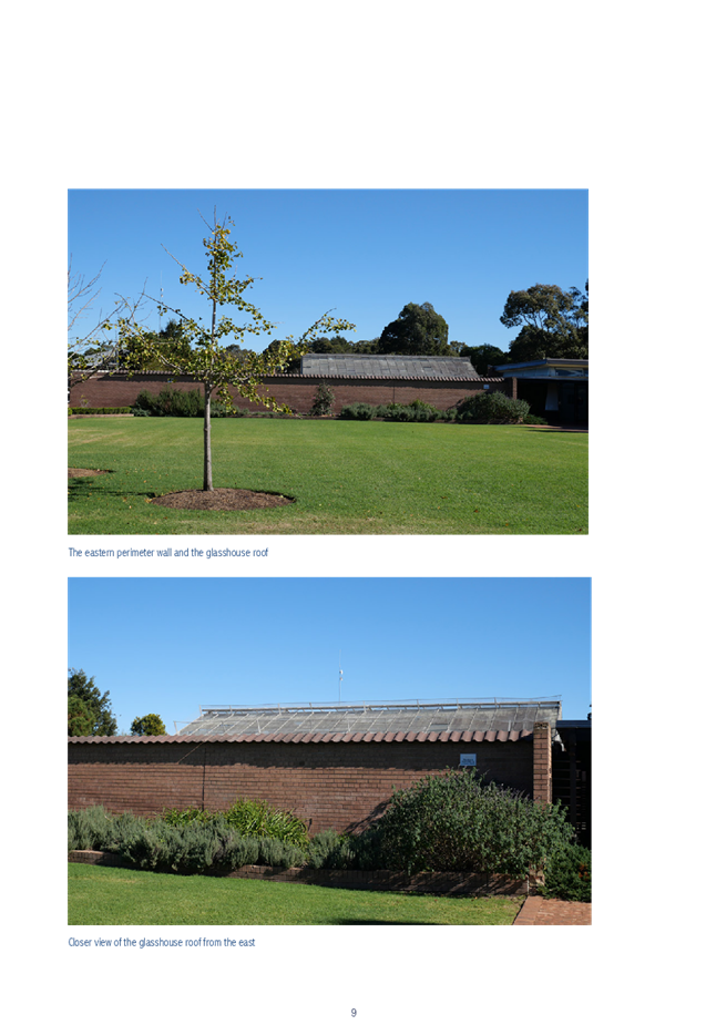
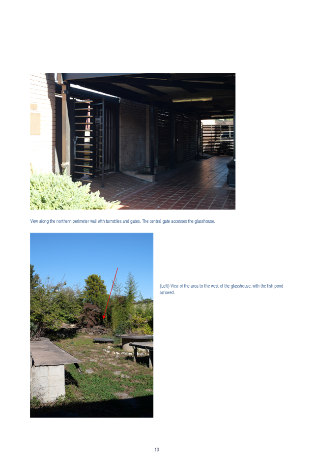
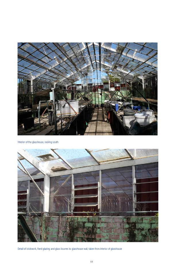
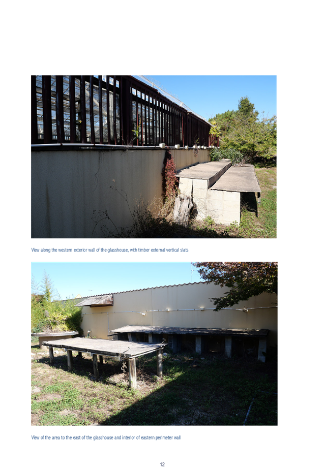
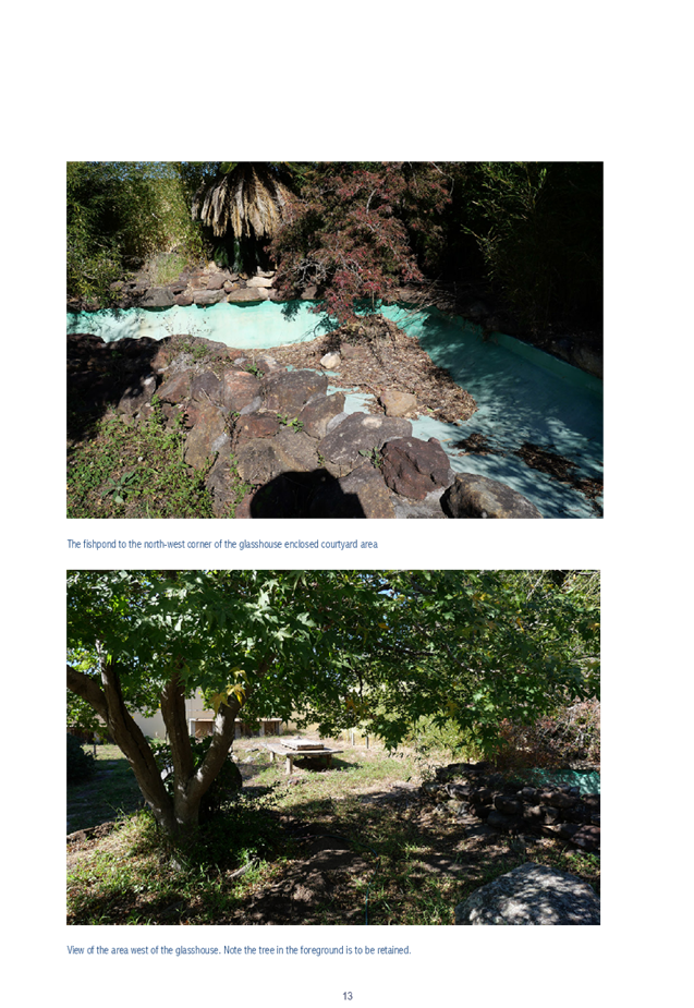
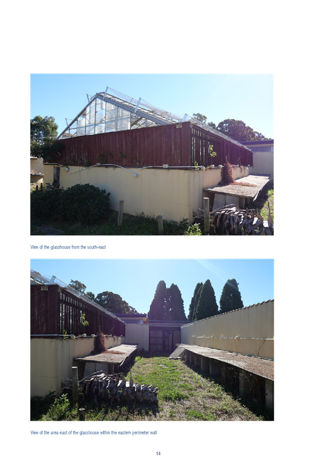
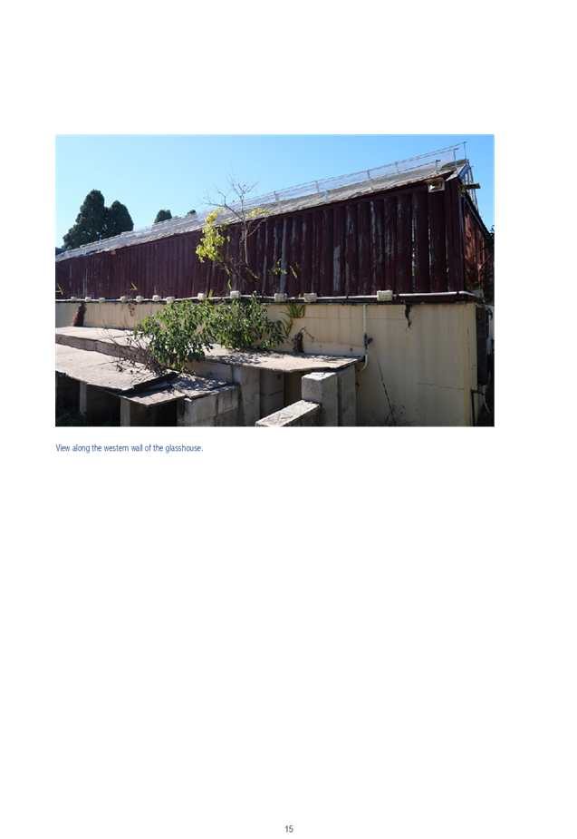
DOCUMENTS
ASSOCIATED WITH
REPORT LPP056/19
Attachment 4
Auburn LEP 2010 Assessment
Cumberland Local Planning Panel Meeting
14 August 2019

DOCUMENTS
ASSOCIATED WITH
REPORT LPP056/19
Attachment 5
Auburn DCP 2010 Assessment
Cumberland Local Planning Panel Meeting
14 August 2019
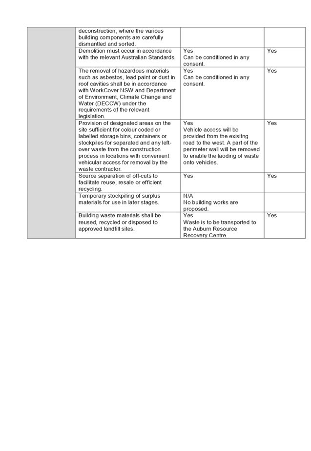
Cumberland
Local Planning Panel Meeting
14 August 2019
Item No: LPP057/19
Section 4.56
Modification Application - 1/181 McCredie Road, Guildford West
Responsible
Division: Environment
& Planning
Officer: Executive
Manager Development and Building
File
Number: 2007/105/5
|
Application lodged
|
17 May 2019
|
|
Applicant
|
PGH Environmental Planning
|
|
Owner
|
Sunshine Island (Aust) Pty Ltd
|
|
Application No.
|
2007/105/5
|
|
Description of
Land
|
Lot 1 in SP36943; 1/181 McCredie Road, Guildford West
|
|
Proposed
Development
|
Section 4.56 application to
an existing sex services premises to formalise unauthorised internal works,
internal alterations and additions and increase number of sex workers from 11
to 12.
|
|
Site Area
|
2,845.5m2
|
|
Zoning
|
IN1 – General
Industrial
|
|
Principal Development Standards
|
Minimum Lot Size: 1200sqm – No change sought
|
|
Disclosure of
political donations and gifts
|
Nil disclosure
|
|
Heritage
|
The subject site does
not contain a heritage item, is not located within the vicinity of a heritage
item or within a heritage conservation area.
|
|
Issues
|
· Service Rooms vs Staff Numbers
|
1. DA2007/105/1
was lodged on 18 August 2006 for internal alterations and additions to existing
industrial unit and its use as a brothel. This application was refused by
Council on 20 February 2007 and then granted a deferred commencement approved
via Land and Environment Court on 29 March 2007. This consent was subsequently
activated on 7 August 2007.
2. DA2007/105/2
was lodged on 28 April 2009 for modifications to a Court Approval including;
Construct 5 additional working rooms to create a total of 8 working rooms;
Construct additional waiting and staff rooms; Retrospective approval for works
undertaken without prior consent (e.g., reconfiguration of room layouts/uses
and associated facilities such as bathrooms); Increase the number of sex
workers operating from the premises at any one time from 3 to 8; and Extend
hours of operation from 10:00am to 10:00pm Monday to Friday & 10:00am to
8:00pm on Saturday (no work Sunday) to 24 hours a day, 7 days a week. This
application was approved by Council on the 11 August 2009.
3. DA2007/105/3
was lodged on 21 March 2011 for modifications approving to extend the brothels
hours of operation permanently to 24 hours 7 days a week. This application was
approved by Council on 1 November 2011.
4. DA2007/105/4
was lodged on 8 July 2014 for modifications approving alterations and additions
to the premises and continued use as a ‘sex service premises’. This
application was approved on 3 March 2015.
5. The
application was notified to surrounding properties from 14 to 28 June 2019, a
site notice was placed on the site and was advertised in the local paper. No
submissions were received as a result of the notification.
6. The
application is being reported to the Cumberland Local Planning Panel (CLPP) for
determination as it is a sensitive development type being for the purpose of
sex services premises.
7. The
subject application has been assessed against the relevant provisions of the
Environmental Planning and Assessment Act 1979, Holroyd Local Environmental
Plan 2013 and the Holroyd Development Control Plan 2013.
8. No
variations are sought by the subject application.
9. The
application is recommended for approval subject to the conditions in the draft
determination at Attachment 3.
Subject Site and Surrounding
Area
The subject site is known as Unit
1, 181 McCredie Road, Guildford West and is legally described as Lot 1 in SP
36943. The subject site is located on the Northern side of McCredie Road. The
site is occupied by the existing approved two storey industrial development.
The subject unit is located at the southern end of the subject site fronting
McCredie Street. The surrounding vicinity is occupied by industrial estates of
one – two storey construction, accommodating various sized estates and
various industrial uses.
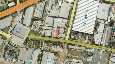
Aerial
view of the locality with subject site shown hatched. Source: Cumberland
Council 2019
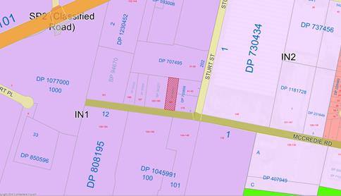
Zoning
map. Source: Cumberland Council 2019
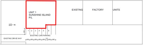
Site
Layout with subject site shown outlined in red. Source: 3D Works as edited by
Cumberland Council 2019
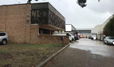
Site
frontage to McCredie Road. Source: Cumberland Council 2019
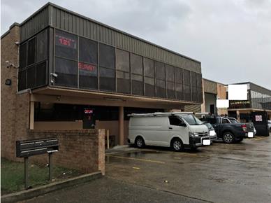
Subject
Site within Industrial Unit Development. Source: Cumberland Council 2019
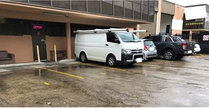
Subject Industrial
Unit Parking Arrangement. Source: Cumberland Council 2019
Description of Proposed
Development
The existing approval for the
subject brothel (DA2007/105 and subsequent modifications) permits the operation
24 hours, 7 days a week. It provides eleven service rooms across two stories
with 11 sex workers and includes 7 car parking spaces, six external and one
internal space.
The proposed modification seeks to
reconfigure the layout of both the ground and first floor levels so as to
increase the number of service rooms from 11 to 14, reconfigure the client
waiting areas, provide reconfigured staff facilities (inclusive of additional
rest areas). The proposal seeks to increase staff numbers from 11 to 14 (12 sex
workers and 2 administration/management staff) in accordance with increasing
the service rooms. The proposal retains the existing approved car parking
provision.
Site History
|
Date
|
Action
|
|
20 February 2007
|
DA 2007/105/1 for internal alterations and additions to
existing industrial unit and its use as a brothel was refused by Council.
Notice of Determination can be viewed at Attachment 7.
|
|
29 March 2007
|
DA 2007/105/1 for internal alterations and additions to existing
industrial unit and its use as a brothel appeal upheld by Land and
Environment Court, granting deferred commencement approval. Notice of
Determination can be viewed at
Attachment 8.
|
|
7 August 2007
|
DA 2007/105/1 for internal alterations and additions to
existing industrial unit and its use as a brothel, consent activated.
|
|
11 August 2009
|
DA 2007/105/2 for modifications to a Court Approval
including; Construct 5 additional working rooms to create a total of 8
working rooms; Construct additional waiting & staff rooms; Retrospective
approval for works undertaken without prior consent (e.g., reconfiguration of
room layouts/uses and associated facilities such as bathrooms); Increase the
number of sex workers operating from the premises at any one time from 3 to
8; and Extend hours of operation from 10:00am to 10:00pm Monday to Friday
& 10:00am to 8:00pm on Saturday (no work Sunday) to 24 hours a day, 7
days a week approved by Council. Notice of Determination can be viewed at Attachment 9.
|
|
1 November 2011
|
DA 2007/105/3 for modifications approving to extend the
brothels hours of operation permanently to 24 hours 7 days a week approved by
Council. Notice of Determination can be viewed at Attachment 10.
|
|
3 March 2015
|
DA 2007/105/4 for modifications approving alterations
and additions to the premises and continued use as a ‘sex service
premises’ approved. Notice of Determination can be viewed at Attachment 11.
|
|
12 April 2019
|
Pre-DA Meeting Minutes provided following meeting on 19
February 2019 in regards to a Section 4.56 Application for unauthorised
works, alterations and additions to the subject site and to increase the
number of sex workers. Meeting Minutes can be viewed at Attachment 12.
|
Application History
|
Date
|
Action
|
|
17 May 2019
|
DA 2007/105/5 lodged with Council
|
|
12 June 2019
|
The application was referred externally to:
- New South Wales Police
The application was referred internally to:
- Environmental Health Unit
- Building Services Unit
|
|
14 to 28 May 2019
|
Application placed on public notification for 14 days
|
|
26 June 2019
|
Application referred to CLPP for determination
|
Applicant’s
Supporting Statement
A Statement of Environmental
Effects prepared by PGH Environmental Planning, dated 14 May 2019 was submitted
with the subject modification application and can be viewed at Attachment 4.
Further to this an amended Plan of
Management has been submitted to support the subject modification application
and can be viewed at Attachment 5.
Contact
with Relevant Parties
The
assessing officer has undertaken an inspection of the subject site and has been
in contact with the applicant throughout the assessment process.
Internal Referrals
Environmental
Health
Satisfactory subject to conditions
applied under previous consent and additional standard and non-standard
conditions of consent.
Building
Services Unit
Satisfactory subject to conditions
applied under previous consent and additional conditions relating to BCA
Compliance.
External
Referrals
New
South Wales Police
The application was referred to
NSW Police for comment who advised that the operation is deemed low crime risk.
Accordingly, the NSW Police provided no further comment or conditions.
Planning
Assessment
Section
4.55(2) of the Environmental Planning and Assessment Act 1979 (EP & A Act)
Pursuant to Section 4.55(2), a
consent authority may, on application being made by the applicant or any other
person entitled to act on a consent granted by the consent authority and
subject to and in accordance with the regulations, modify the consent if:
|
Requirement
|
Comment
|
|
(a) It is satisfied that the development to which
the consent as modified relates is substantially the same development as the
development for which the consent was originally granted and before that consent
as originally granted was modified (if at all), and
|
The development as proposed to
be modified is substantially the same as the development for which consent
was originally granted. The proposal provides for internal fit out changes
and increase in staff numbers to the approved brothel.
|
|
(b) it has consulted with the relevant Minister,
public authority or approval body (within the meaning of Division 4.8) in
respect of a condition imposed as a requirement of a concurrence to the
consent or in accordance with the general terms of an approval proposed to be
granted by the approval body and that Minister, authority or body has not,
within 21 days after being consulted, objected to the modification of that
consent, and
|
The modified proposal was referred to NSW Police for
comment. No objections were raised by the referral bodies beyond conditions
recommended to be imposed.
|
|
(c) it has notified the application in
accordance with:
(i) the regulations,
if the regulations so require, or
(ii) a development
control plan, if the consent authority is a council that has made a
development control plan that requires the notification or advertising of
applications for modification of a development consent, and
|
The application was notified for 14 days from 8 to 22 May
2019, in accordance with HDCP 2013.
|
|
(d) it has considered any submissions made
concerning the proposed modification within the period prescribed by the
regulations or provided by the development control plan, as the case may be.
Subsections (1) and (1A) do not apply to such a
modification.
|
No submissions were received in response to the
notification period.
|
|
(3) In determining an application for
modification of a consent under this section, the consent
authority must take into consideration such of the matters referred to in
section 4.15(1) as are of relevance to the development the subject of the
application.
|
The provisions of the applicable EPIs are discussed elsewhere in this
report.
The
provisions of the applicable DCP are discussed elsewhere in this report.
There are no planning agreements or draft planning
agreements related to this application.
There are no relevant matters referred to in the
regulations.
The likely impacts of the development as proposed to be
modified are considered satisfactory.
The site is considered to be suitable for the development
as proposed to be modified.
No submissions
were received as a result of the notification.
Approval of the
subject application is not contrary to the public interest.
|
|
(4) The modification of a development
consent in accordance with this section is taken not to be the granting of
development consent under this Part, but a reference in this or any other Act
to a development consent includes a reference to a development consent as so
modified.
|
(a) Noted
|
Section
4.15 of the Environmental Planning and Assessment Act 1979 (EP & A Act)
Environmental
Planning Instruments
The following Environmental
Planning Instruments are relevant to the assessment of the subject application:
(a) State Environmental Planning
Policy No 55 – Remediation of Land (SEPP 55)
The requirement at clause 7 of
SEPP 55 for Council to be satisfied that the site is suitable or can be made
suitable to accommodate the proposed development was considered under the
original application. The proposed modifications do not include any building or
ground works which will raise any new concerns about potential contamination.
(b) Holroyd Local Environmental
Plan 2013 (HLEP 2013)
The proposal is defined as
‘sex services premises’ under the provisions of HLEP 2013.
‘Sex Services Premises’ are not permissible within the IN1 –
General Industrial zone which applies to the land. However, under Clause 5 of
Schedule 1 Additional Permitted Uses the use of certain land at Guildford West
including the subject site, permits development for the purposes of sex
services premises with development consent.
The proposed modifications do not
result in any change to the maximum lot size, which is the only development
standard applicable to the subject site.
The site is identified as being of
moderate salinity but as the proposed modifications do not include any building
or ground works which will raise any new concerns about potential salinity
levels on site.
Attachment 1 contains a full
assessment against the HLEP 2013.
Development
Control Plans
(a) Holroyd Development Control
Plan 2013
HDCP 2013 contains general
controls which relate to all developments under Part A, and Part D contains
Planning Controls for Brothels. The proposal complies with all relevant provisions
of the HDCP2013 as can be seen in Attachment 2, which contains a full
assessment against the planning controls for Sex Services Premises.
Service
Rooms
The subject application proposes
to increase the number of service rooms provided on site from 11 to 14. The
application also seeks to increase the number of sex workers permitted to work
onsite from 11 to 12 with 2 additional management/office staff members working
on site.
Concern was flagged by the
assessing officer as to the necessity to have rooms in excess of the number of
permitted sex workers being sought. Management of the brothel advised that this
was a necessity so as to allow for ongoing maintenance, upgrade and cleaning
works to occur on site without impacting the ability of the brothel to function
at capacity. Further to this, the management advised anecdotally that there is
a low likelihood of operating at capacity.
It is considered that given the
prescriptive cleaning treatments required of service rooms and the likelihood
for maintenance works to be carried out, the justification is sufficient.
Accordingly there is no further concern with the proposed 14 service rooms and
12 sex workers proposed under the subject application.
Any
planning agreement that has been entered into under section 7.4, or any draft
planning agreement that a developer has offered to enter into under section 7.4
There is no planning agreement or
draft planning agreement associated with the subject Development Application.
The
provisions of the Regulations
The regulations do not proscribe
any relevant matters for consideration.
Any
coastal zone management plan (within the meaning of the Coastal Protection Act
1979)
There is no Coastal Zone
Management Plan applicable to the subject site
The
likely impacts of the development
The
likely environmental, social and economic impacts of the development have been
assessed and are considered satisfactory.
The
suitability of the site for the development
The site is considered suitable
for the proposed development.
Submissions
made in accordance with the Act or Regulation
Advertised
(newspaper) Mail
Sign Not
Required
In
accordance with Part E - Public Participation of HDCP 2013, the proposal was
publicly notified for a period of 14 days between 14 and 28 June 2019. As a
result of the notification, Council received no public submissions.
Section
7.11 of The Environmental Planning & Assessment Act 1979
The subject development does not
attract development contributions in accordance with Holroyd Section 94
Development Contributions Plan 2013.
Accordingly no condition was
imposed on the original consent requiring payment of contributions, nor is
there any condition required to be imposed under the subject application.
The
Public Interest
The public interest is served by
permitting the orderly and economic use of land, in a manner that is sensitive
to the surrounding environment and has regard to the reasonable amenity
expectations of surrounding land users. In view of the foregoing analysis, it
is considered that approval of the proposed development would not be contrary
to the public interest.
Disclosure
of Political Donations and Gifts
The NSW Government has introduced
disclosure requirements for individuals or entities with a relevant financial
interest as part of the lodgement of various types of development proposals and
requests to initiate environmental planning instruments or development control
plans.
The application and notification
process did not result in any disclosure of Political Donations or Gifts.
The development application has
been assessed in accordance with the relevant requirements of the Environmental
Planning and Assessment Act 1979, Holroyd Local Environmental Plan 2013 and the
Holroyd Development Control Plan 2013 and is considered to be satisfactory.
There are no further consultation
processes for Council associated with this report.
There are no further financial
implications for Council associated with this report.
There are no policy implications
for Council associated with this report.
Communication /
Publications:
The final outcome of this matter
will be notified in the newspaper. The objectors will also be notified in
writing of the outcome.
|
That Development Application
2007/105/5 a Section 4.56 modification application of a Court Approval
application to an existing sex services premises to formalise unauthorised
internal works, internal alterations and additions and increase number of sex
workers from 11 to 12 be approved subject to the conditions within the draft
notice of determination provided at Attachment 3.
|
1. HLEP 2013
Compliance Table ⇩ 
2. HDCP
2013 Compliance Table ⇩ 
3. Draft
Notice of Determination ⇩
4. Proposed
Architectural Plans ⇩
5. Approved
Architectural Plans under DA 2007/105 ⇩ 
6. Plan
of Management ⇩ 
7. DA
2007/105 - Notice of Determination of Application - Refusal ⇩
8. DA
2007/105 - Notice of Determination - Land Environment Court Approval ⇩
9. DA
2007/105/2 - Notice of Determination of Application ⇩
10. DA
2007/105/3 - Notice of Determination of Application ⇩
11. DA
2007/105/4 - Notice of Determination of Application ⇩ 
12. PRE-
DA Meeting Minutes ⇩
DOCUMENTS
ASSOCIATED WITH
REPORT LPP057/19
Attachment 1
HLEP 2013 Compliance Table
Cumberland Local Planning Panel Meeting
14 August 2019
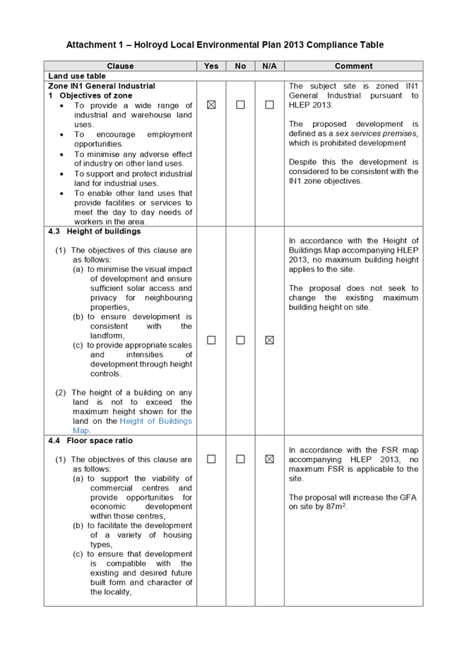
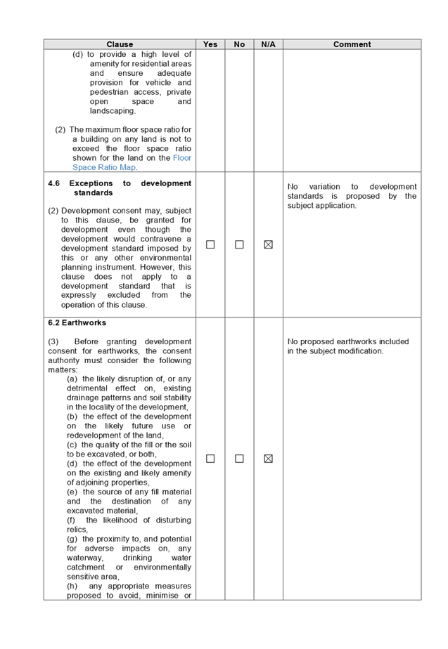
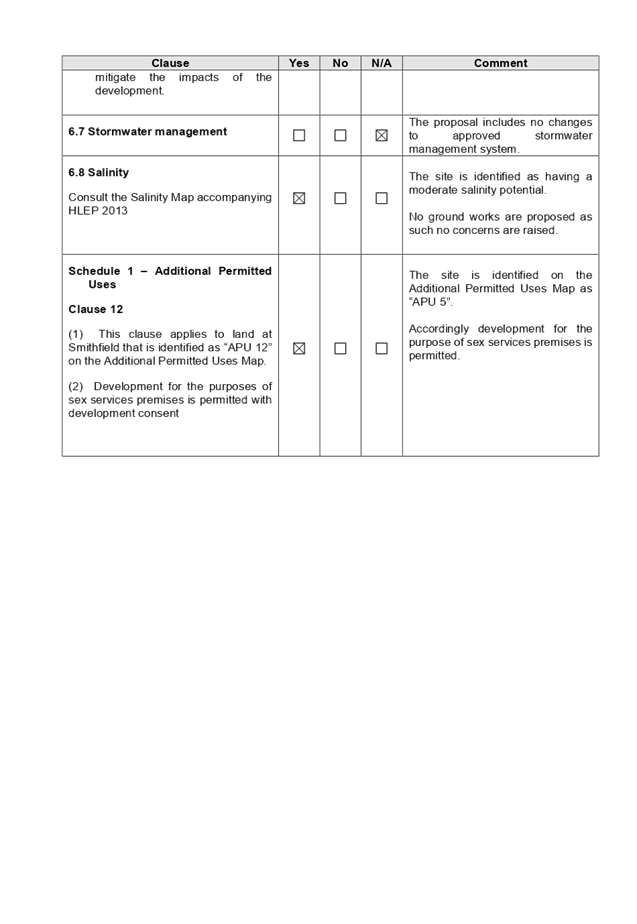
DOCUMENTS
ASSOCIATED WITH
REPORT LPP057/19
Attachment 2
HDCP 2013 Compliance Table
Cumberland Local Planning Panel Meeting
14 August 2019
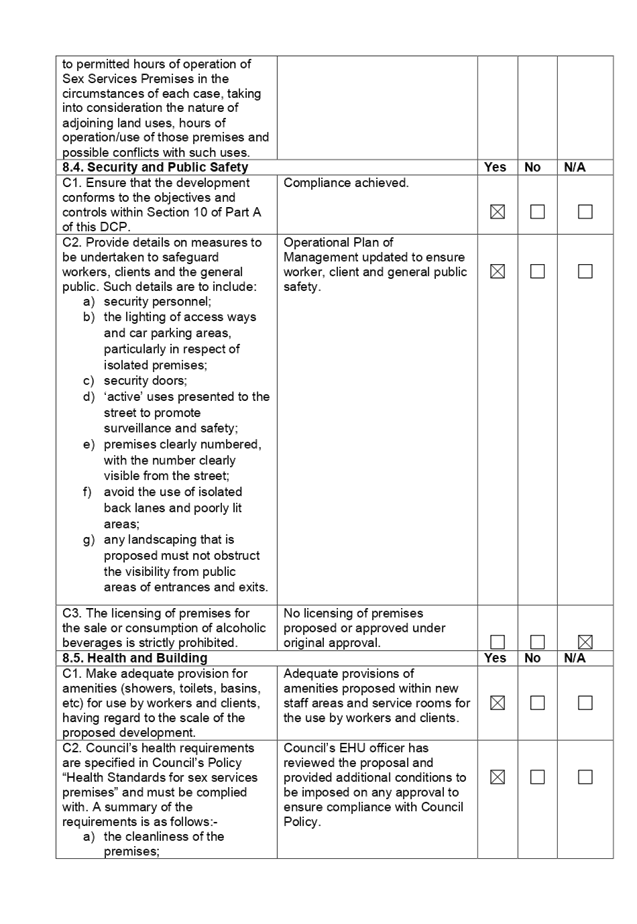
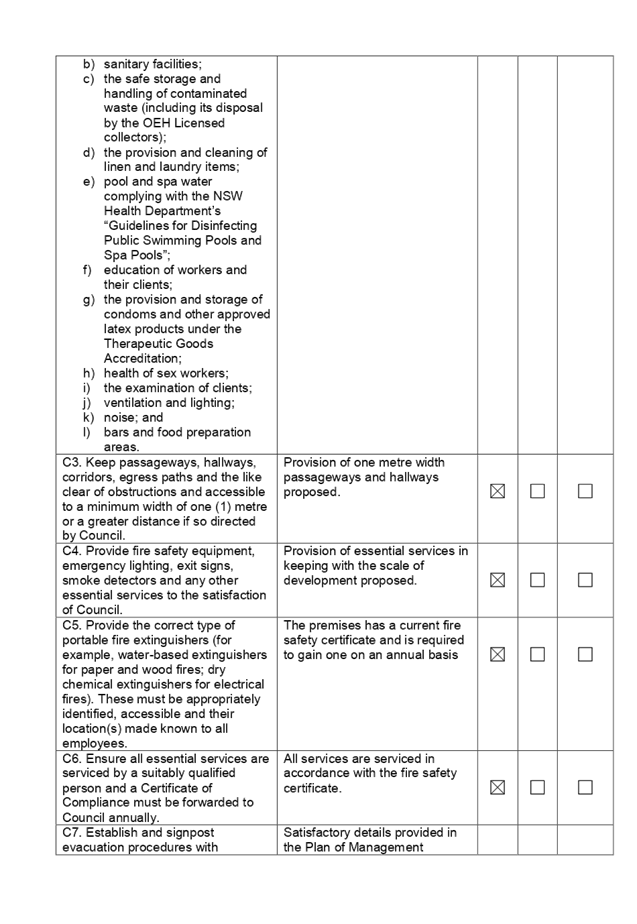

DOCUMENTS
ASSOCIATED WITH
REPORT LPP057/19
Attachment 3
Draft Notice of Determination
Cumberland Local Planning Panel Meeting
14 August 2019
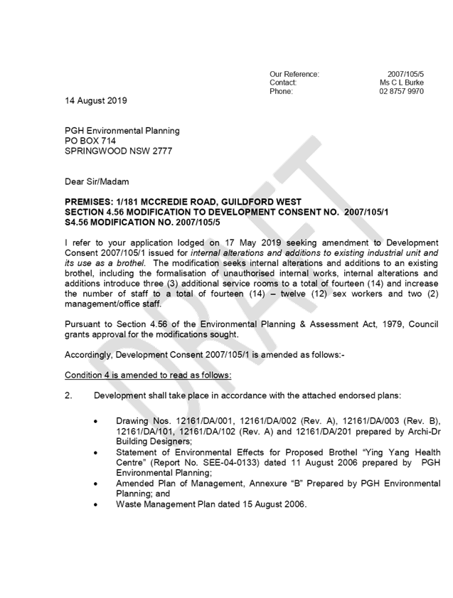
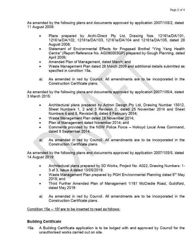
DOCUMENTS
ASSOCIATED WITH
REPORT LPP057/19
Attachment 4
Proposed Architectural Plans
Cumberland Local Planning Panel Meeting
14 August 2019
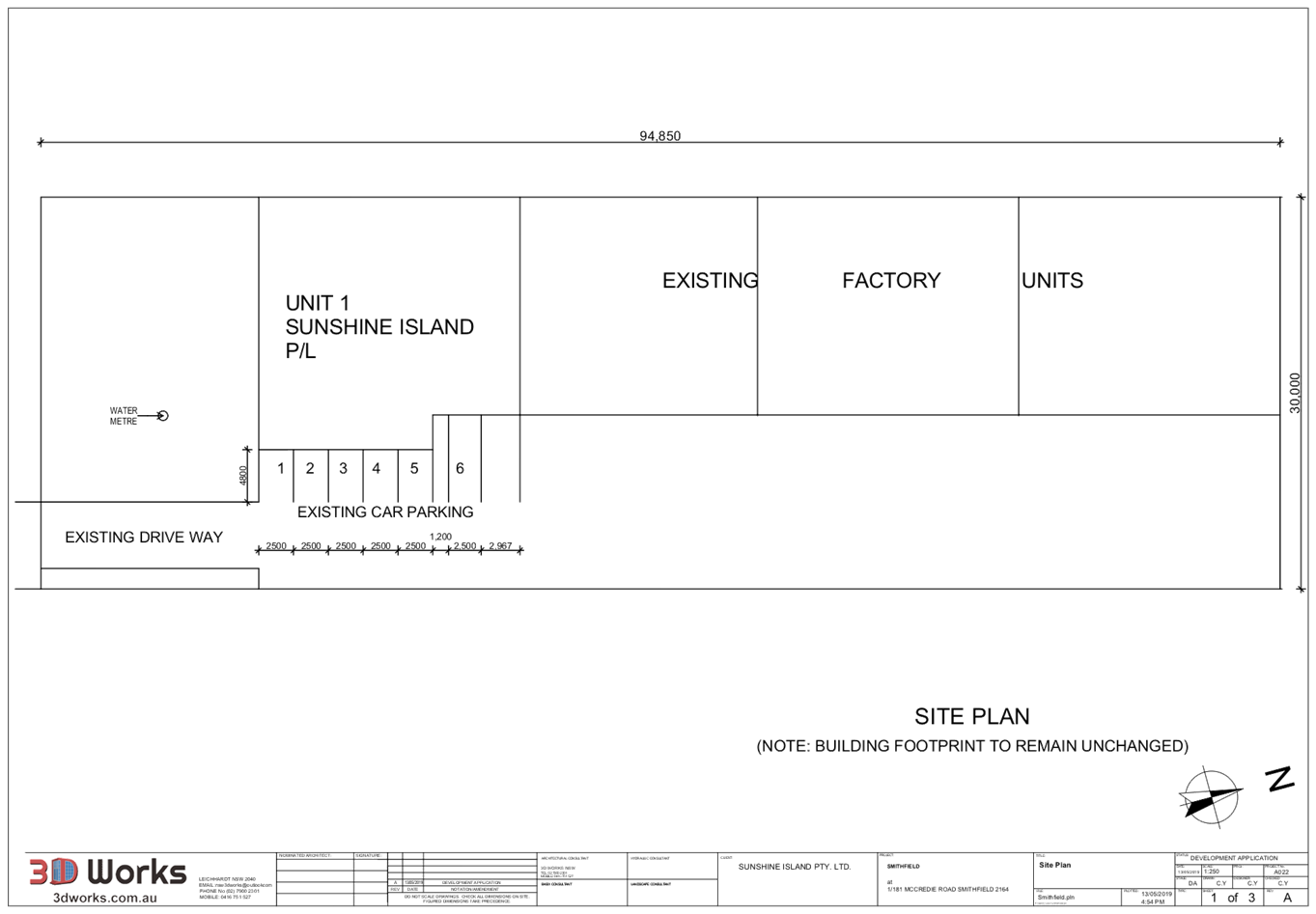
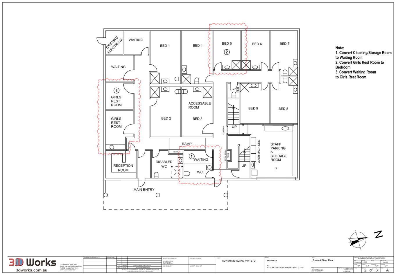
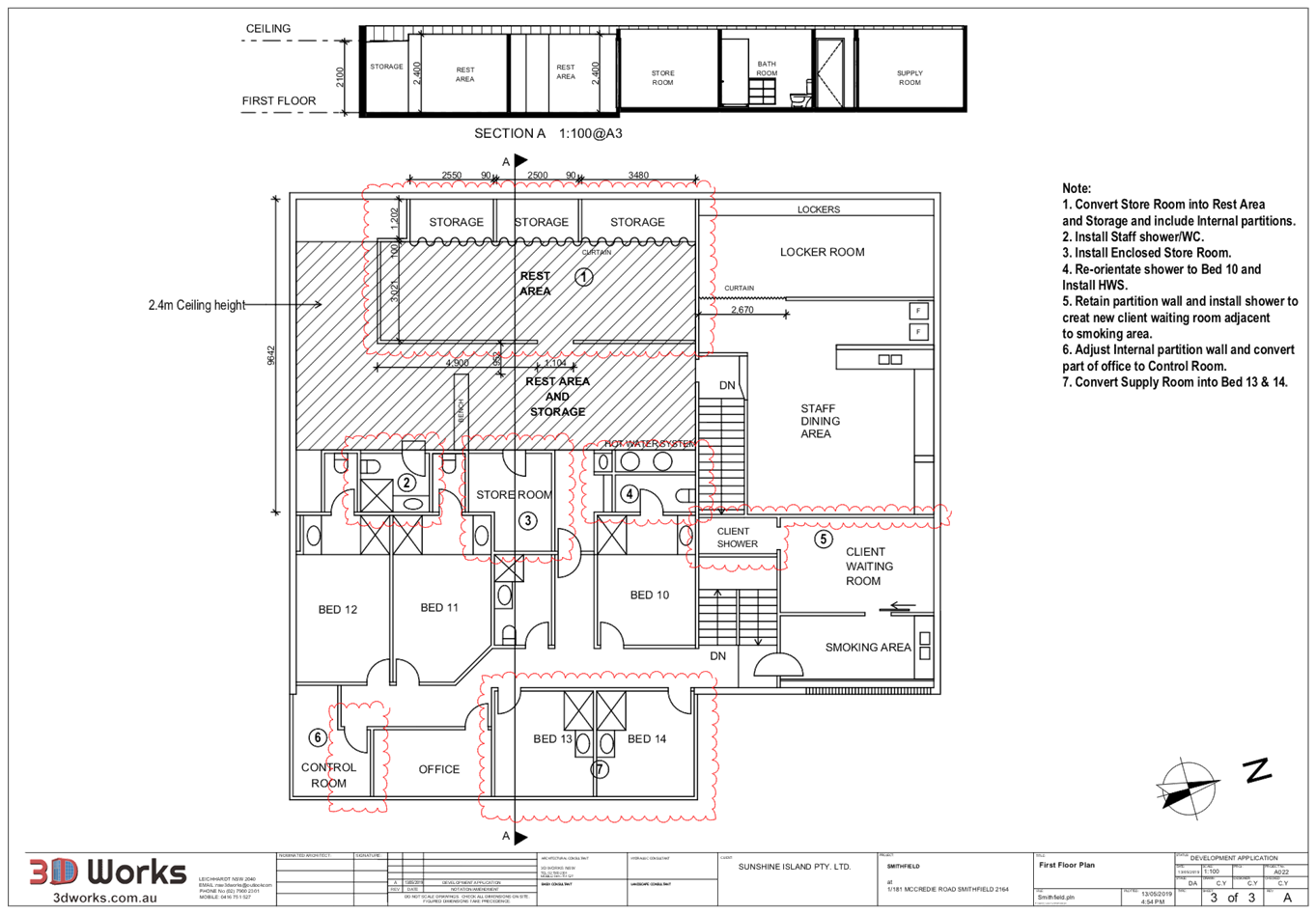
DOCUMENTS
ASSOCIATED WITH
REPORT LPP057/19
Attachment 5
Approved Architectural Plans under DA 2007/105
Cumberland Local Planning Panel Meeting
14 August 2019
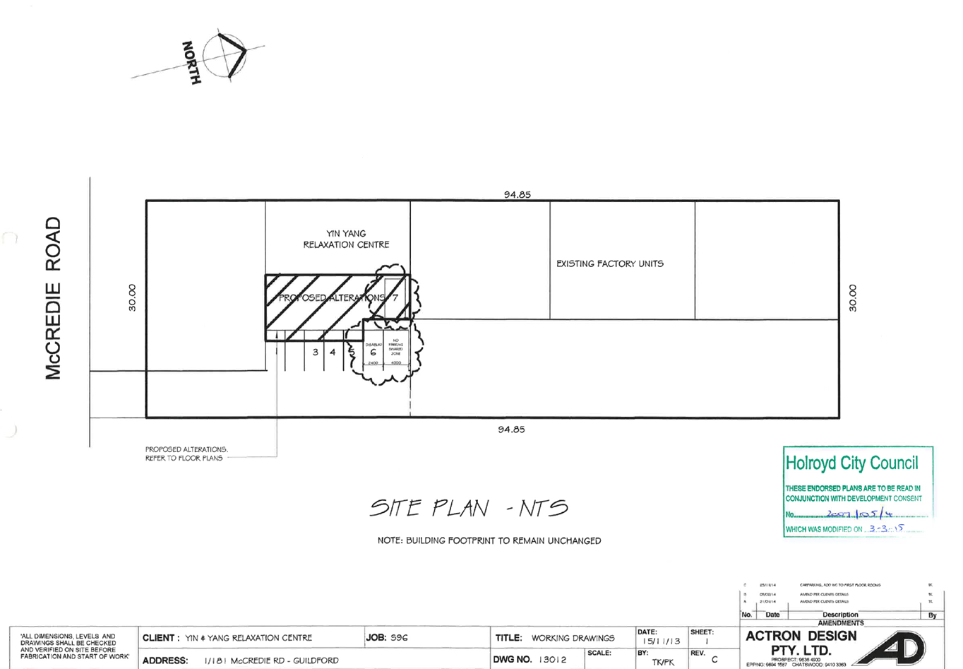
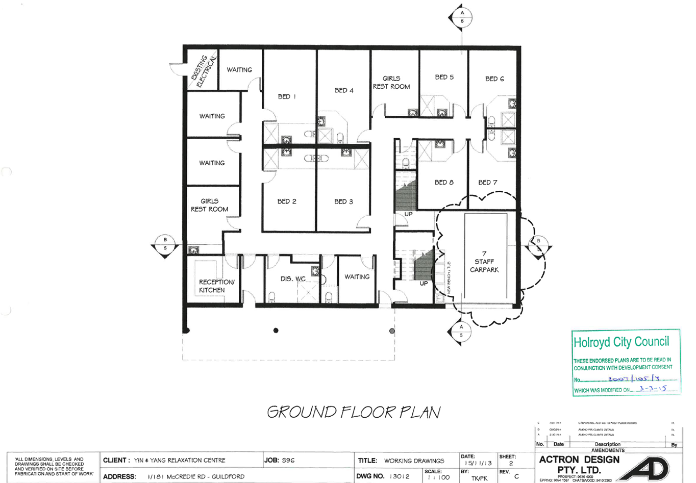
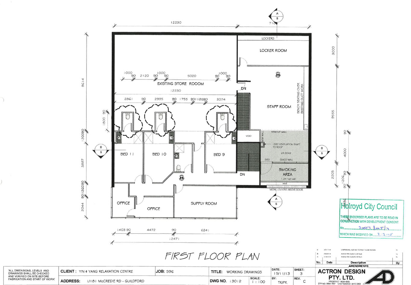
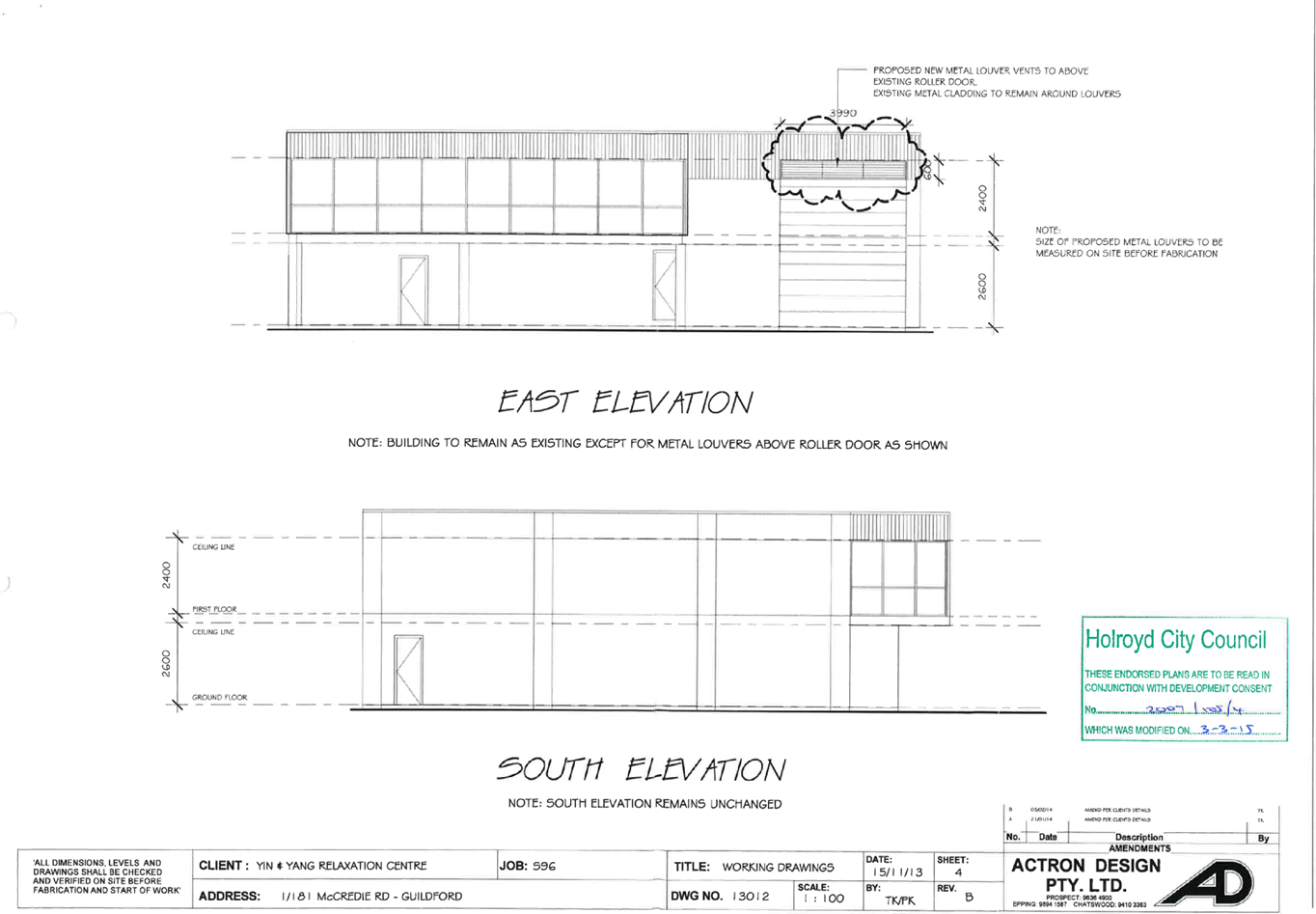
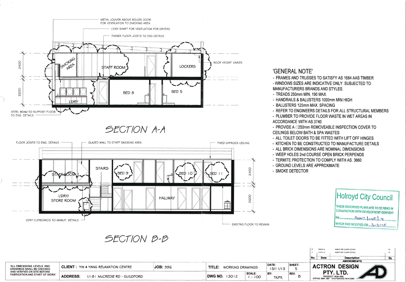
DOCUMENTS
ASSOCIATED WITH
REPORT LPP057/19
Attachment 6
Plan of Management
Cumberland Local Planning Panel Meeting
14 August 2019
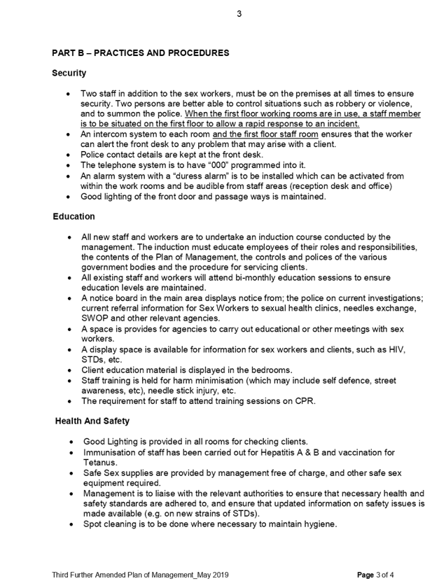
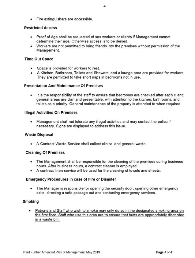
DOCUMENTS
ASSOCIATED WITH
REPORT LPP057/19
Attachment 7
DA 2007/105 - Notice of Determination of Application -
Refusal
Cumberland Local Planning Panel Meeting
14 August 2019
DOCUMENTS
ASSOCIATED WITH
REPORT LPP057/19
Attachment 8
DA 2007/105 - Notice of Determination - Land
Environment Court Approval
Cumberland Local Planning Panel Meeting
14 August 2019

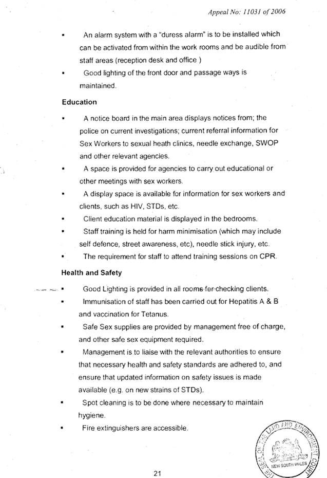


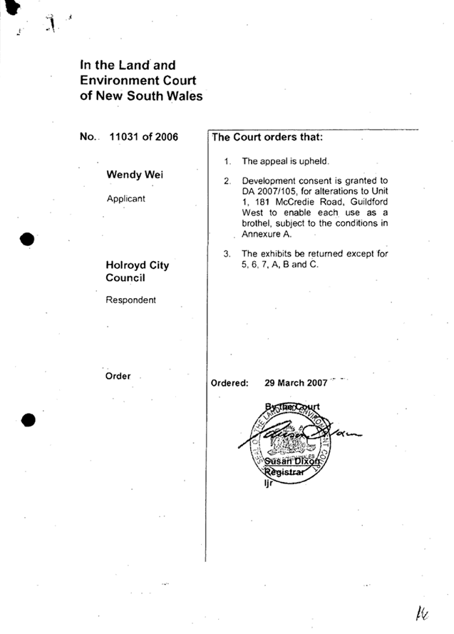

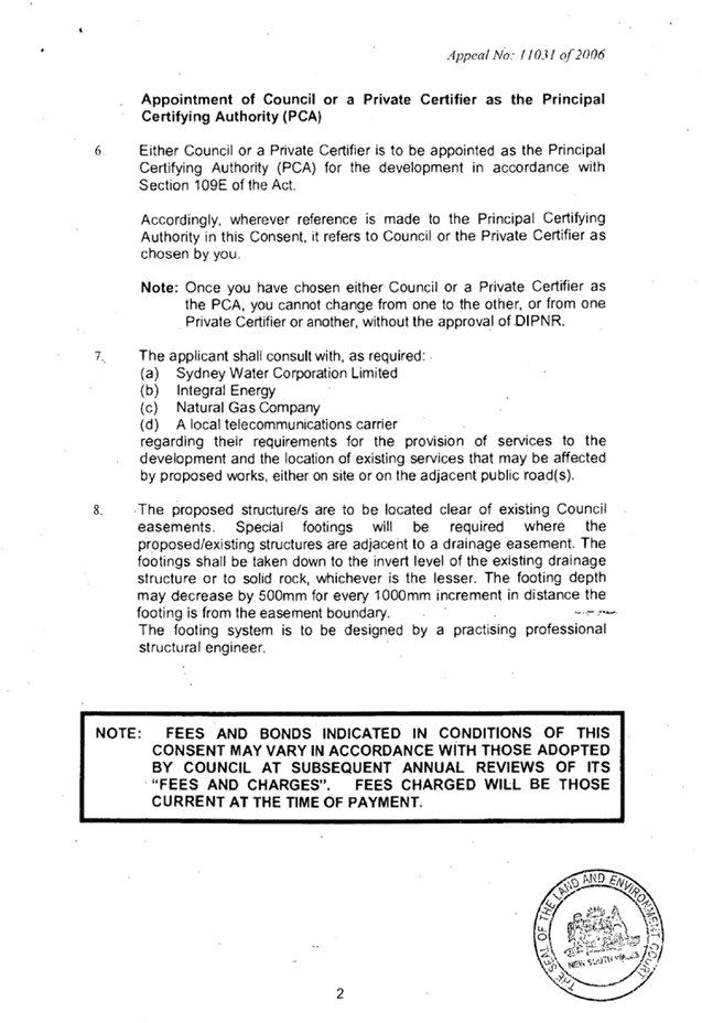
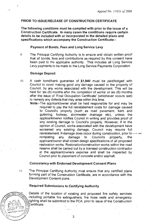

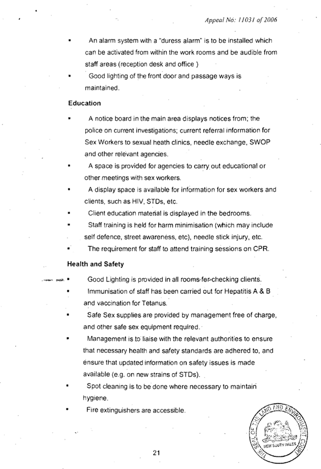
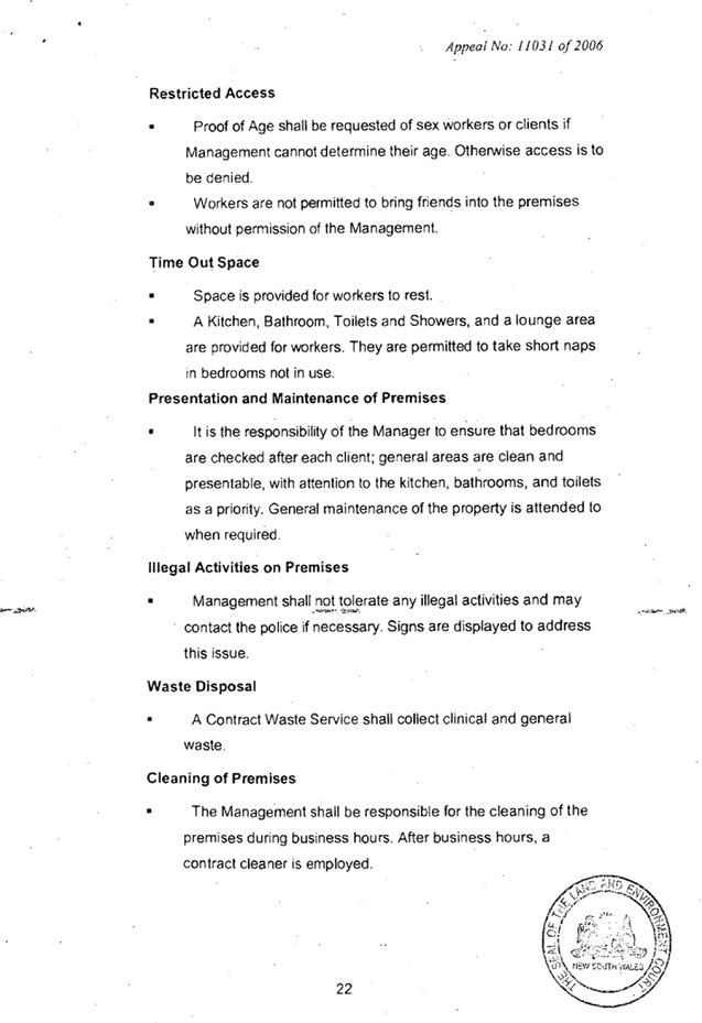
DOCUMENTS
ASSOCIATED WITH
REPORT LPP057/19
Attachment 9
DA 2007/105/2 - Notice of Determination of Application
Cumberland Local Planning Panel Meeting
14 August 2019
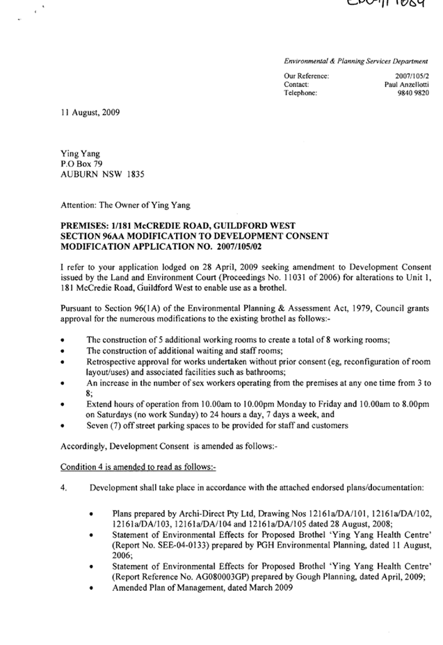
DOCUMENTS
ASSOCIATED WITH
REPORT LPP057/19
Attachment 10
DA 2007/105/3 - Notice of Determination of Application
Cumberland Local Planning Panel Meeting
14 August 2019
DOCUMENTS
ASSOCIATED WITH
REPORT LPP057/19
Attachment 11
DA 2007/105/4 - Notice of Determination of Application
Cumberland Local Planning Panel Meeting
14 August 2019

DOCUMENTS
ASSOCIATED WITH
REPORT LPP057/19
Attachment 12
PRE- DA Meeting Minutes
Cumberland Local Planning Panel Meeting
14 August 2019