Cumberland Local Planning Panel Meeting
8 May 2019
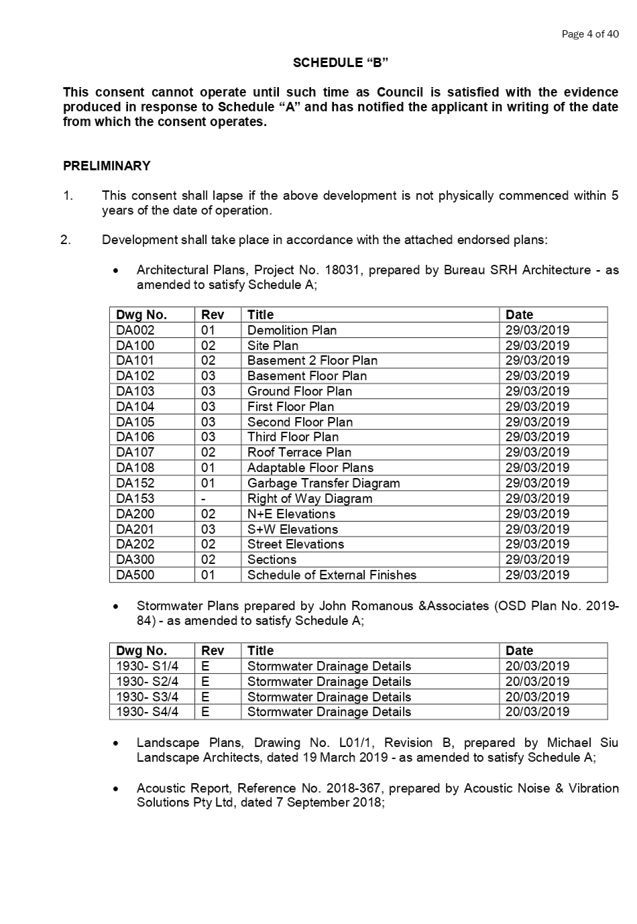
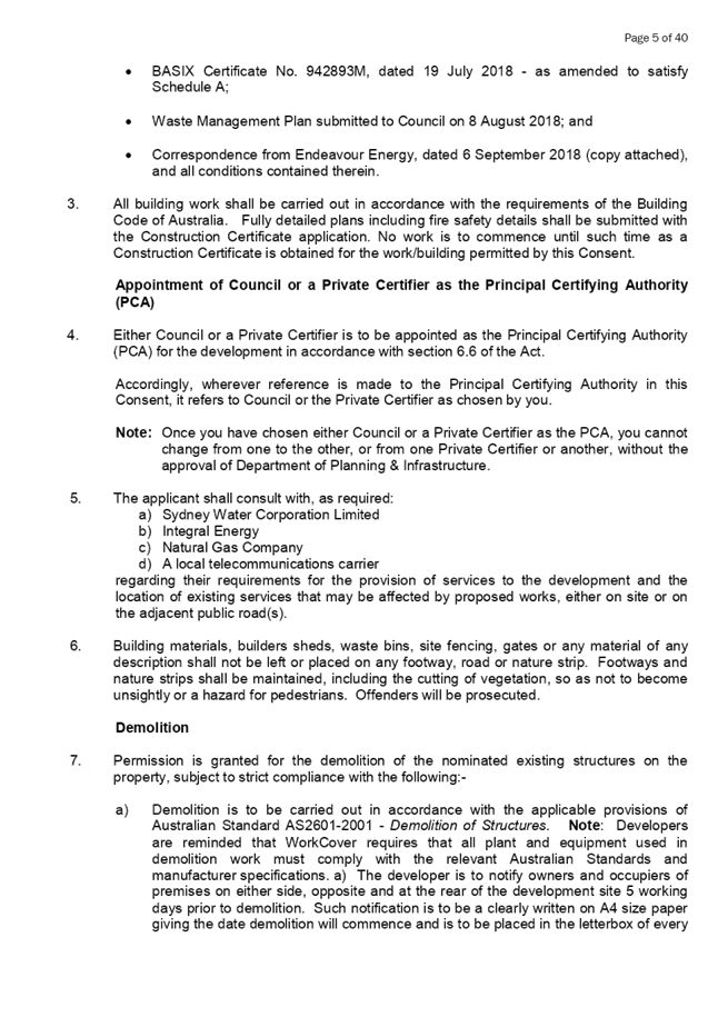
A
meeting of the Cumberland Local Planning Panel
will be held at 11:30am at the Merrylands Administration Building, 16
Memorial Avenue, Merrylands on Wednesday, 8 May 2019.
Business as below:
Yours faithfully
Hamish McNulty
General
Manager
ORDER OF BUSINESS
1. Receipt of Apologies
2. Confirmation of Minutes
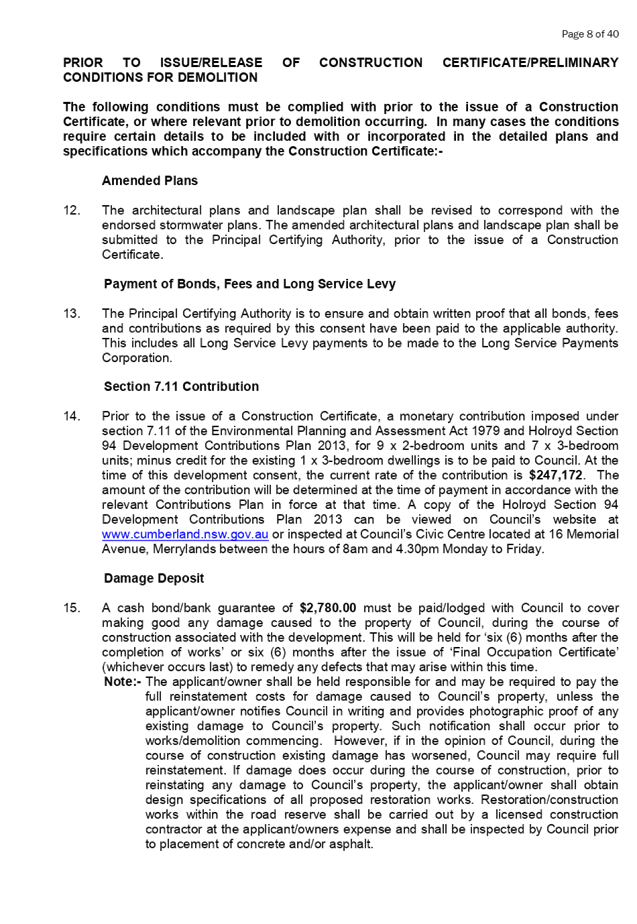
3. Declarations of Interest
4. Address by invited
speakers
5. Reports:
- Development
Applications
- Planning
Proposals
6. Closed Session Reports
Cumberland Local Planning Panel Meeting
8 May 2019
CONTENTS
Report No. Name of Report Page
No.
Development Applications
LPP026/19... Section 4.55(2)
Modification for 10 Guernsey Road, Guildford................... 5
LPP027/19... Development Application
for 1 Peggy Street, Mays Hill.............................. 47
LPP028/19... Development Application
for 3-9 Peggy Street, Mays Hill........................ 175
LPP029/19... Development Application
for 216 William Street, Granville...................... 363
LPP030/19... Development Application
for 17 Brooks Circuit, Lidcombe...................... 567
LPP031/19... Auburn and Lidcombe Town Centres
Planning Controls Strategy........ 735
Cumberland Local Planning Panel Meeting
8 May 2019
Item No:
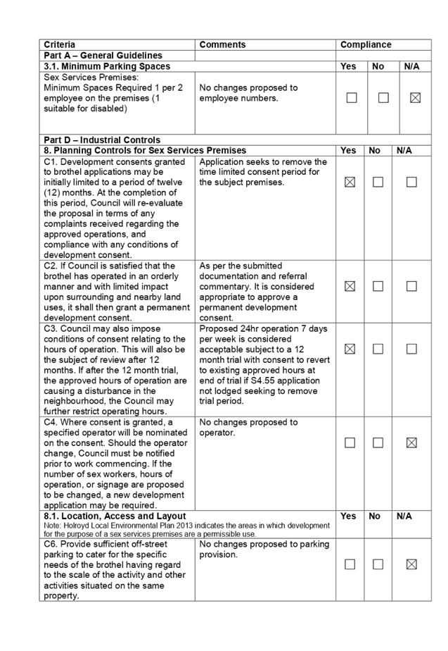
LPP026/19
Section
4.55(2) Modification for 10 Guernsey Road, Guildford
Responsible
Division: Environment
& Planning
Officer: Manager
Development Assessment
File Number: DA
2012/122/3
|
Application lodged
|
14 January 2019
|
|
Applicant
|
Urbanesque Planning
|
|
Owner
|
Messers J and M Shi
|
|
Application No.
|
2012/122/3
|
|
Description of Land
|
Lot 10 in DP7419; 10
Guernsey Road, Guildford
|
|
Proposed Development
|
Section 4.55(2) modification to remove trial period
requirements and increase hours of operation of an existing sex services
premises to 24 hours and 7 days a week.
|
|
Site Area
|
408.77m2
|
|
Zoning
|
IN2 – Light Industrial
|
|
Principal
Development Standards
|
Minimum Lot Size:
1200sqm – No change sought
|
|
Disclosure of political donations and gifts
|
Nil disclosure
|
|
Heritage
|
The subject site does not contain a heritage item,
is not located within the vicinity of a heritage item or within a heritage
conservation area.
|
|
Issues
|
· Validity of
consent
· 24 Hour
Operation
|
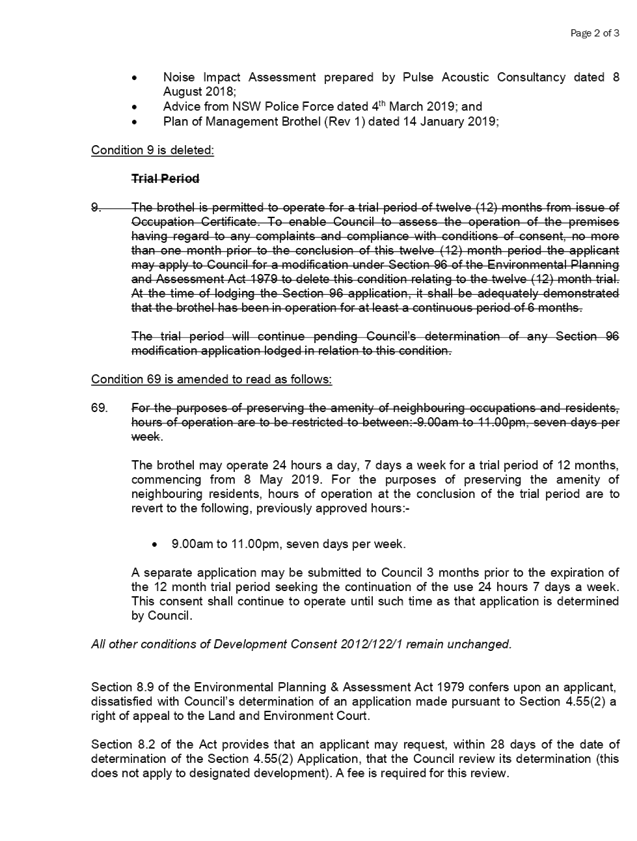
1. DA2012/122/1
was lodged on 3 April 2012 for alterations and addition to building for use as
a brothel. This application was approved under Delegated Authority on 3 October
2012.
2. A
Section 4.55(1A) application was lodged on 14 August 2018 and withdrawn by the
applicant on 4 September 2018 for modification to existing brothel to operate
24 hours 7 days. This application was withdrawn as it failed to demonstrate the
validity of the original consent.
3. The
subject modification application is for the deletion of condition number 9 of
the consent which limits the brothel operation to a 12 month trial and for
condition number 69 to be updated to allow for 24 hour operation, 7 days per
week. The application was accompanied by documentation from Minter Ellison
providing legal evidence as to the validity of the original consent, at Attachment
4. The
application was notified to surrounding properties from 12 to 26 February 2019,
a site notice was placed on the site and was advertised in the local paper. No
submissions were received as a result of the notification.
5. The
application is being reported to the Cumberland Local Planning Panel (CLPP) for
determination as it is a sensitive development type being for the purpose of
sex services premises.
6. The
subject application has been assessed against the relevant provisions of the
Environmental Planning and Assessment Act 1979, Holroyd Local Environmental
Plan 2013 and the Holroyd Development Control Plan 2013.
7. No
variations are sought by the subject application.
8. The
application is recommended for approval subject to the conditions in the draft
determination at Attachment 2.
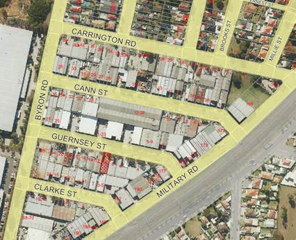
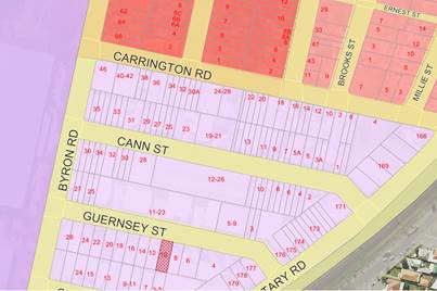
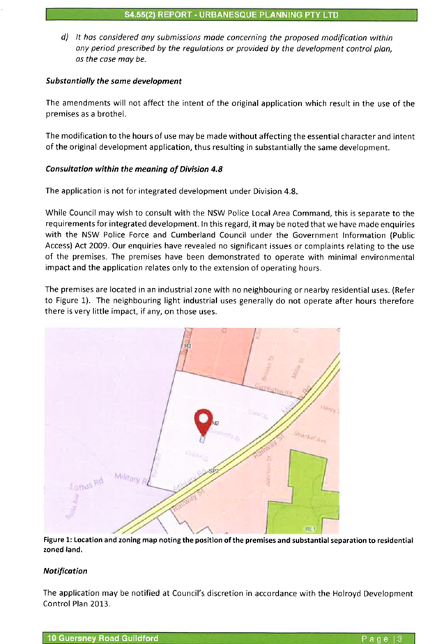
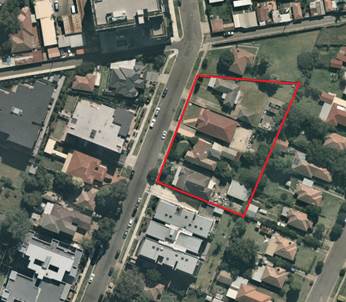
Subject Site and Surrounding
Area
The subject site is known as 10
Guernsey Road, Guildford and is legally described as Lot 10 in DP 7419. The
subject site is located on the southern side of Guernsey Road. The site is
rectangular in shape with a frontage of 12.19m to Guernsey Road (replicated for
the rear boundary) and an eastern and western side boundary dimension of 33.53m
and a total site area of 408.77m2. The site is occupied by the existing
approved single storey brothel within an industrial style building.
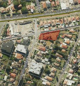
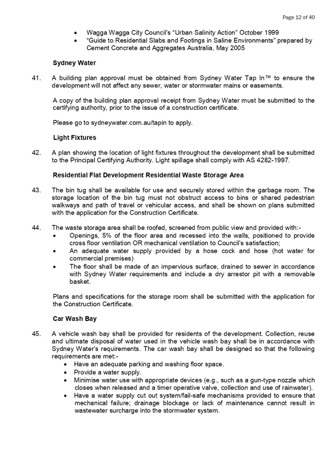
Aerial
view of the locality with subject site shown hatched. Source: Cumberland
Council 2019
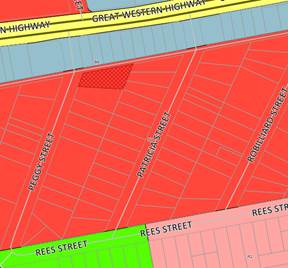
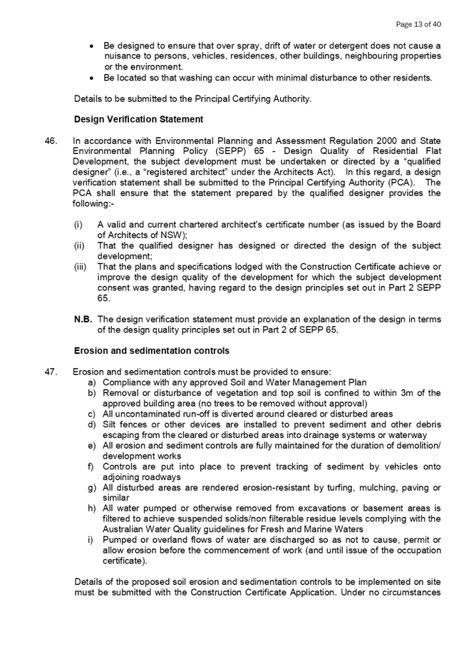
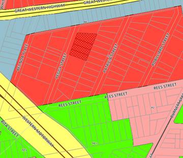
Zoning
map. Source: Cumberland Council 2019
Application History
|
Date
|
Action
|
|
14 January 2019
|
DA 2012/122/3 lodged with Council
|
|
8 February 2019
|
The application was referred externally to:
- New South Wales Police
The application was referred internally to:
- Environmental Health Unit
|
|
12 to 26 February 2019
|
Application placed on public notification for 21 days
|
|
15 February 2019
|
Legal opinion sought from Council General Counsel as to
validity of consent.
|
|
8 May 2019
|
Application referred to CLPP for determination
|
Applicant’s Supporting
Statement
A Statement of Environmental
Effects prepared by Urbanesque Planning, dated 4 January 2019 was submitted
with the application and can be view at Attachment 3.
Contact With Relevant
Parties
The assessing officer has
undertaken an inspection of the subject site and has been in contact with the
applicant throughout the assessment process.
Internal Referrals
Environmental Health
Satisfactory subject to conditions
applied under previous consent.
External Referrals
New South Wales Police
The application was referred to
NSW Police for comment who advised that the operation is deemed Moderate-Major
crime risk. The NSW Police have provided further updated CPTED principles and
conditions to apply to the subject modification. It is thus recommended that
condition number 1 be updated to reflect the NSW Police referral advice
received on 4th March 2019.
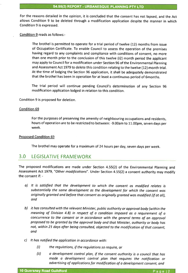
Planning Assessment
Section 4.55(2) of the
Environmental Planning and Assessment Act 1979 (EP & A Act)
Pursuant to Section 4.55(2), a
consent authority may, on application being made by the applicant or any other
person entitled to act on a consent granted by the consent authority and
subject to and in accordance with the regulations, modify the consent if:
|
Requirement
|
Comment
|
|
(a) It is satisfied that the development to which
the consent as modified relates is substantially the same development as the
development for which the consent was originally granted and before that consent
as originally granted was modified (if at all), and
|
The development as proposed to
be modified is substantially the same as the development for which consent
was originally granted. The proposal provides for a change in hours of
operation to the approved brothel.
|
|
(b) it has consulted with the relevant Minister,
public authority or approval body (within the meaning of Division 4.8) in
respect of a condition imposed as a requirement of a concurrence to the
consent or in accordance with the general terms of an approval proposed to be
granted by the approval body and that Minister, authority or body has not,
within 21 days after being consulted, objected to the modification of that
consent, and
|
The modified proposal was referred to NSW Police for comment.
No objections were raised by the referral bodies beyond conditions
recommended to be imposed.
|
|
(c) it has notified the application in
accordance with:
(i) the regulations,
if the regulations so require, or
(ii) a development
control plan, if the consent authority is a council that has made a
development control plan that requires the notification or advertising of
applications for modification of a development consent, and
|
The application was notified for 14 days from 12 to 26
February 2019, in accordance with HDCP 2013.
|
|
(d) It has considered any submissions made
concerning the proposed modification within the period prescribed by the
regulations or provided by the development control plan, as the case may be.
Subsections (1) and (1A) do not apply to such a
modification.
|
No submissions were received in response to the
notification period.
|
|
(3) In determining an application for
modification of a consent under this section, the consent
authority must take into consideration such of the matters referred to in
section 4.15(1) as are of relevance to the development the subject of the
application.
|
The provisions of the applicable EPIs are discussed elsewhere in this
report.
The
provisions of the applicable DCP are discussed elsewhere in this report.
There are no planning agreements or draft planning
agreements related to this application.
There are no relevant matters referred to in the
regulations.
The likely impacts of the development as proposed to be
modified are considered satisfactory.
The site is considered to be suitable for the development
as proposed to be modified.
No submissions
were received as a result of the notification.
Approval of the
subject application is not contrary to the public interest.
|
|
(4) The modification of a development
consent in accordance with this section is taken not to be the granting of
development consent under this Part, but a reference in this or any other Act
to a development consent includes a reference to a development consent as so
modified.
|
(a) Noted
|
Validity of the Consent
Concern was raised as to the
validity of the existing consent given that condition number 9 had not been
removed by way of a modification application within the 12 month period from
initial operation of the brothel. The applicant provided their legal advice to
support their application which can be viewed at Attachment 4.
Council’s General Counsel
provided their own independent advice as to the validity of the consent and
whilst relying on differing judicial precedents agreed in essence that the
subject consent is legally valid and a S4.55 modification can be lodged and
determined for the original consent on site.
Section 4.15 of the
Environmental Planning and Assessment Act 1979 (EP & A Act)
Environmental Planning
Instruments
The following Environmental
Planning Instruments are relevant to the assessment of the subject application:
a) State
Environmental Planning Policy No 55 – Remediation of Land (SEPP 55)
The requirement at clause 7 of
SEPP 55 for Council to be satisfied that the site is suitable or can be made
suitable to accommodate the proposed development was considered under the
original application. The proposed modifications do not include any building or
ground works which will raise any new concerns about potential contamination.
b) Holroyd
Local Environmental Plan 2013 (HLEP 2013)
The proposal is defined as
‘sex services premises’ under the provisions of HLEP 2013.
‘Sex Services Premises’ are not permissible within the IN2 –
Light Industrial zone which applies to the land. However, as the consent is
considered lawful and active it provides for existing use rights. Furthermore
the proposed modification is consistent with the objectives of the IN2 zone.
The proposed modifications do not
result in any change to the maximum lot size, which is the only development
standard applicable to the subject site.
Development Control Plans
a) Holroyd
Development Control Plan 2013
HDCP 2013 contains general
controls which relate to all developments under Part A, and Part D contains
Planning Controls for Brothels. Below is a discussion of the relevant
provisions of the HDCP2013, Attachment 1 contains a full assessment against the
planning controls for Sex Services Premises
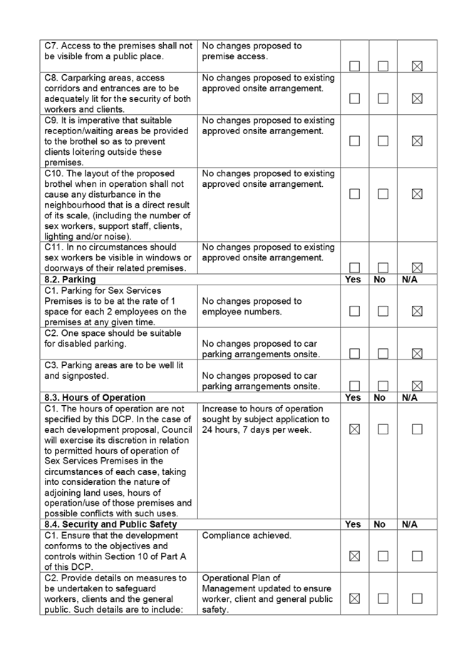
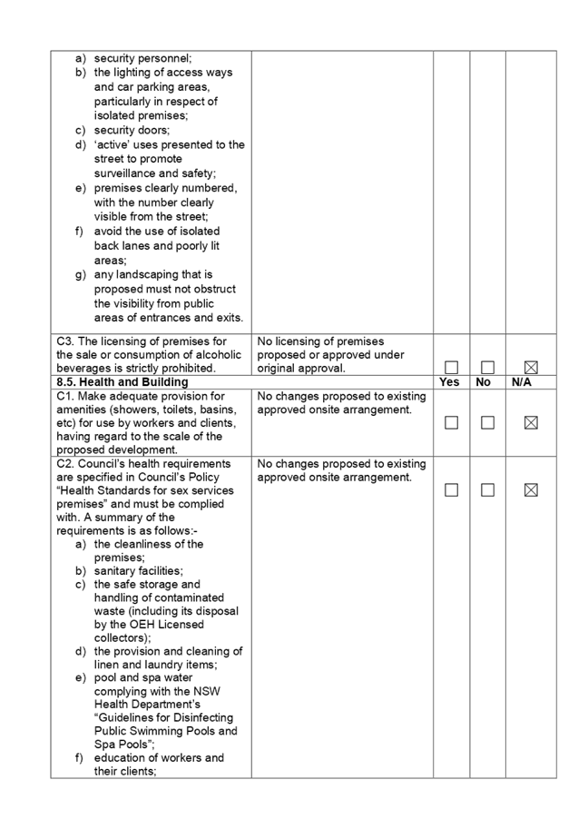
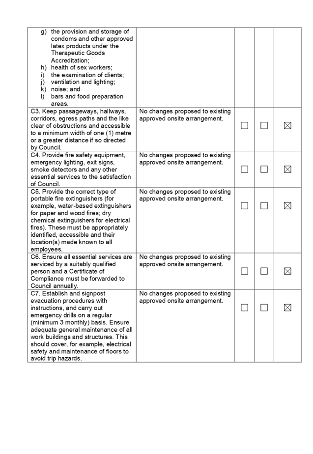
Cl 14.3 – Time Limited
Consents and Cl14.6 Hours of Operation apply to the subject modification.
8. – Time Limited
Consent:
A 12 month trial period may be
applied to any brothel consent as a result of this clause. Accordingly, under
the original approval such a trial period was enforced by way of Condition no.
9.
It is considered that a standalone
request to remove the 12 month trial condition of consent (Condition No.9) is
fair and reasonable, given that there has been no reported disturbance in the
locality as a result of the brothel’s ongoing operation.
However, the subject application
includes a proposed extension of trading hours from 9am to 11pm 7 days a week,
to 24 hours, 7 days a week. In conjunction with C3, which states:
C3. Council may also impose
conditions of consent relating to the hours of operation. This will also be the
subject of review after 12 months. If after the 12 month trial, the approved
hours of operation are causing a disturbance in the neighbourhood, the Council
may further restrict operating hours.
a 12 month trial period is
recommended to be utilised for the changed trading hours. This is considered
necessary, to ensure the ability to review and manage accordingly any impact
the increased hours will have on the locality and neighbouring properties.
As such Condition Number 9 is
recommended to be deleted and Condition Number 69 include a 12 month trial
period as part of any approval in accordance with the conditions in the draft
determination at Attachment 2.
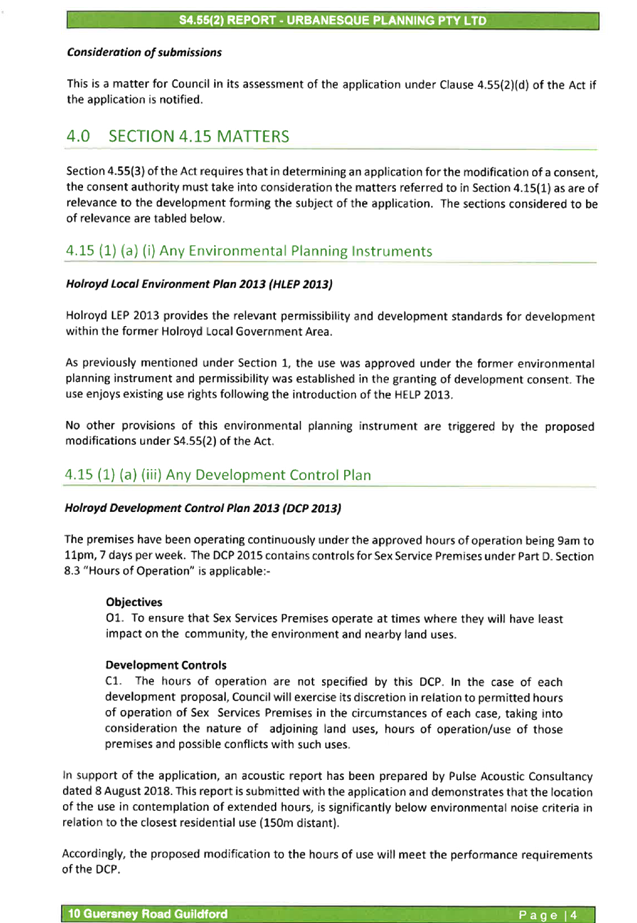
8.3. – Hours of
Operation:
There are no specific standards
imposed in relation to the operational hours of a sex services premises at the
subject site, with hours subject to a merits based assessment. The objectives
of this section of the DCP relate to hours of operation having the least impact
on the community, the environment and nearby land uses.
Given the subject site is located
within an industrially zoned area with the nearest residential properties
located approximately 190m from the subject site, there is unlikely to be any
impact as a result of the increased hours of operation on these dwellings.
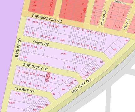
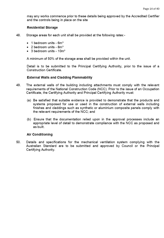
Zoning
map excerpt detailing Residential Zone at Carrington Road. Source: Cumberland
Council 2019
Further to this, the industrial
nature of the adjoining properties mean that the extended operating hours will
have minimal impact on their ability to continue to operate.
It is considered that per the
referral commentary from internal and external bodies and given the industrial
zoning and land use surrounding the subject site – coupled with no
reported disturbances caused by the brothel’s ongoing operation –
24 hour operation, 7 days per week is appropriate, subject to the inclusion of
a 12 month trial period.
As such, it is recommended that
Condition Number 69 be reworded as part of any approval in accordance with the
conditions in the draft determination at Attachment 2.
Any planning agreement that has
been entered into under section 7.4, or any draft planning agreement that a
developer has offered to enter into under section 7.4
There is no planning agreement or
draft planning agreement associated with the subject Development Application.
The provisions of the
Regulations
The regulations do not proscribe
any relevant matters for consideration.
Any coastal zone management
plan (within the meaning of the Coastal Protection Act 1979)
There is no Coastal Zone
Management Plan applicable to the subject site
The likely impacts of the
development
The likely environmental, social
and economic impacts of the development have been assessed and are considered
satisfactory.
The suitability of the site for
the development
The site is considered suitable
for the proposed development.
Submissions made in accordance
with the Act or Regulation
Advertised (newspaper) Mail Sign
Not Required
In accordance with Part E - Public
Participation of HDCP 2013, the proposal was publicly notified for a period of
14 days between 12 and 26 February 2019. As a result of the notification,
Council received no public submissions.
Section 7.11 of The
Environmental Planning & Assessment Act 1979
The subject development does not
attract development contributions in accordance with Holroyd Section 94
Development Contributions Plan 2013.
Accordingly no condition was
imposed on the original consent requiring payment of contributions, nor is
there any required condition under the subject application.
The public interest
The public interest is served by
permitting the orderly and economic use of land, in a manner that is sensitive
to the surrounding environment and has regard to the reasonable amenity
expectations of surrounding land users. In view of the foregoing analysis, it
is considered that approval of the proposed development would not be contrary
to the public interest.
Disclosure of Political
Donations and Gifts
The NSW Government has introduced
disclosure requirements for individuals or entities with a relevant financial
interest as part of the lodgement of various types of development proposals and
requests to initiate environmental planning instruments or development control
plans.
The application and notification
process did not result in any disclosure of Political Donations or Gifts.
The development application has
been assessed in accordance with the relevant requirements of the Environmental
Planning and Assessment Act 1979, Holroyd Local Environmental Plan 1991,
Holroyd Local Environmental Plan 2013, Holroyd Development Control Plan 2007
and the Holroyd Development Control Plan 2013 and is considered to be
satisfactory.
There are no further consultation
processes for Council associated with this report.
There are no further financial
implications for Council associated with this report.
There are no policy implications
for Council associated with this report.
Communication /
Publications:
The final outcome of this matter
will be notified in the newspaper. The objectors will also be notified in
writing of the outcome.
|
That development application
DA 2012/122/3 for modification to remove trial period requirements and
increase hours of operation of an existing sex services premises to 24 hours
and 7 days a week be approved subject to the conditions within the draft
notice of determination provided at Attachment 2.
|
1. HDCP
2013 Compliance Table ⇩ 
2. Draft
Notice of Determination ⇩ 
3. Statement
of Environmental Effects ⇩ 
4. Applicants
Legal Advice ⇩
5. DA
2012/122 - Development Consent ⇩
DOCUMENTS
ASSOCIATED WITH
REPORT LPP026/19
Attachment 1
HDCP 2013 Compliance Table
Cumberland Local Planning Panel Meeting
8 May 2019
DOCUMENTS
ASSOCIATED WITH
REPORT LPP026/19
Attachment 2
Draft Notice of Determination
Cumberland Local Planning Panel Meeting
8 May 2019

DOCUMENTS
ASSOCIATED WITH
REPORT LPP026/19
Attachment 3
Statement of Environmental Effects
Cumberland Local Planning Panel Meeting
8 May 2019

DOCUMENTS
ASSOCIATED WITH
REPORT LPP026/19
Attachment 4
Applicants Legal Advice
Cumberland Local Planning Panel Meeting
8 May 2019


Cumberland
Local Planning Panel Meeting
8 May 2019
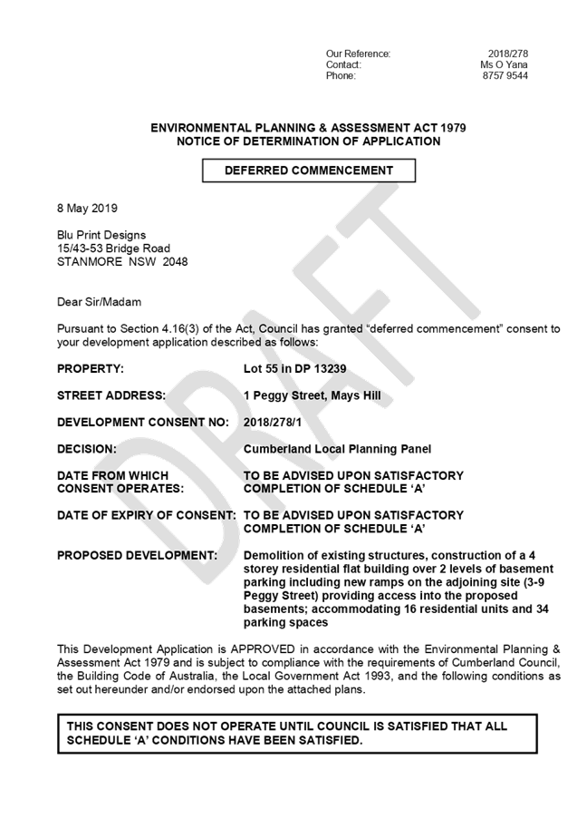
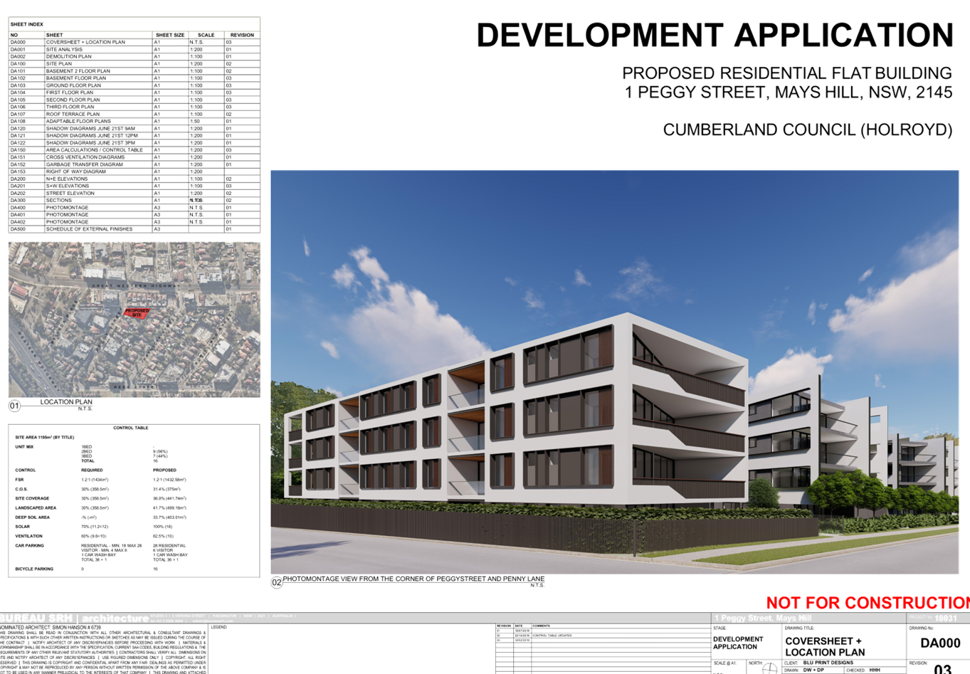
Item No: LPP027/19
Development
Application for 1 Peggy Street, Mays Hill
Responsible
Division: Environment
& Planning
Officer: Manager
Development Assessment
File
Number: DA
2018/278/1
|
Application lodged
|
8 August 2018
|
|
Applicant
|
Blu Print Designs Pty Ltd (Anthony Charbel)
|
|
Owner
|
Peggy One Pty Ltd
|
|
Application No.
|
2018/278
|
|
Description of land
|
1 Peggy Street Mays Hill
|
|
Proposed development
|
Demolition of existing structures and construction of 4
storey residential flat building over 2 levels of basement parking including
new ramps on the adjoining site (3-9 Peggy Street) providing access into the
proposed basements; accommodating 16 residential units and 34 parking spaces
|
|
Site area
|
1195 m2
|
|
Zoning
|
R4 – High Density Residential
|
|
Disclosure of political donations and gifts
|
Nil disclosure
|
|
Heritage
|
The site is not a heritage item and is not located
within a heritage conservation area
|
|
Principal development standards
|
Height of Buildings – 15 m
Floor Space Ratio – 1.2:1
|
|
Issues
|
·
Building separation (ADG)
·
FSR (HLEP 2013)
·
Lot frontage (HDCP 2013)
· Site
coverage (HDCP 2013)
· Rear
setback (HDCP 2013)
|
1. The
subject application was lodged on 8 August 2018 and notified to surrounding
properties from 5 September 2018 to 26 September 2018. No submissions were
received.
2. The
application was deferred on 16 January 2019 due to non-compliances with the FSR
and building height standards, ADG apartment size controls, visual bulk of the
proposal, inappropriate privacy treatment to habitable rooms, refinement to
private/communal open spaces and landscaping, waste management traffic matters
and stormwater plans. Additional information was also sought regarding owners
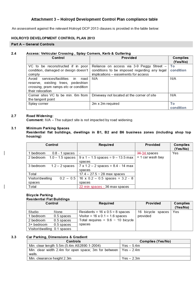
consent from 3-9 Peggy Street, which will be burdened by a right of carriageway
through 2 levels of basement benefitting the subject site.
3. Owners
consent from 3-9 Peggy Street, additional information, and amended plans to
address the deferral items were submitted on 28 February 2019. Amended plans
have addressed matters raised in the deferral letter and were not required to
be renotified as there were no additional impacts resulting from the
amendments.
4. The
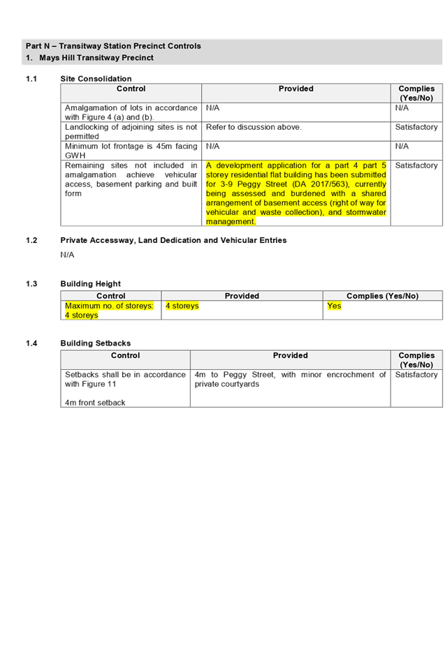
site is isolated in that it does not meet the minimum frontage required for a
residential flat development. However, there are no reasonable opportunities
for amalgamation with adjacent sites.
5. The
subject application has been assessed against the relevant provisions of the
Environmental Planning and Assessment Act 1979, State Environmental Planning
Policy No 65 – Design Quality of Residential Apartment Development,
Holroyd Local Environmental Plan (HLEP) 2013 and Holroyd Development Control
Plan (HDCP 2013).
6. The
application involves the following numerical non-compliances which are
considered supportable as discussed in detail elsewhere in the report:
|
Control
|
Required
|
Proposed
|
% Variation
|
|
Building separation (ADG)
|
3m
6m
|
2.86m (blank wall)
5m (hallway)
|
4.6%
16.6%
|
|
FSR (HLEP 2013)
|
1.2:1 (1434m²)
|
1.23:1 (1475.18m²)
|
2.87%
|
|
Lot frontage (HDCP 2013)
|
Min. 28m
|
16.57m
|
40.82%
|
|
Site coverage (HDCP 2013)
|
Max. 30% (358.5m2)
|
36.9% (441.74m2)
|
23.2%
|
|
Rear setback (HDCP 2013)
|
20% (10.4m)
|
15% (7.8m)
|
25%
|
7. The
application is being reported to the Cumberland Local Planning Panel (CLPP) for
determination as it is a development with more than 4 storeys to which the
State Environmental Planning Policy No 65 – Design Quality of Residential
Apartment Developments applies.
8. The
application is recommended for approval subject to the conditions in the draft
determination at attachment 4.
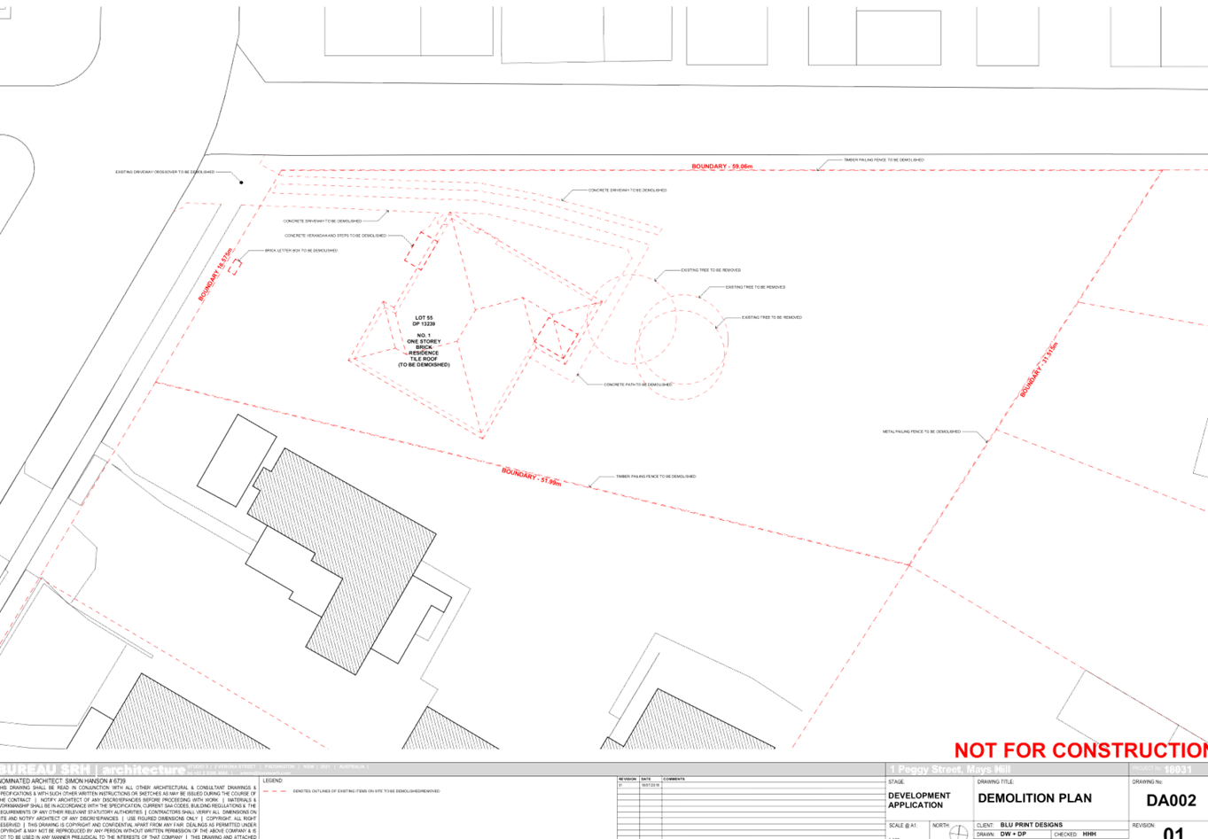
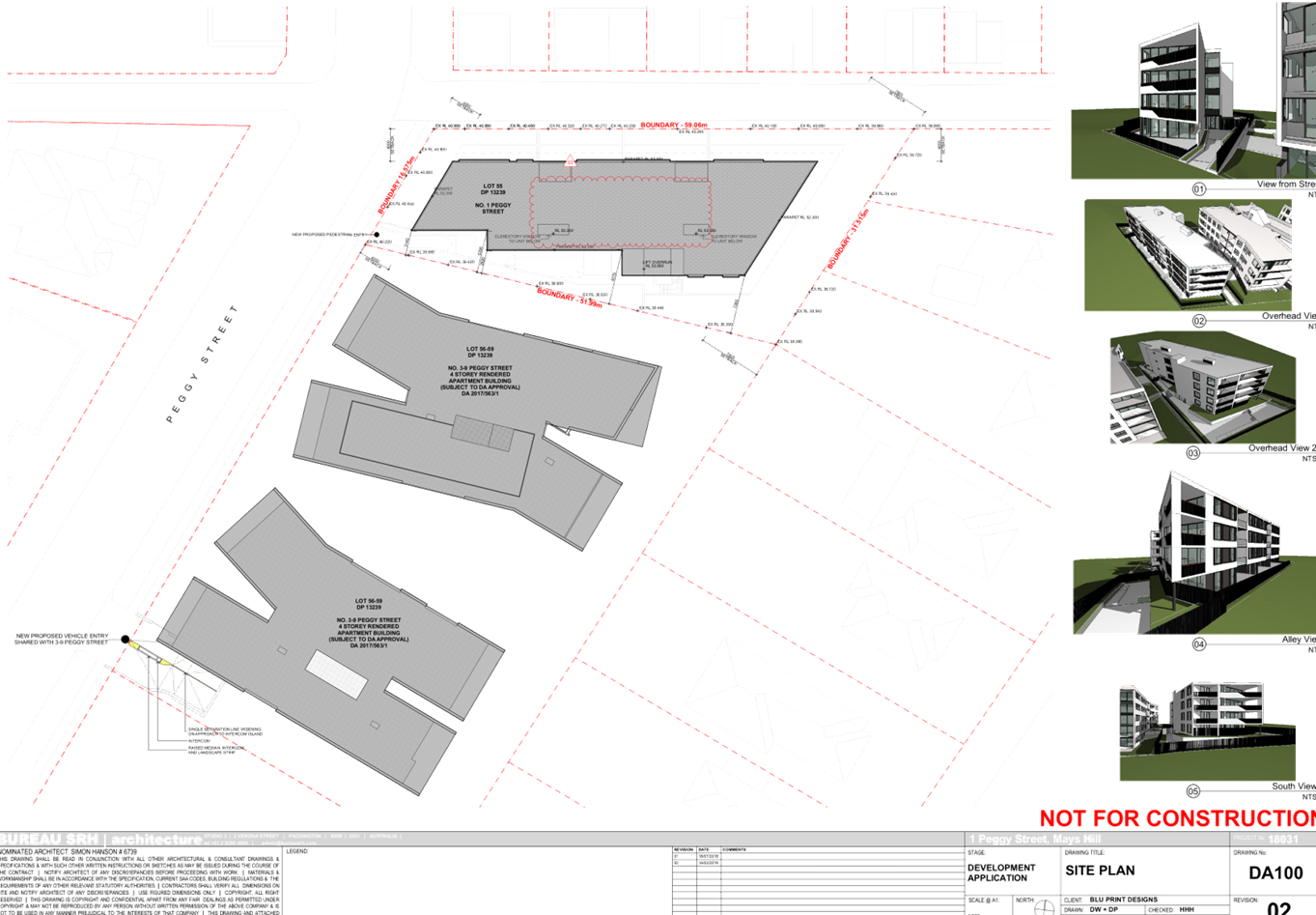
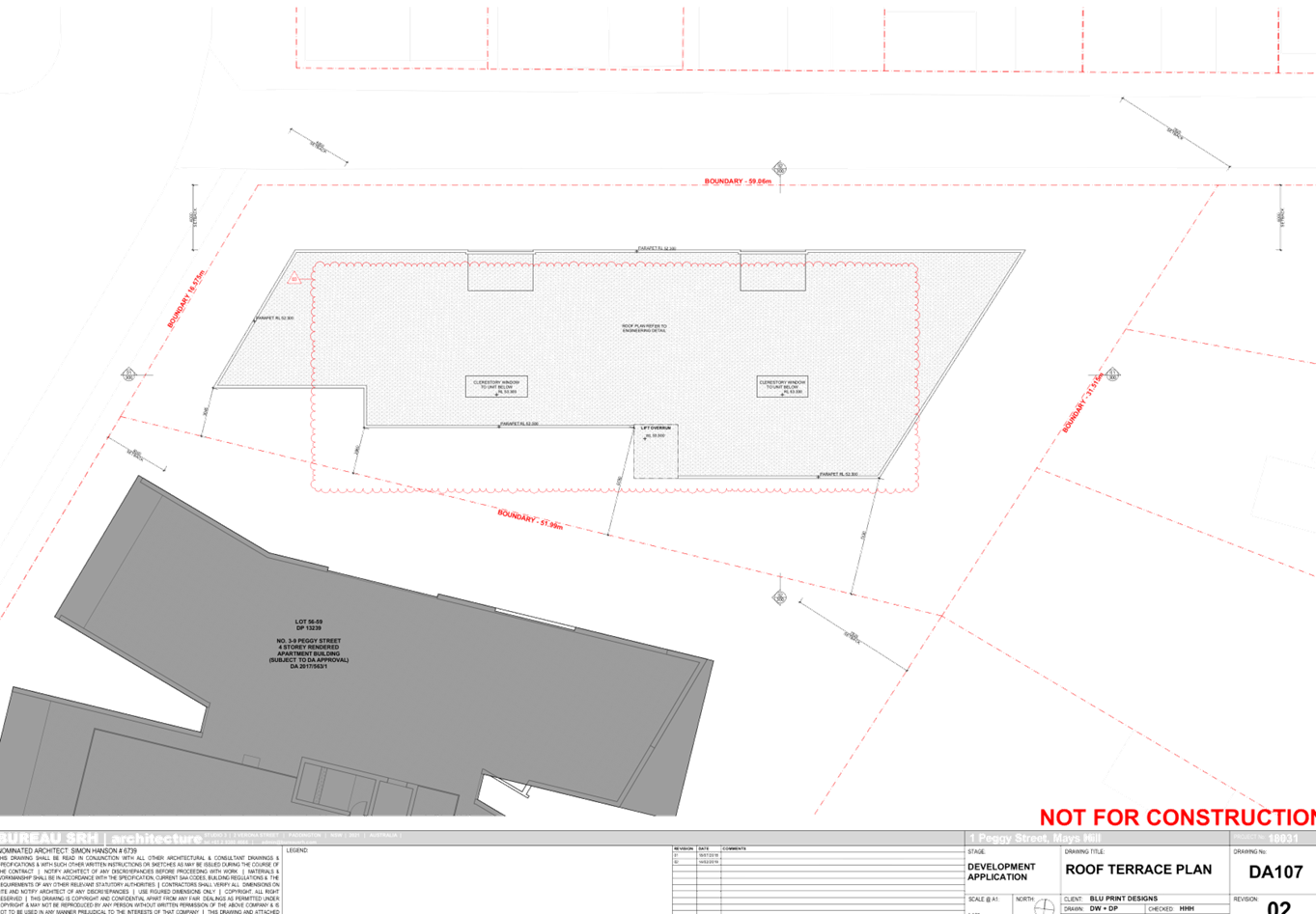
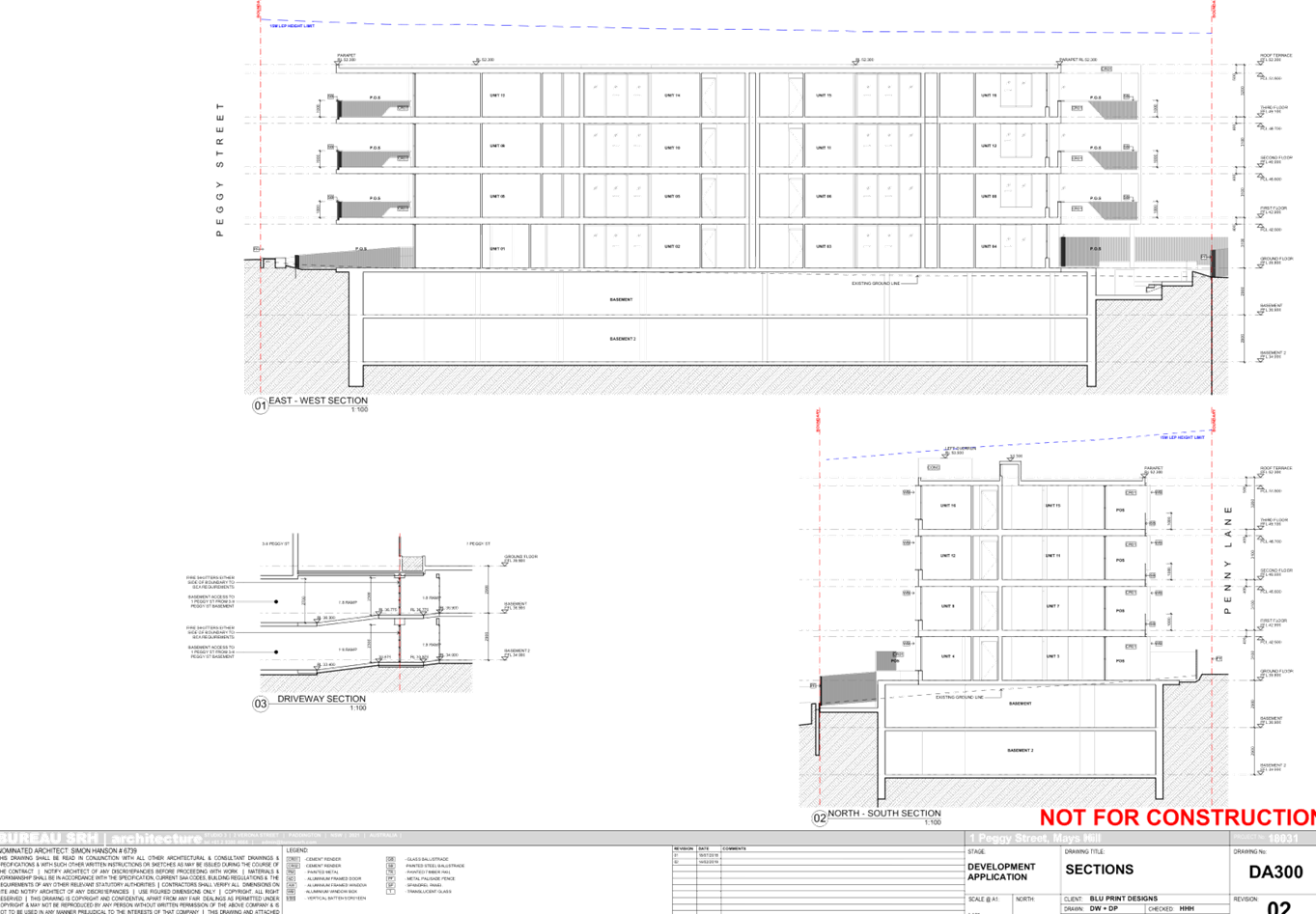
Introduction
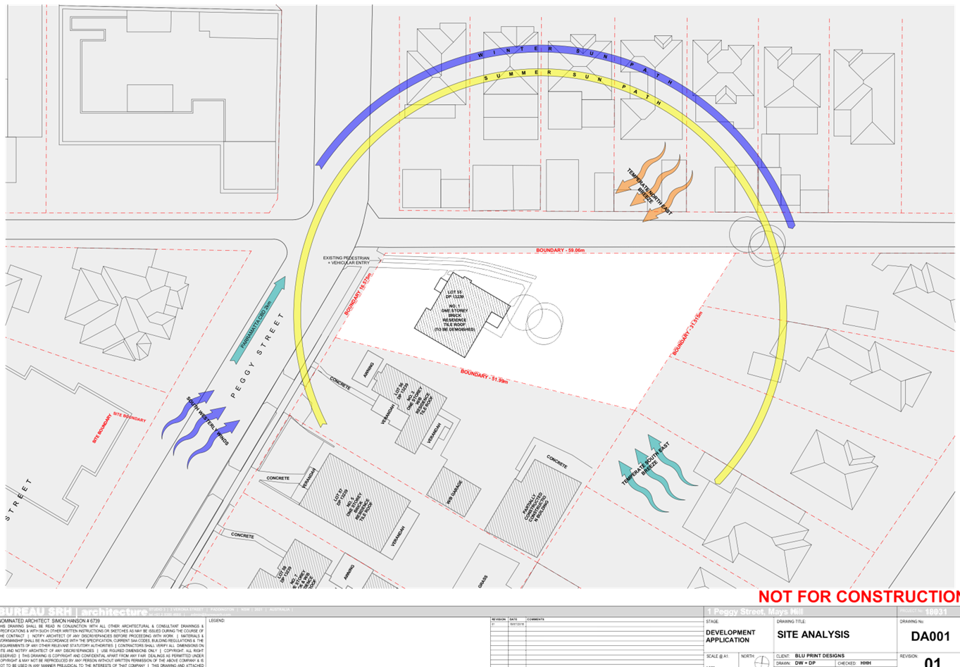
The subject site is known as 1
Peggy Street and is legally described as Lot 55 in DP 13239. The site has an
area of 1195 m2 and frontage of 16.57m to Peggy Street and 59.06m to unnamed
laneway. Single storey dwelling houses are located on the subject site and
adjoining sites on the southern side. There are a number of established trees
on the subject site, which falls approximately 1.15m towards the eastern
boundary and a further 2.81m cross fall from north-west to south-east. The site
is located within the Mays Hill Transitway Precinct, located approximately 45m
south of Great Western Highway.
The subject site and neighbouring
allotments are zoned R4 – High Density Residential. Properties located on
the southern side of Rees Street are zoned RE1 – Public Recreation and R2
– Low Density Residential. To the north, developments facing Great
Western Highway are mostly shop top housing within the B6 – Enterprise
Corridor zone. The existing streetscape on Peggy Street is transitioning to
replace the existing detached dwellings with residential flat buildings.
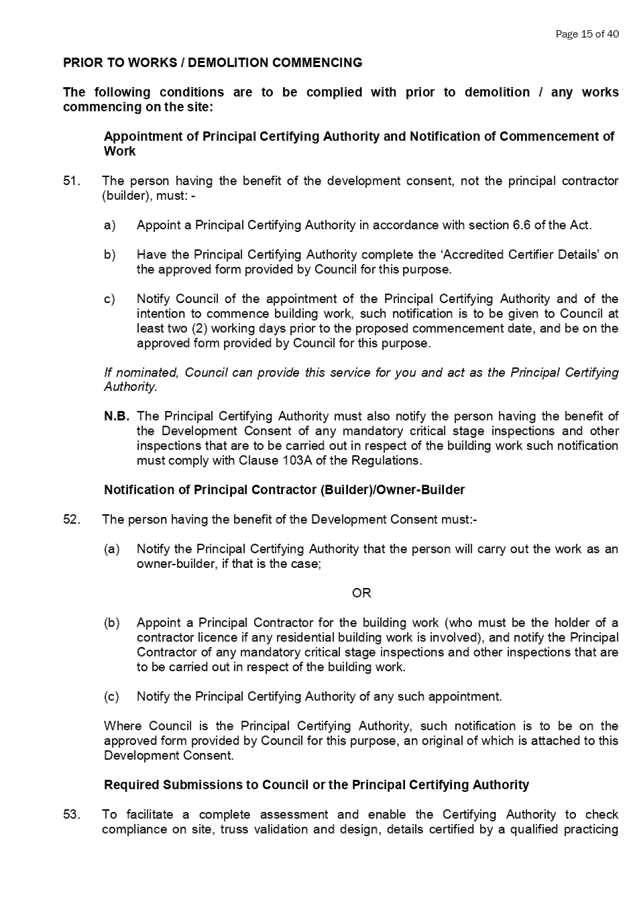
Figure
1 - Aerial view of the locality with subject site shown highlighted in red.
Source: Cumberland Council 2019
Figure
2 – Zoning map with subject site shown hatched. Source: Cumberland
Council 2019
Description of The Proposed
Development
DA 2018/278 proposes demolition of
existing structures and construction of 4 storey residential flat building over
2 levels of basement parking including new ramps on the adjoining site (3-9
Peggy Street) providing access into the proposed basements; accommodating 16
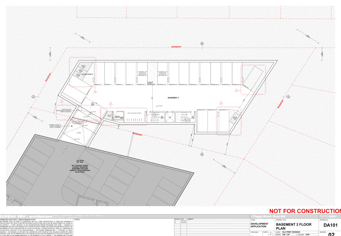
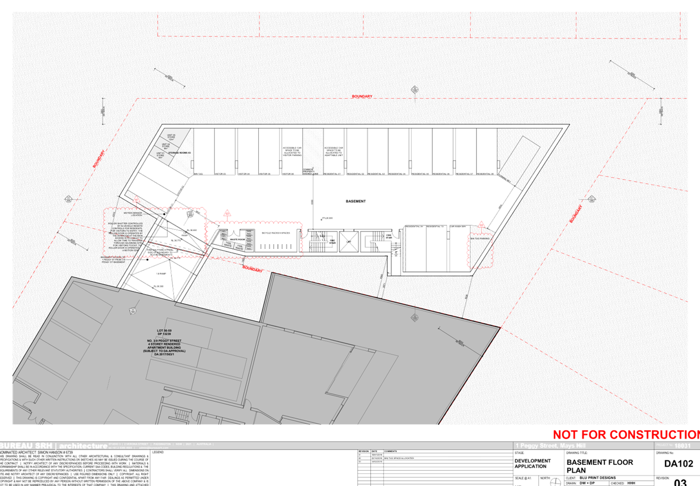
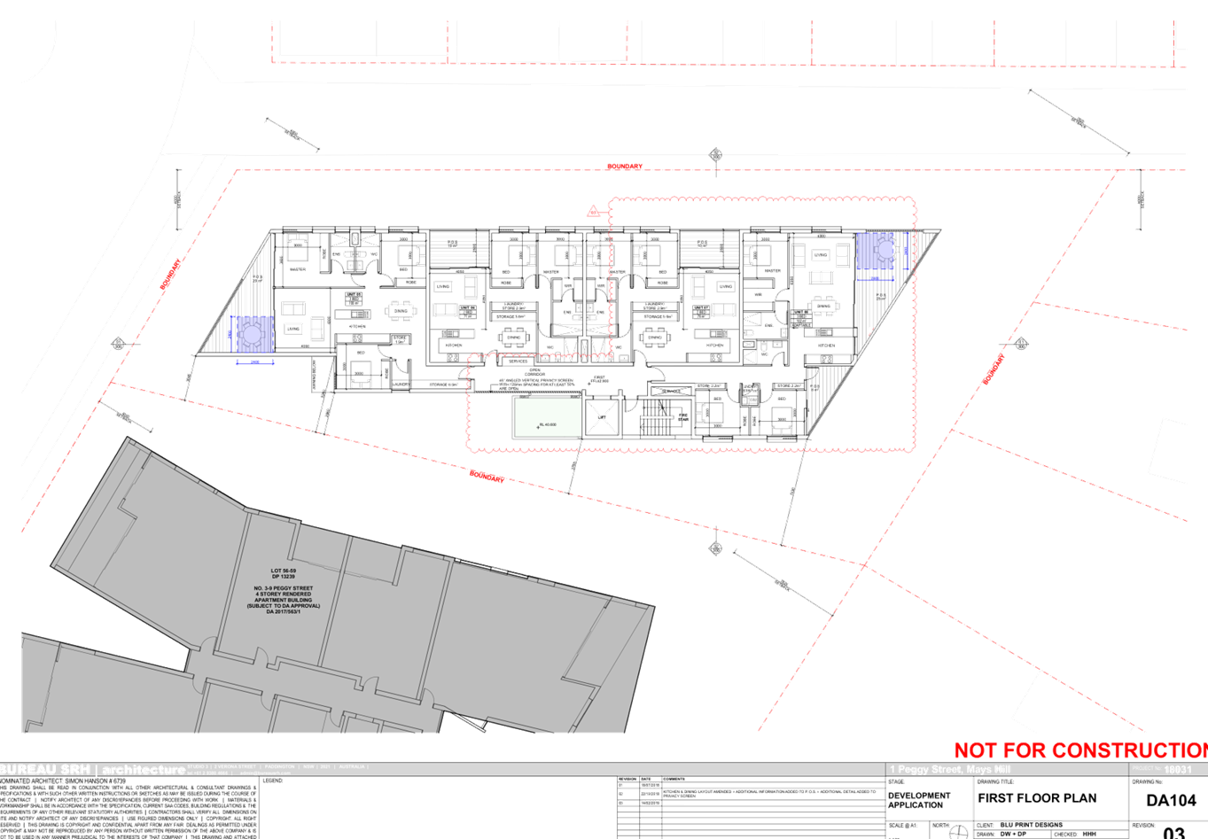
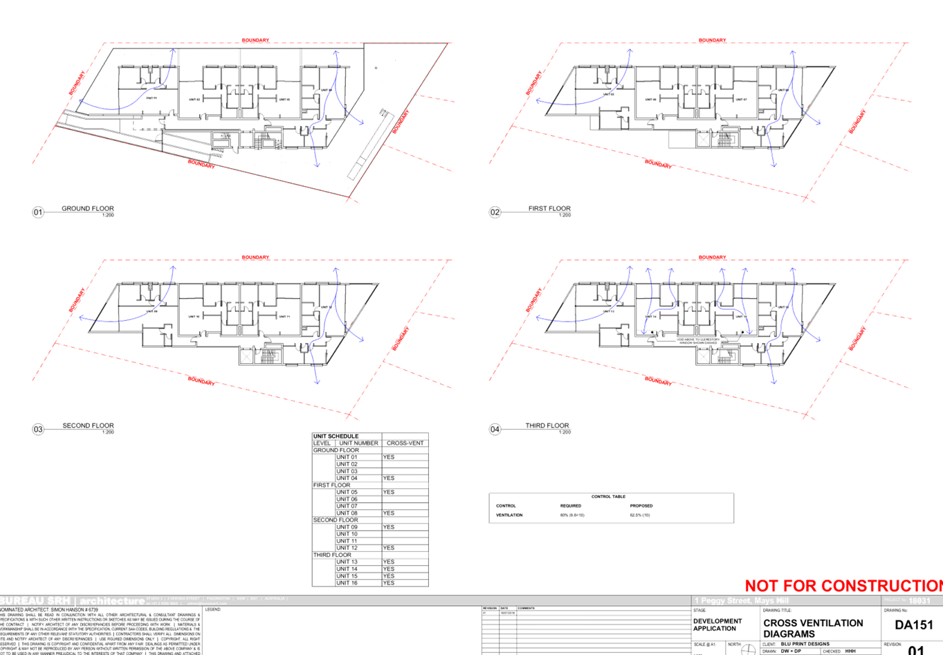
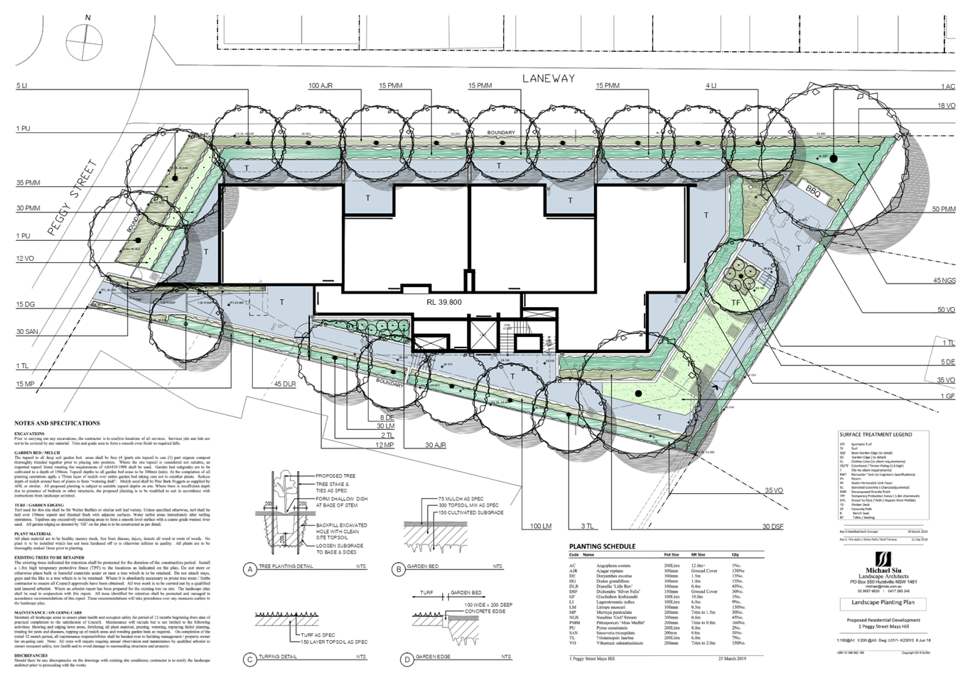
residential units and 34 parking spaces.
Key features of the development
proposal are as follows:-
|
Level
|
Details
|
|
Basement 2
|
18 car parking spaces (including 2 accessible spaces)
8 bicycle spaces
Storage, plant room, lift and fire stairs
Caretaker’s toilet
Shared access to 3-9 Peggy Street
|
|
Basement 1
|
10 car parking spaces (including 2 accessible spaces)
6 visitor car spaces
1 car wash bay
8 bicycle spaces
Storage, plant room, waste room, lift and fire stairs
Shared access to 3-9 Peggy Street
|
|
Ground floor
|
3 x 2 bedroom units and 1 x 3 bedroom unit
Communal Open Space with BBQ and seating areas
|
|
First floor
|
2 x 2 bedroom units and 2 x 3 bedroom units
|
|
Second floor
|
2 x 2 bedroom units and 2 x 3 bedroom units
|
|
Third floor
|
2 x 2 bedroom units and 2 x 3 bedroom units
|
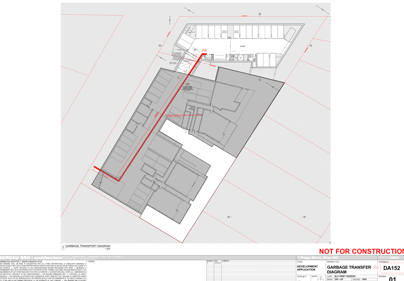
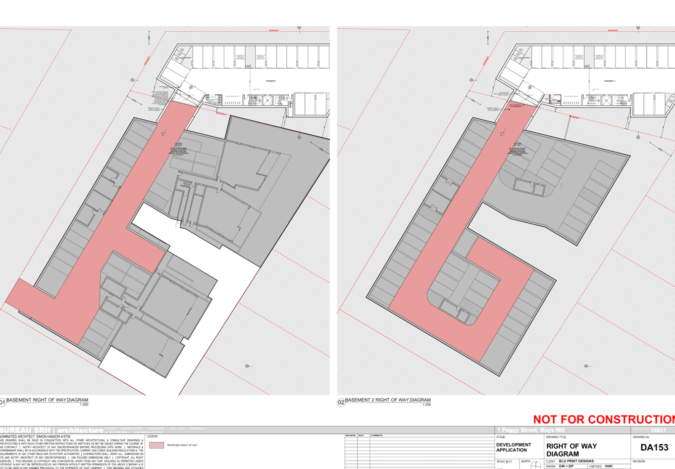
Access to the basement car park is
provided from 3-9 Peggy Street which is burdened by a right of carriageway
benefitting the subject site. Suitable conditions to this effect are
recommended to be imposed on any consent granted.
The proposed apartment mix is as
follows:
· 9
x 2 bedroom (56.25%)
· 7
x 3 bedroom (43.75%)
Application History
|
Date
|
Action
|
|
8 August 2018
|
The subject development application (DA 2018/278) was
lodged with Council.
|
|
28 August 2018
|
The application was referred to the following internal and
external sections:
· Development
Engineering
· Traffic
Engineering
· Landscape
and Tree Management
· Environmental
Health
· Waste
Management
· Transgrid
· Endeavour
Energy
|
|
5 September 2018 to 26 September 2018
|
Application placed on public notification. No submissions
were received.
|
|
16 January 2019
|
Application deferred requesting additional information
relating non-compliances with the FSR and building height standards, ADG
apartment size controls, visual bulk of the proposal, inappropriate privacy
treatment to habitable rooms, refinement to private/communal open spaces and
landscaping, waste management traffic matters and stormwater plans.
Additional information was also sought regarding owners consent from 3-9
Peggy Street, which will be burdened by a right of carriageway through 2
levels of basement benefitting the subject site.
|
|
28 February 2019 to 23 April 2019
|
Additional information submitted for review.
|
|
8 May 2019
|
Application referred to CLPP for determination.
|
Applicant’s Supporting
Statement
Statement of Environmental Effects
dated 30 July 2018 and a Clause 4.6 written request to vary the FSR standard
dated 23 April 2019, prepared by Think Planners submitted in support of the
application.
Contact With Relevant
Parties
The assessing officer has
undertaken an inspection of the subject site and has been in contact with the
applicant throughout the assessment process.
Internal Referrals
Development Engineer
The development application was
referred to Council’s Development Engineer for comment who has advised
that the development is supportable in regards to shared arrangement of
basement access (right of way) and stormwater management, subject to
conditions.
Traffic Engineer
The development application was
referred to Council’s Traffic Engineer for comment who has advised that
the development is supportable in regards to parking, traffic management, waste
collection area and on-site parking provision in the basement level, subject to
conditions.
Tree Management Officer
The development application was
referred to Council’s Tree Management Officer for comment who has advised
that the development is supportable, subject to conditions.
Waste Management Officer
The development application was
referred to Council’s Waste Management Officer for comment who has
advised that the development is supportable in regards to provision of bin tug,
bin storage room, waste collection and management plan, subject to conditions.
Environmental Health Officer
The development application was referred
to Council’s Environmental Health Officer for comment who has advised
that the development is supportable in regards to acoustic assessment, subject
to conditions.
External Referrals
Transgrid
The development application was
referred to Transgrid for comment who has advised that the development is
supportable in regards to not affecting Transgrid’s asset.
Endeavour Energy
The development application was
referred to Endeavour Energy for comment who has advised that the development
is supportable in regards to electricity connection and sufficient clearance to
existing electricity asset, subject to conditions.
Planning Assessment
The provisions of any
Environmental Planning Instruments (EP&A Act s4.15 (1)(a)(i))
The following Environmental
Planning Instruments are relevant to the assessment of the subject application:
a) State
Environmental Planning Policy No 55 – Remediation of Land (SEPP 55)
The requirement at clause 7 of
SEPP 55 for Council to be satisfied that the site is suitable or can be made suitable
to accommodate the proposed development has been considered in the following
table:
|
Matter
for consideration
|
Yes
|
No
|
|
Does the application involve re-development of the site or
a change of land use?
|
|
|
|
Is the development going to be used for a sensitive land
use (e.g. residential, educational, recreational, childcare or hospital)?
|
|
|
|
Does information available to you indicate that an
activity listed below has ever been approved, or occurred at the
site?
acid/alkali plant and formulation,
agricultural/horticultural activities, airports, asbestos production and
disposal, chemicals manufacture and formulation, defence works, drum
re-conditioning works, dry cleaning establishments, electrical manufacturing
(transformers), electroplating and heat treatment premises, engine works,
explosive industry, gas works, iron and steel works, landfill sites,
metal treatment, mining and extractive industries, oil production and
storage, paint formulation and manufacture, pesticide manufacture and
formulation, power stations, railway yards, scrap yards, service stations,
sheep and cattle dips, smelting and refining, tanning and associated trades,
waste storage and treatment, wood preservation
|
|
|
|
Is the site listed on Council's Contaminated land
database?
|
|
|
|
Is the site subject to EPA clean-up order or other EPA
restrictions?
|
|
|
|
Has the site been the subject of known pollution incidents
or illegal dumping?
|
|
|
|
Does the site adjoin any contaminated land/previously
contaminated land?
|
|
|
|
Has the appropriate level of investigation been carried
out in respect of contamination matters for Council to be satisfied that the
site is suitable to accommodate the proposed development or can be made
suitable to accommodate the proposed development?
|
|
|
|
Details of
contamination investigations carried out at the site:
The site is not
identified in Council’s records as being subject to contamination.
There is no evidence available to suggest that the site has ever been used
for a potentially contaminating activity. No further investigation is
considered necessary in the circumstances.
|
b) State
Environmental Planning Policy (Building Sustainability Index: BASIX) 2004
BASIX certificate 942893M dated 19
July 2018 was submitted with the application. The proposal achieves the target
scores for energy, water and thermal comfort and relevant commitments are shown
on the architectural plans.
c) State
Environmental Planning Policy No 65 – Design Quality of Residential
Apartment Development (SEPP 65)
The proposal is classified as a
residential apartment development and SEPP 65 applies. A design verification
statement signed by registered architect Simon Hanson was submitted with the
application.
The design quality principles from
Schedule 1 of the SEPP are considered in the following table:
|
Design quality
principle
|
Response
|
|
1. Context and
neighbourhood character
|
The design
represents an appropriate response to the context of the site in terms of the
limited frontage and sloping topography.
The proposed
development will provide a positive addition to the streetscape, and is
compatible with the developments that are currently under construction on
surrounding sites.
The generous
communal open space provision and landscaping within the setbacks will
provide good amenity for the residents of the proposed development, as well
as softening the appearance of the proposal from adjacent sites.
|
|
2. Built form and
scale
|
The scale, bulk
and height of the proposal appropriate for the site and are consistent with
the desired future character of the area.
The alignment
and proportions of the building help to define the public domain and
contribute to streetscape character, internal amenity and outlook.
|
|
3. Density
|
The subject
site is well located with respect to existing public transport and community
facilities. The proposal provides reasonable bulk and scale with minor
exceedance to FSR due to the provision of semi-open hallway and where
compliance with building separation is not achieved, being a landlocked site.
The design of the development provides for privacy treatment to balconies and
windows where necessary.
|
|
4. Sustainability
|
A BASIX certificate was submitted with the application,
demonstrating that the building meets the applicable thermal comfort, energy
efficiency and water efficiency targets.
The proposal provides for adequate deep soil zones which
will allow for groundwater recharge and establishment of vegetation.
|
|
5. Landscape
|
A landscape plan was submitted with the proposal. The
landscaping options are considered to be adequate. The proposed landscaping
will provide suitable visual amenity for the future occupants of the
development and a suitable landscape setting for the building within the streetscape
is also proposed.
|
|
6. Amenity
|
The proposed development optimises internal amenity
through appropriate room dimensions, layout of the units, access to sunlight,
and natural ventilation. Visual and acoustic privacy concerns are managed
with privacy screens, highlight windows and other treatments without
compromising the outlook and amenity of the proposed units. Consideration has
also been given to service areas and storage to ensure the functionality of
the development as a whole.
|
|
7. Safety
|
The proposal is considered to be satisfactory in terms of
providing casual surveillance to the public domain and communal areas whilst
maintaining privacy for the proposed units.
Public areas are well defined and access within the
development is appropriately restricted to ensure safety of residents.
|
|
8. Housing diversity
and social interaction
|
The proposal provides for a mix of apartment sizes and
layouts. The variety of communal open spaces and the design of the common
circulation spaces will encourage social interaction among residents.
|
|
9. Aesthetics
|
The proposal provides for a
balanced composition of building elements with a variety of colours and
textures. The external presentation of the building reflects the internal
layout and structure, and the visual bulk is broken up with indentations and
offsets on each façade.
|
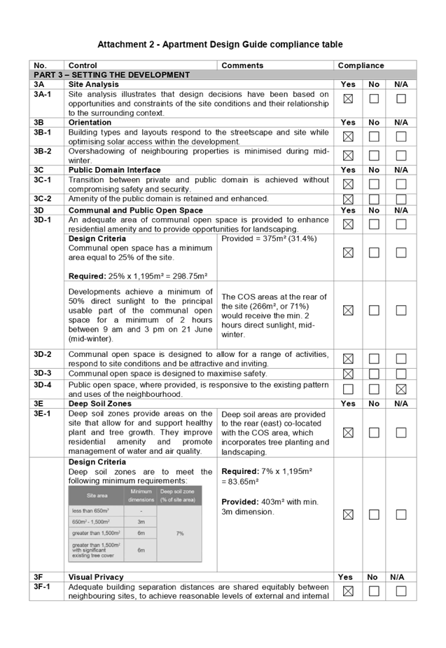
Pursuant to clause 28(2)(c) of
SEPP 65, a consent authority must consider the provisions of the Apartment
Design Guide (ADG) in the assessment of a residential flat development.
The proposal involves the
following non-compliances with the ADG controls.
|
No.
|
Control
|
Comments
|
Compliance
|
|
3F
|
Visual Privacy
|
|
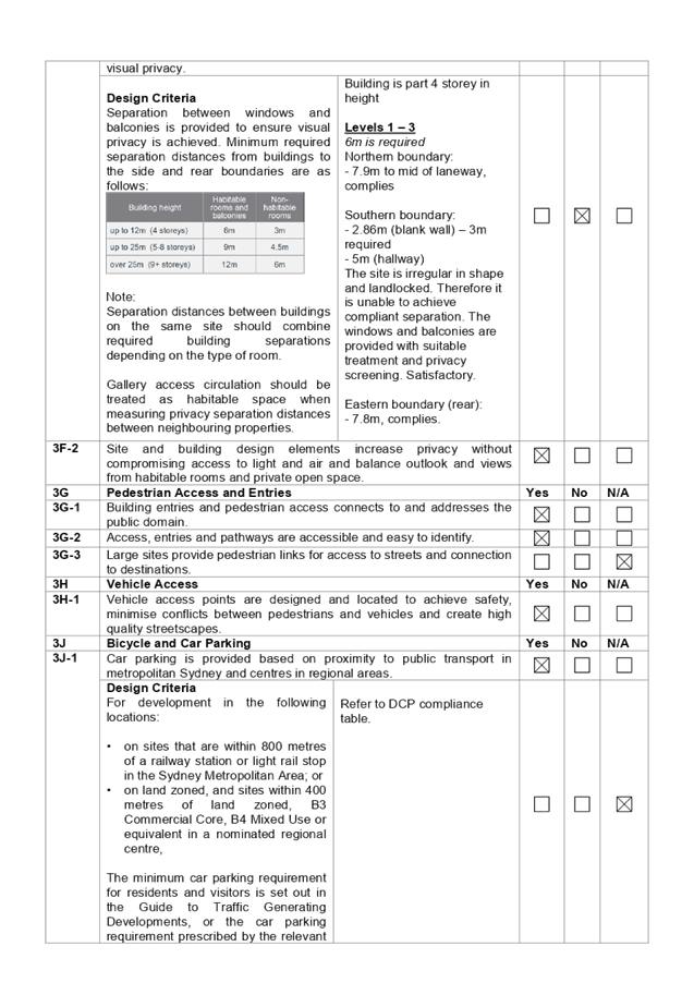
3F-1
|
Design Criteria
Separation
between windows and balconies is provided to ensure visual privacy is
achieved. Minimum required separation distances from buildings to the side
and rear boundaries are as follows:
Note:
Separation distances between
buildings on the same site should combine required building separations
depending on the type of room.
Gallery access circulation
should be treated as habitable space when measuring privacy separation
distances between neighbouring properties.
|
South
3m required:
2.86m (blank wall)
6m required:
5m (hallway)
The site is irregular in shape
and landlocked. Therefore it is unable to achieve compliant separation. The
windows and balconies are provided with suitable treatment and privacy
screening. Satisfactory.
|
No- but considered acceptable in this instance.
|
A comprehensive ADG assessment is
provided at Attachment 2.
d) State
Environmental Planning Policy (Infrastructure) 2007
The provisions of the
Infrastructure SEPP (ISEPP) 2007 have been considered in the assessment of the
development application.
Clause 45 - Development likely
to affect an electricity transmission or distribution network
The development application was
referred to Endeavour Energy for comment, who raised no objections, subject to
recommendations.
Clause 102 – Impact of
road noise or vibration on non-road development
The subject site is located
approximately 45m from Great Western Highway. The proposal is for the purposes
of residential accommodation. In accordance with Clause 102, an Acoustic Report
was submitted with the application. Council’s Environmental Health Officer
has reviewed the report and advises that the proposal is satisfactory, subject
to the imposition of conditions requiring appropriate measures to be
implemented to ensure noise levels to bedrooms and living areas are acceptable.
e) Statement
Environmental Planning Policy No 19 - Bushland in Urban Areas
The proposal does not propose to
disturb bushland zoned or reserved for public open space.
f) State
Environmental Planning Policy (Vegetation in Non-Rural Areas) 2017
The proposal includes removal of all
existing trees within the subject site. However, this does not exceed the
biodiversity offsets scheme threshold and the majority of the trees on site are
exempt species. Therefore, the proposed vegetation removal is considered
acceptable. Please refer to the HDCP 2013 compliance table at Attachment 3 for
further comment regarding the proposed tree removal.
g) State
Environmental Planning Policy (Coastal Management) 2018
The subject site is not identified
as a coastal wetland nor is it ‘land identified as “proximity area
for coastal wetlands” as per Part 2, Division 1 of the SEPP Coastal
Management 2018.
h) Holroyd
Local Environmental Plan 2013 (HLEP 2013)
The proposed development is
defined as a ‘residential flat building’ under the provisions of
HLEP 2013. Residential flat buildings are permitted with consent in the R4
– High Density Residential zone which applies to the land.
The proposal seeks a variation to
Clause 4.4 – Floor Space Ratio (FSR) that stipulates that the FSR is not
to exceed 1:2 on the subject site. The proposed development result in or FSR =
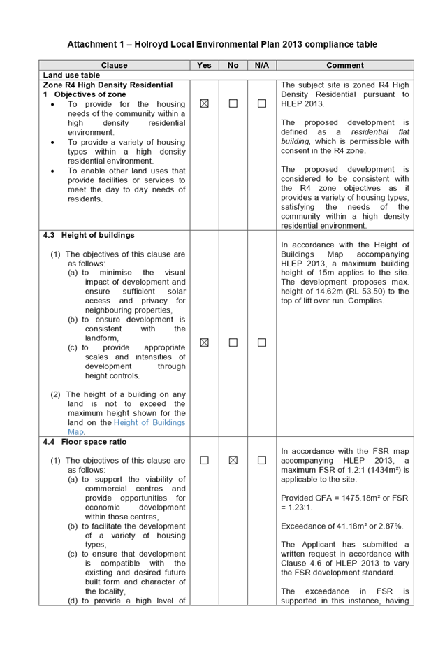
1.23:1 (1475.18m²), or exceedance of 41.18m² (2.87%).
Clause 4.6 – Variation to
Floor Space Ratio
Clause 4.6 allows the consent
authority to vary development standards in certain circumstances and provides
an appropriate degree of flexibility to achieve better design outcomes. The
consent authority may grant the exception as the Secretary’s concurrence
can be assumed where clause 4.6 is adopted as per the Department of Planning
Circular PS 18-003, dated 21 February 2018.
The applicant has submitted a
written request to vary the development standard for building height. Based on
various case laws established by the Land and Environment Court of NSW such as
Four2five P/L v Ashfield Council [2015] NSWLEC 9, Randwick City Council v
Micaul Holdings P/L [2016] NSW LEC7 and Zhang and anor v Council of the City of
Ryde [2016] NSWLEC 1179, a 3 part assessment framework for a variation request
proposed under clause 4.6 has been considered and an assessment of the proposed
variance, following the 3 part test is discussed in detail below.
The 3 preconditions which must be
satisfied before the application can proceed are as follows:
1. Is
the proposed development consistent with the objectives of the zone?
Applicant’s
justification:
The proposal ensures that the
high-density nature of the zone is retained and there is not a significant
change to the character of the locality. In addition, the proposal complements
and enhances the local streetscape by virtue of the careful siting of the
development.
Planner’s comment:
Residential flat buildings are a
permitted land use and it is evidenced within the locality which is undergoing
a transition particularly to support housing needs of community within a high
density zone. The proposed development is considered to be consistent with the
objectives of the R4 high Density Residential zone.
2. Is
the proposed development consistent with the objectives of the development
standard which is not met?
Applicant’s
justification:
The development seeks to depart
from the floor space control noting that the proposal remains consistent with
the objectives of the clause and is a more appropriate outcome on the site
because of the following:
- The
development is consistent with the intent of the maximum floor space ratio
control and will provide an attractive building that addresses its street
frontage;
- The
additional floor space will not increase generation of pedestrian or vehicular
traffic noting that the number of parking spaces remains unchanged and that
further the modification does not increase the potential population on the
site;
- The
increased FSR has no unacceptable impacts on heritage items in the wider
vicinity of the site;
- The
non-compliance is minor in nature and the impacts to the streetscape are
negligible as the additional floor space ratio will not be visually noticeable
when viewed from the street level;
- The
proposal promotes the orderly and economic development of land;
- Due
to the minor nature of the variation it will not have any adverse amenity
impacts. In this regard, it is noted:
· The
variation will not lead to the unacceptable reduction in solar penetration on
site or to adjoining properties nor will it lead to excessive sunlight loss or
overshadowing;
· The proposed
variation will not lead to view loss or interrupt on views to and
from the site; and
· The proposed
variation will not lead to a reduction in privacy afforded to surrounding
properties or future residents of the proposal;
- The
proposal is not located within a low-density area and the proposal represents
an appropriate built form on the site.
As outlined above, the proposal
remains consistent with the underlying objectives of the control and as such
compliance is considered unnecessary or unreasonable in the circumstances. The
above discussion demonstrates that there are sufficient environmental planning
grounds to justify the minor departure from the control.
Planner’s comment:
The objectives of the FSR standard
are to enable appropriate built form while providing high level of amenity for
the development to be achieved and to ensure that the building is compatible
with the character of the locality as outlined above. The departure sought is
considered to be modest and does not unreasonably impact on adjoining
properties. The additional FSR does not result in the appearance of bulk when
viewed from the existing streetscape and would not impinge on the changing
streetscape that is anticipated for the immediate area. Given that the proposed
development responds to the site and does so without compromising relationships
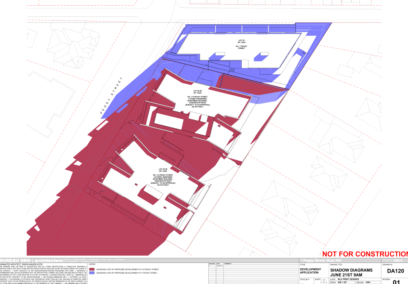
with adjoining development, minimises overshadowing to the property at the
southern side 3 Peggy Street and does not unduly compromise other relevant
controls, the proposal is considered to be consistent with the objectives of
height requirements and development within the R4 zone.
3. A)
Is compliance with the development standard unreasonable or unnecessary in the
circumstances of the case?
Applicant’s
justification:
There is no public benefit in
maintaining the development standard as it relates to the current proposal. The
departure from the FSR control is acceptable in the circumstances given the
underlying objectives are achieved and it will not set an undesirable precedent
for future development within the locality based on the observed building forms
in the locality and based on the unique site attributes when considering the
dedication of land that is an approach taken by Council in other parts of the
LGA where laneways and the like are identified as being desired. The proposed
development meets the underlying intent of the control and is a compatible form
of development that does not result in unreasonable environmental amenity
impacts.
Planner’s comment:
Council Officers are satisfied
that the proposed variation has been appropriately justified and can be
supported in this instance. The proposed variation to the development standard
is due to the inclusion of semi-open hallway, and is consistent with the scale
of the development within the R4 zone located in the immediate vicinity of the
site. The departure sought is considered to be modest and does not unreasonably
impact on adjoining properties. It is considered, therefore, that the
non-compliance with the Development Standard is not unreasonable or unnecessary
in the circumstances of the case.
B) Are there sufficient
environmental planning grounds to justify contravening the development standard
and therefore is the applicant’s written justification well founded?
The unique circumstances of the
case are considered to warrant support of the departure. Given that the
proposed development responds to the site and does so without unduly
compromising relationships with adjoining development, and does not unduly
compromise other relevant controls, the proposal is considered to be consistent
with the objectives of FSR, and development within the R4 zone. In this regard,
the exception is well founded and can be supported.
Conclusion:
Council is satisfied that the
applicant’s written request has adequately addressed the matters required
to be demonstrated by clause 4.6 subclause (3). Council is further satisfied
that the proposed development will be in the public interest because it is
consistent with the objectives of the particular standard and the objectives
for development within the zone in which the development is proposed to be
carried out.
It is the view of Council Officers
that justification provided is satisfactory and having considered the
application on its merit, the exception to the maximum FSR development standard
is considered acceptable in this instance.
A comprehensive LEP compliance
table is provided at Attachment 1.
The provisions of any proposed
instrument that is or has been the subject of public consultation (EP&A Act
s4.15 (1)(a)(ii))
There are no draft SEPPs
applicable to the proposed development.
The provisions of any
Development Control Plans (EP&A Act s4.15 (1)(a)(iii))
a) Holroyd
Development Control Plan 2013
HDCP 2013 contains general
controls which relate to all developments under Part A, and Residential
Controls under Part B.
A comprehensive HDCP compliance
table is attached to this report at Attachment 3. A summary of the DCP
non-compliances is provided in the following table.
|
Control
|
Provided
|
Complies
(Yes/No)
|
|
Minimum
lot frontage for residential flat building is 28m
|
Subject site has frontage of 16.57m to Peggy Street which
is less than the required minimum. There are no reasonable opportunities for
amalgamation with adjacent sites and the proposed design has demonstrated
satisfactory levels of amenity can be achieved for the subject site, and
adjoining developments despite the limited site width.
|
No – Acceptable in this instance.
|
|
Max
site coverage 30%, or 358.5m²
|
36.9% (441.74m²), non-compliance is considered
acceptable given that the proposal will result in adequate provision of deep
soil planting, landscaping, driveways, communal open space and OSD system.
|
No – Acceptable in this instance.
|
|
Rear setback
20%
of site length, or 10.4m for 4 storey
|
15% (7.8m), non-compliance is considered acceptable given
that the setbacks satisfy with the ADG requirements, as discussed above.
|
No – Acceptable in this instance.
|
Any planning agreement that has
been entered into under section 7.4, or any draft planning agreement that a
developer has offered to enter into under section 7.4 (EP&A Act s
4.15(1)(a)(iiia))
There is no planning agreement or
draft planning agreement associated with the subject Development Application.
The provisions of the
Regulations (EP&A Act s4.15 (1)(a)(iv))
Pursuant to clause 92 of the
Regulation, the provisions of AS 2601 must be considered in the case of a
development application for the demolition of a building. Standard conditions
are included in the draft determination to require the proposed demolition
works to be carried out in accordance with AS 2601.
The Likely Environmental,
Social or Economic Impacts (EP&A Act s4.15 (1)(b))
The likely environmental, social
and economic impacts of the development have been assessed and are considered
satisfactory.
The suitability of the site for
the development (EP&A Act s4.15 (1)(c))
The site is considered suitable
for the proposed development.
Submissions made in accordance
with the Act or Regulation (EP&A Act s4.15 (1)(d))
Advertised (newspaper) Mail Sign Not
Required
In accordance with Part E - Public
Participation of HDCP 2013, the proposal was publicly notified for a period of
21 days between 5 September 2018 to 26 September 2018. As a result of the
notification, no submissions were received.
The public interest (EP&A
Act s4.15(1)(e))
The public interest is served by
permitting the orderly and economic use of land, in a manner that is sensitive
to the surrounding environment and has regard to the reasonable amenity
expectations of surrounding land users. In view of the foregoing analysis, it
is considered that approval of the proposed development would not be contrary
to the public interest.
Section 7.11 of The
Environmental Planning & Assessment Act 1979
The subject development requires
the payment of contributions in accordance with Holroyd Section 94 Development
Contributions Plan 2013.
In accordance with the currently
indexed rates for the Mays Hill Centre contribution area, the following
contributions apply:
· 9
x 2 bedroom dwellings – $14,205 x 9 = $127,845
· 7
x 3 bedroom dwellings – $19,887 x 7 = $139,209
· minus
credit for the existing 1 x 3 bedroom dwellings – $19,887
At the time of this development consent,
the current rate of the contribution is $247,172. The draft determination at
Attachment 4 includes a condition to require payment of contributions prior to
the issue of a construction certificate.
Disclosure of Political
Donations and Gifts
The application and notification
process did not result in the disclosure of any Political Donations or Gifts.
The development application has
been assessed in accordance with the relevant requirements of the Environmental
Planning and Assessment Act 1979, Holroyd Local Environmental Plan 2013 and the
Holroyd Development Control Plan 2013 and is considered to be satisfactory.
Whilst there are a number of non-compliances with the development controls
under the ADG and HDCP 2013, these are mostly considered to be a result of the
site isolation. Overshadowing and privacy impacts resulting from the limited
setbacks and separation have been appropriately managed and minimised. The
presentation of the proposed development to the street is considered to respond
appropriately to location of the site, approved developments on the adjacent
sites, and the restricted frontage.
There are no further consultation
processes for Council associated with this report.
There are no further financial
implications for Council associated with this report.
There are no policy implications
for Council associated with this report.
Communication /
Publications:
The final outcome of this matter
will be notified in the newspaper. The objectors will also be notified in
writing of the outcome.
|
That Development Application
2018/278 for demolition of existing structures, construction of a 4 storey
residential flat building over 2 levels of basement parking including new
ramps on the adjoining site (3-9 Peggy Street) providing access into the
proposed basements; accommodating 16 residential units and 34 parking spaces
be approved subject to the conditions within the draft notice of
determination provided at Attachment 4.
|
1. HLEP 2013
Compliance Table ⇩
2. ADG
Compliance Table ⇩ 
3. HDCP
2013 Compliance Table ⇩
4. Draft
Notice of Determination ⇩
5. Architectural
Plans External ⇩
6. Architectural
Plans Internal ⇩
7. Landscape
Plan ⇩ 
8. Clause
4.6 Variation request to FSR ⇩
DOCUMENTS
ASSOCIATED WITH
REPORT LPP027/19
Attachment 1
HLEP 2013 Compliance Table
Cumberland Local Planning Panel Meeting
8 May 2019

DOCUMENTS
ASSOCIATED WITH
REPORT LPP027/19
Attachment 2
ADG Compliance Table
Cumberland Local Planning Panel Meeting
8 May 2019

DOCUMENTS
ASSOCIATED WITH
REPORT LPP027/19
Attachment 3
HDCP 2013 Compliance Table
Cumberland Local Planning Panel Meeting
8 May 2019

DOCUMENTS
ASSOCIATED WITH
REPORT LPP027/19
Attachment 4
Draft Notice of Determination
Cumberland Local Planning Panel Meeting
8 May 2019


DOCUMENTS
ASSOCIATED WITH
REPORT LPP027/19
Attachment 5
Architectural Plans External
Cumberland Local Planning Panel Meeting
8 May 2019

DOCUMENTS
ASSOCIATED WITH
REPORT LPP027/19
Attachment 6
Architectural Plans Internal
Cumberland Local Planning Panel Meeting
8 May 2019


DOCUMENTS
ASSOCIATED WITH
REPORT LPP027/19
Attachment 7
Landscape Plan
Cumberland Local Planning Panel Meeting
8 May 2019
DOCUMENTS
ASSOCIATED WITH
REPORT LPP027/19
Attachment 8
Clause 4.6 Variation request to FSR
Cumberland Local Planning Panel Meeting
8 May 2019

Cumberland
Local Planning Panel Meeting
8 May 2019
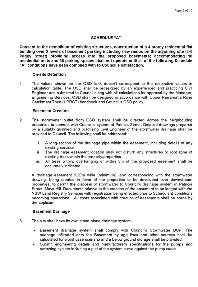
Item No: LPP028/19
Development
Application for 3-9 Peggy Street, Mays Hill
Responsible
Division: Environment
& Planning
Officer: Manager
Development Assessment
File
Number: DA
2017/563/1
|
Application lodged
|
22 December 2017
|
|
Applicant
|
Anthony Charbel
|
|
Owner
|
Jemcon Developments Pty Ltd and KBCO Kashro Pty Ltd
|
|
Application No.
|
2017/563/1
|
|
Description of Land
|
3-9
Peggy Street, Mays Hill
|
|
Proposed Development
|
Demolition of existing structures, consolidation of 4 lots
into 1 lot and construction of a part 4, part 5 storey residential flat
buildings over lower ground and basement parking accommodating 59 units and
65 parking spaces under Affordable Rental Housing SEPP 2009
|
|
Site Area
|
3,300.4m²
|
|
Zoning
|
R4 High Density Residential
|
|
Principal Development Standards
|
Floor Space Ratio:
Max. 1.2:1 (GFA of 3960.48m²)
+ ARH 29.8% Bonus (represents GFA of 983.5m²)
Represents overall GFA of 4,943.9m² or FSR of
1.498:1
Height of Buildings:
Max. 15m across the entire subject site
· Proposed
Max. 15.8m (5.3% variation sought)
· Clause
4.6 Written Variation Request submitted for the departure sought to building
height
|
|
Disclosure of political donations and gifts
|
Nil disclosure
|
|
Heritage
|
The subject site does not contain a heritage item,
located within the vicinity of the heritage item or heritage conservation
area.
|
|
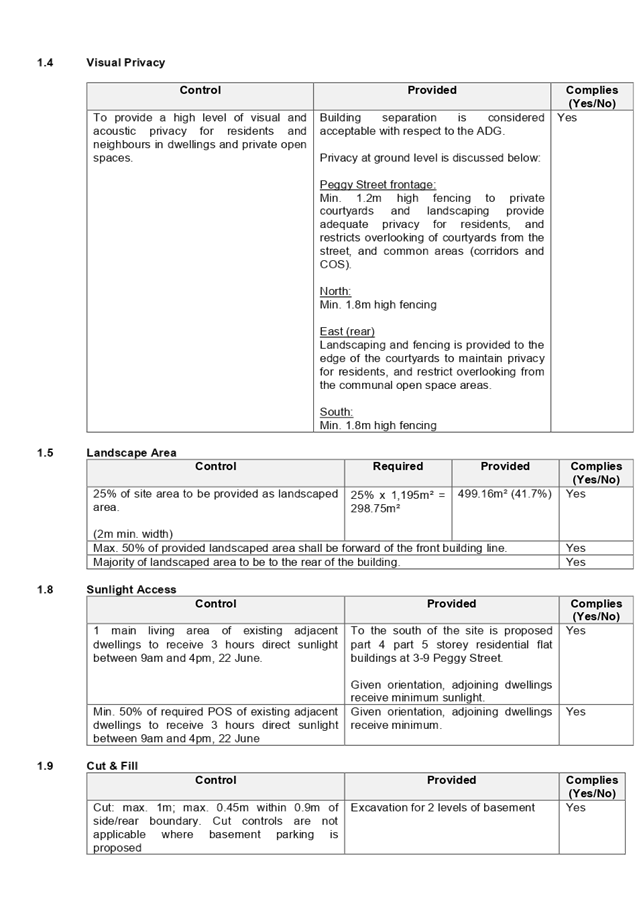
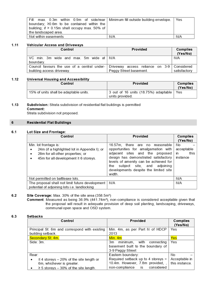
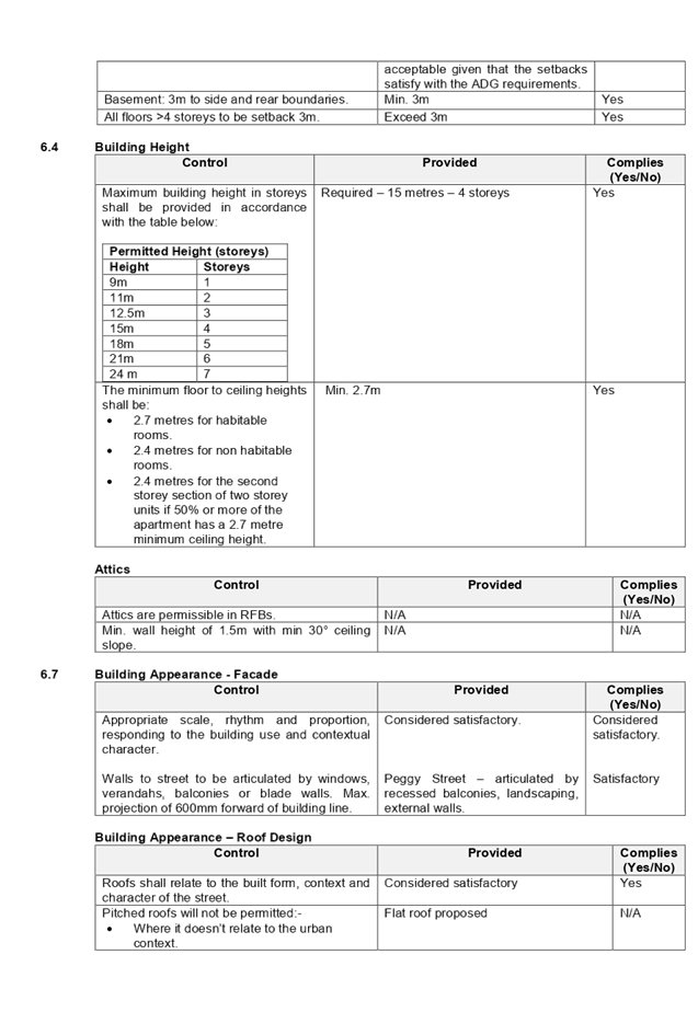
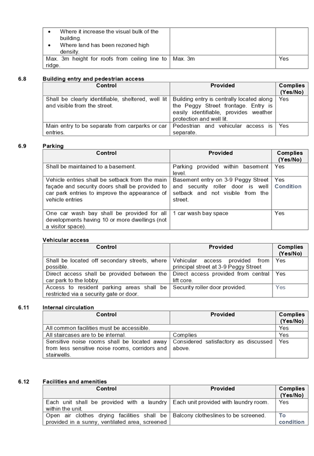
Issues
|
· Variation
to maximum 15m building height (HLEP 2013)
· Solar
Access (ARH SEPP and ADG)
· Building
Separation (ADG)
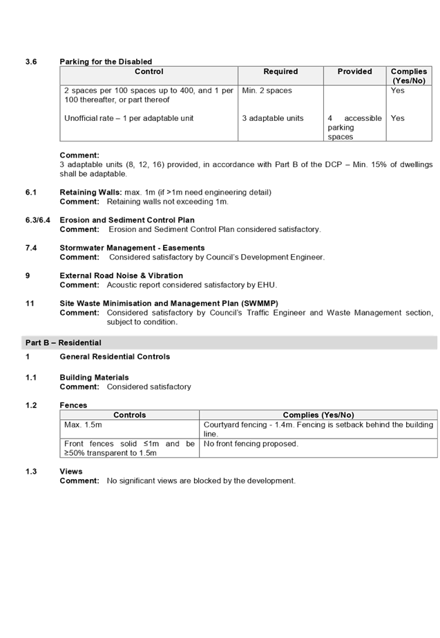
· Accessible
car and bicycle parking spaces (HDCP 2013)
· Site
coverage (HDCP 2013)
· Rear
setback (HDCP 2013)
· Maximum
number of storeys limit (HDCP 2013)
· Unit
mix (HDCP 2013)
|
1. On
22 December 2017, development application (DA 2017/563) for the demolition of
existing structure, consolidation of 4 lots into 1 lot and construction of a
part 4, part 5 storey residential flat buildings over lower ground and basement
parking accommodating 60 units and 70 parking spaces under Affordable Rental
Housing SEPP 2009 was lodged with Council.
2. The
application was publicly notified to adjoining and opposite owners, a notice
was placed in the local press and a notice placed on the site for 21 days from
31 January 2018 to 21 February 2018. In response, the application received one
(1) submission.
3. The
application was deferred on 9 April 2018, 16 January 2019 and 9 April 2019
requesting additional information relating to site isolation of 1 Peggy Street,
revised QS Report and compliance with the overall development, particularly for
changes in landform, building separation, setbacks, solar access, natural
ventilation, apartment layout, building height, gross floor area, visual
privacy, fencing, traffic, waste management and stormwater.
4. The
CIV of the affordable component of the proposal did not exceed $5 million to
require determination by Sydney Central City Planning Panel.
5. Additional
information confirmed that reasonable and genuine attempts have been made to
purchase the isolated property (1 Peggy Street). However, the site at 1 Peggy
Street could not be acquired by the owners of the subject site. Subsequently,
DA 2018/278 for a residential flat building was lodged on 8 August 2018 for 1
Peggy Street, which seeks to share access to its basement from the driveway
access and basement. A separate report for 1 Peggy Street is also reported to
this panel for determination.
6. On
28 February 2019, amended plans and additional information was submitted
seeking, the demolition of existing structure, consolidation of 4 lots
into 1 lot and construction of a part 4, part 5 storey residential flat
buildings over lower ground and basement parking accommodating 59 units and 65
parking spaces under Affordable Rental Housing SEPP 2009. Amended plans did not
warrant re-notification of the proposal.
7. The
subject application, as amended, has been assessed against the relevant
provisions of the Environmental Planning and Assessment Act 1979, State
Environmental Planning Policy No 65 – Design Quality of Residential
Apartment Development (SEPP 65), State Environmental Planning Policy
(Affordable Rental Housing) 2009 (SEPP ARH), Holroyd Local Environmental
Plan 2013 (HLEP), Apartment Design Guide and Holroyd Development Control Plan
2013 (HDCP).
i)
8. The
proposal seeks the following non-compliances which are considered supportable
as discussed in detail elsewhere in the report:
|
Control
|
Required
|
Proposed
|
% Variation
|
|
Building Height
|
· Max. 15m
· (HLEP 2013)
|
15.8m to building roof
15.73m to top of lift core
|
4.8% - 5.3%
|
|
Solar Access -
Min. 3 hours (9am to 3pm) mid-winter
|
· 70% of units
· (ARH SEPP)
|
33.8% (20 units)
|
51.5%
|
|
Building Separation
(Between habitable
rooms and balconies)
|
6m (4 storeys)
9m (5 storeys)
(ADG)
|
Min 4.5m (4 storeys)
Min. 6m (5 storeys)
|
25%
33.3%
|
|
Solar Access -
No direct sunlight
|
Max 15% (9 units) (ADG)
|
18.6% (11 units)
|
24.3%
|
|
Bicycle parking space
|
36 (HDCP 2013)
|
32
|
11.1%
|
|
Accessible car space
(1 per adaptable unit)
|
9
(HDCP 2013)
|
8
|
11.1%
|
|
Site coverage
|
30% (990.12m²)
(HDCP 2013)
|
38.6% (1,275.8m²)
|
28.8%
|
|
Rear setback
30% of site length - 5
storey
|
14.2m
(HDCP 2013)
|
11.6m
|
18.3%
|
|
Maximum Building Storey
Limit
|
4 Storeys
(HDCP 2013)
|
5 Storeys
|
20%
|
|
Unit mix
|
1 b/r – max. 20%
(12 units)
(HDCP 2013)
|
27.1% (16 units)
|
33.3%
|
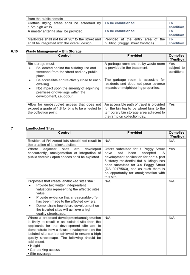
9. The
application is being reported to the Cumberland Local Planning Panel (CLPP) for
determination as it is a development with more than 4 storeys to which the
State Environmental Planning Policy No 65 – Design Quality of Residential
Apartment Developments applies.
10. The
application is recommended for Deferred Commencement approval subject to the
conditions in the draft determination at Attachment 5.
Introduction
The subject site is known as 3-9
Peggy Street, Mays Hill, and is legally described as Lots 56, 57, 58 and 59 in
DP13239. The site has an area of 3,300.4m2 and frontage of 90.96m to
Peggy Street. It has a significant cross fall from north-west to south-east of
approximately 5m (gradient of 1:15). The property is currently occupied by
detached dwelling houses, ancillary structures and vegetation. The site is
located within the Mays Hill Transitway Precinct, located approximately 60m
south of Great Western Highway.
The subject site and neighbouring
allotments are zoned R4 – High Density Residential. Properties located on
the southern side of Rees Street are zoned RE1 – Public Recreation and R2
– Low Density Residential. To the north, developments facing Great
Western Highway are mostly shop top housing within the B6 – Enterprise
Corridor zone. The existing streetscape on Peggy Street is transitioning to
replace the existing detached dwellings with residential flat buildings.
Figure
1 - Aerial view of the locality with subject site shown highlighted in red.
Source: NearMap 16 April 2019
Figure
2 – Zoning map with subject site shown hatched. Source: Cumberland
Council 2019
Figure
3 – Left: No. 3 Peggy Street; Right: No. 9 Peggy Street. Source:
Cumberland Council 2019
Figure
4 – No. 1 Peggy Street. Source: Cumberland Council 2019
Figure
5 – No. 11-15 Peggy Street. Source: Cumberland Council 2019
Description of The Proposed
Development
DA 2017/563, as amended, proposes
for the demolition of existing structure, consolidation of 4 lots into 1 lot
and construction of a part 4, part 5 storey residential flat buildings over
lower ground and basement parking accommodating 59 units and 65 parking spaces
under Affordable Rental Housing SEPP 2009.
Key features of the development
proposal are as follows:-
|
Level
|
Details
|
|
Basement
|
42 residential car spaces (including 6 accessible parking
spaces)
24 bicycle spaces
Storage, plant room, lift and fire stairs
Caretaker’s toilet
Shared access to 1 Peggy Street
|
|
Lower Ground level
|
4 residential units to Buildings A and B
23 residential car spaces (including 1 car wash bay and 2
accessible parking spaces)
8 bicycle spaces
Communal Open Space with BBQ and seating areas
Bin trolley pull store room, bulk waste storage, storage,
plant room, lift and fire stairs
Shared access to 1 Peggy Street
|
|
Ground floor level
|
13 residential units to Buildings A and B
Enclosed bin collection area
|
|
Level 1
|
14 residential units to Buildings A and B
|
|
Level 2
|
14 residential units to Buildings A and B
|
|
Level 3
|
14 residential units to Buildings A and B
|
Access to the basement car park is
provided from subject site which is burdened by a right of carriageway
benefitting the adjoining site (1 Peggy Street). Suitable conditions to that
effect are recommended to be imposed on any consent granted.
The dwelling mix of the proposal
is as follows:
· 16
x 1-bedroom units (27.1%)
· 25
x 2-bedroom units (42.4%)
· 18
x 3-bedroom units (30.5%)
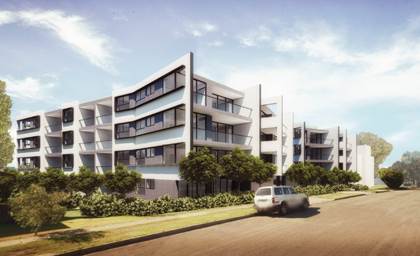
Figure 6 – Perspective of proposed development
– Peggy Street frontage
Application History
|
Date
|
Action
|
|
27 August 2015
|
Pre DA lodgement held at Council.
|
|
13 April 2018
|
The subject development application (DA 2017/563) was
lodged with Council.
|
|
23 April 2018
|
The application was referred to the following internal and
external sections:
· Development
Engineering
· Traffic
Engineering
· Landscape
and Tree Management
· Environmental
Health
· Waste
Management
· Transgrid
· Endeavour
Energy
|
|
31 January 2018 to 21 February 2018
|
Application placed on public notification. In response,
one (1) submission was received.
|
|
9 April 2018, 16 January 2019 and 9 April 2019
|
Application deferred requesting additional information
relating to site isolation, revised QS Report and compliance with the overall
development, particularly for changes in landform, building separation,
setbacks, solar access, natural ventilation, apartment layout, building
height, gross floor area, visual privacy, fencing, traffic, waste management
and stormwater.
|
|
9 April 2019
|
Additional information submitted for review.
|
|
8 May 2019
|
Application referred to CLPP for determination.
|
Applicant’s Supporting
Statement
Statement of Environmental Effects
dated 21 December 2017 and dated 28 February 2019, and a Clause 4.6 written
request to vary the building height standard dated 18 April 2019, prepared by
Think Planners submitted in support of the application.
Contact With Relevant
Parties
The assessing officer has
undertaken an inspection of the subject site and has been in contact with the
applicant throughout the assessment process.
Internal Referrals
Development Engineer
The development application was
referred to Council’s Development Engineer for comment who has advised
that the development is supportable in regards to shared arrangement of
basement access (right of way) and stormwater management, subject to conditions.
Traffic Engineer
The development application was
referred to Council’s Traffic Engineer for comment who has advised that
the development is supportable in regards to parking, traffic management, waste
collection area and on-site parking provision in the basement level, subject to
conditions.
Tree Management Officer
The development application was
referred to Council’s Tree Management Officer for comment who has advised
that the development is supportable, subject to conditions.
Waste Management Officer
The development application was
referred to Council’s Waste Management Officer for comment who has
advised that the development is supportable in regards to provision of bin tug,
bin storage room, and waste collection and management plan, subject to conditions.
Environmental Health Officer
The development application was
referred to Council’s Environmental Health Officer for comment who has
advised that the development is supportable in regards to acoustic assessment,
subject to conditions.
External Referrals
Transgrid
The development application was
referred to Transgrid for comment who has advised that the development is
supportable in regards to not affecting Transgrid’s asset.
Endeavour Energy
The development application was
referred to Endeavour Energy for comment who has advised that the development
is supportable in regards to electricity connection and sufficient clearance to
existing electricity asset, subject to conditions.
NSW Police
The application was referred to
NSW Police for comment regarding CPTED. Response dated 9 May 2018 indicates
that the proposal is satisfactory subject to conditions.
Planning Assessment
Section 4.15 of the
Environmental Planning and Assessment Act 1979
State Environmental Planning
Policies
The following Environmental
Planning Instruments are relevant to the assessment of the subject application:
a) State
Environmental Planning Policy (Affordable Rental Housing) 2009 (ARH SEPP)
The proposal falls under Part 2
New affordable rental housing – Division 1 In-fill affordable housing. It
should be noted that the proposal fully complies with the key planning controls
contained within the ARH SEPP including site area, landscaped area, parking,
accommodation size and prescribed standards for in-fill affordable housing. A comprehensive
assessment against ARH SEPP is attached to this report – Attachment 1.
14 Standards that cannot be
used to refuse consent
(1) (e)
solar access
If living rooms and private open
spaces for a minimum of 70 per cent of the dwellings of the development receive
a minimum of 3 hours direct sunlight between 9am and 3pm in mid-winter.
A consent authority must not
refuse consent to development if the solar access to the proposed development
satisfies the above requirements. The development however will receive 3 hours
direct sunlight between 9am and 3pm in mid-winter only to 33.8% of the
dwellings, or 20 units. Non-compliance with the solar access provision is
supported in this instance given the proposal continues to satisfy Part 4A-1 of
the Apartment Design Guide for solar and daylight access, in which 2 hours
direct sunlight between 9am and 3pm in mid-winter will be provided to 70% of
the units.
16A Character of local area
A consent authority must not
consent to development to which this Division applies unless it has taken into
consideration whether the design of the development is compatible with the
character of the local area. The SEPP (ARH) does not contain any guidance for
assessing whether a proposal is compatible with the character of the local
area. However, a planning principle for assessing compatibility in the urban
environment was established by Senior Commissioner Roseth of the Land and
Environment Court in the judgement for Project Venture Developments Pty Ltd v
Pittwater Council [2005] NSWLEC 191. This involves asking the following two
questions:
· Are
the proposal’s physical impacts on surrounding development acceptable?
The physical impacts include constraints on the development potential of
surrounding sites.
· Is
the proposal’s appearance in harmony with the buildings around it and the
character of the street?
A merit assessment of the
character of the local area should consider the following 3 steps:
· Step
1 – Identify the ‘local area’.
· Step
2 – Determine the character of the ‘local area’.
· Step
3 – Determine whether the design of the proposed development is
compatible with the character of the ‘local area’.
An assessment against each step is
provided below:
Step 1 – Identify the
local area.
This assessment identifies the
local area as primarily the visual catchment of the site (hatched in red) as
viewed from within the site and directly adjacent to the site on the street
which is defined by the thick blue line in the figure below:
Figure
7 – Local Area catchment
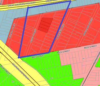
Step 2 – Determine the
character (present and future) of the local area.
The zoning of the broader locality
and immediate area comprises R4 High Density Residential, R2 Low Density
Residential, RE1 Public Recreation and B6 Transport Corridor under the Holroyd
Local Environmental Plan (HLEP) 2013.
Present Character of the area
The character of the local area
comprises the visual catchment of regular shaped allotments viewed from and
surrounding the subject site, which includes:-
1. Proposed
4 storey residential flat building currently under assessment at 1 Peggy street
Mays Hill (DA 2018/278);
2. Existing/recently
constructed 4 to 5 storey residential flat buildings located on the eastern and
western sides of Peggy Street (4, 11-15, 14 and 20 Peggy Street);
3. Detached
dwelling houses and attached dual occupancy development located on the eastern
and western sides of Peggy Street (2, 8, 8A, 10, 12, 17 and 19 Peggy Street);
4. Detached
dwelling houses to the eastern side of Peggy Street all facing Patricia Street;
and
5. Existing/recently
constructed 6 to 7 storey shop top housing facing Great Western Highway (179
and 181-183 Great Western Highway).
Figure 8 – Left: 4 Peggy Street, to right: 2 Peggy Street and
181-183 Great Western
Highway
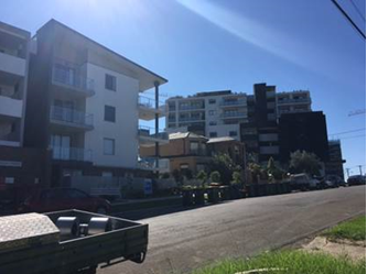
Future Character of the area
The locality is in transition
particularly to support the increasing demand of affordable housing within the
close proximity of public transport hub and major commercial centre. The
transition issue is clear with regard to FSR, height and setbacks for the proposed
development. It is considered that the height, bulk and scale of the proposed
development is similar to the recently completed and newer residential flat
buildings being constructed and would not be inconsistent with the desired
future character of the locality.
The proposed development may pose
some impacts on the residential amenity currently enjoyed by the occupants of
the properties located on the southern side of the subject site (11-15 Peggy
Street). However, these impacts are not unreasonable and are consistent with
impacts that would result from the form of development envisaged under the
planning controls noting the significant fall in the landform towards the
southern side of the subject site. Appropriate privacy measures are proposed for
the northern elevation and southern elevation of the proposed development to
minimise any adverse impacts to the approved residential flat building at 11-15
Peggy Street and future development of 1 Peggy Street.
In this regard, the area is
undergoing transition with considerable development that will change the
existing character of the area. The proposed development is consistent with the
form of development and the desired future character envisaged under these
planning controls.
Step 3 - Determine if the
development is compatible with the character of the local area.
In accordance with the Land and
Environment Court’s ‘Planning Principle’ and case law
compatibility is best defined as ‘capable of existing together in
harmony’. In order to test compatibility two questions are to be
considered. These questions, as well as a response to each, are provided below:
· Are
the proposal’s physical impacts on surrounding development acceptable?
The physical impacts include constraints on the development potential of
surrounding sites.
The height, FSR and landscaping of
the proposed development are designed to maintain the harmony within the
streetscape, whilst contributing to the site context and constraint. The height
of building breaches the 15m height limit requirement for part of the roof and
the lift core. The proposal being a permissible land use, meets the FSR
requirement (in accordance with ARH SEPP, subject to the imposition of
conditions) and contributes to the provision of affordable housing within the close
proximity of public transport hub and major commercial centre. Appropriate
setbacks and privacy treatments are provided to minimise any adverse impacts to
the adjoining properties. Part of the fifth storey at the rear does not comply
with maximum number of storeys as prescribed in Part N of HDCP 2013, however,
it will be situated within the area with significant fall in the landform. The
buildings are appropriately articulated to complement the existing and changing
streetscape within the local area. Although the development will result in
overshadowing to the existing 4 storey residential flat building on the
southern side (11-15 Peggy Street), overshadowing is acceptable and consistent
with that envisaged under the planning controls.
· Is
the proposal’s appearance in harmony with the buildings around it and the
character of the street?
To be compatible, a development
should contain, or at least respond to the key aesthetic elements that make up
the character of the surrounding area. The size of the basement maximises
landscaping and deep soil zones on site. The front setbacks are generous and
consistent with the existing streetscape. The proposal is considered to
maintain an appropriate residential character which is consistent with the
streetscape. As indicated, the local area has an established high density
residential built form, as such, the proposed development is not considered to
be inconsistent with the existing streetscape character of the immediate area
surrounding the subject site.
In conclusion, the proposal will
maintain the harmony within the general streetscape, and suitably fits in the
local character of the locality.
b) State
Environmental Planning Policy No 65 – Design Quality of Residential
Apartment Development (SEPP 65)
The proposal is classified as a
residential apartment development and SEPP 65 applies. A design verification
statement signed by registered architect Simon Hanson was submitted with the
application.
SEPP 65 sets nine design quality
principles. The development has adequately addressed the principles in the
following way:
Figure
9 – SEPP 65 Design Quality Principles Table
|
ADG design
quality principle
|
Response
|
|
1. Context and neighbourhood character
|
The area is designed to
accommodate new development, including residential flat building that is a
permitted type of development within the R4 zone. The existing character of
the streetscape is in transition where existing dwelling houses are being
replaced with higher densities development, such as residential flat
buildings. The proposed development satisfies Holroyd LEP 2013 objective in
that it will provide a variety of housing type within a high density
environment. The siting of development has been appropriately designed to
minimise any potential overshadowing and visual privacy impact to the
adjoining properties by maintaining a buffer area at the rear for communal
open space.
|
|
2. Built form and scale
|
The development application is
seeking consent for part 4 part 5 storey residential flat buildings over one
level parking on the lower ground level and another level of basement car
park underneath. The building has been designed to correspond with the
existing landform. At grade communal open space will assist in softening the
built form and minimise any potential overshadowing and visual privacy impact
to the adjoining properties.
|
|
3. Density
|
The proposed development
complies with the permitted FSR, including the bonus FSR under ARH SEPP.
|
|
4. Sustainability
|
A BASIX Certificate and relevant
reports have been submitted with the development application. The
certificates require sustainable development features to be installed into
the development. The proposal will incorporate features relating to ESD in
the design and construction of the development inclusive of water efficient
fixtures and energy saving devices.
|
|
5. Landscape
|
Landscaped area of
1573.55m² (47.6% of the site) has been provided, which will provide
appropriate level of amenity to the resident and consistent with the
environmental surrounds of the subject site.
|
|
6. Amenity
|
The proposal will deliver
sufficient amenity to residents of the building. The proposal achieves
compliance with the ADG in this regard which contains many amenity controls.
The building design incorporates access and circulation, apartment layouts,
floor area, ceiling height, private open space, common open space, energy
efficiency rating, adaptability and diversity, safety, security and site
facilities. The proposal is considered to generally comply with the ADG and
HDCP 2013 which contains numerous amenity controls. Suitable access is
provided to all parts of the building, through the efficient use of lift to
access all levels. The development is considered to provide an appropriate
level of amenity for future residents.
|
|
7. Safety
|
Suitable and secure access is
provided to all parts of the building, through the efficient use of lift to
access all levels.
|
|
8. Housing diversity and social interaction
|
The apartment mix is considered
to be satisfactory. The specifics of the building are:-
16 x 1 bedroom apartments.
25 x 2 bedroom apartments.
18 x 3 bedroom apartments.
The number of adaptable units
proposed is considered satisfactory with the provision of associated
accessible car spaces.
|
|
9. Aesthetics
|
The residential flat buildings
have attractive contemporary appearance and utilises building elements that
provide individuality to the development without compromising the streetscape
or detracting from the appearance of existing surrounding development. The
building responds well in this regard with its provision of good aesthetics
through the use of high quality materials, attention to detail in its
internal spaces and how it addresses the street frontage. The building
provides an appropriate response to the existing and likely future character
of the locality.
|
Integral to SEPP 65 is the
Apartment Design Guide (ADG), which sets benchmarks for the appearance,
acceptable impacts and residential amenity of the development. Following a
detailed assessment of the proposal against the provisions of SEPP 65 and the
ADG, it is considered the proposal is generally compliant with the exception of
the variations discussed below:
|
3F
|
Visual Privacy
|
Yes
|
No
|
N/A
|
|
3F-1
|
Adequate building separation
distances are shared equitably between neighbouring sites, to achieve reasonable
levels of external and internal visual privacy.
|
|
|
|
|
Design Criteria
Separation
between windows and balconies is provided to ensure visual privacy is
achieved. Minimum required separation distances from buildings to the side
and rear boundaries are as follows:
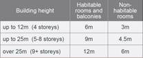
Note:
Separation distances between
buildings on the same site should combine required building separations
depending on the type of room.
Gallery access circulation should
be treated as habitable space when measuring privacy separation distances
between neighbouring properties.
|
Levels 1 –
2
6m is required
Northern boundary:
- 5.4m from bedroom
windows BG07, B107, B2017 & B307. Minor non-compliance is acceptable as
the angled opening to bedrooms at 1 Peggy Street has been properly treated.
Between Buildings A and
B:
- 4.5m (each side)
Level 3
9m is required
Southern boundary:
- 6m balcony and
bedroom windows of A302 & bedroom windows of A303
Between Buildings A and
B:
- 6.2m (each side)
Eastern boundary
(rear):
- 7m
The windows and balconies are
provided with suitable treatment and privacy screening. Satisfactory.
|
|
|
|
|
4A
|
Solar and Daylight Access
|
Yes
|
No
|
N/A
|
|
3F-1
|
To optimise the number of
apartments receiving sunlight to habitable rooms, primary windows and private
open space.
|
|
|
|
|
Design Criteria
A maximum of 15% of apartments
in a building receive no direct sunlight between 9 am and 3 pm at mid-winter.
Maximum: 15% x 59 units
= 8.85 (9) units maximum
|
11 out of 59 units
(18.6%)
Exceedance in the
numbers of units not receiving direct solar access for 2 units is supported
in this instance, given that the significant fall in the landform towards the
southern side.
|
|
|
|
A comprehensive assessment against
the Apartment Design Guide (ADG) controls is provided at Attachment 2.
c) State
Environmental Planning Policy (Infrastructure) 2007
Clause 45 – Development
likely to affect an electricity transmission or distribution network
The development application was
referred to Endeavour Energy for comment, who raised no objections, subject to
recommendations.
Clause 102 – Impact of
road noise or vibration on non-road development
The subject site is located
approximately 60m from Great Western Highway. The proposal is for the purposes
of residential accommodation. In accordance with Clause 102, an Acoustic Report
was submitted with the application. Council’s Environmental Health Officer
has reviewed the report and advises that the proposal is satisfactory subject
to the imposition of conditions requiring appropriate measures to be
implemented to ensure noise levels to bedrooms and living areas are acceptable.
d) State
Environmental Planning Policy No 55 – Remediation of Land (SEPP 55)
The requirement at Clause 7 of
SEPP No. 55 for Council to be satisfied that the site is suitable or can be
made suitable to accommodate the proposed development has been considered in
the following table:
|
Matters for consideration
|
Yes
|
No
|
N/A
|
|
Does the application involve
re-development of the site or a change of land use?
|
|
|
|
|
Is the development going to be
used for a sensitive land use (e.g.: residential, educational, recreational,
childcare or hospital)?
|
|
|
|
|
Does information available to
you indicate that an activity listed below has ever been approved, or
occurred at the site?
acid/alkali plant and
formulation, agricultural/horticultural activities, airports, asbestos
production and disposal, chemicals manufacture and formulation, defence
works, drum re-conditioning works, dry cleaning establishments, electrical
manufacturing (transformers), electroplating and heat treatment premises,
engine works, explosive industry, gas works, iron and steel works, landfill
sites, metal treatment, mining and extractive industries, oil
production and storage, paint formulation and manufacture, pesticide
manufacture and formulation, power stations, railway yards, scrap yards,
service stations, sheep and cattle dips, smelting and refining, tanning and
associated trades, waste storage and treatment, wood preservation.
|
|
|
|
|
Is the site listed on Council's
Contaminated Land Database?
|
|
|
|
|
Is the site subject to EPA
clean-up order or other EPA restrictions?
|
|
|
|
|
Has the site been the subject of
known pollution incidents or illegal dumping?
|
|
|
|
|
Does the site adjoin any
contaminated land/previously contaminated land?
|
|
|
|
|
Has the appropriate level of
investigation been carried out in respect of contamination matters for
Council to be satisfied that the site is suitable to accommodate the proposed
development or can be made suitable to accommodate the proposed development?
|
|
|
|
|
Details of contamination
investigations carried out at the site:
The site
is not identified in Council’s records as being contaminated. A site
inspection reveals the site does not have any obvious history of a previous
land use that may have caused contamination and there is no specific evidence
that indicates the site is contaminated. In this regard, an environmental
site assessment is not required for the proposal.
Council’s
Environmental Health Officer has also reviewed the proposal, and considers
the proposed development to be satisfactory subject to the imposition of
conditions requiring works to stop should any unexpected finds be found
during demolition or construction works.
|
e) State
Environmental Planning Policy (Building Sustainability Index: BASIX) 2004
BASIX certificate 891652M dated 21
December 2017 was submitted with the original plans. Updated BASIX certificate
however has not been submitted with the amended plans. Condition is to be
imposed requiring amended BASIX certificate that achieves target scores and is
consistent with the architectural plans.
f) Statement
Environmental Planning Policy No 19 - Bushland in Urban Areas
The proposal does not propose to
disturb bushland zoned or reserved for public open space.
g) State
Environmental Planning Policy (Vegetation in Non-Rural Areas) 2017
The proposal includes removal of
all existing trees within the subject site. However, this does not exceed the
biodiversity offsets scheme threshold and the majority of the trees on site are
exempt species. Therefore, the proposed vegetation removal is considered
acceptable.
h) State
Environmental Planning Policy (Coastal Management) 2018
The subject site is not identified
as a coastal wetland nor is it ‘land identified as “proximity area
for coastal wetlands” as per Part 2, Division 1 of the SEPP Coastal
Management 2018.
Regional Environmental Plans
(Deemed State Environmental Planning Policies)
i) Sydney
Regional Environmental Plan (Sydney Harbour Catchment) 2005
The subject site is identified as
being located within the area affected by the Sydney Regional Environmental
Plan (Sydney Harbour Catchment) 2005. The proposed development raises no issues
as no impact on the catchment is envisaged.
Note: The subject site is not
identified in the relevant map as land within the ‘Foreshores and
Waterways Area’ or ‘Wetland Protection Zone’, is not a
‘Strategic Foreshore Site’ and does not contain any heritage items.
Hence the majority of the SREP is not directly relevant to the proposed
development.
Local Environmental Plans
j) Holroyd
Local Environmental Plan 2013 (HLEP 2013)
The proposal is defined as a
‘residential flat building’ (building containing 3 or more
dwellings, does not include an attached dwelling or multi dwelling housing)
under the provisions of HLEP 2013. Residential flat building is permitted with
consent in the R4 – High Density Residential zone which applies to the
land.
The proposal seeks a variation to
Clause 4.3 – Height of Buildings that stipulates that the height of
building is not to exceed 15m on the subject site.
The proposed building has an
overall height of 15.8m (RL 52.00) to the roof of the building, and 15.73m (RL
51.90) to the top of the lift core. The proposal breaches the height by 0.8m to
the roof of the building, and 0.73m to the lift core representing variations of
5.3% and 4.8% respectively. The majority of the height breach is associated
with the roof of the building and the top of the lift core.
Figure
10 – Elevation Plans showing extent of height variation sought
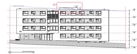
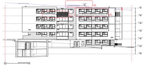
Clause 4.6 – Variation to
Building Height
Clause 4.6 allows the consent
authority to vary development standards in certain circumstances and provides
an appropriate degree of flexibility to achieve better design outcomes. The
consent authority may grant the exception as the Secretary’s concurrence
can be assumed where clause 4.6 is adopted as per the Department of Planning
Circular PS 18-003, dated 21 February 2018.
The applicant has submitted a
written request to vary the development standard for building height. Based on
various case laws established by the Land and Environment Court of NSW such as
Four2five P/L v Ashfield Council [2015] NSWLEC 9, Randwick City Council v
Micaul Holdings P/L [2016] NSW LEC7 and Zhang and anor v Council of the City of
Ryde [2016] NSWLEC 1179, a 3 part assessment framework for a variation request
proposed under clause 4.6 has been considered and an assessment of the proposed
variance, following the 3 part test is discussed in detail below.
The 3 preconditions which must be
satisfied before the application can proceed are as follows:
1. Is
the proposed development consistent with the objectives of the zone?
Applicant’s
justification:
The proposal ensures that the
high-density nature of the zone is retained and there is not a significant
change to the character of the locality. In addition, the proposal complements
and enhances the local streetscape by virtue of the careful siting of the
development.
Planner’s Comment:
Whilst residential flat buildings
are a permitted land use, the locality is undergoing a transition particularly
to support the increasing demand of affordable housing within the close
proximity of public transport hub and major commercial centre. The proposed
development is considered to be consistent with the objectives of the R4 high
Density Residential zone.
2. Is
the proposed development consistent with the objectives of the development
standard which is not met?
Applicant’s
justification:
The development seeks to depart
from the height control noting that the proposal remains consistent with the
objectives of the clause and is a more appropriate outcome on the site because
of the following:
- The
proposal will provide a high quality urban form that relates well to the
context of the site in terms of the natural topography and adjoining
development;
- The
proposal incorporates an Affordable Housing component which provides for a
discernible public benefit and this additional floor space needs to be
accommodated within the same building envelope of planning controls;
- The
top level is pulled towards the street frontage to minimise overshadowing and
potential privacy impacts to adjoining residential land parcels to the south.
- The
proposal presents a suitable scale of development relative to surrounding
development and future development within the locality given the provisions of
the Holroyd LEP 2013.
- The
proposed development will permit the site to develop to its full zoning
potential whilst complementing the future vision envisioned for the site by
providing a residential flat building that provides good address to Peggy
Street whilst complying with key planning controls applying to the proposal.
- The
development proposal has been designed to comply with key planning
requirements, whilst providing an attractive building that addresses the
context, streetscape whilst being consistent with the evolving high residential
built form characters along the eastern side of Peggy Street. The development provides
a mix of dwellings that will contribute towards increasing housing choice,
diversity and stock of the Cumberland LGA.
As outlined above the proposal
remains consistent with the underlying objectives of the control and as such
compliance is considered unnecessary or unreasonable in the circumstances. The
above discussion demonstrates that there are sufficient environmental planning
grounds to justify the minor departure from the control.
Planner’s comment:
The objectives of the building
height standard are to enable appropriate development density to be achieved
and to ensure that the height of the building is compatible with the character
of the locality as outlined above. The proposal is compliant (subject to
conditions) with the maximum inclusive of the bonus provision under the ARH
SEPP. The increased height does not result in an additional level for
residential use, as it comprises portion of the roof of the building where the
land slopes down to the rear and the top of the lift core.
The departure sought is considered
to be modest and does not unreasonably impact on adjoining properties. The
additional height does not result in the appearance of bulk when viewed from
the existing streetscape and would not impinge on the changing streetscape that
is anticipated for the immediate area. Given that the proposed development
responds to the site and does so without compromising relationships with
adjoining development, minimise overshadowing to the property at the southern
side (11-15 Peggy Street) and does not unduly compromise other relevant
controls, the proposal is considered to be consistent with the objectives of
height requirements and development within the R4 zone.
3. A)
Is compliance with the development standard unreasonable or unnecessary in the
circumstances of the case?
Applicant’s
justification:
Strict compliance with the
prescriptive building height requirement is unreasonable and unnecessary in the
context of the proposal and its particular circumstances. The proposed
development meets the underlying intent of the control and is a compatible form
of development that does not result in unreasonable environmental amenity
impacts.
Planner’s comment:
Council Officers are satisfied
that the proposed variation has been appropriately justified and can be
supported in this instance. The height breach is limited to an overall building
height of RL 52.00 for the roof of the building, and height of RL 51.90 for the
top of the lift core. The additional height of the lift core will not be visible
from the adjacent streets and properties. The proposed variation to the
development standard is necessary for the structure containing the lift core
and in order to achieve required FFLs, and is consistent with the scale of the
development within the R4 zone located in the immediate vicinity of the site.
The departure sought is considered to be modest and does not unreasonably
impact on adjoining properties. The additional height does not result in the
appearance of bulk when viewed from the existing streetscape, would not impinge
on the changing streetscape that is anticipated for the immediate area and does
not result in additional overshadowing to the adjoining properties. It is
considered, therefore, that the non-compliance with the Development Standard is
unreasonable or unnecessary in the circumstances of the case.
B) Are there sufficient
environmental planning grounds to justify contravening the development standard
and therefore is the applicant’s written justification well founded?
The unique circumstances of the
case are considered to warrant support of the departure. Given that the
proposed development responds to the site and does so without unduly
compromising relationships with adjoining development, and does not unduly
compromise other relevant controls, the proposal is considered to be consistent
with the objectives of building height, and development within the R4 zone. In
this regard, the exception is well founded and can be supported.
Conclusion:
Council is satisfied that the
applicant’s written request has adequately addressed the matters required
to be demonstrated by clause 4.6 subclause (3). Council is further satisfied
that the proposed development will be in the public interest because it is
consistent with the objectives of the particular standard and the objectives
for development within the zone in which the development is proposed to be
carried out.
It is the view of Council Officers
that justification provided is satisfactory and having considered the
application on its merit, the exception to the maximum building height
development standard is considered acceptable in this instance.
An assessment against all the
relevant LEP provisions is provided at Attachment 3.
Draft Environmental Planning
Instruments
The proposed development is not
affected by any draft Environmental Planning Instruments.
Development Control Plans
a) Holroyd
Development Control Plan 2013
HDCP 2013 contains general
controls which relate to all developments under Part A, residential controls
under Part B, and transitway station precinct controls under Part N.
A comprehensive HDCP compliance
table is attached to this report at Attachment 4. A summary of the DCP
non-compliances is provided in the following table.
|
Control
|
Provided
|
Complies
(Yes/No)
|
|
Bicycle
parking (36)
|
32, subject to condition to provide additional 4 bicycle
parking spaces.
|
No, subject to condition
|
|
Accessible
car space (9)
|
8, subject to condition to provide an additional
accessible car space.
|
No, subject to condition
|
|
Max
site coverage 30%, or 990.12m²
|
38.6% (1,275.8m²), non-compliance is considered
acceptable given that the proposal will result in adequate provision of deep
soil planting, landscaping, driveways, communal open space and OSD system.
|
No – Acceptable in this instance.
|
|
Rear setback
30%
of site length, or 14.2m for 5 storey
|
11.6m, non-compliance is considered acceptable given that
the setbacks satisfy with the ADG requirements, as discussed above.
|
No – Acceptable in this instance.
|
|
Maximum
building height in storeys shall be provided in accordance with the table
below:
|
Permitted
Height (storeys)
|
|
Height
|
Storeys
|
|
9m
|
1
|
|
11m
|
2
|
|
12.5m
|
3
|
|
15m
|
4
|
|
18m
|
5
|
|
21m
|
6
|
|
24
m
|
7
|
|
Required – 15 metres – 4 storeys
The proposal is 5 storeys in height, and exceeds the maximum number of storeys permitted, with
also minor encroachments (max. 0.8m exceedance) to the maximum 15m building
height permitted.
The departure to the number of
storeys is considered acceptable as the proposal presents a built form of an
appropriate bulk and scale for the site, noting that the area is undergoing
transition.
The building is adequately articulated along all street
frontages, with the 5th storey at the rear that corresponds with
the landform, to reduce the visual bulk when viewed from both neighbouring properties
and the street, and as such considered to be compatible with the existing and
changing streetscape. In this regard, noting the context and constraints of
the site, the departure sought to the maximum number of storeys is considered
acceptable in this instance.
|
No – Acceptable in this instance.
|
|
Total
number of studio and 1 bedroom dwellings shall not exceed 20%
|
The proposal results in 27% of the dwellings being 1
bedroom units, which is 4 units exceedance than the maximum number permitted.
The exceedance is considered acceptable in this instance given that the
subject site is located nearby Parramatta city centre. Furthermore, the
remaining units have been designed to accommodate broad range of occupants,
including, family, adaptable and affordable housing. Satisfactory.
|
No – Acceptable in this instance.
|
Any planning agreement that has
been entered into under section 7.4, or any draft planning agreement
that a developer has offered to enter into under section 7.4
There is no planning agreement or
draft planning agreement associated with the subject Development Application.
The provisions of the
Regulations (EP&A Act s4.15 (1)(a)(iv))
Pursuant to clause 92 of the
Regulation, the provisions of AS 2601 must be considered in the case of a
development application for the demolition of a building. Standard conditions
are included in the draft determination to require the proposed demolition
works to be carried out in accordance with AS 2601.
Any coastal zone management
plan (within the meaning of the Coastal Protection Act 1979)
There is no Coastal Zone
Management Plan applicable to the subject site.
The Likely Environmental,
Social or Economic Impacts (EP&A Act s4.15 (1)(b))
The likely environmental, social
and economic impacts of the development have been assessed and are considered
satisfactory.
The suitability of the site for
the development (EP&A Act s4.15 (1)(c))
The site is considered suitable
for the proposed development.
Submissions made in accordance
with the Act or Regulation (EP&A Act s4.15 (1)(d))
Advertised (newspaper) Mail Sign
Not
Required
In accordance with Part E - Public
Participation of HDCP 2013, the proposal was publicly notified from 2 May 2018
to 23 May 2018. As a result of the notification, one (1) submission was
received discussed as follows. Amended plans submitted did not warrant
re-notification of the proposal.
Concerns:
Privacy, reliance on indoor use,
poor health and construction impact.
Planner’s Comments:
The rear setbacks of the proposed
residential flat buildings comply with the ADG requirements. Minor
non-compliance with the Level 3 balcony rear setback has been minimised with
the provision of suitable privacy screening. A well-landscaped communal open
space provided at the rear of the site will create a buffer with the adjoining
properties and maintain privacy. The zoning of the subject site and the
objector’s property permits the construction of residential flat
buildings. Conditions are to be imposed to minimise the impact of building
construction on site, which are not atypical to other building construction
that has been previously undertaken within the street. It is therefore
considered satisfactory given the impact of the proposed development will be
minimised and the amenity of the adjoining properties should be maintained.
Section 7.11 of The
Environmental Planning & Assessment Act 1979
The subject development requires
the payment of contributions in accordance with Holroyd Section 94 Development
Contributions Plan 2013. A condition is imposed requiring the payment of
contributions.
In accordance with the currently
indexed rates for the Mays Hill Centre contribution area, the following
contributions apply:
· 16
x 1-bedroom dwellings – $8,400 x 16 = $134,400
· 25
x 2-bedroom dwellings – $14,205 x 25 = $355,125
· 18
x 3-bedroom dwellings – $19,887 x 18 = $357,966
· credit
for the existing 4 x 3-bedroom dwellings = $79,548
The required Section 7.11
contribution payable for the proposal is $767,949. The draft determination at
Attachment 5 includes a condition to require payment of contributions prior to
the issue of a construction certificate.
The public interest (EP&A
Act s4.15(1)(e))
The public interest is served by
permitting the orderly and economic use of land, in a manner that is sensitive
to the surrounding environment and has regard to the reasonable amenity
expectations of surrounding land users. In view of the foregoing analysis, it
is considered that approval of the proposed development would not be contrary
to the public interest.
Disclosure of Political
Donations And Gifts
The application and notification
process did not result in any disclosure of Political Donations or Gifts.
The proposed development has been
assessed in accordance with the relevant requirements of the Environmental
Planning and Assessment Act 1979, State Environmental Planning Policy
(Affordable Rental Housing) 2009, State Environmental Planning Policy No 65
– Design Quality of Residential Apartment Development, Holroyd Local
Environmental Plan 2013 and the Holroyd Development Control Plan 2013 and is
considered to be satisfactory.
There are no further consultation
processes for Council associated with this report.
There are no further financial
implications for Council associated with this report.
There are no policy implications
for Council associated with this report.
Communication /
Publications:
The final outcome of this matter
will be notified in the newspaper. The objectors will also be notified in
writing of the outcome.
|
1. That
Development Application 2017/563/1 for which seeks consent for demolition of
existing structure, consolidation of 4 lots into 1 lot and construction of a
part 4, part 5 storey residential flat buildings over lower ground and
basement parking accommodating 59 units and 65 parking spaces under
Affordable Rental Housing SEPP 2009, be Approved via Deferred Commencement,
subject to the attached conditions, provided at Attachment 5.
2. That
the applicant and those persons who lodged a submission in respect of the
application be notified of the determination of the application.
|
1. SEPP ARH 2009
Compliance Table ⇩ 
2. ADG
Compliance Table ⇩
3. HLEP
2013 Compliance Table ⇩ 
4. HDCP
Compliance Table ⇩ 
5. Draft
Notice of Determination ⇩
6. External
Architectural Plans ⇩
7. Internal
Architectural Plans ⇩
8. Landscape
Plan ⇩ 
9. Solar
Diagram ⇩
10. Clause
4.6 Variation request to Building Height ⇩
11. DA
2018/278 1 Peggy Street Mays Hill Architectural Plans ⇩ 
12. Public
Submission ⇩ 
DOCUMENTS
ASSOCIATED WITH
REPORT LPP028/19
Attachment 1
SEPP ARH 2009 Compliance Table
Cumberland Local Planning Panel Meeting
8 May 2019
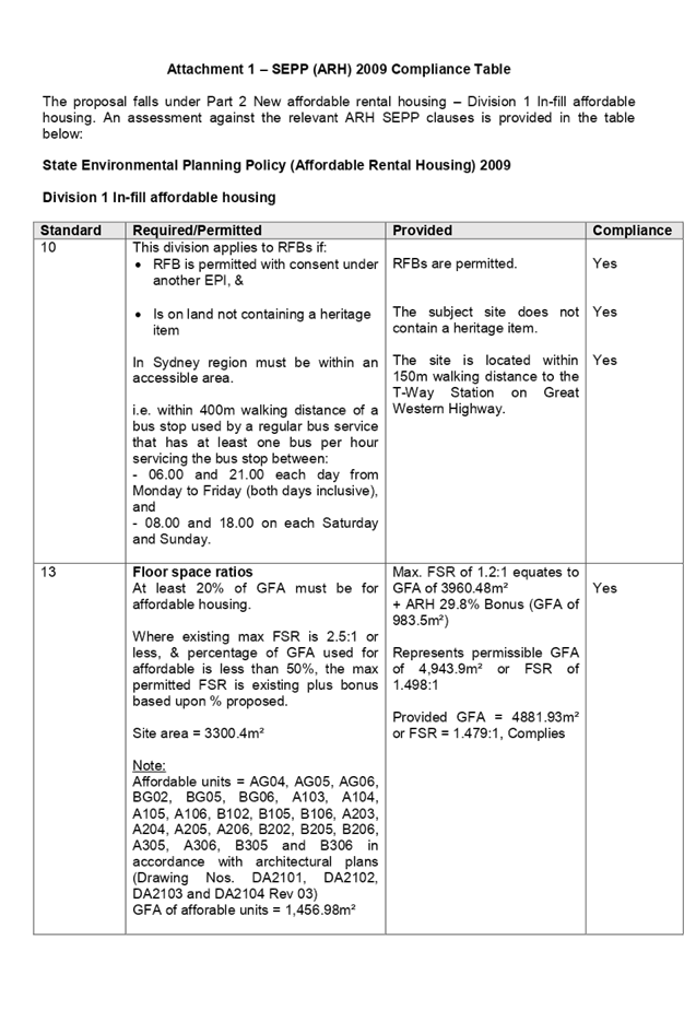
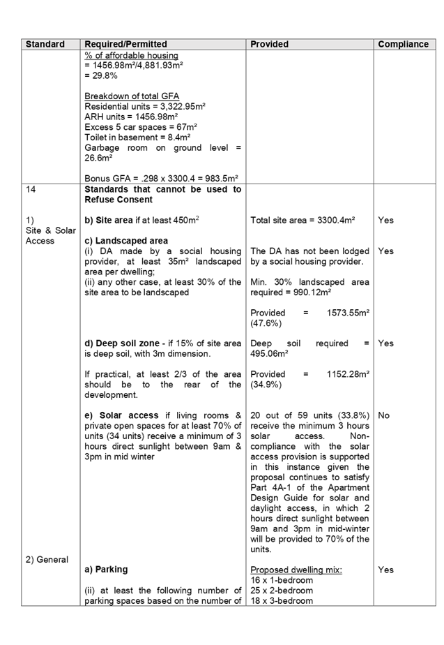
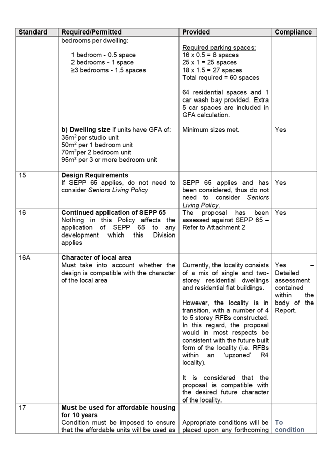

DOCUMENTS
ASSOCIATED WITH
REPORT LPP028/19
Attachment 2
ADG Compliance Table
Cumberland Local Planning Panel Meeting
8 May 2019

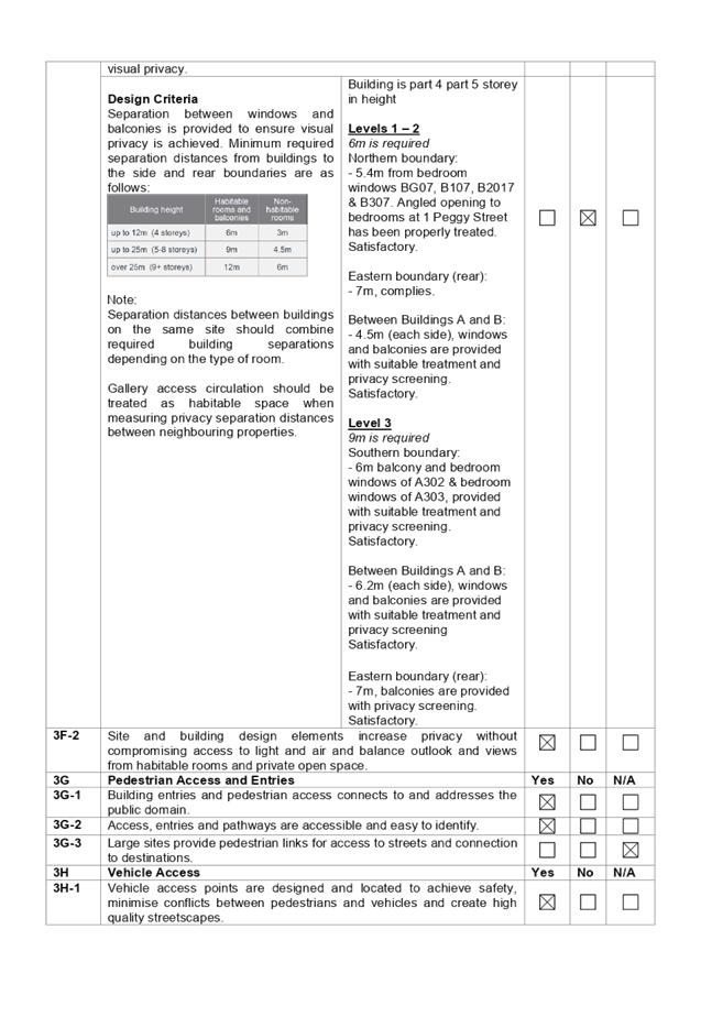
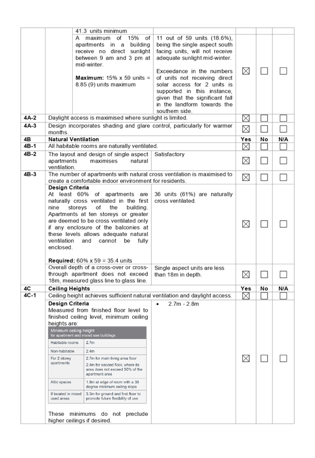
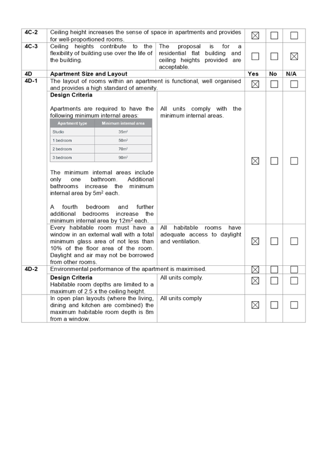
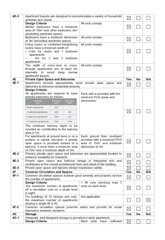

DOCUMENTS
ASSOCIATED WITH
REPORT LPP028/19
Attachment 3
HLEP 2013 Compliance Table
Cumberland Local Planning Panel Meeting
8 May 2019
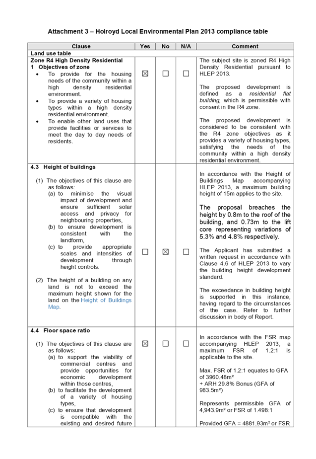
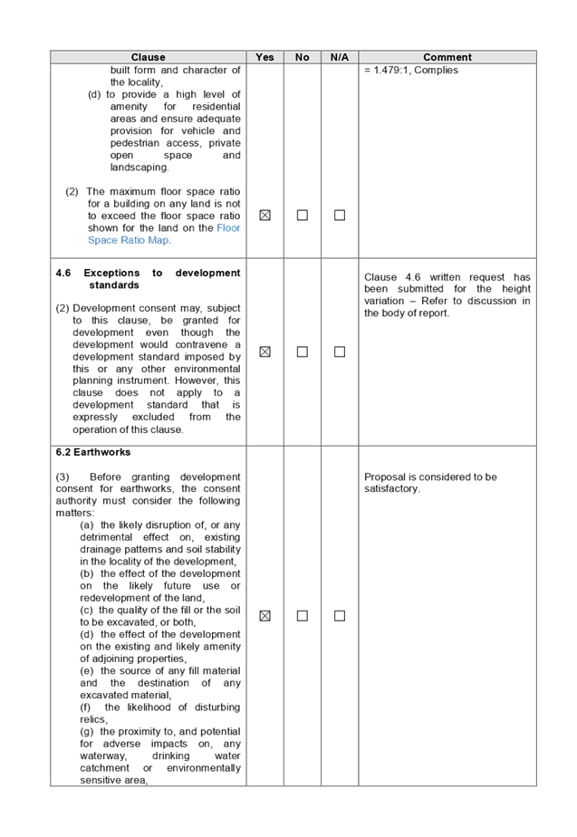

DOCUMENTS
ASSOCIATED WITH
REPORT LPP028/19
Attachment 4
HDCP Compliance Table
Cumberland Local Planning Panel Meeting
8 May 2019
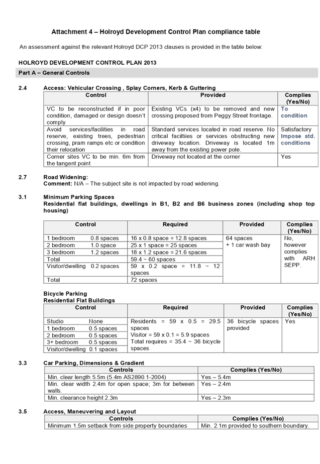
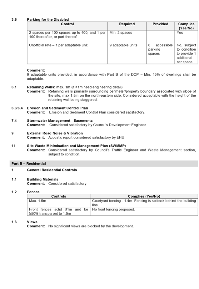
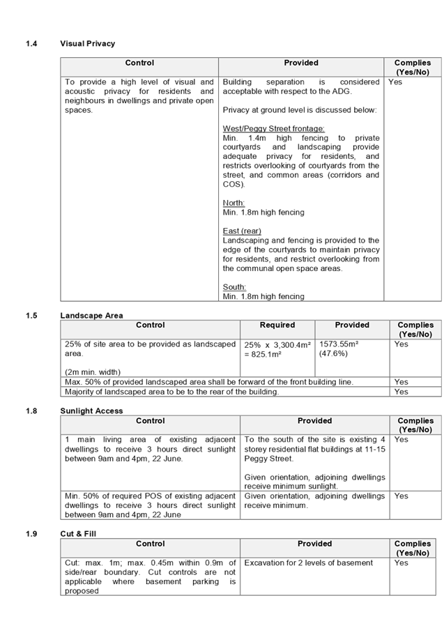
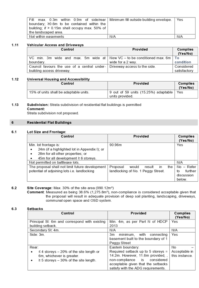
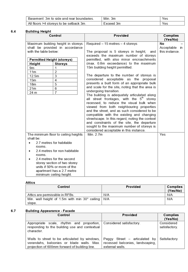
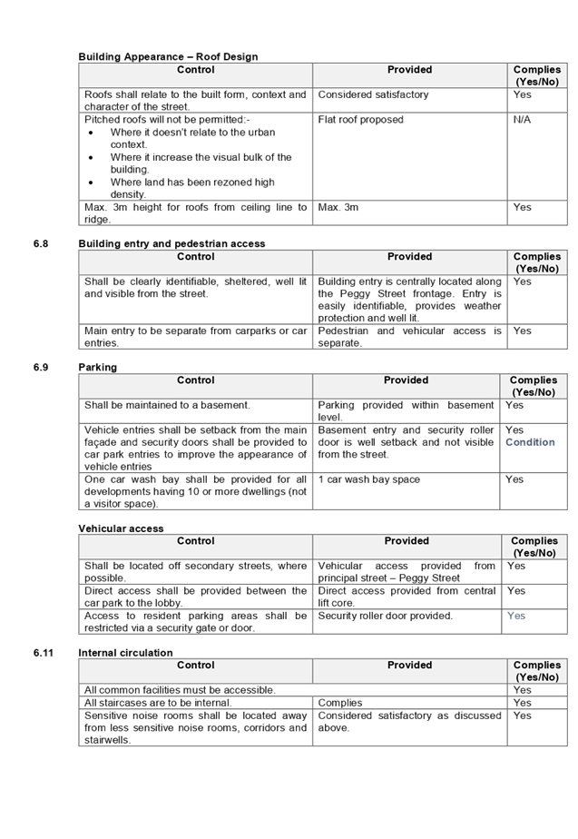
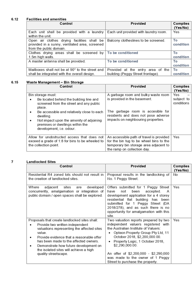
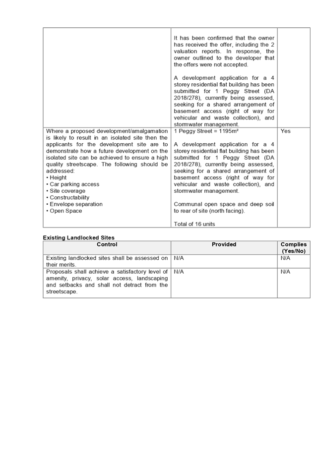
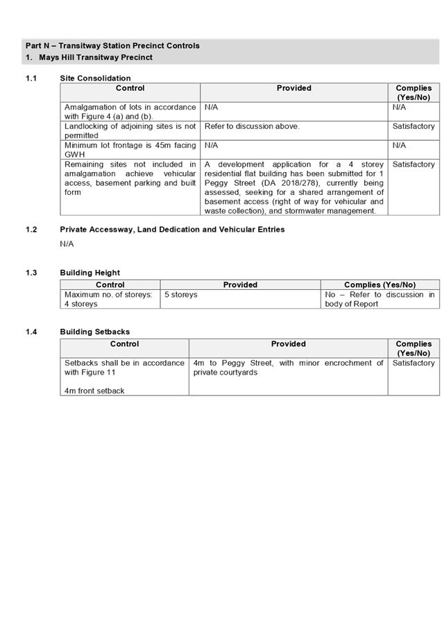
DOCUMENTS
ASSOCIATED WITH
REPORT LPP028/19
Attachment 5
Draft Notice of Determination
Cumberland Local Planning Panel Meeting
8 May 2019
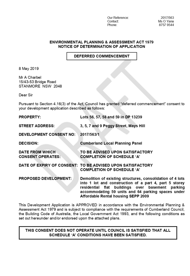
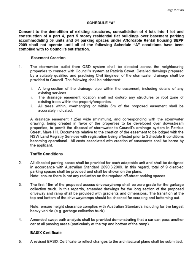

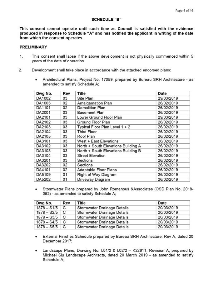
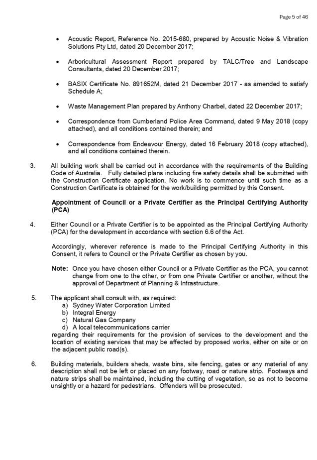
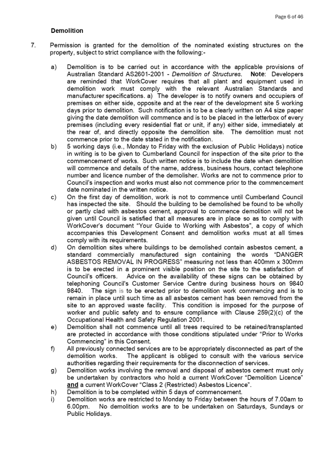


DOCUMENTS
ASSOCIATED WITH
REPORT LPP028/19
Attachment 6
External Architectural Plans
Cumberland Local Planning Panel Meeting
8 May 2019
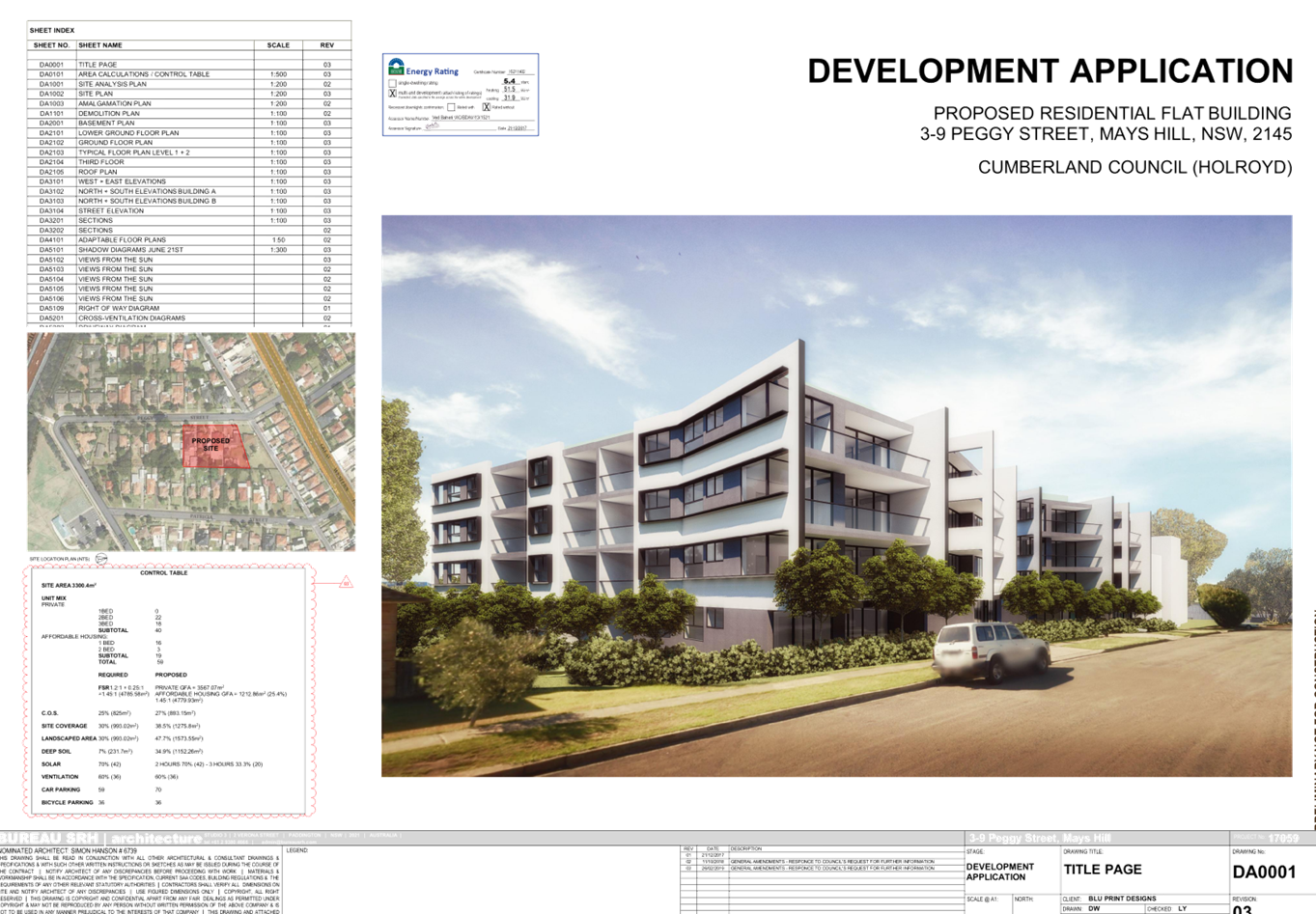
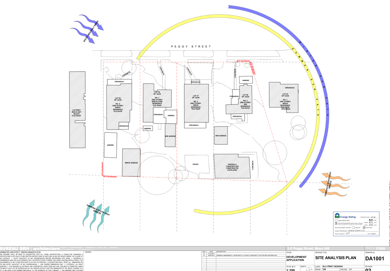
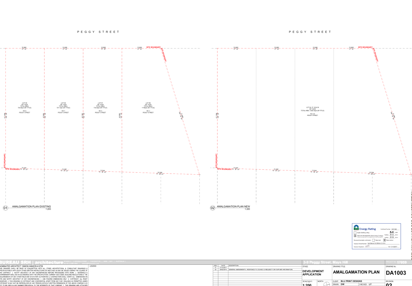
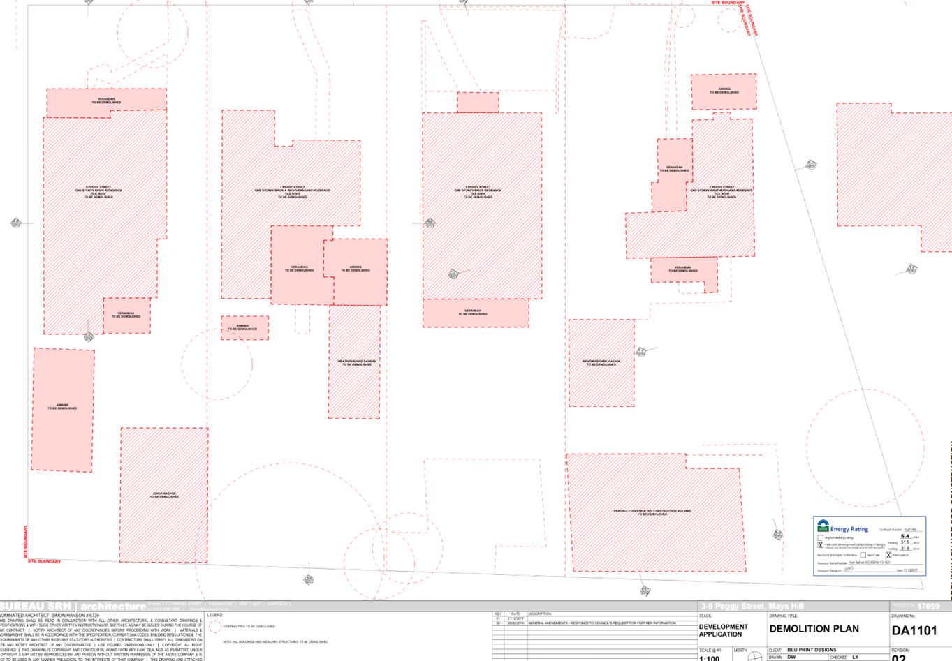
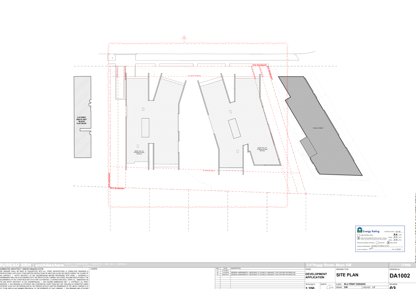
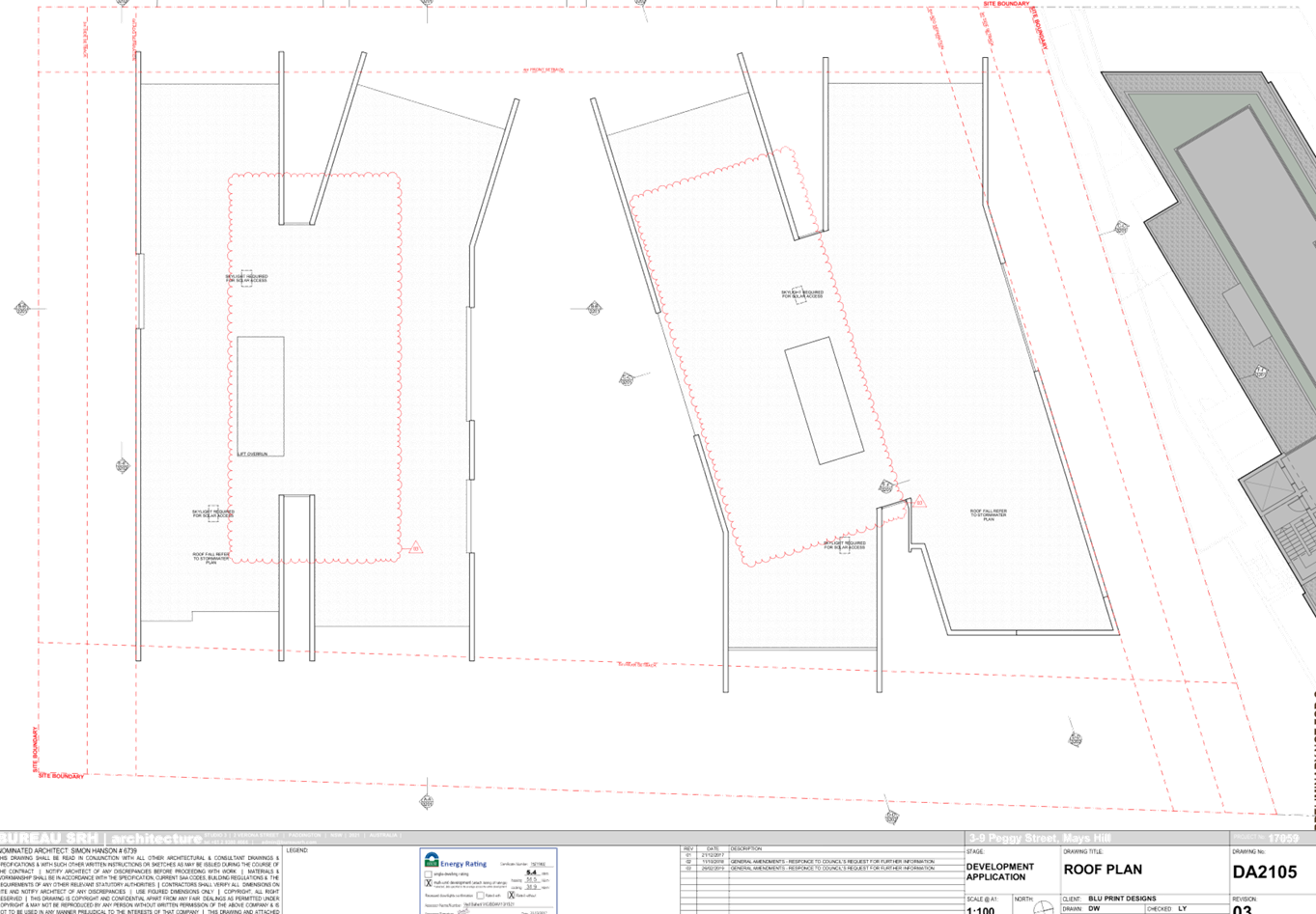
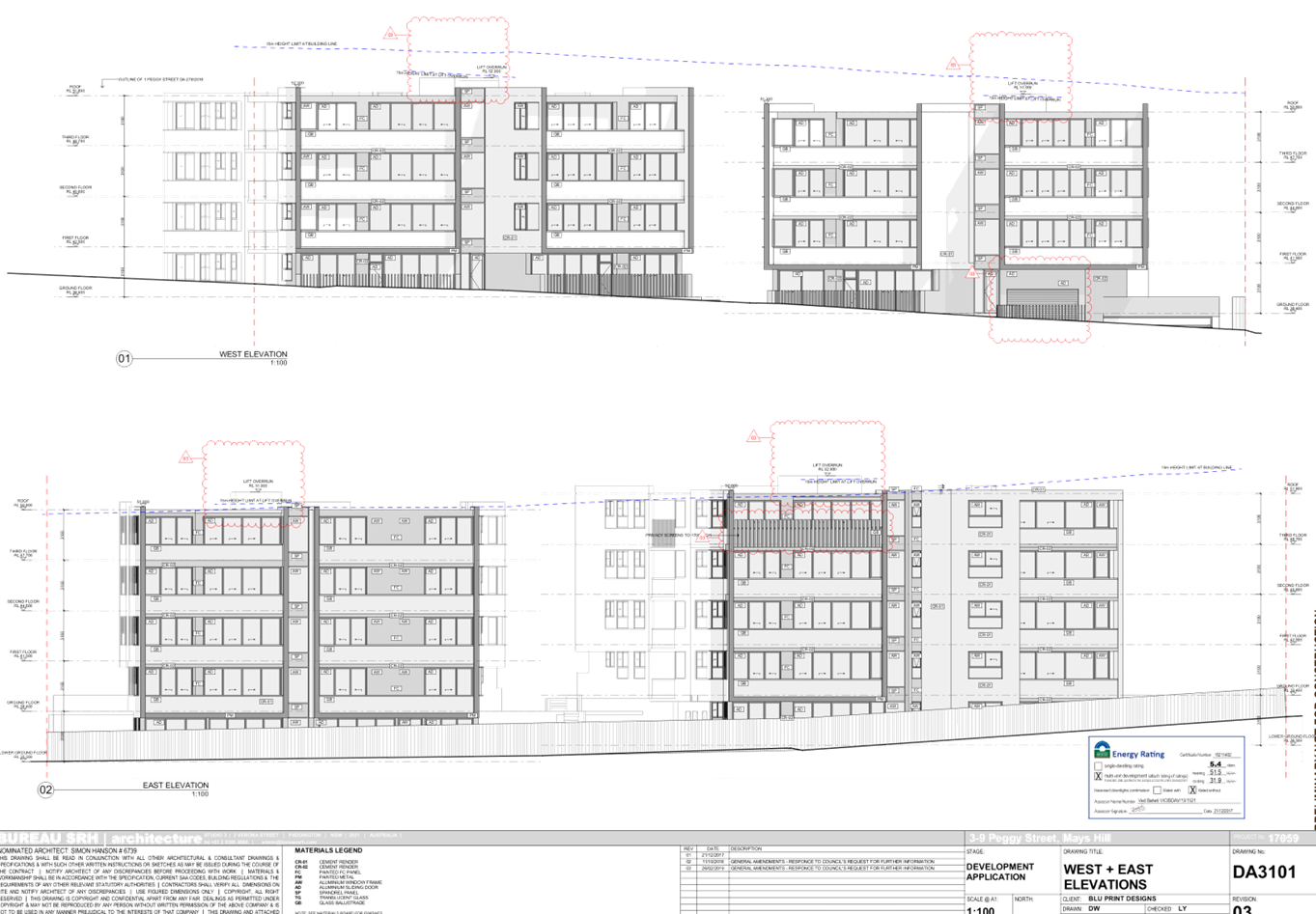
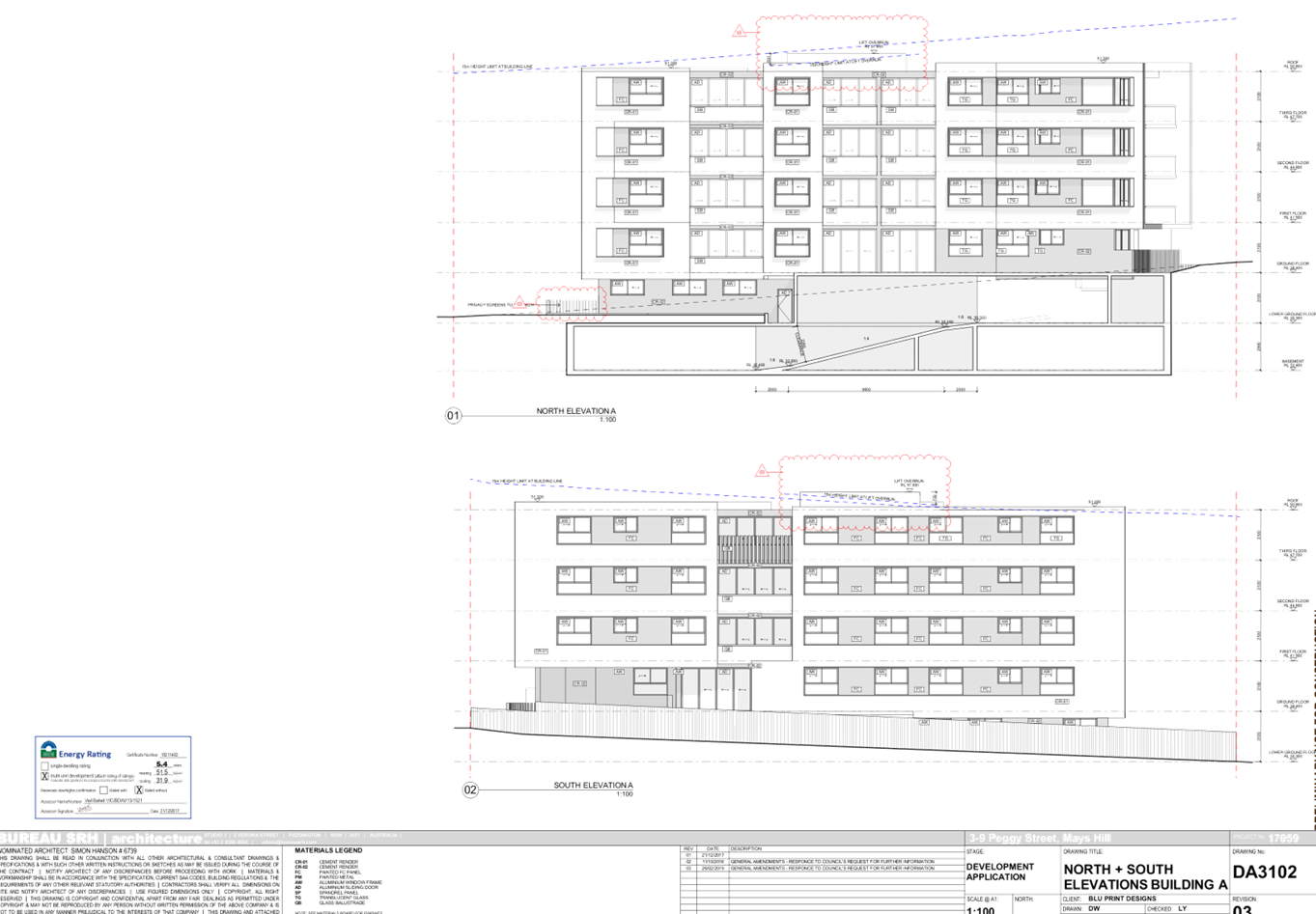
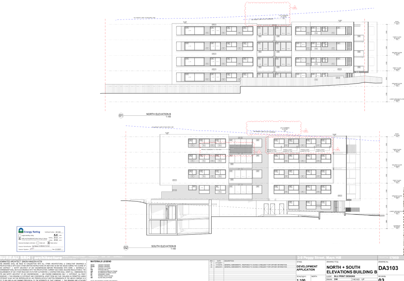
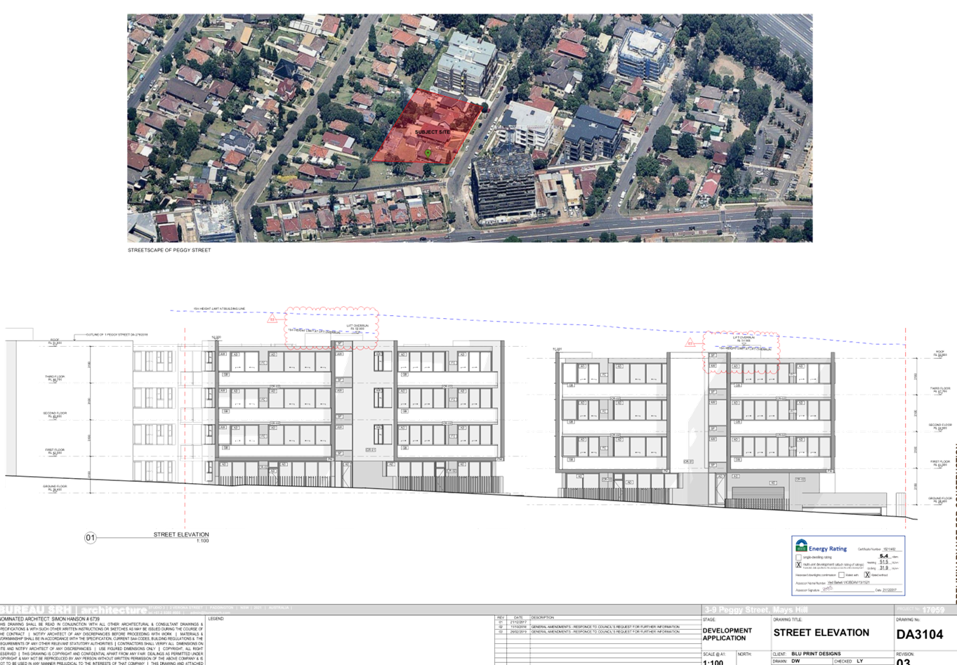
DOCUMENTS
ASSOCIATED WITH
REPORT LPP028/19
Attachment 7
Internal Architectural Plans
Cumberland Local Planning Panel Meeting
8 May 2019

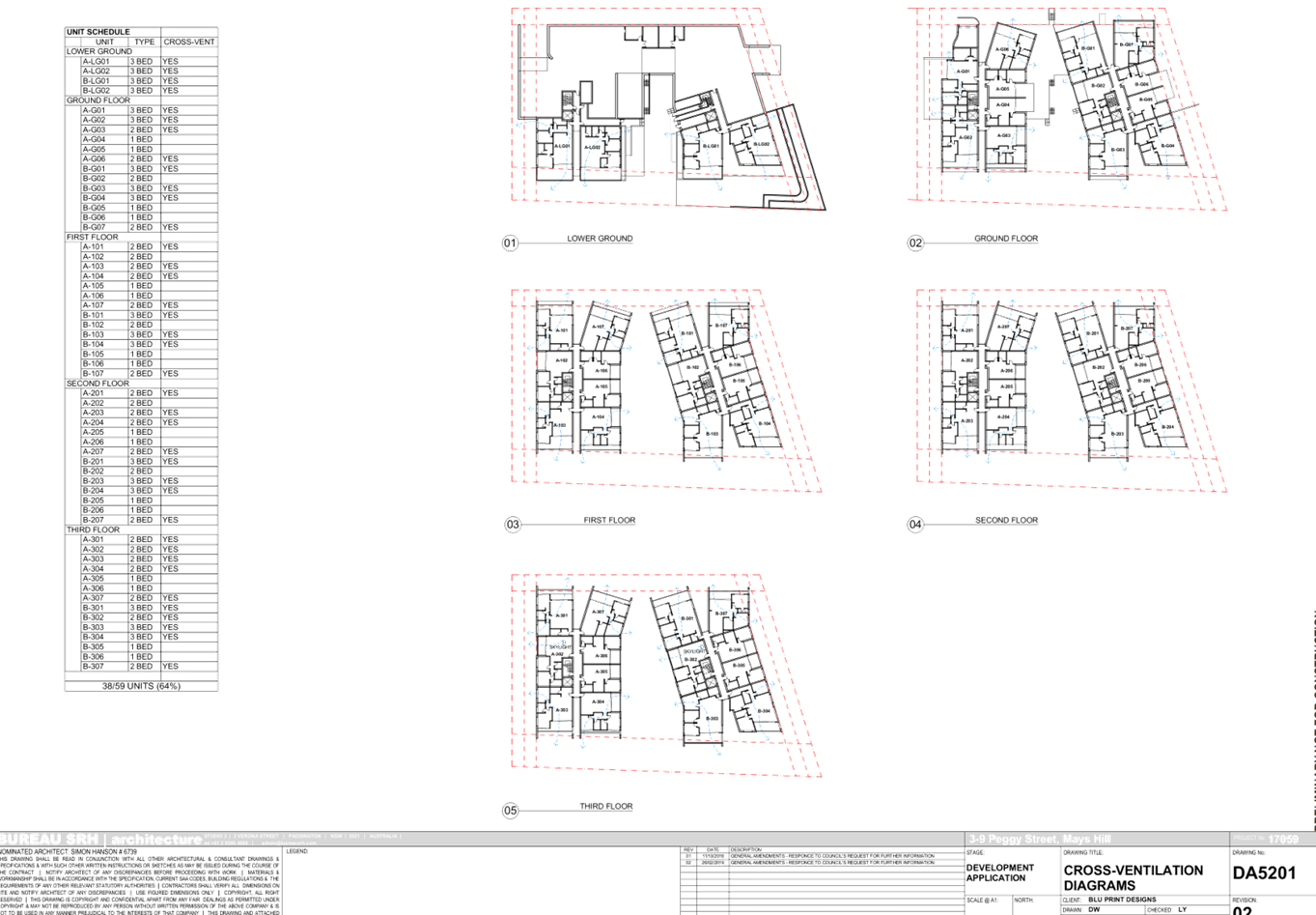

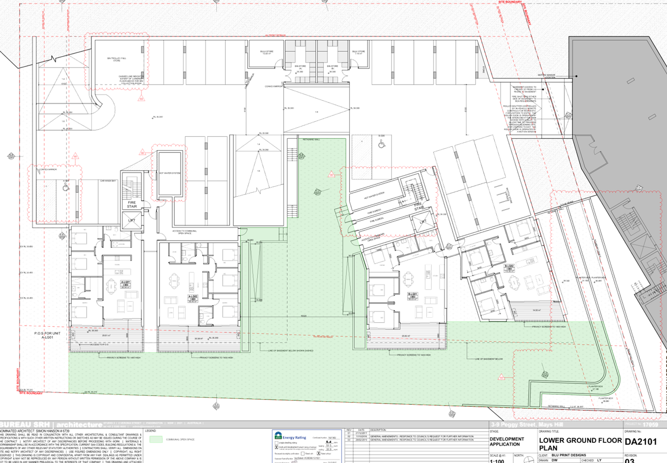
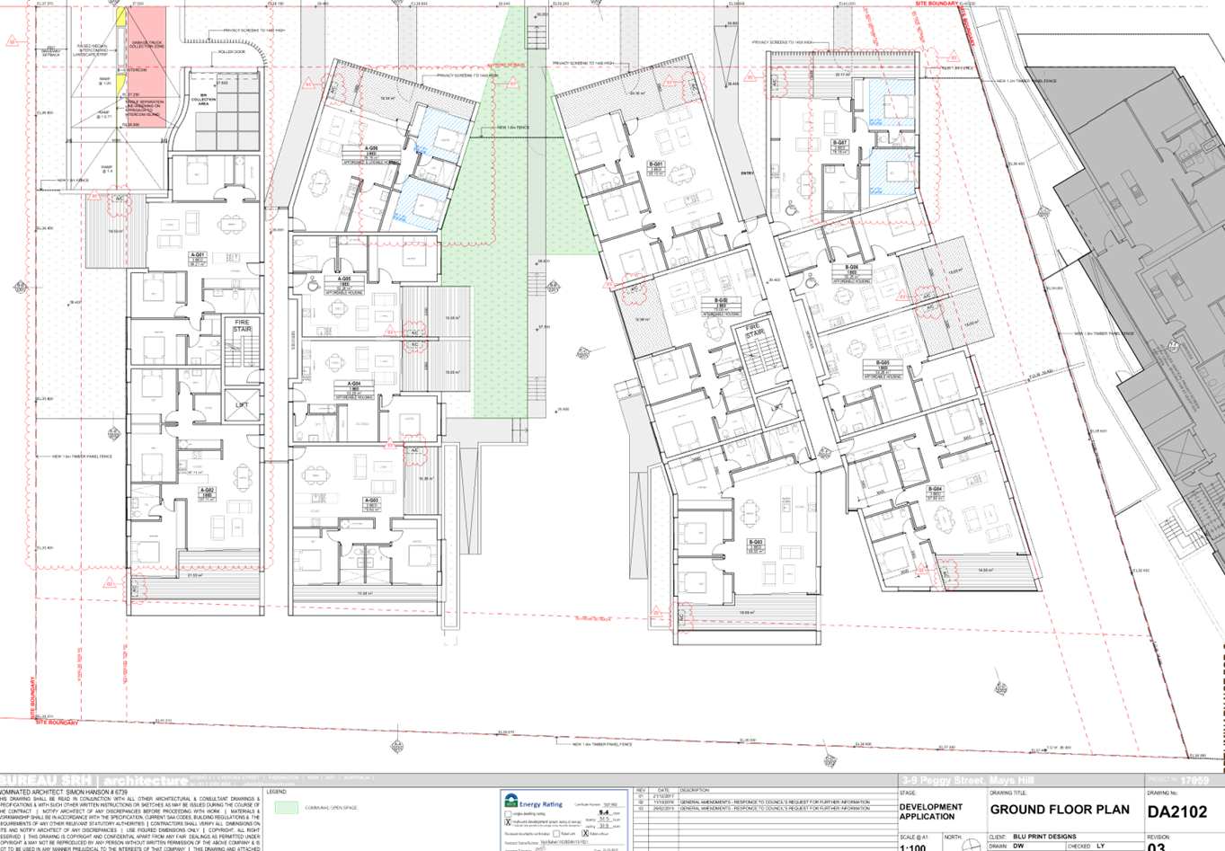
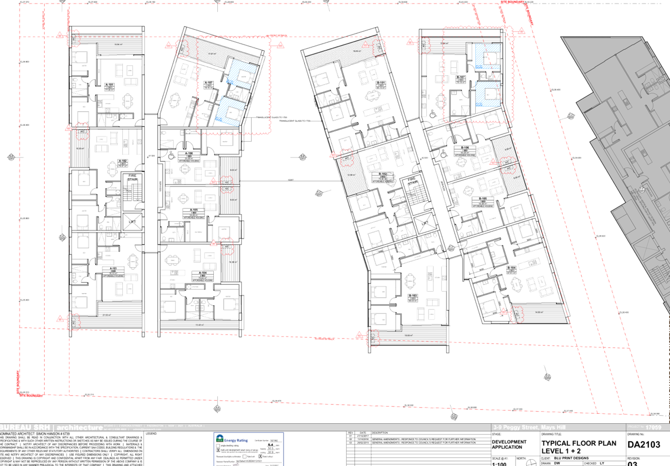
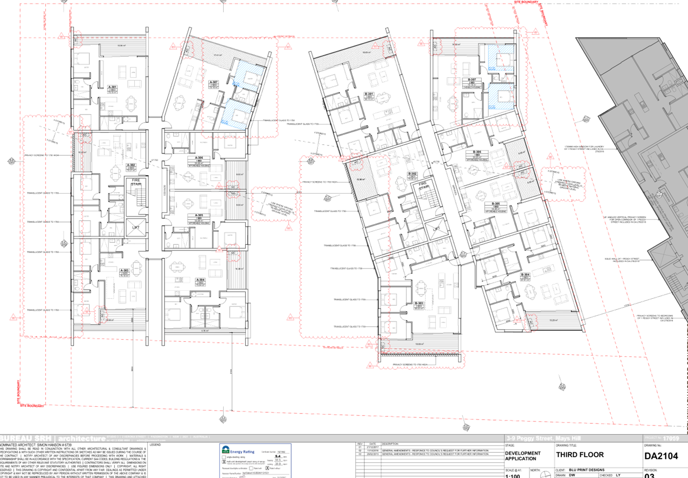
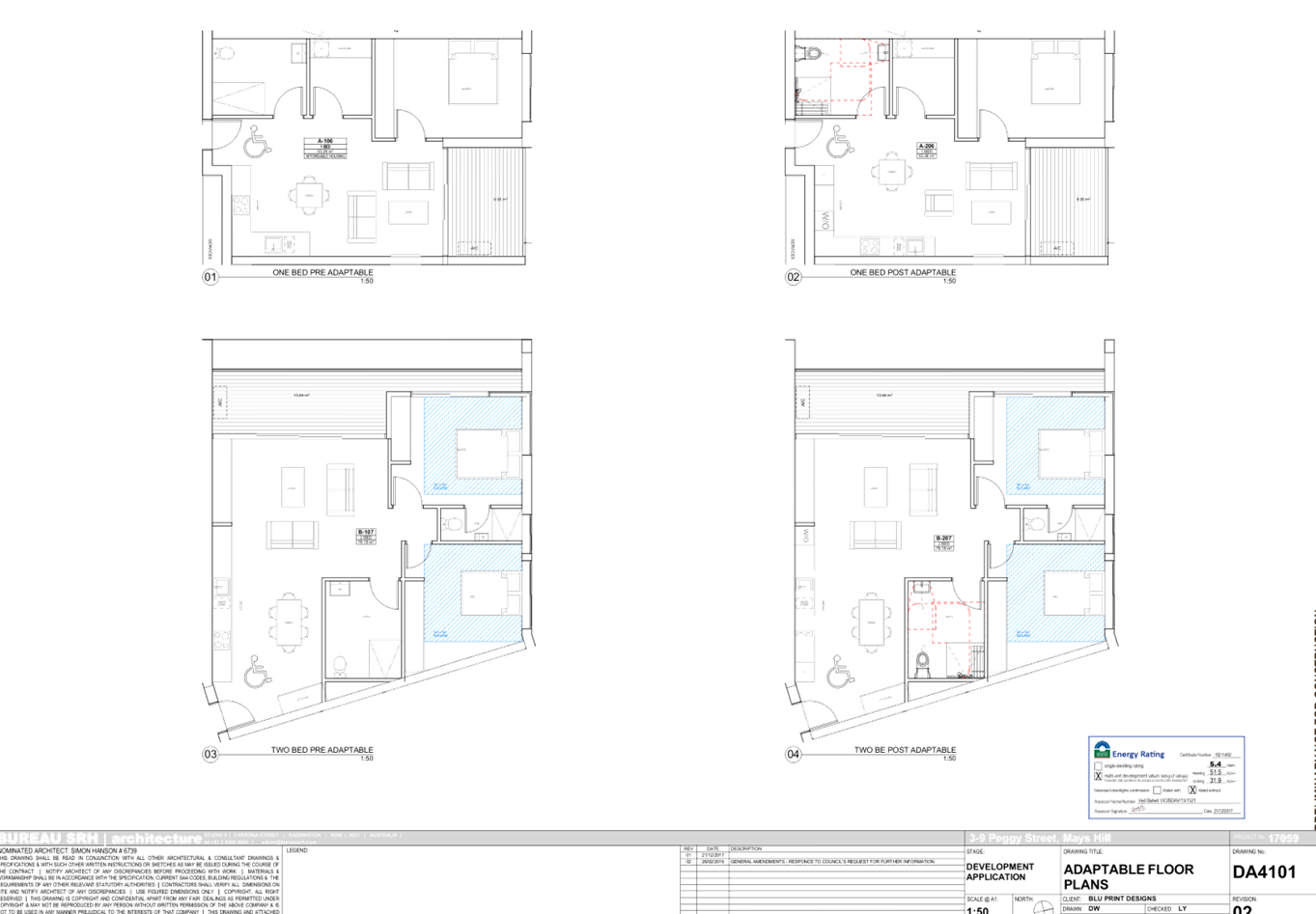
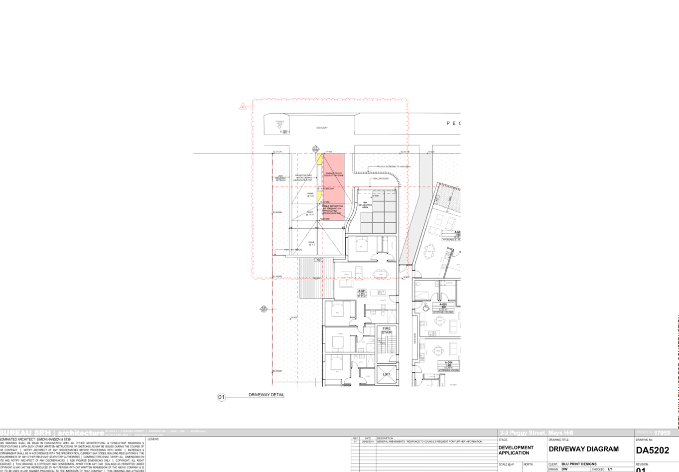
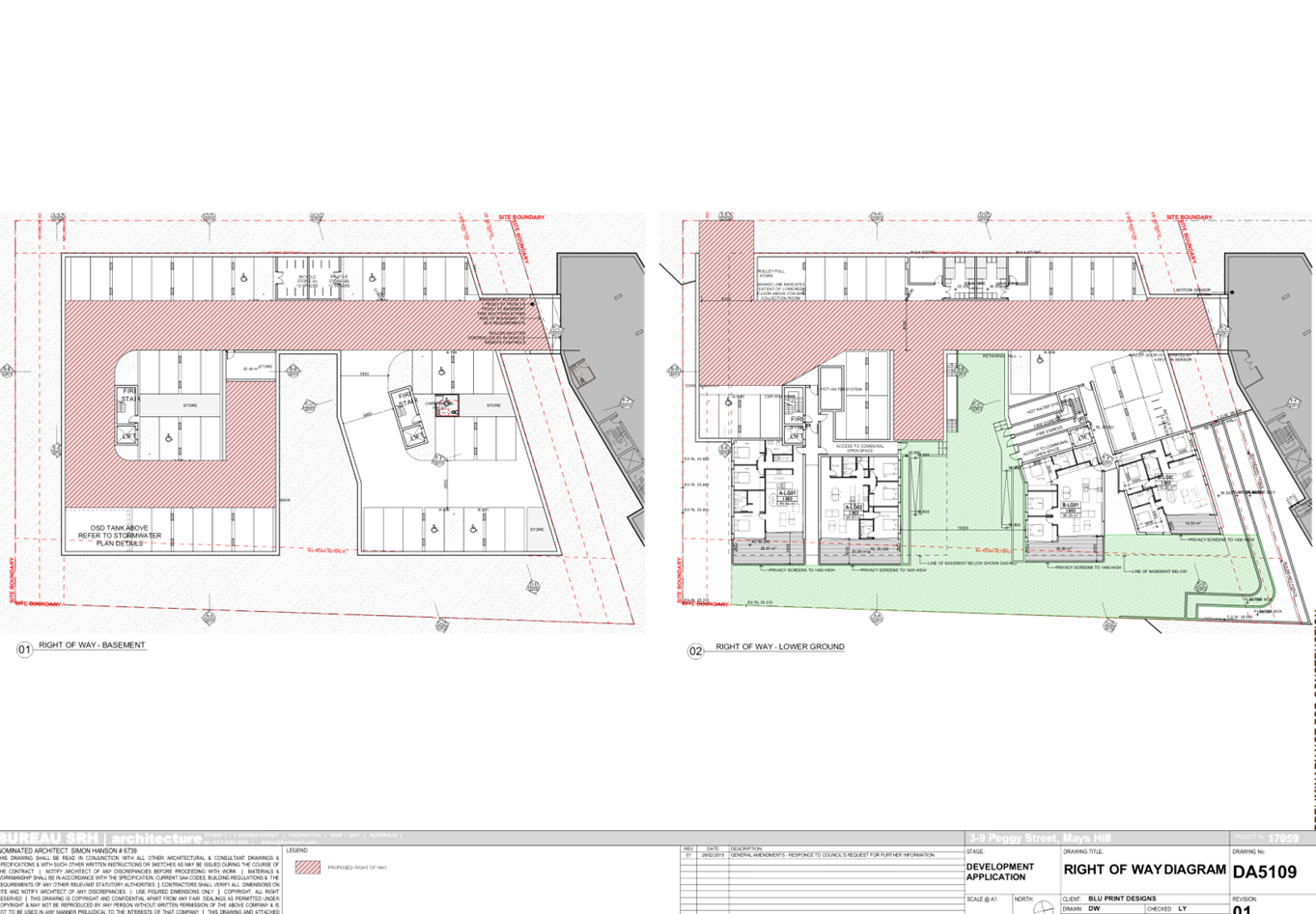
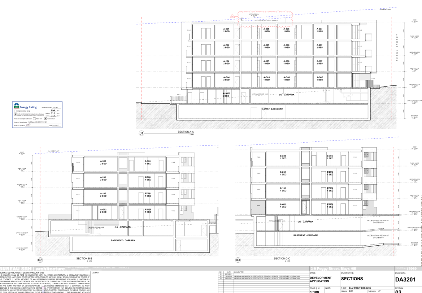
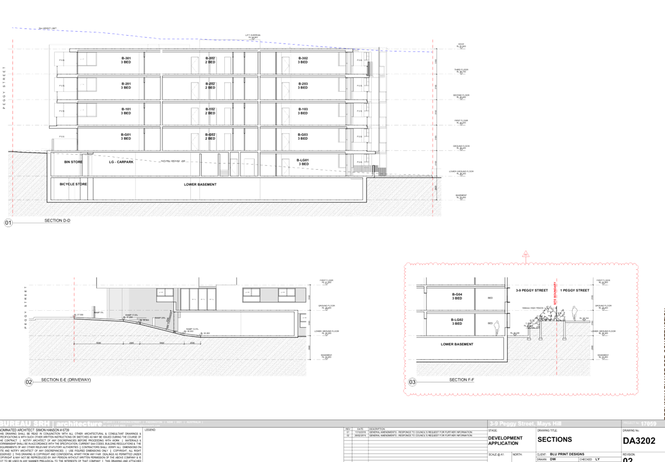
DOCUMENTS
ASSOCIATED WITH
REPORT LPP028/19
Attachment 8
Landscape Plan
Cumberland Local Planning Panel Meeting
8 May 2019
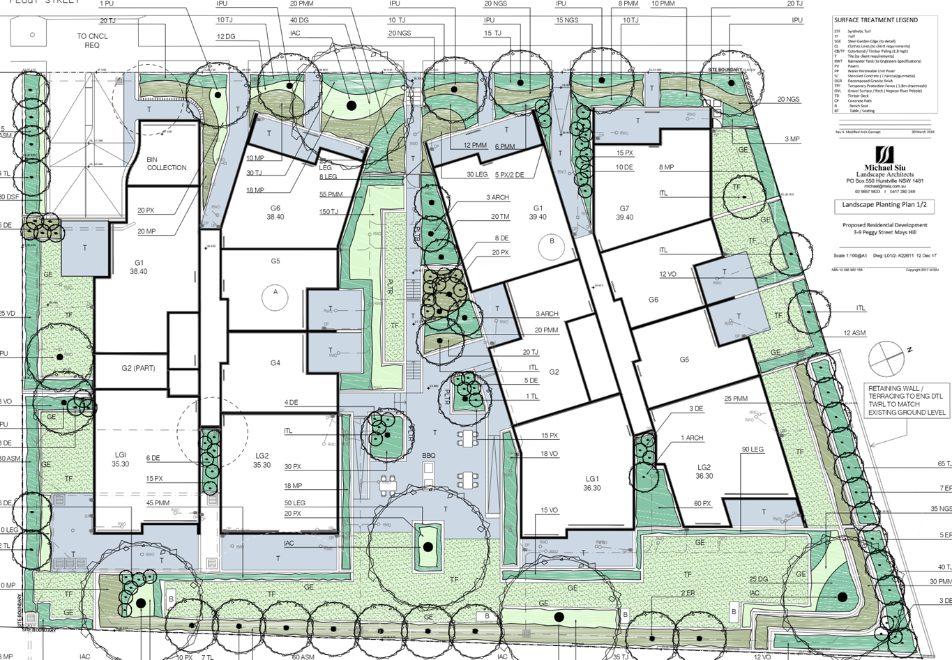
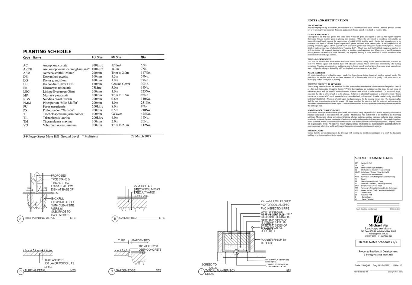
DOCUMENTS
ASSOCIATED WITH
REPORT LPP028/19
Attachment 9
Solar Diagram
Cumberland Local Planning Panel Meeting
8 May 2019
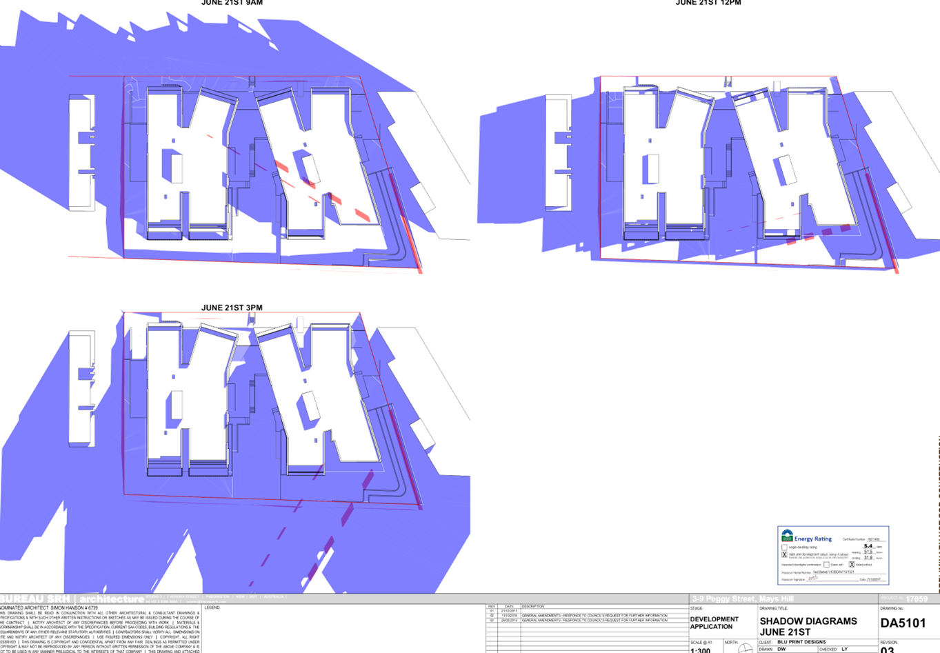
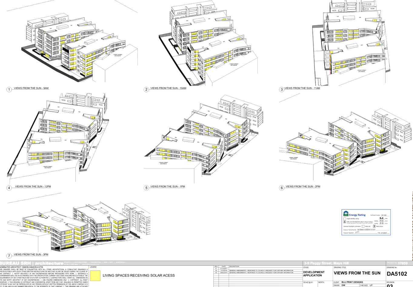
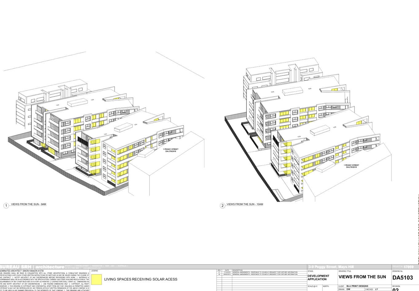
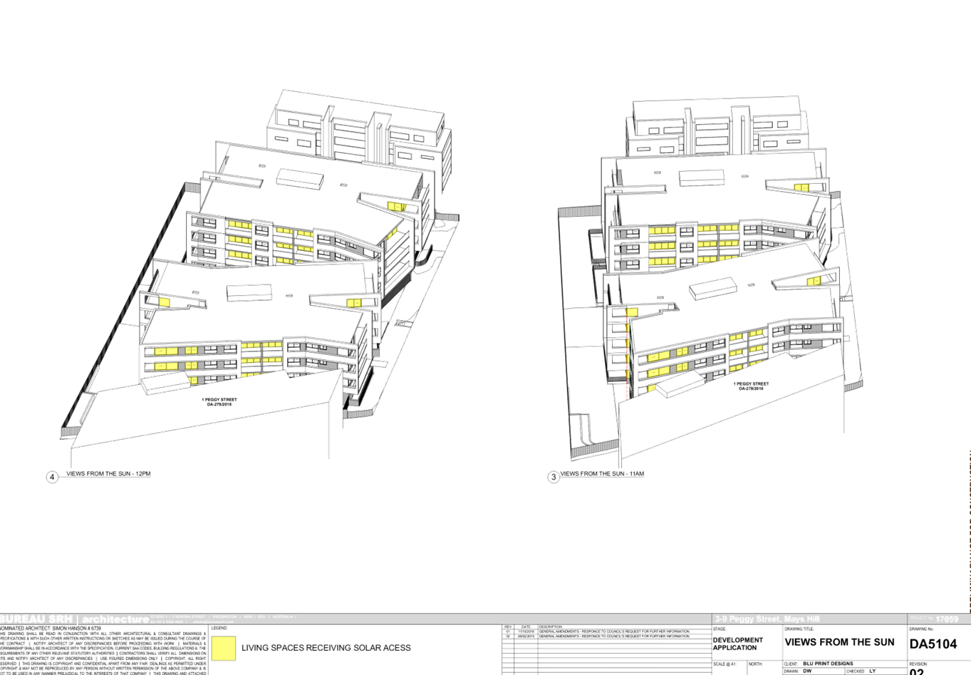
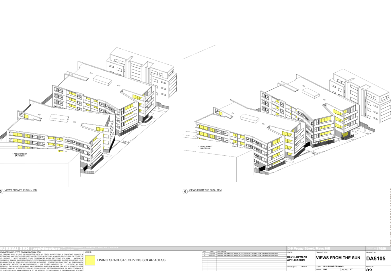
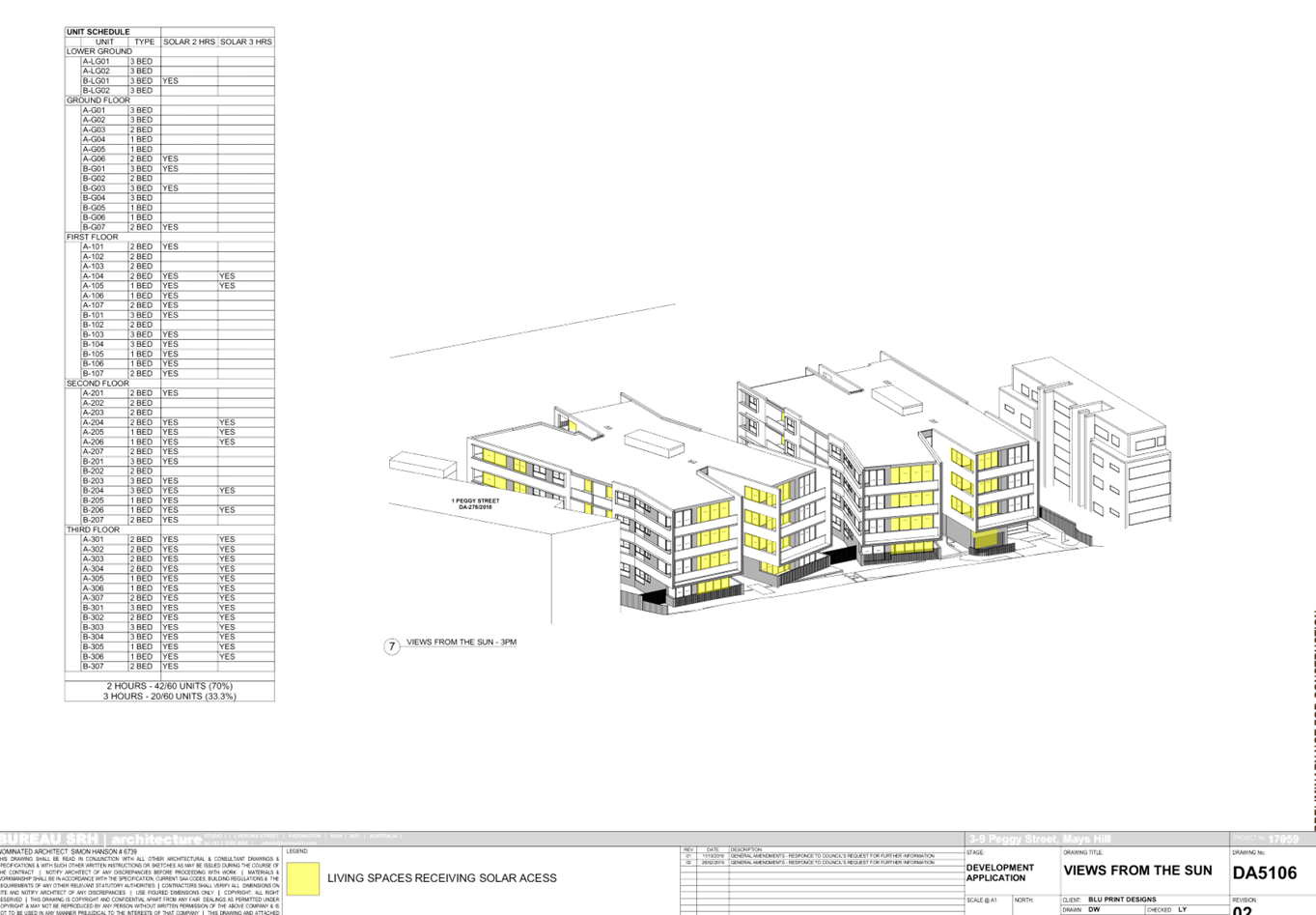
DOCUMENTS
ASSOCIATED WITH
REPORT LPP028/19
Attachment 10
Clause 4.6 Variation request to Building Height
Cumberland Local Planning Panel Meeting
8 May 2019
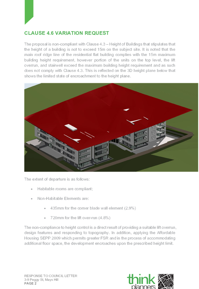
DOCUMENTS
ASSOCIATED WITH
REPORT LPP028/19
Attachment 11
DA 2018/278 1 Peggy Street Mays Hill Architectural
Plans
Cumberland Local Planning Panel Meeting
8 May 2019

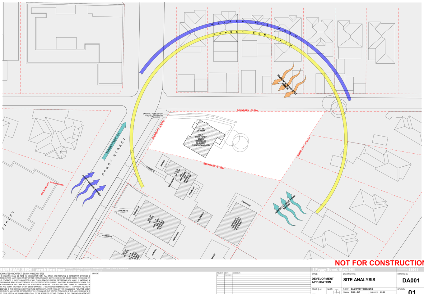
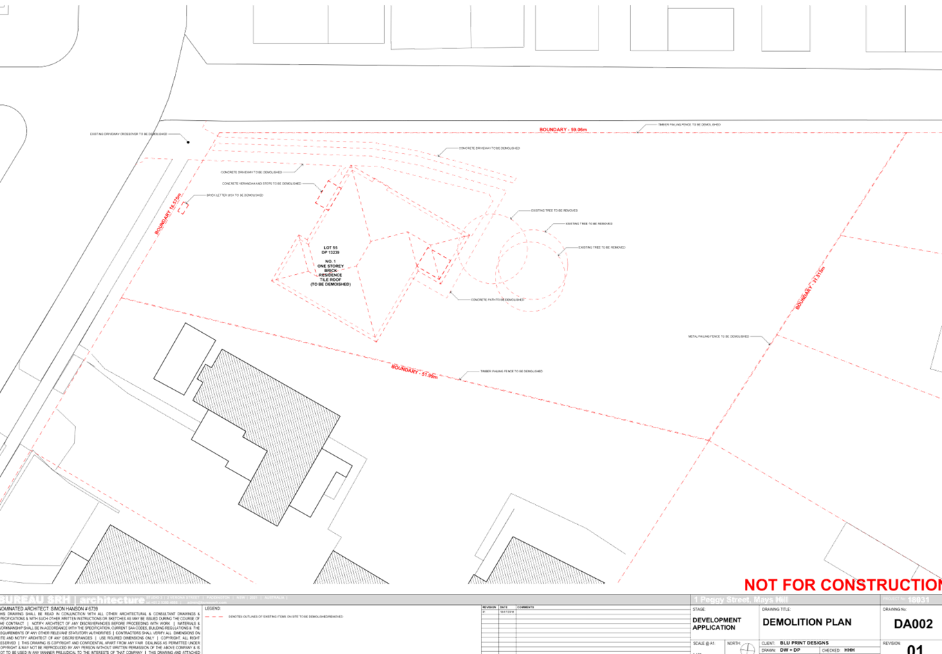
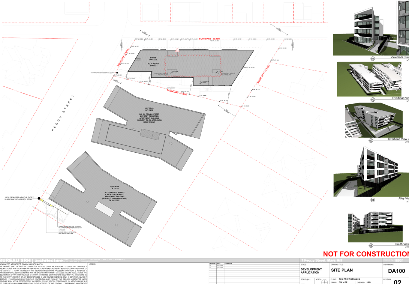


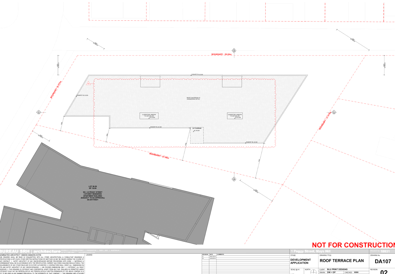
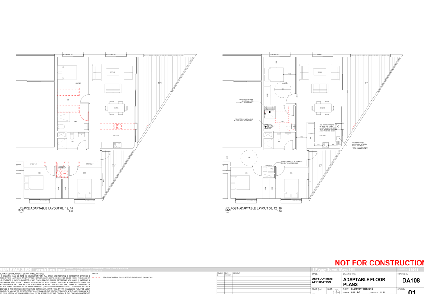
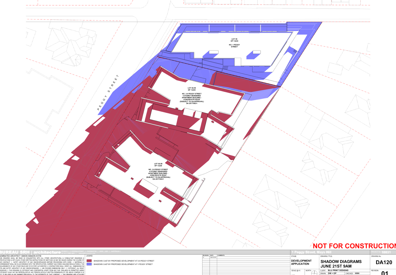

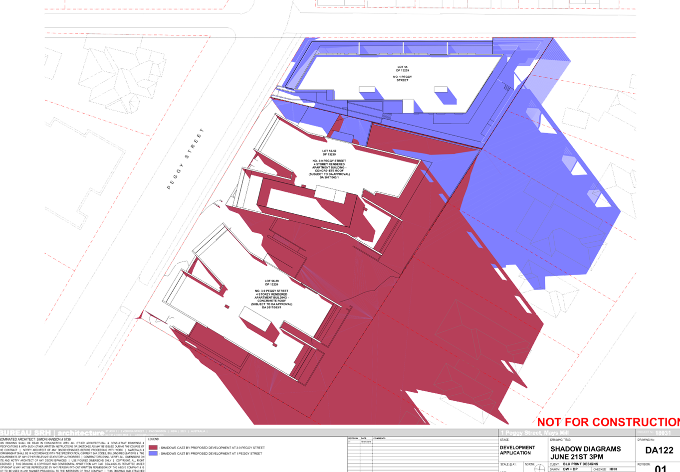
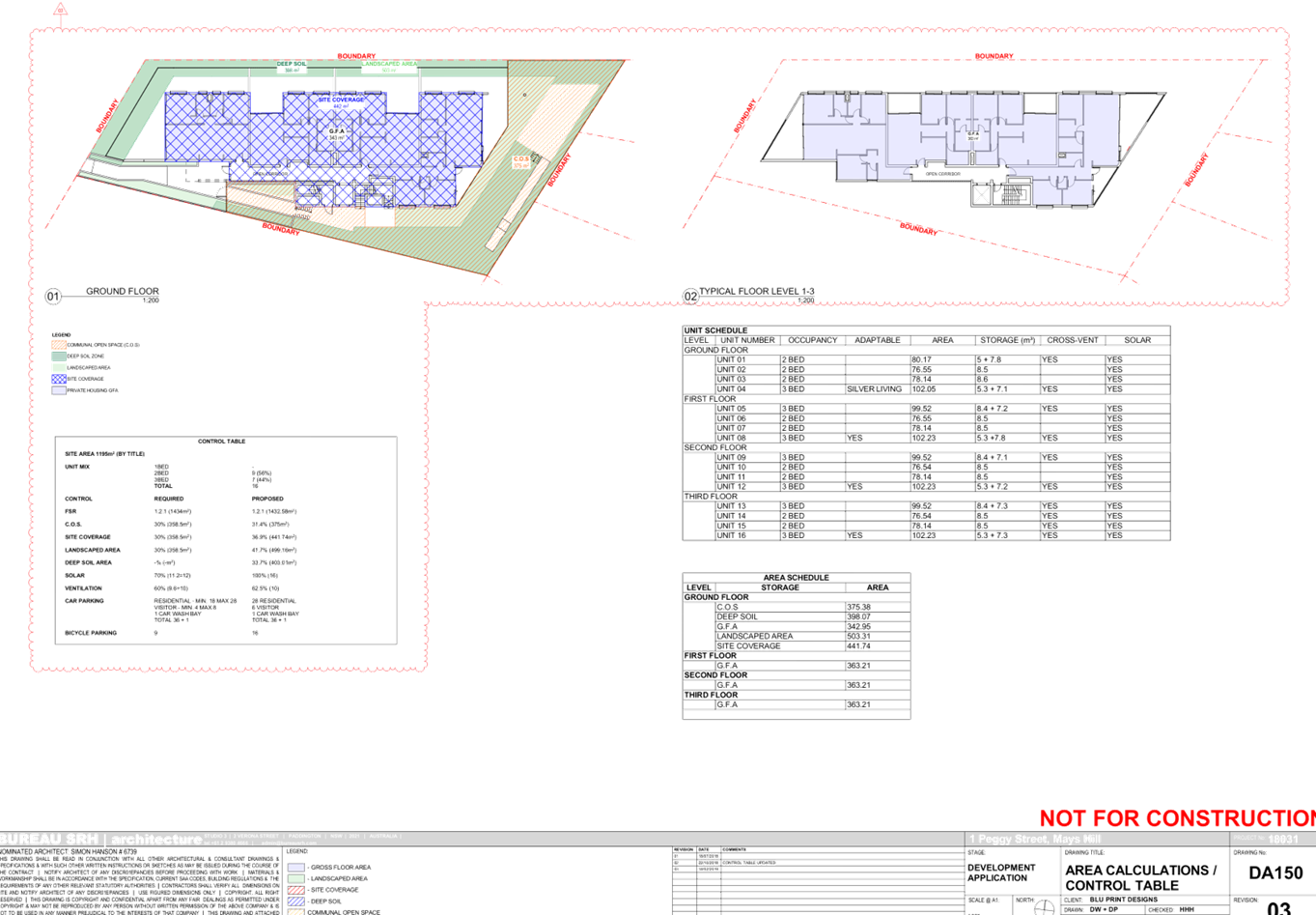
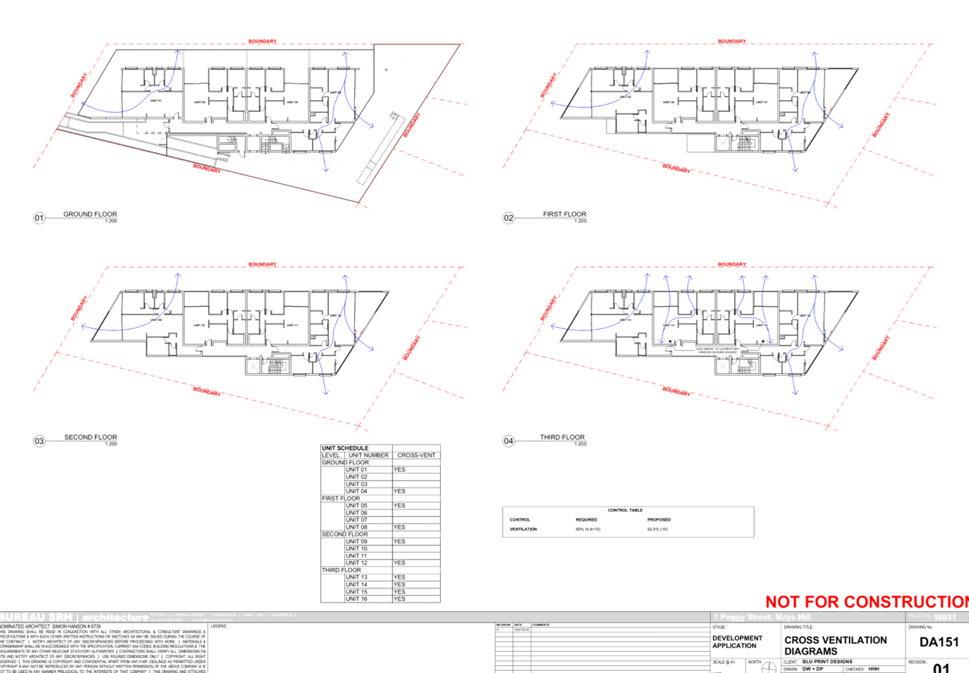

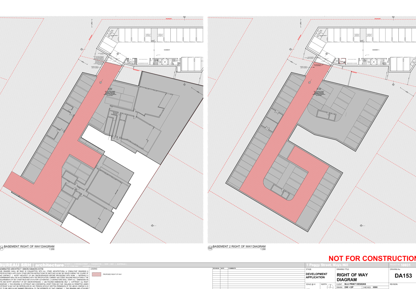
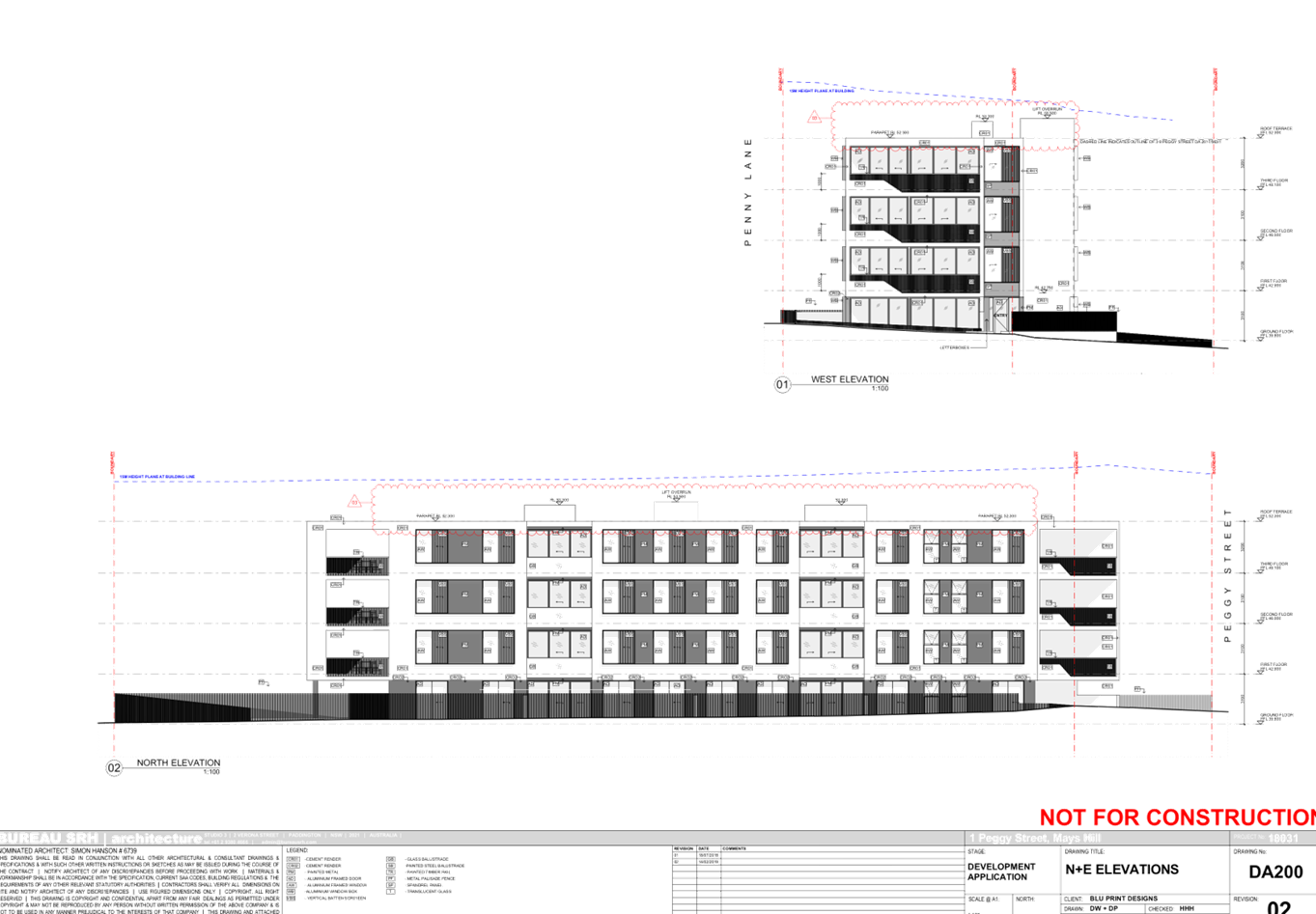
DOCUMENTS
ASSOCIATED WITH
REPORT LPP028/19
Attachment 12
Public Submission
Cumberland Local Planning Panel Meeting
8 May 2019
Cumberland
Local Planning Panel Meeting
8 May 2019
Item No: LPP029/19
Development
Application for 216 William Street, Granville
Responsible
Division: Environment
& Planning
Officer: Manager
Development Assessment
File
Number: DA
-348/2018
|
Application
lodged
|
16 November 2018.
|
|
Applicant
|
Mr L Ochwada.
|
|
Owner
|
Ochwada Pty Ltd.
|
|
Application
No.
|
DA-348/2018.
|
|
Description
of Land
|
216 William Street Granville
being Lot 10 in DP 5739.
|
|
Proposed
Development
|
Demolition of existing
dwelling and associated structures and construction of a three storey
boarding house with basement car parking and on site landscaping.
|
|
Site
Area
|
919.8 Square metres.
|
|
Zoning
|
R4 High Density Residential
Zone.
|
|
Disclosure
of political donations and gifts
|
Nil disclosure.
|
|
Heritage
|
The site is not listed as a
heritage item within the Parramatta Local Environmental Plan 2011.
|
|
Principal
Development Standards
|
Floor space ratio
Permissible: - 0.8:1 however a
bonus floor space ratio of 0.5:1 may be applied resulting in a maximum floor
space ratio of 1.3:1.
Proposed:-1.13:1.
Height of Building
Permissible: - 11 Metres.
Proposed: - Maximum 10.4
metres.
|
|
Issues
|
Car parking numbers on site.
Submissions.
|
1. Development
Application Number 348/2018 was received on the 21 November 2018 for the
demolition of existing dwelling and associated structures and construction of a
three storey boarding house over basement parking and landscaping.
2. The
application was publicly notified to occupants and owners of the adjoining
properties for a period of thirty six (36) days between Tuesday December 4 2018
and Tuesday 8 January 2019. There were thirty four (34) submissions, including
one submission containing a petition with thirteen (13) signatures received.
3. The
variations to the development are:-
|
Control
|
Required
|
Provided
|
% variation
|
|
Clause 29(2)(e) of State Environmental Planning Policy
“Affordable Rental Housing” 2009.
Car parking.
|
18
|
7
|
11 spaces 0r 61.2%.
|
|
Table 5.1.4.6 (Parramatta Development Control Plan
Internal common living area
|
All boarding houses are to provide a common living area of
a minimum 20 square metres in area with a further 1.5 square metres per
resident where resident numbers exceed 12 persons.
101 square metres is needed.
|
77 square metres.
|
23.7%
|
4. The
application is recommended for “Deferred Commencement Consent”
subject to the conditions as provided in the attached schedule to address
stormwater issues.
5. The
application is referred to the Panel as the development is considered to be
contentious.
Subject Site And Surrounding
Area
The site is located at 216 William
Street Granville and has the following dimensions:-
· North
West boundary being the William Street boundary - 20.12 metres.
· South
east boundary - 20.115 metres.
· North
east boundary - 45.455 metres.
· South
west boundary being the Carhullen Street boundary - 45.72 metres.
This provides a site area of 919.8
square metres.
There is a single storey dwelling
house with an attached garage situated on the site. A steel shed is situated at
the rear. There are ten trees situated across the site that provides much shade
to the rear yard however a number of the trees are suffering from decline.
The land has a fall of between 880
mm and 1,070 mm towards William Street and a fall of between 260 mm and 450 mm
toward Carhullen Street.
The site is situated within a
residential area of Granville in which:-
· Three
storey apartment buildings predominate along the western side of William Street
except for 227, 229 and 231 William Street.
· There
is one property numbered 66 and 68 Railway Terrace close by which has a rear
yard fronting onto William Street. That site comprises dwelling houses and a
truck depot.
· There
is an apartment building to the immediate north at 210 to 214 William Street
which is almost complete.
· There
is a dwelling house at 11 Carhullen Street to the east.
The site is shown below:
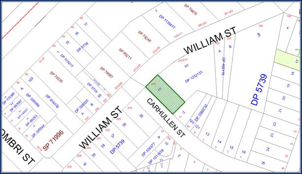
The
site is shown in the aerial photo below.
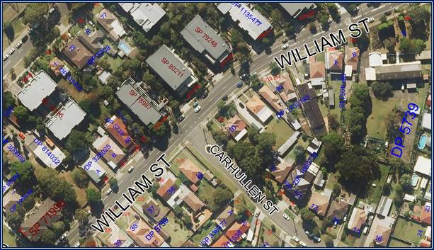
Photos
of the site are provided below.
Photos
1 and 2:- Single storey dwelling house on site from the street and from the
rear yard.
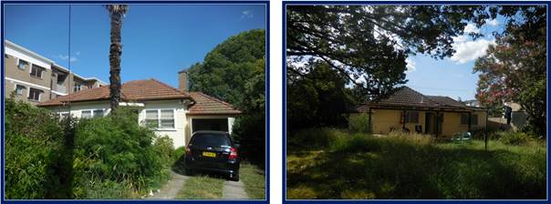
Photos
3 and 4:- There are powerlines adjacent to the curtilage of the property
including power poles. However the poles are not affected by proposed works and
construction work is occurring more than 5 metres from the
cables.
Photos
5 and 6:- The adjoining development to the north at 210 to 214 William Street
(Photo 9) is an apartment complex (3 storeys) and nearing completion. The
adjoining development to the south east in Carhullen Street (Photo 10) is a single
storey dwelling house and an attached dual occupancy within a different zone
being R3 (Medium Density Residential).
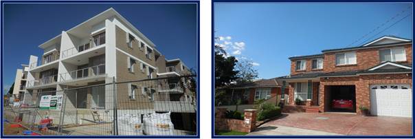
Photo
7:- The streetscape of William Street is transitioning into apartment
buildings, all of which are three storeys in height.
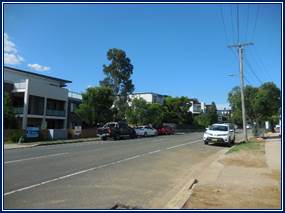
Description of The Proposed
Development
The development application is
seeking consent for the demolition of the dwelling house, removal of the shed
and most trees on site and construction of a three storey boarding house with
one level of basement car parking. The development comprises the following:-
Demolition work
The dwelling house will be
demolished and most of the existing trees on site will be removed to facilitate
a cleared site.
Excavation work
Excavation to a depth of 3.2
metres below the natural ground level is proposed. The excavation works will
enable a basement car park to be constructed with enough room for parking seven
(7) vehicles plus one additional space to allow for turning vehicles. It is
estimated that 1,150 cubic metres of spoil will need to be removed to
facilitate construction of the basement car park.
Construction of a basement car
park
The plans show the basement car
park occupying an area of 457 square metres and having room for parking eight
(8) vehicles. Notwithstanding this, one (1) car space will need to be dedicated
for a vehicle turning bay to allow vehicles to turn around and leave in forward
motion. As such, the basement car park will have seven (7) spaces. There are
two car parking spaces shown for people with disabilities. There is room for a
ramp, parking five motor cycles and seven bikes. A lift is provided that
connects the basement to the upper levels of the building.
Construction of a boarding
house
A three storey boarding house
incorporating thirty five (35) boarding rooms is proposed. The building
incorporates the following features:-
· Thirty
five (35) boarding rooms divided into thirty three (33) double rooms and two
(2) single rooms which includes a manager’s room.
· One
internal common living space per floor.
· A
solar panel system on the roof of the building to generate up to 6 kW of power
for the building.
At the conclusion of the works,
the plans show the creation of landscaping across the site, especially across
the rear, a drying court and a waste store room.
History
A pre lodgement application and
meeting was made to Council prior to the application being lodged. The pre
lodgement application was finalised on August 28 2018.
The development application for
the development was lodged to the Council for determination on 16 November
2018.
Applicants Supporting
Statement
The applicant has provided a
Statement of Environmental Effects prepared by Charles Hill Planning and dated
18 November 2018.
Contact With Relevant
Parties
The assessing officer has
undertaken a site inspection of the subject site and surrounding properties and
has been in regular contact with the applicant throughout the assessment
process.
Internal Referrals
Development Engineer
The development application was
referred to Council’s Development Engineer for comment who has advised
that the development proposal is satisfactory subject to conditions. In this
regard, modifications to the stormwater drainage is required which are capable
of being addressed via deferred commencement conditions.
Building Surveyor
The development application was
referred to Council’s Building Surveyor for comment who has advised that
the development is compliant or capable of being compliant with the Building
Code of Australia. As such, the development is supported subject to conditions.
Environment and Health
The development application was
referred to Council’s Environment and Health Officer for comment who has
advised that no objection is raised to the development. No additional
information is requested and conditions are provided addressing relevant
matters.
Landscape Architect/Officer
The development application was
referred to Council’s Landscape Architect who has provided a table showing
the trees to be removed, retained or transplanted as follows.
Tree Removal/Retention
|
Tree No
|
Tree Species
|
Remove/Retain
|
|
1
|
Melaleuca armillaris
|
Retain & Protect
|
|
2
|
Eucalyptus robusta
|
Remove
|
|
3
|
Cinnamomum camphora
|
Remove
|
|
4
|
Ligustrum lucidum
|
Remove
|
|
5
|
Ligustrum lucidum
|
Remove
|
|
6
|
Cotoneaster spp.
|
Remove
|
|
7
|
Grevillea robusta
|
Remove
|
|
8
|
Eriobotrya japonica
|
Remove
|
|
9
|
Lagestroemia indica
|
Remove
|
|
10
|
Livistonia australis
|
Retain & Transplant
|
|
11
|
Tristaniopsis laurina
|
Retain & Protect
|
Relevant conditions are provided
addressing the removal, protection or the relocation of the trees.
External Referrals
Cumberland Police Area Command
As per correspondence dated 11
December 2018 from the Cumberland Police Area Command, it is identified that a
risk assessment process has been undertaken and the development is rated as
“Low risk”. Due to this, no further comment is required regarding
safety recommendations. No objection is identified and no conditions are
required.
Planning Comments
The provisions of any
Environmental Planning Instruments (EP&A Act s4.15 (1)(a)(i))
State Environmental Planning
Policies
a) State
Environmental Planning Policy No. 55 - Remediation of Land
The requirement at clause 7 of
SEPP No. 55 for Council to be satisfied that the site is suitable or can be
made suitable to accommodate the proposed development has been considered in
the following table:-
|
Matter for Consideration
|
Yes/No
|
|
Does the application involve re-development of the site or
a change of land use?
|
Yes
No
|
|
Is the development going to be used for a sensitive land
use (eg: residential, educational, recreational, childcare or hospital)?
Comment:
The development is for a boarding house.
|
Yes
No
|
|
Does information available to you indicate that an
activity listed below has ever been approved, or occurred at the site?
Acid/alkali plant and
formulation, agricultural/horticultural activities, airports, asbestos
production and disposal, chemicals manufacture and formulation, defence
works, drum re-conditioning works, dry cleaning establishments, electrical
manufacturing (transformers), electroplating and heat treatment premises,
engine works, explosive industry, gas works, iron and steel works, landfill
sites, metal treatment, mining and extractive industries, oil production and
storage, paint formulation and manufacture, pesticide manufacture and
formulation, power stations, railway yards, scrap yards, service stations,
sheep and cattle dips, smelting and refining, tanning and associated trades,
waste storage and treatment, wood preservation.
|
Yes
No
|
|
Is the site listed on
Council’s Contaminated Land database?
|
Yes
No
|
|
Is the site subject to EPA
clean-up order or other EPA restrictions?
|
Yes
No
|
|
Has the site been the subject of
known pollution incidents or illegal dumping?
|
Yes
No
|
|
Does the site adjoin any
contaminated land/previously contaminated land?
|
Yes
No
|
|
Details of contamination investigations carried out at
the site:
The applicant has
submitted a Phase 1 audit prepared by I Environmental Australia (Reference
20190116) and dated 13 February 2019. The report concludes on Page 31 that
the site has low potential for surface and subsurface impacts. The report
concludes that the site is suitable for such a development.
|
|
Has the appropriate level of investigation been carried
out in respect of contamination matters for Council to be satisfied that the
site is suitable to accommodate the proposed development or can be made
suitable to accommodate the proposed development?
|
Yes
No
|
|
|
|
b) State
Environmental Planning Policy (Vegetation in Non-Rural Areas) 2017
The development application calls
for the removal of a number of trees on site as follows:-
· 1
x Eucalyptus Robusta.
· 1
x Cinnamomum Camphora.
· 2
x Ligustrum Lucidum.
· 1
x Cotoneaster.
· 1
x Grevillea Robusta.
· 1
x Eriobotrya Japonica.
· 1
x Livistonia Australis (Replant).
· 1
x Lagerstroema Indica (As recommended by Council’s Tree Officer).
Wholesale removal of native
vegetation is not occurring on site and a number of trees need to be removed
due to their declining vigour and age.
The proposal does not exceed the
biodiversity offsets scheme threshold and as such, the removal of the trees is
considered acceptable.
c) State
Environmental Planning Policy (Building Sustainability Index: BASIX) 2004
A BASIX Certificate Number 974243M
dated 8 November 2018 prepared by Certified Energy has been submitted with the
development application. A score of 40 and 46 for Water and Energy is achieved
which is a pass mark for both elements. The BASIX Certificate is generally
satisfactory for approval.
d) State
Environmental Planning Policy “Affordable Rental Housing” 2009
The provisions of State
Environmental Planning Policy (Affordable Rental Housing) 2009 are applicable
to the development application. The development is found to achieve compliance
with the core statutory requirements of the State Policy.
|
Requirement
|
Yes/No
|
Comments
|
|
Part 1 Preliminary
|
|
3 Aims of Policy
The aims of this Policy are as follows:
(a) to provide a
consistent planning regime for the provision of affordable rental housing,
(b) to facilitate the
effective delivery of new affordable rental housing by providing incentives
by way of expanded zoning permissibility, floor space ratio bonuses and
non-discretionary development standards,
(c) to facilitate
the retention and mitigate the loss of existing affordable rental housing,
(d) to employ a
balanced approach between obligations for retaining and mitigating the loss
of existing affordable rental housing, and incentives for the development of
new affordable rental housing,
(e) to facilitate an
expanded role for not-for-profit-providers of affordable rental housing,
(f) to support local
business centres by providing affordable rental housing for workers close to
places of work,
(g) to facilitate
the development of housing for the homeless and other disadvantaged people
who may require support services, including group homes and supportive
accommodation.
|
Yes
|
The development is not inconsistent with the aims of this
policy.
|
|
Part 2 New affordable rental housing
|
|
Division 3 Boarding houses
|
|
26 Land
to which Division applies
This Division applies to land
within any of the following land use zones or within a land use zone that is
equivalent to any of those zones:
(a) Zone R1 General
Residential,
(b) Zone R2 Low
Density Residential,
(c) Zone R3 Medium
Density Residential,
(d) Zone R4 High
Density Residential,
(e) Zone B1
Neighbourhood Centre,
(f) Zone B2 Local
Centre,
(g) Zone B4 Mixed
Use.
|
Yes
|
The subject site is within zone R4 High Density
Residential.
|
|
27 Development
to which Division applies
(1) This Division
applies to development, on land to which this Division applies, for the
purposes of boarding houses.
(2) Despite subclause
(1), this Division does not apply to development on land within Zone R2 Low
Density Residential or within a land use zone that is equivalent to that zone
in the Sydney region unless the land is within an accessible area.
(3) Despite subclause
(1), this Division does not apply to development on land within Zone R2 Low
Density Residential or within a land use zone that is equivalent to that zone
that is not in the Sydney region unless all or part of the development is
within 400 metres walking distance of land within Zone B2 Local Centre or
Zone B4 Mixed Use or within a land use zone that is equivalent to any of
those zones.
|
Yes
|
The development is proposed on
land zoned R4 High Density Residential. The site is located within an
accessible area and less than 800 metres to a railway station being the
Merrylands Railway Station.
The Merrylands Railway Station is approximately 620
metres walking distance due to the road network.
There is a bus stop located approximately 210 metres
from the site on William Street but close to the intersection of Bennalong
Street with William Street.
|
|
28 Development
may be carried out with consent
Development to which this
Division applies may be carried out with consent.
|
Yes
|
Noted.
|
|
29 Standards
that cannot be used to refuse consent
(1) A consent authority
must not refuse consent to development to which this Division applies on the
grounds of density or scale if the density and scale of the buildings when
expressed as a floor space ratio are not more than:
(a) the
existing maximum floor space ratio for any form of residential accommodation
permitted on the land, or
(b) if
the development is on land within a zone in which no residential
accommodation is permitted—the existing maximum floor space ratio for
any form of development permitted on the land, or
(c) if
the development is on land within a zone in which residential flat buildings
are permitted and the land does not contain a heritage item that is
identified in an environmental planning instrument or an interim heritage
order or on the State Heritage Register—the existing maximum floor
space ratio for any form of residential accommodation permitted on the land,
plus:
(i) 0.5:1,
if the existing maximum floor space ratio is 2.5:1 or less, or
(ii) 20%
of the existing maximum floor space ratio, if the existing maximum floor
space ratio is greater than 2.5:1.
(2) A consent authority
must not refuse consent to development to which this Division applies on any
of the following grounds:
(a) building
height if the building height of all proposed buildings is not more than the
maximum building height permitted under another environmental planning
instrument for any building on the land,
(b) landscaped
area if the landscape treatment of the front setback area is compatible
with the streetscape in which the building is located,
(c) solar
access where the development provides for one or more communal living
rooms, if at least one of those rooms receives a minimum of 3 hours direct
sunlight between 9am and 3pm in mid-winter,
(d) private
open space if at least the following private open space areas are
provided (other than the front setback area):
(i) one
area of at least 20 square metres with a minimum dimension of 3 metres is
provided for the use of the lodgers,
(ii) if
accommodation is provided on site for a boarding house manager—one area
of at least 8 square metres with a minimum dimension of 2.5 metres is
provided adjacent to that accommodation,
(e) parking
if:
(i) in
the case of development carried out by or on behalf of a social housing
provider in an accessible area—at least 0.2 parking spaces are provided
for each boarding room, and
(ii) in
the case of development carried out by or on behalf of a social housing
provider not in an accessible area—at least 0.4 parking spaces are
provided for each boarding room, and
(iia) in
the case of development not carried out by or on behalf of a social housing
provider—at least 0.5 parking spaces are provided for each boarding
room, and
(iii) in
the case of any development—not more than 1 parking space is provided
for each person employed in connection with the development and who is
resident on site,
(f) accommodation
size if each boarding room has a gross floor area (excluding any area
used for the purposes of private kitchen or bathroom facilities) of at least:
(i) 12
square metres in the case of a boarding room intended to be used by a single
lodger, or
(ii) 16
square metres in any other case.
(3) A boarding house may
have private kitchen or bathroom facilities in each boarding room but is not
required to have those facilities in any boarding room.
(4) A consent authority
may consent to development to which this Division applies whether or not the
development complies with the standards set out in subclause (1) or (2).
|
Yes
N/A
Yes
Yes
Yes
Yes
Yes
Yes
No but considered
to be satisfactory.
Yes
Yes
Yes
Yes
|
The maximum permitted floor
space ratio is 1.3.1 Under Part (i), it is possible to gain an extra 0.5:1
floor space ratio for the site. Therefore, a maximum floor space ratio for
the site is permitted to be 1.3:1.
The floor space ratio of the
development is calculated at 1,039.5 square metres or 1.13:1. Compliance is
achieved.
The maximum building height for
the site permitted under the Parramatta Local Environmental Plan 2011 is 11m.
The building has a height of 10.4 metres or less which complies.
There is landscaping on site
including the front area consistent with the streetscape.
The common living room on each
level will comply with the requirement.
This is achieved for the rear
area. The private area occupies 66 square metres and is 3.2 to 6 metres in
width.
This is achieved. The private
outdoor space for the manager is 8 square metres in area.
The applicant has shown 7 spaces car parking spaces within
the development and the site is within an accessible area of Granville close
to the Merrylands Town Centre.
It is identified that:-
· For
a development not undertaken by a social housing provider, the number of car
parking spaces required for the development is 34 x 0.5 plus one space for
the manager. As such, 18 spaces would be required in this instance.
Notwithstanding
the above, there is a car parking requirement contained within the Parramatta
Development Control Plan at Table 3.6.2.3 for boarding houses which is:-
· 1 space per 10 boarding rooms; plus
· 1 space per resident manager / caretaker (where
applicable);
· 1 space for any vehicle operated by the facility; plus 1
motorcycle space per 5 boarding rooms
The
development would need 5 car parking spaces under this provision plus room
for parking 7 motorbikes, both of which are achieved.
The
applicant is requesting within the Traffic and Parking Impact Assessment that
the Parramatta Development Control Plan provision of Table 3.6.2.3 be applied
to the development.
In
this regard and should this occur, the development is provided with 7 car
parking spaces following the removal of one space to allow for a turning bay
within the basement car park.
Only 5
spaces are required. This would result in a surplus of 2 car spaces in this
instance.
If the
State Policy were to be applied, a significant shortfall of 11 spaces would
be observed.
This
development satisfies the minimum development control plan standard for car
parking and as such, there is no scope to require additional parking to meet
Clause 29(2)(e).
By
virtue of Section 4.15(3A)(a) of the EPA Act reproduced below, Council may
not require more onerous parking in this instance.
(3A) Development control plans
If a development control plan contains provisions
that relate to the development that is the subject of a development
application, the consent authority:
(a) if those provisions set standards
with respect to an aspect of the development and the development application
complies with those standards—is not to require more onerous standards
with respect to that aspect of the development, and
In this situation, the applicant has complied with the
development control plan regarding car parking.
In this situation, it is considered appropriate to support
the development given that the applicant has complied with the car parking
provision of the Parramatta Development Control Plan.
Furthermore, it is noted that the site is within an
accessible area in which the Merrylands Town Centre is situated close by
which has a range of retail, commercial and transport services.
The gross floor area for each
boarding room (excluding any area used for the purposes of private kitchen or
bathroom facilities) exceed 16 square metres for the double rooms and 12
metres for the three single rooms.
Most of the double rooms are at least 17 square metres in
area with the larger rooms being 20 square metres in area.
All boarding rooms are proposed
to contain open plan kitchenette arrangement and private bathroom facilities.
|
|
30 Standards
for boarding houses
(1) A consent authority
must not consent to development to which this Division applies unless it is
satisfied of each of the following:
(a) if
a boarding house has 5 or more boarding rooms, at least one communal living
room will be provided,
(b) no
boarding room will have a gross floor area (excluding any area used for the
purposes of private kitchen or bathroom facilities) of more than 25 square
metres,
(c) no
boarding room will be occupied by more than 2 adult lodgers,
(d) adequate
bathroom and kitchen facilities will be available within the boarding house
for the use of each lodger,
(e) if
the boarding house has capacity to accommodate 20 or more lodgers, a boarding
room or on site dwelling will be provided for a boarding house manager,
(f) (Repealed)
(g) if
the boarding house is on land zoned primarily for commercial purposes, no
part of the ground floor of the boarding house that fronts a street will be
used for residential purposes unless another environmental planning
instrument permits such a use,
(h) at
least one parking space will be provided for a bicycle, and one will be
provided for a motorcycle, for every 5 boarding rooms.
(2) Subclause (1) does
not apply to development for the purposes of minor alterations or additions
to an existing boarding house.
|
Yes
Yes
Yes
Yes
Yes
N/A
Yes
N/A
|
There are 35 boarding rooms
proposed. Accordingly, a minimum of one communal room is required.
One communal room per level is
proposed. The rooms are available to all lodgers for recreational purposes.
The gross floor area for each
boarding room (excluding any area used for the purposes of private kitchen or
bathroom facilities) do not exceed 20 square metres.
Each boarding room contains a
kitchenette and bathroom.
The boarding house has the
capacity to accommodate a maximum of 66 lodgers (excluding the room earmarked
for the boarding room manager). Accordingly, a boarding room for a boarding
house manager is proposed.
The plans show 7 bike spaces
and 7 spaces suitable for parking motor bikes.
|
|
30AA Boarding
houses in Zone R2 Low Density Residential
A consent authority must not
grant development consent to a boarding house on land within Zone R2 Low
Density Residential or within a land use zone that is equivalent to that zone
unless it is satisfied that the boarding house has no more than 12 boarding
rooms.
|
N/A
|
Clause 30AA is not applicable to the development
application.
|
|
30A Character
of local area
A consent authority must not
consent to development to which this Division applies unless it has taken
into consideration whether the design of the development is compatible with
the character of the local area.
|
Yes
|
See discussion below.
|
Clause 30A
Character of local area
The SEPP requires Council to
consider whether the design of the development is compatible with the character
of the local area. There are no guidelines associated with the SEPP to
provide Council with guidance in the determination of what is compatible
development with the character of the local area. However, the Land and
Environment Court has issued a planning principle on this matter that is a
useful guide for the purposes of this assessment. The character assessment for
the current proposal is provided in the following section:
Part A - Identify the local
area
The local area for the purposes of
this application is outlined on the zoning map below:
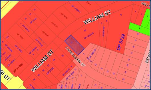
The site is close to the
Merrylands Town Centre and associated services including a railway station and
bus services.
Part B - Determine the
character of the local area.
The site is on a zone boundary
change where the subject site is within the R4 High Density Residential zone.
Land to the east along Carhullen Street is within zone R3 Medium Density
Residential.
The immediate locality specially
along William Street is characterized by apartment buildings either built or
under construction. There is existing detached housing to the south of Carhullen
Street and to the east that are generally within a landscape setting. There are
apartment buildings situated on the northern side of William Street.
It would be expected that further
apartment buildings will be constructed within the locality, especially along
William Street, given the location of the area close to the Merrylands Town
Centre and associated transport links.
Land along Carhullen Street is
within a zone that allows for medium density housing. At the present time,
single storey and two storey dwelling houses predominate, although given the
zoning of the area, it is probable that redevelopment for medium density
housing could occur in future.
Part C - Determine if
development is compatible with character of the local area.
Compatibility within the urban
environment is an issue that has been given detailed consideration by the Land
and Environment Court. In the decision of Project Ventures Development Pty
Limited and Pittwater Council, the Senior Commissioner of the Court was asked
to consider the process of deciding whether a building is compatible with its
surroundings. This led to the development of a Planning Principle that planners
could refer to as a guide on this particular issue.
The planning principle states
there are two important aspects of compatibility that need to be satisfied:
1. Are
the proposal’s physical impacts on surrounding development acceptable?
Physical impacts generally include
noise, overlooking, overshadowing and constraining development potential.
In terms of the physical impacts
of the development, the following points are made:
· The
predominant height of buildings along William Street is 11 metres and the
building is consistent with the height limitations imposed.
· The
building setbacks are relatively consistent, there is a balance of landscaping
and the architectural form is consistent with other buildings.
· Privacy
is satisfactorily addressed or can be addressed wherever there are issues.
There are no balconies within the development and landscaping is proposed
around the perimeter of the site to minimise any perception of privacy impact
upon adjoining properties.
· The
development does not create adverse shadow impacts onto the adjoining
neighbours. In this regard, the development allows for 3 hours of sunlight to
Number 11 Carhullen Street to the immediate south east on June 21. After
midday, the shadows begin to encroach across the dwelling house at 11 Carhullen
Street.
· An
acoustic report has been prepared addressing noise. The report makes recommendations
to address noise impacts.
· The
boarding house will feature a manager as per the plan of management to ensure
noise disturbances from future occupants do not disturb surrounding residential
land.
2. Is
the proposal’s appearance in harmony with the buildings around it and the
character of the street?
There are detached dwelling houses
along Carhullen Street and there are apartment buildings predominating along
William Street. The site is within zone R4 High Density Residential which
allows for apartment buildings to be constructed. The development is of a scale
and size that is consistent with other newer buildings along William Street.
The building is designed as one entity and colours and building materials are
consistent with that of other buildings.
The wide setbacks to William
Street and Carhullen Street are maintained and will be landscaped.
New and intensive planting is
proposed to compliment the new building to ensure that the building is not
dominant across the site.
The new building will feature materials
and colours that are comparable to the streetscape.
Subject to conditions and deferred
commencement conditions as discussed variously within the report, the proposal
will be visually compatible within its context, and will respond to the varied
elements that make up the desired future character of the surrounding
environment.
e) State
Environmental Planning Policy “Infrastructure” 2007
The site is located approximately
142 metres from a railway line. There are two roads being Railway Terrace and
William Street as well as residential development that acts as an adequate
separation distance and buffer between the site and the railway line.
Clause 85, 86 and 87 do not
require review and the site is not within zone A or B in relation to railway
noise and vibration. Full assessment using the State Policy is not required.
Division 4 “Electricity
Generating works or solar energy systems” Clause 33 to 39
The development includes the
installation of 38 solar panels onto the roof of the building to generate at
least 6 kW of power to supply the building. This has been reviewed under Clause
39 “Exempt development” and it is determined that the solar panel
system would fit the exempt development provisions. As such, formal assessment
under Clause 33 to 38 is not required.
f) Regional
Environmental Plans
Sydney Regional Environmental
Plan (Sydney Harbour Catchment) 2005
The site is located within the Sydney
Harbour Catchment area and SREP (Sydney Harbour Catchment) 2005 is applicable
to the development application. The development application raises no issues as
to consistency with the requirements and objectives of the planning instrument
and associated development control plan.
(Note: - the subject site is not
identified in the relevant map as ‘land within the ‘Foreshores and
Waterways Area’ or ‘Wetland Protection zone’, is not a
‘Strategic Foreshore Site’ and does not contain any heritage items.
Hence the majority of the SREP is not directly relevant to the proposed
development).
Local Environmental Plans
Parramatta Local Environmental
Plan 2011
The provision of the Parramatta
Local Environmental Plan 2011 are applicable to the development application. A
boarding house is a permitted form of development within the R4 High Density
Residential zone subject to consent. A boarding house is defined as:-
“A building that:
a) is
wholly or partly let in lodgings, and
b) provides
lodgers with a principal place of residence for 3 months or more, and
c) may
have shared facilities such as a communal living room, bathroom, kitchen or
laundry, and
d) has
rooms, some or all of which may have private kitchen and bathroom facilities
that accommodate or more lodgers,
but does not include
backpacker’s accommodation, a group home, hotel or motel accommodation,
seniors housing or a serviced apartment”.
The development is consistent with
the definition provided.
The development achieves
compliance with the core statutory requirements of the plan as follows:-
· Clause
4.3 - Height of buildings
A maximum building height of 11
metres is provided for the site. The building has a height of 10.4 metres or
less which is compliant with the provision.
· Clause
4.4 - Floor space ratio
The maximum permitted floor space
ratio is 0.8:1. Clause 29 of State Environmental Planning Policy (Affordable
Rental Housing) 2009 permits an increase in floor space ratio of 0.5:1 for a
boarding house on a site where the floor space ratio is 2.5:1 or less. A
maximum floor space ratio for the site is permitted to be 1.3:1.
The floor space ratio of the
development is calculated at 1,039.5 square metres or 1.13:1 which is compliant
with the floor space ratio limit provided for such a development.
A comprehensive LEP assessment is
contained in Appendix A.
The provisions of any proposed
instrument that is or has been the subject (EP&A Act s4.15 (1)(a)(ii))
a) Draft
State Environmental Planning Policy (Environment)
There are no draft planning
instruments that will apply to the development application.
The provisions of any
Development Control Plans (EP&A Act s4.15 (1)(a)(iii))
The Parramatta Development Control
Plan provides guidance for the design and operation of development to achieve
the aims and objectives of the local environmental Plan.
A comprehensive assessment and
compliance table is contained in Appendix A.
The following table highlights the
most important controls and variations identified. Generally, there is one
variation and the variation sought is considered satisfactory on merit in this
instance:
|
Key Control
|
Permitted/Required
|
Proposed
|
Complies
|
|
Part 5.1.4
|
Residents to have reasonable access to retail services,
community services and facilities, recreation and entertainment facilities,
employment and public transport.
|
The site is situated approximately 620 metres from the
Merrylands Railway Station and shops. The site is within an accessible area
and close enough to services.
|
Yes
|
|
Part 5.1.4
Subpart P6
(Subpart P60)
(Subpart P61)
|
Development should be designed to minimise the extent of
shadows cast across private and common space of adjoining development.
(Part P60) - Boarding
houses should be located so that solar access to at least 50% of the communal
open space areas and to communal living area windows is achieved for at least
3 hours between 9am and 3pm during the winter solstice (21 June).
(Part P61 - Dwellings on
adjoining properties are to receive a minimum of 3 hours sunlight in
habitable rooms and in at least 50% of the private open space between 9am and
3pm on 21 June. Where existing development currently receives less sunlight
than this requirement, this should not be unreasonably reduced. In order to
demonstrate that this can be achieved, shadow diagrams may be required with
the development application).
|
The shadows cast by the development fall onto Carhullen
Street during the morning period then recedes.
By midday, the shadows cast by the development will begin
to cross over onto 11 Carhullen Street toward the south east but the majority
of the shadows will still be falling onto the street.
(It is identified that the shadows cast by the
development at 210 to 214 William Street to the north east will be crossing
over the rear yard of Number 11 Carhullen Street at the same time).
At 12 noon, the development does not contribute to
additional shadowing across 11 Carhullen Street.
However, after 12 noon and throughout the afternoon
period, the degree of shadowing changes in which the dwelling house at 11
Carhullen Street becomes shaded by the development.
By 3 pm, the rear year yard of 11 Carhullen Street is
shaded by the new apartment building at 210 to 214 William Street.
|
Yes.
|
|
Table 5.1.4.6
Internal common living area.
|
All boarding houses are to
provide a common living area of a minimum 20m² in area, with a further
1.5m² provided per resident where resident numbers exceed 12 persons.
Note: Class 1(b) buildings are to have a maximum of 12 residents.
Living areas are to have a
minimum dimension of 4 metres.
Furniture including lounge suites and coffee tables are
encouraged.
At least 101 square metres of internal common living area
is required.
|
The development provides for 77 square metres of internal
common living area across 3 common rooms.
|
No (See discussion below).
|
|
Development Control
|
Proposal
|
Yes/No
|
|
Table 3.1.3.7
Height
3 Storeys or 11 metres.
|
3 storeys Up to 11 metres but not exceeding the permitted
height.
|
Yes
|
|
Minimum Site Frontage
Minimum 18 metres for sites with two street frontages.
|
20.115 metres.
|
Yes
|
|
Front Setback
Primary street frontage - 5-9 m, consistent with the
prevailing setback along the street.
Secondary street setback 3 to 5 metres.
|
5.2 metres.
3.1 to 3.5 metres.
|
Yes
Yes
|
|
Side Setback
Minimum 3 metres.
|
4.2 to 4.5 metres.
|
Yes
|
|
Rear Setback
Minimum 15% of site length - 6.85 metres.
|
6.86 metres.
|
Yes
|
|
Deep Soil Zone (R4 zone)
30% of site area of which at least 50% is to be located at
the rear of the site. 4m x 4m minimum dimensions.
|
275.9 square metres is required.
Up to 276.9 square metres of deep soil zone is provided
with a majority located along the northern and eastern side of the site.
|
Yes
|
|
Landscaped Area
40% of site area
|
367 square metres is required.
Landscaping occupies 369 square metres of the site or
40.1% is achieved.
|
Yes
|
|
|
|
|
|
Table 5.1.4.6 - Internal common
living area
All boarding houses are to provide
a common living area of a minimum 20 square metres in area with a further 1.5
square metres being provided per resident where resident numbers exceed 12 persons.
Living areas are to have a minimum
dimension of 4 metres.
Furniture, including lounge suites
and coffee tables, are encouraged.
Comment
At least 101 square metres of
internal common living area is required however the three common rooms as combined
entities occupy 77 square metres. There is also a common bathroom attached to
the ground floor common room occupying 6.24 square metres which has been
excluded from the calculation. Generally this creates a variation of 24 square
metres (23.7%).
In support of this, the outdoor
common area is significantly larger in area. In this regard, a minimum common
area of 20 square metres is required however 55 square metres is provided
however this increases to 66 square metres if the outdoor patio is included
into the calculation. A loss of residential amenity is not identified in terms
of common areas as adequate common areas across the entire development is
provided.
The provisions of any planning
agreement that has been entered into under section 7.4, or any draft planning
agreement that a developer has offered to enter into under section 7.4
(EP&A Act s4.15(1)(a)(iii))
There is no draft planning
agreement associated with the subject Development Application.
The provisions of the
Regulations (EP&A Act s4.15 (1)(a)(iv))
The proposed development raises no
concerns as to the relevant matters arising from the Environmental Planning and
Assessment Regulations 2000 (EP&A Reg).
The Likely Environmental,
Social or Economic Impacts (EP&A Act s4.15 (1)(b))
It is considered that the proposed
development will have no significant adverse environmental, social or economic
impacts in the locality.
The suitability of the site for
the development (EP&A Act s4.15 (1)(c))
The subject site and locality is
not known to be affected by any natural hazards or other site constraints
likely to have a significant adverse impact on the proposed development.
Accordingly, it is considered that the development is suitable in the context
of the site and surrounding locality.
Submissions made in accordance
with the Act or Regulation (EP&A Act s4.15 (1)(d))
Advertised (newspaper) Mail Sign Not Required
In accordance with Council’s
Notification requirements contained within the Parramatta Development Control
Plan 2011, the proposal was publicly notified for a period of 36 days between
Tuesday 4 December and Tuesday 8 January 2019. There were thirty four (34)
submissions including one containing a petition with thirteen (13) signatures
attached. There were no submissions or objections that disclosed a political
donation or gift. The issues raised in the public submissions are summarised
and commented on as follows:-
1.
The development will result in a loss of twelve (12) trees including native
trees on site which is essential for the local amenity. A three storey building
will be constructed that does not have standard setbacks and is totally out of
character with the local area.
Comment
There are nine (9) trees on site that
will require removal. As specified in the assessment report above, the
development application has been assessed by Council’s Landscape
Architect who has assessed the Arborist Report and has provided appropriate
conditions.
It is identified that the landscape
plan is showing the planting of new trees to replace the trees that are lost as
a result of the development.
Additionally, the building has
been assessed as having compliant front, side and rear setbacks and the height
of the building is acceptable and consistent with the height of newer buildings
within the locality.
2. On
the plan, only three trees are to be retained and none are over three metres in
height.
Comment
There will be three trees that
will be retained being two on site and one on the street frontage as follows:-
· T1
Melaleuca Armillaris - (Height 9 metres).
· T10
Livistonia Australis - (Height 7 metres) This tree will be relocated.
· T11
Tristaniopsis Laurina - (Height 5 metres).
i)
3.
The development incorporates 35 double rooms to accommodate 70 people within
one small block. The rooms are too small, lack adequate living space and
facilities, kitchen and dining room. Such poor accommodation will cause severe
social problems and there are no supporting services in the area.
Comment
The rooms have been assessed as
being compliant with the minimum size requirement of State Environmental
Planning Policy Affordable Rental Housing “Boarding House
Provisions”. The development provides an adequate level of servicing for
the residents.
4. The
development only provides 8 car spaces for 35 boarding rooms which is far less
than the State Regulations allow for. There should be 0.5 car spaces per room
and eighteen (18) provided for the development. This will cause chaos for the
already overcrowded street making it unsafe for residents and children.
Comment
As described within the report,
there is adequate car parking to support the development when assessed using
the Parramatta Development Control Plan Table 3.6.2.3.
5. The
development is too big, too high and does not meet the standard setback and
landscape requirement. A smaller scaled development would be more appropriate.
As such, the development is unsuitable to the locality.
There are no communal amenities
and the development appears to be cramped. There are too many bedrooms and
overcrowding will occur.
Comment
The development is found to comply
with the planning controls specific to height, floor space ratio, setbacks,
landscaping and deep soil zone. Furthermore, there is adequate services to
support the building such as car parking, facilities for cooking, laundry and
cooking, common rooms, private outdoor areas and garbage disposal.
6. The
development creates privacy impacts especially toward the property at 11
Carhullen Street. The occupants of the boarding house will be able to monitor
Number 11 Carhullen Street at all hours of the day. This will create safety and
security fear.
Comment
Potential privacy impacts may be
addressed via the use the louvres for the windows of the east facing common
rooms on Levels 1 and 2 which is addressed via appropriate condition attached
to the recommendation.
7. The
development will create an over shadowing burden to our property and the
diagrams are inaccurate. Additionally, the cumulative effect of shadowing
created by other developments should be considered in addition to the shadows
created by this development.
Comment
The shadow diagram has been
assessed as being accurate. As described within the report, the shadows cast by
the development are compliant with Part P60 and Part P61 of the Parramatta
Development Control Plan, addressing solar penetration and solar access to
adjoining developments.
8. The
proposed white walled boarding house is a sore thumb and does not blend into
the streetscape. Furthermore, the building is likely to be subjected to eyesore
graffiti attacks due to its colour. As such, the development is out of
character with the streetscape due to its colour.
The building should be finished in
brickwork material.
Comment
The development has been assessed
as having a satisfactory appearance to the street and building materials and
finishes are assessed as being satisfactory.
A crime safety audit has been
conducted for the development which has been assessed by the Cumberland Police
Area Command who have raised no objection to the proposed development.
9. The
development will create issues of noise, danger to our children, waste
management and social problems and us neighbours will be left to put up with
it. The development will increase the number of cars in the street which in
turn will lead to heavier traffic flows and associated dangers.
Comment
A Plan of Management has been
prepared that addresses the following:-
· Role
of the site manager and care taker.
· Lease
agreement.
· Furniture
and equipment.
· Fire
safety.
· Cleaning
and maintenance.
· Safety
and security.
· Handling
of complaints.
The plan of management is
incorporated into any consent that may be issued.
10. The
types of people who reside in boarding houses pose a risk to children, young
adults and teenagers who walk from Merrylands Station to the TAFE and back.
Their safety may be compromised by the type of occupants who would reside in
such a building.
Comment
The Cumberland Police Area Command
has assessed the development application who has raised no objection to the
proposed development.
11.
The sign advertising the development was only in place for three days before it
was removed and destroyed. This is not satisfactory. The development needs more
transparency and community consultation rather than ordinary public display.
Residents need to be fully aware of what is proposed.
Comment
The development application was
notified correctly and a sign was placed on site in the correct manner prior to
notification commencing. The plans were made available for viewing at
Council’s libraries and offices and were available on line as part of the
notification period.
12. The
location of the rubbish bin collection area is not provided on the plans.
Comment
The waste bin store is situated
adjacent to the driveway entry area and has adequate room for storing 13 waste
bins.
The public interest (EP&A
Act s4.15(1)(e))
In view of the foregoing analysis
it is considered that the development, if carried out subject to the conditions
set out in the recommendation below, will have no significant adverse impacts
on the public interest.
Section 7.12 (Formerly S94a)
Fixed Development Consent Levies
This part of the Act relates to
the collection of monetary contributions from applicants for use in developing
key local infrastructure.
Comments:
The development will require the
payment of contributions in accordance with Council’s Section 7.12A
Contributions Plans.
The calculation is based on a
figure of 1% of $3,799,605. As at 30 January 2019, the fee payable is
$38,338.05. The figure is subject to indexation as per the relevant plan.
Disclosure of Political
Donations And Gifts
The applicant and notification
process did not result in any disclosure of Political Donations and Gifts.
The development application has
been assessed in accordance with the relevant requirements of the Environmental
Planning and Assessment Act 1979 and the following planning instruments:-
· State
Environmental Planning Policy No. 55 - Remediation of Land.
· State
Environmental Planning Policy (Building Sustainability Index: BASIX) 2004.
· State
Environmental Planning Policy “Affordable Rental Housing” 2009.
· State
Environmental Planning Policy “Infrastructure” 2007.
· Parramatta
Local Environmental Plan 2011.
· Parramatta
Development Control Plan
The development is considered to
be satisfactory for approval.
The proposed development is
appropriately located within the High Density Residential R4 zone under the
relevant provisions of the Parramatta Local Environmental Plan 2011. The
proposal is generally consistent with all statutory and non-statutory controls
applying to the development. Minor non-compliances with Council’s
controls have been discussed in the body of this report. The development is
considered to perform adequately in terms of its relationship to its
surrounding built and natural environment, particularly having regard to
impacts on adjoining properties.
For these reasons, it is
considered that the proposal is satisfactory having regard to the matters of
consideration under Section 4.15 of the Environmental Planning and Assessment
Act 1979, and the development may be approved subject to conditions.
There are no further consultation
processes for Council associated with this report.
There are no further financial
implications for Council associated with this report.
There are no policy implications
for Council associated with this report.
Communication / Publications:
The final outcome of this matter
will be notified in the newspaper. The objectors will also be notified in
writing of the outcome.
|
1. That
Development Application No. DA-348/2018 for the demolition of existing
dwelling and associated structures and construction of three storey boarding
house over basement parking and landscaping on land at 216 William Street
Granville be deferred commencement approved subject to attached conditions.
2. Persons
whom have lodged a submission in respect to the application be notified of
the determination of the application.
|
1. Architectural
Plans ⇩ 
2. Survey
Plan ⇩ 
3. Landscape
Plan ⇩
4. Draft
Notice of Determination ⇩
5. Part
A - Submissions Received ⇩
6. Part
B - Submissions Received ⇩
7. Appendix
A ⇩
8. Plan
of Management ⇩ 
DOCUMENTS
ASSOCIATED WITH
REPORT LPP029/19
Attachment 1
Architectural Plans
Cumberland Local Planning Panel Meeting
8 May 2019
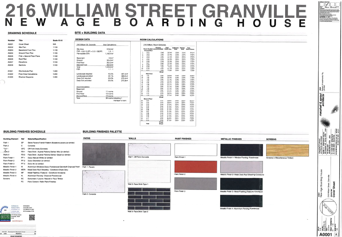
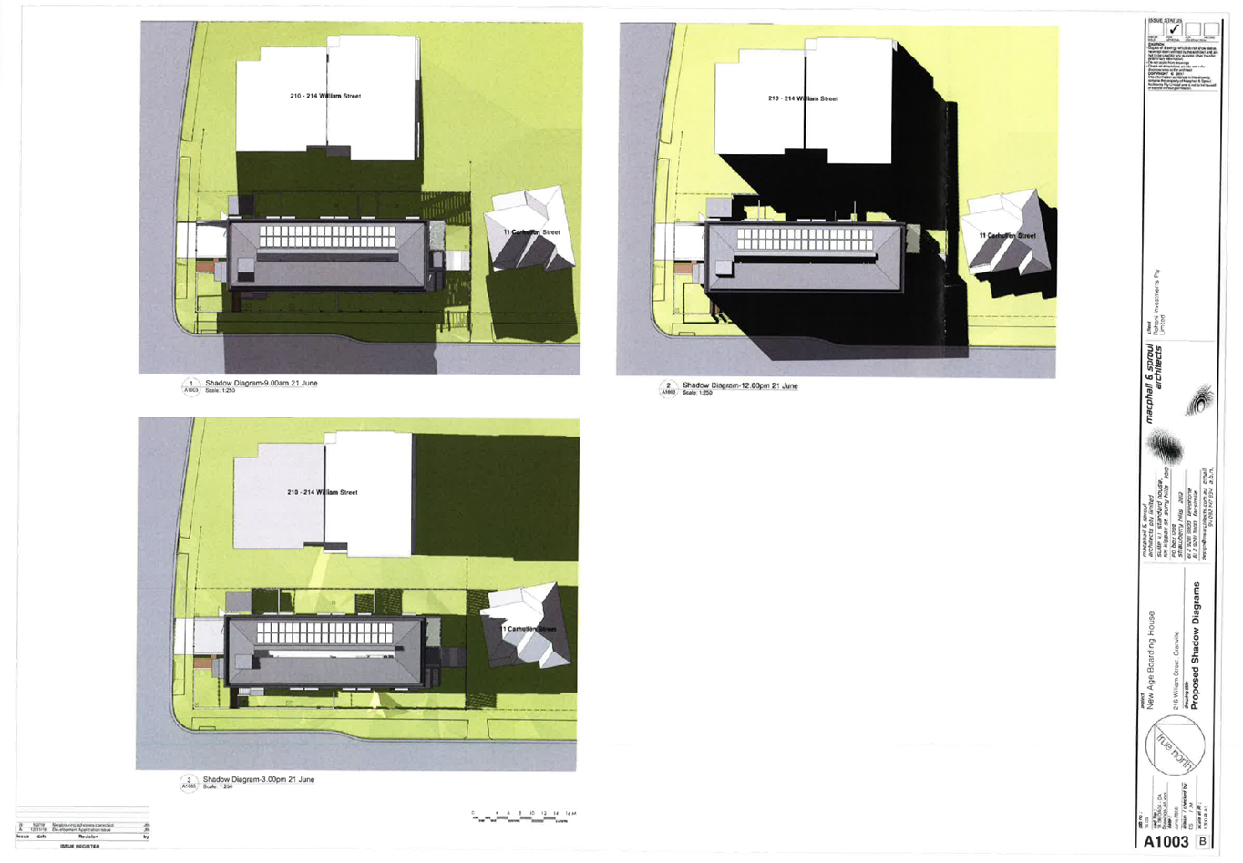
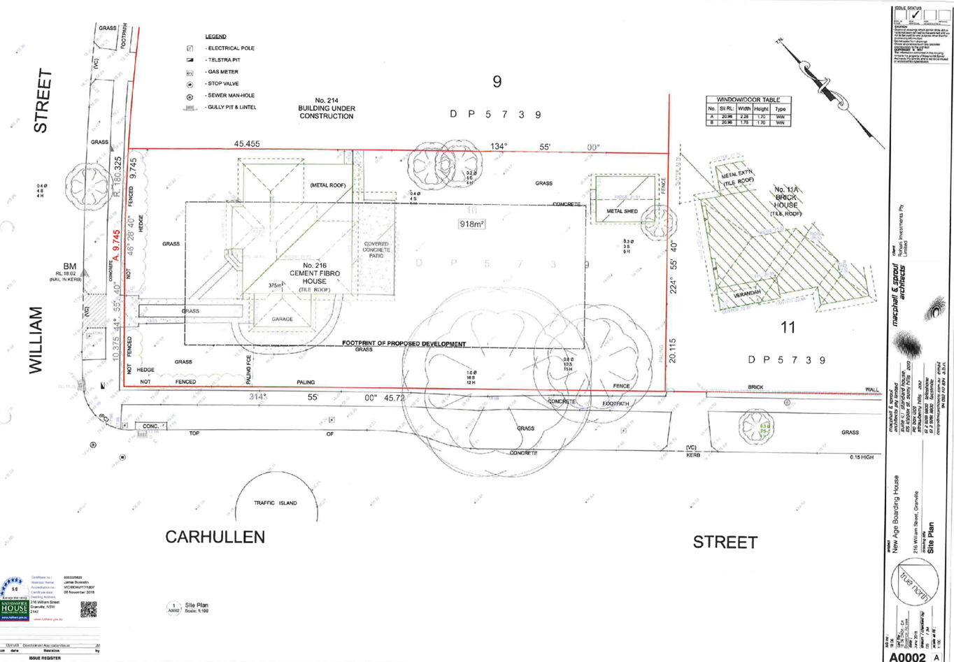
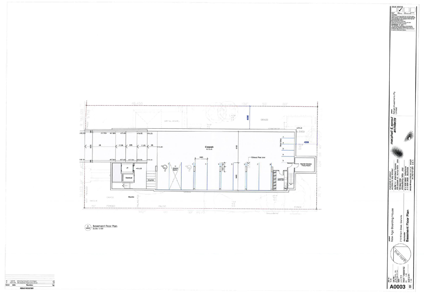
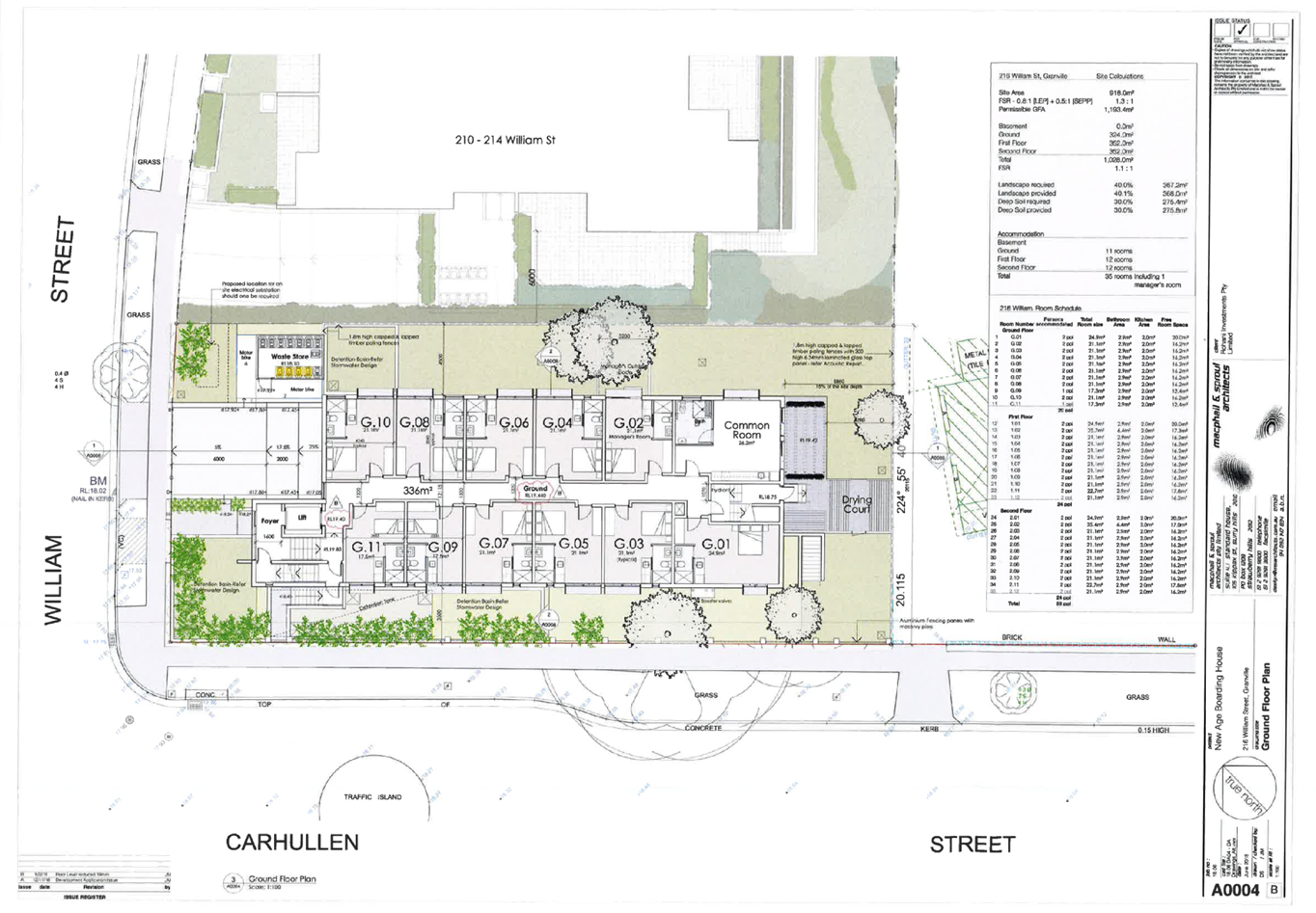
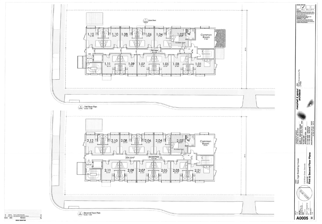
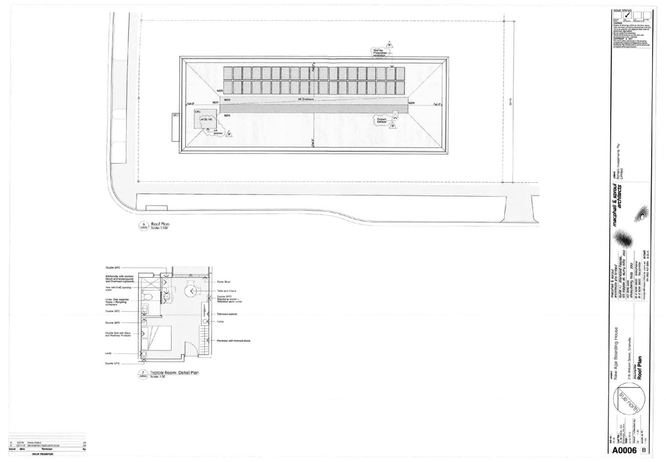
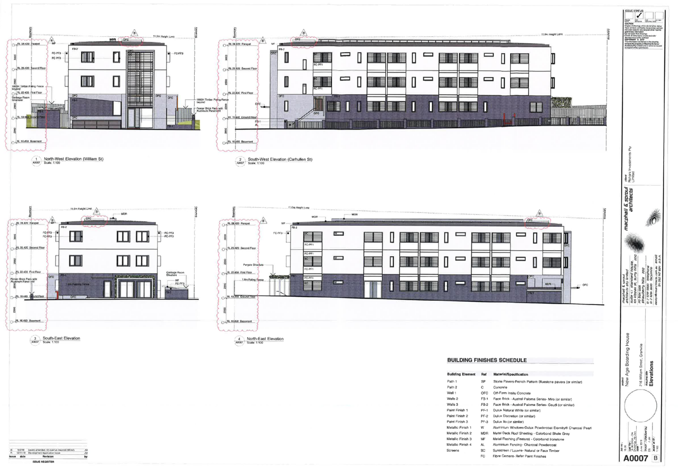
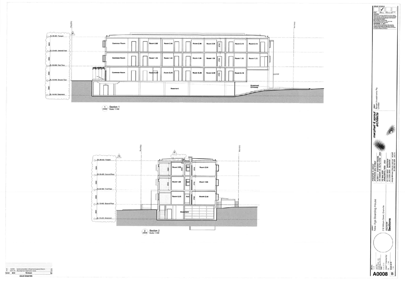
DOCUMENTS
ASSOCIATED WITH
REPORT LPP029/19
Attachment 2
Survey Plan
Cumberland Local Planning Panel Meeting
8 May 2019
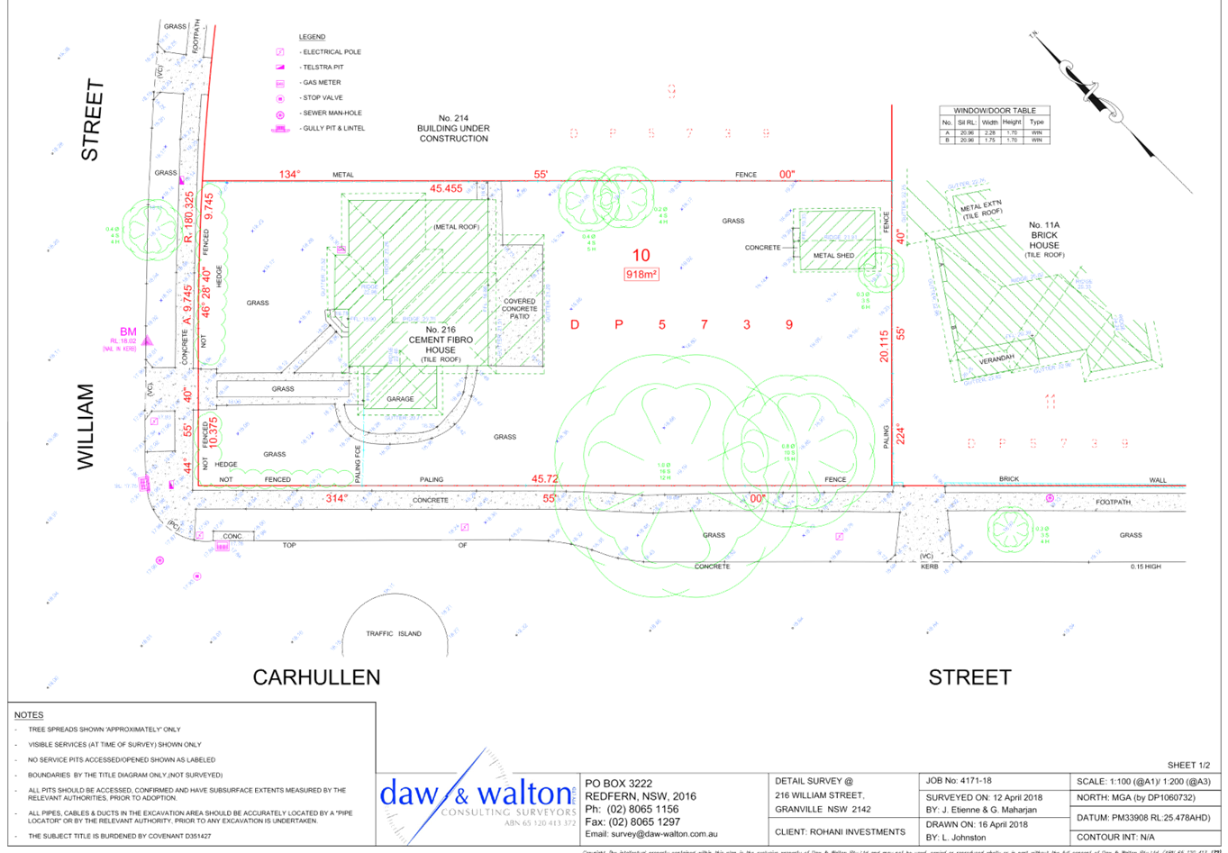
DOCUMENTS
ASSOCIATED WITH
REPORT LPP029/19
Attachment 3
Landscape Plan
Cumberland Local Planning Panel Meeting
8 May 2019
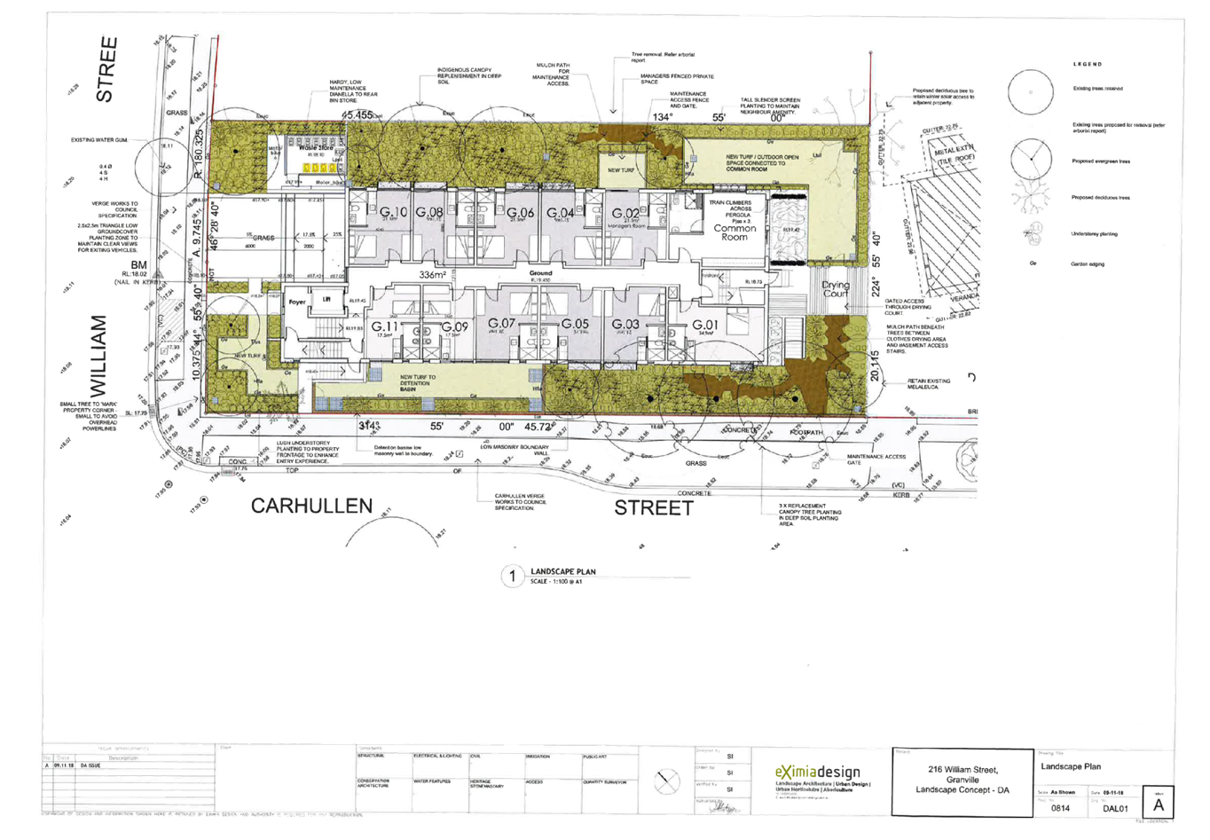
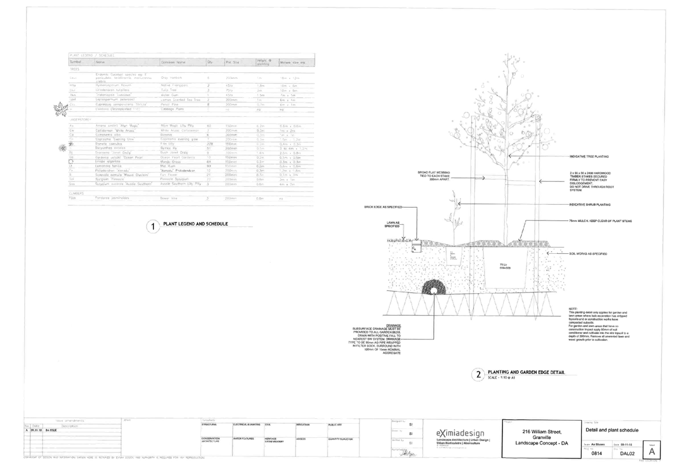
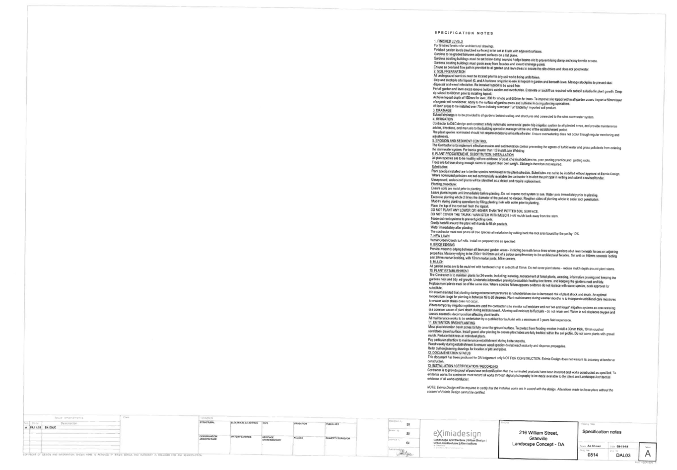
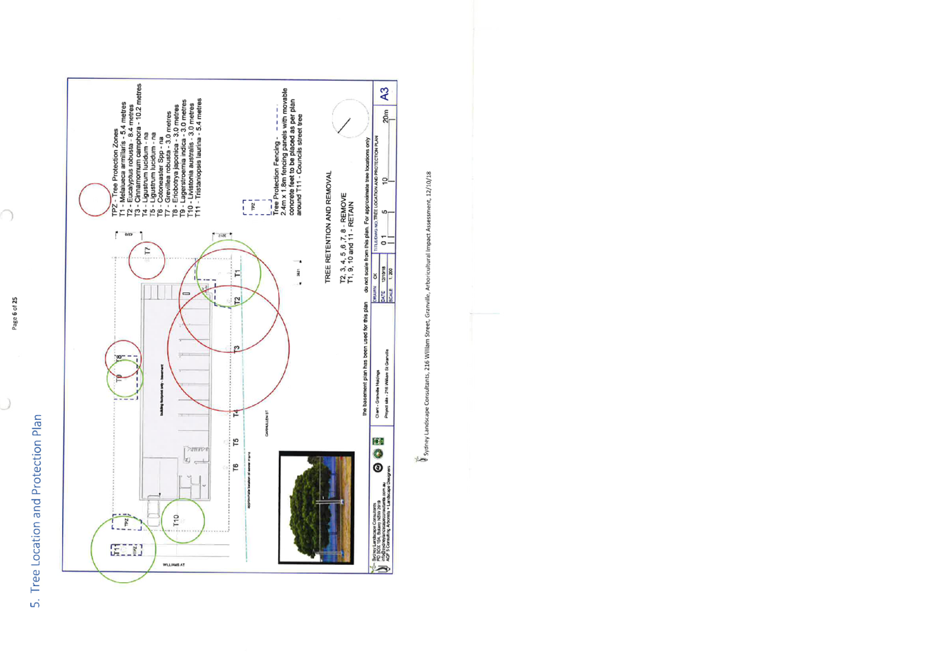
DOCUMENTS
ASSOCIATED WITH
REPORT LPP029/19
Attachment 4
Draft Notice of Determination
Cumberland Local Planning Panel Meeting
8 May 2019
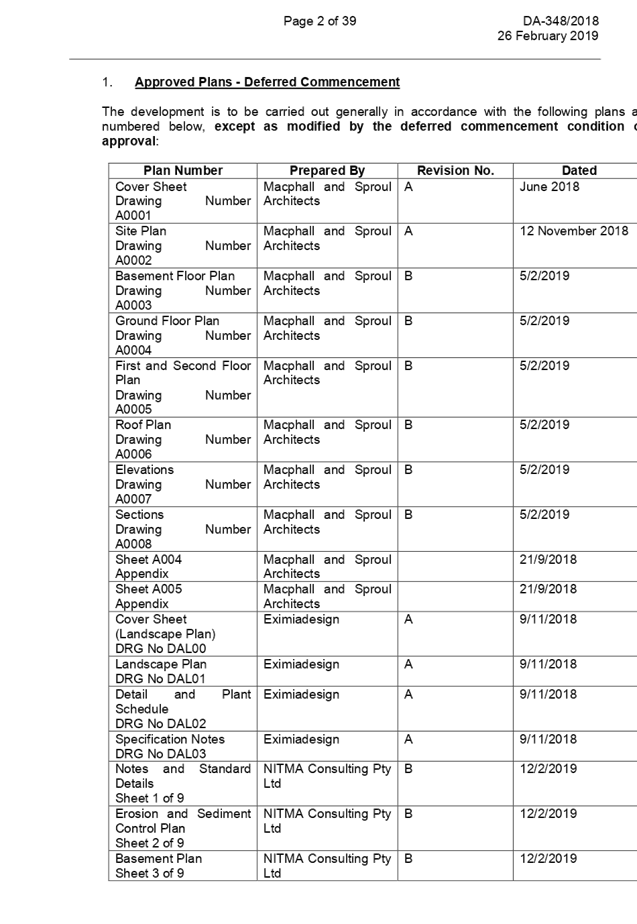
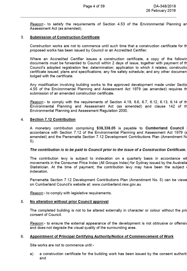
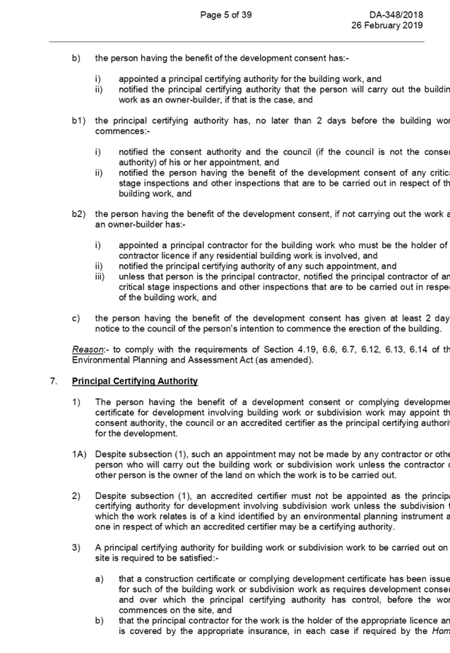
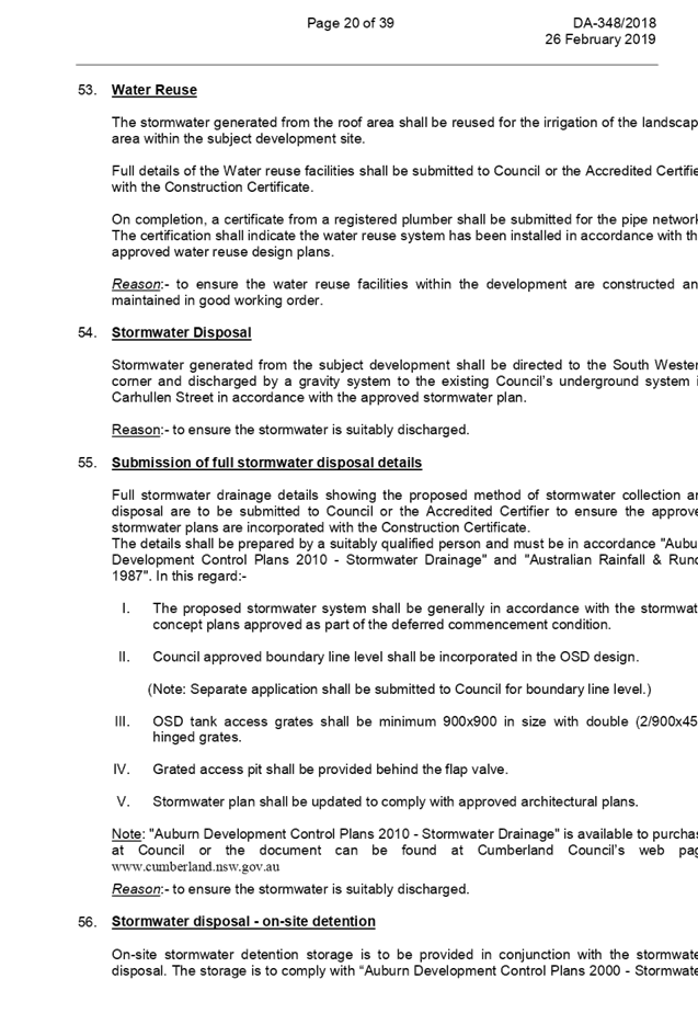
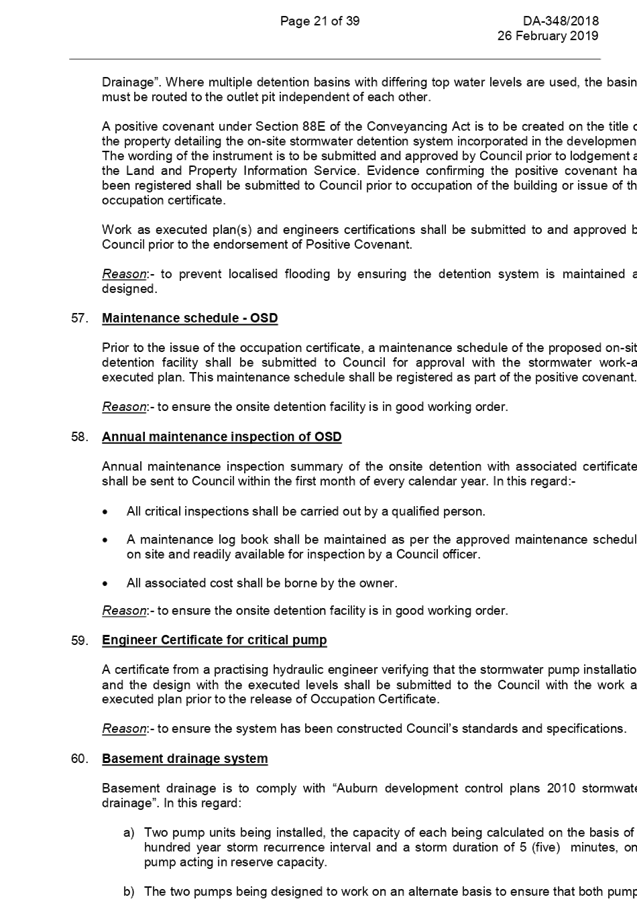
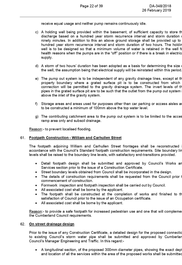
DOCUMENTS
ASSOCIATED WITH
REPORT LPP029/19
Attachment 5
Part A - Submissions Received
Cumberland Local Planning Panel Meeting
8 May 2019
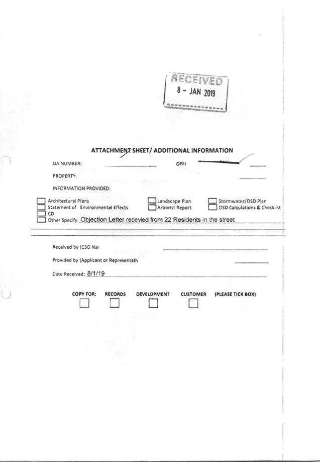


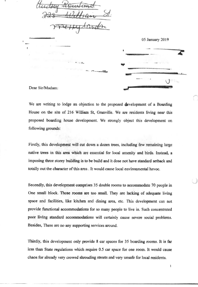


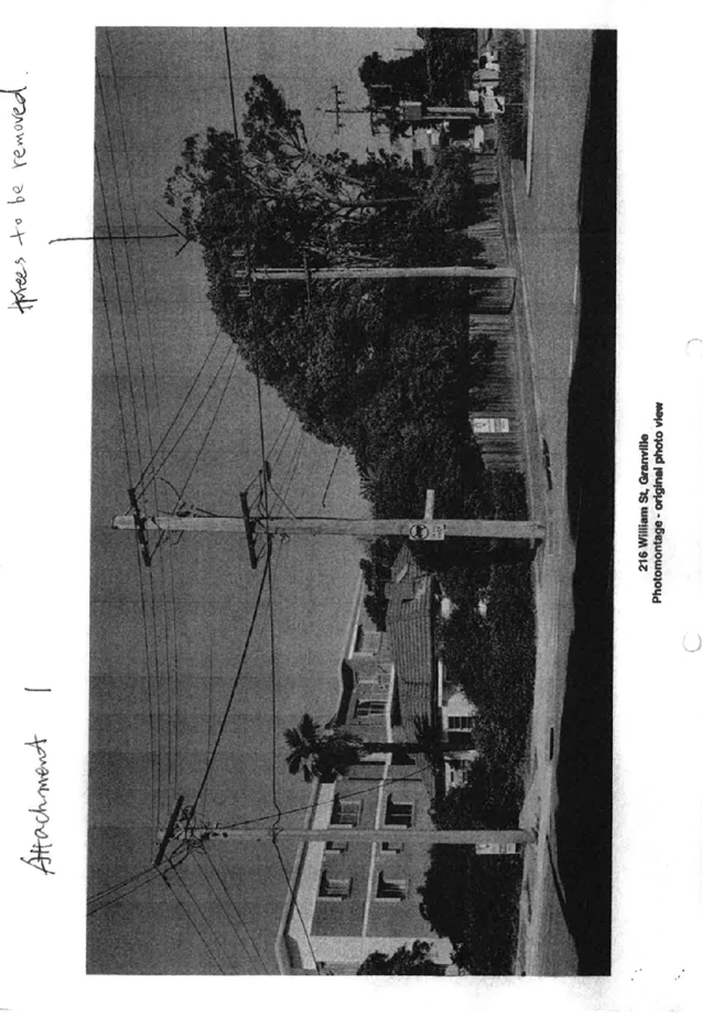
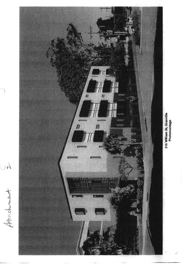


DOCUMENTS
ASSOCIATED WITH
REPORT LPP029/19
Attachment 6
Part B - Submissions Received
Cumberland Local Planning Panel Meeting
8 May 2019


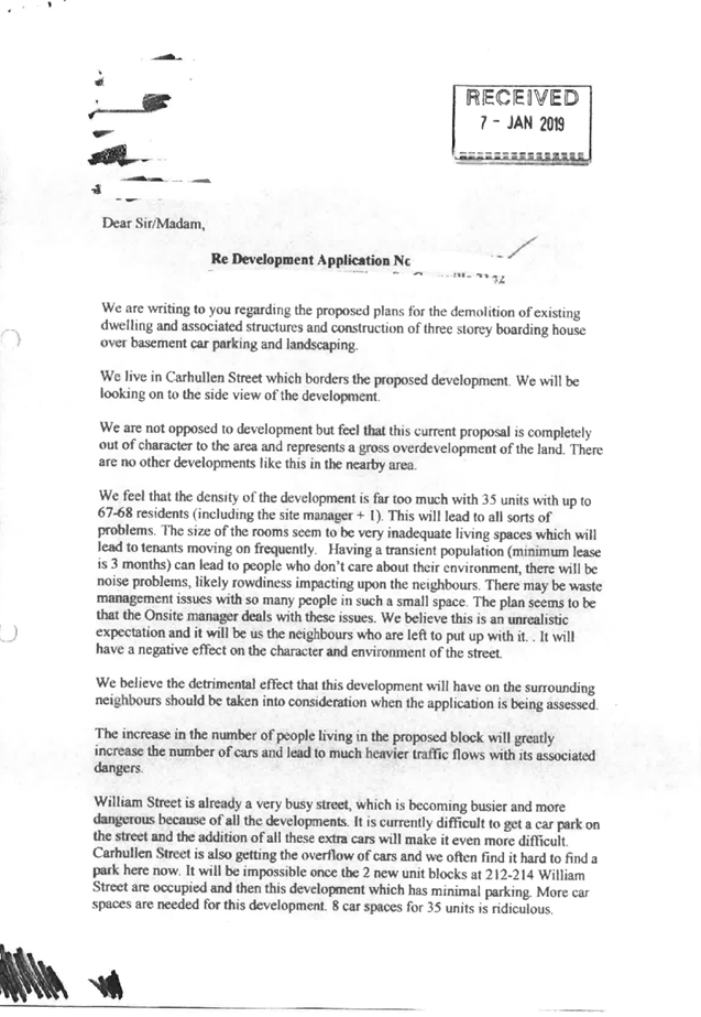

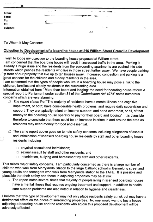

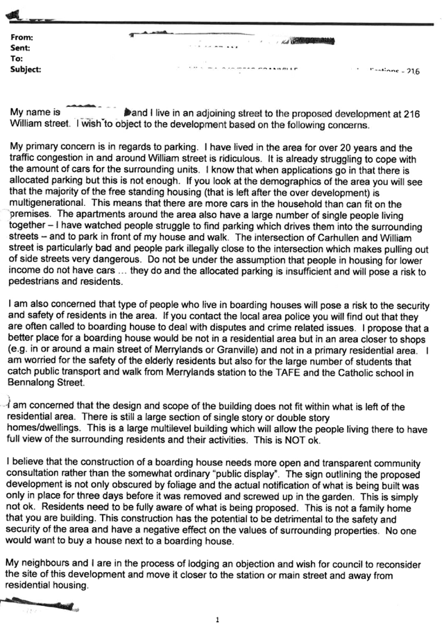

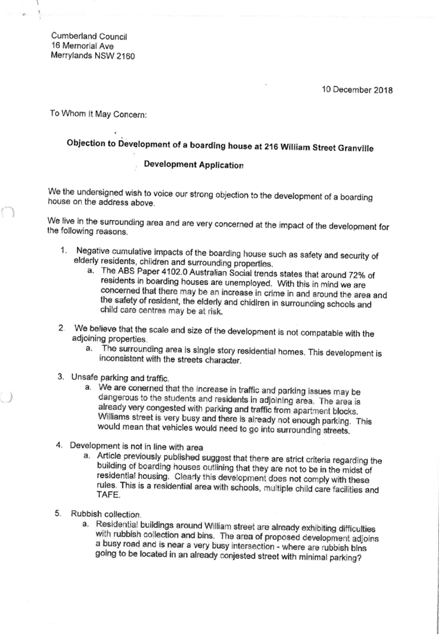
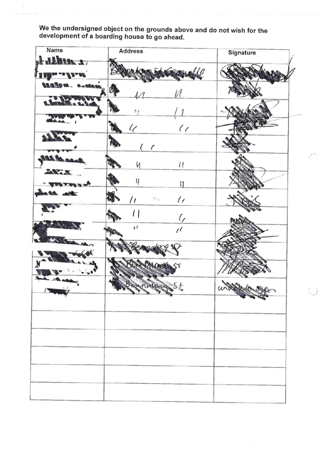


DOCUMENTS
ASSOCIATED WITH
REPORT LPP029/19
Attachment 7
Appendix A
Cumberland Local Planning Panel Meeting
8 May 2019
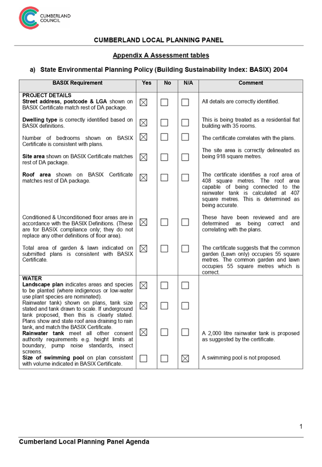
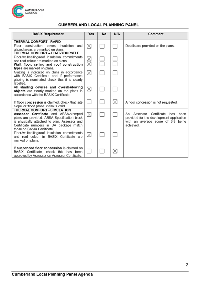
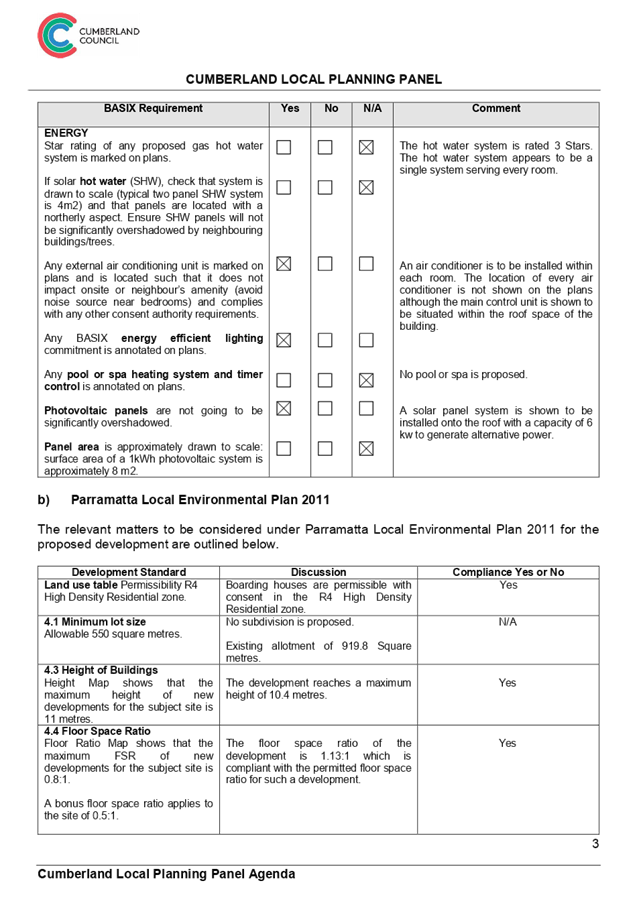
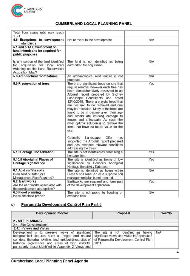
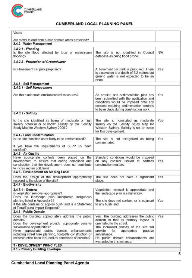
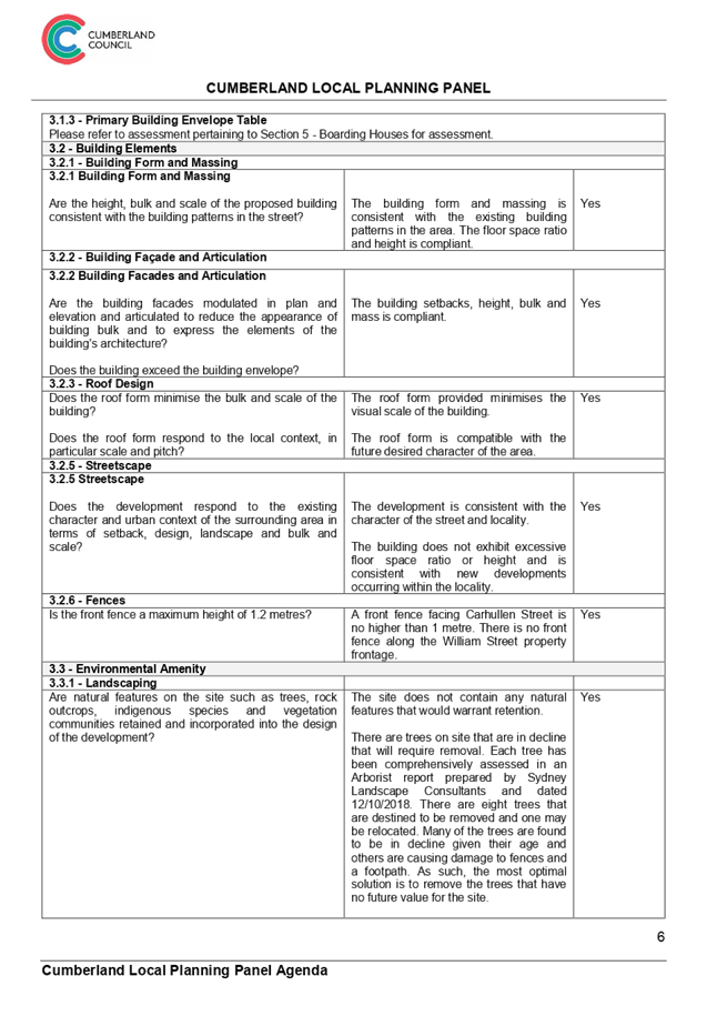
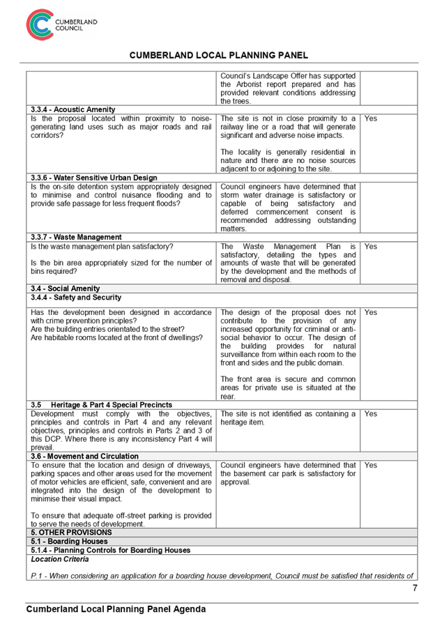
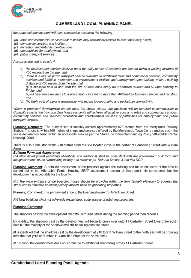
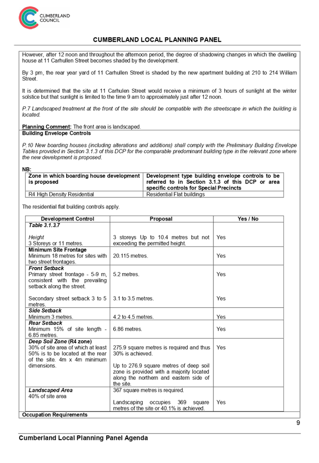
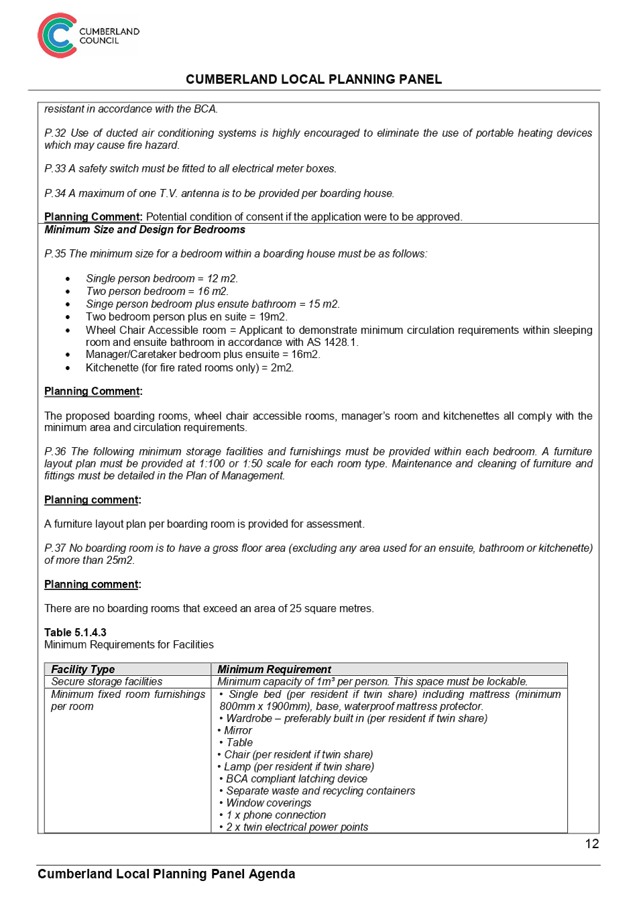
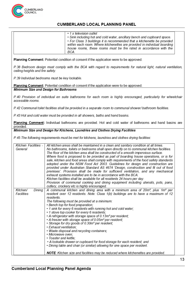
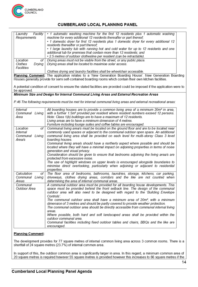
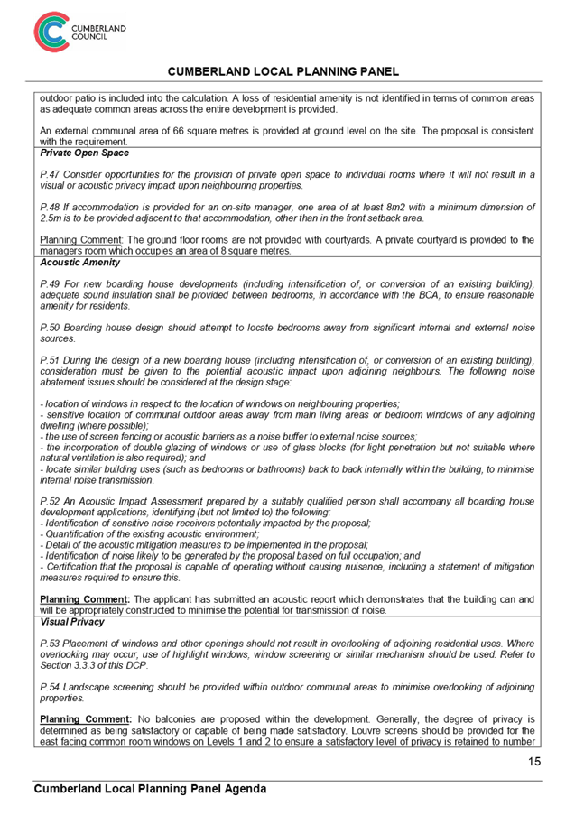
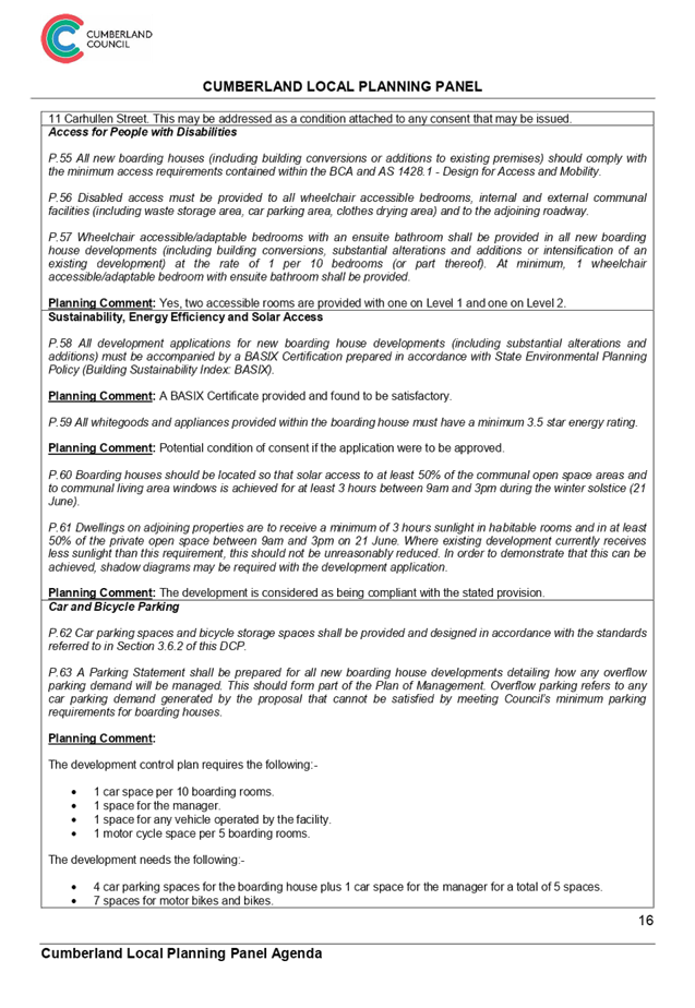
DOCUMENTS
ASSOCIATED WITH
REPORT LPP029/19
Attachment 8
Plan of Management
Cumberland Local Planning Panel Meeting
8 May 2019
Cumberland
Local Planning Panel Meeting
8 May 2019
Item No: LPP030/19
Development
Application for 17 Brooks Circuit, Lidcombe
Responsible
Division: Environment
& Planning
Officer: Manager
Development Assessment
File
Number: DA
- 110/2018
|
Application lodged
|
Monday 23 April 2018.
|
|
Applicant
|
Revelop Builders &
Developments Pty Ltd.
|
|
Owner
|
Gundagai Ww Pty Ltd.
|
|
Application No
|
DA-110/2018.
|
|
Description of Land
|
17 Brooks Circuit Lidcombe
being Lot 4 in DP 270668.
|
|
Proposed Development
|
Alterations and fitout works
to existing building for use as a mixed use development incorporating a
neighbourhood supermarket, liquor shop, cafe, medical centre and restaurant
to operate 7:00 a.m to 10:00 p.m daily and four (4) retail tenancies to operate
9:00 a.m to 6:00 p.m daily - Integrated Development (Heritage Act, 1977).
|
|
Site Area
|
2,329 Square metres.
|
|
Zoning
|
B1 Neighbourhood Centre.
|
|
Disclosure of political
donations and gifts
|
Nil disclosure.
|
|
Heritage
|
Yes - Former Lidcombe Hospital
Site - Heritage Conservation Area of State significance being item number
C07144.
|
|
Principal
Development Standards
|
Height of Buildings
Permissible: - 12 metres.
Proposed: - Under 11 metres
(No change to existing conditions).
Floor space ratio
Permissible: - 1:0.
Proposed: - 0.938:1 (No change
to existing conditions).
|
|
Issues
|
1 - Development occurring
within a State Heritage listed building.
2 - Submissions.
|
1. Development
Application 110/2018 was received on Monday 23 April 2018 for alterations and
fitout works to the existing building for use as a mixed use development
incorporating a neighbourhood supermarket, liquor shop, cafe, medical centre,
and restaurant to operate 7:00 a.m to 10:00 p.m. daily, four (4) retail
tenancies to operate 9:00 a.m. to 6:00 p.m. daily and a 52 place child care
centre to operate 7:00 a.m. to 6.00 p.m. Mondays to Fridays - Integrated Development
(Heritage Act, 1977).
2. The
application was publicly notified to occupants and owners of the adjoining
properties for a period of 30 days between Wednesday 23 May 2018 and Friday 22
June 2018 and there were sixteen (16) submissions objecting to the proposed
development and one (1) submission in support of what is proposed.
3. The
subject site is listed as a State Heritage item and located within the heritage
conservation area known as the former Lidcombe Hospital site under the Auburn
Local Environmental Plan 2010 as Heritage Item C07144. The development is
occurring within a building affected by the State heritage listing.
4. On
Monday 25 March 2019, the applicant withdrew the request for a child care
centre under the development application following the refusal of the New South
Wales Department of Education to grant concurrence consent to the proposed
child care centre.
5. There
are no significant variations to the planning controls.
6. The
application is recommended for approval subject to conditions.
7. The
application is referred to the Panel as the proposal is considered to be
contentious development which includes a high number of submissions.
Subject Site And Surrounding
Area
The site is identified as being
Lot 4 DP 270668 which forms part of the former Lidcombe Hospital site. The site
has a frontage onto two roads being Main Avenue to the east and Brooks Circuit to
the west. There is a pedestrian walkway (Benedict Way) to the immediate north
that provides pedestrian access between Main Avenue and Brooks Circuit. The
walkway also separates the site from residential premises to the north at 1 to
16 Brooks Avenue.
The allotments to the south
comprise Strata Titled buildings, one of which is used for a sales office while
the rest are dwellings.
The development site comprises a
former dining hall and cottages erected in 1886, a mess hall and kitchen for
the Lidcombe Hospital. The building on site presently comprise two main wings
with a smaller connecting building situated around a small courtyard accessible
from Brooks Circuit.
The Lidcombe Hospital precinct
comprises a large land area and a variety of land uses developed over different
time periods. The original historic buildings associated with the construction
of the Boys Reformatory was erected around Brooks Circuit and adjoining streets
including Brooks Avenue and Sussex Street.
The wider locality has recently
been the subject of much residential development with the Village Green being
the focus of the development undertaken.
The location of the site is shown
below.
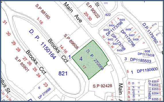
The
aerial photo of the site is shown below.
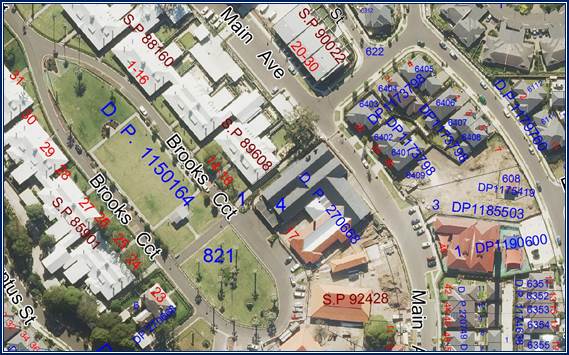
Photos
of the site taken Monday 4 February 2019 are provided below.
Photo
1:- Site of the neighbourhood shops and other services from Brooks Circuit.
Photo
2:- The liquor store will be established within the front building facing
Brooks Circuit.
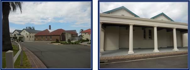
Photos
3 and 4:- The courtyard facing Brooks Circuit is earmarked to be used for
outdoor dining for the cafe as well as access to the medical centre, the small
supermarket and shop Number 1.
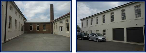
Photo
5:- Inside the main building where the supermarket will be established.
Photo
6:- The southern side of the building where a future child care centre could be
located subject to a separate future development application.
Photo
7:- Rear of the building from Main Avenue which will feature two shops and a
restaurant on the lower ground floor.
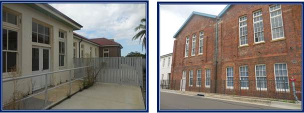
Photos
8 and 9:- Benedict Laneway being a pedestrian laneway separates the site from
residents to the north.
Description of The Proposed
Development
Development application 110/2018
proposes the adaptive reuse of the former Lidcombe Hospital Mess building at 17
Brooks Circuit for various commercial purposes including retail tenancies, a
medical centre, a cafe and a restaurant. The focus of the development is for a
local community shopping centre.
The development application
initially incorporated a 52 place child care centre to operate within portions
of the ground floor area. On March 19 2019, Council was informed in writing
from the New South Wales Department of Education that concurrent consent would
not be granted to the child care centre due to issues with the simulated outdoor
play space. As such, on March 25 2019, the applicant requested in writing for
the child care centre to be deleted from the development application prior to
determination. Following this procedure, no assessment is made regarding a
child care centre on site.
This is an application to
establish the use of each individual tenancy with a separate development
application to be submitted in future for individual tenancy fitouts.
The development application
proposes the following building works:-
· Minor
works to the existing building including the creation of a new opening where
necessary for circulation and code compliance, construction of partition walls
and ceilings where necessary to create new internal spaces.
i)
· Remove
an existing corrugated iron roof over the external central area of the building
and the construction of a new glazed roof extending across the existing
opening.
ii)
· Construction
of a lift within the central external space of the building connecting the
ground and lower ground floor.
· Partial
removal of existing non-compliant concrete steps in the central external space
of the building and the construction of compliant timber stairs.
iii)
· Installation
of skylights within the western slope of the rear roof.
iv)
· Addition
of an external glazed awning at the Main Avenue entrance.
v)
· Addition
of a new external timber deck around the north east portion of the building
within the lower ground floor.
vi)
· Additional
of rooftop mechanical plant on the roof of the building.
vii)
· Construction
of a new glass and aluminium louvred roof across the outdoor cafe eating area.
An area on Main Avenue will be
dedicated for loading and unloading operations to support the neighbourhood
centre.
Retail tenancies
The development application is seeking
the establishment of six (6) commercial tenancies on site occupying 715 square
metres within the lower ground and ground floor of the building. The largest
tenancy / shop will comprise a neighbourhood supermarket to act as the anchor
tenant with five smaller tenancies to compliment the larger store. The
breakdown of the development is shown below:-
|
Shop
|
Area
|
Location
|
Hours of operation
|
|
Supermarket
(Anchor tenant).
|
342 square
metres.
|
Ground
floor
|
7 am to 10
pm daily.
|
|
Liquor
shop.
|
128 square
metres.
|
Ground
floor
|
7 am to 10
pm daily.
|
|
Retail
tenancy 1
|
71 square
metres.
|
Ground
floor
|
9 am to 6
pm daily.
|
|
Retail
tenancy 2
|
36 square
metres.
|
Ground
floor
|
9 am to 6
pm daily.
|
|
Retail
tenancy 3
|
78 square
metres.
|
Lower
ground floor
|
9 am to 6
pm daily.
|
|
Retail tenancy
4
|
60 square
metres.
|
Lower
ground floor
|
9 am to 6
pm daily.
|
|
Total
area
|
715
square metres.
|
|
|
Medical centre
A medical centre occupying an area
of 147 square metres is proposed within the former cottage / kitchen wing of
the ground floor of the building; however, the plans do not show the number of
consulting rooms proposed.
The expected operating hours are 7
am to 10 pm daily.
Cafe
A cafe occupying 50 square metres
within the former servery is proposed on the ground floor. The cafe will
feature new bi fold doors that will open onto an external courtyard space. The
courtyard space occupies an area of 56 square metres will be occupied with
twelve (12) new tables and seating for forty (40) patrons.
The cafe will also feature three
(3) internal tables with seating for ten (10) patrons.
The expected operating hours are 7
am to 10 pm daily.
Restaurant
A restaurant occupying an area of
241.9 square metres is proposed within a former bakery space within the lower
ground floor. The restaurant incorporates a kitchen a private dining area,
store rooms and a toilet facility. A layout plan showing table and chairs is
not provided.
The expected operating hours are 7
am to 10 pm daily.
Car parking
The development application does
not include the development of any additional car parking spaces to support the
neighbourhood centre. There is room for thirteen (13) car parking spaces
on the street adjacent to the neighbourhood centre in Brooks Circuit although
there is additional on street car parking to service the centre close by. A
detailed discussion of car parking is provided within the report under
“Parking and Loading” Chapter of the Auburn Development Control
Plan below.
Service areas
A service area is provided at the
rear of the development on the lower ground floor facing Main Avenue. The
service area includes a garbage room, a loading garbage zone and storage
rooms.
Signage
The applicant has advised that
future signage will be the subject of a separate development application.
History
Development Application No.
572/2002 - Stage 1 Masterplan (as modified)
Consent orders for Development
Application 572/2002 were issued by the Land and Environment Court on 7 July
2004 for the staged development of the former Lidcombe Hospital site, including
subdivision, demolition, remediation, site grading, civil works, tree removal,
landscaping and dedication of public roads, drainage and open space.
In accordance with Section 4.24(2)
of the Environmental Planning and Assessment Act, 1979, “while any
consent granted on the determination of a staged development application for a
site remains in force, the determination of any further development application
in respect of that site cannot be inconsistent with that consent.”
Comment:
The proposed development is not
inconsistent with the approval of DA-572/2002.
Development Application No.
176/2006 (as modified)
Council, at its meeting of 20 June
2007 resolved to approve Development Application No. 176/2006 for “Subdivision,
demolition of Buildings 95A & 95B, site reshaping and compaction, civil
works including construction of roads, drainage and provision of site services,
landscaping of public domain areas and tree removal”.
This application is of relevance
to the subject application as it includes the provision of on-street public car
parking spaces to meet the demand generated by the future use of the buildings
within the heritage precinct.
ALEP 2010 Amendment No. 12
The Auburn Local Environmental
Plan 2010 was amended on 1 August 2014 and rezoned the subject site from R3
Medium Density Residential to B1 Neighbourhood Centre, increased the maximum
FSR from 0.5:1 to 1:1 and the maximum building height from 9m to 12m.
23 April 2018
The development application was
lodged to the Council for determination. Council records show no pre lodgement
application for the development sought or meetings concerning the matter.
Applicants Supporting
Statement
The applicant has provided a
Statement of Environmental Effects prepared by Think Planners and dated April
16 2018. The statement was submitted to Council on April 23 2018. An updated
statement was provided on December 5 2018.
On March 25 2019, the applicant
requested in writing for the child care centre to be deleted from the
development application prior to determination.
Contact With Relevant
Parties
The assessing officer has
undertaken a site inspection of the subject site and surrounding properties and
has been in regular contact with the applicant throughout the assessment
process.
Internal Referrals
Development Engineer
The development application was
referred to Council’s Development Engineer for comment who has advised
that the development proposal is supported as per the memorandum dated February
20 2019, no objection is raised to the development application for the
following reasons:-
· There
are no physical works to the building.
· The
parking for the precinct and arrangement is already accepted.
· The
precinct is heritage listed.
The matter concerning car parking
is described in detail below.
Building Surveyor
The development application was
referred to Council’s Building Surveyor for comment who has advised that
the development proposal is satisfactory. There are no objections to the
adaptive reuse of the buildings. As per the memorandum dated 28/5/2018, the
development must comply with the Building Code of Australia.
Environment and Health
The development application was
referred to Council’s Environment and Health Officer for comment who has
advised that the development is satisfactory and is supported subject to
conditions. Conditions are provided addressing food related matters, land
contamination and noise.
Heritage Advisor
The development application was
referred to Council’s Heritage Advisor for comment who has advised that
the development application is supported on the grounds that the development is
appropriate as buildings are preserved. There are no conditions provided.
Children’s Service
Department
The development application was
referred to Council’s Children’s Services department for assessment
of the child care centre (now deleted). As per comments dated 14 February and
modified on March 21 2019, the development does not provide adequate outdoor
play space for the children and the indoor play space is barely achieved.
Comment:
The applicant has since requested
that the child care centre not be included into the development application and
as such, no further action is required in relation to the child care
centre.
External Referrals
Heritage Council of New South
Wales
The development is occurring
within a State Heritage listed building and conservation area (Item number
C07144). As such, the development application is Integrated development for the
purposes of Clause 58 of the Heritage Act 1977.
The development application has
been referred to the Heritage Office for assessment and as per correspondence
received December 3 2018, the Heritage Council of New South Wales provides its
General Terms of Approval subject to conditions which are included in the
attached condition set.
Department of Education
The development application was
referred to the Department of Education as Concurrence Development because the
applicant was initially proposing a child care centre to operate on site which
incorporated 278 square metres of simulated outdoor play space.
As per correspondence dated March
19 2019, the Department of Education refused to grant concurrence development
to the child care centre for a number of reasons. As a result of this, the
applicant withdrew the child care centre from the development application which
in turn would allow the remainder of the development application to progress
forward.
Ausgrid
The development application was
referred to Ausgrid February 4 2019 because there was initially a child care
centre proposed on site situated adjacent to an electricity substation.
However, Council did not receive any reply from Ausgrid. This matter is now not
relevant to the development application as the child care centre component is
withdrawn by the applicant.
Flemington Police Local Area
Command
The development application was
referred to Flemington Police Local Area Command due to the presence of a
liquor outlet on site.
As per correspondence dated
February 6 2019, the Flemington Police Local Area Command has supported the
development subject to conditions to address concerns of safety and crime
prevention.
Planning Comments
The provisions of any
Environmental Planning Instruments (EP&A Act s4.15 (1)(a)(i))
State Environmental Planning
Policies
The proposed development is
affected by the following State Environmental Planning Policies:
a) State
Environmental Planning Policy No. 55 - Remediation of Land (SEPP 55)
Clause 7 of SEPP 55 requires
Council to be satisfied that the site is suitable or can be made suitable to
accommodate the proposed development. The matters listed within Clause 7 have
been considered in the assessment of the development application.
|
Matter for Consideration
|
Yes/No
|
|
Does the application involve re-development of the site or
a change of land use?
|
Yes
No
|
|
Is the development going to be used for a sensitive land
use (e.g.: residential, educational, recreational, childcare or hospital)?
Comment
A medical centre is included into the development application.
|
Yes
No
|
|
Does information available to you indicate that an
activity listed below has ever been approved, or occurred at the site?
acid/alkali plant and
formulation, agricultural/horticultural activities, airports, asbestos
production and disposal, chemicals manufacture and formulation, defence
works, drum re-conditioning works, dry cleaning establishments, electrical
manufacturing (transformers), electroplating and heat treatment premises,
engine works, explosive industry, gas works, iron and steel works, landfill
sites, metal treatment, mining and extractive industries, oil production and
storage, paint formulation and manufacture, pesticide manufacture and
formulation, power stations, railway yards, scrap yards, service stations,
sheep and cattle dips, smelting and refining, tanning and associated trades,
waste storage and treatment, wood preservation.
|
Yes
No
|
|
Is the site listed on
Council’s Contaminated Land database?
|
Yes
No
|
|
Is the site subject to EPA
clean-up order or other EPA restrictions?
|
Yes
No
|
|
Has the site been the subject of
known pollution incidents or illegal dumping?
|
Yes
No
|
|
Does the site adjoin any
contaminated land/previously contaminated land?
|
Yes
No
|
|
Details of contamination investigations carried out at
the site:
Site Audit Statement No. 0301-1228R issued by Enviroview
Pty Ltd on 14 January 2014 certifies that Lots 3, 4, 5, and 8 of DP 270668
(the subject site is Lot 4) are suitable for the following uses:-
· Residential
with accessible soil, including garden (minimal home-grown produce
contributing less than 10% fruit and vegetable intake), excluding poultry.
· Day care
centre, preschool and primary school.
· Residential
with minimal opportunity for soil access including units.
· Secondary
school.
· Park,
recreational open space and playing field.
· Commercial
/ industrial.
i)
As per the updated statement of 1 November 2018 by Enviroview,
a review of the site conditions undertaken has determined that the
conclusions of the site audit statement are still relevant.
|
|
Has the appropriate level of investigation been carried out
in respect of contamination matters for Council to be satisfied that the site
is suitable to accommodate the proposed development or can be made suitable
to accommodate the proposed development?
|
Yes
No
|
|
|
|
b) State
Environmental Planning Policy (Infrastructure) 2007 (SEPP)
The provisions of the SEPP 2007
have been considered in the assessment of the development application. The
development application is affected by Clause 45(1)(b)(ii) in which development
is occurring immediately adjacent to an electricity substation.
In this regard, there is an
electricity substation situated on the Main Avenue frontage.
The development application was referred
to Ausgrid on February 4 2019, although no comment was received. There are no
other provisions that are relevant to the development application.
c) Sydney
Regional Environmental Plan (Sydney Harbour Catchment) 2005
The site is located within the Sydney
Harbour Catchment area and SREP (Sydney Harbour Catchment) 2005 is applicable
to the development application. The development application raises no issues as
to consistency with the requirements and objectives of the planning instrument
and the associated development control plan.
Local Environmental Plan
The Auburn Local Environmental
Plan 2010 is applicable to the development application. The development
application achieves compliance with the key statutory requirements of the B1
Neighbourhood Centre zone.
(a) Permissibility:-
The proposed development is
defined as:-
· Neighbourhood
supermarket.
· Medical
centre.
· Food
and drink premises (Restaurant and cafe).
· Retail
premises.
Under the Auburn Local
Environmental Plan 2010, a neighbourhood supermarket, a medical centre, cafe
and restaurant (Food and drink premise) and retail premises (shops) are
permitted with consent.
Auburn
LEP 2010 Compliance Table
|
DEVELOPMENT STANDARD
|
COMPLIANCE
|
DISCUSSION
|
|
4.3 Height of Buildings
Maximum height is 12 metres.
The buildings on site have
heights that are less than 11 metres from natural ground level to the topmost
roof elements.
There is an old chimney
structure that appears to exceed 12 metres in height when viewed from Main
Avenue but its height is 10.6 metres from the natural ground level.
|
Yes
|
There is no change to building
height across the site.
|
|
4.4 Floor Space Ratio
The maximum floor spacer ratio
is 1:0.
The maximum permitted floor
space ratio is 2,329 square metres.
The site has a floor space ratio
of 2,186.7 square metres or 0.938:1.
|
Yes
|
There is no change to building
height across the site.
|
|
5.10 Heritage Conservation
This is a State
Heritage item and located within the heritage conservation area known as the
former Lidcombe Hospital site under the Auburn Local Environmental Plan 2010
as Heritage Item C07144.
|
Yes
|
The Lidcombe Hospital Precinct
is a State Heritage listed building being the former Rookwood Asylum for the
aged and infirm, Rookwood State Hospital and asylum for men, Lidcombe
State Hospital & Home, Rookwood Boys Reformatory and Model Farm.
Lidcombe Hospital is of outstanding significance in the
history of NSW health care, operating for over a century from 1893-1995 as a
major State Asylum for the aged and infirm, then an important State teaching
hospital specialising in geriatric care and rehabilitation. Lidcombe Hospital
became a leader in geriatric care and rehabilitation practices in the 20th
Century. The expansion, then the closure, of the hospital reflects the
changes in State and Commonwealth government health care policies over the
twentieth century. The site has significance for its association with
innovative medical practitioners, specialists in geriatric heath care, nurses
and the local community for over a century. The hospital was the site of the
Media Village for the year 2000 Sydney Olympic Games, which provided
short-term accommodation for approximately 5,000 visiting journalists.
The precinct contains an exceptional and rare collection
of fine, intact architecture and landscapes of the Victorian, Edwardian,
Interwar and late-20th Century styles, together with outstanding examples of
asylum and institutional planning from leading Colonial, Government and
private architects from the 19th and 20th Centuries. The asylum and hospital
planning is an exceptional example of the 19th century advancements in health
care along the principles of Florence Nightingale, where it was considered
healthy to surround hospital and asylum buildings with gardens as part of
patient treatment.
The collection of reformatory, asylum and hospital
buildings include dormitories designed by James Barnet (1885-1887), the
former Dining Hall (1885), the Superintendent's Residence (1887) and nine
wards designed by Walter Liberty Vernon (1893-1906). All reformatory and
asylum buildings are designed in harmony around the central Village Green and
unite qualities of shelter and surveillance, community and destitution,
within a landscape both picturesque and functionally self-sufficient. The
Recreation Hall and Chapel (1963) designed by Ken Woolley, the No. 1 Nurses
Quarters (1910), Herdsman's Cottage (c1885), Boiler House and Chimney (1901)
and the later Nos 2 and 3 Nurses Quarters (1931 and 1939) all contribute to
the aesthetic and historic qualities of the place.
Due to the nature of the site and its history, the
development application is Integrated Development under Clause 58 of the
Heritage Act 1977.
The development application has been extensively assessed
by the New South Wales Heritage office and as per correspondence of
December 3 2018, General Terms of Approval is granted subject to conditions.
|
|
6.3
Flood planning
Development must be compatible with the flood prone nature
of the site.
|
Yes
|
The site is not impacted by
flooding or overland flow. Stormwater drainage for the site would have been
established at the time the original buildings were constructed. There is no
change to stormwater drainage for the site.
|
The provisions of any proposed
instrument that is or has been the subject (EP&A Act s4.15 (1)(a)(ii))
There are no draft planning
instruments that are relevant to the development application.
The provisions of any
Development Control Plans (EP&A Act s4.15 (1)(a)(iii))
Auburn Development Control Plan
2010
The Auburn Development Control Plan
provides guidance for the design and operation of the development. A
comprehensive assessment and compliance table is contained in Appendix A.
a) Former
Lidcombe Hospital Site Chapter:
The Chapter “Former Lidcombe
Hospital Site” is relevant to the former Lidcombe Hospital site. At the
time this was prepared and adopted by Council, the entire site was zoned R3
“Medium Density Residential”.
The Auburn Local Environmental
Plan 2010 was amended on 1 August 2014 and rezoned the subject site from R3
Medium Density Residential to B1 Neighbourhood Centre.
The development control plan
chapter applies to all land zoned R3 “Medium Density Residential”
which applies to all residential development that occurs within the locality.
The provisions of the development control plan will not apply to the
development application because the site is now within zone B1 Neighbourhood
Centre.
Notwithstanding this, the
provisions of the “Local Centres” Chapter will instead become
relevant and such an assessment is provided in the attached Appendix.
b) Local
Centres Chapter:
The following table highlights the
variations to the Local Centres chapter of the development control plan.
|
Part
|
Control
|
Proposed
|
Complies
|
|
Part 6.1
Subpart D1
|
Car parking rates shall be provided in accordance with the
Parking and Loading Part of this DCP.
|
The neighbourhood centre would require thirty two (32)
spaces.
There are thirteen (13) car parking spaces provided, all
of which are situated on street on Brooks Circuit at the front of the site.
The car parking spaces on street are provided in designated spaces.
The existing building occupies almost the entire site and
there is no opportunity to provide any on-site car parking.
There are exceptional circumstances surrounding the site
which are discussed below under the Parking and Loading Chapter of the Auburn
Development Control Plan.
|
Satisfactory.
|
c) Parking
and Loading chapter:
The Auburn Development Control
Plan 2010 chapter “Parking and Loading” is applicable to the
proposed development. The car parking rates for the development are:-
· The
retail component including the neighbourhood supermarket would need 18 spaces
for 715 square metres.
· The
restaurant and cafe combined occupies 309.6 square metres and would need 8
spaces.
· The
medical centre occupies 147 square metres but there is no layout plan for this.
The car parking rate is 3 spaces per consulting room. It appears that the
medical centre will be large enough to house 2 consulting rooms and as such
would need at least 6 car parking spaces.
The proposed uses would need a
minimum of 32 car parking spaces. The car parking spaces on street are provided
in designated spaces.
The existing buildings occupy
almost the entire site and there is no opportunity to provide any on-site car
parking. The constraints within the heritage precinct to provide on-site car
parking were recognised by the developer and DA-176/2006 (as amended) included
the provision of on-street public car parking spaces to meet the demand for
parking within this precinct. At the time of consideration of the original
application, the applicant provided a detailed schedule of indicative uses for
each of the buildings within the precinct to demonstrate that the on-street car
parking spaces would satisfy the requirements of Council’s Development
Control Plan in respect of car parking provision. Since the original
application was approved, modifications to the design and number of on-street
car parking spaces have been approved. Development applications have also been
submitted / approved for all buildings within the heritage precinct providing
certainty of the end uses of the buildings and any reliance on on-street car
parking to satisfy the parking provision.
It is identified that there are
150 car parking spaces within close proximity to the site within Main Avenue
and Brooks Circuit. It is calculated that in the event that 17 Brooks Circuit
was to be used to its maximum potential land use, at least 58 car parking
spaces would be required. In the present case, only 32 spaces are required to
support the land uses proposed. As such, there is a surplus of car spaces
within the locality.
Loading and unloading
A loading area is located on Main
Avenue adjacent to the building. The loading bay was designed subsequent to the
community title subdivision of the Heritage Precinct and is partially located
over the roadway (Main Avenue) which has since been dedicated to Council. The
loading area is designated for the proposed uses.
Other provisions
There are other development control
plan chapters that apply to the development application as follows:-
· Access
and Mobility.
· Waste.
· Stormwater
Drainage.
The development application is
determined as being acceptable under all three. In this regard:-
· The
development provides for adequate and appropriate provision for disability
access including a new lift and upgraded or new toilets.
· Adequate
provision is made for waste removal.
· Stormwater
drainage for the site is not changing.
The provisions of any planning
agreement that has been entered into under section 7.4, or any draft planning
agreement that a developer has offered to enter into under section 7.4
(EP&A Act s4.15(1)(a)(iii))
There is no draft planning
agreement associated with the subject Development Application.
The provisions of the
Regulations (EP&A Act s4.15 (1)(a)(iv))
The proposed development raises no
concerns as to the relevant matters arising from the Environmental Planning and
Assessment Regulations 2000 (EP&A Reg).
The Likely Environmental,
Social or Economic Impacts (EP&A Act s4.15 (1)(b))
It is identified that the retail
shops and food outlets are satisfactory and could be supported as such uses
would not have adverse environmental, social or economic impacts within the
locality.
The suitability of the site for
the development (EP&A Act s4.15 (1)(c))
The subject site and locality is
not known to be affected by any natural hazards or other site constraints
likely to have a significant adverse impact on the proposed development.
Accordingly, it is considered that the site can support a group of shops and
services for the surrounding community and such development is suitable in the
context of the site and surrounding locality.
Submissions made in accordance
with the Act or Regulation (EP&A Act s4.15 (1)(d))
Advertised (newspaper) Mail Sign
Not
Required
The development application was
notified for a period of 30 days between 23 May 2018 and 22 June 2018. During
that time, there were sixteen (16) submissions to the proposed development all
of which objected to the development and one (1) additional submission in
support of what is proposed.
The following issues are raised.
1. Car
parking
Currently, there are only minimum
parking spaces available for residents living in the street and for users of
the park area. There is no allowance made for additional parking. This will
affect the peaceful enjoyment and living environments of the current rate
payers and residents and would be negligent for Council.
The residents are already affected
by the visitors to the church which is on Main Avenue with no parking remaining
for visitors of residents at any time on Saturday afternoons and Sundays so
with additional cars arriving to use the businesses on site, the congestion
will be unbearable.
Comment:
The traffic report identifies that
there are 132 on street car parking spaces within 200 metres of the site.
The development is earmarked for
the local community and it is envisaged that many will walk or cycle given the
proximity of the site to residential areas.
The issue of car parking numbers
is addressed within the report and given the circumstances that surround the
site and its history, it is considered that adequate car parking is provided.
Furthermore, an appropriate
condition is provided to the proposed condition set requiring the applicant to
submit a parking assessment report to establish the potential demand for time
limited street parking within the immediate vicinity of the site. The report
shall include a parking plan showing the proposed location of any street signs
including any time limited parking signs along Brook Circuit and Main Avenue
within proximity to the development site. This is to ensure that any signs are
compliant with the regulatory requirements.
2. Speeding
and traffic congestion
Concerns are raised to the
following:-
· Traffic
from the additional bus routes now passing through Main Avenue.
· Additional
traffic flows and congestion created by the new businesses.
· No
speed signs on Main Avenue.
· Cars
speeding along Main Avenue.
· Parking
signage is also required for all areas within Brooks Circuit and Main Avenue.
· The
nearby Onuri Korean Church creates excessive traffic congestion.
· Drivers
stopping in Brooks Circuit obstruction all traffic behind.
Comment:
There is a 10 km/h speed limit
applying to Brooks Circuit which is a shared zone which will be retained.
On Main Avenue, the default speed
limit of 50 km/h applies. Main Avenue is wide enough for two cars to pass
safely.
Council engineers have assessed
the development application and have found the proposed uses to be satisfactory
in terms of car parking numbers and traffic movements.
3. Provide
onsite car parking
The development application
drawings show that the lower levels of the building fronts Main Avenue and the
upper level fronts Brooks Circuit. It is our opinion that any adaptive reuse of
the building should restrict the lower level use to goods delivery and off
street parking only, accessed from Main Avenue.
Comment:
This is noted but not supported
due to the unique nature of the site.
4. Inadequate
car parking could harm children
The subject site does not have a
suitable drop off and pick up area and no on site car parking. The reliance of
on street parking is potentially dangerous and may result in harm to children
given the proposed level of intensity of use on site.
Comment:
The matter of car parking is
addressed within the report and it is determined that there is adequate car
parking to support the development. It is also identified that the child care
centre is now withdrawn by the applicant and as such no further action is
required concerning any child care centre on site.
5. Loading
and unloading
The inclusion of trucks unloading
within the proposed loading zone and extra parking in Main Avenue could prove
dangerous for deliveries and waste collection.
Comment:
A truck loading zone has already
been established at the rear of the site on Main Avenue and no change is
proposed. The loading zone is designated for deliveries and garbage collection.
A waste storage room is provided for the temporary storage of waste.
6. Pedestrian
safety
Another concern is how the Council
and the applicant will protect the safety of pedestrians along Brooks Circuit
which is currently a shared zone but without footpaths. The park in Brooks
Circuit attract local families and children. Drivers do not adhere to the 10
km/h speed limit and with increased foot traffic and lack of footpaths, someone
will be seriously injured. There have already been several near misses due to
drivers speeding on Brooks Circuit.
Comment:
The shared zone within Brooks
Circuit will remain and the park is not impacted by the development.
7. Non-compliant
shared zones
My research indicates that the
shared zone does not comply with RMS specifications in multiple criteria
including traffic calming, signage and road signage and no education campaign
has ever been carried out. Council needs to address the issue on Main Avenue.
Comment:
Council’s engineers have
reviewed the shared zones and have determined that the shared zones are
compliant with relevant guidelines. In this regard, the shared zone is approved
by the former Auburn Council Traffic Committee, which included staff, Police
and Roads and Maritime Services.
8. Hours
of operation and plant noise
There are residential homes nearby
and as such, to allow businesses outside normal business hours is unfair. The
proposed trading hours is 7 am to 10 pm which in unfair. The operating hours
should be no later than 7 pm.
The plans show plant on the roof
that will operate 365 days a year non-stop. There is a significant risk that
noise will impact on neighbours. Neighbours should not be subjected to noise.
The peaceful environment of the area should be upheld to be in line with
standard housing.
Comment:
Council’s Environment and
Health Department has determined that the acoustic report submitted with the
development application addresses noise in an appropriate manner and conditions
are provided.
The site is within zone B1
(Neighbourhood Centre) under the Auburn LEP 2010 and is designated to provide a
range of small scale retail and community uses to service the local community
which in turn will improve the amenity of the locality.
The proposed hours of operation of
each use is considered to be satisfactory.
9. Inadequate
thought for the development
It is considered that there has
been inadequate thought for the development. There is limited infrastructure
and the safety, peace and quietness of the area will be adversely affected.
Comment:
The applicant has stated that the
site is part of a planned development and most trade would come from surrounding
areas. Many of the residents are within walking distance of the centre and the
site is within walking distance of most dwellings within the locality.
10. Cleanliness
of the area
An increase in visitors will
result in additional need for housekeeping and there will be issues of loose
shopping trolleys and rubbish. Abandoned shopping trolleys will severely impact
on the ethos of the residential area. There could be an issue with shoppers
taking supermarket trolleys into the estate as people cannot find parking.
Comment:
The applicant has advised in
writing that trolleys with electronic locks are likely to be used. This would
prevent a trolley from being taken back into the estate following use. This is
addressed via appropriate condition within the condition set for approval by
the Panel.
Conditions would be required on
any consent issued addressing adequate bins should the development be
supported.
11. Child
care centre
The child care centre creates the
following issues:-
· Significant
noise and disruption during peak drop off and collection times.
· Increase
the number of cars creating local congestion.
· Provide
inadequate internal play space for children.
· Create
adverse impacts in terms of car parking, access and pedestrian safety.
· Breaches
the seven design quality principles.
· Does
not have natural landscaped areas.
· Has
inadequate light and ventilation.
· Is
too close to an electricity substation.
· Has
poor viewing opportunities.
· Inadequate
access for parents with prams.
· Does
not comply with the National Regulations.
Comment:
The applicant has withdrawn the
child care centre from the development application and as such, the issues
raised are no longer relevant to the application and report being presented to
the Panel for determination.
12.
Excessive development
A supermarket, medical centre,
liquor store, restaurant, cafe, four shops and a child care centre is excessive
and a gross overdevelopment of the site. Such a development will disturb
residents in Brooks Circuit and nearby Main Avenue.
Comment:
The site is located within the B1
(Neighbourhood Centre zone) under the Auburn Local Environmental Plan 2010 and
the site has been designated to provide a range of small scale services and
retail outlets that services the local community. The proposed uses are
consistent with the planning controls.
The development application
retains the heritage fabric of the buildings and the development application is
supported by the New South Wales Heritage Council.
13. Proposed
liquor store and safety
The proposed layout lacks the
efficiency and surveillance opportunities and the level of competing uses on
site gives rise to a compromised layout and deficiencies in service provision.
A liquor store operating daily
between 7 am and 10 pm is not appropriate on the site given that it would share
the premises with a child care centre. The area is close to residents. No
amount of policing or signage will stop people from purchasing liquor late at
night and drinking on the Village Green. Broken glass and other rubbish will be
left behind.
Comment:
The development application has
been referred to the Flemington Police Local Area Command for assessment. As
per correspondence dated 6 February 2019, it is identified that any
opportunities for crime can be mitigated with conditions.
14. Safety
for Ferguson Lodge and elderly residents
There is concern of the residents
living at Ferguson Lodge who currently access the roads in motorised disability
vehicles. The people travel around the circuit and surrounding roads and an
increase in traffic will be potentially dangerous for them.
Comment:
The vehicles referred to in the
submission are the motorised wheelchairs which have a top speed of 10 km/h on
level ground. According to Transport for NSW’s Centre for Road Safety,
they do not need to be registered and users do not need a licence. However,
users must comply with the NSW Road Rules that apply to pedestrians.
While there will be an increase in
vehicles using Brooks Circuit due to the presence of the neighbourhood centre,
users of motor scooters travelling within the locality are bound by the road
rules that apply to them and as such must travel in an appropriate manner at
all times.
15. Affect
on heritage listed items and signage
Brooks Circuit is entirely a heritage
listed area. The development will have an impact on the heritage listed
buildings. What requirement is there for maintaining the integrity and
appearance of the area and how will illuminated signage comply.
Comment:
The development application has
been assessed by the New South Wales Heritage Council and as an integrated
development matter, and General Terms of Approval has been given. The applicant
is required to comply with the conditions of the General Terms of Approval.
No signage is proposed as part of
this development.
The public interest (EP&A
Act s4.15(1)(e))
The public interest is served by
permitting the orderly and economic development of land, in a manner that is
sensitive to the surrounding environment and has regard to the reasonable amenity
expectations of surrounding land users. In view of the foregoing analysis it is
considered that the development, if carried out subject to the conditions set
out in the recommendation below, will have no significant adverse impacts on
the public interest.
Section 7.11 (Formerly S94)
Contribution Towards Provision or Improvement of Amenities or Services
This part of the Act relates to
the collection of monetary contributions from applicants for use in developing
key local infrastructure.
Comments:
The development would require the
payment of contributions in accordance with Council Section 7.11 Contributions
Plans. It is recommended that conditions be imposed on any consent requiring
the payment of these contributions prior to the issue of any construction
certificate for the development. The contribution payable is $18,564.83 and the
figure is subject to indexation as per the relevant plan.
Disclosure of Political
Donations And Gifts
The applicant and notification
process did not result in any disclosure of Political Donations and Gifts.
The development application has
been assessed in accordance with the relevant requirements of the Environmental
Planning and Assessment Act 1979 and the following planning instruments:-
· State
Environmental Planning Policy 55 “Remediation of Land”.
· State
Environmental Planning Policy “Infrastructure” 2007.
· State
Environmental Planning Policy “Advertising and Signage”.
· Auburn
Local Environmental Plan 2010.
· Auburn
Development Control Plan 2010:-
· Local
Centres chapter.
· Parking
and Loading chapter.
· Access
and Mobility.
· Waste.
· Stormwater
Drainage.
Having regard to the relevant
matters of consideration under Section 4.15 of the Environmental Planning and
Assessment Act 1979, it is considered that the proposed development is
acceptable for the reasons outlined in this report. It is recommended that the
development application be approved subject to conditions.
There are no further consultation
processes for Council associated with this report.
There are no further financial
implications for Council associated with this report.
There are no policy implications
for Council associated with this report.
Communication /
Publications:
The final outcome of this matter
will be notified in the newspaper. The objectors will also be notified in
writing of the outcome.
|
1. That
Development Application No 110/2018 for alterations and fitout works to the
existing building for use as a mixed use development incorporating a
neighbourhood supermarket, liquor shop, cafe, medical centre, and restaurant
to operate 7:00 a.m. to 10:00 p.m. seven (7) days a week and four (4) retail
tenancies to operate 9:00 a.m. to 6:00 p.m. seven (7) days a week on land at
17 Brooks Circuit Lidcombe be approved, subject to conditions as outlined in
the attachment provided.
2. Persons
whom have lodged a submission in respect to the application be notified of
the determination of the application.
|
1. Draft Notice
of Determination ⇩ 
2. Architectural
Plans ⇩
3. Submissions
Received - Part A ⇩
4. Submissions
Received - Part B ⇩ 
5. Appendix
A ⇩ 
DOCUMENTS
ASSOCIATED WITH
REPORT LPP030/19
Attachment 1
Draft Notice of Determination
Cumberland Local Planning Panel Meeting
8 May 2019
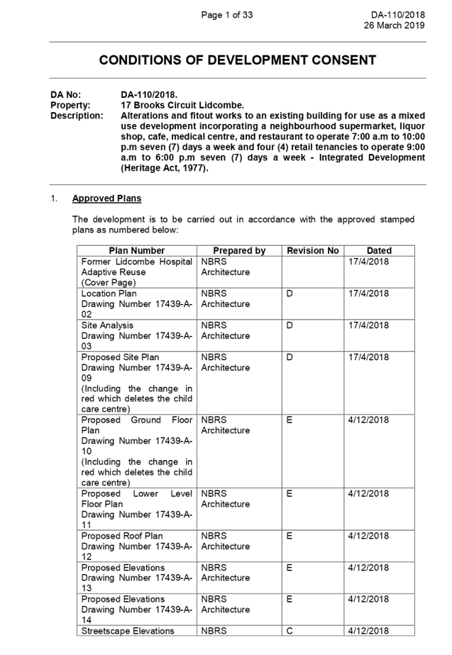
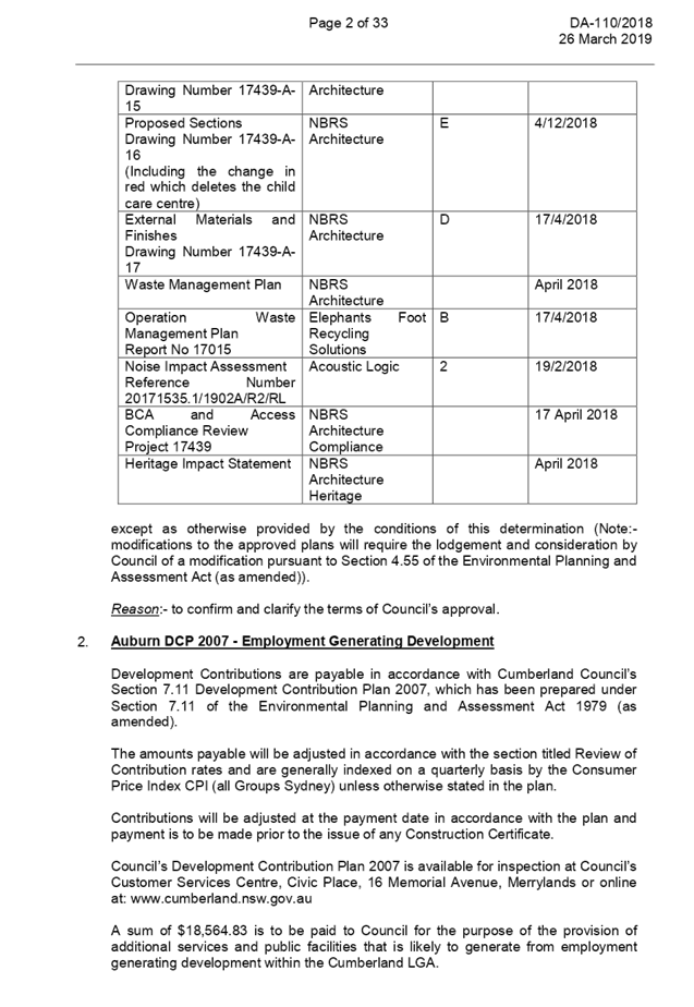
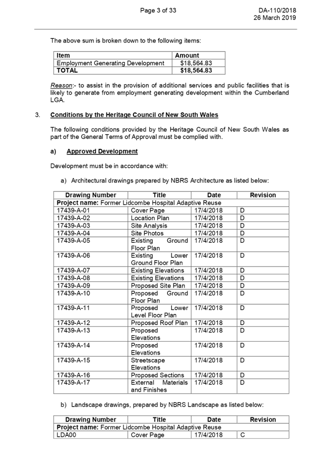
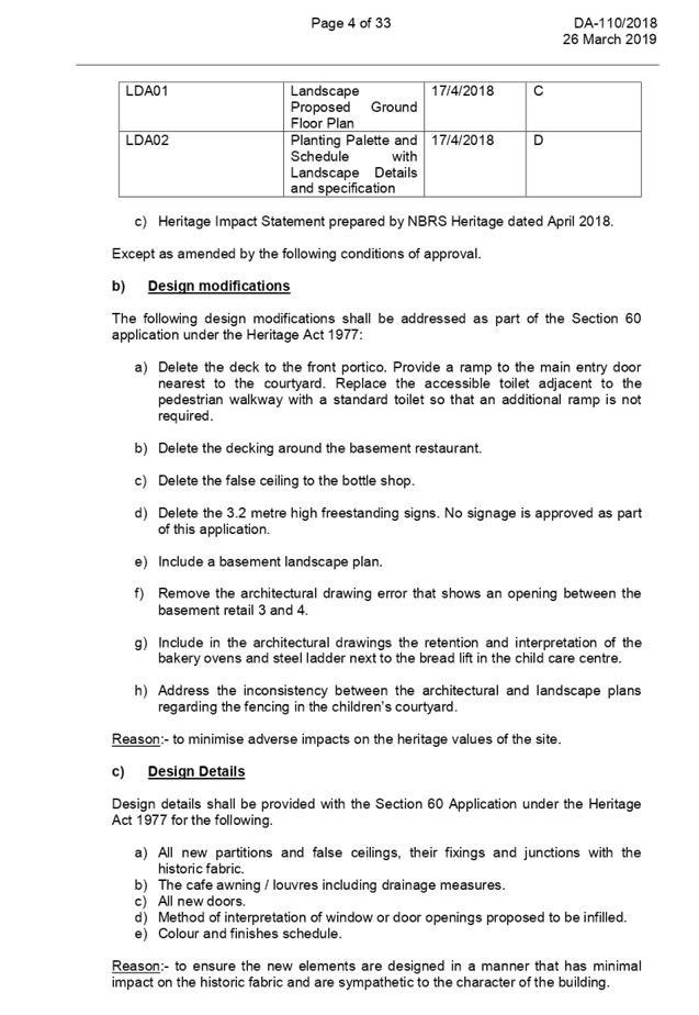
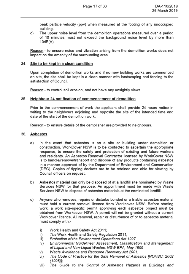
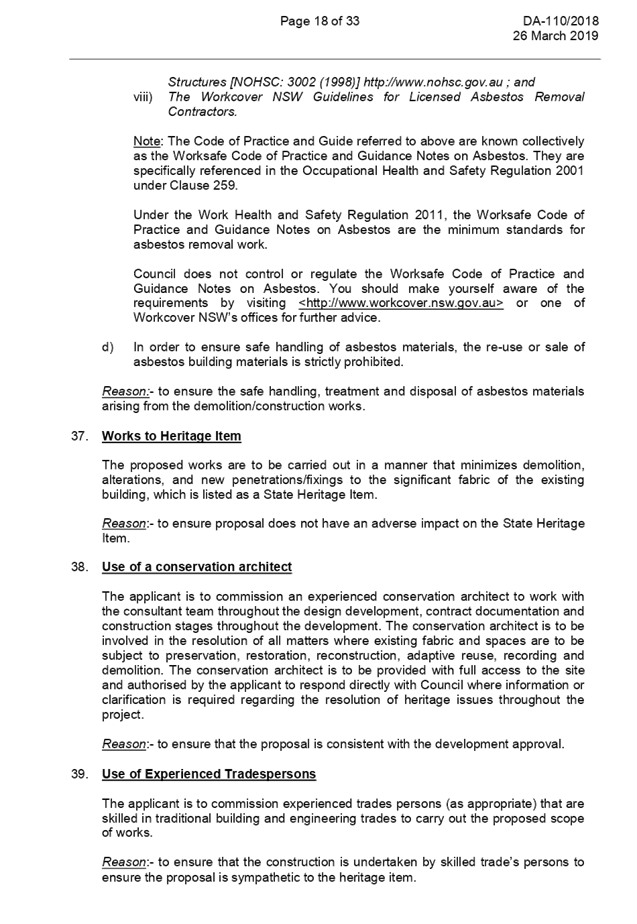
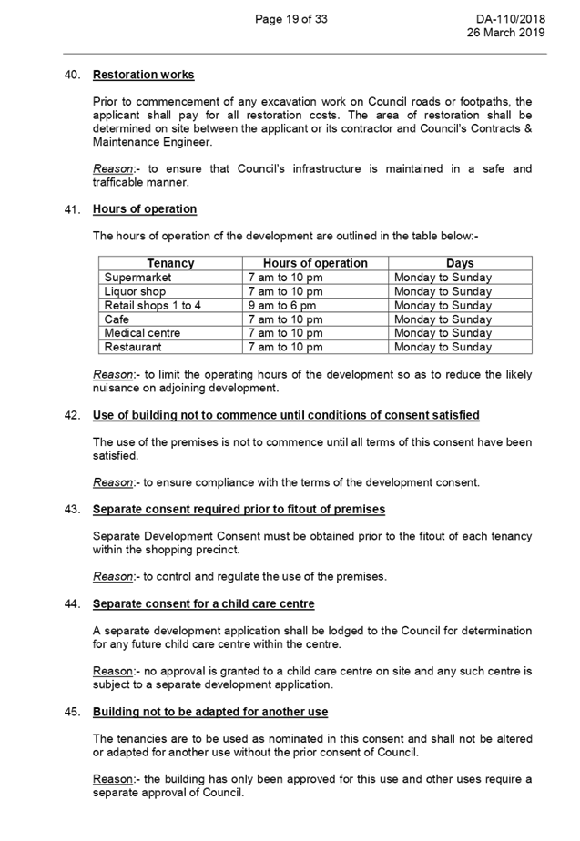
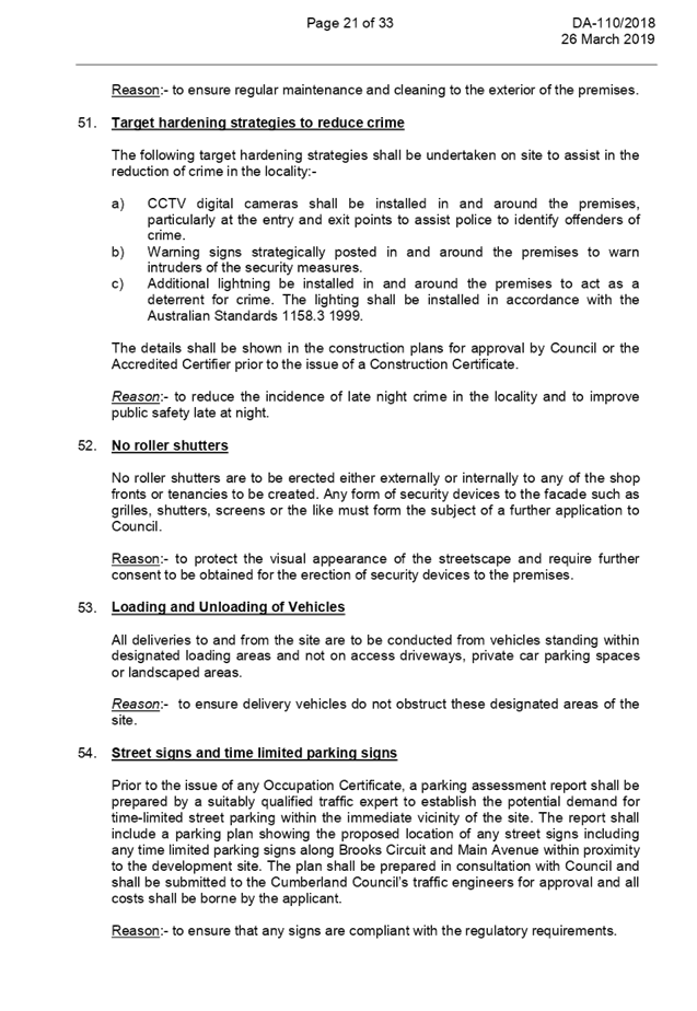
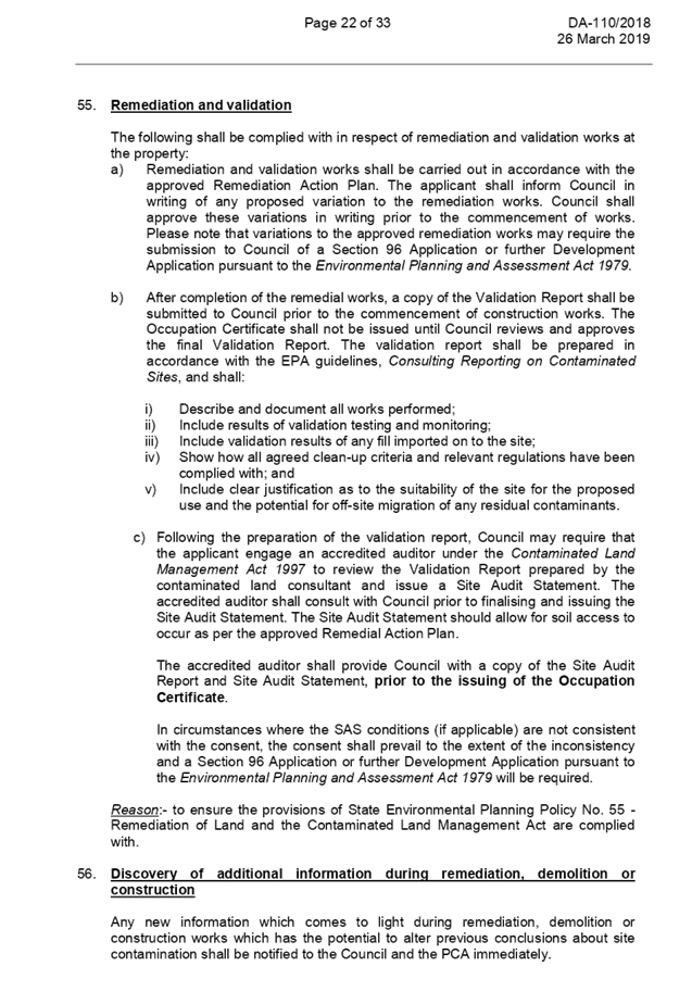
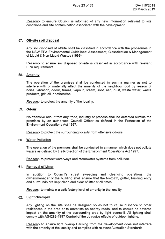
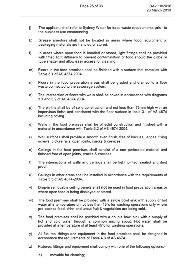
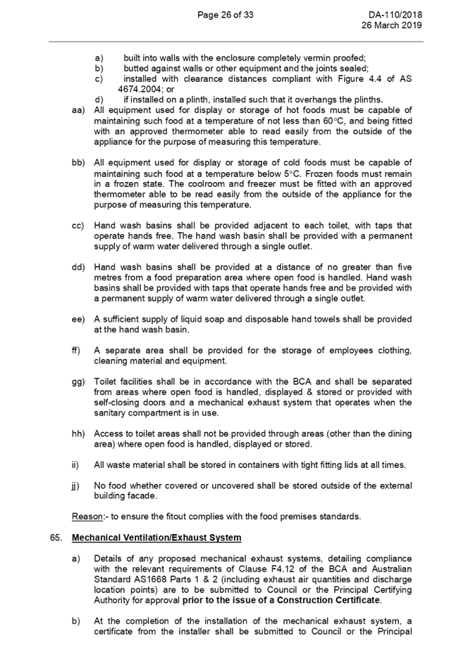
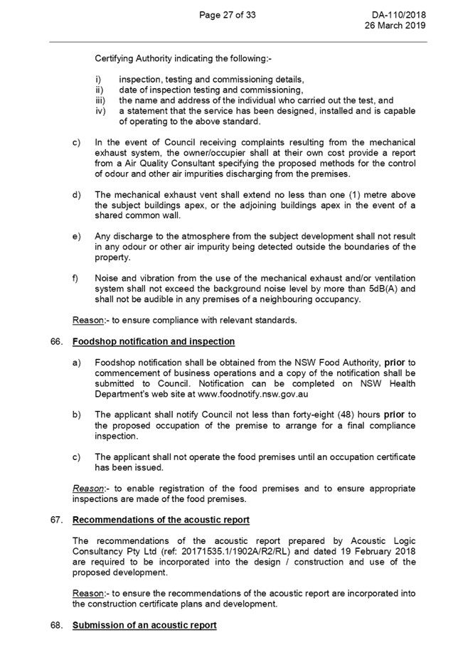
DOCUMENTS
ASSOCIATED WITH
REPORT LPP030/19
Attachment 2
Architectural Plans
Cumberland Local Planning Panel Meeting
8 May 2019
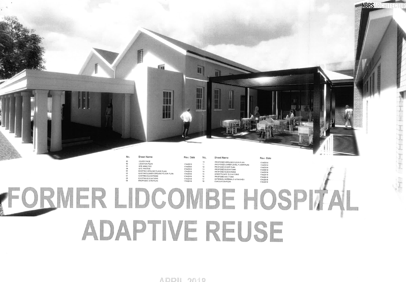
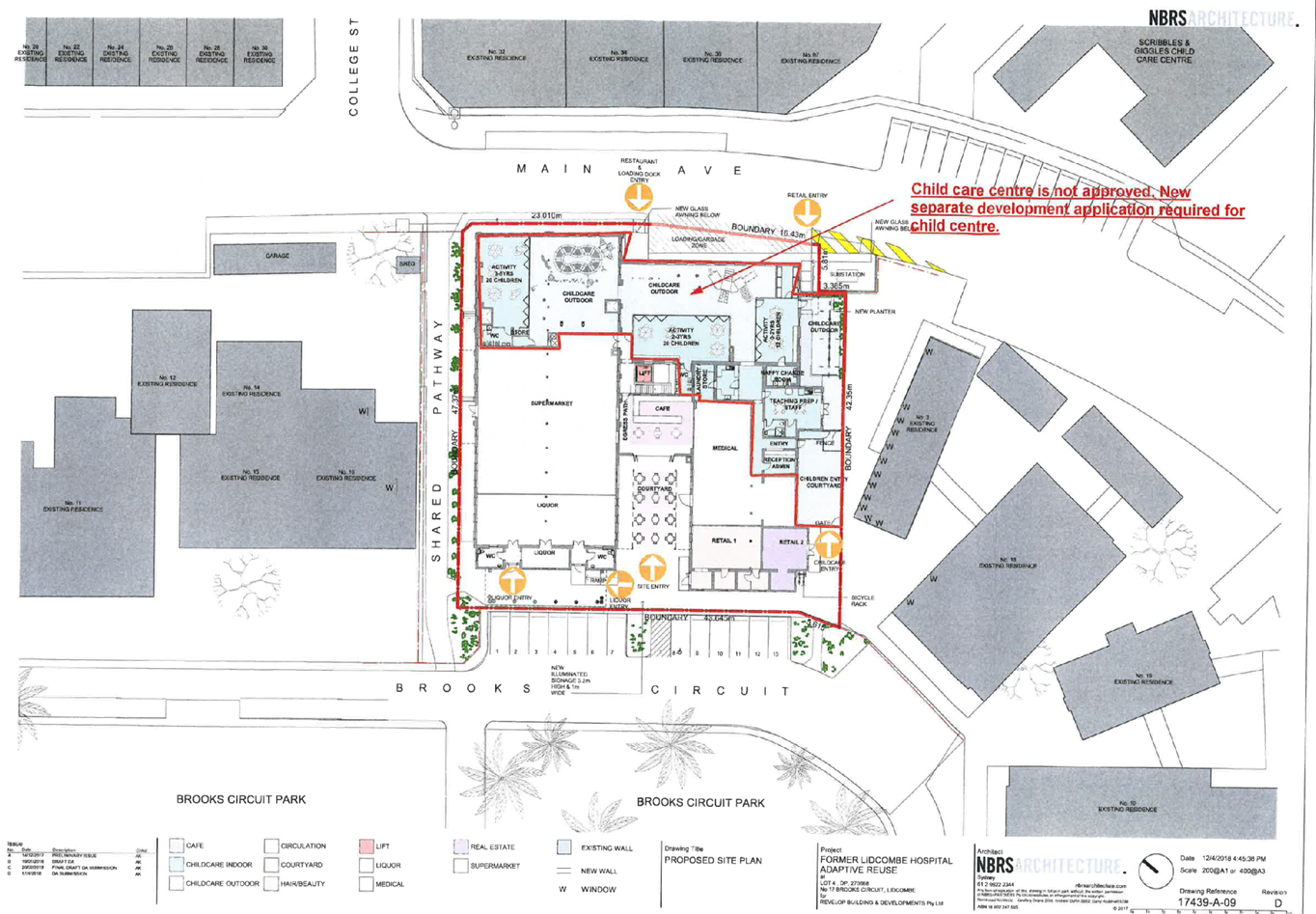
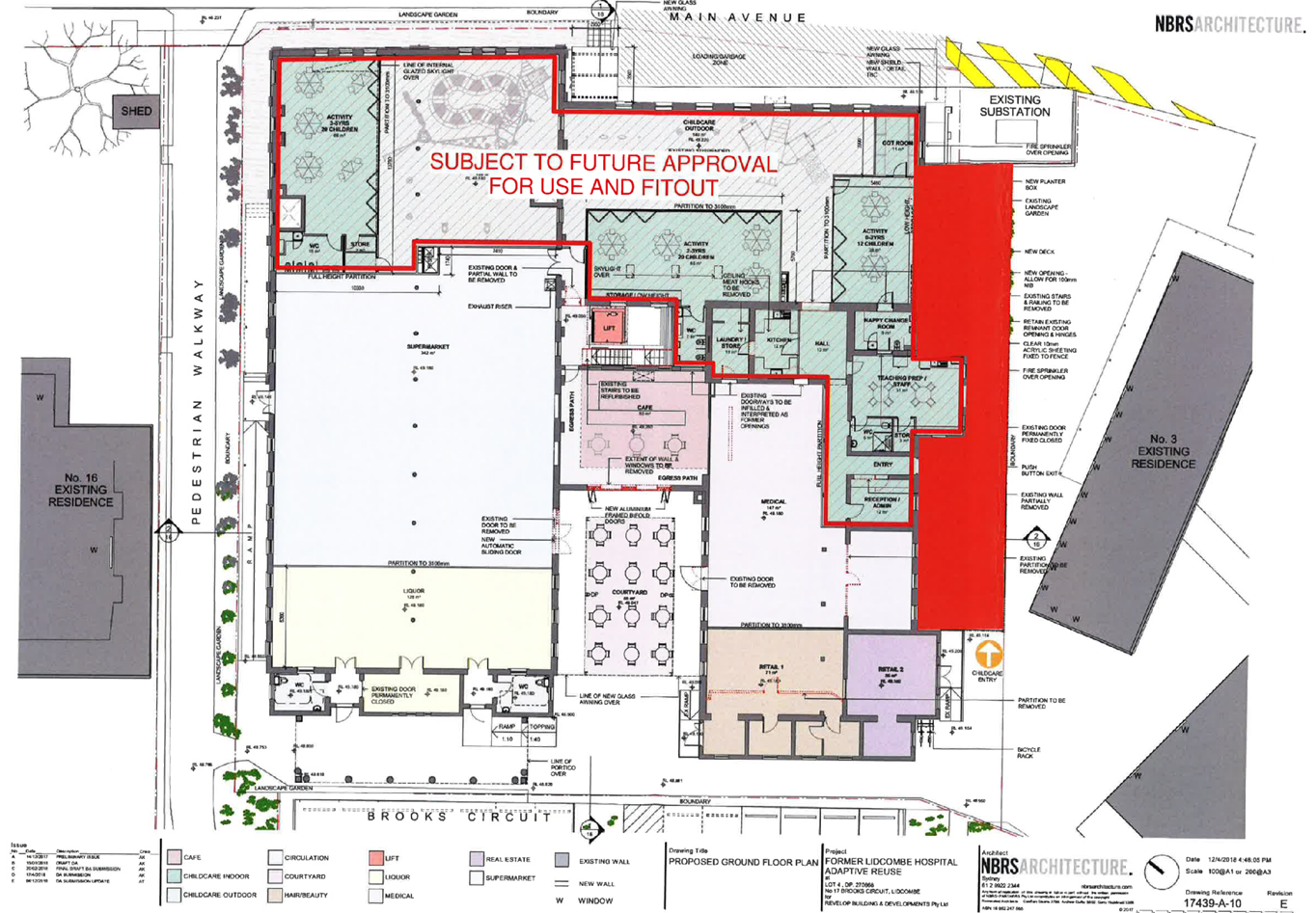
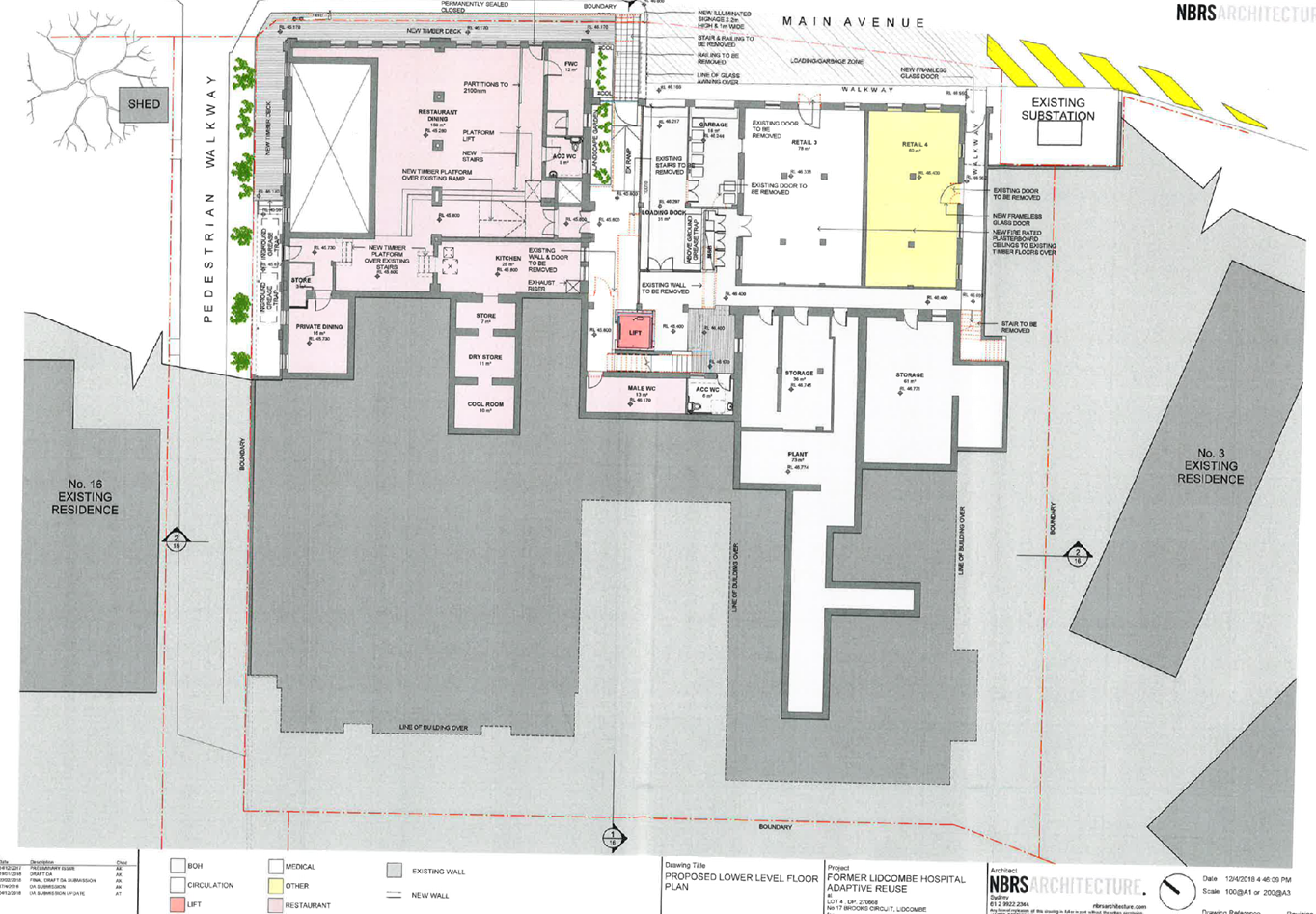
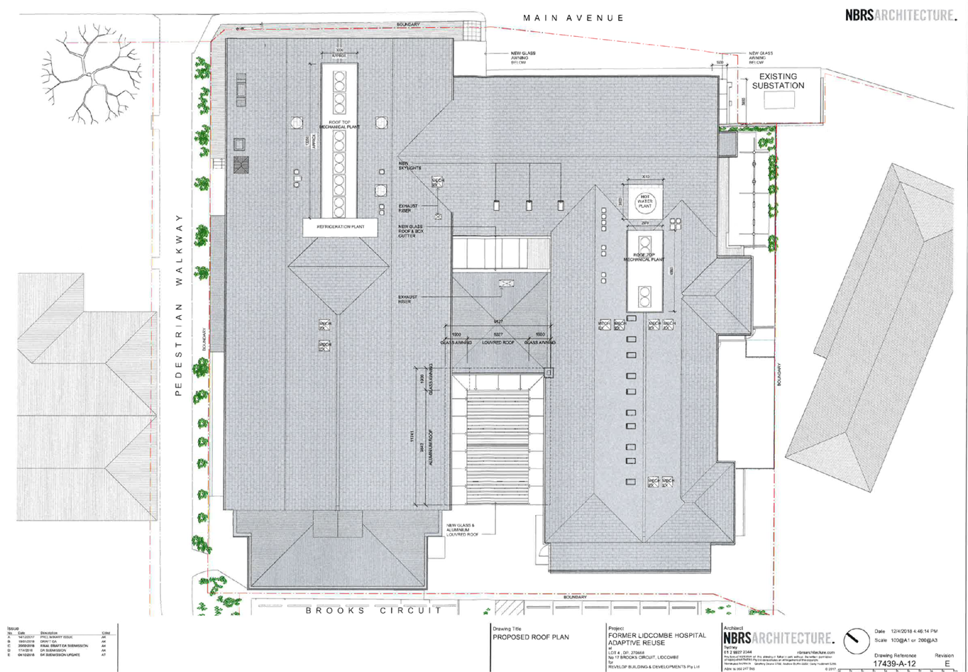
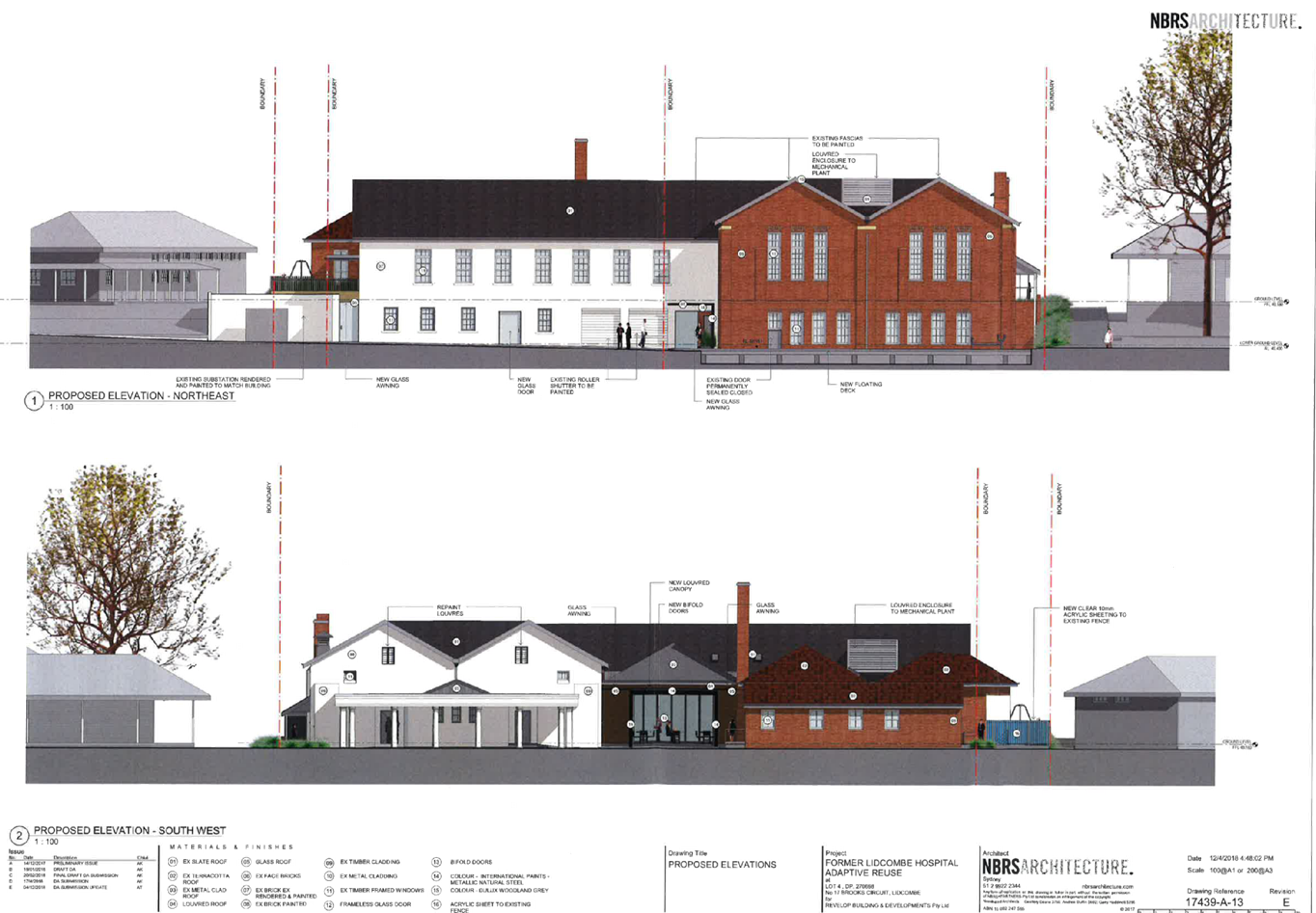
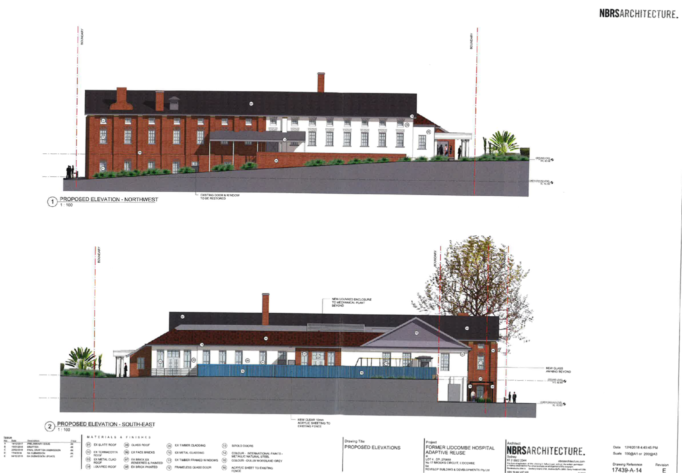
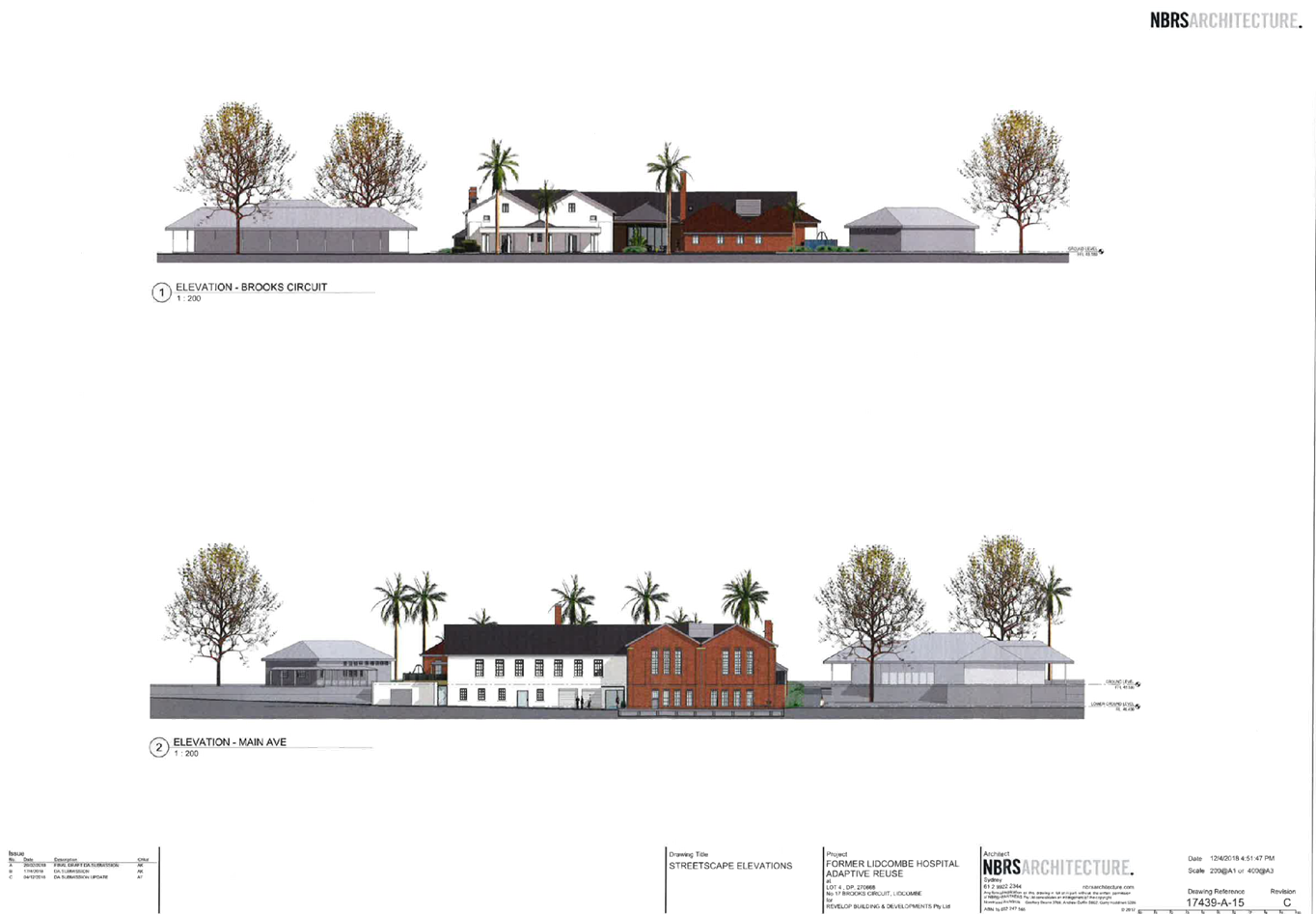
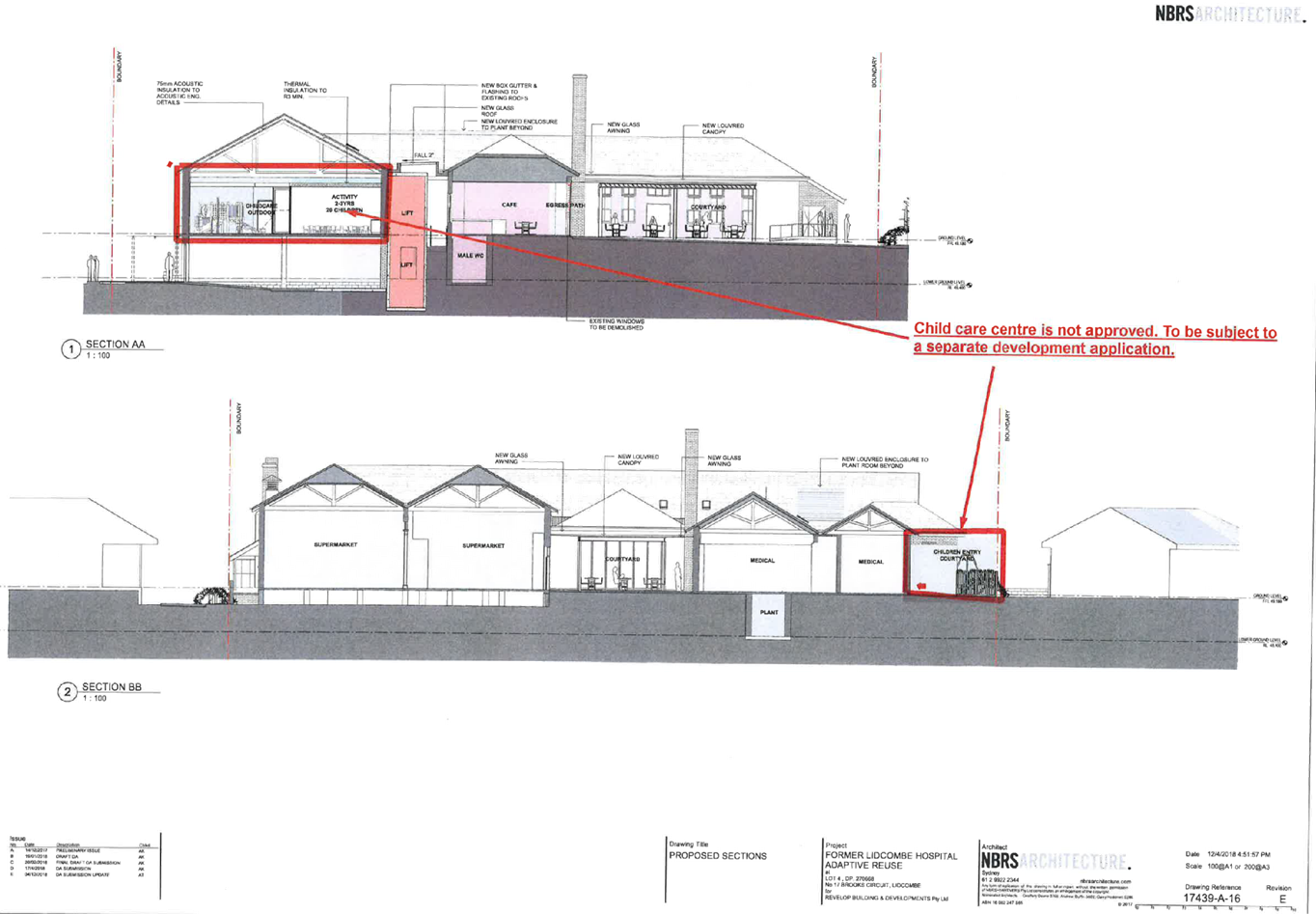
DOCUMENTS
ASSOCIATED WITH
REPORT LPP030/19
Attachment 3
Submissions Received - Part A
Cumberland Local Planning Panel Meeting
8 May 2019


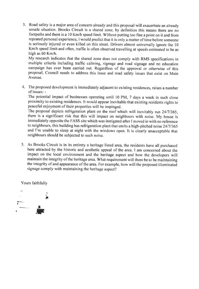


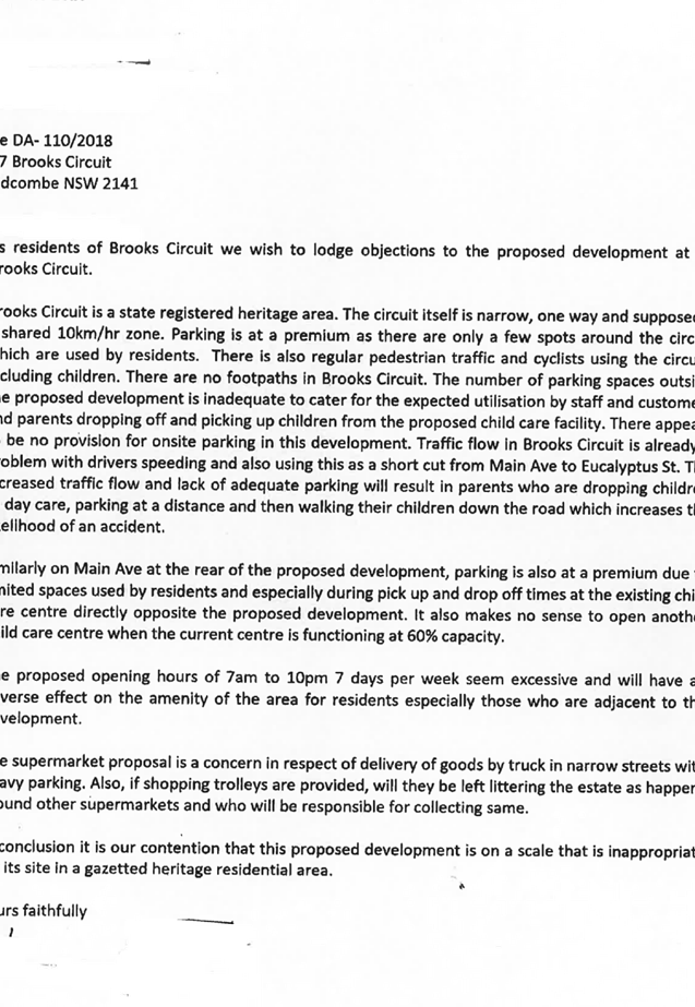
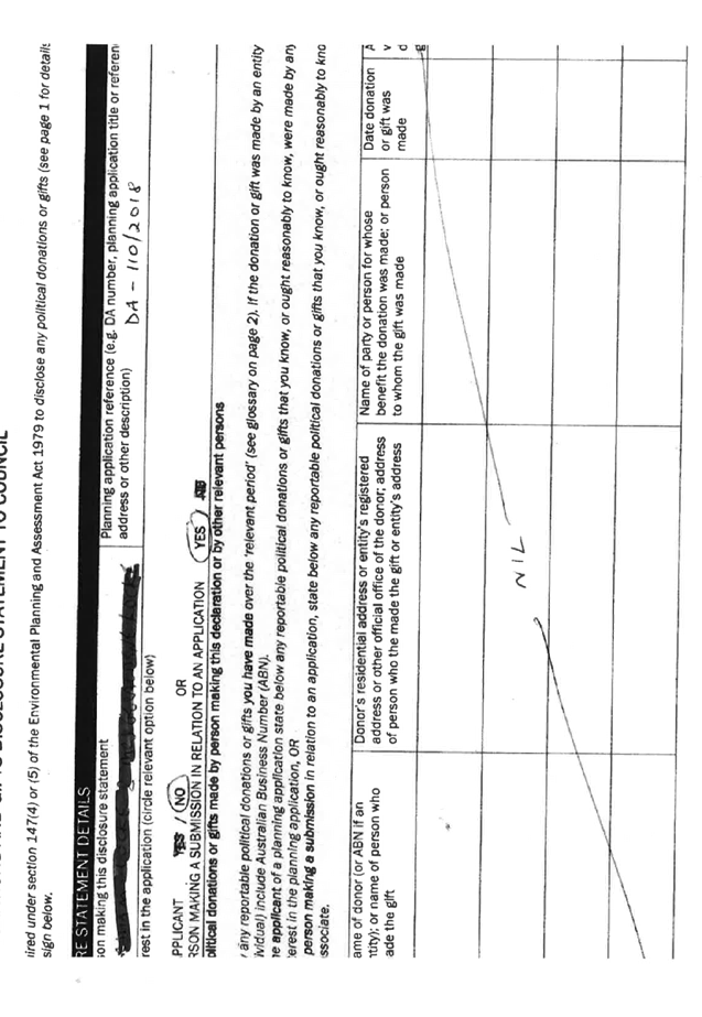
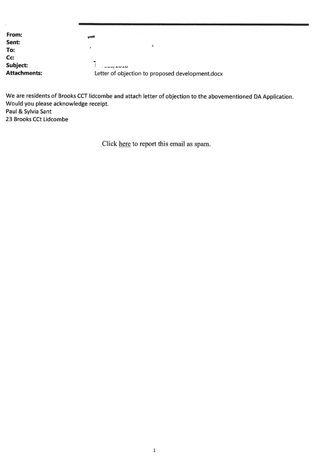


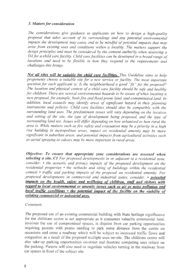
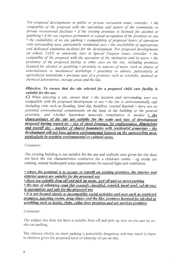
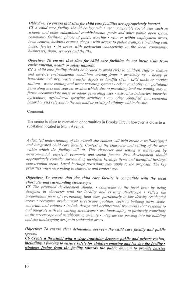
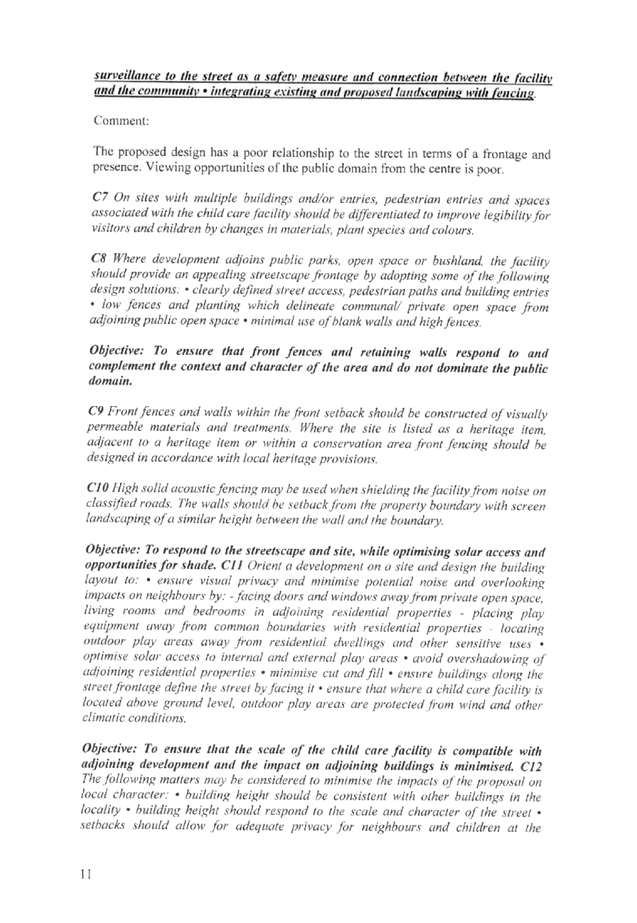
DOCUMENTS
ASSOCIATED WITH
REPORT LPP030/19
Attachment 4
Submissions Received - Part B
Cumberland Local Planning Panel Meeting
8 May 2019


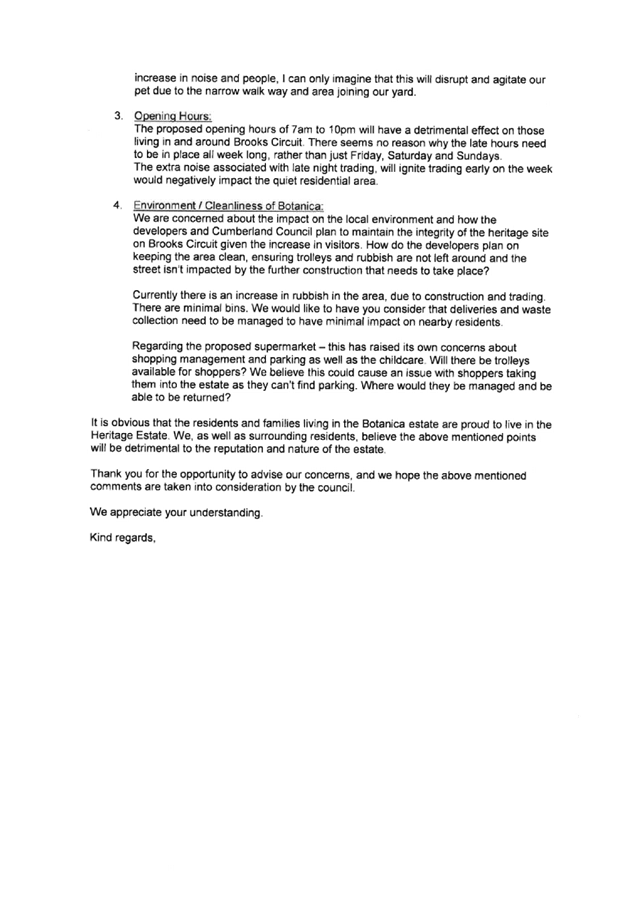


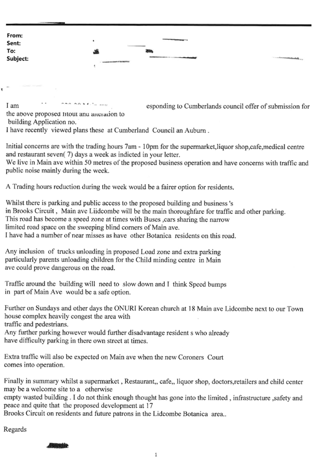


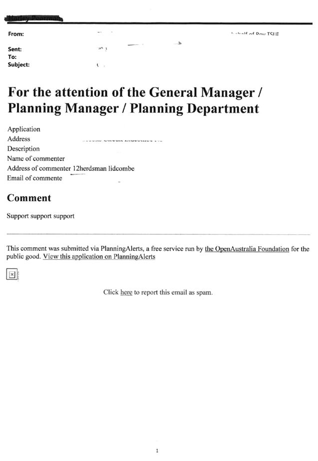
DOCUMENTS
ASSOCIATED WITH
REPORT LPP030/19
Attachment 5
Appendix A
Cumberland Local Planning Panel Meeting
8 May 2019
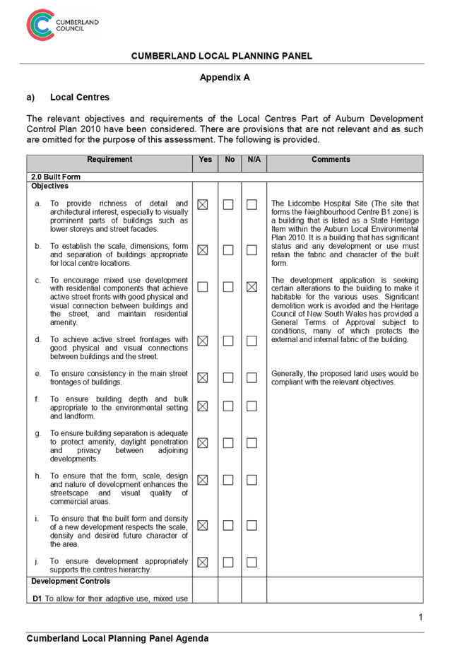
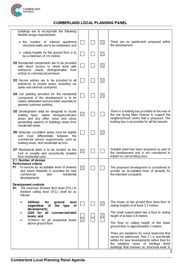
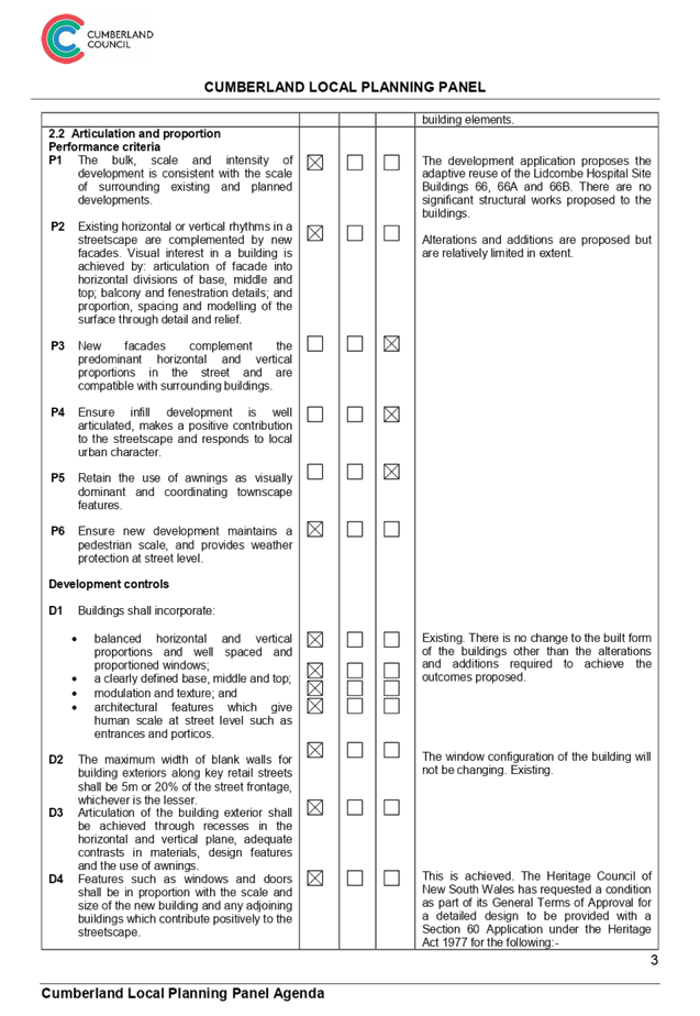
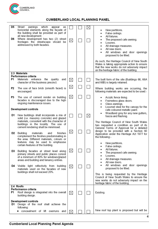
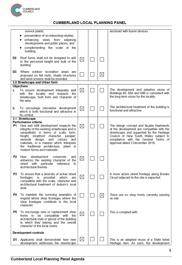
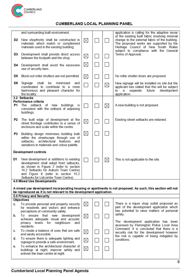
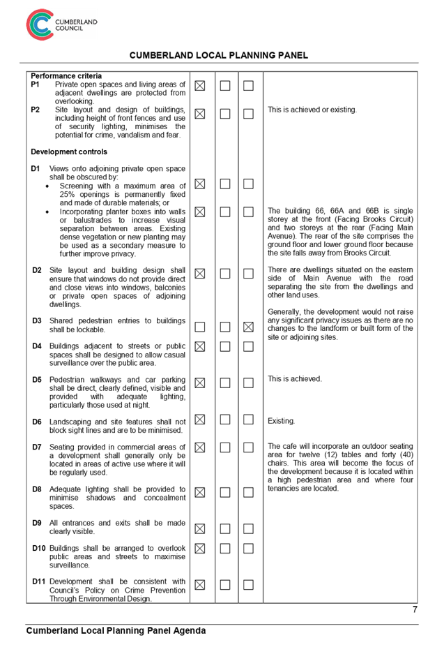
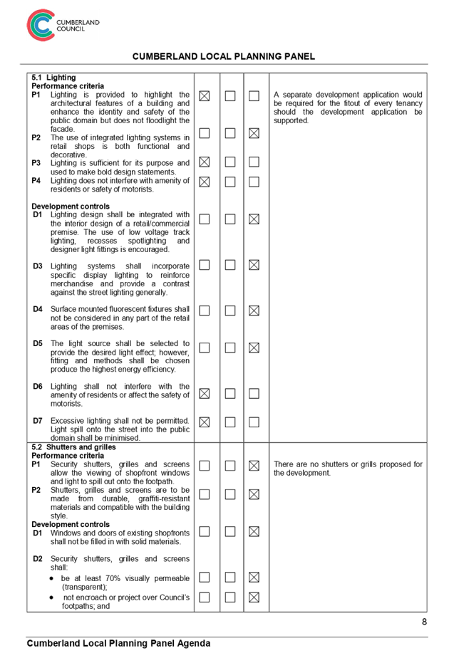
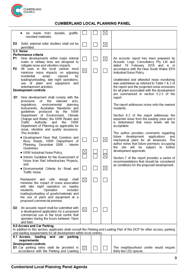
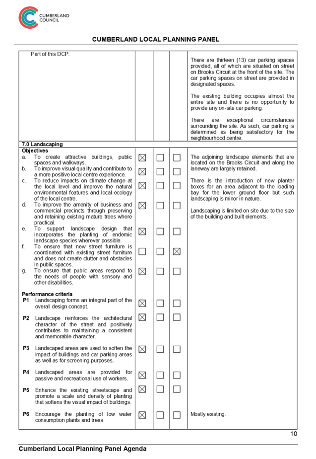
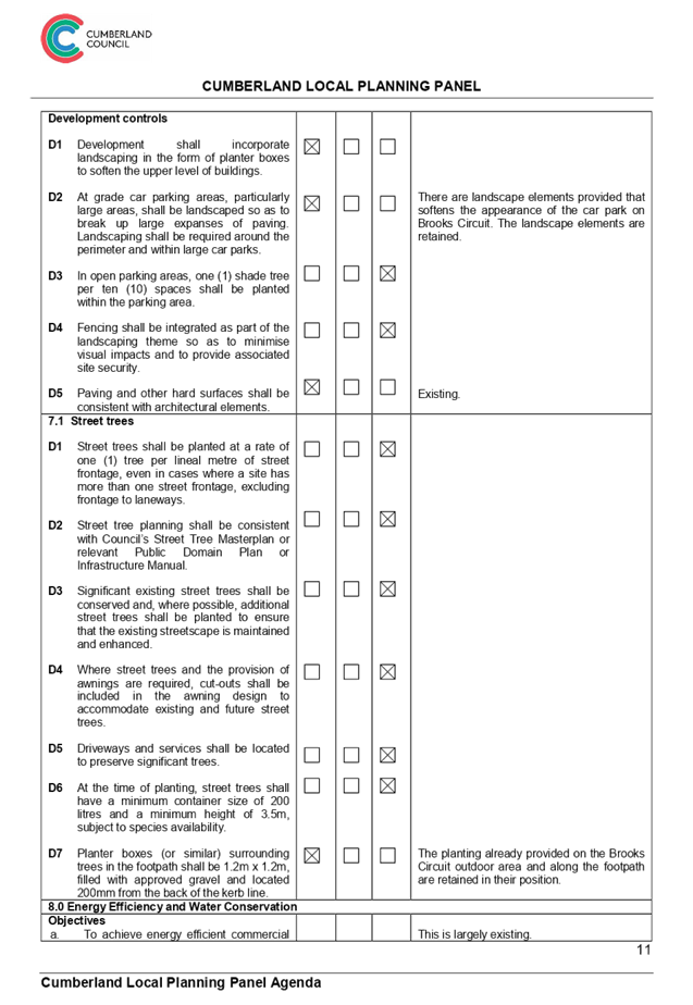
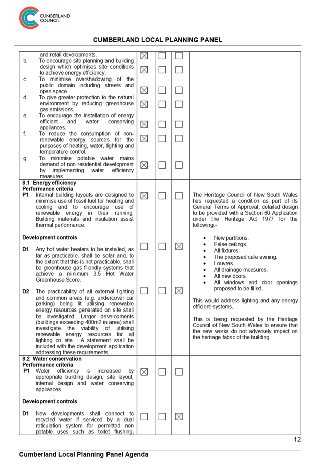
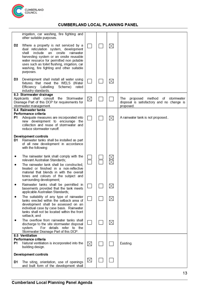
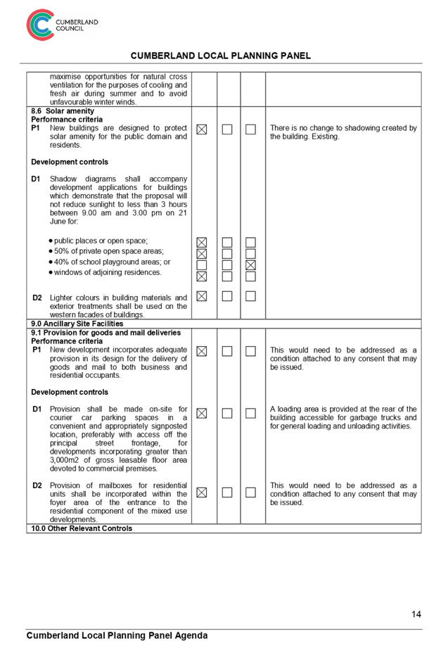
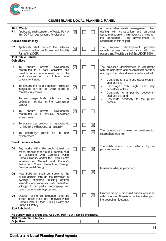
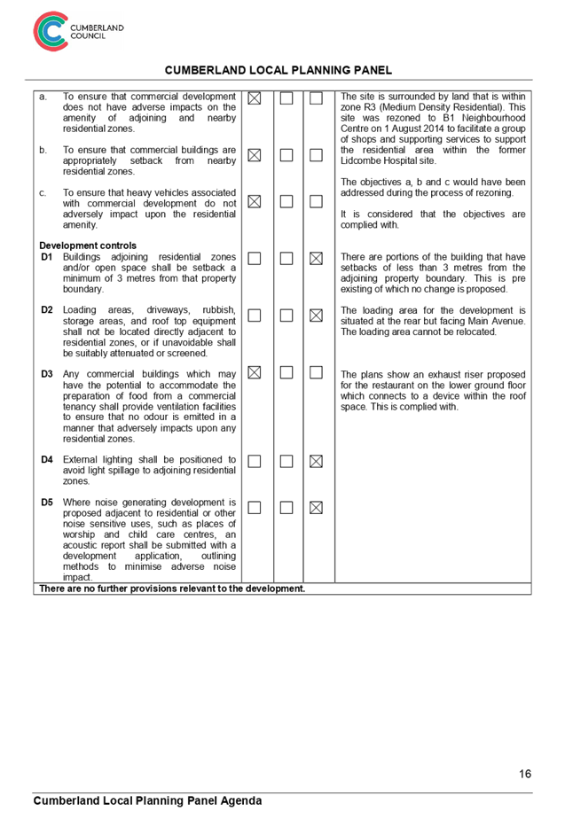
Cumberland
Local Planning Panel Meeting
8 May 2019
Item No: LPP031/19
Auburn and
Lidcombe Town Centres Planning Controls Strategy
Responsible
Division: Environment
& Planning
Officer: Manager
Strategic Planning
File
Number: S-5740-02
Community
Strategic Plan Goal: A resilient built environment
This
report provides relevant information on the Council report and minutes for the
Auburn and Lidcombe Town Centres Planning Controls Strategy for consideration
and advice by the Cumberland Local Planning Panel.
|
That the Cumberland Local Planning Panel consider
and provide advice on the report and minutes of 17 April 2019 for the Auburn
and Lidcombe Town Centres planning controls strategy.
|
The
Auburn and Lidcombe Town Centres Planning Controls Strategy was reported to
Council at the meeting on 17 April 2019 (Attachments 1 to 5). One of the
items under the resolution from the meeting was for Council to refer the
Strategy to the Cumberland Local Planning Panel for advice (Attachment 6).
This
report provides the relevant information on the Council report and minutes for
the Auburn and Lidcombe Town Centres Planning Controls Strategy for
consideration and advice by the Cumberland Local Planning Panel.
Community engagement is outlined
in the attached Council report.
Policy
implications are outlined in the attached Council report.
There are minimal risk
implications for Council associated with this report.
There are minimal financial
implications for Council associated with this report.
This
report provides the relevant information on the Council report and minutes for
the Auburn and Lidcombe Town Centres Planning Controls Strategy for
consideration and advice by the Cumberland Local Planning Panel.
1. Council
Report - 17 April 2019 ⇩ 
2. Planning
Controls Strategy for Auburn and Lidcombe Town Centres ⇩
3. Submissions
received during public exhibition ⇩ 
4. Council
Report and Minutes - 21 December 2016 ⇩ 
5. Cumberland
IHAP Reports - 17 November 2016 ⇩
6. Council
Minutes - 17 April 2019 ⇩
DOCUMENTS
ASSOCIATED WITH
REPORT LPP031/19
Attachment 1
Council Report - 17 April 2019
Cumberland Local Planning Panel Meeting
8 May 2019
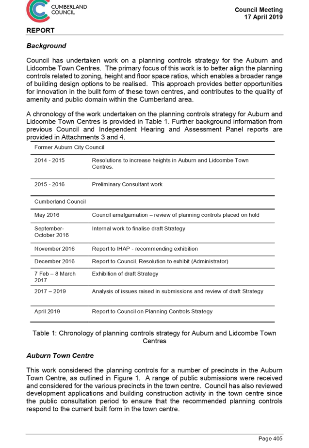
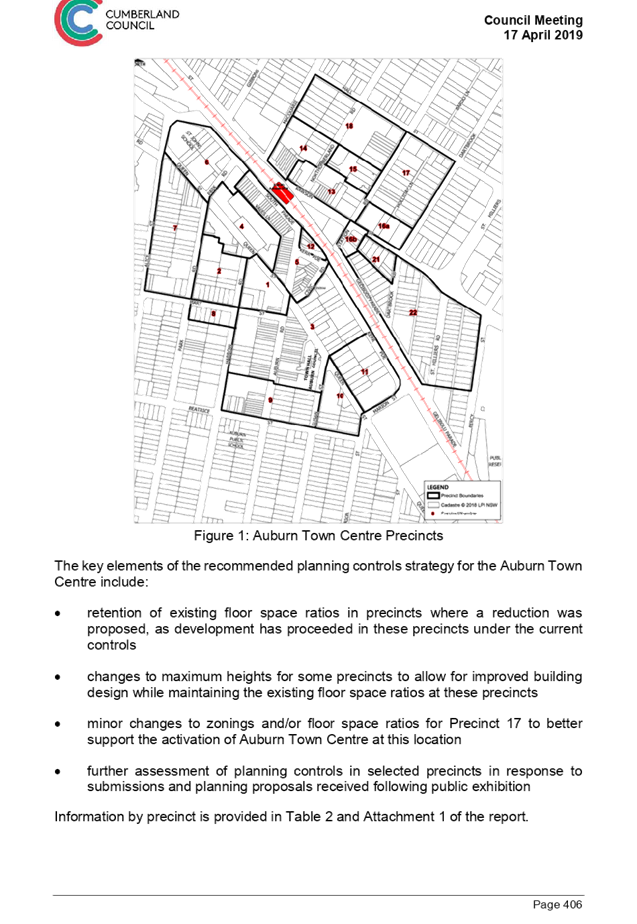
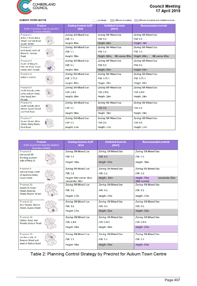
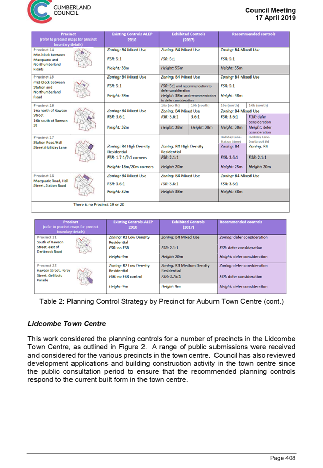
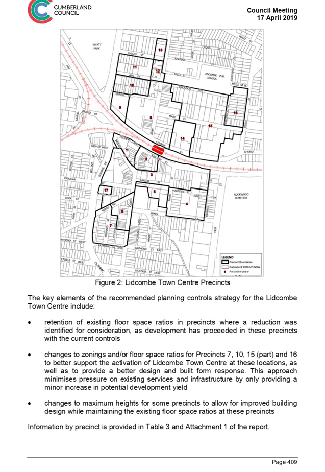
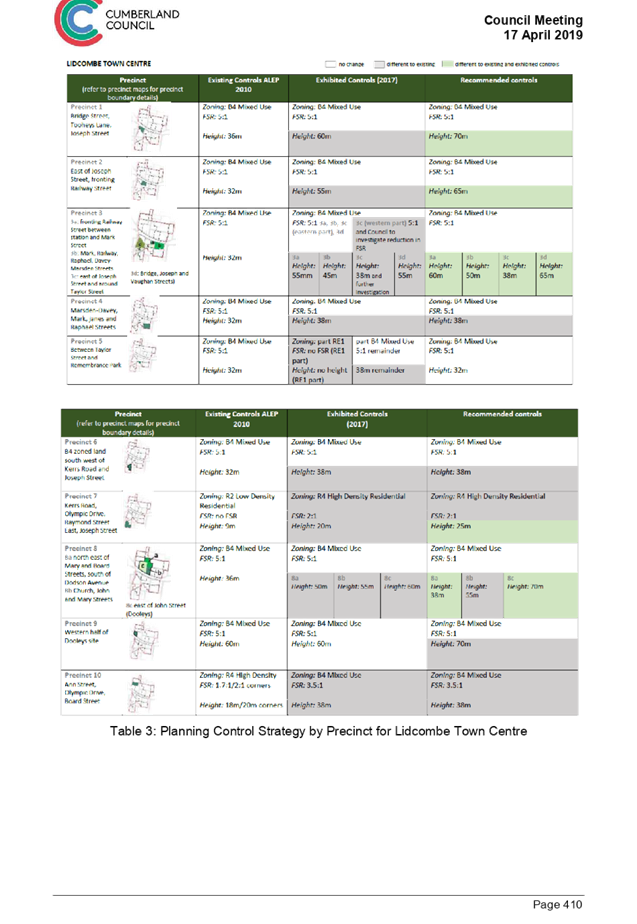
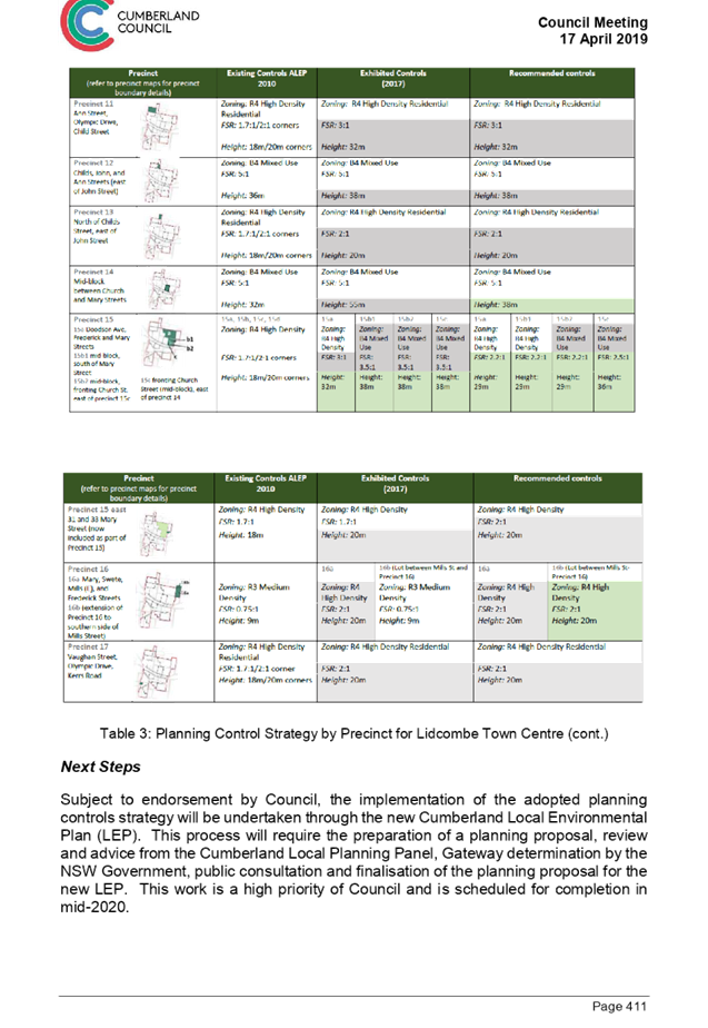
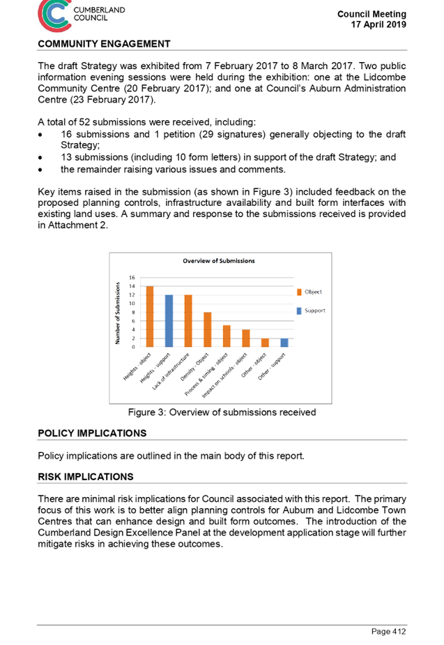
DOCUMENTS
ASSOCIATED WITH
REPORT LPP031/19
Attachment 2
Planning Controls Strategy for Auburn and Lidcombe
Town Centres
Cumberland Local Planning Panel Meeting
8 May 2019
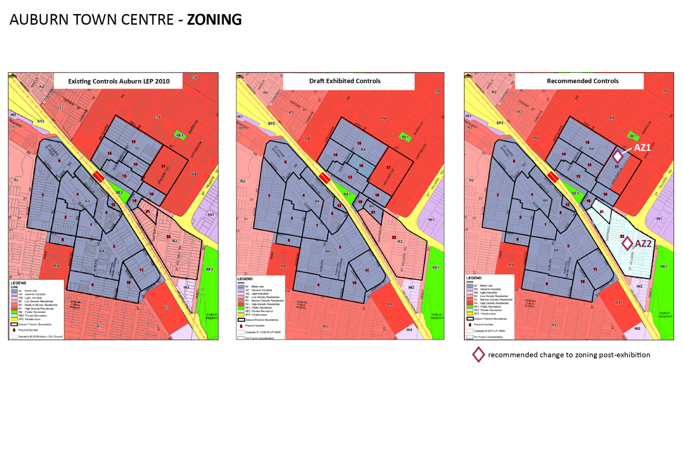
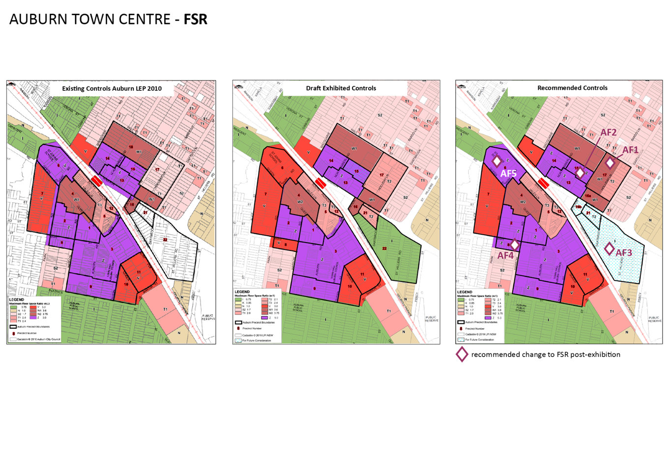
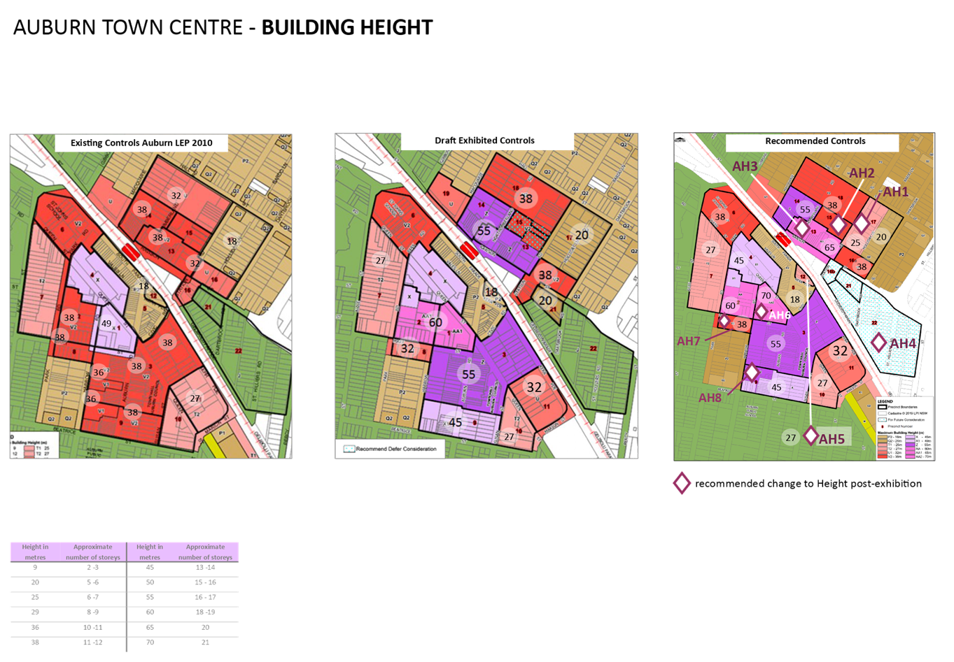
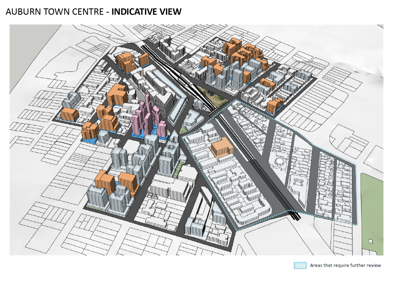
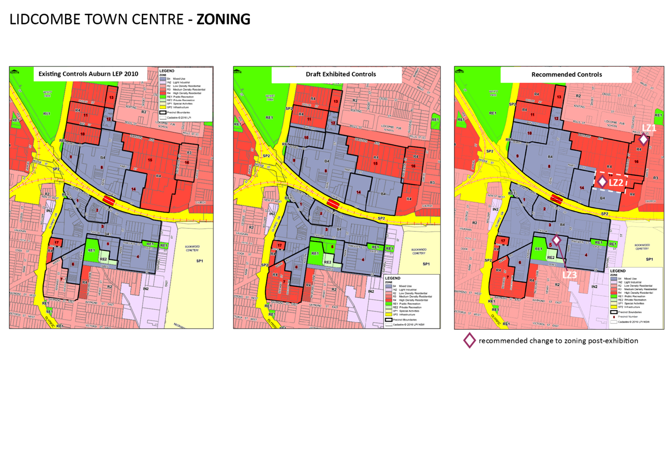
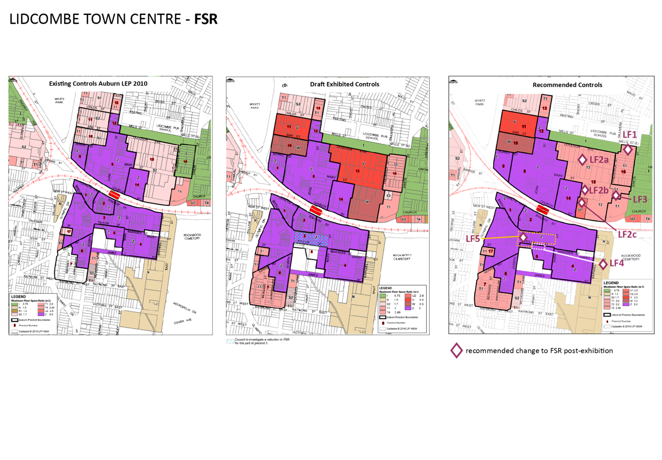
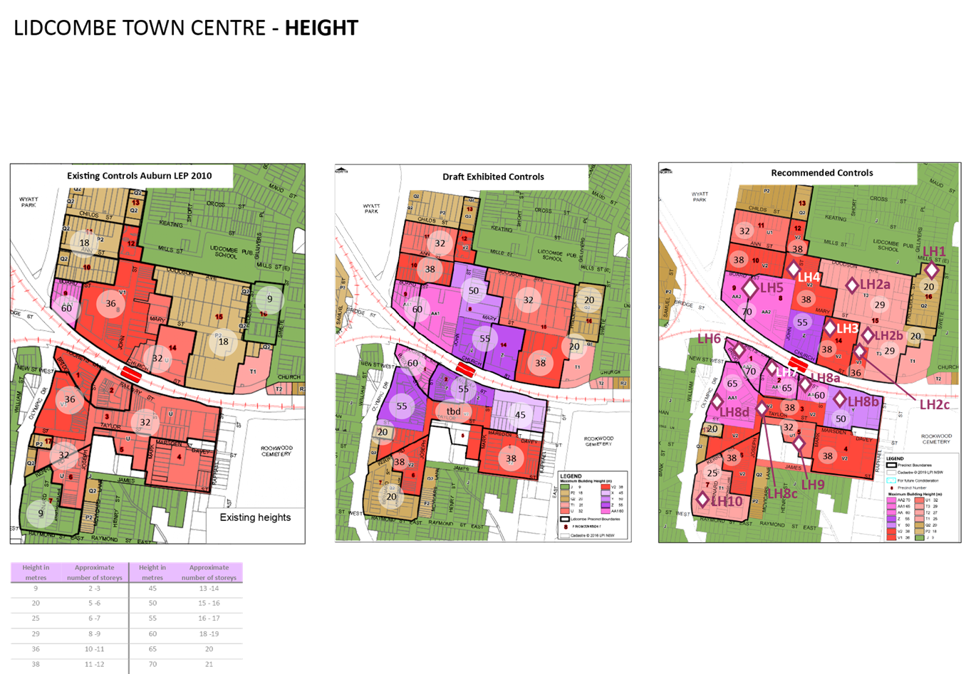
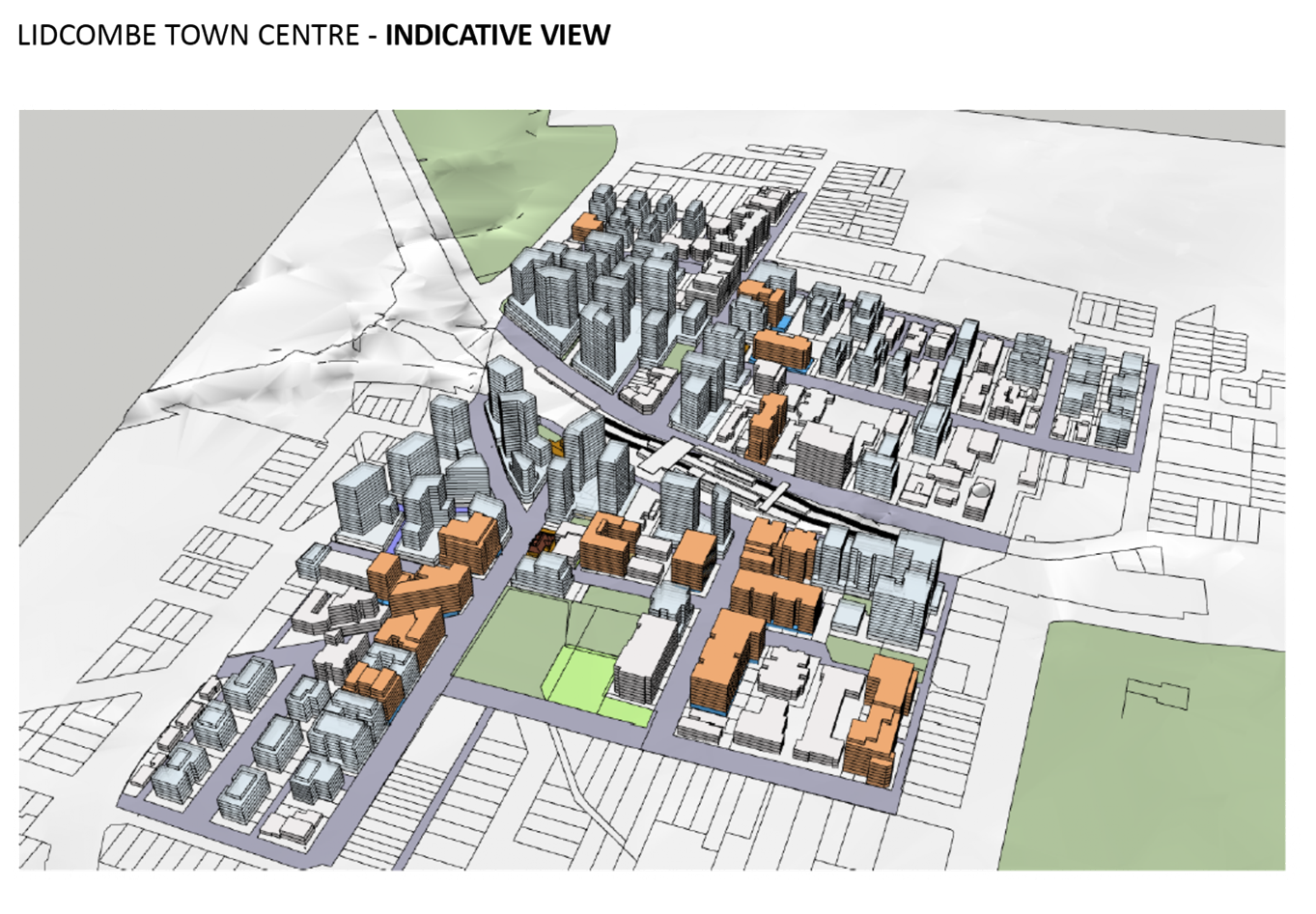
Cumberland Local Planning Panel Meeting
8 May 2019
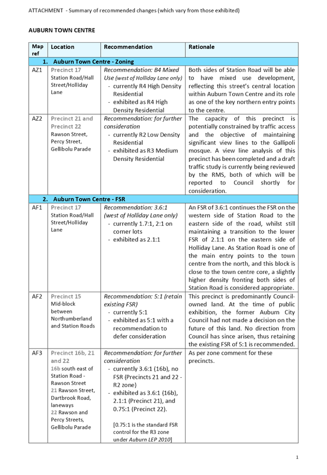
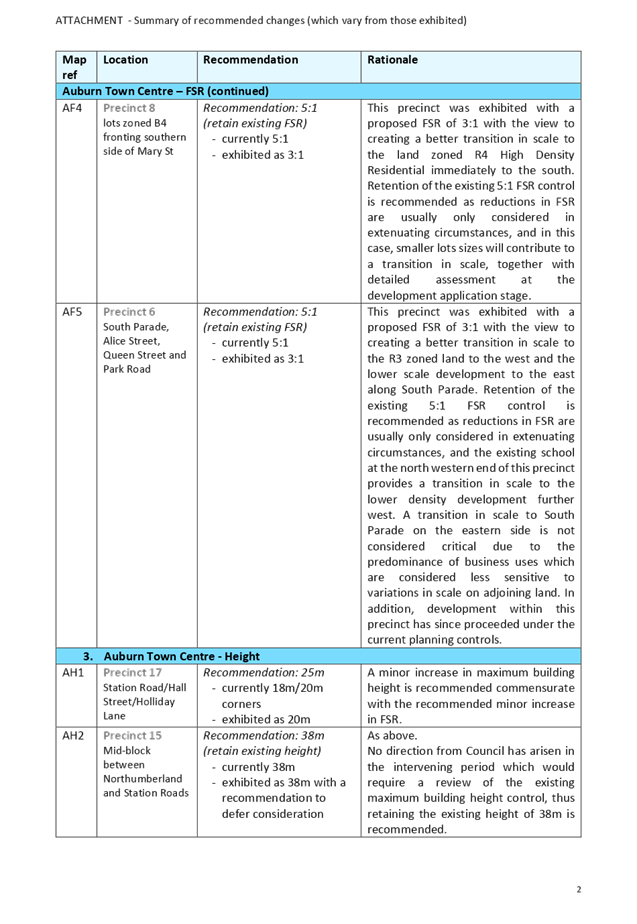
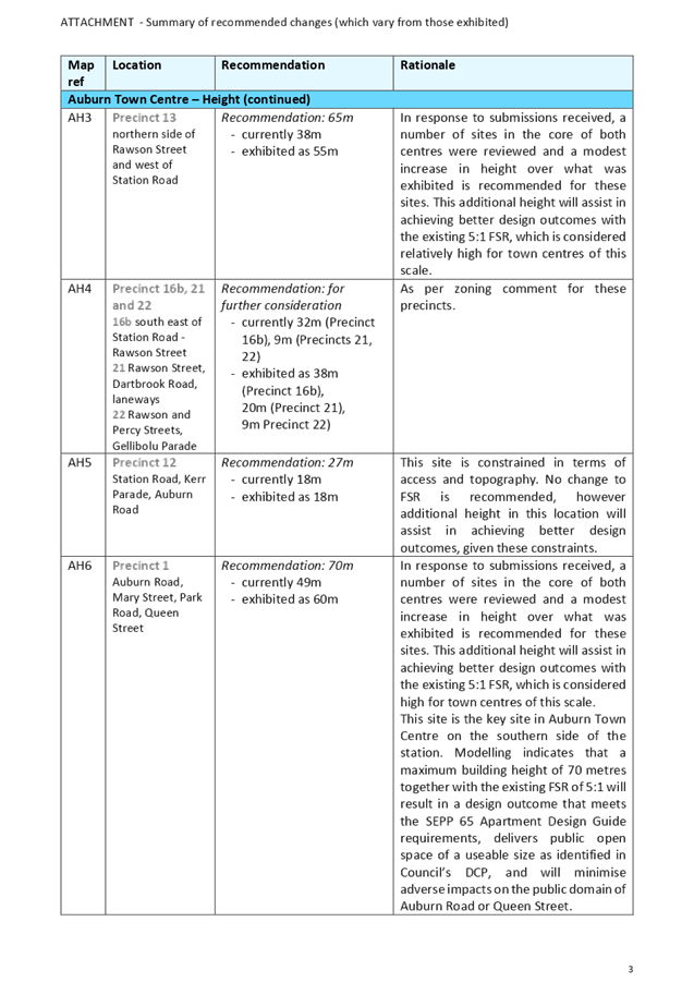

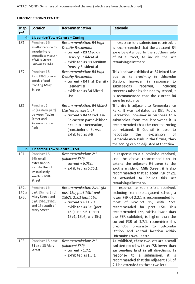
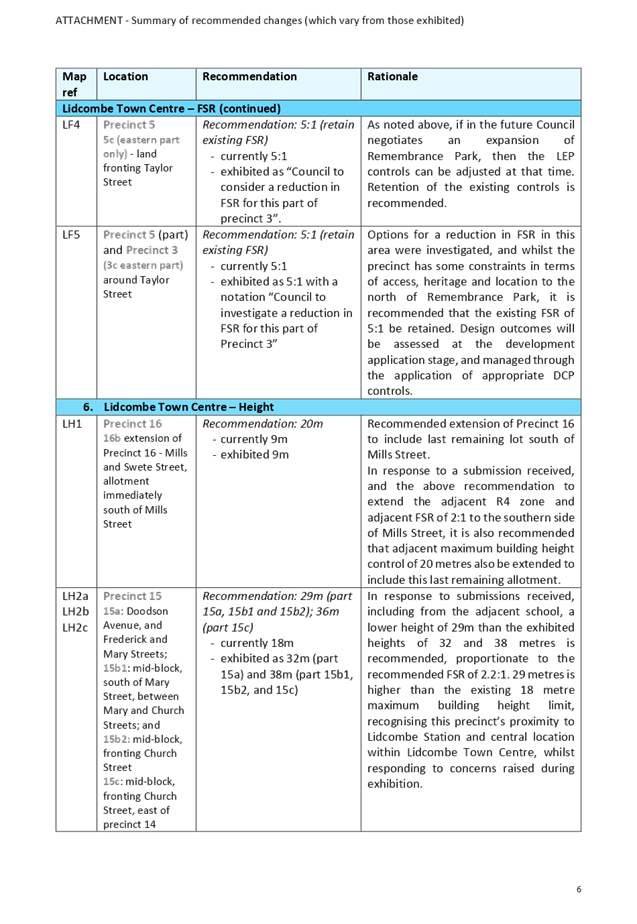
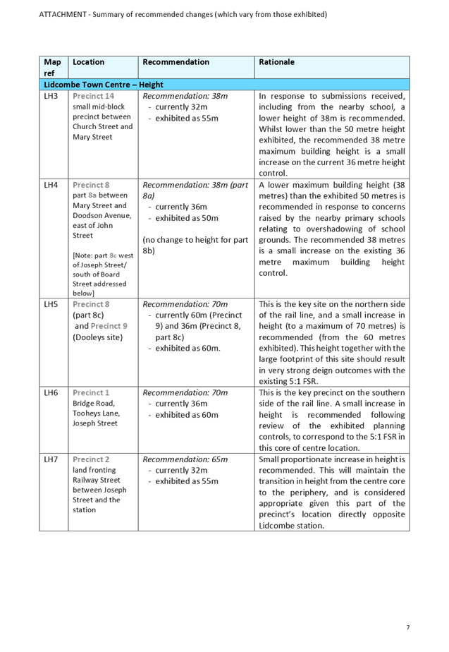
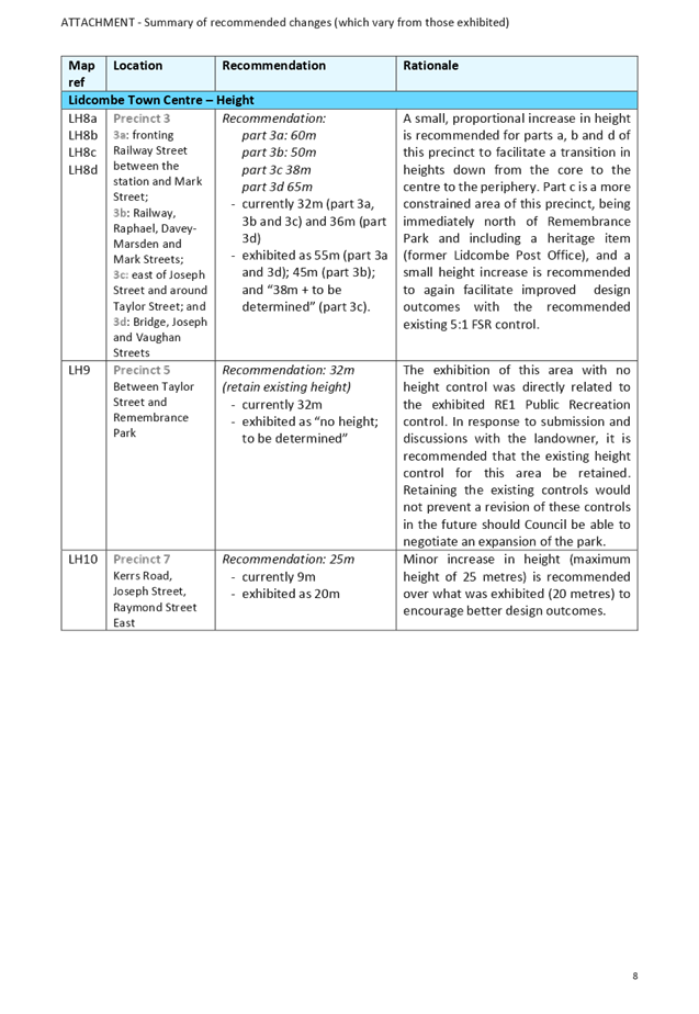
DOCUMENTS
ASSOCIATED WITH
REPORT LPP031/19
Attachment 3
Submissions received during public exhibition
Cumberland Local Planning Panel Meeting
8 May 2019
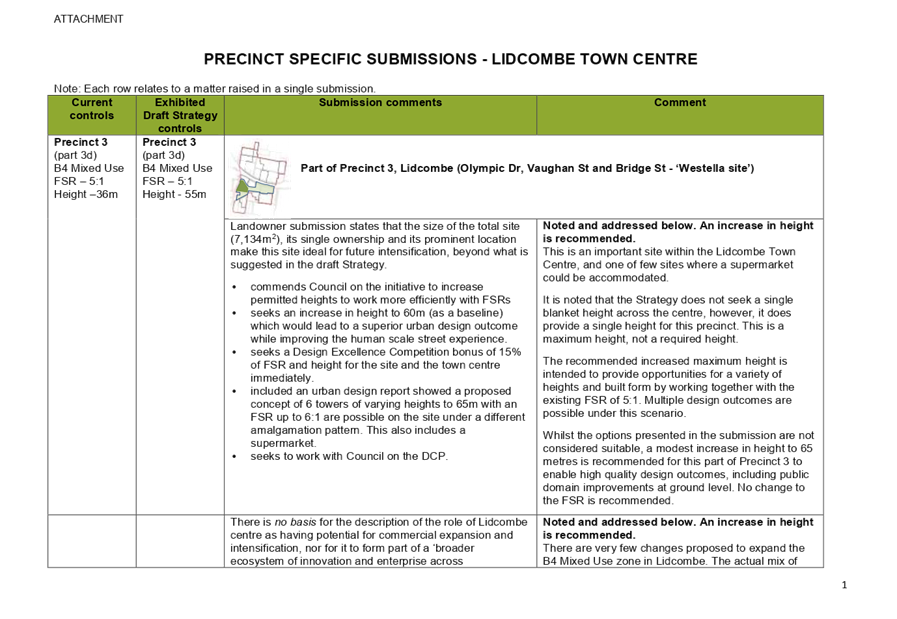
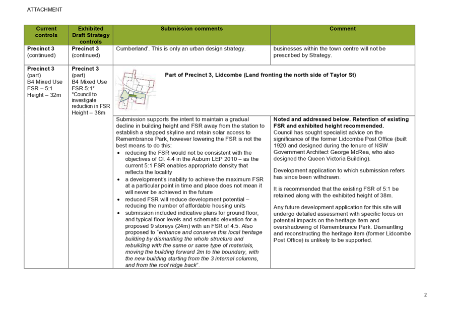
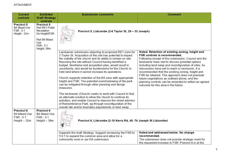
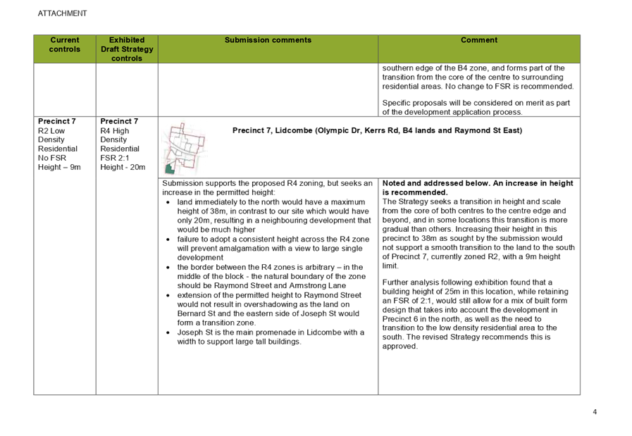
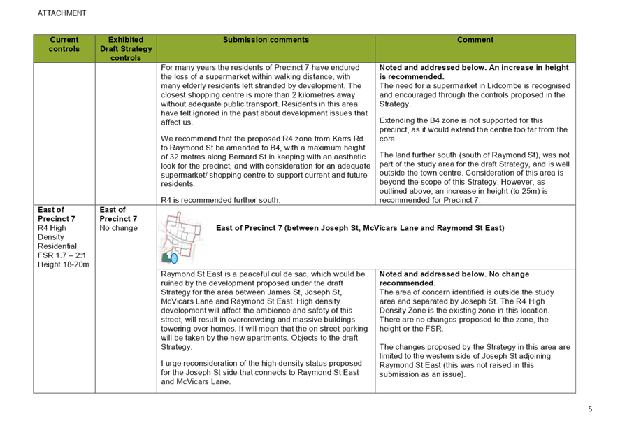
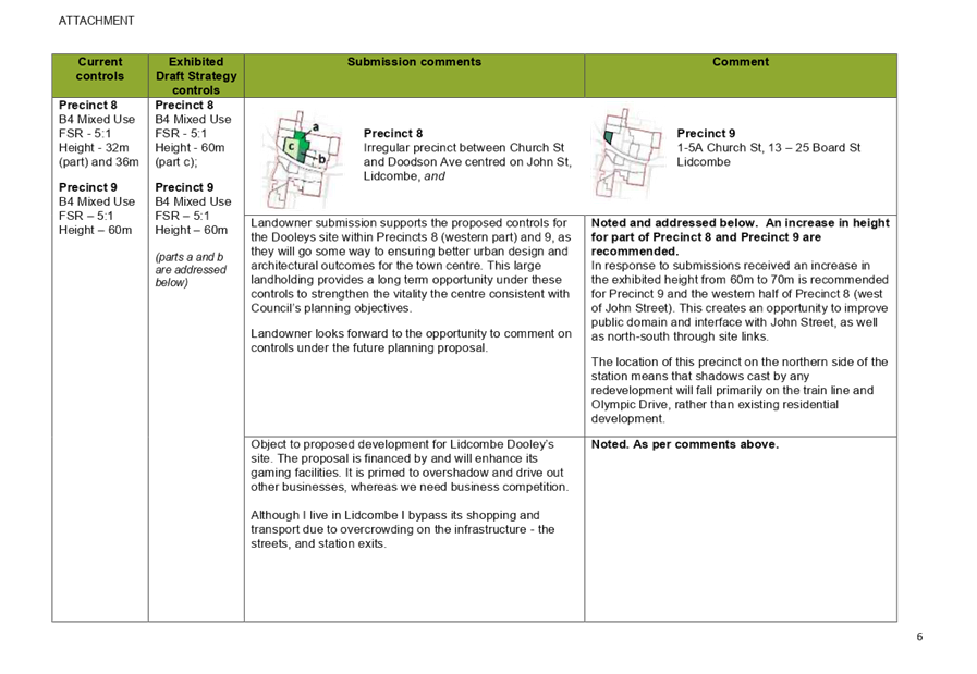
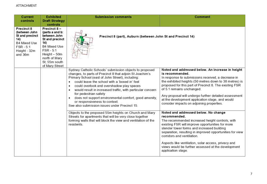
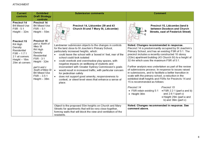
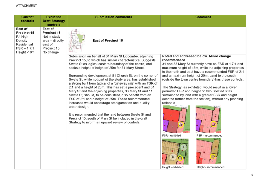

DOCUMENTS
ASSOCIATED WITH
REPORT LPP031/19
Attachment 4
Council Report and Minutes - 21 December 2016
Cumberland Local Planning Panel Meeting
8 May 2019


DOCUMENTS
ASSOCIATED WITH
REPORT LPP031/19
Attachment 5
Cumberland IHAP Reports - 17 November 2016
Cumberland Local Planning Panel Meeting
8 May 2019
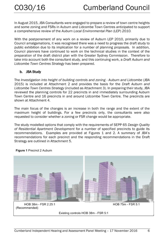

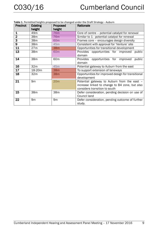
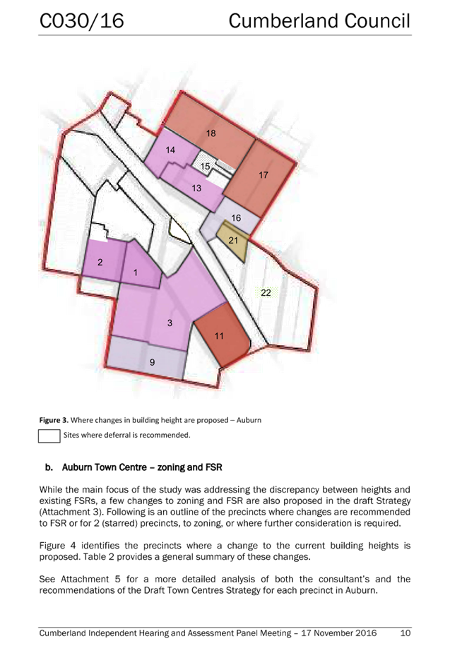
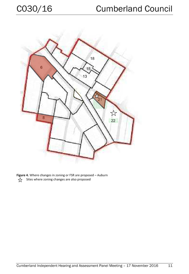
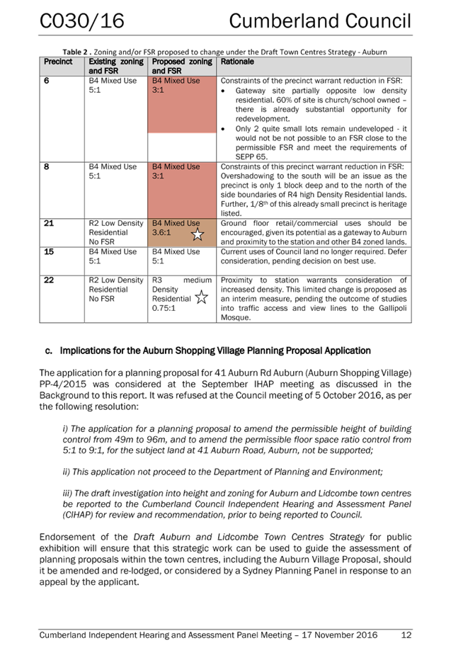
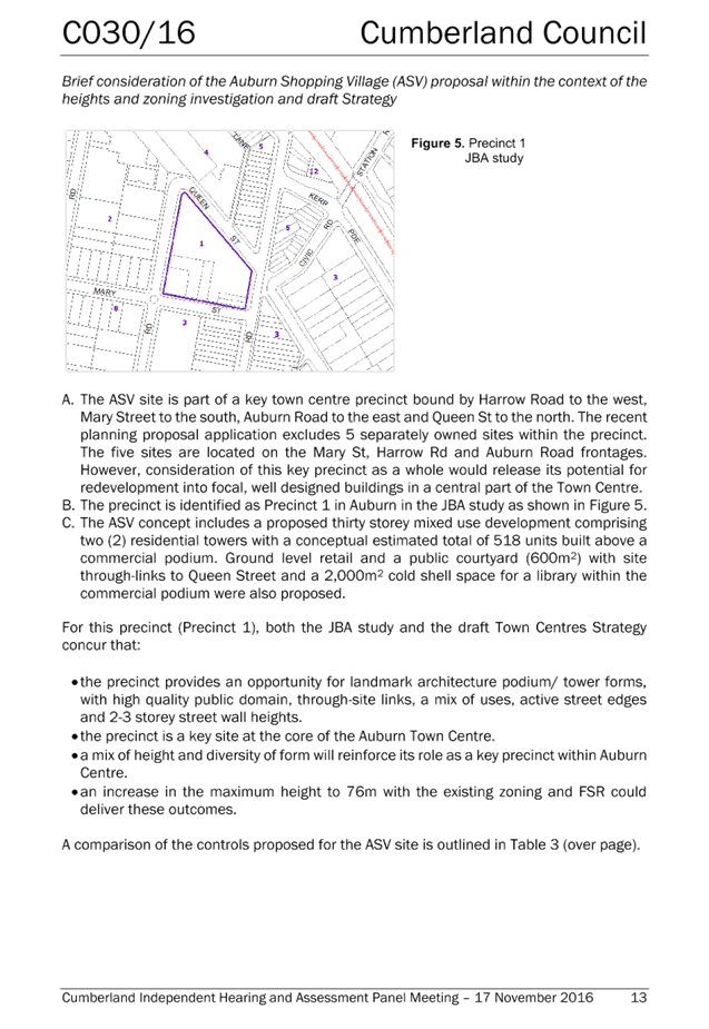
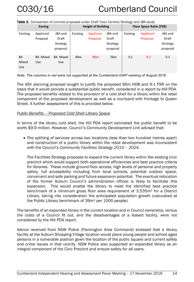
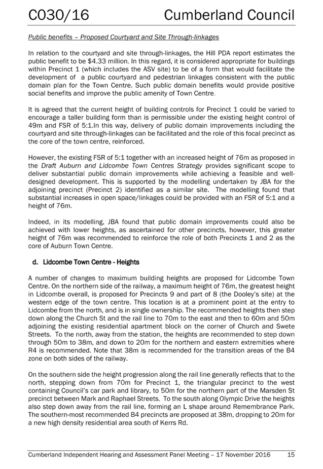
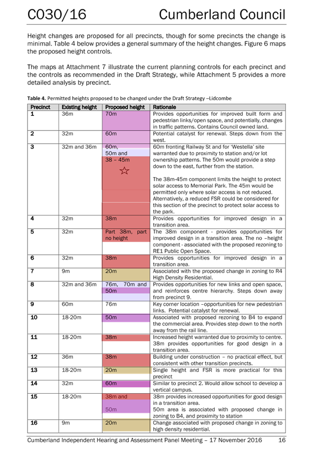
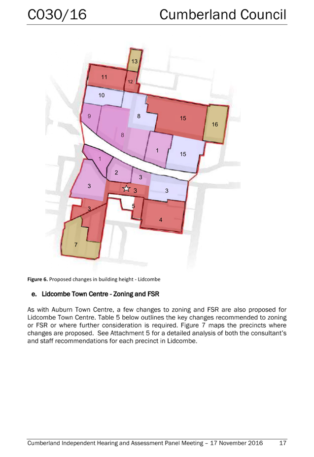
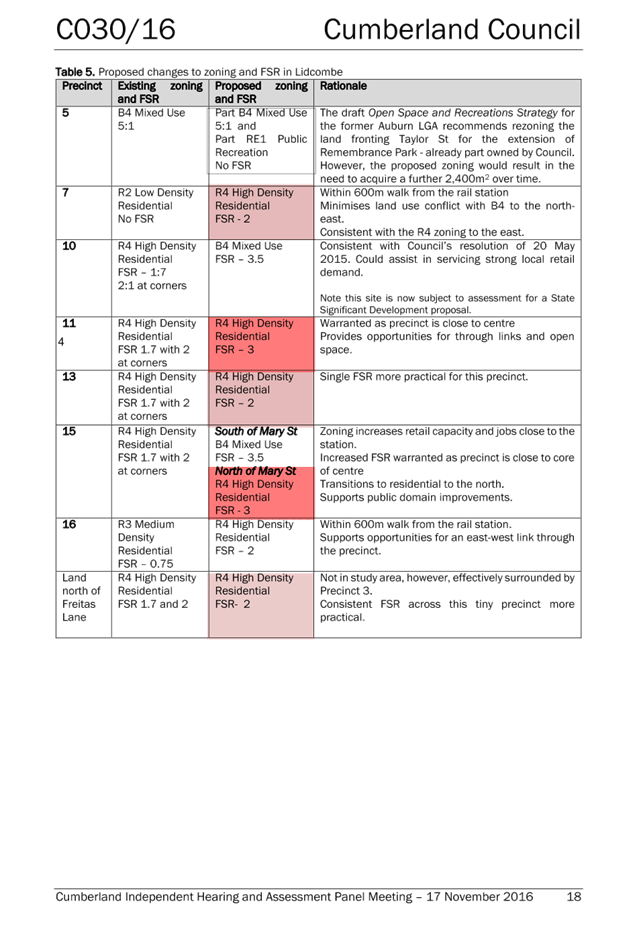
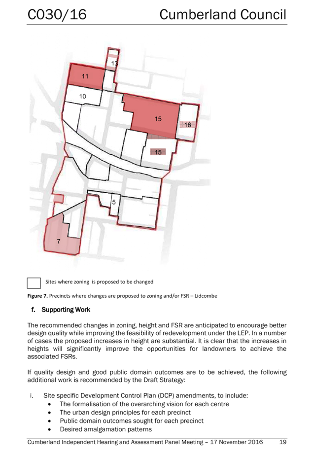
DOCUMENTS
ASSOCIATED WITH
REPORT LPP031/19
Attachment 6
Council Minutes - 17 April 2019
Cumberland Local Planning Panel Meeting
8 May 2019