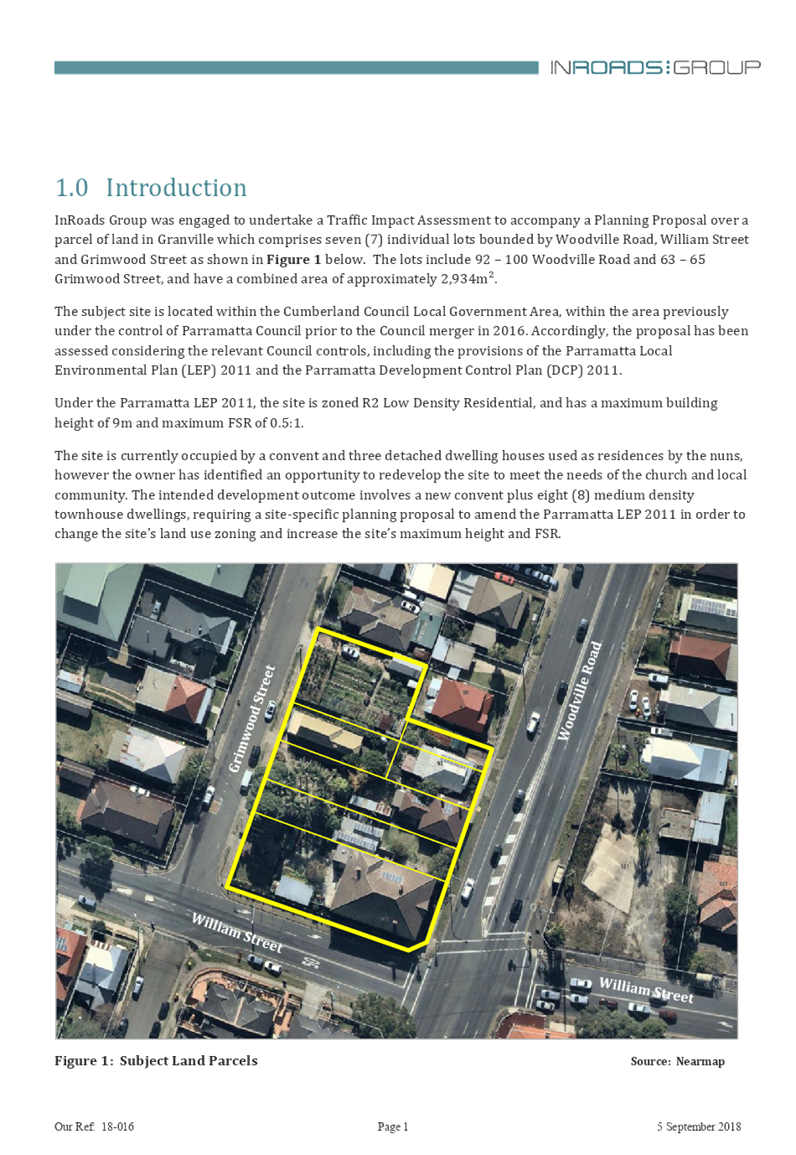
Council Meeting
Wednesday, 15 May 2019 at 6:30pm
Cumberland Council Chambers
Merrylands Service Centre, 16 Memorial Avenue, Merrylands
Council Meeting
Wednesday, 15 May 2019 at 6:30pm
Cumberland Council Chambers
Merrylands Service Centre, 16 Memorial Avenue, Merrylands
Councillor Contact Details
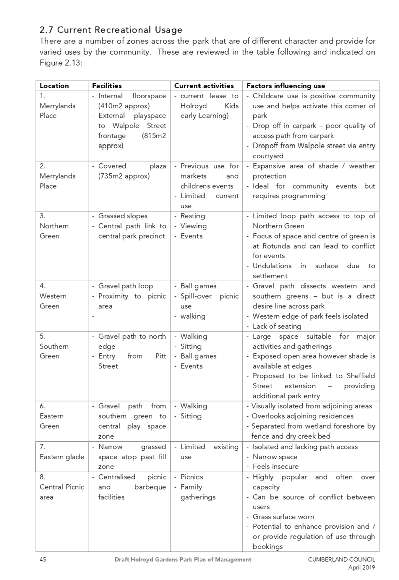
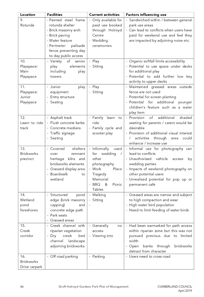
|
Granville Ward |
||
|
Clr Steve Christou |
0419 651 187 |
|
|
Clr Ola Hamed |
0405 070 007 |
|
|
Clr Joseph Rahme |
0418 995 471 |
|
|
Greystanes Ward |
||
|
Clr Greg Cummings (Mayor) |
0417 612 717 |
|
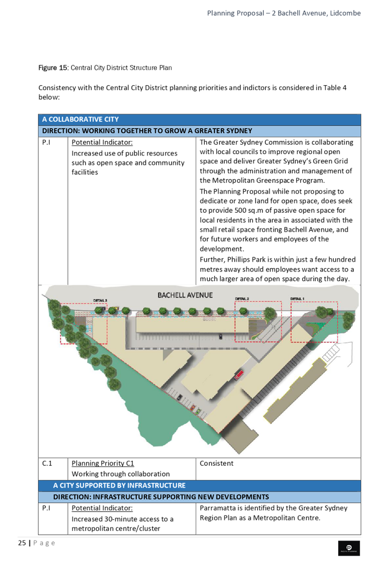
|
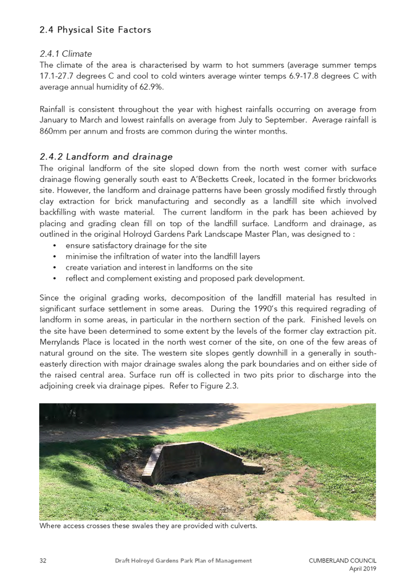
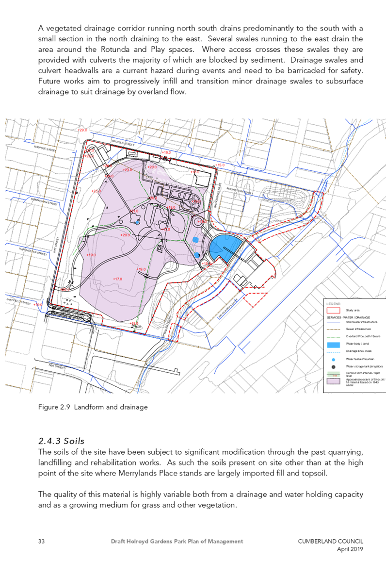
Clr Ross Grove |
0418 987 241 |
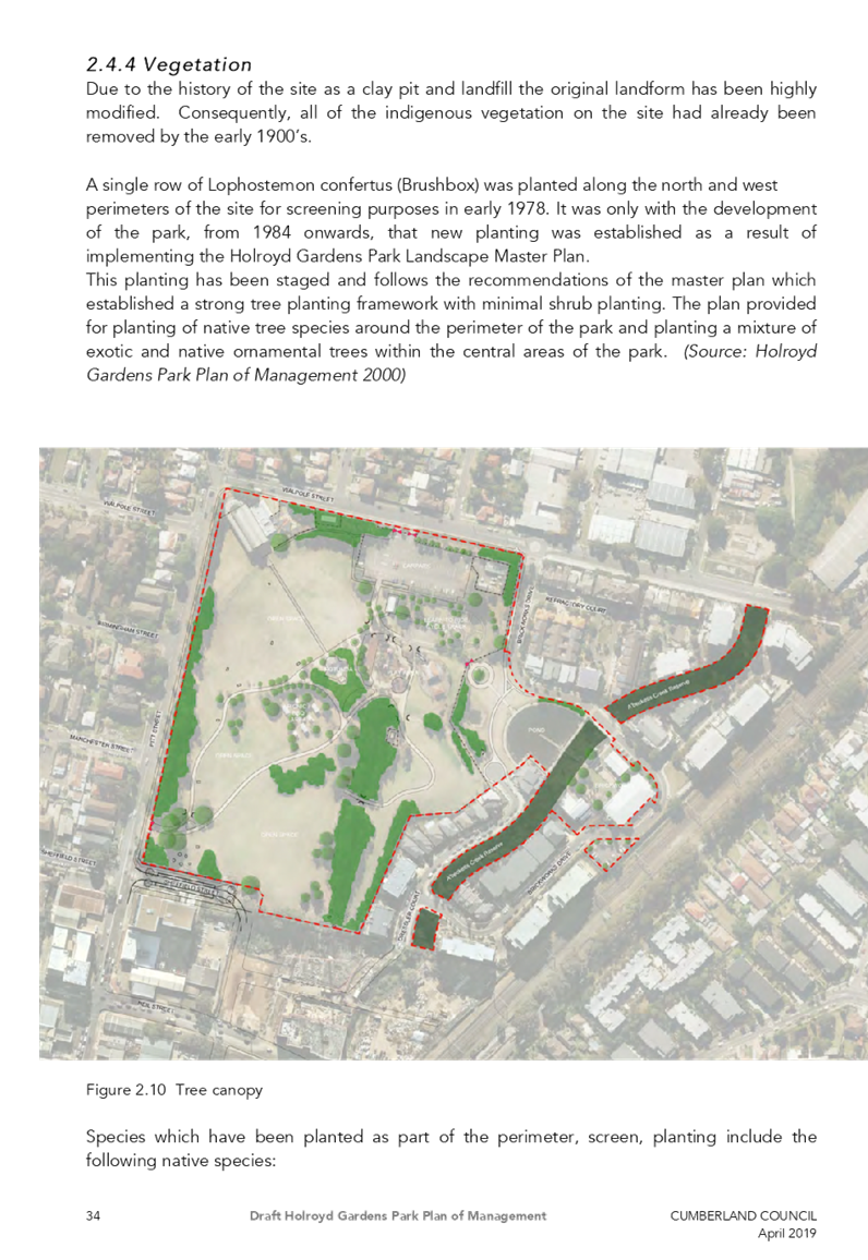
|
|
Clr Eddy Sarkis |
0418 306 918 |
|
|
Regents Park Ward |
||
|
Clr Ned Attie |
0419 583 254 |
|
|
Clr George Campbell |
0409 233 315 |
|
|
Clr Kun Huang |
0418 911 774 |
|
|
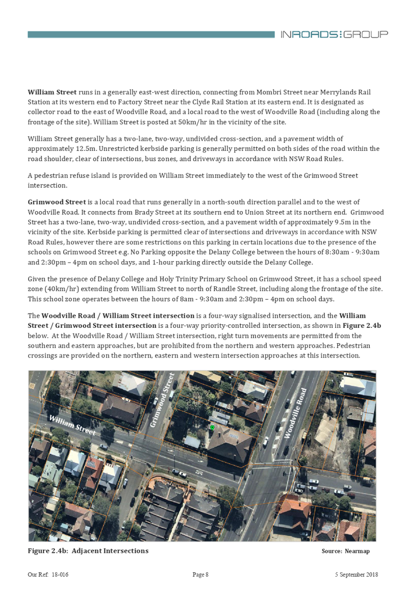
South Granville Ward |
||
|
Clr Glenn Elmore (Deputy Mayor) |
0418 459 527 |
|
|
Clr Paul Garrard |
0414 504 504 |
|
|
Clr Tom Zreika |
0449 008 888 |
|
|
Wentworthville Ward |
||
|
Clr Lisa Lake |
0418 669 681 |
|
|
Clr Suman Saha |
0419 546 950 |
|
|
Clr Michael Zaiter |
0418 432 797 |
|
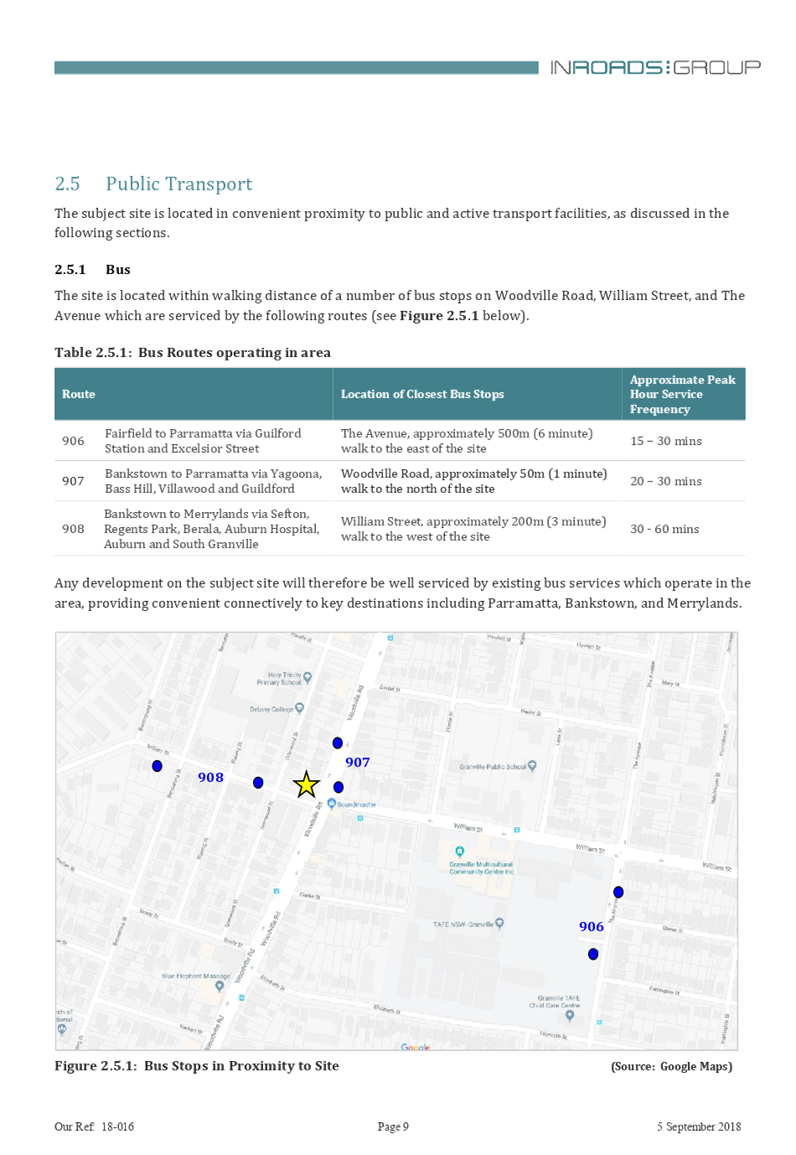
For information on Council services and facilities please visit www.cumberland.nsw.gov.au
Council Meeting
15 May 2019
1 Opening Prayer / Acknowledgement of Country / National Anthem
2 Notice of Live Streaming of Council meeting
3 Apologies
4 Declarations of Pecuniary & Non Pecuniary Conflicts of Interest
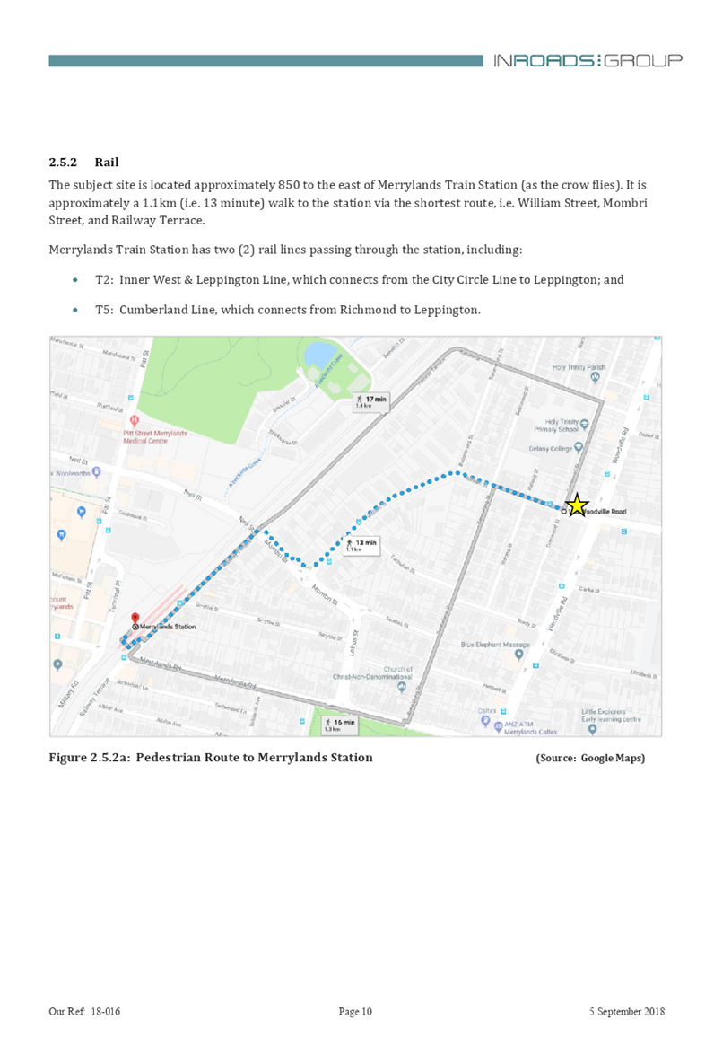
5 Confirmation of Previous Minutes
C05/19-82 Minutes of the Ordinary Meeting of Council - 01 May 2019.. 5
Nil
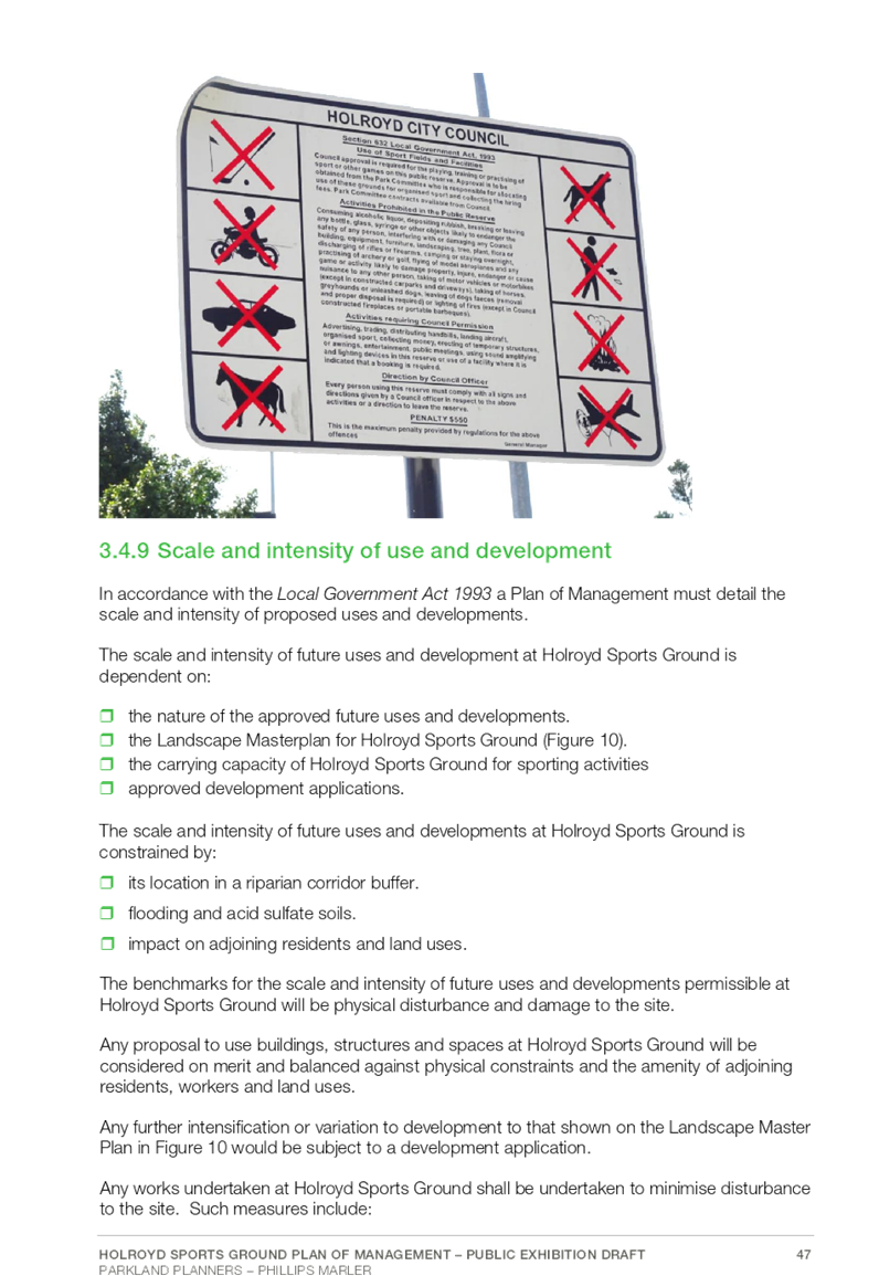
7 Public Forum / Invited Speakers
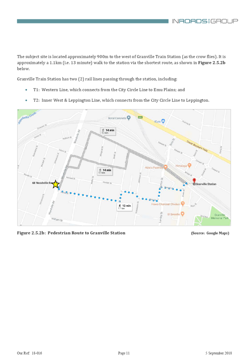
8 Items Resolved by Exception
Nil
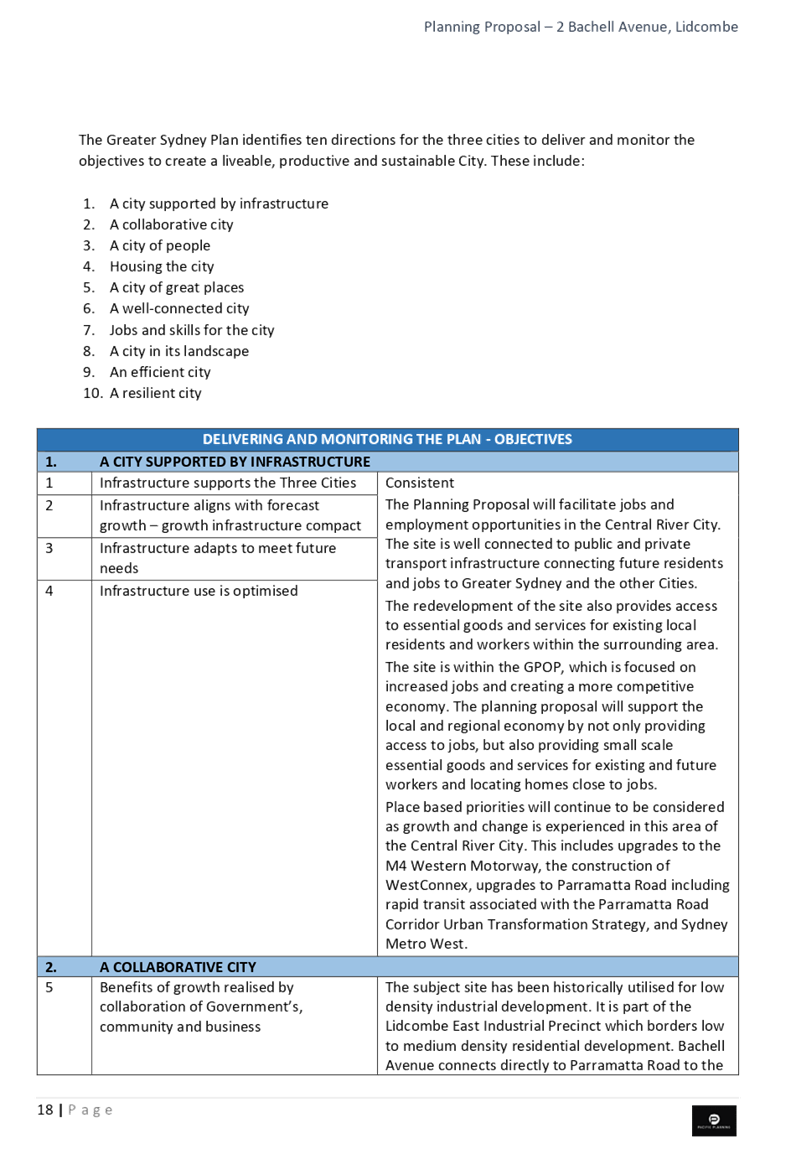
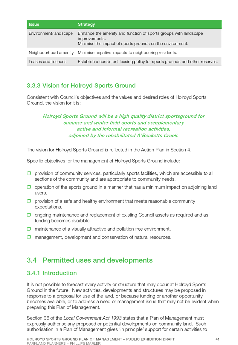
C05/19-83 Quarter 3 Performance Report on the 2018-19 Operational Plan and Budget Review Statement.................................. 19
C05/19-84 Report on Outstanding Council Resolutions....................... 95
C05/19-85 Investment Report - April 2019....................................... 109
Director Community Development
C05/19-86 Response to Notice of Motion - Emergency Relief Fund... 131
C05/19-87 Draft Sister City and Friendship City Policy...................... 151
Director Environment & Planning
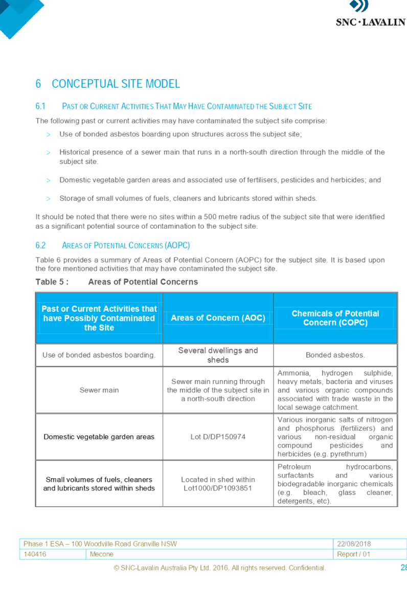
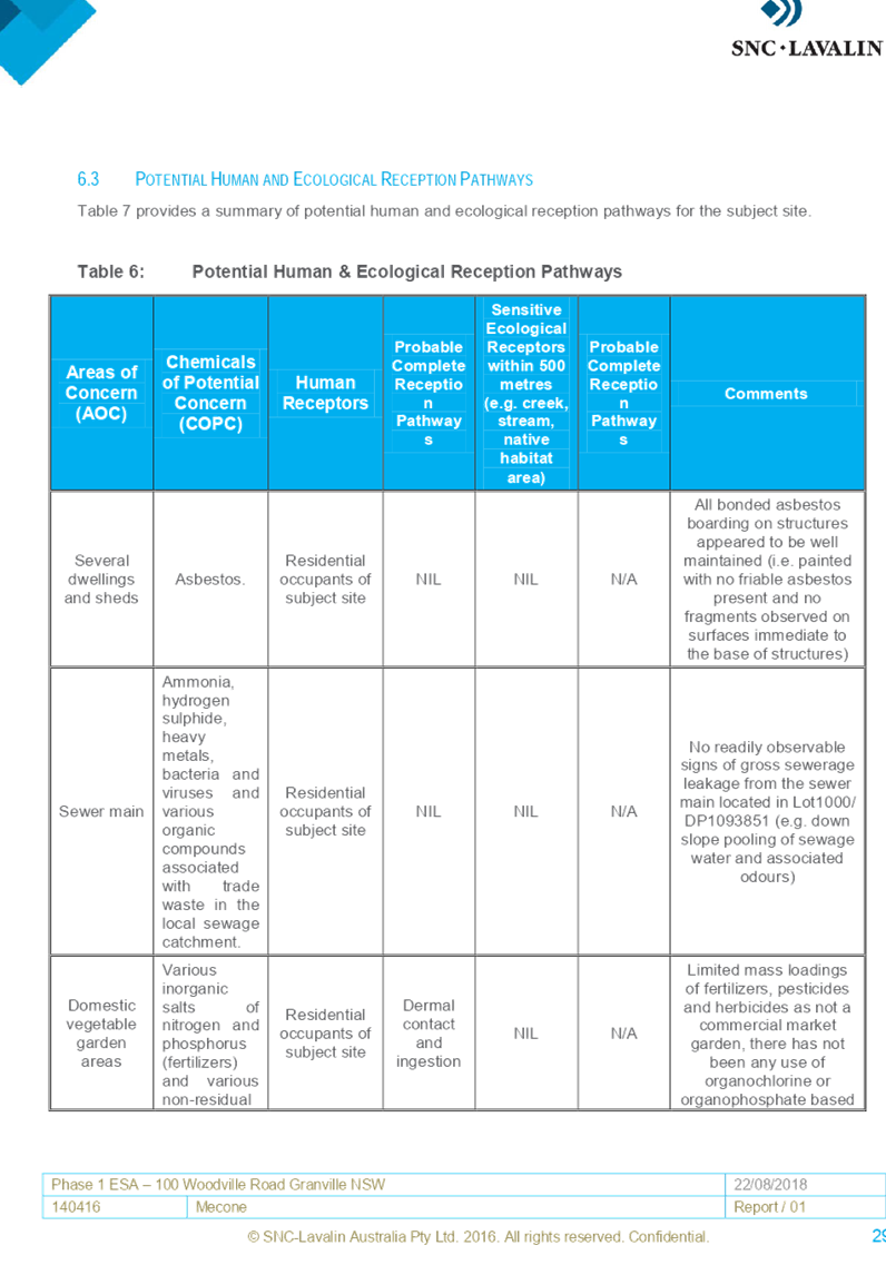
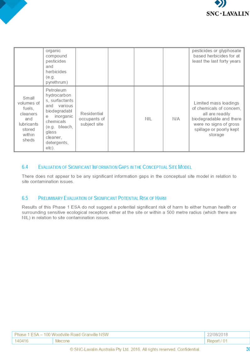
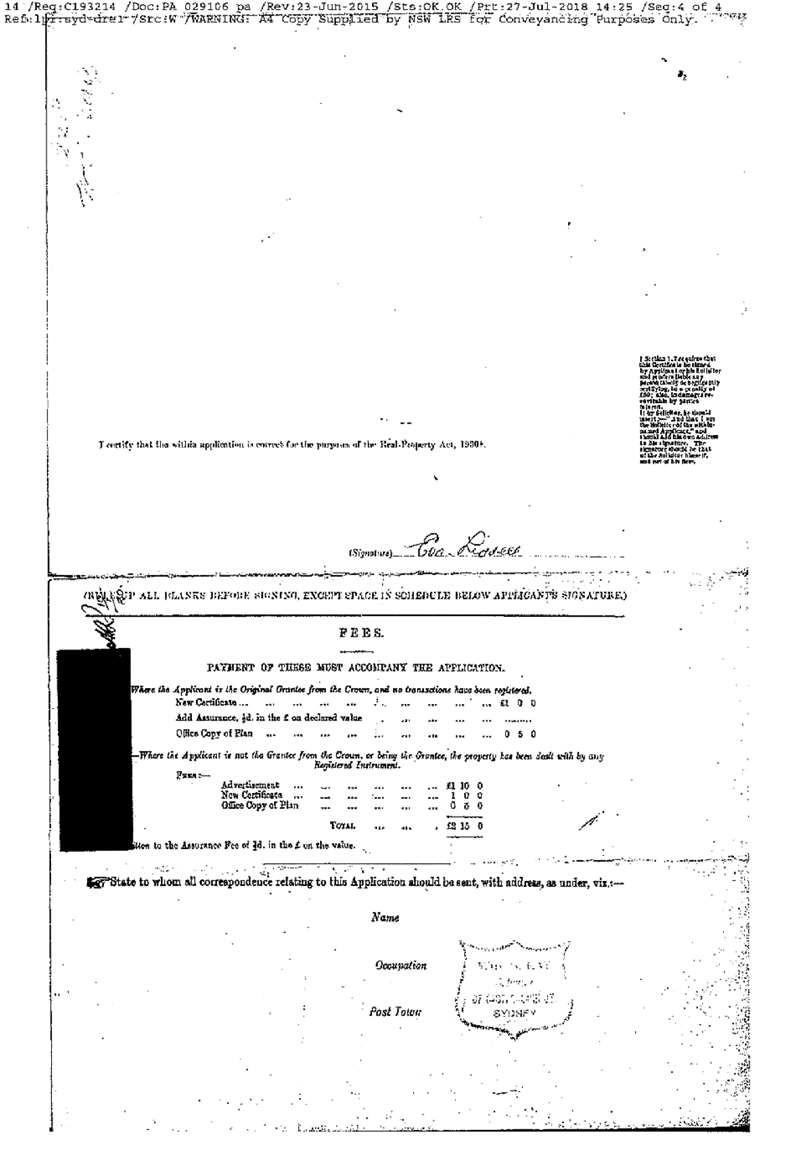
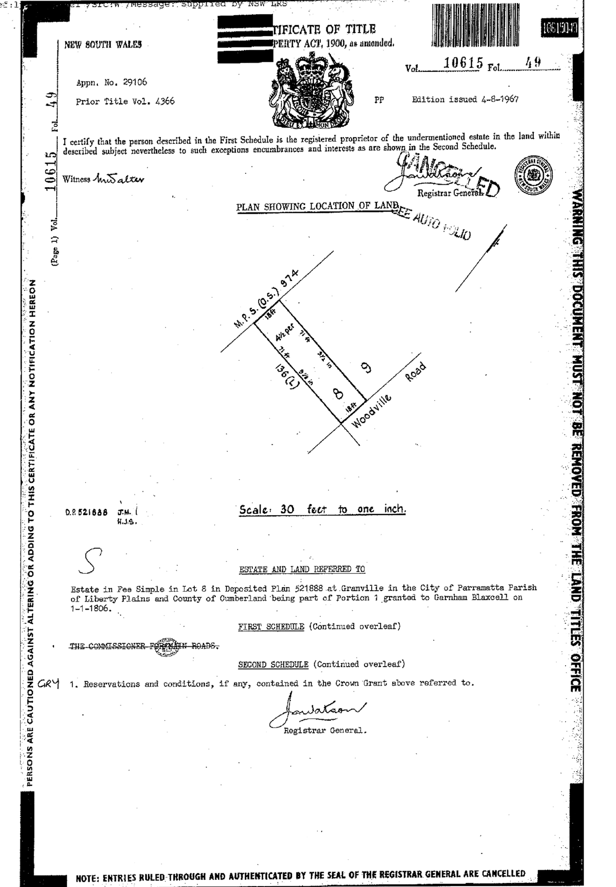
C05/19-88 Planning Proposal for 100 Woodville Road, Granville....... 165
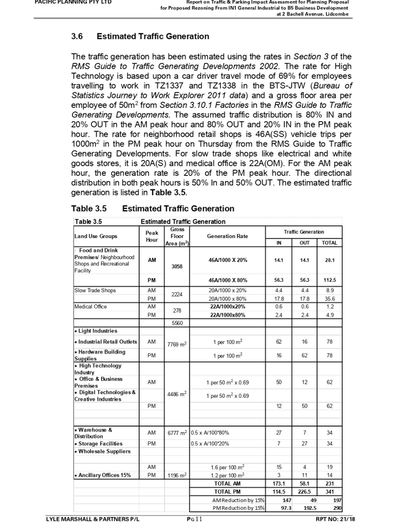
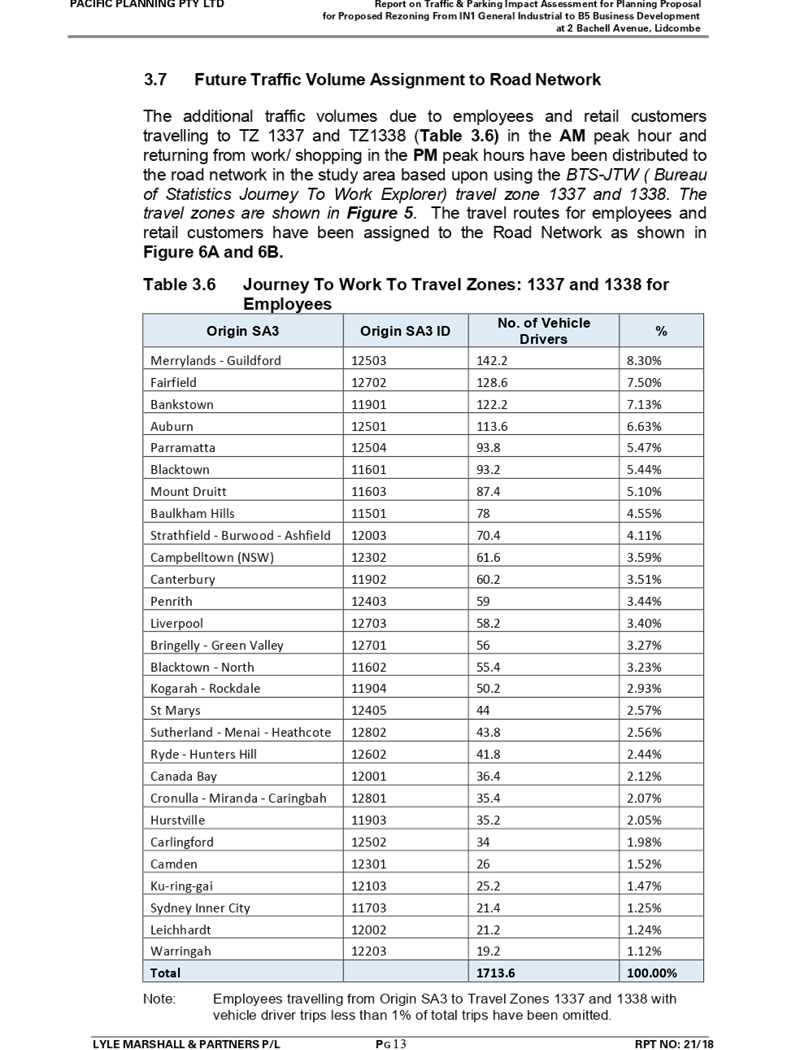
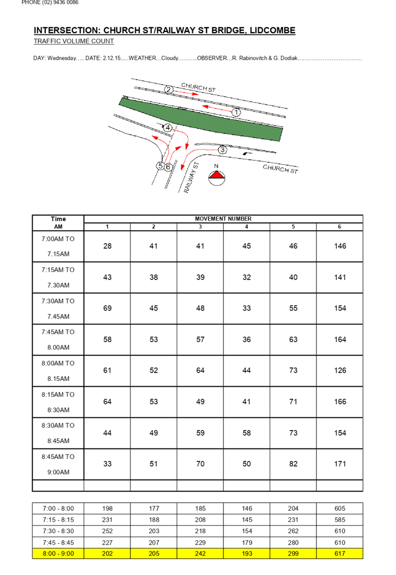
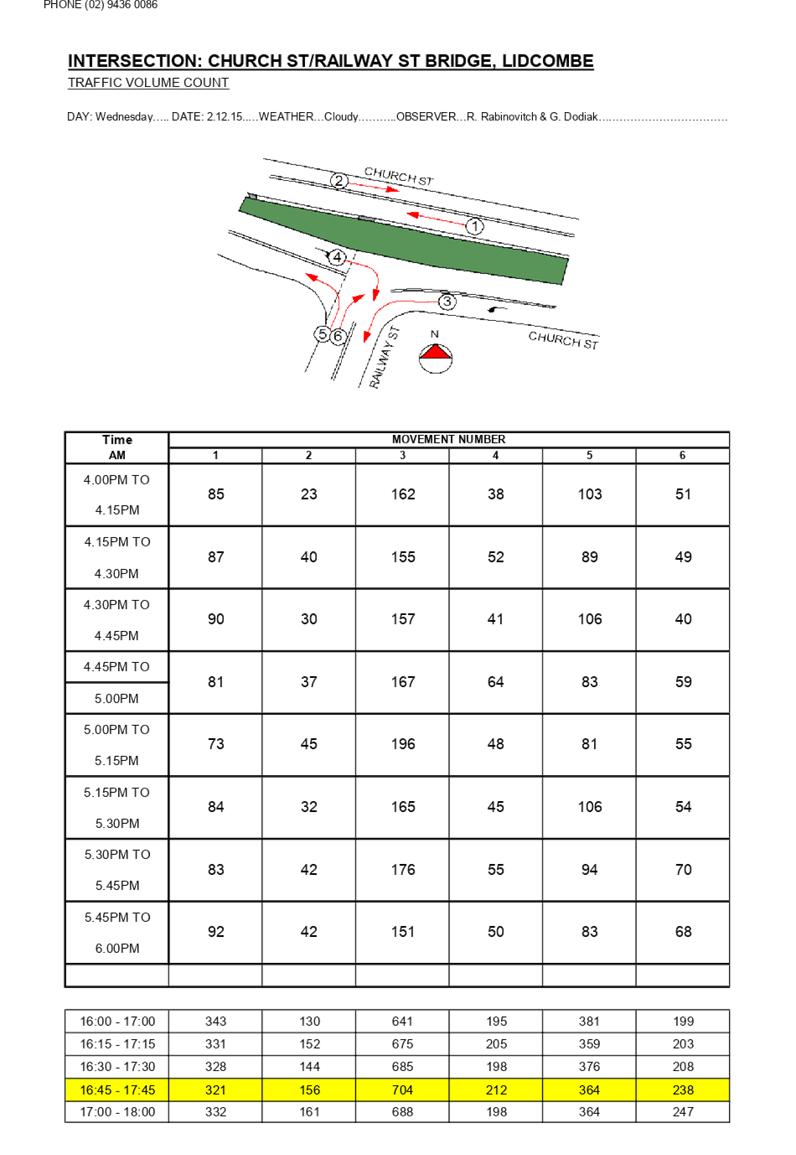
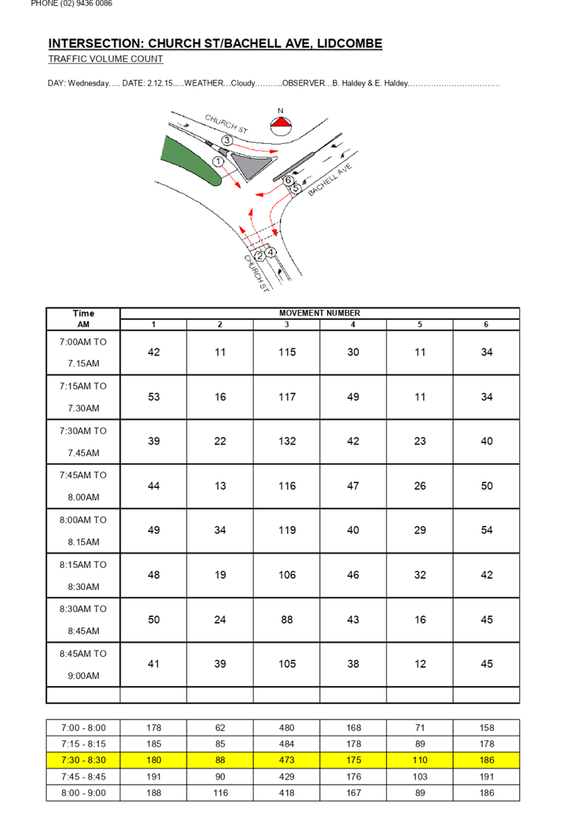
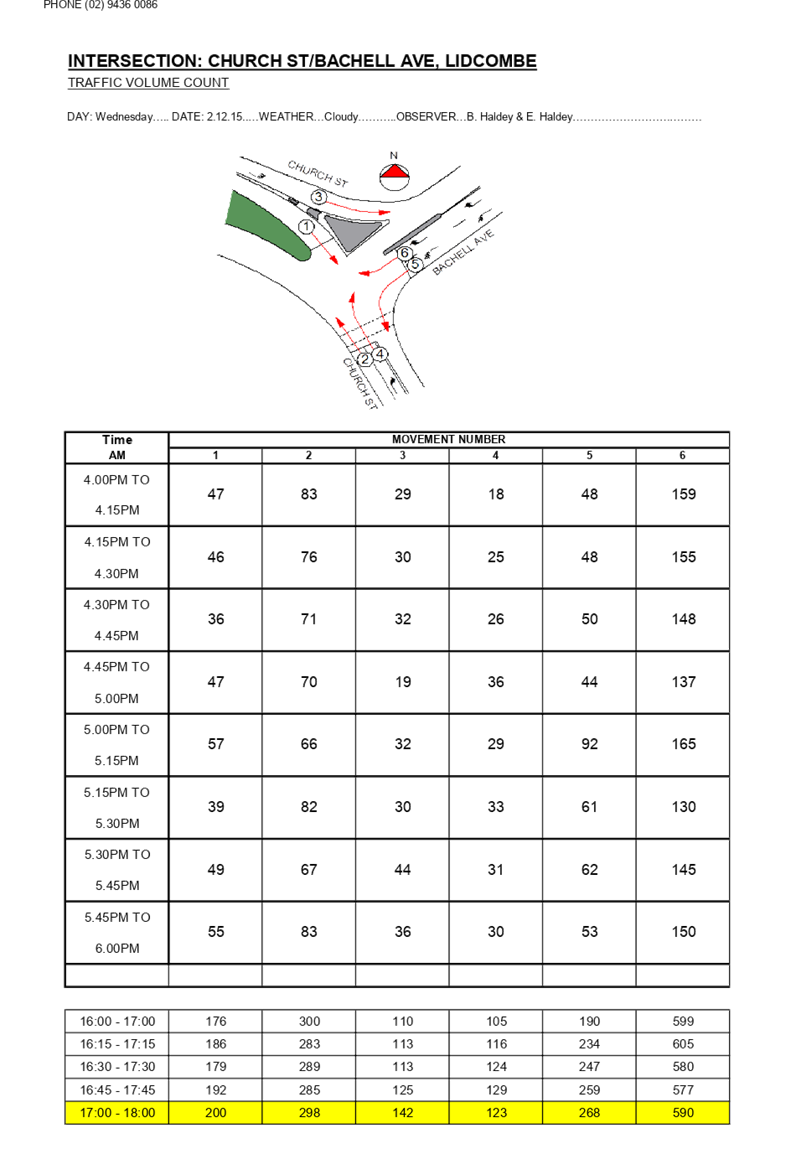
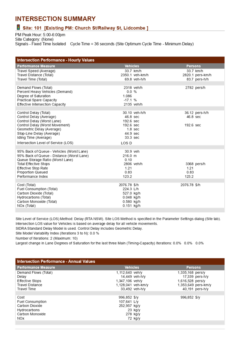
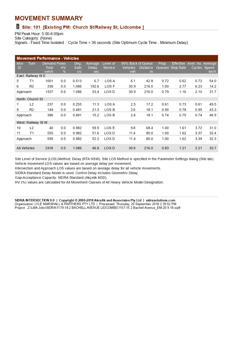
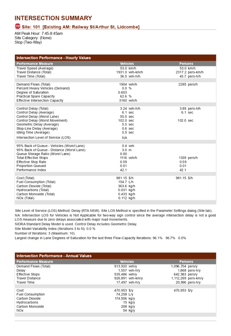
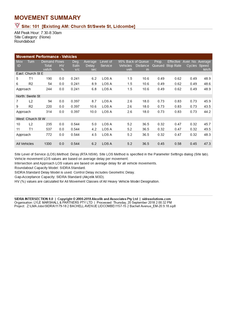
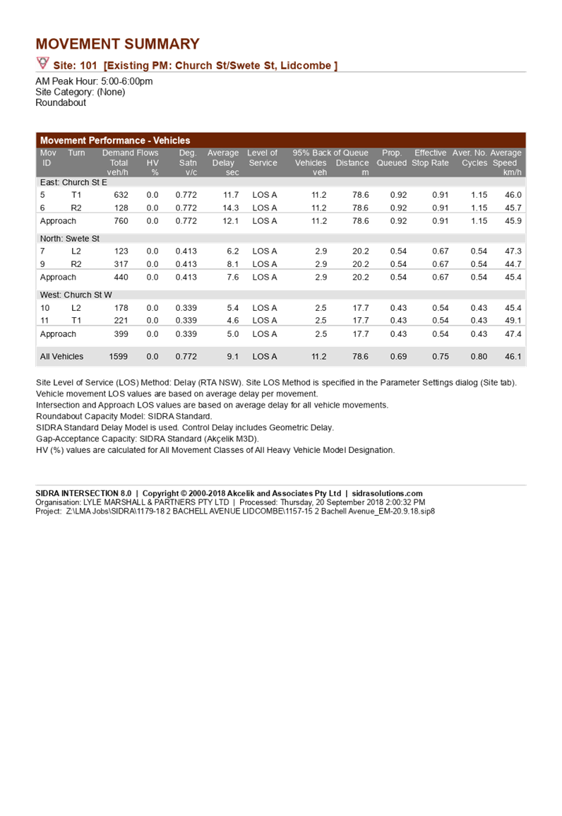
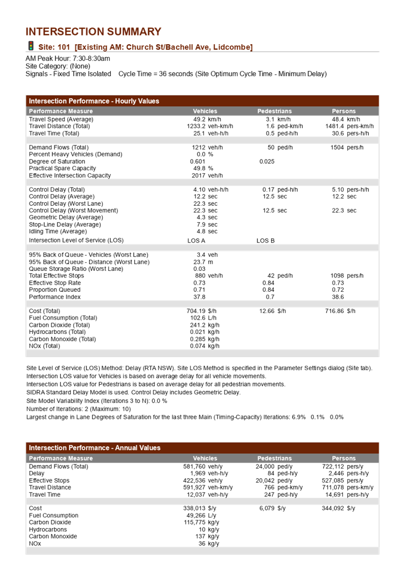
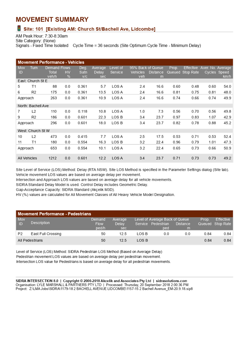
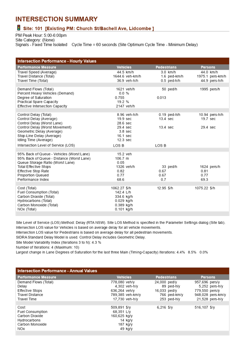
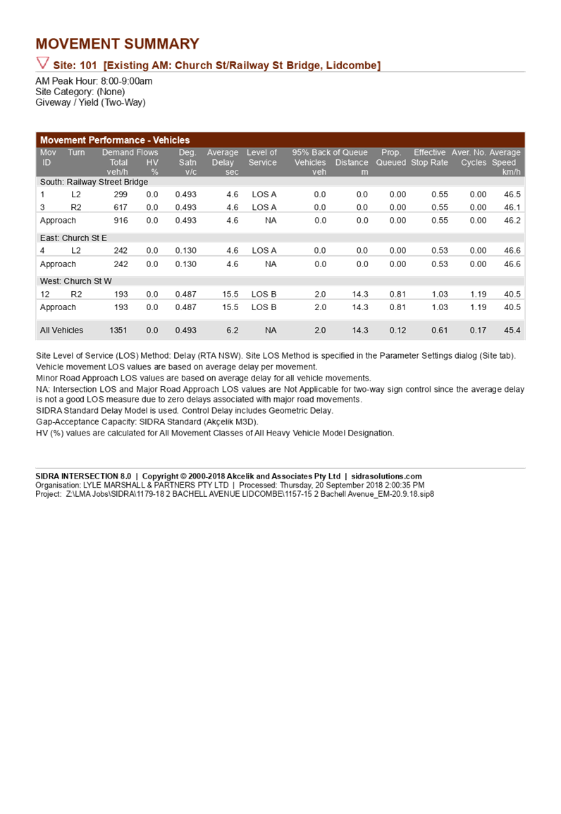
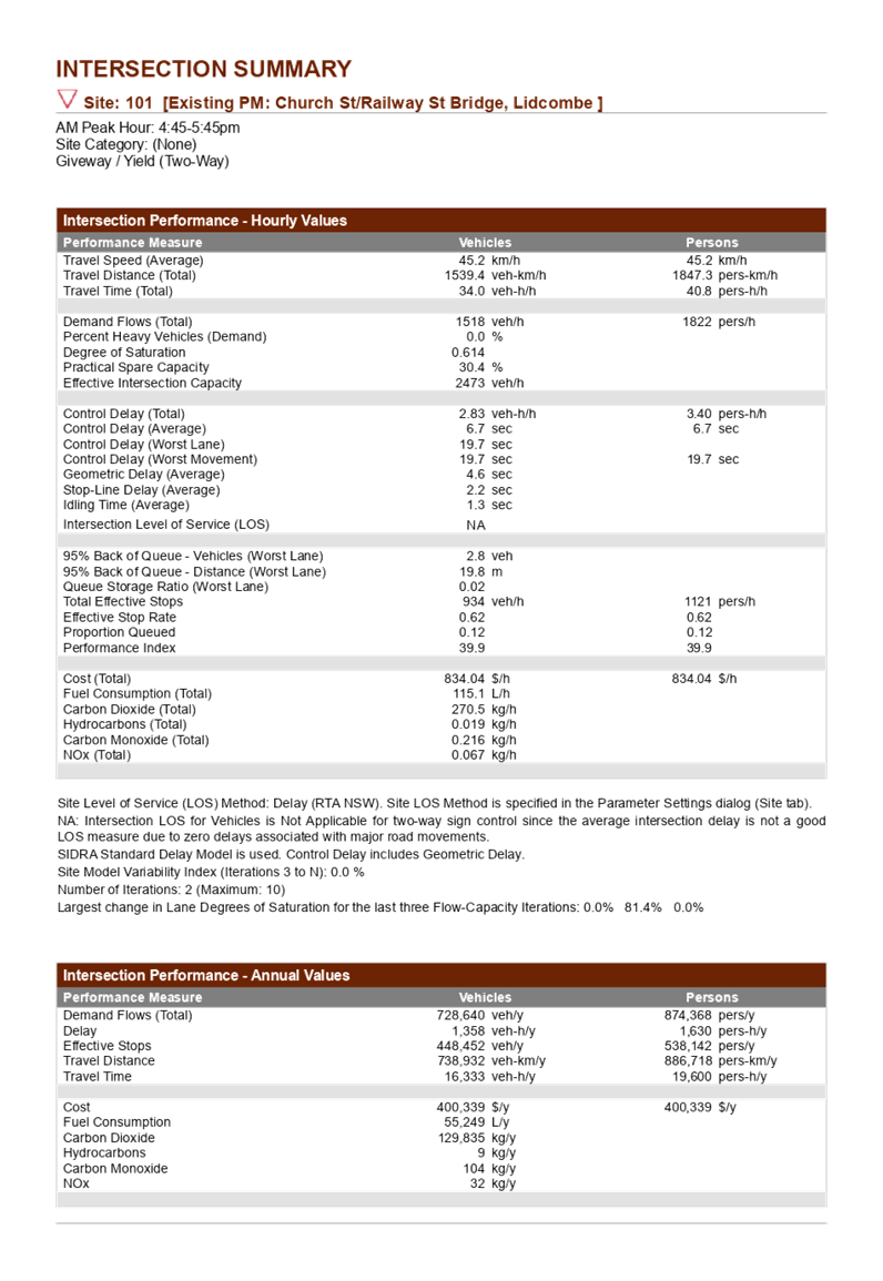
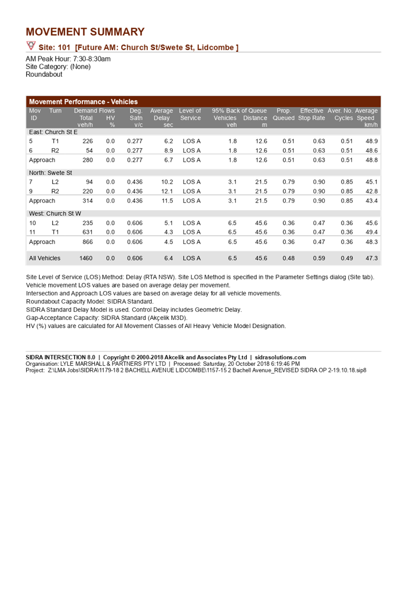
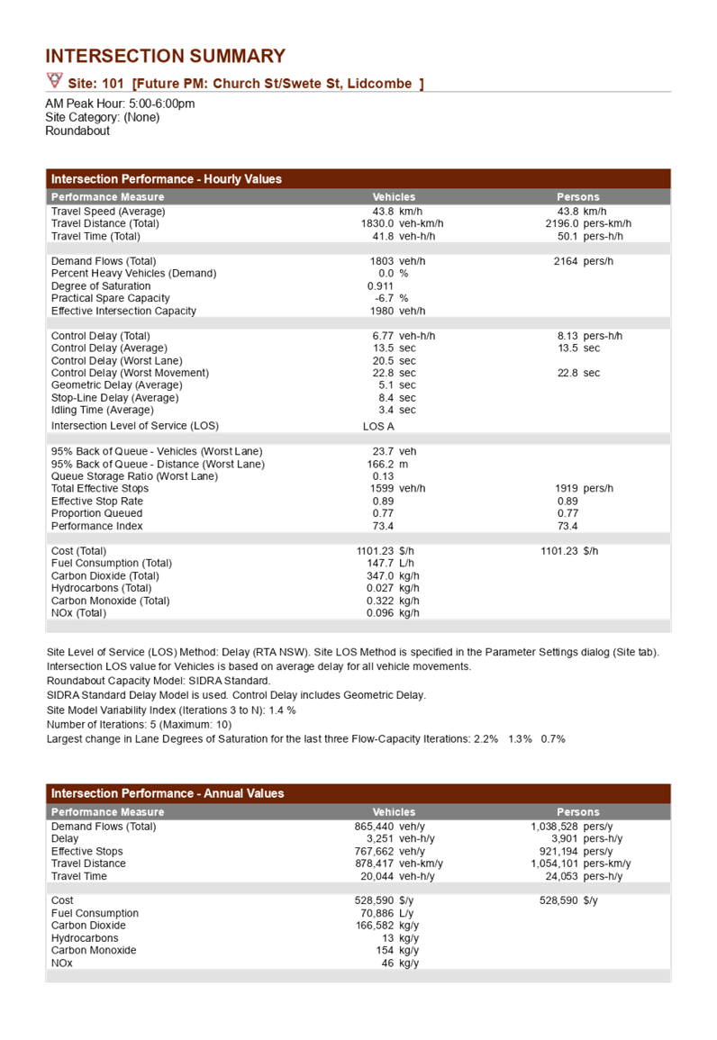
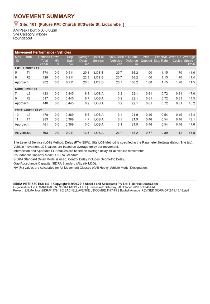
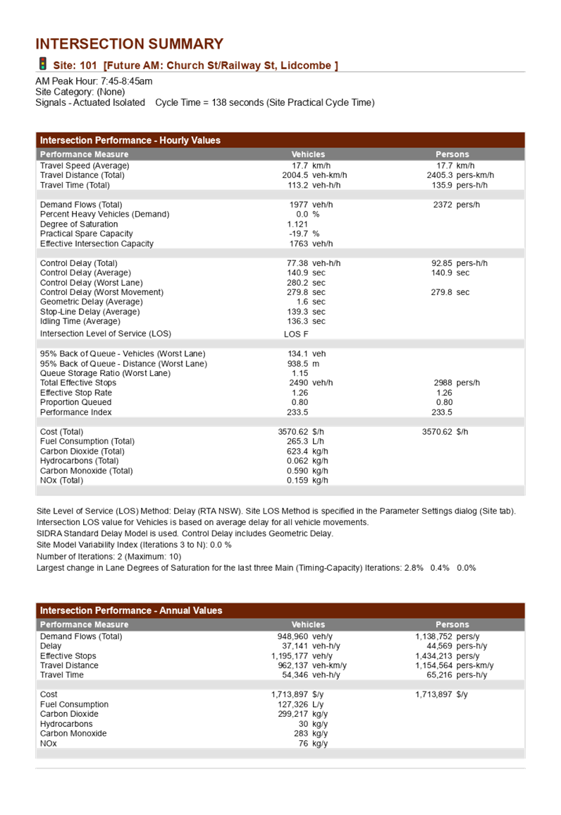
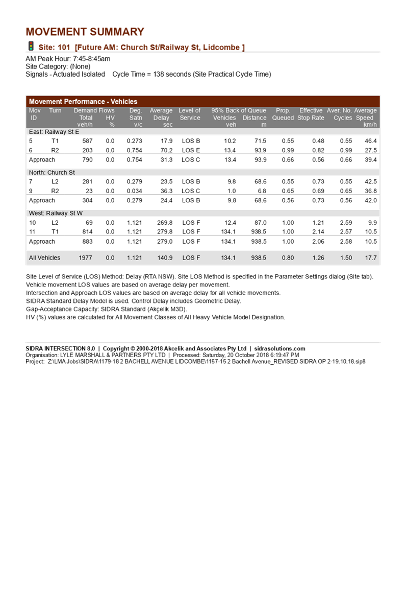
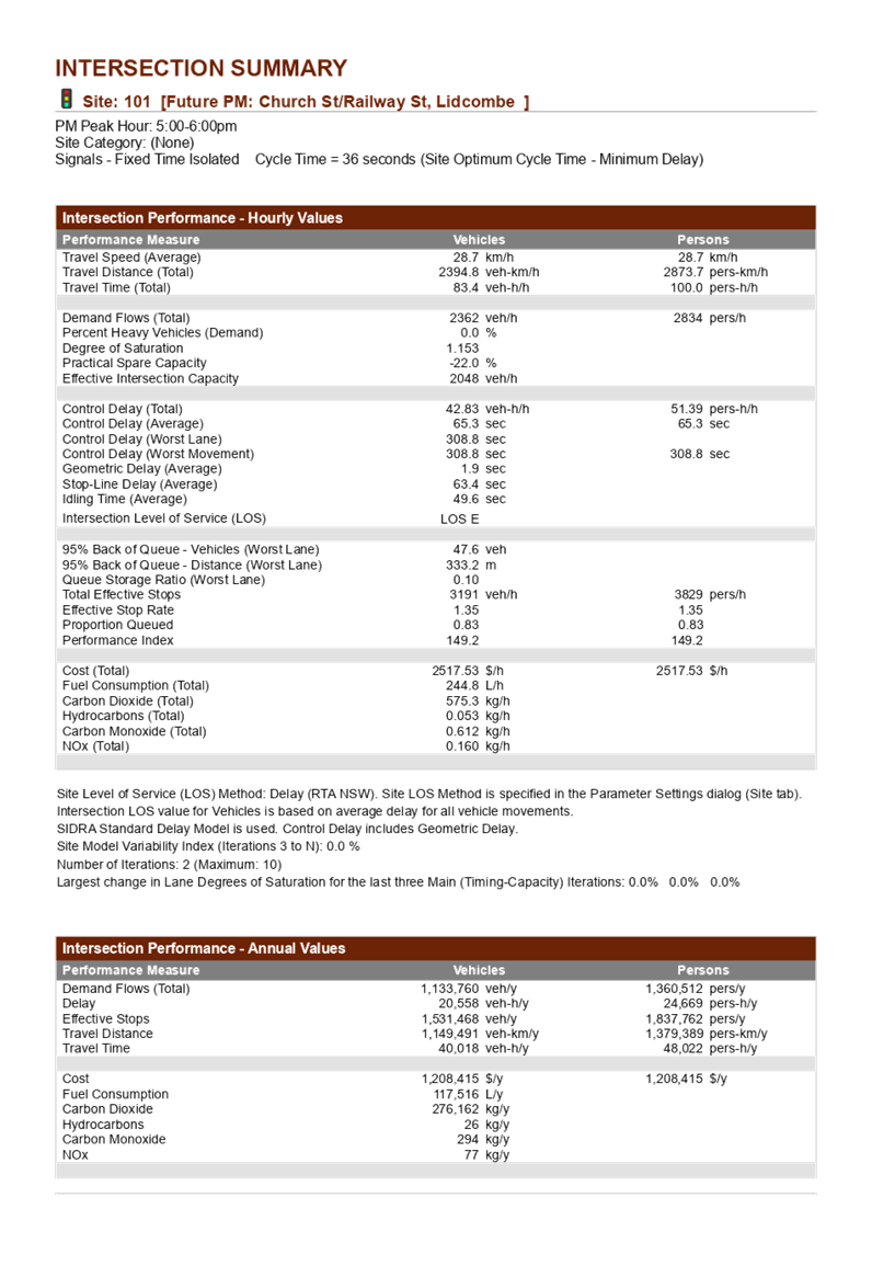
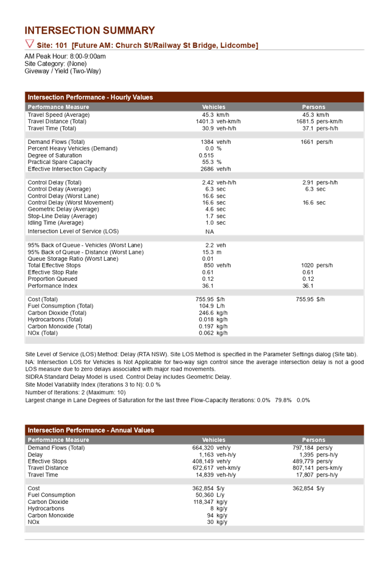
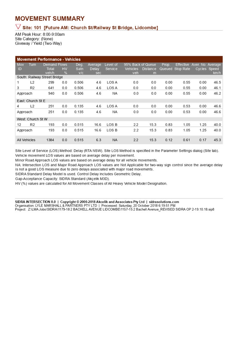
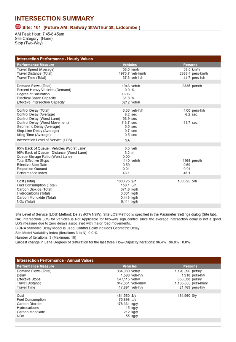
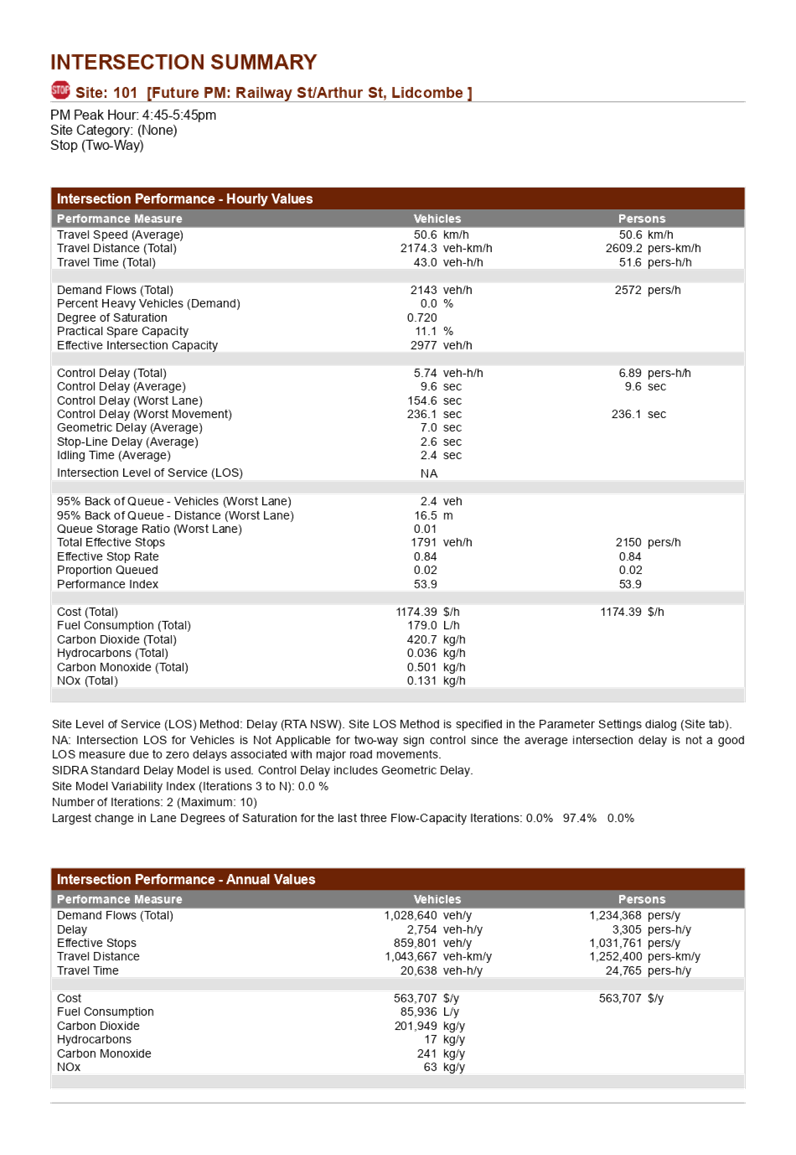
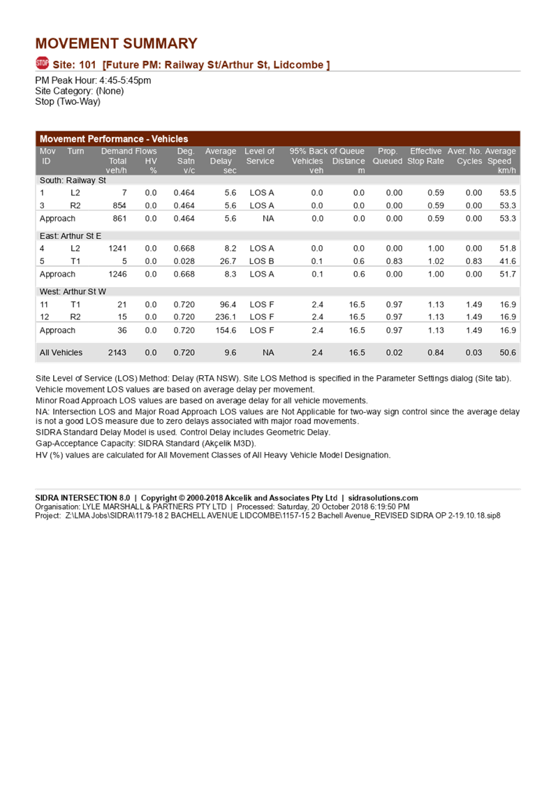
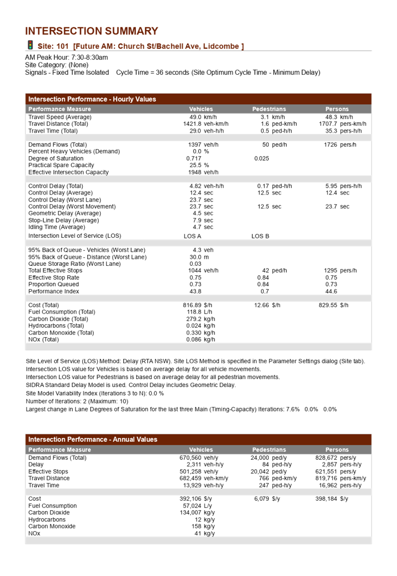
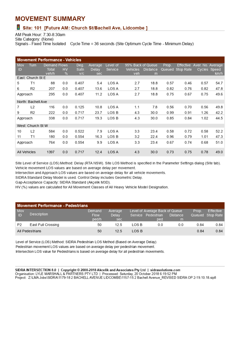
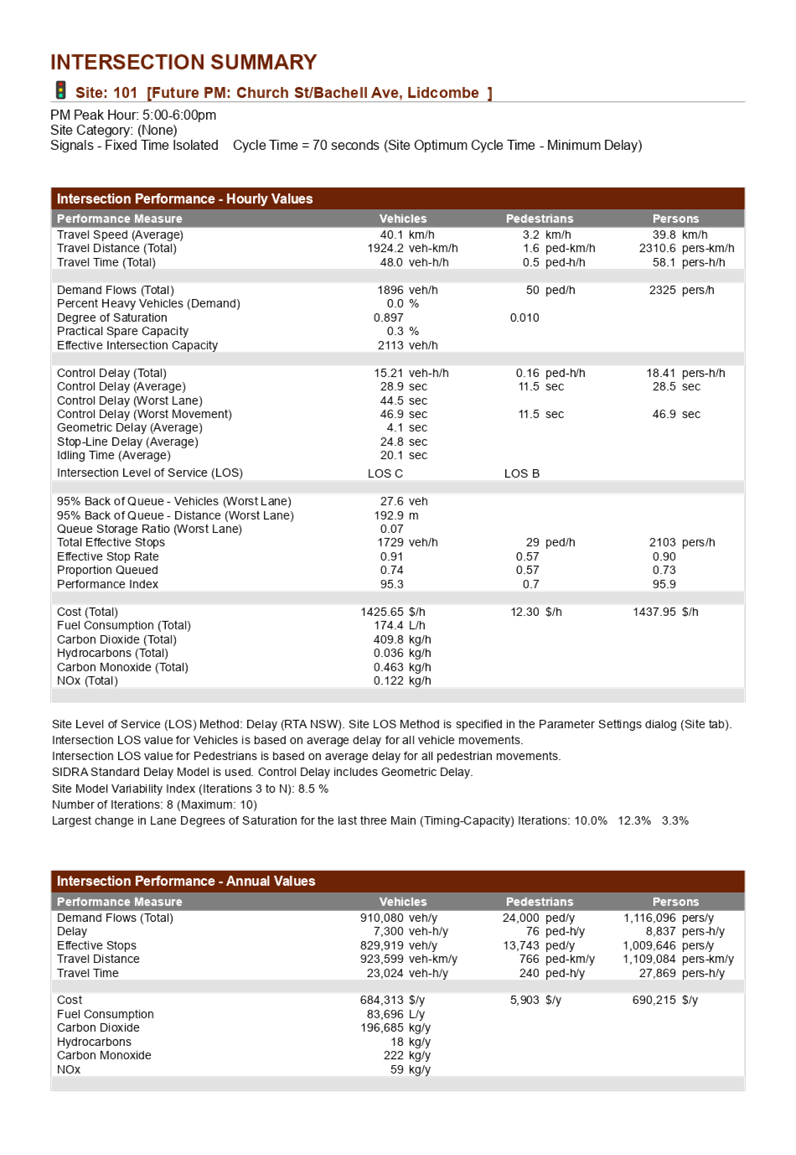
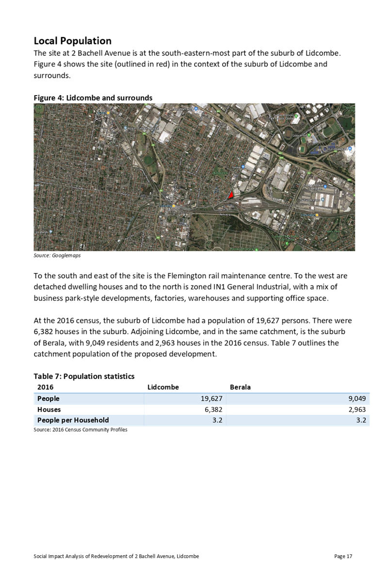
C05/19-89 Planning Proposal for 2 Bachell Avenue, Lidcombe.......... 479
C05/19-90 Planning Agreement for 615 Great Western Highway, Greystanes................................................................................ 821
Director Works & Infrastructure
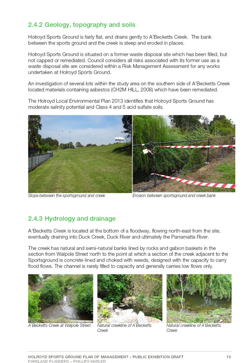
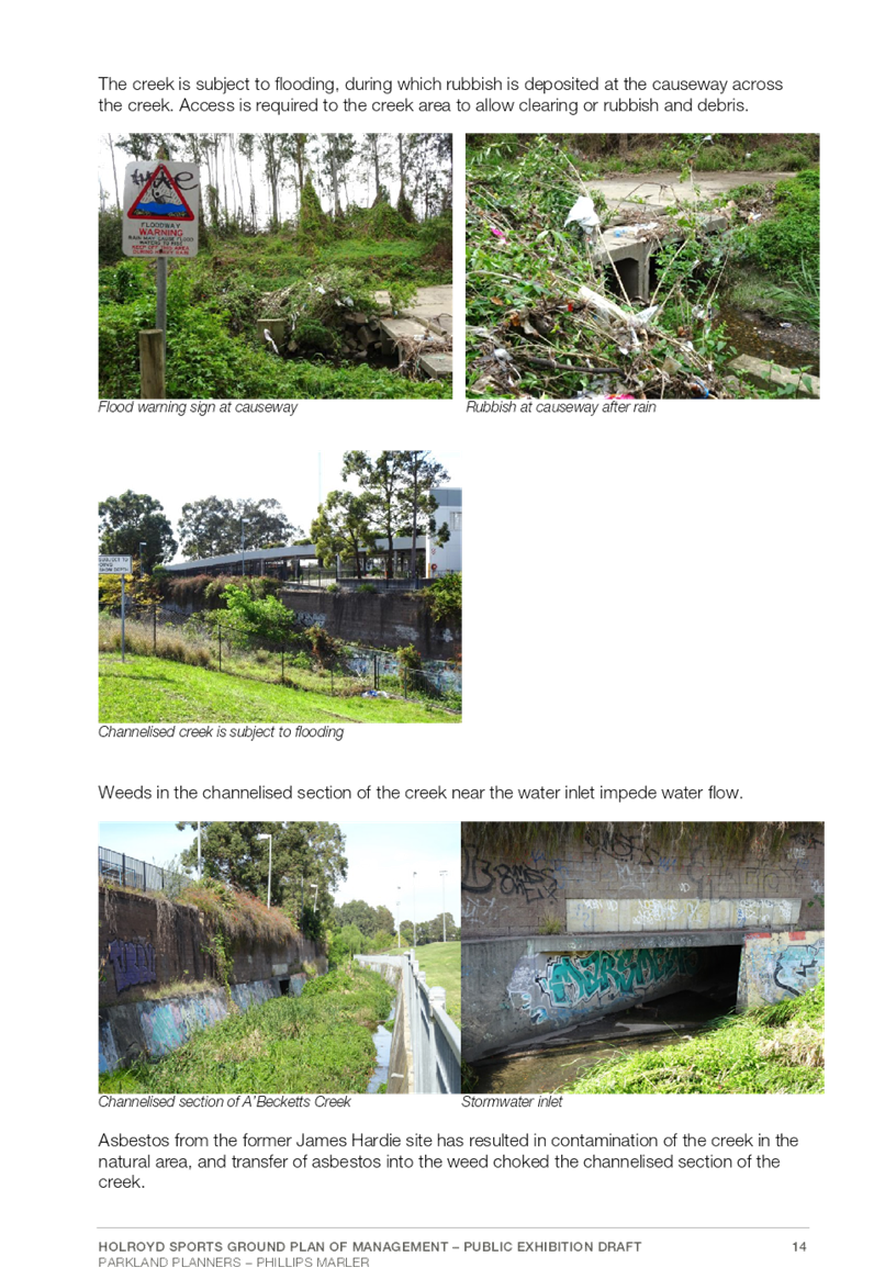
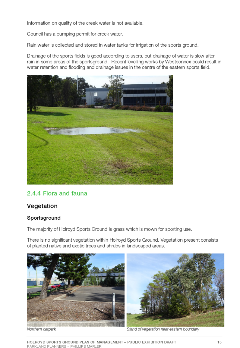
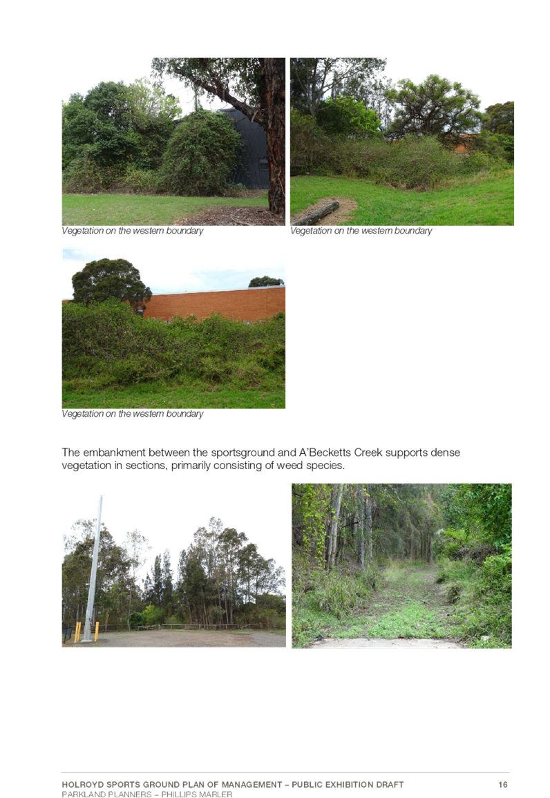
C05/19-91 Draft Holroyd Sportsground Plan of Management............ 887
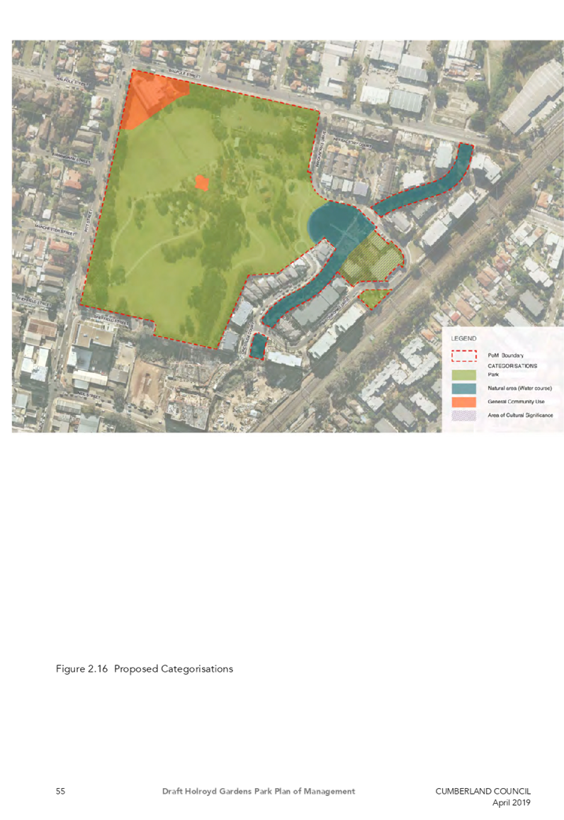
C05/19-92 Draft Holroyd Gardens Park Plan of Management........... 991
C05/19-93 Removal of Power Pole at the Intersection of Blaxcell Street and Farnell Street, Granville......................................... 1103
10 Reports from Committees
Nil
Nil
Nil
Nil
Nil
C05/19-94 Proposed Acquisition Update - Auburn Road, Auburn
Note: Included in Closed Council in accordance with Section 10A(2)(c) and (d)(ii) of the Local Government Act as the information involves information that would, if disclosed, confer a commercial advantage on a person with whom the Council is conducting (or proposes to conduct) business and information that would, if disclosed, confer a commercial advantage on a competitor of the council.
C05/19-95 Property Acquisition - 72 Edgar Street, Auburn
Note: Included in Closed Council in accordance with Section 10A(2)(c) of the Local Government Act as the information involves information that would, if disclosed, confer a commercial advantage on a person with whom the Council is conducting (or proposes to conduct) business.
C05/19-96 Cumberland Council - Future Companion Animal Management Requirements
Note: Included in Closed Council in accordance with Section 10A(2)(c) of the Local Government Act as the information involves information that would, if disclosed, confer a commercial advantage on a person with whom the Council is conducting (or proposes to conduct) business.
C05/19-97 Tender Evaluation Report - Central Gardens All Abilities Playground
Note: Included in Closed Council in accordance with Section 10A(2)(d)(i) and (d)(ii) of the Local Government Act as the information involves commercial information of a confidential nature that would, if disclosed prejudice the commercial position of the person who supplied it and information that would, if disclosed, confer a commercial advantage on a competitor of the council.
Council Meeting
15 May 2019
Item No: C05/19-82
Minutes of the Ordinary Meeting of Council - 01 May 2019
Responsible Division: Finance & Governance
Officer: Director Finance & Governance
|
That Council confirm the minutes of the Ordinary Meeting of Council held on 1 May 2019. |
Attachments
1. Draft
Minutes - 1 May 2019 ⇩ ![]()
DOCUMENTS
ASSOCIATED WITH
REPORT C05/19-82
Attachment 1
Draft Minutes - 1 May 2019
15 May 2019
Item No: C05/19-83
Quarter 3 Performance Report on the 2018-19 Operational Plan and Budget Review Statement
Responsible Division: People & Performance
Officer: Director People & Performance
File Number: S-57-50
Community Strategic Plan Goal: Transparent and accountable leadership
Summary
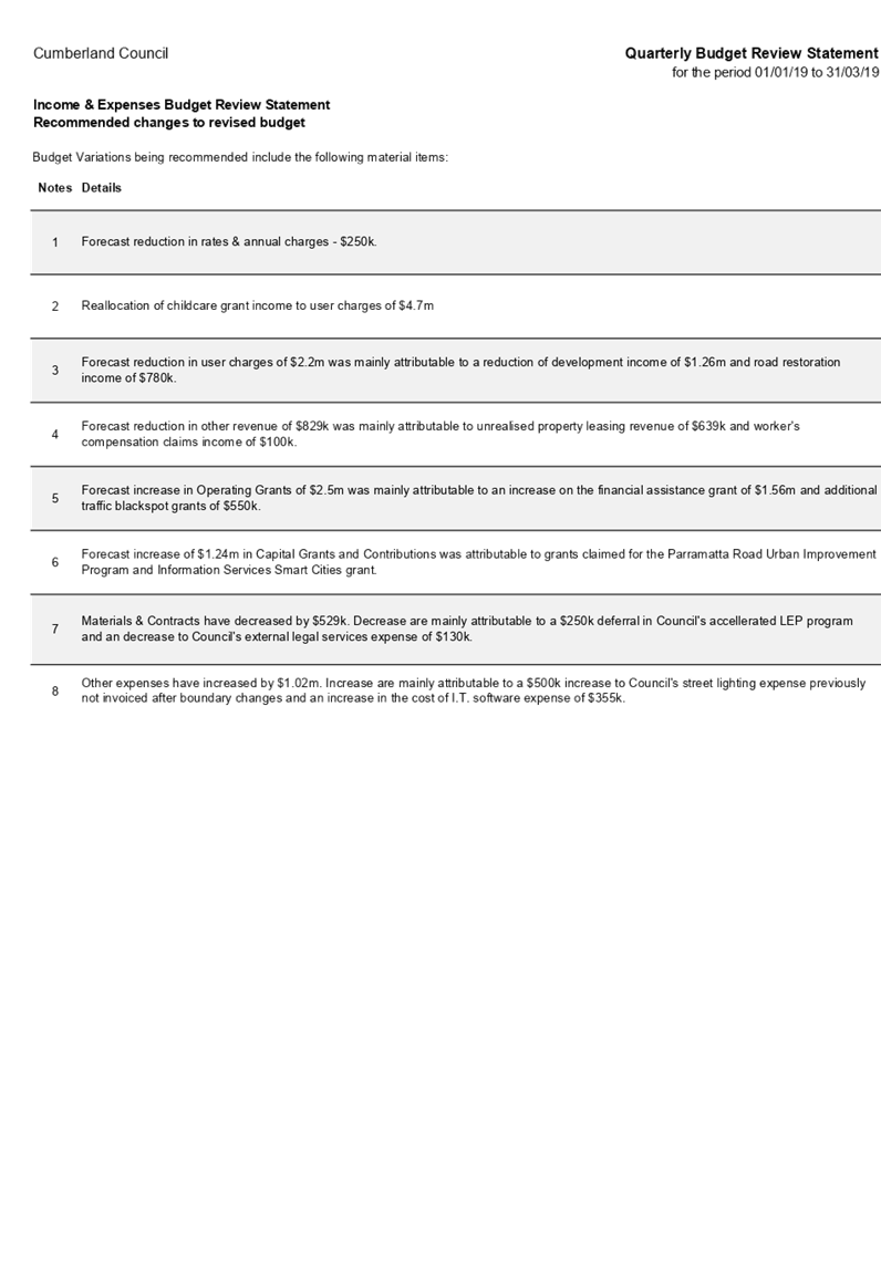
The purpose of this report is to update Council and the community on the progress in implementing the activities in the Operational Plan 2018-19. This includes the Quarterly Budget Review Statement.
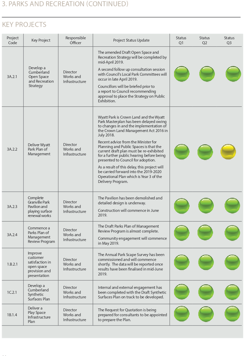
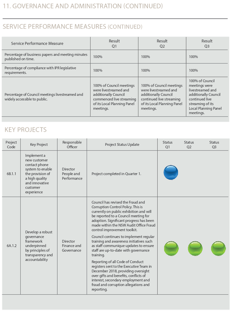
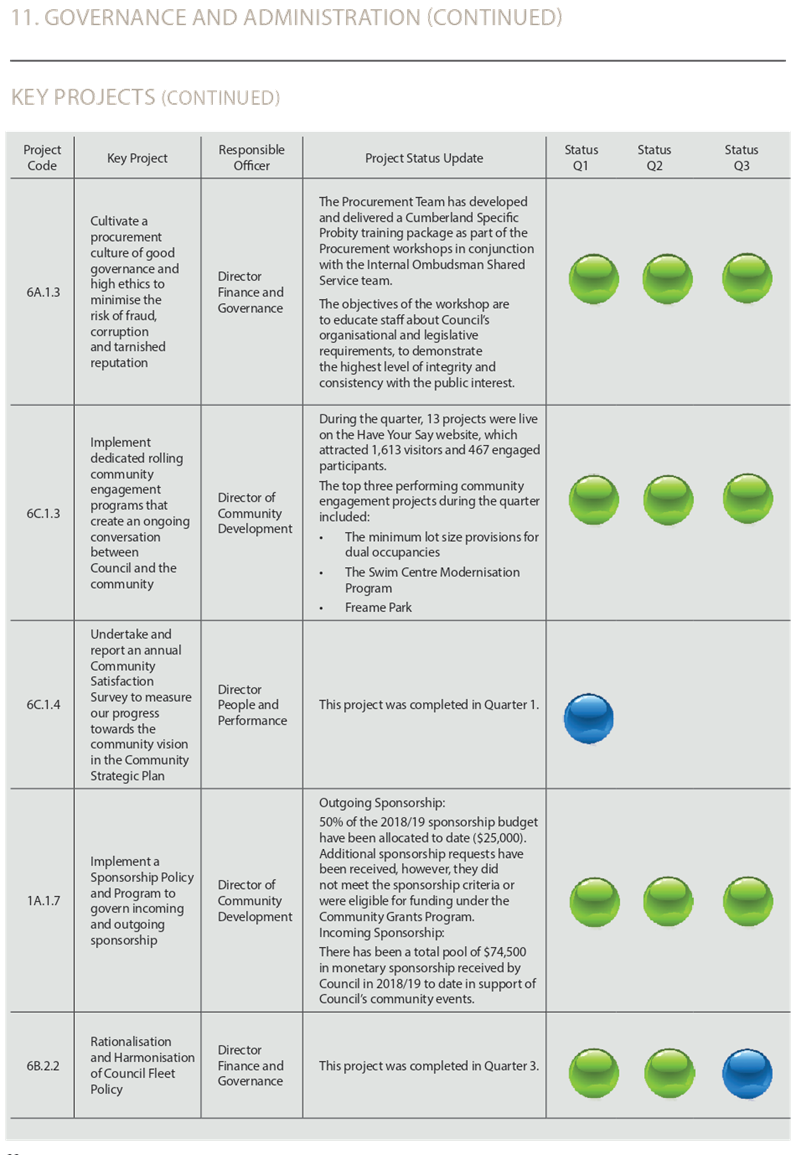
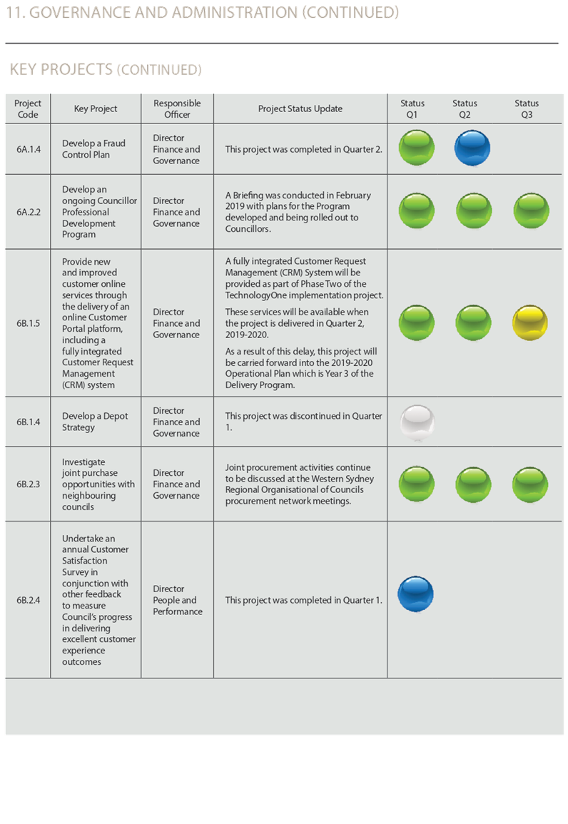
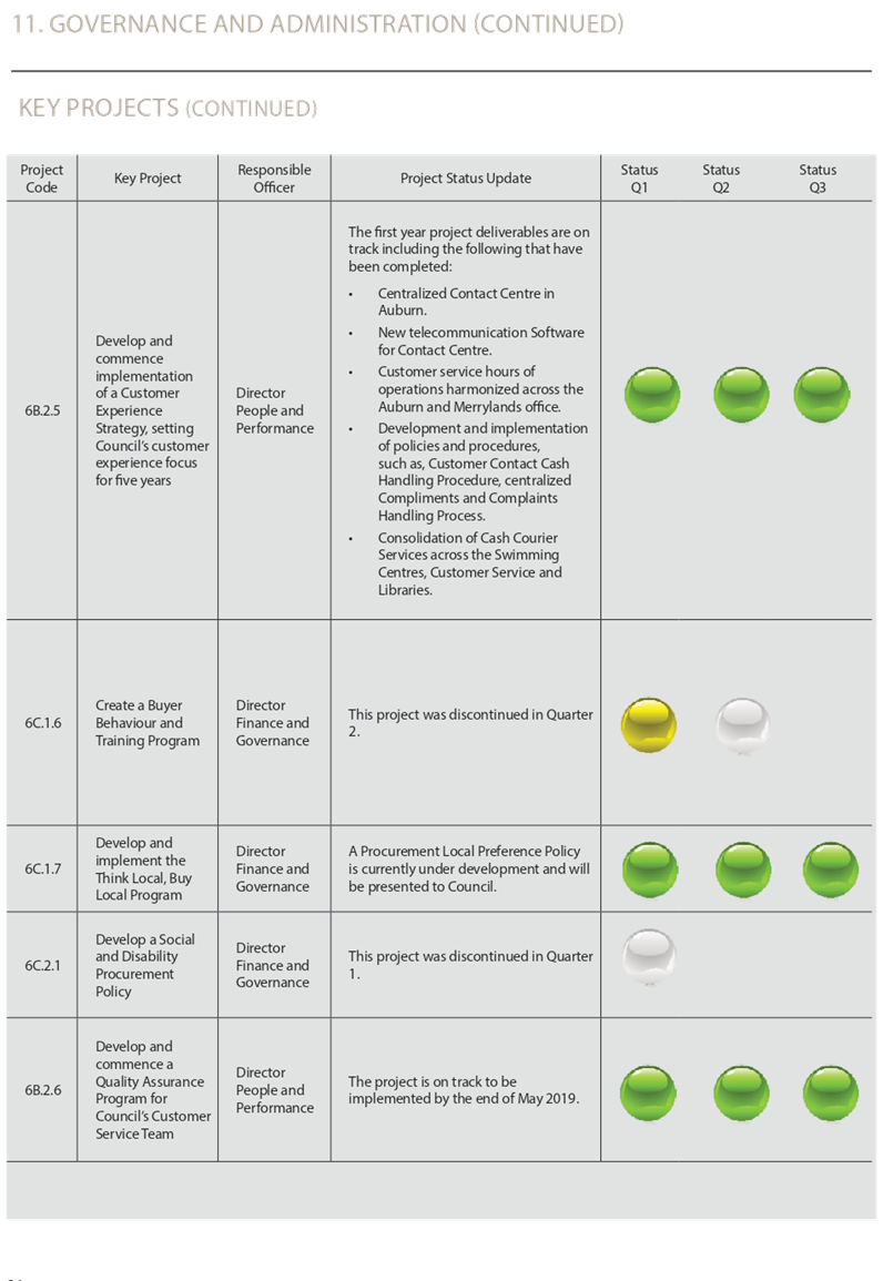
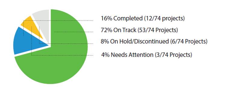
In total, 88% of Key Projects planned for the 2018-19 year have been completed or are on track for delivery. 8% are currently on hold and 4% are delayed and require attention to ensure they are completed by their due date.
|
Recommendation That Council: 1. Receive the Quarter Three Performance Report on the Operational Plan 2018-19; and 2. Approve the revised estimates of income and expenditure for 2018-19 contained in the Quarterly Budget Review Statement. |
Report
The Operational Plan 2018-19 identifies the key projects planned for delivery throughout the year, as well as the associated budget. These projects are in direct response to the strategic goals and community vision contained in the Community Strategic Plan 2017-27. The Q3 Performance Report at Attachment 6 shows progress in implementing the planned activities over the January to March period.
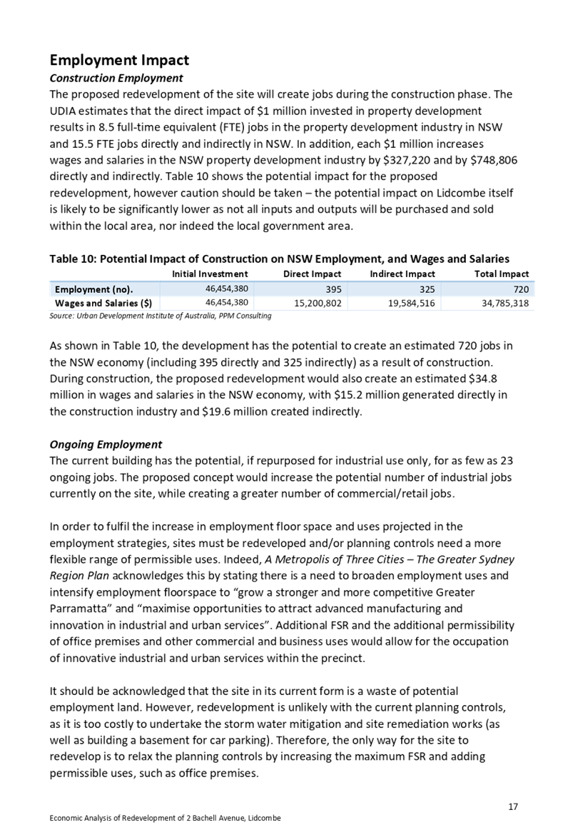
As shown in Figure 1, the majority of Key Projects are completed or are on track for completion during 2018-19.
Figure 1 – Summary of Key Project Performance at Q3
During the quarter, three additional projects were completed:
· The Library Strategy
· Rationalisation and Harmonisation of Council’s Fleet Policy
· Men’s Shed Relocation to Western Cumberland.
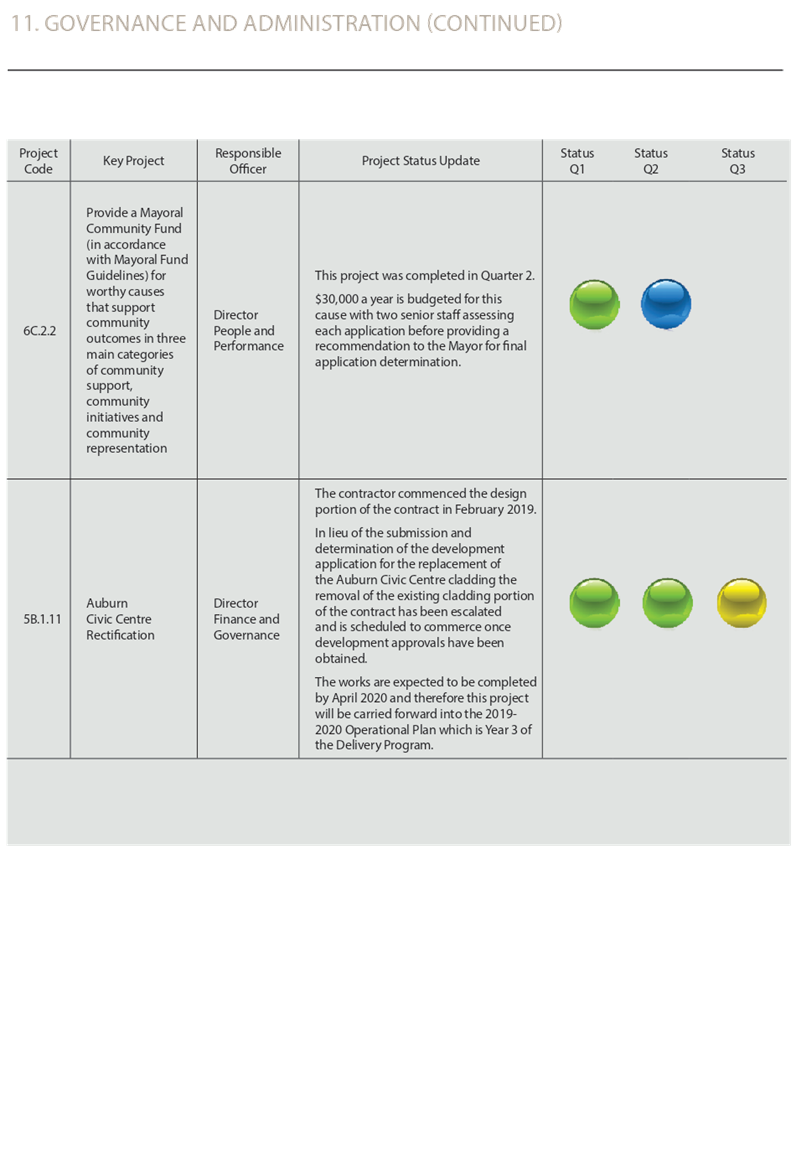
The majority of other projects (53/74) are running on track for delivery in the 2018-19 year. Three projects however are delayed. These are:
· Wyatt Park Plan of Management – delayed owing to changes in legislation and Ministerial directives.
· New Customer Service Portal – Delayed but will be delivered as part of phase 2 of the Technology One implementation project.
· Auburn Civic Centre Rectification – Delayed but scheduled to commence once development approvals are obtained.
Highlights from Council’s service delivery through the quarter include:
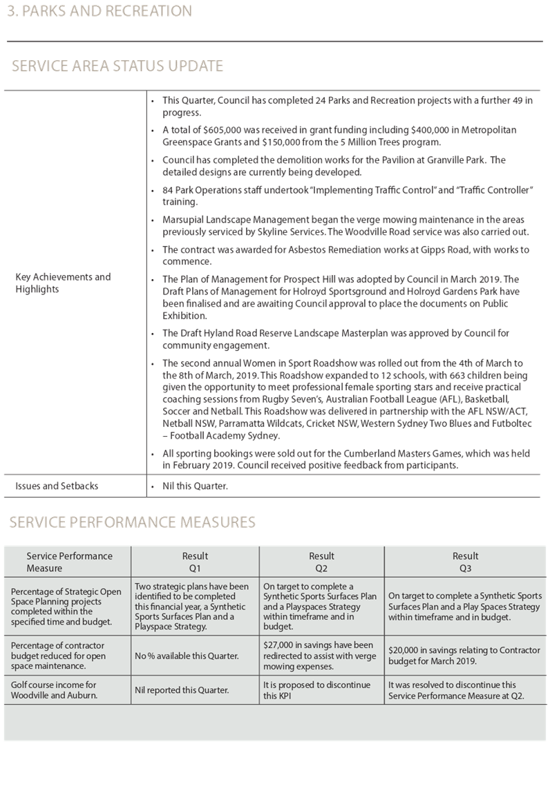
· Council’s Recreation Team were awarded ‘Local Council of the Year’ at the Sports NSW Awards.
· A new Community Hub was established at Wentworthville providing shared office and meeting space for 11 volunteer run community groups.
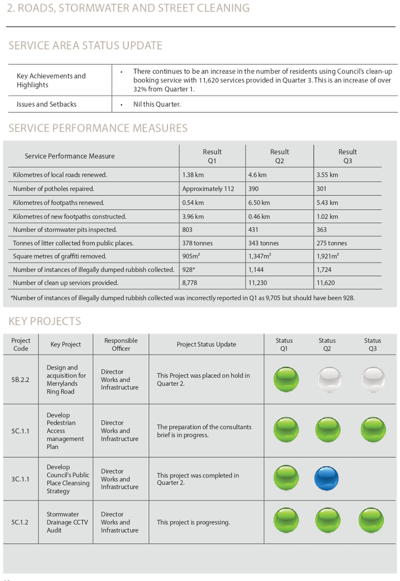
· An increase of over 32% in the number of residents using Council’s clean-up booking services.
· 1.02km of new footpaths constructed compared to 0.46km in Q2.
· Cumberland Seniors Festival was held promoting over 70 different activities available for seniors across the Cumberland area, as well as five major Seniors Festival events.
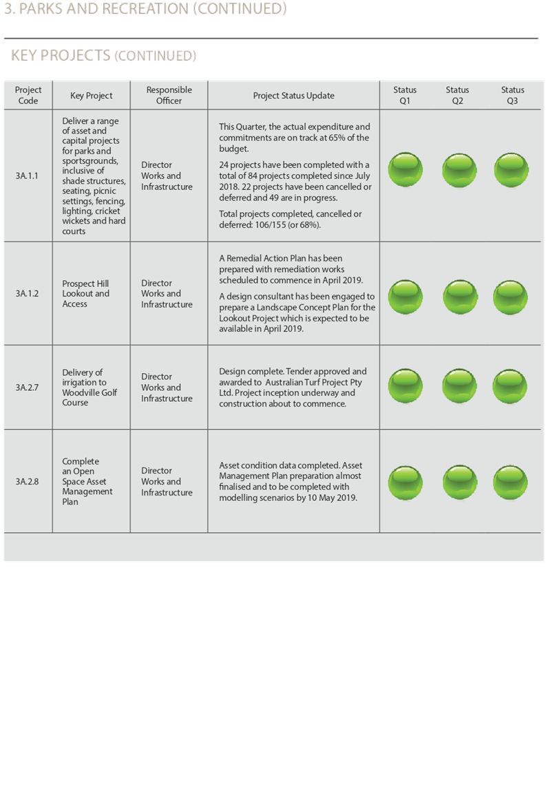
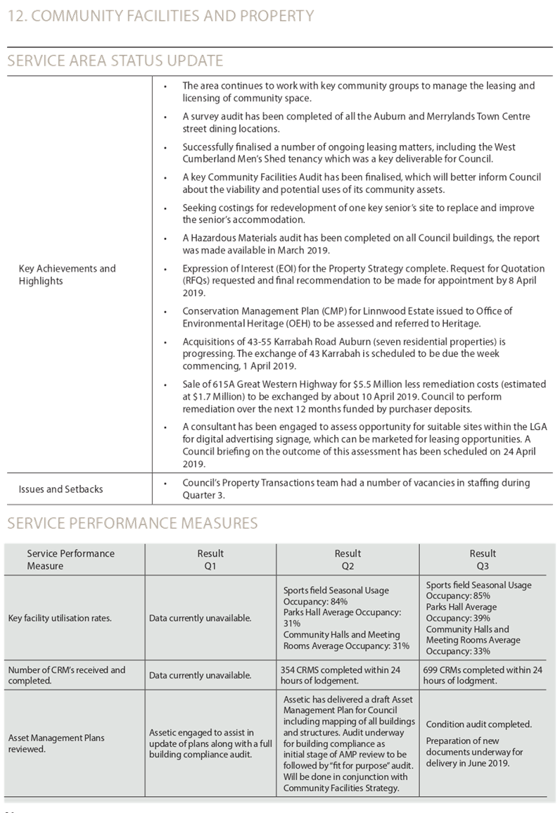
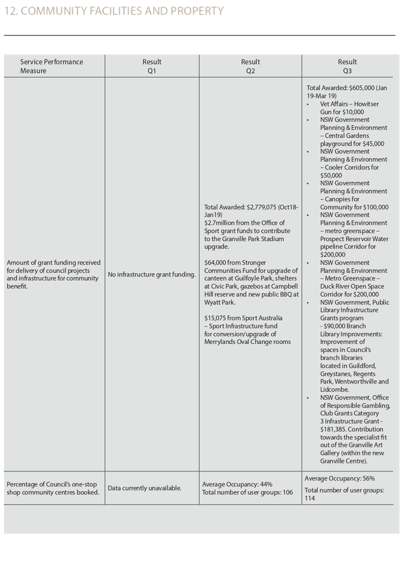
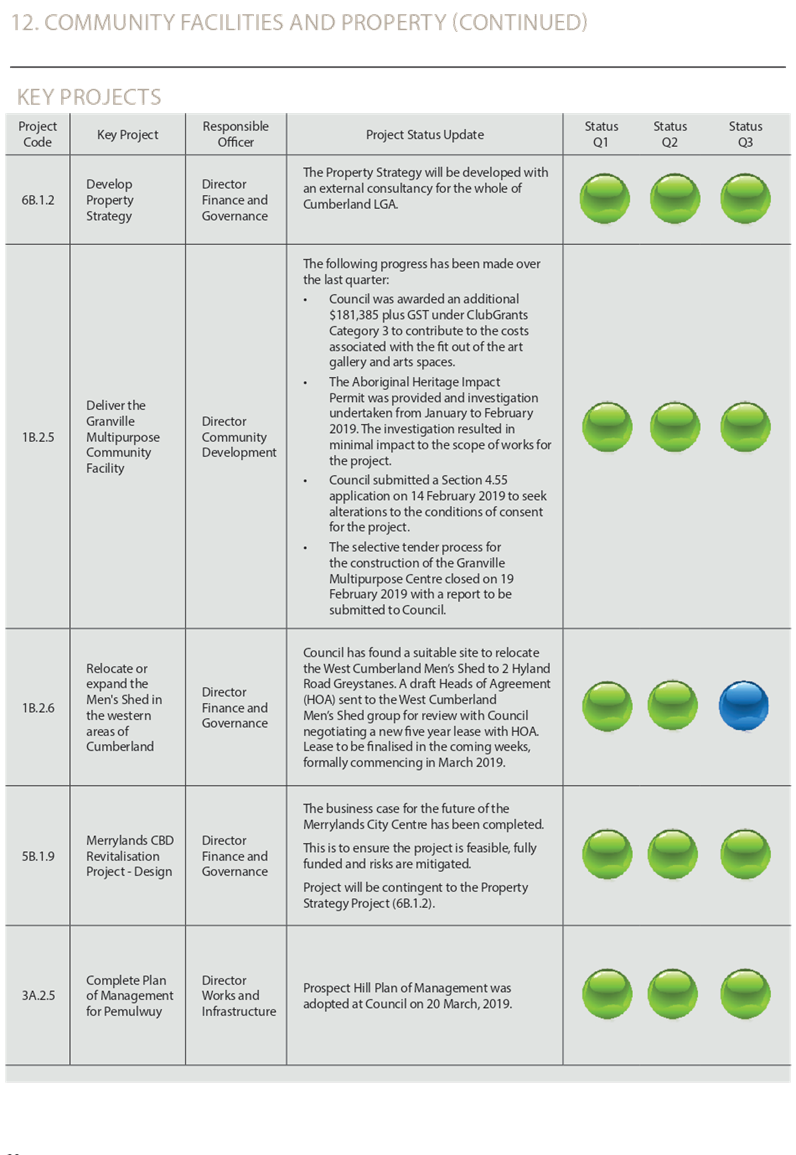
· The Plan of Management for Prospect Hill was adopted by Council.
· The annual Clean Up Australia Day event at Duck River was attended by over 130 people.
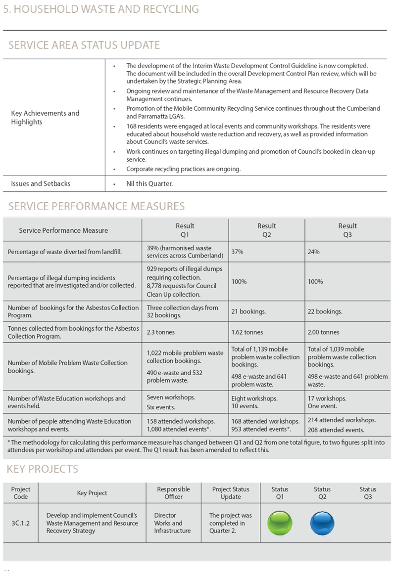
· The Waste and Resource Recovery Strategy was finalised and adopted by Council.
· The Library Strategy 2018-21 was adopted by Council.
Confirmation Statement from the Director Finance & Governance
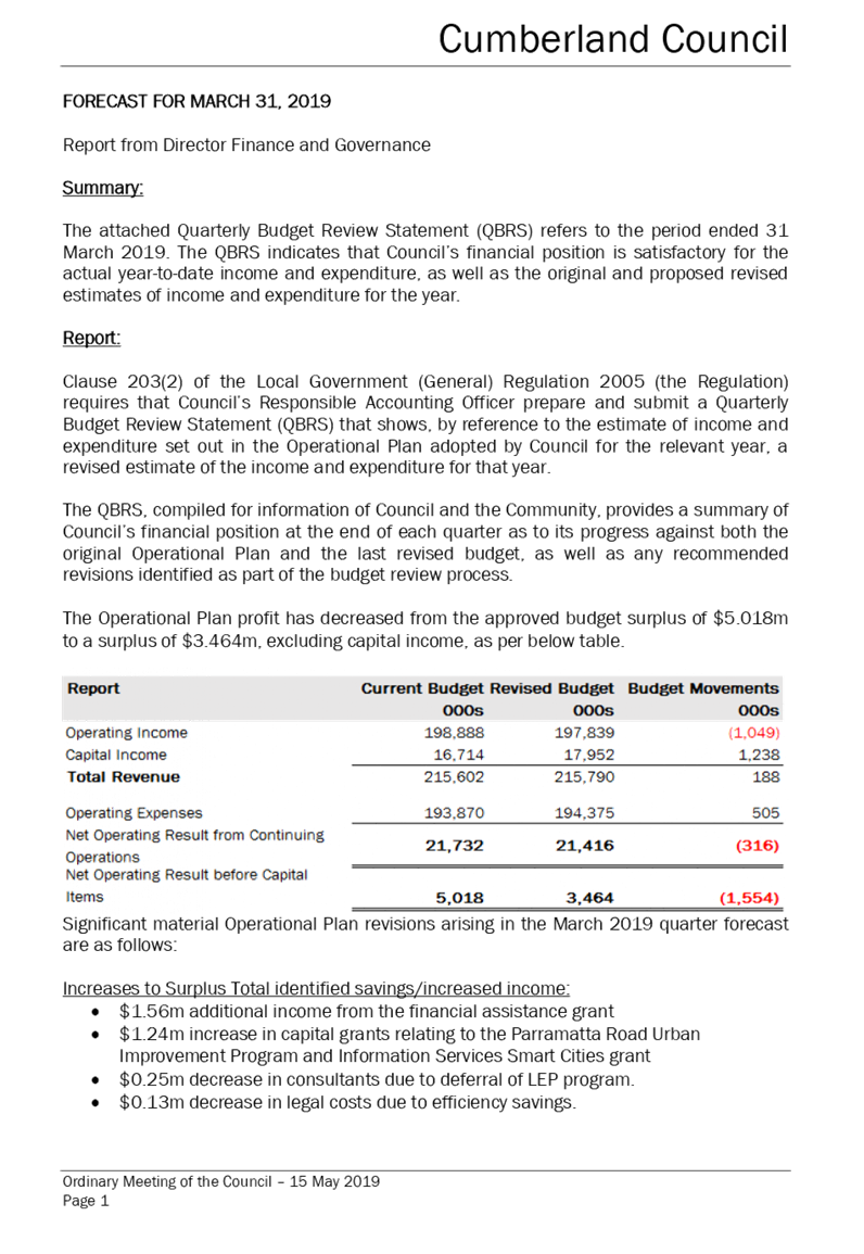
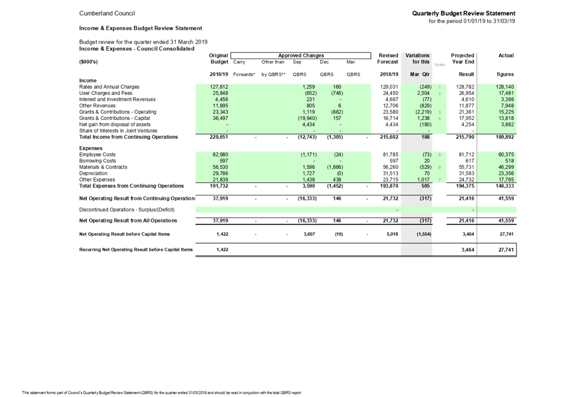
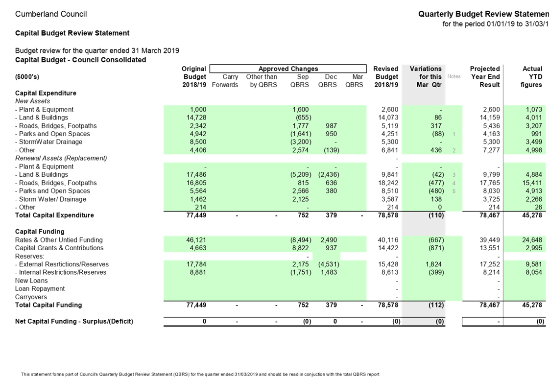
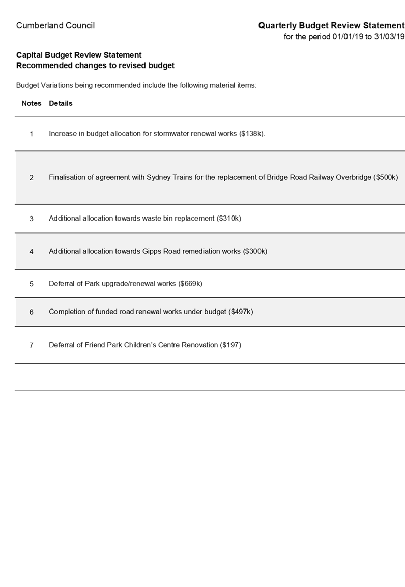
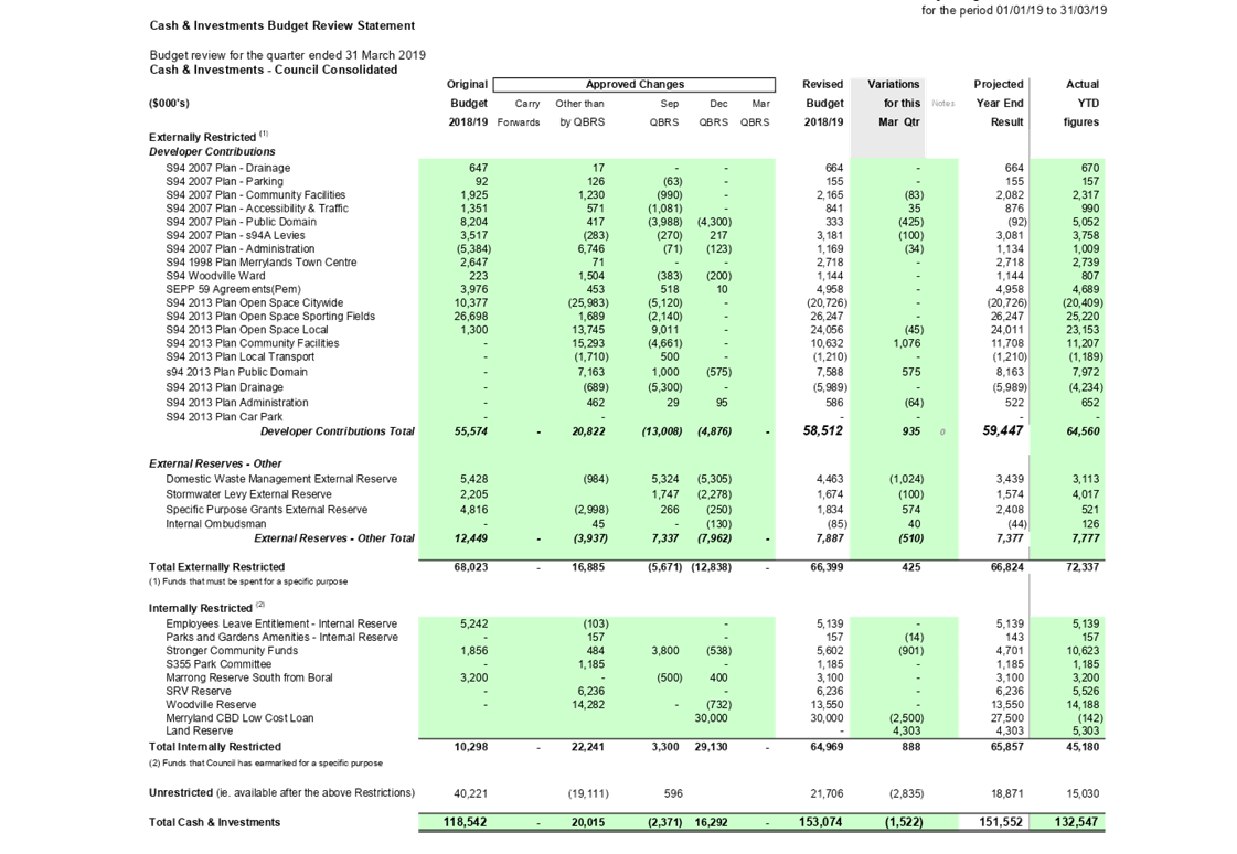
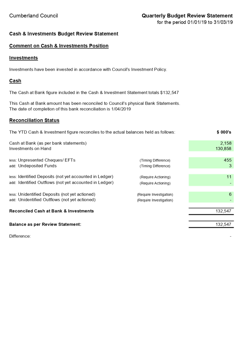
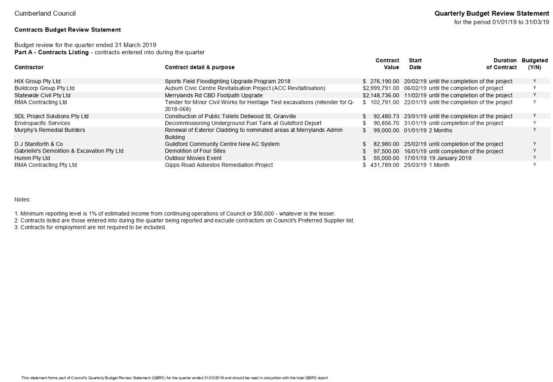
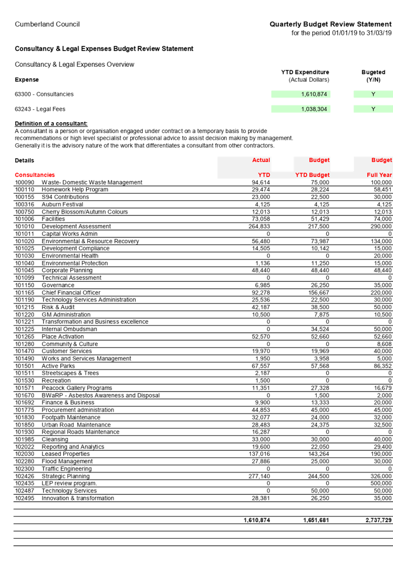
Provided in the attachments to this report are a report from the Director Finance & Governance and Quarterly Budget Review Statement (QBRS) which refer to the period ended 31 March 2019. The QBRS indicates that Council’s financial position is satisfactory for the actual year-to-date income and expenditure, as well as the original and proposed revised estimates of income and expenditure for the year.
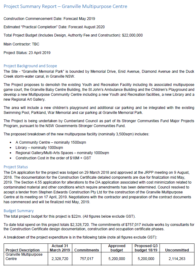
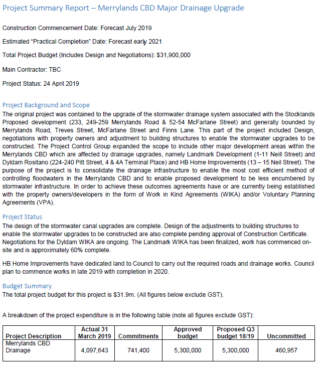
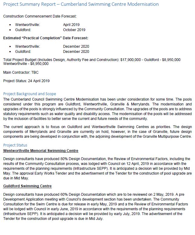
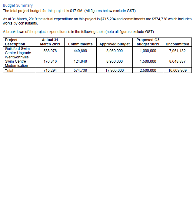
A quarterly project summary report with revised budgets is also provided in the attachments for the three major capital works projects currently underway, being the Granville Multipurpose Centre, Merrylands CBD Major Drainage Upgrade and Cumberland Swim Centre Modernisation.
Community Engagement
The Quarter Three Performance Report will be placed on Council’s website.
Policy Implications
The Operational Plan 2018-19 will be amended to include changes in the report.
Risk Implications
There are no risk implications for Council associated with this report.
Financial Implications
This report recommends that Council approve the revised income and expenditure estimates.
CONCLUSION
During the third quarter for 2018-19 Council has made significant progress with 88% of Key Projects already complete or on track for completion. Council is well positioned to deliver the activities committed to in the Operational Plan 2018-19.
As at the end of the third quarter, Council’s year-end projected financial position remains satisfactory, with the estimated net operating result before capital projected to finish the year with a surplus of $3.464m.
Attachments
1. Council report - Q3
Financial Analysis ⇩ ![]()
2. QBRS
1819 Q3 ⇩ ![]()
3. Major
Project Granville Multipurpose Centre Q3 ⇩ ![]()
4. Major
Project Merrylands CBD Drainage Q3 ⇩ ![]()
5. Major
Project Swim Centres Q3 ⇩ ![]()
6. Quarter
3 Performance Report on the Operational Plan 2018-19 ⇩ ![]()
DOCUMENTS
ASSOCIATED WITH
REPORT C05/19-83
Attachment 1
Council report - Q3 Financial Analysis
DOCUMENTS
ASSOCIATED WITH
REPORT C05/19-83
Attachment 3
Major Project Granville Multipurpose Centre Q3
Attachment 6
Quarter 3 Performance Report on the Operational Plan 2018-19
15 May 2019
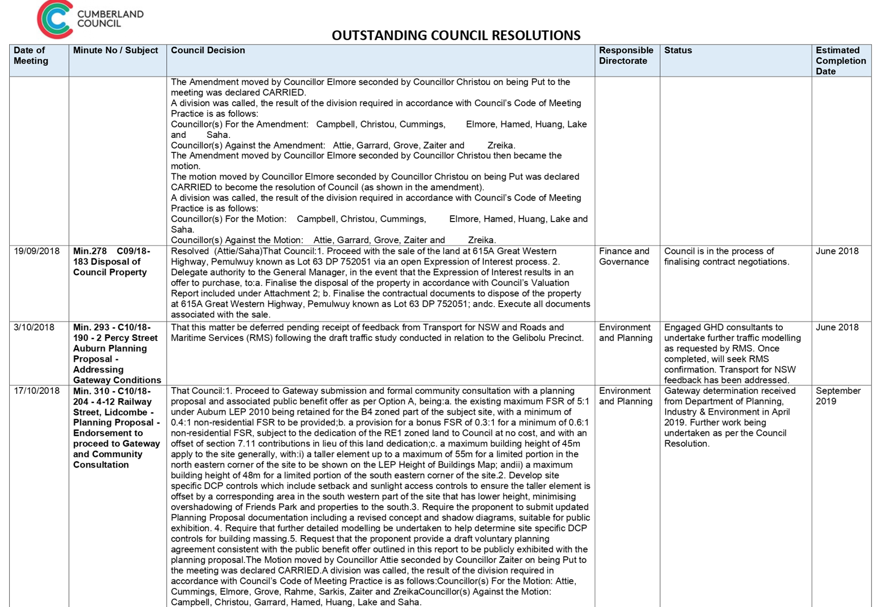
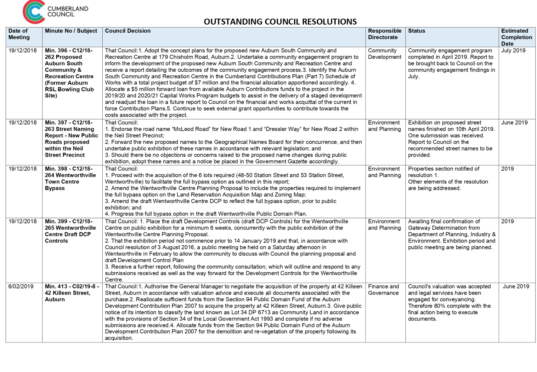
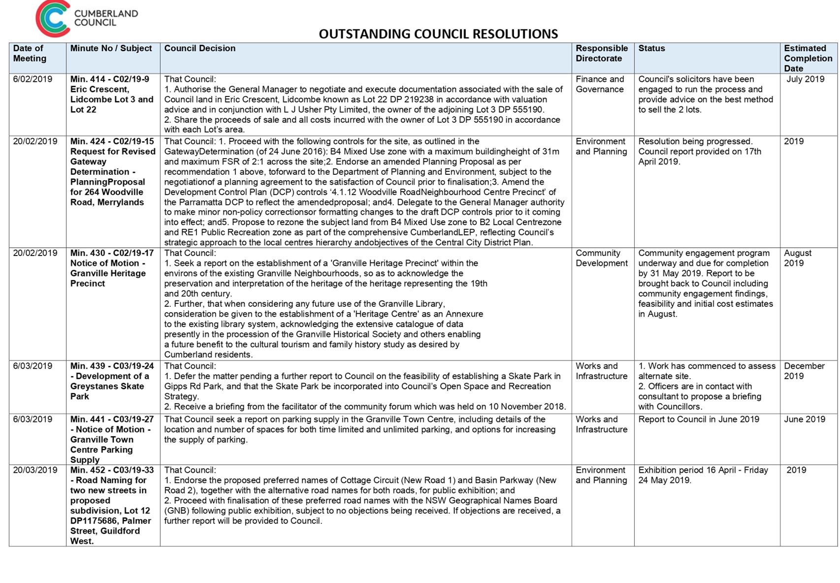
Item No: C05/19-84
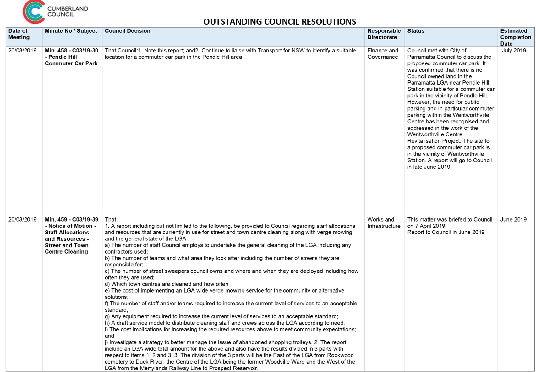
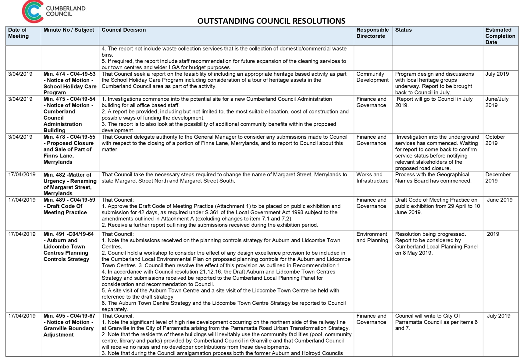
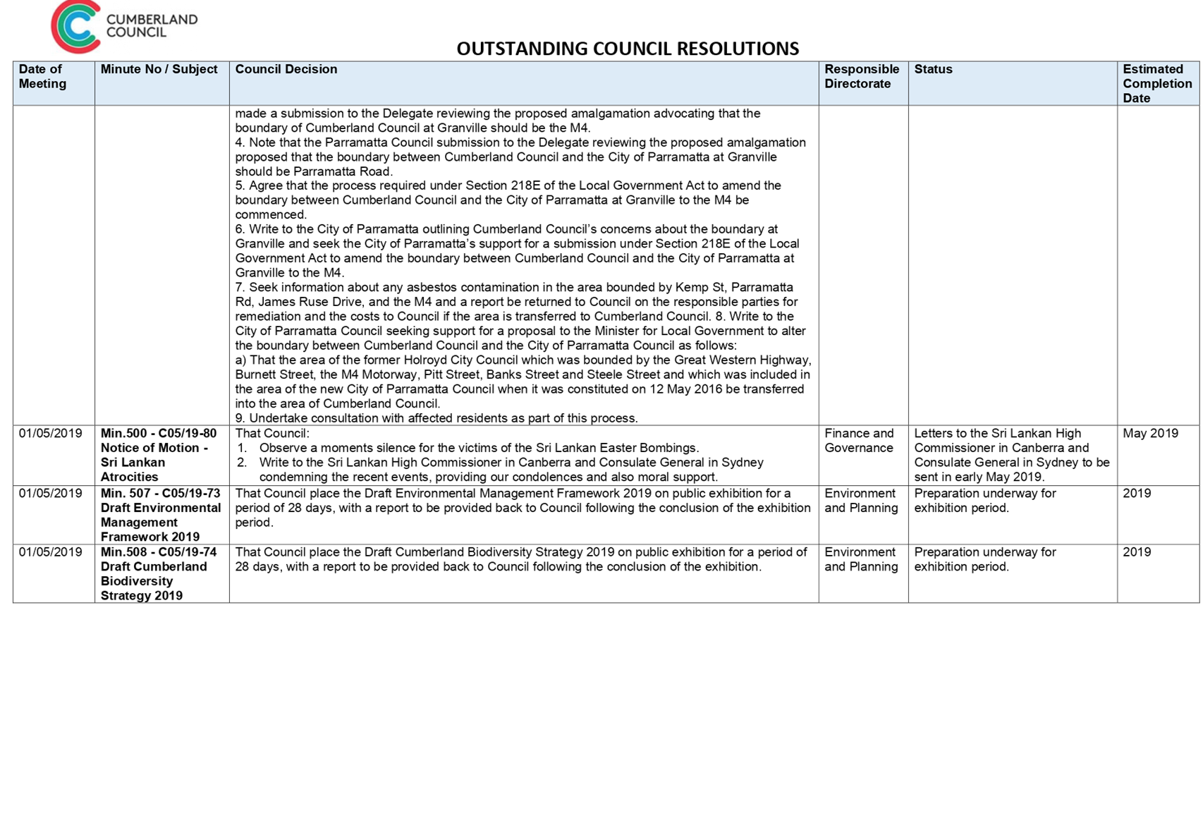
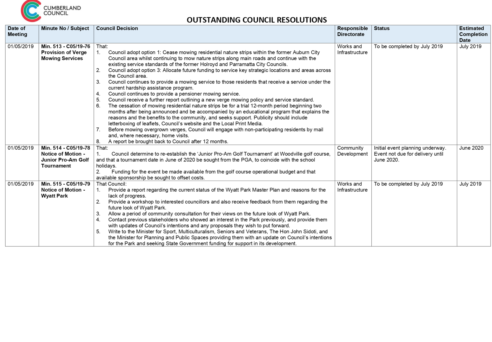
Report on Outstanding Council Resolutions
Responsible Division: Finance & Governance
Officer: Director Finance & Governance
File Number: SC492
Community Strategic Plan Goal: Transparent and accountable leadership
Summary
This report presents to Council the current list of outstanding Council resolutions.
|
Recommendation That Council receive the report. |
Report
This report outlines the currently outstanding Council resolutions, and provides information on completed Council resolutions since Cumberland Council was proclaimed on 12 May 2016.
In total, 621 resolutions have been carried by the Administrator/Council where action was required, with 571 resolutions to date completed.
A total of 32 resolutions have been completed during 2019. The list of outstanding Council resolutions and a status update is provided as Attachment 1 to this report. Moving forward, this report will be provided quarterly to Council.
|
Year |
Resolutions Passed |
Resolutions Enacted/Completed |
Resolutions in Progress |
|
2016 |
151 |
151 |
0 |
|
2017 |
150 |
148 |
2 |
|
2018 |
258 |
242 |
16 |
|
2019 |
62 |
40 |
22 |
Community Engagement
There are no consultation processes for Council associated with this report.
Policy Implications
There are no policy implications for Council associated with this report.
Risk Implications
This report provides Council with added transparency in relation to the progress of outstanding Council resolutions.
Financial Implications
There are no financial implications for Council associated with this report.
CONCLUSION
The update on outstanding Council resolutions is provided for the information of Council.
Attachments
1. Outstanding Council
Resolutions List ⇩ ![]()
DOCUMENTS
ASSOCIATED WITH
REPORT C05/19-84
Attachment 1
Outstanding Council Resolutions List
15 May 2019
Item No: C05/19-85
Investment Report - April 2019
Responsible Division: Finance & Governance
Officer: Director Finance & Governance
File Number: A-05-01/05
Community Strategic Plan Goal: Transparent and accountable leadership
Summary
This is a report from the Director Finance & Governance providing an update on the performance of Council’s investment portfolio to 30 April 2019.
|
Recommendation:
That Council receive the April 2019 Investment Report. |
Report
Included in this report are the following items that highlight Council’s investment portfolio performance for the month, year-to-date to 30 April 2019 and an update of the investment environment.
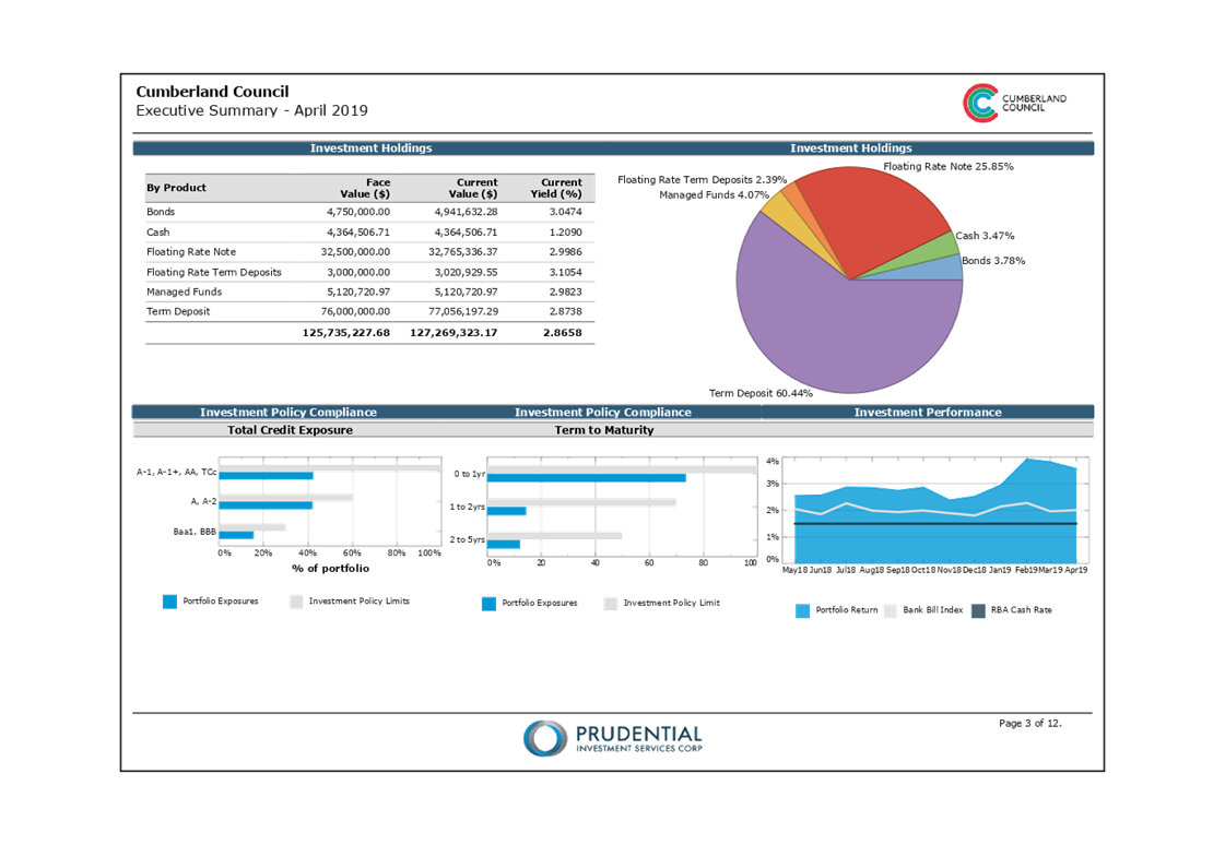
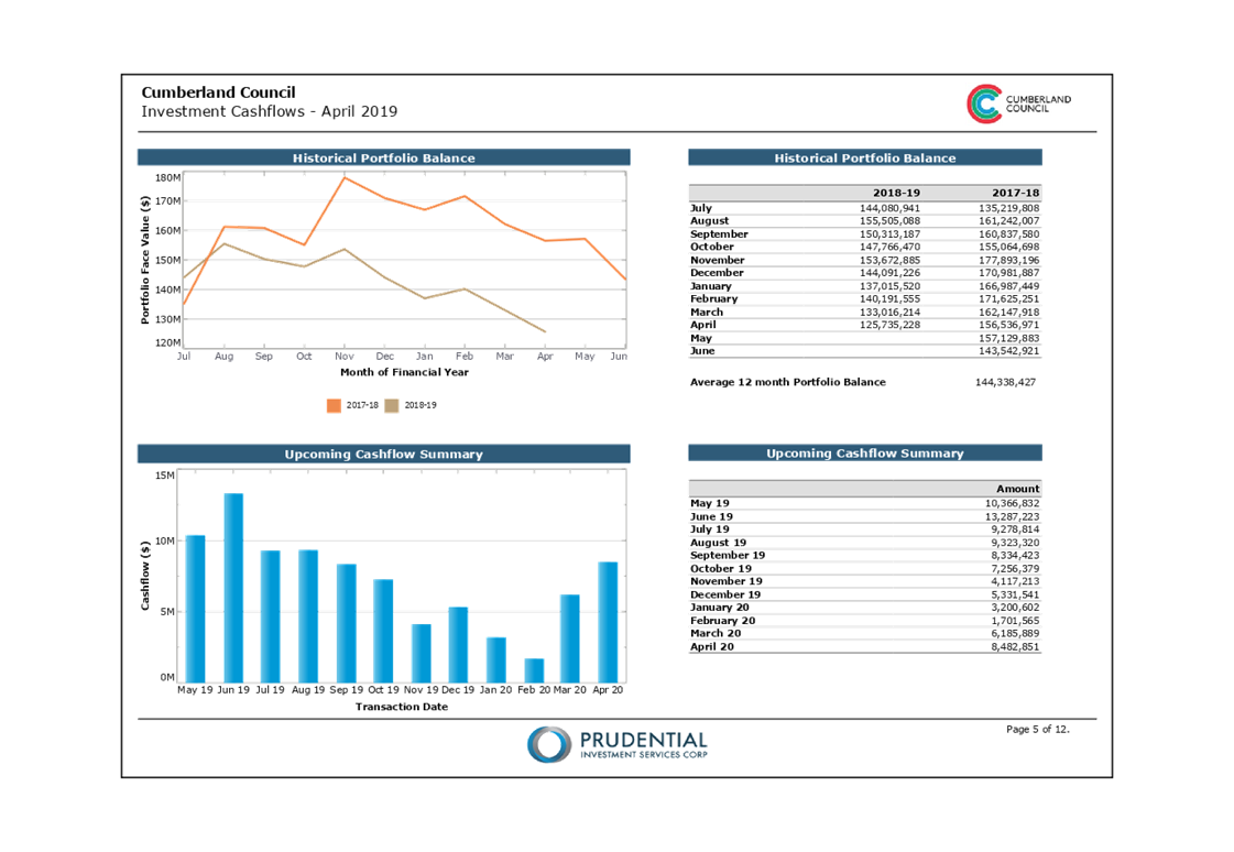
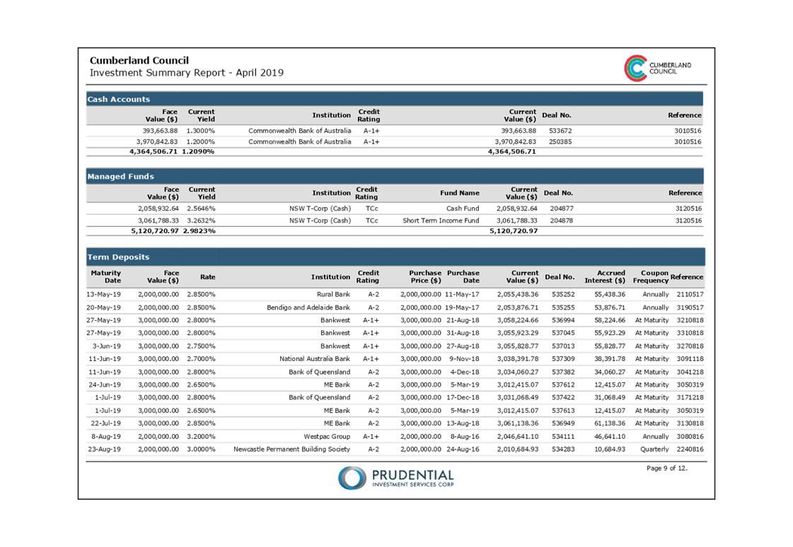
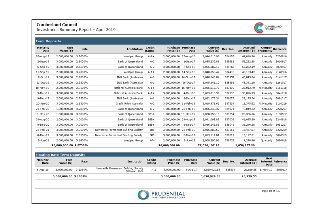
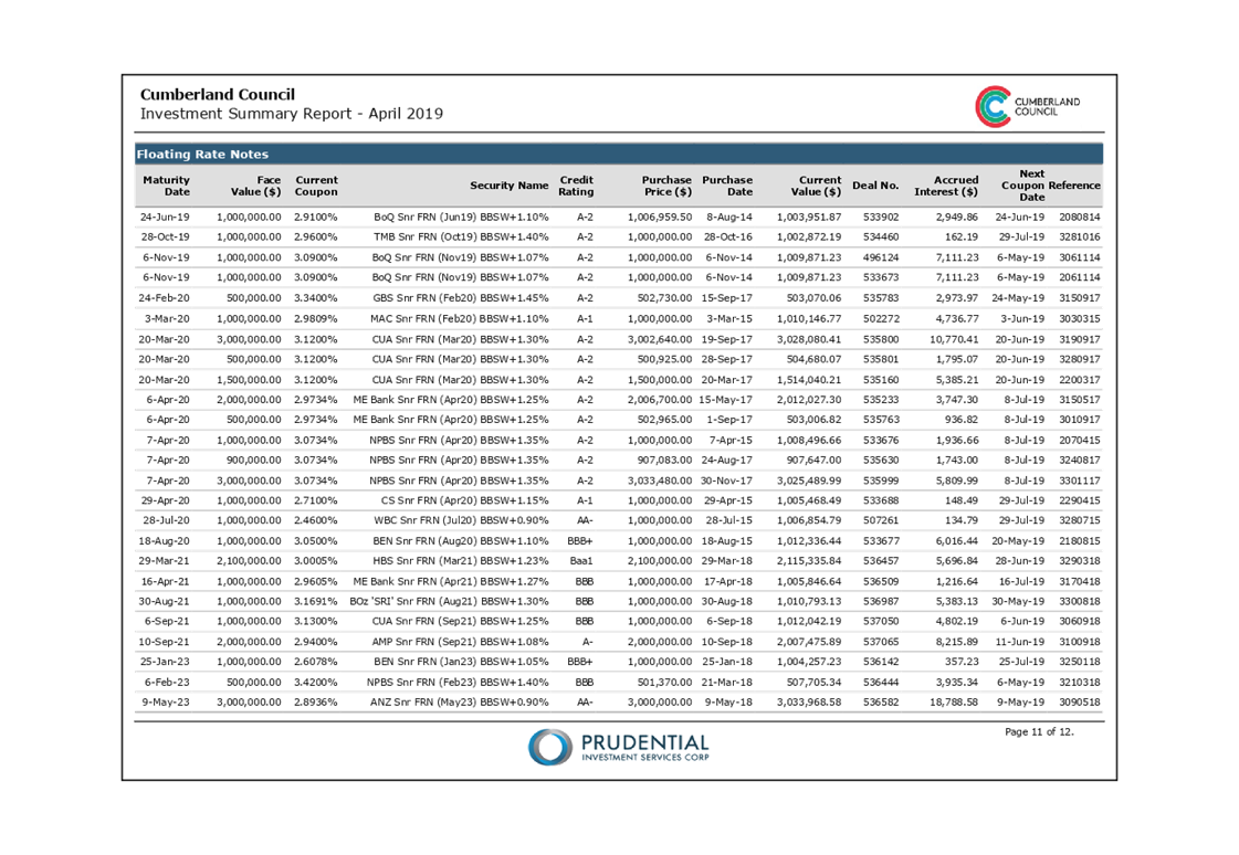
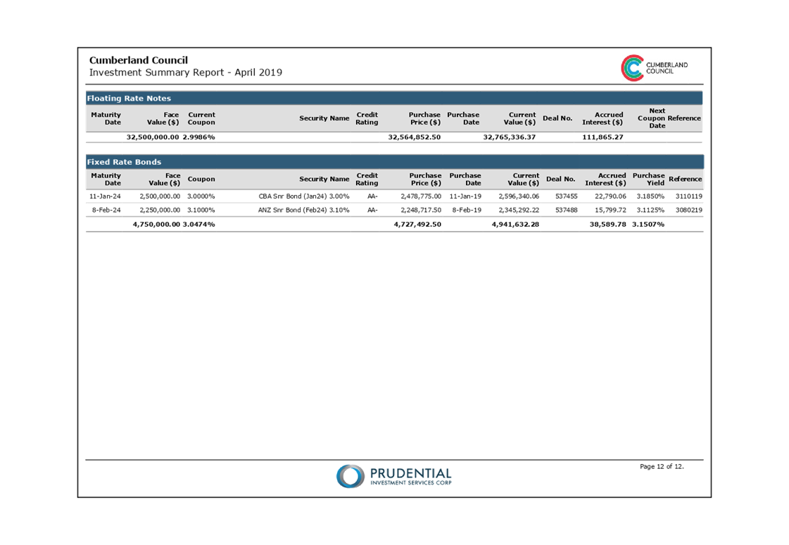
Council Investments as at 30 April 2019
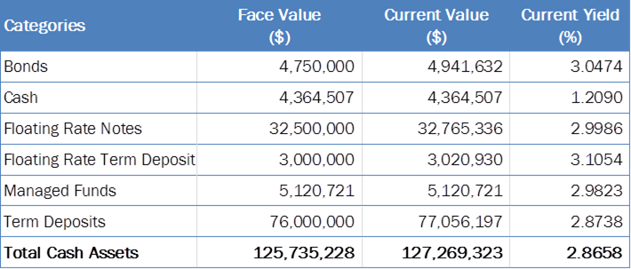
Council’s investment portfolio has a current market value of $127,269,323. This represents a premium of $1,534,095 above the face value of the portfolio being $125,735,228 and generates a 2.87% average purchase yield. The following table reflects Council’s holding in various investment categories.
Investment Portfolio Performance
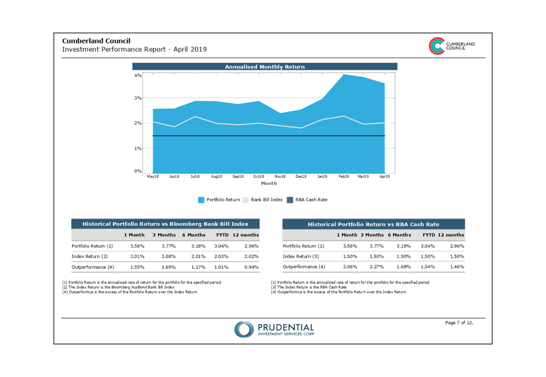
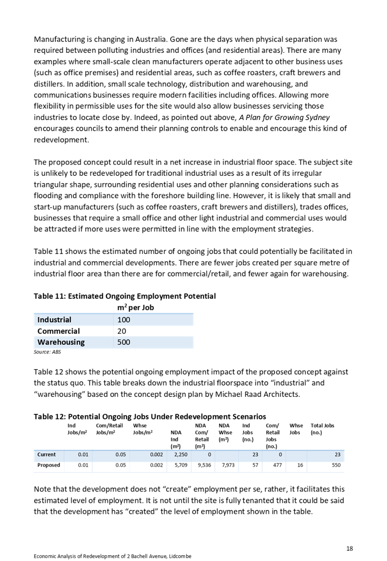
The investment returns for the month year-to-date of 30 April 2019 outperformed the current month benchmark and exceeded the Year to date benchmark.
Performance – Current Month 30 April 2019
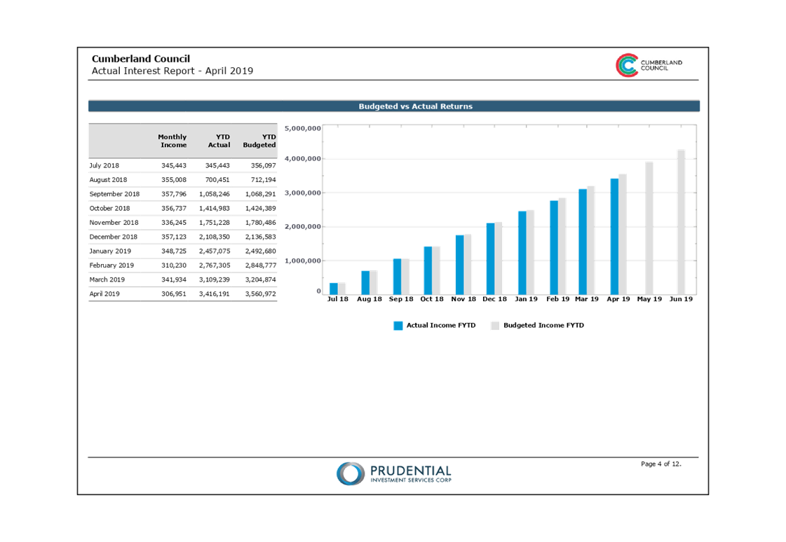
For the month of April, Council‘s portfolio generated interest earnings of $306,951. This is $49,146 lower than the budget of $356,097 and outperformed the AusBond Bank Bill Index by 1.55%, as detailed below:-
![]()
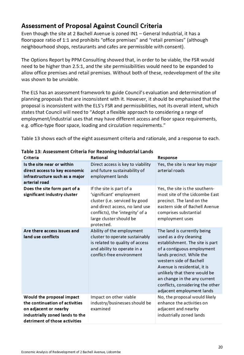
Performance – Year-to-date 30 April 2019
For the year-to-date, Council‘s portfolio generated interest earnings of $3,416,191 This is $144,781 lower than the budget of $3,560,972 and outperformed the AusBond Bank Bill Index by 1.01%, as per below:-
![]()
Community Engagement
There are no consultation processes for Council associated with this report.
Policy Implications
There are no policy implications for Council associated with this report.
Risk Implications
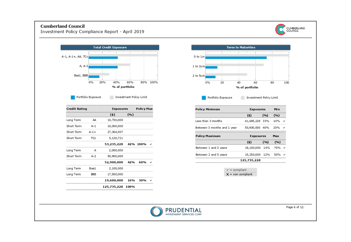
To manage risk, key criteria are incorporated into Cumberland Council’s investment making decisions, as detailed below:-
Preservation of Capital
The requirement for preventing losses in an investment portfolio’s total value (considering the time value of money).
Diversification
Setting limits to the amounts invested with a particular financial institution or government authority to reduce credit risk.
Credit risk
The risk that an investment of Council fails to pay the interest and/or repay the principal of an investment.
Maturity risk
The longer the term of the investment, the greater the exposure to potential changes in interest rates, market volatility and credit quality of an issuer.
Financial Implications
There are no financial implications for Council associated with this report.
CONCLUSION
Council hereby certifies that the investments listed above have been made in accordance with Section 625 of the Local Government Act 1993, Clause 212 of the Local Government (General) Regulation 2005 and Council’s Investment Policy.
Attachments
1. Investment Summary
Report April 2019 ⇩ ![]()
2. Economic
and Investment Portfolio Commentary April 2019 ⇩ ![]()
DOCUMENTS
ASSOCIATED WITH
REPORT C05/19-85
Attachment 1
Investment Summary Report April 2019
Attachment 2
Economic and Investment Portfolio Commentary April 2019
15 May 2019
Item No: C05/19-86
Response to Notice of Motion - Emergency Relief Fund
Responsible Division: Community Development
Officer: Director Community Development
File Number: C-37-13
Community Strategic Plan Goal: Transparent and accountable leadership
Summary
This report provides a response to the Notice of Motion - Emergency Relief Fund, resolved at the Ordinary Meeting of Council held on 21 December 2018 (Min. 385, Item C12-18-270).
The development of the Draft Emergency Relief Fund Guidelines has required a review of all financial assistance programs and policies. This report presents Draft Guidelines outlining the scope and operation of the Emergency Relief Fund and a revised Community Grants and Donations Policy to be placed on public exhibition for consultation with the community.
|
Recommendation That Council: 1. Place the Draft Emergency Relief Fund Guidelines as outlined in Attachment 1 on public exhibition for a period of 28 days. 2. Place the revised Community Grants and Donations Policy as outlined in Attachment 2 on public exhibition for a period of 28 days. 3. Provide a report back to Council following the conclusion of the exhibition period. |
Report
Background
At the Ordinary Meeting of Council held on 21 December 2018, Council considered the Notice of Motion - Emergency Relief Fund (Min. 385, Item C12-18-270), and resolved:
“That:
1. Council establish an Emergency Relief Fund (ERF).
2. The ERF be designed to provide financial support to individuals, charities and not for profit organisations who require financial assistance for emergency relief that exceeds the cap under the Mayoral Community Fund.
3. The decision to provide financial assistance from the ERF be a decision of Council.
4. A sum of $50,000 be provided in the ERF each financial year (non-cumulative).
5. Council Officers provide to Council, for Council’s consideration and approval, draft Guidelines for the scope and operation of the ERF.”
Proposed Scope and Operation of the Emergency Relief Fund
The Draft Emergency Relief Fund Guidelines included under Attachment 1 have been developed to provide a defined application process, eligibility criteria and appropriate governance mechanisms to ensure funds are expended appropriately.
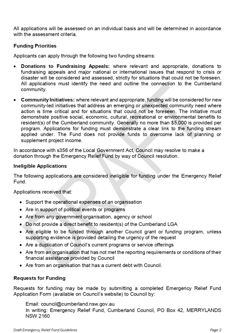
The purpose of the Emergency Relief Fund is to provide financial support to the community at any time for donations to fundraising appeals that respond to crisis or disaster situations, or for new community-led initiatives that address an emerging or unexpected community need where action is time critical.
The Emergency Relief Fund provides donations through two funding streams:
· Donations to Fundraising Appeals: This includes donations to fundraising appeals and major national or international issues that respond to crisis or disaster situations that could not be foreseen. All applications must identify the need and outline the connection to the Cumberland community.
· Community Initiatives: This includes new community-led initiatives that address an emerging or unexpected community need where action is time critical and for situations that could not be foreseen. The initiative must demonstrate positive social, economic, cultural, recreational or environmental benefits to residents of the Cumberland Local Government Area. Generally no more than $5,000 is provided per community initiative. The Fund does not provide funds to overcome lack of planning or supplement project income.
Applications through the Emergency Relief Fund will be assessed by a panel of Council officers in accordance with the Community Grants and Donations Policy and the established criteria outlined in the Guidelines. A recommendation will be reported to Council for consideration. The decision to approve funding will be by Council resolution.
A total of $50,000 per annum is budgeted for the Emergency Relief Fund. The Fund would be available for implementation upon the commencement of the 2019/2020 financial year.
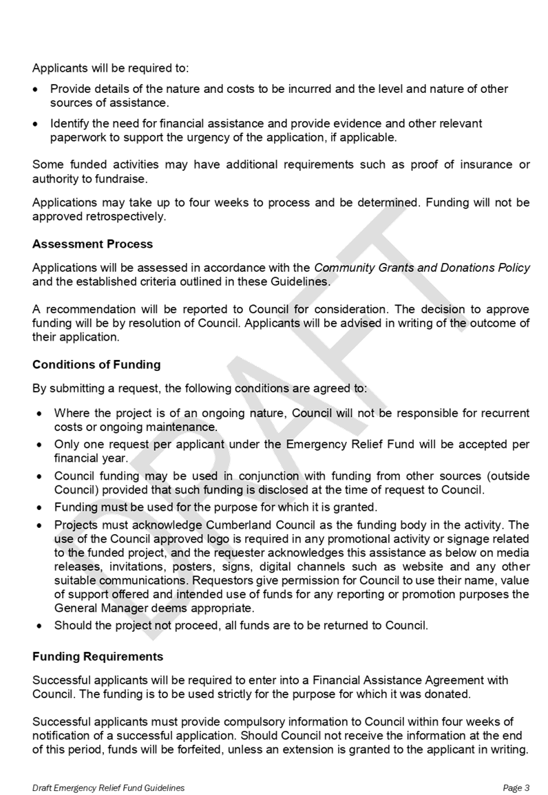
Review of Council’s Financial Assistance Programs and Policies
The establishment of the Emergency Relief Fund has required a review of all Council financial assistance programs and policies. Changes to the Mayoral Community Fund Guidelines and the Community Grants and Donations Policy have been made accordingly.
The Community Grants and Donations Policy provides an accountability framework to ensure that Council meets legislative requirements prescribed in Section 356 of the Local Government Act 1993. The Policy also seeks to ensure that all grants and donations deliver social, economic, cultural, recreational and environmental benefits to local communities.
The Policy applies to all aspects of grant and donation programs, including their design, application processes, decision making, agreement making, monitoring and support services. It also covers requests and granting of fee waivers for the use and hire of Council facilities and open spaces, which are considered as a monetary contribution made by Council within the context of the Policy.
The key changes made to the Community Grants and Donations Policy include:
· Expansion of the scope of the Policy to apply to all donation programs in addition to grant-making activity.
· The inclusion of a definition of a ‘Donation’.
· Specific reference and inclusion of both the Mayoral Community Fund and Emergency Relief Fund donation programs as well as the decision making processes for each.
A copy of the revised Community Grants and Donations Policy is attached to this report under Attachment 2.
Community Engagement
The revised Community Grants and Donations Policy and Draft Emergency Relief Fund Guidelines will be placed on public exhibition for a period of 28 days to enable consultation with the community.
During the public exhibition period, the following actions and community engagement activities will be undertaken:
· The Draft Guidelines and revised Policy will be distributed to community groups, recipients and applicants from previous grant and donation programs and other key stakeholders to seek feedback and comment.
· Advertising of the public exhibition period in the Auburn Review and Parramatta Advertiser.
· The Draft Guidelines and revised Policy will be made available on Council’s ‘Have Your Say’ community engagement website and at Council libraries, staffed community centres and Council’s customer service centres.
Feedback and public comments arising from the public exhibition period will be reported back to Council.
Policy Implications
The revised Community Grants and Donations Policy outlines the framework under which all grants and donations made by Council to the community are governed.
All applications submitted under the Emergency Relief Fund will be assessed in accordance with this Policy to ensure Council meets legislative requirements as prescribed in Section 356 of the Local Government Act 1993.
Risk Implications
The Emergency Relief Fund is one of three financial assistance programs provided by Council and governed by the Community Grants and Donations Policy.
The Emergency Relief Fund Guidelines will ensure Council is compliant with the provisions of Section 356 of the Local Government Act 1993, thereby providing a clear and transparent process for applications for financial assistance under the Emergency Relief Fund.
Financial Implications
An annual funding pool of $50,000 for the Emergency Relief Fund has been allocated in the Draft Operational Plan 2019/2020 budget.
CONCLUSION
The Draft Emergency Relief Fund Guidelines provide a defined process by which financial assistance can be provided to the community at any time for donations to fundraising appeals that respond to crisis or disaster situations, or for new community-led initiatives that address an emerging or unexpected community need where action is time critical.
The revised Community Grants and Donations Policy will govern the administration of the donations program and provides an accountability framework that ensures Council meets legislative requirements.
It is recommended that the Draft Emergency Relief Fund Guidelines and revised Community Grants and Donations Policy be placed on public exhibition for a period of 28 days for consultation with the community.
Attachments
1. Draft Emergency
Relief Fund Guidelines ⇩ ![]()
2. Amended
Community Grants and Donations Policy - May 2019 ⇩ ![]()
DOCUMENTS
ASSOCIATED WITH
REPORT C05/19-86
Attachment 1
Draft Emergency Relief Fund Guidelines
Attachment 2
Amended Community Grants and Donations Policy - May 2019
15 May 2019
Item No: C05/19-87
Draft Sister City and Friendship City Policy
Responsible Division: Community Development
Officer: Director Community Development
File Number: C-37-30
Community Strategic Plan Goal: Transparent and accountable leadership
Summary
The Draft Sister City and Friendship City Policy has been developed to provide an overarching framework for Council in defining and establishing any ongoing formal civic relationships within Australia and internationally.
This report presents the Draft Sister City and Friendship City Policy for Council’s consideration and recommends that it be placed on public exhibition for consultation with the community.
|
Recommendation That Council place the Draft Sister City and Friendship City Policy on public exhibition for a period of 28 days, with a report to be provided back to Council following the conclusion of the exhibition period. |
Report
Background
Council does not have an adopted Policy in place that governs formal civic relationships within Australia and internationally. The former councils that now make up Cumberland Council previously adopted different approaches with respect to Sister City or other formal civic relationships. For example, the former Auburn City Council maintained a policy on the hosting of overseas visiting delegations and relationships with sister cities whilst the former Holroyd City Council maintained a formal Strategic Alliance with Hay Shire Council.
During Administration, sister city relationships, deputations and alliances were reviewed by Council and on 30 November 2016, it was resolved by the Administrator that (Min. 178, Item 120/16):
“i) Council make contact with:
· Al-Bireh Municipality, Palestine
· Suyeong-gu District, Busan, Korea
· Fuquing City, China
· Jingdezhen City, China
· Changsha, China
· Chizhou, China
· Oberon, NSW
· Sehan Municipality, Turkey,
and request that a reply be received to indicate the extent of any continuing desire to maintain a Sister City type relationship with Cumberland Council, and that responses received be reported to Council following elections in September 2017.
ii) The former Auburn City Council’s Policy on Sister City Relationships and Hosting of Delegations be referred to Council for determination following elections in September 2017.
iii) The existing Strategic Alliance with Hay Shire Council be maintained pending the overall review.”
As per the resolution above, Council made contact with those cities outlined. Two responses were received expressing interest of an ongoing relationship at the appropriate time and once Council had an established formal position and related Policy.
Council also considered a Matter of Urgency in relation to the Hay Shire Council Partnership on 21 December 2018, and it was further resolved (Min.388):
“That Council affirms its existing partnership with Hay Shire Council and extends its support to the Shire as appropriate into the future.”
Following consideration of the previous approaches of the former councils and the above Council resolutions, Council has prepared the Draft Sister City and Friendship City Policy included under Attachment 1 for Council’s consideration.
In preparing the Draft Policy, Council has also undertaken research into current local government approaches. This has highlighted that Sister City relationships typically no longer have a sole focus on peace, goodwill, friendship or cultural objectives and there is currently an increased focus for local government in Australia on economic growth and development, including outcomes focusing on trade, tourism and economic development objectives.
There is also an increased impetus on ensuring a high level of involvement by local communities, including local business involvement, in the development of Sister City relationships. This is to ensure that the outcomes of Sister City relationships are meaningful, quantifiable and accountable to local communities. Use of less onerous arrangements by way of Friendship City relationships are also commonly utilised by councils to allow for shorter term agreements with a specific intent.
These current approaches have been considered in the preparation of the Draft Policy.
Proposed Purpose and Scope of the Draft Sister City and Friendship City Policy
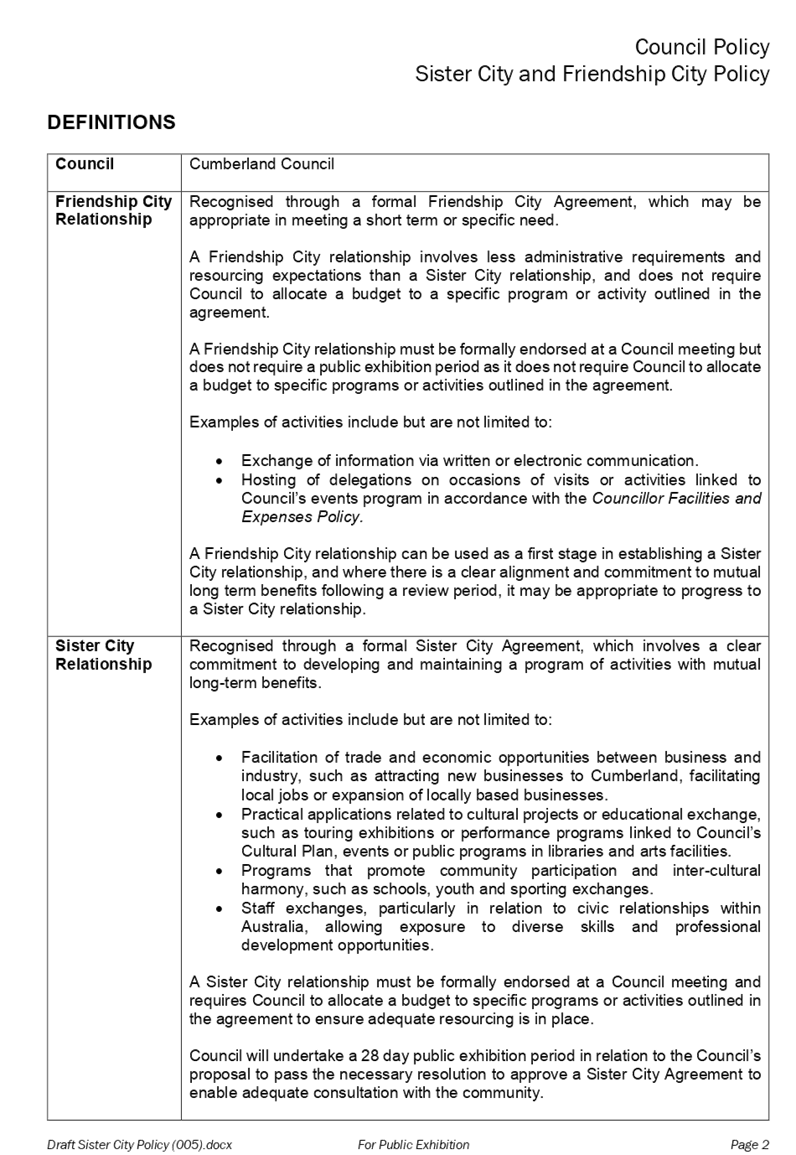
The Draft Policy provides an overarching framework for Council in defining and establishing any ongoing formal civic relationships within Australia and internationally. It proposes that Council operates a two-tier system of formal civic relationships with cities or councils, which includes:
· Sister City relationships
· Friendship City relationships
The Draft Policy will guide Council’s decision-making in establishing and maintaining Sister City and Friendship City relationships, and ensures that the primary focus of any relationship is consistent with Council’s Community Strategic Plan and current legislation.
It also outlines Council’s commitment to ensuring that all formal civic relationships established and maintained will be meaningful, effective, accountable, appropriately resourced and based on clear economic, social and cultural benefits to Council and the community.
The Draft Policy is designed to assist Council to prioritise which civic relationships it pursues as well as outlining the criteria and the process for the establishment and maintenance of formal Sister City and Friendship City relationships with Cumberland Council. The key components of the Draft Policy include:
• Definitions of the types of formal civic relationships recognised by Council.
• The principles or criteria utilised by Council for the establishment and maintenance of Sister City and Friendship City relationships.
• The process for establishing Sister City and Friendship City relationships.
• Ongoing relationship management, including evaluation, regular review and resourcing considerations.
Following a period of public exhibition and formal adoption by Council, the Draft Sister City and Friendship City Policy would be resourced and implemented by existing staff within Council’s Communications and Events service area.
Community Engagement
The Draft Sister City and Friendship City Policy will be placed on public exhibition for a period of 28 days, to enable the community to have an opportunity for input.
During the public exhibition period, the following actions and community engagement activities will be undertaken:
· The Draft Policy will be distributed to community groups and other key stakeholders to seek feedback and comment.
· Advertising of the public exhibition period in the Auburn Review and Parramatta Advertiser.
· The Draft Policy will be made available on Council’s ‘Have Your Say’ community engagement website and at Council libraries, staffed community centres and Council’s customer service centres.
Feedback and public comments arising from the public exhibition period will be reported back to Council.
Policy Implications
Council does not have an adopted Policy in place that governs formal civic relationships within Australia and internationally.
The Draft Sister City and Friendship City Policy developed ensures that the key focus of any future formal relationship is consistent with Council’s Community Strategic Plan, Code of Conduct and current legislation.
It should also be noted that the Draft Policy excludes requests for one-off visits from international groups or delegations, which are already provided for under the Councillor Facilities and Expenses Policy. It also does not preclude Council from entering into cooperative relationships with other metropolitan councils.
Risk Implications
The Draft Sister City and Friendship City Policy has undergone a review by the Internal Ombudsman Shared Service to ensure it is consistent with the Code of Conduct and meets the requirements of current legislation.
The Draft Policy stipulates that a Sister City or Friendship City relationship and the related agreement must be formally endorsed at a Council meeting. The Draft Policy further outlines that Council will make public any future Sister City or Friendship City relationships on the Council website so as to adequately inform the community of the Council’s activities under the Policy and ensure all arrangements remain transparent and accountable to the community.
Financial Implications
Upon adoption, implementation of the Draft Sister City and Friendship City Policy will be resourced by existing staff within Council’s Communications and Events service area.
Whilst the Draft Policy does not present immediate financial implications to Council, the future consideration of any Sister City relationship will require Council to allocate a budget to specific programs or activities outlined in the agreement to ensure adequate resourcing is in place. This will require Council to consider the required and available budget at the time of any proposal coming to Council to establish a Sister City relationship. Moreover, unless part of the annual budget process, Council will be required to undertake a 28 day public exhibition period in relation to the Council’s proposal to pass the necessary resolution to approve a Sister City Agreement to enable adequate consultation with the community.
In accordance with the Draft Policy, it should be noted that a Friendship City relationship does not require Council to allocate a budget to a specific program or activity outlined in the agreement. A Friendship City relationship must, nonetheless, be formally endorsed at a Council meeting.
Further to the above and in accordance with the adopted Councillor Facilities and Expenses Policy, Council has already allocated a budget of $5000 per year to host civic events, including receiving official delegations from outside the local government area.
CONCLUSION
Council does not have an adopted Policy in place that governs formal civic relationships within Australia and internationally. Following consideration of the previous approaches of the former councils, previous resolutions of Council and research into current local government approaches in relation to Sister City type relationships, Council has prepared the Draft Sister City and Friendship City Policy included under Attachment 1 for Council’s consideration.
This report recommends that the Draft Sister City and Friendship City Policy be placed on public exhibition for consultation with the community.
Attachments
1. Draft Sister City
and Friendship City Policy ⇩ ![]()
DOCUMENTS
ASSOCIATED WITH
REPORT C05/19-87
Attachment 1
Draft Sister City and Friendship City Policy
15 May 2019
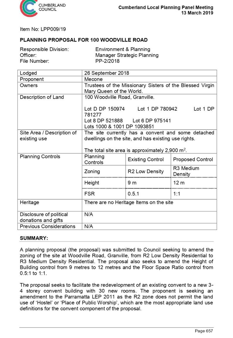
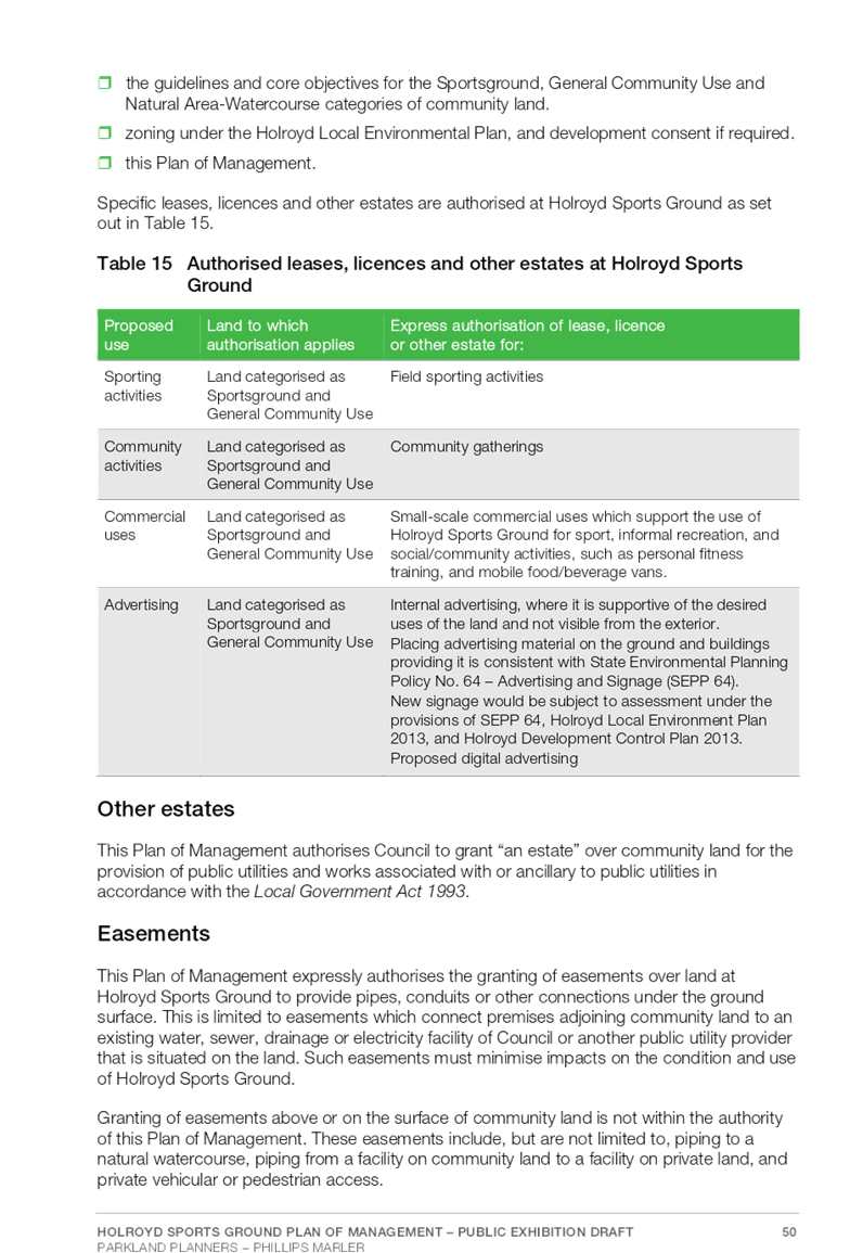
Item No: C05/19-88
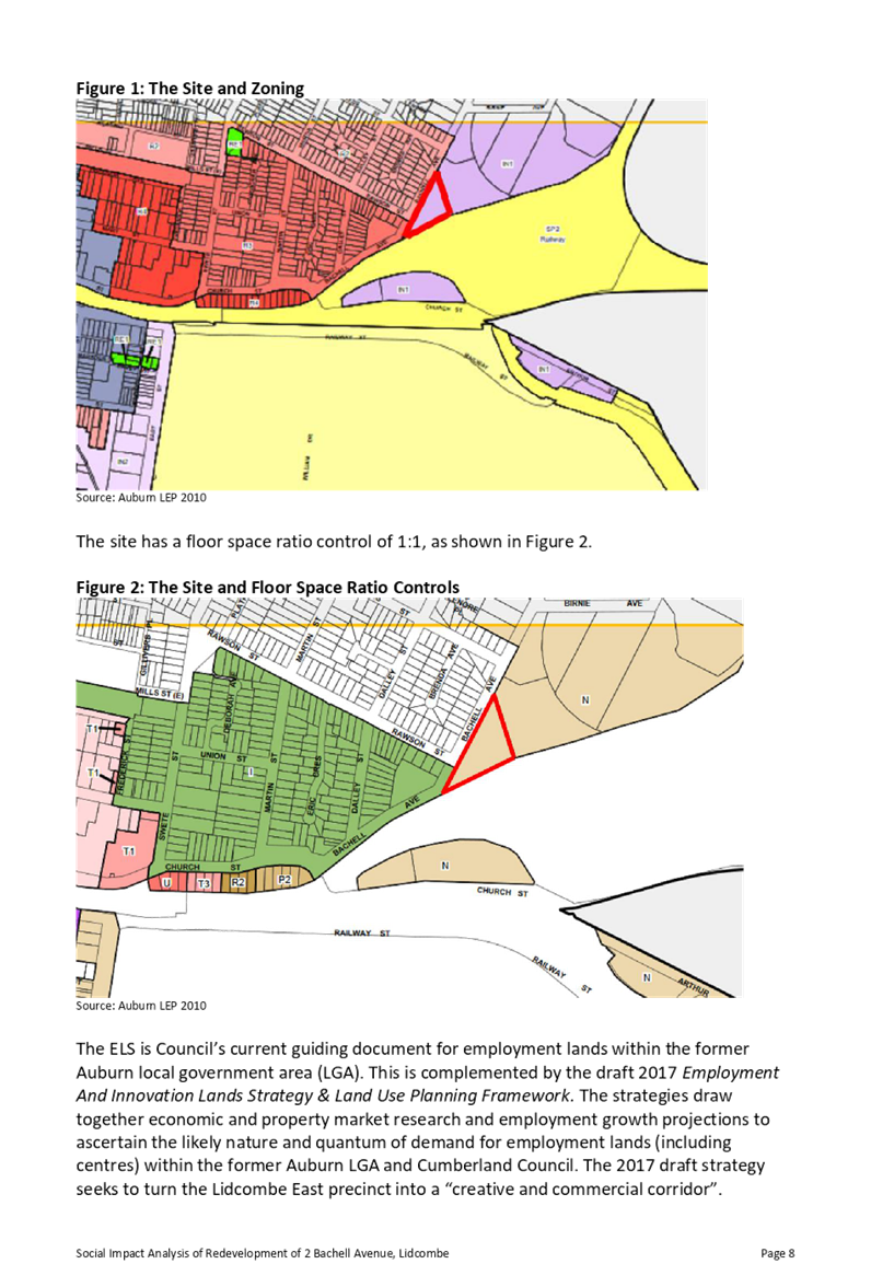
Planning Proposal for 100 Woodville Road, Granville
Responsible Division: Environment & Planning
Officer: Director Environment & Planning
File Number: PP-2/2018
Community Strategic Plan Goal: A resilient built environment
Summary
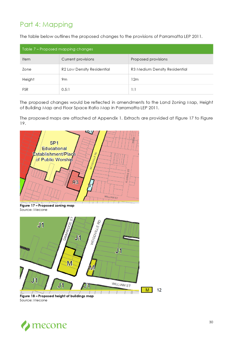
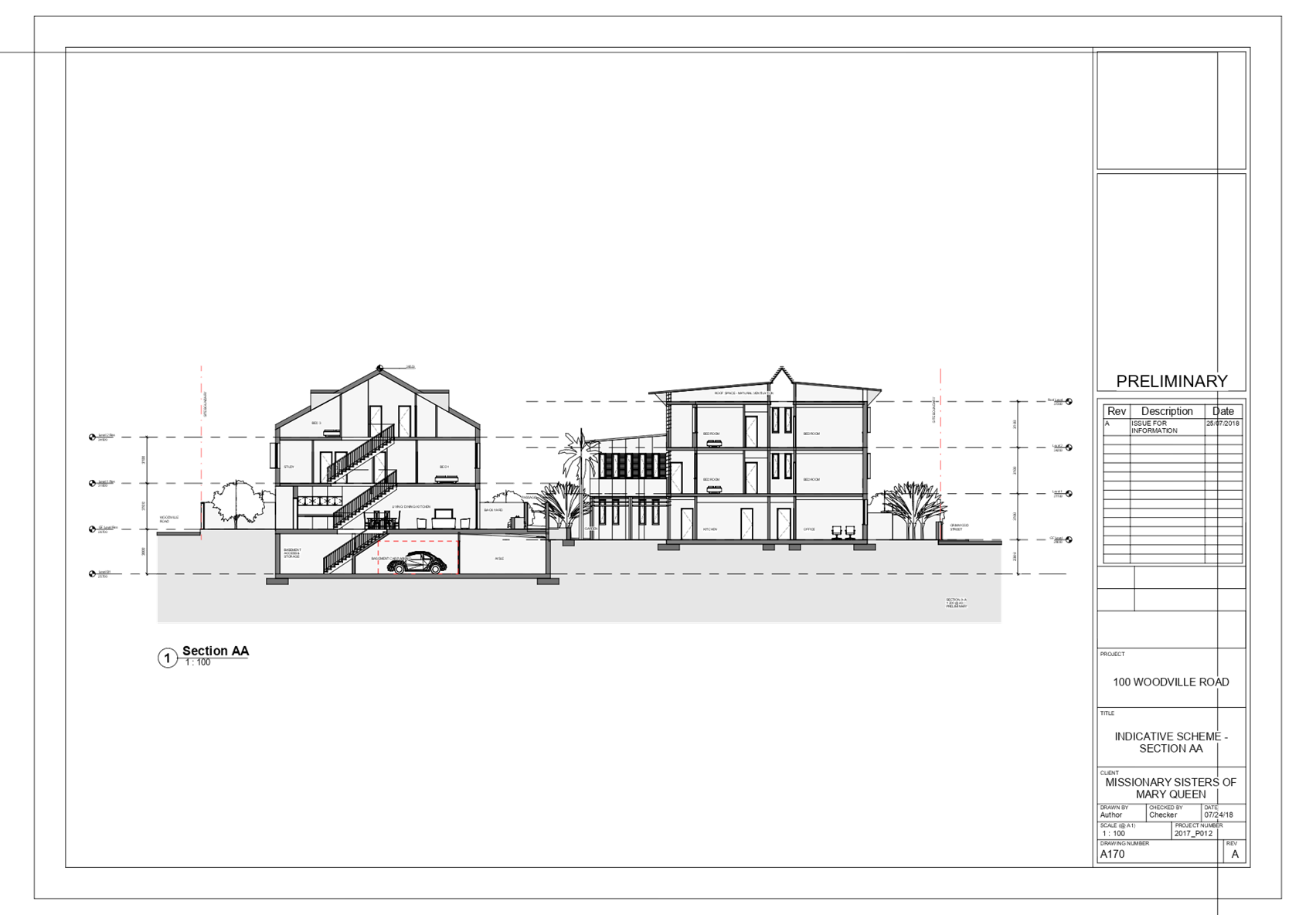
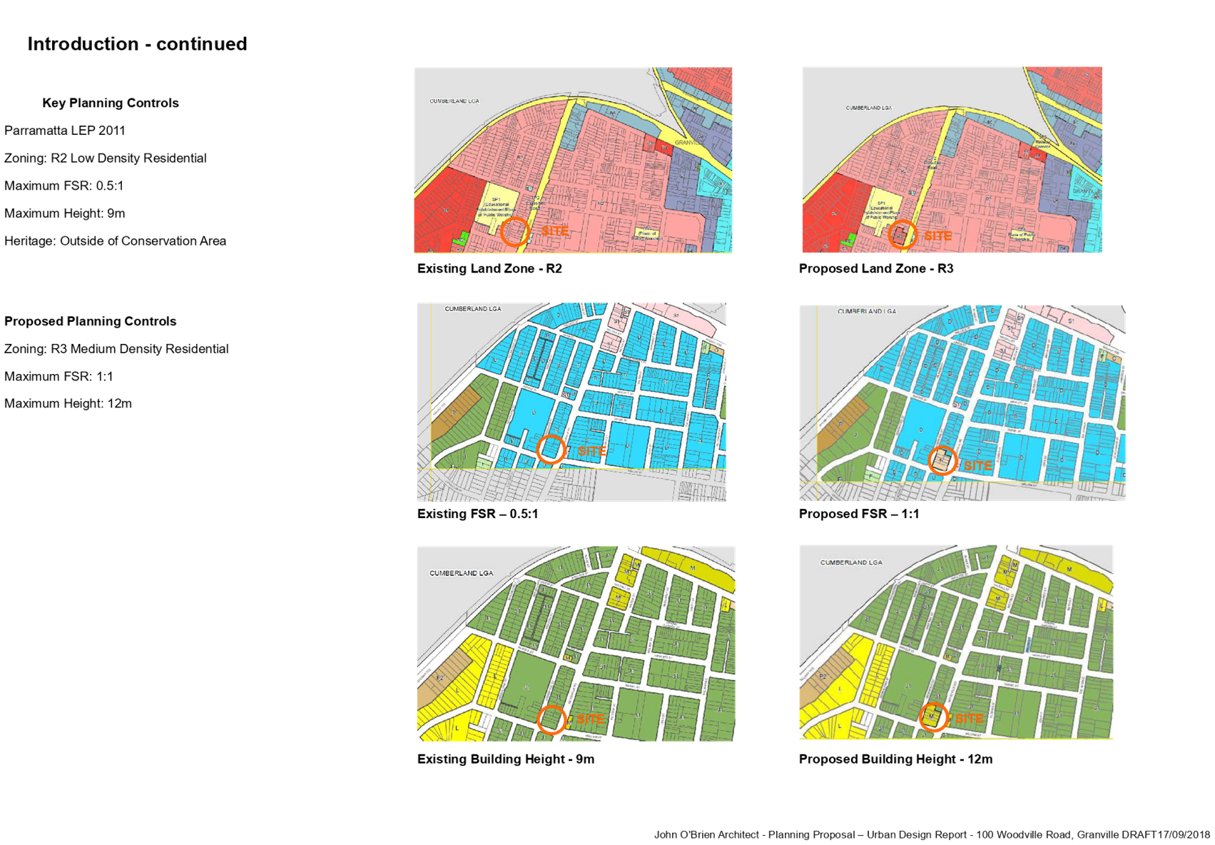
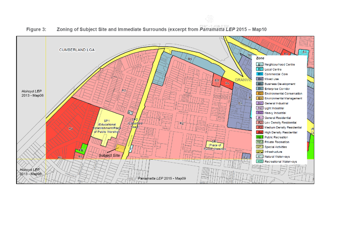
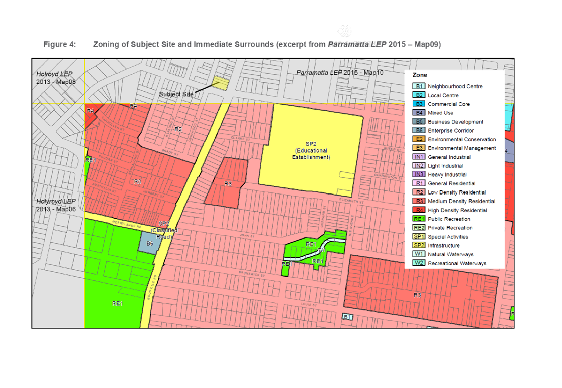
This planning proposal seeks to rezone land at 100 Woodville Road, Granville, from R2 Low Density Residential to R3 Medium Density Residential, amend the Floor Space Ratio control from 0.5:1 to 1:1, and amend the Height of Building control from 9 metres to 12 metres.
The proposal has been placed on preliminary public exhibition (pre-Gateway), and was reported to the Cumberland Local Planning Panel in March 2019 with a recommendation to proceed to the next stage for a Gateway Determination. The Panel supported the Council officer recommendation.
It is recommended that the planning proposal be forwarded to the Department of Planning, Industry & Environment for a Gateway Determination.
|
Recommendation That Council: 1. Prepare a planning proposal for 100 Woodville Road, Granville, with the following land use and built form controls:
a. R3 Medium Density Residential; b. Floor Space Ratio of 1:1; and c. Height of Building control of 12 metres.
2. Endorse that the planning proposal for 100 Woodville Road, Granville, be forwarded to the Department of Planning, Industry & Environment for a Gateway Determination. |
Report
Background
The proposal was submitted to Council in September 2018, seeking to amend the zoning of the site at 100 Woodville Road, Granville, from R2 Low Density Residential to R3 Medium Density Residential. The proposal also seeks to amend the Height of Building control from 9 metres to 12 metres and the Floor Space Ratio control from 0.5:1 to 1:1.
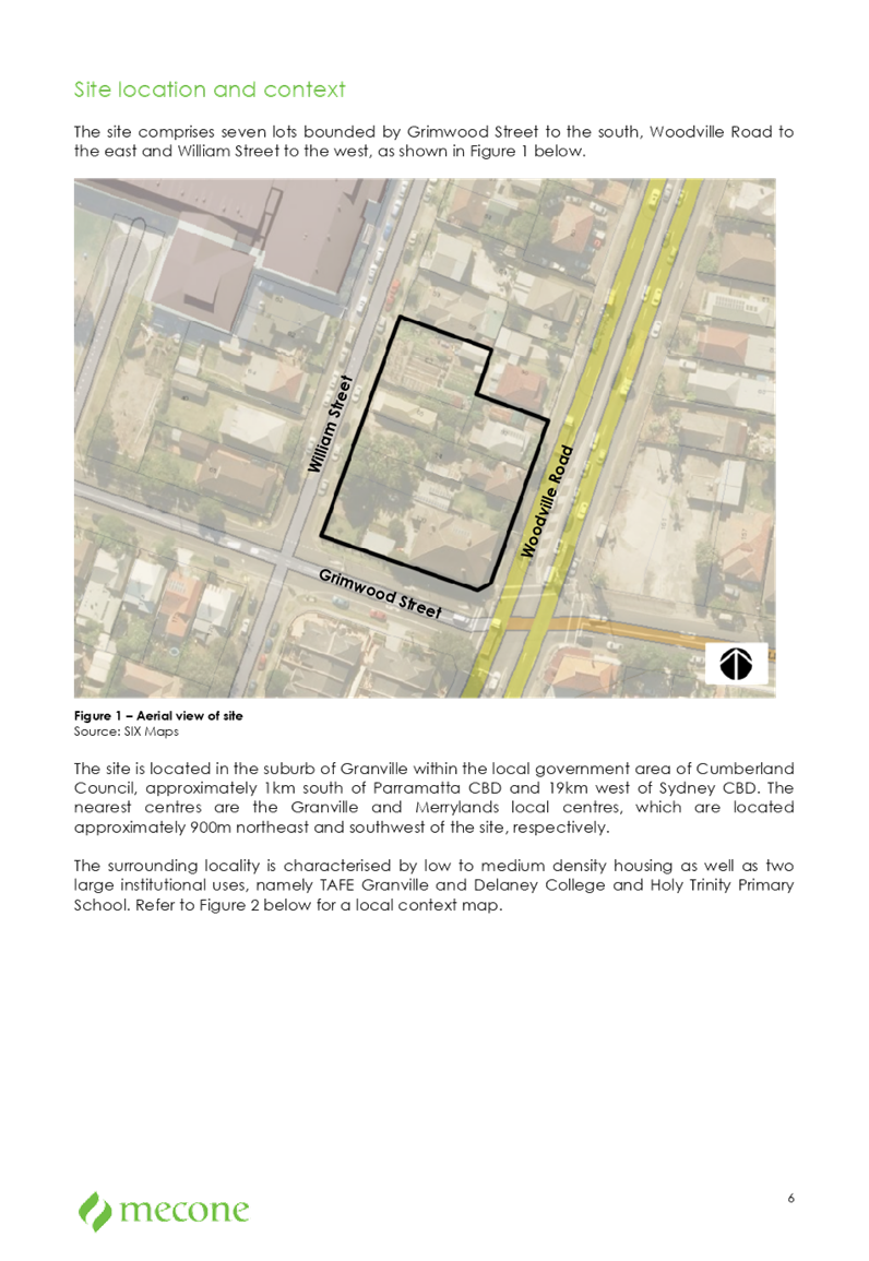
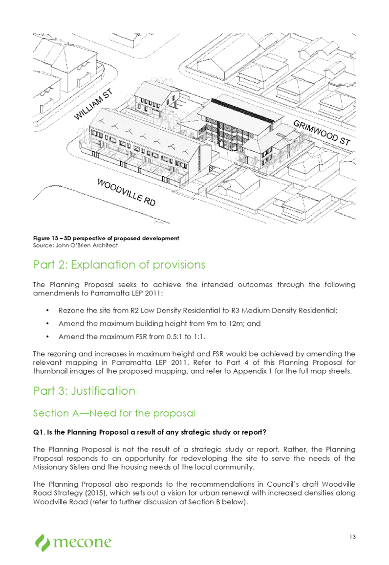
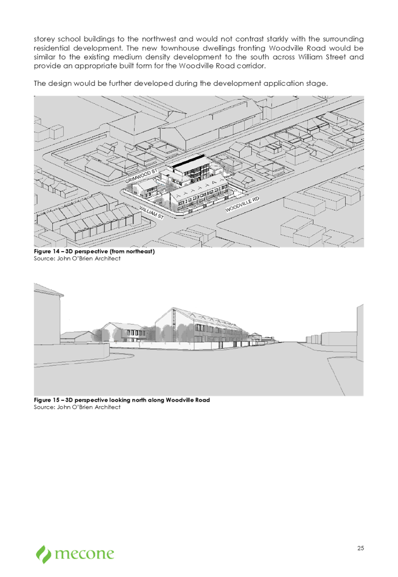
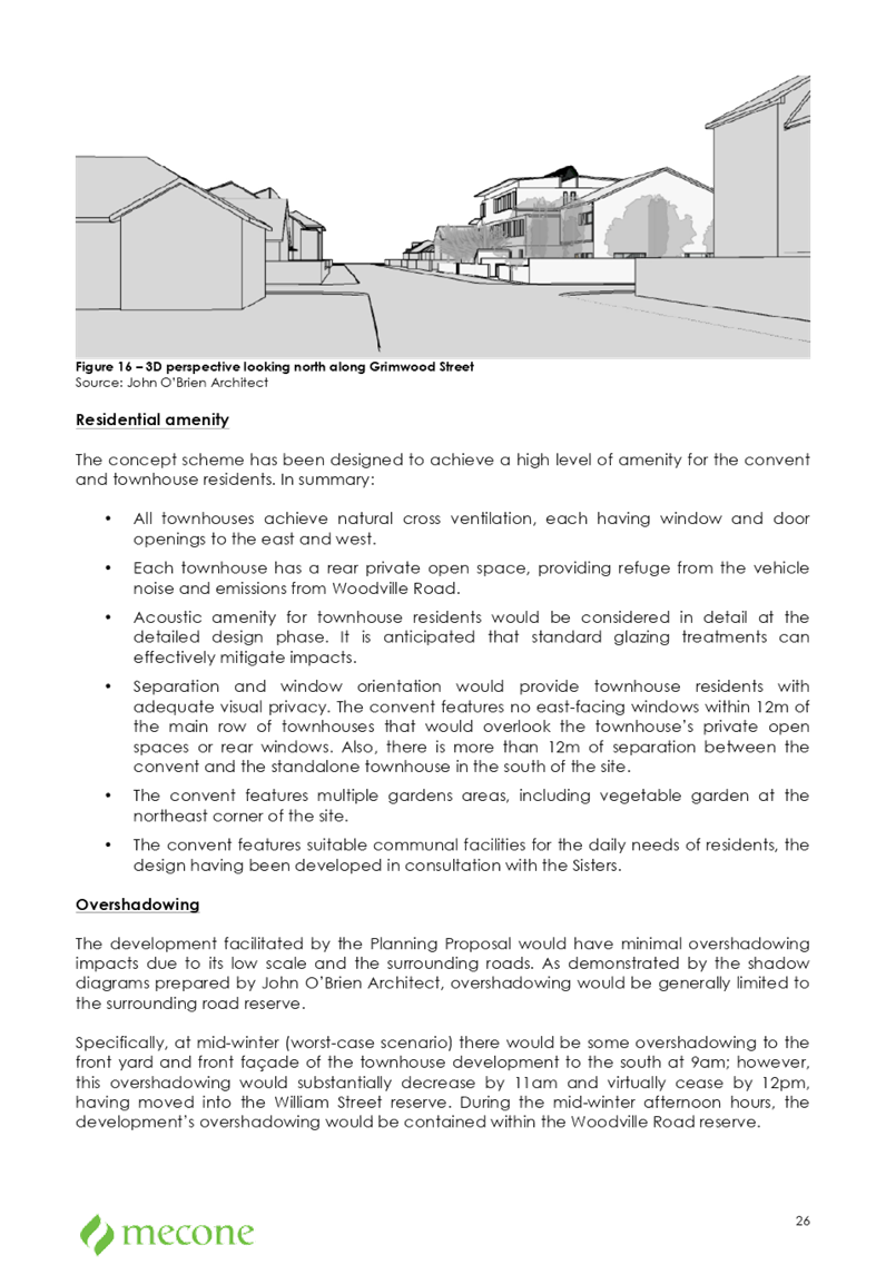
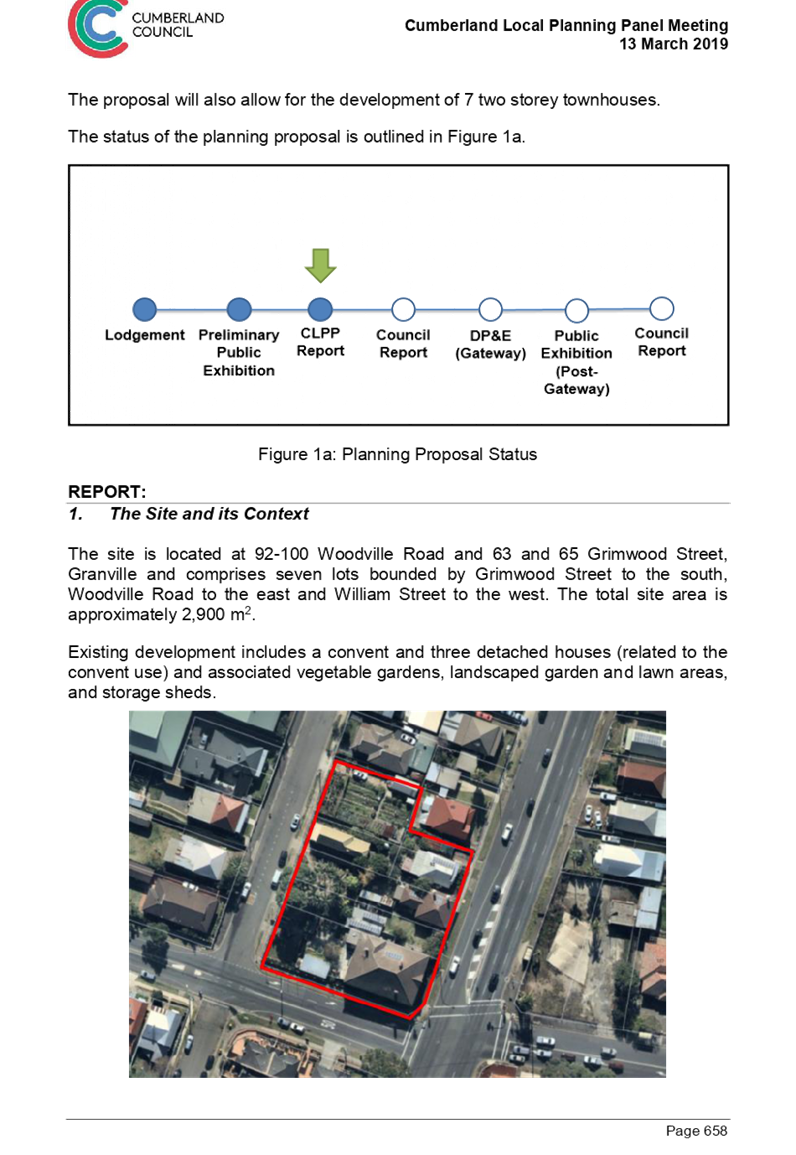
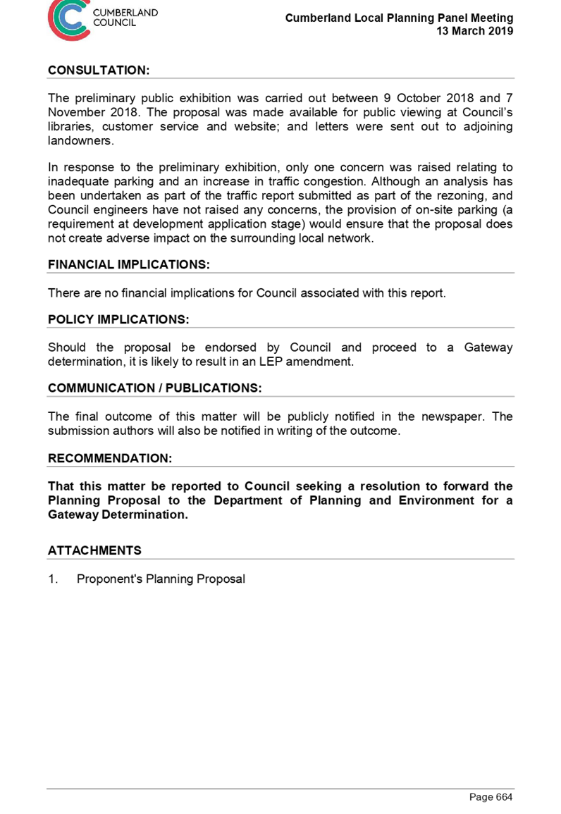
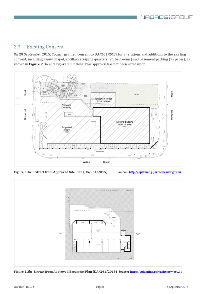
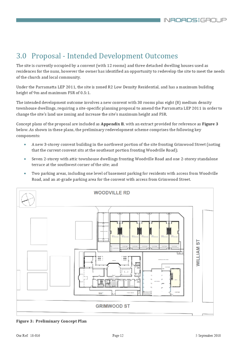
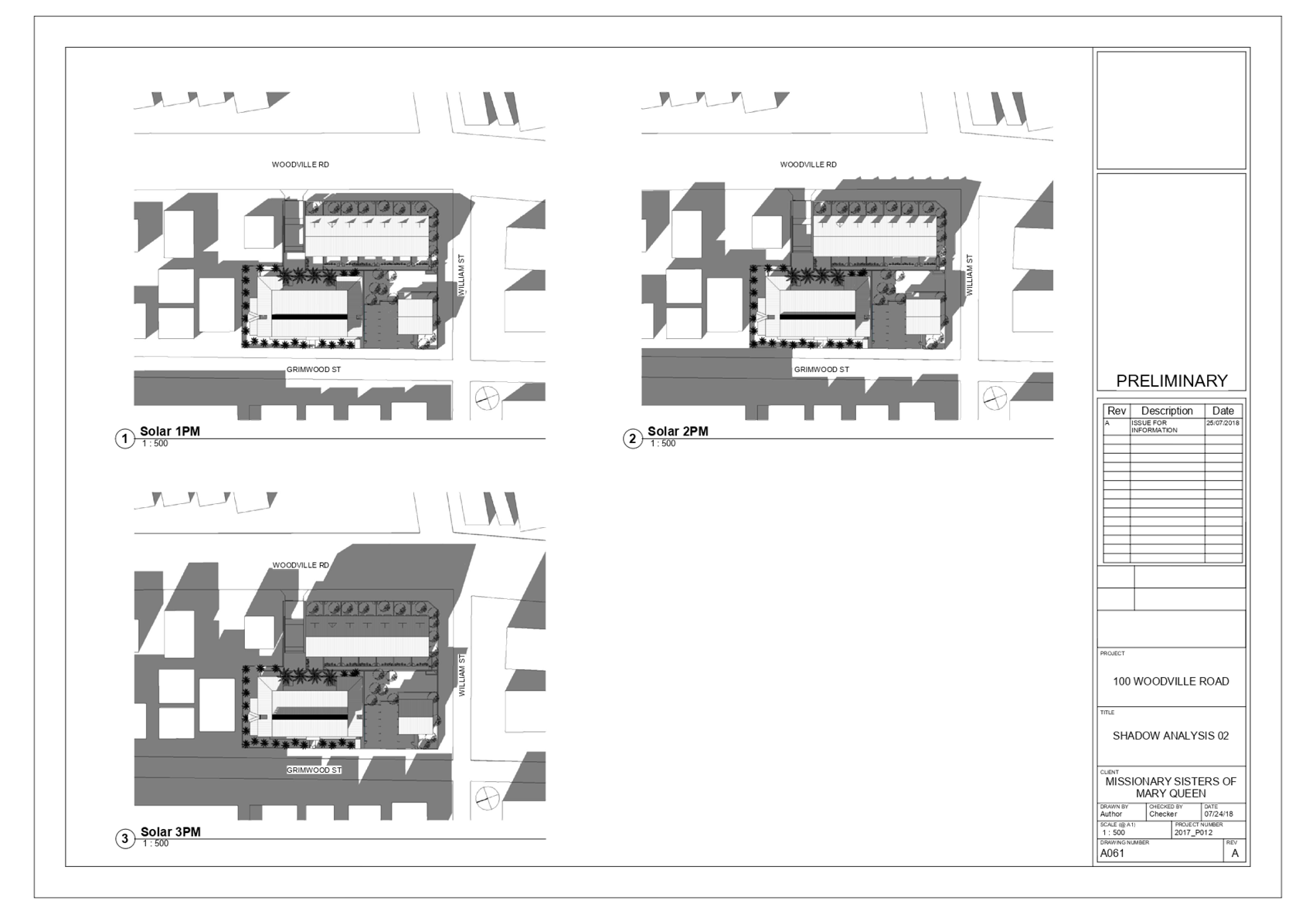
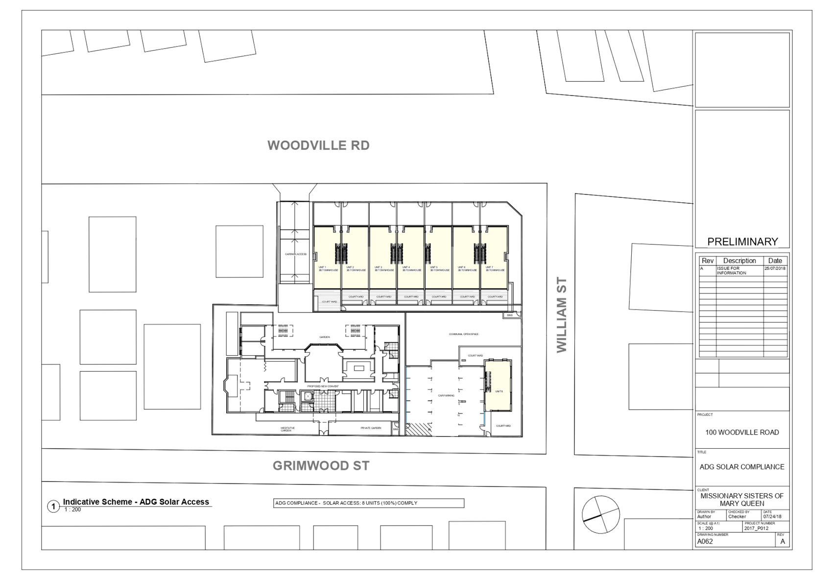
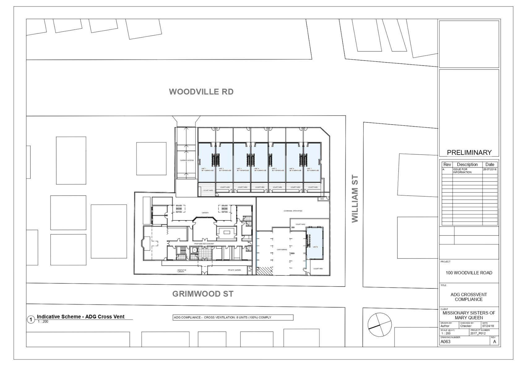
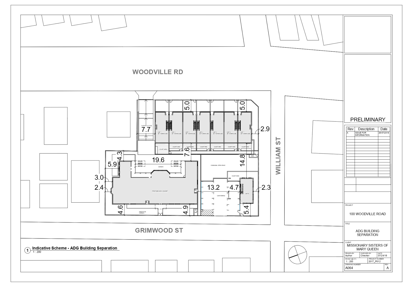
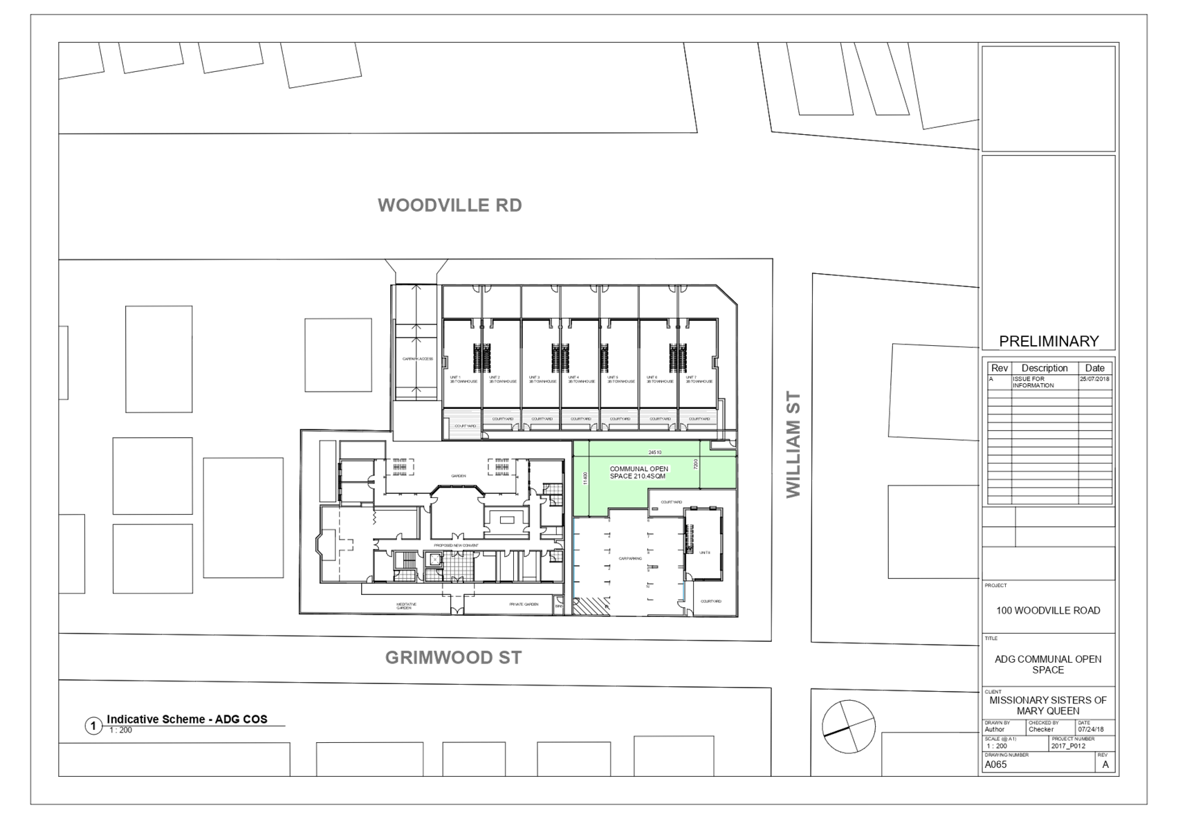
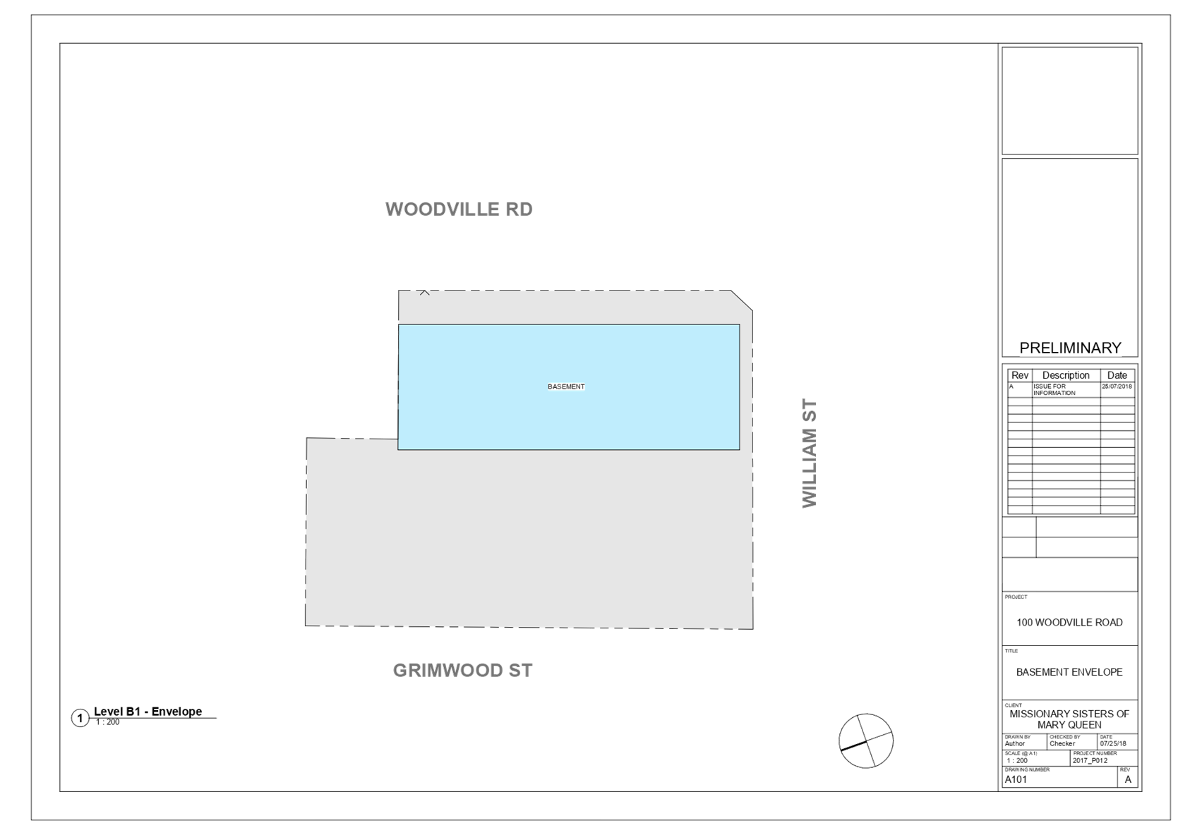
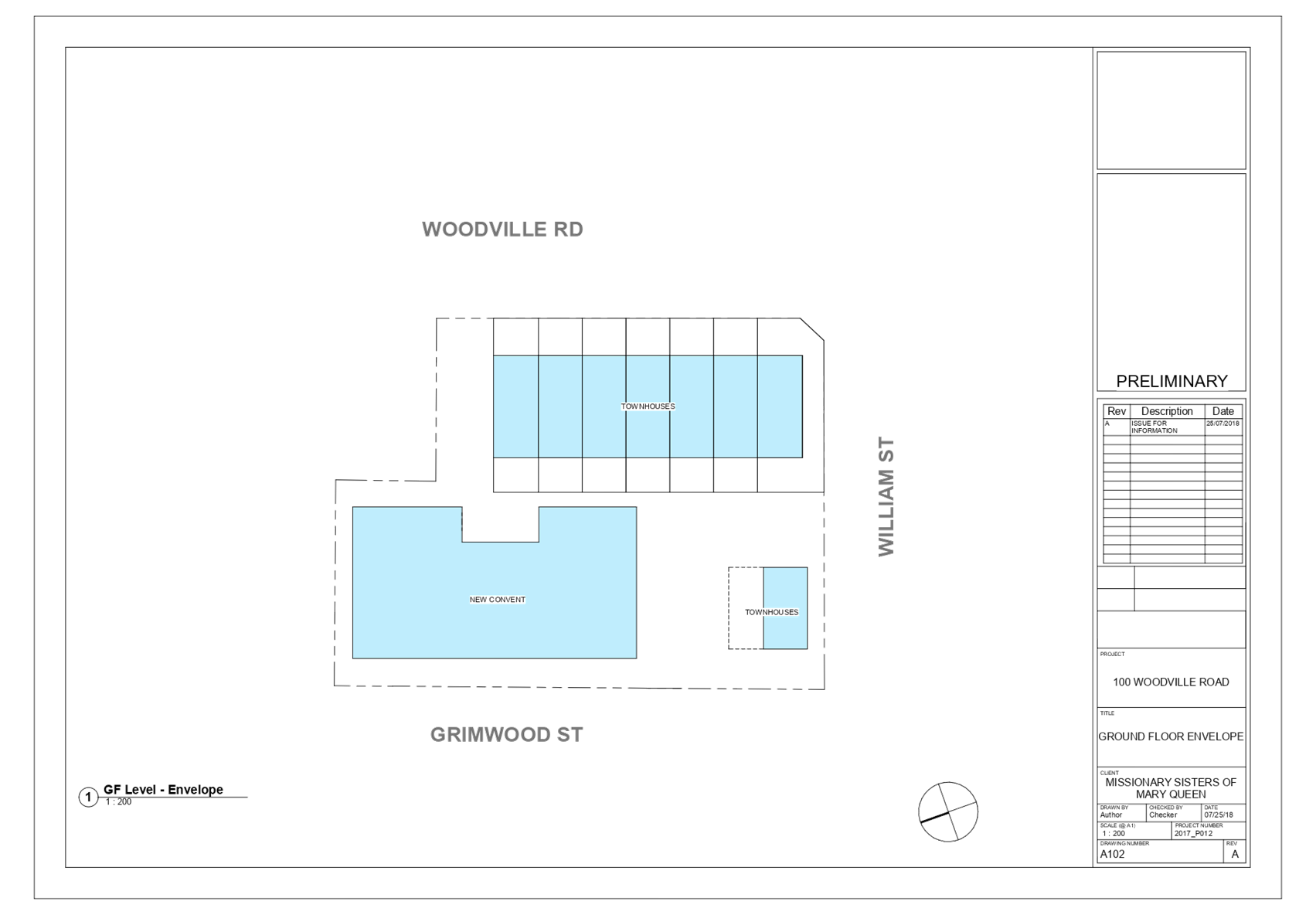
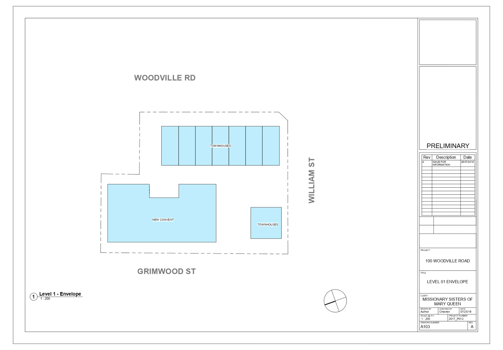
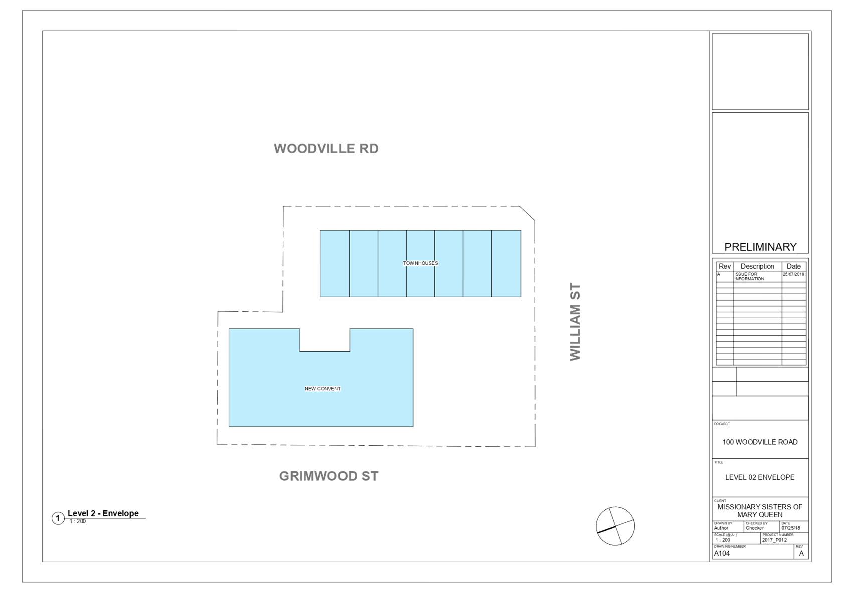
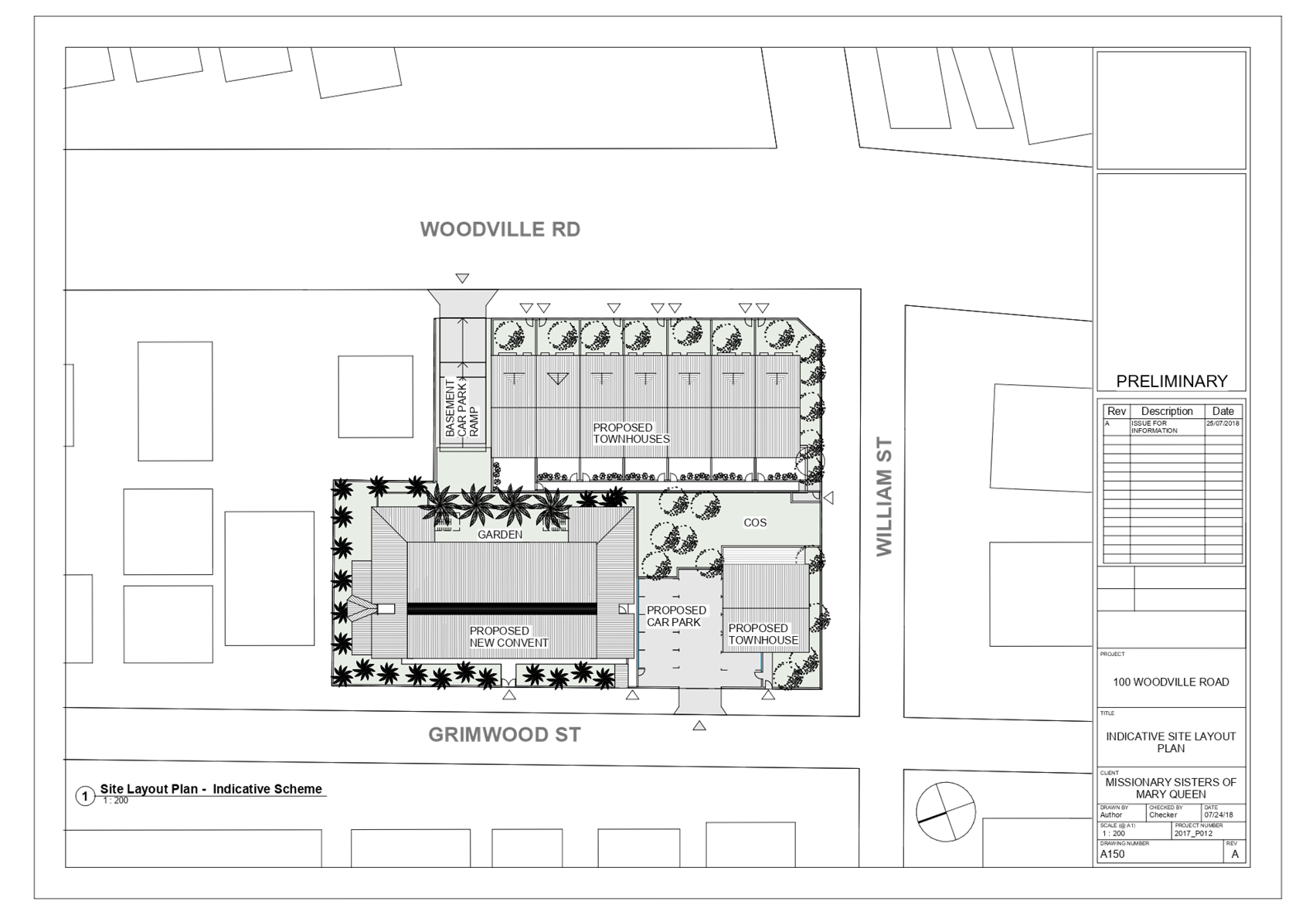
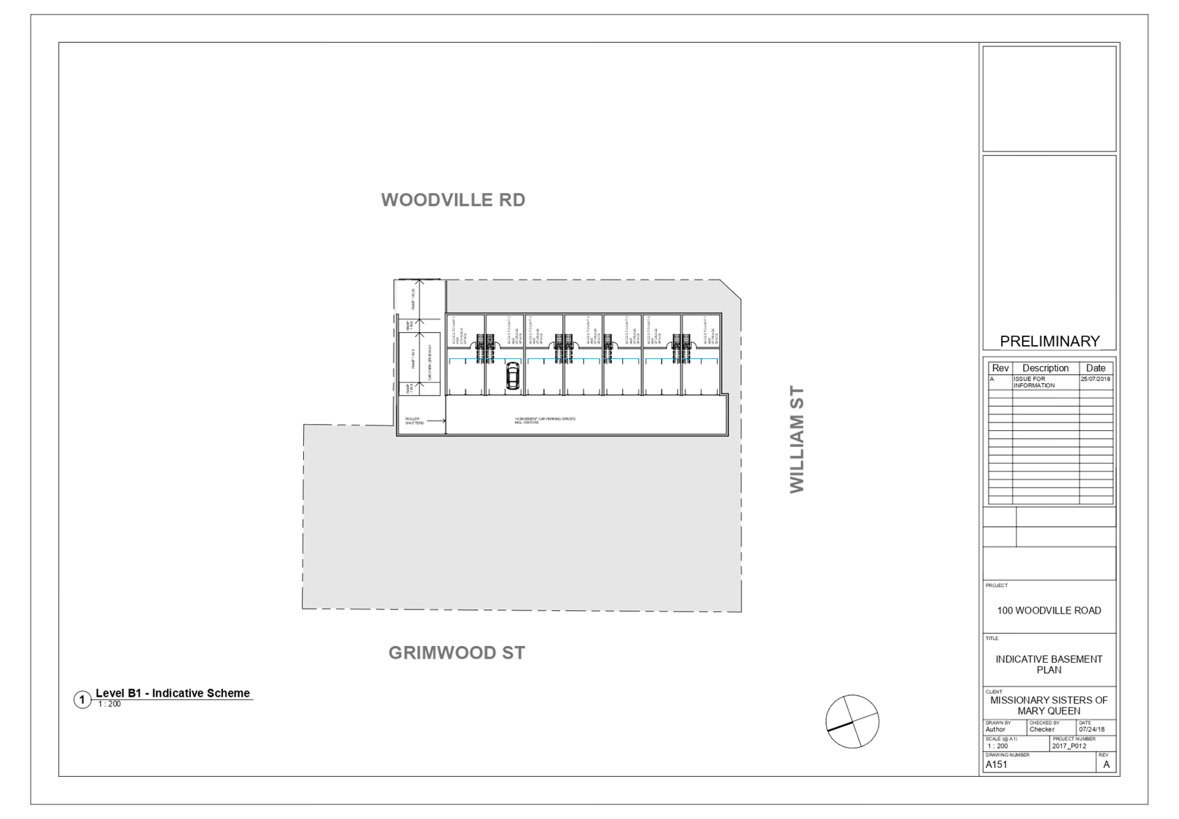
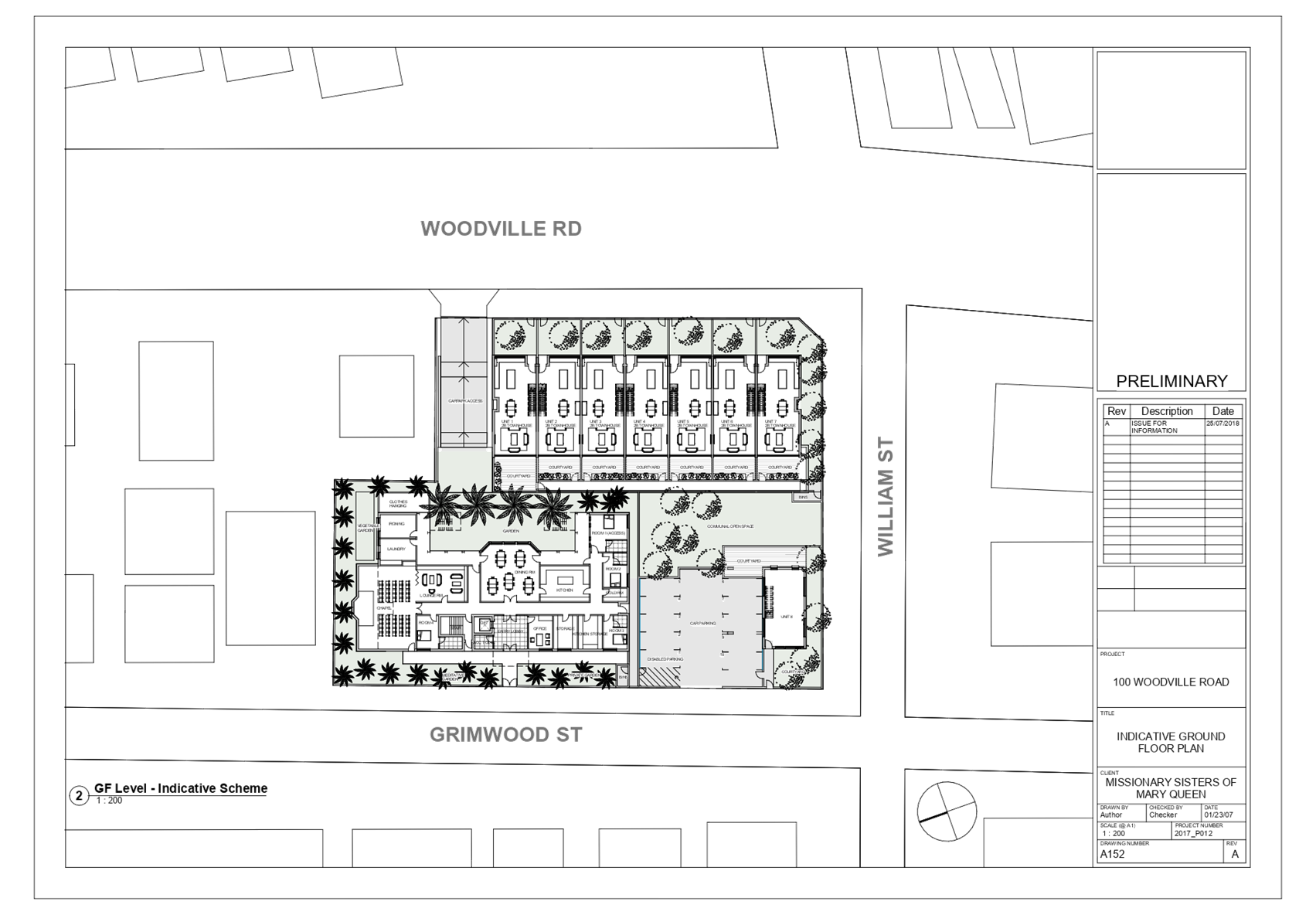
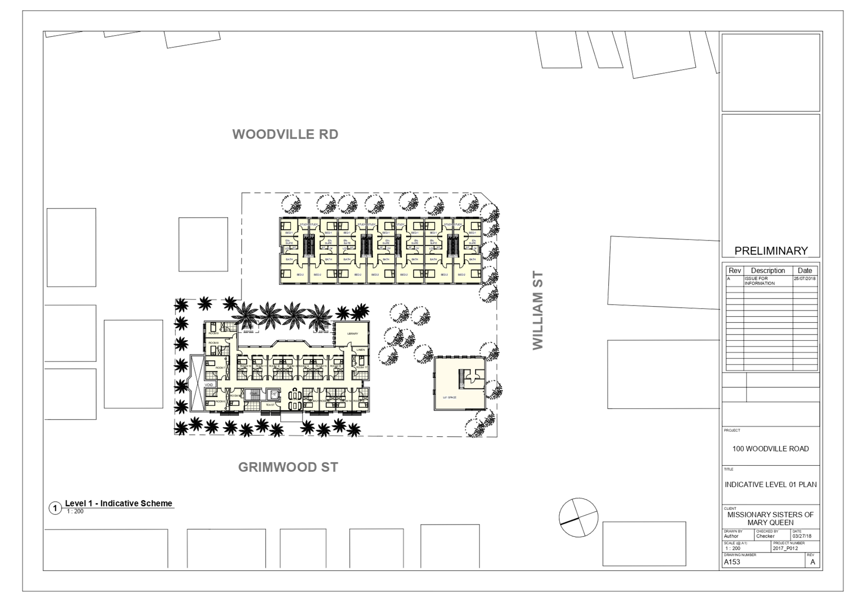
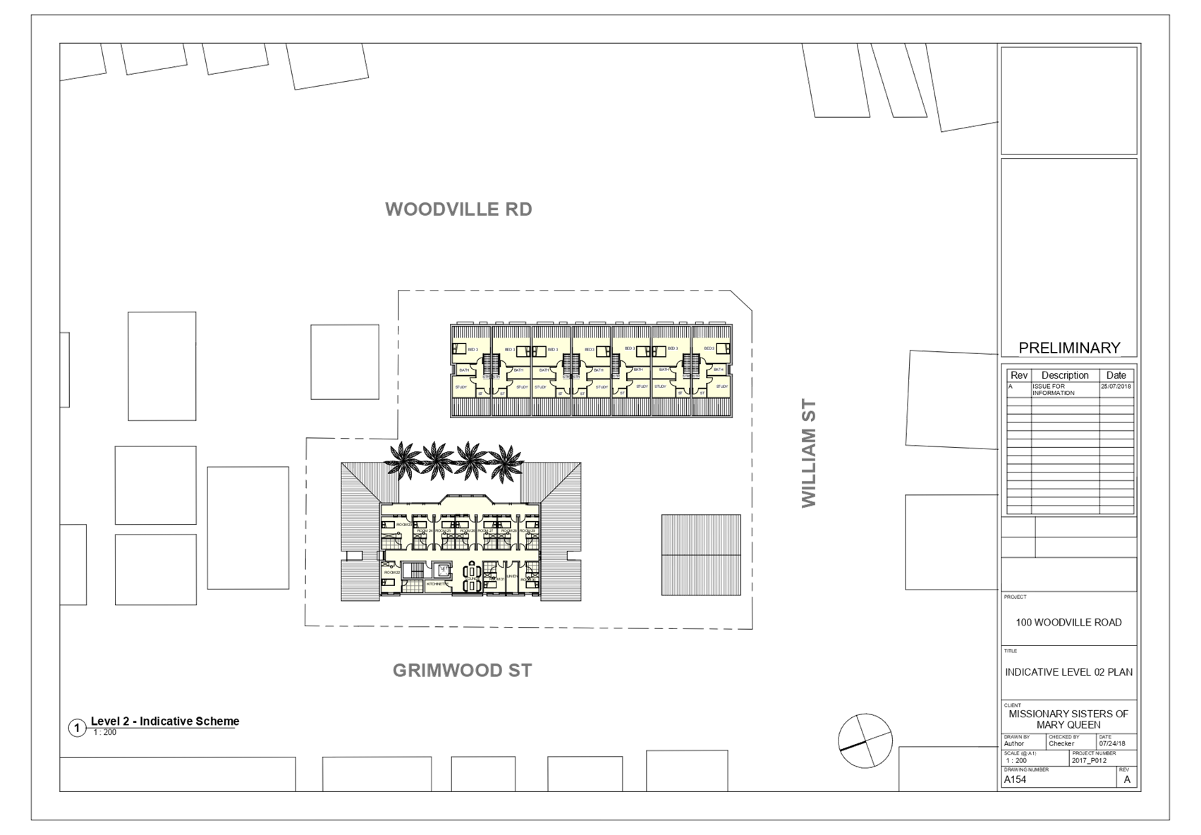
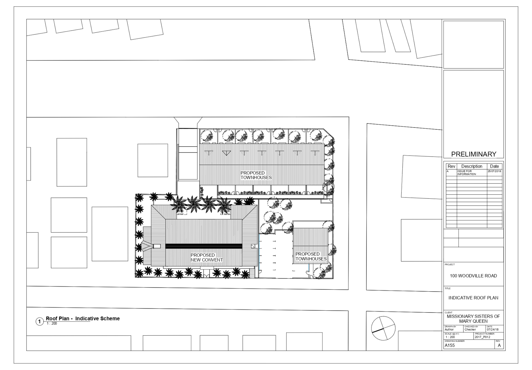
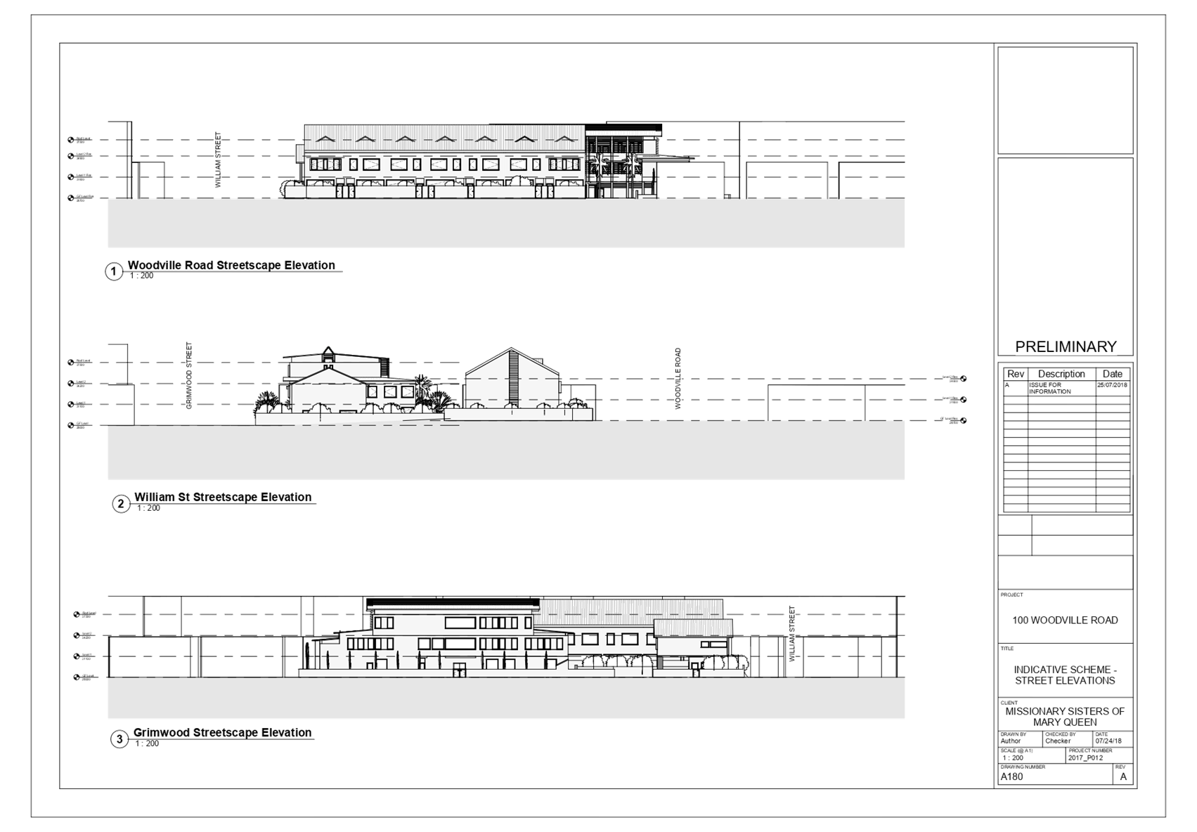
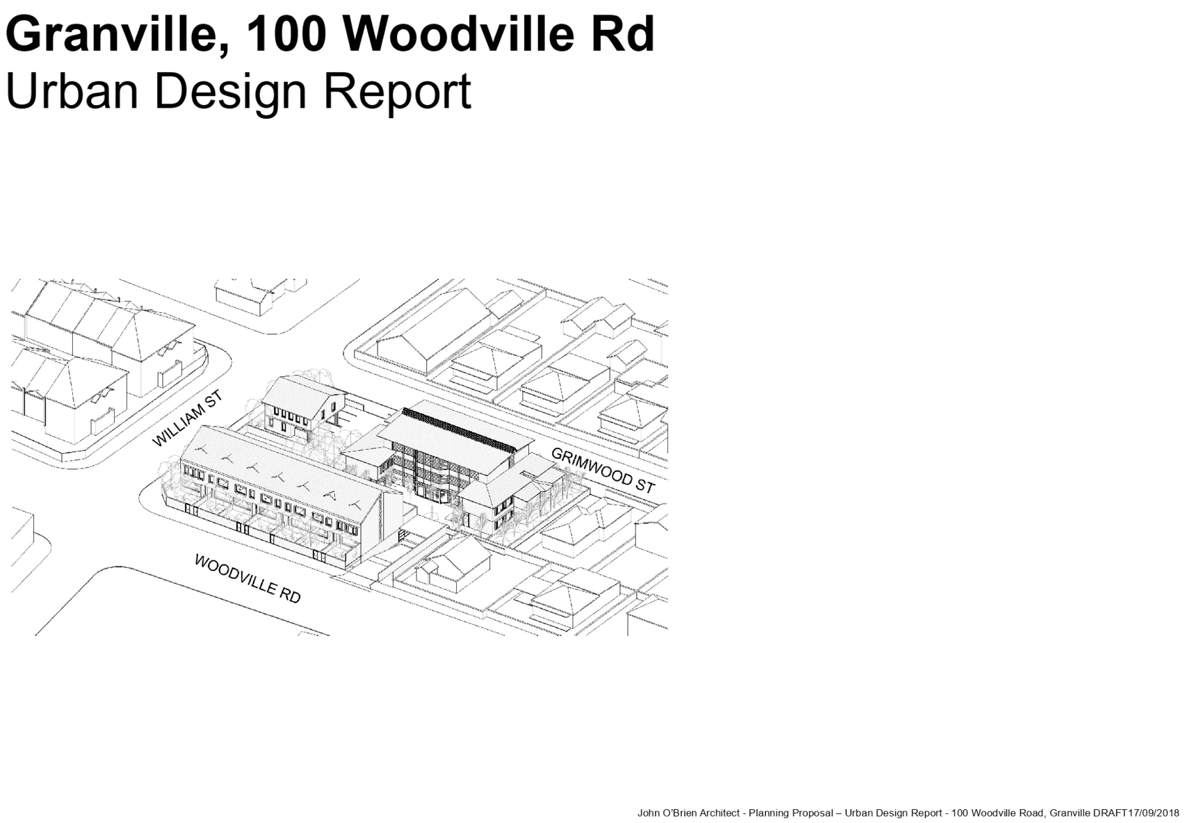
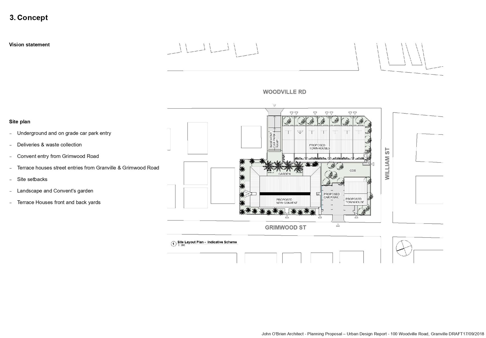
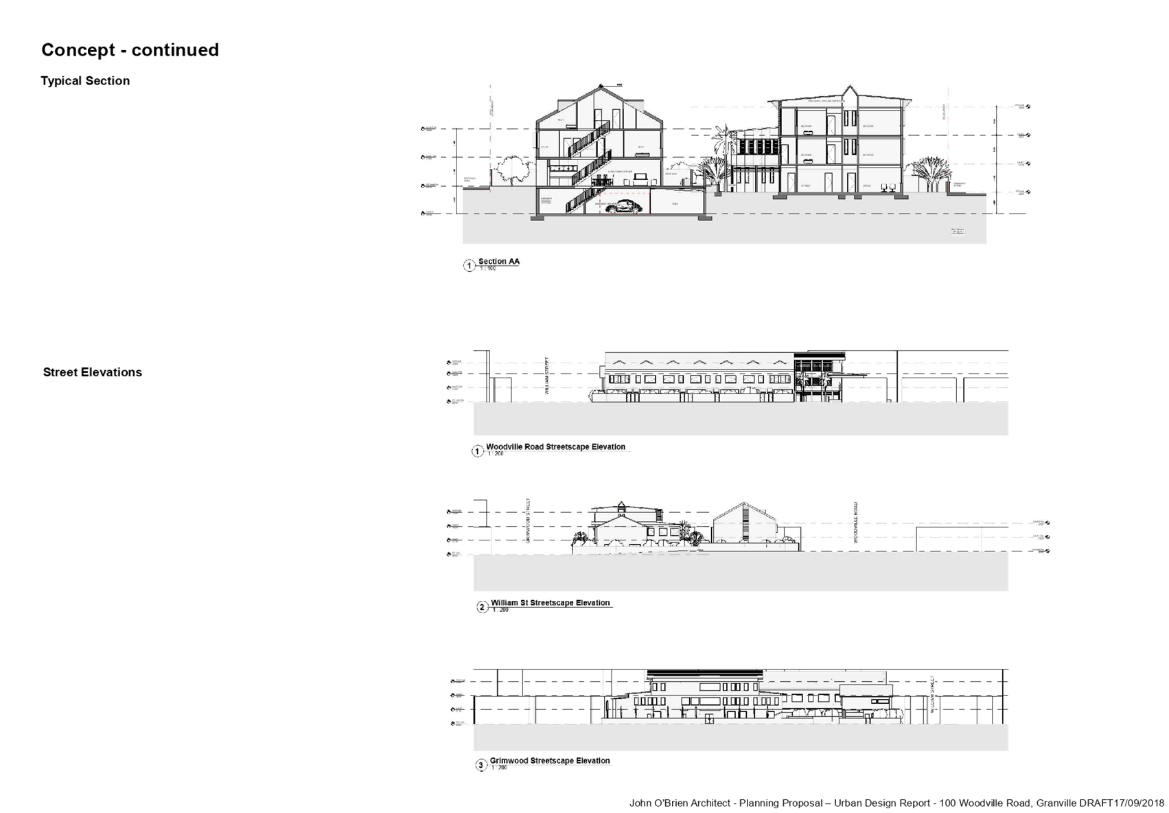
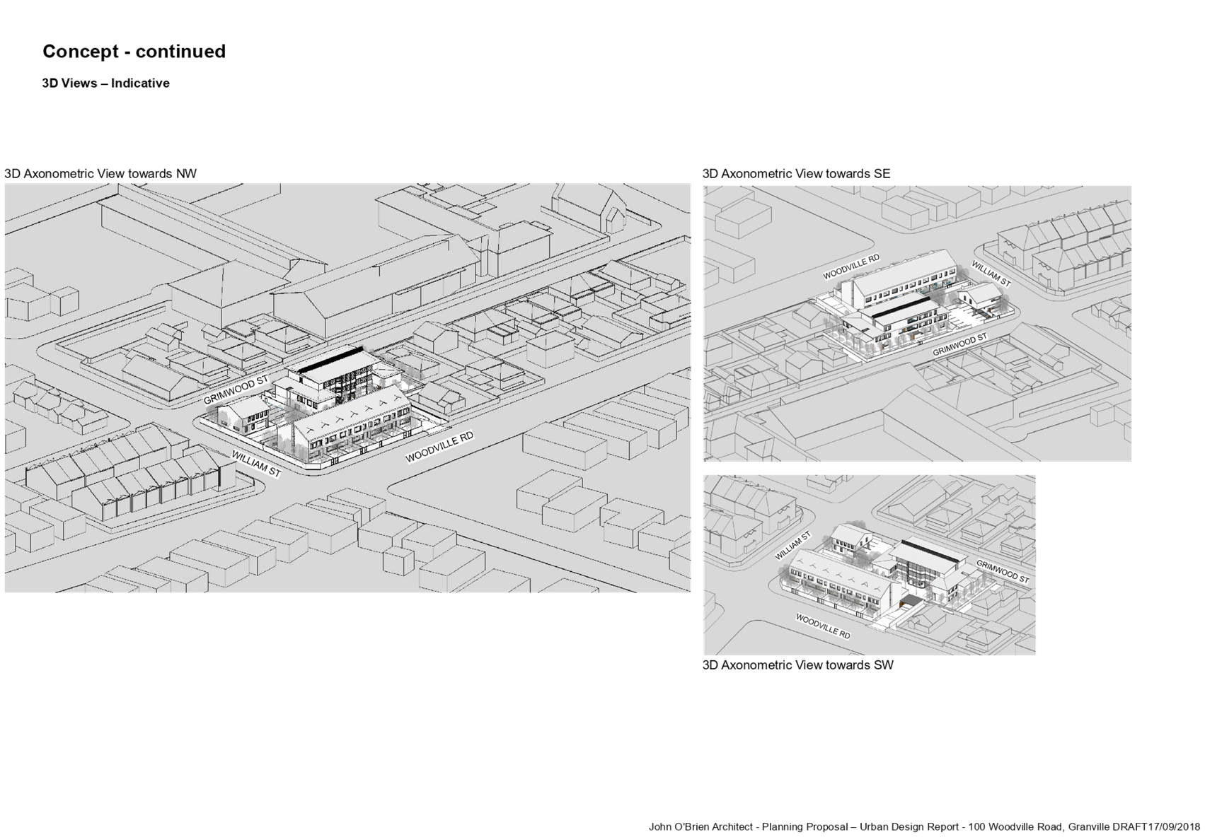
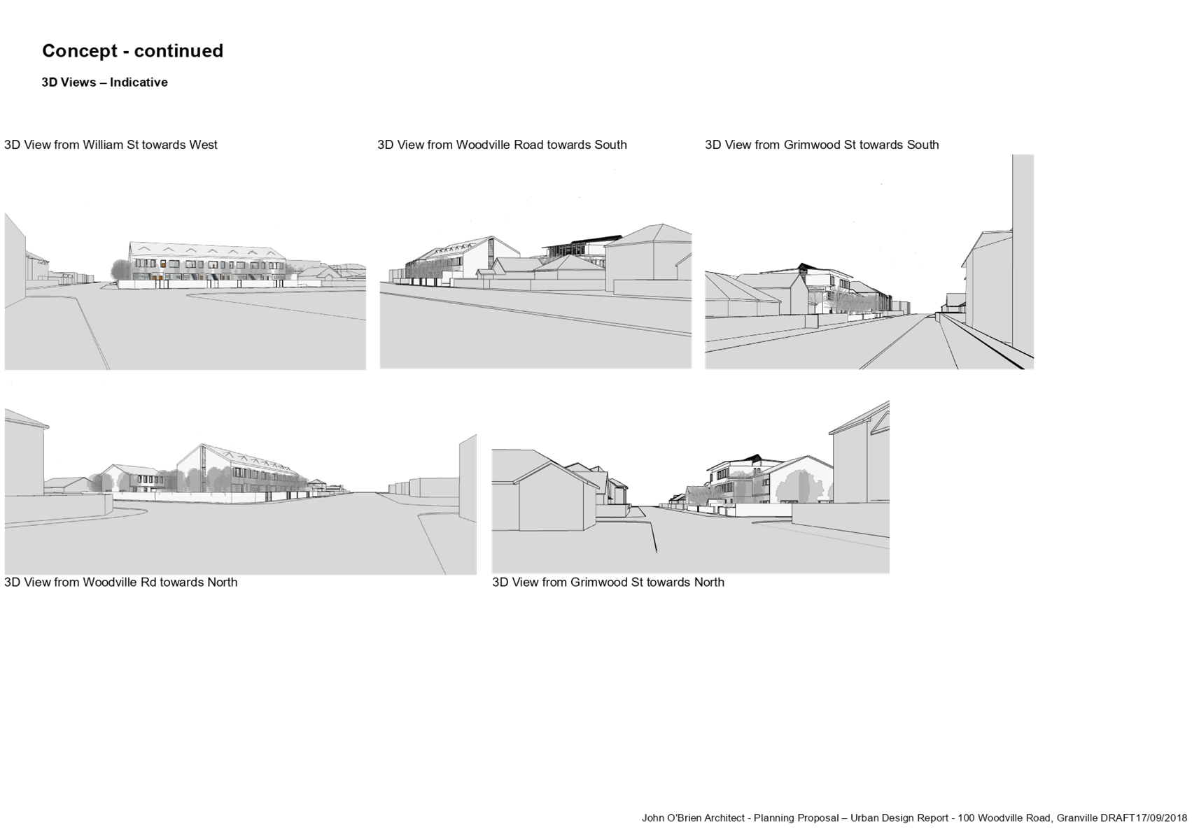
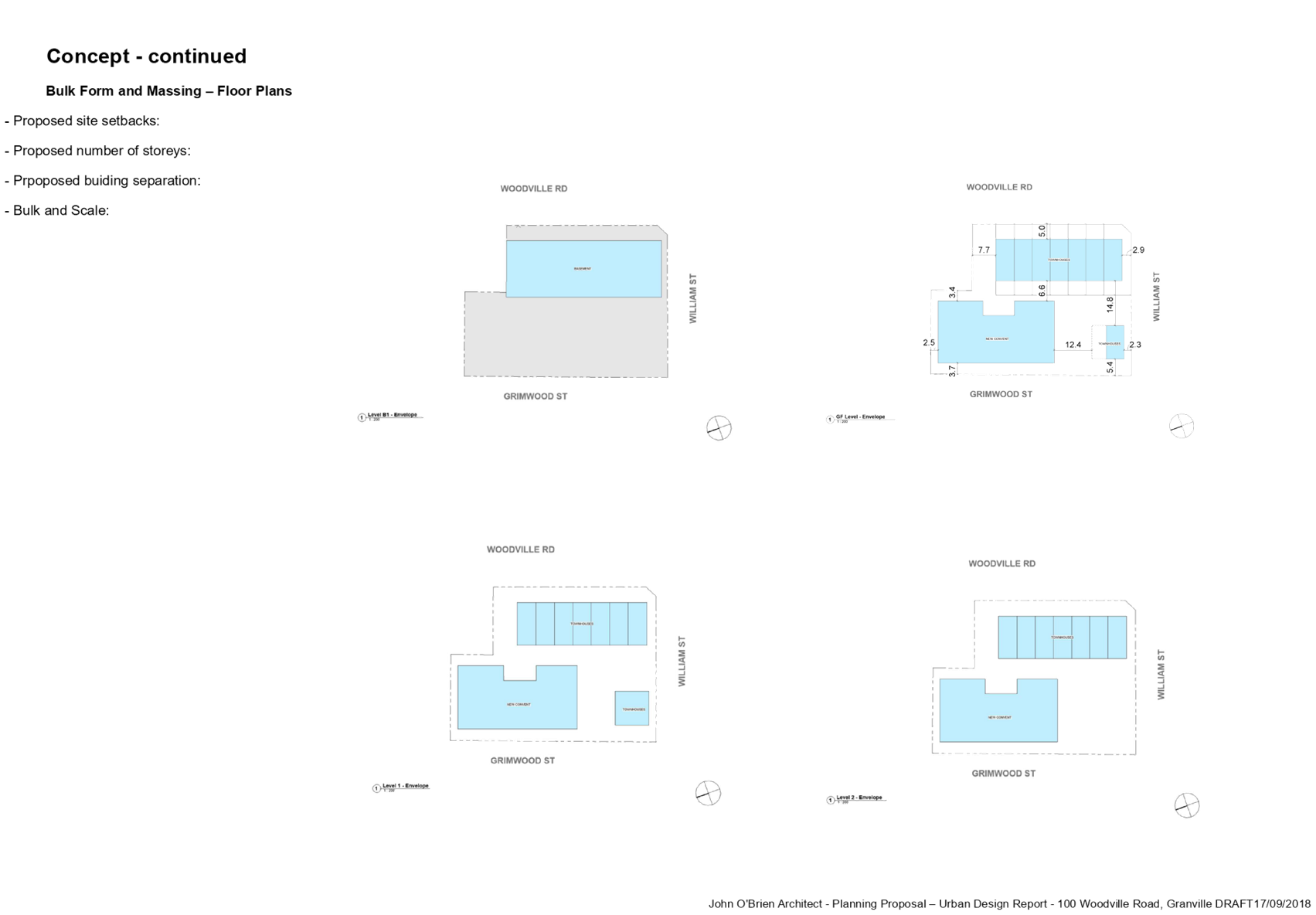
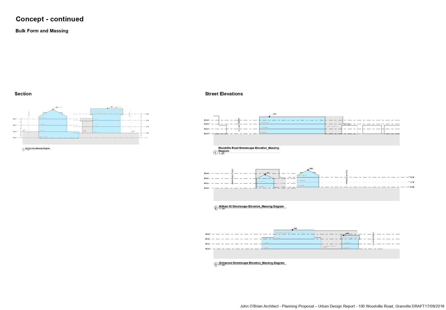
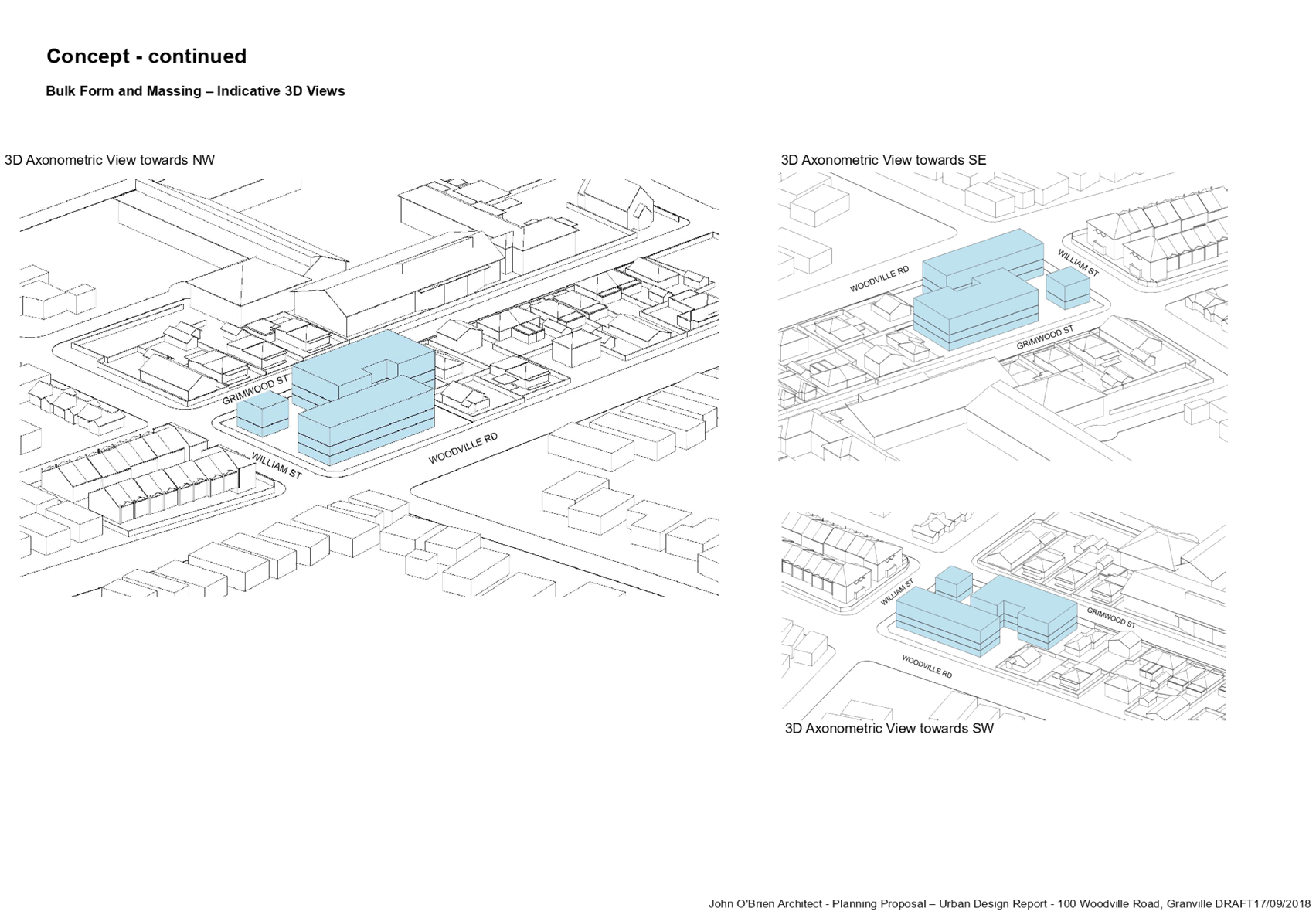
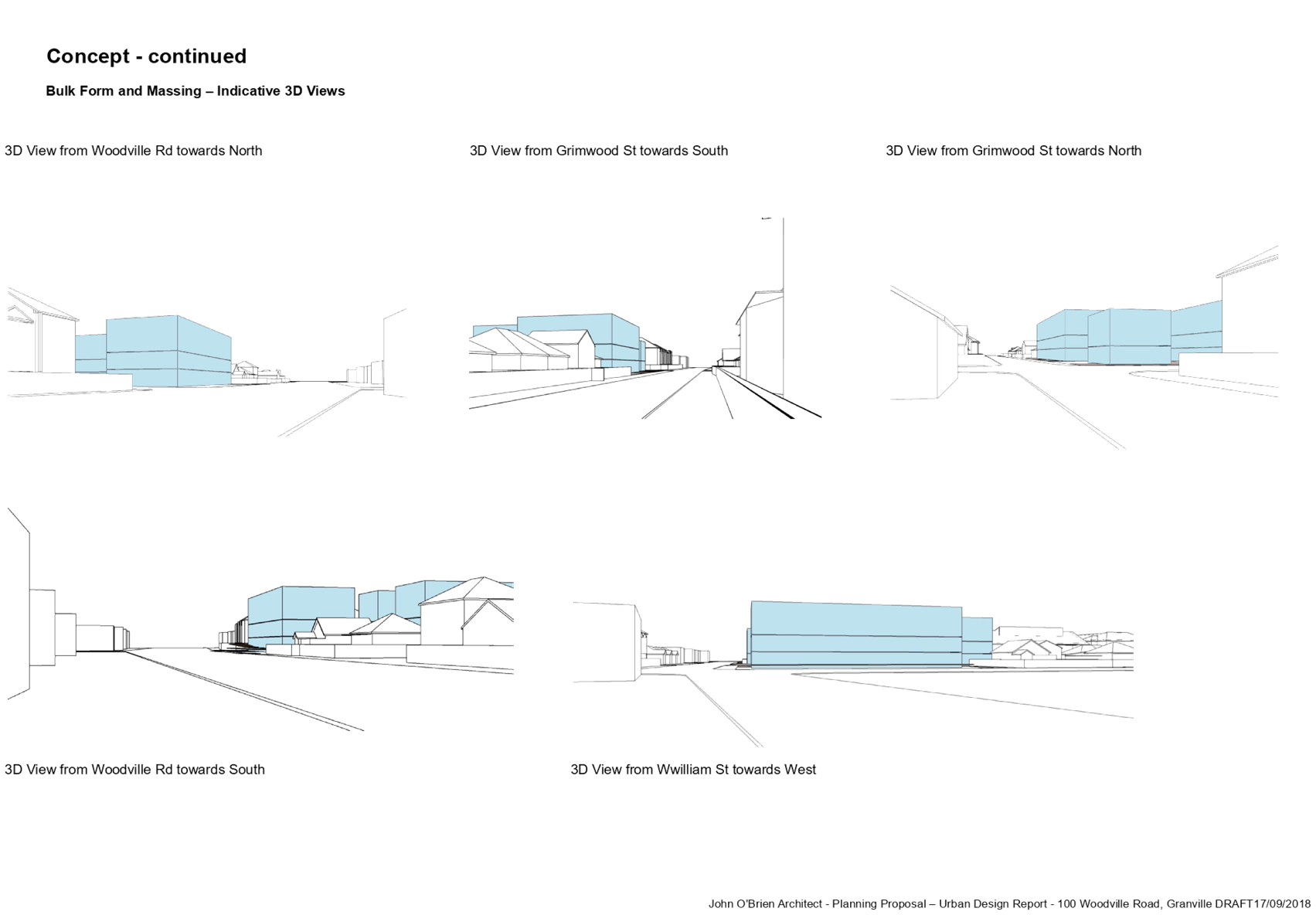
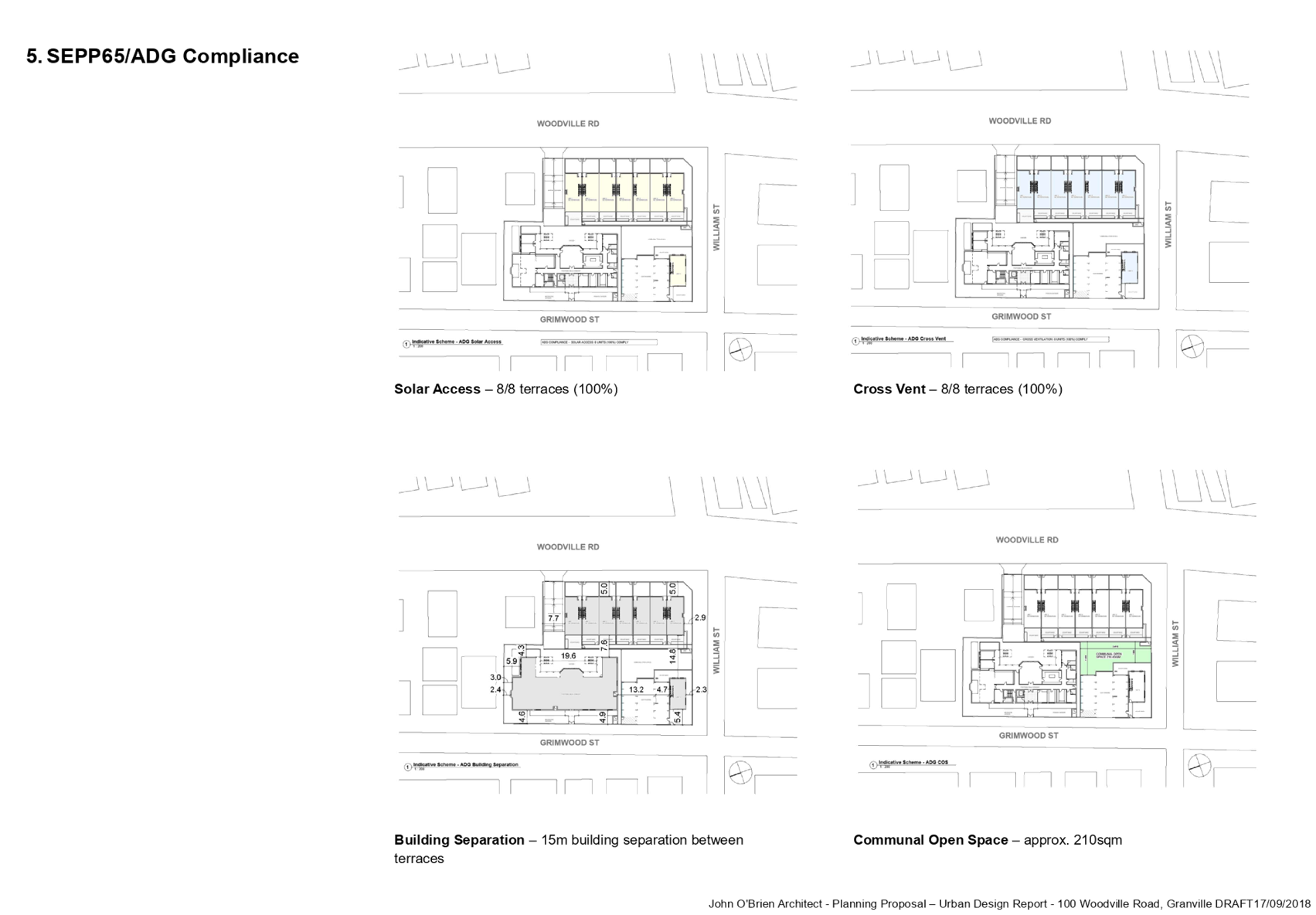
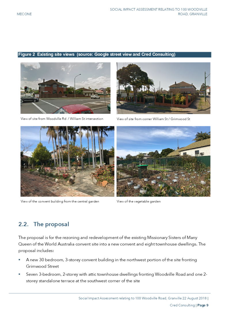
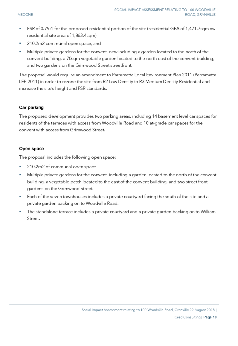
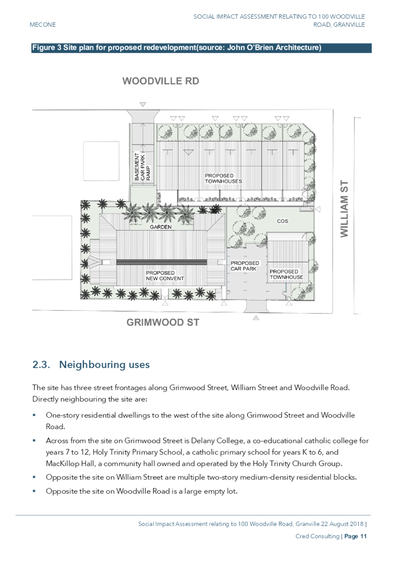
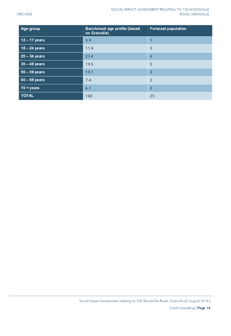
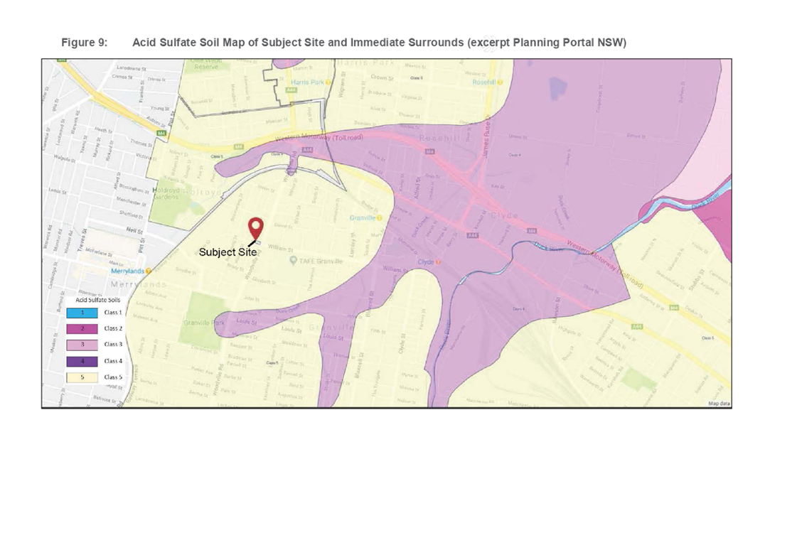
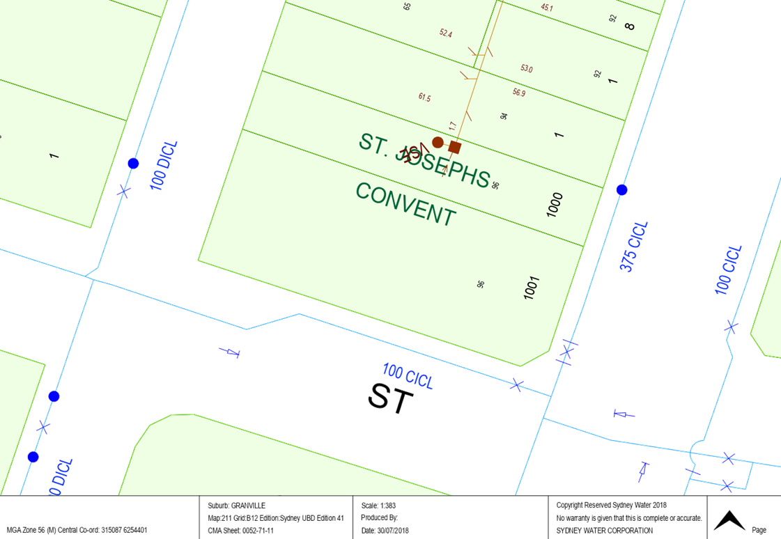
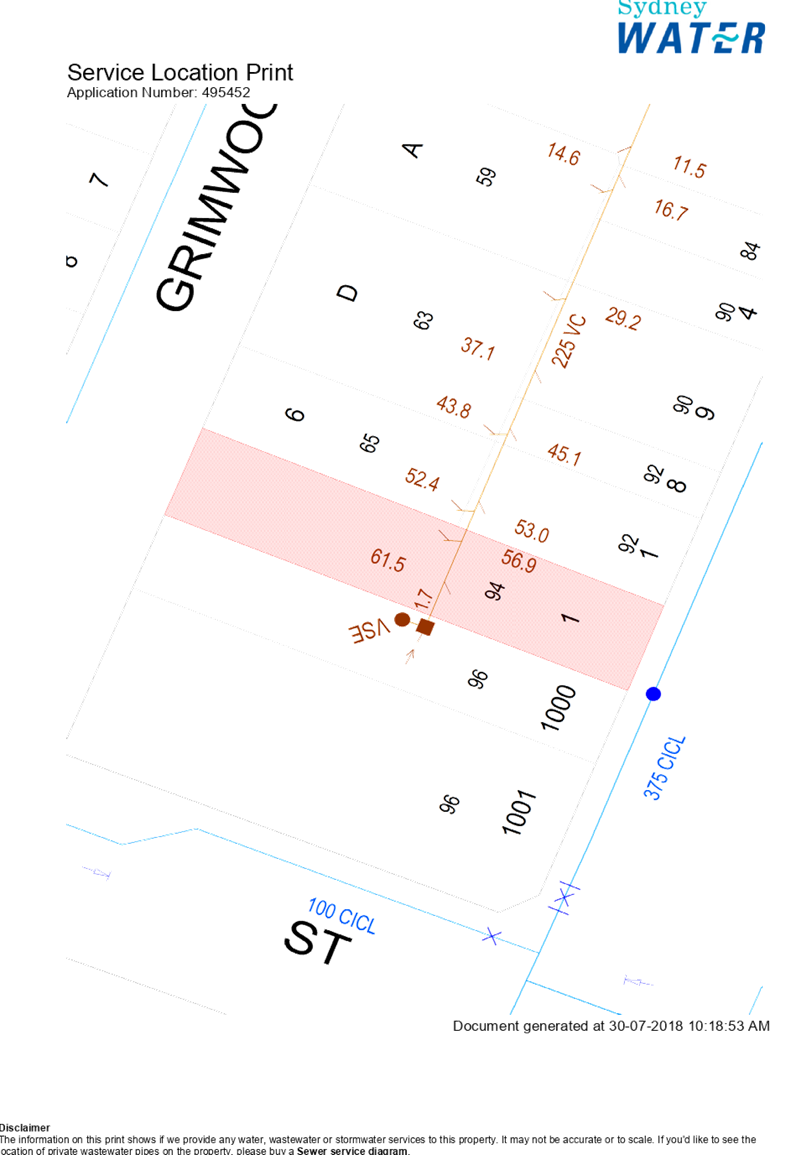
The proposal seeks to facilitate the redevelopment of an existing convent to a new 3-4 storey convent building with 30 new rooms. The proponent is seeking an amendment to the Parramatta LEP 2011, as the R2 zone does not permit the land use of ‘Hostel’ or ‘Place of Public Worship’, which are the most appropriate land use definitions for the convent component of the proposal. It will also allow for the development of 7 two storey townhouses. An indicative concept for the planning proposal site is provided in Figure 1. Further information on the planning proposal is provided in Attachment 1.
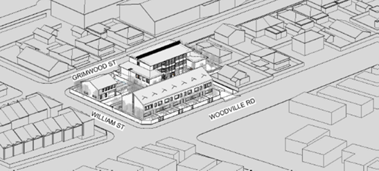
Figure 1 Indicative concept for the planning proposal
The status of the planning proposal is provided in Figure 2.
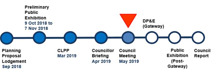
Figure 2 Planning proposal status
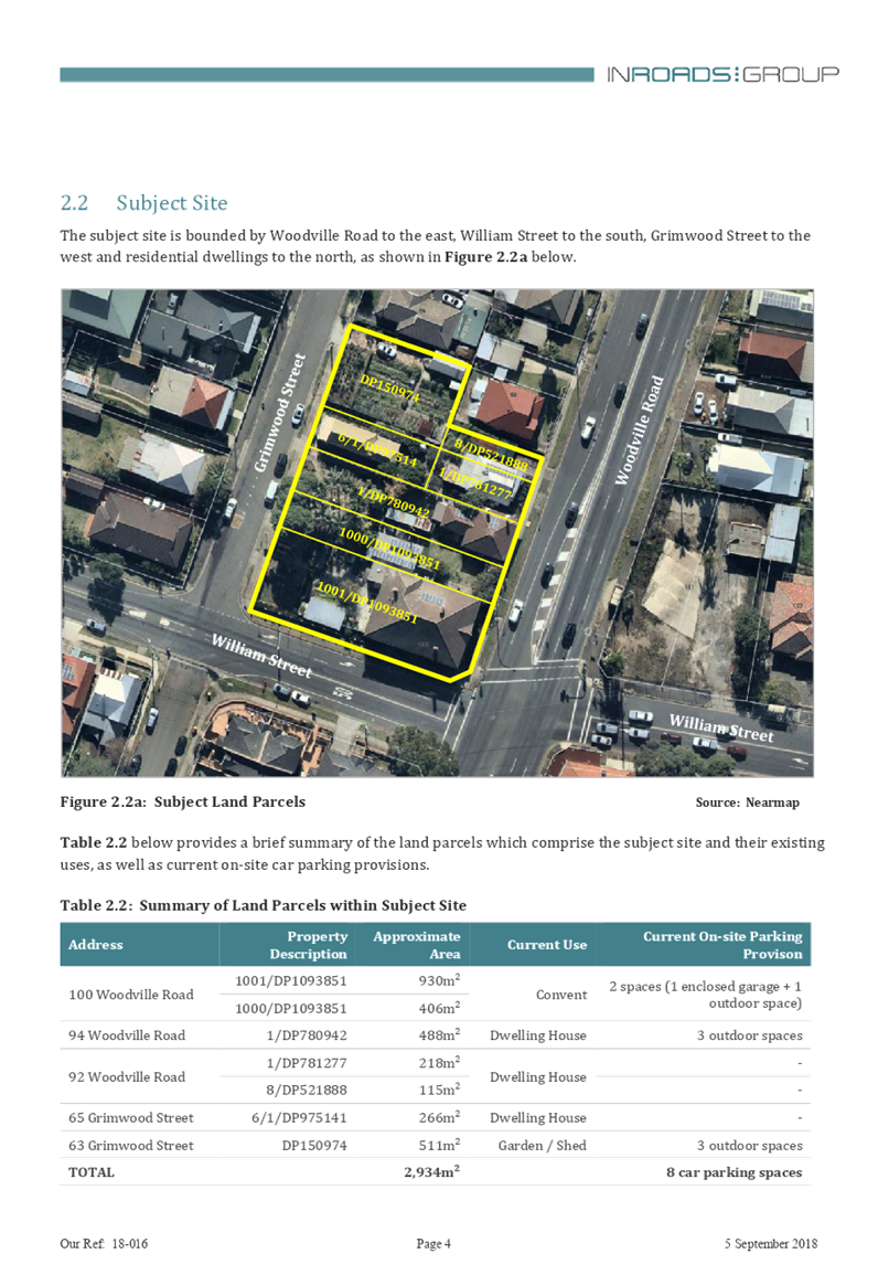
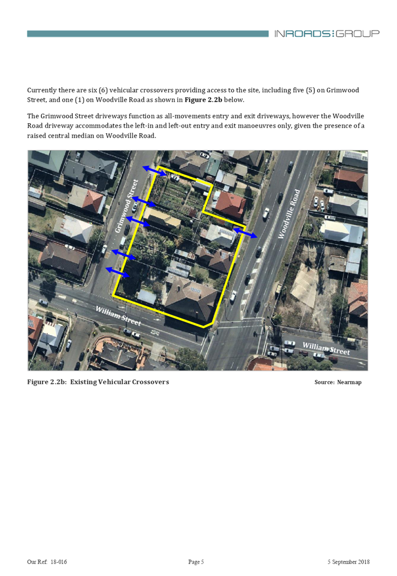
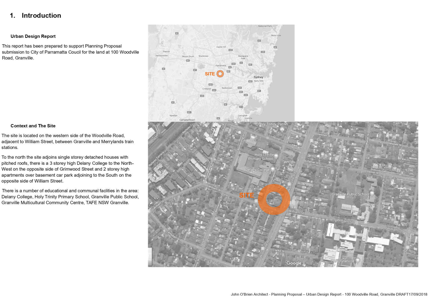
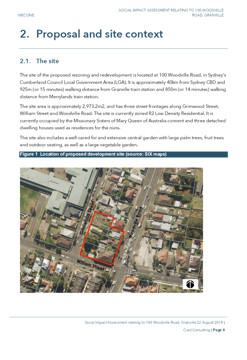
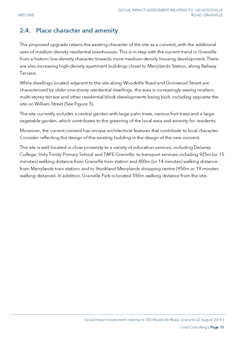
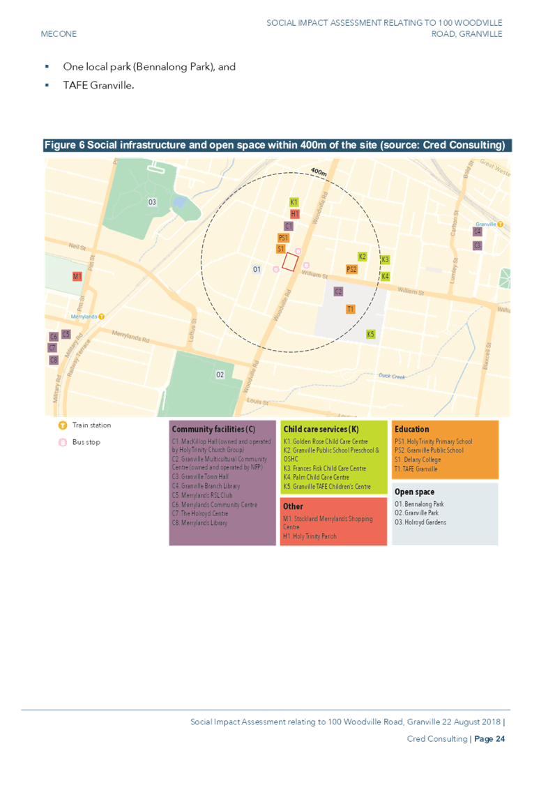
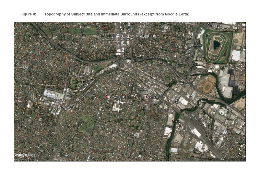
The Site and its Context
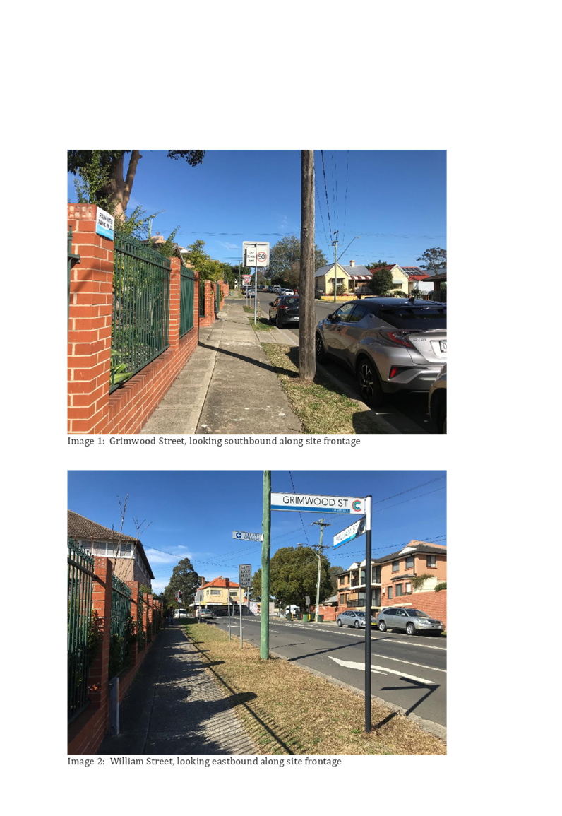
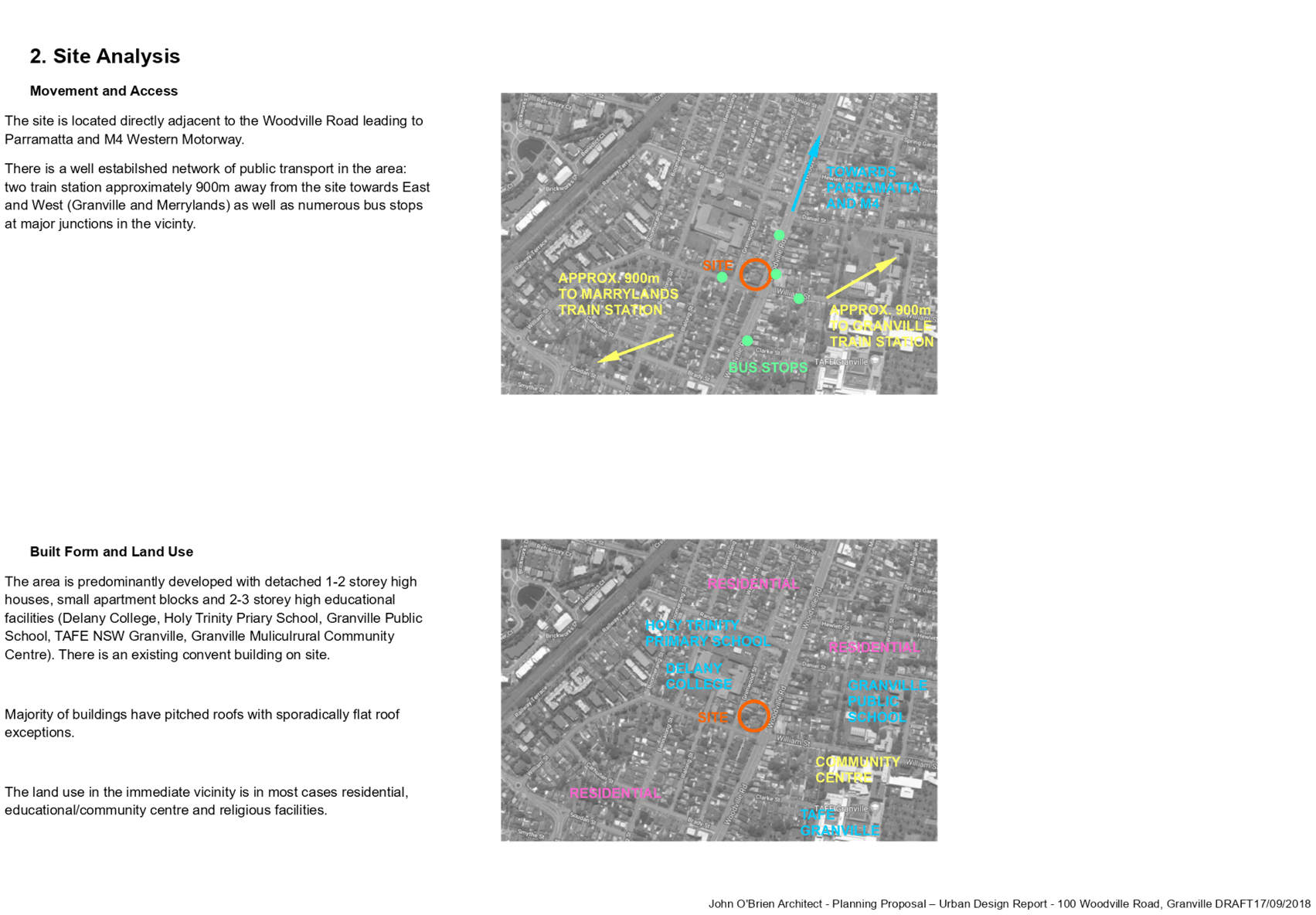
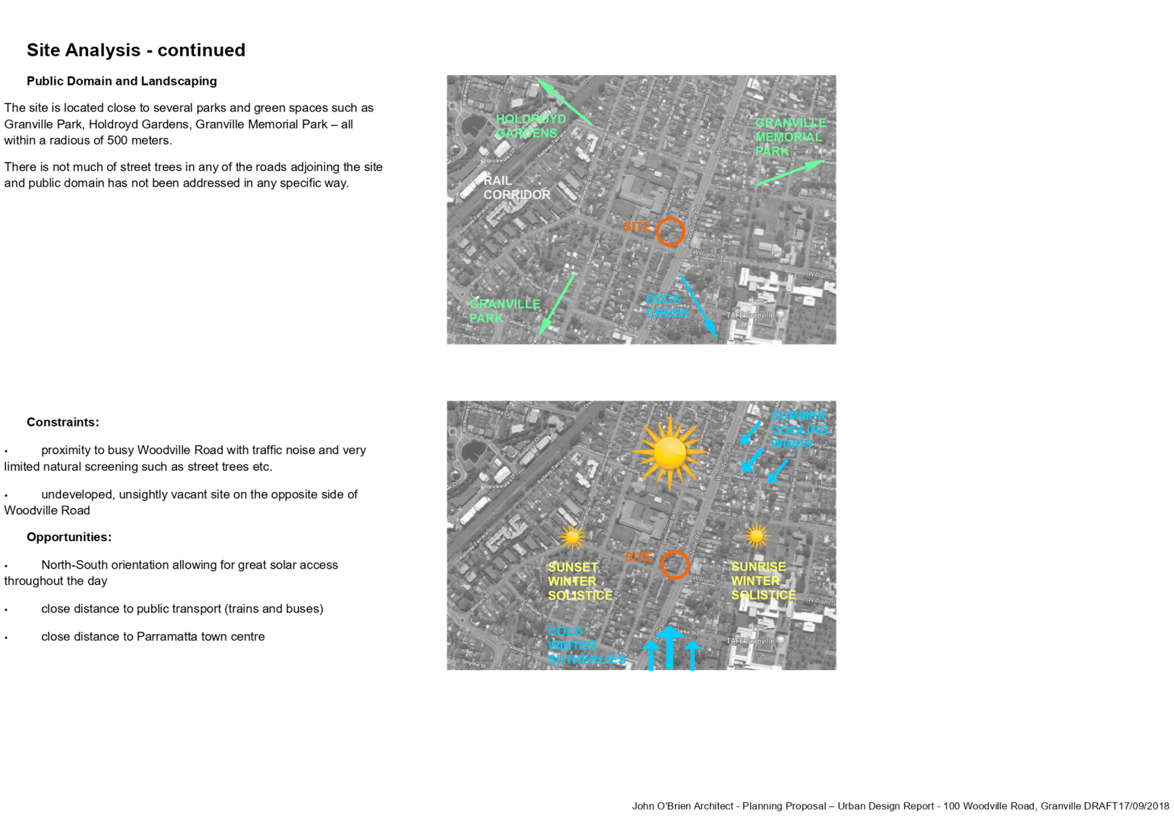
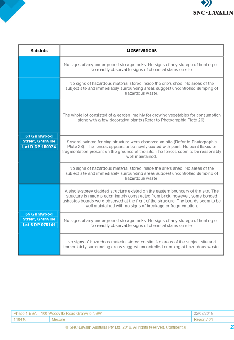
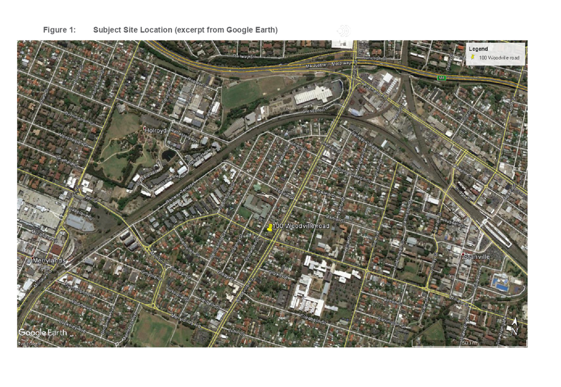
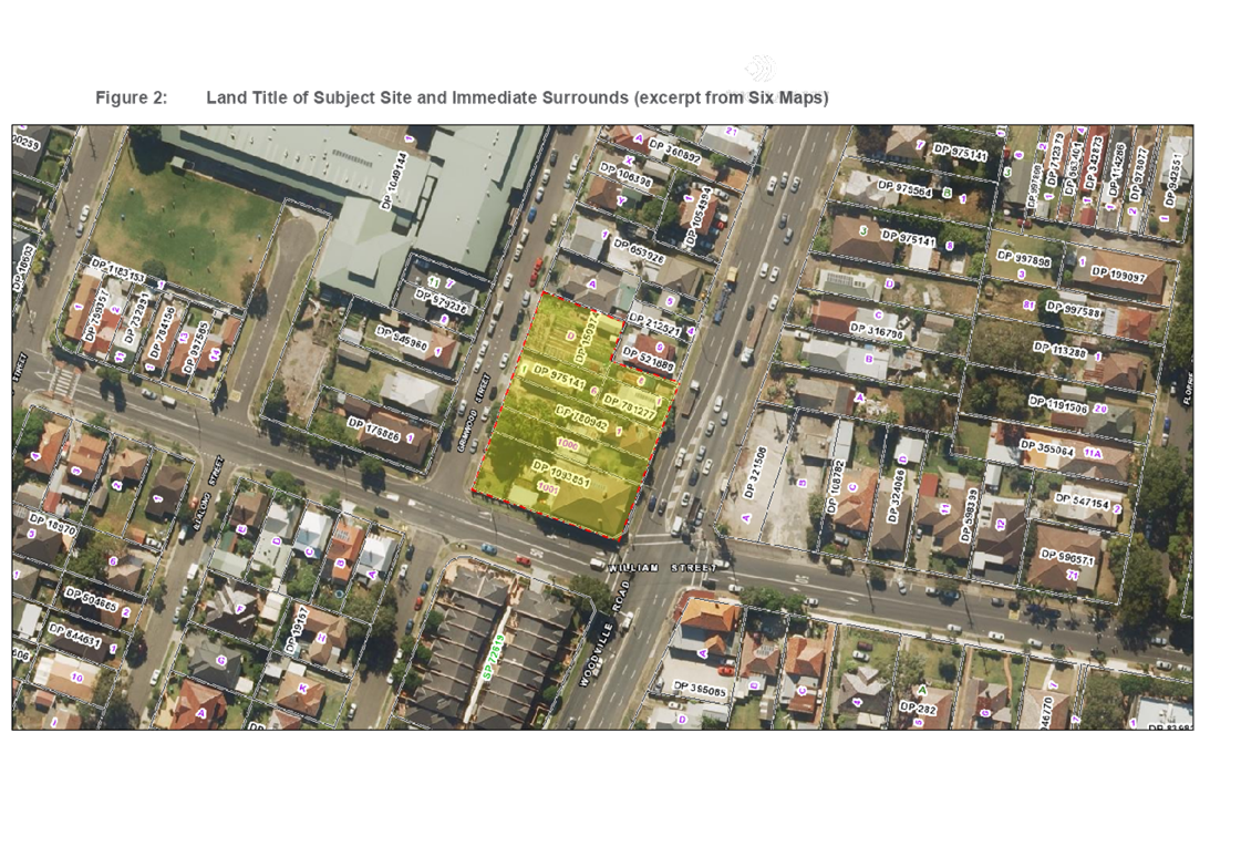
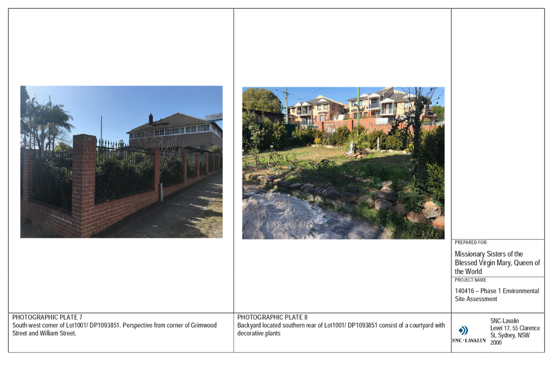
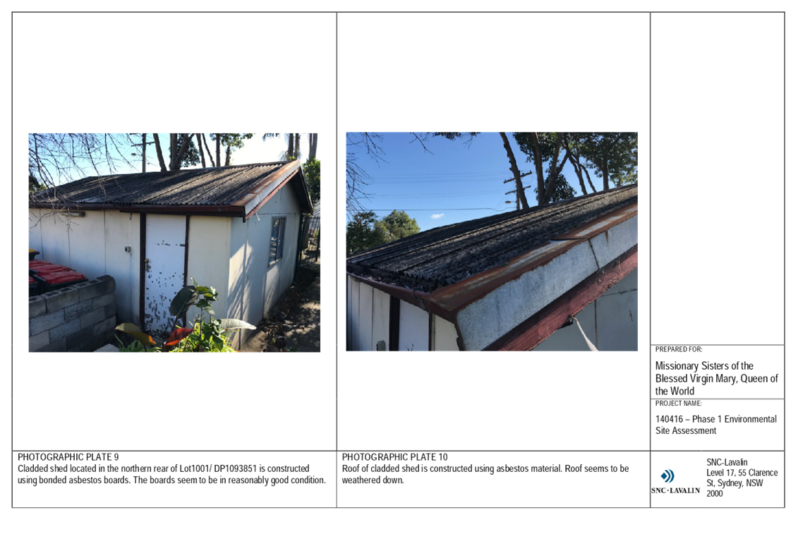
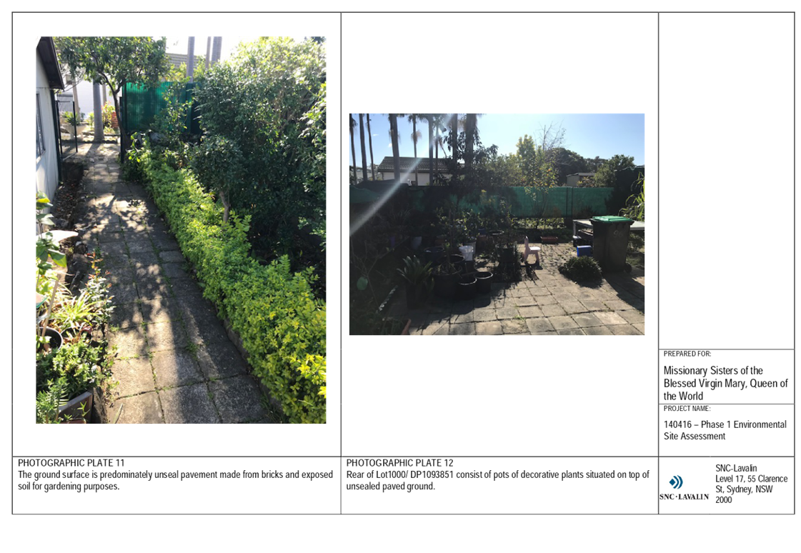
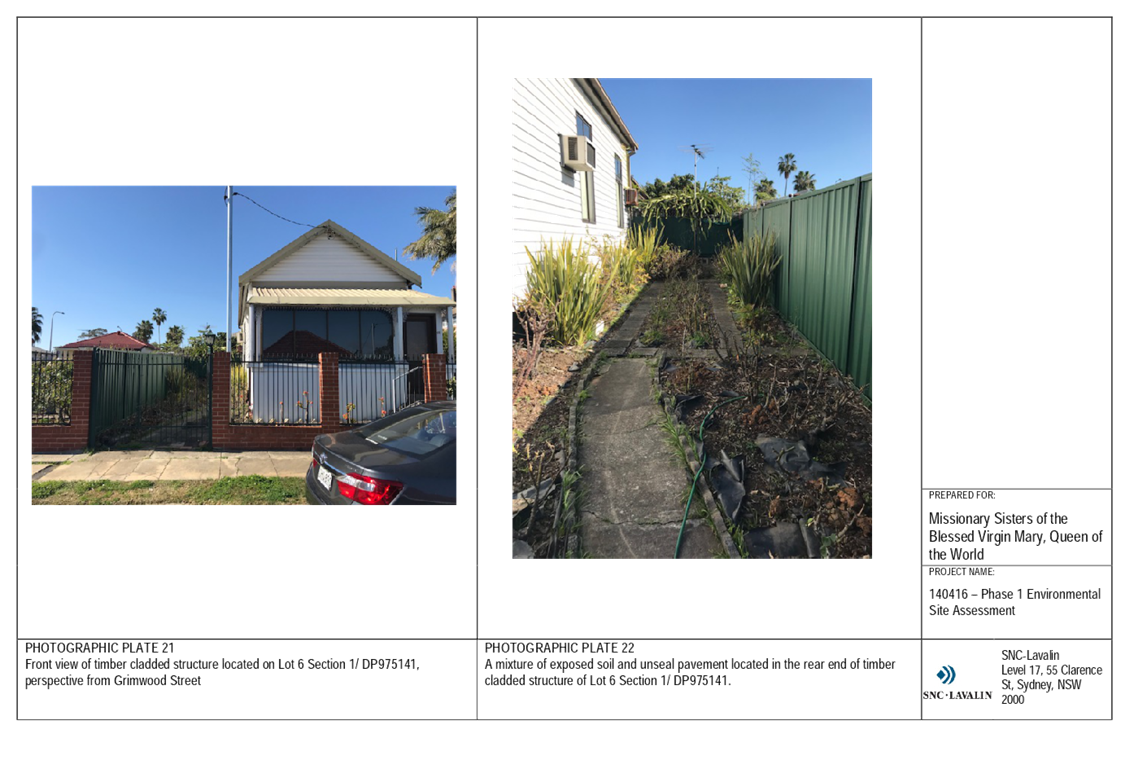
The site is located at 92-100 Woodville Road and 63 and 65 Grimwood Street, Granville, and comprises seven lots bounded by Grimwood Street to the south, Woodville Road to the east and William Street to the west. The total site area is approximately 2,900 m2.
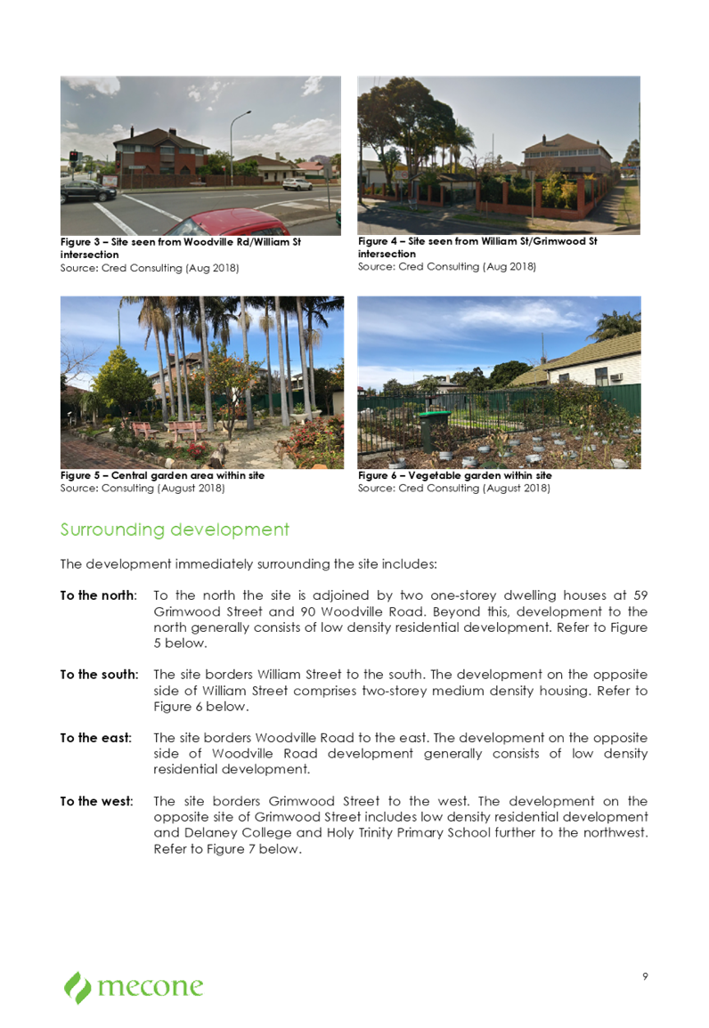
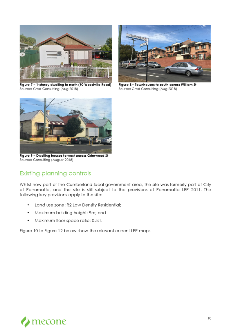
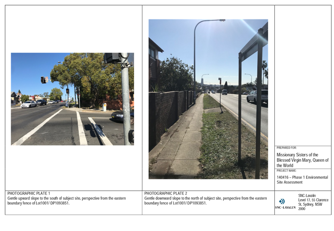
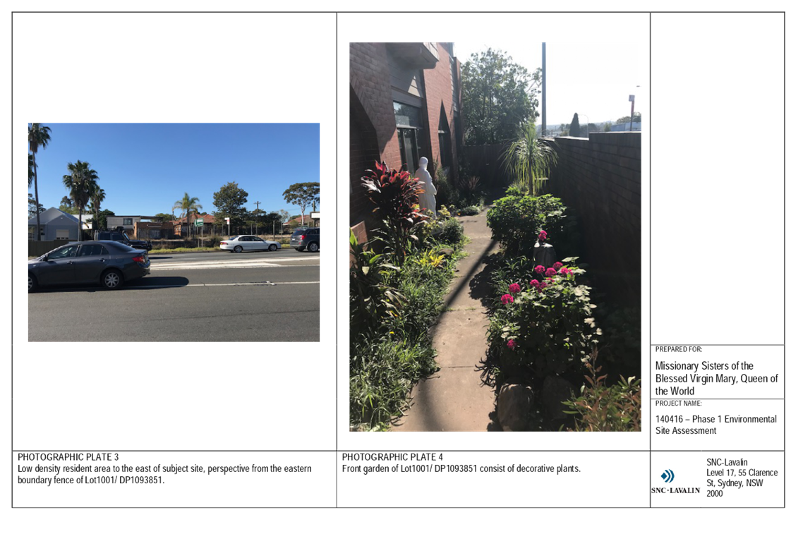
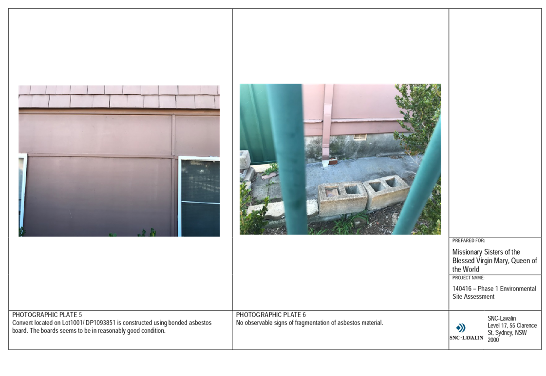
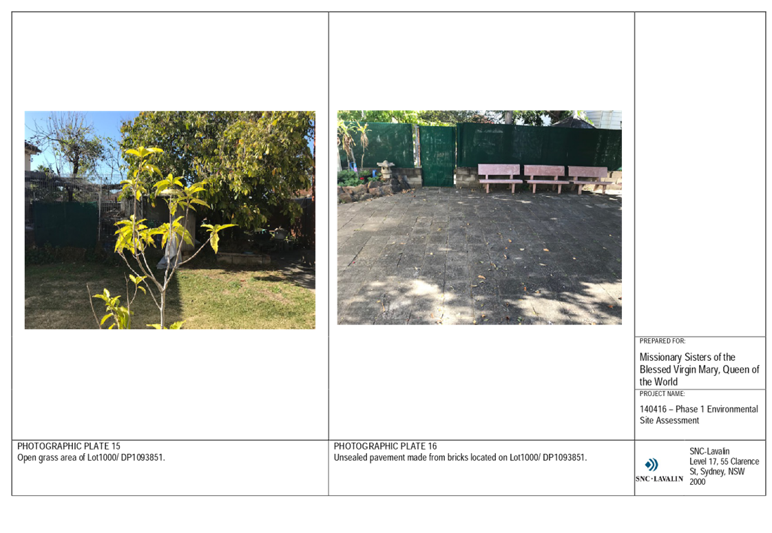
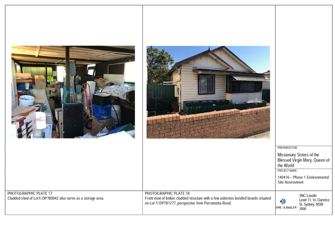
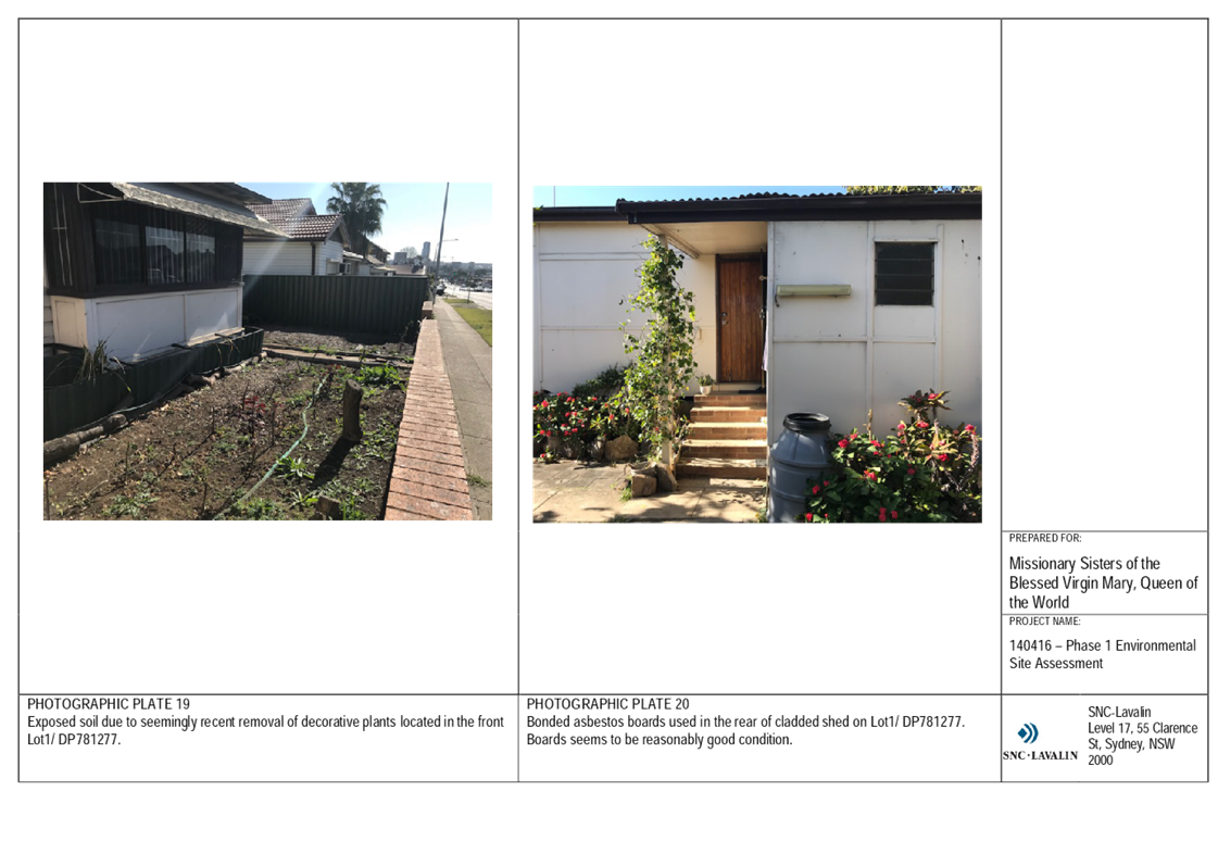
Existing development includes a convent and three detached houses (related to the convent use) and associated vegetable gardens, landscaped garden and lawn areas, and storage sheds (Figure 3).
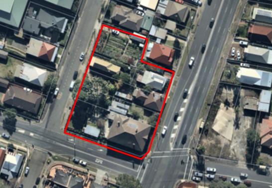
Figure 3 The site
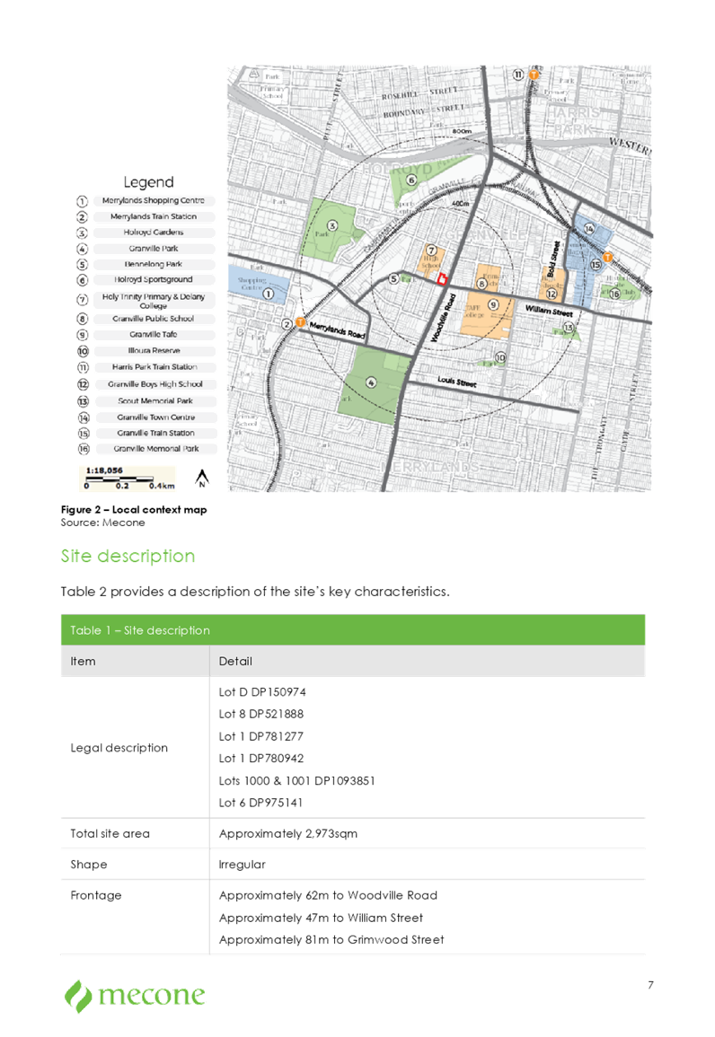
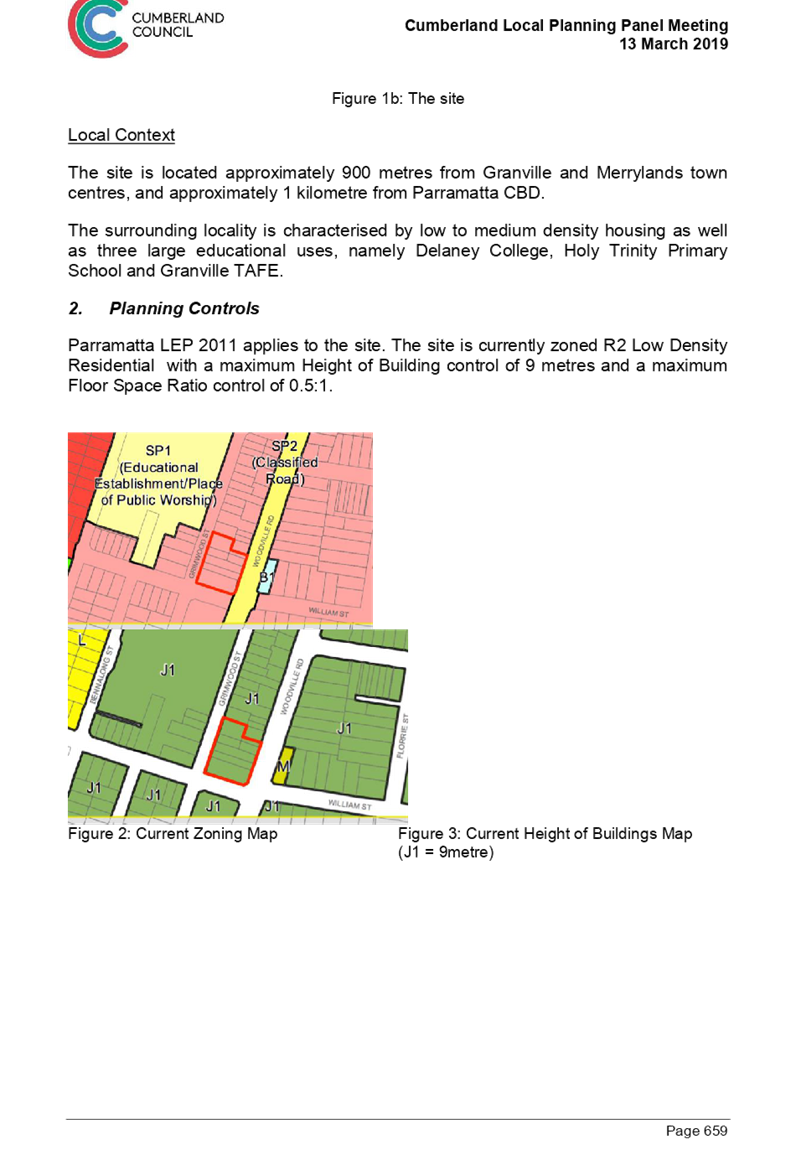
Local Context
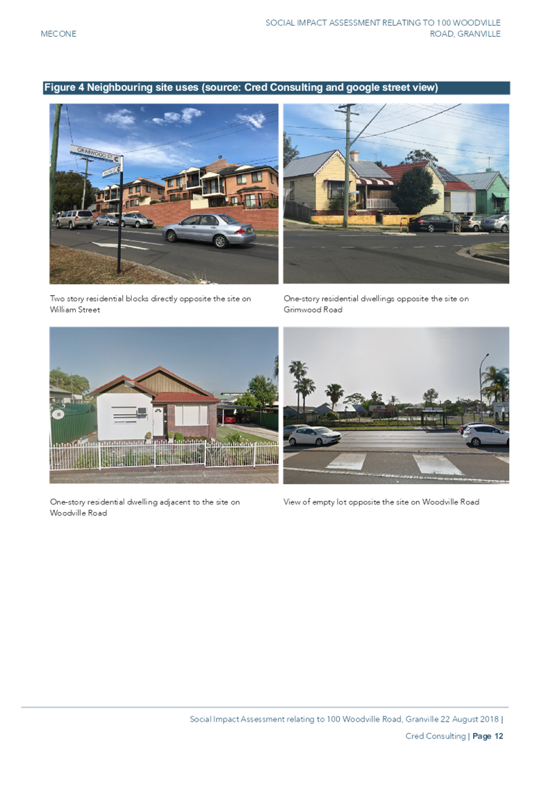
The site is located approximately 900 metres from Granville and Merrylands local centres, and approximately 1km from the Parramatta CBD.
The surrounding locality is characterised by low to medium density housing as well as three large institutional uses, namely Granville TAFE, Delaney College, and Holy Trinity Primary School.
Regional Context
The site is located in the suburb of Granville, approximately 1km south of Parramatta CBD and 19km west of Sydney CBD.
Planning Proposal
Current Planning Controls
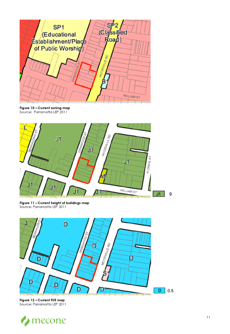
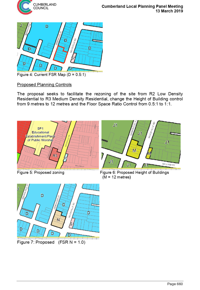
Parramatta LEP 2011 applies to the site. The site is currently zoned R2 Low Density Residential with a maximum Height of Building control of 9 metres and a Floor Space Ratio control of 0.5:1. This is shown in Figures 4 to 6.
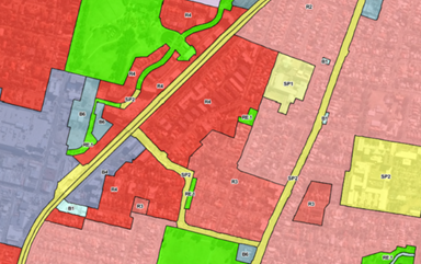
Figure 4 Current Zoning
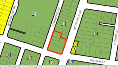
Figure 5 Current Height of Buildings (J1 = 9 metres)
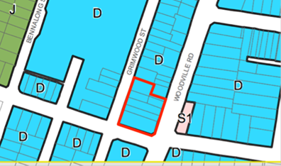
Figure 6 Current Floor Space Ratio (D = 0.5:1)
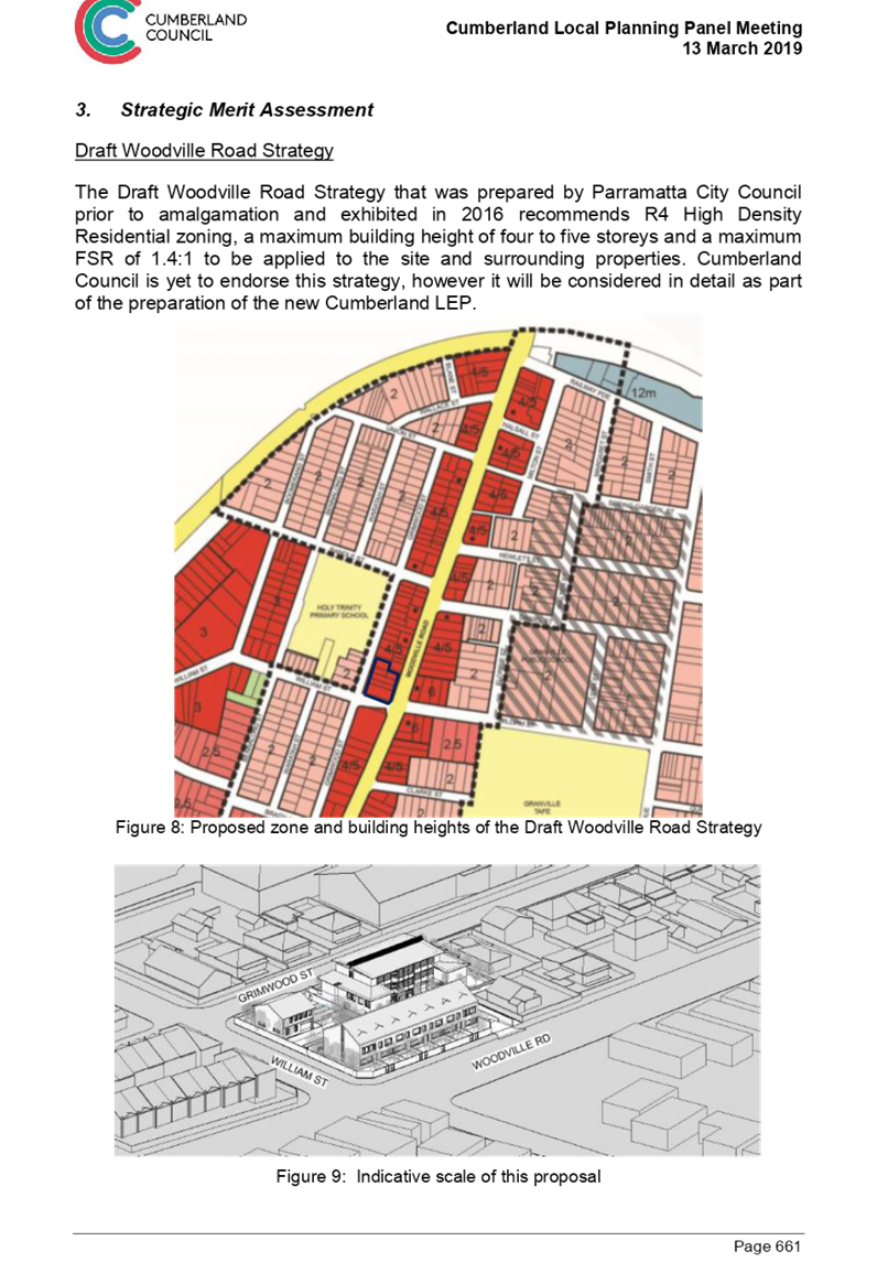
Proposed Planning Controls
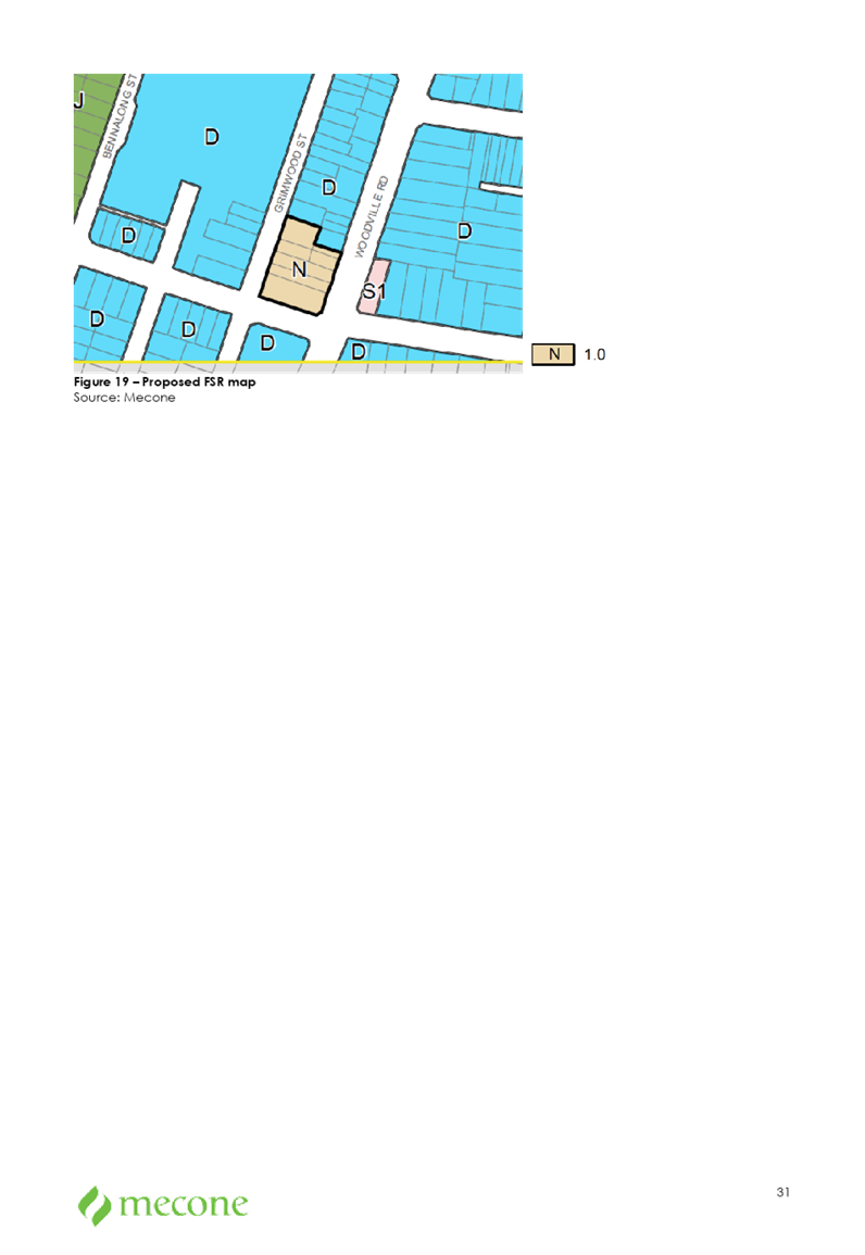
The planning proposal seeks to facilitate the rezoning of the site from R2 Low Density Residential to R3 Medium Density Residential, change the Height of Building control from 9 metres to 12 metres and the Floor Space Ratio control from 0.5:1 to 1:1. This is shown in Figures 7 to 9.
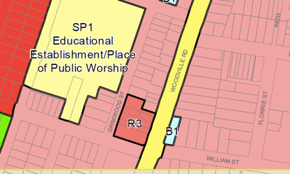
Figure 7 Proposed zoning
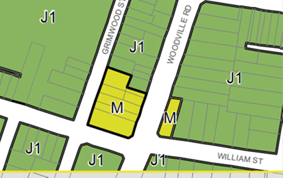
Figure 8 Proposed Height of Buildings (M = 12 metres)
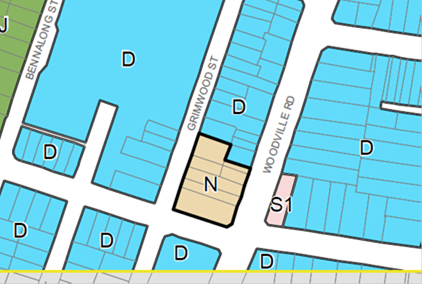
Figure 9 Proposed Floor Space Ratio (N = 1.0)
Strategic Merit Assessment
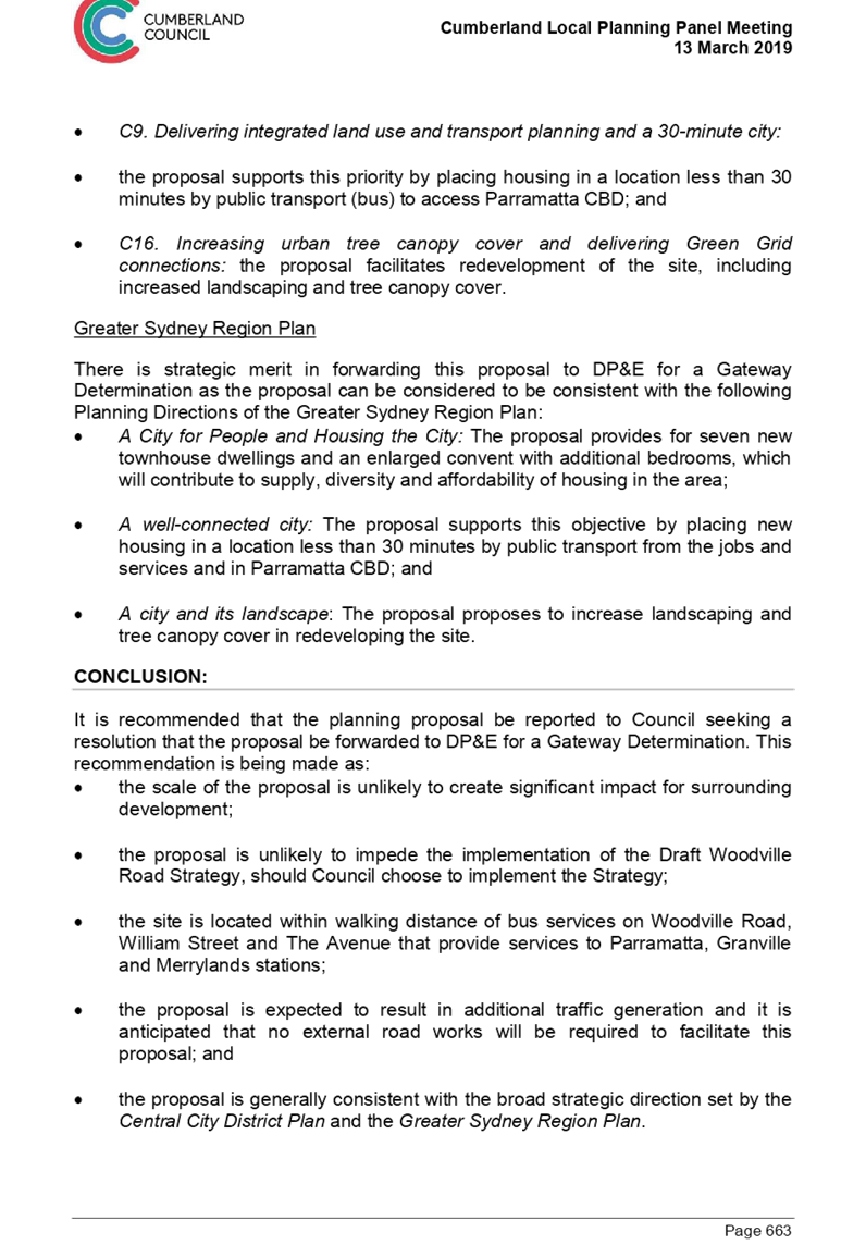
Draft Woodville Road Strategy
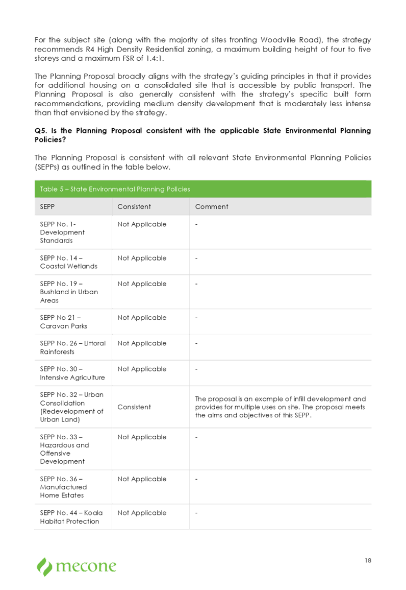
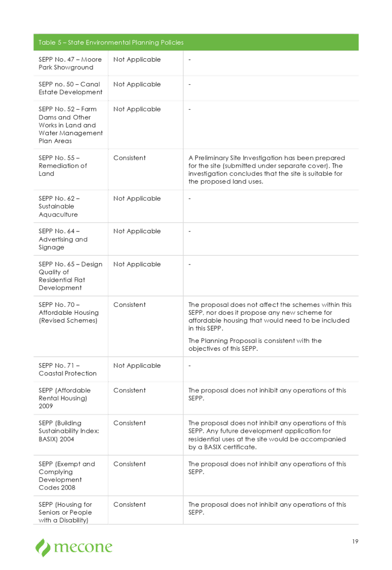
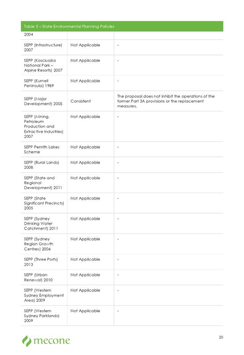
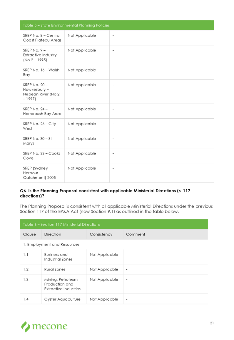
The Draft Woodville Road Strategy that was prepared by Parramatta City Council and exhibited in 2016 recommends a R4 High Density Residential zoning, a maximum building height of four to five storeys and a maximum FSR of 1.4:1 for the site and surrounding properties.
The planning proposal seeks a scale of development which is less than what is proposed by the Draft Strategy.
Progressing this planning proposal to a Gateway Determination has strategic merit, as the scale of the proposal:
· is unlikely to impede the implementation of the Draft Strategy for neighbouring properties, if Council choses to adopt this strategy, and
· is unlikely to have a significant impact on the surrounding neighbourhood, if Council chose not to adopt the Draft Strategy and maintain the existing urban form.
Traffic and Transport
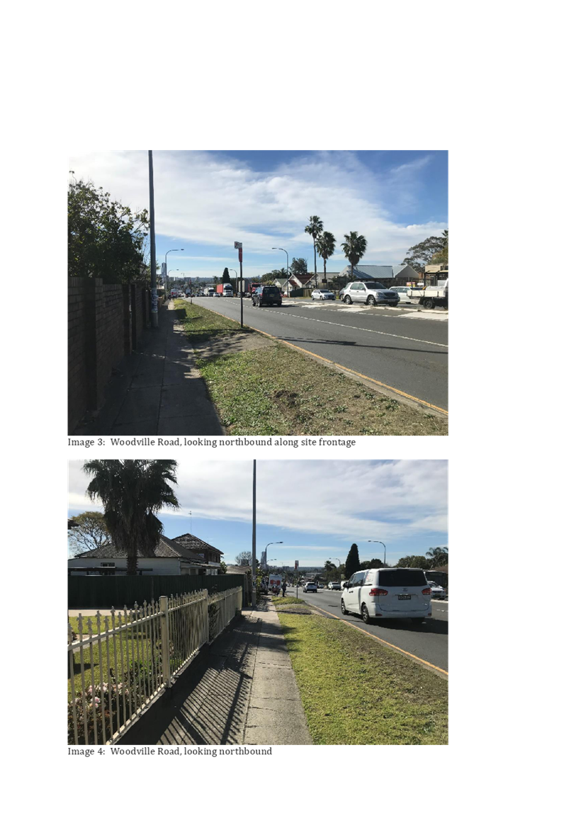
A review of traffic and transport considerations indicates there is strategic merit in progressing this proposal to a Gateway Determination as:
· the site is located within walking distance of a number of bus stops on Woodville Road, William Street and The Avenue that provide services to Parramatta and Merrylands train stations;
· the site is located within approximately 1km to Merrylands and Granville train stations; and
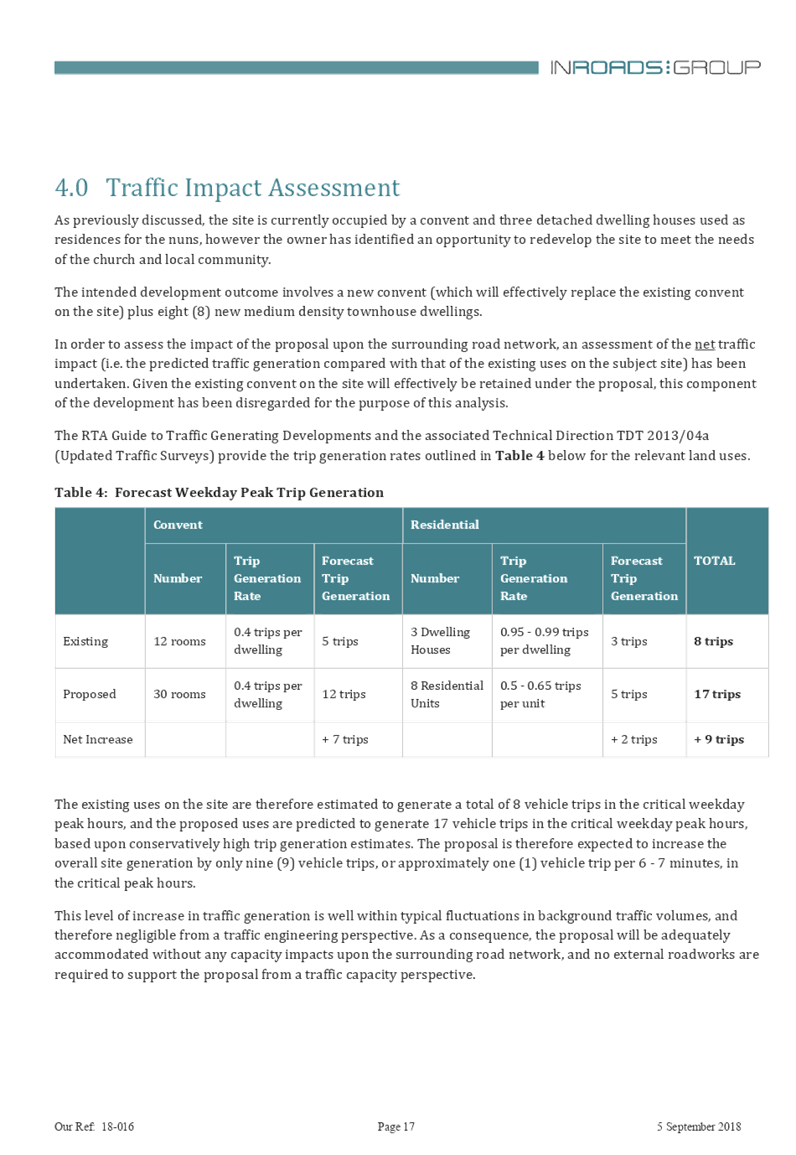
· the proposal is expected to result in additional traffic generation of nine vehicle trips in the critical peak hour (or approximately one trip per six to seven minutes). This level of increase is well within typical fluctuations in background traffic volumes. It is anticipated that no external road works will be required to facilitate this proposal.
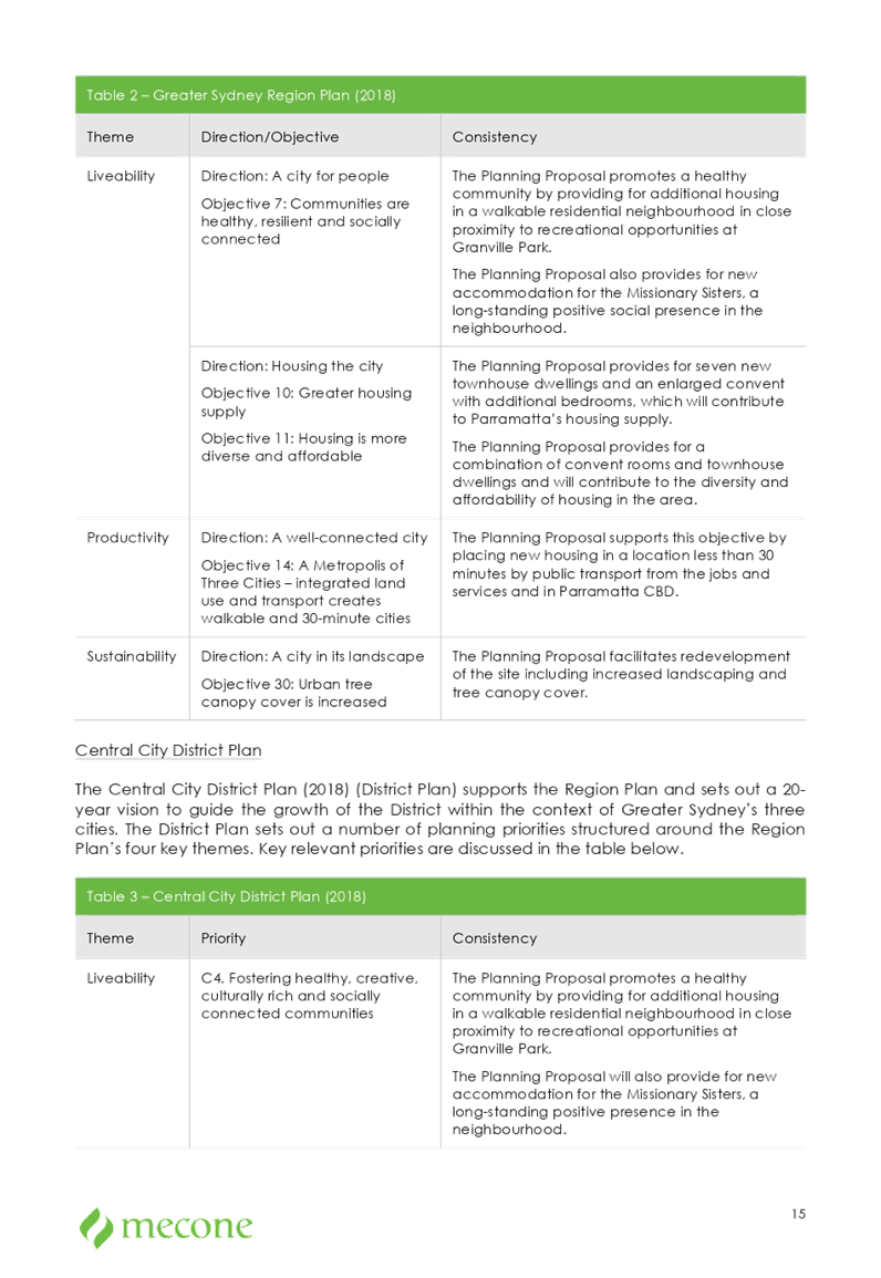
Central City District Plan
There is strategic merit in forwarding this proposal for a Gateway Determination, as it can be considered to be consistent with the following Planning Priorities of the Central City District Plan:
· C4 Fostering healthy, creative, culturally rich and socially connected communities: the planning proposal promotes a healthy community by providing for additional housing in a walkable residential neighbourhood in close to recreational opportunities at Granville Park. The planning proposal will also provide for new accommodation for the Missionary Sisters, a long-standing positive presence in the neighbourhood.
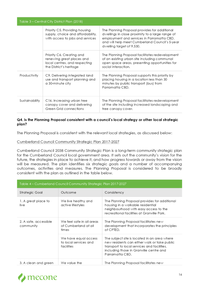
· C5. Providing housing supply, choice and affordability, with access to jobs and services: the planning proposal provides for additional dwellings in close proximity to a large range of employment and services in Parramatta CBD.
· C6. Creating and renewing great places and local centres, and respecting the District’s heritage: the planning proposal facilitates redevelopment of an existing urban site including communal open space areas, presenting opportunities for social interaction.
· C9. Delivering integrated land use and transport planning and a 30-minute city: the planning proposal supports this priority by placing housing in a location less than 30 minutes by public transport (bus) from Parramatta CBD, and within a walking distance of Granville and Merrylands train stations.
Greater Sydney Region Plan
There is strategic merit in forwarding this proposal for a Gateway Determination as the proposal can be considered to be consistent with the following Planning Directions of the Greater Sydney Region Plan:
· A City for People and Housing the City: the proposal provides for an enlarged convent with additional bedrooms, as well as seven new townhouse dwellings which will contribute to supply, diversity and affordability of housing in the area.
· A well-connected city: the proposal supports this objective by placing new housing in a location less than 30 minutes by public transport from the jobs and services and in Parramatta CBD.
Cumberland Local Planning Panel
The planning proposal was reported to the Cumberland Local Planning Panel on 13 March 2019. The Panel recommended that this matter be reported to Council, seeking a resolution to forward the planning proposal for a Gateway Determination (Attachment 2).
Recommended Planning Controls
A summary of the recommended planning controls for the proposal is provided in Table 1. This is based on a review of the proponent’s proposed planning controls by Council officers and advice from the Cumberland Local Planning Panel.
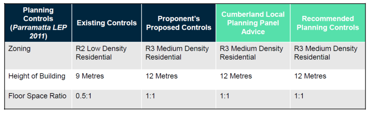
Table 1 Recommended planning controls for the proposal
Community Engagement
The preliminary (pre-Gateway) public exhibition was carried out between 9 October 2018 and 7 November 2018. The proposal was made available for public viewing at Council’s libraries, customer service, newspapers and letters were sent to adjoining landowners.
In response to the preliminary exhibition, only one concern was raised relating to inadequate parking and an increase in traffic congestion. An analysis has been undertaken as part of the traffic report submitted as part of the rezoning, and Council engineers have not raised any concerns. Further, requirements for on-site parking at the development application stage will ensure that the proposal does not create adverse impact on the surrounding local network.
Policy Implications
Policy implications for Council are outlined in the main body of the report.
Risk Implications
There are minimal risk implications for Council associated with this report.
Financial Implications
There are no financial implications for Council associated with this report.
CONCLUSION
It is recommended that the planning proposal for 100 Woodville Road, Granville, be forwarded to the Department of Planning, Industry & Environment for a Gateway Determination. This recommendation is being made as:
· the scale of the proposal is unlikely to create significant impact for surrounding development;
· the site is located within walking distance of a number of bus stops on Woodville Road, William Street and The Avenue, that provide services to Parramatta and Merrylands train stations;
· the site is located within approximately one kilometre from Merrylands and Granville train stations;
· the proposal is expected to result in very minimal additional traffic generation, with no external roads anticipated to facilitate the proposal; and
· the proposal is generally consistent with the strategic directions set by the Central City District Plan and the Greater Sydney Region Plan.
Attachments
1. Planning Proposal ⇩ ![]()
2. CLPP
Report and Minutes from CLPP Meeting - 13 March 2019 ⇩ ![]()
3. Traffic
Report ⇩ ![]()
4. Urban
Design Report ⇩ ![]()
5. Social
Impact Assessment ⇩ ![]()
6. Phase
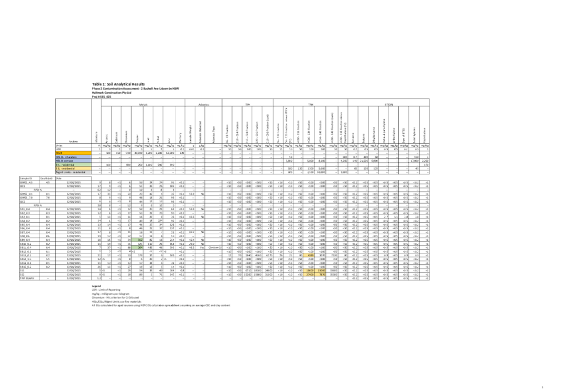
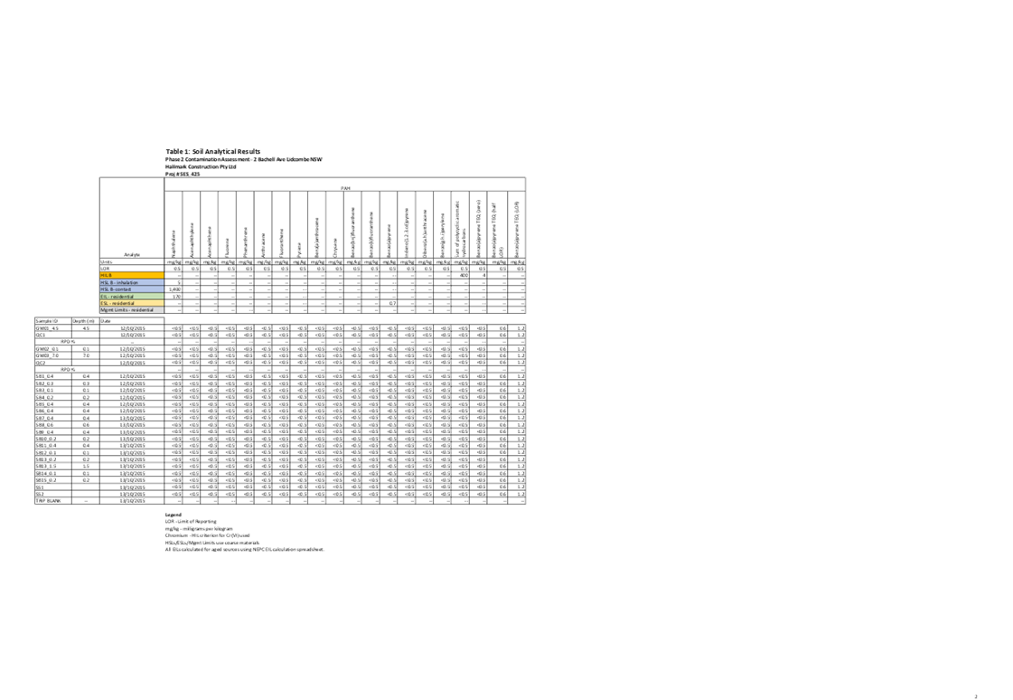
1 Contamination Report ⇩ ![]()
DOCUMENTS
ASSOCIATED WITH
REPORT C05/19-88
Attachment 1
Planning Proposal
Attachment 2
CLPP Report and Minutes from CLPP Meeting - 13 March 2019
DOCUMENTS
ASSOCIATED WITH
REPORT C05/19-88
Attachment 4
Urban Design Report
Council Meeting
15 May 2019
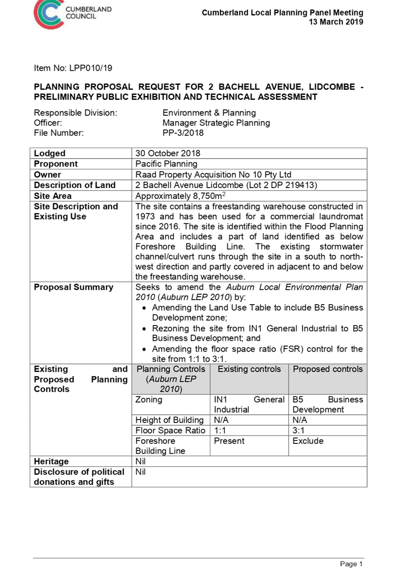
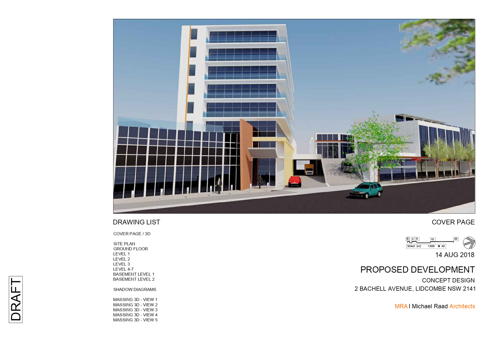
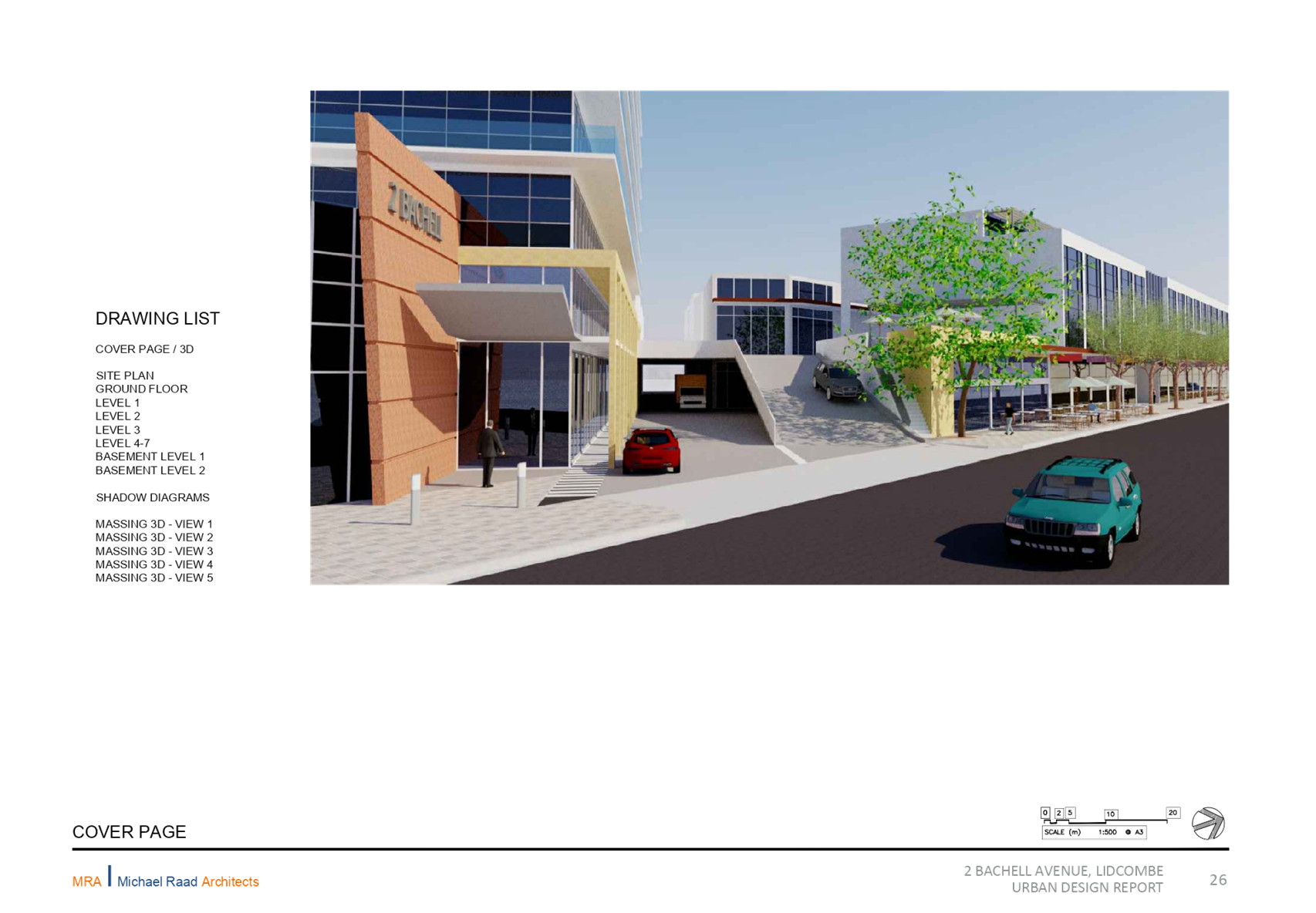
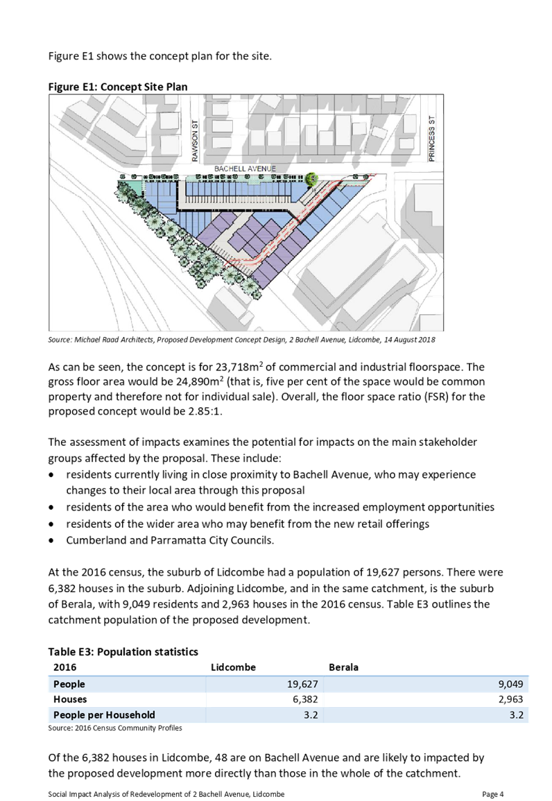
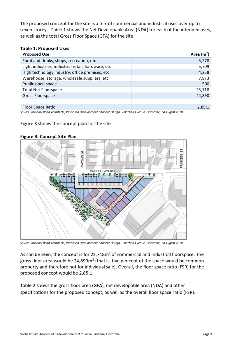
Item No: C05/19-89
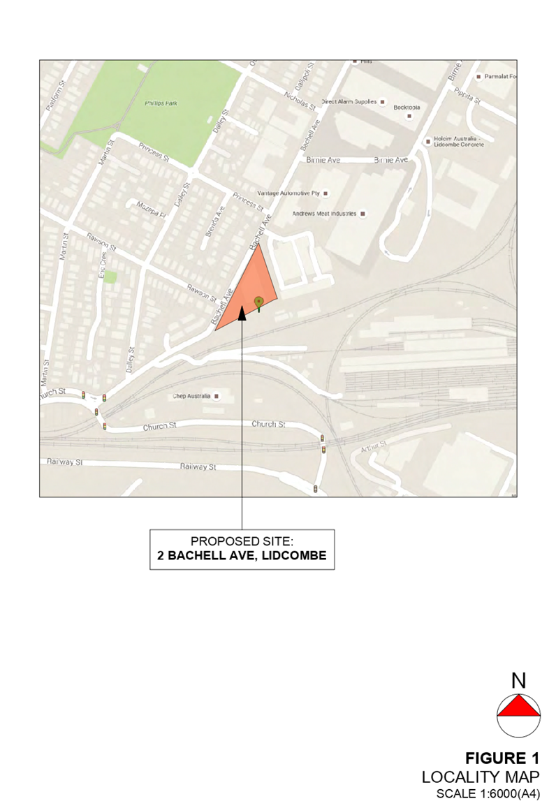
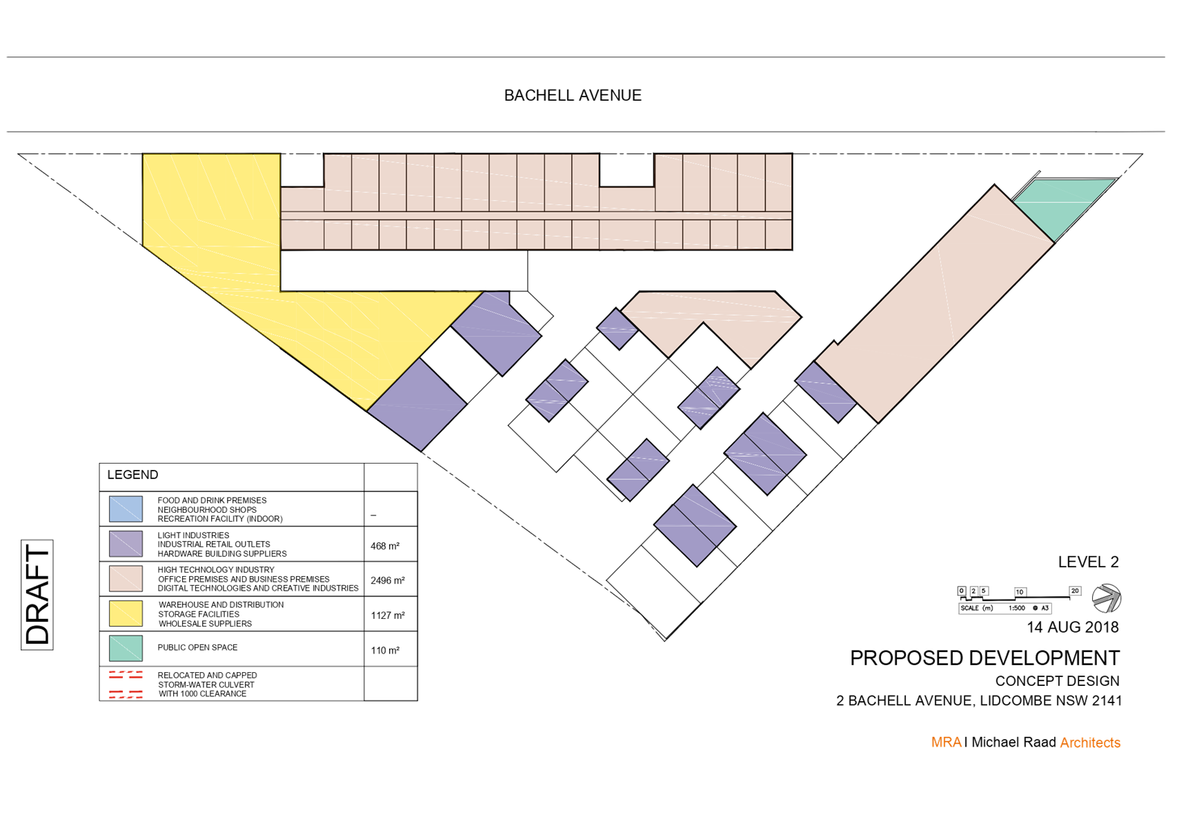
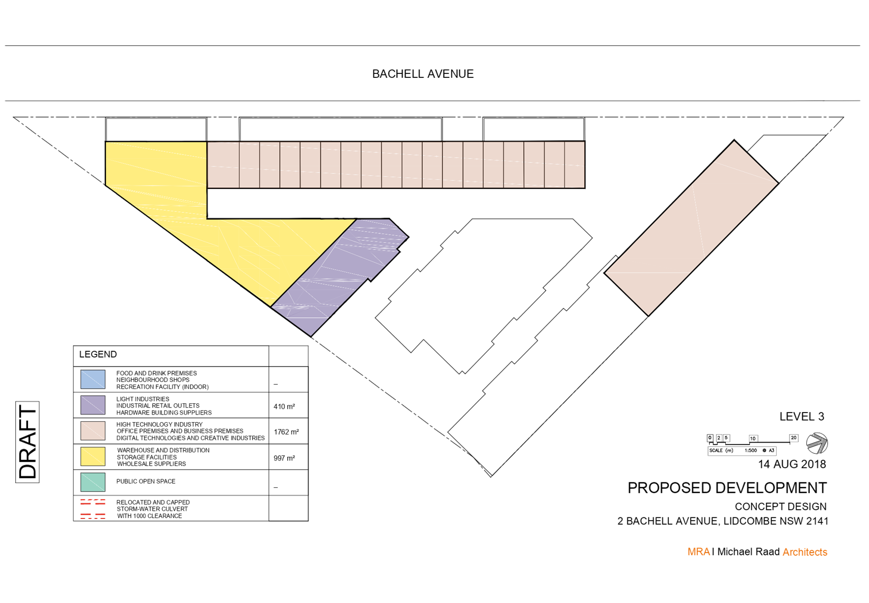
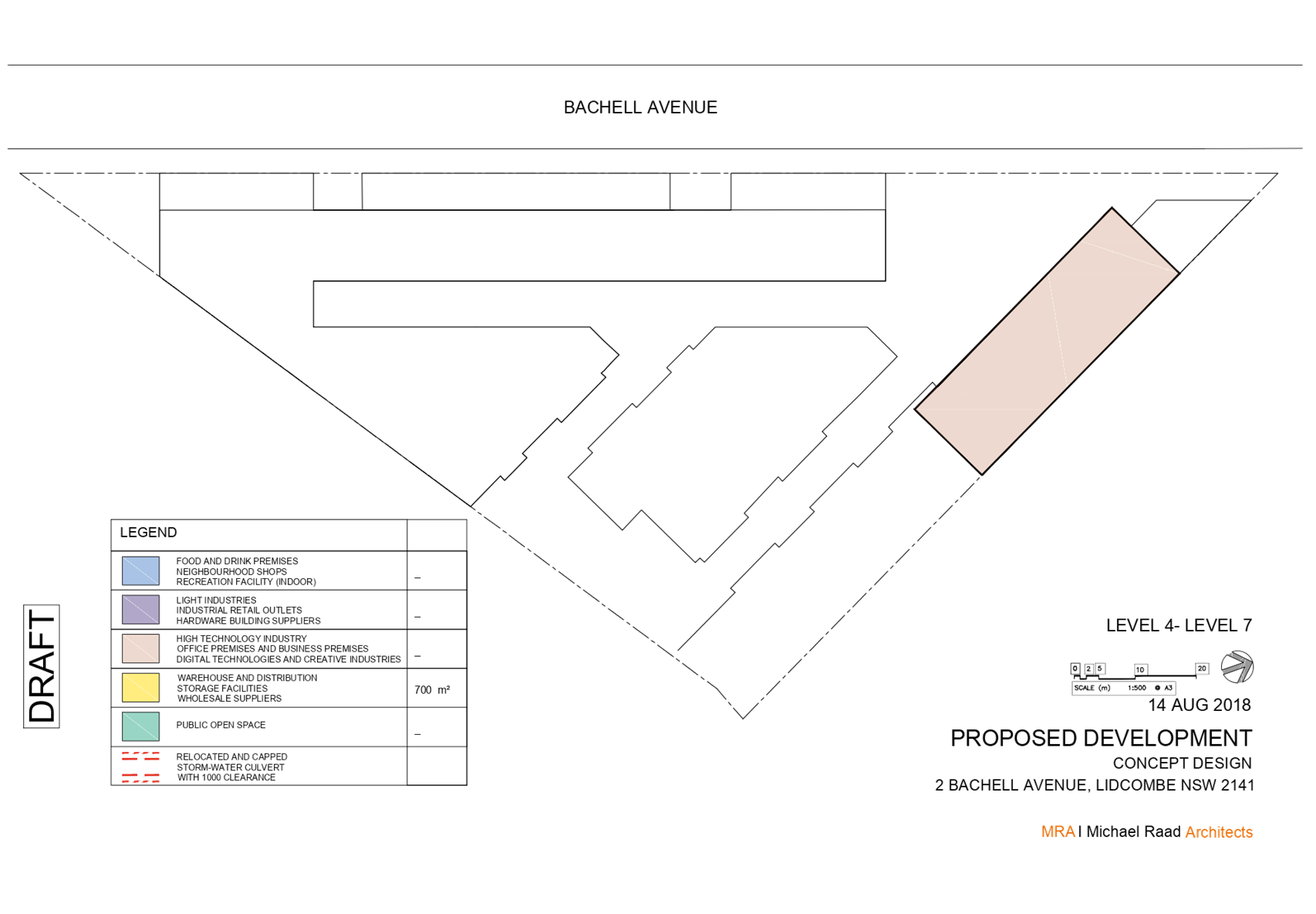
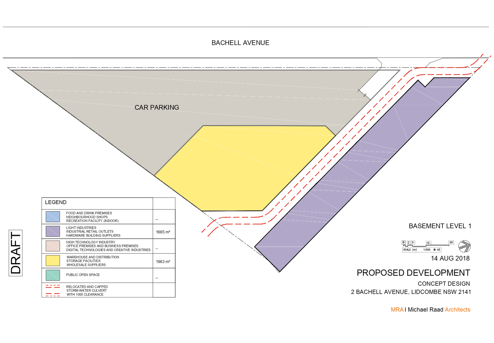
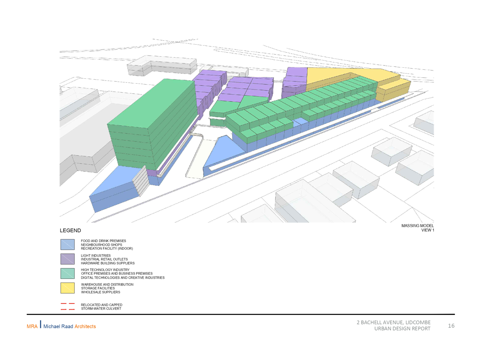
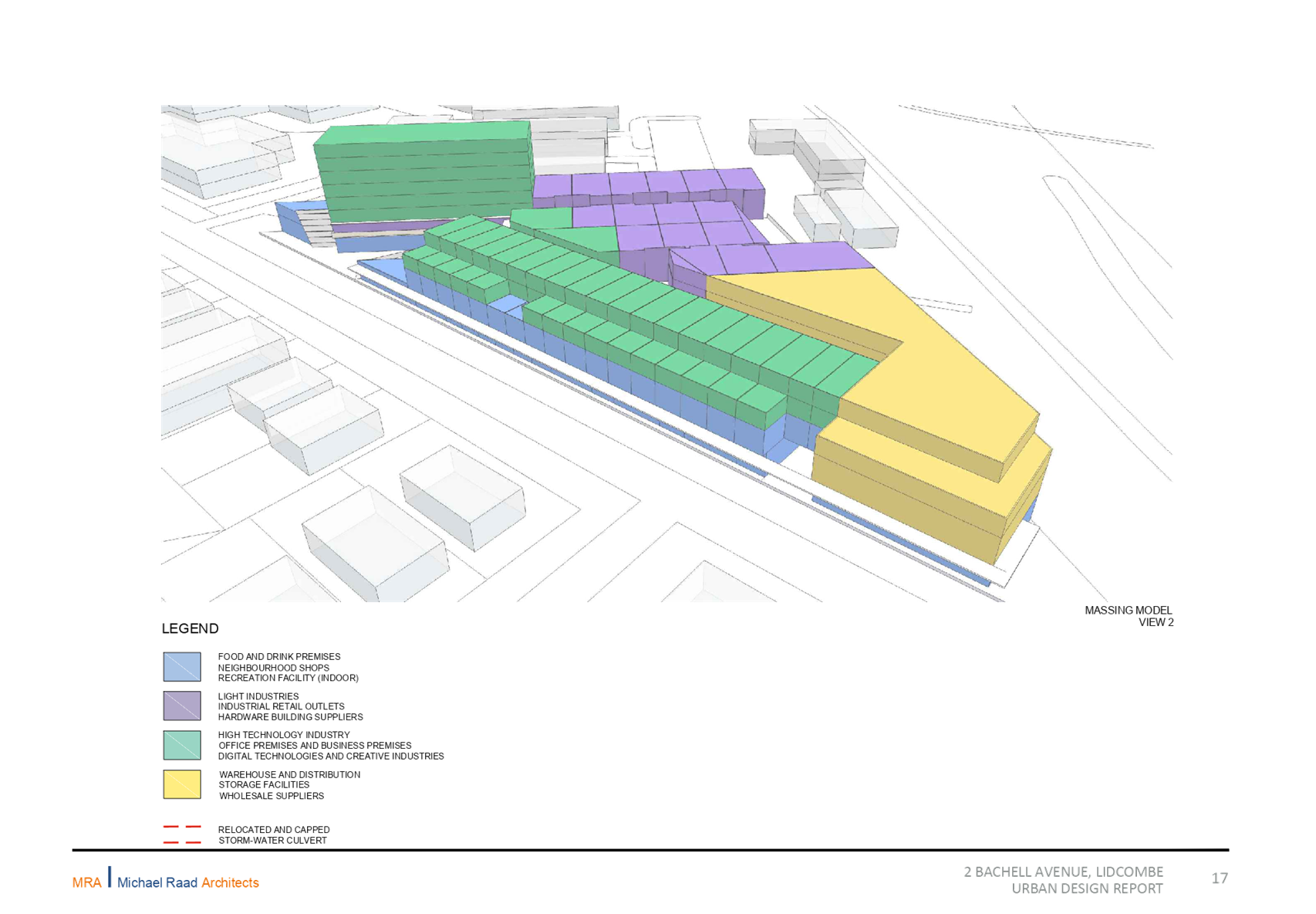
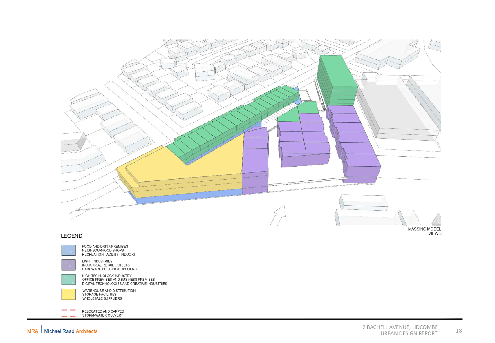
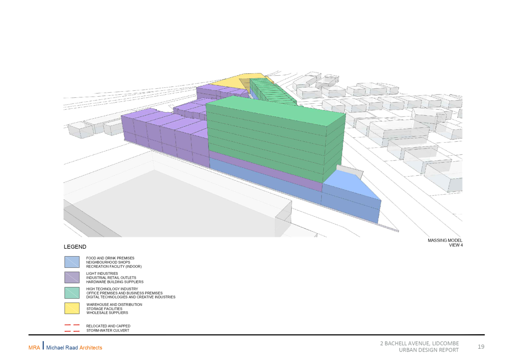
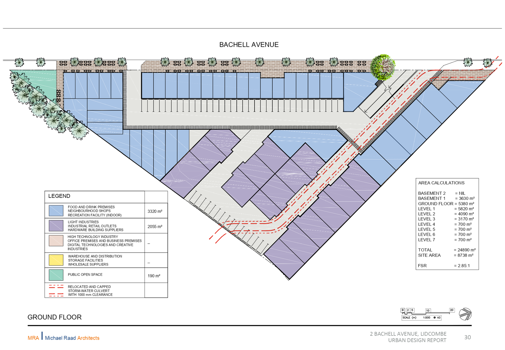
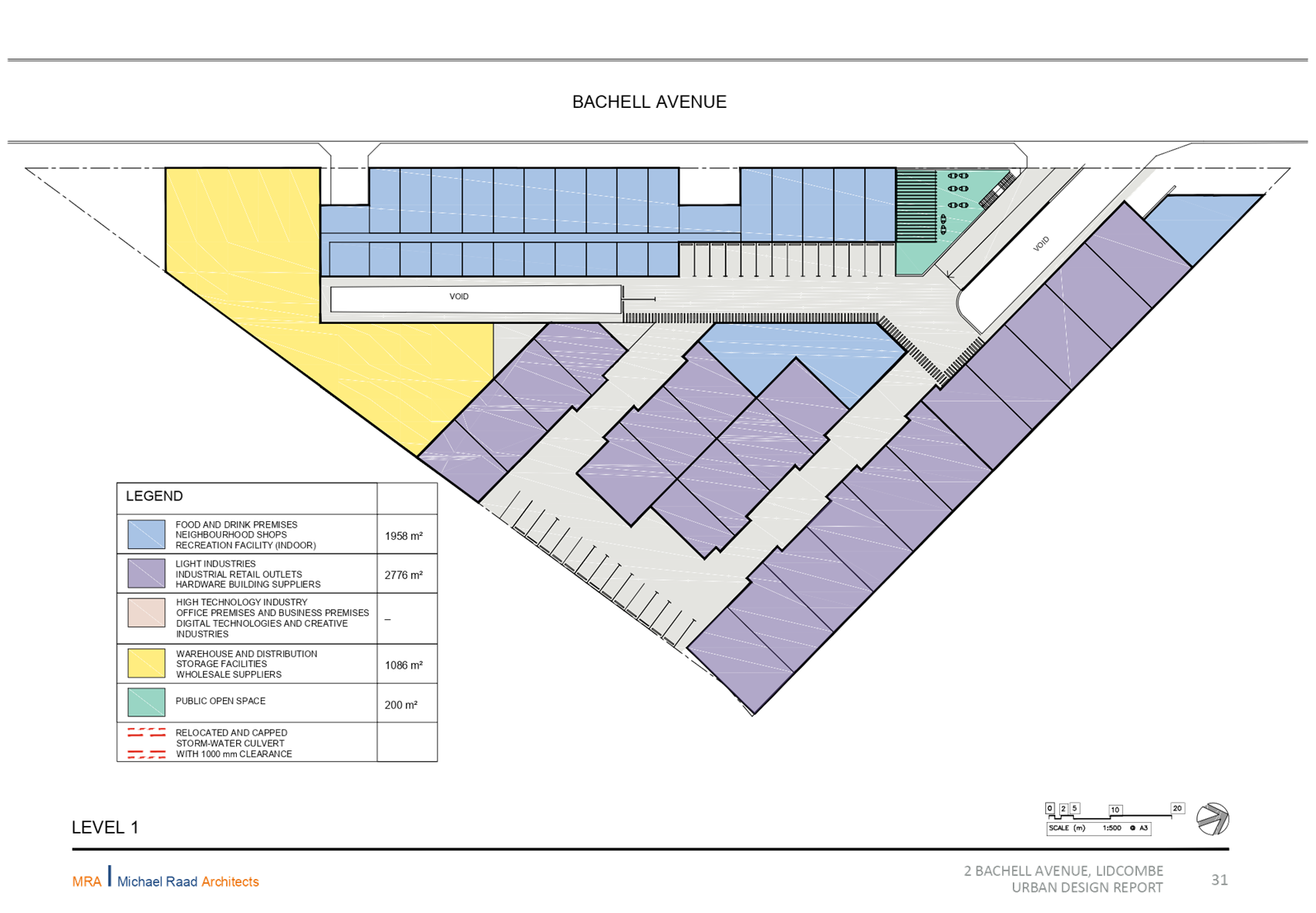
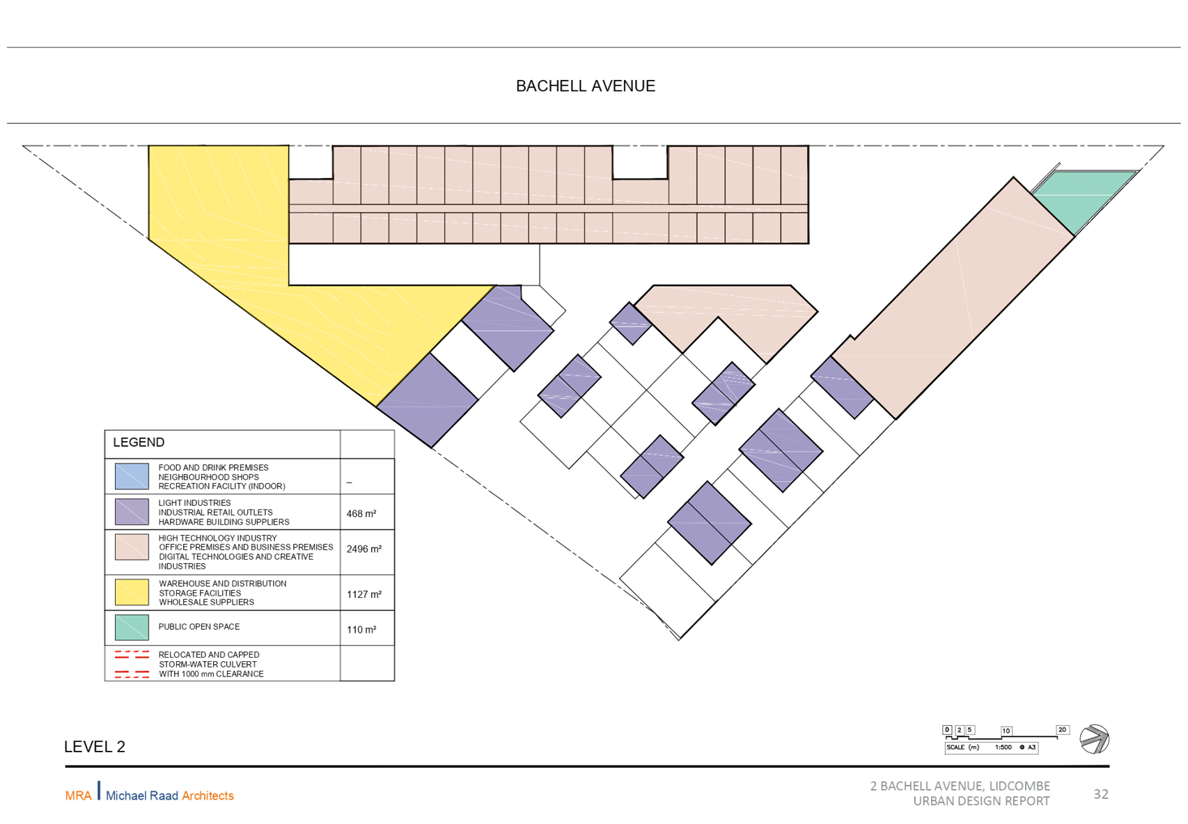
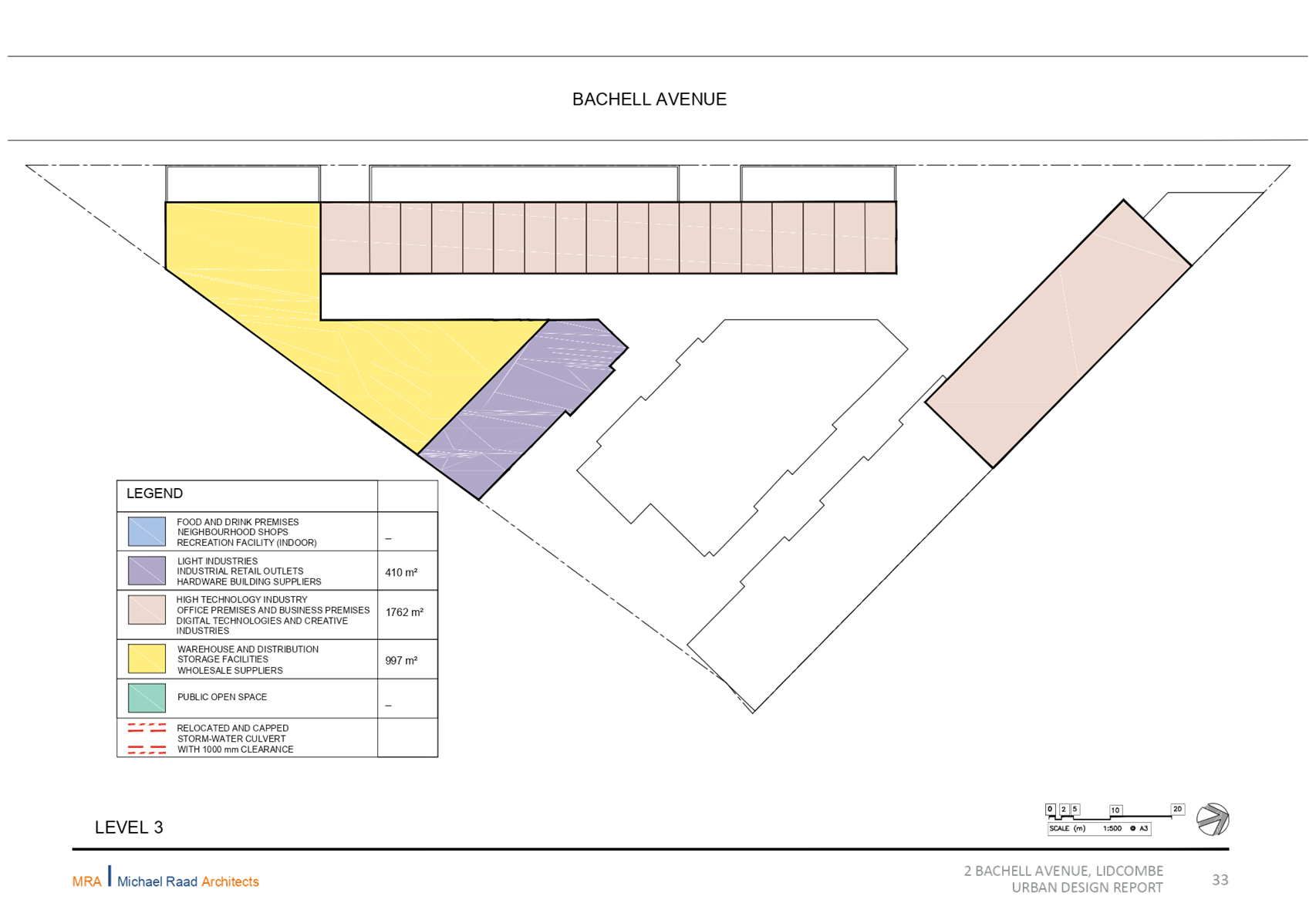
Planning Proposal for 2 Bachell Avenue, Lidcombe
Responsible Division: Environment & Planning
Officer: Director Environment & Planning
File Number: PP-3/2018
Community Strategic Plan Goal: A resilient built environment
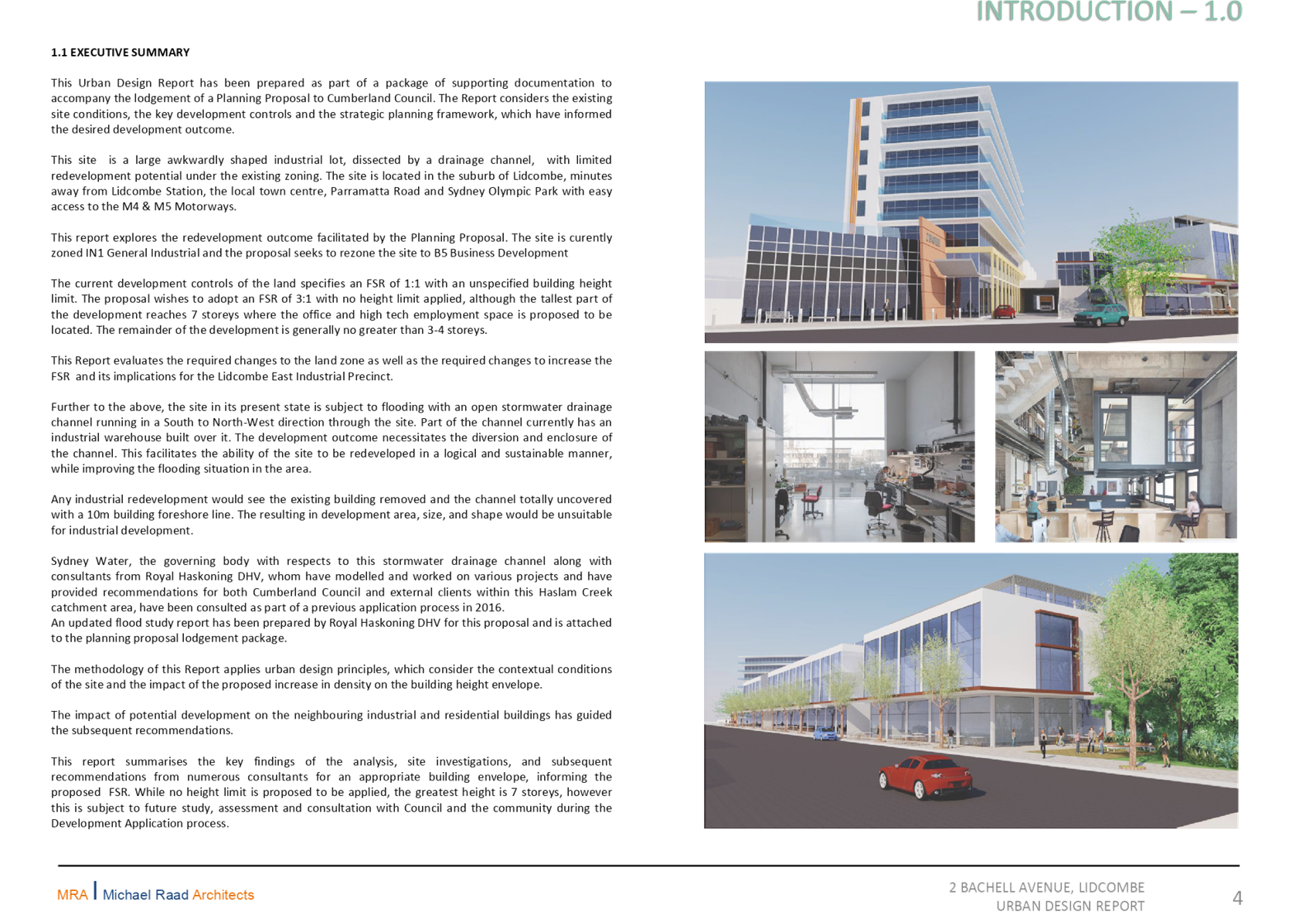
Summary
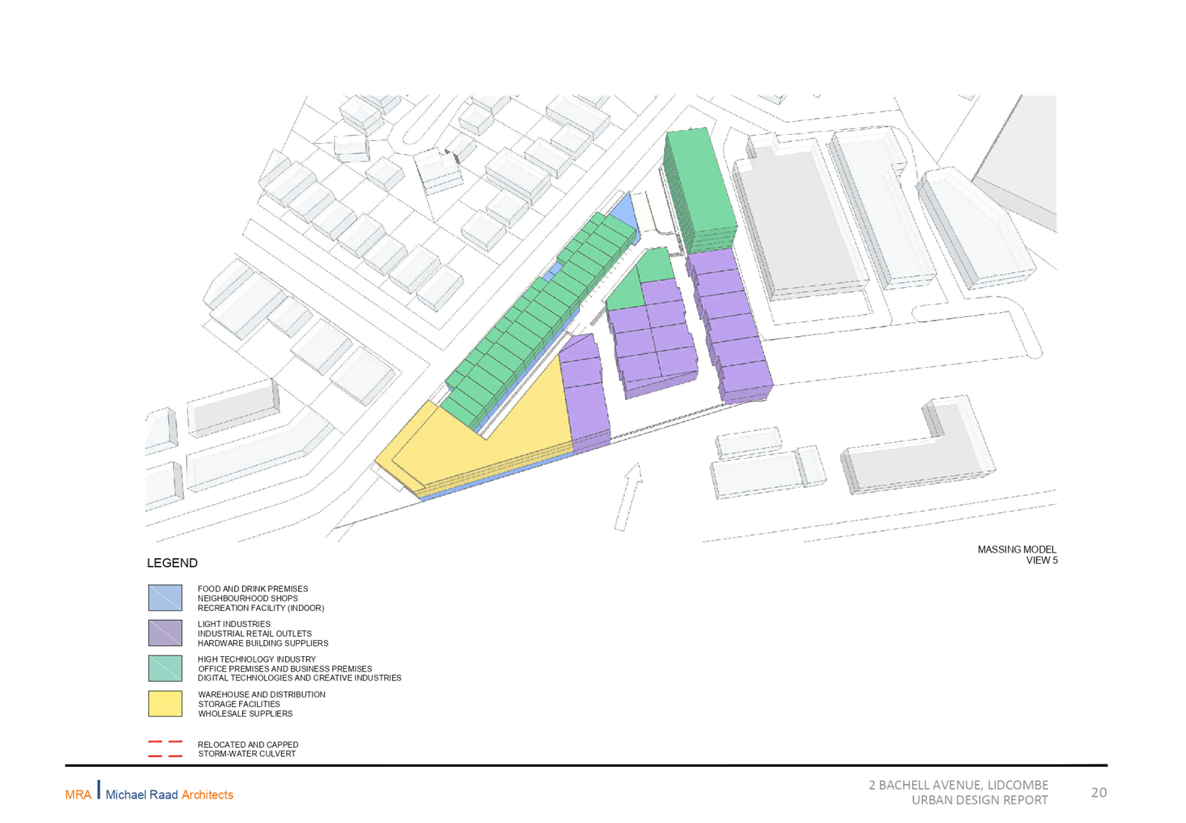
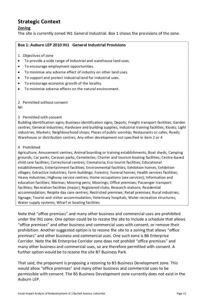
This planning proposal seeks to amend the planning controls at 2 Bachell Avenue, Lidcombe, as follows:
· rezone the site from IN1 General Industrial to B5 Business Development;
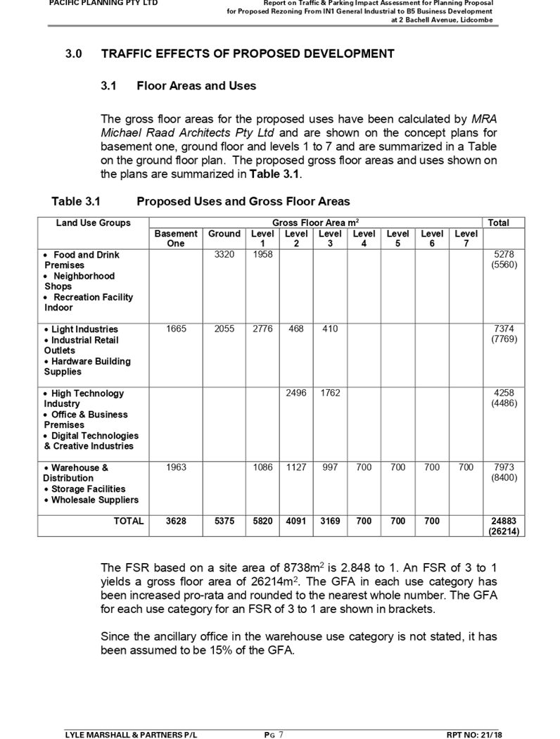
· amend the Floor Space Ratio control from 1:1 to 2.5:1;
· introduce a Height of Building control of 14m at the front of the site and 27 metres for a portion at the rear of the site; and
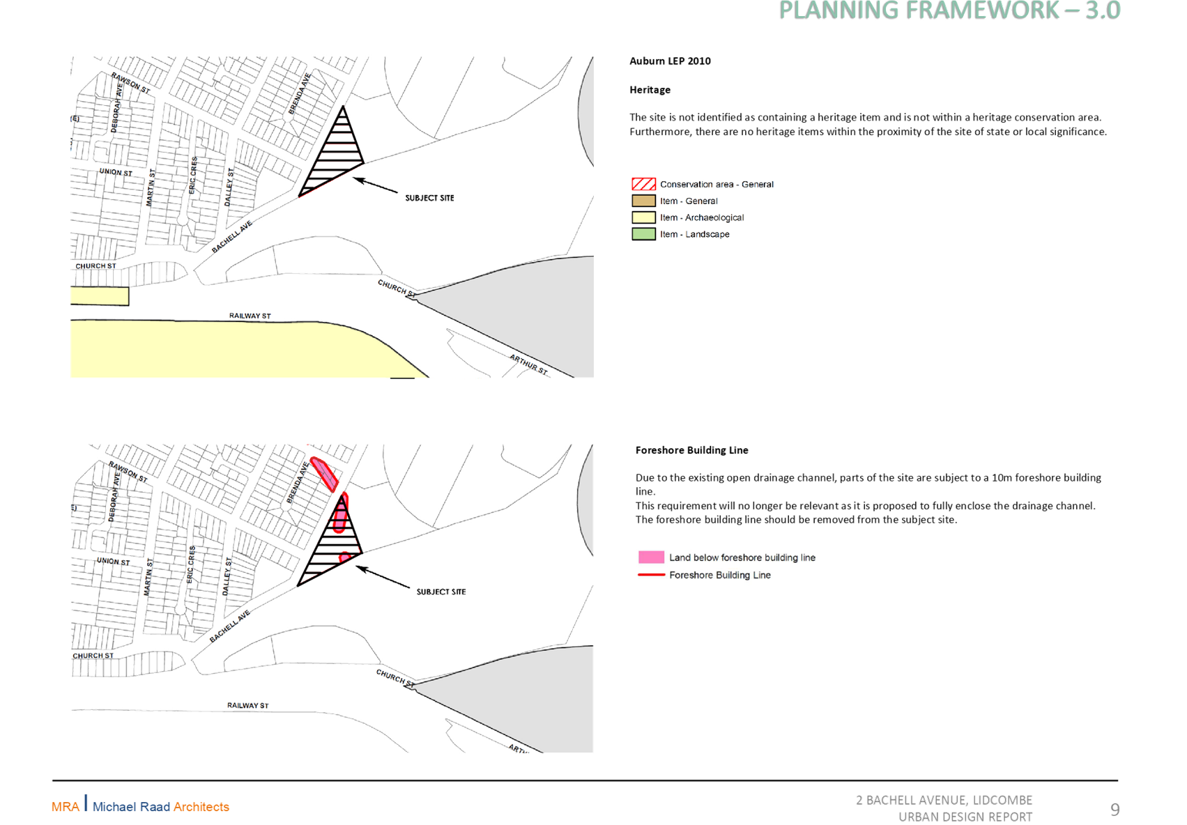
· remove the Foreshore Building Line that applies to this site.
This proposal has been placed on preliminary public exhibition (pre-Gateway), and was reported to the Cumberland Local Planning Panel in March 2019. The Panel provided specific advice relating to the Floor Space Ratio and Height of Building controls, and these have been included as part of the planning proposal.
It is recommended that the planning proposal be forwarded to the Department of Planning, Industry & Environment for a Gateway Determination.
|
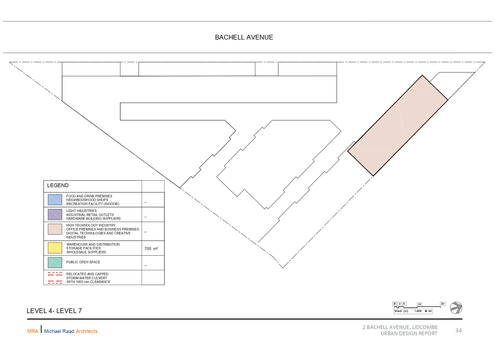
Recommendation That Council: 1. Prepare a planning proposal for 2 Bachell Avenue, Lidcombe, with the following land use and built form controls:
a. B5 Business Development Zone; b. Floor Space Ratio of 2.5:1; c. Height of Building controls of 14 metres at the front of the site and 27 metre for a portion at the rear of the site; and d. Removal of Foreshore Building Line that applies to the site.
2. Endorse that the planning proposal be forwarded to the Department of Planning, Industry & Environment for a Gateway Determination. |
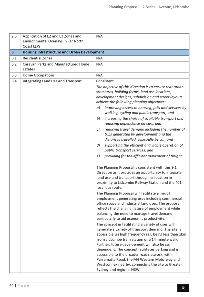
Report
Background
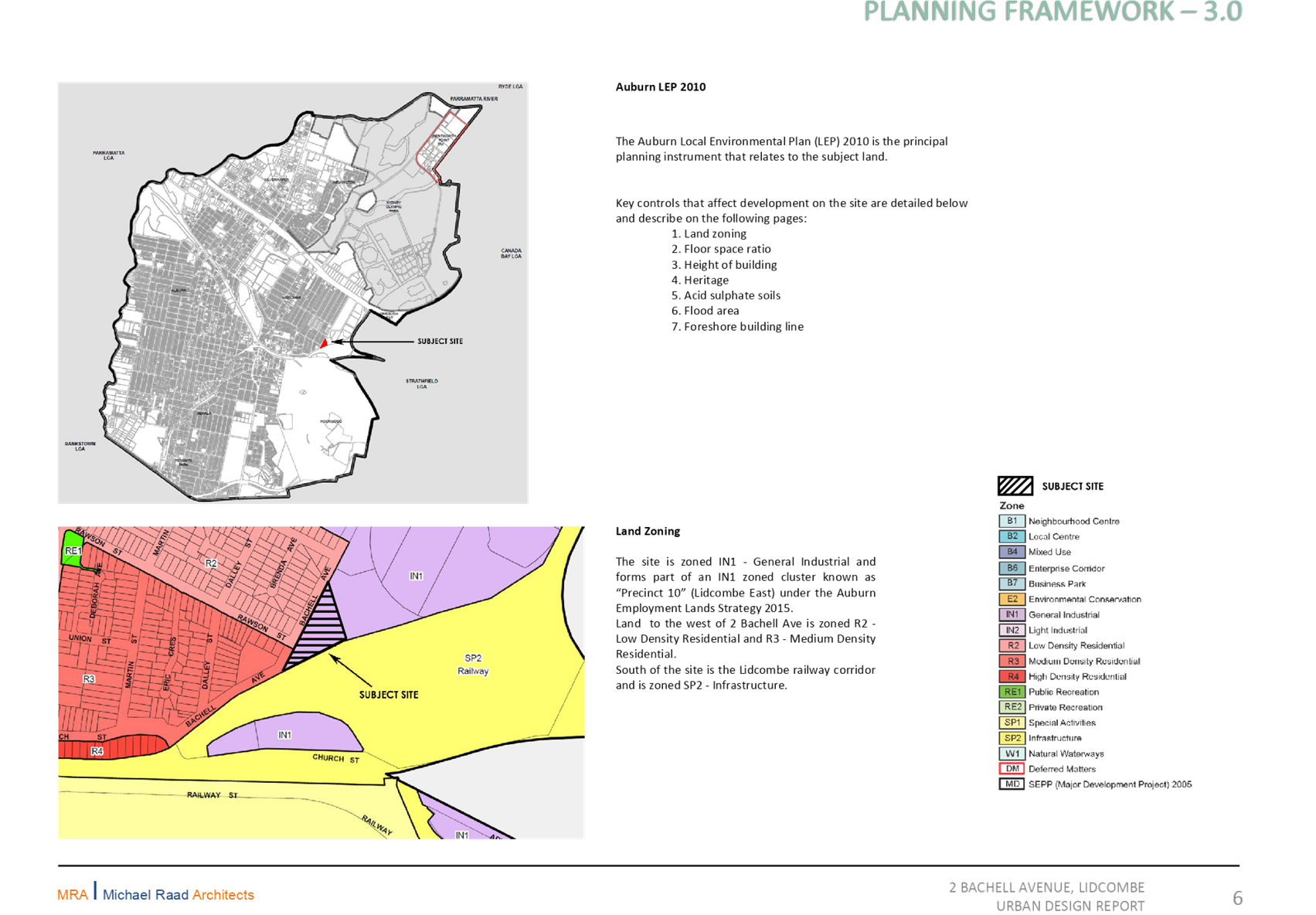
The proposal was submitted to Council on 30 October 2018, seeking to amend the zoning of the site at 2 Bachell Avenue, Lidcombe from IN1 General Industrial to B5 Business Development, and associated amendments.
The intended outcomes for this planning proposal are to:
· enable a mix of business and warehouse uses and specialised retail premises;
· support a transition of the site’s current industrial-only use of site to a mix of higher order employment land uses;
· provide a compatible land use and appropriate employment density for the site without threatening the economic viability of Lidcombe town centre; and
· enable the redevelopment of the site for a mix of higher order employment land uses and provide facilities or services to meet the day to day needs of workers in the area
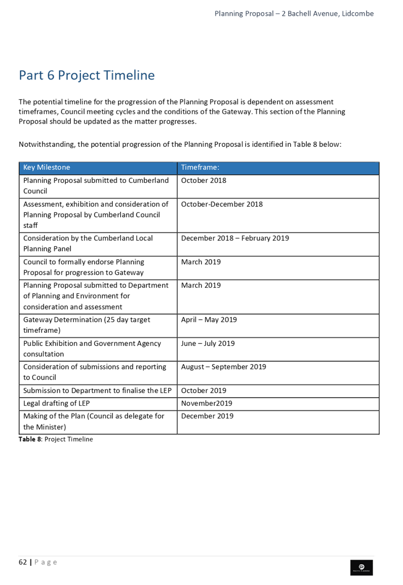
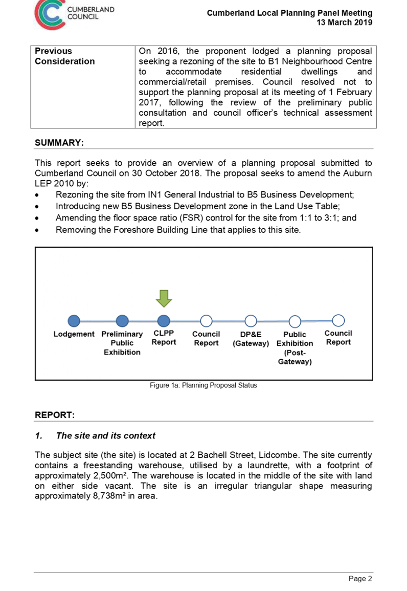
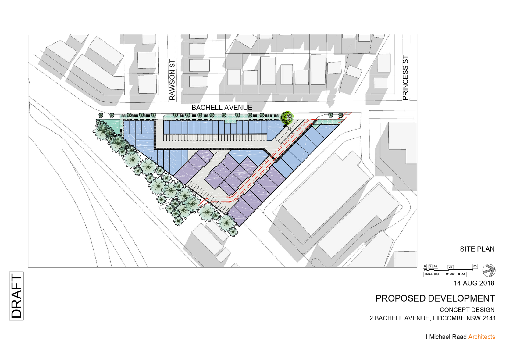
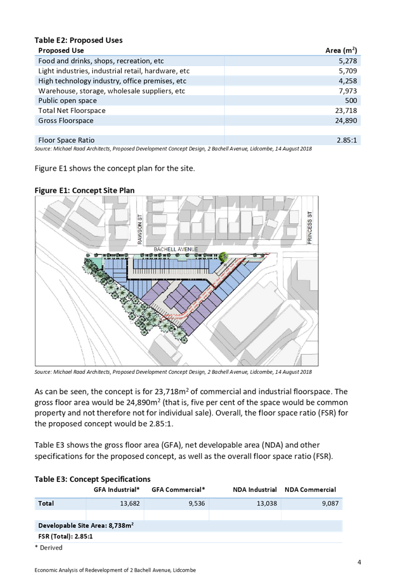
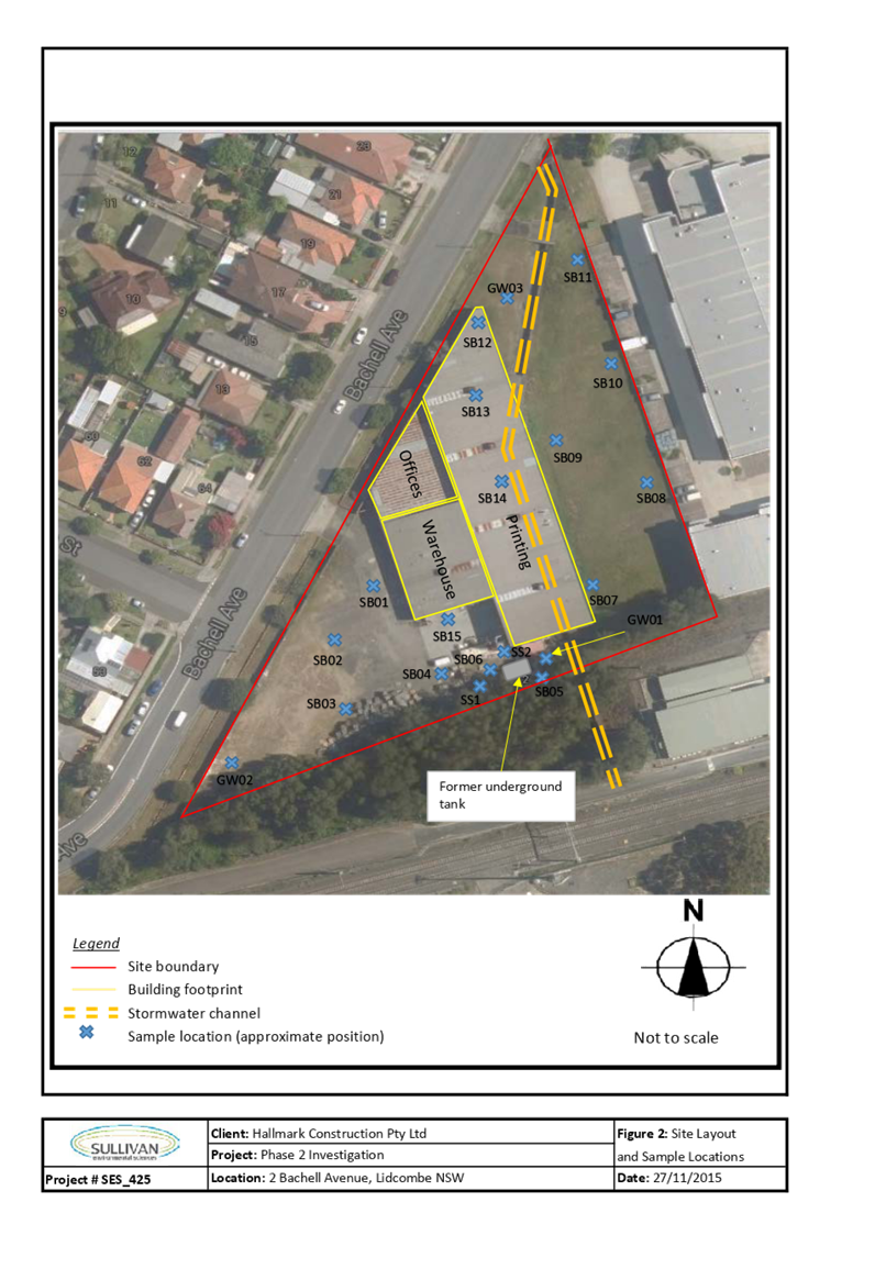
The status of the planning proposal is provided in Figure 1.
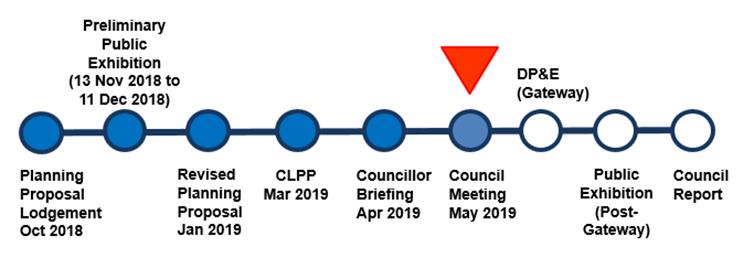
Figure 1: Planning proposal Status
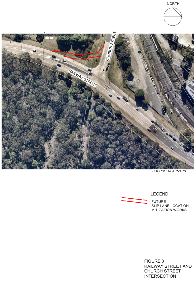
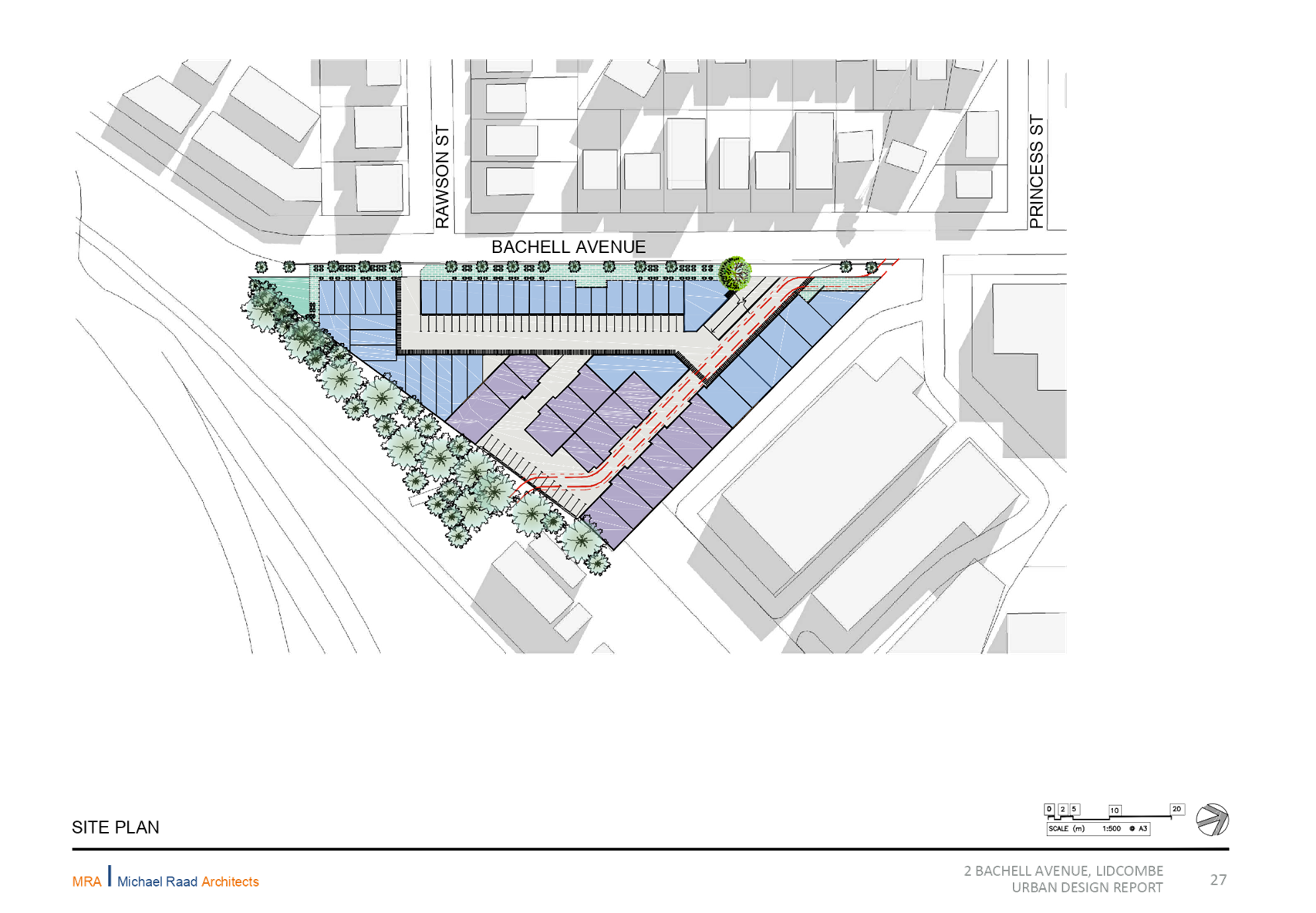
Site Context
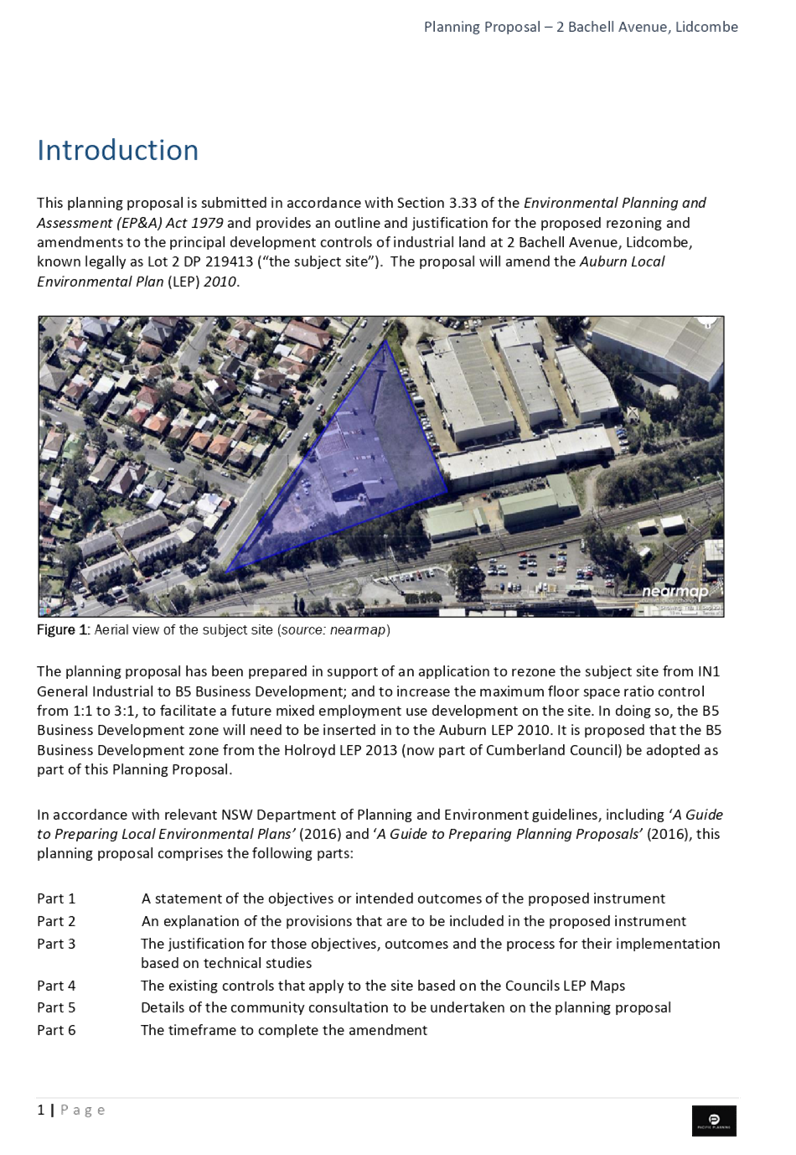
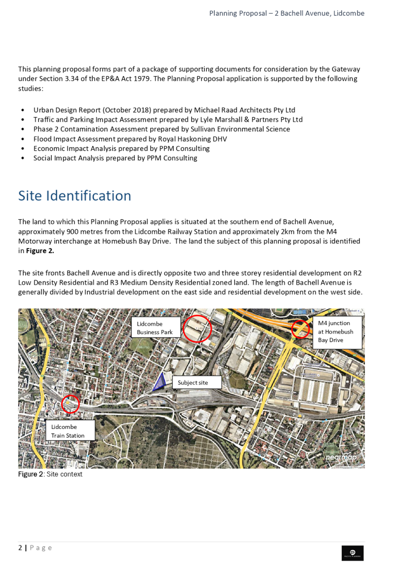
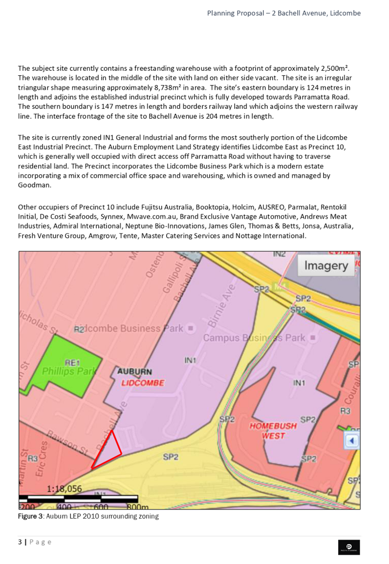
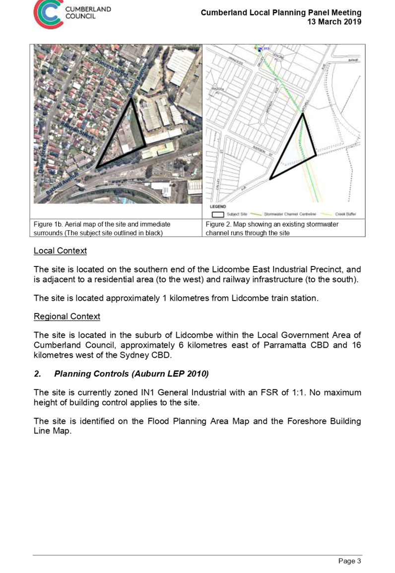
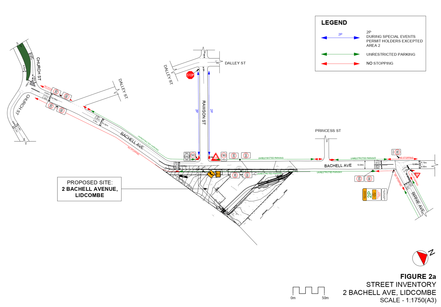
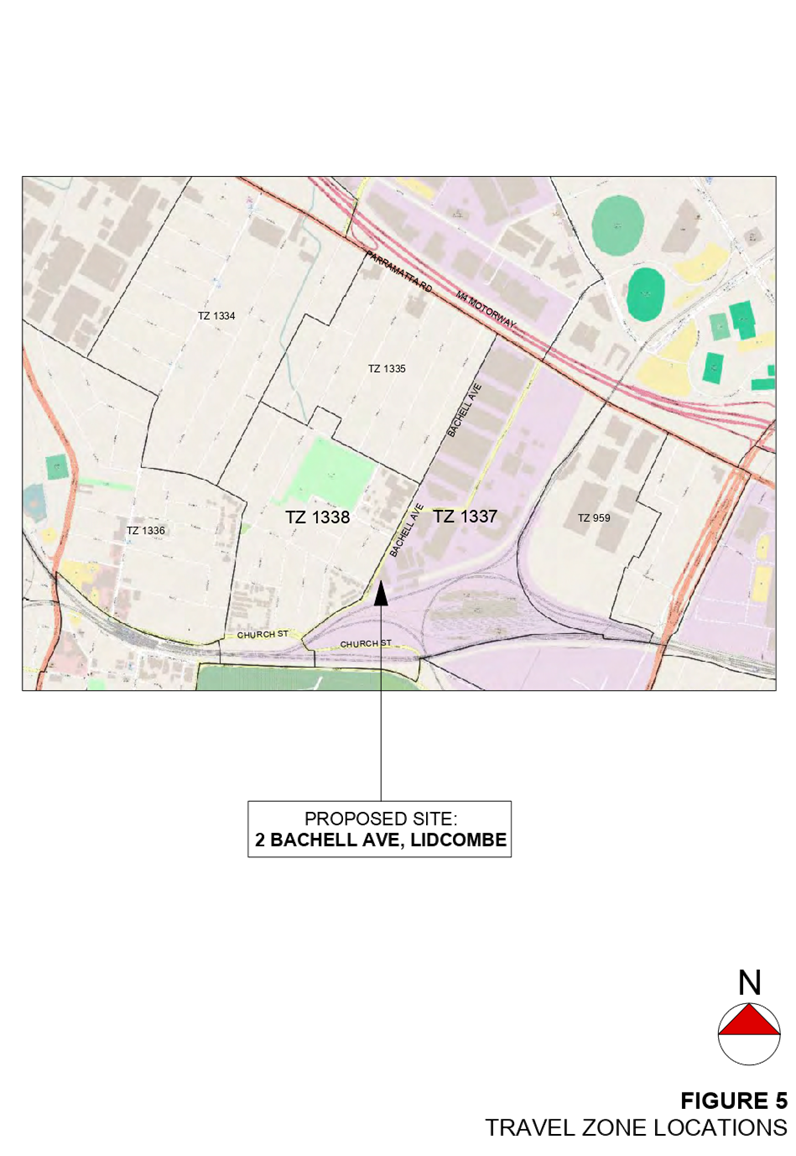
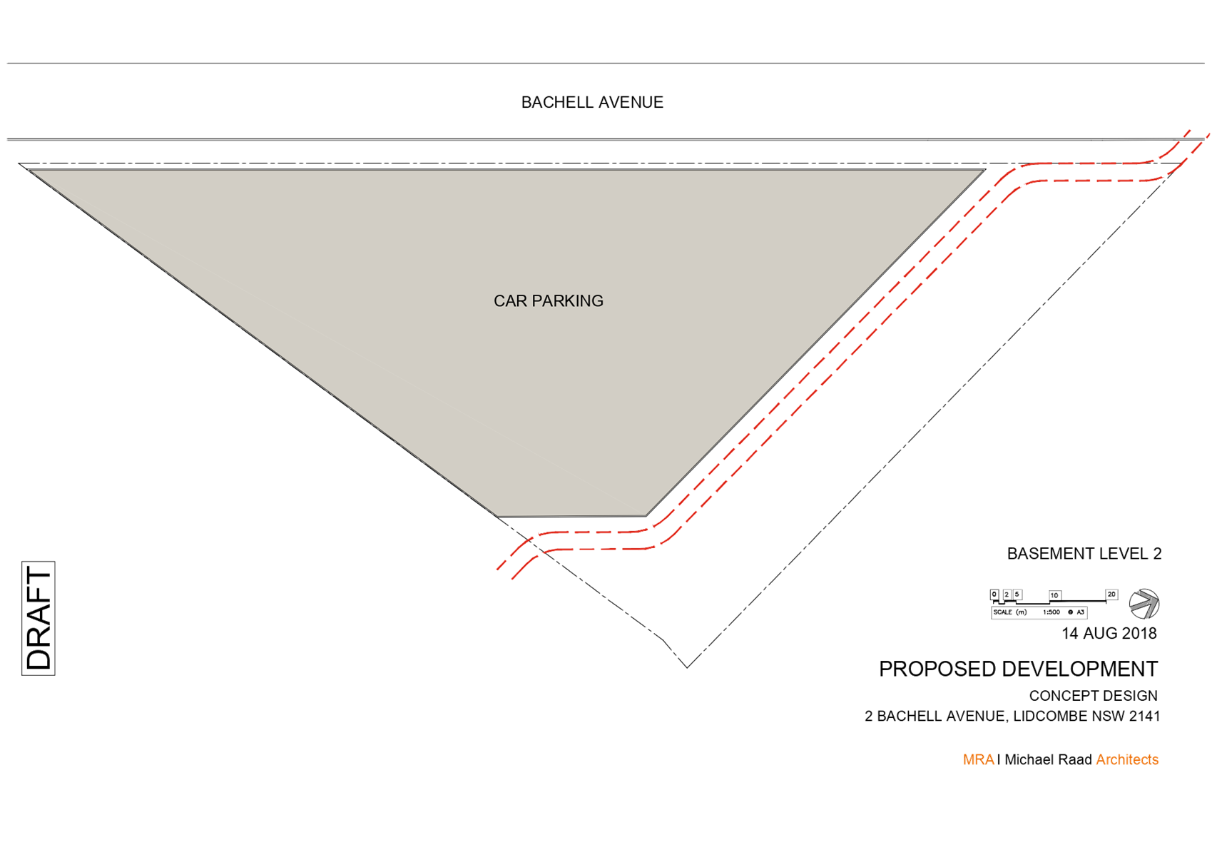
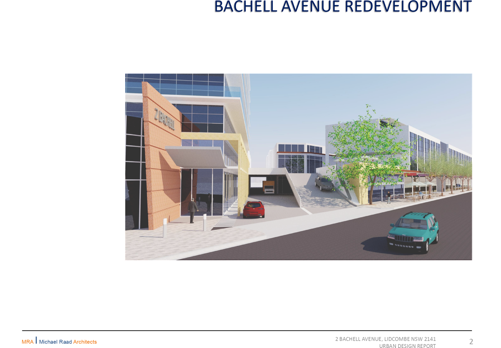
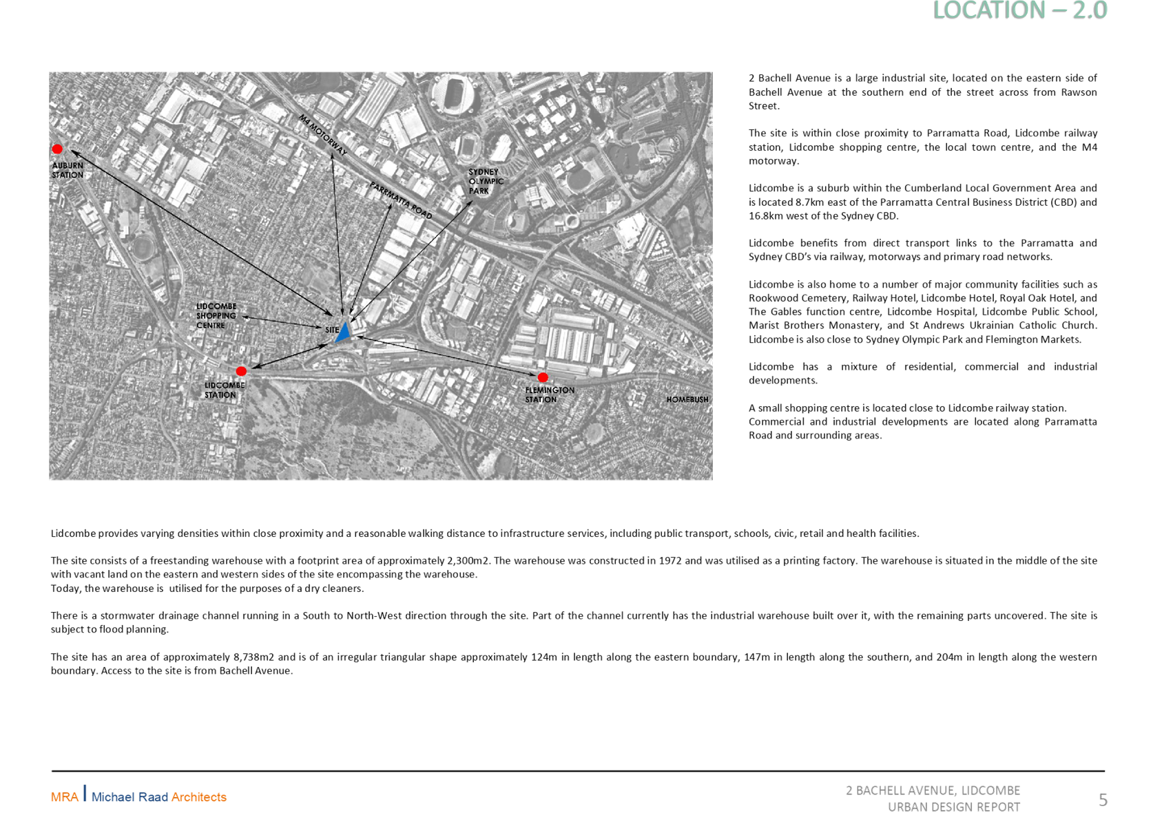
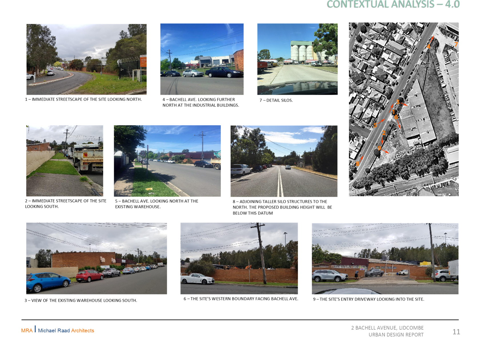
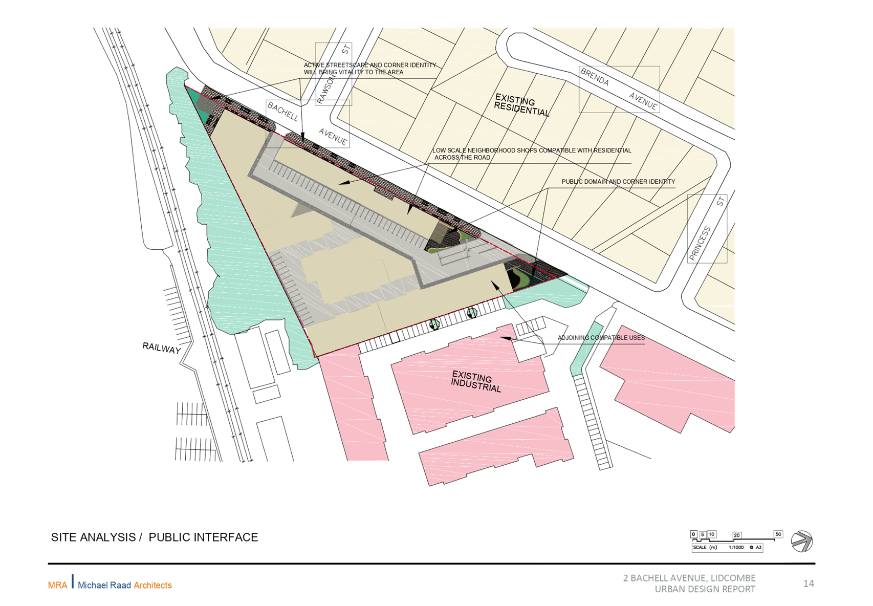
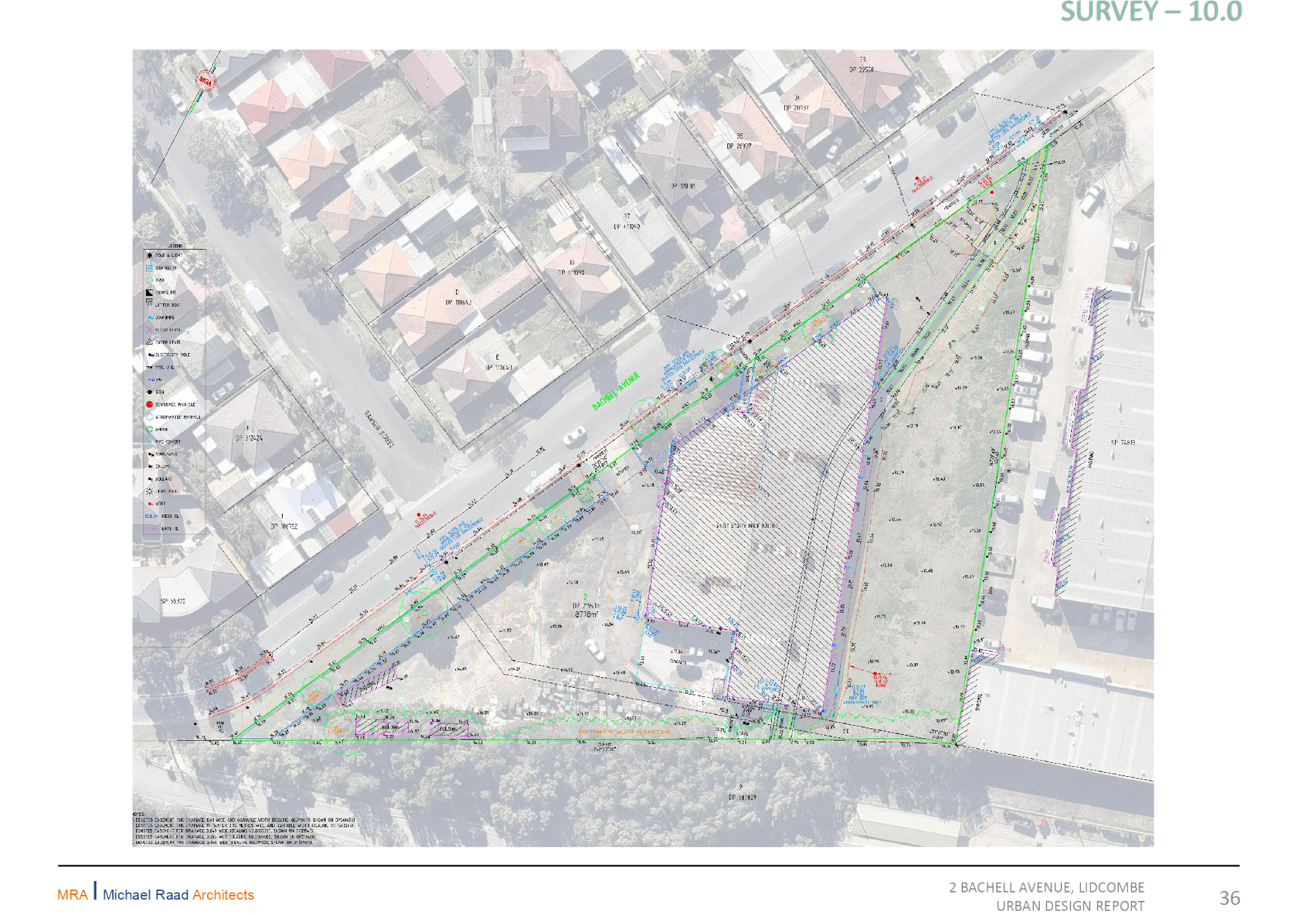
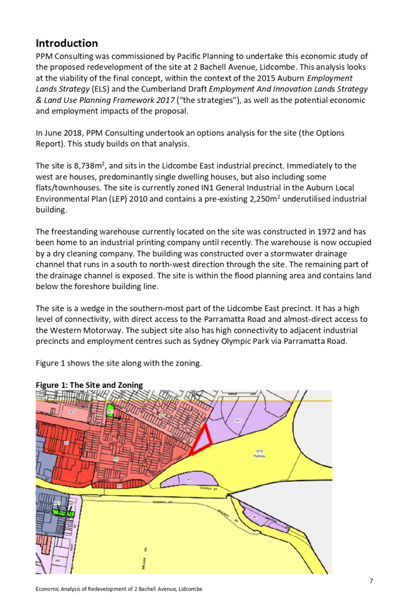
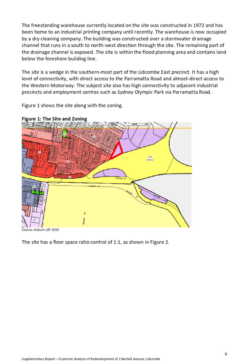
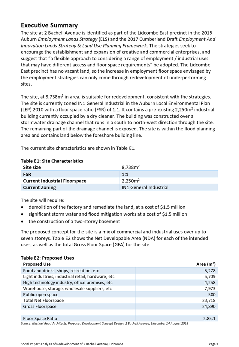
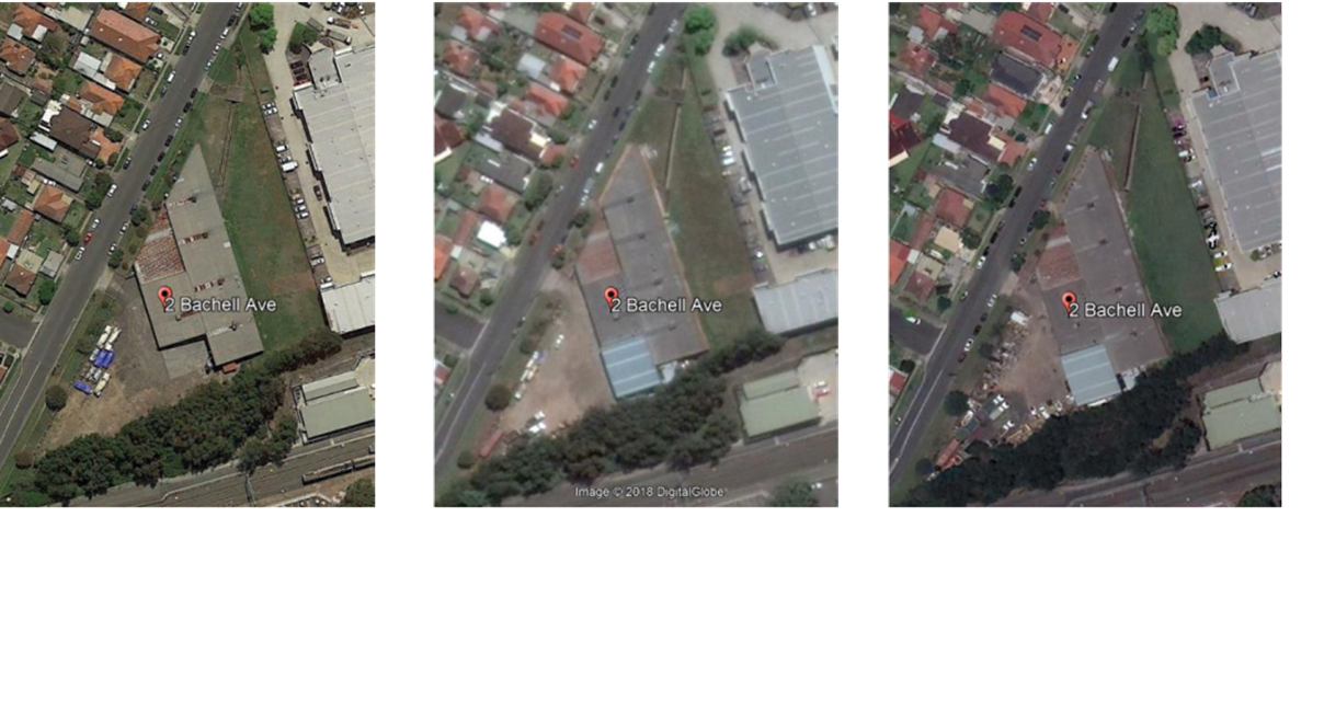
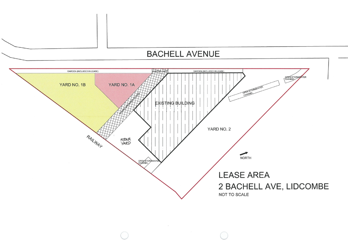
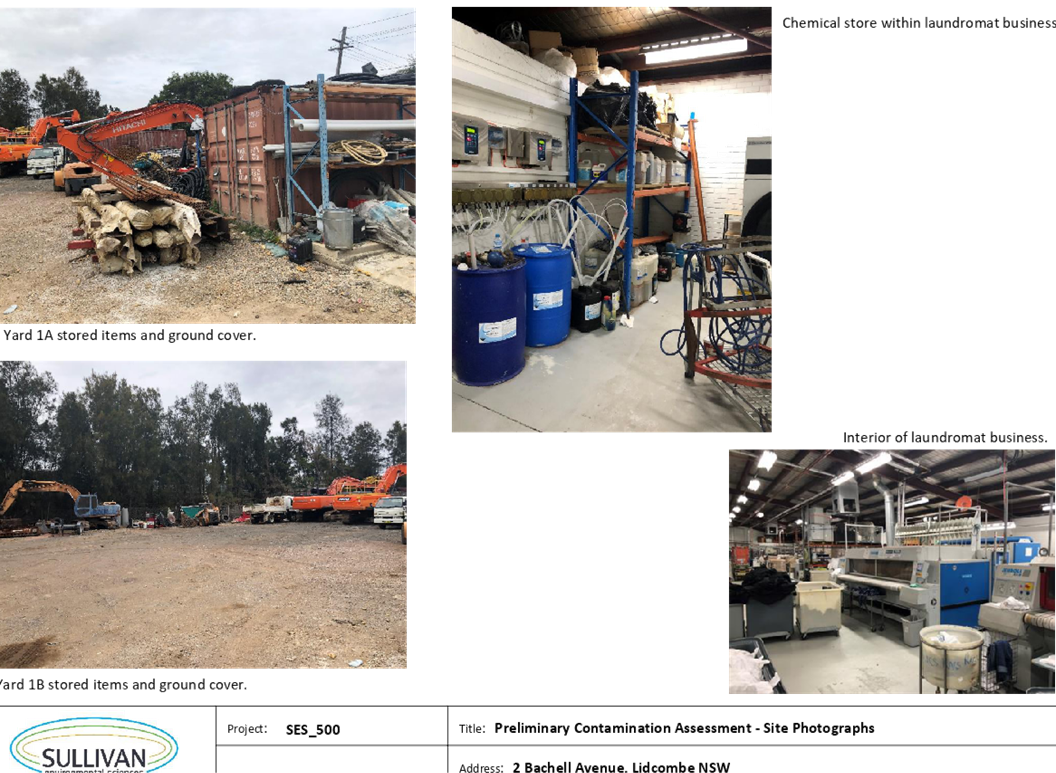
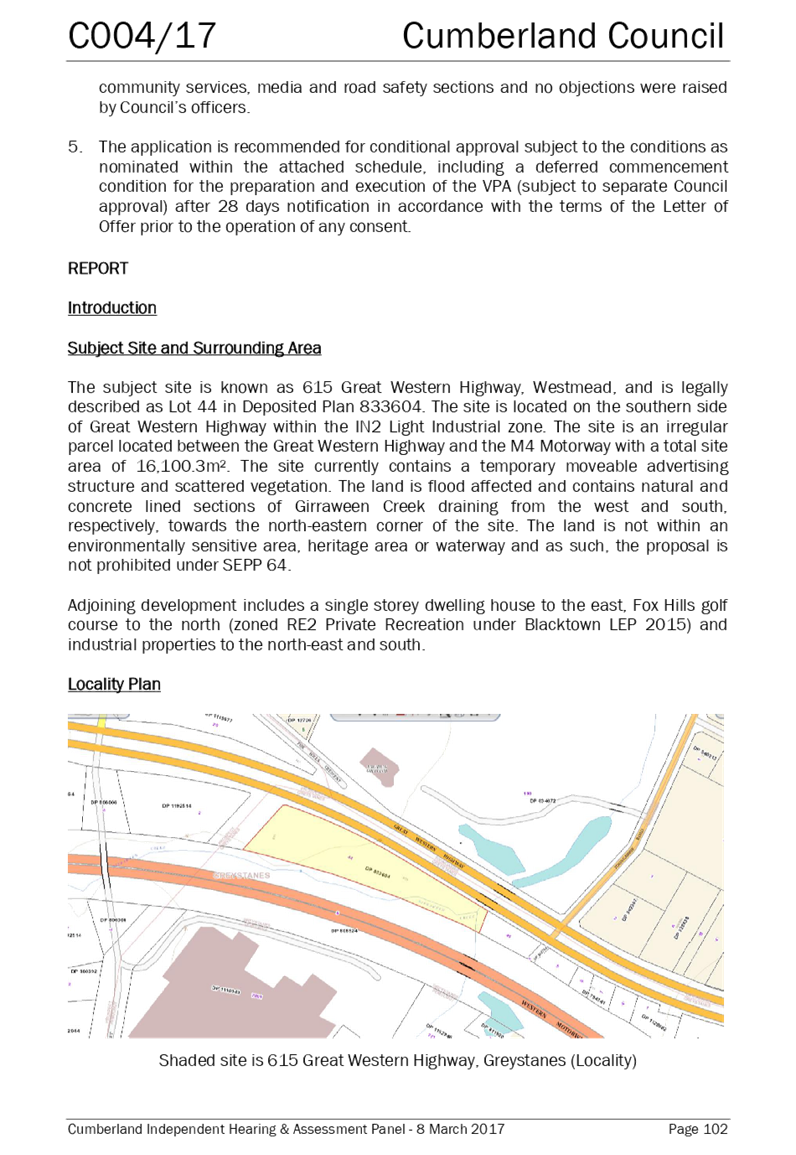
The subject site is located at 2 Bachell Street, Lidcombe (Figure 2). It currently contains a freestanding warehouse with a footprint of approximately 2,500m², currently occupied by a laundrette. The warehouse is located in the middle of the site with land on either side vacant. The site is an irregular triangular shape measuring approximately 8,738m² in area.
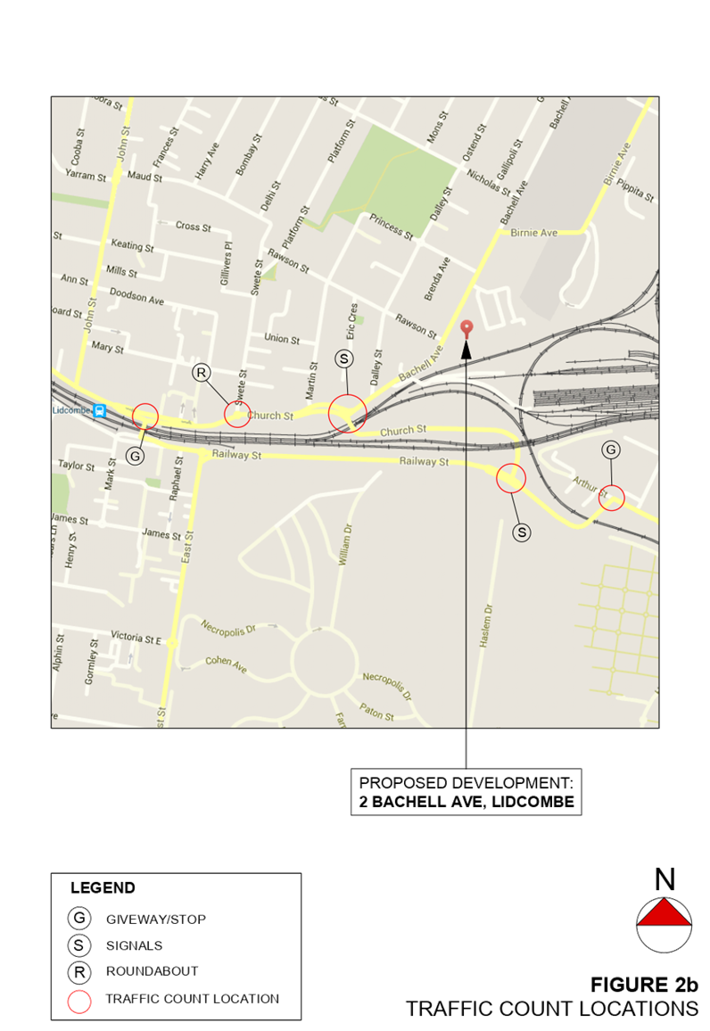
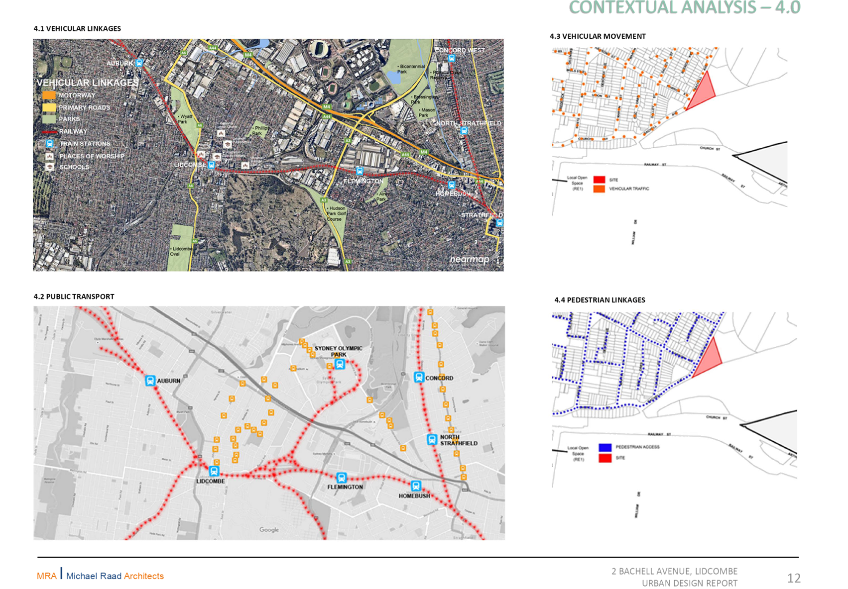
The site is located on the southern end of the Lidcombe East Industrial Precinct, and is adjacent to a residential area (to the west) and railway infrastructure (to the south). The site is located approximately one kilometre from Lidcombe train station.
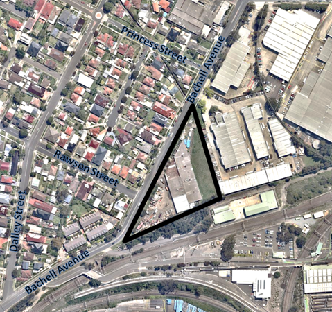
Figure 2: The site
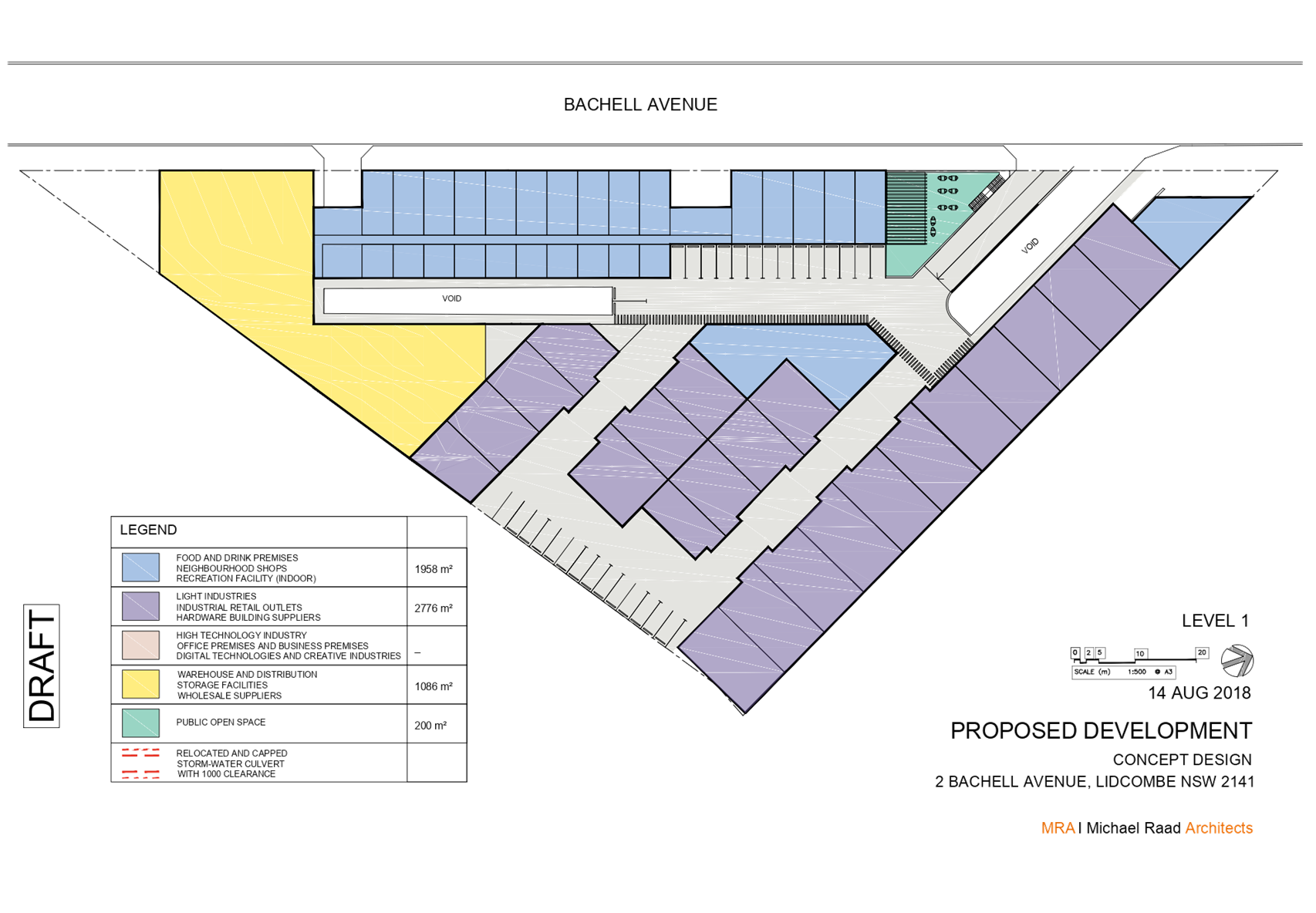
Planning Proposal
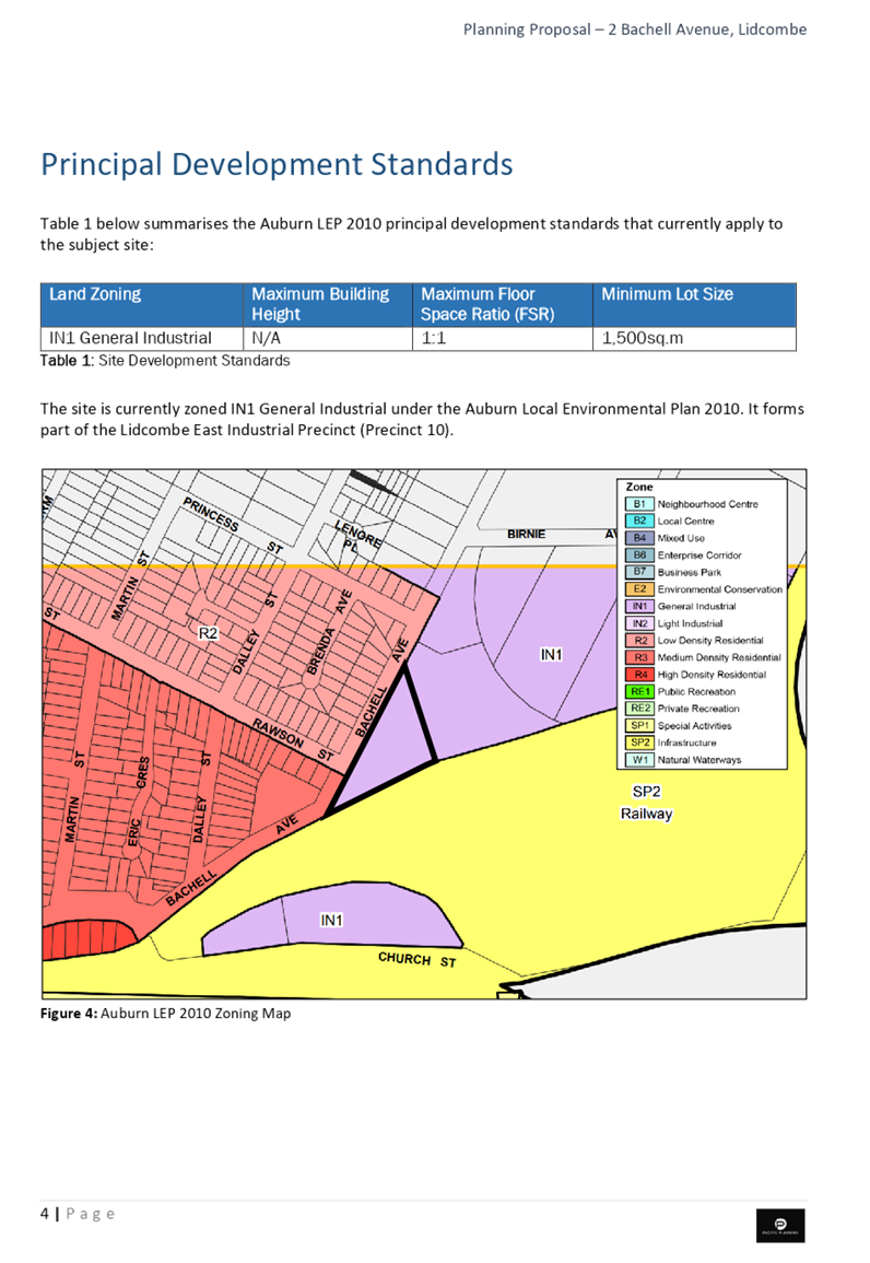
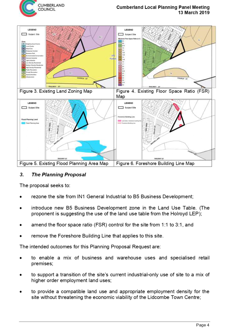
The planning proposal originally submitted sought to amend Auburn Local Environmental Plan 2010 by:
· rezoning the site from IN1 General Industrial to B5 Business Development;
· introducing the B5 Business Development zone into the Land Use Table;
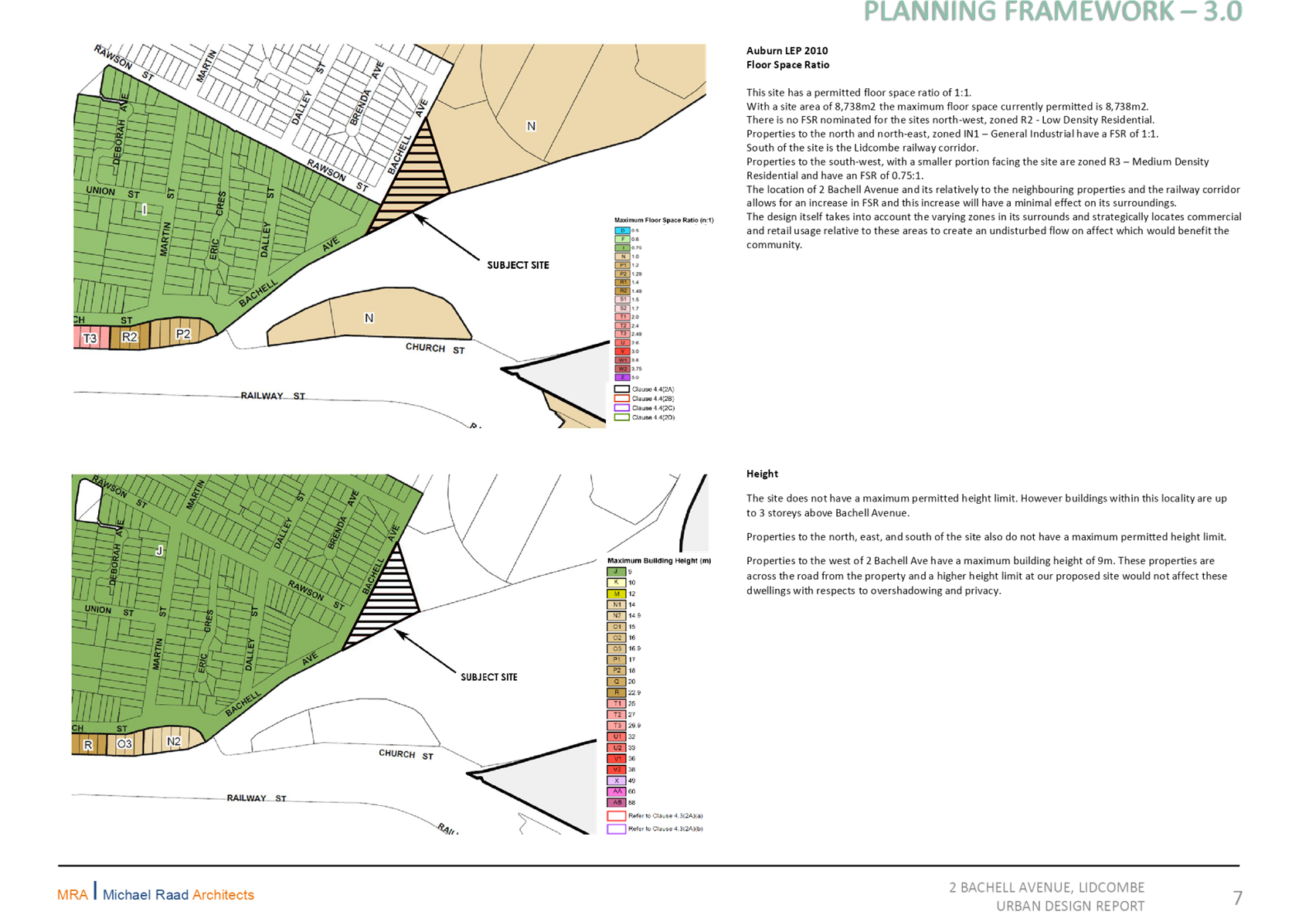
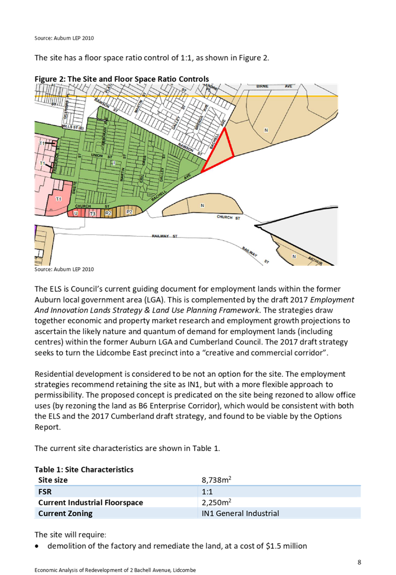
· amending the Floor Space Ratio control for the site from 1:1 to 3:1; and
· removing the Foreshore Building Line that applies to this site.
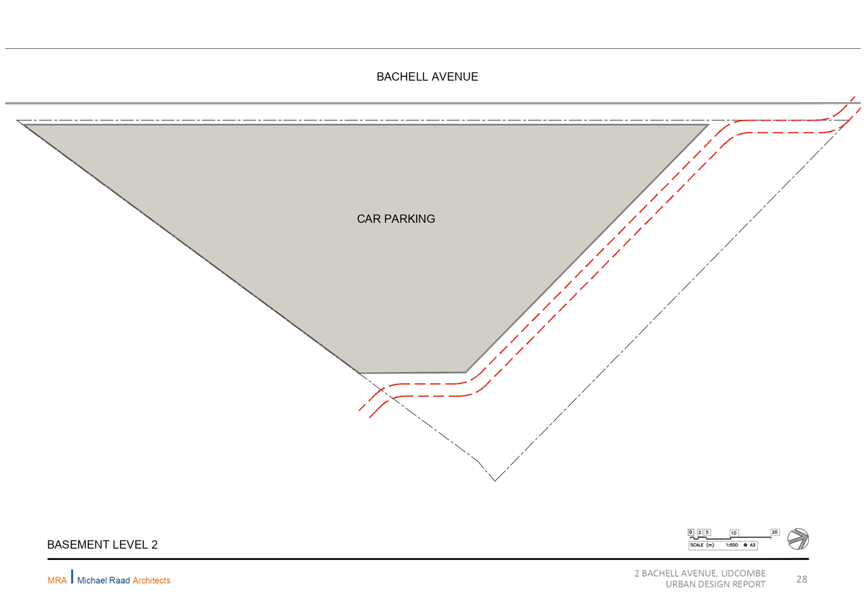
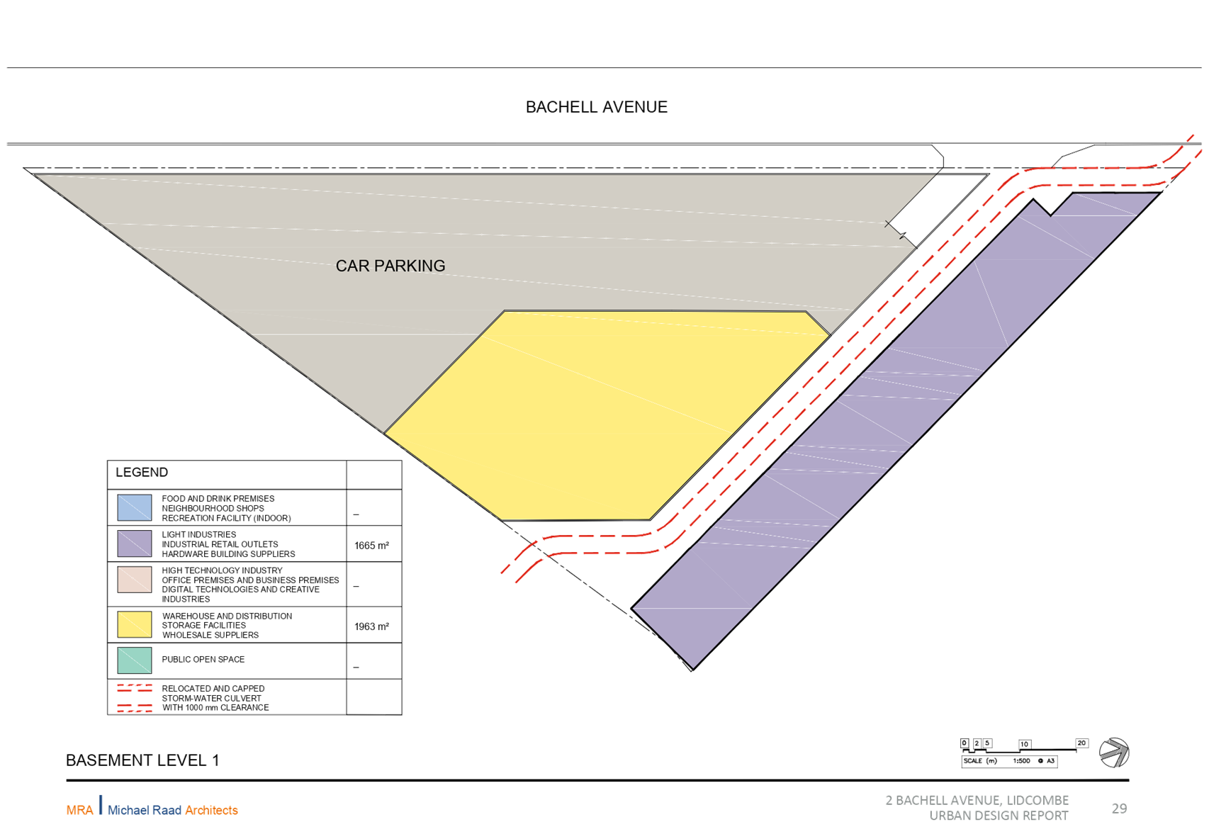
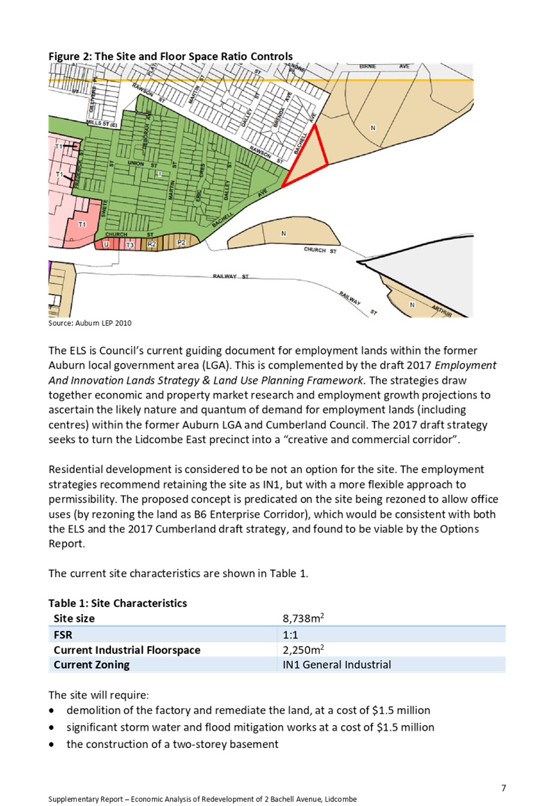
Information on the current and proposed planning controls are provided in Figures 3 to 9.
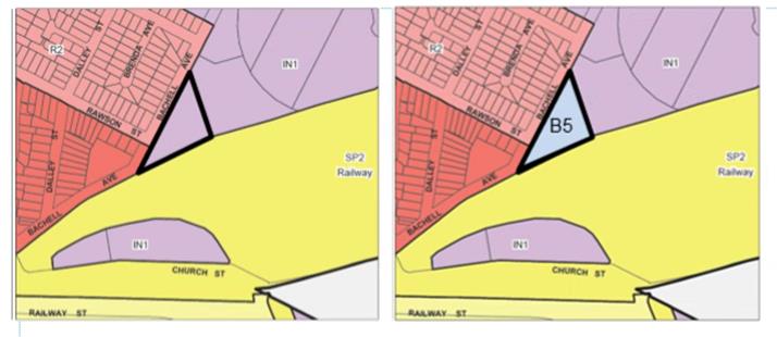
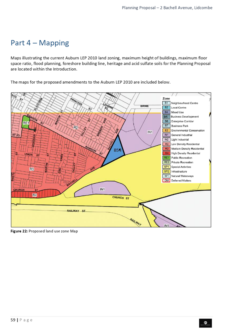
Figure 3: Existing Zoning (IN1) Figure 4: Proposed zoning (B5)
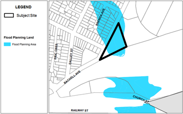
Figure 5: Existing Flood Planning Area Figure 6: Foreshore Building Line
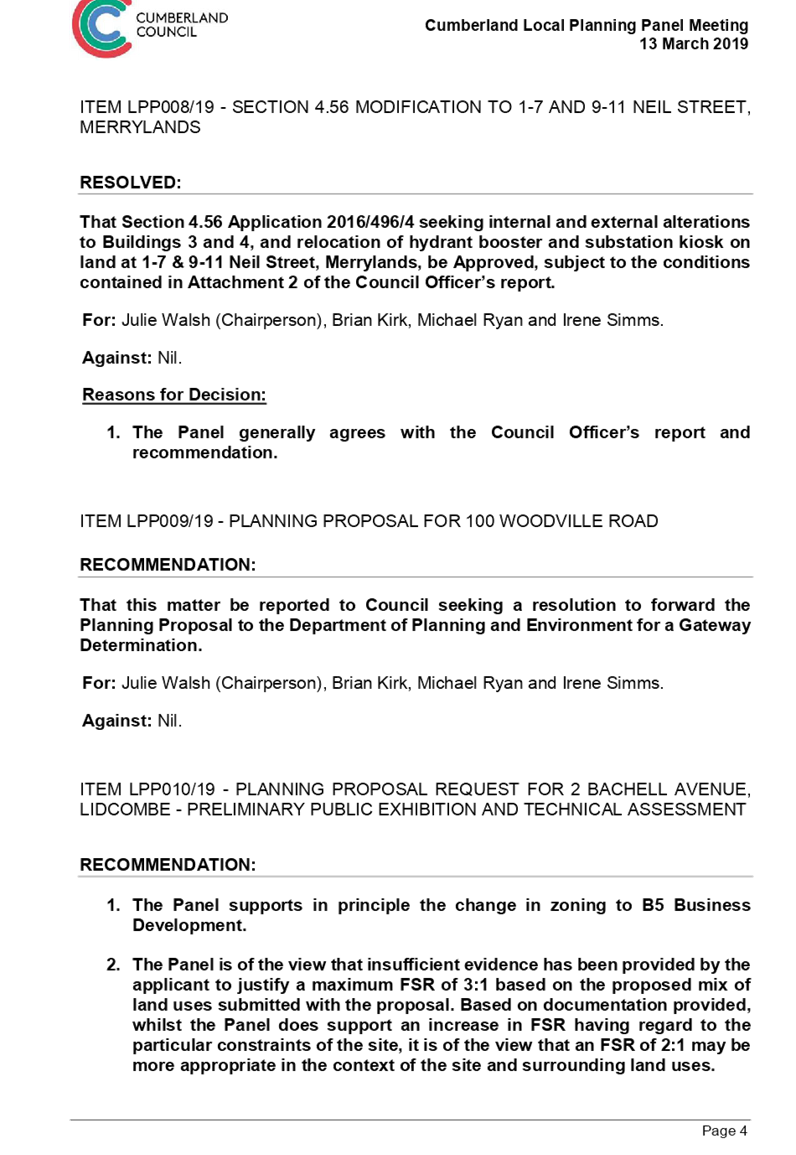
The planning proposal was reported to the Cumberland Local Planning Panel in March 2019. The Panel:
· supported the change in zoning to B5 Business Development;
· was of the view that insufficient evidence has been provided by the applicant to justify a maximum FSR of 3:1 based on the proposed mix of land uses submitted with the proposal. However, the Panel supported an increase in FSR and was of the view that an FSR of 2:1 may be more appropriate in the context of the site and surrounding land uses;
· recommended consideration should be given to including height controls over the subject site; and
· recommended, having regard to the above, the planning proposal proceed to the next stage of assessment and be reported to Council seeking a resolution to forward an amended planning proposal for a Gateway Determination.
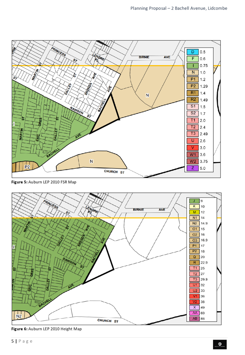
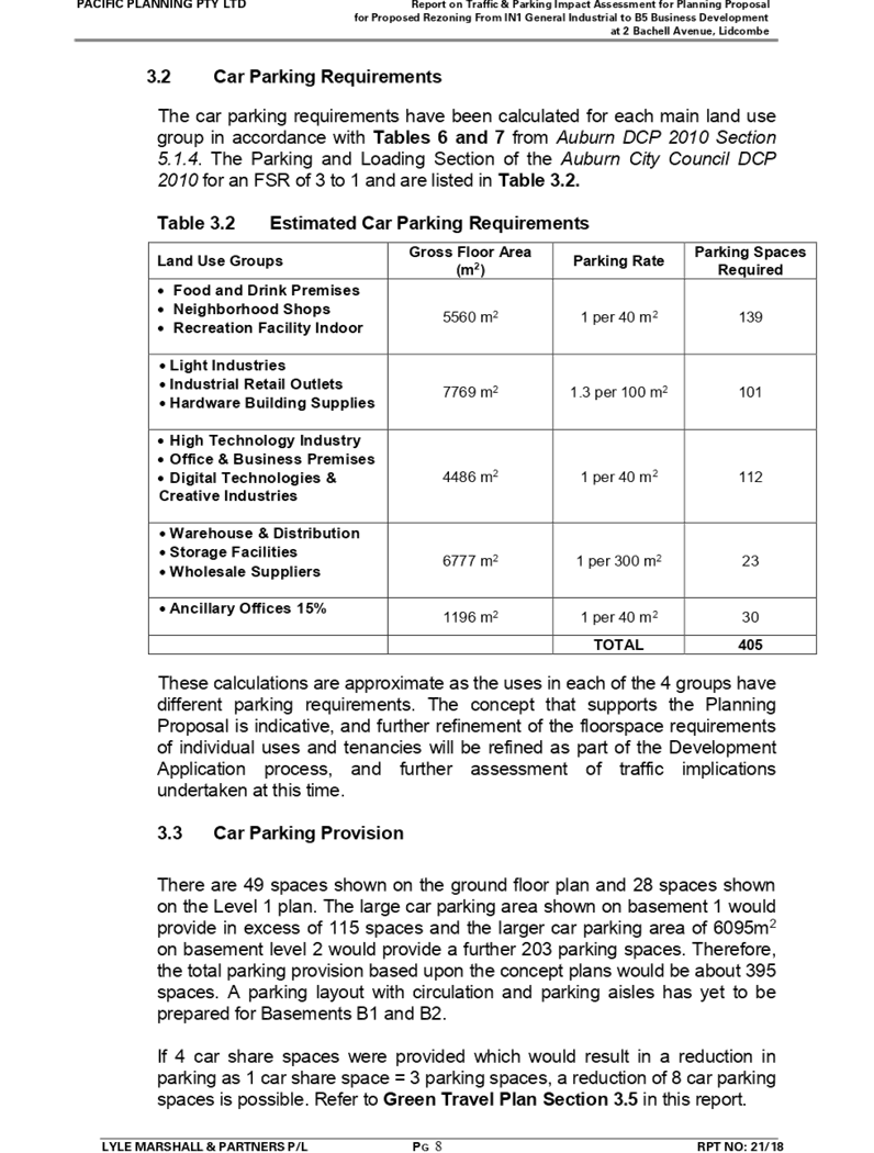
In response to the Panel’s advice, further analysis has been undertaken by Council officers on the Floor Space Ratio, and a ratio of 2.5:1 is recommended as the control for this site, as:
· the proponent’s economic report indicated that a Floor Space Ratio of 2:1 would be “somewhat viable”, while a Floor Space Ratio of 2.5:1 or greater was identified as viable;
· applying a Floor Space Ratio of 2:1 to the site may make redeveloping the site unattractive as additional Floor Space Ratio is required to facilitate the works that are required to realign the drainage culvert; and
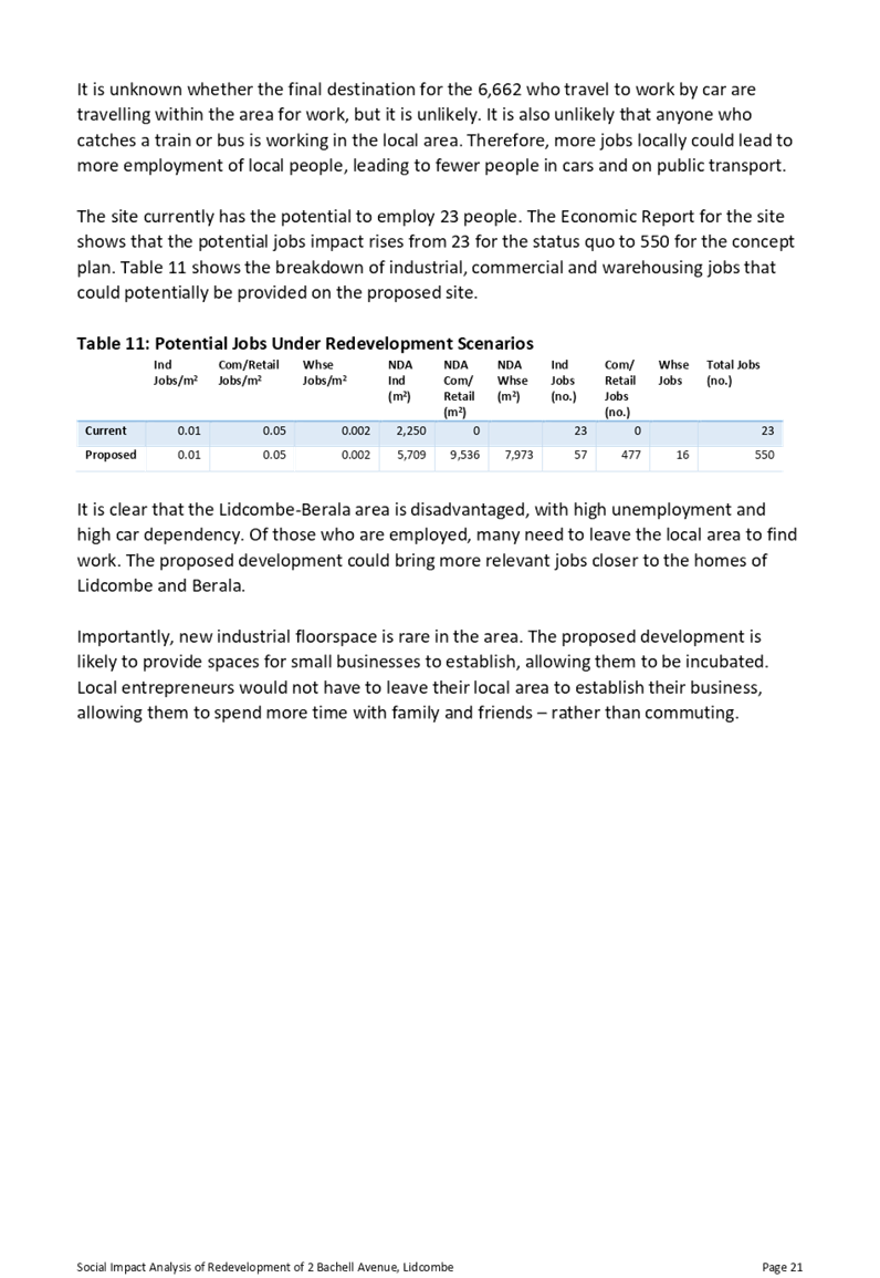
· a Floor Space Ratio of 2:1 has the potential to reduce the employment yield on the site, and it is unlikely that the site would be redeveloped to the scale that would yield the quantum of jobs identified (up to 550 jobs).
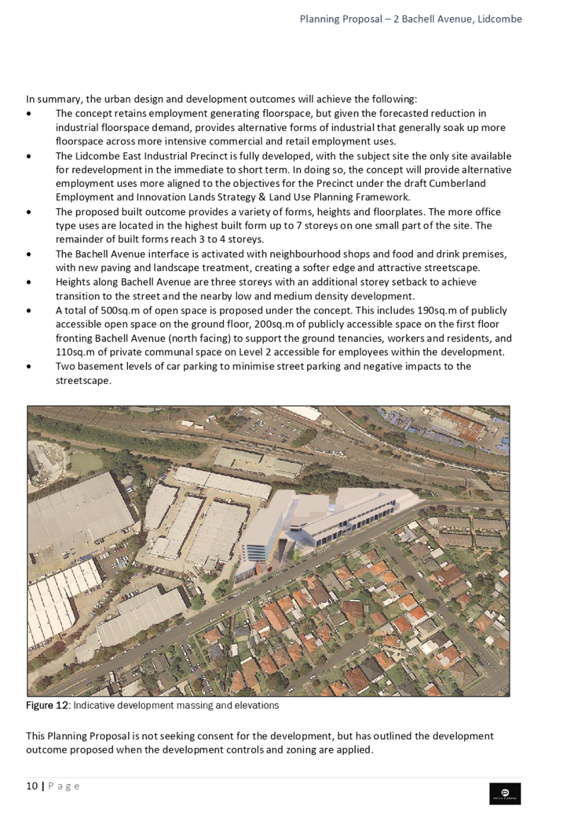
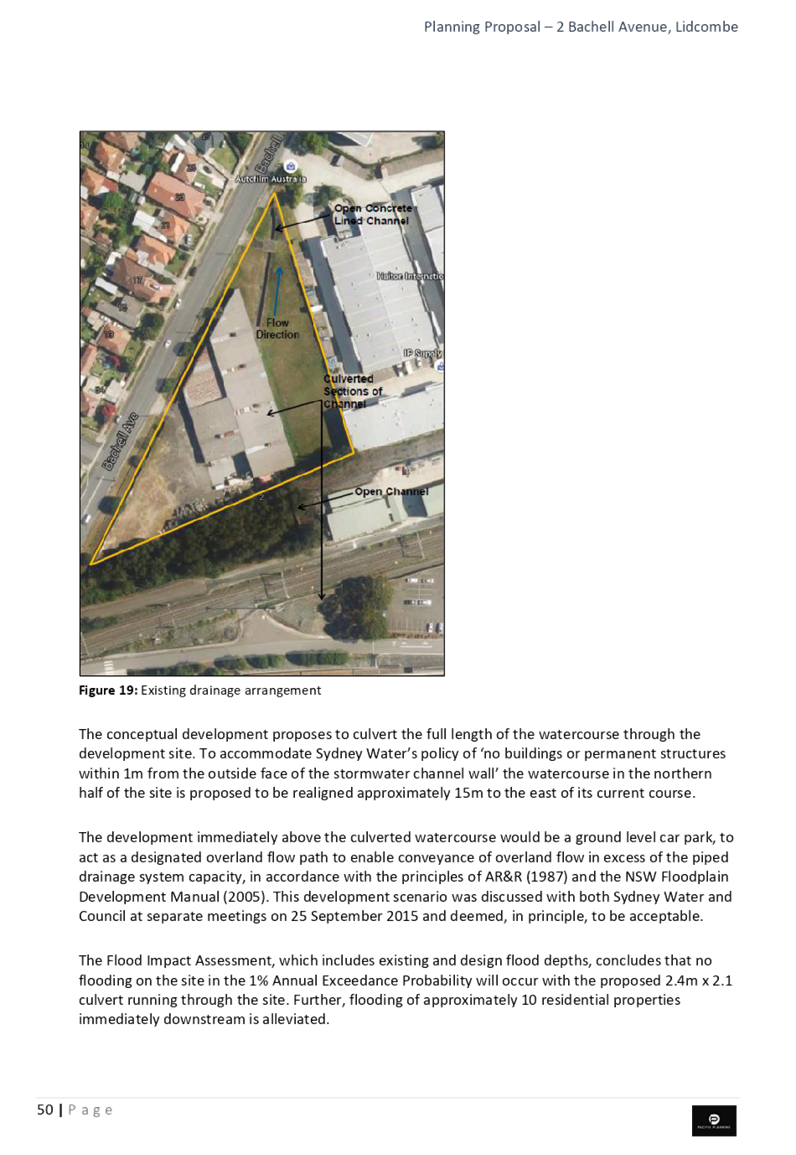
Council officers have also considered Height of Building controls in response to the Panel’s advice and are proposing a variable height control to reflect the indicative concept for the site. This includes a Height of Building control of 14 metres to the front of the site and 27 metres to the rear of the site, as shown in Figure 9.
The other aspects of the planning proposal remain unchanged.
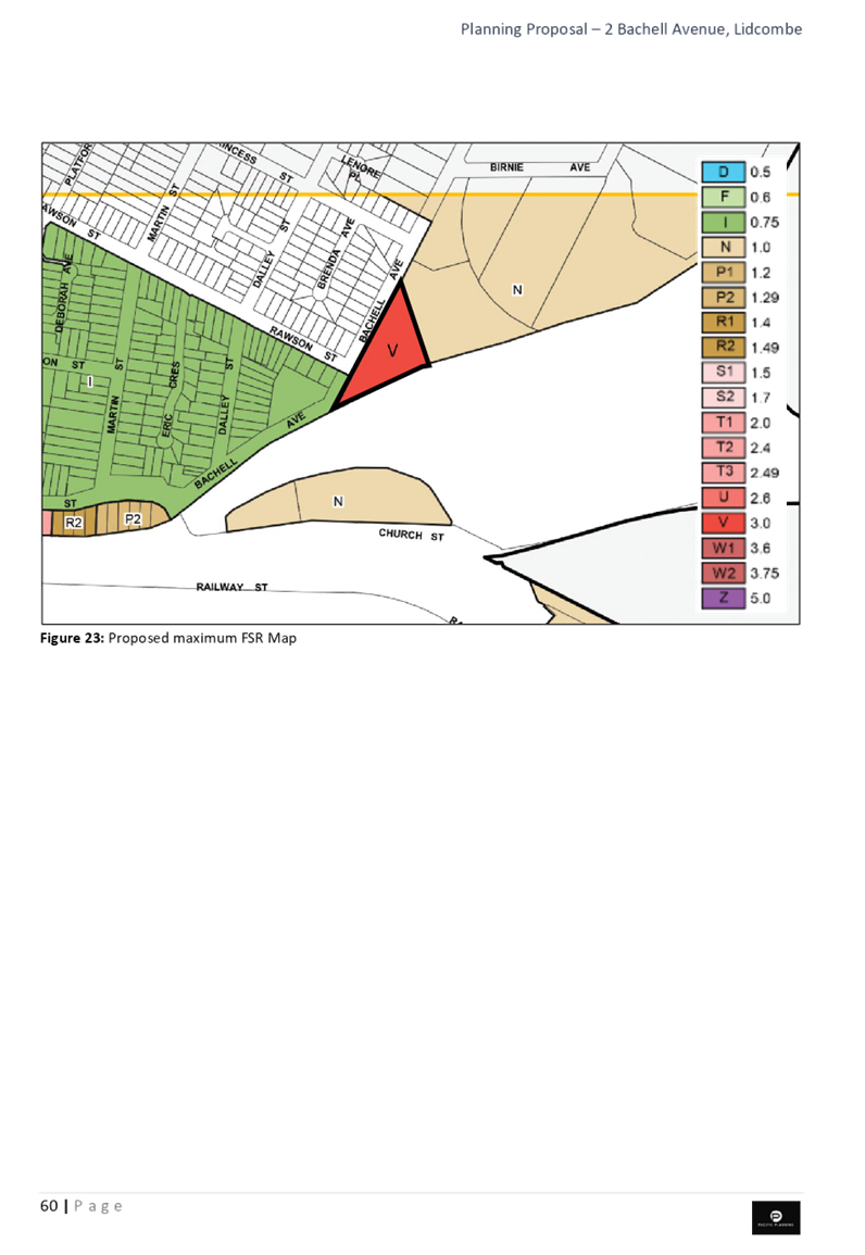
Figure 7: Existing FSR (1:1) Figure 8: Recommended FSR (2.5:1)
![]()
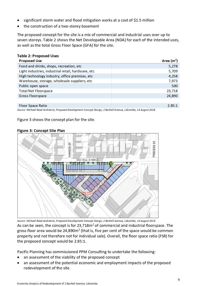
Figure 9: Existing maximum Figure 10: Recommended maximum
Height control (no control) Height Control (N1=14m; T2=27m)
Strategic Merit Assessment
State Planning Policy Framework
There is strategic merit in progressing this planning proposal to a Gateway Determination as it is consistent the directions and planning priorities in the Greater Sydney Region Plan and the Central City District Plan.
Local Planning Policy Framework
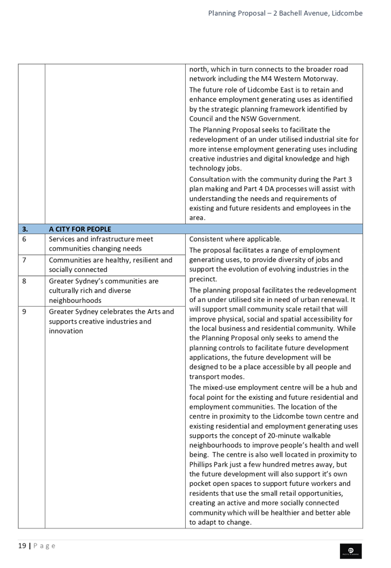
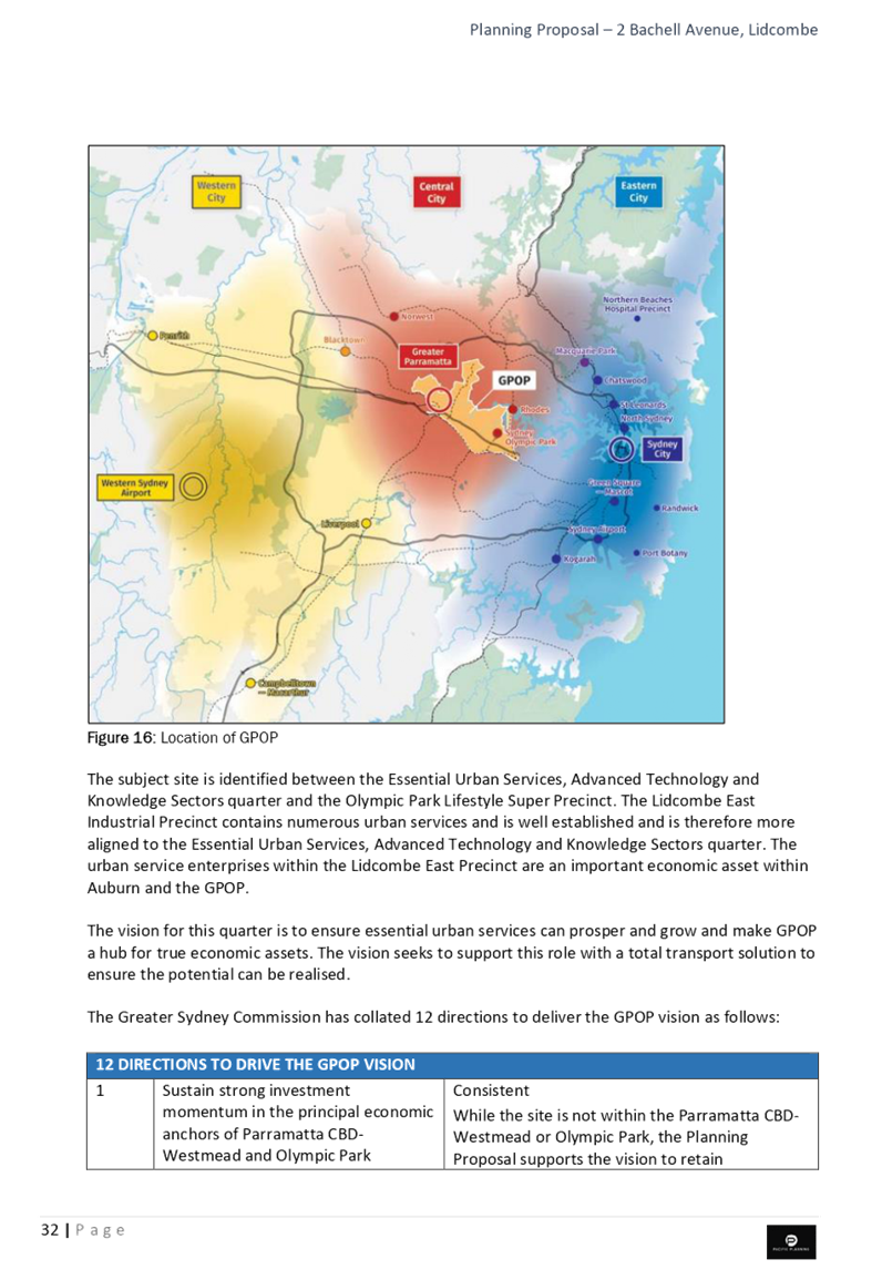
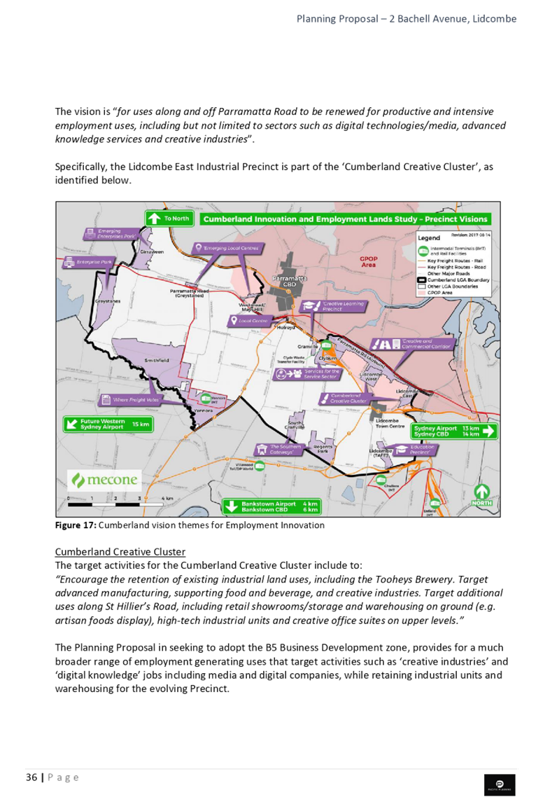
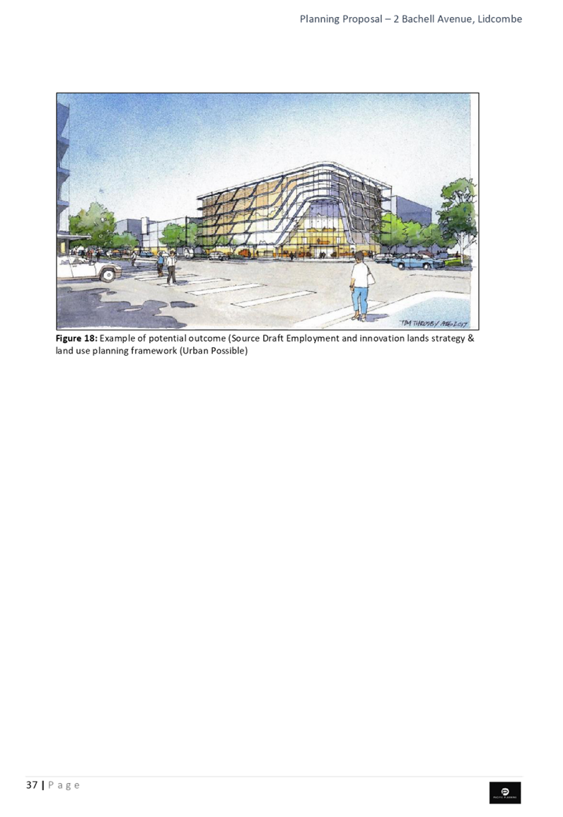
The site is situated within Lidcombe East Industrial Precinct, as recognised in the Cumberland Employment and Innovation Lands Strategy. The vision for this precinct encourages the retention of existing industrial land uses in some areas, as well as targeting advanced manufacturing, supporting food and beverage and creative industries.
The proposal is considered to be consistent with this adopted Strategy, and there is strategic merit in progressing this proposal to the next phase of assessment. The proposed rezoning to B5 Business Development supports business and employment opportunities in the area through the provision of new and diversified floor space, as well as a range of jobs that can contribute to local job diversity.
Addition of the B5 Business Development zone to the Auburn LEP 2010
The Auburn LEP 2010 currently does not contain a B5 Business Development zone. The B5 Business Development Zone is a Standard Instrument zone and the planning proposal seeks the inclusion of the Holroyd LEP 2013 B5 Business Development Zone within the Auburn LEP 2010.
The objectives of the B5 Business Development zone are to:
· enable a mix of business and warehouse uses, and specialised retail premises that require a large floor area, in locations that are close to, and that support the viability of, centres; and
· enable other land uses that provide facilities or services to meet the day to day needs of workers in the area.
A range of land uses are permitted with consent, including: centre-based child care facilities; food and drink premises; garden centres; hardware/building landscaping supplies; light industries; neighbourhood shops; passenger transport facilities; respite day care centres; roads; self-storage units; specialised retail premises; vehicle sales or hire premises; and warehouse or distribution centres.
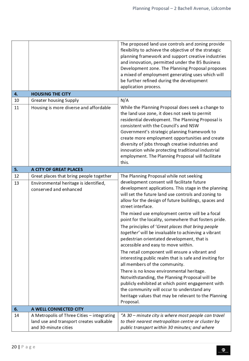
The B5 Business Development zone does not permit any form of residential development.
There is strategic merit in adding the B5 Business Development zone to the Auburn LEP 2010, as this land use zone is appropriate to the scope of the planning proposal and is consistent with this land use zone in the current Holroyd and Parramatta LEPs have this zone. This zoning can also be included in the new Cumberland LEP when this is prepared.
Traffic and Transport
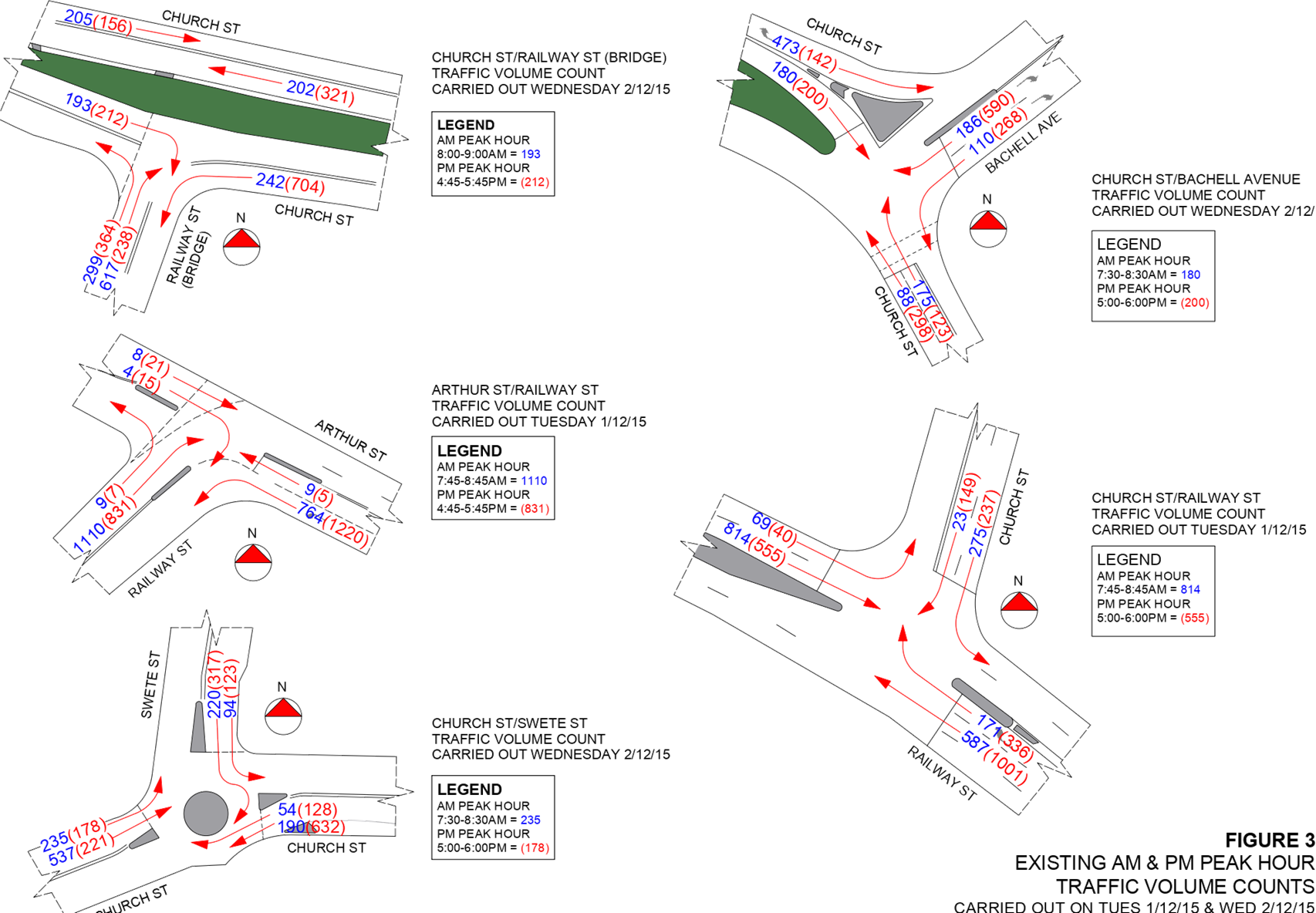
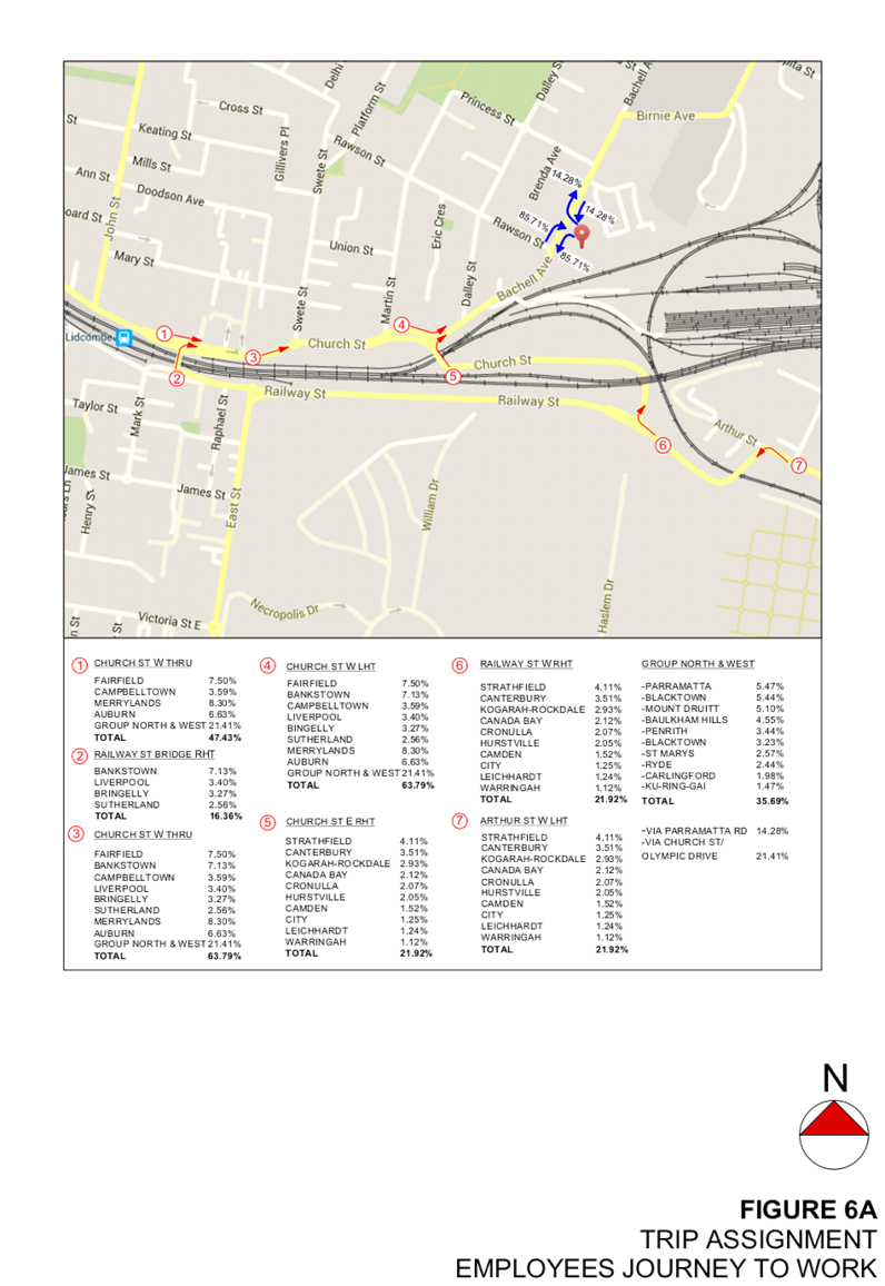
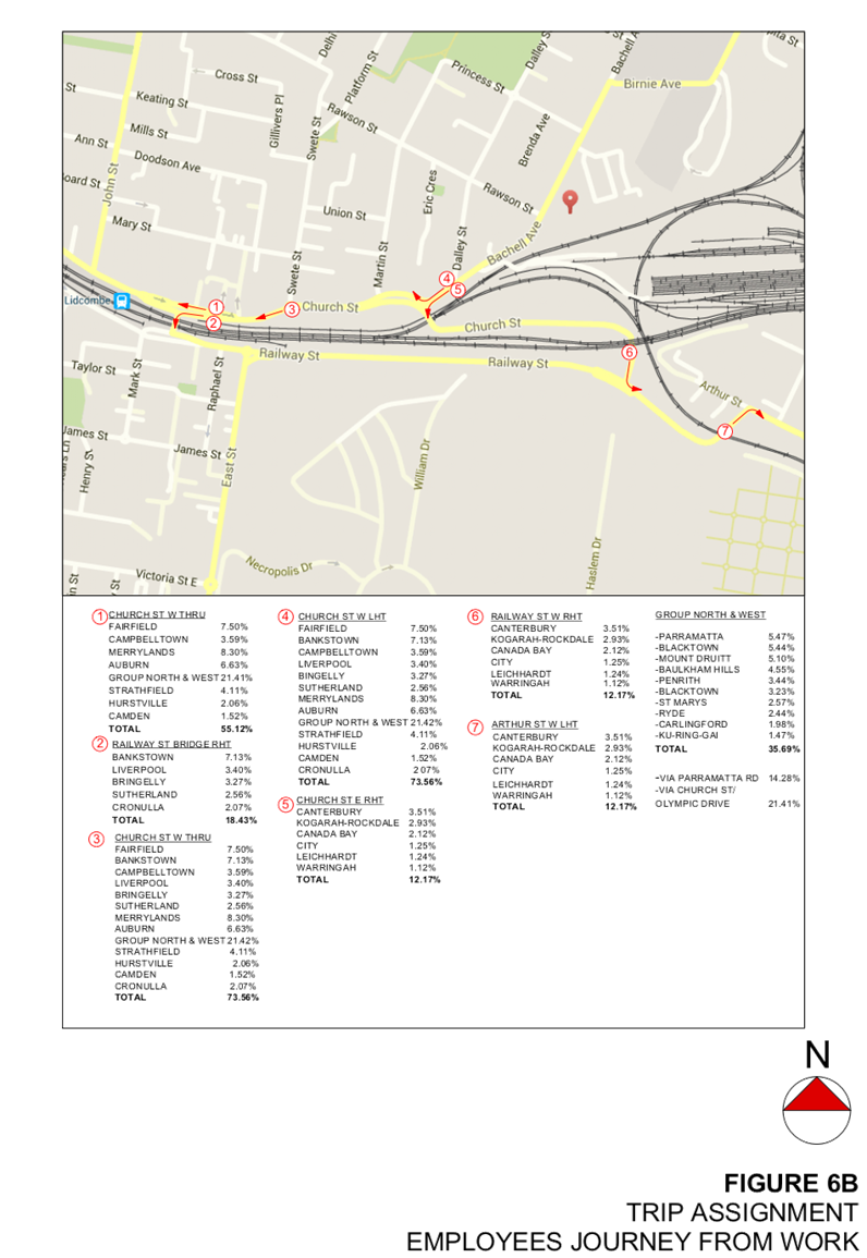
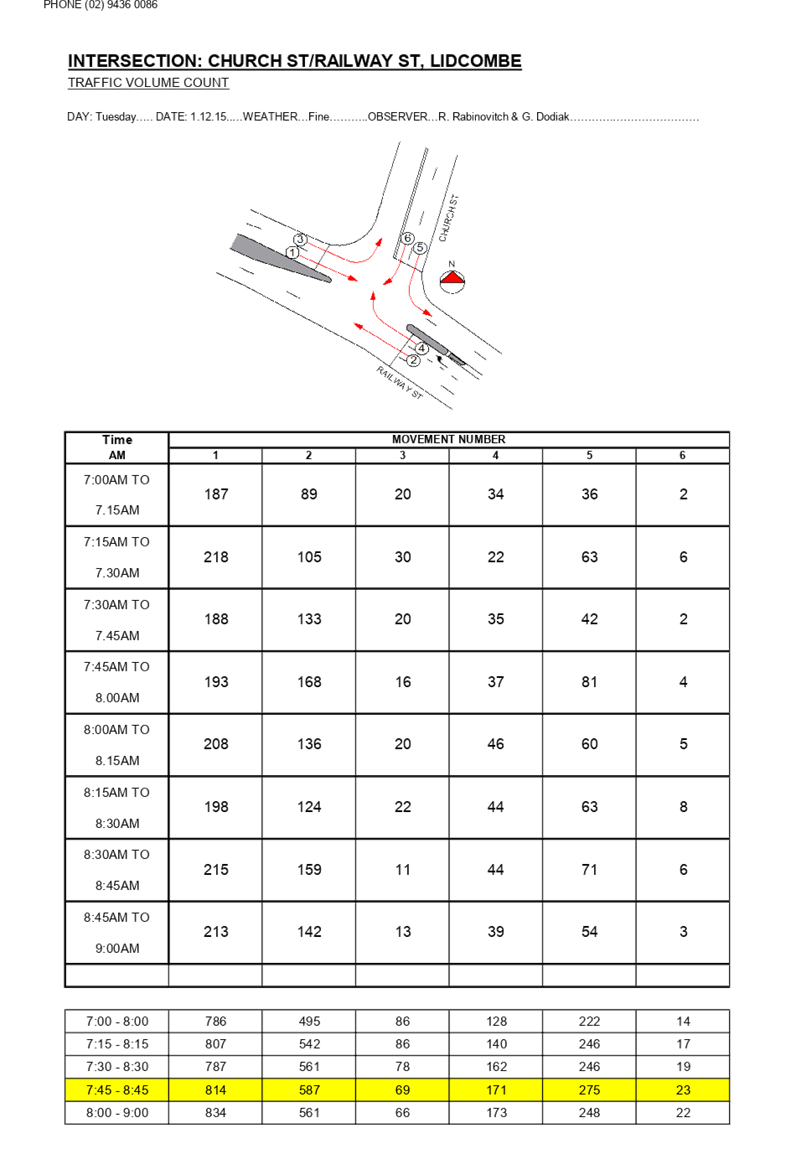
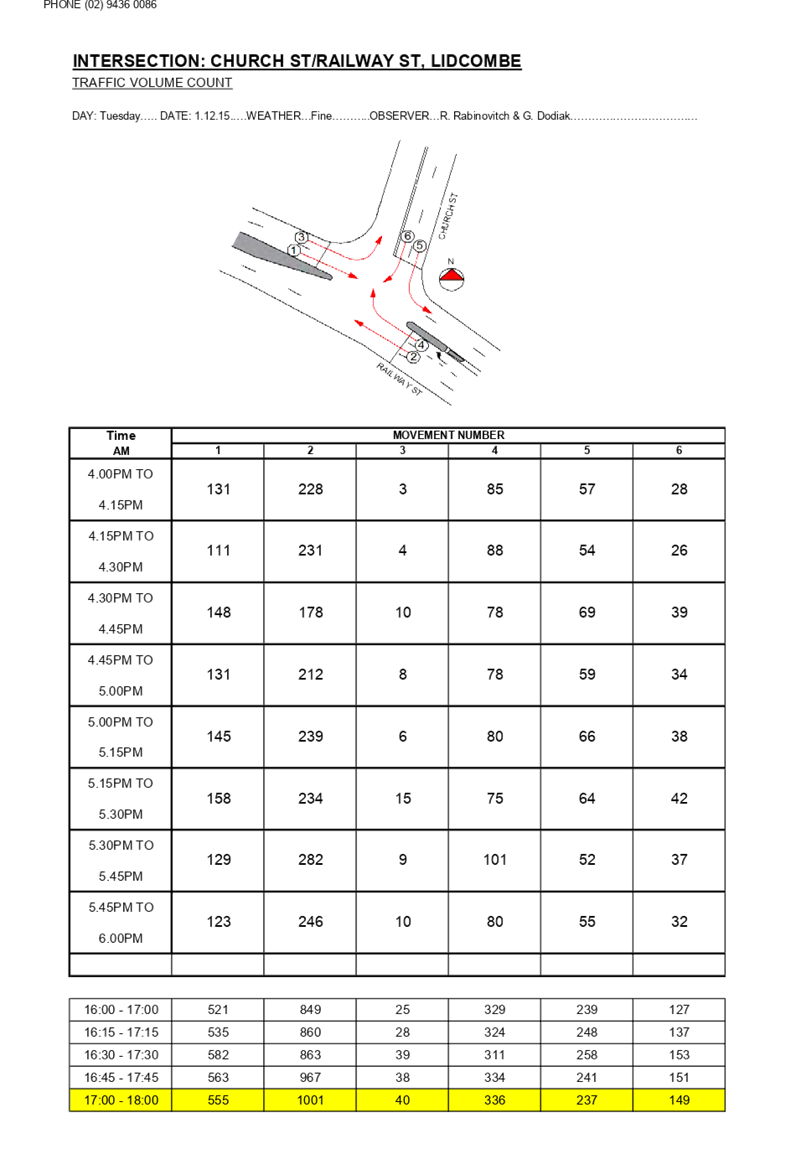
A review of traffic and transport considerations indicates there is strategic merit in progressing this planning proposal to a Gateway Determination as:
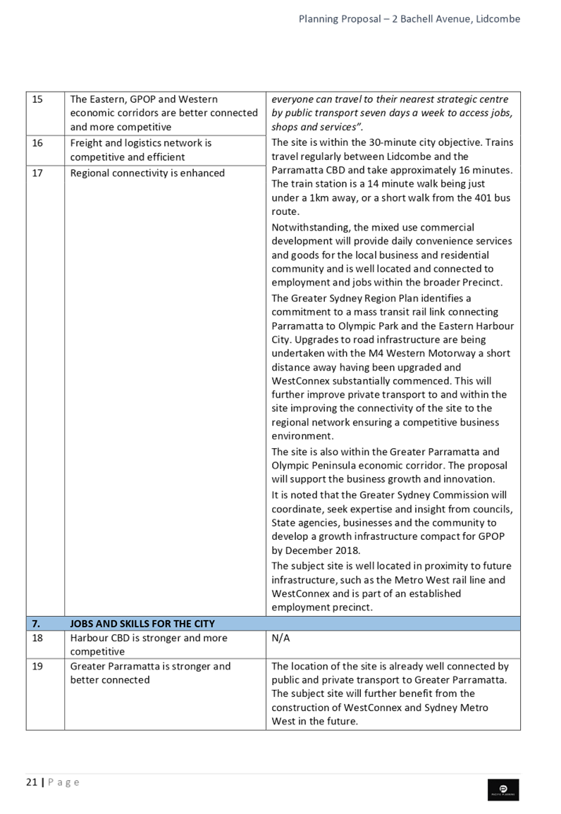
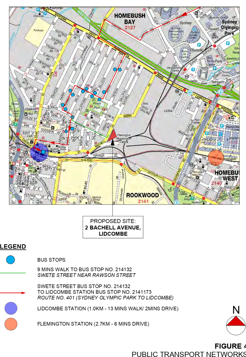
· the site is approximately one kilometre from Lidcombe train station, which has direct train services to Central Sydney and Parramatta. Bus services between Lidcombe and Sydney Olympic Park (route 401) are approximately 500 metres away on Nicholas Street; and
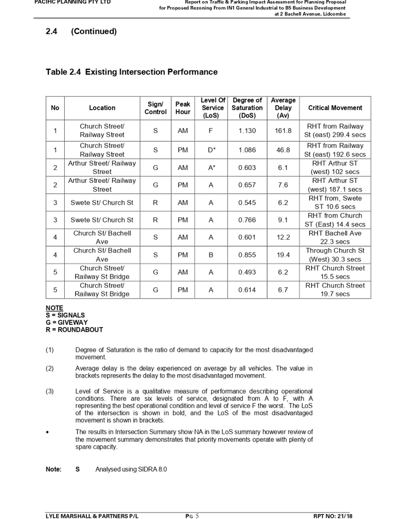
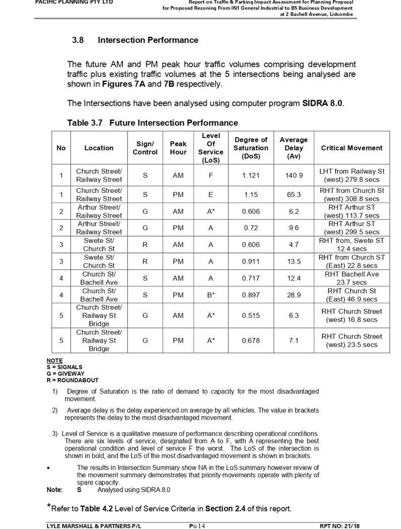
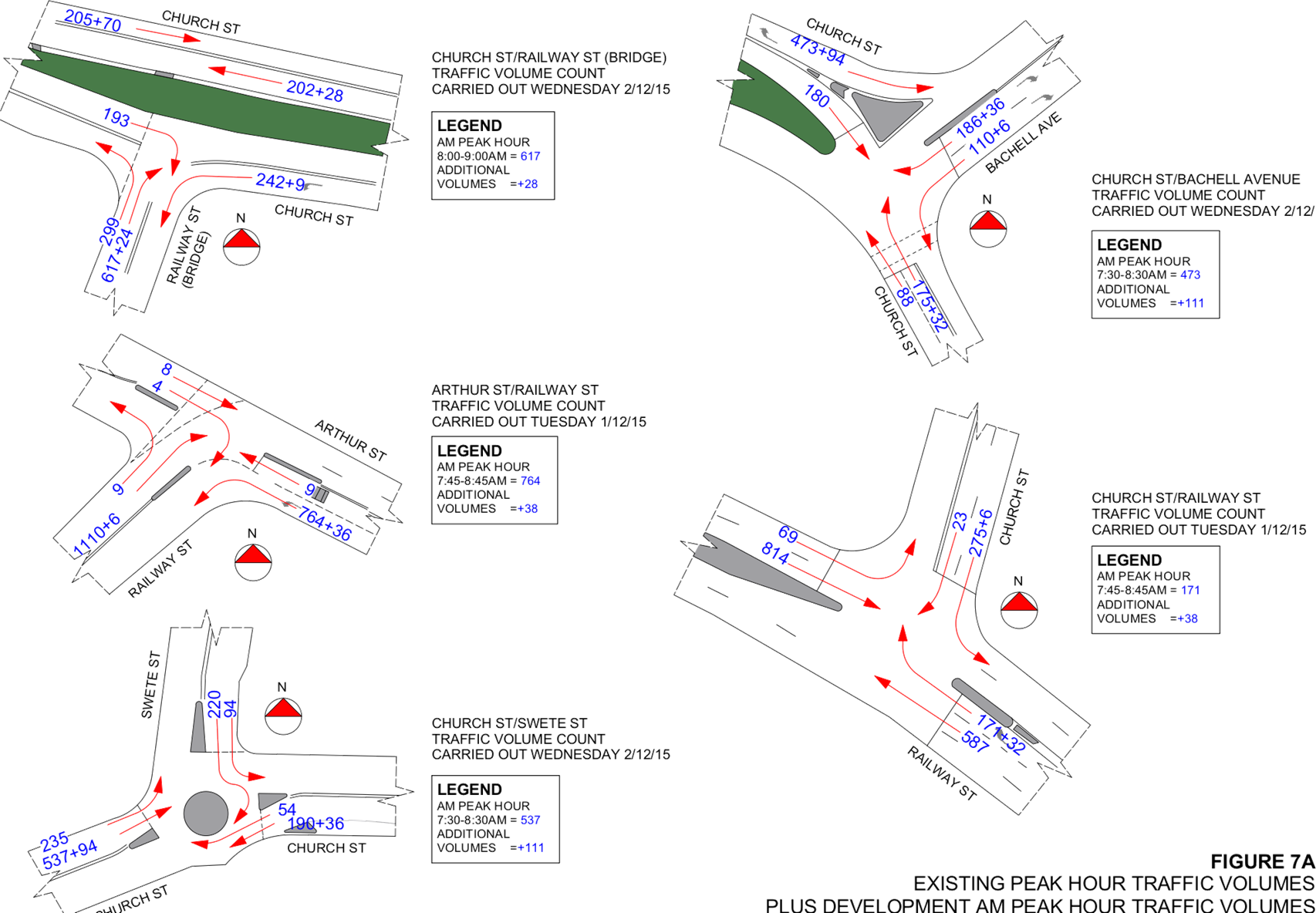
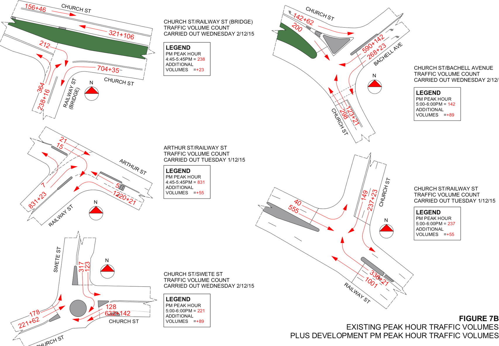
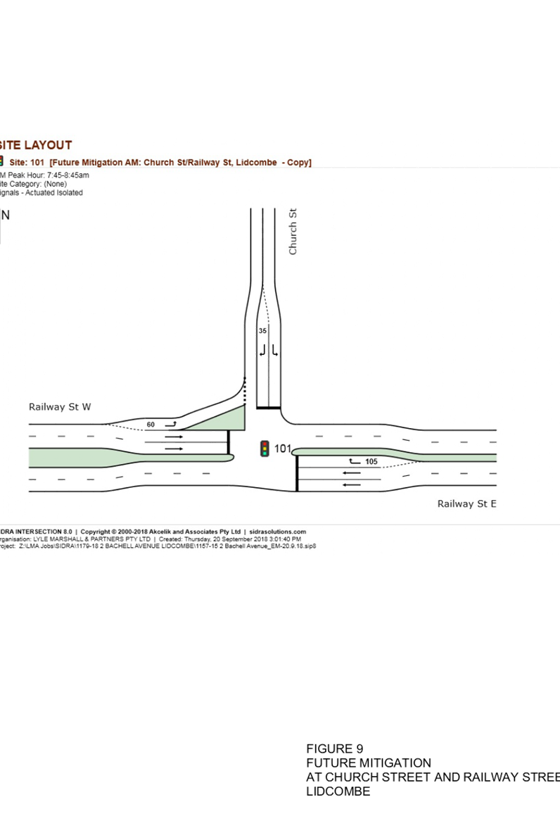
· road network and SIDRA analysis of anticipated traffic generation found there would be a minor impact on the intersections studied as a result of the proposal.
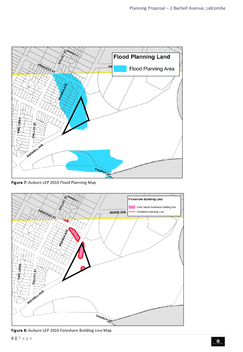
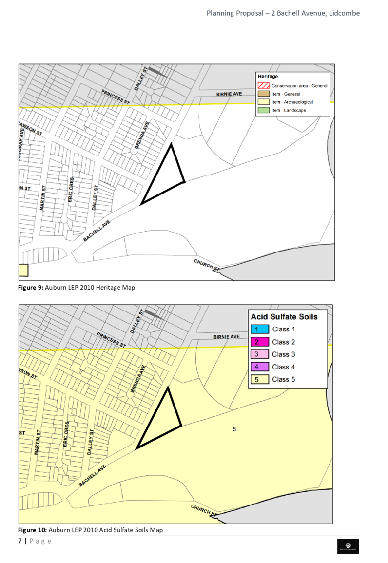
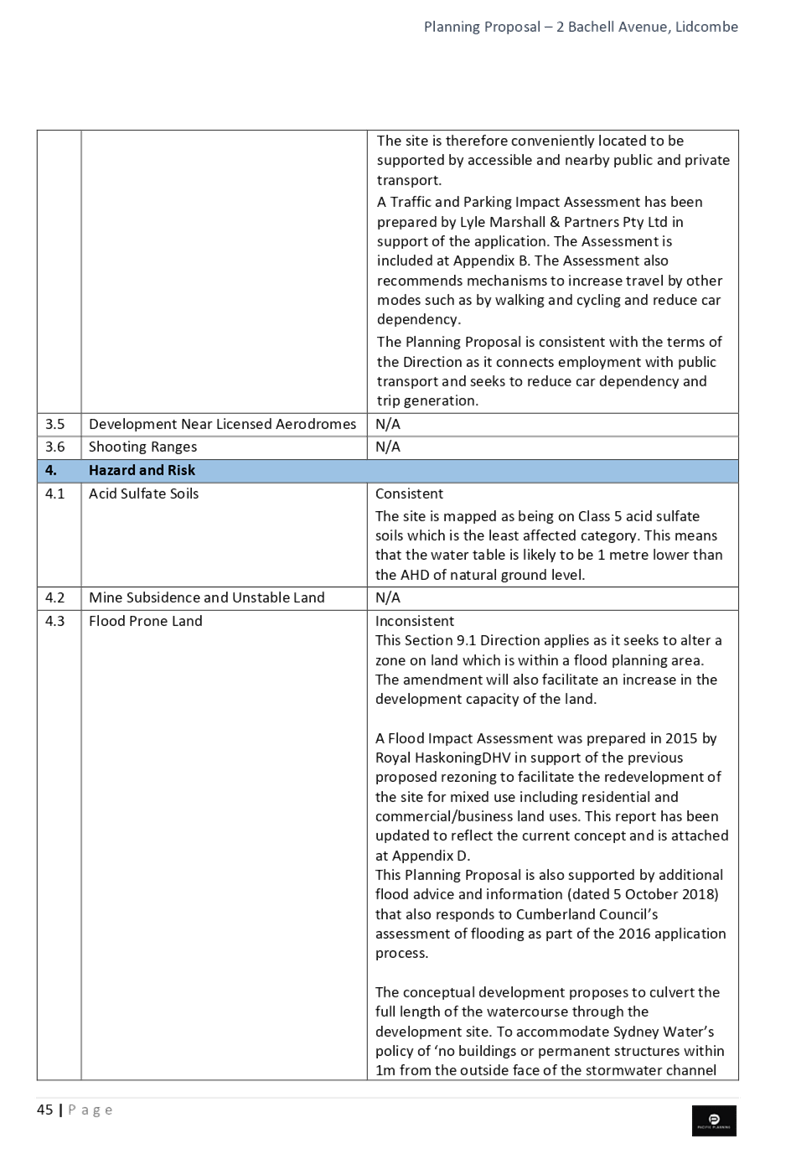
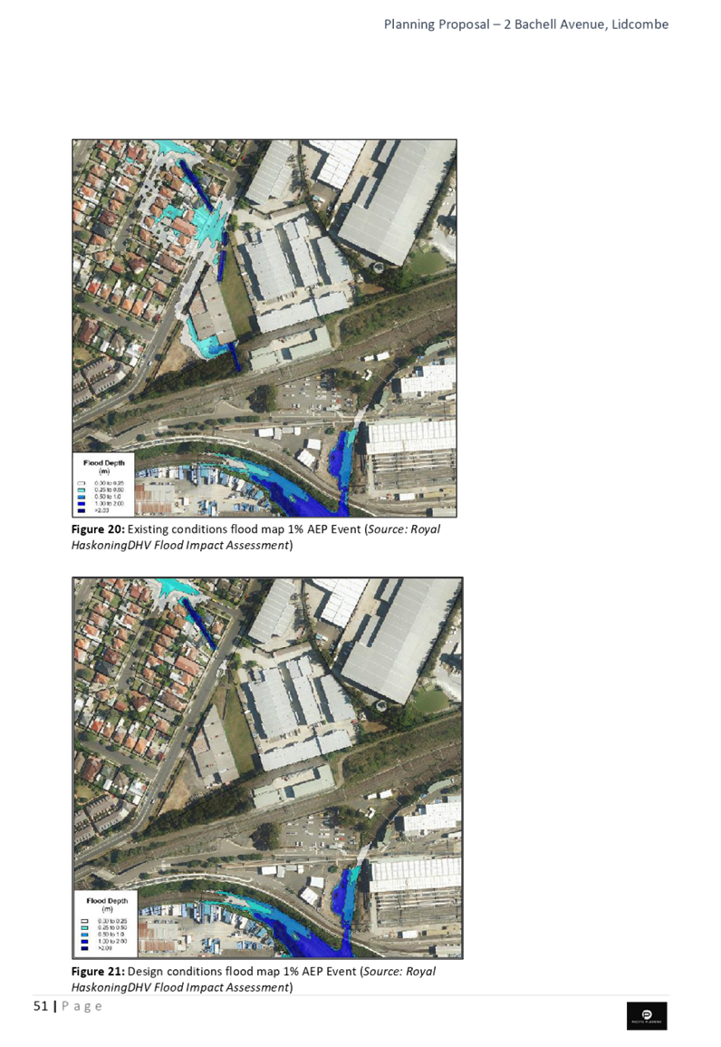
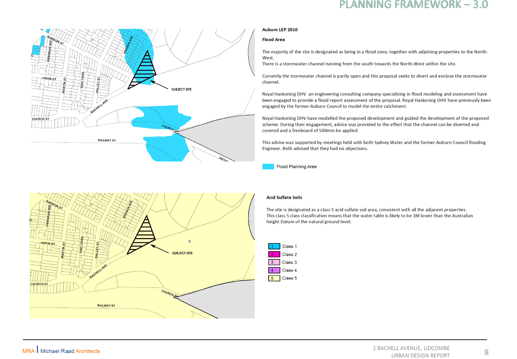
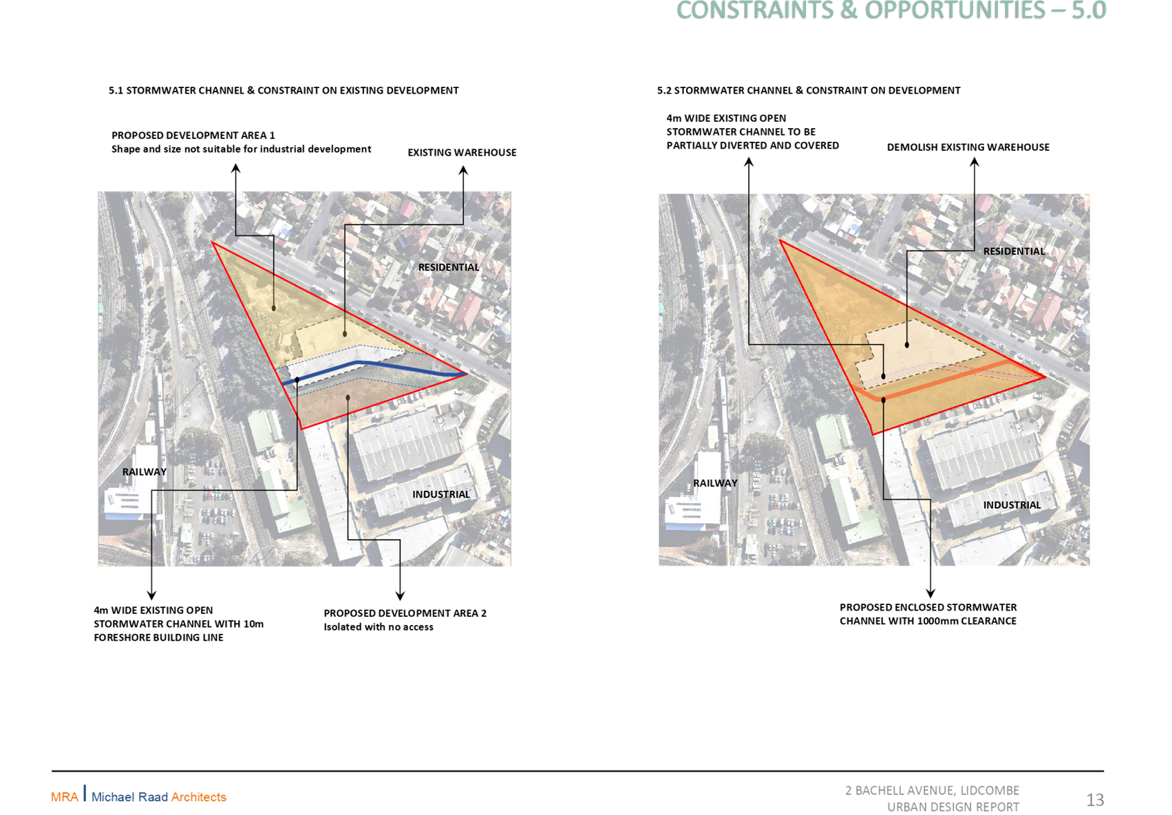
Flood Planning and Foreshore Building Line
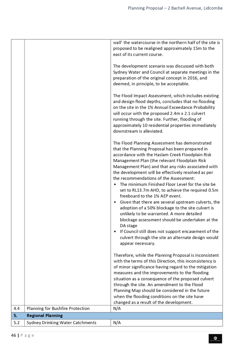
Part of the site is designated as being within the flood planning area under Auburn LEP 2010; however, there is merit in progressing this proposal to a Gateway Determination. This is based on the need for any future development proposal to address Council’s flood planning controls, and the proposed realignment and covering of the stormwater culvert has the potential to mitigate flood affectation of 12 neighbouring residential properties.
There is strategic merit in considering the removal of the Foreshore Building Line, as the stormwater channel that runs through the site is unlikely to be repatriated into a natural watercourse due to the urban form surrounding the site. The proposed works to the stormwater channel are also expected to result in significant local flood mitigation.
Cumberland Local Planning Panel
The planning proposal was reported to the Cumberland Local Planning Panel on 13 March 2019. The Panel recommended that this matter be reported to Council seeking a resolution to forward the planning proposal for a Gateway Determination, subject to consideration of the matters raised (Attachment 2). The planning proposal has been amended to reflect the advice provided by the Panel, as outlined in earlier sections of this report.
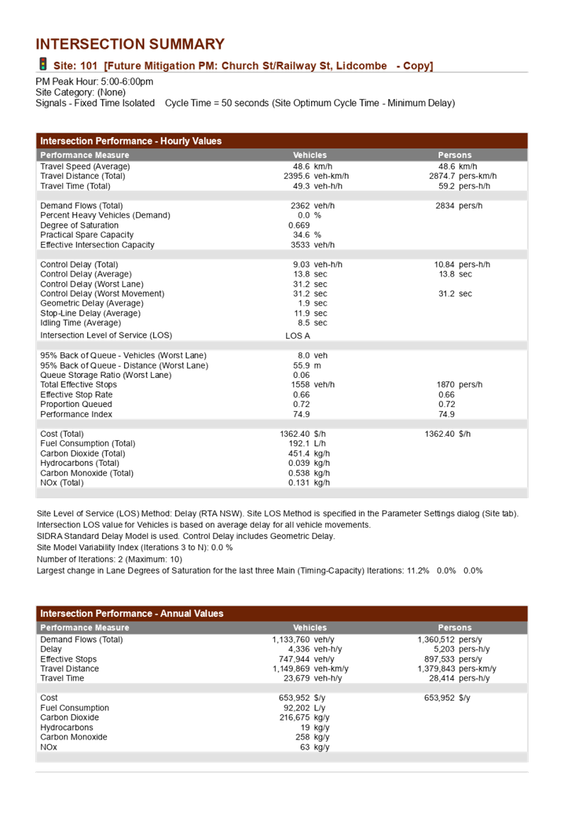
Recommended Planning Controls
A summary of the recommended planning controls for the proposal is provided in Table 1. This is based on a review of the proponent’s planning controls by Council officers and advice from the Cumberland Local Planning Panel.
Table 1: Recommended planning controls for the proposal
Community Engagement
The proposal was publicly exhibited for a period of 28 days from 13 November 2018 to 11 December 2018, in accordance with Cumberland Council’s Planning Proposal Notification Policy. Council received no written submissions during or after the exhibition period.
Policy Implications
Policy implications for Council are outlined in the main body of the report.
Risk Implications
There are minimal risk implications for Council associated with this report.
Financial Implications
There are no financial implications for Council associated with this report.
CONCLUSION
It is recommended that the planning proposal for 2 Bachell Avenue, Lidcombe, be forwarded to the Department of Planning, Industry & Environment for a Gateway Determination. This recommendation is being made as:
· the proposed rezoning to B5 Business Development would increase local employment and business opportunities through the provision of new and more diversified floor space;
· the proposed employment uses are anticipated to create a range of jobs that could contribute to local job diversity;
· redevelopment of the site would involve significant works to the stormwater culvert which has the potential to mitigate flood affectation of 12 neighbouring residential properties; and
· the proposal is generally consistent with the broad strategic direction set by the Central City District Plan and the Greater Sydney Region Plan, and is both compatible with and contributes to the longer term viability of the broader Lidcombe East employment precinct.
Attachments
1. Planning Proposal ⇩ ![]()
2. Report
and Minutes of the CLPP Meeting - 13 March 2019 ⇩ ![]()
3. Traffic
Report ⇩ ![]()
4. Urban
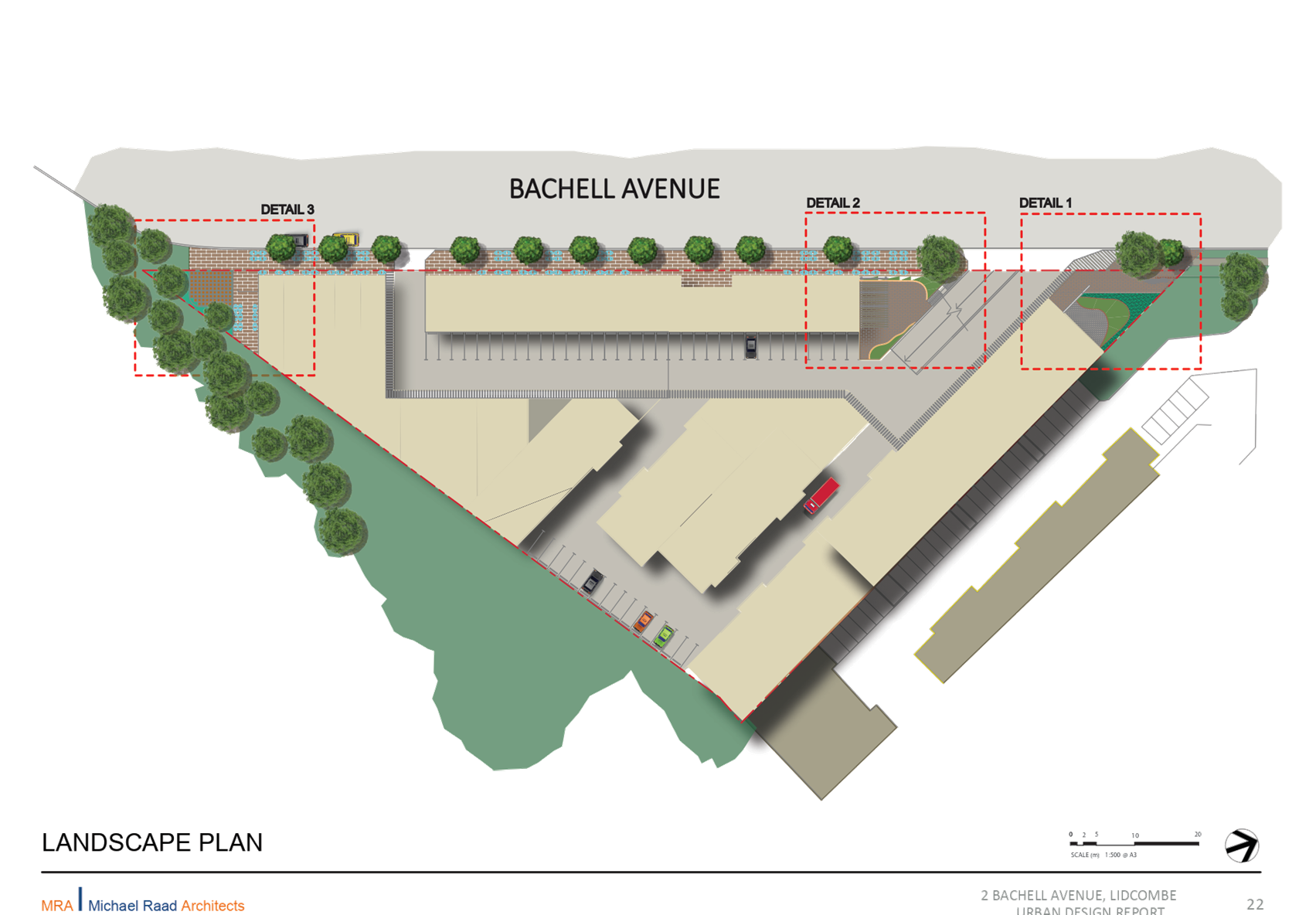
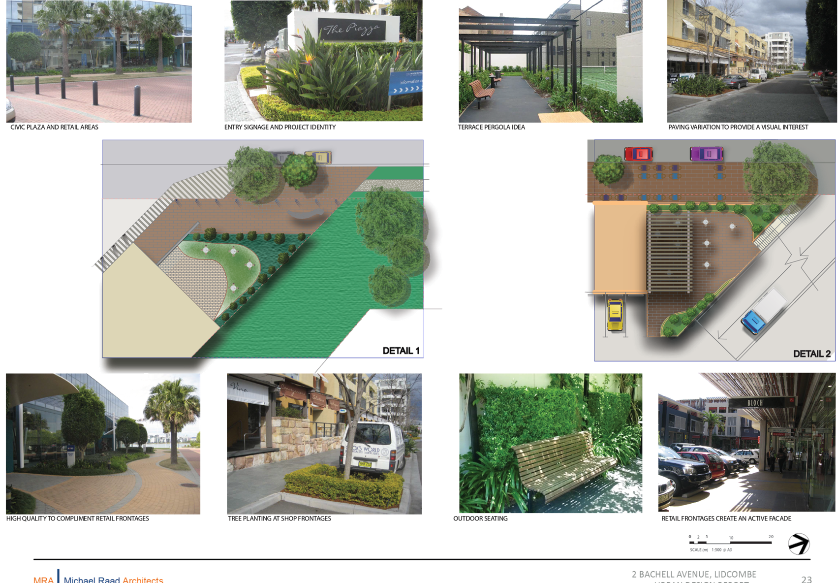
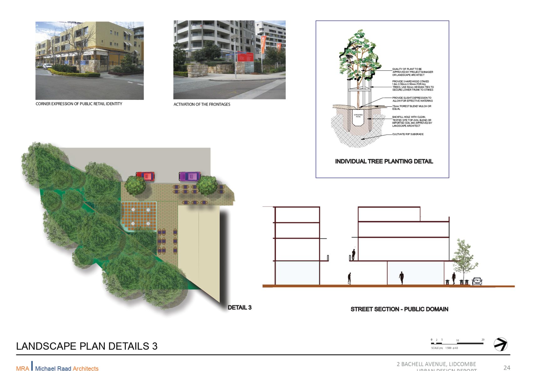
Design Report ⇩ ![]()
5. Economic
Analysis ⇩ ![]()
6. Social
Impact Assessment ⇩ ![]()
7. Preliminary
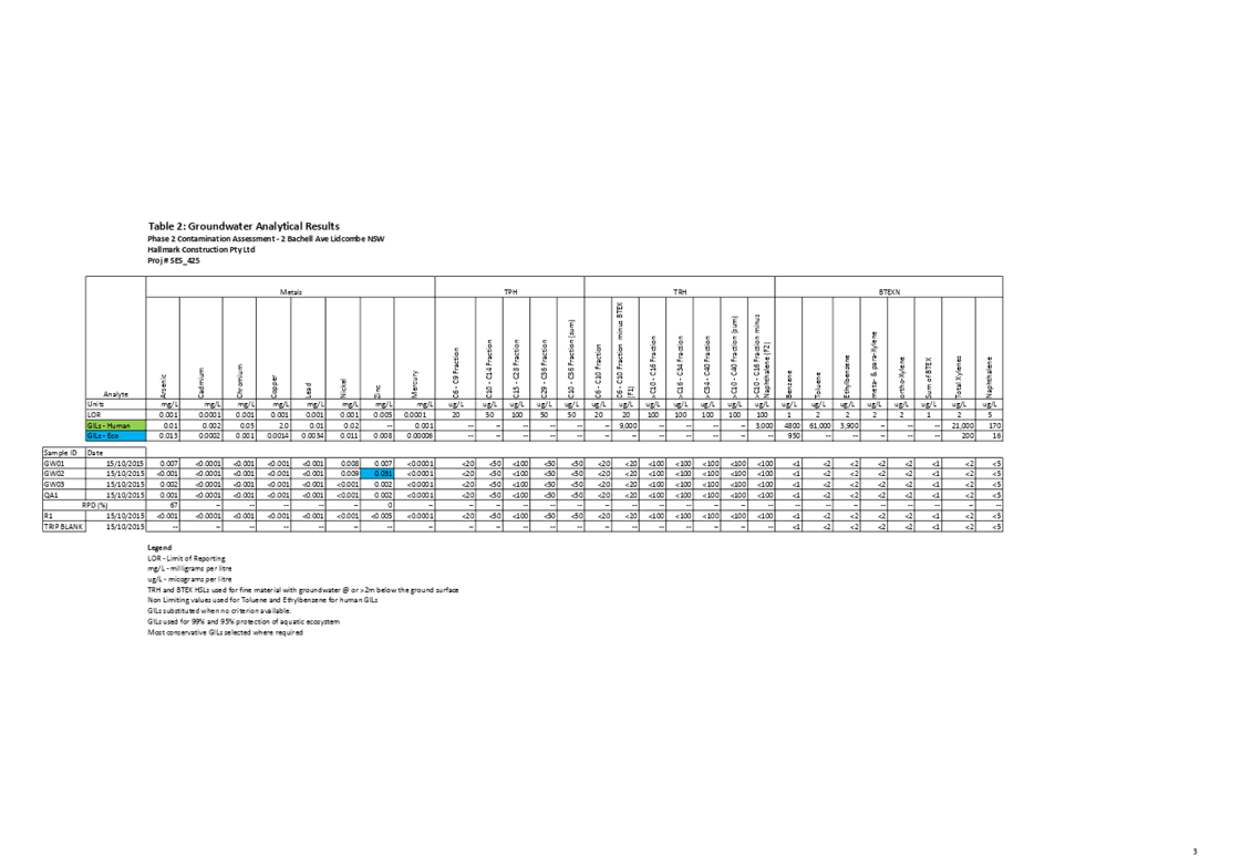
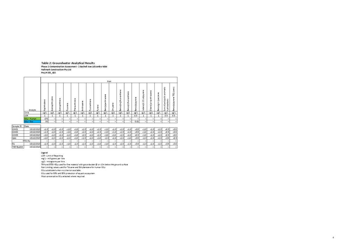
Contamination Assessment ⇩ ![]()
DOCUMENTS
ASSOCIATED WITH
REPORT C05/19-89
Attachment 1
Planning Proposal
Attachment 2
Report and Minutes of the CLPP Meeting - 13 March 2019
DOCUMENTS
ASSOCIATED WITH
REPORT C05/19-89
Attachment 4
Urban Design Report
Council Meeting
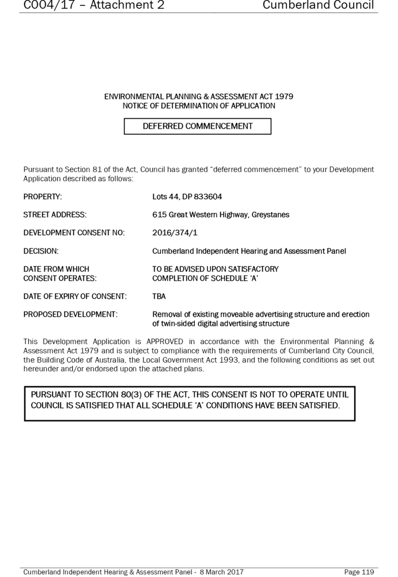
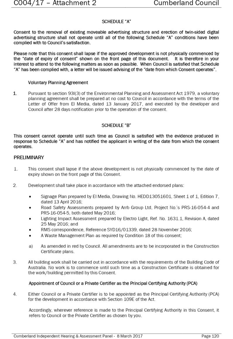
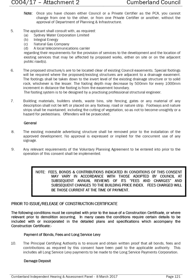
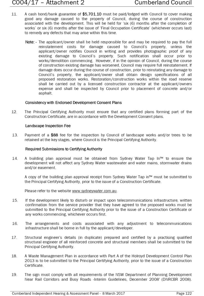
15 May 2019
Item No: C05/19-90
Planning Agreement for 615 Great Western Highway, Greystanes
Responsible Division: Environment & Planning
Officer: Director Environment & Planning
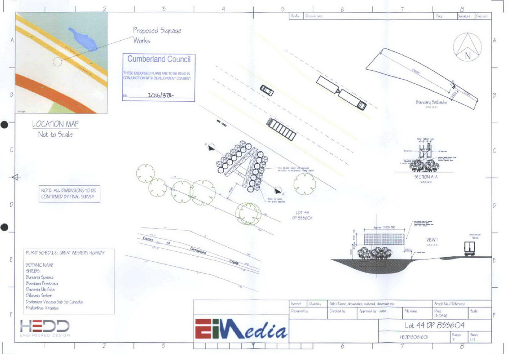
File Number: DA 2016/374
Community Strategic Plan Goal: A resilient built environment
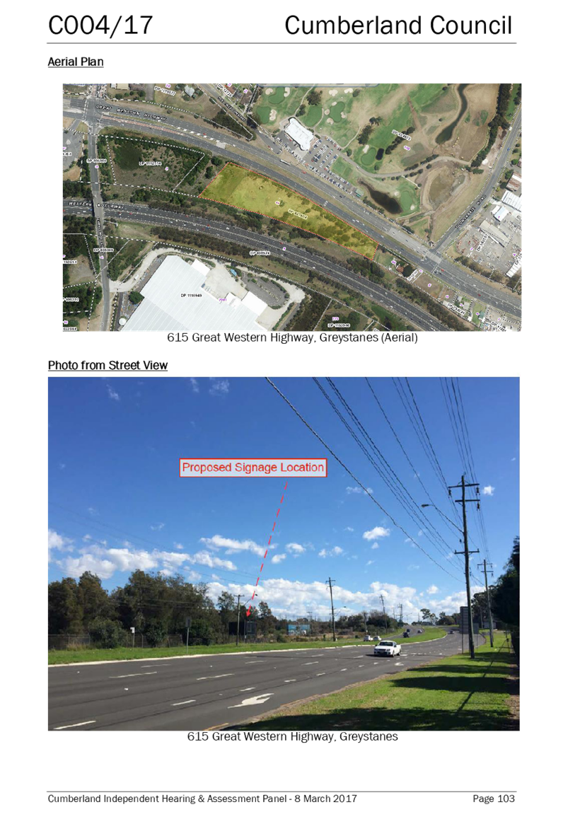
Summary
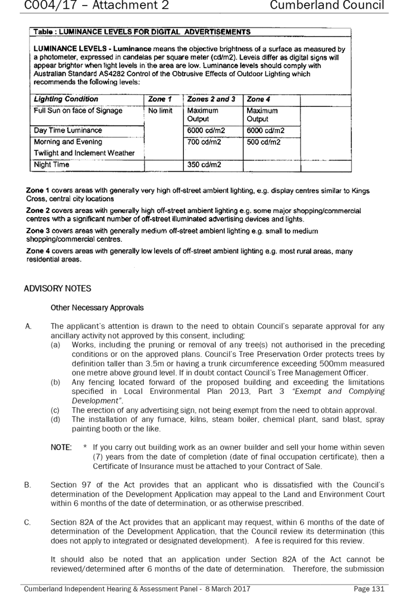
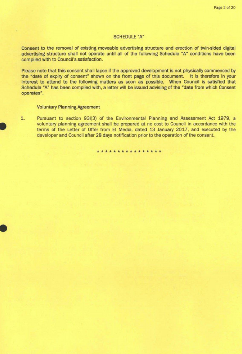
DA 2016/374 was approved by the Cumberland Independent Hearing and Assessment Panel (CIHAP) on 8 March 2017 for the removal of existing moveable advertising structure and erection of twin-sided digital advertising structure at 615 Great Western Highway, Greystanes.
The Developer offered to enter into a Planning Agreement with Council to provide a monetary contribution and material public benefit associated with the development. Consent was granted for the development, subject to a deferred commencement condition requiring the execution and registration of a planning agreement.
A Planning Agreement was negotiated for Council to receive a monetary contribution for local amenity works and digital advertising space to be used by Council. The agreement was placed on public exhibition between 24 October to 21 November 2018. No submissions were received.
The Planning Agreement has been reviewed by Council’s planning staff. The Planning Agreement is consistent with the relevant principles and requirements detailed in Council’s Planning Agreements Policy, and with the statutory provisions of the Environmental Planning and Assessment Act 1979.
The monetary contribution and use of the digital sign are considered an equitable concession for the benefit that the Developer receives in installing and utilising the sign.
|
Recommendation That Council: 1. Note the draft Planning Agreement for 615 Great Western Highway, Greystanes, regarding a monetary contribution towards local amenity improvements and digital advertising space for use by Council. 2. Authorise the Mayor and General Manager to sign and execute the Planning Agreement in its current form. |
Report
Context for Planning Agreement
DA 2016/374 was approved by the Cumberland Independent Hearing and Assessment Panel (CIHAP) on 8 March 2017 for the removal of existing moveable advertising structure and erection of twin-sided digital advertising structure at 615 Great Western Highway, Greystanes.
The Developer offered to enter into a Planning Agreement with Council to provide a monetary contribution and material public benefit associated with the development. Consent was granted for the development, subject to a deferred commencement condition requiring the execution and registration of a planning agreement.
Council’s Planning Agreements Policy
The Planning Agreements Policy (the Policy) was adopted on 6 September 2017 and applies to planning agreements proposed in association with any planning proposal requests and development applications for land within the local government area of Cumberland Council.
Pursuant to Requirement 23 of the Planning Agreements Policy, the consideration of any planning agreement is at the absolute discretion of Council.
The Planning Agreement that is the subject of this report is consistent with the objectives of the Policy in that:
· it allows for flexibility in the development contributions system, with contributions to be paid to Council in association with a development that otherwise would not attract any contributions; and
· it facilitates the provision/enhancement of public infrastructure and amenities in accordance with Council’s corporate and strategic planning context.
The development approved under DA 2016/374 does not involve any floor space, height or other value uplift and as such, most of the requirements of the Planning Agreements Policy and the associated Guideline do not apply.
The Agreement is considered satisfactory as it is consistent with the relevant requirements of the Policy in that:
· it represents a demonstrable public benefit for the people of Cumberland;
· it requires registration of a public positive covenant on the title of the land;
· it is consistent with the terms of the letter of offer made by the developer in connection with DA 2016/374; and
· it was considered by CIHAP in the determination of DA 2016/374, and has since been publicly exhibited as required by section 7.5 of the Environmental Planning and Assessment Act.
The Agreement is being reported to Council for its consideration in accordance with the Policy.
Proposed Planning Agreement
The Developer seeks to remove an existing sign, and erect a twin-sided, digital advertising structure on land at 615 Great Western Highway, Greystanes. This is development requiring consent (under the Environmental Planning and Assessment Act 1979) and a development application (DA 2016/374) was lodged with Council, and approved by CIHAP, for those works.
During the assessment of DA 2016/374, and pursuant to clause 13(3) of State Environmental Planning Policy No 64 – Advertising and Signage, the applicant made an offer to enter into a planning agreement with Council regarding use of the sign for public purposes, and the provision of a monetary contribution.
DA 2016/374 was reported to CIHAP for determination on 8 March 2017. A copy of the CIHAP report is provided at Attachment 3. In accordance with the staff recommendation, the application was approved, subject to a deferred commencement condition requiring the execution and registration of a planning agreement.
Following determination of the application, a Planning Agreement was prepared by the Developer and Council’s legal representatives, in consultation with Council staff.
The Agreement requires the Developer to do the following:
· make the sign available to Council for the promotion of upcoming programs and events for one week in every 4 months, subject to availability;
· make the sign available for emergency broadcasts as necessary;
· make an annual monetary contribution (adjusted annually for inflation); and
· register a public positive covenant on the land pursuant to section 7.6 of the Environmental Planning and Assessment Act.
Council would use the monetary contribution from the Developer to pay for amenity upgrades in the locality. The amenity upgrades would be projects that have been identified in the Capital Works Schedule, within the locality of the subject site.
Any Council promotions on the digital sign would need to meet the tier one advertiser’s quality of material.
Planning Agreements – Statutory Context
A Planning Agreement is a voluntary legal agreement between Council and a developer, whereby the developer proposes to dedicate land, pay a contribution or provide some other type of material public benefit to be used or applied towards a public purpose. Planning agreements are established under division 7.1, subdivision 2 of the Environmental Planning and Assessment Act 1979.
The Act requires a consent authority to consider any existing or proposed Planning Agreement in assessing and determining a development application. In this instance, the proposed planning agreement was considered in the assessment and determination of DA 2016/374 and was found to be satisfactory.
DA 2016/374 was approved subject to a deferred commencement condition requiring the execution and registration of a Planning Agreement as offered by the Developer. If Council supports the execution of the Agreement, that would allow the consent to become operational and the development to proceed. If the Agreement is not executed, the Developer will be unable to satisfy the deferred commencement conditions and the consent will lapse.
Community Engagement
The planning agreement was publicly exhibited in accordance with section 7.5 of the Environmental Planning and Assessment Act 1979 and Council’s Planning Agreements Policy from 24 October to 21 November 2018.The exhibition included a public newspaper notice, and letters to surrounding property owners.
No submissions were received as a result of the exhibition.
Policy Implications
There are no policy implications for Council associated with this report.
Risk Implications
There are no risk implications for Council associated with this report.
Financial Implications
The financial implications for report are outlined in confidential Attachment 5 to this report.
CONCLUSION
The Developer’s offer to enter into a planning agreement was considered in the assessment and determination of DA 2016/374. The agreement in its current form has been reviewed by Council’s planning staff. The Agreement is consistent with the relevant principles and requirements detailed in Council’s Planning Agreements Policy, and with the statutory provisions of the Environmental Planning and Assessment Act 1979.
The monetary contribution and use of the digital sign are considered an equitable concession for the benefit that the Developer receives in installing and utilising the sign.
Attachments
1. Planning Agreement Deed (confidential)
2. Explanatory Note (confidential)
3. Report
to CIHAP for DA 2016/374 ⇩ ![]()
4. Consent
for DA 2016/374 ⇩ ![]()
DOCUMENTS
ASSOCIATED WITH
REPORT C05/19-90
Attachment 3
Report to CIHAP for DA 2016/374
Council Meeting
15 May 2019
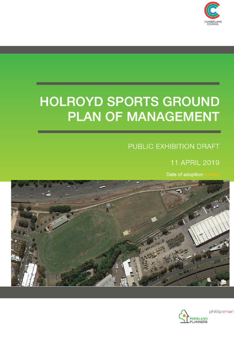
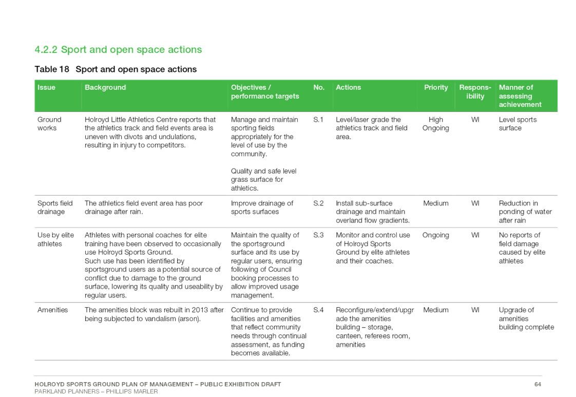
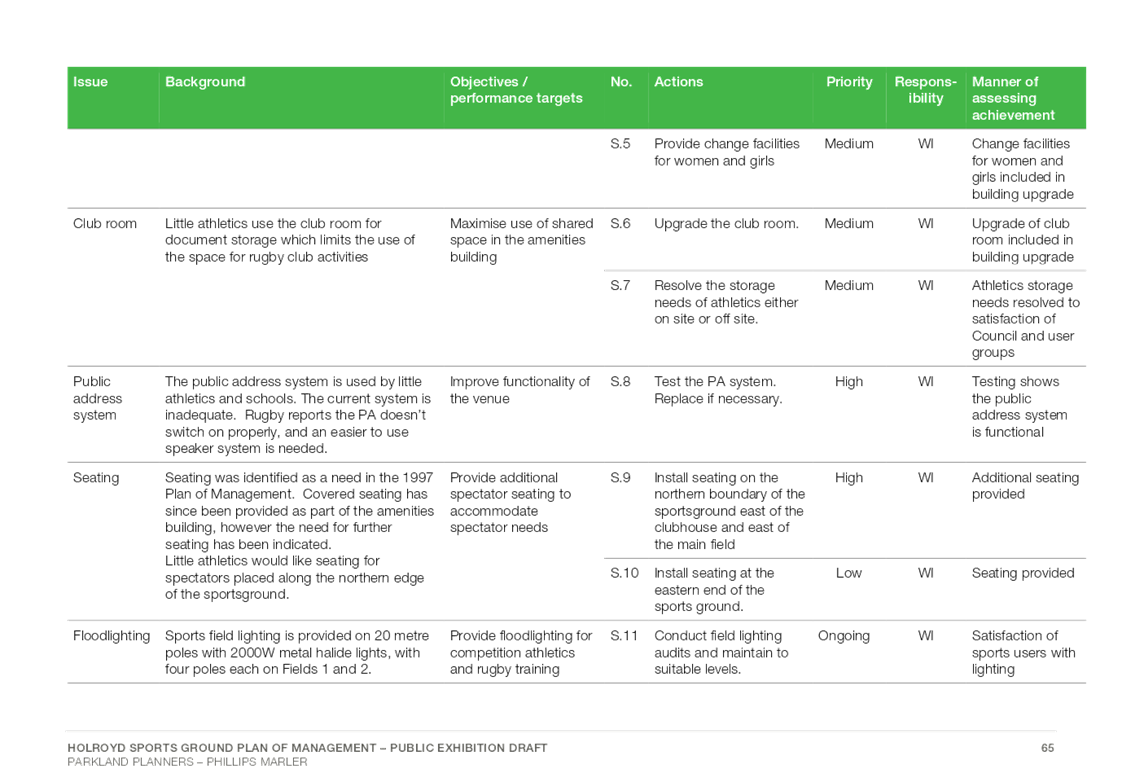
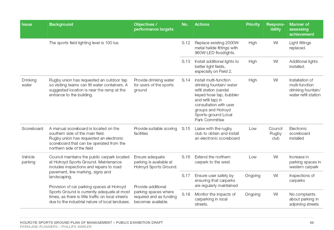
Item No: C05/19-91
Draft Holroyd Sportsground Plan of Management
Responsible Division: Works & Infrastructure
Officer: Director Works & Infrastructure
File Number: HC-17-09-10
Community Strategic Plan Goal: A great place to live
Summary
Cumberland Council has recently completed a process to prepare a draft Plan of Management in accordance with the legislative requirements of the NSW Local Government Act (1993), for Holroyd Sportsground in Merrylands.
As required by the NSW Local Government Act (1993), the draft Plan of Management is to be advertised for public exhibition for a period of not less than twenty eight (28) days and to allow for public submissions for a period of not less than forty two (42) days. Council is also required to hold a public hearing on the draft Plan of Management during this period as altering of the categorisation of community land has occurred under Section 36(d) of the Act.
This report summarises the preparation process for the Plan of Management and Landscape Masterplan and recommends that the draft Holroyd Sportsground Plan of Management be placed on public exhibition.
|
Recommendation That Council: 1. Place on public exhibition the draft Holroyd Sportsground Plan of Management for a period of 42 days, in accordance with Section 38 of the NSW Local Government Act (1993). 2. Provide a report to Council following the conclusion of the exhibition period detailing the results of submissions made along with a final version of the Plan of Management. |
Report
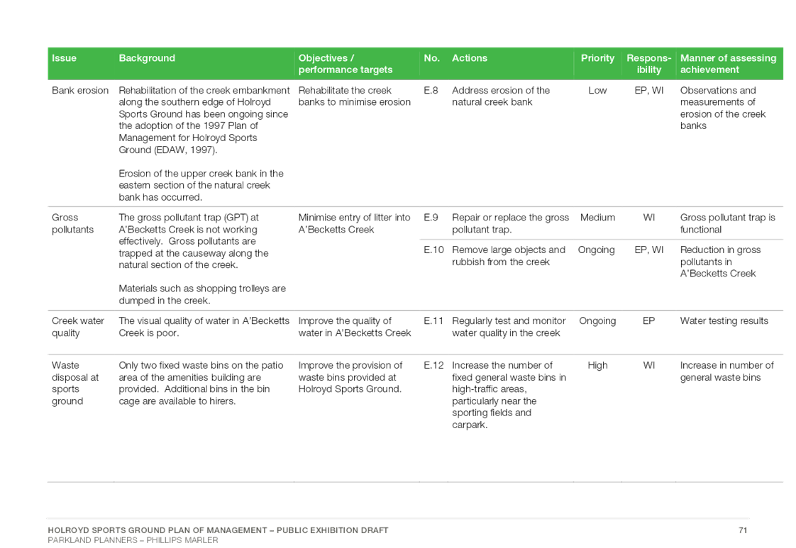
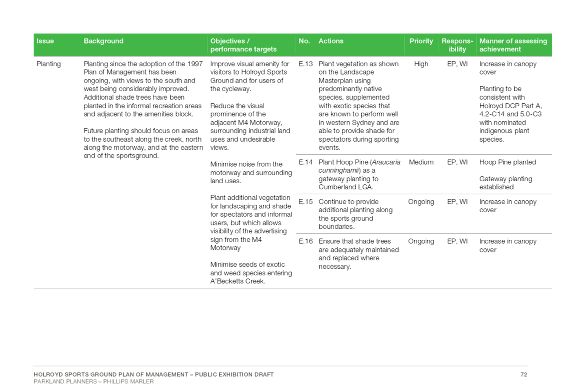
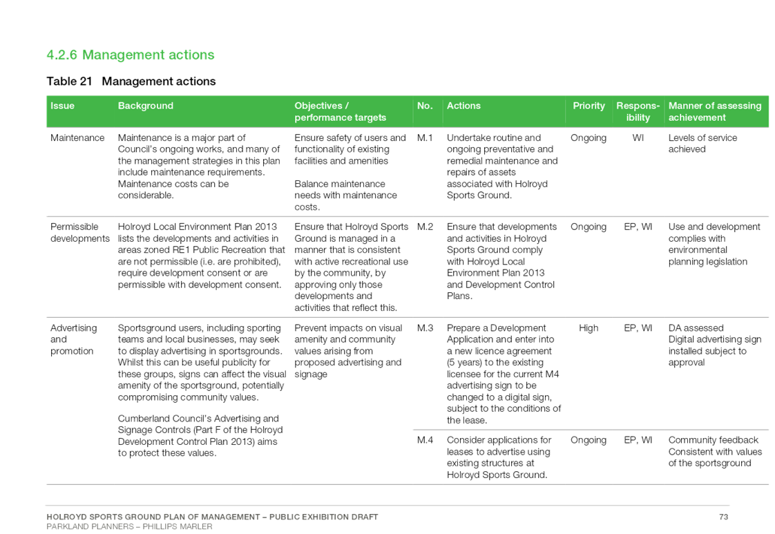
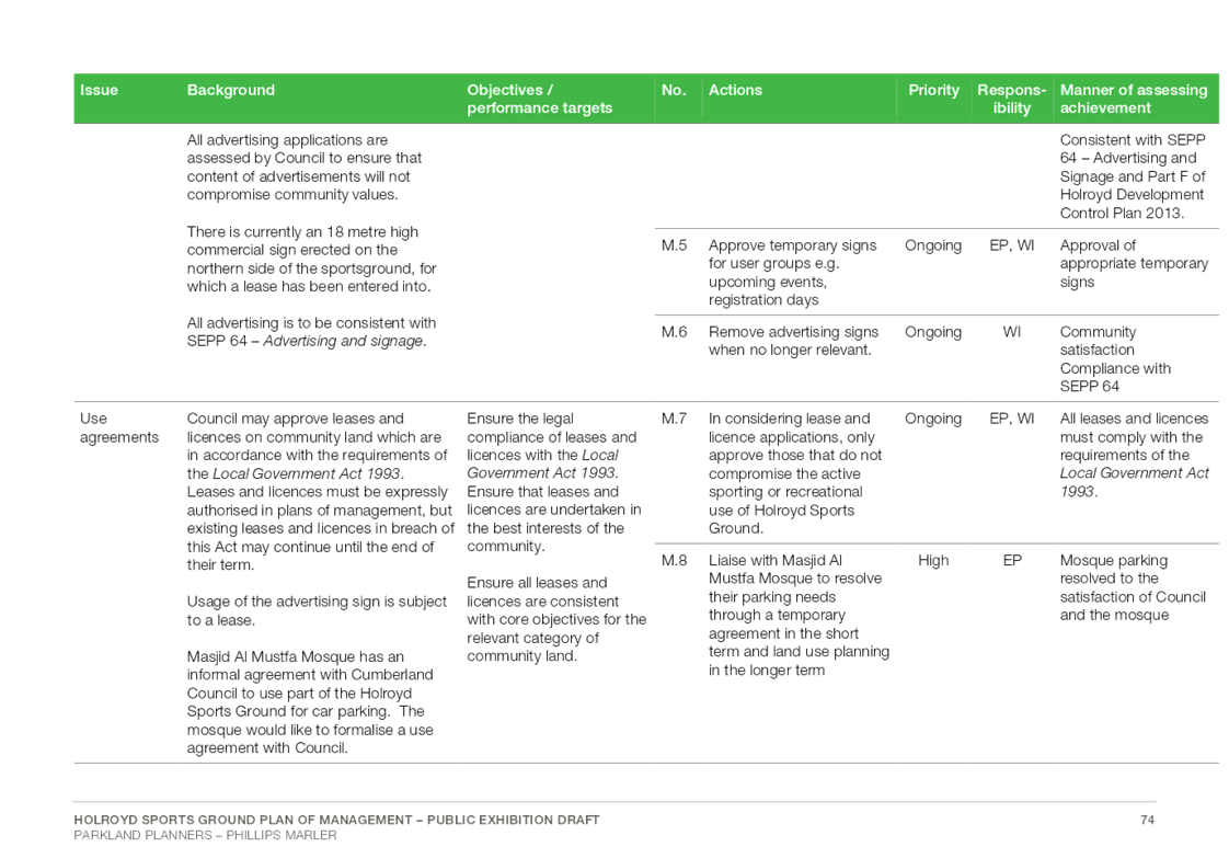
The NSW Local Government Act (1993) (the Act) requires Councils to prepare Plans of Management (PoM) for all areas of community land to guide the future planning, ongoing management and development of these open space areas. Community land as defined by regulation includes parks, sportsgrounds, natural areas, areas of cultural significance and land for general community use, and may be developed on a generic, site specific or geographical basis.
The PoM provides a coordinated framework for decision making, enhancement and management of the open space and aims to integrate the vision and needs of the community and Council. A PoM has a nominal lifespan of approximately five (5) to ten (10) years. One of the purposes of this PoM is in part to identify and implement priorities for works to be undertaken at Holroyd Sportsground.
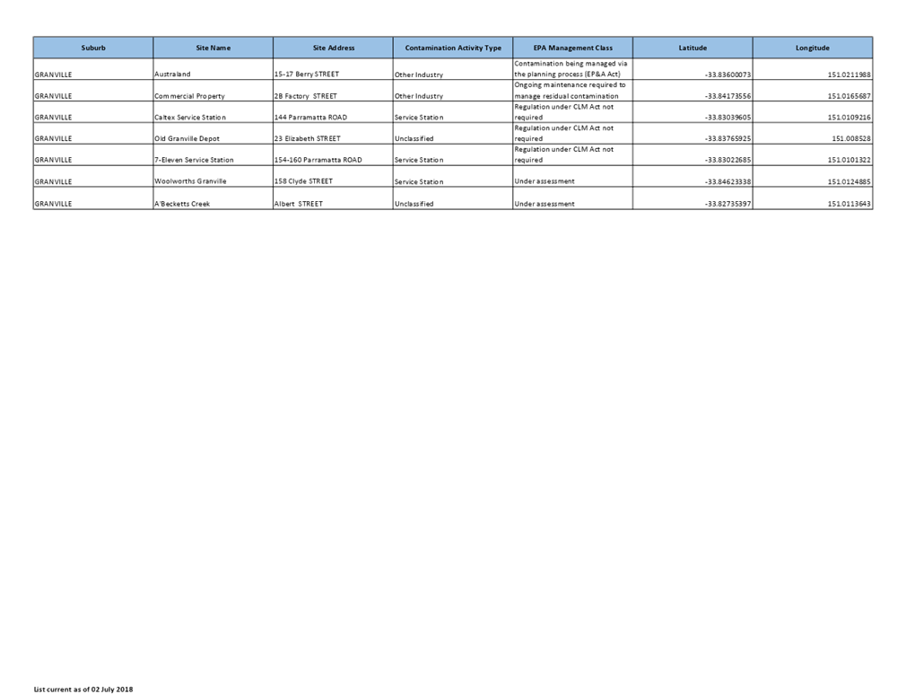
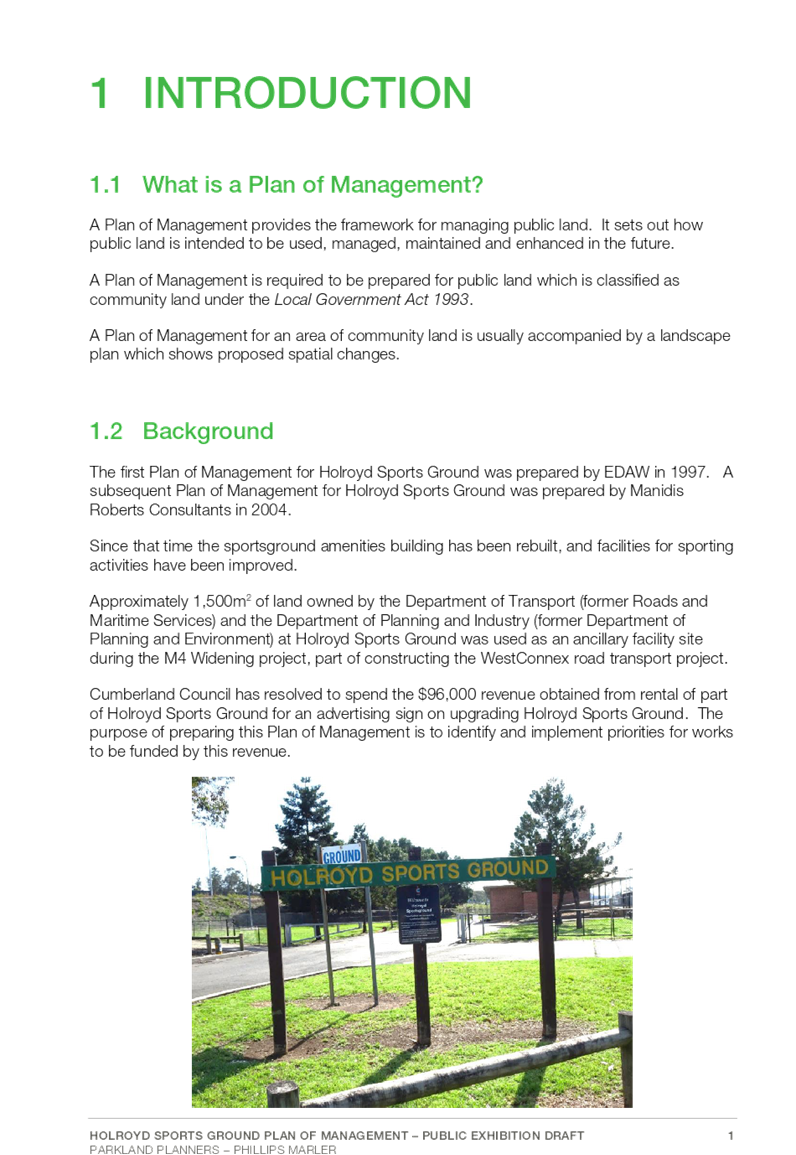
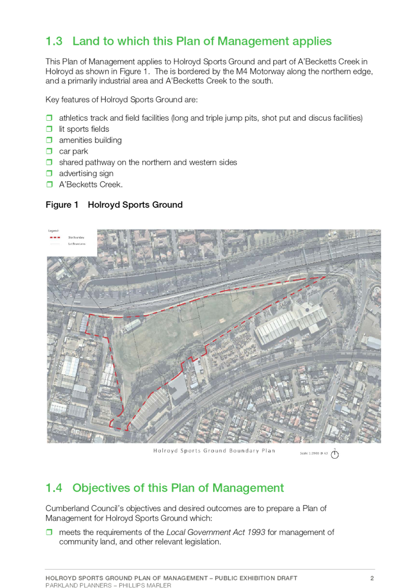
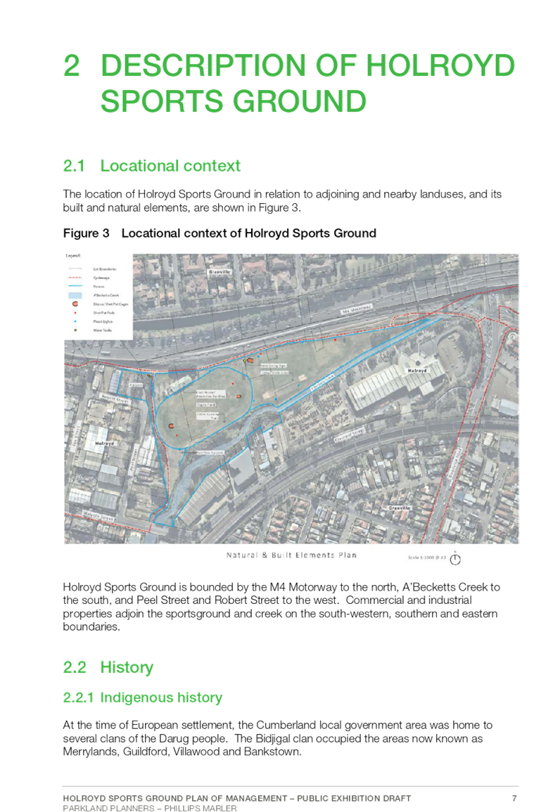
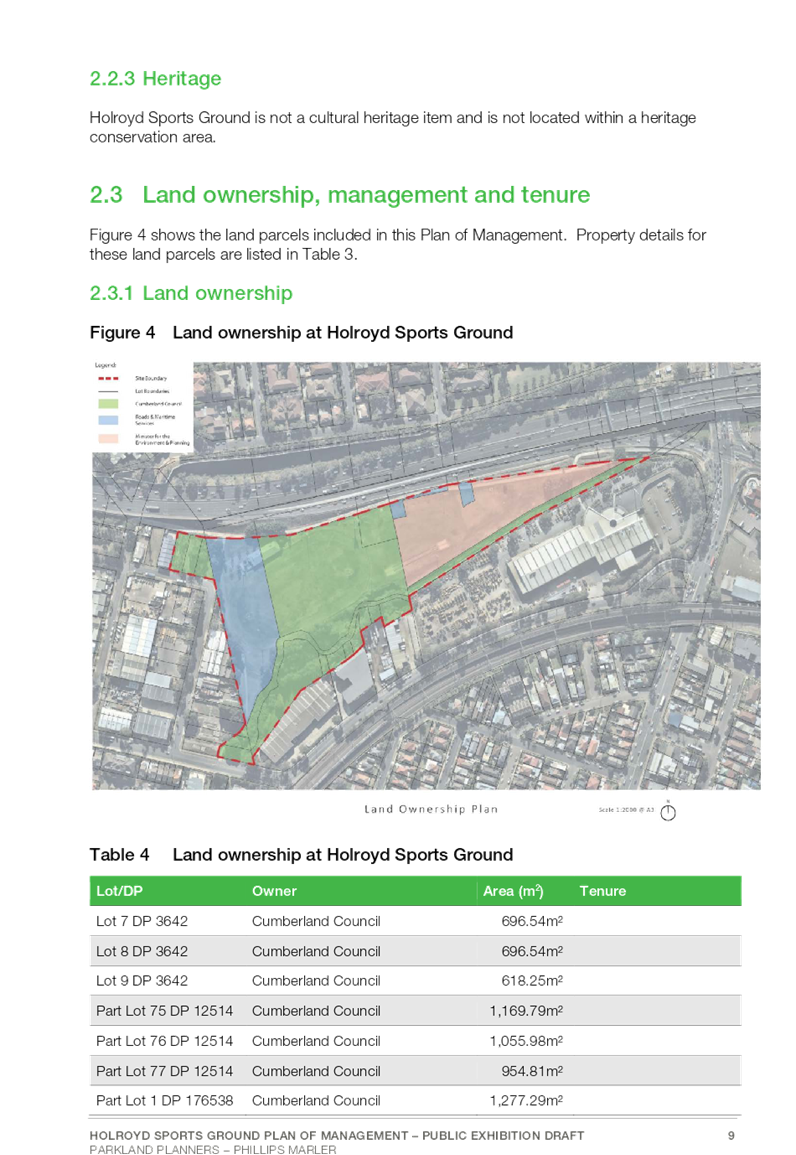
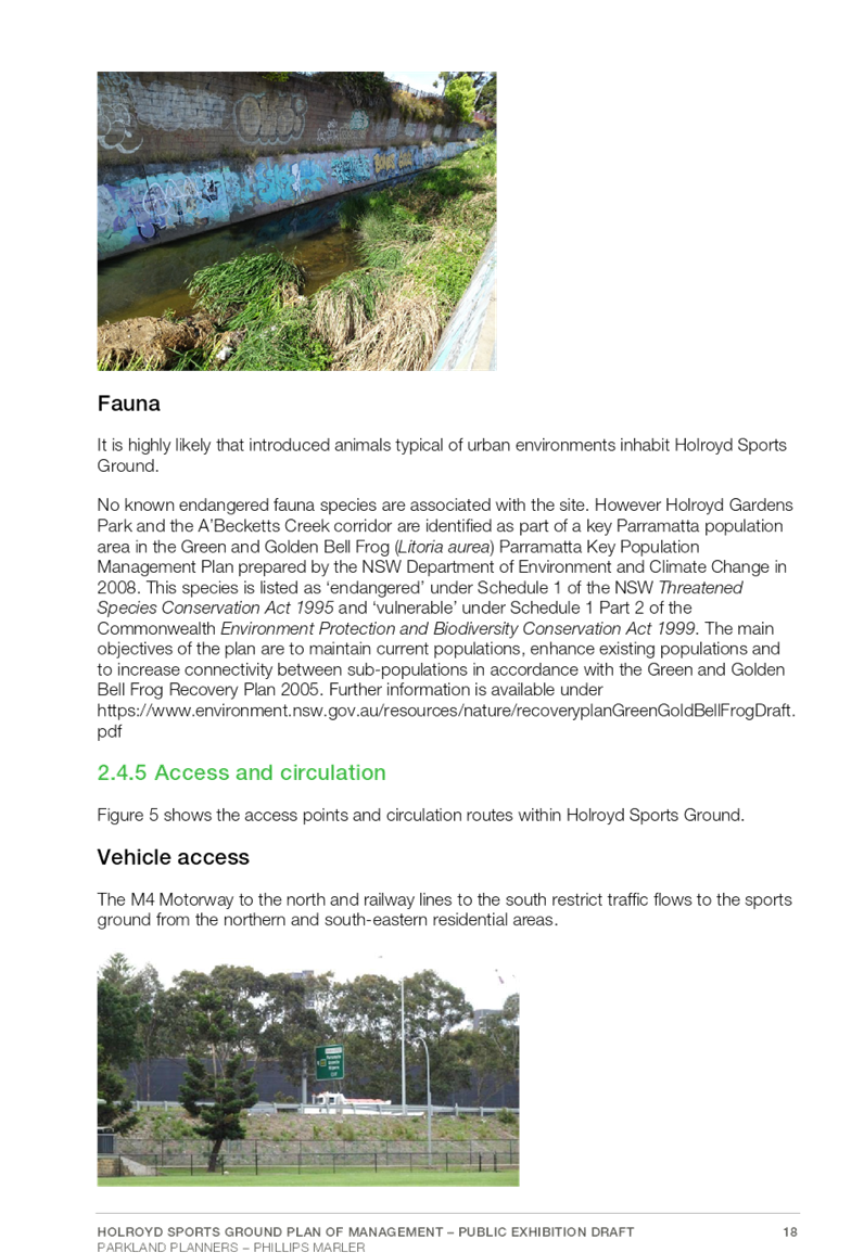
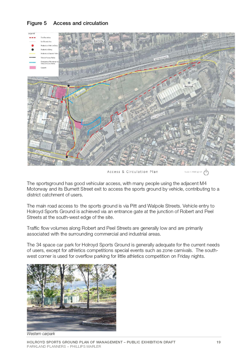
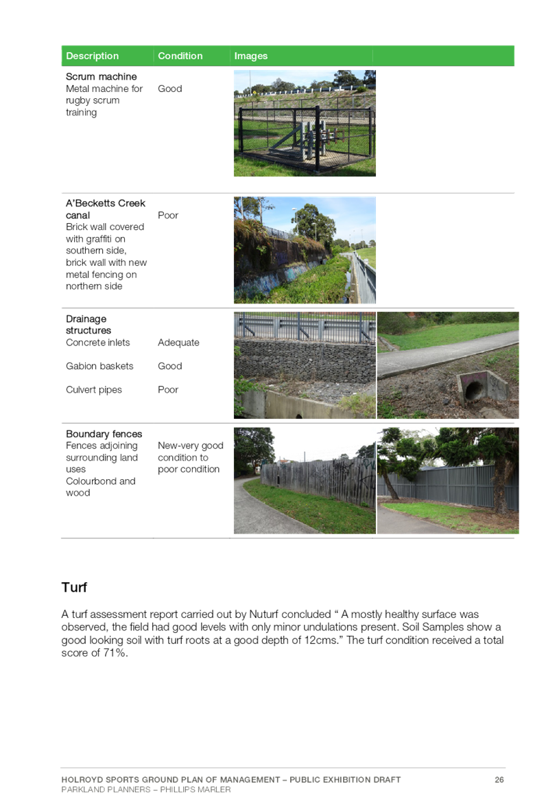
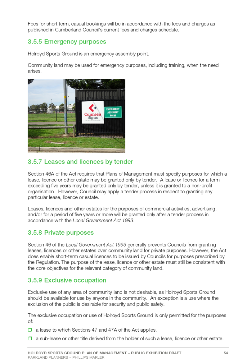
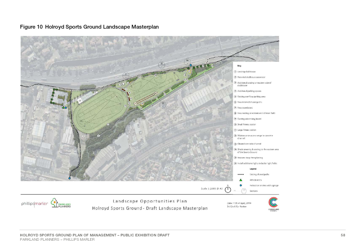
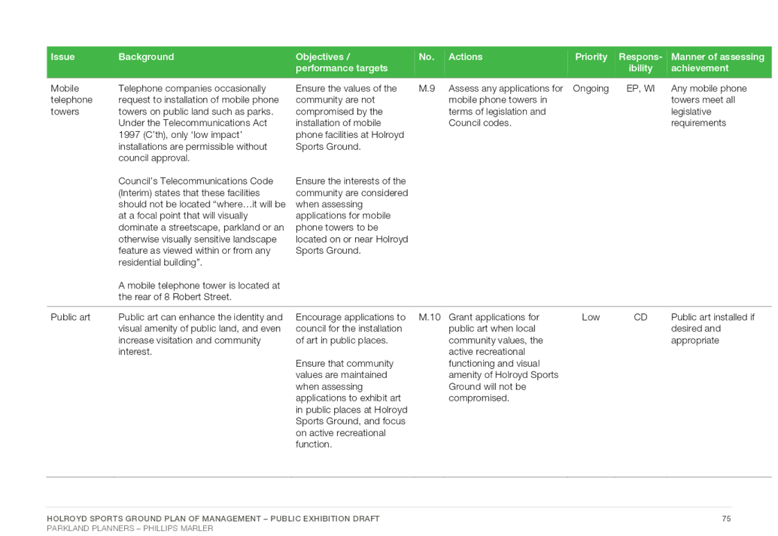
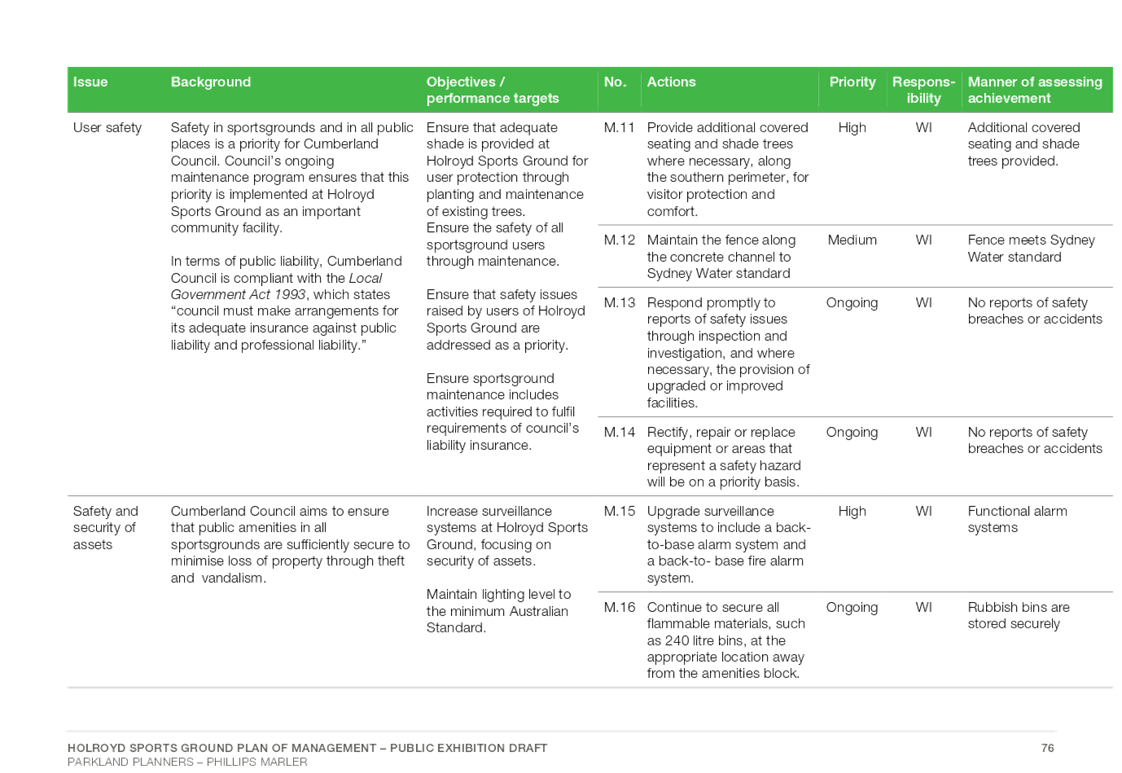
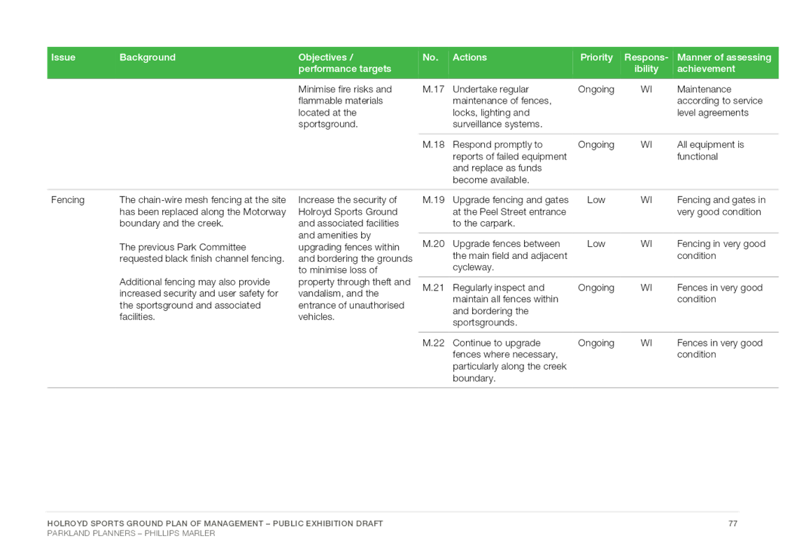
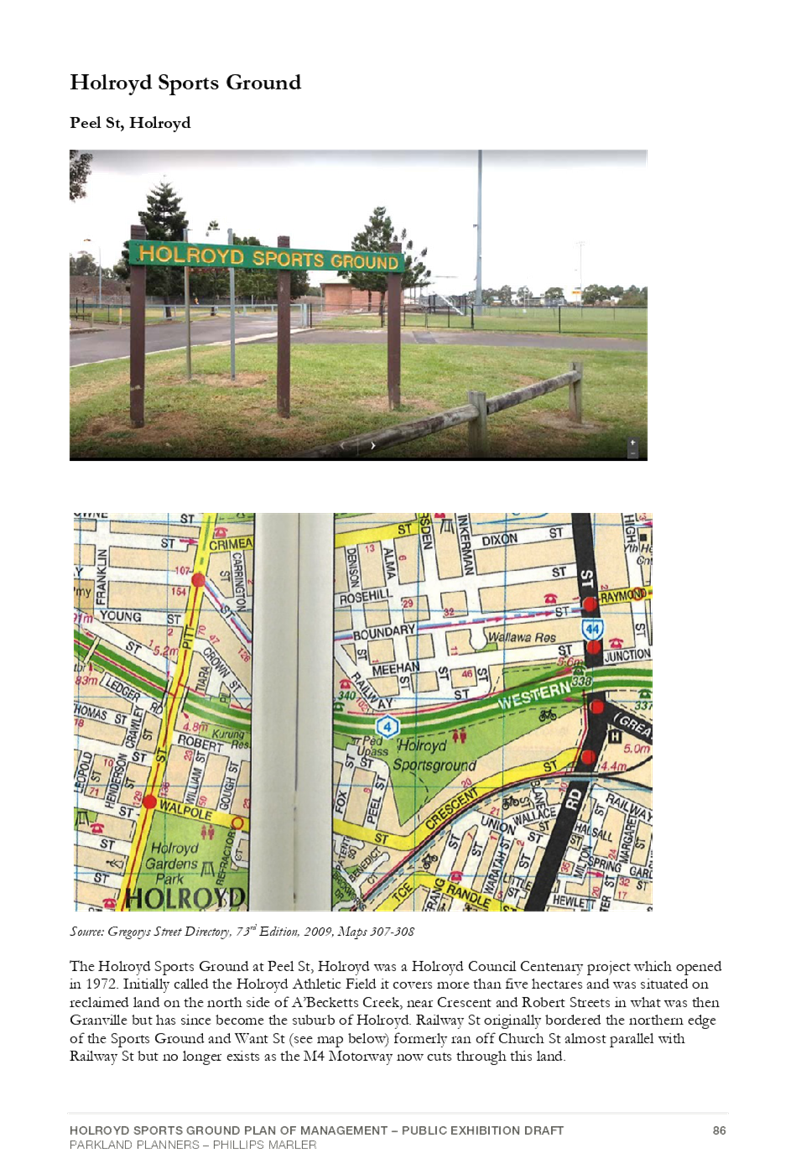
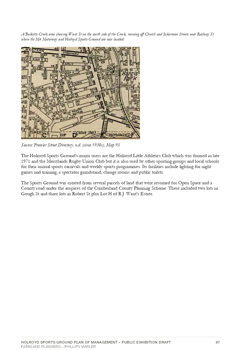
Holroyd Sportsground is located on the corner of Robert and Peel Streets, Holroyd. The ground is bordered by the M4 Motorway along the northern edge and industrial areas and A’Becketts Creek to the south.
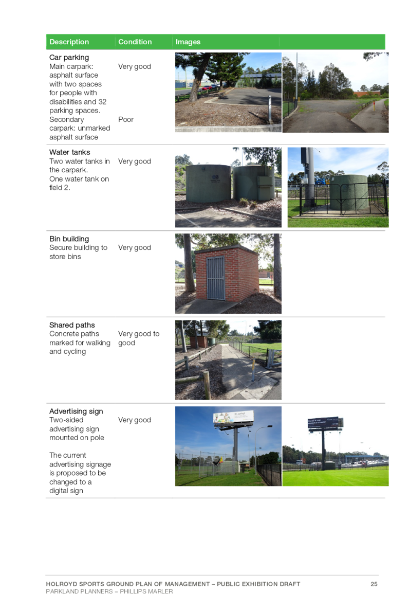
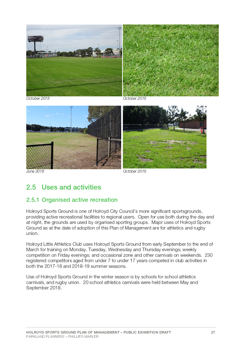
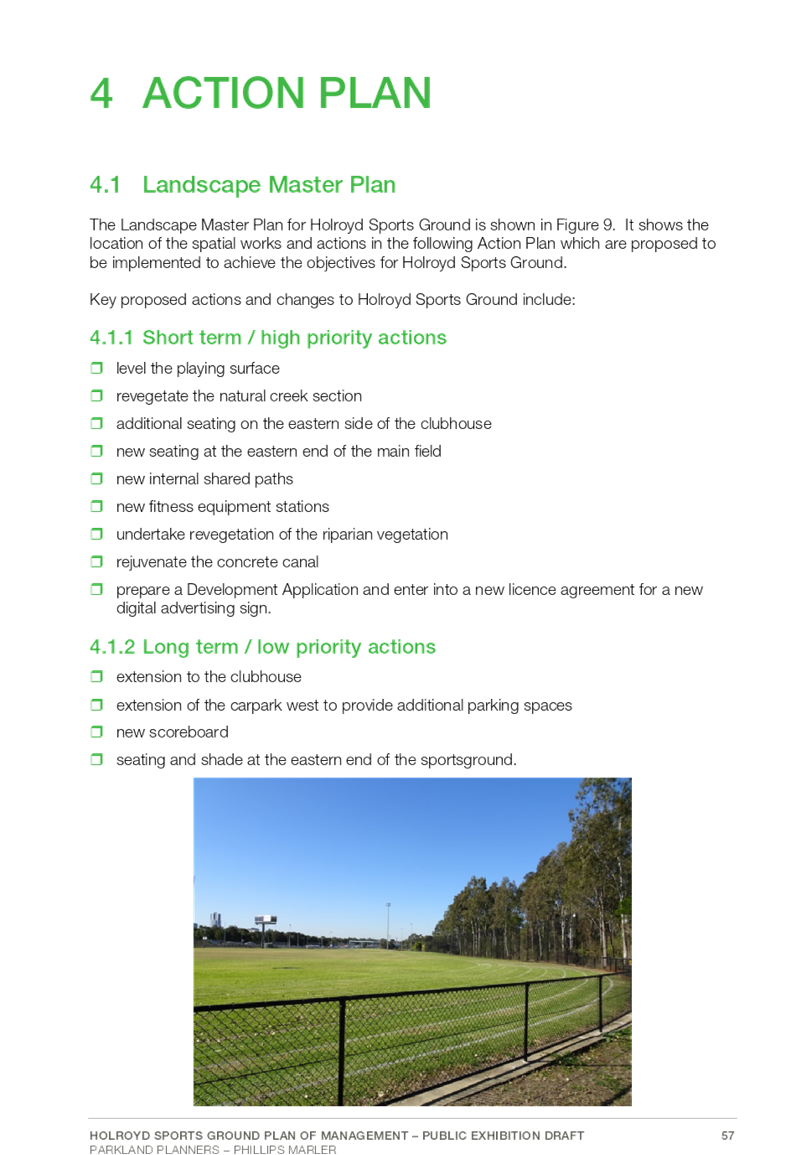
The site features athletic track and field facilities, sporting field, amenities building, car park, shared pathways and an advertising sign.
The first PoM for Holroyd Sportsground was prepared by EDAW in 1997. A review of this original PoM and preparation of a new PoM was undertaken by Manidis Roberts Consultants in 2004. As part of Council’s ongoing review of Plans of Management, Holroyd Sportsground PoM has subsequently been identified for its next review.
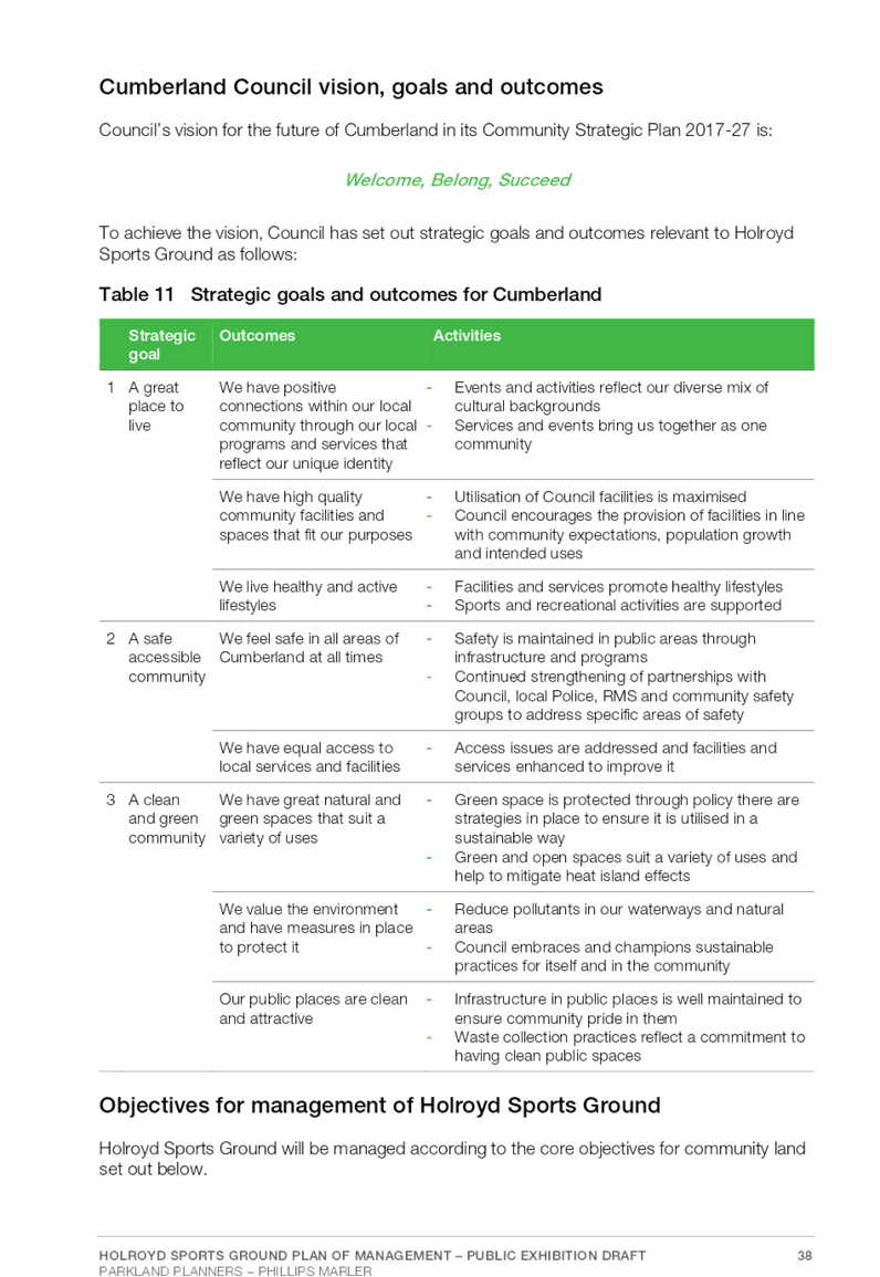
In addition to addressing the requirements of the NSW Local Government Act (1993), Council’s objectives for the development of the Plan of Management are to:
· Meet the legislative requirements for community land under the NSW Local Government Act 1993.
· Identify relevant planning instruments
· Identify appropriate categorisations for the study area
· Incorporate site analysis, research and diagrammatic information
· Incorporate a landscape masterplan
· Include clear, achievable management strategies which reflect Council’s corporate and planning goals and policies
· Reflect the values and desired outcomes of engagement with the community, local residents and other stakeholders
· Identify and consider cultural heritage, environmental, open space and recreational values and balancing of such.
· Set out how Holroyd Sportsground will be used, improved, maintained and managed in to the future.
· Identify improvements, existing assets and maintenance requirements and provide a list of actions and priorities.
Land Categorisation
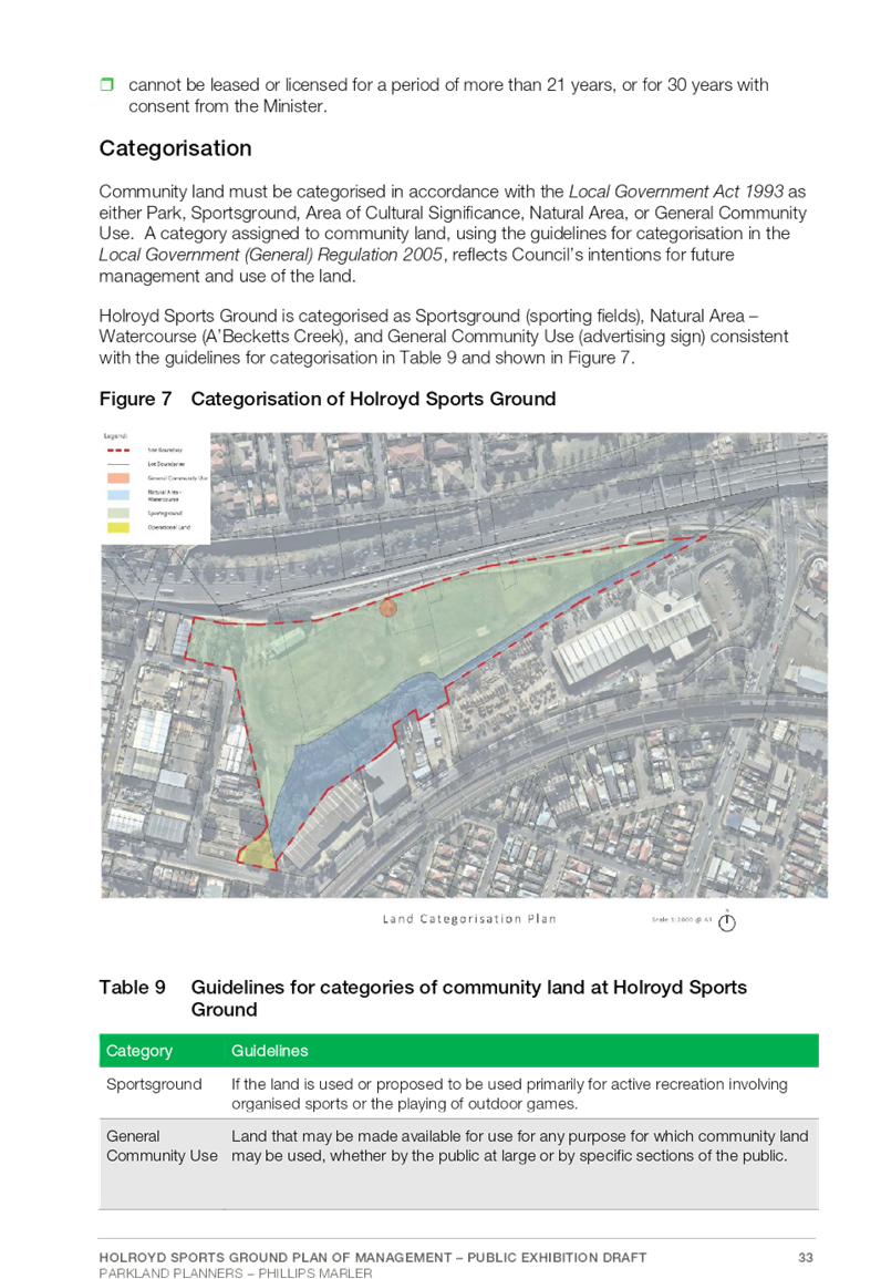
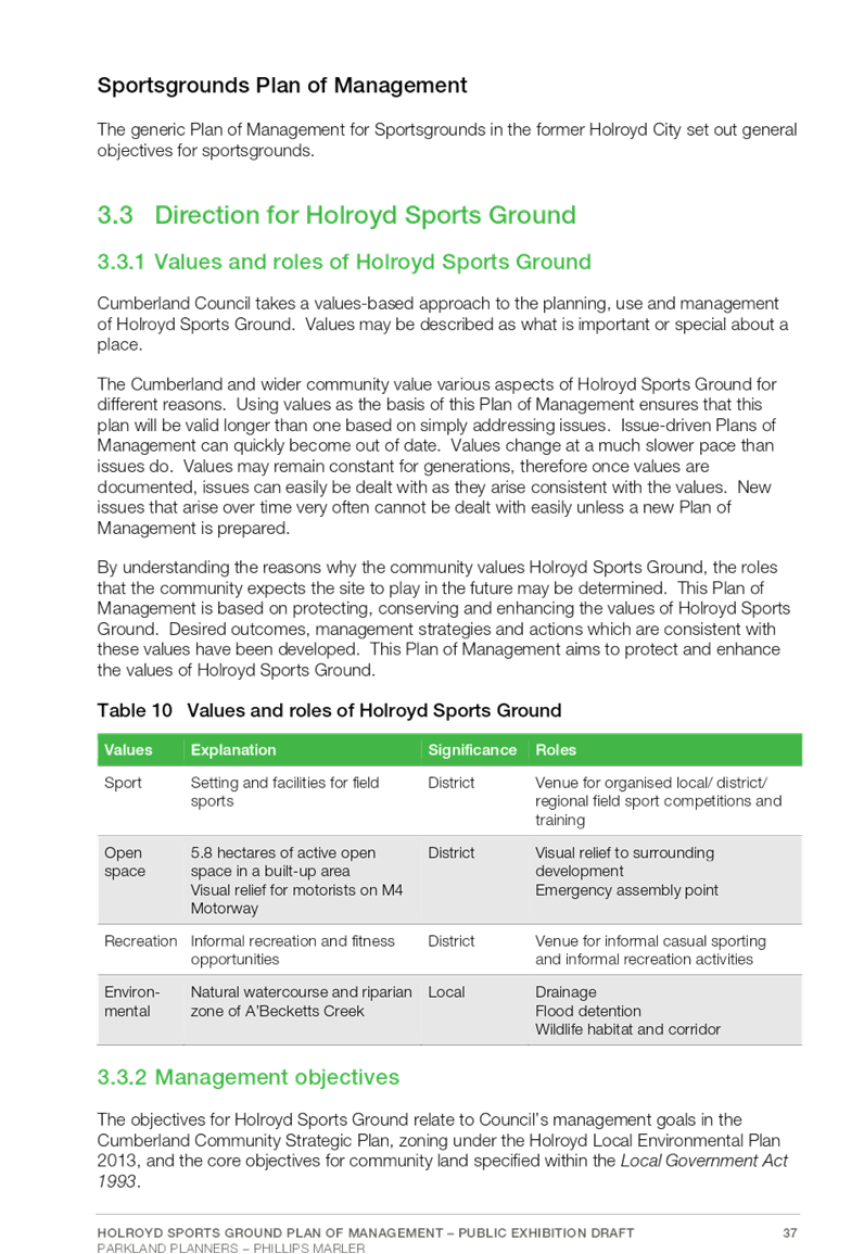
In accordance with Section 36 of the NSW Local Government Act (1993) and the outcome of the preparation process and public hearing, the community land within the open space study area has been identified and re-categorised from the previous PoM to Sportsground, General Community Use and Natural Area – Watercourse.
In the Holroyd Sportsground Plan of Management 1997, Holroyd Sports Ground is defined as category - Sportsground. This category has been revised and expanded to encompass and take into consideration community land (advertising sign) and Natural Area- Watercourse (A’Becketts Creek and canal) along the perimeter of the sportsground area.
Community Engagement
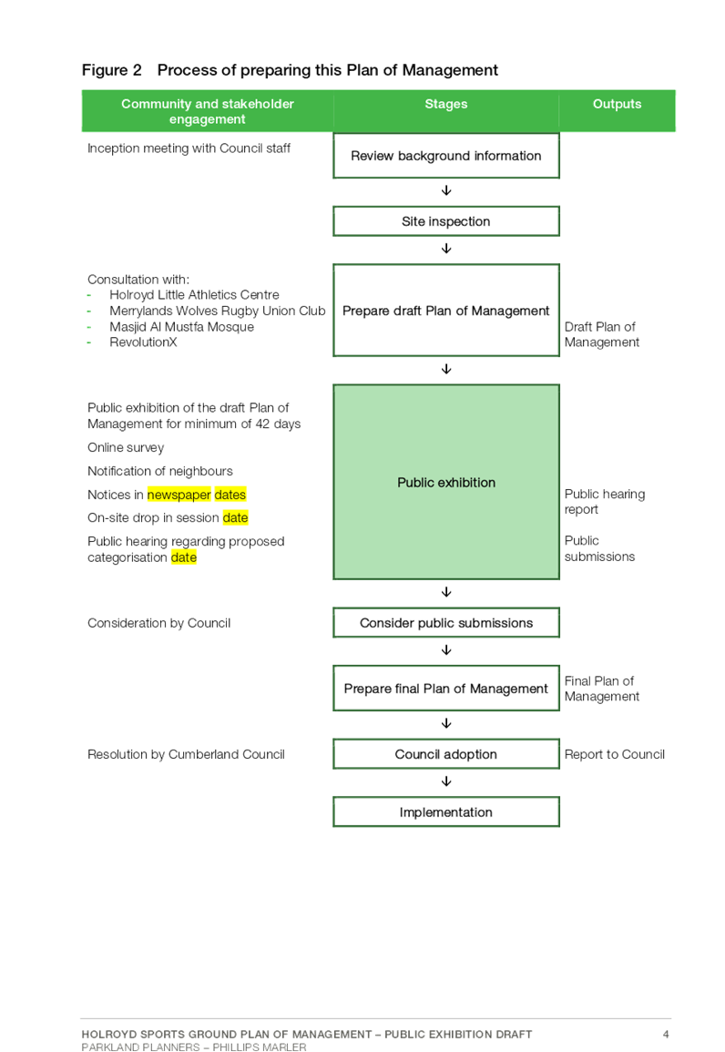
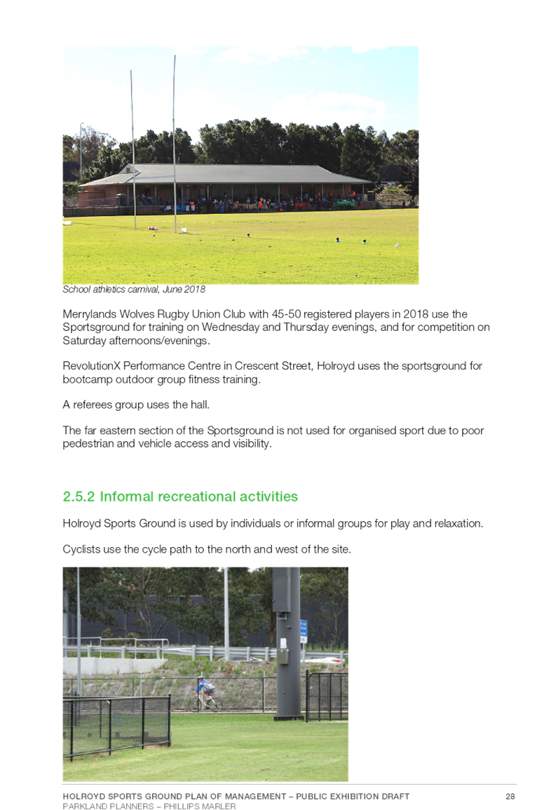
The process for preparing the draft Plan of Management commenced in June 2018 and included two consultation and engagement workshops including an internal Council workshop and consultations with primary stakeholders including the Holroyd Little Athletics Club, Merrylands Rugby Union Club and Holroyd Sportsground Local Parks Committee.
In accordance with the NSW Local Government Act (1993), draft Plans of Management must be advertised for public exhibition for a period of not less than twenty eight (28) days, with an additional fourteen (14) days to allow for public submissions. The draft Holroyd Sportsground Plan of Management will be available for review and comment by the community over a forty two (42) day public exhibition period.
Community engagement activities for the period of public exhibition will include a “Have Your Say” page, notification to community members who have engaged in this project, newspaper advertisements and notification to key stakeholders and surrounding residents.
Council is also required to hold a public hearing in regard to the draft Plan of Management.
Policy Implications
There are no implications on existing Council policies and no requirement to create new policies as a result of this report.
Risk Implications
The draft Holroyd Sportsground Plan of Management will provide strategic planning and good governance for the management and use of Holroyd Sportsground. Following adoption, having this Plan of Management in place ensures Council is complying with the requirements of the Local Government Act (1993).
Financial Implications
Actions identified in the draft Holroyd Sportsground Plan of Management will be considered in the development of Council’s future Capital Works programs and will be funded by Council revenue and developer contributions, as well as grant funding contributions when available.
CONCLUSION
The draft Holroyd Sportsground Plan of Management has been prepared to guide the ongoing management and development of Holroyd Sportsground in compliance with the requirements of the NSW Local Government Act (1993).
This report recommends that the draft Holroyd Sportsground Plan of Management and Landscape Masterplan be placed on public exhibition for further consultation with the community.
Attachments
1. Holroyd
Sportsground Plan of Management ⇩ ![]()
DOCUMENTS
ASSOCIATED WITH
REPORT C05/19-91
Attachment 1
Holroyd Sportsground Plan of Management
Council Meeting
15 May 2019
Item No: C05/19-92
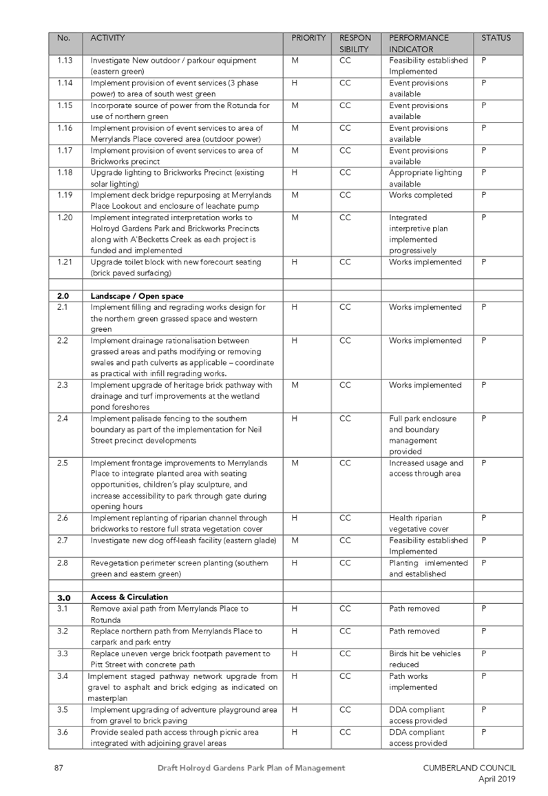
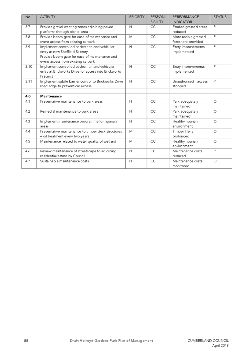
Draft Holroyd Gardens Park Plan of Management
Responsible Division: Works & Infrastructure
Officer: Director Works & Infrastructure
File Number: PK-HOLGA-5
Community Strategic Plan Goal: A great place to live
Summary
Cumberland Council has recently completed a process to prepare a draft Plan of Management (PoM) in accordance with the legislative requirements of the NSW Local Government Act (1993), for Holroyd Gardens Park in Holroyd.
As required by the Act, the draft Plan of Management is to be advertised for public exhibition for a period of not less than twenty eight (28) days and to allow for public submissions for a period of not less than forty two (42) days. Council is also required to hold a public hearing on the draft Plan of Management during this period.
This report summarises the preparation process for the Plan of Management and recommends that the Draft Holroyd Gardens Park Plan of Management is placed on public exhibition.
|
Recommendation That Council: 1. Place on public exhibition the draft Holroyd Gardens Park Plan of Management for a period of 42 days, in accordance with Section 38 of the NSW Local Government Act (1993). 2. Provide a report to Council following the conclusion of the exhibition period detailing the results of submissions made along with a final version of the Plan of Management. |
Report
The NSW Local Government Act (1993) requires Councils to prepare Plans of Management (PoM) for all areas of community land to guide the future planning, ongoing management and development of these open space areas. Community land as defined by regulation includes parks, sportsgrounds, natural areas, areas of cultural significance and land for general community use; and may be prepared on a generic, site specific or geographical basis.
The PoM provides a coordinated framework for decision making, enhancement and management of the open space and aims to integrate the vision and needs of the community and Council.
Holroyd Gardens Park is located north of Merrylands CBD and approximately 180 metres from the Merrylands Train Station, on the corner of Walpole and Pitt Streets in Merrylands.
The draft Holroyd Gardens Park Plan of Management (Attachment 1) has been prepared to cover community land encompassing the Holroyd Gardens Park between Pitt Street, Walpole Street, Brickworks Drive and Sheffield Street and will supersede the previous PoM adopted by the former Holroyd Council in 2000. The updated draft Plan of Management also incorporates a Landscape Masterplan (Attachment 2) to guide the context of future development and improvements within the parkland area.
The Plan of Management study area also incorporates adjacent open space areas associated with Holroyd Gardens Park including the heritage precinct which runs alongside Brickworks Drive and the A’Becketts Creek corridor.
The southern boundary of the park adjoins the Neil Street precinct which is currently at various stages of development. The Neil Street Precinct Plan incorporates the extension of Sheffield Street across Pitt Street. The draft Plan of Management and Landscape Masterplan have included the extension of the park’s perimeter palisade fence along this new park frontage. A new gated entry is proposed to be located at this southern frontage of the park which is expected to improve pedestrian connectivity between the park and the Merrylands CBD.
As a former clay extraction pit and landfill site, the park was initially established in 1986 and now provides a range of facilities for passive recreation including covered picnic table sets, covered electric BBQs, a pedestrian pathway network, art feature ‘New Dawn’, a bookable wedding reception rotunda, a road safety bicycle training track, an accessible playground for younger aged children and an adventure playground for older aged children.
The large bicentennial structure named Merrylands Place, formally known as the Sydney Children’s Museum, is currently leased as a Childcare Centre, ‘Creative Garden Early Learning Centre Holroyd’. Other utility structures within the park include a toilet block, a leachate pre-treatment plant, a gas flaring and processing plant and a Council depot compound area. The plant facilities are currently operated by the Waste Asset Management Corporation.
The updated draft Plan of Management integrates the following community land amendments:
· Lot 414 DP 108 7853, located west of Dressler Court which was integrated into the park following the completion of the residential subdivision development, formerly known as Holroyd Gardens Estate.
· Part Lot 3 DP 600621 and part Lot 1001 DP 1037793, to reclassify and excise a road for the extension of Sheffield Street under the Holroyd Local Environmental Plan 2013.
· Lot 2052 and 2051 DP 1135275, heritage precinct and former brickmaking plant listed under heritage item No. 153 under the Holroyd Local Environmental Plan 2013.
· Lot 320 and 321 DP 1087465, Lot 135 DP 1047603 and Lot 206 DP 1052756, A’Becketts Creek corridor.
Council’s objectives for the development of the Plan of Management are to:
· Meet the legislative requirements for community land under the Local Government Act 1993
· Identify relevant planning instruments
· Identify appropriate categorisations for the study area
· Incorporate site analysis, research and diagrammatic information
· Incorporate a Landscape Masterplan
· Clarify and prioritise how Council will manage the land, and how the current land may be developed
· Incorporate feedback raised in consultation with stakeholders
· Identify improvements, existing assets and maintenance requirements and provide a list of actions and priorities
· Revise the parks southern boundary and connection to the Neil Street precinct
As a result of the consultative processes, the draft Plan of Management identifies the following key priority actions:
· Continuation of the perimeter palisade fencing and screen planting along the new park frontage adjacent to the Sheffield Street extension with new main entry gates to allow pedestrian connectivity between the park and the Neil Street precinct.
· Infill and re-turf surfaces which have been affected by landfill subsidence as well as drainage swales to facilitate the safe passage of pedestrians, particularly during events.
· Extend and upgrade the existing path network to rationalise routes of pedestrian travel and to provide connection to the southern boundary.
· Provide an outdoor fitness/exercise hub and upgrade the junior accessible playspace in consultation with the Touched by Olivia Foundation who have expressed interest in working with Council on this site.
· Review the potential for small scale event use, Heritage Building 2 uses and issues relating to the unstructured use of wedding photography within the heritage precinct.
· Upgrade the Merrylands Place entry area and investigate potential for small scale event use under the covered area.
· Develop an integrated interpretation plan covering the heritage values of the former extraction pit and brickmaking structures which remain on the site.
The NSW Local Government Act (1993) identifies core objectives for the management of community land according to the categorisations under the regulation.
As the Holroyd Gardens Park and the associated parkland areas have been well established over time, multiple categories including Park, General Community Use, Natural Area Watercourse and Area of Cultural Significance have been applied to specific areas of community land within the draft Plan of Management.
Community Engagement
The process for preparing the draft Plan of Management commenced in June 2018 and included two community workshops, an internal Council Workshop held on Tuesday 7 August 2018 and an evening external Community Stakeholder Forum held on Thursday 22 November 2018.
Notifications for the Community Stakeholder Forum were delivered to all residential properties within a 400 metre radius of Holroyd Gardens Park and advertisements were published in the local newspapers.
The Community Stakeholder Forum was attended by ten (10) community members, two (2) Council Officers and two (2) external consultants.
Feedback raised during the Workshop and Forum was considered and rationalised for inclusion as appropriate. The notes of these meetings are included in Appendices 5 and 6 in the draft Plan of Management.
In accordance with the NSW Local Government Act (1993), draft Plans of Management must be advertised for public exhibition for a period of not less than twenty eight (28) days, with an additional fourteen (14) days to allow for public submissions. The draft Holroyd Gardens Park Plan of Management will be available for review and comment by the community over a forty two (42) day public exhibition period.
Community engagement activities for the period of public exhibition will include a “Have Your Say” page, notification to community members who have engaged in this project, newspaper advertisements and notification to surrounding residents.
Council is also required to hold a public hearing in regard to the draft Plan of Management.
Policy Implications
There are no implications for existing Council policies and no requirement to create new policies as a result of this report.
Risk Implications
The draft Holroyd Gardens Park Plan of Management will provide strategic planning and good governance for the management and use of Holroyd Gardens Park. Following adoption, having this Plan of Management in place ensures Council is complying with the requirements of the Local Government Act (1993).
Financial Implications
Actions identified in the draft Holroyd Gardens Park Plan of Management will be considered in the development of Council’s future Capital Works programs and will be funded by Council revenue and developer contributions, as well as grant funding contributions when available.
CONCLUSION
The draft Holroyd Gardens Park Plan of Management has been prepared to guide the ongoing management and development of Holroyd Gardens Park and associated parkland areas in compliance with the requirements of the NSW Local Government Act (1993).
This report recommends that the draft Holroyd Gardens Plan of Management and Landscape Masterplan be placed on public exhibition for further consultation with the community.
Attachments
1. Draft Holroyd
Gardens Park Plan of Management ⇩ ![]()
2. Draft
Holroyd Gardens Park Landscape Masterplan ⇩ ![]()
DOCUMENTS
ASSOCIATED WITH
REPORT C05/19-92
Attachment 1
Draft Holroyd Gardens Park Plan of Management
Attachment 2
Draft Holroyd Gardens Park Landscape Masterplan
15 May 2019
Item No: C05/19-93
Removal of Power Pole at the Intersection of Blaxcell Street and Farnell Street, Granville
Responsible Division: Works & Infrastructure
Officer: Director Works & Infrastructure
File Number: T-28-01/06
Community Strategic Plan Goal: A safe accessible community
Summary
Council at its meeting held on 5 December 2018 resolved that “as a matter of urgency, Council receive a report in relation to the costs associated with the removal or relocation of the power pole at the intersection of Blaxcell Street and Farnell Street, Granville.” This report outlines the investigation into this matter.
|
Recommendation That Council install a speed hump or cushion on the southern approach of the intersection of Blaxcell Street with Farnell Street at Granville to slow approaching traffic, subject to the concurrence of the Cumberland Traffic Committee. |
Report
The Cumberland Traffic Committee (CTC) at its meeting held on 7 November 2018 considered a report (CTC-18-025) on safety concerns relating to the roundabout at the intersection of Blaxcell Street and Farnell Street, Granville. This report considered the provision of pedestrian fencing at the corner, where the power pole is located. At the conclusion of discussion, the CTC recommended that the installation of pedestrian fencing on Blaxcell Street and Farnell Street, Granville not be approved.
The Cumberland Traffic Committee recommendation was reported to Council’s meeting on 5 December 2018 whereby Council resolved (Min. 375 – C12/18-251):
“that as a matter of urgency Council receive a report in relation to the costs associated with the removal or relocation of the power pole at the intersection of Blaxcell Street and Farnell Street, Granville.”
The power pole referred is shown in the map below:
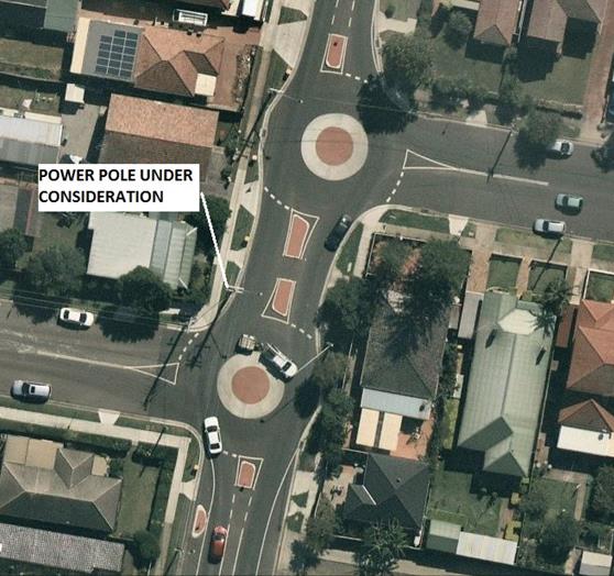
As discussed in the CTC report, there is a concern that a vehicle speeding through the roundabout may collide with the power pole. The power pole under consideration is a ‘distribution pole’ and carries general voltage and high voltage cables. The map below shows the street view of a vehicle approaching the roundabout from the South.
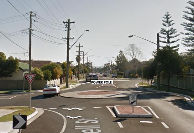
Investigation
Following Council’s resolution, preliminary investigations have been undertaken concerning the relocation of the subject power pole. The roundabout was designed for low speeds and was approved by the Parramatta City Council Local Traffic Committee and subsequently endorsed by the Council. The construction was also undertaken by Parramatta City Council.
Attached to the business paper are two scenarios, the first depicting a vehicle travelling through the roundabout at 20km/h (Attachment 1) and the second depicting a vehicle travelling through the roundabout at 25km/h (Attachment 2). In this regard, a vehicle travelling at 20km/h will remain within the road carriageway, indicating that this speed is considered acceptable and allows manoeuvring through the roundabout. A vehicle travelling at 25km/h however has the potential to mount the kerb and collide with the power pole.
Attachment 2 also presents two alternative positions considered by Council for the relocation of the power pole, those being:
· Location 1 - south of the pedestrian access ramp outside 134 Blaxcell Street
· Location 2 - north of the pedestrian access ramp outside 134 Blaxcell Street
Relocation of the power pole will also have an impact on the alignment of overhead power cables, with the alternate locations resulting in an encroachment on the residential property at 134 Blaxcell Street that would require either an easement across the residential property, or burial of the cables underground.
Notwithstanding the potential relocation of the power pole, the fact remains that a vehicle travelling at 25km/h will still collide with the power pole at any of these locations. Relocation of the power pole will therefore not resolve any safety concerns.
Considering the above comments, Council staff has investigated the feasibility of restricting the speed of vehicles approaching the roundabout through the installation of a traffic calming device. The most effective method to restrict the speed of vehicles traveling through the roundabout is to install a speed hump on the southern approach of the roundabout.
Community Engagement
Consultation will have to occur with affected properties.
Policy Implications
There are no policy implications for Council associated with this report.
Risk Implications
There are no risk implications for Council associated with this report.
Financial Implications
The recommended speed hump construction will cost in order of $15,000 and it can be accommodated within the traffic facilities budget of 2019/2020.
CONCLUSION
Based on the above discussion and costs involved, Council Officers recommend the installation of a speed hump on the southern approach to the roundabout on the corner of Blaxcell and Farnell Street, Granville.
Attachments
1. Attachment 1 - Car
Travelling 20km/h ⇩ ![]()
2. Attachment
2 - Car Travelling 25km/h ⇩ ![]()
3. Attachment
3 - Proposed Speed Humps/Cushions ⇩ ![]()
4. Attachment
4 - Traffic Committee Report ⇩ ![]()
DOCUMENTS
ASSOCIATED WITH
REPORT C05/19-93
Attachment 1
Attachment 1 - Car Travelling 20km/h
Attachment 3
Attachment 3 - Proposed Speed Humps/Cushions