Cumberland Local Planning Panel Meeting
13 March 2019
A
meeting of the Cumberland Local Planning Panel
will be held at 11:30am at the Merrylands Administration Building, 16
Memorial Avenue, Merrylands on Wednesday, 13 March 2019.
Business as below:
Yours faithfully
Hamish McNulty
General
Manager
ORDER OF BUSINESS
1.
Receipt of Apologies
2. Confirmation of Minutes
3. Declarations of Interest
4. Address by invited speakers
5. Reports:
- Development
Applications
- Planning
Proposals
6. Closed Session Reports
Cumberland Local Planning Panel Meeting
13 March 2019
CONTENTS
Report No. Name of Report Page
No.
Development Applications
LPP005/19.. Development Application for
116 Kingsland Road, Regents Park. 8
LPP006/19.. Section 4.55(2)
modification for 601-605 Great Western Highway, Greystanes........................................................................... 123
LPP007/19.. S.46 Modification to 1-7
& 9-11 Neil Street, Merrylands........... 227
LPP008/19.. Section 4.56 modification
to 1-7 and 9-11 Neil Street, Merrylands........................................................................... 439
LPP009/19.. Planning Proposal for 100 Woodville
Road.............................. 657
LPP010/19.. Planning Proposal Request For 2
Bachell Avenue, Lidcombe -Preliminary Public Exhibition and Technical
Assessment.......... 707
Minutes of the Cumberland Local
Planning Panel Meeting held at Merrylands Administration Building, 16 Memorial
Avenue, Merrylands on Wednesday 13 February 2019.
Present:
The Hon. Paul Stein AM (Chairperson) QC, Lindsay Fletcher,
David Ryan and Bruce Simpson.
In
Attendance:
Karl Okorn, Monica Cologna, Sohail Faridy, Esra Calim, Sarah
Pritchard, William Attard and Laith Jammal.
Notice
of AUDIO RECORDING of CUMBERLAND lOCAL planning panel meeting
The Chairperson advised that the Cumberland Local Planning
meeting was being audio recorded and will be posted on Council's website and
members of the public must ensure their speech to the Panel is respectful and
use appropriate language.
The meeting here opened at 11:30a.m.
DeclaRations
Of Interest:
There were no declarations of
interest.
ADDRESS
BY INVITED SPEAKERS:
The following persons had made
application to address the Cumberland Local Planning Panel meeting:
Speakers Item
No. Subject
Meg Levy LPP003/19
– DA for 74, 76 & 78 Aurelia Street, Toongabbie
Andrew Elia LPP003/19
– DA for 74, 76 & 78 Aurelia Street, Toongabbie
Onofiro Marzulli LPP003/19
– DA for 74, 76 & 78 Aurelia Street, Toongabbie
Barry Wiggins LPP003/19
– DA for 74, 76 & 78 Aurelia Street, Toongabbie
Adam Byrnes LPP004/19
– DA for 27B & 29 Garfield Street, Wentworthville
The Chairperson enquired to those
present in the Gallery as to whether there were any further persons who would
like to address the Panel and no further persons presented themselves.
The open session of the meeting here closed at 12:12p.m.
The closed session of the meeting here opened at 12:13p.m.
|
ITEM LPP003/19 - Development
Application at 74,76 & 78 Aurelia Street, Toongabbie
|
- That
Development Application 2017/513/1 seeking demolition of existing
structures, consolidation of 3 lots into 1 lot, construction of a part
4, part 5 storey mixed use development containing seniors housing in the
form of 38 self-contained dwellings and a medical centre over two levels
of basement parking accommodating 37 parking spaces under Housing for Seniors
or People with a Disability SEPP 2004 at 74, 76 & 78 Aurelia Street,
Toongabbie, be Approved, subject to the conditions contained in
Attachment 2 of the Planning Officer’s report as amended by the
Panel as follows:
- Condition
180 to be amended as follows:
The
removal of existing and the construction of concrete footpath paving 2.5 metres
wide along the Aurelia Street site frontage.
These works shall be carried out
by a licensed construction contractor at the applicant’s expense and
shall be in accordance with
Council’s standard drawing SD 8100 and issued level sheets.
- Condition
208 to be amended as follows:
All
vehicles shall enter and leave the site in a forward direction (with the exception
of the loading and unloading functions).
- Inclusion of
Condition 12A:
12A Screening of Substation
A lightweight screen, designed
to a height of 1.5 metres, shall be constructed adjacent to the 3 metre zone
of influence of the existing substation opposite unit number G03. Details and
consequent amendment of the landscape plan shall be submitted to
Council’s Manager Development Assessment for approval, prior to the
issue of a Construction Certificate.
For: Paul Stein AM (Chairperson), Lindsay Fletcher,
David Ryan and Bruce Simpson.
Against: Nil.
Reasons for Decision:
- The Panel is in
agreement with the Planning Officer’s report and has added a
condition to improve the outlook and amenity of unit G03.
- The Panel notes that
the reference to Wentworthville Town Centre on page 14 of the report was
intended as referring to Toongabbie Town Centre.
|
|
ITEM LPP004/19 - Development Application for
27B & 29 Garfield Street, Wentworthville
|
|
- That Development Application 2018/196 for
demolition of existing structures and construction of a part 4, part 5
storey residential flat building over basement parking accommodating a
total of 20 units and 24 parking spaces be approved as a Deferred Commencement
Consent subject to the conditions within the draft notice of
determination provided at attachment 4 in the Officer’s report, as
amended by the Panel as follows:
- The inclusion of condition 12A:
Apartment
B-201, together with the communal area and bedroom balcony in unit A-302 on
the roof of apartment B-201, are to be deleted.
- The inclusion of condition 12B:
A
frosted glass privacy screen shall be provided along the southern edge of the
communal roof terrace to a height of 1.5 metres above finished floor level of
the terrace to the satisfaction of Council’s Manager Development
Assessment.
- The inclusion of condition 12C:
The
installation of a lightweight decorative screening to partially enclose the
front void area (beneath unit A-101) and to conceal any services from the
apartments above. Details are to be provided to the satisfaction of
Council’s Manager Development Assessment.
- The inclusion of Condition 122A:
Vehicular
access to Garfield Street through the approved development site at 27
Garfield Street, Wentworthville shall be constructed generally in accordance
with drawing DA-02 issue D.
- Amendment to condition 2:
To
add a reference in the table to plan DA-02 - overall basement plan - issue D.
- Amendment to condition 18:
In
line 3, “fifteen (15) x2 bedroom dwellings”, becomes
“fourteen (14) x2 bedroom dwellings”
For: Paul Stein AM (Chairperson), Lindsay Fletcher,
David Ryan and Bruce Simpson.
Against: Nil.
Reasons for Decision:
- The Panel generally concurs with the
Planning Officer’s report subject to the following comments.
- The Panel considers that the adverse
overshadowing, privacy and built form impacts associated with the
proposed development will be ameliorated to an acceptable level through
the deletion of unit B-201 and associated roof elements. Further
conditions are also imposed to improve streetscape and privacy impacts.
- The Panel is of the firm opinion that a
better planning outcome would be achieved by consolidation of the
subject sites (27B and 29) with the adjoining allotment (27) to provide
one development site. This should result in a development of an improved
standard of amenity over and above the existing consents and this
approval. Notwithstanding this and the other current approvals, the
Panel would encourage the applicant to consider a whole of site
consolidation.
- The Panel note a typographical error at
page 169 of the Planning Officer’s report under SEPP 55 - The
matter for consideration paragraph 3 the answer is “no” and
not “yes”.
|
The closed session of the
meeting here closed at 1:42p.m.
The open session of the meeting
here opened at 1:44p.m.
The Chairperson delivered the
Cumberland Local Planning Panel’s resolutions to the Public Gallery.
The meeting terminated at 1:47p.m.
Signed:

The Hon. Paul Stein AM
(Chairperson) QC
Chairperson
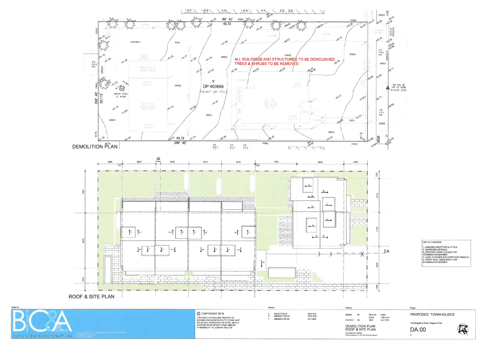
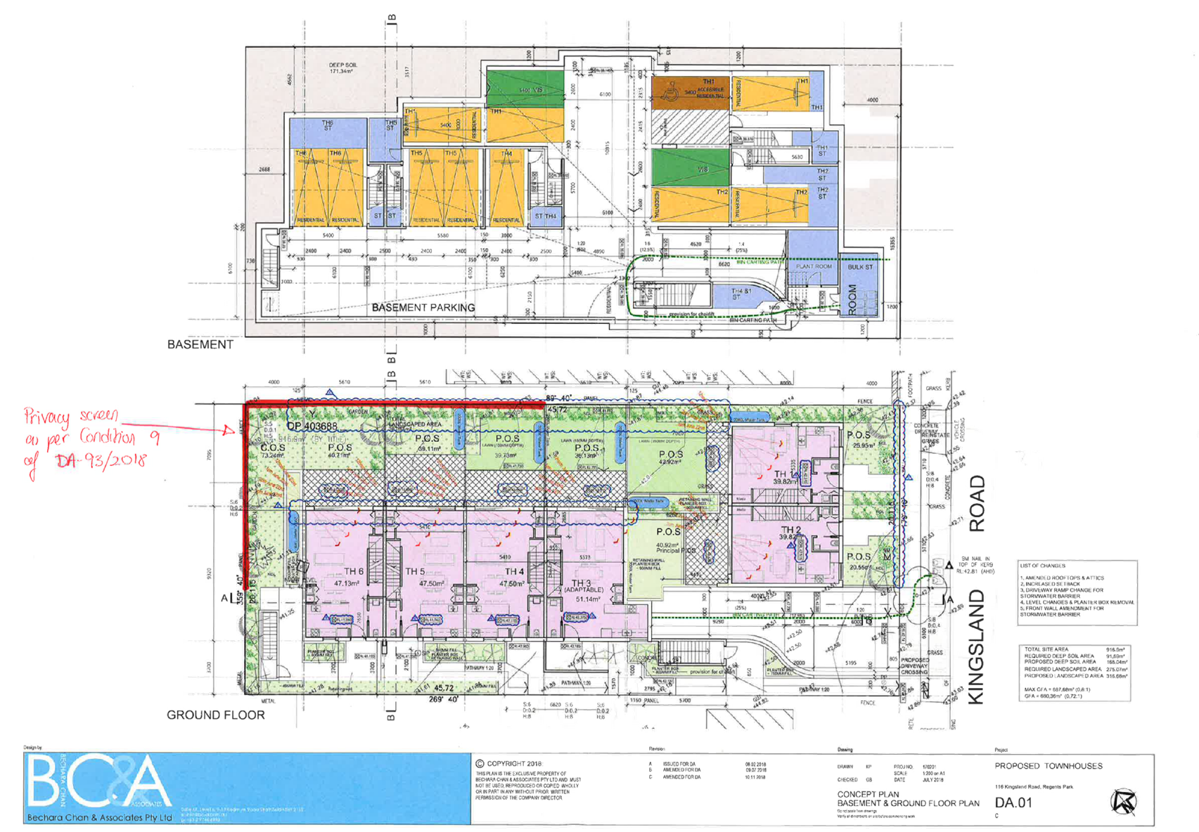
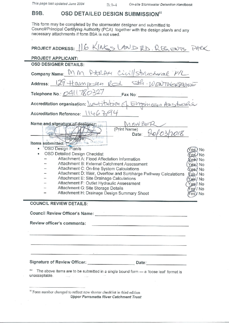
Item No: LPP005/19
Development
Application for 116 Kingsland Road, Regents Park
Responsible
Division: Environment
& Planning
Officer: Manager
Development Assessment
File
Number: DA
- 93/2018
|
Application
lodged
|
07-Feb-2019
|
|
Applicant
|
Bechara
Chan & Associates
|
|
Owner
|
Mn
Sukkar Pty Ltd
|
|
Application
No.
|
DA-93/2018
|
|
Description
of Land
|
116
Kingsland Road, REGENTS PARK NSW 2143, Lot Y DP 403688
|
|
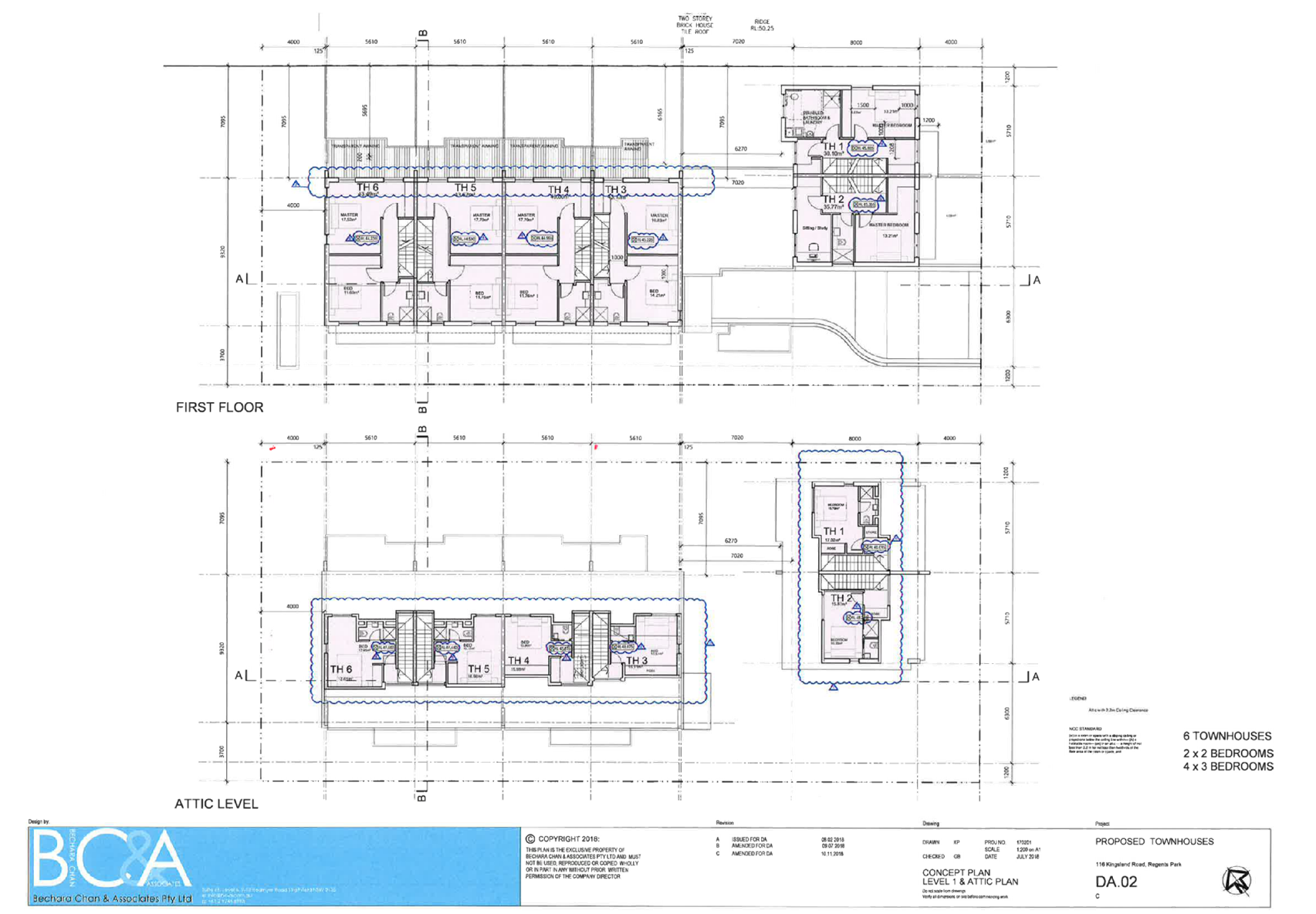
Proposed
Development
|
Demolition
of an existing dwelling and structures and construction of five two storey
townhouses (including attic level) over basement car parking
|
|
Site
Area
|
916.90m2
|
|
Zoning
|
R3
– Medium Density Zone
|
|
Disclosure
of political donations and gifts
|
Nil
disclosure
|
|
Heritage
|
No
|
|
Principal
Development Standards
|
FSR
Permissible:
0.75:1
Proposed:
0.68:1
Height
of Building
Permissible:
9m
Proposed:
9m
|
|
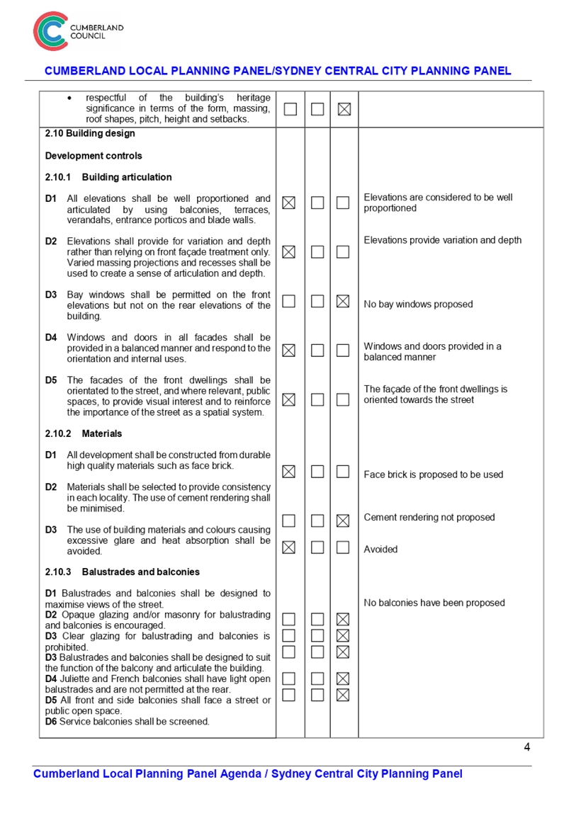
Issues
|
Submissions
received, dwelling size, head height of windows, development control diagram
and basement setback
|
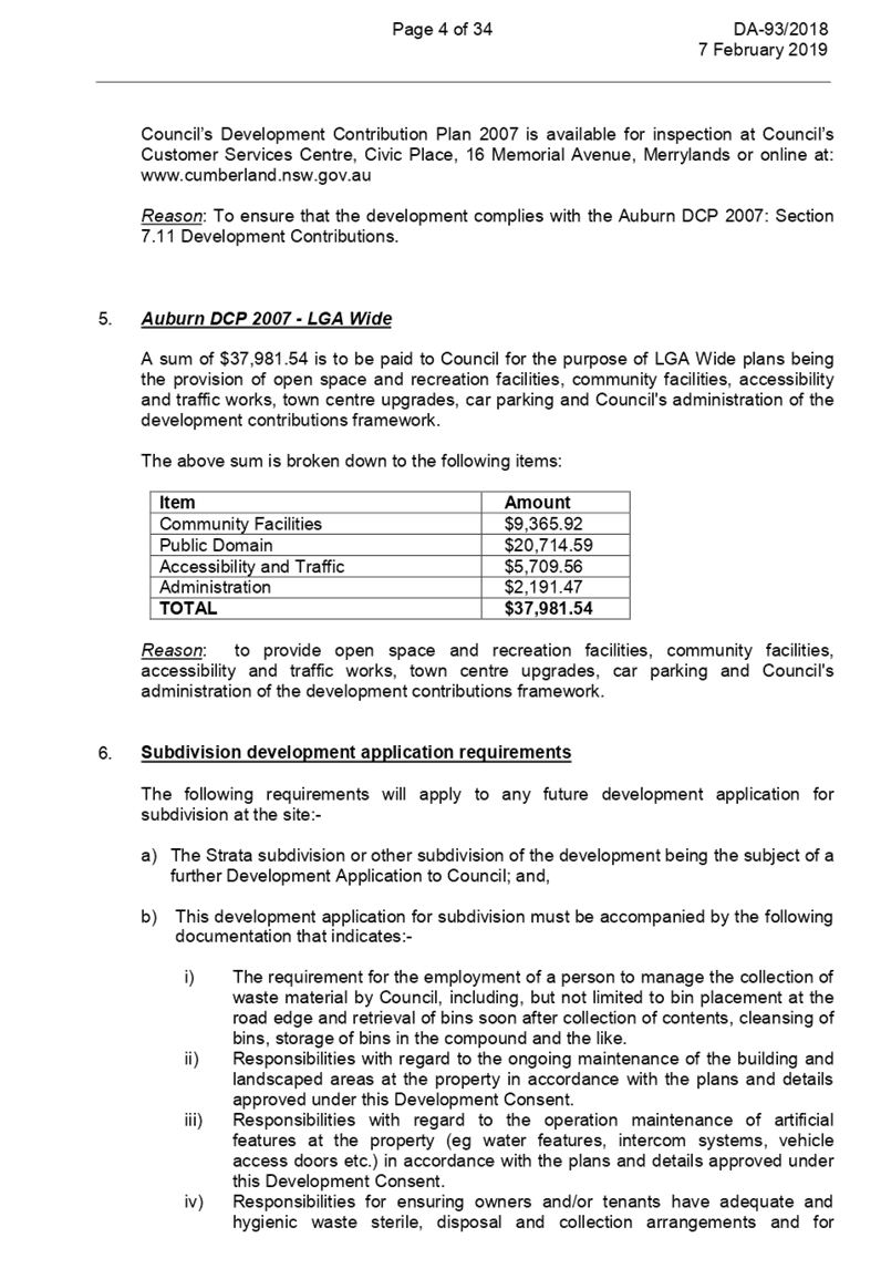
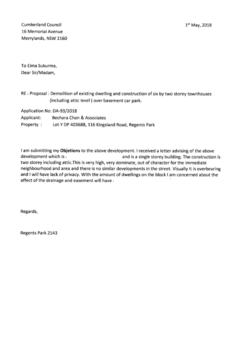
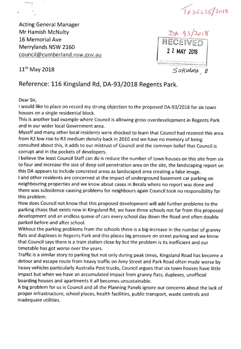
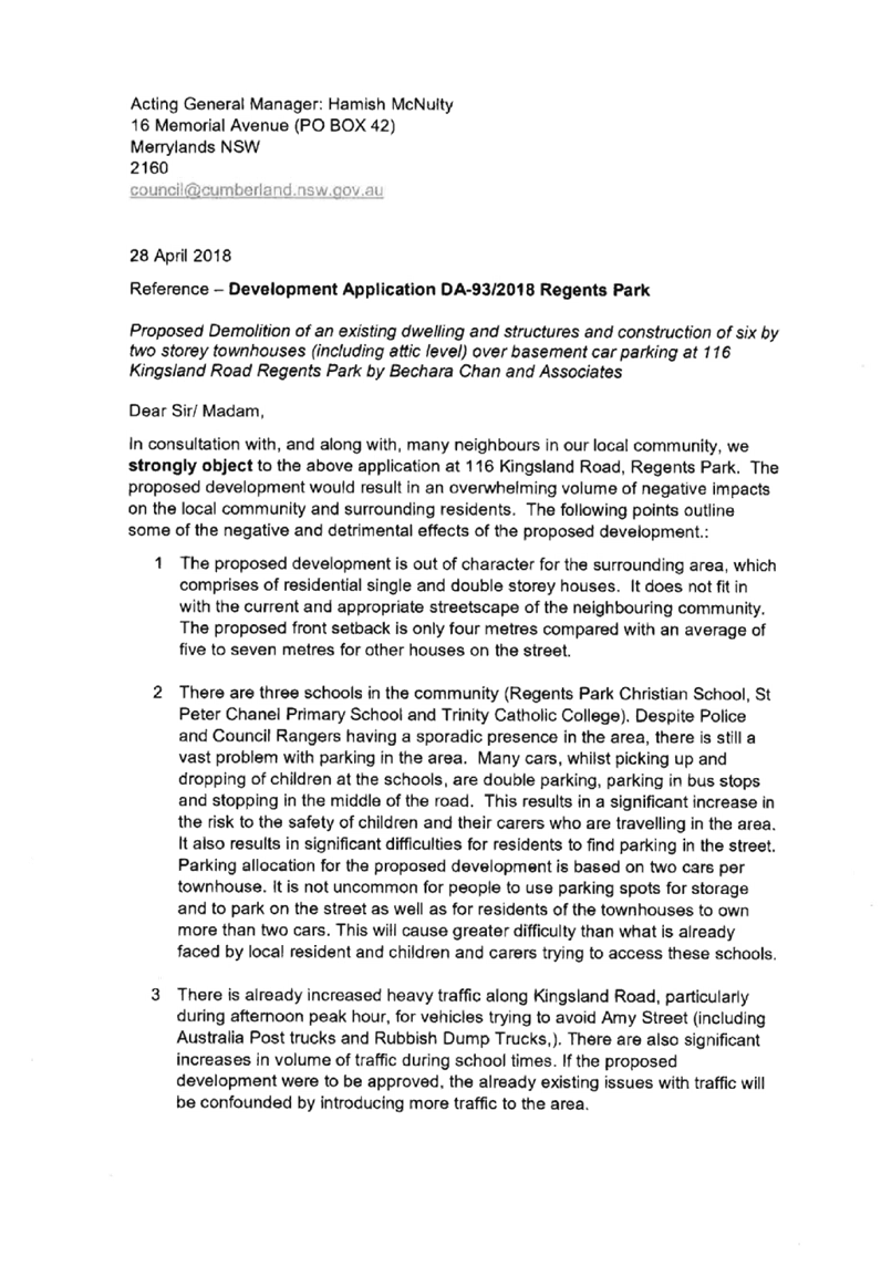
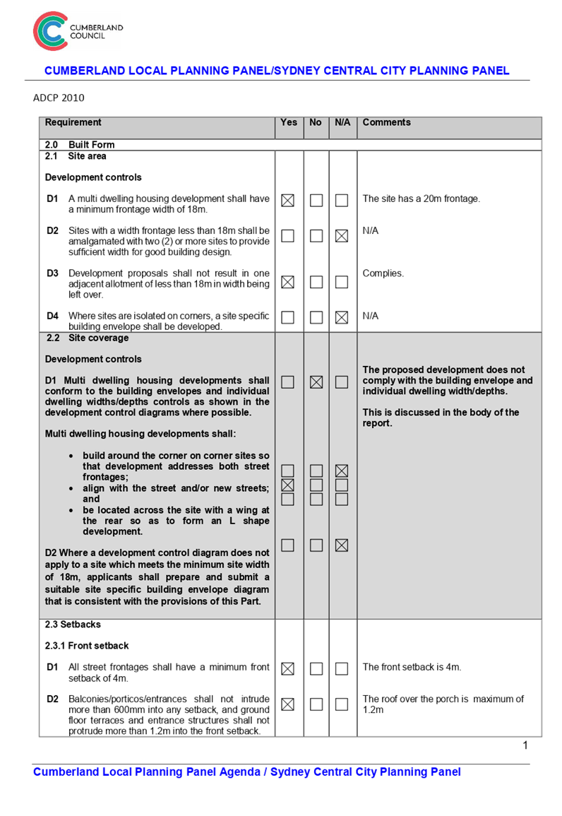
1. Development
Application No.DA-93/2018 was received on 29 March 2018 for the demolition of
an existing dwelling and structures and construction of six by two storey
townhouses (including attic level) over basement car parking.
2. The
application was publicly notified to occupants and owners of the adjoining
properties for a period of 14 days between 17 April 2018 and 1 May 2018 and
again between 15 May 2018 and 29 May 2018. In response, a total of 26
submissions were received including 4 individual letters and two sets of
pro-forma letters each with 11 signatures.
3. The
variations are as follows:
|
Control
|
Required
|
Provided
|
% variation
|
|
Window head height
|
2.4m
|
Between 1.15m and
2m
|
16.7-52.1%
|
|
Basement setback
|
1.2
|
Between 0.415 and
1m
|
16.7-65.4%
|
|
Width of units in front townhouses
|
5.5m
|
5.3m
|
3.64%
|
|
Depth of units in front townhouses
|
8m
|
7.43m
|
7.13%
|
|
Width of units in rear townhouses
|
7m
|
Between 5.3m and
5.4
|
22.9-24.3%
|
|
Side setback from rear townhouses
|
8m
|
7m
|
14.29%
|
|
Dwelling size
|
115m²
|
113m²
|
1.74%
|
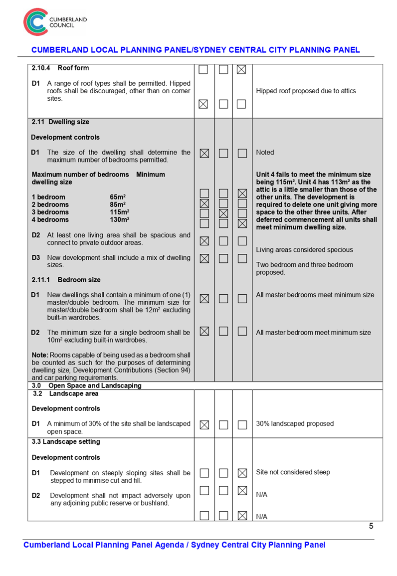
4. The
application is recommended for Deferred Commencement Approval in order to
address dwelling width (which will result in the deletion of one unit),
dwelling size and stormwater matters. The Deferred Commencement is subject to
the conditions as provided in the attached schedule.
5. The
application is referred to the Panel as the proposal is considered to be
contentious due to the large number of submissions received.
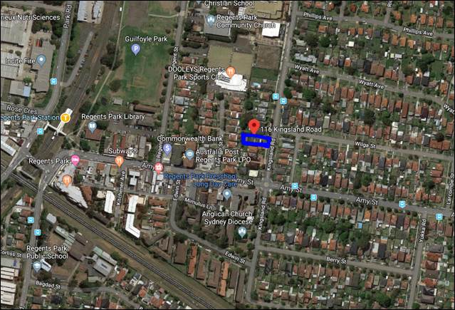
Subject Site and Surrounding
Area
The subject site is legally
described as Lot Y in DP 403688 and is known as 116 Kingsland Road, Regents
Park. The site is a regular shaped land parcel located on the western side of
Kingsland Road, approximately 60m north of the intersection of Amy Street and
Kingsland Road, Regents Park. The Regents Park train station is located within
420m walking distance of the site.
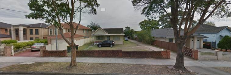
The site which currently
accommodates a single storey residential dwelling and an outbuilding has a
20.1m frontage to Kingsland Road and a total site area of 916.9m2 with a fall
of 1.66m from the front to the rear boundary. Development within the immediate
proximity of the site comprises a mixture of single and double storey dwellings
of varied ages and architectural styles.
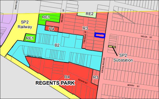
The site is zoned R3 –
Medium Density Zoning and to the east of the site (on the other side of
Kingsland Road) is R2 – Low Density Zoning.
Figure
1 – Locality Plan of subject site
Figure
2 – Aerial view of subject site
Figure
3 – Street view of subject site
Description of the Proposed
Development
Council has received a development
application for demolition of an existing dwelling and structures and
construction of six by two storey townhouses (including attic level) over
basement car parking.
The detailed breakdown of the
development is as follows:
- 11
residential parking spaces
- 2
visitor parking spaces
- Individual
entry from basement into units above;
- Storage
spaces in the basement;
- Plant
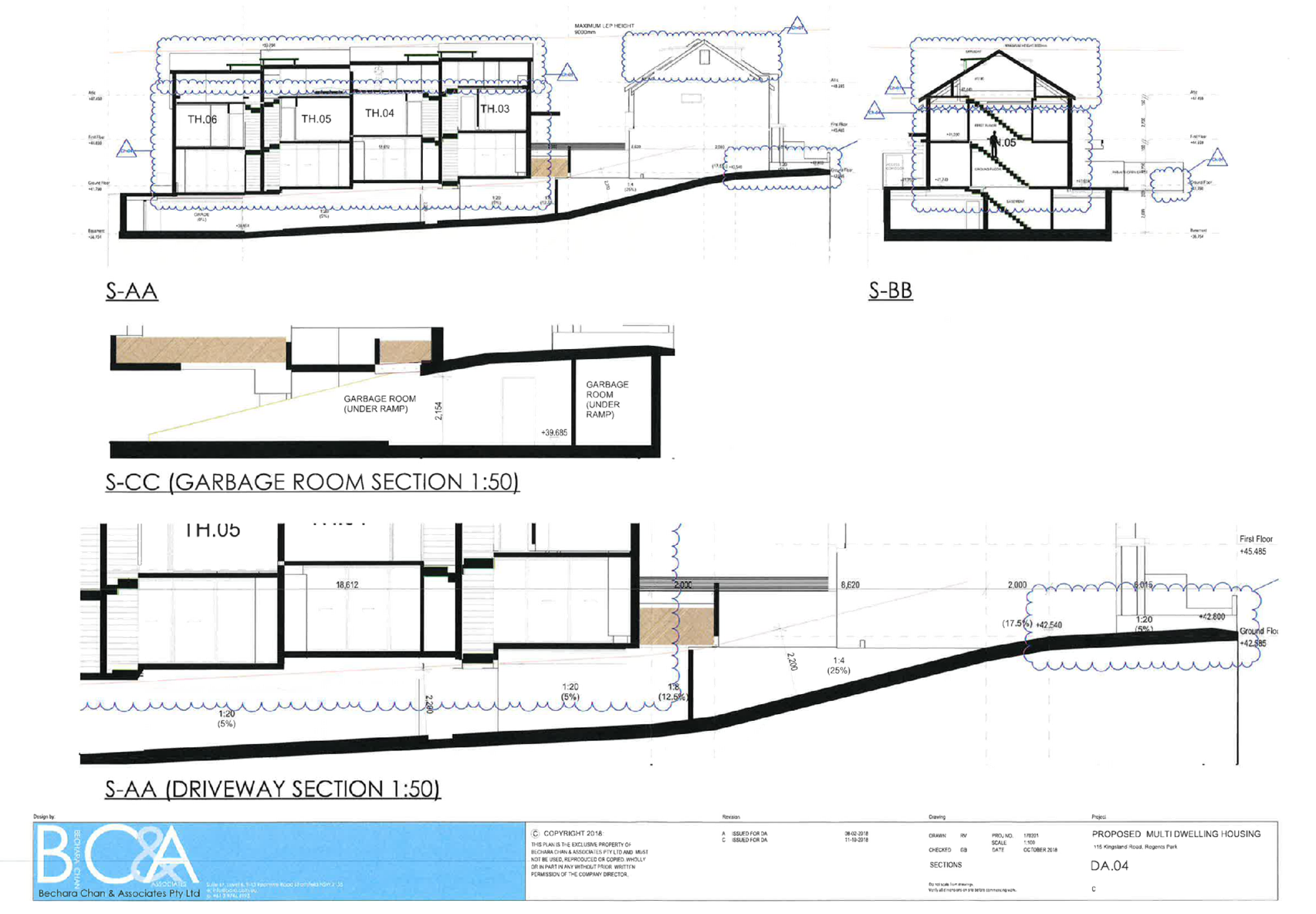
room and garbage room in the basement;
- 6
townhouses two storeys in height with attics;
- 2
x 2 bedroom units and 4 x 3 bedroom units;
- Private
open space; and
- Associate
landscaping.
It is considered that the
development fails to provide an acceptable width to the rear townhouses in
accordance with the requirements of the ADCP 2010 block layout for
multi-dwelling housing development. Therefore, it is recommended that the
proposal be amended to remove one townhouse from the townhouses at the rear so
that the remaining townhouses can be redesigned to comply with the ADCP 2010
multi-dwelling housing control to achieve better internal amenity for future
occupants. This matter will be discussed further elsewhere in the report.
History
- 29
March 2018 DA was lodged with Council;
- Application
was notified for 14 days. Objectors were not satisfied with the notification period;
- Application
was re-notified for 14 days;
- 26
June 2018 the applicant was notified of identified issues;
- 19
July 2018 the applicant submitted amended information/plans;
- 5
September 2018 Council issues another letter with identified issues. Applicant
was informed that a decision would be made on the submitted information;
- 12
October 2018 the applicant submitted amended information/plans;
Applicants Supporting
Statement
The applicant has provided a
Statement of Environmental Effects prepared by Think Planners dated 23 February
2018 and was received by Council on 29 March 2018 in support of the
application.
Contact with Relevant
Parties
The assessing officer has
undertaken a site inspection of the subject site and surrounding properties and
has been in regular contact with the applicant throughout the assessment
process.
Internal Referrals
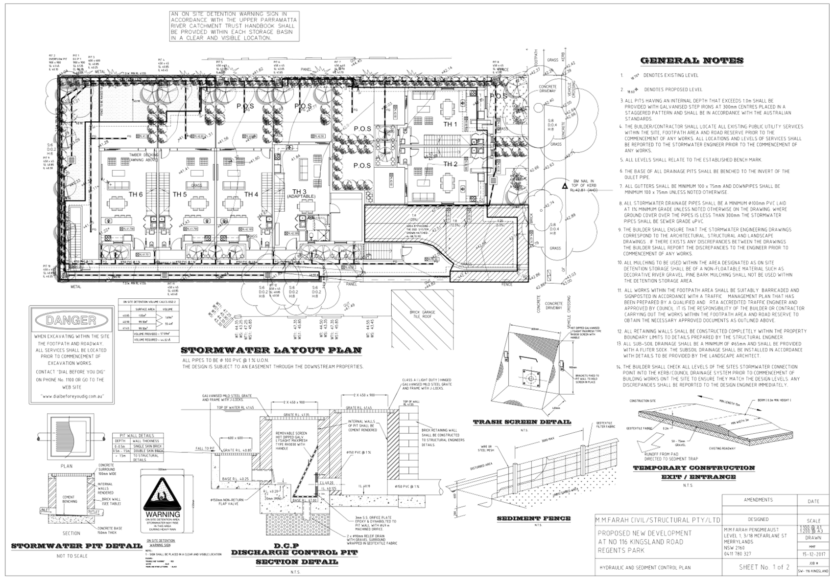
Development Engineer
The development application was
referred to Council’s Development Engineer for comment who has advised
that the development proposal is satisfactory and therefore can be supported
via deferred commencement consent to address drainage easement, stormwater and
ramp design issues.
Environment and Health
The development application was
referred to Council’s Environment and Health Officer for comment who has
advised that the development proposal is satisfactory and therefore can be
supported subject to recommended conditions of consent.
Landscape Architect/Officer
The development application was
referred to Council’s Landscape Architect/Officer for comment who has
advised that the development proposal is satisfactory and therefore can be
supported subject to recommended conditions of consent.
External Referrals
The application was not required
to be referred to any external government authorities for comment.
Planning Comments
The provisions of any
Environmental Planning Instruments (EP&A Act s4.15 (1)(a)(i))
State Environmental Planning
Policies
The proposed development is
affected by the following State Environmental Planning Policies:
(a) State
Environmental Planning Policy No. 55 – Remediation of Land (SEPP 55)
Clause 7 of SEPP 55 requires
Council to be satisfied that the site is suitable or can be made suitable to
accommodate the proposed development. The matters listed within Clause 7 have
been considered in the assessment of the development application.
|
Matter for Consideration
|
Yes/No
|
|
Does the application involve re-development of the site or
a change of land use?
|
Yes
No
|
|
Does the application involve re-development of the site or a
change of land use?
|
Yes
No
|
|
In the development going to be used for a sensitive land
use (e.g.: residential, educational, recreational, childcare or hospital)?
|
Yes
No
|
|
Does information available to you indicate that an
activity listed below has ever been approved, or occurred at the site?
acid/alkali plant and
formulation, agricultural/horticultural activities, airports, asbestos
production and disposal, chemicals manufacture and formulation, defence
works, drum re-conditioning works, dry cleaning establishments, electrical
manufacturing (transformers), electroplating and heat treatment premises,
engine works, explosive industry, gas works, iron and steel works, landfill
sites, metal treatment, mining and extractive industries, oil production and
storage, paint formulation and manufacture, pesticide manufacture and
formulation, power stations, railway yards, scrap yards, service stations,
sheep and cattle dips, smelting and refining, tanning and associated trades,
waste storage and treatment, wood preservation
|
Yes
No
|
|
Is the site listed on
Council’s Contaminated Land database?
|
Yes
No
|
|
Is the site subject to EPA
clean-up order or other EPA restrictions?
|
Yes
No
|
|
Has the site been the subject of
known pollution incidents or illegal dumping?
|
Yes
No
|
|
Does the site adjoin any
contaminated land/previously contaminated land?
|
Yes
No
|
|
Has the appropriate level of
investigation been carried out in respect of contamination matters for
Council to be satisfied that the site is suitable to accommodate the proposed
development or can be made suitable to accommodate the proposed development?
|
Yes
No
|
|
Details of contamination investigations carried out at the
site:
A Stage 1 Investigation report
prepared by Dirt Doctors (Job No DD513_1) was submitted with the application.
The report did not reveal any potential matters of concern with regard to
contamination and concludes that the site is suitable for its intended use.
Council’s
Environmental Health Officer has reviewed the reports and determined that the
site is suitable to support such a development given that the report provides
there is no soil contamination detected.
|
(b) State
Environmental Planning Policy (Vegetation in Non-Rural Areas) 2017
The proposal does not exceed the
biodiversity offsets scheme threshold. Therefore, the proposed vegetation removal
is considered acceptable. Please refer to the DCP compliance table for further
discussion.
(c) State
Environmental Planning Policy (Building Sustainability Index: BASIX) 2004
BASIX Certificate 891124M, issued
on 22 February 2018 and prepared by Certified Energy has been submitted with
Council and is considered to be satisfactory to the design proposed. The
deferred commencement requires the deletion of one townhouses and therefore an
amended BASIX Certificate will also be required to be submitted.
Regional Environmental Plans
The proposed development is
affected by the following Regional Environmental Plans:
(a) Sydney
Regional Environmental Plan (Sydney Harbour Catchment) 2005
The subject site is identified as
being located within the area affected by the Sydney Regional Environmental
Plan (Sydney Harbour Catchment) 2005. The proposed development raises no issues
as no impact on the catchment is envisaged.
(Note: - the subject site is not
identified in the relevant map as ‘land within the ‘Foreshores and
Waterways Area’ or ‘Wetland Protection zone’, is not a
‘Strategic Foreshore Site’ and does not contain any heritage items.
Hence the majority of the SREP is not directly relevant to the proposed
development).
Local Environmental Plans
Auburn Local Environmental Plan
2010 (ALEP 2010)
The provision of the ALEP 2010 is
applicable to the development proposal. It is noted that the development
achieves compliance with the key statutory requirements of the ALEP 2010 and
the objectives of the R3 – Medium Density Zone.
(a) Permissibility:-
The proposed development is
defined as a “multi dwelling housing” and is permissible in the R3
Zone with consent. The definition of multi dwelling housing is as follows:
multi dwelling housing means 3 or
more dwellings (whether attached or detached) on one lot of land, each with
access at ground level, but does not include a residential flat building.
The relevant matters to be
considered under ALEP 2010 and the applicable clauses for the proposed
development are summarised below.
|
Auburn Local Environmental
Plan 2010 (ALEP)
|
|
Is the development consistent
with the aims of the LEP?
|
Yes the development is
considered to be consistent with the aims of the ALEP 2010
|
|
Is the development consistent
with the Zone objectives?
|
Yes the development is
considered to be consistent with the zone objectives
|
|
Maximum height of building
– 9m
|
Yes – overall building
height is 9m
|
|
Floor space ratio (FSR)
– 0.75:1
|
0.68:1
|
|
Heritage Conservation
|
N/A
|
|
Flood Planning
|
N/A
|
|
Acid Sulphate Soils
|
Yes – Class 5
|
|
Earthworks
|
Yes – Acceptable
|
Figure
4 – Auburn LEP 2010 Compliance Table
The provisions of any proposed
instrument that is or has been the subject (EP&A Act s4.15 (1)(a)(ii))
(a) Draft
State Environmental Planning Policy (Environment)
The draft SEPP relates to the
protection and management of our natural environment with the aim of
simplifying the planning rules for a number of water catchments, waterways,
urban bushland, and Willandra Lakes World Heritage Property. The changes
proposed include consolidating the following seven existing SEPPs:
· State
Environmental Planning Policy No. 19 – Bushland in Urban Areas
· State
Environmental Planning Policy (Sydney Drinking Water Catchment) 2011
· State
Environmental Planning Policy No. 50 – Canal Estate Development
· Greater
Metropolitan Regional Environmental Plan No. 2 – Georges River Catchment
· Sydney Regional
Environmental Plan No. 20 – Hawkesbury-Nepean River (No.2-1997)
· Sydney Regional
Environmental Plan (Sydney Harbour Catchment) 2005
· Willandra Lakes
Regional Environmental Plan No. 1 – World Heritage Property.
The draft policy will repeal the
above existing SEPPs and certain provisions will be transferred directly to the
new SEPP, amended and transferred, or repealed due to overlaps with other areas
of the NSW planning system.
Changes are also proposed to the
Standard Instrument – Principal Local Environmental Plan. Some provisions
of the existing policies will be transferred to new Section 117 Local Planning
Directions where appropriate.
The proposed development is not
affected by any relevant Draft Environmental Planning Instruments.
The provisions of any
Development Control Plans (EP&A Act s4.15 (1)(a)(iii))
The Auburn DCP 2010 provides
guidance for the design and operation of development to achieve the aims and
objectives of the ALEP 2010.
A comprehensive assessment and
compliance table is contained in Appendix A.
The following table highlights
non-compliances with the DCP, which relate primarily to development control
diagram, basement setback, dwelling size and head height of windows, and the
variations sought are generally considered satisfactory on merit in this
instance except for the dwelling width of the rear townhouses.
|
Clause
|
Control
|
Proposed
|
Complies
|
|
2.6
|
Head height of windows 2.4m
|
Varies
|
No
|
|
2.7
|
Development Control Diagram:
Width of front townhouse 5.5m
Depth of front townhouses 8m
Width of rear townhouses 7m
Setback from rear townhouses to side boundary 8m
|
5.3m
7.43m
Between 5.3m and 5.4m
7.09m
|
No
No
No
No
|
|
2.8
|
Basement setback 1.2
|
Between 0.41m and 1m
|
No
|
|
2.11
|
Dwelling size 3 bedroom needs 115m²
|
113m²
|
No
|
Figure
5 – Auburn DCP 2010 Compliance Table
As a result of the deferred
commencement conditions the following variations will remain relevant to the
application:
|
Clause
|
Control
|
Proposed
|
Complies
|
|
2.6
|
Head height of windows 2.4m
|
Varies
|
No
|
|
2.7
|
Development Control Diagram:
Width of front townhouse 5.5m
Depth of front townhouses 8m
Width of rear townhouses 7m
Setback from rear townhouses to side boundary 8m
|
5.3m
7.43m
Approximately 6.9m
7.09m
|
No
No
No
No
|
|
2.8
|
Basement setback 1.2
|
Between 0.41m and 1m
|
No
|
|
2.11
|
Dwelling size 3 bedroom needs 115m²
|
All units are expected to meet dwelling size control
|
Yes
|
Figure
6 – Auburn DCP 2010 Compliance Table after deferred commencement
As indicated in the compliance
table above, the proposed development departs from the head height of windows,
development control diagram, basement setback and dwelling size provisions of
Council’s Auburn Development Control Plan 2010.
Council has generally applied some
flexibility to variations to the development control diagram, however the
extent of variation to the internal width of the rear block of units in this
case is not supported. It is important to maintain the internal amenity of
intended occupants and allow for a flexible and comfortable furniture
arrangement. Council has been consistent in seeking an acceptable amenity
outcome in relation to the size of units, the internal width and depth and the
relationship of this to the private open space.
It is for this reason that the
deletion of one unit is necessary to bring the width of the rear block closer
to compliance. The deletion of one unit will increase the size of the other
units making it compliant with minimum dwelling size and providing a better
internal amenity to the future occupants.
The non-compliances are discussed
in detail below:
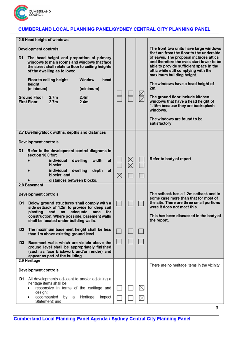
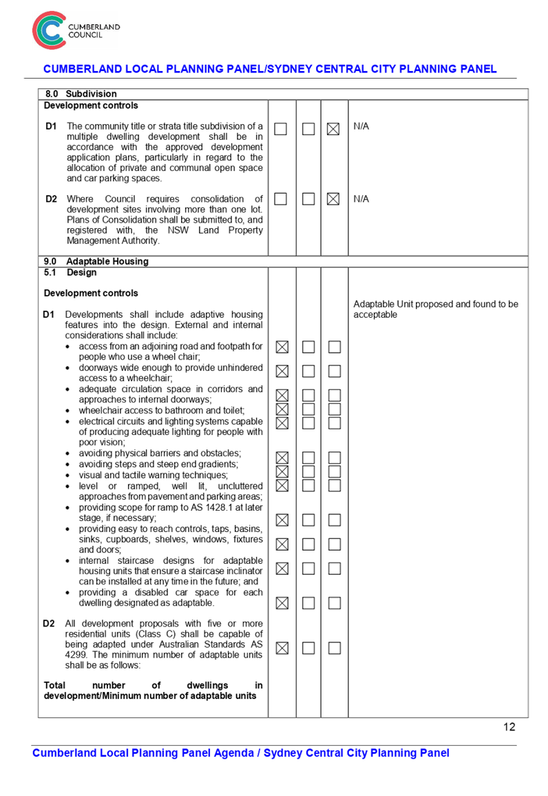
2.6 Head height of windows
The development proposed 2.7m
floor to ceiling heights which would require 2.4m window head height for windows
facing the street. This is to ensure a well-proportioned street facing
elevation. This control relates to the two front facing units.
The front two units have large
windows with a head height of 2m. These windows are considered acceptable as
they start from the floor and go all the way to the underside of the eaves. The
eaves are lower to provide sufficient space for attics whilst still complying
with the maximum building height. These two units also have smaller kitchen
windows height of 1.15m which act as a backsplash in the kitchens.
It is considered that the front
elevation provides sufficient windows and different sizes to provide interest
and passive surveillance including providing sufficient ventilation to the
rooms to comply with the BCA. For these reasons this variation can be supported
in this instance.
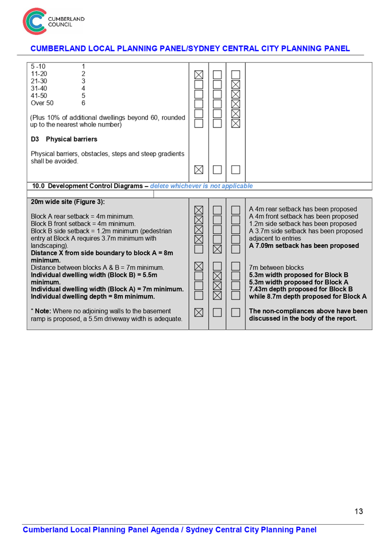
2.7 Development Control Diagram
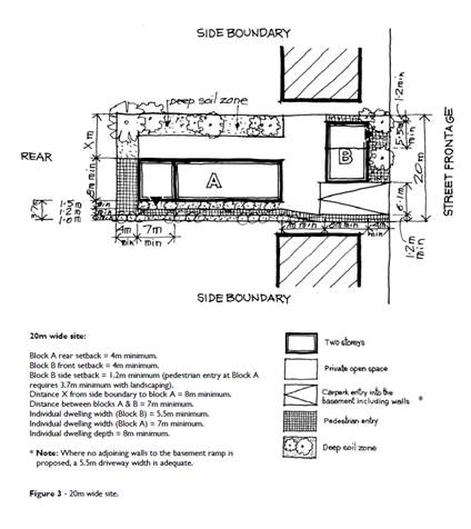
Figure
7– Auburn DCP 2010 Development Control Diagram
The development control diagram
sets out minimum setbacks, dwelling width and depth, access driveway and deep
soil zone. As discussed above the development proposal as it stands does not
comply as follows:
· Width
and depth of front townhouses
The front townhouses require a
minimum width of 5.5m and minimum depth of 8m. Both of the front facing units
have a width of 5.3m and a depth of 7.8m. The non-compliance with the width
requirement is as a result of the need to provide adequate width access ramp to
the basement and pedestrian entry to the rear units. Whilst the depth of the
units are marginally non-compliant, the units comply with the minimum dwelling
size for 2 bedroom townhouses and provides generous bedrooms plus studies. The
ground floor is considered to be well configured. Furthermore, the
proposal provides for a useable and compliant private open space for improved
amenity to the intended occupants. It is for these reasons that a variation in
this instance is considered acceptable.
· Width
of rear townhouses
The rear townhouses require a
minimum width of 7m. One of those units has a width of 5.3m while the others
have a width of 5.4m. The building envelope control under the ADCP anticipated
that the townhouses in the rear row should be wider and deeper than those in
the front row. Whilst the width of the front row townhouses are supported for
the reasons earlier stated, same does not apply to the rear row of townhouses
as there is opportunity to provide wider townhouse design that present
different options to families. Furthermore, it is noted that the increased
width of the rear townhouses will allow for better furniture placement in the
living rooms which are currently further abridged by the staircase and bathroom
location on the ground floor.
A 5.3m width is
considered to be too small for the rear townhouses and the amenity outcome is
not supported. It is for this reason that the deletion of one unit is
recommended.
· Setback
from rear townhouses to side boundary
The rear townhouses require a 8m
setback to the side boundary from the side of the townhouses containing
courtyards. The rear townhouses are setback 7.09m from the side boundary. It is
considered that there is sufficient setback to protect neighbours from any
acoustic and privacy impacts. To further protect privacy to the neighbours and
future occupants a condition has been imposed on the consent to require privacy
screening on top of parts of the fence. There is also no impact on solar access
as the separation is to the north and the dwelling to the north is single
storey. It is for these reasons that a variation in this instance is considered
acceptable.
2.8 Basement setback
A 1.2m side setback is required
for the basement, this is to allow for deep soil and adequate area for
construction. The development predominantly complies with this requirement
however it does breach the 1.2m setback in three different places.
One is on the north side of the
site which proposes a setback of 0.41m for the length of 6.83m to provide the
area for turning vehicles. The remainder of the north side has a setback of
1.2m, 3.51m and 4.56m which is where the predominant deep soil is located.
The other breach is located on the
southern side of the site which provides a 0.55m setback for 12.56m which is to
provide space for stairs adjacent to the driveway and entry to the garbage room
which is located directly under the driveway. The southern side provides a 1.2m
setback to the front of the site and a 1m setback to the rear of the site. The
width of the setback is reduced in this part in order to provide a 6.1m wide
aisle width which is required for vehicles to enter their designated parking
spaces.
The third breach is located on the
western side with a setback of 0.73m proposed for 6.86m which has been proposed
to make room for secondary stairs and bicycle storage. The second staircase is
necessary to comply with egress requirements under the BCA.
The breaches proposed are found
satisfactory given that the subject site complies with minimum deep soil
requirement (being 10%) and the subject site complies with minimum landscaping
requirement (being 30%). Furthermore, appropriate conditions have been included
in any consent that maybe issued to ensure that dilapidation report is prepared
prior to excavation of the site.
2.11 Dwelling size
Unit 4 is considered a three
bedroom unit and therefore requires a unit size of 115m² while the plans
show this unit has a size of 113m².
The non-compliance mostly comes
from a smaller attic to those of the other units. In most instances this small
variation would be considered acceptable, however since one unit is being deleted
and remaining units being made larger it would not be unreasonable to request
all units to comply with the minimum internal dwelling size.
The provisions of any planning
agreement that has been entered into under section 7.4, or any draft planning
agreement that a developer has offered to enter into under section 7.4
(EP&A Act s4.15(1)(a)(iiia))
There is no draft planning
agreement associated with the subject Development Application.
The provisions of the
Regulations (EP&A Act s4.15 (1)(a)(iv))
The proposed development raises no
concerns as to the relevant matters arising from the Environmental Planning and
Assessment Regulations 2000 (EP&A Reg).
The Likely Environmental,
Social or Economic Impacts (EP&A Act s4.15 (1)(b))
It is considered that the proposed
development will have no significant adverse environmental, social or economic
impacts in the locality.
The suitability of the site for
the development (EP&A Act s4.15 (1)(c))
The subject site and locality is
not known to be affected by any natural hazards or other site constraints
likely to have a significant adverse impact on the proposed development.
Accordingly, it is considered that the development is suitable in the context
of the site and surrounding locality.
Submissions made in accordance
with the Act or Regulation (EP&A Act s4.15 (1)(d))
Advertised (newspaper) Mail Sign
Not
Required
In accordance with Council’s
Notification requirements contained within the Auburn DCP 2010, the proposal
was publicly notified for a period of 14 days between 17 April 2018 and 1 May
2018. The application was re-notified for a further 14 days between 15 May 2018
and 29 May 2018. In response, 4 individual submissions were received and two
sets of pro-forma letter each with 11 signatures. In total 26 signatures have
been received in response to the application.
The issues raised in the public
submissions are summarised and commented on as follows:
Issue: DA diagram sent out
too small.
Planner’s comment:
Full size plans are available for viewing during the notification period at the
Council office and Libraries. These plans were also available via
Council’s online tracker.
Issue: The size of
the development is too large.
Planner’s comment:
The initial plans fails to comply with the maximum FSR allowable for the site.
The applicant has amended the plans which now comply with the FSR, height and
storey limit. Furthermore, the deferred commencement condition requires the
deletion of one unit further reducing the size of the development.
Issue: Number of units.
Planner’s comment:
There isn’t a Council control that stipulates the number of units that
can be proposed on a site. The proposed development complies with the FSR and
height which guides the size of the development. There are also Development
Control Diagrams that stipulate the width and length of each unit. The
variation sought for the rear block is not supported and for this reason the
deferred commencement condition requires the deletion of one unit further
reducing the size of the development
Issue: The proposed
development does not match with the character of the area.
Planner’s comment:
The site is zoned R3 – Medium Density Residential and development such as
townhouses is envisioned as being the future character of the area. Multi
dwelling housing is a permissible form of development in a R3 – Medium
density Zone.
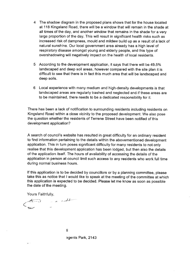
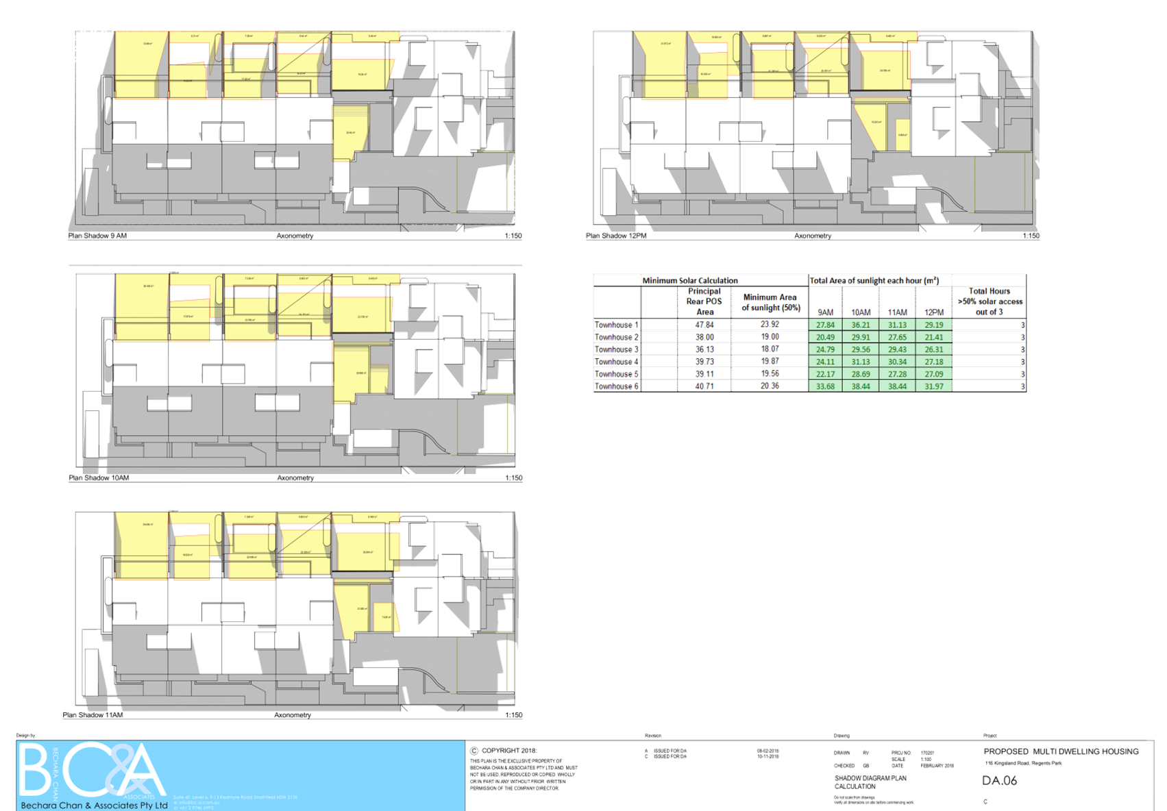
Issue: Shadow diagram was
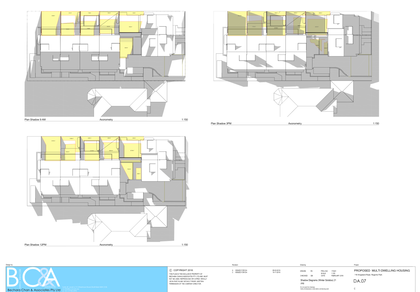
not submitted to neighbours.
Planner’s comment:
Copies of the shadow diagrams were available for viewing during the
notification period at the Council office and Libraries. These plans were also
available via Council’s online tracker.
Issue: Overshadowing of No.
118 Kingsland Road.
Planner’s comment:
There will be some shadow impact on No. 118 Kingsland Road. The windows facing
north will however still receive 3 hours of solar access. Council records show
that there are no north facing living areas in this dwelling. The existing east
and west facing living areas maintain their solar access.
Issue: Height of the
development.
Planner’s comment:
Under Auburn LEP 2010 the maximum permissible height is 9m. This development
has a maximum height of 9m complying with this control.
Issue: Privacy from southern
elevation.
Planner’s comment:
The entry doors into the units are located on the southern elevation. There are
also low backsplash windows on the ground floor. The first floor includes
bedroom window that is frosted and fixed to the height of 1.5m and a high
bathroom window. The attic also includes a high bedroom window. There are no
balconies proposed. Given the height of the windows proposed it is considered
that the privacy of adjoining neighbours is not significantly impacted as a
result of this development.
Issue: No 116 Kingsland
Road being rezoned in isolation without notification.
Planner’s comment: No
116 Kingsland Road has not been rezoned in isolation. The entire block and the
block further west is zoned for R3 – Medium Density Zoning under ALEP
2010. It is however noted that the adjoining sites to the East (on the other
side of Kingsland Road) are zoned R2 Low Density Zone.
Issue: Setbacks.
Planner’s comment:
The proposed development complies with the front setback, rear setback and
generally with the side setbacks. The only setback the development fails to
comply with is the distance between rear townhouse block and the side boundary.
This matter has been discussed in the body of the report.
Issue: Do different rules
apply to Townhouses development vs dwellings?
Planner’s comment:
Yes there is a different part of the Auburn Development Control Plan 2010 that
specifically applies to multi-dwelling housing.
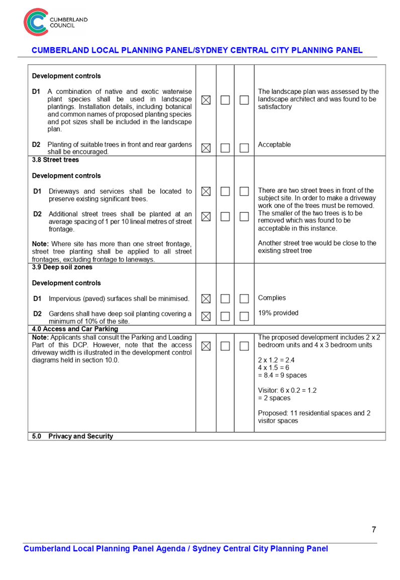
Issue: Car parking.
Planner’s comment:
The proposed development requires nine residential parking spaces and two
visitor spaces. The development includes two visitor spaces and 11 residential
spaces exceeding the minimum required for the site.
Issue: All four bedroom
units is too large
Planner’s comment:
This has been changed since the original application. The development includes
two x 2 bedroom units and four x 3 bedroom units. However, this will change
under Deferred Commencement as one unit is recommended to be deleted.
Issue: Traffic in the area.
Planner’s comment: A
multi dwelling of this size is not considered to be a traffic generating
development and therefore a Traffic Study was not necessary to be lodged as
part of the proposal.
Issue: Landscaping and deep
soil
Planner’s comment:
Under Auburn development Control Plan 2010 the development requires 30% of the
site to be landscaped and 10% of the site to be deep soil. Based on
Council’s calculations the development has 30% landscaped and 19% deep
soil.
Issue: Report for
excavation of the basement.
Planner’s comment: A
dilapidation report is required for any development that includes a basement
and must be submitted to the Certifier. This is included in any development
consent that may be needed.
Issue: Privacy to the rear.
Planner’s comment:
Privacy to the rear is being maintained. The ground floor dining/living window
has obscured glazing to the height of 1m. The first floor and attic have a west
facing bedroom window which have a 1.2m window sill height. These are bedroom
windows and are considered to be low use areas usually containing blinds. To
maintain privacy a condition has been imposed on the consent to include a
privacy screen along the rear fence.
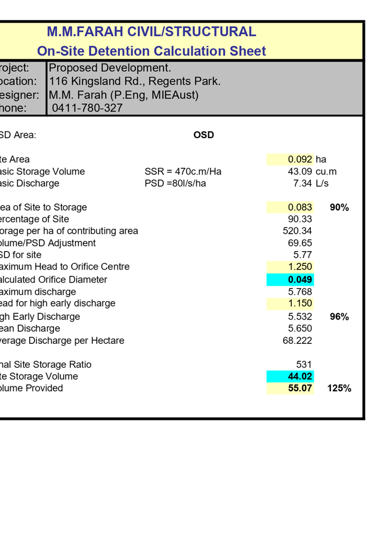
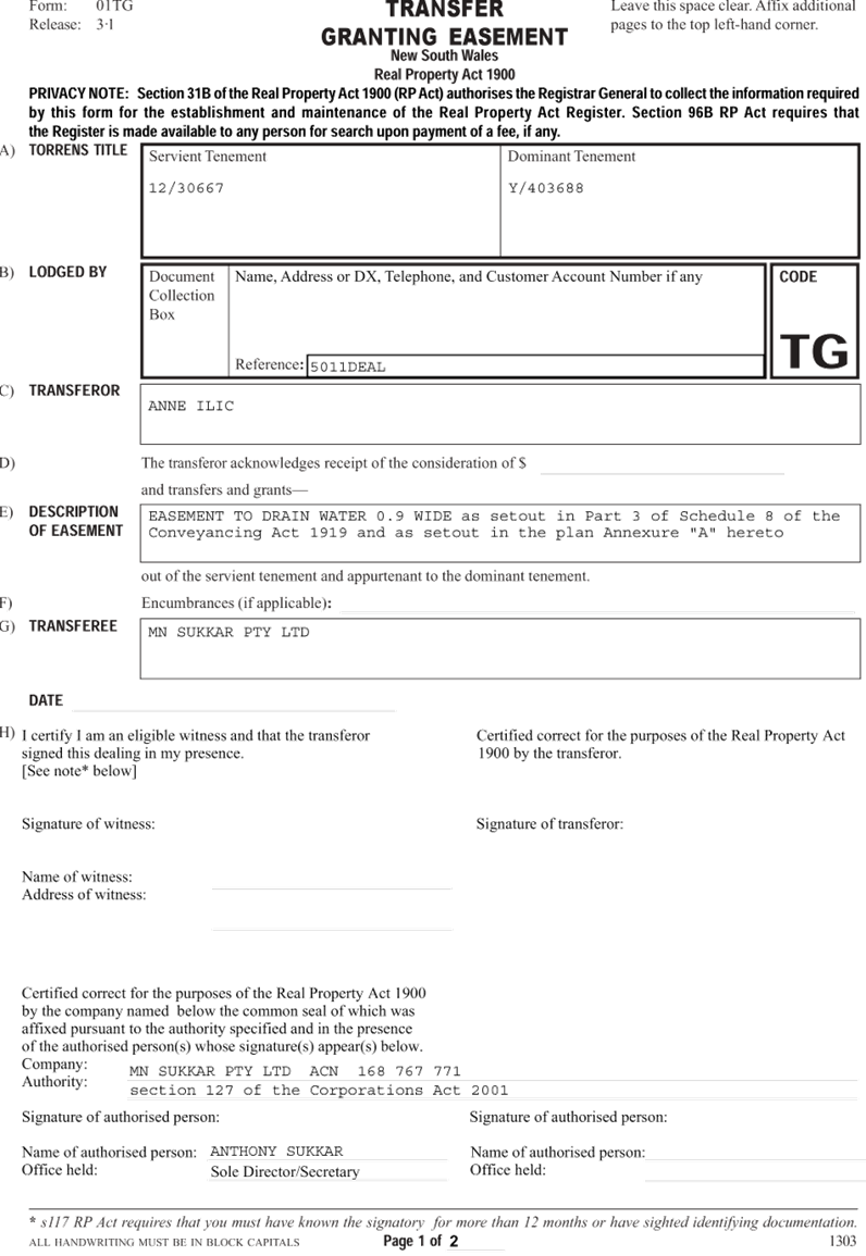
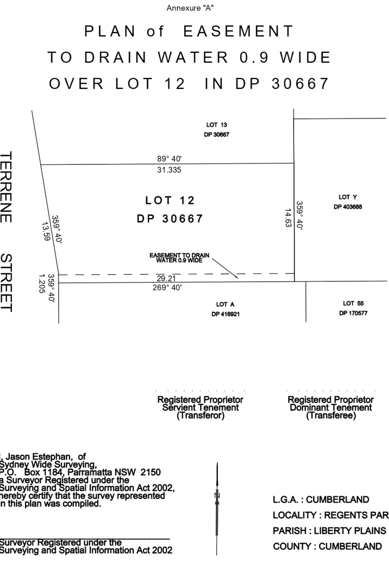
Issue: Easement.
Planner’s comment:
The development is only supported on a deferred commencement basis as the
applicant must obtain a stormwater easement. The application cannot continue
without a downstream easement.
Issue: This sets a
precedent in the area.
Planner’s comment: It
is not considered to be a precedent as multi dwelling housing is a permissible
form of development envisioned in an R3 Medium Density Zone.
Issue: Lack of
infrastructure, schools, health facilities, public transport, waste control and
inadequate utilities.
Planner’s comment:
The consideration of available infrastructure is lengthily considered before a
rezoning of an area. Furthermore, the development is required to pay 7.11
Contribution fee which goes towards some of the facilities listed.
Issue: Parking will be used
for storage.
Planner’s comment:
Most units have two allocated spaces. There is also provision for storage in
the basement under the stairs as well as some units have storage rooms. The
provided storage is considered acceptable.
Issue: Maintenance of the
landscaping.
Planner’s comment:
The owner is responsible for the maintenance of the landscaping. If the
development was to be strata subdivision this task would go to a Strata Body
Corporate.
Issue: Lack of
notification.
Planner’s comment:
The immediate neighbours were notified twice for a period of 14 days. There was
also a site notice put on the site. The development also featured an
advertisement in the local newspapers. This is compliant with Council’s
notification policy.
Issue: Noise in the area.
Planner’s comment:
The development is not expected to generate any noise other than general
household/residential noise.
Issue: Waste.
Planner’s comment:
The development will include bulk storage bins which take up less space on the
street for waste pick up.
The public interest
(EP&A Act s4.15(1)(e))
In view of the foregoing analysis
it is considered that the development, if carried out subject to the conditions
set out in the recommendation below, will have no significant adverse impacts
on the public interest.
Section 7.11 (Formerly S94)
Contribution Towards Provision or Improvement of Amenities or Services
This part of the Act relates to
the collection of monetary contributions from applicants for use in developing
key local infrastructure.
Comments:
The development requires the
payment of contributions in accordance with Council’s Section 94
Contributions Plans.
As at 12 February 2019, the fee
payable is $37,981.54. This figure is subject to indexation as per the relevant
plan. The draft determination attached includes a condition requiring payment
of the contribution prior to issue of a Construction Certificate.
Disclosure of Political
Donations and Gifts
The applicant and notification
process did not result in any disclosure of Political Donations and Gifts.
The proposed development is
appropriately located within the R3 Medium Density Zone under the relevant
provisions of the Auburn LEP, however variations in relation to the development
control diagram, window height and basement setback are sought.
Having regard to the assessment of
the proposal from a merit perspective, Council may be satisfied that the
development has been responsibly designed and provides for acceptable levels of
amenity for future residents. It is considered that the proposal successfully
minimises adverse impacts on the amenity of neighbouring properties. Hence the
development, irrespective of the departures noted above, is consistent with the
intentions of Council’s planning controls and represents a form of
development contemplated by the relevant statutory and non-statutory controls
applying to the land.
For these reasons, it is
considered that the proposal is satisfactory having regard to the matters of
consideration under Section 4.15 of the Environmental Planning and Assessment
Act 1979, and the development may be approved via a Deferred Commencement
subject to conditions.
There are no further consultation
processes for Council associated with this report.
There are no further financial
implications for Council associated with this report.
There are no further policy
implications for Council associated with this report.
Communication /
Publications:
The final outcome of this matter
will be notified in the newspaper. The objectors will also be notified in
writing of the outcome.
|
1. That
Development Application No. DA-93/2018 for Demolition of an existing dwelling
and structures and construction of five by two storey townhouses (including
attic level) over basement car parking on land at 116 Kingsland Road, Regents
Park be approved via a Deferred Commencement subject to attached conditions.
2. Persons
whom have lodged a submission in respect to the application be notified of
the determination of the application.
|
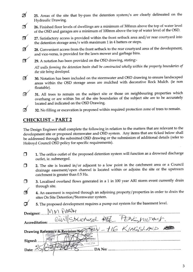
1. Draft
Notice of Determination ⇩ 
2. Architectural
Plans ⇩
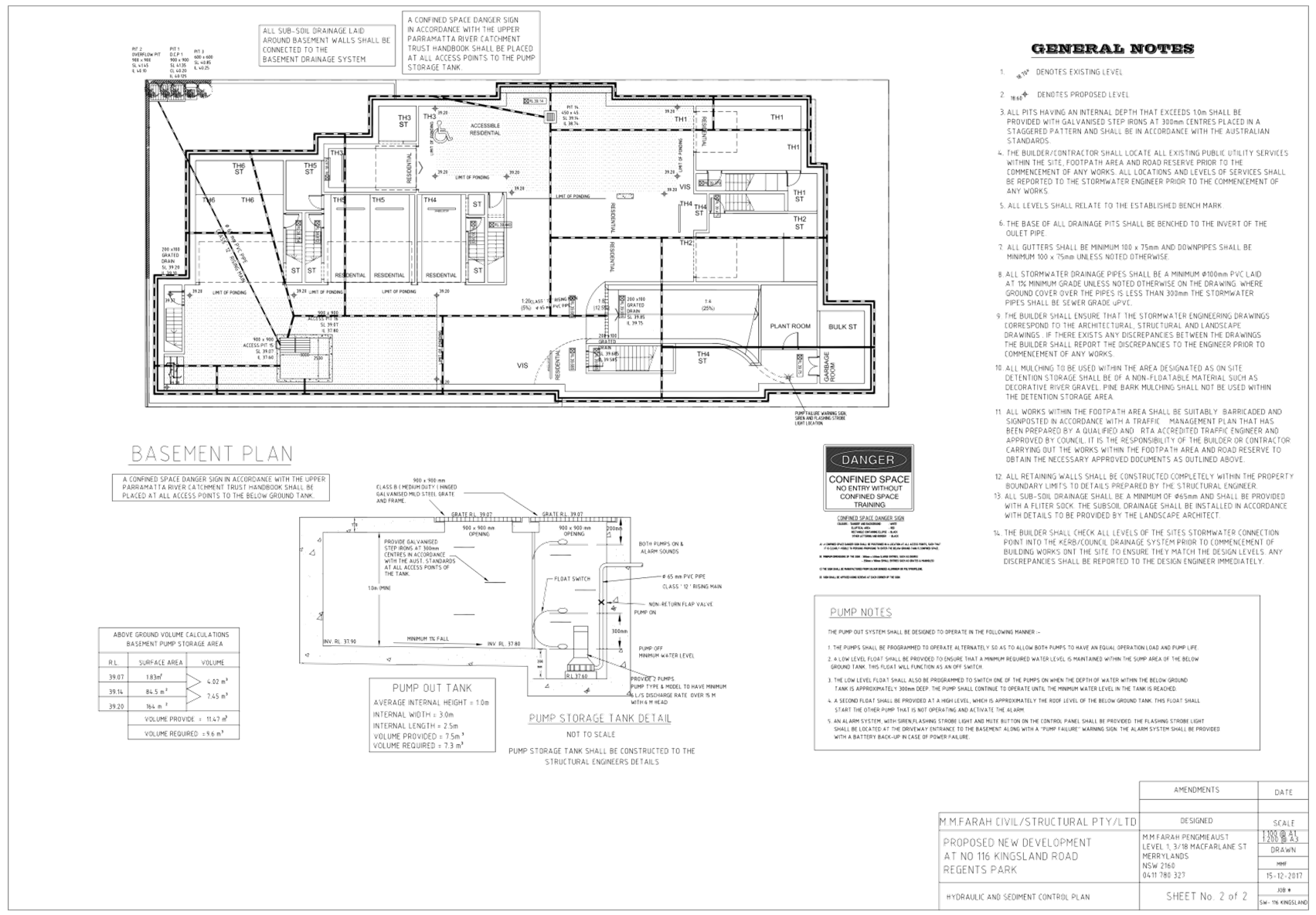
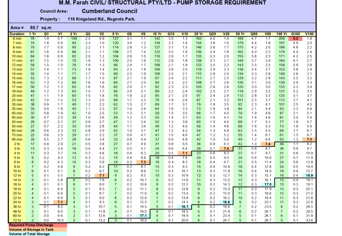
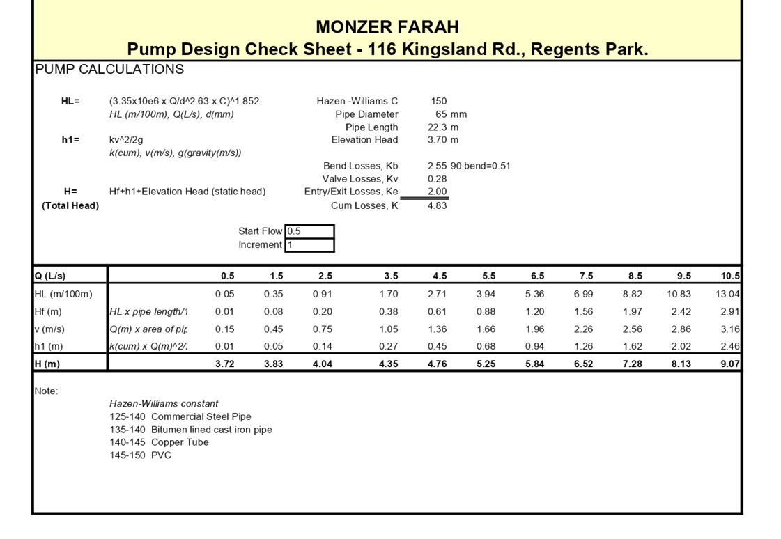
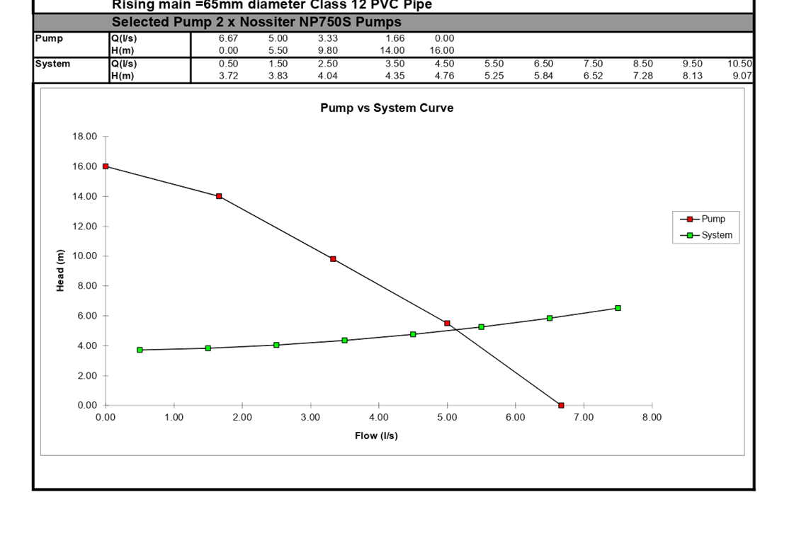
3. Stormwater/Engineering
Plans ⇩
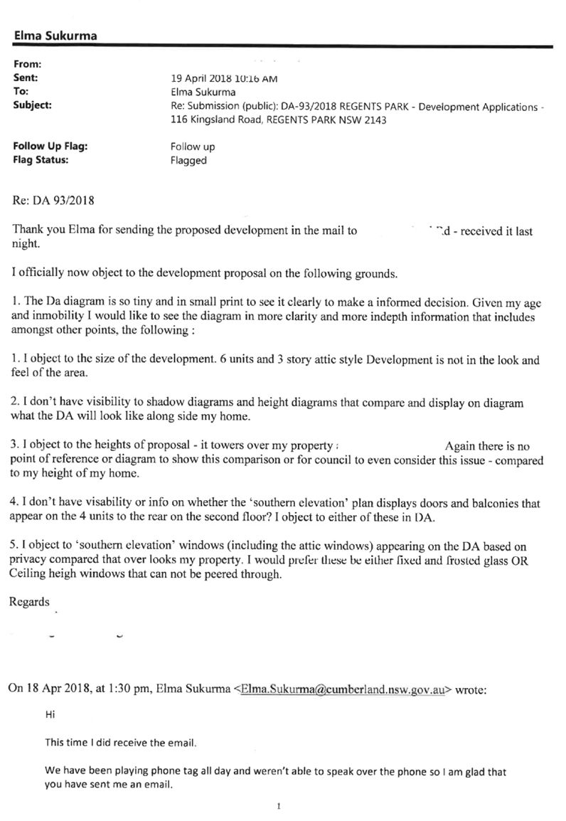
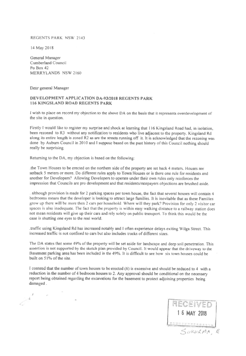
4. Submissions
Received ⇩
5. DCP
Assessment ⇩
6. Shadow
Diagrams ⇩
DOCUMENTS
ASSOCIATED WITH
REPORT LPP005/19
Attachment 1
Draft Notice of Determination
Cumberland Local Planning Panel Meeting
13 March 2019

DOCUMENTS
ASSOCIATED WITH
REPORT LPP005/19
Attachment 2
Architectural Plans
Cumberland Local Planning Panel Meeting
13 March 2019
DOCUMENTS
ASSOCIATED WITH
REPORT LPP005/19
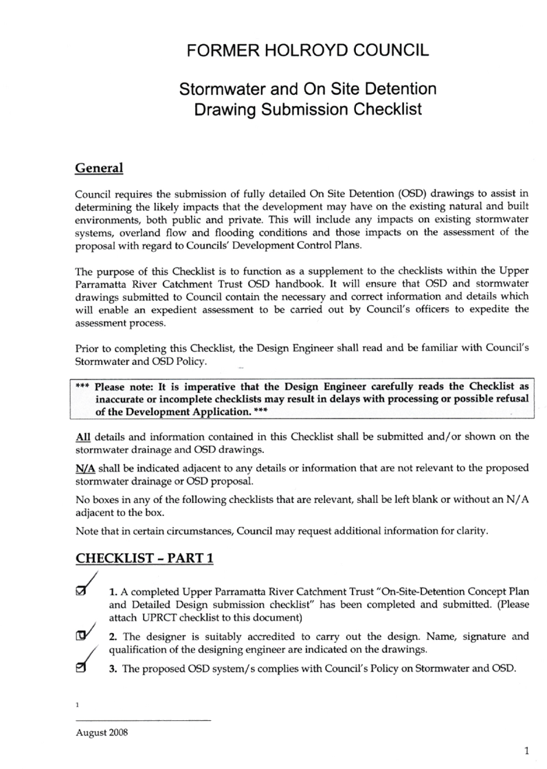
Attachment 3
Stormwater/Engineering Plans
Cumberland Local Planning Panel Meeting
13 March 2019
Cumberland Local Planning Panel Meeting
13 March 2019
Cumberland Local Planning Panel Meeting
13 March 2019
DOCUMENTS
ASSOCIATED WITH
REPORT LPP005/19
Attachment 4
Submissions Received
Cumberland Local Planning Panel Meeting
13 March 2019


DOCUMENTS
ASSOCIATED WITH
REPORT LPP005/19
Attachment 5
DCP Assessment
Cumberland Local Planning Panel Meeting
13 March 2019
DOCUMENTS
ASSOCIATED WITH
REPORT LPP005/19
Attachment 6
Shadow Diagrams
Cumberland Local Planning Panel Meeting
13 March 2019
Cumberland
Local Planning Panel Meeting
13 March 2019
Item No: LPP006/19
Section
4.55(2) modification for 601-605 Great Western Highway, Greystanes
Responsible
Division: Environment
& Planning
Officer: Manager
Development Assessment
File
Number: DA
- 2018/9/2
|
Application
lodged
|
7
December 2018
|
|
Applicant
|
Rachel
McNeil
|
|
Owner
|
Greystanes
Service Centre Pty Ltd
|
|
Application
No.
|
2018/9/2
|
|
Description
of Land
|
601-605
Great Western Highway, Greystanes
|
|
Proposed
Development
|
Section
4.55 (2) Modification to amend delivery hours for the service station tenancy
to 24 hours a day, seven (7) days a week
|
|
Site
Area
|
5584
m2
|
|
Zoning
|
IN2
– Light Industrial
|
|
Disclosure
of political donations and gifts
|
Nil
disclosure
|
|
Heritage
|
N/A
|
|
Principal
Development Standards
|
FSR
– N/A
Height
of Buildings – 26 m
|
|
Issues
|
Public
submissions
|
1. DA
2018/9 was approved by the Cumberland Local Planning Panel on 12 September 2018
for demolition of existing structures and construction of a single storey
service station with associated kiosk and underground fuel storage tanks to be
operated by 7-Eleven, an independent single storey food and drink premises to
be operated by McDonald’s with associated signage and all uses to operate
24 hours a day, 7 days a week.
2. The
subject modification application 2018/9/2 was received on 7 December 2018,
seeking consent to amend delivery hours to 24 hours a day, 7 days a week.
3. The
application was publicly notified to occupants and owners of the adjoining
properties for a period of 14 days between 9 January 2019 and 23 January 2019.
In response, 6 submissions were received, including a petition with 26 signatures.
4. The
issues raised in the submissions do not warrant refusal of the application.
5. The
applicant provided additional information on 4 February 2019 clarifying that
the purpose of the proposed modification was to allow for deliveries of
consumables to the service station (7-Eleven), and that other truck movements
such as fuel deliveries and waste collection would be carried out between 7 am
and 10 pm as required by the condition on the original consent (condition 162).
6. Additional
information was requested from the applicant to address the issues raised in
the public submissions on 18 February 2019. The response received 19 February
2019 clarified aspects of the noise assessment to Council’s satisfaction.
7. HDCP
2013 has a restriction for hours of operation in industrial zones. The proposed
modification seeks to extend the permitted hours of operation for deliveries to
24 hours a day, 7 days per week. 24 hour operation for all three tenancies on
site was approved under the original application. There are no other
non-compliances associated with the subject application.
8. The
application is being referred to the Panel for determination due to the number
of public submissions received.
9. It
is recommended that the application be approved subject to modified conditions
as set out in the draft determination at attachment 4.
Subject Site
and Surrounding Area
The subject site is
known as 601 Great Western Highway Greystanes. The legal description of the
site is lot 11 in DP 1233454. The site is zoned IN2 – Light Industrial
under the zoning provisions of HLEP 2013. The site currently accommodates a
truck sales business, with a large, unsealed hardstand area and two single
storey buildings.
The site is located
between the Great Western Highway to the north, and the Western Motorway to the
south, a short distance from the intersection with Greystanes Road. To the east
of the subject site are two allotments zoned R3 – Medium Density
Residential. At 3 Greystanes Road there is a single storey detached dwelling
and 1 Greystanes Road currently accommodates a multi-dwelling housing
development. The sites to the west are zoned IN2 and the sites on the opposite
side of the Great Western Highway are zoned IN1 – General
Industrial.
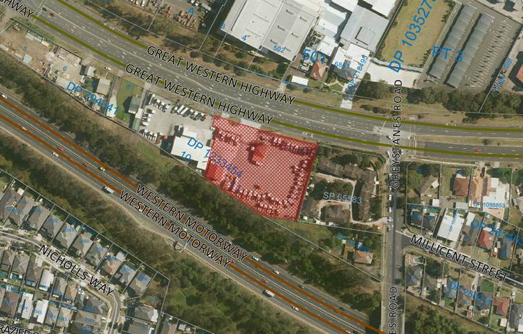
Figure 1 –
Aerial view of locality, subject site hatched. Source: Cumberland Council 2018
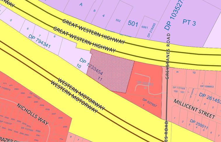
Figure 2 –
Land zone map, subject site hatched. Source: Cumberland Council 2018
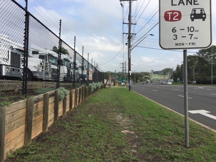
Figure 3 –
Subject site frontage, facing west. Source: Cumberland Council 2018
Description of
the Proposed Development
The subject
modification application seeks to modify condition 162 which restricts the
delivery hours to between 7 am and 10 pm. Condition 162 currently reads as
follows:
162. Deliveries are
to be carried out between 7 am and 10 pm.
The applicant has
proposed that the condition be modified to read as follows:
162. Deliveries
will be carried out in accordance with the following:
a) Service
Station
Deliveries for the
purposes of fuel and waste collection are to be carried out between 7 am and 10
pm, 7 days a week.
Deliveries for the
purposes of consumables may be carried out 24 hours, 7 days a week.
b) Kiosk
Deliveries are to be
carried out between 7 am and 10 pm, 7 days a week.
c) Take
Away Food and Drink Premises
Deliveries are to be
carried out between 7 am and 10 pm, 7 days a week.
History
|
Date
|
Action
|
|
12 September 2018
|
DA 2018/9 approved by CLPP
|
|
7 December 2018
|
DA 2018/9/2 (subject modification application) lodged with
Council
|
|
9 January 2019 to 23 January
2019
|
DA 2018/9/2 notified to owners and occupiers of
surrounding properties. 6 submissions were received as a result of the
notification, including a petition with 26 signatures
|
|
18 February 2019
|
Additional information requested from the applicant
|
|
19 February 2019
|
Additional information received by Council
|
|
13 March 2019
|
DA 2018/9/2 referred to CLPP for determination
|
Applicant’s
Supporting Statement
A
planning statement prepared by KDC, dated 6 December 2018 was submitted in
support of the application. Additional correspondence dated 4 February 2019 was
submitted to clarify aspects of the proposed modification.
Contact
with Relevant Parties
The
assessing officer has undertaken an inspection of the subject site and has been
in regular contact with the applicant throughout the assessment process.
Internal
Referrals
Environmental
Health
The
application was referred to Council’s Environmental Health Officer for
comment. The response received on 28 December 2018 indicates that the proposed
modification is supportable and that no additional conditions are required.
External
Referrals
Roads
and Maritime Services
The
application was referred to RMS for comment under section 101 of the ISEPP. The
response received 29 January 2019 indicates that RMS has no objection to the
proposed modification.
Planning
Comments
Section
4.55 (2) of the Environmental Planning and Assessment Act 1979 (EP&A Act)
Pursuant
to section 4.55(2), a consent authority may, on application being made by the
applicant or any other person entitled to act on a consent granted by the
consent authority and subject to and in accordance with the regulations, modify
the consent if:
|
Requirement
|
Comment
|
|
It is satisfied that the
development to which the consent as modified relates is substantially the
same development as the development for which the consent was originally
granted and before that consent as originally granted was modified (if at all),
and
|
The
original application consented to the construction of a service station, food
and drink premises and kiosk, with all tenancies to operate 24 hours a day.
The
subject modification application proposes only to modify condition 162 which
relates to delivery hours.
The
proposed modifications do not seek to alter the height, GFA, mix of uses or
intensity of the development to be carried out.
The
acoustic assessment provided with the application indicates that the proposal
complies with the relevant noise criteria and as such will have acceptable
amenity impacts in the locality.
Accordingly,
the proposed modification is considered to be substantially the same as the
development for which consent was originally granted.
|
|
it has consulted with the
relevant Minister, public authority or approval body (within the meaning of
Division 4.8) in respect of a condition imposed as a requirement of a
concurrence to the consent or in accordance with the general terms of an
approval proposed to be granted by the approval body and that Minister,
authority or body has not, within 21 days after being consulted, objected to
the modification of that consent, and
|
No Minister, public authority or
approval body was required to be consulted.
|
|
It has notified the application
in accordance with:
(i) the
regulations, if the regulations so require, or
(ii) a
development control plan, if the consent authority is a council that has made
a development control plan that requires the notification or advertising of
applications for modification of a development consent, and
|
The application was notified in
accordance with the Environmental Planning & Assessment Regulation, or
Part E of Holroyd Development Control Plan 2013.
|
|
It has considered any submissions
made concerning the proposed modification within any period prescribed by the
regulations or provided by the development control plan, as the case may be.
|
The issues raised in the public
submissions are discussed elsewhere in this report.
|
|
In determining an application for modification of a consent
under this section, the consent authority must take into consideration such
of the matters referred to in section 4.15(1) as are of relevance to the
development the subject of the application.
|
(a) The
provisions of the applicable EPIs are discussed elsewhere in this report.
The
provisions of the applicable DCP are discussed elsewhere in this report.
There
are no planning agreements or draft planning agreements related to this
application.
The
regulations do not prescribe any relevant mattes for consideration.
The
likely impacts of the proposal are considered satisfactory.
The
site is considered to be suitable for the development as proposed to be
modified.
The application was notified in
accordance with HDCP 2013 and the issues raised in the submissions are
addressed elsewhere in the report.
Approval of the subject
application would not be contrary to the public interest.
|
|
The consent authority must also take into consideration the
reasons given by the consent authority for the grant of the consent that is
sought to be modified.
|
(b) The reasons given by the consent authority for the
grant of the consent that is sought to be modified are not relevant to the
subject modification application.
|
The
provisions of any Environmental Planning Instruments (EP&A Act s4.15
(1)(a)(i))
The
following Environmental Planning Instruments are relevant to the assessment of
the application:
(a) State Environmental Planning
Policy No. 55 – Remediation of Land (SEPP 55)
Clause
7 of SEPP 55 requires Council to be satisfied that the site is suitable or can
be made suitable to accommodate the proposed development. The provisions of
SEPP 55 were considered in the assessment of the original application and the
proposed modifications do not alter previous conclusions regarding the
suitability of the site for the proposed development.
(b) State Environmental Planning
Policy (Infrastructure) 2007 (ISEPP)
The
provisions of the ISEPP 2007 have been considered in the assessment of the
development application.
Clause
101 – Frontage to classified road
The
provisions of clause 101 were assessed under the original application. The
proposed modification does not affect the location of the design of the
vehicular access, nature, volume or frequency of vehicles using the classified
road, or the emission of smoke or dust from the development.
(c) Holroyd Local Environmental Plan
2013
The
proposed modification does not affect the permissibility of the development, or
compliance with any of the applicable development standards under HLEP 2013.
The
provisions of any proposed instrument that is or has been the subject of public
consultation (EP&A Act s4.15 (1)(a)(ii))
There
are no draft Environmental Planning Instruments that apply to the subject
application.
The
provisions of any Development Control Plans (EP&A Act s4.15 (1)(a)(iii))
a) Holroyd Development Control
Plan (HDCP) 2013
Only
Part D – Industrial Controls, applies to the subject modification
application. The development as approved does not comply with the hours of
operation control and this application seeks to exacerbate that non-compliance
as it relates to the delivery hours for ‘consumables’.
A noise
impact assessment was provided with the application and was assessed as
satisfactory by Council’s Environmental Health Unit. The noise assessment
indicates that the proposed development will satisfy the relevant noise
criteria, having regard to impacts from a range of potential noise sources
including delivery trucks.
Accordingly,
the proposed modification is considered acceptable.
The
applicant has indicated that the purpose of the proposed modification is to
allow for deliveries of fresh produce and other consumables to the service
station tenancy. It is considered appropriate to limit the 24 hour deliveries
in line with the applicant’s request. All other deliveries (including
fuel) and waste collection activities are to occur between the hours of 7 am
and 10 pm to minimise the impacts on nearby residences. Additional restrictions
on the size of the delivery trucks to be used between the hours of 10 pm and 7
am are also included in the draft conditions, in line with the information
provided by the applicant about the proposed modification.
The
provisions of any planning agreement that has been entered into under section
7.4, or any draft planning agreement that a developer has offered to enter into
under section 7.4 (EP&A Act s4.15(1)(a)(iiia))
There
is no planning agreement or draft planning agreement associated with the
subject application.
The
provisions of the Regulations (EP&A Act s4.15 (1)(a)(iv))
The
Regulations do not prescribe any relevant matters for consideration.
The
Likely Environmental, Social or Economic Impacts (EP&A Act s4.15 (1)(b))
The
likely environmental impacts of the proposed modification have been considered
in the assessment of the application and are considered to be satisfactory.
The
suitability of the site for the development (EP&A Act s4.15 (1)(c))
The
site is considered to be suitable for the development as proposed to be
modified.
Submissions
made in accordance with the Act or Regulation (EP&A Act s4.15 (1)(d))
Advertised
(newspaper) Mail
Sign Not Required
In
accordance with Part E of HDCP 2013, the proposal was publicly notified for a
period of 14 days from 9 January to 23 January 2019. The notification generated
a total of 6 public submissions, including one petition with 26 signatures. The
issues raised in the public submissions are addressed in the following table.
|
Concern
|
Response
|
|
Issues raised in previous submission not addressed.
|
The issues raised in the submissions received in relation
to the original application were addressed in the report to the Panel dated
12 September 2018. The business paper and minutes of that meeting can be
viewed at any time on Council’s website.
|
|
Noise assessment report does not consider:
· Multiple
trucks on site at the same time
· Reversing
beeper
|
The applicant’s acoustic consultant provided the
following comment in response to this issue:
“In accordance with
the criteria under the Noise Policy for Industry (NPI) noise levels are to be
assessed over a fifteen minute period (known as the overall LAeq15min noise
level). Reverse alarms for sites of this size occur for a very short period
of time and hence do not increase the overall LAeq15min noise level.
Notwithstanding, the LAmax
(or sleep disturbance assessment) is considered the industry standard
assessment method for assessing reversing alarms. This accounts for the
maximum noise emission when beeping. A sound power level of 107dBA (102dBA
for a reverse alarm used on a 12.5m large rigid vehicle + 5dBA hypothetical
factor for annoyance) was modelled at the service station delivery bay.
Results identify that maximum emissions at nearest receivers was 59dBA which
is below the relevant sleep disturbance criteria, being 62dBA.
We can confirm the
operational noise assessment (ie LAeq assessment) included both fuel
deliveries and consumables (ie service station deliveries) simultaneously, as
well as the overall operation of the site. It is noted the LAmax (sleep
disturbance assessment) is designed to assess one off transient events and is
only relevant during the night time (i.e sleep disturbance) timeframes.
The LAmax assessment, which
for the purposes of this application, includes only deliveries for the
convenience store as these are the only deliveries to occur between 10pm and
7am.”
|
|
Typical tuck noise levels can be between 75 and 100
dB(a), or higher depending on the age of the vehicle and maintenance
regime
|
The applicant’s acoustic consultant provided the
following response to this issue:
“The delivery truck
represented within the noise model for the site had a noise level of 92dBA
with a LAeq sound power level over fifteen minutes. There is no standard
guideline for delivery truck noise. As such the modelled truck was derived
from direct measurements (conducted personally) at an existing 7-Eleven
service station. This direct measurements were taken from a 12.5m large rigid
vehicle, being the largest and therefore potentially the loudest delivery
vehicle to be used within the loading and service area. The levels were
assessed over a fifteen minute period so they match the criteria, which
is based over a fifteen minute assessment period.”
|
|
The acoustic assessment is inconsistent regarding the
night time noise limit; stating 60 dB(a) at one point, and 45dB(a)
elsewhere
|
The applicant’s acoustic consultant provided the
following comment in response to this issue:
“The NPI states there
are two methods to quantify potential sleep disturbance impacts.
1. The LAeq15minute method - is essentially an
average over fifteen minutes. (screening criteria is 52dBA)
2. The LAmax value method - captures the loud
impact noise from one-off transient events. (screening criteria is 62dBA)
Where these screening
criteria are met, no further assessment of sleep disturbance is required. It
is noted that both criteria are satisfied for all receivers in this
assessment.”
|
|
Penalty should apply for exceeding the specified noise
criteria
|
A condition was imposed on the original consent requiring
that noise testing be carried out at the applicant’s expense in the
event of Council receiving complaints regarding excessive noise from the
premises.
Any non-compliance with the consent will be addressed by
Council’s Compliance Unit in accordance with the relevant policies and
legislation, upon receipt of a complaint.
|
|
Lack of action plan for additional pollution due to
emission of CO and CO2
|
The subject application relates only to the extension of
the delivery hours for truck movements relating to provision of food and
other consumables to the service station tenancy.
The proposal does not seek to increase the intensity of
the development and will not result in additional vehicle movements. As such,
there is no increase in CO or CO2 emissions as a result of the
proposal.
|
|
Lack of security measures to address crime risk associated
with service station use. Barbed wire fence required to prevent access from
the subject site to the residential properties.
|
The development as approved involves significant cut along
the eastern boundary of the subject site. A barbed wire fence is not
considered appropriate in an urban context, particularly adjacent to a
residential property.
The standard height boundary fence, along with the
proposed retaining wall along the eastern boundary, are considered sufficient
to discourage unauthorised access from the subject site to 1 Greystanes Road.
The site will be appropriately lit and monitored at all
times and this will further reduce the likelihood of the subject site
providing a point of access for would-be intruders to the adjacent
residential properties.
The proposed modification does not result in any increased
security risks for the adjacent residential properties.
|
|
Request to limit hours of operation to 8 am to 8 pm
weekdays and 10 am to 8 pm weekends
|
DA 2018/9 was approved 12 September 2018 for 24 hour
operation of all businesses on the site. Limiting the hours of operation is
beyond the scope of the subject application.
The proposed modification seeks to allow 24 hour delivery
of fresh produce and other consumables to the service station tenancy, whilst
maintaining the restricted delivery hours of 7 am to 10 pm for the other
tenancies.
The application was accompanied by an acoustic report
which indicates that the proposal complies with the relevant noise criteria
and as such, the proposed modification is supported.
|
|
Electric fence wall and CCTV required on the boundary to
prevent access from the subject site to the residential properties.
|
An electric fence was not proposed by the applicant and is
not considered an appropriate type of boundary treatment in an urban area,
particularly where it adjoins a residential property.
The conditions of the original consent and the Plans of
Management endorsed under that consent require the installation and
monitoring of CCTV.
The subject modification does not result in any increased
security risk for the proposed development or for the adjacent properties.
|
|
Impact on small children of petrol and food odours, and
noise
|
The proposal relates only to the extension of delivery
hours for the approved service station business. All other aspects of the
development were assessed and considered satisfactory under the original
application.
Standard conditions were imposed on the original consent
to require compliance with Australian Standards and Building Code
requirements for air handling and petroleum storage systems. There are no
additional impacts relating to food or petrol that would arise as a result of
the proposed modification to delivery hours.
The noise assessment report submitted with the application
indicates that the proposal complies with the relevant noise criteria.
|
|
Increase in criminal activity as a result of the proposed
uses.
|
As stated above, the subject application relates only to
the modification of the hours permitted for deliveries of fresh produce and
other consumables to the 7-eleven service station tenancy.
There are no changes to the built form, mix of uses or
trading hours proposed under this medication application. The modification to
approved delivery hours will not result in any increased risk or likelihood
of criminal activity in the locality.
|
|
No need for 24 hour delivery given the size of the
business
|
The additional information provided by the applicant on 4
February 2019 indicates that the extended delivery hours are required for the
service station tenancy to ensure that fresh produce and other like items are
available to meet customer needs in the morning peak trade hours.
|
The
public interest (EP&A Act s4.15(1)(e))
In view
of the foregoing analysis it is considered that approval of the subject
modification would not be contrary to the public interest. The issues raised in
the public submissions do not warrant refusal of the application.
Section
7.11 (Formerly S94) Contribution Towards Provision or Improvement of Amenities
or Services
The
application does not attract payment of development contributions.
Disclosure
of Political Donations and Gifts
The
application and notification process did not result in any disclosure of
Political Donations or Gifts.
The development application has
been assessed in accordance with the relevant requirements of the Environmental
Planning and Assessment Act 1979, HLEP 2013, and HDCP 2013 and is considered
satisfactory.
There are no further consultation
processes for Council associated with this report.
There are no further financial
implications for Council associated with this report.
There are no policy implications
for Council associated with this report.
Communication /
Publications:
The final outcome of this matter
will be notified in the newspaper. The objectors will also be notified in
writing of the outcome.
|
That DA 2018/9/2 seeking to
amend delivery hours for the service station tenancy to 24 hours a day, seven
(7) days a week on land at 601-605 Great Western Highway Greystanes, be
approved subject to the conditions in the draft determination.
That those persons who lodged
a submission in respect to the application be notified of the determination
of the application.
|
1. Noise Assessment
Report ⇩
2. Letter
from applicant dated 4 February 2019 ⇩
3. Plan
of Management ⇩
4. Draft
Notice of Determination ⇩
5. Public
Submissions ⇩
DOCUMENTS
ASSOCIATED WITH
REPORT LPP006/19
Attachment 1
Noise Assessment Report
Cumberland Local Planning Panel Meeting
13 March 2019


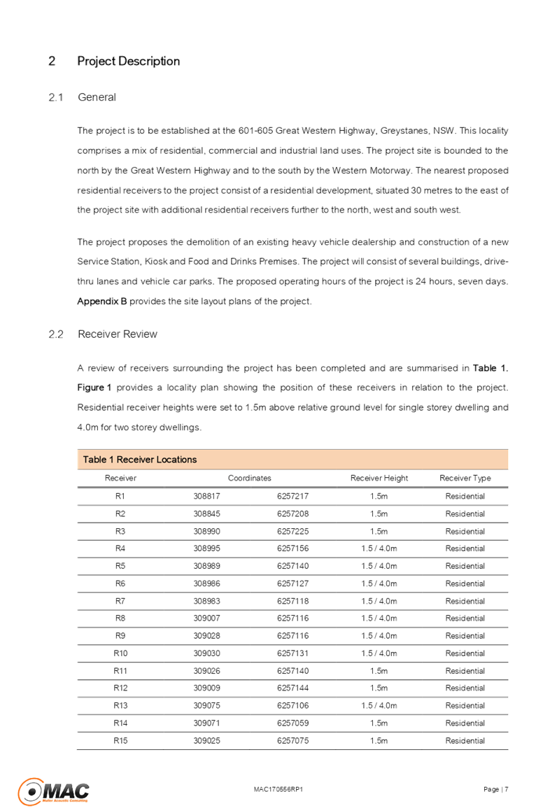
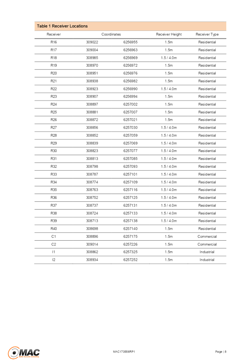
Cumberland Local Planning Panel Meeting
13 March 2019
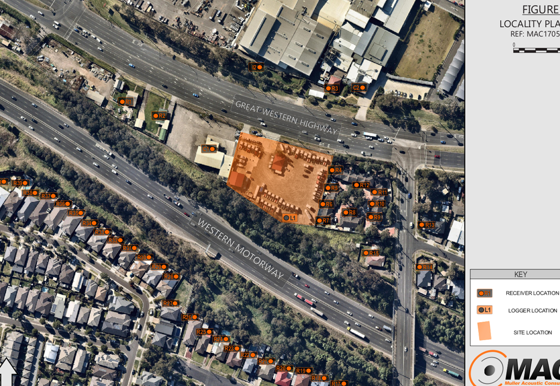
Cumberland Local Planning Panel Meeting
13 March 2019
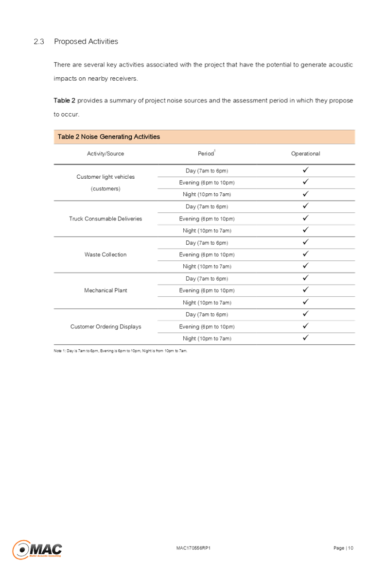
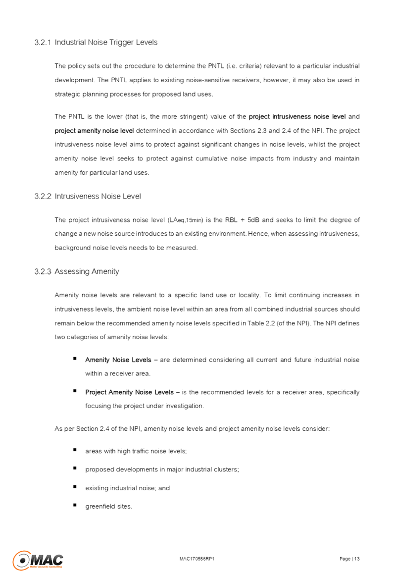
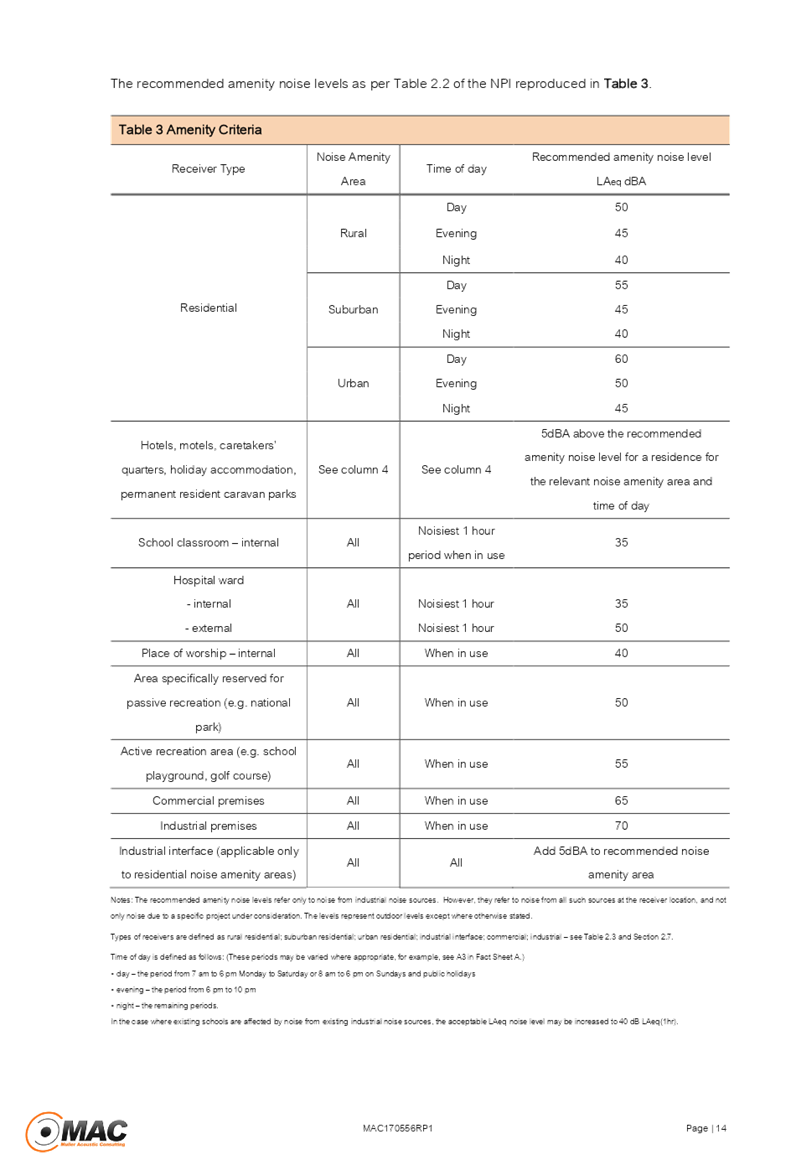
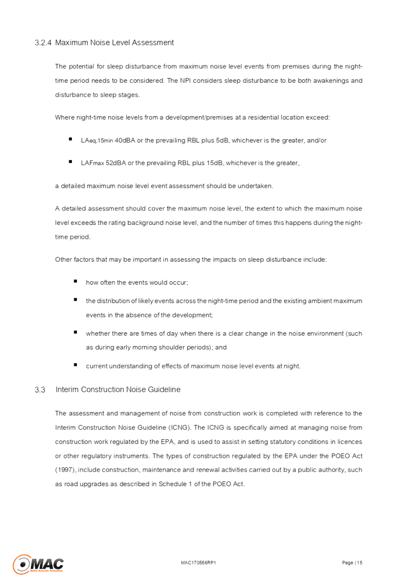
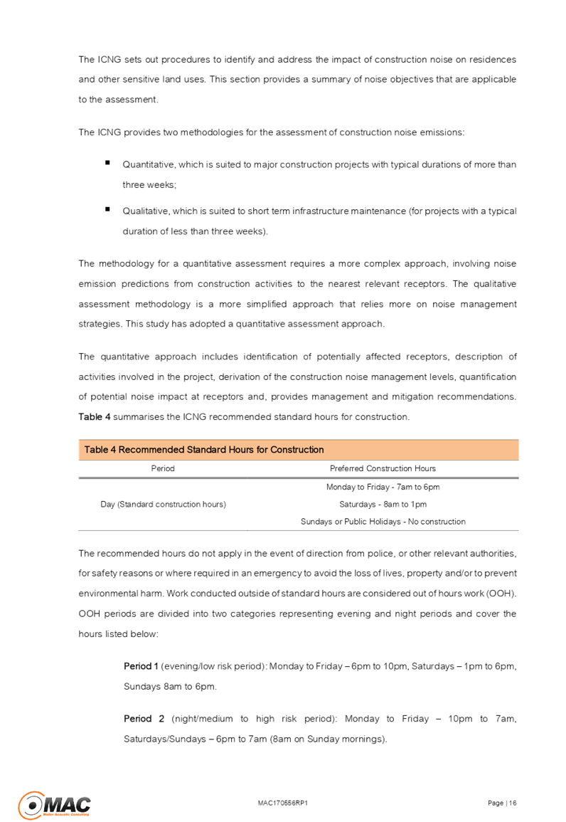
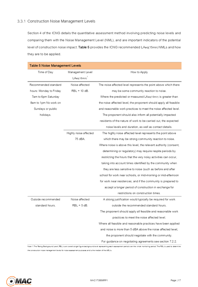

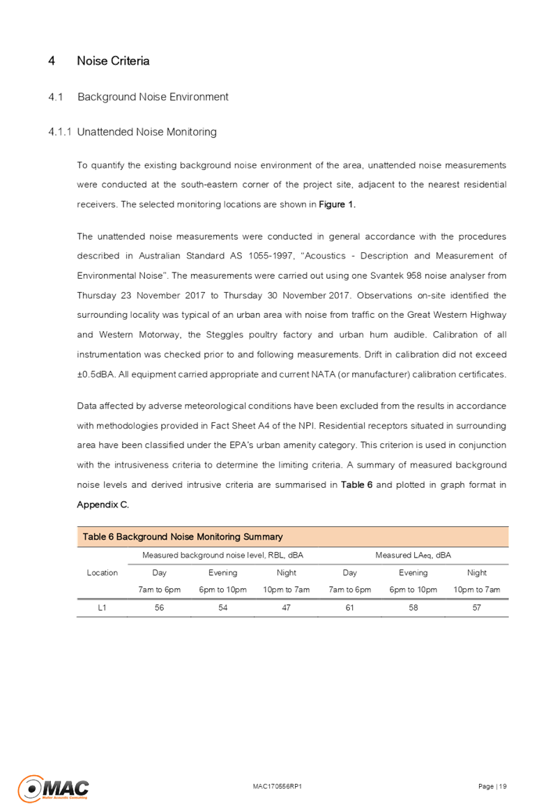
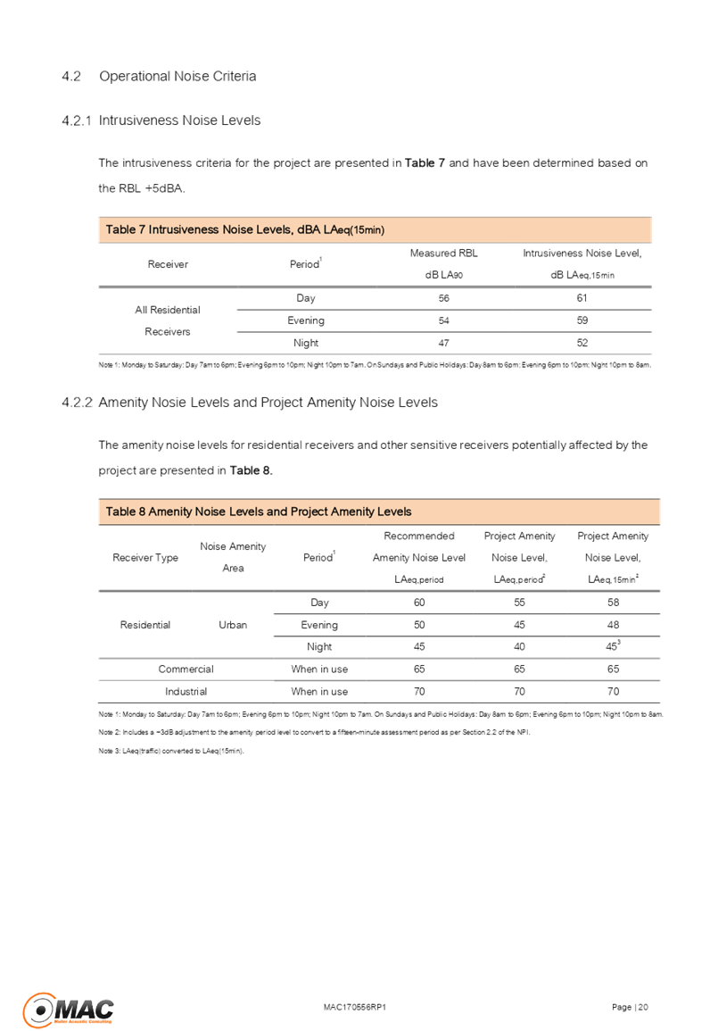
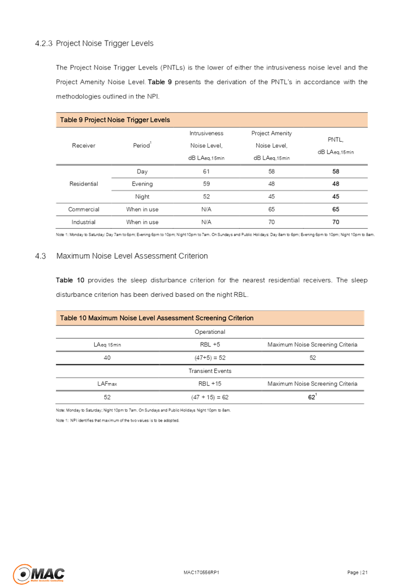
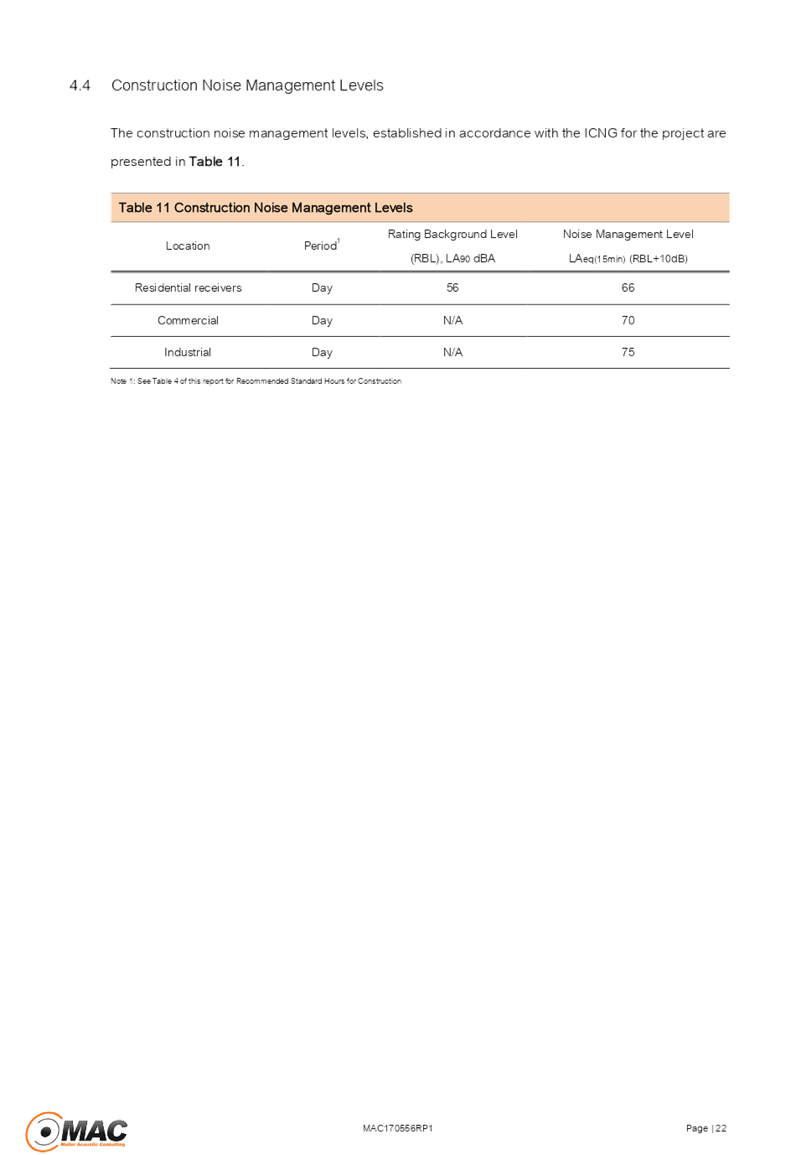
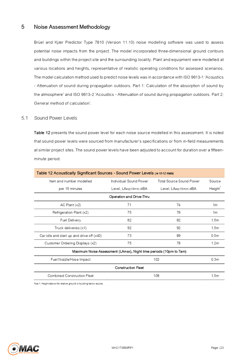
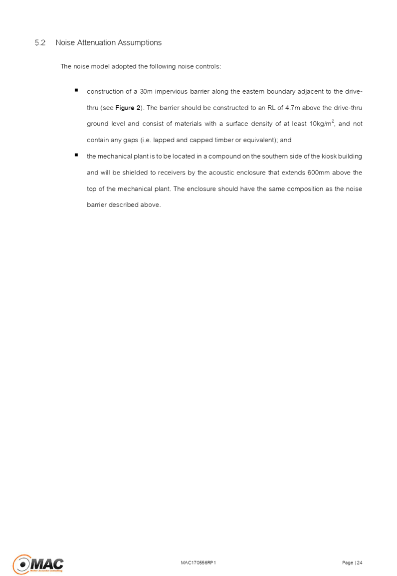
Cumberland Local Planning Panel Meeting
13 March 2019
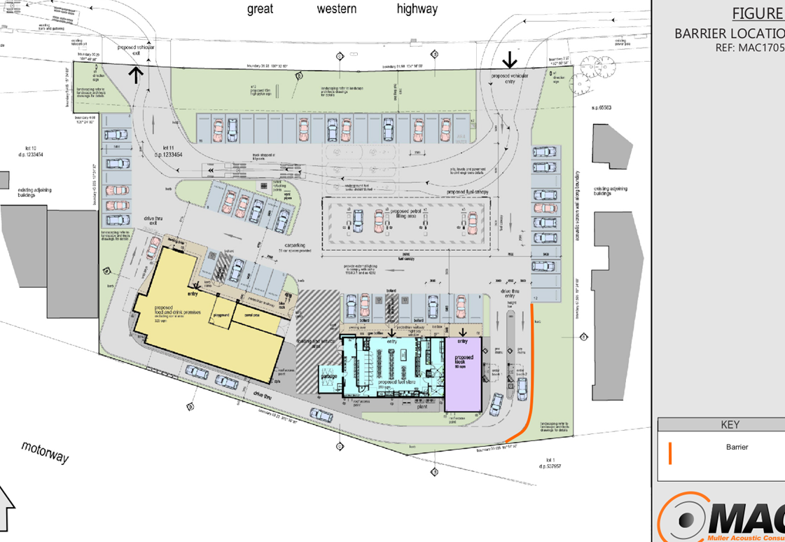
Cumberland Local Planning Panel Meeting
13 March 2019

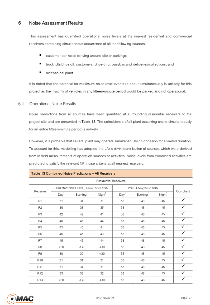
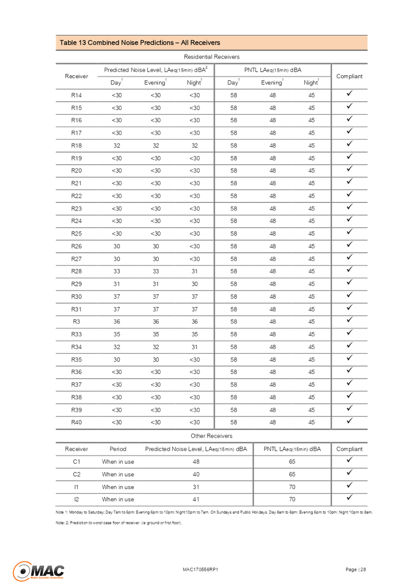
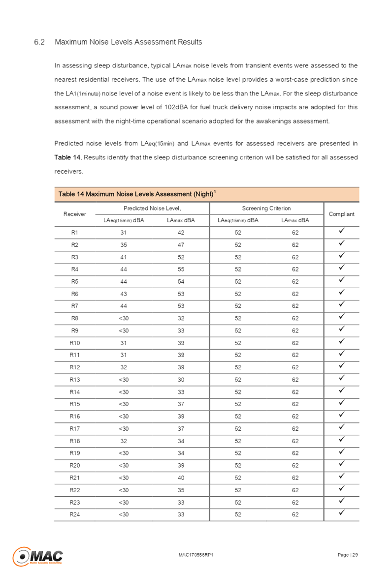
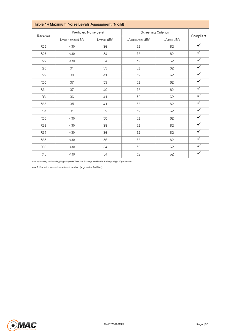
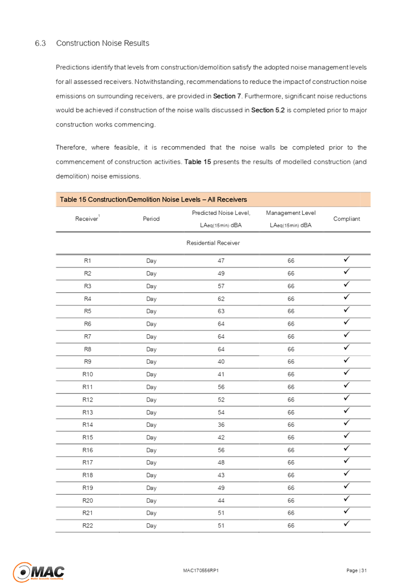
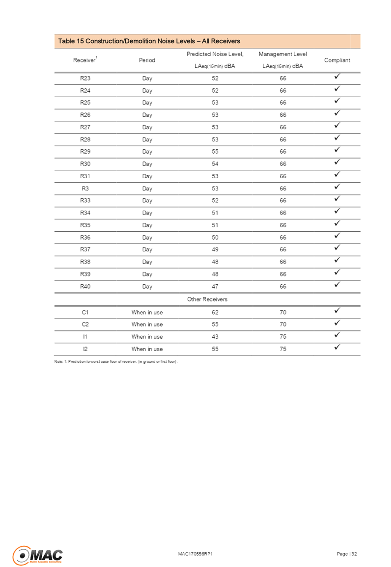
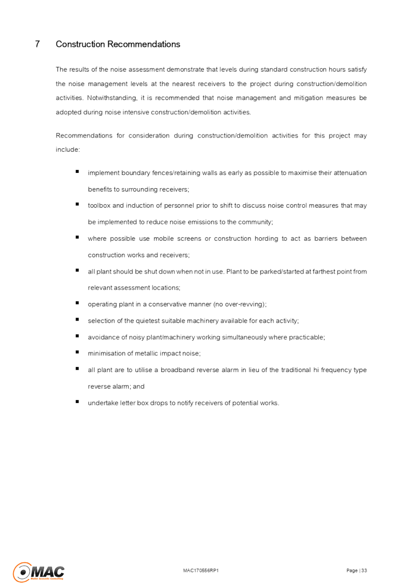

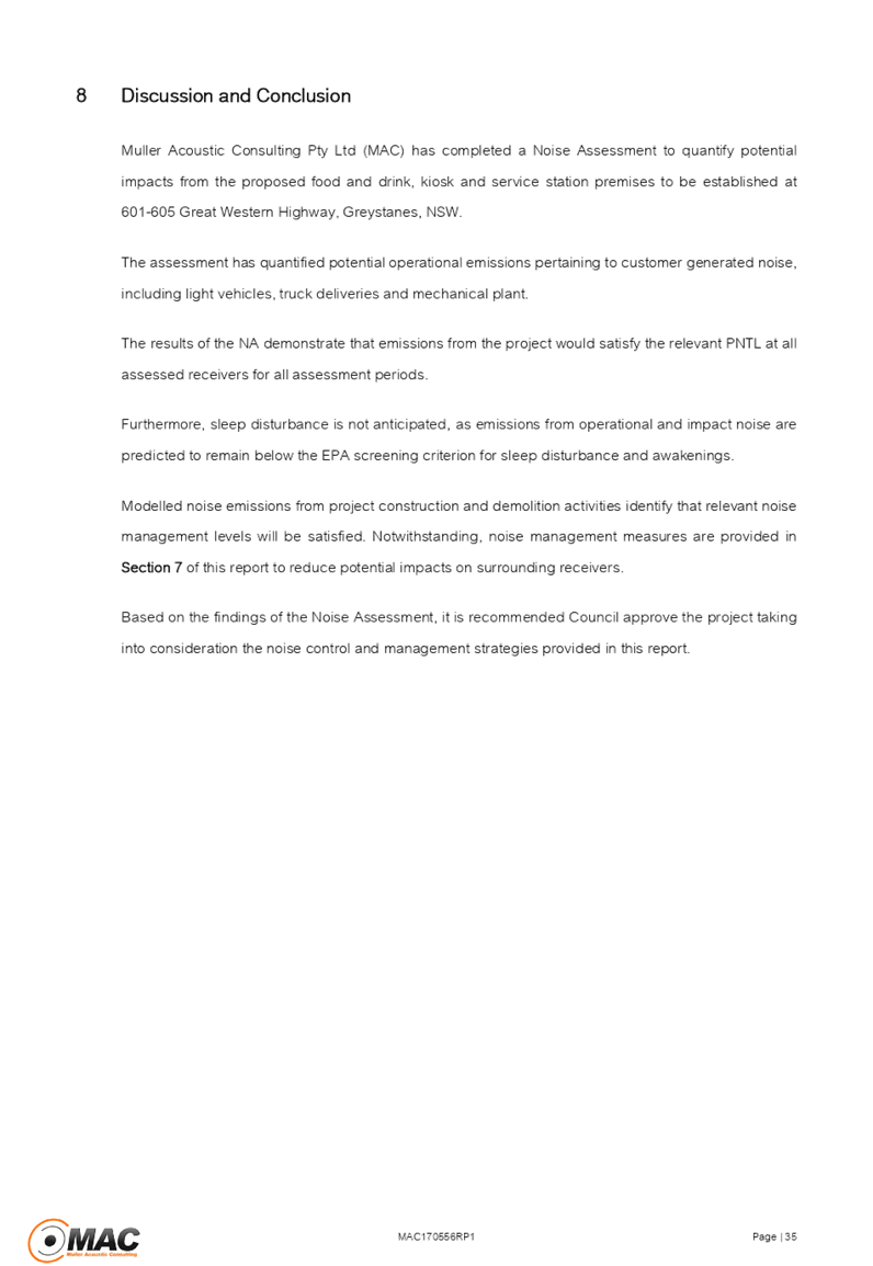


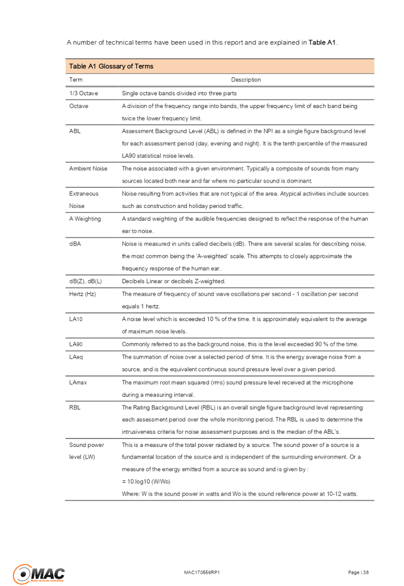
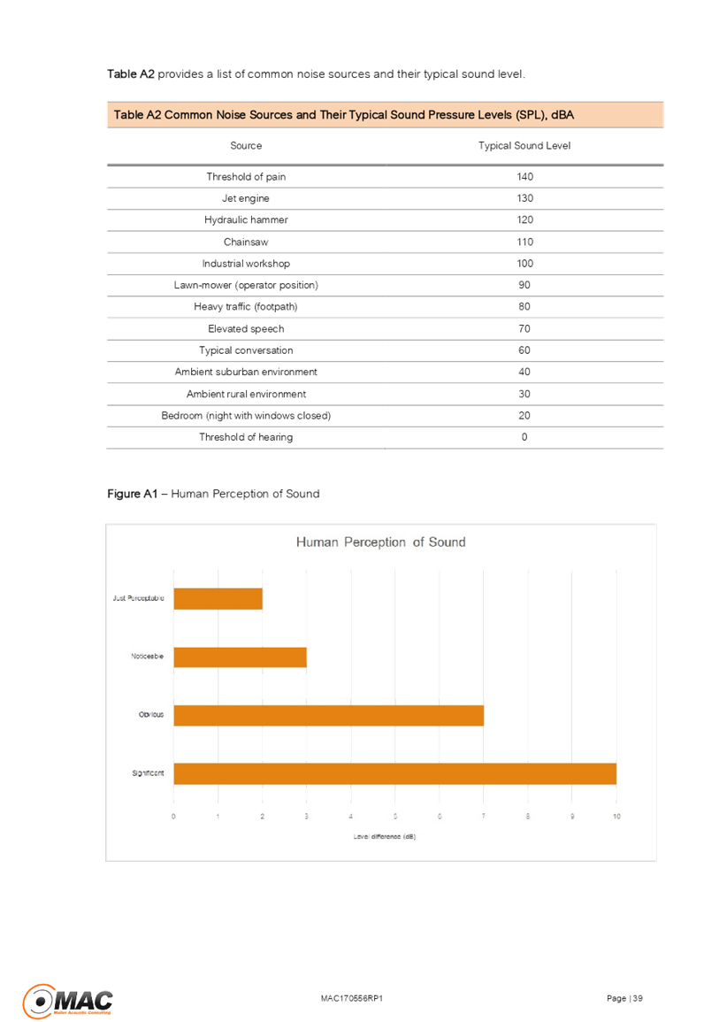

Cumberland Local Planning Panel Meeting
13 March 2019
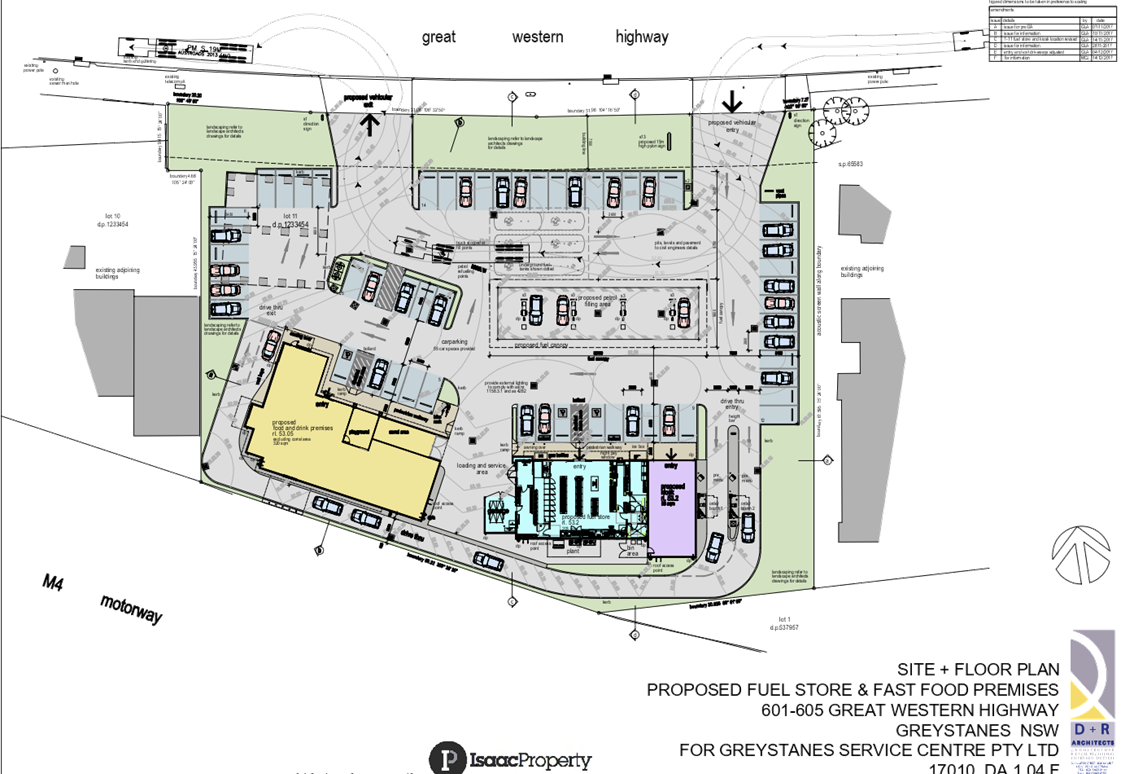
Cumberland Local Planning Panel Meeting
13 March 2019
Cumberland Local Planning Panel Meeting
13 March 2019
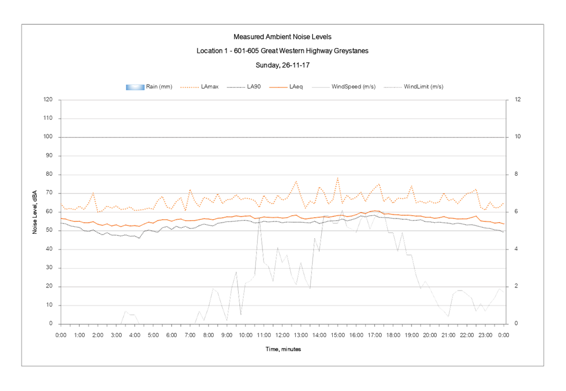
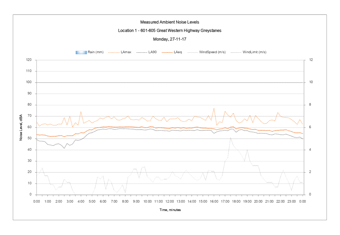
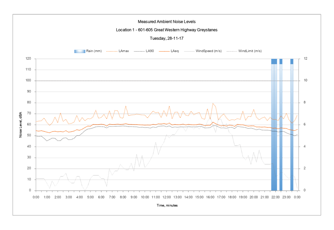
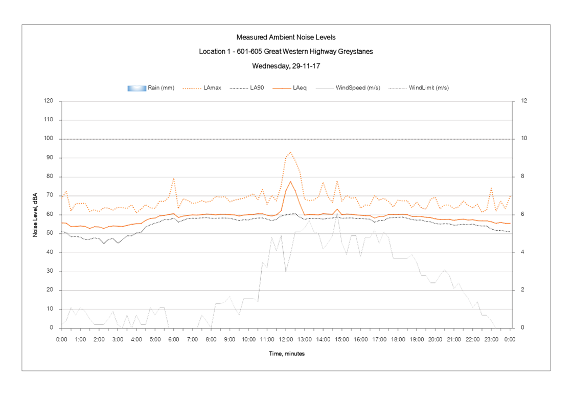
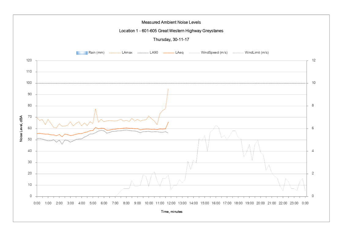
Cumberland Local Planning Panel Meeting
13 March 2019

DOCUMENTS
ASSOCIATED WITH
REPORT LPP006/19
Attachment 2
Letter from applicant dated 4 February 2019
Cumberland Local Planning Panel Meeting
13 March 2019
DOCUMENTS
ASSOCIATED WITH
REPORT LPP006/19
Attachment 3
Plan of Management
Cumberland Local Planning Panel Meeting
13 March 2019
DOCUMENTS
ASSOCIATED WITH
REPORT LPP006/19
Attachment 4
Draft Notice of Determination
Cumberland Local Planning Panel Meeting
13 March 2019
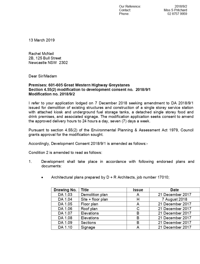
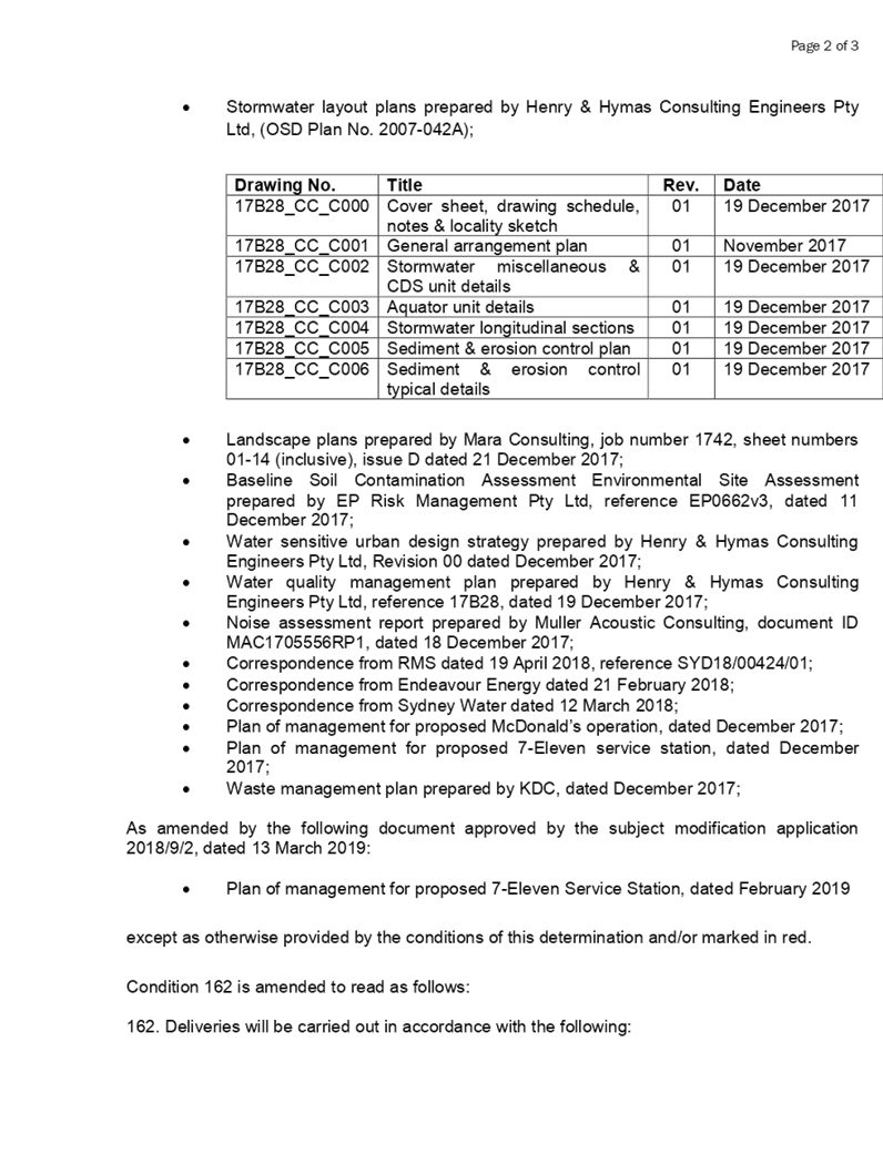

DOCUMENTS
ASSOCIATED WITH
REPORT LPP006/19
Attachment 5
Public Submissions
Cumberland Local Planning Panel Meeting
13 March 2019


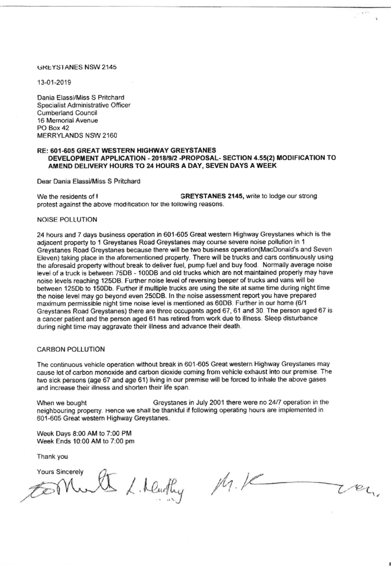
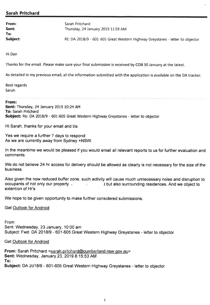
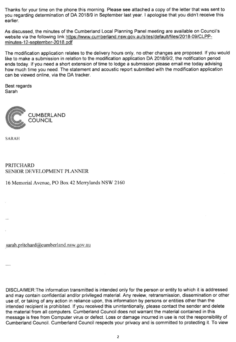
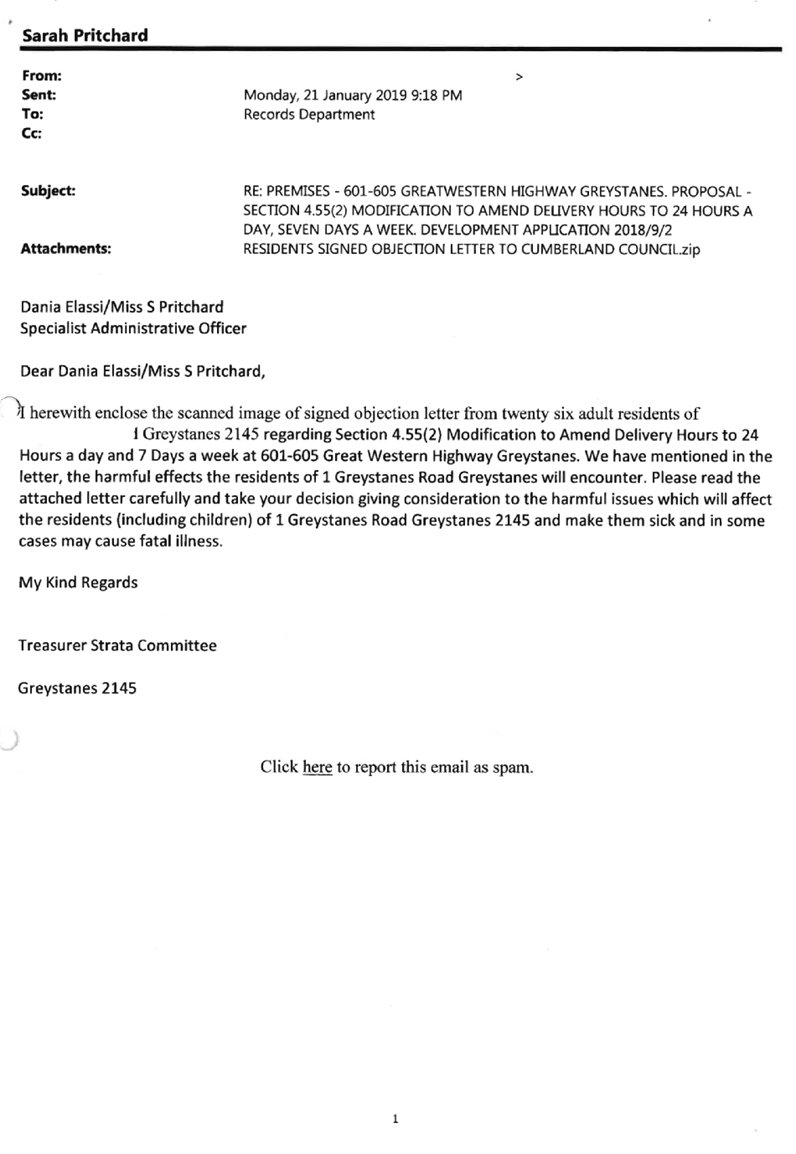
Cumberland
Local Planning Panel Meeting
13 March 2019
Item No: LPP007/19
S.46
Modification to 1-7 & 9-11 Neil Street, Merrylands
Responsible
Division: Environment
& Planning
Officer: Manager
Development Assessment
File
Number: DA
- 2016/496/3
|
Application lodged
|
27 September 2017
|
|
Applicant
|
Landmark Group Australia Pty Ltd
|
|
Owner
|
Lot 11 Neil Street Pty Limited
|
|
Application No.
|
2016/496/3
|
|
Description of Land
|
1-7 Neil Street Merrylands (Lot 11, DP 228782) and
9-11 Neil Street Merrylands (Lot 1, DP 203553)
|
|
Proposed Development
|
S4.56 Modification seeking internal and external
alterations to Building 4
|
|
Site Area
|
15,763m2
|
|
Zoning
|
R4 – High Density Residential
|
|
Disclosure of political donations and gifts
|
Nil disclosure
|
|
Heritage
|
The site is
located adjacent to a local heritage item to the north being the former
brickworks site known as Item I53 - Goodlet & Smith (brickmaking plant
and chimney, Hoffman kiln & chimney).
The subject site
is known as the Millmaster Feeds site and is identified as a local
Archaeological site.
|
|
Principal Development Standards
|
Floor Space Ratio
Permissible: 3.5:1
Approved: 3.67
Proposed: 3.69:1
Height of Buildings
Permissible: 29m,
30m, and 39m
Proposed:
No change to the approved height proposed
|
|
Issues
|
Exceedance to Floor Space Ratio
|
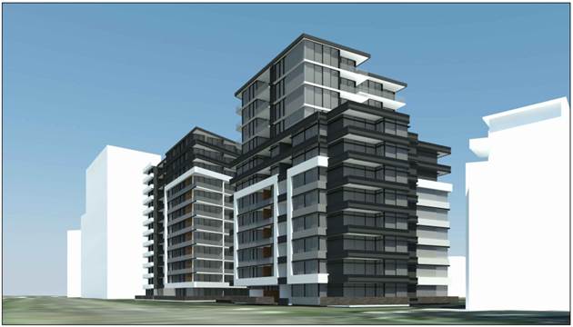
Figure 1 – Perspective
from Railway looking South (South: Marchese Partners, 2017)
Summary:
Application No. DA-2016/496/3 was
received on 27 September 2017 for a Modification Application under Section 4.56
(formerly Section 96AA) of the Environmental Planning & Assessment Act 1979
seeking consent for internal and external alterations to Building 4 at 1-11
Neil Street, Merrylands.
The application was publicly notified
to occupants and owners of the adjoining properties for a period of 21 days
between 25 October 2017 and 15 November 2017. In response, no submissions were
received.
The subject site is located
adjacent to a heritage item to the north being the former brickworks site known
as Item I53 - Goodlet & Smith (brickmaking plant and chimney, Hoffman kiln
& chimney) under Holroyd Local Environmental Plan 2013 (HLEP) 2013. The
subject site is known as the Millmaster Feeds site and is identified as a potential
Archaeological site.
On 26 April 2017, Development
Application 2016/496 was considered by the Sydney West Central Planning Panel
(SWCPP) for construction of a 2 x residential flat buildings (Buildings 3 &
4) over 3 levels of basement parking accommodating a total of 438 car parking
spaces and 5 on-grade spaces; Building 3 being 12 storey accommodating 178
units and Building 4 being Part 6, Part 8 and Part 12 storeys accommodating 133
units. The application includes consolidation of 2 existing lots making up the
overall site of 1-11 Neil Street and re-subdivision of the consolidated lot
into 3 Torrens title lots and 4 Stratum Lots.
At its meeting, the SWCPP deferred
the application for a number of reasons including concerns over site coverage,
insufficient landscaped area and excessive bulk; a desire for taller and
slimmer buildings; and a desire for an alternate unit mix with increased 3
bedroom units.
The applicant subsequently lodged
a Class 1 Appeal against the deemed refusal of the DA with the NSW Land and Environment
Court (appeal number 2017/132564) which was upheld with DA-2016/496 approved
subject to conditions.
On 11 September 2017, Section 4.56
modification application (DA-2016/496/2) was approved which sought minor
alterations to the approved residential flat building development,
predominately relating to the western elevation of Building 3.
On 14 August 2018, Section 4.56
modification application (DA-2016/496/5) was approved, which sought amendments
to the approved subdivision of the site from 7 lots to 6 lots.
On 4 October 2018, Section 4.56
modification application (DA-2016/496/6) was approved, which sought the removal
of the subdivision component of the development.
The proposal is consistent with
the aims and objectives of State Environmental Planning Policy (SEPP) No. 55
(Remediation of Land), SEPP No. 65 – Design Quality of Residential
Apartment Development, SEPP (Infrastructure) 2007, SEPP (Building
Sustainability Index: BASIX) 2004, Sydney Environmental Plan (Sydney Harbour
Catchment) 2005, Holroyd Local Environmental Plan (HLEP) 2013, Draft SEPP
(Environment), and Holroyd Development Control Plan (HDCP) 2013.
The variations sought via the
subject modification application are as follows:
|
Control
|
Maximum
|
Approved
|
Proposed
|
%Variation
|
|
Floor Space Ratio
|
3.5:1
|
3.67:1
|
3.69:1
|
0.5% (approved)/ 5.43% (maximum)
|
The increase in floor area
improves the internal amenity of the apartments by providing additional storage
areas, bathrooms and increased bedroom sizes. The increase in floor area is
derived from a reduction to the size of the approved balconies and as a result,
the amendments are mainly within the approved building footprint.
The subject proposal does not
involve significant changes to the approved apartment layouts or built form.
Minor changes to the visual articulation of the northern, southern and eastern
façades reflect the changes made to the apartment layouts with
appropriate visual interest maintained.
The proposal is substantially the
same development as the approved development and satisfies the relevant
provisions of the Environmental Planning and Assessment Act 1979.
The application is being reported
to the Cumberland Local Planning Panel (CLPP) for determination, as it is a
4.56 modification application involving a variation to a development standard.
In light of the above, it is
recommended that the Cumberland Local Planning Panel Approve the Section 4.56
Application, subject to the Draft Notice of Determination contained in
Attachment 2 to this report.
Subject Site and Surrounding
Area
The subject land is known as Lot
11, DP 228782 and Lot 1, DP 203553, 1-7 and 9-11 Neil Street, Merrylands. The
land is an irregular shaped lot and has a frontage of 110.82 metres to the
southern Neil Street boundary; a 100.65 metre depth along the western side
boundary; a 180.5 metre width along the northern rear boundary; and a 131.15
metre depth along the eastern boundary shared with the railway corridor. The
total site area is 15,763sqm. The site is illustrated in Figure 2 below with the
portion of the site of the approved residential flat Buildings 3 and 4 being
the eastern half of the site, with the site of Building 4 marked with a star.

Figure
2 - Location Map (Source: Cumberland Council, 2018)
The subject site is currently
under construction with partially constructed residential flat buildings 1 and
2 on the western half of the site. The land is split by the A’Becketts
Creek watercourse which traverses the site in a north to south direction and
forms a natural feature and constraint for the site.
The topography of the site is
fairly consistent with a slight fall from south to north. The land is affected
by Local Overland Stormwater Overflow.
The subject site is zoned R4 High
Density Residential pursuant to Holroyd Local Environmental Plan (HLEP) 2013,
as shown in Figure 3 below:


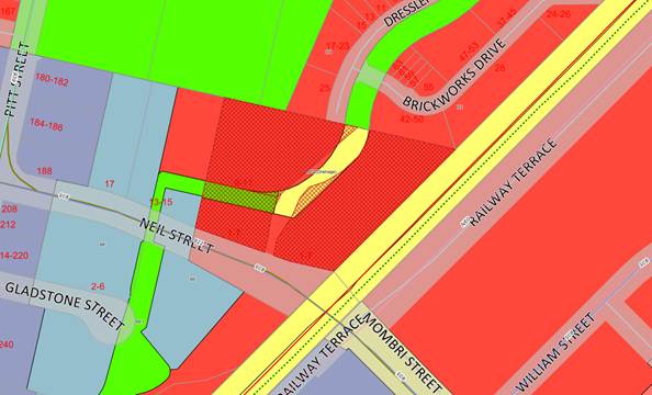
Figure
3 – Zoning Map (Source: Cumberland Council, 2018)
The subject site is situated on
the northern side of Neil Street, Merrylands, and is located within the Neil
Street Precinct. The subject site is adjacent to a railway corridor that spans
the eastern boundary of the site and approximately 350 metres north-east from
Merrylands train station. The site is illustrated in Figures 4 and 5 below.


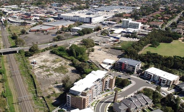
Figure
4 – Aerial view of subject site and surrounds (Source: Cumberland
Council, 2018)


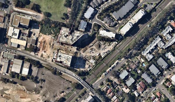
Figure
5 – Aerial Photo (Source: Nearmap, 2019)
The locality is characterised by
existing low rise former industrial premises to the west along Neil Street;
mixed use and residential flat building developments approved, under
construction, and recently completed to the west and north; commercial and
retail development to the south-west and residential to the east and south.
The subject site currently
benefits from vehicular access directly from Neil Street. Vehicular access to
the development is dependent on a proposed extension of Dressler Court at the
north of the site, which will connect to a new road running through the site
along the western side of the A’Becketts Creek watercourse.
The site is located adjacent to a
heritage item to the north being the former brickworks site known as Item I53 -
Goodlet & Smith (brick-making plant and chimney, Hoffman kiln &
chimney). The subject site is known as the Millmaster Feeds site and is
identified as a potential Archaeological site. Figure 6 below illustrates the
location of the heritage item, listed above:

Figure
6 – Heritage Map (Source: Cumberland Council, 2018)
Description of The Proposed
Development
Development Application 2016/496/1
was approved via Land and Environment Court Appeal No. 2017/00132561 for
construction of a 2 x residential flat buildings (Buildings 3 & 4) over 3
levels of basement parking accommodating a total of 438 car parking spaces and
5 on-grade spaces; Building 3 being 12 storey accommodating 178 units and
Building 4 being Part 6, Part 8 and Part 12 storeys accommodating 133 units.
The application includes consolidation of 2 existing lots making up the overall
site of 1-11 Neil Street and re-subdivision of the consolidated lot into 3
Torrens title lots and 4 Stratum Lots.
On 11 September 2017, Section 4.56
modification application (DA-2016/496/2) was approved which sought minor
alterations to the approved residential flat building development,
predominately relating to the western elevation of Building 3.
On 14 August 2018, Section 4.56
modification application (DA-2016/496/5) was approved, which sought amendments
to the approved subdivision of the site from 7 lots to 6 lots.
On 4 October 2018, Section 4.56
modification application (DA-2016/496/6) was approved, which sought the removal
of the subdivision component of the development.
The changes sought via the subject
Section 4.56 Application are as follows:
· Modification
to the internal configuration of a number of apartments.
· Adjustment
of balcony sizes to a number of apartments.
· Alteration
to the articulation of the building from the northern, southern and eastern
elevations due to the deletion of the balconies and the extension of a number
of bedrooms.
· Increase
in Gross Floor Area (GFA) from 9,705sqm to 9,962sqm.
Specific details of the key
proposed changes are as follows:
|
Level
|
Unit
|
Modifications
|
|
Ground
|
4.0.03
|
Relocation of
kitchen, extension of bedroom to the north and addition of an ensuite.
|
|
4.0.05
|
Modified ensuite and
addition of a study, increase in size of bedroom and consequent decrease in
size of balcony.
|
|
4.0.06
|
Increase in size of
lounge room and consequent decrease in size of balcony.
|
|
4.0.12
|
Addition of a
storage cupboard in the lounge room.
|
|
1 to 5
|
4.L.03
|
Relocation of
kitchen, extension of bedroom to the north and addition of an ensuite.
|
|
4.L.05
|
Modified ensuite and
addition of a study, increase in size of bedroom and consequent decrease in
size of balcony.
|
|
4.L.07
|
Deletion of southern
Neil Street balcony and extension of bedroom to the south, relocation of
bathroom, addition of study and increase in size of northern balcony.
|
|
4.L.09
|
Modified ensuite and
addition of a study, extension of bedroom to the south-east and consequent
decrease in size of south eastern balcony.
|
|
4.L.11
|
Modified ensuite and
addition of a study, extension of bedroom to the south-east and consequent
decrease in size of south eastern balcony.
|
|
4.L.14
|
Addition of a
storage cupboard in the lounge room.
|
|
4.L.15
|
Modified internal
layout and addition of ensuite.
|
|
6
|
4.6.02
|
Increase width of
unit, reconfigure bedrooms, addition of a study and addition of ensuite.
|
|
4.6.04
|
Modified ensuite and
addition of a study, extension of bedroom to the south-east and consequent
decrease in size of south eastern balcony.
|
|
4.6.06
|
Modified ensuite and
addition of a study, extension of bedroom to the south-east and consequent
decrease in size of south eastern balcony.
|
|
4.6.09
|
Addition of a
storage cupboard in the lounge room.
|
|
4.6.10
|
Relocation of
kitchen, internal reconfiguration, addition of ensuite.
|
|
7
|
4.7.02
|
Increase width of
unit, reconfigured bedrooms, addition of a study and addition of ensuite.
|
|
4.7.04
|
Modified ensuite and
addition of a study, extension of bedroom to the south-east and consequent
decrease in size of south eastern balcony.
|
|
4.7.06
|
Modified ensuite and
addition of a study, extension of bedroom to the south-east and consequent
decrease in size of south eastern balcony.
|
|
i)
4.7.09
|
Addition of a
storage cupboard in the lounge room.
|
|
ii)
4.7.10
|
Relocation of
kitchen, internal reconfiguration, addition of ensuite.
|
|
8
|
4.8.01
|
Increase balcony
size to the west.
|
|
4.8.02
|
Increase balcony
size to the west.
|
|
4.8.04
|
Relocation of
kitchen, internal reconfiguration, addition of ensuite and consequent
reduction in size of Unit 4.8.04
|
|
4.8.05
|
Reduction in unit
size due to increase in size of Unit 4.8.04.
|
|
9 to 11
|
4.L.04
|
Relocation of
kitchen, internal reconfiguration and consequent reduction in size of Unit
4.L.05.
|
|
4.L.05
|
Reduction in unit
size due to increase in size of Unit 4.L.04
|
Applicants Supporting
Statement
The applicant has provided a
Statement of Environmental Effects prepared by Willana Associates dated 21
September 2017 and was received by Council on 27 September 2017 in support of
the application.
Contact with Relevant
Parties
The assessing officer has
undertaken a site inspection of the subject site and surrounding properties and
has been in regular contact with the applicant throughout the assessment
process.
Internal Referrals
The application was not required
to be referred to any internal Council departments for comment.
External Referrals
Sydney Water
The modification application was
referred to Sydney Water for comments, who has confirmed the application is not
required to be referred to Sydney Water at this stage. Conditions of consent
related to Building Plan Approval and Section 73 Certificate have been imposed
within Development Consent 2016/496/1, and remain valid.
Endeavour Energy
The modification application was
referred to Endeavour Energy for comments, who advised that the modified
development proposal is supported.
Water NSW
The modification application was
referred to Water NSW for comments, who advised that the modified development
proposal is supported, providing updated General Terms of Approval GTAs to
reflect recent policy changes.
Roads and Maritime Services
The modification application was
referred to Roads and Maritime Services for comments, who advised that the
modified development proposal is supported.
Sydney Trains
The modification application was
referred to Sydney Trains for comments, who advised that the modified
development proposal is supported.
Planning Comments
Section 4.56 of the
Environmental Planning and Assessment Act 1979 (EP & A Act)
A consent authority may, on
application being made by the Applicant or any other person entitled to act on
a consent granted by the Court and subject to and in accordance with the
regulations, modify the consent if:
|
Requirement
|
Comment
|
|
(a) it is satisfied that the development to
which the consent as modified relates is substantially the same development
as the development for which the consent was originally granted and before
that consent as originally granted was modified (if at all), and
|
The development as proposed to
be modified is substantially the same as the development for which consent
was originally granted.
|
|
(b) it
has notified the application in accordance with:
(i) The
regulations, if the regulations so require, or
(ii) A
development control plan, if the consent authority is a council that has made
a development control plan that requires the notification or advertising of
applications for modification of a development consent, and
|
The application was publicly notified in accordance with
the Holroyd DCP 2013 for a period of 21 days between 25 October 2017 and 15
November 2017. In response, no submissions were received.
|
|
(c) it has notified, or made reasonable
attempts to notify, each person who made a submission in respect of the
relevant development application of the proposed modification by sending
written notice to the last address known to the consent authority of the
objector or other person, and
|
All persons who made a submission in respect of the
original application were notified of the proposed modification.
|
|
(d) it has
considered any submissions made concerning the proposed modification within
any period prescribed by the regulations or provided by the development
control plan, as the case may be.
|
No submissions were received in response to the
notification of the subject application.
|
|
(1A) In determining an application for
modification of a consent under this section, the consent authority must take
into consideration such of the matters referred to in section 4.15 (1) as are
of relevance to the development the subject of the application. The consent
authority must also take into consideration the reasons given by the consent
authority for the grant of the consent that is sought to be modified.
|
The
provisions of the applicable EPIs are discussed elsewhere in this report.
The
provisions of the applicable DCP are discussed elsewhere in this report.
There are no planning agreements or draft planning
agreements related to this application.
There are no relevant matters referred to in the
regulations.
The likely impacts of the development as proposed to be
modified are considered satisfactory.
The site is considered to be suitable for the development
as proposed to be modified.
No submissions
were received in response to the notification period, as noted above.
Approval of the
subject application is not contrary to the public interest.
|
|
(1C) The modification of a development consent in accordance
with this section is taken not to be the granting of development consent
under this Part, but a reference in this or any other Act to a development
consent includes a reference to a development consent as so modified.
|
Noted.
|
|
(2) After determining an application for modification of a
consent under this section, the consent authority must send a notice of its
determination to each person who made a submission in respect of the
application for modification.
|
Noted.
|
Section 4.15 of the
Environmental Planning and Assessment Act 1979 (EP & A Act)
The provisions of any
Environmental Planning Instruments (EP & A Act s4.15 (1)(a)(i))
The following Environmental
Planning Instruments are relevant to the assessment of the subject modification
application:
(a) State
Environmental Planning Policy No. 55 – Remediation of Land (SEPP 55)
The requirement at Clause 7 of
SEPP 55 for the consent authority to be satisfied that the site is suitable or
can be made suitable to accommodate the proposed development, was considered
under the original application. The proposed modifications do not raise any new
concerns regarding site contamination.
(b) Statement
Environmental Planning Policy No. 65 - Design Quality of Residential Apartment
Development (SEPP 65)
SEPP 65 applies to the development
as the building is 3 storeys or more, and contains at least 4 dwellings. A
design statement addressing the design quality principles prescribed by SEPP 65
was prepared by the project architect. Integral to SEPP 65 is the Apartment
Design Guide (ADG), which sets benchmarks for the appearance, acceptable
impacts and residential amenity of the development.
Following a detailed assessment of
the proposal against the provisions of SEPP 65 and the ADG, the proposal is
considered compliant with the policies with mainly internal changes to the
apartment layout and changes to the northern, southern and eastern elevations.
The proposal continues to satisfy design criteria including building amenity,
apartment size and layout, private open space and balconies, storage and
universal design. A comprehensive assessment against SEPP 65 and the ADG is
contained in Attachment 3 of this report.
(c) State
Environmental Planning Policy (Infrastructure) 2007 (ISEPP)
The provisions of the ISEPP 2007
have been considered in the assessment of the Modification Application. The
proposed modifications do not affect the previous assessment regarding
upgrading existing utility services including water, gas or telecommunications.
Clause 45 - Development likely
to affect an electricity transmission or distribution network
The subject development occurs
within 5 metres of an overhead electricity power line and the original proposed
development also included a substation. As such, the Consent Authority is
required to give written notice to an electricity supply authority. The
modification application was referred to Endeavour Energy, who advised that the
modified development proposal is supported.
Clause 85 – Development
adjacent to railway corridors
The application is subject to
clause 85 of the ISEPP, as the subject site is located adjacent to a railway
corridor. The modification application was referred to Sydney Trains, who
advised that the modified development proposal is supported.
Clause 86 – Excavation
in, above, below or adjacent to rail corridors
The application is subject to
clause 86 of the ISEPP as the proposed redevelopment of the site involves
excavation to a depth of at least 2m below ground level (existing), on land
within 25m (measured horizontally) of a rail corridor. The modification
application was referred to Sydney Trains, who advised that the modified
development proposal is supported.
Clause 87 – Impact of
rail noise or vibration on non-rail development
The application is subject to
clause 87 of the ISEPP as the site is in or adjacent to a rail corridor or is
likely to be adversely affected by rail noise or vibration. The modification
application was referred to Sydney Trains, who advised that the modified
development proposal is supported.
Clause 101 – Frontage to
classified road
The application is not subject to
clause 101 of the ISEPP as the site does not have a frontage to a classified
road.
Clause 102 – Impact of
road noise or vibration on non-road development
The application is not subject to
clause 102 of the ISEPP as the annual average daily traffic volume of Neil
Street is less than 20,000 vehicles.
Clause 104 – Traffic
generation developments
The original DA proposed over 300
dwellings and over 400 parking spaces and accordingly was referred to the RMS
for comment in accordance with Clause 104 of the ISEPP. The modification
application was also referred to the RMS, who advised that the modified
development proposal is supported.
(d) State
Environmental Planning Policy (Building Sustainability Index: BASIX) 2004
A BASIX Certificate has been
lodged and endorsed as a part of Development Application 2016/496/1. An amended
BASIX Certificate was not lodged with the subject application, which has been
conditioned in the Draft Notice of Determination.
(e) Sydney
Regional Environmental Plan (Sydney Harbour Catchment) 2005
The subject site is identified as
being located within the area affected by the Sydney Regional Environmental
Plan (Sydney Harbour Catchment) 2005. The proposed development raises no
issues, as no impact on the catchment is envisaged.
Note: The subject site is not
identified in the relevant map as land within the ‘Foreshores and
Waterways Area’ or ‘Wetland Protection Zone’, is not a
‘Strategic Foreshore Site’ and does not contain any heritage items.
Hence the majority of the SEP is not directly relevant to the proposed
development.
(f) Holroyd
Local Environmental Plan 2013 (HLEP 2013)
The subject site is zoned R4 High
Density Residential pursuant to HLEP 2013. The subject development continues to
be characterised as 2 x residential flat buildings.
Residential flat building means
a building containing 3 or more dwellings, but does not include an attached
dwelling or multi dwelling housing.
Note. Residential flat
buildings are a type of residential accommodation – see definition of
that term in the dictionary.
The development complies with the
development standards contained within the HLEP 2013, with the exception of the
Floor Space Ratio development standard. A comprehensive assessment against the
HLEP 2013 is contained in Attachment 4 to this report.
Floor Space
Ratio
· The
proposal is generally consistent with the provisions of the HLEP 2013 as
approved, with a continued non-compliance with the FSR development standard.
The subject modification proposes an increase in the GFA by 258sqm which
increases the FSR variation from 3.67:1 (approved under DA2016/496/2) to
3.69:1.
A Clause 4.6 request is not
required as the application is made under Section 4.56 of the Environmental
Planning and Assessment Act, 1979.
The proposal would further exceed
the maximum permitted FSR under the HLEP 2013 by a further 0.02:1, increasing
the total exceedance from 0.17 (4.86%) to 0.19:1 (5.43%) which is a relatively
minor increase considering the overall development. As noted earlier, the
additional GFA and increased FSR are a result of improving internal amenity of
some units within the development which would achieve a net positive outcome for
the development from the modifications proposed. Furthermore, the additional
GFA does not amount to any net increase in the building footprint such that
additional yield would be achievable.
It should be noted that FSR and
GFA averaging has been previously applied across the entire site for the
overall 4 buildings that form the original development and a condition was
imposed on the original consent granted requiring a positive covenant to be
imposed on the lot containing Building 1 to preclude any future applications
adding GFA to that building. Of note, when assessed against the average across
the site, the proposed amendments remain compliant, with an overall maximum
permitted average equivalent to 45,177m², and a proposed average of
42,299.4m² proposed.
Council is satisfied that the
proposed development will be in the public interest, as it is consistent with
the objectives of the FSR development standard and the objectives for
development within the zone in which the development is proposed to be carried
out.
The provisions of any Proposed
Instruments (EP & A Act s4.15 (1)(a)(ii))
The following draft Environmental
Planning Instruments are relevant to the assessment of the subject modification
application:
(a) Draft
State Environmental Planning Policy (Environment)
The draft SEPP relates to the
protection and management of our natural environment with the aim of
simplifying the planning rules for a number of water catchments, waterways,
urban bushland, and Willandra Lakes World Heritage Property. The changes
proposed include consolidating the following seven existing SEPPs:
· State
Environmental Planning Policy No. 19 – Bushland in Urban Areas.
· State
Environmental Planning Policy No. 19 – Bushland in Urban Areas.
· State
Environmental Planning Policy (Sydney Drinking Water Catchment) 2011.
· State
Environmental Planning Policy No. 50 – Canal Estate Development.
· Greater
Metropolitan Regional Environmental Plan No. 2 – Georges River Catchment.
· Sydney Regional
Environmental Plan No. 20 – Hawkesbury-Nepean River (No.2-1997).
· Sydney Regional
Environmental Plan (Sydney Harbour Catchment) 2005.
· Willandra Lakes
Regional Environmental Plan No. 1 – World Heritage Property.
The draft policy will repeal the
above existing SEPPs and certain provisions will be transferred directly to the
new SEPP, amended and transferred, or repealed due to overlaps with other areas
of the NSW planning system.
As noted within the assessment
above under the heading ‘Sydney Regional Environ-mental Plan (Sydney
Harbour Catchment) 2005’, the proposed development raises no issues, as
no impact on the catchment is envisaged.
The provisions of any
Development Control Plans (EP & A Act s4.15 (1)(a)(iii))
The following Development Control
Plans are relevant to the assessment of the subject modification application:
(a) Holroyd
Development Control Plan 2013 (HDCP 2013)
The Holroyd Development Control
Plan 2013 (HDCP 2013) provides guidance for the design and operation of
development to achieve the aims and objectives of the HLEP 2013. The proposed
development complies with the relevant provisions of HDCP 2013 and is
considered acceptable from an environmental planning view point.
A detailed assessment against the
provisions of the Holroyd DCP 2013 is contained in Attachment 5 to this report.
The provisions of any planning
agreement that has been entered into under section 7.4, or any draft planning
agreement that a developer has offered to enter into under section 7.4 (EP
& A Act s4.15(1)(a)(iiia))
There is no planning agreement or
draft planning agreement associated with the subject Modification Application.
The provisions of the
Regulations (EP & A Act s4.15 (1)(a)(iv))
The proposed development raises no
concerns as to the relevant matters arising from the Environmental Planning and
Assessment Regulations 2000 (EP&A Reg).
The Likely Environmental,
Social or Economic Impacts (EP & A Act s4.15 (1)(b))
It is considered that the proposed
development will have no significant adverse environmental, social or economic
impacts in the locality. The proposed modifications are minor in nature and are
mostly internal changes resulting in improved amenity for future residents.
The suitability of the site for
the development (EP & A Act s4.15 (1)(c))
The subject site and locality is
not known to be affected by any natural hazards or other site constraints
likely to have a significant adverse impact on the proposed development. The
proposal seeks modification to Building 4 of the approved residential flat
building development only. Modifications are minor in nature and will not
create adverse impacts on the surrounding development. Accordingly, it is
considered that the development is suitable in the context of the site and
surrounding locality.
Submissions made in accordance
with the Act or Regulation (EP & A Act s4.15 (1)(d))
Advertised (newspaper) Mail
Sign
Not
Required
In accordance with Council’s
Notification requirements contained within the Holroyd DCP 2013, the proposal
was publicly notified for a period of 21 days between 25 October 2017 and 15
November 2017. No submissions were received in respect of the proposed
development.
The public interest (EP & A
Act s4.15(1)(e))
The public interest is served by
permitting the orderly and economic use of land, in a manner that is sensitive
to the surrounding environment and has regard to the reasonable amenity
expectations of surrounding land users. In view of the foregoing analysis, it
is considered that approval of the proposed development would not be contrary
to the public interest.
Section 7.11 (Formerly S94)
Contributions
The subject development requires
the payment of contributions in accordance with Holroyd Section 94 Development
Contributions Plan 2013. A condition was imposed on the original consent
requiring the payment of contributions. The dwelling yield and unit mix is not
proposed to change, and therefore, the value of the contributions do not change
as a result of the proposed modifications.
Disclosure of Political
Donations and Gifts
The NSW Government has introduced
disclosure requirements for individuals or entities with a relevant financial
interest as part of the lodgement of various types of development proposals and
requests to initiate environmental planning instruments or development control
plans.
The application and notification
process did not result in any disclosure of Political Donations or Gifts.
The proposed development has been
assessed against the matters for consideration listed in Section 4.15 of the EP
& A Act, 1979, and is considered to be satisfactory. Any likely impacts of
the development have been satisfactorily addressed and the proposal is
considered to be in the public interest. Further, the subject site continues to
be suitable for the development.
The proposed development is
appropriately located within the R4 High Density Residential zone under the
relevant provisions of the HLEP 2013 and are consistent with the zone. The
development however proposes a further variation to the Floor Space Ratio
development standard under the HLEP 2013. The increase in floor area is derived
from a reduction to the size of the approved balconies and is mainly within the
approved building footprint. The development is considered to perform
adequately in terms of its relationship to its surrounding built and natural
environment, particularly having regard to impacts on adjoining properties.
The development, as proposed to be
modified, is considered to be substantially the same development as approved
and modified and therefore satisfactory for approval subject to conditions.
There are no further consultation
processes for Council associated with this report.
There are no further financial
implications for Council associated with this report.
There are no policy implications for
Council associated with this report.
Communication /
Publications:
The final outcome of this matter
will be notified in the newspaper. The objectors will also be notified in
writing of the outcome.
|
That Section 4.56 Application
2016/496/3 seeking internal and external alterations to Building 4 on land at
1-7 & 9-11 Neil Street, Merrylands, be Approved, subject to the
conditions contained in Attachment 2 of this report.
|
1. Architectural Plans
⇩
2. Draft
Notice of Determination ⇩
3. SEPP
65 Apartment Design Guide Compliance Assessment ⇩
4. Holroyd
Local Environmental Plan 2013 Compliance Assessment ⇩
5. Holroyd
Development Control Plan 2013 Compliance Assessment ⇩
6. Development
Consent 2016/496/1 ⇩
7. Endorsed
Architectural Plans for Development Consent 2016/496/1 ⇩
8. Development
Consent 2016/496/2 ⇩
9. Endorsed
Architectural Plans for Development Consent 2016/496/2 ⇩
10. Development
Consent 2016/496/5 ⇩
11. Development
Consent 2016/496/6 ⇩
DOCUMENTS
ASSOCIATED WITH
REPORT LPP007/19
Attachment 1
Architectural Plans
Cumberland Local Planning Panel Meeting
13 March 2019
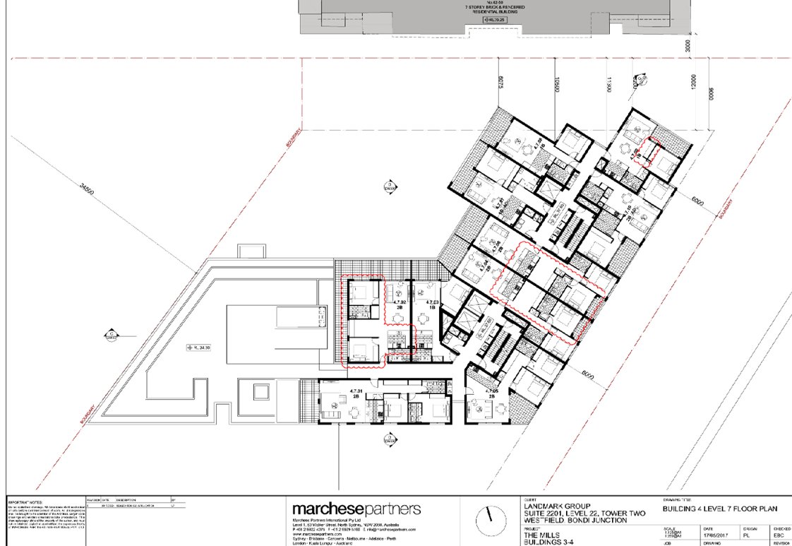
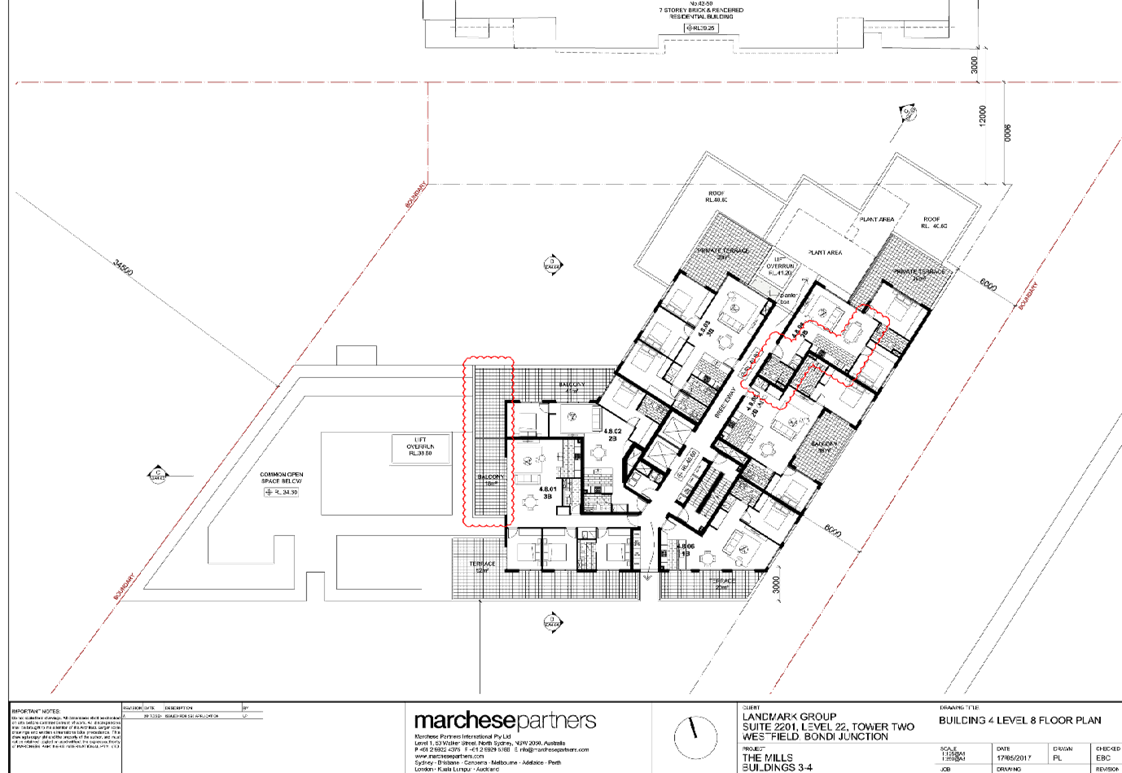
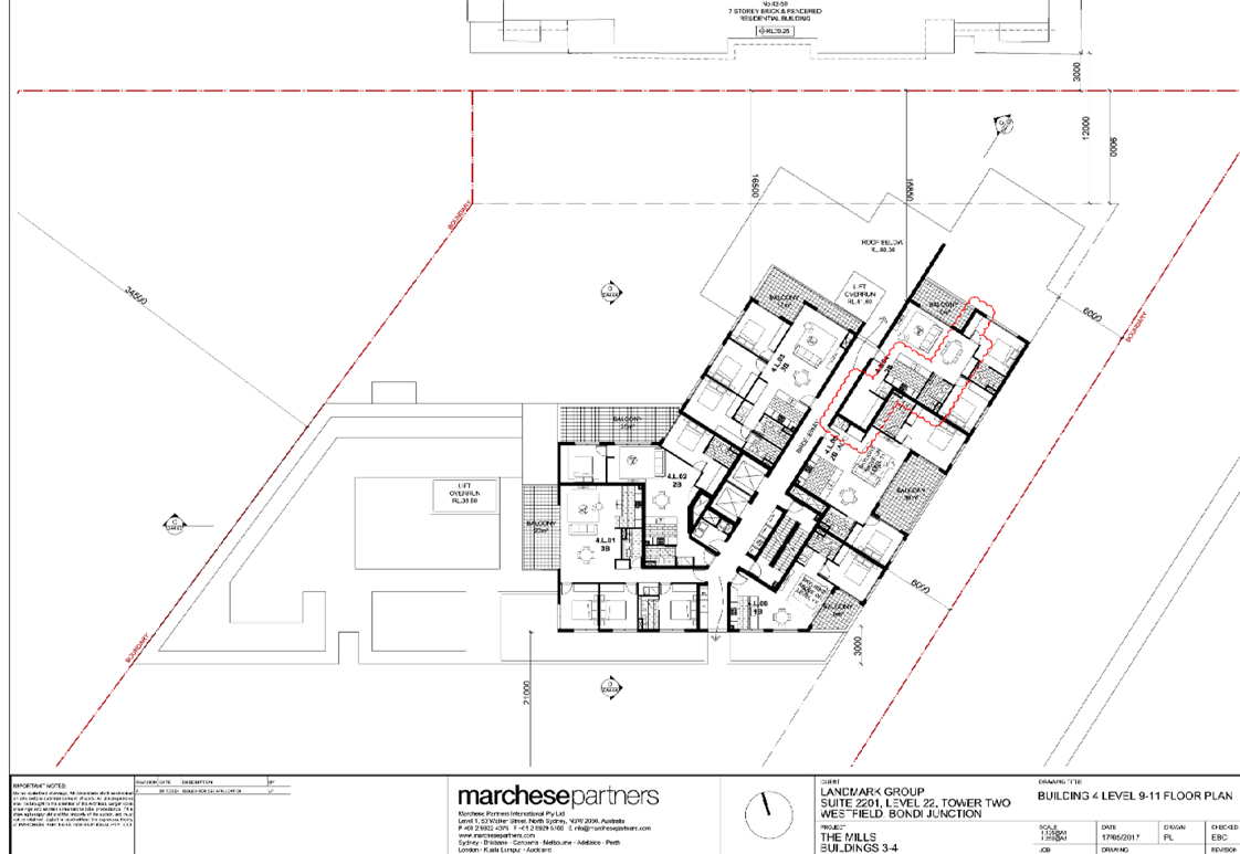
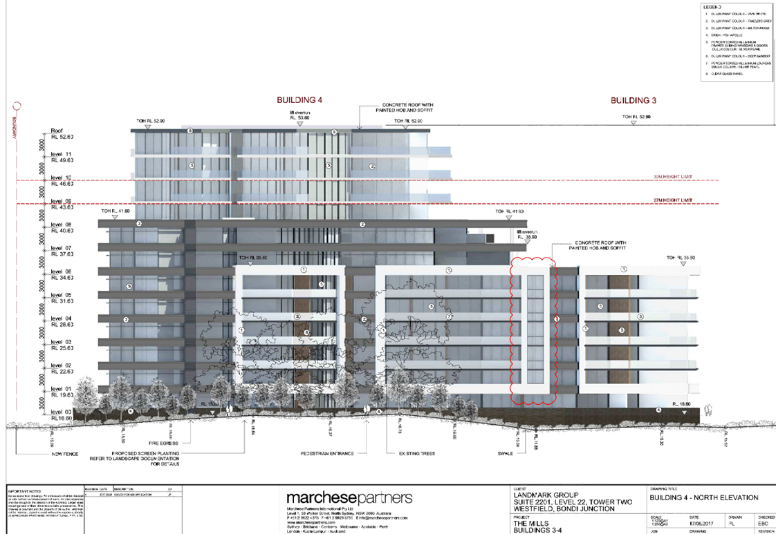
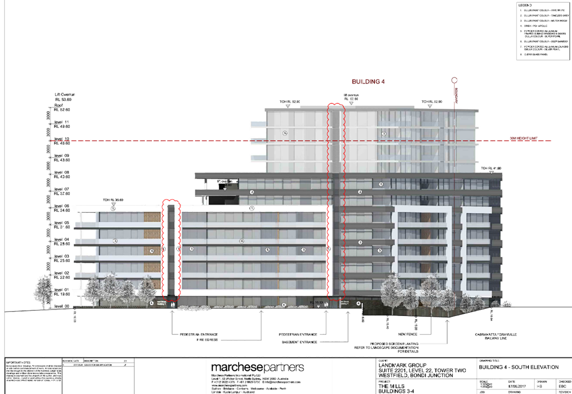
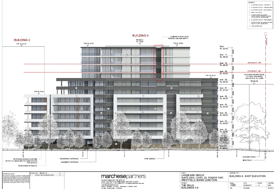
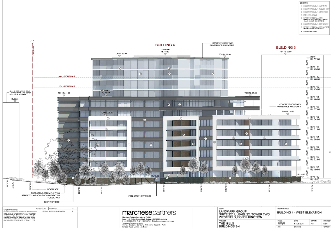
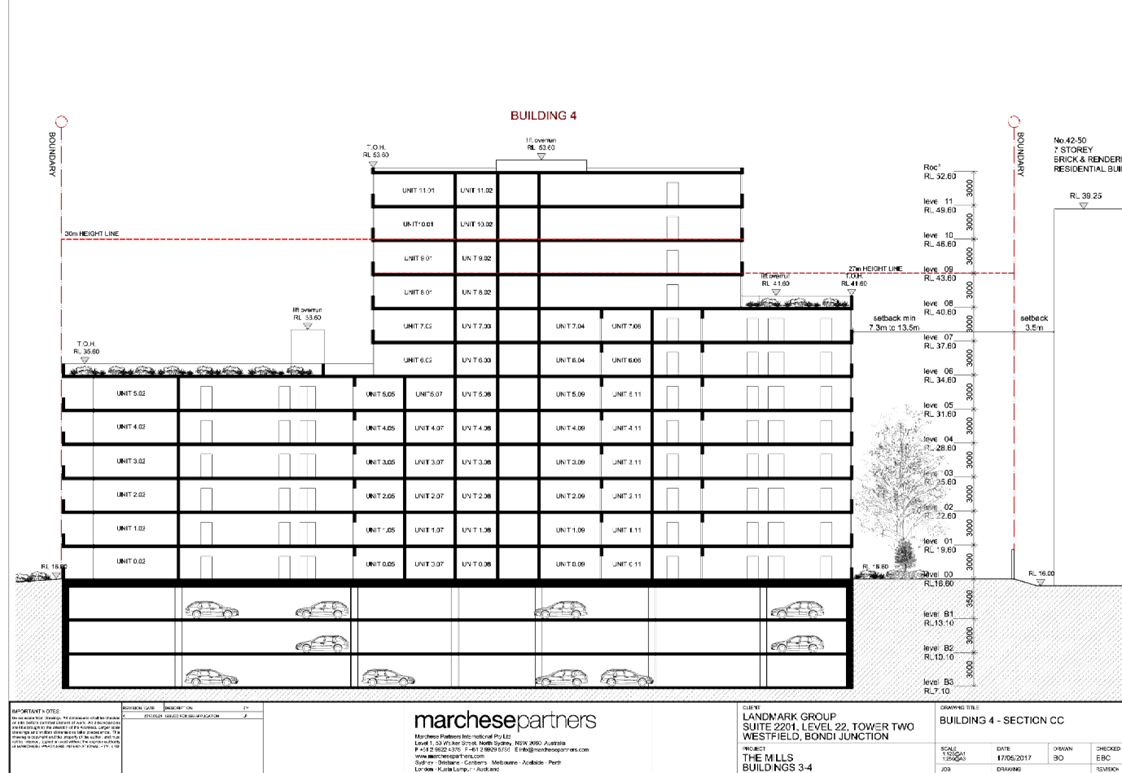
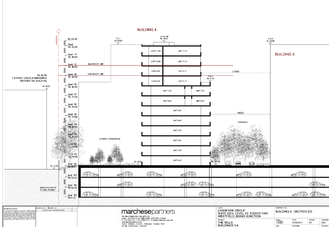
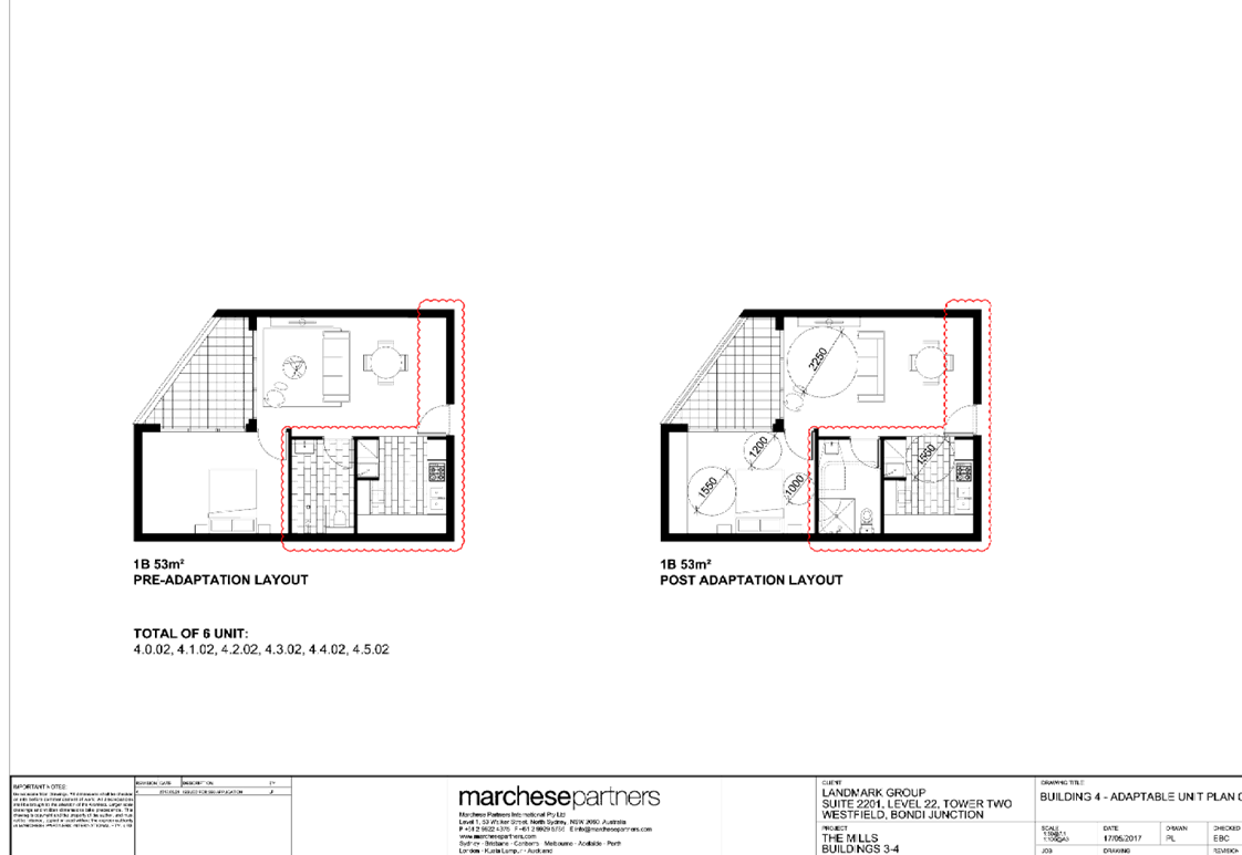
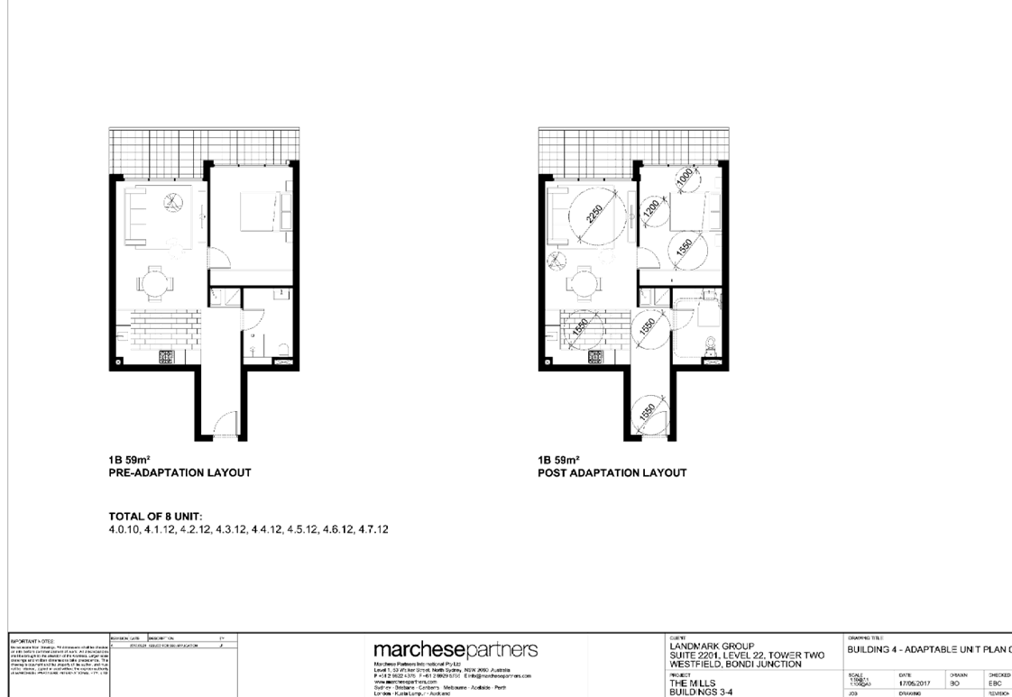
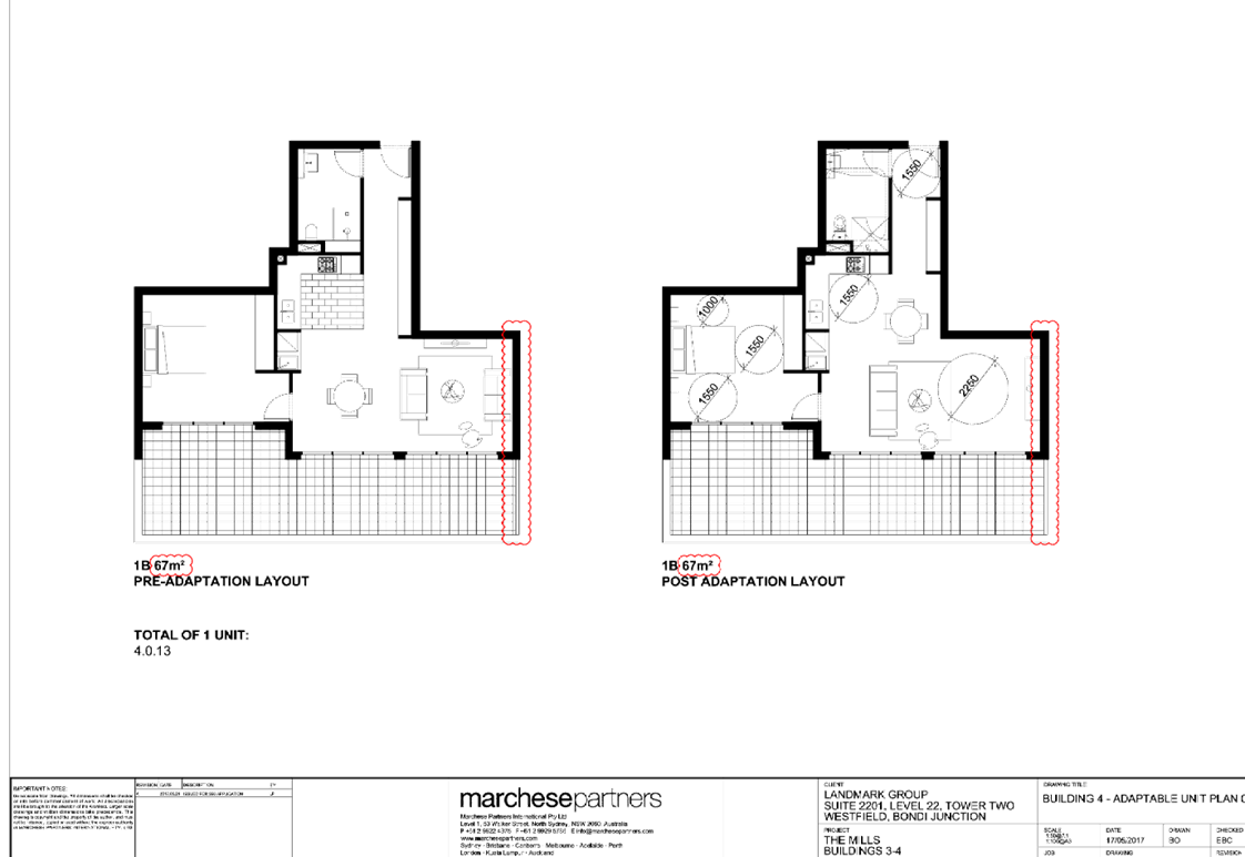
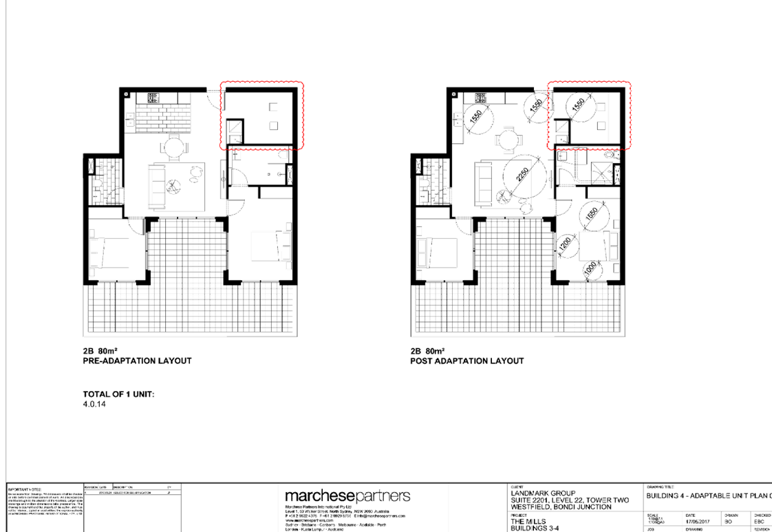
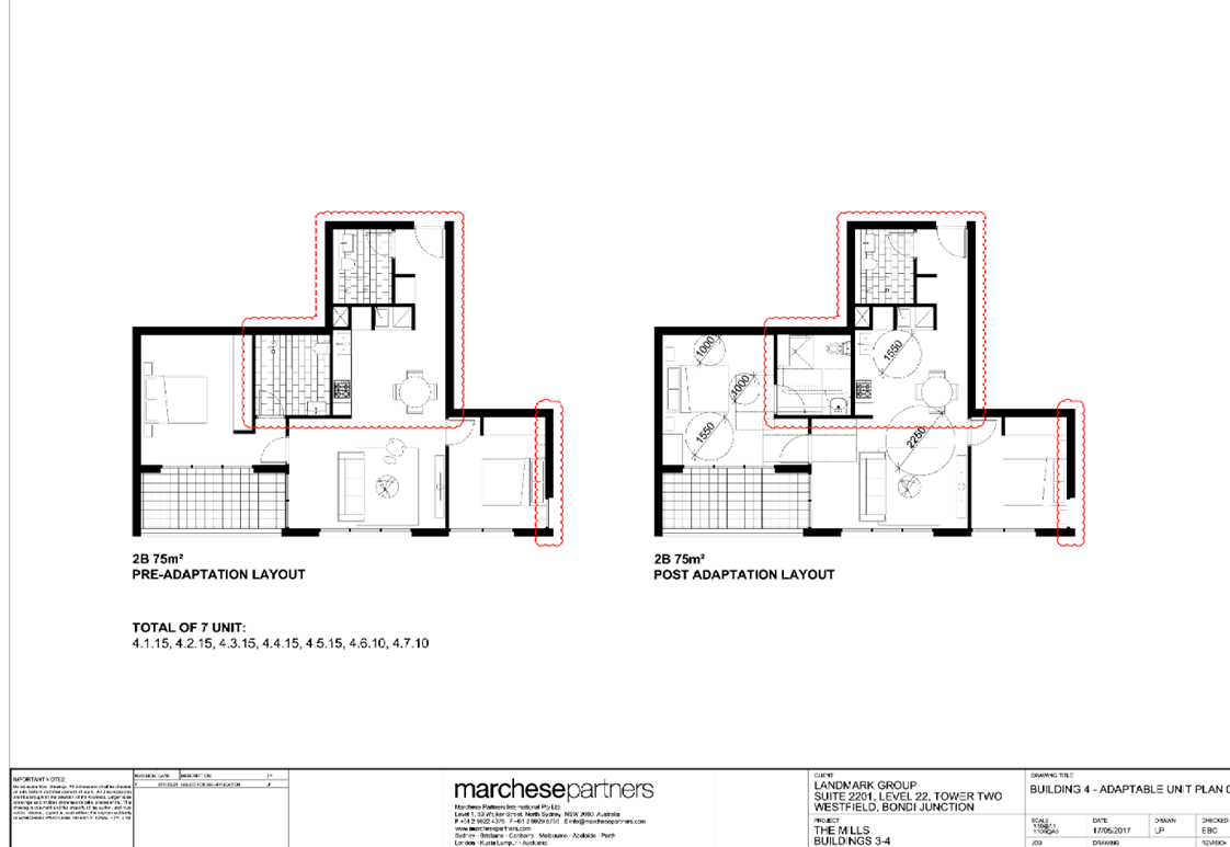
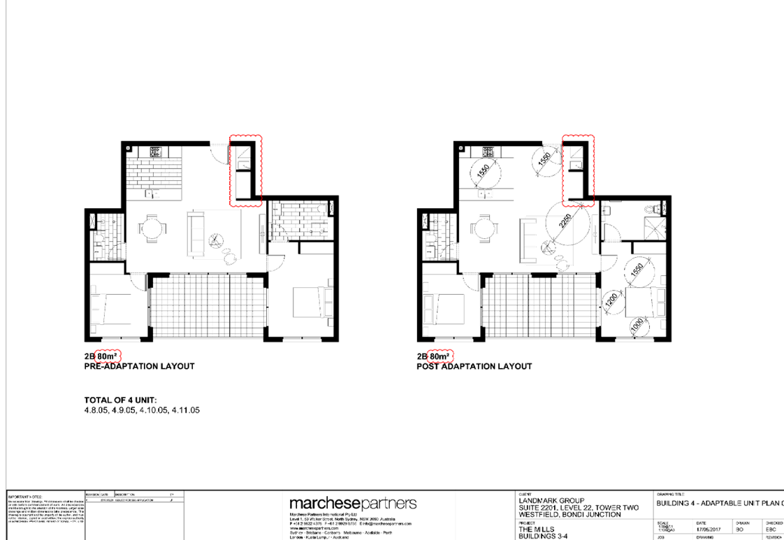
DOCUMENTS
ASSOCIATED WITH
REPORT LPP007/19
Attachment 2
Draft Notice of Determination
Cumberland Local Planning Panel Meeting
13 March 2019
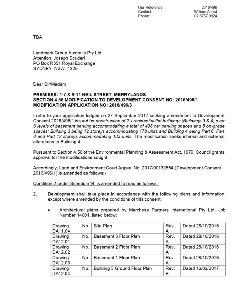
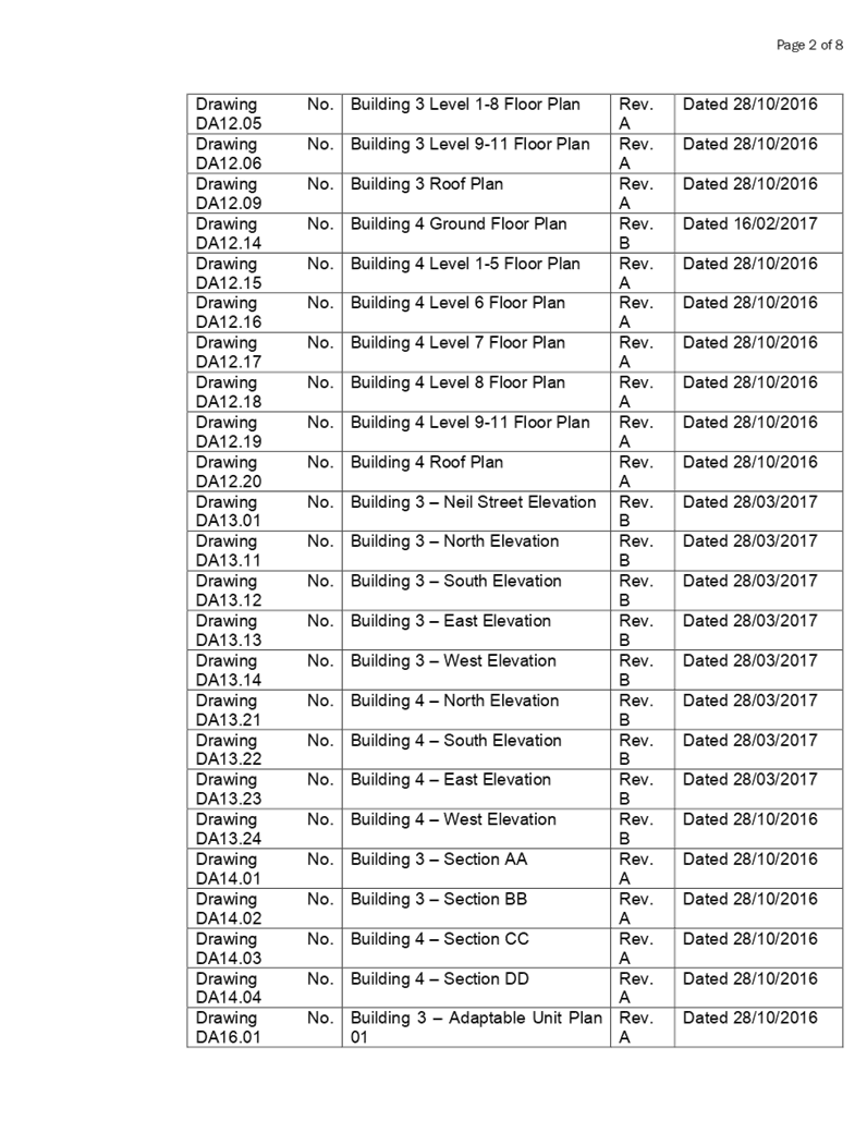
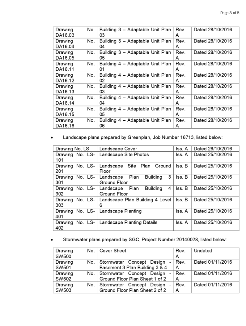
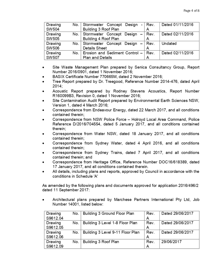
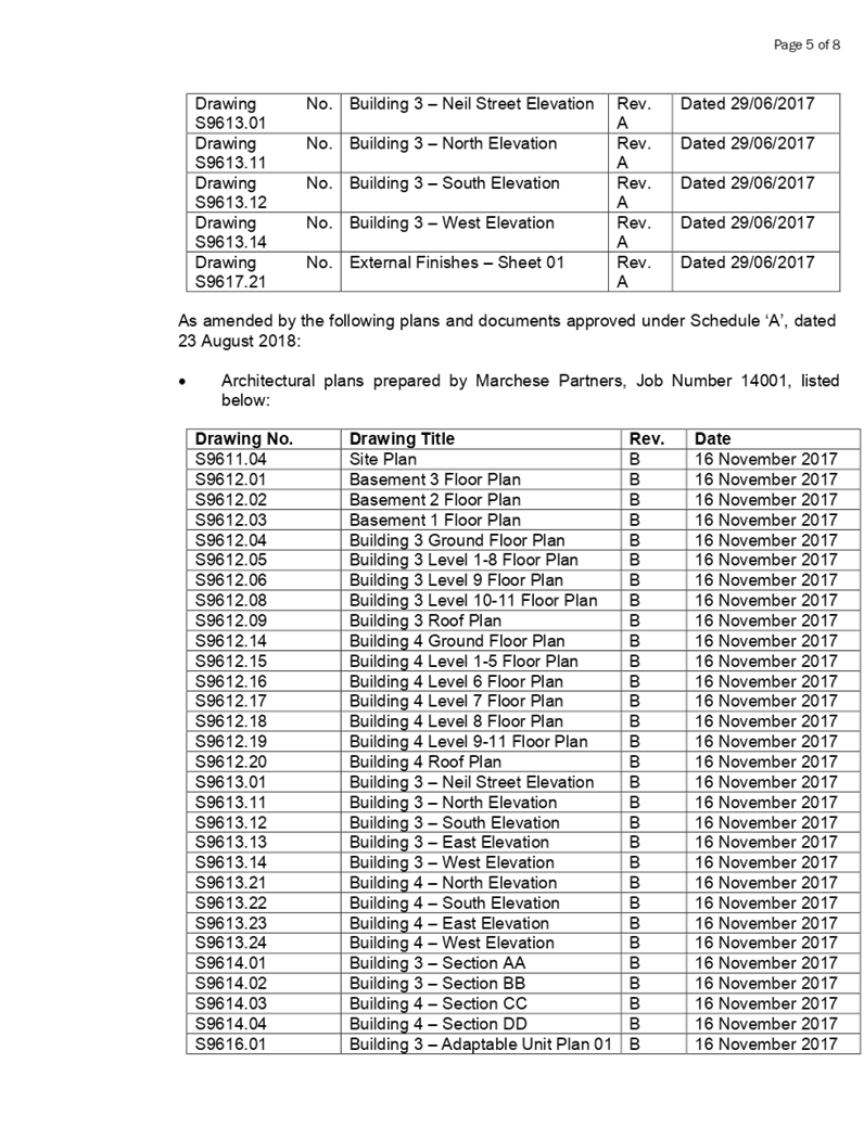
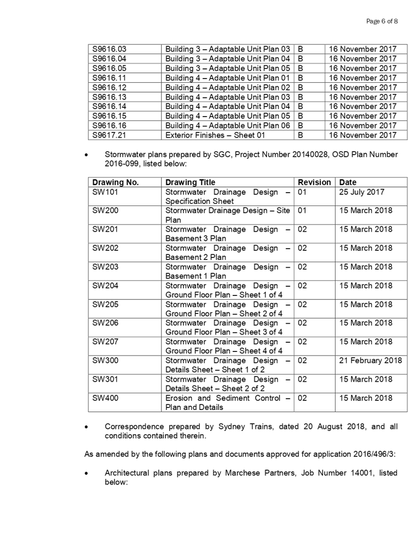
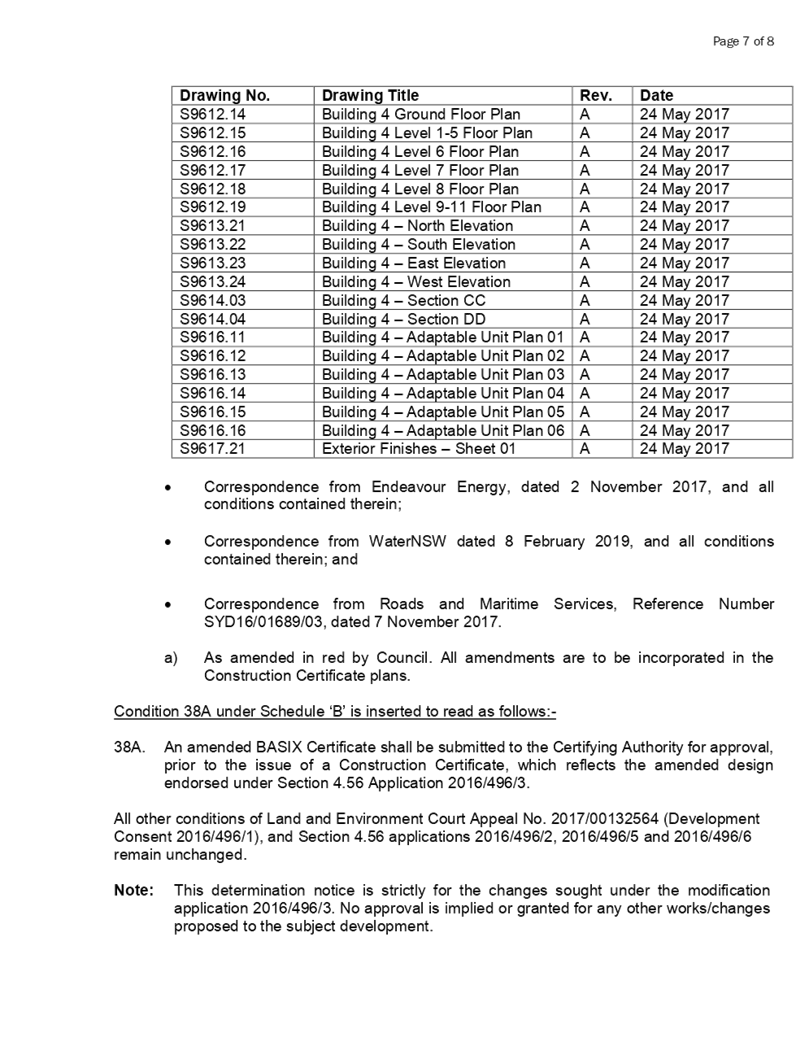

DOCUMENTS
ASSOCIATED WITH
REPORT LPP007/19
Attachment 3
SEPP 65 Apartment Design Guide Compliance Assessment
Cumberland Local Planning Panel Meeting
13 March 2019
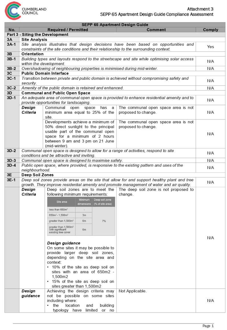
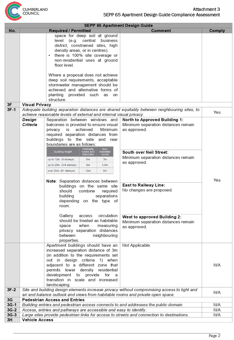
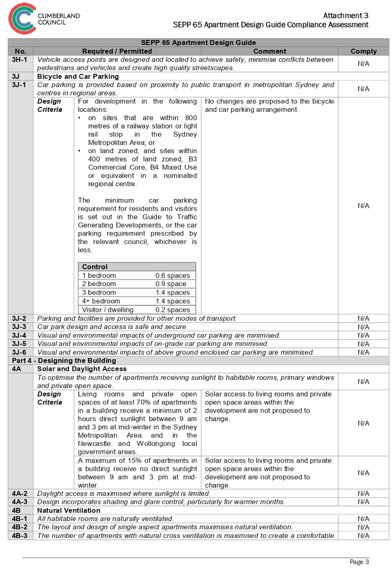
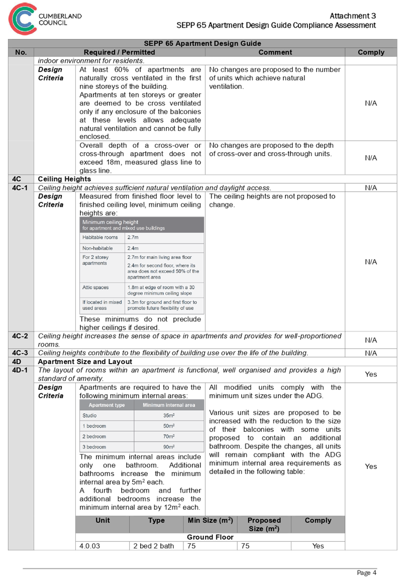
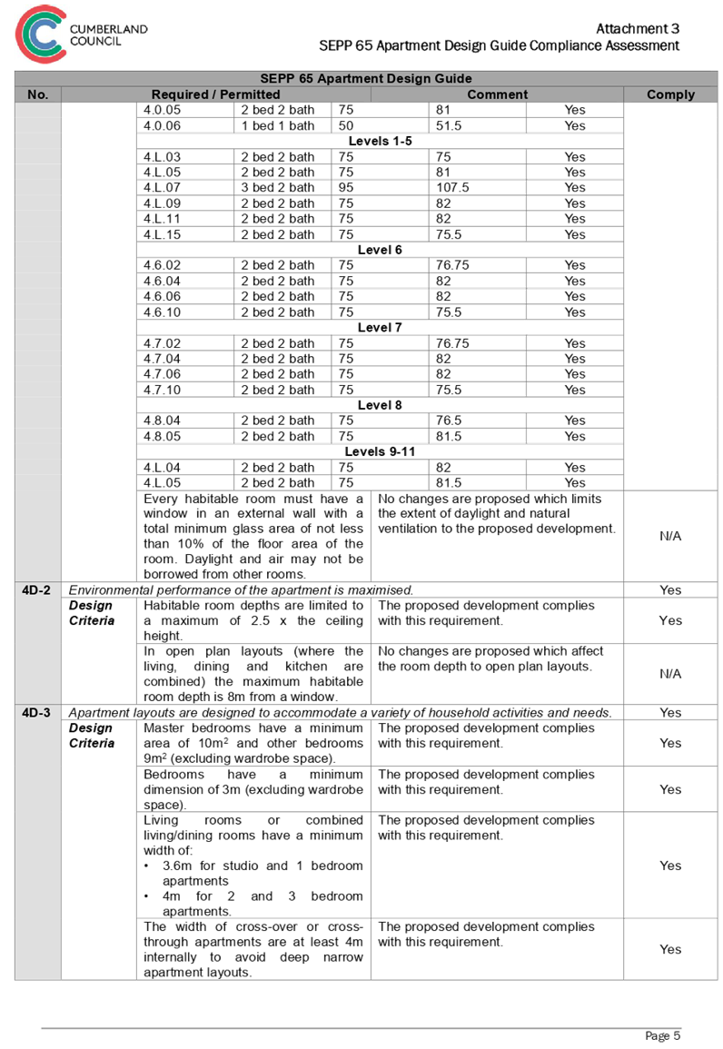
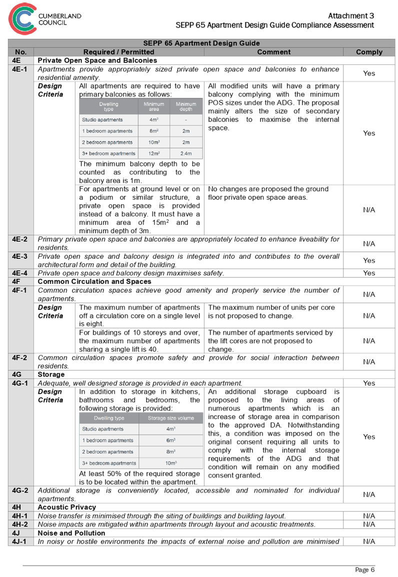
DOCUMENTS
ASSOCIATED WITH
REPORT LPP007/19
Attachment 4
Holroyd Local Environmental Plan 2013 Compliance
Assessment
Cumberland Local Planning Panel Meeting
13 March 2019
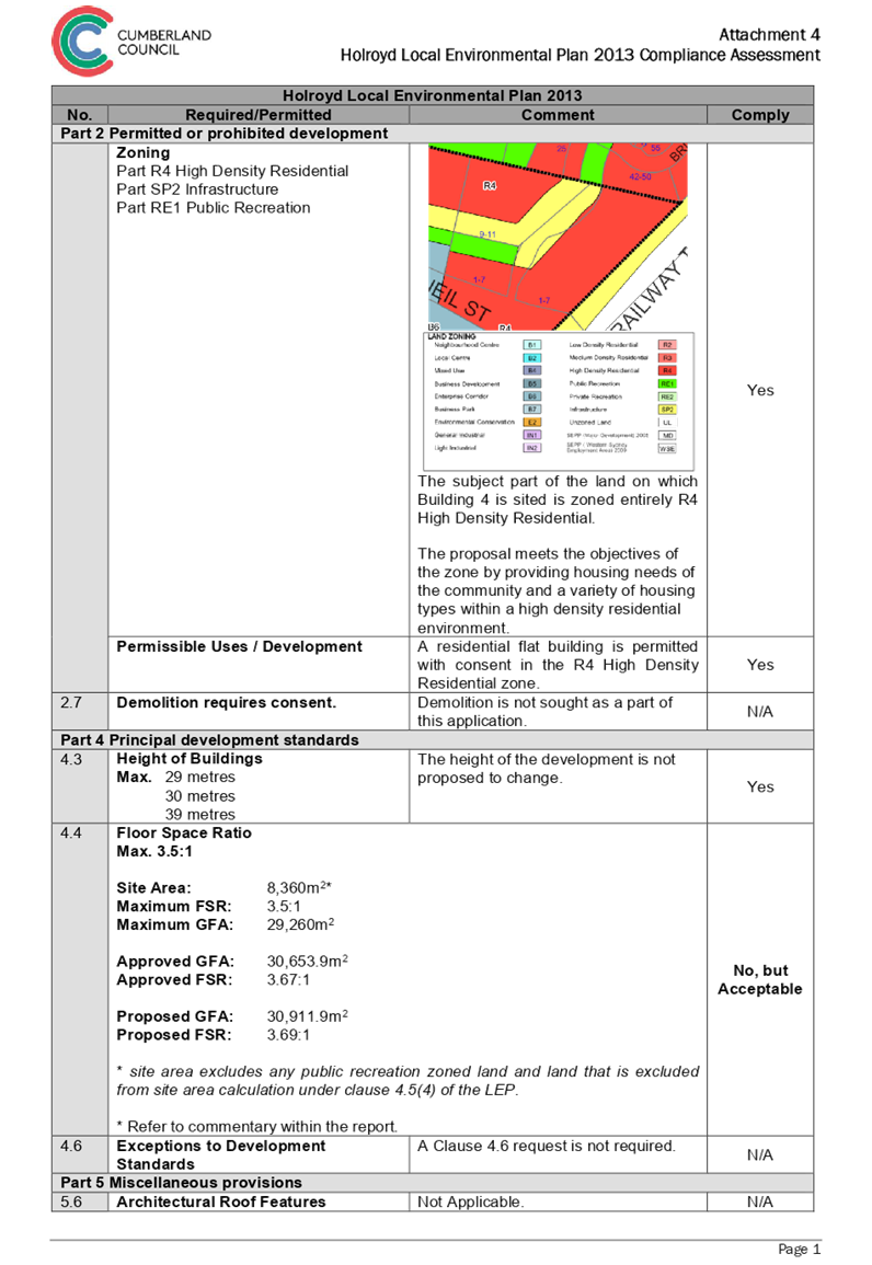
DOCUMENTS
ASSOCIATED WITH
REPORT LPP007/19
Attachment 5
Holroyd Devlopment Control Plan 2013 Compliance
Assessment
Cumberland Local Planning Panel Meeting
13 March 2019
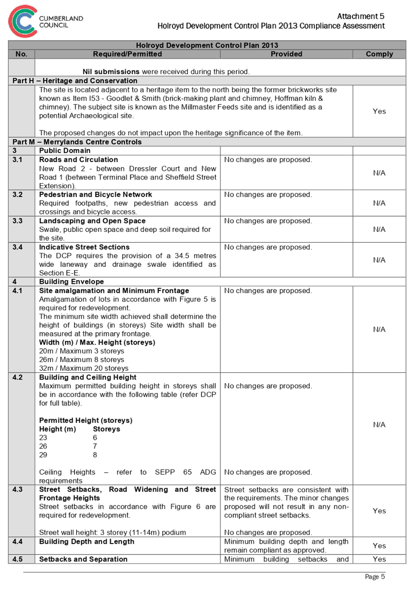
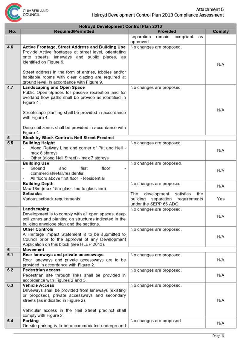
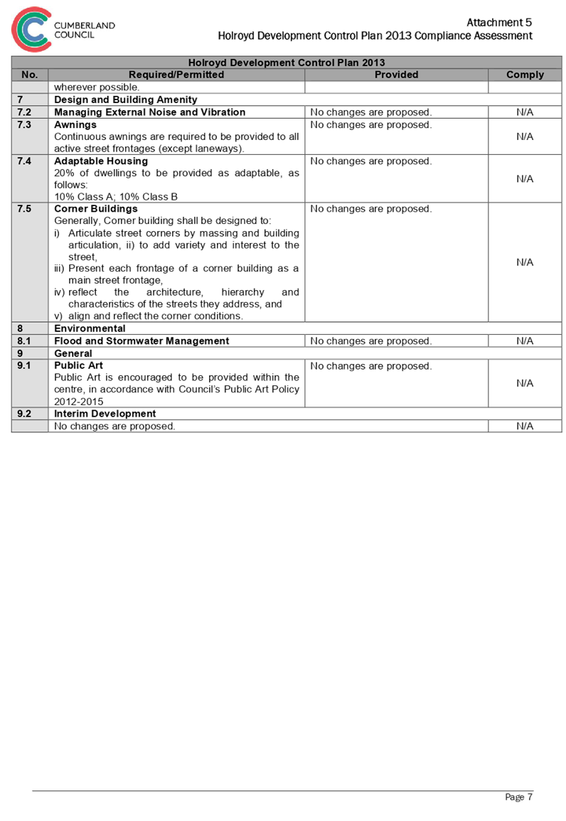
DOCUMENTS
ASSOCIATED WITH
REPORT LPP007/19
Attachment 6
Development Consent 2016/496/1
Cumberland Local Planning Panel Meeting
13 March 2019
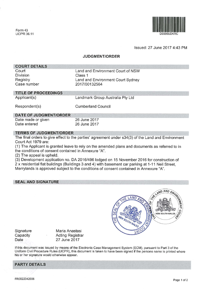


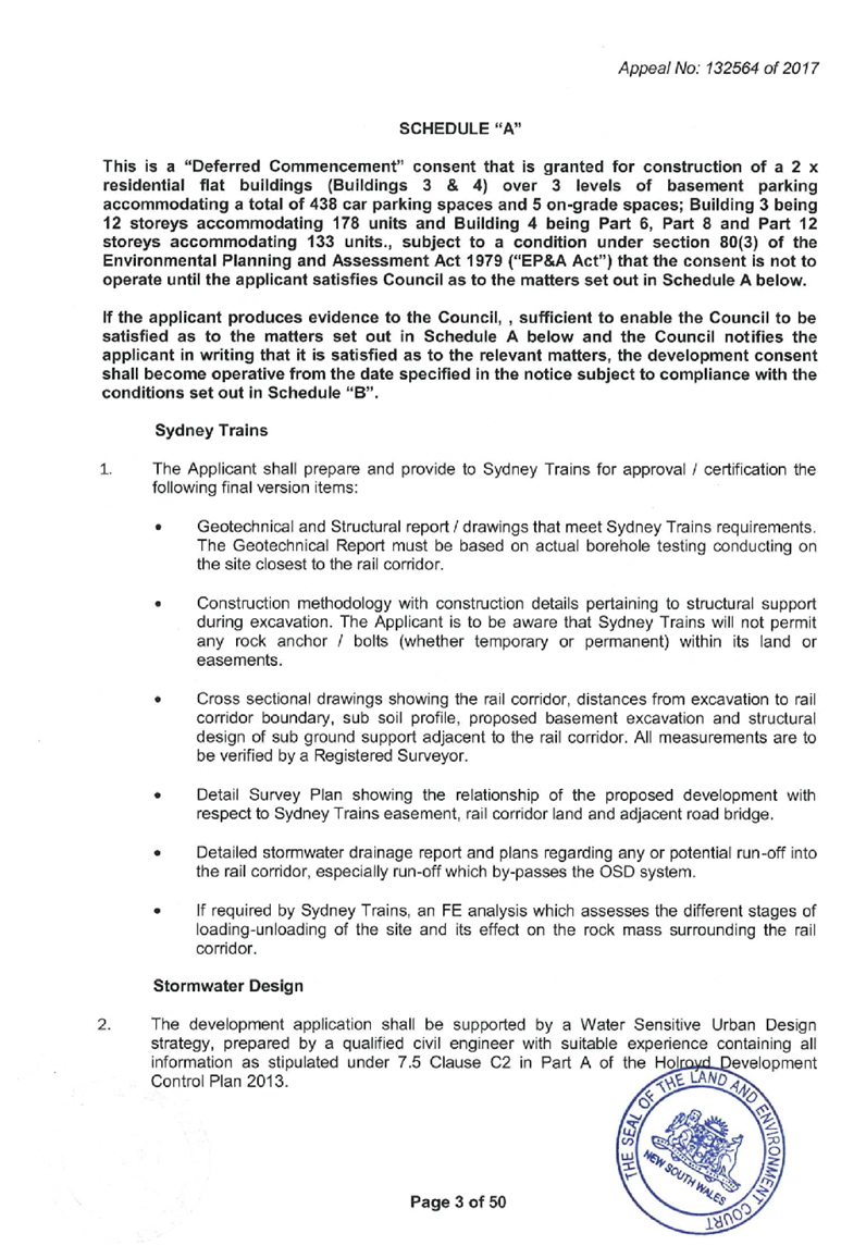


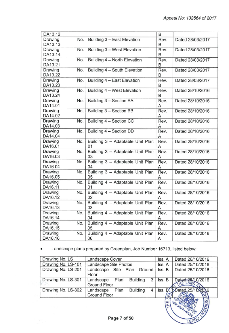

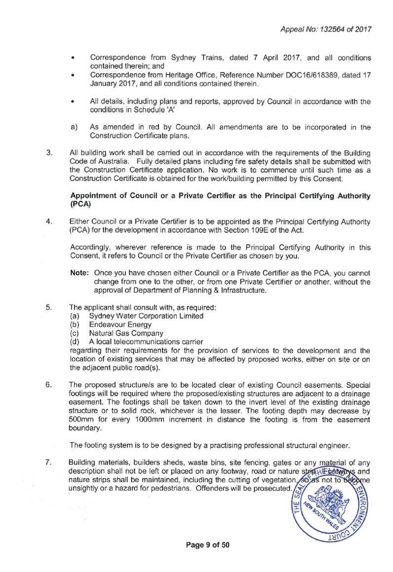


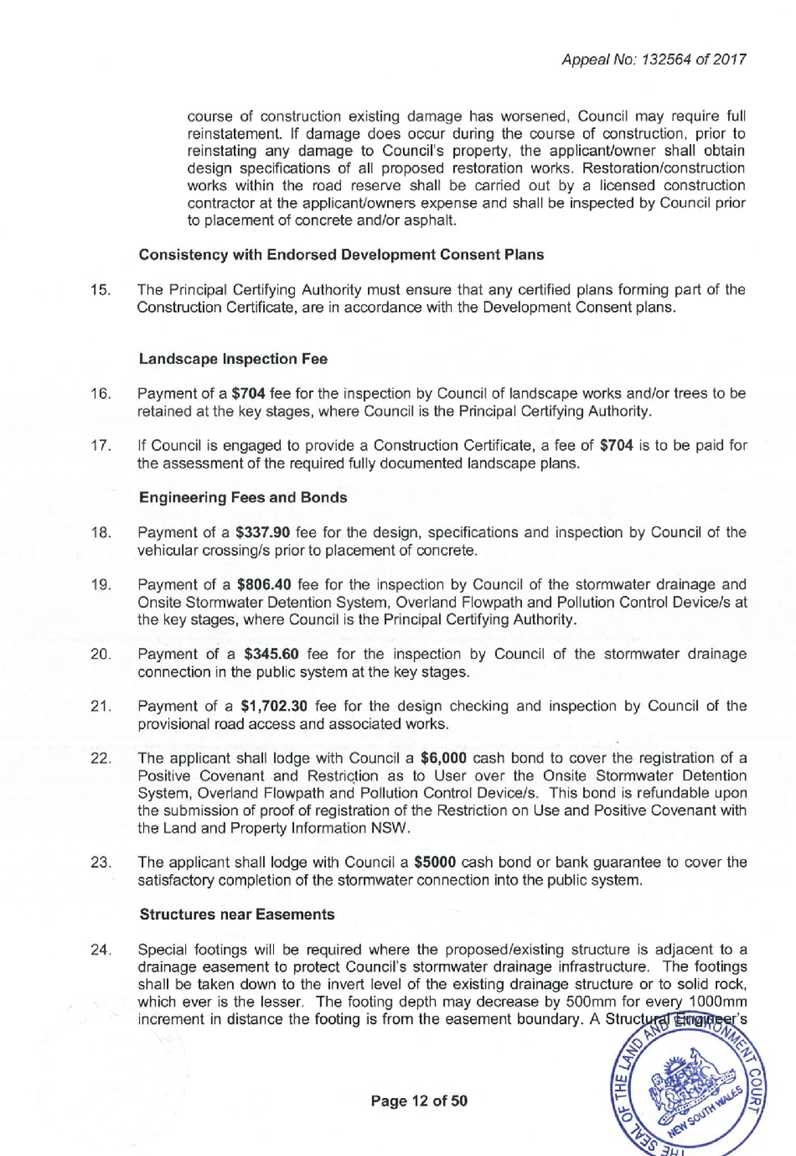


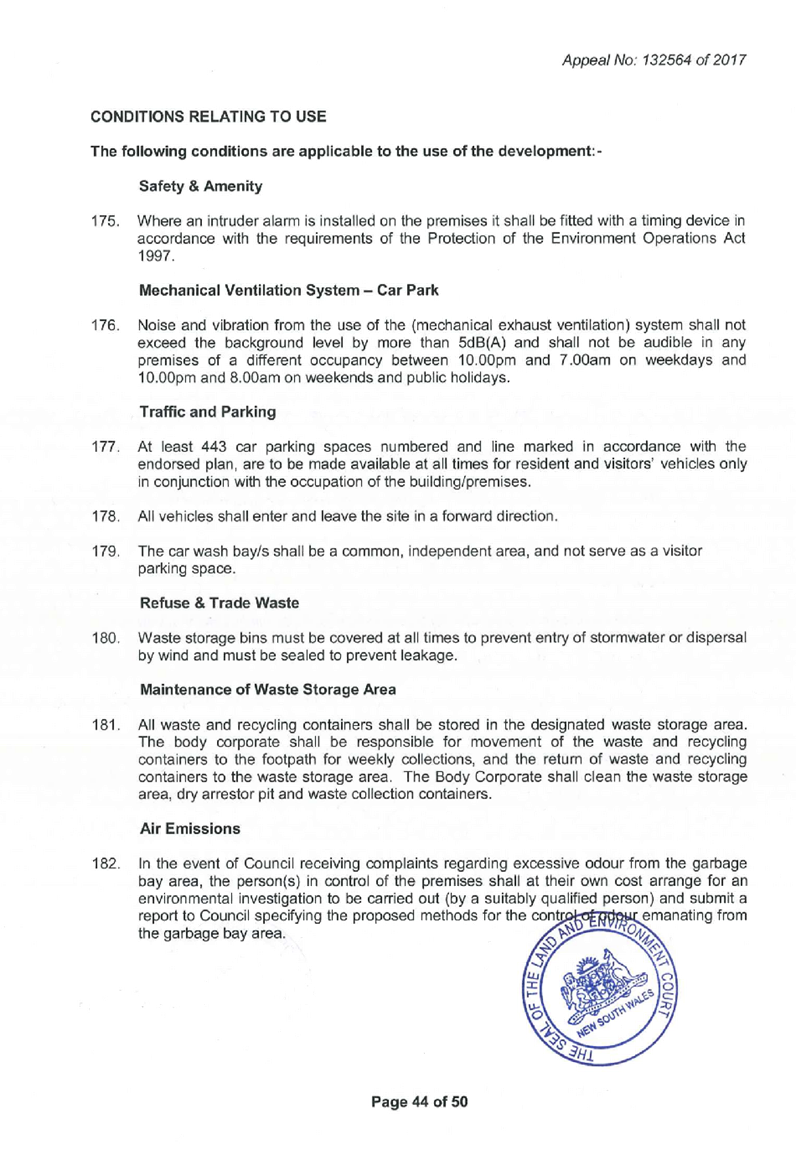


DOCUMENTS
ASSOCIATED WITH
REPORT LPP007/19
Attachment 7
Endorsed Architectural Plans for Development Consent
2016/496/1
Cumberland Local Planning Panel Meeting
13 March 2019
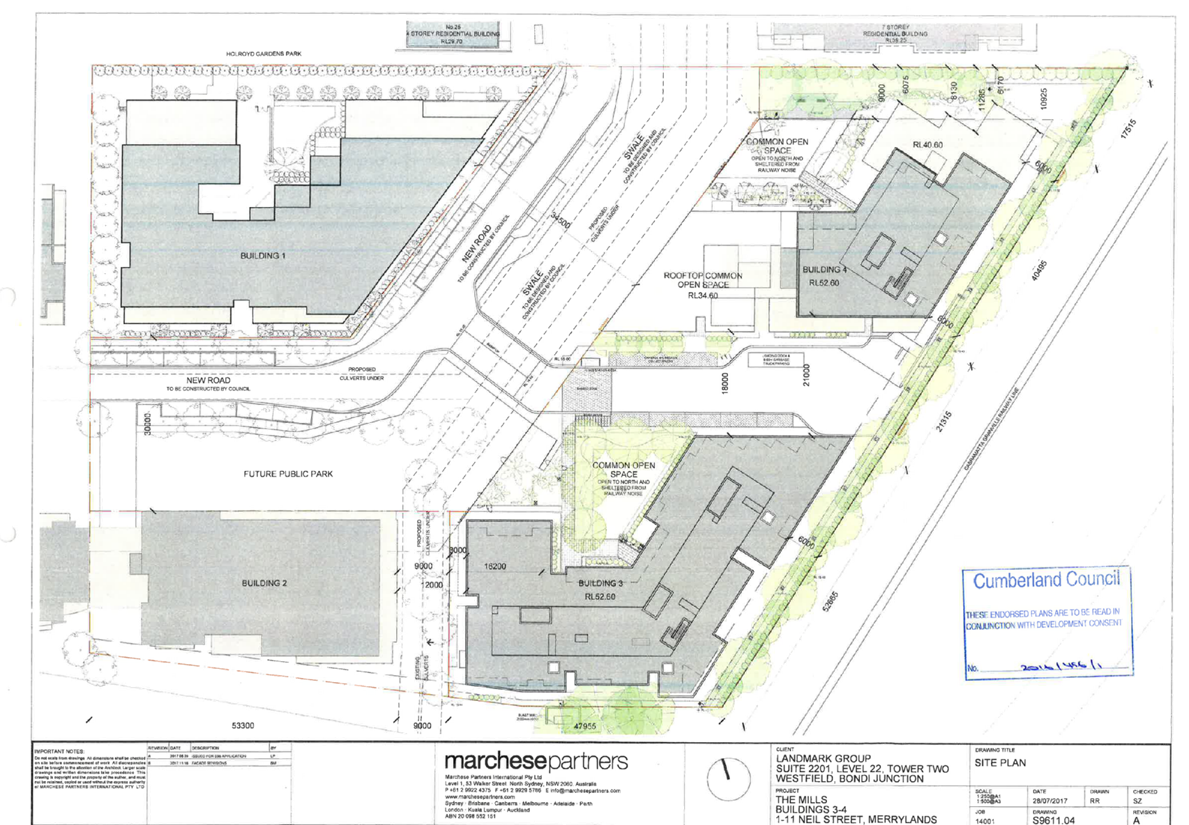
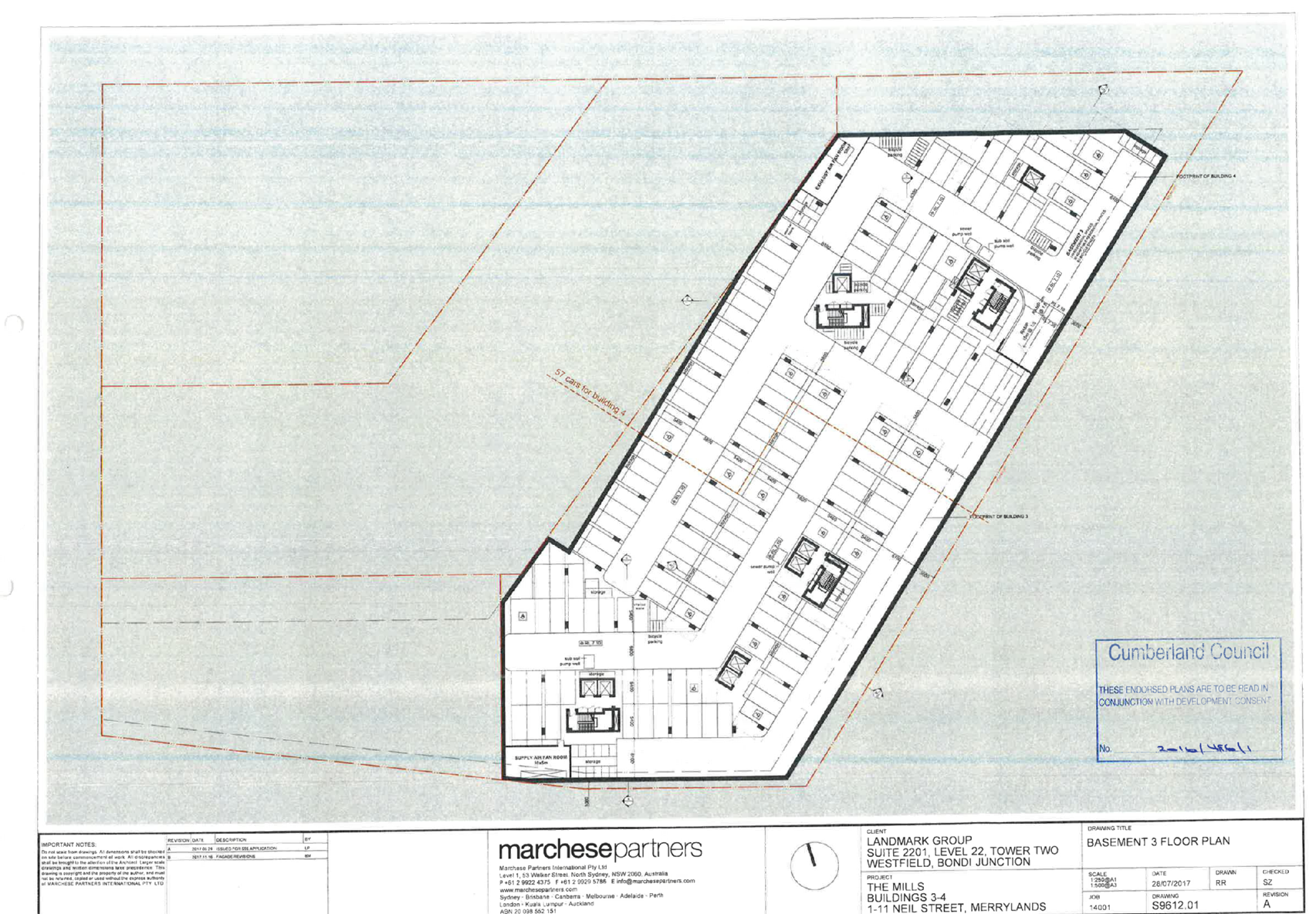


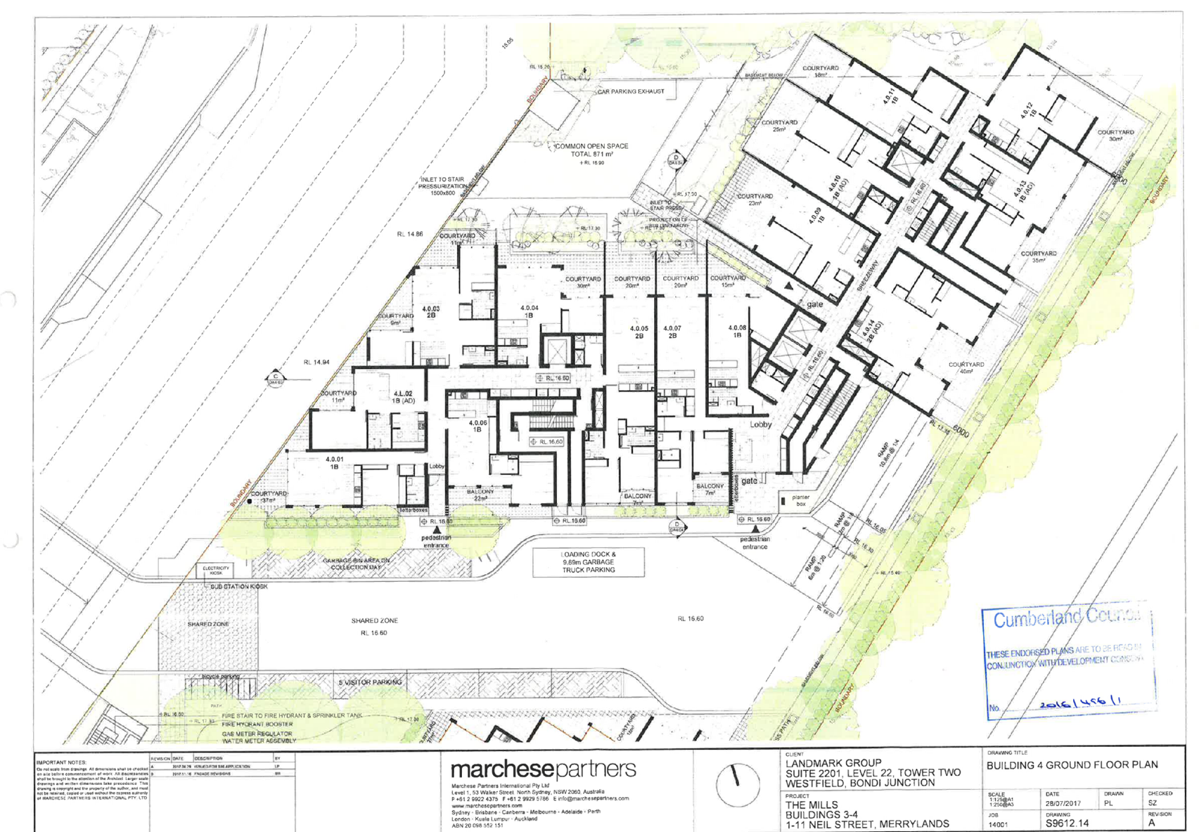
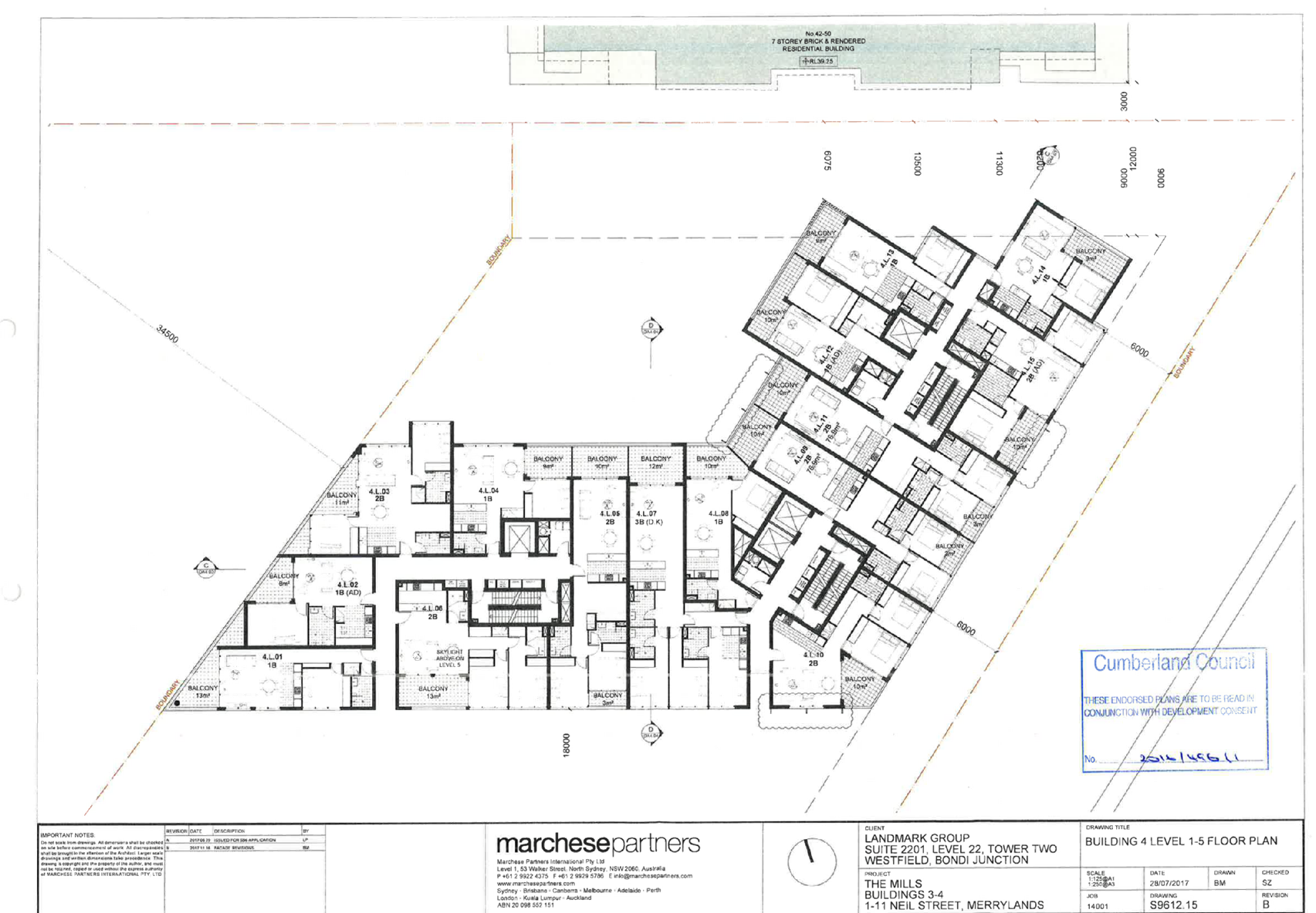
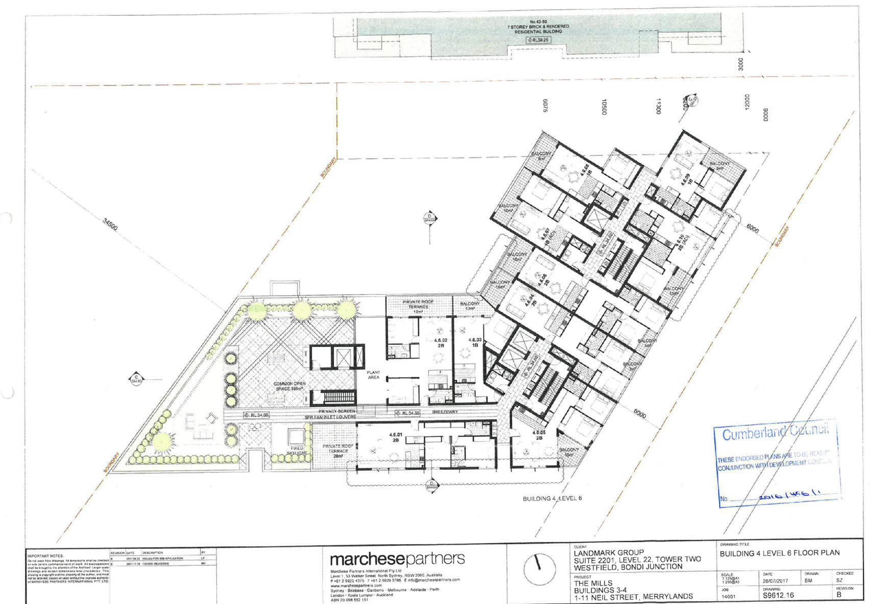
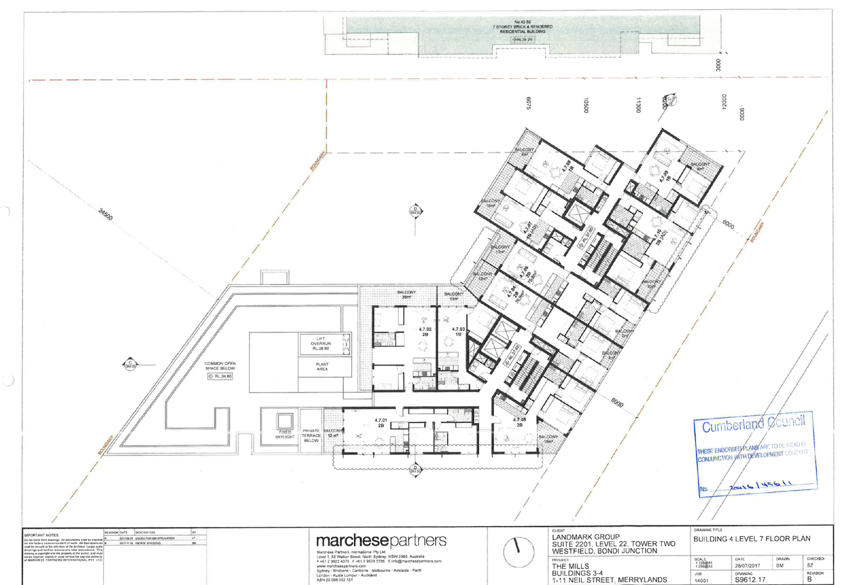
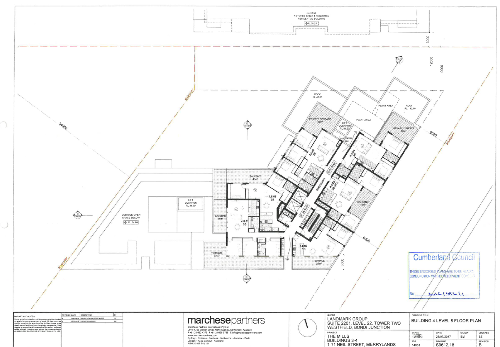
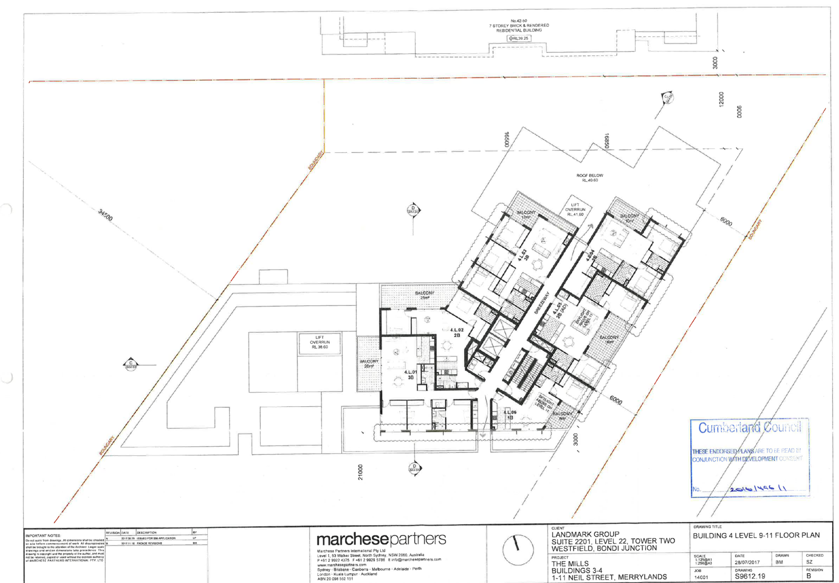
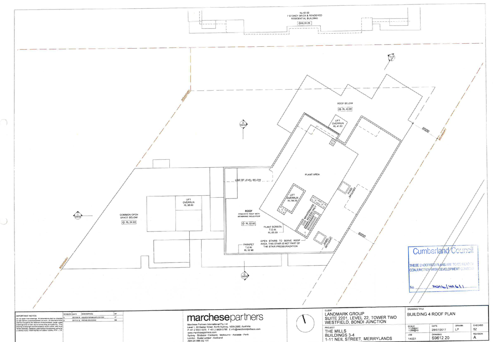
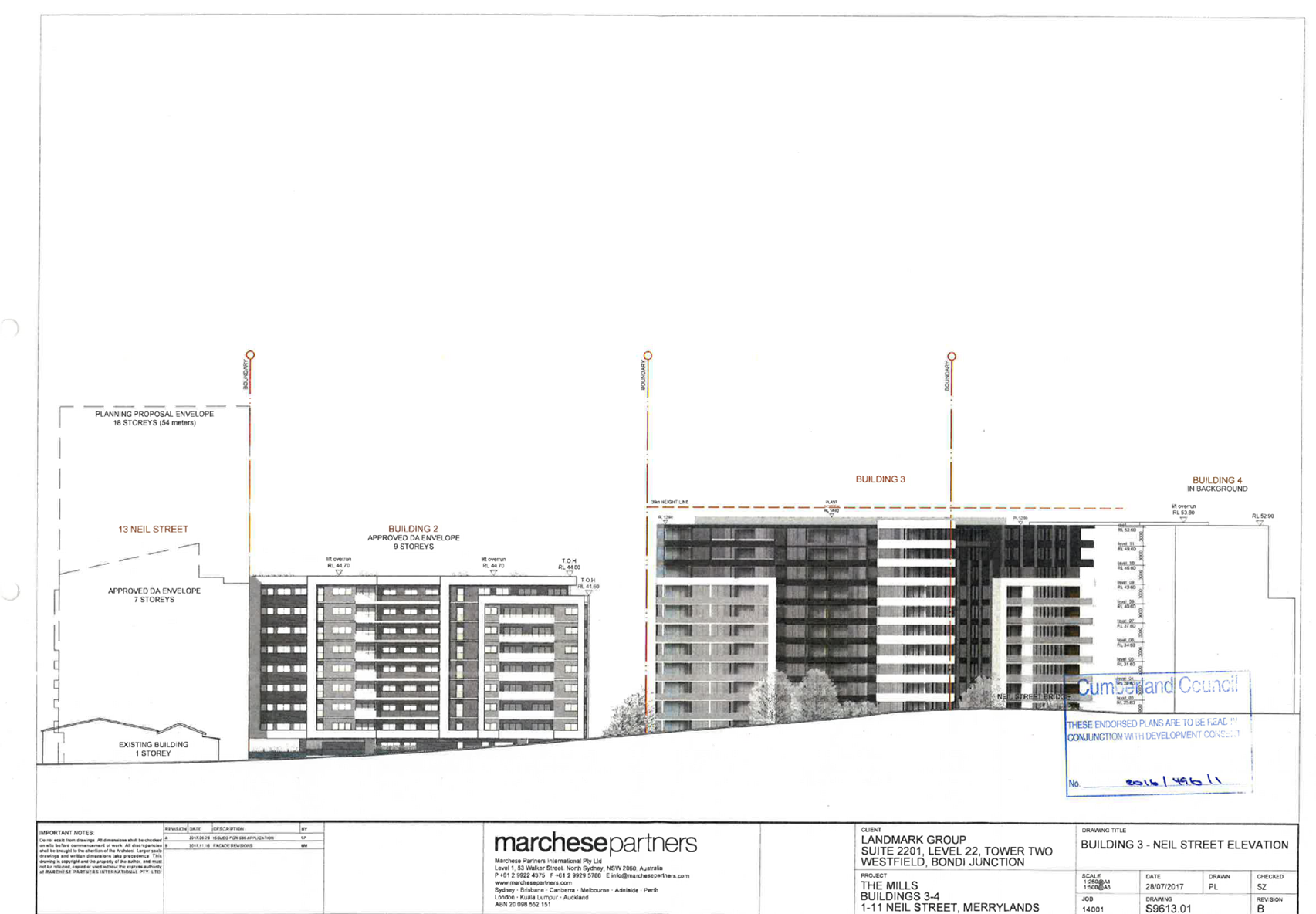

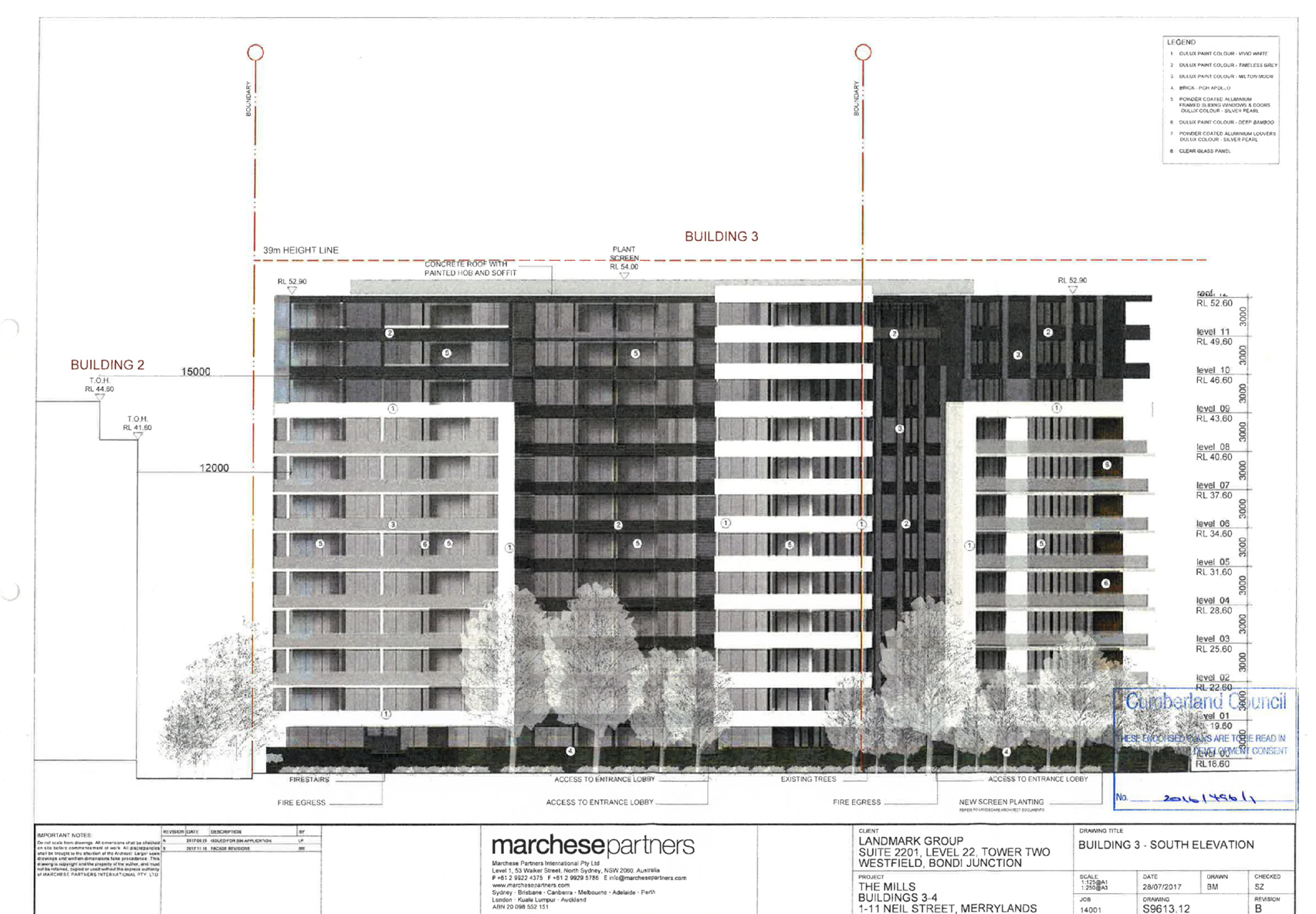

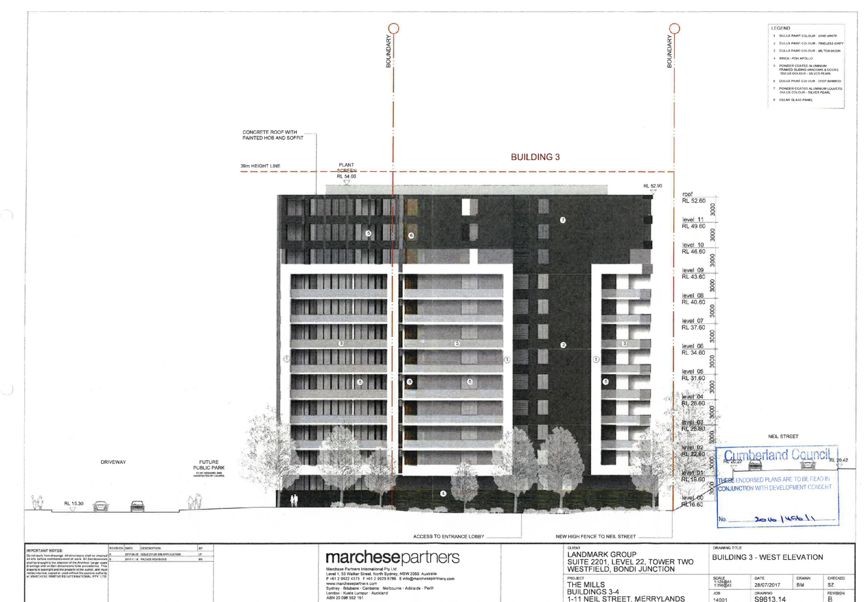
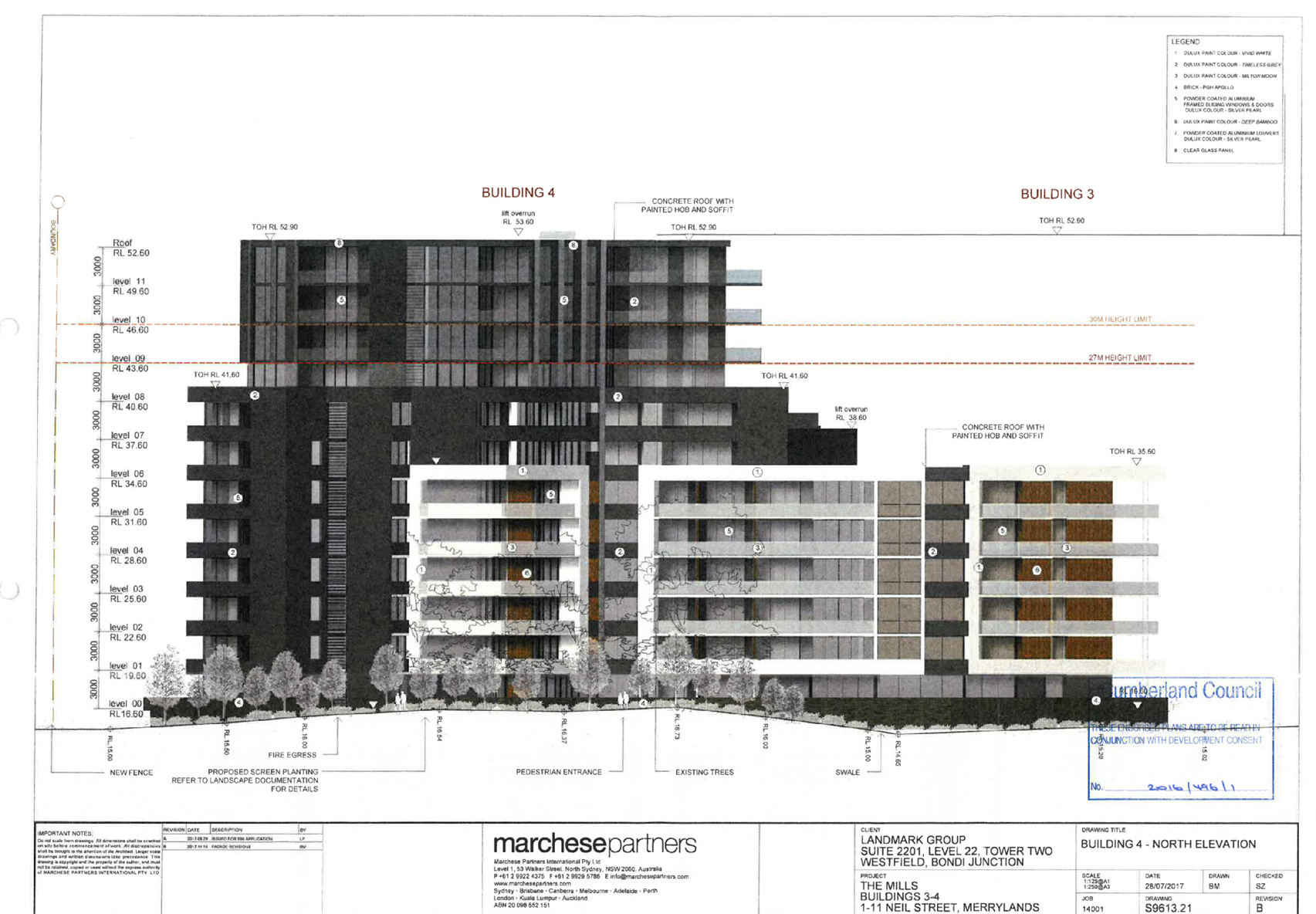

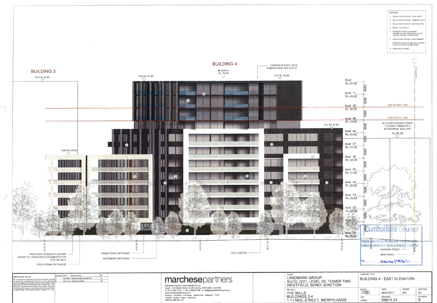
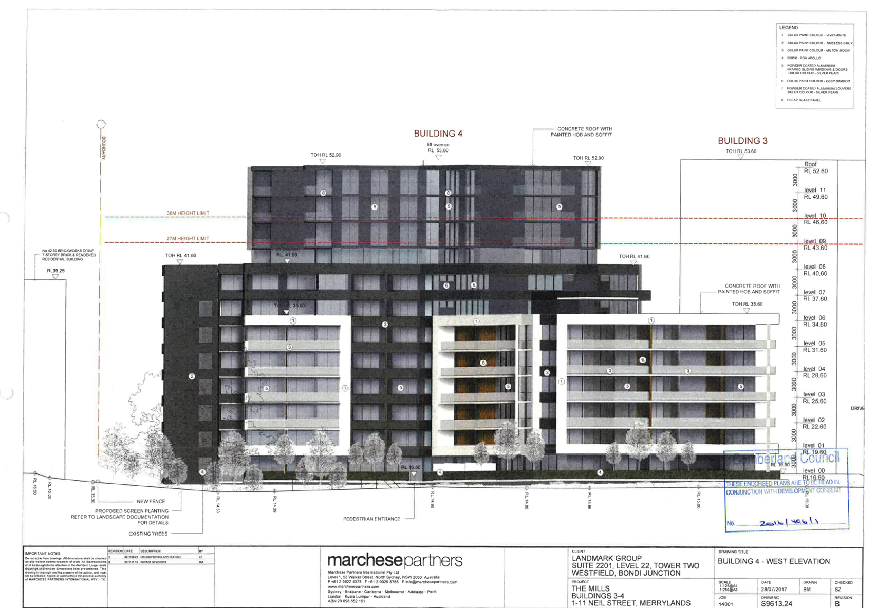
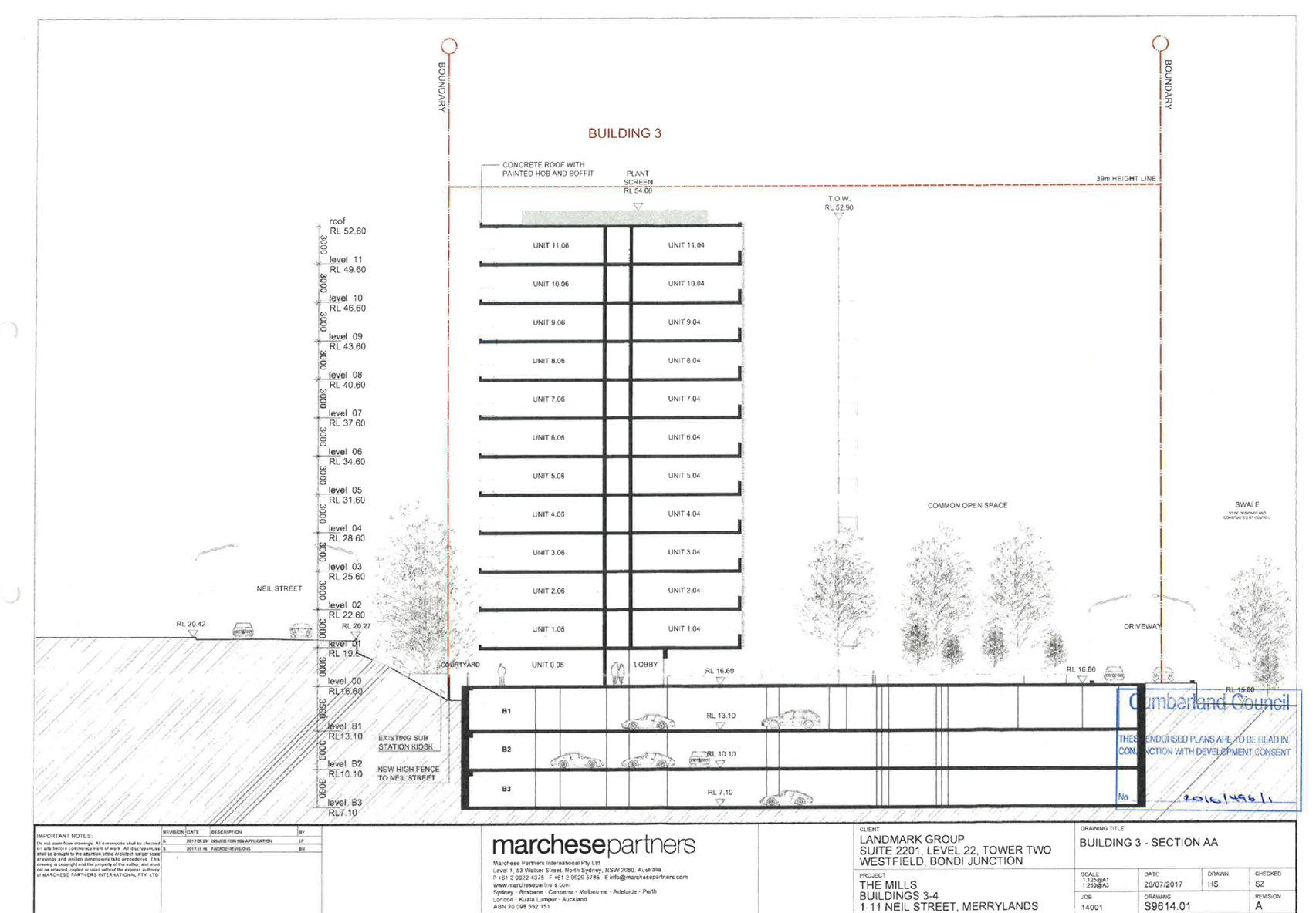
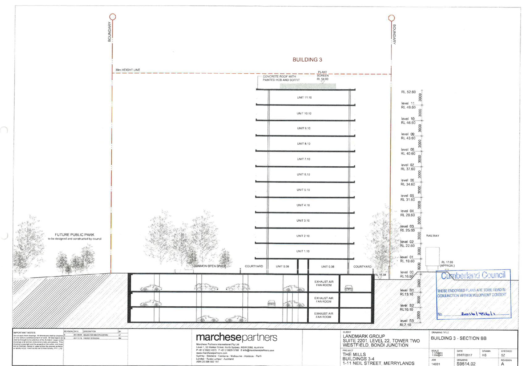

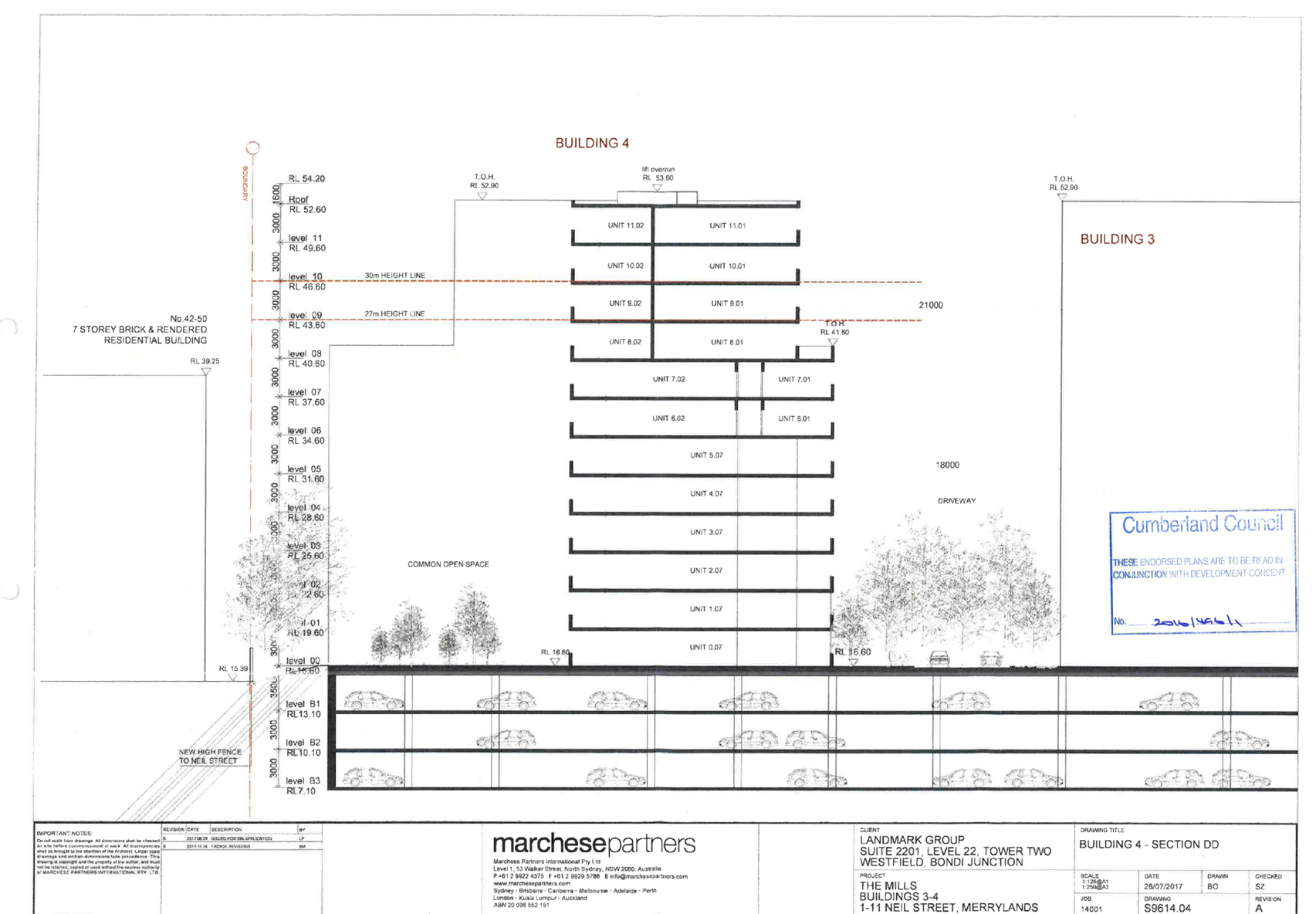
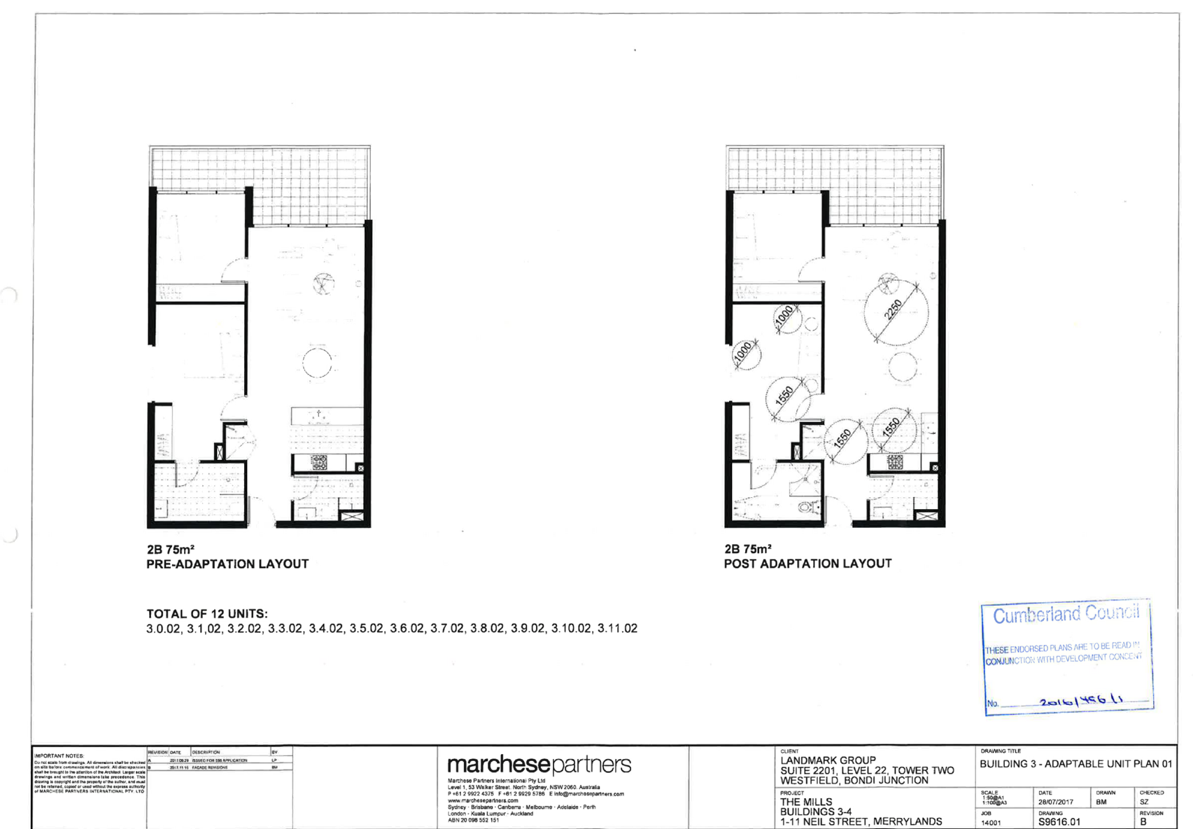


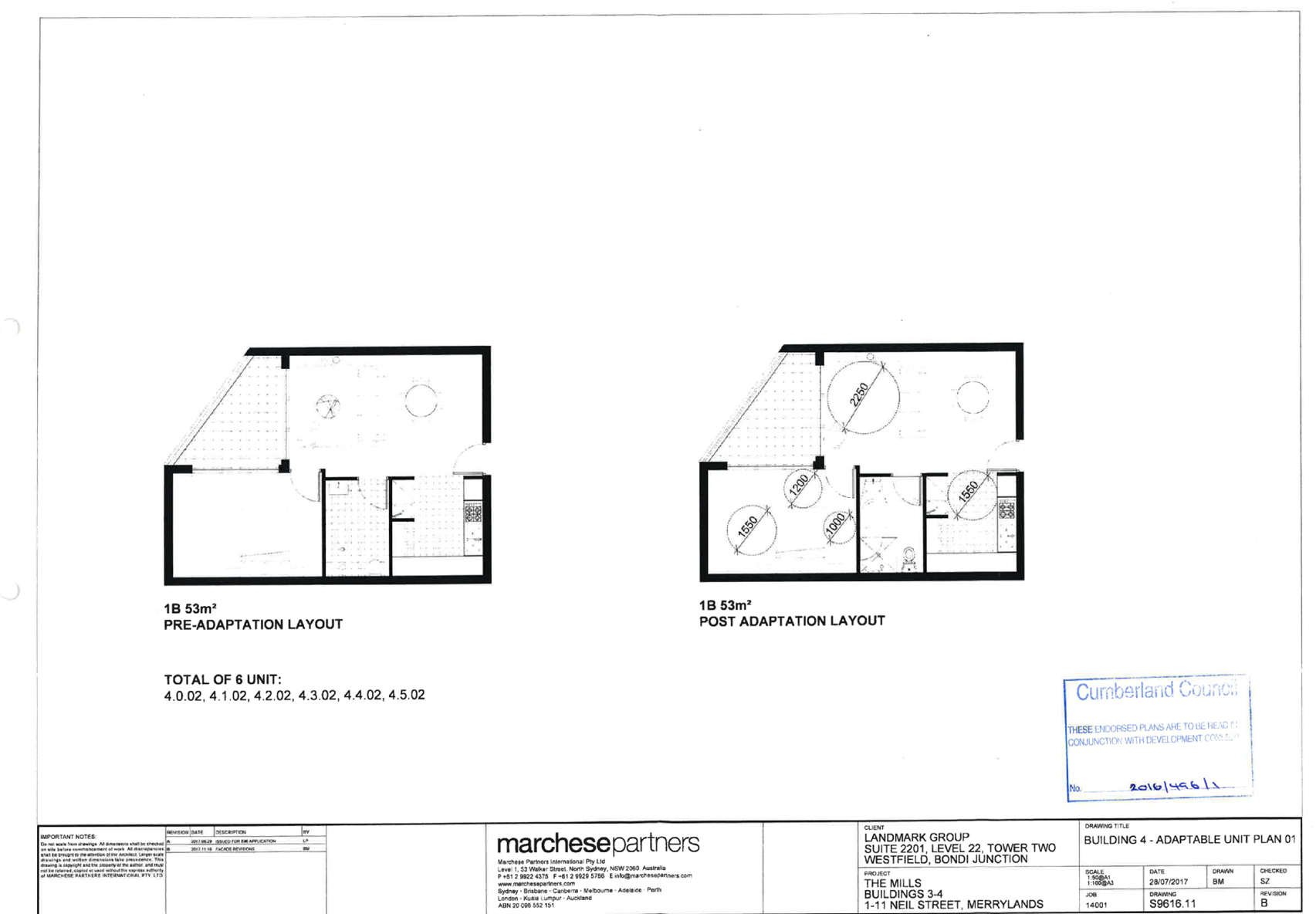
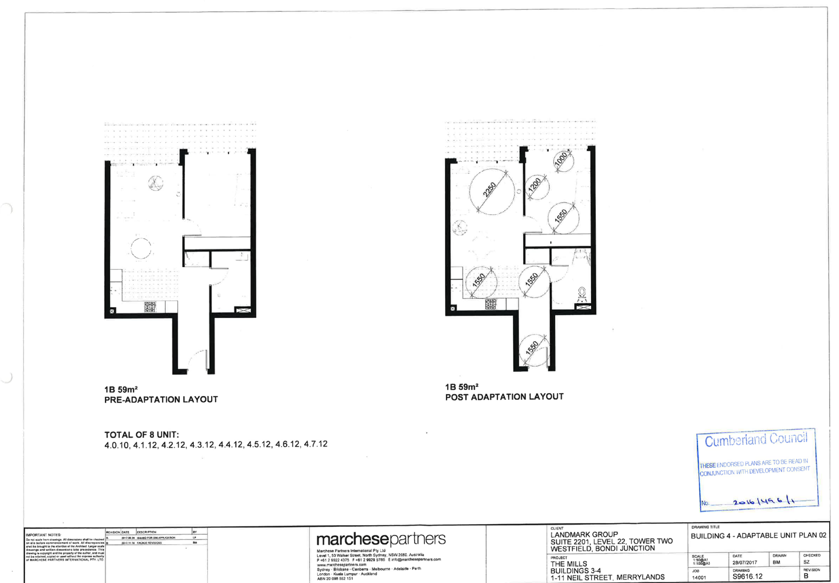
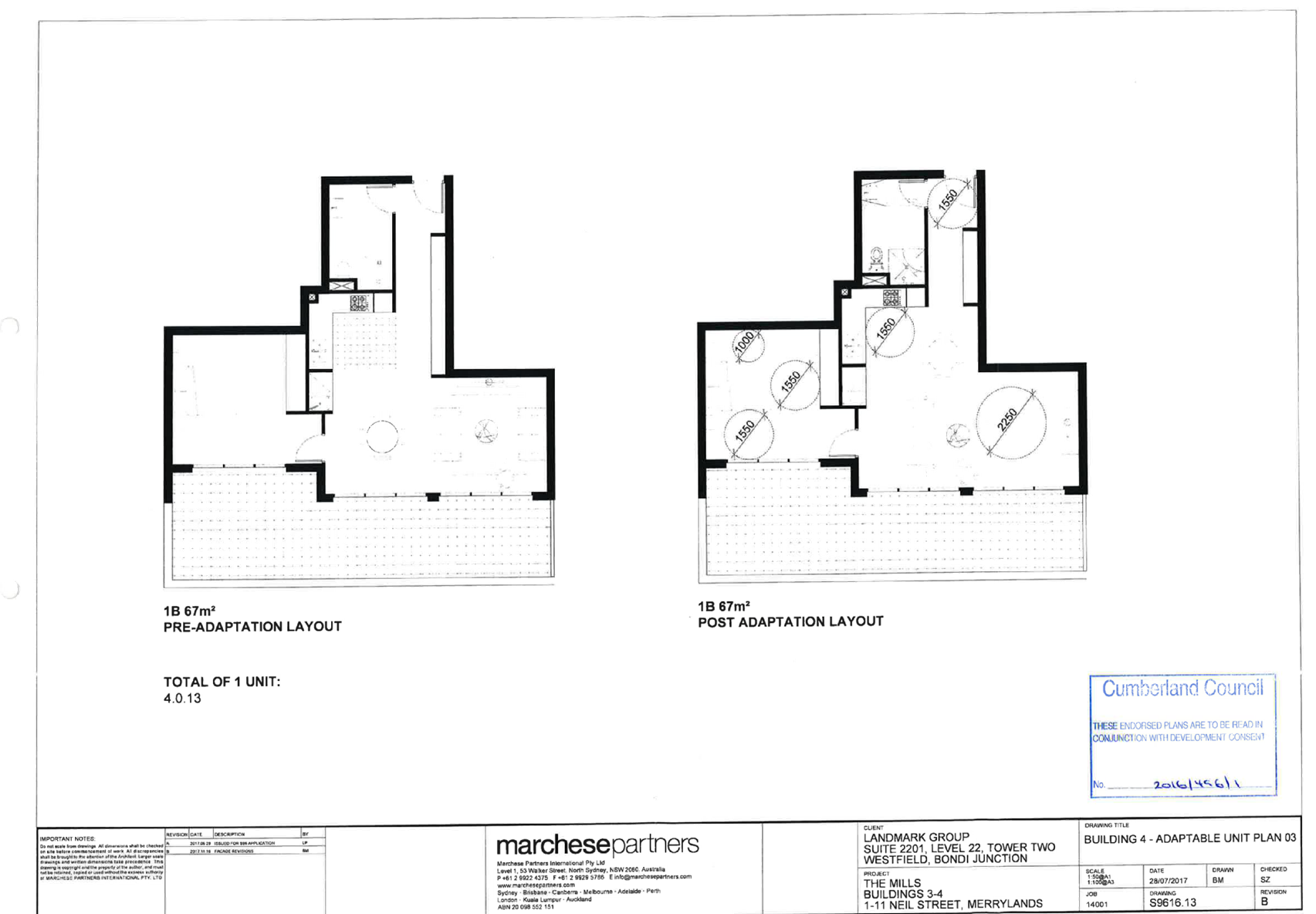

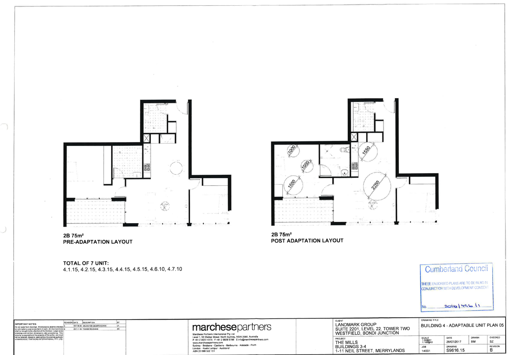
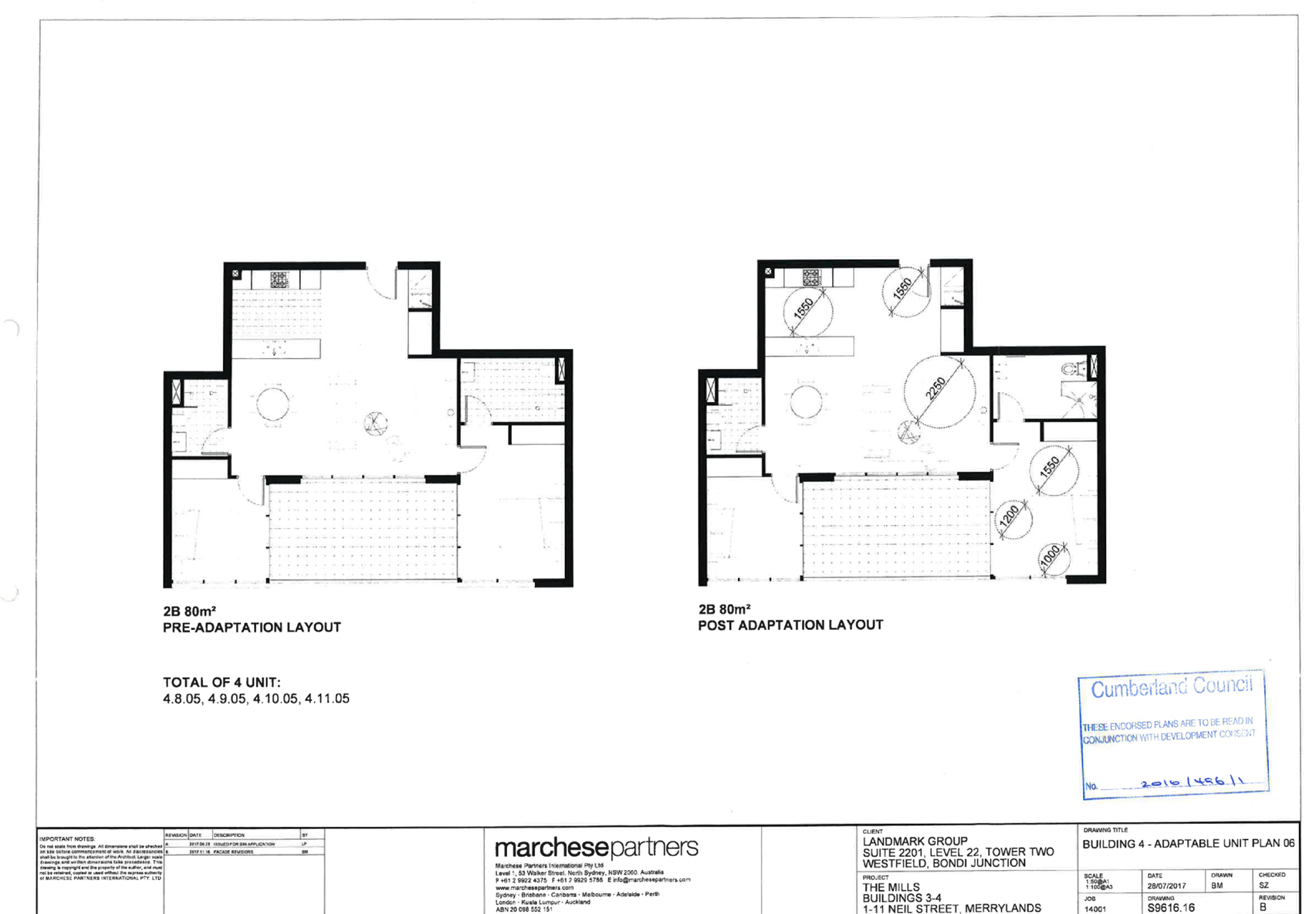
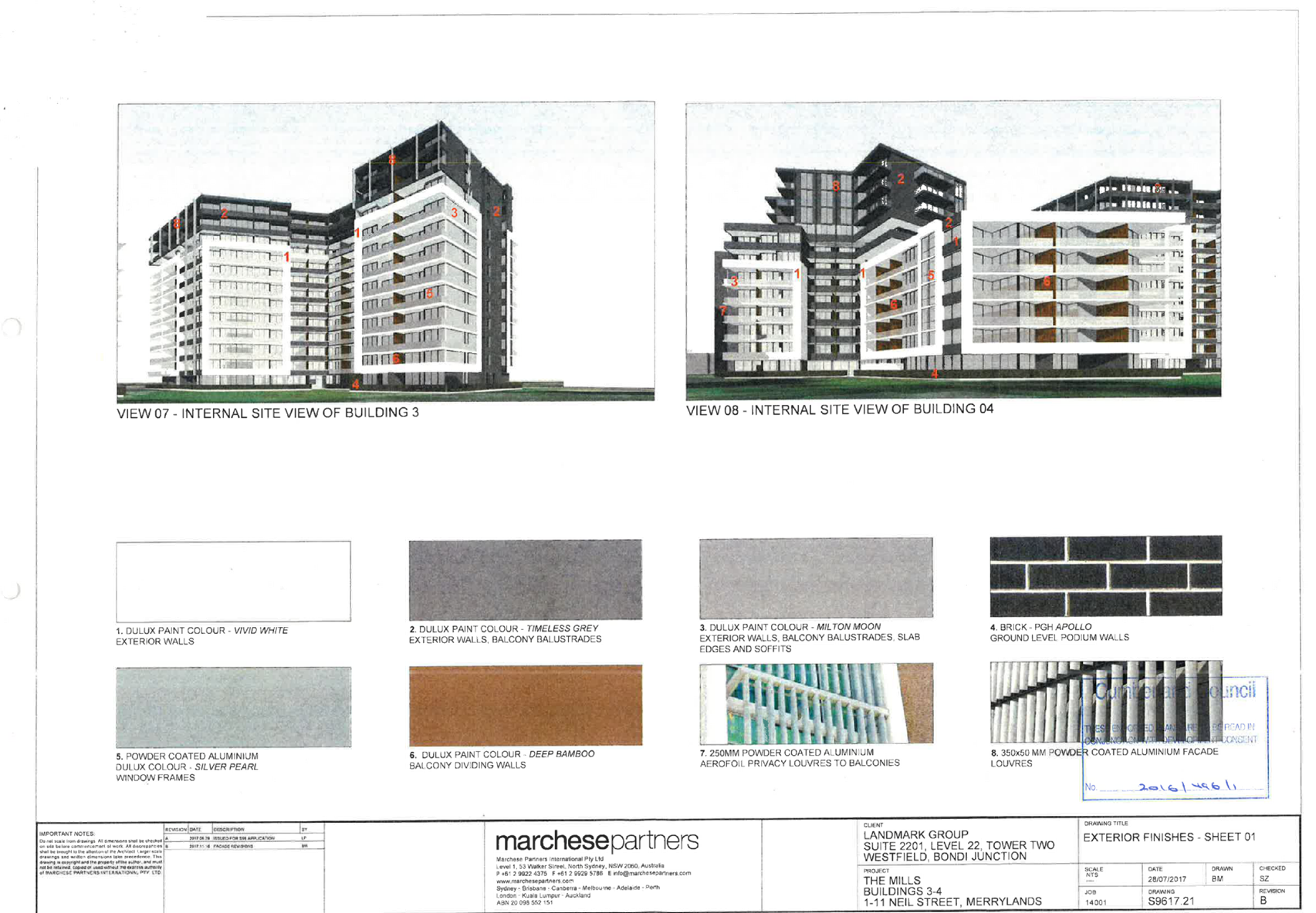
DOCUMENTS
ASSOCIATED WITH
REPORT LPP007/19
Attachment 8
Development Consent 2016/496/2
Cumberland Local Planning Panel Meeting
13 March 2019

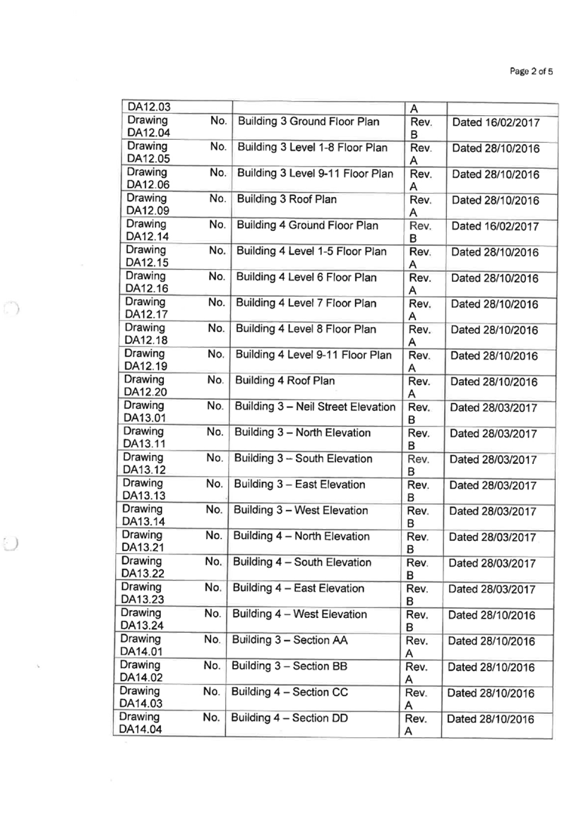
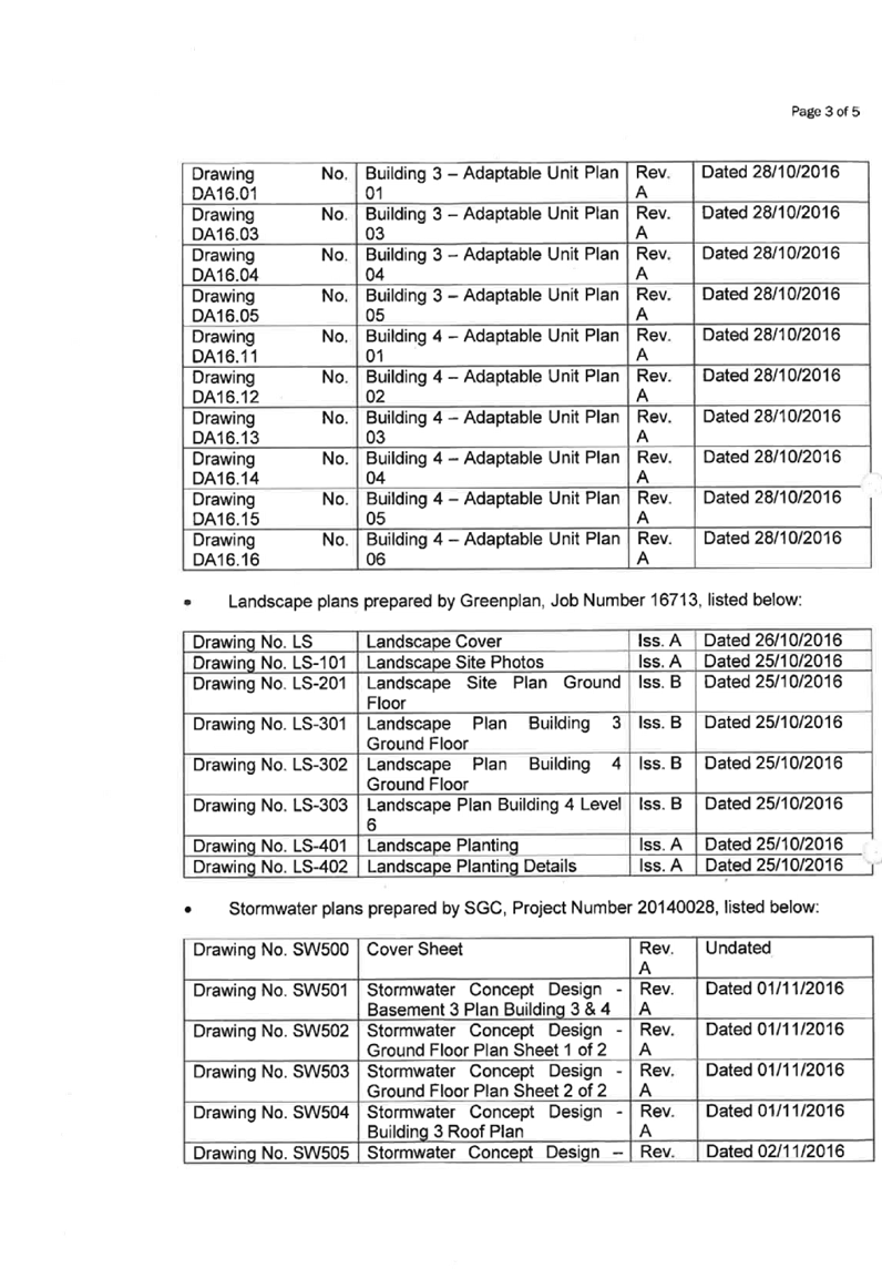


DOCUMENTS
ASSOCIATED WITH
REPORT LPP007/19
Attachment 9
Endorsed Architectural Plans for Development Consent
2016/496/2
Cumberland Local Planning Panel Meeting
13 March 2019


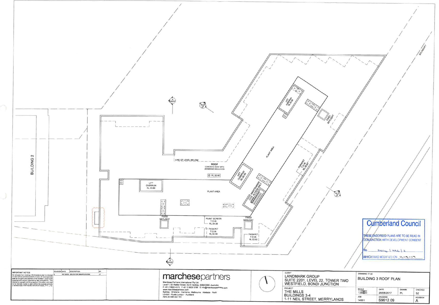

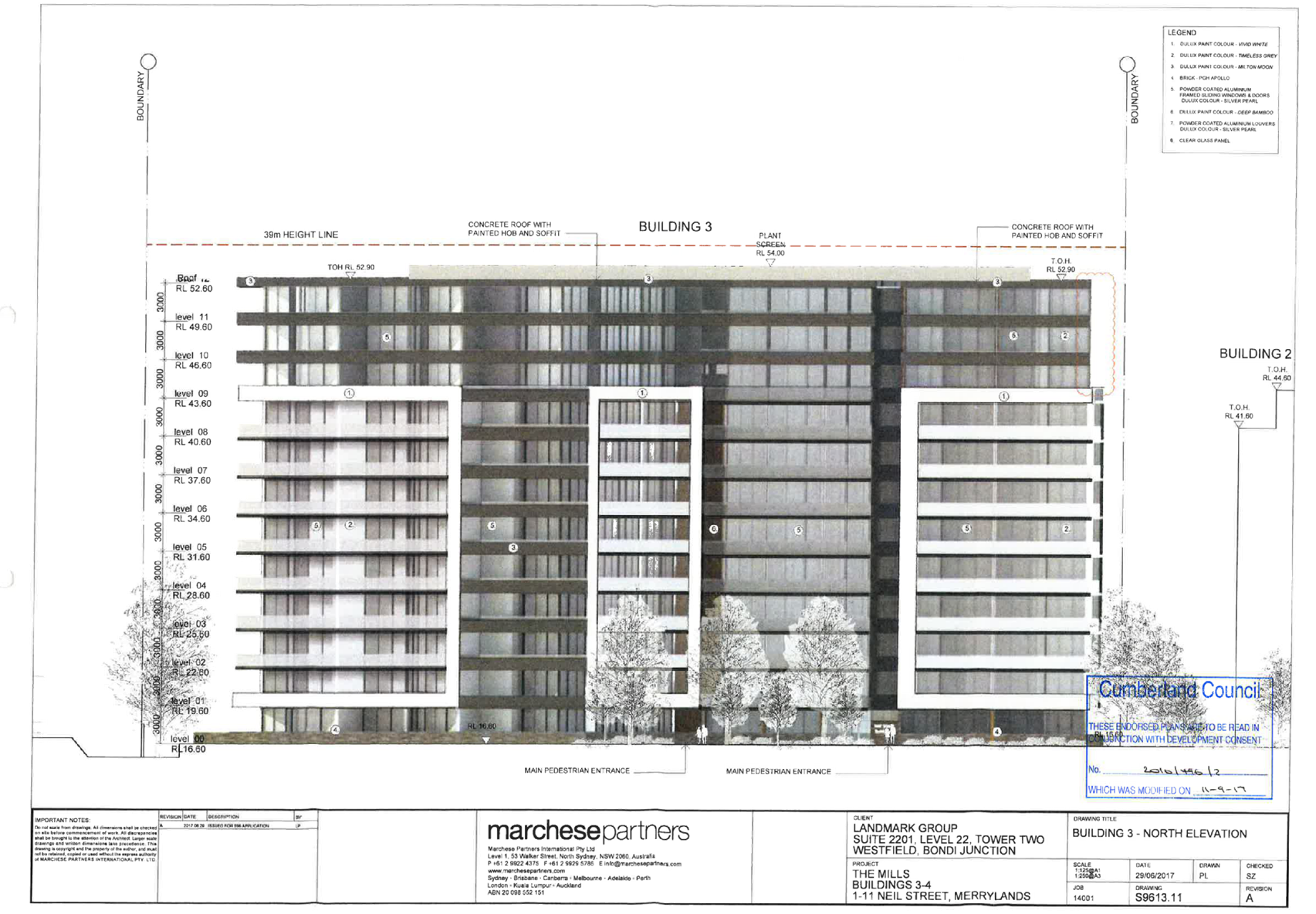


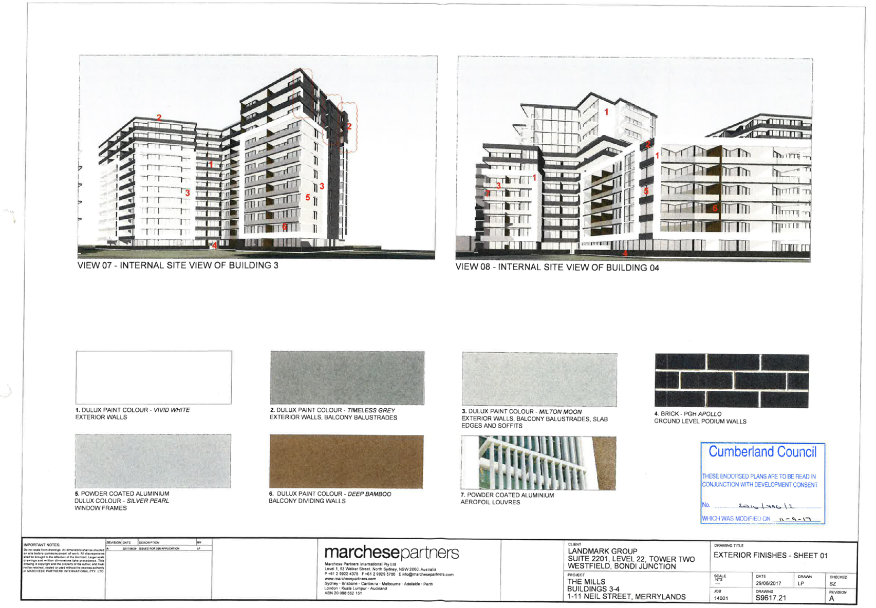
DOCUMENTS
ASSOCIATED WITH
REPORT LPP007/19
Attachment 10
Development Consent 2016/496/5
Cumberland Local Planning Panel Meeting
13 March 2019


DOCUMENTS
ASSOCIATED WITH
REPORT LPP007/19
Attachment 11
Development Consent 2016/496/6
Cumberland Local Planning Panel Meeting
13 March 2019


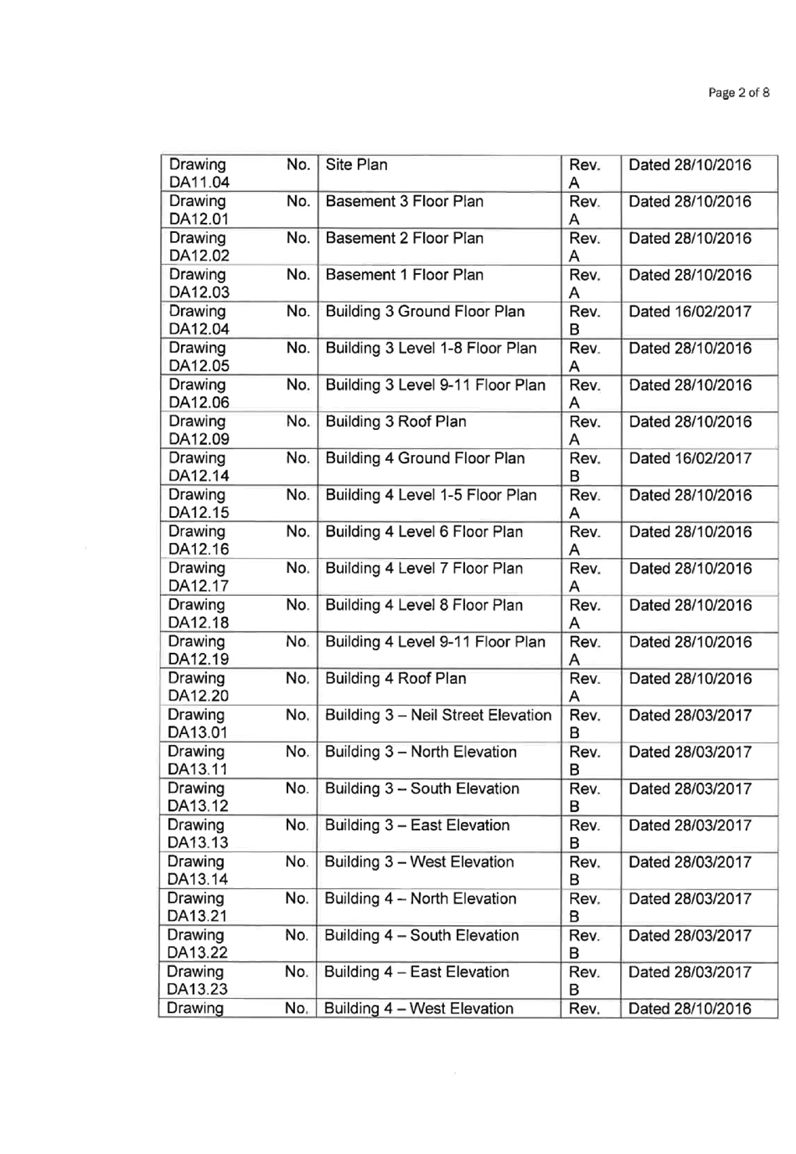
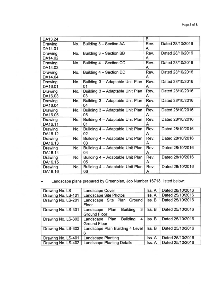
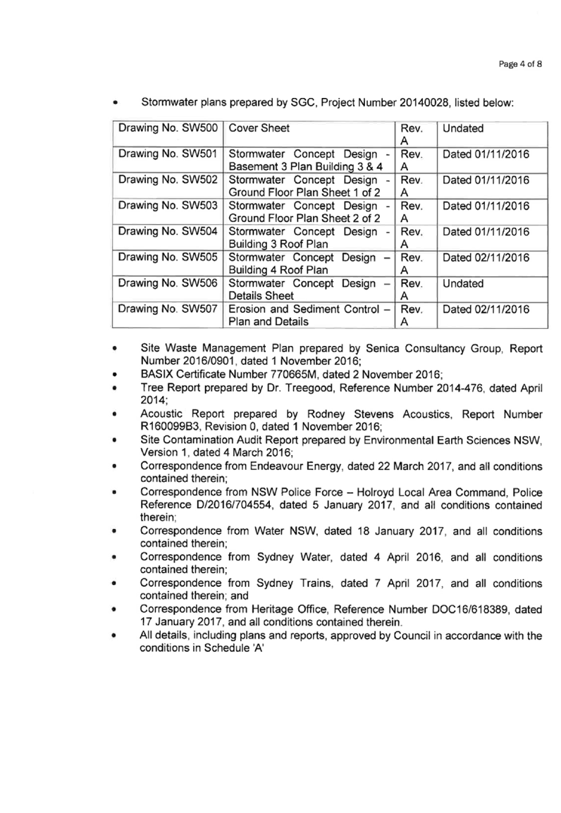
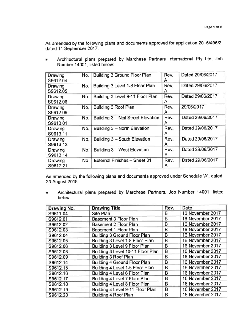

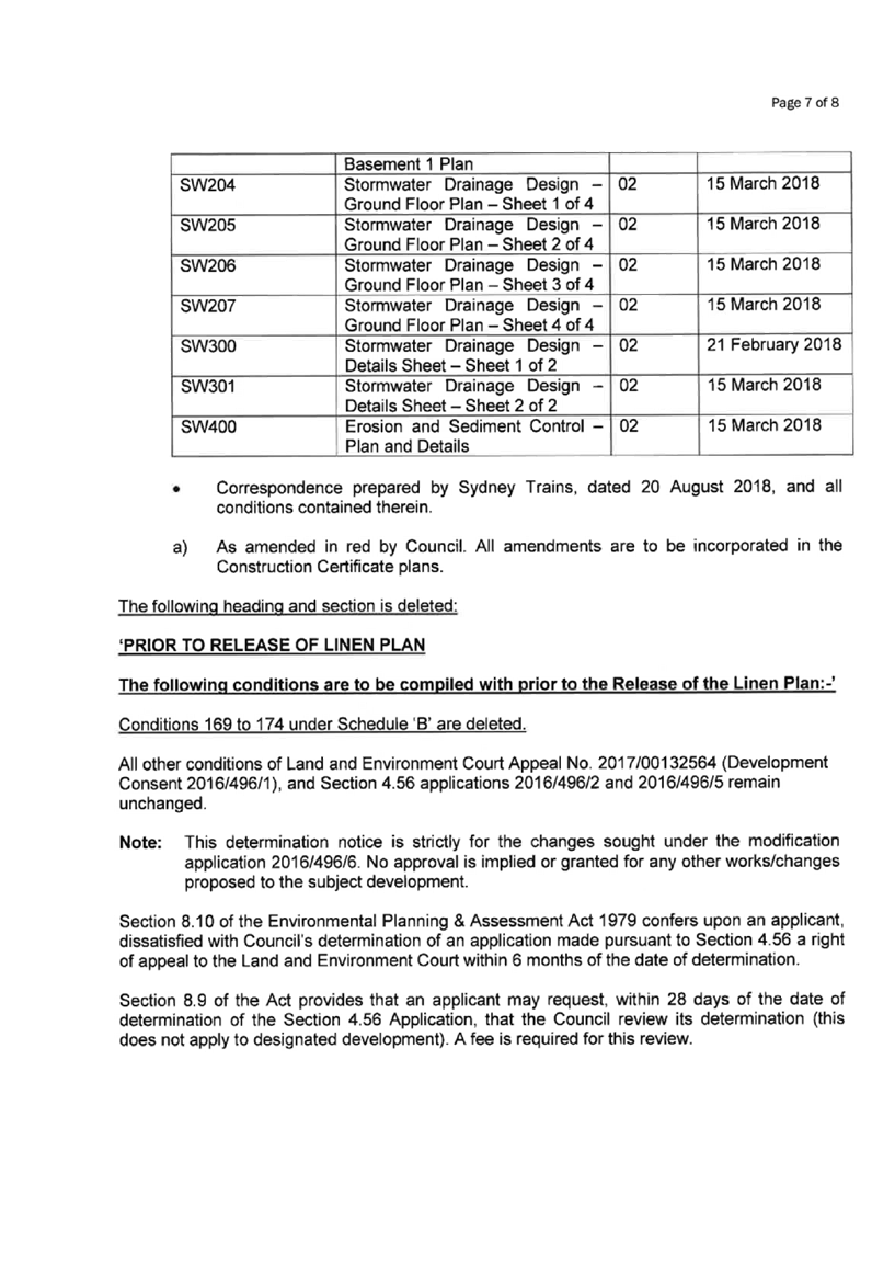


Cumberland
Local Planning Panel Meeting
13 March 2019
Item No: LPP008/19
Section 4.56
modification to 1-7 and 9-11 Neil Street, Merrylands
Responsible
Division: Environment
& Planning
Officer: Manager
Development Assessment
File
Number: DA-2016/496/4
|
Application lodged
|
18 April 2018
|
|
Applicant
|
Landmark Group Australia Pty Ltd
|
|
Owner
|
Lot 11 Neil Street Pty Limited
|
|
Application No.
|
2016/496/4
|
|
Description of Land
|
1-7 Neil Street Merrylands (Lot 11, DP 228782) and
9-11 Neil Street Merrylands (Lot 1, DP 203553)
|
|
Proposed Development
|
S4.56 Modification seeking internal and external
alterations to Buildings 3 and 4, and relocation of hydrant booster and
substation kiosk
|
|
Site Area
|
15,763m2
|
|
Zoning
|
R4 – High Density Residential
|
|
Disclosure of political donations and gifts
|
Nil disclosure
|
|
Heritage
|
The site is
located adjacent to a local heritage item to the north being the former brickworks
site known as Item I53 - Goodlet & Smith (brickmaking plant and chimney,
Hoffman kiln & chimney).
The subject site
is known as the Millmaster Feeds site and is identified as a local
Archaeological site.
|
|
Principal Development Standards
|
Floor Space Ratio
Permissible: 3.5:1
Approved: 3.67
Proposed: 3.71:1
Height of Buildings
Permissible: 29m,
30m, and 39m
Proposed:
Building 3: 38.8m, Building 4: 38.85m
|
|
Issues
|
Exceedance to Floor Space Ratio
|
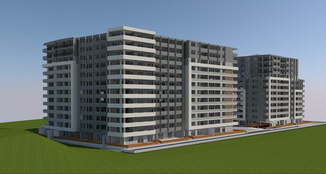
Figure 1 – Perspective
from Railway Looking North (South: Ghazi Al Ali, 2018)
Summary:
Application No. DA-2016/496/4 was
received on 18 April 2018 for a Modification Application under Section 4.56
(formerly Section 96AA) of the Environmental Planning & Assessment Act 1979
seeking consent for internal and external alterations to Buildings 3 and 4, and
relocation of hydrant booster and substation kiosk at 1-11 Neil Street,
Merrylands.
The application was publicly
notified to occupants and owners of the adjoining properties for a period of 21
days between 16 May 2018 to 6 June 2018. In response, no submissions were
received.
The subject site is located
adjacent to a heritage item to the north being the former brickworks site known
as Item I53 - Goodlet & Smith (brickmaking plant and chimney, Hoffman kiln
& chimney) under Holroyd Local Environmental Plan 2013 (HLEP) 2013. The
subject site is known as the Millmaster Feeds site and is identified as a
potential Archaeological site.
On 26 April 2017, Development
Application 2016/496 was considered by the Sydney West Central Planning Panel
(SWCPP) for construction of a 2 x residential flat buildings (Buildings 3 &
4) over 3 levels of basement parking accommodating a total of 438 car parking
spaces and 5 on-grade spaces; Building 3 being 12 storey accommodating 178 units
and Building 4 being Part 6, Part 8 and Part 12 storeys accommodating 133
units. The application includes consolidation of 2 existing lots making up the
overall site of 1-11 Neil Street and re-subdivision of the consolidated lot
into 3 Torrens title lots and 4 Stratum Lots.
At its meeting, the SWCPP deferred
the application for a number of reasons including concerns over site coverage,
insufficient landscaped area and excessive bulk; a desire for taller and
slimmer buildings; and a desire for an alternate unit mix with increased 3
bedroom units.
The applicant subsequently lodged
a Class 1 Appeal against the deemed refusal of the DA with the NSW Land and
Environment Court (appeal number 2017/132564) which was upheld with DA-2016/496
approved subject to conditions.
On 11 September 2017, Section 4.56
modification application (DA-2016/496/2) was approved which sought minor
alterations to the approved residential flat building development,
predominately relating to the western elevation of Building 3.
On 14 August 2018, Section 4.56
modification application (DA-2016/496/5) was approved, which sought amendments
to the approved subdivision of the site from 7 lots to 6 lots.
On 4 October 2018, Section 4.56
modification application (DA-2016/496/6) was approved, which sought the removal
of the subdivision component of the development.
The proposal is consistent with
the aims and objectives of State Environmental Planning Policy (SEPP) No. 55
(Remediation of Land), SEPP No. 65 – Design Quality of Residential
Apartment Development, SEPP (Infrastructure) 2007, SEPP (Building
Sustainability Index: BASIX) 2004, Sydney Environmental Plan (Sydney Harbour
Catchment) 2005, Holroyd Local Environmental Plan (HLEP) 2013, Draft SEPP
(Environment), and Holroyd Development Control Plan (HDCP) 2013.
The variations sought via the
subject modification application are as follows:
|
Control
|
Maximum
|
Approved
|
Proposed
|
%Variation
|
|
Floor Space Ratio
|
3.5:1
|
3.67:1
|
3.71:1
|
1.1% (approved)/ 6% (maximum)
|
The increase in floor area
improves the internal amenity of the apartments by providing additional storage
areas, bathrooms and increased bedroom sizes. The increase in floor area is
derived from a reduction to the size of the approved balconies and as a result,
the amendments are mainly within the approved building footprint.
The subject proposal does not
involve significant changes to the approved apartment layouts or built form.
Minor changes to the visual articulation of the southern and eastern
façades reflect the changes made to the apartment layouts with
appropriate visual interest maintained.
The proposal is substantially the
same development as the approved development and satisfies the relevant
provisions of the Environmental Planning and Assessment Act 1979.
The application is being reported
to the Cumberland Local Planning Panel (CLPP) for determination, as it is a
4.56 modification application involving a variation to a developments standard.
In light of the above, it is
recommended that the Cumberland Local Planning Panel Approve the Section 4.56
Application, subject to the Draft Notice of Determination contained in
Attachment 2 to this report.
Subject Site and Surrounding
Area
The subject land is known as Lot
11, DP 228782 and Lot 1, DP 203553, 1-7 and 9-11 Neil Street, Merrylands. The
land is an irregular shaped lot and has a frontage of 110.82 metres to the
southern Neil Street boundary; a 100.65 metre depth along the western side
boundary; a 180.5 metre width along the northern rear boundary; and a 131.15
metre depth along the eastern boundary shared with the railway corridor. The
total site area is 15,763sqm. The site is illustrated in Figure 2 below with
the portion of the site of the approved residential flat Buildings 3 and 4
being the eastern half of the site, with the site of Buildings 3 & 4 marked
with a star.
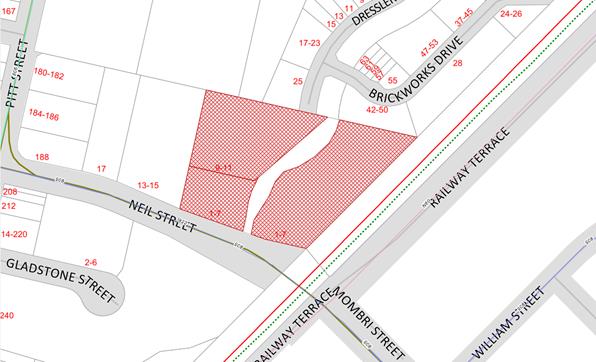
Figure
2 - Location Map (Source: Cumberland Council, 2018)
The subject site is currently
under construction with partially constructed residential flat buildings 1 and
2 on the western half of the site. The land is split by the A’Becketts
Creek watercourse which traverses the site in a north to south direction and
forms a natural feature and constraint for the site.
The topography of the site is
fairly consistent with a slight fall from south to north. The land is affected
by Local Overland Stormwater Overflow.
The subject site is zoned R4 High
Density Residential pursuant to Holroyd Local Environmental Plan (HLEP) 2013,
as shown in Figure 3 below:


Figure
3 – Zoning Map (Source: Cumberland Council, 2018)
The subject site is situated on
the northern side of Neil Street, Merrylands, and is located within the Neil
Street Precinct. The subject site is adjacent to a railway corridor that spans
the eastern boundary of the site and approximately 350 metres north-east from
Merrylands train station. The site is illustrated in Figures 4 and 5 below.
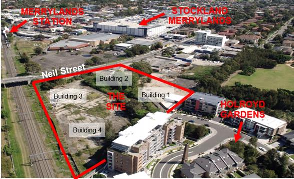
Figure
4 – Aerial view of subject site and surrounds (Source: Cumberland
Council, 2018)
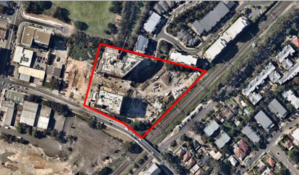
Figure
5 – Aerial Photo (Source: Nearmap, 2019)
The locality is characterised by existing
low rise former industrial premises to the west along Neil Street; mixed use
and residential flat building developments approved, under construction, and
recently completed to the west and north; commercial and retail development to
the south-west and residential to the east and south.
The subject site currently
benefits from vehicular access directly from Neil Street. Vehicular access to
the development is dependent on a proposed extension of Dressler Court at the
north of the site, which will connect to a new road running through the site
along the western side of the A’Becketts Creek watercourse.
The site is located adjacent to a
heritage item to the north being the former brickworks site known as Item I53 -
Goodlet & Smith (brick-making plant and chimney, Hoffman kiln &
chimney). The subject site is known as the Millmaster Feeds site and is
identified as a potential Archaeological site. Figure 6 below illustrates the
location of the heritage item, listed above:
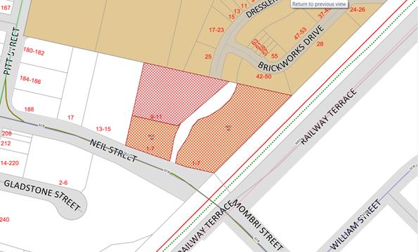
Figure
6 – Heritage Map (Source: Cumberland Council, 2018)
Description of The
Proposed Development
Development Application 2016/496/1
was approved via Land and Environment Court Appeal No. 2017/00132561 for
construction of a 2 x residential flat buildings (Buildings 3 & 4) over 3
levels of basement parking accommodating a total of 438 car parking spaces and
5 on-grade spaces; Building 3 being 12 storey accommodating 178 units and
Building 4 being Part 6, Part 8 and Part 12 storeys accommodating 133 units.
The application includes consolidation of 2 existing lots making up the overall
site of 1-11 Neil Street and re-subdivision of the consolidated lot into 3
Torrens title lots and 4 Stratum Lots.
On 11 September 2017, Section 4.56
modification application (DA-2016/496/2) was approved which sought minor
alterations to the approved residential flat building development,
predominately relating to the western elevation of Building 3.
On 14 August 2018, Section 4.56
modification application (DA-2016/496/5) was approved, which sought amendments
to the approved subdivision of the site from 7 lots to 6 lots.
On 4 October 2018, Section 4.56
modification application (DA-2016/496/6) was approved, which sought the removal
of the subdivision component of the development.
The changes sought via the subject
Section 4.56 Application are as follows:
· Modification
to the internal configuration of a number of apartments.
· Adjustment
of balcony sizes to a number of apartments.
· Alteration
to the articulation of the building from the southern and eastern elevations
due to the deletion of the balconies and the extension of a number of bedrooms.
· Increase
in Gross Floor Area (GFA) from 9,705sqm to 10,105sqm.
Specific details of the key
proposed changes are as follows:
|
Level
|
Unit
|
Modifications
|
|
Basement 3
|
N/A
|
Footprint of the
basement amended, with minor changes to the perimeter wall.
|
|
N/A
|
Change to the
general layout and arrangement of parking.
|
|
N/A
|
Basement floor RL
lowered to RL 6.30 (previously RL 7.10).
|
|
N/A
|
Reconfiguration of
parking spaces and garbage rooms. Relocation of fire hydrant and valve room
from Basement Level 1 to south-western corner of Basement Level 3.
|
|
Basement 2
|
N/A
|
Footprint of the
basement amended, with minor changes to the perimeter wall.
|
|
N/A
|
Change to the
general layout and arrangement of parking.
|
|
N/A
|
Basement floor RL
lowered to RL 9.30 (previously RL 10.10).
|
|
N/A
|
Reconfiguration of
parking spaces and garbage rooms. Relocation of fire hydrant and valve room
to south-western corner.
|
|
Basement 1
|
N/A
|
iii)
Footprint of the basement
amended, with minor changes to the perimeter wall.
|
|
N/A
|
Change to the
general layout and arrangement of parking.
|
|
N/A
|
Basement floor RL
lowered to RL 12.30 (previously RL 13.10).
|
|
N/A
|
Reconfiguration of
parking spaces and garbage rooms. Changes to sizes of air supply fan room,
and exhaust fan room.
|
|
Building 3 –
Ground
|
N/A
|
Relocation of
substation kiosks and hydrant / sprinkler booster to north-western boundary
along the proposed road between Buildings 3 & 4.
|
|
N/A
|
Addition of fire
control room adjacent to Building 3 entrance 1.
|
|
3.0.05
|
Reconfiguration of
the unit, in particular the relocation of the kitchen and bathroom
facilities.
|
|
3.0.07
|
Increase in unit
size and provision of an additional bathroom, making the unit a 2 bedroom, 2
bathroom unit.
|
|
3.0.08
|
Reconfiguration of
the unit, in particular the relocation of the kitchen and bathroom
facilities.
|
|
Building 3 –
Levels 1 to 8
|
3.L.08
|
Increase in unit
size and provision of an additional bathroom, making the unit a 2 bedroom, 2
bathroom unit.
|
|
3.L.09
|
Increase in unit
size and provision of an additional bathroom, making the unit a 2 bedroom, 2
bathroom unit.
|
|
3.L.10
|
Increase in balcony
area adjacent to bedrooms and change to internal laundry facilities.
|
|
Building 3 –
Levels 9 to 11
|
3.L.08
|
Increase in unit
size and provision of an additional bathroom, making the unit a 2 bedroom, 2
bathroom unit.
|
|
3.L.09
|
Increase in unit
size and provision of an additional bathroom, making the unit a 2 bedroom, 2
bathroom unit.
|
|
3.L.10
|
Increase in balcony area
adjacent to bedrooms and change to internal laundry facilities.
|
|
Building 3 –
Roof
|
N/A
|
Provision of
additional roof area above Units 3.L.01, 3.L.09 and 3.L.10.
|
|
N/A
|
Provision of
maintenance access stairs at the eastern and western portions of the roof.
|
|
N/A
|
Change to the lift
overrun height of all lifts to RL 54.20 (previously RL 53.60).
|
|
N/A
|
Additional skylights
and hot water plant.
|
|
Building 4 –
Ground
|
N/A
|
Provision of
additional support structure and awning to south-eastern portion of ramp.
|
|
Building 4 –
Level 6
|
N/A
|
RL of common area
increased to RL 34.75 (previously RL 34.60). TOW surrounding common area
adjusted to suit.
|
|
N/A
|
Increase in plant
area.
|
|
4.6.01
|
Reconfiguration of
the kitchen and laundry facilities.
|
|
Building 4 –
Roof
|
N/A
|
Change to the lift
overrun height of the northern lift to RL 41.60 (previously RL 42.20).
|
|
N/A
|
Decrease height of
plant screen surrounding plant area to RL 54.00 (previously RL 66.00)
|
|
N/A
|
Additional hot water
plant
|
Applicants Supporting
Statement
The applicant has provided a
Statement of Environmental Effects prepared by Chapman Planning Pty Ltd dated 3
April 2018 and was received by Council on 18 April 2018 in support of the
application.
The Statement of Environmental
Effects was subsequently modified on 1 February 2019, following Council’s
review of the submitted plans.
Contact with Relevant
Parties
The assessing officer has
undertaken a site inspection of the subject site and surrounding properties and
has been in regular contact with the applicant throughout the assessment
process.
Internal Referrals
Development Engineer
The modification application was
referred to Council’s Development Engineer for comments, who advised that
the modified development proposal is supported.
Resource Recovery Officer
The modification application was
referred to Council’s Resource Recovery Officer for comments, who advised
that the modified development proposal is supported.
Building Certifier
The modification application was
referred to Council’s Building Certifier for comments, who advised that
the modified development shall comply with the Building Code of Australia.
External Referrals
Endeavour Energy
The modification application was
referred to Endeavour Energy for comments, who advised that the modified
development proposal is satisfactory, subject to conditions.
Planning Comments
Section 4.56 of the
Environmental Planning and Assessment Act 1979 (EP & A Act)
A consent authority may, on
application being made by the Applicant or any other person entitled to act on a
consent granted by the Court and subject to and in accordance with the
regulations, modify the consent if:
|
Requirement
|
Comment
|
|
(a) it is satisfied that the development to
which the consent as modified relates is substantially the same development
as the development for which the consent was originally granted and before
that consent as originally granted was modified (if at all), and
|
The development as proposed to
be modified is substantially the same as the development for which consent
was originally granted.
|
|
(b) it
has notified the application in accordance with:
(i) The
regulations, if the regulations so require, or
(ii) A
development control plan, if the consent authority is a council that has made
a development control plan that requires the notification or advertising of
applications for modification of a development consent, and
|
The application was publicly notified in accordance with
the Holroyd DCP 2013 for a period of 21 days between 16 May 2018 to 6 June
2018. In response, no submissions were received.
|
|
(c) it has notified, or made reasonable
attempts to notify, each person who made a submission in respect of the
relevant development application of the proposed modification by sending
written notice to the last address known to the consent authority of the
objector or other person, and
|
All persons who made a submission in respect of the
original application were notified of the proposed modification.
|
|
(d) it has
considered any submissions made concerning the proposed modification within
any period prescribed by the regulations or provided by the development
control plan, as the case may be.
|
No submissions were received in response to the
notification of the subject application.
|
|
(1A) In determining an application for
modification of a consent under this section, the consent authority must take
into consideration such of the matters referred to in section 4.15 (1) as are
of relevance to the development the subject of the application. The consent
authority must also take into consideration the reasons given by the consent
authority for the grant of the consent that is sought to be modified.
|
The
provisions of the applicable EPIs are discussed elsewhere in this report.
The
provisions of the applicable DCP are discussed elsewhere in this report.
There are no planning agreements or draft planning
agreements related to this application.
There are no relevant matters referred to in the
regulations.
The likely impacts of the development as proposed to be
modified are considered satisfactory.
The site is considered to be suitable for the development
as proposed to be modified.
No submissions
were received in response to the notification period, as noted above.
Approval of the
subject application is not contrary to the public interest.
|
|
(1C) The modification of a development consent in accordance
with this section is taken not to be the granting of development consent
under this Part, but a reference in this or any other Act to a development
consent includes a reference to a development consent as so modified.
|
Noted.
|
|
(2) After determining an application for modification of a
consent under this section, the consent authority must send a notice of its determination
to each person who made a submission in respect of the application for
modification.
|
Noted.
|
Section 4.15 of the
Environmental Planning and Assessment Act 1979 (EP & A Act)
The provisions of any
Environmental Planning Instruments (EP & A Act s4.15 (1)(a)(i))
The following Environmental
Planning Instruments are relevant to the assessment of the subject modification
application:
(a) State
Environmental Planning Policy No. 55 – Remediation of Land (SEPP 55)
The requirement at Clause 7 of
SEPP 55 for the consent authority to be satisfied that the site is suitable or
can be made suitable to accommodate the proposed development, was considered
under the original application. The proposed modifications do not raise any new
concerns regarding site contamination.
(b) Statement
Environmental Planning Policy No. 65 - Design Quality of Residential Apartment
Development (SEPP 65)
SEPP 65 applies to the development
as the building is 3 storeys or more, and contains at least 4 dwellings. A
design statement addressing the design quality principles prescribed by SEPP 65
was prepared by the project architect. Integral to SEPP 65 is the Apartment
Design Guide (ADG), which sets benchmarks for the appearance, acceptable
impacts and residential amenity of the development.
Following a detailed assessment of
the proposal against the provisions of SEPP 65 and the ADG, the proposal is
considered compliant with the policies with mainly internal changes to the
apartment layout and changes to the southern and eastern elevations. The
proposal continues to satisfy design criteria including building amenity,
apartment size and layout, private open space and balconies, storage and
universal design. A comprehensive assessment against SEPP 65 and the ADG is
contained in Attachment 3 of this report.
(c) State
Environmental Planning Policy (Infrastructure) 2007 (ISEPP)
The provisions of the ISEPP 2007
have been considered in the assessment of the Modification Application. The
proposed modifications do not affect the previous assessment regarding
upgrading existing utility services including water, gas or telecommunications.
Clause 45 - Development likely
to affect an electricity transmission or distribution network
The subject development occurs
within 5 metres of an overhead electricity power line and the original proposed
development also included a substation. As such, the Consent Authority is
required to give written notice to an electricity supply authority. The
modification application was referred to Endeavour Energy, who advised that the
modified development proposal is supported, subject to conditions, in
particular, for a detailed substation design to be provided prior to the issue
of a Construction Certificate.
Clause 85 – Development
adjacent to railway corridors
The application is subject to
clause 85 of the ISEPP, as the subject site is located adjacent to a railway
corridor. No changes are proposed to the development which would trigger a
re-assessment against Clause 85 of the ISEPP.
Clause 86 – Excavation
in, above, below or adjacent to rail corridors
The application is subject to
clause 86 of the ISEPP as the proposed redevelopment of the site involves
excavation to a depth of at least 2m below ground level (existing), on land
within 25m (measured horizontally) of a rail corridor. No changes are proposed
to the development which would trigger a re-assessment against Clause 86 of the
ISEPP.
Clause 87 – Impact of
rail noise or vibration on non-rail development
The application is subject to
clause 87 of the ISEPP as the site is in or adjacent to a rail corridor or is
likely to be adversely affected by rail noise or vibration. No changes are
proposed to the development which would trigger a re-assessment against Clause
87 of the ISEPP.
Clause 101 – Frontage to
classified road
The application is not subject to
clause 101 of the ISEPP as the site does not have a frontage to a classified
road.
Clause 102 – Impact of
road noise or vibration on non-road development
The application is not subject to
clause 102 of the ISEPP as the annual average daily traffic volume of Neil
Street is less than 40,000 vehicles.
Clause 104 – Traffic
generation developments
The original DA proposed over 300
dwellings and over 400 parking spaces and accordingly was referred to the RMS
for comment in accordance with Clause 104 pf the ISEPP. No changes are proposed
to the development which would trigger a re-assessment against Clause 104 of
the ISEPP.
(d) State
Environmental Planning Policy (Building Sustainability Index: BASIX) 2004
A BASIX Certificate has been
lodged and endorsed as a part of Development Application 2016/496/1. An amended
BASIX Certificate was not lodged with the subject application, which has been
conditioned in the Draft Notice of Determination.
(e) Sydney
Regional Environmental Plan (Sydney Harbour Catchment) 2005
The subject site is identified as
being located within the area affected by the Sydney Regional Environmental
Plan (Sydney Harbour Catchment) 2005. The proposed development raises no
issues, as no impact on the catchment is envisaged.
Note: The subject site is not
identified in the relevant map as land within the ‘Foreshores and
Waterways Area’ or ‘Wetland Protection Zone’, is not a
‘Strategic Foreshore Site’ and does not contain any heritage items.
Hence the majority of the SEP is not directly relevant to the proposed
development.
(f) Holroyd
Local Environmental Plan 2013 (HLEP 2013)
The subject site is zoned R4 High
Density Residential pursuant to HLEP 2013. The subject development continues to
be characterised as 2 x residential flat buildings.
Residential flat building means
a building containing 3 or more dwellings, but does not include an attached
dwelling or multi dwelling housing.
Note. Residential flat
buildings are a type of residential accommodation – see definition of that
term in the dictionary.
The development complies with the
development standards contained within the HLEP 2013, with the exception of the
Floor Space Ratio development standard. A comprehensive assessment against the
HLEP 2013 is contained in Attachment 4 to this report.
Floor Space
Ratio
· The
proposal is generally consistent with the provisions of the HLEP 2013 as
approved, with a continued non-compliance with the FSR development standard.
The subject modification proposes an increase in the GFA by 401sqm which
increases the FSR variation from 3.67:1 (approved under DA2016/496/2) to
3.71:1.
A Clause 4.6 request is not
required as the application is made under Section 4.56 of the Environmental
Planning and Assessment Act, 1979.
The proposal would further exceed
the maximum permitted FSR under the HLEP 2013 by a further 0.042:1, increasing
the total exceedance from 0.17 (4.86%) to 0.21:1 (6%) which is a relatively
minor increase considering the overall development. As noted earlier, the
additional GFA and increased FSR are a result of improving internal amenity of
some units within the development which would achieve a net positive outcome
for the development from the modifications proposed.
Furthermore, the additional GFA
does not amount to any net increase in the building footprint such that
additional yield would be achievable.
It should be noted that FSR and
GFA averaging has been previously applied across the entire site for the
overall 4 buildings that form the original development and a condition was
imposed on the original consent granted requiring a positive covenant to be
imposed on the lot containing Building 1 to preclude any future applications
adding GFA to that building. Of note, when assessed against the average across
the site, the proposed amendments remain compliant, with an overall maximum
permitted average equivalent to 45,177m², and a proposed average of
42,442.4m² proposed.
Council is satisfied that the
proposed development will be in the public interest, as it is consistent with
the objectives of the FSR development standard and the objectives for
development within the zone in which the development is proposed to be carried
out.
The provisions of any Proposed
Instruments (EP & A Act s4.15 (1)(a)(ii))
The following draft Environmental
Planning Instruments are relevant to the assessment of the subject modification
application:
(a) Draft
State Environmental Planning Policy (Environment)
The draft SEPP relates to the
protection and management of our natural environment with the aim of
simplifying the planning rules for a number of water catchments, waterways,
urban bushland, and Willandra Lakes World Heritage Property. The changes
proposed include consolidating the following seven existing SEPPs:
· State
Environmental Planning Policy No. 19 – Bushland in Urban Areas.
· State
Environmental Planning Policy No. 19 – Bushland in Urban Areas.
· State
Environmental Planning Policy (Sydney Drinking Water Catchment) 2011.
· State
Environmental Planning Policy No. 50 – Canal Estate Development.
· Greater
Metropolitan Regional Environmental Plan No. 2 – Georges River Catchment.
· Sydney
Regional Environmental Plan No. 20 – Hawkesbury-Nepean River (No.2-1997).
· Sydney
Regional Environmental Plan (Sydney Harbour Catchment) 2005.
· Willandra
Lakes Regional Environmental Plan No. 1 – World Heritage Property.
The draft policy will repeal the
above existing SEPPs and certain provisions will be transferred directly to the
new SEPP, amended and transferred, or repealed due to overlaps with other areas
of the NSW planning system.
As noted within the assessment
above under the heading ‘Sydney Regional Environ-mental Plan (Sydney
Harbour Catchment) 2005’, the proposed development raises no issues, as
no impact on the catchment is envisaged.
The provisions of any
Development Control Plans (EP & A Act s4.15 (1)(a)(iii))
The following Development Control
Plans are relevant to the assessment of the subject modification application:
(a) Holroyd
Development Control Plan 2013 (HDCP 2013)
The Holroyd Development Control
Plan 2013 (HDCP 2013) provides guidance for the design and operation of
development to achieve the aims and objectives of the HLEP 2013. The proposed
development complies with the relevant provisions of HDCP 2013 and is
considered acceptable from an environmental planning view point. A detailed
assessment against the provisions of the Holroyd DCP 2013 is contained in
Attachment 5 to this report.
The provisions of any planning
agreement that has been entered into under section 7.4, or any draft planning
agreement that a developer has offered to enter into under section 7.4 (EP
& A Act s4.15(1)(a)(iiia))
There is no planning agreement or
draft planning agreement associated with the subject Modification Application.
The provisions of the
Regulations (EP & A Act s4.15 (1)(a)(iv))
The proposed development raises no
concerns as to the relevant matters arising from the Environmental Planning and
Assessment Regulations 2000 (EP&A Reg).
The Likely Environmental,
Social or Economic Impacts (EP & A Act s4.15 (1)(b))
It is considered that the proposed
development will have no significant adverse environmental, social or economic
impacts in the locality. The proposed modifications are minor in nature and are
mostly internal changes resulting in improved amenity for future residents.
The suitability of the site for
the development (EP & A Act s4.15 (1)(c))
The subject site and locality is
not known to be affected by any natural hazards or other site constraints
likely to have a significant adverse impact on the proposed development. The
proposal seeks modification to Buildings 3 and 4 of the approved residential
flat building development. Modifications are minor in nature and will not
create adverse impacts on the surrounding development. Accordingly, it is
considered that the development is suitable in the context of the site and
surrounding locality.
Submissions made in accordance
with the Act or Regulation (EP & A Act s4.15 (1)(d))
Advertised (newspaper) Mail
Sign
Not Required
The public interest (EP & A
Act s4.15(1)(e))
The public interest is served by
permitting the orderly and economic use of land, in a manner that is sensitive
to the surrounding environment and has regard to the reasonable amenity
expectations of surrounding land users.
In view of the foregoing analysis,
it is considered that approval of the proposed development would not be
contrary to the public interest.
Section 7.11 (Formerly S94) Contributions
The subject development requires
the payment of contributions in accordance with Holroyd Section 94 Development
Contributions Plan 2013. A condition was imposed on the original consent
requiring the payment of contributions. The dwelling yield and unit mix is not
proposed to change, and therefore, the value of the contributions do not change
as a result of the proposed modifications.
Disclosure of Political
Donations and Gifts
The NSW Government has introduced
disclosure requirements for individuals or entities with a relevant financial
interest as part of the lodgement of various types of development proposals and
requests to initiate environmental planning instruments or development control
plans.
The application and notification
process did not result in any disclosure of Political Donations or Gifts.
The proposed development has been
assessed against the matters for consideration listed in Section 4.15 of the EP
& A Act, 1979, and is considered to be satisfactory. Any likely impacts of
the development have been satisfactorily addressed and the proposal is
considered to be in the public interest. Further, the subject site continues to
be suitable for the development.
The proposed development is
appropriately located within the R4 High Density Residential zone under the
relevant provisions of the HLEP 2013 and are consistent with the zone. The
development however proposes a further variation to the Floor Space Ratio
development standard under the HLEP 2013. The increase in floor area is derived
from a reduction to the size of the approved balconies and is mainly within the
approved building footprint. The development is considered to perform
adequately in terms of its relationship to its surrounding built and natural
environment, particularly having regard to impacts on adjoining properties.
The development, as proposed to be
modified, is considered to be substantially the same development as approved
and modified and therefore satisfactory for approval subject to conditions.
There are no further consultation
processes for Council associated with this report.
There are no further financial
implications for Council associated with this report.
There are no policy implications
for Council associated with this report.
Communication /
Publications:
The final outcome of this matter
will be notified in the newspaper. The objectors will also be notified in
writing of the outcome.
|
That Section 4.56 Application
2016/496/4 seeking internal and external alterations to Buildings 3 and 4,
and relocation of hydrant booster and substation kiosk on land at 1-7 &
9-11 Neil Street, Merrylands, be Approved, subject to the conditions
contained in Attachment 2 of this report.
|
1. Architectural Plans
⇩ 
2. Draft
Notice of Determination ⇩ 
3. SEPP
65 Apartment Design Guide Compliance Assessment ⇩
4. Holroyd
Local Environmental Plan 2013 Compliance Assessment ⇩
5. Holroyd
Development Control Plan 2013 Compliance Assessment ⇩
6. Development
Consent 2016/496/1 ⇩
7. Endorsed
Architectural Plans for Development Consent 2016/496/1 ⇩
8. Development
Consent 2016/496/2 ⇩
9. Endorsed
Architectural Plans for Development Consent 2016/496/2 ⇩
10. Development
Consent 2016/496/5 ⇩
11. Development
Consent 2016/496/6 ⇩
DOCUMENTS
ASSOCIATED WITH
REPORT LPP008/19
Attachment 1
Architectural Plans
Cumberland Local Planning Panel Meeting
13 March 2019
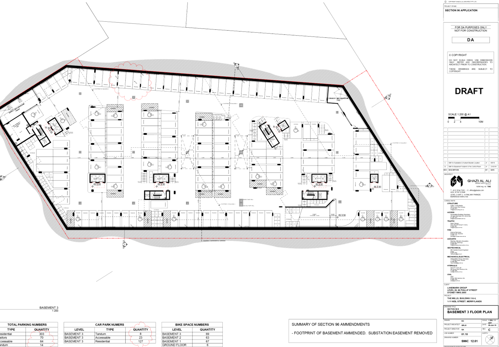
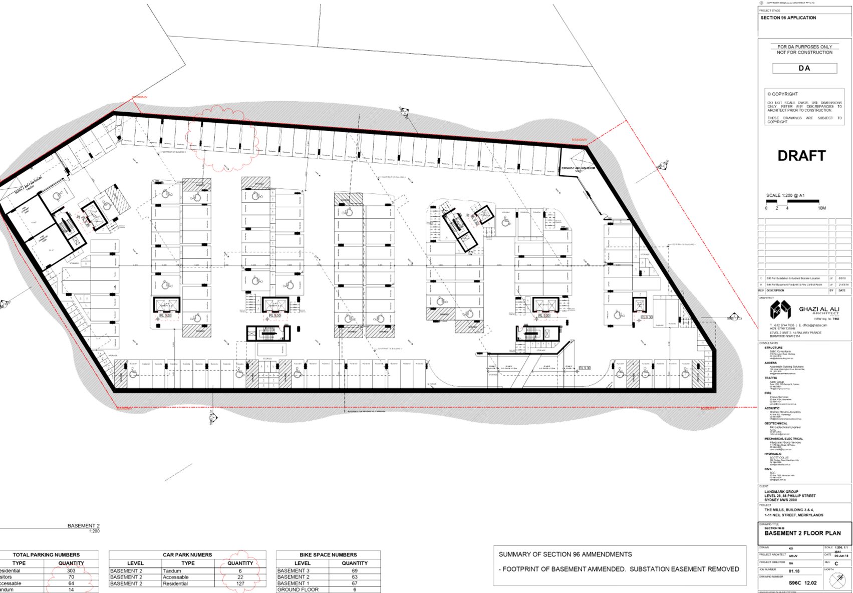
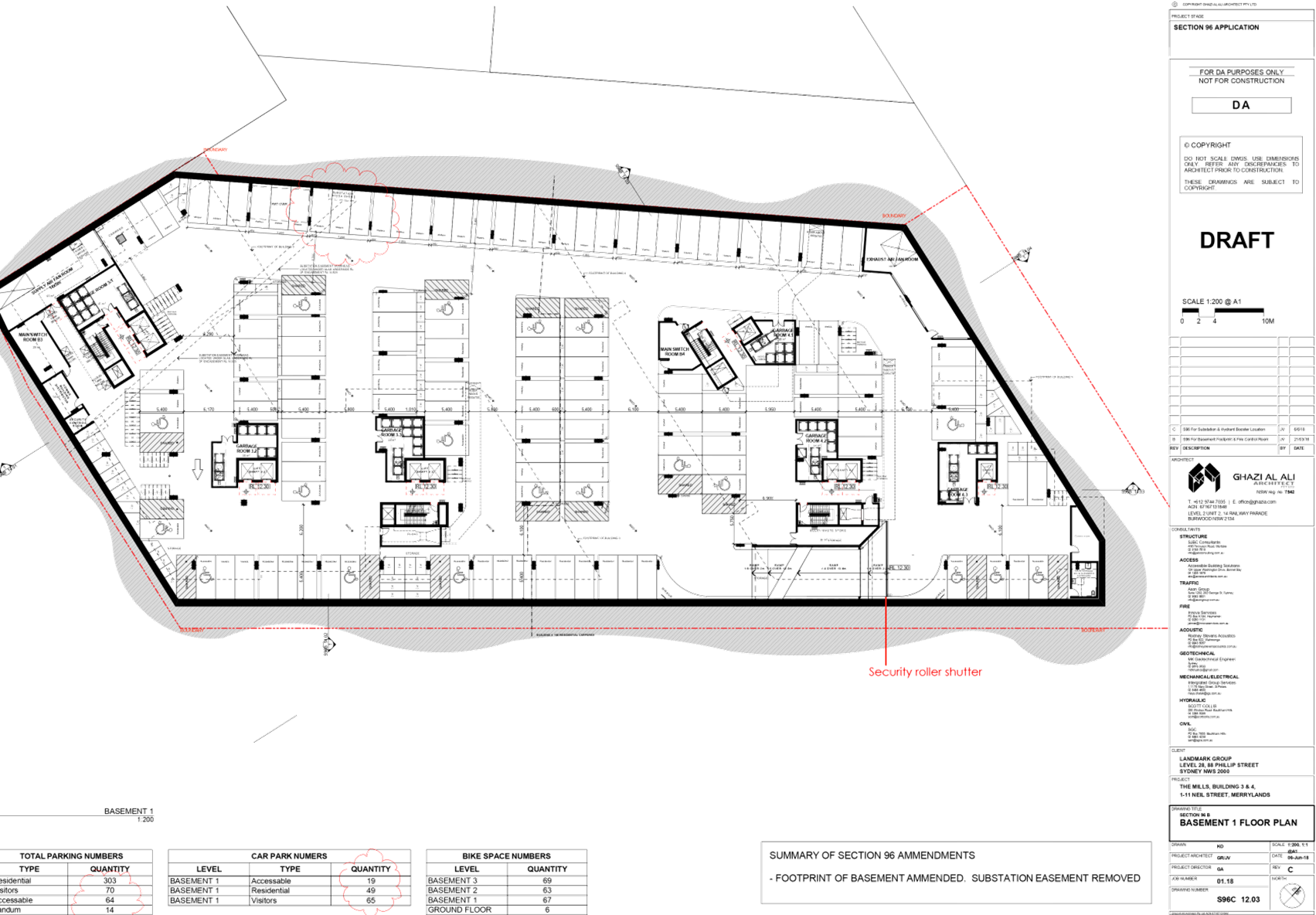
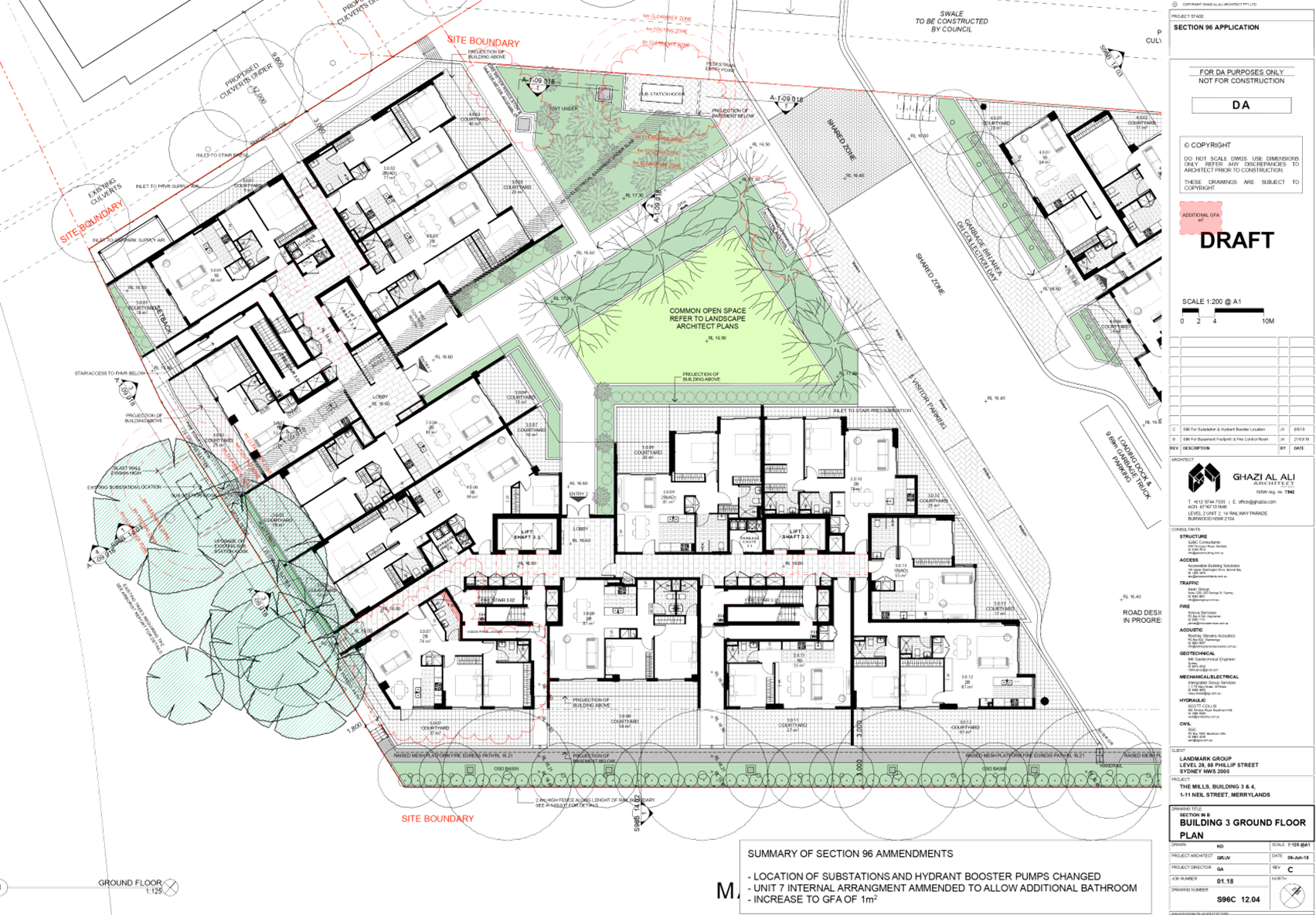
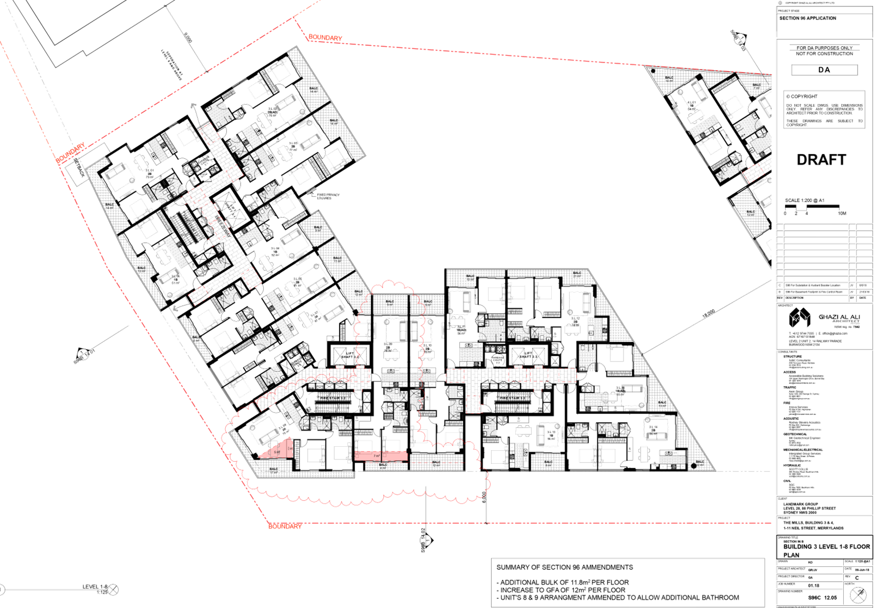
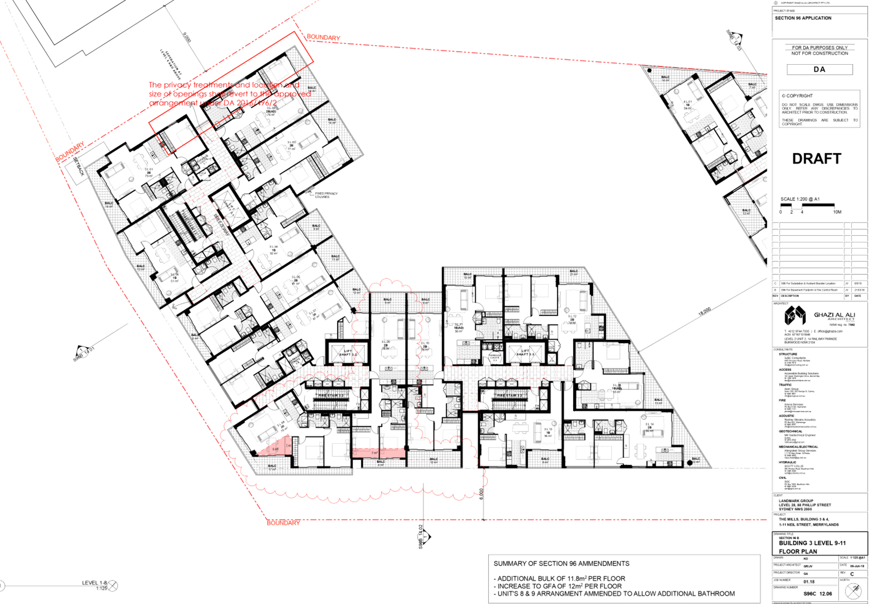

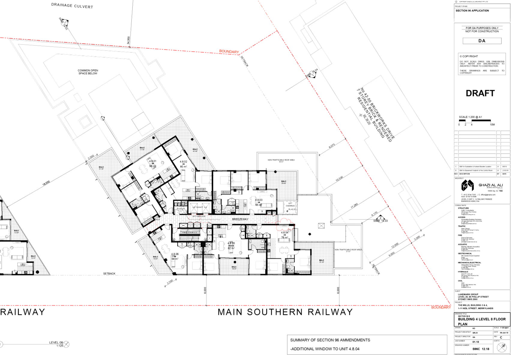
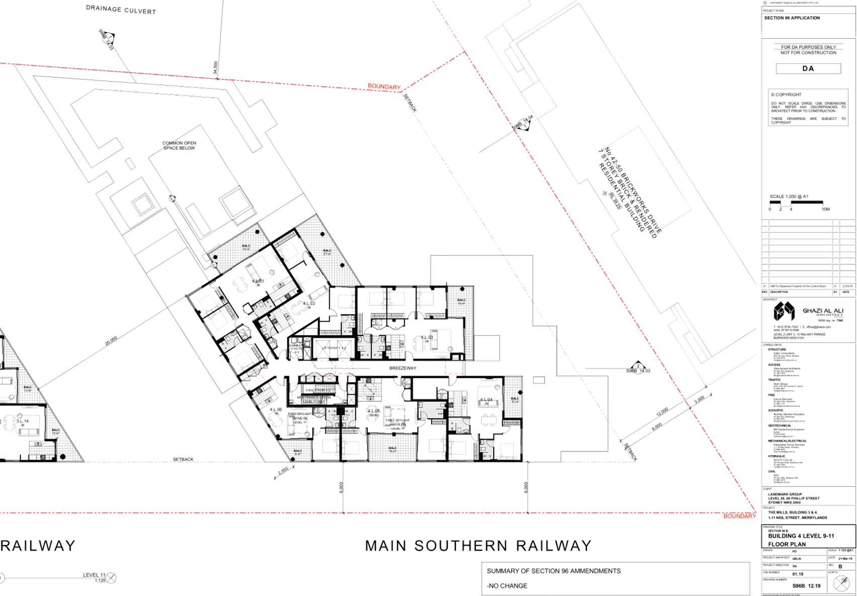
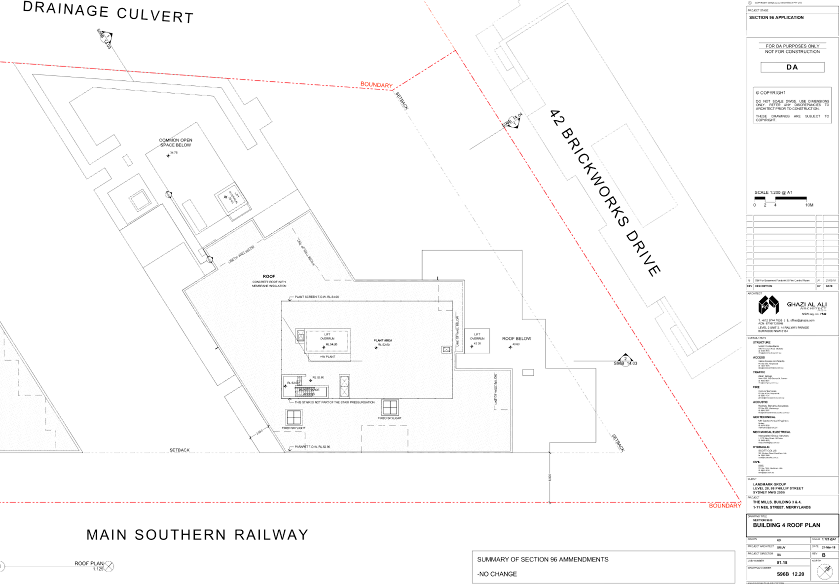
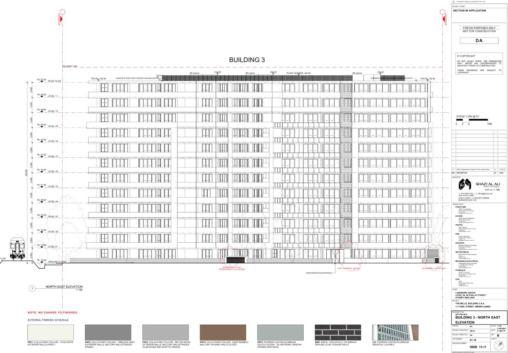
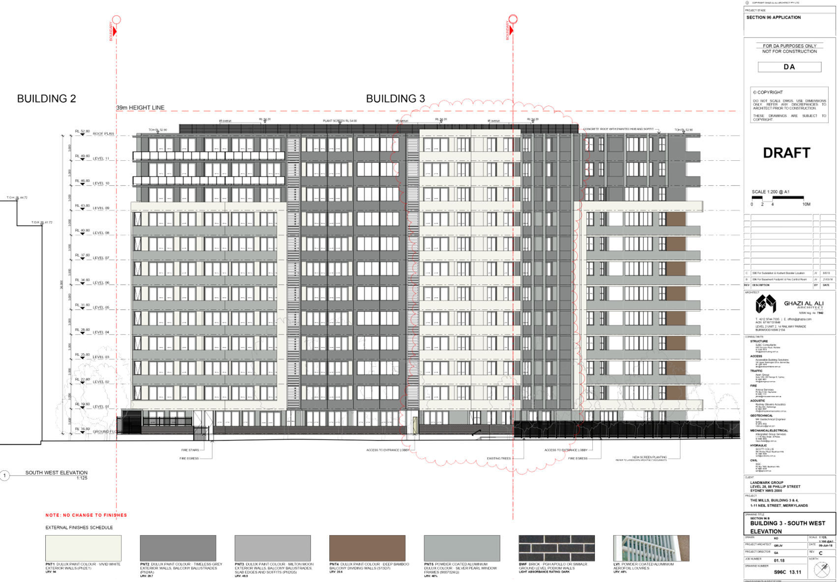
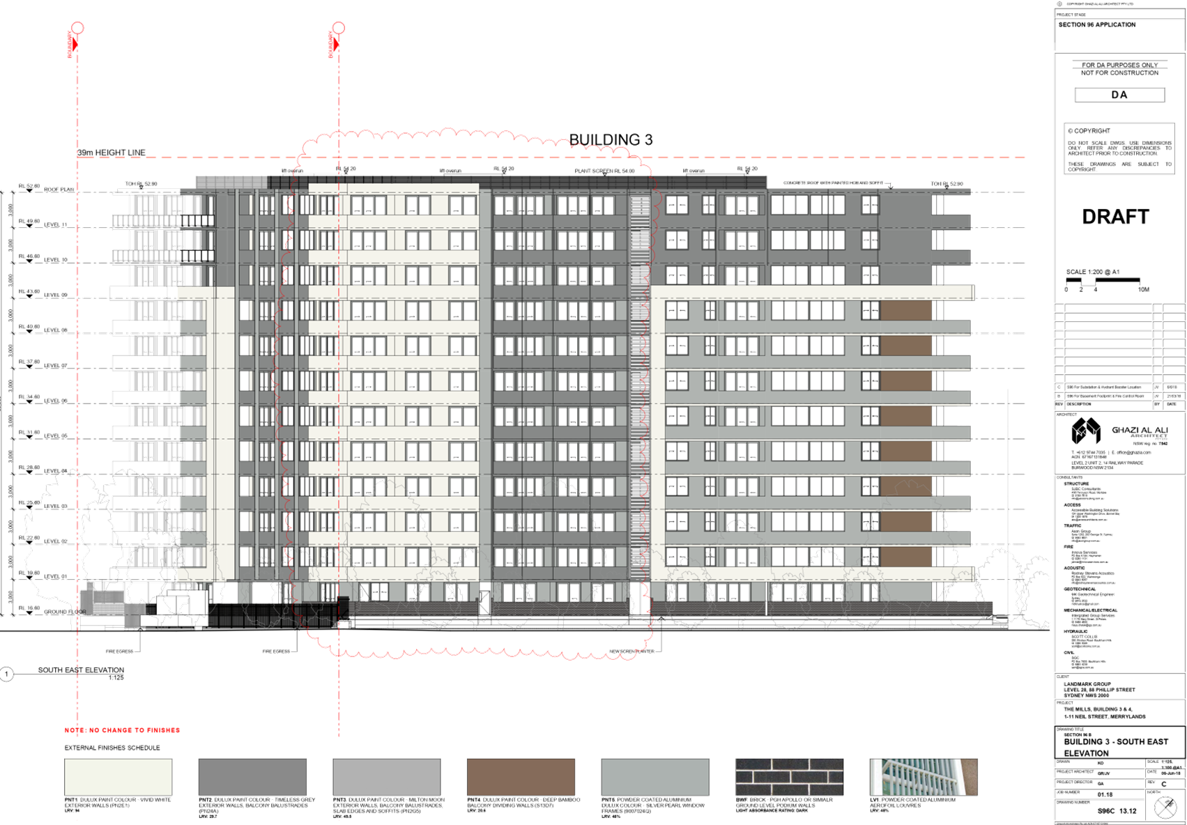
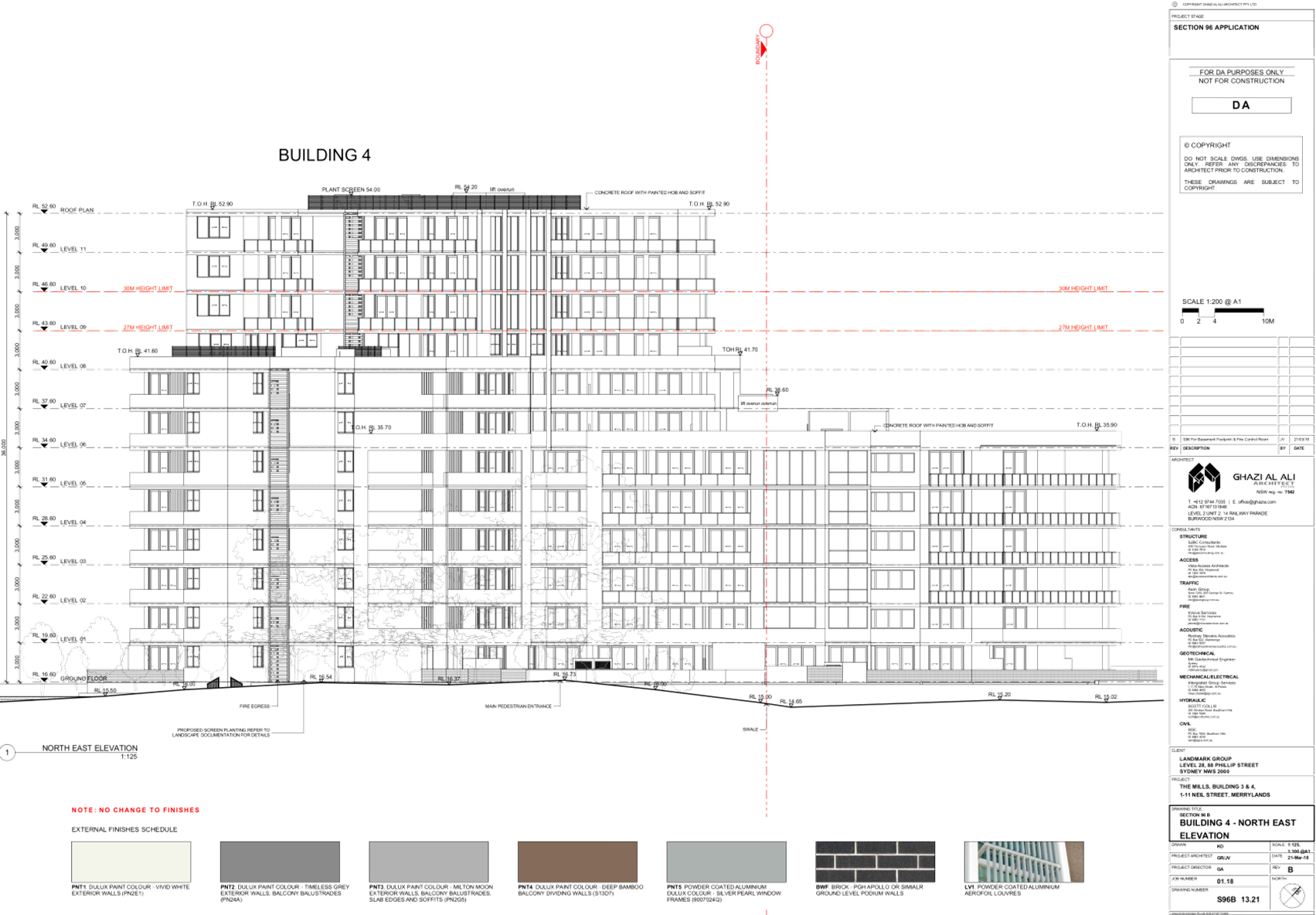
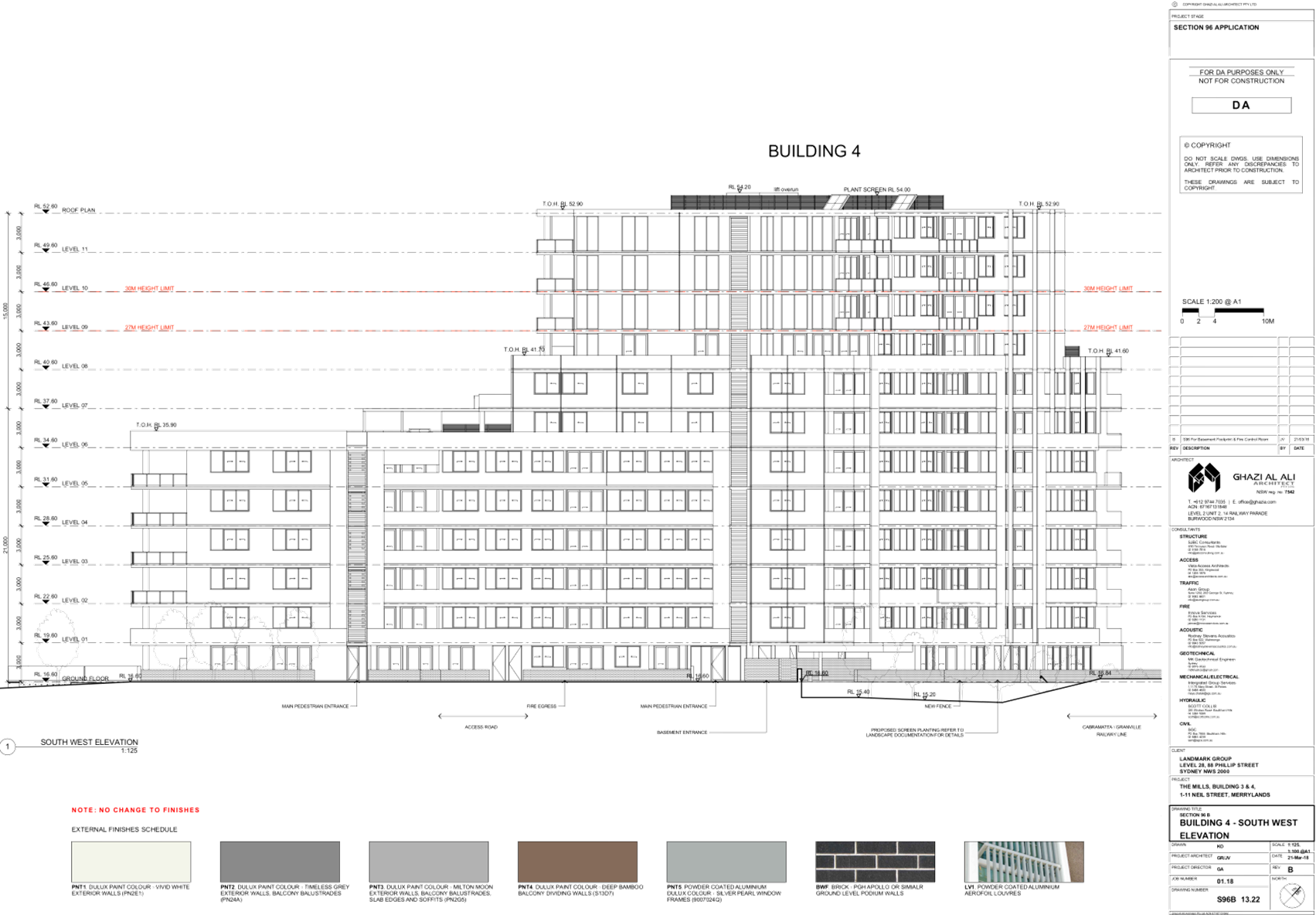
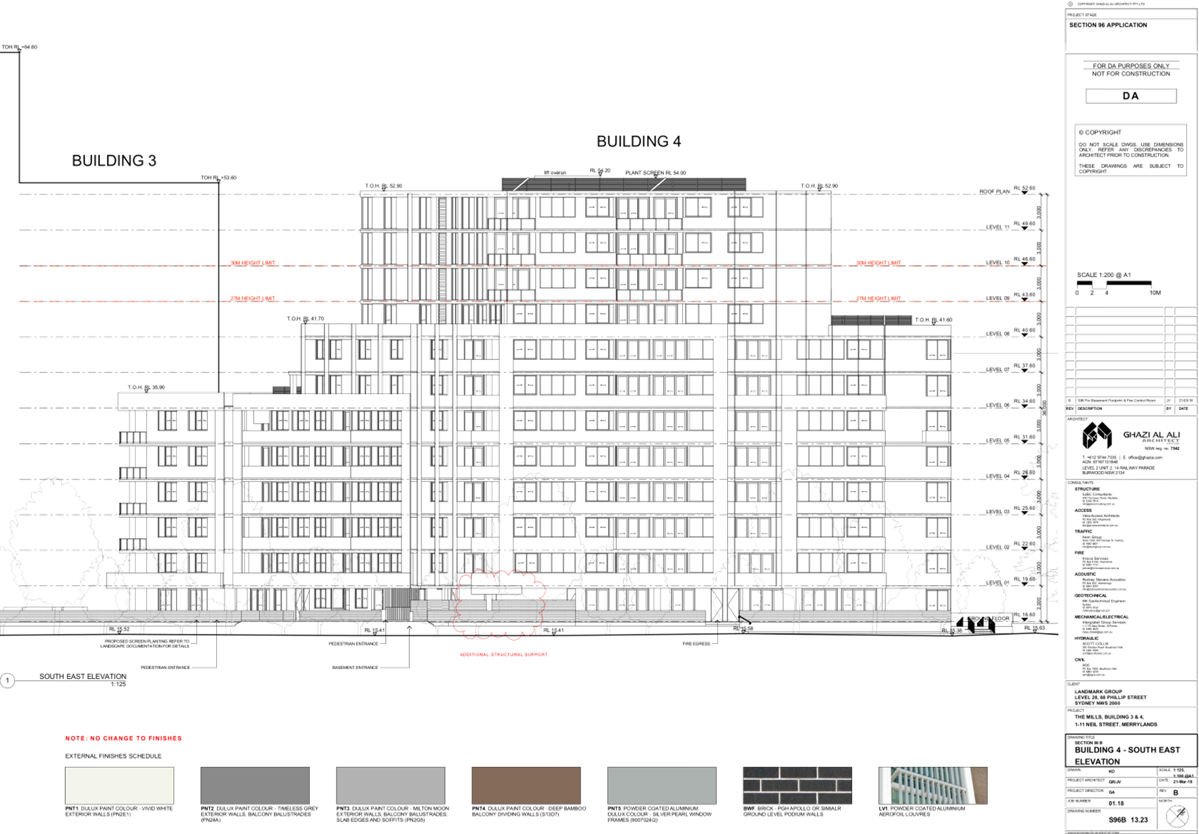
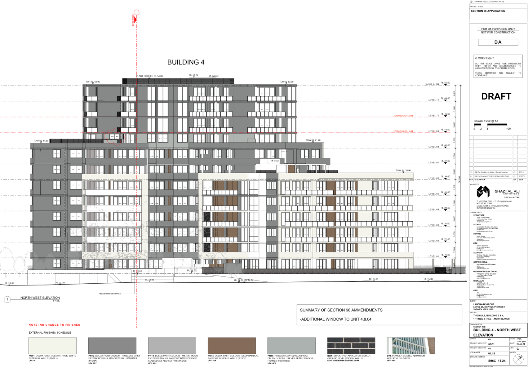
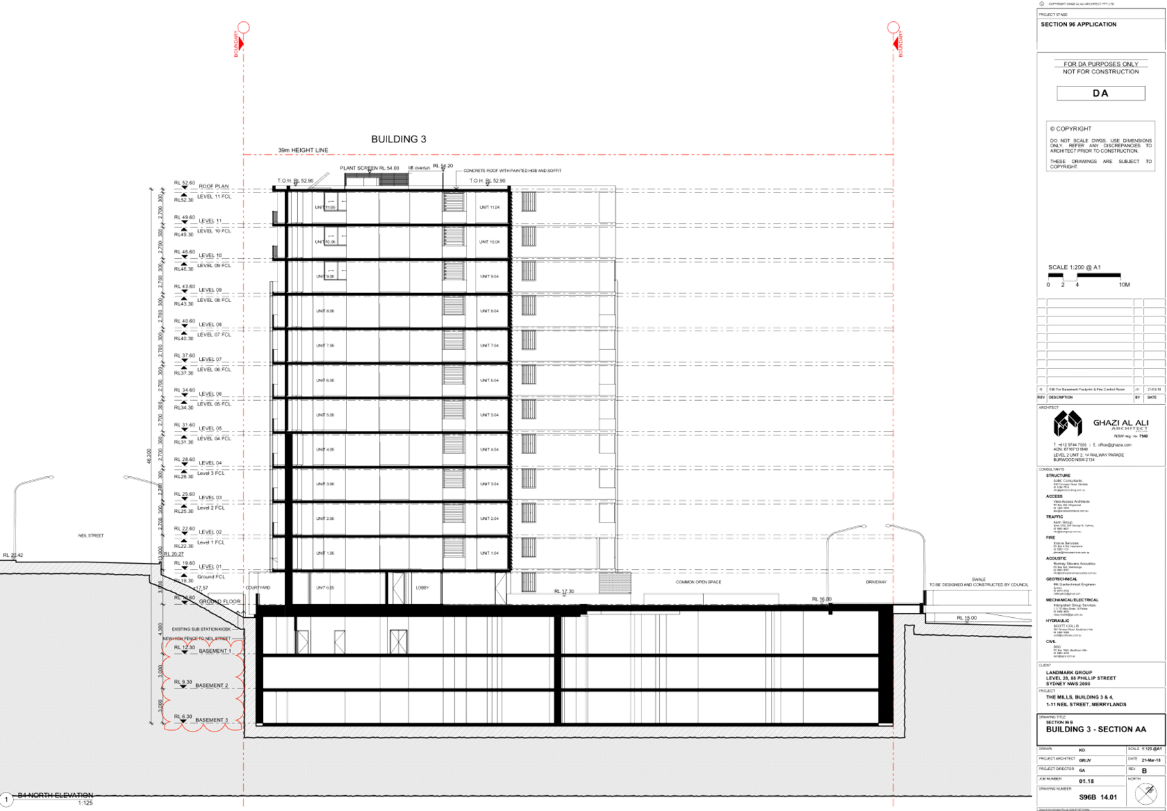
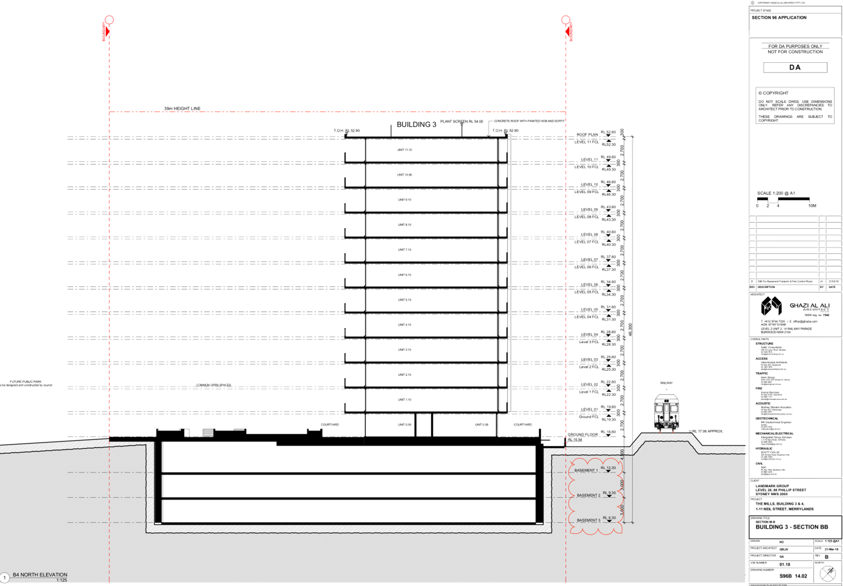
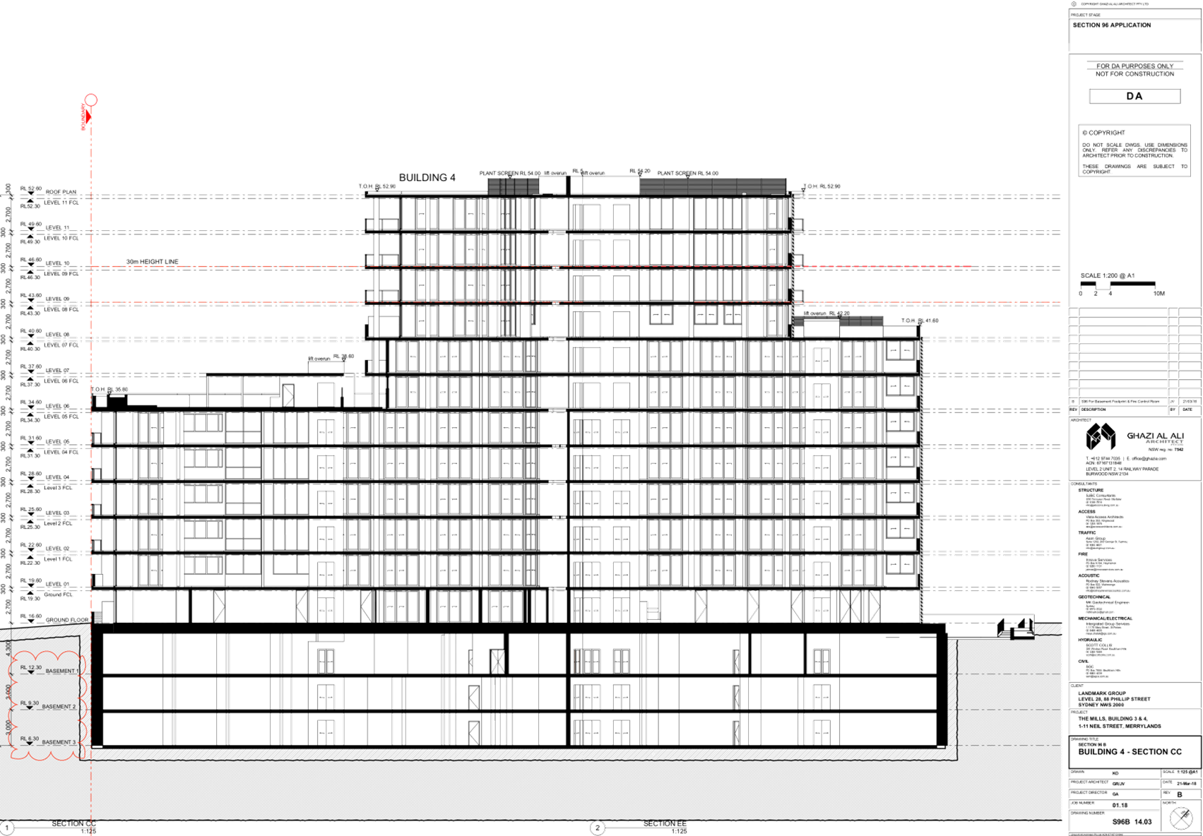
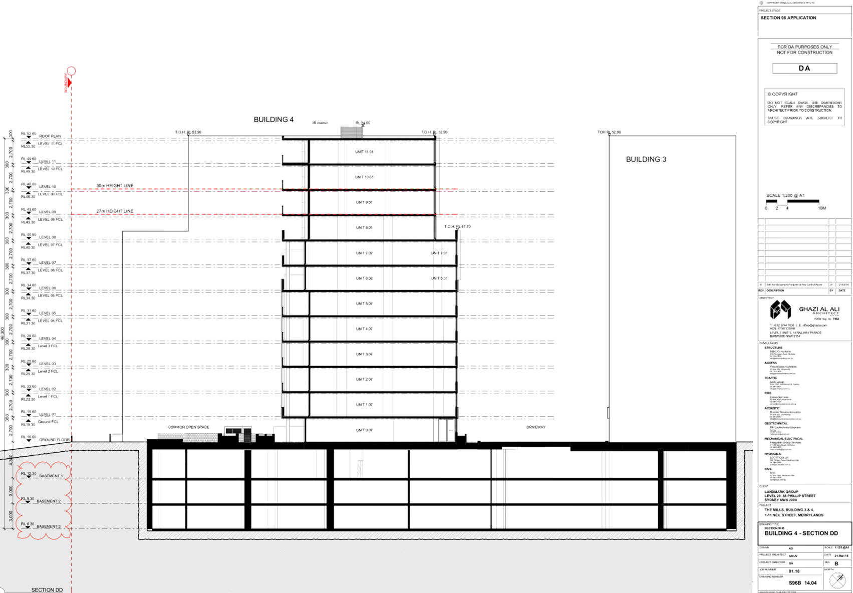
DOCUMENTS
ASSOCIATED WITH
REPORT LPP008/19
Attachment 2
Draft Notice of Determination
Cumberland Local Planning Panel Meeting
13 March 2019
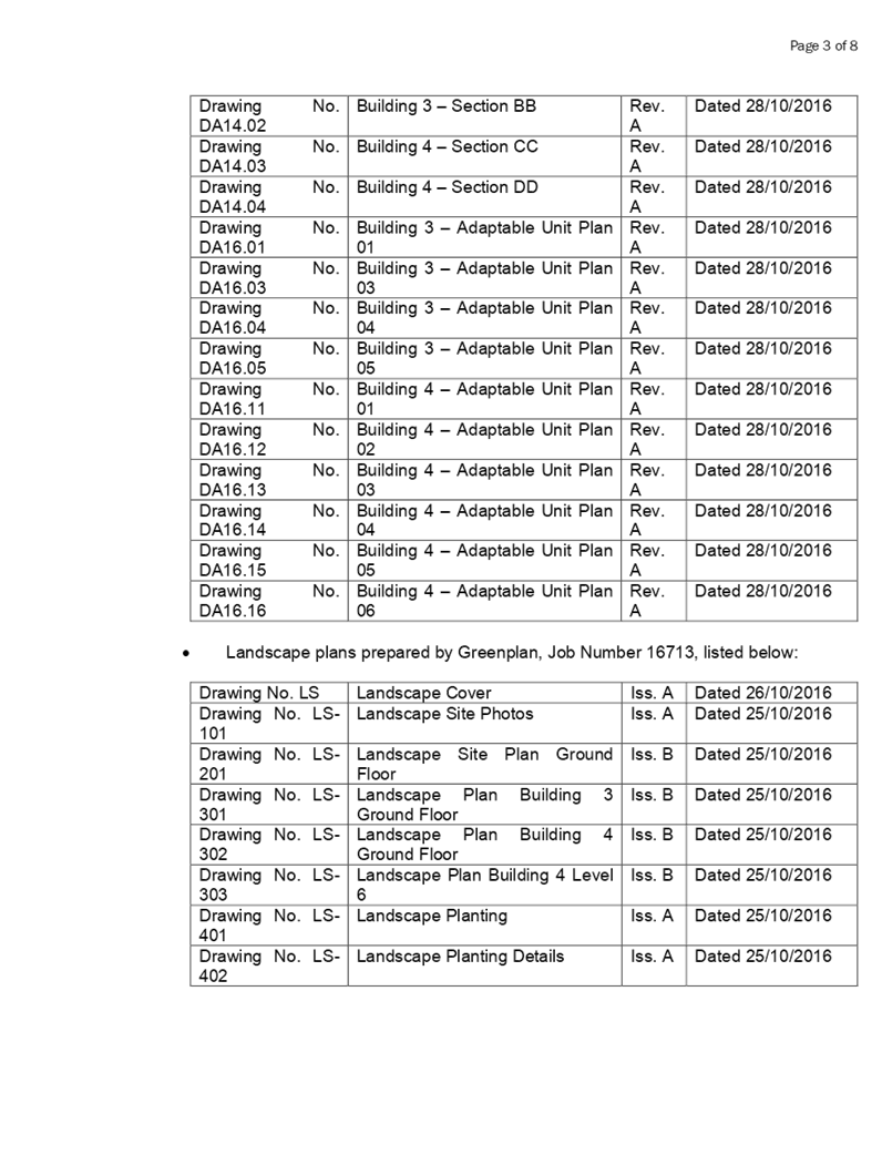
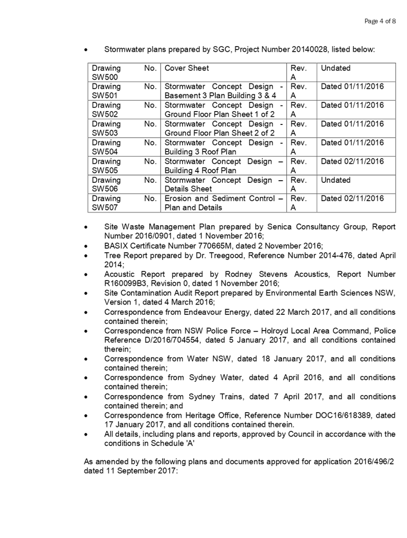
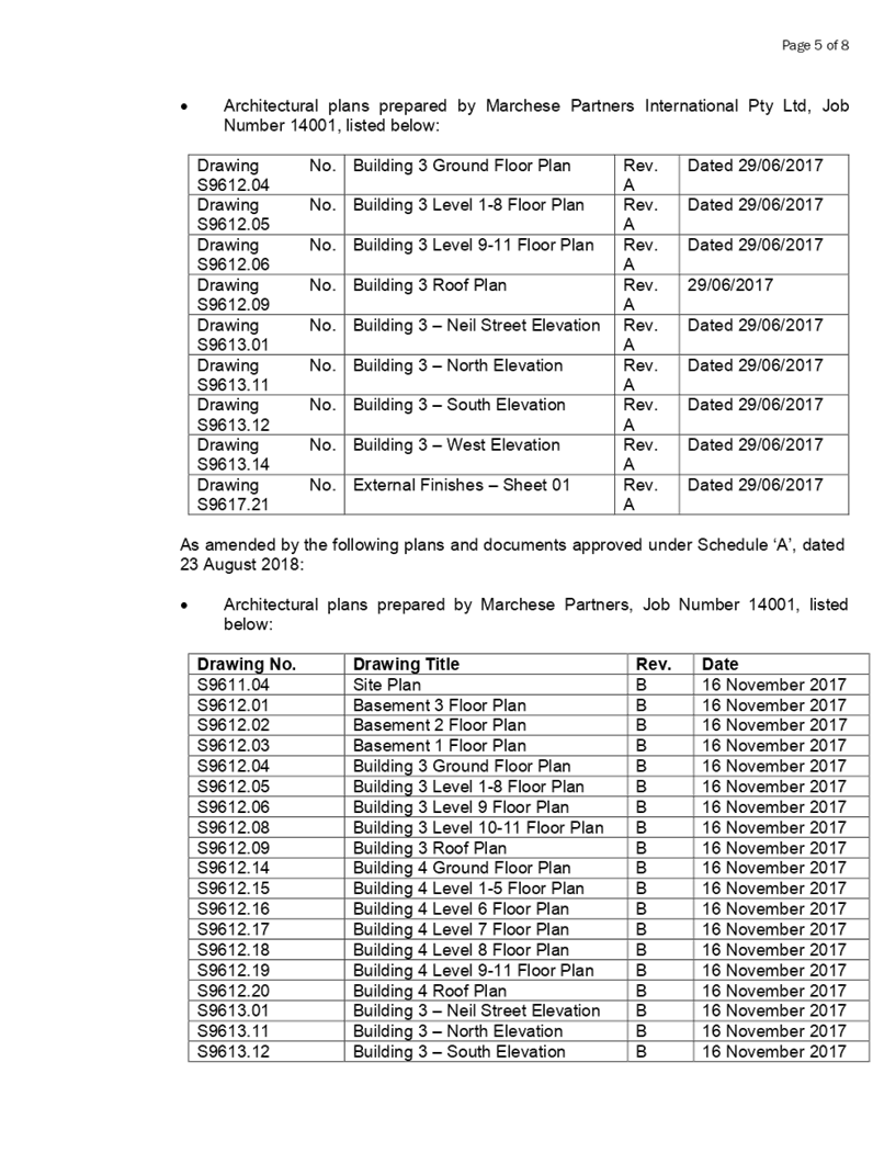
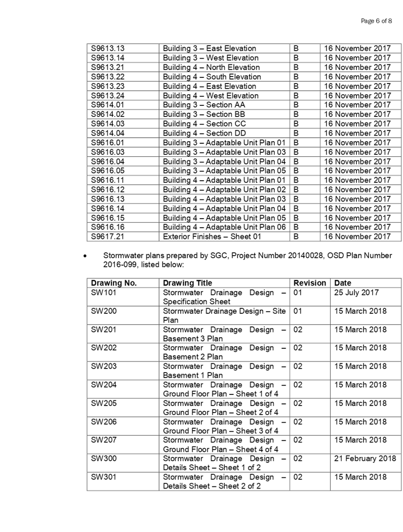
DOCUMENTS
ASSOCIATED WITH
REPORT LPP008/19
Attachment 3
SEPP 65 Apartment Design Guide Compliance Assessment
Cumberland Local Planning Panel Meeting
13 March 2019
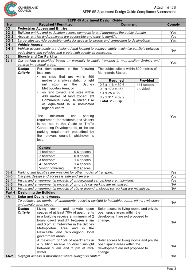
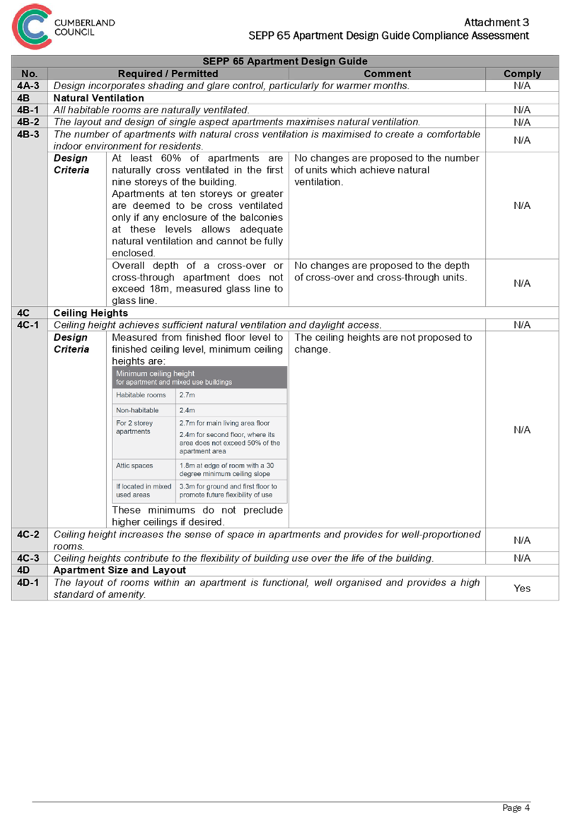
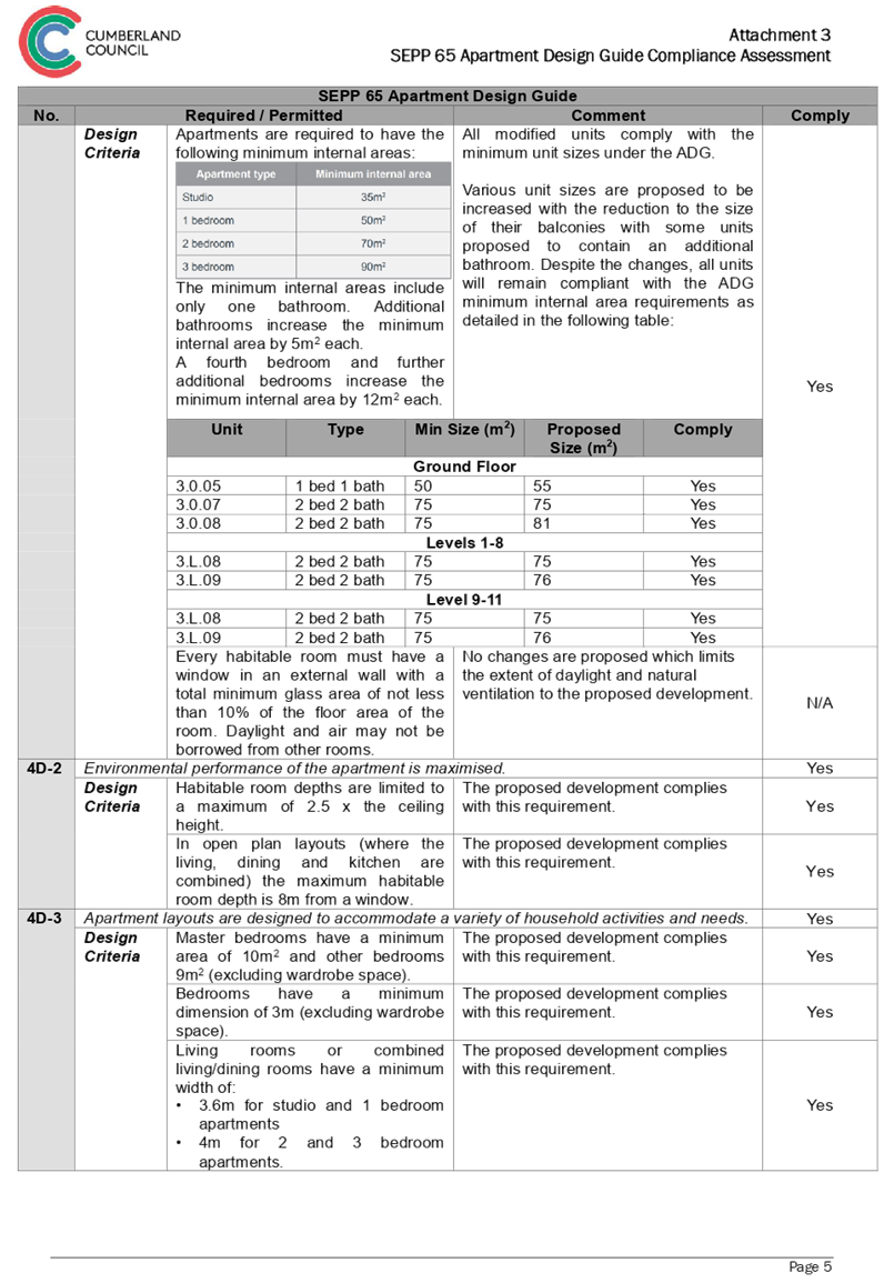
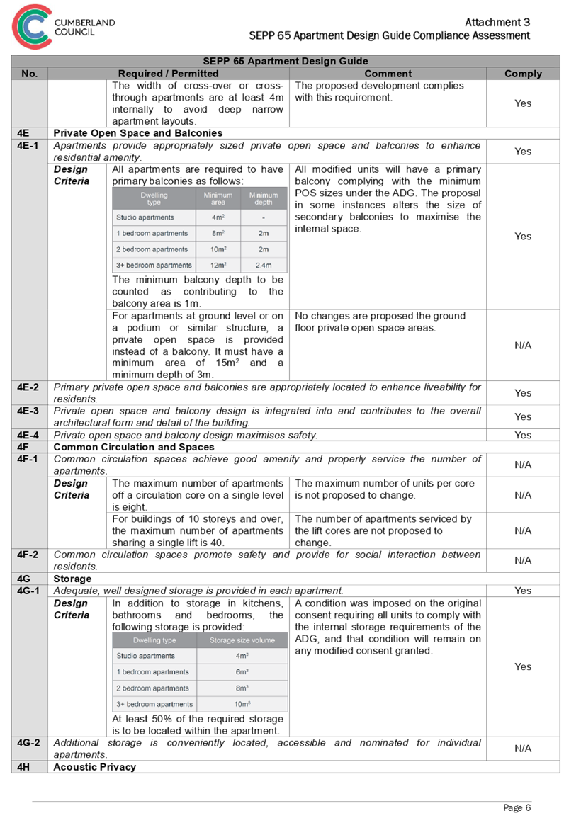
DOCUMENTS
ASSOCIATED WITH
REPORT LPP008/19
Attachment 4
Holroyd Local Environmental Plan 2013 Compliance
Assessment
Cumberland Local Planning Panel Meeting
13 March 2019
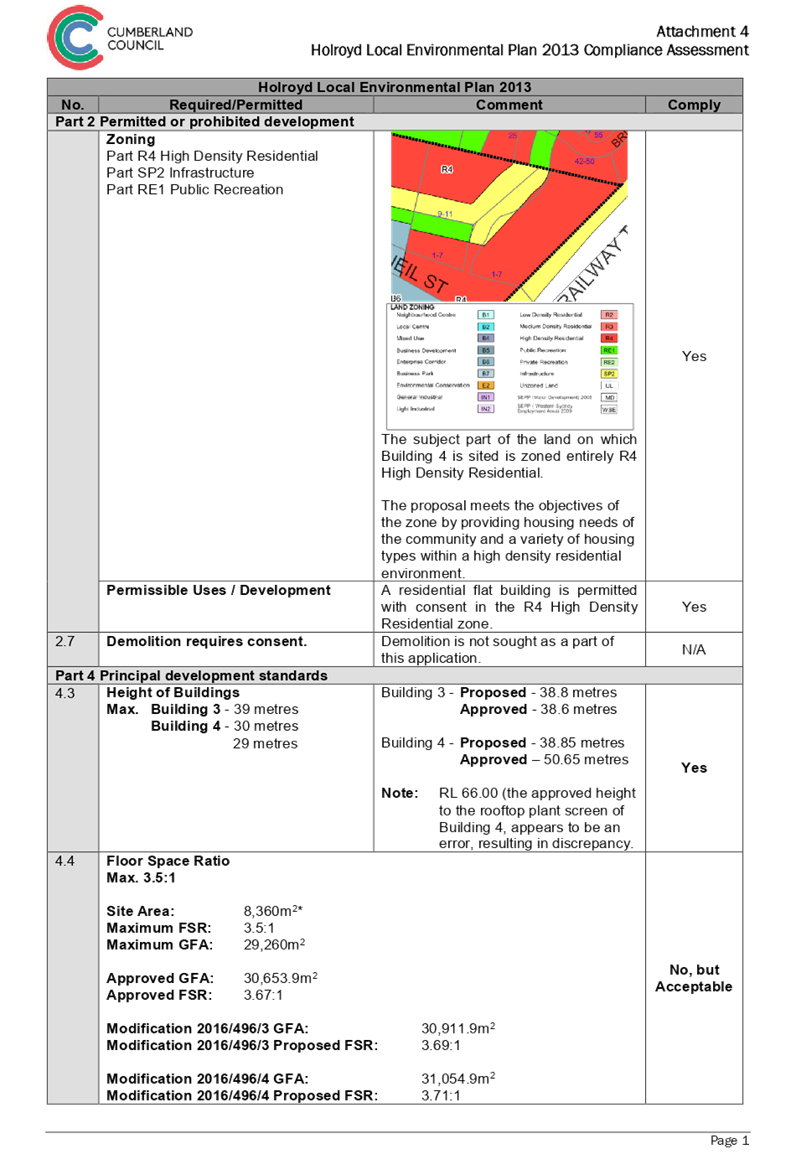
DOCUMENTS
ASSOCIATED WITH
REPORT LPP008/19
Attachment 5
Holroyd Development Control Plan 2013 Compliance
Assessment
Cumberland Local Planning Panel Meeting
13 March 2019
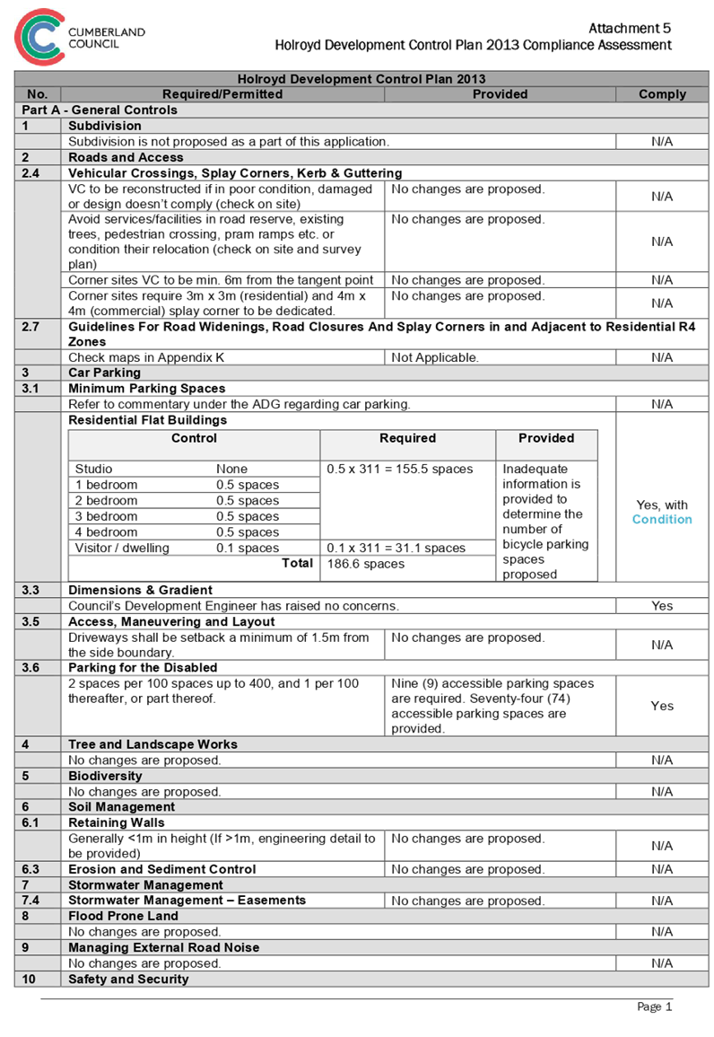
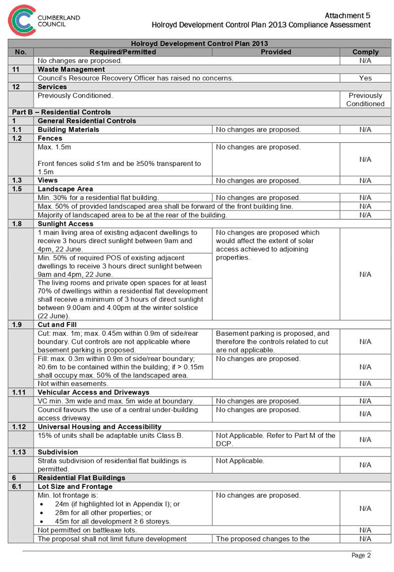
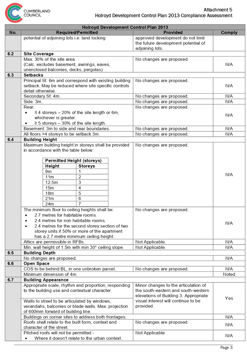
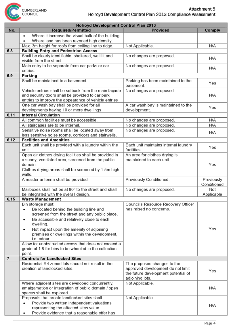
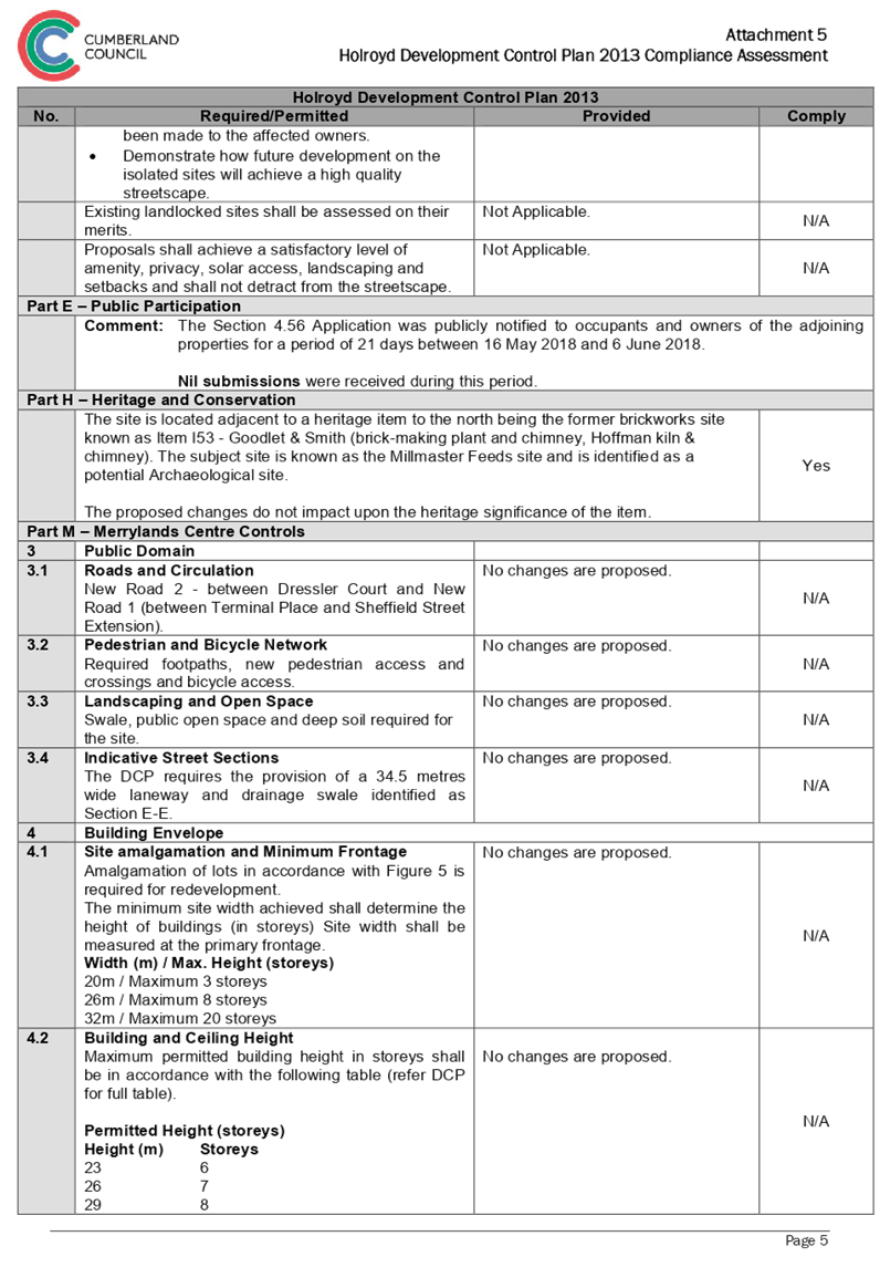
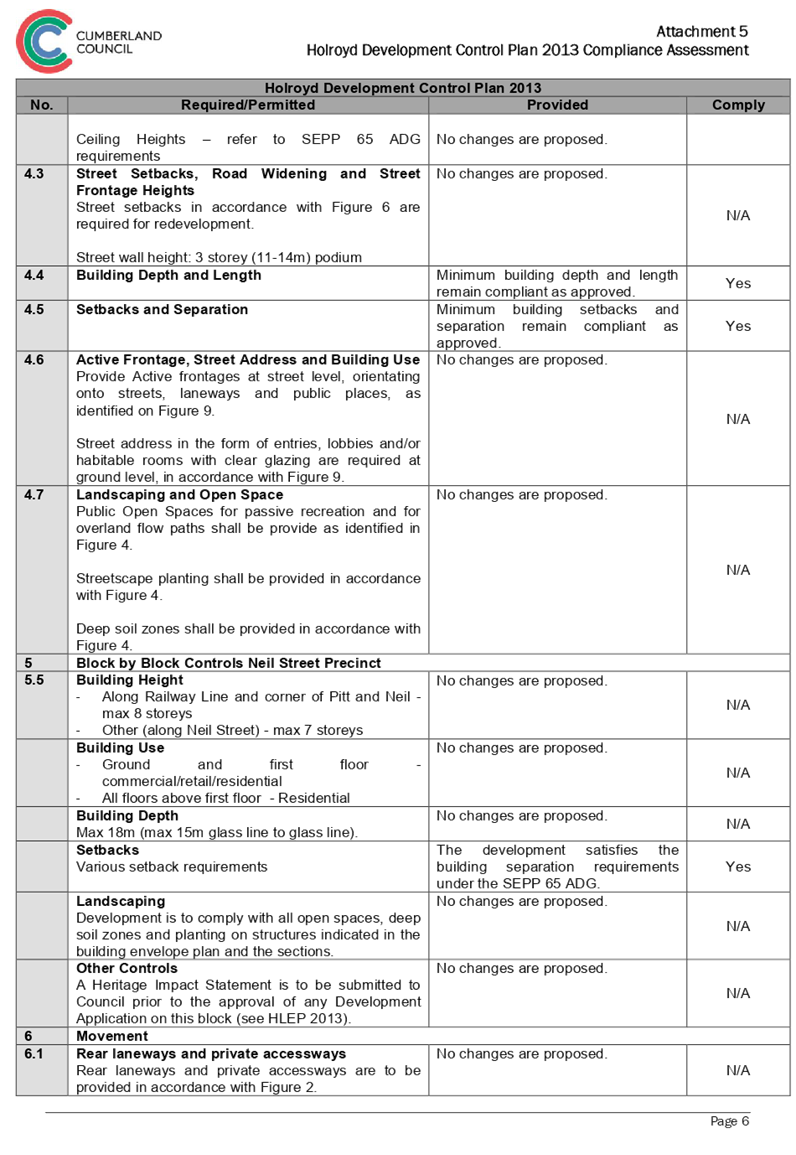
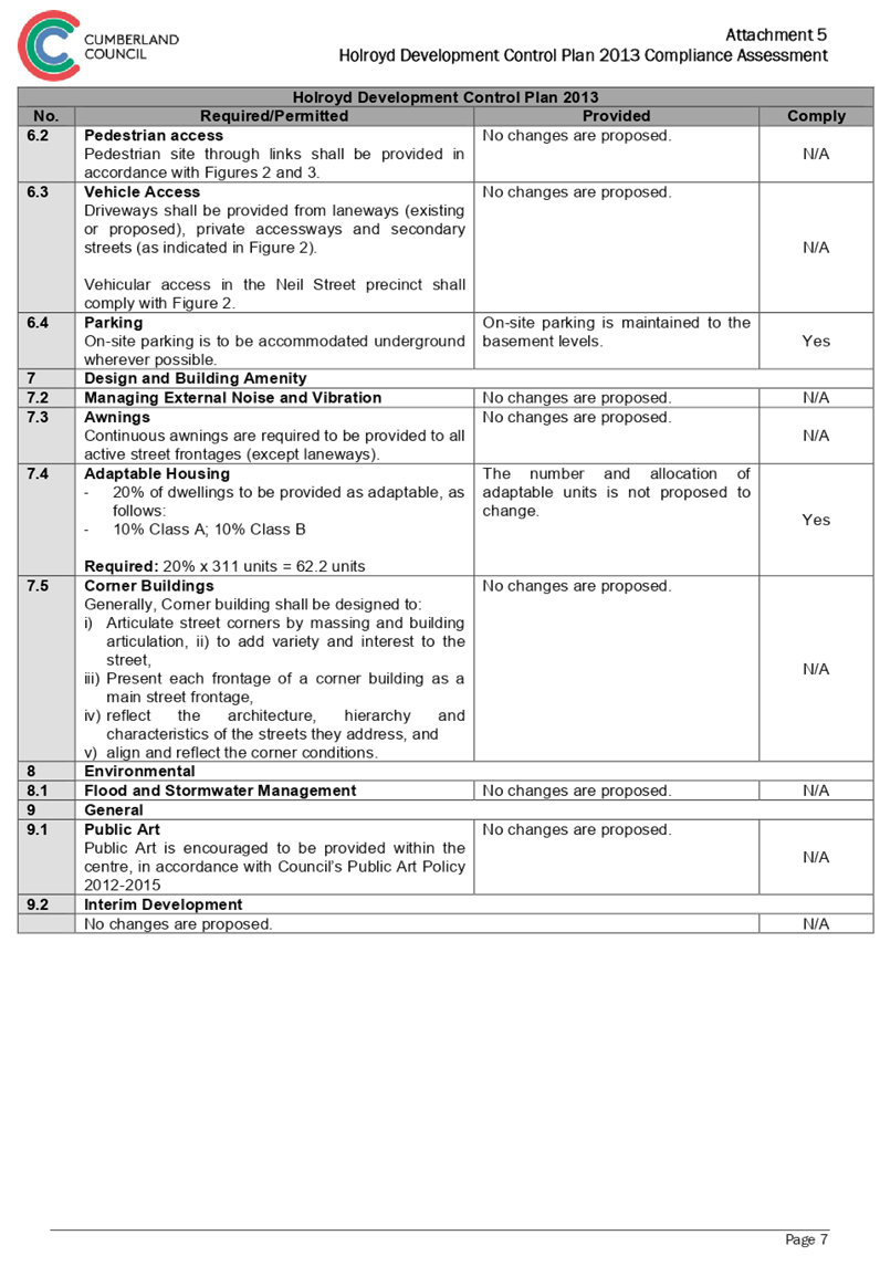
DOCUMENTS
ASSOCIATED WITH
REPORT LPP008/19
Attachment 6
Development Consent 2016/496/1
Cumberland Local Planning Panel Meeting
13 March 2019
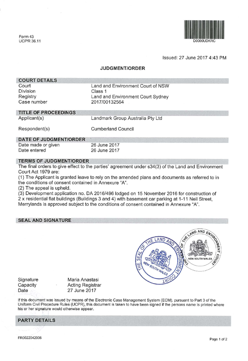


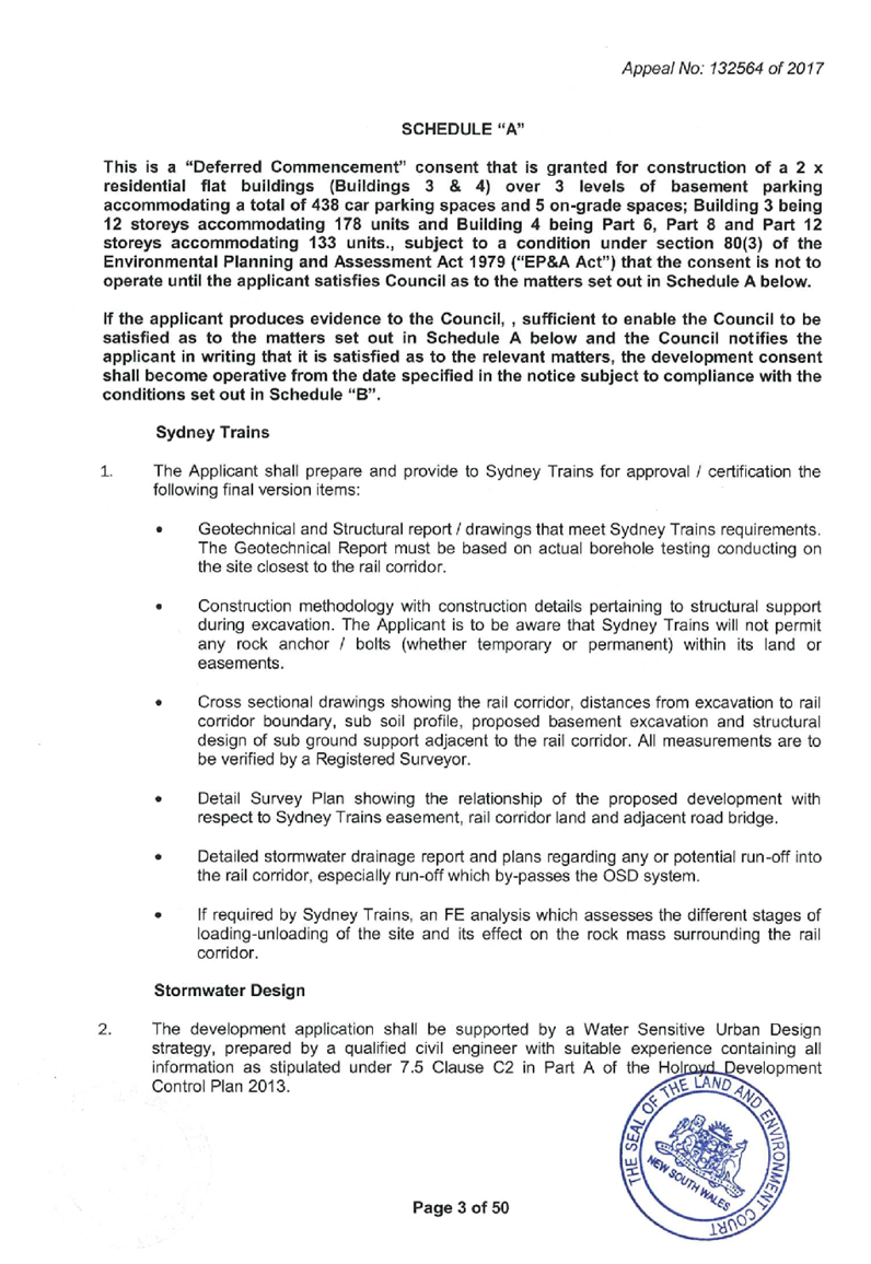


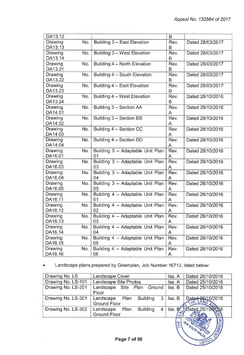
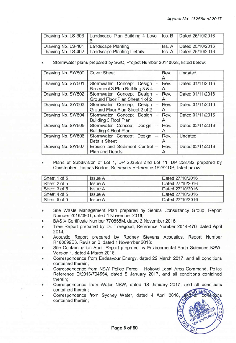
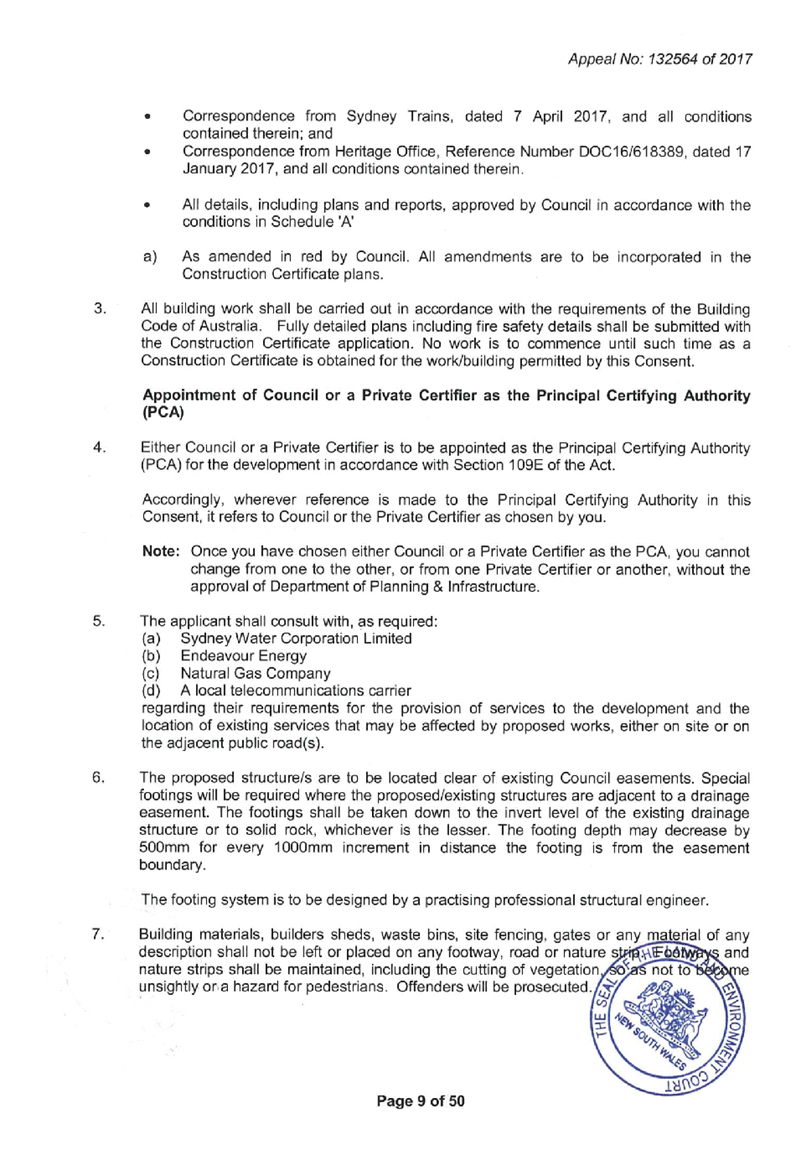


DOCUMENTS
ASSOCIATED WITH
REPORT LPP008/19
Attachment 7
Endorsed Architectural Plans for Development Consent
2016/496/1
Cumberland Local Planning Panel Meeting
13 March 2019

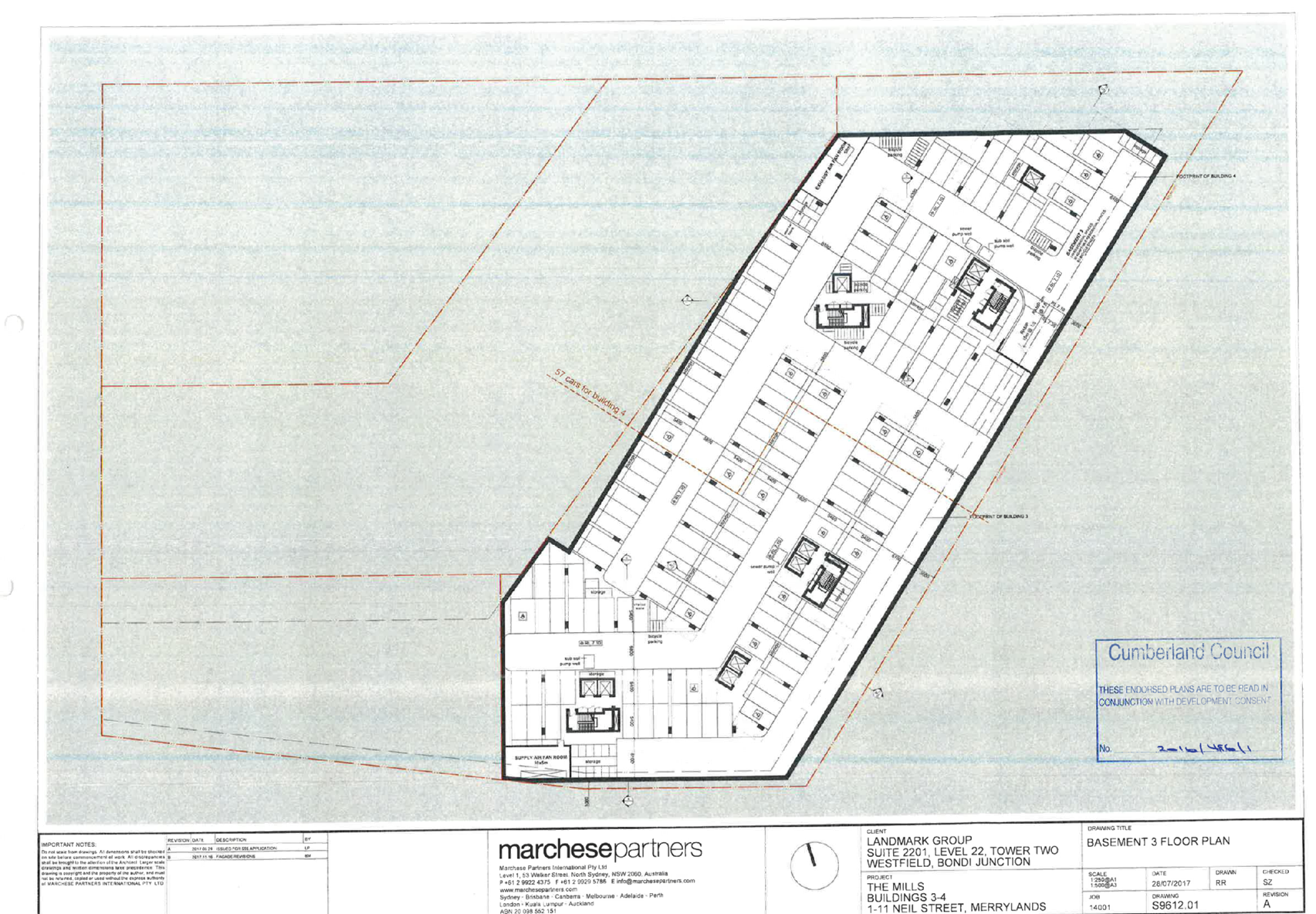
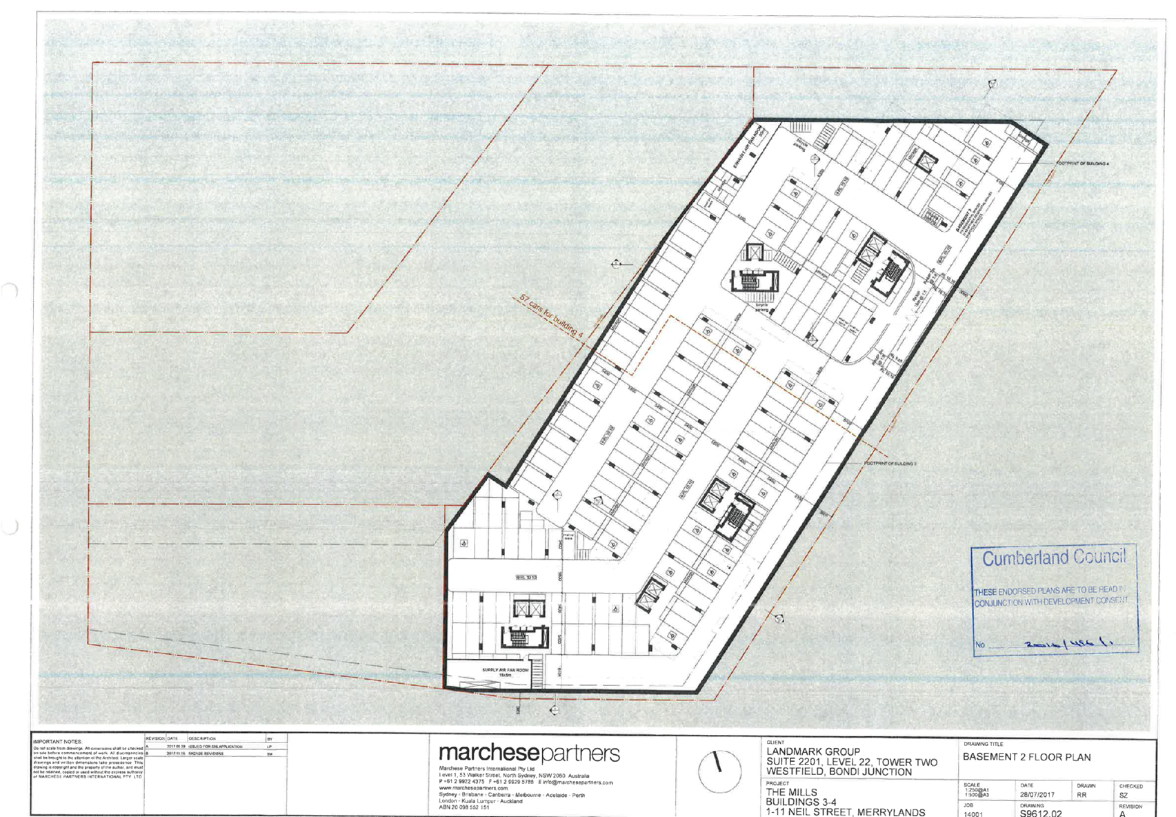
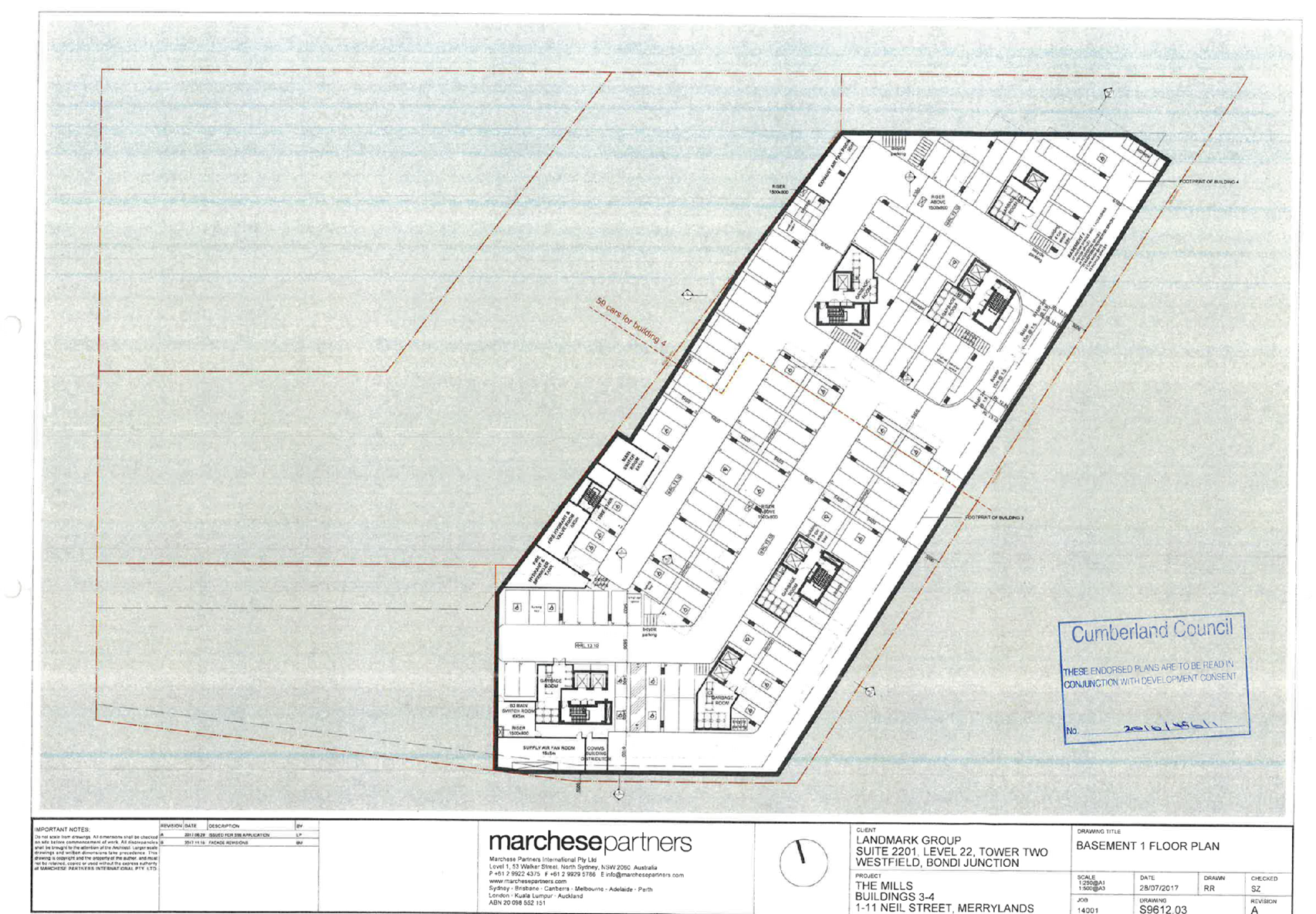
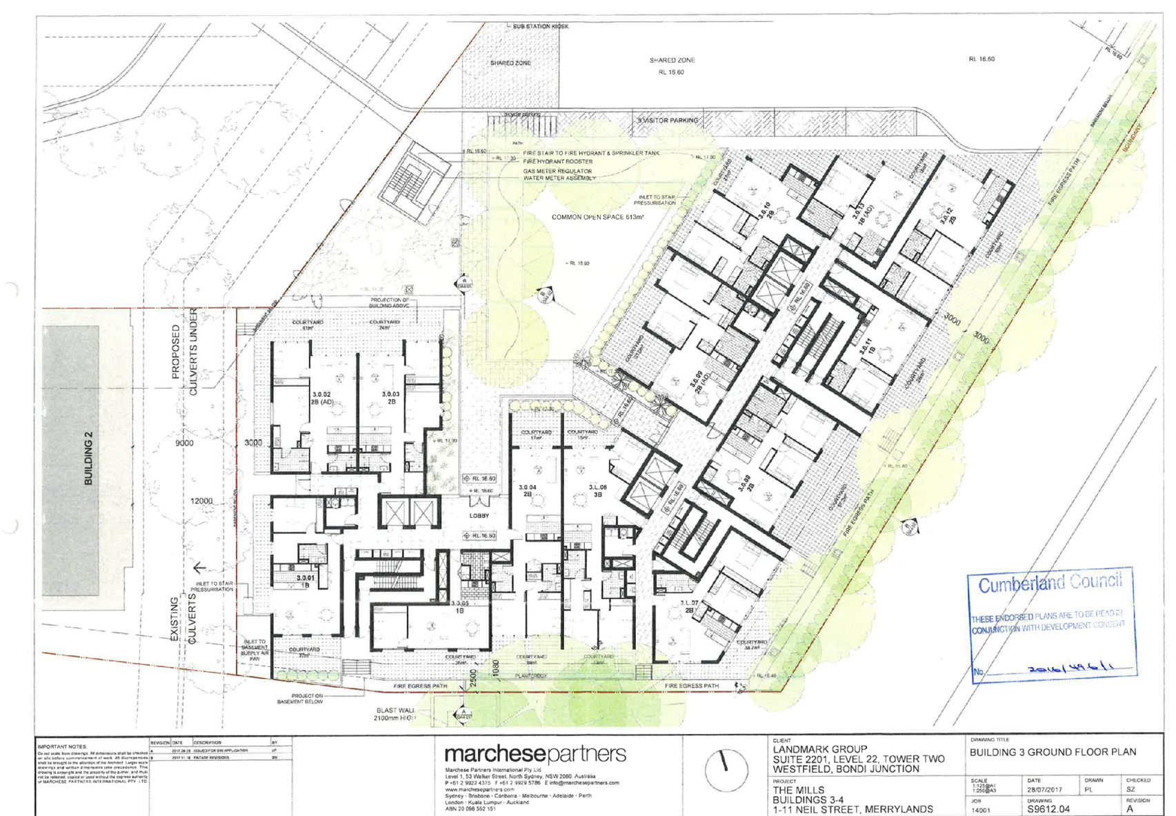
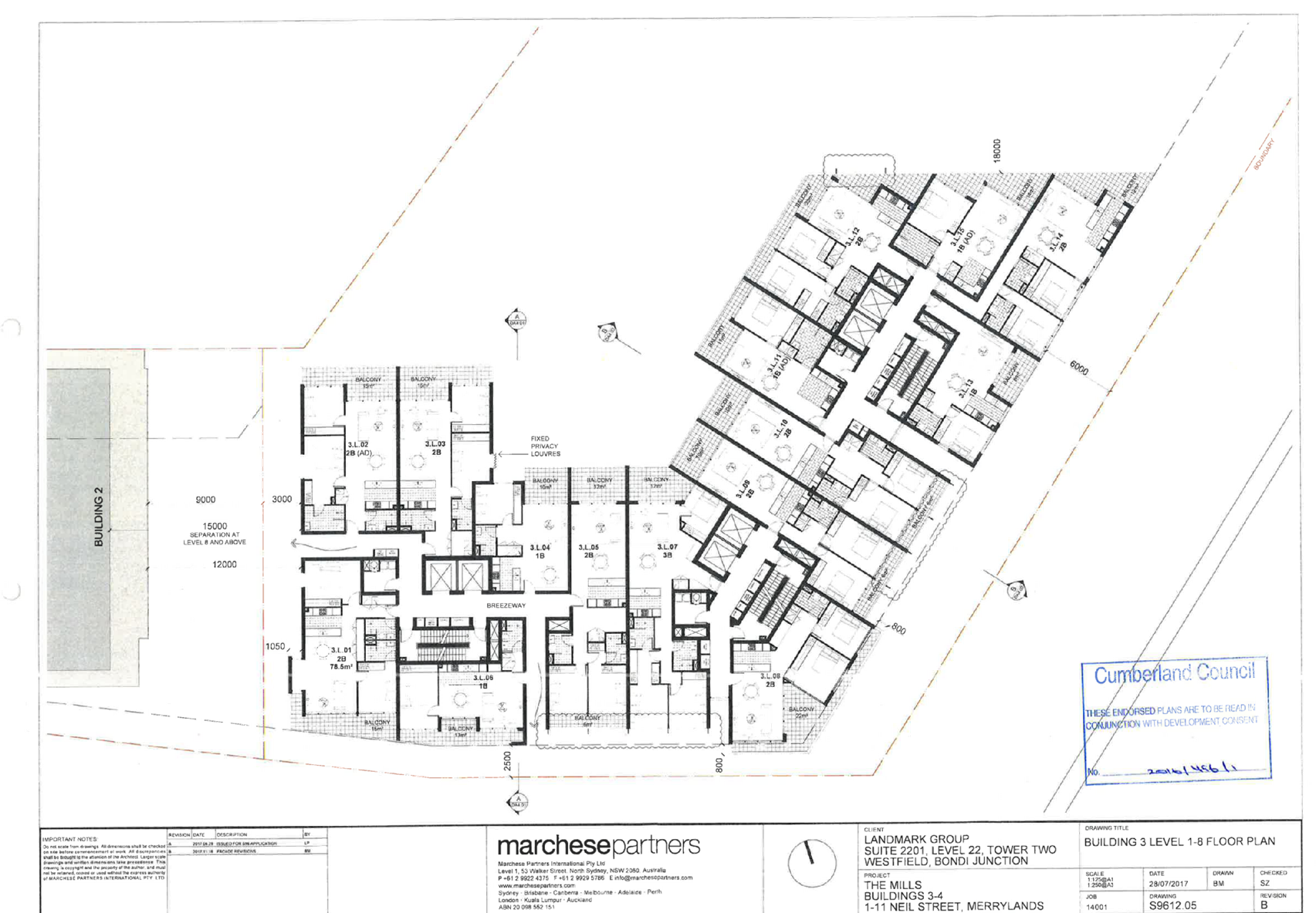


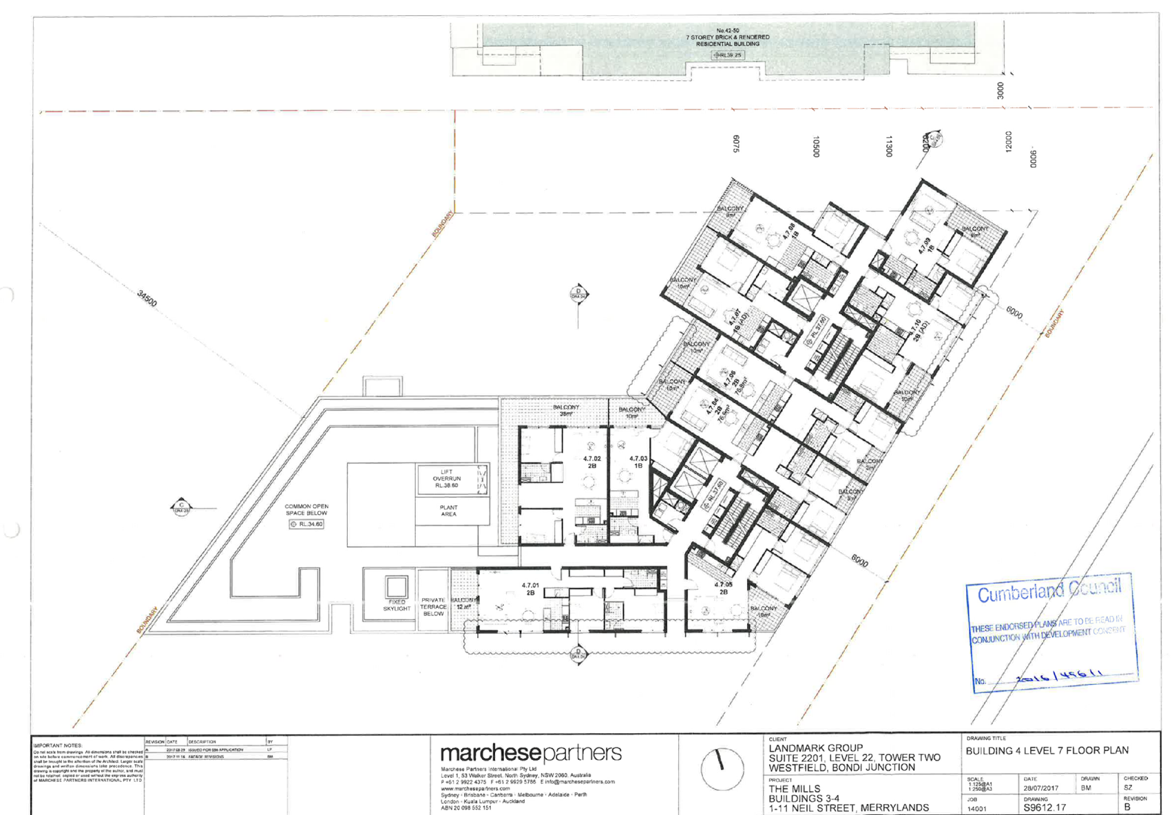
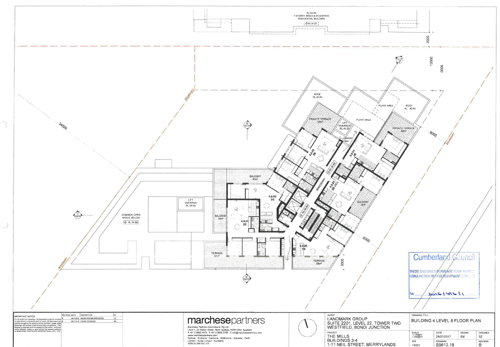


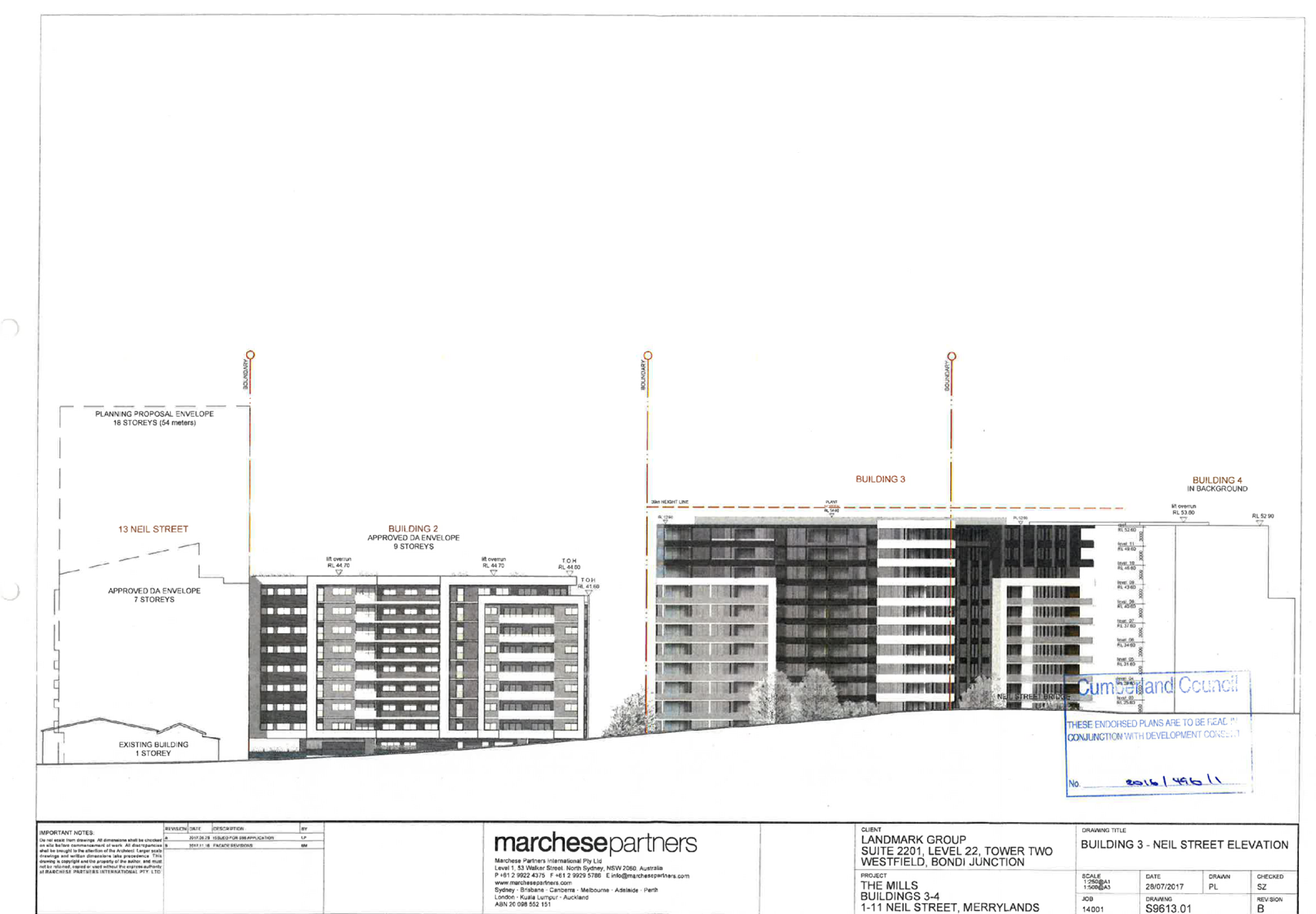
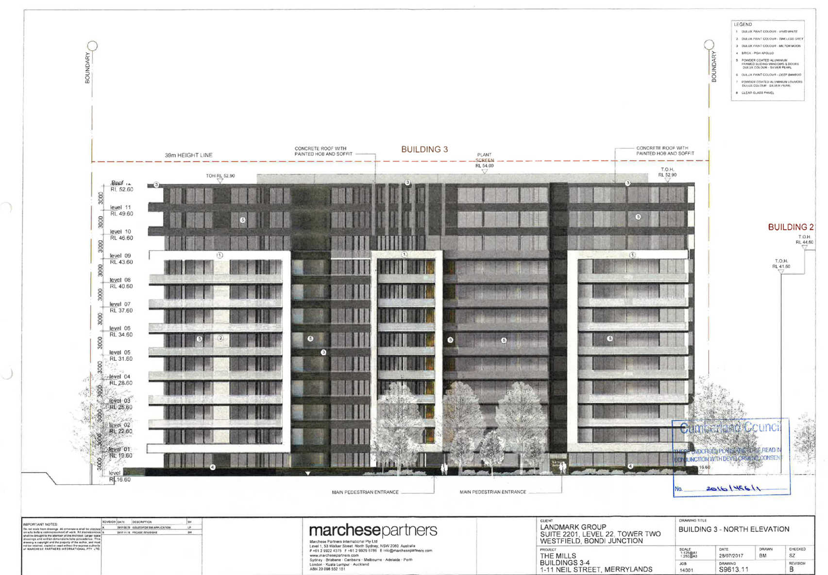
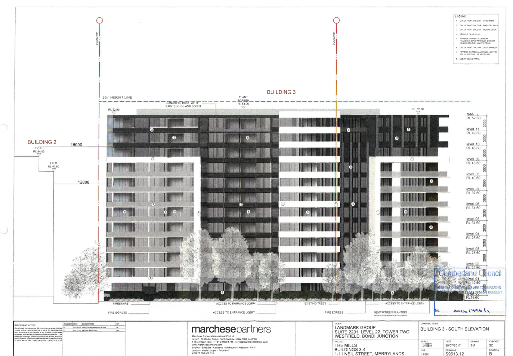
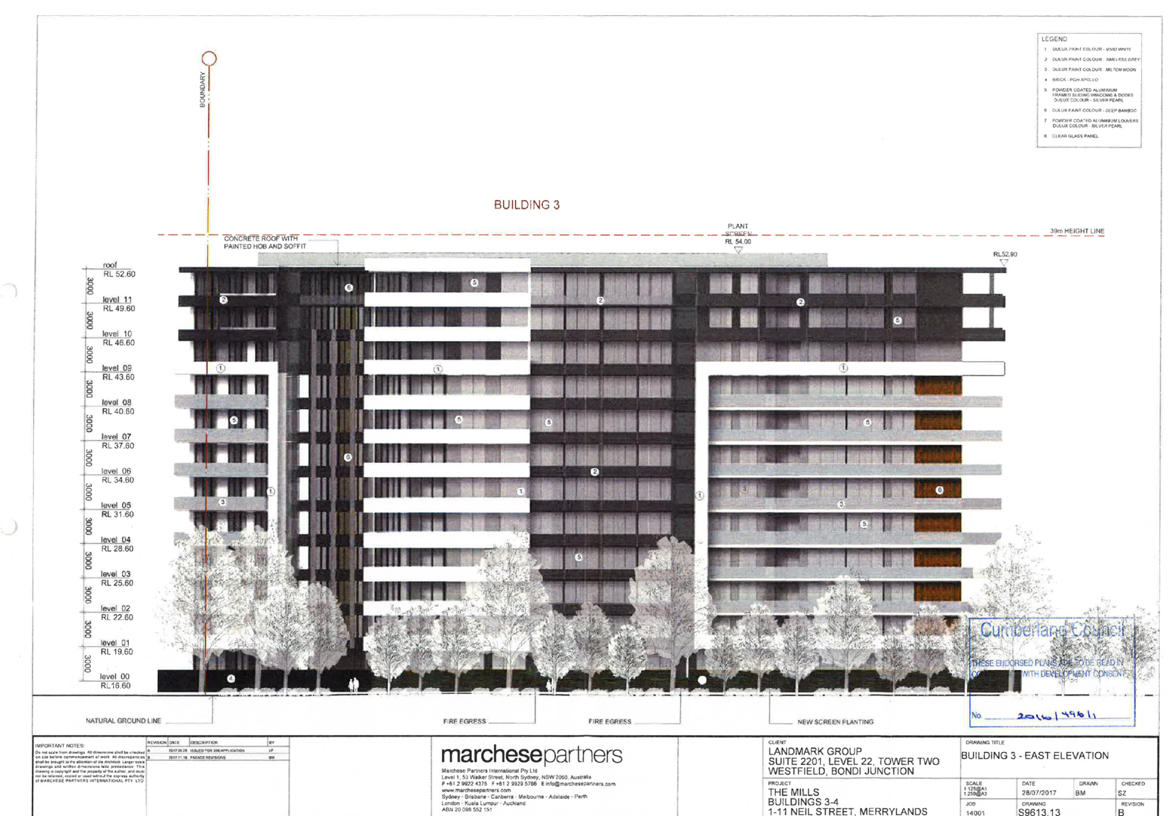
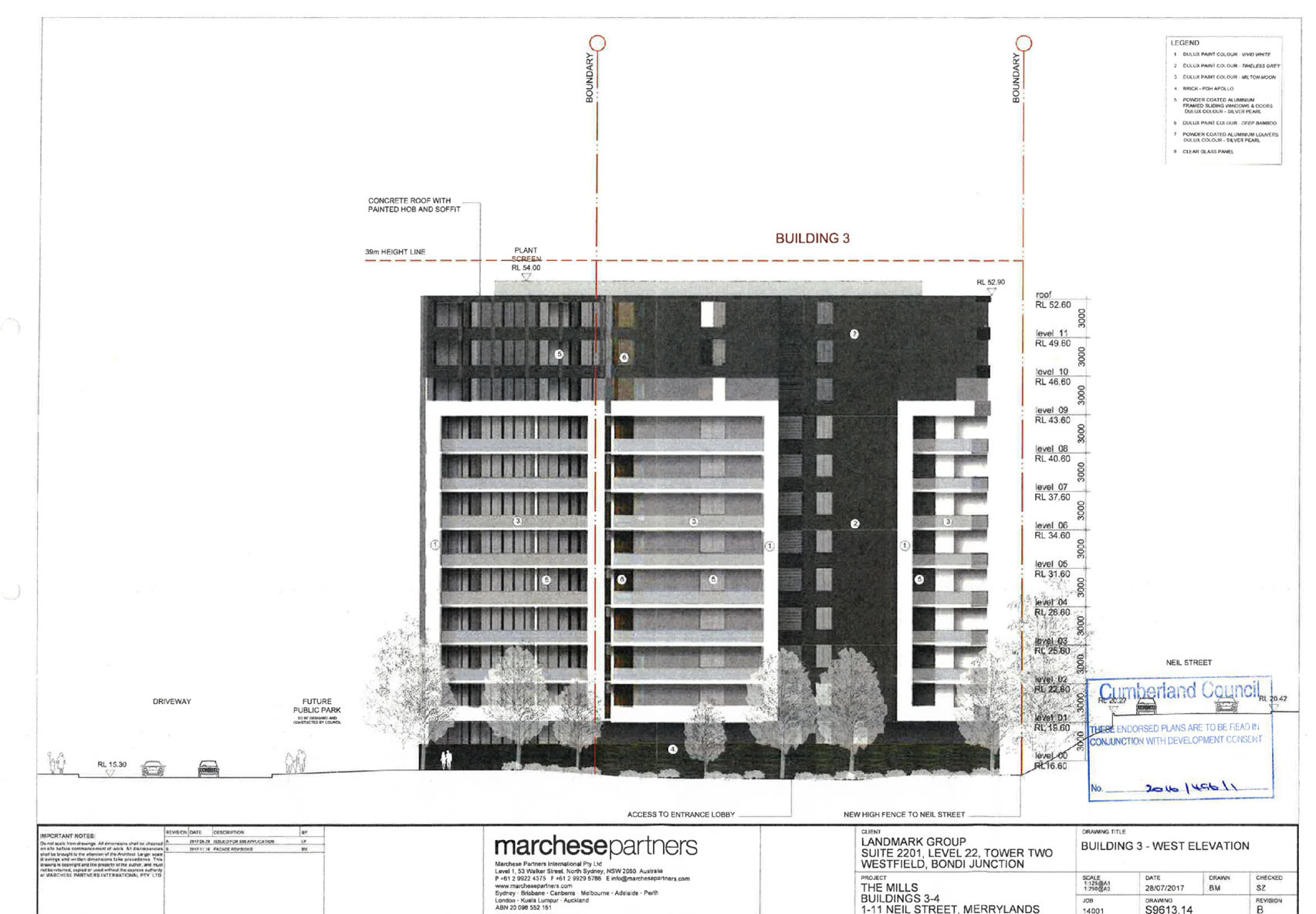

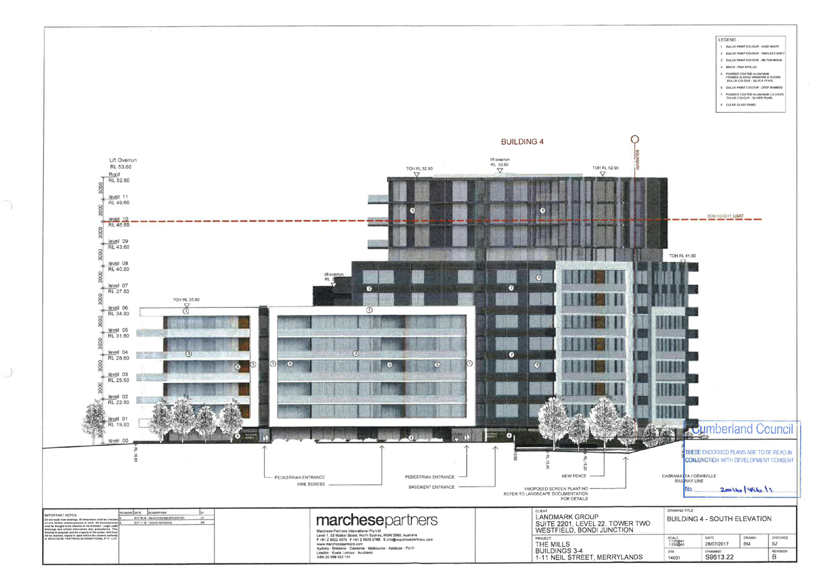

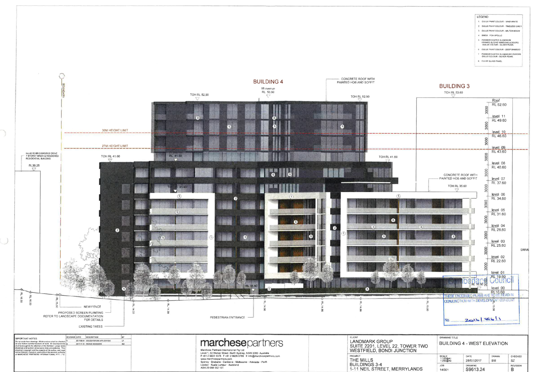
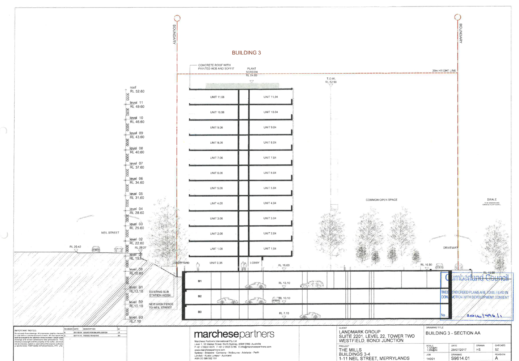
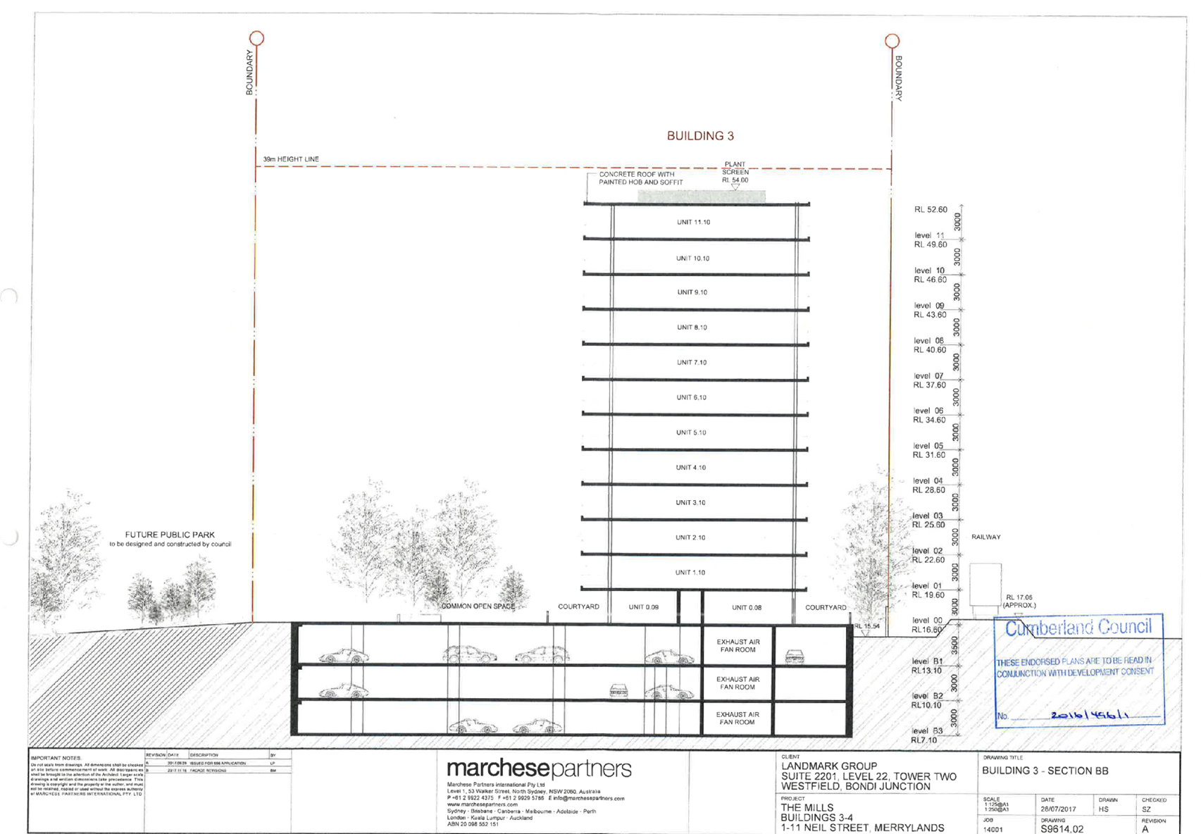
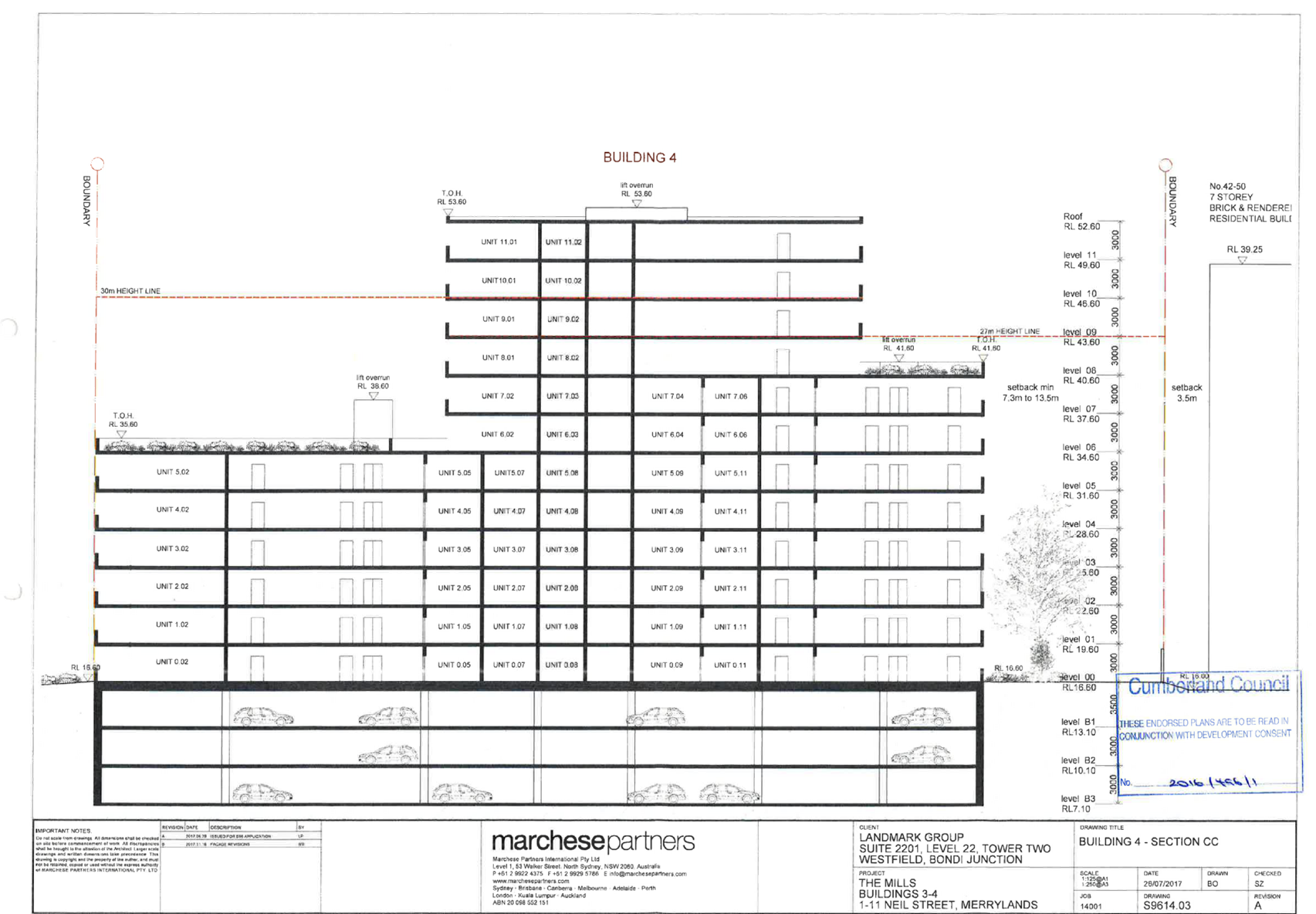


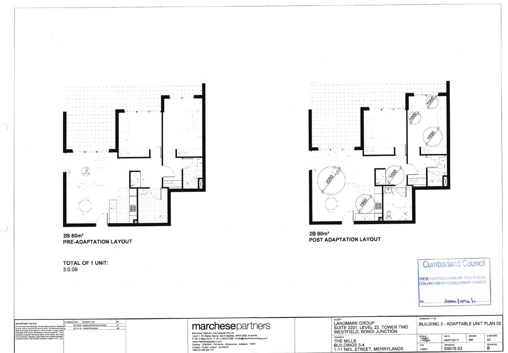
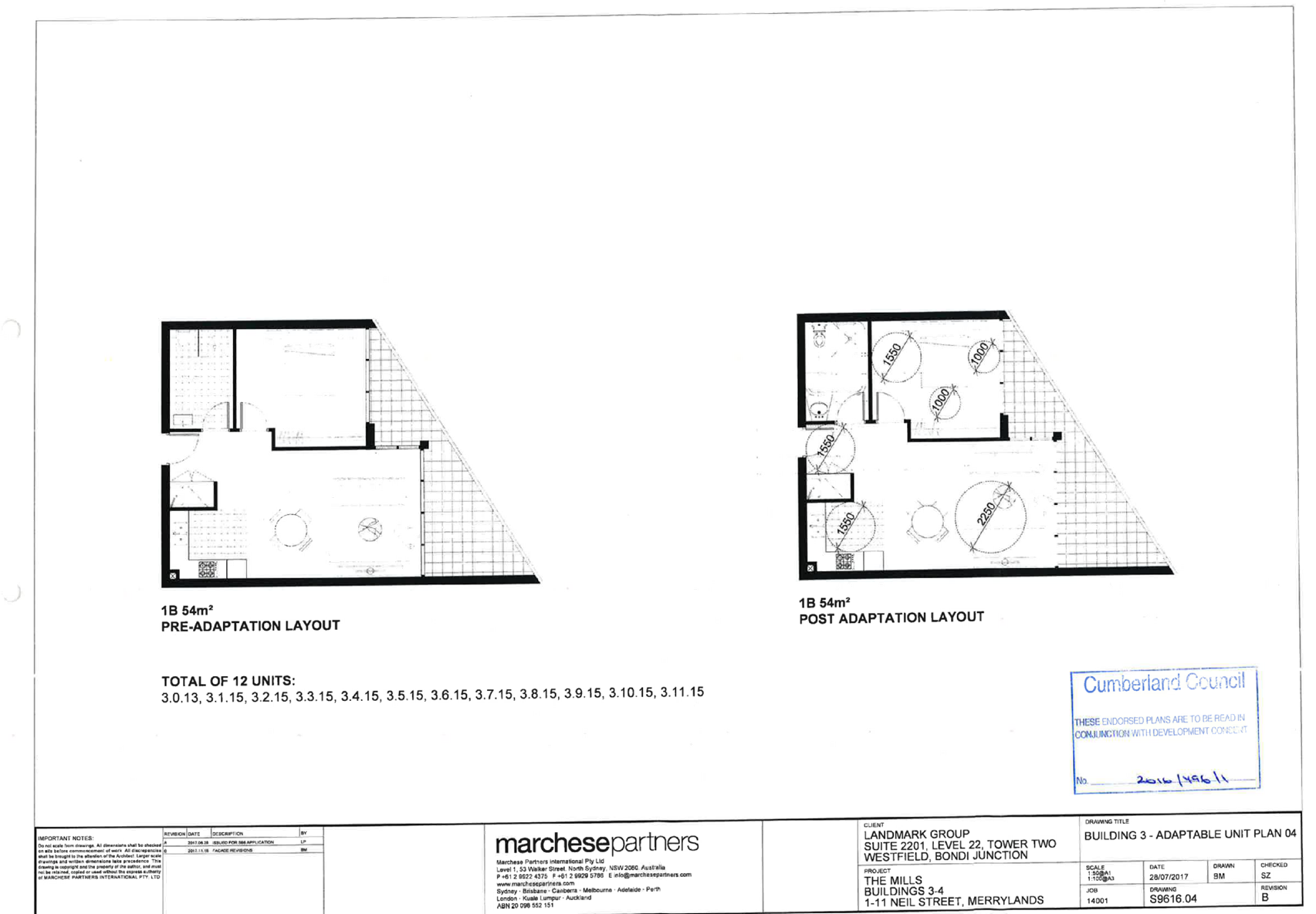
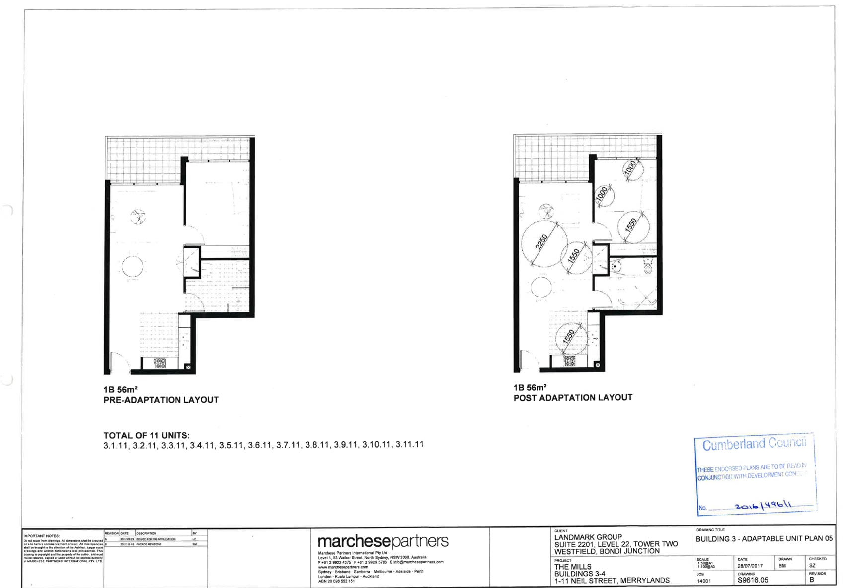


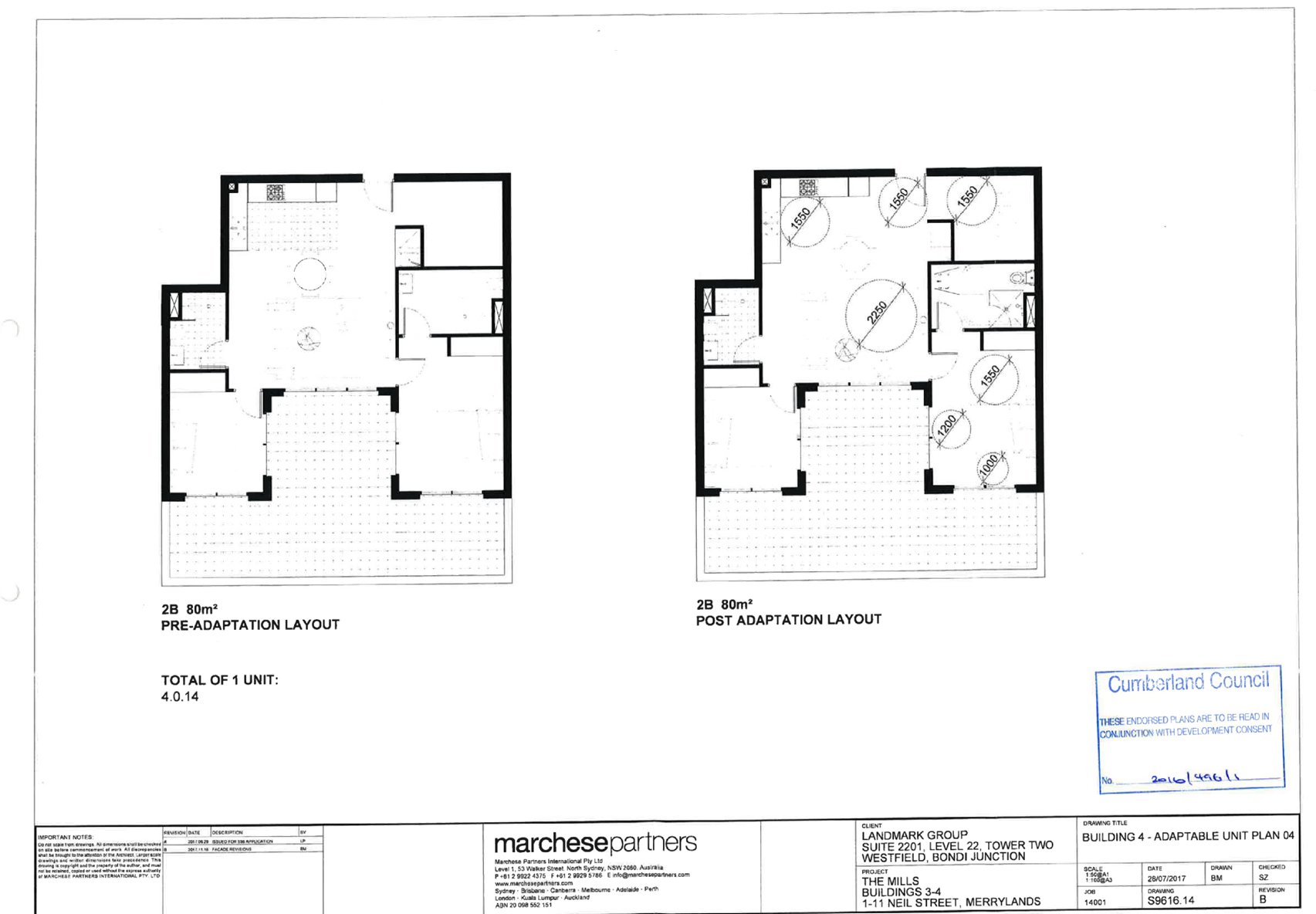


DOCUMENTS
ASSOCIATED WITH
REPORT LPP008/19
Attachment 8
Development Consent 2016/496/2
Cumberland Local Planning Panel Meeting
13 March 2019
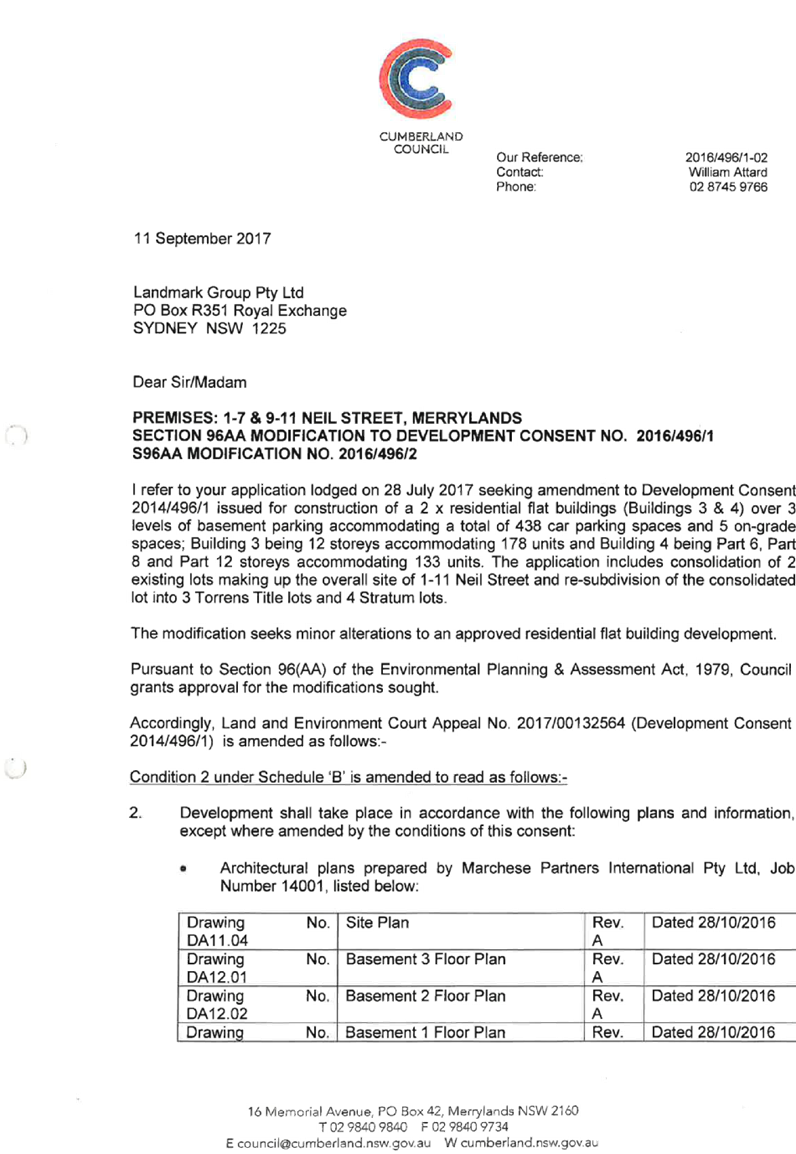

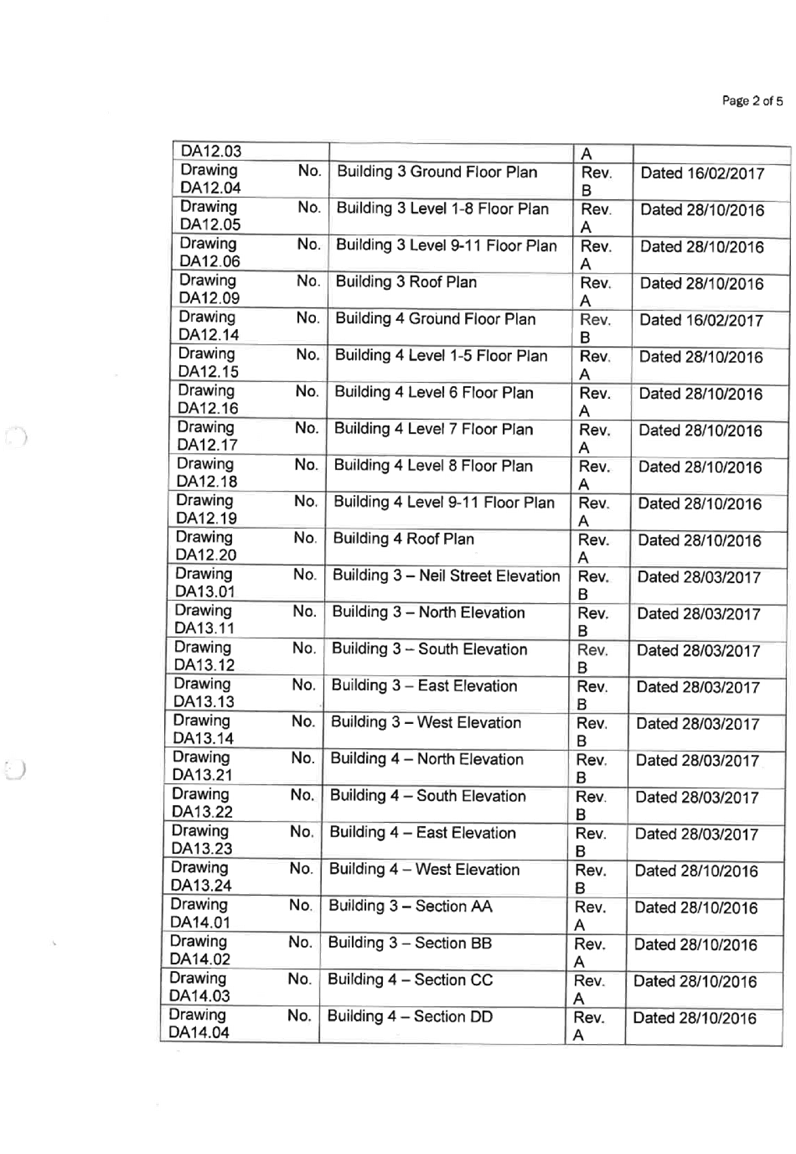
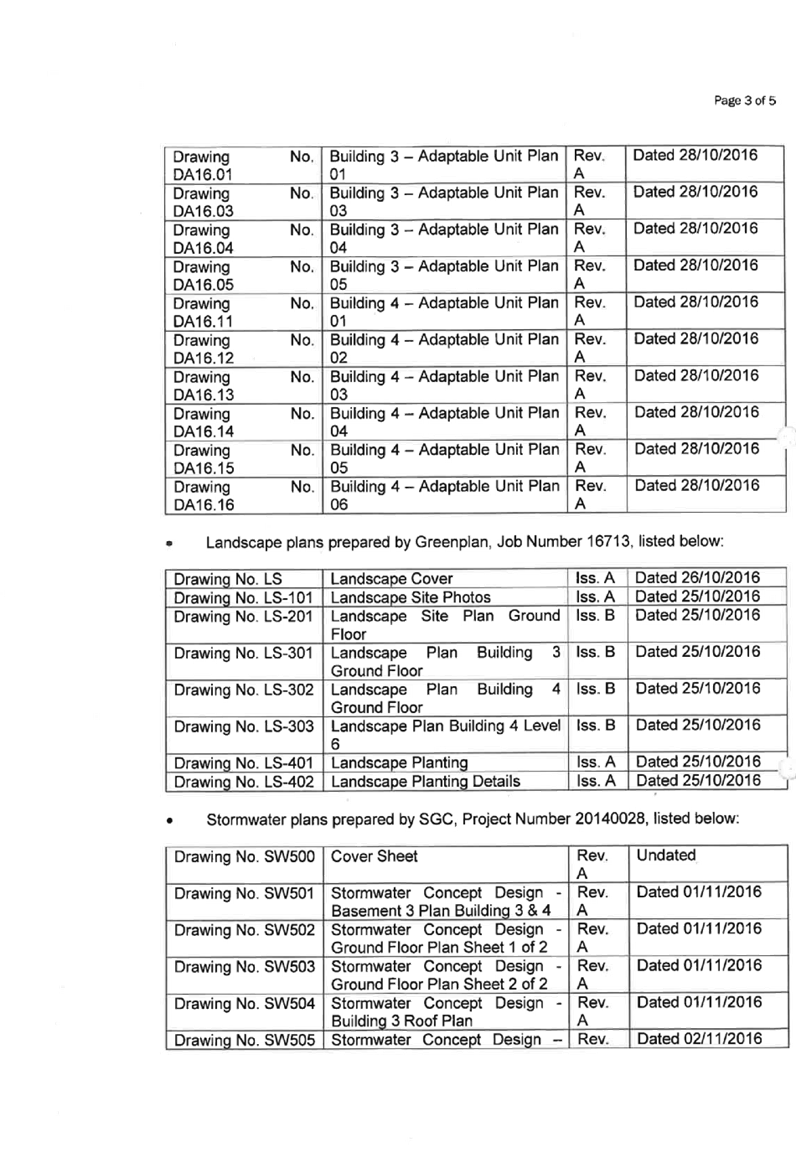
DOCUMENTS
ASSOCIATED WITH
REPORT LPP008/19
Attachment 9
Endorsed Architectural Plans for Development Consent
2016/496/2
Cumberland Local Planning Panel Meeting
13 March 2019
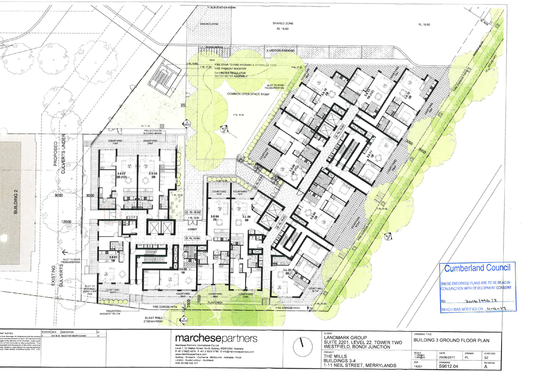
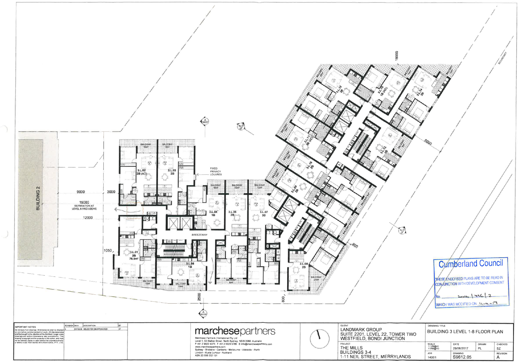
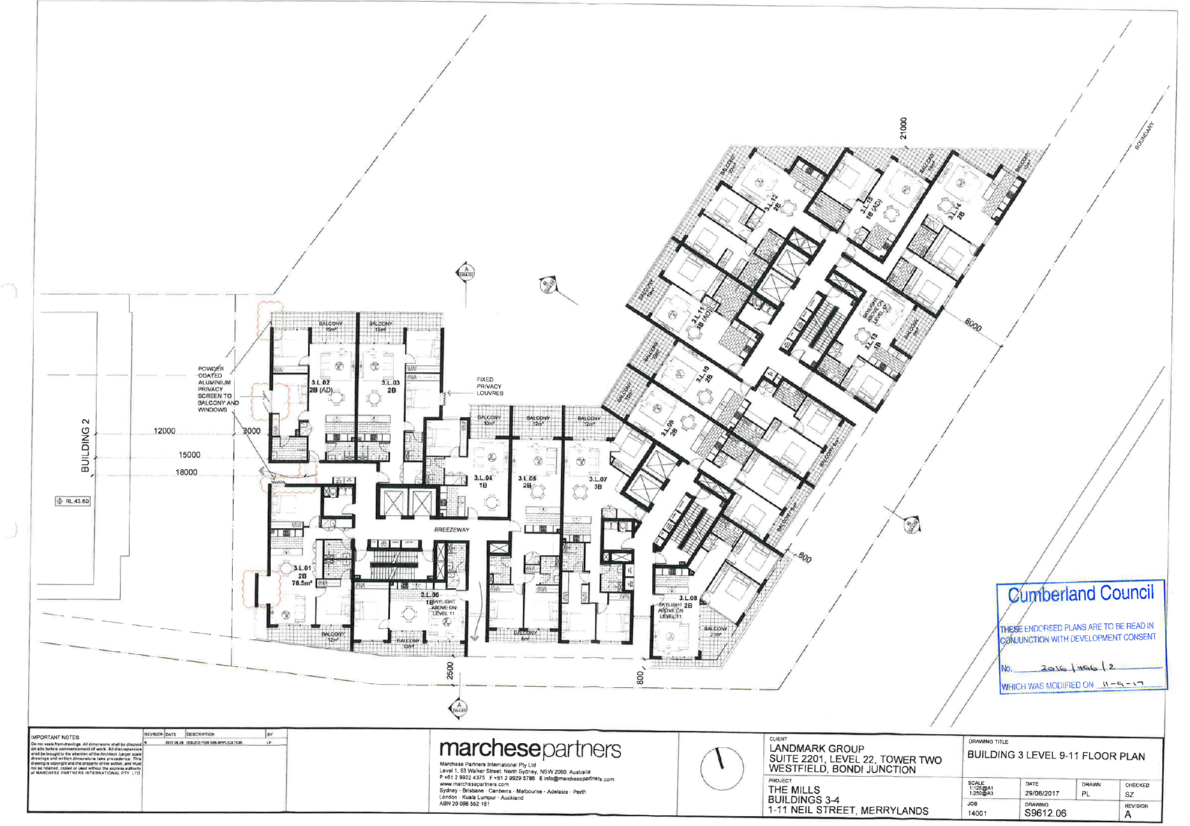

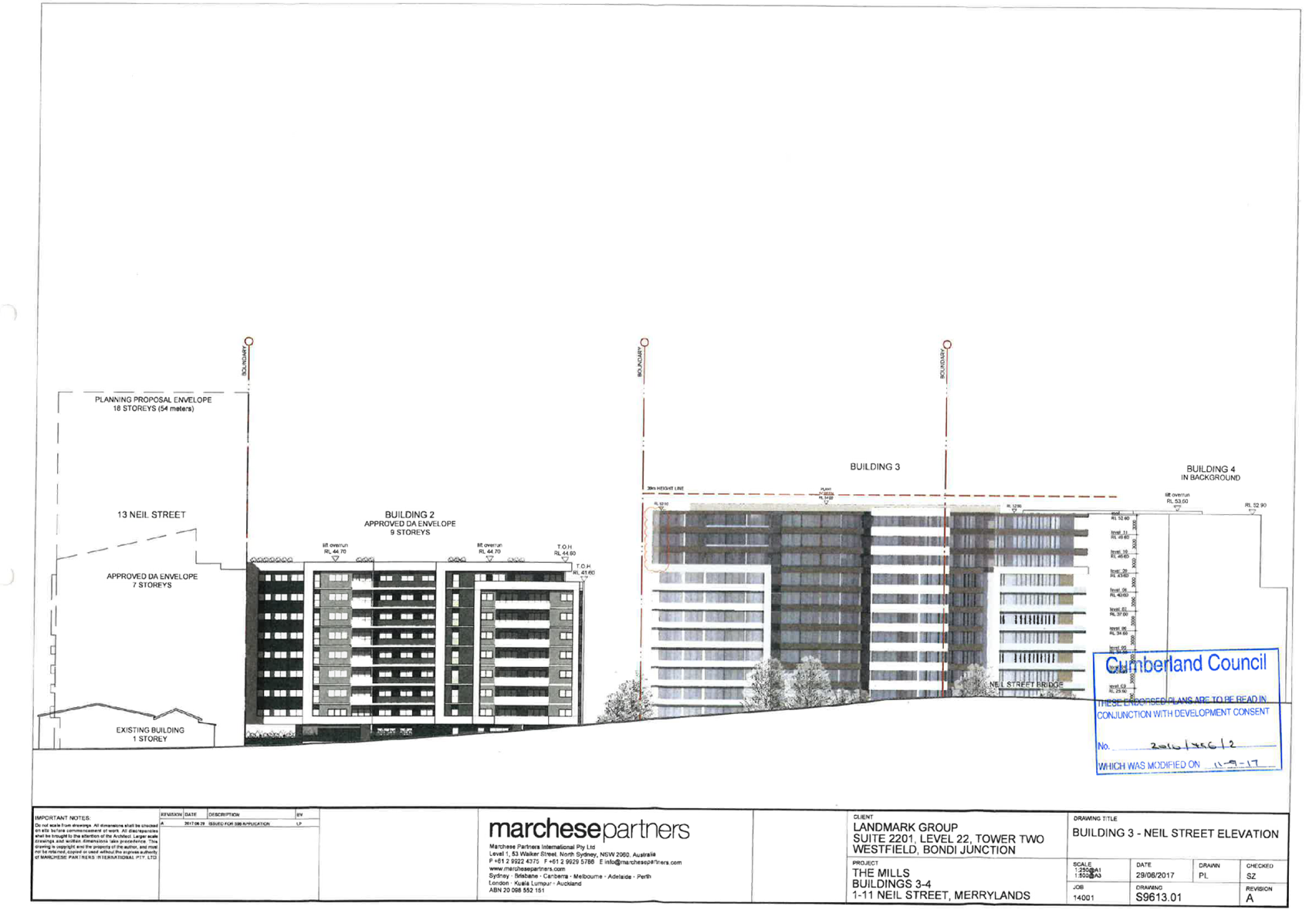

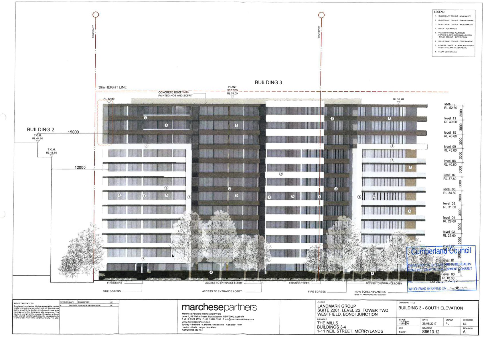
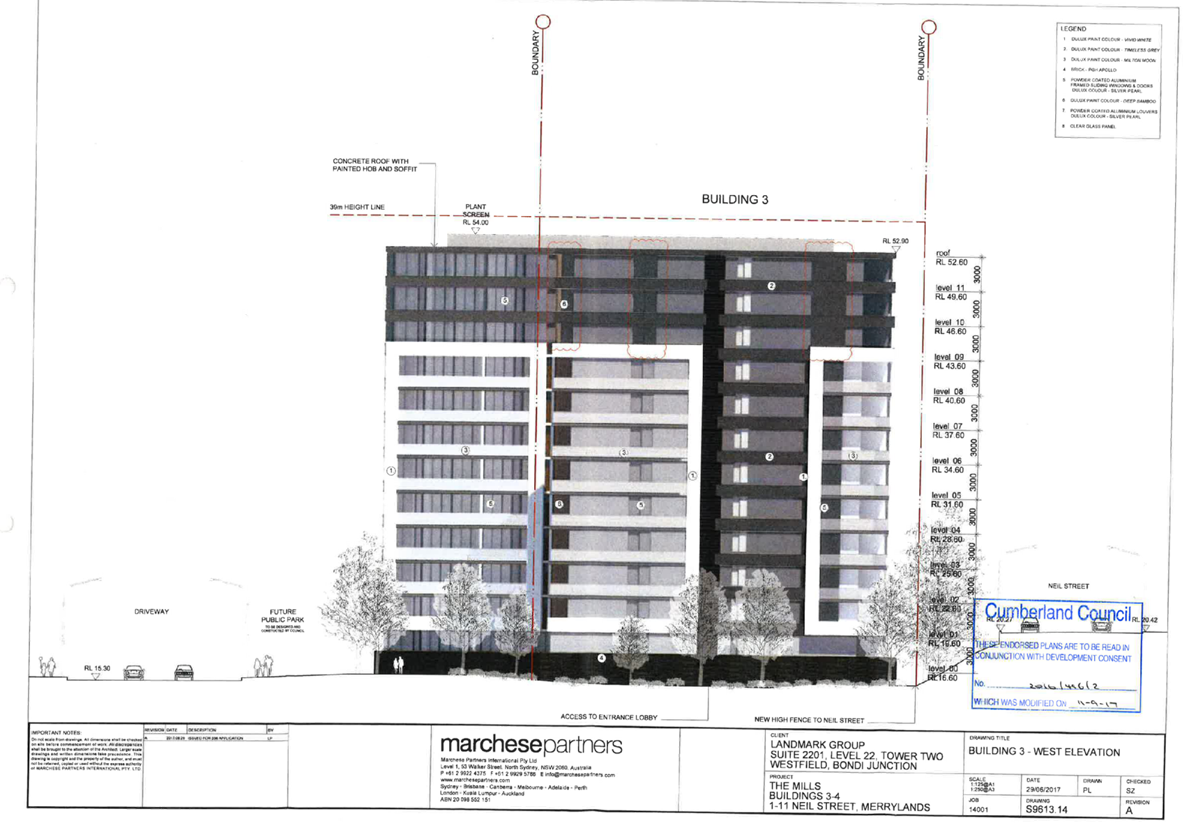

DOCUMENTS
ASSOCIATED WITH
REPORT LPP008/19
Attachment 10
Development Consent 2016/496/5
Cumberland Local Planning Panel Meeting
13 March 2019


DOCUMENTS
ASSOCIATED WITH
REPORT LPP008/19
Attachment 11
Development Consent 2016/496/6
Cumberland Local Planning Panel Meeting
13 March 2019


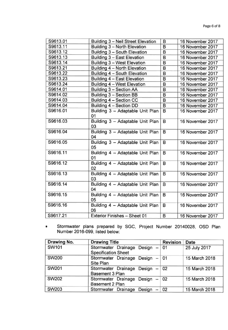


13 March 2019
Item No:
LPP009/19
Planning
Proposal for 100 Woodville Road
Responsible
Division: Environment
& Planning
Officer: Manager
Strategic Planning
File
Number: PP-2/2018
|
Lodged
|
26 September 2018
|
|
Proponent
|
Mecone
|
|
Owners
|
Trustees of the Missionary Sisters of the Blessed Virgin
Mary Queen of the World.
|
|
Description of Land
|
100 Woodville Road, Granville.
Lot D DP 150974 Lot 1
DP 780942 Lot 1 DP 781277
Lot 8 DP 521888 Lot 6
DP 975141
Lots 1000 & 1001 DP 1093851
|
|
Site Area / Description
of existing use
|
The site currently has a convent and some detached
dwellings on the site, and has existing use rights.
The total site area is approximately 2,900 m2.
|
|
Planning Controls
|
Planning Controls
|
Existing Control
|
Proposed Control
|
|
Zoning
|
R2 Low Density
|
R3 Medium Density
|
|
Height
|
9 m
|
12 m
|
|
FSR
|
0.5.1
|
1:1
|
|
Heritage
|
There are no Heritage Items on the site
|
|
Disclosure of political
donations and gifts
|
N/A
|
|
Previous Considerations
|
N/A
|
A planning
proposal (the proposal) was submitted to Council seeking to amend the zoning of
the site at Woodville Road, Granville, from R2 Low Density Residential to R3
Medium Density Residential. The proposal also seeks to amend the Height of
Building control from 9 metres to 12 metres and the Floor Space Ratio control
from 0.5:1 to 1:1.
The proposal seeks to facilitate the redevelopment of an
existing convent to a new 3-4 storey convent building with 30 new rooms. The
proponent is seeking an amendment to the Parramatta LEP 2011 as the R2 zone
does not permit the land use of ‘Hostel’ or ‘Place of Public
Worship’, which are the most appropriate land use definitions for the
convent component of the proposal.
The proposal will also allow for
the development of 7 two storey townhouses.
The status of the planning
proposal is outlined in Figure 1a.
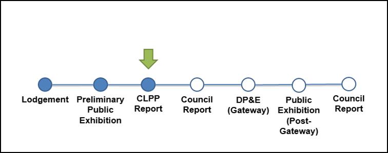
Figure
1a: Planning Proposal Status
1. The
Site and its Context
The site is located at 92-100
Woodville Road and 63 and 65 Grimwood Street, Granville and comprises seven
lots bounded by Grimwood Street to the south, Woodville Road to the east and
William Street to the west. The total site area is approximately 2,900 m2.
Existing development includes a
convent and three detached houses (related to the convent use) and associated
vegetable gardens, landscaped garden and lawn areas, and storage sheds.
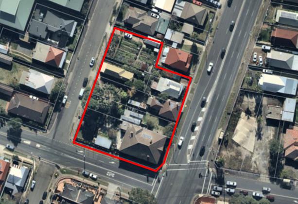
Figure 1b: The site
Local Context
The site is located approximately
900 metres from Granville and Merrylands town centres, and approximately 1
kilometre from Parramatta CBD.
The surrounding locality is
characterised by low to medium density housing as well as three large
educational uses, namely Delaney College, Holy Trinity Primary School and
Granville TAFE.
2. Planning
Controls
Parramatta LEP 2011 applies to the
site. The site is currently zoned R2 Low Density Residential with a
maximum Height of Building control of 9 metres and a maximum Floor Space Ratio
control of 0.5:1.
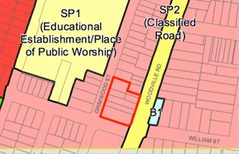
Figure 2: Current Zoning
Map Figure
3: Current Height of Buildings Map (J1 = 9metre)
Figure 4: Current FSR Map (D
= 0.5:1)
Proposed Planning
Controls
The proposal seeks to facilitate
the rezoning of the site from R2 Low Density Residential to R3 Medium Density
Residential, change the Height of Building control from 9 metres to 12 metres
and the Floor Space Ratio Control from 0.5:1 to 1:1.
Figure 5: Proposed zoning Figure
6: Proposed Height of Buildings
(M = 12 metres)
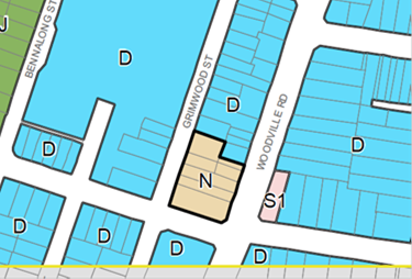
Figure 7: Proposed (FSR N = 1.0)
3. Strategic
Merit Assessment
Draft Woodville Road Strategy
The Draft Woodville Road Strategy
that was prepared by Parramatta City Council prior to amalgamation and
exhibited in 2016 recommends R4 High Density Residential zoning, a maximum
building height of four to five storeys and a maximum FSR of 1.4:1 to be applied
to the site and surrounding properties. Cumberland Council is yet to endorse
this strategy, however it will be considered in detail as part of the
preparation of the new Cumberland LEP.
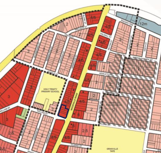
Figure 8: Proposed zone and building heights of the
Draft Woodville Road Strategy
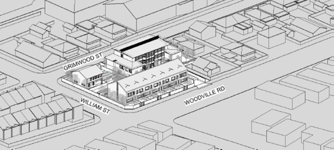
Figure 9: Indicative scale of this proposal
This proposal seeks a scale of
development less than what is proposed by the draft Strategy.
It is recommended that this
proposal progress to the next phase of assessment as the scale of the proposal:
· is
unlikely to impede the implementation of the Draft Strategy for neighbouring
properties, if Council chooses to adopt this strategy, and
· is
unlikely to have a significant impact on the surrounding neighbourhood, if
Council choose not to adopt the draft strategy and maintain the existing urban
form.
Traffic and Transport
There is strategic merit in
progressing this proposal to the next phase of assessment as:
· the
site is located within walking distance to bus services along Woodville Road,
William Street and The Avenue that provide services to Parramatta, Granville
and Merrylands stations; and
· the
proposal is expected to result in additional traffic generation of nine vehicle
trips in the critical peak hours (or approximately one trip per six to seven
minutes). This level of increase is well within typical fluctuations in
background traffic volumes. It is anticipated that no external road works will
be required to facilitate this proposal.
Central City District Plan
There is strategic merit in
forwarding this proposal to DP&E for a Gateway Determination as the
proposal can be considered to be consistent with the following Planning
Priorities of the Central City District Plan:
· C4
Fostering healthy, creative, culturally rich and socially connected communities:
the planning proposal promotes a healthy community by providing for additional
housing in a walkable residential neighbourhood in close proximity to
recreational opportunities at Granville Park. The planning proposal will also
provide for new accommodation for the Missionary Sisters, which provides a
positive presence in the neighbourhood;
· C5.
Providing housing supply, choice and affordability, with access to jobs and
services: the proposal provides for additional dwellings in close proximity
to a large range of employment and services in Parramatta CBD;
· C6.
Creating and renewing great places and local centres, and respecting the
District’s heritage: the proposal facilitates redevelopment of an
existing urban site including communal open space areas, presenting
opportunities for social interaction;
· C9.
Delivering integrated land use and transport planning and a 30-minute city:
· the
proposal supports this priority by placing housing in a location less than 30
minutes by public transport (bus) to access Parramatta CBD; and
· C16.
Increasing urban tree canopy cover and delivering Green Grid connections:
the proposal facilitates redevelopment of the site, including increased
landscaping and tree canopy cover.
Greater Sydney Region Plan
There is strategic merit in
forwarding this proposal to DP&E for a Gateway Determination as the
proposal can be considered to be consistent with the following Planning
Directions of the Greater Sydney Region Plan:
· A
City for People and Housing the City: The proposal provides for
seven new townhouse dwellings and an enlarged convent with additional bedrooms,
which will contribute to supply, diversity and affordability of housing in the
area;
· A
well-connected city: The proposal supports this objective by placing new
housing in a location less than 30 minutes by public transport from the jobs
and services and in Parramatta CBD; and
· A
city and its landscape: The proposal proposes to increase
landscaping and tree canopy cover in redeveloping the site.
It is recommended that the
planning proposal be reported to Council seeking a resolution that the proposal
be forwarded to DP&E for a Gateway Determination. This recommendation is
being made as:
· the
scale of the proposal is unlikely to create significant impact for surrounding
development;
· the
proposal is unlikely to impede the implementation of the Draft Woodville Road
Strategy, should Council choose to implement the Strategy;
· the
site is located within walking distance of bus services on Woodville Road,
William Street and The Avenue that provide services to Parramatta, Granville
and Merrylands stations;
· the
proposal is expected to result in additional traffic generation and it is
anticipated that no external road works will be required to facilitate this
proposal; and
· the
proposal is generally consistent with the broad strategic direction set by the Central
City District Plan and the Greater Sydney Region Plan.
The preliminary public exhibition
was carried out between 9 October 2018 and 7 November 2018. The proposal was
made available for public viewing at Council’s libraries, customer
service and website; and letters were sent out to adjoining landowners.
In response to the preliminary
exhibition, only one concern was raised relating to inadequate parking and an
increase in traffic congestion. Although an analysis has been undertaken as
part of the traffic report submitted as part of the rezoning, and Council
engineers have not raised any concerns, the provision of on-site parking (a
requirement at development application stage) would ensure that the proposal
does not create adverse impact on the surrounding local network.
There are no financial implications
for Council associated with this report.
Should the proposal be endorsed by
Council and proceed to a Gateway determination, it is likely to result in an
LEP amendment.
Communication /
Publications:
The final outcome of this matter
will be publicly notified in the newspaper. The submission authors will also be
notified in writing of the outcome.
|
That this matter be reported
to Council seeking a resolution to forward the Planning Proposal to the
Department of Planning and Environment for a Gateway Determination.
|
1. Proponent's
Planning Proposal ⇩ 
DOCUMENTS
ASSOCIATED WITH
REPORT LPP009/19
Attachment 1
Proponent's Planning Proposal
Cumberland Local Planning Panel Meeting
13 March 2019
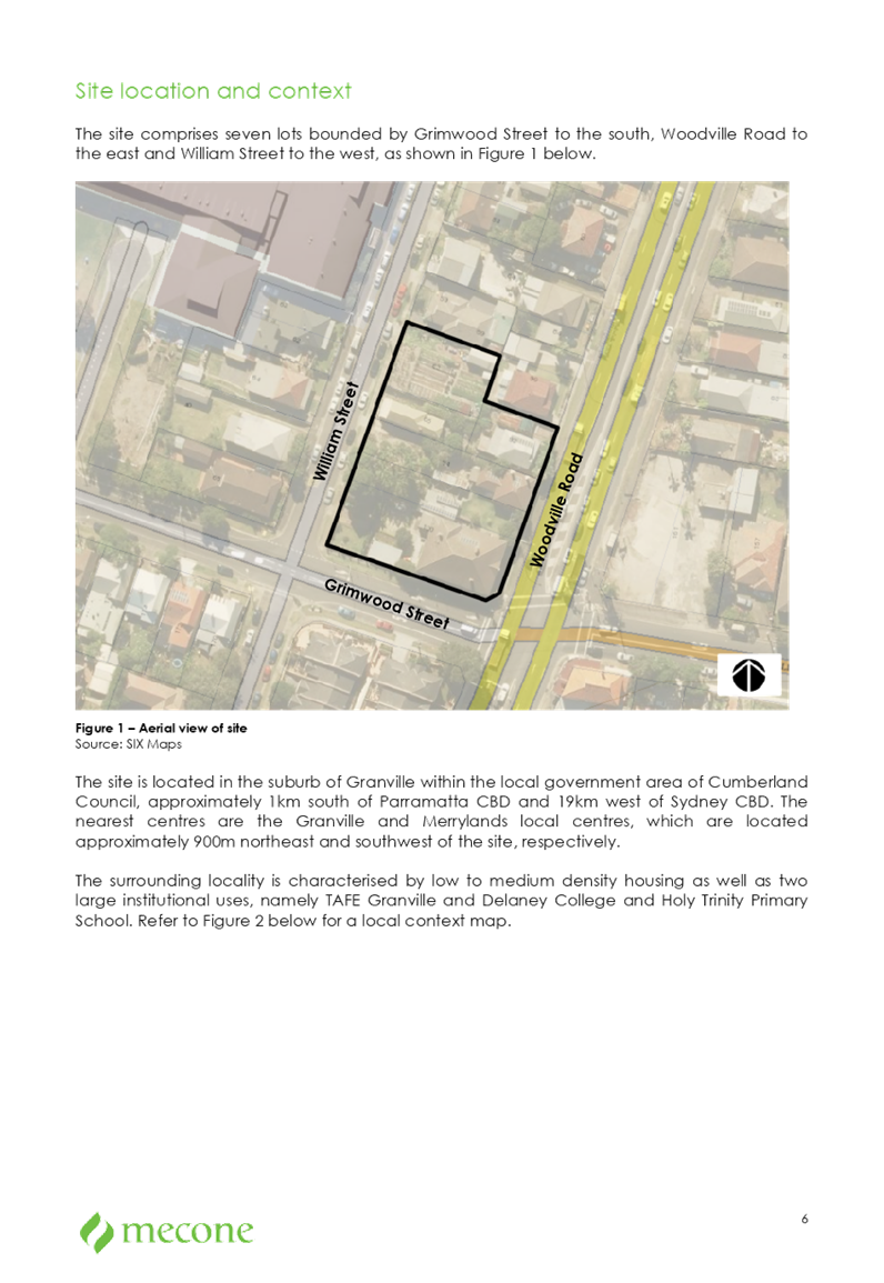
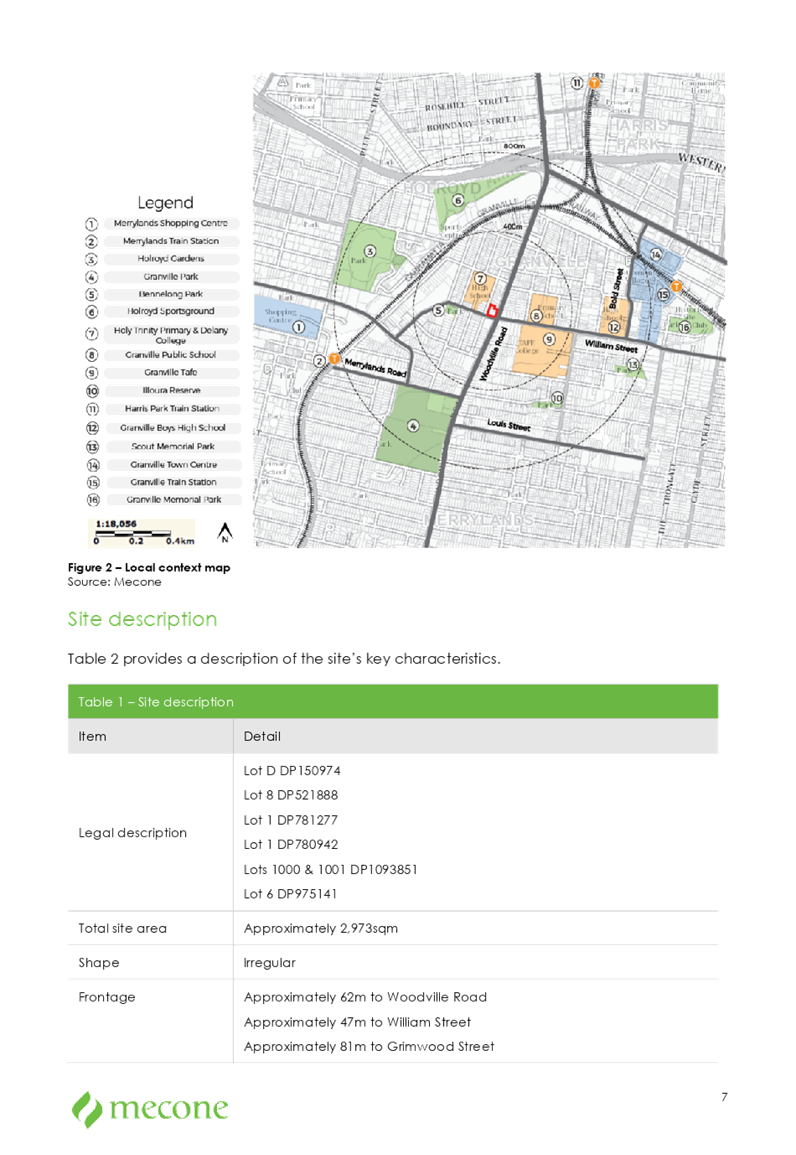
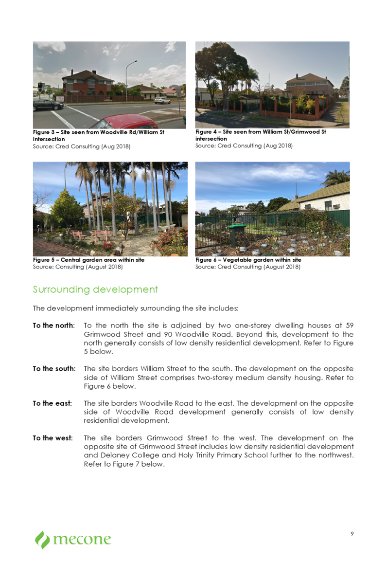
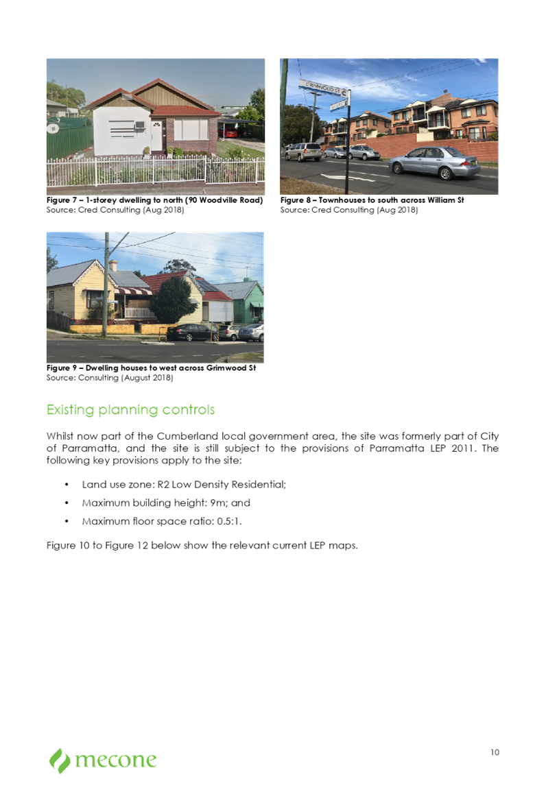
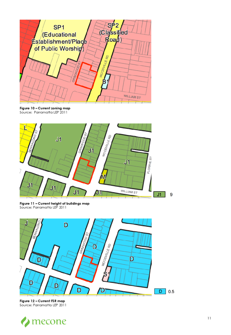
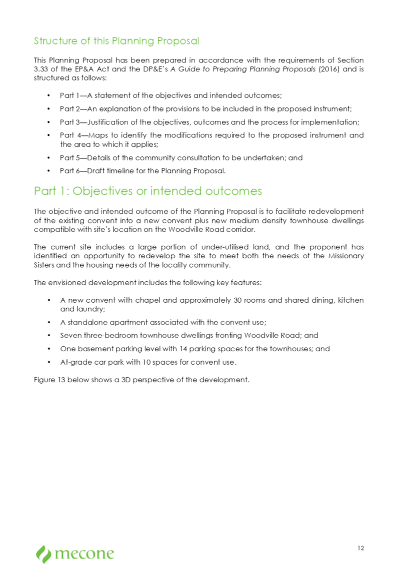
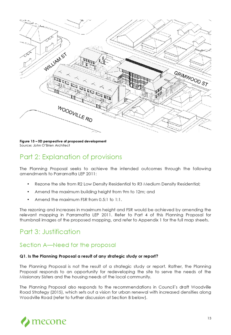
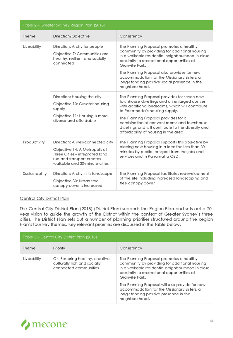
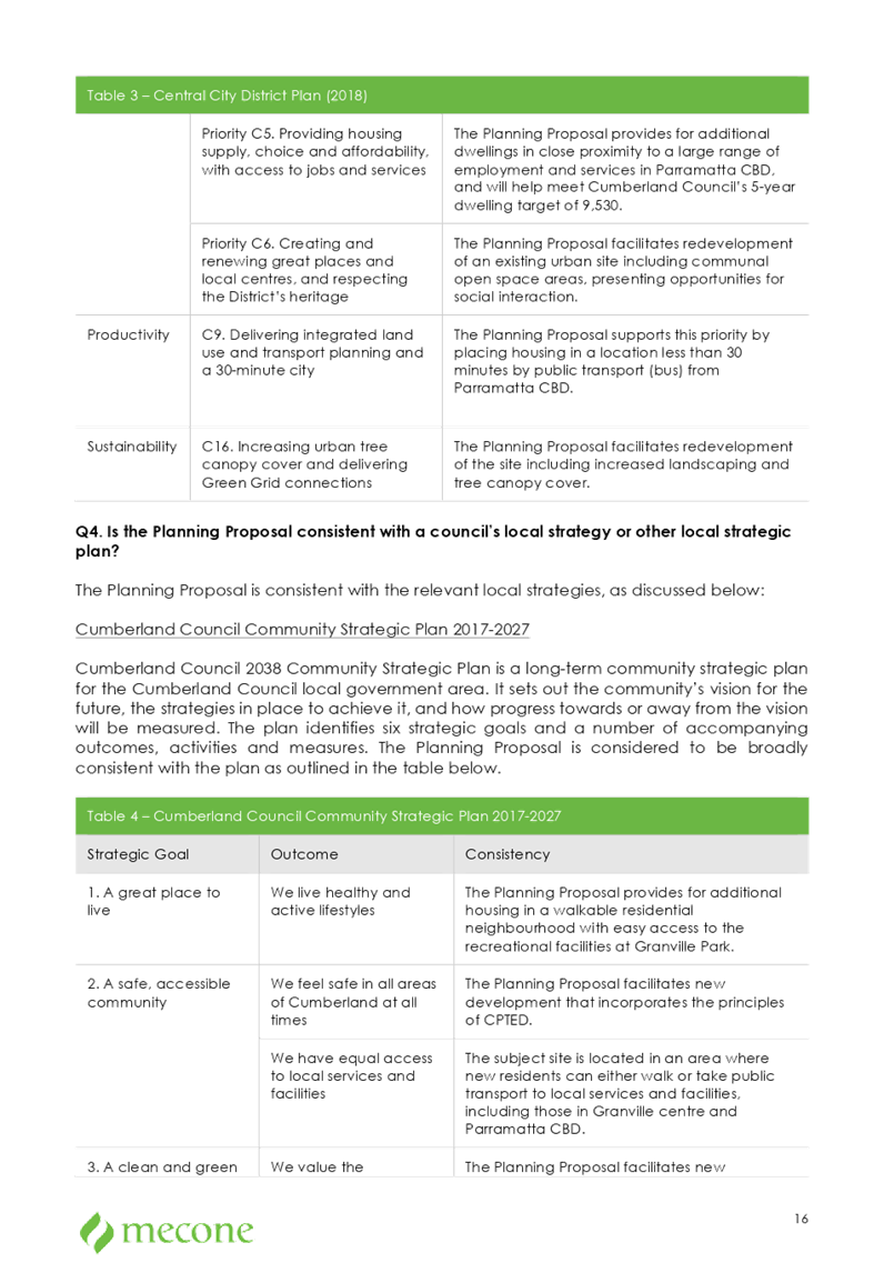
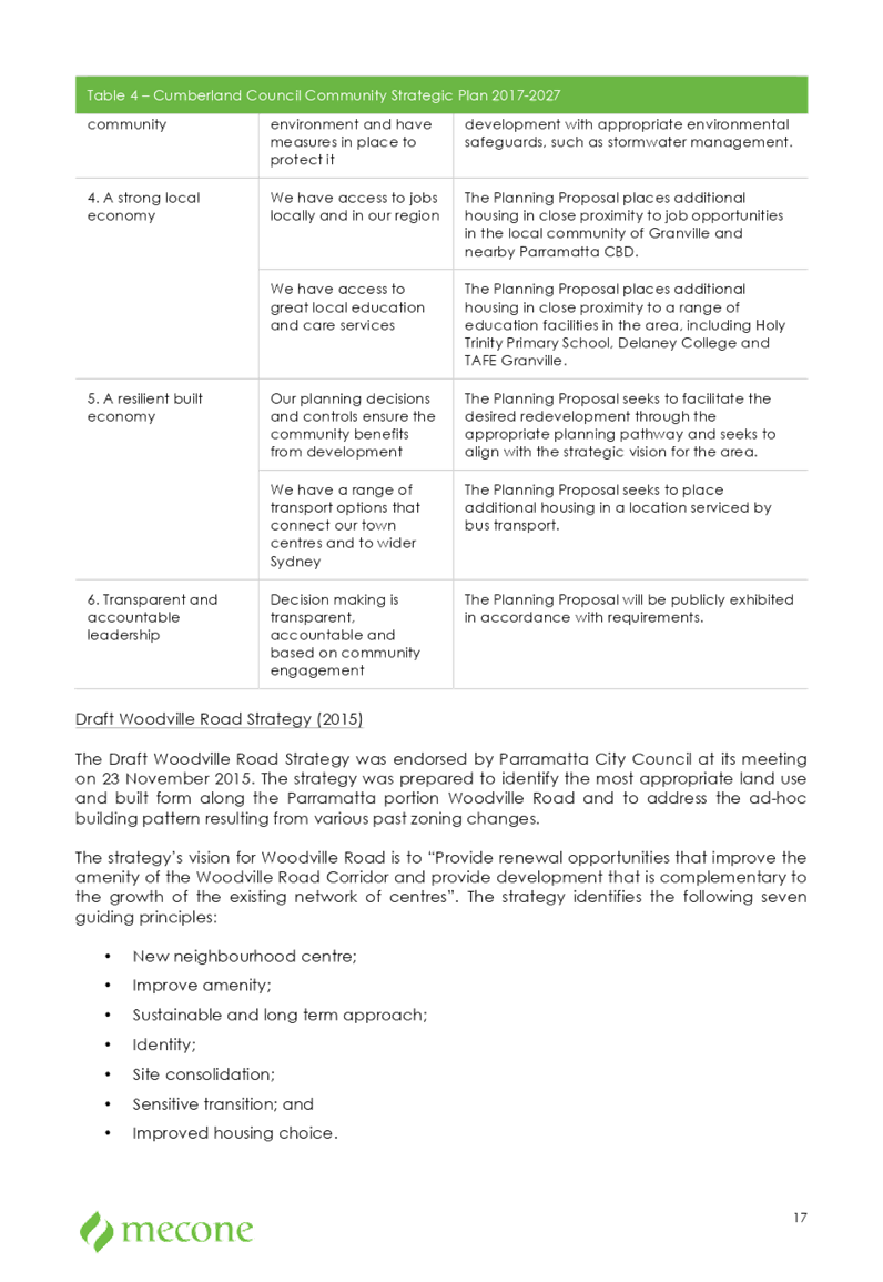
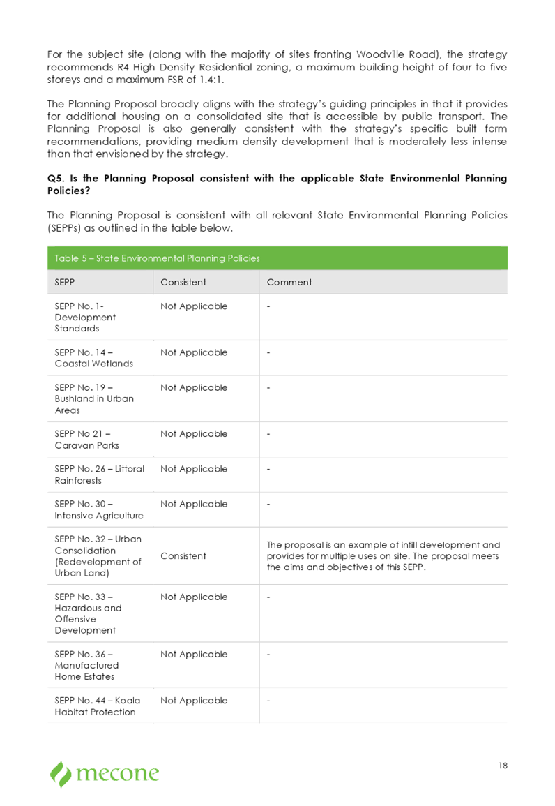
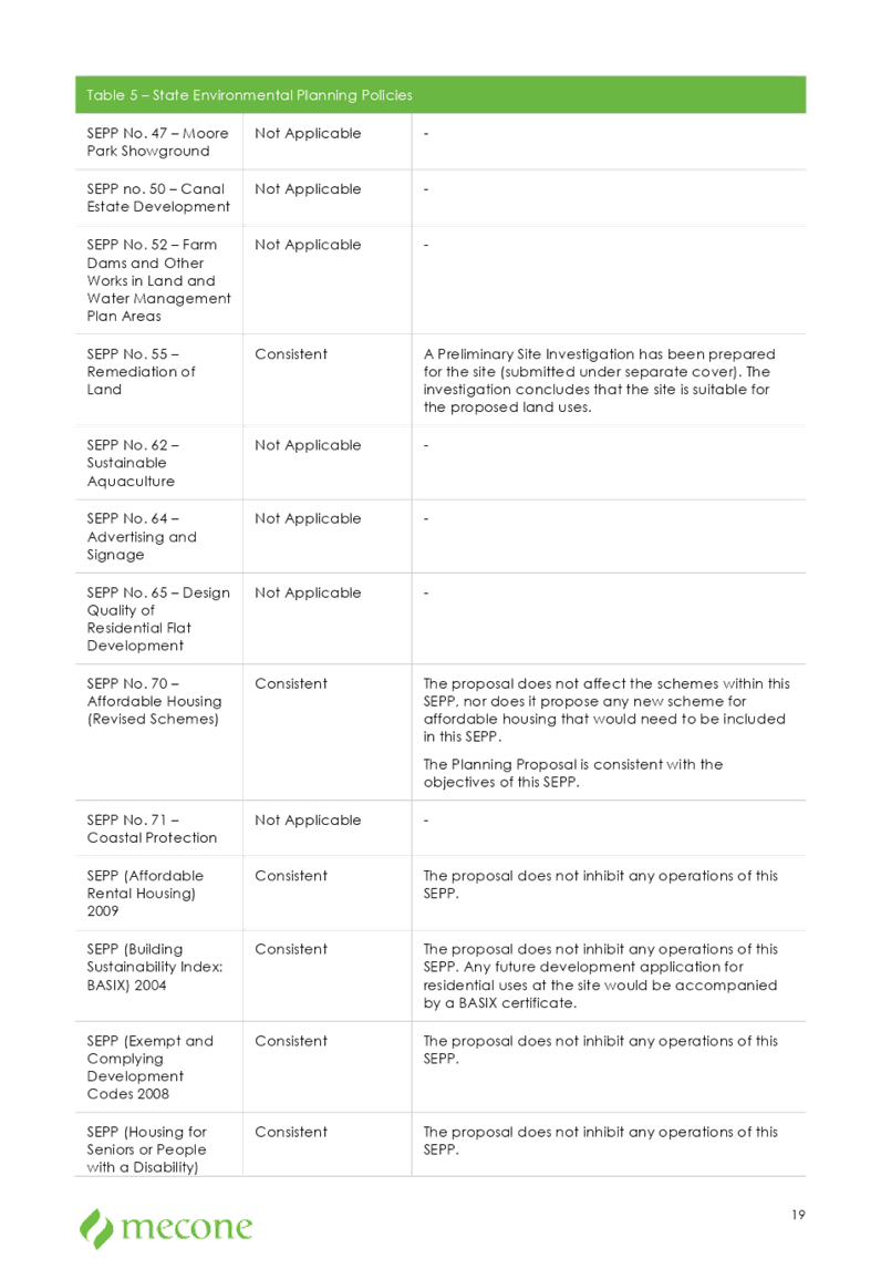
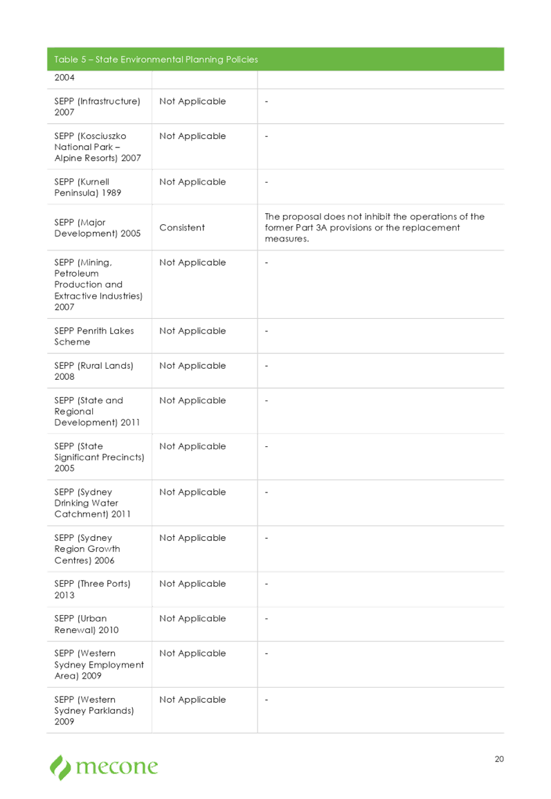
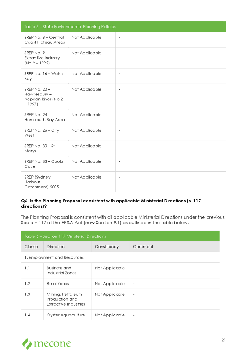
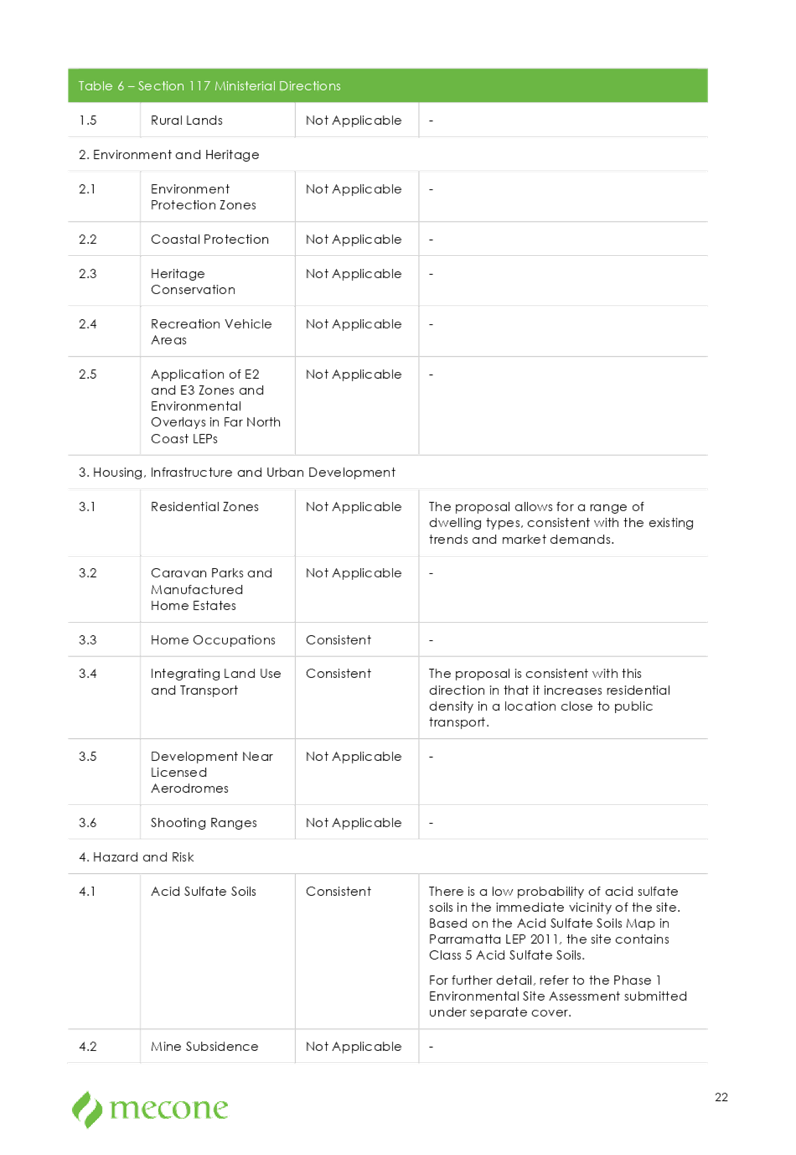
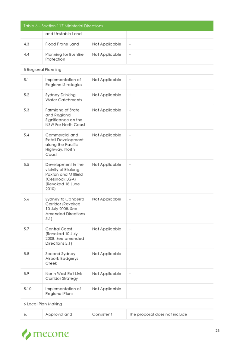
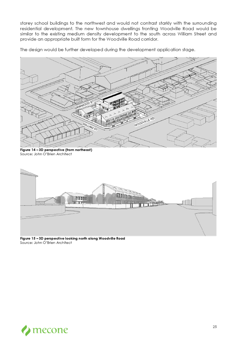
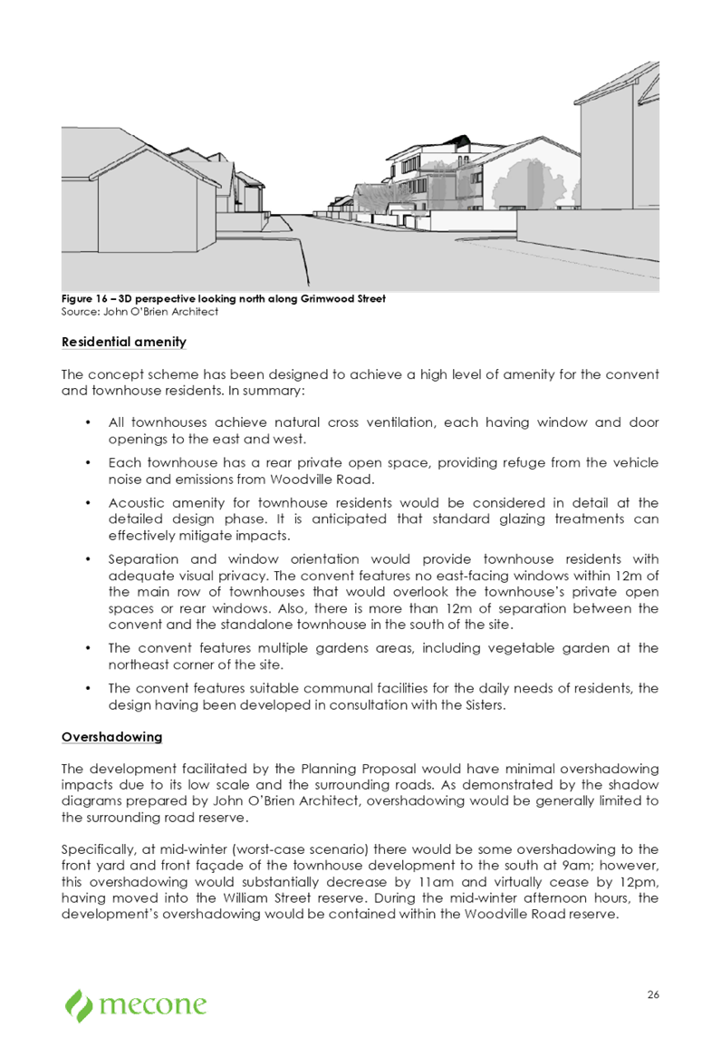

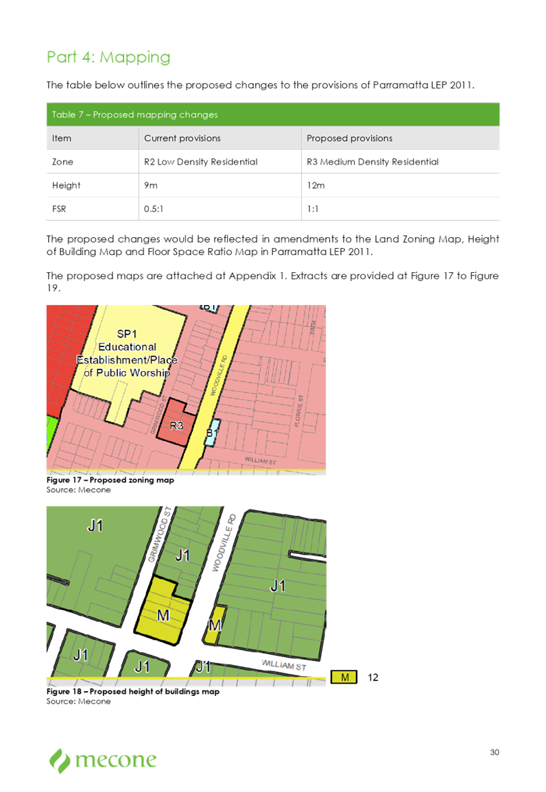
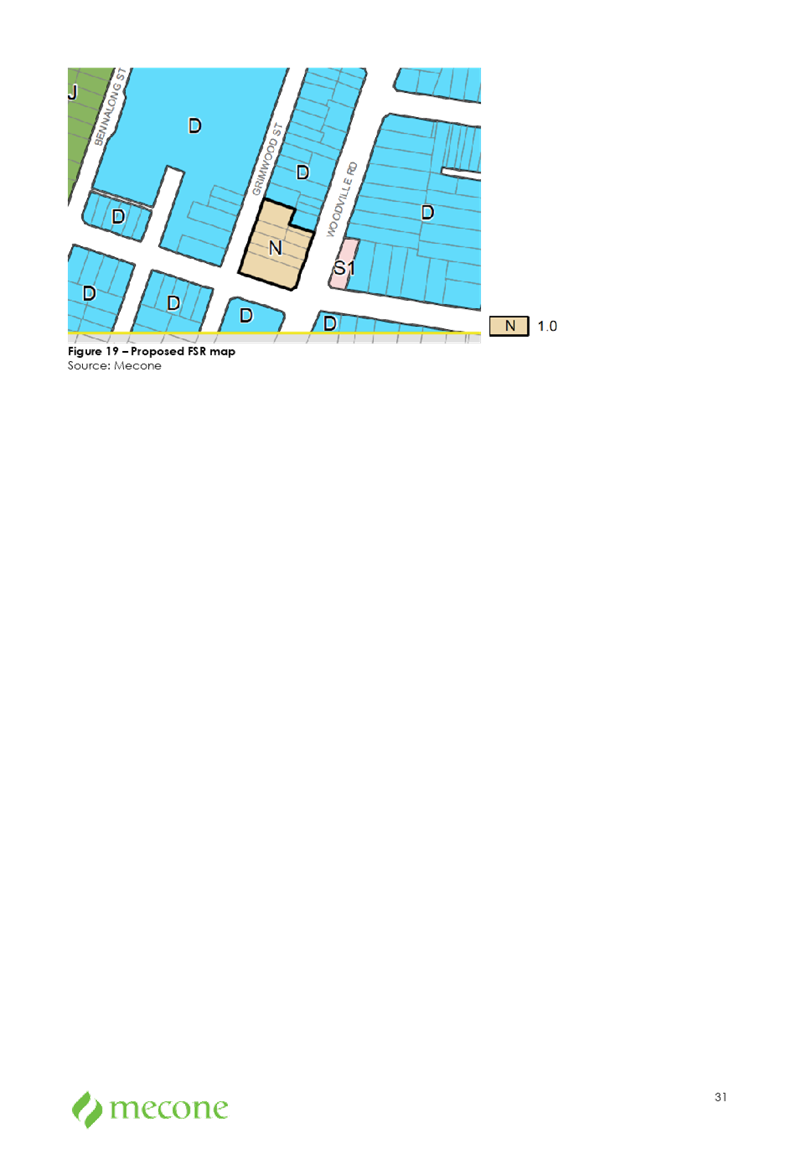


Cumberland
Local Planning Panel Meeting
13 March 2019
Item No: LPP010/19
Planning
Proposal Request For 2 Bachell Avenue, Lidcombe - Preliminary Public Exhibition
and Technical Assessment
Responsible
Division: Environment
& Planning
Officer: Manager
Strategic Planning
File
Number: PP-3/2018
|
Lodged
|
30 October 2018
|
|
Proponent
|
Pacific Planning
|
|
Owner
|
Raad Property Acquisition No 10 Pty Ltd
|
|
Description of Land
|
2 Bachell Avenue Lidcombe (Lot 2 DP 219413)
|
|
Site Area
|
Approximately 8,750m2
|
|
Site Description and
Existing Use
|
The site contains a freestanding warehouse constructed in
1973 and has been used for a commercial laundromat since 2016. The site is
identified within the Flood Planning Area and includes a part of land
identified as below Foreshore Building Line. The existing stormwater
channel/culvert runs through the site in a south to north-west direction and
partly covered in adjacent to and below the freestanding warehouse.
|
|
Proposal Summary
|
Seeks to amend the Auburn Local Environmental Plan 2010
(Auburn LEP 2010) by:
· Amending the Land Use
Table to include B5 Business Development zone;
· Rezoning the site from
IN1 General Industrial to B5 Business Development; and
· Amending the floor
space ratio (FSR) control for the site from 1:1 to 3:1.
|
|
Existing and Proposed Planning Controls
|
Planning Controls
(Auburn LEP 2010)
|
Existing controls
|
Proposed controls
|
|
Zoning
|
IN1 General Industrial
|
B5 Business Development
|
|
Height of Building
|
N/A
|
N/A
|
|
Floor Space Ratio
|
1:1
|
3:1
|
|
Foreshore Building Line
|
Present
|
Exclude
|
|
Heritage
|
Nil
|
|
Disclosure of
political donations and gifts
|
Nil
|
|
Previous Consideration
|
On 2016, the proponent lodged a planning proposal seeking
a rezoning of the site to B1 Neighbourhood Centre to accommodate residential
dwellings and commercial/retail premises. Council resolved not to support the
planning proposal at its meeting of 1 February 2017, following the review of
the preliminary public consultation and council officer’s technical
assessment report.
|
This report seeks to provide an
overview of a planning proposal submitted to Cumberland Council on 30 October
2018. The proposal seeks to amend the Auburn LEP 2010 by:
· Rezoning the site from IN1 General Industrial
to B5 Business Development;
· Introducing new B5 Business Development zone in the
Land Use Table;
· Amending the floor space ratio (FSR) control for the
site from 1:1 to 3:1; and
· Removing the
Foreshore Building Line that applies to this site.
Figure 1a: Planning Proposal Status
1. The
site and its context
The subject site (the site) is
located at 2 Bachell Street, Lidcombe. The site currently contains a
freestanding warehouse, utilised by a laundrette, with a footprint of
approximately 2,500m². The warehouse is located in the middle of the site
with land on either side vacant. The site is an irregular triangular shape
measuring approximately 8,738m² in area.
|
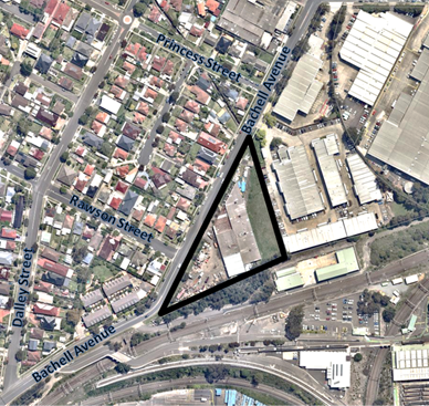
|
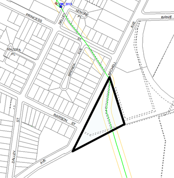

|
|
Figure 1b. Aerial map of the site and immediate
surrounds (The subject site outlined in black)
|
Figure 2. Map showing an existing stormwater channel
runs through the site
|
Local Context
The site is located on the
southern end of the Lidcombe East Industrial Precinct, and is adjacent to a
residential area (to the west) and railway infrastructure (to the south).
The site is located approximately
1 kilometres from Lidcombe train station.
Regional Context
The site is located in the suburb
of Lidcombe within the Local Government Area of Cumberland Council,
approximately 6 kilometres east of Parramatta CBD and 16 kilometres west of the
Sydney CBD.
2. Planning
Controls (Auburn LEP 2010)
The site is currently zoned IN1
General Industrial with an FSR of 1:1. No maximum height of building control
applies to the site.
The site is identified on the
Flood Planning Area Map and the Foreshore Building Line Map.
|
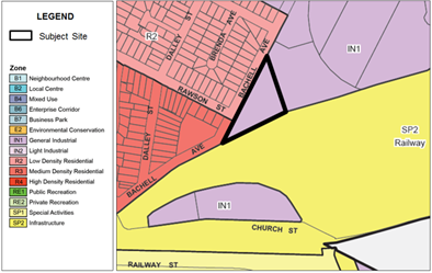
|
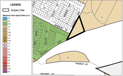
|
|
Figure
3. Existing Land Zoning Map
|
Figure
4. Existing Floor Space Ratio (FSR) Map
|
|
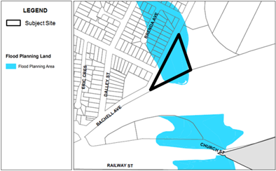
|
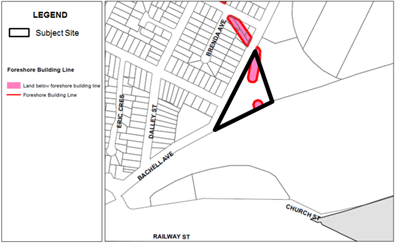
|
|
Figure
5. Existing Flood Planning Area Map
|
Figure
6. Foreshore Building Line Map
|
3. The
Planning Proposal
The proposal seeks to:
· rezone
the site from IN1 General Industrial to B5 Business Development;
· introduce
new B5 Business Development zone in the Land Use Table. (The proponent is
suggesting the use of the land use table from the Holroyd LEP);
· amend
the floor space ratio (FSR) control for the site from 1:1 to 3:1, and
· remove
the Foreshore Building Line that applies to this site.
The intended outcomes for this
Planning Proposal Request are:
· to
enable a mix of business and warehouse uses and specialised retail premises;
· to
support a transition of the site’s current industrial-only use of site to
a mix of higher order employment land uses;
· to
provide a compatible land use and appropriate employment density for the site
without threatening the economic viability of the Lidcombe Town Centre;
· to
enable the redevelopment of the site for a mix of higher order employment land
uses and provide facilities or services to meet the day to day needs of workers
in the area;
4. B5
Business Development Zone
The Auburn LEP 2010
currently does not contain B5 zone. The B5 Business Development Zone is a
standard instrument zone and the planning proposal seeks the inclusion of the Holroyd
LEP 2013 B5 Business Development Zone within the Auburn LEP 2010.
1. Objectives
of zone
· To
enable a mix of business and warehouse uses, and specialised retail premises
that require a large floor area, in locations that are close to, and that
support the viability of, centres.
· To
enable other land uses that provide facilities or services to meet the day to
day needs of workers in the area.
2. Permitted
without consent
Nil
3. Permitted
with consent
Centre-based child care
facilities; Food and drink premises; Funeral homes; Garden centres; Hardware
and building supplies; Landscaping material supplies; Light industries;
Neighbourhood shops; Passenger transport facilities; Plant nurseries; Respite
day care centres; Roads; Self storage units; Specialised retail premises;
Timber yards; Vehicle sales or hire premises; Warehouse or distribution centres;
Any other development not specified in item 2 or 4.
4. Prohibited
Agriculture; Air transport
facilities; Airstrips; Animal boarding or training establishments; Biosolids
treatment facilities; Boat building and repair facilities; Boat launching
ramps; Boat sheds; Camping grounds; Caravan parks; Cemeteries; Charter and
tourism boating facilities; Commercial premises; Community facilities;
Correctional centres; Crematoria; Eco-tourist facilities; Electricity
generating works; Entertainment facilities; Environmental facilities;
Exhibition homes; Exhibition villages; Extractive industries; Farm buildings;
Forestry; Freight transport facilities; Function centres; Heavy industrial
storage establishments; Helipads; Highway service centres; Home businesses; Home
industries; Home occupations; Home occupations (sex services); Industrial
retail outlets; Industries; Information and education facilities; Jetties;
Marinas; Mooring pens; Moorings; Mortuaries; Open cut mining; Recreation
facilities (major); Recreation facilities (outdoor); Registered clubs; Research
stations; Residential accommodation; Resource recovery facilities; Restricted
premises; Rural industries; Sewage treatment plants; Sex services premises;
Storage premises; Tourist and visitor accommodation; Vehicle body repair
workshops; Waste disposal facilities; Water recreation structures; Water
recycling facilities; Water supply systems; Wharf or boating facilities
5. Strategic
Merit Assessment.
Consistency with the Draft
Employment and Innovation Lands Strategy 2017
The site is situated within
Lidcombe East Industrial Precinct as recognised in the draft Cumberland
Employment and Innovation Lands Strategy 2017 (draft EILS 2017). The draft
EILS 2017 sets a vision for this precinct for ‘Cumberland Creative Cluster’.
The vision encourages the retention of existing industrial land uses in some
areas and targeting advanced manufacturing, supporting food and beverage and
creative industries.
There is strategic merit in
progressing this proposal to the next phase of assessment as:
· The
proposed rezoning to B5 Business Development would increase employment
opportunities and would create business opportunities in the area through the
provision of new and more diversified floor space.
· The
redevelopment of the site may achieve the draft EILS’s vision of a
creative cluster in this area through the creation of new and diversified floor
space.
· The
proposed employment uses creates range of jobs that could contribute to the
local job target and job diversity, which potentially generates greater job
opportunities for local residents.
Addition of the B5 zone to the
Auburn LEP 2010
There is strategic merit in adding
the B5 zone to the Auburn LEP as both the Holroyd and Parramatta LEPs have the
B5 zone. This zoning would continue to be provided as part of the new
Cumberland LEP.
Traffic, Parking and Transport
There is strategic merit on
progressing this planning proposal to the next phase of assessment as:
· The
site is approximately 1 kilometre from Lidcombe train station, which has direct
train services to Central Sydney and Parramatta. Bus services between Lidcombe
and Sydney Olympic Park (route 401) are approximately 500 metres away on
Nicholas Street.
· Road
network and SIDRA analysis of anticipated traffic generation found there would
be a minor impact on the intersections studied as a result of the proposal.
· Many
of the workers that are employed in the East Lidcombe Industrial use Bachell
Avenue and adjoining streets for parking. This creates a conflict with local
residents and visitors wishing to use local streets for parking. The rezoning
of the site will facilitate the redevelopment of the site and future
development will need to provide onsite parking. This may assist in reducing
the current level of demand for on street parking.
Flood Planning
Part of the site is designated as
being within the flood planning area under Auburn LEP. However, there is
merit in progressing this proposal to the next stage of assessment as:
· Any
future development proposal will need to address Council’s flood planning
controls.
· Whilst
the proposal seeks to intensify the employment activities on the site, it is
not considered that this intensification will amplify the flood affectation on
the site or for neighbouring properties.
· The
proposed realignment and covering of the stormwater culvert has the potential
to mitigate flood affectation of 12 neighbouring residential properties.
Council’s engineers have
advised that they raise no flood-related concerns at this stage; however, they
noted that there would be a detailed assessment at the development stage.
Removal of the Foreshore
Building Line
The subject site includes a part
of land identified as below the foreshore building line under the Auburn LEP
2010’s in the Foreshore Building Line Map.
There is strategic merit in
considering the removal of the Foreshore Building Line as follows:
· The
existing stormwater channel/culvert runs through the site is already partly
covered and runs below the freestanding warehouse.
· The
stormwater channel that runs through the site is unlikely to be repatriated
into a natural watercourse due to the urban form surrounding the site. Rail
lines and roads to the south require piping and the subdivision pattern to the
northwest creates a narrow corridor which is unlikely to provide the space to
allow for the stormwater channel to be transformed into a natural watercourse.
Consistency with A Metropolis
of Three Cities - Greater Sydney Region Plan
There is strategic merit in
progressing this planning proposal to the next phase of assessment as it is
consistent with the following planning directions in A Metropolis of Three
Cities:
· Jobs
and Skills for the City - the site is with the Lidcombe East Industrial
Precinct, which is identified as the ‘Cumberland Creative Cluster’
in Council’s draft Employment and Innovation Lands Strategy. The proposal
will also facilitate and encourage job diversity and growth within research and
innovation employment sectors, and will facilitate the redevelopment of an
underutilised site.
· City
supported by infrastructure - the redevelopment of the site provides access
to essential goods and services for existing local residents and workers within
the surrounding area.
Consistency with the Central
City District Plan
There is strategic merit in
progressing this planning proposal to the next phase of assessment as consistent
with the following Planning Priorities of the Central City District Pan:
· Planning
Priority C2 Planning for a city supported by infrastructure - the proposal
seeks to rezone land within an established employment precinct well supported
by existing infrastructure.
· Planning
Priority C5 Providing housing supply, choice and affordability with access to
jobs, services and public transport - the planning proposal seeks to
deliver additional jobs and diversity of employment opportunities in proximity
to established employment precincts, residential neighbourhoods and Lidcombe
town centre.
· Planning
Priorities C10 Maximising opportunities to attract advanced manufacturing and
innovation in industrial and urban services land - the proposal has the
potential to generate employment opportunities and create business
opportunities in the area through the provision of new and more diversified
floorspace.
· Planning
Priority C12 Supporting growth of targeted industry sectors - the proposal
seeks to facilitate diversity and growth of creative and innovative businesses.
It is recommended that the
Proposal be reported to Council seeking a resolution to progress the proposal
to DP&E for a Gateway Determination. This recommendation is made on the
following basis:
· the
proposed rezoning to B5 Business Development would increase employment
opportunities and would create business opportunities in the area through the provision
of new and more diversified floorspace;
· the
proposal has the potential to attract up to 550 jobs;
· the
proposed employment uses are anticipated to create a range of jobs that could
contribute to the local job target and job diversity, potentially generating
greater job opportunities for local residents;
· there
is merit in adding the B5 zone to the Auburn LEP as the B5 zone is a standard
instrument zone which exists in both the Holroyd and Parramatta LEPs (soon to
be harmonised in a single Cumberland LEP);
· the
stormwater channel that runs through the site is unlikely to be repatriated
into a natural watercourse due to the urban form surrounding the site;
· traffic
generation is likely to have a minor impact only on surrounding intersection
performance; and
· the
proposal is generally consistent with the broad strategic direction set by the Central
City District Plan and the Greater Sydney Region Plan, and is both
compatible with and contributes to the longer term viability of the broader
Lidcombe East employment precinct.
Preliminary Exhibition of
Planning Proposal Request
The proposal was publicly
exhibited for a period of 28 days from 13 November 2018 to 11 December 2018, in
accordance with Cumberland Council’s Planning Proposal Notification
Policy.
Council received no written
submissions during or after the exhibition period.
There are no financial
implications for Council associated with this report.
This report recommends that this
matter be reported to Council for further consideration. Should Council
resolved to forward this planning proposal to the Department of Planning and
Environment for a Gateway Determination, there will be a number of policy
implications associated with the subsequent stages of the planning proposal
process. These will be outlined in subsequent Council reports.
Communication /
Publications:
There are no communication /
publication implications for Council associated with this report.
|
That the Planning Proposal
Request proceed to the next stage of assessment and be reported
to Council seeking a resolution to forward the planning proposal to the
Department of Planning and Environment for a Gateway Determination.
|
1. Planning Proposal
Request ⇩
DOCUMENTS
ASSOCIATED WITH
REPORT LPP010/19
Attachment 1
Planning Proposal Request
Cumberland Local Planning Panel Meeting
13 March 2019