Cumberland Local Planning Panel Meeting
8 October 2025
A meeting of the Cumberland Local Planning Panel will be
held at 11:30am at the Zoom on Wednesday, 8 October 2025. Business as below:
Yours faithfully
Peter J. Fitzgerald
General
Manager
ORDER OF BUSINESS
1. Receipt of Apologies
2. Confirmation of Minutes
3. Declarations of Interest
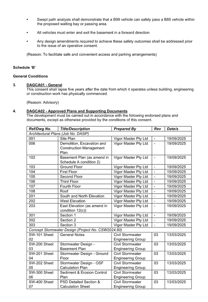
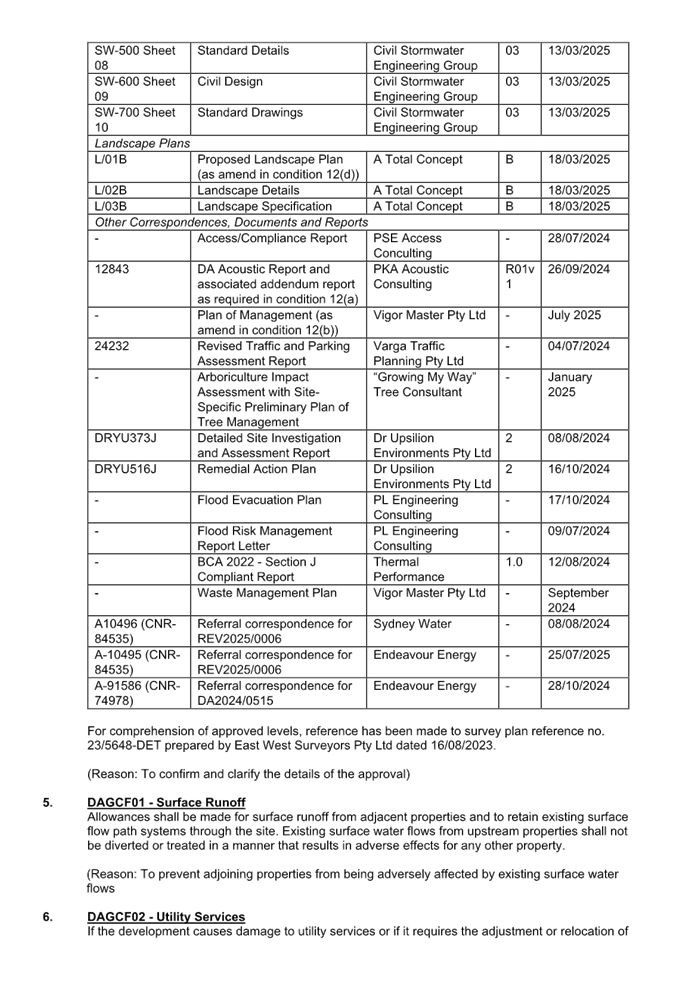
4. Address by invited
speakers
5. Reports:
- Development
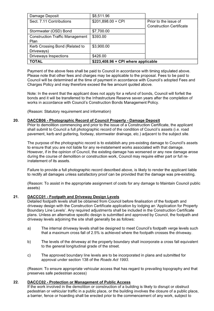
Applications
6. Closed Session Reports
Cumberland Local Planning Panel Meeting
8 October 2025
CONTENTS
Report No. Name
of Report Page
No.
Development Applications
ELPP020/25 Review
Application - 5 Irwin Place, Wentworthville........................................ 5
ELPP021/25 Development
Application -77 Warren Road, Woodpark............................ 233
ELPP022/25 Development
Application - 297-301 & 305A Parramatta Road, Auburn. 319
ELPP023/25 Development
Application - 459 Guildford Road, Guildford....................... 441
ELPP024/25 Development
Application - 2-4 Gilba Road, Pendle Hill............................ 553
ELPP025/25 Development
Application - 150 Hawkesbury Road, Westmead............... 751
ELPP026/25 Development
application - 66 Irrigation Road, Merrylands....................... 911
Cumberland Local Planning Panel Meeting
8 October 2025
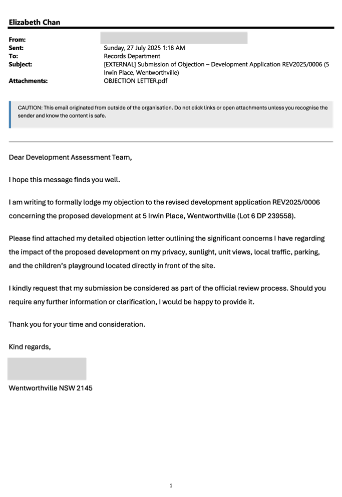
Item No: ELPP020/25
Review
Application - 5 Irwin Place, Wentworthville
Directorate: Environment
and Planning
Responsible
Officer: Executive
Manager City Planning and Development
|
Application
lodged
|
14 July 2025.
|
|
Applicant
|
I Wang.
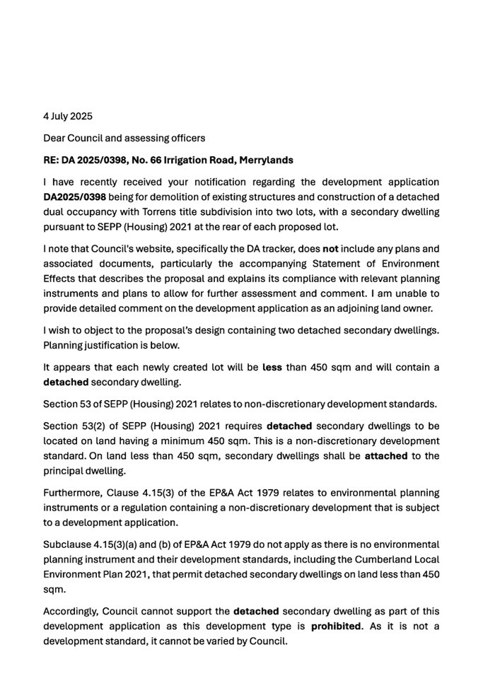
|
|
Owner
|
Zhang Wealth Investment Pty
Ltd.
|
|
Application
No.
|
REV2025/0006.
|
|
Description
of Land
|
5 Irwin Place Wentworthville.
Lot 6 in DP 239558.
|
|
Proposed
Development
|
Section 8.2 Review of the
refusal of DA2024/0515 for the demolition of the existing structures and
construction of a five (5) storey co-living housing development comprising of
30 single rooms over basement parking including external building changes and
reconfiguration of the basement parking and internal layout.
|
|
Site
Area
|
627.90 sqm.
|
|
Zoning
|
R4 High Density Residential.
|
|
Disclosure
of political donations and gifts
|
Nil disclosure.
|
|
Cost
of works
|
$3,984,000.
|
|
Heritage
|
Not Heritage Listed nor within
a Heritage Conservation Area.
|
|
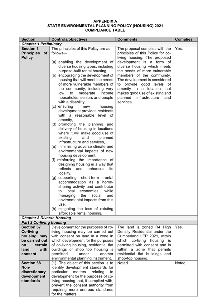
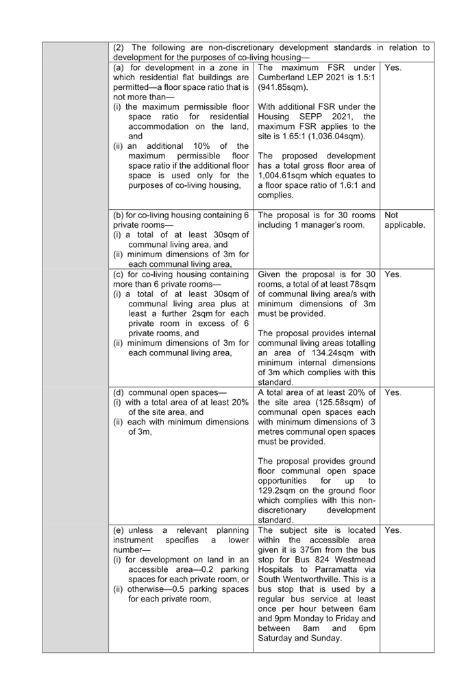
Principal
Development Standards
|
Minimum Lot Size - Housing SEPP 2021 Cl.69(1)(b)(ii)
Permissible: 800sqm.
Proposed: 627.9sqm.
Floor Space Ratio - Cumberland LEP 2021 Cl.4.4
Permissible: 1.5:1 + 10%
Housing SEPP 2021 bonus = 1.65:1.
Proposed: 1.6:1.
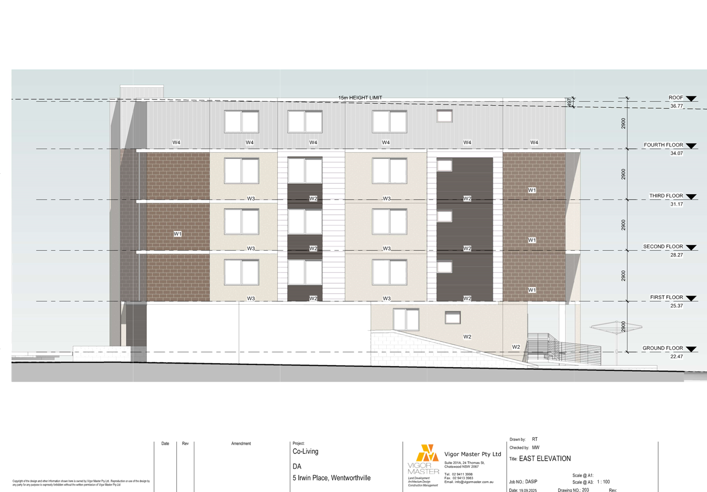
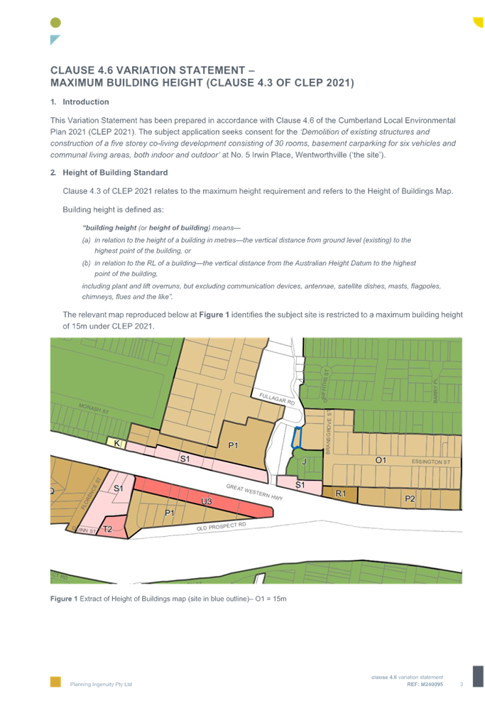
Height of Buildings -
Cumberland LEP 2021 Cl.4.3
Permissible: 15m.
Proposed: 16.008m.
|
|
Issues
|
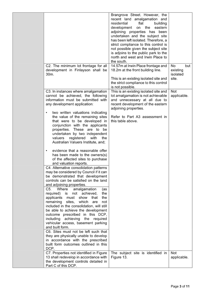
Minimum lot size.
Rear setback.
Building separation.
Height of building.
Building envelope.
Basement parking design.
Submissions.
|
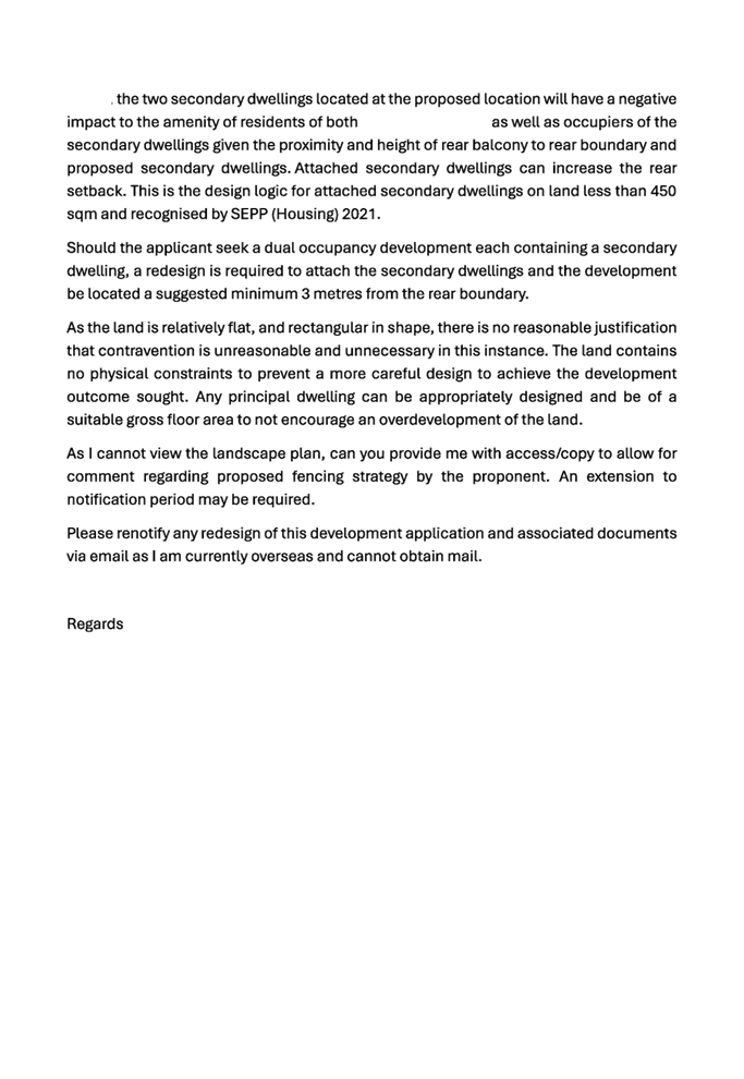
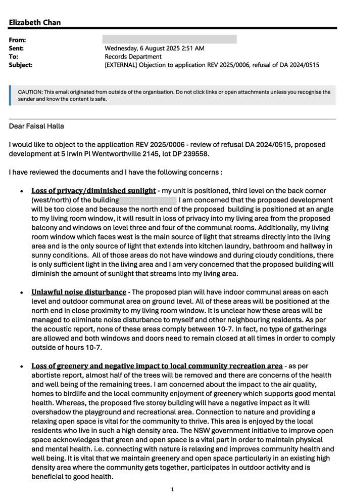
1. Review
Application 2025/0006 was lodged on the 14 July 2025 being a Section 8.2 Review
of the Refusal of DA2024/0515 for the demolition of the existing structures and
construction of a five (5) storey co-living housing development comprising of
30 single rooms over basement parking including external building changes and
reconfiguration of the basement parking and internal layout.
2. The
application was publicly notified to occupants and owners of the adjoining
properties for a period of 14 days between 24 July 2025 and 7 August 2025. In
response, 10 submissions were received.
3. The
subject site is not listed as a heritage item nor located within the heritage
conservation area in the Cumberland Local Environmental Plan 2021.
4. The
variations are as follows:
|
Control
|
Required
|
Provided
|
% variation
|
|
SEPP (Housing) 2021
Cl.69(1)(b)(ii)
Minimum lot size.
|
800sqm
|
627.9sqm
|
21.51% (172.1sqm)
|
|
SEPP (Housing) 2021
Cl.69(2)(a)(ii)
Building setbacks.
|
RearSetbac k: 12.48m.
|
Rear Setback: 6.01m.
|
48.16% or 6.47m.
|
|
SEPP (Housing) 2021
Cl.69(2)(b) Building
separation.
|
GF up to Level 3
- 6m separation between habitable space or balconies.
Level 4 and above
- 4.5m separation between non-habitable spaces.
- 9m separation between habitable space or
balconies.
|
GF up to Level 3
Habitable rooms - 3.2m
to eastern boundary.
Level 4
Non-habitable windows - 3.2m to eastern boundary.
Habitable room windows
- 3.2m to eastern boundary.
|
46.67% (2.8m)
28.89% (1.3m)
64.44% (5.8m)
|
|
Cumberland LEP 2021
Cl. 4.3
Height of building.
|
Maximum 15m.
|
Lift overrun - 16.008m
|
6.72% (1.008m)
|
|
Cumberland DCP 2021
Part B3 Section 3.1
Building Envelope.
|
Minimum 24m street frontage.
|
18.2m lot width at the front building line.
|
24.17% (5.8m)
|
|
Cumberland DCP 2021
Part B3 Section 3.2
Basement design and
Part G3 Section 4.3
Basement Parking
|
Basement walls located under the building and basement
walls 1.2m from boundary.
Basement parking within building footprint.
|
Basement outside building footprint.
|
100% (Nil)
|
|
Cumberland DCP 2021
Part G3 Section 4.3
Basement parking.
|
Basement, driveways, access/ramps be designed in
accordance with AS2890.
|
Basement not properly designed.
|
100%
|
5. The
application is referred to the Panel as the proposal is considered to be
contentious development, contravenes a development standard by more than 10%
and 10 unique submissions were received.
6. The
application is recommended for deferred commencement approval subject to
conditions as recommended in the Council’s assessment report.
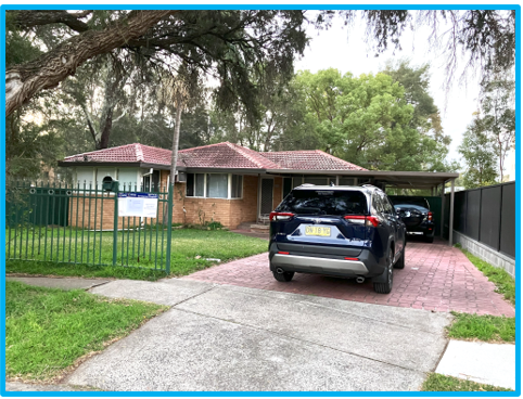
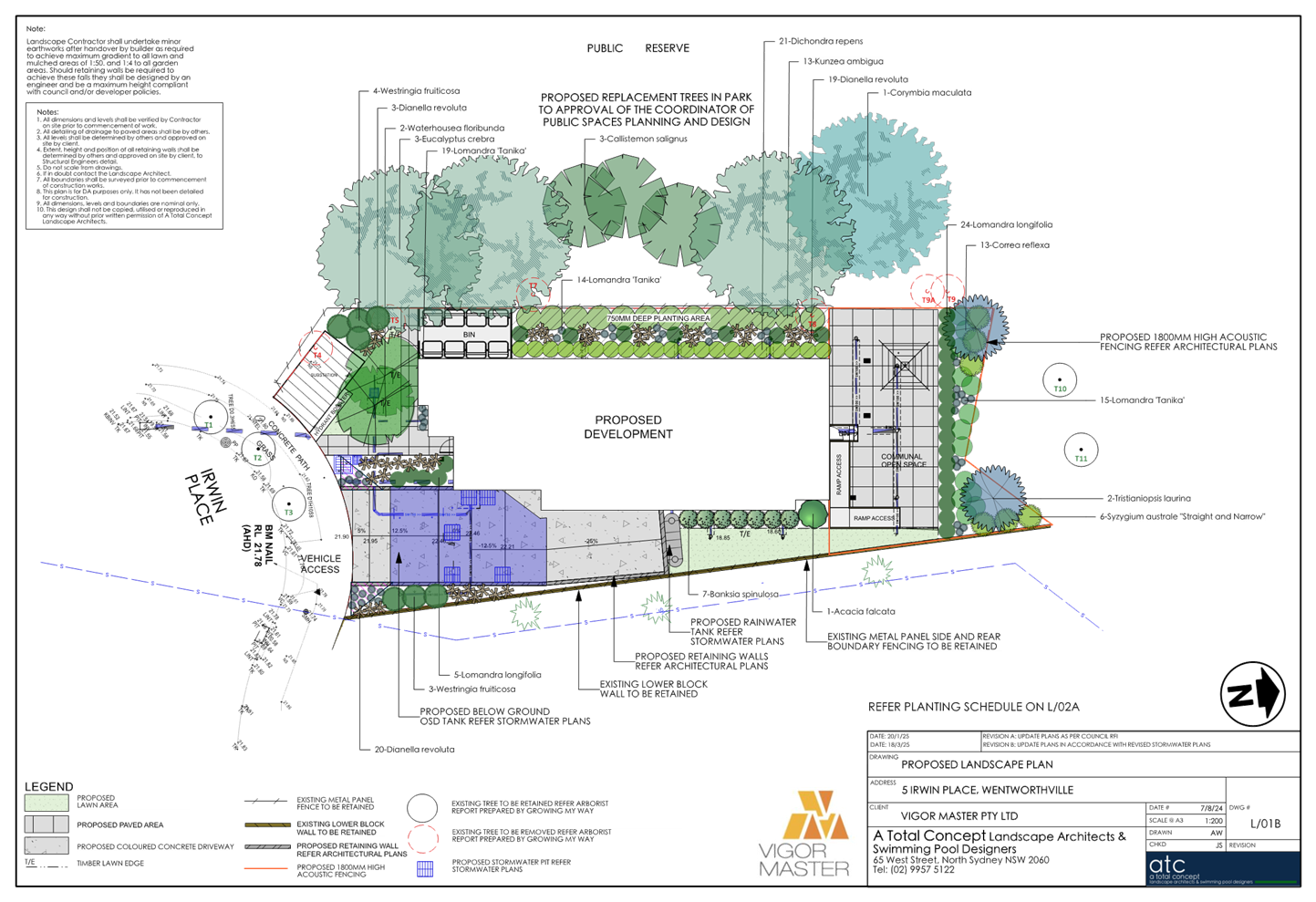
Subject Site and Surrounding
Area
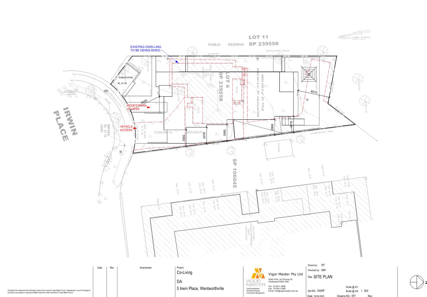
The subject site forms Lot 6 in DP
239558 and is identified as 5 Irwin Place, Wentworthville. A single storey
older style dwelling currently occupies the site.
The site is an irregular shaped
allotment located on the northern side of Irwin Place. The site has a frontage
of 13.715m and has a site area of 627.9 sqm. The subject site is zoned R4 High
Density Residential under the Cumberland Local Environmental Plan 2021
(Cumberland LEP 2021).
Irwin Place Park is located to the
north and west and a 5 storey residential apartment building lies to the east.
Land to the south is zoned R2 Low Density Residential where a number of single
and 2 storey dwelling houses exist.
The location of the site is shown
below edged in yellow.
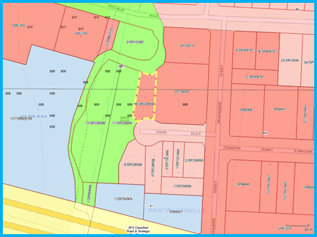
Figure
1 - Locality Plan of subject site highlighted in yellow [Source: Intramap]
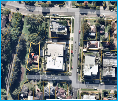
Figure
2 - Aerial view of subject site highlighted in yellow [Source: Nearmap]
Figure
3 - Street view of subject site as seen from Irwin Place
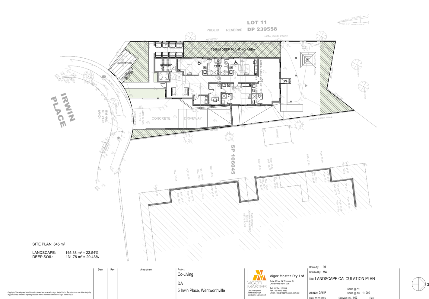
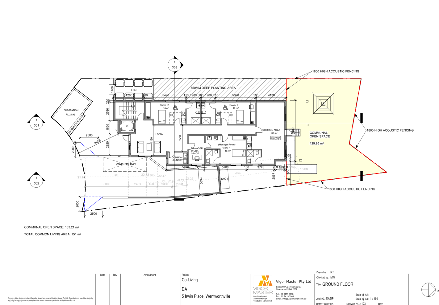
Description of The
Development
Council has received a Section
8.2A Review application for the demolition of existing structures and
construction of a 5 storey co-living housing development comprising of 30
single rooms over basement car parking. The detailed breakdown of the proposal is
shown below:
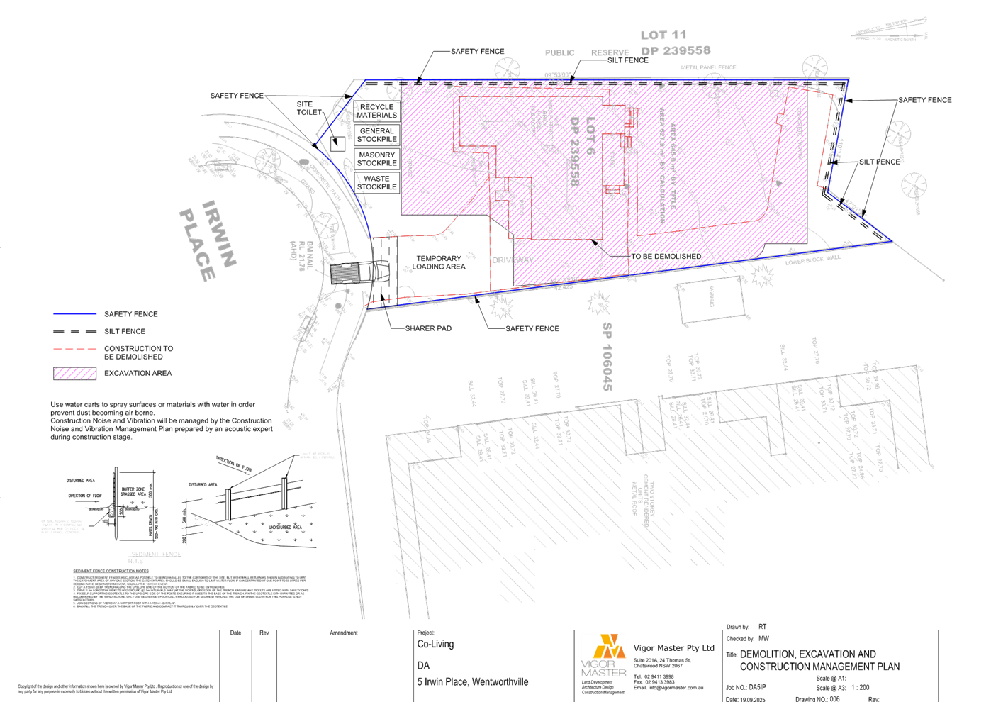
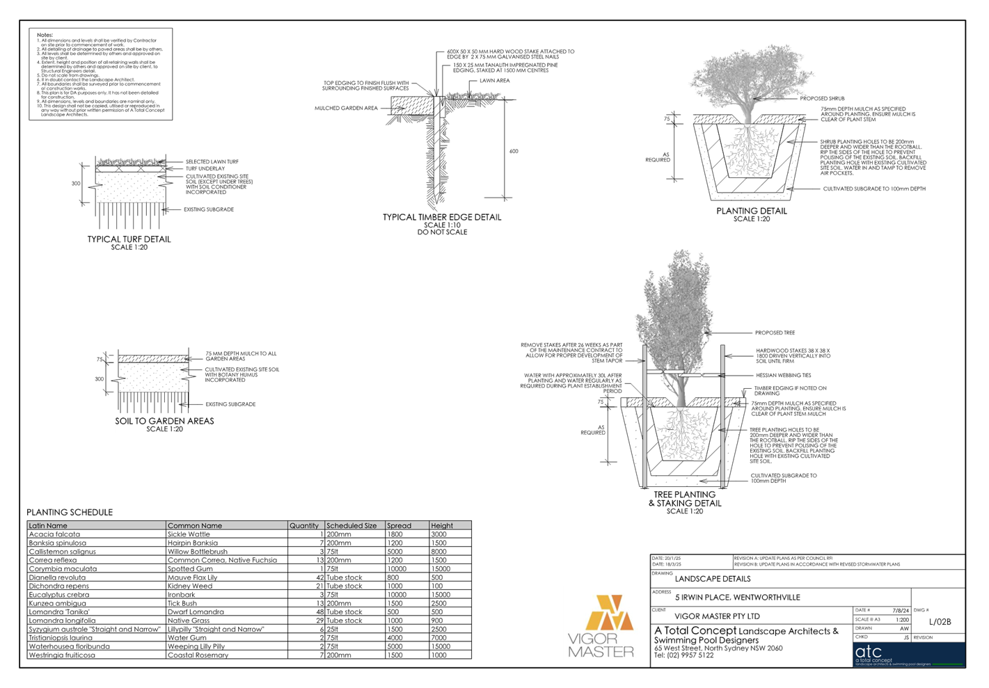
· Demolition of all
existing structures including the single storey dwelling, vehicular crossing
and associated handstand surfaces. Removal of 7 trees with a maximum height of
17.5m including 4 trees within the subject site and 3 trees within the
adjoining public open space.
· Construction works
as follows:
|
Level
|
Details
|
|
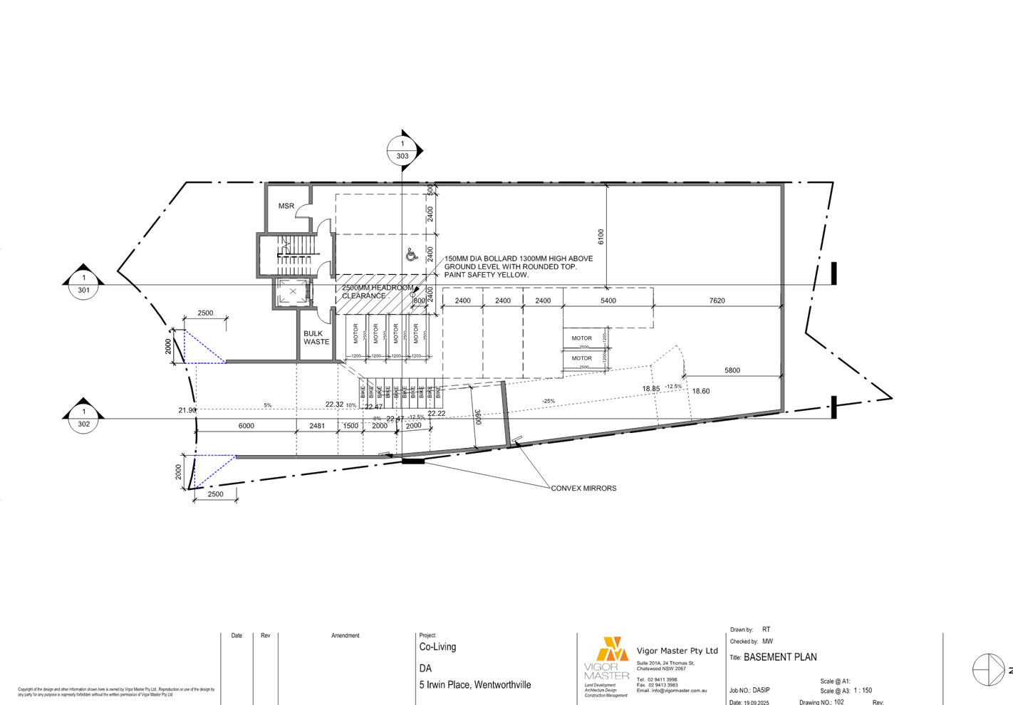
Basement
Level
|
- 6 x car parking spaces (inclusive
of 1 accessible car parking space).
- 10 x bicycle spaces and 6 x
motorcycle spaces.
- Lift and staircase.
- Bulk waste room.
- MSR room.
|
|
Ground
Floor
|
- Entry lobby.
- 3 rooms each with an ensuite and
space for a kitchenette (inclusive of 1 x manager’s room).
- 1 x communal living area with water
closet and kitchenette.
- 1 x common laundry room.
- Lift and staircase.
- Bin storage area.
- Communal open space at the rear.
- Stairs and ramp providing access to
the rear communal open space from the communal living room.
- Substation to the front of the
site.
- Vehicular access ramp to the
basement level with waiting bay.
|
|
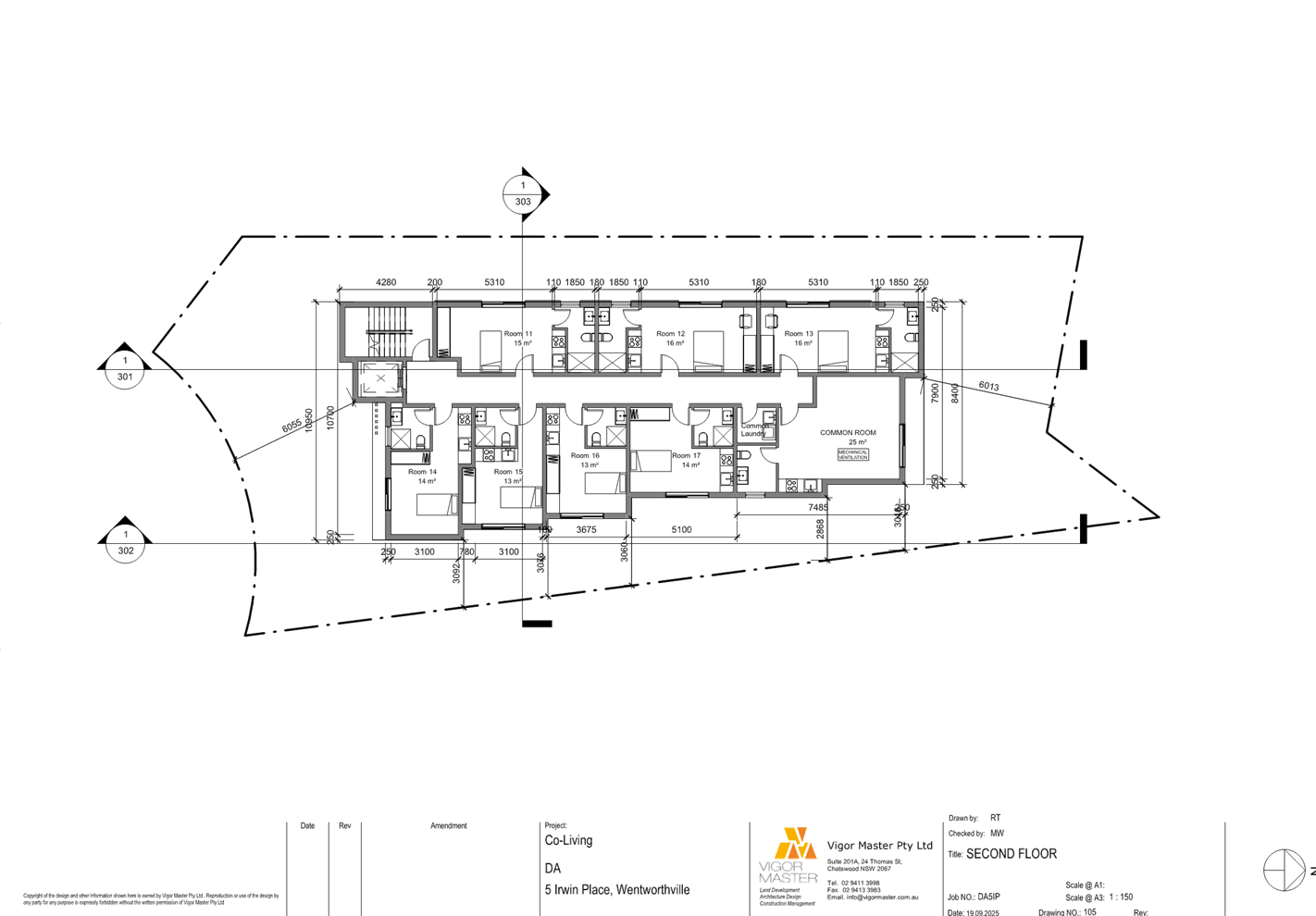
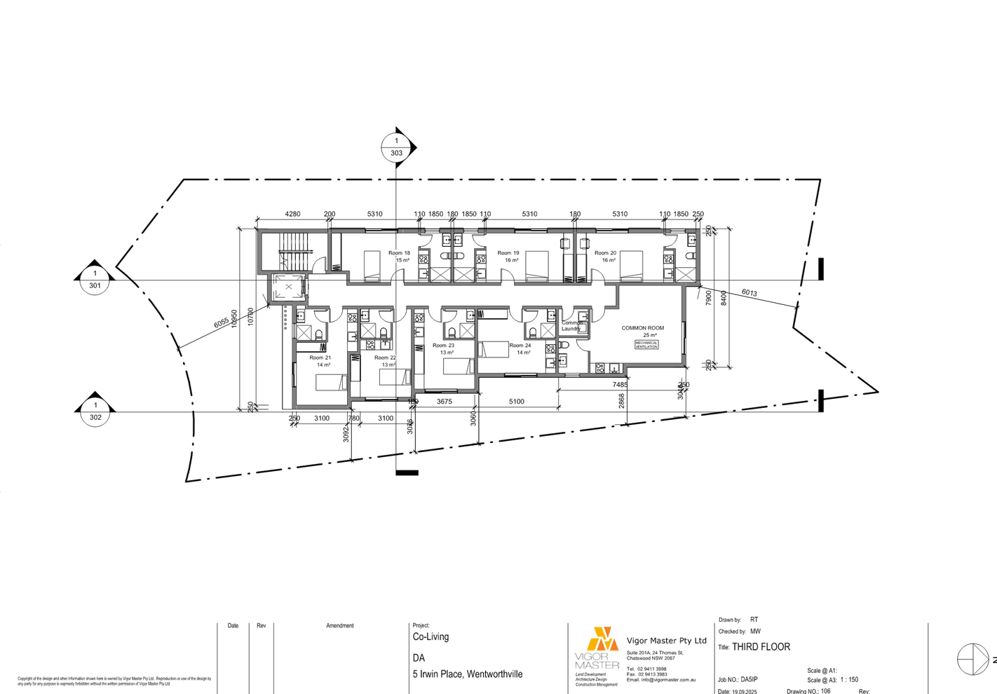
Level 1 to
3.
|
- 7 rooms
each level with all rooms having an ensuite and a kitchenette.
- 1
communal living area with water closet and kitchenette.
- 1 common
laundry room.
- Lift and
staircase.
|
|
Level 4
|
- 6 rooms each with an ensuite and a
kitchenette.
- 1 communal living area with water
closet and kitchenette with a balcony facing north.
- 1 x common laundry room.
- Lift and staircase.
|
History
|
Application No.
|
Proposal
|
Determination
|
Date
|
|
PL2023/0077
|
Construction
of a 40 room boarding house with basement parking.
|
Minutes issued.
|
08/02/2024
|
|
DA2024/0515
|
Demolition
of existing structures and construction of a five (5) storey co-living
housing development comprising of 30 single rooms over basement car parking.
|
Refused by Cumberland Local Planning Panel.
|
07/05/2025
|
Applicants Supporting
Statement
The applicant has provided a s8.2
Review - Statement of Environmental Effects dated 10 July 2025 prepared by
Planning Ingenuity which was received by Council on the 10 July 2025 in support
of the application.
Contact With Relevant
Parties
The assessing officer has
undertaken a site inspection of the subject site and surrounding properties and
has been in regular contact with the applicant throughout the assessment
process.
Internal Referrals
Development Engineering
The Review application was
referred to Council’s Development Engineer for comment who has advised
that the proposal is considered satisfactory subject to conditions to amend the
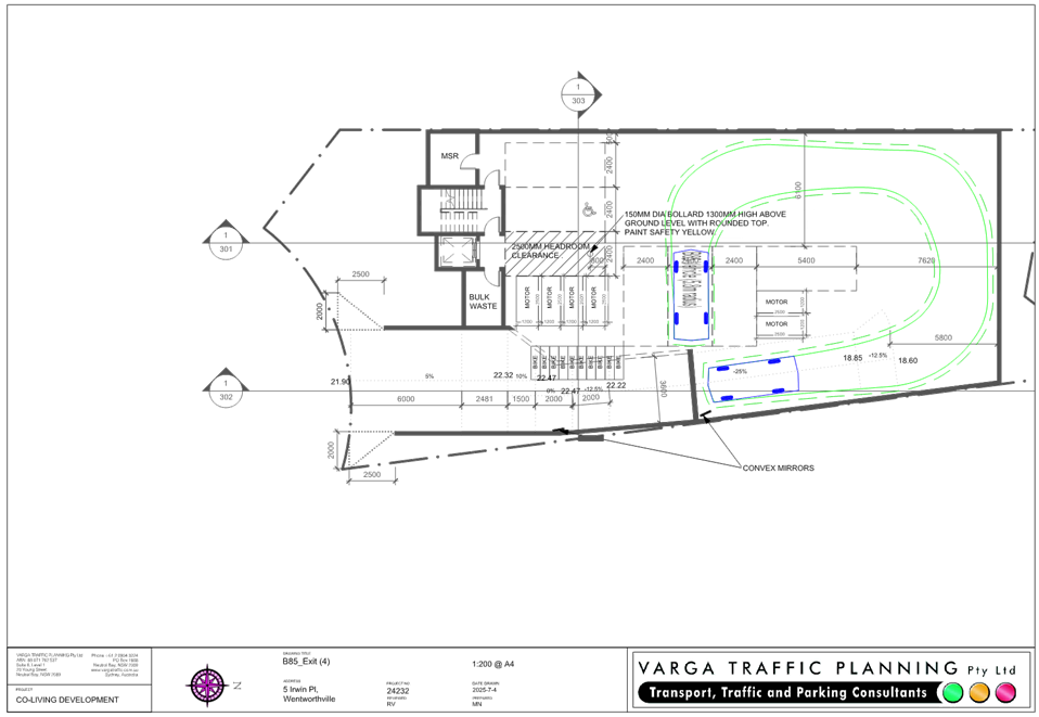
basement, ramp gradient and access design to comply with AS2890.1.
Environmental Health
The Review application was
referred to Council’s Environmental Health Officer for comment who has
advised that the acoustic report and plan of management are considered
satisfactory subject to condition.
Public Spaces Planning and
Design
The Review application was
referred to Council’s Parks and Open Space Officer for comment who has
advised that the development proposal is satisfactory and therefore can be
supported subject to recommended conditions of consent.
Tree Management
The Review application was
referred to Council’s Landscape and Tree Officer for comment who has
advised that the development remains satisfactory subject to conditions.
Waste Management
The Review application was
referred to Council’s Waste Management Officer for comment who has
advised that the development proposal is supported subject to conditions.
External Referrals
Endeavour Energy
The Review application was
referred to Endeavour Energy for comment who has advised that the development
proposal is supported subject to conditions.
Sydney Water
The Review application was
referred to Sydney Water for comment who has advised that the development
proposal is satisfactory and therefore can be supported subject to recommended
conditions of consent.
Planning Comments
The provisions of any
Environmental Planning Instruments (EP&A Act s4.15 (1)(a)(i))
Part 8 Reviews and appeals
|
Division 8.2 Reviews
|
Comments
|
|
Section 8.2(1)(a) the determination of an application
for development consent by a council, by a local planning panel, by a Sydney
district or regional planning panel or by any person acting as delegate of
the Minister (other than the Independent Planning Commission or the Planning
Secretary),
|
The applicant has made a
request to review the determination of Development Application DA2024/0515 in
the correct format.
Council will be the
determining authority for the purpose of the Review application.
|
|
Section
8.2(2) a determination or decision in connection with an application
relating to the following is not subject to review under this Division—
(a) a
complying development certificate,
(b) designated
development,
(c) Crown
development (referred to in Division 4.6).
|
This will not apply to the
application.
|
|
Section
8.3(1) An applicant for development consent may request a consent
authority to review a determination or decision made by the consent
authority. The consent authority is to review the determination or decision
if duly requested to do so under this Division.
|
The applicant has made a
request to review the determination of development application which was
determined by the Cumberland Local Planning Panel on 7 May 2025.
|
|
Section 8.3(2) A determination or decision cannot be
reviewed under this Division—
(a) after the period within which any appeal may be made
to the Court has expired if no appeal was made, or
(b) after the Court has disposed of an appeal against
the determination or decision.
|
The original development
application was determined on the 7 May 2025, in accordance with section
8.10(1)(b)(i) of EP&A Act 1979, the
review has been made within 6 months after the relevant date.
|
|
Section 8.3(3) In requesting a review, the applicant
may amend the proposed development the subject of the original application
for development consent or for modification of development consent. The
consent authority may review the matter having regard to the amended
development, but only if it is satisfied that it is substantially the same
development.
|
Whilst in making and
submitting the review, the additional information has been amended to address
all the reasons for refusal.
Following the review of the
amended information, the proposal is considered satisfied with relevant
development requirements which can be supported by Council. Refer to
discussion below.
|
|
Section
8.3(4) The review of a determination or decision made by a delegate of a
council is to be conducted—
(a) by
the council (unless the determination or decision may be made only by a local
planning panel or delegate of the council), or
(b) by
another delegate of the council who is not subordinate to the delegate who
made the determination or decision.
|
The
development application (DA2024/0515) under review was determined by
Cumberland Local Planning Panel and therefore is subject to section 8.3(5)
below.
|
|
Section 8.3(5) The review of a determination or
decision made by a local planning panel is also to be conducted by the panel.
|
This
is noted. The Panel will be considering the officers report as part of the
Review.
|
|
Section 8.4 After conducting
its review of a determination or decision, the consent authority may confirm
or change the determination or decision.
|
It is recommended that the
initial determination will be changed, and the review application is now
recommended for a deferred commencement consent subject to conditions to
reflect the changed circumstances.
|
|
Section 8.5(4) If a
determination is changed on review, the changed determination replaces the
earlier determination on the date the decision made on the review is
registered on the NSW planning portal.
|
Once this review application
is determined, it will replace the original refusal of the determination of
DA2024/0515. The related documents will be uploaded, and the determination
date will be updated on the NSW planning portal.
|
Grounds for Refusal by the
Cumberland Local Planning Panel of the Original Development Application and
commentary:
The grounds for refusal of the
original application are reviewed and addressed below:
|
No.
|
Reasons of Refusal
|
Applicant’s Response
|
Planner’s Comments
|
|
1
|
The submitted Site Plan shows spot levels which indicate
that the building will exceed the maximum height to a minor extent. As well,
only a minimal height lift over run (LOR) is shown on the drawings, which is
not consistent with information provided by the Applicant to the Council that
the LOR will be 2.7m high.
|
The revised Architectural Plans clearly outline the
maximum building height which contravenes the height standard under Clause
4.3 of CLEP. The proposed building contains a maximum height of 16.008m and
contravention of 1.008m or 6.72%. A Clause 4.6 Variation has been provided in
Annexure C which addresses the minor height contravention
|
The architectural plans have been amended to confirm the
LOR and part Level 5 of the proposed co-living housing development will
exceed the maximum height of the building that imposed to the subject site
under the Cumberland LEP 2021.
The cl.4.6 variation submitted with this review
application has been reviewed and the discussions to justify the development
standard are acceptable and can be supported by Council.
|
|
2.
|
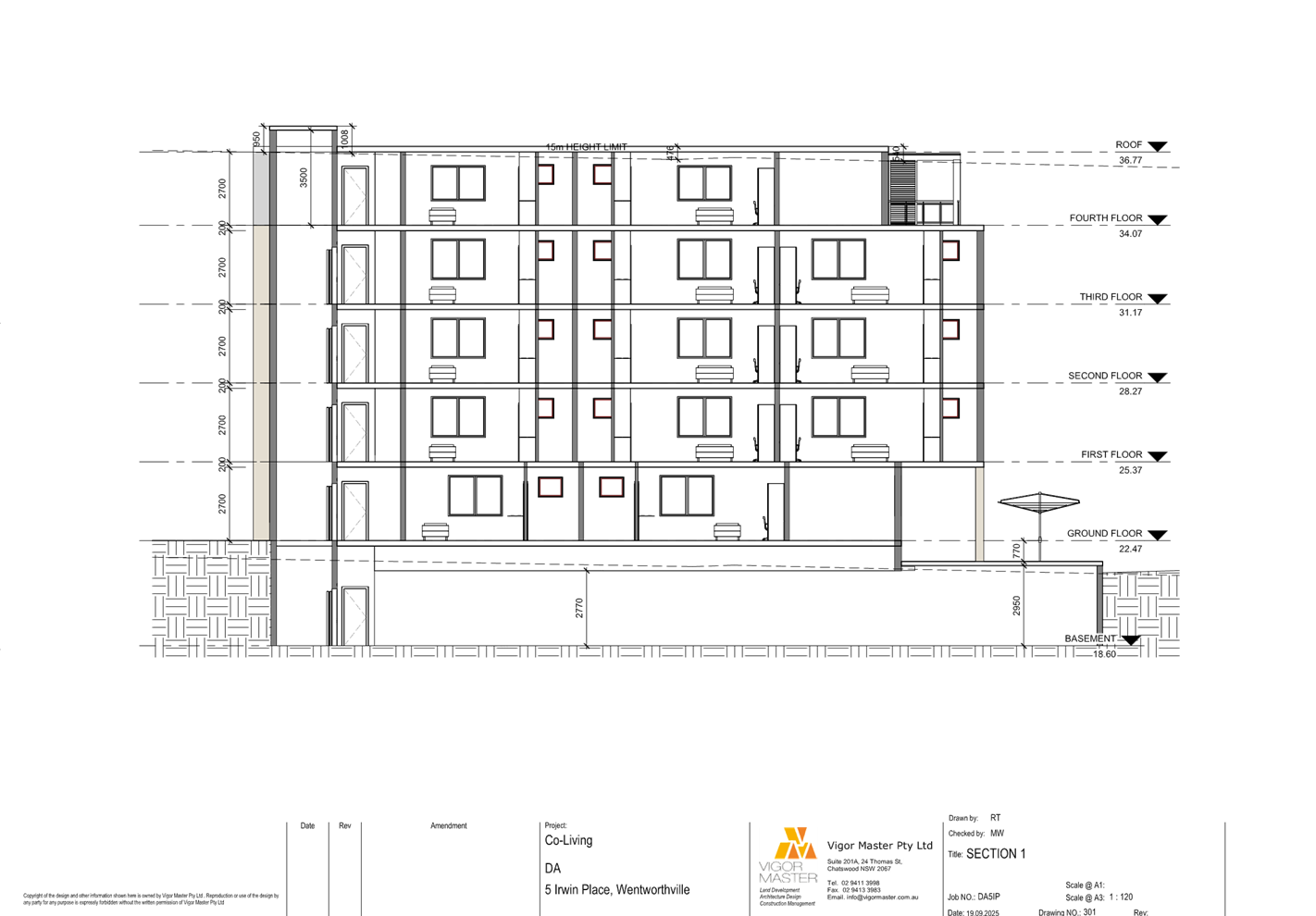
The proposal does not provide adequate floor to floor
(F-F) heights in order the provide a minimum floor to ceiling height of 2.7m,
which is desirable to provide sufficient natural ventilation and day light
access under Objective 4C-1 of the Apartment Design Guide. The F-F height of
the top floor is shown as being 2.5m, which will result in a Floor to Ceiling
Height below that allowed under the minimum under the BCA.
The F-F heights are inadequate given:
|
There is no minimum requirement for floor to floor heights
for co-living development.
Notwithstanding this, the FF heights have been increased
under the amended proposal. The FF heights of each above-ground floor are
consistently 2.9m. The floor to ceiling height of level 4 has been increased
from 2.5m to 2.7m and is now ADG (if applicable) and BCA compliant.
Specifically, a response to points (a) to (d) is provided
below:
|
The proposal has been
amended to provide the minimum floor to floor height of 2.9m to all habitable
area on all levels with 200mm thickness slab which demonstrate compliance
with the BCA.
|
|
|
a) the
size of the majority of rooms are close to the minimum size in terms of floor
area, hence internal amenity is at the minimum;
|
a) The
total number and size of the co-living rooms has been adapted. Originally, 37
single rooms were proposed. By contrast, 30 rooms are now proposed, seven (7)
are double rooms and 23 are single rooms. The proposed single rooms vary in
size from 13m2 to 16m2 and generally are no longer
‘close’ to the minimum size of co-living rooms permitted under
the Housing SEPP.
|
The measurement by
Council confirmed all co-living rooms are single rooms with the floor area
ranged between 12sqm and 14.9sqm excluding the 600mm work area in front of
the kitchen cupboard which complies with the minimum floor area of
co-living rooms permitted under the Housing SEPP 2021.
|
|
|
b) the
single window to rooms on the eastern elevation are required to be provided
with privacy screens due to the non-compliance with the side setback control,
further reducing sunlight access;
|
b) The
reconfiguration of the rooms along the eastern elevation will improve solar
access and amenity. Only three (3) rooms at L1-L4 are reliant on sunlight
from an easterly window. At ground level, only a single room is reliant on an
easterly window. This is a reduction when compared to the original scheme.
|
No change proposed to the window configuration nor
internal layout of the co-living rooms since the original development
application. Consideration has been given to the existing isolated site and
the building separation between the existing adjoining properties. It is
considered that the east facing co-living rooms will receive sufficient
sunlight with the presence of privacy screen.
|
|
|
c) the
need for windows to remain closed to maintain acoustic compliance as
recommended in the submitted Acoustic Report, will necessitate air
conditioning and/or and mechanical ventilation, an allowance for which is not
shown on the drawings; and
|
c) As
above, the number of rooms reliant on easterly windows has been reduced. Air
conditioning will be provided to ensure adequate ventilation is achieved.
|
The number of co-living rooms reliant on easterly windows
remains unchanged since the original development application. Accordingly, it
is considered that all measures recommended in the original acoustic report
will remain sufficient to the revised architectural floor plans.
|
|
|
d) construction
of the building with a slab thickness of 150mm is questioned.
|
d) The
slab thickness has been increased to 200mm.
|
The 200mm thick slab
between the floors demonstrates compliance with the BCA requirement.
|
|
3.
|
From 1. above, the height of the building including the
LOR will exceed 15m. From point 2, the building height will need to be
increased from that shown on the drawings to improve the amenity of the
rooms, to cater for services and for structural and adequate fire safety.
|
As above, the maximum building height exceeds that
permitted under CLEP and a Clause 4.6 Variation is provided in Annexure C.
The FF and FC heights have been increased to ensure adequate amenity is
achieved.
|
The architectural plans have been amended to confirm the
LOR and part Level 5 of the proposed co-living housing development will
exceed the maximum height of the building standard.
As mentioned
above, the cl.4.6 variation to development standard submitted is acceptable
and supported.
|
|
4.
|
No written submission under Clause 4.6 of CLEP 2021 to
vary the Height of buildings development standard under Clause 4.3 of CLEP
2021 has been provided. Consent must be refused.
|
A written submission under Clause 4.6 to vary the height
of building standard is provided in Annexure C.
|
As above, a cl.4.6 variation to development standard has been
submitted for Council’s consideration and considered acceptable to
support.
|
|
5.
|
Inadequate information is presented in the application:
|
|
|
|
|
a) It
is not demonstrated that the basement car parking complies with the required
standards for access as no updated swept paths for the current proposal have
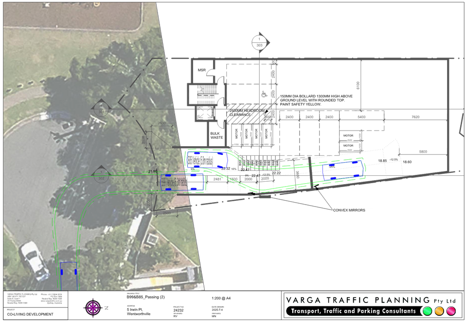
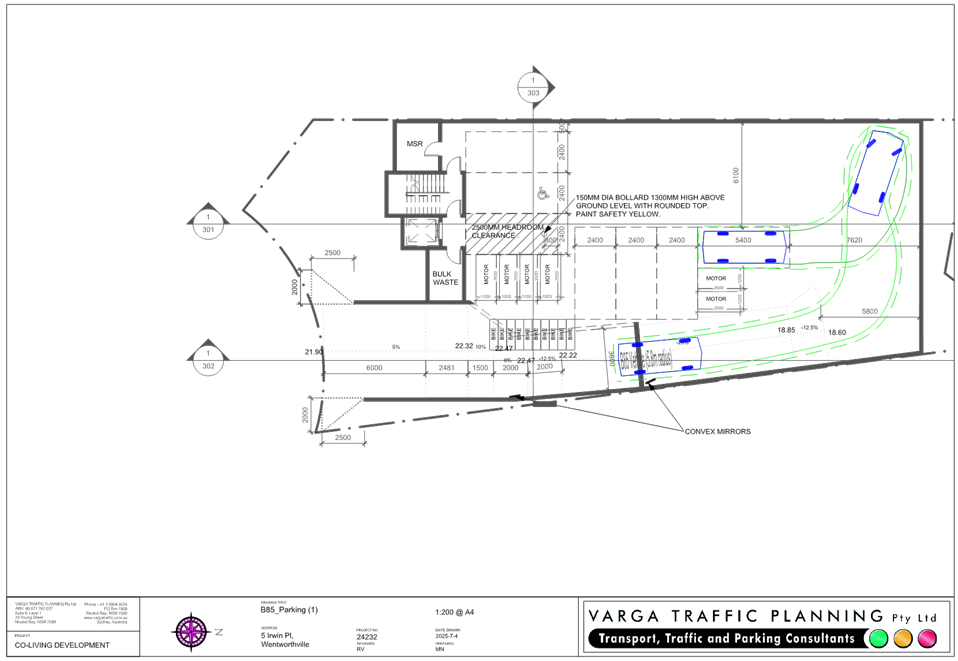
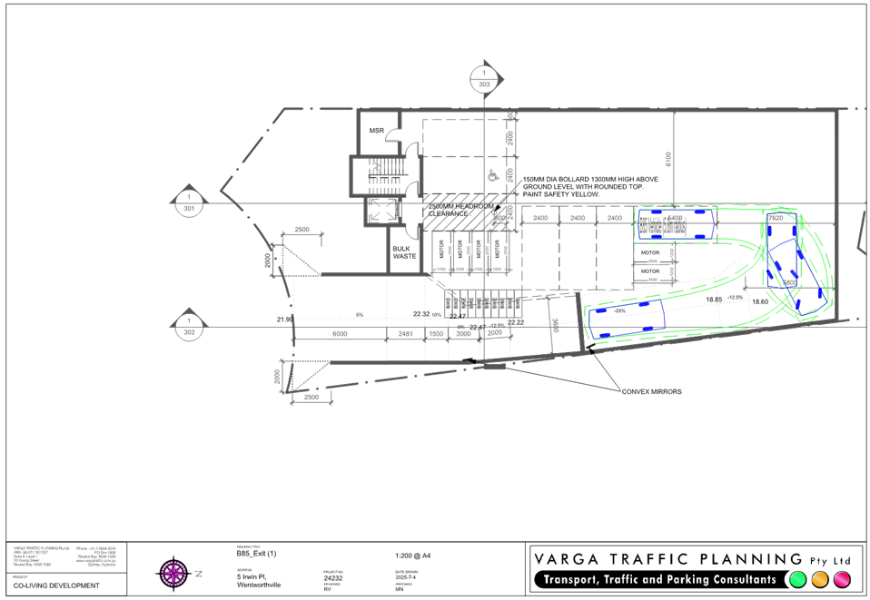
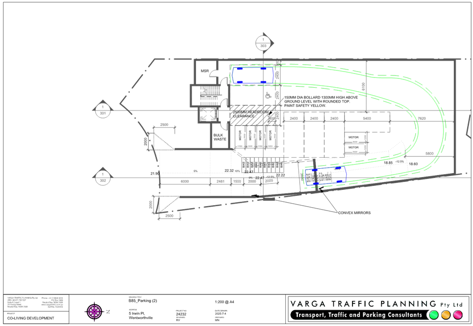
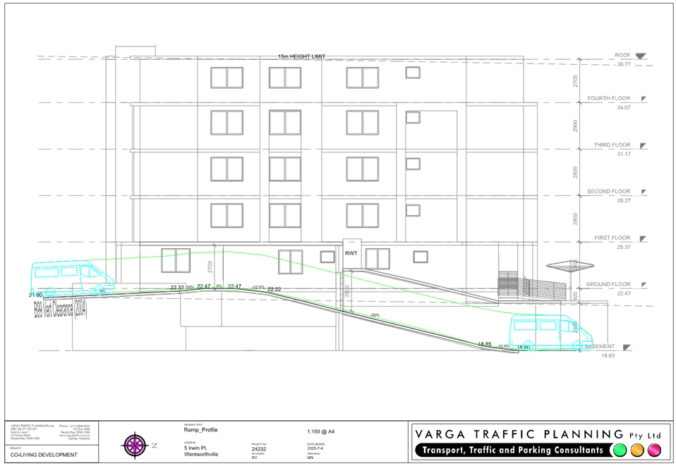
been provided. The current layout appears problematic in this regard.
|
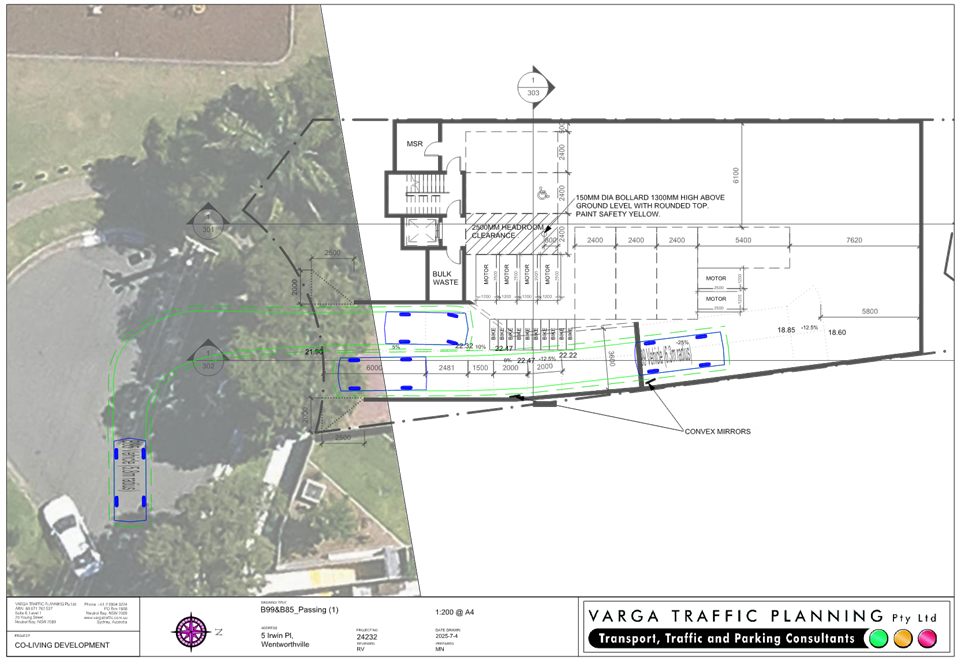
Refer to amended Traffic Assessment submitted under
separate cover.
|
Swept path diagrams have been
submitted with the amended Traffic Assessment report. The basement car
park layout may be supported subject to deferred commencement condition
addressing the remaining issues.
|
|
|
b) The
Plan of Management is inadequate as:
i. it
contains information inconsistent with the current proposal with regard to
the maximum occupancy and cites the wrong LGA.
ii. does not contain the recommendations of the
Acoustic Report with regards to restrictions on the use of communal open space.
iii. does not contain the recommendations with
regard to the requirements for an emergency plan for flooding.
|
Refer to the Plan of Management submitted under separate
cover.
|
An amended Plan of Management
has been submitted with this review application. The document has been
reviewed by Council’s Environmental Health unit who identified the
amended Plan of Management can be supported subject to conditions.
|
|
6.
|
Consent is unable to be granted as inadequate information
has been presented to enable the Panel as the consent authority to be
satisfied that clause 5.21(2)(a) – (e) of CLEP 2021 has been satisfied,
and to consider clause 5.21(3)(a) to (d) of CLEP 2021 regarding flood
planning.
|
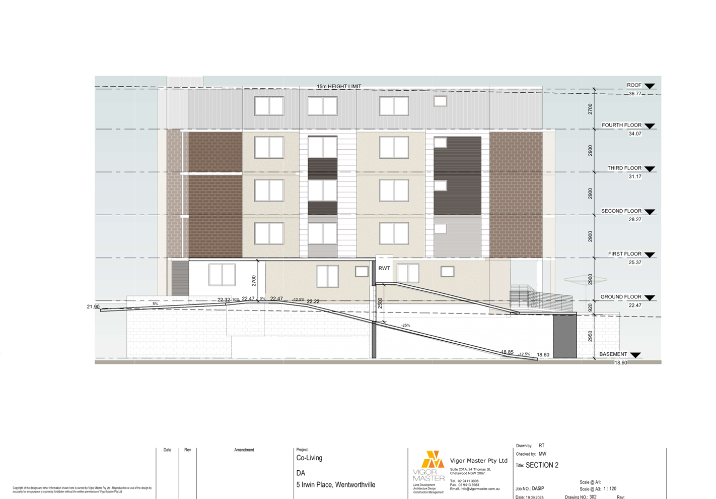
A Flood Risk Management Report Letter prepared by PL
Engineering Consulting and was submitted as part of DA-2024/0515. The Flood
Report confirms the ground level is required to be designed to RL 22.2m to
achieve 500mm above the 1% AEP flood level at the upstream of the building.
An assessment against the relevant flood controls of Clause 5.21(2) and (3)
is provided confirming the proposal has been designed based upon
Council’s flood data and will not result in adverse effect to the
environmental.
|
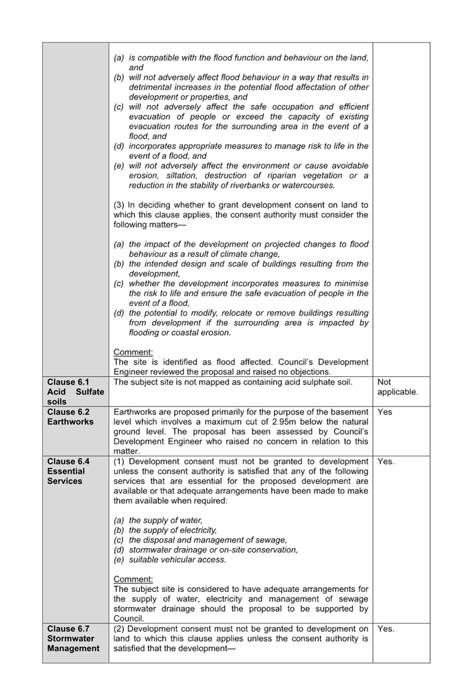
The Flood Study and Flood Risk Management Report Letter submitted with the
review application have been reviewed by Council’s Development Engineer
who raise no concern in relation to the flood matters.
|
State Environmental Planning
Policies
The proposed development is
affected by the following State Environmental Planning Policies:
|
State
Environmental Planning Policies (SEPPs)
|
Relevant
Clause(s)
|
Compliance
with Requirements
|
|
State Environmental Planning Policy (Biodiversity and
Conservation) 2021.
|
Chapter 2 -
Vegetation in non Rural Areas.
|
The review application seeks
Council’s approval to removal of 7 trees with a maximum height of
17.5m.
The proposal does not exceed
the biodiversity offsets scheme threshold. Council’s Landscape and Tree
Officer has reviewed the proposed tree removal and raised no objections. The
original conditions suggested for any consent issued remains applicable to
the latest application.
|
|
Chapter 6 -
Water Catchments.
Sydney Harbour Catchment.
|
It
is determined that given the location of the site location, a detailed
assessment is not required given that there is no direct impact upon the
catchment and no direct impact upon watercourses. As such, the development is
acceptable.
|
|
State
Environmental Planning Policy (Housing) 2021
Co-living housing
|
Chapter 3 -
Diverse housing
Part 3
|
The issues of the development being:
· Height of the building.
· Basement design.
Have been addressed or capable of being addressed in a
satisfactory manner.
Therefore, the proposal can be supported with its design
and the application is recommended for approval subject to conditions.
A comprehensive Housing SEPP 2021 assessment is contained
in Appendix A.
|
|
State Environmental Planning Policy (Industry and
Employment) 2021.
|
Chapter 3 -
Advertising and Signage.
|
No signage is proposed as part of the development
application and thus no assessment of signage is required.
|
|
State Environmental Planning Policy (Resilience and
Hazards) 2021.
|
Chapter 2 -
Coastal Management.
|
The subject site is not
identified as a coastal wetland or ‘land identified as “proximity
area for coastal wetlands” or coastal management area.
|
|
Chapter 4 -
Remediation of Land.
Part 4.6.
|
The Detailed Site Investigation dated 8 August 2024 and
Remedial Action plan (RAP) dated 16 October 2024 prepared by Dr Upsilon
Environments Pty Ltd are submitted with the s.8.2 review.
The reports were reviewed by Council’s Environmental
Health Officer who raised no objection subject to the imposition of all
recommendations listed in the RAP should the proposal to be supported by the
Panel.
|
|
State
Environmental Planning Policy (Sustainable Buildings) 2022
|
Chapter 2 -
Standards for residential
development
|
Schedule 7 of the Environmental Planning and Assessment
Regulation 2021 (EP&A Reg 2021), co-living development is not defined as
a BASIX building as below:
i) BASIX building means a building that contains at
least 1 dwelling, but does not include the following—
ii) (a) hotel or motel accommodation,
iii)
(b) a boarding
house, hostel or co-living housing that—
iv) (i) accommodates more than 12 residents, or
v)
(ii) has a gross
floor area exceeding 300sqm.
Accordingly, Chapter 2 of the Sustainable Buildings SEPP
2022 is not applicable.
|
|
State Environmental Planning Policy (Transport and
Infrastructure) 2021
|
Chapter 2 -
Infrastructure.
|
Transport and Infrastructure SEPP 2021 is relevant to the
development application as follows:
Division 5 Subdivision 2 Clause 2.48
The existing overhead electricity power line currently
parallels the site along Irwin Place. The development is referred to
Endeavour Energy who has advised that the proposal can be supported with
conditions.
|
Statement Environmental
Planning Policy (Housing) 2021 (Housing SEPP 2021) - Chapter 3 Diverse housing
The Housing SEPP 2021 applies to
the development and a comprehensive assessment of the Housing SEPP 2021 is
provided at Appendix A. An assessment has been undertaken against the relevant
provisions identified in Chapter 3 Part 3 Co-living housing and the following
numerical variations are identified:
· Minimum lot
size
Section 69(1)(b)(ii) -
Development consent must not be granted for development for the purposes of
co-living housing unless the consent authority is satisfied that the minimum
lot size for the co-living housing is not less than 800sqm.
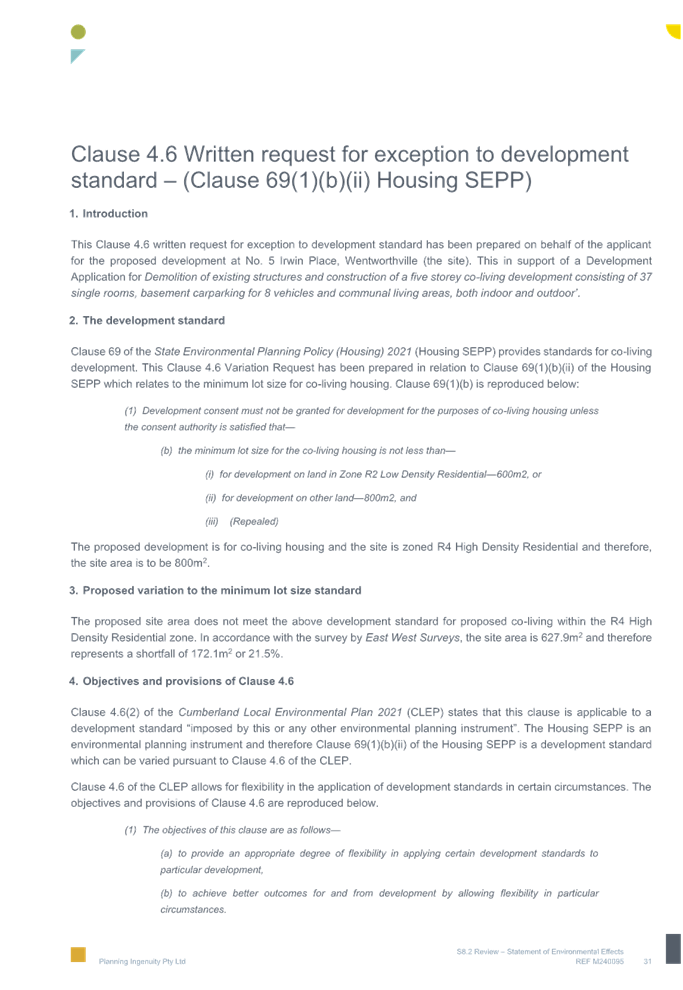
Planner’s comments: The
site has an area of 627.9sqm, which is a shortfall of 172.1sqm of the minimum
800sqm. This presents a 21.51% variation to the numerical standard.
The subject site is an existing
isolated site that is bounded by the Irwin Place Park to the west (side) and
north (rear) and the existing 5 storeys residential apartment building to the
east.
A Clause 4.6 Variation request
is submitted and addressed below.
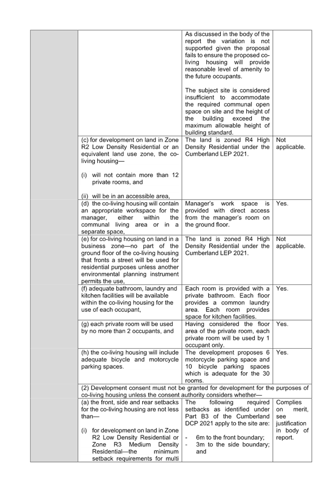
· Setbacks
Section 69(2)(a)(ii) -
Development consent must not be granted for development for the purposes of
co-living housing unless the consent authority considers whether the front,
side and rear setbacks for the co-living housing are not less than the minimum setback
requirements for residential flat buildings under a relevant planning
instrument.
Planner’s comments: The
required rear setback under Part B3 of the Cumberland DCP 2021 for no less than
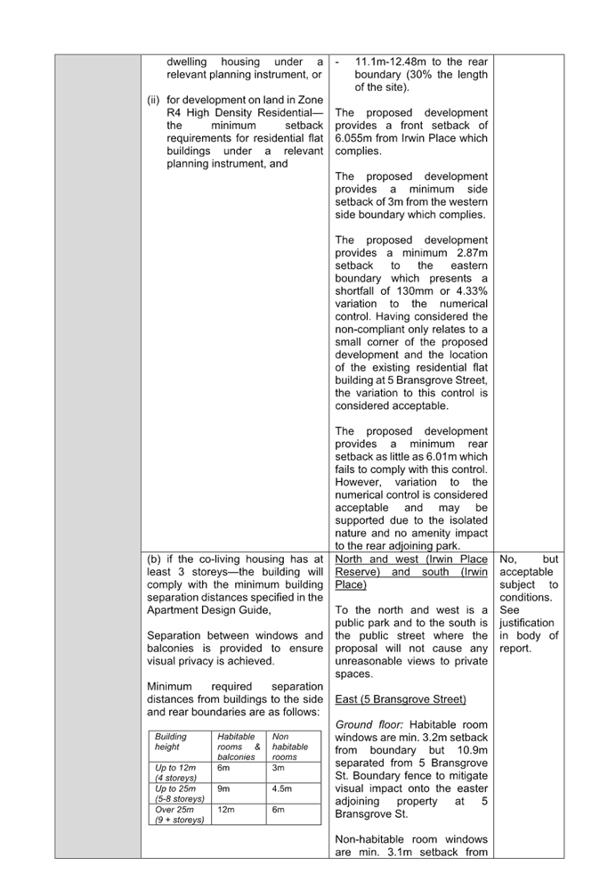
30% of the lot length is applicable to the site.
The subject site is irregular in
shape and requires a variable rear setback of between 11.1m and 12.48m.
As shown on the architectural
plans, the proposed co-living housing will provide a minimum 6.01m from rear
property boundary (north) which presents a variation of between 45.86% and
48.16% to the standard.
This rear setback non-compliance
is the consequence of the isolated nature and under-sized lot of the subject
site. However, the numerical variations are considered acceptable in this case
given the building provides a compliant front setback to ensure consistency
with the streetscape as seen from Irwin Place. The subject site adjoins Irwin
Place Park to the rear and the variation to the rear setback will not result in
amenity issues to the neighbouring properties.
Therefore, the non-compliance is
considered acceptable and can be supported for the reasons outlined above.
· Building
separation
Section 69(2)(b) - Development
consent must not be granted for development for the purposes of co-living
housing unless the consent authority considers whether the building will comply
with the minimum building separation distances specified in the Apartment
Design Guide (ADG) if the co-living housing has at least 3 storeys.
Planner’s comments:
The ADG requires a 6m setback on the ground floor to Level 3 (fourth storey)
for habitable rooms (up to 12m, 4 storeys) from the side and rear boundaries.
The Level 4 (fifth storey) requires a 9m setback for habitable rooms (up to
18m, 8 storeys) from the side and rear boundaries.
The separation distance between
habitable rooms / balconies of the proposed building and the eastern side
boundary is 3.2m only on all levels and are less than the requirements stated.
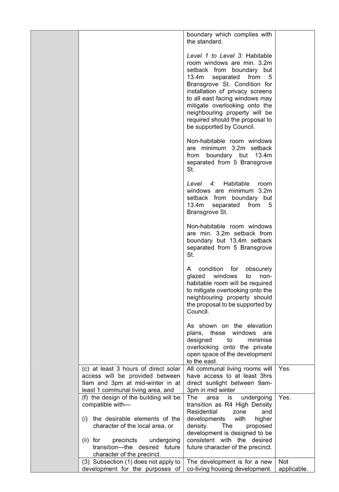
Review of the approved building
plans of the eastern adjoining residential flat building at 5 Bransgrove Road,
Wentworthville (CC2022/0290) identifies that the building is constructed to
provide a 7.4m setback on the ground floor level, 9.9m setback on Levels 1 to 3
and 10.22m on Level 4 from the western side boundary which is the common side
boundary with 5 Irwin Place. This presents the building separation in
accordance with the table below:
|
Floor Level
|
ADG setback requirement
between habitable rooms / balconies
|
Setback from eastern side boundary
|
5 Bransgrove St setback from western side boundary
|
Total building separation
|
|
Ground floor
|
6m
|
3.2m
|
7.4m
|
10.6m
|
|
Level 1, 2 and 3
|
6m
|
3.2m
|
9.9m
|
13.1m
|
|
Level 4
|
9m
|
3.2m
|
10.22m
|
13.42m
|
The east facing windows of the
co-living rooms on Level 1 to 3 are setback 13.1m from the balconies of 5
Bransgrove Street which is considered adequate and acceptable in this instance.
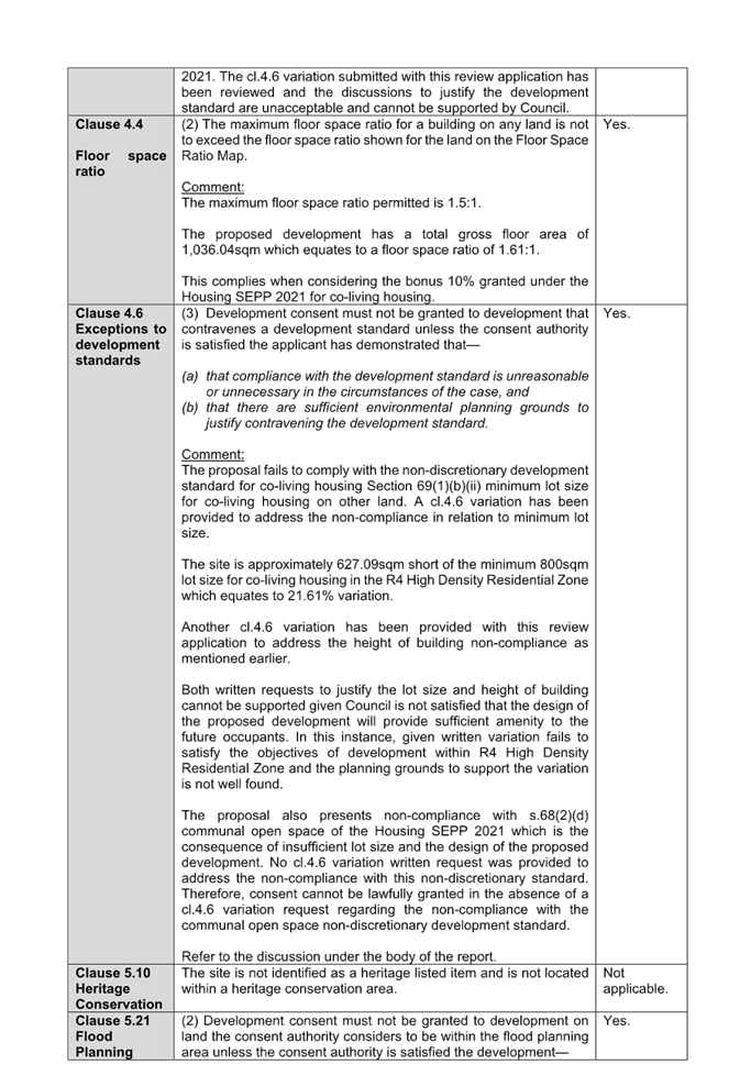
Local Environmental Plans
Cumberland Local
Environmental Plan 2021
The provision of the Cumberland
Local Environmental Plan 2021 (Cumberland LEP 2021) is applicable to the
development proposal. It is noted that the development achieves compliance with
most of the key statutory requirements of the Cumberland LEP 2021 and the
objectives of the R4 High Density Residential zone.
(a) Permissibility
The provision of the Cumberland
Local Environmental Plan 2021 is applicable to the development proposal.
The proposed development is
defined as ‘co-living housing’
co-living housing
means a building or place that—
(a) has at
least 6 private rooms, some or all of which may have private kitchen and
bathroom facilities, and
(b) provides
occupants with a principal place of residence for at least 3 months, and
(c) has
shared facilities, such as a communal living room, bathroom, kitchen or
laundry, maintained by a managing agent, who provides management services 24
hours a day,
but does not include
backpackers’ accommodation, a boarding house, a group home, hotel or
motel accommodation, seniors housing or a serviced apartment.
Note - Co-living housing is a
type of residential accommodation—see the definition of that term
in this Dictionary.
Pursuant to Section 67 of the
Housing SEPP 2021, co-living housing development may be carried out with
consent on land in a zone which development for the purposes of co-living
housing, residential flat buildings and shop top housing is permitted under Chapter
5 or another environmental planning instrument. Residential Flat Buildings and
shop-top housing are permitted with consent in an R4 High Density Residential
zone under the Cumberland LEP 2021. Therefore, the proposed development is
permissible pursuant to Section 67 of the Housing SEPP 2021.
The relevant matters to be
considered under Cumberland LEP 2021 and the applicable clauses for the
proposed development are summarised below. A comprehensive Cumberland LEP 2021
assessment is contained at Appendix B.
|
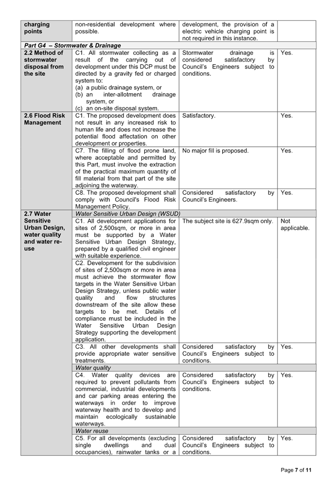
Development Standard
|
Compliance
|
Discussion
|
|
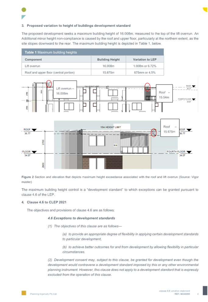
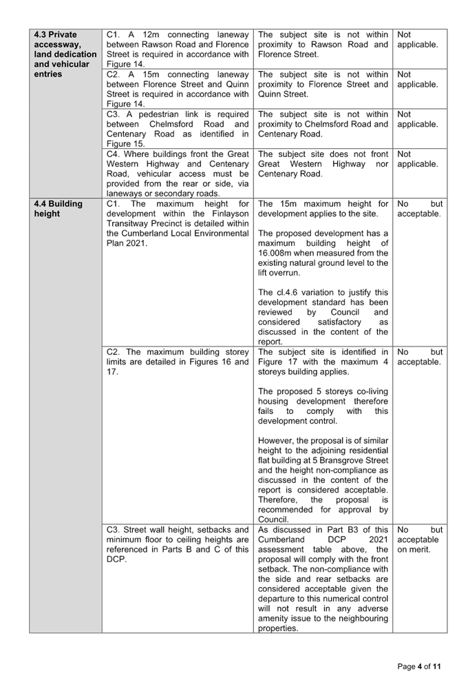
Clause 4.3
Height of Buildings Max. 15m
|
No
|
Proposed 5 storey co-living
housing with a maximum building height of 16.008m.
|
|
Clause
4.4
Floor Space Ratio
Max. 1.5:1 + 10% Housing SEPP 2021 bonus = 1.65:1
|
Yes
|
The proposed development has a total gross floor area of
1,004.61sqm which equates to a floor space ratio of 1.6:1.
This complies when considering the bonus 10% granted under
the Housing SEPP 2021 for co-living housing.
|
|
Clause
4.6
Exceptions to Development Standards
|
Yes
|
Two cl 4.6 written justifications to vary the minimum lot
size and the height of building are provided and the discussions to justify
the development standard are acceptable and can be supported by Council.
|
(b) Clause
4.6 - Exceptions to development standards
Clause 4.6 aims to achieve better
design outcomes for and from development by allowing an appropriate degree of
flexibility to development standards if particular circumstances are satisfied.
Consent may only be granted upon
the consent authority being satisfied that the applicant has demonstrated in a
document submitted with the application that (a) compliance with the
development standard is unreasonable or unnecessary in the circumstances and
(b) there are sufficient environmental planning grounds to justify the
contravention of the development standard.
i. Minimum
Lot Size
The application seeks to vary the
development standard for minimum lot size for co-living housing under section
69(1)(b)(ii) of the Housing SEPP 2021.
(a) compliance
with the development standard is unreasonable or unnecessary in the
circumstances.
The decision of Wehbe v
Pittwater Council (2007) 156 LGERA 446; [2007] NSWLEC 827, affirmed in Initial
Action Pty Ltd v Woollahra Municipal Council [2018] NSWLEC 118 set out five
common and non-exhaustive ways in which an applicant might demonstrate that
compliance with a development standard is unreasonable or unnecessary. They
were that:
i) the
objectives of the development standard are achieved notwithstanding
non-compliance with the standard.
ii) the
underlying objective or purpose is not relevant to the development with the
consequence that compliance is unnecessary.
iii) the
underlying objective or purpose would be defeated or thwarted if compliance was
required with the consequence that compliance is unreasonable.
iv) the
development standard has been virtually abandoned or destroyed by the
Council’s decisions in granting development consents that depart from the
standard and hence compliance with the standard is unnecessary and
unreasonable.
v) the
zoning of the particular land on which the development is proposed to be
carried out was unreasonable or inappropriate so that the development standard,
which was appropriate for that zoning, was also unreasonable or unnecessary as
it applied to that land and that compliance with the standard in the
circumstances of the case would also be unreasonable or unnecessary.
Applicant’s
justification: The proposal satisfies the principles identified in the
Housing SEPP 2021 and the Cumberland DCP 2021 in accordance with the Wehbe v
Pittwater Council (2007) 156 LGERA 446; [2007] NSWLEC 827 despite the
non-compliance to the numerical development standard.
The subject site is isolated and
constrained with no opportunity to amalgamate with surrounding development. The
proposed co-living housing development will “encourage” housing for
more vulnerable members of the community that is compatible with the desired
future character of the locality and consistent with the density envisaged by
the R4 High Density Residential zone. The proposal is compliant with building
height and FSR controls which helps shape the desired bulk, scale and character
of the site. The variation to the standard does not result in site planning or
building design, which is inconsistent with the desired future character, nor
does it impact the amenity of future occupants or neighbouring properties.
In addition, the proposed
development has been designed to minimise impacts on surrounding properties in
terms of views, privacy, overshadowing and visual instruction. The proposal
will provide consistent streetscape alignment, side setbacks and building
height and the extent of view loss caused by the non-compliant of lot size
would be acceptable.
Therefore, the site area is
demonstrably capable of accommodating the development and is considered
acceptable with regards to the assumed objective.
Planner’s comments:
The variation to the minimum lot size for co-living housing on the site is
supported by Council given the existing isolated nature of the site.
As discussed in the report, the
amended proposal has incorporated sufficient communal open space on site and
the excessive amount of communal living area to the proposed co-living housing
development. In this regard, the proposed development is will provide a
reasonable level of residential amenity with the locality.
(b) there
are sufficient environmental planning grounds to justify the
contravention of the development standard.
In respect of there being
sufficient environmental planning grounds to justify the contravention of the
development standard, Initial Action found that although the phrase
‘environmental planning’ is not defined, it would refer to grounds
that relate to the subject matter, scope and purpose of the Environmental
Planning and Assessment Act 1979, including the objects in section 1.3. To
be sufficient, the environmental planning grounds advanced in the written
request must justify the contravention of the development standard, not simply
promote the benefits of carrying out the development as a whole Four2Five
Pty Ltd v Ashfield Council [2015] NSWCA 248.
Applicant’s
justification: The applicant’s justification on environmental
planning grounds is noted given the subject site is isolated and effectively
rule out of any potential amalgamation with respect to the existing surrounding
developments. It is also noted that co-living housing is an appropriate use and
economic use for the subject site given it is highly accessible nature and
proximity to services.
The social benefits of providing
additional affordable housing within a highly sought after location should be
given weight in the consideration of the variation request. It would be
contrary to the public interest to deny the variation due the non-compliance
and halt the delivery of much needed accommodation in an accessible and
strategic location.
It is considered that there is an
absence of any significant material impacts attributed to the breach on the
amenity or the environmental values of surrounding properties, the amenity of
future building occupants and on the character of the locality.
The above environmental planning
grounds are unique circumstances to the proposed development, particularly
given the isolated nature of the site with respect to the high density,
ownership pattern of the neighbouring property to the east of the site. The
proposal will provide for a better planning outcome than a strictly compliant
development in many respects. Therefore, there are sufficient environmental
planning grounds to justify contravening the development standard.”
Planner’s comments:
The applicant’s justification is considered to be well founded and the
proposal as amended can be supported by Council subject to a merit assessment
given that the proposal has incorporated sufficient communal open space and
communal living area on site despite the under-sized lot.
Therefore, Council is satisfied
that the proposal in its current design is compatible with the future desire
character of the area. Therefore, Council is satisfied that the variation
request to the minimum lot size may be supported.
ii. Height
of Building
The application seeks to vary the
development standard for height of building for under clause 4.3 of the
Cumberland LEP 2021 that requires the height of buildings not to exceed 15m on
the subject site.
(a) compliance
with the development standard is unreasonable or unnecessary in the
circumstances.
The decision of Wehbe v
Pittwater Council (2007) 156 LGERA 446; [2007] NSWLEC 827, affirmed in Initial
Action Pty Ltd v Woollahra Municipal Council [2018] NSWLEC 118 set out five
common and non-exhaustive ways in which an applicant might demonstrate that
compliance with a development standard is unreasonable or unnecessary. They
were that:
i) the
objectives of the development standard are achieved notwithstanding
non-compliance with the standard.
ii) the
underlying objective or purpose is not relevant to the development with the
consequence that compliance is unnecessary.
iii) the
underlying objective or purpose would be defeated or thwarted if compliance was
required with the consequence that compliance is unreasonable.
iv) the
development standard has been virtually abandoned or destroyed by the
Council’s decisions in granting development consents that depart from the
standard and hence compliance with the standard is unnecessary and
unreasonable.
v) the
zoning of the particular land on which the development is proposed to be
carried out was unreasonable or inappropriate so that the development standard,
which was appropriate for that zoning, was also unreasonable or unnecessary as
it applied to that land and that compliance with the standard in the
circumstances of the case would also be unreasonable or unnecessary.
Applicant’s
justification: The Height of Buildings Map nominates a maximum height of
15m at the site. The proposed development exceeds the height of building
standard by a maximum of 1.008m (6.72%) associated with the lift overrun. The
lift overrun is setback from the front of the building and the edge as viewed
from the street. This will ensure the built form will not be imposing or
visually jarring to the streetscape.
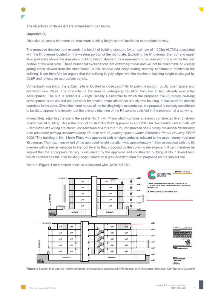
Excluding the lift overrun, the
roof and upper floor protrudes above the maximum building height standard by a
maximum of 675mm and this is within the rear portion of the roof plate. The
numerical exceedances are extremely minor and will not be noticeable when
viewed from the streetscape, public reserve and neighbouring developments.
It is also noted that the existing
building at No. 1 Irwin Place was approved with a height variation of
approximately 1.35m associated with the lift overrun with a similar variation
to the roof level to that proposed by the co-living development. It can
therefore be argued that the appropriate density is influenced by the approved
and constructed building at No. 1 Irwin Place which contravenes the 15m
building height control to a greater extent than that proposed on the subject
site.
The subject site is in transition
to higher density development reflective of the applicable planning controls
and the recently constructed development immediately to the north and east. The
proposed development is considered to be compatible with the height, built
form, bulk and scale of the recently approved and emerging character of the
locality despite the height breach.
The proposal has been designed to
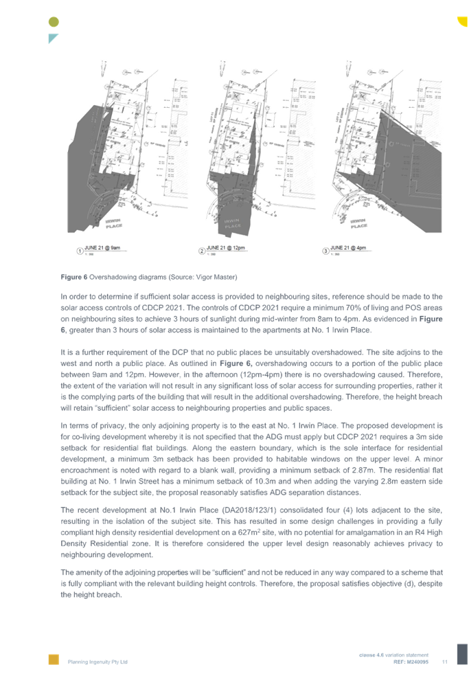
ensure a compliant solar outcome for neighbouring properties. The building at
No. 1 Irwin Place will be unimpacted between 9am and approximately 2pm and a
portion of the public place to the west in the afternoon (12pm-4pm). Therefore,
the extent of the variation will not result in any significant loss of solar
access for surrounding properties.
In terms of privacy, along the
eastern boundary, a minimum 3m setback has been provided to habitable windows
on the upper level. A minor encroachment is noted with regard to a blank wall,
providing a minimum setback of 2.87m. The residential flat building at No. 1
Irwin Place has a minimum setback of 10.3m and when adding the varying 2.8m
eastern side setback for the subject site, the proposal reasonably satisfies
ADG separation distances.
Planner’s comments:
The proposed building has a maximum building height of 16.008m to the lift
overrun and 15.675m to part of the habitable space of the communal living area
and private rooms on Level 5. The variation is up to 6.72%.
The proposal has been amended to
provide the minimum floor to floor height of 2.9m to all habitable area on all
levels, the proposed 200mm thickness slab. As such, it is believed that the
proposed development is providing a reasonable level of amenity for the future
occupants of the co-living housing development.
(b) there
are sufficient environmental planning grounds to justify the contravention of
the development standard.
In respect of there being
sufficient environmental planning grounds to justify the contravention of the
development standard, Initial Action found that although the phrase
‘environmental planning’ is not defined, it would refer to grounds
that relate to the subject matter, scope and purpose of the Environmental
Planning and Assessment Act 1979, including the objects in s.1.3. To be
sufficient, the environmental planning grounds advanced in the written request
must justify the contravention of the development standard, not simply promote
the benefits of carrying out the development as a whole Four2Five Pty Ltd v
Ashfield Council [2015] NSWCA 248.
Applicant’s
justification: The maximum extent of variation sought is minor and is
considered that there is an absence of any significant material impacts
attributed to the breach on the amenity or the environmental values of
surrounding properties, the amenity of future building occupants and on the
character of the locality.
The non-compliant will not
contribute to a loss of privacy but improve passive surveillance onto the
public road and public reserve. The proposed height variation will not be
visually dominant from the street frontages of the site, public reserves or adjoining
properties given its minor in nature and the overshadowing caused by the
proposed development is minor. Further, the built form is compatible with that
of the recently constructed building at No. 1 Irwin Place any height variation
is not a new element in the streetscape and will not appear out of context.
The height breach is in part, a
result of the site topography, which has a fall of approximately 700mm over the
length of the subject site. That is, with the exception of the lift overrun,
the change in topography is greater than the greatest extent of the variation
to the building (675mm). This is a specific condition that the Cumberland LEP
2021 height limit does not contemplate.
The subject site is isolated with
respect to the existing development on surrounding properties and the proposed
development is entirely compatible with the bulk, scale and building height of
properties surrounding the subject site and as per the Cumberland LEP 2021 as
discussed above.
Again, co-living housing is
considered to be an appropriate form of development for the subject site given
its highly accessible nature, proximity to numerous public transport options,
services and facilities. The proposal will provide for much needed affordable
housing in a strategic location in which co-living housing represents a
suitable use for the site.
The proposed development meets the
objectives of the development standard and meets the objectives of the R4 High
Density Residential zone through the provision of a well-designed and located
co-living development, inclusive of affordable and diverse housing. In fact, to
request strict compliance would halt redevelopment and would be entirely
antipathetic to the zone objectives.
Planner’s comments:
The proposed 2.9m floor to floor height including the 200mm slab thickness is
considered acceptable and comply with the requirement of the BCA.
Whilst the proposal exceeds the
maximum allowable building height that applies to the site, the proposal as
amended will unlikely adverse the amenity of the local area and the existing
adjoining properties. In addition, the co-living housing is permissible and
compatible form of development to this R4 High Density Residential zone land
under the Cumberland LEP 2021.
Accordingly, as indicated in the
commentary above, there are sufficient environment planning grounds to justify
contravening the height of building standard.
The provisions of any proposed
instrument that is or has been the subject (EP&A Act s4.15 (1)(a)(ii))
Council has received a Gateway
Determination from the Department of Planning, Housing and Infrastructure for
the Draft Woodville Road Corridor Planning Proposal. As part of this approval,
public exhibition of the Draft Woodville Road Corridor Planning Proposal has
commenced. The public exhibition was carried out between the 4 March 2025 to 17
April 2025.
The Draft Planning Proposal seeks
to revitalise Woodville Road by amending planning controls in the Cumberland
Local Environmental Plan (CLEP) 2021 for 31 sites located around the three (3)
precincts of Woodville North, Merrylands East and Woodville South.
The subject application was
received on 14 July 2025 and the site does not fall within the Draft Woodville
Road Corridor. Therefore, no further consideration is required.
The provisions of any
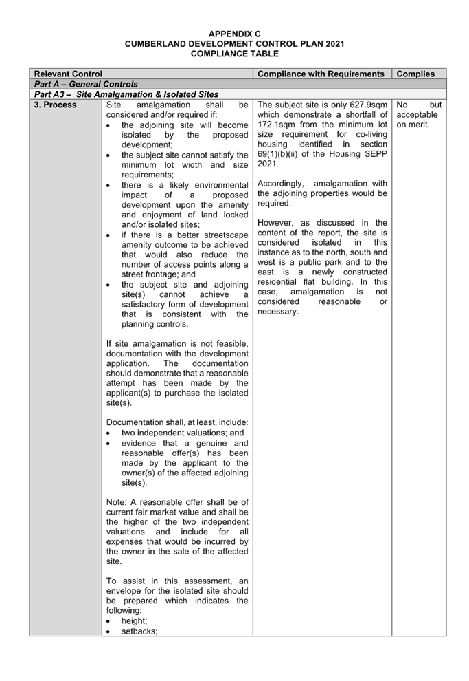
Development Control Plans (EP&A Act s4.15 (1)(a)(iii))
Cumberland Development
Control Plan 2021 (Cumberland DCP 2021)
The Cumberland DCP 2021 does not
specify any development control for co-living housing development within the
local government area. However, given the subject site is zoned as R4 High
Density Residential under the Cumberland LEP 2021, the residential flat
building controls being Part B3 Residential Flat Building and Part F4-2(3)
Finlayson Transitway Precinct and Part G Miscellaneous Development Controls of
the Cumberland DCP 2021 are the most applicable development controls to inform
the built form for this development.
The development fails to comply
with the relevant provisions of the Cumberland DCP 2021, whilst non-compliances
occur in relations to side and rear setback, building separation/visual
privacy, access and basement design and considered unacceptable. A comprehensive
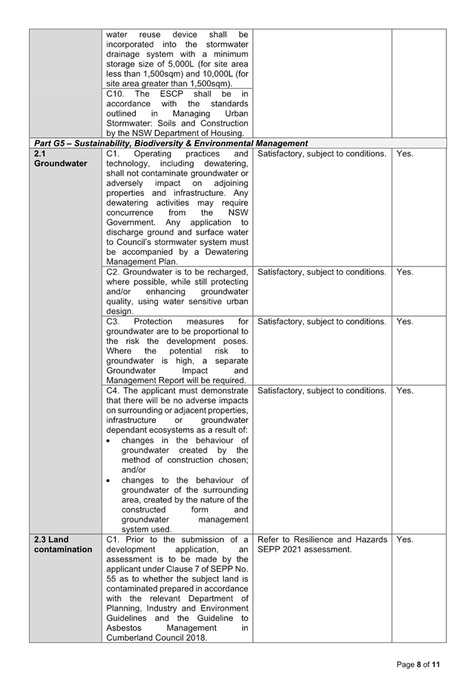
Cumberland DCP 2021 assessment is contained in Appendix C.
|
Clause
|
Control
|
Proposed
|
Complies
|
|
Part B3 Section 3.1
Building Envelope
|
Table 7:
Rear setback to be 30% of the length of the site.
Require 11.1m-12.48m
due to the irregular shape of the lot.
|
Minimum
setback - 6.01m from rear property boundary - Variation up to 48.16%.
Variation
to the numerical control is considered acceptable and may be supported due to
the isolated nature and no amenity impact to the rear adjoining park.
|
No but considered acceptable.
|
|
Table 7:
Site area to be minimum 1,000sqm
|
Development control overridden by the minimum lot size for
co-living housing development identified under s.68(2)(d) of the Housing SEPP
2021. Discussed above.
|
No but considered acceptable.
|
|
Table 7:
Minimum 24m wide street frontage
|
Subject site - 18.2m wide when measured at the front
building line. Variation - 24.17%.
|
No but considered acceptable.
|
|
Part B3
Section 3.2
Basement design
|
C1. Basement walls should be located directly under the
building walls where practical.
C3. Basement walls to be min. 1.2m setback from side
boundaries.
|
The proposed basement car park is situated on the property
boundaries.
|
No but considered acceptable.
|
|
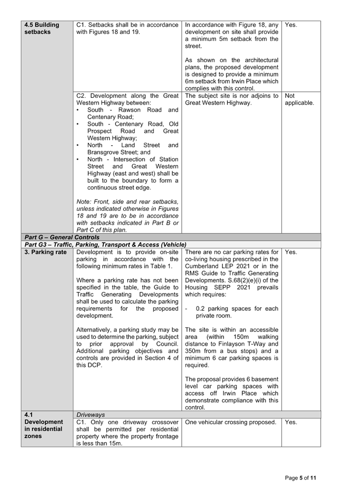
Part G3 Section 4.3
Basement parking
|
C1. Basement and driveways area designed in accordance
with relevant Australian Standards
|
Basement design unacceptable and unsatisfactory to
support.
|
No but considered acceptable subject to conditions.
|
|
C2. Basement parking shall be located within the building
footprint.
|
Basement car park situated on the property boundaries.
|
No but considered acceptable.
|
|
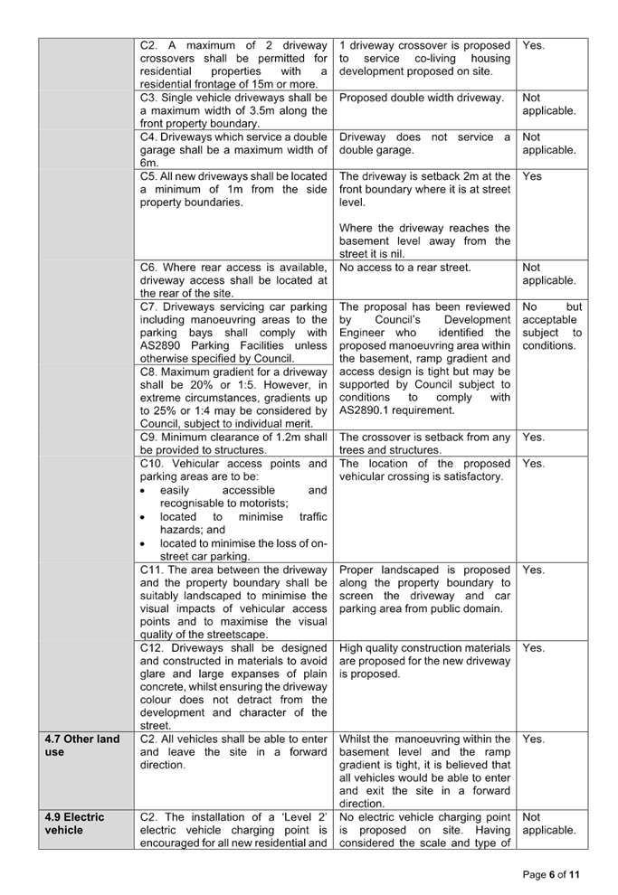
C7. Basement access/ramp design shall comply with AS2890.
|
The proposal fails to satisfy AS2890.1 in relation to the
waiting bay, ramp gradients and access for B99 vehicles.
|
No but considered acceptable subject to conditions.
|
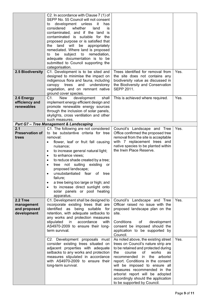
As indicated in the compliance
table above, the proposed development departs from controls in Parts B3 and G3
of the Cumberland DCP 2021. Having regard to site restrictions, it is
considered that the proposal performs satisfactorily from an environmental
planning viewpoint as detailed in the above table.
The provisions of any planning
agreement that has been entered into under section 7.4, or any draft planning
agreement that a developer has offered to enter into under section 7.4
(EP&A Act s4.15(1)(a)(iiia))
There is no draft planning
agreement associated with the subject Development Application.
The provisions of the
Regulations (EP&A Act s4.15 (1)(a)(iv))
The proposed development raises no
concerns as to the relevant matters arising from the Environmental Planning and
Assessment Regulation 2021 (EP&A Reg).
The Likely Environmental,
Social or Economic Impacts (EP&A Act s4.15 (1)(b))
All relevant issues have been
considered in the assessment of this proposal.
The suitability of the site for
the development (EP&A Act s4.15 (1)(c))
The subject site and locality are
known to be affected by flooding and overland flow. The design and site
constraints together with being an under-sized lot for co-living housing are
unlikely to have a significant adverse impact on the surrounding residential
properties. Accordingly, it is considered that the development is suitable in
the context of the site and surrounding locality.
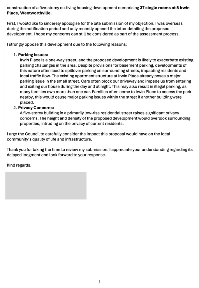
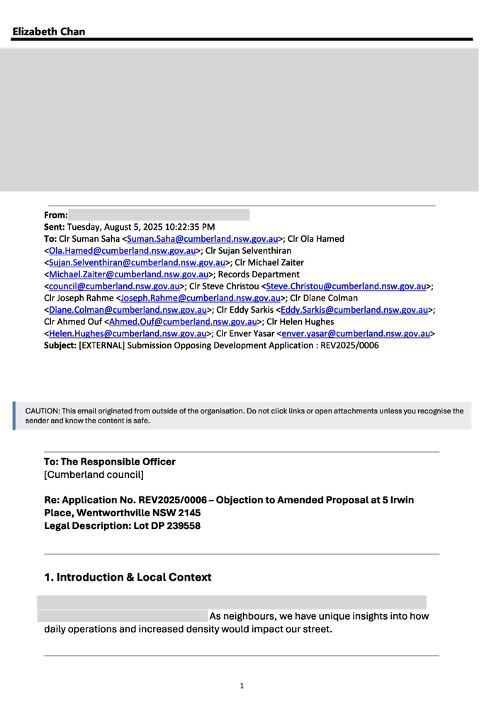
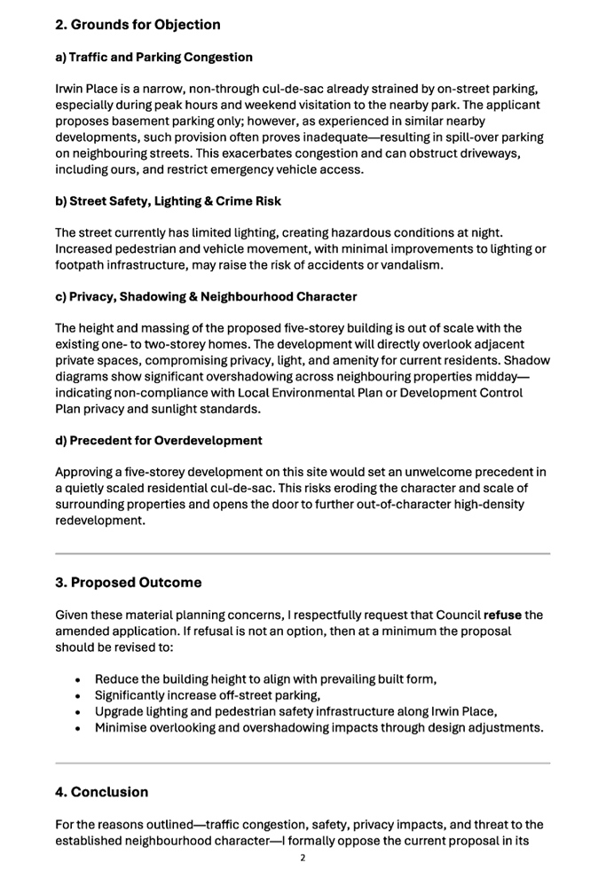
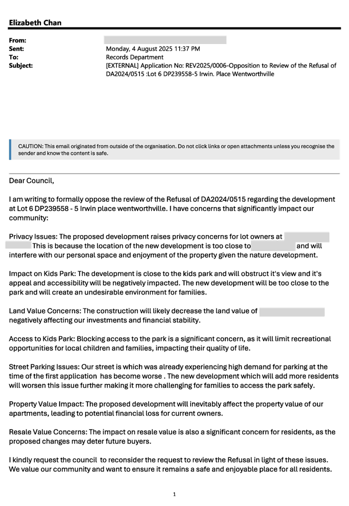
Submissions made in accordance
with the Act or Regulation (EP&A Act s4.15 (1)(d))
|
Advertised (Website)
|
Mail
|
Sign
|
Not Required
|
In accordance with Council’s
Notification requirements contained within the Cumberland DCP, the proposal was
publicly notified for a period of 14 days between 24 July 2025 and 7 August
2025. The notification generated 10 submissions in respect of the proposal with
no submissions disclosing a political donation or gift.
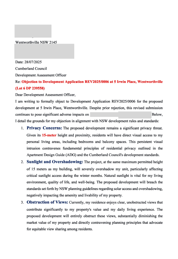
The issues raised in the public
submissions are summarised and commented on as follows:
Figure
7 - Submissions summary table
|
Issue
|
Planner’s Comment
|
|
Serious privacy concerns due to proximity to 5 Bransgrove
Street.
|
Whilst the proposed development fails to provide the
required setback from the eastern side boundary (common boundary of 5
Bransgrove Street), the proposed development is not anticipated to result in
a privacy impact subject to conditions.
The development at 5 Bransgrove Street is situated 10.9m
to 13.4m from the walls of the new development. Should consent be granted,
conditions would be improved requiring all east facing habitable windows to
have privacy screening to prevent unreasonable overlooking toward the
neighbouring residential flat building.
|
|
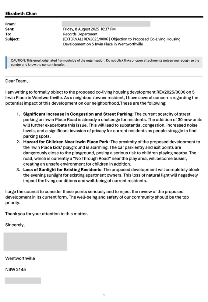
Impact to park and children safety.
|
The proposed co-living housing development will be setback
3.2m from the western side boundary and 6.01m from the rear boundary. A dense
landscaped area with variety of native species and mature height will be
planted along the western and northern elevations of the development to
soften the visual amenity of the proposed development from Irwin Place Park.
Based on the assessment detailed throughout this report,
adverse impact to the safety of children or the useability of the park is not
anticipated.
|
|
Obstruction of views.
|
Whilst the proposed development exceeds the maximum
allowable building height on site, the non-compliance is very minor in nature
given the tight floor to floor building height proposed to the co-living
housing. Therefore, the loss of view of the proposed development at its
current design is very minimal.
|
|
Decline in property values in surrounding area.
|
Land and property values are not matters for consideration
under Section 4.15 of the Environmental Planning and Assessment Act 1979.
|
|
Blocking access to Irwin Place Park.
|
The proposed development is contained within the property
boundary and access to the Irwin Place Park will be retained as existing. The
proposal has been referred to Council’s Parks & Open Space Officer
for comment who advised the proposal is satisfactory.
|
|
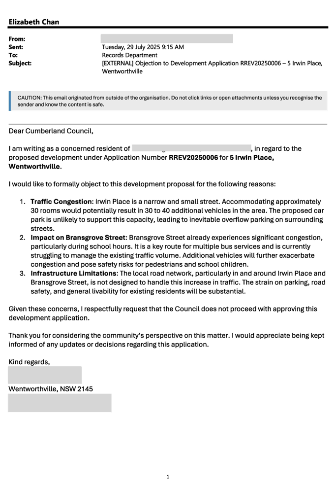
Insufficient street parking and illegal parking.
|
The proposed development provides car parking that
complies with 2(e), Chapter 3, Part 3 of the State Environmental Planning
Policy (Housing) 2021.
In this case, a minimum of 6 car parking spaces is
required to service 30 private rooms. The proposal provides 6 car parking
spaces within the basement level which demonstrate compliance with the
standard.
|
|
Additional traffic flow on Irwin Place which is a narrow
street will pose safety risk to children that occupy the park.
|
The Traffic Report prepared by Varga Traffic Planning Pty
Ltd dated 4 July 2024 (ref. 24232) submitted in support of the application
concludes that the traffic generated by the development will not result in
significant traffic impacts to Irwin Place and the extended local area.
|
|
Overshadow to the adjoining properties
|
Given the physical location of the site, any development
on site will cast a shadow onto the eastern and southern adjoining
properties.
As identified in the content of the report above, the
proposed building height is considered acceptable and the proposal can be
supported by Council.
|
|
Impact of the existing habitat of the street.
|
The proposed development has been referred to
Council’s Landscape and Tree Officer for comment who raised no
objection to the proposed excavation subject to conditions.
|
|
Increase noise pollution.
|
Council’s Environmental Health Officer has reviewed
the development and has supported the development subject to conditions.
|
|
Additional pressure to existing overburden infrastructure.
|
Development contribution will be imposed as a condition of
consent should the proposed co-living housing to be supported by Council to
maintain existing public infrastructure in the area.
|
|
Same proposal being relodged for Council’s
reconsideration.
|
The proposal is a Review of Determination Application
under Part 8 Division 8.2 Reviews of the EP&A Act 1979. Council is
obliged to consider and assess the application within the 6 month period as
required by the relevant legislation.
|
|
The community voices consistently being disregarded?
|
All public submissions raised during the public
notification period have been addressed in this table and the content of the
report.
|
|
What is the purpose of re-electing same local
representatives if our views are not reflected in decision-making?
|
Election of local representatives is not matters for
consideration under Section 4.15 of the Environmental Planning and
Assessment Act 1979.
|
|
What value do Council rates and fees offer if resident
petitions and objections are overlooked?
|
The proposal has been reviewed against all relevant
planning standards and controls that apply to the proposed co-living housing
development. All issued raised in the submissions have been addressed in this
table and the content of the report.
|
|
How can this development be permanently prevented from
proceeding?
|
Council is not in the position to stop any person to lodge
an application for any development on a property regardless the
permissibility, compliance and design of the development.
|
|
Poor street lighting of Irwin Place.
|
Any concern relates to insufficient street lighting does
not form part of the assessment of this application as the proposal does not
involve the removal or relocation of any streetlights.
|
|
The proposed 5 storeys development is inconsistent with
the surrounding developments.
|
The subject site is zoned R4 High Density Residential and
high density multi-storey developments up to 15m tall are permitted with
consent.
The site inspection confirmed the surrounding one to two
storeys buildings are constructed within the existing R2 Low Density
Residential zoned land located to the southern side of Irwin Place.
|
|
Loss of vegetation.
|
The proposal has been referred to Council’s Senior
Tree Management Officer who has advised that the development is satisfactory
for the site subject to conditions.
|
|
Unpleasant smell from overflow garbage bin storage area
next to the park.
|
A condition in the consent will be imposed to ensure the
kerbside waste collection will occur twice a week to reduce odour from the
garbage should the proposal to be supported by the Panel.
|
The public interest (EP&A
Act s4.15(1)(e))
In view of the foregoing analysis
it is considered that the development, if carried out subject to the conditions
set out in the recommendation below, will have no significant adverse impacts
on the public interest.
CUMBERLAND LOCAL INFRASTRUCTURE
CONTRIBUTIONS PLANS 2020
The development would require the
payment of contributions in accordance with Cumberland Local Infrastructure
Contributions Plan 2020.
In accordance with the
Contribution Plan a contribution of $201,898.00 is payable, pursuant to Section
7.11 of the EP&A Act 1979, as calculated on the cost of works. A condition
of consent has been imposed on the development approval the ensure this contribution
payment would be payable prior to the issue of a Construction Certificate.
HOUSING AND PRODUCTIVITY OF
CONTRIBUTION (HPC)
In accordance with s7.24, s7.26
and s7.28 of the Environmental Planning and Assessment Act 1979, the proposed
development is subject to the payment of the HPC given co living housing is
defined as commercial development under the Environmental Planning and
Assessment (Housing and Productivity Contributions) Order 2024.
A condition of consent has been
imposed on the development consent in accordance with Section 7.28 of the
EP&A Act 1979 requiring the payment of the HPC.
DISCLOSURE OF POLITICAL
DONATIONS AND GIFTS
The applicant and notification process
did not result in any disclosure of Political Donations and Gifts.
The development application has
been assessed in accordance with the relevant requirements of the Environmental
Planning and Assessment Act 1979, State Environmental Planning Policy
(Biodiversity and Conservation) 2021, State Environmental Planning Policy
(Housing) 2021, State Environmental Planning Policy (Resilience and Hazards)
2021, State Environmental Planning Policy (Transport and Infrastructure) 2021,
Cumberland Local Environmental Plan 2021 and Cumberland Development Control
Plan 2021.
The proposed development is
appropriately located within the E1 Local Centre zone under the relevant
provisions of the Cumberland Local Environmental Plan 2021. The proposal is
consistent with all statutory and non-statutory controls applying to the development.
The development is considered to perform adequately in terms of its
relationship to its surrounding built and natural environment, particularly
having regard to impacts on adjoining properties.
For these reasons, it is
considered that the proposal is satisfactory having regard to the matters of
consideration under Section 4.15 of the Environmental Planning and
Assessment Act 1979, and the development may be approved as a deferred
commencement consent subject to conditions.
There are no consultation
processes for Council associated with this report.
There are no financial
implications for Council associated with this report.
There are no policy implications
for Council associated with this report.
Communication /
Publications:
The final outcome of this matter
will be notified. The objectors will also be notified in writing of the
outcome.
1. That
the Clause 4.6 variation request to contravene the minimum lot size development
standard, pursuant to Section 69(1)(b)(ii) the State Environmental Planning
Policy (Housing) 2021 be supported.
2. That
the Clause 4.6 variation request to contravene the height of building
development standard, pursuant to Clause 4.3 the Cumberland Local Environmental
Plan 2021 be supported.
3. That
the Review Application REV2025/0006 being a Section 8.2 Review of the Refusal
of DA2024/0515 for the demolition of the existing structures and construction
of a five (5) storey co-living housing development comprising of 30 single
rooms over basement parking including external building changes and
reconfiguration of the basement parking and internal layout on land at 5 Irwin
Place, Wentworthville be approved as a deferred commencement consent subject to
conditions as listed in Attachment A.
4. Persons
whom have lodged a submission in respect to the application be notified of the
determination of the application.
1. Draft
Notice of Determination
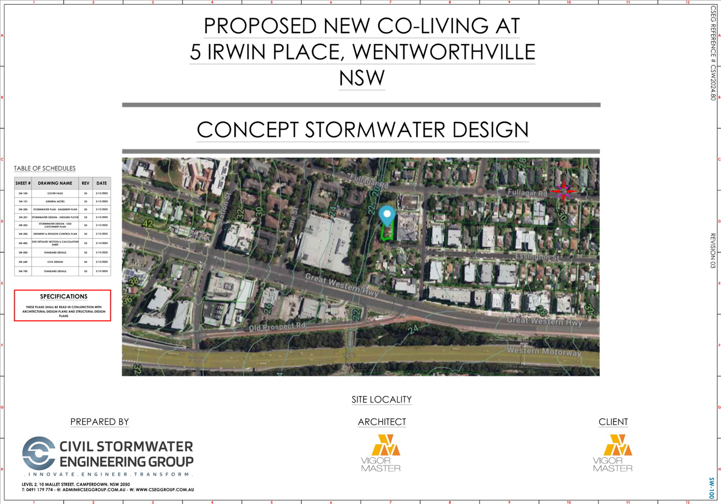
2. Architectural
and Landscape Plans
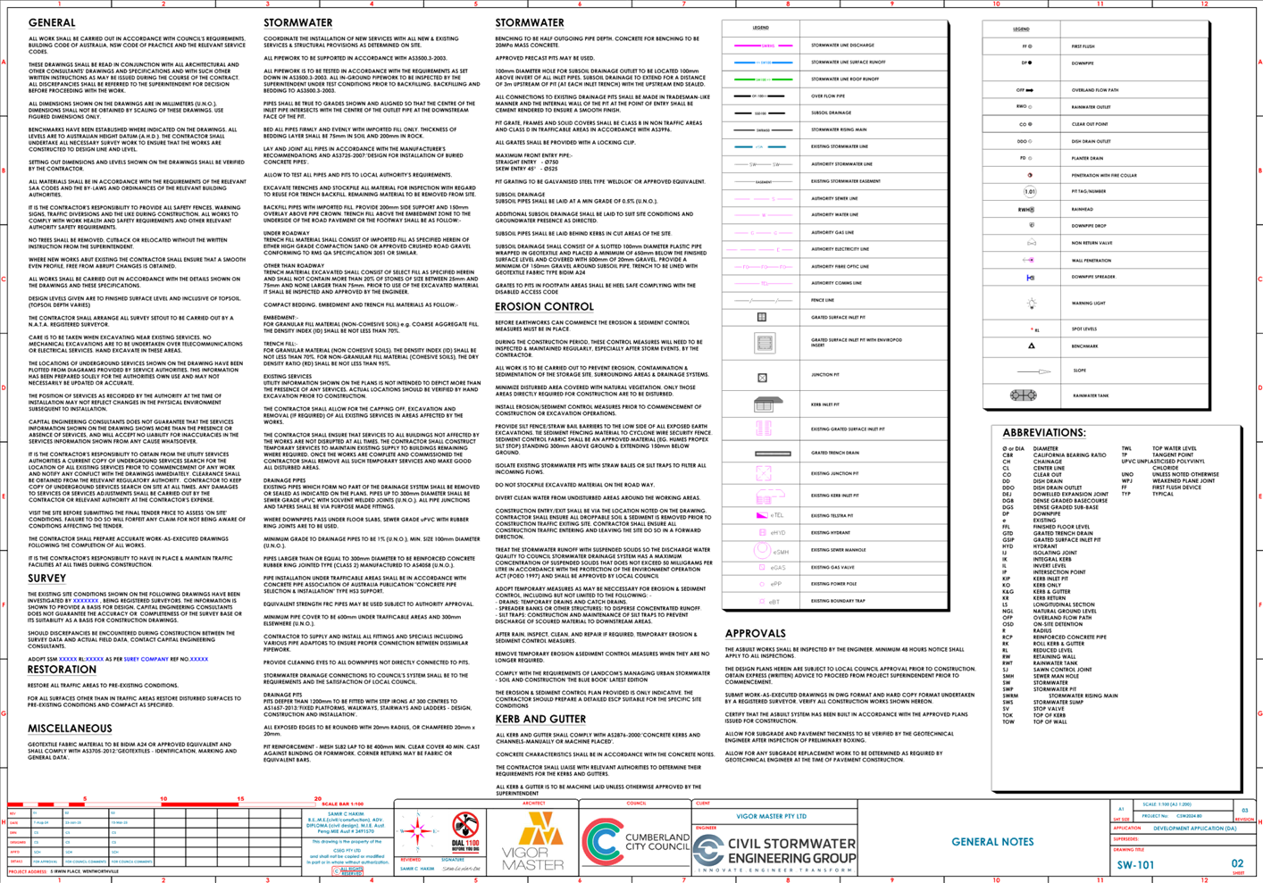
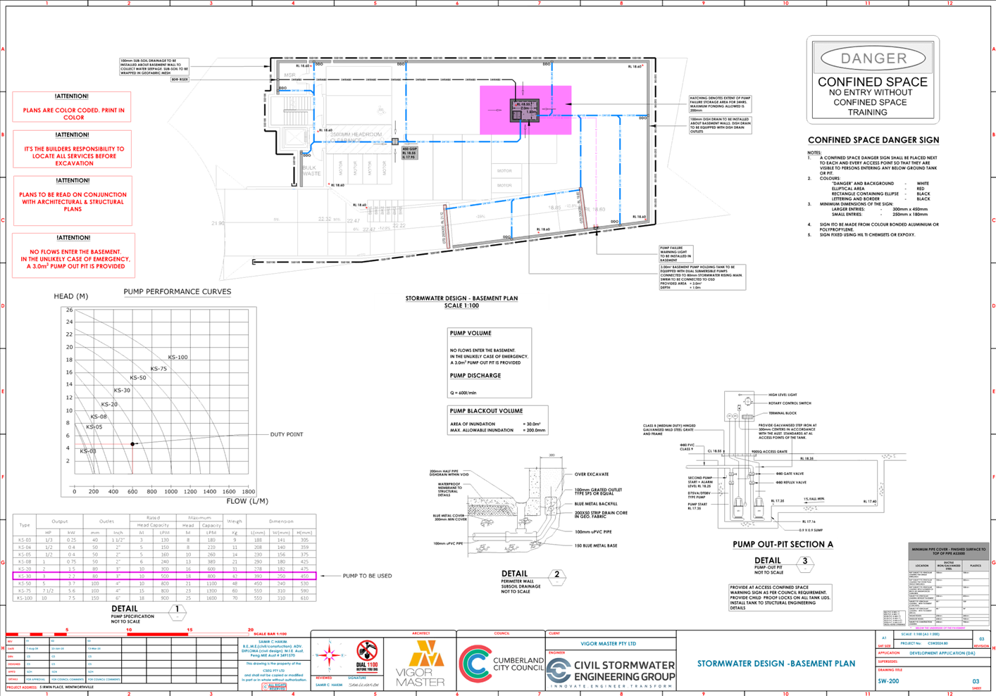
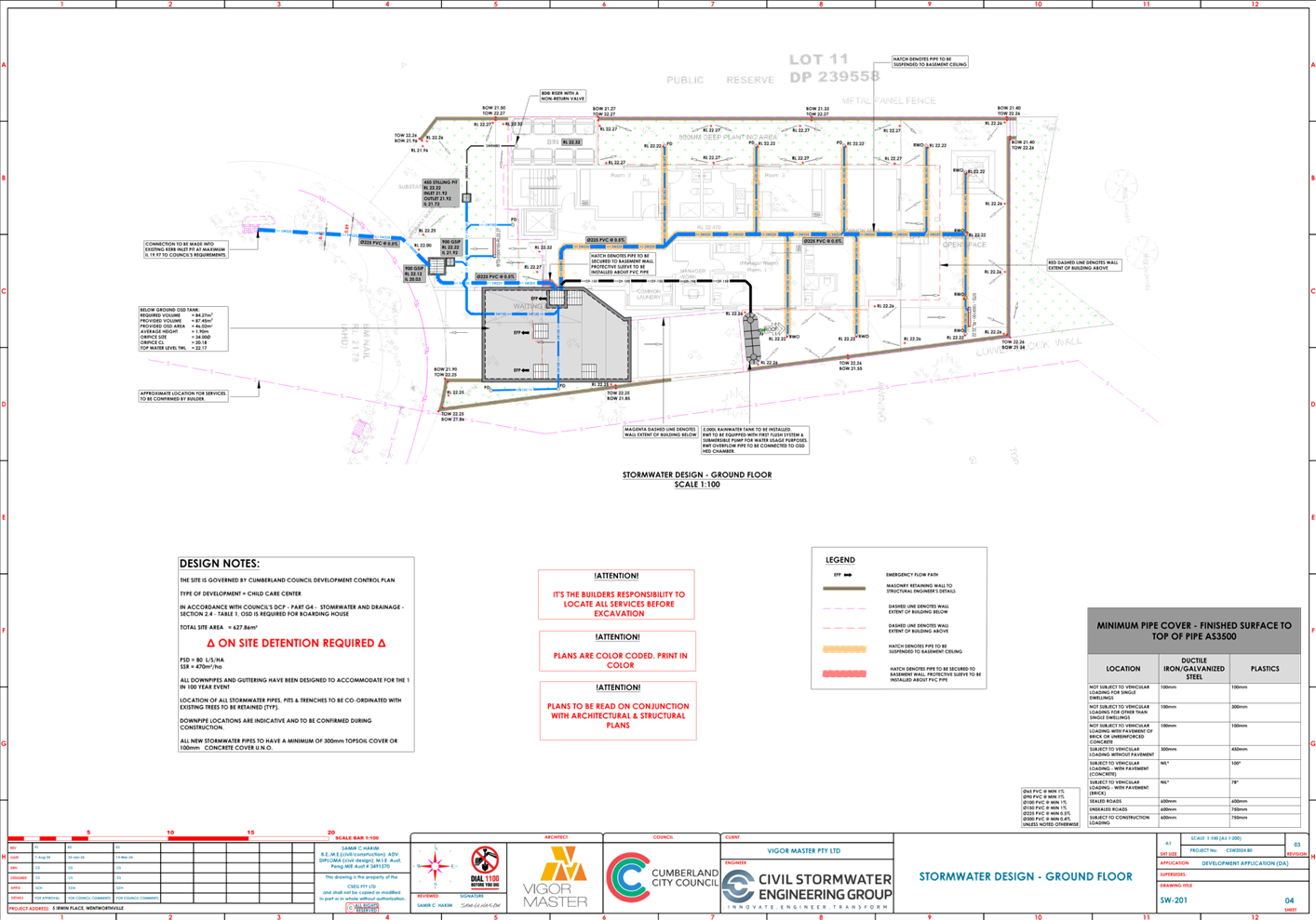
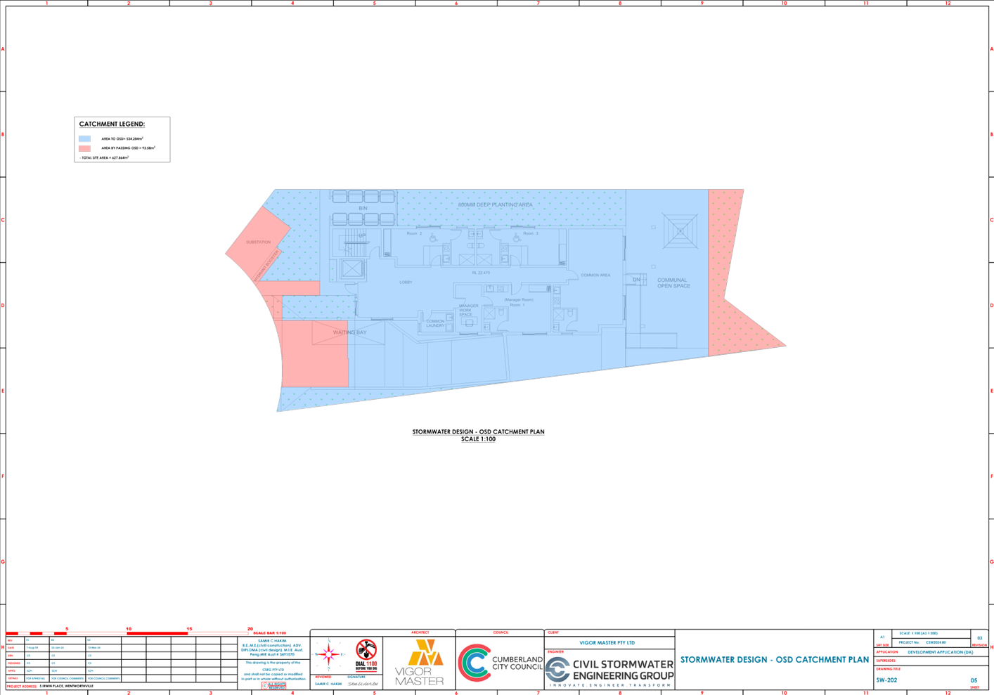
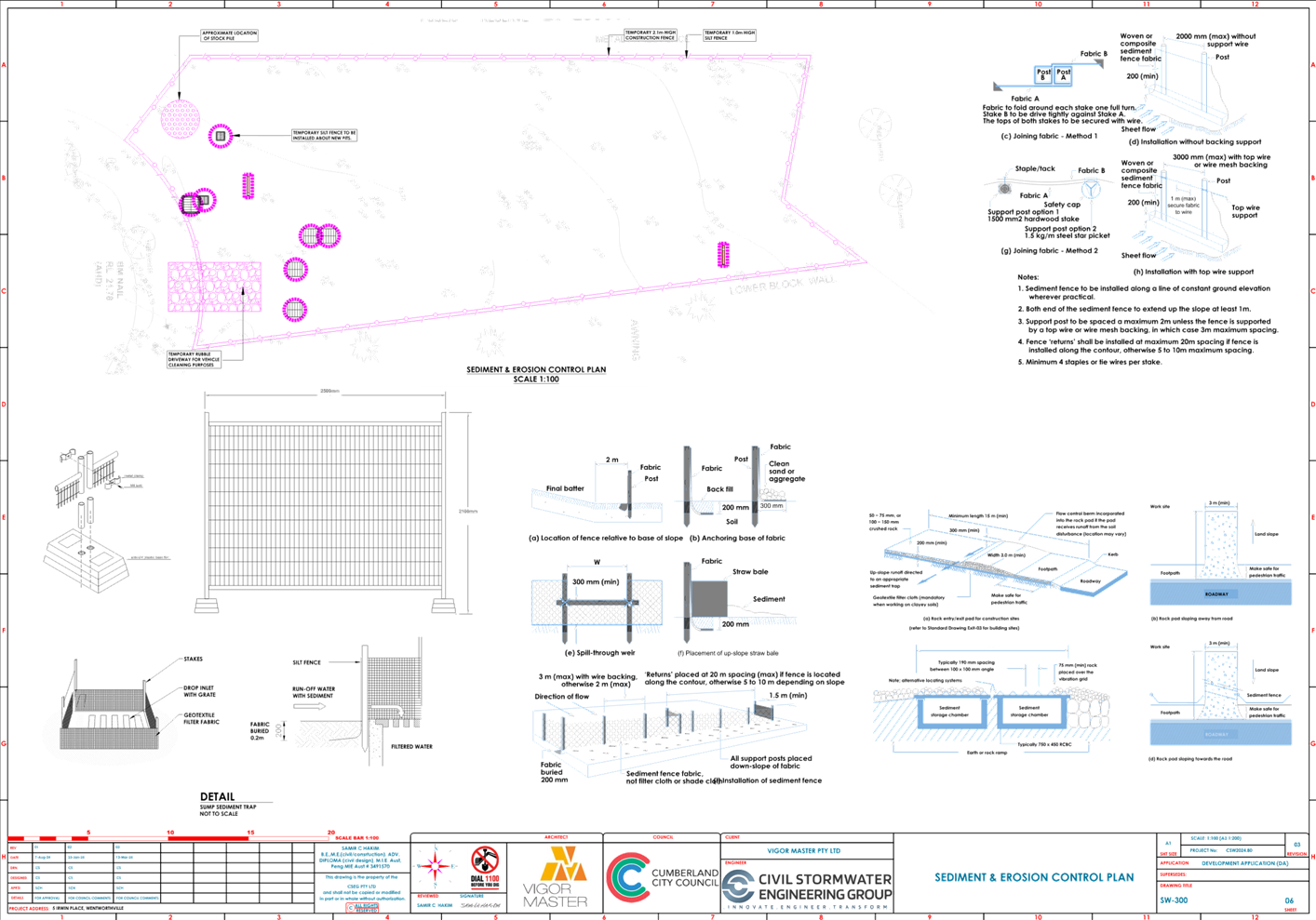
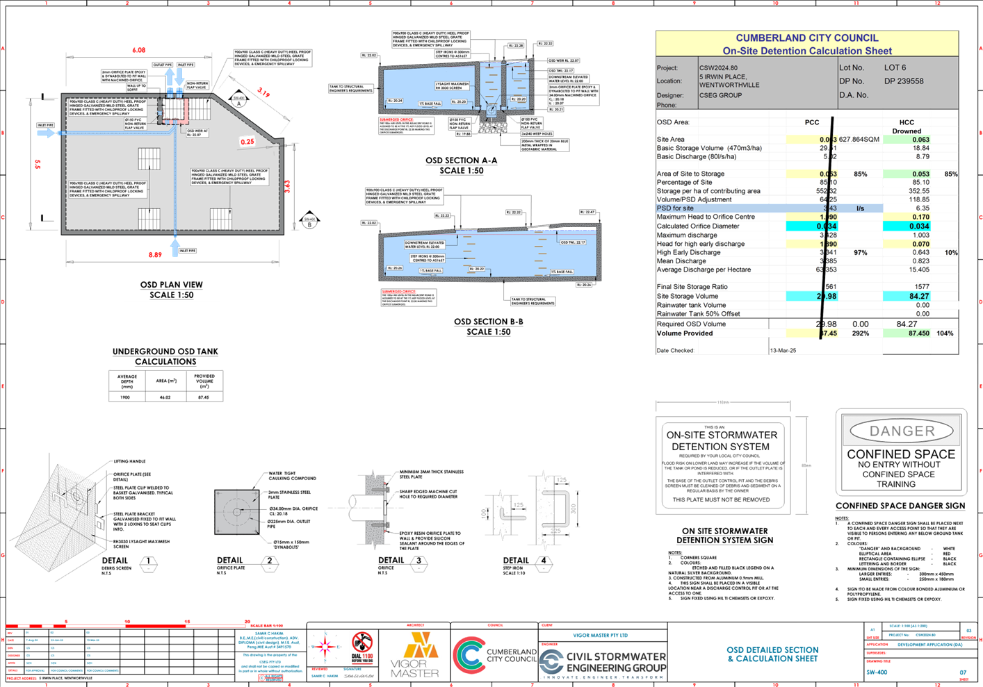
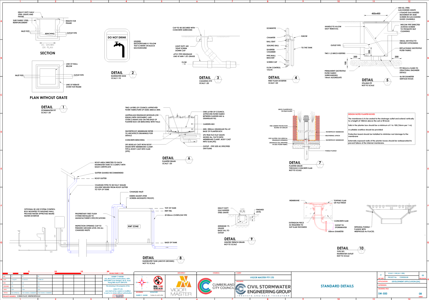
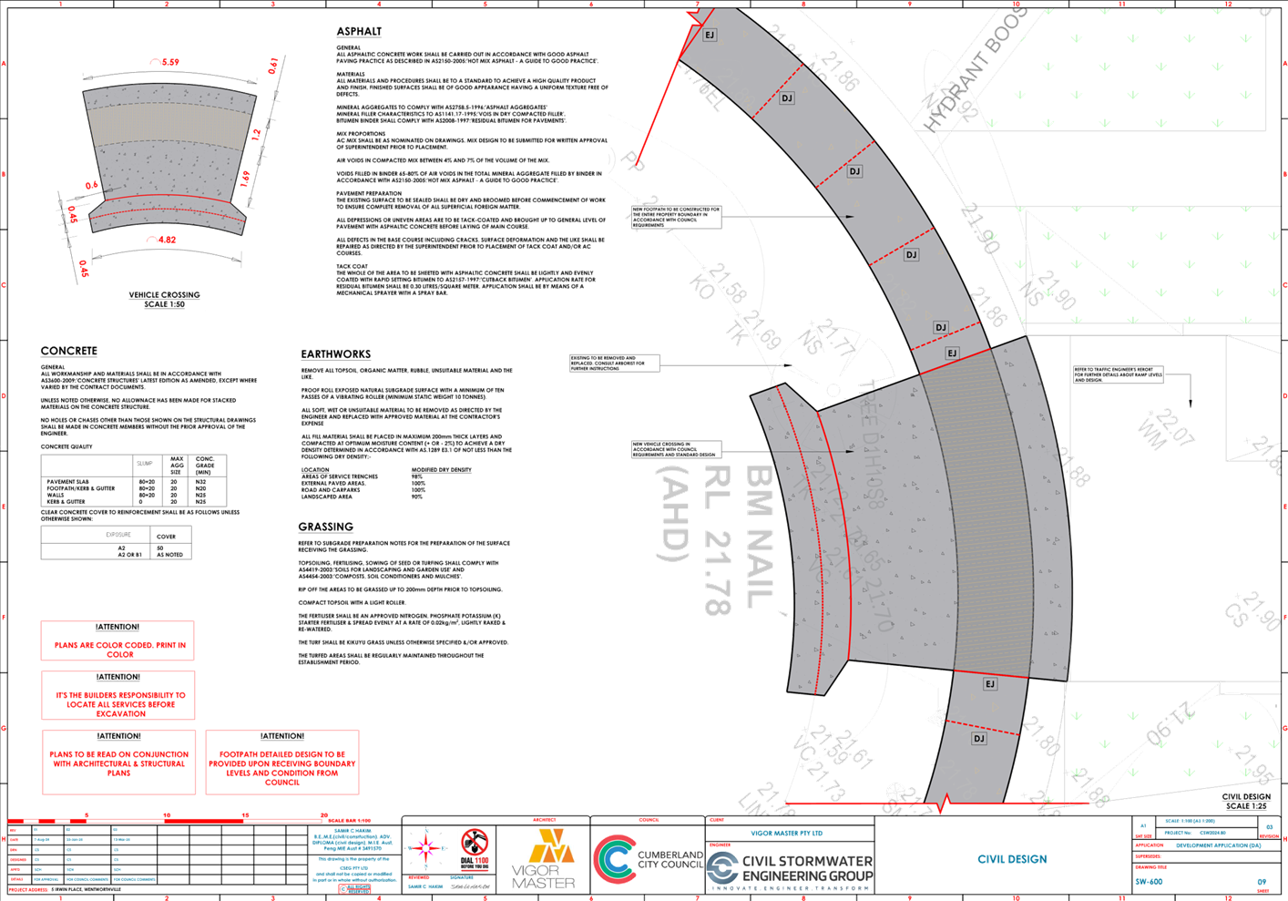
3. Stormwater/Engineering
Plans
4. Redacted
Submissions
5. Clause
4.6 Variation Request - Minimum Lot Size
6. Clause
4.6 Variation Request - Height of Building
7. Plan
of Management
8. Appendix
A - Housing SEPP 2021 Assessment
9. Appendix
B - Cumberland LEP 2021 Assessment
10. Appendix
C - Cumberland DCP 2021 Assessment
DOCUMENTS
ASSOCIATED WITH
REPORT ELPP020/25
Attachment 1
Draft Notice of Determination
Cumberland
Local Planning Panel Meeting
8 October 2025
DOCUMENTS
ASSOCIATED WITH
REPORT ELPP020/25
Attachment 2
Architectural and Landscape Plans
Cumberland
Local Planning Panel Meeting
8 October 2025
DOCUMENTS
ASSOCIATED WITH
REPORT ELPP020/25
Attachment 3
Stormwater/Engineering Plans
Cumberland
Local Planning Panel Meeting
8 October 2025
DOCUMENTS
ASSOCIATED WITH
REPORT ELPP020/25
Attachment 4
Redacted Submissions
Cumberland
Local Planning Panel Meeting
8 October 2025


DOCUMENTS
ASSOCIATED WITH
REPORT ELPP020/25
Attachment 5
Clause 4.6 Variation Request - Minimum Lot Size
Cumberland
Local Planning Panel Meeting
8 October 2025

DOCUMENTS
ASSOCIATED WITH
REPORT ELPP020/25
Attachment 6
Clause 4.6 Variation Request - Height of Building
Cumberland
Local Planning Panel Meeting
8 October 2025

DOCUMENTS
ASSOCIATED WITH
REPORT ELPP020/25
Attachment 7
Plan of Management
Cumberland
Local Planning Panel Meeting
8 October 2025


DOCUMENTS
ASSOCIATED WITH
REPORT ELPP020/25
Attachment 8
Appendix A - Housing SEPP 2021 Assessment
Cumberland
Local Planning Panel Meeting
8 October 2025

DOCUMENTS
ASSOCIATED WITH
REPORT ELPP020/25
Attachment 9
Appendix B - Cumberland LEP 2021 Assessment
Cumberland
Local Planning Panel Meeting
8 October 2025

DOCUMENTS
ASSOCIATED WITH
REPORT ELPP020/25
Attachment 10
Appendix C - Cumberland DCP 2021 Assessment
Cumberland
Local Planning Panel Meeting
8 October 2025
Cumberland Local Planning Panel Meeting
8 October 2025
Item No: ELPP021/25
Development
application -77 Warren Road, Woodpark
Directorate: Environment
and Planning
Responsible
Officer: Executive
Manager City Planning and Development
|
Application
lodged
|
6 July 2025
|
|
Applicant
|
E Makra
|
|
Owner
|
Mrs N Makra & Mr P Makra
|
|
Application
No.
|
DA2025/0449
|
|
Description
of Land
|
77 Warren Road WOODPARK
NSW 2164, Lot 11 DP 200128
|
|
Proposed
Development
|
Demolition of existing garage
and pergola at rear, construction of a secondary dwelling pursuant to the
State Environmental Planning Policy (Housing) 2021
|
|
Site
Area
|
557.4 m2
|
|
Zoning
|
Zone R2 – Low Density
Residential
|
|
Disclosure
of political donations and gifts
|
Nil disclosure
|
|
Cost
of works
|
$110,700.00
|
|
Heritage
|
No
|
|
Principal
Development Standards
|
Number of parking provisions
for detached secondary dwelling under SEPP (Housing) 2021
Number of existing parking:
One (1)
Number of proposed parking:
Zero (0)
|
|
Issues
|
Variation to Clause 53(2)(b)
of State Environmental Planning Policy (Housing) 2021 – Loss of car
parking
|
1. Development
Application No. DA2025/0449 was accepted on 6 July 2025 for the demolition of
existing garage and pergola at rear and construction of a secondary dwelling
pursuant to the State Environmental Planning Policy (Housing) 2021
2. The
application was publicly notified to occupants and owners of the adjoining
properties for a period of 14 days between 16 July 2025 and 30 July 2025. In
response, no submissions were received.
3. There
are no heritage items located on the subject site, nor is the site located
within a Heritage Conservation Area. However, the site is located in close
approximately of a heritage item known as Pipehead, water supply canal and
associated works and is identified as item no. I01629 under Cumberland Local
Environmental Plan 2021. The Pipehead, water supply canal and associated works
is of State significance for its historic, associative, aesthetic, social,
scientific, rarity and representative values. Historically, the Pipehead is
significant for its importance in the history of water supply in Sydney, as one
of the key components of the Upper Nepean System from 1913 until 1995.
4. The
subject application has been assessed against the relevant provisions of the
Environmental Planning and Assessment Act 1979, the State Environmental
Planning Policy (Housing) 2021 (SEPP Housing 2021), the Cumberland Local
Environmental Plan 2021(CLEP 2021), and the Cumberland Development Control Plan
2021 (CDCP 2021).
5. Clause
53(2)(b) of the Statement of Environmental Planning Policy Housing (2021)
stipulates that the number of parking spaces provided on the site is the same
as the number of parking spaces provided on the site immediately before the
development is carried out. The proposal seeks approval for demolition of
existing single garage and construction of a secondary dwelling under Housing
SEPP 2021. It should be noted that one approved parking space currently exists
on site.
6. The
variations are as follows:
|
Control
|
Required
|
Provided
|
% variation
|
|
Number of parking on site
(Clause 53(2)(b) State Environmental Planning
Policy (Housing) 2021)
|
Same as existing (1)
|
0
|
100%
|
|
Parking Rate – Part G3, Section 4.1, Control 1
vi)
(Cumberland Development Control Plan 2021)
|
Parking rates shall comply with the minimum parking rates
in Section 3 of this Part of the DCP.
Section 3 nominates minimum 1 covered space / dwelling
house
|
0
|
100%
|
|
Secondary dwellings – Part B1, Section 2.21, Control
10
|
Maximum floor to ceiling height of 2.7m
|
Maximum floor to ceiling height of 3.6m
|
33.34%
|
7. The
application is referred to the Panel as the proposal contravenes a development
standard by more than 10%. (Clause 53(2)(b) of the Statement of Environmental
Planning Policy Housing (2021))
8. The
application is recommended for Approval subject to the conditions as
recommended in Council’s assessment report.
Subject Site and Surrounding
Area
The site forms Lot 11 DP 200128
and is known as 77 Warren Road Woodpark. The site has an area of 557.4 square
metres and has a frontage to Warren Road of 15.24m. The site is fairly flat.
A site inspection of the premises,
carried out on 31st of May 2024 confirmed that the site is currently occupied
by a single storey dwelling with attached and detached ancillary structures
including a detached garage and pergola, a driveway servicing Warren Road
located on the south-east corner of the site and associated soft and hard paved
areas. There are trees located the site and on council’s nature strip.
There is an existing tree located at the rear that requires to be removed to
facilitate the construction of the proposed development. Application is
referred to the Council’s tree management officer who has advised that
the development proposal is satisfactory subject to recommended conditions of
consent.
The site does not consist of any
Council easement. However, council notes a Sydney water pipe traverses through
the rear and front of the site. Therefore, conditions have been imposed
requiring the plan to be submitted to the ‘Tap In’ portal to be
reviewed.
The existing developments
adjoining the site include single storey dwelling on north and side. The area
is generally low-density residential character. The location of the site is
shown below and edged in purple.
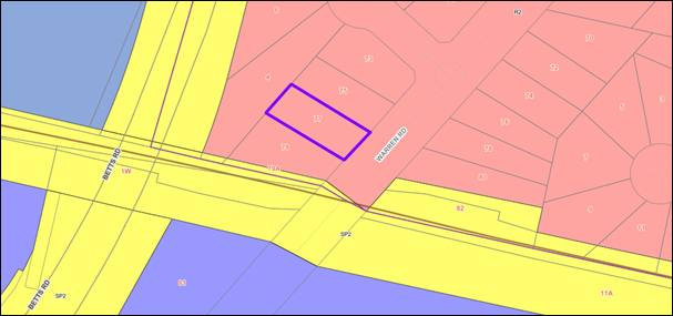
Figure
1 – Locality Plan of subject site
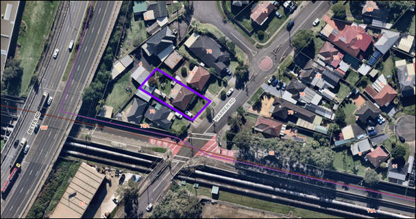
Figure
2 – Aerial view of subject site

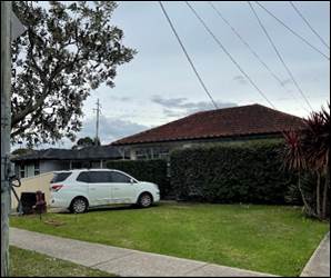
Figure
3 – Street view of subject site and the existing garage at the rear
Description
of The Development
Development
application (DA2025/0449) was accepted on 6 July 2025 seeking approval for the
demolition of existing garage and pergola at rear, construction of a secondary
dwelling pursuant to the State Environmental Planning Policy (Housing) 2021.
The detailed breakdown of the proposal is shown below:
· Demolition
of a single garage and a pergola located at the rear.
· Construction
of a secondary dwelling with an internal floor area of 60m2 consisting of:
o Bathroom
and laundry, open style living and kitchen area, two (2) bedrooms and a deck at
the rear.
History
1. Building
application (74-150) was approved for garage on 14 Feb 1974
2. Building
application (84-935) was approved for addition to the existing dwelling on 25 Sep
1984
3. DA1999/809/1
was approved for construction of pergola on 23 Feb 1999.
4. Prelodgement
meeting was conducted on 4 Feb 2025 for Demolition of existing garage and
construction of a new carport and secondary dwelling
Applicants Supporting
Statement
The applicant has provided a
Statement of Environmental Effects prepared by Edith Makra dated 13 May 2025,
received by Council on 28 June 2025 and a Clause 4.6 Variation Statement
prepared by Natalie Richter dated 8 May 2025 which received by Council on 28
June 2025.
Contact With Relevant
Parties
The assessing officer has
undertaken a site inspection of the subject site and surrounding properties and
has been in regular contact with the applicant throughout the assessment
process.
Internal Referrals
Development Engineering
The development application was
referred to Council’s Development Engineer for comment who has advised
that the development proposal is satisfactory subject to recommended conditions
of consent.
Environmental Health
The development application was
referred to Council’s Environmental Health Officer for comment who has
advised that the proposal is satisfactory subject to recommended conditions of
consent.
Tree Management
The development application was
referred to Council’s Tree Management Officer for comment who has advised
that the proposal is satisfactory subject to recommended conditions of consent.
External Referrals
The development application was
referred to Sydney Water for comments who has advised that the proposal is
satisfactory subject to recommended conditions of consent.
Planning Comments
The provisions of any
Environmental Planning Instruments (EP&A Act s4.15 (1)(a)(i))
State Environmental Planning
Policies
The proposed development is
affected by the following State Environmental Planning Policies:
|
State
Environmental Planning Policies (SEPPs)
|
Relevant
Clause(s)
|
Compliance
with Requirements
|
|
· State
Environmental Planning Policy (Biodiversity and Conservation) 2021.
|
Chapter 2 -Vegetation in non
Rural Areas.
|
The development application includes the removal of one
(1) tree which has been assessed by Council’s tree management officer.
The proposal does not exceed
the biodiversity offsets scheme threshold. Therefore, the proposed vegetation
removal is considered acceptable subject to conditions.
|
|
Chapter 6 -
Water Catchments.
Georges River Catchment.
|
It is determined that given the
location of the site/development, a detailed assessment is not required given
that there is no direct impact upon the catchment and no direct impact upon
watercourses. As such, the development is acceptable under the provisions
that came into effect on Monday 21 November 2022.
|
|
· State
Environmental Planning Policy (Resilience and Hazards) 2021.
|
Chapter 2 - Coastal
Management.
|
The subject site is not
identified as a coastal wetland or ‘land identified as “proximity
area for coastal wetlands” or coastal management area.
|
|
Chapter 4 - Remediation of
Land.
Part 4.6.
|
A review of Council’s
files has revealed that the site has been historically used for residential
purposes and there is no evidence to suggest that the site is contaminated or
used for potentially contaminating activities.
As such, it is considered that the development application
is satisfactory under Part 4.6 of Chapter 4 of the State Policy.
|
|
· State Environmental
Planning Policy (Transport and Infrastructure) 2021.
|
Chapter 2 - Infrastructure.
|
State Environmental Planning
Policy (Transport and Infrastructure) 2021 is relevant to the development
application as follows.
|
|
Clause 2.48
Chapter 2 - Infrastructure.
|
N/A – No power pole or electricity easement impacted
by the proposed development.
|
·
Clause 2.119 |
1.
Frontage to classified road
The application is not subject to clause 2.119 of the SEPP
as the subject site does not have frontage to Betts Road which is a
classified road (main road).
|
·
Clause 2.120 |
Impact of road noise or vibration on non-road development
A Road Traffic Noise and
Vibration Assessment has been submitted and the proposal has been reviewed
and supported by Council’s Environmental Health Unit, subject to
conditions to comply with the report.
|
|
· State Environmental Planning
Policy (Sustainable Buildings) 2022
|
Chapter 2
Standards for residential
Development -BASIX
|
BASIX Certificate number
1794260S dated 06 May 2025 has been submitted. It is shown that the proposal
will meet the required target for Water, Thermal Comfort and Energy. The
BASIX Certificate is determined as being acceptable for approval.
|
Statement Environmental
Planning Policy (Housing) 2021
The application has been submitted
under Part 1 Division 2 of the Housing SEPP. It should be noted that the
proposal fully complies with the key planning controls contained within the
Housing SEPP, with the exception of Clause 53(b)(2), which states that
“the number of parking spaces provided on the site is the same as the
number of parking spaces provided on the site immediately before the
development is carried out.”
Notwithstanding the variation
noted above, the proposed development is considered acceptable from an
environmental planning viewpoint and a comprehensive assessment against SEPP
(Housing) 2021 and a discussion of the clause 4.6 request is provided below.
|
Relevant
Clause(s)
|
Planning
Commentary
|
Compliance
|
|
50 This Part applies to development for the
purposes of a secondary dwelling on land in a residential zone if development
for the purposes of a dwelling house is permissible on the land under another
environmental planning instrument.
|
The subject site is zoned the R2 Low Density Residential. This Part applies to development for the
purposes of a secondary dwelling on land in a residential zone if development
for the purposes of a dwelling house is permissible on the land under another
environmental planning instrument. As per the definitions of this division of
the SEPP, a residential zone includes R2 Low Density Residential Zone.
In this regard, a secondary dwelling is permissible under
the provisions of SEPP (Housing) 2021.
|
Yes
|
|
51 A secondary dwelling cannot be subdivided from
the subject lot
|
Subdivision is not proposed as
part of the subject application. A condition of consent has been
imposed for no separating fences to be erected between the primary and
secondary dwellings on the subject site.
|
Yes
|
|
52 (2) Development consent must not be granted for
development to which this Part applies unless—
|
The proposed secondary
dwelling is assessed against Division 2, Clause 52(2) of the SEPP (Housing)
2021. Refer to the detailed assessment against all subclauses of Clause 52
below.
|
Yes
|
|
Subclause 2(a)
Only one (1) primary dwelling and only one (1) secondary
dwelling is permitted on the subject land
|
This proposal consists of (1) existing primary dwelling and
one (1) proposed secondary dwelling at the rear.
|
Yes
|
|
Subclause 2(b)
the total floor area of the principal dwelling and the
secondary dwelling is no more than the maximum floor area permitted for a
dwelling house on the land under another environmental planning instrument,
and
|
The site is on land zone R2
Low Density Residential. No FSR is applicable in land zoned R2 under the
Cumberland Local Environmental Plan CLEP 2021.
|
Yes
|
|
Subclause 2(c)
the total floor area of the secondary dwelling is—
(i) >60 m2 or (ii) the greater floor area
permitted in another EPI
|
The total floor area of the
proposed secondary dwelling is calculated to be 60 sqm.
|
Yes
|
|
53(2)(a)
for a detached secondary dwelling—a minimum site
area of 450m2,
|
The development site has a
total site area of 557.4 sqm in accordance with the submitted survey plan.
|
Yes
|
|
53(2)(b)
the number of parking spaces provided on the site is the
same as the number of parking spaces provided on the site immediately before the
development is carried out.
|
The approved car park space is a single garage, while the
proposal does not provide any carpark space.
It has been noted that the existing driveway does not
comply with AS2890.1:2004 and lacks sufficient width to service a garage or
carport at the rear. Furthermore, due to flood controls on the site, a garage
or carport cannot be supported within the southern setback, as any such
structure would need to be elevated to a minimum flood level. This would
require alterations to the driveway access, which in turn would obstruct the
natural overland flow path and restrict the free flow of water. Therefore,
the proposed development will result in the loss of one parking space.
Please refer to detailed
discussion below for Clause 4.6 variation to number of car parking spaces on
site.
|
No – Refer to Clause 4.6 discussion below.
|
Local Environmental Plans
Cumberland Local
Environmental Plan 2021
The provision of the Cumberland
Local Environmental Plan 2021 is applicable to the development proposal. It is
noted that the development achieves compliance with the key statutory
requirements of the Cumberland Local Environmental Plan 2021 and the objectives
of the R2 Low Density Residential Zone.
a) Permissibility:
The proposed development is
defined as a secondary dwelling and is not permissible under the Cumberland
Local Environmental Plan on R2 zone with consent. However, pursuant to Clause
50 of State Environmental Planning Policy (Housing) 2021 the following applies:
“… development for the
purposes of a secondary dwelling on land in a residential zone if development
for the purposes of a dwelling house is permissible on the land under another
environmental planning instrument.”
As per the definitions within this
division of the SEPP, a residential zone includes the R2 Low Density
Residential Zone. In this regard, a secondary dwelling is permissible with
consent within the R2 zoned land under the provisions of the SEPP (Housing)
2021.
The relevant matters to be
considered under Cumberland LEP and the applicable clauses for the proposed
development are summarised below. A comprehensive LEP assessment is contained
in Attachment 4.
(b) Clause
4.6 – Variation to Clause 53(2)(b) of SEPP (Housing) 2021 – Number
of parking spaces
Clause 4.6 aims to achieve better
design outcomes for and from development by allowing an appropriate degree of
flexibility to development standards if particular circumstances are satisfied.
The application seeks to vary the
development standard under section 53(2)(b) of State Environmental Planning
Policy (Housing) 2021 which requires that the number of parking spaces provided
on site is to be the same as the number of parking spaces provided on the site
immediately before the development is carried out. The approved car park space
is a single garage, while the proposal does not provide any carpark space. The
variation is 100%.
Consent may only be granted upon
the consent authority being satisfied that the applicant has demonstrated in a
document submitted with the application that (a) compliance with the
development standard is unreasonable or unnecessary in the circumstances and
(b) there are sufficient environmental planning grounds to justify the
contravention of the development standard.
(a) compliance
with the development standard is unreasonable or unnecessary in the
circumstances.
The decision of Wehbe v Pittwater
Council (2007) 156 LGERA 446; [2007] NSWLEC 827, affirmed in Initial Action Pty
Ltd v Woollahra Municipal Council [2018] NSWLEC 118 set out five common and
non-exhaustive ways in which an applicant might demonstrate that compliance
with a development standard is unreasonable or unnecessary. They were that:
i) he
objectives of the development standard are achieved notwithstanding
non-compliance with the standard.
ii) the
underlying objective or purpose is not relevant to the development with the
consequence that compliance is unnecessary.
iii) the
underlying objective or purpose would be defeated or thwarted if compliance was
required with the consequence that compliance is unreasonable.
iv) the
development standard has been virtually abandoned or destroyed by the
Council’s decisions in granting development consents that depart from the
standard and hence compliance with the standard is unnecessary and
unreasonable.
v) the
zoning of the particular land on which the development is proposed to be
carried out was unreasonable or inappropriate so that the development standard,
which was appropriate for that zoning, was also unreasonable or unnecessary as
it applied to that land and that compliance with the standard in the
circumstances of the case would also be unreasonable or unnecessary.
Applicant’s justification:
The applicant states that strict compliance with Clause
53(2)(b) of the Housing SEPP 2021 is unreasonable in this instance, as the
existing rear garage requires to be removed to enable the proposed secondary
dwelling to be appropriately sited having regard to setbacks, open space,
access and flood levels. The replacement carport cannot be supported due to
flooding constraints.
Planner’s comments:
The proposed development is consistent with the objectives
of the Housing SEPP 2021, which seek to promote diverse housing types, address
the needs of vulnerable members of the community, provide residents with a
reasonable level of amenity, encourage housing in well-serviced locations,
minimise environmental and climate impacts, ensure design compatibility that
enhances the locality, support short-term rental accommodation, and prevent the
loss of existing affordable rental housing. The proposed secondary dwelling
also complies with the Cumberland Local Environmental Plan 2021, the Cumberland
Development Control Plan 2021 (with the exception of the provision of covered
parking spaces, discussed below), and Clauses 52 and 53 of State Environmental
Planning Policy (Housing) 2021.
The development is suitable for the locality as the site
meets the relevant controls relating to minimum lot size, landscaping, and site
coverage. The design is compatible with the surrounding low-density residential
character. As the proposed secondary dwelling located at the rear of the site,
the proposal will not create adverse environmental or amenity impacts for
neighbouring properties, nor will it result in a perception of overdevelopment
along Warren Road.
The non-compliance relates to the provision of parking on
the site. Neither the Housing SEPP 2021 nor the CDCP 2021 prescribe parking
requirements for secondary dwellings. The existing driveway width of 2.5
metres, measured from the boundary to the principal dwelling wall, does not
satisfy the 3 metres requirement under Australian Standard AS2890.1:2004 for
B85 class vehicles. This constraint limits safe manoeuvring and the
functionality of any garage or car space at the rear. Achieving compliance
would require significant alterations to the existing principal dwelling, which
are outside the scope of this application. The area in front of the proposed
secondary dwelling is also unsuitable for parking, as it would be unsafe during
major storm events, reduce floodplain storage capacity, and obstruct floodwater
flows. In this regard, strict compliance with the control is not considered
necessary, as the variation will not result in any adverse amenity or
environmental impacts, and the proposal remains consistent with the objectives
of the Housing SEPP 2021 and the CDCP 2021.
(b) there
are sufficient environmental planning grounds to justify the contravention of
the development standard.
In respect of there being
sufficient environmental planning grounds to justify the contravention of the
development standard, Initial Action found that although the phrase
‘environmental planning’ is not defined, it would refer to grounds
that relate to the subject matter, scope and purpose of the Environmental
Planning and Assessment Act 1979, including the objects in s.1.3. To be
sufficient, the environmental planning grounds advanced in the written request
must justify the contravention of the development standard, not simply promote
the benefits of carrying out the development as a whole Four2Five Pty Ltd v
Ashfield Council [2015] NSWCA 248.
Applicant’s
justification:
The applicant states that there
are sufficient environmental planning grounds to support the variation, as the
proposal facilitates the delivery of an affordable, low-scale dwelling that is
consistent with the objectives of the Housing SEPP, CLEP 2021 and the R2 Low
Density Residential zone. The development maintains residential amenity,
privacy, solar access and landscaping, while providing additional housing
supply within a serviced location. e. The applicant argues that strict
compliance would produce an inferior outcome, whereas the variation achieves
the objectives of the standard and broader policy aims and is therefore well
founded.
Planner’s comments:
Strict compliance with Clause
53(2)(b) of the State Environmental Planning Policy (Housing) 2021 in relation
to the provision of a secondary dwelling is considered both unreasonable and
unnecessary in the context of the subject application. The proposed development
aligns with the key principles of the Housing SEPP and satisfies the objectives
applicable to R2 Low Density Residential zoned land. Having regard to the
nature of the proposed works and the pattern of similar development within the
locality, the proposal is deemed appropriate in its context. The variation to
the development standard concerning onsite parking provision is acceptable on
environmental planning grounds, and the applicant’s written justification
is well founded.
Conclusion
Council is satisfied that the
applicant’s written request has appropriately addressed the requirements
set out under Clause 4.6(3). Furthermore, Council is satisfied that the
proposed development is in the public interest as it demonstrates consistency
with both the objectives of the development standard in question and the
objectives of the R2 Low Density Residential zone in which the development is
situated. Having assessed the application on its individual merits, Council
officers are of the view that the justification provided in support of the
variation is reasonable and well founded. Accordingly, the proposed variation
to Clause 53(2)(b), relating to the number of on-site parking spaces, is
considered acceptable in this instance.
The provisions of any proposed
instrument that is or has been the subject (EP&A Act s4.15 (1)(a)(ii))
Council has received a Gateway
Determination from the Department of Planning, Housing and Infrastructure for
the Draft Woodville Road Corridor Planning Proposal. As part of this approval,
public exhibition of the Draft Woodville Road Corridor Planning Proposal has
commenced. The public exhibition was carried out between the 4 March 2025 to 17
April 2025.
The Draft Planning Proposal seeks
to revitalise Woodville Road by amending planning controls in the Cumberland
Local Environmental Plan (CLEP) 2021 for 31 sites located around the three (3)
precincts of Woodville North, Merrylands East and Woodville South.
The subject application was
received on 06 July 2025 and the site does not fall within the Draft Woodville
Road Corridor and therefore no further consideration is required.
The provisions of any
Development Control Plans (EP&A Act s4.15 (1)(a)(iii))
The Cumberland Development Control
Plan 2021 provides guidance for the design and operation of development to
achieve the aims and objectives of the Cumberland Local Environmental Plan
2021. A comprehensive assessment and compliance table is contained in
Attachment 5.
The development has been assessed
using the following chapters:
· Part B1 –
Dwelling Houses and Secondary Dwellings
· Part G3 –
Traffic, Parking, Transport and Access (Vehicle)
· Part G4 –
Stormwater and Drainage
· Part G5 –
Sustainability, Biodiversity and Environmental Management
· Part G7 –
Tree Management and Landscaping
· Part G8 –
Waste Management
The following highlights a
non-compliance with the CDCP 2021, which relates primarily to the number of
parking requirements. The variations sought is considered satisfactory on merit
in this instance:
Figure
4 – Cumberland DCP 2021 - Compliance Table.
|
Clause
|
Control
|
Proposed
|
Complies
|
|
Parking Rate – Part G3, Section 4.1, Control 1
|
vii)
Parking rates shall comply with the minimum parking rates in
Section 3 of this Part of the DCP.
viii)
Section 3 nominates minimum 1 covered space / dwelling
house
|
No covered space for the principal dwelling provided.
This is a 100% variation.
Please see variation discussion below.
|
No, 100% variation acceptable on merit. Please see
variation discussion below.
|
|
Secondary dwellings – Part B1, Section 2.21, Control
10
|
ix)
Maximum floor to ceiling height of 2.7m
|
Maximum floor to ceiling height of 3.6m
This is a 33.34% variation.
Please see variation discussion below.
|
No, 33.34% variation acceptable on merit. Please see
variation discussion below.
|
Part G3 – Traffic,
Parking, Transport and Access (Vehicle), Section 4.1 Parking and Site Access
Objective 1: Minimise
visual and environmental impacts of car parking and access.
Control 1 of the CDCP 2021 which
requires minimum 1 covered space per dwelling house.
Justification: The existing
driveway width of 2.5 metres, measured from the boundary to the principal
dwelling wall, does not satisfy the 3 metres required under Australian Standard
AS2890.1:2004 for B85 class vehicles. This constraint limits safe manoeuvring
and the functionality of any garage or car space at the rear. Achieving
compliance would require significant alterations to the existing principal
dwelling, which are outside the scope of this application. The area in front of
the proposed secondary dwelling is also unsuitable for parking, as it would be
unsafe during major storm events, reduce floodplain storage capacity, and
obstruct floodwater flows. Consequently, achieving compliance with this control
is not feasible. The proposed variations will ultimately keep the functionality
of the development.
In conclusion, the variation is
considered reasonable and will not compromise the overall amenity of the
development or the surrounding area.
Part B1 –Dwelling House
and Secondary dwelling, Section 2.21 Secondary dwellings
Objectives
O1: Ensure a secondary dwelling is
integrated with the design of the principal dwelling house, and is subservient
in size, scale and nature to the principal dwelling house.
O2: Ensure secondary dwellings
does not detract from the amenity of adjoining neighbours.
O3: Ensure that room sizes within
secondary dwellings are functional, of sufficient size and cater for the
intended use of the secondary dwelling.
Control 10 of section 2.21
requires a maximum floor to ceiling height of 2.7m
Justification: The proposed
secondary dwelling includes a floor-to-ceiling height exceeding the maximum
2.7m control at certain points, with the highest internal point reaching
approximately 3.6m due to the skillion style roof. This represents a variation
of approximately 33.34% (0.9m). However, the increased height is limited to
part of the structure and arises naturally from the roof form rather than any
additional bulk. The variation is internal in effect and is not visually
distinguishable from the exterior.
The roof design has been
intentionally articulated to improve internal amenity through enhanced access
to natural light and ventilation. The elevated section reduces reliance on
artificial lighting and improves passive environmental performance. Importantly,
the proposed building height remains compliant with the overall height limit
and does not result in adverse impacts on neighbouring properties in terms of
overshadowing, visual bulk, or privacy.
The secondary dwelling remains
well suited and appropriate in scale and form to the principal dwelling and is
consistent with the objectives of the relevant development standards.
Therefore, the proposed variation is considered reasonable and acceptable in
this instance on merit basis.
The provisions of any planning
agreement that has been entered into under section 7.4, or any draft planning
agreement that a developer has offered to enter into under section 7.4
(EP&A Act s4.15(1)(a)(iiia))
There is no draft planning
agreement associated with the subject Development Application.
The provisions of the
Regulations (EP&A Act s4.15 (1)(a)(iv))
The proposed development raises no
concerns as to the relevant matters arising from the Environmental Planning and
Assessment Regulation 2021 (EP&A Reg).
The Likely Environmental,
Social or Economic Impacts (EP&A Act s4.15 (1)(b))
It is considered that the proposed
development will have no significant adverse environmental, social or economic
impacts in the locality.
The suitability of the site for
the development (EP&A Act s4.15 (1)(c))
The subject site and locality is
not known to be affected by any natural hazards or other site constraints
likely to have a significant adverse impact on the proposed development.
Accordingly, it is considered that the development is suitable in the context
of the site and surrounding locality.
Submissions made in accordance
with the Act or Regulation (EP&A Act s4.15 (1)(d))
There is no draft planning
agreement associated with the subject Development Application
|
Advertised (Website)
|
Mail
|
Sign
|
Not Required
|
In accordance with Council’s
Notification requirements contained within the Cumberland Development Control
Plan 2021, the proposal was publicly notified for a period of 14 days between
16 July 2025 and 30 July 2025. The notification generated no submission in
respect of the proposal with nil disclosing a political donation or gift.
The public interest (EP&A
Act s4.15(1)(e))
In view of the foregoing analysis,
it is considered that the development, if carried out subject to the conditions
set out in the recommendation below, will have no significant adverse impacts
on the public interest.
CUMBERLAND LOCAL INFRASTRUCTURE
CONTRIBUTIONS PLANS 2020
The development would require the
payment of contributions in accordance with Cumberland Local Infrastructure
Contributions Plan 2020.
In accordance with the
Contribution Plan a contribution is payable, pursuant to Section 7.11 of the
EP&A Act, calculated on the cost of works. A total contribution of
$19,084.00 would be payable prior to the issue of a Construction Certificate.
HOUSING AND PRODUCTIVITY OF
CONTRIBUTION (HPC)
In accordance with the HPC Order,
the proposed development is exempt from paying a contribution as it does not
generate additional infrastructure demand and is solely for the construction of
a secondary dwelling with an attached pergola.
DISCLOSURE OF POLITICAL
DONATIONS AND GIFTS
The applicant and notification
process did not result in any disclosure of Political Donations and Gifts.
The development application has
been assessed in accordance with the relevant requirements of the Environmental
Planning and Assessment Act 1979, Statement Environmental Planning Policy
(Housing) 2021, Cumberland Local Environmental Plan 2021 and Cumberland
Development Control Plan 2021 and is considered to be satisfactory for approval
subject to the conditions of the development consent.
The proposed development is
appropriately located within the R2 – Low Density Residential Zone under
the relevant provisions of the Cumberland LEP 2021, however a variation in
relation to the number of parking spaces on site under 53(2)(b) of the Statement
Environmental Planning Policy (Housing) 2021 is sought.
Having regard to the assessment of
the proposal from a merit perspective, Council may be satisfied that the
development has been responsibly designed and provides for acceptable levels of
amenity for future residents. It is considered that the proposal successfully
minimises adverse impacts on the amenity of neighbouring properties. Hence the
development, irrespective of the departures noted above, is consistent with the
intentions of Council’s planning controls and represents a form of
development contemplated by the relevant statutory and non-statutory controls
applying to the land.
For these reasons, it is
considered that the proposal is satisfactory having regard to the matters of
consideration under Section 4.15 of the Environmental Planning and Assessment
Act 1979, and the development may be approved subject to conditions
There are no consultation
processes for Council associated with this report.
There are no financial
implications for Council associated with this report.
There are no policy implications
for Council associated with this report.
Communication /
Publications:
The final outcome of this matter
will be notified. The objectors will also be notified in writing of the
outcome.
1. That
the Clause 4.6 variation request to contravene the parking space requirement
under Clause 53(2)(b) development standard, pursuant to the SEPP (Housing)
2021, be supported.
2. That
Development Application No. DA2025/0449 for Demolition of existing garage and
pergola at rear, construction of a secondary dwelling pursuant to the State
Environmental Planning Policy (Housing) 2021 on land at 77 Warren Road
WOODPARK NSW 2164 be Approved subject to conditions listed in the
attached schedule.
1. Draft Notice
of Determination
2. Architectural
Plans
3. Clause
4.6 Variation Report
4. Appendix
A Cumberland LEP 2021 Assessment
5. Appendix
B Cumberland DCP 2021 Assessment
DOCUMENTS
ASSOCIATED WITH
REPORT ELPP021/25
Attachment 1
Draft Notice of Determination
Cumberland
Local Planning Panel Meeting
8 October 2025
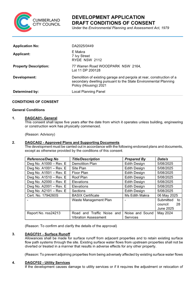


DOCUMENTS
ASSOCIATED WITH
REPORT ELPP021/25
Attachment 2
Architectural Plans
Cumberland
Local Planning Panel Meeting
8 October 2025
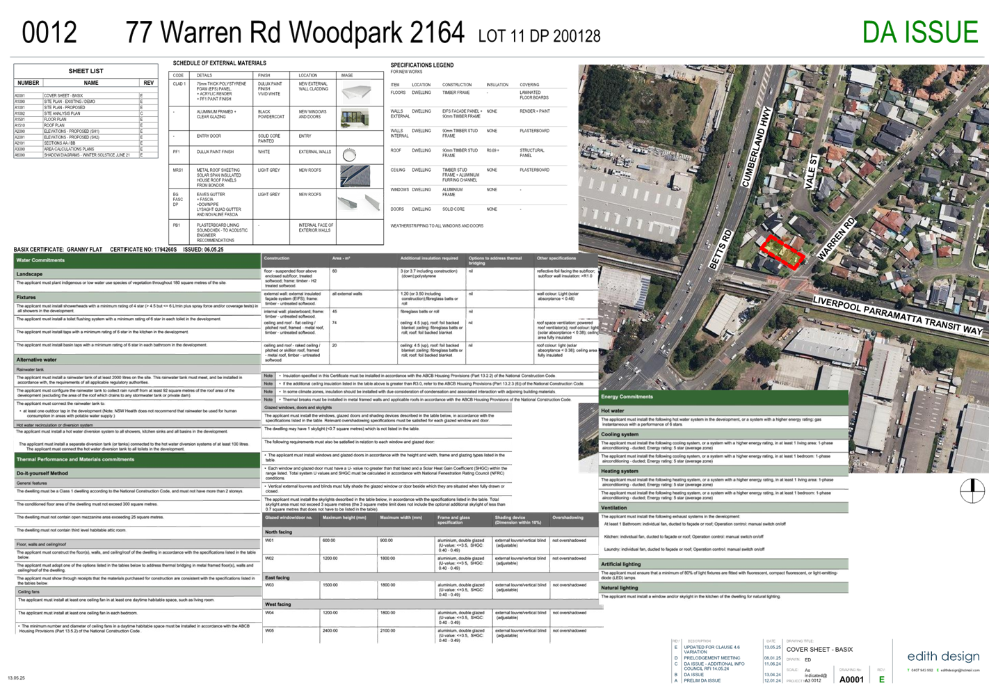
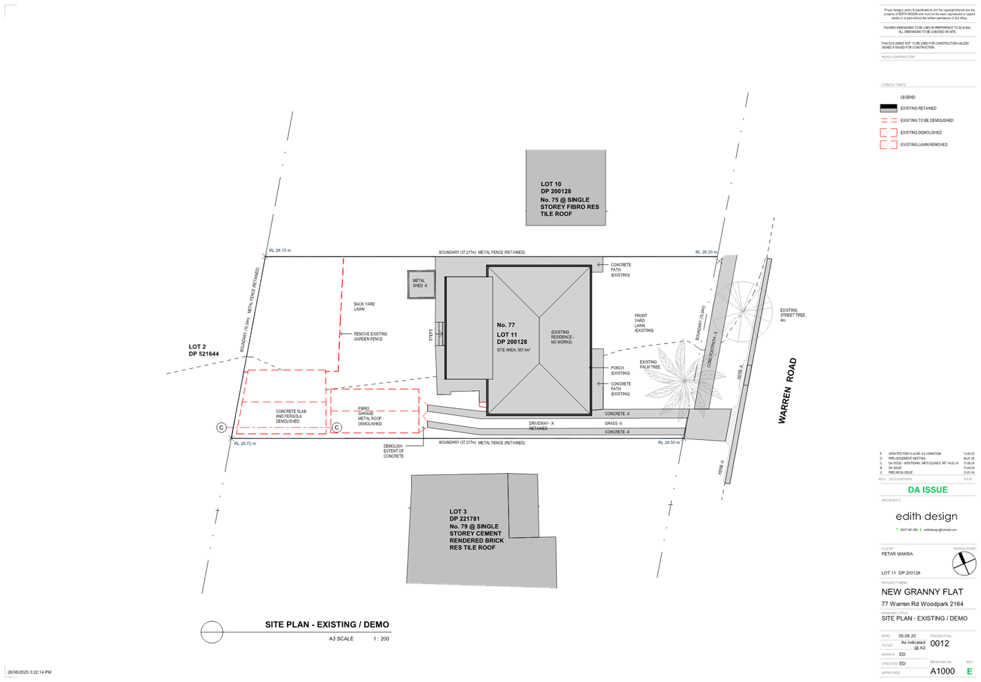
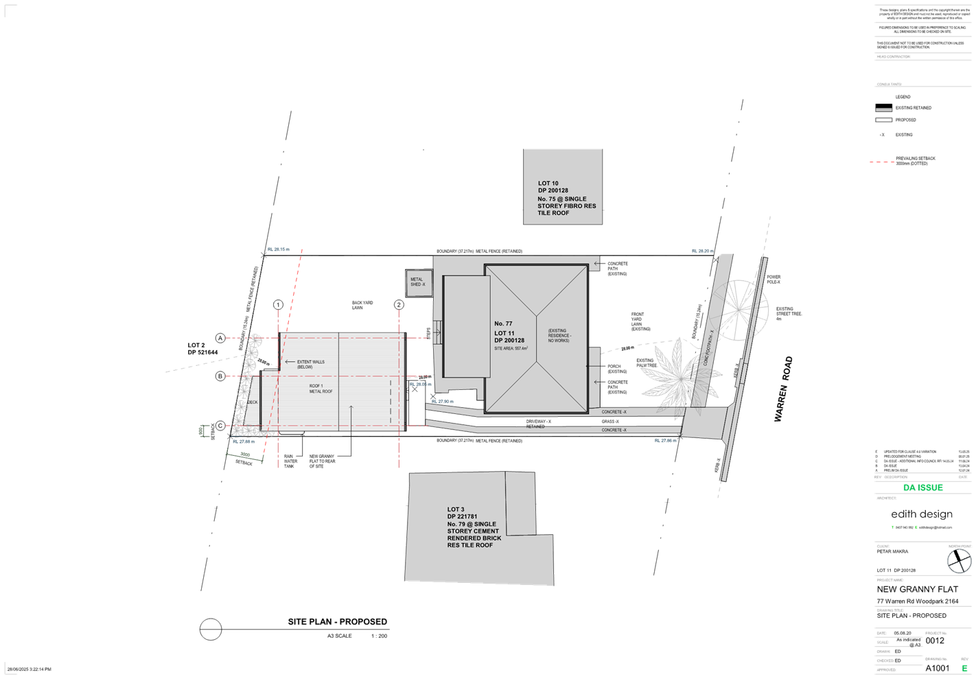
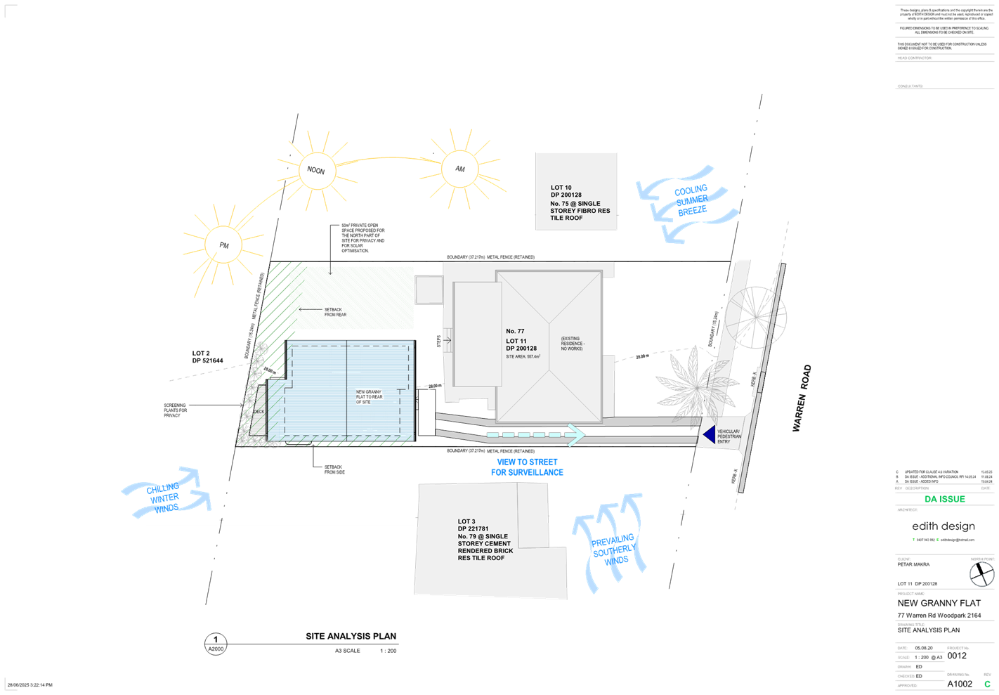
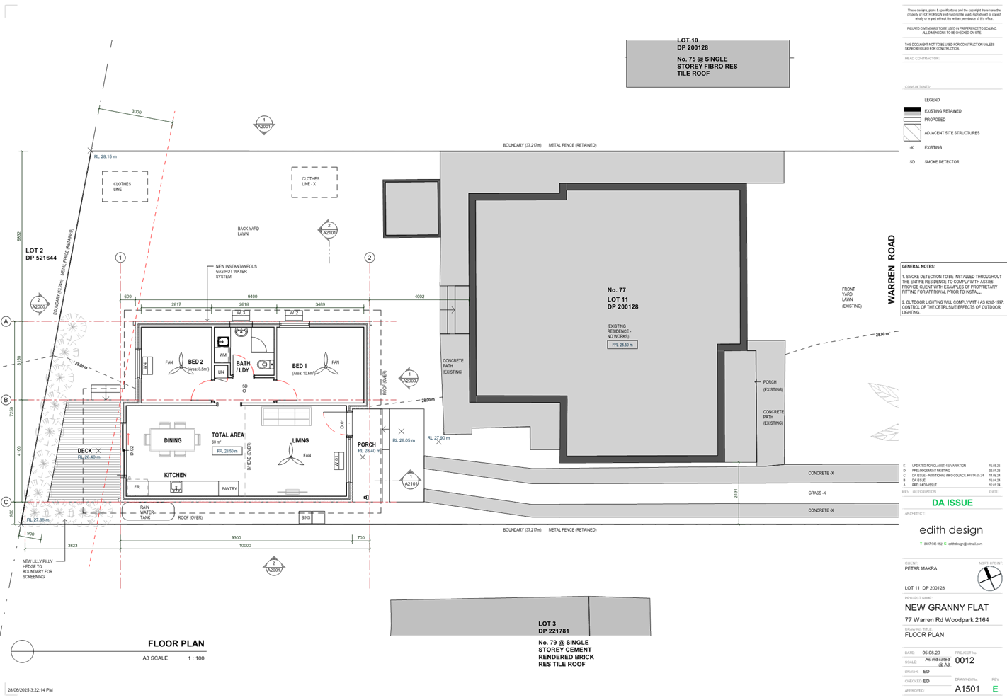
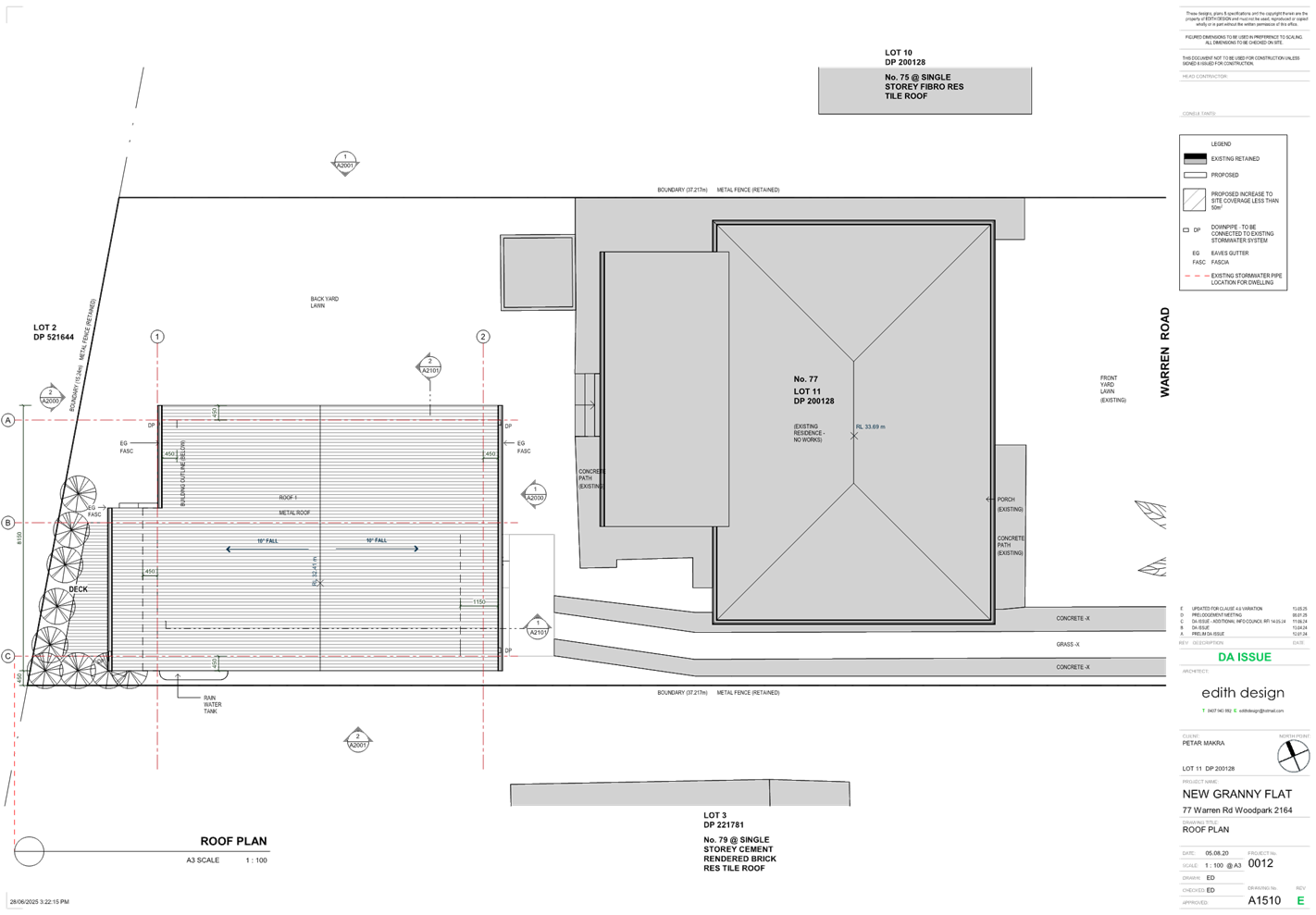
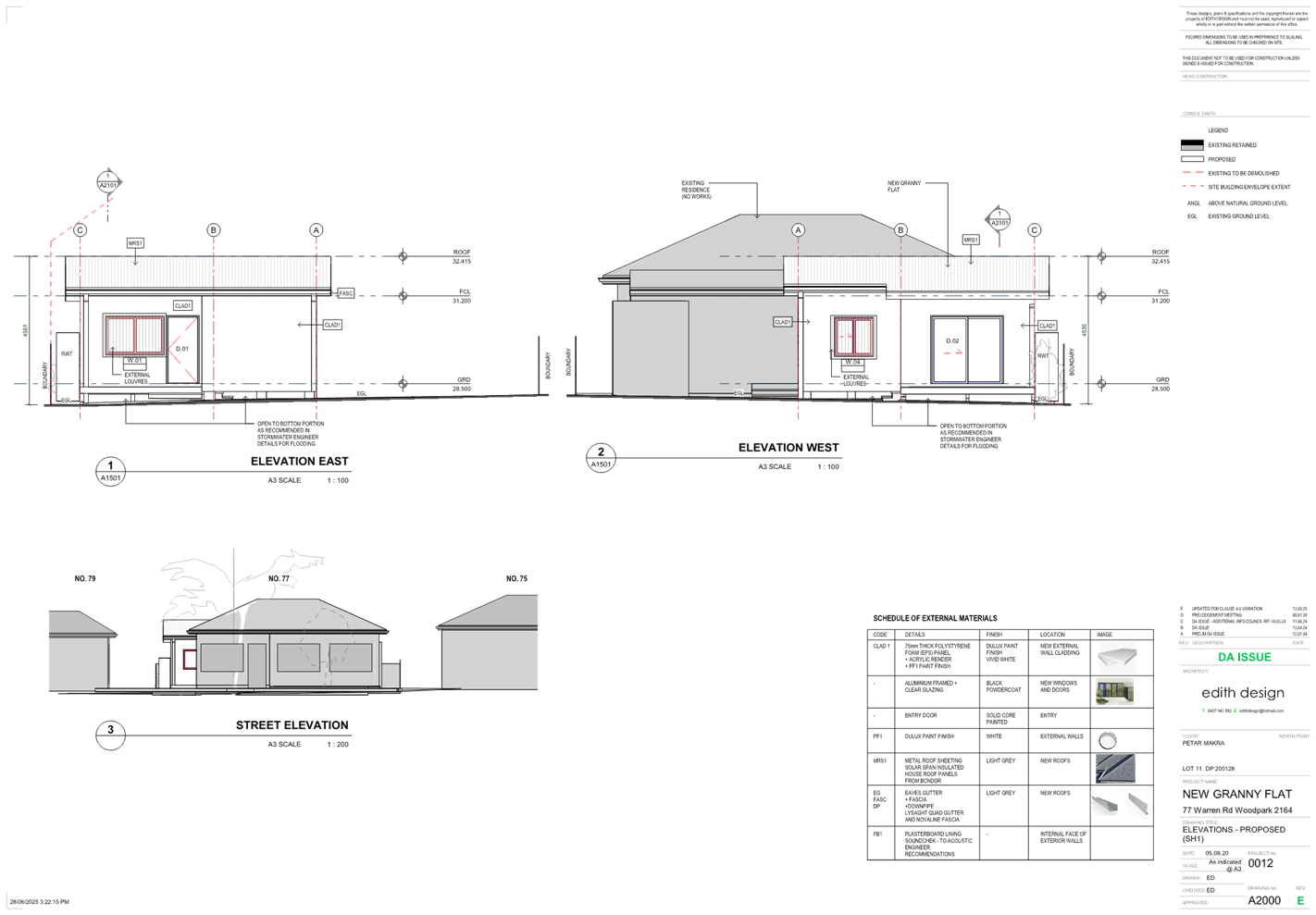
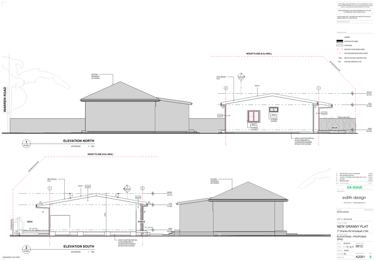
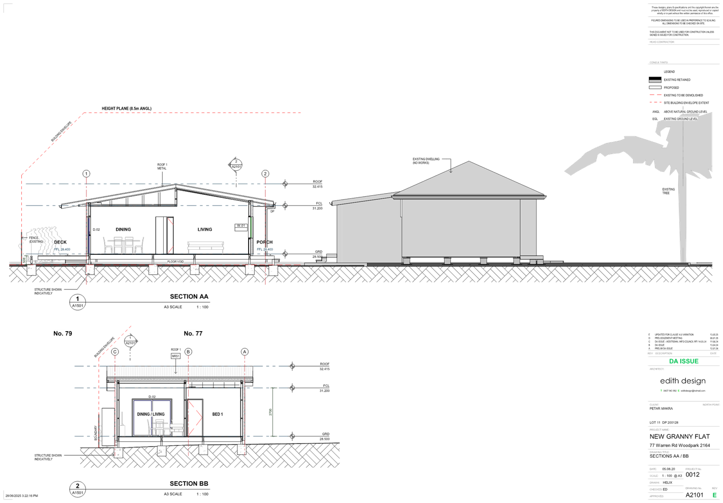
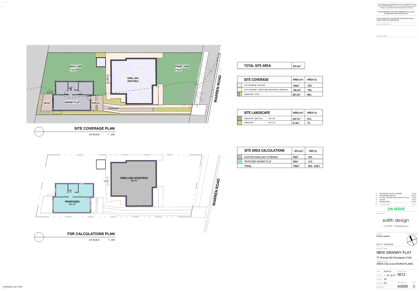
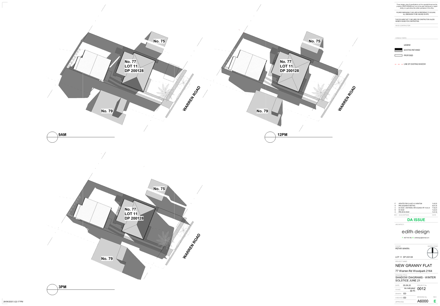
DOCUMENTS
ASSOCIATED WITH
REPORT ELPP021/25
Attachment 3
Clause 4.6 Variation Report
Cumberland
Local Planning Panel Meeting
8 October 2025
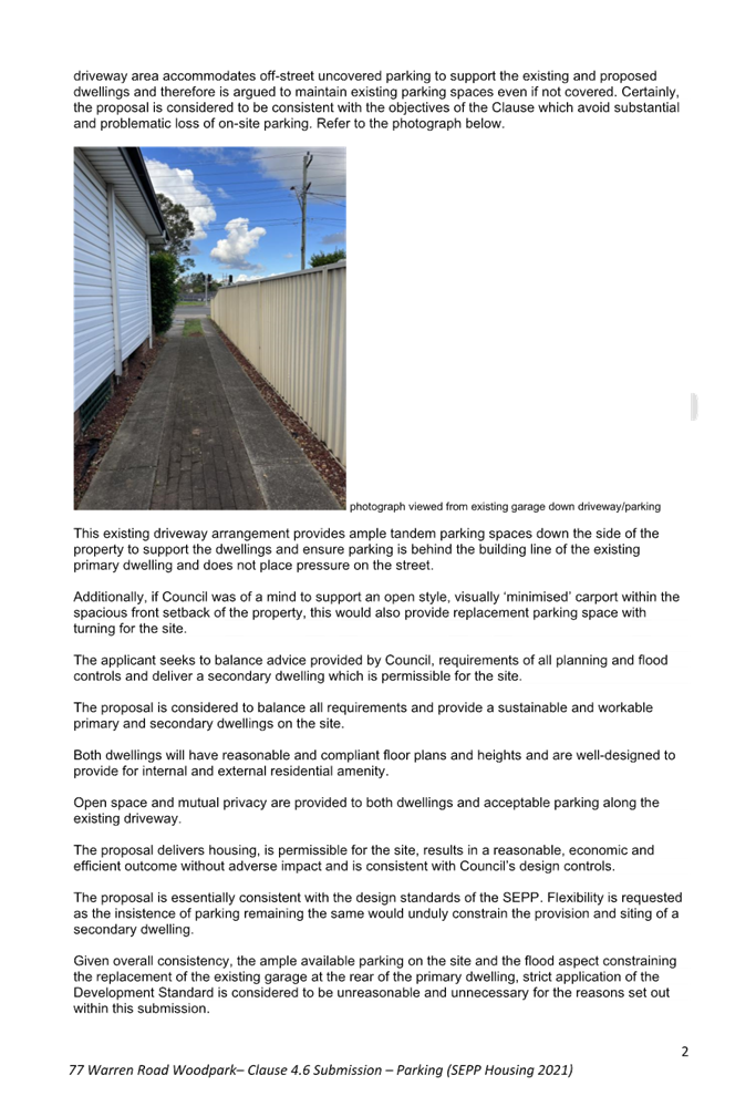
DOCUMENTS
ASSOCIATED WITH
REPORT ELPP021/25
Attachment 4
Appendix A Cumberland LEP 2021 Assessment
Cumberland
Local Planning Panel Meeting
8 October 2025

DOCUMENTS
ASSOCIATED WITH
REPORT ELPP021/25
Attachment 5
Appendix B Cumberland DCP 2021 Assessment
Cumberland
Local Planning Panel Meeting
8 October 2025
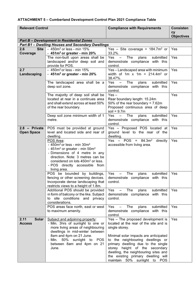
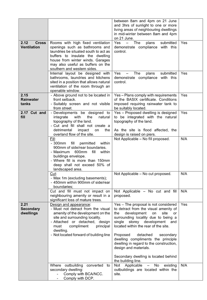
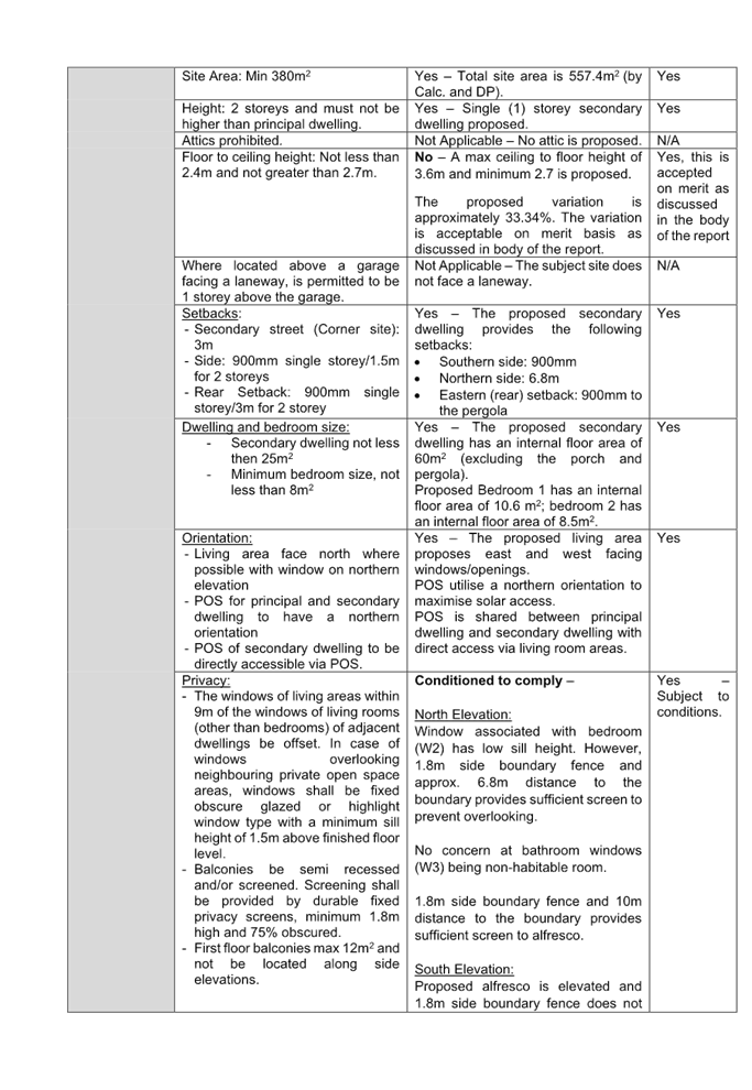

Cumberland Local Planning Panel Meeting
8 October 2025
Item No: ELPP022/25
Development
Application - 297-301 & 305A Parramatta Road, Auburn
Directorate: Environment
and Planning
Responsible
Officer: Executive
Manager City Planning and Development
|
Application lodged
|
7 March 2025.
|
|
Applicant
|
H Hunt.
|
|
Owner
|
Associated World Investments
Pty Ltd.
|
|
Application No.
|
DA2025/0123.
|
|
Description of Land
|
297-301 & 305A Parramatta
Road Auburn.
Lot 1 in DP 668936, Lot 1 in
DP 316730, Lots B & C in DP 316729 and Lot 6 in DP 312763.
|
|
Proposed Development
|
Alterations and additions to
the existing building to create a four (4) storey self-storage facility with
ancillary office, at-grade parking and associated signage.
|
|
Site Area
|
6,504.9 sqm.
|
|
Zoning
|
E3 - Productivity Support.
|
|
Disclosure of political
donations and gifts
|
Nil disclosure.
|
|
Cost of works
|
$8,372,592.00.
|
|
Heritage
|
The subject site is not an item of heritage significance,
or within a conservation area. The
subject site is in the vicinity of an archaeological site under the
State Heritage List (item no. A4) and Schedule 5 of the Cumberland LEP (item
no. I330) located at 312 Parramatta Road, Auburn.
|
|
Principal Development
Standards
|
Floor Space Ratio
Permissible: 1:1.
Proposed: 1.27:1.
Height of Building
Permissible (No height limit
stated).
Application does not fall
under Clause 4.3(2A) regarding a 27 metre height limit.
Current height of 21.96
metres. No change.
|
|
Issues
|
Floor Space Ratio.
|
1. Development
Application 2025/0123 was lodged on the 7 March 2025 for the alterations and
additions to the existing building to create a four (4) storey self-storage
facility with ancillary office, at-grade parking and associated signage.
2. The
application was publicly notified to occupants and owners of the adjoining
properties for a period of 14 days between 4 April 2025 and 18 April 2025. In
response, no submissions were received.
3. On
the 23rd of July 2025 and 5th of August 2025, the applicant lodged amended
plans and documents. The amended plans did not require re-notification as the
environmental impact is insignificant.
4. The
subject site is not listed as a heritage item or located within the heritage
conservation area within the Cumberland Local Environmental Plan 2021. The
subject site is in the vicinity of an archaeological site under the State
Heritage List (item no. A4) and Schedule 5 of the Cumberland LEP (item no.
I330) located at 312 Parramatta Road, Auburn.
5. The
variations are as follows:
|
Control
|
Required
|
|
Provided
|
% variation
|
|
CLEP 2021
Floor Space Ratio
|
1:1 (6,504.9 sqm)
|
|
1.27:1 (8,273.4 sqm)
|
27% (sqm)
(variation of 1,768.4 sqm)
|
6. The
application is referred to the Panel as the proposal contravenes a development
standard by more than 10%.
7. The
application is recommended for approval subject to the conditions as
recommended in the Council’s assessment report.
Subject Site and Surrounding
Area
The site consists of 5 lots
forming Lot 1 in DP 668936, Lot 1 in DP 316730, Lots B & C in DP 316729 and
Lot 6 in DP 312763 and is known as 297-301 and 305A Parramatta Road, Auburn.
The subject site is ‘rectangular’ in shape with a total area of
6,504.9 sqm, a street frontage of 57.54m to Parramatta Road and 61m to Short
Street. The site is zoned E3- Productivity Support under the Cumberland Local
Environmental Plan 2021 (CLEP) and forms part of the ‘Parramatta Road
Precinct’.
The site currently comprises a
freestanding industrial warehouse with a two-storey brick building to the
southern boundary (Parramatta Road). Hardstand areas are located west and east
of the warehouse. Existing vehicle access is provided along the northern
boundary of the site from Short Street. The building is currently occupied by
TORO Waste Equipment, a company which manufactures and supplies skip bins,
waste bins and shipping containers. There are no significant trees on the site.
It is noted that Sydney Water sewer main line traverses though the site.
The surrounding land uses of the
site are predominantly commercial, industrial and retail uses. Duck River is
located approximately 150m to the northwest of the site. To the north of the
site is a Concrete batching Plant, to the east an (RV Store), to the south, the
site adjoins Parramatta Road (classified road) and to the west is the Bingo
head office and workshop.
The Parramatta Road commercial
precinct locality is characterised by a mix of light/general industrial,
warehouse and distribution centres, specialised retail premises, shopping
centres and food and drink premises development immediately to the north, east,
west and south of the site. The site is within proximity to major road
corridors including the Western Motorway.
The site is shown below edged in
red and purple below.
Figure
1 - Locality Plan of subject site
Figure
2 - Aerial view of subject site
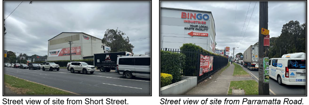
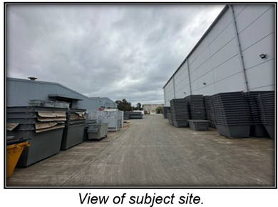
Description of The
Development
Council has received a development
application for alterations and additions to the existing building to create a
four (4) storey self-storage facility with ancillary office, at-grade parking
and associated signage. The detailed breakdown of the proposal is provided
below:
Partial Demolition
- The
proposal involves the demolition of the existing office building, internal
stairs, roller doors existing facilities, crane structures within the warehouse
and minor demolition of façade to allow for the installation of
openings.
- Relocation
of existing stormwater downpipes.
Proposed alterations and
additions
- Alterations
and additions to the existing warehouse building including the construction of
three floor slabs to create the four levels of self-storage facility comprising
of around 654 storage units ranging in size from 9 sqm to 15 sqm.
Ground Floor
- 61
sqm of office space including an accessible toilet and a kitchenette.
- Self
storage area.
- 3
lift cores and 3 stair wells.
- Loading
dock and loading bays.
- Bin
room.
- Hardstand
areas along the eastern and western boundaries
- 30
car parking spaces along the eastern boundary including one accessible car
space.
First - Third Floors (typical)
- Self
storage units.
- 3
lift cores and 3 stair wells.
Landscape works
- Perimeter
landscaping along the primary frontage and side boundaries including trees and
shrubs.
Stormwater works
- Retention
of the existing stormwater pipes running from the western boundary of the site
towards the northern boundary.
- Installation
of new pipes and pits and storm filter system.
Access
- Access
to the site is to be maintained via Short Street, featuring a 2-way entry/exit
driveway along the western end.
- The
existing entry/exit driveway located on the eastern end of the Short Street
site frontage is to be converted to an exit-only driveway.
Signage
- 3
business identification signs are proposed across the eastern and northern
building elevations:
· 6.9m x 2.8m - Eastern
elevation.
· 9m x 3m - Northern elevation.
· 2.41m x 1.18m - office
entrance.
- 3
way finding signs are proposed across the eastern elevation:
· 6.9m x 1.6m.
· 2.75m x 0.64m.
· 6.26m x 0.64m.
Office Premises - Hours of
Operation
- Mondays
to Saturdays 6:00am - 10:00pm.
- Sundays
9:00am - 6:00pm.
Note: The self-storage facility
will be open 24 hours daily.
History
- On
12 February 1997, a development application (Development Consent No. 234/96)
was approved under Deferred Commencement for additions, alterations and fit out
of existing building at 297-301 Parramatta Road, Auburn.
- On
28 February 2012, a development application (Development Consent No. 2011/135)
was approved for alterations and additions to existing industrial development
including the construction of 5 new buildings, signage and associated site
works at 305A, Parramatta Road, Auburn.
- On
2 May 2014, a development application (Development Consent No. 2012/348) was
approved for the construction of an administration building and hard stand area
for the purposes of storage of empty waste bins and truck parking 305A,
Parramatta Road, Auburn.
Applicants Supporting
Statement
The applicant has provided a
Statement of Environmental Effects prepared by Gyde dated 27 February 2025
which was accepted by Council on 10 March 2025 in support of the application.
Contact With Relevant
Parties
The assessing officer has
undertaken a site inspection of the subject site and surrounding properties and
has been in regular contact with the applicant throughout the assessment
process.
Internal Referrals
Development Engineering
The development application was
referred to Council’s Development Engineer for comment who has advised
that the development proposal is satisfactory and therefore can be supported
subject to recommended conditions of consent.
Environmental Health
The development application was
referred to Council’s Environmental Health Officer for comment who has
advised that the proposal is satisfactory and therefore can be supported
subject to recommended conditions of consent.
Waste Management
The development application was
referred to Council’s Waste Management Officer for comment who has
advised that the development proposal is satisfactory in terms of the proposed
waste collection and therefore can be supported subject to recommended
conditions of consent.
External Referrals
Ausgrid
Ausgrid has raised no concern with
the proposal subject to the inclusion of conditions in any consent for the
development to ensure the proposed driveways and any other works do not
interfere with existing underground cables located in the vicinity of the
development and that available electricity services are adequate for the
development.
Sydney Water
In accordance with Section 78 of
the Sydney Water Act 1994, the development was referred to Sydney Water for
comment. Sydney Water has raised no objection to the proposal subject to
conditions.
Planning Comments
The provisions of any
Environmental Planning Instruments (EP&A Act s4.15 (1)(a)(i))
State Environmental Planning
Policies
The proposed development is
affected by the following State Environmental Planning Policies:
|
· State
Environmental Planning Policy (Biodiversity and Conservation) 2021.
|
Chapter 2 -Vegetation in non
Rural Areas.
|
No significant vegetation is
proposed to be removed as part of the proposed application.
|
|
Chapter 6 -
Water Catchments.
Sydney Harbour Catchment
|
It is determined that given
the location of the site, a detailed assessment is not required given that
there is no direct impact upon the catchment and no direct impact upon
watercourses. As such, the development is acceptable under the provisions
that came into effect on Monday, 21 November 2022.
|
|
· State
Environmental Planning Policy (Resilience and Hazards) 2021.
|
Chapter 2 - Coastal Management.
|
N/A
–The site is in the vicinity of Duck River which is located
approximately 150m to the northwest of the site. However, the subject
site is not identified as a coastal wetland and ‘land identified as
“proximity area for coastal wetlands” and coastal management
area.
Notwithstanding,
given the nature of the proposed works being mainly internal building alterations with no change to the
overall building footprint, it is considered that the proposal will have no
adverse on the watercourse.
|
·
Chapter 3 |
The proposed development is only for ‘self storage
facility’ which is not considered to be hazardous or offensive development.
|
|
Chapter 4 - Remediation of
Land.
Part 4.6.
|
Part 4.6 - Contamination
and remediation to be considered in determining development application.
Comments
A Detailed Site Investigation (DSI) prepared by Getex was
submitted to support the proposal.
A Hazardous Building Materials Survey report has also been
prepared by Environmental Consulting Services and submitted under separate
cover. The report identifies that the building materials currently on the
site have not been damaged or deteriorated and pose a low risk.
1.
Council’s Environmental Health Officer has reviewed
the reports and considered the proposal to be satisfactory in accordance with
the provisions of this chapter.
2.
2.
It is considered that
the development application is satisfactory under Part 4.6 of Chapter 4 of
the State Policy.
|
|
· State Environmental Planning
Policy (Sustainable Buildings) 2022
|
Chapter 3 – Standards
for non-residential
development
|
Chapter 3 of SEPP (Sustainable Buildings) 2022 does not
apply to this development as the alterations,
enlargement or extension of the existing building does not have a capital
investment value of $10 million or more.
|
|
· State Environmental
Planning Policy (Industry and Employment) 2021.
|
Chapter 3 Advertising and
Signage.
|
Signage is proposed as part of the development
application. Refer to Attachment 6 for detailed assessment.
|
|
· State Environmental
Planning Policy (Transport and Infrastructure) 2021.
|
Chapter 2 - Infrastructure.
|
Where relevant, appropriate
referrals have been undertaken to service authorities.
|
|
Clause 2.48
|
Chapter 2 - Infrastructure.
Determination of development
applications (Subpart (2) - Give written notice to electricity providers and
take account of responses received within 21 days.
Comment
The development application
was referred to Ausgrid for comment who raised no issue with the proposal
subject to the inclusion of conditions into any consent for the development
to ensure the proposed driveways and any other construction activities do not
interfere with existing underground cables located in the vicinity of the
development and the available electricity services are adequate for the development.
|
|
Clause 2.119
|
Parramatta Road is a
classified road. Notwithstanding, no works are proposed along the classified
road. Vehicular access to the site is provided via Short Street at and the
proposal has been designed to front this street as its primary pedestrian and
vehicular entrance. There are no proposed or existing access to the site via
Parramatta Road. In this regard, no referral to Transport for NSW is
warranted in this instance.
|
Local Environmental Plans
Cumberland Local
Environmental Plan 2021
The provision of the Cumberland
Local Environmental Plan 2021 is applicable to the development proposal. It is
noted that, with the exception of the Floor Space Ratio non compliance, the
development generally satisfies the relevant provisions of the Cumberland Local
Environmental Plan 2021 and the objectives of the E3 - Productivity Support
zone.
(a) Permissibility:
The proposed development comprises
a ‘self-storage unit’ facility and or a storage premises, ancillary
‘office premises’ and ‘business identifications signs’
which are permitted with consent under the E3 Zone as follows:
Self-storage units
is defined in the CLEP 2021 as “… premises that consist of
individual enclosed compartments for storing goods or materials (other than
hazardous or offensive goods or materials). Note: Self-storage units are a type
of storage premises—see the definition of that term in this
Dictionary.”
Storage premises
means a building or place used for the storage of goods, materials, plant or
machinery for commercial purposes and where the storage is not ancillary to any
industry, business premises or retail premises on the same parcel of land, and
includes self-storage units, but does not include a heavy industrial storage
establishment, local distribution premises or a warehouse or distribution
centre.
Office premises
is defined in the CLEP 2021 as a building or place used for the purpose of
administrative, clerical, technical, professional or similar activities that do
not include dealing with members of the public at the building or place on a
direct and regular basis, except where such dealing is a minor activity (by
appointment) that is ancillary to the main purpose for which the building or
place is used. Note: Office premises are a type of commercial
premises—see the definition of that term in this Dictionary.”
Business identification
sign is defined as: “a sign that identifies or names a
building and that may include the name of a building, the street name and
number of a building, and a logo or other symbol but does not include general
advertising of products, goods or services.
Note- Building identification
signs are a type of signage—see the definition of that term in this
Dictionary”.
The proposed self-storage unit facility
promotes businesses and provides employment uses (including the ancillary
office) along Parramatta Road and is a use which is compatible with the
surrounding uses. The development is consistent with the objectives of the E3 -
Productivity Support Zone.
The relevant matters to be
considered under CLEP 2021 and the applicable clauses for the proposed
development are summarised below. A comprehensive CLEP assessment is contained
in Attachment 7.
Cumberland
LEP 2021 Compliance Table
|
DEVELOPMENT STANDARD
|
COMPLIANCE
|
DISCUSSION
|
|
4.3 Height of Buildings.
Clause 4.3(2A): The maximum height of office premises
and hotel or motel accommodation in the “Parramatta Road
Precinct”, shown edged orange on the Height of Buildings Map is 27
metres.
|
N/A
|
The site is identified in the
CLEP 2021 as part of the Parramatta Road Precinct. Pursuant to Clause
4.3(2A), the precinct has no nominated height except for office premises and
hotel or motel accommodation (where a maximum height of 27m applies).
As the proposal is for a
self-storage unit facility, the HOB Development Standard does not
apply.
The existing building height
of 21.96 metres remains unchanged.
|
|
4.4 Floor
Space Ratio - 1:1
|
Proposed FSR = 1.27:1 (an excess of 1,768.4 sqm).
|
No - the proposal exceeds 1:1.
Refer to Clause 4.6 Variation
below.
|
|
4.6
Exceptions to Development Standards
|
Yes
|
Refer to detailed assessment below.
|
Clause 4.6 - Exceptions to
development standards
Clause 4.6 aims to achieve better
design outcomes for and from development by allowing an appropriate degree of
flexibility to development standards if particular circumstances are satisfied.
The proposed change of use seeks
to adapt the existing warehouse building into a four-storey self-storage
facility by inserting additional internal floor slabs, generating a 27%
exceedance of the maximum FSR. In this regard, the application seeks to
vary the development standard for floor space ratio under Clause 4.4 of the
Cumberland Local Environmental Plan 2021 by proposing an FSR of 1.27:1
resulting in a variation of 27% or 1,732.5 sqm.
Consent may only be granted upon
the consent authority being satisfied that the applicant has demonstrated in a
document submitted with the application that (a) compliance with the
development standard is unreasonable or unnecessary in the circumstances and
(b) there are sufficient environmental planning grounds to justify the
contravention of the development standard.
(a) compliance
with the development standard is unreasonable or unnecessary in the
circumstances.
The decision of Wehbe v
Pittwater Council (2007) 156 LGERA 446; [2007] NSWLEC 827, affirmed in Initial
Action Pty Ltd v Woollahra Municipal Council [2018] NSWLEC 118 set out five
common and non-exhaustive ways in which an applicant might demonstrate that
compliance with a development standard is unreasonable or unnecessary. They
were that:
(i) the
objectives of the development standard are achieved notwithstanding
non-compliance with the standard.
(ii) the
underlying objective or purpose is not relevant to the development with the
consequence that compliance is unnecessary.
(iii) the
underlying objective or purpose would be defeated or thwarted if compliance was
required with the consequence that compliance is unreasonable.
(iv) the
development standard has been virtually abandoned or destroyed by the
Council’s decisions in granting development consents that depart from the
standard and hence compliance with the standard is unnecessary and
unreasonable.
(v) the
zoning of the particular land on which the development is proposed to be
carried out was unreasonable or inappropriate so that the development standard,
which was appropriate for that zoning, was also unreasonable or unnecessary as
it applied to that land and that compliance with the standard in the
circumstances of the case would also be unreasonable or unnecessary.
Applicant’s
Justification:
The applicant relies on the Wehbe
v Pittwater Council (2007) NSW LEC 827, claiming the following:
· The objectives
of Clause 4.4 of the CLEP 2021 are as follows:
(a) to establish a maximum
floor space ratio to enable appropriate development density,
(b) to ensure that development
intensity reflects its locality.
· The proposed
FSR is considered to be appropriate in this particular case because the
proposal overall relies entirely on the existing building envelope and
footprint.
· The proposal
does not result in any further amenity impacts such as overshadowing. The
additional traffic generation has been assessed by Varga Traffic Planning Pty
Ltd and deemed to be negligible, largely because self-storage land uses are
categorised as low intensity land uses. Therefore, as the proposal does not
result in any unreasonable impacts, it is considered to be appropriate
development density as sought by objective A, and reflective of the subject
locality’s intensity as sought by objective B.
· Any external
alterations result in an improved streetscape presentation.
Planner’s comments:
· The proposal
does not alter the existing building height, footprint or external envelope.
The perceived bulk and scale from the public domain remain consistent with the
existing warehouse form.
· The FSR
variation arises solely from internal subdivision of space by introducing
additional floor slabs which increases the Gross Floor Area without enlarging
the building.
· A self-storage
facility is a low-intensity land use that generates substantially less demand
on traffic, parking and services compared with other forms of commercial or
industrial development permissible on the site.
· The development
does not introduce additional overshadowing, overlooking or visual bulk impacts
to adjoining properties.
· The development
delivers a compatible built form outcome, provides employment
opportunities, and contributes to local economic activity while meeting the
objectives of both the FSR development standard and the zone.
The applicant’s
justification is therefore considered to be well founded.
(b) there
are sufficient environmental planning grounds to justify the contravention of
the development standard.
In respect of there being
sufficient environmental planning grounds to justify the contravention of the
development standard, Initial Action found that although the phrase
‘environmental planning’ is not defined, it would refer to grounds
that relate to the subject matter, scope and purpose of the Environmental
Planning and Assessment Act 1979, including the objects in s.1.3. To be
sufficient, the environmental planning grounds advanced in the written request
must justify the contravention of the development standard, not simply promote
the benefits of carrying out the development as a whole Four2Five Pty Ltd v
Ashfield Council [2015] NSWCA 248.
Applicant’s
justification:
· The additional floor
area is contained entirely within the existing building footprint and envelope.
Subsequently, the development does not create any additional bulk, scale or
amenity impacts.
· Self-storage is
a low-intensity use, as evidenced by its relatively low traffic generation.
Varga Traffic Planning Pty Ltd has determined that the proposed development
result in a slight reduction in the traffic generation potential of the site of
approximately 5 vph compared to the existing use on the site.
· Development
with far greater FSR (i.e. between 1.5:1 to 3:1) is permitted on the site
according to Clause 4.4(2B)(a) and (b) of the CLEP 2021.
· Self storage is
a low intensity use, this is demonstrated by the relatively low traffic
generation.
· Self-storage is
becoming an increasingly residential use, supporting higher housing densities
Planner’s comments:
The additional floor space ratio
does not alter the originally approved building bulk and scale and ‘as
built’ building. The building alterations are mainly internal and the
proposal does not unduly change the interrelationship of the development with
either of the adjoining properties or the streetscape character. Further, the
proposed alterations will not contribute to additional shadow impact on
adjoining properties. The variation arises solely from internal floor slabs to
create additional storeys within the existing volume of the building, with no
changes to the building height, footprint, or external envelope.
Having regard to the above, the
numerical floor space ratio departure is considered acceptable on merit.
Conclusion
Council is satisfied that the
applicant’s written request has adequately addressed the matters required
to be demonstrated by clause 4.6 subclause (3). Council is further satisfied
that the proposed development is consistent with the objectives of the
particular standard and the objectives for development within the zone in which
the development is proposed to be carried out.
It is the view of Council Officers
that justification provided is satisfactory and having considered the
application on its merit, the exception to the floor space ratio development
standards is considered acceptable in this instance.
The provisions of any proposed
instrument that is or has been the subject (EP&A Act s4.15 (1)(a)(ii))
Cumberland Council | Woodville
Road Corridor - Draft Planning Proposal
Council has received a Gateway
Determination from the Department of Planning, Housing and Infrastructure for
the Draft Woodville Road Corridor Planning Proposal. As part of this approval,
public exhibition of the Draft Woodville Road Corridor Planning Proposal has
commenced. The public exhibition was carried out between the 4 March 2025 to 17
April 2025.
The Draft Planning Proposal seeks
to revitalise Woodville Road by amending planning controls in the Cumberland
Local Environmental Plan (CLEP) 2021 for 31 sites located around the three (3)
precincts of Woodville North, Merrylands East and Woodville South.
The subject application was
accepted on 10 March 2025 and the site does not fall within the Draft Woodville
Road Corridor. Therefore, no further consideration is required.
The provisions of any
Development Control Plans (EP&A Act s4.15 (1)(a)(iii))
The Cumberland Development Control
Plan 2021 is relevant to the development proposal.
The development has been assessed
using the following chapters:
- Part
C – Development in Business Zones.
- Part
G1 – Advertising and Signage.
- Part
G3 – Traffic, Parking, Transport and Access.
- Part
G4 – Stormwater and Drainage.
- Part
G5 – Sustainability, Biodiversity and Environmental Management.
- Part
G7 – Tree Management and Landscaping.
- Part
G8 – Waste Management.
The development is found to
generally comply with the relevant provisions of the DCP.
A comprehensive assessment and
compliance table is contained in Attachment 8.
The provisions of any planning
agreement that has been entered into under section 7.4, or any draft planning
agreement that a developer has offered to enter into under section 7.4
(EP&A Act s4.15(1)(a)(iiia))
There is no draft planning
agreement associated with the subject Development Application.
The provisions of the
Regulations (EP&A Act s4.15 (1)(a)(iv))
The proposed development raises no
concerns as to the relevant matters arising from the Environmental Planning and
Assessment Regulation 2021 (EP&A Reg).
The Likely Environmental,
Social or Economic Impacts (EP&A Act s4.15 (1)(b))
It is considered that the proposed
development will have no significant adverse environmental, social or economic
impacts in the locality.
The suitability of the site for
the development (EP&A Act s4.15 (1)(c))
The subject site and locality is
not known to be affected by any natural hazards or other site constraints
likely to have a significant adverse impact on the proposed development.
Accordingly, it is considered that the development is suitable in the context
of the site and surrounding locality.
Submissions made in accordance
with the Act or Regulation (EP&A Act s4.15 (1)(d))
|
Advertised (Website)
|
Mail
|
Sign
|
Not Required
|
In accordance with Council’s
Notification requirements contained within the Cumberland DCP 2021, the
proposal was publicly notified for a period of 14 days between 4 April 2025 and
18 April 2025. The notification generated no submissions in respect of the
proposal.
The public interest (EP&A
Act s4.15(1)(e))
In view of the foregoing analysis,
it is considered that the development, if carried out subject to the conditions
set out in the recommendation below, will have no significant adverse impacts
on the public interest.
CUMBERLAND LOCAL INFRASTRUCTURE
CONTRIBUTIONS PLANS 2020
The development would require the
payment of contributions in accordance with Cumberland Local Infrastructure
Contributions Plan 2020.
In accordance with the
Contribution Plan a contribution is payable, pursuant to Section 7.12 of the
EP&A Act, calculated on the cost of works. If the development is approved,
a total contribution of $84,261.00 would be payable prior to the issue of a
Construction Certificate.
HOUSING AND PRODUCTIVITY OF
CONTRIBUTION (HPC)
In accordance with s7.24, s7.26
and s7.28 of the Environmental Planning and Assessment Act, 1979, the proposed
development is subject to the payment of the Housing and Productivity
Contribution (HPC).
A condition of consent has been
imposed on the development consent in accordance with s7.28 of the EP&A Act
1979 requiring the payment of the HPC. The amount is calculated at $79,400.33.
DISCLOSURE OF POLITICAL
DONATIONS AND GIFTS
The applicant and notification
process did not result in any disclosure of Political Donations and Gifts.
The development application has
been assessed in accordance with the relevant requirements of the Environmental
Planning and Assessment Act 1979, State Environmental Planning Policy
(Resilience and Hazards) 2021, State Environmental Planning Policy (Industry
and Employment) 2021 and State Environmental Planning Policy (Transport and
Infrastructure) 2021, Cumberland Local Environmental Plan 2021, Cumberland
Development Control Plan 2021 and is satisfactory for approval subject to
conditions.
The proposed development is
appropriately located within the E3 - Productivity Support Zone under the
relevant provisions of the CLEP 2021. The proposal is generally consistent with
most of the statutory and non-statutory controls applying to the development
except for the floor space ratio. Having regard to the assessment of the
proposal from a merit perspective, Council may be satisfied that the
development has been responsibly designed and provides a built form consistent
with and appropriate to the desired future character of the site. Hence the
development, irrespective of the departures in relation to floor space ratio,
is consistent with the intentions of Council’s planning controls and
represents a form of development contemplated by the relevant statutory and
non-statutory controls applying to the land.
For these reasons, it is
considered that the proposal is satisfactory having regard to the matters of
consideration under Section 4.15 of the Environmental Planning and
Assessment Act 1979, and the development may be approved subject to
conditions
There are no consultation
processes for Council associated with this report.
There are no financial
implications for Council associated with this report.
There are no policy implications
for Council associated with this report.
Communication /
Publications:
The final outcome of this matter
will be notified. The objectors will also be notified in writing of the
outcome.
1. That
the Clause 4.6 variation request to contravene the Floor Space Ratio
development standard, pursuant to the Cumberland Local Environmental Plan 2021,
be supported.
2. That
Development Application No. DA2025/0123 for alterations and additions to the
existing building to create a four (4) storey self-storage facility with
ancillary office, at-grade parking and associated signage on land at 297- 301
and 305A Parramatta Road Auburn be approved subject to conditions listed in the
attached schedule.
1. Draft Notice
of Determination
2. Architectural
Plans
3. Stormwater/Engineering
Plans
4. Clause
4.6 Variation Request - Floor Space Ratio
5. Plan
of Management
6. Appendix
A - State Environmental Planning Policy (Industry and Employment) 2021
7. Appendix
B - Cumberland LEP 2021 Assessment
8. Appendix
C - Cumberland DCP 2021 Assessment
DOCUMENTS
ASSOCIATED WITH
REPORT ELPP022/25
Attachment 1
Draft Notice of Determination
Cumberland
Local Planning Panel Meeting
8 October 2025
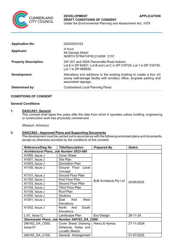
DOCUMENTS
ASSOCIATED WITH
REPORT ELPP022/25
Attachment 2
Architectural Plans
Cumberland
Local Planning Panel Meeting
8 October 2025
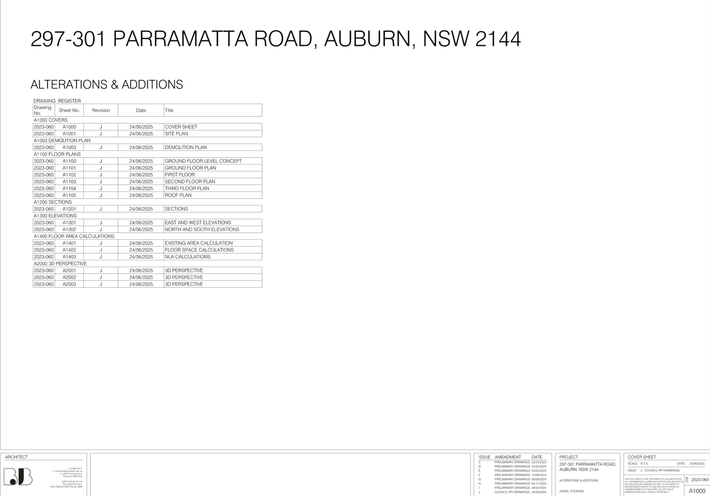
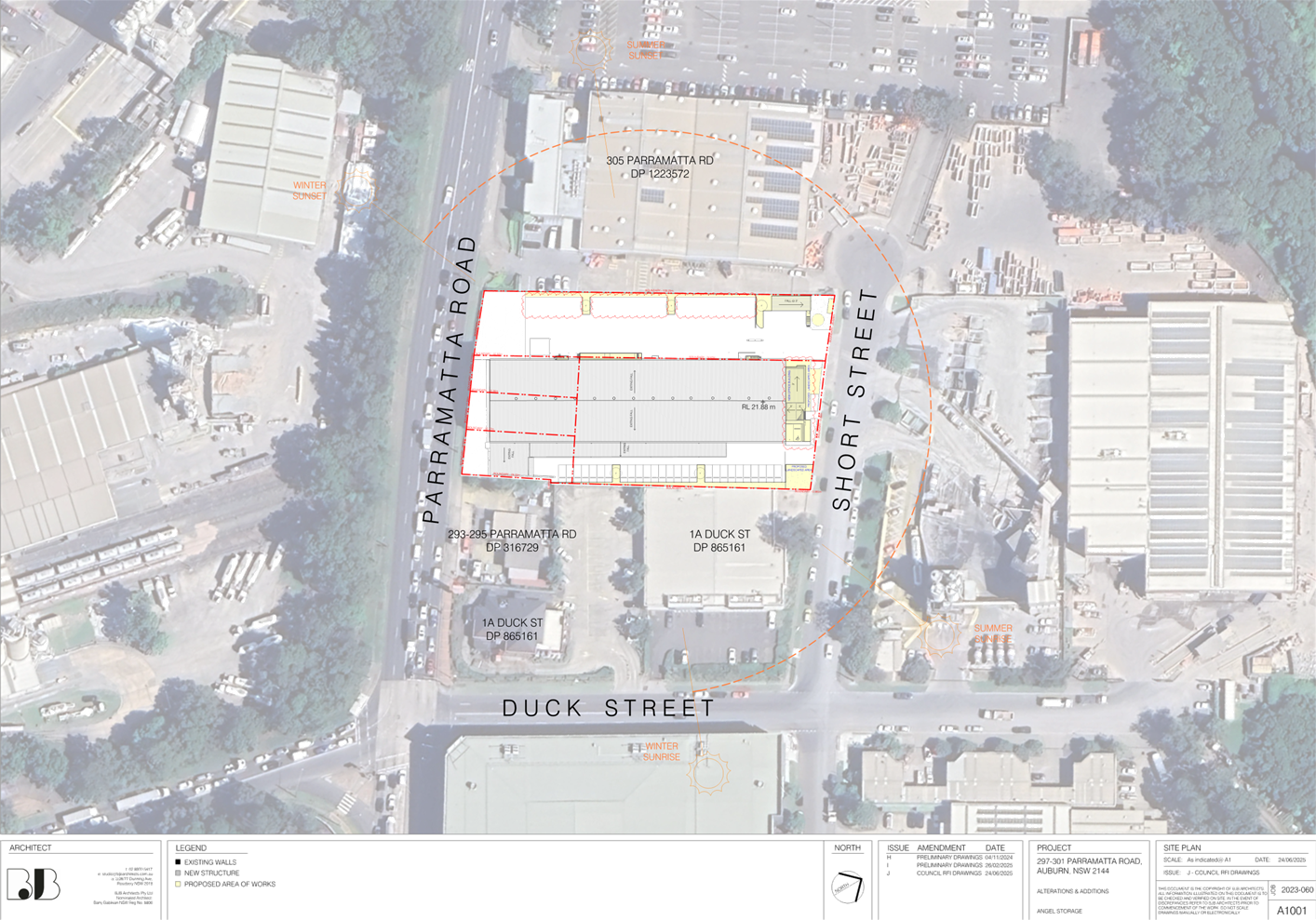
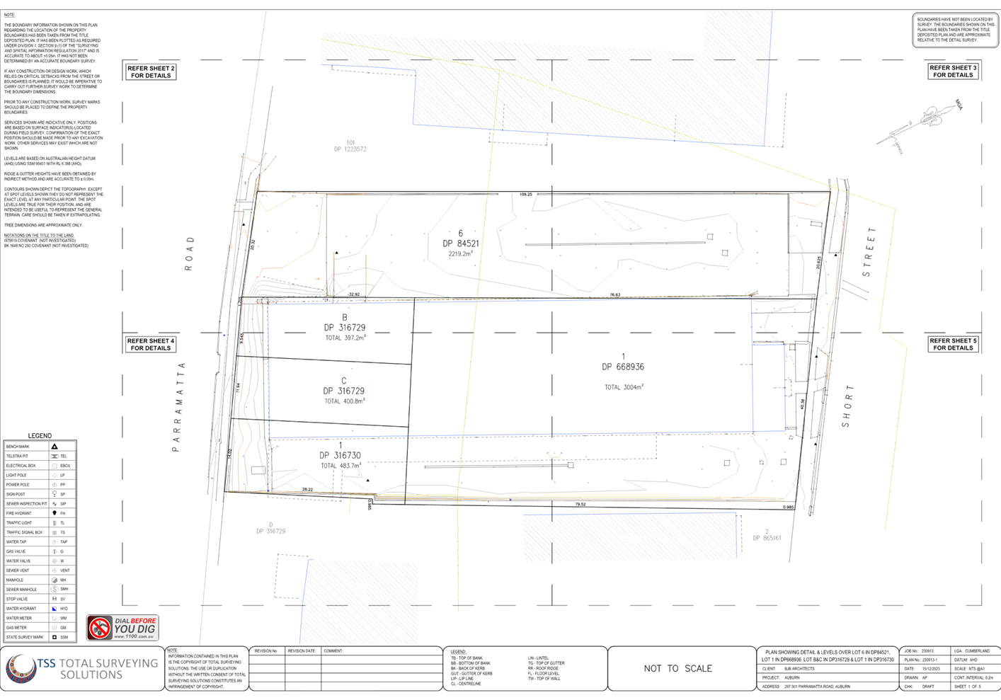
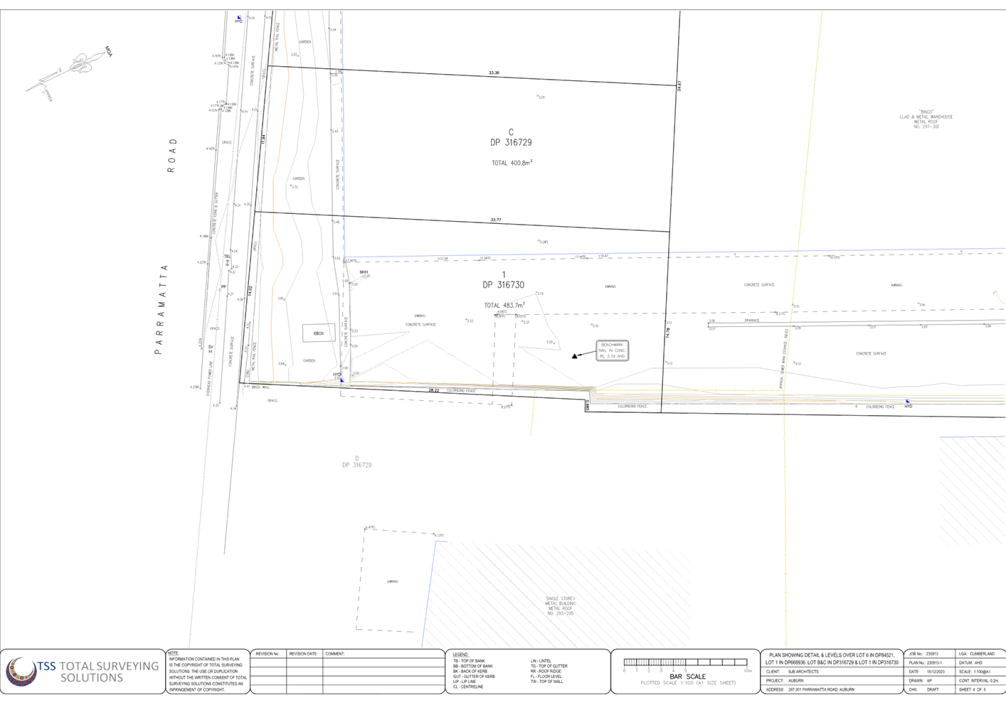
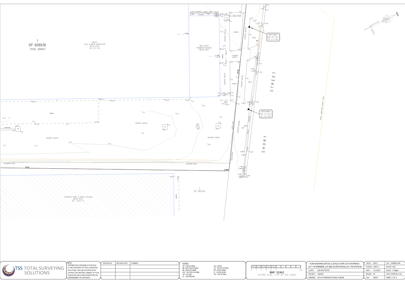
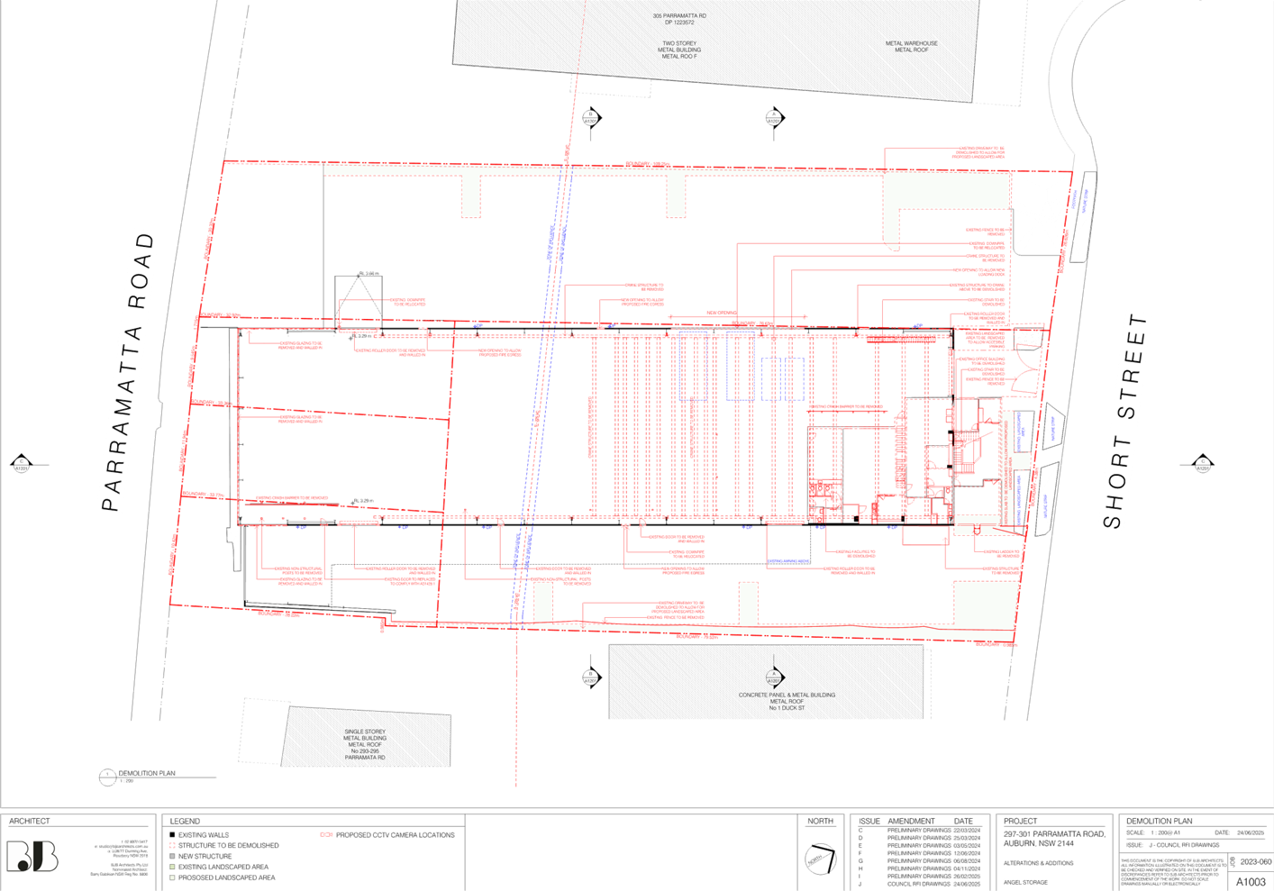
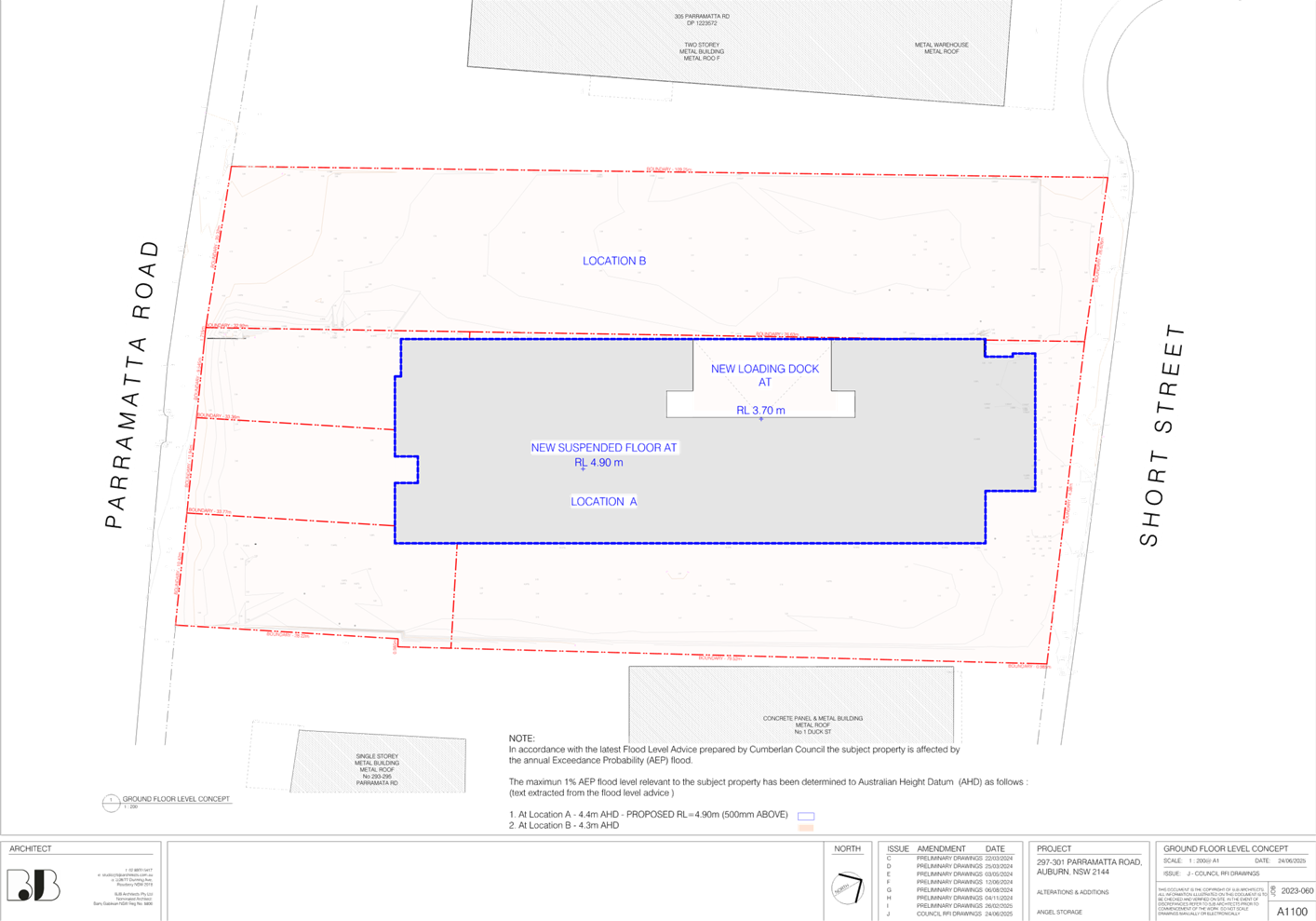
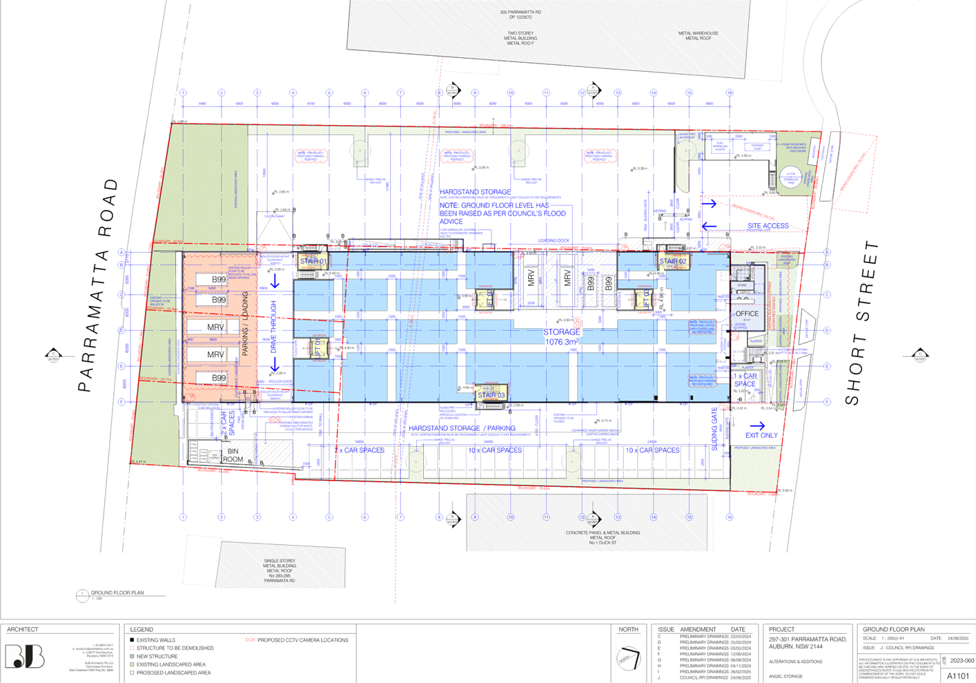
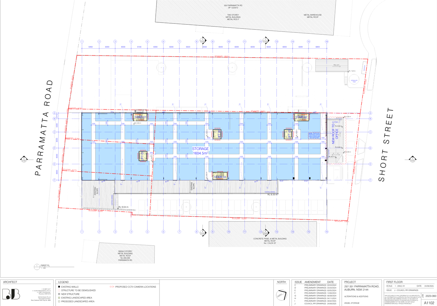
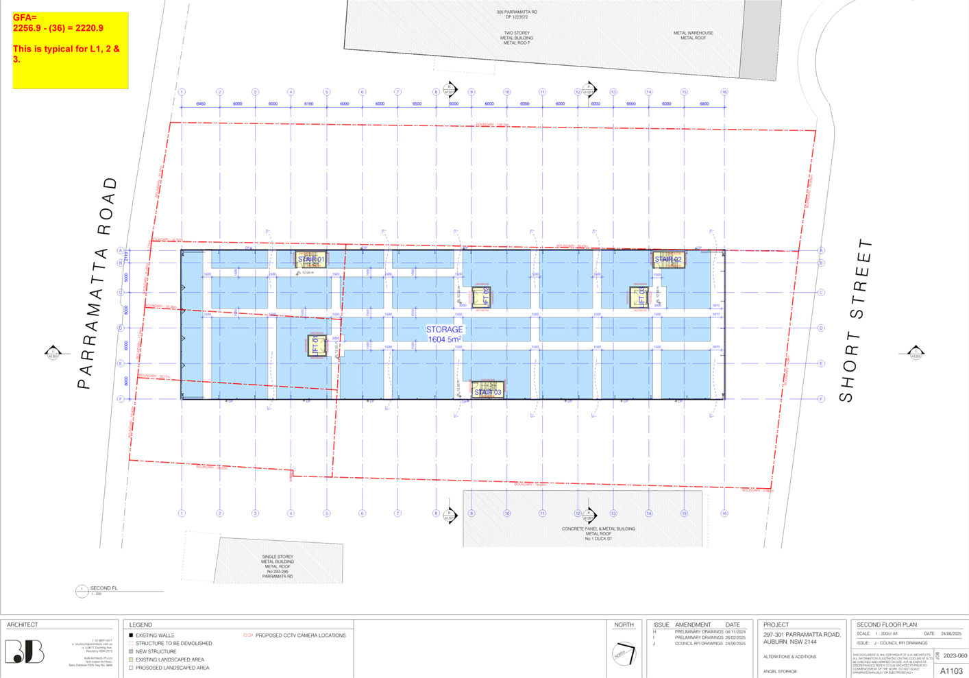
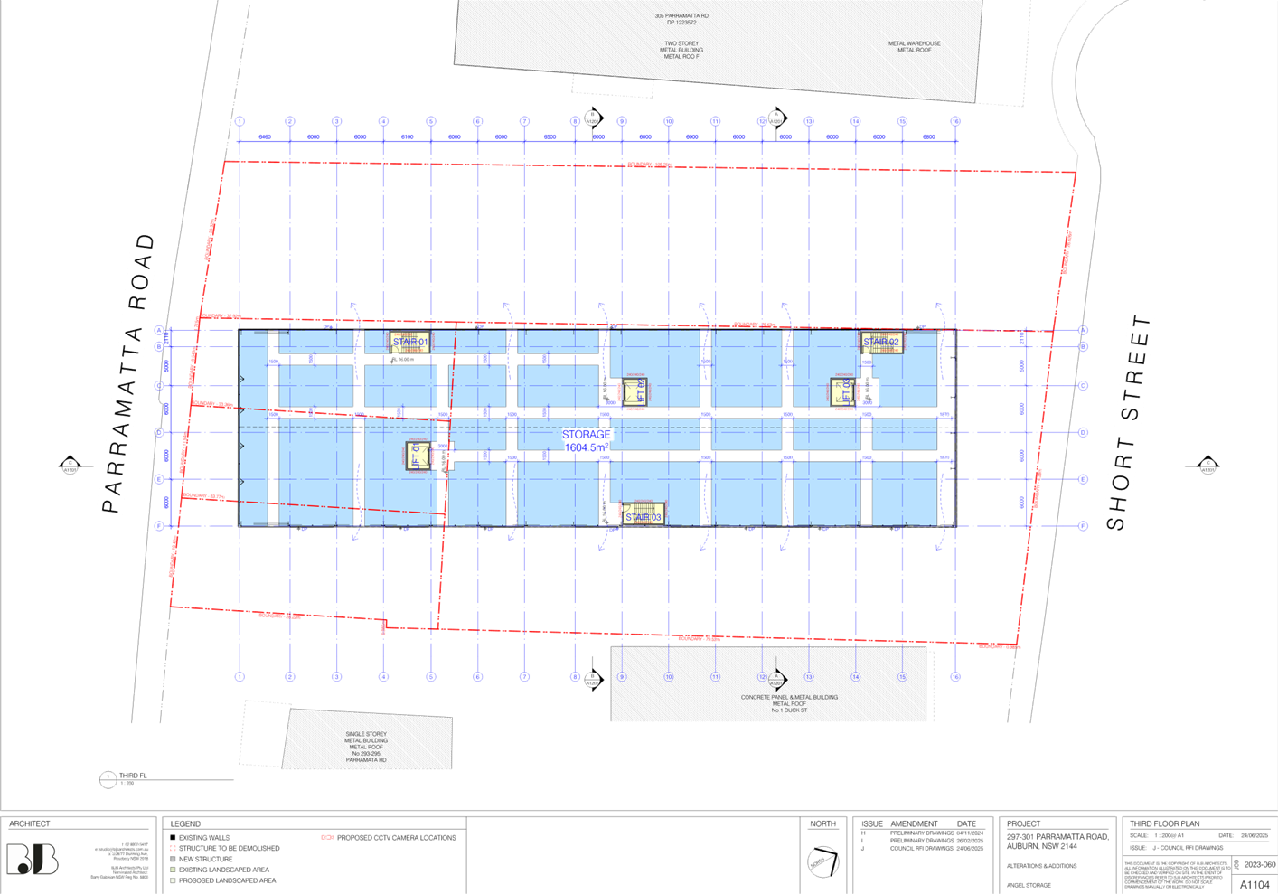
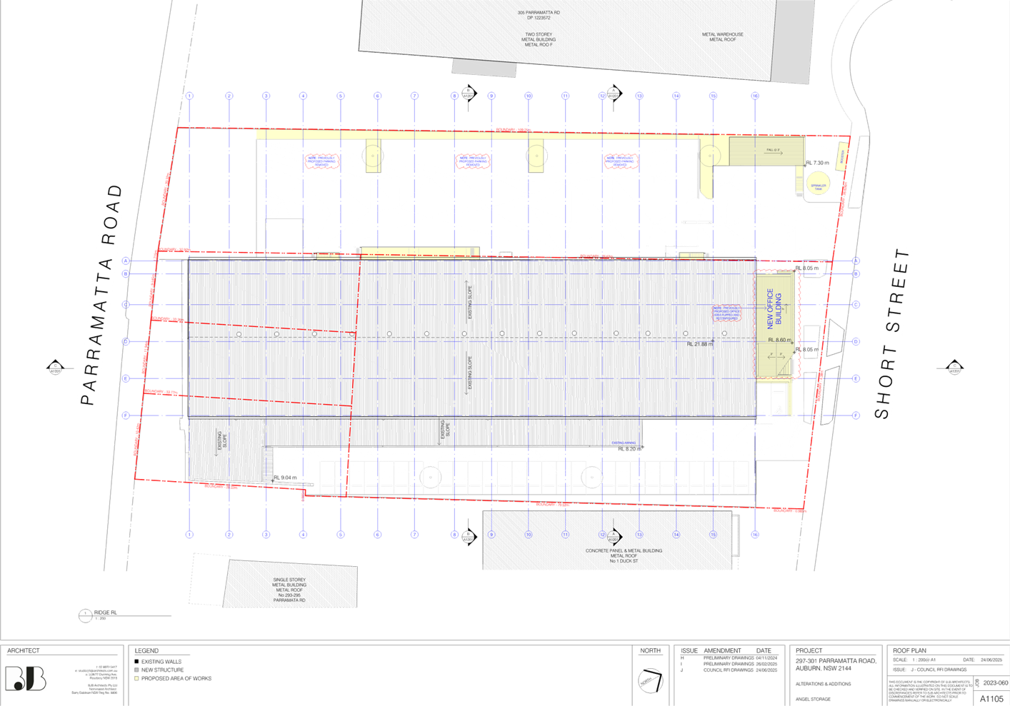
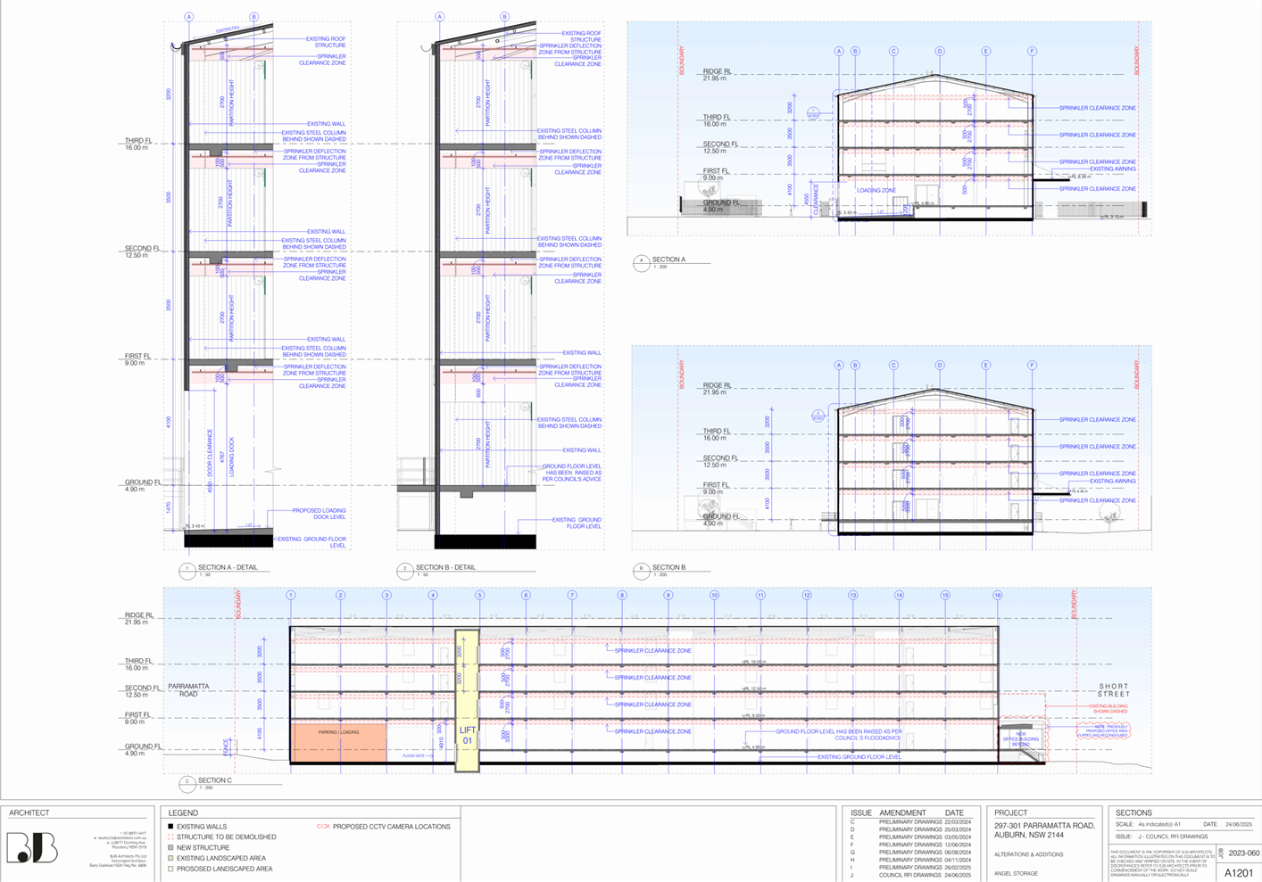
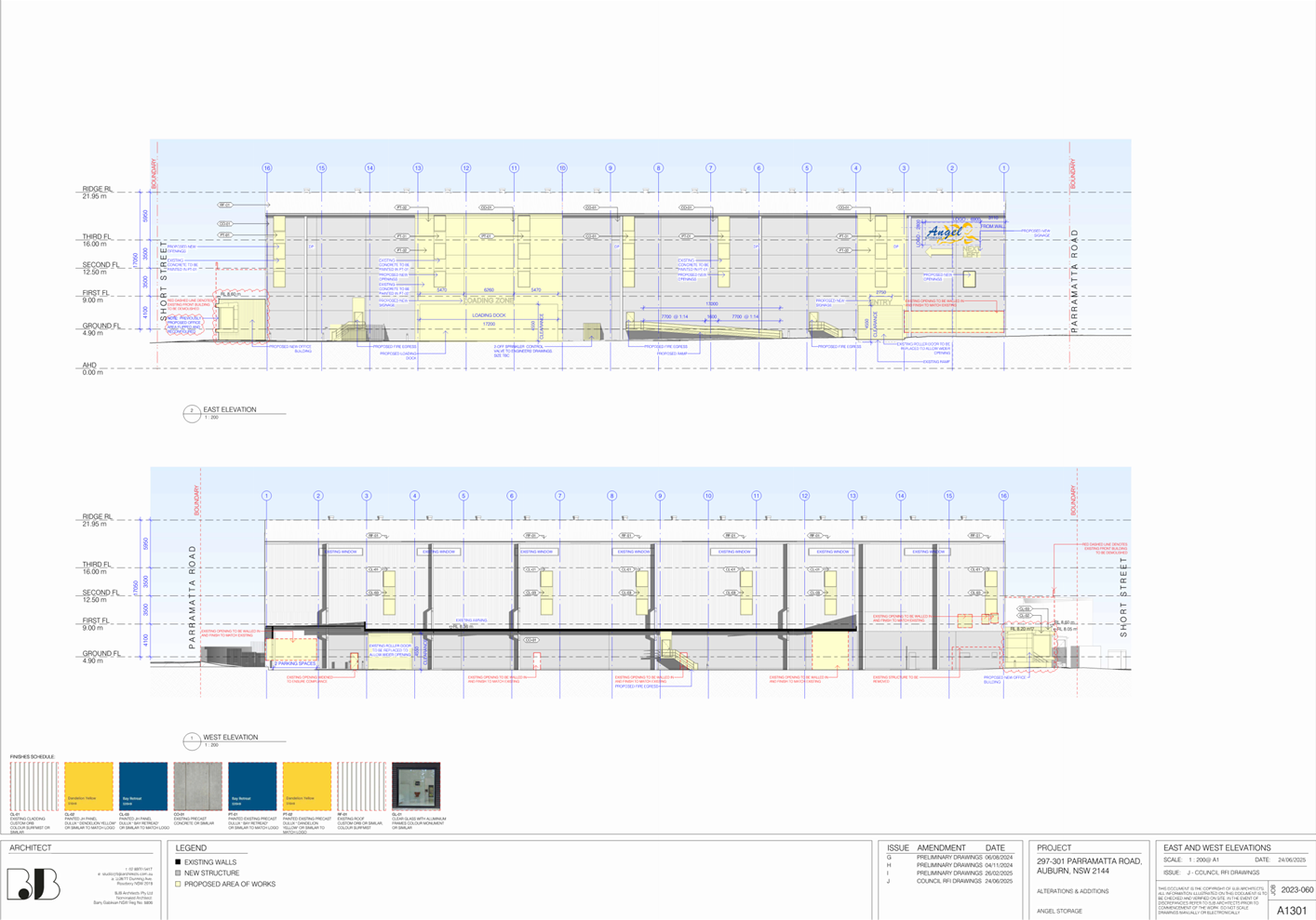
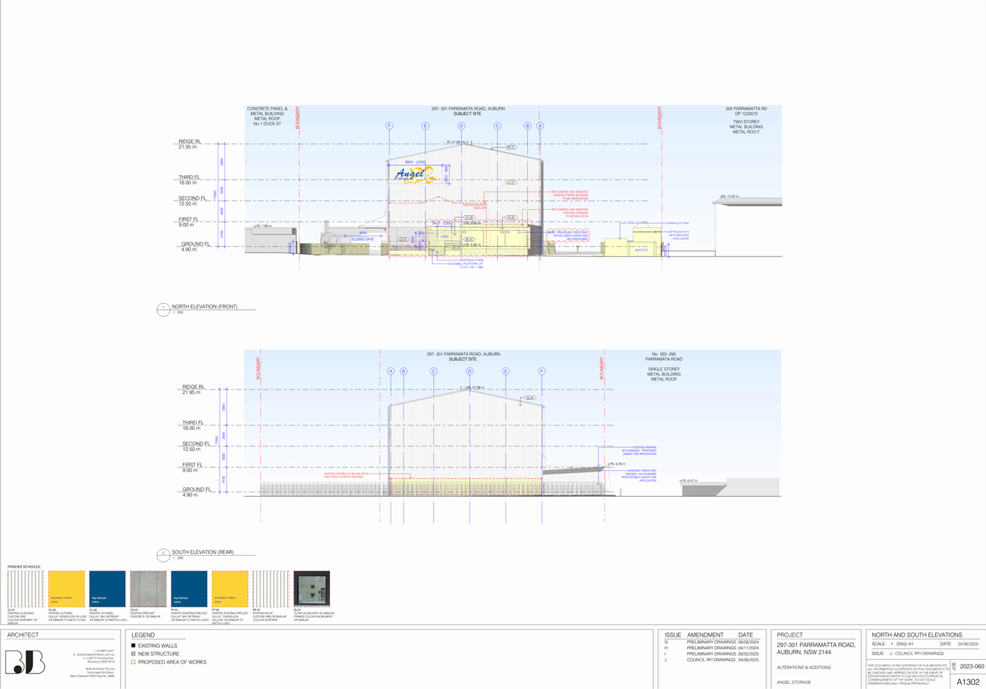
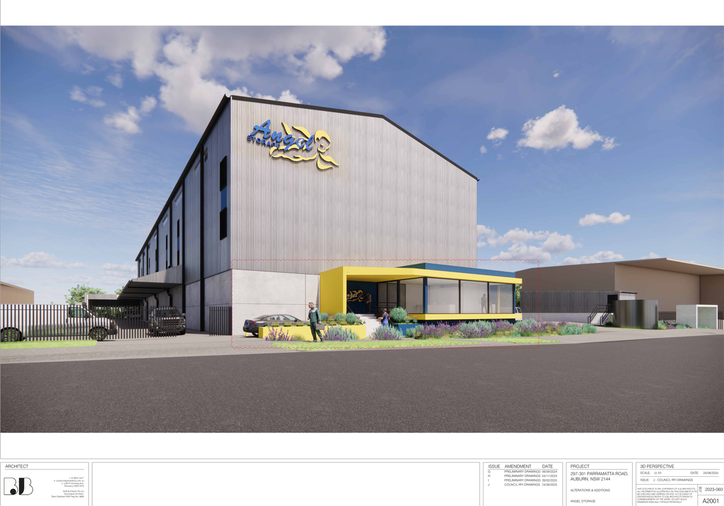
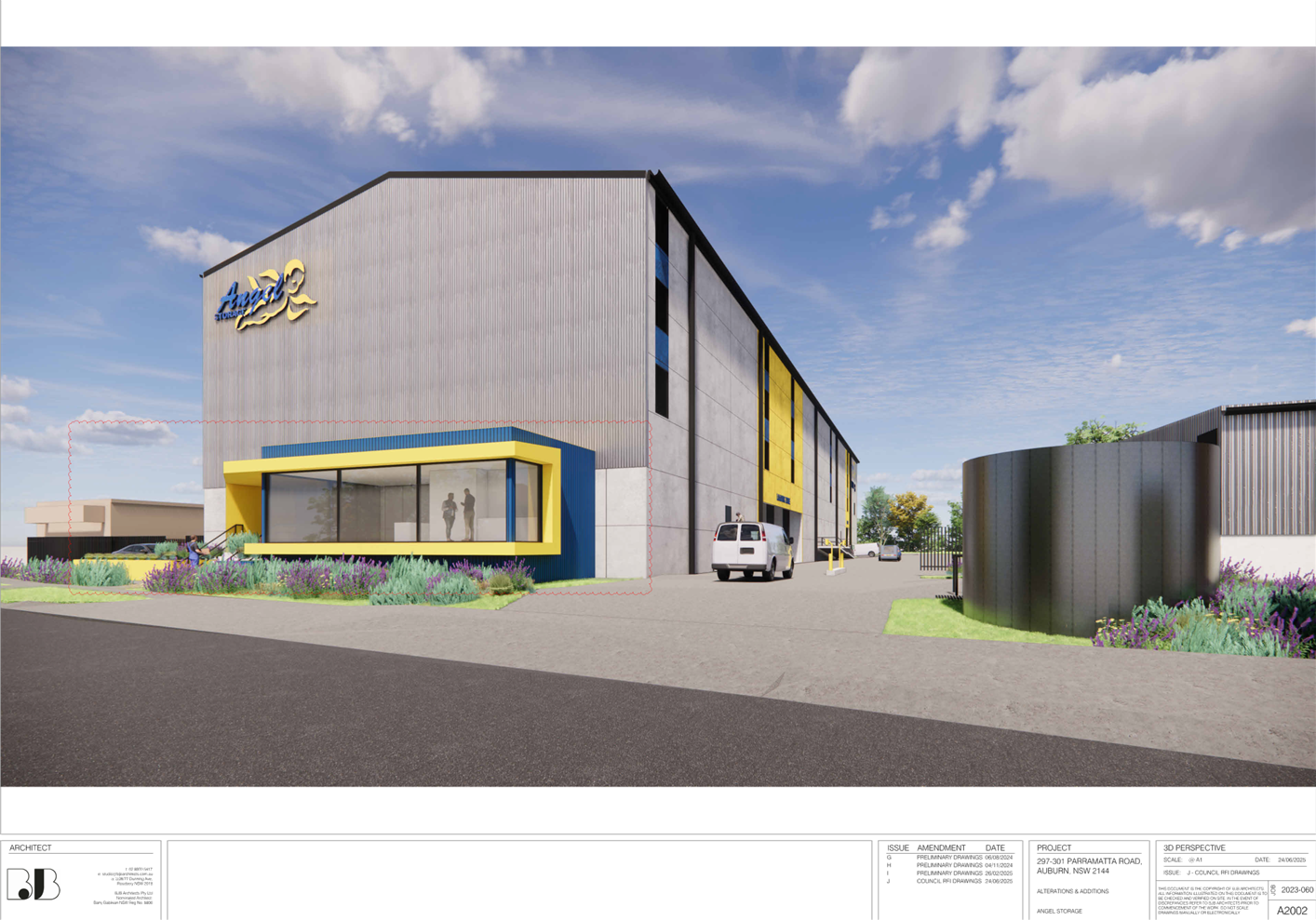
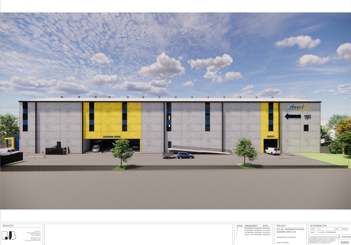
DOCUMENTS
ASSOCIATED WITH
REPORT ELPP022/25
Attachment 3
Stormwater/Engineering Plans
Cumberland
Local Planning Panel Meeting
8 October 2025

DOCUMENTS
ASSOCIATED WITH
REPORT ELPP022/25
Attachment 4
Clause 4.6 Variation Request - Floor Space Ratio
Cumberland
Local Planning Panel Meeting
8 October 2025
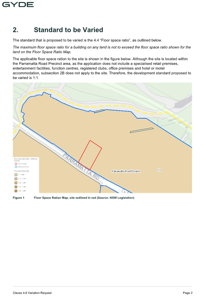
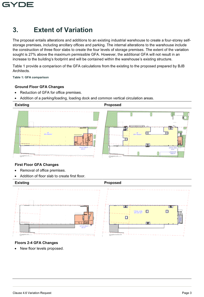
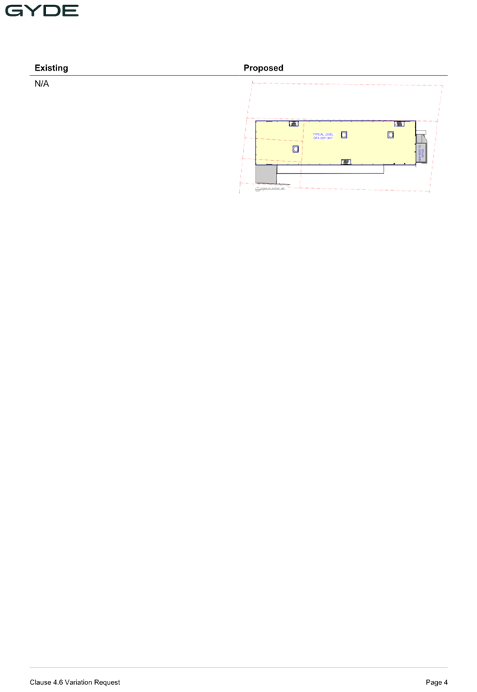
DOCUMENTS
ASSOCIATED WITH
REPORT ELPP022/25
Attachment 5
Plan of Management
Cumberland
Local Planning Panel Meeting
8 October 2025
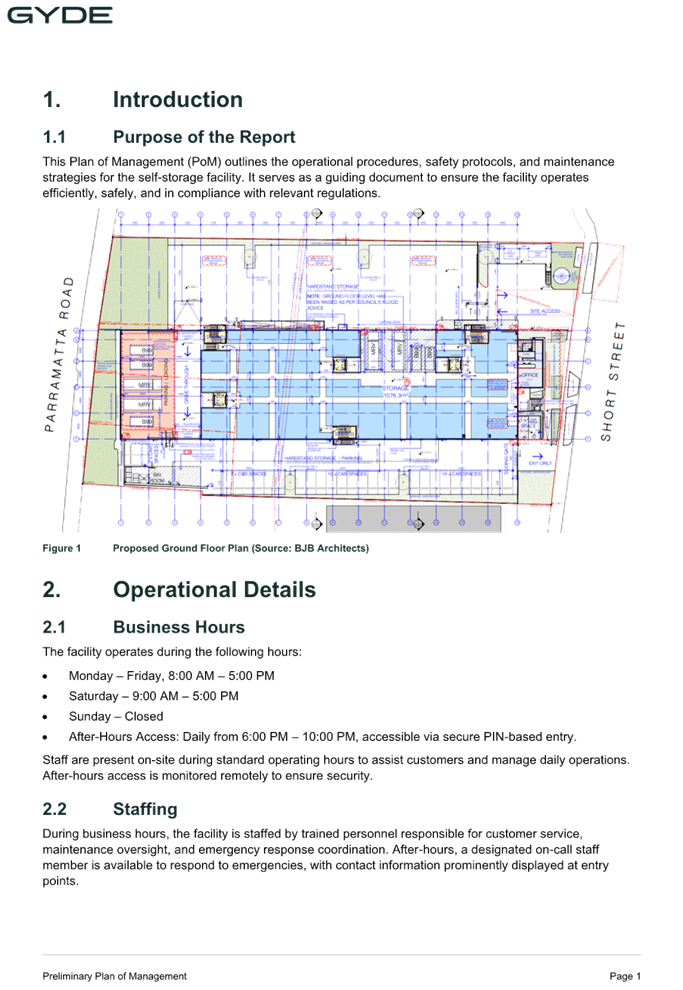
DOCUMENTS
ASSOCIATED WITH
REPORT ELPP022/25
Attachment 6
Appendix A - State Environmental Planning Policy
(Industry and Employment) 2021
Cumberland
Local Planning Panel Meeting
8 October 2025
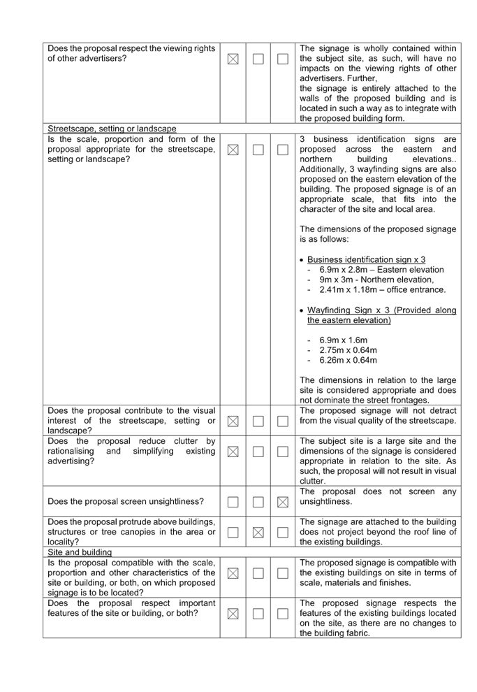
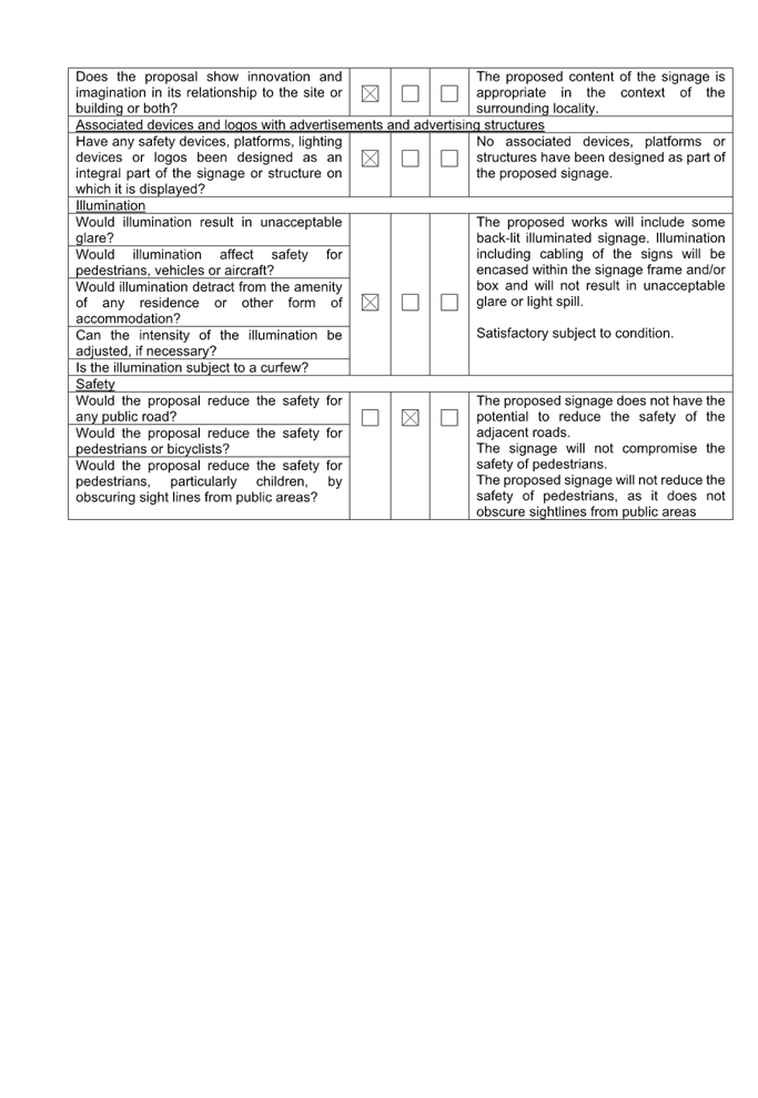

DOCUMENTS
ASSOCIATED WITH
REPORT ELPP022/25
Attachment 7
Appendix B - Cumberland LEP 2021 Assessment
Cumberland
Local Planning Panel Meeting
8 October 2025
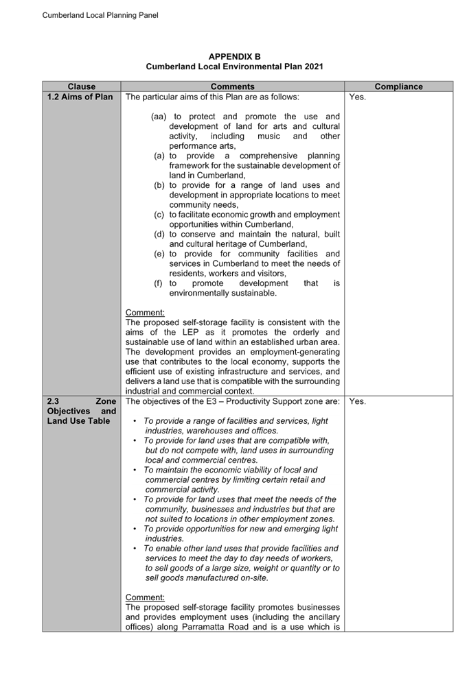
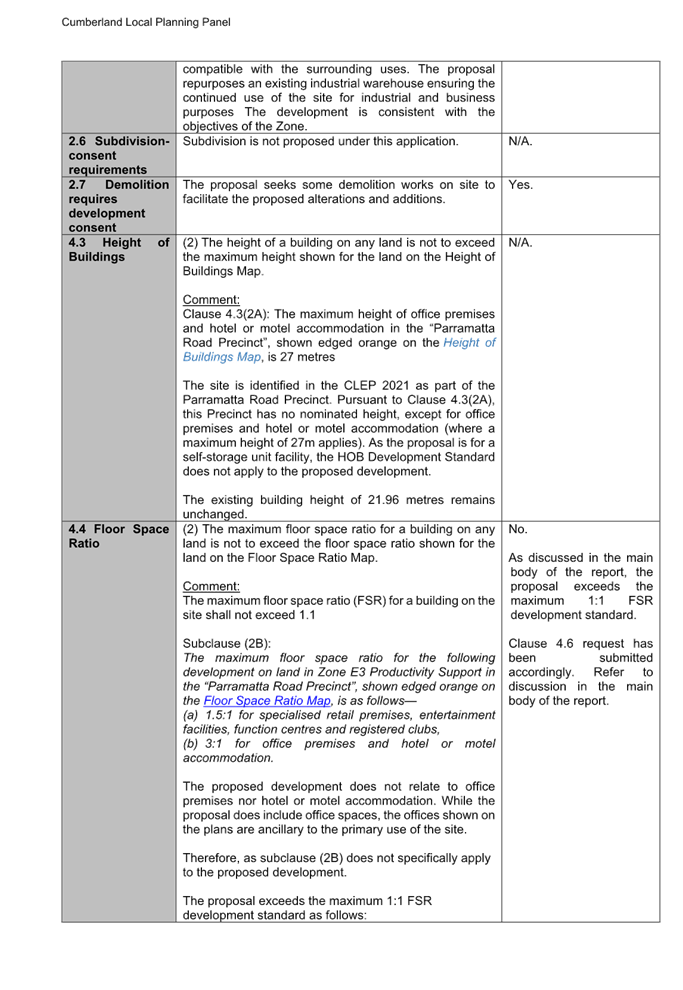
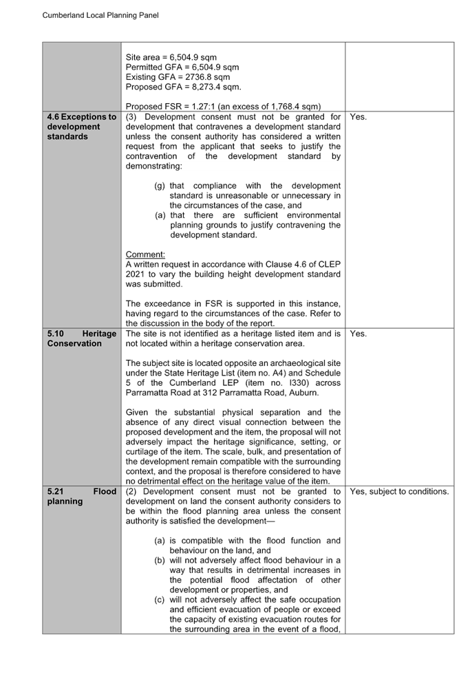
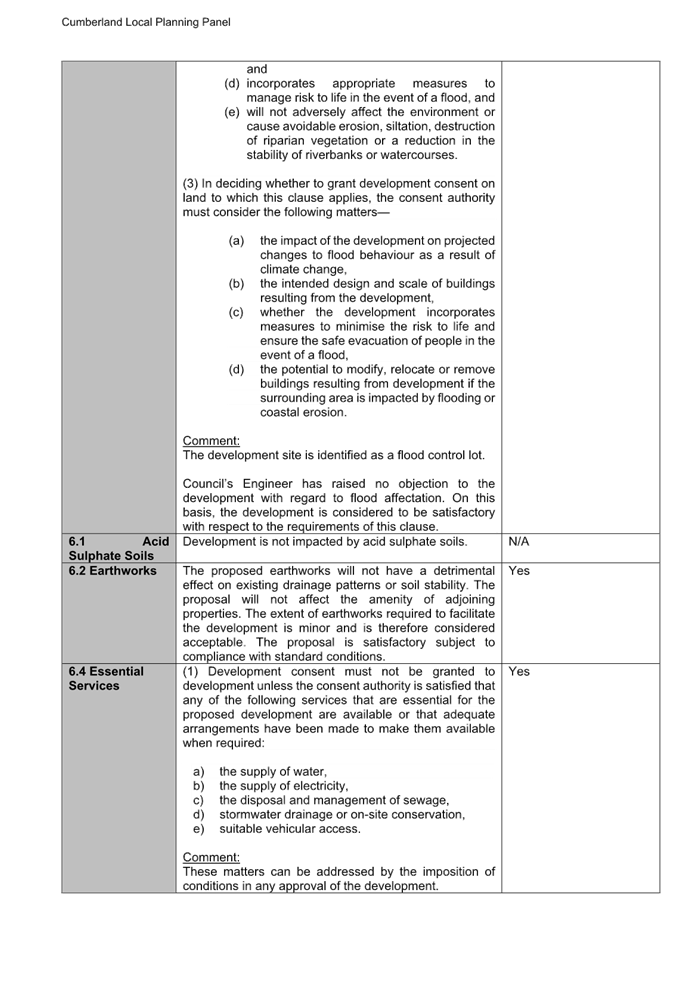
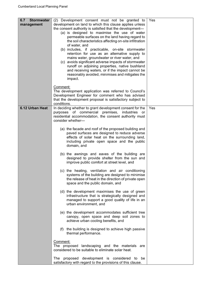
DOCUMENTS
ASSOCIATED WITH
REPORT ELPP022/25
Attachment 8
Appendix C - Cumberland DCP 2021 Assessment
Cumberland
Local Planning Panel Meeting
8 October 2025
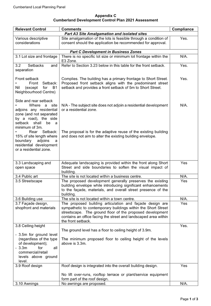
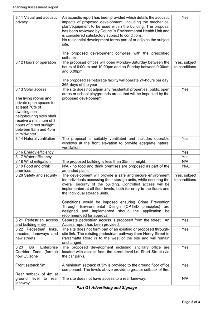
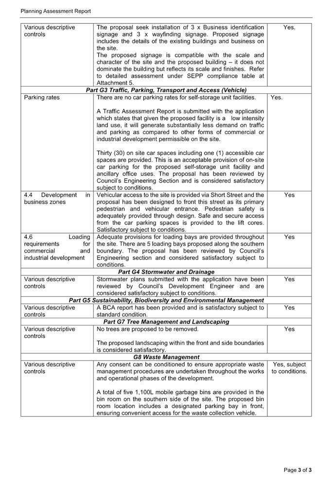
Cumberland Local Planning Panel Meeting
8 October 2025
Item No: ELPP023/25
Development
Application - 459 Guildford Road, Guildford
Directorate: Environment
and Planning
Responsible
Officer: Executive
Manager City Planning and Development
|
Application
lodged
|
Tuesday 22 May 2025.
|
|
Applicant
|
Yw Property Development Pty
Ltd.
|
|
Owner
|
YW Property Development Pty
Ltd.
|
|
Application
No.
|
DA2025/0309.
|
|
Description
of Land
|
459-461 Guildford Road
Guildford being Lot B DP 171122 and Lot A in DP 10962.
|
|
Proposed
Development
|
Demolition of existing
structures erection of a co-living and residential flat building containing
44 co-living units and 5 residential flats of which 4 are nominated for
infill affordable housing.
|
|
Site
Area
|
1,013.6 square metres.
|
|
Zoning
|
R4 High Density Residential.
|
|
Disclosure
of political donations and gifts
|
Nil disclosure.
|
|
Cost
of works
|
$8,149,097.11.
|
|
Heritage
|
N/A.
|
|
Principal
Development Standards
|
FSR
Permissible: 1.2:1 + 10% if
the additional floor space is used only for co-living (Maximum 1.32:1).
Proposed: 1.58:1.
Height
Permissible: 15m.
Proposed: 17.8m.
|
|
Issues
|
Floor space ratio.
Building height.
Car parking.
Amenities.
|
1. Development
application 2025/0309 was lodged on the 22 May 2025 for demolition of existing
structures erection of a co-living and residential flat building containing 44
co-living units and 5 residential flats of which 4 are nominated for infill
affordable housing.
2. The
application was publicly notified to occupants and owners of the adjoining
properties for a period of 14 days between 5 June 2025 and 19 June 2025. In
response, no submissions were received.
3. The
primary non-compliances are as follows:
|
Control
|
Required
|
Provided
|
% variation
|
|
Clause 4.4
Floor Space Ratio
s.68 (c)(ii) SEPP
Housing (2021)
|
Max. 1.2:1
1.2:1 + 10% if the
additional floor space is used only for co-living = 1.32
|
1.58:1
|
31.67%
19.7%
|
|
Laundry facilities
s.69(1)(f) Housing SEPP 2021
|
Adequate laundry
facilities.
|
Not provided for each
unit or floor.
|
100%
|
|
s. 68(2)(e) &
s.148(2)(a) SEPP Housing (2021)
|
Minimum 13 car parking
spaces
|
12
|
8.33%
|
|
Clause 4.3
Height of Buildings
CLEP 2021
|
Max. 15m
|
17.8m
|
18.67%
|
4. The
application is referred to the Panel as the proposal is considered to be
contentious development under Chapter 4 of the State Environmental Planning
Policy (Housing) 2021.
5. The
application is recommended to be refused for the reasons listed in the
Council’s assessment report.
Subject Site and Surrounding
Area
The subject site forms Lot B in DP
171122 and Lot A DP 10962 and is identified as 459-461 Guildford Road,
Guildford. The site is rectangular in shape with frontages of 26.82m to the
northern side of Guildford Road and 37.795m to the eastern side of Berwick
Street. The site occupies an area of 1,013.6 square metres. The site falls
approximately 1.5m from the Guildford Road frontage to the rear (north) at a
gentle to moderate grade of 4%. The site contains two single storey detached
dwelling houses, a detached garage and several small to medium sized trees.
Surrounding development comprises
one and two storey dwelling houses, older style residential flat buildings of
up to three storeys and new style residential flat buildings of up to four
storeys. The site is located approximately 620 metres west of the entry to the
Guildford railway station.
The location of the site is shown
below edged in purple.
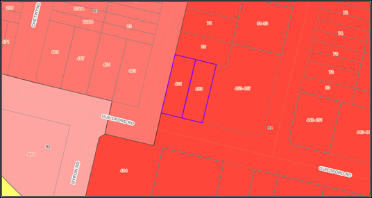
Figure
1 - Locality Plan of subject site highlighted in purple [Source: Intramap]
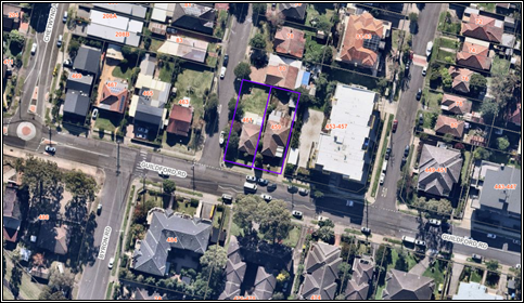
Figure
2 - Aerial view of subject site highlighted in purple [Source: Intramap]
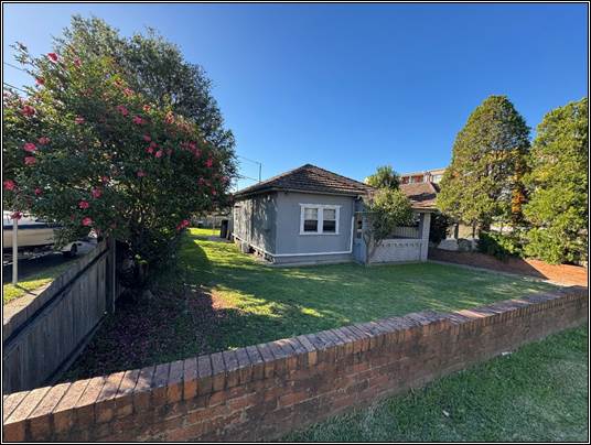
Figure
3 - Street view of subject site as seen from Guildford Road
Description of The
Development
Council has received a development
application for the demolition of existing structures and erection of a
co-living and residential flat building containing 44 co-living units and 5
residential apartments of which 4 are nominated as being infill affordable
housing. The detailed breakdown of the proposal is shown below:
Demolition work
All structures on the site is
earmarked to be demolished.
Construction work
The construction work is shown
within the table below.
|
Level
|
Details
|
|
Basement
Level
|
- 12 parking spaces inclusive of 1
accessible space.
- 11 motorcycle parking spaces.
- 12 bicycle parking spaces.
- Bin room with bulky waste storage
area.
- Communications room.
- Pump room.
- 5 storage rooms / cases, 1 each for
the residential flats.
|
|
Ground
Floor
|
- 8 double occupancy co-living rooms
with 7 of the rooms having a ground level private open space area.
- 2 communal living areas.
- Lobby areas, accessed through the
front communal living area.
|
|
Levels 1
to 3.
|
- 12 double occupancy co-living
rooms, inclusive of 1 accessible room. All rooms have a balcony.
|
|
Level 4
|
- 4 x studio units all with balconies
and of which 3 are for affordable housing and 1 which is an adaptable unit.
- 1 x 2 bedroom unit with balcony
identified as being for affordable housing.
|
In addition to the above:
· One lift will
service all levels of the building.
· There is a storage
area on each of the ground floor and levels 1-4 to accommodate one garbage, one
recycling and one green waste bin per level.
· Vehicular access
to the basement levels is via a single width ramp located proximate to the
site’s eastern side boundary.
· Pedestrian access
to the ground level is proposed via a ramp from a point centrally located along
the site’s Guildford Road frontage.
The Panel is informed that an
appeal has been lodged in relation to the application for deemed refusal. A
Section 34 conciliation conference is set to be held on Thursday, 11 December
2025.
History
Council records do not show any
history relevant to the scope of this development.
Applicants Supporting
Statement
The applicant has provided a
Statement of Environmental Effects prepared by Planning Ingenuity dated 6 May
2025 and was received by Council on 22 May 2025 in support of the application.
Contact With Relevant
Parties
The assessing officer has
undertaken a site inspection of the subject site and surrounding properties and
has been in regular contact with the applicant throughout the assessment
process.
Internal Referrals
Development Engineering
The development application was
referred to Council’s Development Engineer for comment who has advised
that the driveway access should be relocated from Guildford Road to Berwick
Street to improve vehicle safety and that a splay should be provided at the
corner of Guildford Road and Berwick Street.
As a result, the development in
its current form is not fully supported.
Environmental Health
The development application was
referred to Council’s Environmental Health Officer for comment who has
advised that the proposal is satisfactory subject to conditions of consent.
Tree Management
The development application was
referred to Council’s Tree Management Officer for comment who has advised
that the proposal is satisfactory subject to conditions of consent (if
approved).
Waste Management
The development application was
referred to Council’s Waste Management Officer for comment who has
advised that the proposal is satisfactory subject to conditions of consent (if
approved).
External Referrals
Endeavour Energy
The development application was
referred to Endeavour Energy for comment who has advised that the proposal is
satisfactory subject to conditions of consent.
Sydney Water
The development application was
referred to Sydney Water for comment who raised no objections to the
development subject to conditions.
Planning Comments
The provisions of any
Environmental Planning Instruments (EP&A Act s4.15 (1)(a)(i))
State Environmental Planning
Policies
The proposed development is
affected by the following State Environmental Planning Policies:
|
State
Environmental Planning Policies (SEPPs)
|
Relevant
Clause(s)
|
Compliance
with Requirements
|
|
· State
Environmental Planning Policy (Biodiversity and Conservation) 2021.
|
Chapter 2 -Vegetation in non
Rural Areas.
|
Yes - The development
application involves the removal of 7 trees with a maximum height of 7m.
Council’s Tree
Management Officer has reviewed the proposed tree removal and raised no
objections subject to conditions (if approved).
The proposal does not exceed
the biodiversity offsets scheme threshold. Therefore, the proposed vegetation
removal is considered acceptable.
|
|
Chapter 6 -
Water Catchments.
Sydney Harbour Catchment
|
It is determined that given the
location of the site location, a detailed assessment is not required given
that there is no direct impact upon the catchment and no direct impact upon
watercourses. As such, the development is acceptable.
|
|
· State
Environmental Planning Policy (Resilience and Hazards) 2021.
|
Chapter 2 - Coastal
Management.
|
The subject site is not
identified as being within a coastal wetland or ‘land identified as
“proximity area for coastal wetlands” or coastal management area.
|
|
Chapter 4 - Remediation of
Land.
Part 4.6.
|
Part 4.6 - Contamination
and remediation to be considered in determining development application.
Comments
The application
was submitted with a Preliminary Site Investigation Report, which conclude
that the site is suitable for the proposed use. Council’s Environmental
Health Officer has assessed the application and raised no objections, subject
to conditions (if approved).
i)
As such, it is
considered that the development application is satisfactory under Part 4.6 of
Chapter 4 of the State Policy.
|
|
· State
Environmental Planning Policy (Industry and Employment) 2021.
|
Chapter 3 Advertising and
Signage.
|
No signage is proposed as part of the development
application and thus no assessment of signage is required.
|
|
· State Environmental Planning
Policy (Sustainable Buildings) 2022
|
Chapter 2 Standards for
residential Development -BASIX.
|
BASIX Certificate No. 1792196M dated 16 April 2025
has been submitted for the 5 apartment units and is acceptable.
|
|
· State
Environmental Planning Policy (Housing) 2021
|
Chapter 2, Part 2. Division 1
– Infill affordable housing
|
The
development seeks to provide In-fill affordable housing pursuant to Chapter
2, Division 1.
The proposal does not meet the criteria of Section
15C(1)(a) as the development is not permitted with consent under (i) Chapter
3 Part 4 (build-to rent housing), (ii) Chapter 5 (transport orientated
development), (iii) Chapter 6 (low and mid rise housing) or (iv) another
environmental planning instrument (Cumberland Local Environmental Plan 2021).
The proposed development has two components, co-living
housing and a residential flat building which includes 4 affordable units.
The co-living housing is not specified in the above chapters nor the
Cumberland LEP 2021 and therefore the requirements under section 16 do not
apply.
|
|
Chapter 3 (Part 3) Co-living
Housing
|
The subject site is located within the R4 High Density
Residential zone. The Clause permits co-living housing in a zone where
residential flat buildings or shop top housing is permitted under another
environmental planning instrument. In this case, both land uses are permitted
within the zone.
State Environmental Planning Policy (Housing) 2021 permits
co-living housing on the site with consent.
An assessment against the relevant provisions of Chapter 3
identifies 3 variations being:
· Floor space
ratio.
· Car parking.
· Laundry
facilities
In addition to the variations identified, there are no
Clause 4.6 Variation requests submitted to enable any Council assessment to
occur as relevant.
A detailed analysis of the provisions under this part is
provided under Attachment 4.
|
·
Chapter 4 Design of residential
apartment development |
The development incorporates a residential apartment
building component.
An assessment against the relevant provisions of Chapter 4
of the SEPP (Housing) 2021 identifies the following variation that requires
further assessment.
a) car
parking numbers.
There is inadequate car parking provided within the
basement car park to support the number of apartments proposed.
In addition to the variations identified, there is no
Clause 4.6 Variation request submitted to enable any Council assessment to
occur. A detailed assessment of Chapter 4 is provided within Attachment 4.
|
(a) State
Environmental Planning Policy (Housing) 2021 Chapter 2 (Affordable housing) -
Part 2 Development for affordable housing:
The development seeks consent for
in-fill affordable housing pursuant to Chapter 2, Division 1. under Chapter 2
(Part 2) of State Environmental Planning Policy (Housing) 2021. As stated in
the above table, no floor space ratio (FSR) or building height bonus under s.16
of State Environmental Planning Policy Housing (2021) (Housing SEPP) applies to
the development. Therefore, no further assessment under this division has been
made.
(b) State
Environmental Planning Policy (Housing) 2021 Chapter 3 (Diverse Housing) - Part
3 Co Living Housing:
The development application has
been submitted under Chapter 3 (Part 3) of State Environmental Planning Policy
(Housing) 2021. As stated in the above table, there are three variations
identified being:
· Floor Space Ratio - No
floor space ratio (FSR) bonus under s.16 of State Environmental Planning Policy
Housing (2021) (Housing SEPP) shall apply to the development.
Section 68(2)(a)(ii) allows for a
10% bonus FSR if the additional floor space is used only for the purpose of
co-living housing. The manner of assigning or attributing additional floor
space to one particular use compared to another use, within the concept of
gross floor area is arbitrary and uncertain. The applicant has not provided
what it asserts to the additional floor area nor demonstrated that the
purported additional area is used only for the purpose of co-living housing.
For the shared floor space area being the ground floor lobby area from the
front door to the lift, it is uncertain how the floor area is to be distributed
amongst the co-living and the residential apartment building uses.
The co living part of the
development has a floor space ratio that is calculated at 1.333:1 which exceeds
the maximum permitted of 1.319:1 by 14 square metres.
No clause 4.6 submission has been
lodged seeking variation to the standard and hence the application is incapable
of being approved.
· Car Parking - The
proposed development does not provide car parking that complies fully with the
requirements detailed under s.68(2)(e). The co living part of the development
should be provided with 9 car parking spaces at a rate of 0.2 spaces per co
living room. The submitted plans do not allocate parking to the co living rooms
or to the other land use proposed.
· Laundry Facilities - The
proposed development has failed to provide adequate laundry facilities to
service each room in accordance with s69(1)(f).
In addition to the above, there
are no Clause 4.6 Variation requests submitted to enable any Council assessment
to occur especially for the floor space ratio and laundry facility issue.
The issue of car parking could
have been addressed if the applicant had allocated the car parking spaces
accordingly to support the co living rooms.
(c) State
Environmental Planning Policy (Housing) 2021 Chapter 4 Design of Residential
Apartment Development:
The development application has
been submitted under Chapter 4 (Part 3) of State Environmental Planning Policy
(Housing) 2021. As per the above table, there is one variation identified that
requires attention being car parking.
Car parking
Similar to what is stated above,
the proposed development does not allocate car parking to either land use
(Residential or co living rooms).
It is found that the building
would need at a minimum 13 car parking spaces including at least 4 spaces to
support the apartments. There is a shortfall of one car parking space to
support the entire development.
This is a non discretionary
requirement of the State Policy and thus a Clause 4.6 Variation request to
cover any shortfall of car parking under either Chapter 3 or Chapter 4 has not
been submitted for Council assessment. Hence, the development application
cannot be supported by the Panel.
Local Environmental Plans
Cumberland Local
Environmental Plan 2021
The provision of the Cumberland
Local Environmental Plan 2021 is applicable to the development proposal. It is
noted that the development does not achieve compliance with the key statutory
requirements of the Cumberland Local Environmental Plan 2021 and the objectives
of the R4 High Density Residential zone.
(d) Permissibility:
The provision of the Cumberland
Local Environmental Plan 2021 is applicable to the development proposal.
The proposed development is
defined as both ‘co-living housing’ and ‘residential flat
building’
residential flat building
means a building containing 3 or more dwellings, but does not include an
attached dwelling, co-living housing or multi dwelling housing.
Residential flat buildings are
permissible with consent in the R4 High Density Residential zone.
co-living housing
means a building or place that—
(a) has
at least 6 private rooms, some or all of which may have private kitchen and
bathroom facilities, and
(b) provides
occupants with a principal place of residence for at least 3 months, and
(c) has
shared facilities, such as a communal living room, bathroom, kitchen or
laundry, maintained by a managing agent, who provides management services 24
hours a day,
but does not include
backpackers’ accommodation, a boarding house, a group home, hotel or
motel accommodation, seniors housing or a serviced apartment.
Note- Co-living housing is a
type of residential accommodation—see the definition of that term
in this Dictionary.
Pursuant to Section 67 of the
Housing SEPP 2021, co-living housing development may be carried out with
consent on land in a zone which development for the purposes of co-living
housing, residential flat buildings and shop top housing is permitted under Chapter
5 or another environmental planning instrument. Residential Flat Buildings and
shop-top housing are permitted with consent in an R4 High Density Residential
zone under the Cumberland LEP 2021, and therefore the proposed development is
permissible pursuant to Section 67 of the Housing SEPP 2021.
The relevant matters to be
considered under Cumberland LEP 2021 and the applicable clauses for the
proposed development are summarised below. A comprehensive Cumberland LEP 2021
assessment is contained in Attachment 7.
Figure
4 - Cumberland LEP 2021 Compliance Table
|
Development Standard
|
Compliance
|
Discussion
|
|
Clause
4.3
Height of Buildings Max. 15m
|
No
|
The
maximum building height permitted under clause 4.3 of the Cumberland Local
Environmental Plan 2019 (LEP) is 15m.
The proposed height of 17.8m
exceeds the maximum.
|
|
Clause
4.4
Floor Space Ratio
Max. 1.2:1
|
No
|
The maximum FSR permitted under clause 4.4 of the
Cumberland Local Environmental Plan 2019 (LEP) is 1.2:1. The proposed
FSR of 1.58:1 (1,585.13sqm / 1,013.6sqm) exceeds the maximum FSR.
|
|
Clause
4.6 Exceptions
to
development
standards
|
No
|
No clause 4.6 submission has been lodged seeking variation
to the above standards and hence the application is incapable of being
approved.
|
The provisions of any proposed
instrument that is or has been the subject (EP&A Act s4.15 (1)(a)(ii))
Council has received a Gateway
Determination from the Department of Planning, Housing and Infrastructure for
the Draft Woodville Road Corridor Planning Proposal. As part of this approval,
public exhibition of the Draft Woodville Road Corridor Planning Proposal has commenced.
The public exhibition was carried out between the 4 March 2025 to 17 April
2025.
The Draft Planning Proposal seeks
to revitalise Woodville Road by amending planning controls in the Cumberland
Local Environmental Plan (CLEP) 2021 for 31 sites located around the three (3)
precincts of Woodville North, Merrylands East and Woodville South.
The subject application was
received on 8 May 2025 and the site does not fall within the Draft Woodville
Road Corridor. Therefore, no further consideration is required.
The provisions of any
Development Control Plans (EP&A Act s4.15 (1)(a)(iii))
The following parts of the
Cumberland Development Control Plan 2021 are of relevance to the proposed
development:
· A1 Introduction
and Notification
· A3 Site
Amalgamation and Isolated Sites
· B3 Residential
Flat Buildings
· B5 Adaptable
Housing
· G3 Traffic,
Parking, Transport and Access (Vehicle)
· G4 Stormwater
and Drainage
· G5 Sustainability,
Biodiversity and Environmental Management
· G7 Tree
Management and Landscaping
· G8 Waste
Management.
A comprehensive Cumberland DCP
2021 assessment is contained in Attachment 6.
The development is found to comply
with the relevant provisions except for the following:
The provisions of any planning
agreement that has been entered into under section 7.4, or any draft planning
agreement that a developer has offered to enter into under section 7.4
(EP&A Act s4.15(1)(a)(iiia))
There is no draft planning
agreement associated with the subject Development Application.
The provisions of the
Regulations (EP&A Act s4.15 (1)(a)(iv))
The proposed development raises no
concerns as to the relevant matters arising from the Environmental Planning and
Assessment Regulation 2021 (EP&A Reg).
The Likely Environmental,
Social or Economic Impacts (EP&A Act s4.15 (1)(b))
It is considered that the proposed
development will have no significant adverse environmental, social or economic
impacts in the locality.
The suitability of the site for
the development (EP&A Act s4.15 (1)(c))
The subject site and locality is
not known to be affected by any natural hazards or other site constraints
likely to have a significant adverse impact on the proposed development.
Accordingly, it is considered that the development is suitable in the context
of the site and surrounding locality.
Submissions made in accordance
with the Act or Regulation (EP&A Act s4.15 (1)(d))
|
Advertised (Website)
|
Mail
|
Sign
|
Not Required
|
In accordance with Council’s
Notification requirements contained within the Cumberland Development Control
Plan 2021, the proposal was publicly notified for a period of 14 days between 5
June 2025 and 19 June 2025. No submissions were received in respect of the
proposed development.
The public interest (EP&A
Act s4.15(1)(e))
In view of the foregoing analysis,
it is considered that the development, if carried out subject to the conditions
set out in the recommendation below, will have no significant adverse impacts
on the public interest.
CUMBERLAND LOCAL INFRASTRUCTURE
CONTRIBUTIONS PLANS 2020
The development would require the
payment of contributions in accordance with Cumberland Local Infrastructure
Contributions Plan 2020.
In accordance with the
Contribution Plan a contribution is payable, pursuant to Section 7.11 of the
EP&A Act, calculated on the cost of works. A total contribution of
$302,349.00 would be payable prior to the issue of a Construction Certificate
HOUSING AND PRODUCTIVITY OF
CONTRIBUTION (HPC)
In accordance with s7.24, s7.26
and s7.28 of the Environmental Planning and Assessment Act, 1979, the proposed
development is subject to the payment of the Housing and Productivity
Contribution (HPC).
If approved, a condition of
consent would be imposed on the development consent in accordance with s7.28 of
the EP&A Act 1979 requiring the payment of the HPC.
DISCLOSURE OF POLITICAL
DONATIONS AND GIFTS
The applicant and notification
process did not result in any disclosure of Political Donations and Gifts.
The development application has
been assessed in accordance with the relevant requirements of the Environmental
Planning and Assessment Act 1979, State Environmental Planning Policy
(Biodiversity and Conservation) 2021, State Environmental Planning Policy
(Housing) 2021, State Environmental Planning Policy (Resilience and Hazards)
2021, State Environmental Planning Policy (Transport and Infrastructure) 2021,
Cumberland Local Environmental Plan 2021 and Cumberland Development Control
Plan 2021.
It is considered that the proposed
development is unacceptable for the reasons outlined in this report. It is
recommended that the development be refused, as outlined in the reasons for
refusal.
There are no consultation
processes for Council associated with this report.
There are no financial
implications for Council associated with this report.
There are no policy implications
for Council associated with this report.
Communication /
Publications:
The final outcome of this matter
will be notified. The objectors will also be notified in writing of the
outcome.
That Development Application
2025/0309 for the demolition of existing structures erection of a co-living and
residential flat building containing 44 co-living units and 5 residential
flats, of which 4 are nominated for infill affordable housing on land at 459
Guildford Road Guildford be refused for the reasons listed in the attached
schedule.
1. Draft Notice
of Determination
2. Architectural
Plans
3. Plan
of Management
4. Housing
SEPP 2021 & ADG Assessment
5. Cumberland
LEP 2021 Assessment
6. Cumberland
DCP 2021 Assessment
DOCUMENTS
ASSOCIATED WITH
REPORT ELPP023/25
Attachment 1
Draft Notice of Determination
Cumberland
Local Planning Panel Meeting
8 October 2025
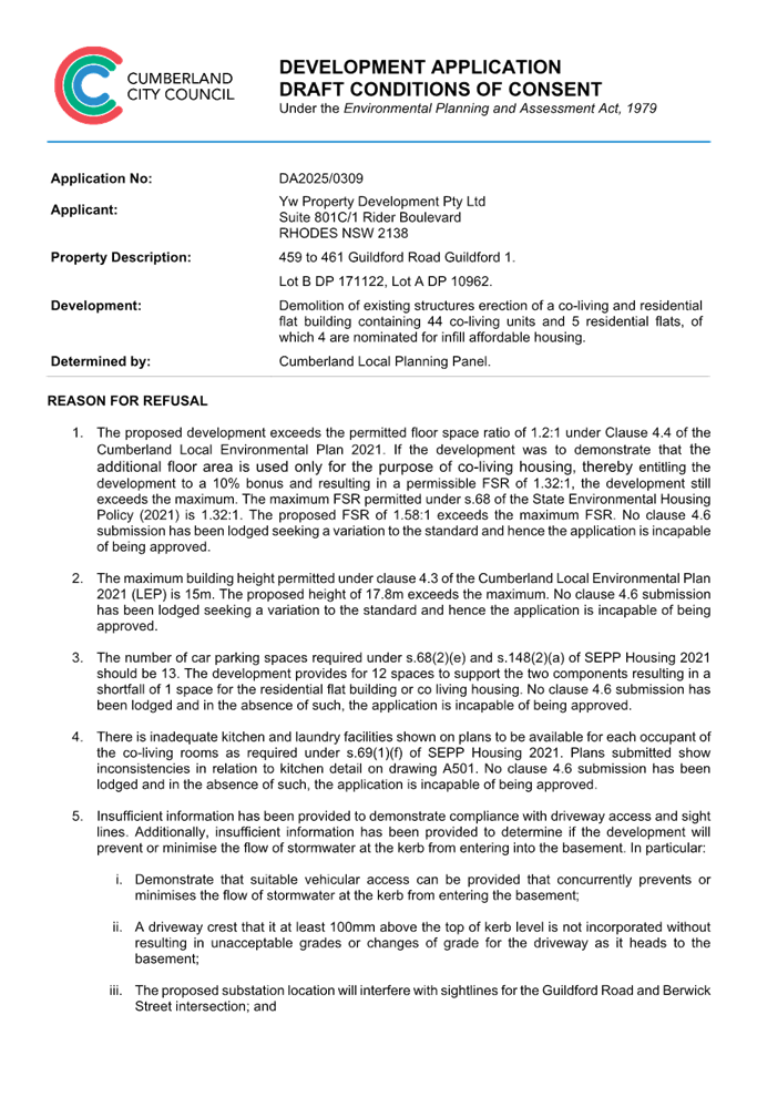

DOCUMENTS
ASSOCIATED WITH
REPORT ELPP023/25
Attachment 2
Architectural Plans
Cumberland
Local Planning Panel Meeting
8 October 2025
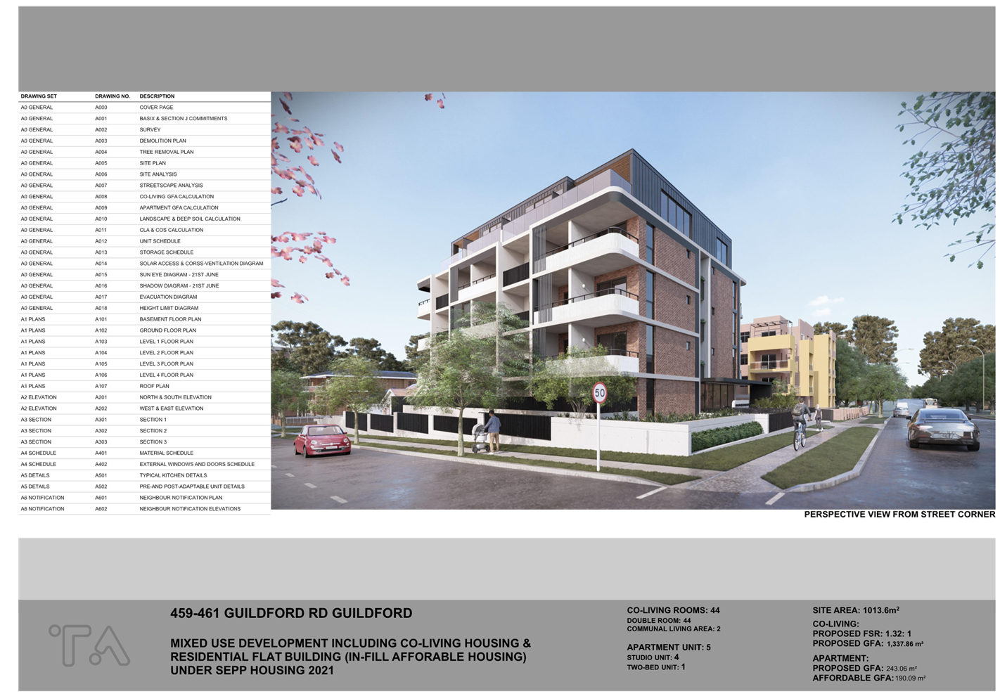
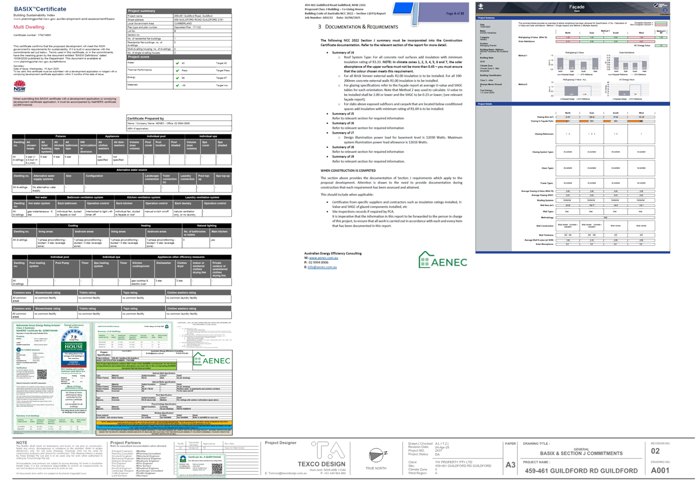
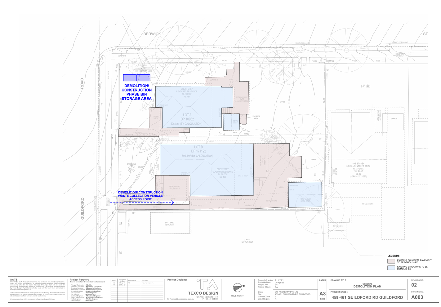
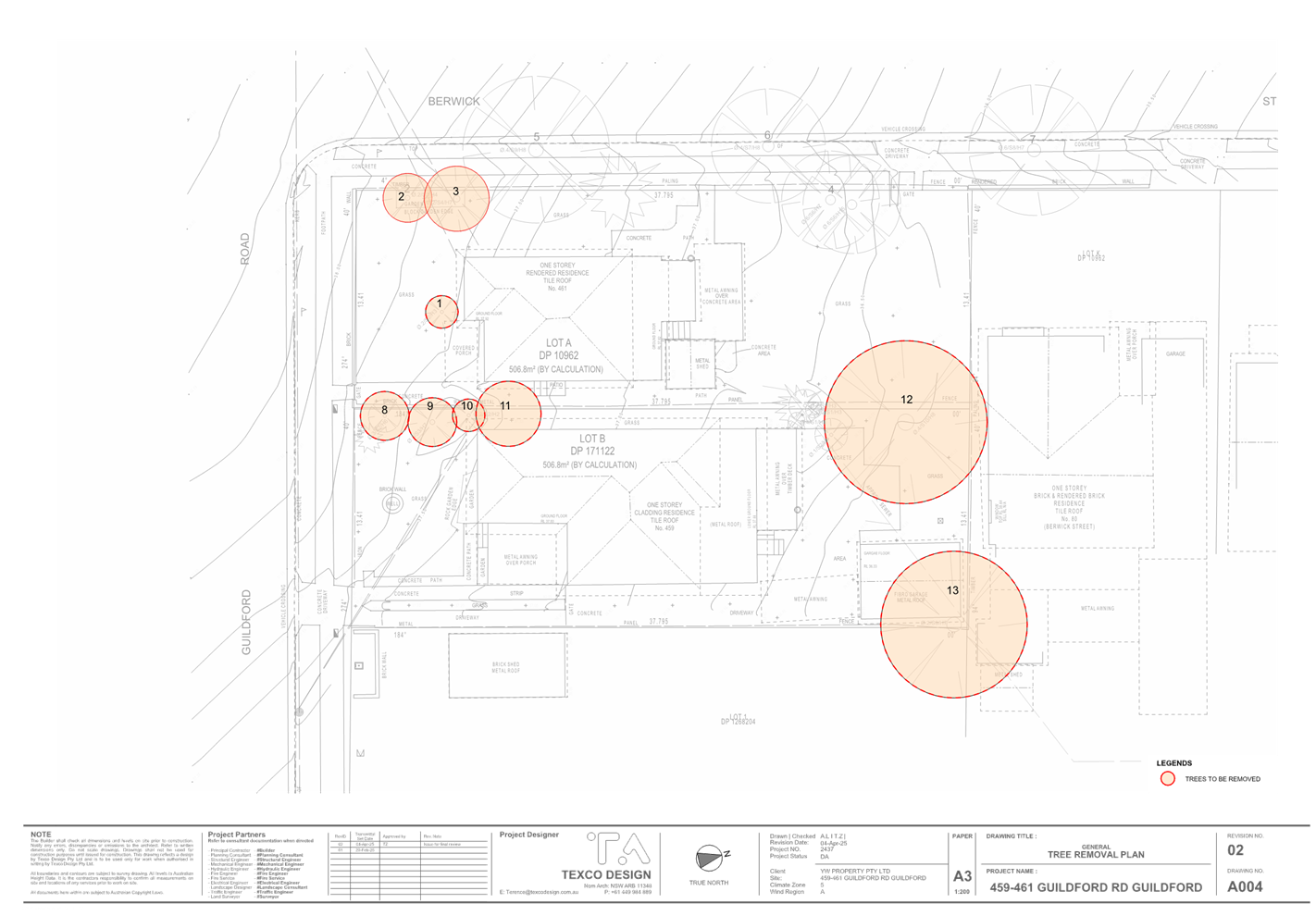
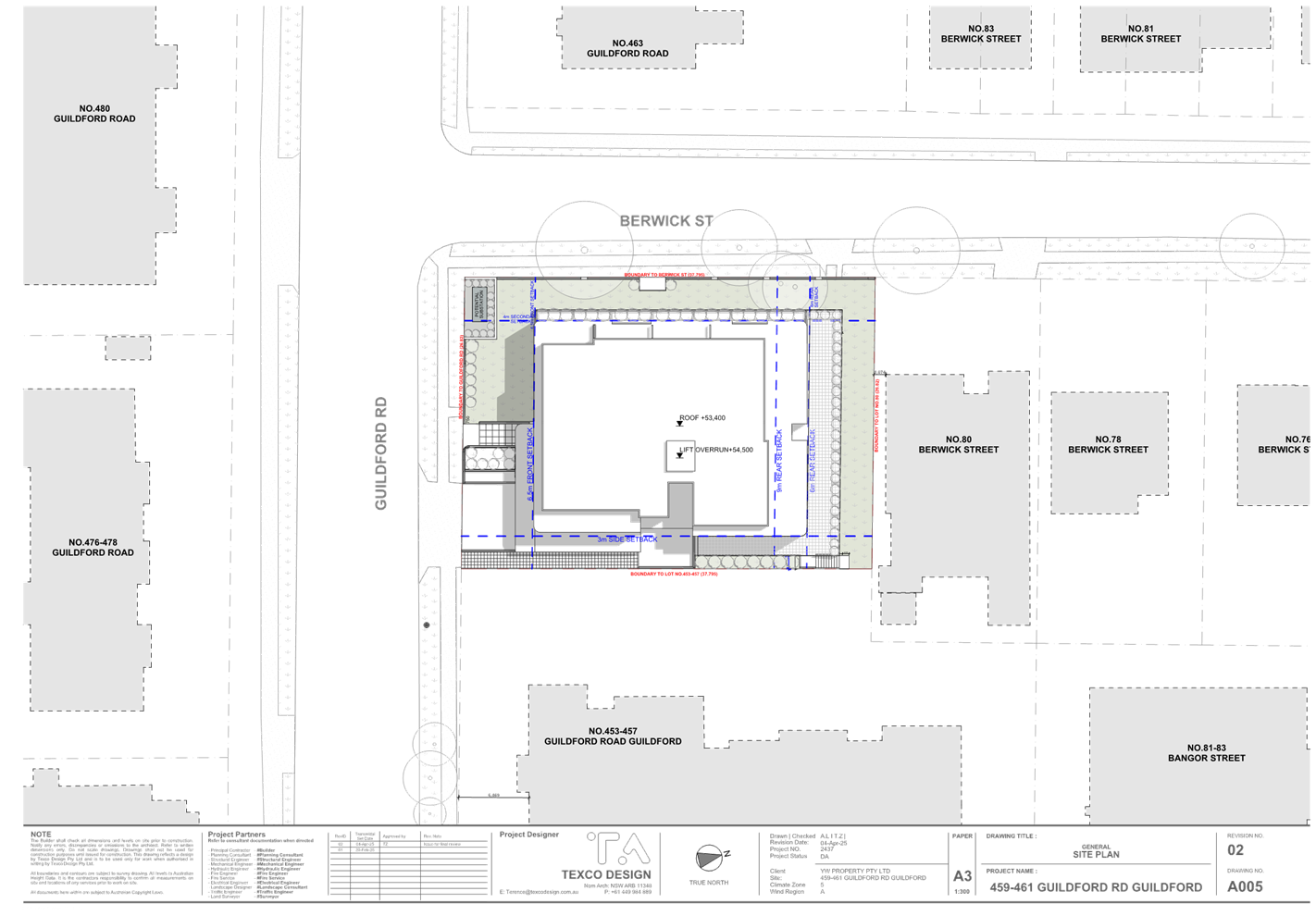
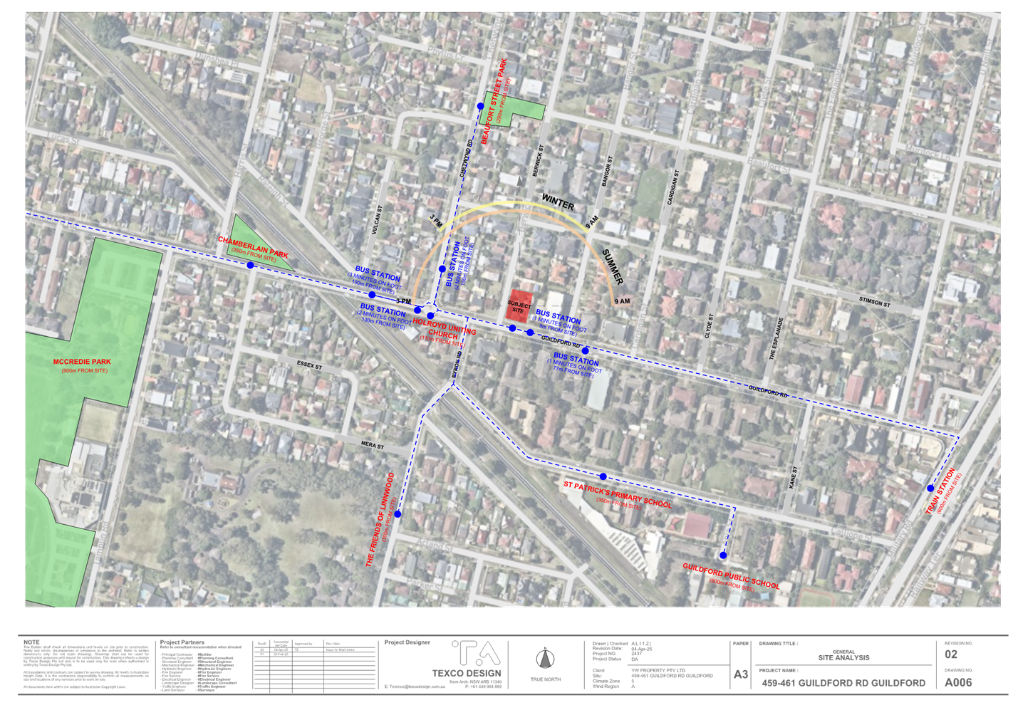
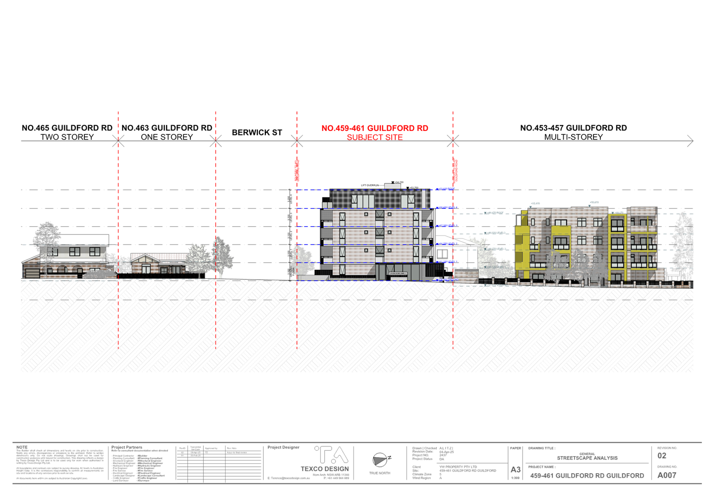
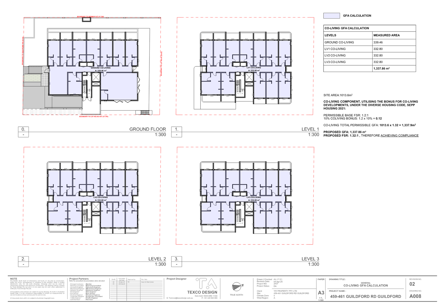
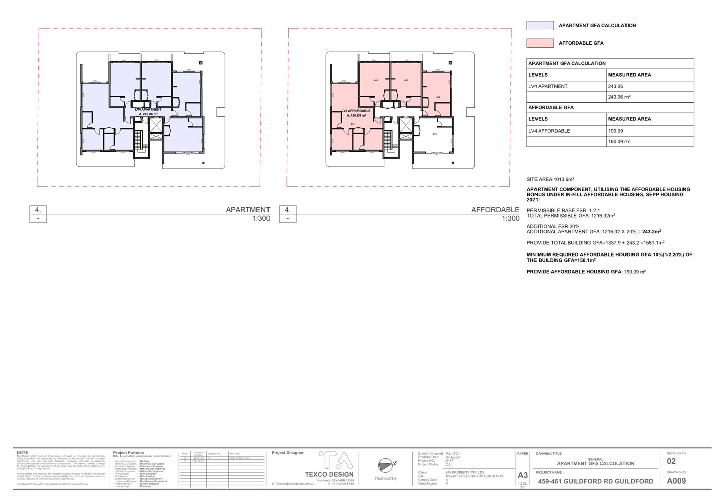
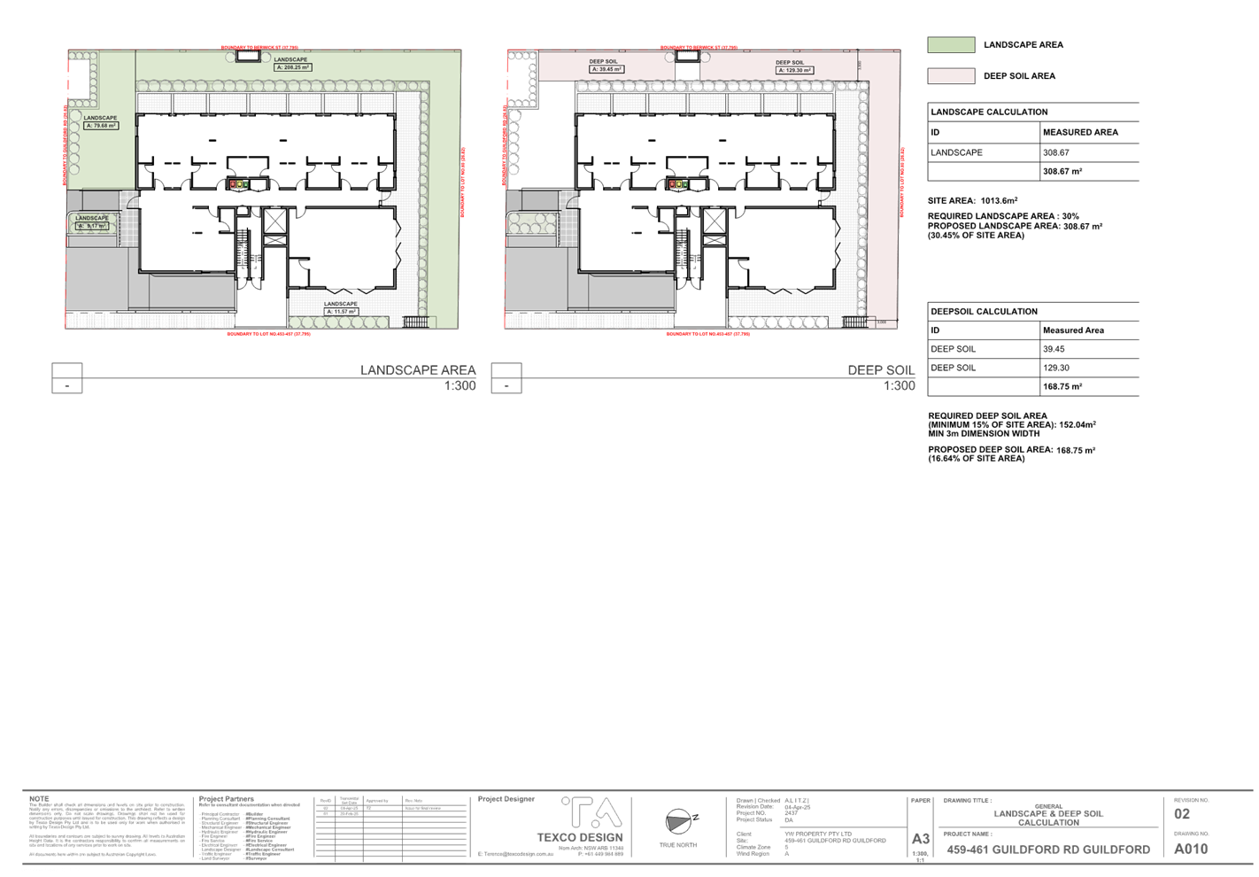
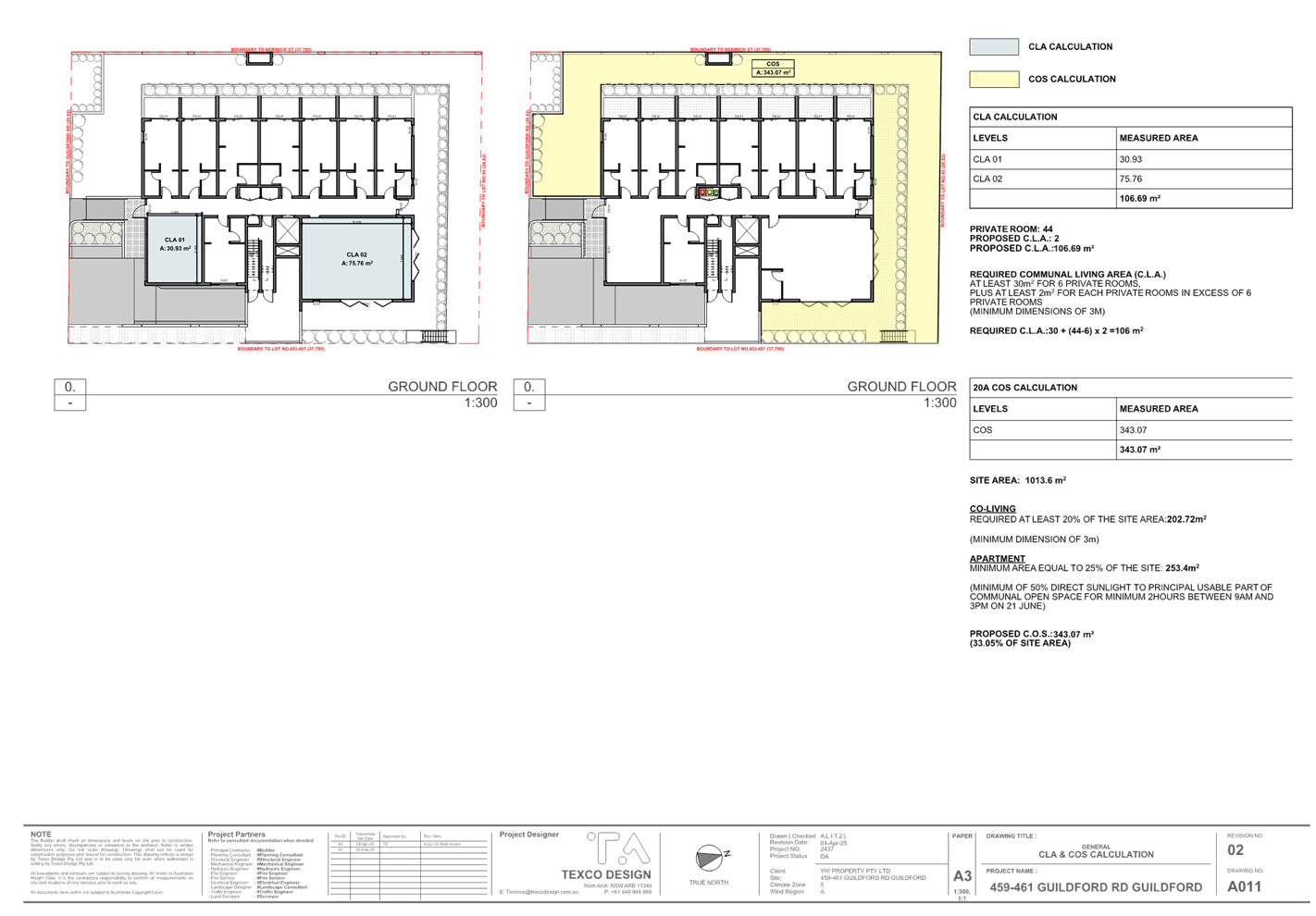
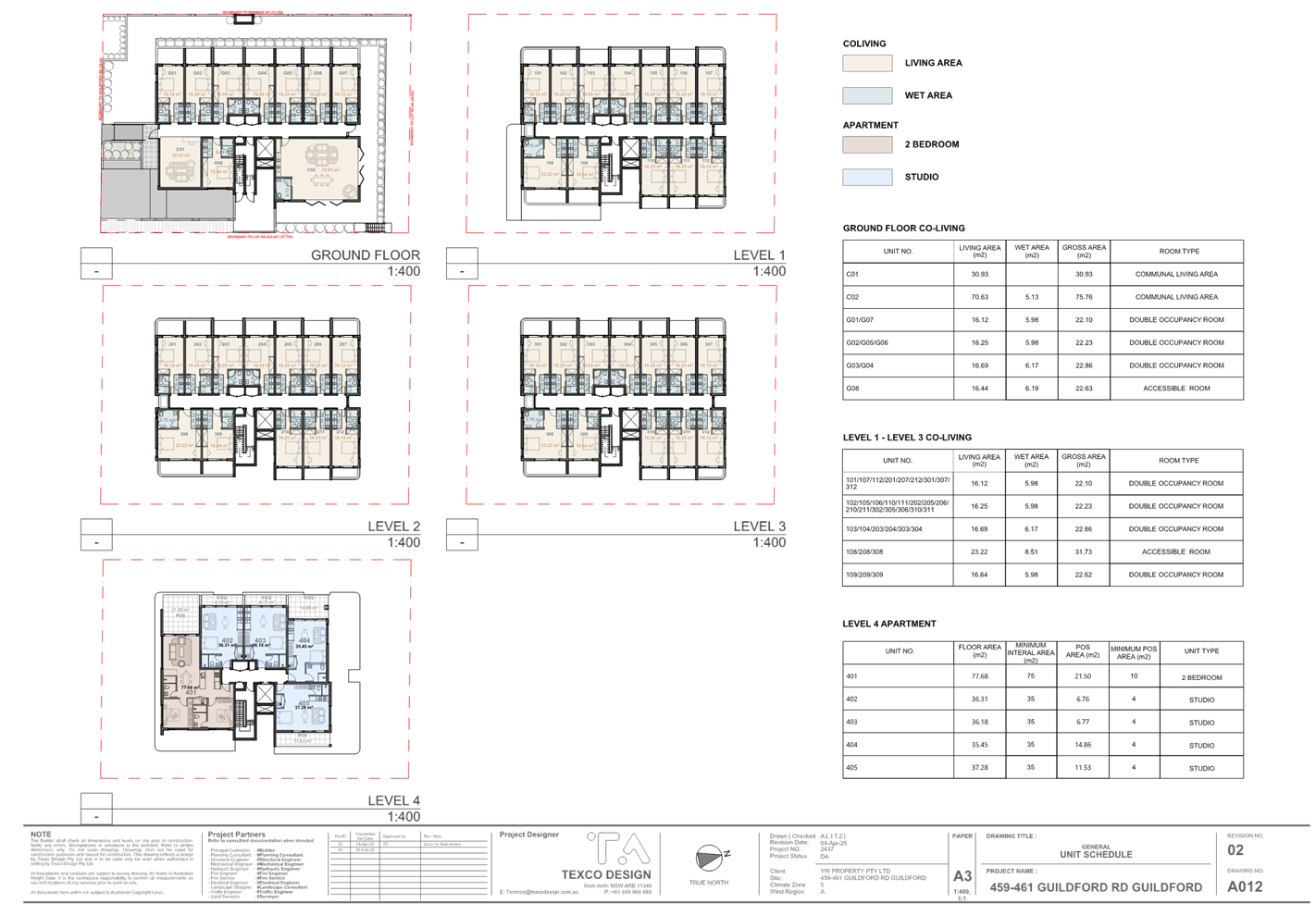
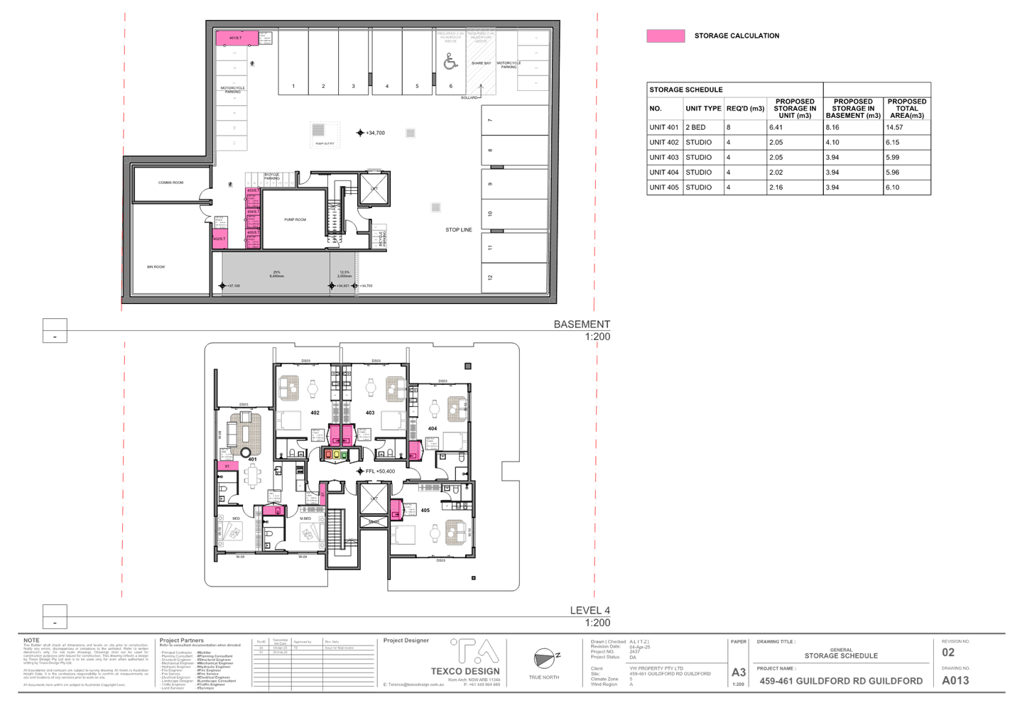
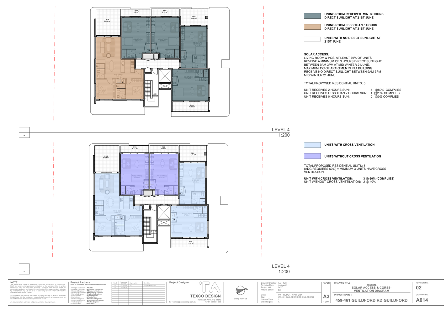
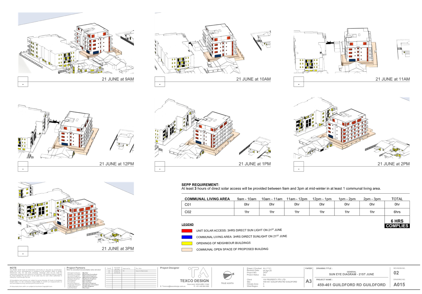
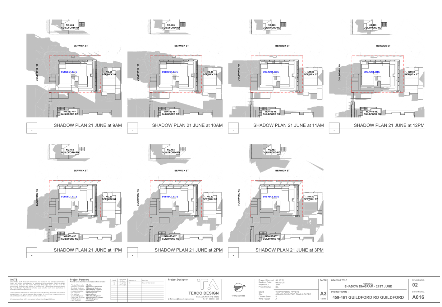
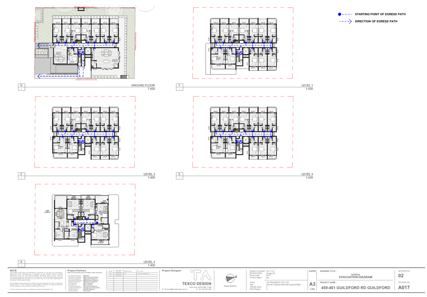
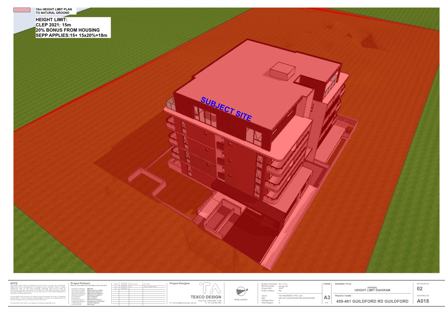
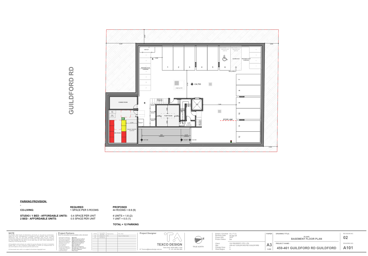
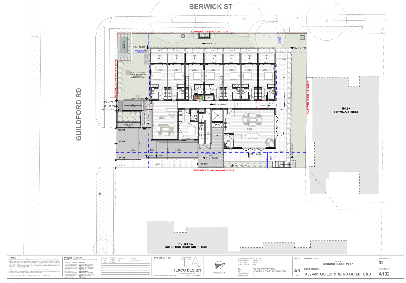
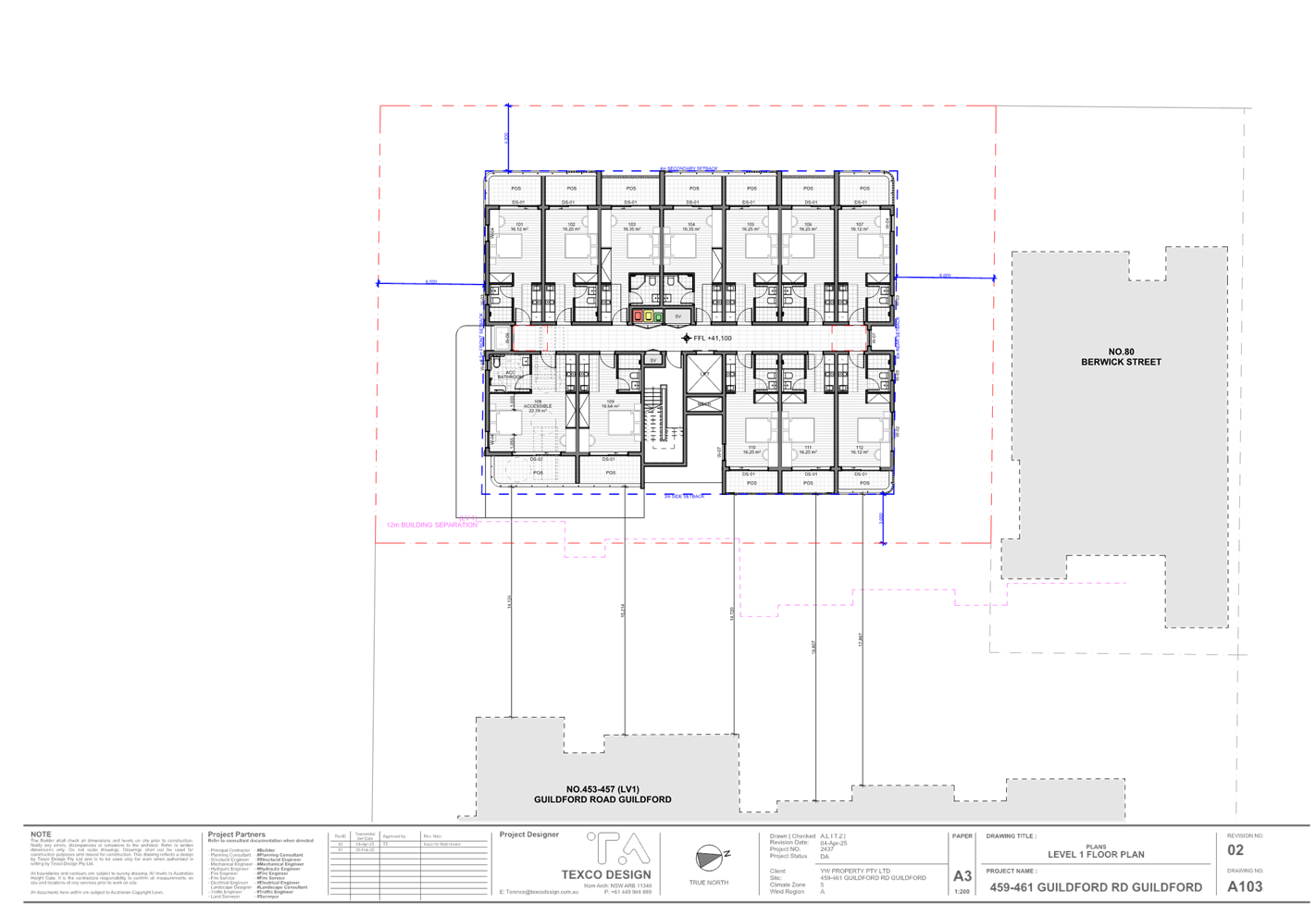
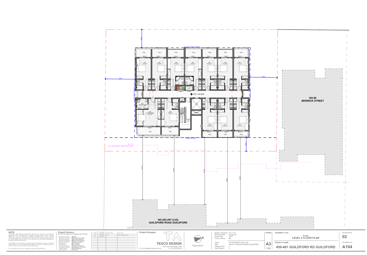
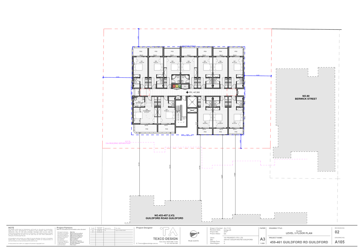
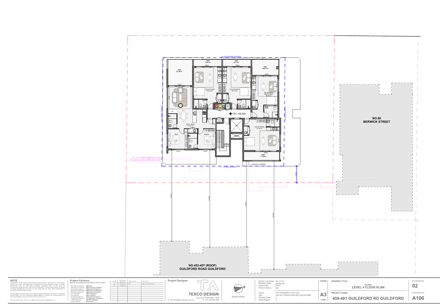
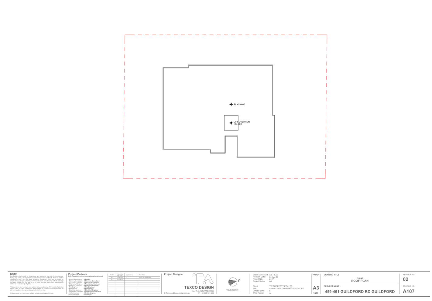
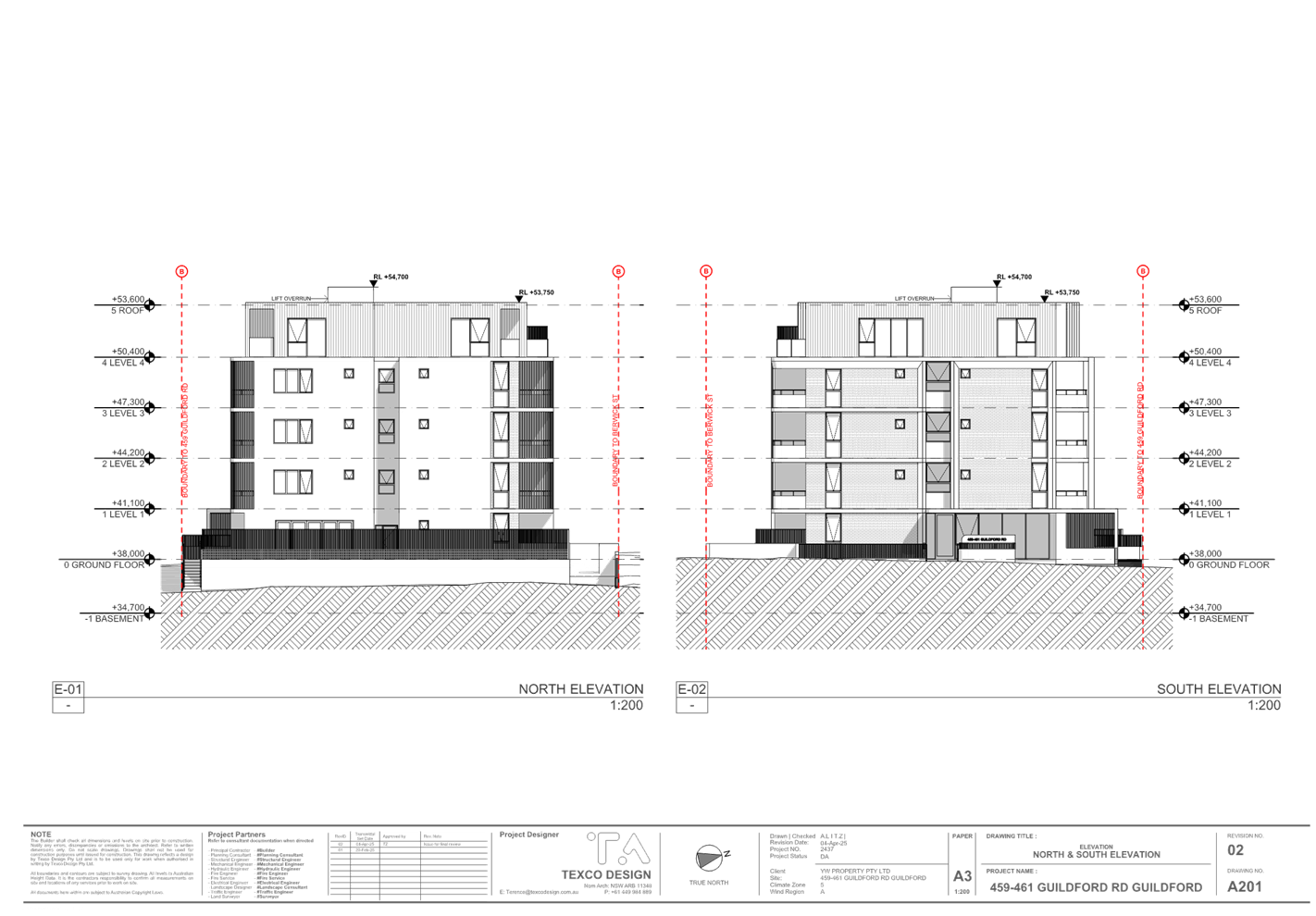
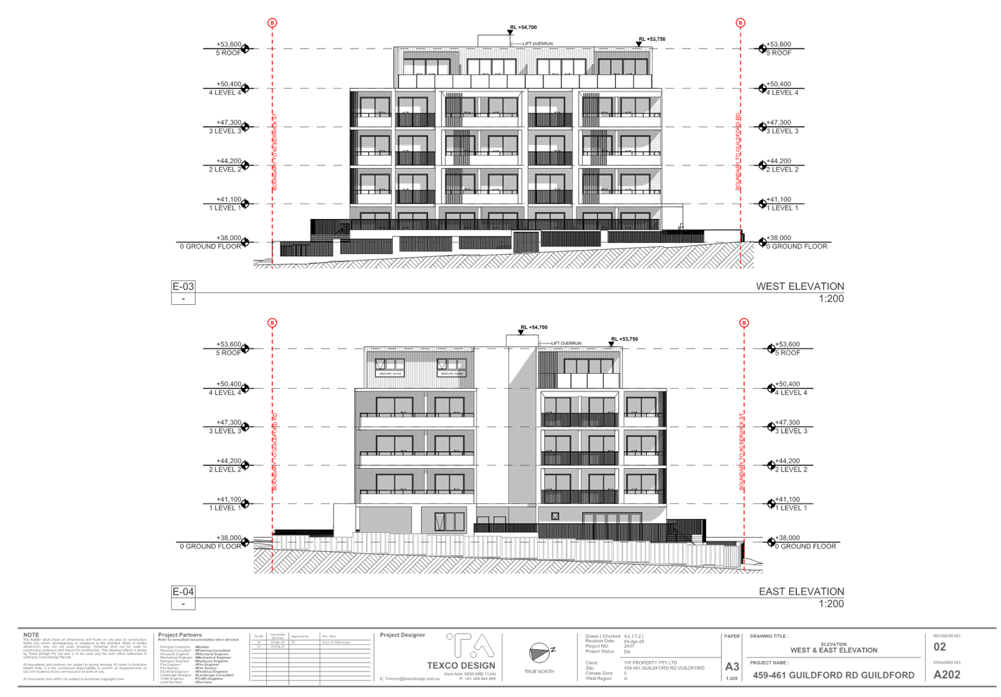
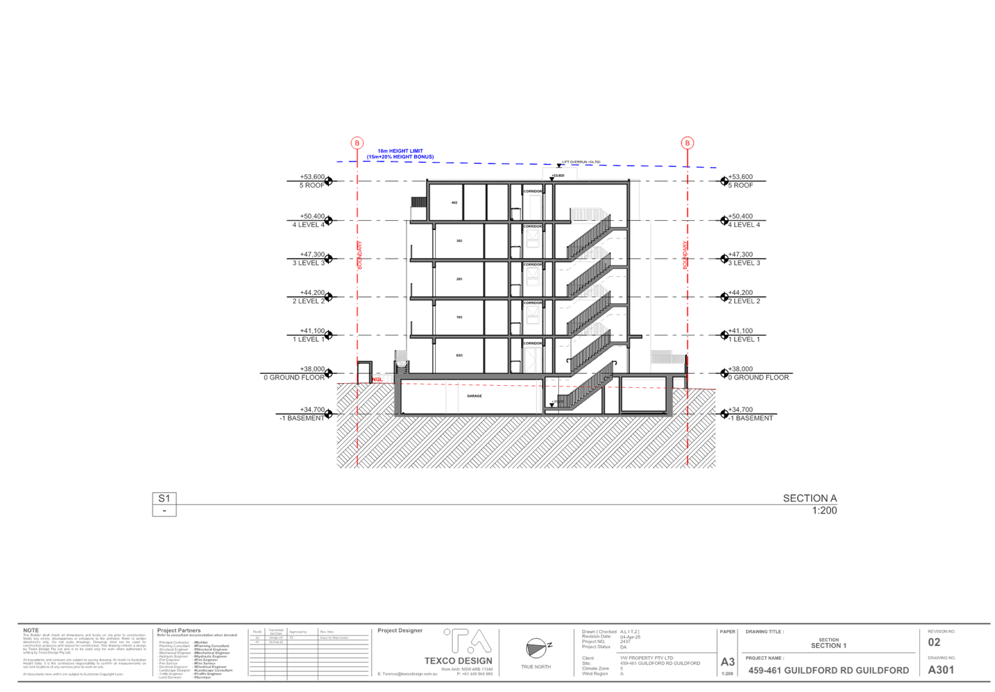
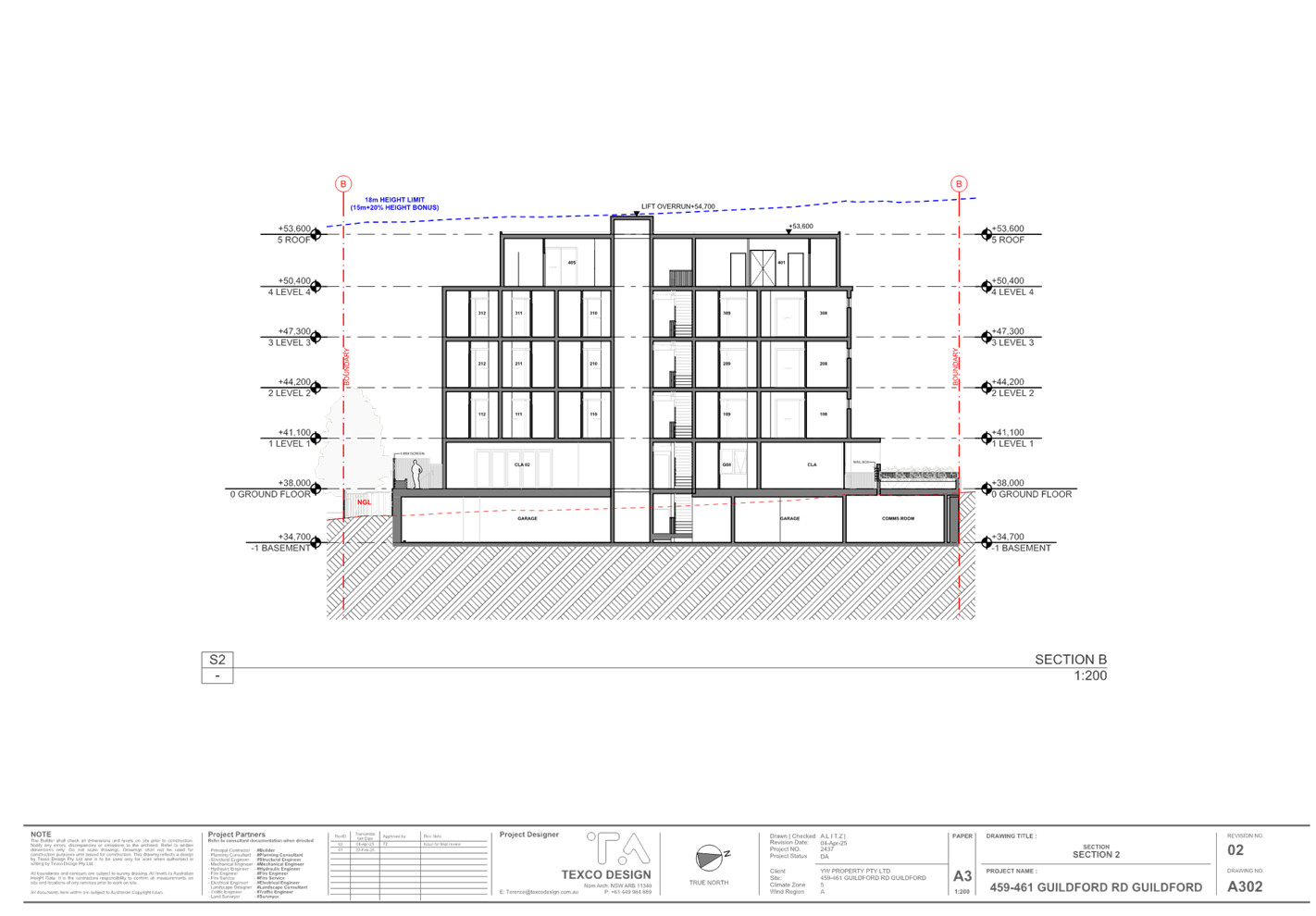
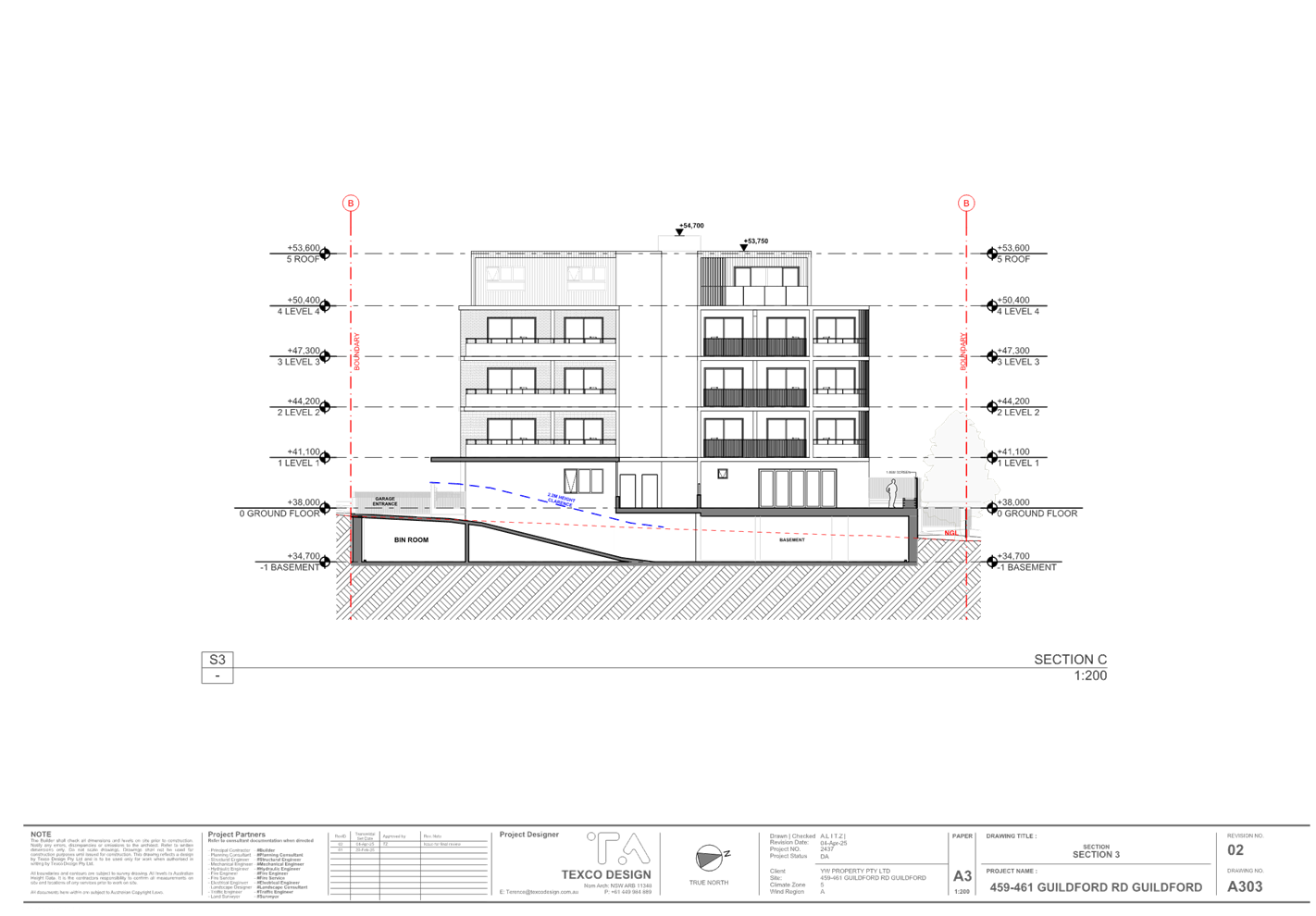
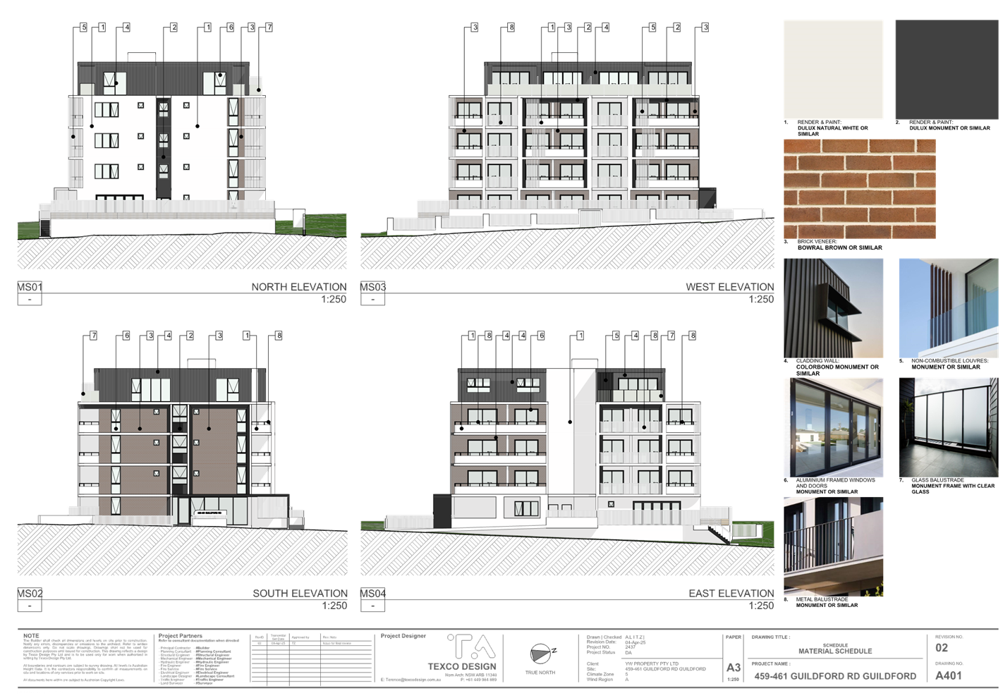
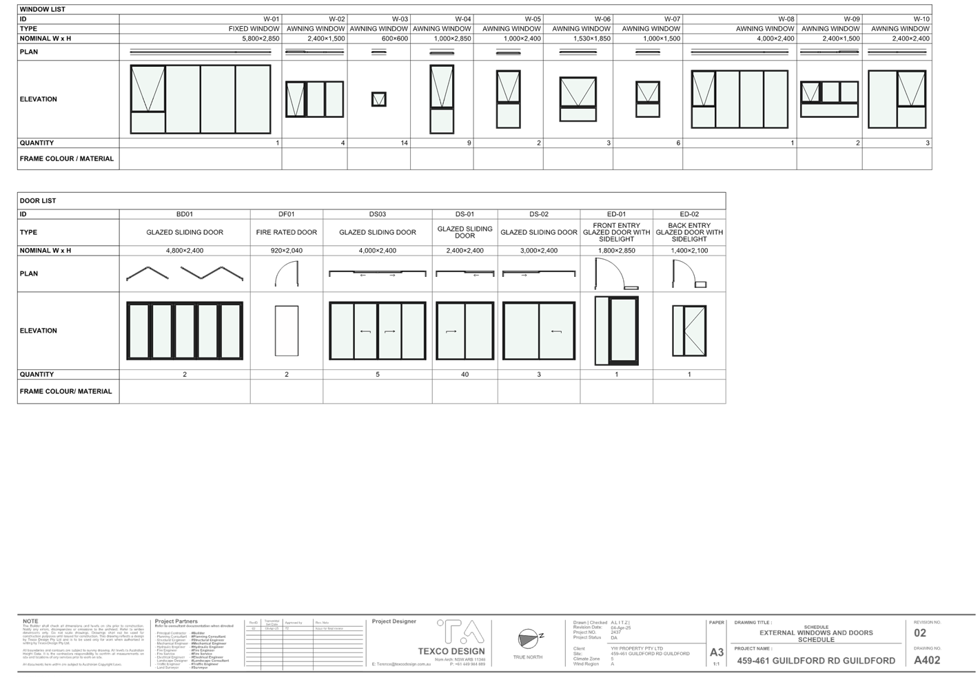
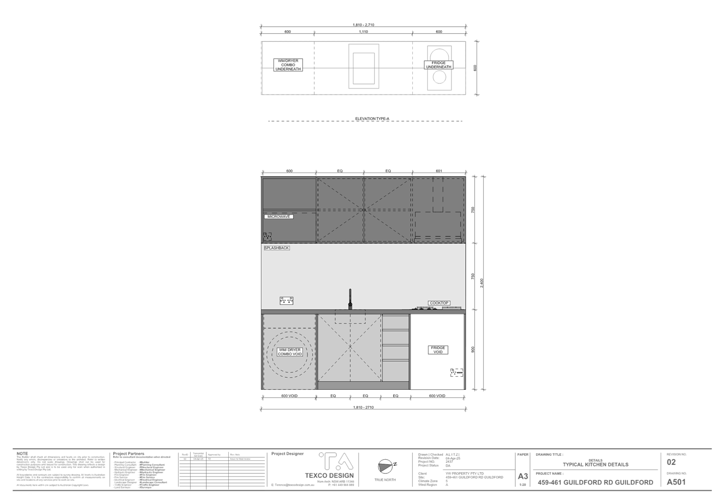
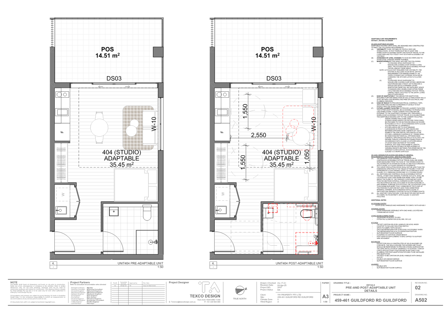
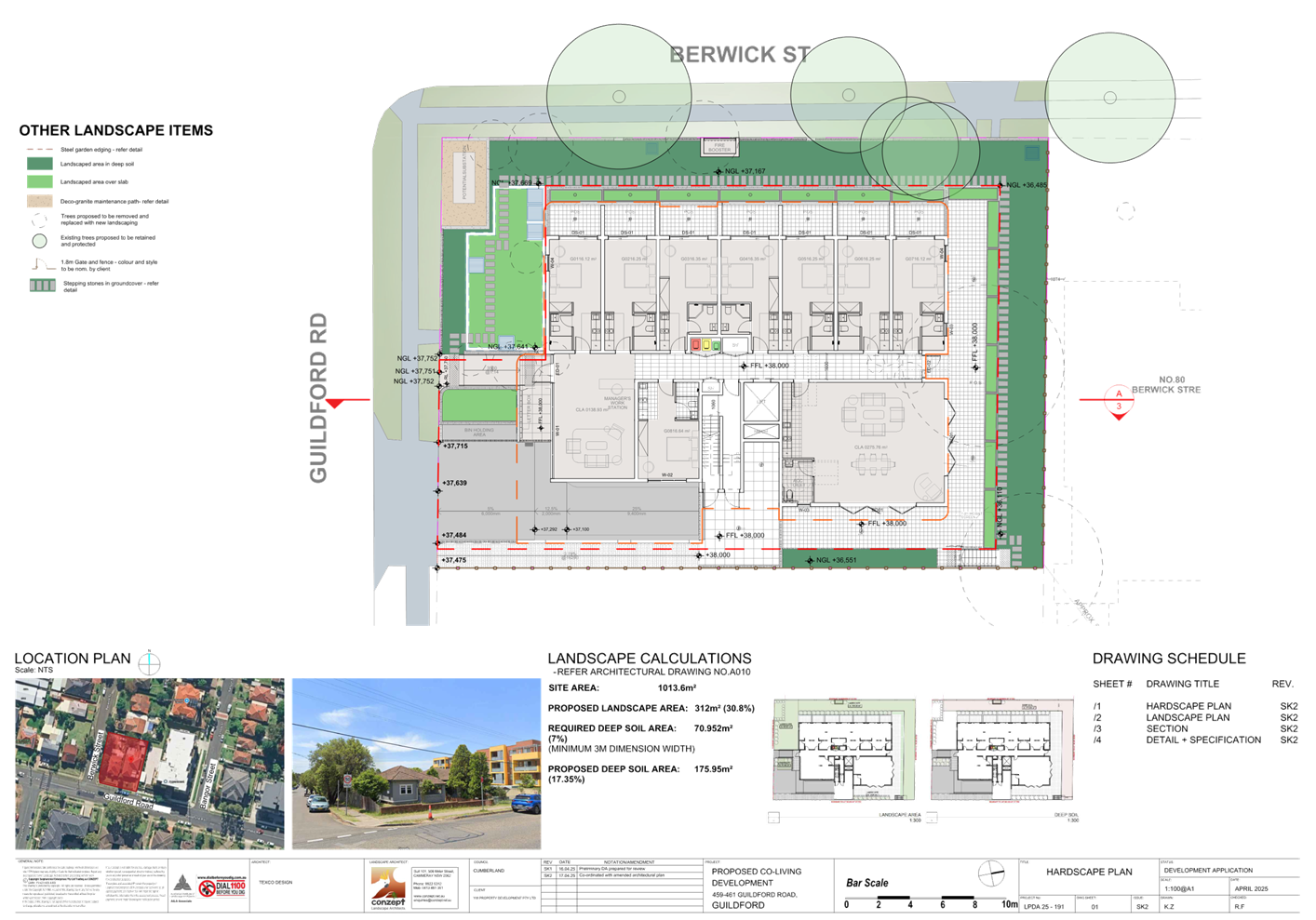
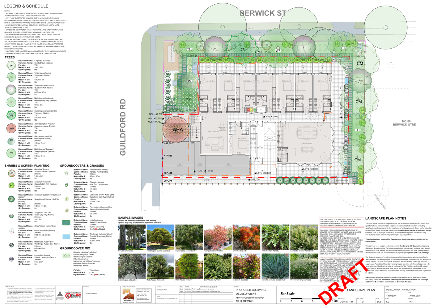
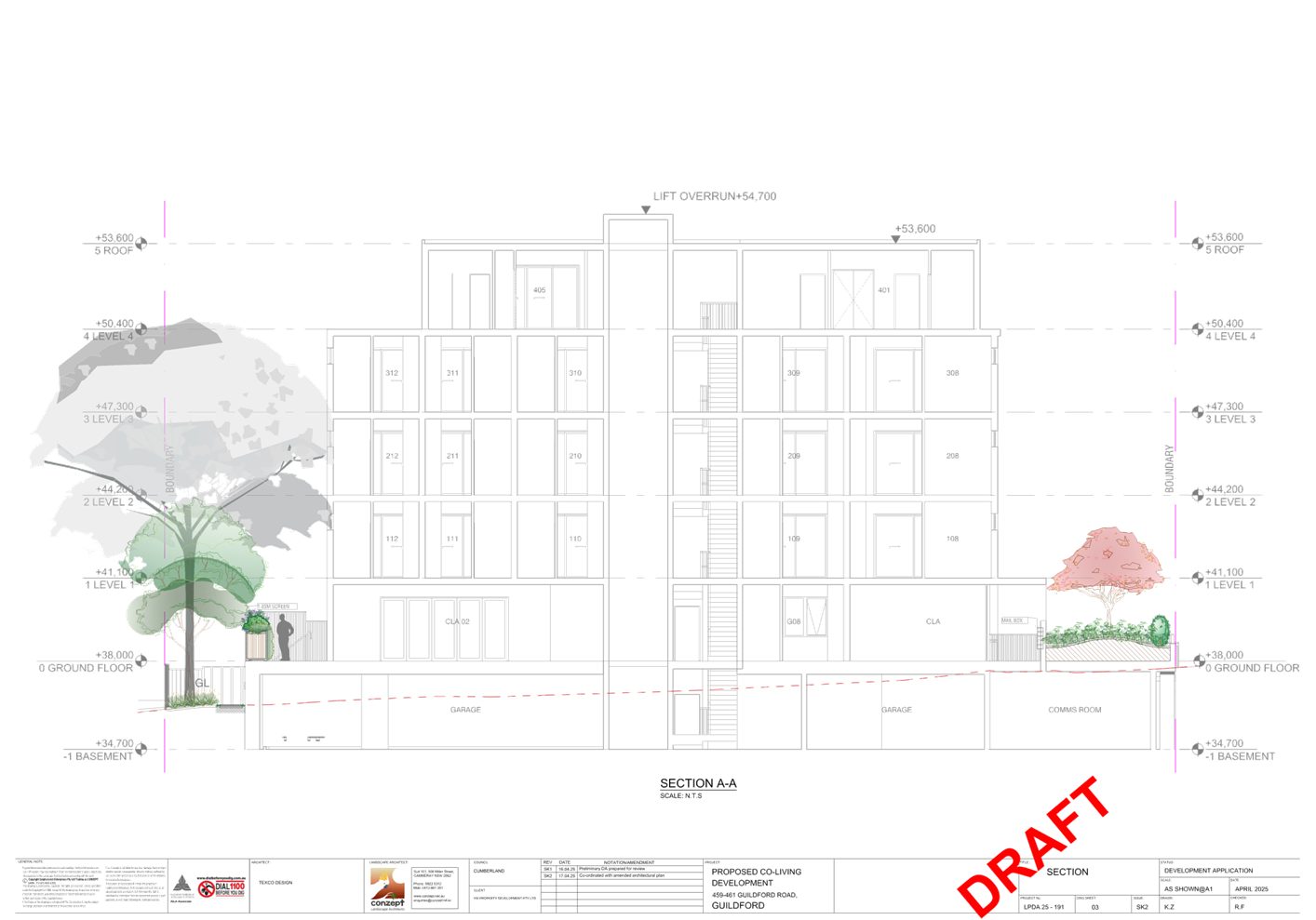
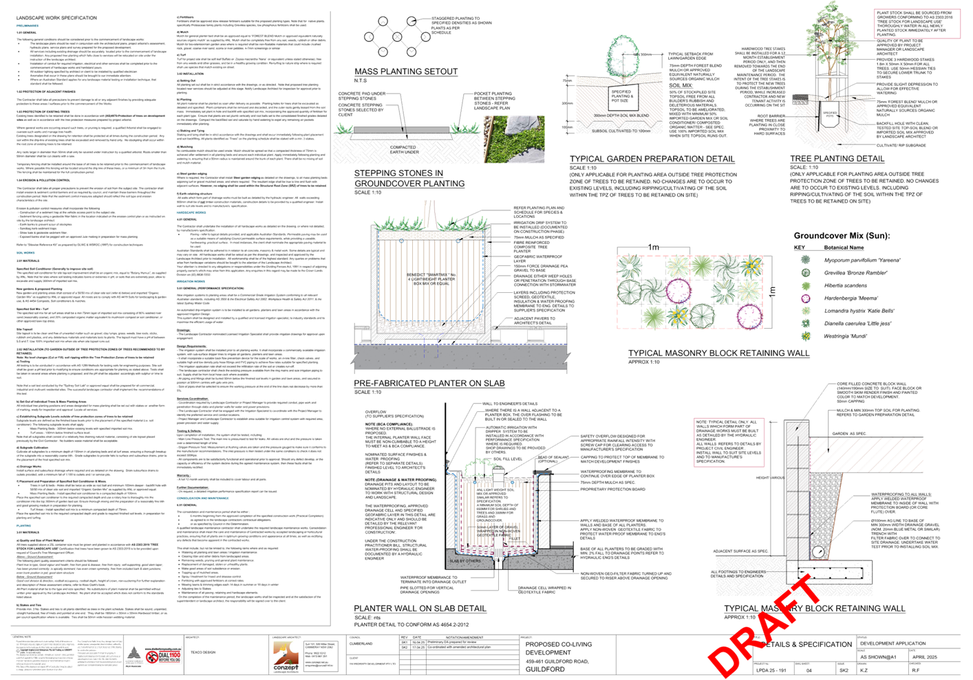
DOCUMENTS
ASSOCIATED WITH
REPORT ELPP023/25
Attachment 3
Plan of Management
Cumberland
Local Planning Panel Meeting
8 October 2025

DOCUMENTS
ASSOCIATED WITH
REPORT ELPP023/25
Attachment 4
Housing SEPP 2021 & ADG Assessment
Cumberland
Local Planning Panel Meeting
8 October 2025
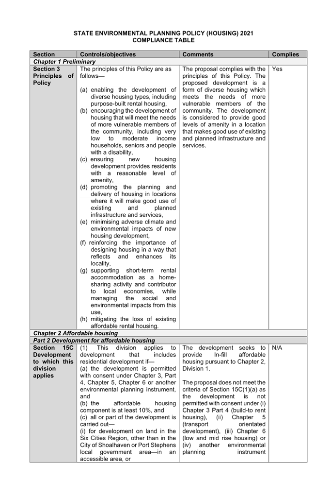
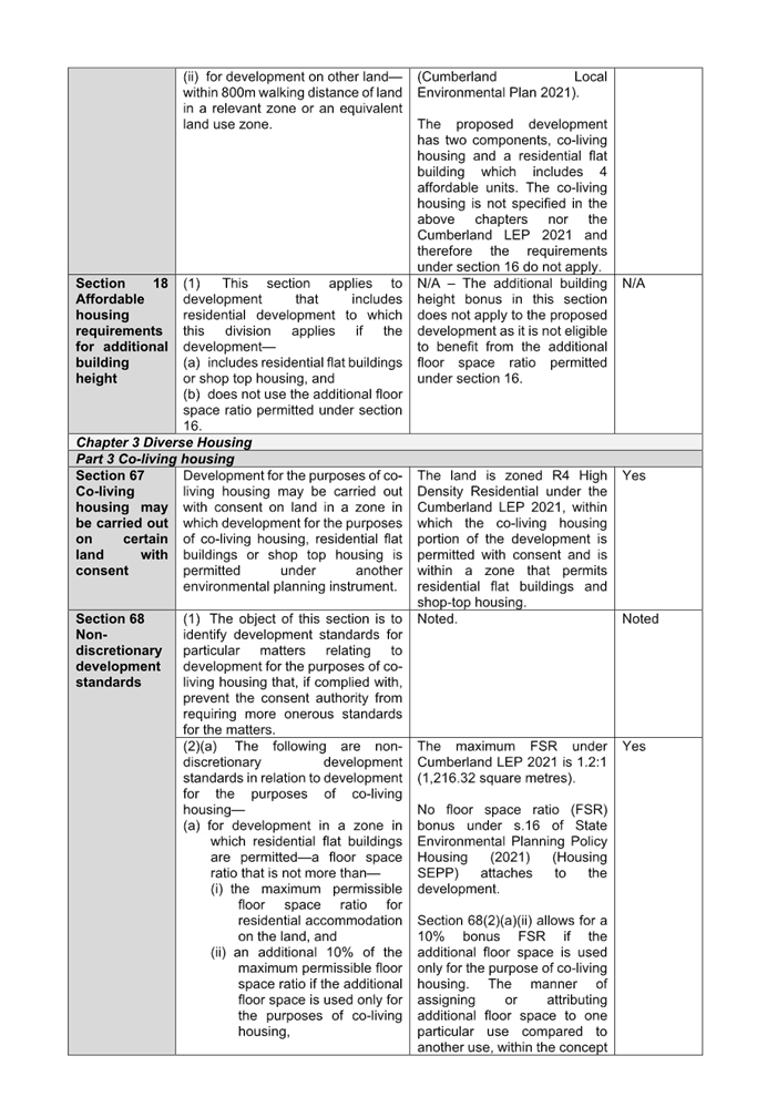
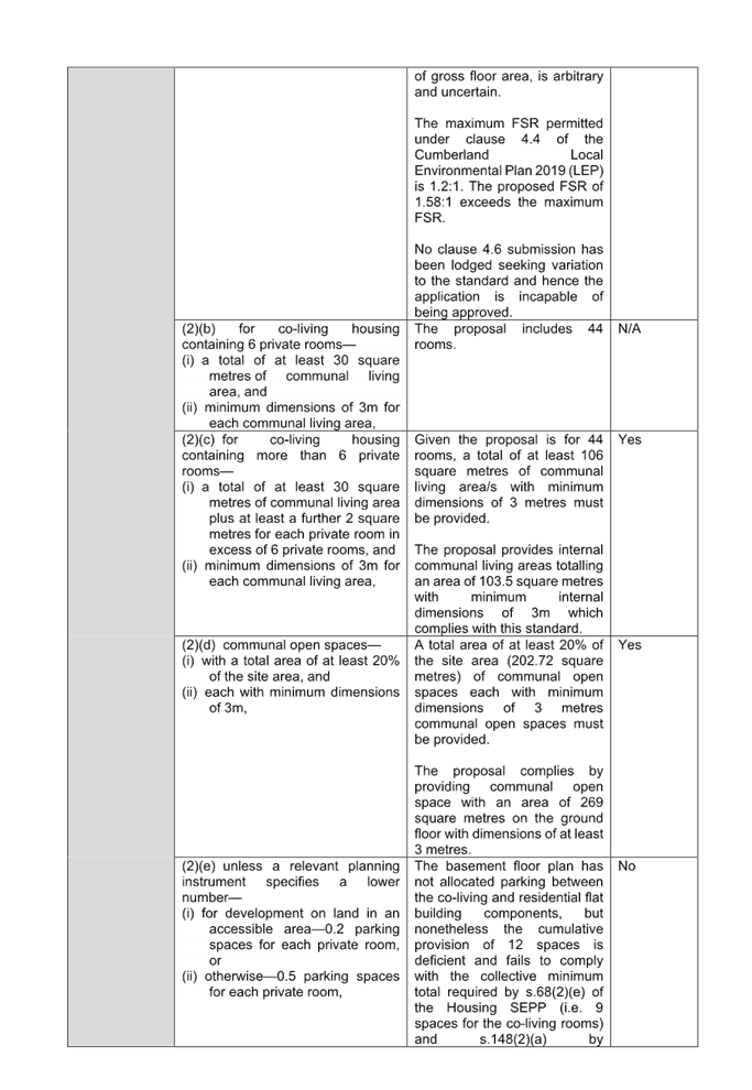
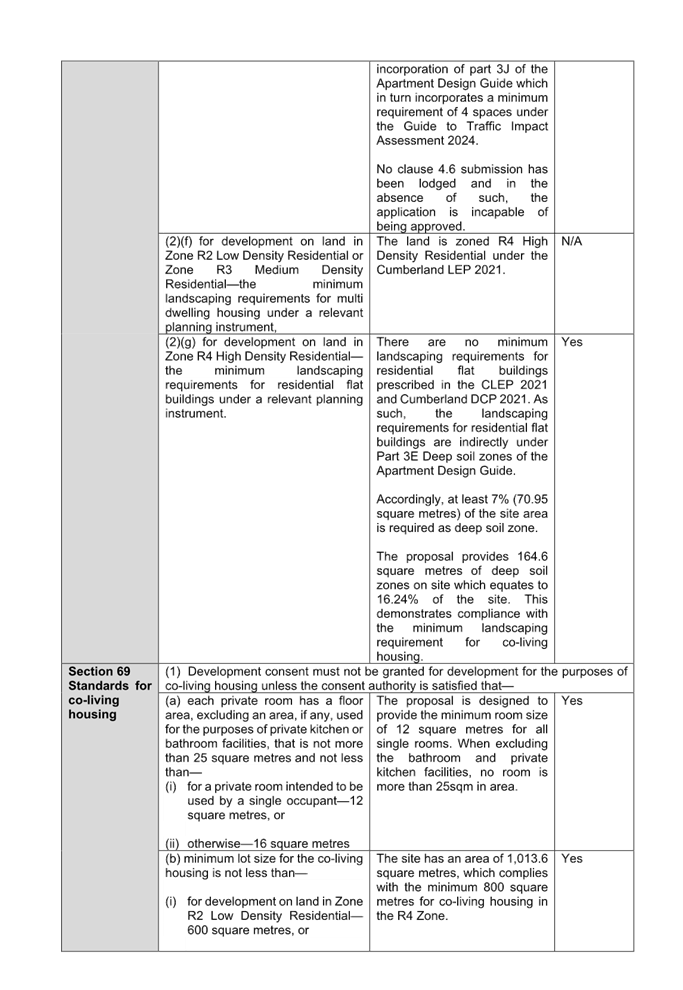
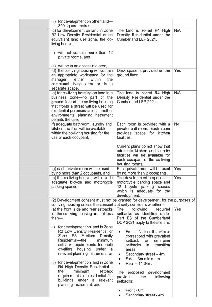
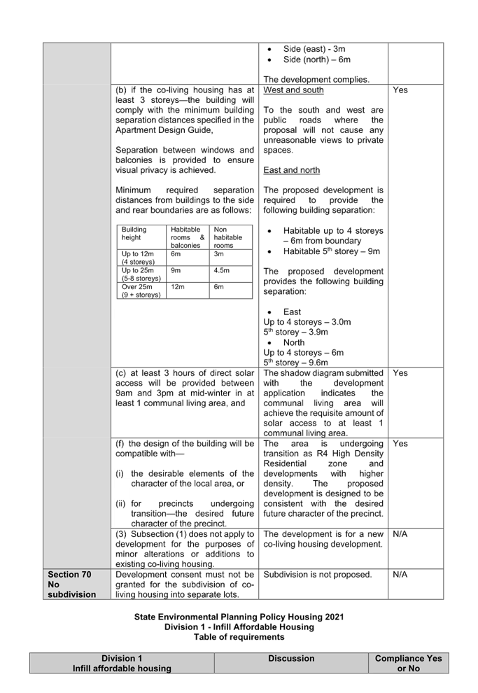
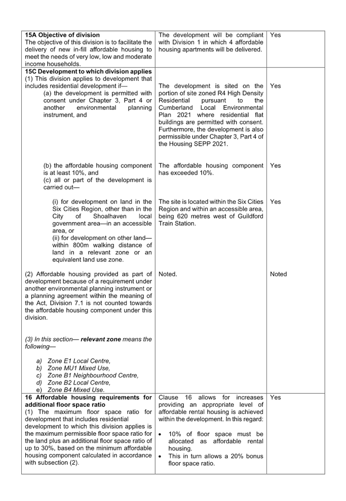
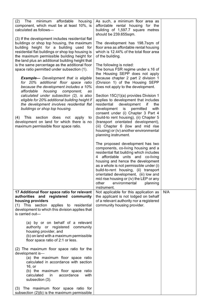
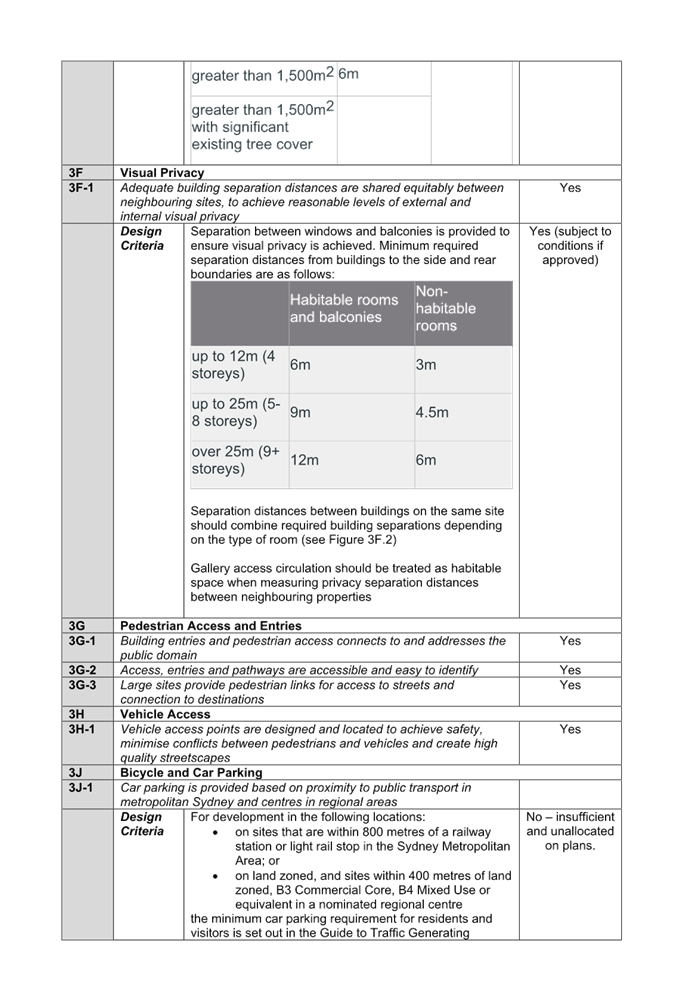
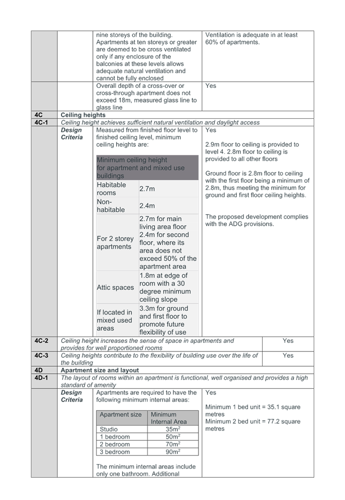
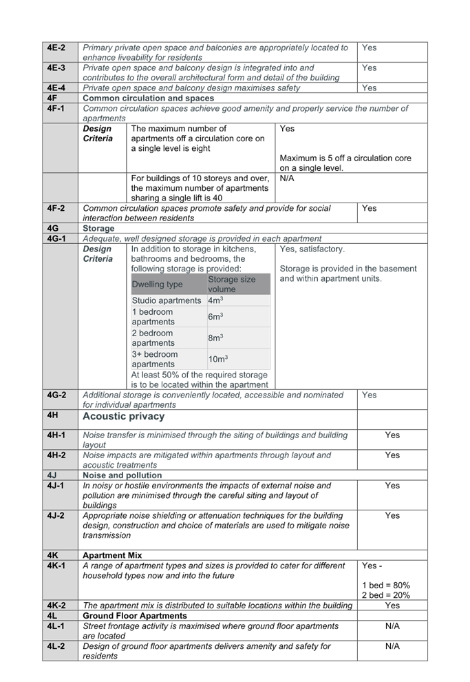
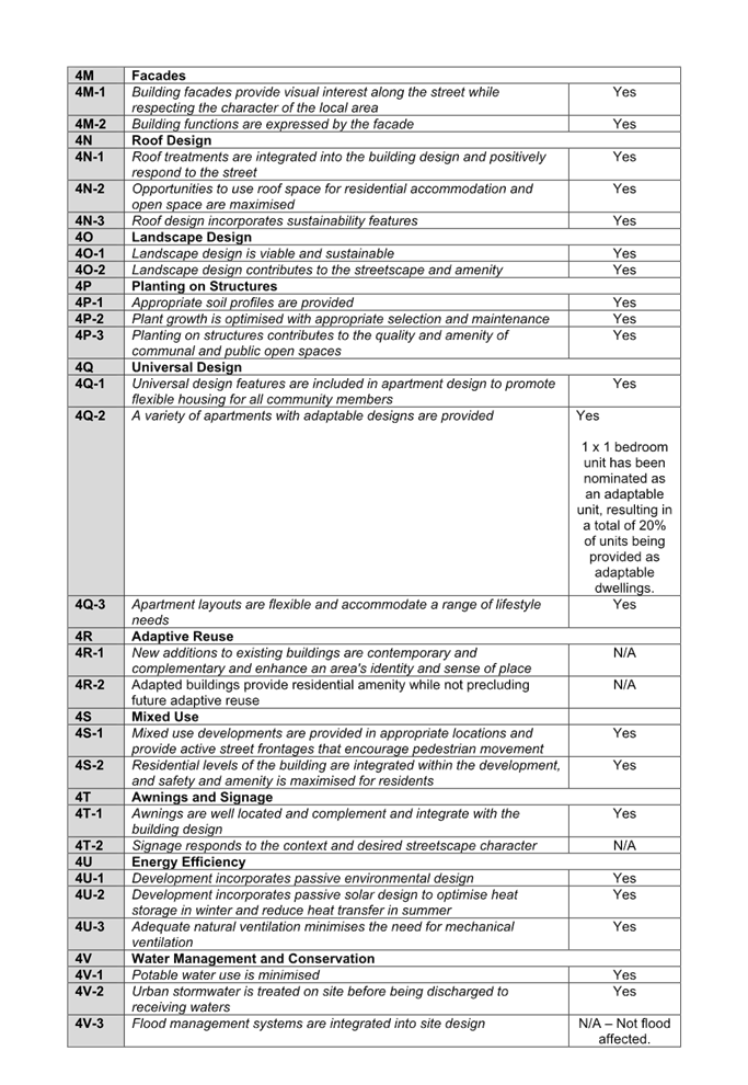

DOCUMENTS
ASSOCIATED WITH
REPORT ELPP023/25
Attachment 5
Cumberland LEP 2021 Assessment
Cumberland
Local Planning Panel Meeting
8 October 2025
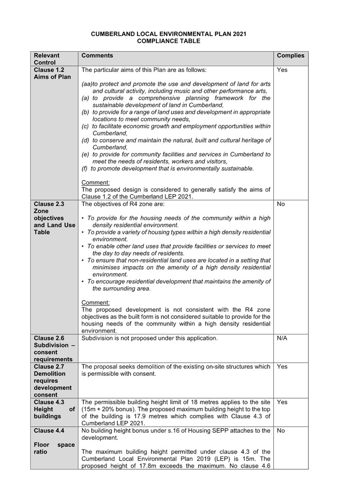
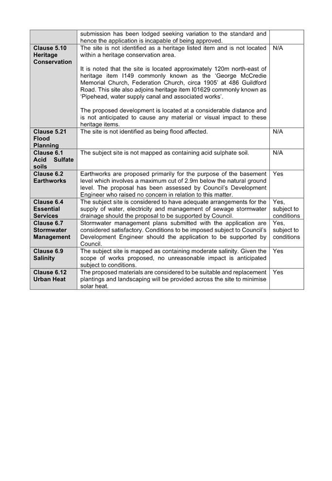
DOCUMENTS
ASSOCIATED WITH
REPORT ELPP023/25
Attachment 6
Cumberland DCP 2021 Assessment
Cumberland
Local Planning Panel Meeting
8 October 2025
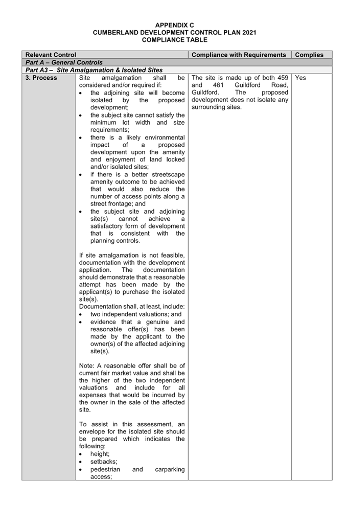
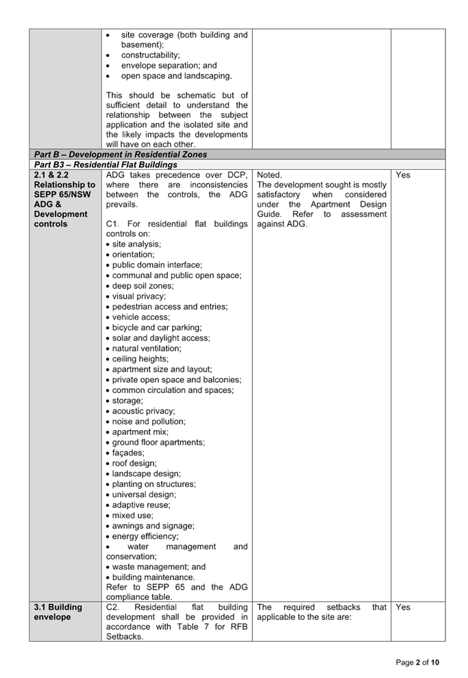
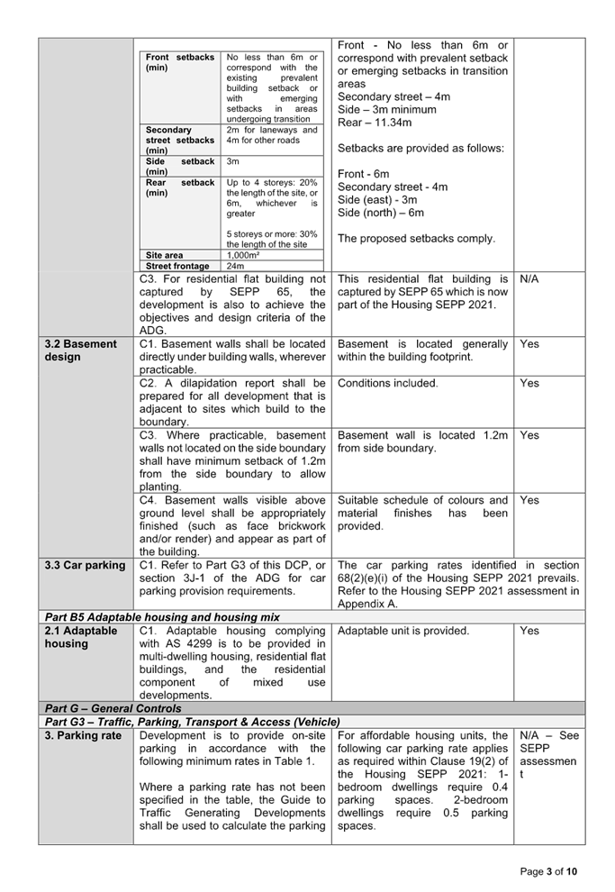
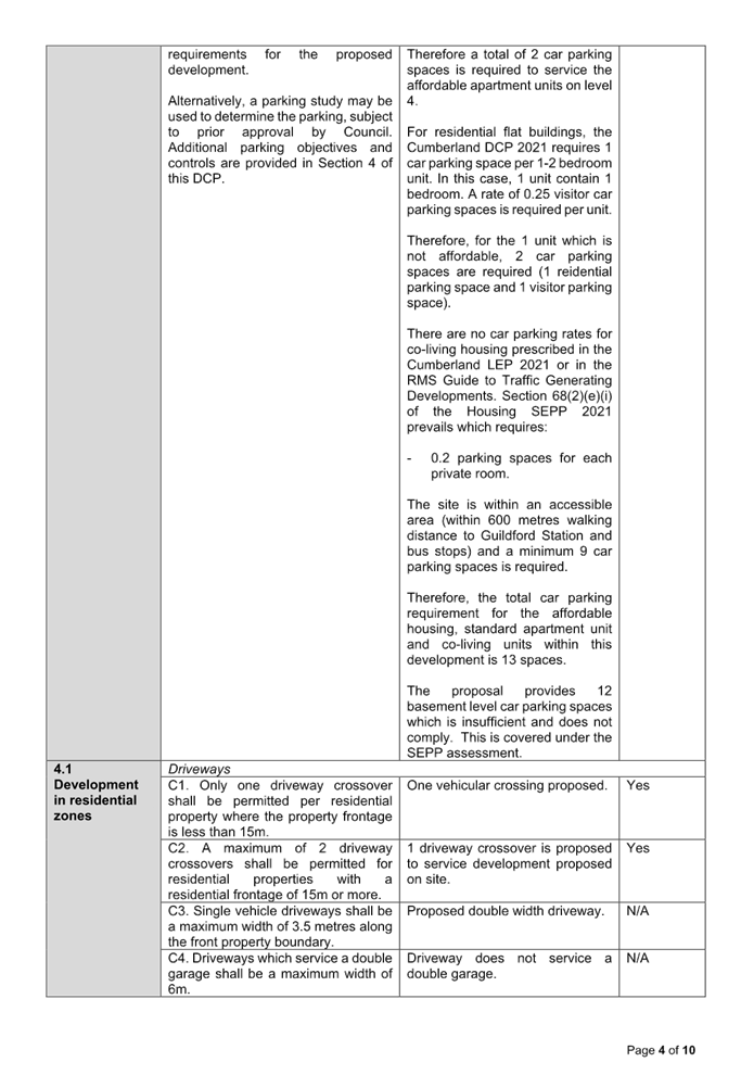
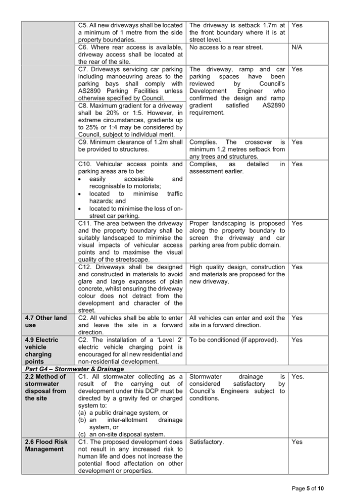
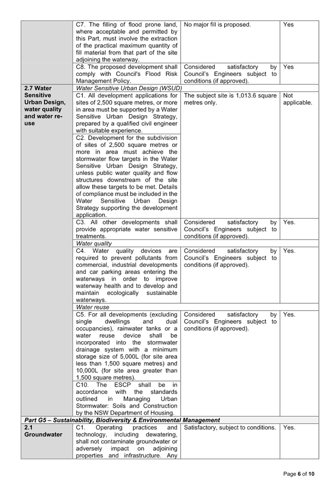
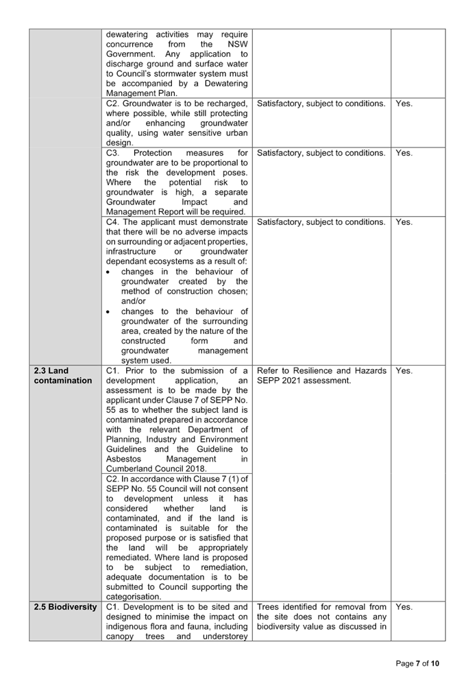
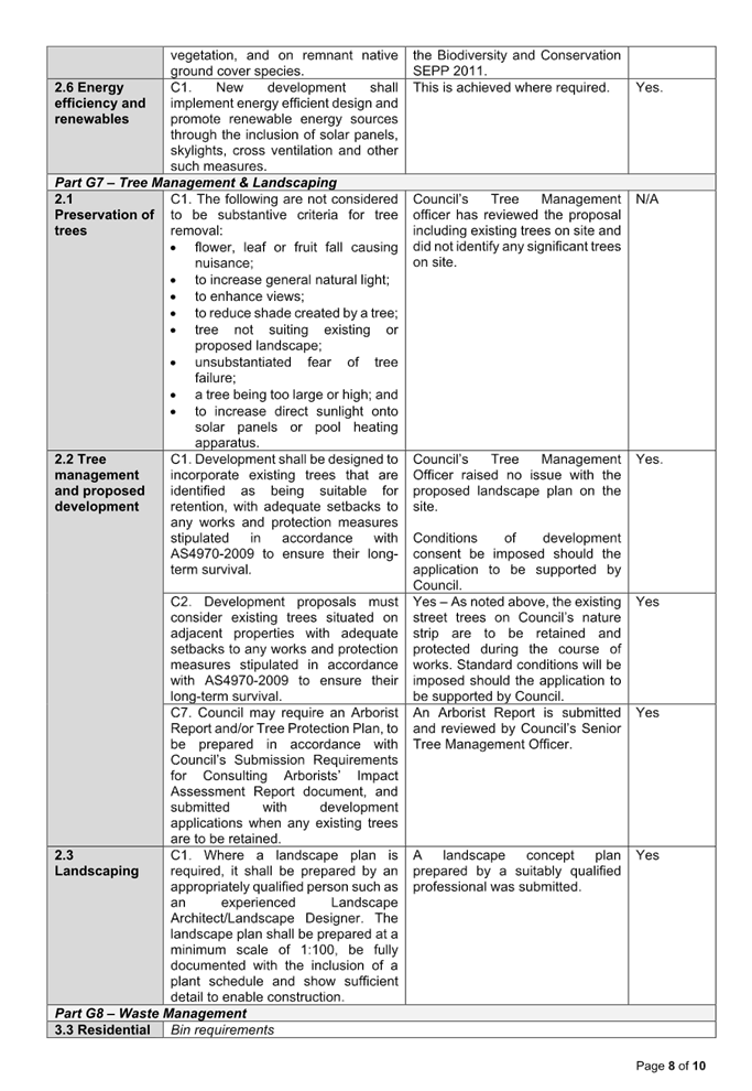
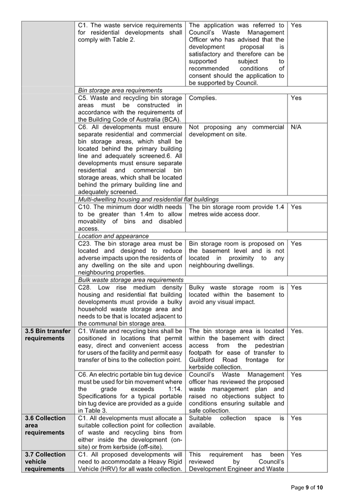
Cumberland Local Planning Panel Meeting
8 October 2025
Item No: ELPP024/25
Development
Application - 2-4 Gilba Road, Pendle Hill
Directorate: Environment
and Planning
Responsible
Officer: Executive
Manager City Planning and Development
|
Application
lodged
|
13 November 2024.
|
|
Applicant
|
Siva Projects.
|
|
Owner
|
Pearl Property No.2 Pty Ltd.
|
|
Application
No.
|
DA2024/0618.
|
|
Description
of Land
|
2-4 Gilba Road, Pendle Hill
NSW 2145.
Lots 7 and 8 in DP 20186.
|
|
Proposed
Development
|
Alterations and additions to
the shop-top housing development including reconfiguration of basement levels
1 and 2, ground floor and levels 1 to 4, an additional basement level and two
residential levels (levels 5 and 6) comprising in total two (2) commercial
tenancies and kiosk on the ground floor and 44 residential units over three
(3) levels of basement parking.
|
|
Site
Area
|
1,985.1sqm.
|
|
Zoning
|
E1 Local Centre Zone.
|
|
Disclosure
of political donations and gifts
|
Nil disclosure.
|
|
Cost
of works
|
$5,721,876.00.
|
|
Heritage
|
Not Heritage Listed or a
Heritage Conservation Area.
|
|
Principal
Development Standards
|
Floor Space Ratio
Permissible: 2.6:1.
(comprising Cumberland LEP
2.0:1 and Housing SEPP 0.6:1)
Propose: 2.34:1.
And
Height of Building
Permissible: 22.1m.
(comprising Cumberland LEP 17m
and Housing SEPP 5.1m)
Propose: maximum 23.94m (lift
overrun, stairs and roof).
|
|
Issues
|
Height of building.
Building separation.
Submissions.
|
1. Development
Application 2024/0618 was lodged on the 13 November 2024 for the alterations
and additions to the shop-top housing development including reconfiguration of
basement levels 1 and 2, ground floor and levels 1 to 4, an additional basement
level and two residential levels (levels 5 and 6), comprising in total two (2)
commercial tenancies and kiosk on the ground floor and 44 residential units
over three (3) levels of basement parking.
2. The
application was publicly notified to occupants and owners of the adjoining
properties for a period of 14 days between the 28 November 2024 and the 12
December 2024. In response, 3 submission/s were received.
3. The
variations are as follows:
|
Control
|
Required
|
Provided
|
% variation
|
|
Height of building (Cumberland LEP 2021 and Housing SEPP
2021)
|
Maximum 22.1m
|
23.94m (lift overrun and stairs)
|
8.33%
|
|
Building separation (ADG)
|
- 6m
(habitable) or 3m (non-habitable) for up to 4 storeys.
- 9m
(habitable) or 4.5m (non-habitable) for 5-8 storeys.
|
Ground floor
- 3m
to eastern side boundary.
Levels 1 to 3
- 0m
to eastern side boundary.
Level 4
- 0m
to eastern side boundary.
Levels 5 to 6
- Min.
2.5m to north front boundary.
- 3.3m
to east side boundary from bedroom walls.
- 4.5m
to east side boundary from non-habitable room windows.
|
Existing non-compliance
Existing non-compliance
Existing non-compliance
44.44%
26.67%
complies
|
4. The
application is referred to the Panel as the proposal is sensitive development
being a residential apartment development comprising more than four dwellings
and with a height exceeding three storeys.
5. The
application is recommended for approval subject to the conditions as
recommended in the Council’s assessment report.
Subject Site and Surrounding
Area
The subject site is legally
described as Lots 7 and 8 in DP 20186, with a street address of 2-4 Gilba Road,
Pendle Hill. The site is within zone E1 Local Centre. The site is located on
the southern side of Gilba Road and directly adjoins the R2 Low Density
Residential zone to the west and south.
The R4 High Density Residential
zone lies to the south-east and land zone E1 Local Centre lies to the east and
north.
The site is a regular block with a
combined frontage of 24.685m to Gilba Road and a depth of 80.46m with a total
site area of 1,985.1sqm. The site is currently vacant and the existing
dwellings on site have been demolished as part of the original development
consent (DA2017/275/1) issued.
The site is surrounded by
residential properties comprising of low to medium density dwelling types.
The location of the site is shown
below edged in purple.
Figure
1 - Locality Plan of subject site (source: Council Intramap)
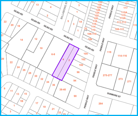
Figure
2 - Aerial view of subject site (source: Nearmap)
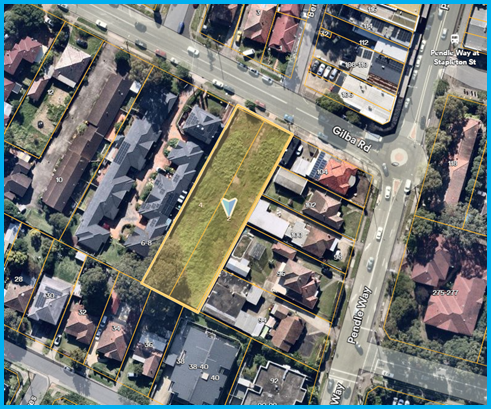
Figure
3 - Street view of subject site (source: site inspection)
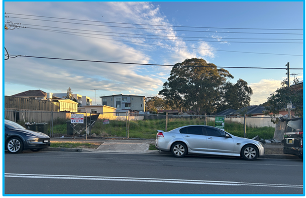
Description of The
Development
Development Application
DA2024/0618 is an amending development application that seeks alterations and
additions to the shop-top housing development approved under DA2017/275 (as
amended) including reconfiguration of basement levels 1 and 2, alterations to
the ground floor and Levels 1 to 4, an additional basement level and two
additional residential levels (Levels 5 and 6) pursuant to the State
Environmental Planning Policy (Housing) 2021.
The development application is
taking advantage of the additional floor space ratio (FSR) and additional
height of building that provides for in-fill affordable housing under Chapter
2, Part 2, Division 1 In-fill affordable housing of the State Environmental
Planning Policy (Housing) 2021.
It is identified that the lift
overrun, stairs and a small part of the roof structure on Level 6 residential
level are in breach of the height control provisions of the amended
development. Such matters are discussed in detail within the assessment report
below.
Key features of the development
proposal including the original approved 5 storeys shop top housing and this
amending development application are as follows:
· Construction of a 7
storey shop top housing over basement parking incorporating: -
Basement
– Three Levels
· Construction of a
new Basement Level 3 comprising:
- 38
residential car parking spaces (5 of which are accessible).
- 15 bicycle
parking spaces.
- 1 car wash
bay; and
- Mechanical
service room.
· Amend the layout
of the approved Basement Level 2 as follows:
- 4 x
residential car parking spaces (2 of which are accessible).
- 20 x
commercial car parking spaces (1 of which is accessible).
- 6 x bicycle
parking spaces.
- 2 x bin
storage rooms.
- 24 x storage
compartments.
- waste
collection room.
- waste
collection loading/unloading bay; and
- service
room.
· Amend the layout
of the approved Basement Level 1 as follows:
- 12 x
residential visitor car parking spaces (1 of which is accessible).
- 15 x bicycle
parking spaces.
- 45 x storage
compartments.
- OSD tank;
and
- fire/hydrant
pump room.
Ground
Floor
· Amend the approved
medical centre to become 2 x commercial tenancies:
- COM01 (rear)
with access from the pedestrian access footpath; and
- COM02
(front) with café space and direct access from Gilba Road;
· Relocate the
approved substation room; and
· Amend the approved
pedestrian access adjoins to the eastern side boundary of the site.
Level 1 and
2
· Amend the layout
and configuration of the residential level to provide 9 residential units
comprising 2 x 1 bedroom units; 4 x 2 bedroom units; and 3 x 3 bedroom units.
Level 3
· Amend the layout
and configuration of the residential level to provide 9 residential units
comprising 2 x 1 bedroom units; 5 x 2 bedroom units; and 2 x 3 bedroom units.
Level 4
· Amend the layout
and configuration of the residential level to provide 8 residential units
comprising 2 x 1 bedroom units; and 6 x 2 bedroom units.
Level 5
· Construction of
new additional residential level to provide 7 residential units comprising 3 x
1 bedroom units; and 4 x 2 bedroom units.
Level 6
· Construction of
new additional residential level to provide 2 residential units comprising 2 x
3 bedroom units.
· Construction of
new hot water plant; and
· Construction of
new communal open space comprising rooftop lawn area, seating areas, planter
boxes, BBQ and cooking facilities and pergola structure above.
The crucial elements of the whole
development across are outlined within the table below:
|
Items
|
Original approval
(DA2017/275)
|
Modification approval
(MOD2022/0258)
|
Proposal
(DA2024/0618)
|
Change
|
|
Gross
floor area.
|
3,455sqm
|
3,553.7sqm
|
4,645.87sqm
|
Increase
by 1,190.87sqm.
|
|
In-fill
affordable housing.
|
Nil
|
Nil
|
716.45sqm
|
Increase
by 716.45sqm.
|
|
Floor
space ratio.
|
1.74:1
|
1.79:1
|
2.34:1
|
Increase
by 0.6:1.
|
|
Height
in storeys.
|
5
storeys
|
|
7
storeys
|
Increase
by 2 storeys.
|
|
Height
in metres
|
20.2m
(Includes the lift overrun).
|
20.2m
(Included the lift overrun).
|
23.94m
(included lift overrun and stairs).
|
Increase
of 3.74m.
|
|
Residential apartments
|
32
apartments:
- 1 x studio unit
- 5 x 1 bedroom units
- 22 x 2 bedroom units
- 4 x 3 bedroom units
|
33
apartments:
- 1 x studio unit
- 6 x 1 bedroom units
- 21 x 2 bedroom units
- 5 x 3 bedroom units
|
44
apartments:
- 11 x 1 bedroom units
- 23 x 2 bedroom units
- 10 x 3 bedroom units
|
Increase
of 37 apartments
|
|
Commercial
tenancies
|
Medical
centre and 3 commercial tenancies (730.86sqm)
|
1
commercial tenancy (732.59sqm)
|
2
commercial tenancies including a café area (713.34sqm)
|
Decrease
by 17.52sqm from the original consent.
|
|
Commercial
car parking spaces
|
32
spaces
|
19
spaces
|
20
spaces
|
Increase
by 1 space
|
|
Residential
car parking spaces
|
30
spaces
|
38
spaces
|
43
spaces
|
Increase
by 5 spaces
|
|
Residential
visitor car spaces
|
7
spaces
|
5
spaces
|
11
spaces
|
Increase
by 6 spaces
|
|
Bicycle
parking spaces
|
Nil
|
23
spaces
|
36
Spaces
|
Increase
by 13 spaces
|
|
Storage
compartments
|
32
compartments
|
36
compartments
|
69
compartments
|
Increase
by 33 compartments
|
History
|
Application No.
|
Proposal
|
Determination
|
Date
|
|
PL2016/108/1
|
Construction of a mixed use development
|
Minutes issued
|
28/10/2016
|
|
DA2017/275/1
|
Demolition of existing structures, consolidation of 2 lots
into 1 lot, construction of a 5 storey shop top housing development
comprising a medical centre and 3 commercial tenancies at ground floor level,
32 residential units above 2 levels of basement carpark accommodating 72
parking spaces.
|
Deferred commencement approved by IHAP
|
25/07/2018
|
|
Operational consent.
|
18/06/2019
|
|
MOD2022/0258
|
S4.55(2) modification for amendments to the approved shop
top housing development including reconfiguration of unit mix, sizes and
layouts, conversion of units to accessible (NDIS) units, amalgamation of
ground floor commercial tenancies into a single tenancy, relocation of ground
floor pedestrian pathway to access rear of site, reduction in basement areas
and reconfiguration of car parking, and various changes to plant, waste and
store rooms, substation, stairwells, communal open space and landscaping.
|
Approved under staff delegation.
|
27/02/2023
|
|
DA2024/0618
|
Alterations and additions to the shop-top housing
development including reconfiguration of basement levels 1 and 2, ground
floor and levels 1 to 4, an additional basement level and two residential
levels (levels 5 and 6), comprising in total two (2) commercial tenancies and
kiosk on the ground floor and 44 residential units over three (3) levels of
basement parking pursuant to Chapter 2, Part 2, Division 1 In-fill affordable
housing of the Housing SEPP 2021.
|
Subject of this development application.
|
Applicants Supporting
Statement
The applicant has provided a
Statement of Environmental Effects prepared by MMDC Pty Ltd dated 4 October
2024 (Revision A) and was received by Council on 30 October 2024 in support of
the application.
Contact With Relevant
Parties
The assessing officer has
undertaken a site inspection of the subject site and surrounding properties and
has been in regular contact with the applicant throughout the assessment
process.
Internal Referrals
Development Engineering
The development application was
referred to Council’s Development Engineer for comment who has advised
that the development proposal is satisfactory and therefore can be supported
subject to recommended conditions of consent.
Environmental
Health
The development application was
referred to Council’s Environmental Health Officer for comment who has
advised that the development sought is satisfactory and therefore can be
supported subject to conditions.
Tree Management
The development application was
referred to Council’s Tree Management Officer for comment who has advised
that the proposal is satisfactory and therefore can be supported subject to
conditions.
Waste Management
The development application was
referred to Council’s Waste Management Officer for comment who has
advised that the proposal is satisfactory and therefore can be supported
subject to conditions.
External Referrals
Endeavour Energy
The development application was
referred to Endeavour Energy for comment who has advised that the proposal is
satisfactory and the conditions that imposed as part of the original
development approval (DA2017/275) remains applicable. Therefore, the proposed
amendment to the original approved 5 storeys shop-top housing can be supported
without further conditions.
Sydney Water
The development application was
referred to Sydney Water for comment who has advised that the proposal is
satisfactory and therefore can be supported subject to conditions.
Planning Comments
The provisions of any
Environmental Planning Instruments (EP&A Act s4.15 (1)(a)(i))
State Environmental Planning
Policies
The proposed development is
affected by the following State Environmental Planning Policies:
|
State
Environmental Planning Policies
|
Relevant
Clause(s)
|
Compliance
with Requirements
|
|
State Environmental Planning Policy (Building
Sustainability Index: BASIX) 2004
|
-
|
Commitments made under the
original Development Approval DA2017/275 have been modified and a revised
BASIX Certificate number 832384M_05, dated 11 June 2025 has been submitted
and determined as being acceptable for the development application.
|
|
State Environmental Planning Policy (Biodiversity and
Conservation) 2021.
|
Chapter 2 -
Vegetation in non Rural Areas.
|
Due to the previous
development approval (DA2017/275), this proposal will not result in any
additional tree removal.
Therefore, the proposed
vegetation removal which is previously approved is considered acceptable and
not subject to change.
|
|
Chapter 6 -
Water Catchments.
Sydney Harbour Catchment.
|
It is determined that given the
location of the site/development, a detailed assessment is not required given
that there is no direct impact upon the catchment and no direct impact upon
watercourses. As such, the development is acceptable under the provisions
that came into effect on Monday 21 November 2022.
|
|
Chapter 4 -
Remediation of Land.
Part 4.6.
|
The matter
addressing land contamination has been addressed within the processing of the
original development application DA2017/275. As this application is relating
to additional floors across original approved shop-top housing, additional
contamination assessment is not required.
It is
considered that the development application is satisfactory under Part 4.6 of
Chapter 4 of the State Policy.
|
|
State
Environmental Planning Policy (Housing) 2021.
|
Chapter 2 -
Affordable housing.
Part 2,
Division 1
In-fill affordable housing
|
As outlined
throughout this report, the proposal is generally compliant with all
non-discretionary development standards and design requirements with the
exception of clause 16(3) relating to the building height.
A clause 4.6
variation request is provided to address the non-compliances. Refer to discussion following
this table.
A comprehensive Housing SEPP 2021 assessment is contained
in Appendix A.
|
|
Chapter 4 –
Design of residential
apartment development
|
This chapter applies to the
development as the building is 3 storeys or more and contains more than 4
dwellings.
A design statement addressing
the design quality principles prescribed by Housing SEPP 2021 was prepared by
the project architect. Integral to Chapter 4 of Housing SEPP 2021 is the
Apartment Design Guide (ADG) which sets benchmarks for the appearance, acceptable
impacts and residential amenity of the development.
Assessment
against all relevant provisions of the ADG and development standards of
chapter 4 of the Housing SEPP 2021 confirmed the proposal does not give rise
to any non-compliance with the controls.
The comprehensive Housing SEPP 2021 and an ADG assessments are contained in
Appendices A and B respectively.
|
|
State Environmental Planning Policy (Industry and
Employment) 2021.
|
Chapter 3 –
Advertising and Signage.
|
No signage is proposed as part of the development
application and thus no assessment of signage is required.
|
|
State Environmental Planning Policy (Resilience and
Hazards) 2021.
|
Chapter 2 –
Coastal Management.
|
The subject site is not
identified as a coastal wetland or ‘land identified as “proximity
area for coastal wetlands” or coastal management area.
|
|
State
Environmental Planning Policy (Sustainable Buildings) 2022
|
-
|
State Environmental Planning Policy (Sustainable
Buildings) 2022 sets sustainability standards of buildings across NSW for
residential and non-residential development. The Sustainable Buildings SEPP
was notified on 29 August 2022 and came into effect on Sunday 1 October 2023.
|
|
Chapter 2 –
Standards for residential
Development – BASIX
|
The proposal does not trigger any assessment against this
chapter in accordance with the savings and transitional provisions in
accordance with Clause 4.2(1)(c) of the Sustainable Buildings SEPP given the
proposal is a BASIX development submitted on the NSW planning portal on or
after 1 October 2023 with the BASIX certificate that was issued before 1
October 2023.
The original development application was approved with a
shop-top housing that committed to the BASIX Certificate no. 832384M that was
issued on the 29 June 2017.
|
|
Chapter 3 –
Standards for non-residential
development
|
This chapter does not apply to this development as the
estimated development cost of the proposed alterations and additions to the
approved commercial tenancies on the ground floor is less than $5m.
|
|
State Environmental Planning Policy (Transport and
Infrastructure) 2021.
|
Chapter 2 –
Infrastructure.
|
State Environmental Planning Policy (Transport and
Infrastructure) 2021 is relevant to the development application as follows:
Division 5 Subdivision 2 Clause 2.48
The existing overhead electricity power line is currently
traverses within 5m distance parallelly along the Gilba Road frontage of the
subject site. The comment received from Endeavour Energy dated 25 November
2024 confirmed the proposal can be supported and the conditions that imposed
as part of the original development approval (DA2017/275) remain applicable.
|
(a) State
Environmental Planning Policy (Housing) 2021 - Chapter 2 Affordable housing and
Chapter 4 Design of residential apartment development
Following a detailed assessment of
the proposal against the provisions of Chapter 4 of the Housing SEPP 2021 and
the ADG, the proposal is generally considered compliant and therefore performs
satisfactorily with the exception of the building height and building
separation. These variations are discussed below:
|
Control
|
Required
|
Provided
|
% variation
|
|
Clause 16(3)
Housing SEPP 2021.
Additional building height
|
Up to a 30% additional building may be granted in addition
to the maximum height of building that applies to the site based on the
minimum affordable housing component.
Proposed affordable housing component GFA = 15.42%.
Maximum permissible building height = 22.1m
|
Maximum overall building height is 23.94m including lift
overrun and stairs.
|
8.33%
|
|
Part 3F-1
Apartment Design Guide
Visual Privacy
|
|
Habitable
rooms and balconies
|
Non-
habitable rooms
|
|
Up to 12m (4 storeys)
|
6m
|
3m
|
|
Up to 25m (5-8 storeys)
|
9m
|
4.5m
|
x)
|
Ground floor
- Retain
existing approved 3m to the eastern side boundary.
-
Level 1 to Level 3
- Retain
existing approved 0m to the eastern side boundary.
Level 4
- Retain
existing approved 0m to the eastern side boundary.
Level 5 to Level 6
- Min.
2.5m to the northern front boundary from stairs, lift and bedroom walls
- 3.3m
to the eastern side boundary from bedroom walls
- 4.5m
to the eastern side boundary from non-habitable room windows
|
Existing non-compliance
Existing non-compliance
Existing non-compliance
44.44%
26.67%
complies
|
Housing SEPP 2021 Clause 16
Affordable housing requirements
(1) The
maximum floor space ratio for development that includes residential development
to which this division applies is the maximum permissible floor space ratio for
the development on the land plus an additional floor space ratio of up to 30%,
based on the minimum affordable housing component calculated in accordance with
subsection (2).
(2) The
minimum affordable housing component, which must be at least 10%, is calculated
as follows-
(3) If
the development includes residential flat buildings or shop top housing, the
maximum building height for a building used for residential flat buildings or
shop top housing is the maximum permissible building height for the development
on the land plus an additional building height that is the same percentage as
the additional floor space ratio permitted under subsection (1).
Commentary
The proposed gross floor area to
the mixed use development on the site comprising the commercial tenancies and
shop-top housing is 4,645.87sqm. The proposal shall provide a minimum 696.88sqm
of in-fill affordable housing floor area on site which equates to 15% of total
GFA proposed to receive the maximum 30% of additional Building Height.
The development will provide
716.45sqm of in-fill affordable housing floor among 8 residential apartments on
Level 2 and Level 3 which equates to 15.42% of the overall gross floor area on
site. Therefore, the development is entitled to receive the full 30% height
increase benefit that also applies being 22.1m.
The overall mixed use development
is proposed to be maximum 23.94m when measured from the existing natural ground
level including the lift overrun and stairs. This presents a 1.84m exceed in
the maximum allowable building height or 8.33% variation to the numerical
standard.
A clause 4.6 variation of
development standards prepared by MMDC Pty Ltd dated 22 August 2025 was
submitted to address the variation for Council consideration and further
discussed in detail under the heading ‘Clause 4.6 - Exceptions to
development standards’ of this report.
Apartment Design Guide Part
3F-1 - Visual Privacy
The separation distance between
proposed building and the eastern side boundary are less than the requirements
stated. In this regard, a building separation on level 5 and Level 6 of the
shop-top housing is required to be minimum 4.5m from non-habitable rooms and
minimum 9m from all habitable rooms.
The building separations of the
stairs/lift of the proposed development are 2.6m to 3.3m and the bedroom
walls/bathroom windows are 3.3m to 4.5m.
The architectural plans are
showing that all the east facing bathroom windows are to be fixed windows which
cannot be opened. This retains a satisfactory level of privacy for the future
residential developments on all eastern adjoining properties facing Pendle Way.
For this reason, the proposal is satisfactory.
The comprehensive assessments
against Chapter 2 Division 1, Chapter 4 of the Housing SEPP 2021 and the ADG in
Appendices A and B respectively.
Local Environmental Plans
Cumberland Local Environmental
Plan 2021
The provision of the Cumberland
LEP 2021 is applicable to the development proposal. It is noted that the
development achieves compliance with the key statutory requirements of the
Cumberland LEP 2021 and the objectives of the E1 Local Centre zone with the
exception to the height of building control which is considered acceptable.
(a) Permissibility
The proposed development is
defined as a ‘shop-top housing’ and is permissible in the E1 Local
Centre zone under the Cumberland LEP 2021 with consent.
shop top housing means
one or more dwellings located above the ground floor of a building, where at
least the ground floor is used for commercial premises or health services
facilities.
Note- Shop top
housing is a type of residential accommodation—see the definition
of that term in this Dictionary.
The relevant matters to be
considered under Cumberland LEP 2021 and the applicable clauses for the
proposed development are summarised below. A comprehensive LEP assessment is
contained in Appendix C.
Figure
4 - Cumberland LEP 2021 Compliance Table
|
DEVELOPMENT STANDARD
|
COMPLIANCE
|
DISCUSSION
|
|
4.3 Height of Buildings
17m
Plus 30% bonus pursuant to Chapter 2, Division 1, Clause
16(3) of the Housing SEPP 2021 equates to 22.1m
|
No
No
|
The
lift overrun of the front portion (6 storeys component) of the proposed
development is maximum 23.94m, which exceeds
the 22.1m development standard by 1.84m or 8.33%.
The
roof slab of the rear portion (7 storeys component) of the proposed
development is maximum 22.46m, which exceeds
the 22.1m development standard by 360mm or 1.63%.
|
|
4.4 Floor Space Ratio
2:1
Plus 30% bonus pursuant to Chapter 2, Division 1, Clause
16(1) of the Housing SEPP 2021 equates to 2.6:1
|
Yes
|
The proposed development has a gross floor area of
4,645.87sqm, an FSR of 2.34:1 which meets the requirements of Chapter 2,
Division 1, Clause 16 of the Housing SEPP 2021 which overrides Cumberland LEP
2021.
Refer to detailed discussion below the table on floor
space ratio.
|
|
4.6 Exceptions to Development
Standards.
|
Yes
|
A Clause 4.6 written justification prepared by MMDC Lty
Ltd (dated 22 August 20250 was submitted for Council’s consideration.
Refer to detailed assessment below.
|
Floor space ratio
The floor space ratio for the
development is governed by Chapter 2, Division 1, Clauses 16(1) and 16(2) of
Housing SEPP 2021 which allows for increases providing that a compliant level
of affordable housing is achieved within the development. The proposal provides
the required affordable housing component being 716.45sqm representing (15.42%)
whereas 696.89sqm (15%) is required and therefore is compliant.
Building height
In this regard, developments that
are eligible for the additional floor space ratio is also eligible for a
corresponding increase to the height of the building based on the percentage of
the in-fill affordable housing component. In relation to this development, the
maximum building height permitted on the site as per Clause 16(3) of the
Housing SEPP 2021 is 22.1m. The proposal provides for a building height of
maximum 23.94m including the lift overrun and stairs of the proposed shop-top
housing, a variation of 8.33%. The breach to the building height is addressed
in detail under the heading of ‘Clause 4.6 - Exceptions to development
standards’ below.
(b) Clause
4.6 - Exceptions to development standards
Clause 4.6 aims to achieve better
design outcomes for and from development by allowing an appropriate degree of
flexibility to development standards if particular circumstances are satisfied.
The application seeks to vary the
development standard and non-discretionary development standard respectively
for the maximum building height under Chapter 2, Division 1, Clause 16(3) of
the Housing SEPP 2021.
Clause 16(3) Additional
building height
Consent may only be granted upon
the consent authority being satisfied that the applicant has demonstrated in a
document submitted with the application that (a) compliance with the
development standard is unreasonable or unnecessary in the circumstances and
(b) there are sufficient environmental planning grounds to justify the
contravention of the development standard.
|
|
Housing SEPP 2021
|
Proposed
|
Variation
|
Location of height breach
|
|
Front portion of the building
(6 storeys component)
|
22.1m
|
23.94m
|
1.84m or 8.33%.
|
Lift overrun and stairs.
|
|
Rear portion of the building
(7 storeys component)
|
22.1m
|
22.46m
|
360mm or 1.63%.
|
Upper roof structure of the habitable Level 6.
|
(a) compliance
with the development standard is unreasonable or unnecessary in the
circumstances.
The decision of Wehbe v Pittwater Council (2007) 156
LGERA 446; [2007] NSWLEC 827, affirmed in Initial Action Pty Ltd v Woollahra
Municipal Council [2018] NSWLEC 118 set out five common and non-exhaustive
ways in which an applicant might demonstrate that compliance with a development
standard is unreasonable or unnecessary. They were that:
(i) the
objectives of the development standard are achieved notwithstanding
non-compliance with the standard.
(ii) the
underlying objective or purpose is not relevant to the development with the
consequence that compliance is unnecessary.
(iii) the
underlying objective or purpose would be defeated or thwarted if compliance was
required with the consequence that compliance is unreasonable.
(iv) the
development standard has been virtually abandoned or destroyed by the
Council’s decisions in granting development consents that depart from the
standard and hence compliance with the standard is unnecessary and
unreasonable.
(v) the
zoning of the particular land on which the development is proposed to be
carried out was unreasonable or inappropriate so that the development standard,
which was appropriate for that zoning, was also unreasonable or unnecessary as
it applied to that land and that compliance with the standard in the
circumstances of the case would also be unreasonable or unnecessary.
Applicant’s
justification:
The applicant relies on the first
Wehbe point: The objectives of the standard are achieved notwithstanding
non-compliance with the standard, stating that:
It is contended that compliance
with the maximum height of building standard is unreasonable and unnecessary in
the circumstances of the case as the objectives of the standards are achieved
nonetheless as follows:
1. The
variations are a result of the 2.2m cross-fall diagonally over the site from
south (rear) to north (front) and requirement to achieve compliance with the
flood planning level.
2. The
variation relating to the lift overrun/stairs is a minor point encroachment
that will be virtually imperceptible from the street and adjoining lower
density R2 zoned properties.
3. The
variation relating to Level 6 is well setback from the street and would be
virtually imperceptible as viewed from the street and the proposed development
would still be entirely consistent with the desired future built form
anticipated for the locality.
4. The
lift overrun/stair encroachments relate to the potential future provision of
rooftop open space and increased amenity for future occupants, which is
consistent with the previously approved variation to enable rooftop communal
open space under DA2017/275/1.
5. The
proposal does not result in additional yield or developable area given the
proposal is well under the potential additional FSR permitted and the
affordable housing component must be at least 10% and cannot be reduced any
further.
6. There
are no adverse visual bulk impacts given the majority of the encroachments will
not be visible from the street and generous side and rear setbacks are
maintained from the adjoining lower density R2 zoned properties.
7. There
are no adverse amenity or solar access impacts within the proposed development
or on adjoining properties. The design of the proposed development has ensured
that privacy and solar access is achieved generally in accordance with the
requirements of SEPP 65 and the Apartment Design Guide.
8. The
proposed development for shop top housing with commercial uses at the ground
floor and higher density residential above is permissible in the E1 zone and
consistent with the objectives of the zone. The proposed development achieves
the objectives of the development standard and facilitates the delivery of new
in-fill affordable housing on the site, which would not otherwise be achieved
pursuant to the provisions of section 16 of the Housing SEPP.
Accordingly, it is considered
that the proposal achieves the following objectives of the standard:
(a) to
establish a maximum height of buildings to enable appropriate development
density,
(b) to
ensure that the height of buildings is compatible with the character of the
locality,
(c) to
minimise the visual impact of development,
(d) to
ensure sufficient solar access and privacy for neighbouring properties.
15A Objective of division
The objective of this division
is to facilitate the delivery of new in-fill affordable housing to meet the
needs of very low, low and moderate income households. Furthermore, strict
compliance through the deletion of Level 6 would prevent the development from
proceeding and defeat or thwart the underlying purpose of the standard given
the proposal is well under the permitted potential additional FSR and the
affordable housing component must be at least 10% of total gross floor area and
cannot be reduced any further.
Planner’s comments:
Council concurs with the
applicant’s justification and considers strict compliance with the height
provision to be unnecessary in this instance given that it does not result in
any unreasonable impact on the adjoining neighbours or developments. The
proposed development is consistent with the zone and associated zone objectives
and provides a high degree of residential amenity within a local centre
environment and provides for a variety of housing to meet the needs of the
community including affordable housing.
(b) there
are sufficient environmental planning grounds to justify the contravention of
the development standard.
In respect of there being
sufficient environmental planning grounds to justify the contravention of the
development standard, Initial Action found that although the phrase
‘environmental planning’ is not defined, it would refer to grounds
that relate to the subject matter, scope and purpose of the Environmental
Planning and Assessment Act 1979, including the objects in s.1.3. To be
sufficient, the environmental planning grounds advanced in the written request
must justify the contravention of the development standard, not simply promote
the benefits of carrying out the development as a whole Four2Five Pty Ltd v
Ashfield Council [2015] NSWCA 248.
Applicant’s
justification:
The proposed variation to the
development standard has been considered in light of the abovementioned
objectives and potential environmental impacts and hence, there are sufficient
environmental planning grounds to justify the contravention of the standard as
follows:
1. The
variations are a result of the 2.2m cross-fall diagonally over the site from
south (rear) to north (front) and requirement to achieve compliance with the
flood planning level.
2. The
variation relating to the lift overrun/stairs is a minor point encroachment
that will be virtually imperceptible from the street and adjoining lower
density R2 zoned properties.
3. The
variation relating to Level 6 is well setback from the street and would be
virtually imperceptible as viewed from the street and the proposed development
would still be entirely consistent with the desired future built form
anticipated for the locality.
4. The
lift overrun/stair encroachments relate to the potential future provision of
rooftop open space and increased amenity for future occupants, which is
consistent with the previously approved variation to enable rooftop communal
open space under DA2017/275/1.
5. The
proposal does not result in additional yield or developable area given the
proposal is well under the potential additional FSR permitted and the
affordable housing component must be at least 10% and cannot be reduced any
further.
6. There
are no adverse visual bulk impacts given the majority of the encroachments will
not be visible from the street and generous side and rear setbacks are
maintained from the adjoining lower density R2 zoned properties.
7. There
are no adverse amenity or solar access impacts within the proposed development
or on adjoining properties. The design of the proposed development has ensured
that privacy and solar access is achieved generally in accordance with the
requirements of SEPP 65 and the Apartment Design Guide.
8. The
proposed development for shop top housing with commercial uses at the ground
floor and higher density residential above is permissible in the E1 zone and
consistent with the objectives of the zone. The proposed development achieves
the objectives of the development standard and facilitates the delivery of new
in-fill affordable housing on the site.
9. Furthermore,
strict compliance through the deletion of Level 6 would prevent the development
from proceeding and defeat or thwart the underlying purpose of the standard
under section 16(3) of the Housing SEPP given the proposal is well under the
permitted potential additional FSR and the affordable housing component
must be at least 10% of total gross floor area and cannot be reduced any
further.
The proposal has been assessed
against the relevant statutory provisions of clause 4.6 and this written
request has provided justification that compliance with the site width
development standard is unreasonable or unnecessary in the circumstances of this
particular case and that there are sufficient environmental planning grounds to
justify the contravention.
Planner’s comments:
Council concurs with the
applicant’s justification and that there are sufficient planning grounds
to justify the contravention to the height breach as the development does not
result in any unreasonable impact on the adjoining neighbours or developments,
provides a high degree of amenity which is improved by breaking the development
into three separate buildings with each building having different design forms
and building material finishes and the development is addressing the site
constraints notably flooding.
It is also noted that the
non-compliant only relates to the lift overrun and a small portion of the roof
structure on the top level which is minor. No part of the habitable floor space
is identified outside the maximum allowable 22.1m building height.
Conclusion
As the applicant’s
justification has satisfied the test under clause 4.6, the application is
capable of being approved, subject to a satisfactory merit assessment.
The provisions of any proposed
instrument that is or has been the subject (EP&A Act s4.15 (1)(a)(ii))
Council has received a Gateway
Determination from the Department of Planning, Housing and Infrastructure for
the Draft Woodville Road Corridor Planning Proposal. As part of this approval,
public exhibition of the Draft Woodville Road Corridor Planning Proposal has
commenced. The public exhibition was carried out between the 4 March 2025 to 17
April 2025.
The Draft Planning Proposal seeks
to revitalise Woodville Road by amending planning controls in the Cumberland
Local Environmental Plan (CLEP) 2021 for 31 sites located around the three (3)
precincts of Woodville North, Merrylands East and Woodville South.
The subject application was
received on 13 November 2024 and the site does not fall within the Draft
Woodville Road Corridor. Therefore, no further consideration is required.
The provisions of any
Development Control Plans (EP&A Act s4.15 (1)(a)(iii))
The Cumberland Development Control
Plan 2021 is relevant to the development proposal.
The development has been assessed
using the following chapters:
· Part A1 -
Introduction and General Controls.
· Part A3 - Site
Amalgamation and Isolated Sites.
· Part C -
Development in Business Zones.
· Part F2-11 -
Pendle Hill Town Centre.
· Part G3 - Traffic,
Parking, Transport and Access.
· Part G4 -
Stormwater and Drainage.
· Part G5 -
Sustainability, Biodiversity and Environmental Management.
· Part G8 - Waste
Management.
The development is found to comply
with the relevant provisions except for the following:
The development is generally found
to comply with the relevant provisions of the Cumberland DCP 2021, whilst
non-compliances occur in relations to building height and building
separation/visual privacy, they are generally overridden by the State Environmental
Planning Policy (Housing) 2021 which allows for a bonus to the height and FSR
of up to 30% if affordable housing is provided.
See discussions under Appendix D
of this report.
The provisions of any planning
agreement that has been entered into under section 7.4, or any draft planning
agreement that a developer has offered to enter into under section 7.4
(EP&A Act 1979 s4.15(1)(a)(iiia))
There is no draft planning
agreement associated with the subject Development Application.
The provisions of the
Regulations (EP&A Act 1979 s4.15 (1)(a)(iv))
The proposed development raises no
concerns as to the relevant matters arising from the Environmental Planning and
Assessment Regulation 2021 (EP&A Reg 2021).
The Likely Environmental,
Social or Economic Impacts (EP&A Act 1979 s4.15 (1)(b))
It is considered that the proposed
development will have no significant adverse environmental, social or economic
impacts in the locality.
The suitability of the site for
the development (EP&A Act s4.15 (1)(c))
The subject site and locality is
not known to be affected by any natural hazards or other site constraints
likely to have a significant adverse impact on the proposed development.
Accordingly, it is considered that the development is suitable in the context
of the site and surrounding locality.
Submissions made in accordance
with the Act or Regulation (EP&A Act s4.15 (1)(d))
|
Advertised (Website)
|
Mail
|
Sign
|
Not Required
|
In accordance with Council’s
Notification requirements contained within the Cumberland Development Control
Plan 2021, the proposal was publicly notified for a period of 14 days between
28 November 2024 and 12 December 2024. The notification generated 3 submissions
in respect of the proposal with no submissions disclosing a political donation
or gift. The issues raised in the public submissions are summarised and
commented on as follows:
Figure
7 - Submissions summary table
|
Issue
|
Planner’s Comment
|
|
The edges of walls on level 1 and above are sitting on top
of common fencing between 2 Gilba Road and the eastern adjoining properties.
|
All parts of the building, including the edge of walls are
contained within the subject property boundary.
A standard condition will be imposed to ensure all works
undertaken on site must be fully contained with the property boundary.
|
|
The development is too close to the eastern side boundary.
|
The additional Level 5 and Level 6 is setback at least
2.6m from the eastern side boundary.
Having considered that no clearly glazed openings are
proposed facing the eastern side boundary, the additional levels is
considered to provide appropriate separation to the adjoining properties that
will in turn achieve reasonable levels of external and internal visual
privacy for future residents and residents of adjoining properties.
The building separations on the lower levels (ground floor
to Level 4) of the approved mixed use remains unchanged.
|
|
Illegal dumping, trespass or break-in into the eastern
adjoining properties from their backyards given the development is too close
from the common boundary.
|
No balconies are proposed along the east elevation of the
development. Therefore, it is considered that illegal dumping or entering
the backyards of the eastern adjoining properties from the upper levels
are considered to be minimal.
|
|
Existing parking problems and illegal car parking in the
area.
|
The proposal is not designed to rely on any street car
parking spaces. In accordance with the Clause 19(2) of the Housing SEPP 2021,
the Apartment Design Guide and the Cumberland DCP 2021, the proposal will
require 59 car parking spaces to service the proposed 44 residential
dwellings and commercial tenancy on site.
As shown on the proposed architectural plans, the
development will be amended to provide 3 levels of basement car park level
that provides a total of 74 car parking spaces on site comprising of 54
residential and visitor parking and 20 commercial car parking spaces which
satisfy the provision of parking within the site.
|
|
The development would create traffic impacts for the local
area and in particular, the intersection of Gilba Road and Pendle Way.
|
As discussed above, due to the provision of the required
on-site parking spaces, it is considered that traffic generated by this
development will not adversely affect the existing traffic in the street. The
proposed amendment to the original approved development is accompanied by a
traffic management report which has been reviewed by Council’s
Development engineers and considered satisfactory.
|
|
Loss of solar access and overshadowing impacts on
adjoining properties because of the height of the building.
|
The proposed additional Level 5 and 6 has a smaller
footprint and additional setbacks from the side and rear property boundaries.
This results in an acceptable level of solar access to the adjoining
properties.
In addition, the development is benefited by the
additional building height control under Clause 16(3) of the Housing SEPP
2021. In this regard, majority of the building will remain compliant with the
height requirement and the non-compliance to the building height will relate
to the lift overrun and a small portion of the slab of the roof on the top
level which is minor.
The development has been supported by shadow diagrams
which demonstrate a limited additional shadow impact on adjoining properties,
given the north/south orientation of the site.
|
|
Impact on existing Sydney Water sewer line.
|
The application has been referred to Sydney Water for
comment who raised no objection. It is advised by Sydney Water on 13 December
2024 that the conditions imposed to the original development approval
(DA2017/275) remains applicable to this development for alterations and
additions to the approved 5 storey shop-top housing.
|
|
The site is less than 26m wide to allow a building for 44
units under the NSW State government regulation
|
Neither the Housing SEPP 2021 or the ADG identifies a
minimum lot width for residential apartment building within NSW. However, in
accordance with Part B3 of the Cumberland DCP 2021, the minimum street
frontage for residential flat building/shop-top housing is 24m.
The subject site is 24.69m in width which complies with
the control.
It is also noted that the subject site has been approved
with a shop-top housing and development approval (DA2017/275) of this
development remains valid. The design of the building confirmed the subject
site is sufficient in width to accommodate all required service and access
from the public domain.
|
|
Concerns raised regarding potential privacy impacts on
multi-dwelling housing development located to the west of the subject
site
|
The proposed development is considered to provide
appropriate separation to the adjoining properties that will in turn achieve
reasonable levels of external and internal visual privacy for future
residents and residents of adjoining properties. As shown on the west facing
louvers detail plan (drawing no. A36), permanently fixed louvers will be
installed to those west facing balconies that are 6m setback from the western
side boundary to improve the privacy of the adjoining properties.
In addition, appropriate conditions of consent have been
imposed for the construction of a 2.1m to 2.4m high boundary fencing
comprising 1.8m to 2.1m lapped and capped timber or Colourbond fencing and
300mm lattice screening on top along the western and southern side of the
communal open space on the ground floor at full cost to the developer to
ameliorate any privacy concerns from the ground floor public open
space.
|
The public interest (EP&A
Act s4.15(1)(e))
In view of the foregoing analysis,
it is considered that the development, if carried out subject to the conditions
set out in the recommendation below, will have no significant adverse impacts
on the public interest.
CUMBERLAND LOCAL INFRASTRUCTURE
CONTRIBUTIONS PLANS 2020
The development would require the
payment of contributions in accordance with Cumberland Local Infrastructure
Contributions Plan 2020.
In accordance with the Contribution
Plan a contribution is payable, pursuant to Section 7.11 of the EP&A Act,
calculated on the cost of works. A total contribution of $103,669.00 would be
payable prior to the issue of a Construction Certificate.
HOUSING AND PRODUCTIVITY OF
CONTRIBUTION (HPC)
In accordance with s7.24, s7.26
and s7.28 of the EP&A Act 1979, the proposed development is subject to the
payment of the Housing and Productivity Contribution (HPC).
A condition of consent (Condition
38) has been imposed on the development consent in accordance with s7.28 of the
EP&A Act 1979 requiring the payment of the HPC of $103.518.45 would be made
payable prior to the issue of a Construction Certificate.
DISCLOSURE OF POLITICAL
DONATIONS AND GIFTS
The applicant and notification
process did not result in any disclosure of Political Donations and Gifts.
The development application has
been assessed in accordance with the relevant requirements of the Environmental
Planning and Assessment Act 1979, State Environmental Planning Policy
(Housing) 2021, Cumberland LEP 2021 and Cumberland DCP 2021 and is considered
to be satisfactory for approval subject to conditions.
The proposed development is
appropriately located within the E1 Local Centre zone under the relevant
provisions of the Cumberland LEP 2021, however variations in relation to the
height of building under the is sought.
Having regard to the assessment of
the proposal from a merit perspective, Council may be satisfied that the
development has been responsibly designed and provides for acceptable levels of
amenity for future residents. It is considered that the proposal successfully
minimises adverse impacts on the amenity of neighbouring properties. Hence the
development, irrespective of the departures noted above, is consistent with the
intentions of Council’s planning controls and represents a form of
development contemplated by the relevant statutory and non-statutory controls
applying to the land.
For these reasons, it is
considered that the proposal is satisfactory having regard to the matters of
consideration under Section 4.15 of the Environmental Planning and
Assessment Act 1979, and the development may be approved subject to
conditions.
There are no consultation
processes for Council associated with this report.
There are no financial
implications for Council associated with this report.
There are no policy implications
for Council associated with this report.
Communication /
Publications:
The final outcome of this matter
will be notified. The objectors will also be notified in writing of the
outcome.
1. That
the Clause 4.6 variation request to contravene the height of building
development standard, pursuant to Clause 16 of the Housing SEPP 2021 be
supported.
2. That
Development Application 2024/0618 for alterations and additions to the shop-top
housing development including reconfiguration of basement levels 1 and 2,
ground floor and levels 1 to 4, an additional basement level and two
residential levels (levels 5 and 6), comprising in total two (2) commercial
tenancies and kiosk on the ground floor and 44 residential units over three (3)
levels of basement parking pursuant to Chapter 2, Part 2, Division 1 In-fill
affordable housing of the Housing SEPP 2021 on land at 2-4 Gilba Road, Pendle
Hill be approved subject to conditions listed in the attached schedule.
3. Persons
whom have lodged a submission in respect to the application be notified of the
determination of the application.
1. Draft Notice
of Determination
2. Architectural
Plans
3. Landscape
Plans
4. Clause
4.6 Variation Request - Height of Building
5. Stamped
Approved Plans Under DA2014/275
6. Stamped
Approved Plans under MOD2022/0258
7. Redacted
Submissions
8. Appendix
A - Housing SEPP 2021
9. Appendix
B - Apartment Design Guide
10. Appendix
C - Cumberland LEP 2021 Assessment
11. Appendix
D - Cumberland DCP 2021 Assessment
DOCUMENTS
ASSOCIATED WITH
REPORT ELPP024/25
Attachment 1
Draft Notice of Determination
Cumberland
Local Planning Panel Meeting
8 October 2025
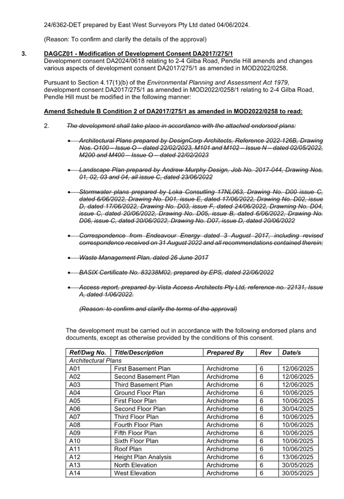
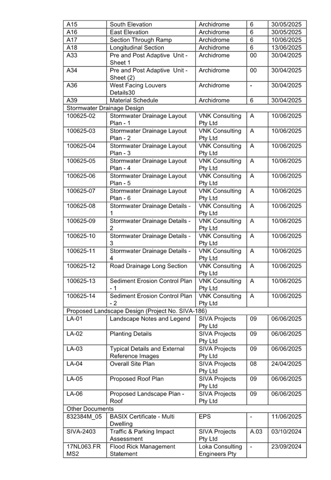
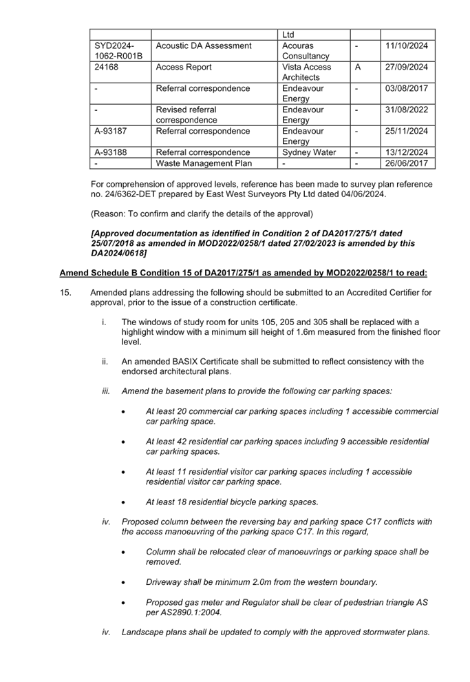
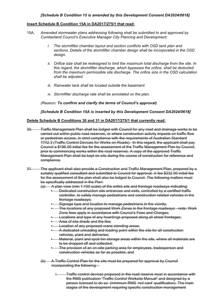
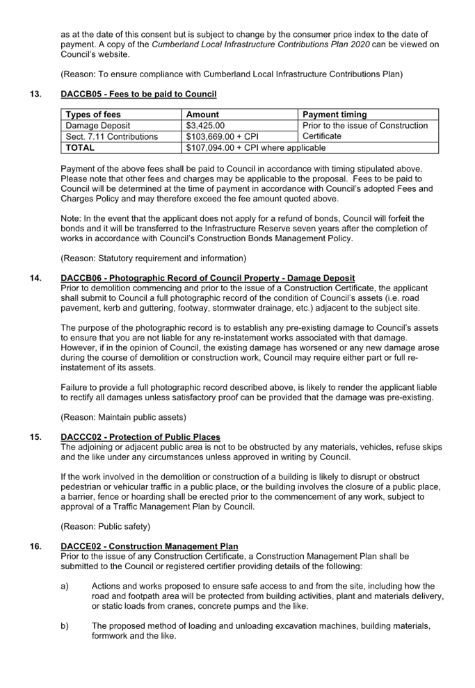
DOCUMENTS
ASSOCIATED WITH
REPORT ELPP024/25
Attachment 2
Architectural Plans
Cumberland
Local Planning Panel Meeting
8 October 2025
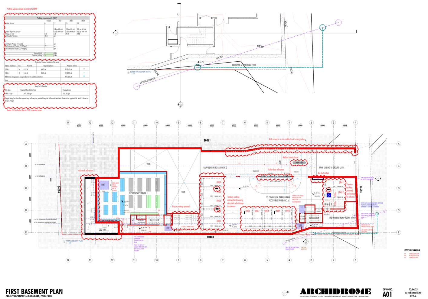
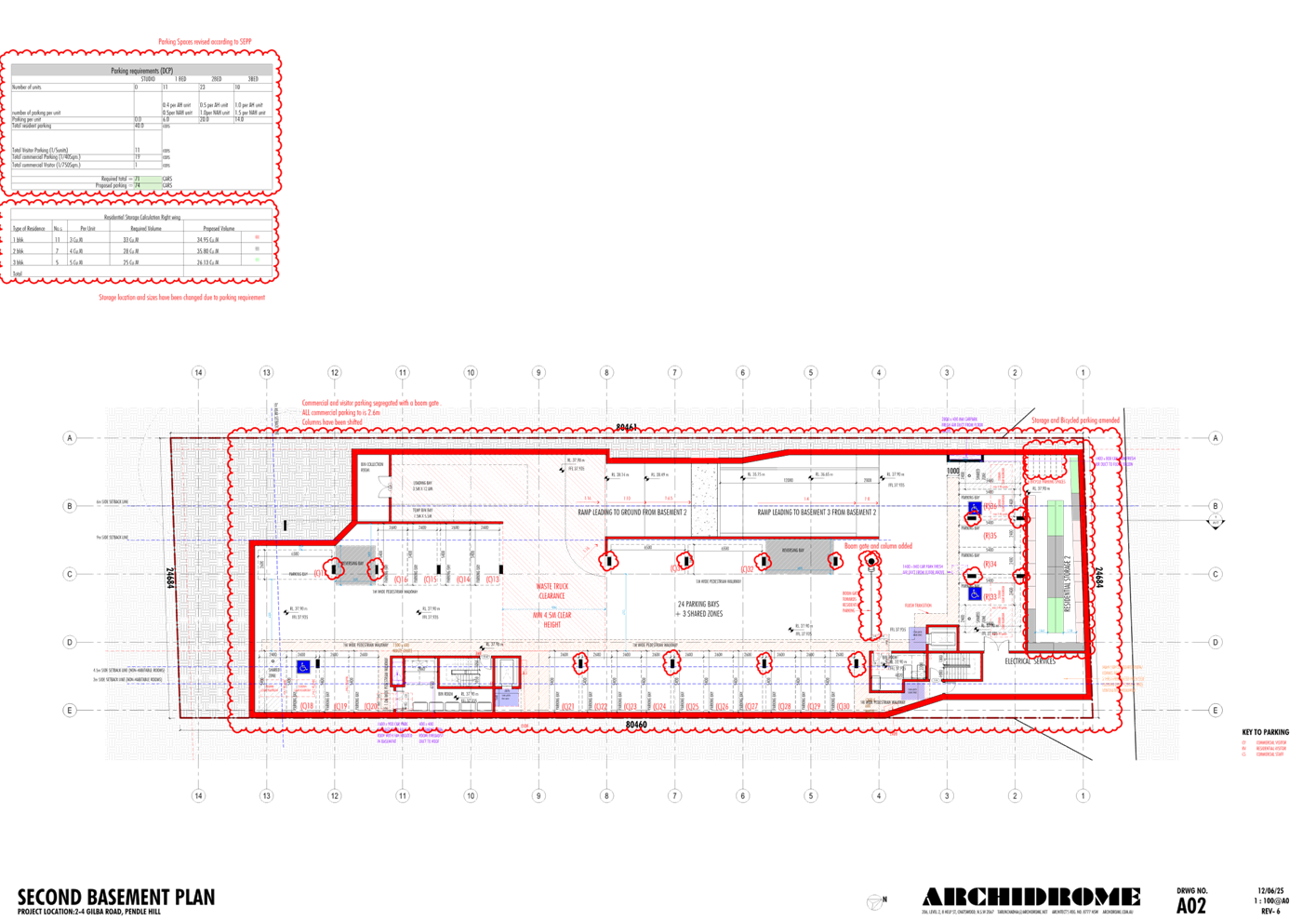
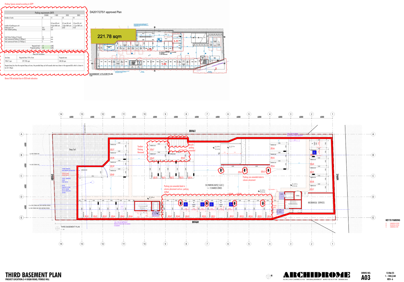
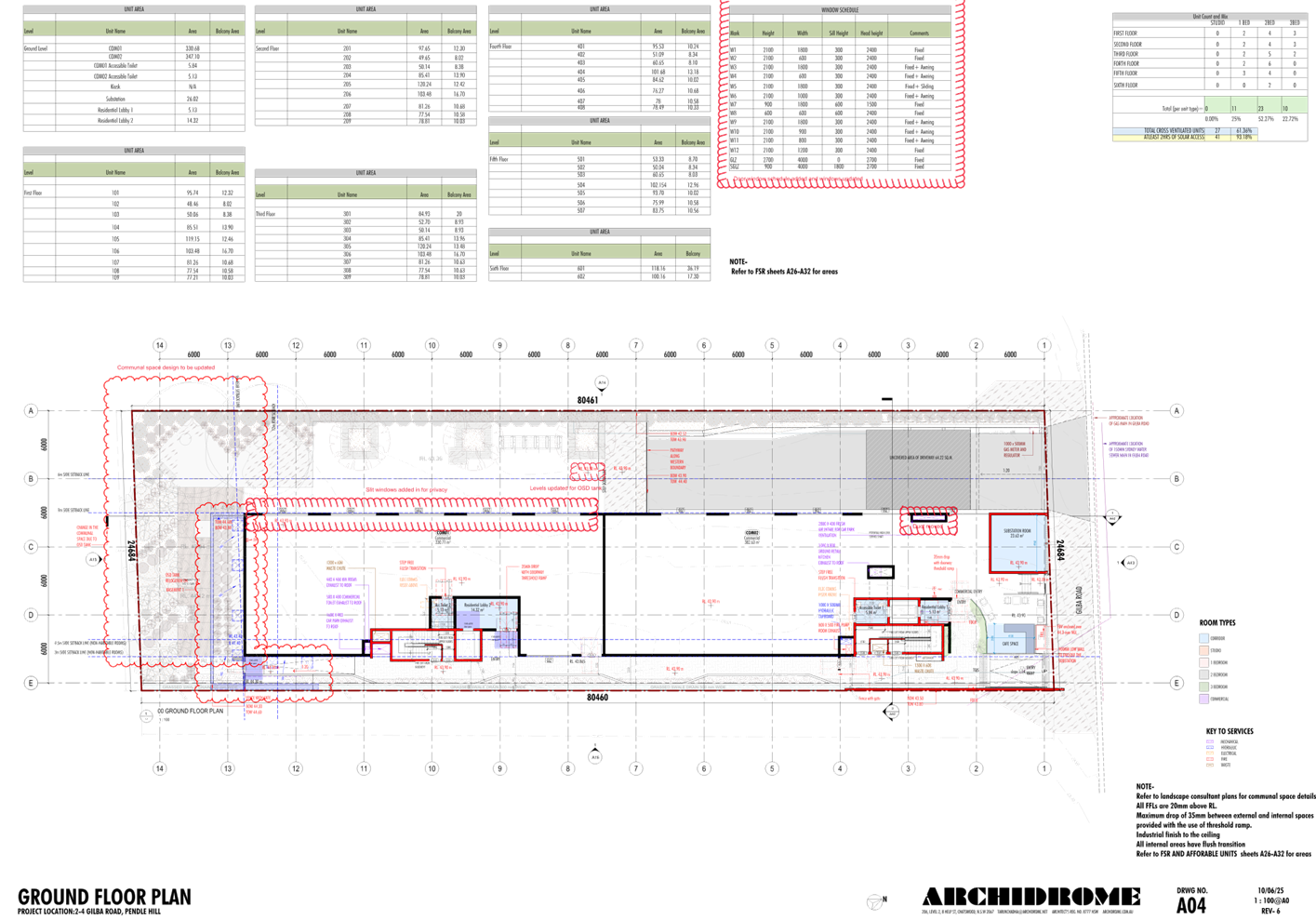
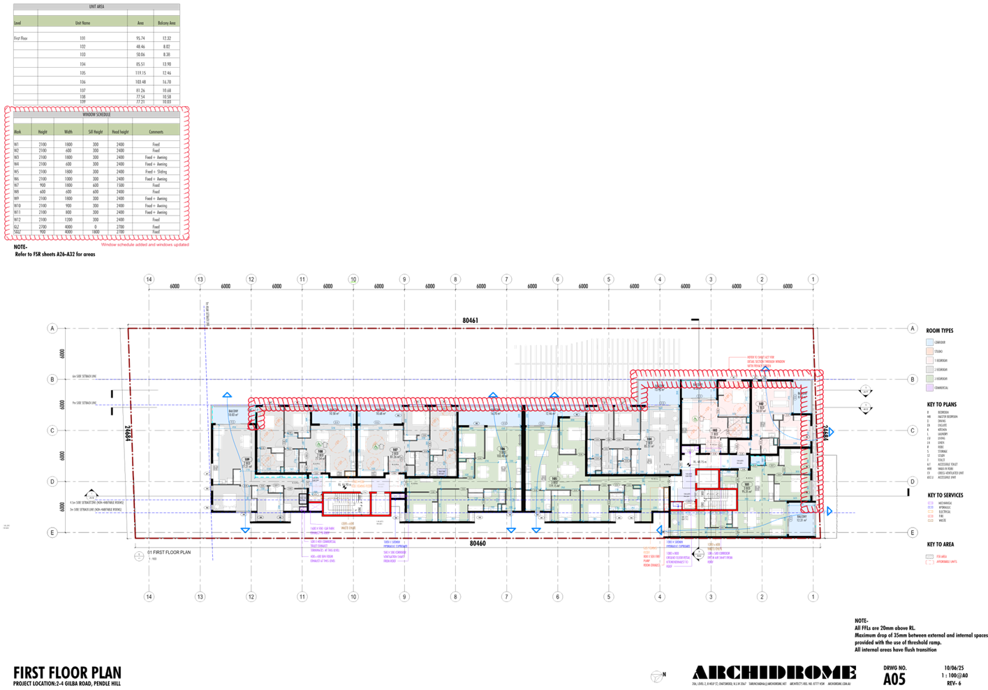
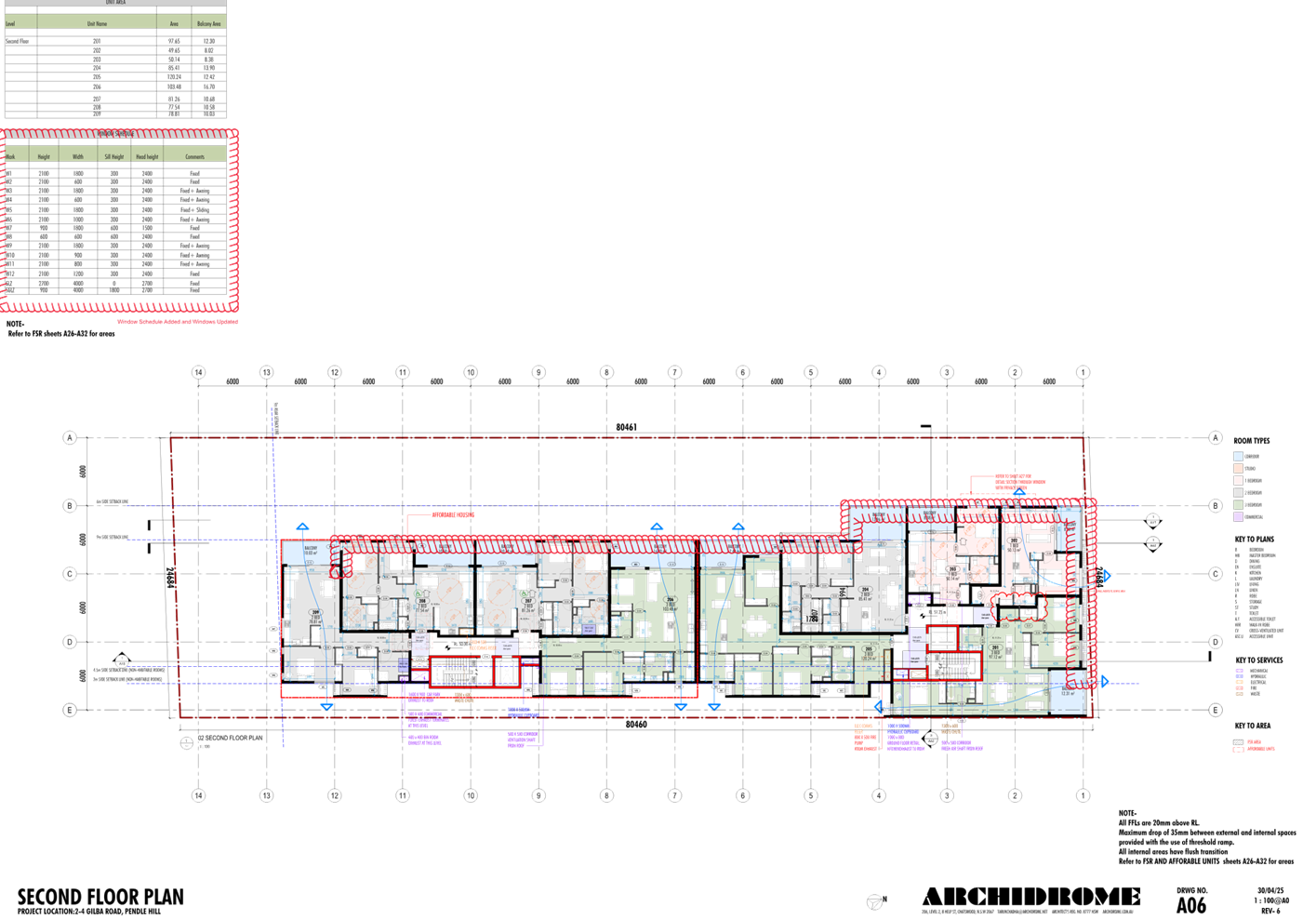
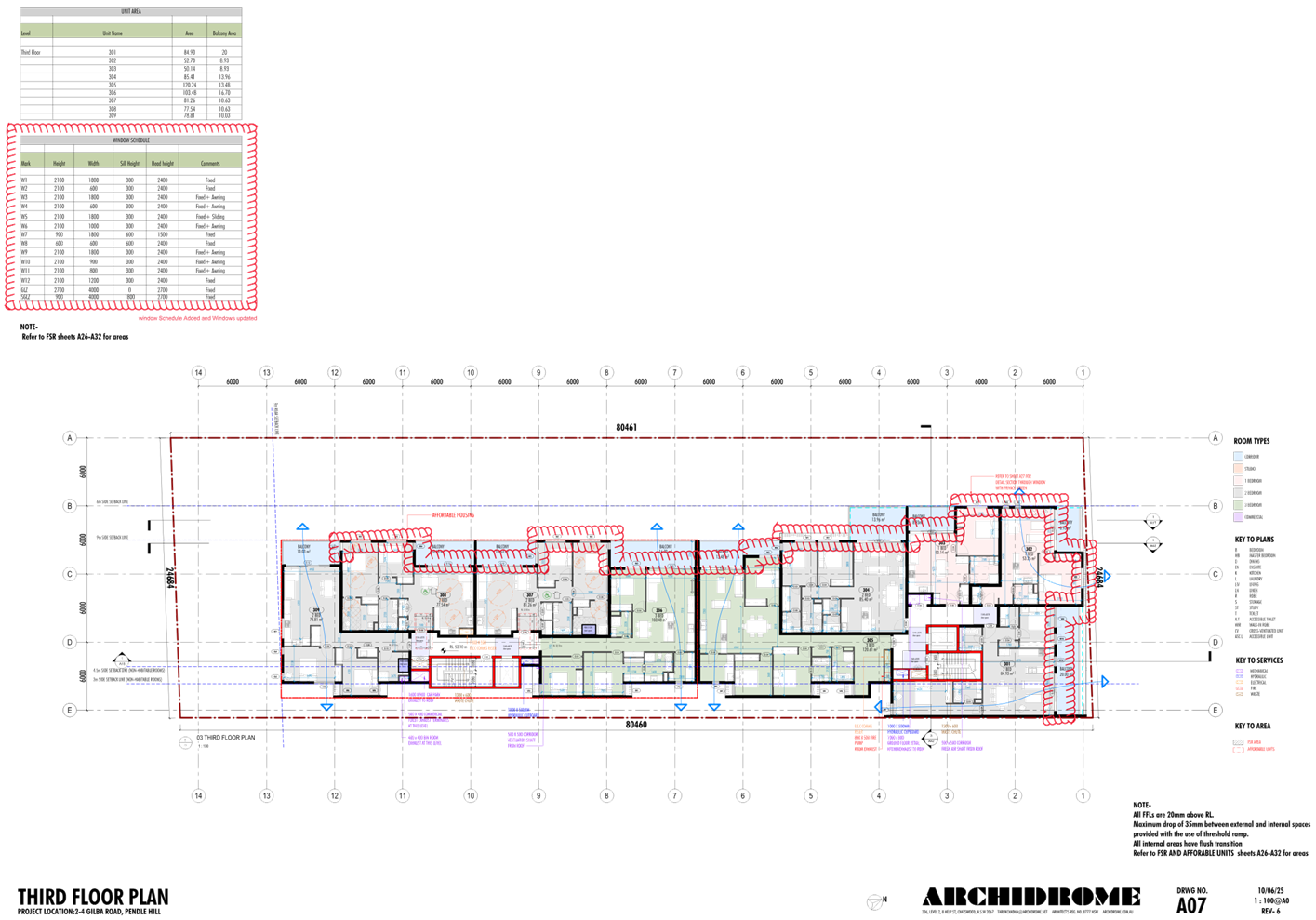
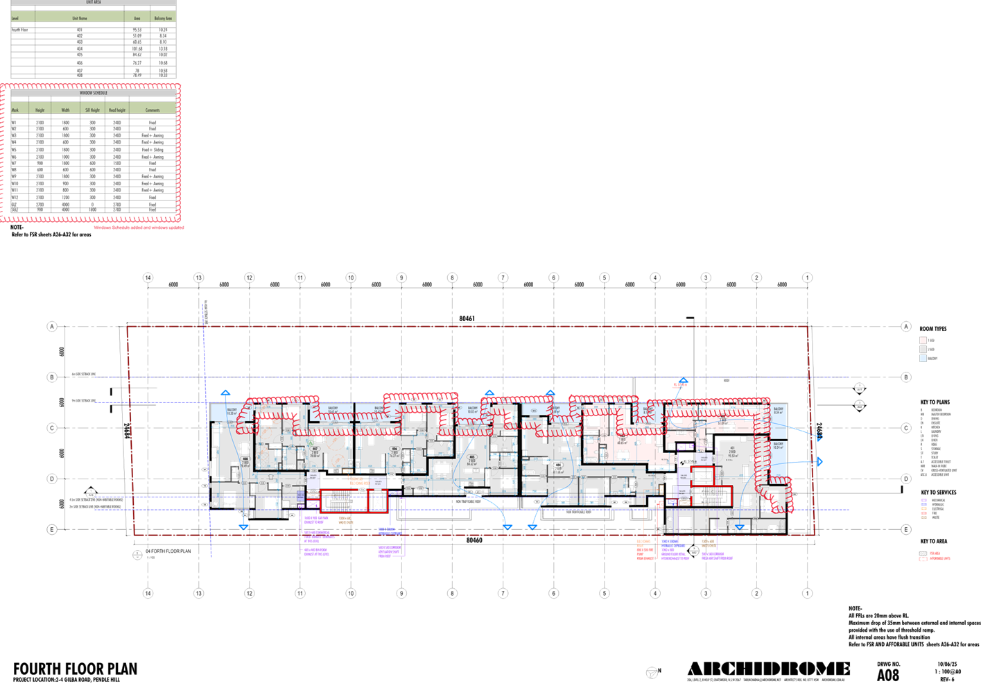
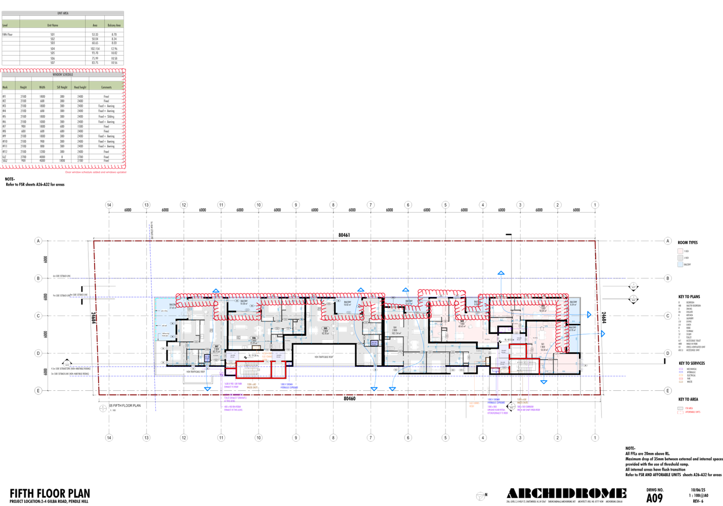
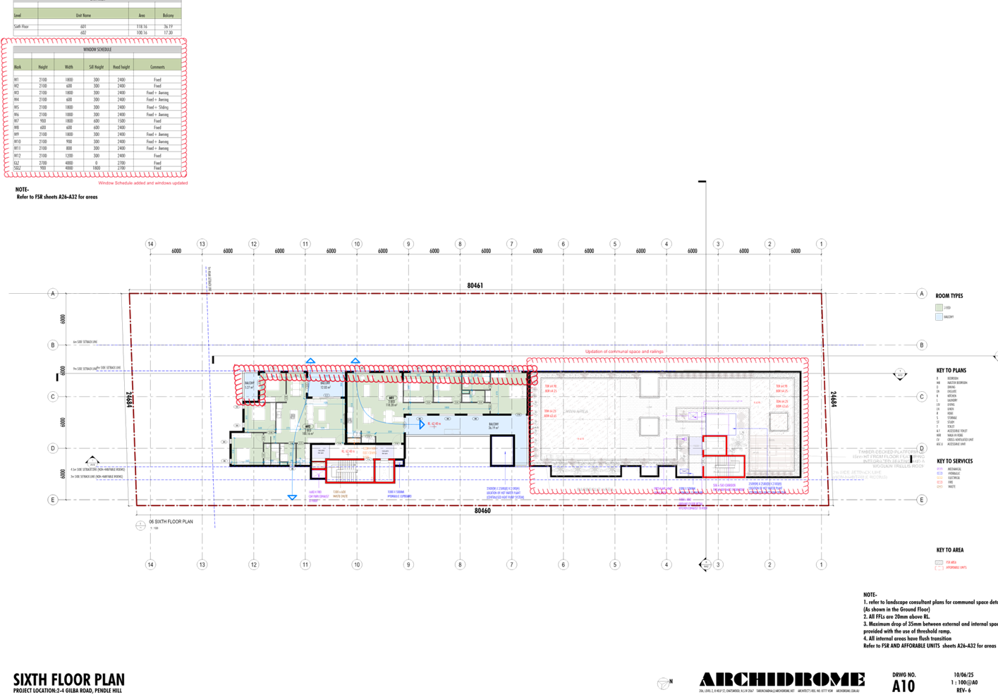
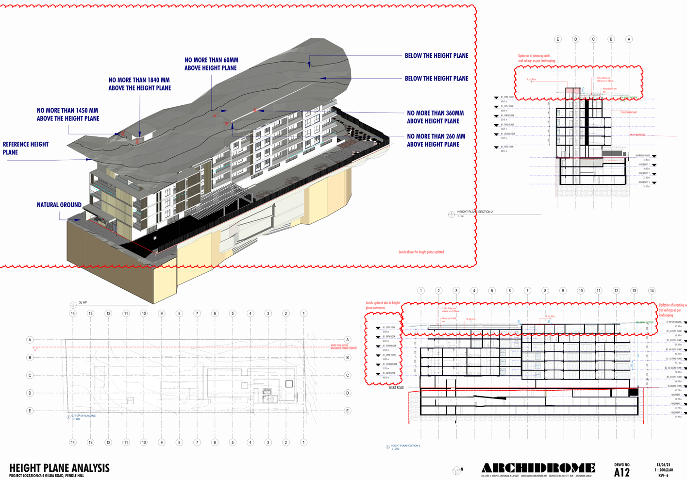
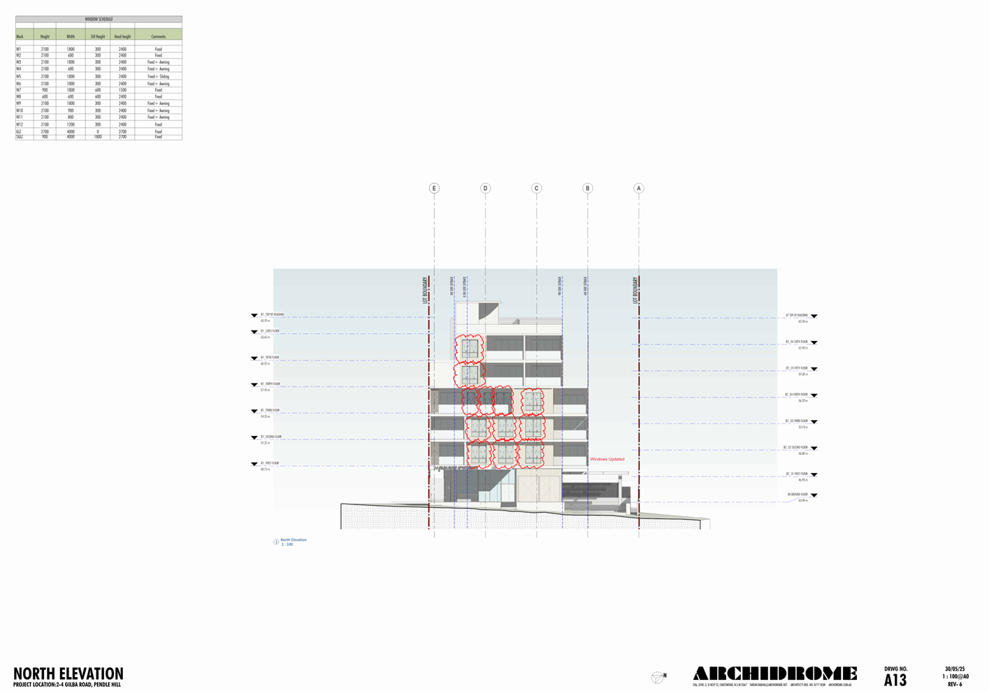
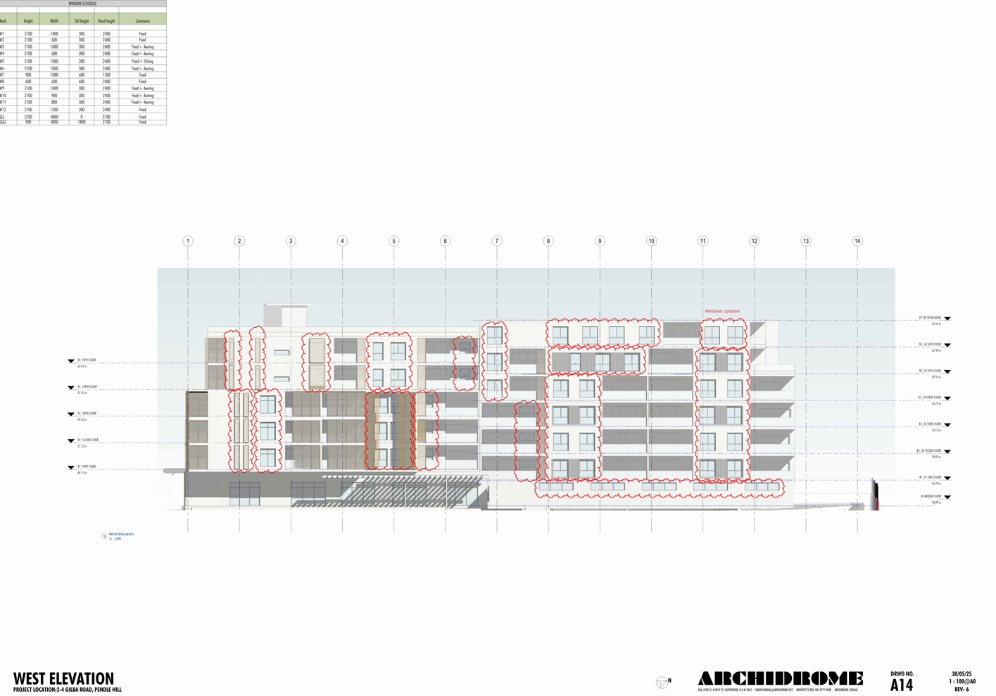
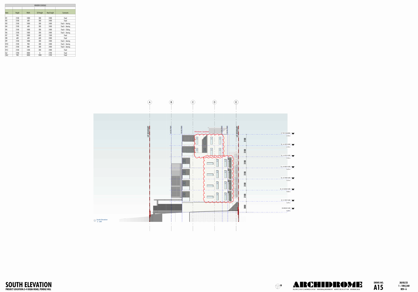
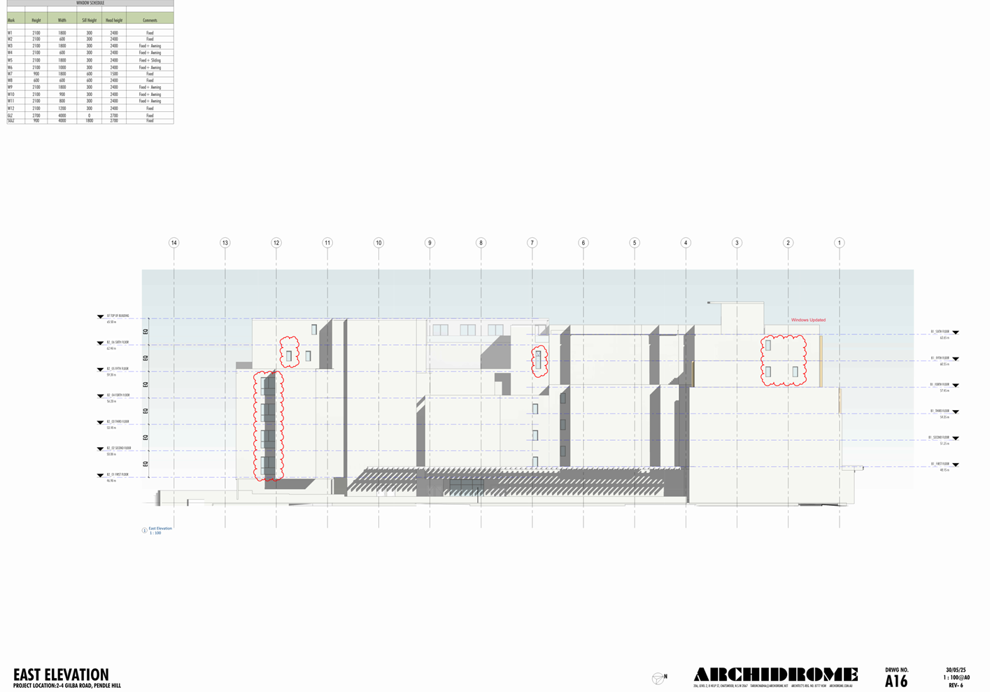
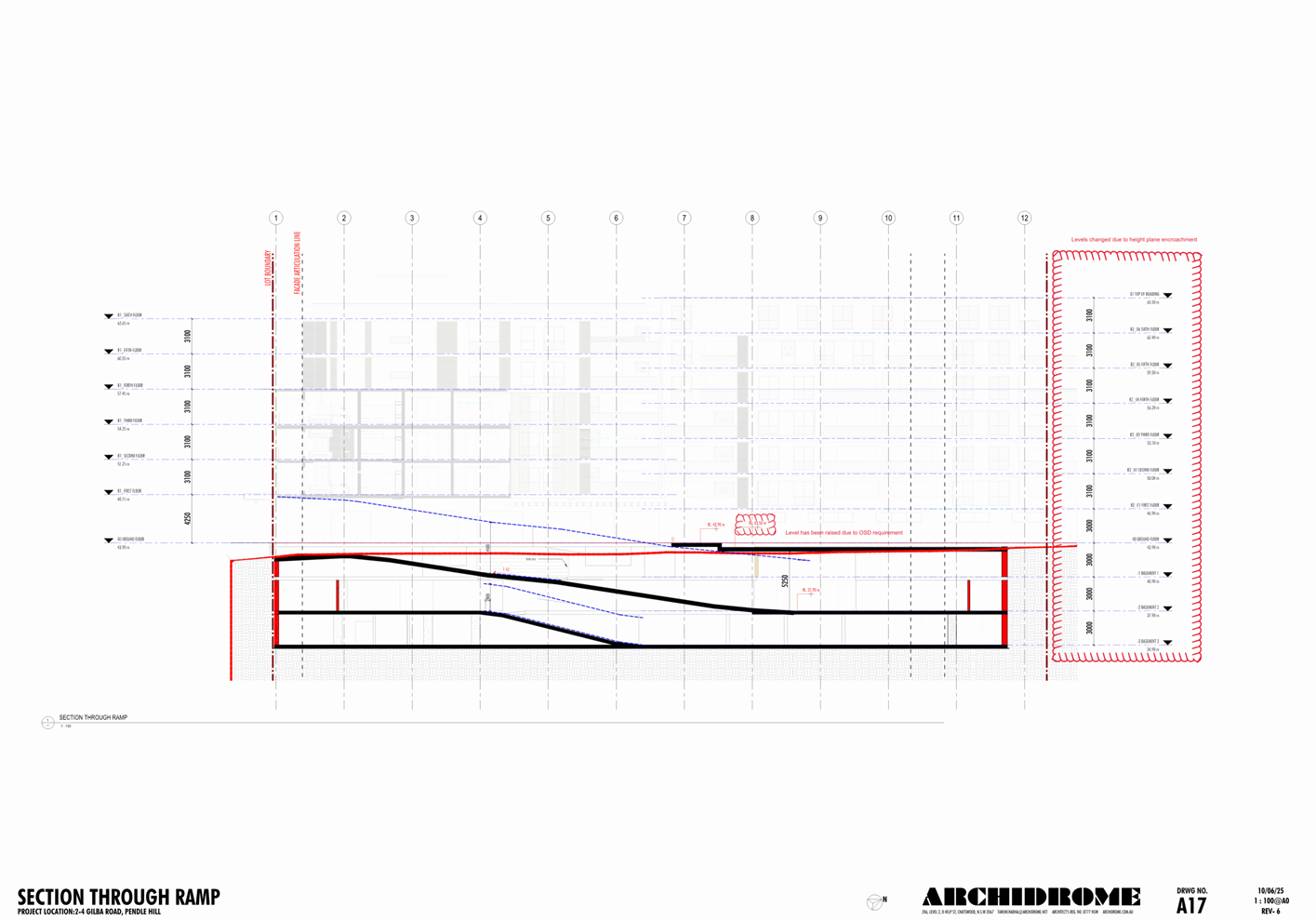
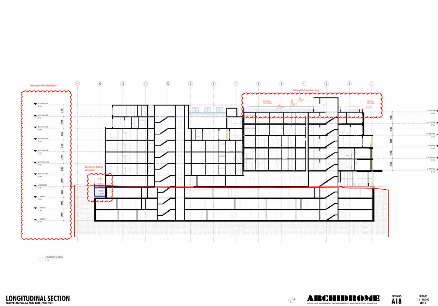
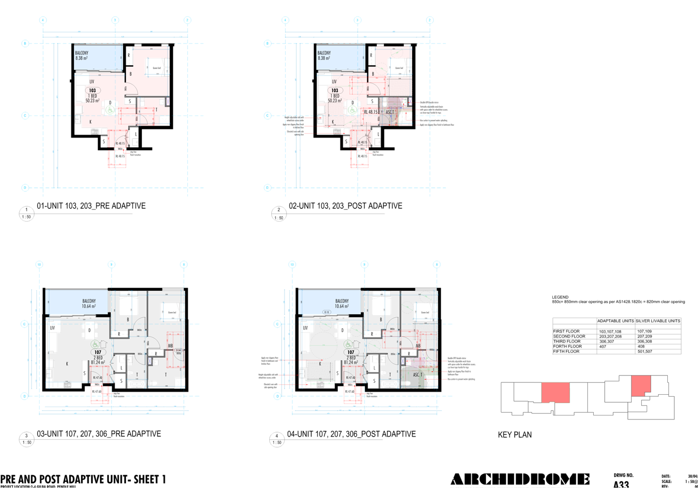
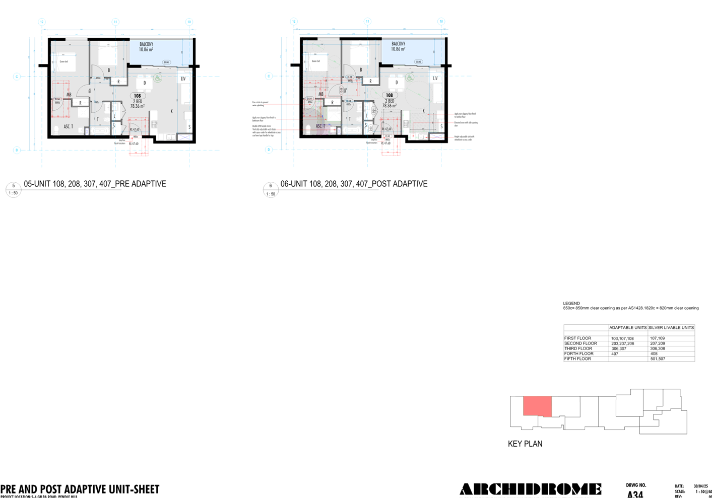
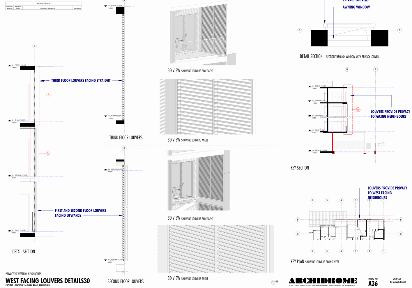
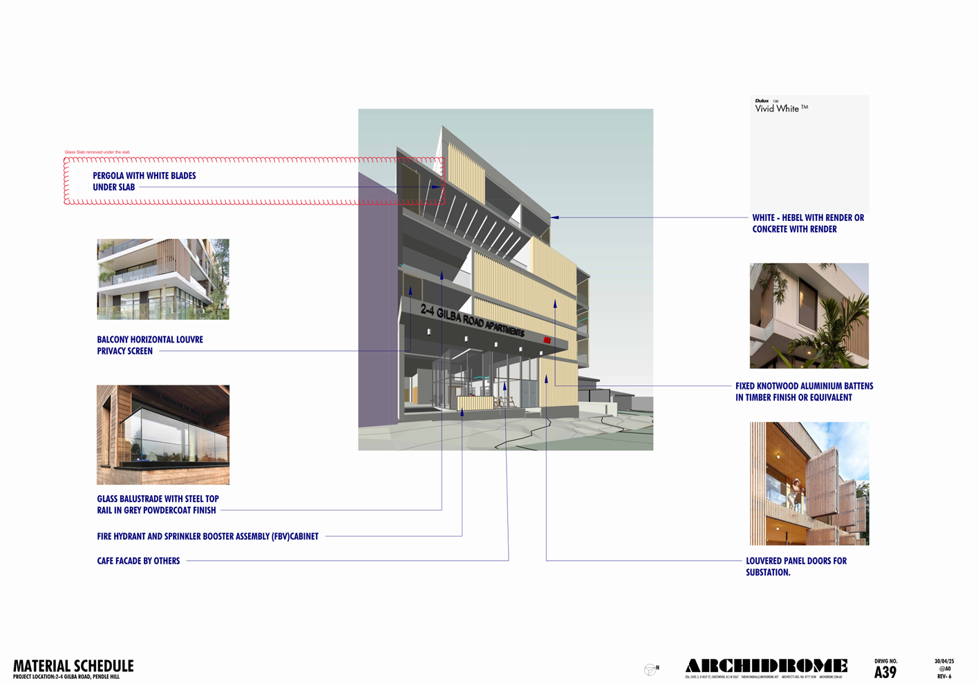
DOCUMENTS
ASSOCIATED WITH
REPORT ELPP024/25
Attachment 3
Landscape Plans
Cumberland
Local Planning Panel Meeting
8 October 2025
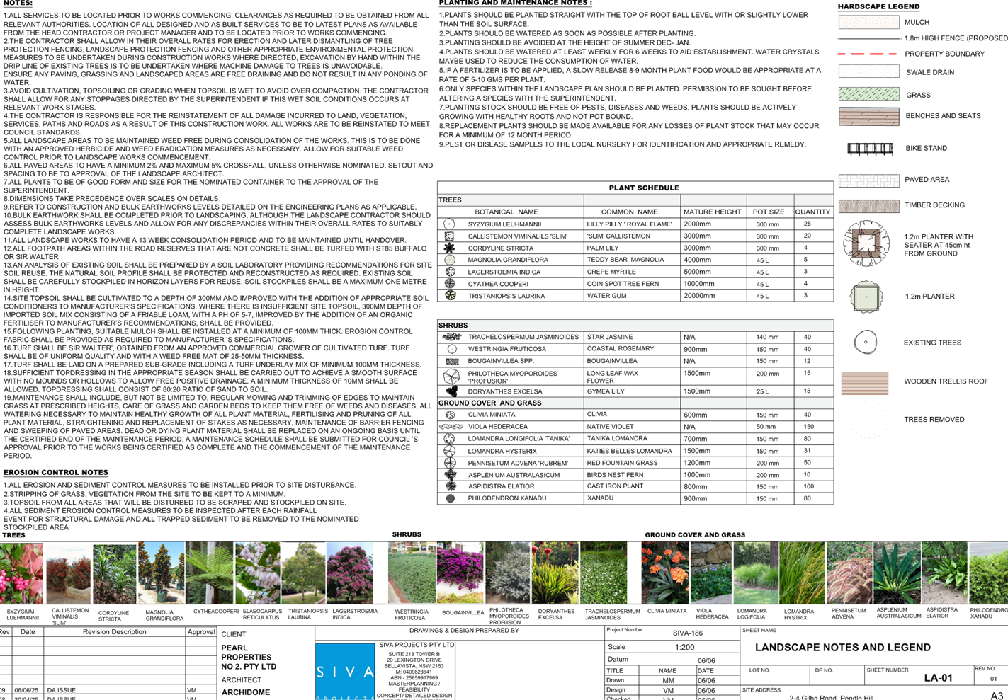
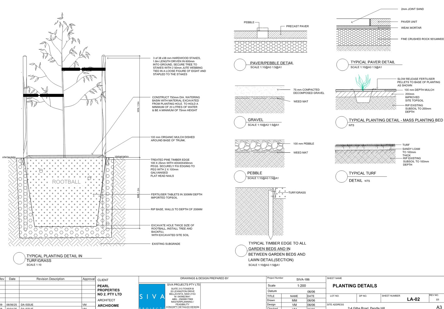
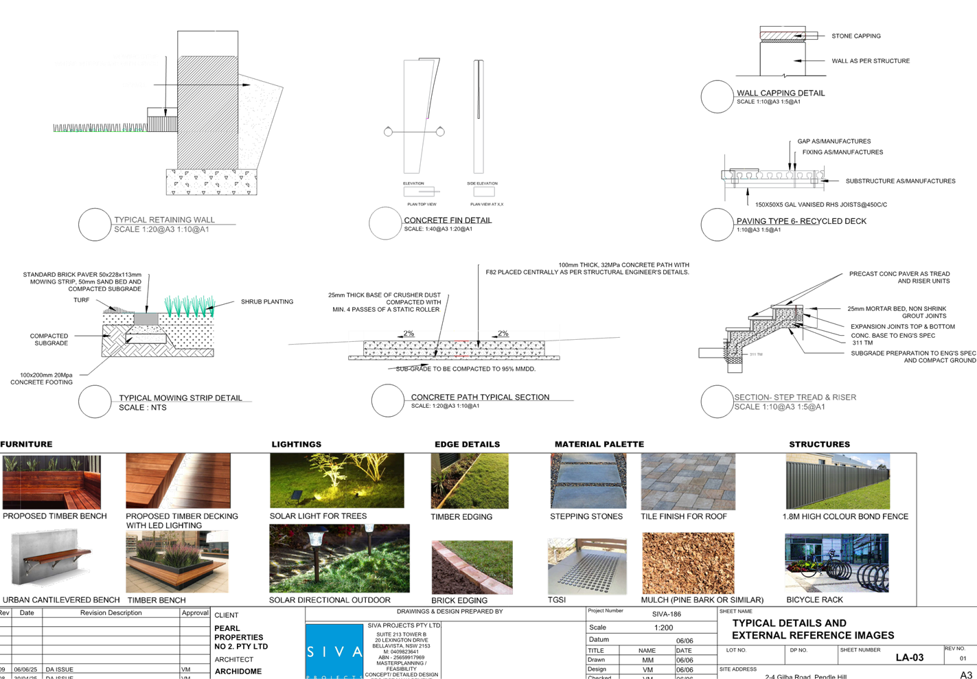
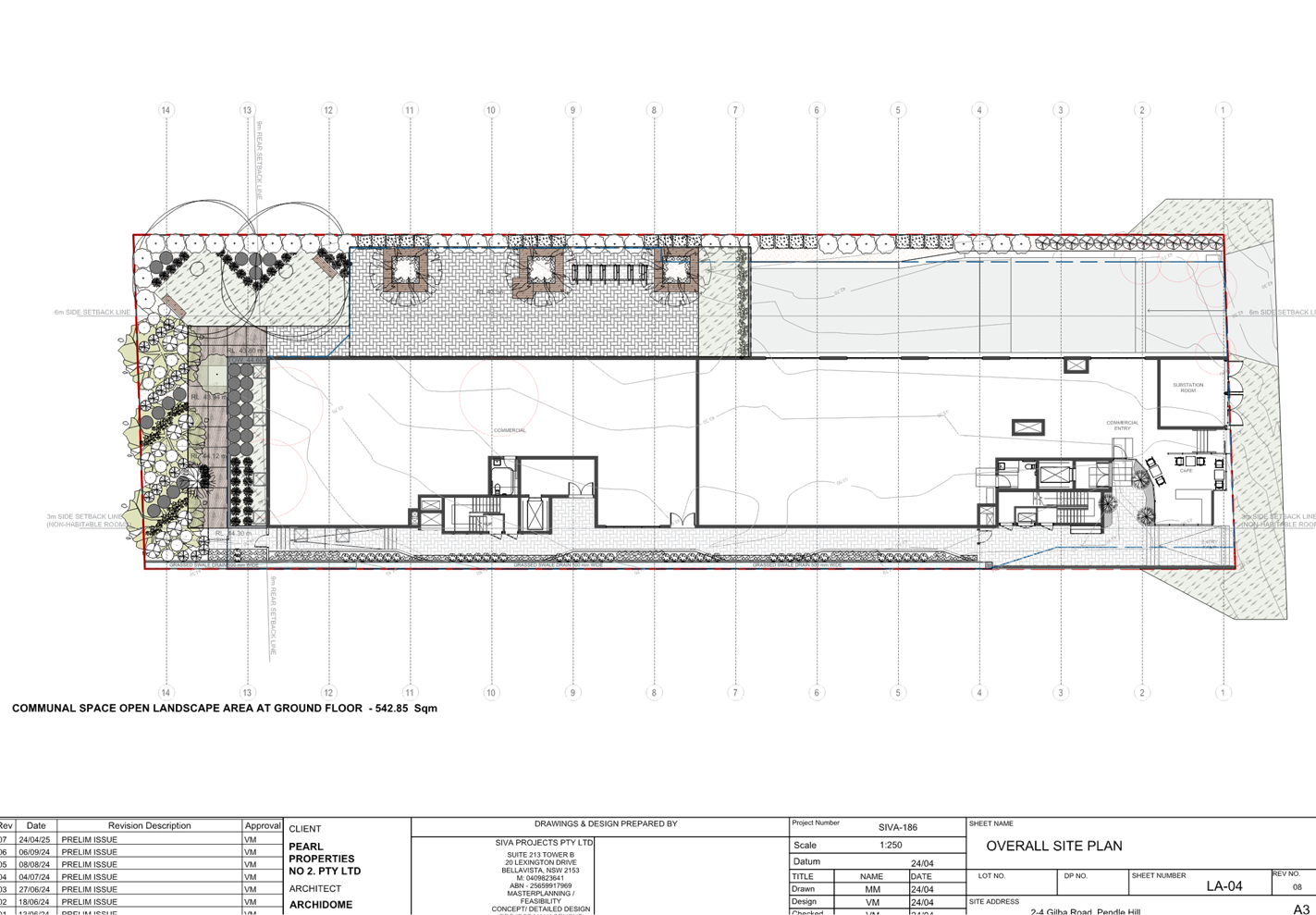
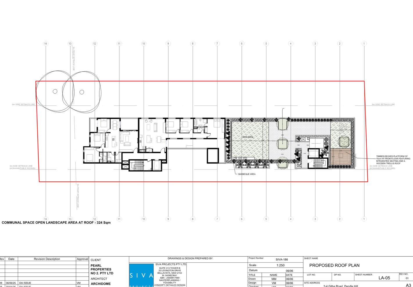
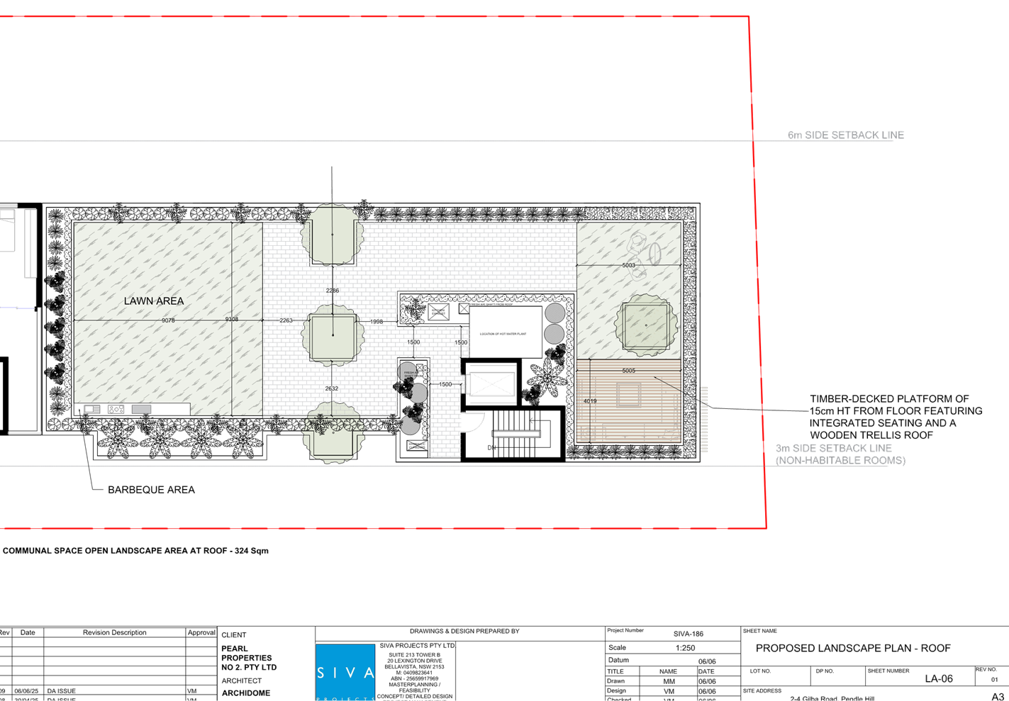
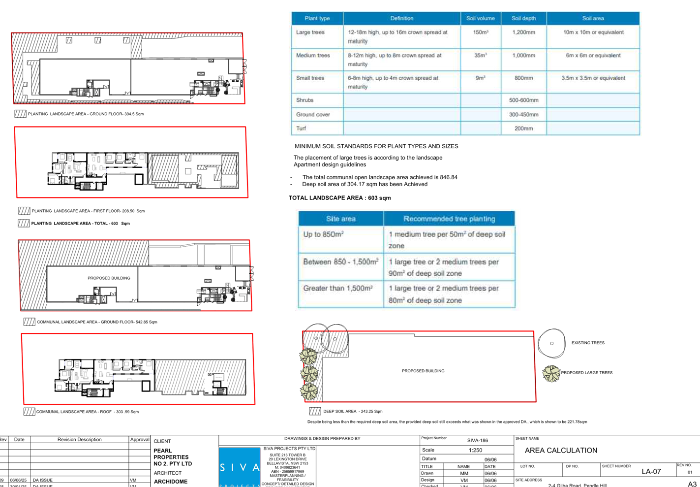
DOCUMENTS
ASSOCIATED WITH
REPORT ELPP024/25
Attachment 4
Clause 4.6 Variation Request - Height of Building
Cumberland
Local Planning Panel Meeting
8 October 2025
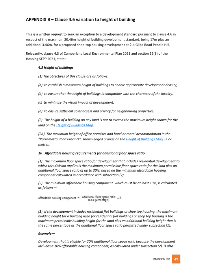
DOCUMENTS
ASSOCIATED WITH
REPORT ELPP024/25
Attachment 5
Stamped Approved Plans Under DA2014/275
Cumberland
Local Planning Panel Meeting
8 October 2025
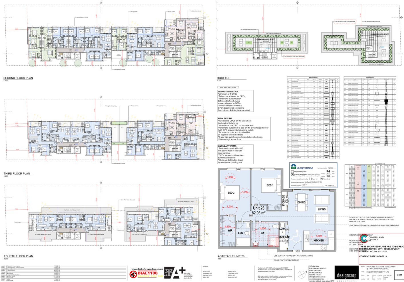
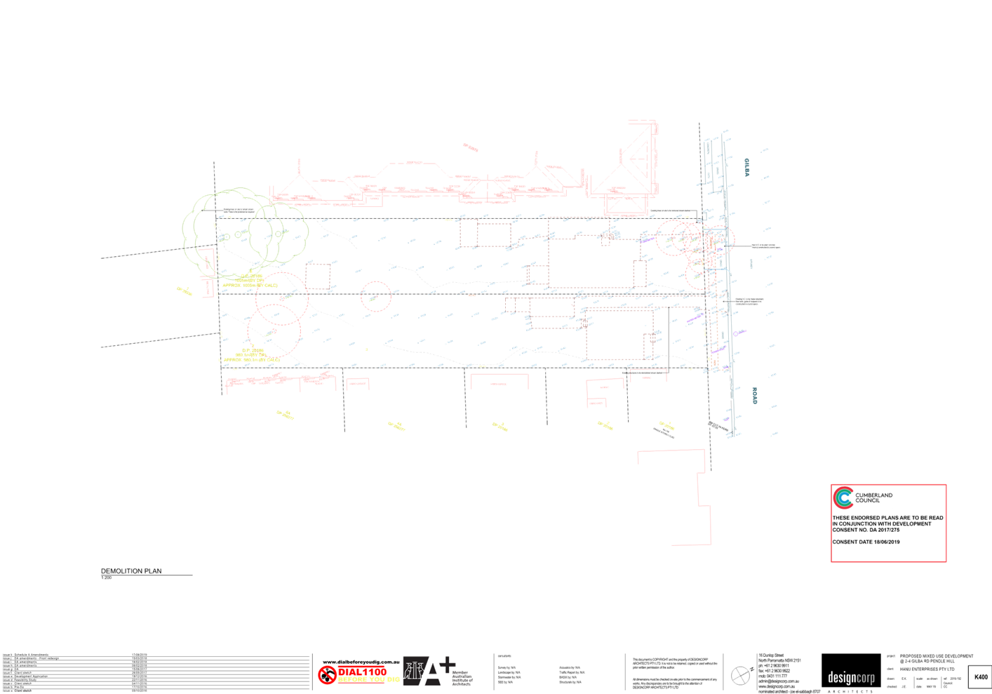
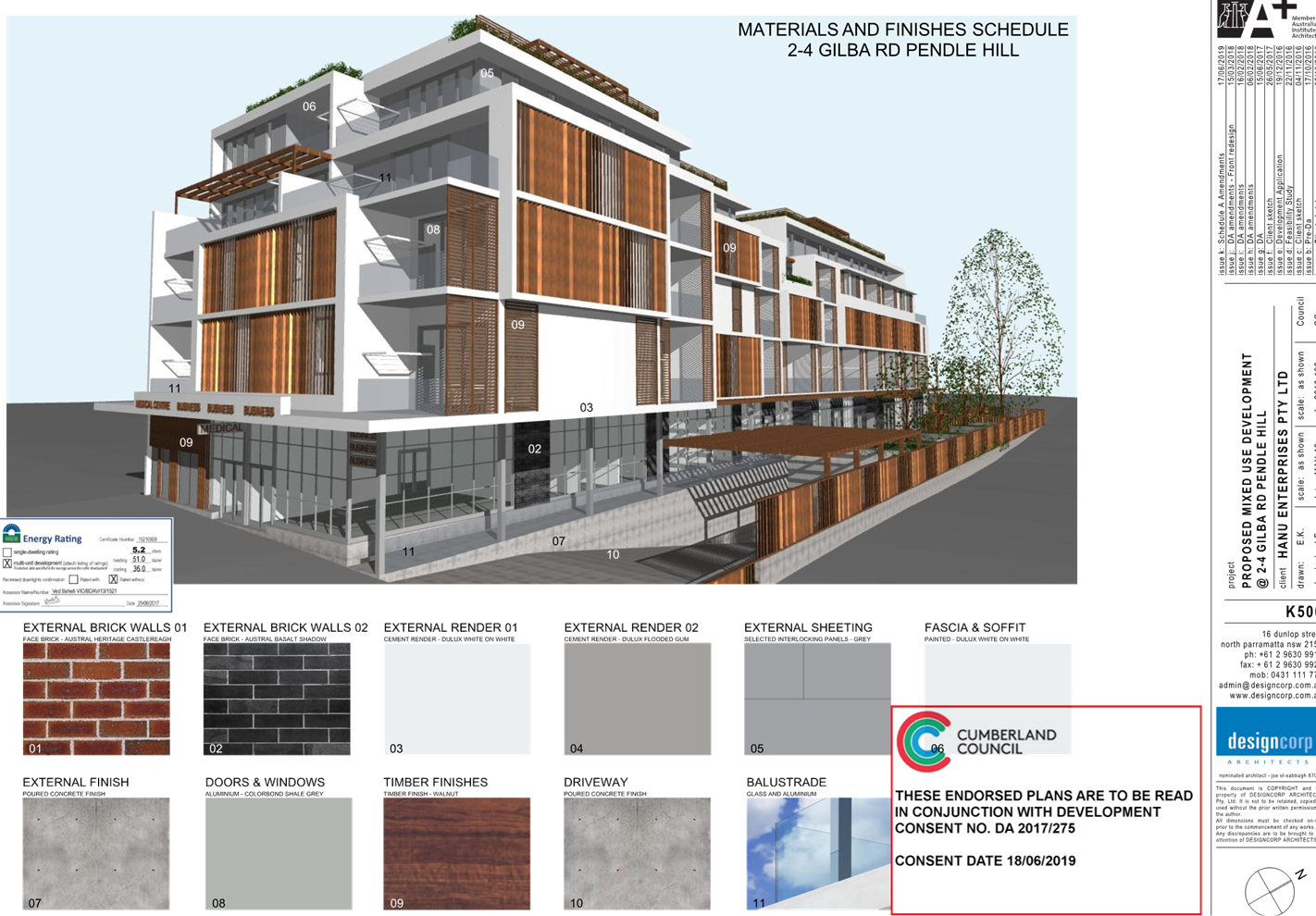
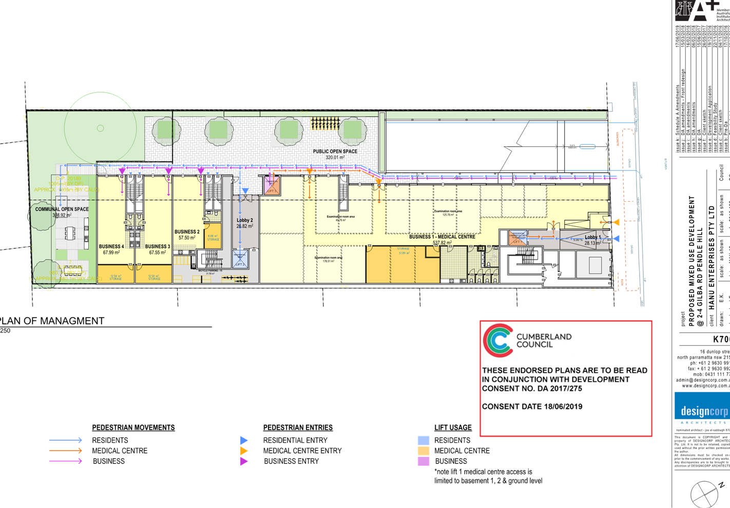
DOCUMENTS
ASSOCIATED WITH
REPORT ELPP024/25
Attachment 6
Stamped Approved Plans under MOD2022/0258
Cumberland
Local Planning Panel Meeting
8 October 2025
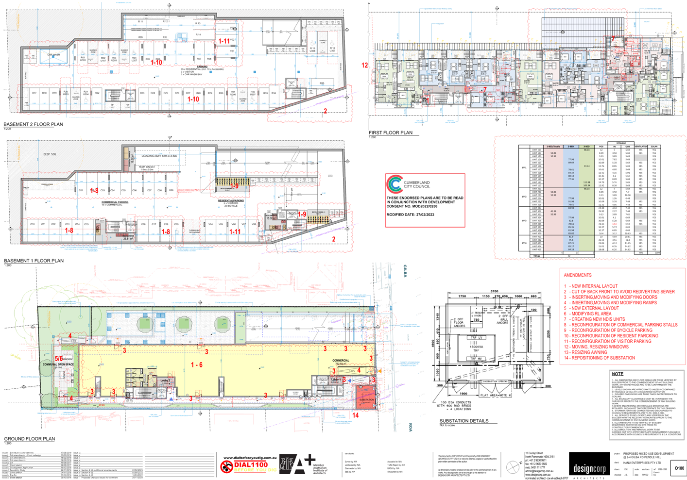
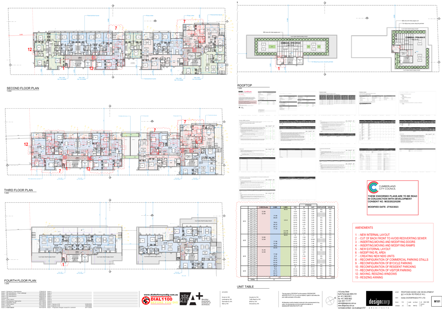
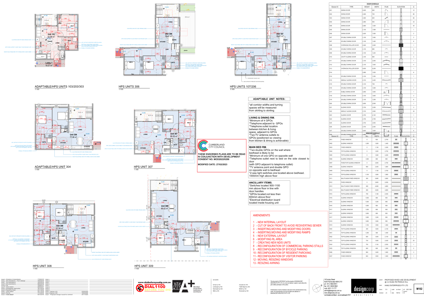
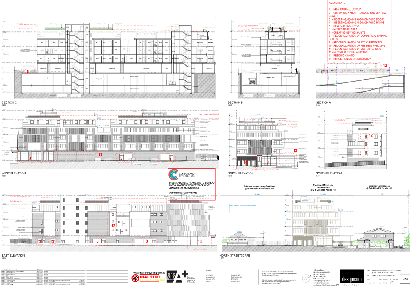
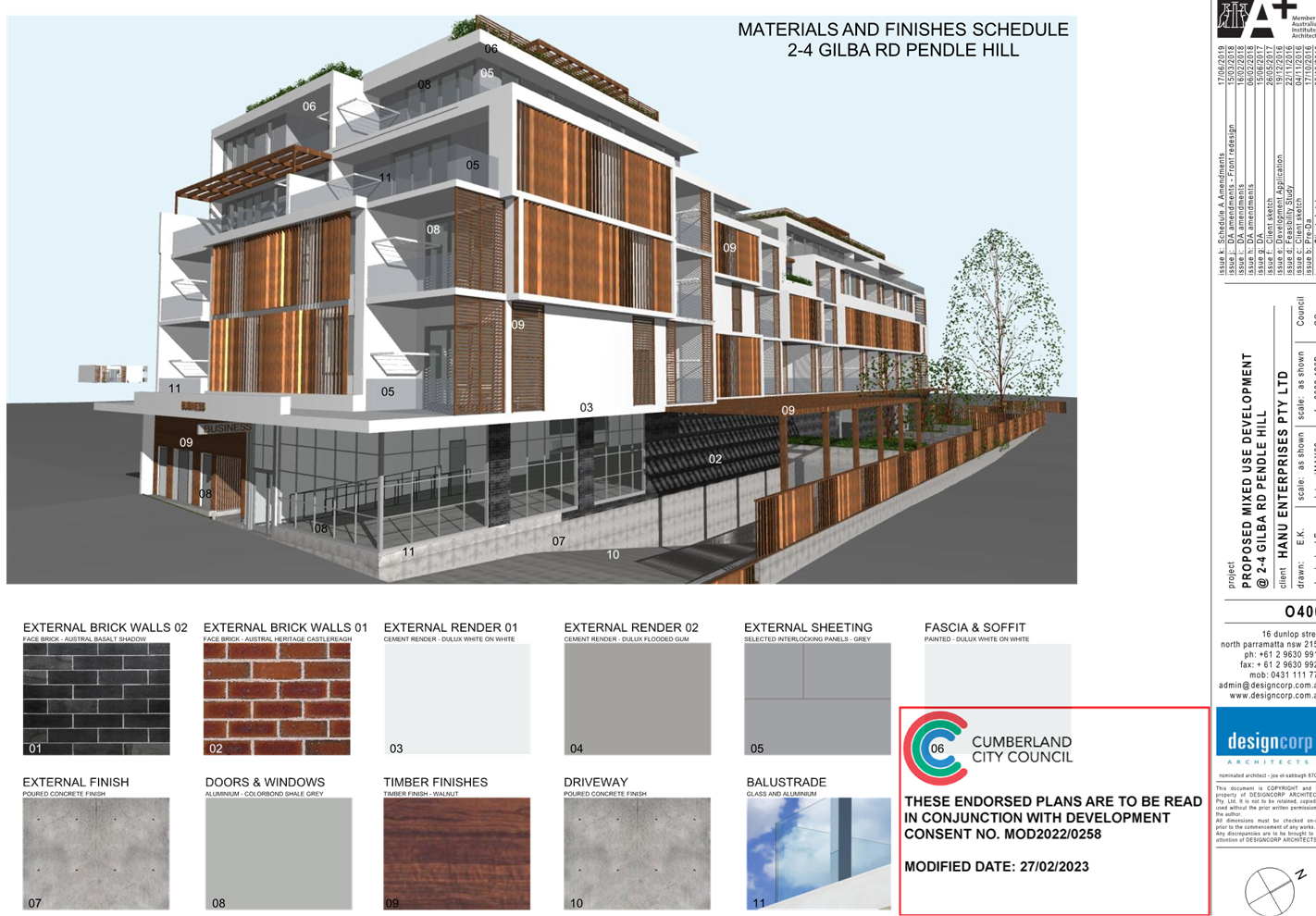
DOCUMENTS
ASSOCIATED WITH
REPORT ELPP024/25
Attachment 7
Redacted Submissions
Cumberland
Local Planning Panel Meeting
8 October 2025
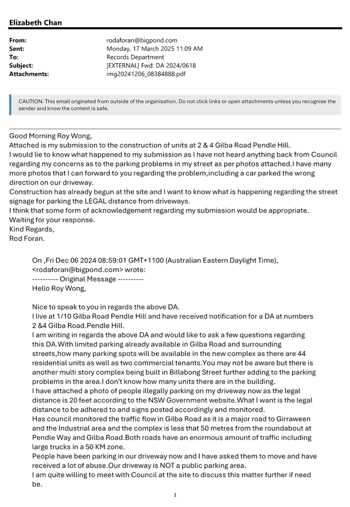

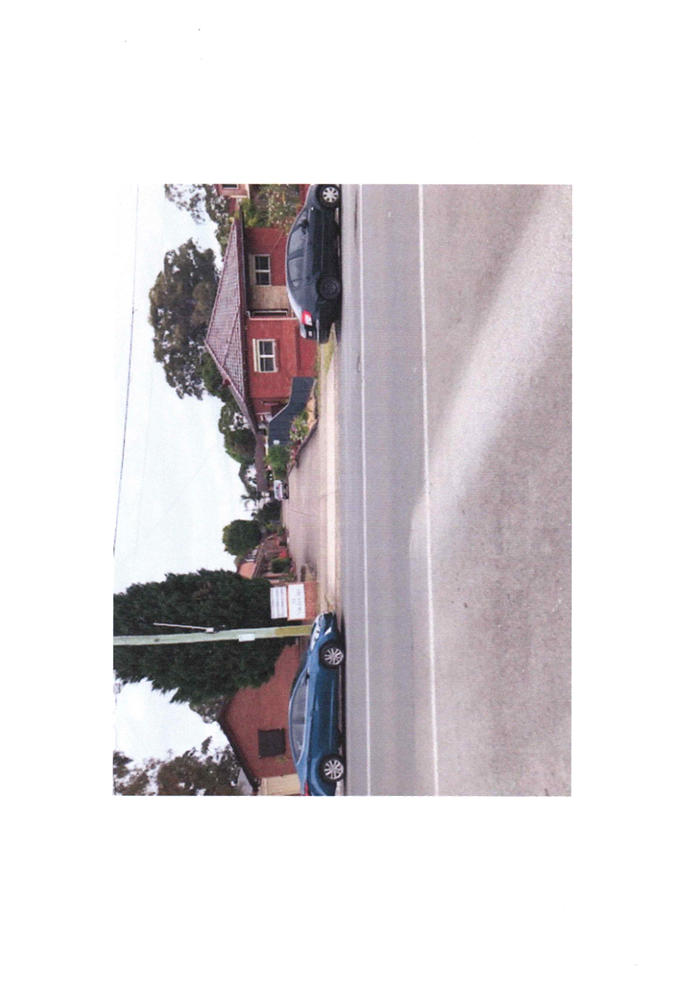
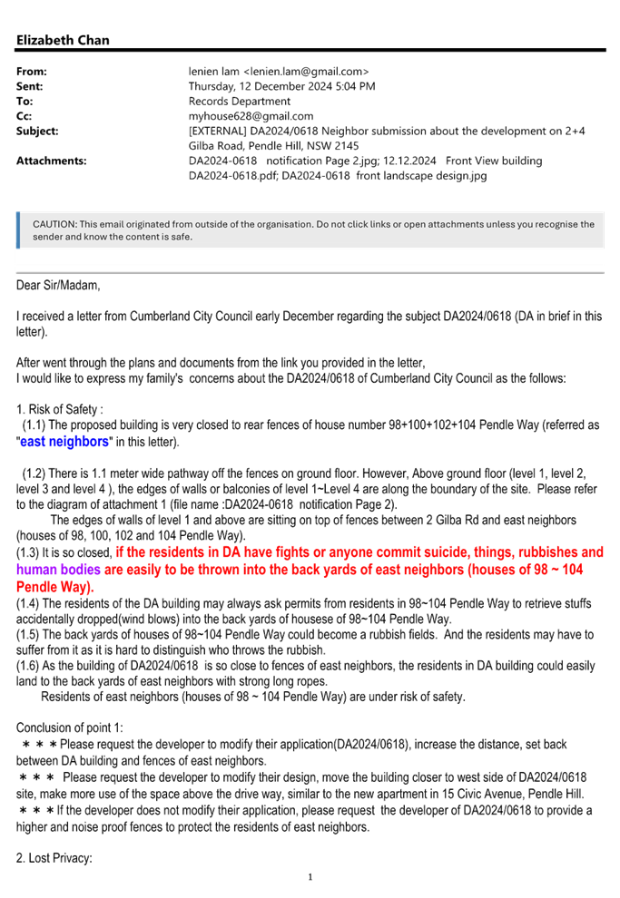
DOCUMENTS
ASSOCIATED WITH
REPORT ELPP024/25
Attachment 8
Appendix A - Housing SEPP 2021
Cumberland
Local Planning Panel Meeting
8 October 2025
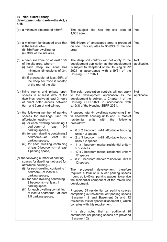
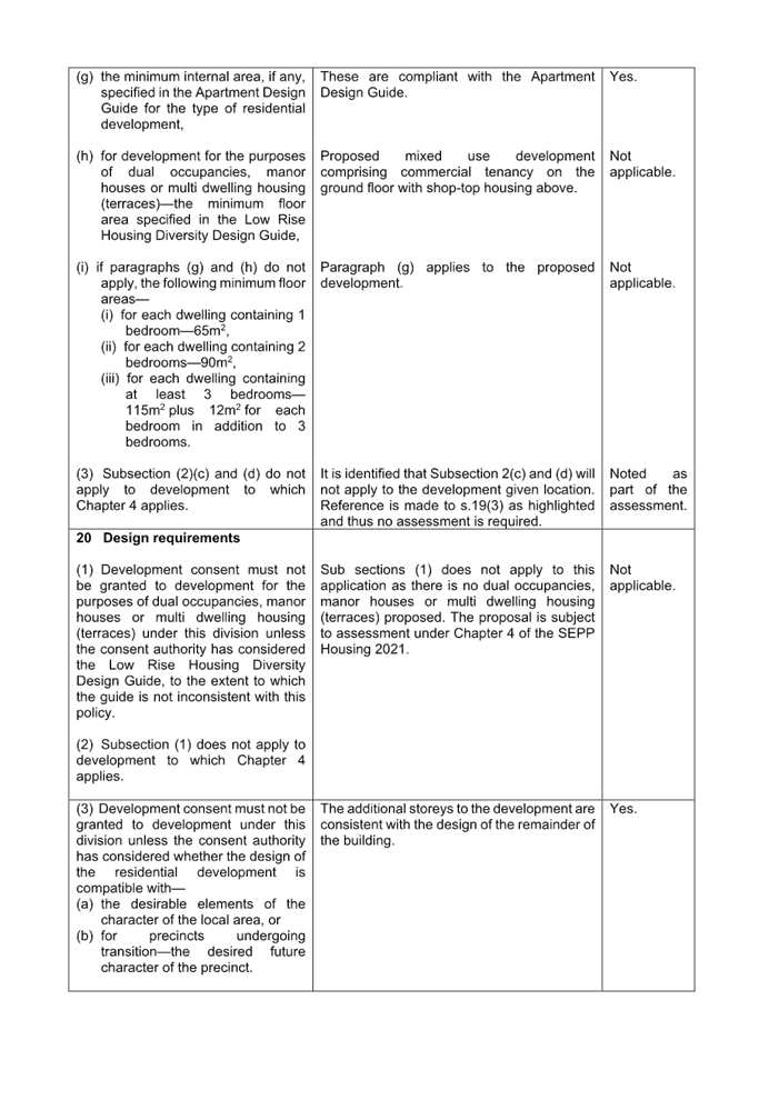
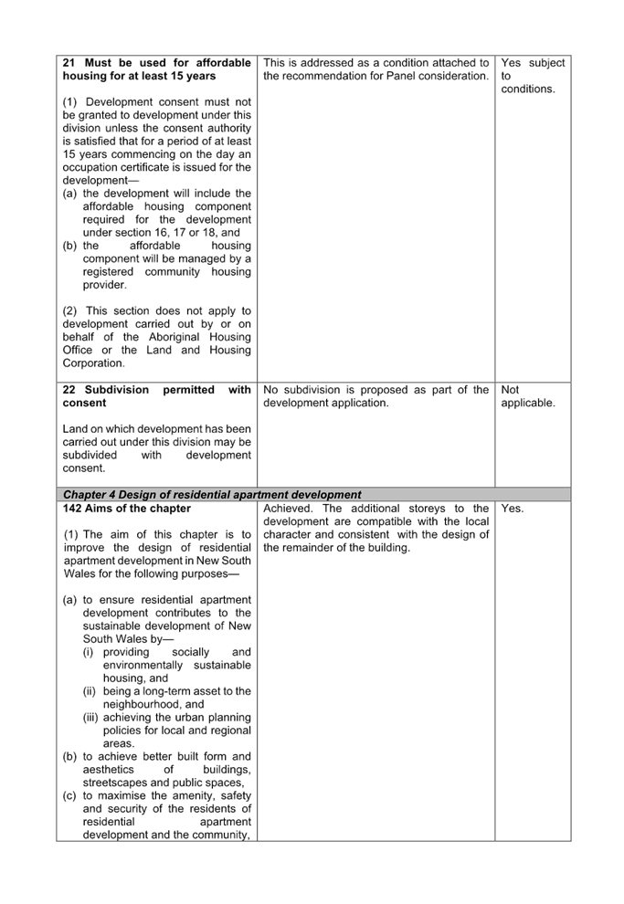
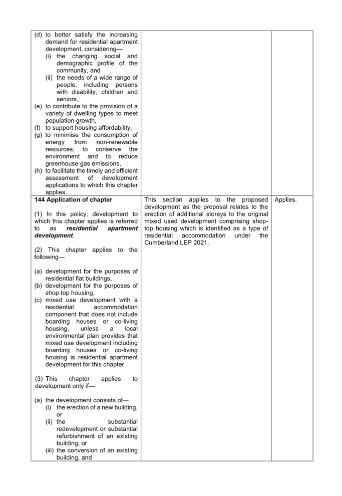
DOCUMENTS
ASSOCIATED WITH
REPORT ELPP024/25
Attachment 9
Appendix B - Apartment Design Guide
Cumberland
Local Planning Panel Meeting
8 October 2025
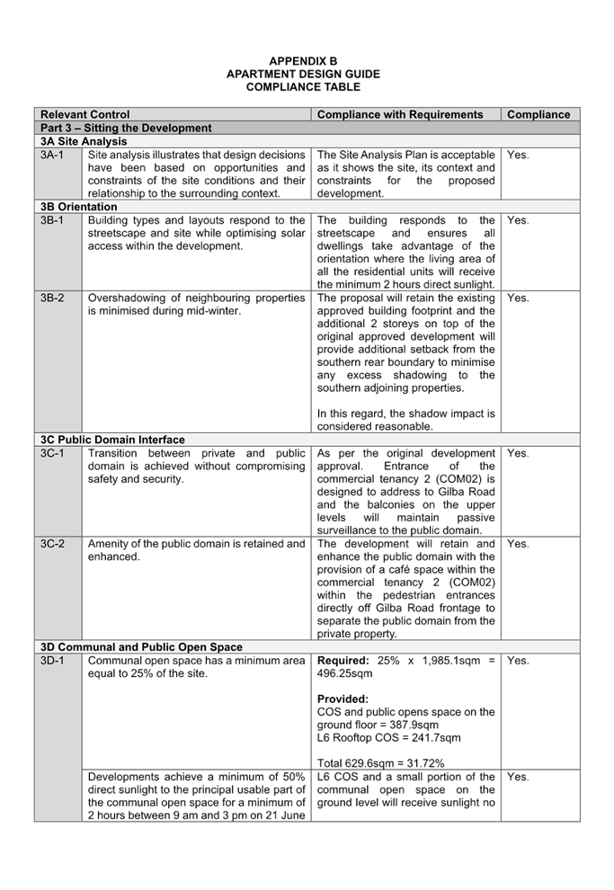
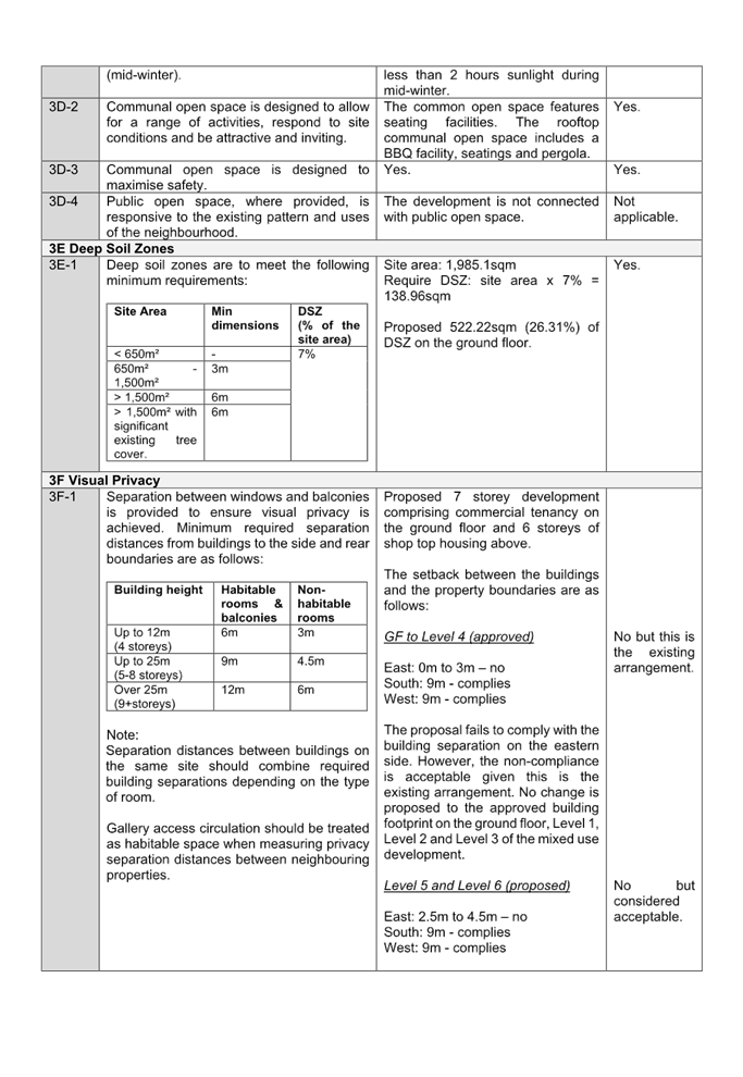
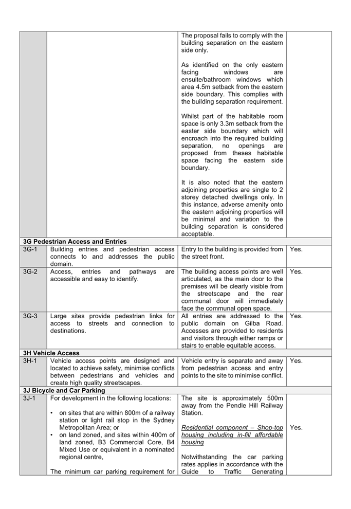
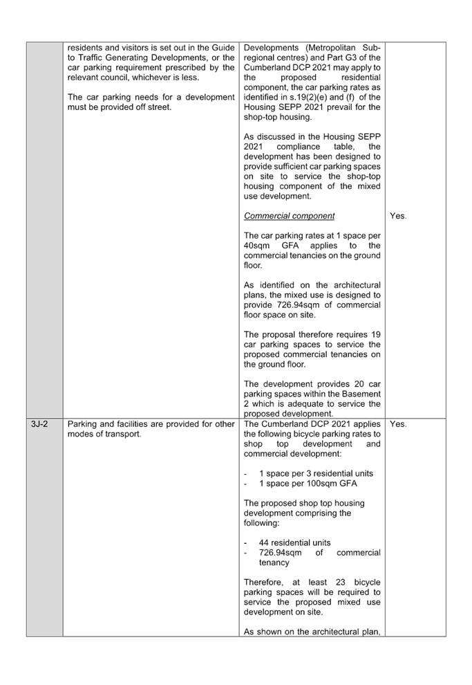
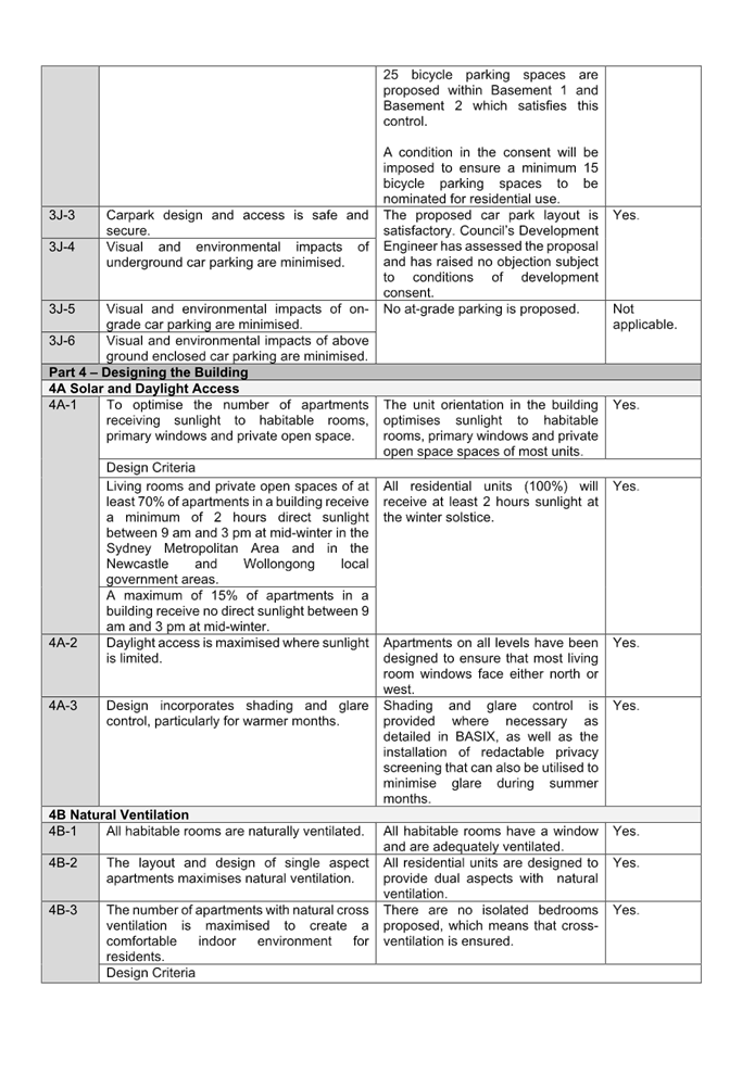
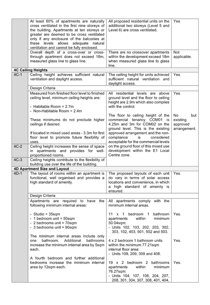
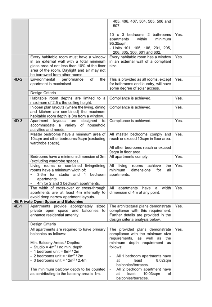
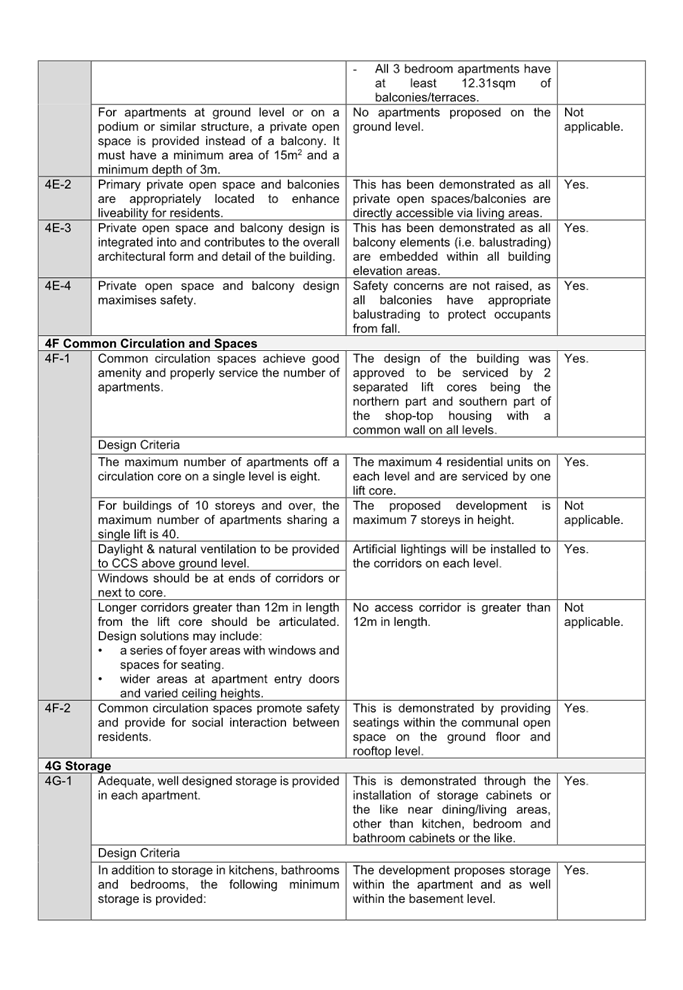
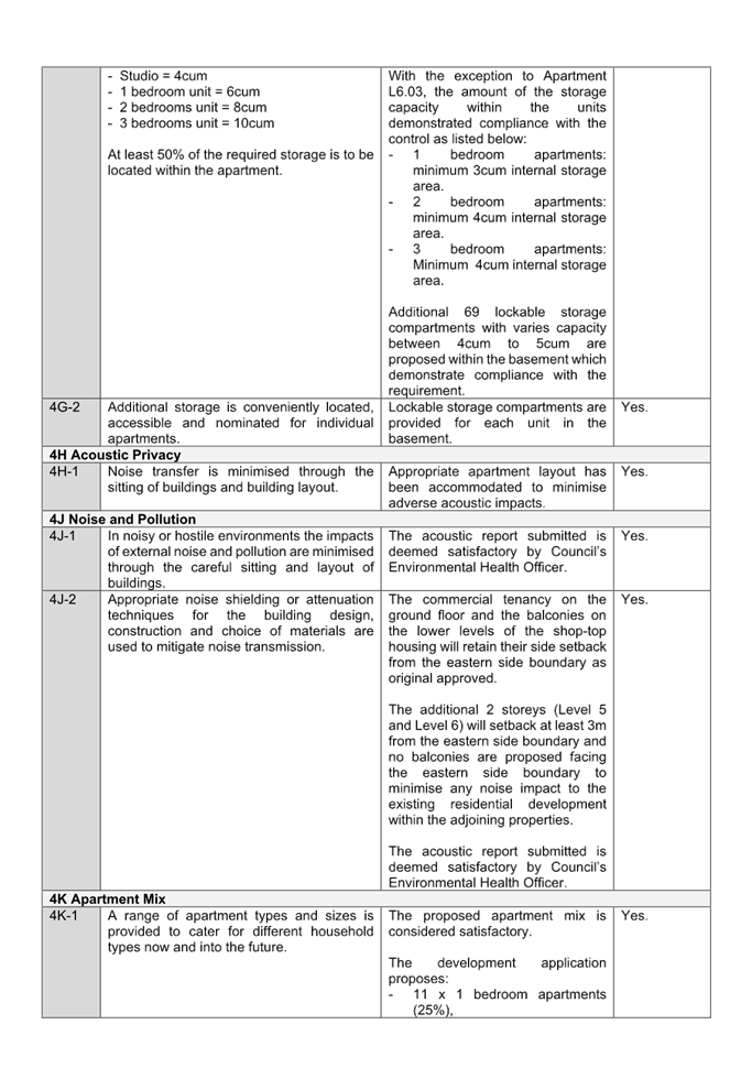
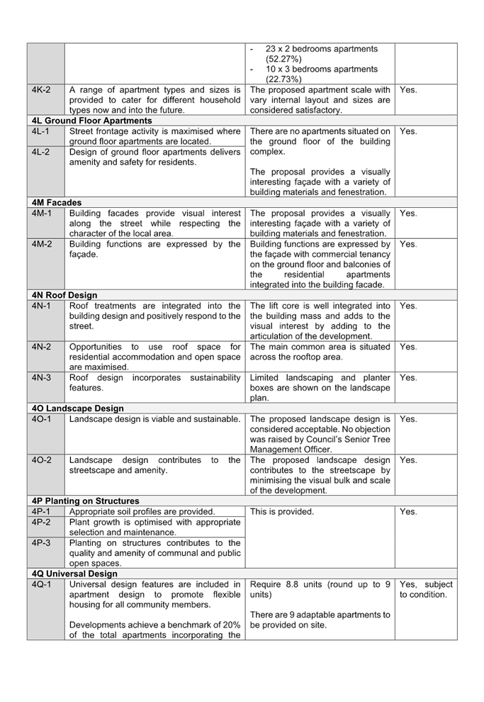
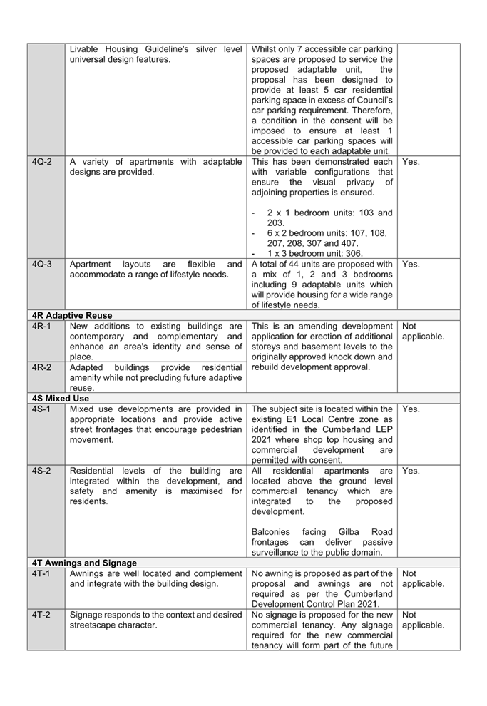
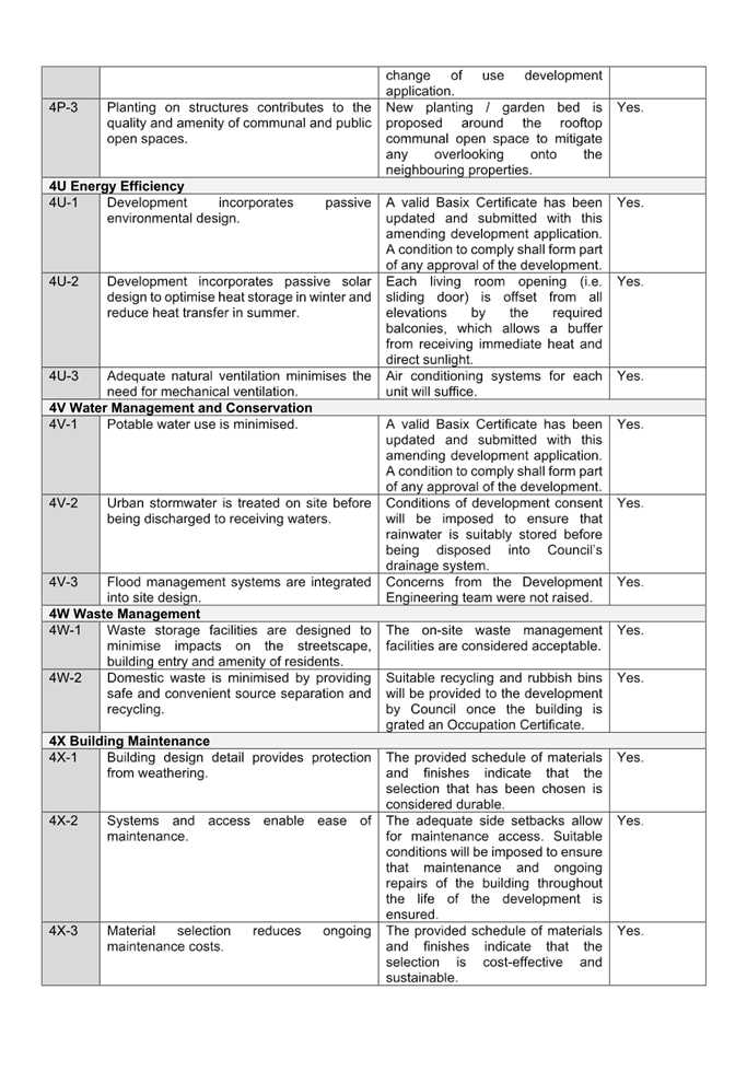
DOCUMENTS
ASSOCIATED WITH
REPORT ELPP024/25
Attachment 10
Appendix C - Cumberland LEP 2021 Assessment
Cumberland
Local Planning Panel Meeting
8 October 2025
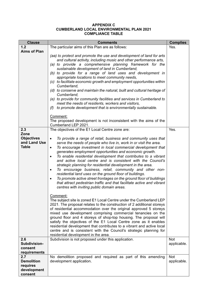
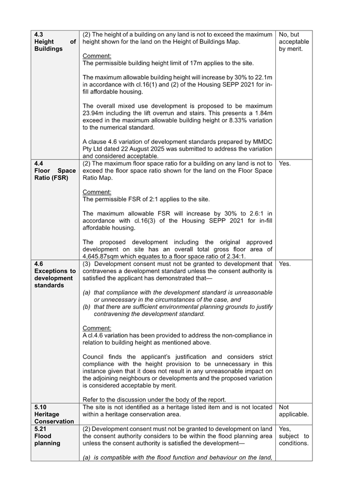
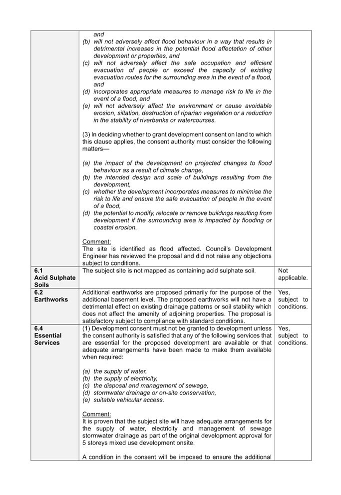
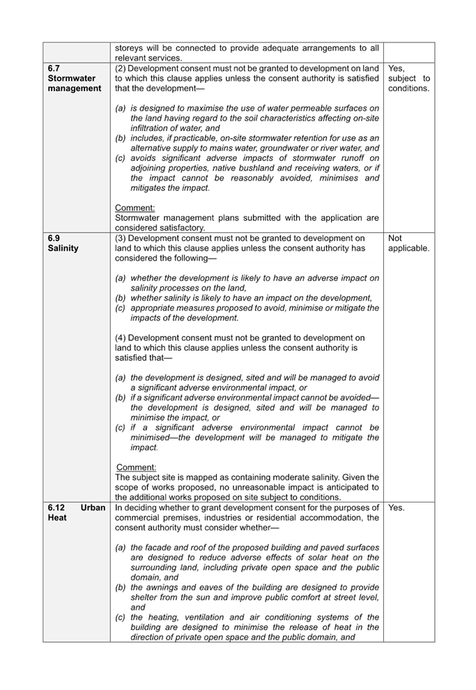

DOCUMENTS
ASSOCIATED WITH
REPORT ELPP024/25
Attachment 11
Appendix D - Cumberland DCP 2021 Assessment
Cumberland
Local Planning Panel Meeting
8 October 2025
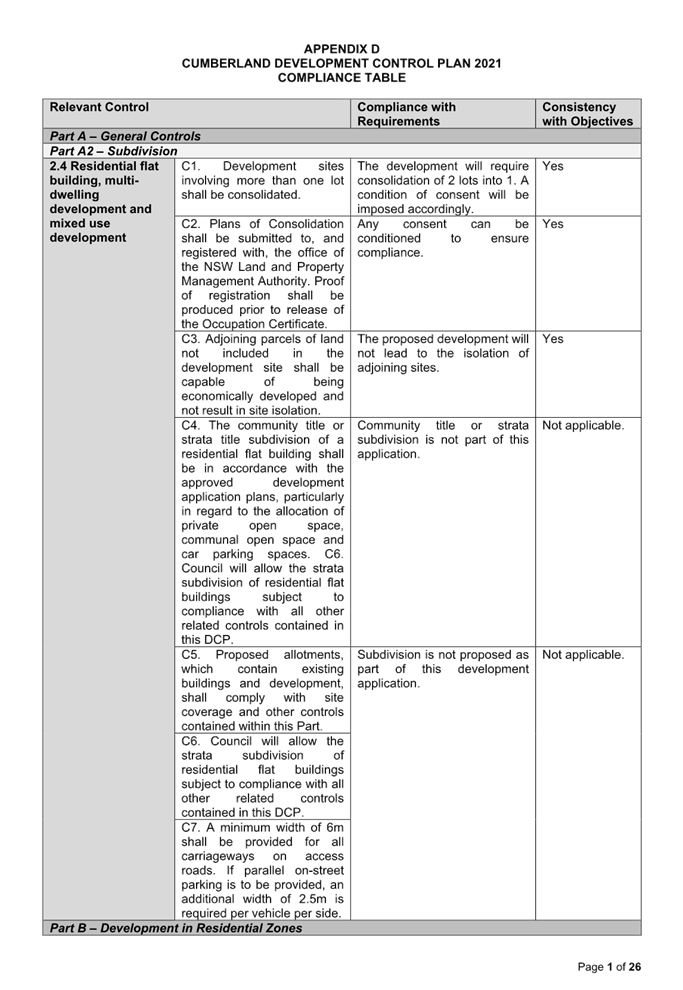
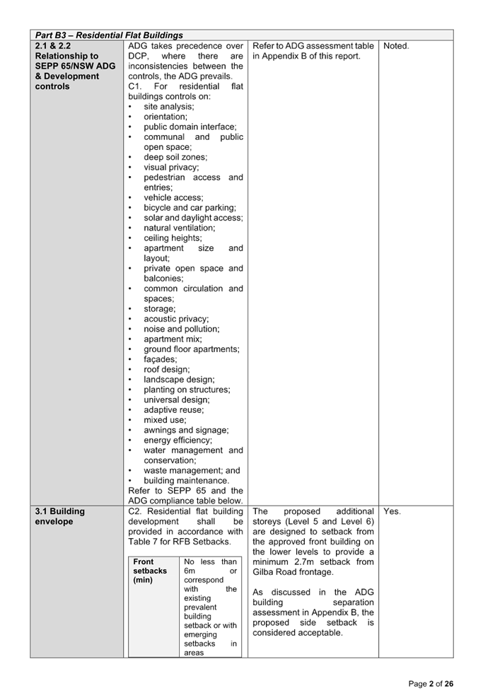
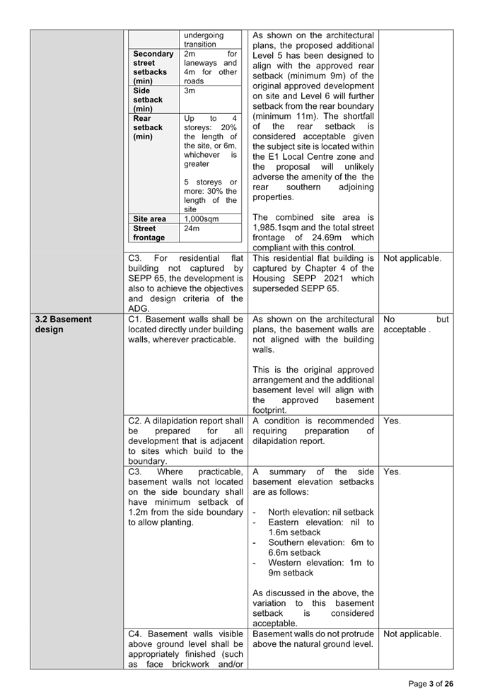
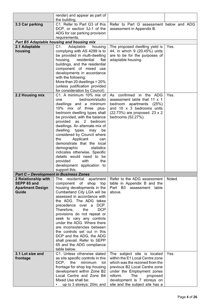
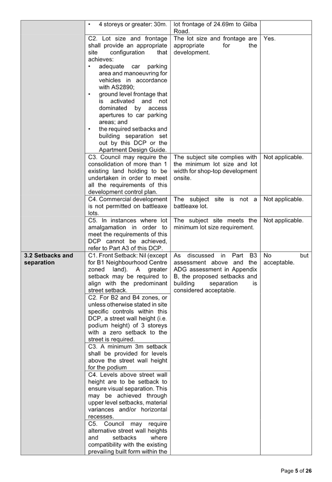
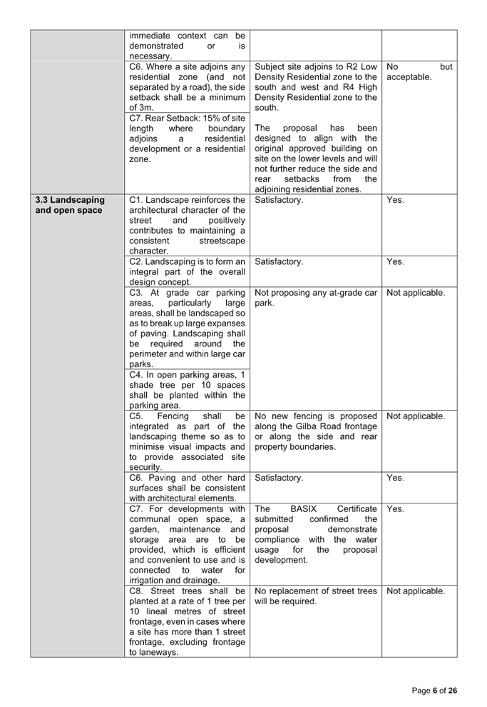
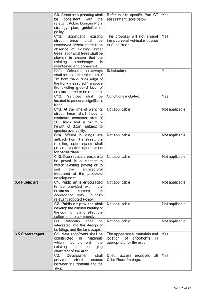
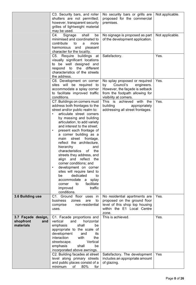
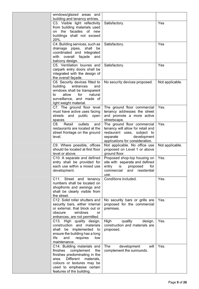
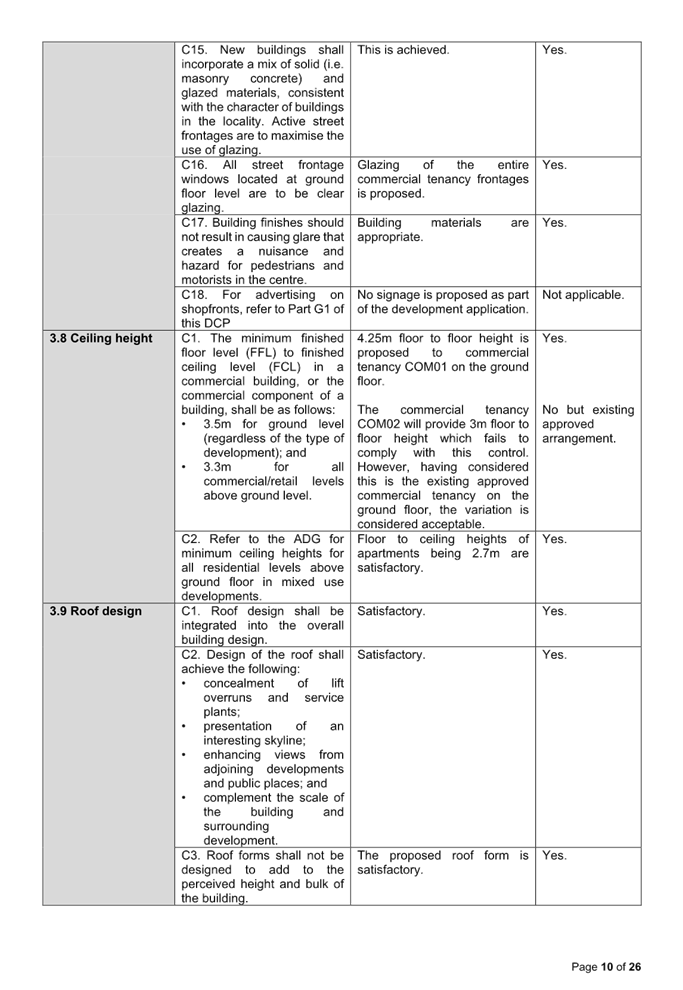
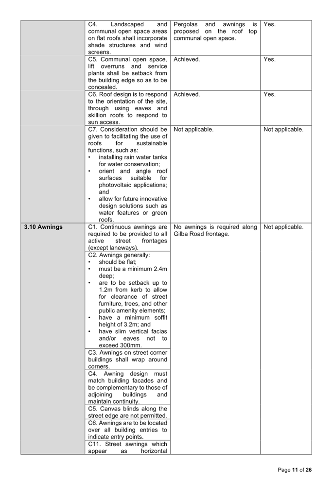
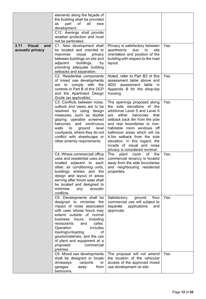
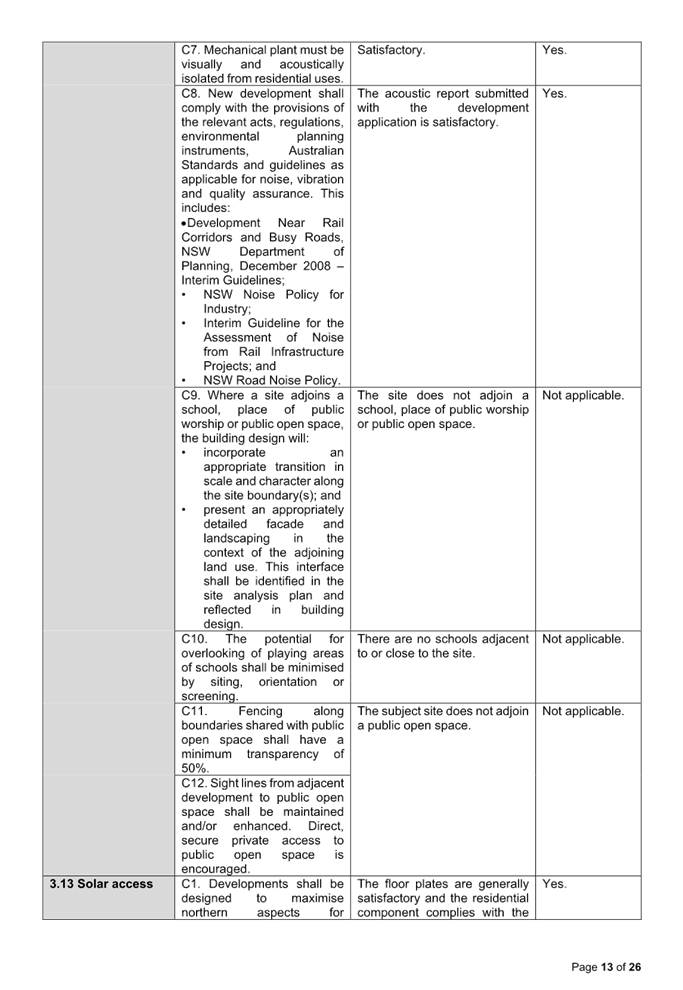
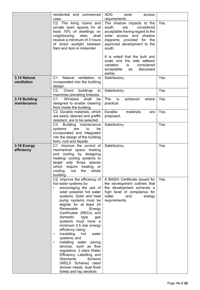
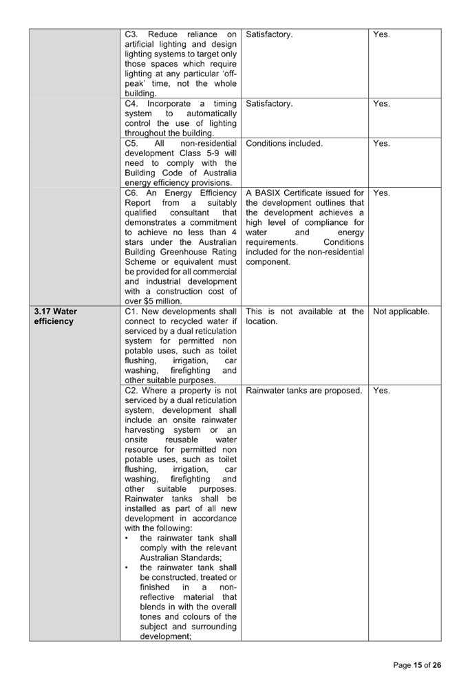
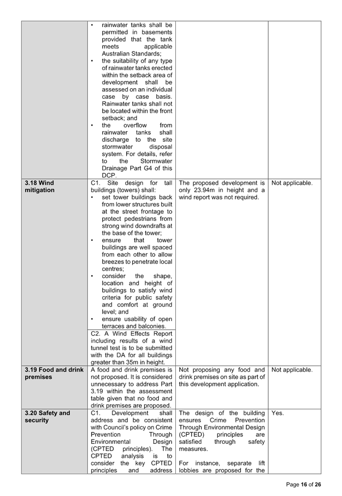
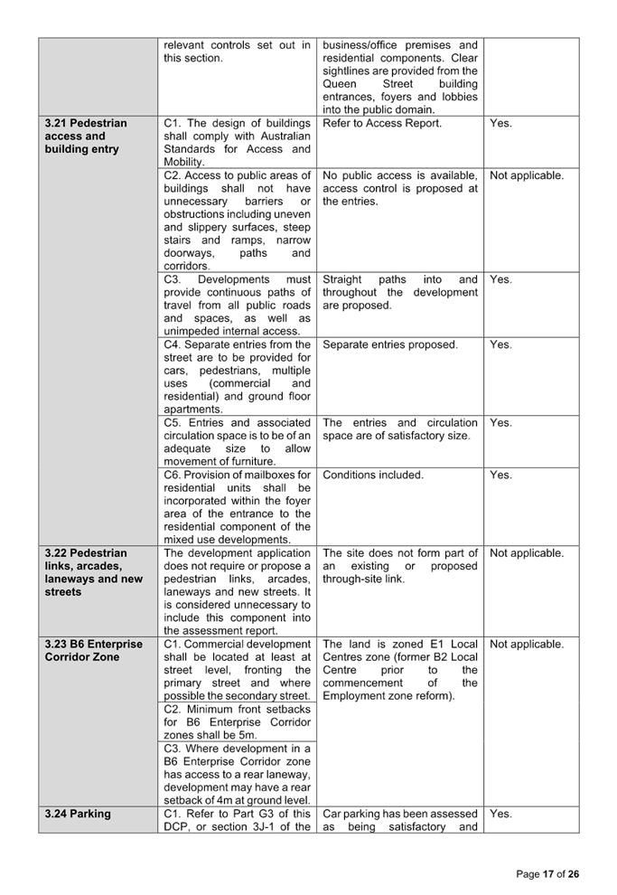
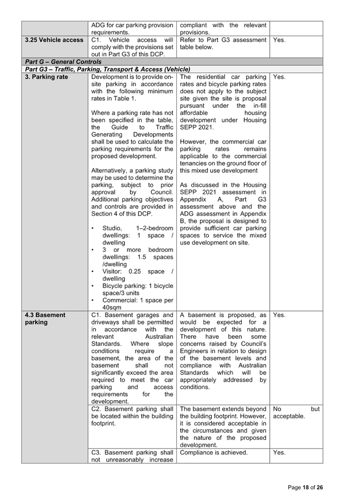
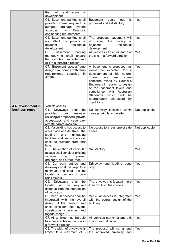
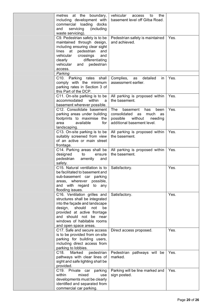
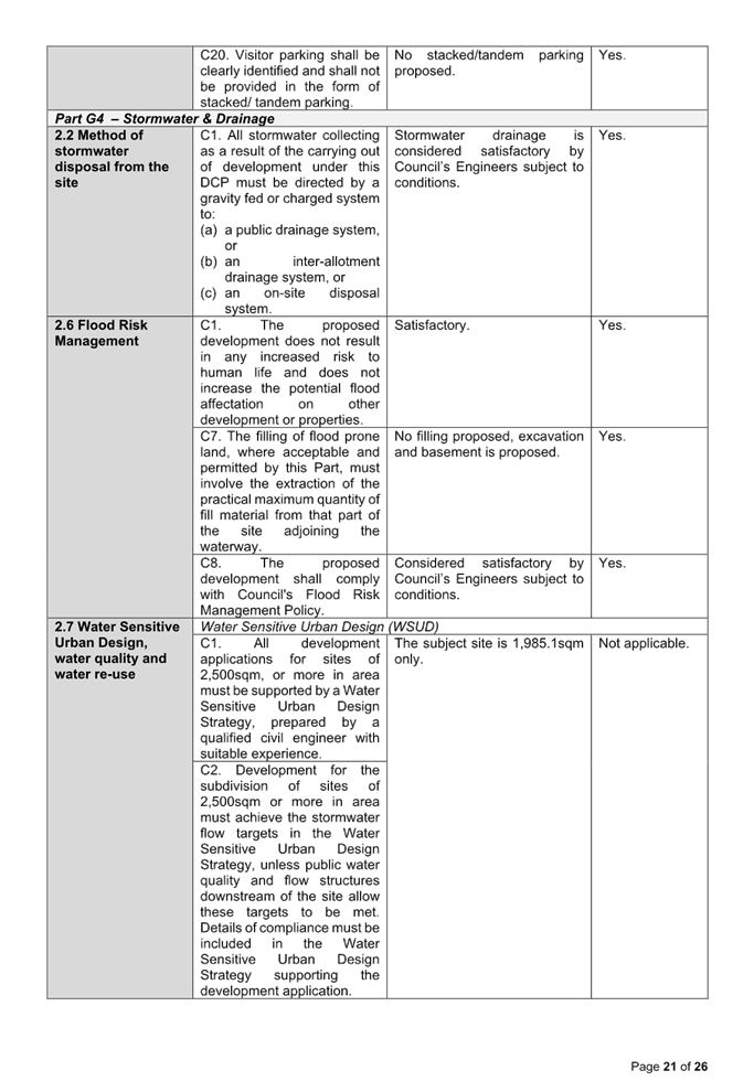
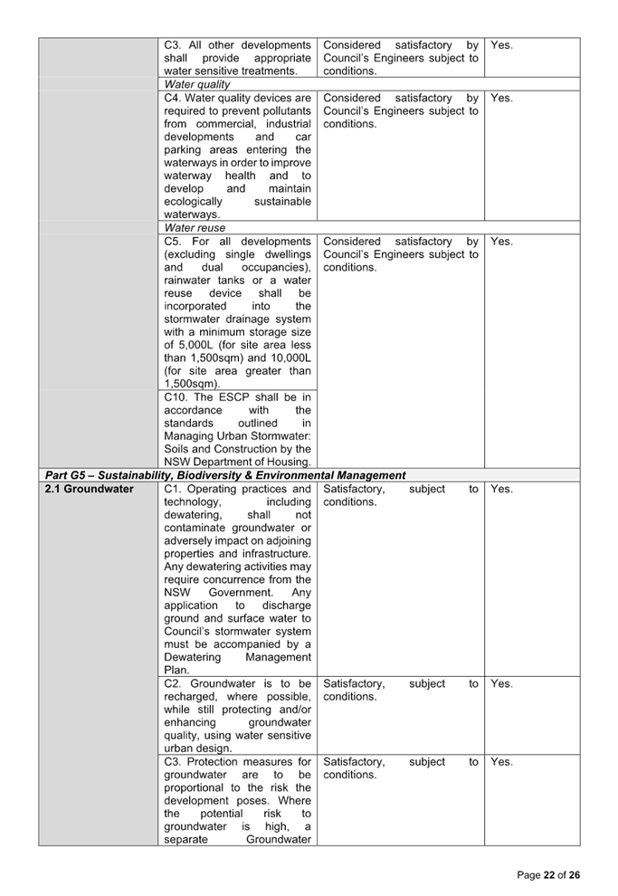
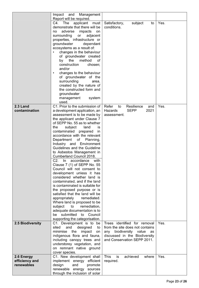
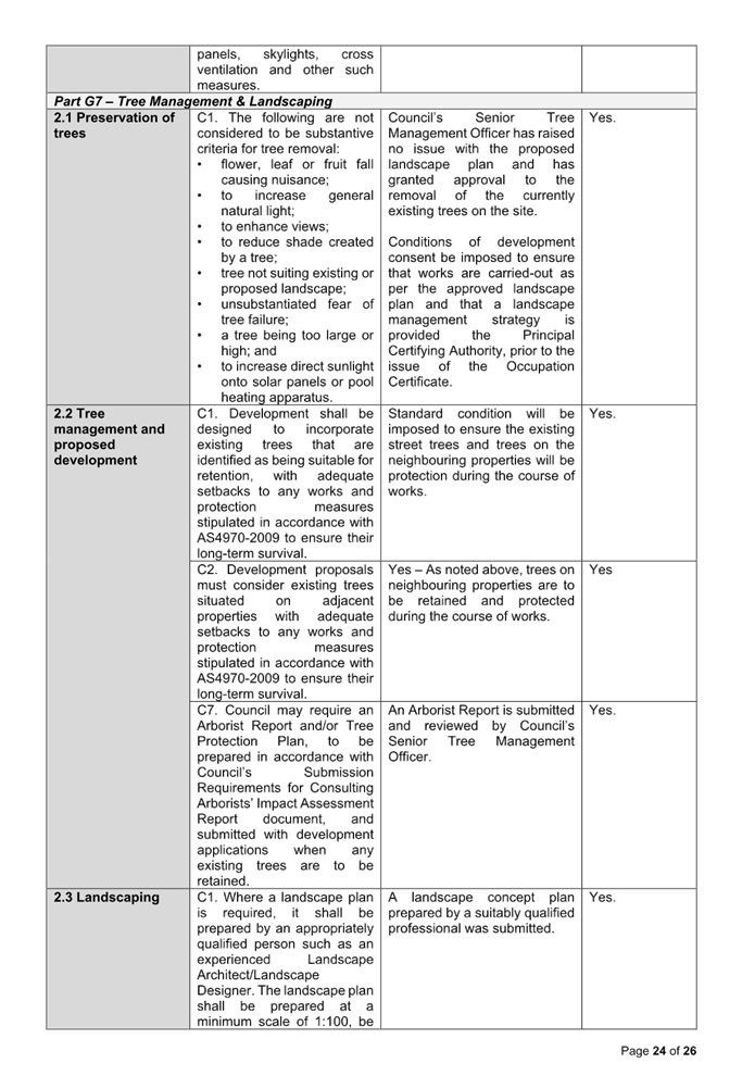
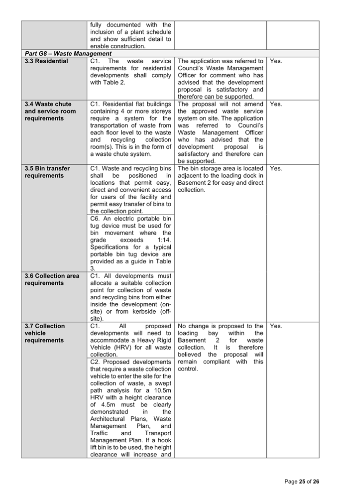

Cumberland Local Planning Panel Meeting
8 October 2025
Item No: ELPP025/25
Development
Application - 150 Hawkesbury Road, Westmead
Directorate: Environment
and Planning
Responsible
Officer: Executive
Manager City Planning and Development
|
Application
lodged
|
8 August 2025.
|
|
Applicant
|
R Ryan (NSW Department of
Education).
|
|
Owner
|
Department of Education.
|
|
Application
No.
|
DA2025/0545.
|
|
Description
of Land
|
Westmead Public School 150
Hawkesbury Road Westmead. Lot 1 in DP 881383.
|
|
Proposed
Development
|
Demolition of an existing
single storey detached building (Block B) and tree removal.
|
|
Site
Area
|
28,210 square metres.
|
|
Zoning
|
R2 Low Density Residential
Zone.
|
|
Disclosure
of political donations and gifts
|
Nil disclosure.
|
|
Cost
of works
|
$183,738.
|
|
Heritage
|
The subject site contains a Heritage Item (I295), which is
identified as, “Westmead Public School, circa 1917”.
|
|
Principal
Development Standards
|
Minimum Lot Size
Permissible: 450 square
metres.
Proposed: N/A.
FSR
Permissible: No FSR in R2
Zone.
Proposed: N/A.
Height of Building
Permissible: 9m.
Proposed: N/A.
|
|
Issues
|
N/A
|
1. Development
Application 2025/0545 was lodged on the 8 August 2025 for the demolition of an
existing single storey detached building (Block B) and tree removal.
2. The
application was publicly notified to occupants and owners of the adjoining
properties for a period of 14 days between 14 August 2025 and 28 August 2025.
In response, no submissions were received.
3. The
subject site is listed as a heritage item in the Cumberland Local Environmental
Plan 2021 as Heritage Item I295. The heritage item is the Westmead Public
School.
4. The
application is referred to the Panel as the proposal is considered to be a
sensitive development as demolition within a site identified as a local
heritage item is proposed.
5. The
application is recommended for approval subject to the conditions as
recommended in the Council’s assessment report.
Subject Site and Surrounding
Area
The site forms Lot 1 in DP 881383
and is known as Westmead Public School at 150 Hawkesbury Road Westmead. The
site has an area of 28,210 square metres and has frontages to Hawkesbury Road,
Moree Avenue and Grand Avenue.
The subject site is known as
Westmead Public School (Circa 1917). The school comprises of 13 permanent
buildings and 4 demountables. The school provides 3 off street car parking
areas.
The school caters to students from
years K-6. The school also provides before and after school care, two
libraries, a lecture theatre, a dance studio and two computer rooms.
The subject property contains a
Heritage Item (I295) which is identified as, “Westmead Public School,
circa 1917”.
However, the Department of
Educations’ Section 170 Register identifies that only 3 buildings as
contributing to the site’s heritage significance. Those buildings are
B00A, B00F and B00I.
The subject site is in close
proximity to ten heritage items, which are the following:
· I288 - I290 (15 -
19 Austral Avenue, Westmead); and
· I298 - I304 (5 -
17 Moree Avenue, Westmead).
All of the adjoining heritage
items listed above are Inter-war bungalows.
The subject site is also adjacent
to the Toohey’s Palm Estate Group Conservation Area.
The site is adjacent to
residential dwellings to the north, south, east and west. To the north-east of
the subject site is a Sydney Metro West construction site which will house the
future Westmead Metro Station.
A site inspection of the premises
carried out on the 14 August 2025 identifies that the site is currently
occupied by a School.
The location of the site is shown
below edged in purple.
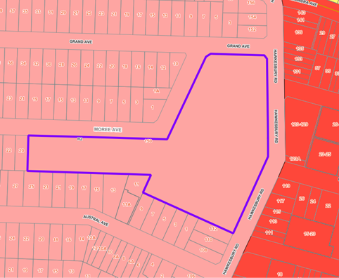
Figure
1 – Locality Plan of subject site
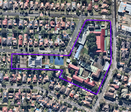
Figure
2 – Aerial view of subject site
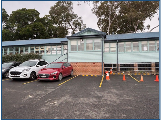
Figure
3 – Street view of subject site
Development application
DA2025/0545 was lodged on the 8 August 2025 seeking approval for the demolition
of an existing single storey detached building (Block B) and tree removal. The
detailed breakdown of the proposal is shown below:
· Demolition of a
single storey detached building (Block B).
· Removal of a
demountable classroom.
· Removal of 11
existing trees.
· Removal of an
existing metal awning and linkways.
· Removal of site
furniture, timber play structures and artificial turf.
· Removal of a
concrete pathway.
· Removal of a
bitumen pathway, sandstone walls and kerb, a gate, a concrete HOB.
· Removal of garden
beds and planting and bitumen.
Whilst the demolition plan
indicates that the resurfacing of the existing carpark (that is adjacent to
Block B) is proposed, it does not form part of this application.
Whilst the demolition plan
indicates the proposed removal of the amenities building (Block U), it does not
form part of this application as it is stated that it will be removed as exempt
development as it was erected as exempt development.
The development application is a
Crown Application as it is an application that has been made by the Crown.
History
· PL2025/0036 was
lodged to Cumberland City Council on 12/06/2025 for the Demolition of Building
B - Westmead Public School which was finalized on the 09/07/2025.
Applicants Supporting
Statement
The applicant has provided a
Statement of Environmental Effects prepared by EPM Projects dated 30 July 2025
and was received by Council on 31 July 2025 in support of the application.
Contact With Relevant
Parties
The assessing officer has
undertaken a site inspection of the subject site and surrounding properties and
has been in regular contact with the applicant throughout the assessment
process.
Internal Referrals
Environmental Health
The development application was
referred to Council’s Environmental Health Officer for comment who has
advised that the proposal is satisfactory. The application is supported by both
an asbestos management plan and a waste management plan and therefore can be
supported subject to conditions.
Tree Management
The development application was
referred to Council’s Senior Tree Management Officer for comment who has
advised that the proposal is satisfactory subject to recommended conditions of
consent.
Heritage
The development application was
referred to Council’s Heritage Committee. An enquiry was submitted on the
19/08/2025 by a member of the Heritage Committee on their own behalf who sought
clarification on the scope of the works proposed. This is further discussed
below under the ‘submissions made’ section of this report.
External Referrals
The application was not required
to be referred to any external government authorities for comment.
Planning Comments
The provisions of any
Environmental Planning Instruments (EP&A Act s4.15 (1)(a)(i))
State Environmental Planning
Policies
The proposed development is
affected by the following State Environmental Planning Policies:
|
State
Environmental Planning Policies (SEPPs)
|
Relevant
Clause(s)
|
Compliance
with Requirements
|
|
· State
Environmental Planning Policy (Biodiversity and Conservation) 2021.
|
Chapter 2 -Vegetation in non Rural Areas.
|
The development application includes the removal of 11
trees which has been assessed as being acceptable by the Council’s
Senior Tree Assessment Officer, subject to conditions.
According to the submitted Biodiversity Due Diligence
– Preliminary Review (prepared by Ecological Australia, project No.
24SYD9051, dated 30 July 2025), the proposal does not exceed the biodiversity
offsets scheme threshold. The Council’s Senior Tree Assessment Officer
considers the report to be acceptable.
|
|
Chapter 6 -
Water Catchments.
Sydney Harbour Catchment
|
It is determined that given the location of the site, a
detailed assessment is not required given that there is no direct impact upon
the catchment and no direct impact upon watercourses. As such, the
development is acceptable under the provisions that came into effect on
Monday 21 November 2022.
|
|
· State
Environmental Planning Policy (Resilience and Hazards) 2021.
|
Chapter 2 - Coastal Management.
|
The subject site is not identified as a coastal wetland or
‘land identified as “proximity area for coastal wetlands”
or coastal management area.
|
|
Chapter 4 - Remediation of Land.
Part 4.6.
|
The site has historically been utilised for educational
purposes.
As such, it is considered that the development application
is satisfactory under Part 4.6 of Chapter 4 of the State Policy.
|
|
· State Environmental Planning Policy (Sustainable
Buildings) 2022
|
Chapter 3 – Standards
for non-residential
development
|
Chapter 3 of SEPP (Sustainable Buildings) 2022 does not
apply to this development as only demolition is proposed.
|
|
· State
Environmental Planning Policy (Transport and Infrastructure) 2021.
|
Chapter 2 - Infrastructure.
|
State Environmental Planning Policy (Transport and
Infrastructure) 2021 is relevant to the development application as follows.
|
·
Chapter 3 - |
Education Establishments and Child Care Facilities
3.36 – Schools – development permitted with
consent.
The controls within s3.36 relate mainly to the
construction of a new building and therefore do not apply to this application
as demolition of an existing school building is proposed. The works are not
exempt development and consent is sought for what will occur on site.
3.37 (1)(e) – Existing or approved government
schools – development permitted without consent.
The development is occurring within an existing government
school and requires development consent as it entails demolition of
structures on a site that is listed as a local heritage item.
|
Local Environmental Plans
Cumberland Local
Environmental Plan 2021
The provision of the Cumberland
Local Environmental Plan 2021 is applicable to the development proposal. It is
noted that the development achieves compliance with the key statutory
requirements of the Cumberland Local Environmental Plan 2021 and the objectives
of the R2 Low Density Residential Zone.
(a) Permissibility:
The proposed development is
associated with an existing ‘School’ and an ‘educational
establishment’ is permissible in the R2 Low Density Residential Zone with
consent.
The proposed development involves
demolition work which is permissible with consent as per Clause 2.7 of the
Cumberland Local Environmental Plan 2021.
A school is defined within the
Cumberland Local Environmental Plan 2021 as follows:
school means a
government school or non-government school within the meaning of the Education
Act 1990.
Note - Schools are a type of educational
establishment—see the definition of that term in this Dictionary.
An education premises is defined
within the Cumberland Local Environmental Plan 2021 as follows:
educational establishment
means a building or place used for education (including teaching), being—
(a) a school, or
(b) a tertiary
institution, including a university or a TAFE establishment, that provides
formal education and is constituted by or under an Act.
The relevant matters to be considered
under Cumberland LEP and the applicable clauses for the proposed development
are summarised below. A comprehensive LEP assessment is contained in Attachment
4.
Figure
4 - Cumberland LEP 2021 Compliance Table
|
|
|
|
|
|
|
|
|
|
|
The application seeks demolition of specific structures
and therefore, the floor space ratio development standard does not apply.
|
|
|
|
|
The provisions of any proposed
instrument that is or has been the subject (EP&A Act s4.15 (1)(a)(ii))
Council has received a Gateway
Determination from the Department of Planning, Housing and Infrastructure for
the Draft Woodville Road Corridor Planning Proposal. As part of this approval,
public exhibition of the Draft Woodville Road Corridor Planning Proposal has
commenced. The public exhibition was carried out between the 4 March 2025 to 17
April 2025.
The Draft Planning Proposal seeks
to revitalise Woodville Road by amending planning controls in the Cumberland
Local Environmental Plan (CLEP) 2021 for 31 sites located around the three (3)
precincts of Woodville North, Merrylands East and Woodville South.
The subject application was
received on 08 August 2025 and the site does not fall within the Draft
Woodville Road Corridor. Therefore, no further consideration is required.
The provisions of any
Development Control Plans (EP&A Act s4.15 (1)(a)(iii))
The Cumberland Development Control
Plan 2021 is relevant to the development proposal.
The development has been assessed
using the following chapters:
· Part E –
Other Land Use Based Development Controls.
· Part G2 –
Heritage.
· Part G5 –
Sustainability, Biodiversity & Environmental Management.
· Part G7 –
Tree Management & Landscaping.
· Part G8 –
Waste Management.
The proposed development complies
with the provisions of Council’s Cumberland DCP and is considered
acceptable from an environmental planning viewpoint. A comprehensive DCP
assessment is contained in Attachment 5.
The provisions of any planning
agreement that has been entered into under section 7.4, or any draft planning
agreement that a developer has offered to enter into under section 7.4
(EP&A Act s4.15(1)(a)(iiia))
There is no draft planning
agreement associated with the subject Development Application.
The provisions of the
Regulations (EP&A Act s4.15 (1)(a)(iv))
The proposed development raises no
concerns as to the relevant matters arising from the Environmental Planning and
Assessment Regulation 2021 (EP&A Reg).
The Likely Environmental,
Social or Economic Impacts (EP&A Act s4.15 (1)(b))
It is considered that the proposed
development will have no significant adverse environmental, social or economic
impacts in the locality.
The suitability of the site for
the development (EP&A Act s4.15 (1)(c))
The subject site and locality is
not known to be affected by any natural hazards or other site constraints
likely to have a significant adverse impact on the proposed development.
Accordingly, it is considered that the development is suitable in the context
of the site and surrounding locality.
Submissions made in accordance
with the Act or Regulation (EP&A Act s4.15 (1)(d))
|
Advertised (Website)
|
Mail
|
Sign
|
Not Required
|
In accordance with Council’s
Notification requirements contained within the Cumberland DCP 2021, the
proposal was publicly notified for a period of 14 days between the 14 August
2025 and the 28 August 2025. Whilst no submissions were received in respect of
the proposed development, a member of Council’s Heritage Committee made
an enquiry on their own behalf and sought clarification on the scope of the
proposed works. The questions the Heritage Committee member made were the
following:
· Will the new 2
storey building replace the footprint of the existing Building B or will it
have a larger footprint?
Response:
No
construction works are proposed within the scope of this application.
· Will the existing
car park remain near Building B and if not, will an onsite car park for staff
be built elsewhere to save them from having to park in the street? Street
parking in the Cumberland LGA is becoming quite an issue, so any off street
parking that could be provided would be beneficial.
Response:
Whilst the architectural plans
indicate that this carpark is proposed to be resurfaced, clarification has
since been given that no works are proposed to the existing carpark within the
scope of this Development Application.
· With the removal
of quite a number of the existing trees, will Council request new plantings be
made to replace them elsewhere for shade purposes?
Response:
The removal of 11 trees are
proposed. Conditions have been imposed requiring that tree replacements be
planted within the school to replace the 11 trees being removed.
The public interest (EP&A
Act s4.15(1)(e))
In view of the foregoing analysis,
it is considered that the development, if carried out subject to the conditions
set out in the recommendation below, will have no significant adverse impacts
on the public interest.
Crown Development (EP&A Act
s4.33(1)(b))
The Development Application is
considered Crown Development as it is a Development Application that has been
made by the Crown. Therefore, prior to determination being granted, the
applicant (The Department of Education) has been sent the draft conditions of
consent of consent for its approval. The applicant concurs with the draft
notice of determination contained in Attachment 1 of this report.
CUMBERLAND LOCAL INFRASTRUCTURE
CONTRIBUTIONS PLANS 2020
The development would not require
the payment of contributions in accordance with Cumberland Local Infrastructure
Contributions Plan 2020.
HOUSING AND PRODUCTIVITY OF
CONTRIBUTION (HPC)
In accordance with Schedule 2 of
the HPC Order 2024, the proposed development is exempt from the HPC, as the
development is for the demolition of specific structures within the subject
site.
DISCLOSURE OF POLITICAL
DONATIONS AND GIFTS
The applicant and notification
process did not result in any disclosure of Political Donations and Gifts.
The development application has
been assessed in accordance with the relevant requirements of the Environmental
Planning and Assessment Act 1979, the relevant State Environmental Planning
Policies, Cumberland LEP and Cumberland DCP and is considered to be
satisfactory for approval, subject to conditions.
There are no consultation
processes for Council associated with this report.
There are no financial
implications for Council associated with this report.
There are no policy implications
for Council associated with this report.
Communication / Publications:
The final outcome of this matter
will be notified. The objectors will also be notified in writing of the
outcome.
That Development Application
2025/0545 for the demolition of an existing single storey detached building
(Block B) and tree removal on land at Westmead Public School 150 Hawkesbury
Road Westmead be approved subject to conditions as listed in the attached
schedule.
1. Draft Notice
of Determination
2. Architectural
Plans
3. Appendix
A - Cumberland LEP 2021 Assessment
4. Appendix
B - Cumberland DCP 2021 Assessment
5. Heritage
Impact Assessment
6. Arboricultural
Impact Assessment
DOCUMENTS
ASSOCIATED WITH
REPORT ELPP025/25
Attachment 1
Draft Notice of Determination
Cumberland
Local Planning Panel Meeting
8 October 2025

DOCUMENTS
ASSOCIATED WITH
REPORT ELPP025/25
Attachment 2
Architectural Plans
Cumberland
Local Planning Panel Meeting
8 October 2025
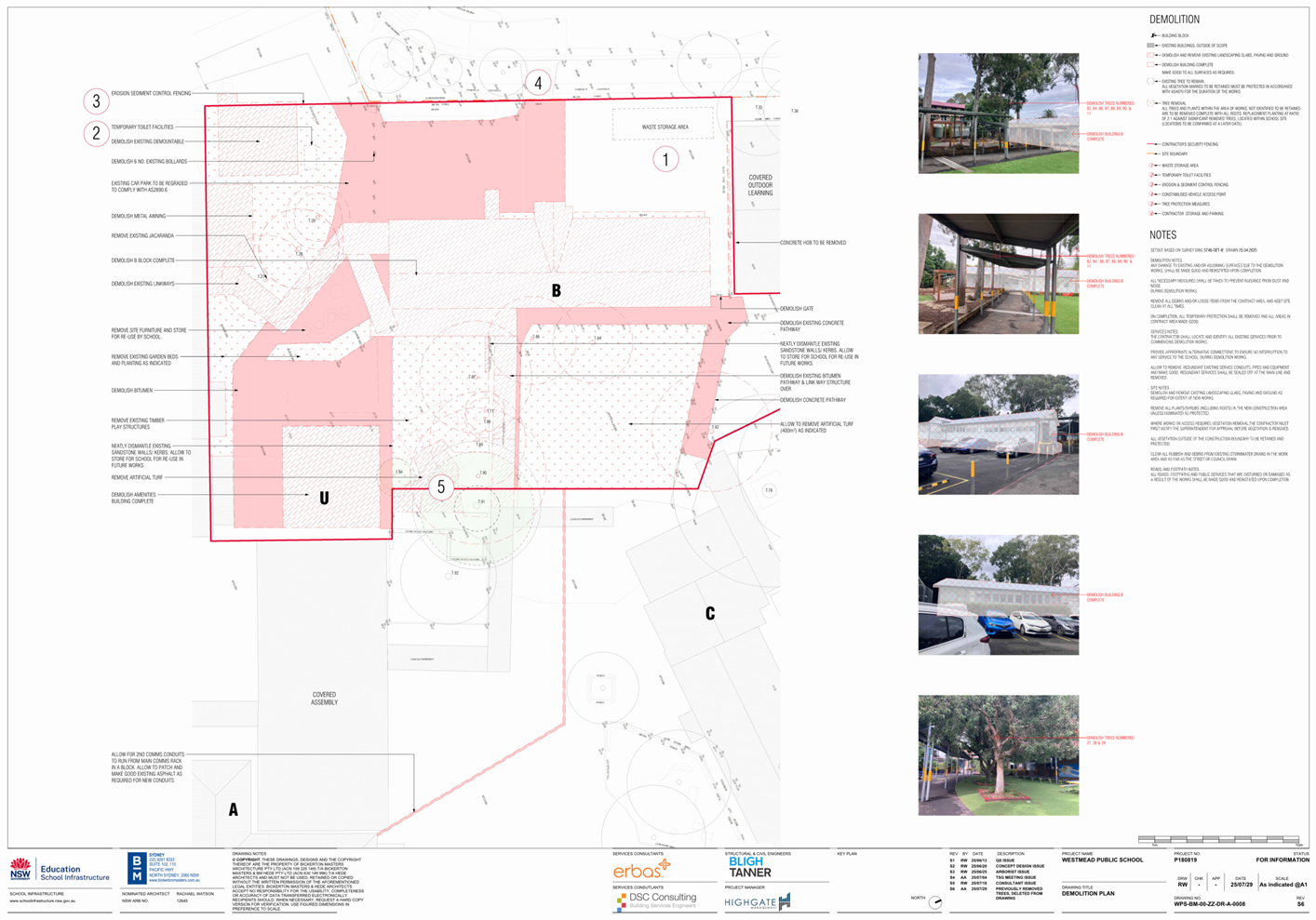
DOCUMENTS
ASSOCIATED WITH
REPORT ELPP025/25
Attachment 3
Appendix A - Cumberland LEP 2021 Assessment
Cumberland
Local Planning Panel Meeting
8 October 2025
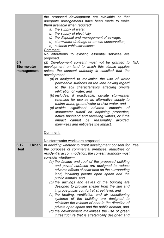

DOCUMENTS
ASSOCIATED WITH
REPORT ELPP025/25
Attachment 4
Appendix B - Cumberland DCP 2021 Assessment
Cumberland
Local Planning Panel Meeting
8 October 2025
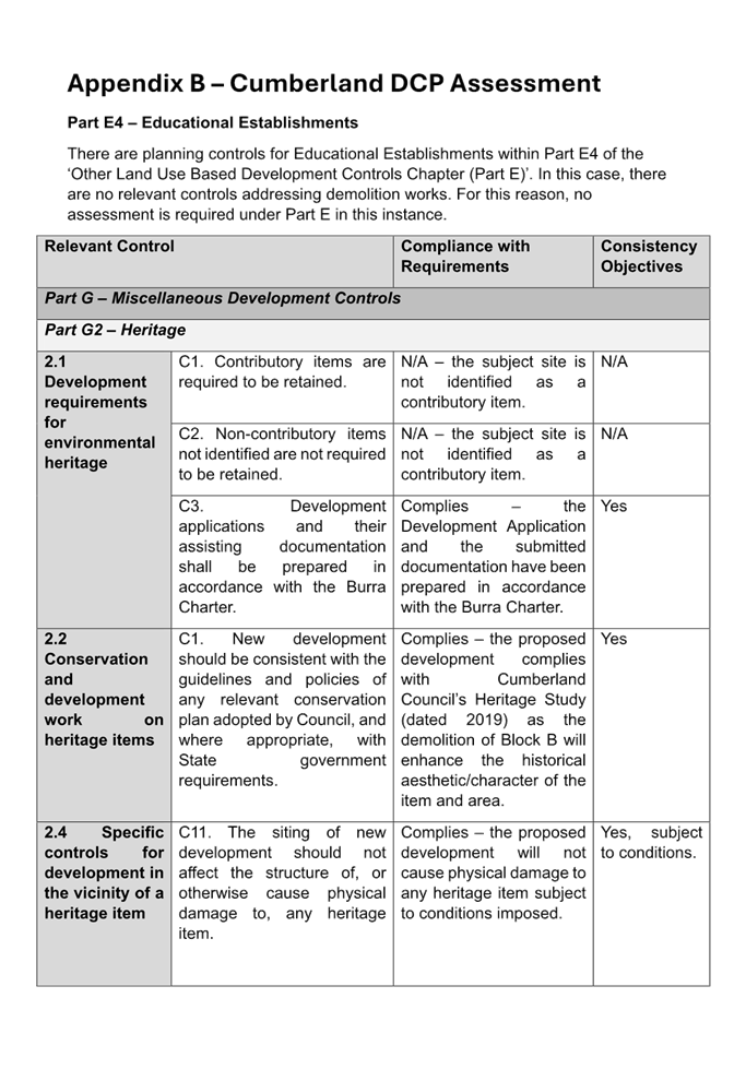
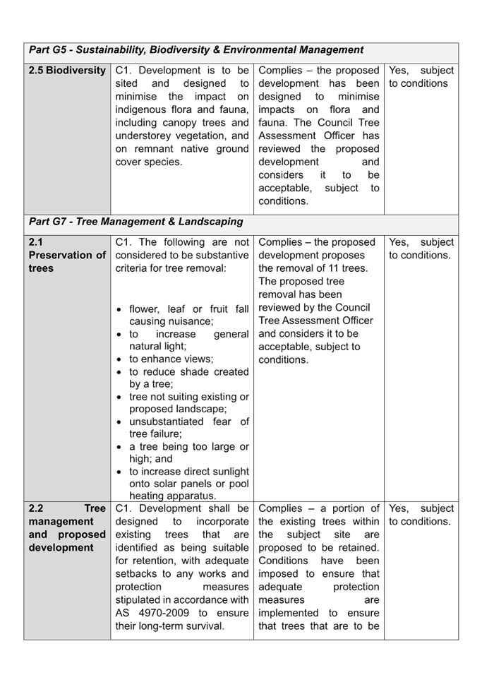
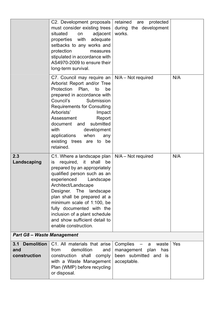
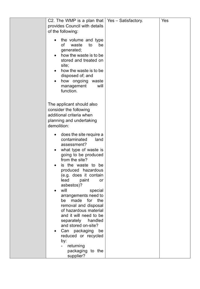

DOCUMENTS
ASSOCIATED WITH
REPORT ELPP025/25
Attachment 5
Heritage Impact Assessment
Cumberland
Local Planning Panel Meeting
8 October 2025
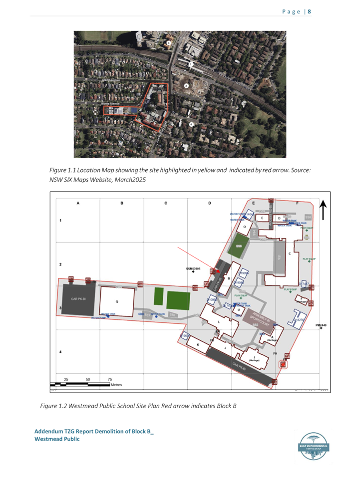
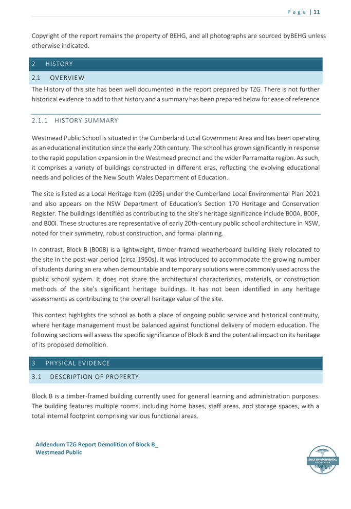
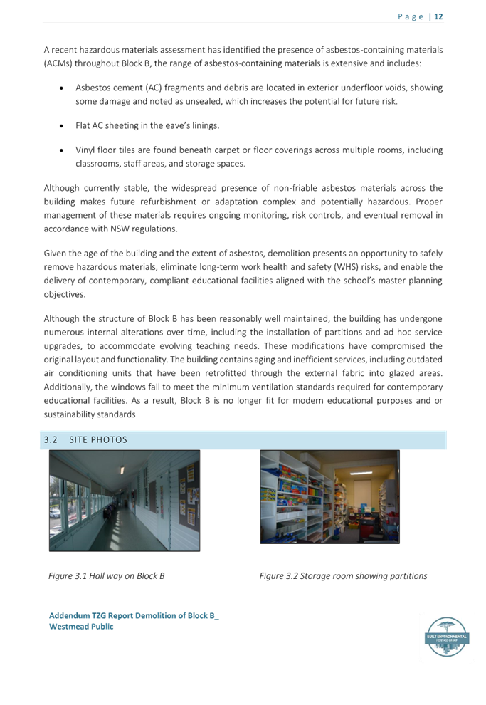
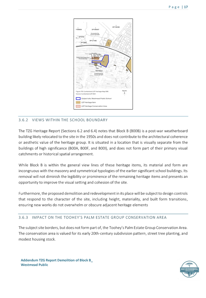


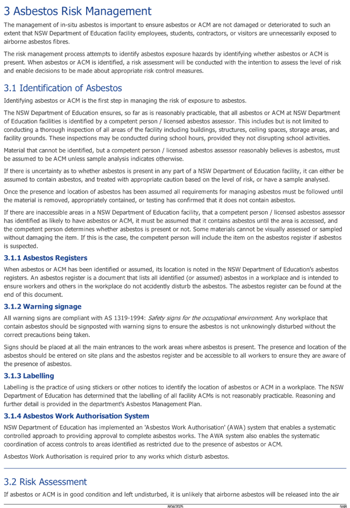

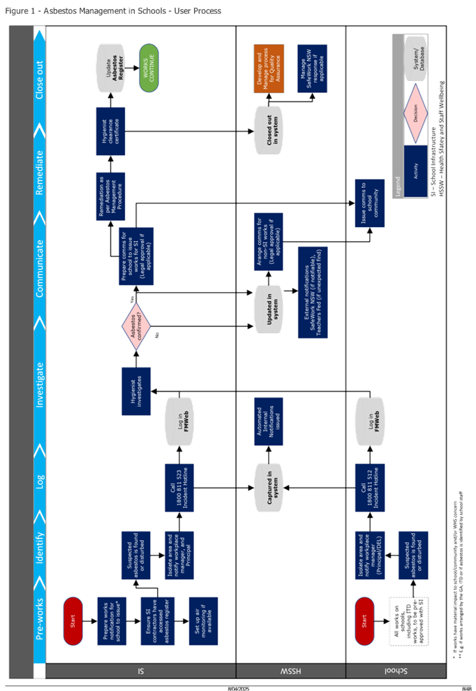
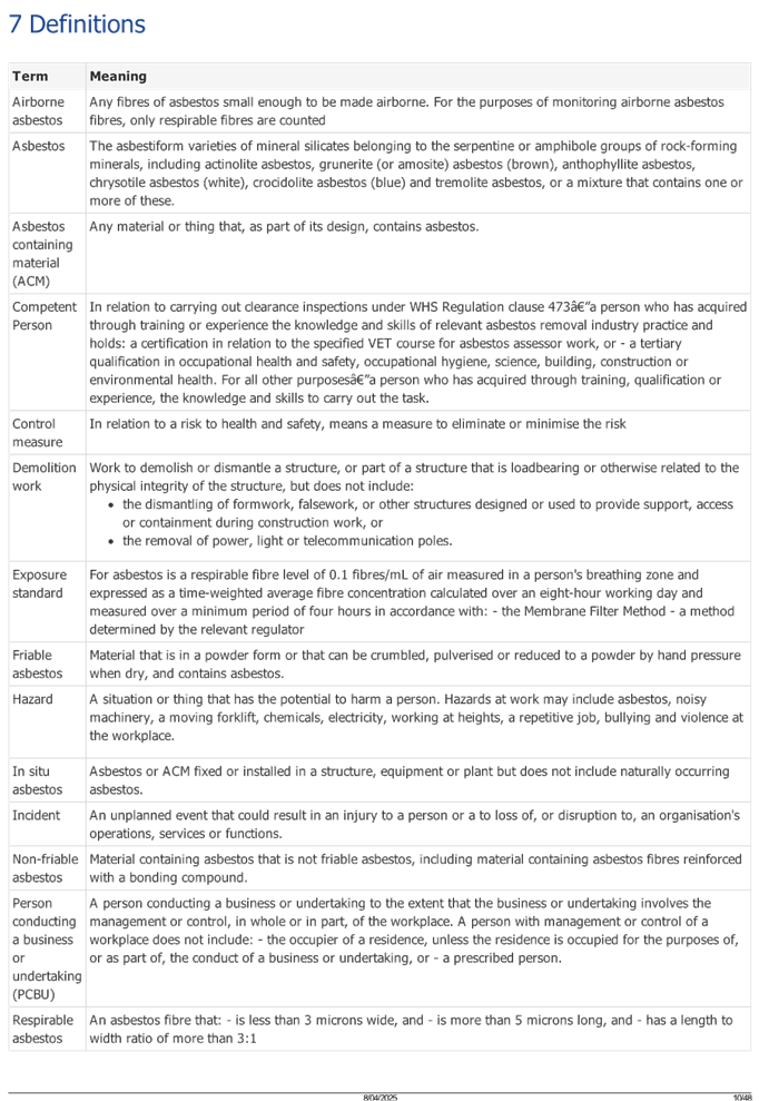

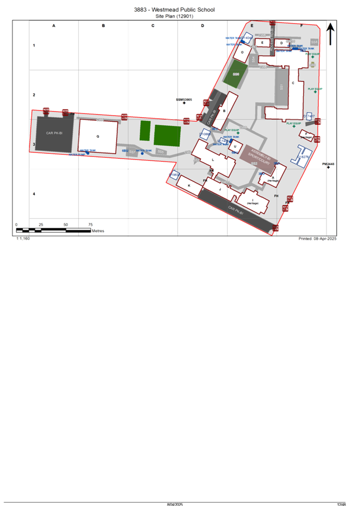
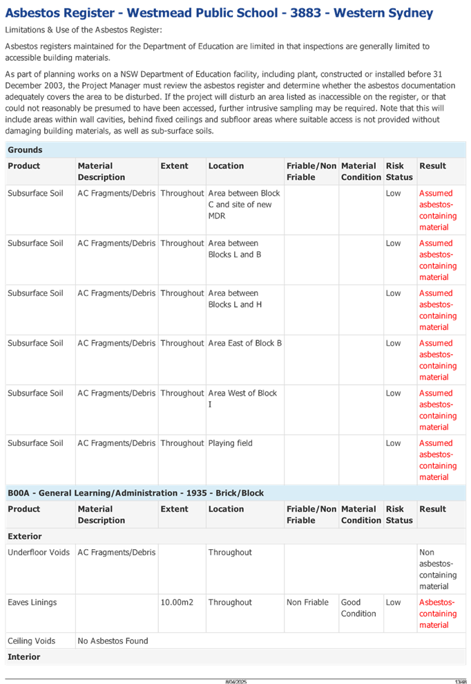
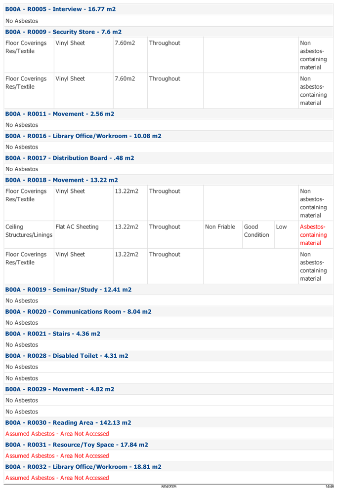
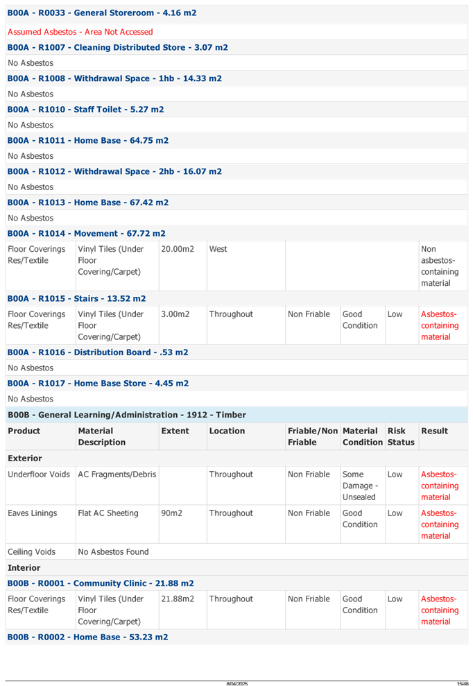
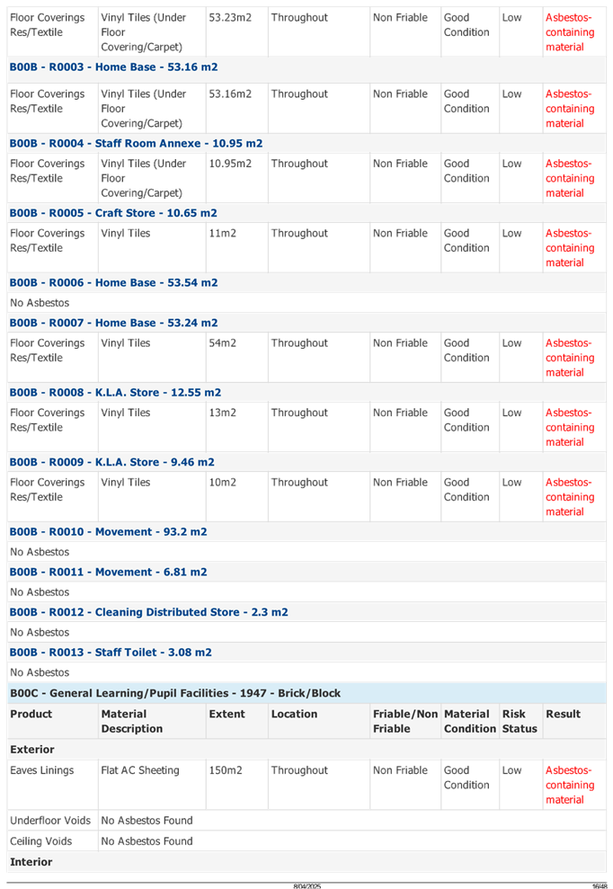
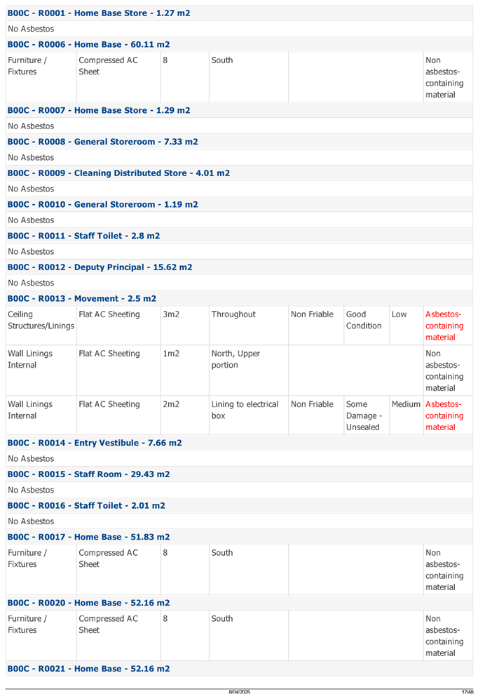
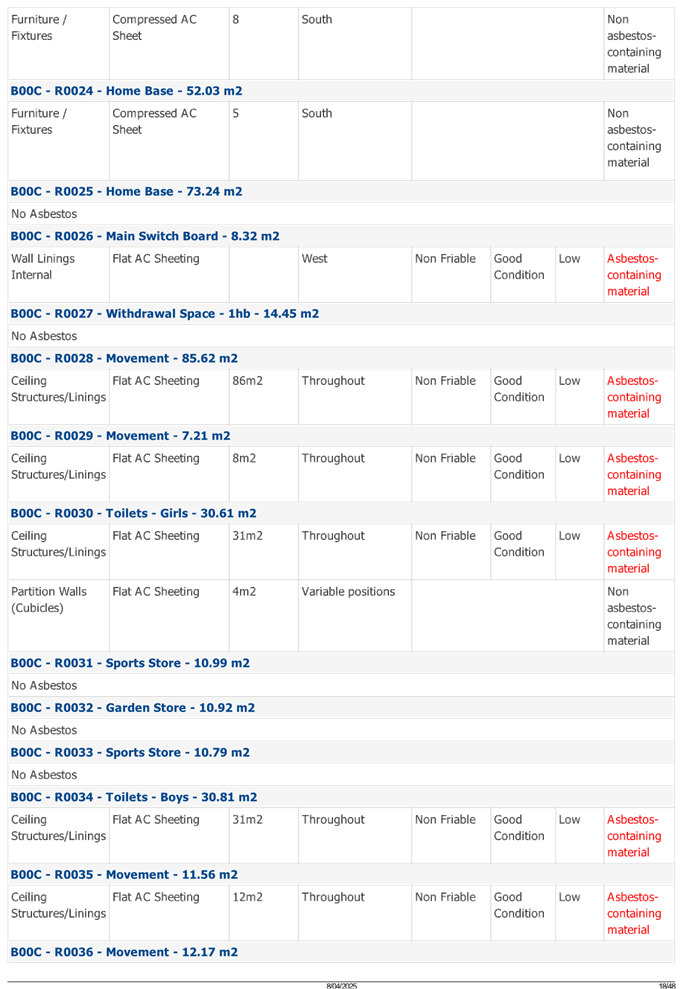
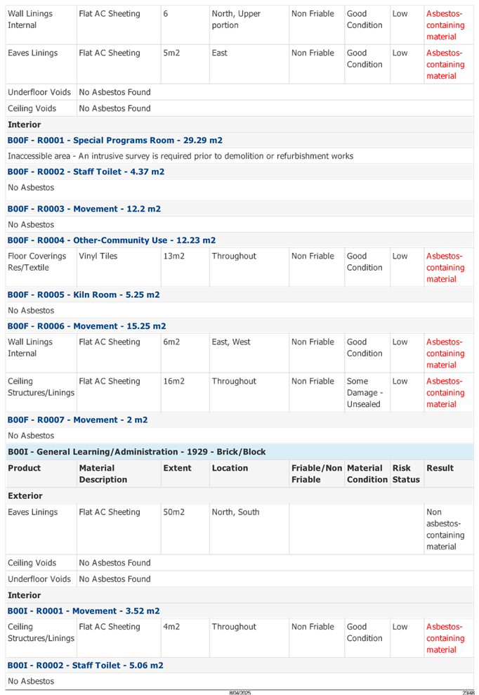
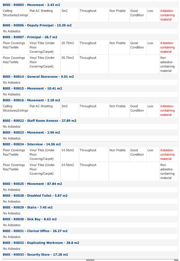
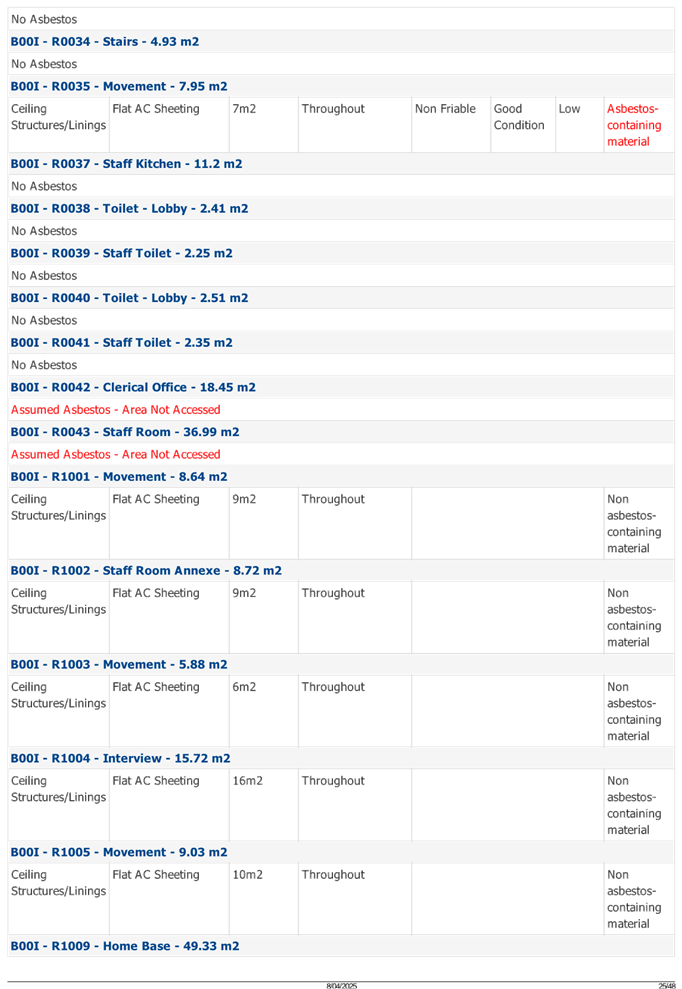
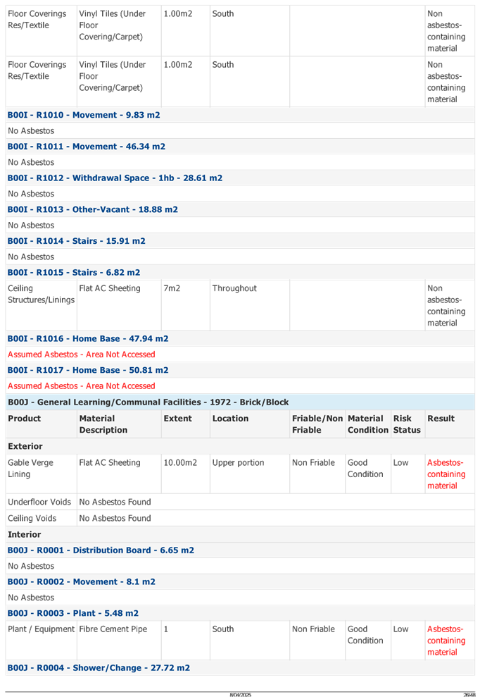

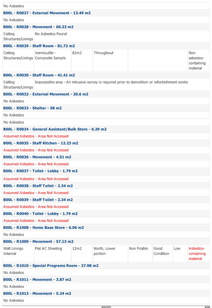
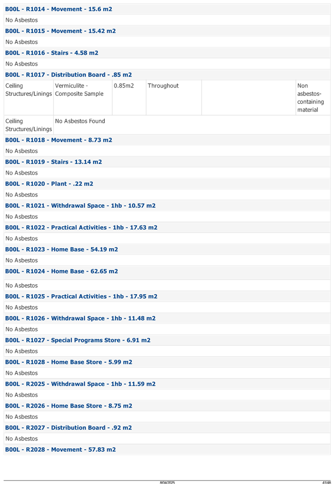
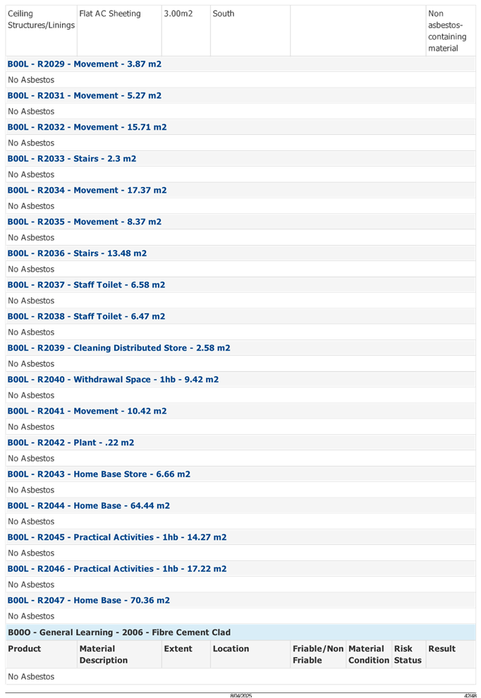

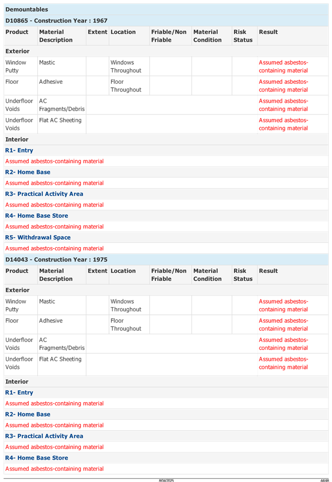
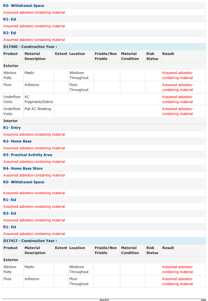
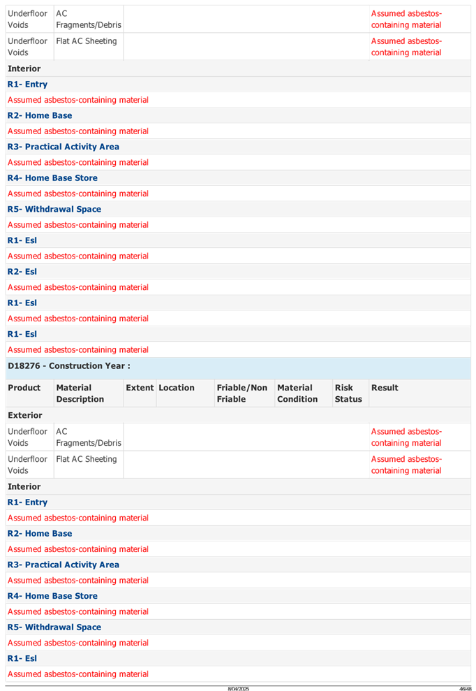
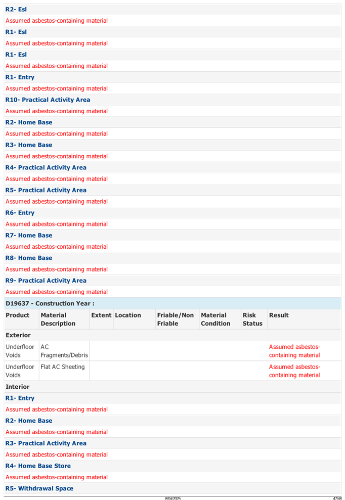
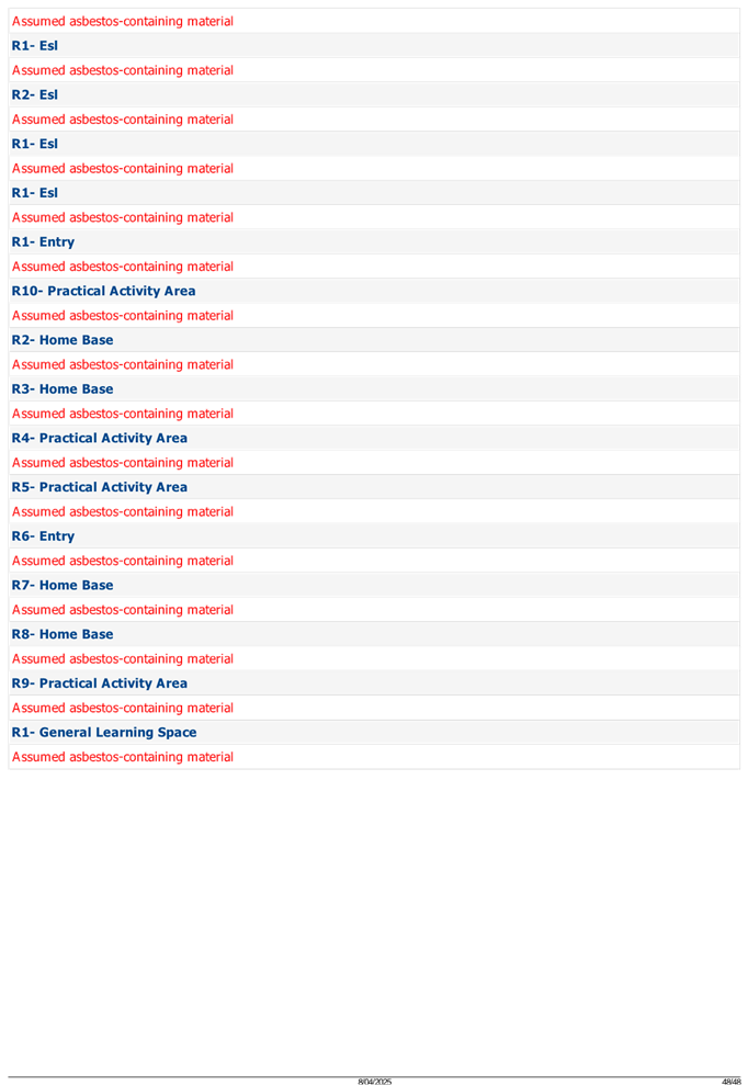
DOCUMENTS
ASSOCIATED WITH
REPORT ELPP025/25
Attachment 6
Arboricultural Impact Assessment
Cumberland
Local Planning Panel Meeting
8 October 2025
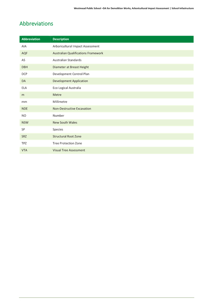
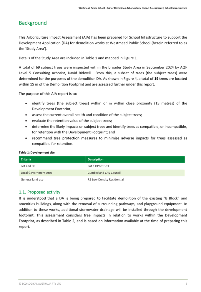
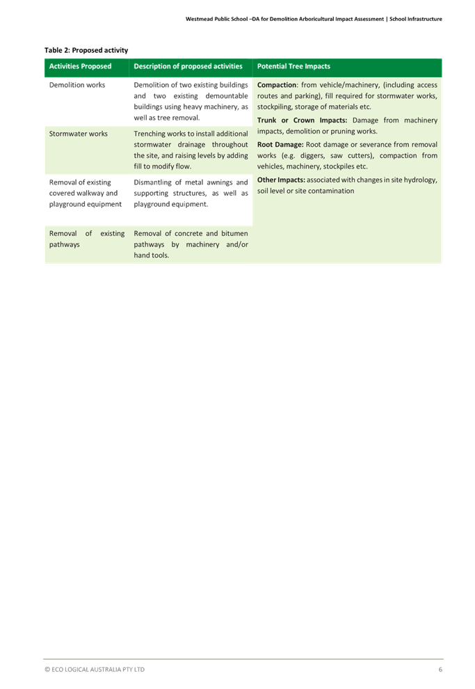
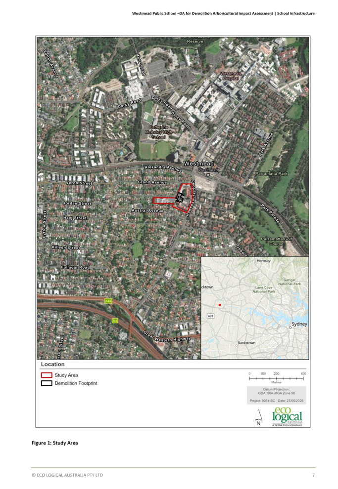

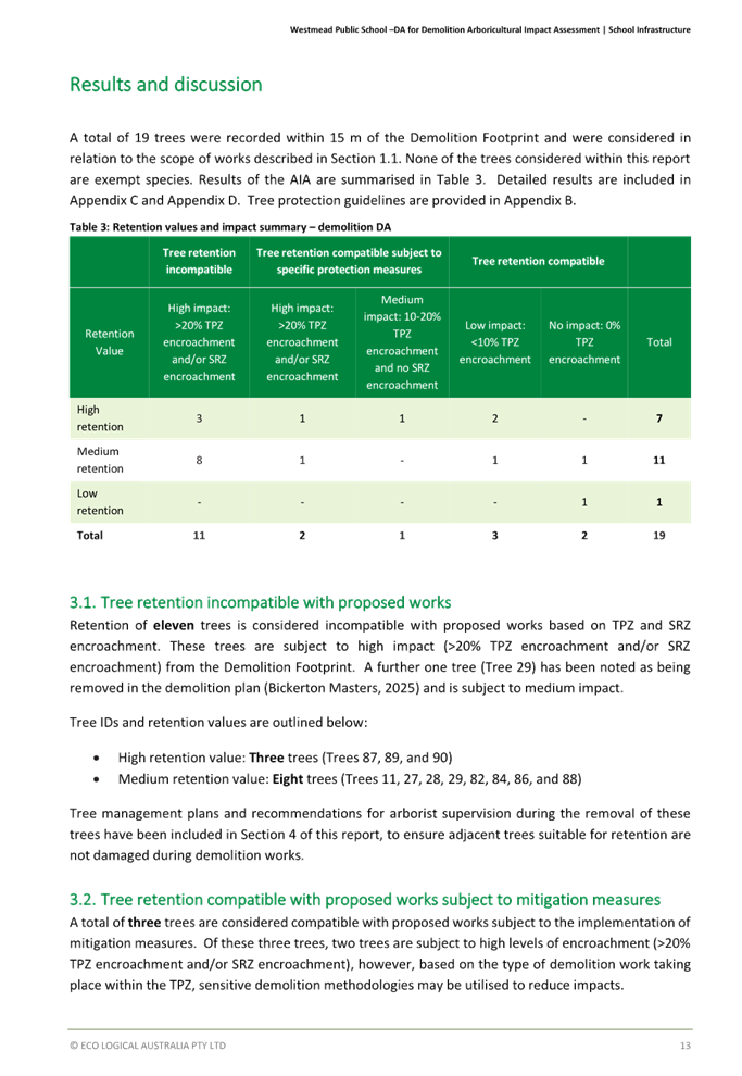
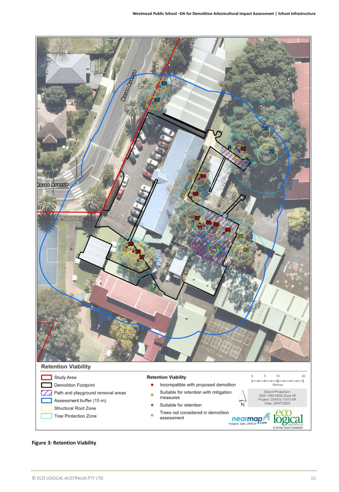
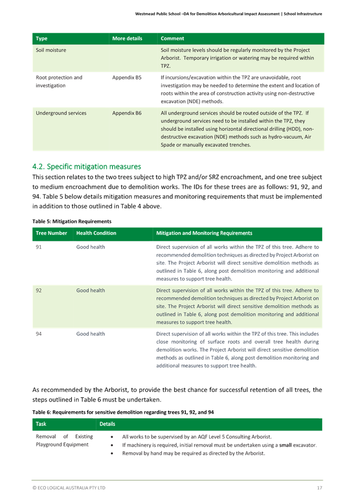
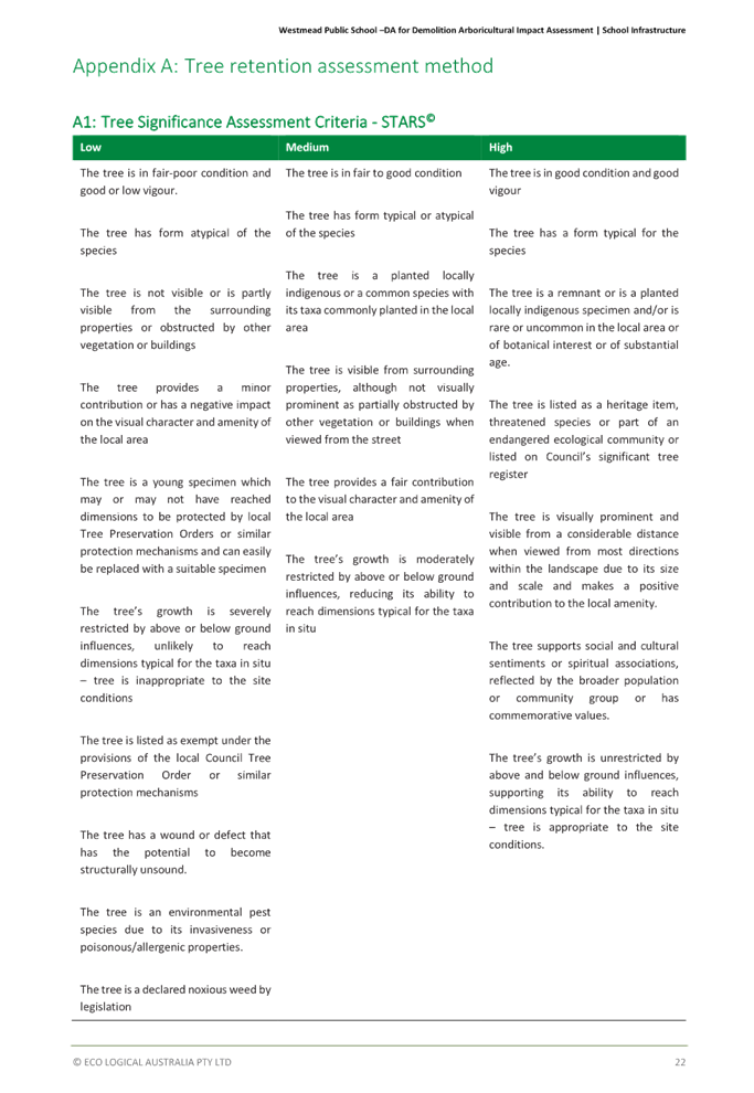
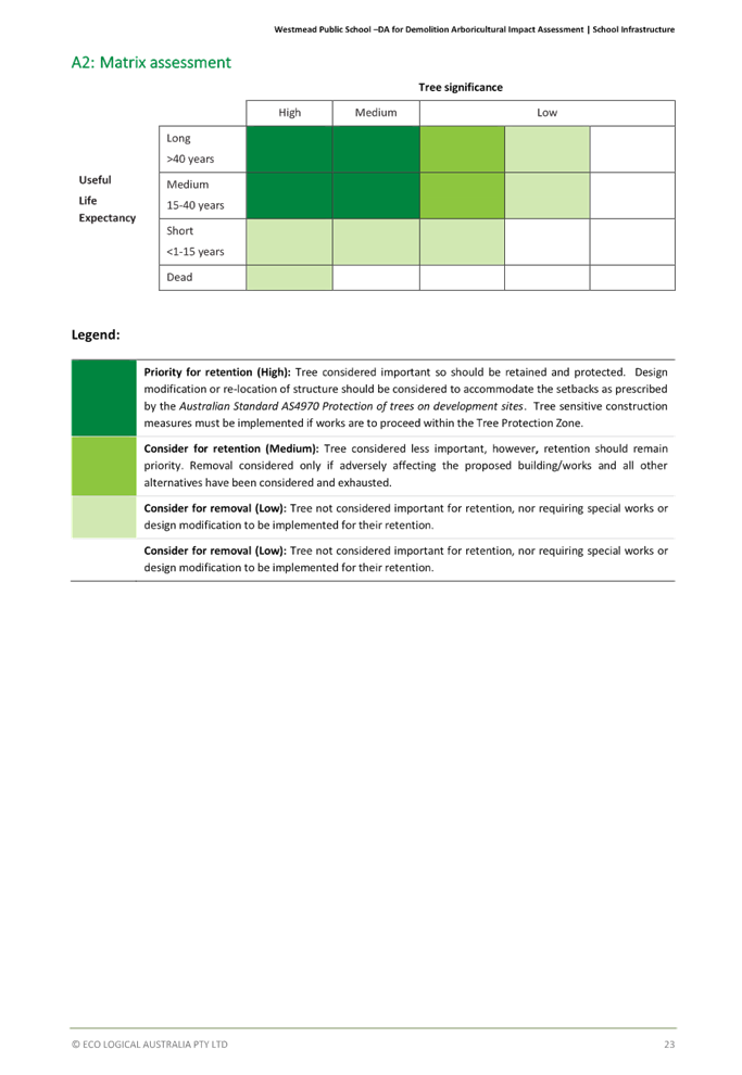
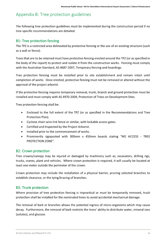
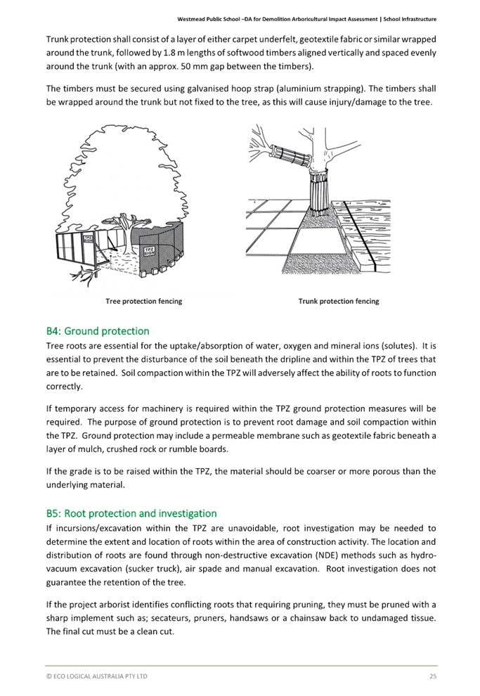

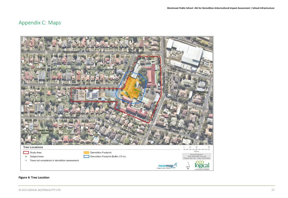
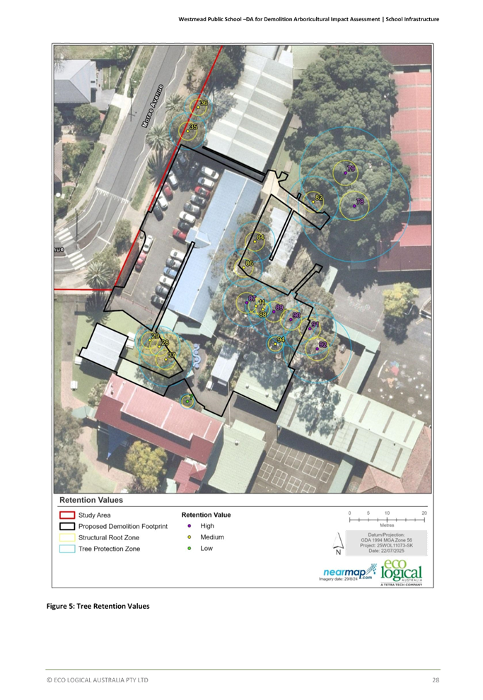
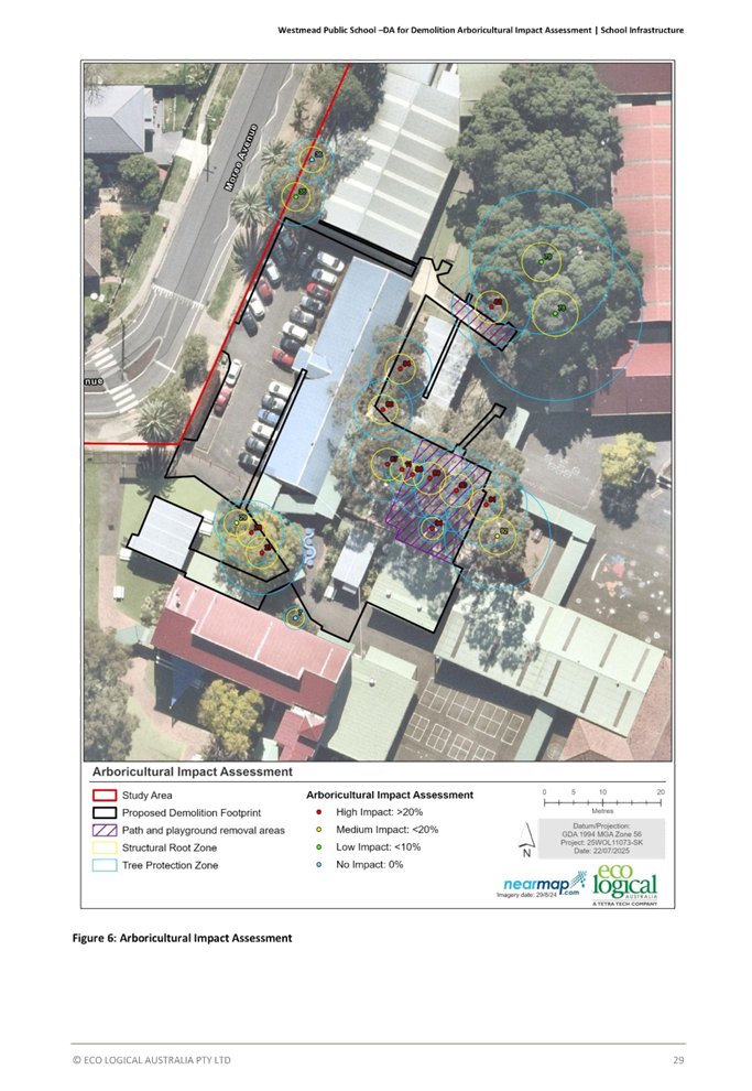

Cumberland
Local Planning Panel Meeting
8 October 2025
Item No: ELPP026/25
Development
application - 66 Irrigation Road, Merrylands
Directorate: Environment
and Planning
Responsible
Officer: Executive
Manager City Planning and Development
|
Application
lodged
|
17 June 2025
|
|
Applicant
|
J Tannous
|
|
Owner
|
Mr W Wehbe
|
|
Application
No.
|
DA2025/0398
|
|
Description
of Land
|
66 Irrigation Road
MERRYLANDS NSW 2160, Lot 11 in DP 25504
|
|
Proposed
Development
|
Demolition of existing
structures and construction of a detached two storey dual Occupancy with
Torrens Title subdivision and a secondary dwelling to the rear of each lot
pursuant to the State Environmental Planning Policy (Housing) 2021
|
|
Site
Area
|
788.6m2 (by
calculation)
|
|
Zoning
|
R2 Low Density Residential
Zone
|
|
Disclosure
of political donations and gifts
|
Nil disclosure
|
|
Cost
of works
|
$1,521,827.10
|
|
Heritage
|
No – Subject site is not
Heritage Listed or within a Heritage Conservation Area
|
|
Principal
Development Standards
|
Minimum Lot Size for a
detached secondary dwelling under Clause 53(2)(a) of State Environmental
Planning Policy (Housing) 2021 (SEPP(Housing)).
Minimum lot size requirement:
450m2
Proposed lot size:
· Lot
1: 393.18m2
· Lot
2: 390.92m2
|
|
Issues
|
Variation to Clause 53(2)(a)
of SEPP(Housing)/ Setbacks/ Frontage/ Submission
|
1. Development
Application No. DA2025/0398 was lodged on 17 June 2025 for the demolition of
existing structures and construction of a detached two storey dual Occupancy
with Torrens Title subdivision and a secondary dwelling to the rear of each lot
pursuant to the State Environmental Planning Policy (Housing) 2021.
2. The
application was publicly notified to occupants and owners of the adjoining
properties for a period of 14 days between 24 June 2025 and 8 July 2025. In
response, one (1) submission was received.
3. There
is no heritage items located on, or in the vicinity of the subject site, nor is
the site located within a Heritage Conservation Area.
The variations are as follows:
|
Control
|
Required
|
Provided
|
% variation
|
|
Minimum Lot size
Clause 53(2)(a) (SEPP (Housing))
|
450m2
|
Lot 1: 393.18m2
Lot 2: 390.92m2
|
Lot 1: 12.6%
Lot 2: 13.1%
|
|
Front Setback
2.1A Building Envelopes,
Objective 2.1A-2 (Low Rise Housing Diversity Design Guide)
|
6.21m
|
Unit 1: 6.416m
Unit 2: 6.409m
|
Unit 1: 3.3%.
Unit 2: 3.2%
|
|
Side Setback
(First Floor)
2.1A Building
Envelopes, Objective 2.1A-3 (Low Rise Housing Diversity Design Guide)
|
Unit 1: 1.7m
Unit 2: 1.725m
|
Unit 1:
Eastern side setback: 1.050m – 1.650m
Western side setback: 900mm
Unit 2:
Eastern side setback: 935mm – 988mm
Western side setback: 1.050m – 1.650m
|
Unit 1:
38%
47%.
Unit 2:
Maximum 45.8%
39.1%.
|
|
Minimum
frontage
2.1G
Orientation, Siting and Subdivision, Objective 2.1G- 1 (Low Rise Housing
Diversity Design Guide)
|
18m detached
|
17.365m
|
3.5%
|
|
Building
Separation for detached dual occupancy
2.1G
Orientation, Siting and Subdivision, Objective 2.1G-8 (Low Rise
Housing Diversity Design Guide)
|
3m
|
2.1m
|
30%
|
4. The
application is referred to the Panel as the proposal contravenes a development
standard by more than 10%. (Clause 53(2)(a) of SEPP (Housing).
5. The
application is recommended for Approval subject to the conditions as
recommended in Council’s assessment report.
Subject Site and Surrounding
Area
The site is legally defined as Lot
11 in DP 25504 and is known as 66 Irrigation Road MERRYLANDS NSW 2160.
The site has an area of 788.6m2 (by calculation) and a frontage to Irrigation
Road of 17.365m. The site has a fall of approximately 2.13m from rear to front.
A site inspection of the premises
was carried out on 18 September 2025, and it was confirmed that the site is
currently occupied by a single storey clad dwelling house with tiled roof and
ancillary attached and detached structures including an attached carport, a
detached garage, metal shed, and associated hard paved areas. There are no
trees are located within the subject site. One (1) tree is located on
council’s nature strip. A Sydney water sewer traverses through the
eastern side boundary of the site.
The existing developments
adjoining the site include single storey dwellings with ancillary detached
structures to the rear. The area consists of predominately low-density
residential buildings, inclusive of one and two storey dwellings, secondary
dwellings, and dual occupancy developments.
The location of the site is shown
below:
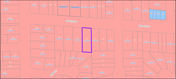
Figure
1 – Locality Plan of subject site (Source: IntraMaps)
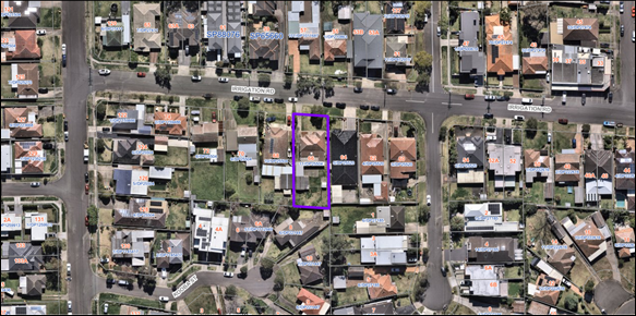
Figure
2 – Aerial view of subject site (Source: NearMaps)
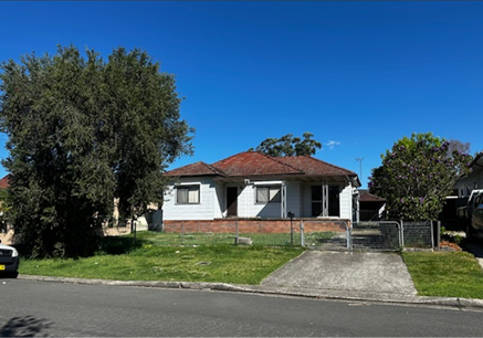
Figure
3 – Street view of subject site (Site Inspection conducted on 08/09/2025)
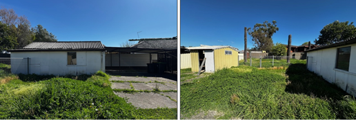
Figure
4-5 – Rear of subject site as viewed from the eastern side boundary and
northwestern corner (Site Inspection conducted on 08/09/2025)
Description
of The Development
Council has received a development
application for the demolition of existing structures and construction of a
detached two storey dual Occupancy with Torrens Title subdivision and a
secondary dwelling to the rear of each lot pursuant to the State Environmental
Planning Policy (Housing) 2021.
· Demolition of
existing structures consisting of the following:
- Demolition
of existing single storey clad dwelling house and attached ancillary
structures;
- Demolition
of an attached carport structure;
- Demolition
of a detached fibro garage and shed structure; and
- Demolition
of all paved areas including the existing driveway.
· Construction of a
two-storey detached dual occupancy with each dwelling consisting of the
following:
- Ground
floor: Single garage; front porch; lounge room; guest bedroom; water closet;
laundry room; staircase to first floor; linin cupboard; open plan kitchen with
WIP, family and dining area; and attached rear alfresco with BBQ area.
- First
floor: One (1) Master bedroom with ensuite, walk-in-robe and with built in
robe; three (3) bedrooms (standalone) with built in robe; common bathroom;
sitting area; linen cupboard; staircase to ground floor and void.
· Construction of a
detached secondary dwelling to the rear of each dwelling consisting of the
following:
- Attached
porch; open plan kitchen and living area; bathroom / laundry room; and two (2)
bedrooms with built in robe.
· Separate vehicular
crossings and driveway for each dwelling.
· Torrens title
subdivision of the development is sought to create two lots.
- Lot
1 = Site area of 393.18 sqm, and frontage of 8.634m.
- Lot
2 = Site area of 390.92 sqm, and frontage of 8.731m.
History
There are no Environment
Protection Orders (EPA) or relevant historical approvals associated with the
subject site.
Applicants Supporting
Statement
The applicant has provided a
Statement of Environmental Effects dated May 2025 in support of the
application.
The applicant has also submitted a
Clause 4.6 statement prepared by Plan2Comply Pty Ltd, Revision 2, dated 20
August 2025 in support of the application. The applicant has submitted a clause
4.6 variation request for a deviation to Clause 53(2)(a) of the SEPP (Housing
Contact With Relevant
Parties
The assessing officer has
undertaken a site inspection of the subject site and surrounding properties and
has been in regular contact with the applicant throughout the assessment
process.
Internal Referrals
Tree Management
The development application was
reviewed by Council’s Tree Management Officer, who advised that the
proposal is acceptable subject to conditions relating to tree removal,
replacement, protection, preservation, and maintenance. Accordingly, the
application can be supported, subject to the recommended conditions of consent
External Referrals
Sydney Water Cooperation
Due to the presence of a sewer
line traversing through the eastern side boundary of the site, the development
application was referred to the Sydney Water Corporation for comments. Advice
has been received by the relevant government authority (Sydney Water) on 27
June 2025. Sydney Water did not raise any objections to the proposed
development subject to the recommended conditions including Sydney Water
‘Tap In’ Building Plan, out of scope building plan approval and
general tree planting requirements.
Planning Comments
The provisions of any
Environmental Planning Instruments (EP&A Act s4.15 (1)(a)(i))
State Environmental Planning
Policies
The proposed development is
affected by the following State Environmental Planning Policies:
|
State
Environmental Planning Policies (SEPPs)
|
Relevant
Clause(s)
|
Compliance
with Requirements
|
|
State Environmental Planning Policy (Biodiversity and
Conservation) 2021
|
Chapter 2 -Vegetation in non
Rural Areas
|
The development application
includes the removal of Removal of one (1) Callistemon viminalis tree
located on council’s nature strip. The proposal has been reviewed and
supported by Council’s Tree Management unit, subject to conditions
pertaining tree replacement, protection, preservation, and maintenance.
The proposal does not exceed the
biodiversity offsets scheme threshold. Therefore, the proposed vegetation
removal is considered acceptable.
|
|
Chapter 6 -
Water Catchments
Sydney Harbour Catchment
|
A detailed assessment is not
required given that there is no direct impact upon the catchment and no
direct impact upon watercourses. As such, the development is acceptable under
the provisions that came into effect on Monday 21 November 2022.
|
|
State Environmental Planning Policy (Resilience and
Hazards) 2021
|
Chapter 2 - Coastal Management
|
The subject site is not
identified as a coastal wetland or ‘land identified as “proximity
area for coastal wetlands” or coastal management area.
|
|
Chapter 4 - Remediation of
Land
Part 4.6
|
The subject site has historically been
used for residential purposes. Council is satisfied that the site is suitable
for the proposed development.
As such, it is
considered that the development application is satisfactory under Part 4.6 of
Chapter 4 of the Policy.
|
|
State
Environmental Planning Policy (Sustainable Buildings) 2022
|
Chapter 2 Standards for
residential Development -BASIX
|
BASIX Certificate number 1796944S, 1796948S, 1796955S and
1796956S issued 26 May 2025 have been submitted. It is shown that the
proposal will meet the required target for Water, Thermal Comfort and Energy.
The BASIX Certificate is considered satisfactory.
|
State Environmental Planning
Policy (Housing) 2021
The application has been submitted
under Chapter 3 Part 1 Division 2 of the SEPP (Housing). The proposal generally
complies with the key planning controls contained within Policy, with the
exception of Clause 53(2)(a), which states that a minimum site area of 450m2 is
required for a detached secondary dwelling.
Notwithstanding the variation
noted above, the proposed development is considered acceptable from an
environmental planning viewpoint. A comprehensive assessment against the SEPP
(Housing) and a discussion of the clause 4.6 request is provided below.
|
Relevant Clause
|
Planning
Commentary
|
Compliance
|
|
50 This Part applies to development for the
purposes of a secondary dwelling on land in a residential zone if development
for the purposes of a dwelling house is permissible on the land under another
environmental planning instrument.
|
Subject site located within the
R2 Low Density Residential zone. This Part applies to development for the
purposes of a secondary dwelling on land in a residential zone if development
for the purposes of a dwelling house is permissible on the land under another
environmental planning instrument. As per the definitions of this division of
the SEPP, a residential zone includes R2 Low Density Residential Zone.
In this regard, a secondary
dwelling is permissible under the provisions of the SEPP (Housing).
|
Yes
|
|
51 A secondary dwelling cannot be subdivided from
the subject lot
|
The subject development application
proposes the demolition of existing structures and construction of a detached
two storey dual Occupancy with Torrens Title subdivision and a secondary
dwelling to the rear of each lot. The proposed secondary dwellings will not
be subdivided from their respective lots.
A condition of consent has
been imposed for no separating fences to be erected between the primary and
secondary dwellings on the subject site.
|
Yes
|
|
52 (2) Development consent must not be granted
for development to which this Part applies unless—
|
The proposed secondary
dwelling is assessed against Division 2, Clause 52(2) of the SEPP (Housing).
Refer to the detailed assessment against all subclauses of Clause 52 below.
|
Yes
|
|
Subclause 2(a)
Only one (1) primary dwelling
and only one (1) secondary dwelling is permitted on the subject land
|
This proposal consists of a
detached dual occupancy development with Torrens Title subdivision and
a secondary dwelling to the rear of each lot. A summary of the proposed
subdivision and associated dwellings is as follows:
· Lot
1: One primary dwelling and one secondary dwelling
· Lot
2: One primary dwelling and one secondary dwelling
|
Yes
|
|
Subclause 2(b)
the
total floor area of the principal dwelling and the secondary dwelling is no
more than the maximum floor area permitted for a dwelling house on the land
under another environmental planning instrument, and
|
The site is on land zone R2
Low Density Residential. No FSR is applicable in land zoned R2 under the
Cumberland Local Environmental Plan 2021 (CLEP 2021).
|
Yes
|
|
Subclause 2(c)
the total floor
area of the secondary dwelling is—
(i)
>60 m2 or
(ii) the greater floor area permitted in another
EPI
|
Proposed internal floor area of
each secondary dwelling is 53.5m².
|
Yes
|
|
53(2)(a)
for a detached secondary dwelling—a minimum site area of 450m2,
|
Each resulting lot is subject to a minimum site area
requirement of 450m2. The proposed lot sizes following the
construction of a detached dual occupancy development and Torrens Title
subdivision is as follows:
· Lot 1: 393.18m2
; Variation of 12.6% to the minimum site area requirement.
· Lot 2 : 390.92m2
; Variation of 13.1% to the minimum site area requirement.
A written request to vary the
development standard was submitted in accordance with clause 4.6(3)(a) and
(b) of the CLEP 2021. Please see Clause 4.6 variation discussion below.
|
No – see Clause 4.6 discussion below.
|
|
53(2)(b) the number of
parking spaces provided on the site is the same as the number of parking
spaces provided on the site immediately before the development is carried
out.
|
The application proposes the demolition
of existing structures and construction of a detached two storey dual
Occupancy with Torrens Title subdivision and a secondary dwelling to the rear
of each lot. The application proposes one (1) undercover parking space in the
form of a single garage for each dwelling.
|
Yes
|
Local Environmental Plans
Cumberland Local
Environmental Plan 2021 (CLEP 2021)
The provision of the CLEP 2021 is
applicable to the development proposal. It is noted that the development
achieves compliance with the key statutory requirements of the CLEP 2021 and
the objectives of the R2 Low Density Residential Zone. Discussion about
permissibility and exception to development standards is provided below. Please
refer to attachment 4 for detailed assessment of relevant CLEP 2021 provisions.
(a) Permissibility:
The subject site is zoned R2 Low
Density Residential. The proposal is for the demolition of existing structures
and construction of a detached two storey dual Occupancy with Torrens Title
subdivision and the erection of a ‘secondary dwelling’ to the rear
of each lot which is a prohibited land use under the CLEP 2021. However,
pursuant to Clause 50 of State Environmental Planning Policy (Housing) 2021 the
following applies:
development for the purposes of
a secondary dwelling on land in a residential zone if development for the
purposes of a dwelling house is permissible on the land under another
environmental planning instrument.
As per the definitions within this
division of the SEPP, a residential zone includes R2 Low Density Residential
Zone. A dual detached occupancy with Torrens Title subdivision is a permissible
land use within the R2 zone under the CLEP 2021. In this regard, a secondary
dwelling is permissible with consent within the R2 zoned land under the
provisions of the SEPP (Housing).
The relevant matters to be
considered under the CLEP 2021 and the applicable clauses for the proposed
development are summarised below. A comprehensive CLEP 2021 assessment is
contained in Attachment 4.
(b) Clause
4.6 – Variation to Clause 53(2)(a) - Minimum Site Area
Clause 4.6 aims to achieve better
design outcomes for and from development by allowing an appropriate degree of
flexibility to development standards if particular circumstances are satisfied.
The application seeks to vary the
minimum site area requirement of 450m2 for a detached secondary dwelling as
required by Clause 53(2)(a) of State Environmental Planning Policy (Housing)
2021. The proposed lot sizes following the construction of a detached dual
occupancy development and Torrens Title subdivision is as follows:
· Lot 1: 393.18m2 ;
Variation of 12.6% to the minimum site area requirement.
· Lot 2 : 390.92m2 ;
Variation of 13.1% to the minimum site area requirement.
Consent may only be granted upon
the consent authority being satisfied that the applicant has demonstrated in a
document submitted with the application that (a) compliance with the
development standard is unreasonable or unnecessary in the circumstances and
(b) there are sufficient environmental planning grounds to justify the
contravention of the development standard.
(a) compliance
with the development standard is unreasonable or unnecessary in the
circumstances.
The decision of Wehbe v
Pittwater Council (2007) 156 LGERA 446; [2007] NSWLEC 827, affirmed in Initial
Action Pty Ltd v Woollahra Municipal Council [2018] NSWLEC 118 set out five
common and non-exhaustive ways in which an applicant might demonstrate that
compliance with a development standard is unreasonable or unnecessary. They
were that:
(i) the
objectives of the development standard are achieved notwithstanding
non-compliance with the standard.
(ii) the
underlying objective or purpose is not relevant to the development with the
consequence that compliance is unnecessary.
(iii) the
underlying objective or purpose would be defeated or thwarted if compliance was
required with the consequence that compliance is unreasonable.
(iv) the
development standard has been virtually abandoned or destroyed by the
Council’s decisions in granting development consents that depart from the
standard and hence compliance with the standard is unnecessary and
unreasonable.
(v) the
zoning of the particular land on which the development is proposed to be
carried out was unreasonable or inappropriate so that the development standard,
which was appropriate for that zoning, was also unreasonable or unnecessary as
it applied to that land and that compliance with the standard in the
circumstances of the case would also be unreasonable or unnecessary.
Applicant’s
justification:
The applicant relies on the
principles established in Wehbe v Pittwater Council [2007], specifically
Tests 1, and 3, in support of the submitted proposal.
- Wehbe
Test 1 – "The objectives of the development standard are achieved
notwithstanding non-compliance with the standard."
The applicant contends that
compliance with the minimum lot size development standard is considered both
unreasonable and unnecessary in the circumstances of this application. In Four2Five
Pty Ltd v Ashfield Council [2015] NSWLEC 1004, the Land and Environment
Court confirmed that Clause 4.6(3)(a) may be satisfied by demonstrating a lack
of environmental harm and sufficient planning merit to support the variation.
The Court in Four2Five also
referred to the earlier and well-established decision in Wehbe v Pittwater
Council [2007] NSWLEC 827, which held that the most accepted approach to
demonstrate that compliance is unreasonable or unnecessary is by showing that
the objectives of the development standard are achieved despite the numerical
non-compliance.
In this case, the proposed
development meets the planning objectives of the lot size
control—specifically, the orderly and functional provision of secondary
dwellings—even though it does not comply with the 450m² minimum site
area.
The application of the Wehbe
five-part test is considered useful in demonstrating the merit of the proposal
and the absence of any adverse planning or environmental impacts resulting from
the variation.
Although originally developed in
the context of SEPP 1, the Wehbe tests remain highly relevant and have been
consistently applied in Clause 4.6 assessments. While not exhaustive or
prescriptive, they provide a structured and well-accepted framework to assist
the consent authority in determining whether a variation to the development
standard is warranted.
In this instance, the proposal is
considered to satisfy the threshold required to support the variation under
Clause 4.6.
In Initial Action Pty Ltd v Woollahra
Municipal Council [2018] NSWLEC 118, Chief Justice Preston clarified that,
where a development standard lacks explicit objectives, it is appropriate to
consider related provisions with stated objectives to assess whether the
planning intent has been achieved despite non-compliance. This ensures the
intent of the planning framework is properly considered, even in the absence of
objectives in the specific clause being varied.
Clause 53(2)(a) of the State
Environmental Planning Policy (Housing) 2021 prescribes a minimum site area of
450m² for detached secondary dwellings. However, this clause does not
contain specific objectives, and broader planning context must therefore be
used in applying Clause 4.6 of the relevant Environmental Planning Instrument.
- Wehbe
Test 3 – "The underlying objective or purpose would be defeated or
thwarted if compliance was required and therefore compliance is
unreasonable."
The applicant contends that
Compliance with the standard would thwart or defeat the objective of the
standard (and therefore it is unreasonable to require compliance). Strict
compliance with the 450m² site area standard would prevent a development
that is otherwise entirely consistent with the prevailing subdivision and
housing pattern within the Merrylands locality, which is currently undergoing a
measured transition toward higher housing diversity. The proposed breach
enables a development that reflects the evolving character of the area, where
similar Torrens title subdivisions and the inclusion of secondary dwellings on
lots below 450m² have been previously approved and constructed.
· The proposed
allotments are compatible with both the existing subdivision layout and the
emerging built form in the locality, particularly in relation to streetscape
scale, setbacks, and density.
· The variation does
not result in any loss of significant views, overshadowing, or reduction in
visual or acoustic privacy.
· The non-compliance
does not generate any adverse environmental or amenity impacts and facilitates
an outcome that is appropriate for the orderly, efficient, and economic use of
a well-located residential site.
· The development
incorporates strong urban design principles, including articulation, generous
setbacks, and landscaping, which contribute positively to the visual character
of the street and local area.
The environmental planning
benefits facilitated by the variation are substantial. The subdivision supports
two functional and well-designed dwellings (each with a secondary dwelling) on
lots that remain practical, liveable, and consistent with both strategic
planning goals and the surrounding development pattern. It enables the
provision of a generous street setback and the creation of a modest residential
dwelling. The variation also facilitates the provision of generous building
articulation.
As such, requiring strict
compliance with the numerical standard would unreasonably obstruct a
development that delivers improved design outcomes, increases housing
diversity, and supports the desired future character of the precinct.
A review of the locality indicates
a growing trend of similar low-scale infill housing, including dual occupancies
and ancillary dwellings on modestly sized lots. The proposed development is
consistent with this evolving pattern, and the built form will integrate
harmoniously into the existing streetscape.
While the development does not
meet the strict numerical requirement for minimum lot size, the planning merit
of the proposal; including its scale, design, and contribution to housing
diversity justifies the variation.
In this instance, varying the
development standard will facilitate a contextually appropriate and beneficial
outcome for the locality.
Planner’s comments:
The proposed development is
consistent with objectives of the Housing SEPP 2021, which are broad principles
which seek to promote diverse housing types, address the needs of vulnerable
community members, provide residents with a reasonable level of amenity,
encourage housing in well-serviced locations, minimise environmental and
climate impacts, ensure design compatibility that enhances the local area,
support short-term rental accommodation, and prevent the loss of existing
affordable rental housing. Furthermore, the proposal generally complies with
the CLEP 2021, the Cumberland Development Control Plan 2021 (CDCP 2021), Low
Rise Housing Diversity Design Guide (with the exception of merits) and
the SEPP (Housing), notwithstanding the exception noted under Clause 53(2)(a).
It is considered that the proposal
is consistent with the desired low-density character of the area. The proposal
provides sufficient height, bulk and scale that is generally consistent with
the relevant planning instruments, and the correlation between the building
height and density is considered appropriate. As demonstrated in the attached
assessment tables the development is compliant with the amenity requirements of
the relevant planning instruments. If the development were made to comply there
would be no significant improvement with respect to the amenity within the
development or surrounding neighbours and would be conflicting with principles
of the SEPP (Housing). In this regard, Council considers compliance to be
unnecessary in the circumstances of the case.
(b) there
are sufficient environmental planning grounds to justify the contravention of
the development standard.
In respect of there being
sufficient environmental planning grounds to justify the contravention of the
development standard, Initial Action found that although the phrase
‘environmental planning’ is not defined, it would refer to grounds
that relate to the subject matter, scope and purpose of the Environmental
Planning and Assessment Act 1979, including the objects in s.1.3. to be
sufficient, the environmental planning grounds advanced in the written request
must justify the contravention of the development standard, not simply promote
the benefits of carrying out the development as a whole Four2Five Pty Ltd v
Ashfield Council [2015] NSWCA 248.
Applicant’s
justification:
To demonstrate that sufficient
environmental planning grounds exist, it is necessary to consider the specific
circumstances surrounding the proposed variation.
This request seeks Council’s
consent to contravene Clause 53(2)(a) of the SEPP (Housing), which prescribes a
minimum site area of 450m² for detached secondary dwellings. In this case,
each proposed allotment will have a respective value of 393.18sqm (lot 1) and
390.92sqm (lot 2).
The variation enables a form of
development that aligns with the desired future character of the area, which is
experiencing a gradual transition in terms of housing diversity and subdivision
scale. This variation allows for a design that is more compatible with the
established and emerging built form in the locality.
· The proposed
allotments are consistent with the existing pattern of subdivision in the
surrounding area and reflect the evolving development character within
Merrylands.
· The built form has
been carefully designed to respond positively to its context, incorporating
suitable setbacks, open space, and articulation that together contribute to an
enhanced urban design outcome.
· The variation
facilitates a practical and orderly subdivision pattern and supports a
low-scale housing form that integrates well with existing residential
dwellings.
· The development
takes advantage of the site’s proximity to public transport, schools,
shops, and open space, providing a highly accessible and liveable housing
solution.
· There is no
material environmental or amenity impact arising from the reduced lot size, and
no loss of streetscape cohesion or character.
Accordingly, it is considered that
there are site-specific circumstances and broader planning benefits which
provide sufficient environmental planning grounds to justify the proposed
variation. The breach enables a contextually appropriate and well-resolved
design outcome that could not reasonably be achieved under strict compliance
with the standard.
Planner’s comments:
Strict compliance with Clause
53(2)(a) of the SEPP (Housing) in relation to the provision of a secondary
dwelling is considered both unreasonable and unnecessary in the context of the
subject application. The proposed development aligns with the key principles of
the SEPP (Housing) and satisfies the objectives applicable to R2 Low Density
Residential zoned land.
Council considers that the
development will protect the amenity of residents within the development and
the adjoining properties subject to conditions of consent. The bulk and scale
of the development is such that surrounding properties will receive sufficient
amenity.
Council is in agreement with the
applicant that strict enforcement and compliance with the lot size development
standard is unreasonable and unnecessary in the context of the subject
application. The development is otherwise consistent with the principles of the
SEPP (Housing) and meets the objectives outlined for R2 Zoned Land.
It is Council’s view that a
lot at least 380 m² in size is sufficient to accommodate a secondary
dwelling. This is demonstrated in CDCP 2021, Part B, Section 2.21, C7. Council
considers the applicants justification to be well founded and the subject site
to be appropriate in size to accommodate the proposed development and that
there are sufficient environmental planning grounds to vary the standard.
Having regard to the nature of the
proposed works and the pattern of similar development within the locality, the
proposal is deemed appropriate in its context. The variation to the development
standard concerning minimum lot size is acceptable on environmental planning
grounds, and the applicant’s written justification is well founded.
Conclusion
Council is satisfied that the
applicant’s written request has appropriately addressed the requirements
set out under Clause 4.6(3). Furthermore, Council is satisfied that the
proposed development is in the public interest as it demonstrates consistency
with both the objectives of the development standard in question and the
objectives of the R2 Low Density Residential zone in which the development is
situated.
Having assessed the application on
its individual merits, Council officers are of the view that the justification
provided in support of the variation is reasonable and well founded.
Accordingly, the proposed variation to Clause 53(2)(a), relating to minimum lot
size for detached secondary dwellings, is considered acceptable in this
instance.
The provisions of any proposed
instrument that is or has been the subject (EP&A Act s4.15 (1)(a)(ii))
Council has received a Gateway
Determination from the Department of Planning, Housing and Infrastructure for
the Draft Woodville Road Corridor Planning Proposal. As part of this approval,
public exhibition of the Draft Woodville Road Corridor Planning Proposal has
commenced. The public exhibition was carried out between the 4 March 2025 to 17
April 2025.
The Draft Planning Proposal seeks
to revitalise Woodville Road by amending planning controls in the CLEP 2021 for
31 sites located around the three (3) precincts of Woodville North, Merrylands
East and Woodville South.
The subject application was
received on 17 June 2025 and the site does not fall within the Draft Woodville
Road Corridor and therefore no further consideration is required.
The provisions of any
Development Control Plans (EP&A Act s4.15 (1)(a)(iii))
The Cumberland Development Control
Plan 2021 (CDCP 2021) provides guidance for the design and operation of
development to achieve the aims and objectives of the CLEP 2021. A
comprehensive assessment and compliance table is contained in Attachment 5.
The proposed development complies
with the provisions of the CDCP 2021 and the Low Rise Housing Diversity Design
Guide with the exception of the controls outlined below
The development has been assessed
using the following chapters:
· Part A2 –
Subdivision
· Part B1 –
Dwelling Houses and Secondary Dwellings
· Part B2 –
Low Rise Medium Density Development
· Part
G3 – Traffic, Parking, Transport and Access (Vehicle)
· Part G4 –
Stormwater and Drainage
· Part G5 –
Sustainability, Biodiversity and Environmental Management
· Part G7 –
Tree Management and Landscaping
· Part G8 –
Waste Management
· Section 2.1 - Dual
occupancy (Low Rise Housing Diversity Design Guide)
The proposed development includes
non-compliances with the CDCP 2021 and the Low-Rise Housing Diversity Design
Guide, specifically in relation to front and side setbacks, minimum site
frontage, and building separation for detached dual occupancy developments.
The variations relate to the
following provisions:
· Front setback
– Objective 2.1A-2
· Side setback
– Objective 2.1A-3
· Minimum frontage
– Objective 2.1G-1
· Building
separation for detached dual occupancies – Objective 2.1G-8 of the Design
Guide
Notwithstanding these
non-compliances, the proposal is considered to demonstrate sufficient planning
merit and to perform satisfactorily in terms of its environmental planning
impacts. As such, the variations are supported in this instance, as discussed in
the assessment below.
2.1A Building envelope
Low Rise Medium Density Design
Guide for Development Applications, Objective 2.1A-2 - Front setback
Objective
2.1A-2
The development provides a setback
from the front boundary or public space that:
· defines the street edge;
· creates a clear
threshold and transition from public to private space;
· assists in achieving
visual privacy to ground floor dwellings from the street;
· contributes to the
streetscape character and landscape; and
· relates to the existing
streetscape and setback pattern or the desired future streetscape pattern if
different to the existing.
Objective 2.1A-2 of the Low-Rise
Housing Density Guide states where existing dwelling houses or dual occupancies
are within 40m of the development, the front setback shall be the average of
the two closest dwelling houses or dual occupancies.
In this case, the front setback of
the neighbouring properties is 6.841m (approx.) at no. 68 Irrigation Road and
5.584m at no. 64 Irrigation Road. Therefore, the development requires a front
setback of 6.21m.
Unit 1 propose a front setback of
6.416m to the building wall which exceeds the minimum requirement by 206mm
resulting in a variation of 3.3%.
Unit 2 propose a front setback of
6.409m to the building wall which exceeds the minimum requirement by 206mm
resulting in a variation of 3.2%.
The non-compliance is considered
acceptable on merit as the proposal is well-articulated from the street front
façade. Furthermore, the proposal continues to create a clear threshold
and transition from public to private space and contributes to the character of
the local area. It is considered to align with the existing streetscape
characteristics and complies with visual privacy controls.
Low Rise Medium Density Design
Guide for Development Applications, Objective 2.1A-3 Side setback
Objective
2.1A-3
The development provides side
boundary setbacks that reflects the character and separation of buildings
within the surrounding area.
Objective 2.1A-3, Design Criteria
10 of the Guide states that where the development control plan does not
contain side setback controls, the
following side setbacks apply for sites with lot width at the building line of
less than 24m:
Unit 1
Height of building greater than
4.5m and less than 8.5m: (Building height (7.7m) - 4.5m) divided by 4
+0.9m = 1.7m
Unit 2
Height of building greater than
4.5m and less than 8.5m: (Building height (7.8m) - 4.5m) divided by 4
+0.9m = 1.725m
Applying the equation, the minimum
required side setback when the building height is greater than 4.5m to
8.5m is 1.7m for proposed Unit 1,
and 1.725m m for proposed Unit 2.
From the building height of 4.5m
to 8.5m Unit 1 proposes an eastern side setback of 1.050m (variation of 0.65m
or 38%), and a western side setback of 900mm (variation of 0.8m or 47%).
From the building height of 4.5m
to 8.5m Unit 2 proposes an eastern side setback of 935mm (variation of 0.79m or
45.8%.), and a western side setback of 1.050m (variation of 0.675m or 39.1%).
The proposed side setback complies
at the ground floor however are non-compliant at the first floor.
Despite the numerical
non-compliance, the reduced first-floor side setbacks do not detract from the
existing streetscape characteristics along Irrigation Road. The proposed bulk
and scale are considered appropriate, as the design incorporates articulation
along the side boundaries through the use of stepped-in wall elements, windows,
and awning structures. Furthermore, the development complies with the relevant
amenity requirements outlined in CDCP 2021 and the Design Guide, as outlined in
Attachment 5. Accordingly, the proposed variation is considered acceptable in
the context of the site and surrounding development pattern.
2.1G Orientation, Siting and
Subdivision
Low Rise Medium Density Design
Guide for Development Applications, Objective 2.1G-1 Minimum frontage –
Dual Occupancy (detached)
Objective
2.1G-1
To achieve planned residential
density consistent with the local housing strategy
Objective 2.1G-1 of the Low-Rise
Housing Diversity Design Guide and Clause 3.1 (C1) of Part B2 of the CDCP 2021
require a minimum site frontage of 18 metres for detached dual occupancy
developments. The subject site provides a frontage of 17.365 metres to
Irrigation Road, representing a variation of 0.635 metres or 3.5%.
Despite this minor numerical
non-compliance, the proposed development is considered acceptable on planning
merit. The design appropriately responds to the site’s dimensions and is
compatible with the prevailing subdivision pattern in the locality. The reduced
frontage does not adversely impact the visual or spatial character of the
streetscape, and the architectural presentation of the front façade is
consistent with the surrounding built form.
The proposal otherwise complies
with relevant planning controls, including those relating to orientation,
siting, subdivision layout, and the relationship to the public domain. The
variation does not compromise the internal dwelling layout, with adequate room
for circulation, furnishing, and residential amenity.
Key amenity considerations such as
solar access, natural ventilation, privacy, landscaping, and on-site parking
have been satisfactorily addressed. Therefore, the proposed variation to the
minimum frontage control is considered to result in no adverse planning impact,
is supported by the design response, and is acceptable in this instance.
Low Rise Medium Density Design
Guide for Development Applications, Objective 2.1G-8 Building Separation for
detached dual occupancy
Objective
2.1G-8
Provide adequate separation
between buildings to allow for landscape, provide visual separation and
daylight access between buildings
For detached dual occupancy
developments, a minimum separation of 3 metres between the two dwellings is
required. The proposed development provides a separation of 2.1 metres,
representing a variation of 0.9 metres or 30%.
Despite this variation, the
subject site is of sufficient size to accommodate a detached dual occupancy.
The proposal is also consistent with the prevailing subdivision pattern in the
locality. Notably, in accordance with the CDCP 2021, dwelling houses are
required to maintain a minimum side setback of 900mm. Upon subdivision, each
detached dwelling will function as a single dwelling house, for which the
proposed 900mm setback complies with the applicable requirements.
The reduced separation does not
adversely impact visual privacy or amenity and maintains consistency with the
existing streetscape character. Furthermore, the proposal achieves compliance
with relevant amenity considerations, including solar access, ventilation, and
landscaping, as detailed in the CDCP 2021 and Design Guide (refer to Attachment
5).
Accordingly, the proposed
variation is considered consistent with the objectives of Clause 2.1G-8 and is
supported on planning merit.
The provisions of any planning
agreement that has been entered into under section 7.4, or any draft planning
agreement that a developer has offered to enter into under section 7.4
(EP&A Act s4.15(1)(a)(iiia))
There is no draft planning
agreement associated with the subject Development Application.
The provisions of the
Regulations (EP&A Act s4.15 (1)(a)(iv))
The proposed development raises no
concerns as to the relevant matters arising from the Environmental Planning and
Assessment Regulation 2021 (EP&A Reg).
The Likely Environmental,
Social or Economic Impacts (EP&A Act s4.15 (1)(b))
It is considered that the proposed
development will have no significant adverse environmental, social or economic
impacts in the locality.
The suitability of the site for
the development (EP&A Act s4.15 (1)(c))
The subject site and locality are
not known to be affected by any natural hazards or other site constraints
likely to have a significant adverse impact on the proposed development.
Accordingly, it is considered that the development is suitable in the context
of the site and surrounding locality.
Submissions made in accordance
with the Act or Regulation (EP&A Act s4.15 (1)(d))
|
Advertised (Website)
|
Mail
|
Sign
|
Not Required
|
In accordance with Council’s
Notification requirements contained within the CDCP 2021, the proposal was
publicly notified for a period of 14 days between 24 June 2025 and 8 July 2025.
The notification generated one (1) submission in respect of the proposal with
nil disclosing a political donation or gift. The issues raised in the public
submissions are summarised and commented on as follows:
Figure
6 – Submissions summary table
|
Issue
|
Planner’s Comment
|
|
The DA on Council’s website does not include key
documents, such as plans and the Statement of Environmental Effects. Without
these, adjoining landowners cannot properly assess or comment on the proposal.
|
All relevant plans/documents are available on
council’s DA tracker as follows:
- Statement
of Environmental Effects
- Notification
Plan (Site Plan and Elevation Plans)
- Full
Architectural set with redacted floor plans
- Landscape
Plan
- Shadow
Diagram
- Demolition
Plan
- Survey
Plan
- Schedule
of Finishes
- BASIX
Certificates
- Arborist
Report
- Waste
Management Plan
- Design
Verification Statement
|
|
The proposal includes detached secondary dwellings on
lots smaller than 450 sqm, which contravenes the non-discretionary minimum
lot size requirement of 450 sqm under Section 53(2) of SEPP (Housing) 2021.
Detached secondary dwellings are only permitted on lots of at least 450 sqm;
otherwise, they must be attached to the principal dwelling. As this is a
mandatory standard under SEPP and not a discretionary development standard,
it cannot be varied by Council under Clause 4.6 of the LEP. Therefore, the
detached secondary dwellings on lots under 450 sqm are prohibited, and
Council cannot support this aspect of the development.
|
In accordance with Clause 4.6 of the CLEP 2021, and as
permitted under Section 3.33 of the Environmental Planning and Assessment Act
1979 (NSW), applicants are entitled to submit a written request to vary a
development standard.
The applicant has submitted a written request under Clause
4.6(3)(a) and (b), which requires:
(a) That compliance with the
development standard is unreasonable or unnecessary in the circumstances of
the case, and
(b) That there are sufficient
environmental planning grounds to justify the variation.
Council has assessed the request and is satisfied that it
meets the relevant requirements of Clause 4.6(3), and that the proposed
development is in the public interest. This is demonstrated through
consistency with both the objectives of the development standard and the R2
Low Density Residential zone.
As such, the variation to Clause 53(2)(a) (minimum lot
size for detached secondary dwellings) is considered justified, reasonable,
and acceptable based on the individual merits of the application.
|
|
The proposed detached secondary dwellings will
adversely affect the amenity of existing and future residents. The proximity
and height of the rear balconies to the rear boundary will create negative
impacts. Attached secondary dwellings, which allow increased rear setbacks,
are the preferred design on lots under 450 sqm as recognised by SEPP
(Housing) 2021.
The proposal should be redesigned to attach the
secondary dwellings and provide a minimum 3-metre rear setback to reduce
amenity impacts. Given the flat and regular shape of the site, there is no
reasonable justification for the non-compliance, and a more considered design
could achieve the intended development outcome without overdevelopment.
|
The proposed secondary dwellings are single storey. The
maximum building height of the proposed secondary dwellings is 4m. The
proposed finished floor levels are not significantly raised from the natural
ground level, resulting in minimal visual and amenity impacts.
The internal floor areas are below the maximum allowable
under the relevant planning controls, and the overall bulk and scale of the
secondary dwellings are considered appropriate for the site and surrounding
context.
The development provides compliant rear and side setbacks
of 900mm, in accordance with Council’s requirements (C12, Section 2.21,
CDCP 2021), ensuring sufficient spatial separation from adjoining properties.
No rear balconies are proposed, and no living areas or
windows to habitable rooms are located along the rear boundary, thereby
mitigating any potential privacy or overlooking impacts on neighbouring
residences.
The proposal has been assessed on its merits and is
considered to respond appropriately to the surrounding context. The
orientation and layout of the proposed dwellings have been carefully designed
to minimise amenity impacts on adjoining properties, including the private
open space. The proposed secondary dwellings will not detract from the
amenity of adjoining neighbours.
The proposal demonstrates that a detached secondary
dwelling can still comply with all relevant planning controls and maintain
residential amenity. The proposal represents a reasonable and acceptable
built outcome in this context.
|
|
Access to the landscape plan is requested to enable
comment on the proposed fencing strategy.
|
The landscape plan has been made
available on council’s DA tracker. The landscape plan does not entail
fencing detail. The proposal does not involve the removal/erection of any
boundary fencing and does not involve new structures to be built on the
boundary.
Please note that any new fencing
is a civil matter and should be done in consultation with relevant adjoining
site owners.
The following advisory condition
is recommended:
106. DAANN03 - Dividing Fences
The erection of dividing fences
under this consent does not affect the provisions of the Dividing Fences Act
1991. Under this Act, all relevant parties must agree prior to the erection
of any approved dividing fence/s under this consent.
Council has no regulatory
authority in this area and does not adjudicate civil disputes relating to the
provision of or payment for the erection of dividing fences.
If there is a neighbour dispute
about the boundary fence, the Community Justice Centre may provide mediation
services.
In addition to the above the
following conditions are imposed:
13. DACCA04 - Works within
Boundary
No portion of the works are to
encroach beyond the boundaries of the subject property. Alternatively,
documentary evidence that the owner of the adjoining property has no
objection to the required works or access, is to be submitted to the Council
or registered certifier prior to the issue of a Construction Certificate.
(Reason: To ensure protection of
adjoining properties)
66. DADWC10 - Construction
Within Boundary
All approved construction
including but not limited to footings, walls and guttering shall be
constructed wholly within the boundaries of the site.
(Reason: To prevent encroachment
on other land)
The purpose of the above conditions is to ensure work is
maintained within the subject site.
|
THE PUBLIC INTEREST (EP&A
ACT S4.15(1)(E))
In view of the foregoing analysis,
it is considered that the development, if carried out subject to the conditions
set out in the recommendation below, will have no significant adverse impacts
on the public interest.
CUMBERLAND LOCAL INFRASTRUCTURE
CONTRIBUTIONS PLANS 2020
The development would require the
payment of contributions in accordance with Cumberland Local Infrastructure
Contributions Plan 2020.
In accordance with the
Contribution Plan a contribution is payable, pursuant to Section 7.11 of the
EP&A Act, calculated on the cost of works. A total contribution of
$58,167.00 would be payable prior to the issue of a Construction Certificate.
HOUSING AND PRODUCTIVITY OF
CONTRIBUTION (HPC)
In accordance with s7.24, s7.26
and s7.28 of the Environmental Planning and Assessment Act, 1979, the proposed
development is subject to the payment of the Housing and Productivity
Contribution (HPC).
A condition of consent has been
imposed on the development consent in accordance with s7.28 of the EP&A Act
1979 requiring the payment of the HPC.
DISCLOSURE OF POLITICAL
DONATIONS AND GIFTS
The applicant and notification
process did not result in any disclosure of Political Donations and Gifts.
The development application has
been assessed in accordance with the relevant requirements of the Environmental
Planning and Assessment Act 1979, Statement Environmental Planning Policy
(Housing) 2021, CLEP 2021 and CDCP 2021 and is considered to be satisfactory
for approval subject to the conditions of the development consent.
The proposed development is
appropriately located within the R2 – Low Density Residential Zone under
the relevant provisions of the Cumberland LEP 2021, however a variation the
minimum lot size requirement for a detached secondary dwelling under Clause
53(2)(a) development standard, pursuant to the Statement Environmental Planning
Policy (Housing) 2021 is sought.
Having regard to the assessment of
the proposal from a merit perspective, Council may be satisfied that the
development has been responsibly designed and provides for acceptable levels of
amenity for future residents. It is considered that the proposal successfully
minimises adverse impacts on the amenity of neighbouring properties. Hence the
development, irrespective of the departures noted above, is consistent with the
intentions of Council’s planning controls and represents a form of
development contemplated by the relevant statutory and non-statutory controls
applying to the land.
For these reasons, it is
considered that the proposal is satisfactory having regard to the matters of
consideration under Section 4.15 of the Environmental Planning and Assessment
Act 1979, and the development may be approved subject to conditions
There are no consultation
processes for Council associated with this report.
There are no financial
implications for Council associated with this report.
There are no policy implications
for Council associated with this report.
Communication / Publications:
The final outcome of this matter
will be notified. The objectors will also be notified in writing of the
outcome.
1. That
the Clause 4.6 variation request to contravene the minimum lot size requirement
for a detached secondary dwelling under Clause 53(2)(a) development standard,
pursuant to the SEPP (Housing) 2021, be supported.
2. That
Development Application No. DA2025/0398 for the demolition of existing
structures and construction of a detached two storey dual Occupancy with
Torrens Title subdivision and a secondary dwelling to the rear of each lot
pursuant to the State Environmental Planning Policy (Housing) 2021 on land at
66 Irrigation Road MERRYLANDS NSW 2160 be Approved subject to
conditions listed in the attached schedule.
3. Persons
whom have lodged a submission in respect to the application be notified of the
determination of the application.
1. Draft Notice
of Determination
2. Architectural
Plans
3. Clause
4.6 Variation Report
4. Appendix
A - Cumberland LEP 2021 Assessment
5. Appendix
B - Cumberland DCP 2021 Assessment
6. Redacted
Submission
DOCUMENTS
ASSOCIATED WITH
REPORT ELPP026/25
Attachment 1
Draft Notice of Determination
Cumberland
Local Planning Panel Meeting
8 October 2025
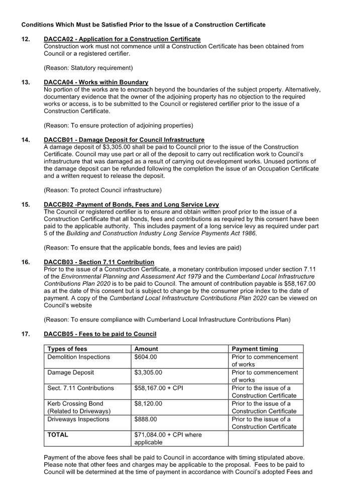
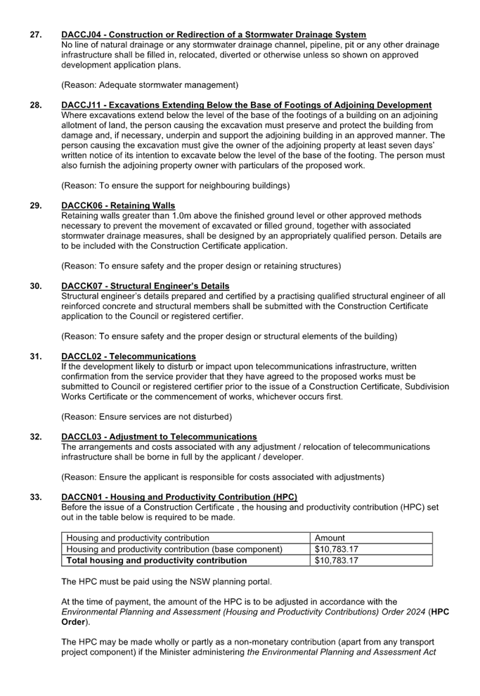
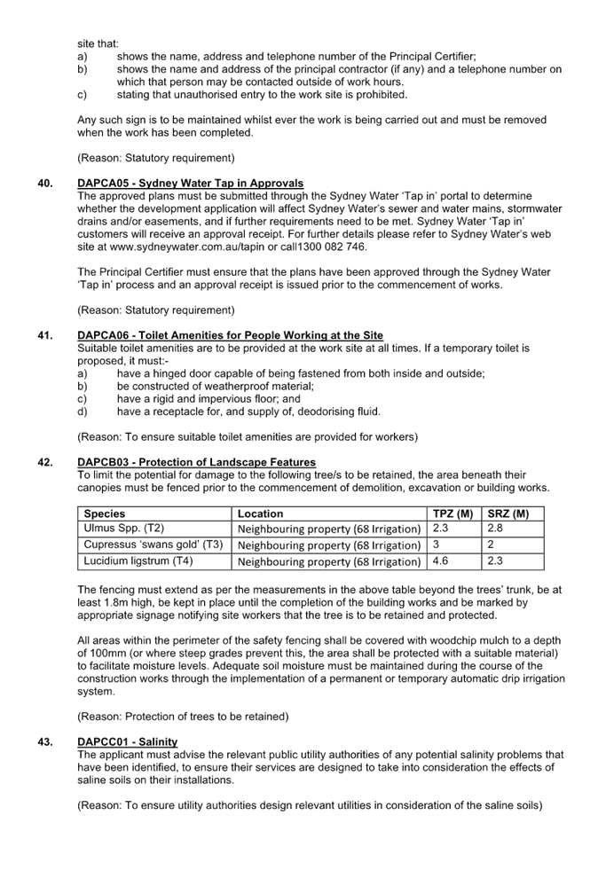
DOCUMENTS
ASSOCIATED WITH
REPORT ELPP026/25
Attachment 2
Architectural Plans
Cumberland
Local Planning Panel Meeting
8 October 2025
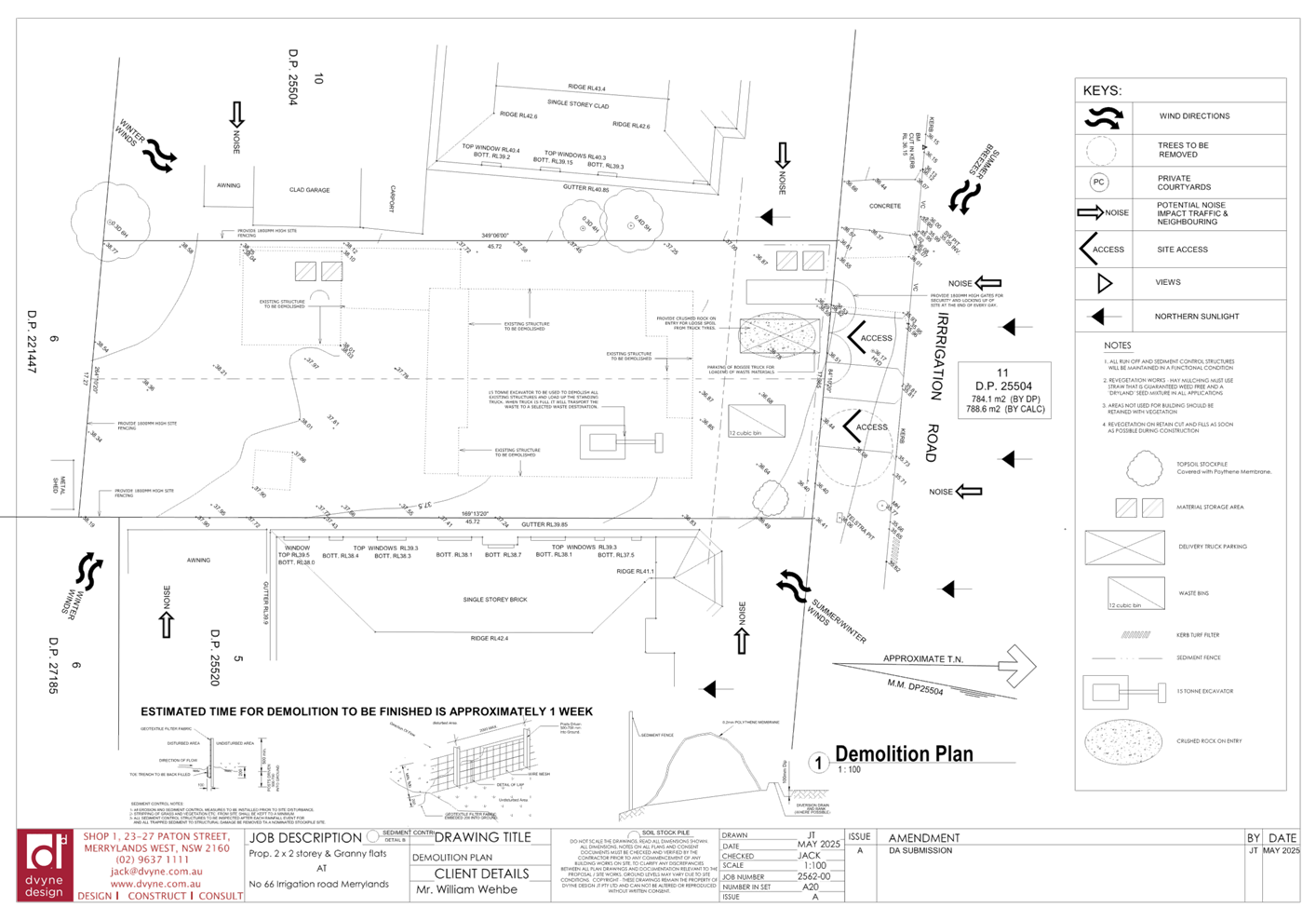
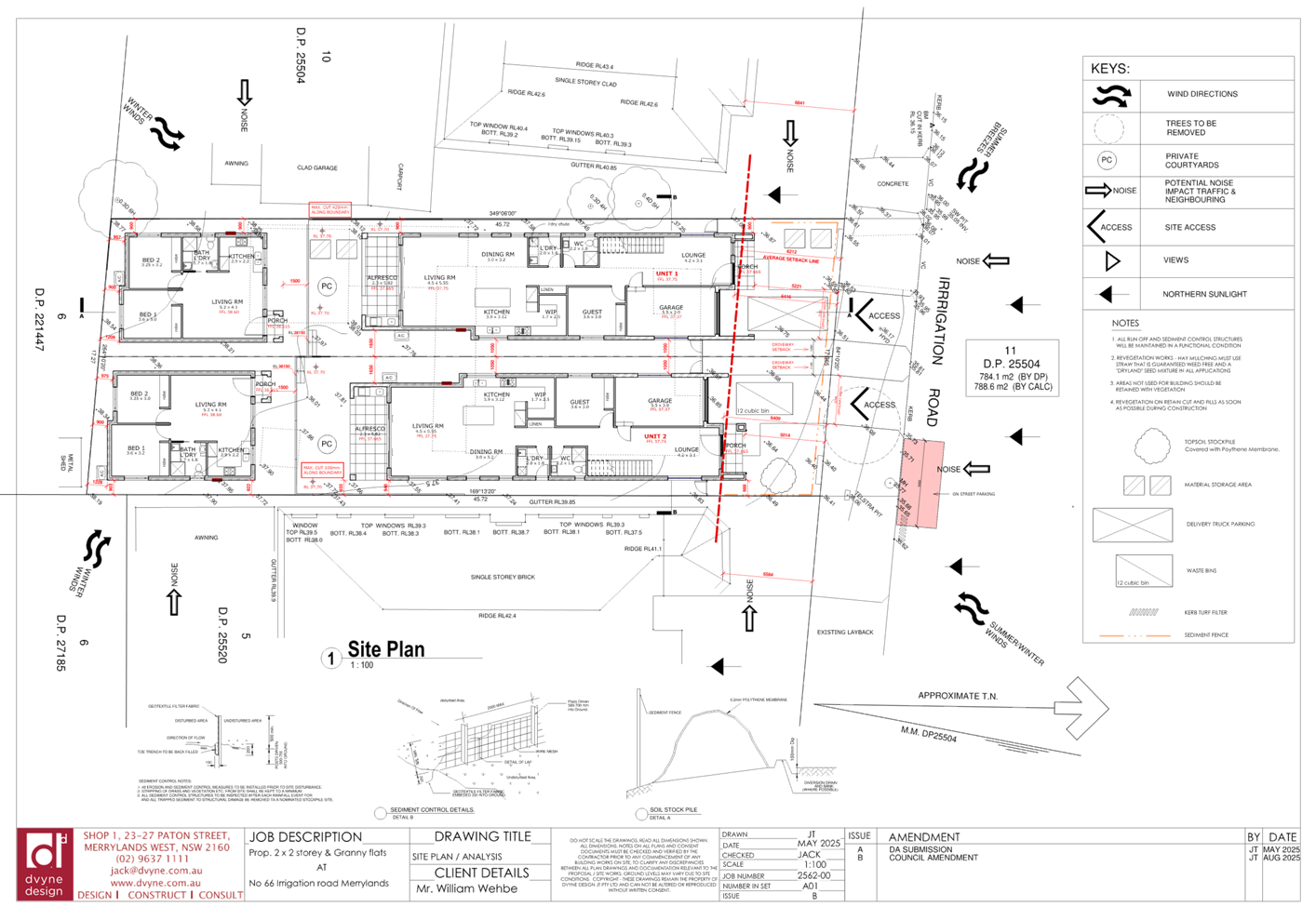
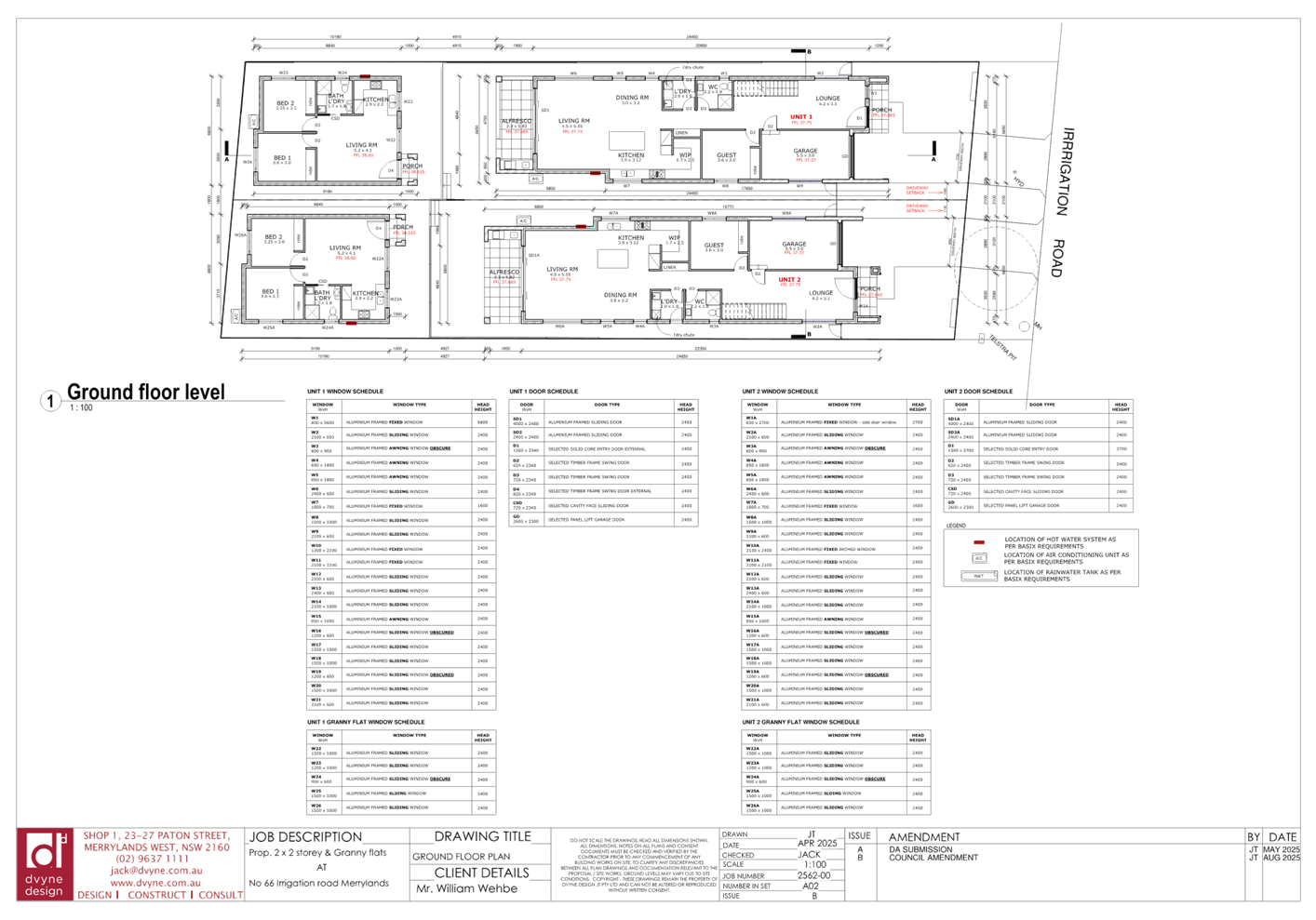
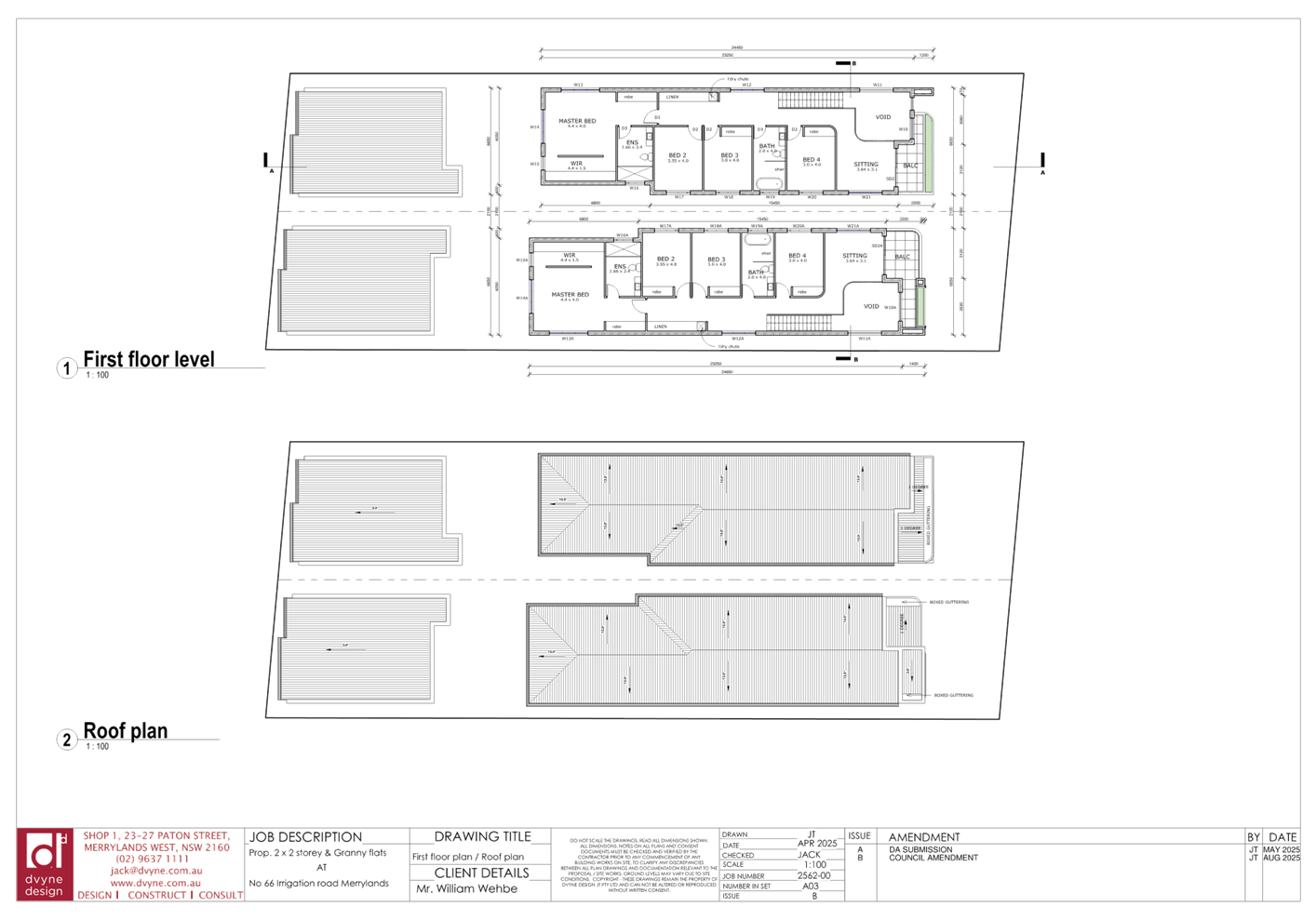
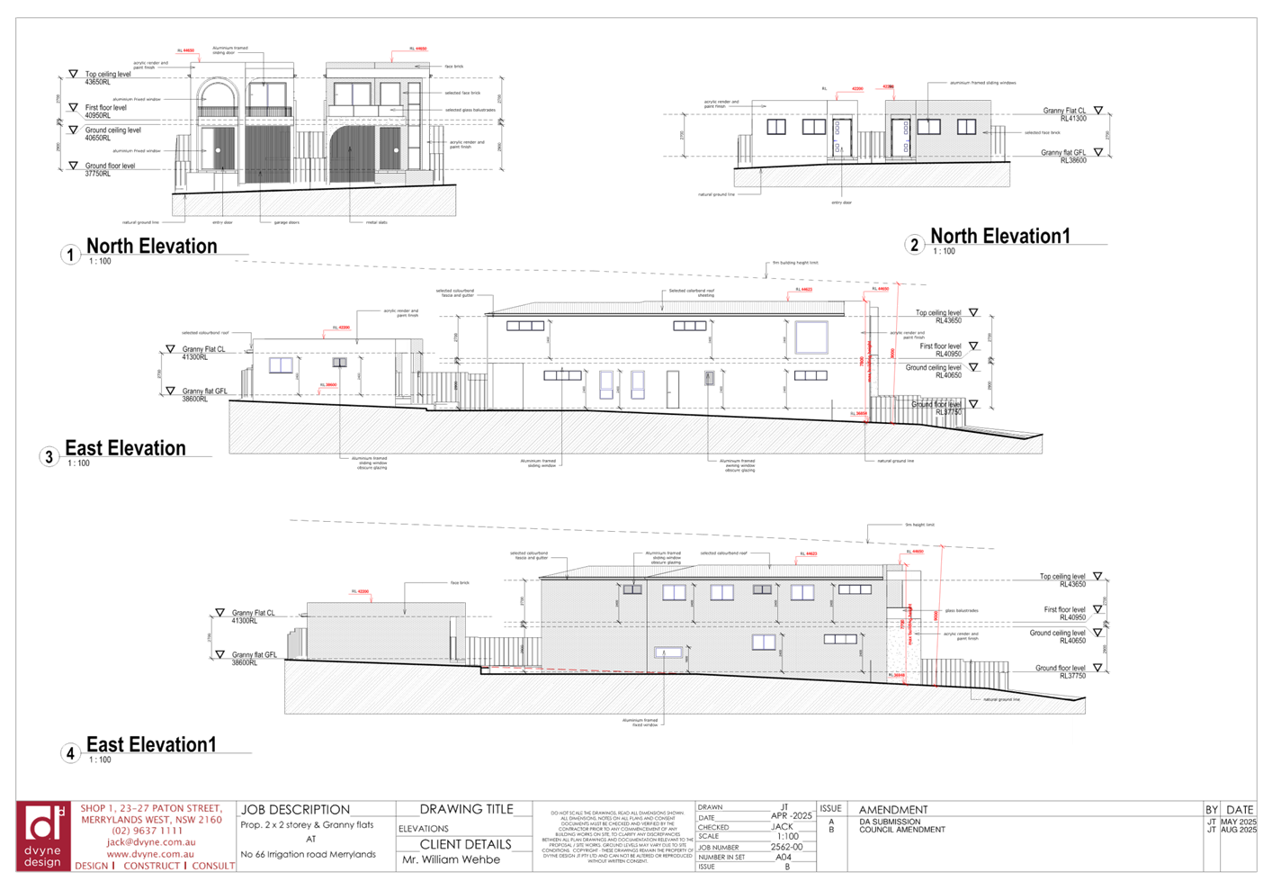
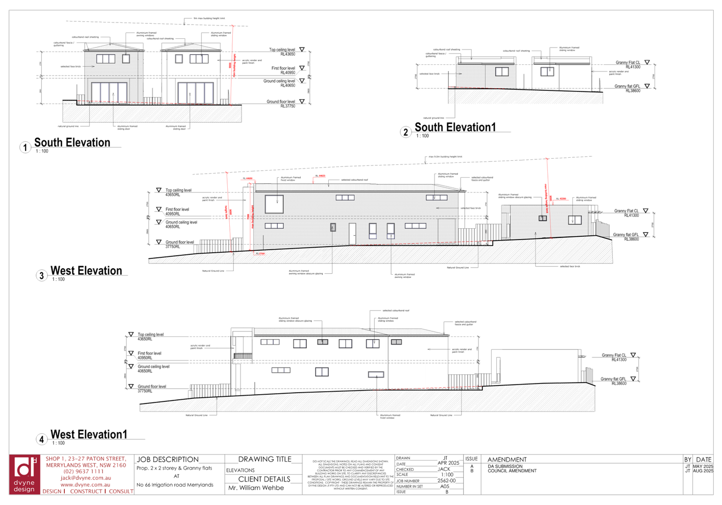
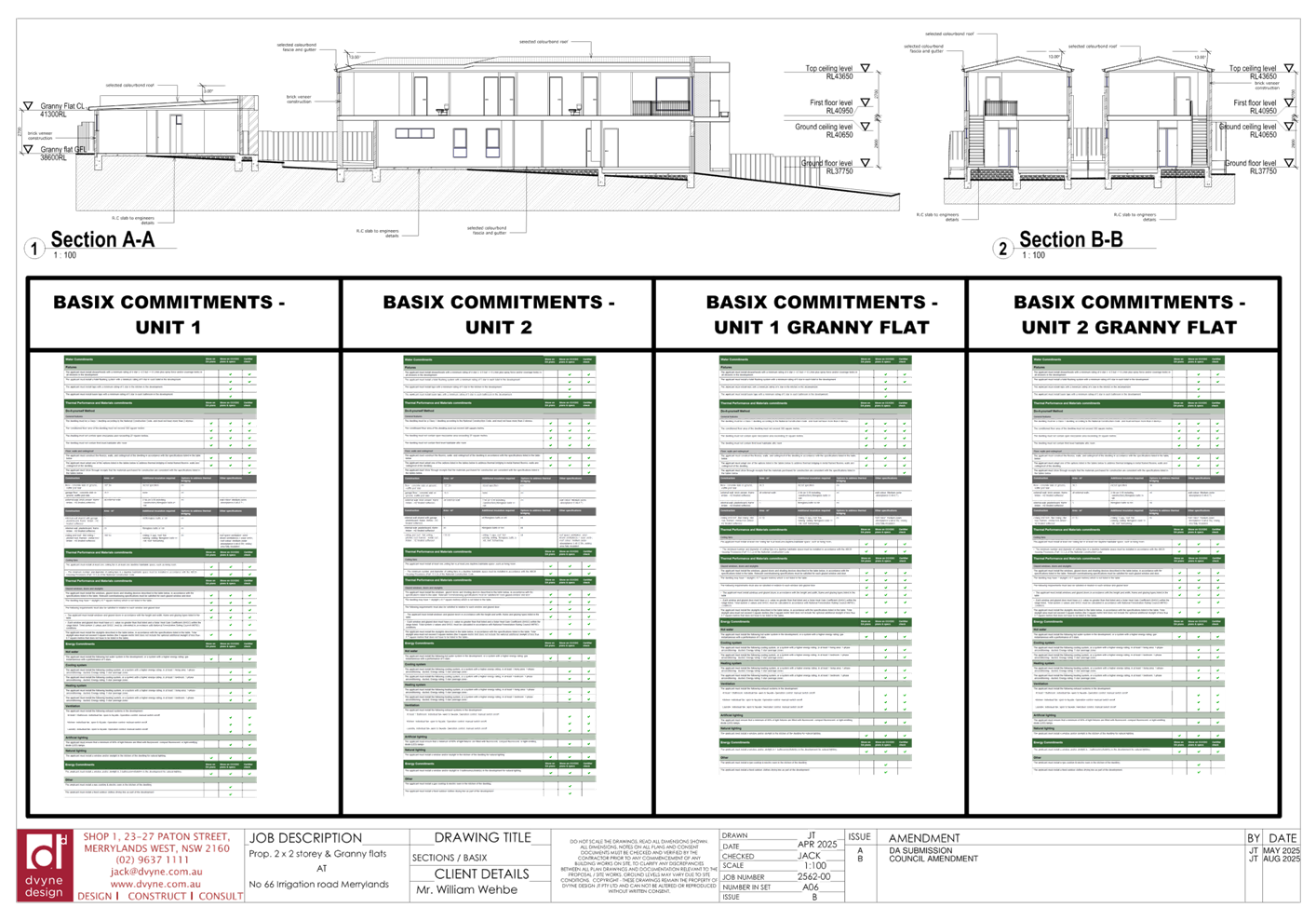
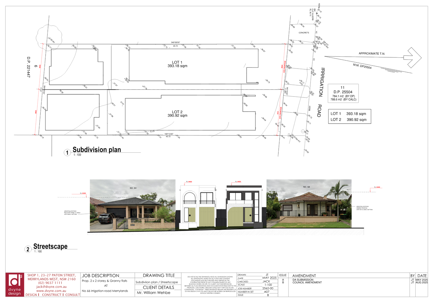
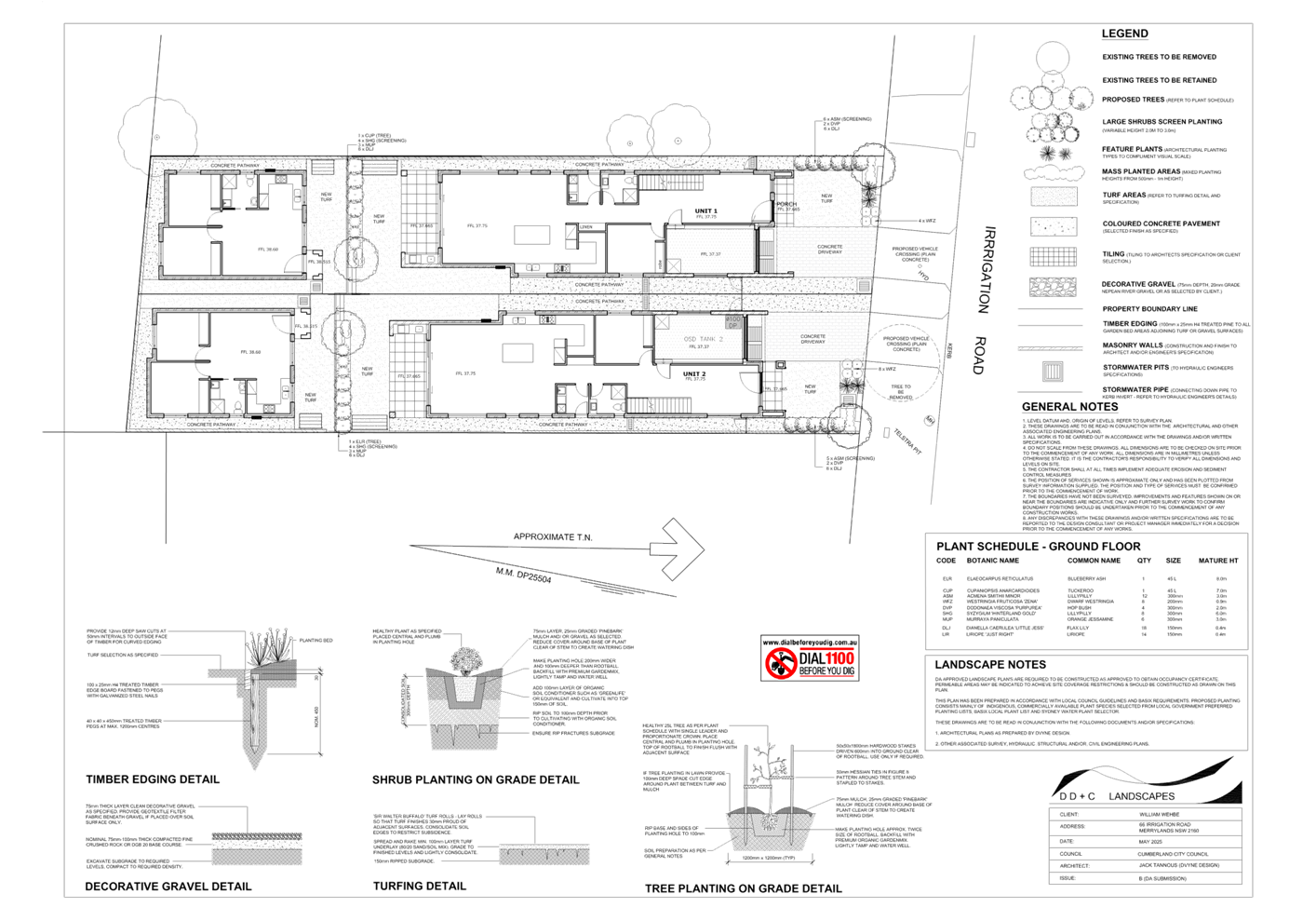
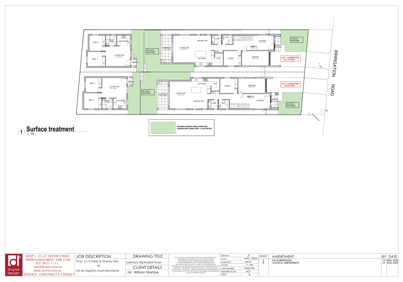
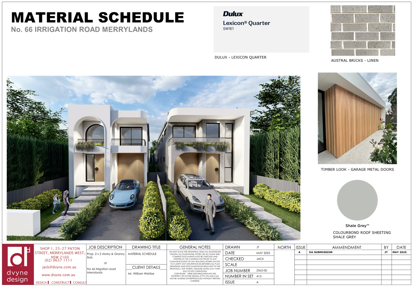
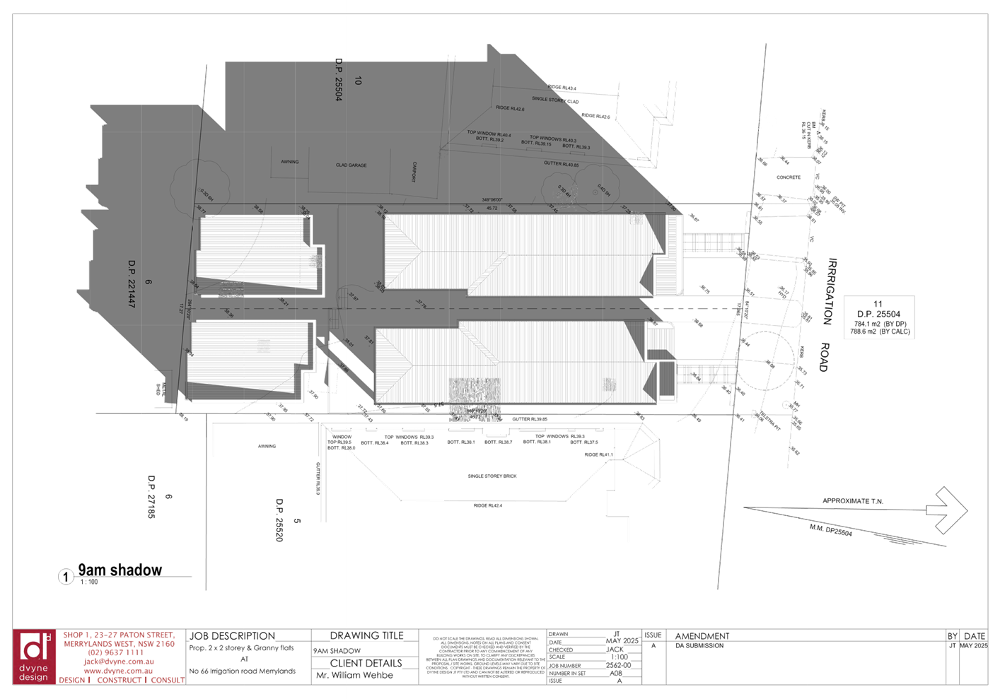
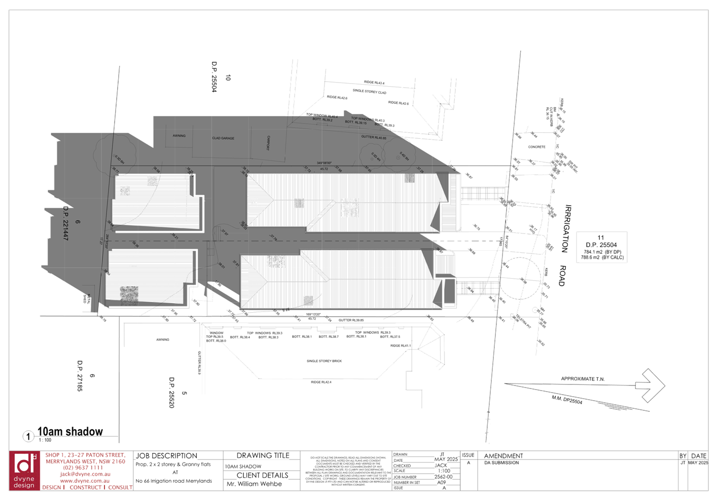
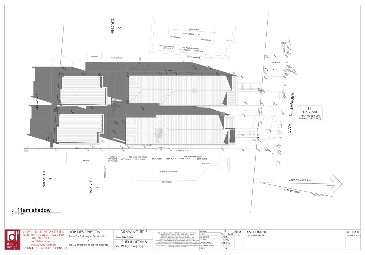
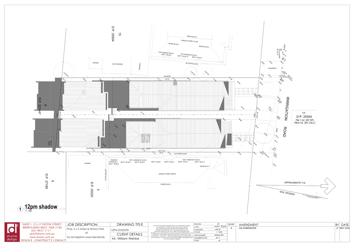
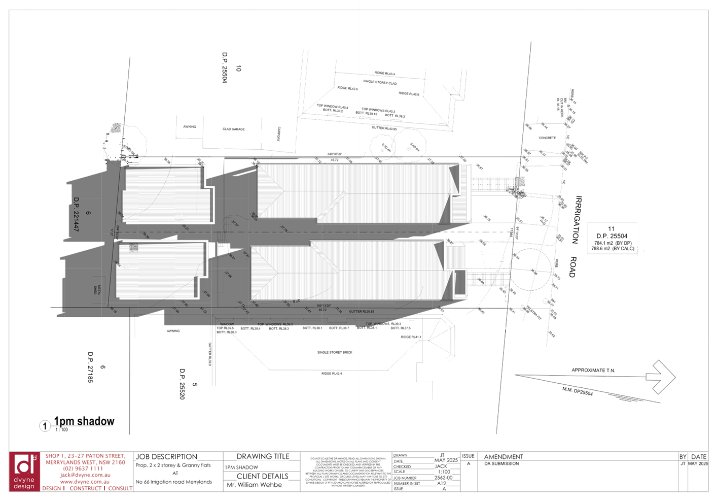
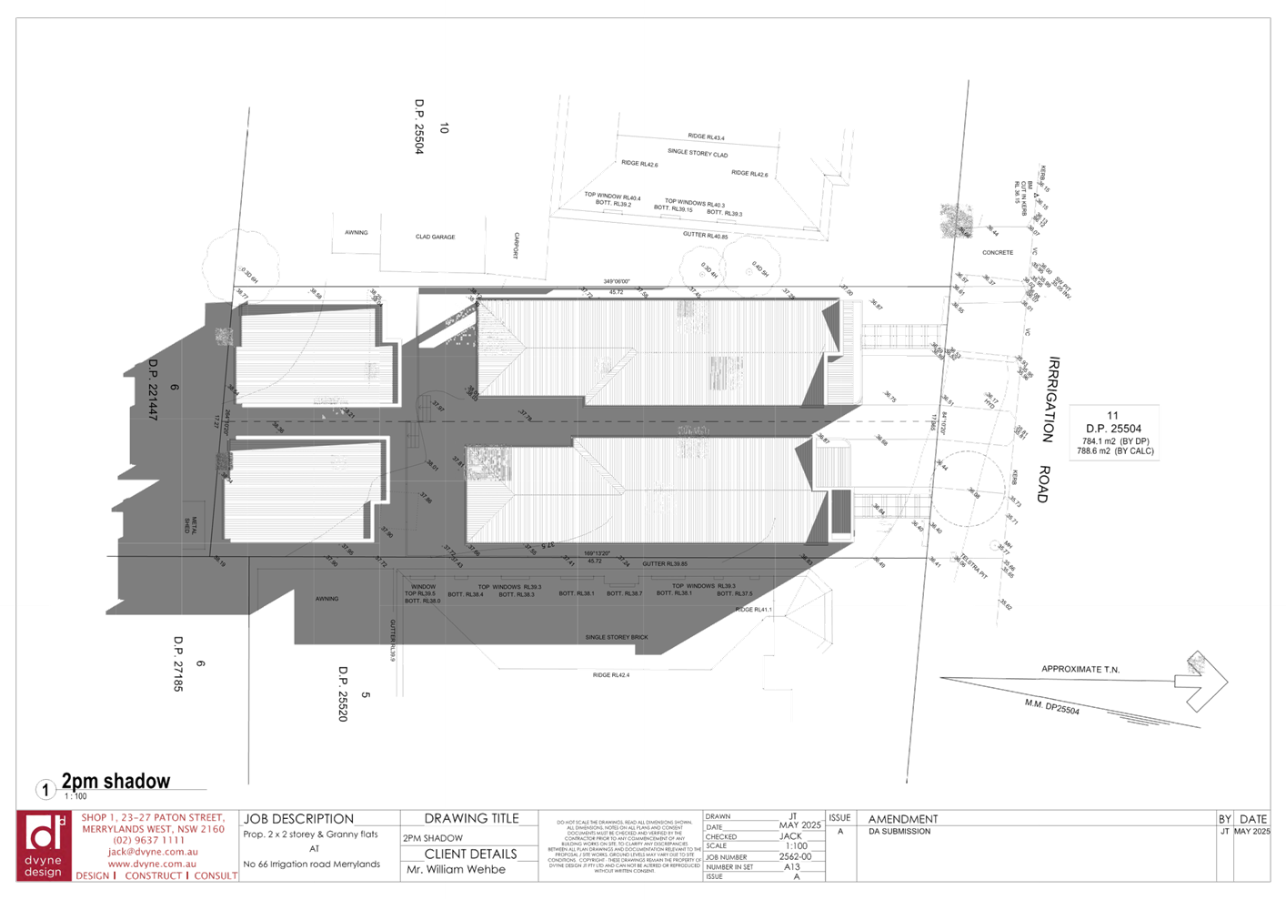
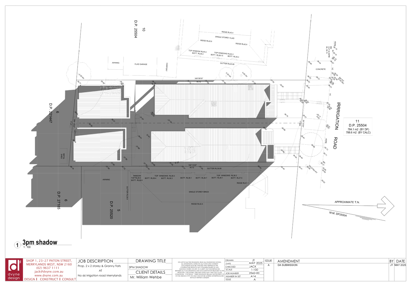
DOCUMENTS
ASSOCIATED WITH
REPORT ELPP026/25
Attachment 3
Clause 4.6 Variation Report
Cumberland
Local Planning Panel Meeting
8 October 2025

DOCUMENTS
ASSOCIATED WITH
REPORT ELPP026/25
Attachment 4
Appendix A - Cumberland LEP 2021 Assessment
Cumberland
Local Planning Panel Meeting
8 October 2025
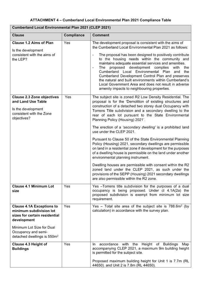
DOCUMENTS
ASSOCIATED WITH
REPORT ELPP026/25
Attachment 5
Appendix B - Cumberland DCP 2021 Assessment
Cumberland
Local Planning Panel Meeting
8 October 2025
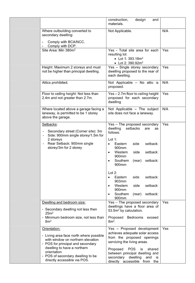
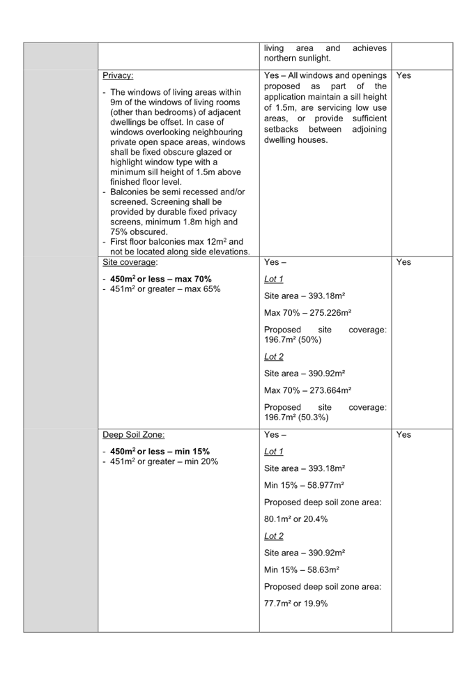
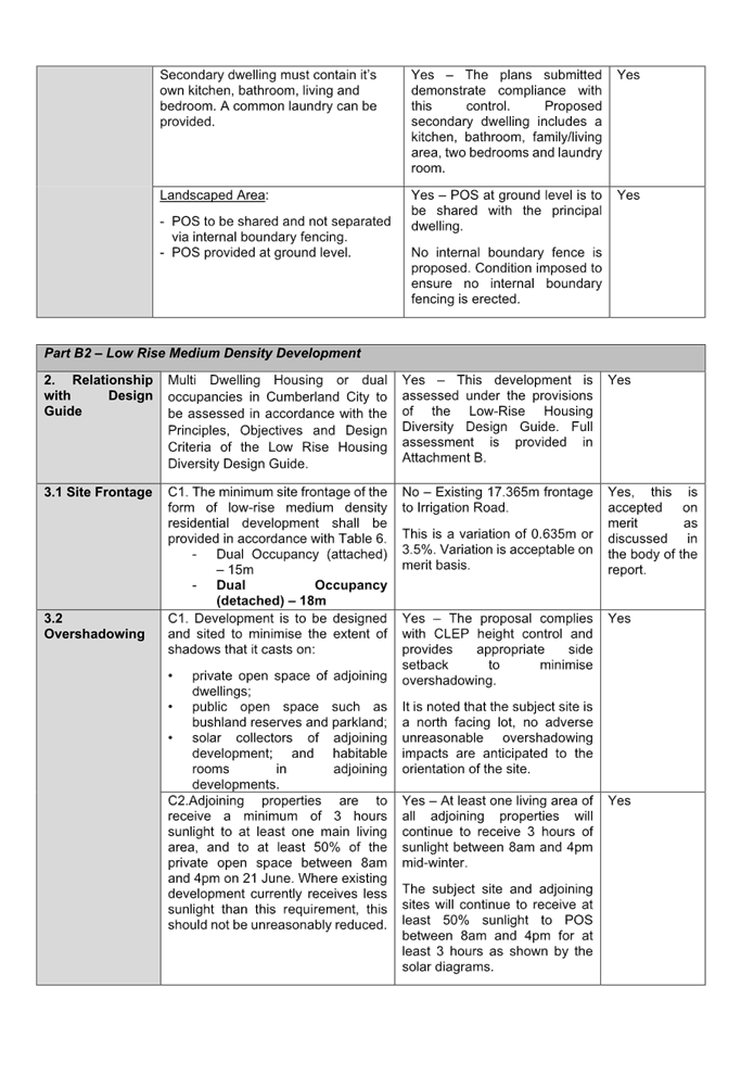
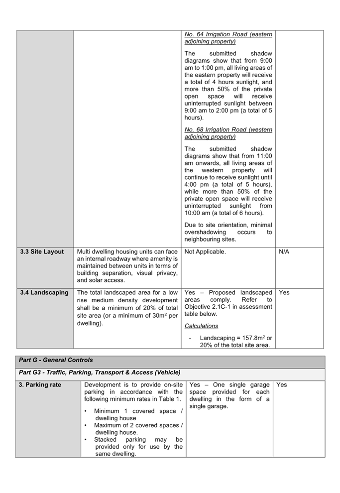
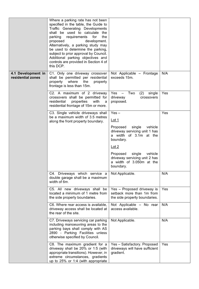
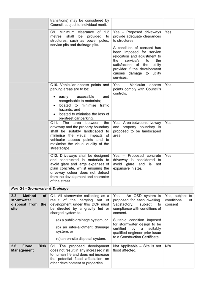
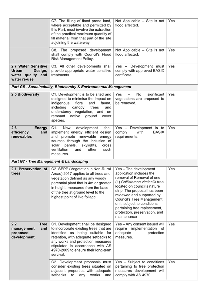
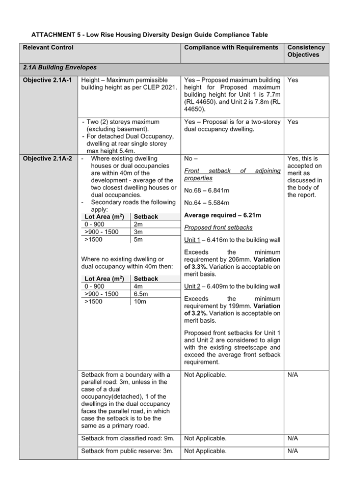
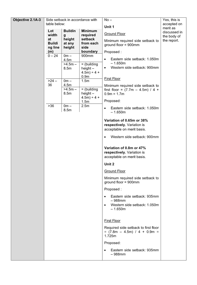
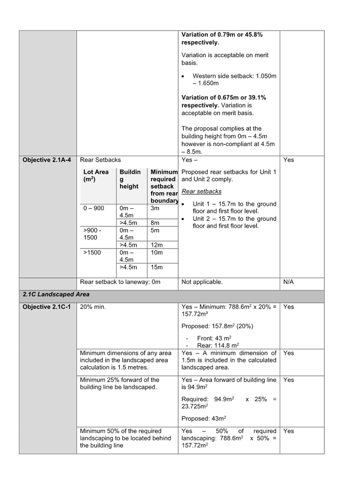
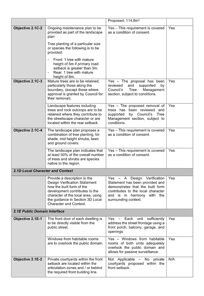
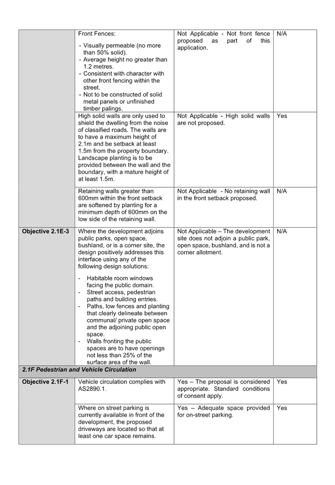
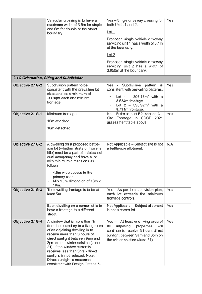
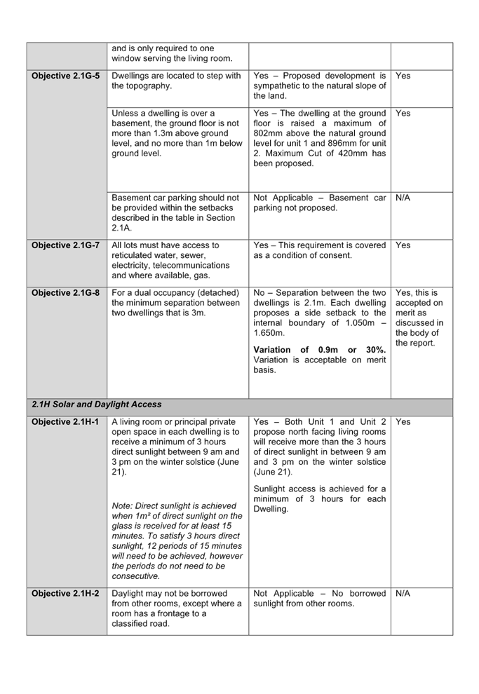
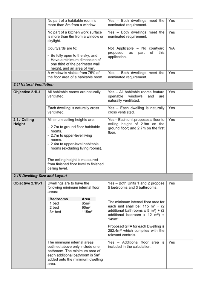
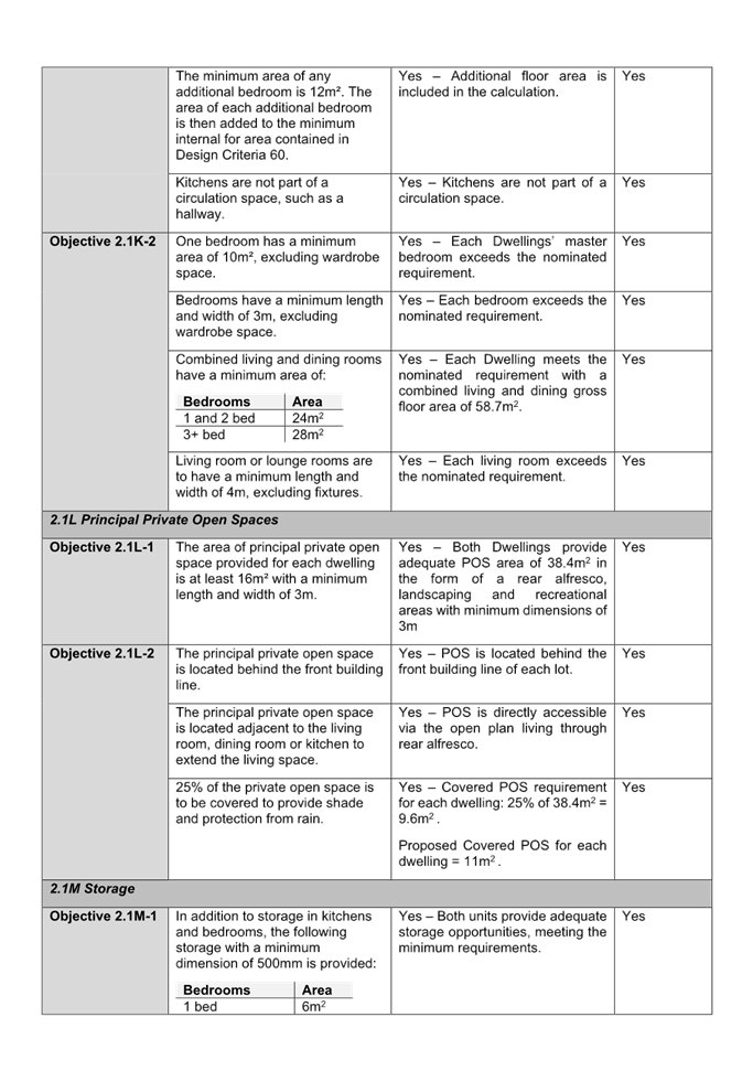
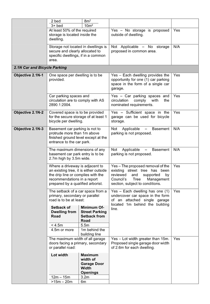
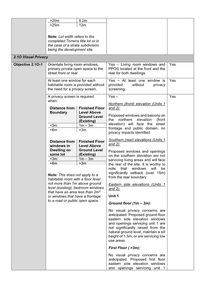
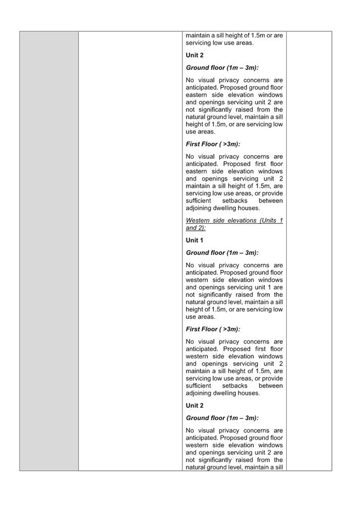
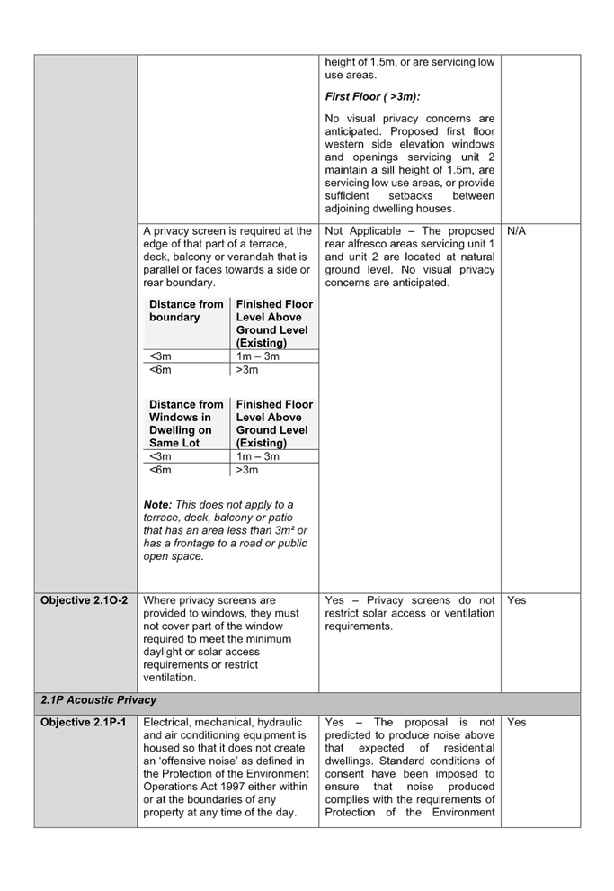
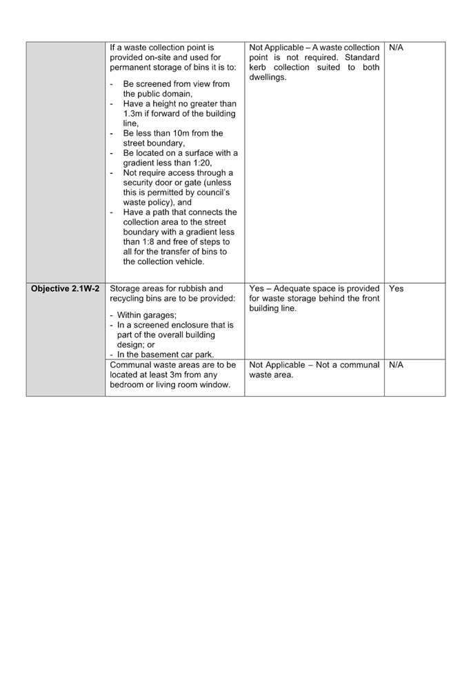
DOCUMENTS
ASSOCIATED WITH
REPORT ELPP026/25
Attachment 6
Redacted Submission
Cumberland
Local Planning Panel Meeting
8 October 2025