5 February 2025
A meeting of the Traffic Committee will be held at
9:30 AM in Merrylands Administration Building, 16 Memorial Avenue, Merrylands
on Wednesday, 5 February 2025.
Business as below:
Yours faithfully
Peter J. Fitzgerald
General Manager
ORDER OF BUSINESS
1.
Apologies
2.
Declarations of Interest
3.
Confirmation of Previous Minutes endorsed by Council
4.
Summary of Reports................................................................... 6
5.
Reports
-
Part 1 - Recommended for Approval under Delegated Authority
-
Part 2 - Recommendation to Council
CONTENTS
Report No. Name
of Report Page
No.
Part 1 - Recommended for Approval under Delegated
Authority
CTC-25-001 HERDSMANS
AVENUE AND COLLEGE STREET, LIDCOMBE – PROPOSED INTERSECTION TREATMENT....................................................... 31
CTC-25-002 GILBA
ROAD AND PENDLE WAY, PENDLE HILL – PROPOSED RELOCATION OF THE EXISTING
FENCE................................................................ 45
CTC-25-003 KIBO
ROAD AND THIRD AVENUE, REGENTS PARK - PROPOSED ‘NO STOPPING’
RESTRICTIONS AND CENTRE LINE MARKING..................................... 53
CTC-25-004 KIMBERLEY
STREET AT WOODVILLE ROAD, MERRYLANDS – PROPOSED 'NO STOPPING'
RESTRICTIONS AND LINE MARKING.................. 71
CTC-25-005 RAWSON
ROAD AND GREAT WESTERN HIGHWAY, SOUTH WENTWORTHVILLE – PROPOSED 'NO
STOPPING' RESTRICTIONS AND LINE MARKING.................................................... 83
CTC-25-006 FREDERICK
STREET AT JONES STREET, PENDLE HILL– PROPOSED 'NO STOPPING' RESTRICTIONS
AND LINE MARKING............................................ 93
CTC-25-007 BLAXCELL
STREET AND WELLS STREET, SOUTH GRANVILLE – PROPOSED ‘NO
STOPPING’ RESTRICTIONS AND LINE MARKING.................. 99
CTC-25-008 FOWLER
ROAD AND O’CONNOR STREET, GUILDFORD – PROPOSED ‘NO
STOPPING’ RESTRICTIONS AND LINE MARKING................ 105
CTC-25-009 CLUNIES
ROSS STREET, PEMULWUY – PROPOSED 'NO STOPPING' RESTRICITONS.... 111
CTC-25-010 RAILWAY
STREET, LIDCOMBE – PROPOSED ‘NO STOPPING’ RESTRICTIONS NEAR
EAST STREET INTERSECTION................................................. 117
CTC-25-011 CONDOIN
LANE, PEMULWUY – REQUEST FOR REMOVAL OF 'NO STOPPING' SIGNAGE.......... 123
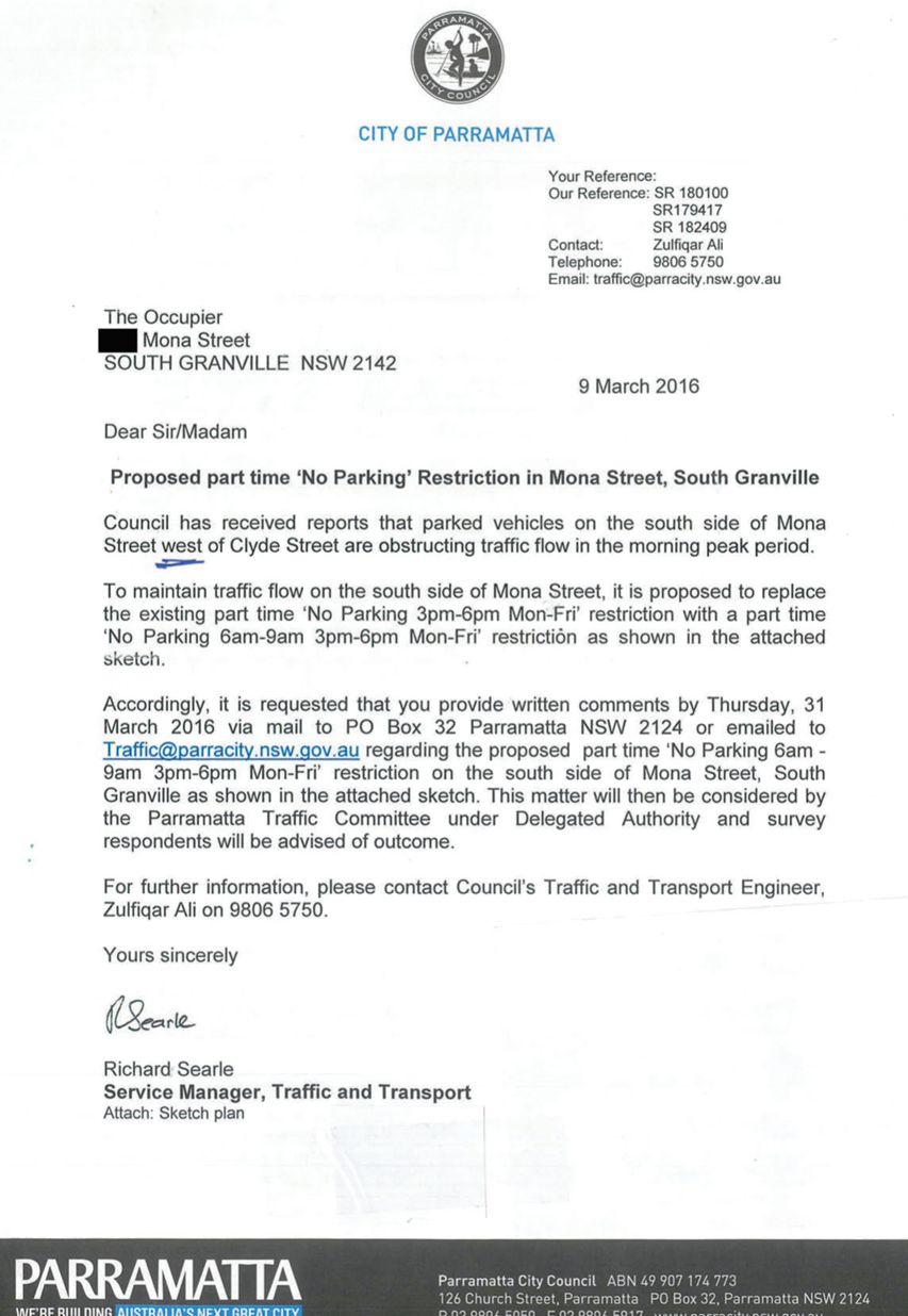
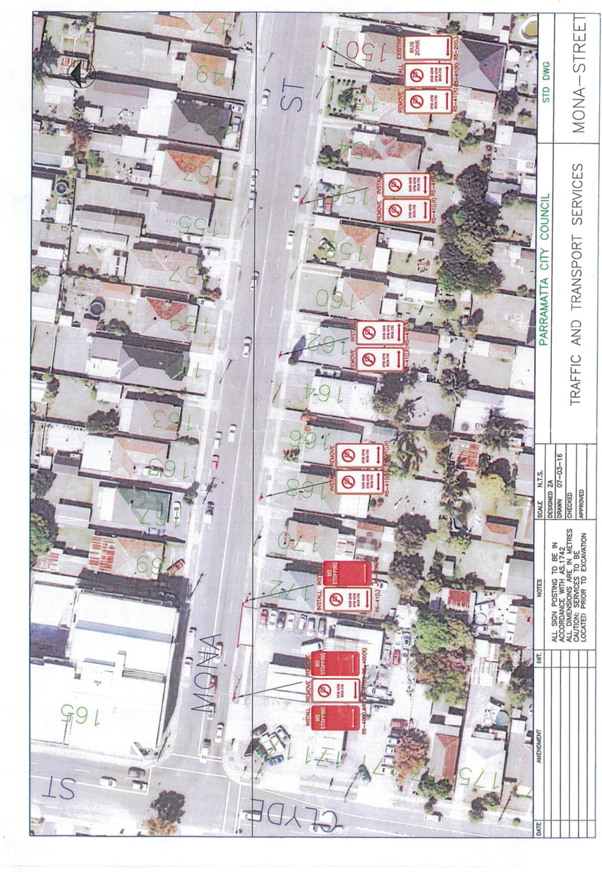
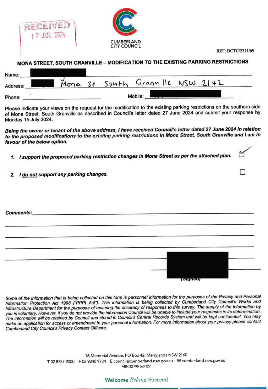
CTC-25-012 MONA
STREET, SOUTH GRANVILLE – PARKING RESTRICTION MODIFICATION.......................... 141
CTC-25-013 OLD
PROSPECT ROAD AND GRAFTON STEET, GREYSTANES – PROPOSED GIVEWAY SIGNAGE
AND LINE MARKING.......................................... 165
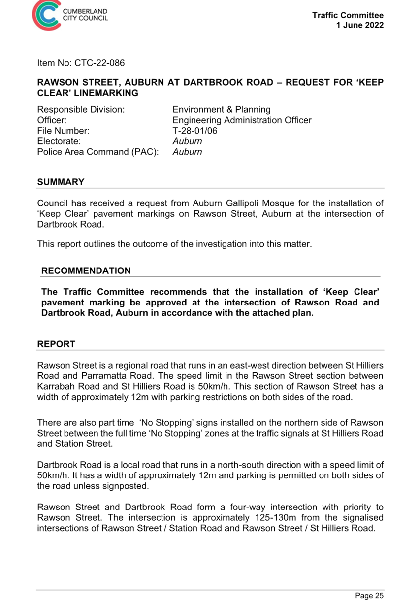
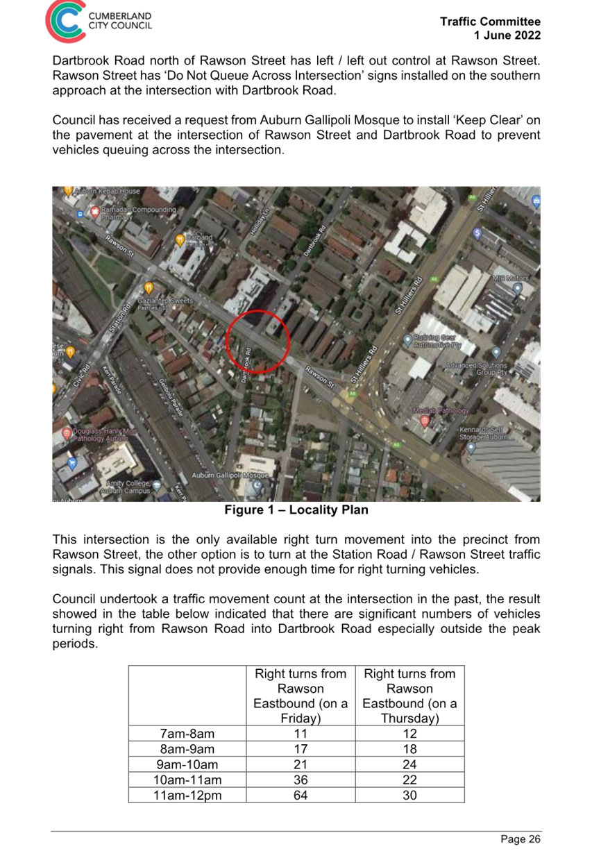
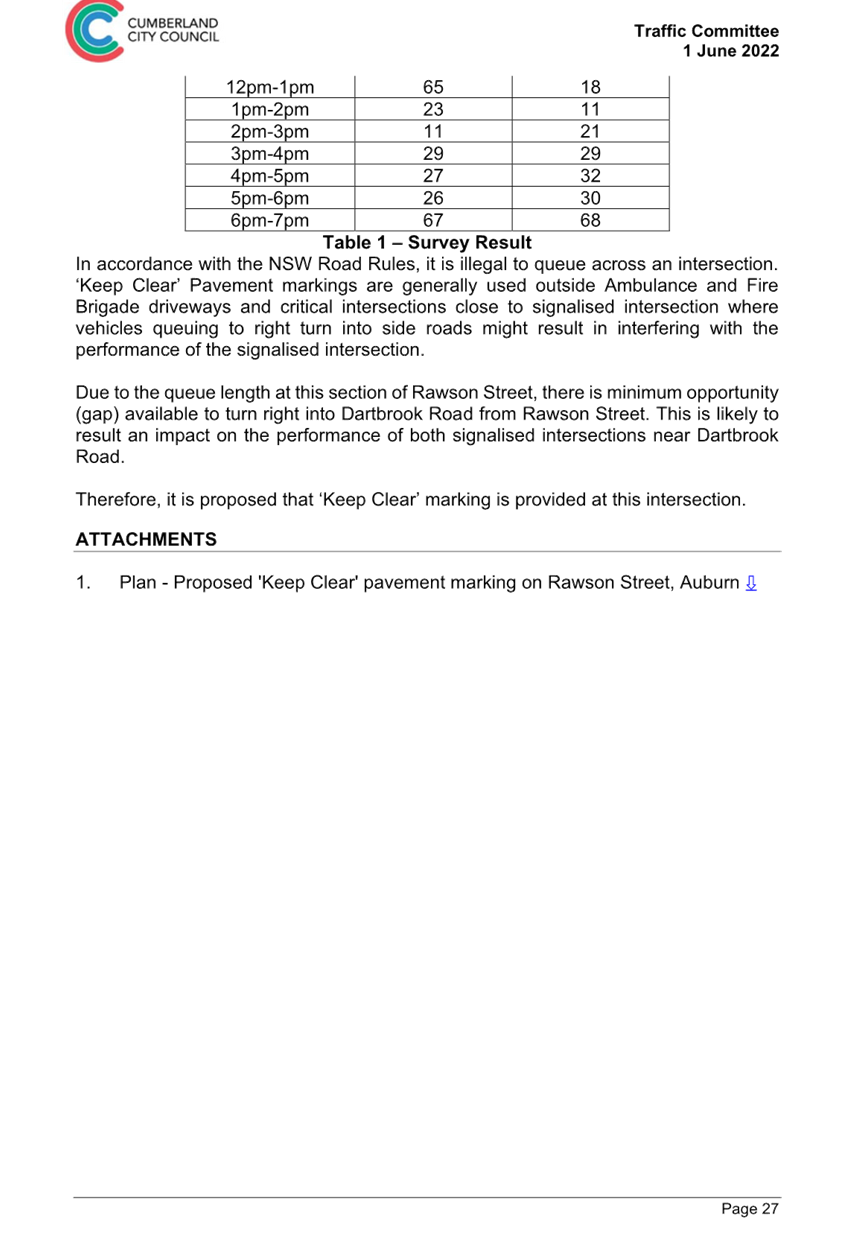
CTC-25-014 RAWSON
STREET, AUBURN AT DARTBROOK ROAD – REQUEST FOR ‘KEEP CLEAR’
LINE MARKING.......................................................... 173
CTC-25-015 WALLACE
STREET AND WARATAH STREET AT UNION STREET, GRANVILLE – PROPOSED PARKING
SIGNAGE AND LINE MARKING.......... 191
CTC-25-016 MCLEOD
ROAD / DRESSLER COURT , HOLROYD / MERRYLANDS – REQUEST FOR TIMED
PARKING IN THE INDENTED PARKING AREA................... 203
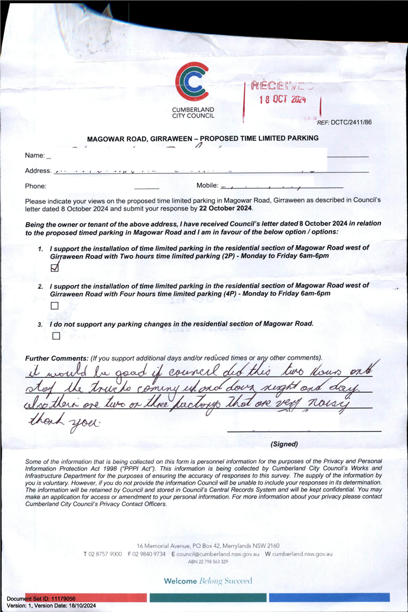
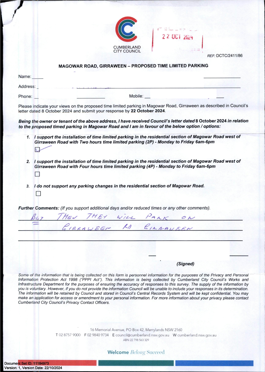
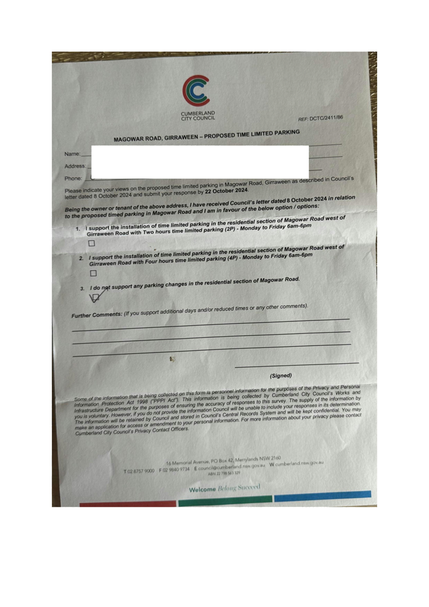
CTC-25-017 MAGOWAR
ROAD, GIRRAWEEN - TIMED PARKING CONSULTATION................................................ 211
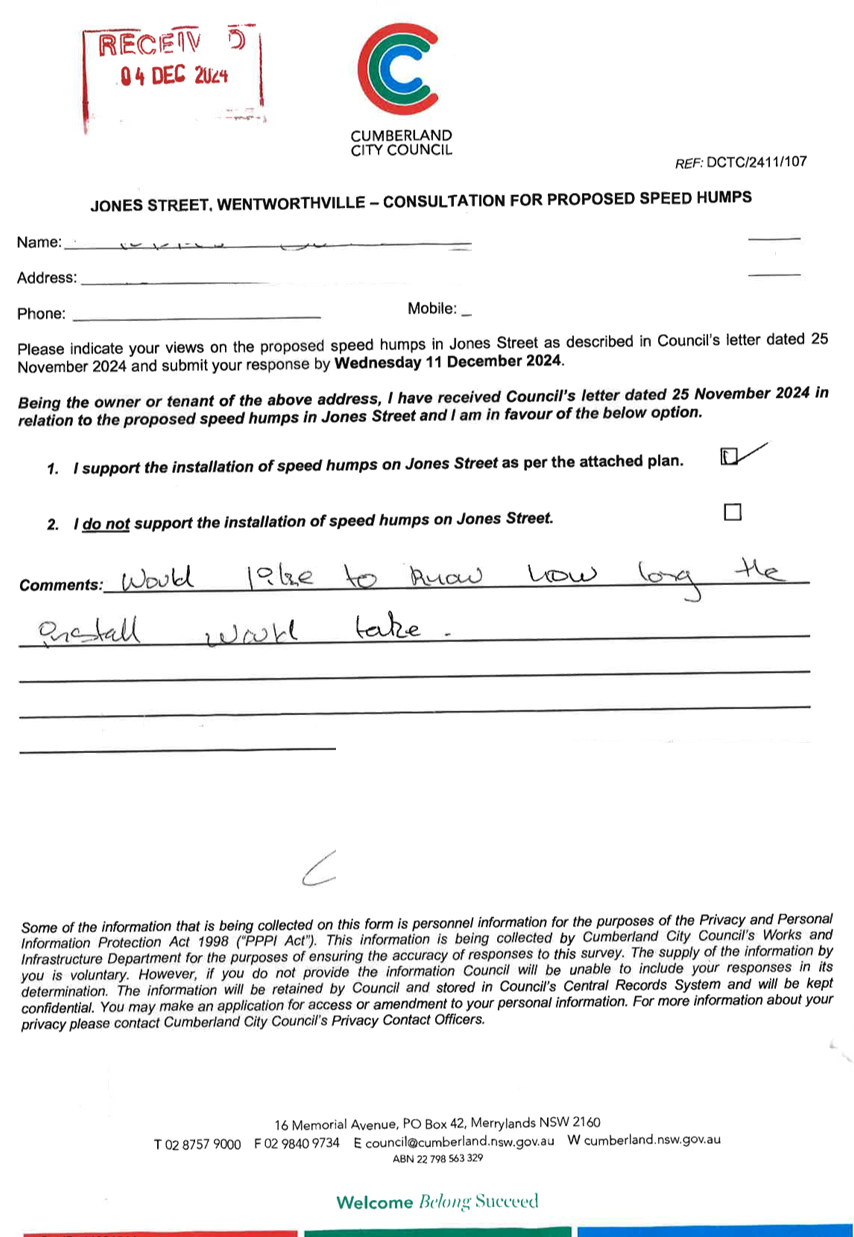
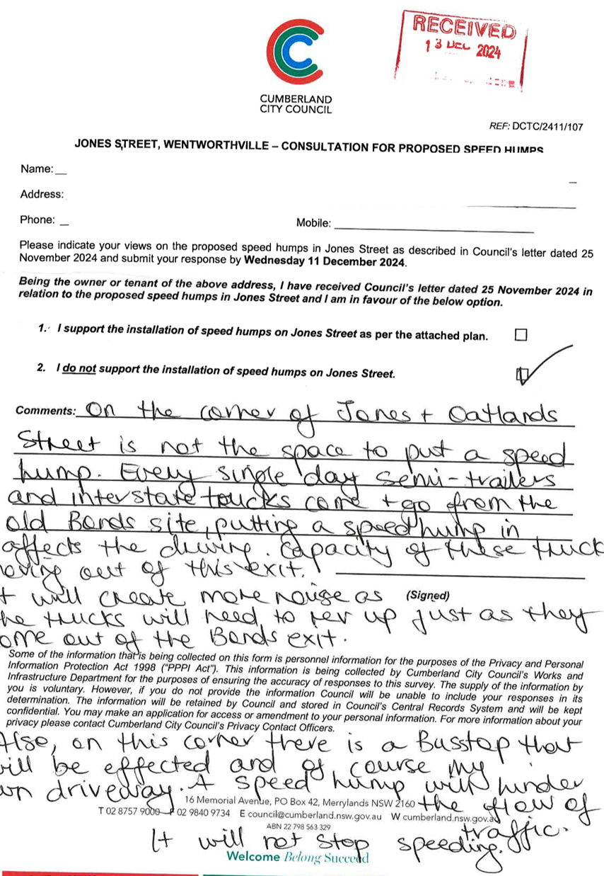
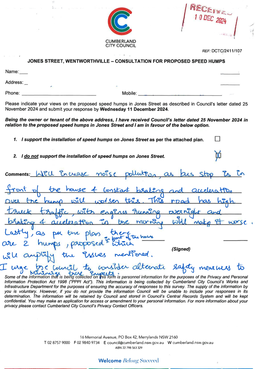
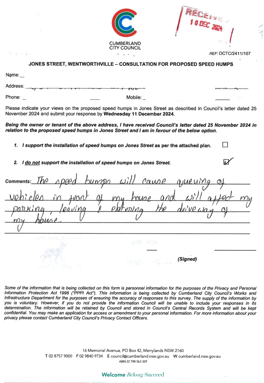
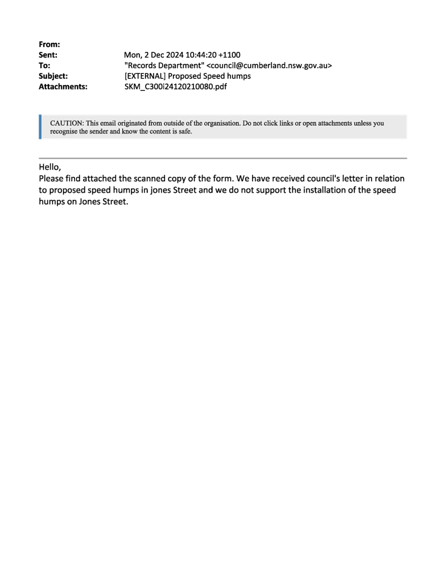
CTC-25-018 JONES
STREET, WENTWORTHVILLE – ROAD SAFETY CONCERNS – CONSULTATION RESULT 235
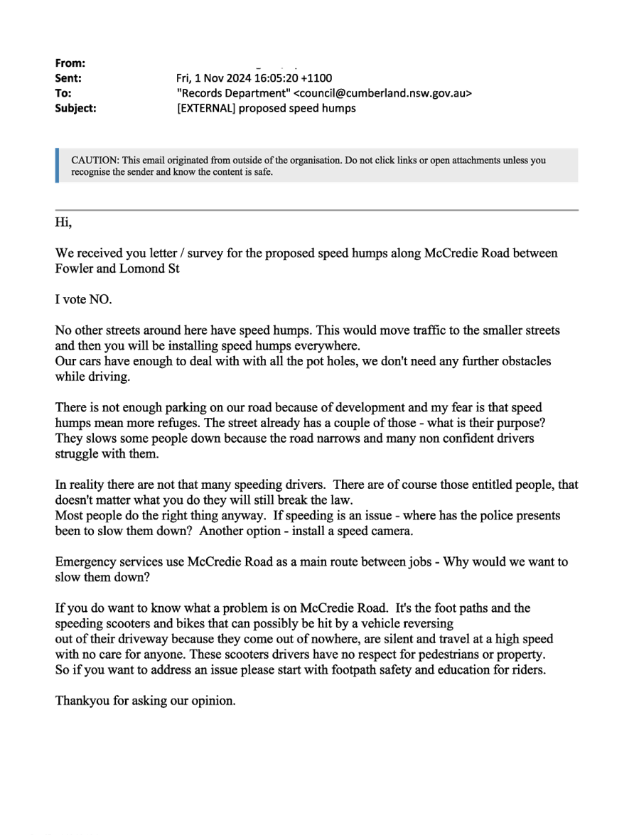
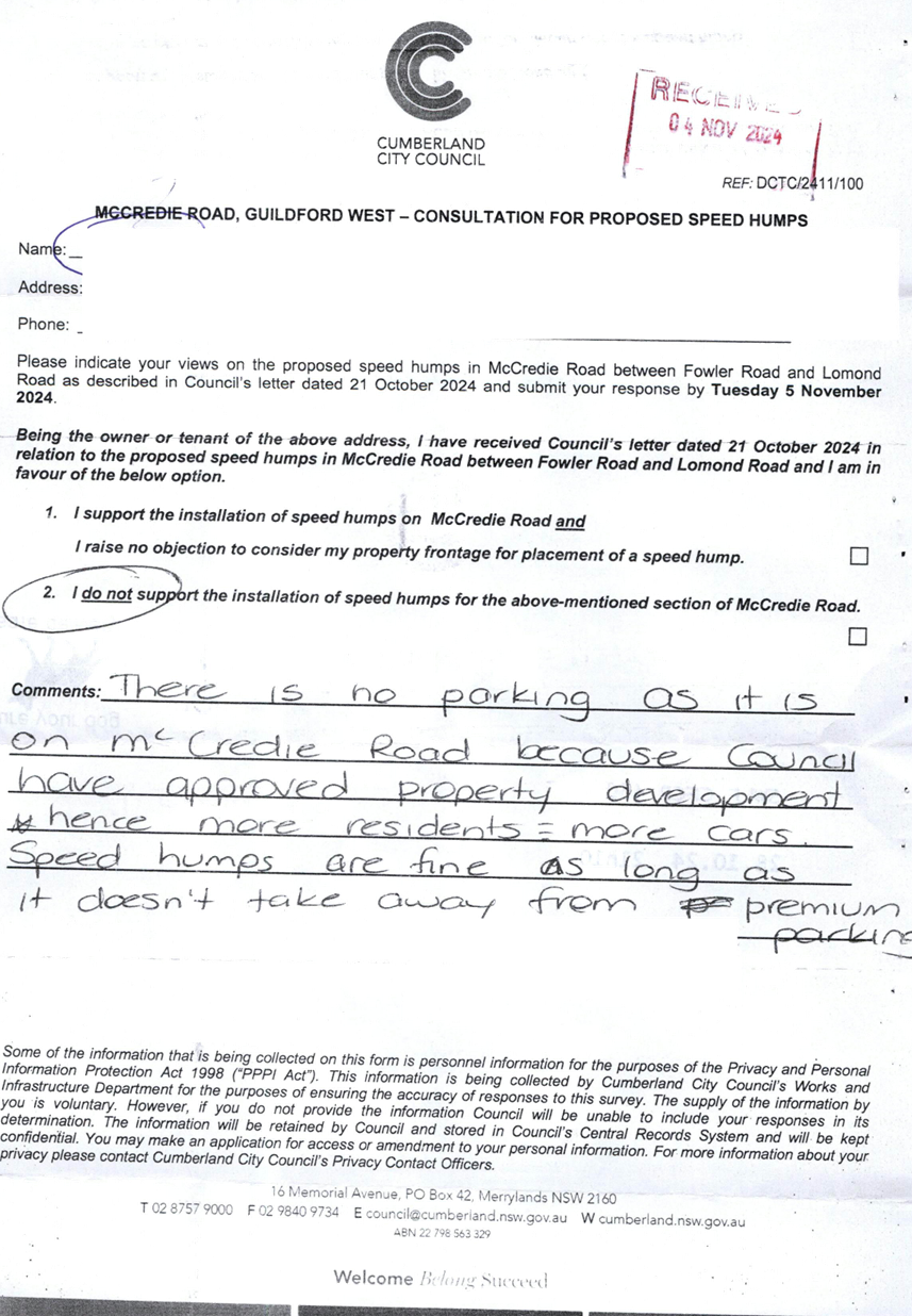
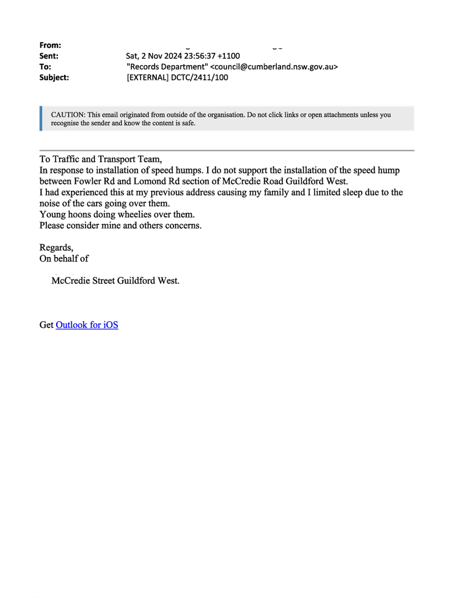
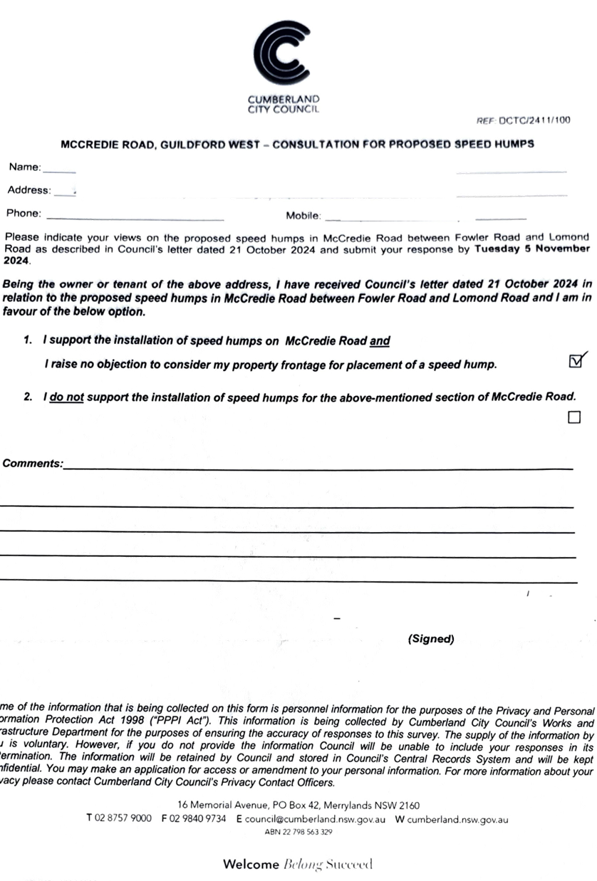
CTC-25-019 MCCREDIE
ROAD, GUILDFORD WEST - ROAD SAFETY CONCERNS – CONSULTATION RESULT 253
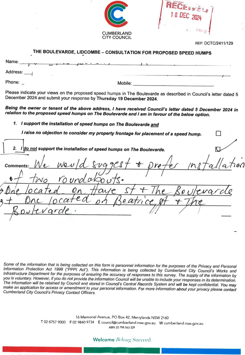
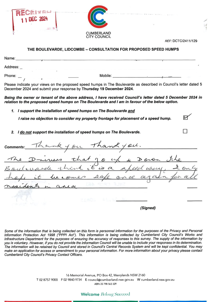
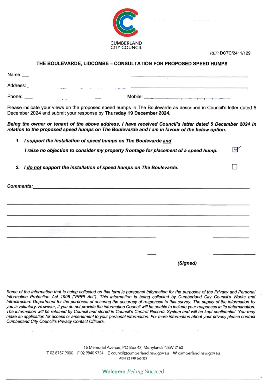
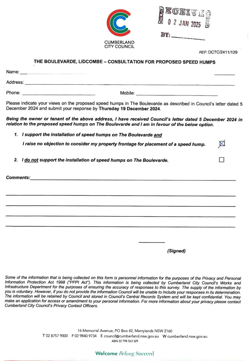
CTC-25-020 THE
BOULEVARDE, LIDCOMBE - ROAD SAFETY CONCERNS – CONSULTATION RESULT........... 293
CTC-25-021 STATION
ROAD, AUBURN – APPLICATION FOR ‘WORKS ZONE’ SIGNAGE................................. 315
CTC-25-022 JOHN
STREET, LIDCOMBE – APPLICATION FOR ‘WORKS ZONE’ SIGNAGE................................. 321
CTC-25-023 NORTHUMBERLAND
ROAD, AUBURN – APPLICATION FOR ‘WORKS ZONE’ SIGNAGE.. 327
Part 2 - Recommendation to Council
CTC-25-024 OXFORD
STREET AND HIGHLAND STREET, GUILDFORD - AUSTRALIAN GOVERNMENT BLACK SPOT
PROGRAM............................................... 335
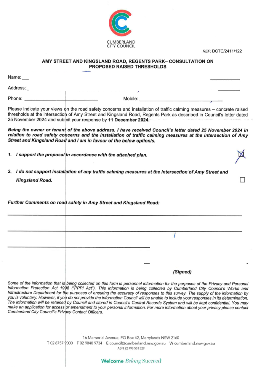
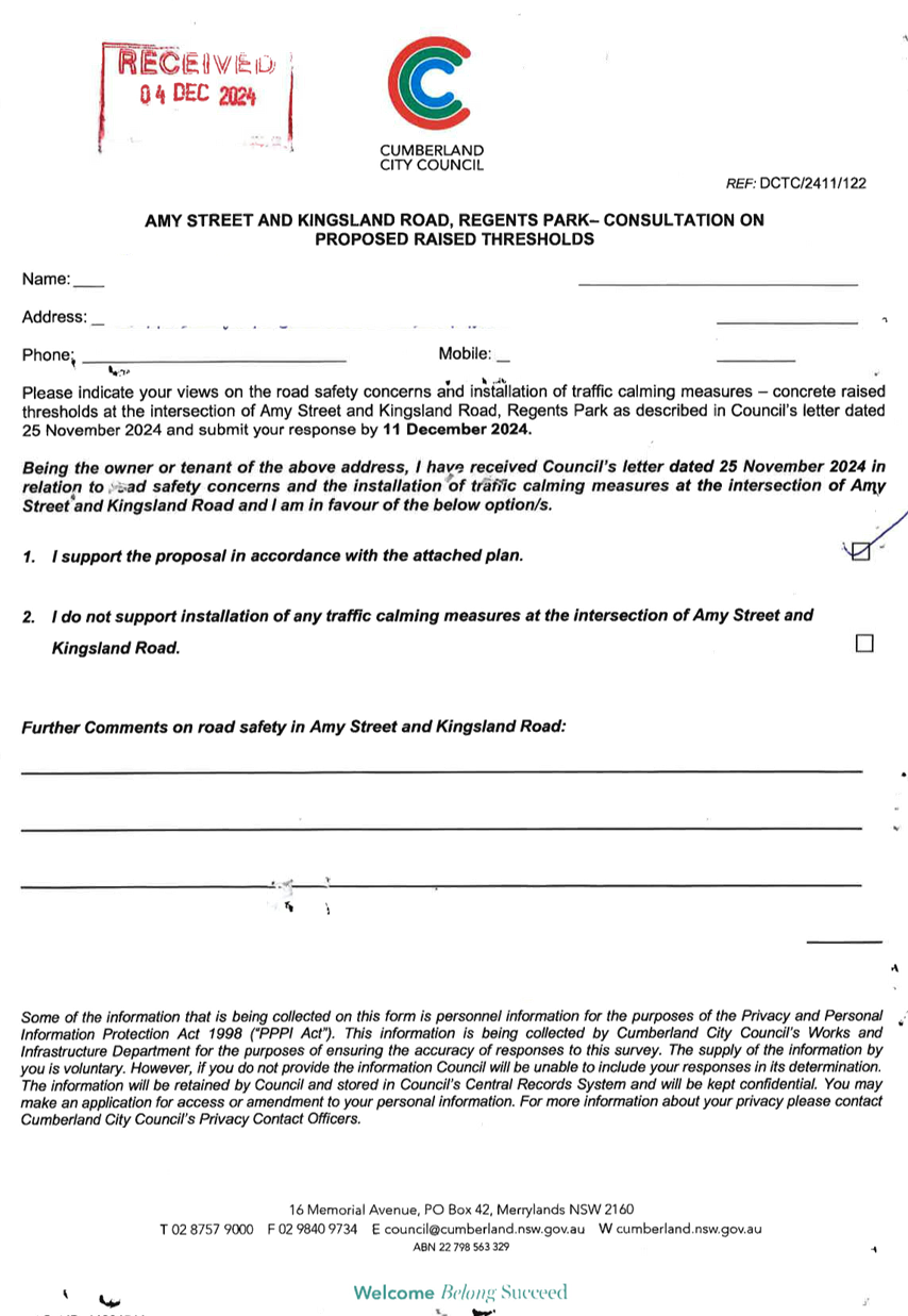
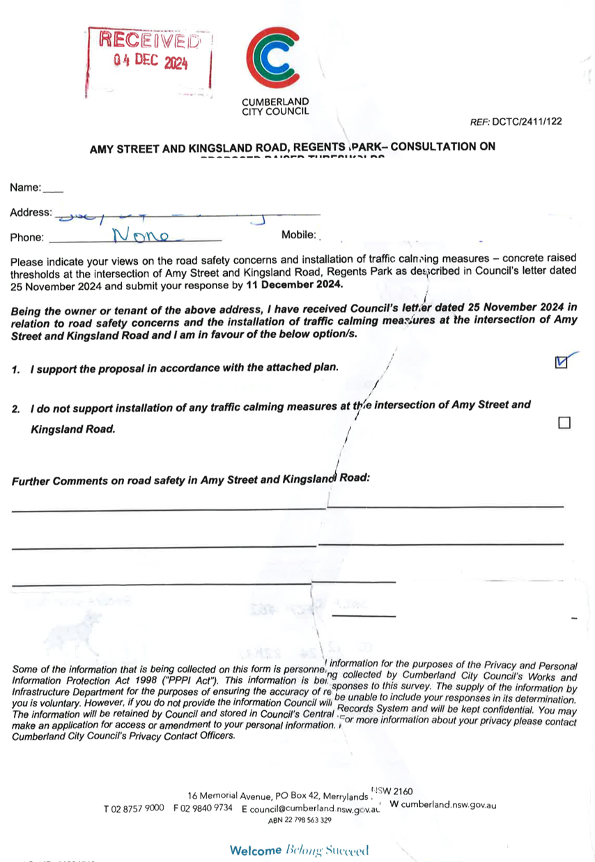
CTC-25-025 AMY
STREET AT KINGSLAND ROAD, REGENTS PARK - AUSTRALIAN GOVERNMENT BLACK SPOT
PROGRAM......................................................... 369
CTC-25-026 RAILWAY
PARADE, HELENA STREET AND COCKTHORPE ROAD, AUBURN - AUSTRALIAN GOVERNMENT BLACK
SPOT PROGRAM.......... 385
CTC-25-027 LIDCOMBE
TOWN CENTRE PUBLIC DOMAIN PLAN - JOSEPH STREET PRECINCT – PROPOSED
PEDESTRIAN CROSSING ON BRIDGE STREET 393
CTC-25-028 LIDCOMBE
TOWN CENTRE PUBLIC DOMAIN PLAN - JOSEPH STREET PRECINCT – PROPOSED
PEDESTRIAN CROSSING ON TAYLOR STREET 401
CTC-25-029 GUILDFORD
ROAD, GUILDFORD - PROPOSED TEMPORARY ROAD CLOSURE FOR GUILDFORD FESTIVAL.......................................................... 409
CTC-25-030 MIMOSA
STREET, GRANVILLE - PARTIAL ROAD CLOSURE AT DUCK RIVER............................... 411
CTC-25-031 SEVENTH
STREET, GRANVILLE - PARTIAL ROAD CLOSURE AT DUCK RIVER............................... 419
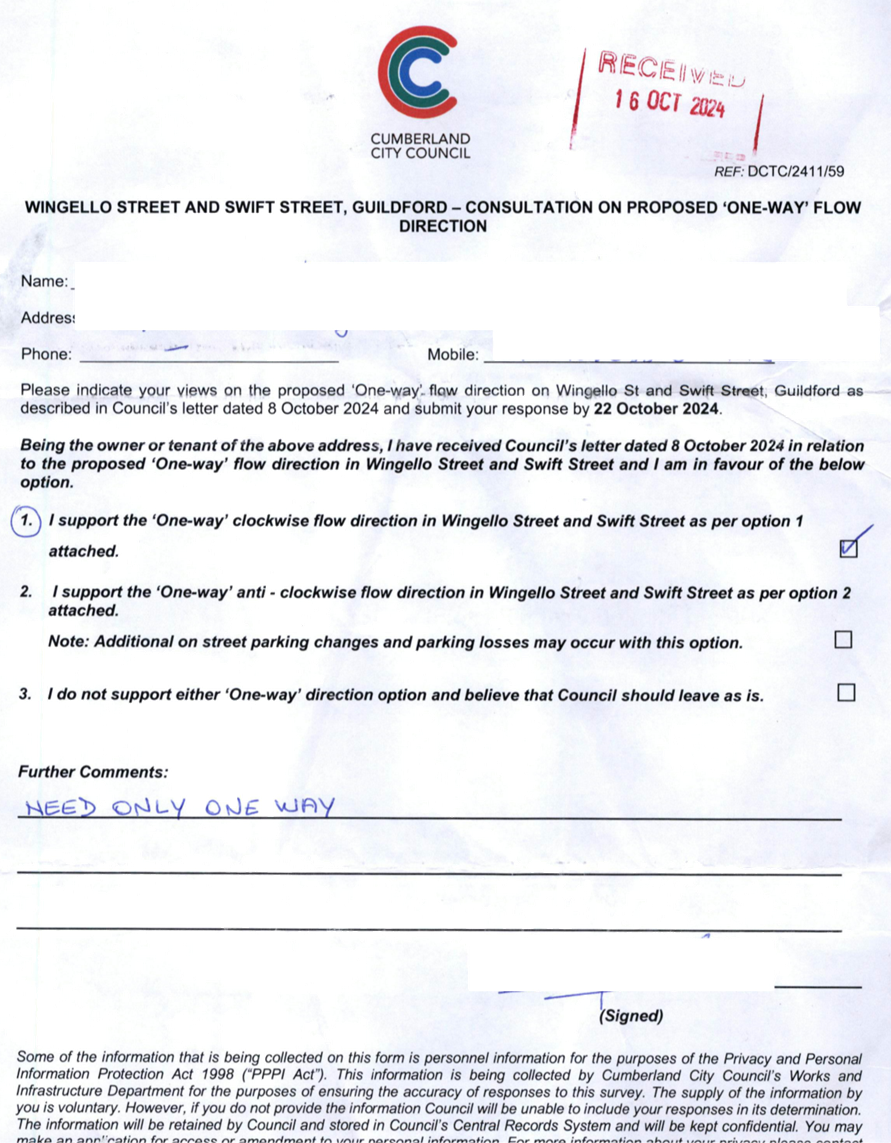
CTC-25-032 WINGELLO
STREET AND SWIFT STREET, GUILDFORD – PROPOSED 'ONE WAY' - CONSULTATION
RESULT.................................. 425
CTC-25-033 ROSEBERRY
STREET AND MARY STREET, MERRYLANDS – PROPOSED ROUNDABOUT.. 451
CTC-25-034 PHILLIPS
AVENUE, GREATREX AVENUE AND COLEMAN AVENUE, REGENTS PARK – PROPOSED
TRAFFIC CALMING MEASURES.... 459
CTC-25-035 HAWKSVIEW
STREET, GUILDFORD – PROPOSED PEDESTRIAN FENCING..................................... 461
CTC-25-036 TILBA
STREET, BERALA - RESPONSE TO NOTICE OF MOTION - REQUEST FOR A PEDESTRIAN
CROSSING........................................................ 469
CTC-25-037 DANIEL
STREET, GRANVILLE - REQUEST FOR PEDESTRIAN CROSSING.................................. 473
CTC-25-038 KING
STREET, GUILDFORD WEST - REQUEST FOR PEDESTRIAN CROSSING.................................. 477
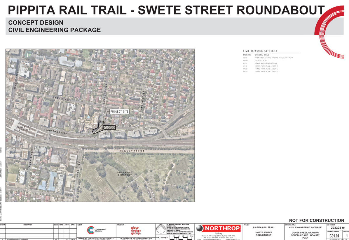
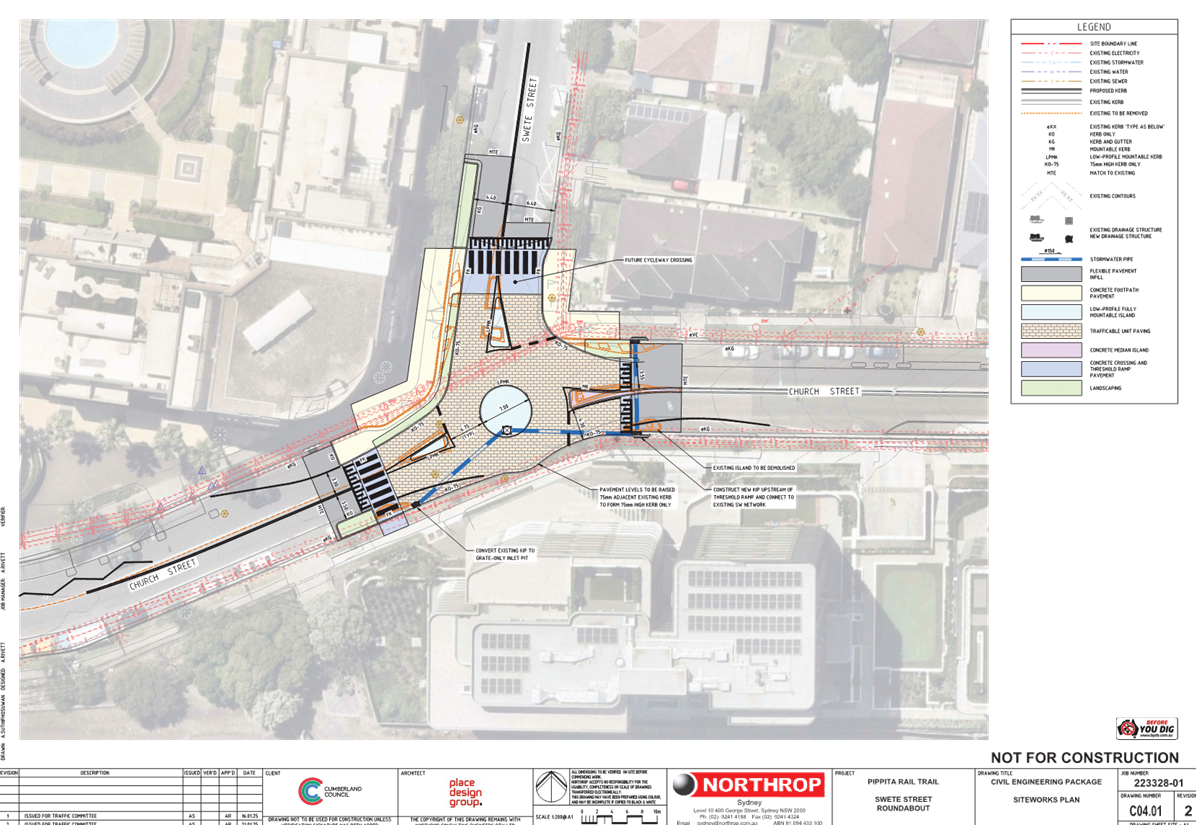
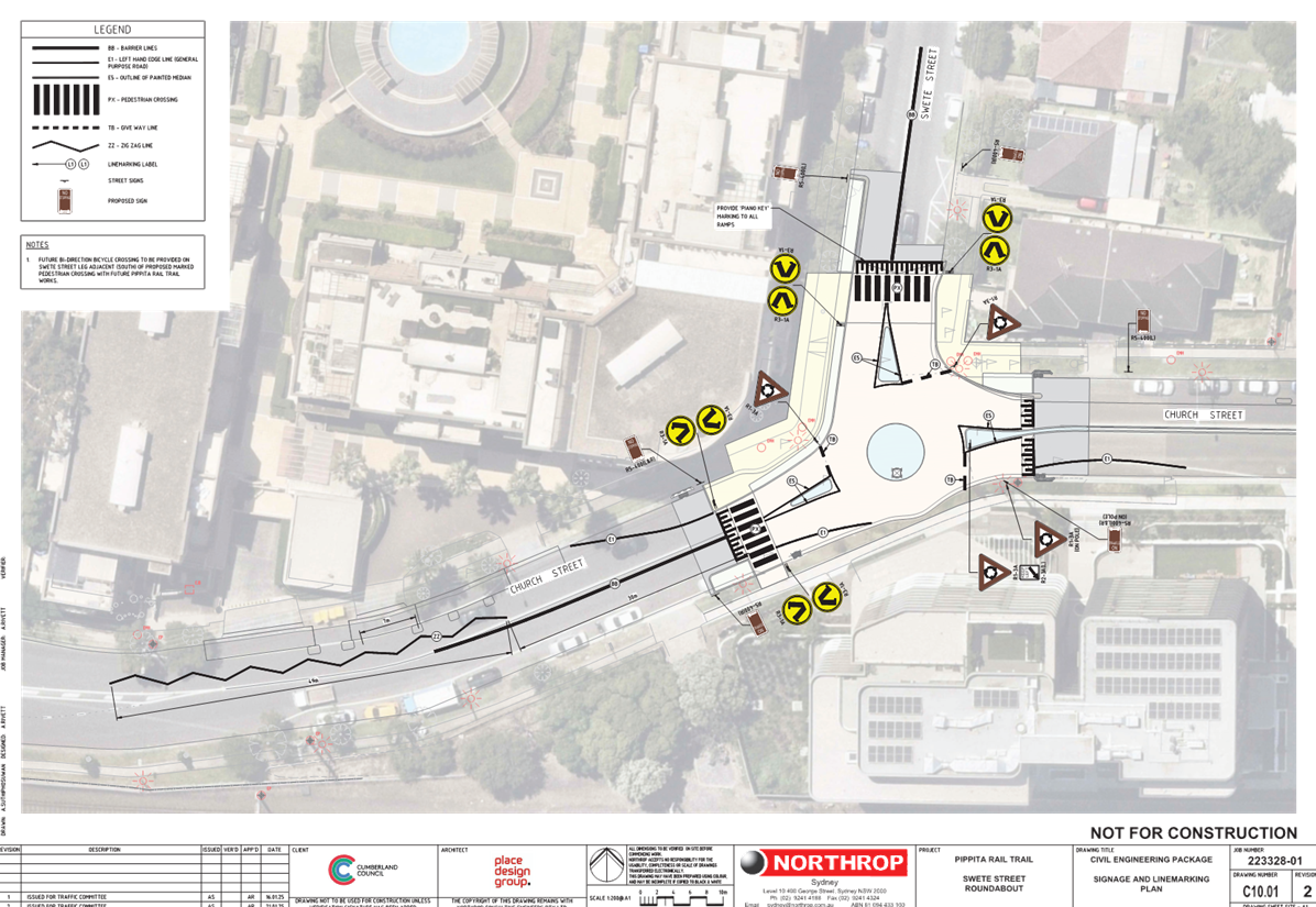
CTC-25-039 CHURCH
STREET & SWETE STREET, LIDCOMBE - PROPOSED RAISED INTERSECTION AND MARKED
PEDESTRIAN CROSSINGS................ 481
CTC-25-040 MILITARY
ROAD, GUILDFORD - PARKING ARRANGEMENT REIVEW.................................. 493
CTC-25-041 EXCELSIOR
STREET, WYNYARD STREET AND EVE STREET, GUILDFORD – PROPOSED INTERSECTION
TREATMENT............................ 501
CTC-25-042 BRIDGE
ROAD, WESTMEAD – INTERSECTION TREATMENT..................................................... 507
CTC-25-043 WHALANS
ROAD, GREYSTANES – ROAD SAFETY CONCERNS....................................................... 515
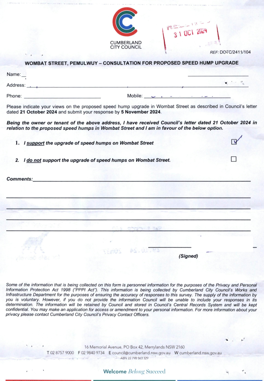
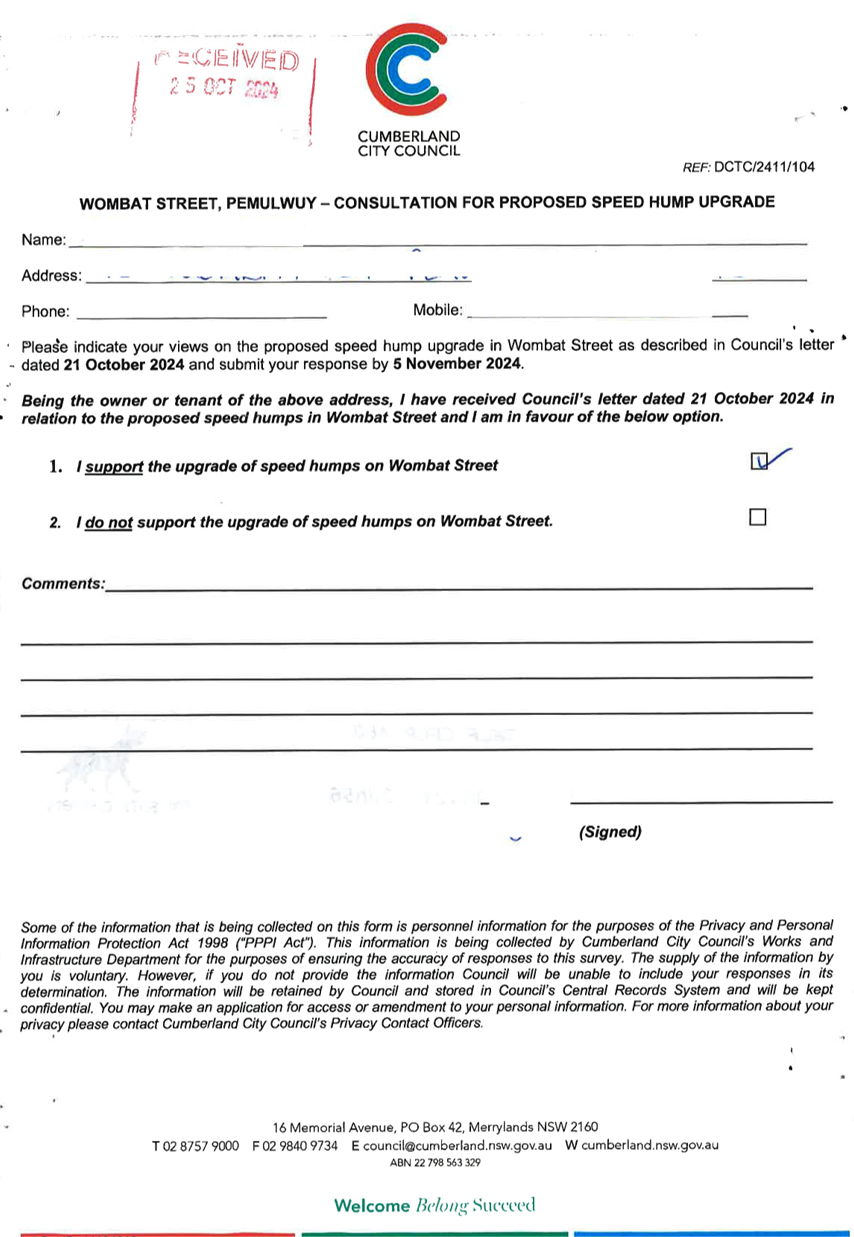
CTC-25-044 WOMBAT
STREET, PEMULWUY - ROAD SAFETY CONCERNS....................................................... 521
CTC-25-045 LANCE
CRESCENT, GREYSTANES - ROAD SAFETY CONCERNS......................................... 533
CTC-25-046 LACKEY
STREET, MERRYLANDS – ROAD SAFETY CONCERNS....................................................... 535
CTC-25-047 TENNYSON
PARADE, GUILDFORD WEST - ROAD SAFETY CONCERNS......................................... 545
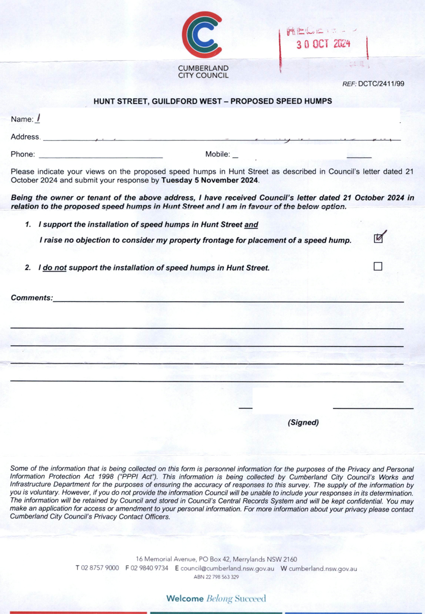
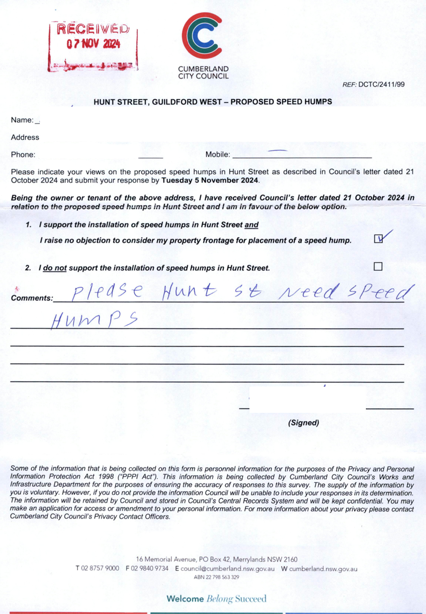
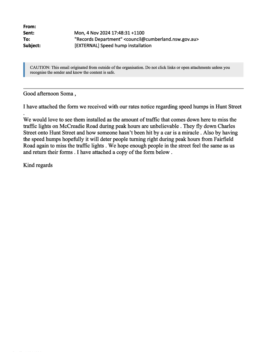
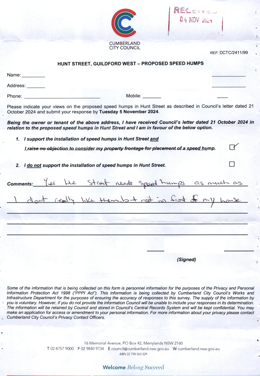
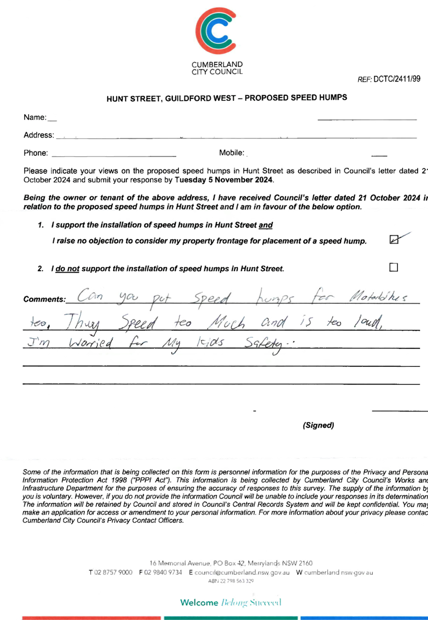
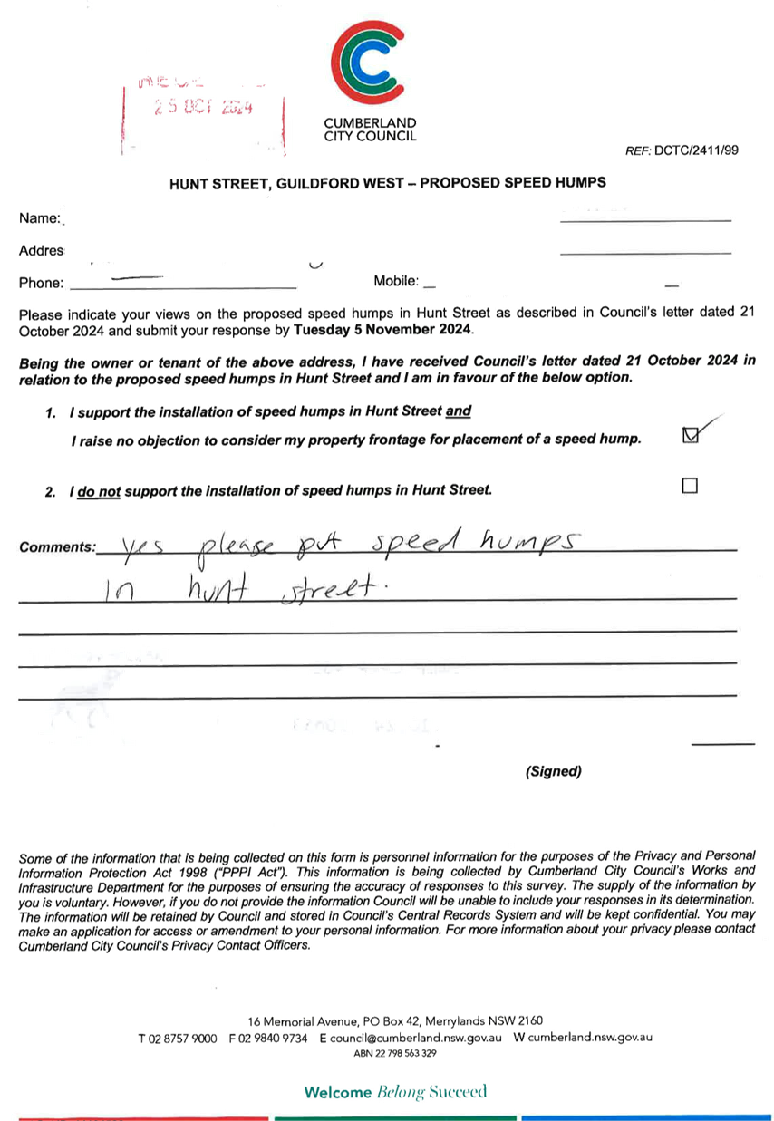
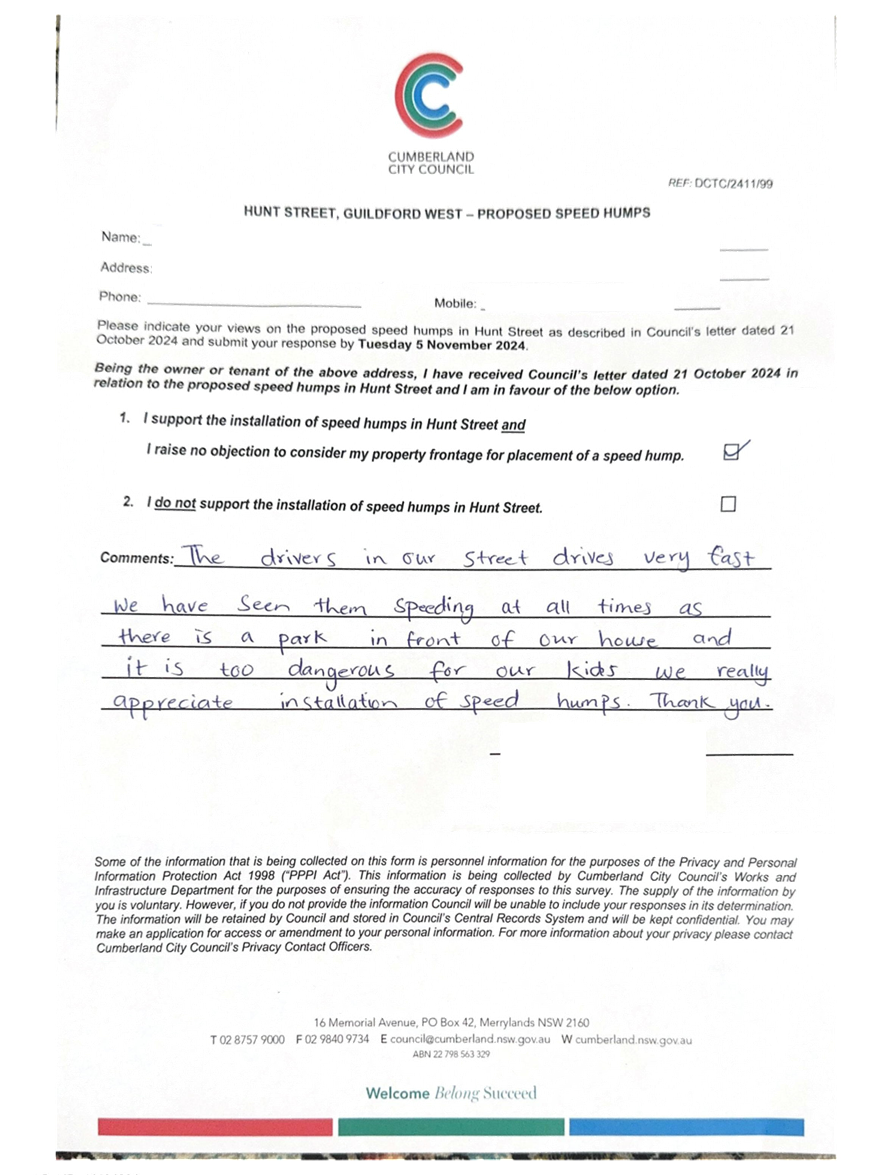
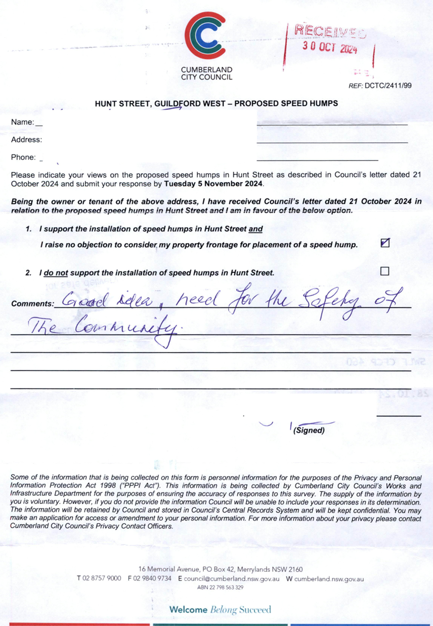
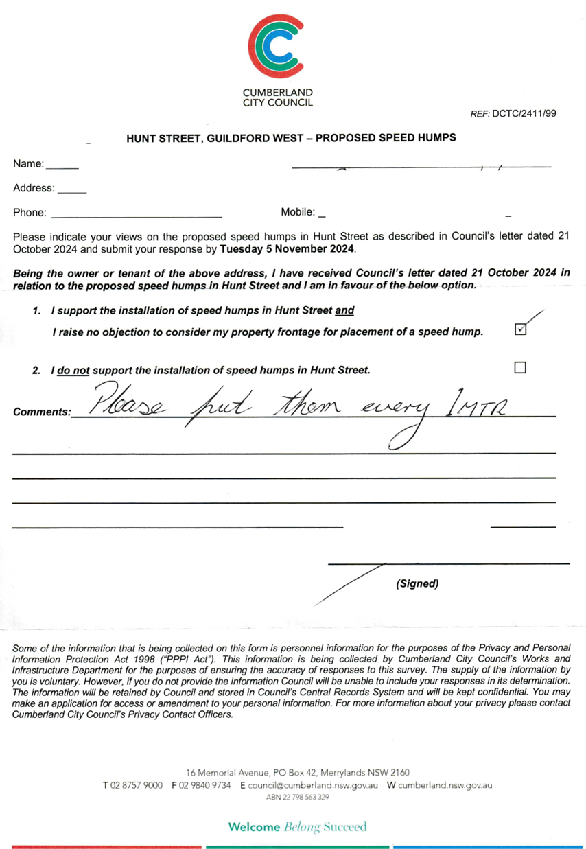
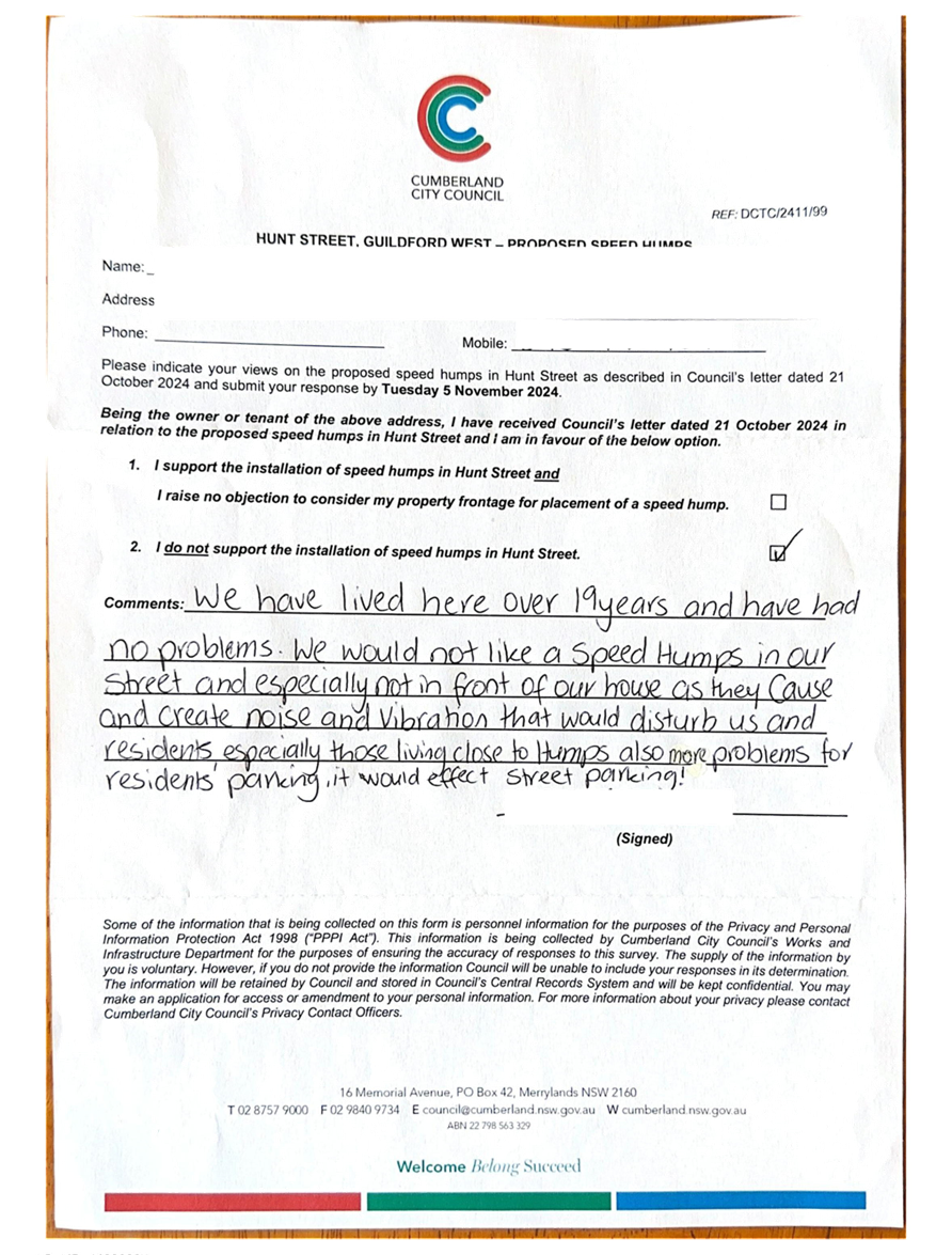
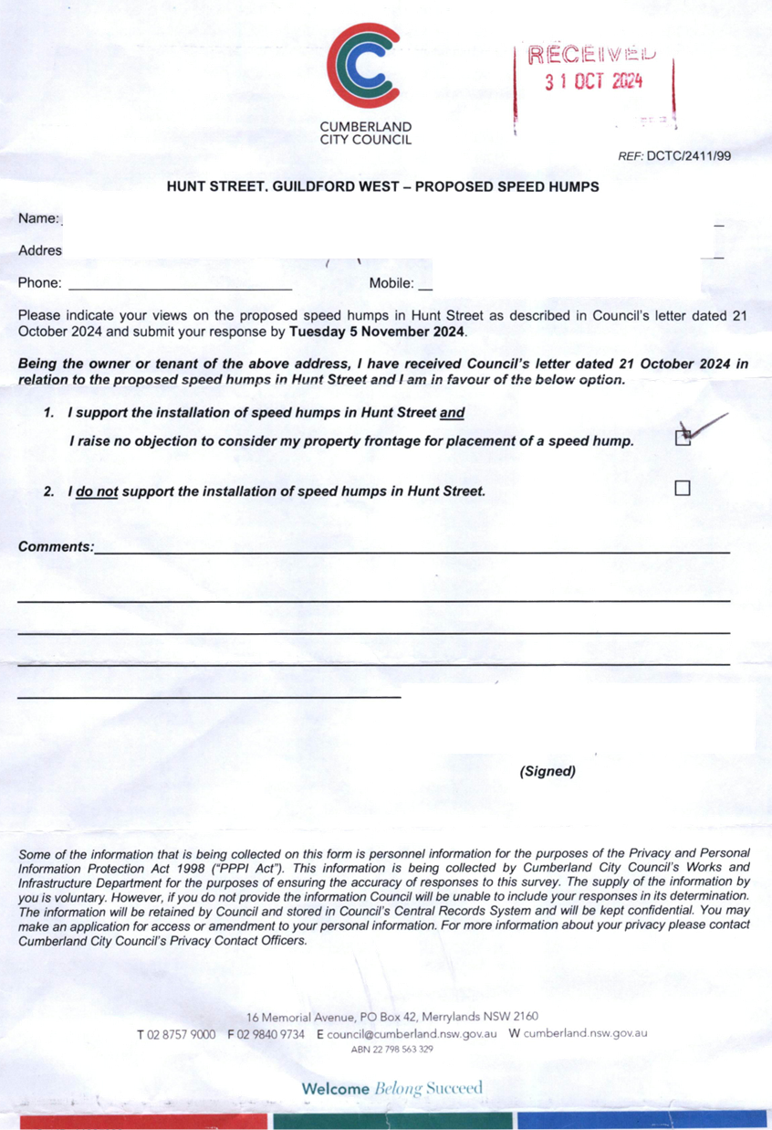
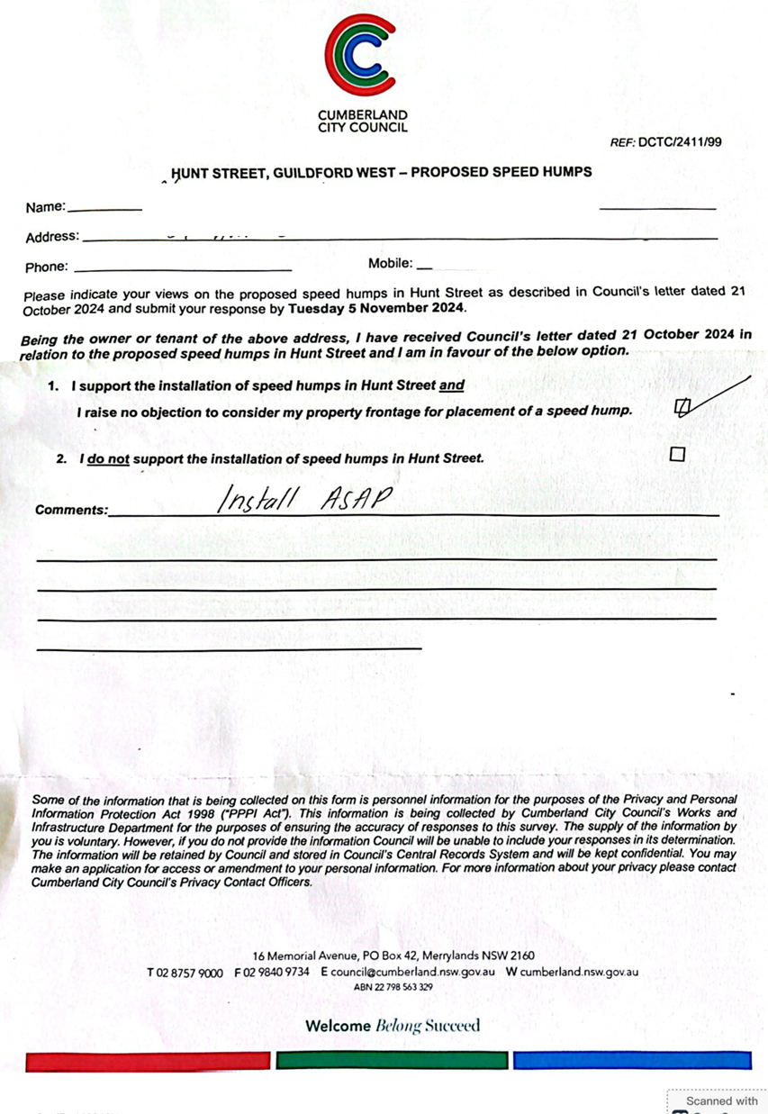
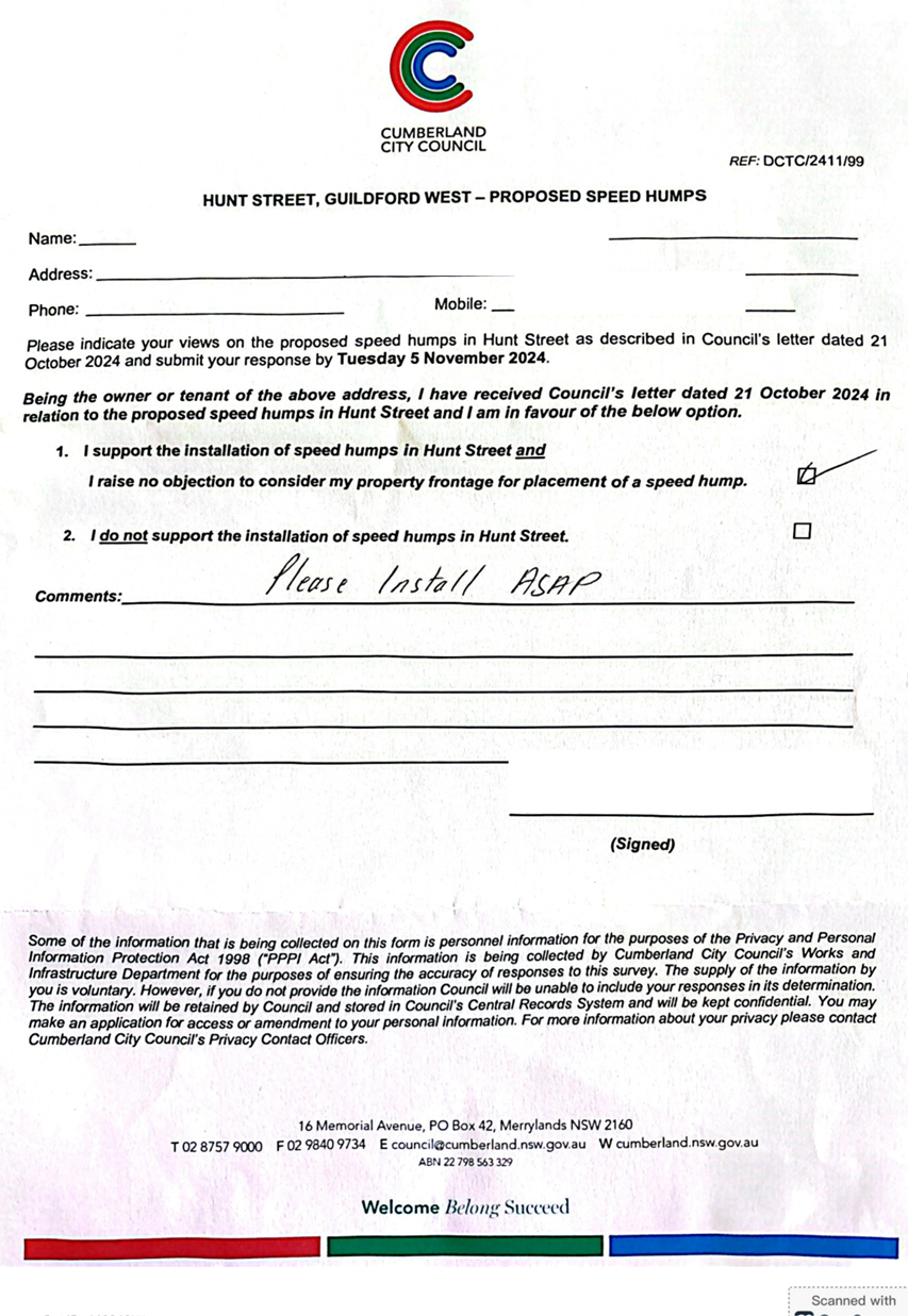
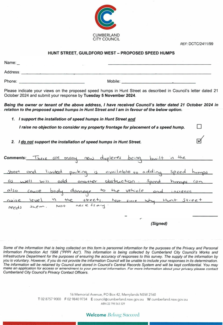
CTC-25-048 HUNT
STREET, GUILDFORD WEST - ROAD SAFETY CONCERNS......................................... 609
CTC-25-049 ROSEBERRY
STREET BETWEEN HAWKSVIEW STREET AND MYALL STREET, MERRYLANDS – ROAD
SAFETY CONCERNS.............................. 635
CTC-25-050 GRASSMERE
STREET, GUILDFORD - ROAD SAFETY CONCERNS – CONSULTATION RESULT 639
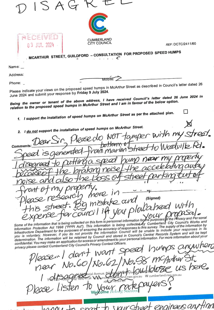
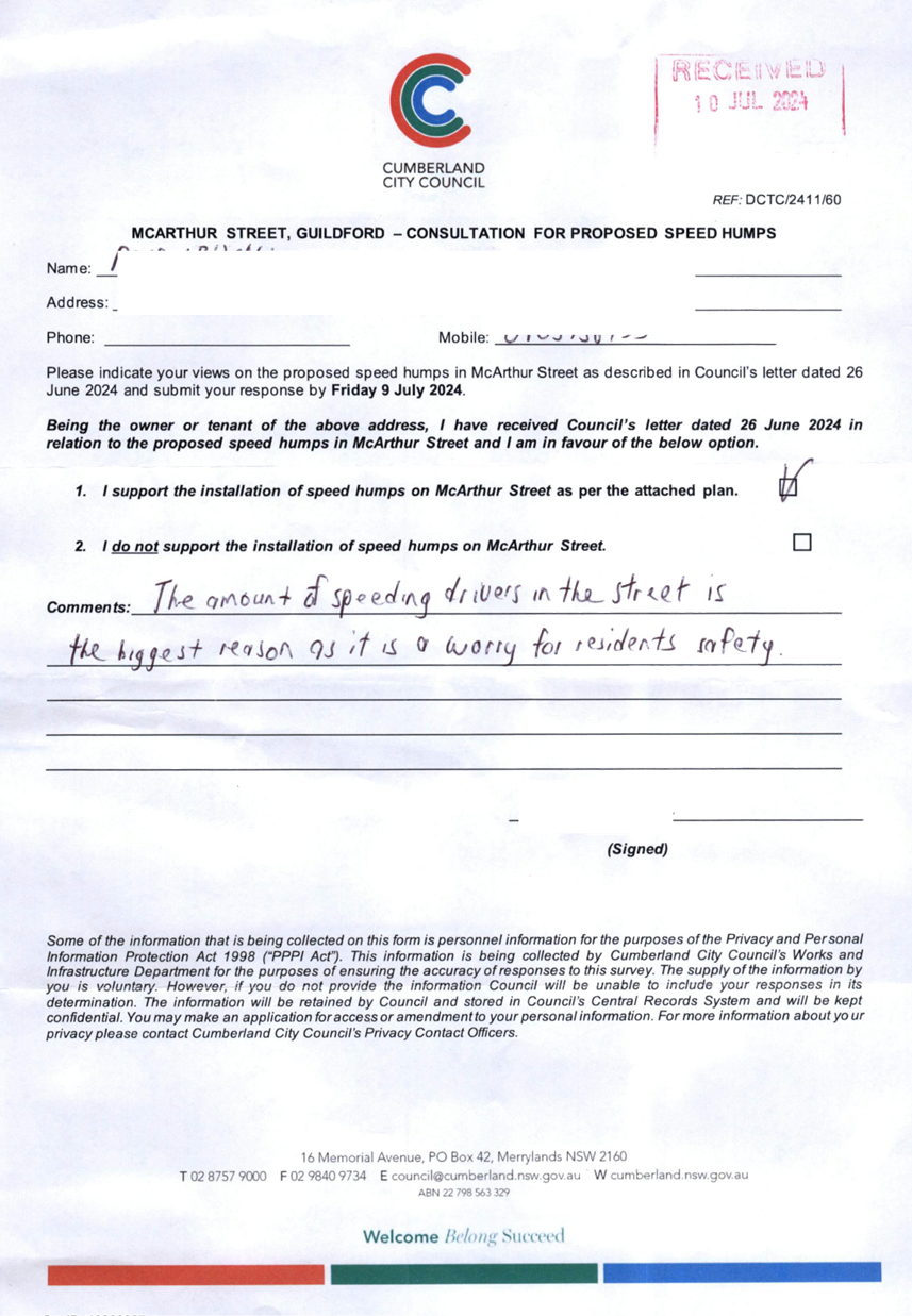
CTC-25-051 MCARTHUR
STREET, GUILDFORD – ROAD SAFETY CONCERNS – CONSULTATION
RESULT 649
CTC-25-052 LOCKWOOD
STREET, MERRYLANDS - ROAD SAFETY CONCERNS – CONSULTATION RESULT 661
CTC-25-053 RUNYON
AVENUE, GREYSTANES - ROAD SAFETY CONCERNS – CONSULTATION RESULT........... 665
CTC-25-054 BOOMERANG
STREET AND RANDLE STREET, GRANVILLE - ROAD SAFETY CONCERNS – CONSULTATION
RESULT.................................. 677
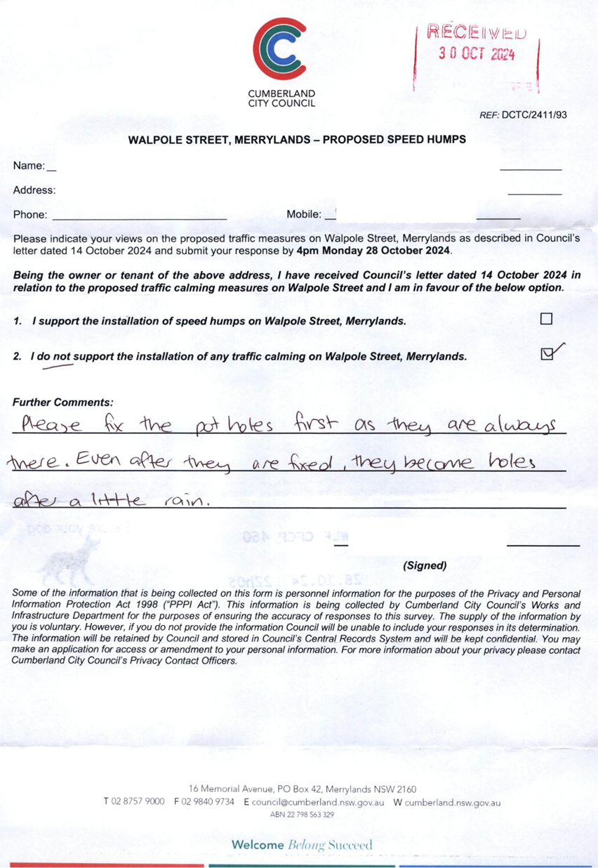
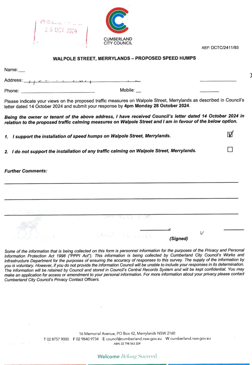
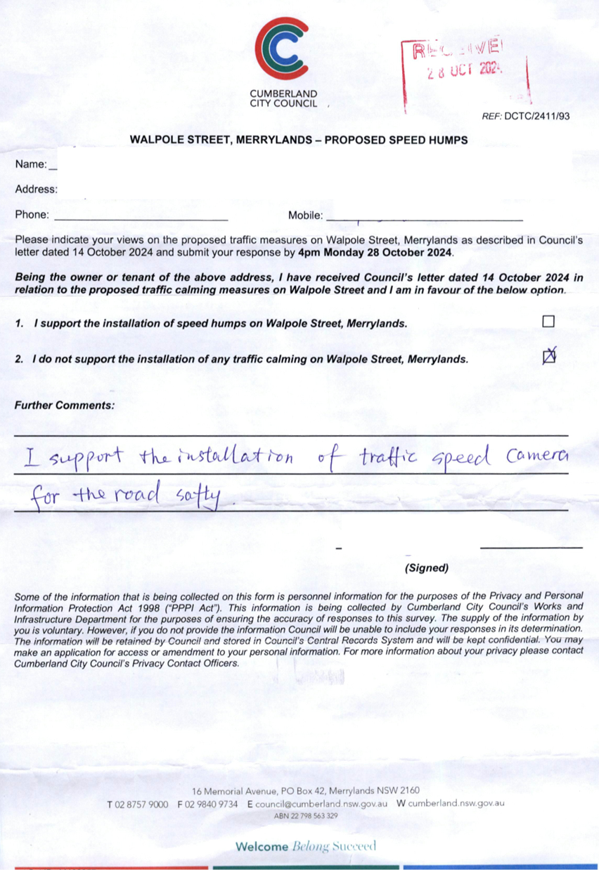
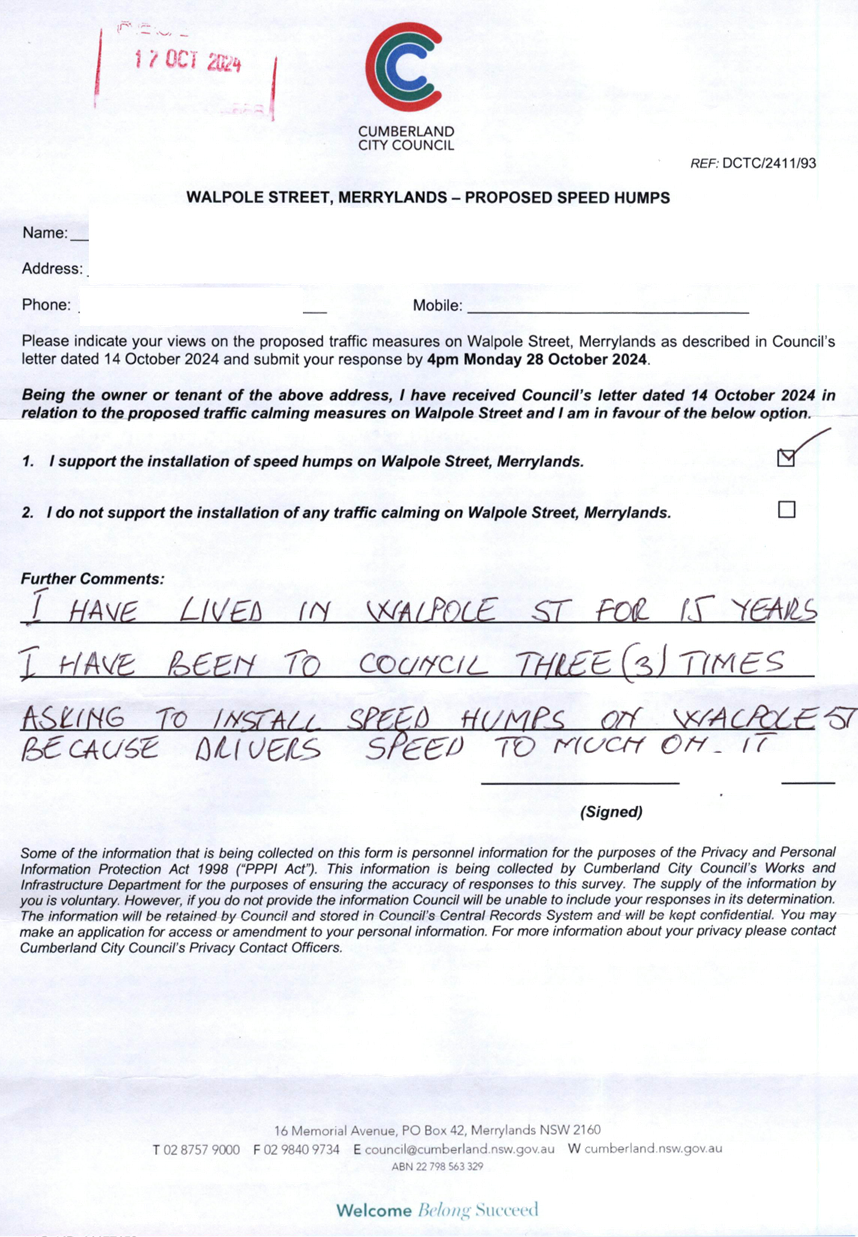
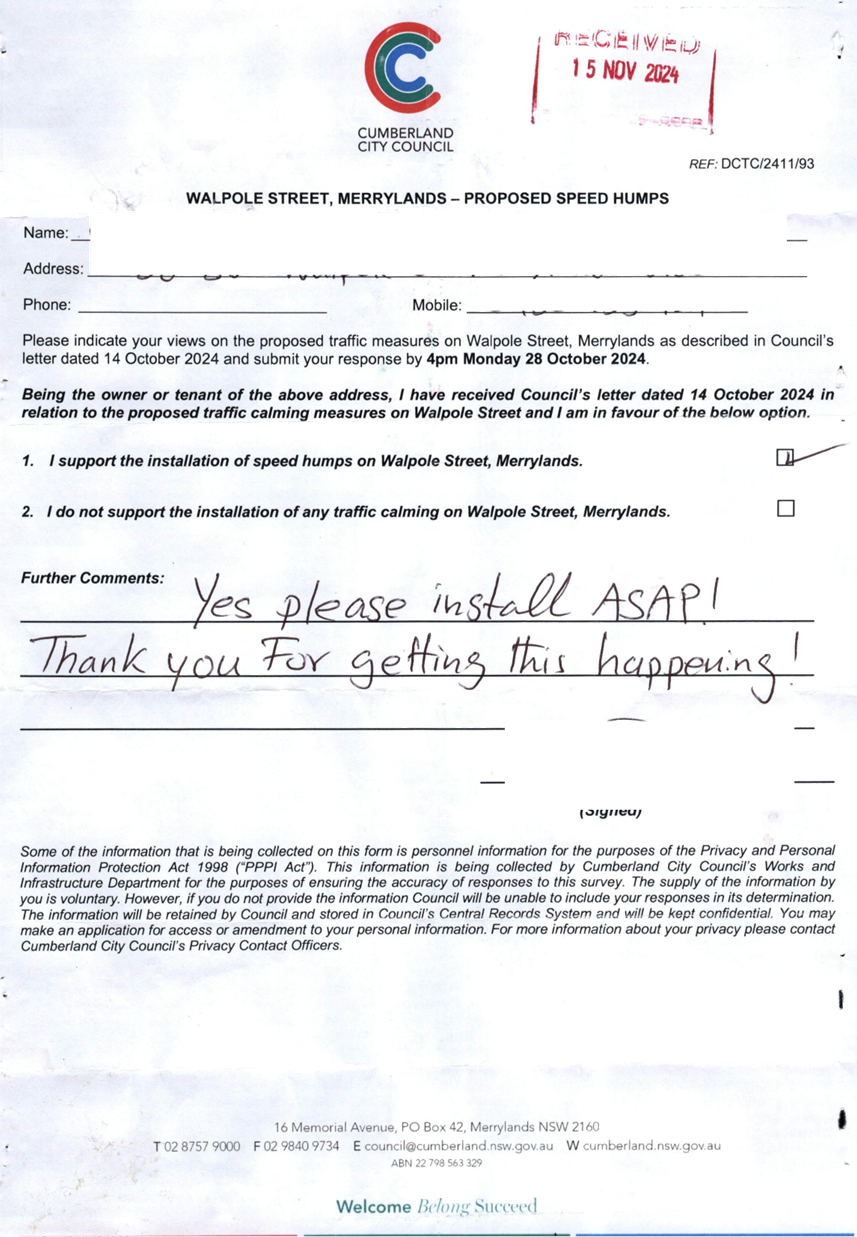
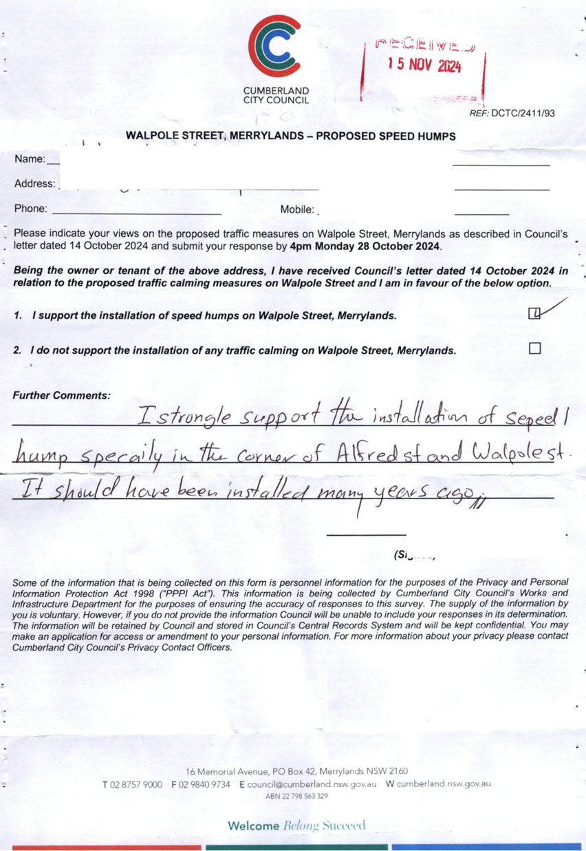
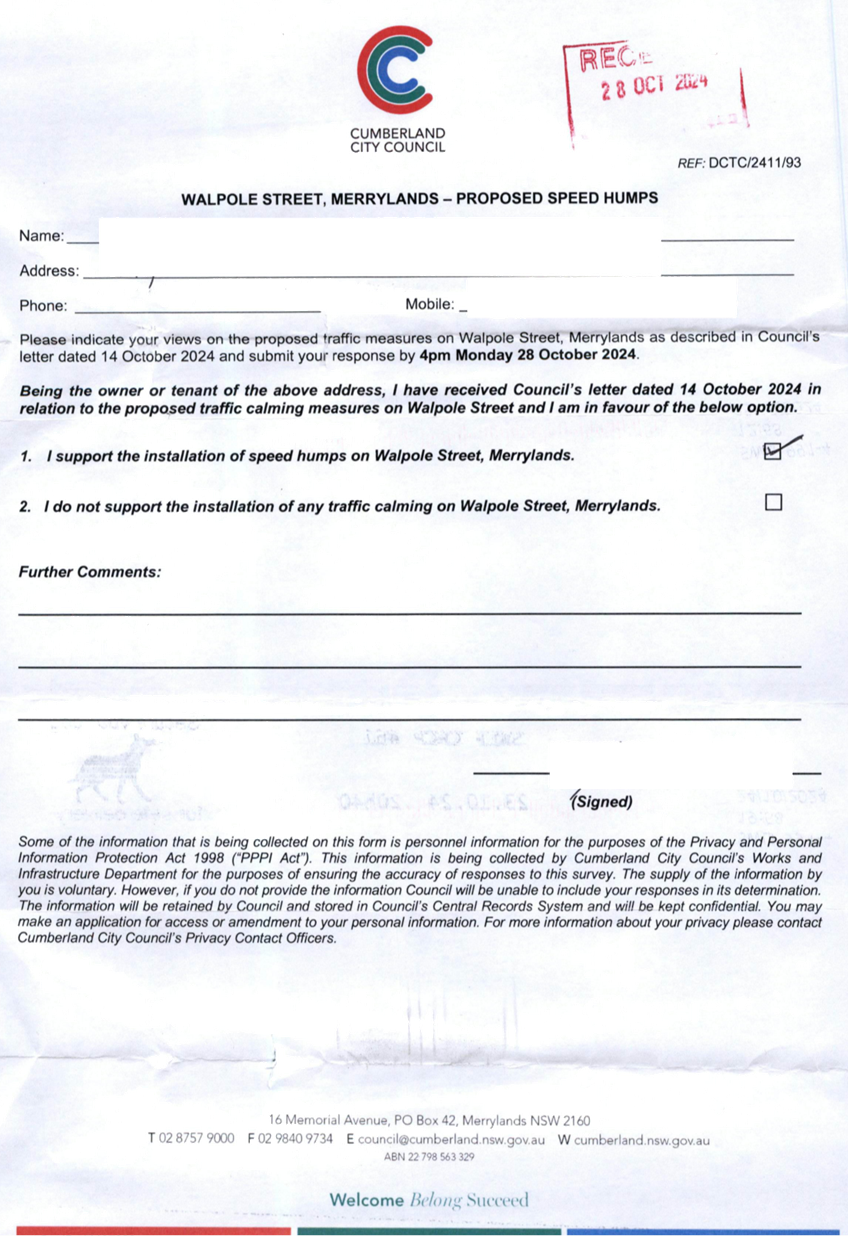
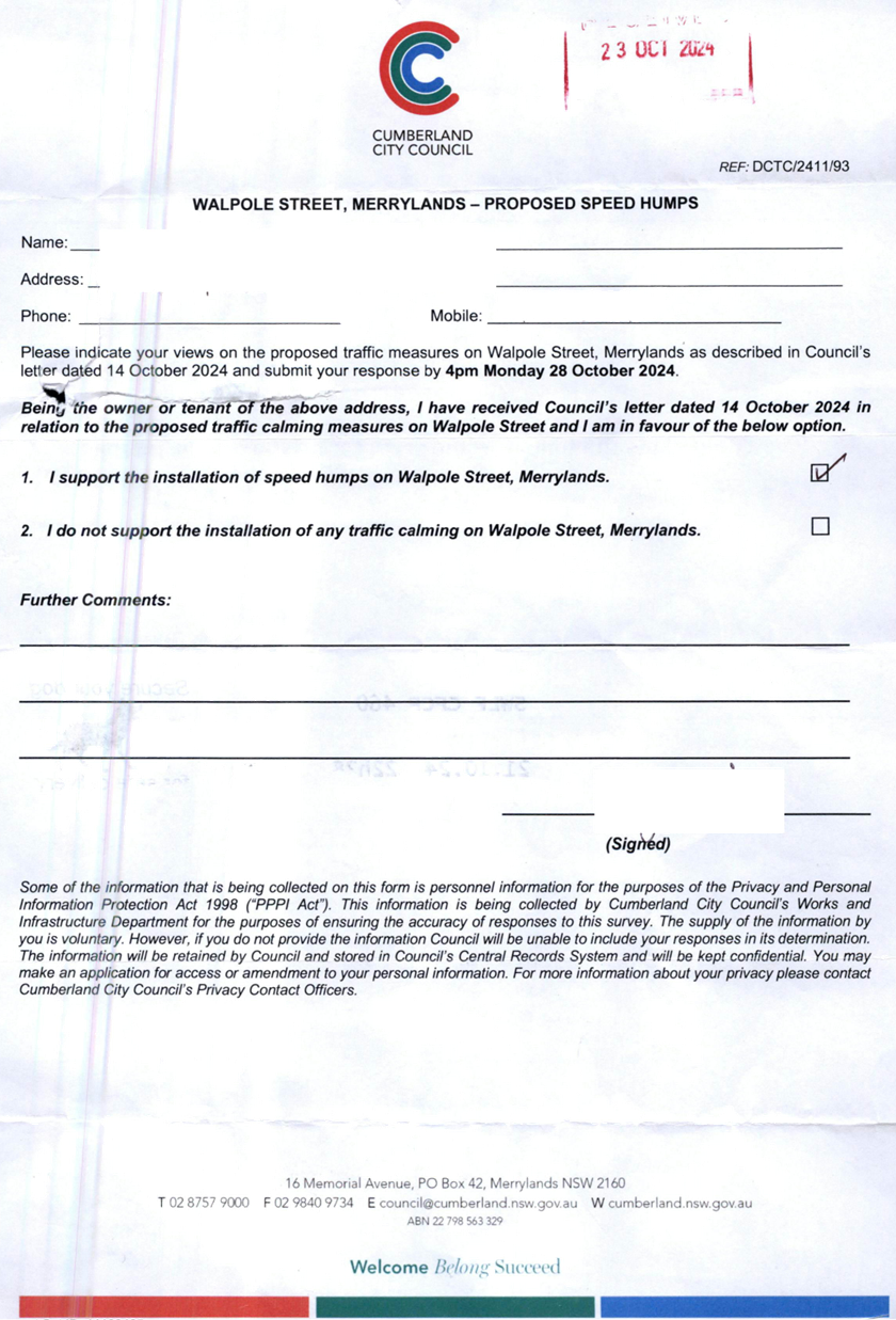
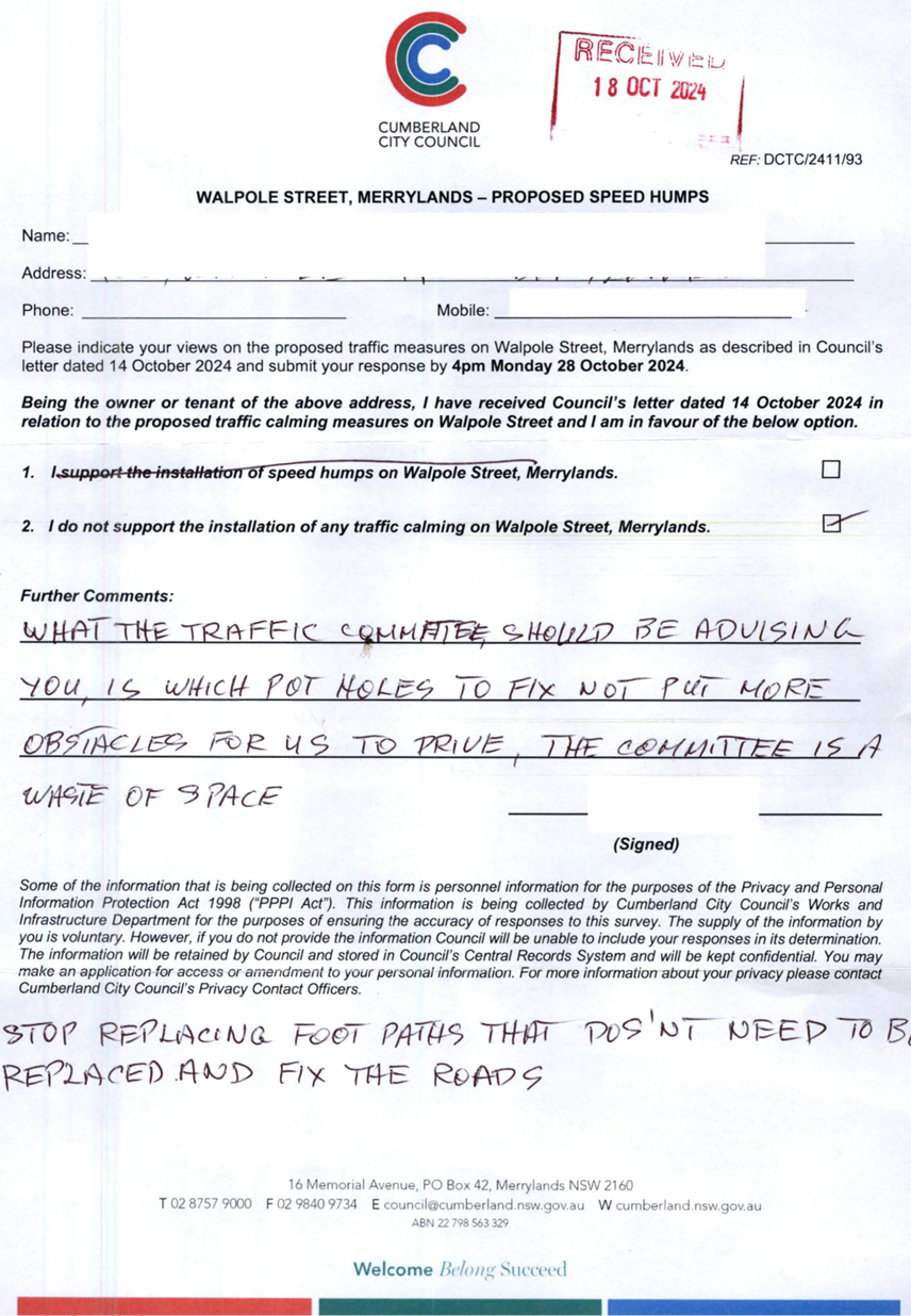
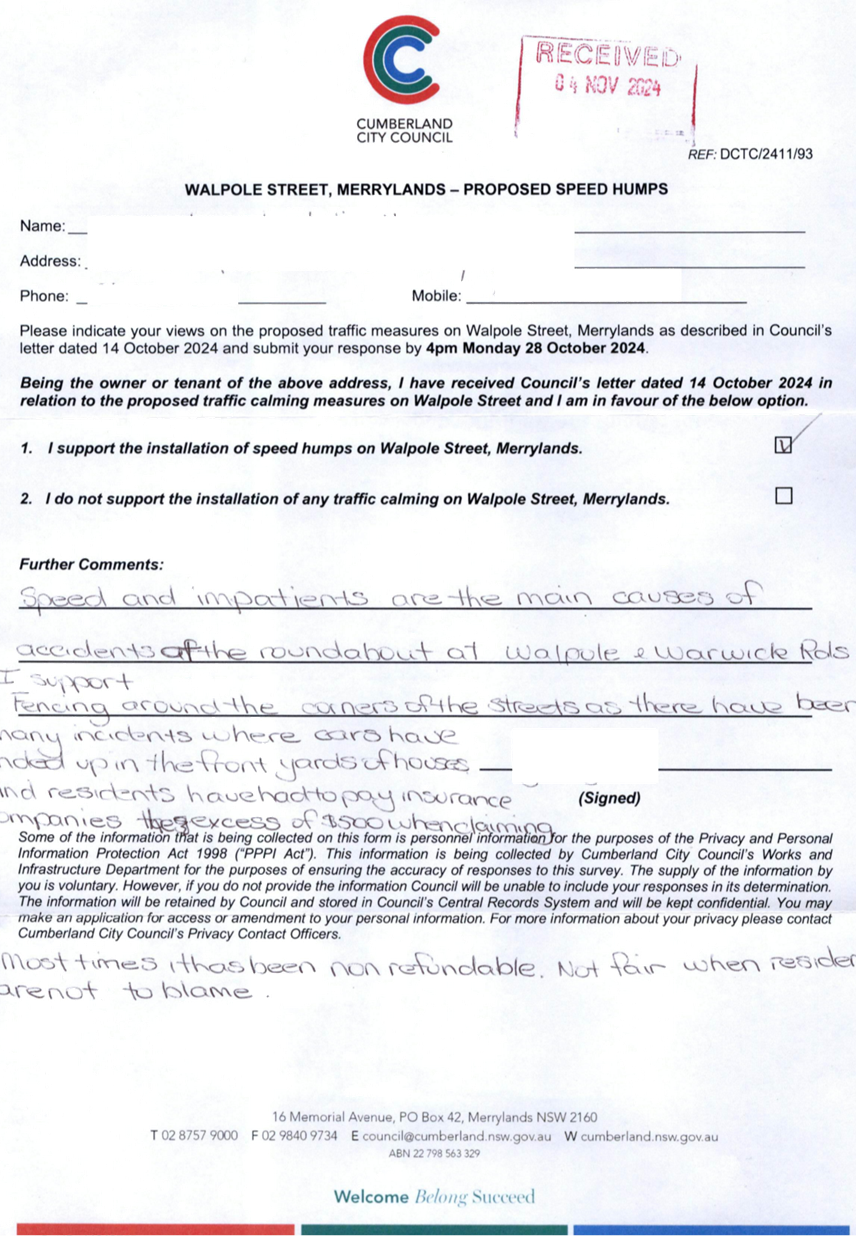
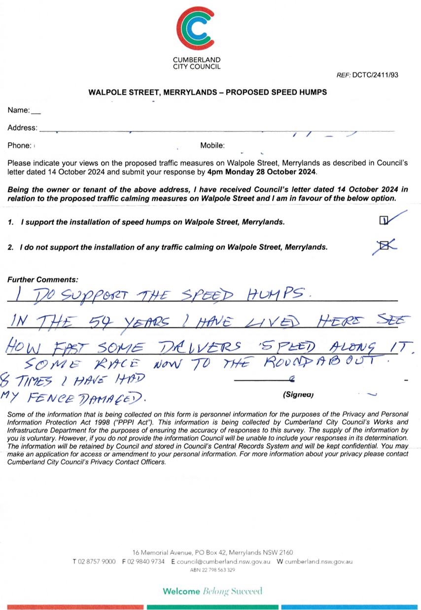
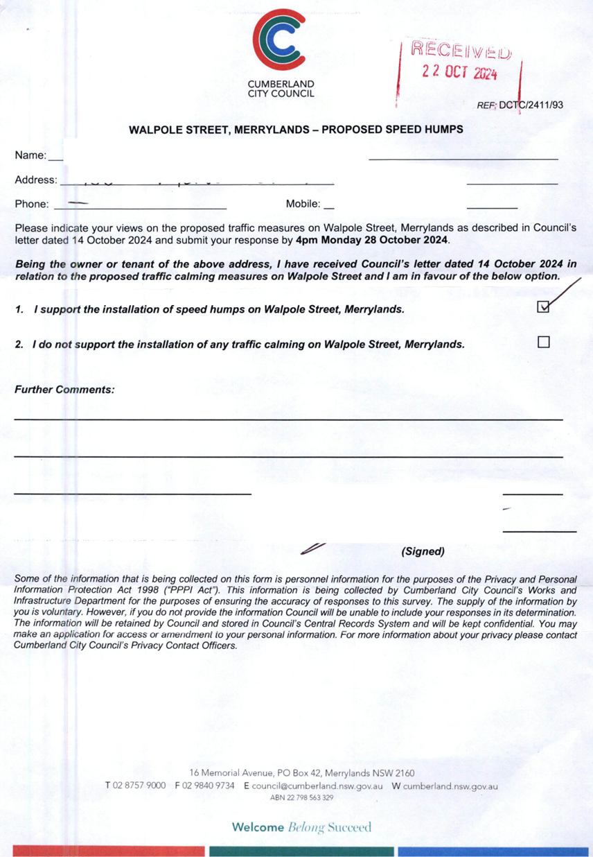
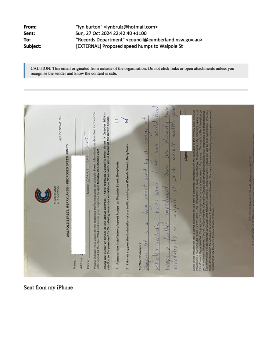
CTC-25-055 WALPOLE
STREET, MERRYLANDS - ROAD SAFETY CONCERNS – CONSULTATION RESULT 687
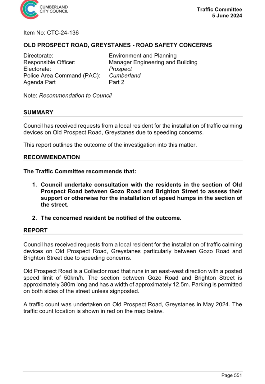
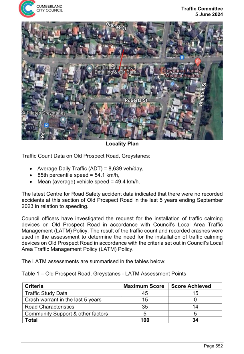
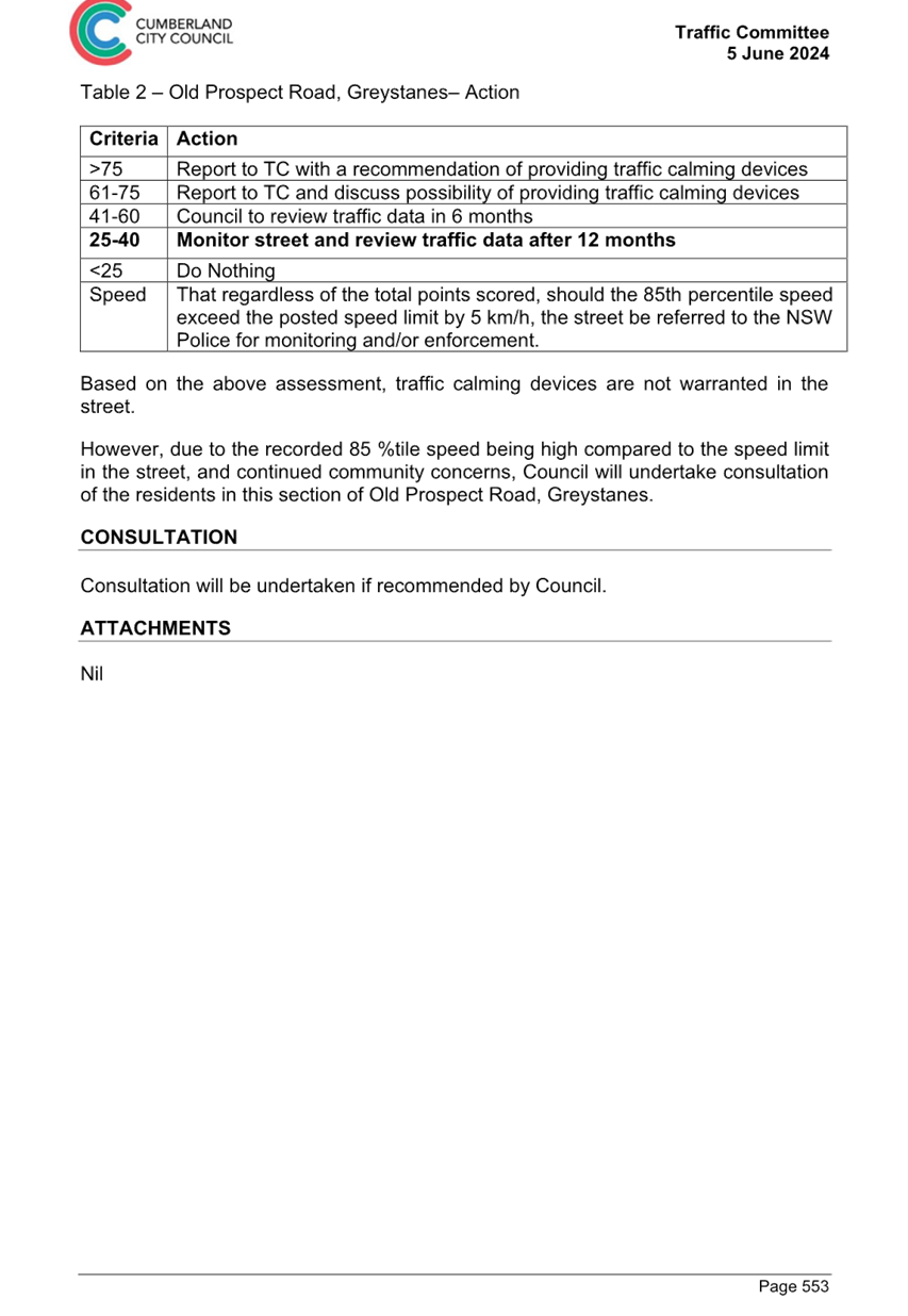
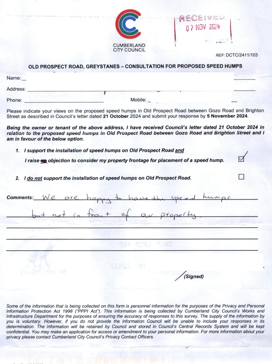
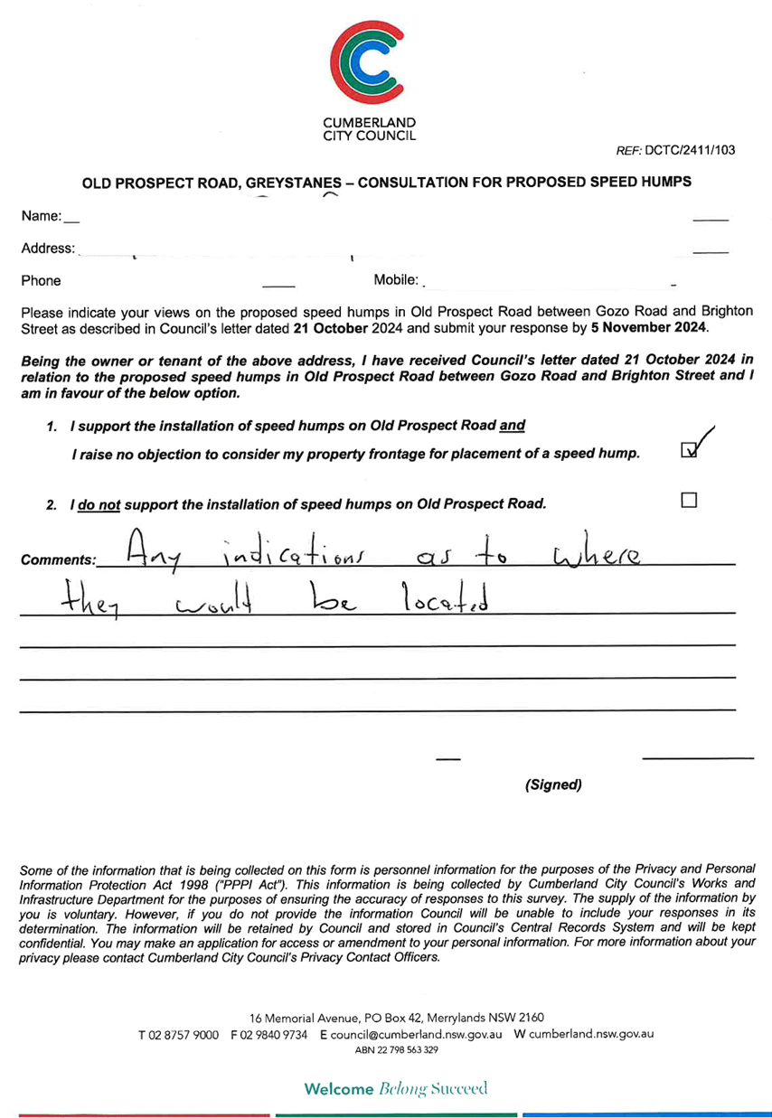
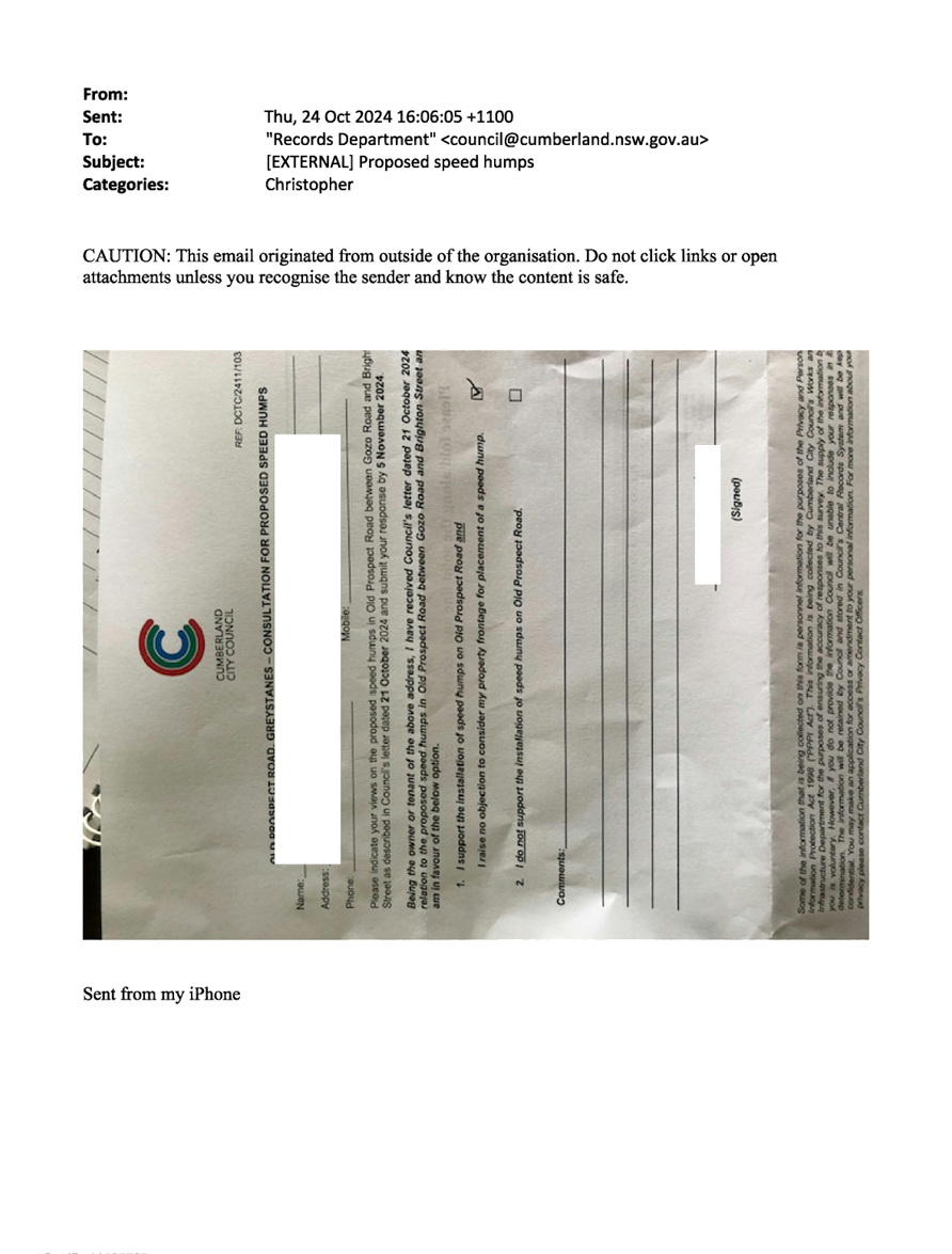
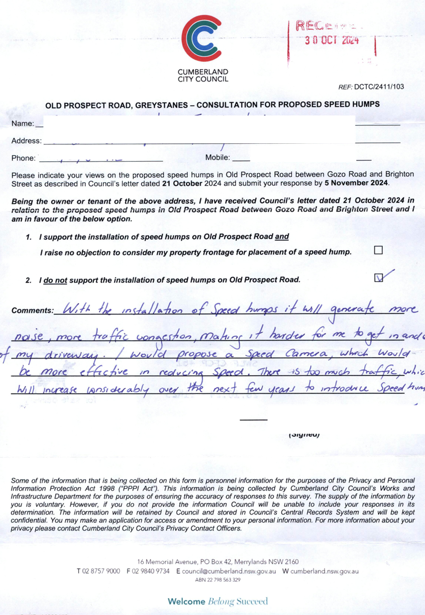
CTC-25-056 OLD
PROSPECT ROAD BETWEEN GOZO ROAD AND BRIGHTON STREET, GREYSTANES - ROAD SAFETY
CONCERNS – CONSULTATION RESULT 725
5 February 2025
Summary of Reports
Part 1 - Recommended for Approval under Delegated
Authority
|
Item #
|
Title
|
Electorate
|
Police Area Command (PAC)
|
|
Fairfield
|
Granville
|
Prospect
|
Auburn
|
Cumberland
|
Auburn
|
|
CTC-25-001
|
HERDSMANS AVENUE AND
COLLEGE STREET, LIDCOMBE – PROPOSED INTERSECTION TREATMENT
|
|
|
|
´
|
|
´
|
|
CTC-25-002
|
GILBA ROAD AND PENDLE WAY,
PENDLE HILL – PROPOSED RELOCATION OF THE EXISTING FENCE
|
|
|
´
|
|
´
|
|
|
CTC-25-003
|
KIBO ROAD AND THIRD AVENUE,
REGENTS PARK - PROPOSED ‘NO STOPPING’ RESTRICTIONS AND CENTRE
LINE MARKING
|
|
|
|
´
|
|
´
|
|
CTC-25-004
|
KIMBERLEY STREET AT
WOODVILLE ROAD, MERRYLANDS – PROPOSED 'NO STOPPING' RESTRICTIONS AND
LINE MARKING
|
|
´
|
|
|
´
|
|
|
CTC-25-005
|
RAWSON ROAD AND GREAT
WESTERN HIGHWAY, SOUTH WENTWORTHVILLE – PROPOSED 'NO STOPPING'
RESTRICTIONS AND LINE MARKING
|
|
|
´
|
|
´
|
|
|
CTC-25-006
|
FREDERICK STREET AT JONES
STREET, PENDLE HILL– PROPOSED 'NO STOPPING' RESTRICTIONS AND LINE
MARKING
|
|
|
´
|
|
´
|
|
|
CTC-25-007
|
BLAXCELL STREET AND WELLS
STREET, SOUTH GRANVILLE – PROPOSED ‘NO STOPPING’
RESTRICTIONS AND LINE MARKING
|
|
´
|
|
|
´
|
|
|
CTC-25-008
|
FOWLER ROAD AND
O’CONNOR STREET, GUILDFORD – PROPOSED ‘NO STOPPING’
RESTRICTIONS AND LINE MARKING
|
|
´
|
|
|
´
|
|
|
CTC-25-009
|
CLUNIES ROSS STREET,
PEMULWUY – PROPOSED 'NO STOPPING' RESTRICITONS
|
|
|
´
|
|
´
|
|
|
CTC-25-010
|
RAILWAY STREET, LIDCOMBE
– PROPOSED ‘NO STOPPING’ RESTRICTIONS NEAR EAST STREET
INTERSECTION
|
|
|
|
´
|
|
´
|
|
CTC-25-011
|
CONDOIN LANE, PEMULWUY
– REQUEST FOR REMOVAL OF 'NO STOPPING' SIGNAGE
|
|
|
´
|
|
´
|
|
|
CTC-25-012
|
MONA STREET, SOUTH
GRANVILLE – PARKING RESTRICTION MODIFICATION
|
|
´
|
|
|
´
|
|
|
CTC-25-013
|
OLD PROSPECT ROAD AND
GRAFTON STEET, GREYSTANES – PROPOSED GIVEWAY SIGNAGE AND LINE MARKING
|
|
|
´
|
|
´
|
|
|
CTC-25-014
|
RAWSON STREET, AUBURN AT
DARTBROOK ROAD – REQUEST FOR ‘KEEP CLEAR’ LINE MARKING
|
|
|
|
´
|
|
´
|
|
CTC-25-015
|
WALLACE STREET AND WARATAH
STREET AT UNION STREET, GRANVILLE – PROPOSED PARKING SIGNAGE AND LINE
MARKING
|
|
´
|
|
|
´
|
|
|
CTC-25-016
|
MCLEOD ROAD / DRESSLER
COURT , HOLROYD / MERRYLANDS – REQUEST FOR TIMED PARKING IN THE
INDENTED PARKING AREA
|
|
´
|
|
|
´
|
|
|
CTC-25-017
|
MAGOWAR ROAD, GIRRAWEEN -
TIMED PARKING CONSULTATION
|
|
|
´
|
|
´
|
|
|
CTC-25-018
|
JONES STREET,
WENTWORTHVILLE – ROAD SAFETY CONCERNS – CONSULTATION RESULT
|
|
|
´
|
|
´
|
|
|
CTC-25-019
|
MCCREDIE ROAD, GUILDFORD
WEST - ROAD SAFETY CONCERNS – CONSULTATION RESULT
|
|
´
|
|
|
´
|
|
|
CTC-25-020
|
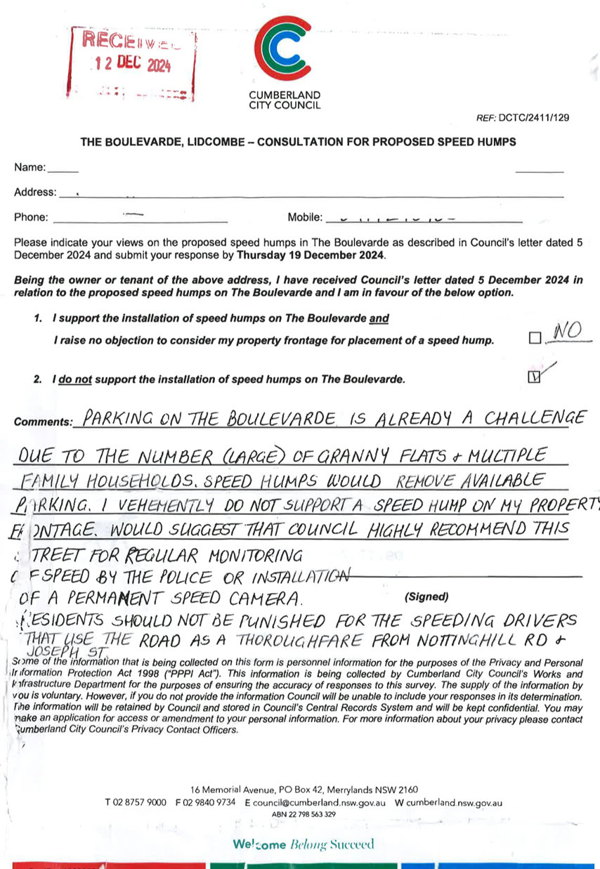
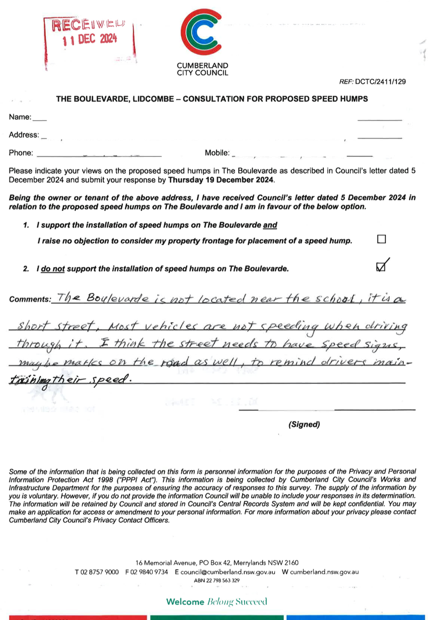
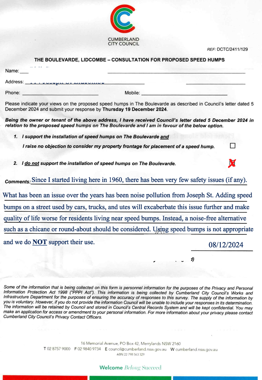
THE BOULEVARDE, LIDCOMBE -
ROAD SAFETY CONCERNS – CONSULTATION RESULT
|
|
|
|
´
|
|
´
|
|
CTC-25-021
|
STATION ROAD, AUBURN
– APPLICATION FOR ‘WORKS ZONE’ SIGNAGE
|
|
|
|
´
|
|
´
|
|
CTC-25-022
|
JOHN STREET, LIDCOMBE
– APPLICATION FOR ‘WORKS ZONE’ SIGNAGE
|
|
|
|
´
|
|
´
|
|
CTC-25-023
|
NORTHUMBERLAND ROAD, AUBURN
– APPLICATION FOR ‘WORKS ZONE’ SIGNAGE
|
|
|
|
´
|
|
´
|
Part 2 - Recommendation to Council
|
Item #
|
Title
|
Electorate
|
Police Area Command (PAC)
|
|
Fairfield
|
Granville
|
Prospect
|
Auburn
|
Cumberland
|
Auburn
|
|
CTC-25-024
|
OXFORD STREET AND HIGHLAND
STREET, GUILDFORD - AUSTRALIAN GOVERNMENT BLACK SPOT PROGRAM
|
|
´
|
|
|
´
|
|
|
CTC-25-025
|
AMY STREET AT KINGSLAND
ROAD, REGENTS PARK - AUSTRALIAN GOVERNMENT BLACK SPOT PROGRAM
|
|
|
|
´
|
|
´
|
|
CTC-25-026
|
RAILWAY PARADE, HELENA
STREET AND COCKTHORPE ROAD, AUBURN - AUSTRALIAN GOVERNMENT BLACK SPOT PROGRAM
|
|
|
|
´
|
|
´
|
|
CTC-25-027
|
LIDCOMBE TOWN CENTRE PUBLIC
DOMAIN PLAN - JOSEPH STREET PRECINCT – PROPOSED PEDESTRIAN CROSSING ON
BRIDGE STREET
|
|
|
|
´
|
|
´
|
|
CTC-25-028
|
LIDCOMBE TOWN CENTRE PUBLIC
DOMAIN PLAN - JOSEPH STREET PRECINCT – PROPOSED PEDESTRIAN CROSSING ON
TAYLOR STREET
|
|
|
|
´
|
|
´
|
|
CTC-25-029
|
GUILDFORD ROAD, GUILDFORD
- PROPOSED TEMPORARY ROAD CLOSURE FOR GUILDFORD FESTIVAL
|
|
´
|
|
|
´
|
|
|
CTC-25-030
|
MIMOSA STREET, GRANVILLE -
PARTIAL ROAD CLOSURE AT DUCK RIVER
|
|
´
|
|
|
´
|
|
|
CTC-25-031
|
SEVENTH STREET, GRANVILLE -
PARTIAL ROAD CLOSURE AT DUCK RIVER
|
|
´
|
|
|
´
|
|
|
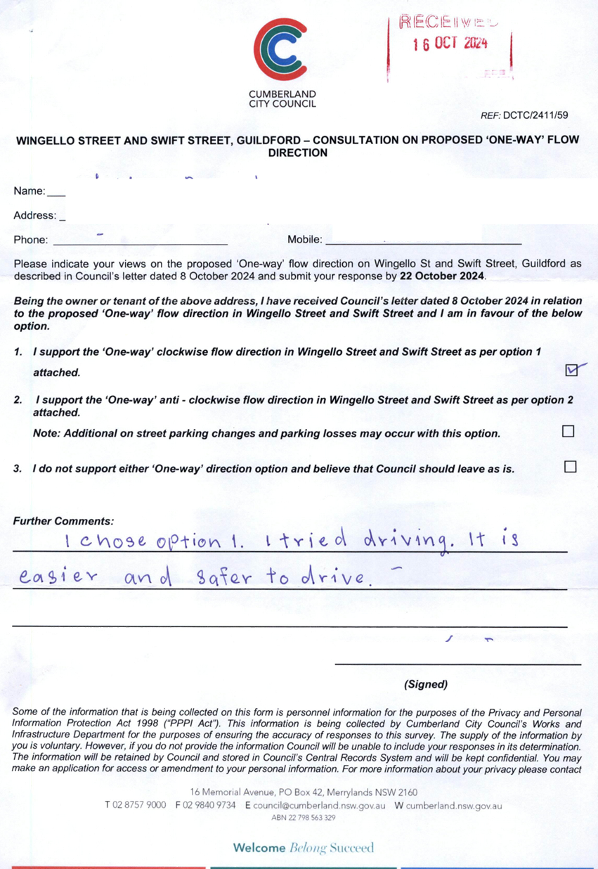
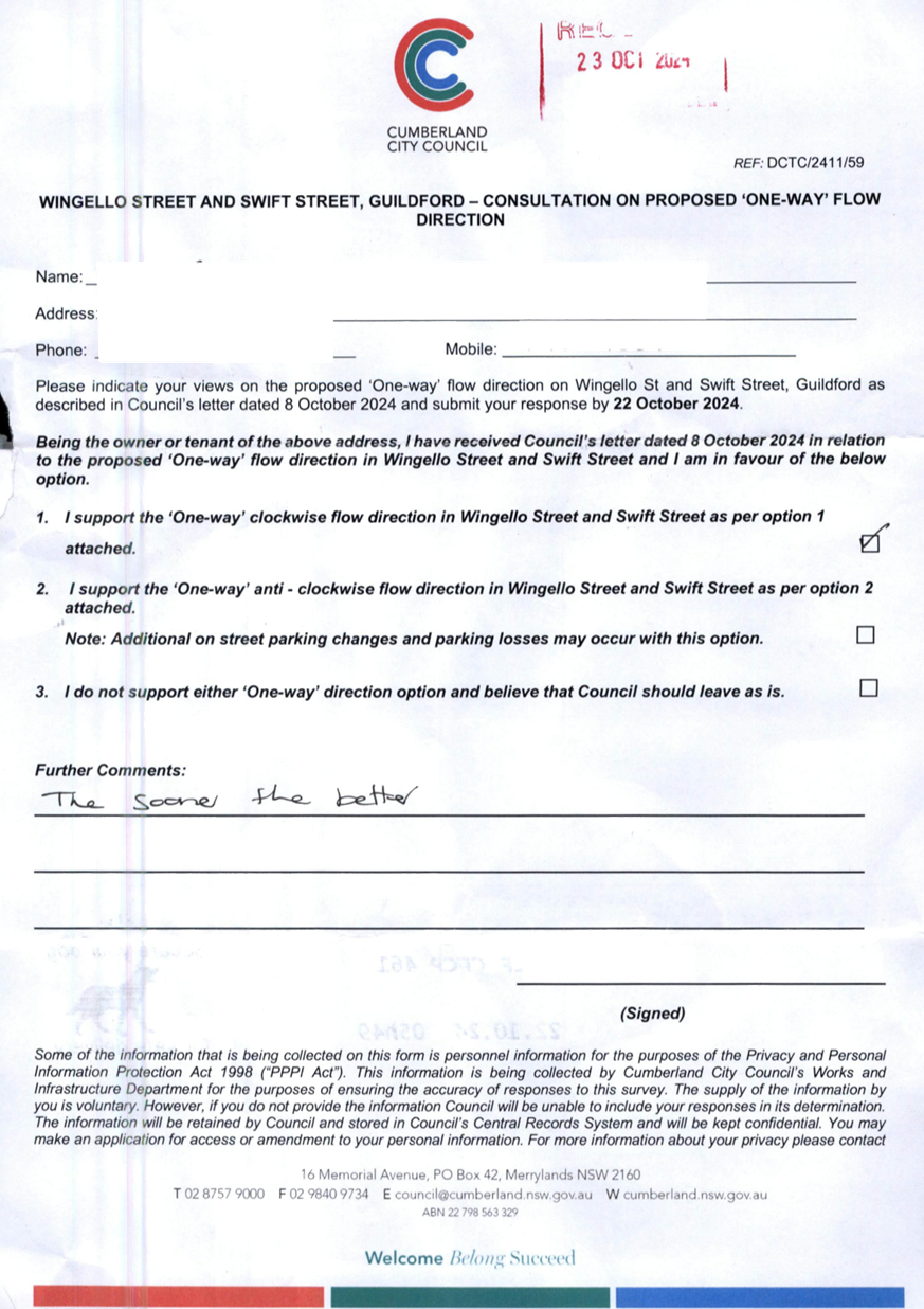
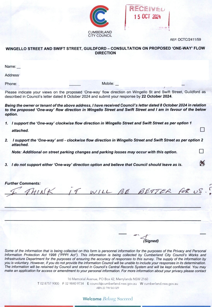
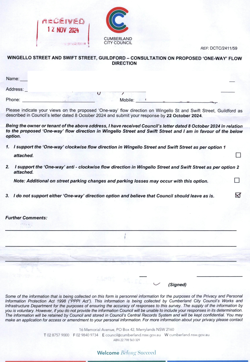
CTC-25-032
|
WINGELLO STREET AND SWIFT
STREET, GUILDFORD – PROPOSED 'ONE WAY' - CONSULTATION RESULT
|
|
´
|
|
|
´
|
|
|
CTC-25-033
|
ROSEBERRY STREET AND MARY
STREET, MERRYLANDS – PROPOSED ROUNDABOUT
|
|
´
|
|
|
´
|
|
|
CTC-25-034
|
PHILLIPS AVENUE, GREATREX
AVENUE AND COLEMAN AVENUE, REGENTS PARK – PROPOSED TRAFFIC CALMING
MEASURES
|
|
|
|
´
|
|
´
|
|
CTC-25-035
|
HAWKSVIEW STREET, GUILDFORD
– PROPOSED PEDESTRIAN FENCING
|
|
´
|
|
|
´
|
|
|
CTC-25-036
|
TILBA STREET, BERALA -
RESPONSE TO NOTICE OF MOTION - REQUEST FOR A PEDESTRIAN CROSSING
|
|
|
|
´
|
|
´
|
|
CTC-25-037
|
DANIEL STREET, GRANVILLE -
REQUEST FOR PEDESTRIAN CROSSING
|
|
´
|
|
|
´
|
|
|
CTC-25-038
|
KING STREET, GUILDFORD WEST
- REQUEST FOR PEDESTRIAN CROSSING
|
|
´
|
|
|
´
|
|
|
CTC-25-039
|
CHURCH STREET & SWETE
STREET, LIDCOMBE - PROPOSED RAISED INTERSECTION AND MARKED PEDESTRIAN
CROSSINGS
|
|
|
|
´
|
|
´
|
|
CTC-25-040
|
MILITARY ROAD, GUILDFORD -
PARKING ARRANGEMENT REIVEW
|
|
´
|
|
|
´
|
|
|
CTC-25-041
|
EXCELSIOR STREET, WYNYARD
STREET AND EVE STREET, GUILDFORD – PROPOSED INTERSECTION TREATMENT
|
|
´
|
|
|
´
|
|
|
CTC-25-042
|
BRIDGE ROAD, WESTMEAD
– INTERSECTION TREATMENT
|
|
´
|
|
|
´
|
|
|
CTC-25-043
|
WHALANS ROAD, GREYSTANES
– ROAD SAFETY CONCERNS
|
|
|
´
|
|
´
|
|
|
CTC-25-044
|
WOMBAT STREET, PEMULWUY -
ROAD SAFETY CONCERNS
|
|
|
´
|
|
´
|
|
|
CTC-25-045
|
LANCE CRESCENT, GREYSTANES
- ROAD SAFETY CONCERNS
|
|
|
´
|
|
´
|
|
|
CTC-25-046
|
LACKEY STREET, MERRYLANDS
– ROAD SAFETY CONCERNS
|
|
´
|
|
|
´
|
|
|
CTC-25-047
|
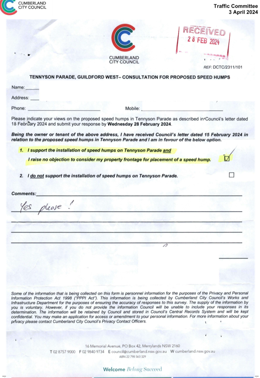
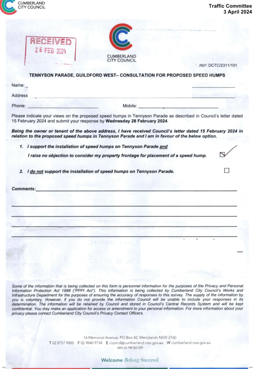
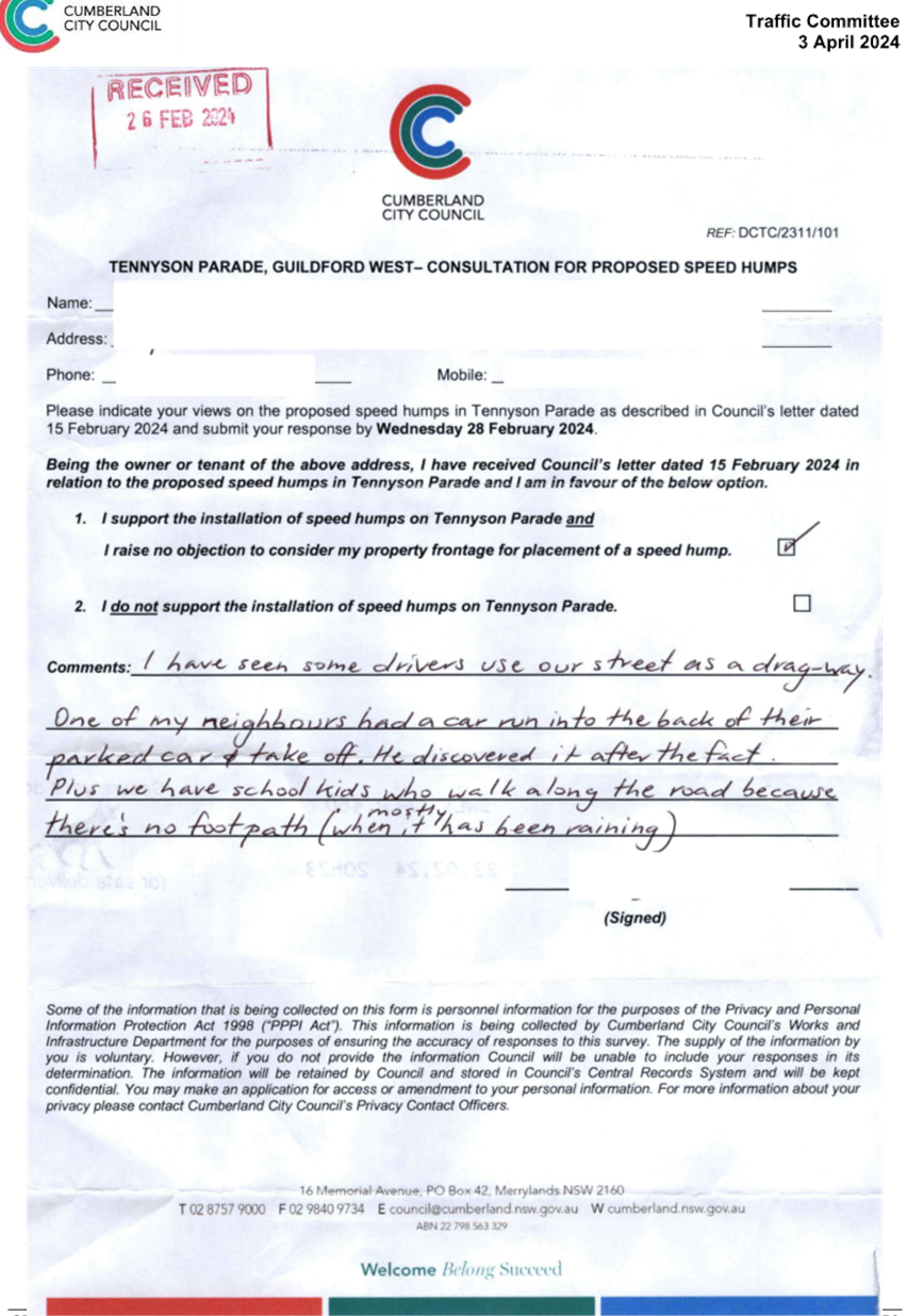
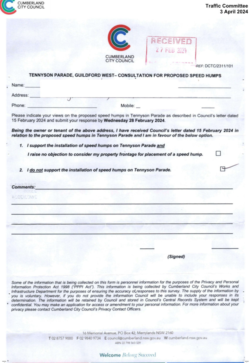
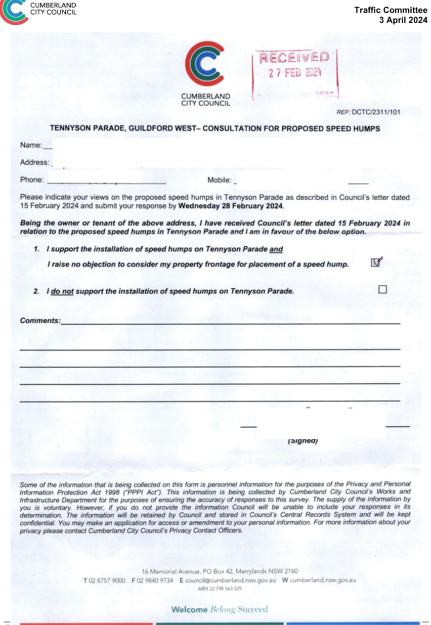
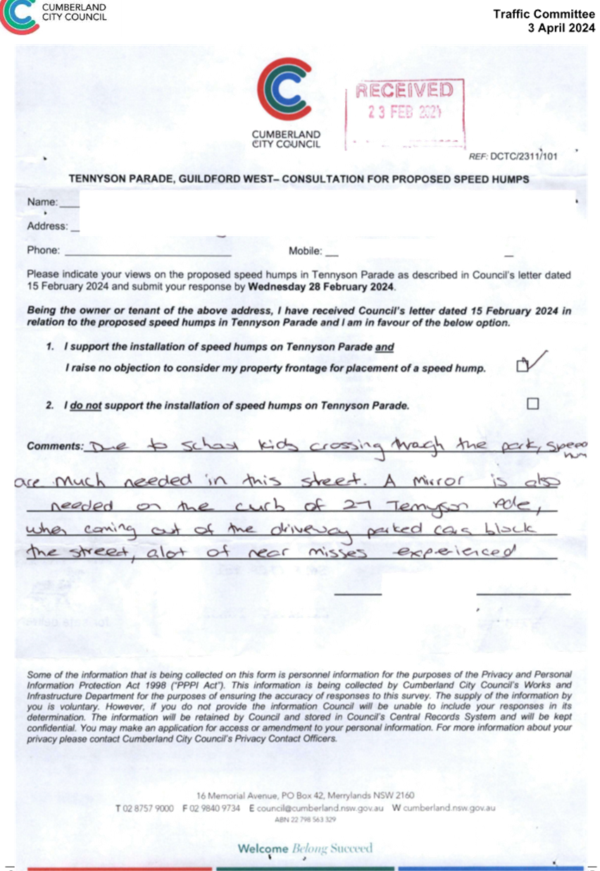
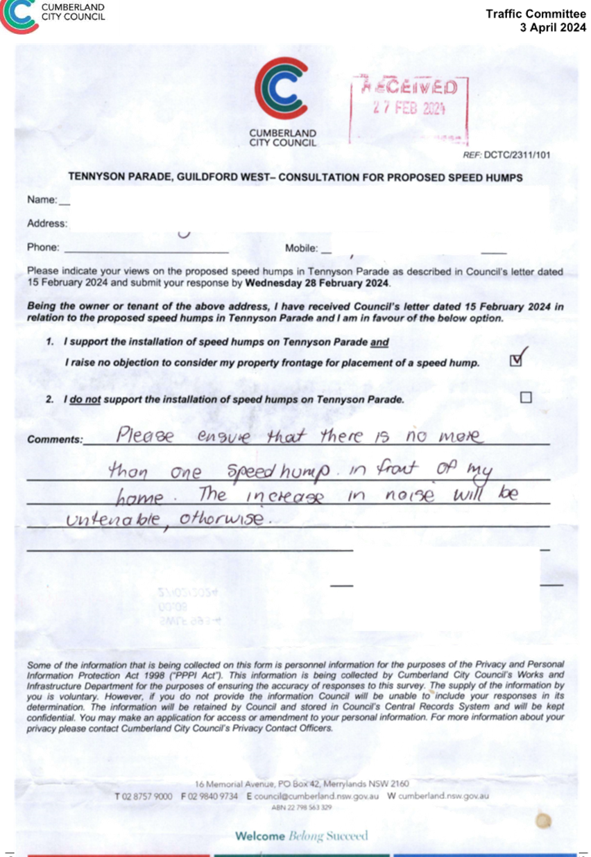
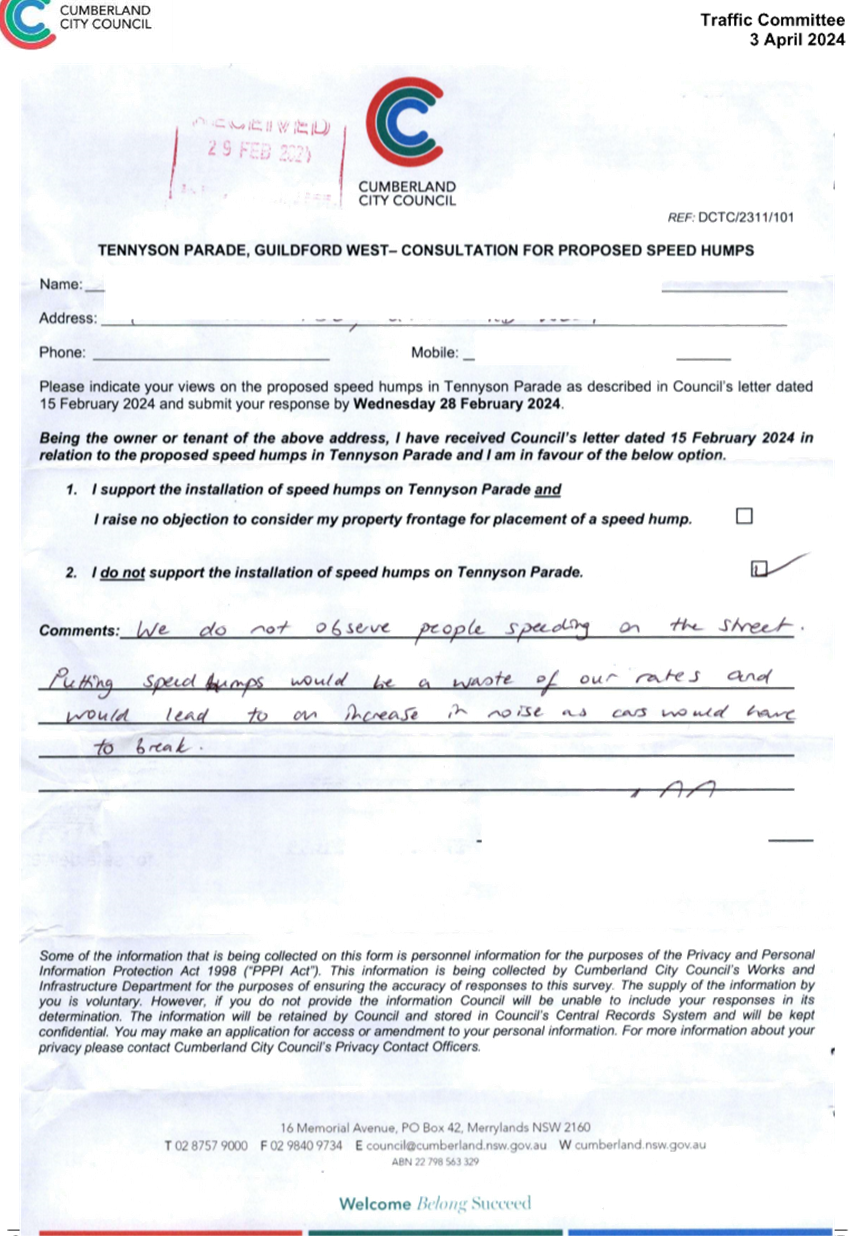
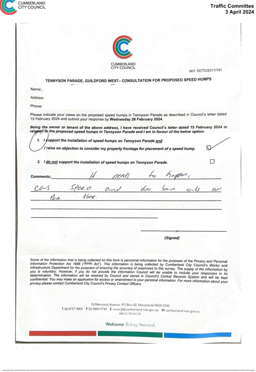
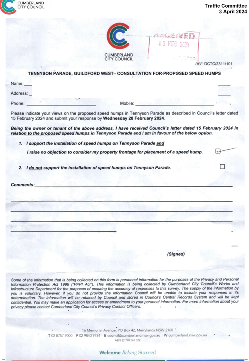
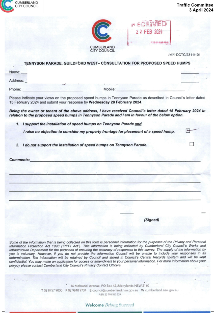
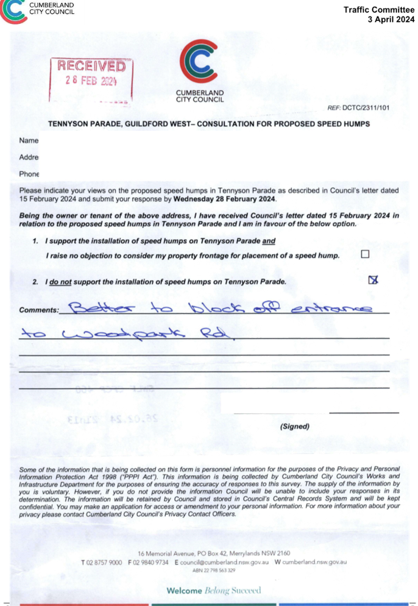
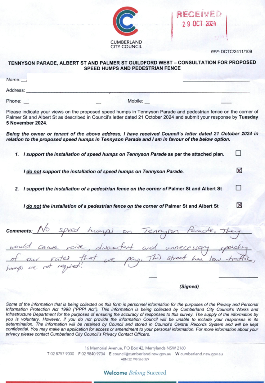
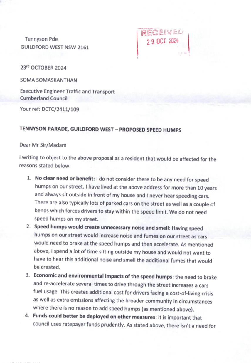
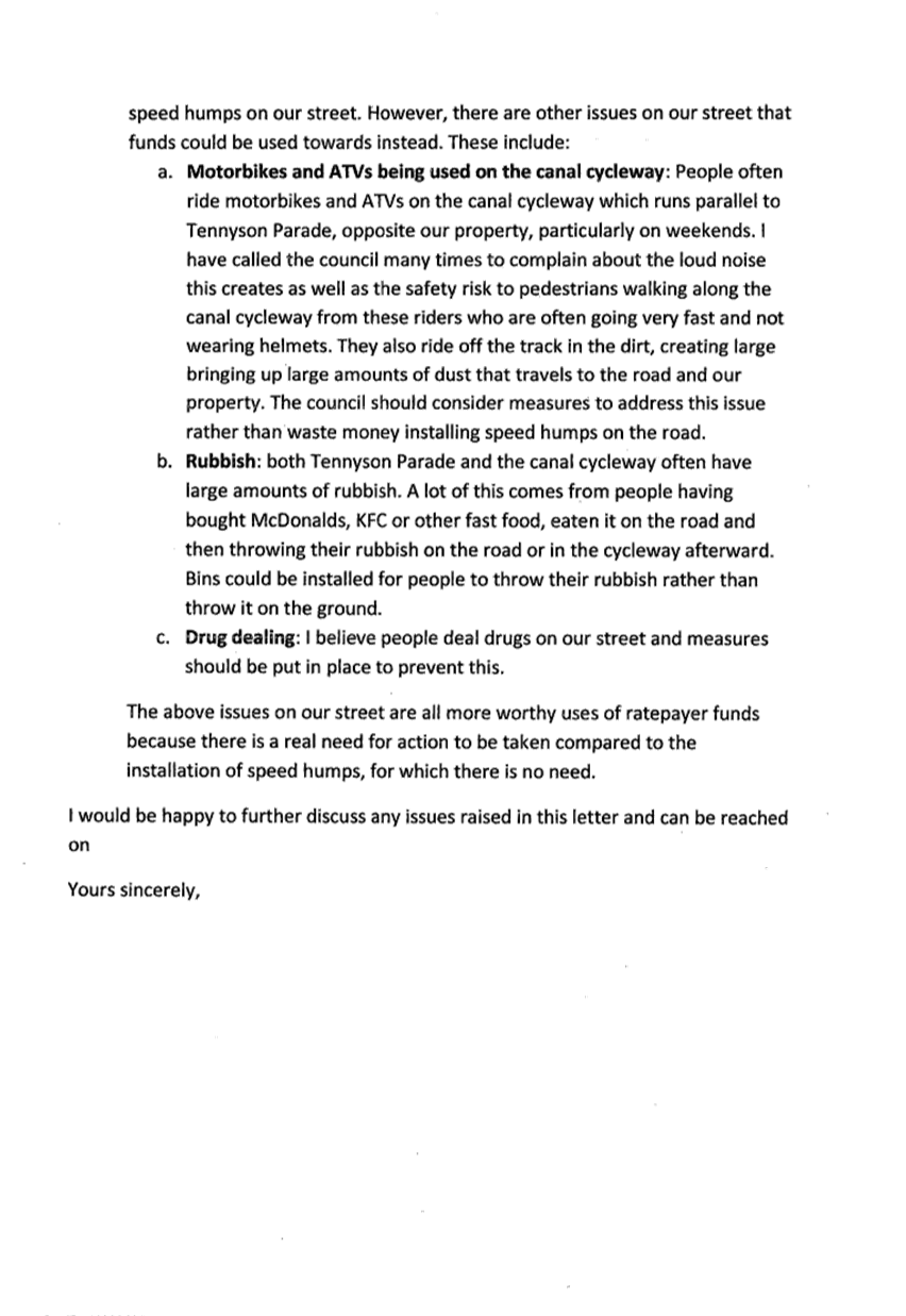
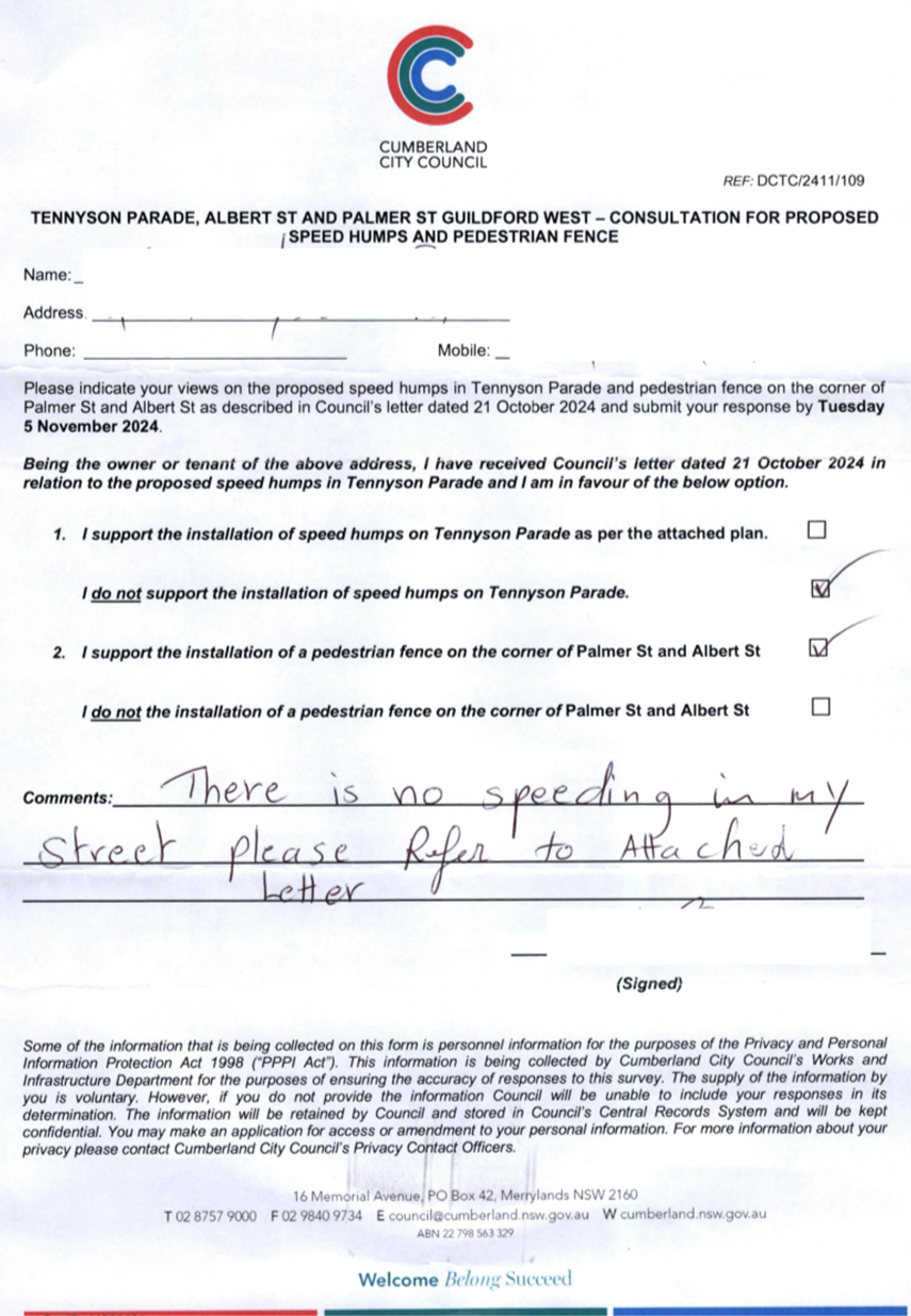
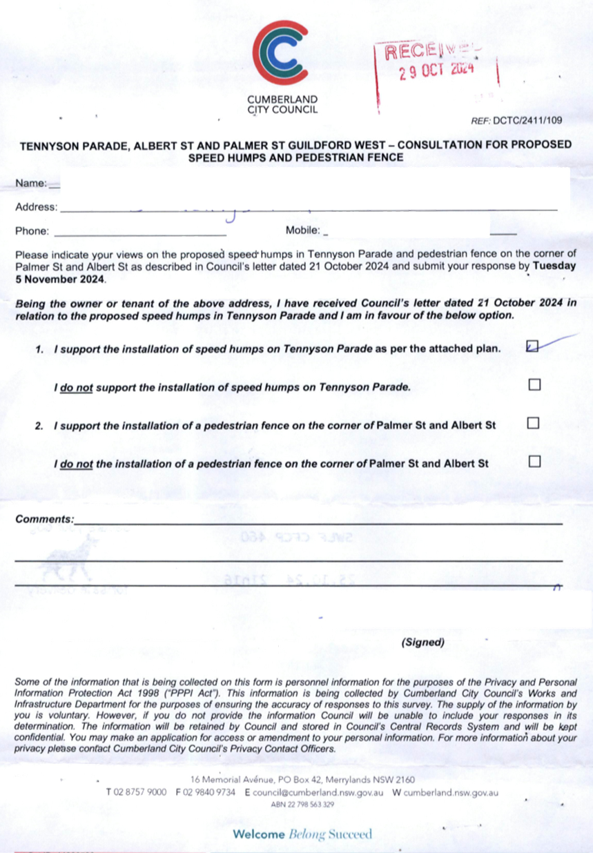
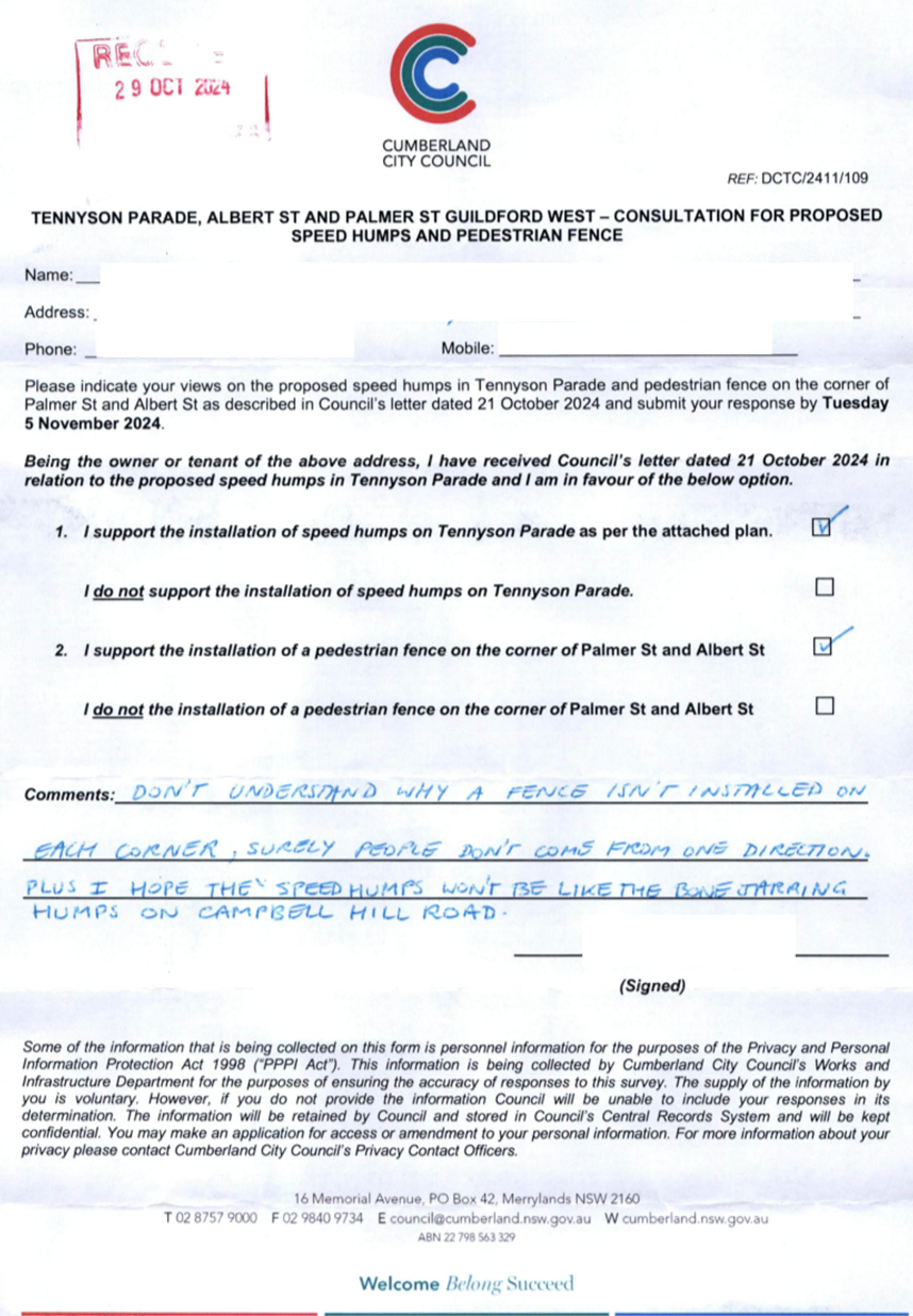
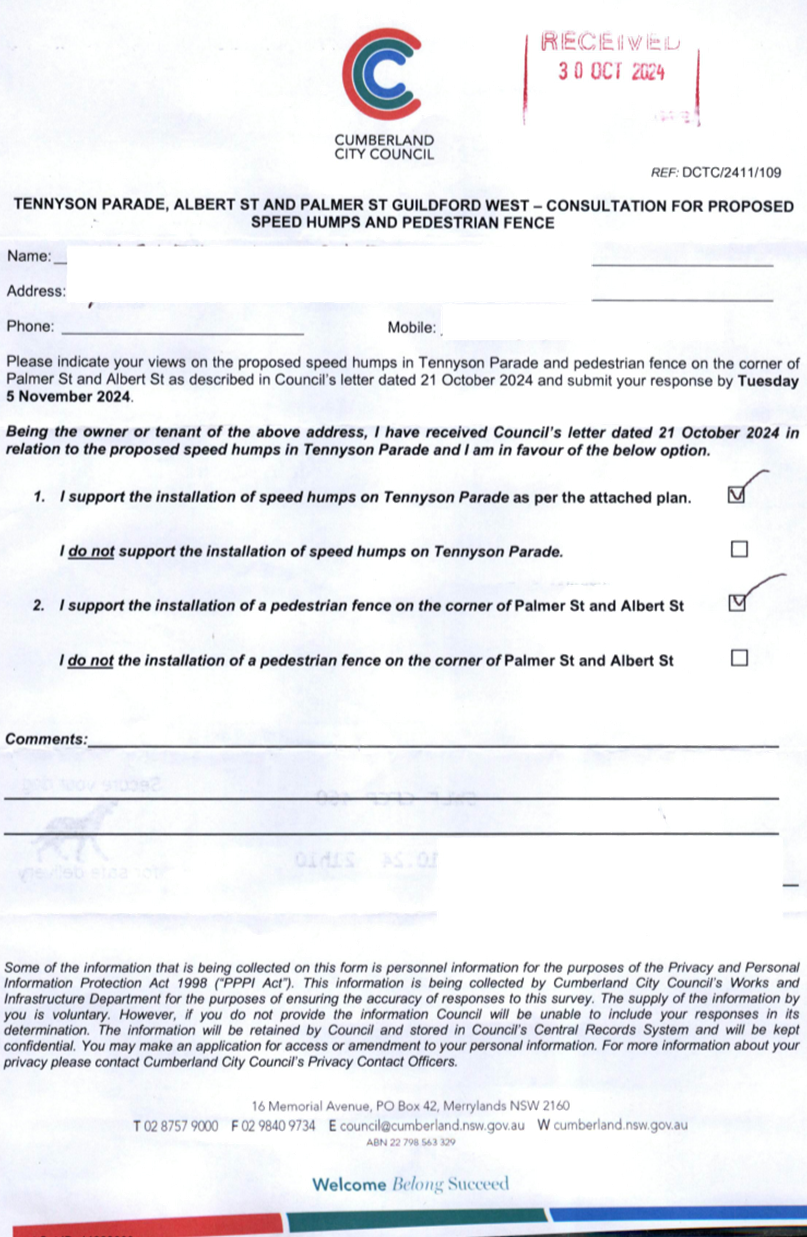
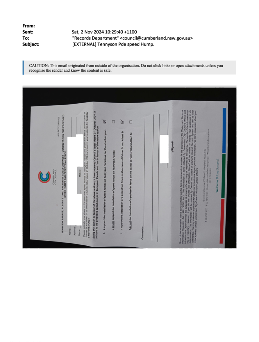
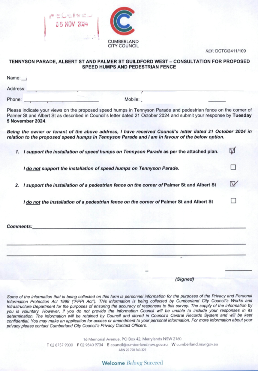
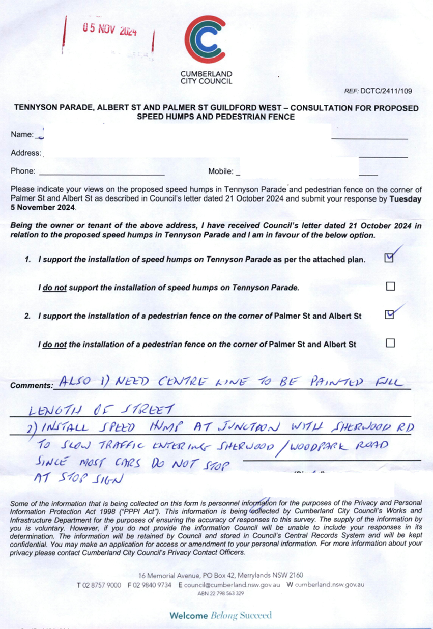
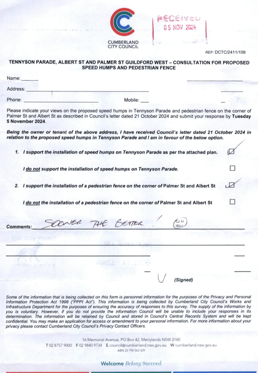
TENNYSON PARADE, GUILDFORD
WEST - ROAD SAFETY CONCERNS
|
|
´
|
|
|
´
|
|
|
CTC-25-048
|
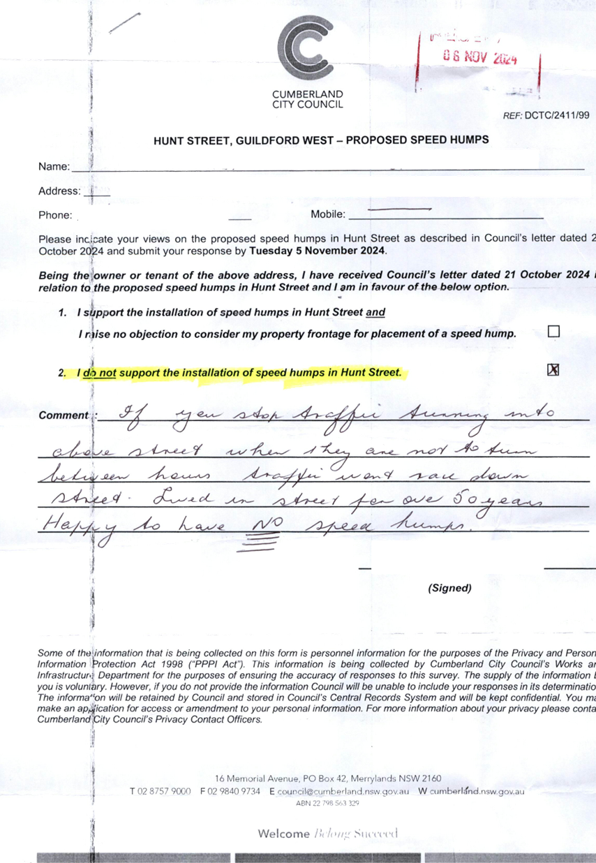
HUNT STREET, GUILDFORD WEST
- ROAD SAFETY CONCERNS
|
|
´
|
|
|
´
|
|
|
CTC-25-049
|
ROSEBERRY STREET BETWEEN
HAWKSVIEW STREET AND MYALL STREET, MERRYLANDS – ROAD SAFETY CONCERNS
|
|
´
|
|
|
´
|
|
|
CTC-25-050
|
GRASSMERE STREET, GUILDFORD
- ROAD SAFETY CONCERNS – CONSULTATION RESULT
|
|
´
|
|
|
´
|
|
|
CTC-25-051
|
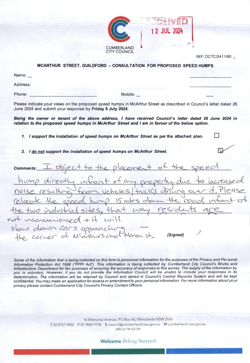
MCARTHUR STREET,
GUILDFORD – ROAD SAFETY CONCERNS – CONSULTATION RESULT
|
|
´
|
|
|
´
|
|
|
CTC-25-052
|
LOCKWOOD STREET, MERRYLANDS
- ROAD SAFETY CONCERNS – CONSULTATION RESULT
|
|
´
|
|
|
´
|
|
|
CTC-25-053
|
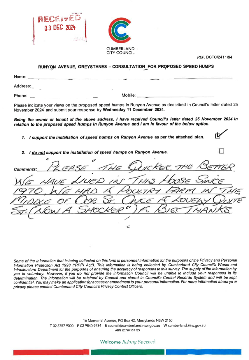
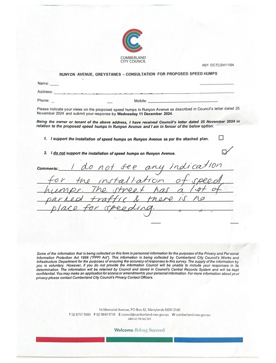
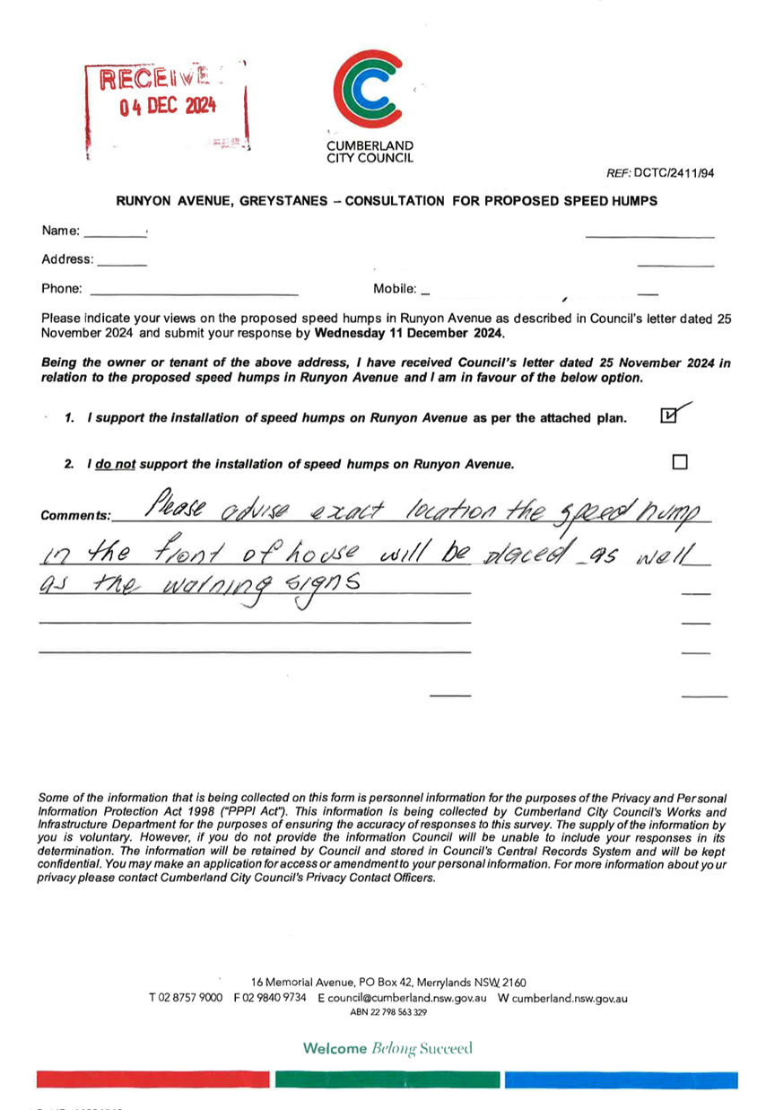
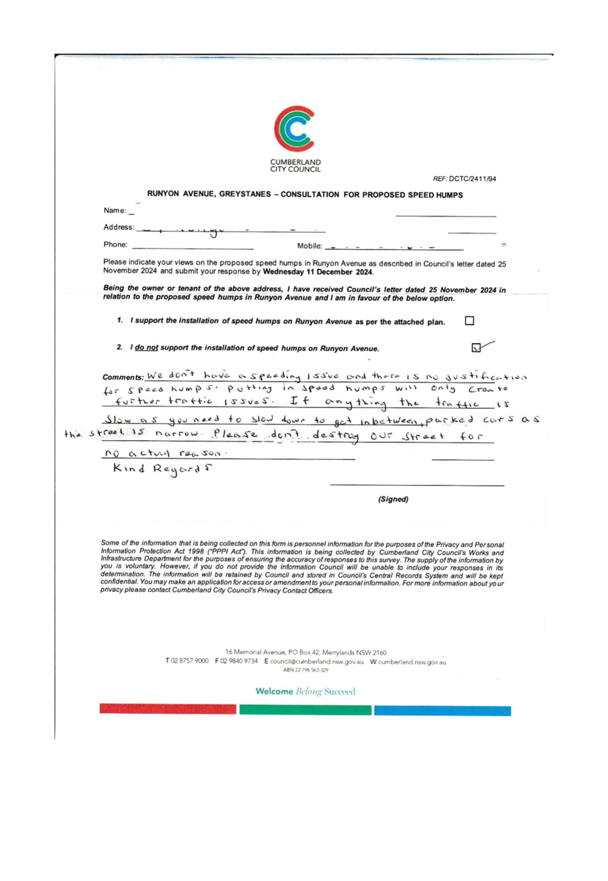
RUNYON AVENUE, GREYSTANES -
ROAD SAFETY CONCERNS – CONSULTATION RESULT
|
|
|
´
|
|
´
|
|
|
CTC-25-054
|
BOOMERANG STREET AND RANDLE
STREET, GRANVILLE - ROAD SAFETY CONCERNS – CONSULTATION RESULT
|
|
´
|
|
|
´
|
|
|
CTC-25-055
|
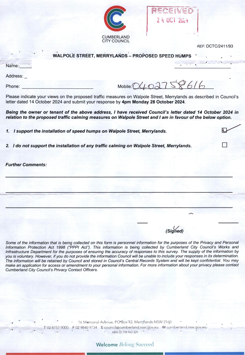
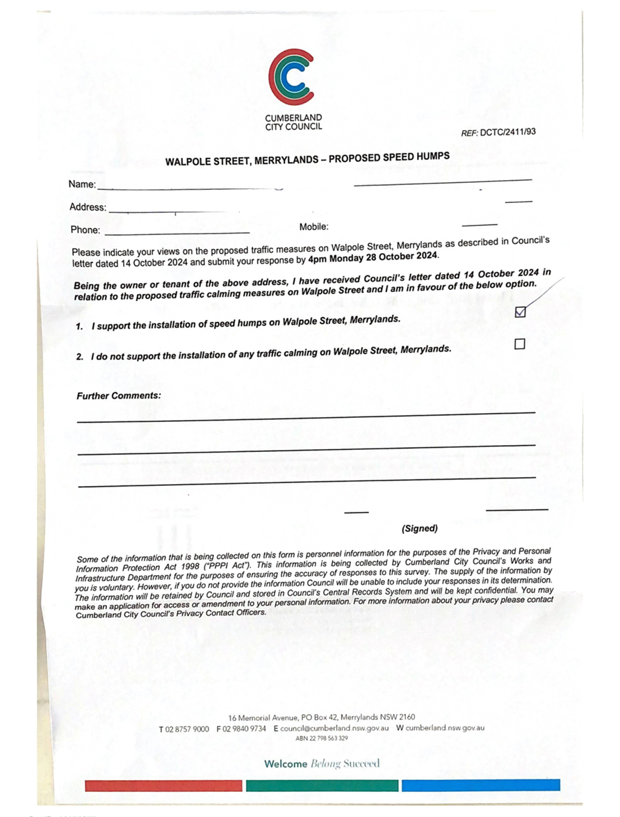
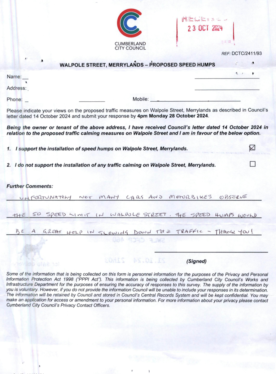
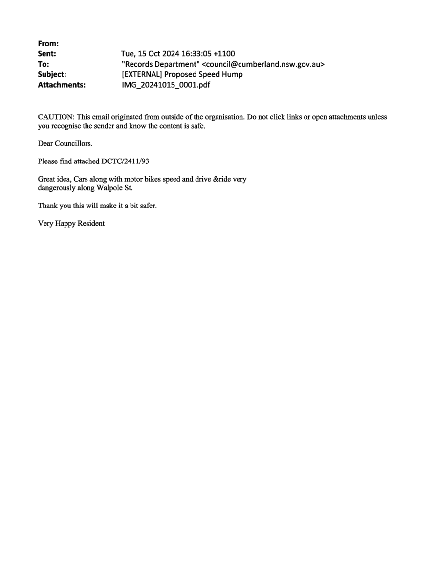
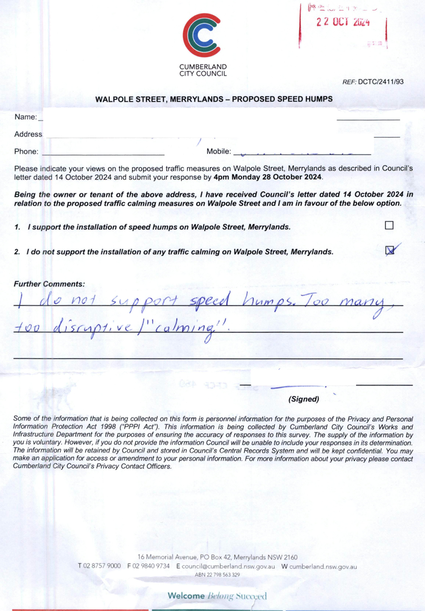
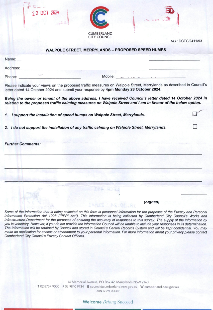
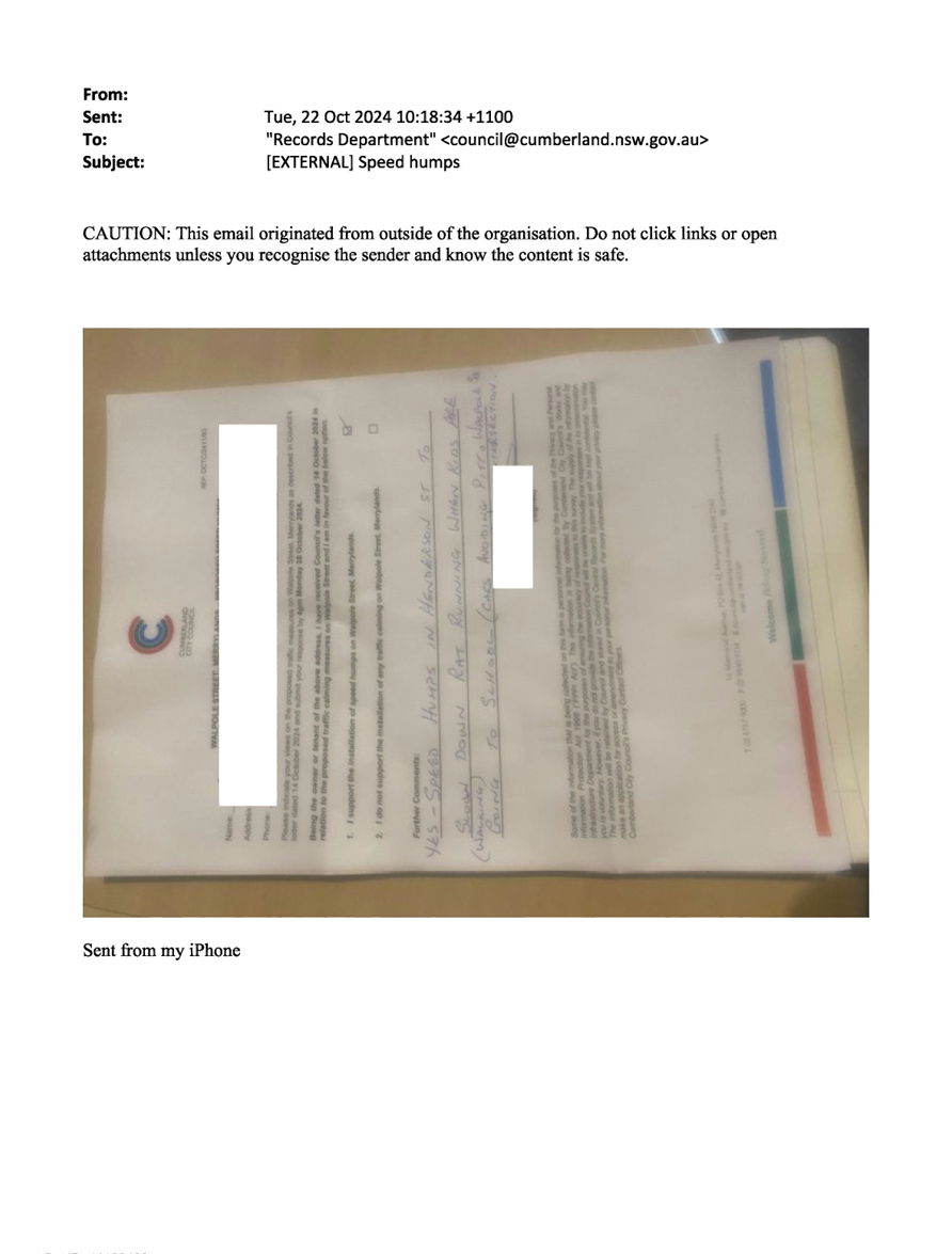
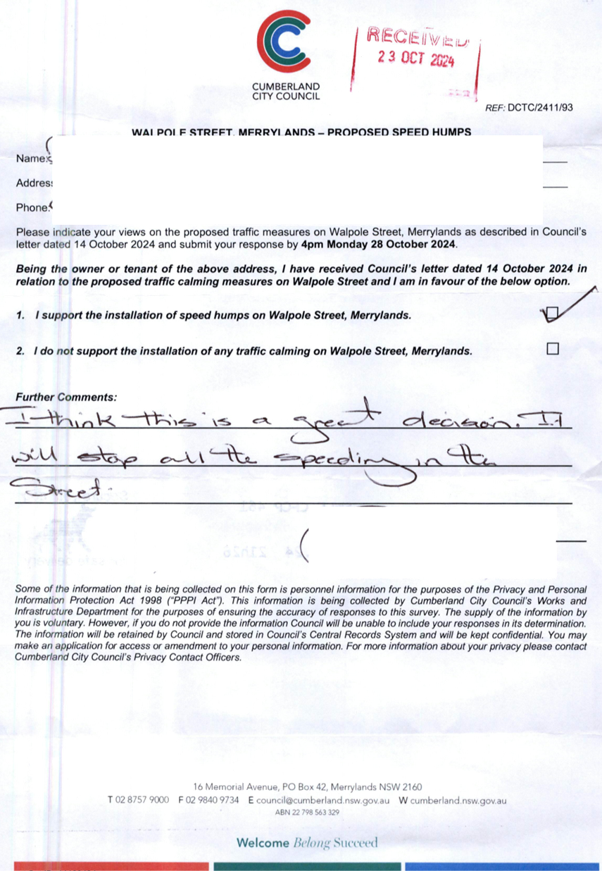
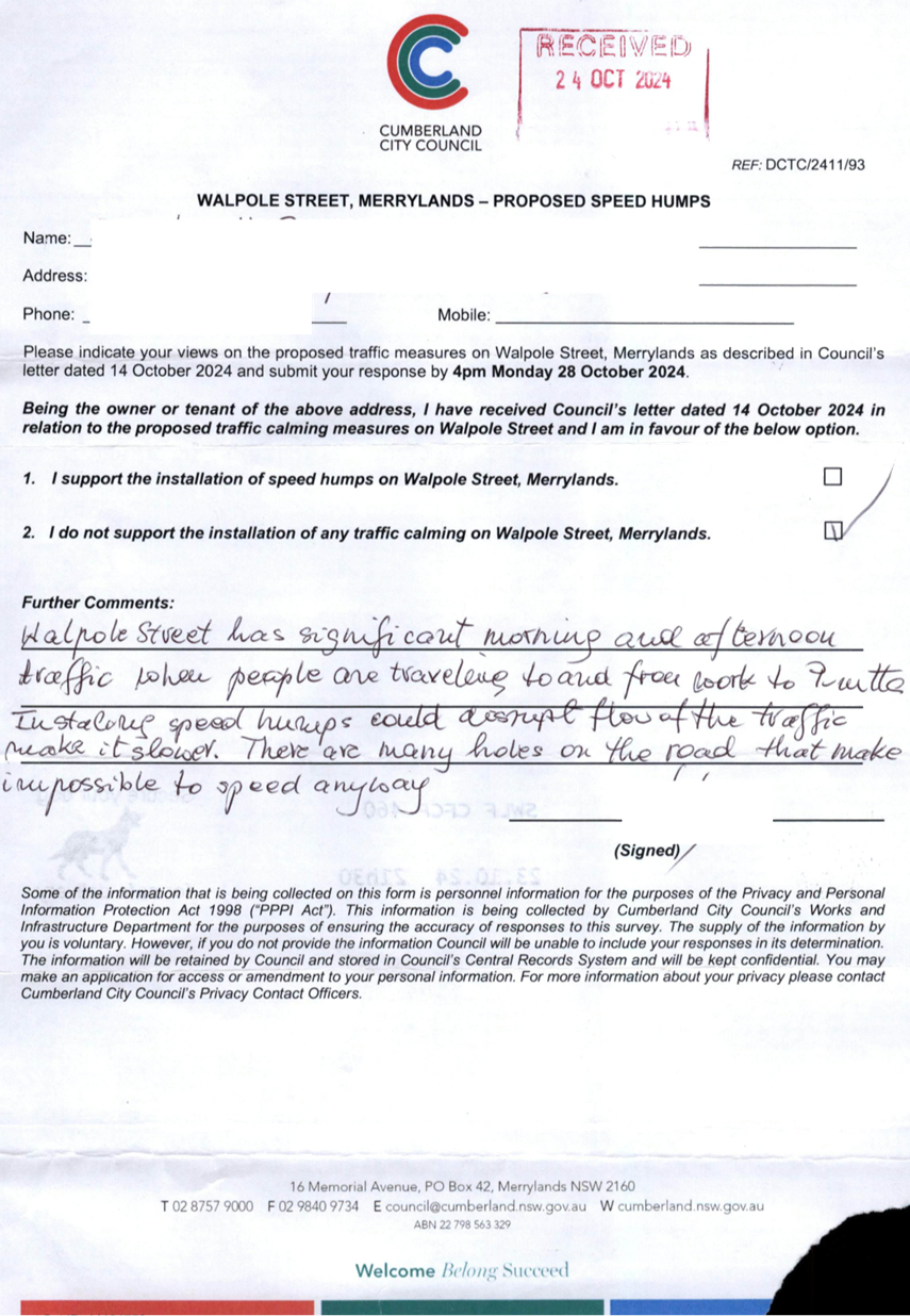
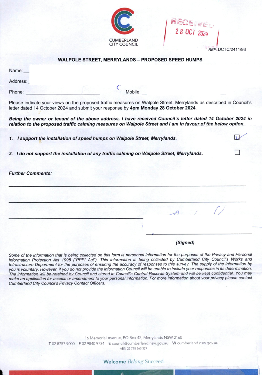
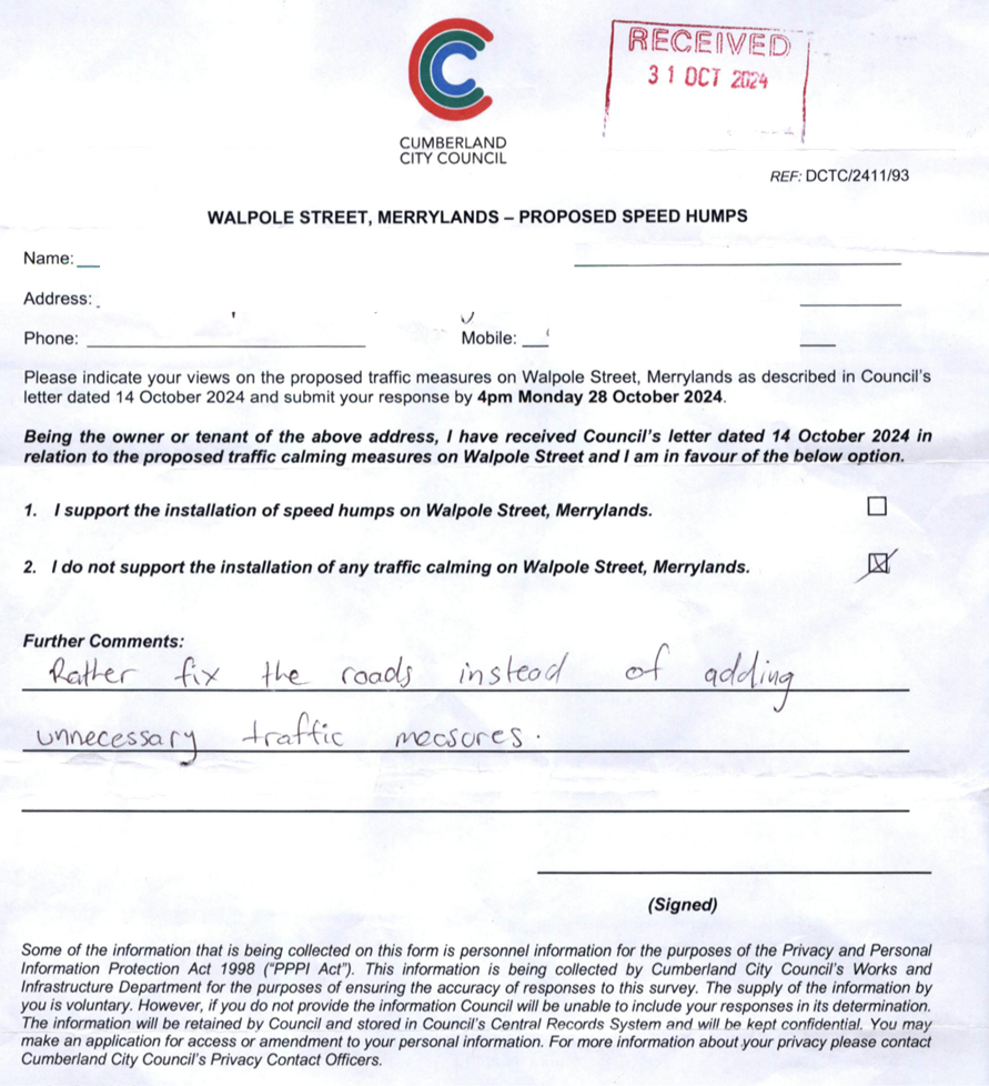
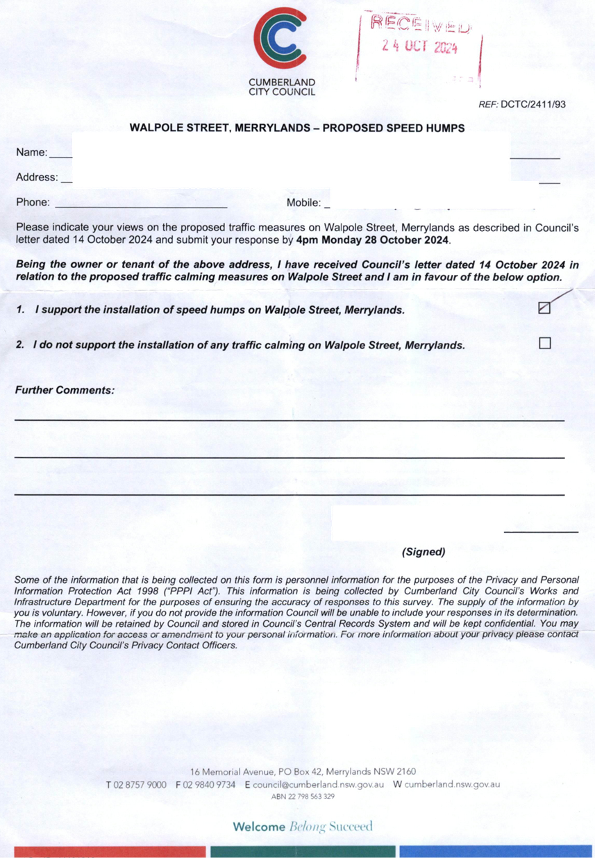
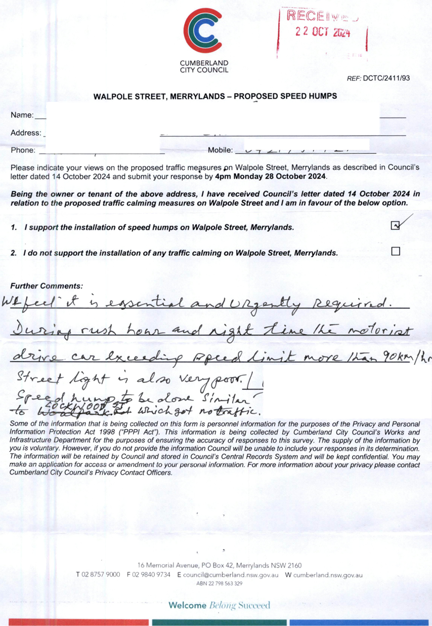
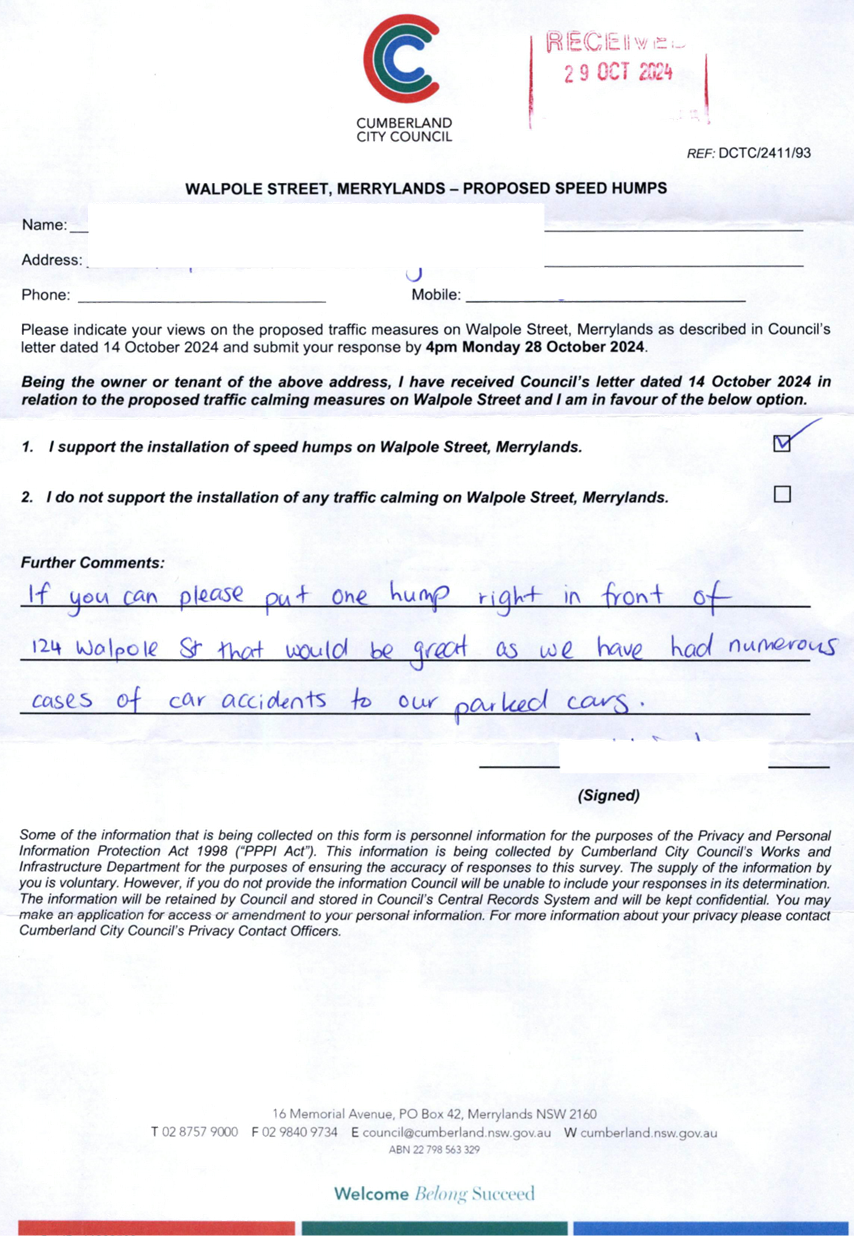
WALPOLE STREET, MERRYLANDS
- ROAD SAFETY CONCERNS – CONSULTATION RESULT
|
|
´
|
|
|
´
|
|
|
CTC-25-056
|
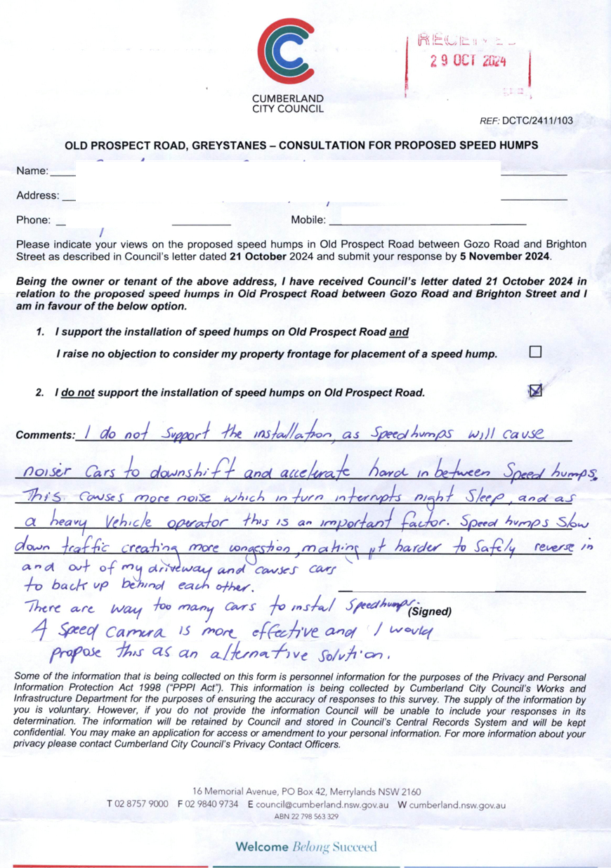
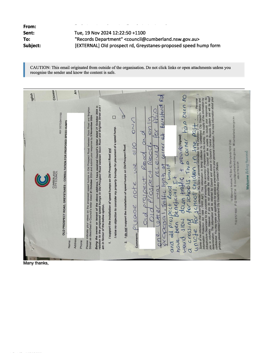
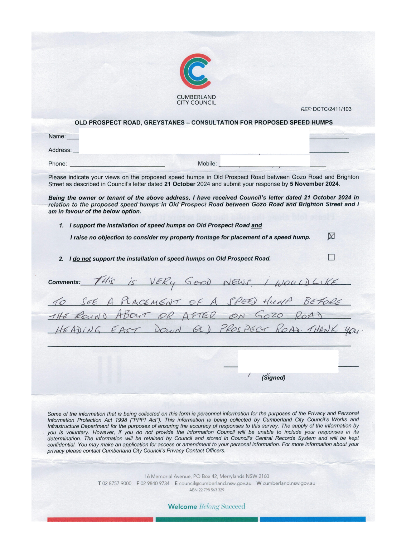
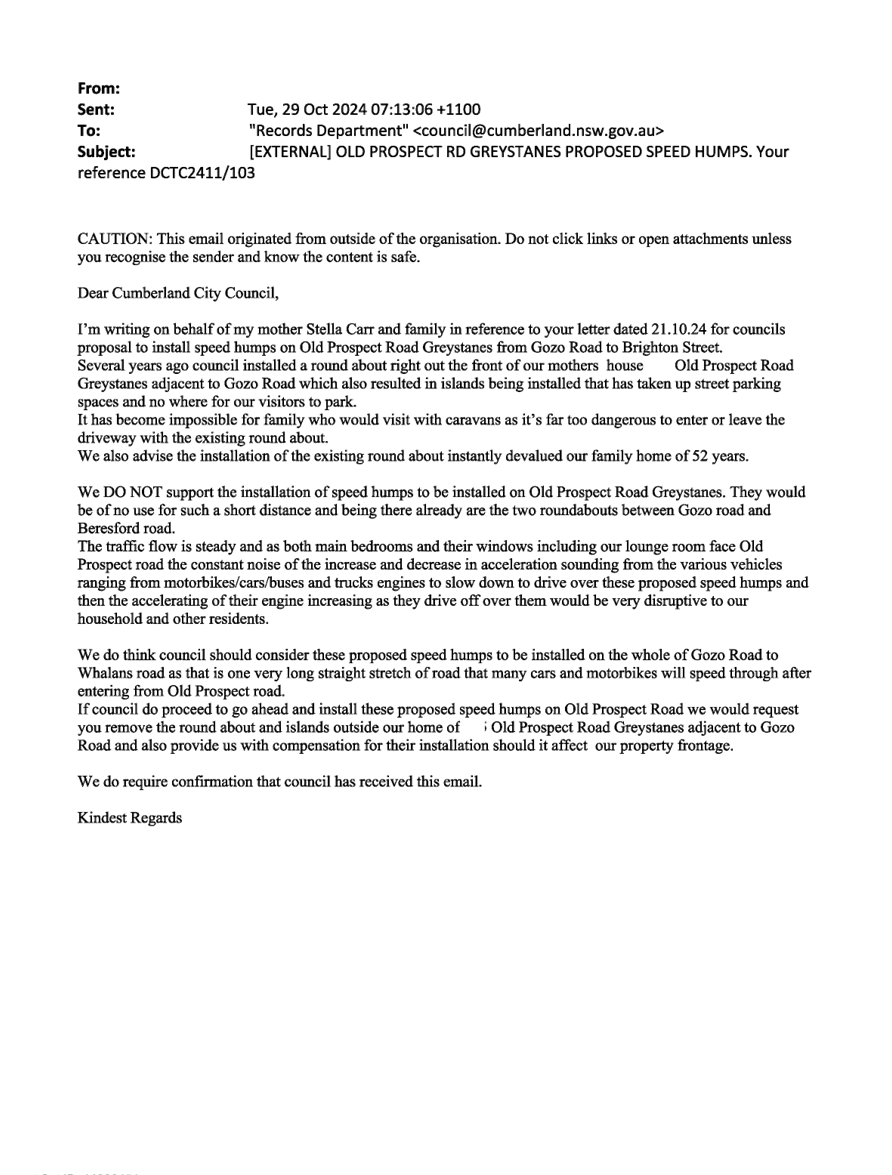
OLD PROSPECT ROAD BETWEEN
GOZO ROAD AND BRIGHTON STREET, GREYSTANES - ROAD SAFETY CONCERNS –
CONSULTATION RESULT
|
|
|
´
|
|
´
|
|
5 February 2025
Minutes of the Traffic Committee meeting held at Merrylands Administration
Building, 16 Memorial Avenue, Merrylands on Wednesday 06 November 2024.
opening of
meeting:
The meeting was opened by the Chairperson - Clr. Joseph
Rahme at 9:34am.
Present:
|
MEMBERS
|
|
|
Clr Joseph Rahme (Chairperson)
|
Cumberland City Council
|
|
Mr Matthew Tangonan
|
Transport for NSW
|
|
Ms Caroline Staples
|
Local Member for Auburn
|
|
Clr Glenn Elmore
|
Local Member for Granville
|
|
Clr Diane Colman
|
Local Member for Prospect
|
|
Leading Senior Constable William Graham
|
Cumberland Police Area Command
|
|
Leading Senior Constable Raymond Yeung
|
Auburn Police Area Command
|
|
COUNCIL OFFICERS
|
|
|
Daniel Cavallo
|
Director Environment & Planning
|
|
Elias Elias
|
Manager Engineering & Building
|
|
Soma Somaskanthan
|
Executive Engineer Traffic and Transport
|
|
Siva Sivakumar
|
Manager Special Projects
|
|
Scott Kavanagh
|
Coordinator Engineering Services
|
|
Gabrielle Zerni
|
Supervisor Administration – Engineering and Building
|
|
Pamela MacIntyre
|
Governance Officer (Minute Taker)
|
Apologies:
|
Mr James Duguid
|
Transit Systems - No objections received.
|
|
Local Member for Fairfield – no representative
nominated
|
Local Member for Fairfield - No items in the state
electorate.
|
|
Mr George Campbell
|
Local Member for Auburn - Alternate representative
attended the meeting.
|
|
CDCBus
|
No objections received.
|
|
Transdev
|
No objections received.
|
Declarations Of Interest
Nil.
CONFIRMATION OF previous
MINUTES
That the Cumberland Traffic Committee confirm the minutes of
the Cumberland Traffic Committee held on 5 June 2024 be confirmed as per
Council’s resolution 7 August 2024 with the exception of item CTC-24-148
which was dealt with separately.
Note: Final Resolutions can be viewed on Council’s
Website.
Moved Clr Glenn Elmore, Seconded Leading
Senior Constable William Graham.
Summary of reports
Part 1 - Recommended for Approval under Delegated
Authority
|
Item #
|
Title
|
Electorate
|
Police Area Command (PAC)
|
|
Fairfield
|
Granville
|
Prospect
|
Auburn
|
Cumberland
|
Auburn
|
|
CTC-24-155
|
ESSINGTON STREET,
WENTWORTHVILLE – INSTALLATION OF BUS ZONE SIGNAGE
|
|
´
|
|
|
´
|
|
|
CTC-24-156
|
WELLINGTON ROAD AT ETTALONG
STREET AND NEW STREET, AUBURN – PROPOSED NO STOPPING RESTRICTIONS AND
LINEMARKING
|
|
|
|
´
|
|
´
|
|
CTC-24-157
|
GARFIELD STREET,
WENTWORTHVILLE – PROPOSED NO PARKING RESTRICITONS
|
|
|
´
|
|
´
|
|
|
CTC-24-158
|
HALL STREET AND STATION
ROAD, AUBURN – PROPOSED PARKING RESTRICTIONS
|
|
|
|
´
|
|
´
|
|
CTC-24-159
|
RAGLAN ROAD AND KIRKHAM ROAD,
AUBURN – PROPOSED ‘NO STOPPING’ RESTRICTIONS
|
|
|
|
´
|
|
´
|
|
CTC-24-160
|
ROBERT STREET AND WILLIAM
STREET, HOLROYD – PROPOSED NO STOPPING RESTRICTIONS AND LINEMARKING
|
|
´
|
|
|
´
|
|
|
CTC-24-161
|
ROBERT STREET AND PEEL
STREET, HOLROYD – PROPOSED ‘NO STOPPING’ RESTRICTIONS
|
|
´
|
|
|
´
|
|
|
CTC-24-162
|
STRAITS AVENUE, SOUTH
GRANVILLE – PROPOSED NO PARKING RESTRICTIONS
|
|
´
|
|
|
´
|
|
|
CTC-24-163
|
STUBBS STREET, AUBURN
– PROPOSED NO PARKING RESTRICTIONS
|
|
|
|
´
|
|
´
|
|
CTC-24-164
|
TUABILLI STREET, PEMULWUY
– PROPOSED NO STOPPING RESTRICTIONS
|
|
|
´
|
|
´
|
|
|
CTC-24-165
|
MACQUARIE ROAD, AUBURN
– REVIEW OF PARKING RESTRICTIONS
|
|
|
|
´
|
|
´
|
|
CTC-24-166
|
THE TRONGATE AND SIXTH
STREET, GRANVILLE – PROPOSED PARKING RESTRICTIONS AND LINEMARKING
|
|
´
|
|
|
´
|
|
|
CTC-24-167
|
BOARD STREET, LIDCOMBE
– APPLICATION FOR ‘WORKS ZONE’ SIGNAGE
|
|
|
|
´
|
|
´
|
|
CTC-24-168
|
PRINCESS STREET, LIDCOMBE
– APPLICATION FOR ‘WORKS ZONE’ SIGNAGE
|
|
|
|
´
|
|
´
|
|
CTC-24-169
|
PRITCHARD STREET EAST,
WENTWORTHVILLE – APPLICATION FOR ‘WORKS ZONE’ SIGNAGE
|
|
|
´
|
|
´
|
|
|
CTC-24-170
|
RAILWAY STREET, LIDCOMBE
– APPLICATION FOR ‘WORKS ZONE’ SIGNAGE
|
|
|
|
´
|
|
´
|
|
CTC-24-171
|
GRASSMERE STREET AND
GUILDFORD ROAD, GUILDFORD – PROPOSED NO STOPPING RESTRICTIONS
|
|
´
|
|
|
´
|
|
|
CTC-24-172
|
OLD PROSPECT ROAD AND
BRIGHTON STREET, GREYSTANES – PROPOSED NO STOPPING RESTRICTIONS
|
|
|
´
|
|
´
|
|
|
CTC-24-173
|
THE TRONGATE, SOUTH
GRANVILLE – PROPOSED RELOCATION OF ‘NO STOPPING’
RESTRICTIONS
|
|
´
|
|
|
´
|
|
|
CTC-24-174
|
ALBERT STREET BETWEEN FRANK
STREET AND BOWDEN STREET, GUILDFORD – INSTALLATION OF LINE MARKING
|
|
´
|
|
|
´
|
|
|
CTC-24-175
|
KILLEEN STREET,
WENTWORTHVILLE – PROPOSED NO PARKING RESTRICTIONS
|
|
´
|
|
|
´
|
|
|
CTC-24-176
|
MURPHY STREET AT BRISTOL
STREET, MERRYLANDS WEST – PROPOSED LINEMARKINGS
|
|
´
|
|
|
´
|
|
|
CTC-24-177
|
HAMILTON STREET, SOUTH WENTWORTHVILLE
- ROAD SAFETY CONCERNS
|
|
´
|
|
|
´
|
|
|
CTC-24-178
|
CONDOIN LANE, PEMULWUY
– REVIEW OF EXISTING PARKING RESTRICTIONS
|
|
|
´
|
|
´
|
|
|
CTC-24-179
|
GOOD STREET, WESTMEAD
– REMOVAL OF A REDUNDANT ‘BUS ZONE’
|
|
´
|
|
|
´
|
|
|
CTC-24-180
|
UNION STREET AT WALLACE STREET
AND WARATAH STREET, GRANVILLE – PROPOSED 'NO STOPPING'
RESTRICTIONS AND LINEMARKINGS
|
|
´
|
|
|
´
|
|
|
CTC-24-181
|
BANDO ROAD, GIRRAWEEN
– APPLICATION FOR ‘WORKS ZONE’ SIGNAGE
|
|
|
´
|
|
´
|
|
Part 2 - Recommendation to Council
Note: Part 2 recommendations of the Traffic Committee are
subject to Council’s endorsement. For final decisions regarding these
matters, please refer to the Council Meeting Minutes where these matters were
reported to Council for determination.
|
Item #
|
Title
|
Electorate
|
Police Area Command (PAC)
|
|
Fairfield
|
Granville
|
Prospect
|
Auburn
|
Cumberland
|
Auburn
|
|
CTC-24-182
|
GUILDFORD ROAD &
ROBERTSON STREET, GUILDFORD - TOWARDS ZERO SAFER ROADS PROGRAM
|
|
´
|
|
|
´
|
|
|
CTC-24-183
|
CAMBRIDGE STREET AT NEWMAN
STREET, MERRYLANDS - AUSTRALIAN GOVERNMENT BLACK SPOT PROGRAM
|
|
´
|
|
|
´
|
|
|
CTC-24-184
|
ALFRED STREET AT BIRMINGHAM
STREET, MERRYLANDS - TOWARDS ZERO SAFER ROADS PROGRAM
|
|
´
|
|
|
´
|
|
|
CTC-24-185
|
SALISBURY ROAD AT RHODES
AVENUE, GUILDFORD - TOWARDS ZERO SAFER ROADS PROGRAM
|
|
´
|
|
|
´
|
|
|
CTC-24-186
|
LOCKWOOD STREET AND LEEDS
STREET, MERRYLANDS - TOWARDS ZERO SAFER ROADS PROGRAM
|
|
´
|
|
|
´
|
|
|
CTC-24-187
|
CHURCH STREET, LIDCOMBE -
PROPOSED PEDESTRIAN FENCING OUTSIDE STATION
|
|
|
|
´
|
|
´
|
|
CTC-24-188
|
TARGO ROAD AND MAGOWAR
ROAD, PENDLE HILL - ROAD SAFETY CONCERNS
|
|
|
´
|
|
´
|
|
|
CTC-24-189
|
PAUL STREET, AUBURN - ROAD
SAFETY CONCERNS
|
|
|
|
´
|
|
´
|
|
CTC-24-190
|
DUNMORE STREET & EMERT
ROAD, WENTWORTHVILLE – INTERSECTION SAFETY CONCERNS
|
|
|
´
|
|
´
|
|
|
CTC-24-191
|
O'NEILL STREET, GUILDFORD -
PROPOSED INTERSECTION TREATMENT AT ELIZABETH STREET
|
|
´
|
|
|
´
|
|
|
CTC-24-192
|
MAY STREET AND THOMAS
STREET, MERRYLANDS – PROPOSED MEDIAN ISLAND AND PARKING RESTRICTIONS
|
|
´
|
|
|
´
|
|
|
CTC-24-193
|
ROAD SAFETY AROUND
GRANVILLE SOUTH PUBLIC SCHOOL
|
|
´
|
|
|
´
|
|
|
CTC-24-194
|
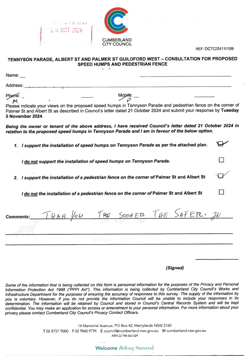
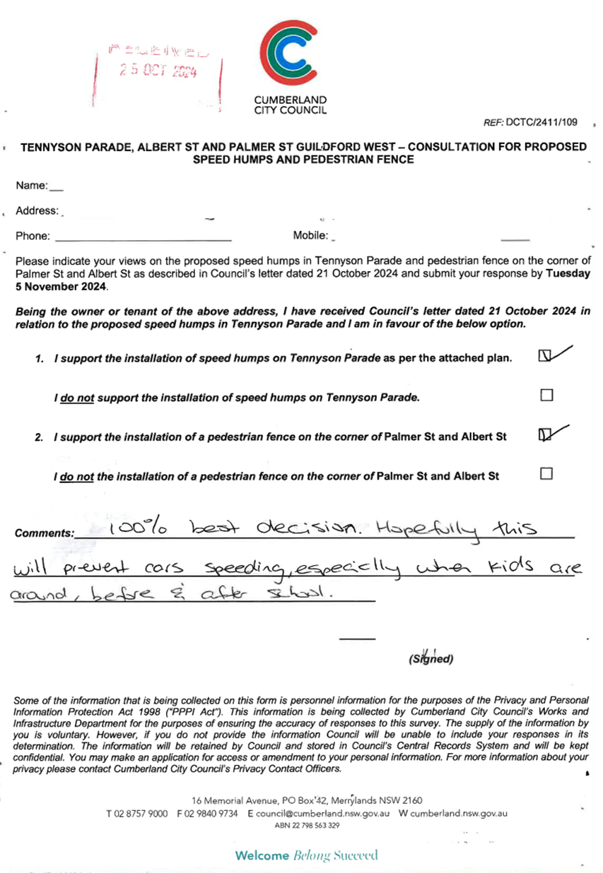
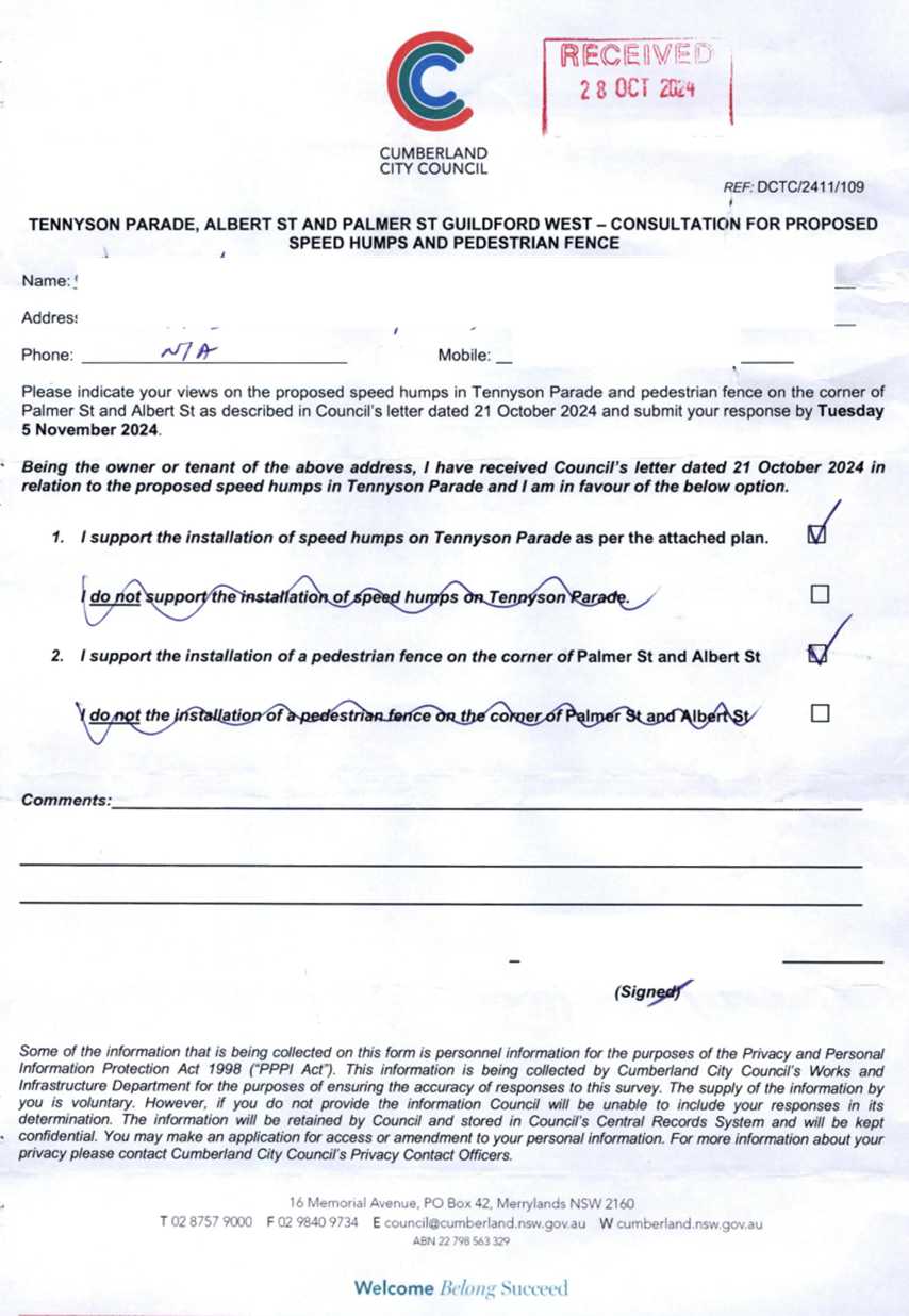
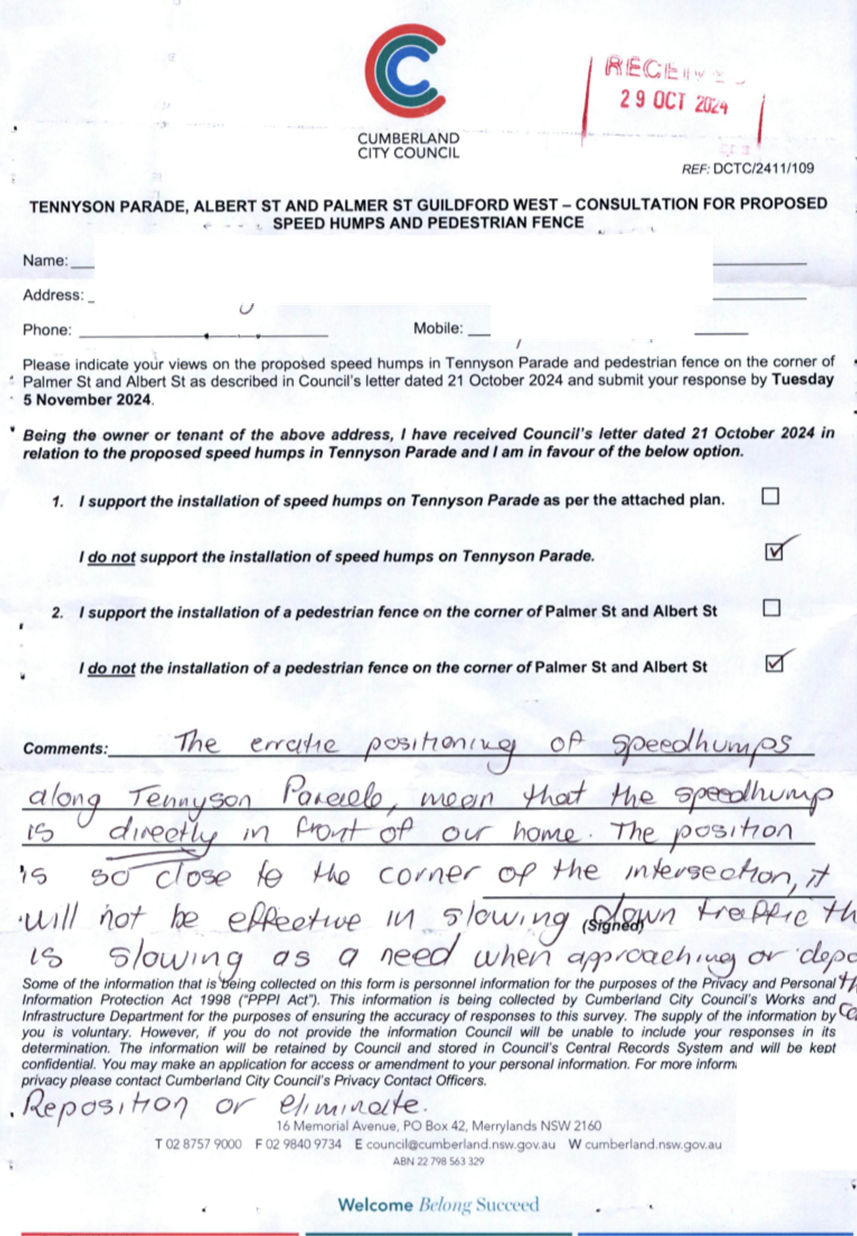
ALBERT STREET AT PALMER
STREET AND TENNYSON PARADE, GUILDFORD – INTERSECTION SAFETY
CONCERNS
|
|
´
|
|
|
´
|
|
REPORTS
Part 1 - Recommended for
Approval under Delegated Authority in accordance with Part 1 of the Terms of
Reference for the Cumberland Local Traffic Committee.
|
Items Resolved by Exception
|
|
The Committee resolved by exception the below items on the
Traffic Committee Agenda as per the recommendations in the reports:
Part 1: CTC-24-155, CTC-24-156, CTC-24-157,
CTC-24-158, CTC-24-159, CTC-24-160, CTC-24-161, CTC-24-162, CTC-24-163,
CTC-24-164, CTC-24-165, CTC-24-166, CTC-24-167, CTC-24-168, CTC-24-169,
CTC-24-170, CTC-24-171, CTC-24-172, CTC-24-173, CTC-24-174, CTC-24-175, CTC-24-176,
CTC-24-177, CTC-24-179, CTC-24-180 and CTC-24-181.
Moved Clr Glenn Elmore Seconded Ms Caroline
Staples.
|
|
ITEM CTC-24-155 - ESSINGTON STREET, WENTWORTHVILLE
– INSTALLATION OF BUS ZONE SIGNAGE
|
|
Resolved by Exception
The Traffic Committee recommends that:
1. The
installation of ‘Bus Zone’ signage on the northern side of
Essington Street, Wentworthville outside No.33 and No.35 in accordance with
the attached plan be approved.
2. The
affected / concerned residents be notified of the outcome.
|
|
ITEM CTC-24-156 - WELLINGTON ROAD AT ETTALONG STREET
AND NEW STREET, AUBURN – PROPOSED NO STOPPING RESTRICTIONS AND
LINEMARKING
|
|
Resolved by Exception
The Traffic Committee recommends that:
1. The
installation of ‘No Stopping’ signs and ‘BL2’ line
marking on Wellington Road at Ettalong Street and New Street, Auburn in
accordance with the attached plan be approved.
2. The
affected / concerned residents be notified of the outcome.
|
|
ITEM CTC-24-157 - GARFIELD STREET, WENTWORTHVILLE
– PROPOSED NO PARKING RESTRICITONS
|
|
Resolved by Exception
The Traffic Committee recommends that:
1. The
installation of the ‘No Parking’ signage on the western side of Garfield
Street, Wentworthville outside No.31 and No. 35 in accordance with the
attached plan be approved.
2. The
affected/concerned residents be notified of the outcome.
|
|
ITEM CTC-24-158 - HALL STREET AND STATION ROAD, AUBURN
– PROPOSED PARKING RESTRICTIONS
|
|
Resolved by Exception
The Traffic Committee recommends that:
1. The
installation of ‘1P, 8AM – 6PM’ signage on the southern
side of Hall Street, Auburn and eastern side of Station Road, Auburn outside
No. 20-22 in accordance with the attached plan be approved.
2. The
installation of 6.5m ‘No Parking, Ambulance Excepted’ zone on the
eastern side of Station Road, Auburn outside No.20-22 in accordance with the
attached plan be approved.
3. The
affected / concerned residents be notified of the outcome.
|
|
ITEM CTC-24-159 - RAGLAN ROAD AND KIRKHAM ROAD, AUBURN
– PROPOSED ‘NO STOPPING’ RESTRICTIONS
|
|
Resolved by Exception
The Traffic Committee recommends that:
1. The
installation of ‘No Stopping’ signs on the north-west corner of
Kirkham Road and Raglan Road, Auburn in accordance with the attached plan be
approved.
2. The
affected/concerned residents/businesses be notified of the outcome.
|
|
ITEM CTC-24-160 - ROBERT STREET AND WILLIAM STREET,
HOLROYD – PROPOSED NO STOPPING RESTRICTIONS AND LINEMARKING
|
|
Resolved by Exception
The Traffic Committee recommends that:
1. The
installation of ‘No Stopping’ signs and ‘BL2’ line marking
at the intersection of Robert Street and William Street, Holroyd in
accordance with the attached plan be approved.
2. The
affected / concerned residents be notified of the outcome.
|
|
ITEM CTC-24-161 - ROBERT STREET AND PEEL STREET,
HOLROYD – PROPOSED ‘NO STOPPING’ RESTRICTIONS
|
|
Resolved by Exception
The Traffic Committee recommends that:
1. The
installation of ‘No Stopping’ restrictions with BL2 linemarking
at the bend where Robert Street meets Peel Street, Holroyd in accordance with
the attached plan be approved.
2. The
affected / concerned residents / businesses be notified of the outcome.
|
|
ITEM CTC-24-162 - STRAITS AVENUE, SOUTH GRANVILLE
– PROPOSED NO PARKING RESTRICTIONS
|
|
Resolved by Exception
The Traffic Committee recommends that:
1. The
replacement of the existing ‘2P, 8AM-6PM, Mon-Fri, 8:30AM-12Noon,
Sat’ signage on the northern side of Straits Avenue, South Granville to
full time ‘No Parking’ Signage in accordance with the attached
plan be approved.
2. The
affected / concerned residents be notified of the outcome.
|
|
ITEM CTC-24-163 - STUBBS STREET, AUBURN –
PROPOSED NO PARKING RESTRICTIONS
|
|
Resolved by Exception
The Traffic Committee recommends that:
1. The
installation of ‘No Parking, Fire Brigade Personnel Excepted’
signs on the western side of Stubbs Street along the side boundary of No.122 Adderley
Street West, Auburn in accordance with the attached plan be approved.
2. The
affected / concerned residents be notified of the outcome.
|
|
ITEM CTC-24-164 - TUABILLI STREET, PEMULWUY –
PROPOSED NO STOPPING RESTRICTIONS
|
|
Resolved by Exception
The Traffic Committee recommends that:
1. The
installation of ‘No Stopping’ signage on the northern and western
side of Tuabilli Street, Pemulwuy outside No.7 in accordance with the
attached plan be approved.
2. The
affected / concerned residents be notified of the outcome.
|
|
ITEM CTC-24-165 - MACQUARIE ROAD, AUBURN –
REVIEW OF PARKING RESTRICTIONS
|
|
Resolved by Exception
The Traffic Committee recommends that:
1. Remove
the existing 'Bus Zone 7:30am-9:30am, 2:30pm-4pm School Days' signage on the
eastern side of Macquarie Road, Auburn, along the side boundary of 117 Rawson
Road, and replace with 'No Parking 8AM-9:30AM, 2:30PM-4PM, School Days' and
'Drop Off Pick Up Only' signage in accordance with the attached plan.
2. The
affected / concerned business owners be notified of the outcome.
|
|
ITEM CTC-24-166 - THE TRONGATE AND SIXTH STREET,
GRANVILLE – PROPOSED PARKING RESTRICTIONS AND LINEMARKING
|
|
Resolved by Exception
The Traffic Committee recommends that:
1. The
installation of ‘No Stopping’ signs and ‘BL2’ line
marking at the intersection of The Trongate and Sixth Street, Granville in
accordance with the attached plan be approved.
2. The
installation of a 10 metre ‘1/4P, 7am-5pm, Mon-Sat, 9am-2pm, Sun’
zone on the southern side of Sixth Street adjacent to No.111 in accordance
with the plan be approved.
3. The
affected / concerned residents be notified of the outcome.
|
|
ITEM CTC-24-167 - BOARD STREET, LIDCOMBE –
APPLICATION FOR ‘WORKS ZONE’ SIGNAGE
|
|
Resolved by Exception
The Traffic Committee recommends that:
1. The
30m long ‘Works Zone, 7:00am-6:00pm, Monday-Friday, 8:00am-4:00pm,
Saturday’ signs be installed on the frontage of the development site on
Board Street, Lidcombe in accordance with the attached plan subject to
Council’s standard conditions for the period of 6 months and subsequent
extension if required.
2. The
applicant be advised to pay the ‘Works Zone’ fees to Council as
per the adopted Fees and Charges.
|
|
ITEM CTC-24-168 - PRINCESS STREET, LIDCOMBE –
APPLICATION FOR ‘WORKS ZONE’ SIGNAGE
|
|
Resolved by Exception
The Traffic Committee recommends that:
1. The
12m long ‘Works Zone, 7:00am-6:00pm, Monday-Friday, 8:00am-4:00pm,
Saturday’ signs be installed on the frontage of the development site on
Princess Street, Lidcombe in accordance with the attached plan subject to
Council’s standard conditions for the period of 6 months and subsequent
extension if required.
2. The
applicant be advised to pay the ‘Works Zone’ fees to Council as
per the adopted Fees and Charges.
|
|
ITEM CTC-24-169 - PRITCHARD STREET EAST,
WENTWORTHVILLE – APPLICATION FOR ‘WORKS ZONE’ SIGNAGE
|
|
Resolved by Exception
The Traffic Committee recommends that:
1. The
18m long ‘Works Zone, 7:00am-6:00pm, Monday-Friday, 8:00am-4:00pm,
Saturday’ signs be installed on the frontage of the development site on
Pritchard Street East, Wentworthville in accordance with the attached plan
subject to Council’s standard conditions for the period of 6 months and
subsequent extension if required.
2. The
applicant be advised to pay the ‘Works Zone’ fees to Council as
per the adopted Fees and Charges.
|
|
ITEM CTC-24-170 - RAILWAY STREET, LIDCOMBE –
APPLICATION FOR ‘WORKS ZONE’ SIGNAGE
|
|
Resolved by Exception
The Traffic Committee recommends that:
1. The
18m long ‘Works Zone, 7:00am-6:00pm, Monday-Friday, 8:00am-4:00pm,
Saturday’ signs be installed on the frontage of the development site on
Railway Street, Lidcombe in accordance with the attached plan subject to
Council’s standard conditions for the period of 4 months and subsequent
extension if required.
2. The
applicant be advised to pay the ‘Works Zone’ fees to Council as
per the adopted Fees and Charges.
|
|
ITEM CTC-24-171 - GRASSMERE STREET AND GUILDFORD ROAD,
GUILDFORD – PROPOSED NO STOPPING RESTRICTIONS
|
|
Resolved by Exception
The Traffic Committee recommends that:
1. The
installation of ‘No Stopping’ signs at the intersection of
Grassmere Street and Guildford Road, Guildford in accordance with the
attached plan be approved.
2. The
affected / concerned residents be notified of the outcome.
|
|
ITEM CTC-24-172 - OLD PROSPECT ROAD AND BRIGHTON
STREET, GREYSTANES – PROPOSED NO STOPPING RESTRICTIONS
|
|
Resolved by Exception
The Traffic Committee recommends that:
1. The
existing ‘No Stopping’ sign on the southern side of Old Prospect
Road west of Brighton Street, Greystanes be relocated in accordance with the
attached plan be approved.
2. The
installation of ‘No Parking, Australian Post Vehicles Excepted’
signage on the southern side of Old Prospect Road outside 3 Brighton Street,
Greystanes in accordance with the attached plan be approved.
3. The
affected / concerned residents be notified of the outcome.
|
|
ITEM CTC-24-173 - THE TRONGATE, SOUTH GRANVILLE
– PROPOSED RELOCATION OF ‘NO STOPPING’ RESTRICTIONS
|
|
Resolved by Exception
The Traffic Committee recommends that:
1. The
relocation of ‘No Stopping’ signs on The Trongate, South
Granville near No. 197 in accordance with the attached plan be approved.
2. The
affected residents be notified of the outcome.
|
|
ITEM CTC-24-174 - ALBERT STREET BETWEEN FRANK STREET
AND BOWDEN STREET, GUILDFORD – INSTALLATION OF LINE MARKING
|
|
Resolved by Exception
The Traffic Committee recommends that:
1. Provision
of edge line marking in Albert Street between Palmer Street and Bowden Street
in accordance with attached plan be approved.
2. Council
notify concerned/ affected residents of the outcome.
|
|
ITEM CTC-24-175 - KILLEEN STREET, WENTWORTHVILLE
– PROPOSED NO PARKING RESTRICTIONS
|
|
Resolved by Exception
The Traffic Committee recommends that:
1. The
installation of ‘No Parking’ signs at the cul-de-sac of Killeen
Street, Wentworthville in accordance with the attached plan be approved.
2. The
affected / concerned residents be notified of the outcome.
|
|
ITEM CTC-24-176 - MURPHY STREET AT BRISTOL
STREET, MERRYLANDS WEST – PROPOSED LINEMARKINGS
|
|
Resolved by Exception
The Traffic Committee recommends that:
1. The
installation of ‘BL2’ line marking at the intersection of Murphy
Street and Bristol Street, Merrylands West in accordance with the attached
plan be approved.
2. The
affected / concerned residents be notified of the outcome.
|
|
ITEM CTC-24-177 - HAMILTON STREET, SOUTH
WENTWORTHVILLE - ROAD SAFETY CONCERNS
|
|
Resolved by Exception
The Traffic Committee recommends that:
1. Provision
of Centre Line Marking in Hamilton Street, South Wentworthville in accordance
with the attached plan be approved.
2. The
concerned resident be notified of the outcome.
|
|
ITEM CTC-24-179 - GOOD STREET, WESTMEAD –
REMOVAL OF A REDUNDANT ‘BUS ZONE’
|
|
Resolved by Exception
The Traffic Committee recommends that:
1. The
removal of a redundant ‘Bus Zone’ on the western side of Good
Street, Westmead outside No.61A as per attached plan be approved.
2. The
‘Bus Zone’ area be converted to ‘2P, 8:30AM-6:00PM,
Mon-Fri, 8:30AM-12:00Noon, Sat, Permit Holders Excepted’.
3. The
adjacent residents be notified of the outcome.
|
|
ITEM CTC-24-180 - UNION STREET AT WALLACE STREET AND
WARATAH STREET, GRANVILLE – PROPOSED 'NO STOPPING' RESTRICTIONS
AND LINEMARKINGS
|
|
Resolved by Exception
The Traffic Committee recommends that:
1. The
installation ‘No Stopping’ restrictions and ‘BL2’
linemarking at the intersection of Union Street and Wallace Street/Waratah
Street in accordance with the attached plan be supported in principle.
2. Council
notify concerned/ affected residents and report back to the Traffic Committee
if objections are received.
|
|
ITEM CTC-24-181 - BANDO ROAD, GIRRAWEEN –
APPLICATION FOR ‘WORKS ZONE’ SIGNAGE
|
|
Resolved by Exception
The Traffic Committee recommends that:
1. The
18m long ‘Works Zone, 7:00am-6:00pm, Monday-Friday, 8:00am-4:00pm,
Saturday’ signs be installed on the frontage of the redevelopment site
on Bando Road in accordance with the attached plan subject to Council’s
standard conditions for the period of 8 months and subsequent extension if
required.
2. The
applicant be advised to pay the ‘Works Zone’ fees to Council as
per the adopted Fees and Charges.
|
|
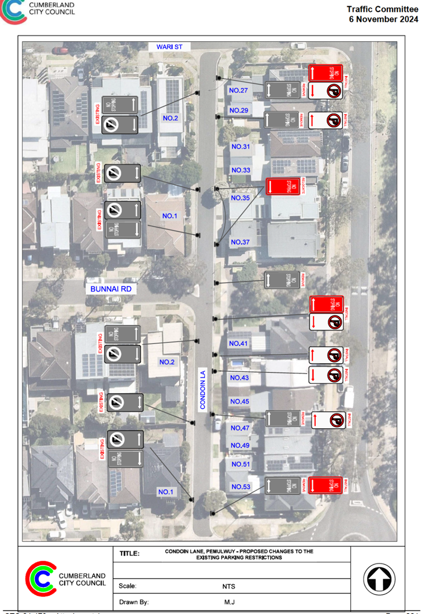
ITEM CTC-24-178 - CONDOIN LANE, PEMULWUY –
REVIEW OF EXISTING PARKING RESTRICTIONS
|
|
The Traffic Committee recommends that:
1. Further
consultation be undertaken with the residents where representations were made
and further report will be provided to the Traffic Committee.
2. The
affected /concerned residents be notified of the outcome.
Moved Clr Diane Colman, Seconded Leading
Senior Constable William Graham.
|
Part 2 - Recommendation to
Council in accordance with Part 2 of the Terms of Reference for the Cumberland
Local Traffic Committee.
Note: Part 2 recommendations of the Traffic Committee are
subject to Council’s endorsement. For final decisions regarding these
matters, please refer to the Council Meeting Minutes where these matters were
reported to Council for determination.
|
Items by Exception
|
|
The Committee resolved by exception the below items on the
Traffic Committee agenda as per the recommendations in the reports:
Part 2: CTC-24-182, CTC-24-183, CTC-24-184,
CTC-24-185, CTC-24-186, CTC-24-188, CTC-24-189, CTC-24-191, CTC-24-192 and
CTC-24-193.
Moved Clr Glenn Elmore Seconded Ms Caroline
Staples.
|
|
ITEM CTC-24-182 - GUILDFORD ROAD & ROBERTSON
STREET, GUILDFORD - TOWARDS ZERO SAFER ROADS PROGRAM
|
|
Resolved by Exception
The Traffic Committee recommends:
1. The
proposed roundabout at the intersection of Guildford Road and Robertson
Street, Guildford in accordance with the attached plan be approved.
2. Council
progress the project for construction in accordance with grant requirements.
3. Directly affected residents
be notified of Council’s resolution.
|
|
ITEM CTC-24-184 - ALFRED STREET AT BIRMINGHAM STREET,
MERRYLANDS - TOWARDS ZERO SAFER ROADS PROGRAM
|
|
Resolved by Exception
The Traffic Committee recommends:
1. The
proposed roundabout at the intersection of Alfred Street and Birmingham
Street, Merrylands, in accordance with the attached plan be approved.
2. Council
progress the project for construction in accordance with grant requirements.
3. Directly
affected residents be notified of Council’s resolution.
|
|
ITEM CTC-24-185 - SALISBURY ROAD AT RHODES AVENUE,
GUILDFORD - TOWARDS ZERO SAFER ROADS PROGRAM
|
|
Resolved by Exception
The Traffic Committee recommends:
1. The
proposed roundabout at the intersection of Salisbury Road and Rhodes Avenue,
Guildford, in accordance with the attached plan be approved.
2. Council
progress the project for construction in accordance with grant requirements.
3. Directly
affected residents be notified of Council’s resolution.
|
|
ITEM CTC-24-186 - LOCKWOOD STREET AND LEEDS STREET,
MERRYLANDS - TOWARDS ZERO SAFER ROADS PROGRAM
|
|
Resolved by Exception
The Traffic Committee recommends:
1. The
proposed roundabout at the intersection of Lockwood Street and Leeds Street,
Merrylands, in accordance with the attached plan be approved.
2. Council progress the project for construction in accordance
with grant requirements.
3.Directly
affected residents be notified of Council’s resolution.
|
|
ITEM CTC-24-188 - TARGO ROAD AND MAGOWAR ROAD, PENDLE
HILL - ROAD SAFETY CONCERNS
|
|
Resolved by Exception
The Traffic Committee recommends that:
1. The
installation of a speed cushion on all approached to the existing roundabout
at the intersection of Targo Road and Magowar Road in accordance with the
attached plan be supported.
2. The
concerned resident be notified of the outcome.
|
|
ITEM CTC-24-189 - PAUL STREET, AUBURN - ROAD SAFETY
CONCERNS
|
|
Resolved by Exception
The Traffic Committee recommends that:
1. Council
undertake consultation with the residents along Paul Street, Auburn to assess
community support or otherwise for the installation of traffic calming
devices in the street and report their findings back to the Traffic
Committee.
2. The
concerned resident be notified of the outcome.
|
|
ITEM CTC-24-191 - O'NEILL STREET, GUILDFORD - PROPOSED
INTERSECTION TREATMENT AT ELIZABETH STREET
|
|
Resolved by Exception
The Traffic Committee recommends:
1. That
the provision of median islands and associated works at the intersection of
O’Neill Street and Elizabeth Street, Guildford, in accordance with the
attached plan be approved.
2. The
concerned resident be notified of Council resolution.
|
|
ITEM CTC-24-192 - MAY STREET AND THOMAS STREET,
MERRYLANDS – PROPOSED MEDIAN ISLAND AND PARKING RESTRICTIONS
|
|
Resolved by Exception
The Traffic Committee recommends that:
1. The
installation of median island with mountable sections and ‘No
Stopping’ signs at the intersection of May Street and Thomas Street,
Merrylands, in accordance with the attached plan be approved in principle.
2. Council
undertake consultation with affected residents and report back to Traffic
Committee if objections are received.
|
|
ITEM CTC-24-193 - ROAD SAFETY AROUND GRANVILLE SOUTH
PUBLIC SCHOOL
|
|
Resolved by Exception
The Traffic Committee recommends that:
1. Council
prepare a concept design and undertakes consultation on a pedestrian crossing
for access to Granville South Public School on Highland Street, with a
further report to be provided to the Traffic Committee for consideration.
2. Concerned
parents and the school be notified of Council resolution.
|
|
ITEM CTC-24-187 - CHURCH STREET, LIDCOMBE - PROPOSED
PEDESTRIAN FENCING OUTSIDE STATION
|
|
The Traffic Committee recommends that installation of 25m
pedestrian safety fence on the southern side of Church Street outside
Lidcombe Train Station in accordance with the attached plan be approved.
Moved Ms Caroline Staples, Seconded Leading
Senior Constable Raymond Yeung.
|
|
ITEM CTC-24-190 - DUNMORE STREET & EMERT ROAD,
WENTWORTHVILLE – INTERSECTION SAFETY CONCERNS
|
|
The Traffic Committee recommends that:
1. The
installation of a safety barrier on the southeastern corner of the
intersection of Dunmore Street and Emert Street, Wentworthville, be approved
in principle, subject to further consultation with Transport for NSW.
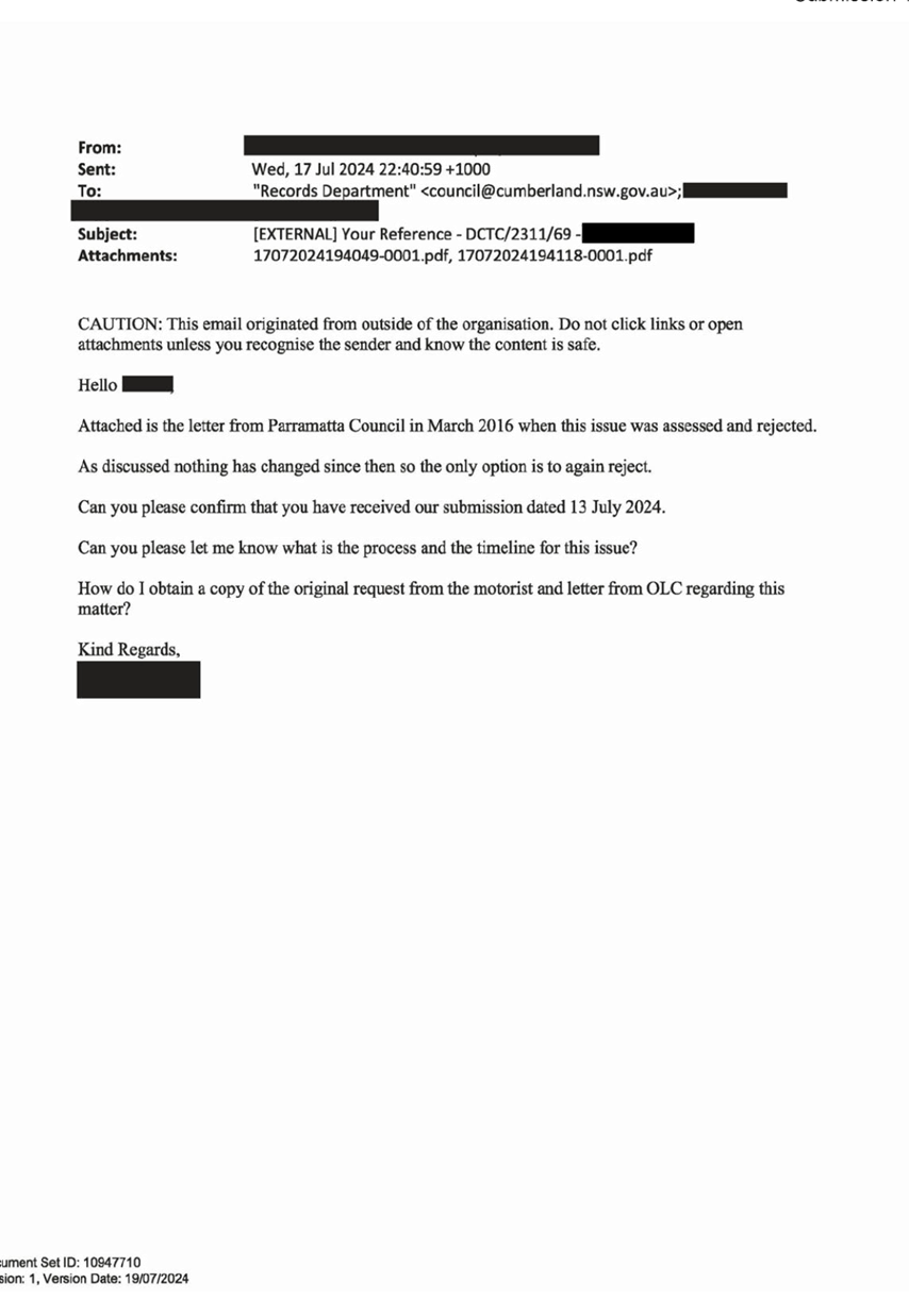
2. Concerned
resident be notified of Council resolution.
Moved Clr Diane Colman, Seconded Clr Glenn
Elmore.
|
|
ITEM CTC-24-194 - ALBERT STREET AT PALMER STREET AND
TENNYSON PARADE, GUILDFORD – INTERSECTION SAFETY CONCERNS
|
|
The Traffic Committee recommends that:
1. The
installation of a 15m long guard rail on the southern corner of the
intersection of Albert Street and Tennyson Parade/Palmer Street be supported
subject to the amended plan receiving concurrence from Transport for NSW.
2. Council
notify concerned/ affected residents of the outcome.
Moved Mr Matthew Tangonan, Seconded Clr
Diane Colman.
|
General Business
The following general business was raised:
Our Lady of Mount Carmel, Wentworthville
Mr Elias Elias raised concerns following an incident
involving a student from Our Lady of Mount Carmel, Bennett Street,
Wentworthville. Council staff will liaise with school administration to
determine appropriate measures to improve pedestrian safety at this location.
State Road Development
Mr Elias Elias informed the Traffic Committee as part of the
Bridge Road Bridge construction being undertaken by Sydney Trains, there will
be a full road closure on Bridge Road Westmead to cater for these works on the
22 and 23 February 2025. This will be limited to the bridge and its approaches.
Draft Local Traffic and Transport Guideline
Mr Daniel Cavallo advised the Traffic Committee that
following consideration of the draft Policy and Guidelines by Council and
consultation with the community, these documents are now in force.
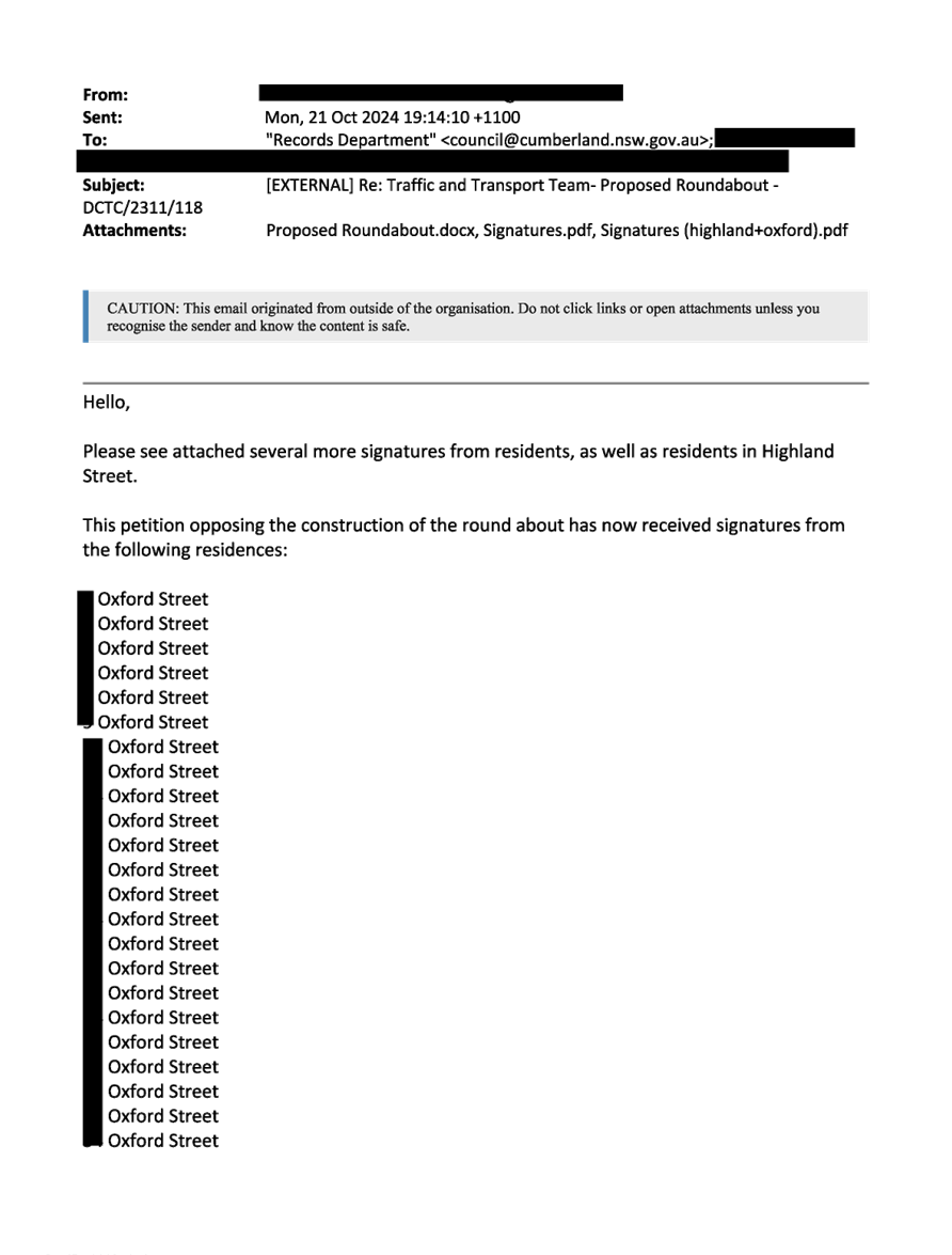
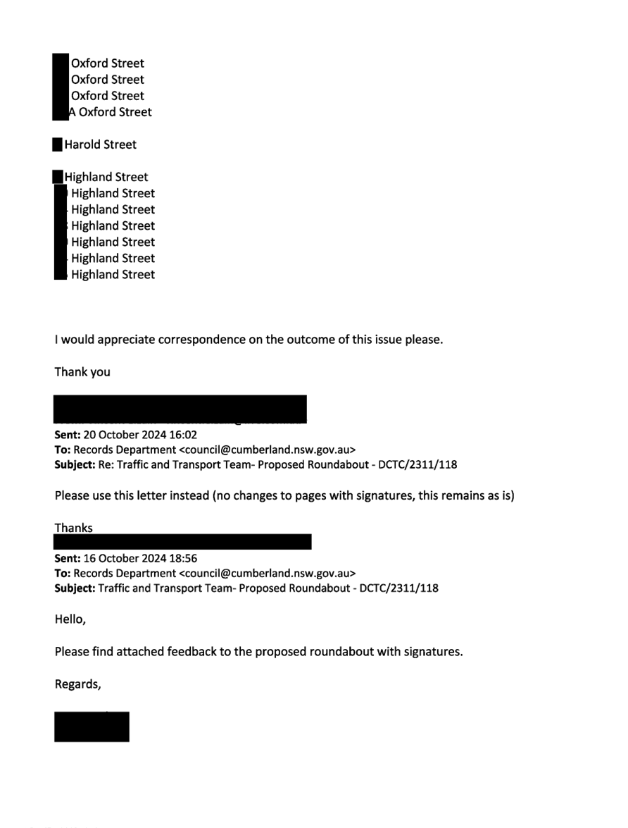
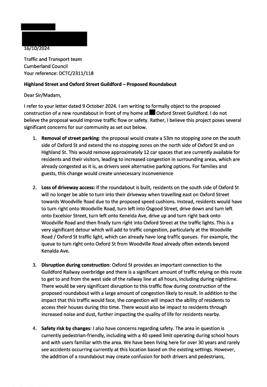
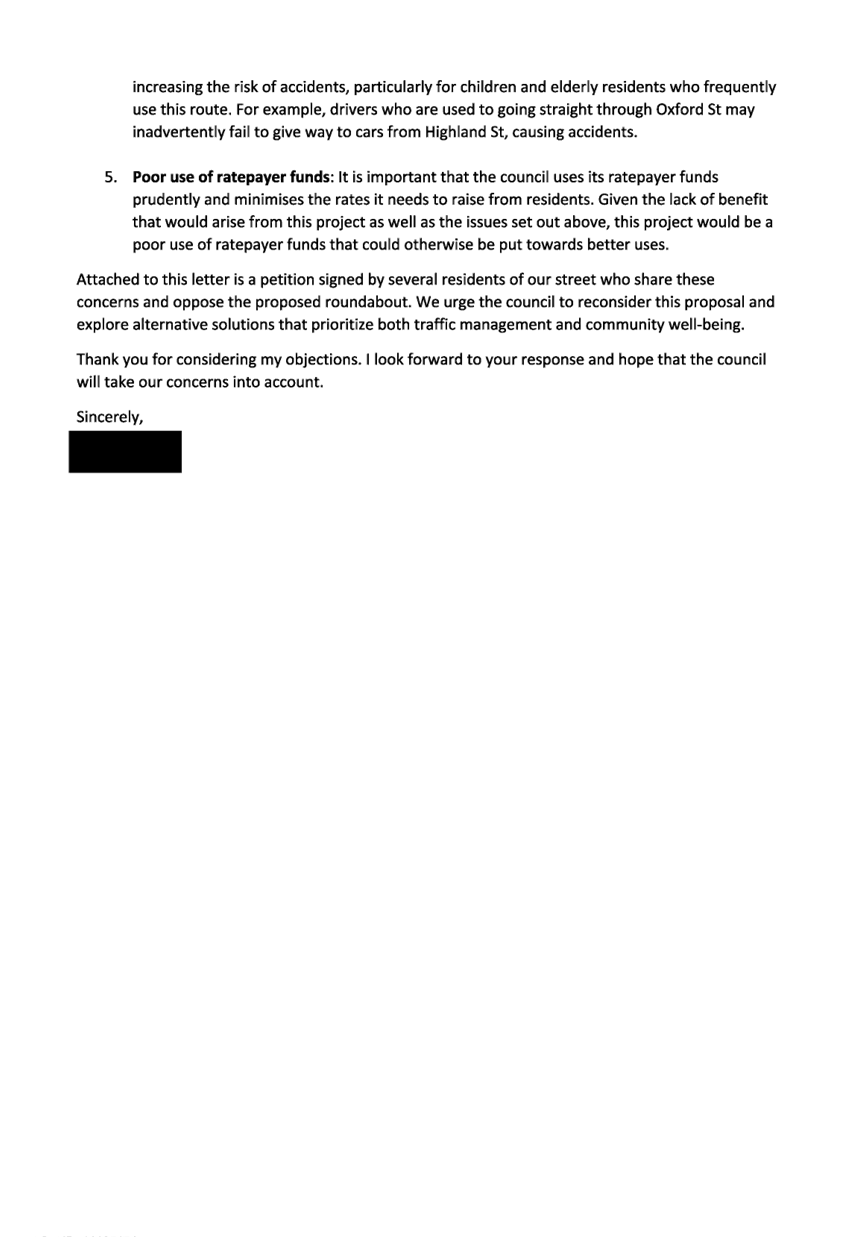
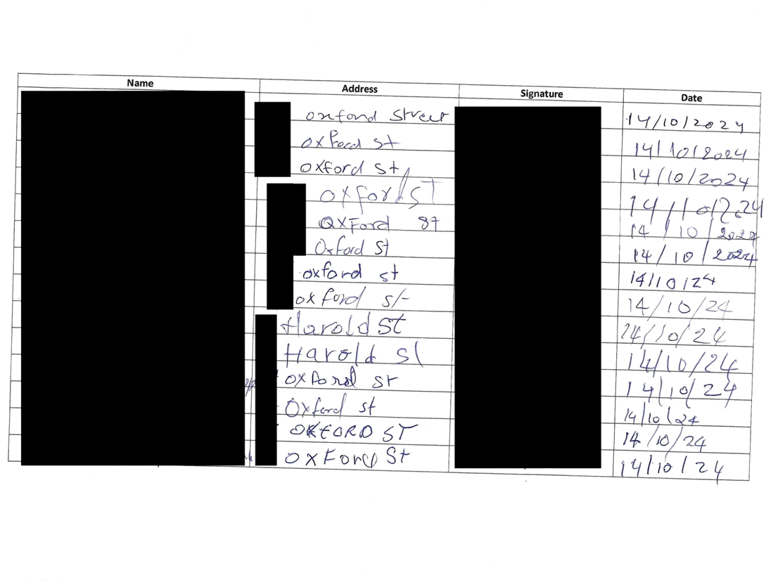
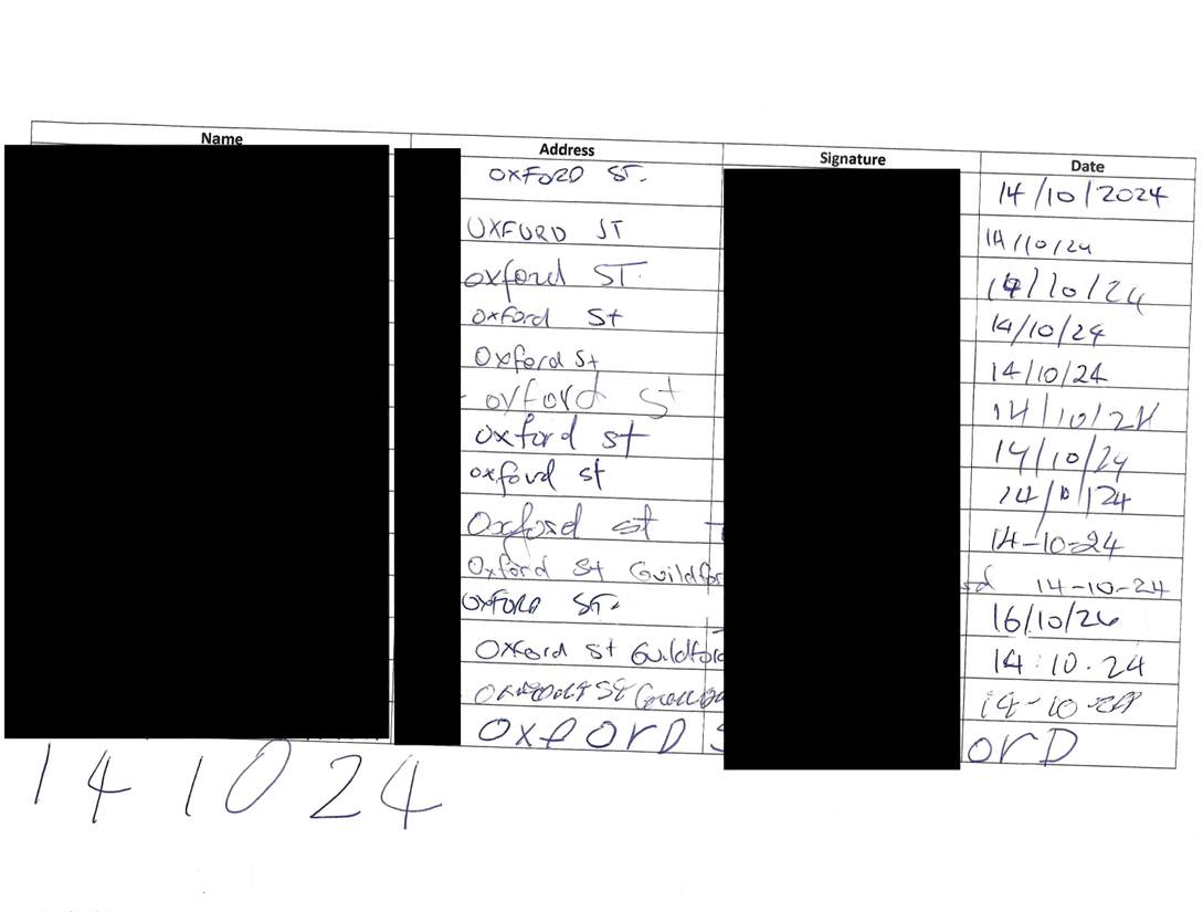
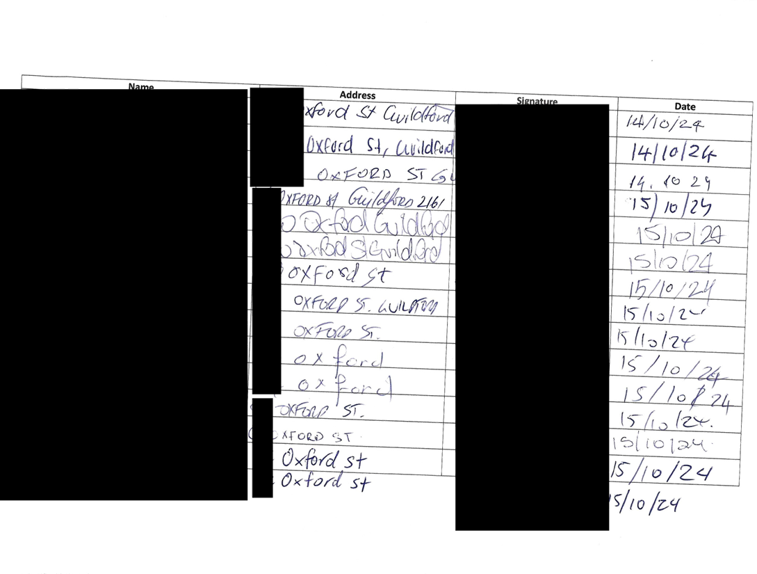
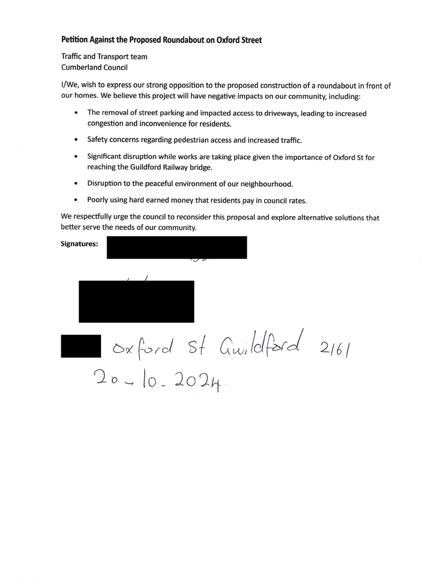
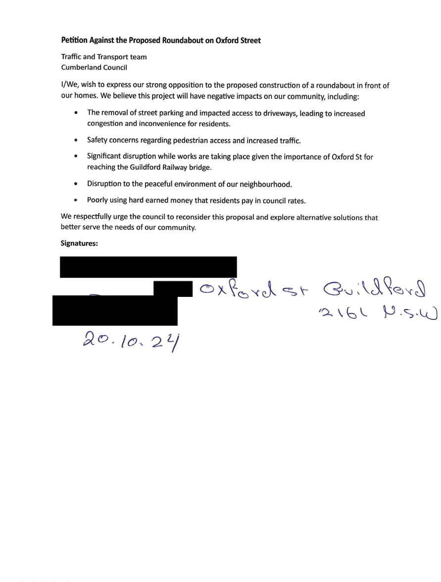
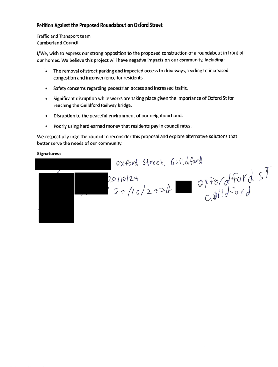
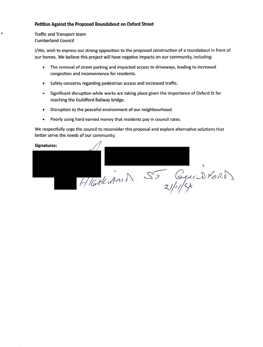
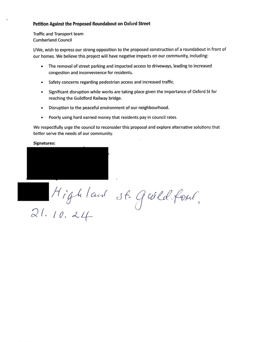
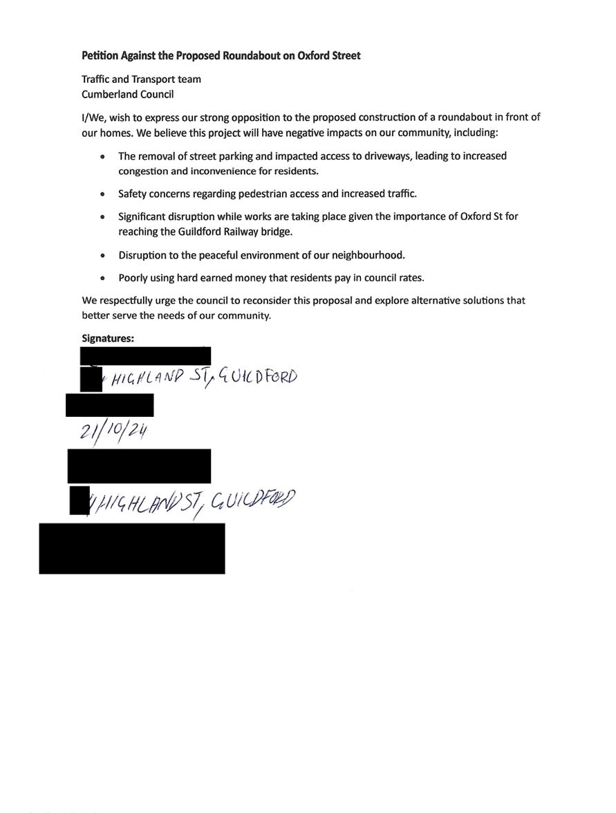
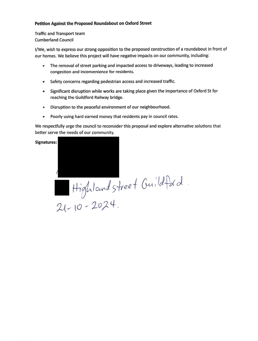
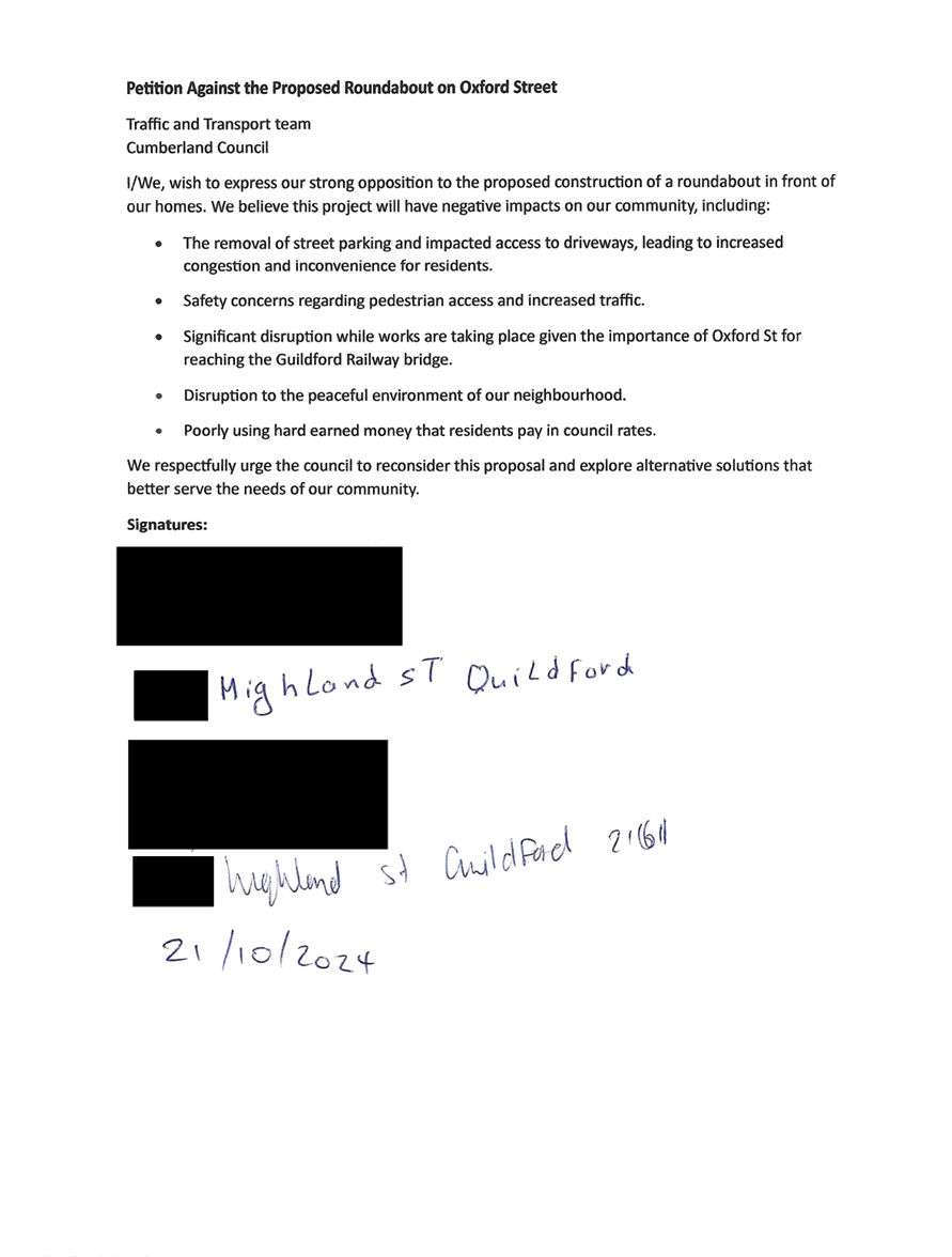
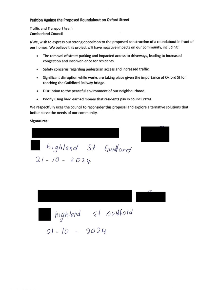
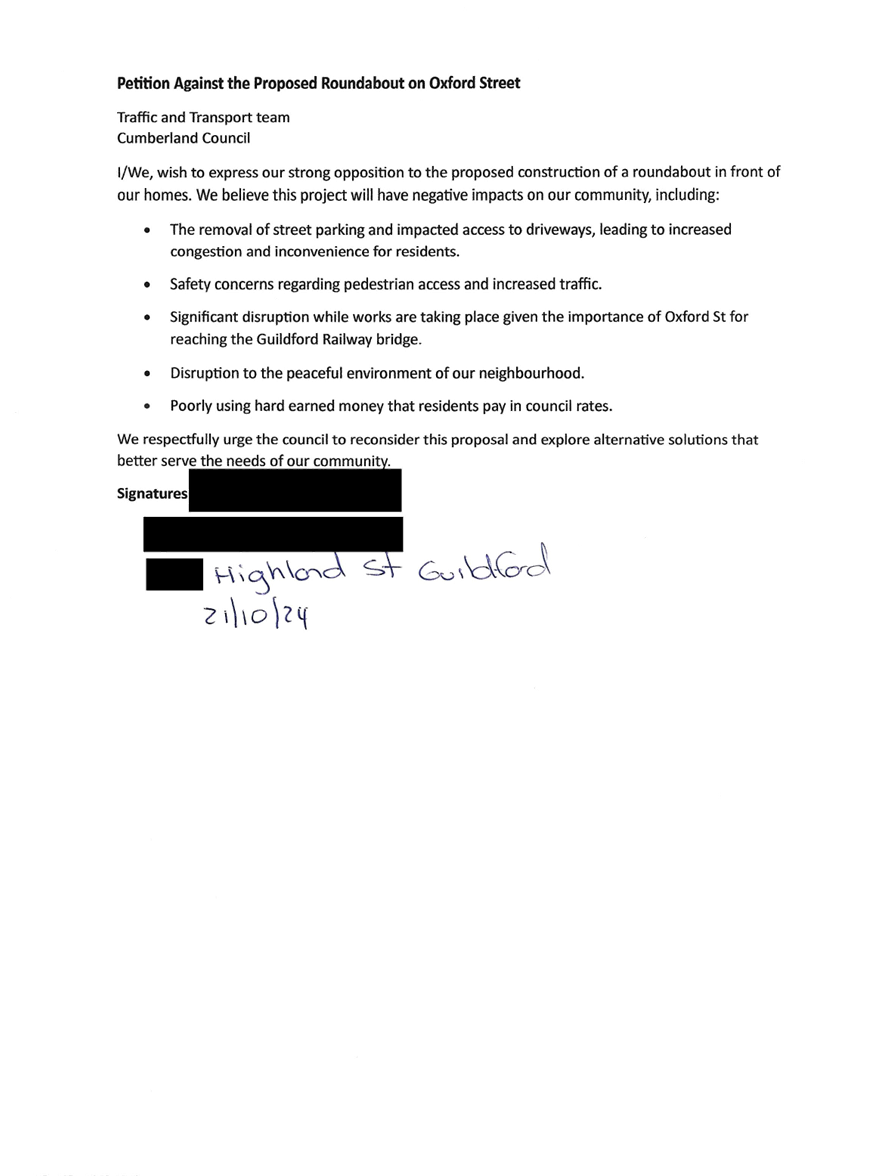
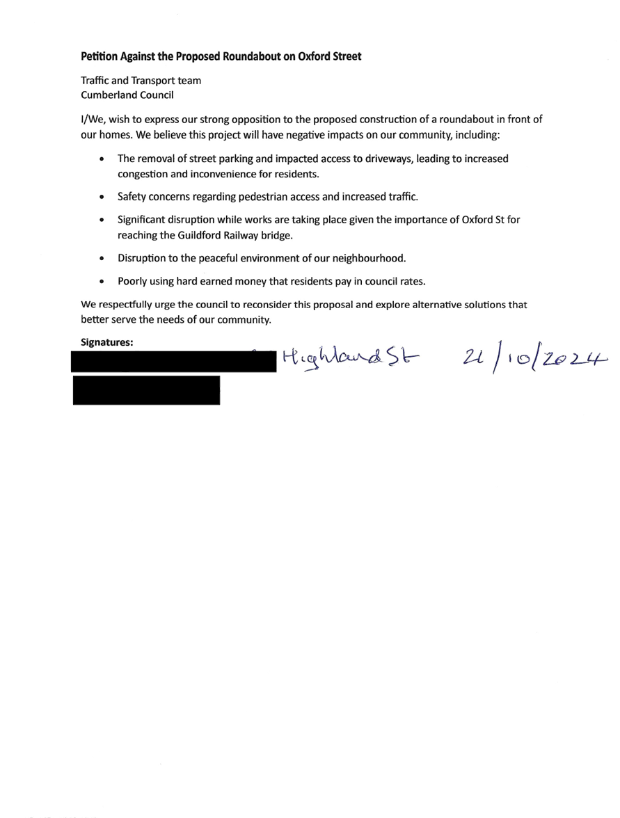
Proposed Roundabout Oxford Street and Highland Road,
Guildford
Mr Elias Elias advised the Traffic Committee that Council
has undertaken consultation for proposed roundabout at the intersection of
Oxford Street and Highland road in Guildford. A petition has been received with
concerns of the proposal and Council officers will review the feedback
provided, with the proposed design to be considered by the Cumberland Traffic
Committee.
Speeding Concerns along Lackey Street, South Granville
Mr Elias Elias informed the Traffic Committee that
representation has been received by Council officers regarding speeding
concerns along Lackey Street between Excelsior and Blaxcell Street, South
Granville. Officers will investigate and bring a report to the next Cumberland
Traffic Committee.
Hawksview Street,
Councillor Elmore has requested officers to obtain an update
from Transport for NSW on the progress of the speed camera previously
requested.
East Street and Railway Street, Lidcombe
Ms Caroline Staples informed the Traffic Committee
that representation has been made to investigate improvements to line marking
and signage at this intersection to respond to traffic and safety
concerns in this area. Council officers to investigate and provide a report to
the Cumberland Traffic Committee.
Next Meeting
Next Meeting Wednesday, 5 February
2025 at 9:30 AM
Meeting Close
The meeting terminated at 11:01am.
Signed:
Chairperson
5 February 2025
Part 1
Recommended for Approval under Delegated Authority
5 February 2025
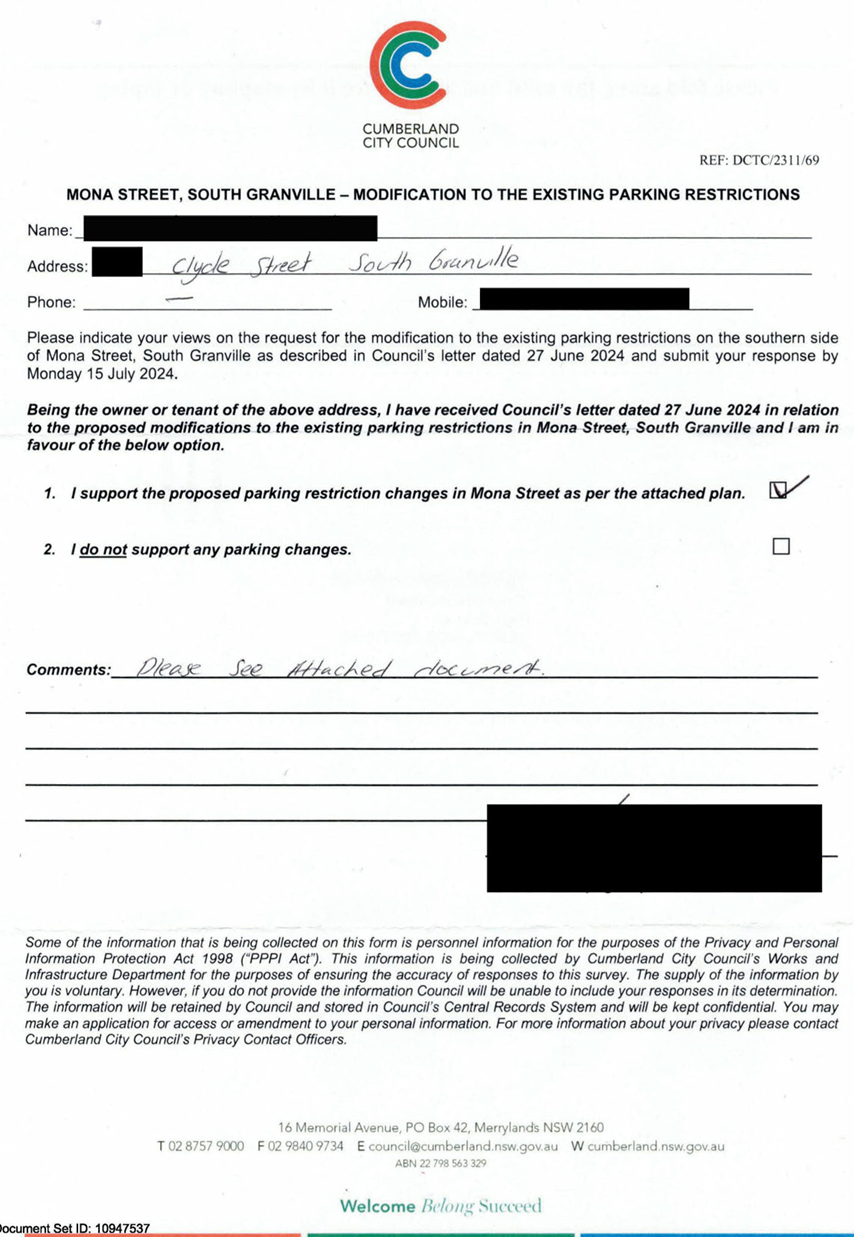
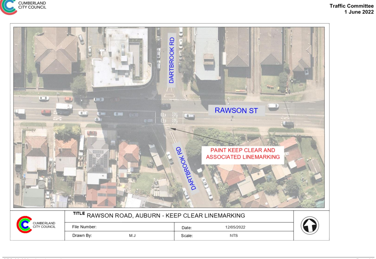
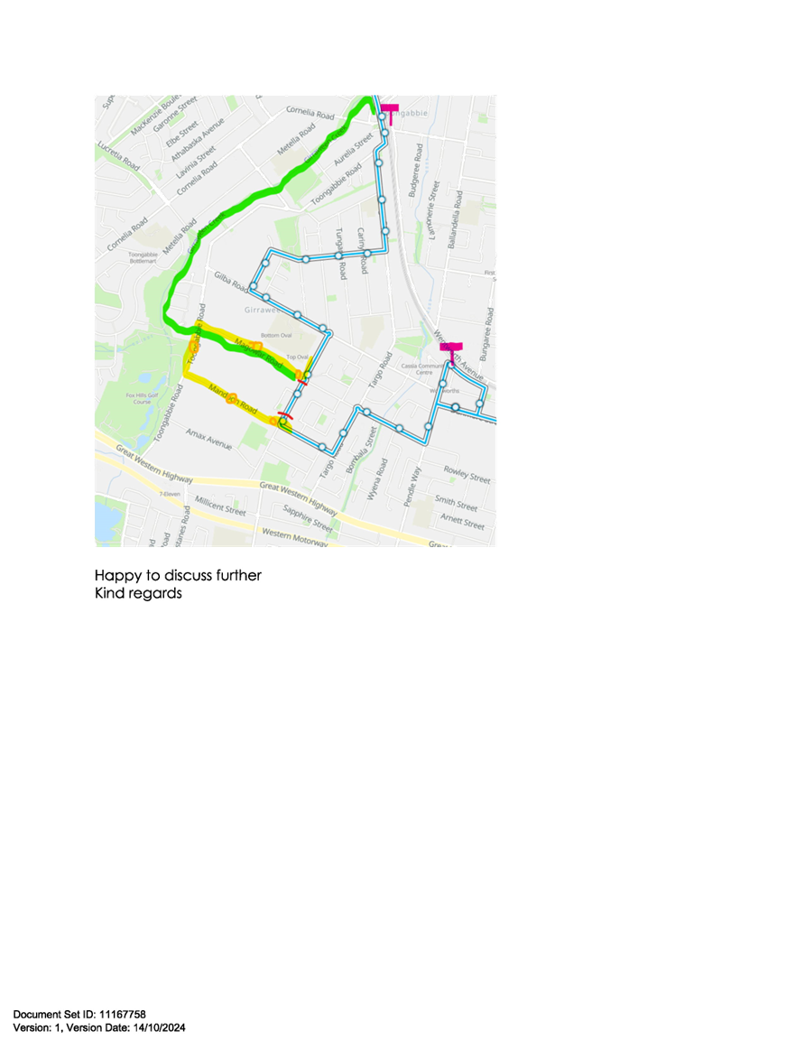
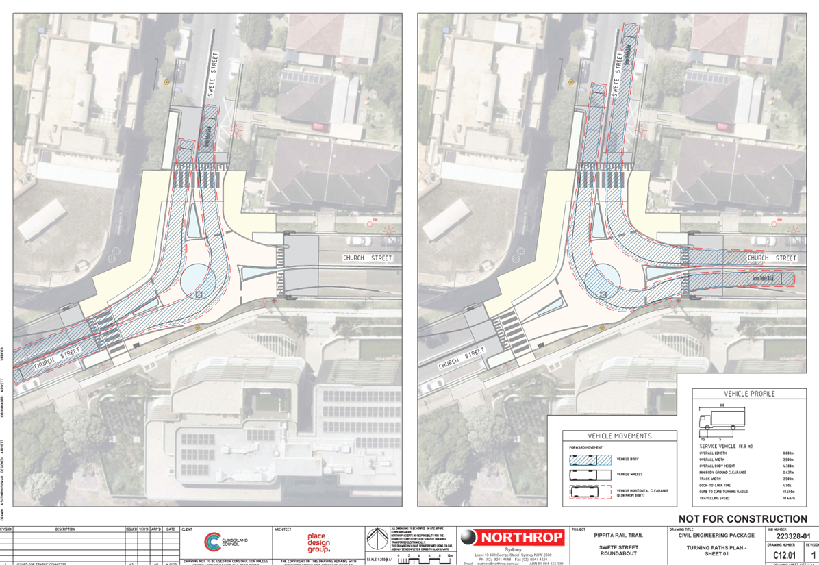
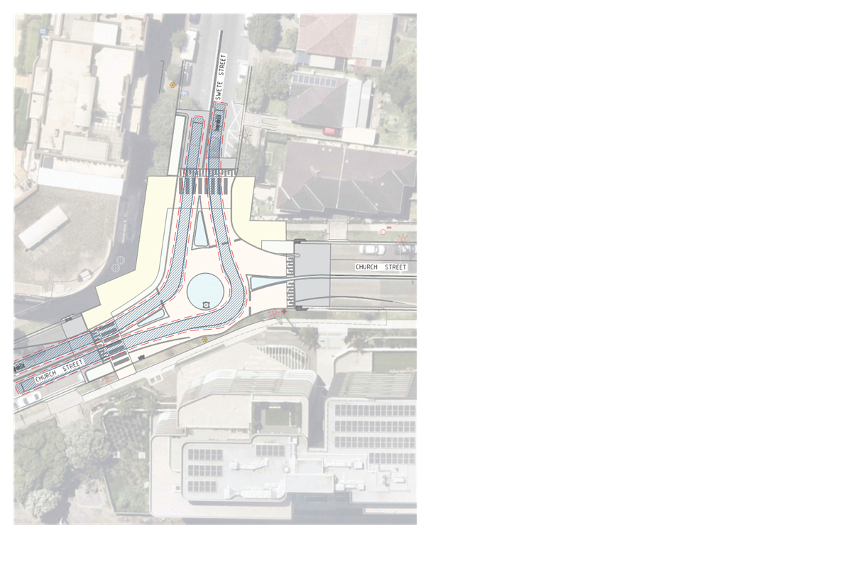
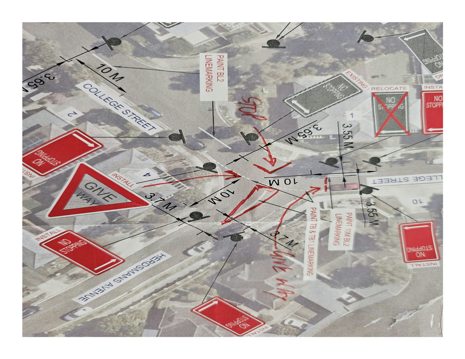
Item No: CTC-25-001
HERDSMANS
AVENUE AND COLLEGE STREET, LIDCOMBE – PROPOSED INTERSECTION TREATMENT
Directorate: Environment
and Planning
Responsible
Officer: Manager
Engineering and Building
Electorate: Auburn
Police Area
Command (PAC): Auburn
Agenda Part Part
1
Note: Recommended
for Approval under Delegated Authority
Council has received safety concerns from residents at the
intersections of Herdsmans Avenue and College Street, Lidcombe.
This report outlines the outcome of the investigation into
this matter.
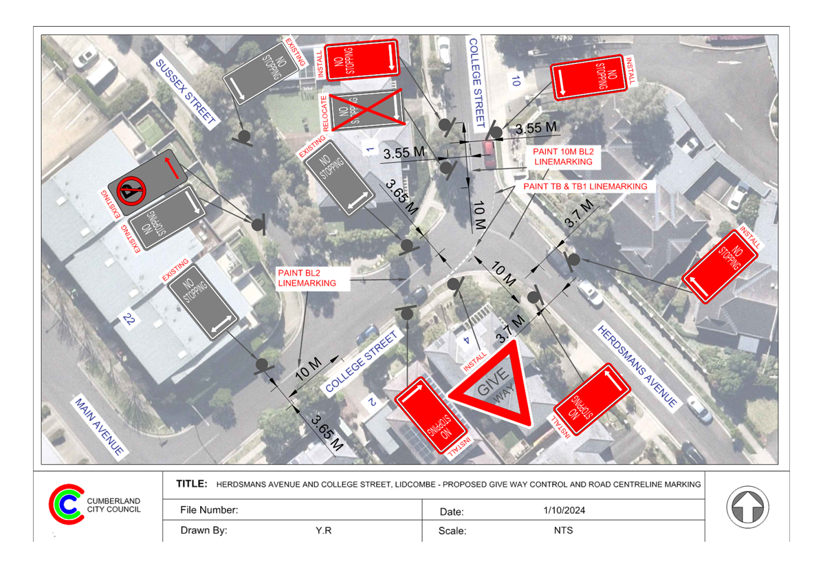
The Traffic Committee recommends that:
1. The
installation of ‘Give Way’ signs, line marking, and ‘No
Stopping’ restrictions at the intersection of Herdsmans Avenue and
College Street, Lidcombe, in accordance with attached plan be approved.
2. The
affected / concerned residents be notified of the outcome.
Herdsmans Avenue is local road that runs in a north-south
direction with a speed limit of 50 km/h. It has a width of approximately 6.5 m
and parking is permitted on both sides of the road unless otherwise signposted.
College Street is a local road that runs north-south between
Cobden Parkes Crescent and Herdsmans Avenue, and east-west between Herdsmans
Avenue and Main Avenue. The road is approximately 7 meters wide, with parking
allowed on both sides of the road unless otherwise signposted.
Herdsmans Avenue and College Street forming a Y-
intersection with priority to College Street.
The map below shows the intersection.
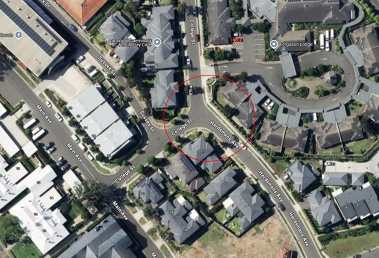
Locality
Plan
The latest Centre for Road Safety accident data indicated
that there were no reported accidents at this intersection in the last 5 years
ending September 2023.
Residents have raised concerns about vehicles parking within
10 metres of the intersection. Inspections confirmed that vehicles are parking
too close to the intersection, creating potential safety risks. To address
this, it is proposed to install ‘No Stopping’ restrictions and
‘BL2’ line marking at the intersection.
Inspections also revealed that no line marking or signage is
provided at this intersection and the Y-shaped intersection could confuse
drivers, as the road geometry makes the 'Give Way' priorities unclear.
In accordance with Australian Standard AS 1742.2-2009
– Part 2: Traffic Control Devices for General Use, controls are required
at all non-signalised intersections in the following manner:
a) GIVE
WAY signs shall be provided at all intersections with four or more legs.
b) GIVE
WAY signs shall be provided at any three-way intersections where the layout is
such that it is not clear how or whether the T-intersection rule would operate,
for example, at a Y-intersection.
c) GIVE
WAY signs should be used for road safety reasons at unsignalised
T-intersections in both rural and urban areas where the major road is an
arterial or collect type road.
Based on point (b) above, 'Give Way' signage is warranted at
this location. Therefore, it is recommended that ‘Give Way’
controls be provided at the intersection of Herdsmans Avenue and College Street
to prevent vehicles from failure to give way to traffic on College Street.
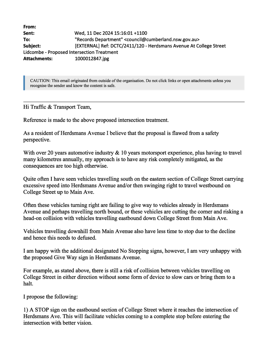
The proposal was notified to the
impacted and adjacent residents for a period of 14 days starting from 25
November 2024 to 11 December 2024.
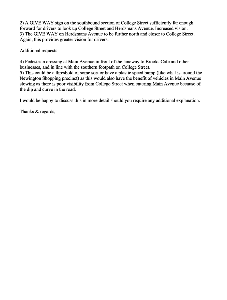
Council received one objection,
the resident requesting that Give Way or Stop controls be implemented on
College Street instead of Herdsmans Avenue, citing concerns about excessive
vehicle speeds on College Street. The resident also suggested installing traffic
calming devices along College Street to reduce speeding.
As College Street functions as a continuous main road, while
Herdsmans Avenue is a minor street connecting to it and carrying significantly
less traffic, giving priority to Herdsmans Avenue would likely cause confusion
for motorists and increase the risk of collisions.
Attachments
1. Plan
– Herdsmans Avenue and College Street, Lidcombe – Proposed
Intersection Treatments
2. Submission
DOCUMENTS
ASSOCIATED WITH
REPORT CTC-25-001
Attachment 1
Plan – Herdsmans Avenue and College Street,
Lidcombe – Proposed Intersection Treatments
5 February 2025
DOCUMENTS
ASSOCIATED WITH
REPORT CTC-25-001
Attachment 2
Submission
5 February 2025
5 February 2025
Item No: CTC-25-002
GILBA ROAD AND
PENDLE WAY, PENDLE HILL – PROPOSED RELOCATION OF THE EXISTING FENCE
Directorate: Environment
and Planning
Responsible
Officer: Manager
Engineering and Building
Electorate: Prospect
Police Area
Command (PAC): Cumberland
Agenda Part Part
1
Note: Recommended
for Approval under Delegated Authority
Council has received safety
concerns from a resident regarding the fence at the intersection of Gilba Road
and Pendle Way, Pendle Hill.
This report outlines the outcome of the investigation into
this matter.
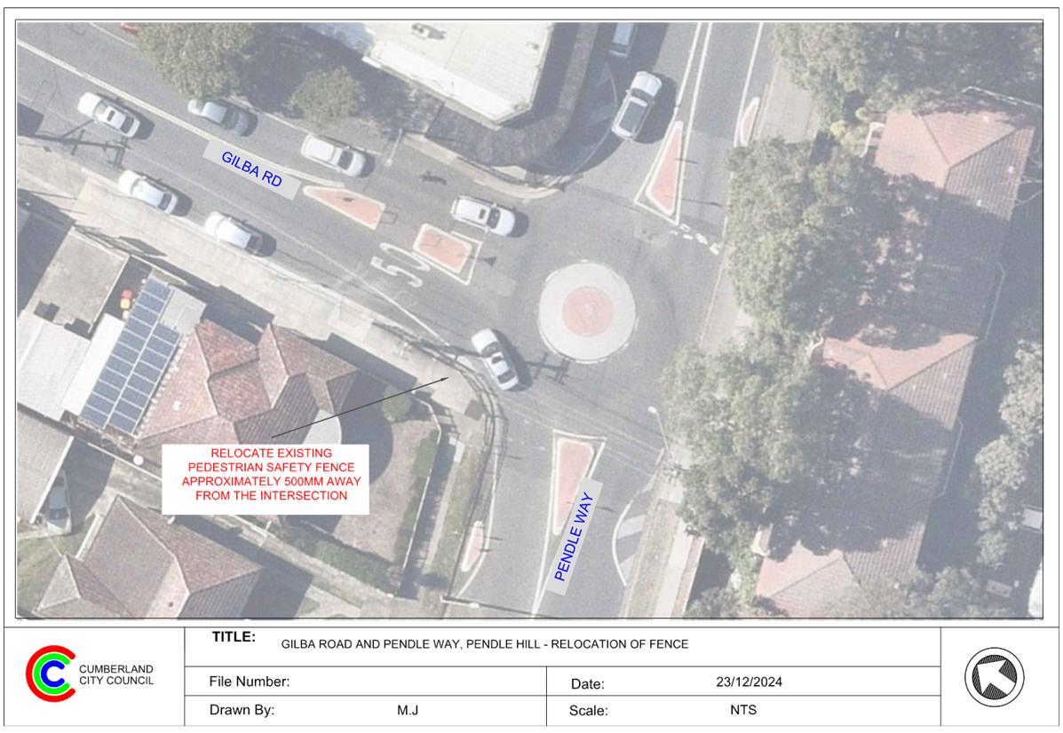
The Traffic Committee recommends that the existing fence
at the south-west corner at the intersection of Gilba Road and Pendle Way,
Pendle Hill be relocated approximately 500mm away from the intersection in
accordance with the attached plan be approved.
Gilba Road is a collector road running east-west with a
speed limit of 50 km/h. The road is approximately 12 meters wide and has
parking restrictions near its intersection with Pendle Way.
Similarly, Pendle Way is a collector road running east-west
with a speed limit of 50 km/h. It is also 12 meters wide and has parking
restrictions at its intersection with Gilba Road.
These two roads form a T-intersection, which is currently
controlled by a roundabout. Pedestrian safety fences are installed at both
corners of the intersection to protect pedestrians.
The map below shows the location.
It is alleged that heavy vehicles often damage the
pedestrian safety fence at the south-west corner of the intersection when
making a right turn from Pendle Way into Gilba Road.
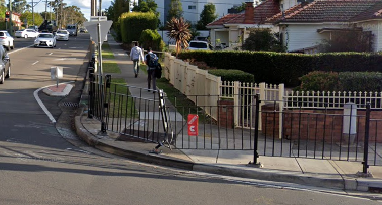
The latest Centre for Road Safety accident data indicated
that there were no reported accidents at this intersection in the last 5 years
ending September 2023.
However, to address the potential safety hazard caused by
heavy vehicle movements, a design adjustment is necessary.
A turning path assessment revealed that the existing fence
at the south-west corner does not provide sufficient space for a 12.5-meter
truck to complete the right turn. As a result, the overhang of the vehicle
often collides with and damages the fence.
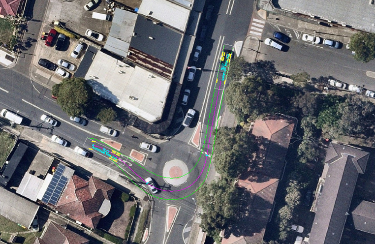
To maintain pedestrian safety and accommodate turning
vehicles, it is proposed to relocate the existing pedestrian safety fence at
the south-west corner approximately 500 mm away from the intersection.
The current distance between the fence and the edge of the
footpath on the residential side is approximately 3.5 metres, which complies
with the relevant standards for footpath width. This adjustment will ensure
sufficient clearance for heavy vehicles while maintaining pedestrian safety.
Consultation is not required as no
residents or businesses will be directly impacted by the proposed work.
1. Plan – Gilba
Road and Pendle Way – Proposed Relocation of the Existing Pedestrian
Safety Fence
DOCUMENTS
ASSOCIATED WITH
REPORT CTC-25-002
Attachment 1
Plan – Gilba Road and Pendle Way –
Proposed Relocation of the Existing Pedestrian Safety Fence
5 February 2025
5 February 2025
Item No: CTC-25-003
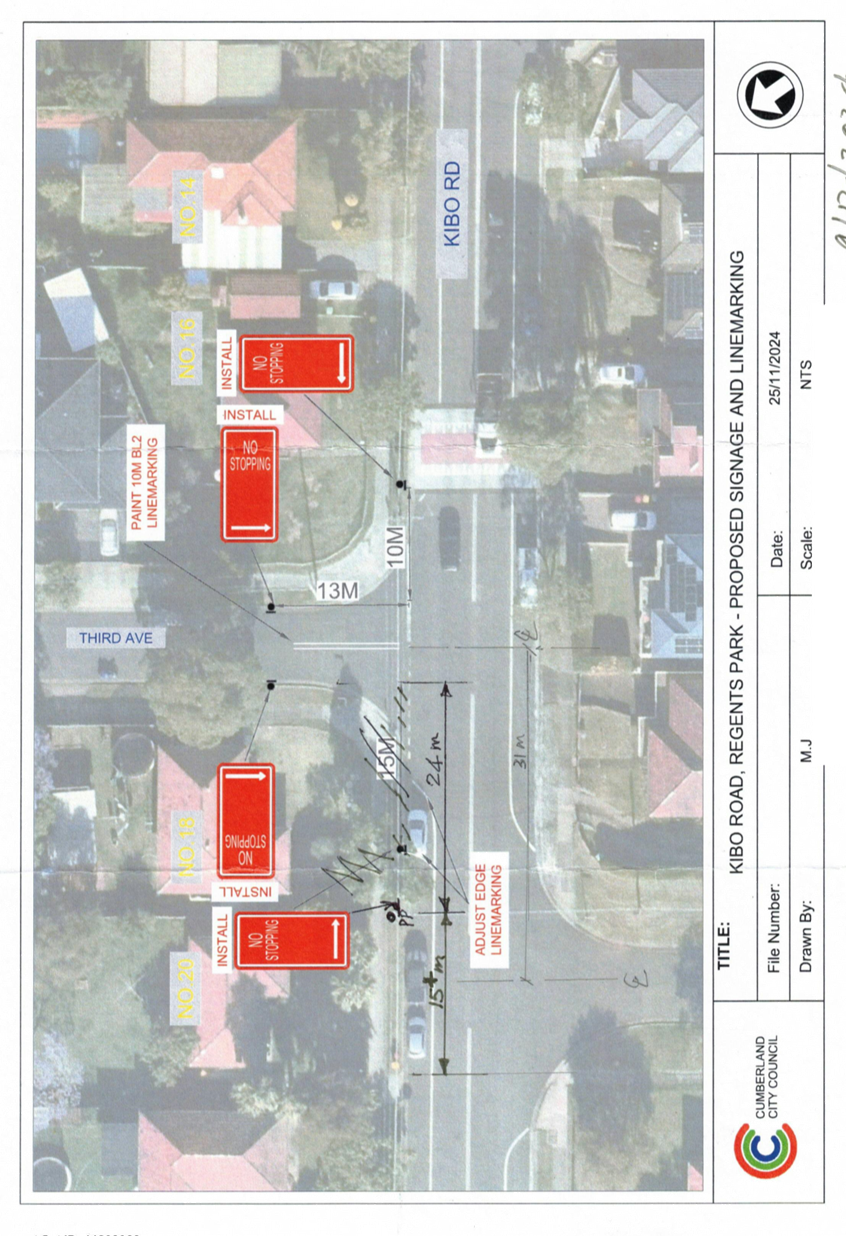
KIBO ROAD AND
THIRD AVENUE, REGENTS PARK - PROPOSED ‘NO STOPPING’ RESTRICTIONS
AND CENTRE LINE MARKING
Directorate: Environment
and Planning
Responsible
Officer: Manager
Engineering and Building
Electorate: Auburn
Police Area
Command (PAC): Auburn
Agenda Part Part
1
Note: Recommended
for Approval under Delegated Authority
Council has received safety concerns from residents of Third
Avenue at the intersection of Kibo Road and Third Avenue, Regents Park.
This report outlines the outcome of the investigation into
this matter.
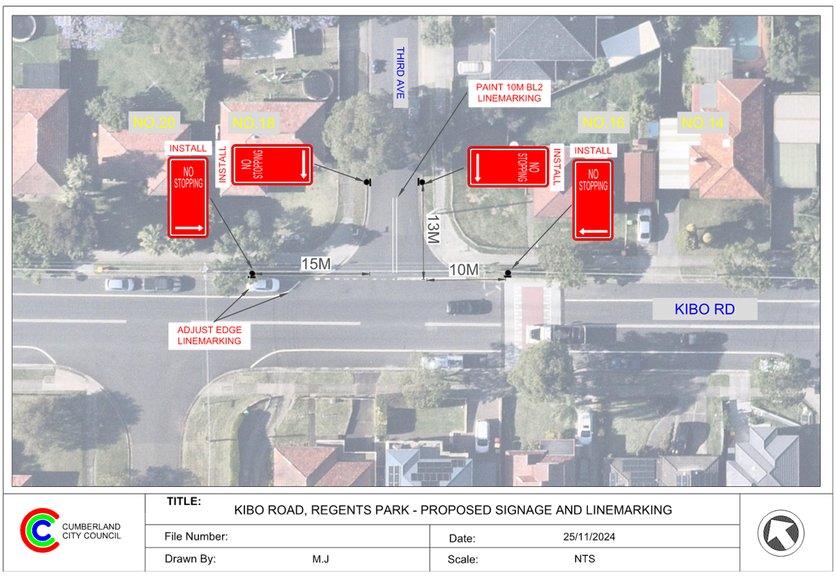
The Traffic Committee recommends that:
1. The
installation of ‘No Stopping’ signs and line marking at the
intersection of Kibo Road and Third Avenue, Regents Park in accordance with
attached plan be approved.
2. The
affected / concerned residents be notified of the outcome.
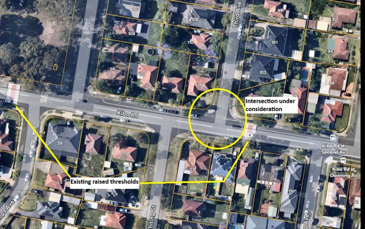
Kibo Road is a local road that runs in an east-west
direction, approximately 700m long between Nottinghill Road and Kingsland Road
with a speed limit of 50 km/h. It has a width of approximately 12.5m and
parking is permitted on both sides of the road unless otherwise signposted.
Third Avenue is a local road that runs in a north-south
direction between Kibo Road and Hyde Park Road with a speed limit of 50 km/h.
It has a width of approximately 7.2 m and parking is permitted on both sides of
the road in accordance with Road Rules unless otherwise signposted.
Both Kibo Road and Third Avenue form a T- intersection with
priority to Kibo Road. There are ‘STOP’ signs and associated line
marking on Third Avenue at the intersection.
In mid-2024, Council installed five concrete raised
thresholds (speed humps) in Kibo Road.
The map below shows the intersection and surrounds:
The latest Centre for Road Safety crash data indicated that
there were no reported crashes at this intersection in the last 5 years ending
March 2024.
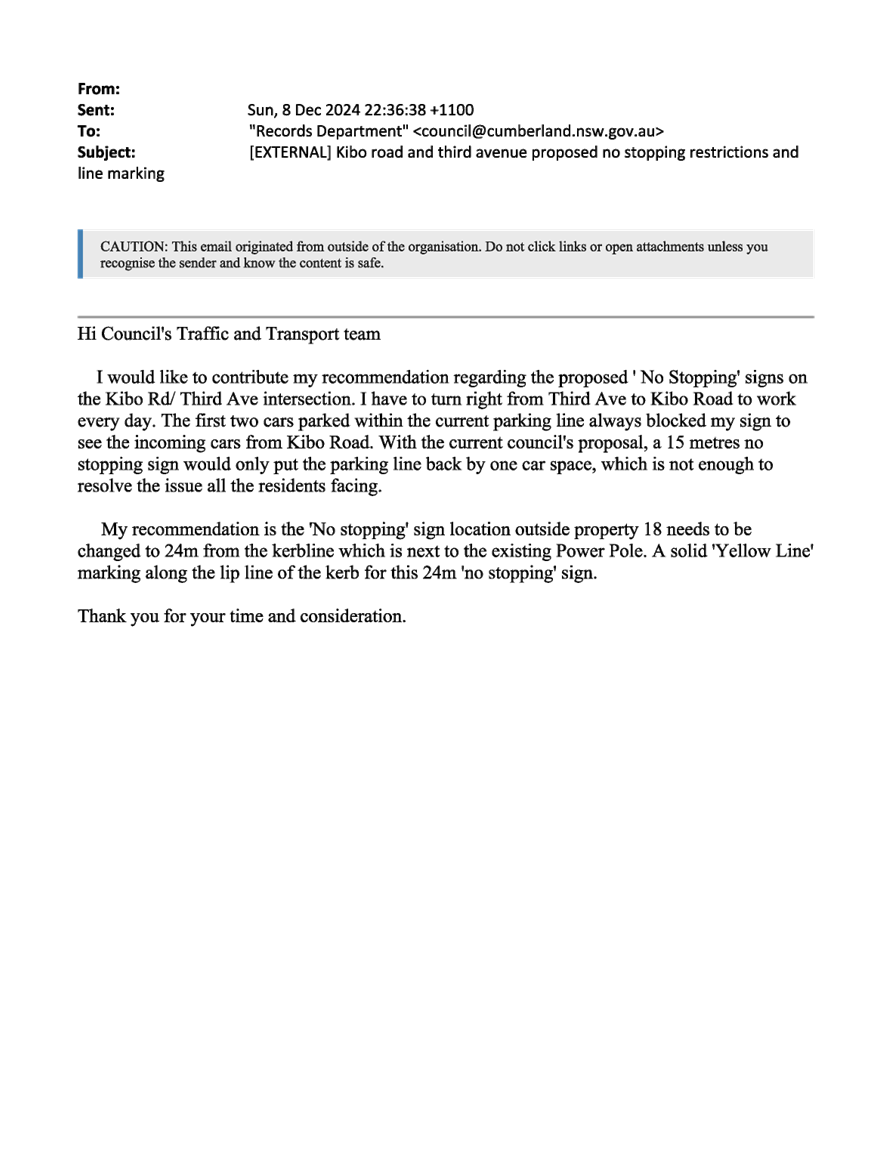
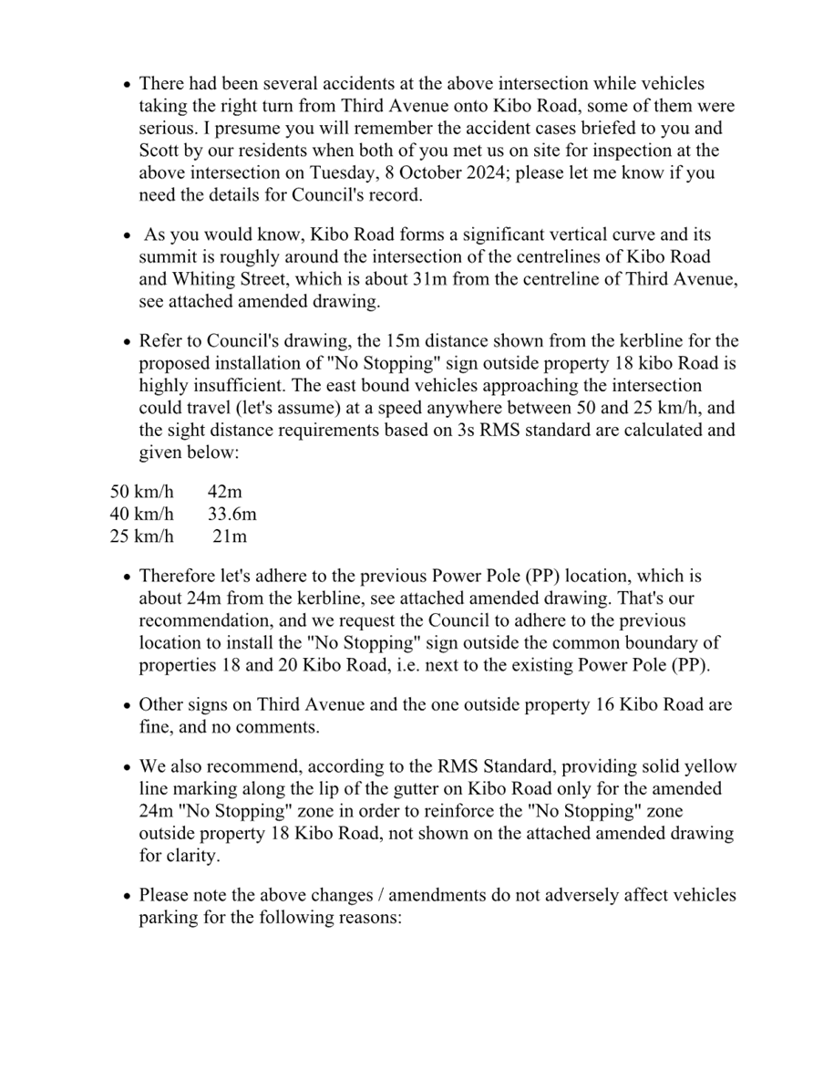
Concerns were raised by residents indicating that vehicles
are parking close to the intersection and reducing site distance for vehicles
exiting Third Avenue. It was alleged that the crest point on Kibo Road west of
Third Avenue combined with parked vehicles at the corner reduces the site
distance for vehicles. It is proposed to install ‘No Stopping’
restrictions, ‘BL2’ centreline marking at this intersection. The
signs and line marking would strengthen the Road Rules requirement, stop
vehicles from parking close to the intersection.
The ‘No Stopping’ signs are proposed to be
installed on both sides of Third Avenue at 13m to allow vehicles to safely
Council pass a parked car without encroaching the proposed ‘BL2’
line marking in the narrow road.
Council undertook consultation with adjacent residents in
December 2024. Council received 4 submissions. All submissions were from
residents who are not directly impacted by the proposal. The submissions
requested that the proposed ‘No Stopping’ sign on the northern side
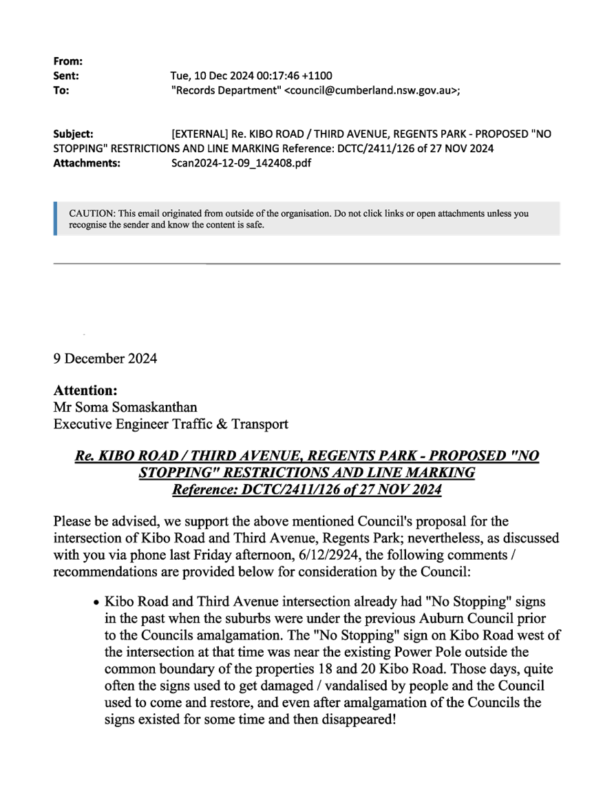
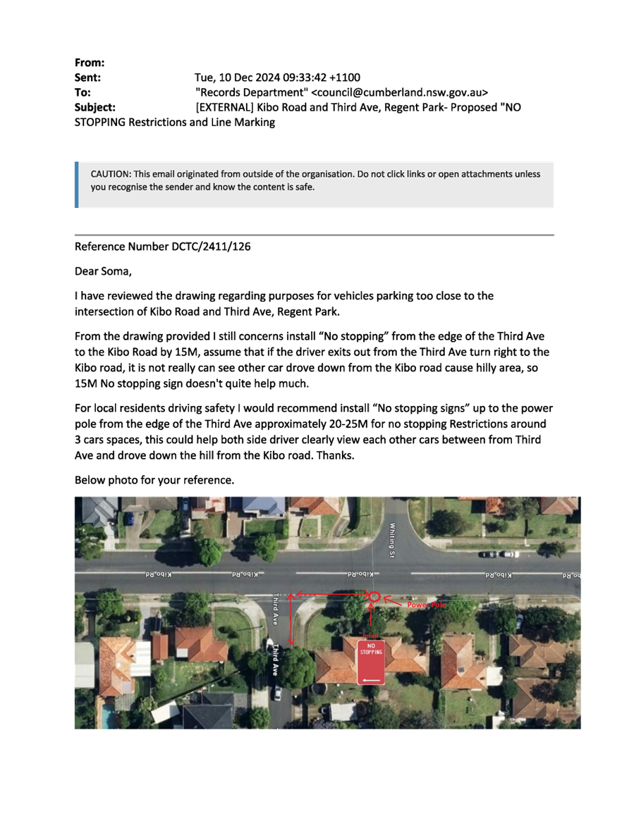
of Kibo Road west of Third Avenue be relocated further west to a location at
24m instead of the 15m proposed. The submissions also indicated that there were
‘No Stopping’ restrictions at this intersection several years back
and the signs were removed. Council’s investigations could noy find any
evidence of previous approvals at this location.
However, it is noted that the Road Rule requires 10m
‘No Stopping’ zones at intersections and the 15m proposed will
enhance safety at the intersection. An increased length (24m) of ‘No
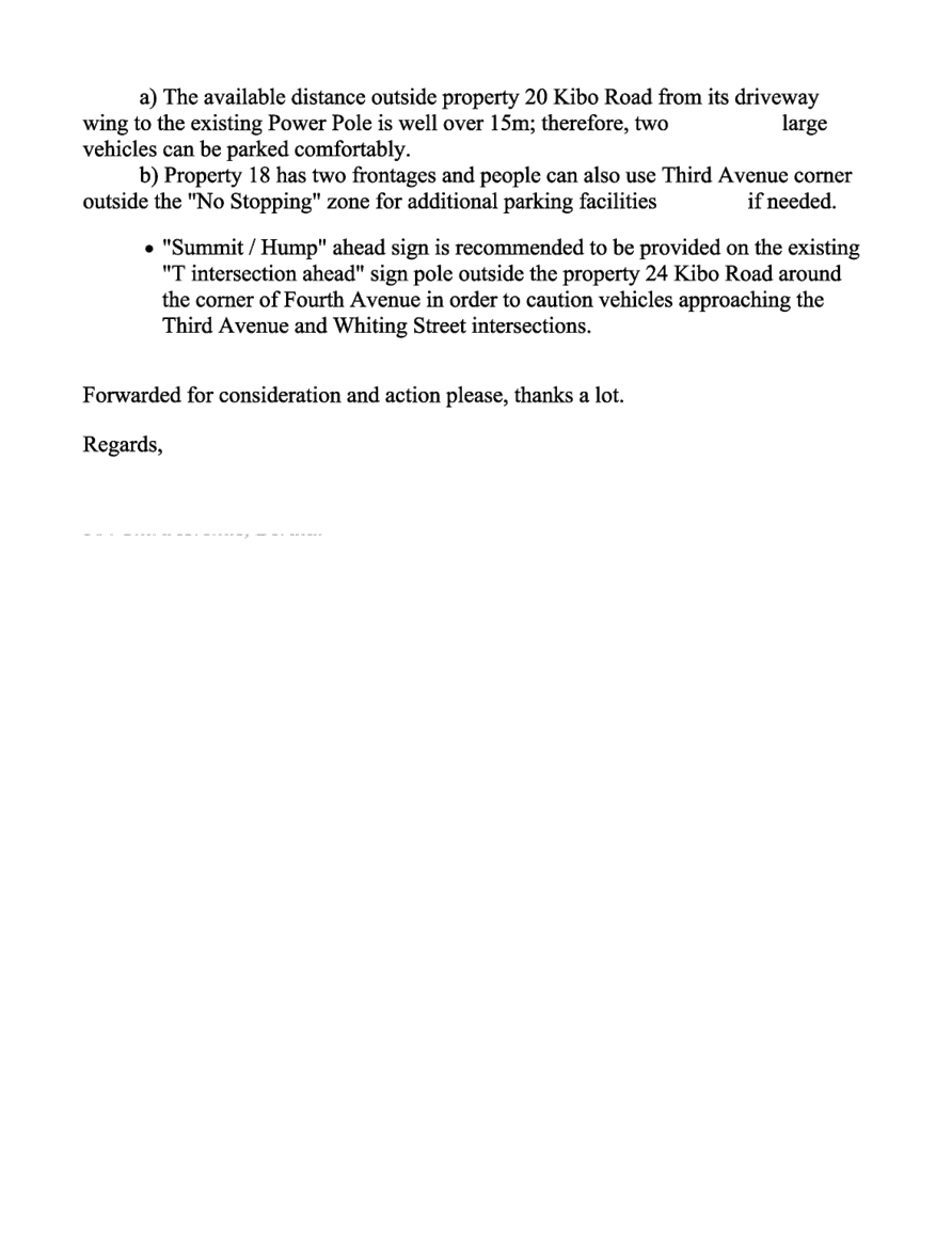
Stopping’ zone west of the intersection will impact on available parking
in the area. Furthermore, the ‘STOP’ control provided previously is
as a result of the reduced sight distance available at the intersection.
The proposal was notified to the
impacted and adjacent residents for a period of 14 days starting from 27
November 2024 to 11 December 2024.
There were four responses
received.
1. Plan – Kibo
Road and Third Avenue, Regents Park – Proposed ‘No Stopping’
Restrictions and ‘BL2’ Line Marking
2. Submissions
DOCUMENTS
ASSOCIATED WITH
REPORT CTC-25-003
Attachment 1
Plan – Kibo Road and Third Avenue, Regents Park
– Proposed ‘No Stopping’ Restrictions and ‘BL2’
Line Marking
5 February 2025
DOCUMENTS
ASSOCIATED WITH
REPORT CTC-25-003
Attachment 2
Submissions
5 February 2025
Item No: CTC-25-004
KIMBERLEY
STREET AT WOODVILLE ROAD, MERRYLANDS – PROPOSED 'NO STOPPING'
RESTRICTIONS AND LINE MARKING
Directorate: Environment
and Planning
Responsible
Officer: Manager
Engineering and Building
Electorate: Granville
Police Area
Command (PAC): Cumberland
Agenda Part Part
1
Note: Recommended
for Approval under Delegated Authority
Council has received safety concerns from residents at the intersection
of Kimberley Street at Woodville Road, Merrylands.
This report outlines the outcome
of the investigation into this matter.
The Traffic Committee
recommends that:
1. The
installation of ‘No Stopping’ signs and BL2 line marking at the
intersection of Kimberley Street and Woodville Road, Merrylands in accordance
with the attached plan be approved.
2. The
affected / concerned residents be notified of the outcome.
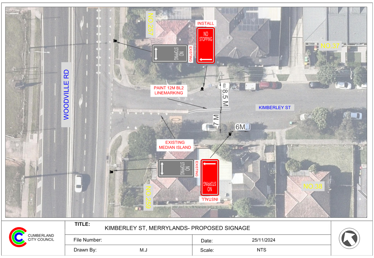
Woodville Road is a state road that runs in a north-south
direction with a speed limit of 70 km/h. It has a width of approximately 18m
and parking is not permitted on both sides of the road.
Kimberley Street is a local road that runs in an east-west
direction with a speed limit of 50 km/h. It has a width of approximately 10m
with indented parking bays on both sides of the street.
Currently, a concrete median island exists in Kimberley
Street near the intersection of Woodville Road to control and separate traffic.
The map below shows the intersection.
Locality Plan
A local resident reported that vehicles often park too close
to the median island, creating significant challenges for motorists to navigate
through the area safely and smoothly.
The latest Centre for Road Safety accident data indicated
that there were no reported accidents related to parked vehicles at this
intersection in the last 5 years ending September 2023.
A site inspection identified that vehicles often park too close to
the median island, causing difficulty for motorists navigating Kimberley Street
near Woodville Road.
To address these concerns and enhance both safety and
accessibility, it is proposed to implement 'No Stopping' restrictions on both
sides of Kimberley Street at its intersection with Woodville Road, accompanied
by 12 metres of BL2 line marking.
These measures aim to prevent vehicles from parking near the
median island, ensure compliance with Road Rules make it easier to pass through
the intersection safely.
COnsultation
The proposal was notified to the
impacted and adjacent residents for a period of 14 days starting from 27
November 2024 to 11 December 2024.
Council received two responses in
support of the proposal.
1. Plan –
Kimberley Street and Woodville Road, Merrylands – Proposed Parking
Restrictions
2. Submissions
DOCUMENTS
ASSOCIATED WITH
REPORT CTC-25-004
Attachment 1
Plan – Kimberley Street and Woodville Road,
Merrylands – Proposed Parking Restrictions
5 February 2025
DOCUMENTS
ASSOCIATED WITH
REPORT CTC-25-004
Attachment 2
Submissions
5 February 2025
5 February 2025
Item No: CTC-25-005
RAWSON ROAD
AND GREAT WESTERN HIGHWAY, SOUTH WENTWORTHVILLE – PROPOSED 'NO STOPPING'
RESTRICTIONS AND LINE MARKING
Directorate: Environment
and Planning
Responsible
Officer: Manager
Engineering and Building
Electorate: Prospect
Police Area
Command (PAC): Cumberland
Agenda Part Part
1
Note: Recommended
for Approval under Delegated Authority
Council has received safety concerns from residents at the
intersection of Rawson Road and Great Western Highway, South Wentworthville.
This report outlines the outcome of the investigation into
this matter.
The Traffic Committee recommends that:
1. The
installation of ‘No Stopping’ sign and ‘BL2’ line
marking at the intersection of Rawson Road and Great Western Highway, South
Wentworthville in accordance with the attached plan be approved.
2. The
affected / concerned residents be notified of the outcome.
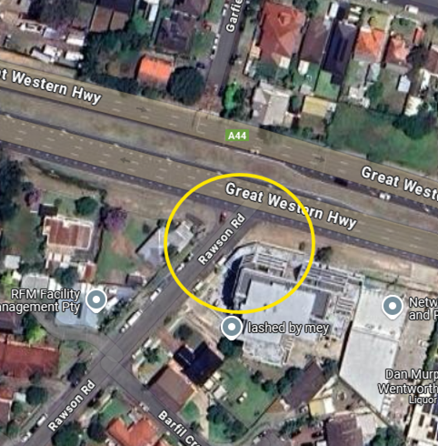
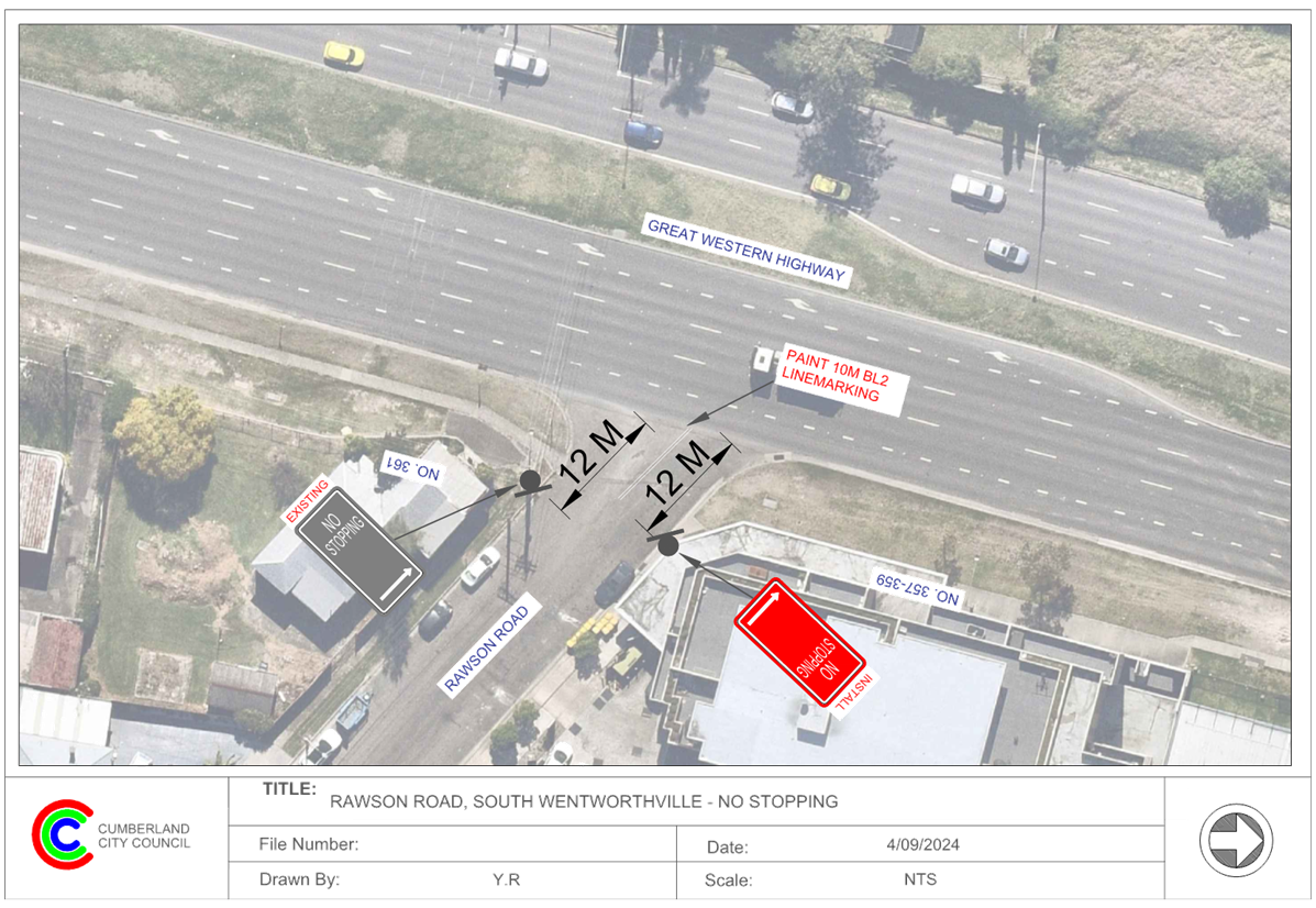
Great Western Highway is a state road that runs in an
east-west direction with a speed limit of 80 km/h between Cumberland Highway
and Hawkesbury Road. It has a width of approximately 15.7m for the westbound
travel lanes and parking is not permitted on both sides of the road unless
otherwise signposted.
Rawson Road is a local cul-de-sac road that runs in a
north-south direction with its northern end connect to Great Western Highway.
It has a speed limit of 50 km/h, it has a width of approximately 12.5m and
parking is permitted on both sides of the road unless otherwise signposted.
Rawson Road and Great Western Highway forms a T-
intersection with priority to Great Western Highway. There is one existing
‘No Stopping’ sign installed on the western side Rawson Road.
The map below shows the intersection.
Locality Plan
The latest Centre for Road Safety accident data indicated
that there were no reported accidents at this intersection in the last 5 years
ending September 2023.
A site inspection revealed that vehicles are parking within
10 metres of the intersection on the eastern side of Rawson Road, where no
signage is currently present. To address this, it is proposed to install a
‘No Stopping’ restriction on the eastern side and 10 metres of
‘BL2’ line marking at this intersection. These measures will
reinforce the Road Rules and prevent vehicles from parking too close to the
intersection. Additionally, the ‘No Stopping’ sign is proposed to
be installed 12 metres into Rawson Road to ensure vehicles can safely pass
parked cars without encroaching on the proposed ‘BL2’ line marking.
The proposal was notified to the
impacted and adjacent residents and owners for a period of 14 days starting
from 21 October 2024 to 5 November 2024. Two responses were received, which
supported the proposal.
1. Plan –
Rawson Road and Great Western Highway, South Wentworthville – Proposed
‘No Stopping’ Restriction and BL2 Line Marking
2. Submissions
DOCUMENTS
ASSOCIATED WITH
REPORT CTC-25-005
Attachment 1
Plan – Rawson Road and Great Western Highway,
South Wentworthville – Proposed ‘No Stopping’ Restriction and
BL2 Line Marking
5 February 2025
DOCUMENTS
ASSOCIATED WITH
REPORT CTC-25-005
Attachment 2
Submissions
5 February 2025
5 February 2025
Item No: CTC-25-006
FREDERICK
STREET AT JONES STREET, PENDLE HILL– PROPOSED 'NO STOPPING' RESTRICTIONS
AND LINE MARKING
Directorate: Environment
and Planning
Responsible
Officer: Manager
Engineering and Building
Electorate: Prospect
Police Area
Command (PAC): Cumberland
Agenda Part Part
1
Note: Recommended
for Approval under Delegated Authority
Council has received safety concerns from residents on
Frederick Street at Jones Street, Pendle Hill.
This report outlines the outcome of the investigation into
this matter.
The Traffic Committee recommends that:
1. The
installation of ‘No Stopping’ signs and ‘BL2’ line
marking on Frederick Street at Jones Street, Pendle Hill in accordance with the
attached plan be approved.
2. The
affected / concerned residents be notified of the outcome.
Frederick Street is a local road that runs in an east-west
direction between Jones Street and Diana Street with a speed limit of 50 km/h.
It has a width of approximately 7m and parking is permitted on both sides of
the road unless otherwise signposted.
Jones Street is a local road that runs in a north-south
direction between Great Western Highway and Stapleton Street with a speed limit
of 50 km/h. It has a width of approximately 12.5m and parking is permitted on
both sides of the road unless otherwise signposted.
Jones Street and Frederick Street forms a T- intersection
with priority to Jones Street.
The map below shows the intersection.
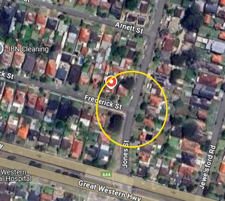
Locality Plan
The latest Centre for Road Safety accident data indicated
that there were no reported accidents at this intersection in the last 5 years
ending September 2023.
A site inspection indicated that vehicles are parking within
10 metres at the intersection. It is proposed to install 10m to 13m ‘No
Stopping’ restriction at the intersection. The signage and line marking
would strengthen the Road Rules requirement and stop vehicles from parking too
close to the intersection. The ‘No Stopping’ signs are proposed to
be installed at 13m in Frederick Street to allow vehicles to safely pass a
parked car without encroaching the proposed ‘BL2’ line marking.
The proposal was notified to the
impacted and adjacent residents for a period of 14 days starting from 25
November 2024 to 11 December 2024.
There were no submissions
received.
1. Plan – Jones
Street and Frederick Street, Pendle Hill – Proposed ‘No
Stopping’ Restrictions and BL2 Line Markings
DOCUMENTS
ASSOCIATED WITH
REPORT CTC-25-006
Attachment 1
Plan – Jones Street and Frederick Street, Pendle
Hill – Proposed ‘No Stopping’ Restrictions and BL2 Line Markings
5 February 2025
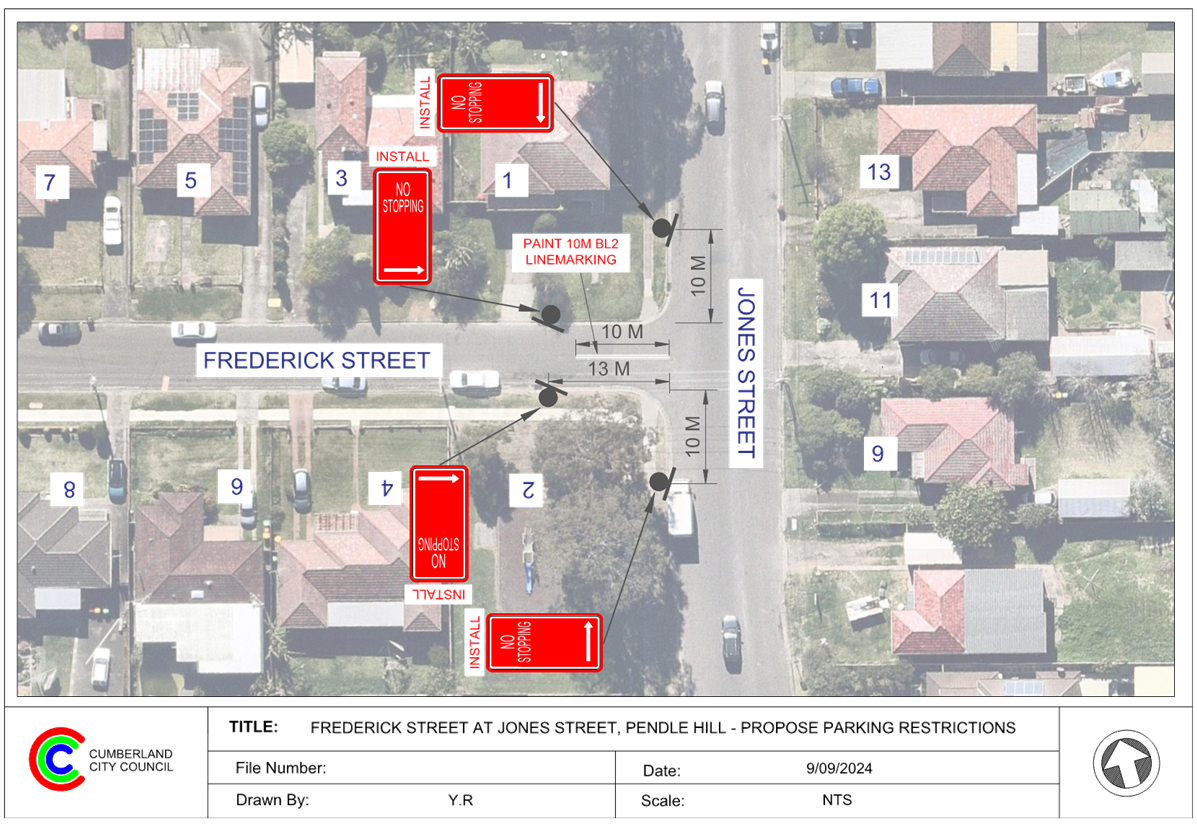
5 February 2025
Item No: CTC-25-007
BLAXCELL
STREET AND WELLS STREET, SOUTH GRANVILLE – PROPOSED ‘NO STOPPING’
RESTRICTIONS AND LINE MARKING
Directorate: Environment
and Planning
Responsible
Officer: Manager
Engineering and Building
Electorate: Granville
Police Area
Command (PAC): Cumberland
Agenda Part Part
1
Note: Recommended
for Approval under Delegated Authority
Council has received safety concerns from residents at the
intersection of Blaxcell Street and Wells Street, South Granville.
This report outlines the outcome of the investigation into
this matter.
The Traffic Committee recommends that:
1. The
installation of ‘No Stopping’ signs and ‘BL2’ line
marking at the intersection of Blaxcell Street and Wells Street, South
Granville in accordance with the attached plan be approved.
2. The
affected / concerned residents be notified of the outcome.
Blaxcell Street is a collector road that runs in a
north-south direction with a sign-posted speed limit of 50 km/h. It has a width
of approximately 12.6 m and parking is permitted on both sides of the road
unless otherwise signposted.
Wells Street is a local road that runs in an east-west
direction between Blaxcell Street and Clyde Street with a speed limit of 50
km/h. It has a width of approximately 10.4 m and parking is permitted on both
sides of the road unless otherwise signposted.
Blaxcell Street and Wells Street form a T-intersection with
priority to Blaxcell Street.
The map below shows the intersection.
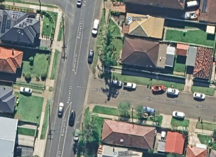
Locality Plan
The latest Centre for Road Safety accident data indicated
that there were no reported accidents related to parked vehicles or sight
distance at this intersection in the last 5 years ending September 2023.
A site inspection indicated that vehicles are parking within
10 metres at the intersection. It is proposed to install ‘No
Stopping’ restrictions and ‘BL2’ line marking at the
intersection. The signage and line marking would strengthen the Road Rules
requirement and stop vehicles from parking too close to the intersection.
The existing edge line marking on the eastern side of
Blaxcell Street near this intersection will also need to be adjusted to align
with the proposed No Stopping signs, ensuring clarity of the statutory No
Stopping area.
The proposal was notified to the
impacted and adjacent residents for a period of 14 days starting from 10
January 2025 to 24 January 2025.
There were no responses received.
1. Plan –
Blaxcell Street and Wells Street, South Granville – Proposed ‘No
Stopping’ Restrictions and BL2 Line Markings
DOCUMENTS
ASSOCIATED WITH
REPORT CTC-25-007
Attachment 1
Plan – Blaxcell Street and Wells Street, South
Granville – Proposed ‘No Stopping’ Restrictions and BL2 Line
Markings
5 February 2025
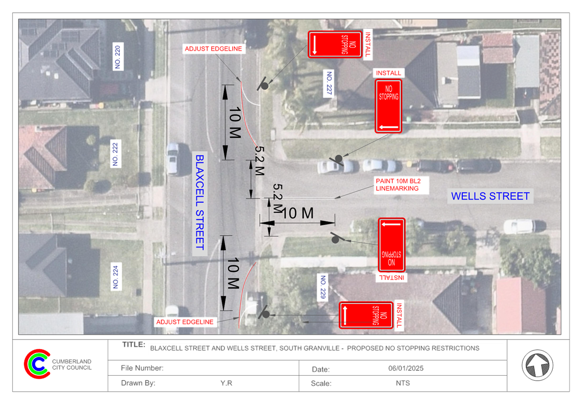
5 February 2025
Item No: CTC-25-008
FOWLER ROAD
AND O’CONNOR STREET, GUILDFORD – PROPOSED ‘NO STOPPING’
RESTRICTIONS AND LINE MARKING
Directorate: Environment
and Planning
Responsible
Officer: Manager
Engineering and Building
Electorate: Granville
Police Area
Command (PAC): Cumberland
Agenda Part Part
1
Note: Recommended
for Approval under Delegated Authority
Council has received safety concerns from residents at the
intersection of Fowler Road and O’Connor Street, Guildford.
This report outlines the outcome of the investigation into
this matter.
The Traffic Committee recommends that:
1. The
installation of ‘No Stopping’ signs and ‘BL2’ line
marking at the intersection of Fowler Road and O’Connor Street, Guildford
in accordance with the attached plan be approved.
2. The
affected / concerned residents be notified of the outcome.
Fowler Road is a regional road that runs in a north-south
direction connecting Merrylands Road and Dennistoun Avenue with a sign-posted
speed limit of 50 km/h. It has a width of approximately 12.6m and parking is
permitted on both sides of the road unless otherwise signposted.
O’Connor Street is a local road that runs in an
east-west direction between Fowler Road and Harris Street with a speed limit of
50 km/h. It has a width of approximately 10m and parking is permitted on both
sides of the road unless otherwise signposted.
Fowler Road and O’Connor Street form a T-intersection
with priority to Fowler Road.
The map below shows the intersection.
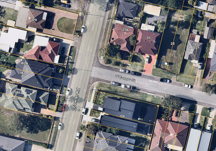
Locality Plan
The latest Centre for Road Safety accident data indicated
that there were no reported accidents at this intersection in the last 5 years
ending September 2023.
A site inspection indicated that
vehicles are parking within 10 metres at the intersection. It is proposed to
install ‘No Stopping’ restrictions and ‘BL2’ line
marking at the intersection. The signage and line marking would strengthen the
Road Rules requirement and stop vehicles from parking too close to the
intersection.
The proposal was notified to the
impacted and adjacent residents for a period of 14 days starting from 10
January 2025 to 24 January 2025.
There were no responses received.
1. Plan –
Fowler Road and O’Connor Street, Guildford – Proposed ‘No
Stopping’ Restrictions and BL2 Line Markings
DOCUMENTS
ASSOCIATED WITH
REPORT CTC-25-008
Attachment 1
Plan – Fowler Road and O’Connor Street,
Guildford – Proposed ‘No Stopping’ Restrictions and BL2 Line
Markings
5 February 2025
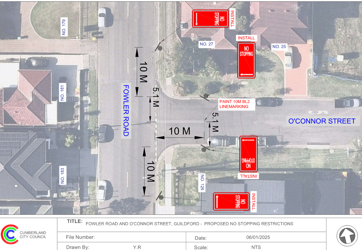
5 February 2025
Item No: CTC-25-009
CLUNIES ROSS
STREET, PEMULWUY – PROPOSED 'NO STOPPING' RESTRICITONS
Directorate: Environment
and Planning
Responsible
Officer: Manager
Engineering and Building
Electorate: Prospect
Police Area
Command (PAC): Cumberland
Agenda Part Part
1
Note: Recommended
for Approval under Delegated Authority
Council has received safety concerns from the Police
regarding heavy vehicles parking on the eastern side of Clunies Ross Street, outside
No.6-20.
This report outlines the outcome
of the investigation into this matter.
The Traffic Committee recommends that:
1. The
existing ‘No Stopping’ restrictions on the eastern side of Clunies
Ross Street, Pemulwuy outside No. 6-20 be extended 30m north in
accordance with the attached plan be approved.
2. The
affected/concerned residents/businesses be notified of the outcome.
Clunies Ross Street is a local road running
north–south with a speed limit of 50 km/h. The bend near No. 6-20 Clunies
Ross Street marks the boundary between Cumberland City Council and Blacktown
City Council. Areas north and west of the bend fall under Blacktown City
Council, while areas south and east are managed by Cumberland City Council.
The road is approximately 11 metres wide, with parking
permitted along certain sections on the eastern side. Currently, BL2 line
marking is in place between Wombat Street and the driveway of Nos. 6–20.
The map below shows the location.
Locality Plan
It is alleged that heavy vehicles are often parked too close
to the driveways of No 6-20 35 Clunies Ross Street, Pemulwuy. This parking
behaviour obstructs the view for drivers exiting the properties onto Clunies
Ross Street.
The latest Centre for Road
Safety accident data shows no reported accident at this section of Clunies Ross
Street in the last five years ending September 2023.
Council officers investigated the
issue and confirmed that heavy vehicles are being parked very close to the
driveways of Nos. 6–20 Clunies Ross Street. To enhance safety in this
area, it is proposed to extend the existing ‘No Stopping’
restrictions on the eastern side of the street outside Nos. 6–20 by
approximately 30 metres to the north.
Consultation is not required as
the matter was raised by NSW Police on behalf of the business located at Nos.
6–20, and no other residents or businesses will be affected.
1. Plan –
Clunies Ross Street, Pemulwuy – Proposed ‘No Stopping’ Signs
DOCUMENTS
ASSOCIATED WITH
REPORT CTC-25-009
Attachment 1
Plan – Clunies Ross Street, Pemulwuy –
Proposed ‘No Stopping’ Signs
5 February 2025
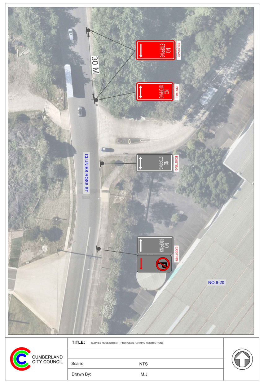
5 February 2025
Item No: CTC-25-010
RAILWAY
STREET, LIDCOMBE – PROPOSED ‘NO STOPPING’ RESTRICTIONS NEAR
EAST STREET INTERSECTION
Directorate: Environment
and Planning
Responsible
Officer: Manager
Engineering and Building
Electorate: Auburn
Police Area
Command (PAC): Auburn
Agenda Part Part
1
Note: Recommended
for Approval under Delegated Authority
Council has received a request from a resident for parking
restrictions at the intersection of Railway Street and East Street, Lidcombe.
This report outlines the outcome of the investigation into
this matter.
The Traffic Committee recommends that:
1. The
installation of ‘No Stopping’ signs on the north side of the
intersection of Railway Street and East Street, Lidcombe in accordance with the
attached plan be approved.
2. The
affected / concerned properties be notified of the outcome.
Railway Street runs in an east-west direction with a
sign-posted speed limit of 60 km/h. The available road widths vary from approximately
10.4 m to 16.4 m on either side of the roundabout at East Street and parking is
permitted on both sides of the road unless otherwise signposted.
East Street runs in a north-south direction between Railway
Street and Weeroona Road with a sign-posted speed limit of 60 km/h. It has a
width of approximately 12.7 m and parking is permitted on both sides of the
road unless otherwise signposted.
The section of Railway Street east of East Street and East
Street are regional roads pursuant to Roads Act 1993.
The map below shows the intersection.
Council has received a request from a resident for parking
restrictions at the intersection of Railway Street and East Street, Lidcombe.
A site inspection indicated that vehicles are parking at or
very close to this intersection. It is proposed to install ‘No
Stopping’ restrictions on the northern side of Railway Street at the
intersection. Vehicles parking near the intersection will narrow the roadway
below the required width for vehicles to drive through. The attached plan
details the proposed ‘No Stopping’ restrictions. There are existing
‘No Stopping’ restrictions on the southern side of Railway Street
at both sides of the roundabout.
Site inspections indicated that
the line marking at and on the approaches to the roundabout has faded and
requires re-painting and this work will be undertaken under maintenance.
Consultation has not been
undertaken as the adjacent property (on the northern side of Railway Street) is
Sydney Trains property and normally parked by commuters.
1. Plan –
Railway Street and East Street, Lidcombe – Proposed ‘No
Stopping’ Restrictions
DOCUMENTS
ASSOCIATED WITH
REPORT CTC-25-010
Attachment 1
Plan – Railway Street and East Street, Lidcombe
– Proposed ‘No Stopping’ Restrictions
5 February 2025
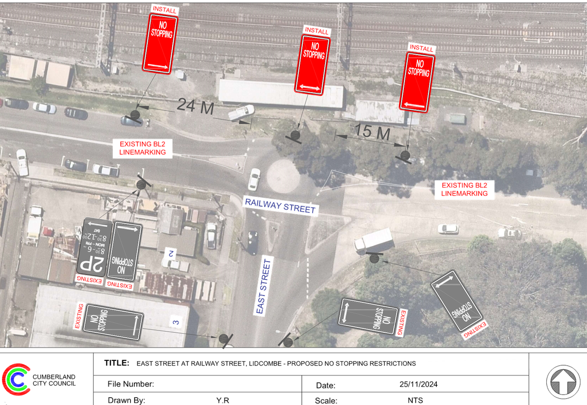
5 February 2025
Item No: CTC-25-011
CONDOIN LANE,
PEMULWUY – REQUEST FOR REMOVAL OF 'NO STOPPING' SIGNAGE
Directorate: Environment
and Planning
Responsible
Officer: Manager
Engineering and Building
Electorate: Prospect
Police Area
Command (PAC): Cumberland
Agenda Part Part
1
Note: Recommended
for Approval under Delegated Authority
Council has received requests from
a local resident regarding the newly installed parking restrictions on Condoin
Lane, Pemulwuy due to the lack of parking spaces available in the area.
This report outlines the outcome
of the further investigation and consultation into this matter.
The Traffic Committee recommends that:
1. The
existing 'No Stopping’ and ‘No Parking’ signage on the
eastern side of Condoin Lane, Pemulwuy be modified in accordance with the
attached plan.
2. The
affected /concerned residents be notified of the outcome.
Cumberland Traffic Committee
(CTC) at its meeting in February and November 2024 considered two reports
(CTC-24-020 and CTC-24-178) regarding the installation of ‘No
Stopping’ and ‘No Parking’ signage on Condoin Lane, Pemulwuy.
The Traffic committee recommended as follows:
CTC-24-020, February 2024
1. The
existing 'No Stopping’ signage on the eastern side of Condoin Lane be
partially removed in accordance with the attached plan subject to the
consultation with the residents of No.27-31.
2. The
existing 'No Stopping’ signage on the western side of Condoin Lane be
replaced with ‘No Parking’ signage in accordance with the attached
plan.
3. The affected /concerned residents be notified of the outcome.
CTC-24-178, November 2024
1. Further consultation be undertaken with the residents where representations
were made and further report will be provided to the Traffic Committee.
2. The affected /concerned residents be notified of the outcome.
As per
the Traffic Committee recommendation, Council officers have contacted the
residents where representations were made. While
there are different views, Council officers consider that the arrangement is
sufficient to cater for most vehicles whilst still maintaining appropriate
access to the respective garages. The residents were advised Council will
proceed with the proposal for Traffic Committee consideration and will continue
to monitor the area.
As per the Traffic Committee
recommendation, Council officers have contacted the residents where
representations were made. Further information is provided in the report.
1. Plan –
Condoin Lane, Pemulwuy
2. Previous
Report CTC-24-178
3. Traffic
Committee Minutes CTC-24-178
DOCUMENTS
ASSOCIATED WITH
REPORT CTC-25-011
Attachment 1
Plan – Condoin Lane, Pemulwuy
5 February 2025
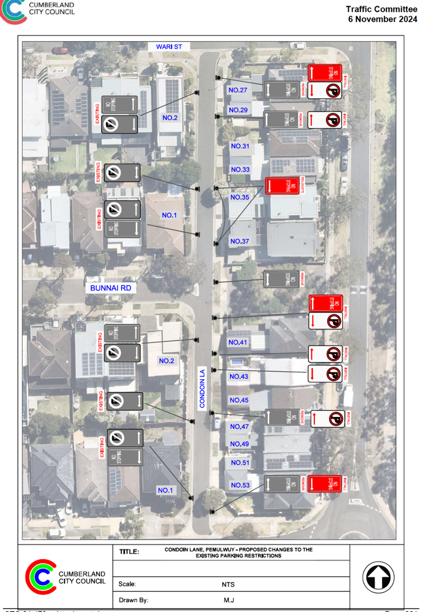
DOCUMENTS
ASSOCIATED WITH
REPORT CTC-25-011
Attachment 2
Previous Report CTC-24-178
DOCUMENTS
ASSOCIATED WITH
REPORT CTC-25-011
Attachment 3
Traffic Committee Minutes CTC-24-178
5 February 2025
5 February 2025
Item No: CTC-25-012
MONA STREET,
SOUTH GRANVILLE – PARKING RESTRICTION MODIFICATION
Directorate: Environment
and Planning
Responsible
Officer: Manager
Engineering and Building
Electorate: Granville
Police Area
Command (PAC): Cumberland
Agenda Part Part
1
Note: Recommended
for Approval under Delegated Authority
Council has received a request from a resident to review the
existing parking restrictions on the southern side of Mona Street, South
Granville near Clyde Street to improve traffic flow.
This report outlines the outcome of the investigation into
this matter and recommendations.
The Traffic Committee
recommends that:
1. Replace
the existing ‘No Parking, 2:30pm - 6:30pm, Mon – Fri’ on the
southern side of Mona Street between No. 150 to No.172 to ‘No Parking,
7am – 9:30am, 2:30pm – 6:30pm, Mon – Fri’ as per
attached plan.
2. Install
a 27m Bus Zone at the existing bus stop on the southern side of Mona Street
near No. 172 as per attached plan.
3. The
affected/concerned residents be notified of the outcome.
Mona Street is a local road that runs in an east-west
direction. Mona Street has a speed limit of 50 km/h. It has approximately 1.3km
in length and approximately 12.6m in width. Parking is permitted on both sides
of the road unless otherwise signposted.
The interested section is the southern side of Mona Street
near Clyde Street between No. 142 to No.172. The intersection of Mona Street
and Clyde Street is a signalised intersection. The westbound traffic has two
marked travel lanes and on the approach to the signalised intersection there
are existing ‘No parking, 2:30pm - 6:30pm, Mon – Fri’ parking
restrictions for a length of approximately 170m.
The map below shows the area:


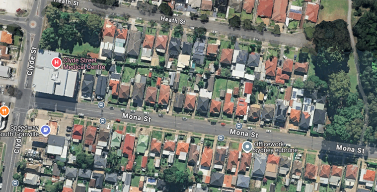
The resident alleges that there were significant delays for the
westbound traffic during the morning peak period at the signalised
intersection, caused by parked vehicles at this section of the road.
An investigation found that when vehicles are parked on the
southern side of Mona Street near Clyde Street, they do restrict access for
drivers attempting to use the left lane during the morning peak period. This
subsequently increases travel time and queuing at the intersection.
Council consulted with the affected and nearby
residents. A total of 21 letters with an attached survey form and a plan
were distributed to the nearby residents/owners.
The proposal was to extend the current afternoon 'No
Parking' restriction to include the morning peak, resulting in 'No Parking, 7am
– 9:30am, 2:30pm – 6:30pm, Mon – Fri.
Council received 4 responses (19% of the letters sent) by
the closing date. Of these, 2 (50%) supported the proposal, while 2 (50%)
objected.
The objection noted that there has been no change in traffic
conditions on this section of Mona Street since 2016. It also mentioned that a
similar proposal was reviewed and rejected by the City of Parramatta Council in
2016.
Given the frequent concerns raised by residents and the
community in recent years, and that no responses were received from most
properties covered by the consultation, it is proposed to add a morning peak
parking restriction to the existing afternoon ‘No Parking’
restriction, creating a combined ‘No Parking, 7am – 9:30am, 2:30pm
– 6:30pm, Mon – Fri.’ This would improve traffic flow for
westbound vehicles at the signalised intersection and provide a wider community
benefit.
Additionally, it is also proposed to install ‘Bus
Zone’ signage at the existing bus stop in front of No. 170 to reinforce
the NSW Road Rules as shown in the attached plan.
The proposal was notified to the
impacted/ concerned residents for a period of 14 days starting from 27 June to
15 July 2024.
There were 4 responses received,
with 2 in support and 2 objections to the proposal.
1. Plan – Mona
Street, South Granville – Proposed Parking Restriction Change
2. Submissions
DOCUMENTS
ASSOCIATED WITH
REPORT CTC-25-012
Attachment 1
Plan – Mona Street, South Granville –
Proposed Parking Restriction Change
5 February 2025
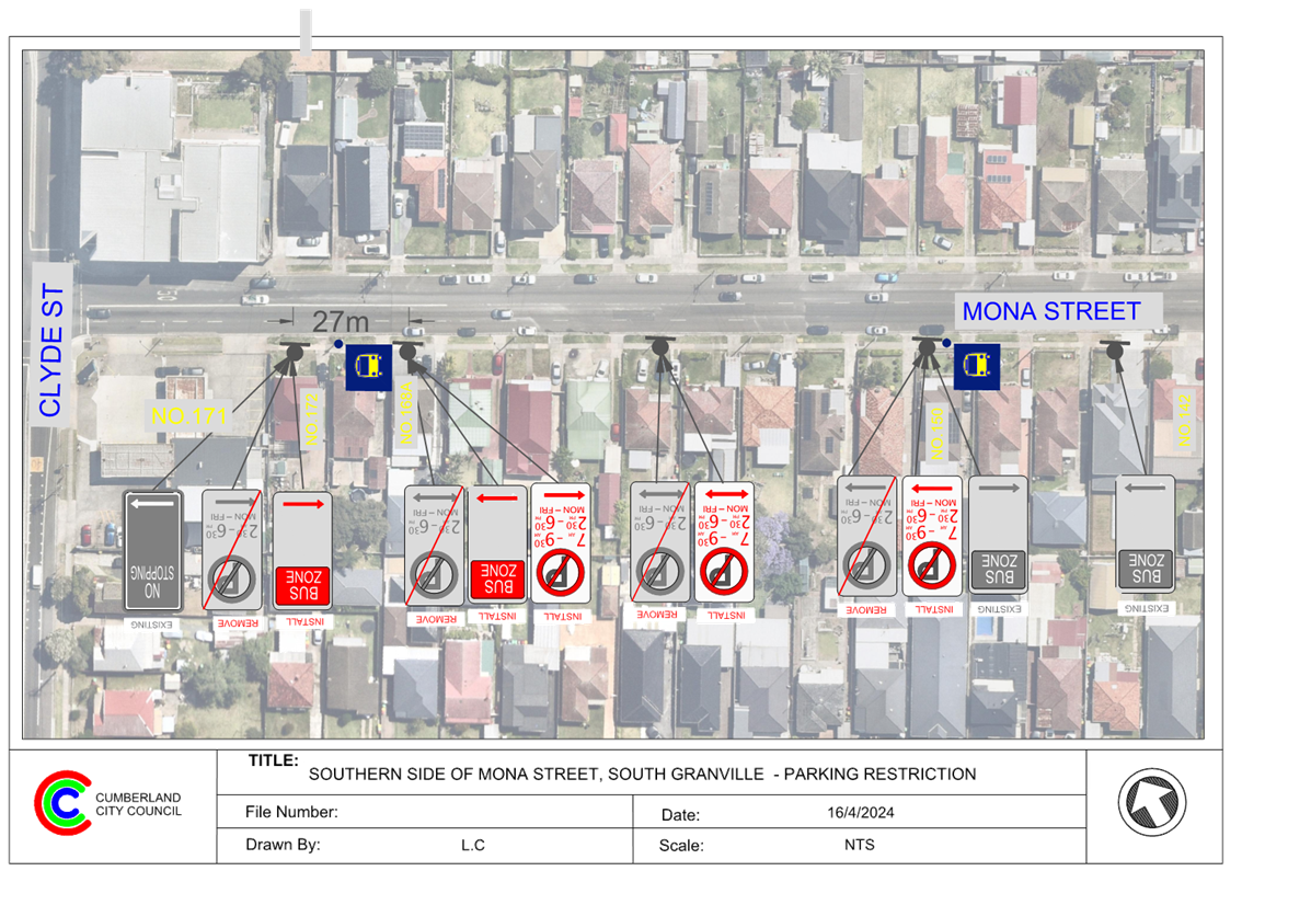
DOCUMENTS
ASSOCIATED WITH
REPORT CTC-25-012
Attachment 2
Submissions
5 February 2025
Item No: CTC-25-013
OLD PROSPECT
ROAD AND GRAFTON STEET, GREYSTANES – PROPOSED GIVEWAY SIGNAGE AND LINE
MARKING
Directorate: Environment
and Planning
Responsible
Officer: Manager
Engineering and Building
Electorate: Prospect
Police Area
Command (PAC): Cumberland
Agenda Part Part
1
Note: Recommended
for Approval under Delegated Authority
This report provides a response to
Council’s Notice of Motion – Intersection
of Grafton Street and Old Prospect Rd, Greystanes, as resolved at the
Ordinary Meeting of Council on 13 November 2024 (Min.842 C11/24-29).
This report outlines the outcome of the investigation into
this matter.
The Traffic Committee
recommends that:
1. The
installation of ‘Give Way’ signage and line marking at the
intersection of Old Prospect Road and Grafton Street, Greystanes in accordance
with the attached plan be approved.
2. The
affected / concerned residents be notified of the outcome.
Old Prospect Road is a Collector Road that runs in an
east-west direction with a speed limit of 50 km/h. It has a width of
approximately 12m and parking is permitted on both sides of the road unless
signposted. ‘BB’ centre lines are marked in Old Prospect Road.
Grafton Street runs in a north – south direction with
a speed limit of 50 km/h. It has a width of approximately 7.5m and parking is
permitted on both sides of the road in accordance with Road Rules unless
otherwise signposted.
Old Prospect Road and Grafton Street form a T-intersection.
The intersection does not have a ‘Give Way’ sign; however, default
priority applies with Old Prospect Road having priority.
The map below shows the intersection:
Locality Plan
Council has received several requests from residents
regarding the provision of give way control at the intersection of Old Prospect
Road and Grafton Street.
Council, at a meeting held on 13
November 2024, resolved on a Notice of Motion – ‘Intersection of Grafton Street and Old Prospect Rd,
Greystanes’ and resolved the following;
1. Council
resolves to investigate the implementation of a Stop sign at the intersection
of Grafton St and Old Prospect Rd Greystanes.
2. Refer
the matter to the Traffic Committee for consideration at the next meeting.
3. The
appropriate budget be identified as part of the above report.
The latest Centre for Road Safety accident data indicates
that there were no reported accidents at this intersection in the past five
years ending September 2023. However, a resident has reported a recent accident
at this location, which occurred due to a vehicle failing to slow down and give
way at the intersection.
Based on Australian Standard AS 1742.2-2022 – Part
2: Traffic Control Devices for General Use, controls are required at all
non-signalised intersections in the following manner:
a) GIVE
WAY signs shall be provided at all intersections with four or more legs.
b) GIVE
WAY signs shall be provided at any three-way intersections where the layout is
such that it is not clear how or whether the T-intersection rule would operate,
for example, at a Y-intersection.
c) GIVE
WAY signs should be used for road safety reasons at unsignalised
T-intersections in both rural and urban areas where the major road is an
arterial or collector type road.
d) STOP
signs shall be provided instead of GIVE WAY signs at items (a), (b) and (c) on
any controlled approach where intersection sight distance is limited by a
permanent obstruction as determined in accordance with Clause 2.5.3. Stop signs
shall not be used where intersection sight distance is adequate for GIVE WAY
signs.
Based on these requirements, a ‘Stop’ sign is
not warranted at this location, as the sight distance for vehicles turning from
Grafton Street onto Old Prospect Road is not limited. However, in accordance
with warrant (c) of AS1742.2 – Part 2 and considering the recent
accident, the provision of ‘Give Way’ signage and associated line
marking can be considered at this intersection.
To improve the safety of the intersection and ensure
compliance with the Australian Standard, it is recommended that a ‘Give
Way’ sign with associated line marking be installed in Grafton Street at
the intersection of Old Prospect Road.
Consultation is not required as
the proposed 'Give Way' signage and line marking will not directly impact
nearby residents.
1. Plan –
Grafton Street at Old Prospect Road, Greystanes – Proposed Give Way
Signage and Line Marking
DOCUMENTS
ASSOCIATED WITH
REPORT CTC-25-013
Attachment 1
Plan – Grafton Street at Old Prospect Road,
Greystanes – Proposed Give Way Signage and Line Marking
5 February 2025
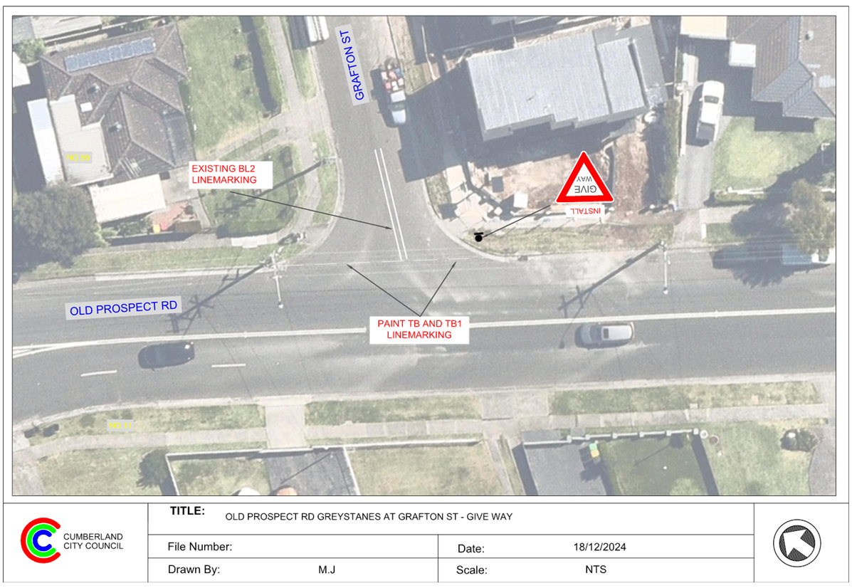
5 February 2025
Item No: CTC-25-014
RAWSON STREET,
AUBURN AT DARTBROOK ROAD – REQUEST FOR ‘KEEP CLEAR’ LINE
MARKING
Directorate: Environment
and Planning
Responsible
Officer: Manager
Engineering and Building
Electorate: Auburn
Police Area
Command (PAC): Auburn
Agenda Part Part
1
Note: Recommended
for Approval under Delegated Authority
Council has previously received
requests from Auburn Gallipoli Mosque and others for the installation of
‘Keep Clear’ pavement markings on Rawson Street, Auburn at the
intersection of Dartbrook Road.
This report outlines the outcome
of the investigation into this matter.
That the Traffic Committee
recommends that the installation of ‘Keep Clear’ pavement marking
at the intersection of Rawson Road and Dartbrook Road, Auburn in accordance
with the attached plan be approved.
Rawson Street
is a regional road that runs in an east-west direction between St Hilliers Road
and Parramatta Road. The speed limit in the Rawson Street section between
Karrabah Road and St Hilliers Road is 50km/h. This section of Rawson Street has
a width of approximately 12m with parking restrictions on both sides of the
road.
There is also
part time ‘No Stopping’ signs installed on the northern side of
Rawson Street between the full time ‘No Stopping’ zones at the
traffic signals at St Hilliers Road and Station Street.
Dartbrook Road
is a local road that runs in a north-south direction with a speed limit of
50km/h. It has a width of approximately 12m and parking is permitted on both
sides of the road unless signposted.
Rawson Street
and Dartbrook Road form a four-way intersection with priority to Rawson Street.
The intersection is approximately 125-130m from the signalised intersections of
Rawson Street / Station Road and Rawson Street / St Hilliers Road.
Dartbrook Road
north of Rawson Street has left / left out control at Rawson Street. Rawson
Street already has ‘Do Not Queue Across Intersection’ signs
installed on the southern approach at the intersection with Dartbrook Road
which is proving ineffective.
Council has previously received
requests from Auburn Gallipoli Mosque and worshippers to install ‘Keep
Clear’ on the pavement at the intersection of Rawson Street and Dartbrook
Road to prevent vehicles queuing across the intersection at peak times.
This
intersection is the only available right turn movement into the precinct from
Rawson Street. The only other option to access the precinct is to turn at the
Station Road / Rawson Street traffic signals. This signal does not provide
sufficient time for right turning vehicles and as such entry is typically
split.
Cumberland
Traffic Committee considered a report regarding a request to provide
‘Keep Clear’ pavement marking at its meeting on 1 June 2022 and
recommended that the installation of ‘Keep Clear’ pavement
marking at the intersection of Rawson Street and Dartbrook Road, Auburn not be
approved and to request Auburn Police Area Command to monitor the location
during peak periods.
In accordance
with the NSW Road Rules, it is illegal to queue across an intersection.
‘Keep Clear’ Pavement markings are generally used outside Ambulance
and Fire Brigade driveways and critical intersections close to signalised
intersection where vehicles queuing to right turn into side roads might result
in interfering with the performance of the signalised intersection.
Due to the
queue length at this section of Rawson Street, there is minimum opportunity
(gap) available to turn right into Dartbrook Road from Rawson Street. This is
likely to result an impact on the performance of both signalised intersections
near Dartbrook Road.
Council has now received further
requests to provide the pavement marking following a crash that occurred in
November 2024.
Following the continued concerns
from the community, Council ordered video recording of the intersection for
queue analysis. Based on the video data, it was observed that the intersection
of Dartbrook Road and Rawson Street was blocked 17 and 26 times during the
morning and evening peak hours on a typical day. It was also observed the
intersection was blocked several times during other times.
This issue was raised with
Transport for NSW again. Following discussions, TfNSW indicated that in view of
the queuing that occurs in Rawson Street, they would consider providing
‘Keep Clear’ marking on half the road (the left half of Dartbrook
Road) as shown in the attached plan.
Consultation
was not undertaken as it does not impact on any property. However, initial
consultation was undertaken with Transport for NSW
to determine if the proposal could be supported.
1. Plan - Proposed
'Keep Clear' Pavement Marking on Rawson Street, Auburn
2. Previous
Report - CTC-22-086
3. Previous
Minutes - CTC-22-086
DOCUMENTS
ASSOCIATED WITH
REPORT CTC-25-014
Attachment 1
Plan - Proposed 'Keep Clear' Pavement Marking on
Rawson Street, Auburn
5 February 2025
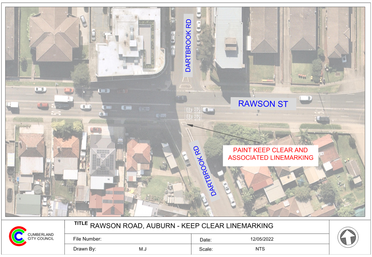
DOCUMENTS
ASSOCIATED WITH
REPORT CTC-25-014
Attachment 2
Previous Report - CTC-22-086
DOCUMENTS
ASSOCIATED WITH
REPORT CTC-25-014
Attachment 3
Previous Minutes - CTC-22-086
5 February 2025
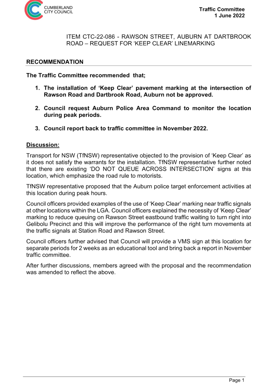
5 February 2025
Item No: CTC-25-015
WALLACE STREET
AND WARATAH STREET AT UNION STREET, GRANVILLE – PROPOSED PARKING SIGNAGE
AND LINE MARKING
Directorate: Environment
and Planning
Responsible
Officer: Manager
Engineering and Building
Electorate: Granville
Police Area
Command (PAC): Cumberland
Agenda Part Part
1
Note: Recommended
for Approval under Delegated Authority
Council has received safety concerns from residents in Union
Street at the intersection of Wallace Street and Waratah Street, Granville.
This report outlines the outcome of the investigation into
this matter.
The Traffic Committee recommends that:
1. The
installation of ‘No Stopping’ signage and BL2 linemarking on
Wallace Street and Waratah Street at their intersection with Union Street in
accordance with attached plan be approved.
2. The
affected / concerned residents be notified of the outcome.
Cumberland Traffic Committee
(CTC) at its meeting in November 2024 considered a report (CTC-24-180)
regarding road safety concerns on Union Street at the intersection of Wallace
Street and Waratah Street, Granville. Council resolved the following:
1. The
installation ‘No Stopping’ restrictions and ‘BL2’
linemarking at the intersection of Union Street and Wallace Street/Waratah
Street in accordance with the attached plan be supported in principle.
2. Council notify concerned/ affected residents and report back
to the Traffic Committee if objections are received.
In accordance with the council
resolution, Council distributed 24 letters to the affected residents in October
2024 and received one support and three objections based on the high entrance
speed due to the proposed signage.
It is important to note that the proposed parking
restrictions are provided to reinforce existing road rules. No on-street
parking spaces will be removed. Therefore, it is recommended that the proposed
signage and line marking be supported.
The proposal was notified to the
impacted and adjacent residents for a period of 14 days starting from 21
November 2024 to 5 December 2024.
Council distributed 24
consultation letters and received one support and three objections based on the
high entrance speed due to the proposed signage.
1. Plan – Union
Street, Granville – Proposed Intersection Treatment
2. Submissions
DOCUMENTS
ASSOCIATED WITH
REPORT CTC-25-015
Attachment 1
Plan – Union Street, Granville – Proposed
Intersection Treatment
5 February 2025
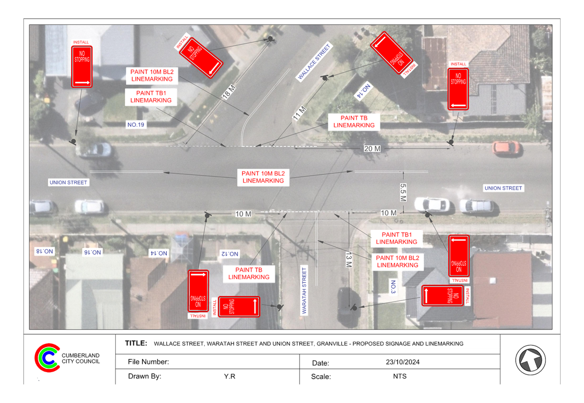
DOCUMENTS
ASSOCIATED WITH
REPORT CTC-25-015
Attachment 2
Submissions
5 February 2025
Item No: CTC-25-016
MCLEOD ROAD /
DRESSLER COURT , HOLROYD / MERRYLANDS – REQUEST FOR TIMED PARKING
IN THE INDENTED PARKING AREA
Directorate: Environment
and Planning
Responsible
Officer: Manager
Engineering and Building
Electorate: Granville
Police Area
Command (PAC): Cumberland
Agenda Part Part
1
Note: Recommended
for Approval under Delegated Authority
Council has received requests
concerning the existing indented parking area on Dressler Court/McLeod Road,
Holroyd/Merrylands near Pitt Street due to the limited availability of parking
in the area.
This report outlines the outcome
of the investigation and consultation into this matter.
The Traffic Committee recommends that:
1. The
installation of ‘1P, 8:30am-6pm, Mon - Fri and 8:30am – 12.30pm,
Sat’ on the western end of McLeod Road, Holroyd/Merrylands be supported
as per the plan attached.
2. The
affected /concerned residents be notified of the outcome.
McLeod Road is a local road,
with its western section running east-west and its eastern section running
north-south. The road intersects with Dressler Court approximately midway and
is occasionally referred to as part of Dressler Court due to the area's
development patterns. Its western end connects to Pitt Street, while the
eastern end connects to Neil Street.
The road has a default speed
limit of 50 km/h and a width of approximately 8.5 metres. Indented parking bays
are located in the western and middle sections of McLeod Road, some of them
currently have part-time one hour parking restrictions.
Locality
Map
McLeod Road is situated
approximately 400 metres from Merrylands train station. Recently, Council
received a complaint from residents regarding low vehicle turnover rates and
inconsistent parking signage along McLeod Road.
In response, Council consulted
the affected residents of McLeod Road in November 2024 regarding a proposal to
install consistent parking restrictions of ‘1P, 8:30 am–6 pm,
Mon–Fri and 8:30 am–12:30 pm, Sat’. No responses were
received from the residents.
As no objections received from
the residents, it is recommended that the installation of ‘1P,
8:30am-6pm, Mon - Fri and 8:30am – 12.30pm, Sat’ in McLeod Road as
per the attached plan be supported.
The proposal was notified to the
impacted resident for a period of 14 days from 25 November 2024 to 11 December
2024.
A total of 76 letters were
distributed to the residents / owners with an attached survey form. There was
no response received.
1. Plan –
Proposed 1P Timed Parking in McLeod Road, Holroyd / Merrylands
DOCUMENTS
ASSOCIATED WITH
REPORT CTC-25-016
Attachment 1
Plan – Proposed 1P Timed Parking in McLeod Road,
Holroyd / Merrylands
5 February 2025
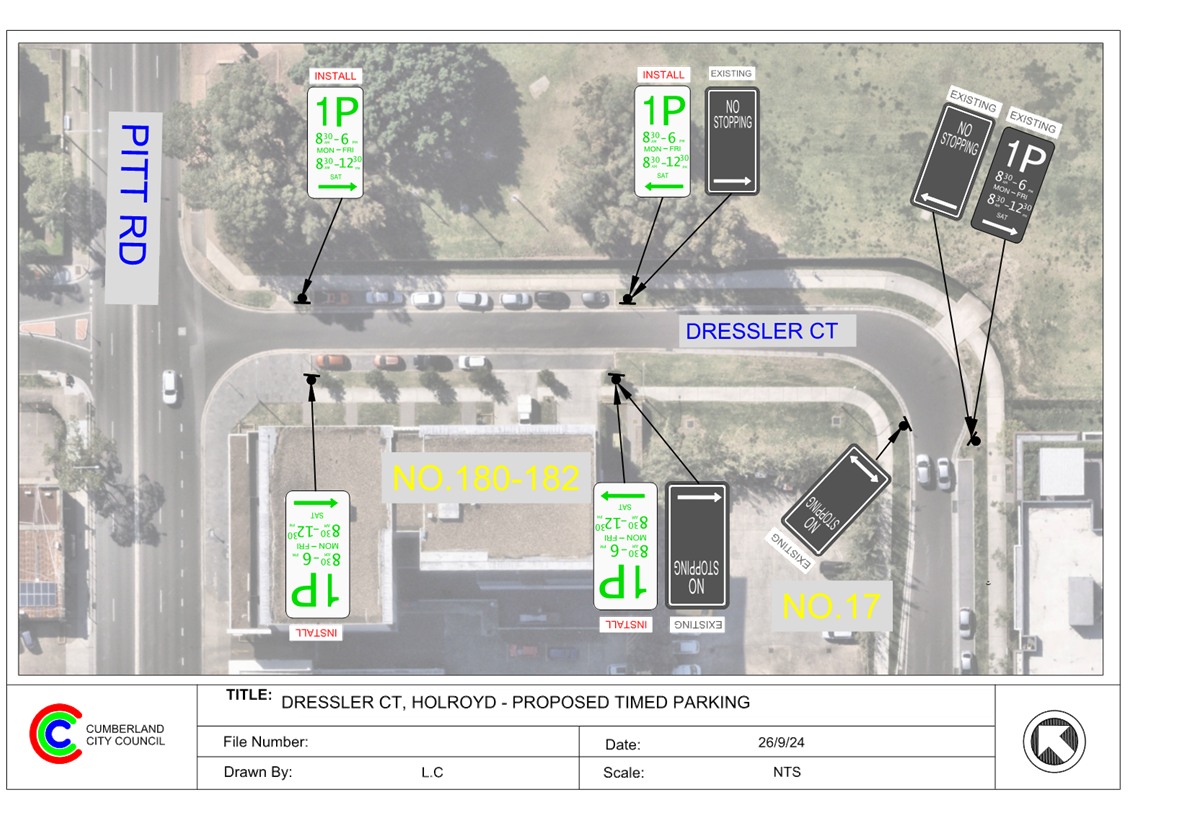
5 February 2025
Item No: CTC-25-017
MAGOWAR ROAD,
GIRRAWEEN - TIMED PARKING CONSULTATION
Directorate: Environment
and Planning
Responsible
Officer: Manager
Engineering and Building
Electorate: Prospect
Police Area
Command (PAC): Cumberland
Agenda Part Part
1
Note: Recommended
for Approval under Delegated Authority
Council has received concerns from
local residents and businesses regarding parking issues encountered by the
residents in Magowar Road residential section west of Girraween Road.
This report outlines the outcome
of the review.
The Traffic Committee
recommends that:
1. Two
Hour (2P) time limited parking signs be installed in Magowar Road, west of Girraween
Road, Girraween in accordance with the attached plan be approved.
2. Council
notify affected/ concerned residents of the outcome.
Council has received concerns
from residents and businesses regarding parking issues encountered by the
residents in Magowar Road residential section west of Girraween Road. They have
requested Council to consider installation of time limited parking in the
section.
Cumberland Traffic Committee
(CTC) at its meeting in June 2024 considered a report (CTC-24-118) regarding
proposed time limited parking restrictions in a section of Magowar Road,
approximately 260m west from Girraween Road. Council resolved that:
1. Council undertake further consultation with the residents
directly impacted by the proposed parking restrictions and report back to
traffic committee if objections are received.
2. Council notify concerned resident of the outcome.
In accordance with the
recommendation, consultation was carried out with the residents in the
interested section of Magowar Road in October 2024. A total of 19 letters with
an attached survey form were distributed to the residents/ owners. The
following options were listed in the survey form:
Option 1:
I support the installation of
time limited parking in the residential section of Magowar Road west of
Girraween Road with Two hours time limited parking (2P) - Monday to Friday
6am-6pm.
Option 2:
I support the installation of
time limited parking in the residential section of Magowar Road west of
Girraween Road with Four hours time limited parking (4P) - Monday to Friday
6am-6pm.
Option 3:
I do not support any parking
changes in the residential section of Magowar
Road.
Council received 7 responses
(37% of the total letters sent) by the closing date, the survey result is
summarised in the table below.
|
|
Option
1
2P
Timed Parking
|
Option
2
4P
Timed Parking
|
Option
3
Object
to the proposal
|
Total
|
|
No
of response
|
3
|
0
|
4
|
7
|
|
Percentage
|
42.9%
|
0%
|
57.1%
|
100%
|
Out of the seven responses
received, there were two responses that raised the concerns about transferring
the on-street parking problem from one location to further down the street.
Based on the responses, Council
have amended the scheme to reduce the extent of the proposal and not impact the
properties objecting to the ‘2P’ parking restrictions.
The proposal was notified to the
impacted resident for a period of 14 days from 8 October 2024 to 22 October
2024.
A total of 19 letters were
distributed with an attached survey form and a plan to the residents / owners.
There were 7 responses (37% of the total letters sent) received by the closing
date, 3 responses (42.9%) were in support of the 2P parking restrictions, 0
responses (0%) were in support of the 4P parking restrictions and 4 responses
(57.1%) objected to the proposal.
1. Plan - Magowar
Road, Greystanes - Timed Parking - Amended Plan
2. Previous
Report - CTC-24-118 - Magowar Road
3. Submissions
DOCUMENTS
ASSOCIATED WITH
REPORT CTC-25-017
Attachment 1
Plan - Magowar Road, Greystanes - Timed Parking -
Amended Plan
5 February 2025
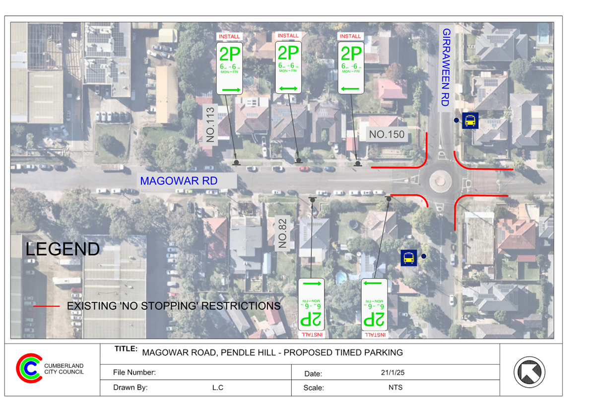
DOCUMENTS
ASSOCIATED WITH
REPORT CTC-25-017
Attachment 2
Previous Report - CTC-24-118 - Magowar Road
DOCUMENTS
ASSOCIATED WITH
REPORT CTC-25-017
Attachment 3
Submissions
5 February 2025
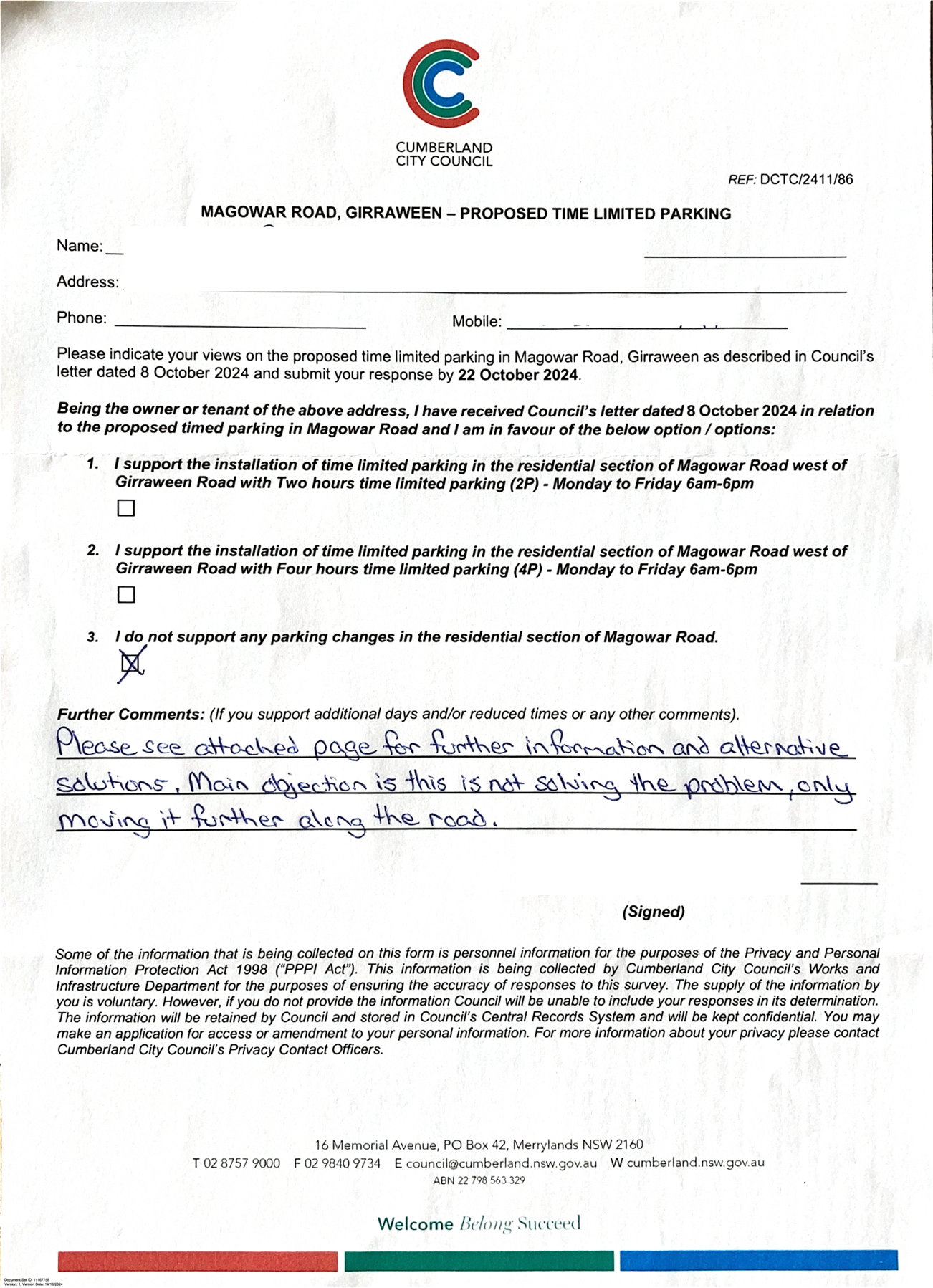
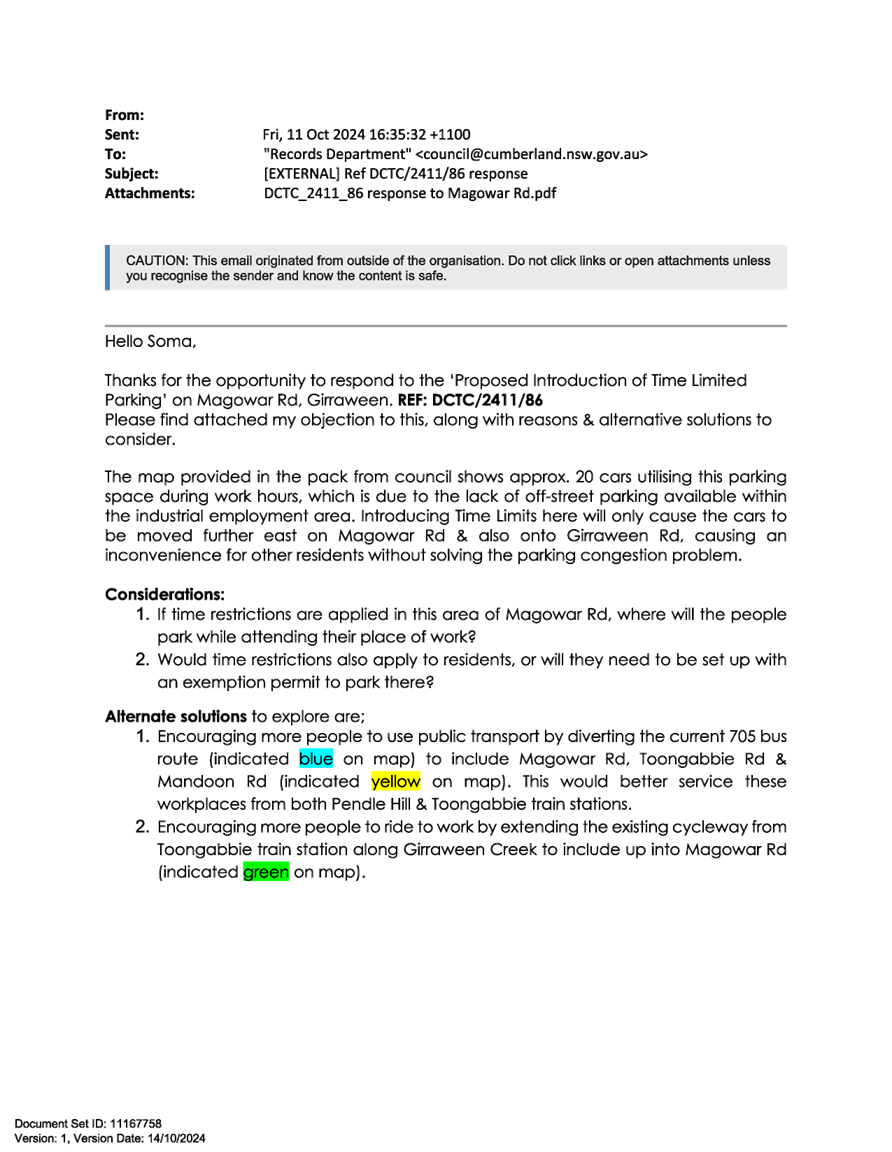
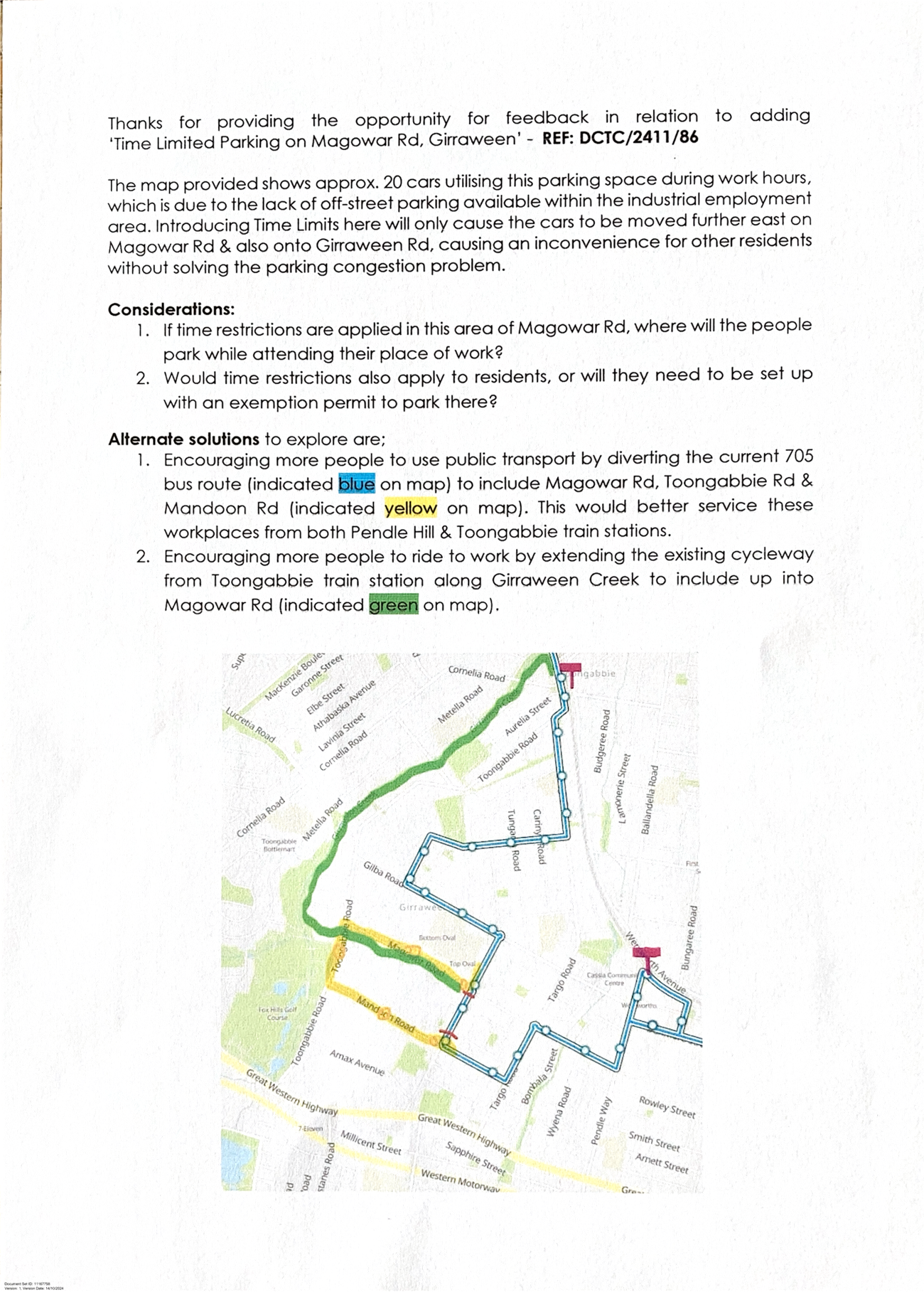
5 February 2025
Item No: CTC-25-018
JONES STREET,
WENTWORTHVILLE – ROAD SAFETY CONCERNS – CONSULTATION RESULT
Directorate: Environment
and Planning
Responsible
Officer: Manager
Engineering and Building
Electorate: Prospect
Police Area
Command (PAC): Cumberland
Agenda Part Part
1
Note: Recommended
for Approval under Delegated Authority
Council has received a request
from a local resident for the installation of speed humps on Jones Street,
Wentworthville due to speeding concerns.
This report outlines the outcome
of the investigation into this matter.
The Cumberland Traffic Committee recommends that:
1. Council
install ‘BL2’ centre line marking and ‘EL1’ Edge Line
marking in Jones Street, Wentworthville in accordance with the attached plans.
2. Council
notify the concerned residents of the outcome.
Jones Street is a local road
that runs in a north - south direction between Great Western Highway and
Stapleton Street with a posted speed limit of 50 km/h. It has a width of
approximately 12.5m and parking is permitted on both sides of the road unless signposted.
The northern side of Jones
Street is an industrial area, while the southern side is predominantly
residential.
Council has received concerns
from a local resident regarding road safety on Jones Street, Wentworthville.
The matter was investigated and
reported to Cumberland Traffic Committee (CTC) in the past. A summary of the
report and recommendations are listed below:
Background
1 February 2023:
CTC considered a report
(CTC-23-024) regarding the road safety concerns on Jones Street and recommended
that:
1. Council review
traffic count data on Jones Street, Wentworthville and report back to the
Traffic Committee in June 2023.
2. Council request
Cumberland Police Area Command to undertake speed surveillance in Jones Street,
Wentworthville.
2 August 2023:
In accordance with the
recommendation, Council reviewed the traffic count data and reported to the
August CTC 2023 (CTC-23-127). Traffic Committee recommended that:
The Traffic
Committee recommends that Council undertake consultation with the residents of
Jones Street, Wentworthville to assess support or otherwise of resident for
installation of traffic calming devices in the street and report back to the
Traffic Committee.
3 April 2024:
Following the CTC recommendation
in August 2023, Council undertook consultation with the residents of Jones
Street and reported to CTC in April 2024 (CTC-24-081). The Cumberland Traffic
Committee recommended:
1. Council prepare design of speed humps, undertake consultation
with the directly affected and adjacent residents and report back to Traffic
Committee.
2. Council notify the concerned residents of the outcome.
In accordance with the
recommendation, consultation was carried out with the residents in Jones Street
in November 2024. A total of 32 letters with an attached survey form and a plan
were distributed to the affected residents/ owners.
Council received 7 responses
including one response from the same address (22% of the total letters sent) by
the closing date, 2 (28.6%) supported the proposed speed humps, and 5 (71.4%)
opposed to the proposal.
The survey results showed that
the majority of respondents opposed the proposed speed humps, primarily due to
concerns about trucks driving over the proposed speed humps and generating
noises.
Previous traffic count data recorded an 85th percentile
speed of 60.5 km/h on Jones Street. The street has a daily traffic volume of
5,730 vehicles, a pavement width of 12.5 meters, and a centreline marking (BL2)
between Dunmore Street and Smith Street.
Since the majority of respondents have rejected the speed
hump proposal, Council officers have investigated line marking options in Jones
Street instead of speed humps.
As per ‘Transport for NSW Delineation and Pavement
Marking Standard’, the installation of Dividing Line Marking is
warranted:
· Where AADT is
greater than 2,500 vehicles on urban roads.
· Pavement width is
greater than 5.5m.
Additionally, Barrier Line (BL2)
Centre Line Marking instead of dividing lines is warranted:
· Where
there is limited overtaking sight distances due to vertical/ horizontal curves
· Where
a hazardous condition exists.
Edge lines (EL1) are used:
· Where
dividing lines or lane lines are present
· Where
the pavement width is greater than 6.8 m.
As the street meets the warrant
for BL2 and EL1 line marking, it is proposed to install edge line markings to
enhance driver safety within the carriageway and centre line markings for the
unmarked section of Jones Street.
The speed hump proposal was
notified to the impacted residents for a period of 14 days from 25 November 2024
to 11 December 2024. A total of 32 letters were distributed to the residents /
owners with an attached survey form and a plan.
Council received 7 responses (22%
of the total letters sent) by the closing date, two (2) supporting the proposed
speed humps and five (5) objecting to the proposal.
1. Plan – Jones
Street, Wentworthville - Proposed BL2 and EL1 Line Marking
2. Submissions
DOCUMENTS
ASSOCIATED WITH
REPORT CTC-25-018
Attachment 1
Plan – Jones Street, Wentworthville - Proposed
BL2 and EL1 Line Marking
5 February 2025
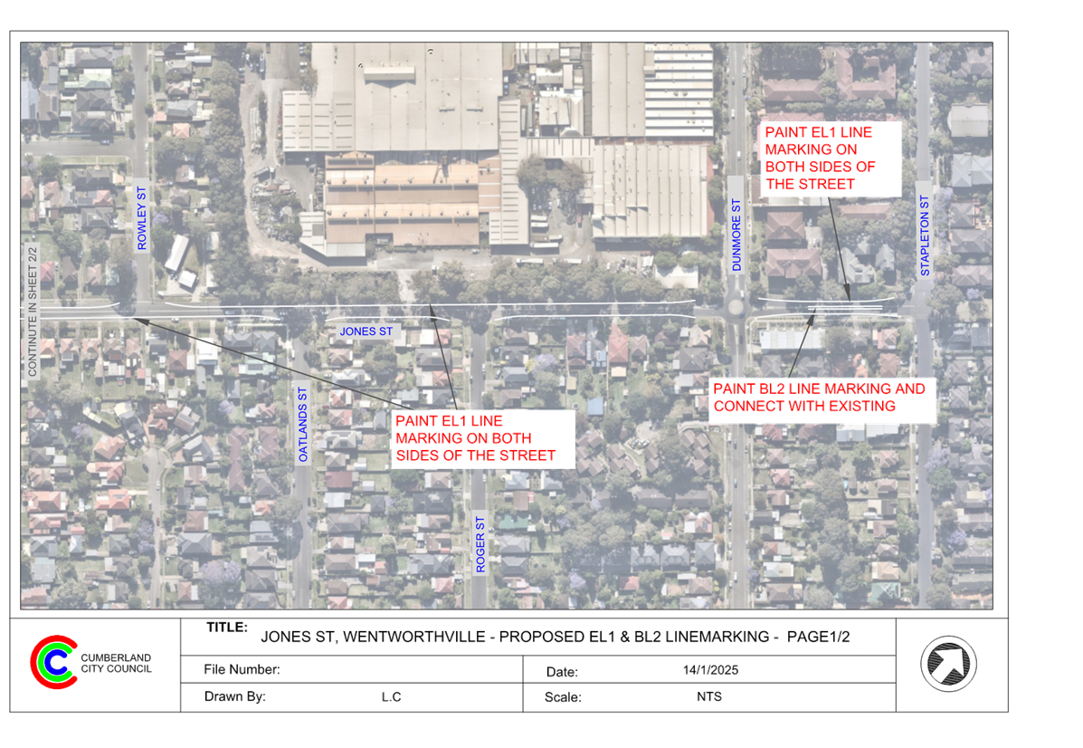
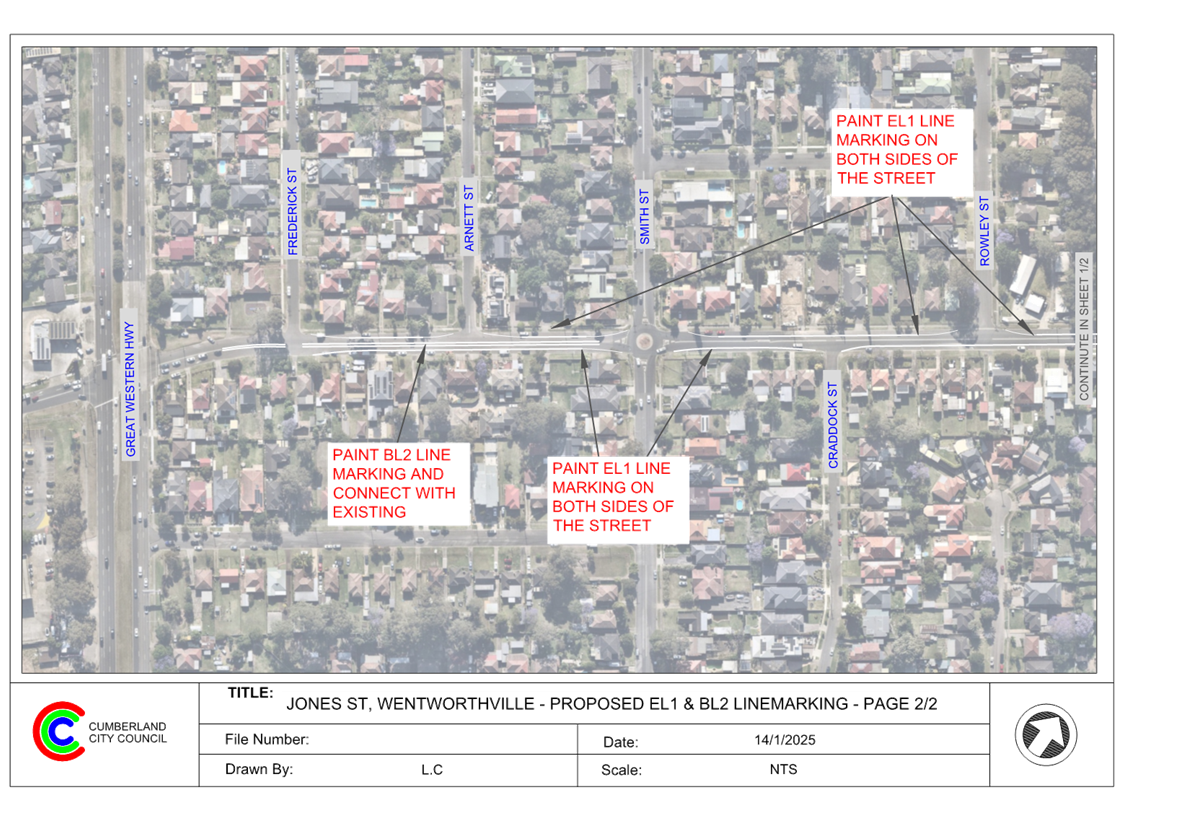
DOCUMENTS
ASSOCIATED WITH
REPORT CTC-25-018
Attachment 2
Submissions
5 February 2025
Item No: CTC-25-019
MCCREDIE ROAD,
GUILDFORD WEST - ROAD SAFETY CONCERNS – CONSULTATION RESULT
Directorate: Environment
and Planning
Responsible
Officer: Manager
Engineering and Building
Electorate: Granville
Police Area
Command (PAC): Cumberland
Agenda Part Part
1
Note: Recommended
for Approval under Delegated Authority
Council has undertaken
consultation with residents for the proposed traffic calming devices in
McCredie Road, Guildford West.
This report outlines the outcome
of the review.
The Traffic Committee recommends that:
1. Council
undertake speed monitoring with the assistance of Variable Message Signs (VMS)
in McCredie Road, Guildford West.
2. Council
notify affected/ concerned residents of the outcome.
Cumberland Traffic Committee
(CTC) at its meeting in June 2024 considered a report (CTC-24-131) regarding
road safety concerns on McCredie Road, Guildford West. Council resolved to
undertake consultation with the residents of McCredie Road, Guildford West
between Fowler Road and Lomond Road to determine support for the traffic
calming devices and report back to Cumberland Traffic Committee.
Consultation was carried out
with the residents of McCredie Road accordingly in October 2024.
Council received 11 responses
(18% of the total letters sent) by the closing date including one response
submitted without any selection. Out of the 10 responses that included a
selection, 4 responses (40%) supporting, and 6 (60%) objecting to the proposed
speed humps.
Based on the above result, the
majority of residents responding objected to the proposed speed humps.
It is noted that there are
‘BL2’ centre lines and edge lines marked in the section of McCredie
Road under consideration. Also, the recorded 85th percentile speed
in McCredie Road was 54.4 km/hr. In view of the concerns raised by some
residents, it is proposed that Council undertake further speed monitoring with
the assistance of Variable Message Signs (VMS) in McCredie Road, Guildford
West.
The proposal was notified to the
impacted resident for a period of 14 days from 21 October 2024 to 5 November
2024.
A total of 60 letters were
distributed with an attached survey form to the residents / owners. There were
11 responses (18% of the total letters sent) received by the closing date
including 1 response was submitted without a selection. Out of the 10 responses
that included a selection, 4 responses were in supporting and 6 opposing the
proposal.
1. Previous Report
– CTC-24-131
2. Council
Resolution – CTC-24-131
3. Submissions
DOCUMENTS
ASSOCIATED WITH
REPORT CTC-25-019
Attachment 1
Previous Report – CTC-24-131
DOCUMENTS
ASSOCIATED WITH
REPORT CTC-25-019
Attachment 2
Council Resolution – CTC-24-131
5 February 2025
DOCUMENTS
ASSOCIATED WITH
REPORT CTC-25-019
Attachment 3
Submissions
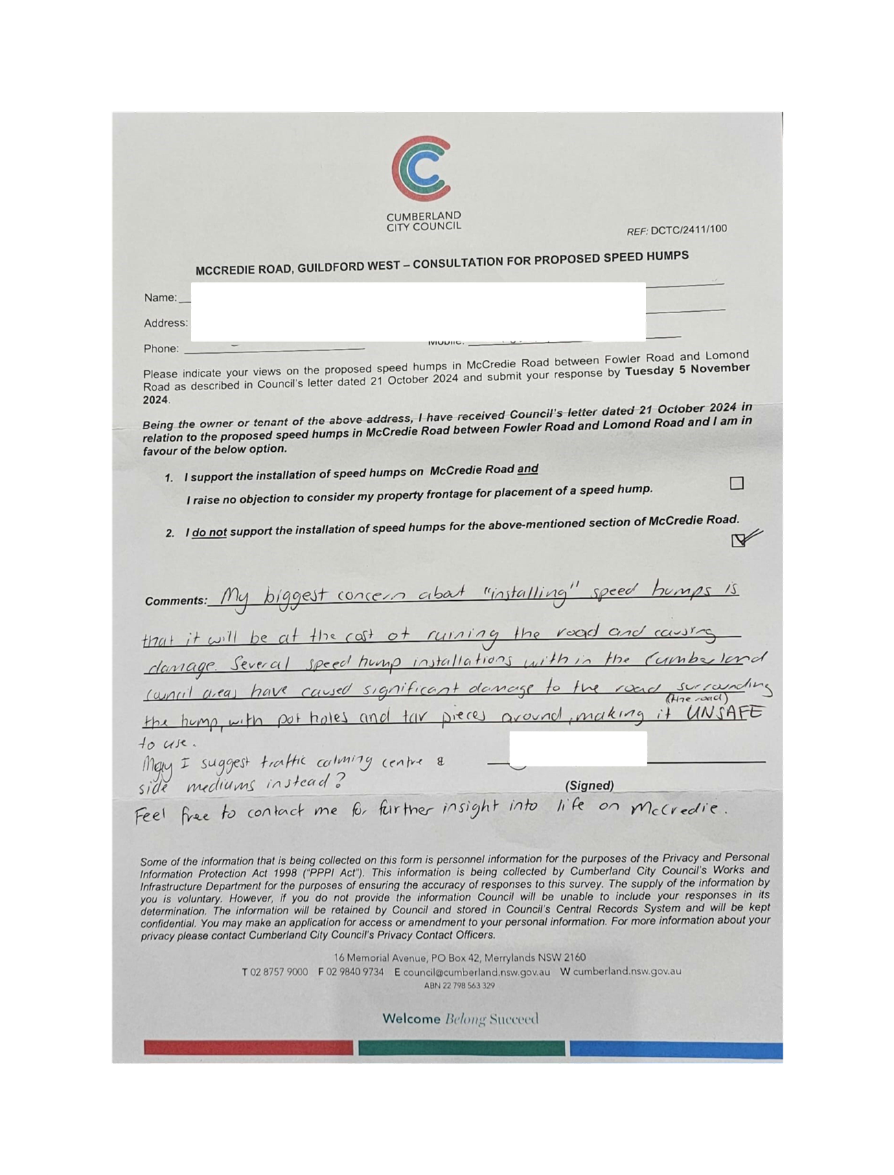
5 February 2025
Item No: CTC-25-020
THE
BOULEVARDE, LIDCOMBE - ROAD SAFETY CONCERNS – CONSULTATION RESULT
Directorate: Environment
and Planning
Responsible
Officer: Manager
Engineering and Building
Electorate: Auburn
Police Area
Command (PAC): Auburn
Agenda Part Part
1
Note: Recommended
for Approval under Delegated Authority
Council has undertaken
consultation with residents of The Boulevarde Lidcombe for the installation of
speed humps/ cushions in The Boulevarde, Lidcombe.
This report outlines the outcome
of the review.
The Traffic Committee recommends that:
1. The
installation of edge lines on both sides in The Boulevarde, Lidcombe in
accordance with the attached plan be approved.
2. Council
notify concerned residents of the outcome.
Cumberland Traffic Committee
(CTC) at its meeting in June 2024 considered a report (CTC-24-126) regarding
road safety concerns on The Boulevarde, Lidcombe. Council resolved to undertake
consultation with the residents of The Boulevarde, Lidcombe to determine
support for the installation of traffic coming devices in the street and report
back to Cumberland Traffic Committee.
Consultation was carried out
with the residents of The Boulevarde accordingly in December 2024. A total of
37 letters were sent with survey forms to residents (owners and tenants).
Council received 10 responses by
the closing date. Five responses supporting and five objecting to the
installation of speed humps.
Based on the results above, an
equal number of support and objections were received. Considering that the
recorded 85th percentile speed in the most recent traffic count was 52.9 km/h
which is within acceptable limits, it is proposed that the installation of
speed humps are not progressed at this time. However, due to the community
concerns regarding road safety, it is proposed to provide edge lines on both
sides of the road to supplement the existing centre lines (BL2). Following the
installation of the edge lines, Council will continue to monitor the matter and
can consider further solutions if required.
The proposal was notified to the
impacted resident for a period of 14 days from 5 December 2024 to 19 December
2024.
A total of 37 letters were
distributed with an attached survey form to the residents / owners. There were
10 responses received by the closing date, 5 responses (50%) were in support,
and 5 responses (50%) objecting to the proposal.
1. Plan – The
Boulevarde, Lidcombe – Proposed Line Marking
2. Previous
Report – CTC-24-126
3. Submissions
DOCUMENTS
ASSOCIATED WITH
REPORT CTC-25-020
Attachment 1
Plan – The Boulevarde, Lidcombe – Proposed
Line Marking
5 February 2025
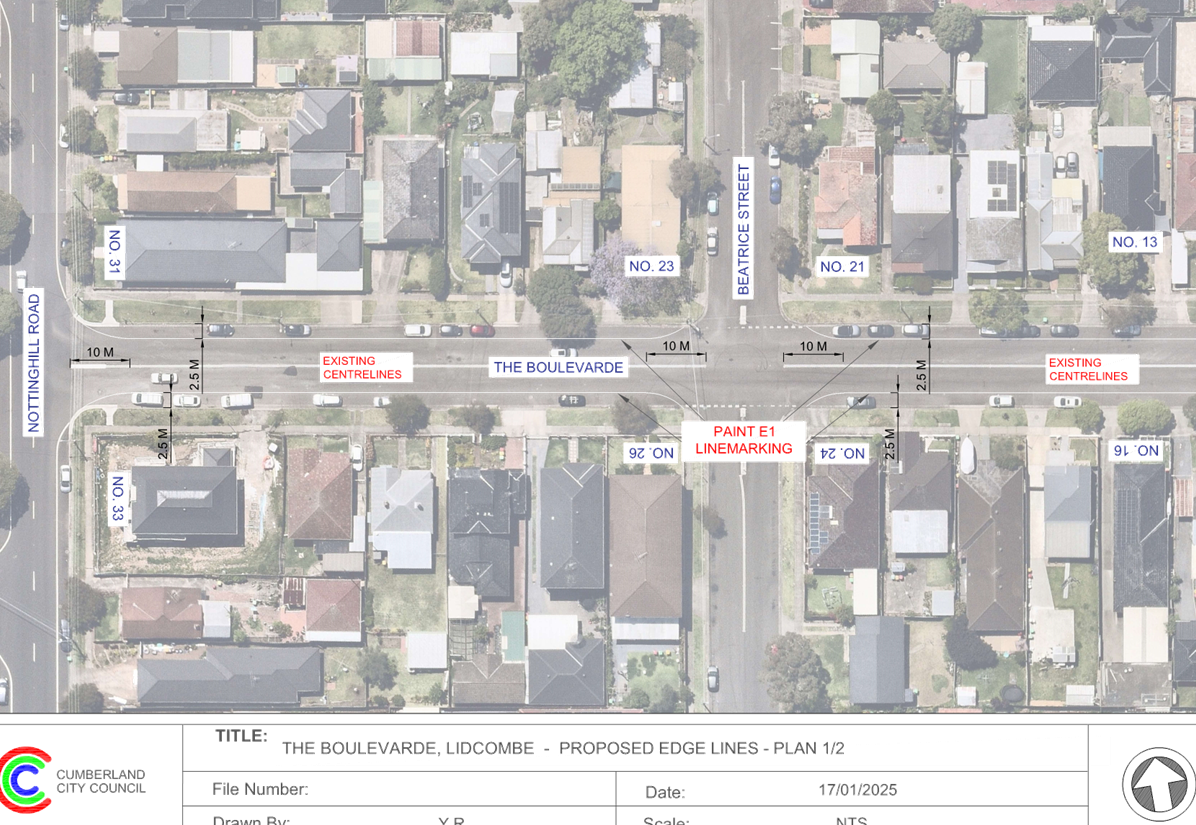
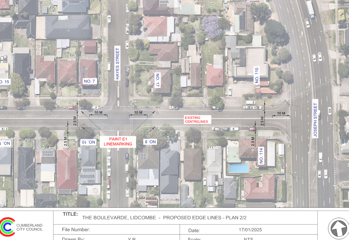
DOCUMENTS
ASSOCIATED WITH
REPORT CTC-25-020
Attachment 2
Previous Report – CTC-24-126
5 February 2025
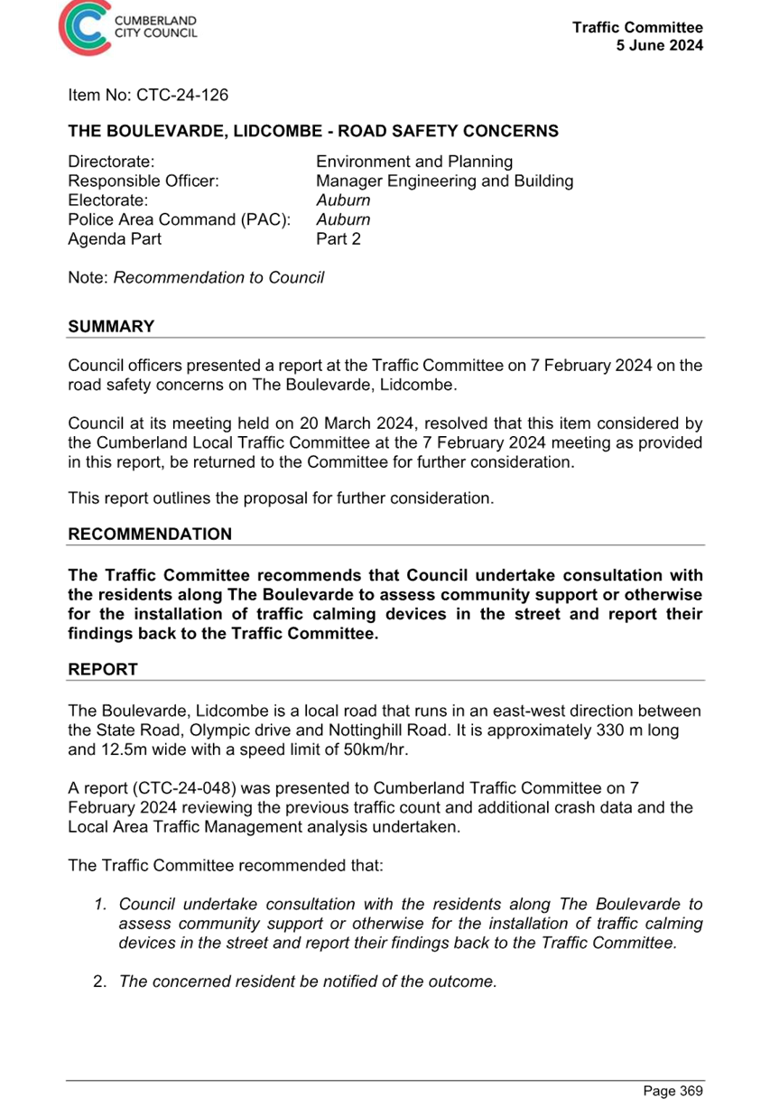
DOCUMENTS
ASSOCIATED WITH
REPORT CTC-25-020
Attachment 3
Submissions
5 February 2025
Item No: CTC-25-021
STATION ROAD,
AUBURN – APPLICATION FOR ‘WORKS ZONE’ SIGNAGE
Directorate: Environment
and Planning
Responsible
Officer: Manager
Engineering and Building
Electorate: Auburn
Police Area
Command (PAC): Auburn
Agenda Part Part
1
Note: Recommended
for Approval under Delegated Authority
Council has received an
application for a ‘Works Zone’ on Station Road, Auburn associated
with the development at 25 Station Road, Auburn
This report outlines the outcome
of the investigation into this matter.
The Traffic Committee recommends that:
1. The
12m long ‘Works Zone, 7:00am-6:00pm, Monday-Friday, 8:00am-4:00pm,
Saturday’ signs be installed on the frontage of the redevelopment site on
Station Road in accordance with the attached plan subject to Council’s
standard conditions for the period of 12 months and subsequent extension if
required.
2. The
applicant be advised to pay the ‘Works Zone’ fees to Council as per
the adopted Fees and Charges.
Council has received an
application for a ‘Works Zone’ on Station Road, Auburn associated
with the development at 25 Station Road, Auburn. The construction of an eight
(8) storey 92 room co-living housing development, including manager’s
room, with ground floor commercial premises, above basement parking for 23
vehicles, with associated landscaping.
The temporary “Works
Zone” is approximately 12m in length and proposed to commence in March
2025 for 12months. The proposed time is between 7:00am to 6:00pm Monday to
Friday and 8:00am to 4:00pm on Saturdays.
There will be a loss of two (2)
on-street parking on Station Road, Auburn during the operation of the
“Works Zone”.
The proposal is outside the
property being developed and no consultation is considered necessary as the
request was made by the builder.
1. Plan –
Station Road, Auburn – Proposed Temporary ‘Works Zone’
Signage
DOCUMENTS
ASSOCIATED WITH
REPORT CTC-25-021
Attachment 1
Plan – Station Road, Auburn – Proposed
Temporary ‘Works Zone’ Signage
5 February 2025
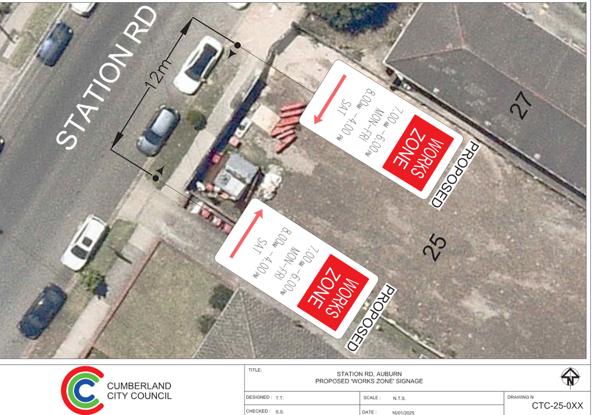
5 February 2025
Item No: CTC-25-022
JOHN STREET,
LIDCOMBE – APPLICATION FOR ‘WORKS ZONE’ SIGNAGE
Directorate: Environment
and Planning
Responsible
Officer: Manager
Engineering and Building
Electorate: Auburn
Police Area
Command (PAC): Auburn
Agenda Part Part
1
Note: Recommended
for Approval under Delegated Authority
Council has received an
application for a ‘Works Zone’ on John Street, Lidcombe associated
with the development at 17 Church Street, Lidcombe.
This report outlines the outcome
of the investigation into this matter.
The Traffic Committee recommends that:
1. The
30m long ‘Works Zone, 7:00am-6:00pm, Monday-Friday, 8:00am-4:00pm,
Saturday’ signs be installed on the frontage of the development site on
John Street, Lidcombe in accordance with the attached plan subject to
Council’s standard conditions for the period of 6 months and subsequent
extension if required.
2. The
applicant be advised to pay the ‘Works Zone’ fees to Council as per
the adopted Fees and Charges.
Council has received an
application for a ‘Works Zone’ on John Street, Lidcombe associated
with the development at 17 Church Street, Lidcombe. The proposed development
involves alterations and additions to an existing registered Club (Dooleys
Lidcombe Catholic Club), including demolition works, extension of the existing
basement car park, refurbishment and expansion of existing club building on
John Street, and construction of two additional floors to facilitate
administration, office and staff areas and associated stormwater works and
provision of a substation.
The temporary “Works
Zone” is approximately 30m in length and proposed to commence in Feb 2025
for 6 months. The proposed time is between 7:00am to 6:00pm Monday to Friday
and 8:00am to 4:00pm on Saturdays.
There will be a loss of five (5)
‘1/2P’ times-restricted parking spaces on John Street, Lidcombe
during the operation of the “Works Zone”.
The proposal is outside the
property being developed and no consultation is considered necessary as the
request was made by the builder.
1. Plan – John
Street, Lidcombe – Proposed Temporary ‘Works Zone’ Signage
DOCUMENTS
ASSOCIATED WITH
REPORT CTC-25-022
Attachment 1
Plan – John Street, Lidcombe – Proposed
Temporary ‘Works Zone’ Signage
5 February 2025
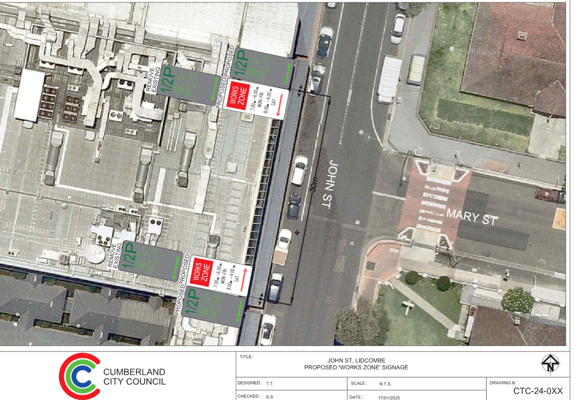
5 February 2025
Item No: CTC-25-023
NORTHUMBERLAND
ROAD, AUBURN – APPLICATION FOR ‘WORKS ZONE’ SIGNAGE
Directorate: Environment
and Planning
Responsible
Officer: Manager
Engineering and Building
Electorate: Auburn
Police Area
Command (PAC): Auburn
Agenda Part Part
1
Note: Recommended
for Approval under Delegated Authority
Council has received an
application for a ‘Works Zone’ on Northumberland Road, Auburn
associated with the development at 35 Station Road, Auburn
This report outlines the outcome
of the investigation into this matter.
The Traffic Committee recommends that:
1. The
48m long ‘Works Zone, 7:00am-6:00pm, Monday-Friday, 8:00am-4:00pm,
Saturday’ signs be approved on the frontage of the redevelopment site on
Northumberland Road in accordance with the attached plan subject to
Council’s standard conditions for the period of 12 months and subsequent
extension if required.
2. The
applicant be advised to pay the ‘Works Zone’ fees to Council as per
the adopted Fees and Charges.
Council has received an
application for a ‘Works Zone’ on Northumberland Road, Auburn
associated with the development at 35 Station Road, Auburn. The proposed
development involves demolition of existing structures and construction of shop
top housing and residential flat buildings above commercial premises over
basement parking.
The temporary “Works
Zone” is approximately 48m in length and proposed to commence in March
2025 for 12 months. The proposed times are between 7:00am to 6:00pm Monday to
Friday and 8:00am to 4:00pm on Saturdays.
There will be a loss of two (2)
‘2P’ time-restricted parking spaces on Northumberland Road, Auburn
during the operation of the “Works Zone”.
The proposal is outside the
property being developed and no consultation is considered necessary as the
request was made by the builder.
1. Plan –
Northumberland Road, Auburn – Proposed Temporary ‘Works Zone’
Signage
DOCUMENTS
ASSOCIATED WITH
REPORT CTC-25-023
Attachment 1
Plan – Northumberland Road, Auburn –
Proposed Temporary ‘Works Zone’ Signage
5 February 2025
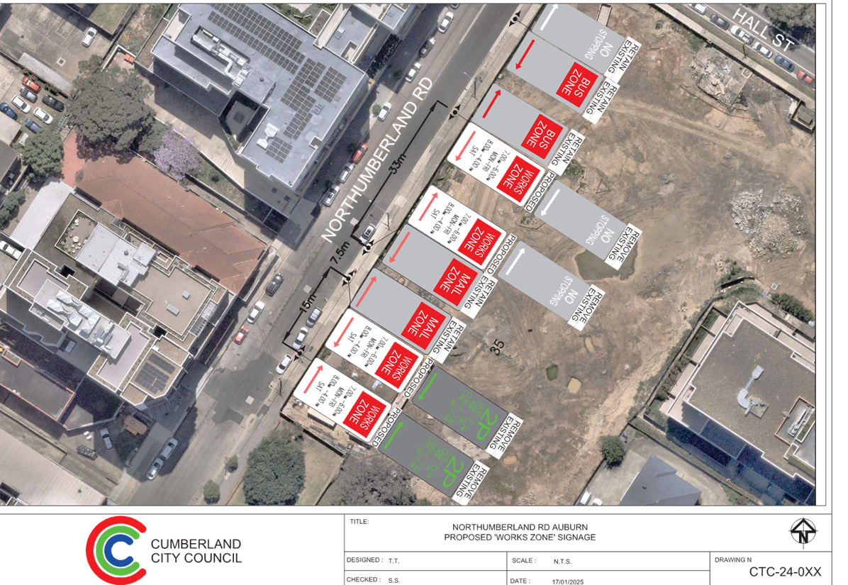
5 February 2025
Part 2
Recommendation to Council
5 February 2025
Item No: CTC-25-024
OXFORD STREET
AND HIGHLAND STREET, GUILDFORD - AUSTRALIAN GOVERNMENT BLACK SPOT PROGRAM
Directorate: Environment
and Planning
Responsible
Officer: Manager
Engineering and Building
Electorate: Granville
Police Area
Command (PAC): Cumberland
Agenda Part Part
2
Note: Recommendation
to Council
Council has received funding under
the Australian Government Black Spot Program for the construction of a
roundabout the intersection of Oxford Street and Highland Street, Guildford.
This report outlines the proposal
to improve road safety at the intersection, consultation undertaken thus far
and the next steps prior to seeking traffic committee approval.
The Traffic Committee
recommends:
1. Council
officers consult with the community on the amended plan of the proposed
roundabout at the intersection of Oxford Street and Highland Street, Guildford.
2. Affected
residents and residents who signed the petition be notified.
3. Report
the results of the consultation to a future Traffic Committee meeting.
Oxford Street is a regional road and runs in an east-west
direction from Woodville Road and has a speed limit of 60 km/hr.
Highland Street is a local road which runs in a north-south
direction from Oxford Street and has a speed limit of 50 km/hr.
Oxford Street and Highland Street, Guildford form a
T-intersection. Granville South Public School is situated at the corner of
Woodville Road and Oxford Street. Highland Street forms the western boundary
for the school and acts as a drop-off/pick-up location.
The figure below shows details of the intersection and
surrounding road network.
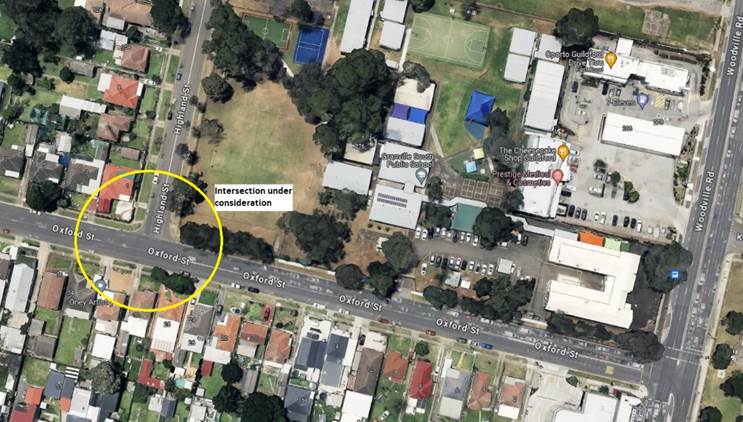
Based on the crash record at the intersection and ongoing
concerns raised by residents and the school, Council officers have investigated
the intersection performance and nominated the site under Australian Government
Black Spot Program. The submission was based on the latest Centre for Road
Safety crash data at the time of the application which are summarised below:
Crash Period
Investigated: July
2017 – June 2022 (5 years)
Total number of crashes: 4
Total number of injury
crashes: 4
Primary crash type: 1
pedestrian
3
other manoeuvres (2 Rear end)
Proposed treatment: Single
Lane roundabout.
It should be noted that the Centre for Road Safety crash
data provides information on reported crashes only and the application was
based on available crashes at the time of the application.
Following the submission, Council has received a formal
notification from the Transport for NSW advising that the submission was
successful. In response to the successful application, a concept plan has been
prepared in accordance with current Transport for NSW Guidelines, and
consultation was subsequently undertaken on the proposal to report to the
Traffic Committee.
During the consultation period, several objections were
raised by residents through a petition, with the primary concerns regarding,
the impact to property access and loss of on-street carparking because of the
proposed roundabout installation.
Based on these objections, the design of the proposed
roundabout at the intersection of Oxford Street and Highland Street was amended
with consideration of matters raised during consultation.
It is noted that the amended design resolves the access
concerns from the residents at the roundabout. The vehicular crossings of these
properties have also been widened appropriately to allow access.
Council now seek approval to consult on the revised design,
with a further report to the Traffic Committee following the outcome of this
process.
It is also noted that the development application for the
proposed Merrylands East Local Centre requires the applicant to provide a
roundabout at this location as part of the conditions of approval. While there
is an alternate pathway for the provision of the roundabout at the
intersection, the applicant is yet to obtain a Construction Certificate to
progress with the development application. Given the ongoing safety
concerns raised by residents and the school, as well as the provision of grant
funding for the roundabout, it is prudent for Council to progress the
roundabout in the immediate term to respond to the safety concerns raised.
Consultation was undertaken with affected properties for 14
days from 9 October 2024 to 23 October 2024.
A petition was received from 50 signatories from 25
properties along Oxford Street, Highland Street and Harold Street objecting to
the proposal.
The plan has been amended to address the concerns raised.
1. Updated Plan -
Oxford Street and Highland Street, Guildford
2. Consultation
Plan – Oxford Street and Highland Street, Guildford – Proposed
Roundabout
3. Submissions
DOCUMENTS
ASSOCIATED WITH
REPORT CTC-25-024
Attachment 1
Updated Plan - Oxford Street and Highland Street,
Guildford
5 February 2025
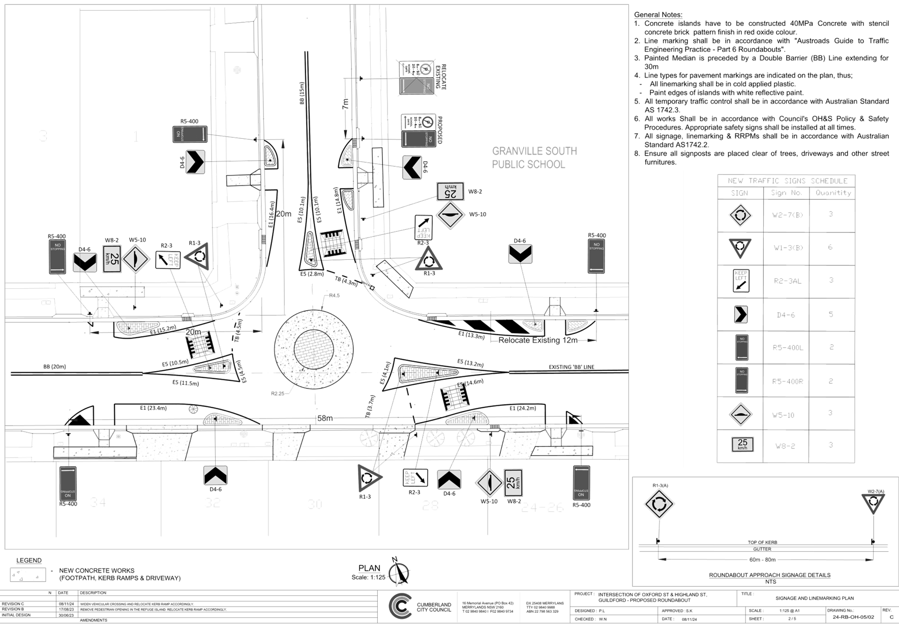
DOCUMENTS
ASSOCIATED WITH
REPORT CTC-25-024
Attachment 2
Consultation Plan – Oxford Street and Highland
Street, Guildford – Proposed Roundabout
5 February 2025
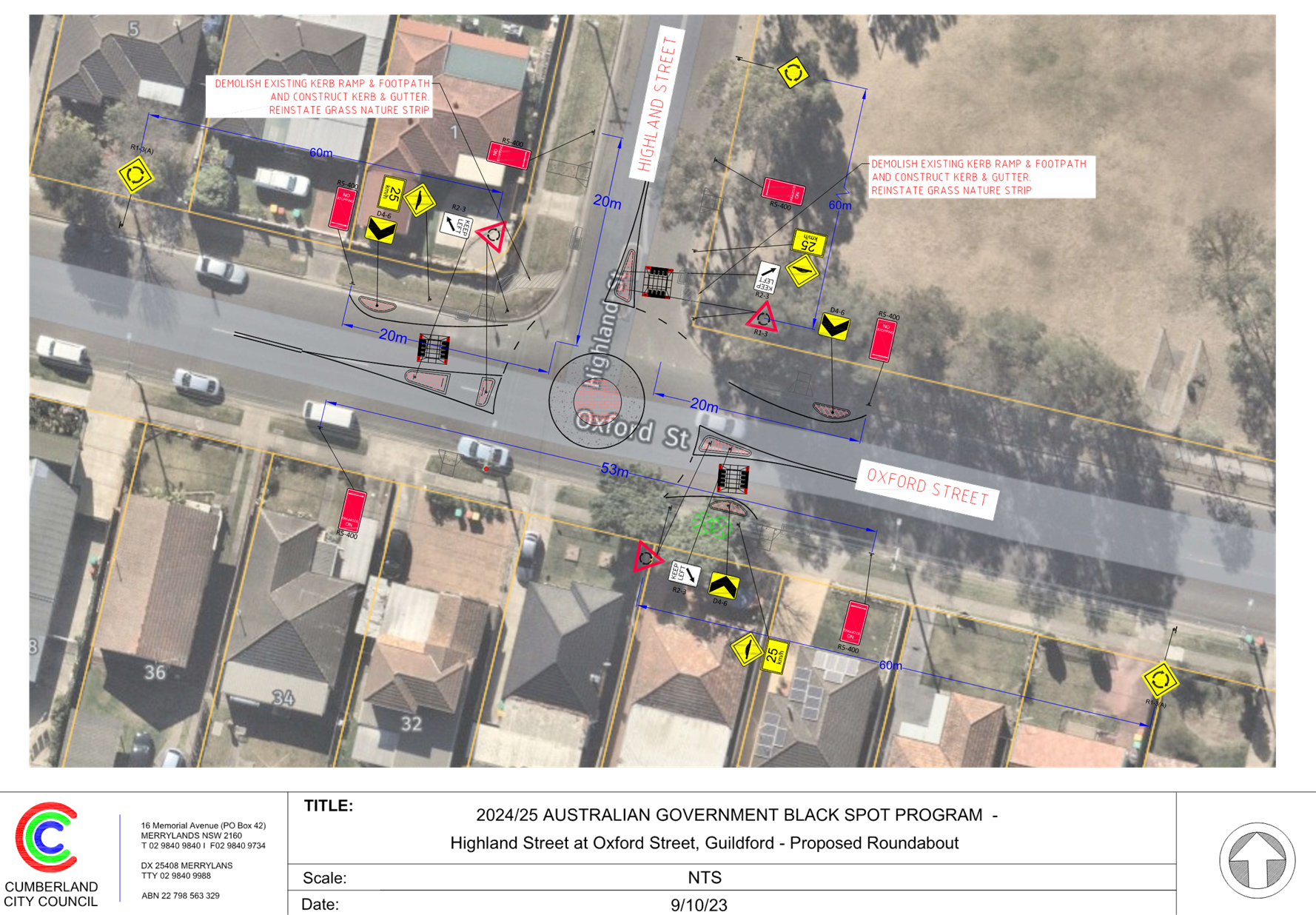
DOCUMENTS
ASSOCIATED WITH
REPORT CTC-25-024
Attachment 3
Submissions
5 February 2025
Item No: CTC-25-025
AMY STREET AT
KINGSLAND ROAD, REGENTS PARK - AUSTRALIAN GOVERNMENT BLACK SPOT PROGRAM
Directorate: Environment
and Planning
Responsible
Officer: Manager
Engineering and Building
Electorate: Auburn
Police Area
Command (PAC): Auburn
Agenda Part Part
2
Note: Recommendation
to Council
Council has received funding under
the Australian Government Black Spot Program for the provision of concrete
raised thresholds (speed humps) on the approaches to the roundabout at the
intersection of Amy Street and Kingsland Road, Regents Park.
This report outlines the proposal
to improve road safety at the intersection.
The Traffic Committee
recommends that:
1. The
proposed concrete raised thresholds (speed humps) and associated signs on the approaches
to the roundabout at the intersection of Amy Street and Kingsland Road, Regents
Park, in accordance with the attached plan be approved.
2. Council
progress the project for construction in accordance with grant requirements.
3. Directly
affected residents be notified of Council’s resolution.
Amy Street is a regional road and runs in an east-west
direction. Amy Street has a speed limit of 50km/hr.
Kingsland Road is a local road which runs in a north-south
direction and has a speed limit of 50km/hr.
Amy Street and Kingsland Road form an intersection which is
controlled by a roundabout.
The figure below shows details of the intersection.
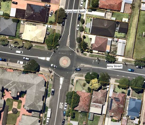
Based on the crash record at the intersection, Council
officers have investigated the intersection and proposed construction of raised
thresholds on the approaches to the roundabout. Council officers have also
nominated the site under Australian Government Black Spot Program. The
submission was based on the latest Centre for Road Safety crash data at the
time of the application which are summarised below:
Crash Period
Investigated: July
2017 – June 2022 (5 years)
Total number of crashes: 4
Total number of injury
crashes: 4
Primary crash type: 1
pedestrian
3
other manoeuvres
Proposed treatment: Concrete
thresholds (Speed humps) on the approaches.
It should be noted that the Centre for Road Safety crash
data provides information on reported crashes only and the application was
based on available crashes at the time of the application.
Following the submission, Council has received a formal
notification from the Transport for NSW advising that the submission was
successful. In response to the successful application, a concept plan has been
prepared in accordance with current Transport for NSW Guidelines.
Consultation was undertaken with
affected properties for 14 days from 25 November 2024 to 11 December 2024.
Five submissions were received
supporting the proposal.
1. Plan – Amy
Street and Kingsland Road, Regents Park – Proposed Speed Humps
2. Submissions
DOCUMENTS
ASSOCIATED WITH
REPORT CTC-25-025
Attachment 1
Plan – Amy Street and Kingsland Road, Regents
Park – Proposed Speed Humps
5 February 2025
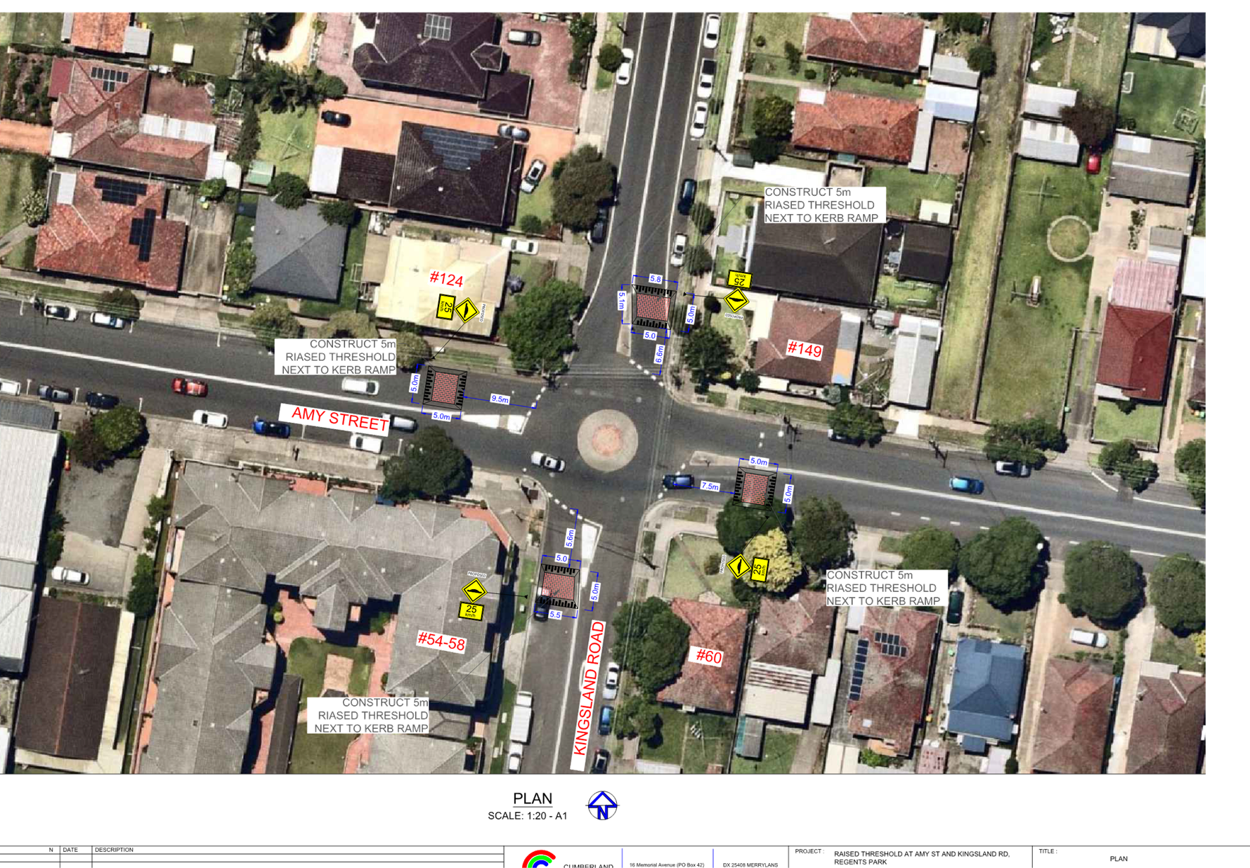
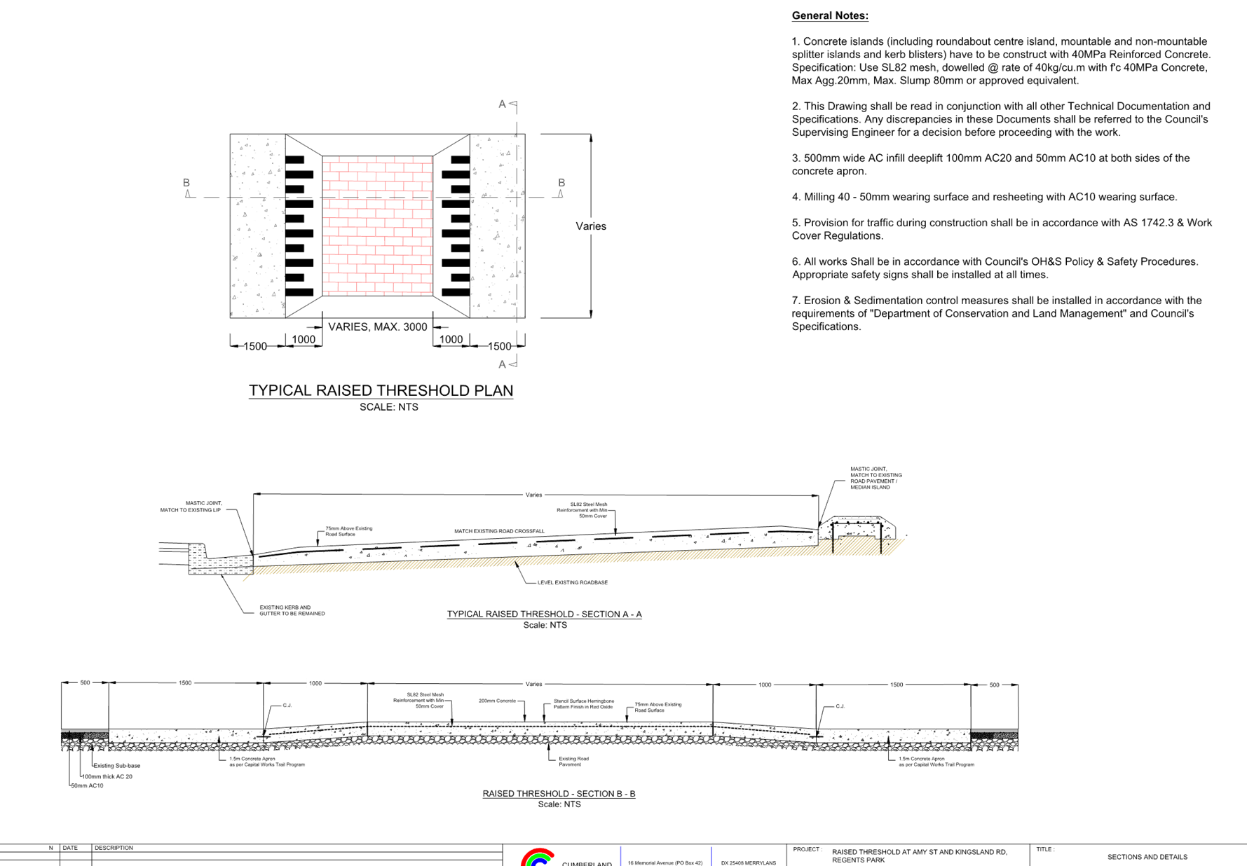
DOCUMENTS
ASSOCIATED WITH
REPORT CTC-25-025
Attachment 2
Submissions
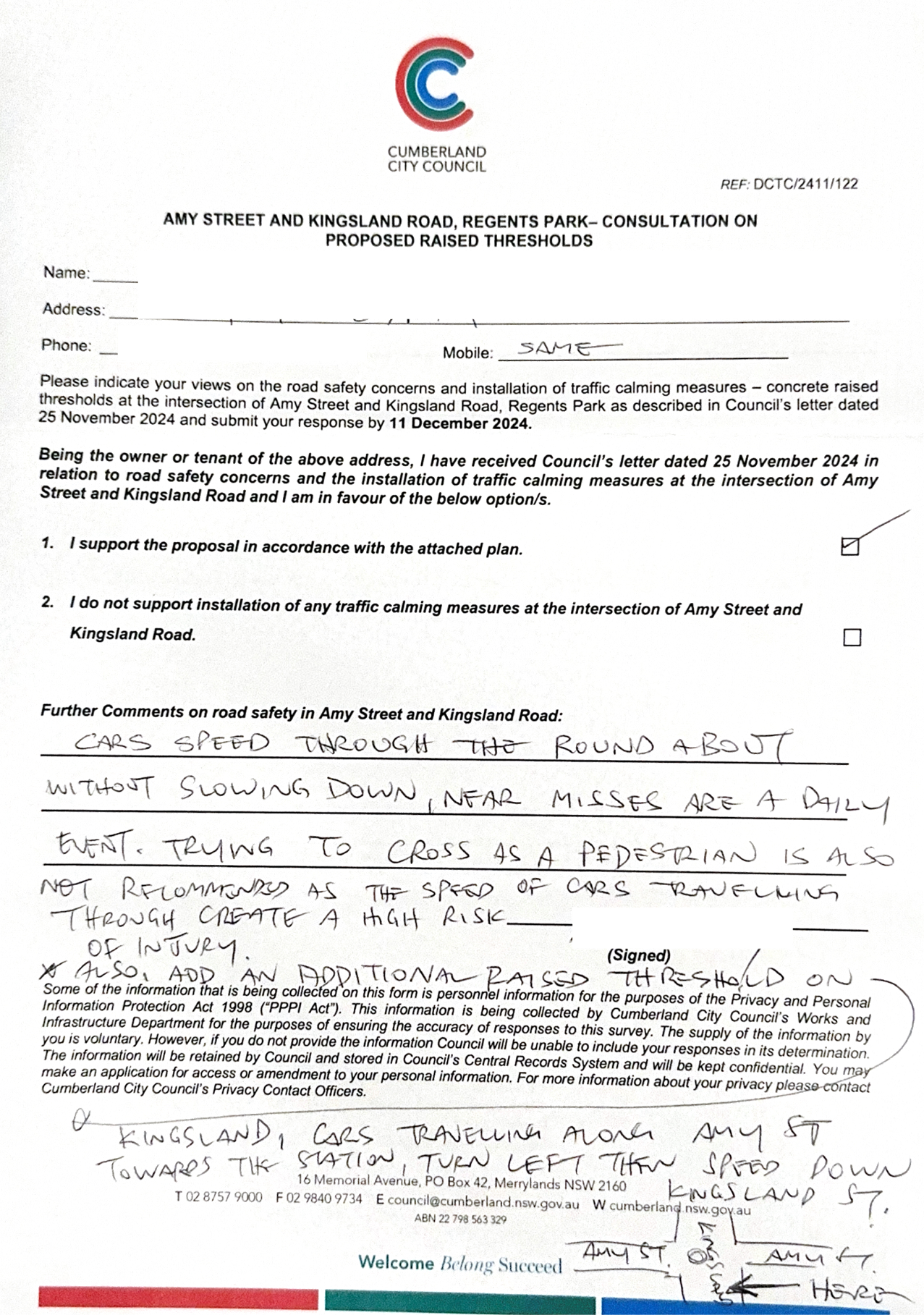
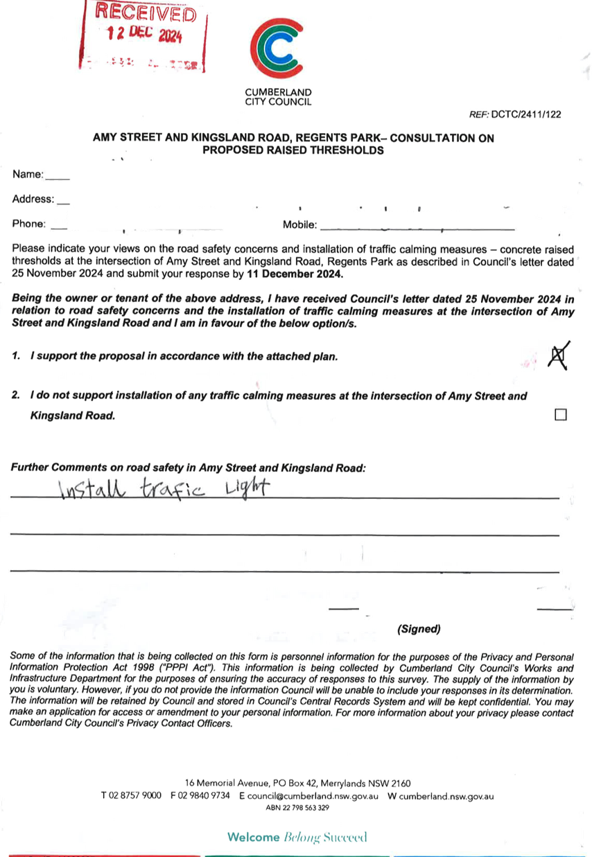
5 February 2025
Item No: CTC-25-026
RAILWAY
PARADE, HELENA STREET AND COCKTHORPE ROAD, AUBURN - AUSTRALIAN GOVERNMENT BLACK
SPOT PROGRAM
Directorate: Environment
and Planning
Responsible
Officer: Manager
Engineering and Building
Electorate: Auburn
Police Area
Command (PAC): Auburn
Agenda Part Part
2
Note: Recommendation
to Council
Council has received funding under
the Australian Government Black Spot Program for the provision of concrete
raised thresholds (speed humps) on the approaches to the roundabout at the
intersection of Railway Parade, Helena Street and Cockthorpe Road, Auburn.
This report outlines the proposal
to improve road safety at the intersection.
The Traffic Committee
recommends that:
1. The
proposed concrete raised thresholds (speed humps) and associated signs on the
approaches to the roundabout at the intersection of Railway Parade, Helena
Street and Cockthorpe Road, Auburn, in accordance with the attached plan be
approved.
2. Council
progress the project for construction in accordance with grant requirements.
3. Directly
affected residents be notified of Council’s resolution.
Railway Parade is a local road which runs in an eastern
direction from Cockthorpe Road and has a speed limit of 50km/hr.
Cockthorpe Road is a local road which runs in a north-south
direction and has a speed limit of 50km/hr.
Helena Street is a local road which runs in western
direction from Cockthorpe Road and has a speed limit of 50km/hr.
Railway Parade, Helena Street and Cockthorpe Road, Auburn
form an intersection which is controlled by a roundabout.
The figure below shows details of the intersection.
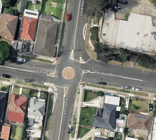
Based on the crash record at the intersection, Council
officers have investigated the intersection and proposed construction of raised
thresholds on the approaches to the roundabout. Council officers have also
nominated the site under Australian Government Black Spot Program. The
submission was based on the latest Centre for Road Safety crash data at the
time of the application which are summarised below:
Crash Period
Investigated: July
2017 – June 2022 (5 years)
Total number of crashes: 4
Total number of injury
crashes: 4
Primary crash type: Cross
Traffic
Proposed treatment: Concrete
thresholds (Speed humps) on the approaches.
Following the submission, Council has received a formal
notification from the Transport for NSW advising that the submission was
successful. In response to the successful application, a concept plan has been
prepared in accordance with current Transport for NSW Guidelines.
Consultation was undertaken with
affected properties for 14 days from 25 November 2024 to 11 December 2024.
No responses were received.
1. Plan –
Railway Parade, Helena Street and Cockthorpe Road – Proposed Speed Humps
DOCUMENTS
ASSOCIATED WITH
REPORT CTC-25-026
Attachment 1
Plan – Railway Parade, Helena Street and
Cockthorpe Road – Proposed Speed Humps
5 February 2025
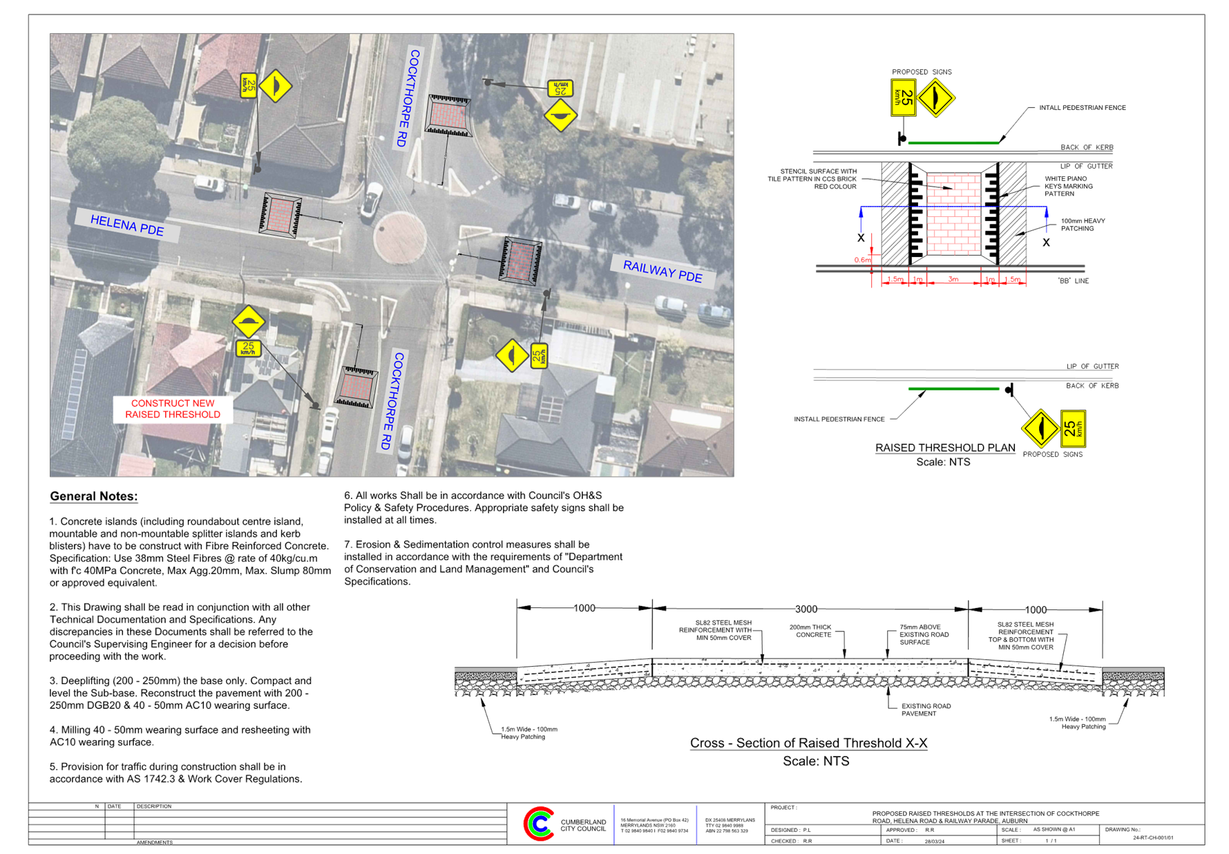
5 February 2025
Item No: CTC-25-027
LIDCOMBE TOWN
CENTRE PUBLIC DOMAIN PLAN - JOSEPH STREET PRECINCT – PROPOSED PEDESTRIAN
CROSSING ON BRIDGE STREET
Directorate: Environment
and Planning
Responsible
Officer: Manager
Engineering and Building
Electorate: Auburn
Police Area
Command (PAC): Auburn
Agenda Part Part
2
Note: Recommendation
to Council
Council is currently working on
the implementation of the Lidcombe Town Centre Public Domain Plan which has
been adopted by Council at its meeting on 2 August 2023. The first stage of works under the Plan is identified as
Joseph Street Precinct, which has received funding under the Western Sydney
Infrastructure Grants (formerly WestInvest) program.
This report outlines the proposed
raised pedestrian crossing on Bridge Street, Lidcombe, as part of the project.
The Traffic Committee recommends that the proposed
raised pedestrian crossing on Bridge Street, Lidcombe, as part of the Joseph
Street Precinct Upgrade to implement the Lidcombe Town Centre Public Domain
Plan, be approved.
Council adopted Lidcombe Town Centre Public Domain Plan at
its meeting on 2 August 2023. The first stage of works under the Plan is
identified as Joseph Street Precinct, including Bridge Street upgrade. Council received $7.6 million in funding under the NSW
Government’s WestInvest grant program through the Lidcombe Town Centre
High Street Activation project to implement these works.
Works identified for this precinct
include establishment of new outdoor dining area on Joseph Street, improved
permeability and accessibility for all ages and abilities though out the
Precinct, upgrade pedestrian crossings, new street furniture including
lighting, and opportunities to establish public art projects.
i)
As part of the project, Council
proposes to raise the intersection of Joseph Street and Bridge Street, and
provide a pedestrian crossing on Bridge Street. This location is used by many
pedestrians, including the residents in the new apartments south of Vaughan
Street and the residents / visitors west of Olympic Drive accessing the
station.
A map below shows the location of
the proposed raised pedestrian crossing.
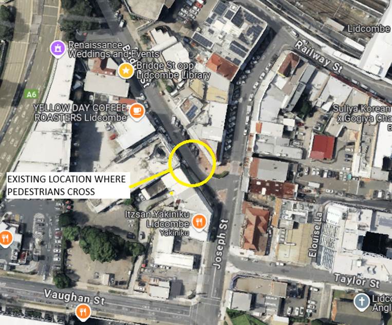
Council organised a pedestrian count at the location on a
Thursday and a Saturday in early April 2024. The results of the counts are
presented in the table below.
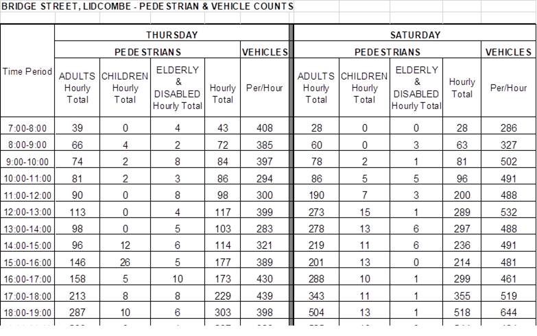
Pedestrian Crossing Warrants
Council has developed its own guidelines for the provision
of pedestrian crossings on local roads especially at high demand locations
including schools, community facilities, parks, hospitals, medical facilities,
town centres, neighbourhood shops and public transport facilities.
A
pedestrian (zebra) crossing is deemed to meet the numerical warrant for a
pedestrian (zebra) crossing if the crossing point meets the following criteria:
· In each of two separate one-hour periods in a typical day,
the pedestrian flow per hour crossing the road is or is expected to be equal to
or greater than 20, and vehicle volumes be equal to or greater than 200. Where
each unaccompanied child, elderly person or mobility impaired pedestrian is
counted as two pedestrians.
In addition to the above, all requirements set down in
Australian Standards are to be met.
Based on the data collated, the warrant for pedestrians
crossing at this location was higher than the warrant and the number of
vehicles was higher than the warrant. In addition, the approved Public Domain
Plan also indicated the provision of a raised pedestrian crossing on Bridge
Street at its intersection with Joseph Street.
It is recommended that the proposed pedestrian crossing at
this location be approved. A plan showing the raised pedestrian crossing
associated works is provided below and attached.
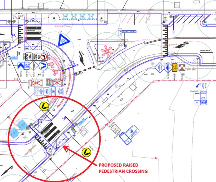
Proposed Raised
Pedestrian Crossing at Bridge Street, Lidcombe
Council has previously undertaken
consultation on the Lidcombe Town Centre Public Domain Plan and concept plan for
the Joseph Street Precinct Upgrade project. Council will continue to
consult with businesses and the community as the project progresses.
1. Plan - Bridge
Street, Lidcombe – Proposed Raised Pedestrian Crossing
DOCUMENTS
ASSOCIATED WITH
REPORT CTC-25-027
Attachment 1
Plan - Bridge Street, Lidcombe – Proposed Raised
Pedestrian Crossing
5 February 2025
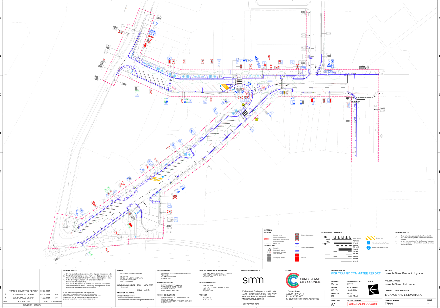
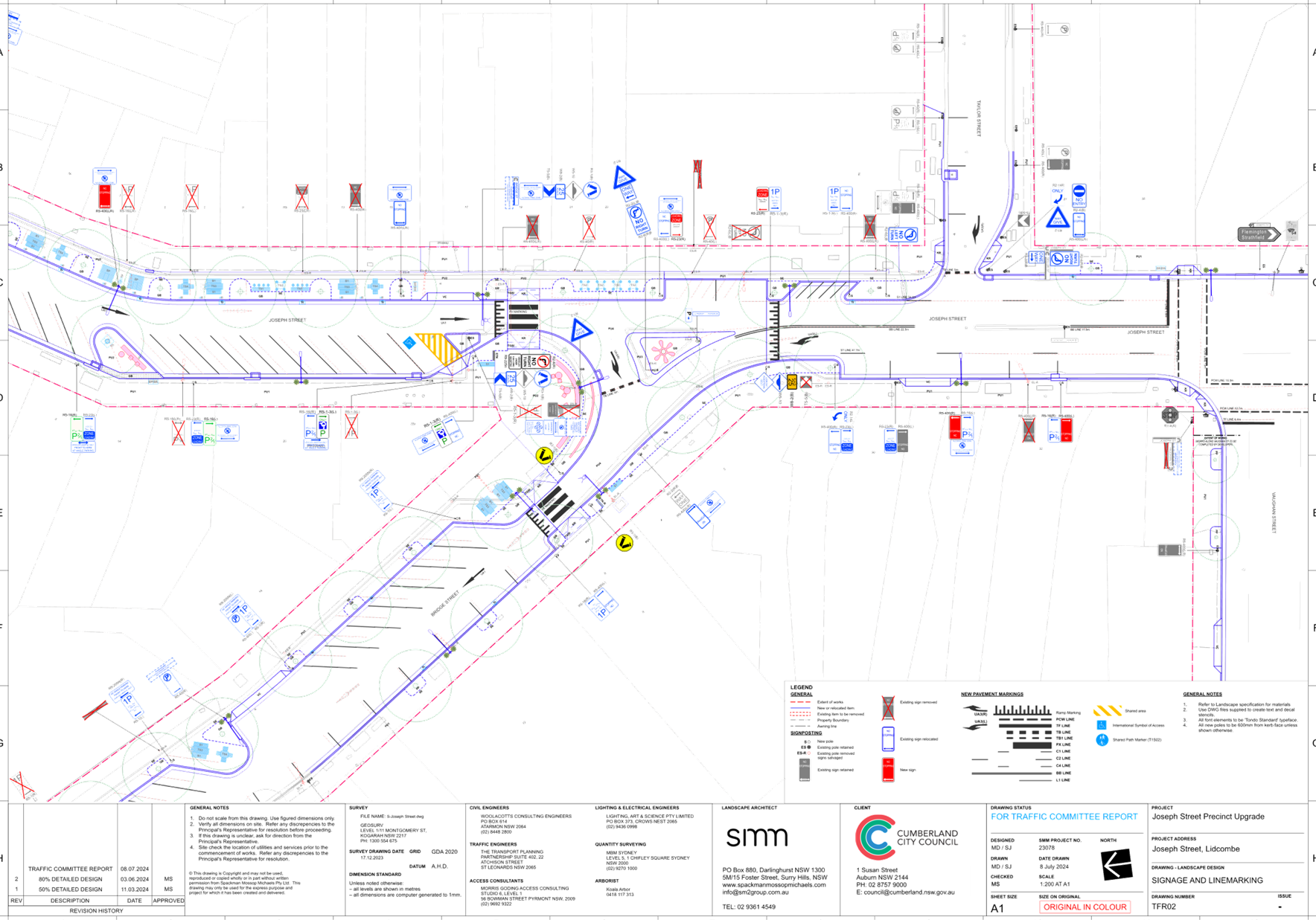
5 February 2025
Item No: CTC-25-028
LIDCOMBE TOWN
CENTRE PUBLIC DOMAIN PLAN - JOSEPH STREET PRECINCT – PROPOSED PEDESTRIAN
CROSSING ON TAYLOR STREET
Directorate: Environment
and Planning
Responsible
Officer: Manager
Engineering and Building
Electorate: Auburn
Police Area
Command (PAC): Auburn
Agenda Part Part
2
Note: Recommendation
to Council
Council is currently working on
the implementation of the Lidcombe Town Centre Public Domain Plan which has
been adopted by Council at its meeting on 2 August 2023. The first stage of works under the Plan is identified as
Joseph Street Precinct, which has received funding under the Western Sydney
Infrastructure Grants (formerly WestInvest) program.
This report outlines the proposed
raised pedestrian crossing on Taylor Street, Lidcombe, as part of the project.
The Traffic Committee recommends that the proposed
raised pedestrian crossing on Taylor Street, Lidcombe, as part of the Joseph
Street Precinct Upgrade to implement the Lidcombe Town Centre Public Domain
Plan, be approved.
Council adopted Lidcombe Town Centre Public Domain Plan at
its meeting on 2 August 2023. The first stage of works under the Plan is
identified as Joseph Street Precinct, including Bridge Street upgrade. Council received $7.6 million in funding under the NSW
Government’s WestInvest grant program through the Lidcombe Town Centre
High Street Activation project to implement these works.
Works identified for this precinct
include establishment of new outdoor dining area on Joseph Street, improved
permeability and accessibility for all ages and abilities though out the
Precinct, upgrade pedestrian crossings, new street furniture including
lighting, and opportunities to establish public art projects.
ii)
As part of the project, Council
proposes to raise the intersection of Taylor Street and Joseph Street and
provide a pedestrian crossing on Taylor Street. This location is used by many
pedestrians, including the residents in the new apartments south of Vaughan
Street and the residents / visitors in the area south of Remembrance Park
accessing the station.
iii)
iv)
A map below shows the location of the
proposed raised pedestrian crossing.
 Locality Plan
Council organised a pedestrian count at the location on a
Thursday and a Saturday in early November 2024 to assess the pedestrian usage.
The results of the counts are presented in the table below.

Pedestrian Crossing Warrants
Council has developed its own guidelines for the provision
of pedestrian crossings on local roads especially at high demand locations
including schools, community facilities, parks, hospitals, medical facilities,
town centres, neighbourhood shops and public transport facilities.
A
pedestrian (zebra) crossing is deemed to meet the numerical warrant for a
pedestrian (zebra) crossing if the crossing point meets the following criteria:
· In each of two separate one-hour periods in a typical day,
the pedestrian flow per hour crossing the road is or is expected to be equal to
or greater than 20, and vehicle volumes be equal to or greater than 200. Where
each unaccompanied child, elderly person or mobility impaired pedestrian is
counted as two pedestrians.
In addition to the above, all requirements set down in
Australian Standards are to be met.
Based on the data collated, the warrant for pedestrians
crossing at this location was higher than the warrant and the number of
vehicles was lower than the warrant. However, the guideline allows for a
deviation in the warrant for pedestrian crossings for circumstances where there
is a strategic link. The crossing supports a key north-south pedestrian link in
the Lidcombe Town Centre, providing access for people to reach retail,
community facilities and public transport services.
It is recommended that the proposed pedestrian crossing at
this location be approved. A plan showing the raised pedestrian crossing
associated works is provided below and attached. The raised platform comprising
the crossing is extended into Taylor Street up to the ‘No Stopping’
area.
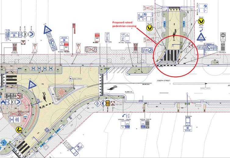
Proposed Raised
Pedestrian Crossing at Taylor Street, Lidcombe
Council has previously undertaken
consultation on the Lidcombe Town Centre Public Domain Plan and concept plan
for the Joseph Street Precinct Upgrade project. Council will continue to
consult with businesses and the community as the project progresses.
1. Plan - Taylor
Street, Lidcombe – Proposed Pedestrian Crossing
DOCUMENTS
ASSOCIATED WITH
REPORT CTC-25-028
Attachment 1
Plan - Taylor Street, Lidcombe – Proposed
Pedestrian Crossing
5 February 2025
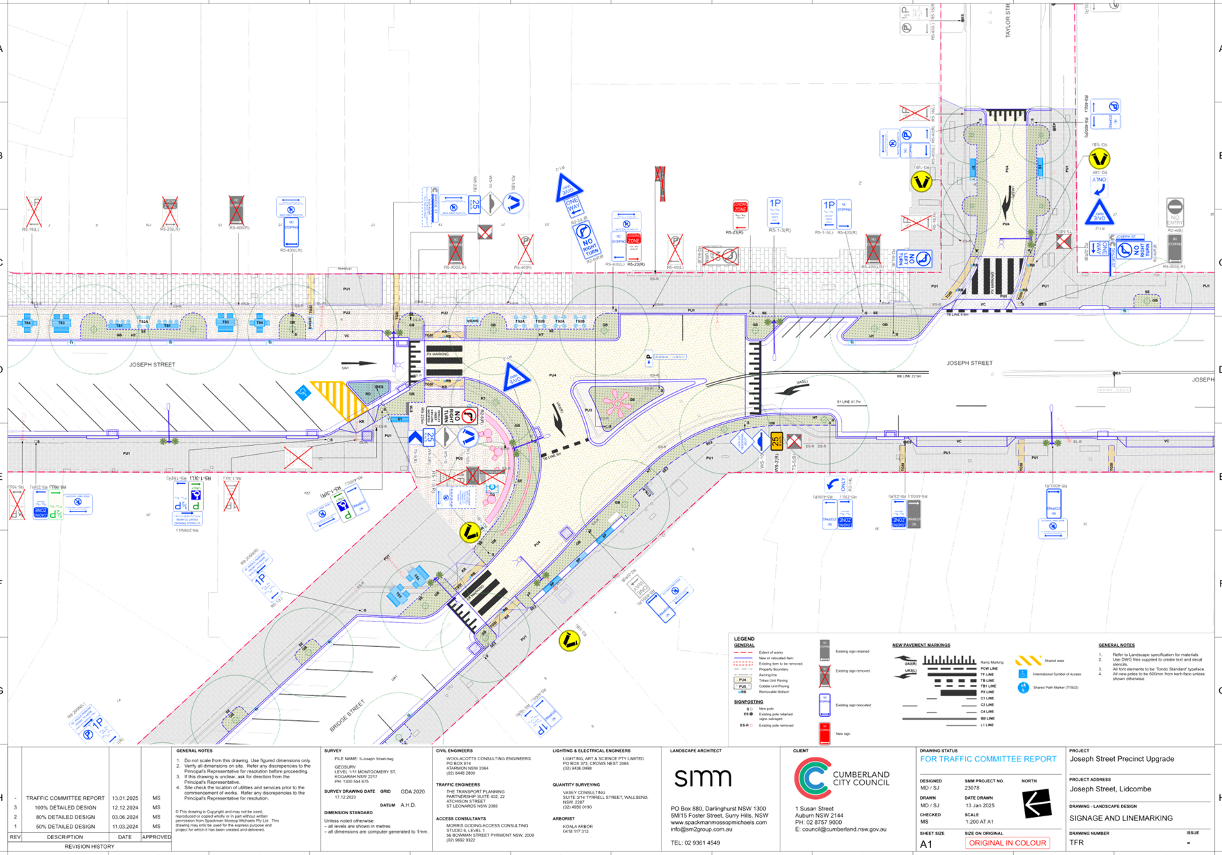
5 February 2025
Item
No: CTC-25-029
GUILDFORD
ROAD, GUILDFORD - PROPOSED TEMPORARY ROAD CLOSURE FOR GUILDFORD FESTIVAL
Directorate: Environment
and Planning
Responsible
Officer: Manager
Engineering and Building
Electorate: Granville
Police Area
Command (PAC): Cumberland
Agenda Part Part
2
Note: Recommendation
to Council
v)
Council has organised
Guildford Festival involving the temporary closure of Guildford Road between
Railway Terrace, and Talbot Road and short sections of Cross Street and Station
Street, Guildford. The event is scheduled on Saturday
24 May 2025 from 4:00 PM to 9:00 PM.
This report gives details of the
temporary road closure.
|
The Traffic Committee
recommends that the temporary full road closure of Guildford
Road between Railway Terrace, and Talbot Road and short sections of Cross
Street and Station Street, Guildford from 6:00 AM on Saturday
24 May 2025 to 2:00AM on Sunday 25 May 2025 be approved, subject to:
1. Approval
from Transport for NSW for the Traffic Management Plan and Traffic Guidance
Scheme.
2. All
affected businesses and emergency stakeholders being notified of the closure.
3. Complying
with the notification requirements of the Roads Act 1993, i.e., placing
public notices in a newspaper and erecting notices on the road.
4. Temporary
bus routes and bus zones replacing the existing bus zones in the closed area
be provided in consultation with the bus operator.
|
Council resolved to hold a
festival in Guildford in 2025.
The Guildford festival will
include live music, children’s activities, food trucks and art showcasing
the diversity of Guildford and the many local businesses.
The festival is planned for
Saturday 24 May 2025 from 4:00 PM to 9:00 PM and proposes the temporary closure
of the following road sections:
· Guildford Road
between Railway Terrace and Talbot Road,
· An
approximately 32 m section of Cross Street south of Guildford Road, and
· An approximately
38 m section of Station Street south of Guildford Road.
The road closures will be effected
from 6:00 AM on Saturday 24 May 2025 to 2:00AM on Sunday 25 May 2025. The
road closure from morning will prevent any parking within the event area and
provide time for event officers to set up stalls and other furniture required
for the event.
The map below shows the closed
sections in red outline.
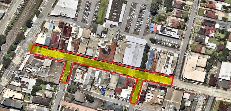
There is no special event
clearways proposed.
Council will liaise with the bus
operators regarding the affected bus routes.
A Copy of the Traffic Management
Plan (TMP) will be forwarded to TfNSW for concurrence.
Council has already commenced with local business. Further
consultation will be undertaken with emergency services and transport
operators. Further engagement will be undertaken with the local businesses
and community in the coming weeks. Variable Message Sign boards will be located
prior to the event. Council will also undertake letter box notifications to
local residents and businesses in Guildford and surrounding areas to advise
them of changes to traffic.
Nil
5 February 2025
Item No: CTC-25-030
MIMOSA STREET,
GRANVILLE - PARTIAL ROAD CLOSURE AT DUCK RIVER
Directorate: Environment
and Planning
Responsible
Officer: Manager
Engineering and Building
Electorate: Granville
Police Area
Command (PAC): Cumberland
Agenda Part Part
2
Note: Recommendation
to Council
Council proposes to close a short
length of the Mimosa Street Road Reserve, Granville and convert it into a
parklet linking Duck River Reserve Park as part of the Duck River Parklands
Strategic Masterplan adopted by Council in December 2022.
This report outlines the outcome
of the investigation into this matter.
The Traffic Committee recommends that Council approve the
partial road closure of Mimosa Street, Granville, in accordance with the
attached plan.
Council is currently working on the implementation of the
Duck River Parklands Strategic Masterplan adopted by Council at its meeting of
21 December 2022. The Masterplan identifies a Parklet on Mimosa Street
Granville as a high priority to improve active transport links, enhance
community participation and connection to Duck River, and to deliver multiple
ecosystem services simultaneously to improve the health outcomes for the river.
In 2023-2024, Council received a Metro Greenspace Grant to construct the Mimosa
Street Parklet.
The Parklet will deliver:
· Nature
play items to provide a connection to the restored natural elements of the
site.
· New
gym station for active recreation
· Park furniture
to provide pause points to enjoy the riparian area.
· Improved
pedestrian connection to the existing shared regional pathway along the Duck
River.
· Water Sensitive
Urban Design (WSUD) treatment of water entering the catchment from Mimosa
Street. This street has no storm water drainage system.
Mimosa Street, Granville is approximately 200m long and ends
at the Duck River Reserve.
The map below shows the location of Mimosa Street Road
Reserve:
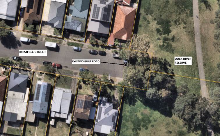
A street view is shown below:
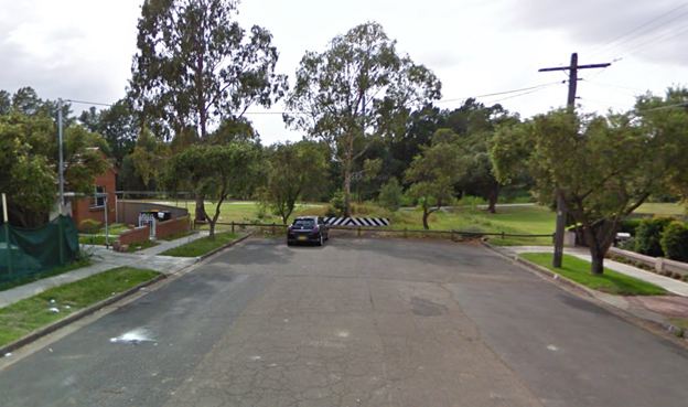
The Mimosa Street Road Reserve extends approximately 12m
beyond the built road which ends at the property boundaries of No. 3 and No. 4.
Mimosa Street. This area of extended corridor is already vegetated.
It is proposed to create a parklet in the Duck River Reserve
which includes the already grassed road corridor. This will create an active
transport link to the existing active transport facility within the Duck River
Reserve. The parklet design does not impact on existing on-street parking
arrangements along Mimosa Street and does not impact on vehicular access as
this section of road corridor is already grassed. As the proposed closure is
beyond the residential properties, the access to the residential properties are
maintained. This closure does not require a Traffic Management Plan (TMP)
approval by Transport for NSW, as the closure will not have any impact on
vehicular travel or access to the properties.
The road closure approval will
formalise the creation of the parklet in this section.
The proposed Mimosa Street Parklet
was publicly exhibited from Monday 21 August 2023 – Monday 18 September
2023, receiving positive feedback to the proposal.
1. Plan – Duck
River Reserve - Proposed Partial Road Closure of Mimosa Street, Granville
DOCUMENTS
ASSOCIATED WITH
REPORT CTC-25-030
Attachment 1
Plan – Duck River Reserve - Proposed Partial
Road Closure of Mimosa Street, Granville
5 February 2025
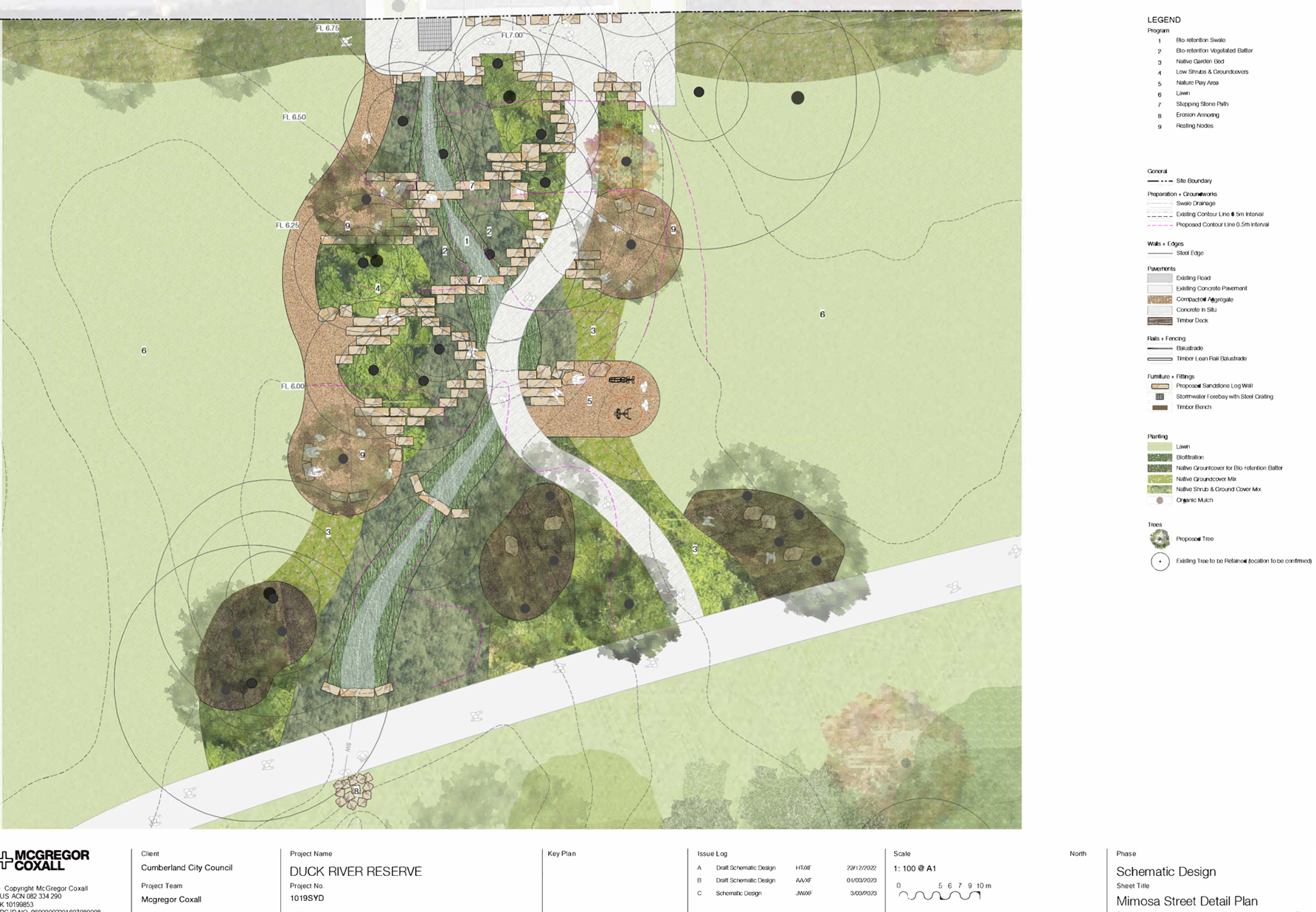
5 February 2025
Item No: CTC-25-031
SEVENTH
STREET, GRANVILLE - PARTIAL ROAD CLOSURE AT DUCK RIVER
Directorate: Environment
and Planning
Responsible
Officer: Manager
Engineering and Building
Electorate: Granville
Police Area
Command (PAC): Cumberland
Agenda Part Part
2
Note: Recommendation
to Council
Council proposes to close a short
length of Seventh Street, Granville and convert it into a reserve linking Duck
River Reserve as part of the Duck River Parklands Strategic Masterplan adopted
by Council in December 2022.
This report outlines the outcome
of the investigation into this matter.
The Traffic Committee recommends that Council approve the
partial road closure of Seventh Street, Granville, in accordance with the
attached plan.
Council is currently working on the implementation of the
Duck River Parklands Strategic Masterplan adopted by Council at its meeting of
21 December 2022.
The Masterplan identifies a Parklet on Seventh Street (dead
end) Granville as a high priority to improve active transport links, enhance
community participation and connection to Duck River, and to deliver multiple
ecosystem services simultaneously to improve the health outcomes for the river.
In 2023-2024, Council received a Metro Greenspace Grant from the NSW Government
to construct the Seventh Street Parklet.
The Parklet will deliver:
· Park furniture to
provide pause points to enjoy the unique landscape setting.
· A new seating area
to enjoy views along the length of the River towards the Grey Headed Flying Fox
Colony.
· Improved and safer
regional transport connection for pedestrians and cyclist along the Duck River.
· Water Sensitive
Urban Design (WSUD) features to capture storm water from Seventh Street,
thereby improving the quality of water entering the Duck River.
Seventh Street, Granville is a ‘dead end’ road,
approximately 245m long and ends at the Duck River Reserve.
The map below shows the location of Seventh Street,
Granville:
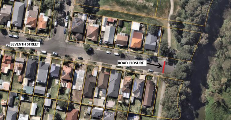
A streetview is shown below:
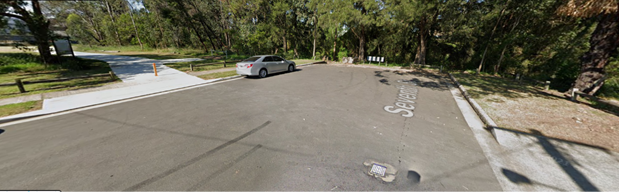
It is proposed to close Seventh Street at the Duck River
pathway to continue the active transport link and convert the section of the
street into a parklet leading up to a boardwalk into the Duck River Reserve. It
is noted that there are no houses accessing from this section of road. As the proposed closure is beyond the residential
properties, the access to the residential properties are maintained. This
closure does not require a Traffic Management Plan (TMP) approval by Transport
for NSW, as the closure will not have any impact on vehicular travel or access
to the properties.
The road closure approval will formalise the creation of the
parklet in this section.
The proposed Seventh Street
Parklet was publicly exhibited from Monday 21 August 2023 – Monday 18
September 2023, receiving positive feedback to the proposal.
1. Plans – Duck
River Reserve - Proposed Partial Road Closure of Seventh Street, Granville
DOCUMENTS
ASSOCIATED WITH
REPORT CTC-25-031
Attachment 1
Plans – Duck River Reserve - Proposed Partial
Road Closure of Seventh Street, Granville
5 February 2025
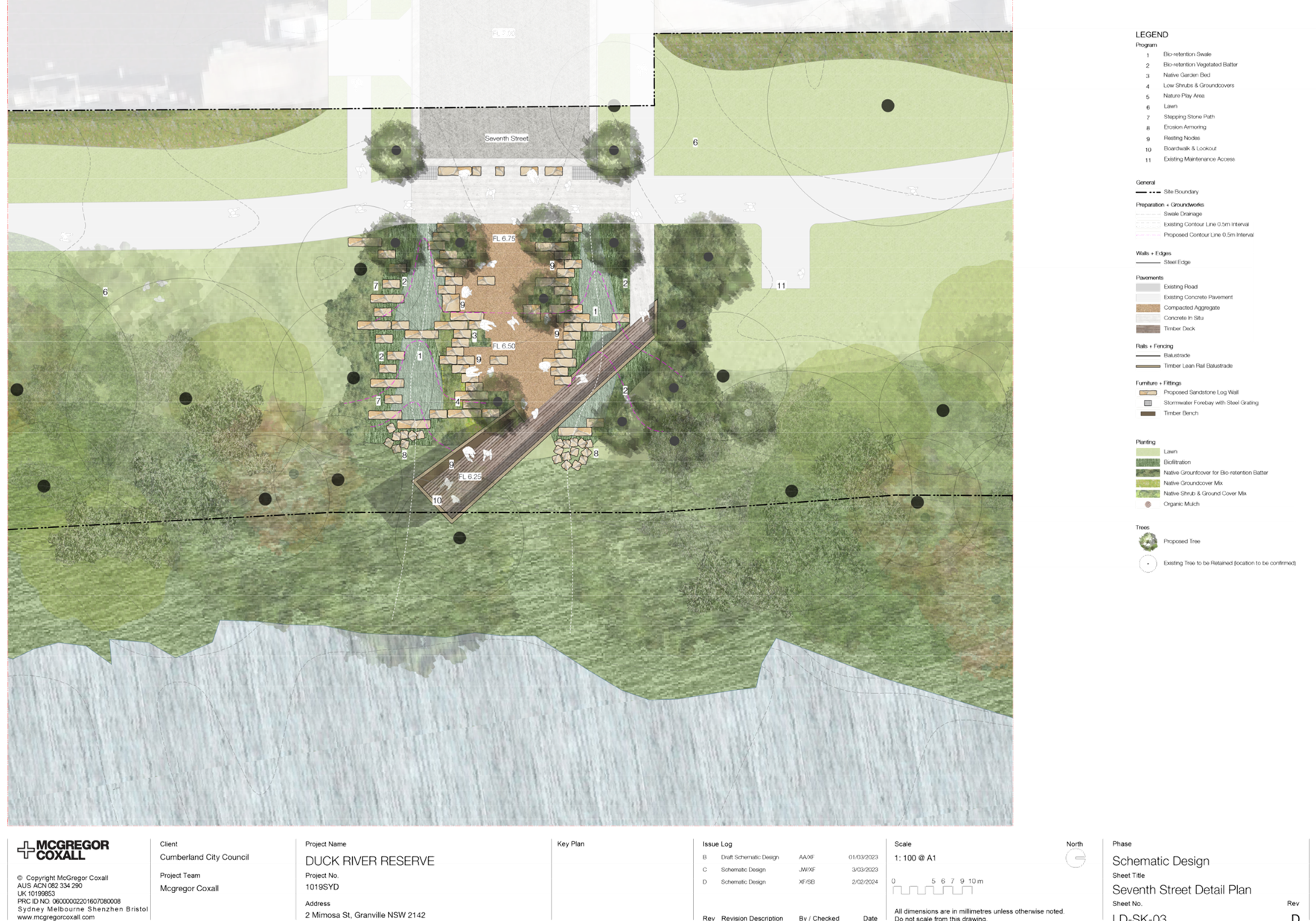
5 February 2025
Item No: CTC-25-032
WINGELLO
STREET AND SWIFT STREET, GUILDFORD – PROPOSED 'ONE WAY' - CONSULTATION
RESULT
Directorate: Environment
and Planning
Responsible
Officer: Manager
Engineering and Building
Electorate: Granville
Police Area
Command (PAC): Cumberland
Agenda Part Part
2
Note: Recommendation
to Council
Council has received a request
from local residents to convert Wingello Street and Swift Street in Guildford
from ‘bi-directional’ to ‘one-way’.
This report outlines the outcome
of the investigation into this matter.
The Traffic Committee recommends that:
1. Option
1 ‘one-way’ traffic arrangement in Wingello Street and Swift
Street, Guildford be supported in principle.
2. Council
prepare a Traffic Management Plan (TMP) and forward to Transport for NSW for
approval.
3. The
affected/ concerned residents be notified of the outcome.
Cumberland Traffic Committee
(CTC) at its meeting in February 2024 considered a report (CTC-24-023)
regarding ‘One-way’ traffic arrangement in Wingello Street and
Swift Street, Guildford. Council resolved to develop plans and undertake consultation
with the residents of Wingello Street and Swift Street, Guildford to determine
support for the ‘One-way’ arrangement and report back to Cumberland
Traffic Committee.
Consultation was carried out
with the residents of Wingello Street and Swift Street in October 2024. A total
of 251 letters with an attached survey form and plans were distributed to the
residents/owners. The following options were listed in the survey form:
Option 1:
I support the
‘One-way’ clockwise flow direction in Wingello Street and Swift
Street as per option 1 attached.
Option 2:
I support the
‘One-way’ anti - clockwise flow direction in Wingello Street and
Swift Street as per option 2 attached.
i)
Option 3:
I do not support either
‘One-way’ direction option and believe that Council should leave as
is.
ii)
There
were 13 responses (6% of the total letters sent) by the closing date including
1 response that made no selection. The feedback are summarised below:
· 6
responses (46.2%) supported option 1;
· 1
response (7.7%) supported option 2;
· 5
responses (38.5%) supported option 3 and
· 1
(7.7%) response made no selection but suggested timed marking.
Based on the above result, as
majority of the respondents supported option 1, it is recommended that option 1
be supported as per the plan attached.
The proposal was notified to the
impacted resident for a period of 14 days from 8 October 2024 to 22 October
2024.
Council received 13 responses
(6% of the total letters sent) by the closing date. Of these responses, 6
responses supported option 1; 1 response supported option 2; 5 responses
supported option 3 and 1 response with no selection made.
1. Concept Plan -
Option 1 -One Way Arrangement
2. Previous
Report – CTC-24-023
3. Submissions
DOCUMENTS
ASSOCIATED WITH
REPORT CTC-25-032
Attachment 1
Concept Plan - Option 1 -One Way Arrangement
5 February 2025
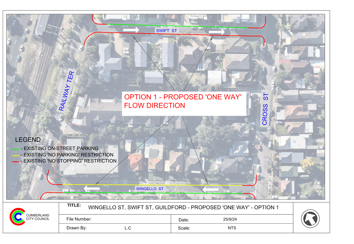
DOCUMENTS
ASSOCIATED WITH
REPORT CTC-25-032
Attachment 2
Previous Report – CTC-24-023
DOCUMENTS
ASSOCIATED WITH
REPORT CTC-25-032
Attachment 3
Submissions
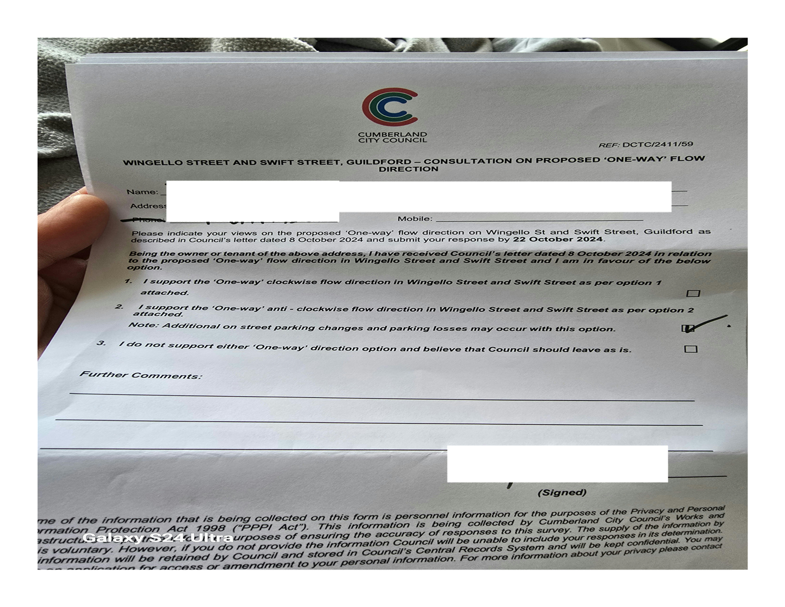
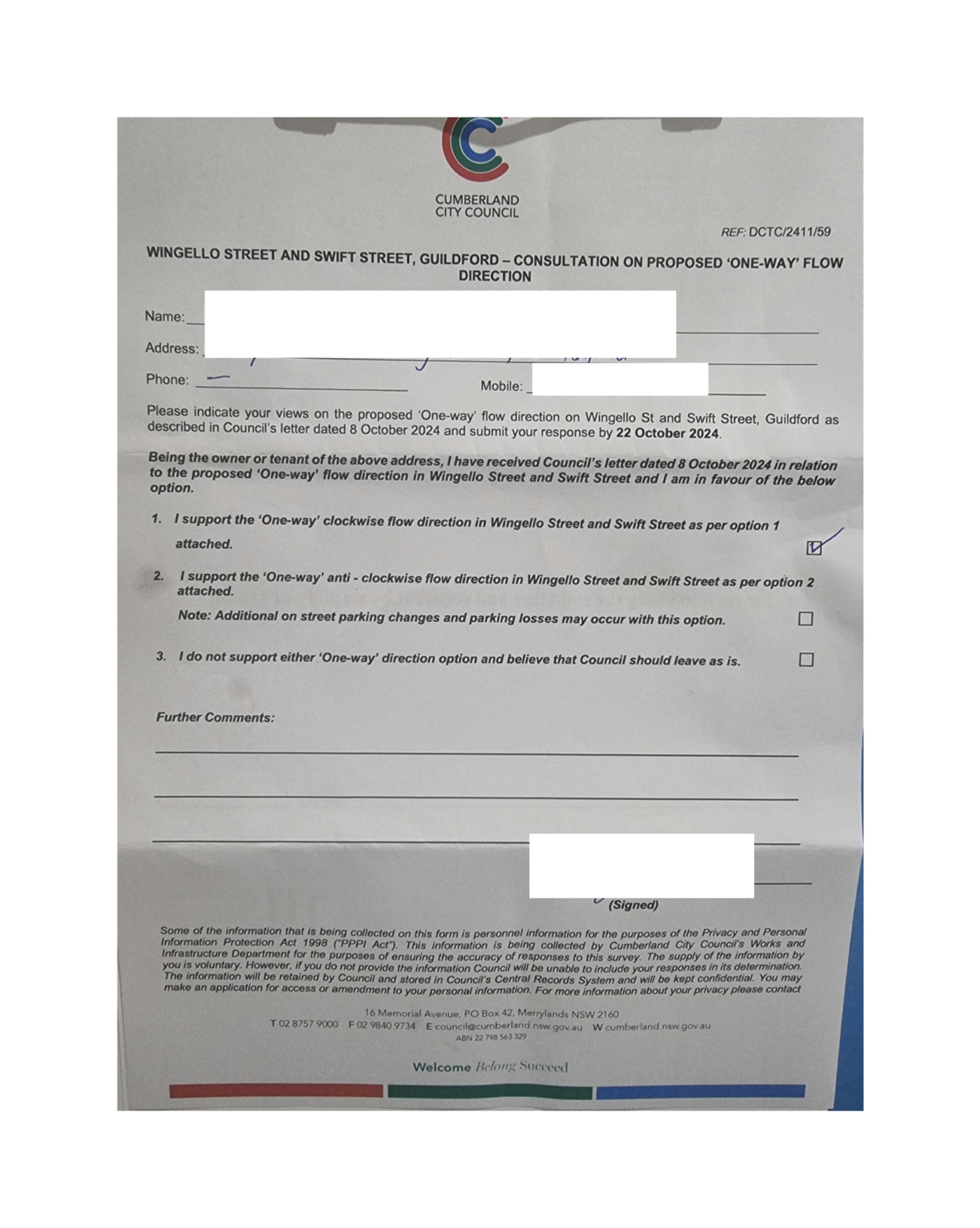
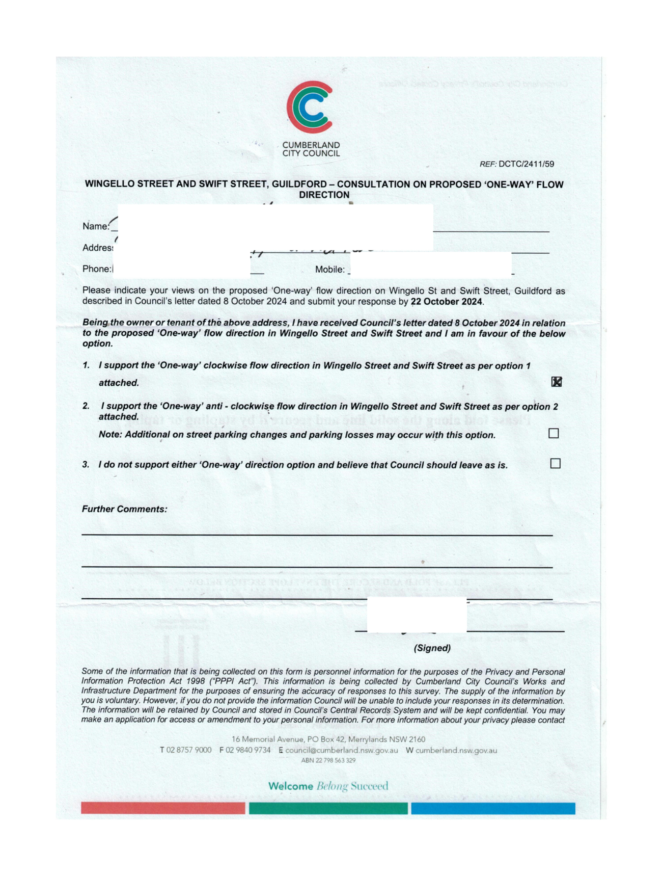
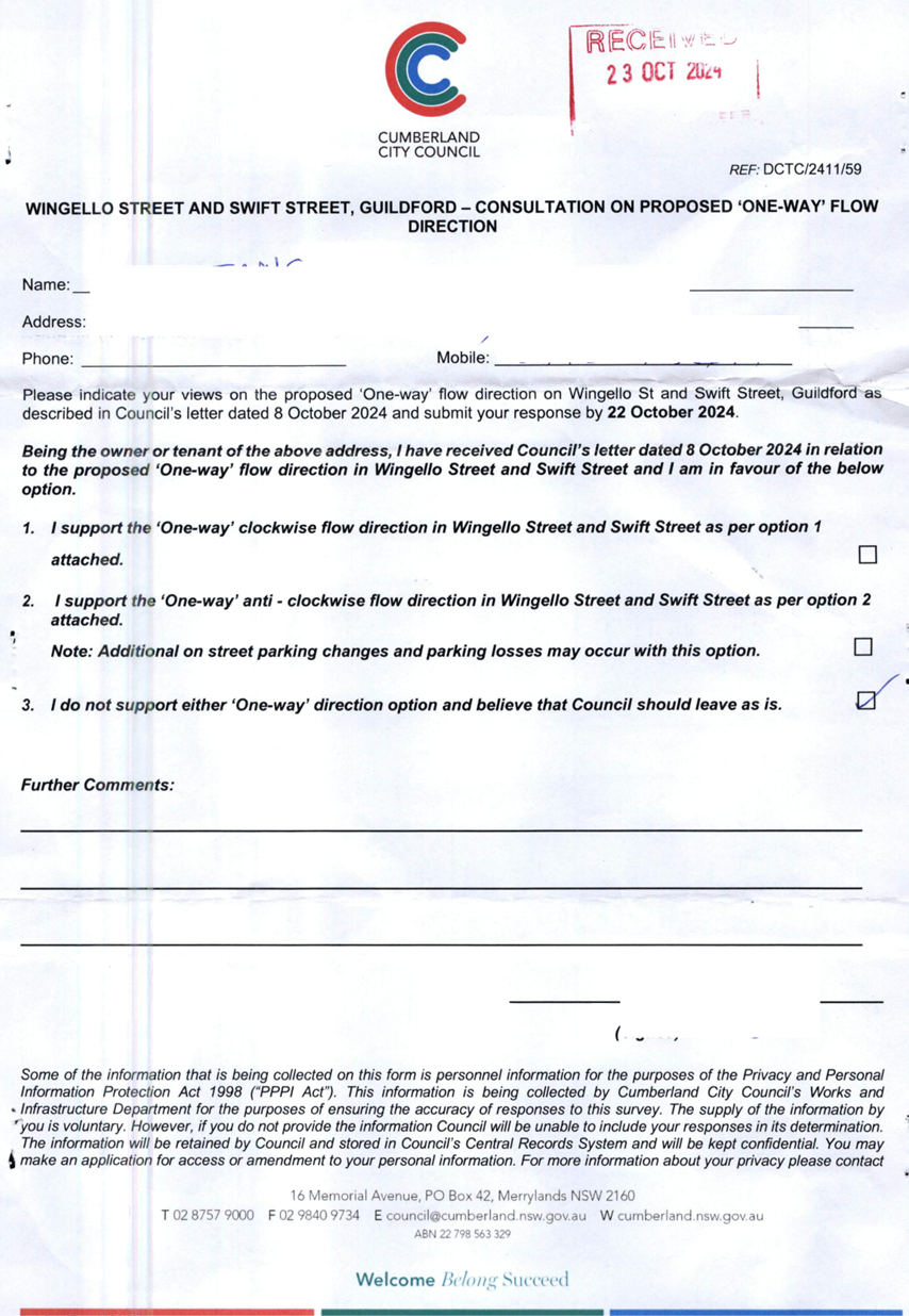

5 February 2025
Item No: CTC-25-033
ROSEBERRY
STREET AND MARY STREET, MERRYLANDS – PROPOSED ROUNDABOUT
Directorate: Environment
and Planning
Responsible
Officer: Manager
Engineering and Building
Electorate: Granville
Police Area
Command (PAC): Cumberland
Agenda Part Part
2
Note: Recommendation
to Council
Council has received a request
from a local resident for the installation of a roundabout at the intersection
of Roseberry Street and Mary Street, Merrylands due to safety concerns.
This report outlines the outcome
of the investigation into this matter.
The Traffic Committee recommended that:
1. The
installation of speed cushions on Mary Street approaches at its intersection
with Roseberry Street, Merrylands be supported.
2. Council
undertake consultation with adjacent residents.
Mary Street is a local road that runs in a north-south
direction with a posted speed limit of 50 km/h. It has a width of approximately
10.4m and parking is permitted on both sides of the road unless otherwise
signposted.
Roseberry Street is a local road that runs in an east-west
direction with a posted speed limit of 50 km/h. It has a width of approximately
12.5m and parking is permitted on both sides of the road unless signposted.
Roseberry Street and Mary Street form a four-way
intersection, with priority given to Roseberry Street. Currently, there are
‘Stop’ signs and ‘BL2’ line markings on the approaches
at this intersection provided on Mary Street.


Locality Plan
Council has received concerns from a local resident
regarding road safety at the intersection of Roseberry Street and Mary Street.
The latest Centre for Road Safety crash data indicates that
there was one reported crash at the intersection of Roseberry Street and Mary
Street in the five years, ending September 2023. The accident details are
listed in the table below.
|
Date
|
Location
|
Description
|
|
03/02/2022
|
Roseberry
Street and Mary Street
|
Vehicle
failed to give way
|
Traffic counts were undertaken in Roseberry Street and Mary
Street, Merrylands in July 2024. The traffic count locations are marked on the
same map above.
Traffic Count Data in Roseberry Street and Mary
Street:
|
|
Approach
|
Average daily traffic (Veh/day)
|
Average Peak Hour (Veh/hr)
|
85th %tile speed (Km/hr)
|
|
AM
|
PM
|
Towards the intersection
|
Both directions
|
|
Mary Street
|
Western
|
631
|
51
|
55
|
39.8
|
39.06
|
|
Roseberry Street
|
Southern
|
4201
|
283
|
341
|
53.3
|
53.82
|
The peak hour traffic volume in Mary Street is approximately
six times less in comparison to Roseberry Street. It indicates that Mary Street
has a lower priority, and this is reflected by the existing ‘Stop’
controls from Mary Street.
Considering the uneven traffic flow from the two streets, it
suggests that there may be delays at the intersection if a roundabout is
implemented. According to Austroads Guide to Traffic Management Part 6
– Intersections, Interchanges and Crossings, Table 2.10: Key
traffic management considerations in the selection of roundabouts.
“Dominant flows on one
approach may lead to excessive delay on the subsequent approach…”
Based on the above and the lack of reported accidents, a
roundabout at the intersection of Roseberry Street and Mary Street is not
warranted and should not be supported.
However, the approach speed on Mary Street towards the STOP
control at Roseberry Street is high considering the traffic count was taken
near the intersection. It is proposed to install speed cushions on Mary Street
on the approaches to the intersection to enhance safety at the intersection.
A plan is attached showing the details of the speed
cushions.
Consultation will be undertaken if
Traffic Committee recommends the proposed speed cushions.
1. Plan - Roseberry
Street & Mary Street, Merrylands - Proposed speed cushions on Mary Street
DOCUMENTS
ASSOCIATED WITH
REPORT CTC-25-033
Attachment 1
Plan - Roseberry Street & Mary Street, Merrylands
- Proposed speed cushions on Mary Street
5 February 2025
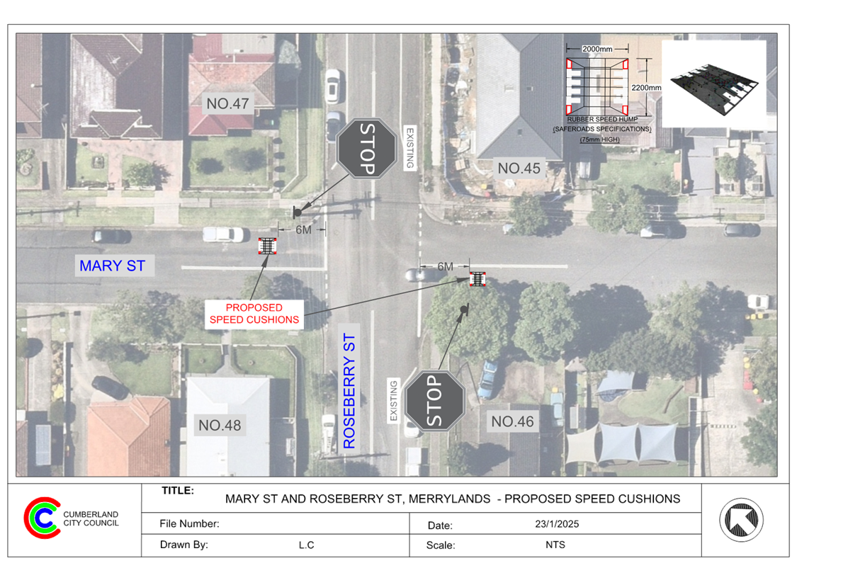
5 February 2025
Item No: CTC-25-034
PHILLIPS
AVENUE, GREATREX AVENUE AND COLEMAN AVENUE, REGENTS PARK – PROPOSED
TRAFFIC CALMING MEASURES
Directorate: Environment
and Planning
Responsible
Officer: Manager
Engineering and Building
Electorate: Auburn
Police Area
Command (PAC): Auburn
Agenda Part Part
2
Note: Recommendation
to Council
Council has received concerns from residents adjacent to the
intersections of Coleman Avenue, Greatrex Avenue and Phillips Avenue, Regents
Park.
This report outlines the outcome of the investigation into
this matter.
The Traffic Committee recommends that Council to
undertake consultation with the residents in Greatrex Avenue and Phillips
Avenue, Regents Park to assess support or otherwise for the installation of
traffic calming devices in these streets.
Coleman Avenue is a no-through road that runs in a
north-south direction with a speed limit of 50 km/h. It has a width of
approximately 7.3m and 50m long, parking is permitted on both sides of the road
in accordance with Road Rules unless otherwise signposted.
Greatrex Avenue is a local road that runs in an east-west
direction between Whiting Street and Phillips Avenue with a speed limit of 50
km/h. It has a width of approximately 7.3m and 105m long. Parking is permitted
on both sides of the road in accordance with Road Rules unless otherwise
signposted.
Phillips Avenue is a local road that runs in an east-west
direction in general, connecting Kibo Road and Kingsland Road with a speed
limit of 50 km/h. Phillips Avenue has a width of 7.3m and approximately 435m
long.
Both Coleman Avenue and Greatrex Avenue form Y-intersections
at Phillips Avenue, with priority to Phillips Avenue.
The map below shows the streets under consideration.
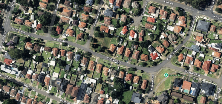
The latest Centre for Road Safety crash data indicated that
there were no reported crashes related to parked vehicles or sight distance at
this intersection in the last 5 years ending March 2024.
Residents have raised concerns about speeding traffic
through this area and safety at the intersections.
To address the above concerns, Council proposes to undertake
traffic counts in all three streets and analyse the data, and to carry out
consultation with the residents to assess support or otherwise for traffic
calming measures in the streets or at the intersections.
Subject to endorsement,
consultation will be undertaken with affected
residents.
Nil
5 February 2025
Item No: CTC-25-035
HAWKSVIEW
STREET, GUILDFORD – PROPOSED PEDESTRIAN FENCING
Directorate: Environment
and Planning
Responsible
Officer: Manager
Engineering and Building
Electorate: Granville
Police Area
Command (PAC): Cumberland
Agenda Part Part
2
Note: Recommendation
to Council
Council has received safety concerns from residents
regarding vehicles speeding and crashing into a property near No. 48 Hawksview
Street, Guildford.
This report outlines the outcome of the investigation into
this matter.
The Traffic Committee recommends that:
1. The
installation of a 10m pedestrian safety fencing along the frontage of No.48
Hawksview Street, Guildford in accordance with the attached plan be approved.
2. The
affected / concerned residents be notified of the outcome.
Hawksview Street is a regional road that runs in an
east-west direction with a speed limit of 50 km/h and is approximately 13m
wide. Parking is permitted on both sides of the road unless otherwise
signposted.
Hawksview Street forms a
T intersection with Roseberry Street which priority is given to Hawksview
Street.
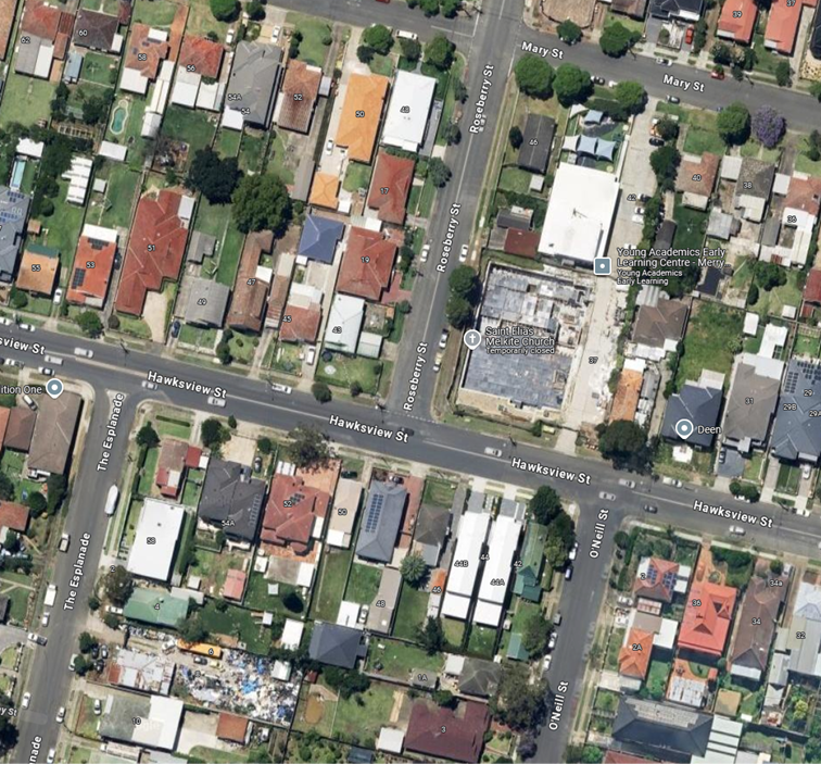
Locality Plan
The latest Centre for Road Safety accident data indicated
that there were no reported accidents related to parked vehicles or sight
distance at this intersection in the last 5 years ending September 2023.
Council officers have been advised of a crash at this
intersection in September 2024, which resulted in the fence at 48 Hawksview
Street being destroyed. In order to improve safety, it is proposed to install a
pedestrian safety fence as per the attached plan in response to the safety
concerns raised.
The proposal was notified to the
impacted residents for a period of 14 days starting from 7 January 2025 to 24
January 2025.
No submissions were received.
1. Plan – 48
Hawksview Street, Guildford – Proposed Pedestrian Fencing
DOCUMENTS
ASSOCIATED WITH
REPORT CTC-25-035
Attachment 1
Plan – 48 Hawksview Street, Guildford –
Proposed Pedestrian Fencing
5 February 2025
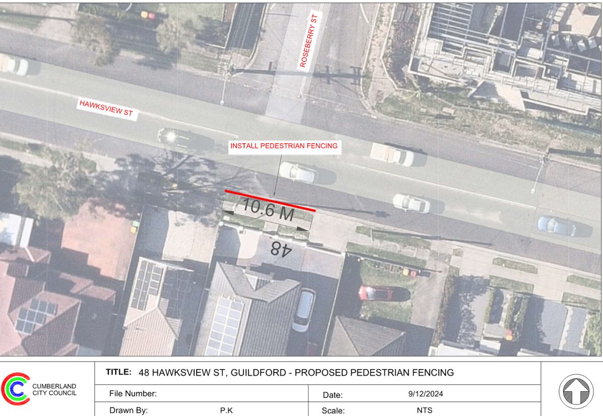
5 February 2025
Item No: CTC-25-036
TILBA STREET,
BERALA - RESPONSE TO NOTICE OF MOTION - REQUEST FOR A PEDESTRIAN CROSSING
Directorate: Environment
and Planning
Responsible
Officer: Manager
Engineering and Building
Electorate: Auburn
Police Area
Command (PAC): Auburn
Agenda Part Part
2
Note: Recommendation
to Council
Council at its meeting on 13
November 2024 agreed in a notice of motion to investigate the potential
installation of a pedestrian crossing or speed hump on Tilba Street, Berala
near Jack and Jill Reserve.
This report outlines the outcome
of the review.
The Traffic Committee recommends that:
1. A
marked pedestrian crossing in Tilba Street, Berala, be approved in principle.
2. Council
design the proposed pedestrian crossing at the existing pedestrian refuge
location and undertake consultation with adjacent and affected properties and
report back to the Traffic Committee.
Council has received requests
from a resident for the provision of a pedestrian crossing on Tilba St, Berala
near Jack and Jill Reserve due to safety concerns. This matter was discussed in
Council meeting on 13 November 2024 as a notice of motion (C11/24-22).
Some residents were not
satisfied with the walking experience across Tilba Street, and prefer to cross
Tilba Street at the existing pedestrian refuge to access Jack and Jill Reserve.
Tilba Street is a local road that runs in an east–west
direction between Graham Street and Woodburn Road with a sign-posted speed
limit of 50 km/h. It has a width of approximately 12.7m and parking is
permitted on both sides of the road unless otherwise signposted.
Jack and Jill Reserve is located
on the north side of Tilba Street between No. 25 and No. 37 with playground
facilities. The map below shows the location of this reserve.
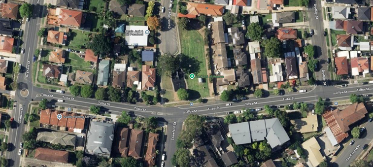
Locality Plan
Following the request, Council officers have investigated
pedestrian and vehicle numbers in this section of Tilba Street.
Council has undertaken a pedestrian and vehicle count on a
Thursday in early December 2024 in Tilba Street at the existing pedestrian
refuge.
|
Time Period
|
Unaccompanied
School Students (*)
|
Adult Pedestrians
|
Total
|
Vehicles
|
|
08:00-09:00
|
1
|
15
|
17
|
384
|
|
09:00-10:00
|
0
|
13
|
13
|
197
|
|
10:00-11:00
|
1
|
23
|
25
|
165
|
|
15:00-16:00
|
11
|
30
|
52
|
386
|
|
16:00-17:00
|
5
|
24
|
34
|
270
|
|
17:00-18:00
|
2
|
25
|
29
|
305
|
|
18:00-19:00
|
2
|
19
|
23
|
257
|
(*)
The students observed are of high school age.
It is evident that pedestrian numbers including students
were significantly high in the evenings between 3 and 6 PM.
Pedestrian Crossing Warrants
Council has developed its own guidelines for the provision
of pedestrian crossings on local roads especially at high demand locations
including schools, community facilities, parks, hospitals, medical facilities,
town centres, neighbourhood shops and public transport facilities.
A
pedestrian (zebra) crossing is deemed to meet the numerical warrant for a
pedestrian (zebra) crossing if the crossing point meets the following criteria:
· In each of two separate one-hour periods in a typical day,
the pedestrian flow per hour crossing the road is or is expected to be equal to
or greater than 20, and vehicle volumes be equal to or greater than 200. Where
each unaccompanied child, elderly person or mobility impaired pedestrian is
counted as two pedestrians.
In addition to the above, all requirements set down in
Australian Standards are to be met.
Based on the data collated, the warrant for pedestrians
crossing at this location was lower than the warrant and the number of vehicles
was lower than the warrant. However, the guideline allows for a deviation
in the warrant for pedestrian crossings for circumstances where there is a
strategic link. The current Tilba Road location provides a link from Berala
Station via Crawford Street, crossing Tilba Street into Jack and Jill Reserve
and along Cambridge Street through to Mt Auburn Road.
It is proposed to convert the existing pedestrian refuge to
a marked pedestrian crossing, with consultation with adjacent and affected
residents on the proposal.
Subject to endorsement, Council
will prepare a design for the proposed pedestrian crossing and undertake
consultation with adjacent and affected residents.
Nil
5 February 2025
Item No: CTC-25-037
DANIEL STREET,
GRANVILLE - REQUEST FOR PEDESTRIAN CROSSING
Directorate: Environment
and Planning
Responsible
Officer: Manager
Engineering and Building
Electorate: Granville
Police Area
Command (PAC): Cumberland
Agenda Part Part
2
Note: Recommendation
to Council
Council has received a request from a parent of a student
for a pedestrian crossing on Daniel Street, Guildford east near Walter Street
Intersection north from Granville Public School due to safety concerns.
This report outlines the outcome of the investigation into
this matter.
The Traffic Committee recommends that:
1. The
proposed marked pedestrian crossing on Daniel Street, Granville be approved in
principle.
2. Council
forward final design plans to Transport for NSW for concurrence.
3. Council
undertake consultation with the residents and Granville Public School regarding
the proposed marked pedestrian crossing in Daniel Street, Granville and report
back to the Traffic Committee if objections are received.
Council has received a request
from residents for the provision of a pedestrian crossing on Daniel Street,
Granville at Walter Street.
Daniel Street is a local road
that runs in an east–west direction between Woodville Road and The
Avenue. The section of interest is between Walter Street and The Avenue. This
section of Daniel Street is approximately 370m long and 6.9m wide while
indented parking is provided on both sides of the street. The street has a
default speed limit of 50 km/h and 40km/h during school hours.
Granville Public School is
located on the southern side of Daniel Street opposite Walter Street and has a
capacity of 595 students. The school currently enrols students from
Kindergarten to Year 6.
There is a ‘Children
Crossing’ located on Daniel Street just east of Walter Street.
The map below shows the location
of Daniel Street, Granville and the school:
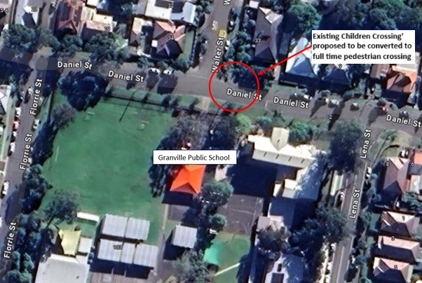
The latest Centre for Road Safety accident data indicated
that there were no reported accidents on Daniel Street in the last 5 years
ending September 2023 that involves pedestrians.
Council’s officers
have investigated the request for a pedestrian crossing outside Granville
Public School on Daniel Street, Granville.
Council undertook
pedestrian and vehicle counts on Daniel Street outside the Granville Public
School on 28 May 2024 during ‘School Zone’ hours. The location is
shown in the red circle on the map above.
The hourly count data
during school zone hours is given below:
|
Time Period
|
Vehicle Numbers per
hour
|
Unaccompanied
Student Numbers per hour
|
Adult Pedestrian
and Accompanied Students Numbers per hour
|
Total Pedestrian
Numbers per hour (*)
|
|
08:30-09:30
|
240
|
2
|
58
|
62
|
|
14:30-15:30
|
265
|
9
|
144
|
162
|
Note: * The total pedestrian numbers include factoring 2 for
unaccompanied students.
Pedestrian Crossing Warrants
Council has developed its own guidelines for the provision
of pedestrian crossings on local roads especially at high demand locations
including schools, community facilities, parks, hospitals, medical facilities,
town centres, neighbourhood shops and public transport facilities.
A pedestrian (zebra) crossing is deemed to meet the
numerical warrant for a pedestrian (zebra) crossing if the crossing point meets
the following criteria:
· In each of two
separate one-hour periods in a typical day, the pedestrian flow per hour
crossing the road is or is expected to be equal to or greater than 20, and
vehicle volumes be equal to or greater than 200. Where each unaccompanied
child, elderly person or mobility impaired pedestrian is counted as two
pedestrians.
In addition to the above, all requirements set down in
Australian Standards are to be met.
The vehicle and pedestrian counts undertaken in Daniel
Street satisfies the requirements for a marked pedestrian crossing. It is
proposed to convert the existing ‘Children Crossing’ on Daniel
Street to a full time marked pedestrian crossing to enhance safety for
pedestrians, including school students crossing Daniel Street.
Subject to endorsement, Council
officers will carry out consultation with school and surrounding residents.
Nil
5 February 2025
Item No: CTC-25-038
KING STREET,
GUILDFORD WEST - REQUEST FOR PEDESTRIAN CROSSING
Directorate: Environment
and Planning
Responsible
Officer: Manager
Engineering and Building
Electorate: Granville
Police Area
Command (PAC): Cumberland
Agenda Part Part
2
Note: Recommendation
to Council
Council has received a request
from a resident for a marked pedestrian crossing on King Street, Guildford
West, east of Princes Street, outside Guildford West Public School due to
safety concerns.
This report outlines the outcome
of the investigation into this matter.
the Traffic Committee recommends that:
1. The
proposed marked pedestrian crossing on King Street, Guildford West be approved
in principle subject to consultation.
2. Council
forward final design plans to Transport for NSW for concurrence.
3. Council
undertake consultation with the residents and Guildford West Public School
regarding the proposed marked pedestrian crossing in King Street, Guildford
West and report back to the Traffic Committee if objections are received.
Council has received a request from a resident for a marked
pedestrian crossing on King Street, Guildford West, east of Princes Street,
outside Guildford West Public School due to safety concerns.
King Street is a local road that
runs in an east–west direction between Fairfield Road and Palmer Street.
The section of interest is between Princes Street and Hall Place. This section
of King Street is approximately 85m long and 13.6m wide, with a default speed
limit of 50 km/h and 40km/h during school hours.
Guildford West Public School is
located on King Street and has a capacity of 363 students from Kindergarten to
Year 6. The map below shows the location of King Street and the school.
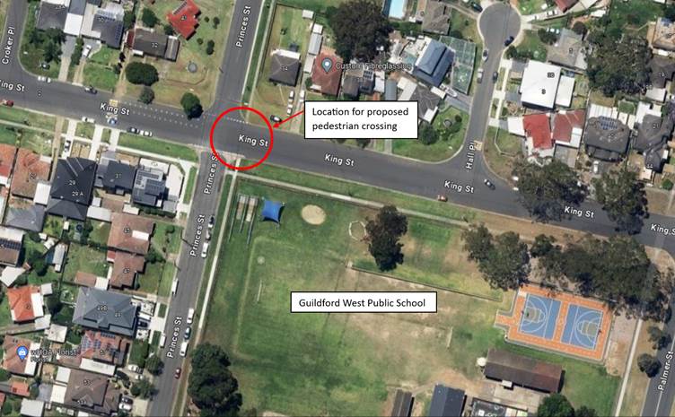
The latest Centre for Road Safety accident data indicated
that there were no reported accidents on King Street in the last 5 years ending
September 2023 that involves pedestrians.
Council officers have investigated the request to provide a
marked pedestrian crossing outside Guildford West Public School on King Street,
Guildford West.
Pedestrian Crossing Warrants
Council has developed its own guidelines for the provision
of pedestrian crossings on local roads especially at high demand locations
including schools, community facilities, parks, hospitals, medical facilities,
town centres, neighbourhood shops and public transport facilities.
A
pedestrian (zebra) crossing is deemed to meet the numerical warrant for a
pedestrian (zebra) crossing if the crossing point meets the following criteria:
· In each of two separate one-hour periods in a typical day,
the pedestrian flow per hour crossing the road is or is expected to be equal to
or greater than 20, and vehicle volumes be equal to or greater than 200. Where
each unaccompanied child, elderly person or mobility impaired pedestrian is
counted as two pedestrians.
In addition to the above, all requirements set down in
Australian Standards are to be met.
Council undertook a pedestrian and vehicle count on King
Street outside the Guildford West Public School on 28 May 2024, the location is
circled in red on the map above.
The hourly count data before and after school times is given
below:
|
Time Period
|
Vehicle Numbers (V
)
|
Unaccompanied
Pedestrian Numbers
|
Adult Pedestrian
Numbers
|
Total Pedestrian
Numbers (P)
|
|
14:45-15:45
|
184
|
16
|
18
|
50
|
|
15:00-16:00
|
168
|
16
|
13
|
45
|
Based on the data collated, the warrant for pedestrians
crossing at this location was met, but the number of vehicles was lower than
the warrant. However, the guideline allows for a deviation in the warrant
for pedestrian crossings for circumstances where there are a number of children
cross the road at a location. Given the high pedestrian activity involving
school students at this location, it is proposed to install a marked pedestrian
crossing to enhance safety for pedestrians crossing King Street.
Subject to endorsement, Council
officers will undertake consultation with school and surrounding residents with
a detailed design of the proposal.
Nil
5 February 2025
Item No: CTC-25-039
CHURCH STREET
& SWETE STREET, LIDCOMBE - PROPOSED RAISED INTERSECTION AND MARKED
PEDESTRIAN CROSSINGS
Directorate: Environment
and Planning
Responsible
Officer: Manager
Engineering and Building
Electorate: Auburn
Police Area
Command (PAC): Auburn
Agenda Part Part
2
Note: Recommendation
to Council
Council has received requests
from residents for the provision of a pedestrian crossing on Church Street,
Lidcombe, near the Swete Street intersection.
In addition, Council also
propose to raise the intersection of Church Street and Swete Street and provide
a pedestrian crossing on Swete Street. This is currently adopted as part of the
Pippita Rail Trail Project; and will be constructed at the same time as the
Church St Crossing to avoid future reconstruction or modification.
This report outlines the outcome
of the review.
The Traffic Committee recommends that:
1. The
proposed marked pedestrian crossings on Church Street and Swete Street,
Lidcombe, including the raised intersection of Church Street and Swete Street
and signage in accordance with the attached plan be approved in-principle.
2. Council
undertake consultation with the affected residents regarding the proposal and
report back to the Traffic Committee if objections are received.
Council has received requests
from residents for the provision of a pedestrian crossing on Church Street,
Lidcombe, near Swete Street intersection. In addition, Council also proposes to
raise the intersection of Church Street and Swete Street and provide a
pedestrian crossing on Swete Street as part of the future shared pathway
included in the Pippita Rail Trail Masterplan.
Church Street is part of a
regional road that runs in an east–west direction connecting State roads,
Parramatta Road, and Olympic Drive. The section of interest is the intersection
of Church Street and Swete Street and approaches.
Church Street east of the Swete
Street roundabout has a road width of 12.4 metres and a speed limit of 60 km/h.
The section west of the roundabout is within the Lidcombe Town Centre and has a
speed limit of 50km/hr. As such, pedestrian crossings are permitted west of the
roundabout. Parking is permitted on both sides of the street unless sign-posted
otherwise.
Swete Street runs in a
North-South direction and is a local road with a width of 12.4m and a speed
limit of 50km/h. Parking is also permitted on both sides of the street unless
sign-posted otherwise. A map of the intersection is shown below.
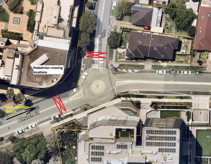
Locality
Plan
Pedestrian Crossing on Church Street, Lidcombe
Council officers have observed pedestrian movements in this
area of Church Street. Based on the observations, it was noted that there are
significant number of pedestrians crossing Church Street on the western side of
the roundabout. Most pedestrians were observed travelling to and from the
apartment towers on the southern side of Church Street east of the Swete Street
roundabout.
Observed pedestrian and vehicle numbers during evening peak
time in June 2024 in Church Street west of the roundabout are shown in the
table below.
|
Time Period
|
Pedestrians
|
Vehicles
|
|
15:45-16:45
|
56
|
1,352
|
|
16:45-17:45
|
81
|
1,479
|
Similar observations during the morning peak also showed
large number of pedestrians crossing the street and high vehicle numbers.
Council has developed its own guidelines for the provision
of pedestrian crossings on local roads especially at high demand locations
including schools, community facilities, parks, hospitals, medical facilities,
town centres, neighbourhood shops and public transport facilities.
A
pedestrian (zebra) crossing is deemed to meet the numerical warrant for a
pedestrian (zebra) crossing if the crossing point meets the following criteria:
· In each of two separate one-hour periods in a typical day,
the pedestrian flow per hour crossing the road is or is expected to be equal to
or greater than 20, and vehicle volumes be equal to or greater than 200. Where
each unaccompanied child, elderly person or mobility impaired pedestrian is
counted as two pedestrians.
In addition to the above, all requirements set down in
Australian Standards are to be met.
The location on Church Street west of Swete Street is within
the Lidcombe Town Centre and has a speed limit of 50km/hr. The observed numbers
as given in the report satisfies all the requirements for a pedestrian
crossing. Other design requirements have been met including advanced warning
line marking, signage, and no parking restrictions. No parking changes are
required, as the existing area is a no stopping zone.
It is proposed that the pedestrian crossing be located at
Church Street, west of Swete Street. It is also proposed to raise the
intersection of Church Street and Swete Street to enhance safety and amenity of
all road users in this location.
Pedestrian Crossing on Swete Street, Lidcombe
The proposed Pippita Rail Trail project connects Lidcombe
station with Sydney Olympic Park, comprising on-road and off-road sections by
using part of the road network and the former Pippita Rail Line corridor. The
shared pathway in this section runs along the northern side of Church Street
and crosses Swete Street just north of the roundabout. The project is also
deemed as a strategic cycleway and active transport corridor and is a case
study within the Central River City- Greater Sydney Strategic Cycleway Corridors.
The concept plan for the Pippita Rail Trail identifies a
priority crossing in Swete Street just north of the roundabout where the
pedestrians and cyclists on the on-road section cross. Council is currently
undertaking a detailed design for the on-road section, which is funded under
the NSW Government’s Get NSW Active program.
The crossing is proposed to be constructed as per the
Pippita Rail Trail design, and only cycleway line marking will be required as
part of the Pippita Rail Trail project. It is also proposed to raise the
intersection of Church Street and Swete Street to enhance safety, amenity and
deliver the section of the Pippita Rail Trail project in full.
Subject to endorsement, Council
will undertake consultation with affected residents.
1. Plan –
Intersection of Church Street and Swete Street, Lidcombe – Proposed
Raised Intersection and Marked Pedestrian Crossings
DOCUMENTS
ASSOCIATED WITH
REPORT CTC-25-039
Attachment 1
Plan – Intersection of Church Street and Swete
Street, Lidcombe – Proposed Raised Intersection and Marked Pedestrian
Crossings
5 February 2025
Item No: CTC-25-040
MILITARY ROAD,
GUILDFORD - PARKING ARRANGEMENT REIVEW
Directorate: Environment
and Planning
Responsible
Officer: Manager
Engineering and Building
Electorate: Granville
Police Area
Command (PAC): Cumberland
Agenda Part Part
2
Note: Recommendation
to Council
Council received requests through
Guildford Public School to convert a section of the existing unrestricted kerb
length along Military Road into a pick-up/drop-off zone outside the school.
This report outlines the outcome
of the investigation into this matter.
The Traffic Committee recommends that:
1. The
existing 68-metre unrestricted parking area along the western side of Military
Road outside Guildford Public School be converted to ‘No Parking
8:00am-9:30am, 2:30pm-3:30pm, School Days’ in accordance with the
attached plan.
2. The
school and affected residents be notified of the outcome.
Council received requests from and
through Guildford Public School to convert a section of unrestricted parking
area into drop-off/pick-up zone outside the school.
Military Road, Guildford is a
collector road that runs in a north-south direction along Granville –
Liverpool railway line on its west side with a sign-posted speed limit of
50km/h. It has a school zone from Turner Street to Calliope
Street with a 40 km/h speed limit during school hours. The street is
approximately 12.6 metres wide with unrestricted parking on the western side of
the road except for the sign-posted ‘No Stopping’ and ‘Bus
Zone’ restrictions.
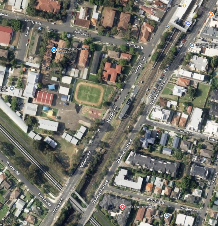 Locality
Plan
Locality
Plan
Council has received requests through a school
representative for the provision of a pick-up / drop-off zone along the
frontage of Guildford Public School on Military Road. The school representative
indicated a need for parents to perform kerbside stopping for students, while
currently vehicles may park in this area without restrictions, creating safety
and enforcement issues.
To improve safety and provide convenience for parents, it is
proposed to introduce a 66m length of ‘No Parking, 8:00am-9:30am,
2:30pm-3:30pm, School Days, Drop off Pick up Only’ restriction to
facilitate pick-up and drop-off activities. This proposed change does not
include the frontage of No. 137 and 138 Military Road properties.
The proposal was notified to the impacted and adjacent residents
for a period of 14 days starting from 5 November 2024 to 19 November 2024.
There were no responses received.
Attachments
1. Plan –
Military Road, Guildford – Proposed ‘No Parking’ Signs
DOCUMENTS
ASSOCIATED WITH
REPORT CTC-25-040
Attachment 1
Plan – Military Road, Guildford – Proposed
‘No Parking’ Signs
5 February 2025
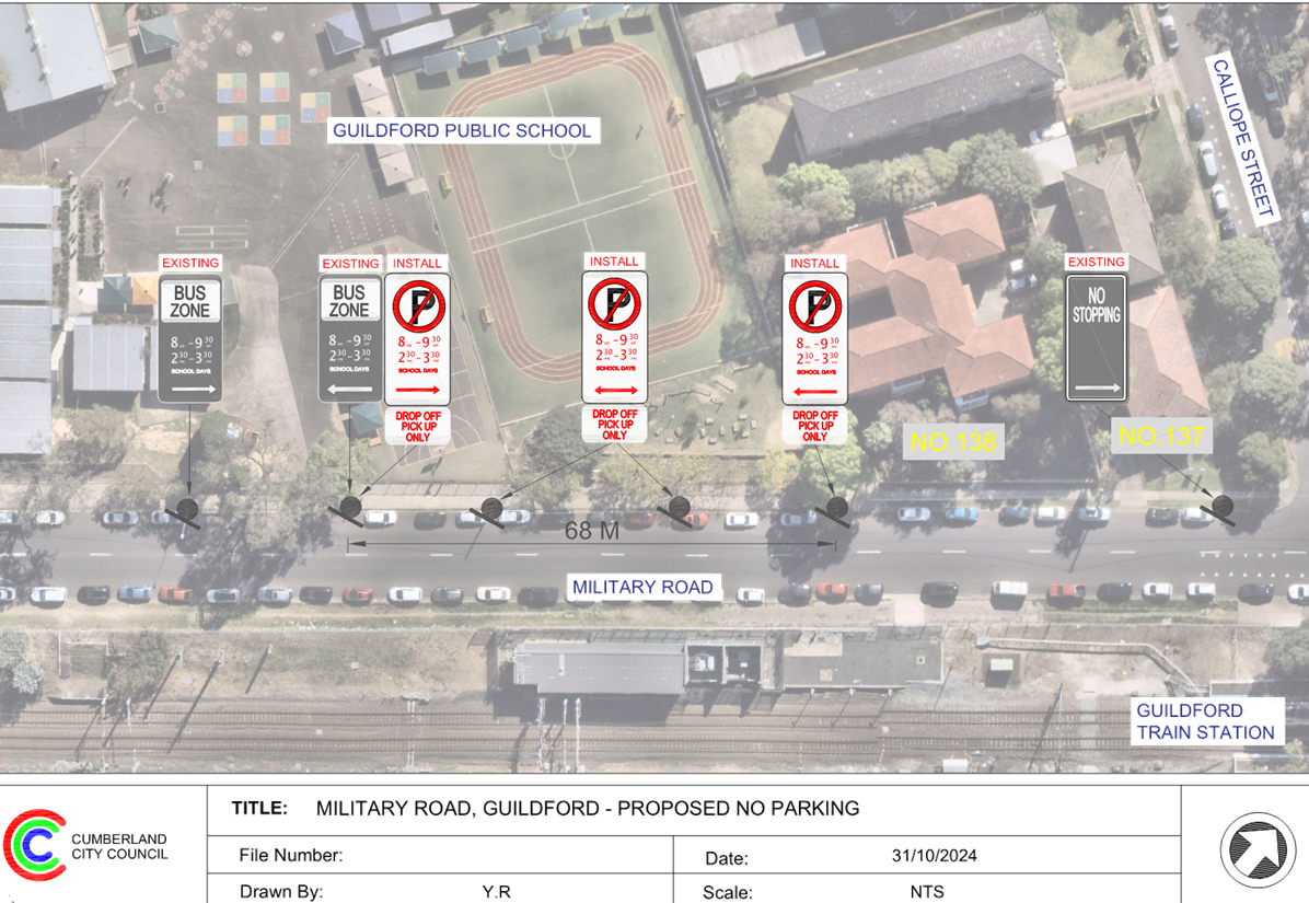
5 February 2025
Item No: CTC-25-041
EXCELSIOR
STREET, WYNYARD STREET AND EVE STREET, GUILDFORD – PROPOSED INTERSECTION
TREATMENT
Directorate: Environment
and Planning
Responsible
Officer: Manager
Engineering and Building
Electorate: Granville
Police Area
Command (PAC): Cumberland
Agenda Part Part
2
Note: Recommendation
to Council
Council has received safety
concerns from residents at the intersection of Excelsior Street with Wynyard
Street and Eve Street, Guildford.
This report outlines the outcome
of the investigation into this matter.
The Traffic Committee recommends that:
1. The
proposed intersection treatment at the intersection of Excelsior Street,
Wynyard Street and Eve Street, Guildford in accordance with the attached plan
be approved in principle.
2. The
affected residents be consulted and Council report back the consultation
results to the Traffic Committee if objections are received.
Excelsior Street is a collector road that runs in a
north-south direction with a speed limit of 50 km/h. It has a width of
approximately 12.6 m and parking is permitted on both sides of the road unless
otherwise signposted.
Wynyard Street is a local road that runs in an east-west
direction connecting Excelsior Street to Woodville Road with a speed limit of
50 km/h. It has a width of approximately 10.7 m and parking is permitted on
both sides of the road unless otherwise signposted.
Eve Street (western segment) is a local road that runs in an
easterly direction from Excelsior Street and ends in a cul-de-sac near Bright
Park with a speed limit of 50 km/h. It has a width of approximately 7.2 m and
parking is permitted on both sides of the road in accordance with Road Rules
unless otherwise signposted.
Excelsior Street, Wynyard Street and Eve Street form a
staggered intersection with priority to Excelsior Street. There are a number of
median islands including painted median on Excelsior Street. Together with kerb
extensions on Excelsior Street acting as ‘chicanes’, the available
road width on Excelsior Street in this area is reduced to allow single lane of
traffic in each direction.
The map below shows the above details.
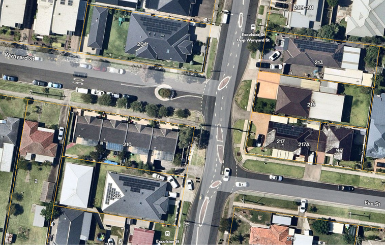
Locality Plan
The latest Centre for Road Safety crash data indicated that
there were no reported crashes at these intersections in the last 5 years
ending March 2024.
Council has received concerns from residents regarding
traffic losing control while passing through Excelsior Street in this section.
Council proposes to install ‘No Stopping’ restrictions, additional
chevron signs and ‘Keep Left’ signs. It is also proposed to install
speed cushions at both ends of the section of Excelsior Street covering the
existing treatment. The signage would prevent parking too close to these
intersections and assist traffic to maintain on the road carriageway while
driving through.
Subject to endorsement,
consultation will be undertaken with affected residents.
1. Plan –
Excelsior Street, Guildford – Proposed Speed Cushions and Signage
DOCUMENTS
ASSOCIATED WITH
REPORT CTC-25-041
Attachment 1
Plan – Excelsior Street, Guildford –
Proposed Speed Cushions and Signage
5 February 2025
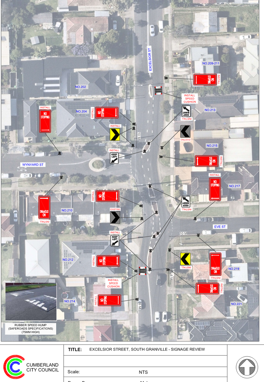
5 February 2025
Item No: CTC-25-042
BRIDGE ROAD,
WESTMEAD – INTERSECTION TREATMENT
Directorate: Environment
and Planning
Responsible
Officer: Manager
Engineering and Building
Electorate: Granville
Police Area
Command (PAC): Cumberland
Agenda Part Part
2
Note: Recommendation
to Council
Council has received concerns from residents regarding
safety at the intersection of Bridge Road and Haig Street, Westmead.
This report outlines the outcome of the investigation into
this matter.
The Traffic Committee recommends that:
1. The
intersection treatment at the intersection of Haigh Street and Bridge Road,
Westmead as per the attached plan be approved.
2. The
installation of ‘EL1’ edge line marking
on both sides of Bridge Road between Haig Street and Killeen Street as per the
attached plan be approved.
3. The
affected / concerned residents be notified of the outcome.
Bridge Road is a local road that runs in a north-south
direction with a speed limit of 50 km/h. It has a width of approximately 12m
and parking is permitted on both sides of the road unless otherwise signposted.
Currently, there are several local area traffic management
devices at the intersection including a chicane on Bridge Road, a raised threshold
on Haig Street at the intersection, kerb blister islands on the eastern side of
Bridge Road outside No. 75, and on the western side of Bridge Road outside No.
66.
The map below shows the area.
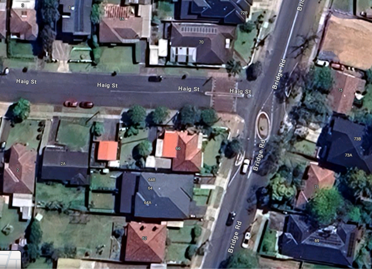
The latest Centre for Road Safety accident data indicated
that there were no reported accidents at this intersection in the last 5 years
ending 2023. However, Council received information about a crash where a car
losing control while negotiating the ‘chicane’. It was alleged that
there were other crashes where mirrors of parked cars were damaged which were
not reported.
It is also alleged by the residents in the vicinity that
cars use the ‘chicane’ for undertaking dangerous U-turns in Bridge
Road and that vehicles occasionally confuse the ‘chicane’ for a
roundabout and do not give way to traffic on Bridge Road.
It is proposed to make a number of road safety improvements
within the area including:
1. To
convert the 'Give Way' sign to 'Stop' control sign at the intersection to
clearly indicate the nature of the T-intersection;
2. To
construct a kerb blister island with a chevron sign outside No. 71 Bridge Road
in the existing ‘No Stopping’ zone to shelter parked cars.
The blister island with chevron sign will give early warning to cars speeding
southbound to reduce speed and negotiate the chicane;
3. To
replace the existing edge line marking with a painted island outside No. 64 on
Bridge Road;
4. To
provide EL1 edge line marking on both sides of Bridge Road between Haig Street
and Killeen Street; and
5. To
install ‘No U-Turn’ signs at both ends of the
‘chicane’.
The attached plan shows the proposal which would enhance at
this location.
The proposal was notified to the
impacted and adjacent residents for a period of 14 days starting from 2 July
2024 to 16 July 2024.
There was one response received
which supported the proposal.
1. Plan –
Bridge Road, Westmead – Intersection Improvement
DOCUMENTS
ASSOCIATED WITH
REPORT CTC-25-042
Attachment 1
Plan – Bridge Road, Westmead –
Intersection Improvement
5 February 2025
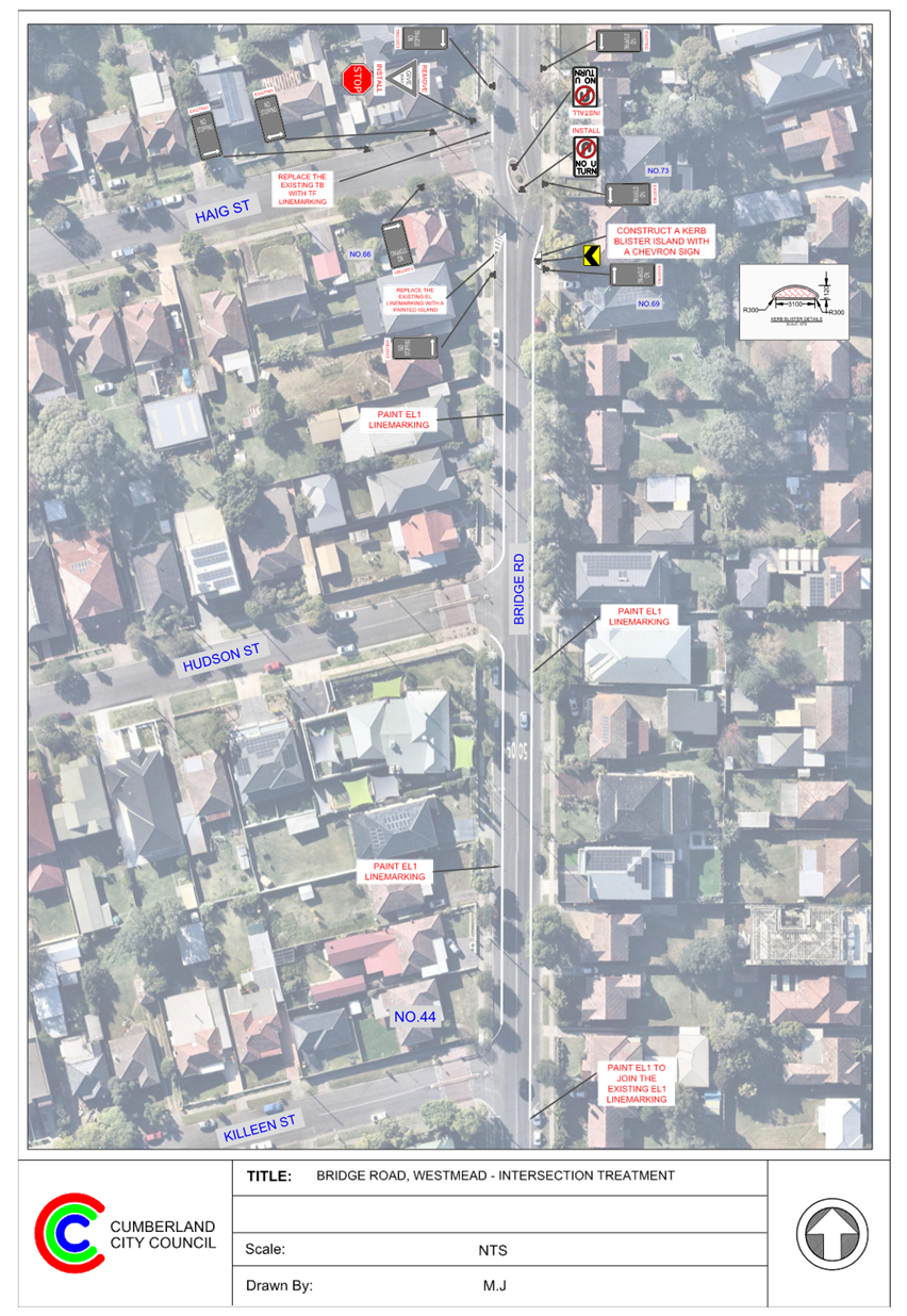
5 February 2025
Item No: CTC-25-043
WHALANS ROAD,
GREYSTANES – ROAD SAFETY CONCERNS
Directorate: Environment
and Planning
Responsible
Officer: Manager
Engineering and Building
Electorate: Prospect
Police Area
Command (PAC): Cumberland
Agenda Part Part
2
Note: Recommendation
to Council
Council has received a request
from a local resident for the installation of traffic calming devices on
Whalans Road, Greystanes due to speeding concerns.
This report outlines the outcome
of the investigation into this matter.
The Traffic Committee recommends:
1. Council
consult on the installation of traffic calming devices on Whalans Road,
Greystanes and report the results to a future Traffic Committee meeting
2. Council
refers the matter to NSW Police for speed monitoring and/or enforcement.
Council has received a request
from a local resident and a subsequent request by Council to investigate the
installation of traffic calming devices on Whalans Road, Greystanes due to
speeding concerns.
Whalans Road is a local road runs
in an east-west directions from Greystanes Road to Cumberland Road. The road is
approximately 4.5km long with three existing roundabouts at the intersections
with Vernon Street, Brighton Street and Gozo Road.
Whalans Road has a speed limit of
50km/h. Parking is permitted on both sides of the road in accordance with the
Road Rules unless otherwise signposted.
The matter was investigated and
reported to Cumberland traffic Committee (CTC) in the past, a summary of the
report and recommendations are listed below:
Background
11 November 2017
CTC considered a report
(CTC-17-131) regarding the road safety concerns on Whalans Road, Greystanes and
recommended that:
1. The provision of a traffic calming scheme incorporating speed
humps on Whalans Road, Greystanes be approved in principle.
2. The resident be consulted and the results reported back to
the Traffic Committee with a detailed scheme.
7 February 2018
Following CTC recommendation, Council undertook consultation
with the resident of Whalans Road and reported the result to CTC in February
2018 (CTC-18-032). The Cumberland Traffic Committee recommended that:
1. The report on the consultation undertaken by Council be
received and noted.
2. Installation of speed humps in Whalans Road, Greystanes not
be supported due to lack of community support.
3. Installation of pavement line marking incorporating
‘BB’ centre lines and edge lines be supported.
4. The affected residents be notified of the outcome generally.
7 August 2019
CTC considered a report (CTC-19-191) regarding the
Retro-Reflective Raised Pavement Markers (RRPM) and recommended that:
Cumberland Traffic Committee
recommended that the retro reflective pavement
markers (RRPM) installed with
the centre line of Whalans Road, Greystanes not
be removed.
2 March 2022
After continued community concerns received. Council
reviewed the traffic condition in Whalans Road between Gozo Road and Kippax
Street and reported the findings to CTC in March 2022 (CTC-22-049). The
Cumberland Traffic Committee recommended that:
The Traffic Committee
recommended that Council undertake consultation with the residents of Whalans
Road, Greystanes to assess support or otherwise for the installation of traffic
calming devices in the street and report back to traffic committee.
3 August 2022
Following CTC recommendation, Council undertook consultation
with the resident of Whalans Road and reported the result to CTC in August 2022
(CTC-22-158). The Cumberland Traffic Committee recommended that:
1. The installation of traffic calming devices on Whalans Road, Greystanes
not be supported.
2. Council request Cumberland Police Area Command to monitor the
street for speed enforcement.
2024/2025
Council has received further community concerns in 2024
regarding speeding in the street. This was then referred to Traffic Committee
to investigate by Council as part of Notice of Motion C12/24-45
- Traffic Calming Devices on Whalans Road, Greystanes
The latest Centre for Road Safety accident data indicated
that there was no reported accident in Whalans Road in the last 5 years.
Council officers have investigated the request in accordance
with Council’s Traffic and Transport Policy and Guidelines. The
investigation shows that Whalans Road already features traffic control devices
such as roundabouts and edge and central line marking.
The map below shows the location of Whalans Road,
Greystanes:


Three traffic counts were undertaken on Whalans Road in
June, October and November 2024. The traffic count locations are shown in red
on the map above.
The results of the
traffic count indicated the following:
Table 1: Traffic count
Data on Whalans Road, Greystanes
|
|
Section 1
Between
Greystanes Rd & Gozo Rd
|
Section 2
Between Gozo Rd
& Brighton St
|
Section 3
Between Brighton
St & Cumberland Rd
|
|
Average Daily
Traffic (ADT)
|
1,935
|
2,761
|
2,784
|
|
85th percentile
speed
|
57.06
|
55.8
|
62.46
|
|
Mean (average)
vehicle speed
|
49.2
|
47.1
|
55.1
|
The results of the traffic count and
recorded crash history were used to determine the need for the installation of
traffic calming devices in accordance with the criteria set out in
Council’s Local Traffic and Transport Policy and Guidelines for Local
Area Traffic Management (LATM).
The Local Area Traffic
Management (LATM) assessment is summarised in the tables below:
Table 2 –
Whalans Road - LATM Assessment Points
|
Criteria
|
Maximum Score
|
Score Achieved
|
|
|
|
Section 1
|
Section 2
|
Section 3
|
|
Traffic Study Data
|
60
|
20
|
20
|
35
|
|
Local Characteristics
|
40
|
17
|
21
|
19
|
|
Total
|
100
|
37
|
41
|
54
|
Table 3 – Whalans
Road – Action
|
Points (out of 100)
|
Recommended Action(s)
|
|
61-100
|
· Report to Cumberland Traffic Committee with a
recommendation of providing traffic calming.
· Report to Cumberland Traffic Committee on line marking
and associated improvements to support traffic calming and
road safety as an initial response, subject to technical guidelines.
· Consider community and stakeholder consultation on
potential improvements.
|
|
41-60
|
· Monitor and review traffic data after 6 months.
· Report to Cumberland Traffic Committee on line marking
and associated improvements to support traffic calming and road safety as an
initial response, subject to technical guidelines.
· Consider community and stakeholder consultation on
potential improvements.
|
|
25-40
|
· Monitor and review traffic data after 12 months.
· Report to Cumberland Traffic Committee on line marking
and associated improvements to support traffic calming and road safety as an
initial response, subject to technical guidelines.
· Consider community and stakeholder consultation on
potential improvements.
|
|
<25
|
· Do nothing.
|
|
Speed
|
· Regardless of the total points scored, should the 85th
percentile speed exceeds the posted speed limit by 5km/h, the street is to be
referred to the Local Area Command of the NSW Police for monitoring and/or
enforcement
· Opportunities for line marking and associated
improvements to support traffic calming and road safety to be considered,
subject to technical guidelines.
|
The traffic count indicated that the recorded 85th
percentile speed for section 1 to section 3 were 57.06, 55.8 and 62.46 km/h
which all exceeds the speed limit of the street by 5km/h. Council will refer
the matter to NSW Police for speed monitoring and/or enforcement.
Based on
the assessment, two out of the three sections of the road received scores in
the 40–60-point range, indicating that consultation with residents
regarding the provision of traffic calming devices on the street should be
considered. In addition to this, due to the speed data recorded; Council
propose to reconsult on the installation of traffic calming devices.
It is noted
that previous consultations undertaken by Council have showed that residents of
Whalans Street generally do not support the installation of traffic calming
devices within the street.
Subject to endorsement, consultation will be undertaken on
proposed traffic calming measures to affected residents.
Nil
5 February 2025
Item No: CTC-25-044
WOMBAT STREET,
PEMULWUY - ROAD SAFETY CONCERNS
Directorate: Environment
and Planning
Responsible
Officer: Manager
Engineering and Building
Electorate: Prospect
Police Area
Command (PAC): Cumberland
Agenda Part Part
2
Note: Recommendation
to Council
Council has notified residents for
the proposed full-with concrete speed humps in Wombat Street, Pemulwuy.
This report outlines the outcome
of the review.
The Traffic Committee recommends that:
1. The
existing rubber speed cushions in Wombat Street be converted to full-width
concrete speed humps.
2. The
affected/concerned residents be notified.
Cumberland Traffic Committee
(CTC) at its meeting in June 2024 considered a report (CTC-24-137) regarding
road safety concerns on Wombat Street, Pemulwuy. Council resolved the
following:
1. The existing
rubber speed cushions in Wombat Street be converted to full-width concrete
speed humps.
2. Council notify concerned resident of the outcome.
Notifications were sent to the
residents of Wombat Street accordingly in October 2024.
Council received 5 responses
(36% of the total letters sent) received by the closing date, 4 responses (80%)
were in support and 1 response (20%) opposed to the proposal.
The resident who objected
expressed the view that speed humps are ineffective in slowing down traffic.
Given that the majority of
residents support the conversion of the existing speed cushions to full-width
speed humps, it is recommended that the proposal be approved.
The proposal was notified to the
impacted resident for a period of 14 days from 21 October 2024 to 5 November
2024.
A total of 14 letters were
distributed with an attached survey form to the residents / owners. There were
5 responses (36% of the total letters sent) received by the closing date, 4
responses (80%) were in support and 1 response (20%) opposed to the proposal.
1. Submissions
DOCUMENTS
ASSOCIATED WITH
REPORT CTC-25-044
Attachment 1
Submissions
5 February 2025
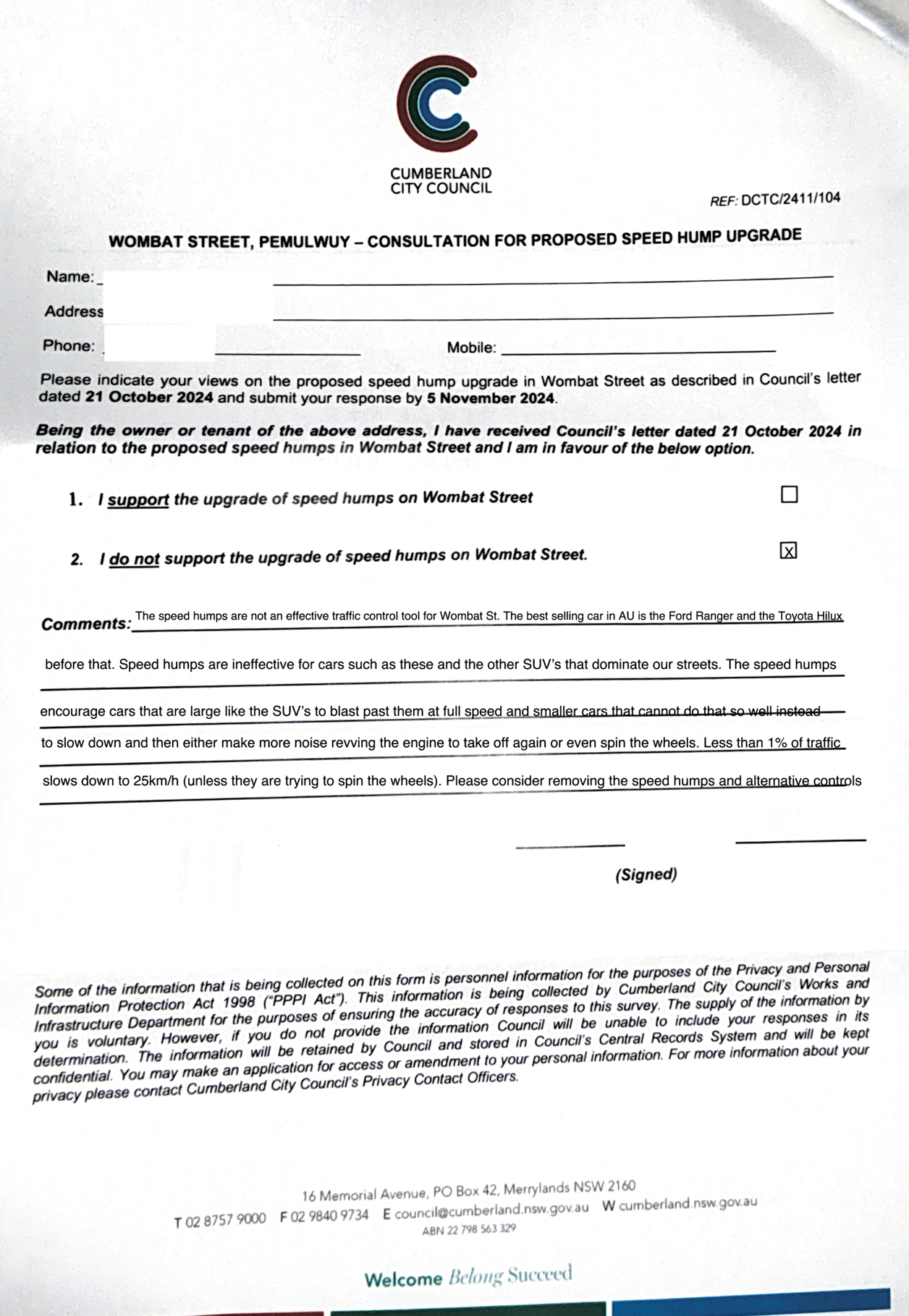
5 February 2025
Item No: CTC-25-045
LANCE
CRESCENT, GREYSTANES - ROAD SAFETY CONCERNS
Directorate: Environment
and Planning
Responsible
Officer: Manager
Engineering and Building
Electorate: Prospect
Police Area
Command (PAC): Cumberland
Agenda Part Part
2
Note: Recommendation
to Council
Cumberland Traffic Committee
considered a report on the road safety concerns on Lance Crescent, Greystanes on
5 June 2024.
This report outlines further
investigation into this matter.
The Traffic Committee recommends that:
1. Council
consults with residents of Lance Crescent, Greystanes to gauge their interest
for the installation of speed humps in the street.
2. The
concerned resident be notified of the outcome.
Cumberland Traffic Committee considered a report on the road
safety concerns on Lance Crescent, Greystanes on 7 February 2024.
The traffic committee recommended that:
1. The
installation of traffic calming devices on Lance Crescent, Greystanes not be supported.
2. Council
undertake further speed monitoring with the assistance of Variable Message
Signs (VMS) in Lance Crescent.
3. The
concerned resident be notified of the outcome.
Council at its meeting held on 20 March 2024, resolved that
this item considered by the Cumberland Local Traffic Committee at the 7
February 2024 meeting as provided in this report, be returned to the Committee
for further consideration.
The matter was reported back to the Cumberland Local Traffic
Committee on 5 June 2024 (CTC-24-105).
The traffic committee recommended that:
1. Council undertake further speed
monitoring with the assistance of Variable Message Signs (VMS) in Lance
Crescent, Greystanes.
2. The
concerned resident be notified of the outcome.
Following the installation of the VMS in Lance Crescent, the
resident raised concerns regarding the limited sight distance caused by the
VMS, which made entering and exiting their driveway difficult.
The resident requested the removal of the VMS and reported
that one accident and several near misses had recently occurred on the street.
Although previous traffic count
data indicates that the Average Daily Traffic (ADT) is low and the 85th
percentile speed is below the speed limit, it is recommended that consultation
be conducted with residents of Lance Crescent to gauge their interest for the
installation of speed humps on the street to address these concerns.
Consultation with residents in
Lance Crescent be undertaken if recommended by the Cumberland Traffic
Committee.
Nil
5 February 2025
Item No: CTC-25-046
LACKEY STREET,
MERRYLANDS – ROAD SAFETY CONCERNS
Directorate: Environment
and Planning
Responsible
Officer: Manager
Engineering and Building
Electorate: Granville
Police Area
Command (PAC): Cumberland
Agenda Part Part
2
Note: Recommendation
to Council
Council has received a request
from a local resident for the installation of traffic calming devices on Lackey
Street, Merrylands due to speeding concerns.
This report outlines the outcome
of the investigation into this matter.
The Cumberland Traffic Committee recommends that Council
undertake consultation with the residents of Lackey Street, Merrylands between
Excelsior Street and Robertson Street to assess support or otherwise for the
installation of traffic calming devices in the street and report back to the
Traffic Committee.
Cumberland Traffic Committee (CTC)
at its meeting in November 2023 considered a report (CTC-23-178) regarding road
safety concerns on Lackey Street, Merrylands between Excelsior Street and
Robertson Street. Council resolved that the installation of traffic calming
devices on Lackey Street, Merrylands not be supported.
Council recently received a
request from a local resident for the installation of traffic calming devices
on Lackey Street between Excelsior Street and Blaxcell Street, Merrylands due
to speeding concerns.
Lackey Street is a local road runs
in an east-west direction between Woodville Road and Blaxcell Street. The total
length of the road is approximately 1050 m. There are speedhumps constructed in
the section between Woodville Road and Excelsior Street. The intersection of
Lackey Street and Excelsior Street is controlled by a roundabout. The
intersection of Lackey Street and Robertson Street has STOP controls on Lackey
Street. The speed limit is 50 km/h and parking is permitted on both sides of
the road unless otherwise signposted.
In this analysis, Council has
considered two sections of Lackey Street namely,
· Section 1 -
Excelsior Street to Robertson Street. – approximately 330 m long
· Section 2 -
Robertson Street to Blaxcell Street – approximately 335 m long. This
section is closed at approximately 80m from Robertson Street.
The latest Centre for Road Safety Crash data indicated that
there were three reported crashes in Lackey Street in the 5 years ending 2023.
|
Date
|
Location
|
Code description
|
Comments
|
|
25/05/2019
|
33 Lackey St
|
709 - Off end of road or T intersection
|
In Section 2-at the road closure barriers
|
|
21/05/2019
|
244m west of Blaxcell St
|
709 - Off end of road or T intersection
|
In Section 2-at the road closure barriers
|
|
21/07/2022
|
35 Lackey St
|
709 - Off end of road or T intersection
|
In Section 2-at the road closure barriers
|
The map below shows the location of Lackey Street sections
under consideration:
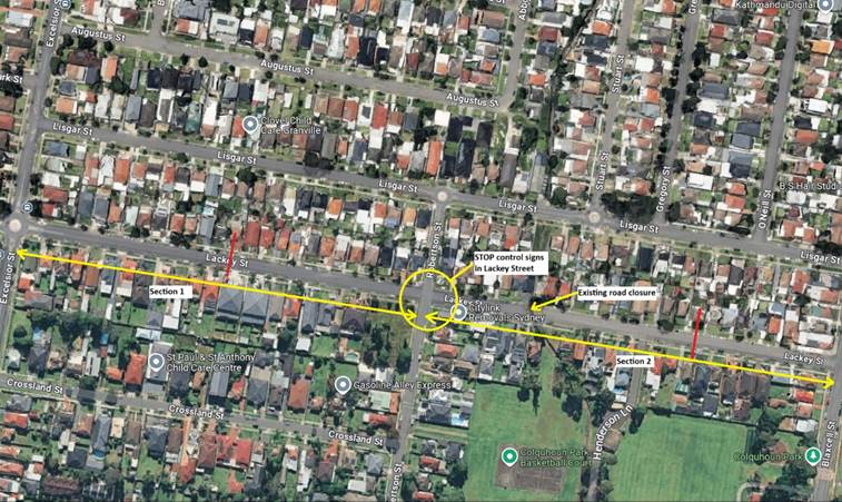
Traffic counts were undertaken on Lackey Street at two
locations in December 2024. The traffic count locations are shown in red on the
map above.
The results of the traffic count indicated the following:
Traffic Count Data on Lackey Street, Merrylands:
Council Officers have investigated the request for the
installation of traffic calming devices on Lackey Street. The results of the
traffic counts and recorded crashes were used in the assessment to determine
the need for the installation of traffic calming devices on Lackey Street in
accordance with the Local Area Traffic Management (LATM) criteria set out in
Council’s in accordance with Council’s Traffic and Transport Policy
and Guideline.
The LATM assessments are summarised in the tables below.
Table 1 – Lackey Street - LATM Assessment Points:
|
Criteria
|
Maximum Score
|
Scores Achieved
|
|
Section 1 – Excelsior Street to Robertson Street
|
Section 2 – Robertson Street to Blaxcell Street
|
|
Traffic Study Data
|
60
|
5
|
10
|
|
Local Characteristics
|
40
|
13
|
13
|
|
Total
|
100
|
18
|
23
|
Table 2 – Lackey Street – Action:
|
Points (out of 100)
|
Recommended Action(s)
|
|
61-100
|
Report to Cumberland Traffic Committee with a
recommendation of providing traffic calming.
Report to Cumberland Traffic Committee on line marking
and associated improvements to support traffic calming and road safety as an
initial response, subject to technical guidelines.
· Consider community and stakeholder consultation on
potential improvements
|
|
41-60
|
Monitor and review traffic data after 6 months.
Report to Cumberland Traffic Committee on line marking
and associated improvements to support traffic calming and road safety as an
initial response, subject to technical guidelines.
· Consider community and stakeholder consultation on
potential improvements.
|
|
25-40
|
Monitor and review traffic data after 12 months.
Report to Cumberland Traffic Committee online marking and
associated improvements to support traffic calming and road safety as an
initial response, subject to technical guidelines.
· Consider community and stakeholder consultation on
potential improvements.
|
|
<25
|
· Do nothing.
|
|
Speed
|
Regardless of the total points scored, should the 85th
percentile speed exceeds the posted speed limit by 5km/h, the street is to be
referred to the Local Area Command of the NSW Police for monitoring and/or
enforcement.
· Opportunities for line marking and associated
improvements to support traffic calming and road safety to be considered,
subject to technical guidelines.
|
Based on the above LATM
assessment, traffic calming devices are not warranted in the street. However,
Section 1 of Lackey Street (between Excelsior Street and Robertson Street) has
a recorded 85th percentile speed of 52.6 km/r which is slightly
higher than the speed limit.
In view of the continued concerns
from some residents, it is proposed to undertake consultation with residents
regarding installation of traffic calming devices in the street.
Subject to endorsement,
consultation will be undertaken with direct affected residents.
1. Previous Report -
CTC-23-178 Lackey Street – Merrylands – Road Safety Concerns
DOCUMENTS
ASSOCIATED WITH
REPORT CTC-25-046
Attachment 1
Previous Report - CTC-23-178 Lackey Street –
Merrylands – Road Safety Concerns
5 February 2025
Item No: CTC-25-047
TENNYSON
PARADE, GUILDFORD WEST - ROAD SAFETY CONCERNS
Directorate: Environment
and Planning
Responsible
Officer: Manager
Engineering and Building
Electorate: Granville
Police Area
Command (PAC): Cumberland
Agenda Part Part
2
Note: Recommendation
to Council
Council has received a request
from a local resident for the installation of traffic calming devices on
Tennyson Parade, Guildford due to speeding concerns.
This report outlines the outcome
of the review.
The Traffic Committee recommends that:
1. The
installation of traffic calming devices on Tennyson Parade, Guildford West be
supported as per the attached plan.
2. Council
notify concerned resident of the outcome.
Council has received a request
from a local resident for the installation of traffic calming devices on
Tennyson Parade, Guildford West due to speeding concerns.
Tennyson Parade is a local road
that runs in a north – south direction between Sherwood Road/Woodpark
Road and Albert Street. It is approximately 460m long. The width of the street
is approximately 11.5 m. The speed limit in the street is 50km/h. Parking is
permitted on both sides of the road unless signposted.
The traffic condition in
Tennyson Parade was investigated and reported to Cumberland Traffic Committee
(CTC) in the past, a summary of the dates and recommendations are listed below:
2 August 2023
CTC considered a report
(CTC-23-131) regarding the road safety concerns in Tennyson Parade and
recommended that:
1. The installation of
traffic calming devices on Tennyson Parade, Guildford West not be supported.
2. Council
review traffic conditions on Tennyson Parade, Guildford West and report back to
the August 2024 Traffic Committee if required.
3. Council
notify concerned resident of the recommendation.
6 September 2023
Council considered a report
(CTC-23-131) in September Council Meeting and resolved that:
Council
consult with the affected residents in the street and seek their feedback on
the traffic calming devices and return the matter to the Committee.
3 April 2024
Following the Council resolution
in September 2023, Council undertook consultation with the residents of
Tennyson Parade and reported to CTC in April 2024 (CTC-24-086). The Cumberland
Traffic Committee recommended:
1. The installation of traffic calming devices on Tennyson
Parade, Guildford West be supported in principle.
2. Council prepare a concept plan for speed humps in Tennyson
Parade, Guildford West, and undertake consultation with the affected and
adjacent residents and report back to the traffic committee.
3. Council notify concerned resident of the outcome.
In accordance with the
recommendation, Council designed the speed humps and consultation was carried
out with the residents in Tennyson Parade in October 2024. A total of 51
letters with an attached survey form and a plan were distributed to the
affected residents/ owners.
Council received 14 responses
(27.5% of the total letters sent) by the closing date. Out of these
responses, 10 respondents supported, 4 opposed to the proposed speed humps.
Based on the above result, the
majority of respondents support the installation of speed humps along Tennyson
Parade. However, the plan has been updated to ensure that speed humps are not
located at properties where objections have been received.
It is noted that the pedestrian
fence referenced in the survey has separately been reported to the Traffic
Committee.
The proposal was notified to the
impacted residents for a period of 14 days from 22 October 2024 to 5 November
2024.
Council received 14 responses
(27.5% of the total letters sent) by the closing date, 10 respondents
supported, 4 opposed to the proposal.
1. Plan - Tennyson
Parade, Guildford West - Proposed Speed Humps
2. Previous
Report - CTC-24-086
3. Previous
Minutes - CTC-24-086
4. Submissions
DOCUMENTS
ASSOCIATED WITH
REPORT CTC-25-047
Attachment 1
Plan - Tennyson Parade, Guildford West - Proposed
Speed Humps
5 February 2025
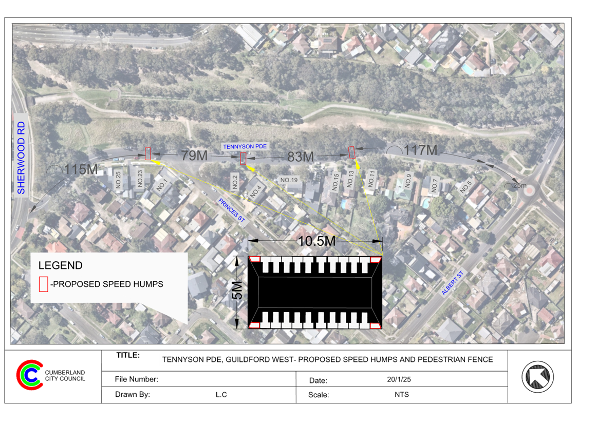
DOCUMENTS
ASSOCIATED WITH
REPORT CTC-25-047
Attachment 2
Previous Report - CTC-24-086
DOCUMENTS
ASSOCIATED WITH
REPORT CTC-25-047
Attachment 3
Previous Minutes - CTC-24-086
5 February 2025
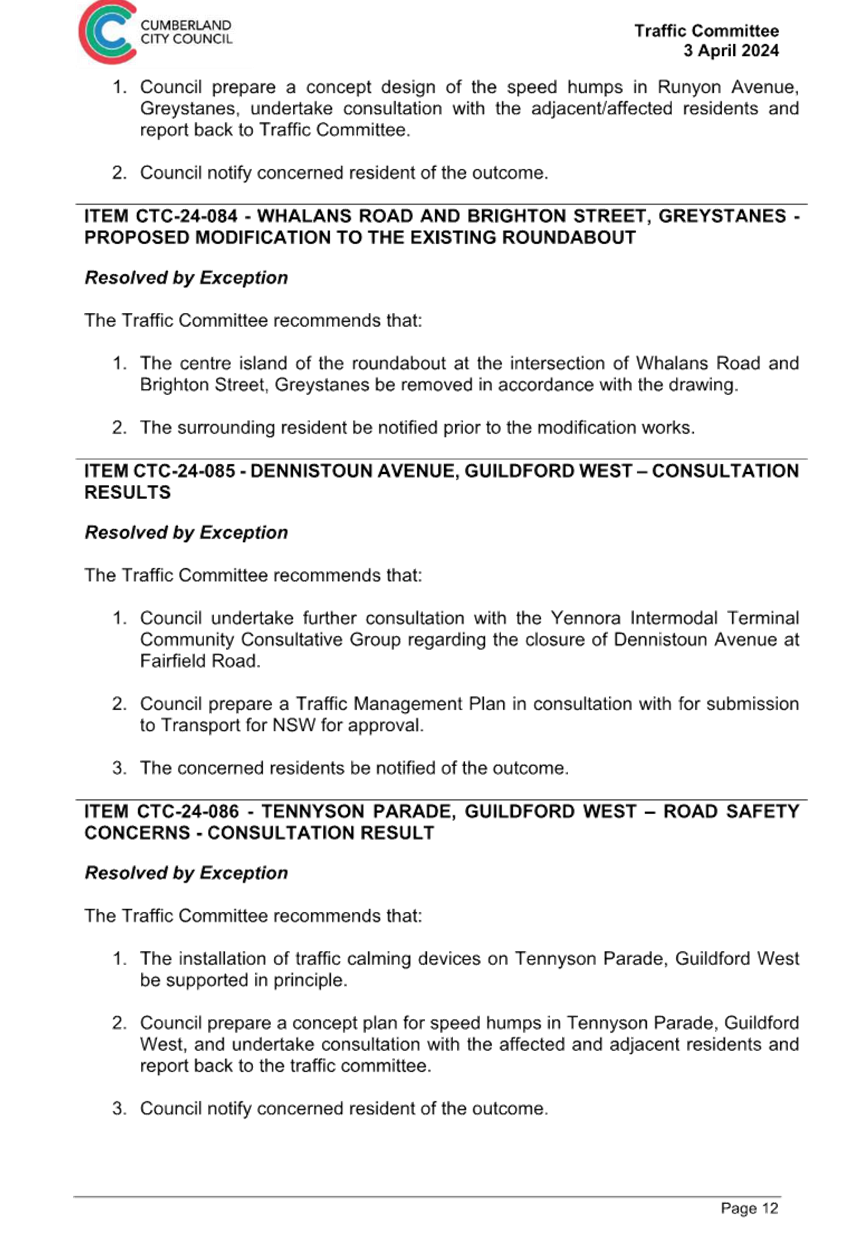
DOCUMENTS
ASSOCIATED WITH
REPORT CTC-25-047
Attachment 4
Submissions
5 February 2025
Item No: CTC-25-048
HUNT STREET,
GUILDFORD WEST - ROAD SAFETY CONCERNS
Directorate: Environment
and Planning
Responsible
Officer: Manager
Engineering and Building
Electorate: Granville
Police Area
Command (PAC): Cumberland
Agenda Part Part
2
Note: Recommendation
to Council
Council has undertaken
consultation with resident for the proposed speed humps in Hunt Street,
Guildford West.
This report outlines the outcome
of further review into this matter.
The Traffic Committee recommends that:
1. Council
prepare design of speed humps, undertake consultation with the directly
affected and adjacent residents and report back to Traffic Committee.
2. Council
notify the concerned residents of the outcome.
A report (CTC-24-031) on the
road safety concerns in Hunt Street was presented to the Cumberland Traffic
Committee on 7 February 2024, and the traffic committee recommended that:
1. The installation of traffic calming devices on Hunt Street,
Guildford West not be supported.
2. Investigate the potential for line marking and signage to
address concerns and provide a report to the Committee for consideration in
April 2024.
3. Council request Cumberland Police Area Command to undertake
speed surveillance in Hunt Street, Guildford West.
4. The concerned resident be notified of the outcome.
Council at its meeting held on
20 March 2024, resolved that this item considered by the Cumberland Local
Traffic Committee at the 7 February 2024 meeting as provided in this report, be
returned to the Committee for further consideration.
The matter was then reported
back to the Cumberland Traffic Committee on 5 June 2024 (CTC-24-130) and the
traffic committee recommend that Council undertake consultation with the
residents along Hunt Street, Guildford West to assess community support or
otherwise for the installation of traffic calming devices in the street and
report their findings back to the Traffic Committee.
Consultation was carried out
with the residents of Hunt Street accordingly in October 2024. Council received
21 responses (31% of the total letters sent) by the closing date. 18 responses
(86%) supported, and 3 responses (14%) opposed to the proposed speed
humps.
Based on the above result, as the
majority of the resident supported the proposed speed humps, it is suggested
that Council prepare design of speed humps, undertake consultation with the
directly affected and adjacent residents and report back to Traffic Committee.
The proposal
was notified to the residents in Hunt Street for a period of 14 days from 21
October 2024 to 5 November 2024.
Council received 21 responses
(31% of the total letters sent) by the closing date, with 18 responses (86%)
supported and 3 responses (14%) opposed to the proposed speed humps.
1. Submissions
DOCUMENTS
ASSOCIATED WITH
REPORT CTC-25-048
Attachment 1
Submissions
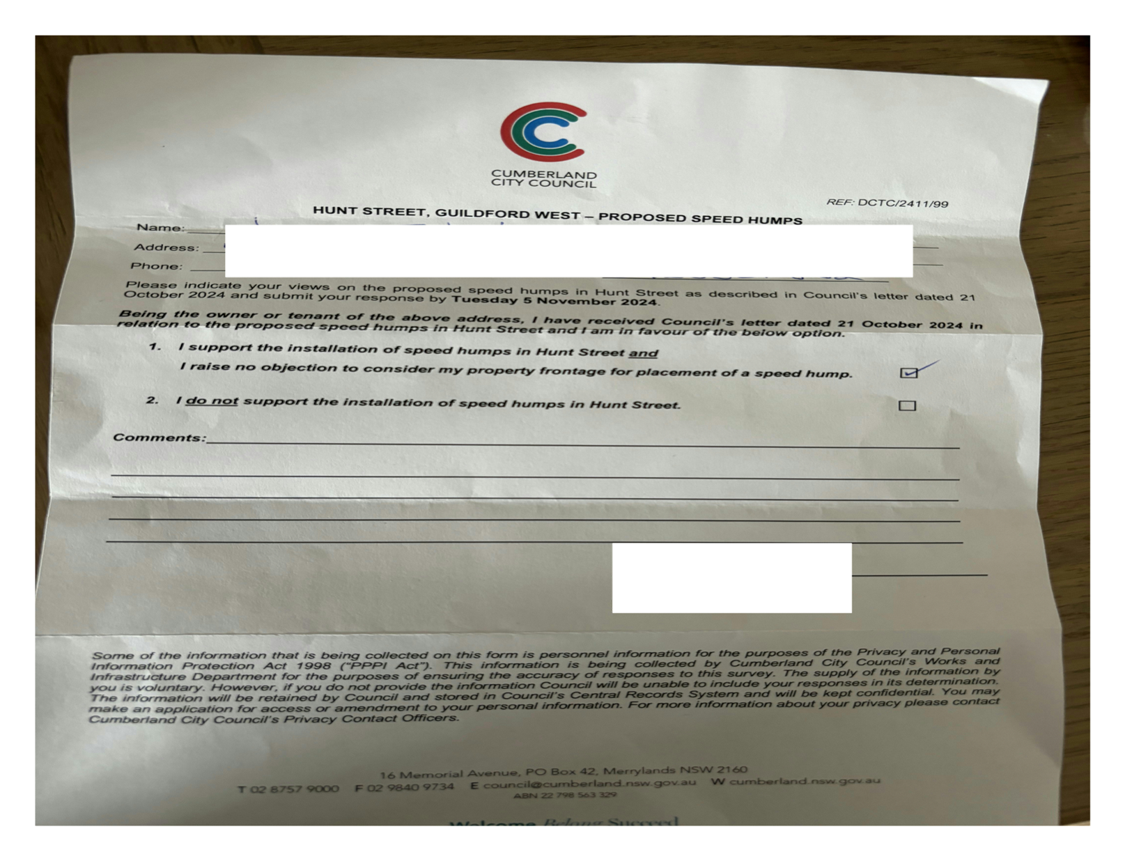
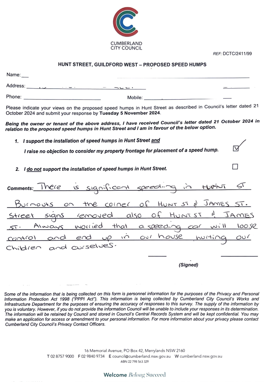
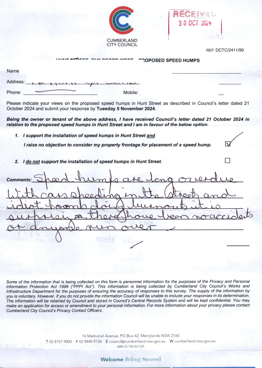
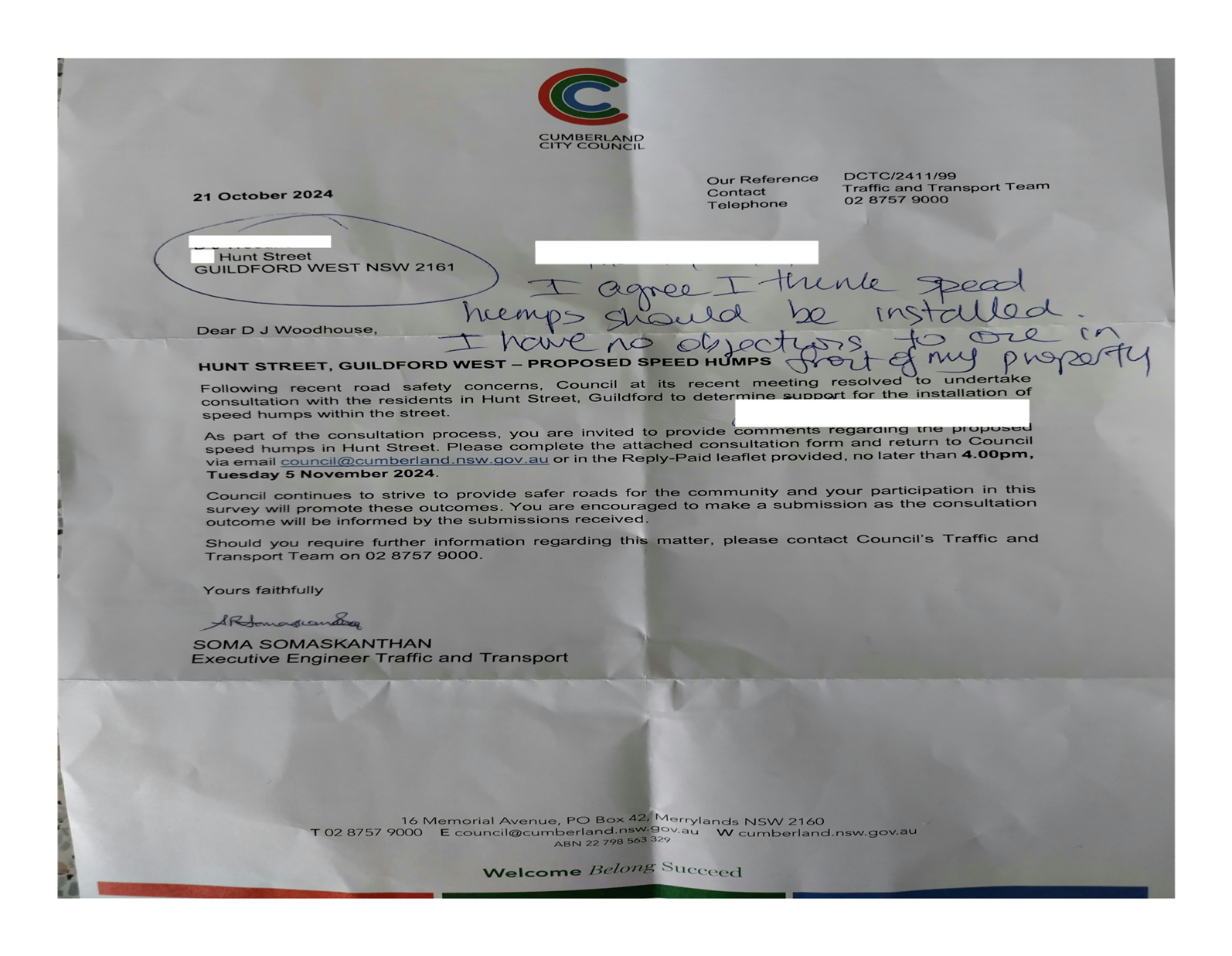
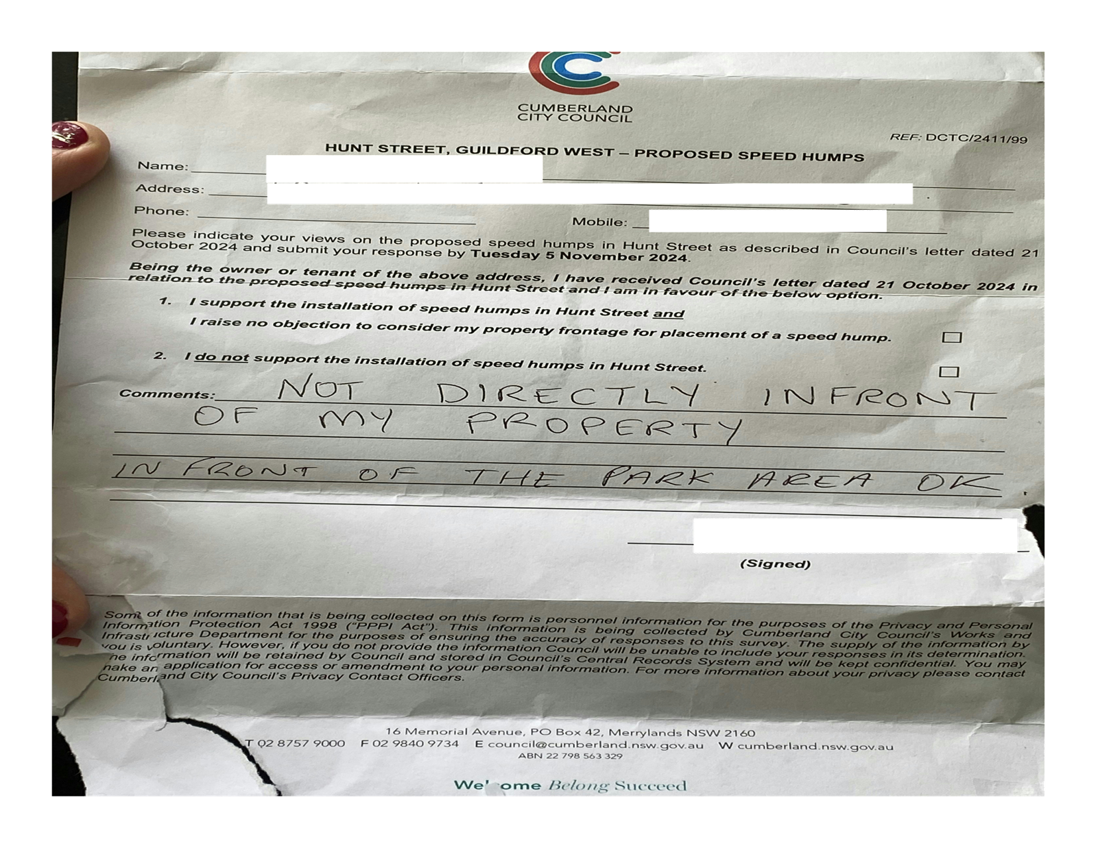
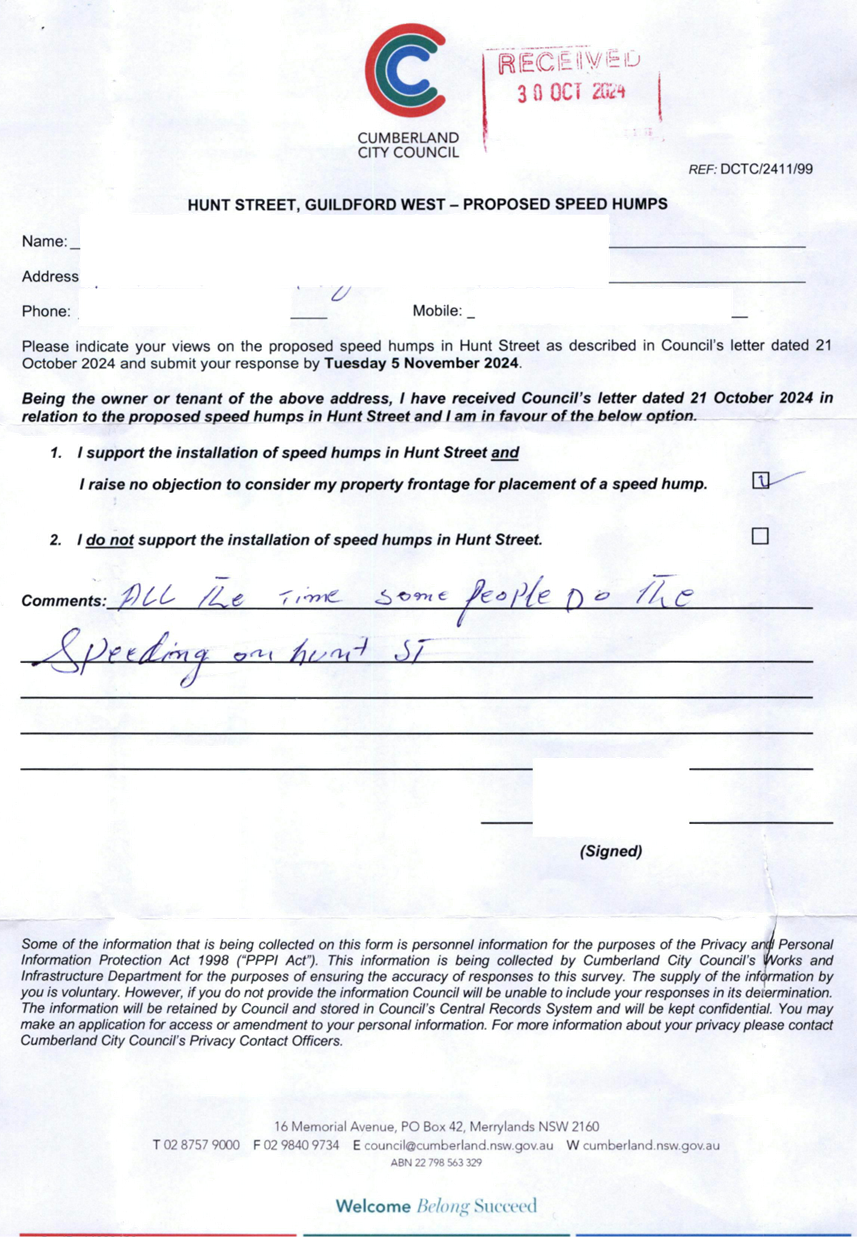
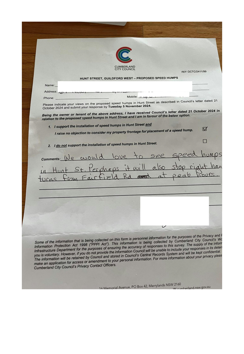
5 February 2025
Item No: CTC-25-049
ROSEBERRY
STREET BETWEEN HAWKSVIEW STREET AND MYALL STREET, MERRYLANDS – ROAD
SAFETY CONCERNS
Directorate: Environment
and Planning
Responsible
Officer: Manager
Engineering and Building
Electorate: Granville
Police Area
Command (PAC): Cumberland
Agenda Part Part
2
Note: Recommendation
to Council
Council has received a request
from a local resident for the installation of traffic calming devices on
Roseberry Street between Hawksview Street and Myall Street, Merrylands due to
speeding concerns.
This report outlines the outcome
of the investigation into this matter.
The Cumberland Traffic Committee recommends that Council
undertake consultation with the residents of Roseberry Street between Hawksview
Street and Myall Street, Merrylands to assess support or otherwise for the
installation of traffic calming devices in the street and report back to the
Traffic Committee.
Cumberland Traffic Committee (CTC)
at its meeting in April 2023 considered a report (CTC-23-068) regarding road
safety concerns on Roseberry Street between Hawksview Street and Myall Street.
Council resolved that the installation of traffic calming devices on Roseberry
Street not be supported and that Council review conditions in Roseberry Street,
Merrylands in April 2024.
The map below shows the location
of Roseberry Street, Merrylands.
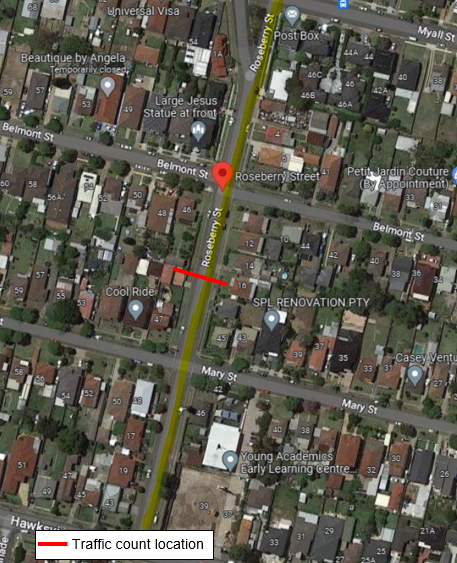
In accordance with the
Council’s resolution, a traffic count was undertaken in a section of
Roseberry in March 2024. Council officers have reviewed the traffic count data
and compared it with the previous traffic count data undertaken in February 2023
and February 2021.
Results are detailed in the table
below:
|
Traffic
count date
|
Average
daily traffic
|
85th
percentile speed
|
|
February 2021
|
5,060
|
56.9 km/h
|
|
February 2023
|
4,340
|
53.6 km/h
|
|
April 2024
|
4,312
|
54.4 km/h
|
The traffic data from the table
above indicated that the traffic volume (ADT) has slightly decreased, and 85th
percentile speed at Roseberry Street have slightly increased.
The latest Centre for Road Safety
accident data indicated that there were no reported accidents in Roseberry
Street between Hawksview and Myall Street in the 5 years ending December 2023.
Based on the above, a further LATM
assessment has been undertaken and the LATM assessments are summarised in the
tables below:
Table 1 – Roseberry Street between Hawksview and Myall
Street - LATM Assessment Points
|
Criteria
|
Maximum Score
|
Score Achieved
|
|
Traffic Study Data
|
60
|
15
|
|
Local Characteristics
|
40
|
16
|
|
Total
|
100
|
31
|
Table 2 – Roseberry Street between Hawksview and Myall
Street – Action
|
vi)
Points (out of 100)
|
vii)
Recommended Action(s)
|
|
viii)
61-100
|
· Report
to Cumberland Traffic Committee with a recommendation of providing traffic
calming.
· Report
to Cumberland Traffic Committee on line marking and associated improvements
to support traffic calming and road safety as an initial
response, subject to technical guidelines.
· Consider
community and stakeholder consultation on potential improvements.
|
|
ix)
41-60
|
· Monitor
and review traffic data after 6 months.
· Report
to Cumberland Traffic Committee on line marking and associated improvements
to support traffic calming and road safety as an initial response, subject to
technical guidelines.
· Consider
community and stakeholder consultation on potential improvements.
|
|
x)
25-40
|
· Monitor
and review traffic data after 12 months.
· Report
to Cumberland Traffic Committee on line marking and associated improvements
to support traffic calming and road safety as an initial response, subject to
technical guidelines.
· Consider
community and stakeholder consultation on potential improvements.
|
|
xi)
<25
|
· Do
nothing
|
|
xii)
Speed
|
· Regardless
of the total points scored, should the 85th percentile speed exceeds the
posted speed limit by 5km/h, the street is to be referred to the Local Area
Command of the NSW Police for monitoring and/or enforcement.
· Opportunities
for line marking and associated improvements to support traffic calming and
road safety to be considered, subject to technical guidelines.
|
Roseberry Street section between
Hawksview Street and Myall Street has existing centre line marking and edge
line marking. Council officers have previously analysed the data from the
traffic count and decided that speed humps are not warranted in the street.
In view of the continued concerns
of the residents, it is proposed to undertake consultation with residents
regarding installation of speed humps in the street.
Subject to endorsement,
consultation will be undertaken with affected residents.
Nil
5 February 2025
Item No: CTC-25-050
GRASSMERE
STREET, GUILDFORD - ROAD SAFETY CONCERNS – CONSULTATION RESULT
Directorate: Environment
and Planning
Responsible
Officer: Manager
Engineering and Building
Electorate: Granville
Police Area
Command (PAC): Cumberland
Agenda Part Part
2
Note: Recommendation
to Council
Council has undertaken
consultation with residents for the proposed speed hump in Grassmere Street,
Guildford.
This report outlines the outcome
of the review.
The Traffic Committee recommends that:
1. The
installation of speed hump in Grassmere Street, Guildford be supported.
i)
2. Council
include the project in a future Capital Works Program.
ii)
3. Council
notify affected/ concerned residents of the outcome.
Cumberland Traffic Committee
(CTC) at its meeting in June 2024 considered a report (CTC-24-129) regarding
road safety concerns on Grassmere Street, Guildford. Council resolved to design
the speed humps and undertake consultation with the affected and adjacent
residents of Grassmere Street, Guildford and report back to Cumberland Traffic
Committee.
In accordance with the
recommendation, Council staff undertook the design of the speed humps and
consulted with the residents of Grassmere Street in October 2024.
Council received 1 response
(11.1% of the total letters sent) by the closing date. 1 response (100%)
supported the proposed speed humps.
Based on the above result, as no
objections received from the resident it is recommended that the installation
of the speed hump be supported as per the plan attached.
The proposal was notified to the
impacted and adjacent residents for a period of 14 days from 14 October 2024 to
28 October 2024.
Council received 1 response that
was supportive of the proposal.
1. Plan - Grassmere
Street, Guildford - Proposed Speed Hump
2. Submission
DOCUMENTS
ASSOCIATED WITH
REPORT CTC-25-050
Attachment 1
Plan - Grassmere Street, Guildford - Proposed Speed
Hump
5 February 2025
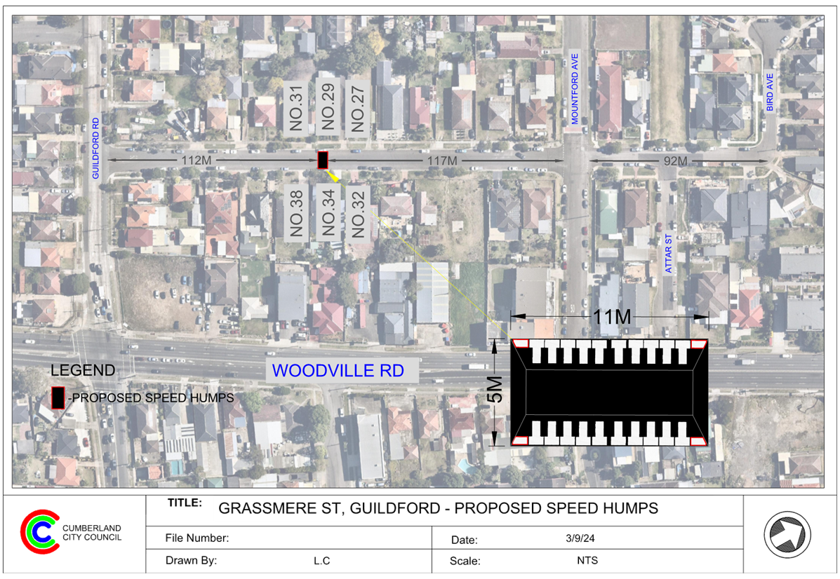
DOCUMENTS
ASSOCIATED WITH
REPORT CTC-25-050
Attachment 2
Submission
5 February 2025
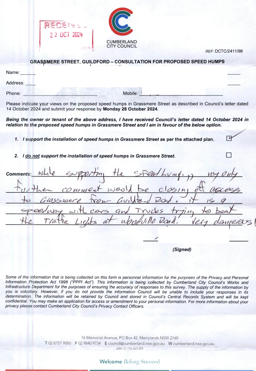
5 February 2025
Item No: CTC-25-051
MCARTHUR
STREET, GUILDFORD – ROAD SAFETY CONCERNS – CONSULTATION
RESULT
Directorate: Environment
and Planning
Responsible
Officer: Manager
Engineering and Building
Electorate: Granville
Police Area
Command (PAC): Cumberland
Agenda Part Part
2
Note: Recommendation
to Council
Council has received a request
from a local resident for the installation of traffic calming devices on
McArthur Street, Guildford due to speeding concerns.
This report outlines the outcome
of the investigation into this matter.
The Traffic Committee
recommends that:
1. Council
install the speed humps in front of No. 12 and No. 34 as per attached plan.
2. Council
investigate alternative traffic calming options at other two locations.
3. Council
notify concerned resident of the outcome.
Cumberland Traffic Committee (CTC)
at its meeting in April 2024 considered a report (CTC-24-089) regarding road
safety concerns with the preliminary consultation result for the proposal of
speed humps on McArthur Street, Guildford. The matter subsequently
reported to the 1 May Council Meeting:
Council resolved that:
1. Council undertake design of speed humps along McArthur
Street, Guildford, consult with the directly affected residents and report back
to the Traffic Committee.
2. Council notify concerned resident of the outcome.
In accordance with the recommendation, a consultation was
carried out with the directly affected residents of McArthur Street in June
2024, a total of 24 letters with an attached survey form and a plan were
distributed to the affected residents/ owners.
Council received 3 responses (13%
of the total letters sent) by the closing date, where 1 (33.3%) response
supported the proposed speed humps and 2 (66.6%) responses opposed the proposed
speed humps.
Given the two objections
received for two specific locations, it is recommended that Council investigate
alternative traffic calming options for those locations. Additionally, it is
recommended that Council approve the installation of speed humps in front of
No. 34 and No. 12, as outlined in the attached plan.
The proposal
was notified to the residents in McArthur Street for a period of 14 days from
27 June 2024 to 12 July 2024.
Council received 3 responses
(13% of the total letters sent) by the closing date.
1. Mcarthur Street,
Guildford - Proposed Speed Humps
2. Submissions
DOCUMENTS
ASSOCIATED WITH
REPORT CTC-25-051
Attachment 1
Mcarthur Street, Guildford - Proposed Speed Humps
5 February 2025
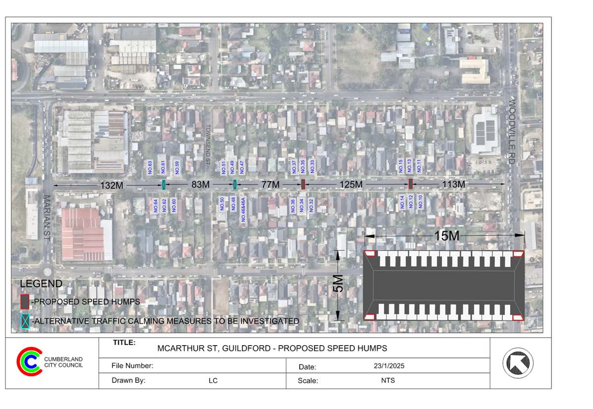
DOCUMENTS
ASSOCIATED WITH
REPORT CTC-25-051
Attachment 2
Submissions
5 February 2025
Item No: CTC-25-052
LOCKWOOD
STREET, MERRYLANDS - ROAD SAFETY CONCERNS – CONSULTATION RESULT
Directorate: Environment
and Planning
Responsible
Officer: Manager
Engineering and Building
Electorate: Granville
Police Area
Command (PAC): Cumberland
Agenda Part Part
2
Note: Recommendation
to Council
Council has reviewed traffic
conditions in Lockwood Street, Merrylands.
This report outlines the outcome
of the review.
The Traffic Committee recommends that the Council consult
with residents of Lockwood Street, Merrylands between Walpole Street and
Burnett Street, to gauge their support or opposition to the installation of
speed humps at this section of Lockwood Street.
Lockwood Street is a local
street that runs in a north – south direction with a posted speed limit
of 50 km/h. It has a width of approximately 10.2m and parking is permitted on
both side of the road unless signposted.
Council has received concern
from local residents regarding road safety on Lockwood Street, Merrylands
between Walpole Street and Merrylands Road.
The map below shows the location of Lockwood Street between
Walpole Street and Burnett Street:
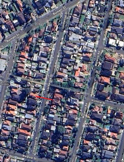
Traffic counts were undertaken
at the same location in Lockwood Street between Walpole Street and Burnett
Street in mid-2024. The location of traffic count is shown in red in the above
map.
Traffic count in
June 2024:
Average Daily Traffic (ADT) = 1,156 veh/day
85th percentile speed = 54.9 km/h
Mean (average) vehicle speed = 46.4 km/h
Traffic count in
October 2024:
Average Daily Traffic (ADT) = 1,068 veh/day
85th percentile speed = 54.0 km/h
Mean (average) vehicle speed = 45.3 km/h
The latest Centre for Road Safety accident data indicated
that there were no reported accidents at this section of Lockwood Street in the
last 5 years ending September 2023 in relation to speeding.
Local Area Traffic Management Assessment
Council’s Officers have investigated the request for
the installation of traffic calming devices on Lockwood Street in accordance
with Council’s Local Area Traffic Management (LATM) criteria set out in
Council’s Traffic and Transport Policy and Guideline.
The LATM assessment is
summarised in the tables below:
Table 1 – Lockwood Street - LATM Assessment Points
|
Criteria
|
Maximum Score
|
Score Achieved
|
|
Traffic Study Data
|
60
|
10
|
|
Local Characteristics
|
40
|
13
|
|
Total
|
100
|
23
|
Table 2 – Lockwood
Street – Action
|
Points (out of 100)
|
Recommended Action(s)
|
|
61-100
|
· Report to Cumberland Traffic Committee with a recommendation
of providing traffic calming.
· Report to Cumberland Traffic Committee on line marking
and associated improvements to support traffic calming and road safety as an
initial response, subject to technical guidelines.
· Consider community and stakeholder consultation on
potential improvements.
|
|
41-60
|
· Monitor and review traffic data after 6 months.
· Report to Cumberland Traffic Committee on line marking
and associated improvements to support traffic calming and road safety as an initial
response, subject to technical guidelines.
· Consider community and stakeholder consultation on
potential improvements.
|
|
25-40
|
· Monitor and review traffic data after 12 months.
· Report to Cumberland Traffic Committee on line marking
and associated improvements to support traffic calming and road safety as an
initial response, subject to technical guidelines.
· Consider community and stakeholder consultation on
potential improvements.
|
|
<25
|
· Do nothing.
|
|
Speed
|
· Regardless of the total points scored, should the 85th
percentile speed exceeds the posted speed limit by 5km/h, the street is to be
referred to the Local Area Command of the NSW Police for monitoring and/or
enforcement.
· Opportunities for line marking and associated
improvements to support traffic calming and road safety to be considered,
subject to technical guidelines.
|
Based on the above LATM
assessment, traffic calming devices are not warranted in the street.
The traffic count data shows that the recorded 85th
percentile speed was close to 55 km/h. Considering the ongoing community
concerns, it is proposed to consult residents to gauge their level of support
for the installation of speed humps
Subject to endorsement,
consultation will be undertaken with affected residents.
Nil
5 February 2025
Item No: CTC-25-053
RUNYON AVENUE,
GREYSTANES - ROAD SAFETY CONCERNS – CONSULTATION RESULT
Directorate: Environment
and Planning
Responsible
Officer: Manager
Engineering and Building
Electorate: Prospect
Police Area
Command (PAC): Cumberland
Agenda Part Part
2
Note: Recommendation
to Council
Council has undertaken
consultation with residents for the proposed traffic calming devices in Runyon
Avenue, Greystanes.
This report outlines the outcome
of the review.
The Traffic Committee recommends that:
1. The
installation of traffic calming devices on Runyon Avenue, Greystanes be
supported as per the attached plan.
2. Council
notify affected / concerned residents of the outcome.
Cumberland Traffic Committee
(CTC) at its meeting in April 2024 considered a report (CTC-24-083) regarding
road safety concerns on Runyon Avenue, Greystanes. Council resolved to prepare
a concept design of the speed humps and undertake consultation with the
adjacent/affected residents of Runyon Avenue, Greystanes and report back to
Cumberland Traffic Committee.
Consultation was carried out
with the residents of Runyon Avenue accordingly in November 2024.
Council received 4 responses
(12% of the total letters sent) by the closing date. 2 responses (50%)
supported, and 2 responses (50%) opposed to the proposed speed humps.
Based on the feedback received,
there is an equal number of residents supporting and objecting to the proposal.
It should be noted that the two objections specifically concern the proposed
speed hump in front of No. 27. However, the residents who objected are not
directly in front of the proposed speed hump but are adjacent to it.
Therefore, it is proposed to
proceed with the installation of speed humps along Runyon Avenue.
The proposal was notified to the
impacted resident for a period of 14 days from 19 November 2024 to 3 December
2024.
A total of 33 letters were
distributed with an attached survey form and a plan to the residents / owners.
There were 4 responses (50% of the total letters sent) received by the closing
date, 2 responses (50%) were in support and 2 responses (50%) objected to the
proposal.
1. Runyon Avenue,
Greystanes – Proposed Speed Humps
2. Submissions
DOCUMENTS
ASSOCIATED WITH
REPORT CTC-25-053
Attachment 1
Runyon Avenue, Greystanes – Proposed Speed Humps
5 February 2025
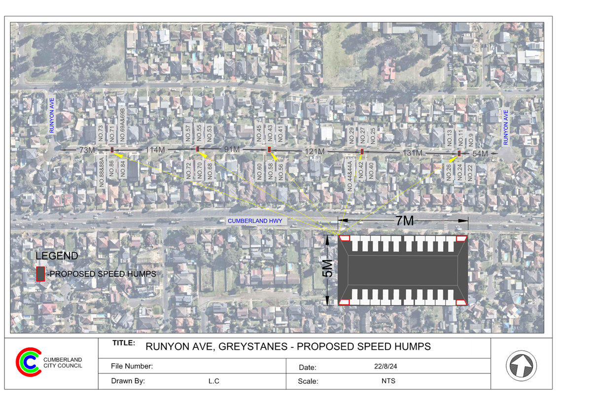
DOCUMENTS
ASSOCIATED WITH
REPORT CTC-25-053
Attachment 2
Submissions
5 February 2025
Item No: CTC-25-054
BOOMERANG
STREET AND RANDLE STREET, GRANVILLE - ROAD SAFETY CONCERNS – CONSULTATION
RESULT
Directorate: Environment
and Planning
Responsible
Officer: Manager
Engineering and Building
Electorate: Granville
Police Area
Command (PAC): Cumberland
Agenda Part Part
2
Note: Recommendation
to Council
Council has received safety
concerns from a local resident at the intersection of Boomerang Street and
Randle Street, Granville.
This report outlines the outcome
of the review.
The Traffic Committee recommends that:
1. The
installation of speed cushions in Boomerang Street at Randle Street, Granville
be supported, as provided in the attached plan.
2. Council
include the project in a future Capital Works Program.
3. Council
notify affected/ concerned residents of the outcome.
Cumberland Traffic Committee
(CTC) at its meeting in June 2024 considered a report (CTC-24-125) regarding
road safety concerns at the intersection of Boomerang Street and Randle Street,
Granville.
The Traffic Committee
recommended and Council subsequently resolved to install pedestrian refuge
warning signs in Randle Street. After the installation of the warning signs,
council continues receive request from a resident regarding the provision of
traffic calming devices in Boomerang Street at Randle Street. The resident
alleged that vehicles on Boomerang Street frequently speed in this area and
fail to give way to traffic on Randle Street.
In response, council undertook
the design of the speed cushions and consulted in October 2024 with the
residents directly affected by the proposed speed cushions. Council received 2
responses (15% of the total letters sent) by the closing date, with both
supporting the proposed speed cushions.
Based on the above result, it is
recommended that the installation of speed cushions be supported.
The proposal was notified to the
impacted and adjacent residents for a period of 14 days from 14 October 2024 to
28 October 2024.
A total of 13 letters including
a survey form and a plan, were distributed to residents and property owners. By
the closing date, Council received 2 responses (15% of the total letters sent),
and both supported the proposed speed cushions.
1. Plan –
Boomerang and Randle Street, Granville - Proposed Speed Cushions
2. Submissions
DOCUMENTS
ASSOCIATED WITH
REPORT CTC-25-054
Attachment 1
Plan – Boomerang and Randle Street, Granville -
Proposed Speed Cushions
5 February 2025
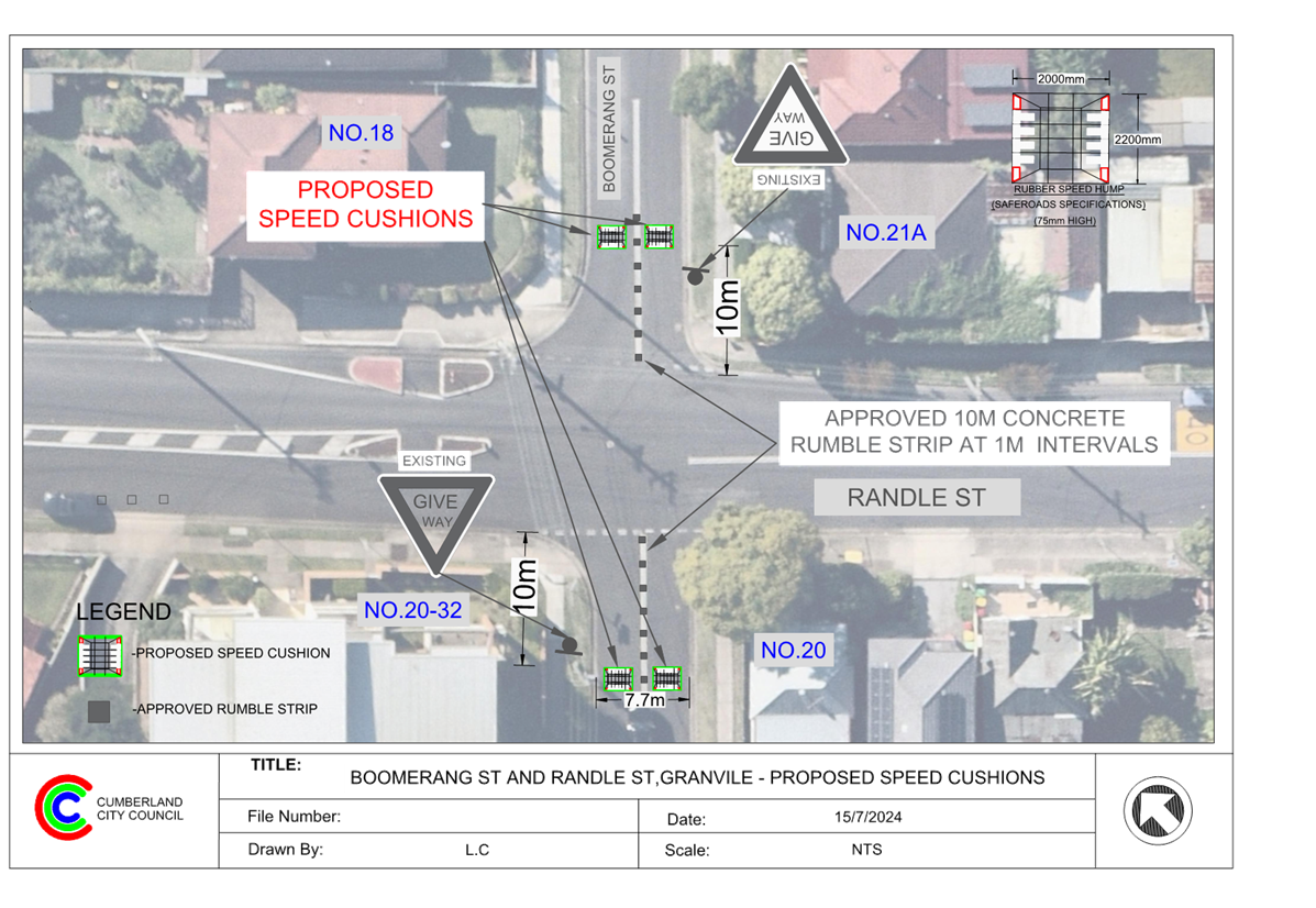
DOCUMENTS
ASSOCIATED WITH
REPORT CTC-25-054
Attachment 2
Submissions
5 February 2025
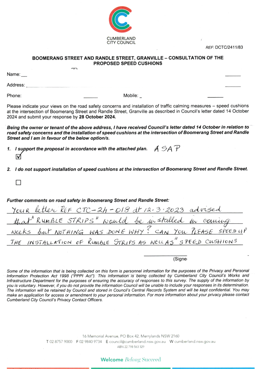
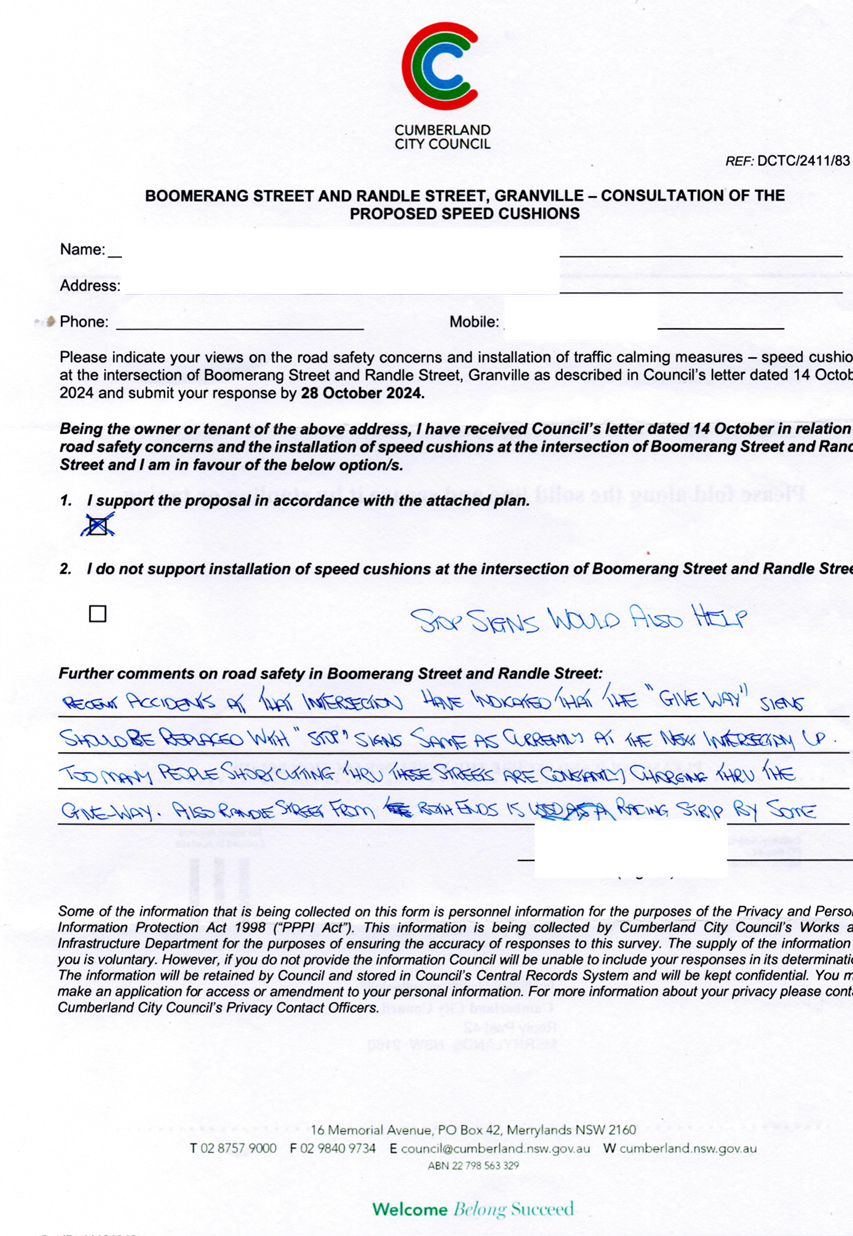
5 February 2025
Item No: CTC-25-055
WALPOLE
STREET, MERRYLANDS - ROAD SAFETY CONCERNS – CONSULTATION RESULT
Directorate: Environment
and Planning
Responsible
Officer: Manager
Engineering and Building
Electorate: Granville
Police Area
Command (PAC): Cumberland
Agenda Part Part
2
Note: Recommendation
to Council
Council has undertaken
consultation with residents for the proposed speed humps/ cushions in Walpole
Street, Merrylands.
This report outlines the outcome
of the review.
The Traffic Committee recommends that:
1. Council
prepare design of speed humps, undertake consultation with the directly
affected and adjacent residents and report back to Traffic Committee.
2. Council
notify the concerned residents of the outcome.
Cumberland Traffic Committee
(CTC) at its meeting in June 2024 considered a report (CTC-24-127) regarding
road safety concerns on Walpole Street, Merrylands. Council resolved to
undertake consultation with the residents of Walpole Street, Merrylands and report
back to Cumberland Traffic Committee.
In accordance with the
recommendation, Council consulted with the residents of Walpole Street in
October 2024.
Council received 31 responses
(17% of the total letters distributed) by the closing date, including one
letter from the same property address. Of these, 24 responses (77.4%) supported
the proposed speed humps, while 7 responses (22.6%) opposed the proposal.
Based on the above result, as
the majority of the resident supported the proposed speed humps, it is
suggested that Council prepare design of speed humps, undertake consultation
with the directly affected and adjacent residents and report back to Traffic
Committee.
The proposal was notified to the
residents in Walpole Street between Pitt Street and Clarence Street for a
period of 14 days from 14 October 2024 to 28 October 2024.
A total of 183 letters including
a survey form were distributed to residents and property owners. By the closing
date, Council received 24 responses (17% of the total letters distributed) by
the closing date, including one letter from the same property address. Of
these, 24 responses (77.4%) supported the proposed speed humps, while 7
responses (22.6%) opposed the proposal.
1. Submissions
DOCUMENTS
ASSOCIATED WITH
REPORT CTC-25-055
Attachment 1
Submissions
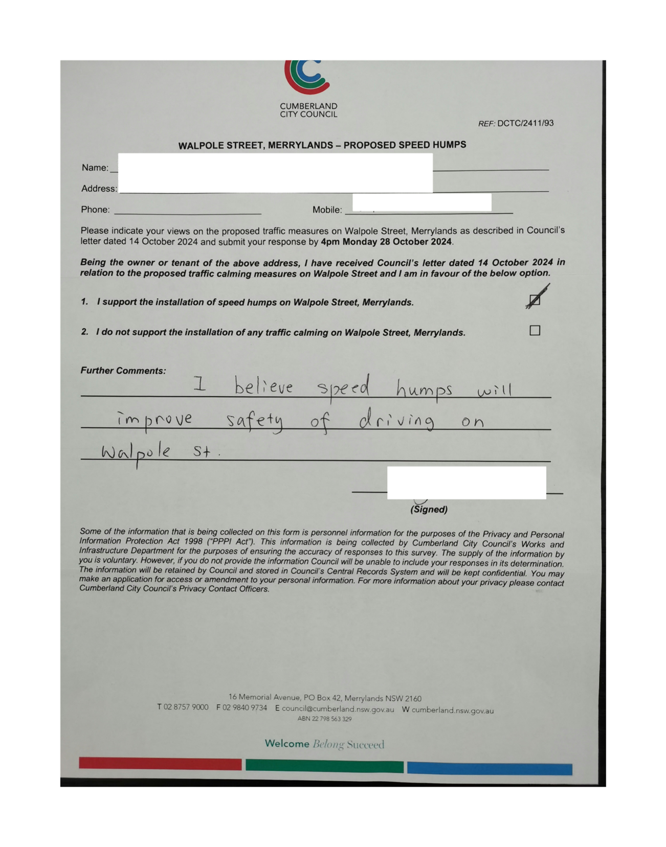
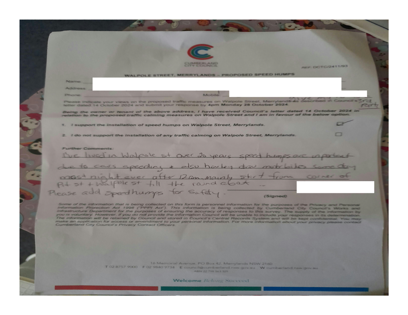
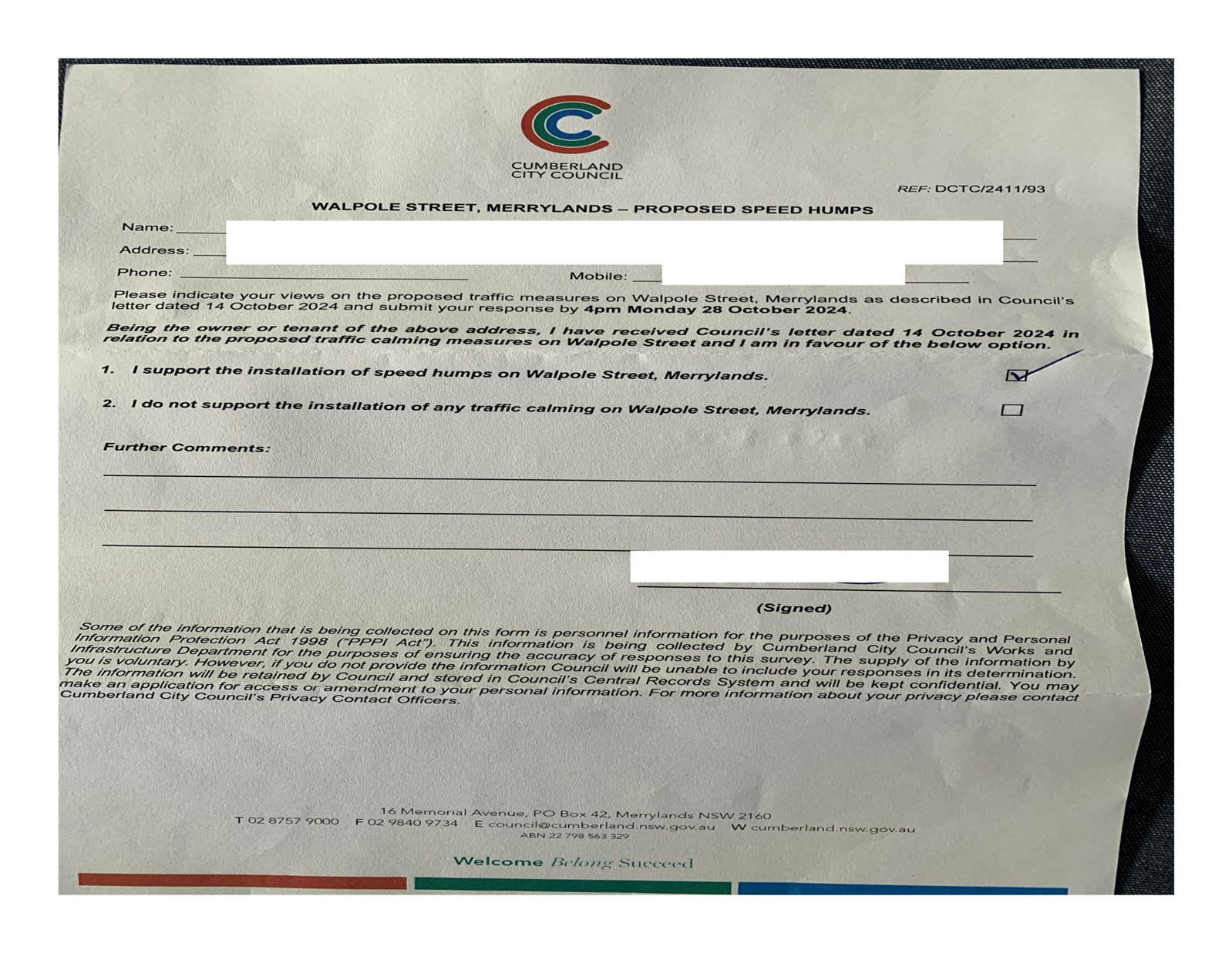
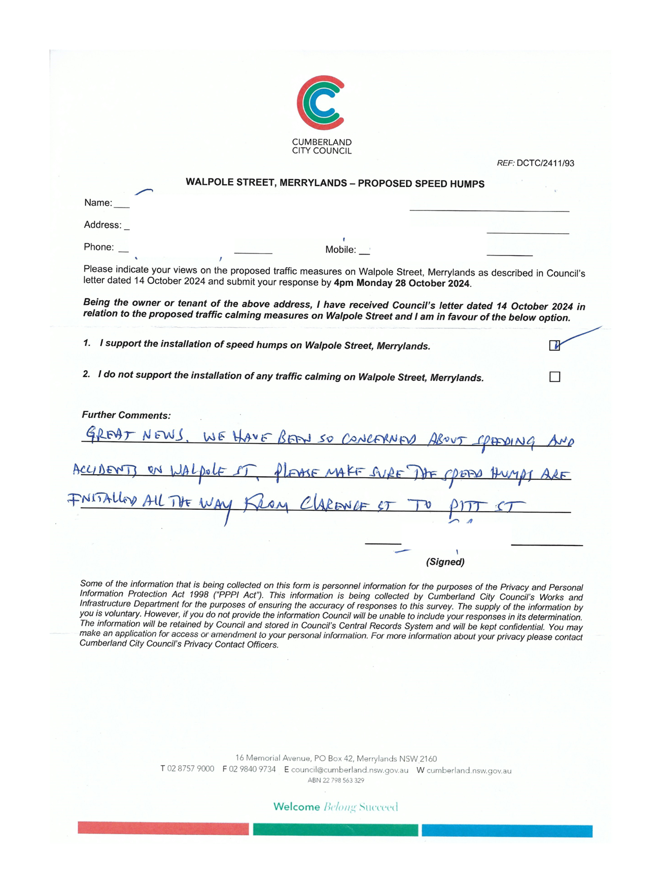
5 February 2025
Item No: CTC-25-056
OLD PROSPECT
ROAD BETWEEN GOZO ROAD AND BRIGHTON STREET, GREYSTANES - ROAD SAFETY CONCERNS –
CONSULTATION RESULT
Directorate: Environment
and Planning
Responsible
Officer: Manager
Engineering and Building
Electorate: Prospect
Police Area
Command (PAC): Cumberland
Agenda Part Part
2
Note: Recommendation
to Council
Council has undertaken
consultation with residents for the proposed speed humps in Old Prospect Road
between Gozo Road and Brighton Street, Greystanes.
This report outlines the outcome
of the review.
The Traffic Committee recommends that:
1. Council
prepares a speed hump design, undertake consultation with the directly affected
and adjacent residents and report back to Traffic Committee.
2. Council
notify affected/ concerned residents of the outcome.
Cumberland Traffic Committee
(CTC) at its meeting in June 2024 considered a report (CTC-24-136) regarding
road safety concerns on Old Prospect Road between Gozo Road and Brighton
Street, Greystanes. Council resolved to undertake consultation with the residents
of Old Prospect Road between Gozo Road and Brighton Street, Greystanes to
determine support for the installation of traffic coming devices in the street
and report back to Cumberland Traffic Committee.
Consultation was carried out
with the residents of Old Prospect Road in October 2024.
Council received 12 responses
(24% of the total letters sent) by the closing date. 8 responses supported and
4 (50%) objected to the proposed speed humps.
The 85th percentile speed of 54.1 km/h exceeds the default speed
limit. Therefore, it is recommended that Council prepare concept plans and
consult with the adjacent and affected residents of Old Prospect Road, between
Gozo Road and Brighton Street, Greystanes, to gather their feedback on the
proposed installation of speed humps in this section.
COnsultation
The proposal was notified to the
residents for a period of 14 days from 21 October 2024 to 5 November 2024.
A total of 50 letters were
distributed with an attached survey form to the residents / owners. There were
12 responses (24% of the total letters sent) received by the closing date. 8
responses were in support, and 4 objected to the proposal.
1. Previous Report
– CTC-24-136
2. Previous
Minutes – CTC-24-136
3. Submissions
DOCUMENTS
ASSOCIATED WITH
REPORT CTC-25-056
Attachment 1
Previous Report – CTC-24-136
DOCUMENTS
ASSOCIATED WITH
REPORT CTC-25-056
Attachment 2
Previous Minutes – CTC-24-136
5 February 2025
DOCUMENTS
ASSOCIATED WITH
REPORT CTC-25-056
Attachment 3
Submissions