Cumberland Local Planning Panel Meeting
11 December 2024
A meeting of the Cumberland Local
Planning Panel will
be held at 11.30am via Zoom on Wednesday, 11 December 2024.
Business as below:
Yours faithfully
Peter J. Fitzgerald
General
Manager
ORDER OF BUSINESS
1. Receipt of Apologies
2. Declarations of Interest
3. Address by invited speakers
4. Reports:
- Development
Applications
5. Closed Session Reports
Cumberland Local Planning Panel Meeting
11 December 2024
CONTENTS
Report No. Name
of Report Page
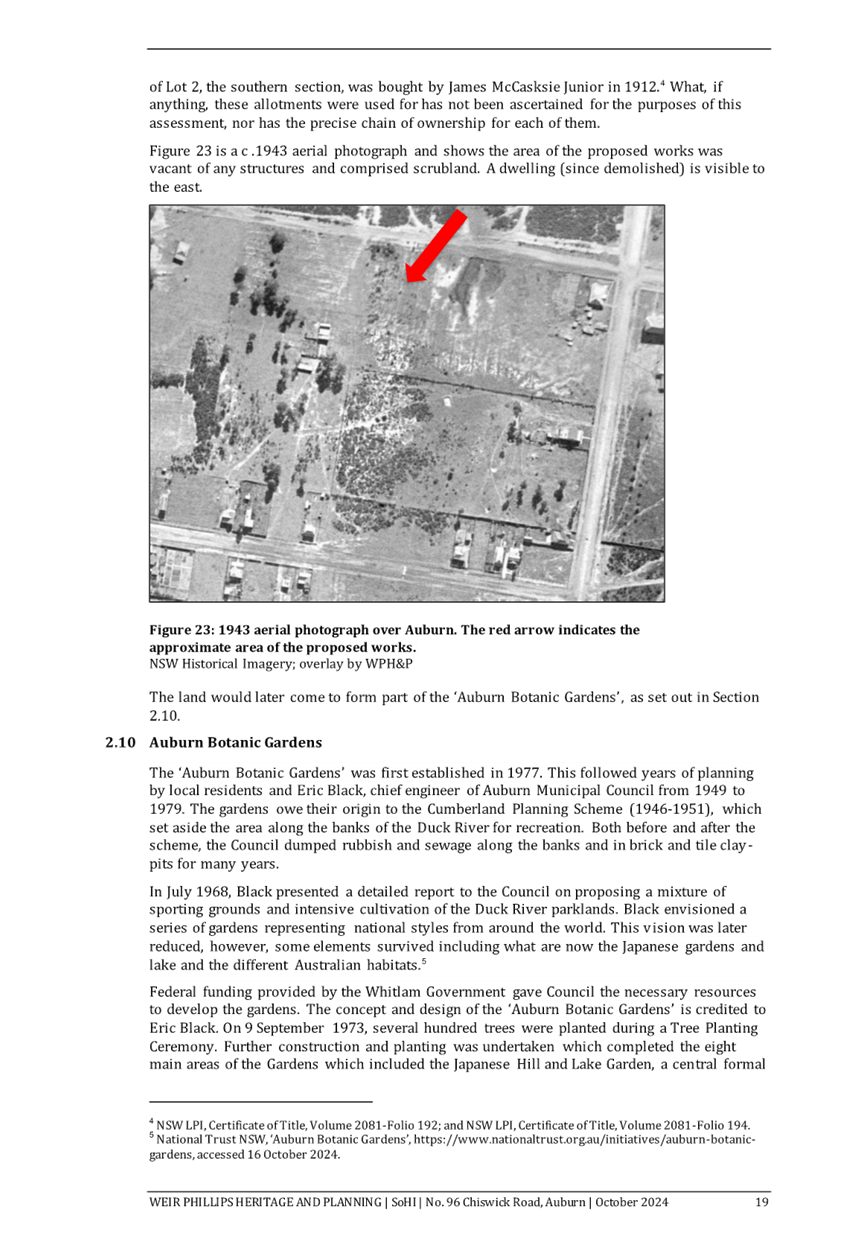
No.
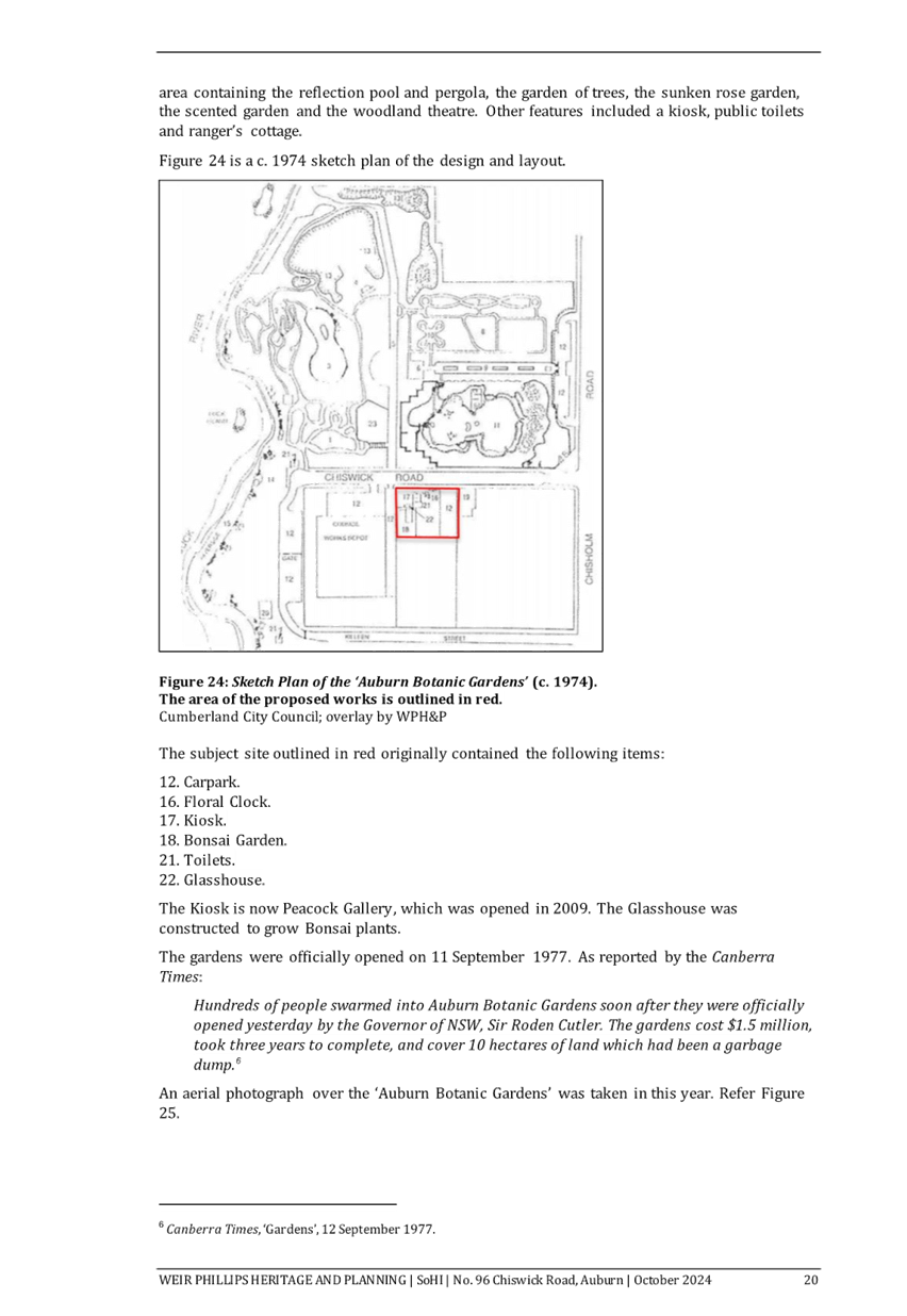
Development Applications
ELPP038/24 Development
Application - 8 Bradman Street, Greystanes........ 3
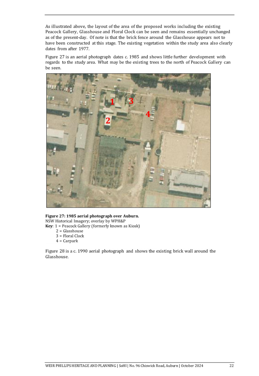
ELPP039/24 Development
Application - 96 Chiswick Road, Auburn
................... (CLOSED
SESSION).......................................................... 177
ELPP040/24 Modification
Application - 28-30 Queen Street, Auburn
................... (CLOSED
SESSION).......................................................... 329
Cumberland Local Planning Panel Meeting
11 December 2024
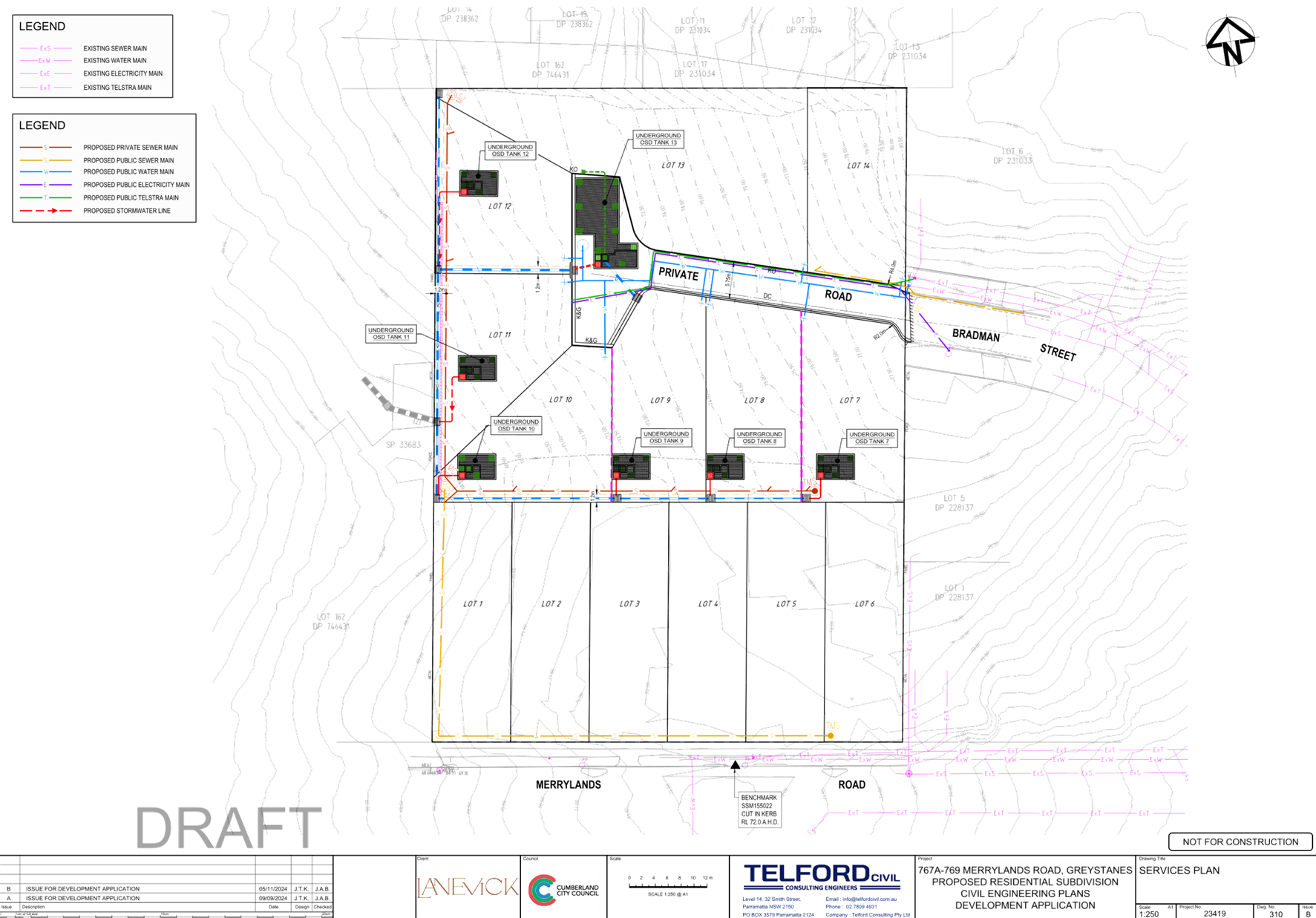
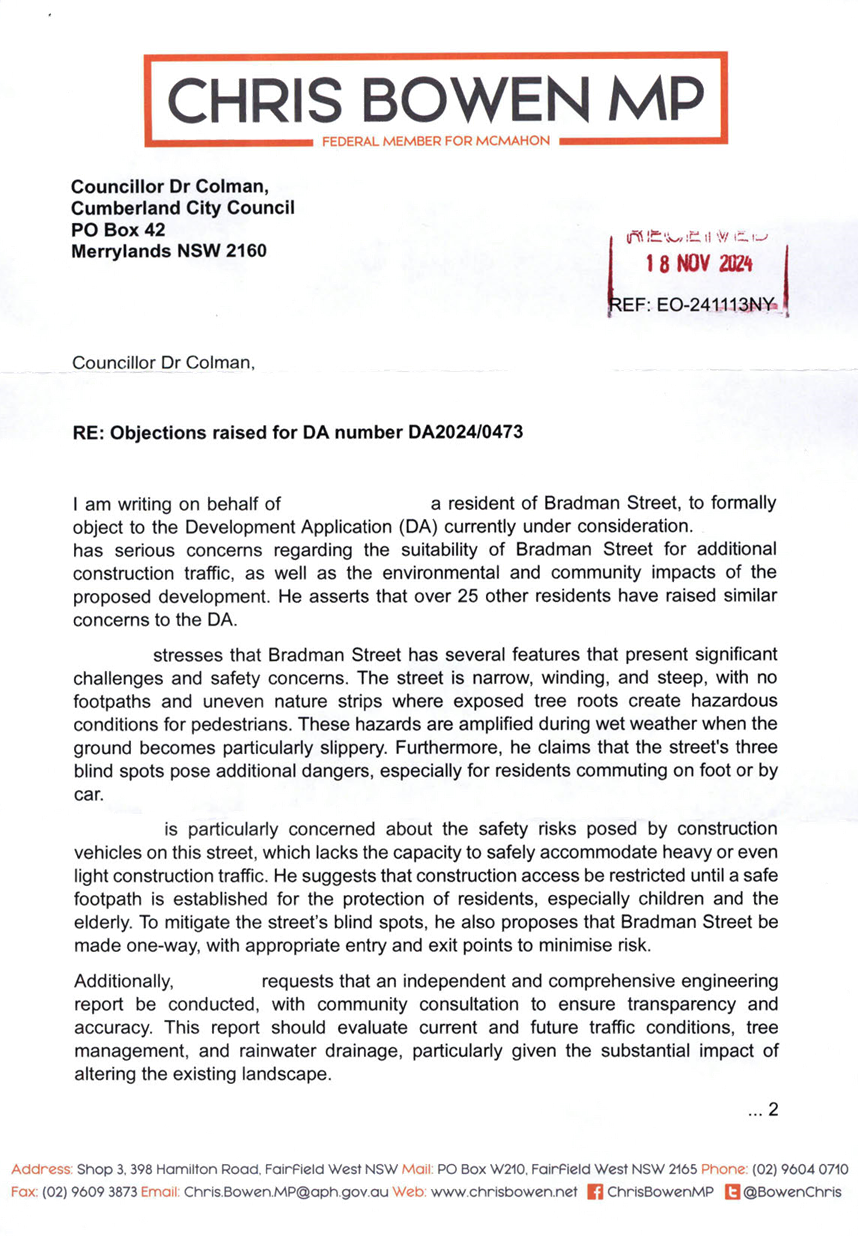
Item No: ELPP038/24
Development
Application - 8 Bradman Street, Greystanes
Directorate: Environment
and Planning
Responsible
Officer: Executive
Manager City Planning and Development
|
Application
lodged
|
12 September 2024.
|
|
Applicant
|
Bonsai Group Australia Pty
Ltd.
|
|
Owner
|
Bonsai Group Australia Pty
Ltd.
|
|
Application
No.
|
DA2024/0473.
|
|
Description
of Land
|
8 Bradman Street GREYSTANES.
Lot 7 in DP 1308880.
|
|
Proposed
Development
|
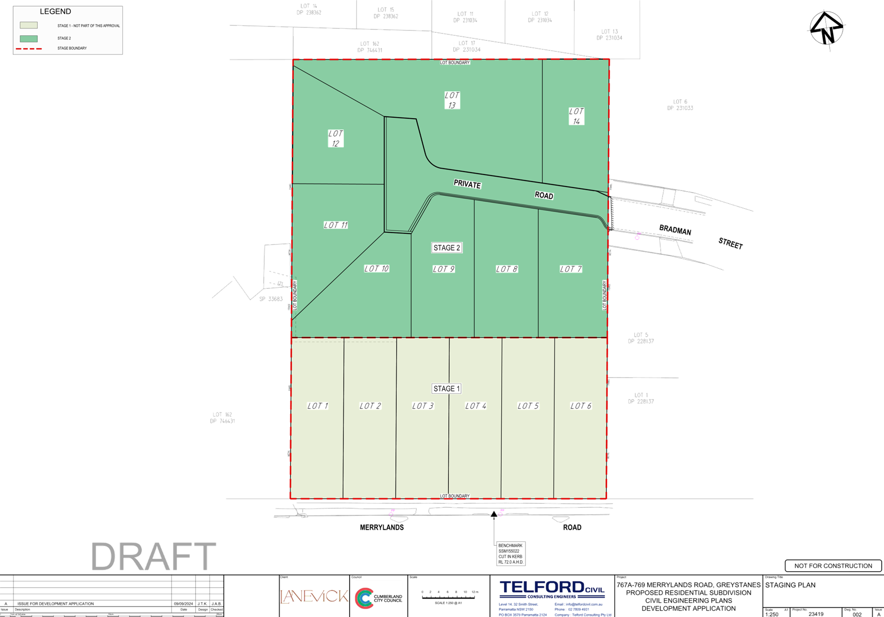
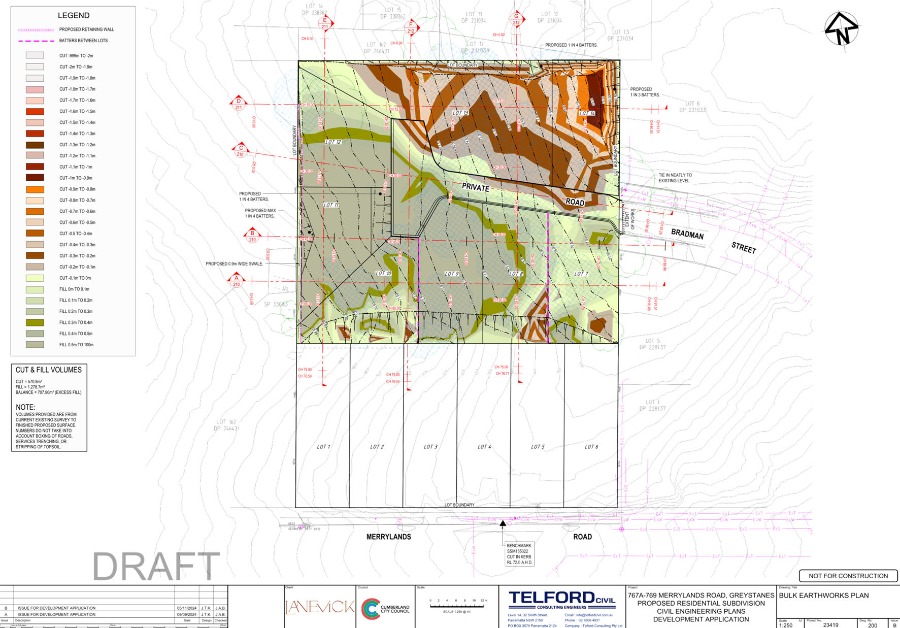
Subdivision of 1 allotment
(known as Super Lot 7) into 8 residential allotments and 1 new private road
(under Community Title) including associated tree removal, earthworks and
civil works.
|
|
Site
Area
|
4,666.0 square metres.
|
|
Zoning
|
R2 Low Density Residential.
|
|
Disclosure
of political donations and gifts
|
Nil disclosure.
|
|
Cost
of works
|
$520,047.00.
|
|
Heritage
|
Not applicable.
|
|
Principal
Development Standards
|
Minimum Lot Size
Permissible: 450 square
metres.
Proposed:450.48 square metres
to 1000.84 square metres.
|
|
Issues
|
Submissions
|
1. Development
Application 2024/0473 was lodged on the 12 September 2024 for the Subdivision
of 1 allotment (known as Super Lot 7) into 8 residential allotments and 1 new
private road (under Community Title) including associated tree removal,
earthworks and civil works.
2. The
application was publicly notified to occupants and owners of the adjoining
properties for a period of 14 days between 26 September 2024 and 10 October
2024. In response, 37 submissions were received, 4 of which were in support.
3. The
variations are as follows:
|
Control
|
Required
|
Provided
|
% variation
|
|
Sub-part 2.17, O1.
Part F1-4 Bradman Street, Greystanes (Proposed Development
and Subdivision) Chapter Cumberland Development Control Plan 2021 (CDCP
2021).
|
Facilitate the conventional subdivision of Lot 5, DP
20650, Lot 6B DP 413844, Part Lot 16 and Lot 17, DP 238362 into 12 lots.
|
Stage 1 approved 6 lots – Approved under
DA2022/0414.
Stage 2 proposes 8 lots.
|
16.66%.
|
|
Sub-part 2.3, C2.
Part G7 - Tree Management & Landscaping Chapter
Cumberland Development Control Plan 2021 (CDCP 2021).
|
88 replacement trees required.
|
16 trees proposed (as recommended by Council), plus
contribution to biodiversity offset scheme.
|
81.81%.
|
4. The
application is referred to the Panel as the proposal is considered to be a
contentious development as more than 10 unique submissions by way of objection
have been received.
5. The
application is recommended approval subject to the conditions as recommended in
the Council’s assessment report.
Subject Site and Surrounding
Area
The subject development is legally
described as Lot 7 in DP 1308880 and is known as 8 Bradman Street, Greystanes.
The site area is 4,666 square
metres (By DP) with a frontage width of 15.3m to Bradman Street and a depth of
72.83m. The land has a moderate to steep slope with a fall of approximately
13.35m from the north-eastern boundary towards the south-western boundary. The
site is land located within the Cumberland Shale Plains Woodland.
The lot is cleared of any
structures however, the site contains significant landscaping with dense
planting of trees requiring clearing and removal to facilitate the new
residential subdivision.
The existing developments
adjoining the site include one and two storey detached dwellings and a dual
occupancy development immediately to the east, a complex of townhouses/villas
directly to the west and single and two storey dwellings to the north and immediately
south of the site are 6 x recently subdivided residential allotments yet to be
developed. Immediately north of the site abuts two small portions of community
land currently owned by Cumberland City Council.
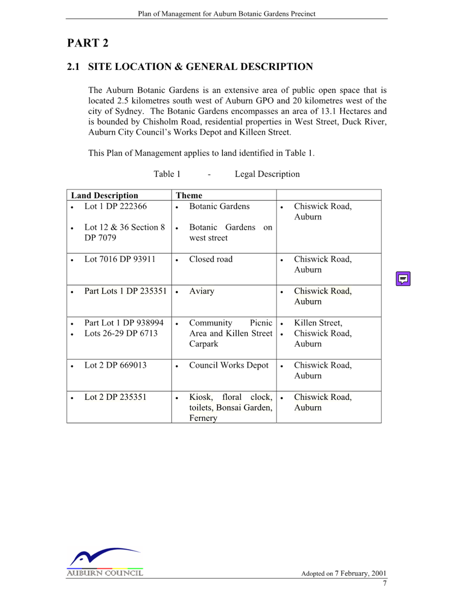
The location of the site is shown
below edged in purple.
Figure 1 - Locality
Plan of subject site (Source: IntraMaps)
Figure 2 –
Aerial view of subject site
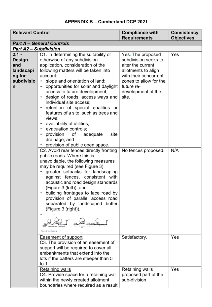
Figure 3 –
Street view and inside view of subject site
Description of The
Development
Council has received a development
application for the subdivision of 1 allotment (known as Super Lot 7) into 8
residential allotments and 1 new private road (under Community Title) including
associated tree removal, earthworks and civil works.
A detailed breakdown of the
proposal is outlined below:
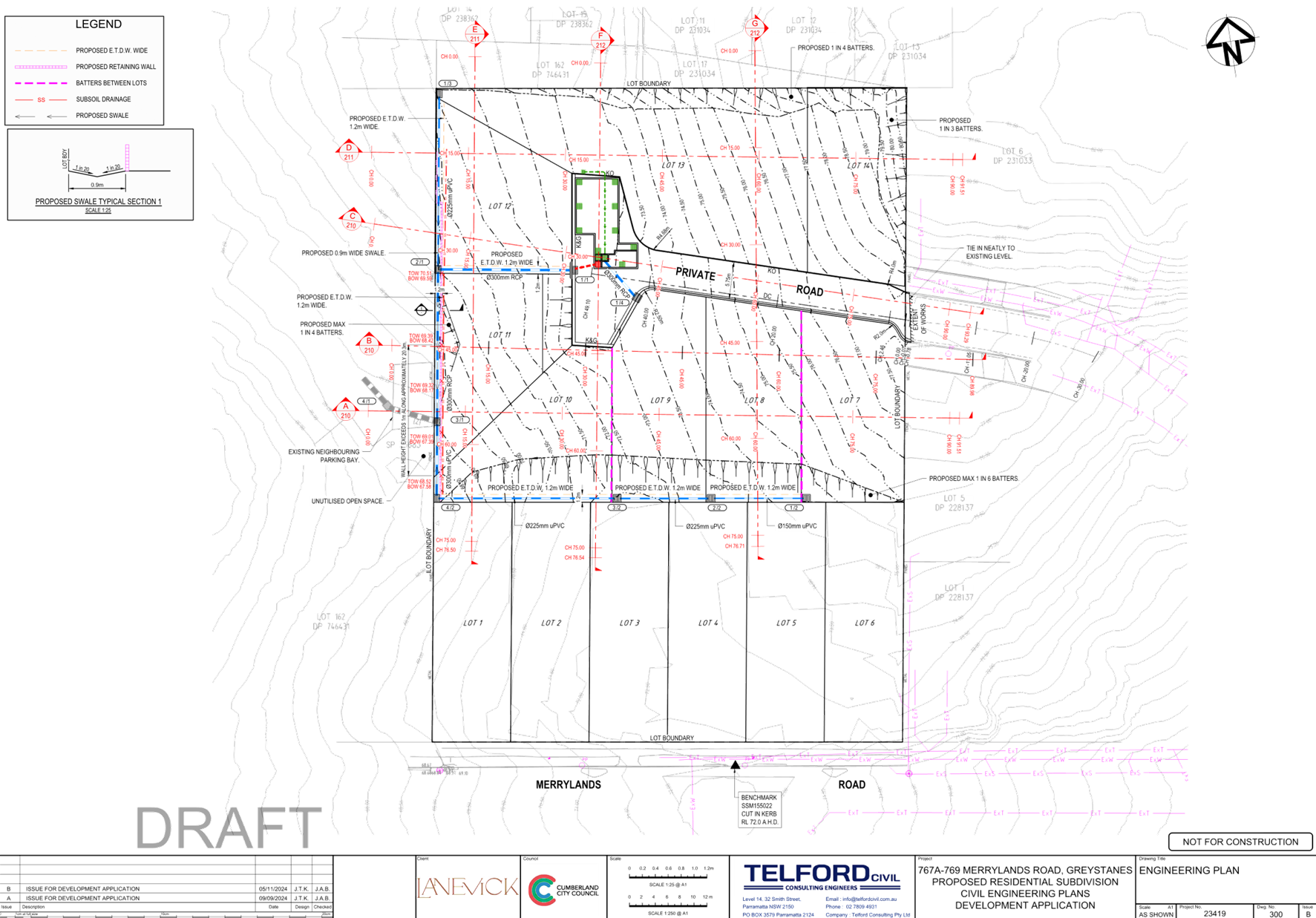
· The subdivision of
super lot 7 into 8 lots and a road under Community Title as follows:
|
Lot
|
Site Area
|
Street frontage
|
|
Lot 7
|
451.86 sq m
|
13.6m
|
|
Lot 8
|
452.46 sq m
|
14.91m
|
|
Lot 9
|
450.95 sq m
|
8.01m
|
|
Lot 10
|
450.48 sq m
|
6.26m
|
|
Lot 11
|
451.23 sq m
|
11.05m
|
|
Lot 12
|
451.32 sq m
|
15.62m
|
|
Lot 13
|
1000.84 sq m
|
36.89m
|
|
Lot 14
|
450.77 sq m
|
15.29m
|
· Removal of 50
trees and retention of 3.
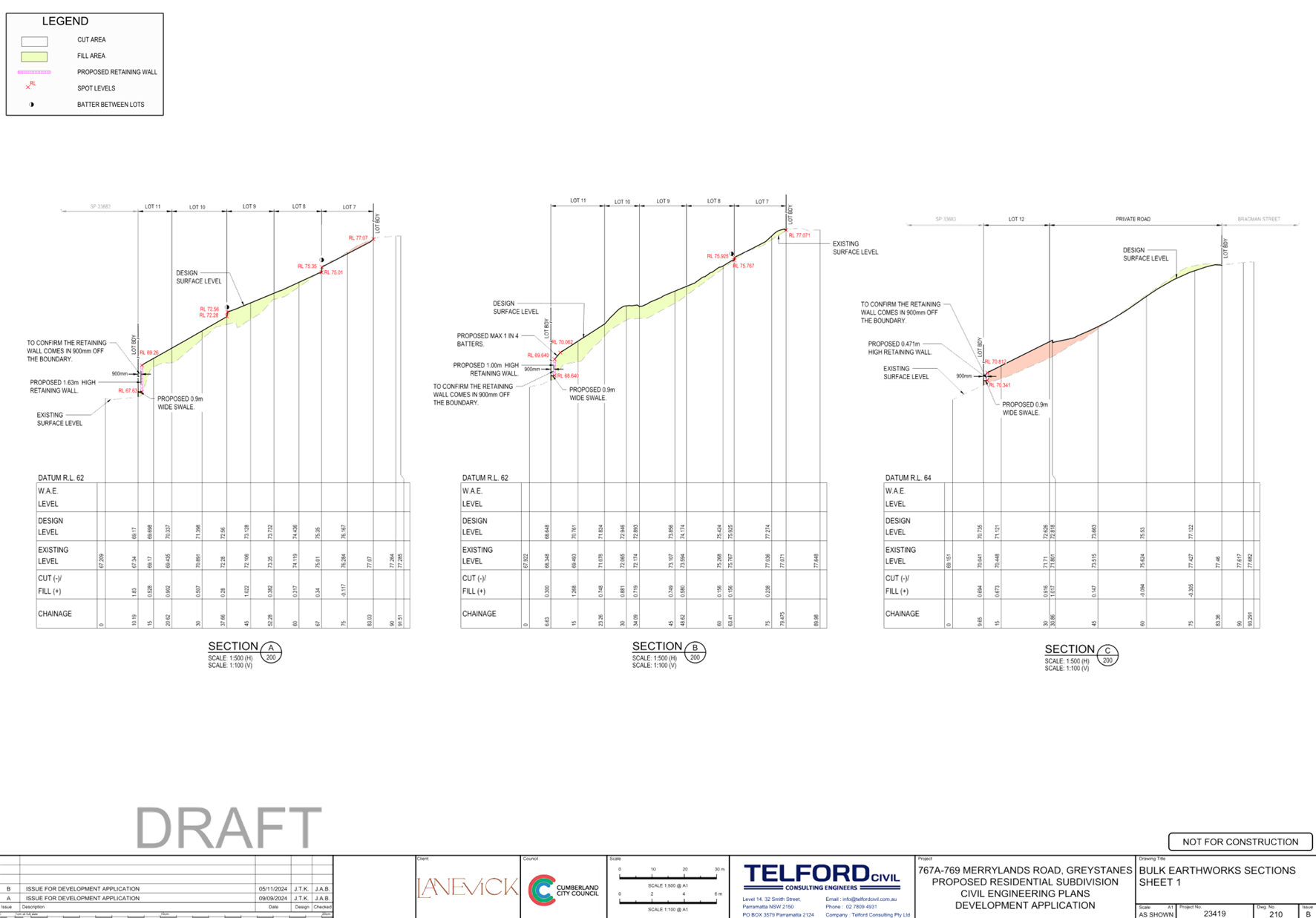
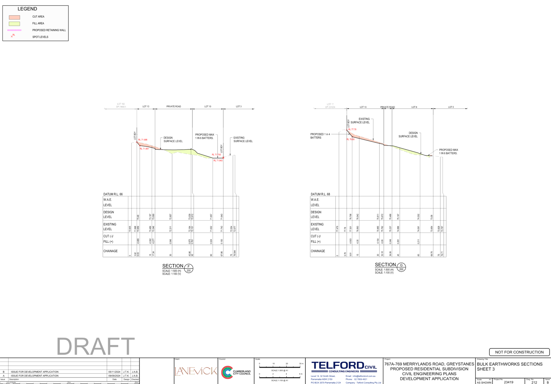
· Earthworks
(including retaining walls and cut and fill).
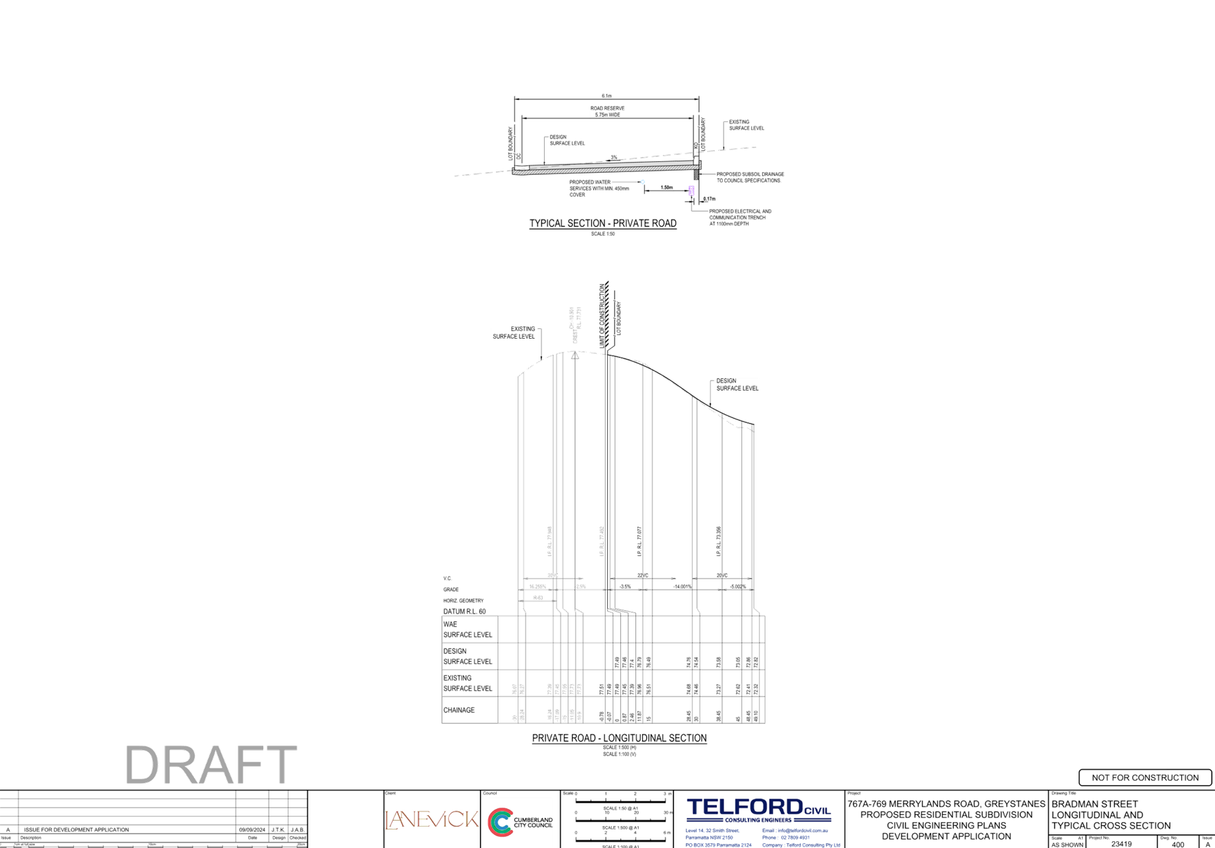
· Civil works (stormwater,
sewer, power and water).
· Construction of a
private road (under Community Title).
Lot 13 is proposed as a super lot
for future further subdivision. The final arrangement is pending the outcome of
a potential planning proposal and acquisition of 44A and 44C Benaud Street,
Greystanes.
History
PL2019/42/1 was concluded
on 1 November 2019 for the subdivision of two lots into twelve lots, creating
road and drainage and site works including demolition.
PL2021/0051 - a meeting was
held between council officers and the applicant on the 27 July 2021 for the
proposed subdivision and dual occupancy development. Specifically, the proposal
for discussion related to the Torrens subdivision of two lots into 12 lots,
indicative building footprints for dual occupancy on each lot and further
Torrens title subdivision of each finished dual occupancy, removal of trees and
vegetation and extension of Bradman Street to accommodate access to the lots.
DA2022/0403 was approved on
the 31 October 2022 for the demolition of existing structures under delegated
authority.
DA2022/0414 was approved on
the 13 September 2023 for Torrens title subdivision of land into 7 residential
lots under delegated authority.
MOD2023/0452 was approved
for a Section 4.55(1A) modification to alter the scope of tree removal
associated with the approved Torrens title subdivision under delegated
authority.
DA2023/0722 for the
demolition of existing ancillary structures, tree removal and Torrens title
subdivision of one allotment (previously known as Super Lot 7) into eight (8)
lots including construction of the Bradman Street road extension and dedication
of land/road to Council. This application was withdrawn on 9 April 2024 prior
to determination.
PL2024/0027 a meeting was
held between Council officers and the applicant on the 23 May 2024 for tree
removal and subdivision of 1 allotment (known as Super Lot 7) into 8 allotments
including road subdivision under Community Title.
Applicants Supporting
Statement
The applicant has provided a
Statement of Environmental Effects prepared by ABC Planning dated September
2024 and was received by Council on 10 September 2024 in support of the
application.
Contact With Relevant
Parties
The assessing officer has
undertaken a site inspection of the subject site and surrounding properties and
has been in regular contact with the applicant throughout the assessment
process.
Internal Referrals
Development Engineering
The development application was
referred to Council’s Senior Development Engineer for comment who has
advised that the proposal is satisfactory and therefore can be supported
subject to recommended conditions of consent.
Environmental Health
The development application was
referred to Council’s Environmental Health Officer for comment who has
advised that the proposal is satisfactory and therefore can be supported
subject to recommended conditions of consent.
Tree Management
The development application was
referred to Council’s Senior Tree Management Officer for comment who has
advised that the proposal is satisfactory and therefore can be supported
subject to recommended conditions of consent.
Waste Management
The development application was
referred to Council’s Waste Management Officer for comment who has
advised that the proposal is satisfactory and therefore can be supported
subject to recommended conditions of consent.
Planning Systems
The development application was
referred to Council’s Planning System Team for comment, particularly in
relation to the future change of classification of 44A and 44C Benaud Street,
Greystanes (Lot 162 DP746431 and Lot 17 DP 231034).
Council’s Senior Strategic
Planner notes that the application states that Council owned lots at 44A and
44C Benaud Street, Greystanes (Lot 162 DP746431 and Lot 17 DP 231034) would
need to be reclassified from ‘Community to Operational land’ first
to enable the amalgamation with the super lots to develop the land in
accordance with Part F1 of Cumberland DCP 2021 requirements.
The Planning Proposal process may
take at least 15 to 18 months or more from the lodgement stage. The applicant
will need to liaise with the Planning Systems Team to initiate a scoping
proposal and a proponent-initiated Planning Proposal.
In this regard, there is no
objection to the intent to retain proposed lot 13 as a ‘Superlot’.
External Referrals
Endeavour Energy
The application was referred to
the Endeavour Energy pursuant to Section 2.48 of the SEPP (Transport and
Infrastructure) 2021. As per the correspondence dated 24 September 2024, the
development is determined as being acceptable subject to conditions as per the
previous advice provided by Endeavour Energy under CNR-54784 and CNR-64850.
Sydney Water
The application was referred to
Sydney Water pursuant to Section 78 of the Sydney Water Act 1994. Sydney Water
has provided correspondence, and conditions dated 11 October 2024, the
development is determined as being acceptable subject to conditions.
Planning Comments
The provisions of any
Environmental Planning Instruments (EP&A Act s4.15 (1)(a)(i))
State Environmental Planning
Policies
The proposed development is
affected by the following State Environmental Planning Policies:
|
State
Environmental Planning Policies (SEPPs)
|
Relevant
Clause(s)
|
Compliance
with Requirements
|
|
· State Environmental
Planning Policy (Biodiversity and Conservation) 2021.
|
Chapter 2 -Vegetation in non
Rural Areas.
|
The development application
includes the removal of 50 trees and will impact on the clearing or impact on
vegetation as shown on the biodiversity values mapping tool as shown below:
  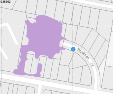
Figure 4 - Biodiversity Values
Map and Threshold Tool.
The application has been
accompanied by the following reports:
Biodiversity Development
Assessment Report (BDAR) Stage 2 prepared by Eco Coast Ecology, Version 3.0,
dated 10/09/24 and;
Arborist report - Stage 2
prepared by Charles Manche, dated 3/09/24.
The Biodiversity report
indicates that the proposed clearing of vegetation is 0.29ha and exceeds the
Biodiversity Offset Scheme (BOS) and therefore triggers the biodiversity
offset scheme.
The BDAR recommends that a
Construction Environment Management Plan (CEMP) be prepared prior to the
release of a Construction Certificate/Subdivision Works Certificate and
offset credits for up to 0.7 Ha of clearing should be obtained. A condition
has been imposed for the biodiversity offset credits and payments into the
biodiversity conservation fund be made for the clearing of vegetation onsite.
The report has been reviewed
by Council’s Senior Tree Management Officer and the advice provided
indicated that the proposed removal/clearing of the vegetation are
satisfactory to proceed subject to recommended specific conditions of consent
to be imposed which include biodiversity offset credits and payments into the
biodiversity conservation fund and also the installation of nesting boxes.
Further to the above, a
condition will be imposed that a replacement tree be planted in the front and
one in the rear of each sub-divided lot. This equates to 16 trees being
planted.
|
|
Chapter 6 -
Water Catchments.
Georges River Catchment.
|
It is determined that given the
location of the site, a detailed assessment is not required given that there
is no direct impact upon the catchment and no direct impact upon
watercourses.
|
|
· State Environmental
Planning Policy (Resilience and Hazards) 2021.
|
Chapter 2 - Coastal
Management.
|
The subject site is not
identified as a coastal wetland or land identified as “proximity area
for coastal wetlands” or coastal management area.
|
|
Chapter 4 - Remediation of
Land.
Part 4.6.
|
Part 4.6 - Contamination
and remediation to be considered in determining development application.
Comments
Council’s Environmental
Health Officer has reviewed the application and has advised that the
applicant has submitted a Stage 1 - Preliminary Site Investigation (PSI)
prepared by Geotesta Pty Ltd. The PSI states the Planning Certificate
indicated that the land is not significantly contaminated within the meaning
of the Contaminated Land Management Act 1997.
As such, it is
considered that the development application is satisfactory under Part 4.6 of
Chapter 4 of the State Policy.
|
|
· State Environmental
Planning Policy (Transport and Infrastructure) 2021.
|
Chapter 2 - Infrastructure.
|
State Environmental Planning
Policy (Transport and Infrastructure) 2021 is relevant to the development
application as follows.
|
|
Clause 2.48
|
Chapter 2 - Infrastructure.
Determination of development
applications (Subpart (2) - Give written notice to electricity providers and
take account of responses received within 21 days.
Comment
The application was referred to the Endeavour Energy
pursuant to Section 2.48 of the SEPP (Transport and Infrastructure) 2021. As
per the correspondence dated 24 September 2024, the development is determined
as being acceptable subject to conditions as per the previous advice provided
by Endeavour Energy under CNR-54784 and CNR-64850.
|
|
· State Environmental Planning
Policy (Sustainable Buildings) 2022
|
Chapter 2 Standards for residential
Development -BASIX
|
A BASIX Certificate was not required for the subject
application as the works only involve sub-division of the ‘super
lot’. A separate application will be required for each built form
application and will be subject to the requirements of SEPP (Sustainable
Buildings) 2022.
|
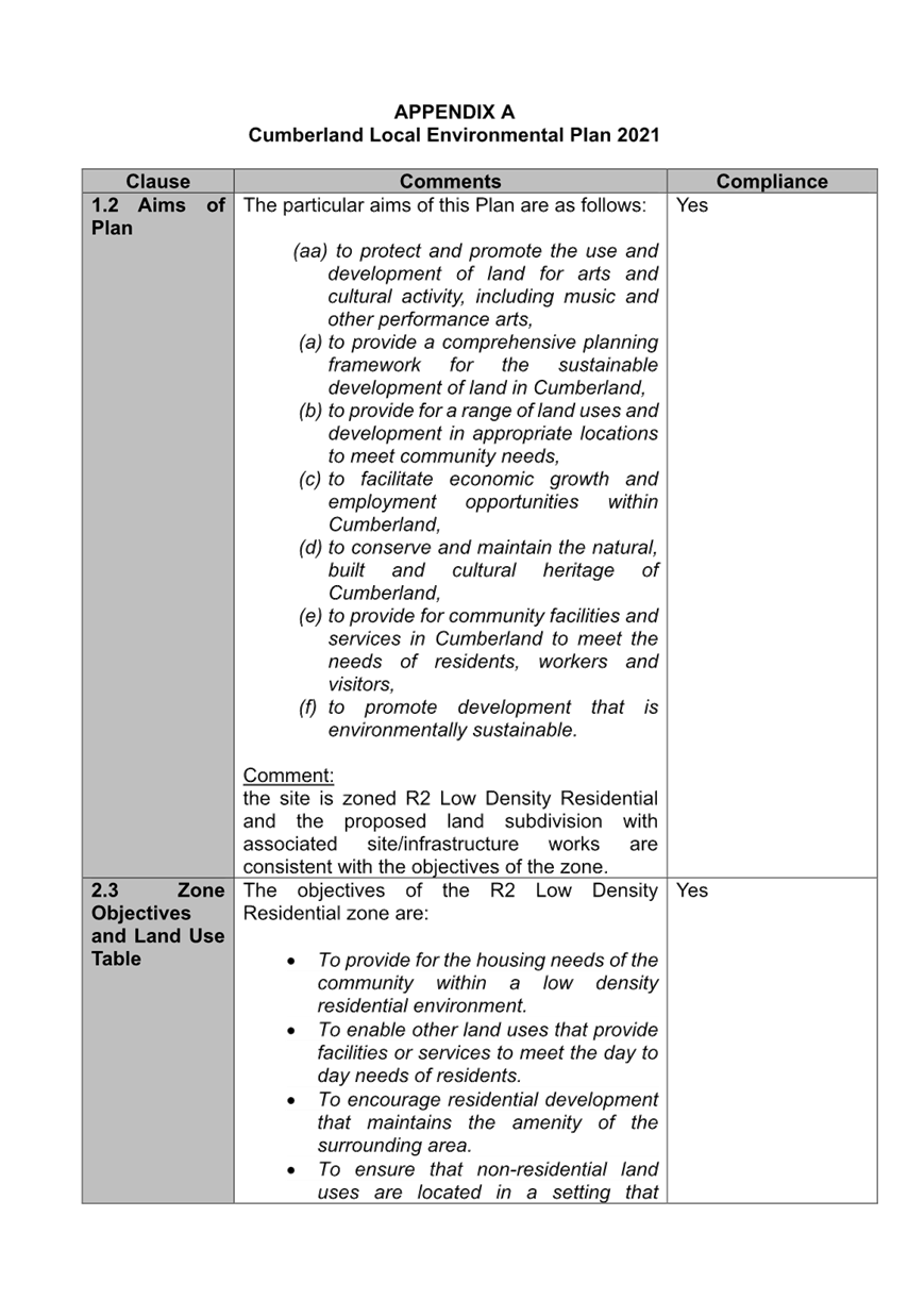
Local Environmental Plans
Cumberland Local Environmental
Plan 2021
The provision of the Cumberland
Local Environmental Plan 2021 is applicable to the development proposal. It is
noted that the development achieves compliance with the key statutory
requirements of the Cumberland Local Environmental Plan 2021 and the objectives
of the R2 Low Density Residential zone.
(a) Permissibility:
The proposed works being
‘subdivision’ is permissible with consent pursuant to Section 2.6
of the Cumberland LEP 2021.
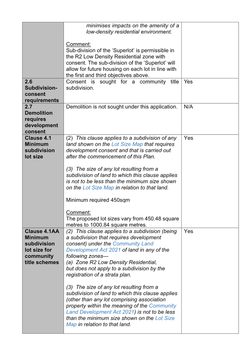
2.6
Subdivision—consent requirements
(1) Land
to which this Plan applies may be subdivided, but only with development
consent.
The relevant matters to be
considered under Cumberland Local Environmental Plan 2021 and the applicable
clauses for the proposed development are summarised below. A comprehensive LEP
assessment is contained in Appendix 5.
Figure
5 - Cumberland LEP 2021 Compliance Table
|
DEVELOPMENT STANDARD
|
COMPLIANCE
|
DISCUSSION
|
|
Clause 4.1
Minimum required 450sqm
|
Yes
|
The proposed lot sizes vary from 450.48 square metres to
1000.84 square metres.
|
|
Clause 4.1AA
|
Yes
|
Each lot will have a minimum of
450 square metres. Refer to above comment.
|
|
4.3 Height of Buildings
max. 9m
|
N/A
|
No building works proposed.
|
|
4.4 Floor
Space Ratio
|
N/A
|
N/A. There is no FSR prescribed for land zoned R2. No building works proposed.
|
The provisions of any proposed
instrument that is or has been the subject (EP&A Act s4.15 (1)(a)(ii))
No proposed planning instruments
applicable.
The provisions of any
Development Control Plans (EP&A Act s4.15 (1)(a)(iii))
The Cumberland Development Control
Plan 2021 (CDCP) is relevant to the development proposal.
The development has been assessed
using the following chapters:
· Part A2 -
Subdivision.
· Part B -
Development in Residential Zones.
· Part F1-4 -
Bradman Street Extension.
· Part G3 - Traffic,
parking, transport and access.
· Part G4 -
Stormwater and drainage.
· Part G5 –
Sustainability, biodiversity and environmental management.
· Part G7 –
Tree Management and Landscaping.
· Part G8 - Waste
Management.
A comprehensive CDCP assessment is
contained in Appendix 6.
The development is found to comply
with the relevant provisions except for the following:
Figure
6 – Cumberland DCP 2021 - Compliance Table.
|
Control
|
Required
|
Provided
|
% variation
|
|
Sub-part 2.17, O1.
Part F1-4 Bradman Street, Greystanes (Proposed Development
and Subdivision) Chapter Cumberland Development Control Plan 2021 (CDCP 2021).
|
Facilitate the conventional subdivision of Lot 5, DP
20650, Lot 6B DP 413844, Part Lot 16 and Lot 17, DP 238362 into 12 lots.
|
Stage 1 approved 6 lots – Approved under
DA2022/0414.
Stage 2 proposes 8 lots.
|
16.66%.
|
|
Sub-part 2.3, C2.
Part G7 - Tree Management & Landscaping Chapter
Cumberland Development Control Plan 2021 (CDCP 2021).
|
88 replacement trees required.
|
16 trees proposed (as recommended by Council), plus
contribution to biodiversity offset scheme.
|
81.81%.
|
As indicated in the compliance
table above, the proposed development departs from the Bradman Street site
specific objective (O1) and Bradman Street sub-division map and the number of
replacement trees provisions of Council’s Cumberland Development Control
Plan.
Irrespective of these departures,
it is considered that the proposal performs adequately from an environmental
planning viewpoint and may be supported for the reasons discussed below:
Sub-part 2.17, (O1) - Part F1-4
Bradman Street, Greystanes (Proposed Development and Subdivision)
Objectives
O1 Facilitate the
conventional subdivision of Lot 5, DP 20650, Lot 6B DP 413844, Part
Lot 16 and Lot 17, DP 238362 into 12 lots; and
O2 Prevent the
linking of the existing sections of Bradman Street.
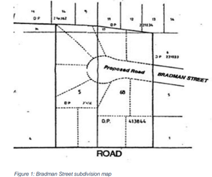
The proposal seeks the Subdivision
of 1 allotment (known as Super Lot 7) into 8 residential allotments and 1 new
private road (under Community Title).
Stage 1 approved 6 residential
lots, the subject application seeks 8 residential lots, a total of 14
residential lots, in lieu of 12 as envisaged by the DCP. However, the proposal
broadly achieves the intentions of the site specific objectives which is to
facilitate residential sub-division, extending the road and preventing the
linking of the existing sections of Bradman Street.
Furthermore, the proposed lot
sizes comply with the minimum subdivision lot size requirements of the
Cumberland LEP 2021 which is a higher order planning instrument.
A cul-de-sac arrangement is not
proposed as part of this application, this was previously proposed under
DA2023/0722; however, the application was later withdrawn due to a number of
non-compliances, including site frontages to the proposed lots 8, 9, 10, 11, 12
and 13 that were too narrow to accommodate a feasible development and
consequently would have resulted in a number of non-compliances with the CDCP
and would not have resulted in a good planning outcome.
Therefore, the variation to the
CDCP in respect to the indicative sub-division layout is considered acceptable.
Sub-part 2.3, (C2) - Part G7 -
Tree Management & Landscaping
The objectives for this control
are:
Objectives
O1 Maintain the
character of place that trees and vegetation provide to the Cumberland
City.
O2 Reserve and
protect the ecological and aesthetic value of quality landscaping in the
Cumberland City.
C2 For
existing trees that are approved to be removed by Council as part of a proposed
development, the following tree replacement offset planting is required:
· for existing trees
removed that are a height of between 4m-9m, a 1:1 replacement offset applies;
and
· for existing trees
removed that are a height greater than 10m, a 2:1 replacement offset applies.
The preference is for offset
planting to be undertaken on the property related to the development
application. Any alternate locations are to be considered on merit by Council,
with reference to applicable strategies and plans.
The subject site is located within
the Cumberland Shale Plains Woodland
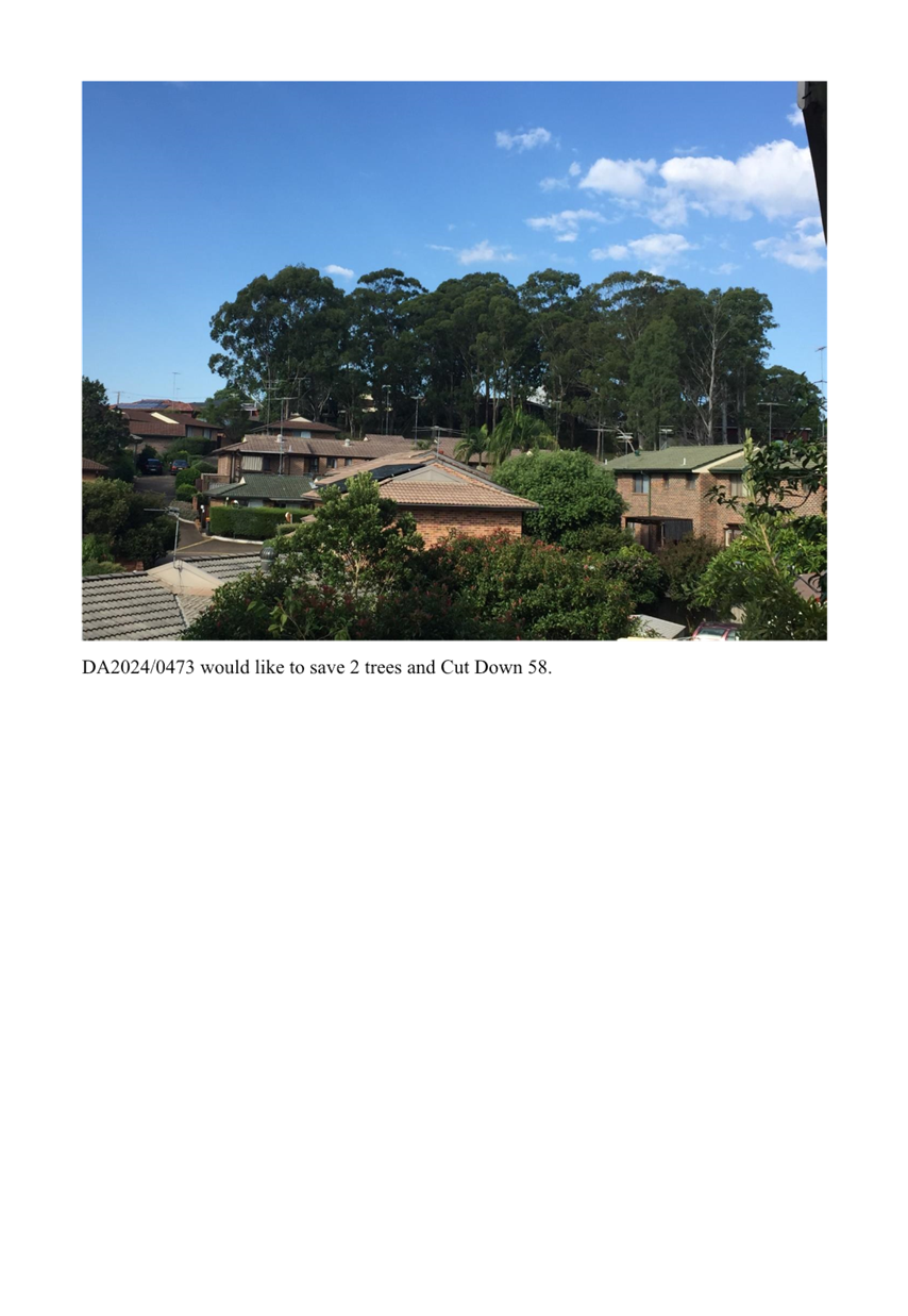
The proposal seeks the removal of
50 trees and based on control C2 above a total of 88 replacement trees would be
required. A condition has been imposed for 16 trees to be planted, the
condition requires 1 tree at the front and 1 and the rear to each new lot
created. There is further opportunity for more trees to be planted once an
application is received for the built form.
In addition to the above, a
condition has been imposed that 3 nesting boxes be placed in trees proposed for
retention to offset the loss of habitat due to the proposed clearing and to
ensure any fauna currently utilising site are not adversely impacted. The BDAR
recommends that a Construction Environment Management Plan (CEMP) be prepared
prior to the release of a Construction/Subdivision Works Certificate and offset
credits for up to 0.7 Ha of clearing should be obtained. A condition has been
imposed for the biodiversity offset credits and payments into the biodiversity
conservation fund be made for the clearing of vegetation onsite.
Figure 7 –
Trees to be removed and retained shown below:
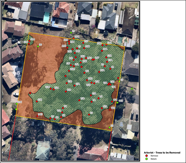
(Source: BDAR Report
- East Coast Ecology)
The provisions of any planning
agreement that has been entered into under section 7.4, or any draft planning
agreement that a developer has offered to enter into under section 7.4
(EP&A Act s4.15(1)(a)(iiia))
There is no draft planning
agreement associated with the subject Development Application.
The provisions of the
Regulations (EP&A Act s4.15 (1)(a)(iv))
The proposed development raises no
concerns as to the relevant matters arising from the Environmental Planning and
Assessment Regulation 2021 (EP&A Reg).
The Likely Environmental,
Social or Economic Impacts (EP&A Act s4.15 (1)(b))
It is considered that the proposed
development will have no significant adverse environmental, social or economic
impacts in the locality.
The suitability of the site for
the development (EP&A Act s4.15 (1)(c))
The subject site and locality is
not known to be affected by any natural hazards or other site constraints
likely to have a significant adverse impact on the proposed development.
Accordingly, it is considered that the development is suitable in the context
of the site and surrounding locality.
Submissions made in accordance
with the Act or Regulation (EP&A Act s4.15 (1)(d))
|
Advertised (Website)
|
Mail
|
Sign
|
Not Required
|
In accordance with Council’s
Notification requirements contained within Cumberland Development Control Plan
2021, the proposal was publicly notified for a period of 14 days between 26
September 2024 and 10 October 2024. The notification generated 37 submissions,
4 of which were in support in respect of the proposal and none disclosing a
political donation or gift. The issues raised in the public submissions are
summarised and commented on as follows:
Figure
7 - Submissions summary table
|
Issue
|
Planner’s Comment
|
|
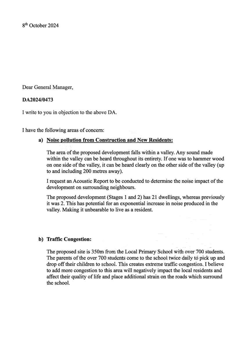
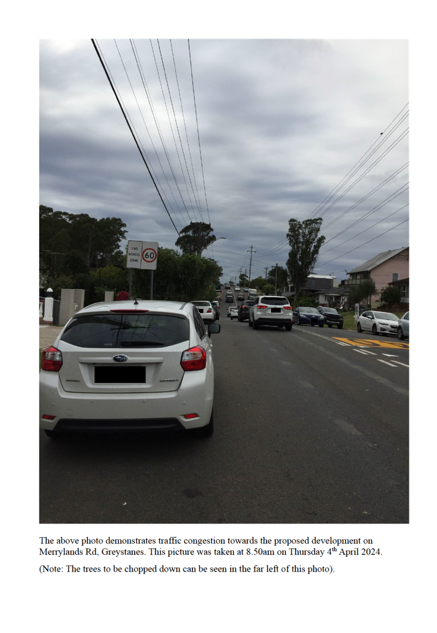
Safety concerns with traffic.
More traffic congestion.
Increase in traffic, leading to hazards and imminent
danger for children and pets.
|
The application was accompanied by a Traffic Impact
Assessment that concludes “With reference to the RTA Guide to
Traffic Generating Developments 2002, the traffic assessment has concluded
that the proposed development will pose no impact to the local area regarding
traffic”.
Council’s Senior Development Engineer also reviewed
the application and did not raise any objections subject to conditions. The
proposed new sub-division will also allow for the entry and exit in a forward
direction for Council’s waste trucks.
|
|
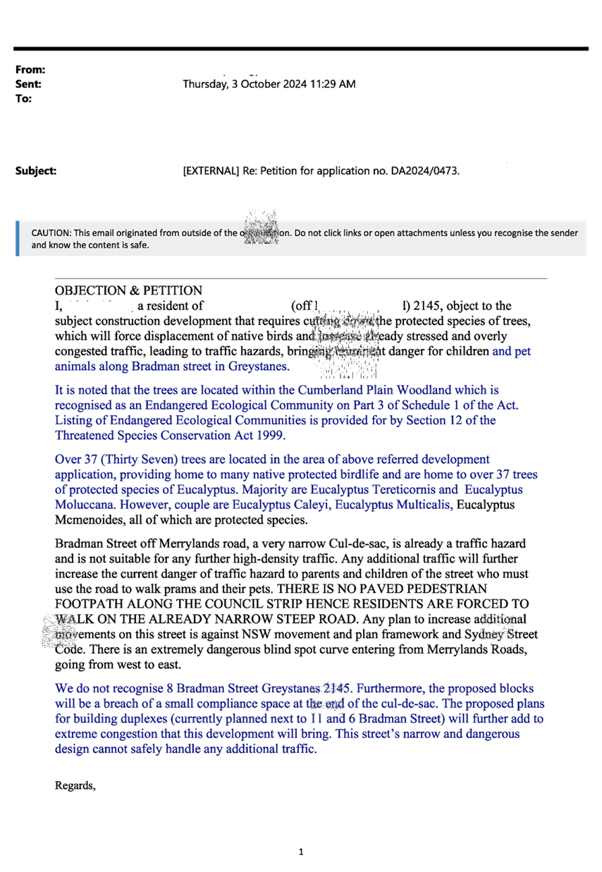
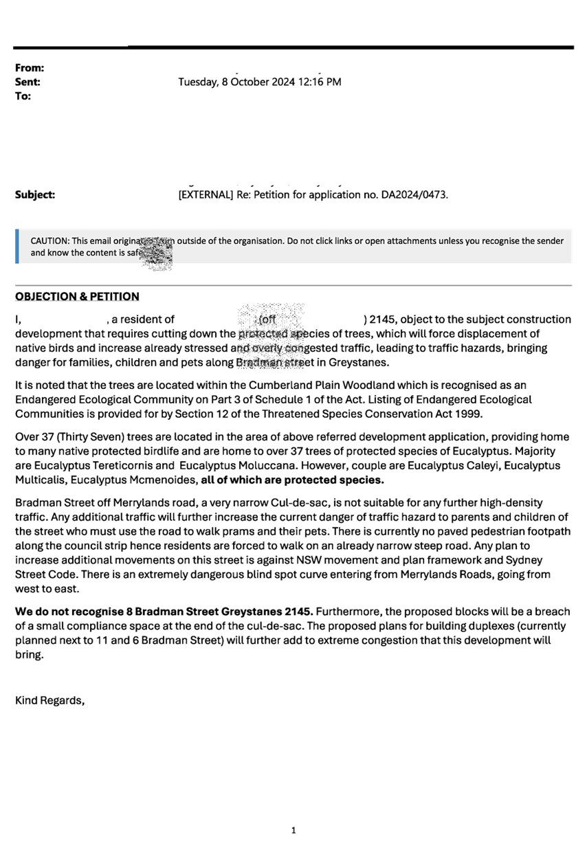
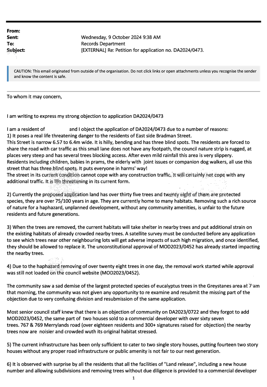
Removal/loss of trees which support wildlife habitat.
Wildlife corridor has been disturbed. We urge all
seriousness to be responsible for the preservation of what remains.
Cutting down protected species of trees, which will
force displacement of native birds. Eucalyptus Caleyi, Eucalyptus Multicalis
and Eucalyptus Mcmenoides of which are protected species.
|
A condition has been imposed
that nesting boxes in the trees that are proposed for retention to offset the
loss of habitat. In addition, the applicant is required to offset the
residual impacts of vegetation loss. A condition has been imposed for the biodiversity
offset credits and payments into the biodiversity conservation fund be made
for the clearing of vegetation onsite.
Council’s Senior Tree Management Officer has advised
that the site does not contain any Eucalyptus Caleyi, Eucalyptus
Multicalis and Eucalyptus Mcmenoides.
|
|
Trees are located within the Cumberland Plain Woodland.
|
Whilst the site is located within the Cumberland Shale
Plain Woodland, the subject application was assessed on its merits and
conditioned accordingly.
|
|
From the statement on page 29 of the BDAR it can be
assumed that DA2024/0473 does not comply with the Biodiversity Conservation
Act 2016 part 7.
The disclaimer in the BDAR report is not to be relied
upon by Council.
|
The applicant is required to offset the residual impacts
of the proposal by the purchase and retire the appropriate species credits.
This will be conditioned accordingly.
|
|
Not right to cut down all trees, why not half or less,
it is not okay.
|
The trees proposed for removal are within areas that will
impact the internal road proposed to service the site, proposed building
envelopes and services/retaining walls that form part of the civil works
proposed.
|
|
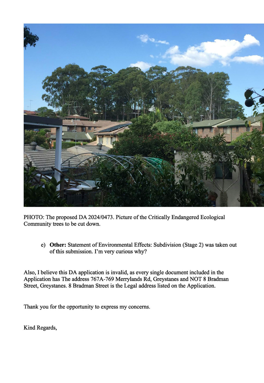
We do not recognise 8 Bradman Street.
|
The addressing to the former properties and known as
767A-769 Merrylands Road was registered with the NSW Land Registry Services
on the 2nd of September 2024. This was as a result of the
sub-division that was approved by Council under DA2022/0414.
Therefore, the ‘Superlot’ approved under
DA2022/0414 and now subject of this application is now known as 8 Bradman
Street, Greystanes - Lot 7 in DP 1308880.
|
|
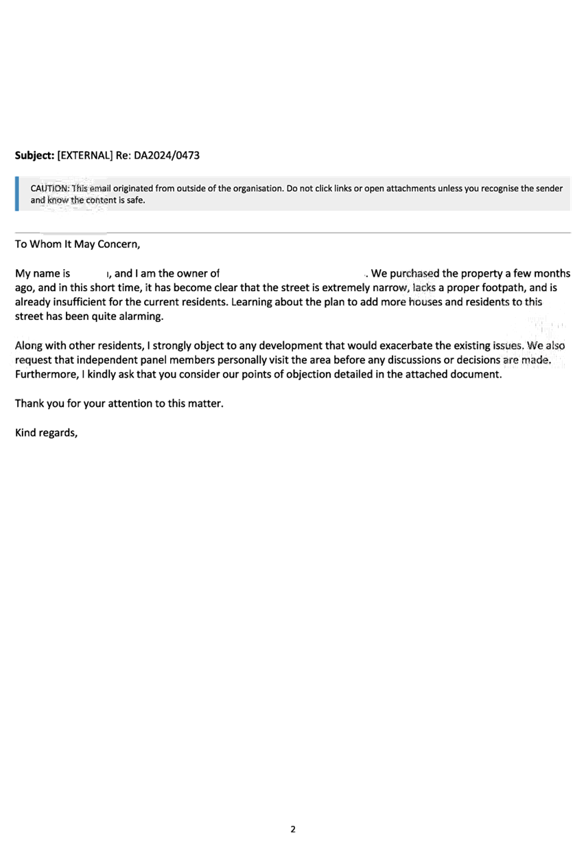
Bradman Street off Merrylands Road, a very narrow
Cul-de-sac, already a traffic hazard.
|
As stated earlier, the application was accompanied by a
Traffic Impact Assessment that concludes “With reference to
the RTA Guide to Traffic Generating Developments 2002, the traffic assessment
has concluded that the proposed development will pose no impact to the local
area regarding traffic”.
Council’s Senior Development Engineer also reviewed
the application and did not raise any objections subject to conditions.
|
|
No paved pedestrian footpath along the Council strip,
residents forced to walk on the road.
|
This is not within the scope of the subject application.
|
|
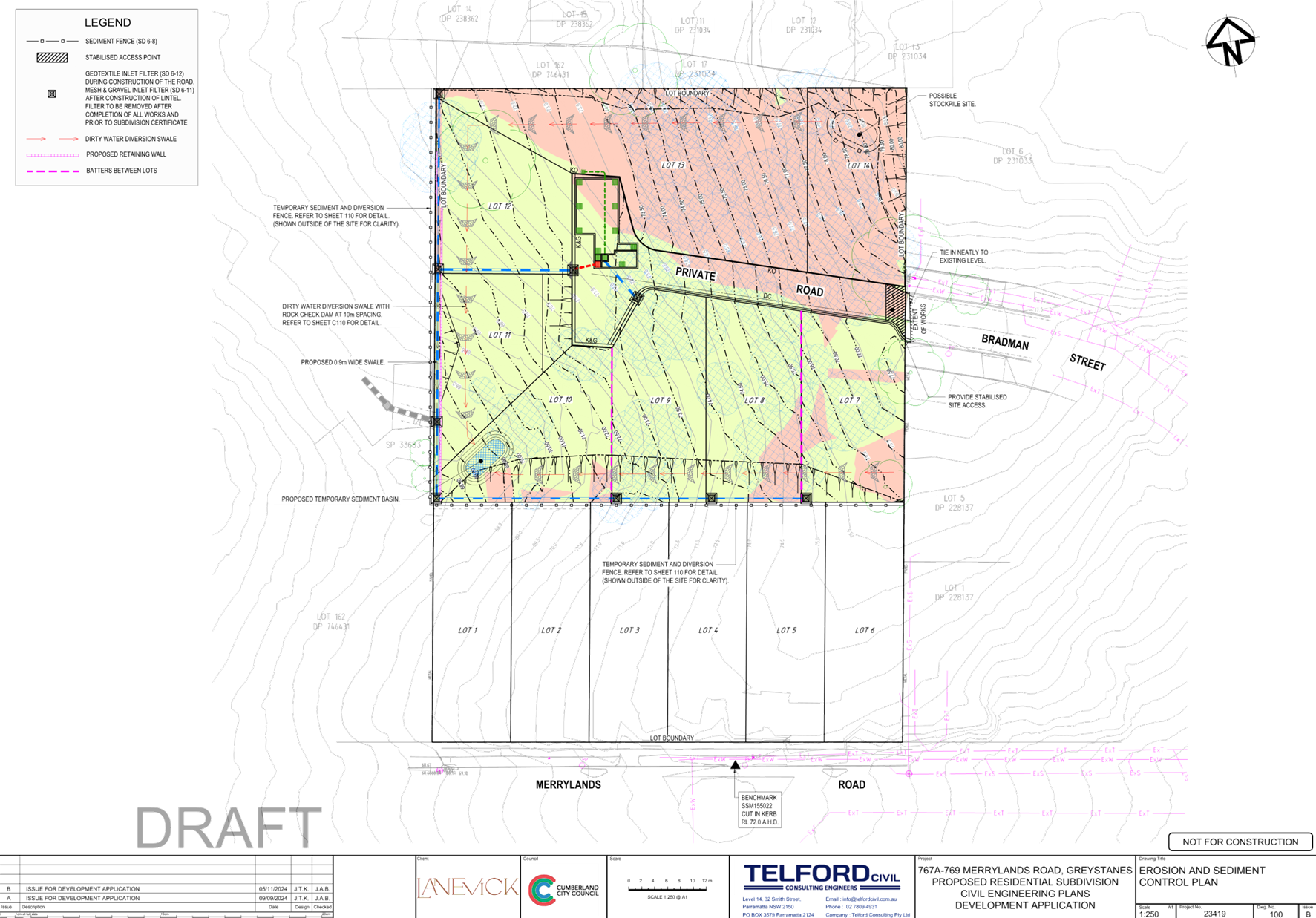
There does not seem to be any surface flow path for
emergency overflow which may cause property damage.
|
The plans have been amended to indicate a 900mm setback
along the western boundary with the provision of swale drain to carry the
emergency overflow.
|
|
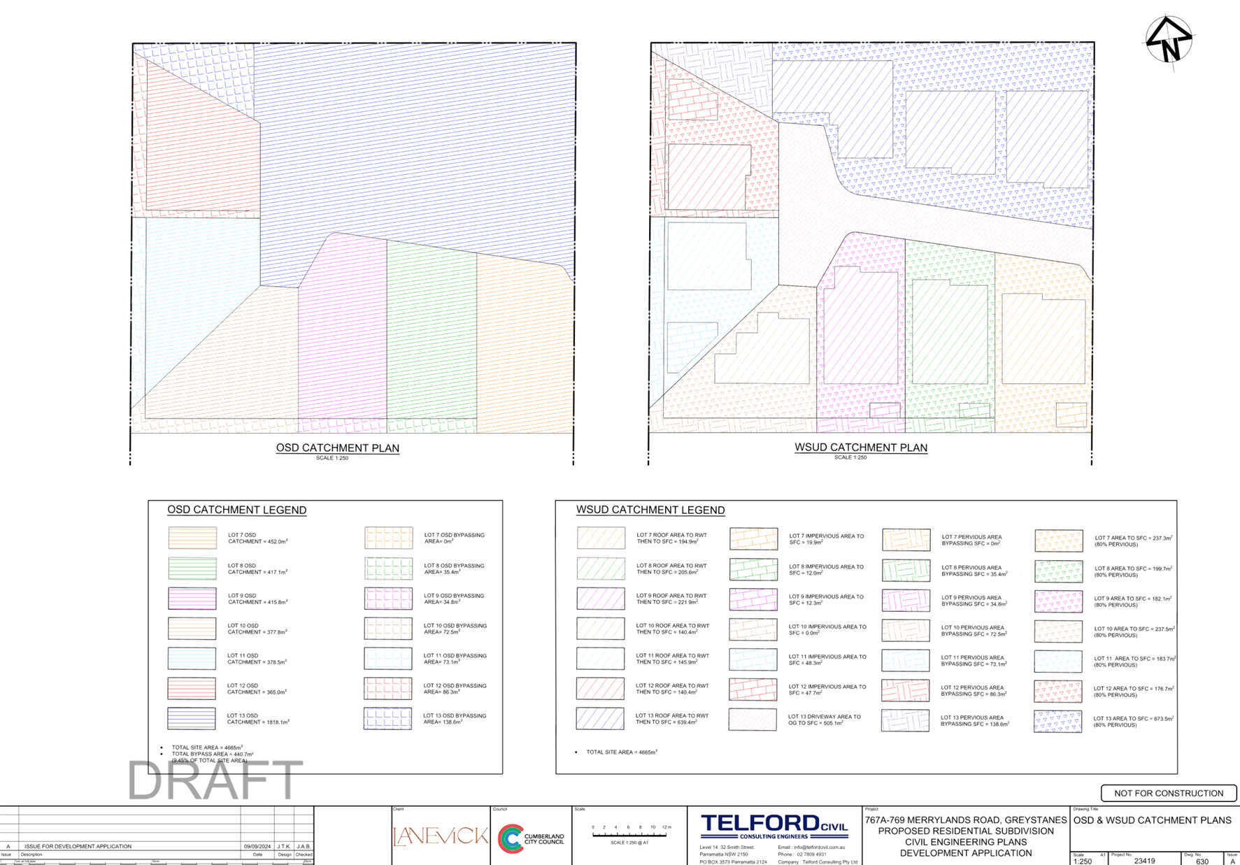
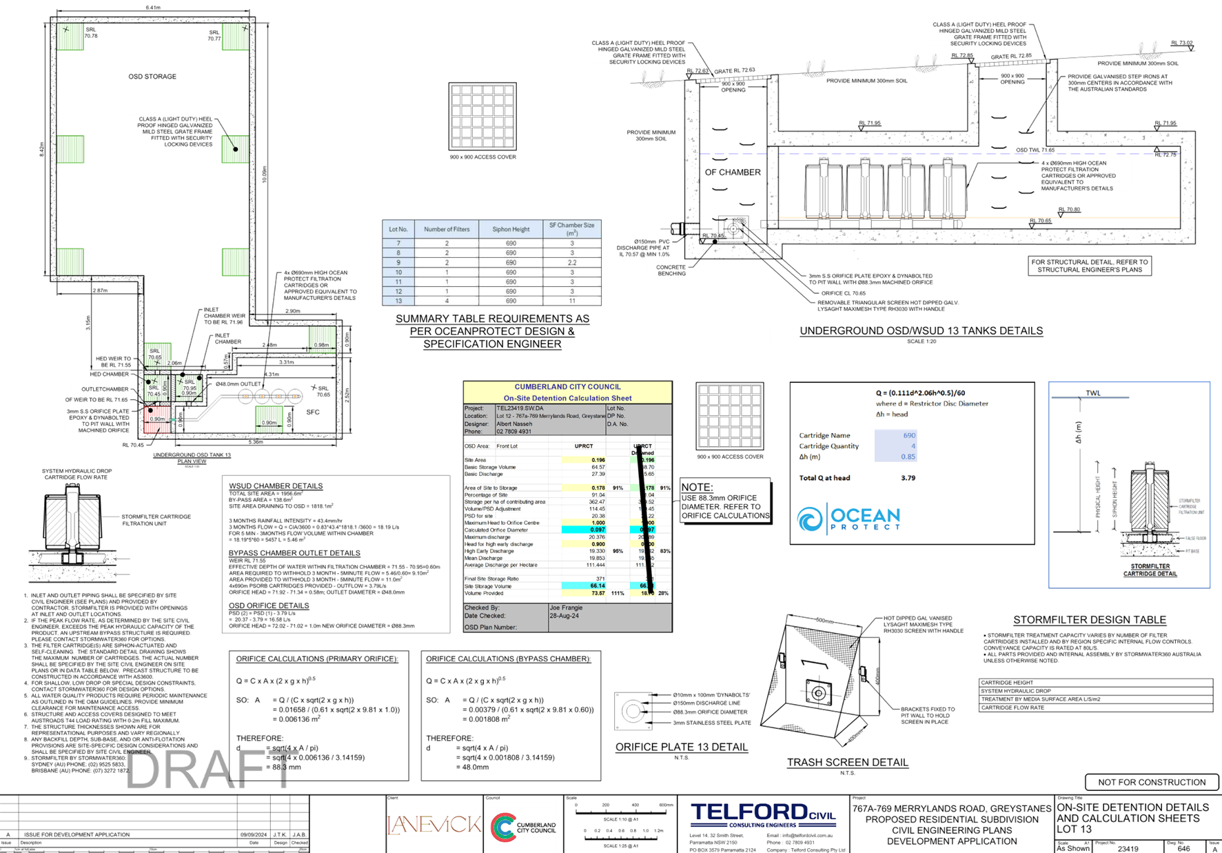
The submitted stormwater plans by TELFORD do not
include MUSIC output, cannot confirm WSUD measures are compliant.
|
A condition has been imposed to incorporate the WSUD
measures at the time of the development of each lot, however on the northern
side being lots 13 and 14 will incorporate the WSUD with the OSD system
within the community road.
The MUSIC model has been submitted separately.
|
|
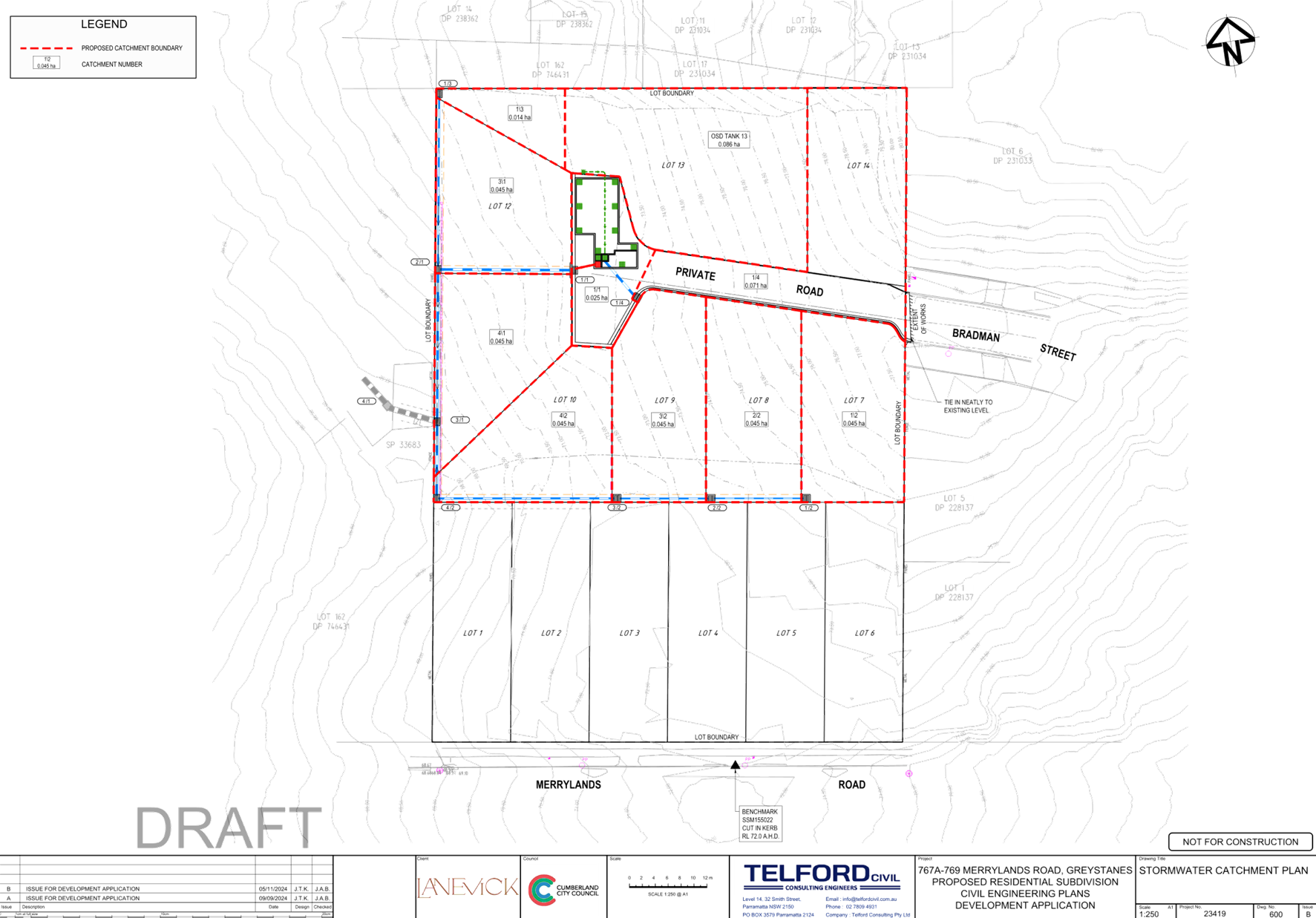
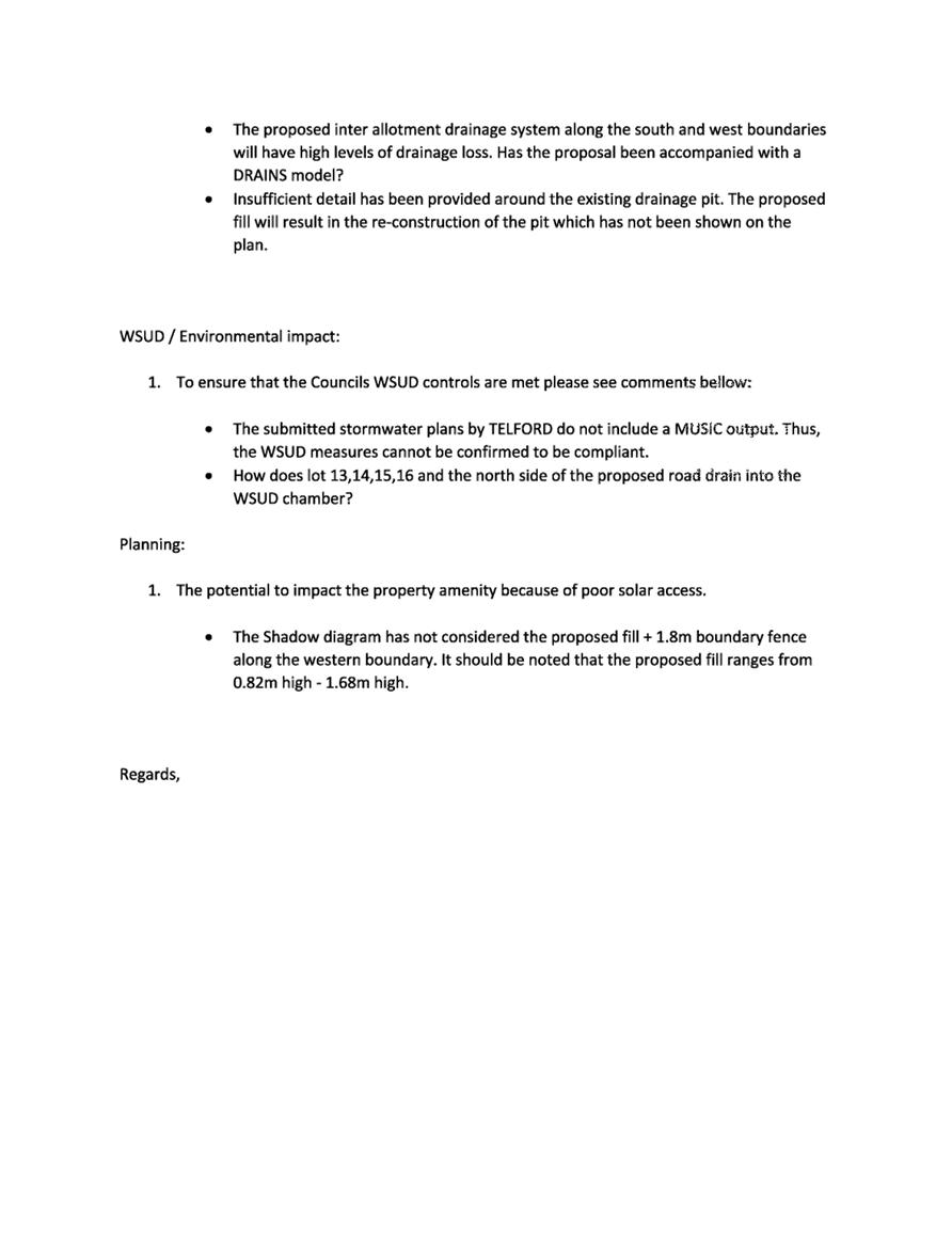
How does lots 13, 14, 15, 16 and the north side of the
proposed development drain into the WSUD chamber?
|
Lots 13, 14 and the road will drain into the stormwater
system incorporating the WSUD.
There are no lots numbered 15 and 16.
|
|
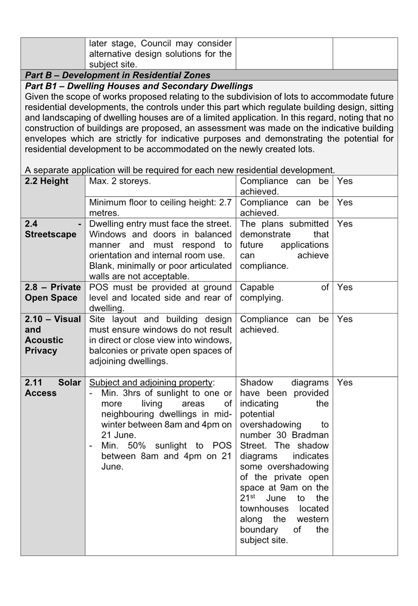
Shadow diagrams has not been considered the proposed
fill plus 1.8m boundary fence along the western boundary. Fill varies from
0.82m high-1.68m high.
|
Shadow diagrams have been provided indicating the
potential overshadowing to number 30 Bradman Street. The shadow diagrams
indicate some overshadowing of the private open space at 9am on 21 June to
the townhouses located along the western boundary of the subject site.
The applicant has also made some amendments to the
location of retaining walls along this boundary to minimise any impacts to
the townhouse development at 30 Bradman Street.
|
|
The current habitats will take shelter in nearby trees
and put additional strain on the existing habitats and crowed nearby trees.
|
A condition is recommended that a suitably qualified
ecologist install nesting boxes in the trees that are proposed for retention
to offset the loss of habitat due to the proposed clearing and to ensure any
fauna currently utilising site are not adversely impacted.
|
|
Tree removal work started while approval was still not
loaded on the Council website (MOD2023/0452).
|
Tree removal was approved under DA2022/0414 and later
modified under MOD2023/0452, therefore works onsite may have been in relation
to the original approval granted under DA2022/0414.
|
|
Senior staff knew there is an objection of community on
DA2023/0722 and they forgot to add MOD2023/0452.
|
MOD2023/0452 notified residents and objectors as per the
original application being DA2022/0414.
The notification under DA2023/0722 was extended beyond the
requirements of the Cumberland Development Control Plan 2021.
|
|
Current infrastructure not sufficient for the new lots.
|
The current infrastructure is considered satisfactory to
service the site. The applicant is proposing civil works and services to each
new lot created.
|
|
“Land release”, including a new house
number and allowing subdivisions and removing trees without due diligence.
Advertised as “Land release”, with no discussion with residents.
Procedural concerns.
|
The advertisement of the site as ‘Land
release’ by the real estate is not a matter for consideration by
Council.
|
|
No independent survey conducted to find out impact of
tree removal (such as rainwater or landhold clay that was held firm by these
trees).
|
The applicant has provided reports in support of their
application. The arborist report, BDAR report and stormwater management plans
were reviewed by Council’s Senior Tree Management Officer and Senior
Development Engineer and have been found to be satisfactory subject to
conditions.
|
|
Townhouses at the bottom of the hill suffering real
impact of rainfall.
A proper independent structural engineer report should
be ordered.
|
DA2022/0414, granted approval for sub-division only, no
approval has yet been granted for any civil works.
The subject application provides for civil works which
will be conditioned to ensure retaining walls and stormwater are adequate
addressed.
|
|
Noise pollution form construction and new residents.
|
Construction noise from building works, are matters that
are dealt with by way of conditions of consent.
The proposal is for subdivision; however, it is not
expected that noise from any future residential use would create an adverse
impact to the adjoining properties.
|
|
The application is invalid as the documents refer to
767A-769 Merrylands Road Greystanes and not 8 Bradman Street.
|
The reports relate to the rear portion of the sites that
were formerly known as 767A-769 Merrylands Road. It is likely that the
reports were prepared just prior to the registration of the subdivision
certificate approved. Therefore, the documents referring to the previous
address is acceptable in this instance, given the reports still address the
subject area that forms part of this application.
|
|
Everyone who has an objection their name and email
address is included and should be counted as an individual objection, in case
their email is not reached in time or they are unable to send an email due to
pre-occupation.
|
Noted. The Local Planning Panels Direction - Operational
Procedures dated 18 October 2022 outline the definition of a unique
submission. Therefore, in this instance, including email addresses do
not count as an individual/unique submissions.
|
|
Residents of Bradman Street, Benaud Street and
Merrylands Road request the independent panel members personally visit the
east side of Bradman Street before starting any discussion or deliberation.
|
The Local Planning Panels Direction - Operational
Procedures dated 18 October 2022 outlines the requirements for site
inspections and panel briefings. This matter is for the Panels operational
procedures.
|
|
Residents have to go through financial or mental stress
due to poor planning decision due to non-compliance, or undertrained officers
not trained for making decisions on hilly terrain.
|
The application has been assessed by the relevant staff
who are qualified in various areas (such as but not limited to Senior
Development Engineer, Town Planning and Tree Management). A recommendation is
made to the Cumberland Local Planning Panel on this application who is the
determining authority on behalf of Council in this instance, and has relevant
expertise to consider and determine the application.
|
|
Any plan to increase additional movements on this
street is against NSW movement and plan framework and Sydney Street Code.
There is an extremely dangerous blind spot curve entering from Merrylands
Road, going from east to west.
|
The application was accompanied by a Traffic Impact
Assessment that concludes “With reference to the RTA Guide to
Traffic Generating Developments 2002, the traffic assessment has concluded
that the proposed development will pose no impact to the local area regarding
traffic”.
|
|
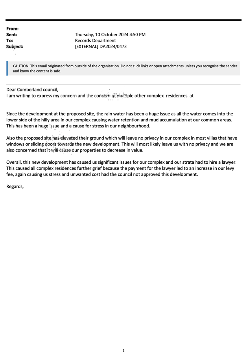
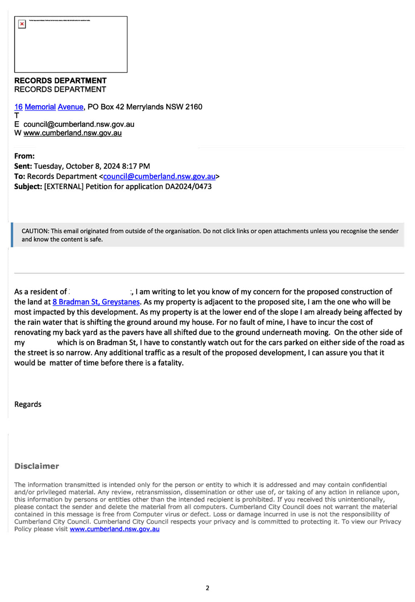
I am already being affected by the rain water that is
shifting the ground around my house, incur the cost of renovating my backyard
as the pavers have shifted.
|
DA2022/0414, granted approval for subdivision only, no
approval has yet been granted for any civil works.
The subject application provides for civil works, which
will be conditioned to ensure retaining walls and stormwater are adequate
addressed.
|
|
I express deep disappointment with Cumberland Council
handles critical environmental and community issues.
|
The submission is noted.
Council has made a merit assessment of the application
pursuant to s4.15 of the Environmental Planning and Assessment Act, 1979.
|
|
All affected home owners were very surprised that the
council did not involve community representation-before putting up the
current notices.
|
There is no requirement under current legislation that
requires Council to consult with the community prior to the lodgement of a
Development Application.
The subject application was notified once it was formally
lodged with Council. The notification of the subject application was above
the requirements specified Council’s notification requirements
contained within the Cumberland Development Control Plan 2021.
|
|
Statement of Environmental Effects: Subdivision (Stage
2) was taken out of the submission. Why?
|
Noted. This has no impact on the application. The
application is for the “Subdivision of 1 allotment (known as Super
Lot 7) into 8 residential allotments and 1 new private road (under Community
Title) including associated tree removal, earthworks and civil works”.
|
|
DA2023/0722 at 767a-769 Merrylands Rd, Greystanes. I
was not notified of this DA. Why? I thought council is working for the local
residents. Why would I not be notified?
|
DA2023/0722 was notified in accordance with
Council’s Council’s Notification requirements contained within
Cumberland Development Control Plan 2021. Council then re-notified the
application and extended the notification catchment area and placed site
notices. Residents outside the notification area would not have received
written notification of the application.
|
|
Tree 26Q and 29 is not on land owned by the applicant,
Why would approval to remove be allowed to a non-owner of the land?
|
Tree 29 is on Council owned land and is not proposed for
removal.
Tree 26Q is on the subject site and is being proposed for
removal.
|
|
Vegetation around tree 31B and 24C is not on land owned
by the applicant. Why would approval to remove be allowed to a non-owner of
the land?
|
No vegetation removal is proposed outside the land owned
by the applicant. This will be confirmed with a condition of consent.
|
|
In preference the nest boxes should be installed
outside the subject land in a more appropriate area.
|
Nest boxes have been conditioned onsite in the trees that
are proposed for retention to offset the loss of habitat due to the proposed
clearing and to ensure any fauna currently utilising the site are not
adversely impacted.
|
|
Planning Certificate, p3. “Does the land include
or compromise critical habitat? The land does not include or comprise
critical habitat”. We can asset that this was answered incorrectly,
from page 51 of the BDAR stating “to provide habitat for the threated
species they are targeting”.
|
A Planning Certificate was not submitted with the
development application.
Irrespective of this, the BDAR report was reviewed by
Council’s Senior Tree Management Officer who raised no objections
subject to conditions.
|
|
The proposed plans for building duplexes will further
add to extreme congestion that this development brings.
|
The proposal does not seek any built form as part of this
application. The applicant has provided indicative building envelopes to
support their proposed lot sizes.
No approval is sought or will be granted for built forms
or the indicative building envelopes. Should the community title subdivision
be approved, a separate application will be required for the construction of
any development for each lot.
|
|
Loss of sunlight, and lack of privacy.
Elevated ground, no privacy and will cause our
properties to decrease in value.
|
Shadow diagrams have been provided indicating the
potential overshadowing to number 30 Bradman Street. The shadow diagrams
indicate some overshadowing of the private open space at 9am on the 21st
June to the townhouses located along the western boundary of the subject
site.
The applicant has also made some amendments to the
location of retaining walls along this boundary to minimise any impacts to
adjoining properties.
Any future application received for the construction of
the residential built forms will be assessed on their merits.
|
|
Lacks the capacity to safely accommodate heavy or even
light construction traffic (Bradman Street).
|
The Traffic Impact Assessment report submitted with the
development application provides for a ‘Construction Traffic
Management’. Any consent granted will be conditioned accordingly.
|
|
Bradman Street be made one-way, with appropriate entry
and exit points to minimise risk.
|
This is not feasible as Bradman Street is a cul-de-sac
which would require roads to be made via privately owned lots. The Cumberland
Local Environmental Plan 2021 does not have any sites within the Bradman
Street or adjoining sites earmarked for land acquisition for future roads.
|
|
Independent and comprehensive engineering report to
evaluate current and future traffic conditions, tree management and rainwater
drainage.
|
The applicant has provided reports in support of their
application. The arborist report, BDAR report and stormwater management plans
were reviewed by Council’s Senior Tree Management Officer and Senior
Development Engineer and have been found to be satisfactory subject to
conditions.
|
|
Removal of 88 heritage trees.
Propose a children’s park be established as a
compensatory measure to preserve green space for the community.
|
The trees being removed are not heritage listed pursuant
to the Cumberland Local Environmental Plan 2021.
The land is not zoned for recreational purposes. The
subject site is zoned R2 Low Density Residential, and the proposal seeks
consent for community title subdivision and associated works which is
permissible within the zone and subject to a merit assessment pursuant to
s4.15 of the Environmental Planning and Assessment Act, 1979.
It is noted that public open spaces are located in close
proximity to the proposed subdivision.
|
The public interest (EP&A
Act s4.15(1)(e))
In view of the foregoing analysis,
it is considered that the development, if carried out subject to the conditions
set out in the recommendation below, will have no significant adverse impacts
on the public interest.
CUMBERLAND LOCAL INFRASTRUCTURE
CONTRIBUTIONS PLAN 2020
The development would require the
payment of contributions in accordance with Cumberland Local Infrastructure
Contributions Plan 2020.
In accordance with the
Contribution Plan a contribution is payable, pursuant to Section 7.11 of the
EP&A Act, calculated on the cost of works. A total contribution of
$160,000.00 would be payable prior to the issue of a Construction Certificate.
HOUSING AND PRODUCTIVITY
CONTRIBUTION (HPC)
In accordance with s7.24, s7.26
and s7.28 of the Environmental Planning and Assessment Act 1979, the proposed
development is subject to the payment of the Housing and Productivity
Contribution (HPC).
A condition of consent has been
imposed on the development consent in accordance with s7.28 of the EP&A Act
1979 requiring the payment of the HPC.
DISCLOSURE OF POLITICAL
DONATIONS AND GIFTS
The applicant and notification
process did not result in any disclosure of Political Donations and Gifts.
The development application has
been assessed in accordance with the relevant requirements of the Environmental
Planning and Assessment Act 1979, State Environmental Planning Policy
(Biodiversity and Conservation) 2021, State Environmental Planning Policy
(Resilience and Hazards) 2021, State Environmental Planning Policy (Transport
and Infrastructure) 2021, Cumberland Local Environmental Plan 2021 and
Cumberland DCP and is considered to be satisfactory subject to
conditions.
The proposed development is
appropriately located within the R2 Low Density Residential zone under the
relevant provisions of the Cumberland LEP. The proposal is consistent with all
statutory and non-statutory controls applying to the development. Minor non-compliances
with Council’s controls have been discussed in the body of this report.
The development is considered to perform adequately in terms of its
relationship to its surrounding built and natural environment, particularly
having regard to impacts on adjoining properties.
For these reasons, it is
considered that the proposal is satisfactory having regard to the matters of
consideration under Section 4.15 of the Environmental Planning and Assessment
Act 1979, and the development may be approved subject to conditions.
There are no consultation
processes for Council associated with this report.
There are no financial
implications for Council associated with this report.
There are no policy implications
for Council associated with this report.
Communication /
Publications:
The final outcome of this matter
will be notified. The objectors will also be notified in writing of the
outcome.
1. That
Development Application No. DA2024/0473 for Subdivision of 1 allotment (known
as Super Lot 7) into 8 residential allotments and 1 new private road (under
Community Title) including associated tree removal, earthworks and civil works
on land at 8 Bradman Street, GREYSTANES be approved subject to conditions
listed in Council’s assessment report.
2. Persons
whom have lodged a submission in respect to the application be notified of the
determination of the application.
1. Draft
Notice of Determination
2. Proposed
Sub-division and Shadow Diagram Plan
3. Stormwater/Engineering
Plans
4. Submissions
Redacted
5. Appendix
A - Cumberland LEP Assessment
6. Appendix
B - Cumberland DCP Assessment
DOCUMENTS
ASSOCIATED WITH
REPORT ELPP038/24
Attachment 1
Draft Notice of Determination
Cumberland
Local Planning Panel Meeting
11 December 2024


DOCUMENTS
ASSOCIATED WITH
REPORT ELPP038/24
Attachment 2
Proposed Sub-division and Shadow Diagram Plan
Cumberland
Local Planning Panel Meeting
11 December 2024
DOCUMENTS
ASSOCIATED WITH
REPORT ELPP038/24
Attachment 3
Stormwater/Engineering Plans
Cumberland
Local Planning Panel Meeting
11 December 2024


DOCUMENTS
ASSOCIATED WITH
REPORT ELPP038/24
Attachment 4
Submissions Redacted
Cumberland
Local Planning Panel Meeting
11 December 2024


DOCUMENTS
ASSOCIATED WITH
REPORT ELPP038/24
Attachment 5
Appendix A - Cumberland LEP Assessment
Cumberland
Local Planning Panel Meeting
11 December 2024

DOCUMENTS
ASSOCIATED WITH
REPORT ELPP038/24
Attachment 6
Appendix B - Cumberland DCP Assessment
Cumberland
Local Planning Panel Meeting
11 December 2024
Cumberland Local Planning Panel Meeting
11 December 2024
Item No: ELPP039/24
Development
Application - 96 Chiswick Road, Auburn (CLOSED SESSION)
Directorate: Environment
and Planning
Responsible
Officer: Executive
Manager City Planning and Development
|
Application
accepted
|
29 July 2024.
|
|
Applicant
|
Cumberland City Council.
|
|
Owner
|
Cumberland City Council.
|
|
Application
No.
|
DA2024/0332.
|
|
Description
of Land
|
96 Chiswick Road, Auburn, Lot
2 DP 235351.
|
|
Proposed
Development
|
Installation of a
prefabricated building to be used as office spaces and installation of a
prefabricated bathroom amenity building.
|
|
Site
Area
|
13,692.80 square metres.
|
|
Zoning
|
Zone RE1 - Public Recreation.
|
|
Disclosure
of political donations and gifts
|
Nil disclosure.
|
|
Cost
of works
|
$990,000.00.
|
|
Heritage
|
Yes - Auburn Botanic Gardens
|
|
Principal
Development Standards
|
N/A.
|
|
Issues
|
Council owned property and
parking
|
1. Development
Application 2024/0332 was accepted by Council on the 29 July 2024 for the
installation of a prefabricated building to be used as office spaces and
installation of a prefabricated bathroom amenity building.
2. The
application was publicly notified to occupants and owners of the adjoining
properties for a period of 28 days between the 8 August 2024 to the 5 September
2024. In response, no submissions were received.
3. There is a
variation to the parking controls that apply to the site.
4. The
application is referred to the Cumberland Local Planning Panel for
determination as the development is proposed on land for which Council is the
landowner resulting in a conflict of interest.
5. The
application is recommended for conditional approval subject to the conditions
as recommended in the Council’s assessment report.
Subject Site and Surrounding
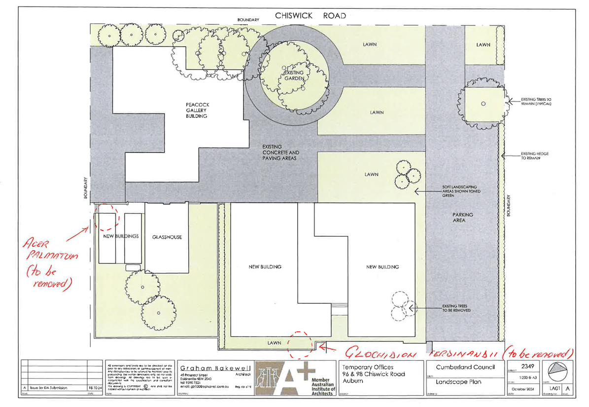
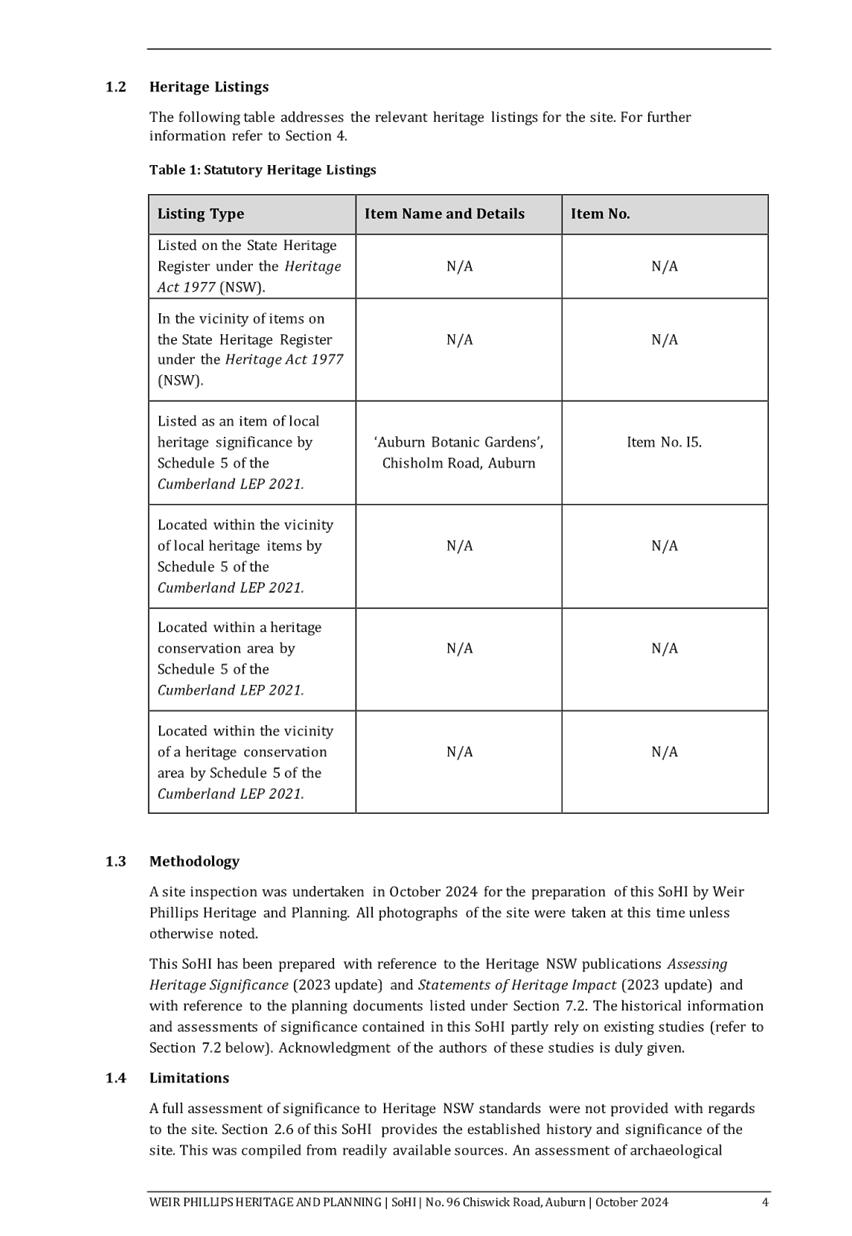
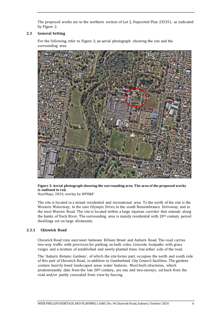
Area
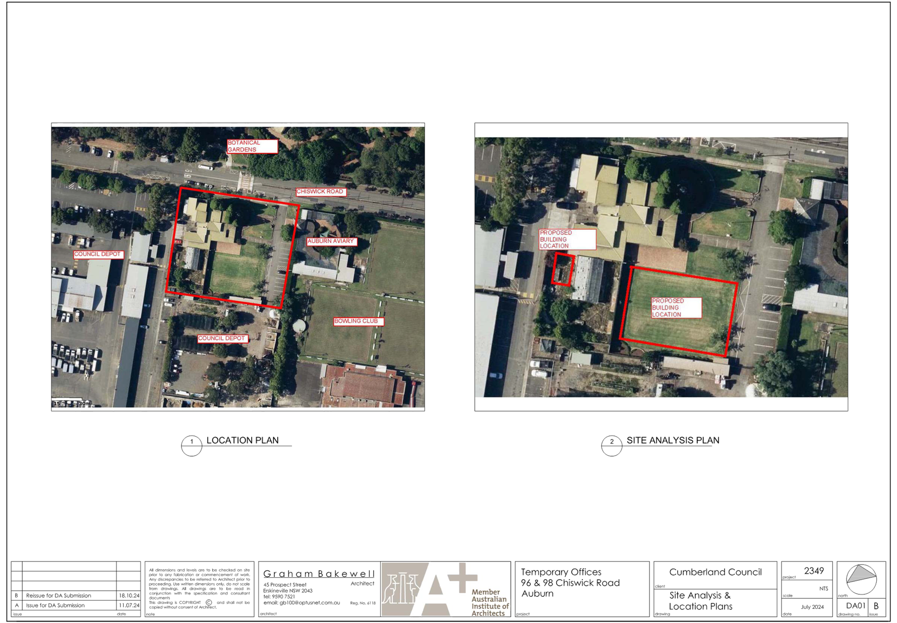
The site is legally identified as
Lot 2 DP 235351 and is known as 96 Chiswick Road, Auburn.
The site has an area of 13,692.00
square metres and a primary frontage to Chiswick Road of 73.70 metres.
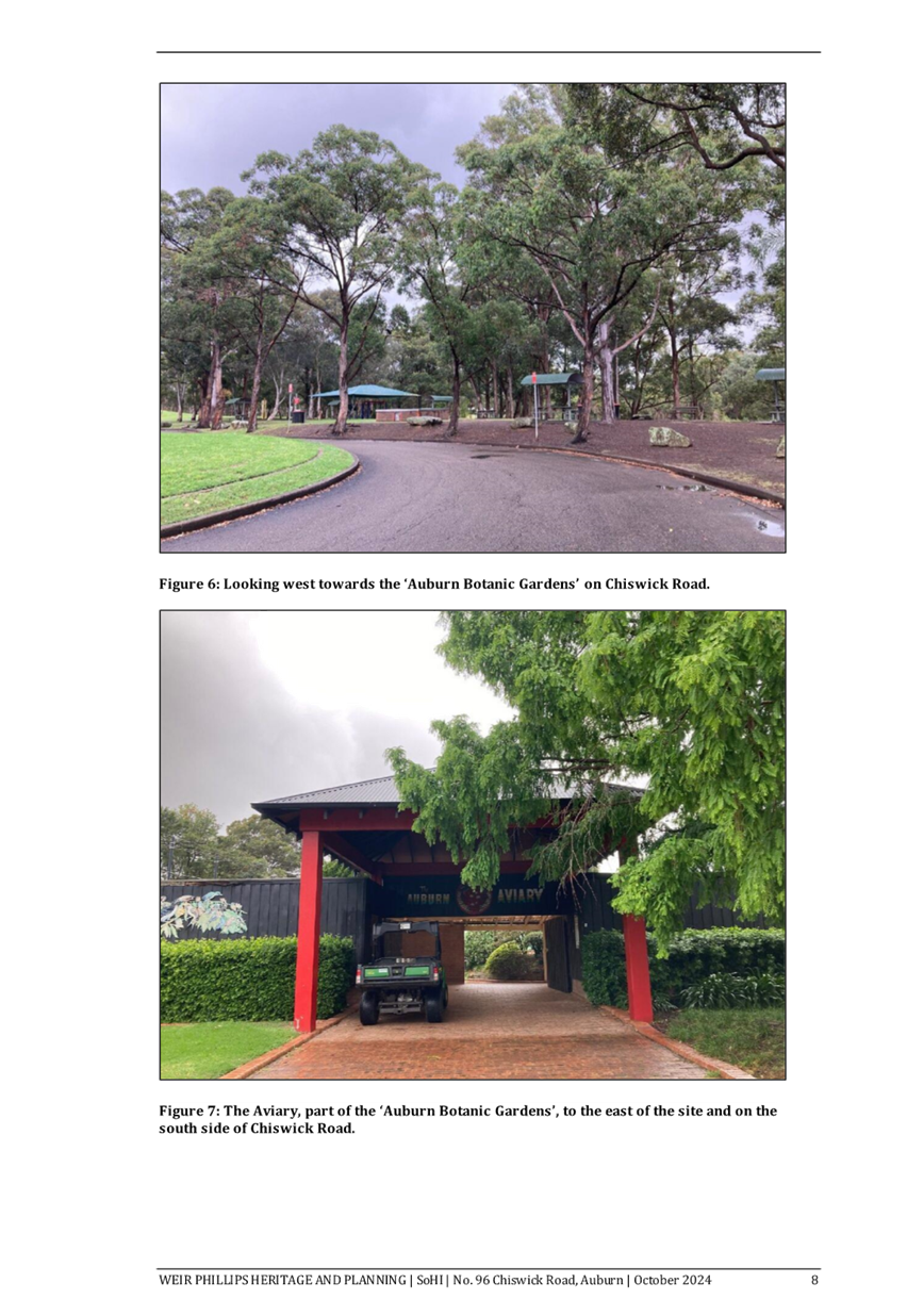
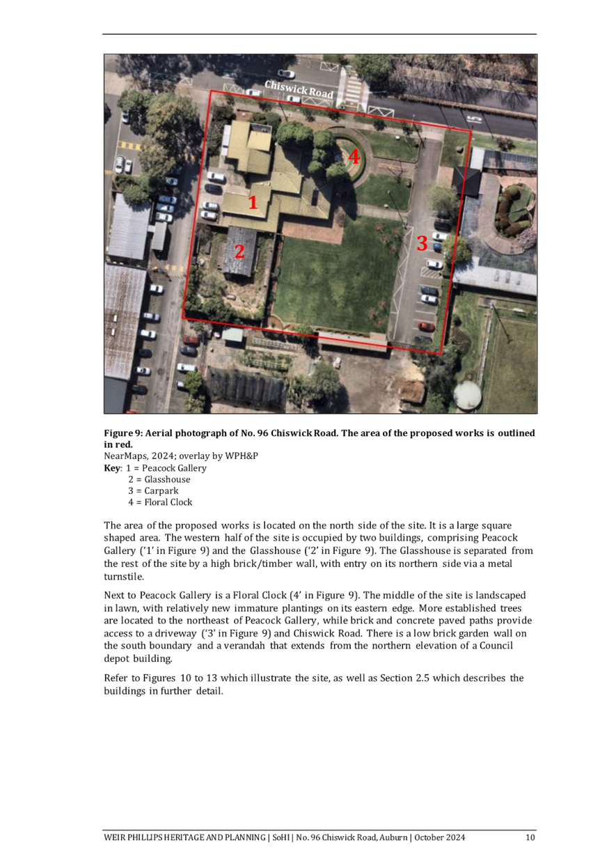
The subject site is part of the
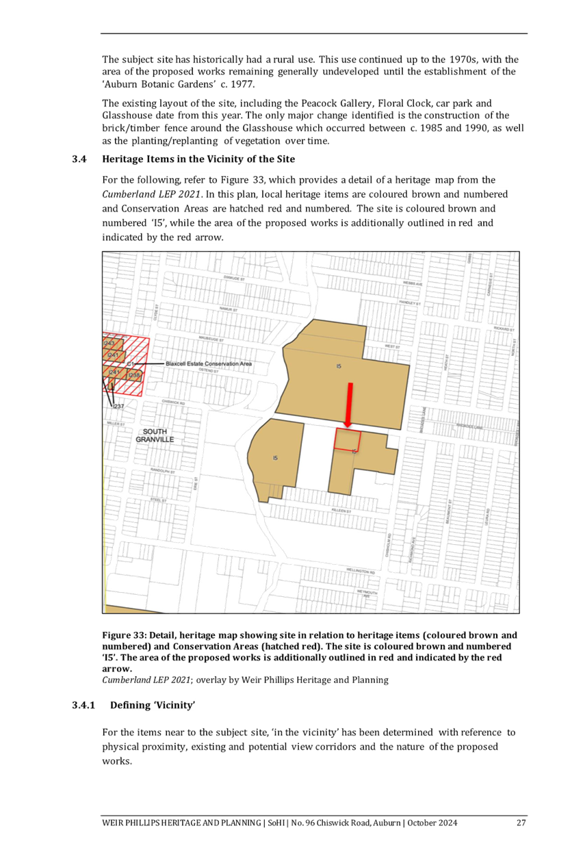
Auburn Botanic Gardens precinct which also forms part of the local heritage
listed item (Number I5 of the Cumberland Local Environmental Plan 2021) known
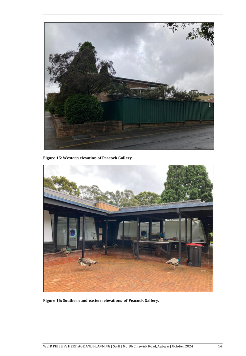
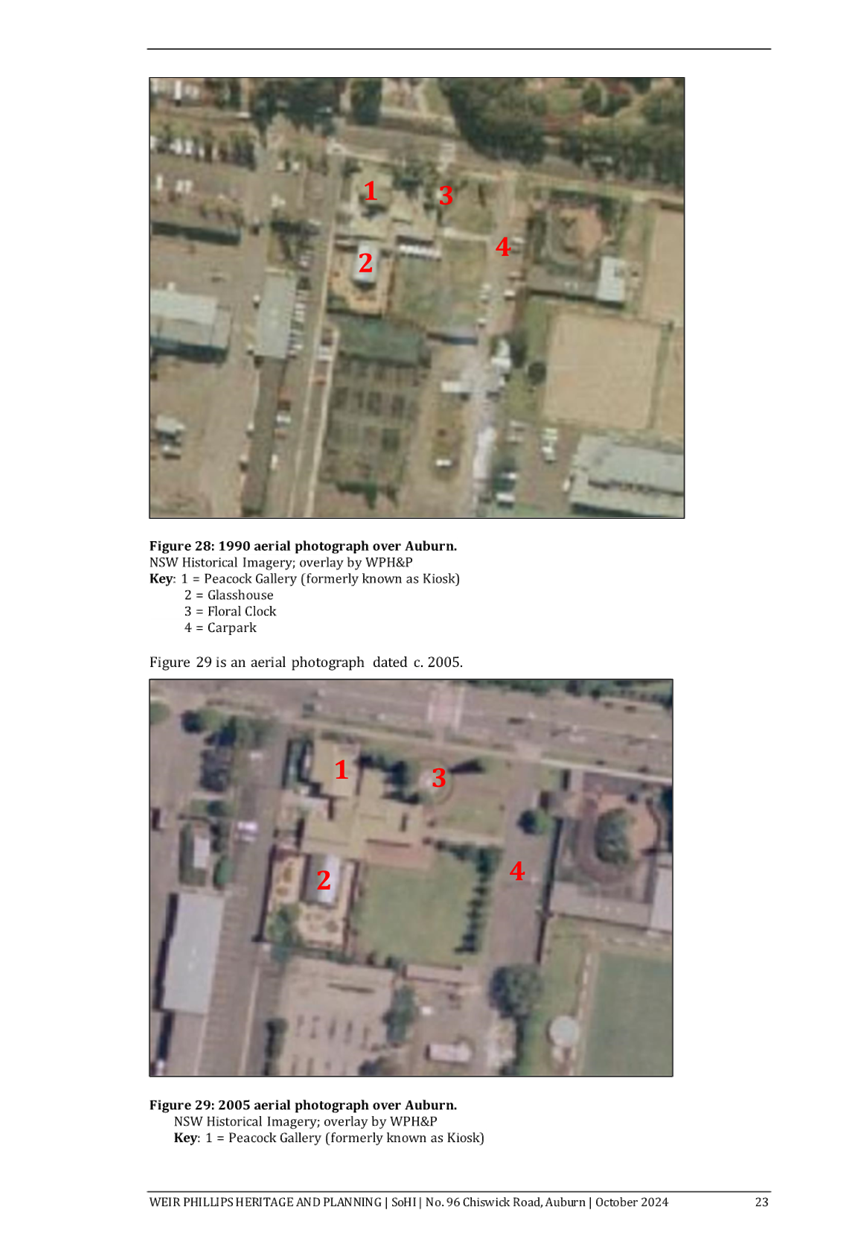
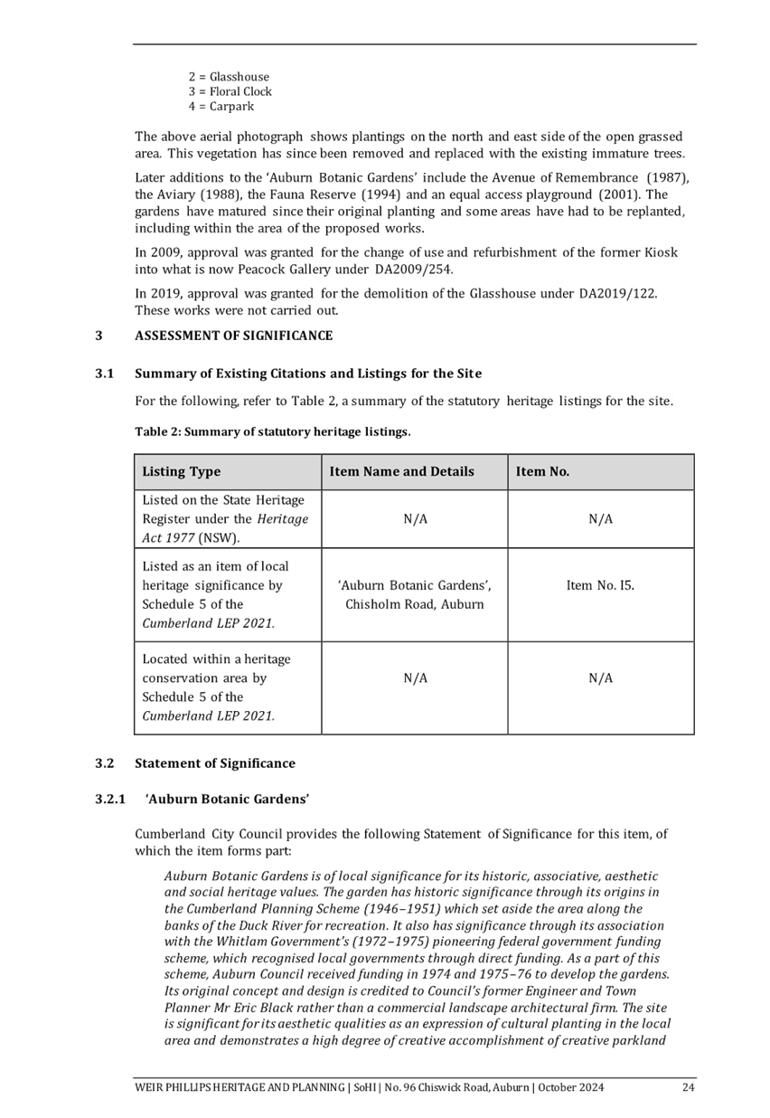
as Auburn Botanic Gardens. Specifically, the Peacock Gallery and the Auburn
Aviary are both located within the subject site and is accessed via Chiswick
Road as the primary street frontage (northern property boundary).
The Auburn Botanic Gardens is
located opposite the subject site to the north. Duck River is also located
within the vicinity of the site to the west, in which the Auburn Depot is
located in between the subject site and Duck River. The subject site at present
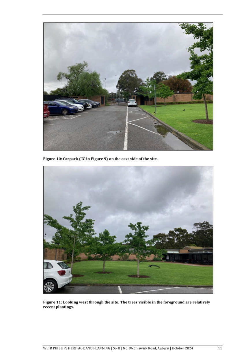
also has a public car park, that services the Aviary and the Peacock Gallery.
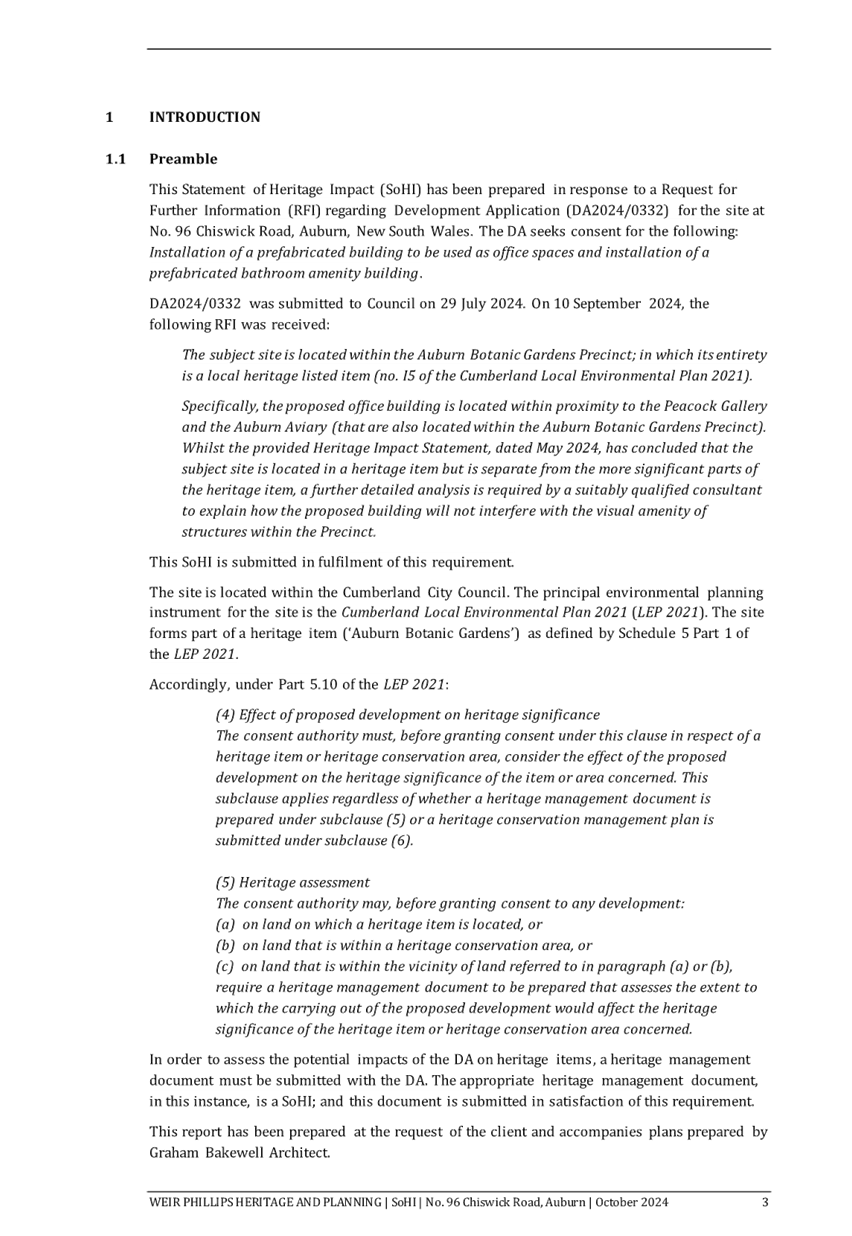
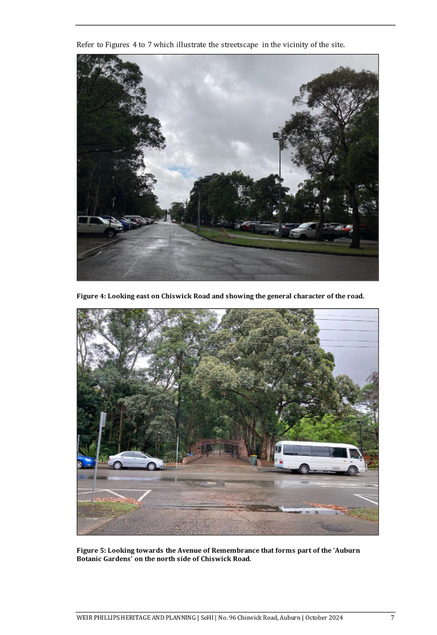
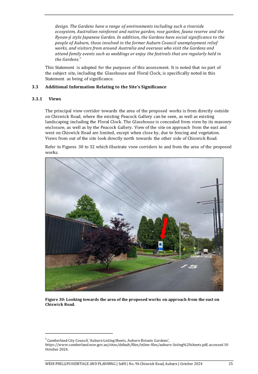
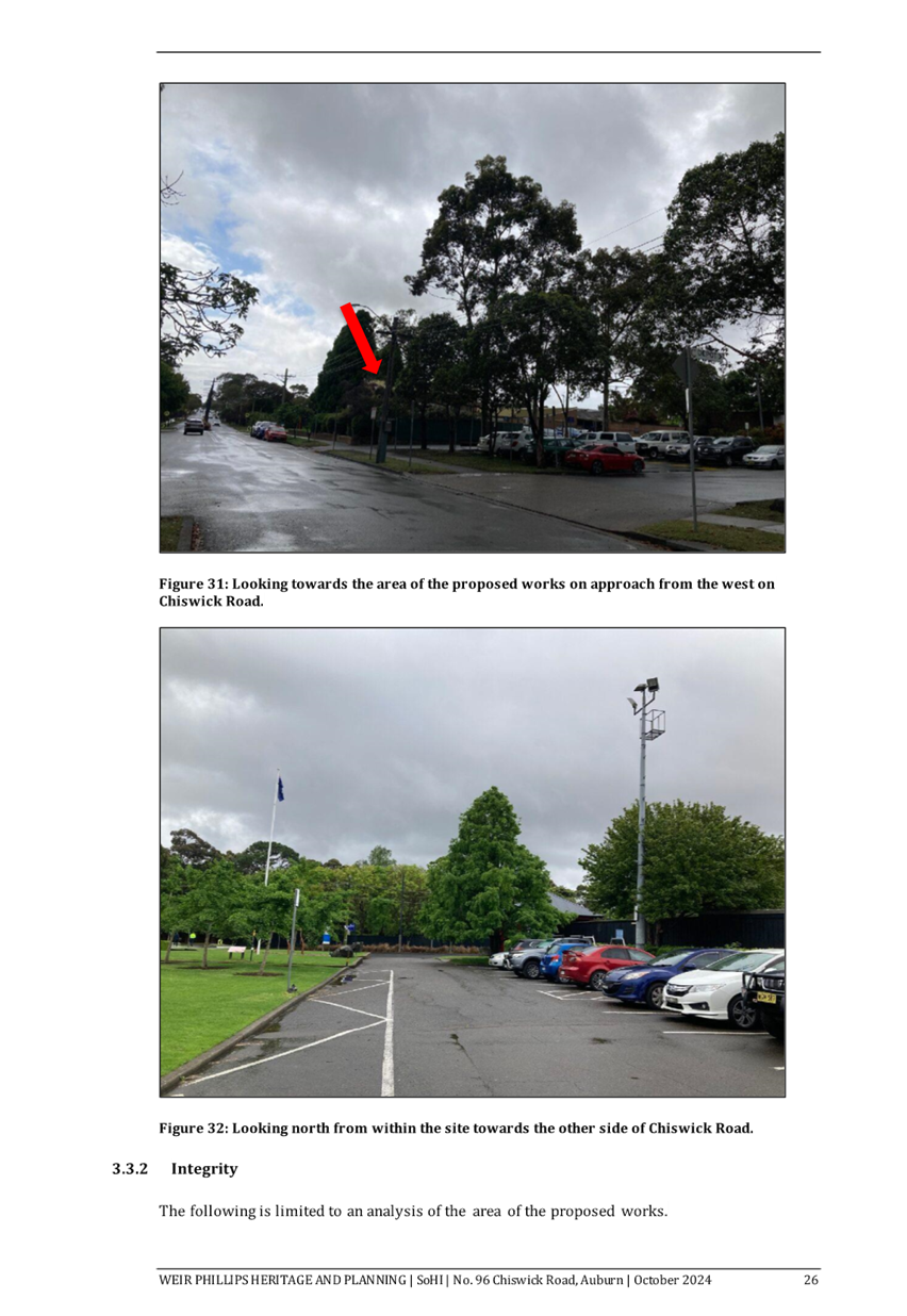
The location of the site is shown
below edged in purple.
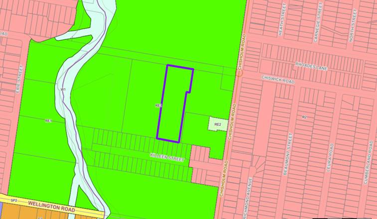 Figure 1 - Land
zoning map showing the location of the subject site.
Figure 1 - Land
zoning map showing the location of the subject site.
The aerial photo is provided
below.
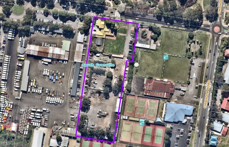 Figure
2 - Aerial photograph showing the location of where the new facilities building
is to be constructed.
Figure
2 - Aerial photograph showing the location of where the new facilities building
is to be constructed.
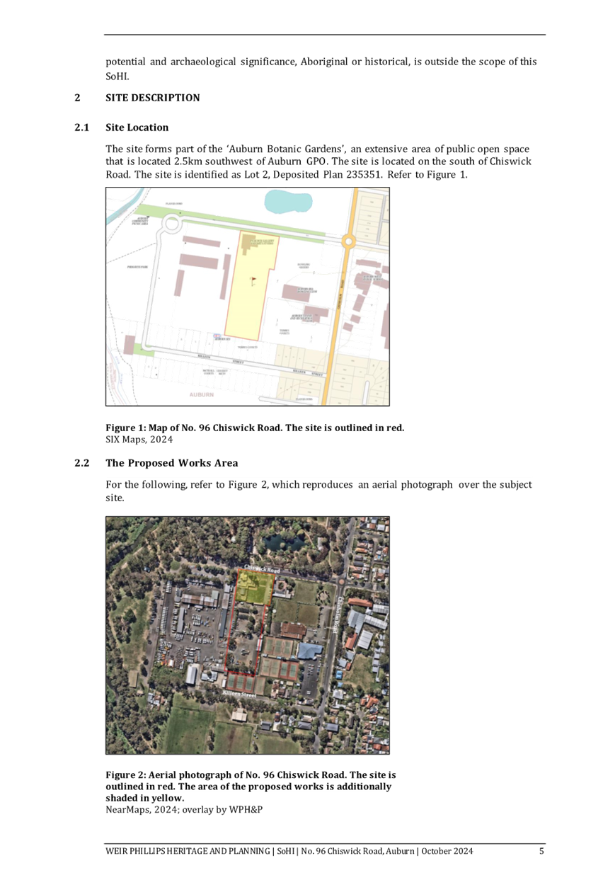
A photo of the site is shown
below.
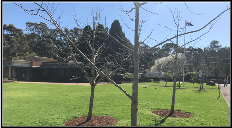
Figure 3 - View of
the location of where the new facilities building is to be constructed.
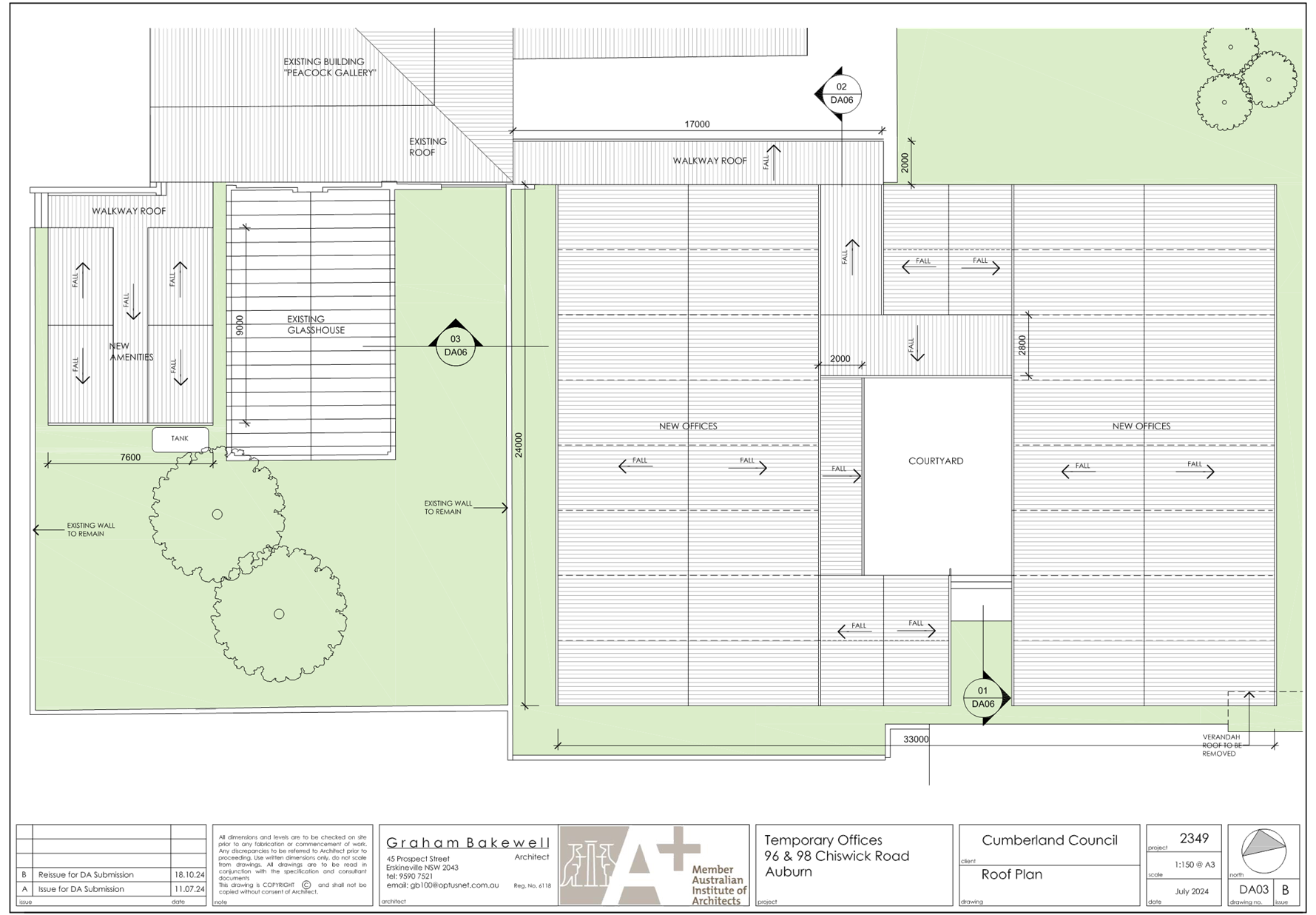
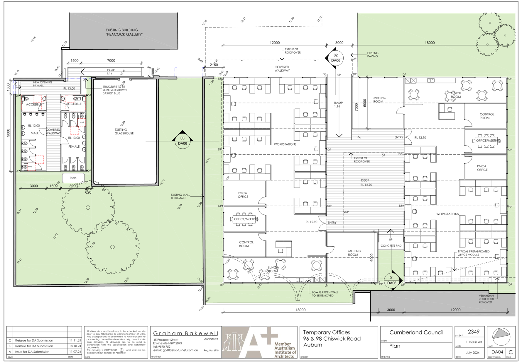
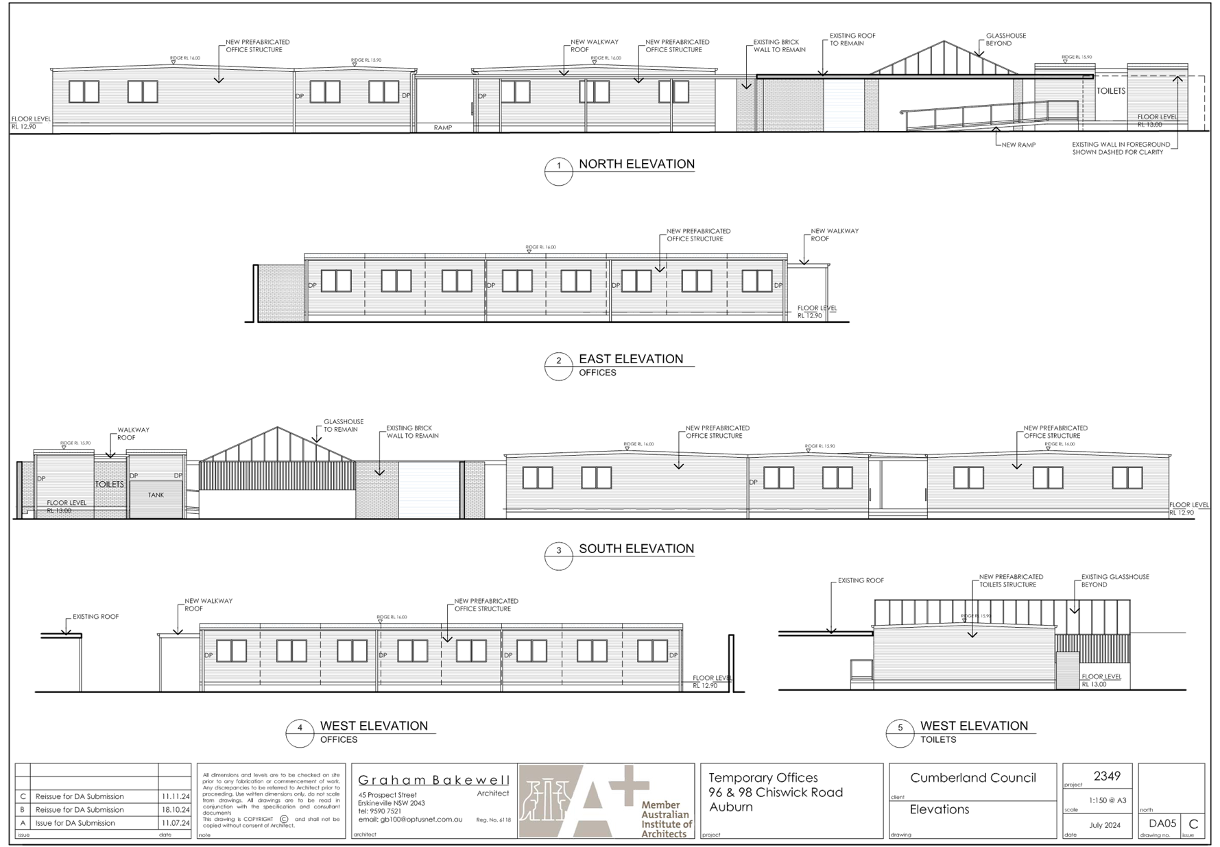
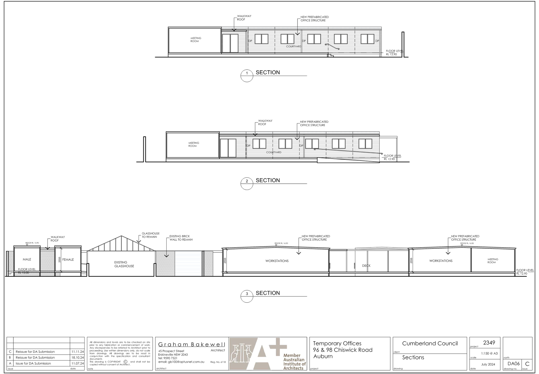
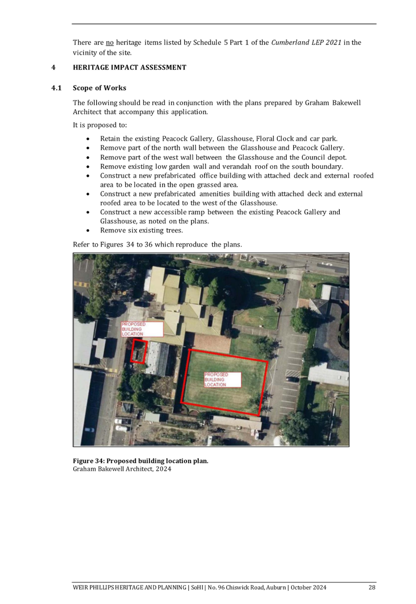
Description of The
Development
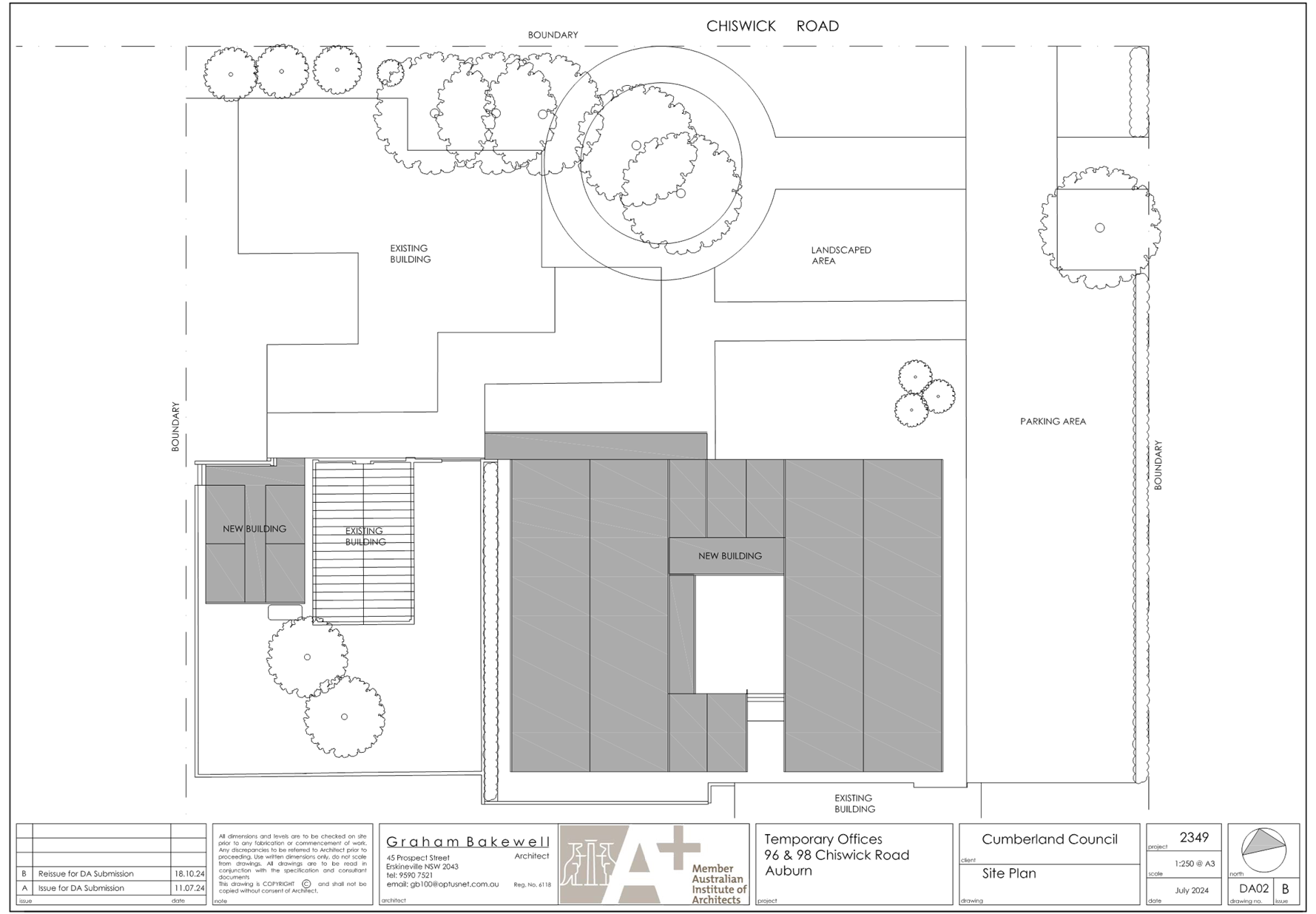
Council has received a development
application for the installation of a prefabricated building to be used as
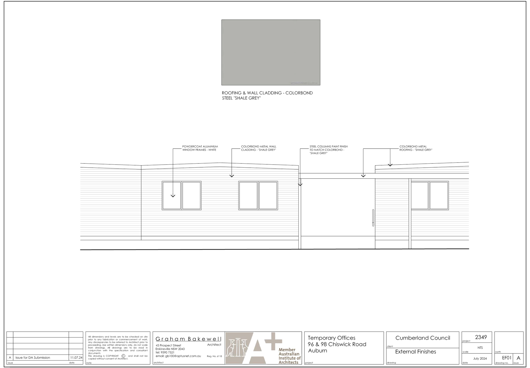
office spaces and the installation of a prefabricated bathroom amenity
building.
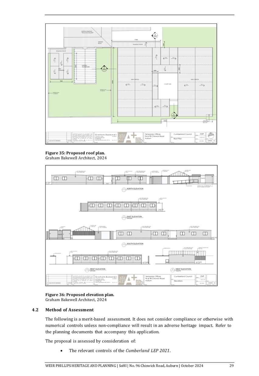
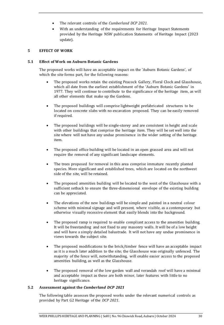
The prefabricated office building
will be constructed towards the western side of the existing car park. The
bathroom amenity building will be located between the western boundary and the
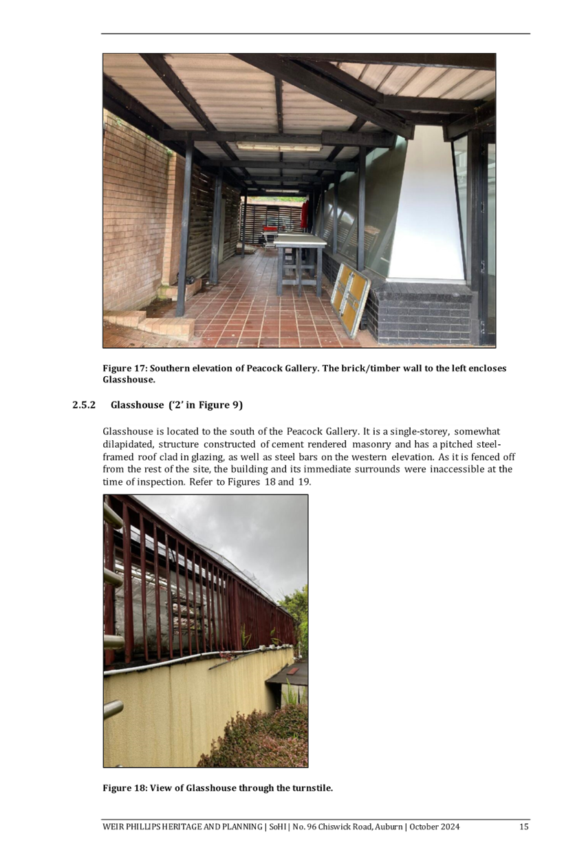
existing glasshouse. The structures will be attached to the Peacock Gallery
building via a connected walkway area that will include a roof structure.
The proposed buildings are single
storey in height and the office building will include a central courtyard, 2
meeting rooms 59 workstations and 2 lunchrooms. An assessment of the plans has
revealed that five trees are required to be removed. The bathroom amenity
building will contain male and female toilets, each with accessible toilets.
The proposed buildings have a combined floor area of 676.40 square metres.
Whilst the site is contained
within the Duck River Parklands (as detailed in the Duck River Parklands
Strategic Masterplan, dated the 21 November 2022), the proposed structures will
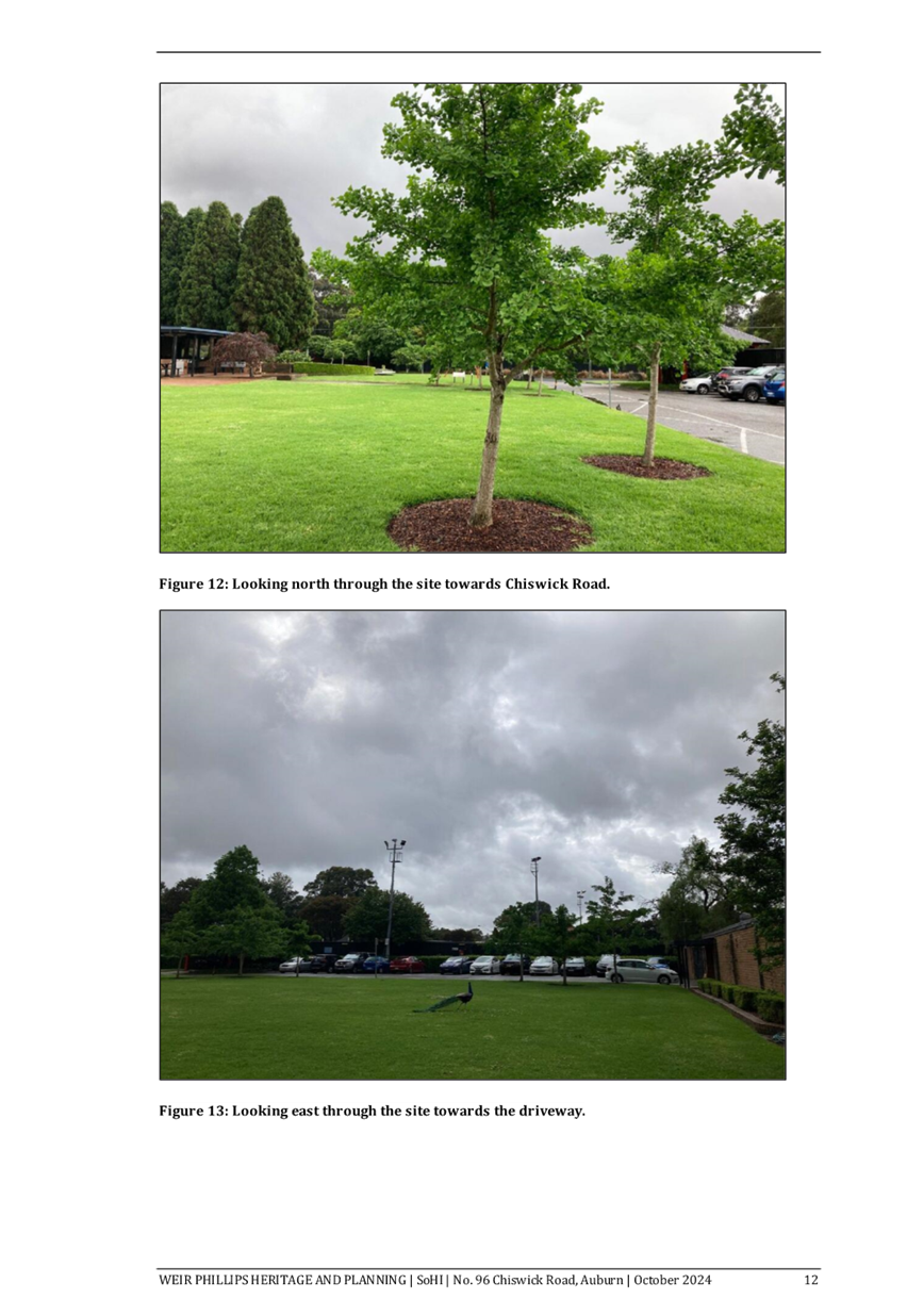
not have any direct impact to the ecosystem. Also, the clearing of vegetation
within the ecosystem of Duck River is not required, as Progress Park provides a
buffer between the subject site and the riparian corridor.
The proposed office and amenities
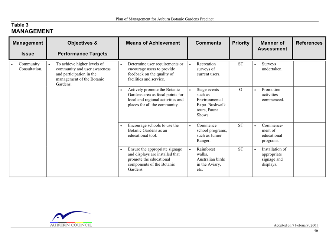
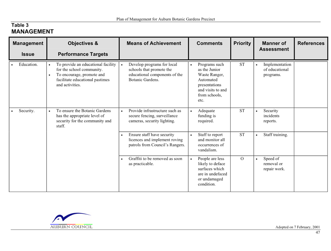
building will not alter the land management goals for the Auburn Botanic
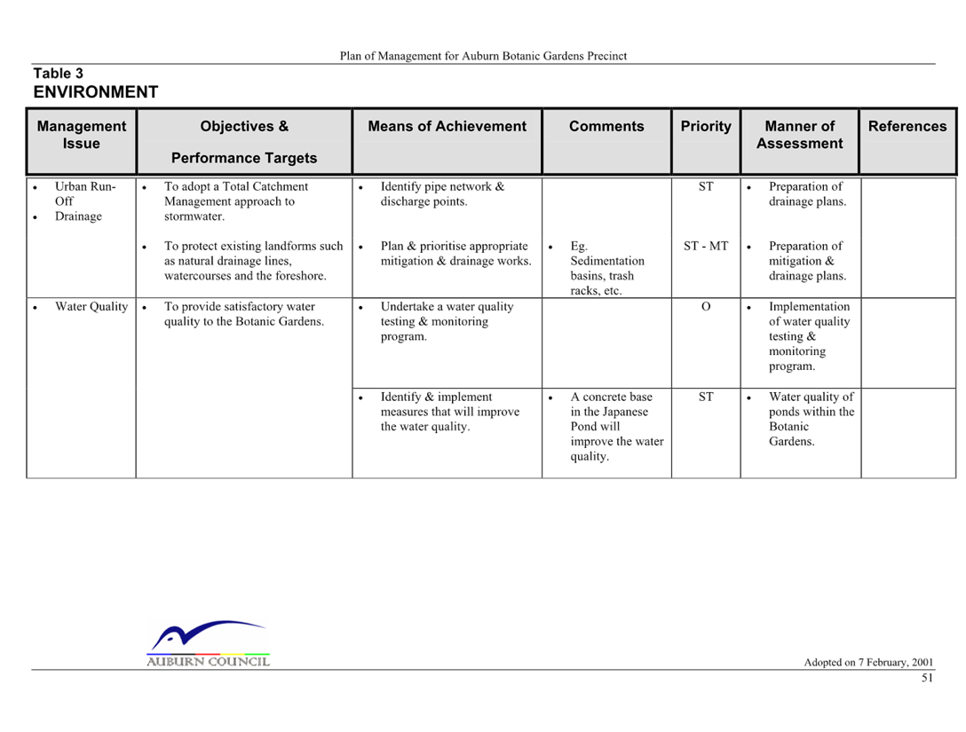
Gardens Precinct as specified under the Plan of Management for Auburn Botanic
Gardens Precinct 2001, as the proposal will not impact the existing features
shown highlighted in Table 1, under Pt 2, 2.1 in the Plan of Management for
Auburn Botanic Gardens Precinct 2001. In this regard, the features and
structures associated with the Aviary, Floral Clock, Peacock Gallery (formally
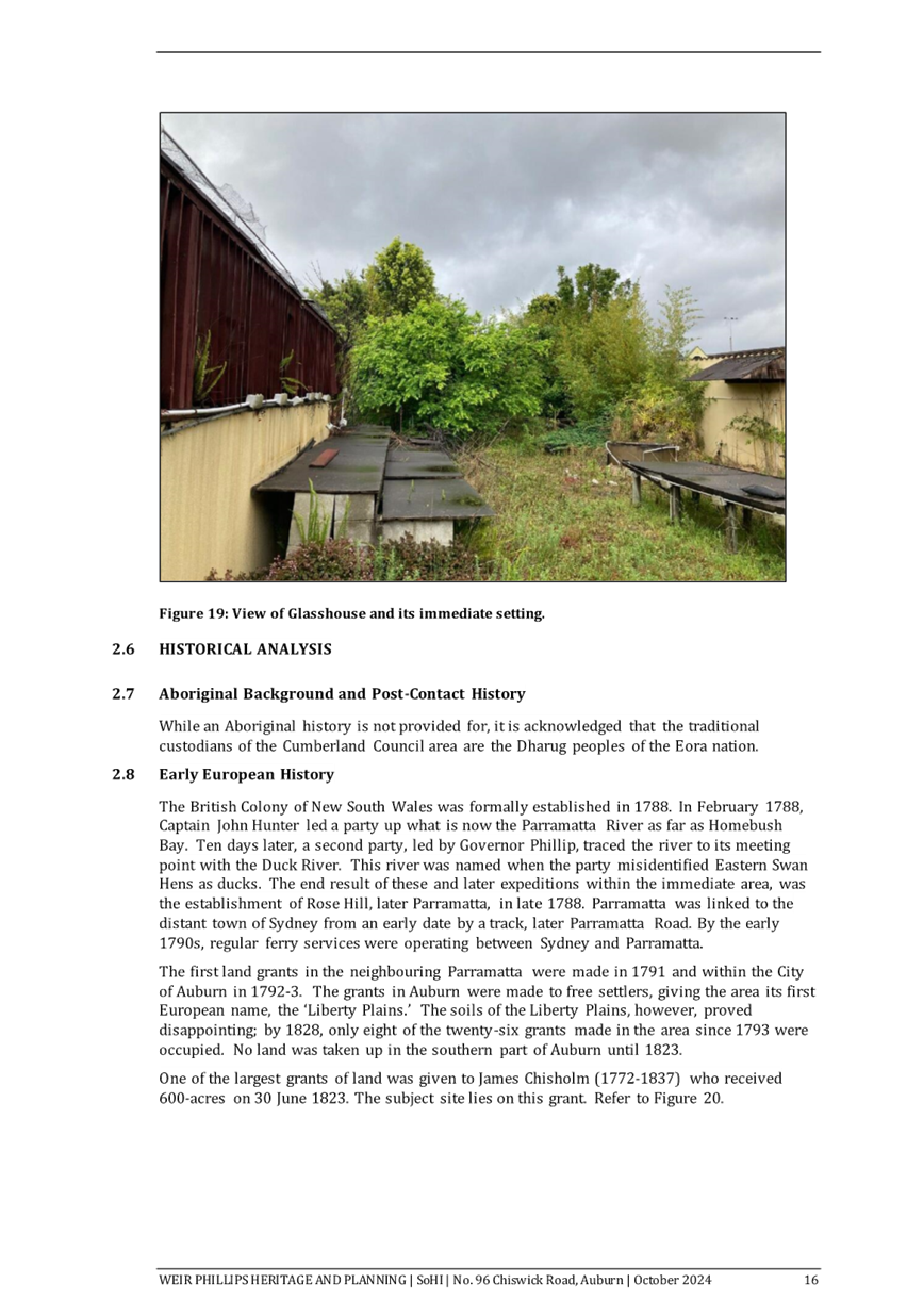
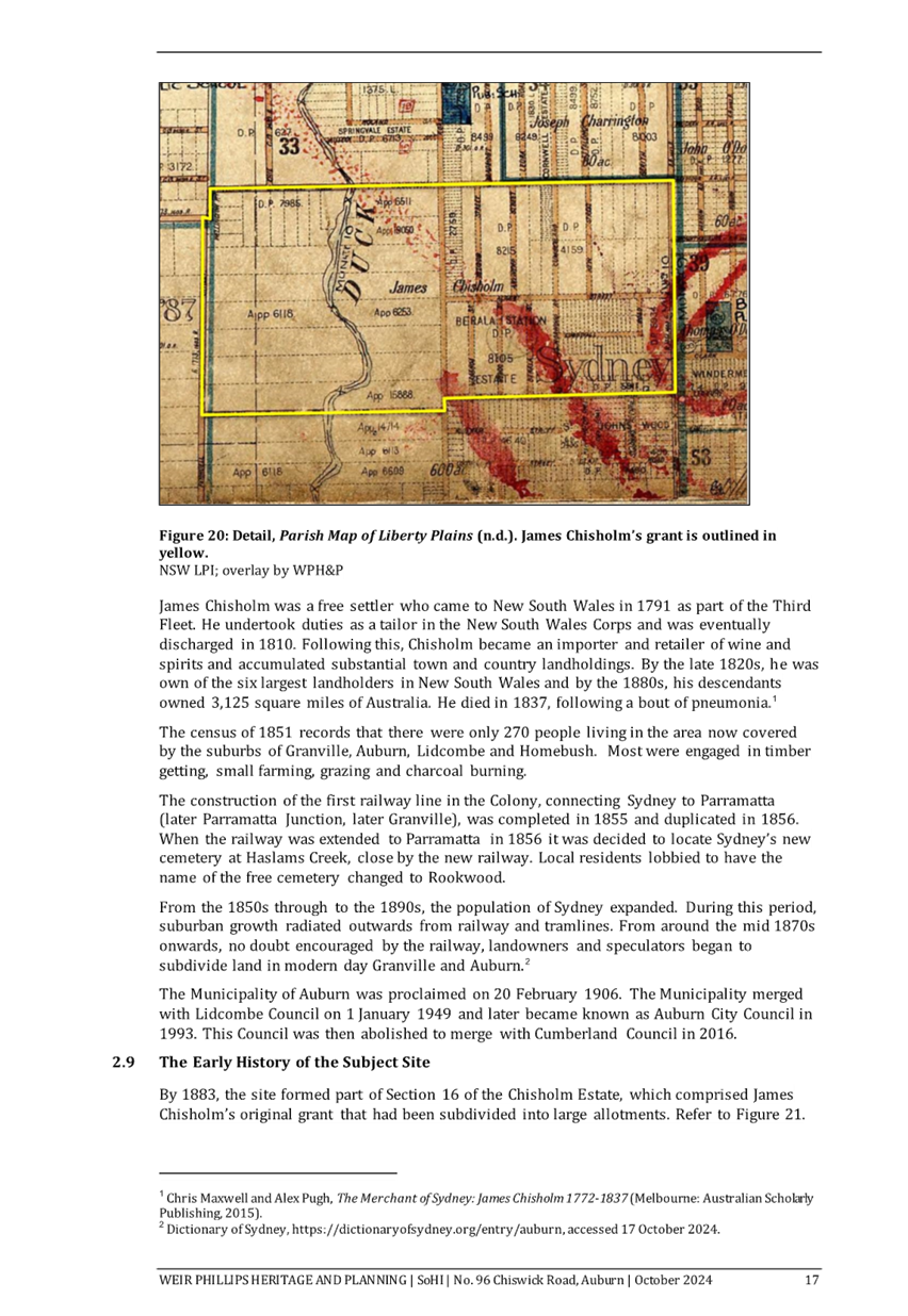
known as a Kiosk) and the now-defunct Bonsai Garden Fernery (Glasshouse) will
not be impacted or removed for demolition to make way for the proposed
buildings.
History
The following applications have
been issued for the land.
· Development
consent DA2005/356 was issued on the 2 September 2005 for the use and fit out
of existing building for Council offices.
· Development
consent DA2009/254 was issued on the 26 August 2009 for the change of use of
the existing kiosk to arts and culture facility, exhibition gallery, meeting
and storage room.
· Development
consent DA2011/199 was issued on the 5 August 2011 for the change of use and
internal refurbishment of existing fernery to an art gallery (Peacock Gallery
& Auburn Arts Studio - Auburn Botanic Gardens).
Applicants Supporting
Statement
The applicant has provided a
Statement of Environmental Effects prepared by Graham Bakewell Architect dated
May 2024 and was received by Council on the 11 July 2024 in support of the
application.
Contact With Relevant
Parties
The assessing officer has
undertaken a site inspection of the subject site and surrounding properties and
has been in regular contact with the applicant throughout the assessment
process.
Internal Referrals
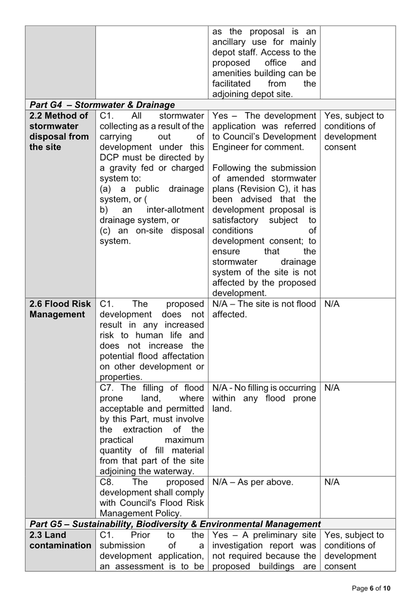
Development Engineering
The development application was
referred to Council’s Senior Development Engineer for comment. Following
a request for additional information, dated the 10 September 2024, it has been
advised that the development proposal is satisfactory and therefore can be
supported subject to recommended conditions of consent.
Environmental Health
The development application was
referred to Council’s Environmental Health Officer for comment who has
advised that the development proposal is satisfactory, subject to recommended
condition of consent.
Public Spaces Planning and
Design
The development application was
referred to Council’s Senior Landscape Architect for comment who has
advised that the proposal is satisfactory and therefore can be supported.
The proposal is not expected to
impact the existing features shown highlighted in Table 1, under Pt 2, 2.1 in
the Plan of Management for Auburn Botanic Gardens Precinct 2001.
Tree Management
The development application was
referred to Council’s Tree Management Officer for comment who has advised
that the development proposal is satisfactory and therefore can be supported
subject to recommended conditions of consent, including the requirement of
three trees to be planted near the southern elevation of the new buildings.
Heritage Advisory Committee
The development application was
referred to Council’s Heritage Committee for comment who has provided no
response. On this basis, it is considered that the Committee has no issue with
the development from a heritage perspective.
External Referrals
The application was not required
to be referred to any external government authorities for comment.
Planning Comments
The provisions of any
Environmental Planning Instruments (EP&A Act s4.15 (1)(a)(i))
State Environmental Planning
Policies
The proposed development is
affected by the following State Environmental Planning Policies:
|
State
Environmental Planning Policies (SEPPs)
|
Relevant
Clause(s)
|
Compliance
with Requirements
|
|
· State
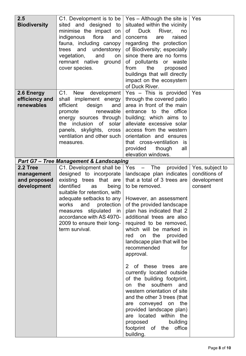
Environmental Planning Policy (Biodiversity and Conservation) 2021
|
Chapter 2 -Vegetation in
non-Rural Areas
|
Yes - Overall, 5 trees are to
be removed.
At least 5 new trees are to be
planted to replace trees that are to be removed.
A further detailed analysis is
provided under Appendix B of this report.
The proposal does not exceed
the biodiversity offsets scheme threshold. Therefore, the proposed vegetation
removal is considered acceptable.
|
|
Chapter 6 -
Water Catchments.
Sydney Harbour Catchment
|
It is determined that given the
location, not being situated immediately adjacent to Duck River, a detailed
assessment is not required given that there is no direct impact upon the
catchment and no direct impact upon watercourses.
|
|
· State
Environmental Planning Policy (Resilience and Hazards) 2021
|
Chapter 2 - Coastal Management
|
The subject site is not
identified as being within a coastal wetland area or land identified as
“proximity area for coastal wetlands” or a coastal management
area.
|
|
Chapter 4 - Remediation of
Land.
Clause 4.6
|
A preliminary
site investigation report was not required with this application as the
proposed buildings are prefabricated structures where excavation works are
not required.
As such, it is considered
that the development application is satisfactory under Part 4.6 of Chapter 4
of the State Policy.
|
|
· State Environmental Planning
Policy (Sustainable Buildings) 2022
|
Chapter 3 - Standards
for non-residential
development
|
Chapter 3 of SEPP (Sustainable Buildings) 2022 does not
apply to the development as the new
building does not have a capital investment value of $5 million or more (as
per Clause 3.1(1)(a)).
|
Local Environmental Plans
Cumberland Local Environmental
Plan 2021
The provision of the CLEP 2021 is
applicable to the development proposal. It is noted that the development
achieves compliance with the key statutory requirements of the CLEP 2021 and
the objectives of the RE1 Public Recreation land use zone in which the subject
site is situated within.
(a) Permissibility:
The proposed development being
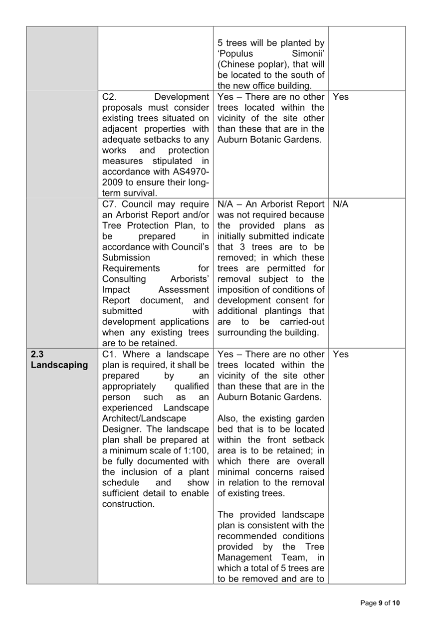
office spaces/amenities is considered ancillary works to the existing depot. A depot
under the CLEP is defined as the following:
“a building or place used
for the storage (but not sale or hire) of plant, machinery or other goods (that
support the operations of an existing undertaking) when not required for use
but does not include a farm building”.
A depot is permissible in
the RE1 Public Recreation land use zone. These new office spaces and amenities
building are ancillary to the existing depot.
The relevant matters to be
considered under the CLEP and the applicable clauses for the proposed
development are summarised below.
|
DEVELOPMENT STANDARD
|
COMPLIANCE
|
DISCUSSION
|
|
4.3 Height of Buildings.
|
N/A
|
There is no maximum building
height limit provided for the site. The buildings are one storey in height
and rises no higher than 3.48 metres above the natural ground level. The
height of the building, including the provided ridge levels (RL’s) is
satisfactory.
|
|
4.4 Floor Space Ratio.
|
N/A
|
There is no maximum floor space ratio provided for the
site. The proposed building(s) has a combined floor area of 676.40 square
metres.
|
|
4.6 Exceptions to Development
Standards.
|
N/A
|
There are no proposed variations to any development
standards.
|
|
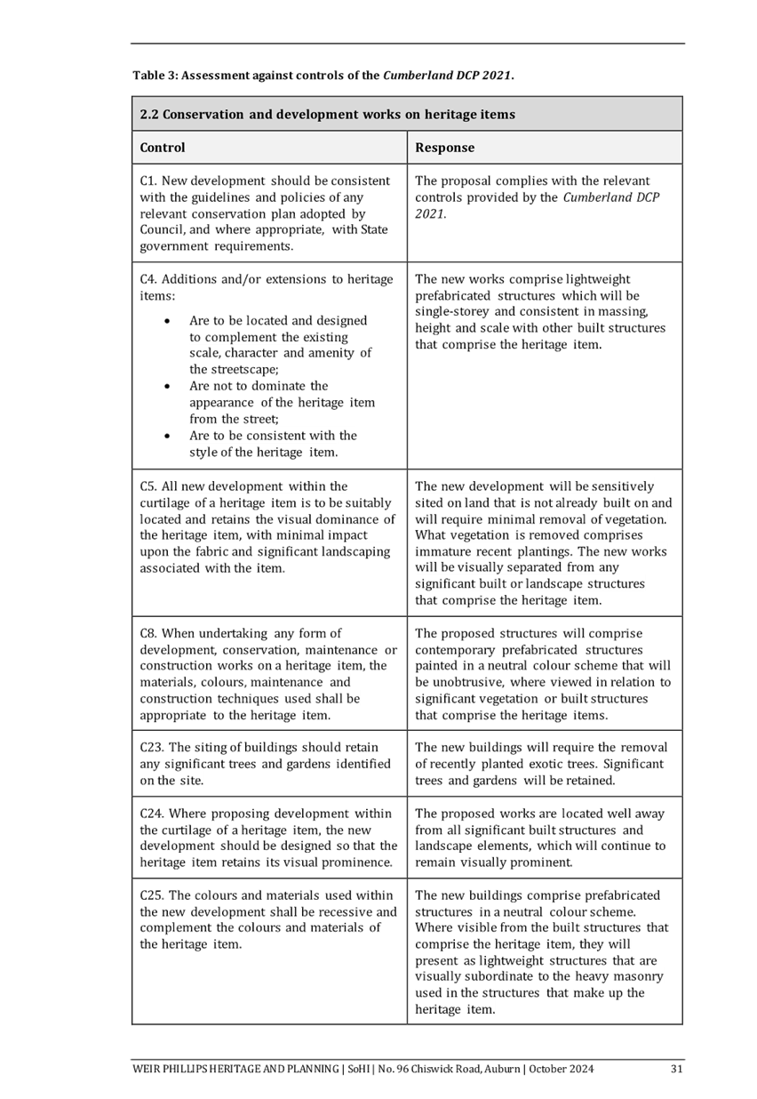
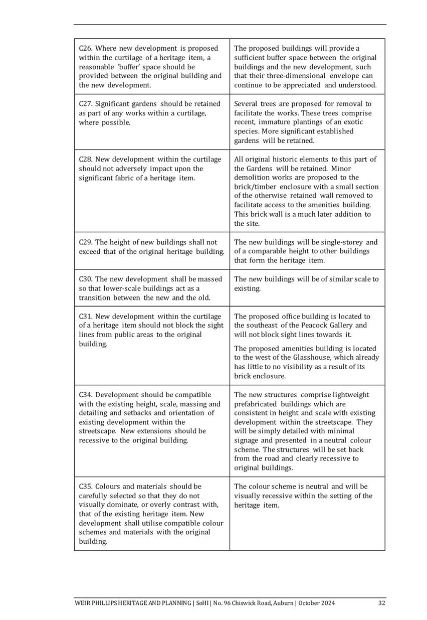
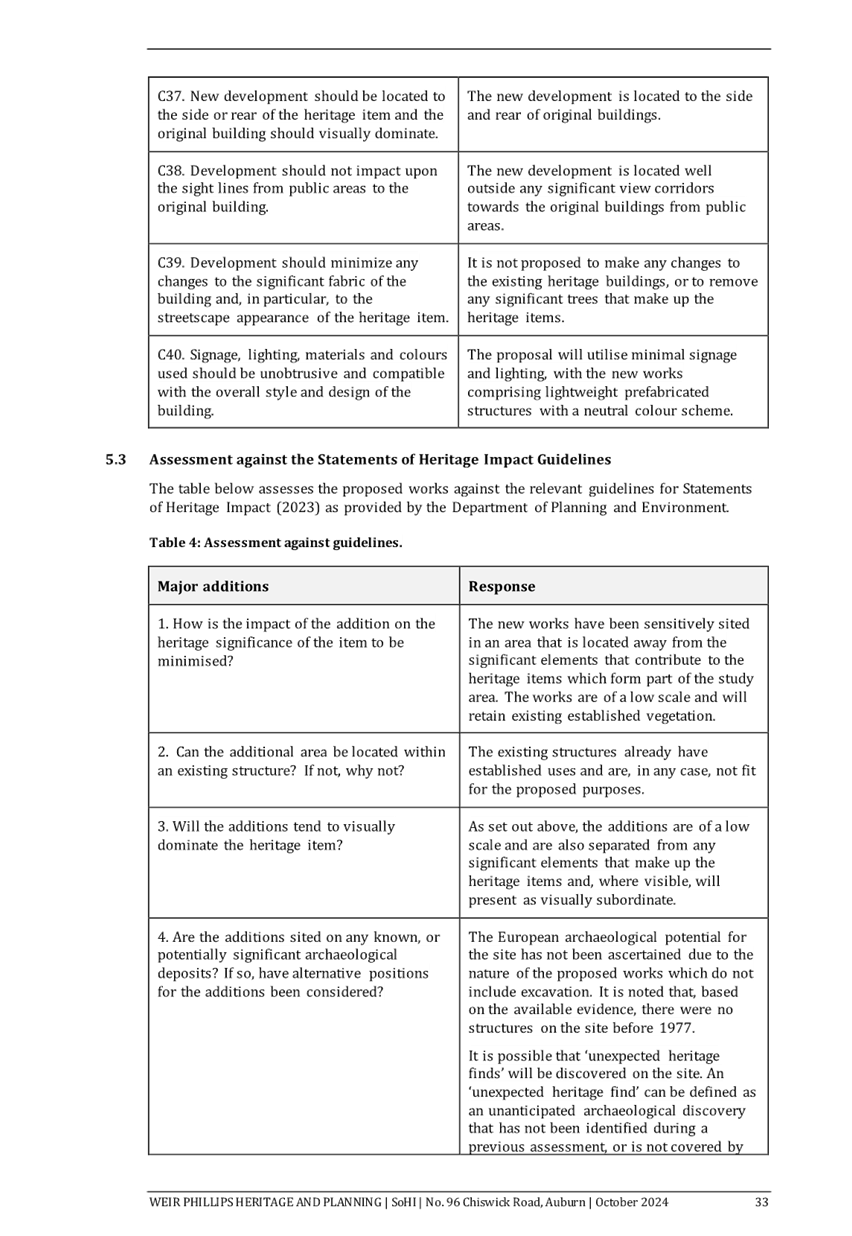
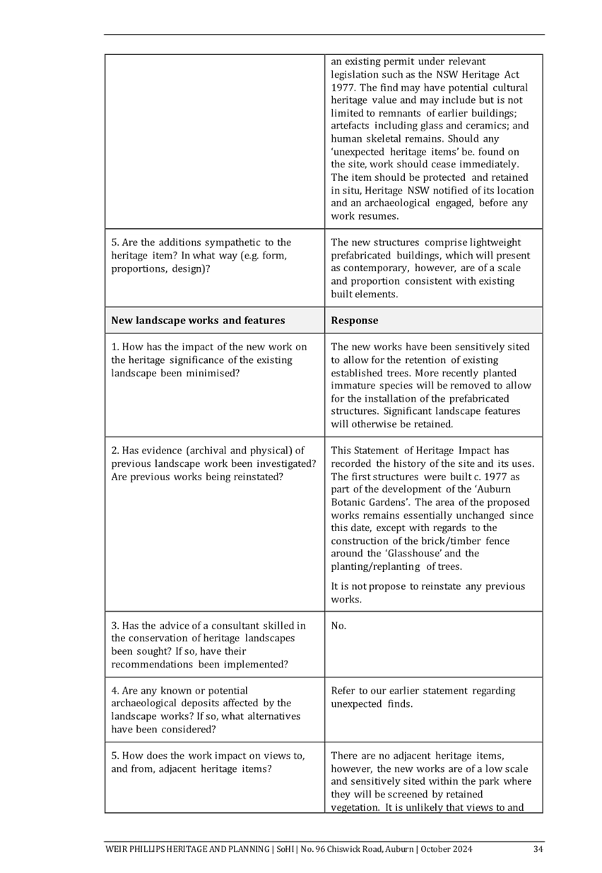
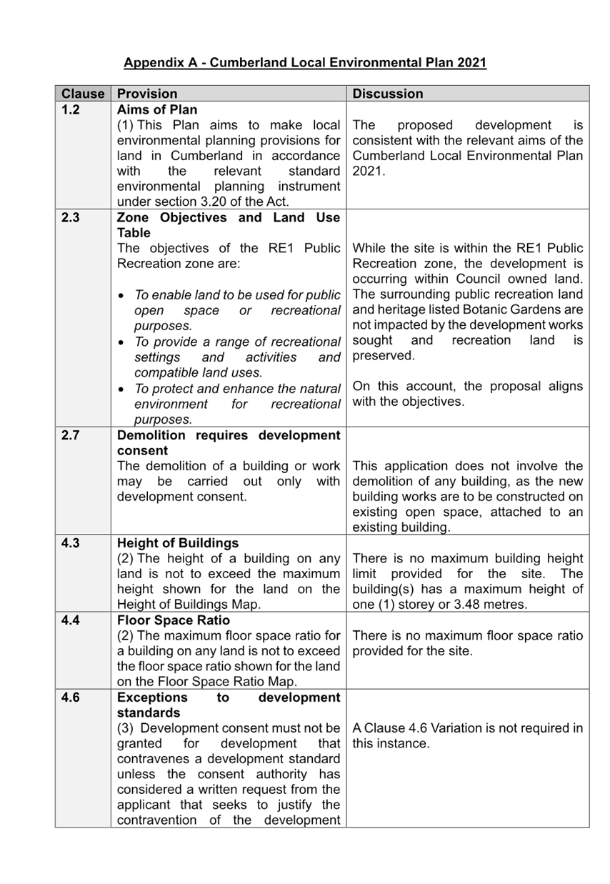
5.10 Heritage Conservation
|
Yes
|
A Heritage Impact Statement prepared by Weir Phillips
Heritage & Planning, dated the 21 October 2024, was submitted in support
of the application concluding that the proposed office and amenities building
will have an acceptable impact on the ‘Auburn Botanic Gardens’,
as all significant original built and landscaping elements are to be
retained.
Having considered the location of the structures, the
development is not considered to pose a significantly detrimental impact on
the heritage significance of Auburn Botanic Gardens. Therefore, the proposal
is consistent with the provisions of this clause.
|
A comprehensive CLEP assessment is
contained in Appendix A.
The provisions of any proposed
instrument that is or has been the subject (EP&A Act s4.15 (1)(a)(ii))
No proposed planning instruments
applicable.
The provisions of any
Development Control Plans (EP&A Act s4.15 (1)(a)(iii))
The Cumberland Development Control
Plan (CDCP) 2021 is relevant to the development proposal. The development has
been assessed in accordance with Part G - Miscellaneous Development Controls of
the Cumberland DCP 2021.
The proposed development generally
complies with the provisions of the Cumberland DCP 2021 and is considered
acceptable from an environmental planning view point.
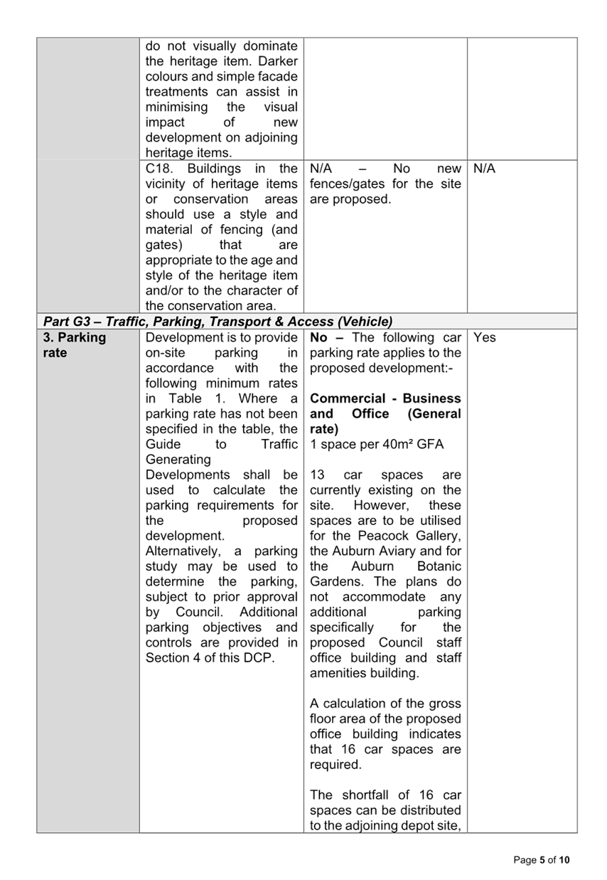
Car Parking for the Office
Building
In accordance with Section 3 of
Part G3 – Traffic, Parking, Transport & Access (Vehicle), the
following car parking rate applies to the proposed development:
Commercial - Business and
Office (General rate).
1 space per 40m² GFA.
A calculation of the gross floor
area of the new office building has indicated that 16 off-street car parking
spaces are required.
Whilst there are 13 existing car
parking spaces adjacent to the subject development, these spaces are to remain
for public use and not intended to be utilised by the subject development.
The proposed development seeks a
variation of 100% to the parking requirement. This is acceptable in this
instance for the following reasons:
i. The
plans indicate that there are 59 workstations proposed, within the new office
building. It is an ancillary development to the existing adjoining depot, in
which the staff that will be utilising the new office building are mainly depot
staff.
ii. There
are approximately 118 car parking spaces within the depot complex exclusively
for staff parking which is available to all Council staff. Access to the
proposed office and amenities building is facilitated directly from the
adjoining depot site via a pedestrian path.
iii. As
the subject site is part of a local heritage item (i.e. Auburn Botanic
Gardens), it is necessary to minimise hard surfaces or removal of an
significant landscape elements.
The provisions of any planning
agreement that has been entered into under section 7.4, or any draft planning
agreement that a developer has offered to enter into under section 7.4
(EP&A Act s4.15(1)(a)(iiia))
There is no draft planning
agreement associated with the subject Development Application.
The provisions of the
Regulations (EP&A Act s4.15 (1)(a)(iv))
The proposed development raises no
concerns as to the relevant matters arising from the Environmental Planning and
Assessment Regulation 2021 (EP&A Reg).
The Likely Environmental,
Social or Economic Impacts (EP&A Act s4.15 (1)(b))
It is considered that the proposed
development will have no significant adverse environmental, social or economic
impacts in the locality.
The suitability of the site for
the development (EP&A Act s4.15 (1)(c))
The subject site and locality is
not known to be affected by any natural hazards or other site constraints
likely to have a significant adverse impact on the proposed development.
Accordingly, it is considered that the development is suitable in the context
of the site and surrounding locality.
Submissions made in accordance
with the Act or Regulation (EP&A Act s4.15 (1)(d))
|
Advertised (Website)
|
Mail
|
Sign
|
Not Required
|
In accordance with Council’s
Notification requirements contained within the Cumberland Development Control
Plan 2021, the proposal was publicly notified for a period of 28 days between
the 8 August 2024 to the 5 September 2024. No submissions were received in
respect of the proposed development.
The public interest (EP&A
Act s4.15(1)(e))
In view of the foregoing analysis,
it is considered that the development, if carried out subject to the conditions
set out in the recommendation below, will have no significant adverse impacts
on the public interest.
CUMBERLAND LOCAL INFRASTRUCTURE
CONTRIBUTIONS PLAN 2020
The development would not require
the payment of contributions in accordance with Cumberland Local Infrastructure
Contributions Plan 2020 as the site is Council property.
HOUSING AND PRODUCTIVITY
CONTRIBUTION (HPC)
In accordance with s7.24, s7.26
and s7.28 of the Environmental Planning and Assessment Act, 1979 the
proposed development is not subject to the (Housing and Productivity
Contribution) Act 2024, and not subject to the payment of the Housing and
Productivity Contribution (HPC), given that the proposal is an ancillary
development to an existing depot.
DISCLOSURE OF POLITICAL
DONATIONS AND GIFTS
The applicant and notification
process did not result in any disclosure of Political Donations and Gifts.
The development application has
been assessed in accordance with the relevant requirements of the Environmental
Planning and Assessment Act 1979, State Environmental Planning Policy
(Resilience and Hazards) 2021, Statement Environmental Planning Policy
(Biodiversity and Conservation) 2021, Cumberland Local Environmental Plan
2021 and the Cumberland Development Control Plan 2021.
The proposed development is
appropriately located within the RE1 Public Recreation zone under the relevant
provisions of the Cumberland Local Environmental Plan 2021. The proposal is
consistent with all statutory and non-statutory controls applying to the
development. The development is considered to perform adequately in terms of
this relationship to its surrounding built and natural environment,
particularly having regard to impacts on adjoining properties.
For these reasons, it is
considered that the proposal is satisfactory having regard to the matters of
consideration under Section 4.15 of the Environmental Planning and
Assessment Act 1979, and the development may be approved subject to
conditions.
There are no consultation
processes for Council associated with this report.
There are no financial
implications for Council associated with this report.
There are no policy implications
for Council associated with this report.
Communication /
Publications:
The final outcome of this matter
will be notified. The objectors will also be notified in writing of the
outcome.
That Development Application
No. DA2024/0332 for the installation of a prefabricated building to be used as
office spaces and installation of a prefabricated bathroom amenity building on
land at 96 Chiswick Road, AUBURN be approved subject to conditions listed in
Council’s assessment report.
1. Draft Notice of
Determination
2. Architectural
& Stormwater Plans
3. Heritage
Impact Report Prepared by Weir Phillips Heritage & Planning
4. Plan
of Management for Auburn Botanic Gardens Precinct (Adopted 7 February 2001)
5. Appendix
A - Cumberland LEP Assessment
6. Appendix
B - Cumberland DCP Assessment
DOCUMENTS
ASSOCIATED WITH
REPORT ELPP039/24
Attachment 1
Draft Notice of Determination
Cumberland
Local Planning Panel Meeting
11 December 2024
DOCUMENTS
ASSOCIATED WITH
REPORT ELPP039/24
Attachment 2
Architectural & Stormwater Plans
Cumberland
Local Planning Panel Meeting
11 December 2024
DOCUMENTS
ASSOCIATED WITH
REPORT ELPP039/24
Attachment 3
Heritage Impact Report Prepared by Weir Phillips
Heritage & Planning
Cumberland
Local Planning Panel Meeting
11 December 2024
DOCUMENTS
ASSOCIATED WITH
REPORT ELPP039/24
Attachment 4
Plan of Management for Auburn Botanic Gardens Precinct
(Adopted 7 February 2001)
Cumberland
Local Planning Panel Meeting
11 December 2024


DOCUMENTS
ASSOCIATED WITH
REPORT ELPP039/24
Attachment 5
Appendix A - Cumberland LEP Assessment
Cumberland
Local Planning Panel Meeting
11 December 2024
DOCUMENTS
ASSOCIATED WITH
REPORT ELPP039/24
Attachment 6
Appendix B - Cumberland DCP Assessment
Cumberland
Local Planning Panel Meeting
11 December 2024

Cumberland Local Planning Panel Meeting
11 December 2024
Item No: ELPP040/24
Modification
Application - 28-30 Queen Street, Auburn (CLOSED SESSION)
Directorate: Environment
and Planning
Responsible
Officer: Executive
Manager City Planning and Development
|
Application
accepted
|
Monday 5 August 2024.
|
|
Applicant
|
Urban Link Pty Ltd.
|
|
Owner
|
KYS Properties Pty Limited.
|
|
Application
No.
|
MOD2024/0274.
|
|
Description
of Land
|
Lot 1 in DP 176059 being 28
Queen Street.
Lot 2 in DP 375528 being part
of 28 Queen Street.
Lot 4 in DP 662697 being 30
Queen Street.
Lot 3 in Sec 13 in DP 1389
being 32 Queen Street.
|
|
Proposed
Development
|
Section 4.55(2) modification
application to introduce an additional storey to increase the number of
residential apartments from 38 to 45 including associated changes to basement
level 3 to incorporate 6 additional car spaces and revise layout of the
ground floor garbage and bulky waste room.
|
|
Site
Area
|
1,437 square metres.
|
|
Zoning
|
E1 Local Centre pursuant to
the Cumberland Local Environment Plan 2021.
|
|
Disclosure
of political donations and gifts
|
Nil disclosure.
|
|
Cost
of works
|
$16,162,978 (Capital
Investment Value).
|
|
Heritage
|
The site is not listed as a
heritage item within the Cumberland Local Environmental Plan 2021.
|
|
Principal
Development Standards
|
Floor Space Ratio
Permissible: 3:1.
Proposed: 2.97:1.
and
Height of Building
Permissible: 27 Metres.
Proposed: 27.4 Metres.
|
|
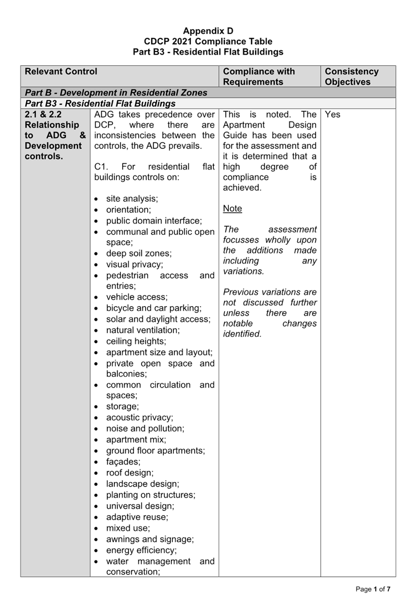
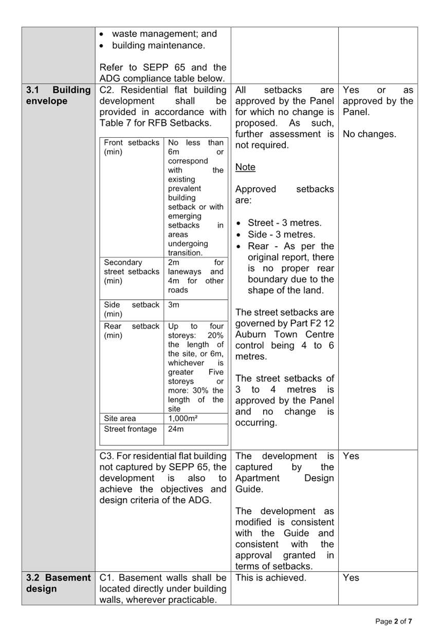
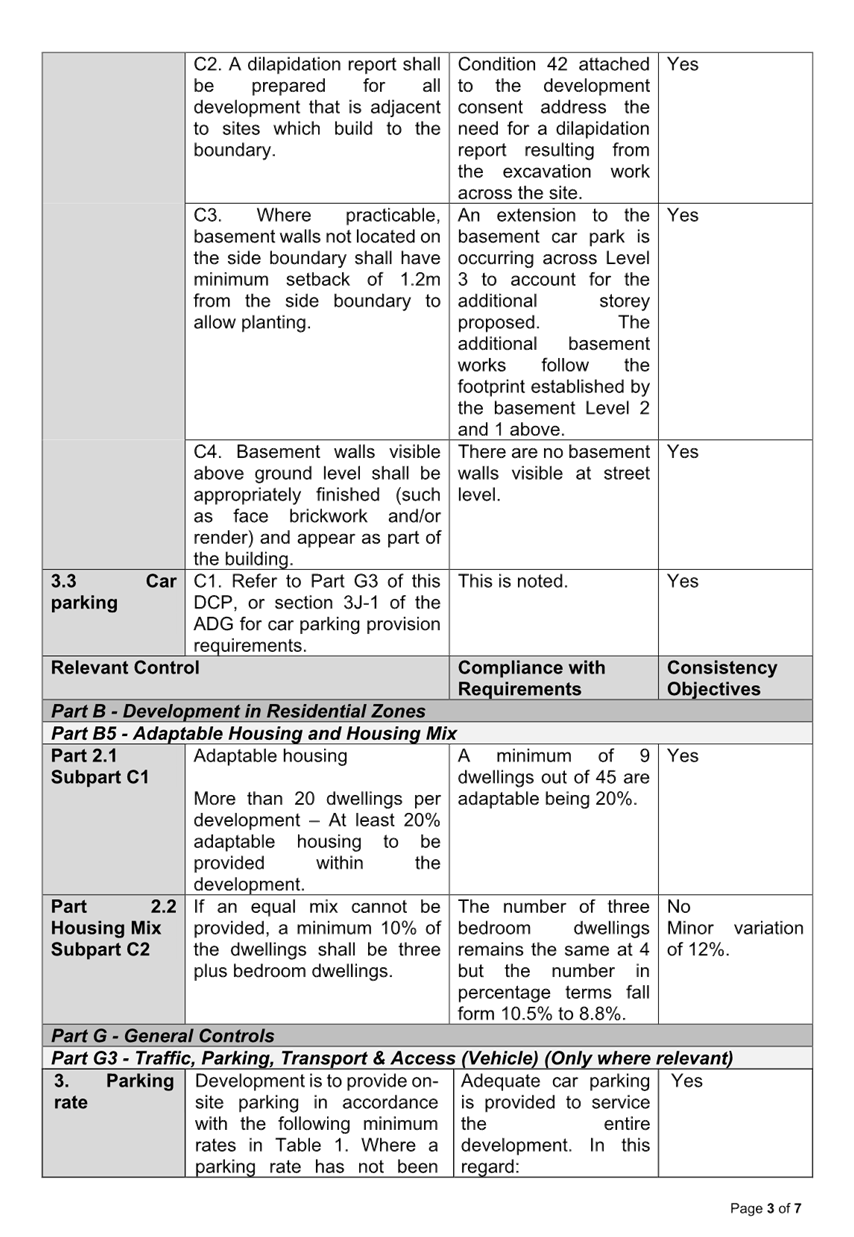
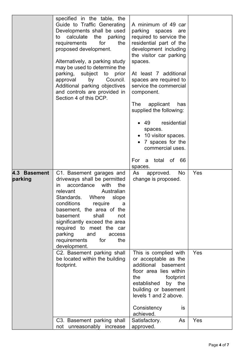
Issues
|
Height.
Shadowing.
Mix of three bedroom
dwellings.
Submissions.
|
1. Modification
Application 2024/0274 was accepted on Monday 5 August 2024 being a Section
4.55(2) modification application to introduce an additional storey to increase
the number of residential apartments from 38 to 45 including associated changes
to basement level 3 which incorporates 6 additional car spaces into the
development and revise the layout of the ground floor garbage and bulky waste
room.
2. The
application was publicly notified to occupants and owners of the adjoining
properties for a period of fourteen (14) days between Thursday 22 August 2024
and Thursday 5 September 2024. In response, 2 submissions were received.
3. The
variations are as follows:
|
Control
|
Required
|
Most recent approval
|
Provided
|
% variation
|
|
Clause 4.3
Height of
buildings.
CLEP 2021.
|
27 metres.
|
24.14 metres
|
27.4
metres.
|
400 mm or
1.48%.
|
|
Part 3
Subpart 3B-2 Overshadowing minimised.
Apartment
Design Guide.
|
Not
reduced by more than 20%.
|
Approved shadows up to 100%.
|
100%.
|
100%.
|
|
Part 2.2.
Adaptable
Housing and Housing Mix Chapter Part B5.
Subpart
C2.
(CDCP
2021).
|
10% of
dwellings to be three bedroom dwellings.
|
10.5%.
|
8.8%.
|
12%.
|
4. The
modification application is referred to the Panel as the proposal is an
apartment building for which State Environmental Planning Policy (Housing) 2021
being Chapter 4 “Design of Residential Apartment Development”
applies.
5. The
modification application is recommended for approval subject to the conditions
as recommended within the Council’s assessment report.
Subject Site and Surrounding
Area
The subject site is legally
described as follows:
· Lot 1 in DP 176059
being 28 Queen Street.
· Lot 2 in DP 375528
being part of 28 Queen Street.
· Lot 4 in DP 662697
being 30 Queen Street.
· Lot 3 in Sec 13 in
DP 1389 being 32 Queen Street.
The site is located on the
south-western side of Queen Street between Marion Street to the east, Beatrice
Street to the south and Susan Street to the west. The site comprises of 4 lots
in total, forming an irregular shaped configuration with a frontage width of
78.54m to Queen Street. The combined sites have an area of 1,437 square metres.
The site is situated within the
Auburn Town Centre within the E1 Local Centres zone pursuant to the Cumberland
Local Environmental Plan 2021.
The allotments forming the site
are currently used for either residential purposes or business premises. All
buildings across the site are single storey in height.
The immediate locality has been
the subject of significant redevelopment over recent years from low density
residential to higher density residential development and several low to
midrise redevelopments have occurred. Some of the redevelopments include:
· 2-10 Susan Street
- a part 3 and part 6 storeys residential flat building to the west.
· 9 Marion Street -
a part 3 and part 4 storey residential apartment building to the northeast
opposite the site. There are also townhouses situated central to the site.
· 13 to 15 Marion
Street - a 4 storey residential flat building to the south at the corner of
Marion Street and Beatrice Street.
Other important matters associated
with the site are:
· A Sydney Water
sewer main traverses through the centre of the site.
· Overland flow
paths exist through the site and Queen Street is subject to flooding during
substantial storm events.
· There are overhead
powerlines alongside the footpath fronting the site but contained within the
road reserve.
The location of the site is shown
below with the development site edged in purple.
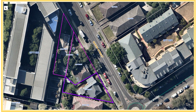
Photos taken during a site inspection of Friday 25 October
2024 are provided below.
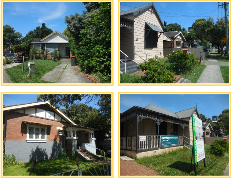
Description of The
Development
Modification application 2024/0274
is proposing to introduce an additional storey to the approved development to
increase the number of residential apartments from 38 to 45 including associated
changes to basement level 3 car park. In detail, the following changes are
proposed to the approved development.
1. Introduce
one additional storey to the approved development being Level 6. The new floor
has the same number of apartments as Levels 1 to 5 below being 7 apartments.
The additional floor has the same shape, dimensions and setbacks to that of the
approved building. The additional floor features 1 x 1 bedroom and 6 x 2
bedroom apartments.
The former Level 6 which features
three apartments and a common area will now become Level 7 being the
topmost level of the building. Other than minor alterations to the landscape
planter boxes across the common area and the provision of 5 cubic metres of
storage area for Apartment L7.03 (Former F6.03), the topmost floor level is not
subjected to any significant change.
2. Extend
the basement Level 3 car park towards the north and Queen Street so that the
footprint of the basement level matches the footprint of basements levels 1 and
2 above. The changes result in the addition of 6 car parking spaces to the
development to support the additional number of apartments provided.
There are additional changes
proposed being:
· An increase in the
number of storage cages provided within the basement Level 3 car park from 38
to 45.
· Increase the
number of bike bays within the basement from 22 to 40.
· Increase the size
of the bulky waste storage room by 3 square metres from 16 square metres to 19
square metres.
· Addition of glazed
elements to a ground level wall facing the south adjacent to an external common
area.
· Addition of
planter boxes alongside a south facing common wall of Commercial Tenancy Number
2.
A synopsis of the proposed changes
are outlined within the table below comparing the original approval to the
modification proposed.
|
Feature
|
Original
approval by the Panel
|
Modified
development
|
Comments
|
|
Number of apartments.
|
38 comprising of:
· 7 x
1 bedroom.
· 27 x
2 bedroom.
· 4 x
3 bedroom.
|
45 comprising of:
· 8 x 1 bedroom.
· 33 x 2 bedroom
· 4 x 3 bedroom.
|
There are 7 additional apartments.
|
|
Number of car parking spaces.
|
60
|
66
|
Increase of 6 spaces.
|
|
Height in storeys.
|
7
|
8
|
1 additional storey.
|
|
Height in metres.
|
24.14 metres.
|
27.4 metres
|
The increase is 3.26 metres.
(A variation of 400 mm occurs).
|
|
Floor space ratio.
|
2.58:1.
|
2.97:1.
|
Increase is 0.39:1.
(Floor space ratio still complies).
|
Changes to the conditions
The following conditions currently
attached to the development consent and associated modification applications
are required to be modified or deleted:
|
Condition Number
|
Type of condition
|
Comment
|
|
2
|
Approved
plans and supporting documents.
|
To reflect
new plan set.
|
|
17
|
Amendments
to approved plans.
|
Request is
made to delete Condition 17(a) and 17(f).
|
|
21
|
Damage
Deposit for Council infrastructure.
|
To correct
an error.
|
|
23
|
Section
7.11 Contributions.
|
To include
additional contributions.
|
|
24
|
Fees paid
to Council.
|
To include
additional contributions.
|
|
35
|
Off Street
car parking.
|
To update
numbers.
|
|
46
|
Acoustic
report.
|
To update
report.
|
|
63
|
Sydney
Water Tap in Approval.
|
To delete
as it is a double to Condition 50.
|
|
97
|
Acoustic
verification.
|
To update
report.
|
|
115
|
Compliance
with acoustic report.
|
To update
report.
|
|
118
|
Car
parking.
|
To update
numbers.
|
History
The Cumberland Local Planning
Panel at its meeting of Thursday 7 December 2023 resolved to approve
development application 2022/0629 as an electronic determination for the
demolition of existing structures and construction of a part 6, part 7 storey
shop top housing development comprising of 2 commercial tenancies on the ground
floor and 38 residential apartments above over 3 basement car parking levels
subject to conditions.
It is identified that during the
final deliberation of the matter, the Panel did not impose any additional
conditions to the recommendation made and the Panel did not modify any
condition attached to the condition set that formed part of the presentation.
Applicants Supporting
Statement
The applicant has provided a
Statement of Environmental Effects prepared by “The Planning Hub”
dated Friday 12 April 2024 which was received as part of the modification
application package.
Contact With Relevant
Parties
The assessing officer has
undertaken a site inspection of the subject site and surrounding properties and
has been in regular contact with the applicant throughout the assessment
process.
Internal Referrals
Development Engineering
The modification application was
referred to Council’s Development Engineer for comment who has advised
that the modification application and changes to the basement car park is
acceptable subject to conditions.
Environmental Health
The modification application was
referred to Council’s Senior Environmental Health Officer for comment who
has advised that the modification application is supported subject to
conditions.
Waste Management
The development application was
referred to Council’s Waste Management Officer for comment who has
advised that the development proposal is satisfactory. No additional conditions
are required for any consent that may be issued.
External Referrals
Design Excellence Panel
The modified development has a
maximum height of 27.4 metres which is 2.4 metres greater than 25 metres.
The Cumberland Design Excellence
Panel Policy (Number POL-050) of July 2022 (Version 4) requires:
a) any
development proposal subject to the design excellence provisions of a Local
Environmental Plan.
b) any
development proposal incorporating buildings with a height greater than 25m.
c) any
development proposal voluntarily referred to the Design Excellence Panel by an
applicant for development of any kind.
to be referred to the Panel.
It is identified that the original
development application did not require referral to the Panel on the grounds
that the approved building exhibited a height of 24.14 metres from the natural
ground level which was below 25 metres in height.
As per the same policy, “alterations
and additions to approved buildings that do not significantly alter the design
of a building do not need to be referred to the Design Excellence Panel”.
The modification application
proposes one additional storey to the approved building. The change sought does
not significantly alter the design of the building and the changes do not have
significantly adverse or greater impacts to the locality. On the above grounds,
the matter does not require referral to the Design Excellence Panel in this
instance.
Planning Comments
Section 4.55(2) Other
modifications:
|
Requirement
|
Comments
|
|
Council is satisfied that the development to which the
consent as modified relates is substantially the same development as the
development for which the consent was originally granted and before that
consent as originally granted was modified (if at all), and
|
Based on a review of case law Moto Projects (No 2) Pty
Ltd v North Sydney Council [1999], Agricultural Equity Investments Pty Ltd v
Westlime Pty Ltd (No 3) [2015] and Ozzy States Pty Ltd v Canterbury-Bankstown
Council [2017], it is determined that the word
“substantially” in this context means “essentially or
materially having the same essence”. To be confident that the modified
development is substantially the same requires a comparison between the development,
as originally approved, and the development as proposed to be modified. The
comparative tasks, “involves an appreciation, qualitative, as well as
quantitative, of the developments being compared in their proper contexts.
With considering the above, Council does consider the
proposed modification to be substantially the same for the following reasons:
· The additional
floor does not alter the approved front, side or rear setbacks of the
building.
· All additional
works are confined within the approved floor plate of the building.
· The additional
floor space ratio of the development is calculated at 0.39:1 which is
approximately 15.1% of the total size of the building. The increase in
percentage terms is not excessively large and is compliant with Clause 4.4 of
the Cumberland Local Environmental Plan 2021.
· The increase in
the number of car parking spaces is 6 or 10%.
· The number of
bedrooms is increasing by 13 or 17.8% when compared to the original
development.
· The increase in
height is 3.26 metres or 13.5%. This results in a minor variation to the
building height limit which is described below. The minor variation is
acceptable.
The modified development is determined as being
substantially the same as that approved as the increases in the intensity of
use of the building is within acceptable limits.
The principal and essential features of the original
approval are maintained. For these reasons, the modification is qualitatively
and quantitatively substantially the same development as approved.
|
|
Council has consulted with the relevant Minister, public
authority or approval body (within the meaning of Division 5) in respect of a
condition imposed as a requirement of a concurrence to the consent or in
accordance with the general terms of an approval proposed to be granted by
the approval body and that Minister, authority or body has not, within 21
days after being consulted, objected to the modification of that consent, and
|
The modification application did not require referral to
any external Government agency for comment.
|
|
Council has notified the application in accordance with:
(i) the regulations, if the
regulations so require, or
(ii) a development control plan, if the
consent authority is a council that has made a development control plan that requires
the notification or advertising of applications for modification of a
development consent, and
|
The modification application has been notified to occupants and owners of the adjoining
properties for a period of fourteen (14) days between Thursday 22 August 2024 and Thursday 5 September 2024. In response, two (2)
submissions were received to the modified development.
The submissions are
addressed below under the heading “Submissions made in
accordance with the Act or Regulation (EP&A Act s4.15 (1)(d))”.
|
|
Council has considered any submissions made concerning the
proposed modification within any period prescribed by the regulations or
provided by the development control plan, as the case may be.
|
The submissions received has been considered and addressed
below under the heading “Submissions
made in accordance with the Act or Regulation (EP&A Act s4.15
(1)(d))”.
|
|
Relevant matters referred to in Section 4.15(1) of the act
have been taken into consideration.
|
The proposed modification is not contrary to the public
interest and the likely environmental impacts of the development as modified
are considered acceptable.
|
|
Council has considered the reasons given by the consent
authority for the grant of the consent that is sought to be modified.
|
The following reasons provided by the Cumberland Local
Planning Panel have been considered as part of the assessment process:
· The Panel
generally concurred with the Council’s Officers Notice of Determination.
· Subject to
the recommended conditions, the proposal will not have any unreasonable
impacts on the amenity of the neighbouring properties or the locality.
· Taking into
account the reasons above, approval of the application will be in the public
interest.
Planning Comment:
When considering the Panel’s decision making
process, it is identified that there were no objections to the development
and general compliance with the planning instruments were achieved.
The changes sought are generally satisfactory and do not
create additional adverse impacts across the locality. It is considered that
the changes sought are acceptable to the site.
|
In accordance with Section 4.55(3)
of the Environmental Planning and Assessment Act 1979, in determining a
modification application made under Section 4.55 the consent authority must
take into consideration such matters referred to in section 4.15 (1) as are of
relevance to the development the subject of the application.
The relevant matters for
consideration under Section 4.15 of the Environmental Planning and Assessment
Act, 1979, are:
|
Section 4.15 Matters for Consideration
|
Comments
|
|
Section 4.15(1)(a)(i) -
Provisions of any environmental planning instrument.
|
This is generally satisfactory
as demonstrated throughout the report.
|
|
Section 4.15(1)(a)(ii) -
Provisions of any proposed planning instrument.
|
There are no draft planning instruments that need to be
considered for the modification application.
|
|
Section 4.15(1)(a)(iii) -
Provisions of any development control plan.
|
The Cumberland Development Control Plan 2021 will apply to
the modification application. An assessment undertaken identifies that the
modified development will be acceptable when considered under the relevant
chapters being:
a) Part
B Development in Residential Zones.
· Part B3
Residential Flat Buildings.
· Part B5
Adaptable Housing and Housing Mix.
b) Part
C Development in Business Zones.
c) Part
F2 Business Site Specific
· Part F2-1 Auburn
Town Centre.
d) Part
G Miscellaneous Development Controls.
· Part G3 Traffic,
Parking, Transport and Access (Vehicle).
· Part G4
Stormwater and Drainage.
· Part G8 Waste
Management.
Further discussion is provided
below.
|
|
Section 4.15(1)(a)(iiia) -
Provisions of any planning agreement.
|
There are no Planning Agreements applicable to the
modification application that requires review.
|
|
Section 4.15(1)(a)(iv) -
Provisions of the Environmental Planning and Assessment Regulation 2021.
|
The modification application has been made in accordance
with the relevant matters prescribed by the Regulations.
A detailed assessment is made below to the relevant
sections of the Regulations under the heading ‘Section
4.1.5(1)(a)(iv)’.
|
|
Section 4.15(1)(b) - the
likely impacts of the development, including environmental impacts on the
natural and built environments and social and economic impacts in the
locality.
|
The environmental impacts of
the modified development on the natural and built environments are addressed
under the Cumberland Development Control Plan 2021 (CDCP) section in this
report and are determined as being satisfactory.
The modified development will
not have a detrimental social impact in the locality considering the nature
of the proposal. The changes sought are acceptable within the context of a
Town Centre and residential environment. In particular:
· There
are no changes to the ground floor commercial tenancies.
· There
are no changes to the vehicle or pedestrian access to and from the building.
· The
additional floor is contained within the approved floorplates and building
footprints.
· There
is an increase in shadowing towards the south but the increase is within
reasonable expectations for such a development within a town centre
environment.
· The
built form of the final development remains generally the same as that
initially approved notwithstanding the addition of one additional storey.
· Privacy
is satisfactory or capable of being satisfactory.
The modified development will
not have a detrimental economic impact on the locality considering the nature
of the locality. In this regard:
· The
development is consistent with the type of built form development expected
within a town centre environment.
· The
site is located within a town centre and zoned as such being E1 Local Centre.
The development is generally consistent with the development controls
applicable to the land.
|
|
Section 4.15(1)(c) - the
suitability of the site for the development.
|
The site has previously been determined as being suitable
to support the development. There are no changes occurring that would alter
the conclusion that is made.
|
|
Section 4.15(1)(d) - any
submissions made in accordance with the EP&A Act 1979 or EP&A Reg 2021.
|
Council has received two submissions to the modified
development. The submissions are
addressed below under the heading “Submissions made in
accordance with the Act or Regulation (EP&A Act s4.15 (1)(d))”.
|
|
Section 4.15(1)(e) - the
public interest.
|
No matters have arisen in this
assessment that would justify the refusal of the application in the public
interest.
|
The provisions of any
Environmental Planning Instruments (EP&A Act s4.15 (1)(a)(i))
State Environmental Planning
Policies
The modified development is
affected by the following State Environmental Planning Policies:
|
State
Environmental Planning Policies (SEPPs)
|
Relevant
Clause(s)
|
Compliance
with Requirements
|
|
· State Environmental
Planning Policy (Biodiversity and Conservation) 2021.
|
Chapter 2 -Vegetation in non
Rural Areas.
|
The original development
application included the removal of thirteen (13) trees across the
development site.
The original development
application did not exceed the biodiversity offsets scheme threshold.
There is no change to the
number of trees to be removed and no further assessment is required.
|
|
Chapter 6 -
Water Catchments.
Sydney Harbour Catchment.
|
It is determined that given the
location of the site, a detailed assessment is not required given that there
is no direct impact upon the catchment and no direct impact upon
watercourses.
As such, the modified
development is acceptable under the provisions that came into effect on
Monday 21 November 2022.
|
|
· State Environmental
Planning Policy (Resilience and Hazards) 2021.
|
Chapter 2 - Coastal
Management.
|
The subject site is not
identified as being within a coastal wetland area or ‘land identified
as a “proximity area for coastal wetlands” or coastal management
area.
|
|
Chapter 4 - Remediation of
Land.
Part 4.6.
|
Part 4.6 - Contamination
and remediation to be considered in determining development application.
Comments
A Detailed Site Investigation
(DSI) prepared by Raw Earth Environmental dated 18 November 2021 has been
considered as part of the assessment of the original development application.
The report which was
incorporated into the consent issued provided adequate recommendations to
address site conditions. Appropriate conditions were included into the Notice
of Determination issued addressing the report.
No further assessment is
required in this instance. As
such, it is considered that the development application is satisfactory under
Part 4.6 of Chapter 4 of the State Policy.
|
|
· State Environmental
Planning Policy (Transport and Infrastructure) 2021.
|
Chapter 2 - Infrastructure.
|
State Environmental Planning
Policy (Transport and Infrastructure) 2021 is relevant to the modification
application as follows.
|
|
Clause 2.48
|
Chapter 2 - Infrastructure.
Determination of development
applications (Subpart (2) - Give written notice to electricity providers and
take account of responses received within 21 days.
Comment
No referral was required given
that no significant changes were proposed at grade. The referral was
completed as part of the original development application with correspondence
from Ausgrid being incorporated into Condition 2 of the development consent.
No further assessment is
required in this instance.
|
|
· State Environmental
Planning Policy (Housing) 2021.
|
Chapter 4
|
Chapter 4 - Design of
Residential apartment development.
The building is more than 3
storeys in height and the additional floor has more than 4 apartments.
Chapter 4 will apply to the
modification application. An assessment shows that the changes sought are
acceptable and supported under Chapter 4.
Further discussion is required
in relation to shadow impacts (Part 3B-2) which is addressed below.
Overall, an assessment
undertaken using the Apartment Design Guide demonstrates that the modified
development (As relevant) achieves a high degree of compliance.
See discussion below.
|
|
· State Environmental
Planning Policy (Sustainable Buildings) 2022.
|
Chapter 2 Standards for
Residential Development (BASIX).
|
BASIX Certificate number 1230091M-05 has been submitted
and determined as being acceptable for approval.
The Certificate demonstrates a
score of 42 and 36 for water and energy which exceeds the minimum requires of
40 and 25 for both elements.
|
(a) State
Environmental Planning Policy (Housing) 2021 Chapter 4 - Design of Residential
apartment development.
Chapter 4 of SEPP (Housing) 2021
applies to the development as the building is 3 storeys or more and contains
more than 4 dwellings. A design statement addressing the design quality
principles prescribed by Chapter 4 SEPP (Housing) 2021 was prepared by the
project architect. Integral to Chapter 4 of SEPP (Housing) 2021 is the
Apartment Design Guide (ADG) which sets benchmarks for the appearance,
acceptable impacts and residential amenity of the development.
Following a detailed assessment of
the proposal against the provisions of Chapter 4 of the SEPP (Housing 2021) and
the ADG, the proposal is generally considered compliant and therefore performs
satisfactorily with respect to (e.g. building amenity, landscape
design….) A comprehensive assessment against Chapter 4 of SEPP (Housing)
2021 and the ADG is contained in Appendix A and B attached to the report.
Further discussion is required in
relation to Part 3B-2 which addresses overshadowing. Generally, overshadowing
of neighbouring properties should be minimized during mid winter. Further,
shadowing should not be reduced by more than 20%.
Commentary
As per the original report,
shadowing towards the south is unavoidable and shadow impacts are considered to
reach 100% in some instances. The additional shadow impact as a result of the
7th storey is considered minimal as discussed below.
a) North-eastern
side of 2-10 Susan Street
The existing rear 3 storey
residential apartment building closest to the development site has a total of
12 apartments with balconies and living rooms facing the eastern common
boundary with 28 and 32 Queen Street. The apartments currently receive a maximum
of 2 hours of sunlight from 9:00am to 11:00am in mid-Winter. From 11:00am
onwards, the apartments are shadowed by their own building.
The approved development will
remove the 2 hours of solar access from the rear 3 apartments across the lowest
2 levels (total of 6 apartments) and provide no more than 1 hour of solar
access to another 3 apartments across this part of the development.
Given the angle of the site and
allotment pattern, the additional floor proposed does not worsen the shadow
impact across 2 to 10 Susan Street. The shadows are extended at least 7 metres
to the south across 12 to 16 Susan Street to the south / southwest at 9:00am
but this recedes and is largely removed by 11:00am.
Generally, the variation to the
shadow impact to the west and southwest remains acceptable.
b) Southern
side 26 Queen Street and 11 Marion Street
Both 26 Queen Street and 11 Marion
Street are currently occupied by 2 storey dwelling houses. Both sites will not
receive adequate direct sunlight in mid winter. This is as originally approved
and it is noted that the shadow impacts are not made worse by the addition of
another storey to the development.
c) 13
to 15 Marion Street
The existing shadow impact as
approved already impacts upon the common area and windows of the ground floor
of the four storey residential apartment building. While there is a minor
increase, the increase is within acceptable limits.
It should also be noted that the
existing two storey dwelling house at 11 Marion Street casts a shadow across
the north facing windows of that building and thus the shadows created by the
new development (existing and additional) coincides with the shadow created by
that dwelling house. As such, the direct shadow impact created by the
development the subject of this application is considered acceptable in this
instance.
The north facing common area of
Number 13 to 15 Marion Street will be provided with sunlight between 1 pm and 3
pm which is similar to what is approved.
The late afternoon shadow created
by the development including the extended shadow impact will fall mostly across
Marion Street and road reserve and is generally consistent with the approval
already granted.
Cumberland Local
Environmental Plan 2021
The provisions of the Cumberland
Local Environmental Plan 2021 are applicable to the modified development.
(a) Permissibility:
The proposed development is
defined as “Shop top” housing comprising of commercial tenancies
within the ground floor and residential apartments above with a basement car
park below.
Shop top
housing is defined by the Cumberland Local Environmental Plan 2021 as:
“one
or more dwellings located above the ground floor of a building, where at least
the ground floor is used for commercial premises or health services facilities.
Note - Shop top housing
is a type of residential accommodation—see the definition of that term in
this Dictionary.”
Shop top housing is a permitted
form of development within the E1 Local Centre zone subject to consent.
The relevant matters to be
considered under Cumberland LEP 2021 and the applicable clauses for the
proposed development are summarised below. A comprehensive Cumberland LEP 2021
assessment is contained at Appendix C.
|
DEVELOPMENT STANDARD
|
COMPLIANCE
|
DISCUSSION
|
|
4.3 Height of Buildings
Maximum - 27 metres.
|
No.
|
The building has a maximum height of 27.4 metres.
A variation of 400 mm exists for the topmost part of a
lift overrun and portions of a parapet.
|
|
4.4
Floor Space Ratio
Maximum - 3.0:1.
|
Yes.
|
The floor space ratio of the development is 2.97:1 based
upon a floor area of 4,269.67 sq m.
|
|
4.6 Exceptions to Development
Standards
|
Satisfactory.
|
There is no statutory requirement for a Clause 4.6
variation request to be submitted for s4.55 modification applications.
Nonetheless, the applicant has prepared a justification against the relevant
criteria of Clause 4.6 to justify the proposed variation.
|
Assessment of Height
variation
A detailed Clause 4.6 variation is
not lawfully required for the modification application. However, the applicant
has provided the following reasons as to why the Panel should support the
modification application noting that no Clause 4.6 variation is required. The
detailed justification attached as part of the Statement of Environmental
Effects is provided at Attachment 3 of the report.
Is compliance with the development
standard unreasonable or unnecessary in the circumstances?
Applicant’s Response
· The proposal
provides a built form that is reflective of the future higher density form of
development envisaged for the surrounding area. The numeric increase in
building height is approximately 3.1 metres which is confined to the addition
of a level resulting in a minor variation of 400 mm or 1.48%.
· The proposal does
not result in adverse amenity or built form impacts on the surrounding area and
only involves a minimal percentage of the building volume including the lift
overrun and roof structure. The minor variation facilitates additional housing supply.
· Consideration has
been placed on the potential overlooking and overshadowing impacts arising from
the amended development. The non-compliance is minor and the building is sited
in a manner that does not create adverse impacts upon adjoining properties.
· The variation is
confined to a lift overrun centrally located within the building footprint and
portions of the roof sited towards the street elevation. The non-compliance
does not comprise trafficable areas. The variation will not cause adverse
overlooking or overshadowing impacts onto adjoining properties.
· The proposed
additions have been sympathetically designed to maintain the principal
presentation of the approved development with the majority of the new works set
below the maximum building height. The overall bulk and scale of the building
remains consistent to that originally approved and the proposed additions
aligns with the desired future character of the area.
Council Assessment
The applicant’s response may
be supported as follows:
· It is agreed that
the variation is limited to a portion of a lift overrun and portions of a roof
element namely the parapets. The variation is 400 mm or 1.48%. This is minor
and not contributing to additional bulk and scale of the building.
· Privacy and shadow
impacts have been considered. It is identified that the architect has retained
all the elements that contributes to satisfactory privacy between adjoining
sites. This includes the planter boxes for the rooftop common area, privacy
screens where needed and satisfactory placements of windows.
· The increase in
the shadowing is assessed as being satisfactory. In this regard, the shadow
impacts created by the development are not made worse across the south and
southwest of the development site.
· The variation is
limited to non trafficable areas and thus there is no additional floor space
ratio involved. Other than the topmost part of the lift overrun and parapets,
the remainder of the building falls below 27 metres in height and therefore is
compliant with the height limit.
For the reasons presented above
the variation may be supported.
Are there are sufficient
environmental planning grounds to justify the contravention of the development
standard?
Applicant’s Response
There are sufficient environmental
planning grounds to justify contravening the building height standard as
follows:
· The variation
proposed is consistent with previous approvals within the surrounding area and
does not result in any unreasonable increase in bulk, scale or form of the
development of the site.
· The proposal does
not result in any adverse or increased impacts on adjoining properties.
· The works are
sympathetic to the existing character and design of development of the site
whilst catering to the growing needs of the area.
· The height
variation only includes a minor portion of the building and is a result of
providing rooftop communal open space which provides a better planning outcome
for the site than strict compliance with the height control.
· The area of
exceedance consists only of the lift overrun and roof structures and does not
contain any habitable floor space.
· The proposal does
not result in any adverse view loss or visual impacts.
· The proposal
provides for the economic and orderly development of the site by allowing
alterations to cater for the growing needs of the community.
· The non-compliance
does not arise additional overshadowing impacts onto adjoining residents to
that of a compliant development.
· Strict compliance
with the building height development standard would result in a development
that does not achieve the desired development density for the site, reduces
residential amenity through the removal of rooftop communal open space and
would be inconsistent with the desired future character of the area.
Council Assessment
The applicant’s response may
be supported as follows:
· The variation does
not result in any unreasonable increase in bulk, scale or form of the
development that are outside the development controls applicable to the site.
· The proposal does
not result in any adverse or increased impacts on adjoining properties.
· The variation is
limited to a portion of a lift overrun and portions of a roof element namely
the parapets. There is no habitable floor space involved and as a result, there
is no unacceptable increase in floor space ratio. The floor space ratio of the
development is 2.97:1 which is less than 3:1 permitted for the site.
· The proposal does
not result in any adverse view loss or visual impacts. In particular, the
increase in the level of shadowing is acceptable given location and prevailing
allotment pattern of the locality.
Conclusion
Council is satisfied that the
applicant’s justification has adequately addressed the matters required
to be demonstrated. Council is further satisfied that the proposed development
will be consistent with the objectives of the standard and the objectives for
development within the zone in which the development is proposed to be carried
out.
The provisions of any proposed
instrument that is or has been the subject (EP&A Act s4.15 (1)(a)(ii))
There are no proposed planning
instruments applicable to the modification application.
The provisions of any
Development Control Plans (EP&A Act s4.15 (1)(a)(iii))
The Cumberland Development Control
Plan 2021 is the relevant development control plan to consider which provides
guidance for the design and operation of development to achieve the aims and
objectives of the Cumberland Local Environmental Plan 2021. A comprehensive assessment
and compliance table is contained in Appendix D attached to the report and a
high degree of compliance is achieved. The following chapters are relevant to
the development:
A) Part B
Development in Residential Zones.
· Part B3 Residential Flat Buildings.
· Part B5 Adaptable Housing and
Housing Mix.
B) Part C
Development in Business Zones.
C) Part F2
Business Site Specific
· Part F2-1 Auburn Town Centre.
A detailed assessment of Part C
and F2 is not required on the grounds that the modification application does
not result in changes to the commercial floor of the building.
D) Part G
Miscellaneous Development Controls.
· Part G3 Traffic, Parking, Transport
and Access (Vehicle).
· Part G4 Stormwater and Drainage.
· Part G8 Waste Management.
There is one variation that
requires discussion not initially approved by the Panel which is related to
Part B5 - Adaptable Housing and Housing Mix (Subpart C2) which reads as:
“C2 If an equal mix
cannot be provided, a minimum 10% of the dwellings shall be three plus bedroom
dwellings.”
In this regard, the number of 3
bedroom apartments remains the same at 4 but the number in percentage terms
falls from 10.5% to 8.8%. A variation of 12% is identified under Subpart C2
which is a result of an increase in the number of apartments across the whole
development from 38 to 45. It is considered reasonable to support the variation
as follows:
· The number of
three bedroom dwellings is approved and no change is occurring to those
apartments.
· The applicant has
provided 20% (9) adaptable apartments within the development plus 6 additional
liveable apartments.
· It is considered
that an adequate variety of housing forms is provided within the entire
development notwithstanding the minor variation identified.
There are no other additional
variations identified that are not approved by the Panel.
The provisions of any planning
agreement that has been entered into under section 7.4, or any draft planning
agreement that a developer has offered to enter into under section 7.4
(EP&A Act s4.15(1)(a)(iiia))
There is no draft planning
agreement associated with the subject modification application.
The provisions of the
Regulations (EP&A Act s4.15 (1)(a)(iv))
The proposed development raises no
concerns as to the relevant matters arising from the Environmental Planning and
Assessment Regulation 2021 (EP&A Reg).
The Likely Environmental,
Social or Economic Impacts (EP&A Act s4.15 (1)(b))
It is considered that the proposed
development will have no significant adverse environmental, social or economic
impacts within the locality.
The suitability of the site for
the development (EP&A Act s4.15 (1)(c))
The subject site and locality is
not known to be affected by any natural hazards or other site constraints
likely to have a significant adverse impact on the proposed development.
Accordingly, it is considered that the development is suitable in the context
of the site and surrounding locality.
Submissions made in accordance
with the Act or Regulation (EP&A Act s4.15 (1)(d))
|
Advertised (Website)
|
Mail
|
Sign
|
Not Required
|
In accordance with Council’s
Notification requirements contained within the Environmental Planning and
Assessment Act 1979, Environmental Planning and Assessment Regulation 2021 and
Cumberland Development Control Plan 2021, the modified development was publicly
notified for a period of fourteen (14) days between Thursday 22 August 2024 and
Thursday 5 September 2024. In response, 2 submissions were received.
The issues raised in the public
submissions are summarised and commented on as follows:
|
Issue
|
Planner’s Comment
|
|
The increase in population
density will strain overburdened infrastructure, lead to increased traffic
congestion, noise pollution and strained public services.
|
The site is shown to be capable of supporting the increase
in the intensity of use as shown throughout the assessment report.
|
|
The development will result in
the valuation of my property decreasing.
|
There is no evidence provided to verify the claim made and
such matters are not a relevant consideration under the Environmental
Planning and Assessment Act 1979.
|
|
There will be much traffic.
|
There is an adequate level of car parking provided within
the development site to support the development proposed.
|
|
The development will create
adverse noise.
|
Conditions have been added to the existing development
consent addressing such matters.
An amended acoustic report has been supplied and will be
incorporated into any development consent that may be issued.
|
|
Crime rates will increase.
|
There is no evidence provided to this effect.
|
The public interest (EP&A
Act s4.15(1)(e))
In view of the foregoing analysis,
it is considered that the modified development, if carried out subject to the
conditions set out in the recommendation below, will have no significant
adverse impacts on the public interest.
CUMBERLAND LOCAL INFRASTRUCTURE
CONTRIBUTIONS PLAN 2020
A contribution is payable to reflect
the changes made. The increase in the contribution is $124,558 which reflects
the additional seven (7) apartments to be constructed. The total amount of
contribution is now $746,156. The change is reflected within the draft
condition set for Panel consideration with the amount being payable prior to
the issue of a Construction Certificate.
HOUSING AND PRODUCTIVITY
CONTRIBUTION (HPC)
In accordance with s7.24 of the
Environmental Planning and Assessment Act, 1979 as amended by the Environmental
Planning and Assessment Amendment (Housing and Productivity Contribution) Act
2023, the development is subject to the (Housing and Productivity Contribution)
Act 2023.
In accordance with Part 2 of
Schedule 5 of the Environment Planning & Assessment (Housing and
Productivity Contribution) Order 2024 (‘the Order’), the Order does
not apply to a development consent granted to a pending development application
(Pending DA).
A ‘Pending DA’ as per
Schedule 1 of the Order and s16 of the EP&A Reg 2021 is as follows:
(a) a
development application that is made, but not determined, before 1 October
2023, or
(b) a
development application that is made and determined before 1 October 2023, but
has not been finally determined, or
(c) an
application for a complying development certificate that is made, but not
determined, before 1 October 2023.
The original development
application for the development was accepted by the Council on Tuesday 14
November 2022. The application was then determined by the Panel on Thursday 7 December
2023 subject to conditions. That consent did not contain any condition
addressing the Housing and Productivity Contribution requirement. Given the
above, the Housing and Productivity Contribution will not apply to the
modification application.
DISCLOSURE OF POLITICAL
DONATIONS AND GIFTS
The applicant and notification
process did not result in any disclosure of Political Donations and Gifts.
The modification application has
been assessed in accordance with the relevant requirements of the Environmental
Planning and Assessment Act 1979 and the following planning instruments:
a) State
Environmental Planning Policy (Biodiversity and Conservation) 2021 being
Chapter 2 - Vegetation in non Rural Areas.
b) State
Environmental Planning Policy (Resilience and Hazards) 2021 being Chapter 4 -
Remediation of Land.
c) State
Environmental Planning Policy (Transport and Infrastructure) 2021 - Part 2.48.
d) State
Environmental Planning Policy (Housing) 2021 being Chapter 4 - Design of
Residential Apartment Development and the Apartment Design Guide (ADG).
e) State
Environmental Planning Policy (Sustainable Buildings) 2022 (Chapter 2).
f) Cumberland
Local Environmental Plan 2021.
g) Cumberland
Development Control Plan 2021.
The modified development is
appropriately located within the E1 Local centre zone pursuant to the
provisions of the Cumberland Local Environmental Plan 2021. The modified
proposal is generally consistent with all statutory and non-statutory controls
applying to the development. Minor non-compliances with Council’s
controls have been discussed in the body of this report. The modified
development is considered to perform adequately in terms of its relationship to
its surrounding built and natural environment, particularly having regard to
impacts on adjoining properties.
For these reasons, it is
considered that the modified proposal is satisfactory having regard to the
matters of consideration under Section 4.15 of the Environmental Planning and
Assessment Act 1979, and the modified development may be approved subject to
conditions.
There are no consultation
processes for Council associated with this report.
There are no financial
implications for Council associated with this report.
There are no policy implications
for Council associated with this report.
Communication /
Publications:
The final outcome of this matter
will be notified. The objectors will also be notified in writing of the
outcome.
1. That
Modification Application 2024/0274 being a Section 4.55(2) modification
application to introduce an additional storey to increase the number of
residential apartments from 38 to 45 including associated changes to basement
level 3 to incorporate 6 additional car spaces and revise layout of ground
floor garbage and bulky waste room on land at 28 to 32 Queen Street, AUBURN be
approved subject to conditions as recommended in the Council’s assessment
report.
2. Persons
whom have lodged a submission in respect to the application be notified of the
determination of the application.
1. Draft Notice of
Determination
2. Architectural
Plans
3. Statement
of Environmental Effects including the Height Variation Justification at Part
4.1 and 4.2
4. Copy
of Existing Approved Development Plans
5. Redacted
Submissions Received
6. Appendix
A - "SEPP Housing" 2021 Chapter 4 Assessment Table
7. Appendix
B - Apartment Design Guide Assessment Table
8. Appendix
C - Cumberland Local Environmental Plan 2021 Assessment Table
9. Appendix
D - Cumberland Development Control Plan Assessment Table
DOCUMENTS
ASSOCIATED WITH
REPORT ELPP040/24
Attachment 1
Draft Notice of Determination
Cumberland
Local Planning Panel Meeting
11 December 2024
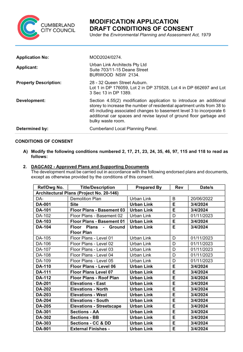
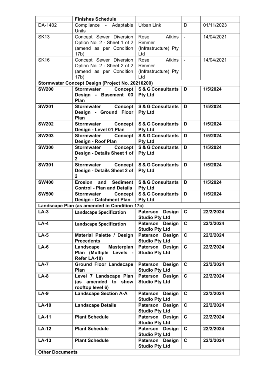
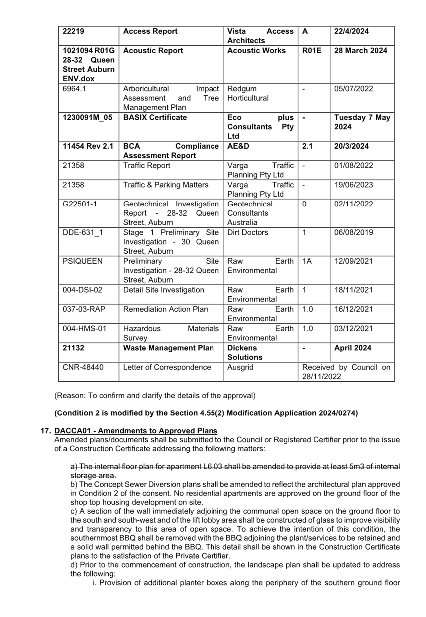
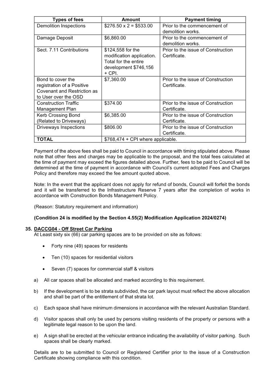

DOCUMENTS
ASSOCIATED WITH
REPORT ELPP040/24
Attachment 2
Architectural Plans
Cumberland
Local Planning Panel Meeting
11 December 2024
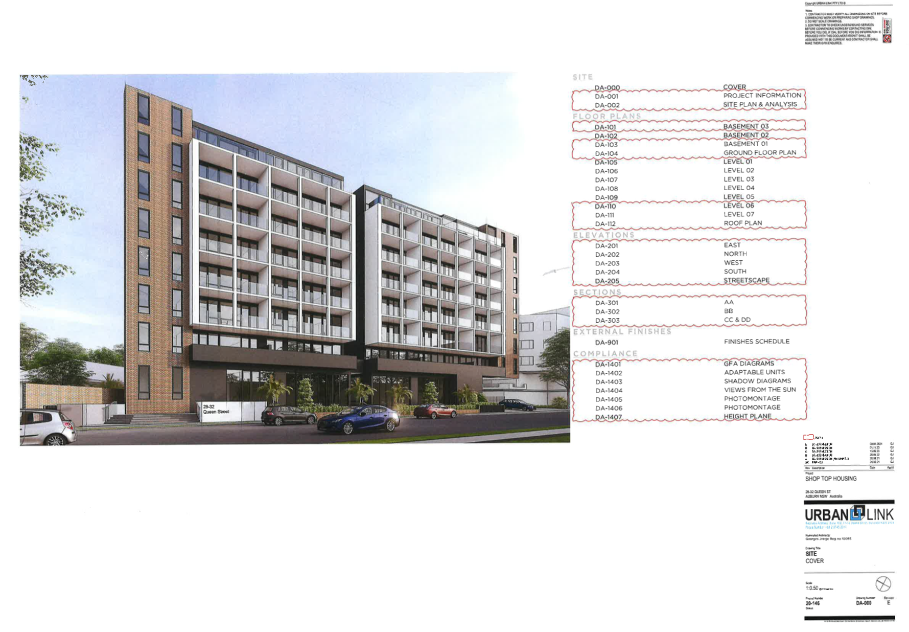
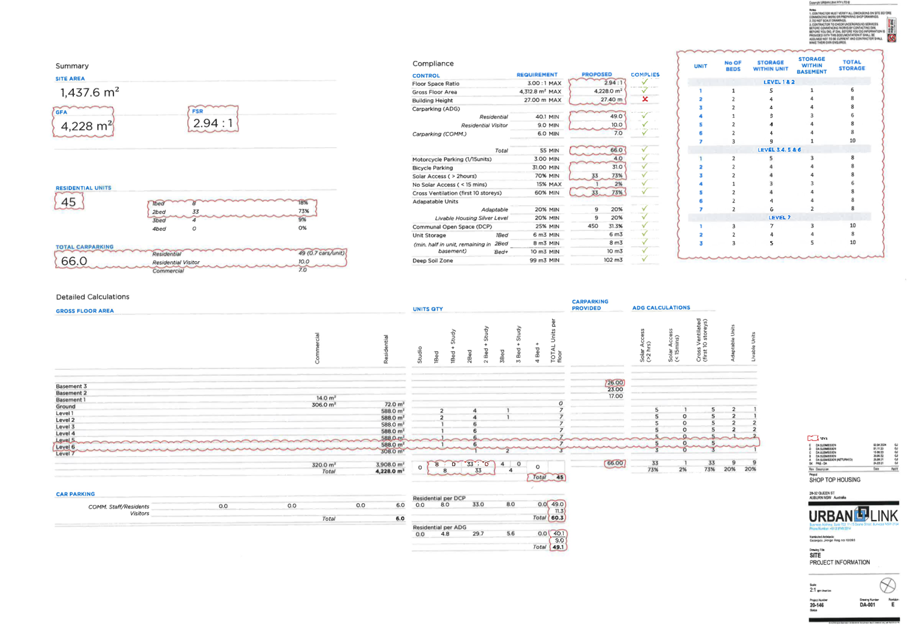
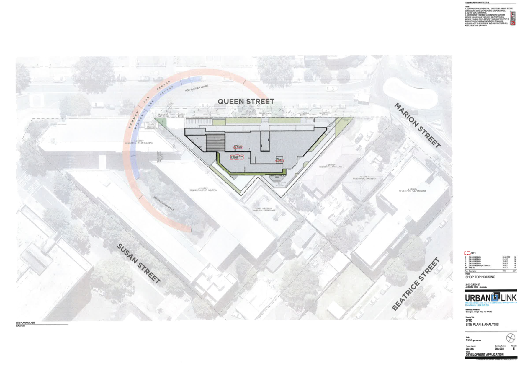
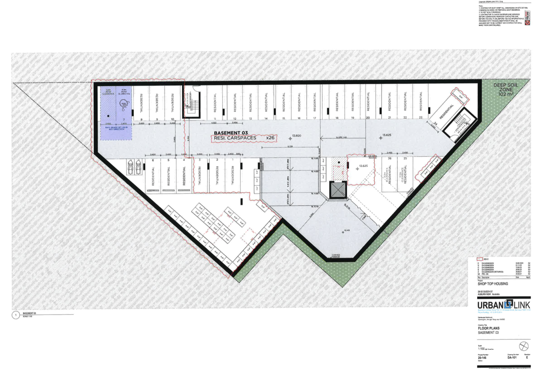
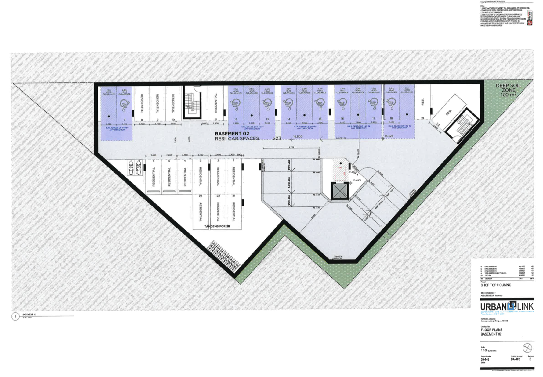
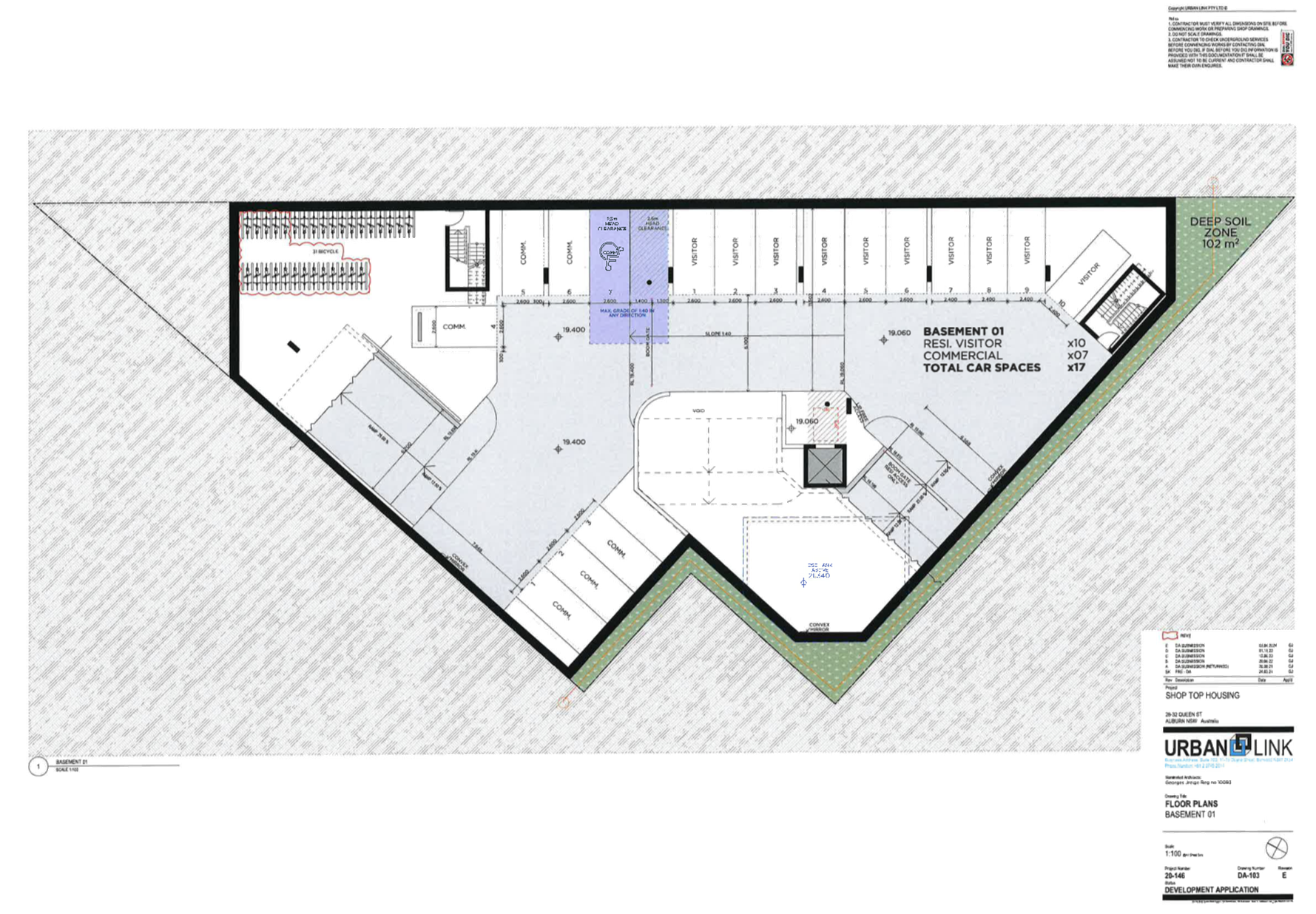
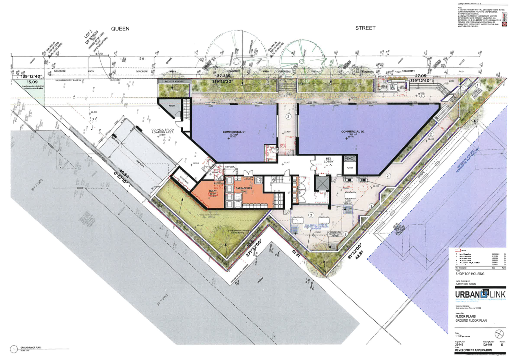
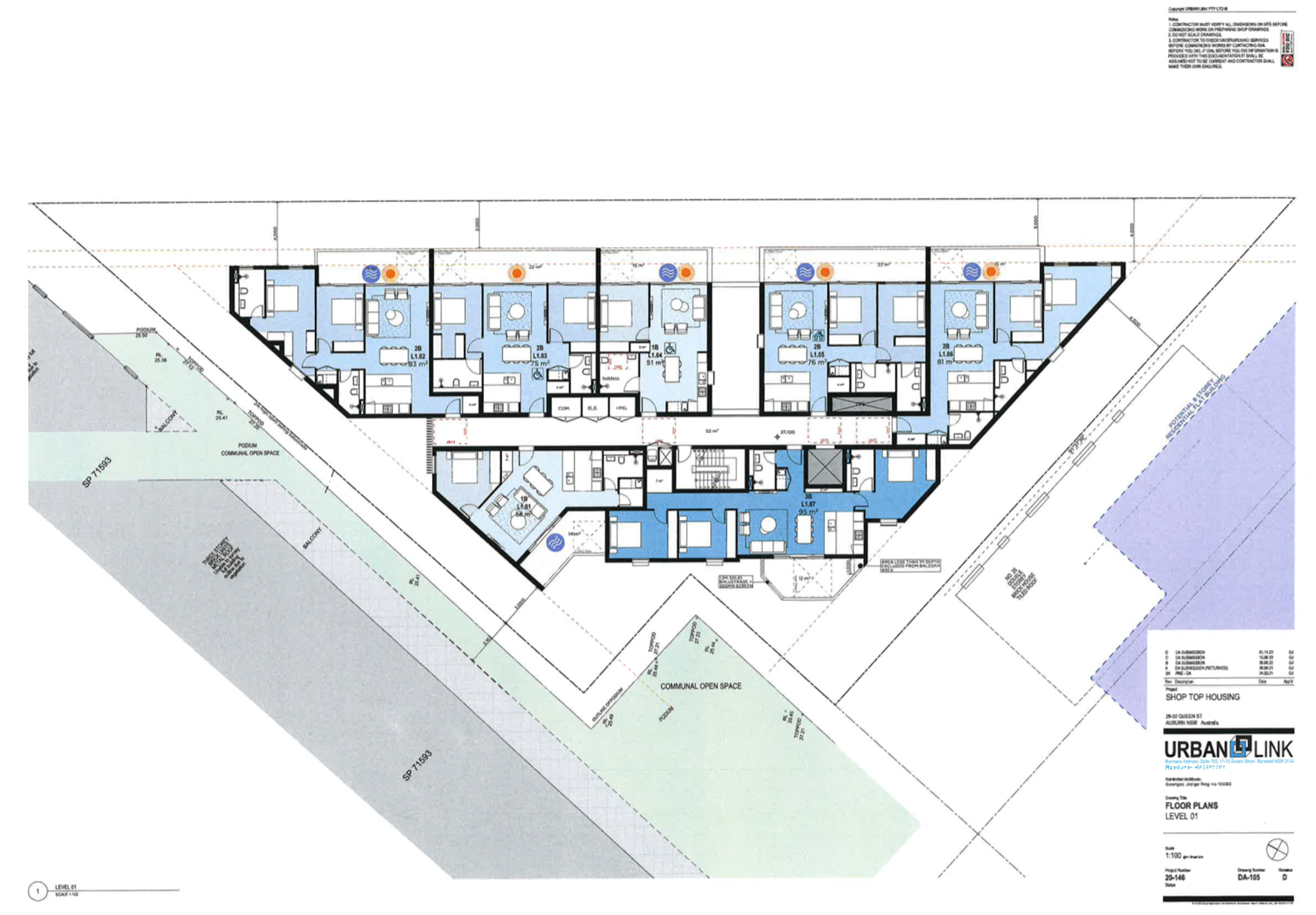
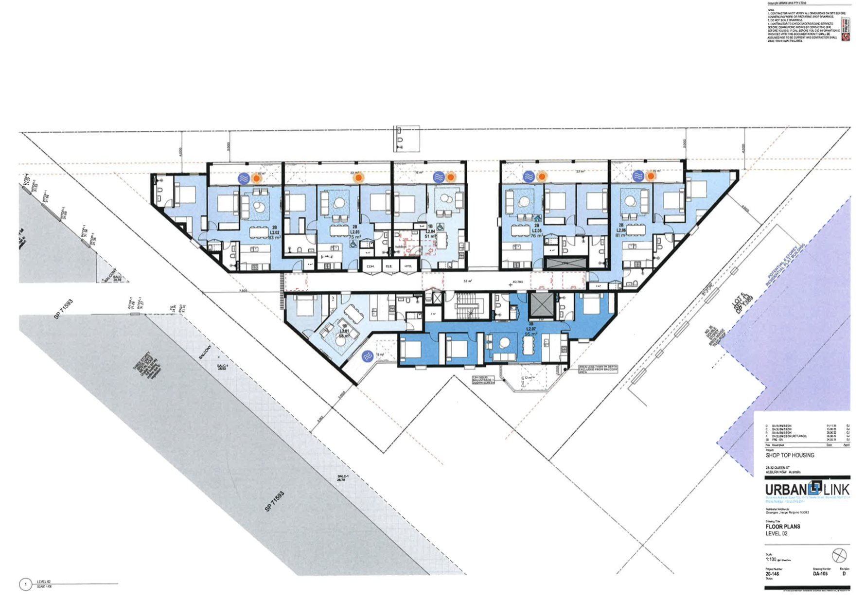
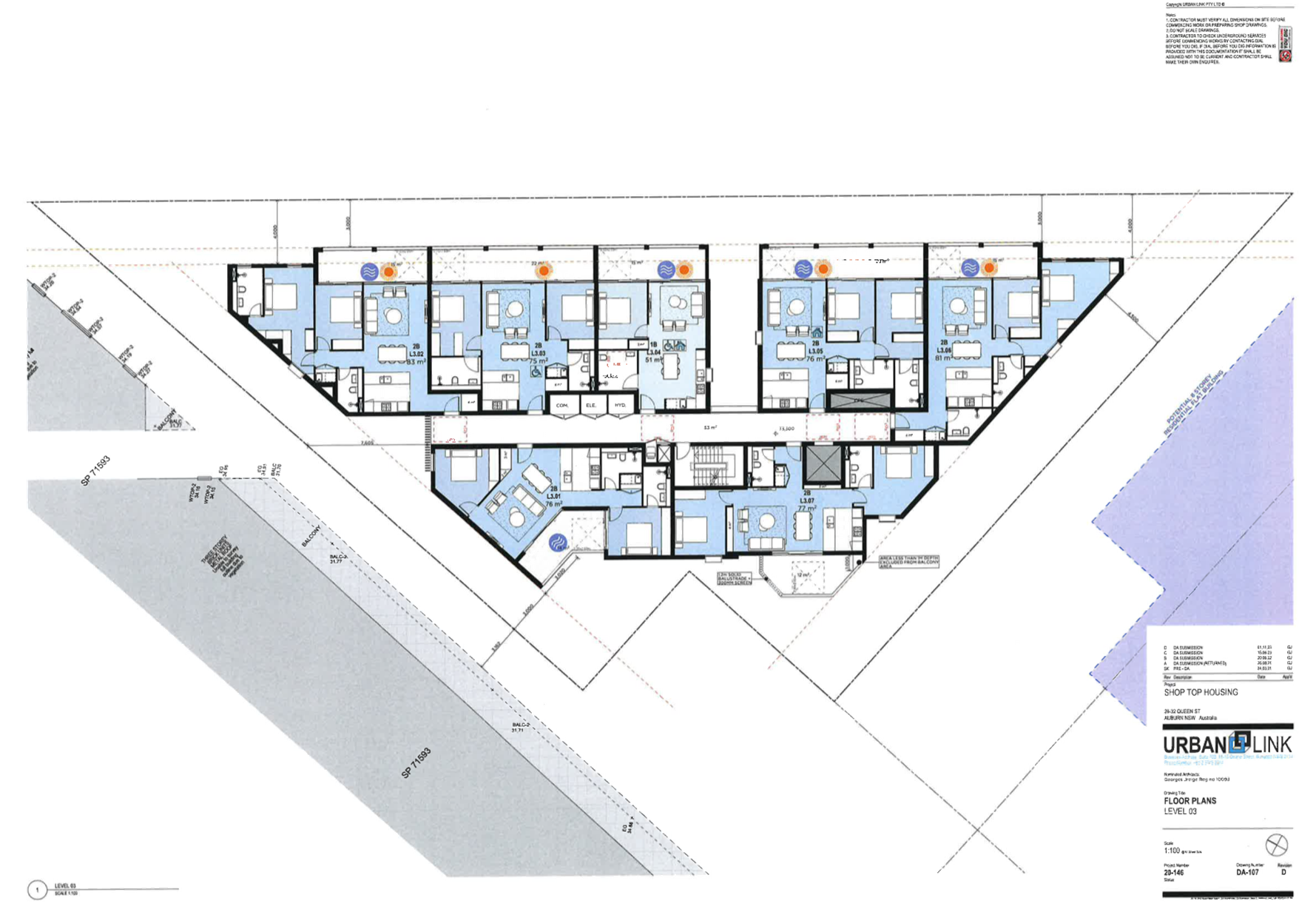
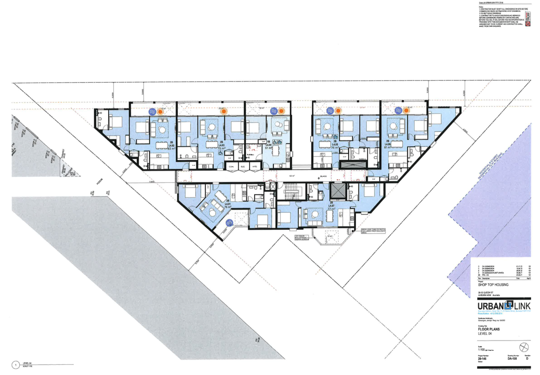
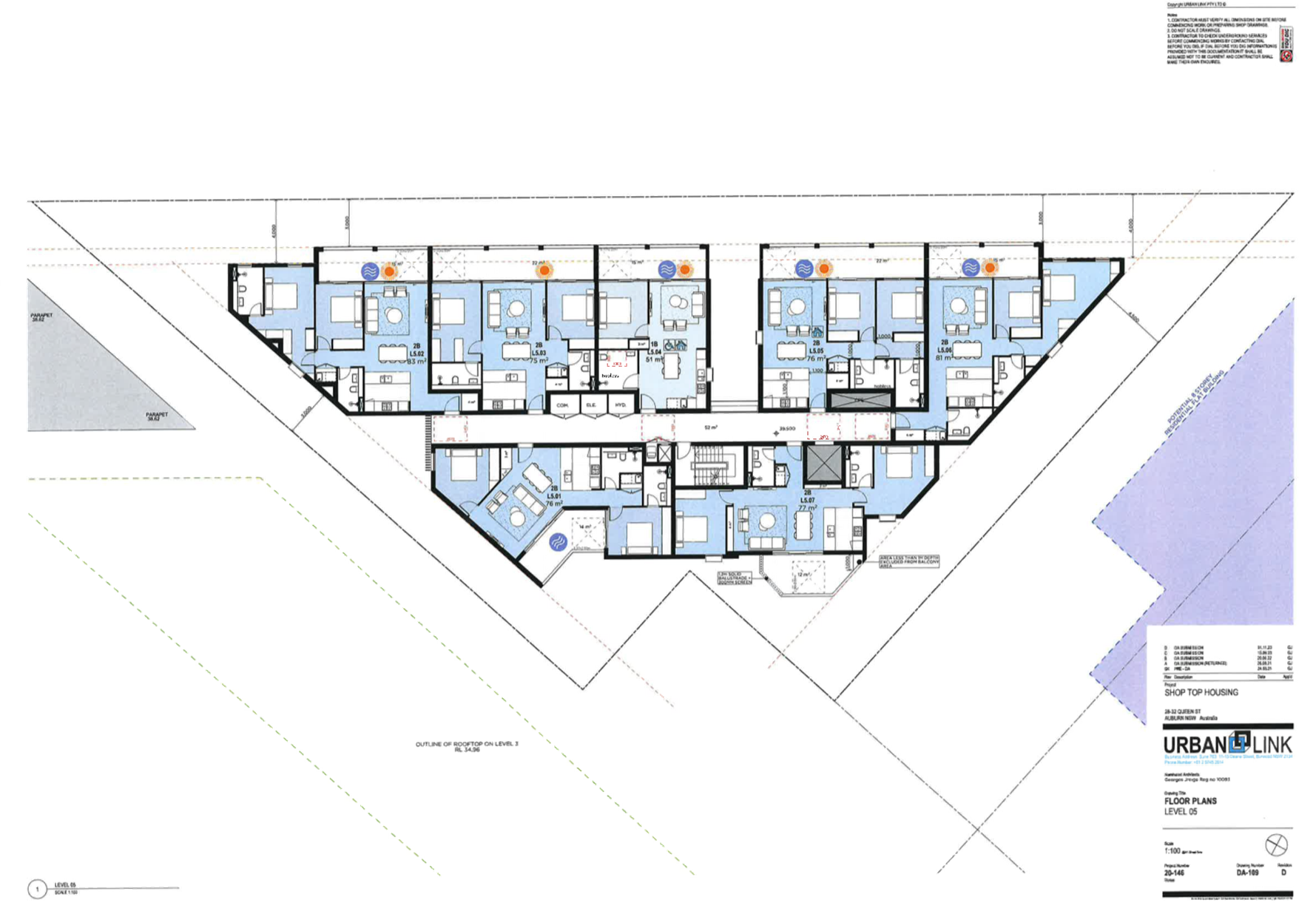
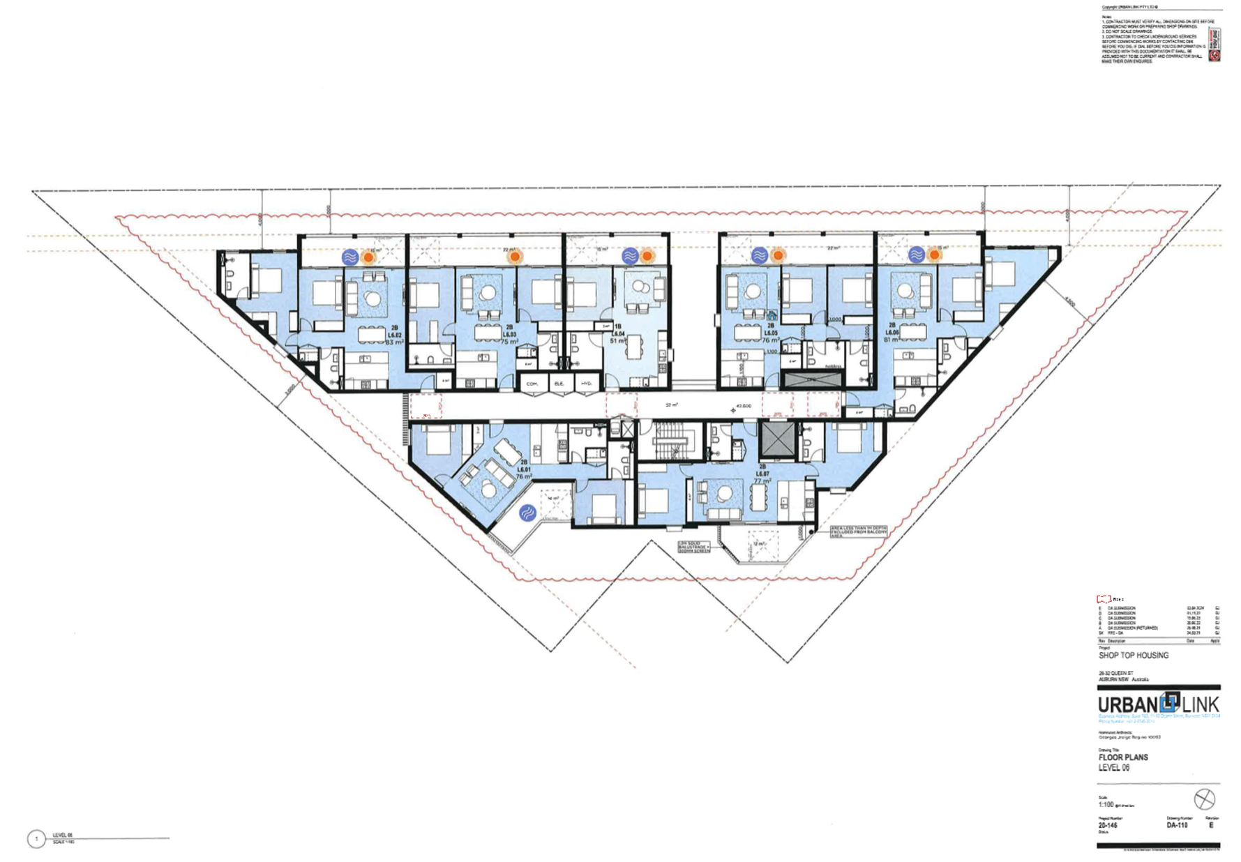
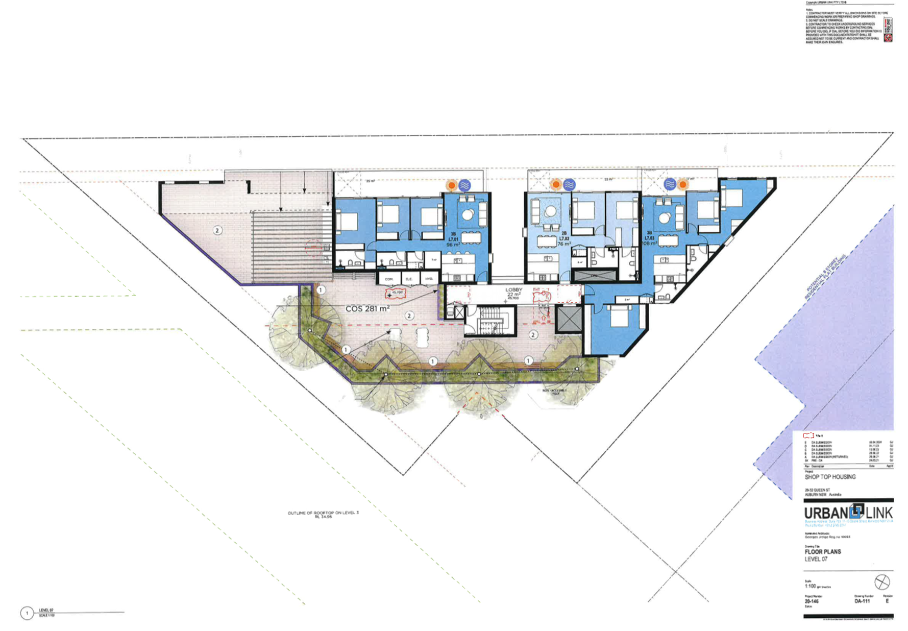
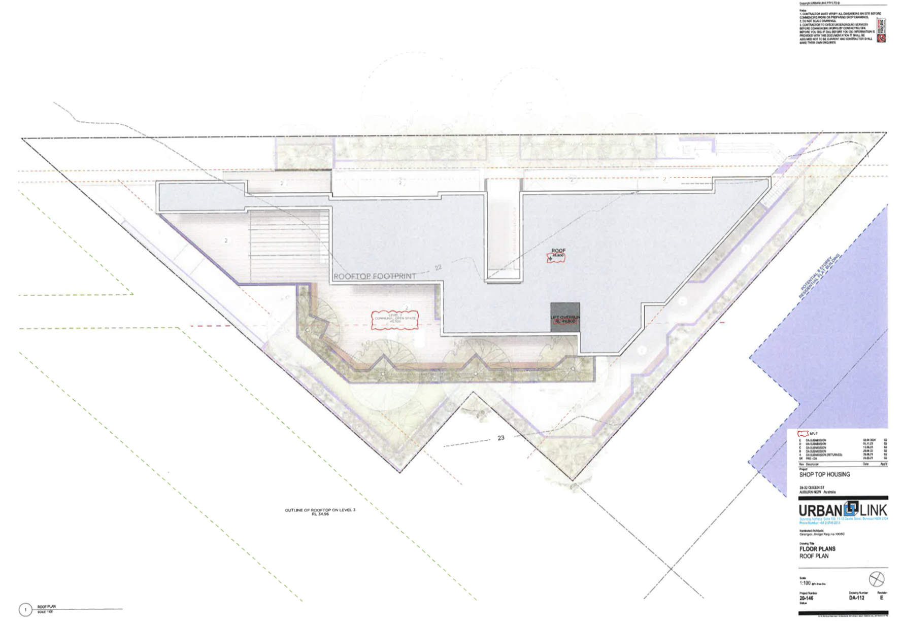
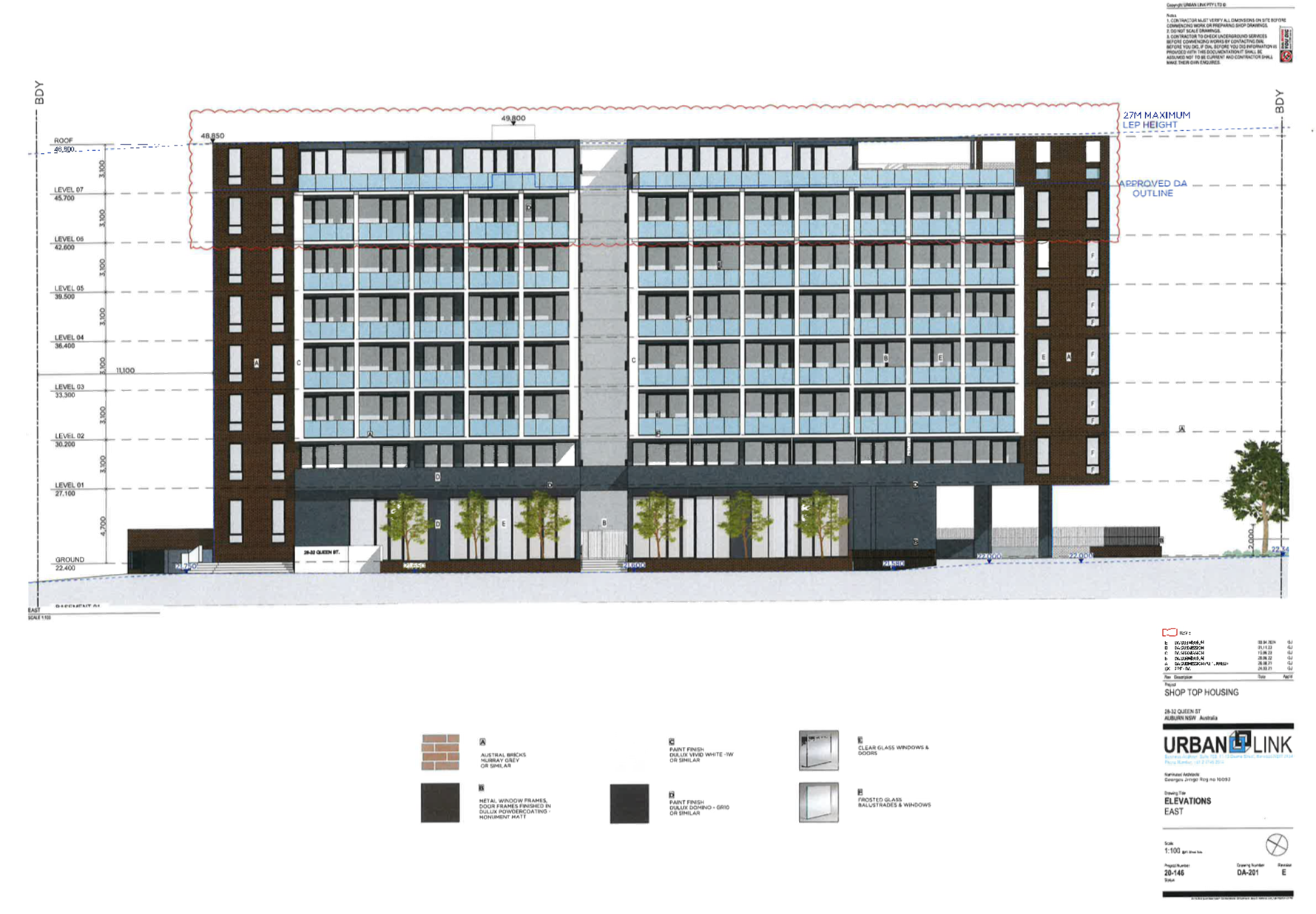
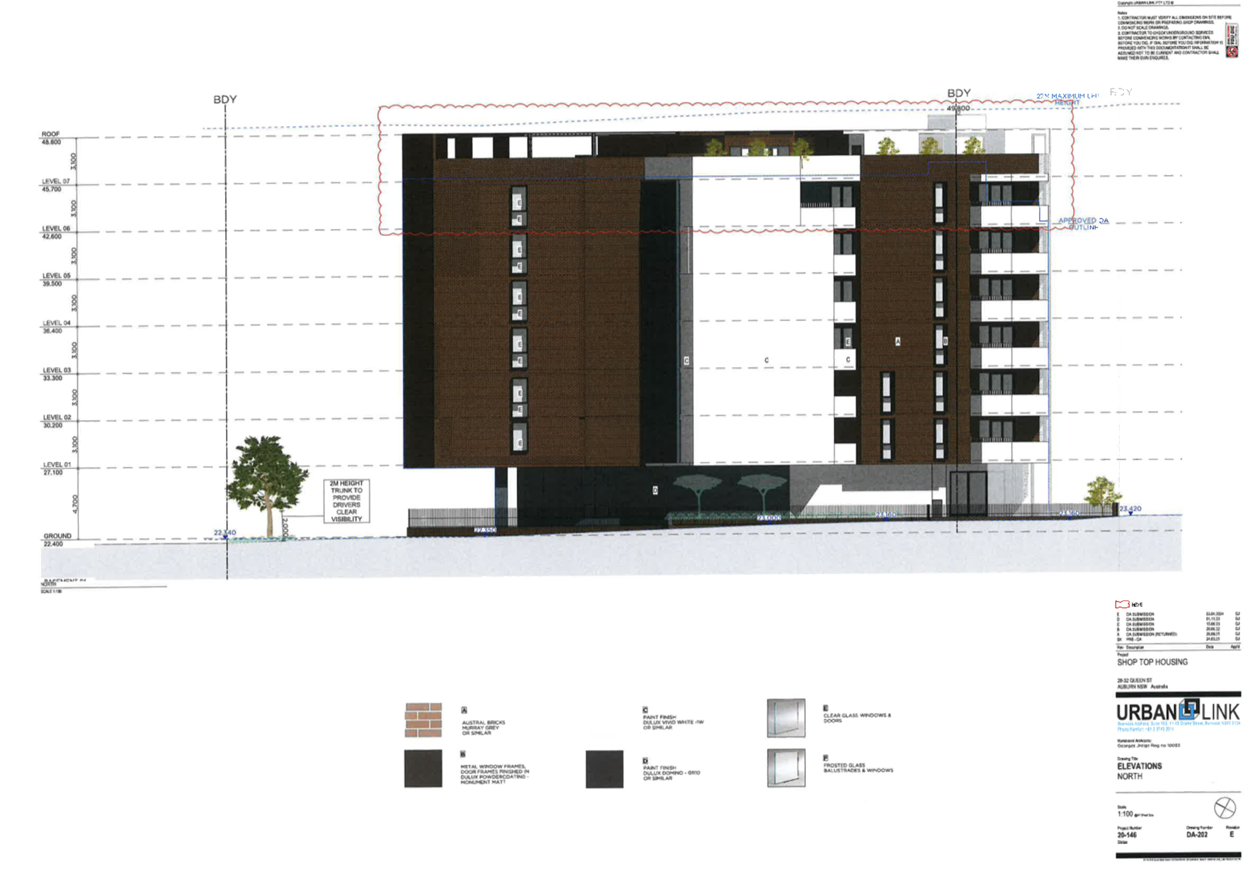
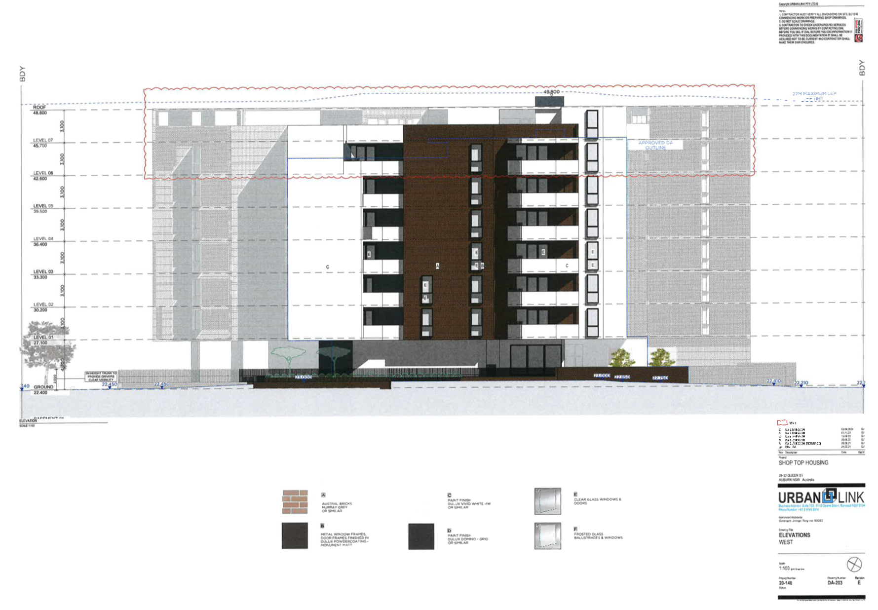
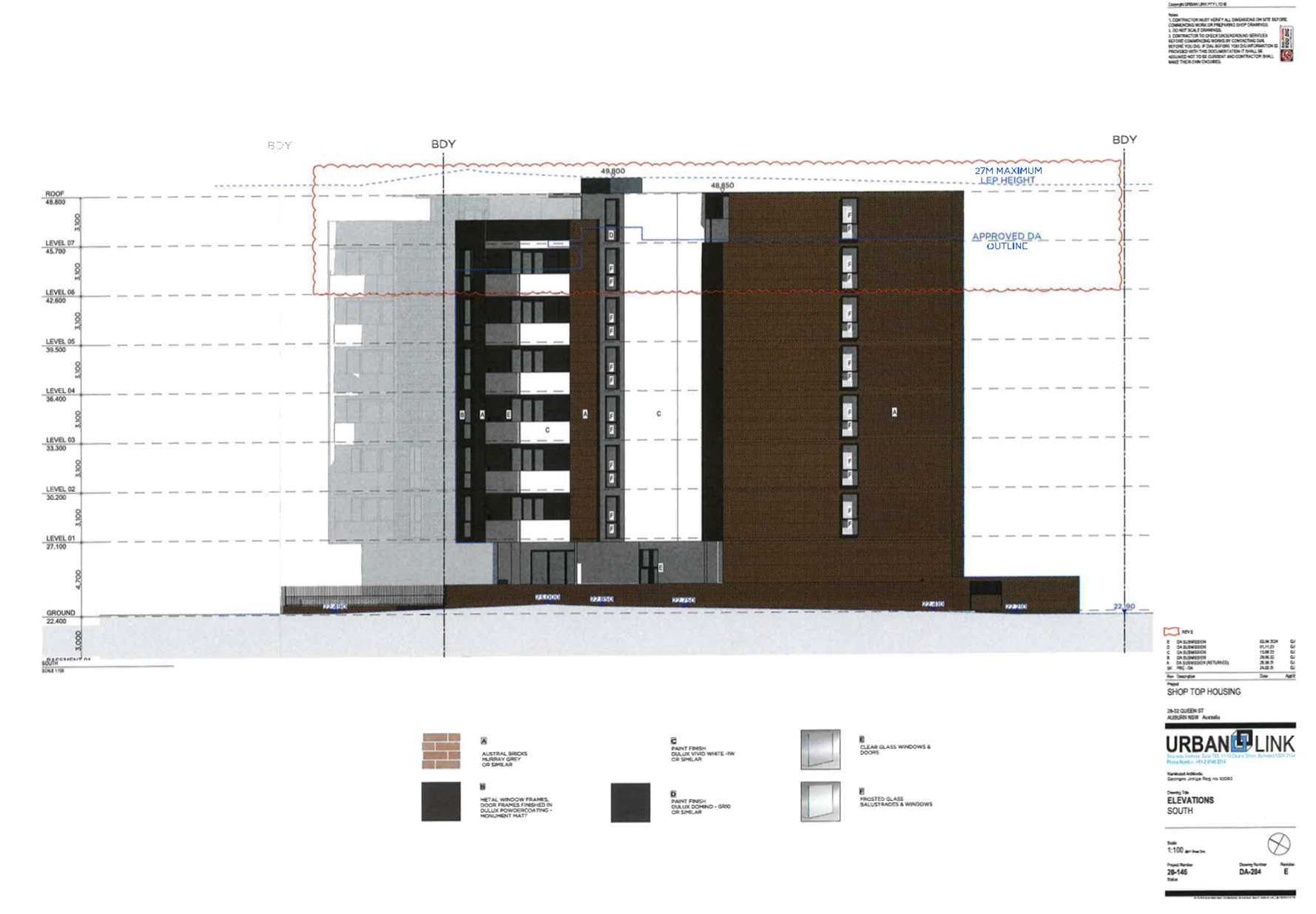
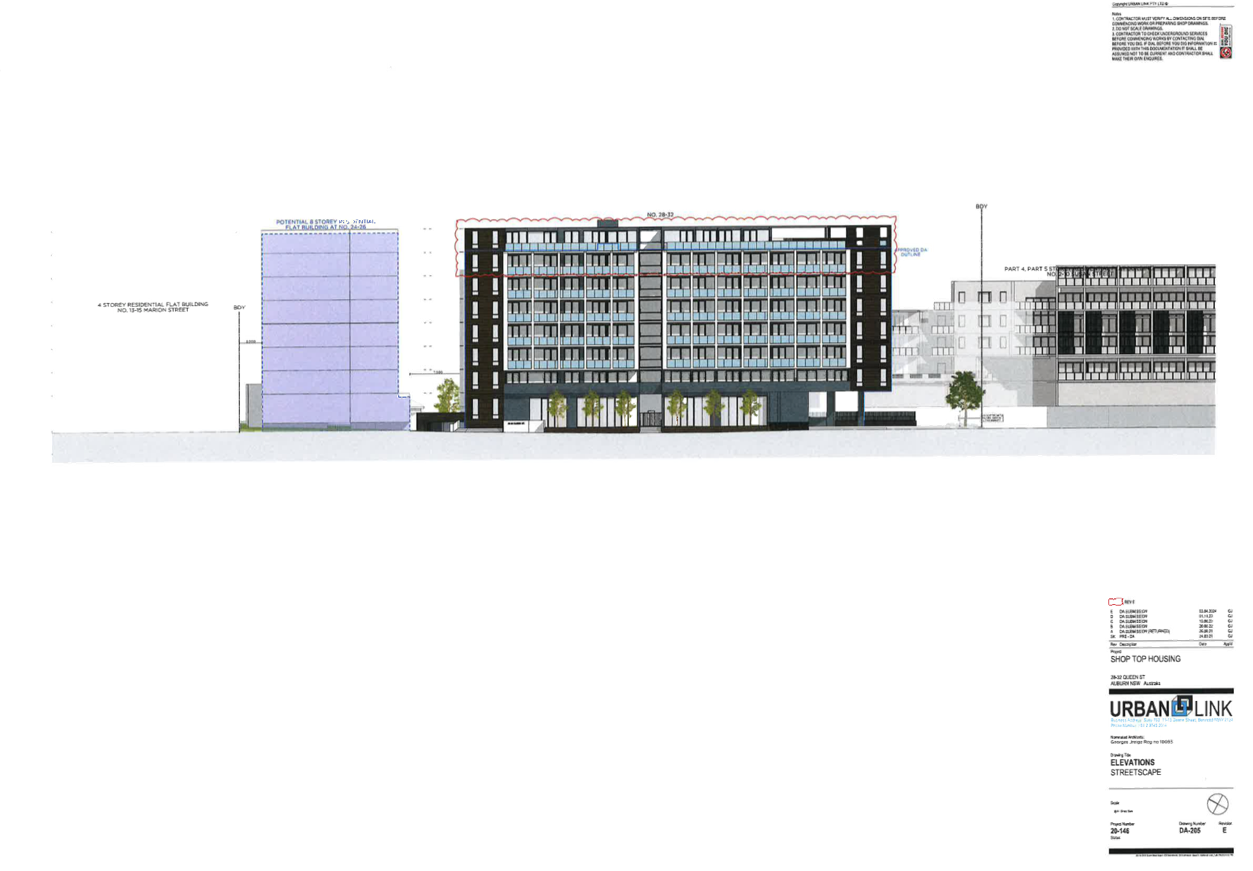
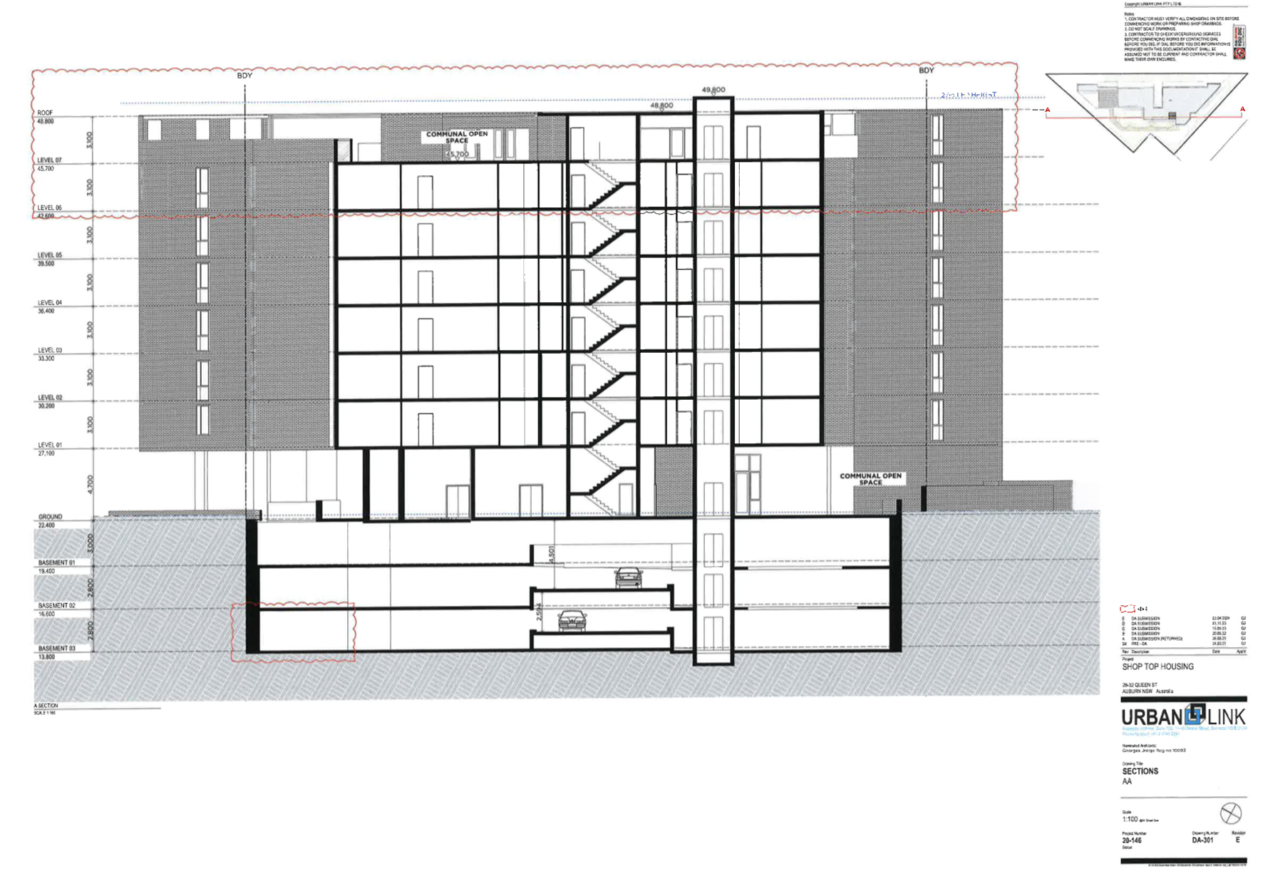
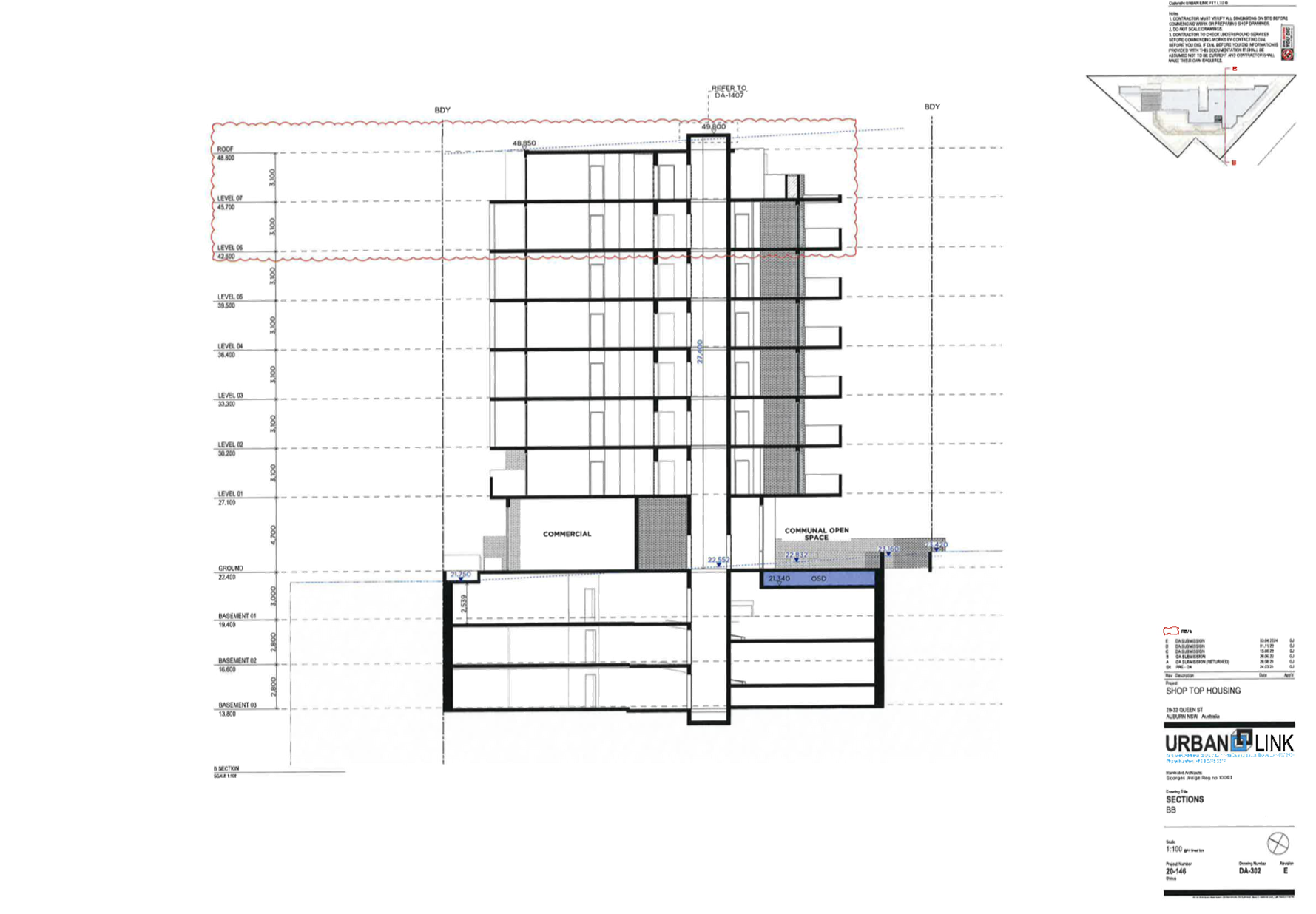
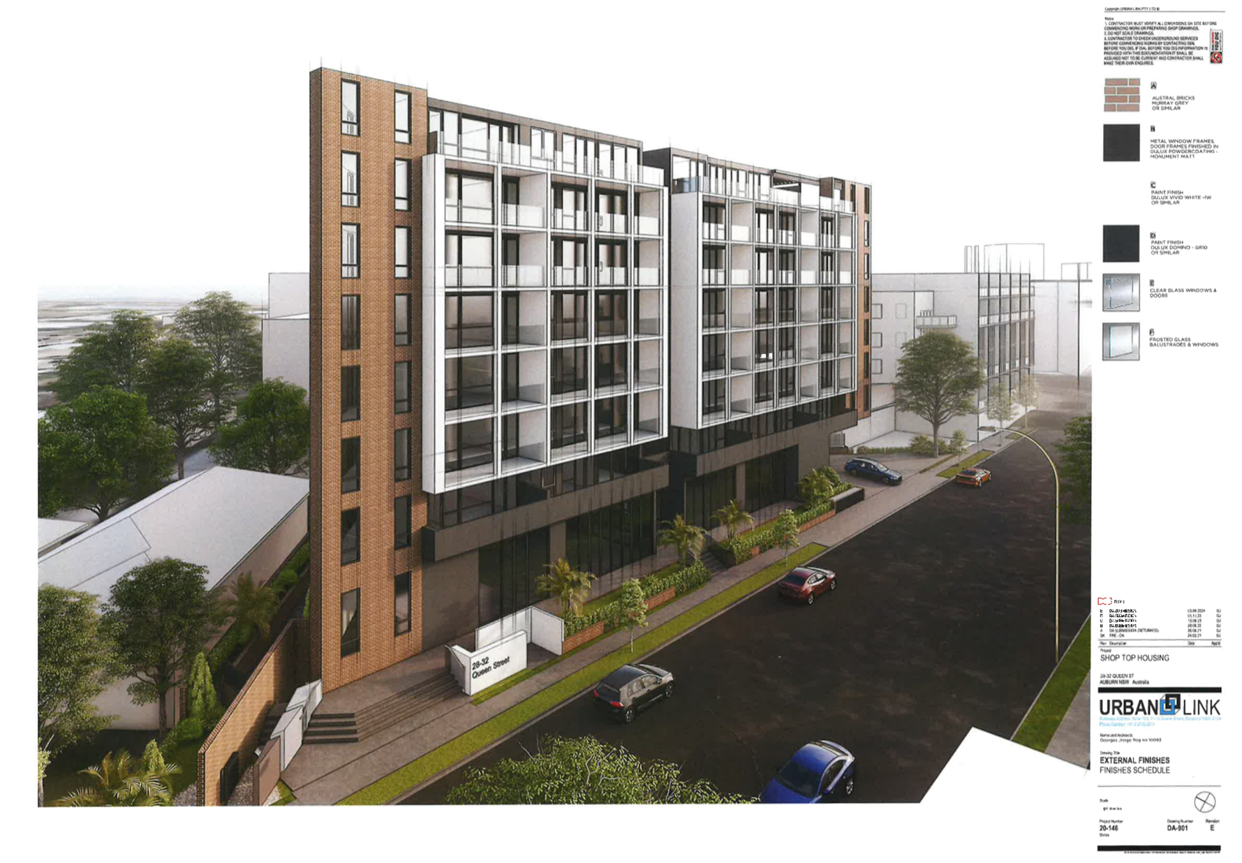
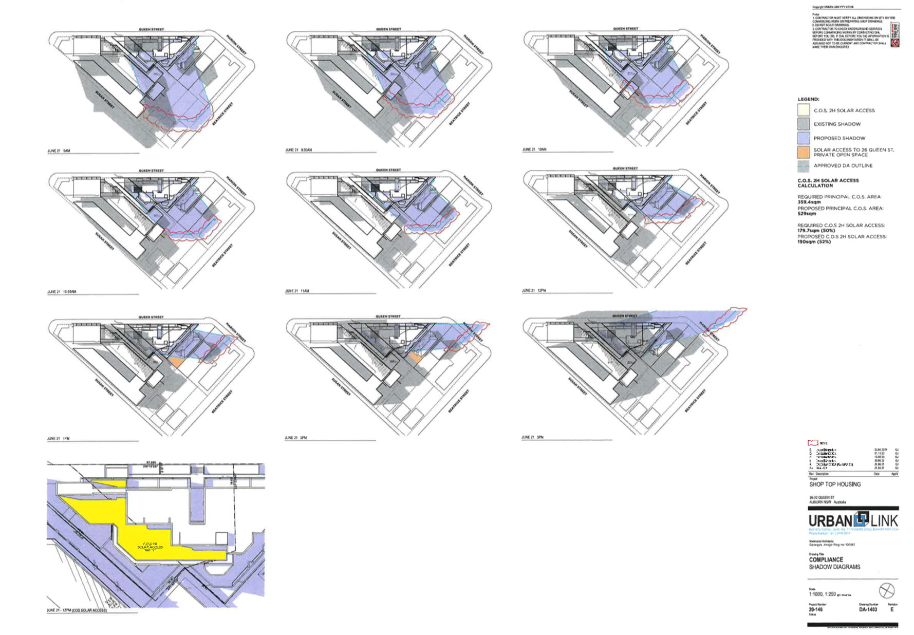
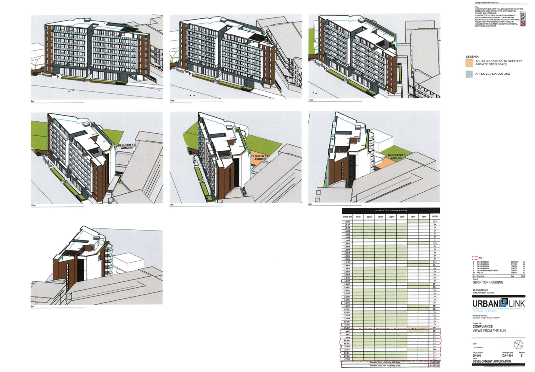
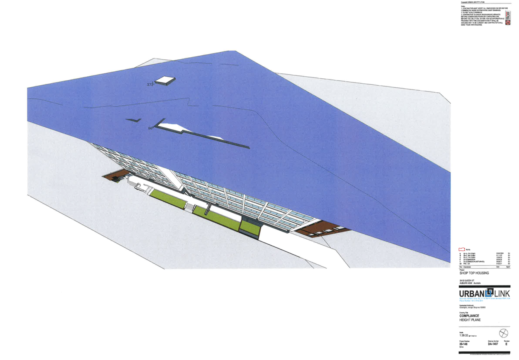
DOCUMENTS
ASSOCIATED WITH
REPORT ELPP040/24
Attachment 3
Statement of Environmental Effects including the
Height Variation Justification at Part 4.1 and 4.2
Cumberland
Local Planning Panel Meeting
11 December 2024
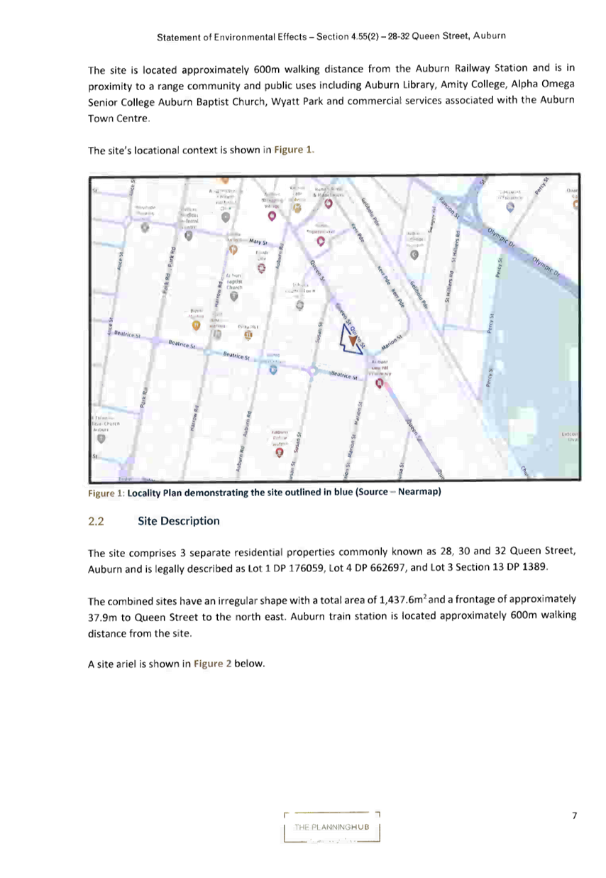
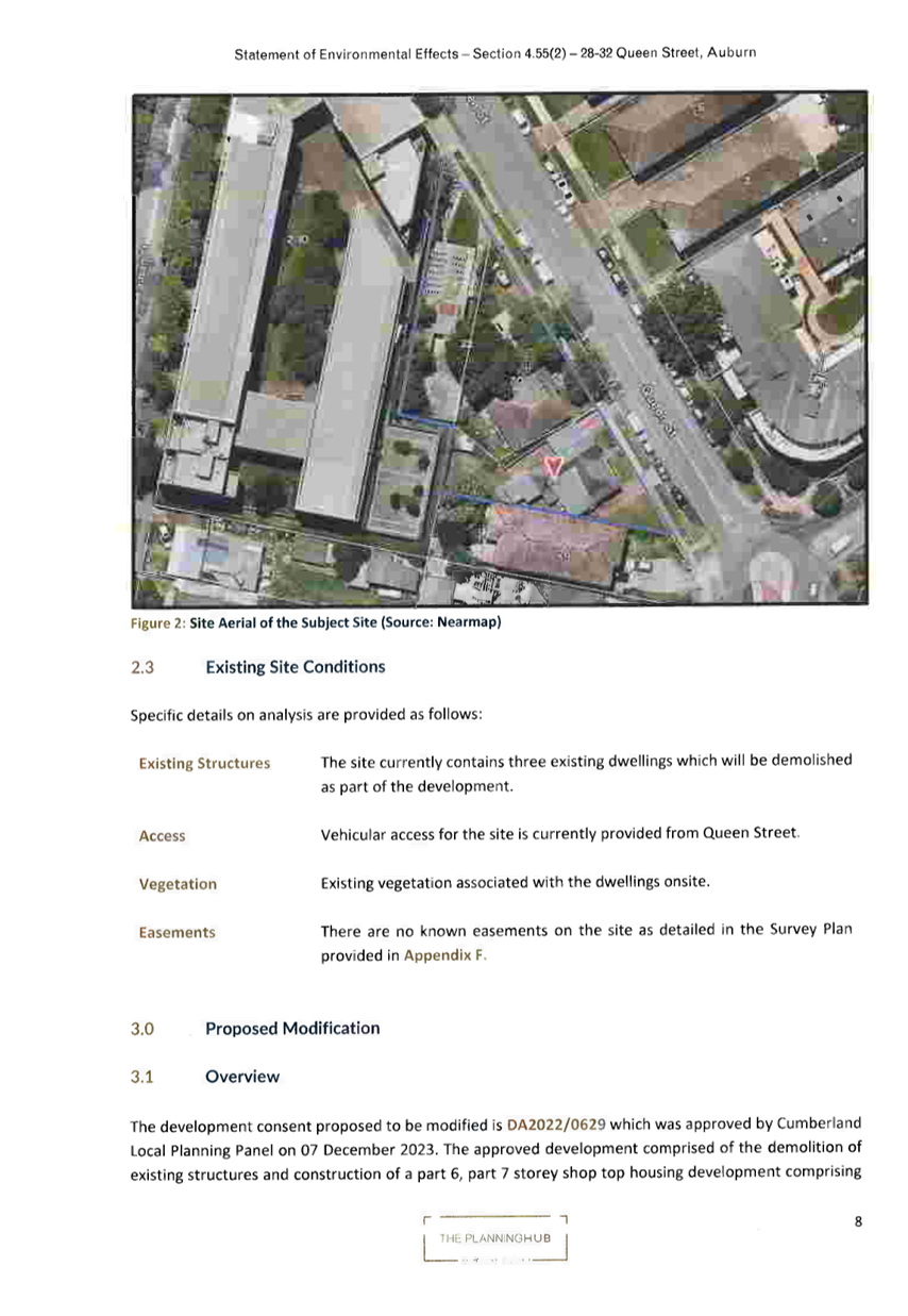
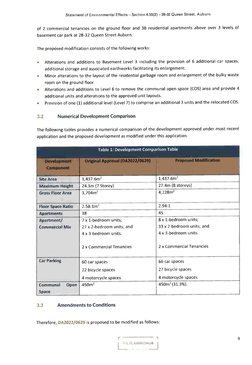
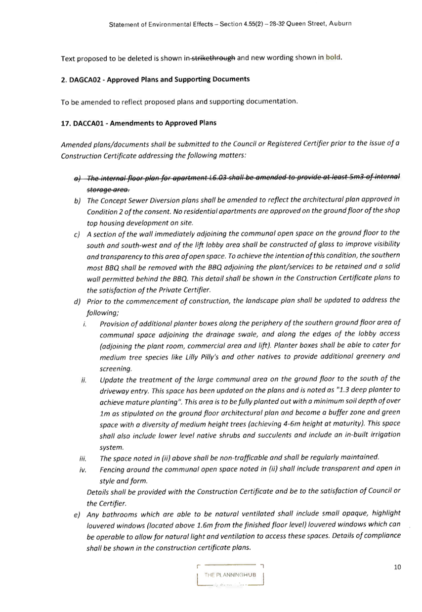
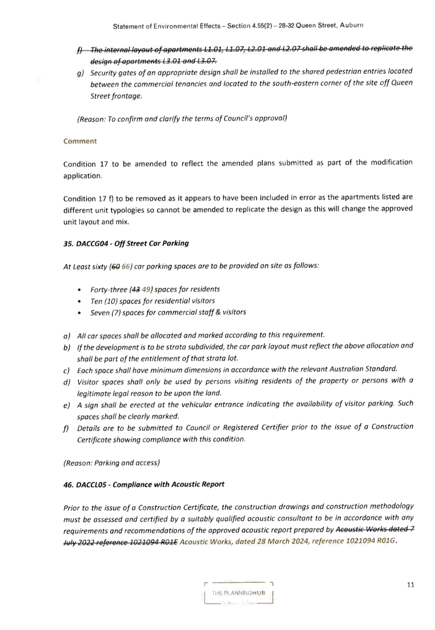
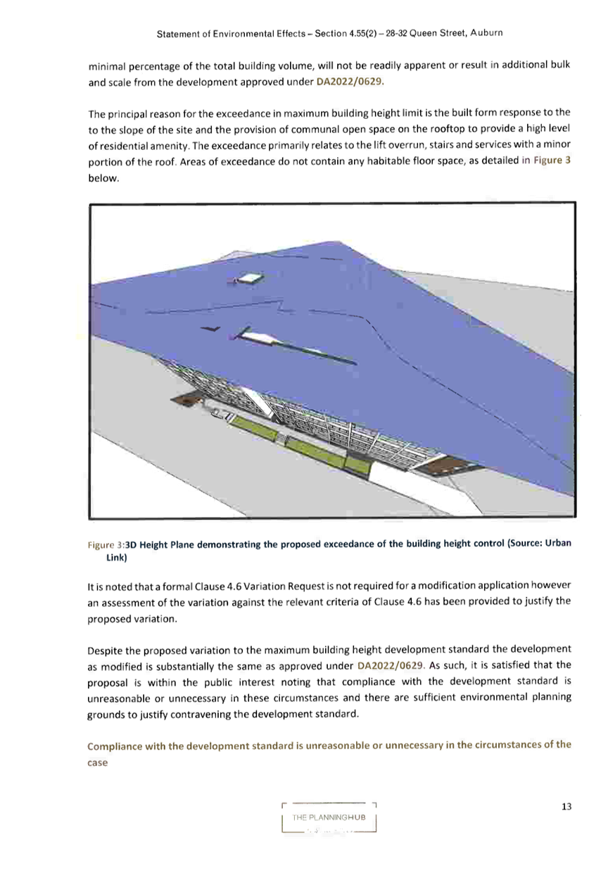
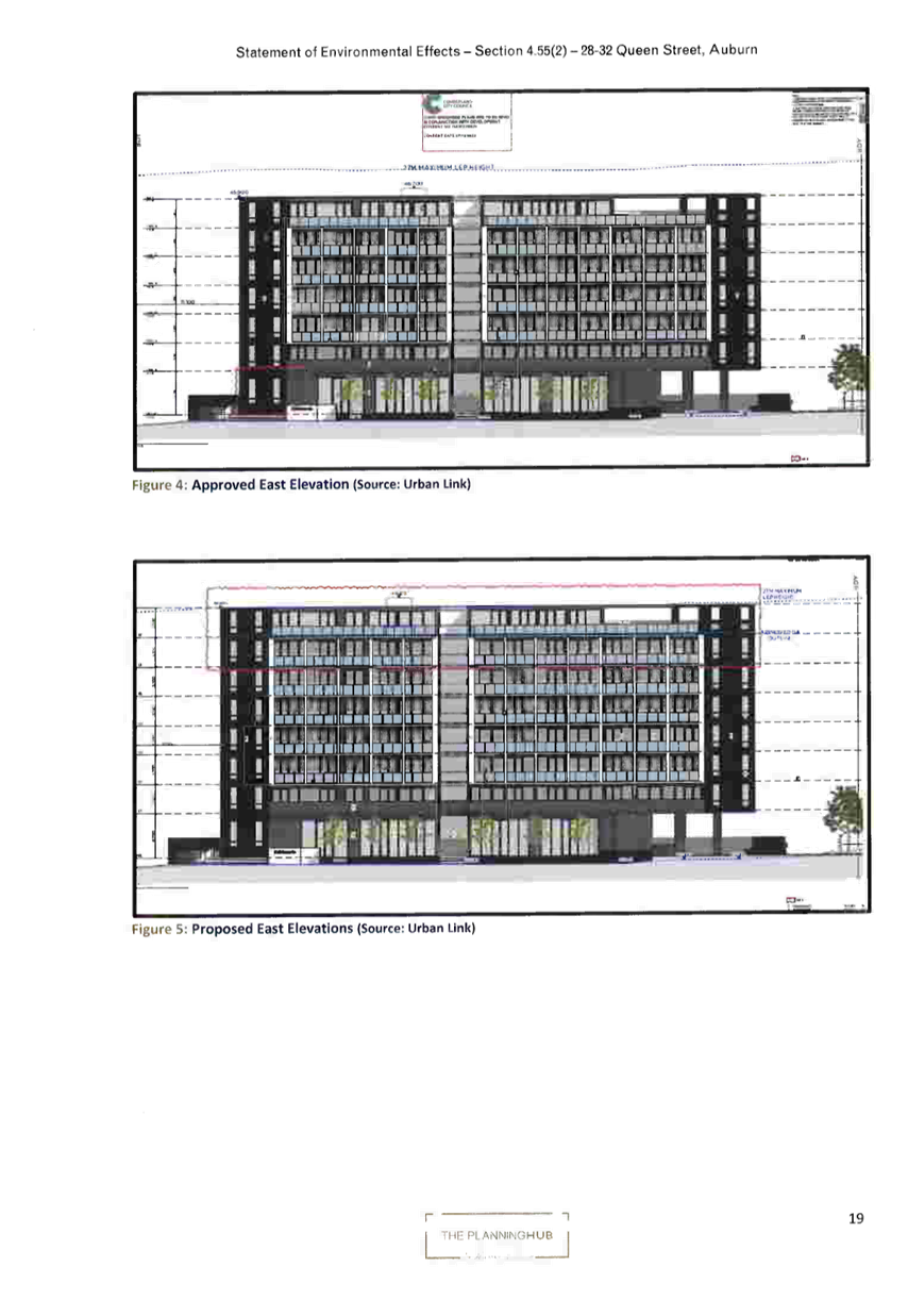
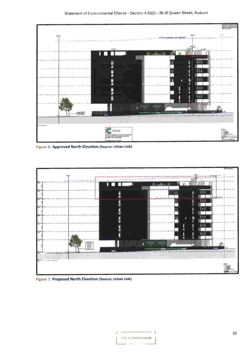
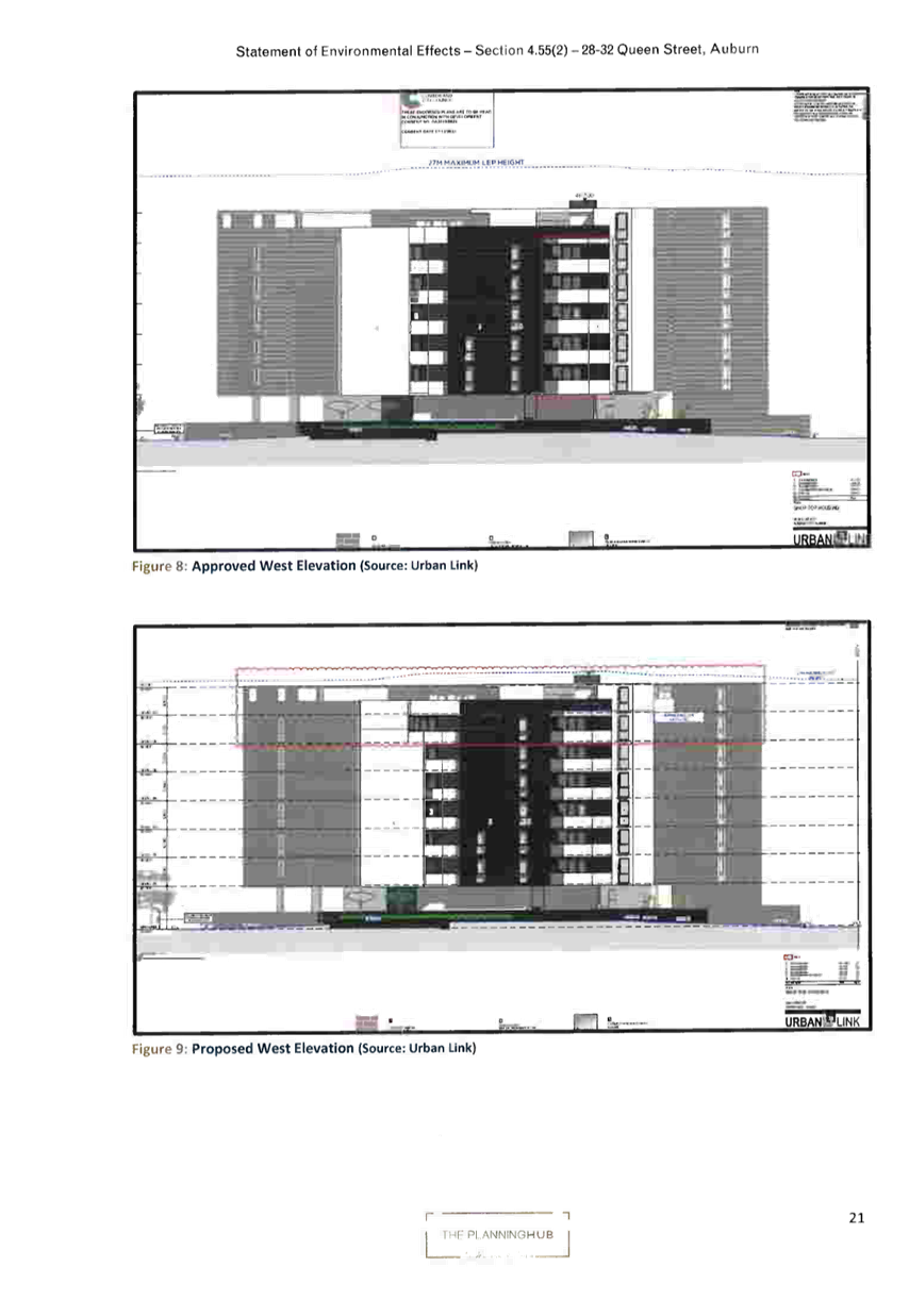
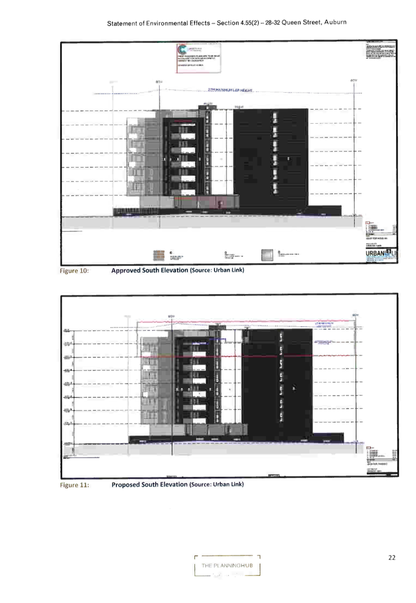
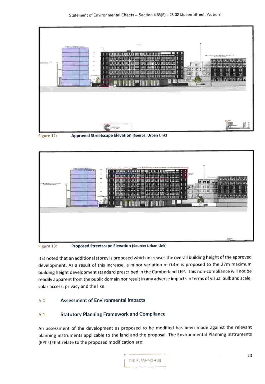
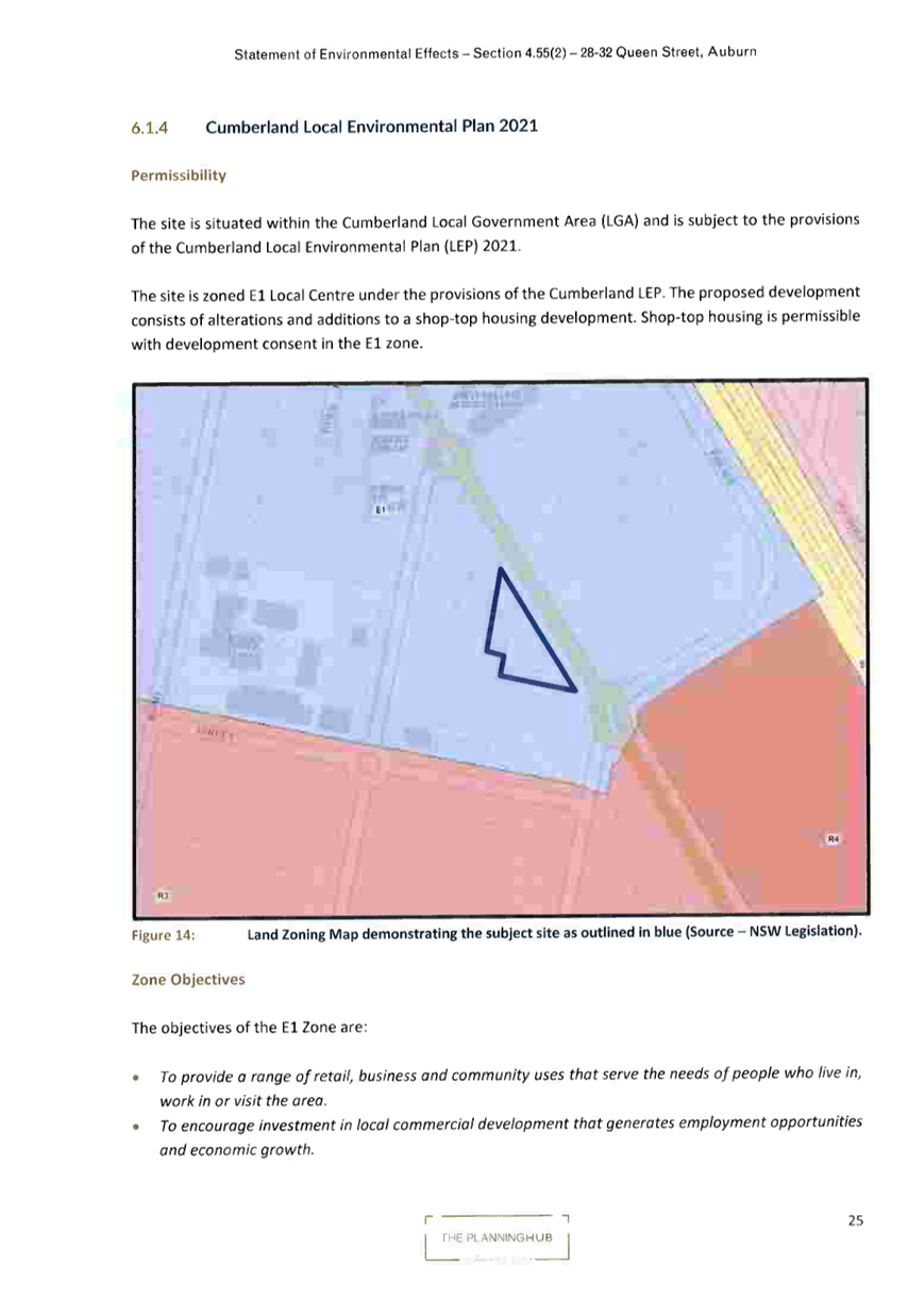
DOCUMENTS
ASSOCIATED WITH
REPORT ELPP040/24
Attachment 4
Copy of Existing Approved Development Plans
Cumberland
Local Planning Panel Meeting
11 December 2024
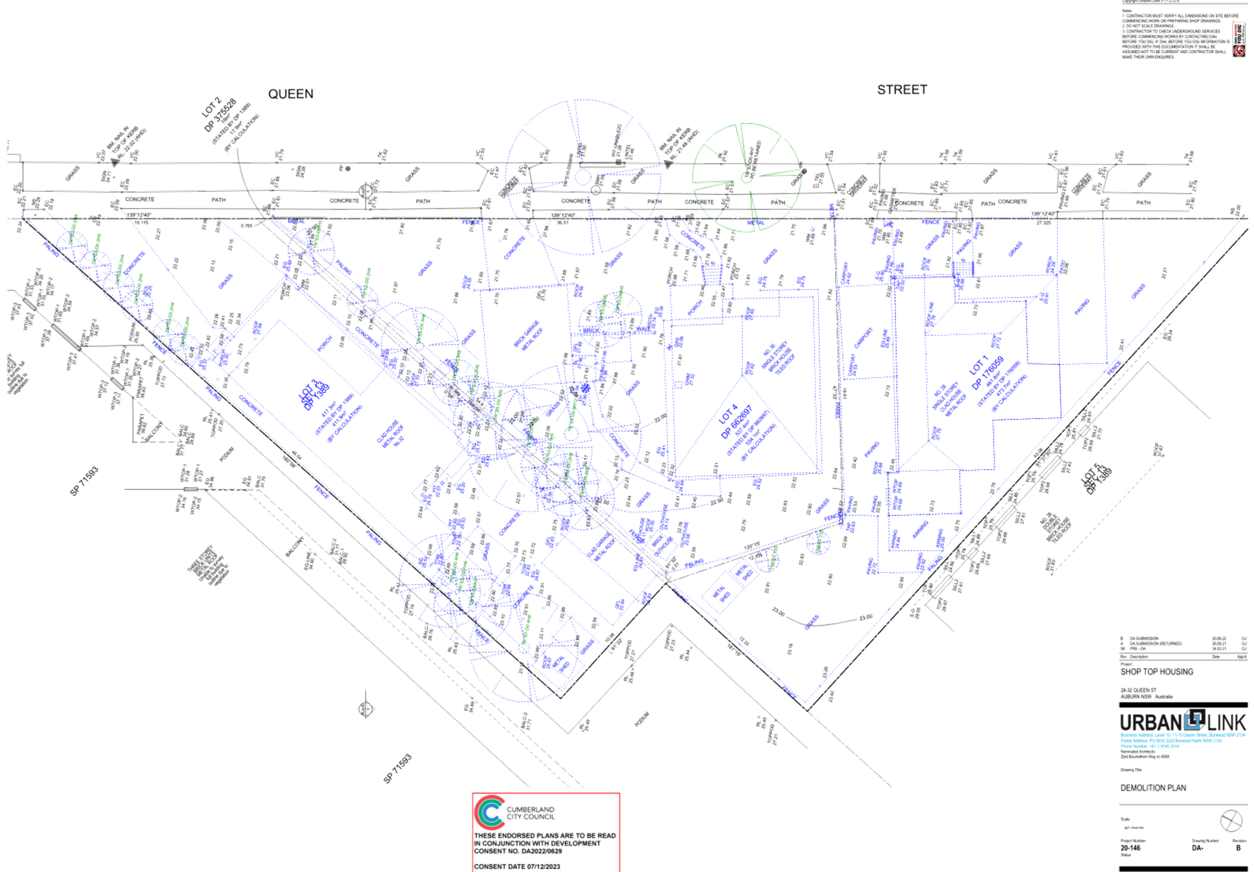
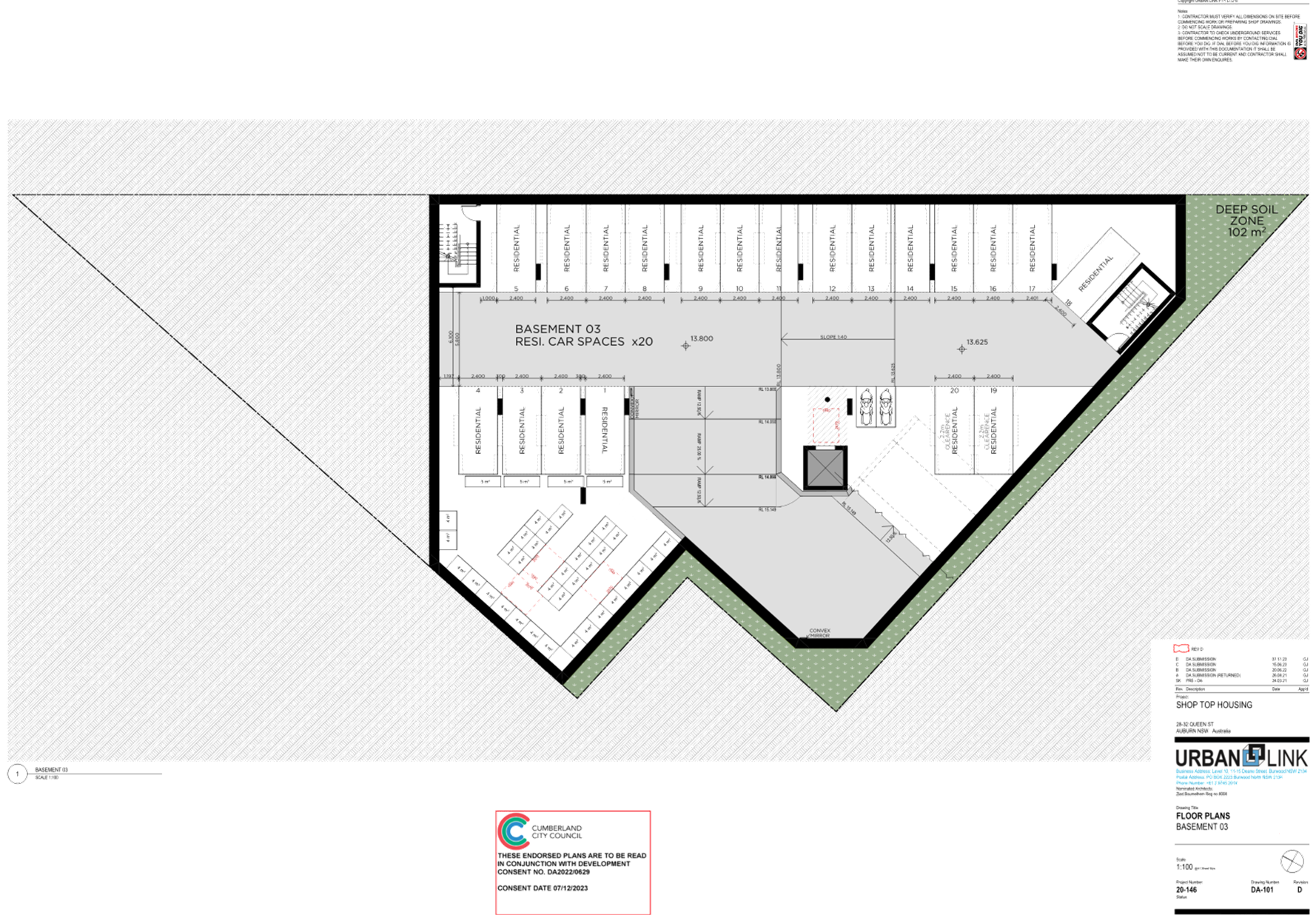
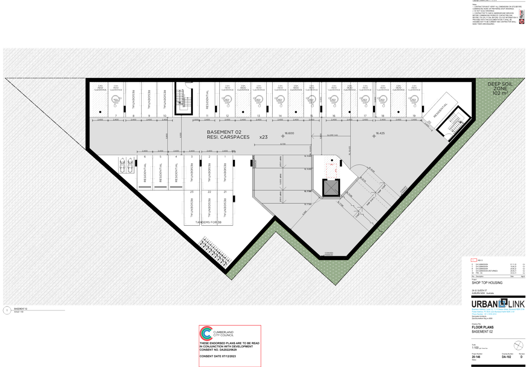
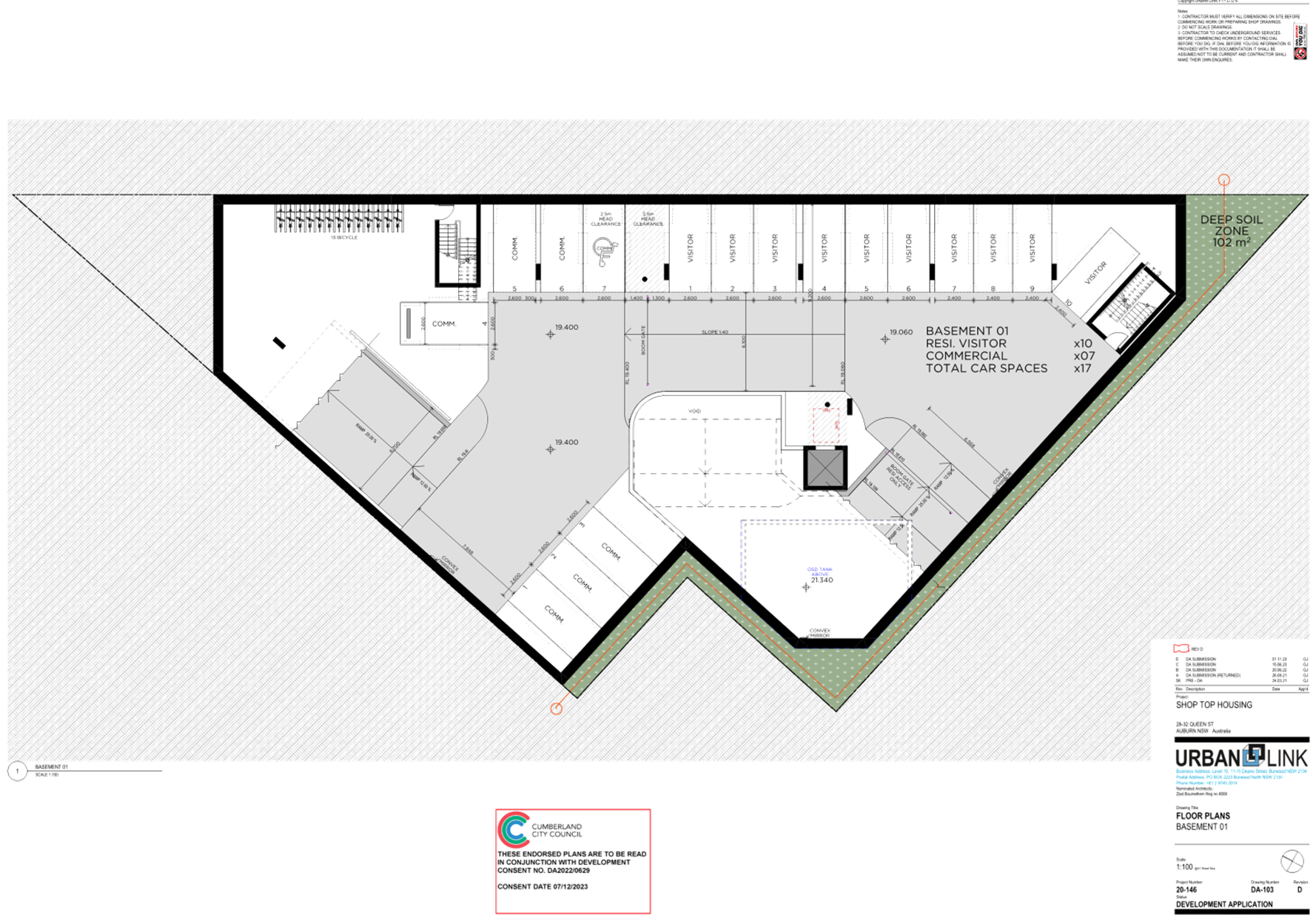
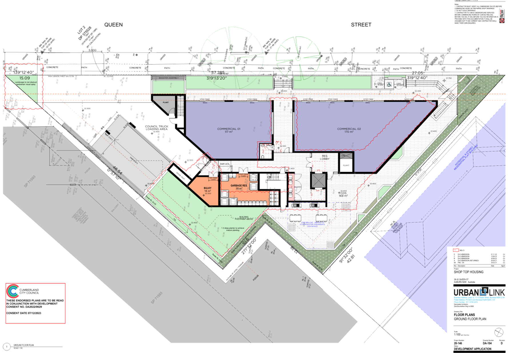
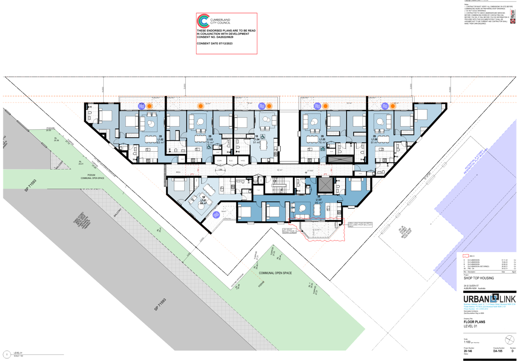
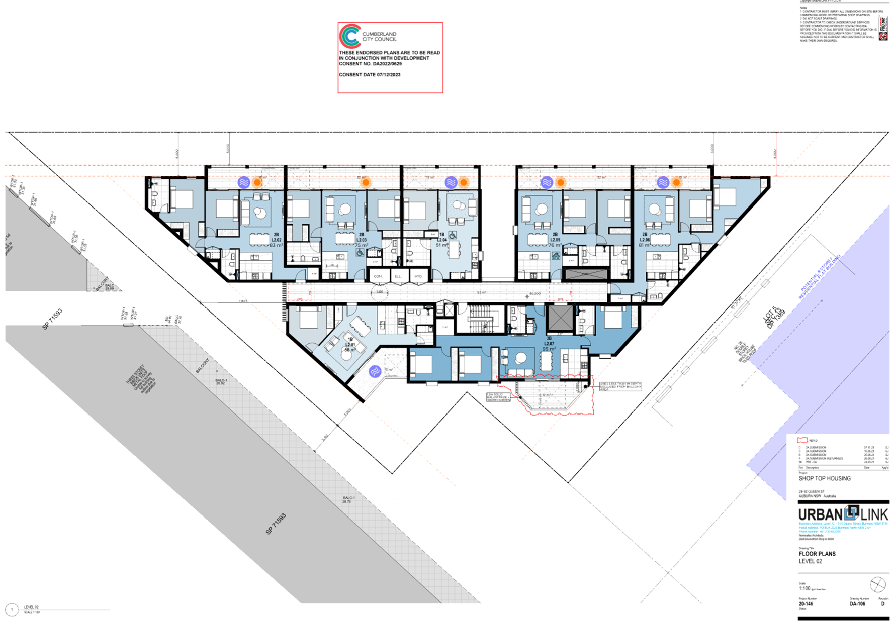
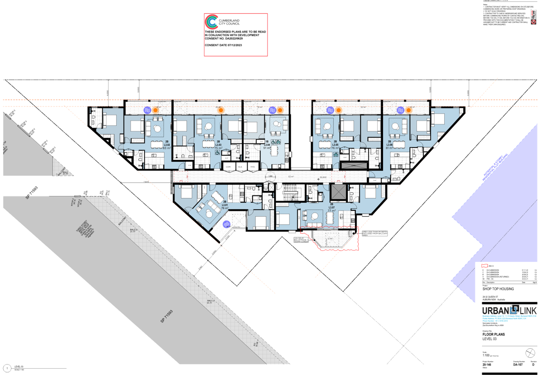
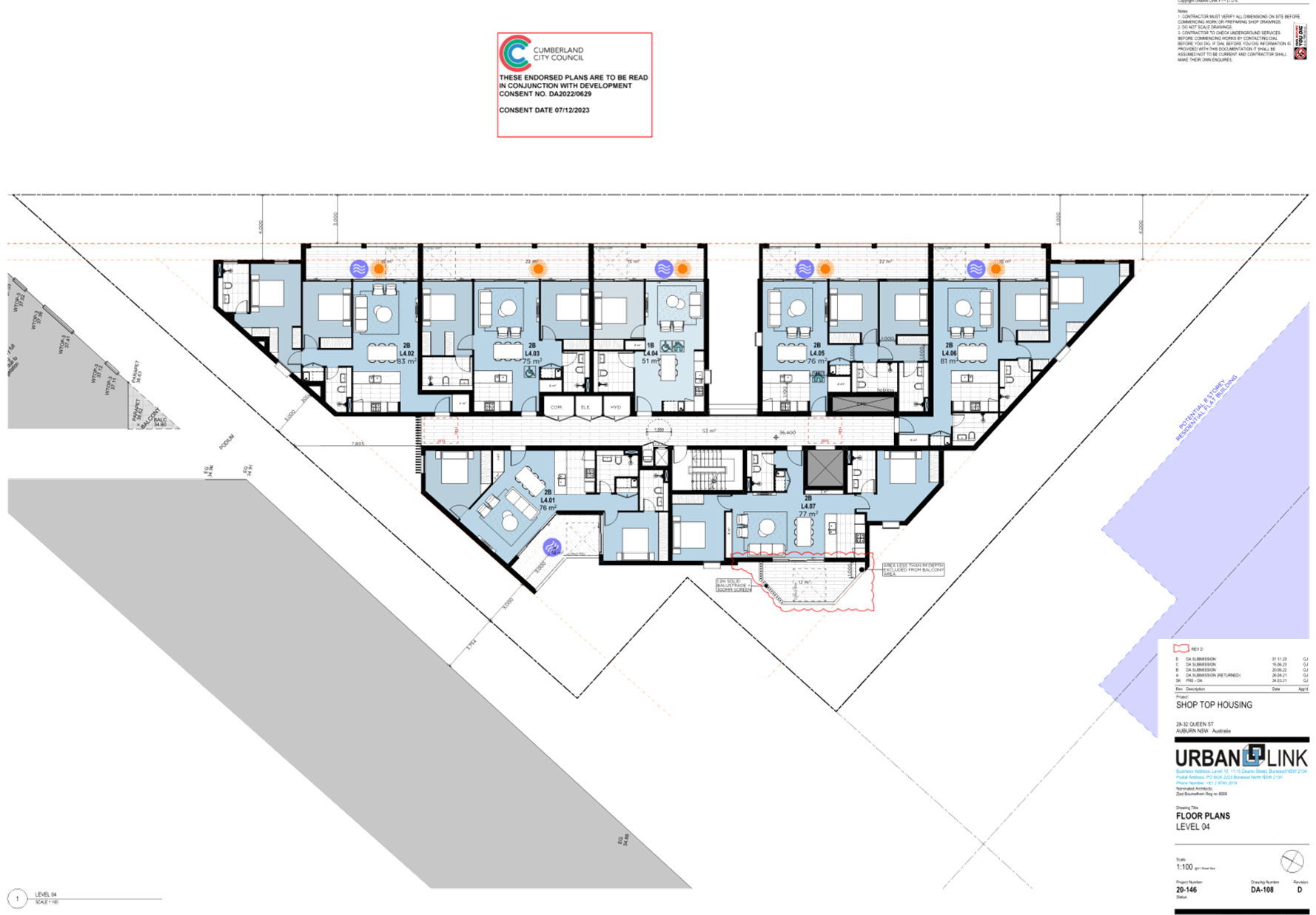
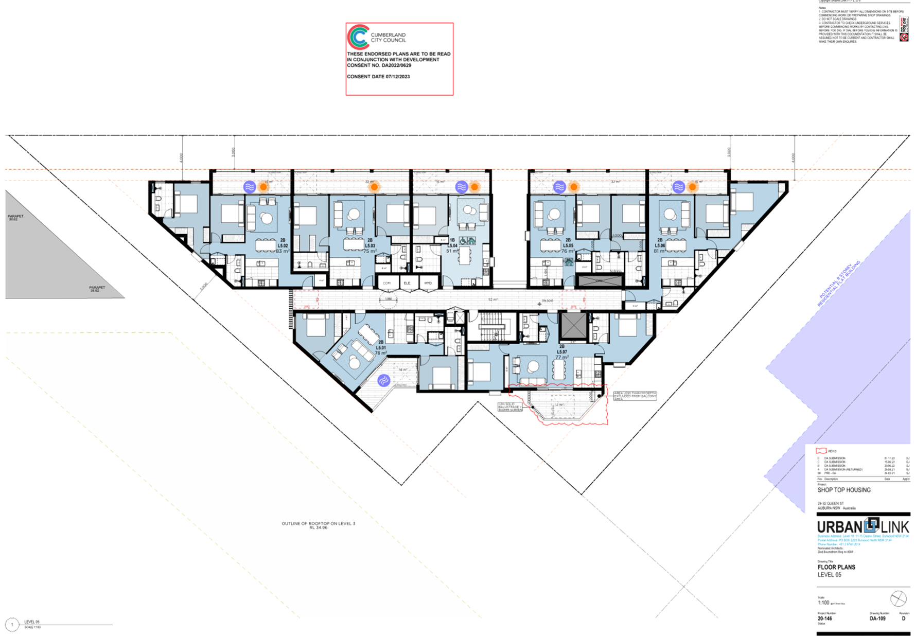
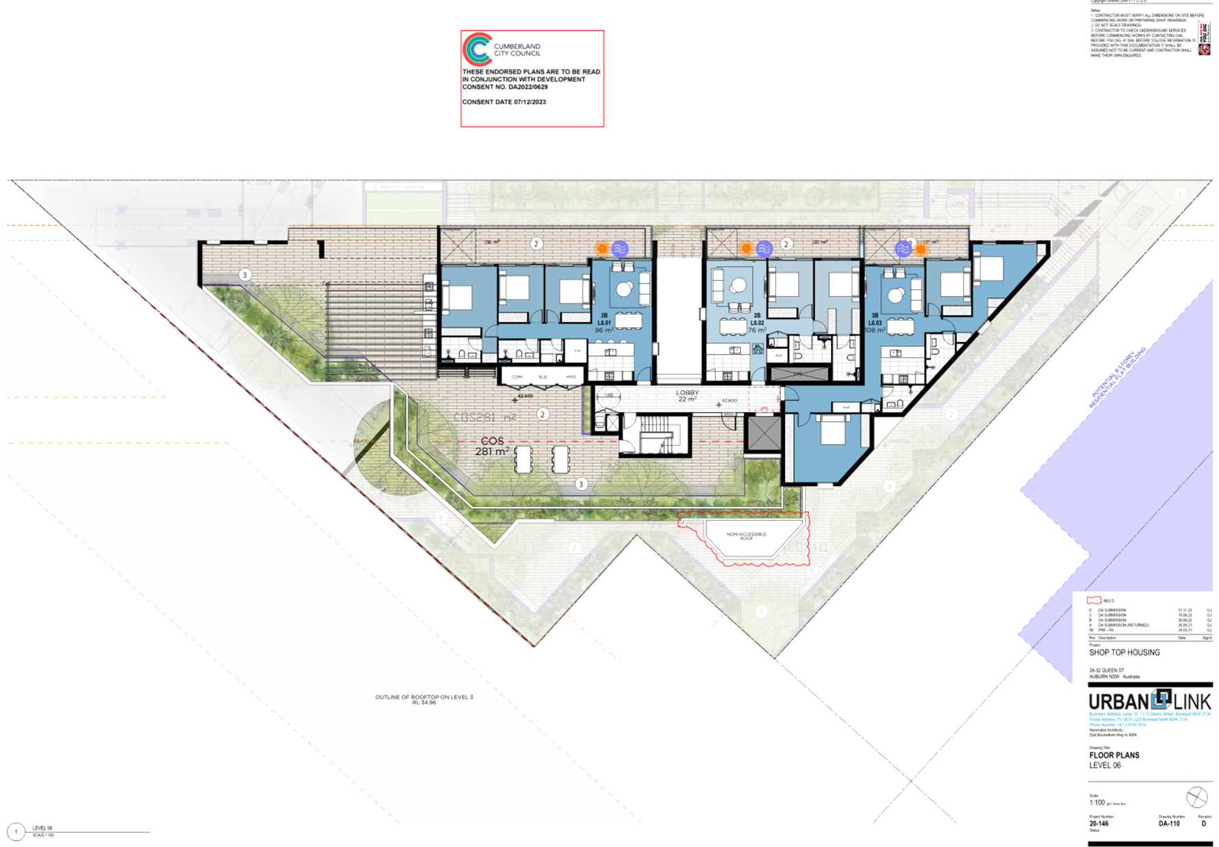
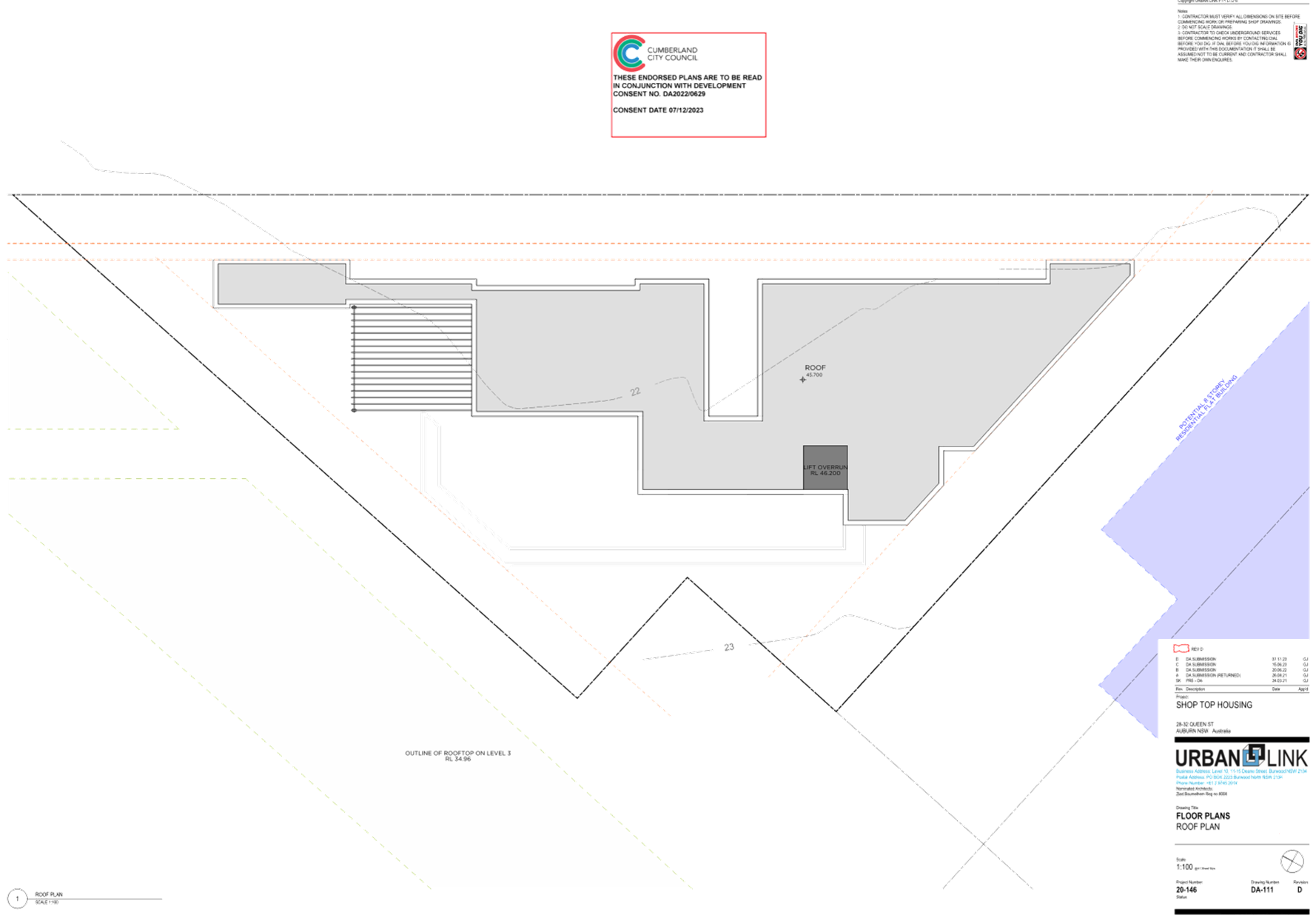
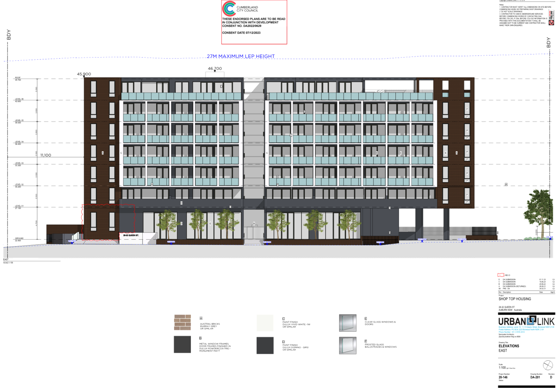
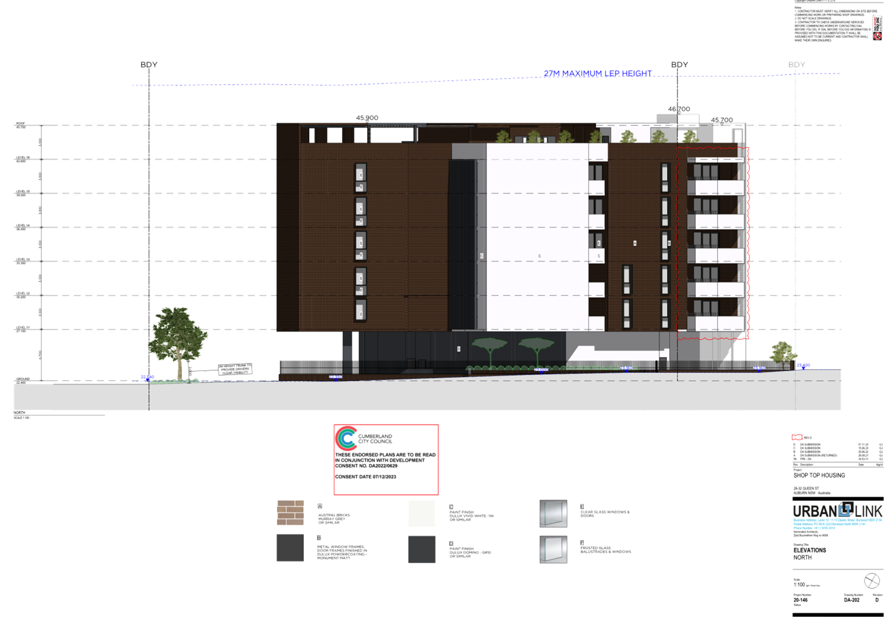
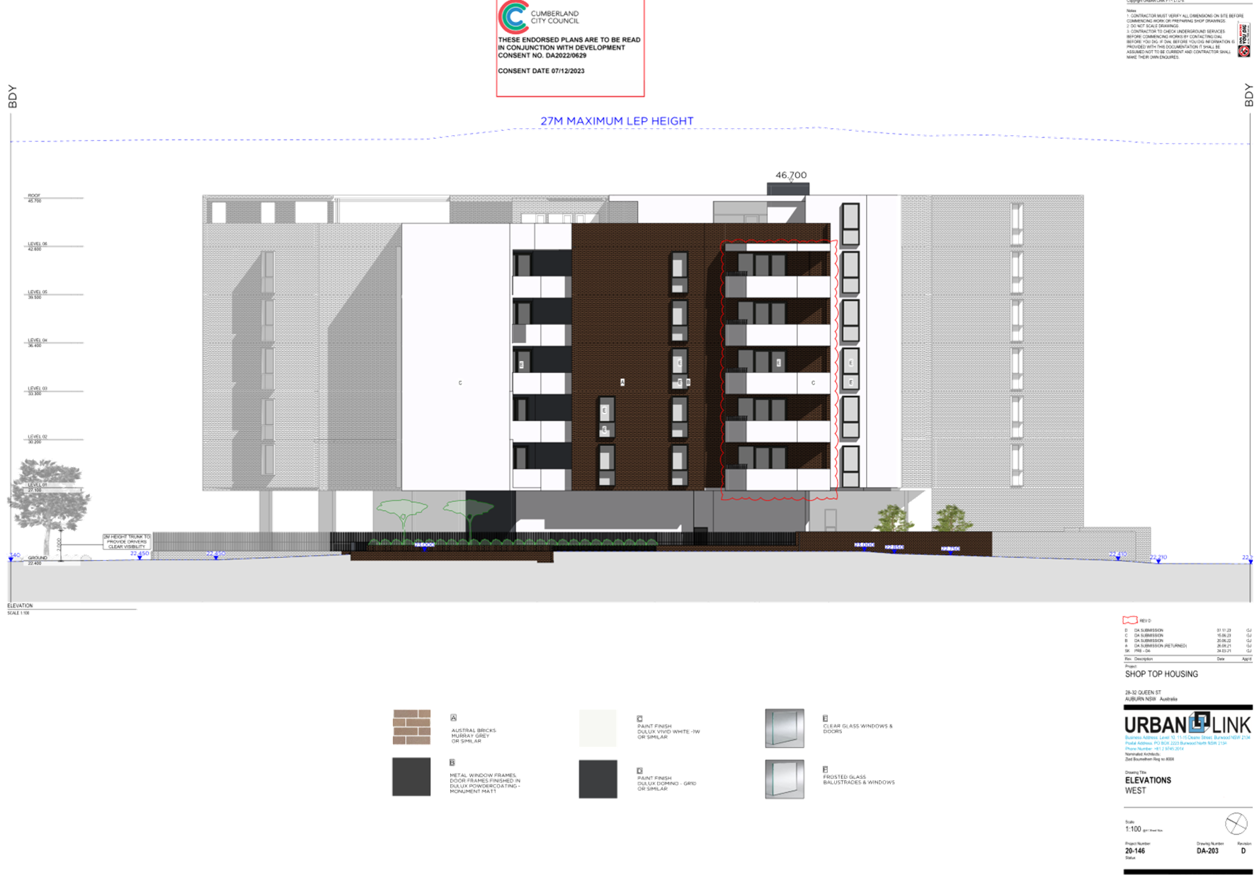
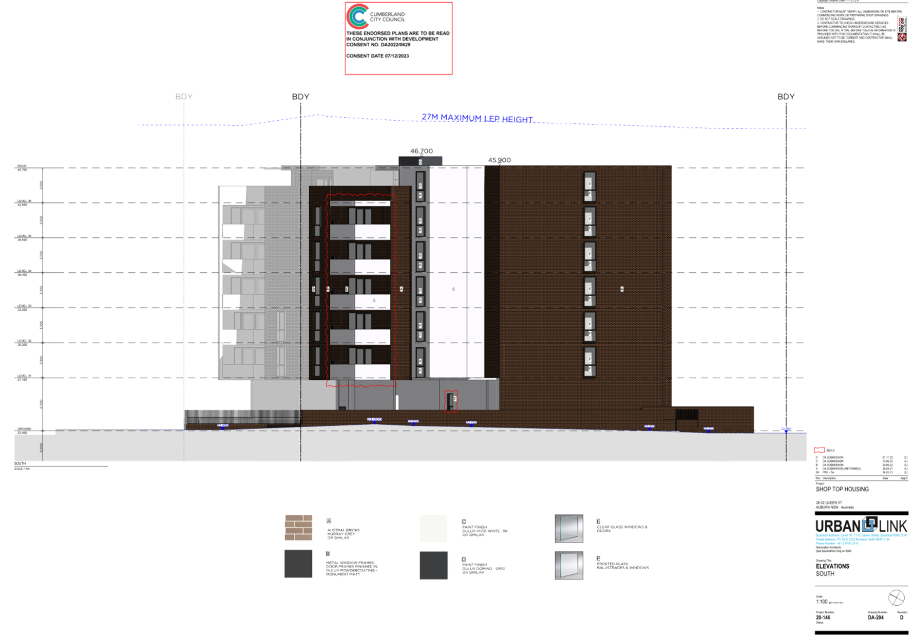
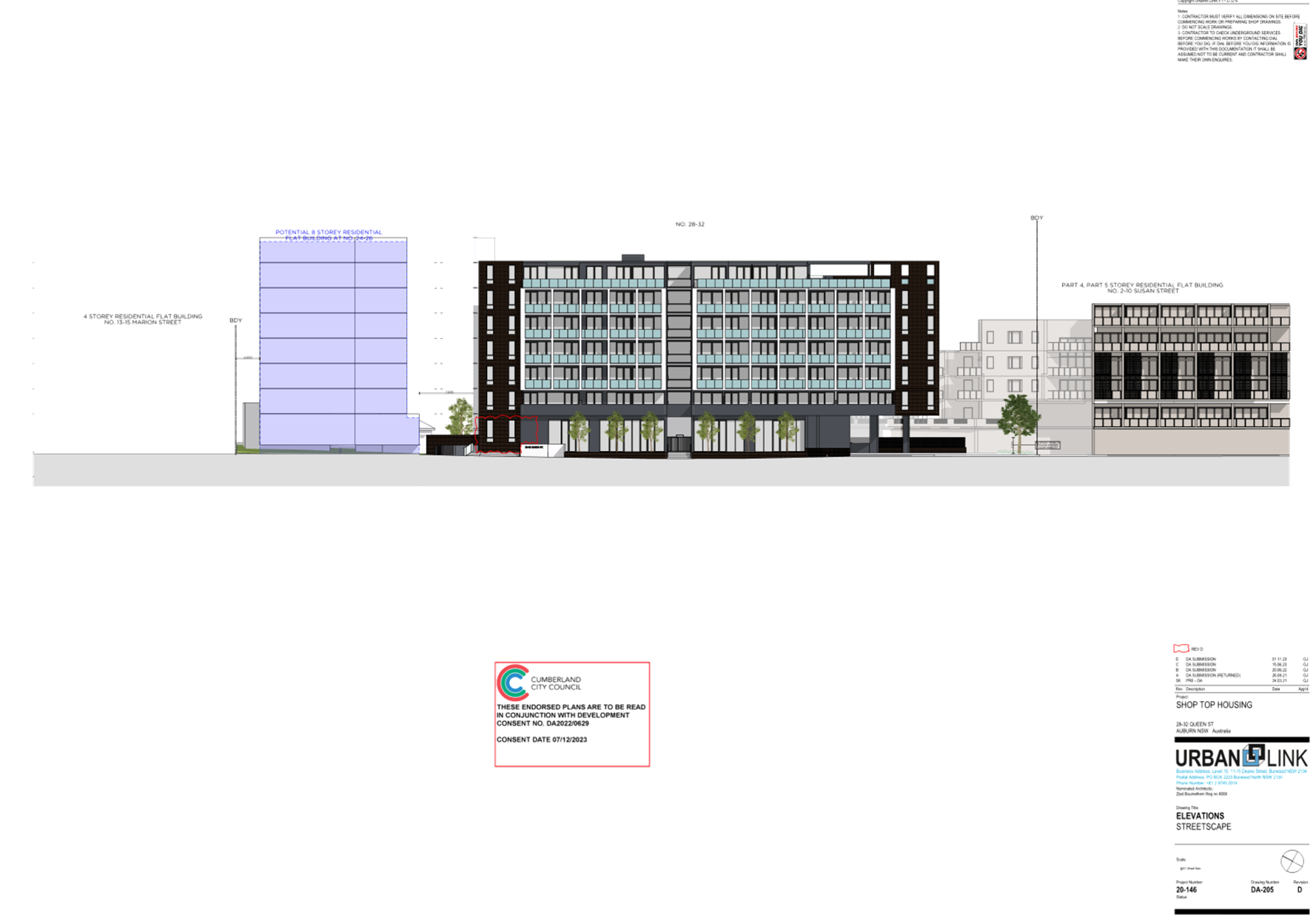
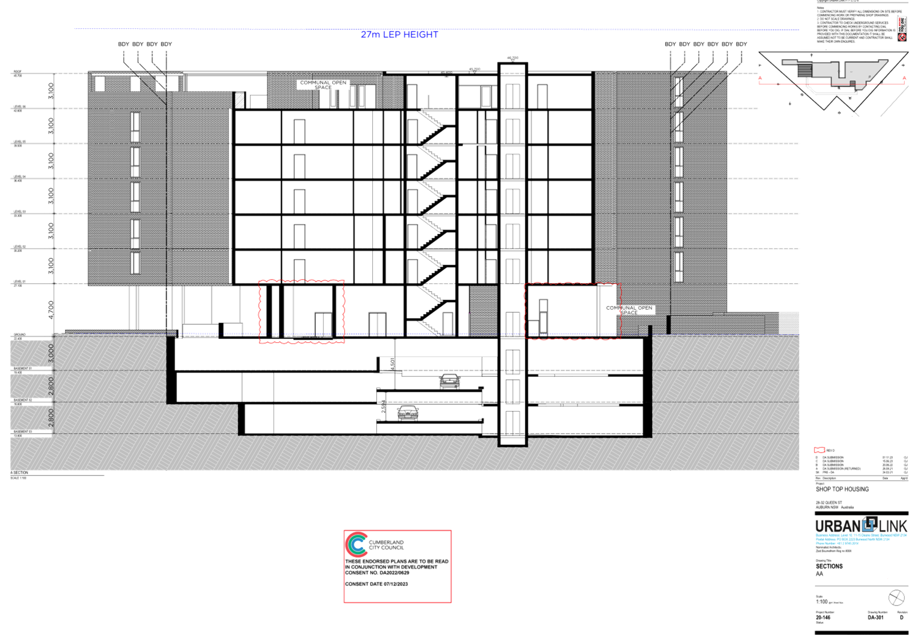
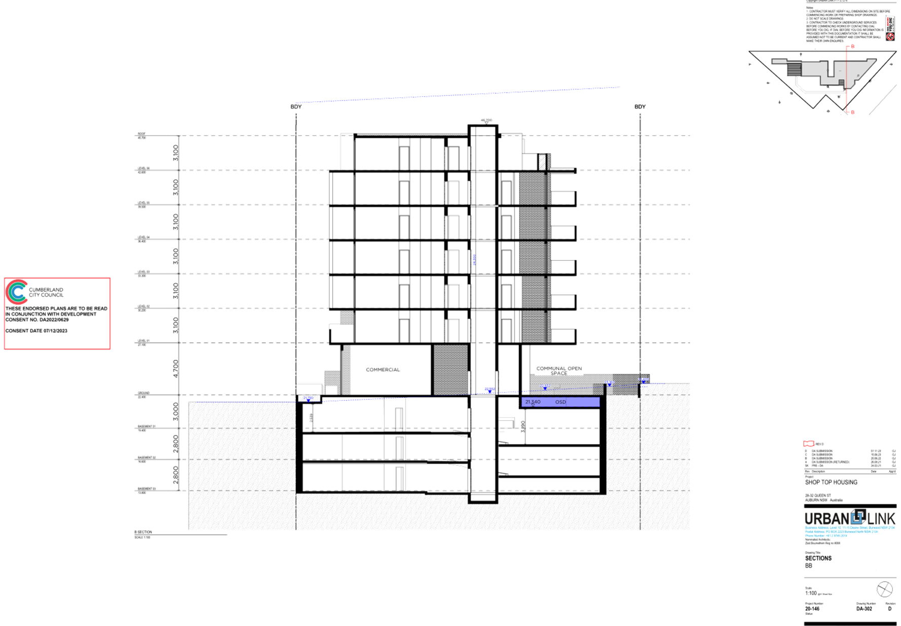
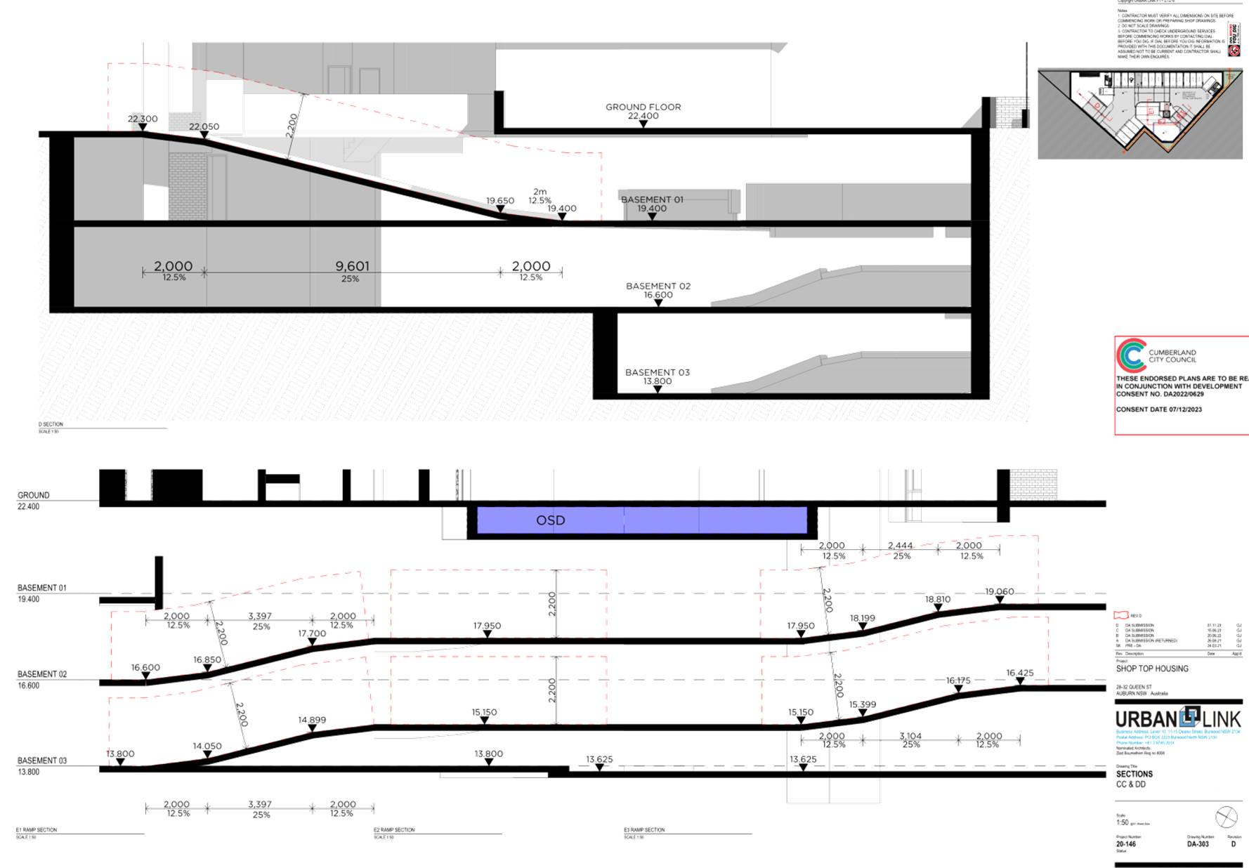
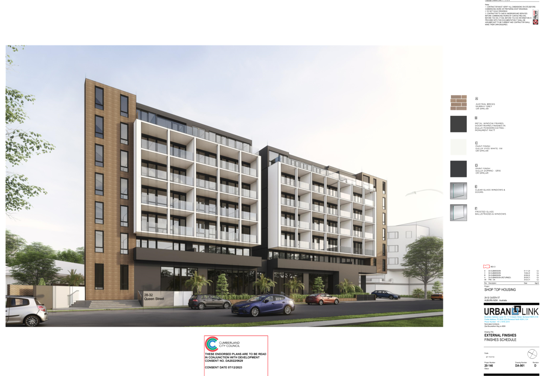
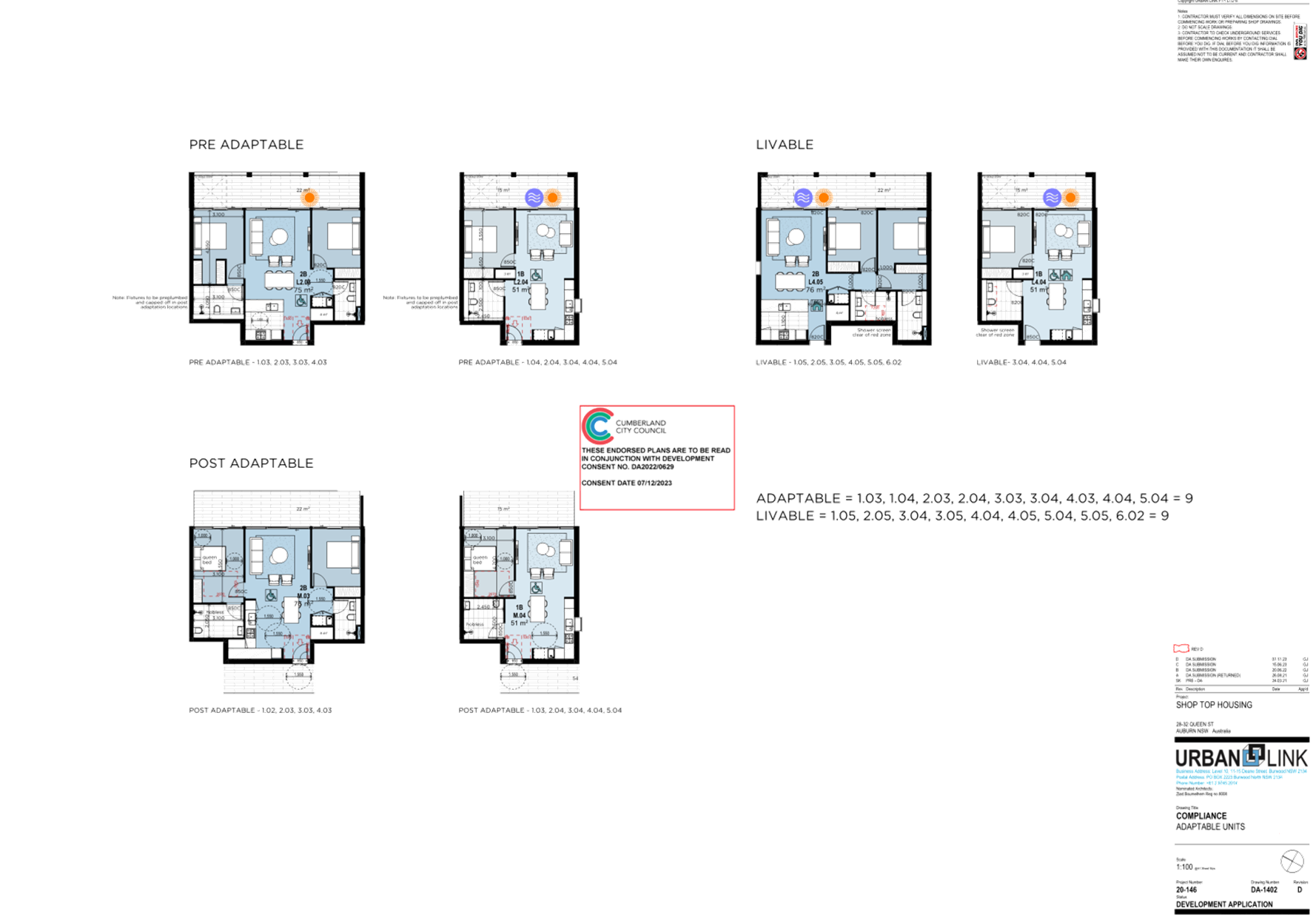
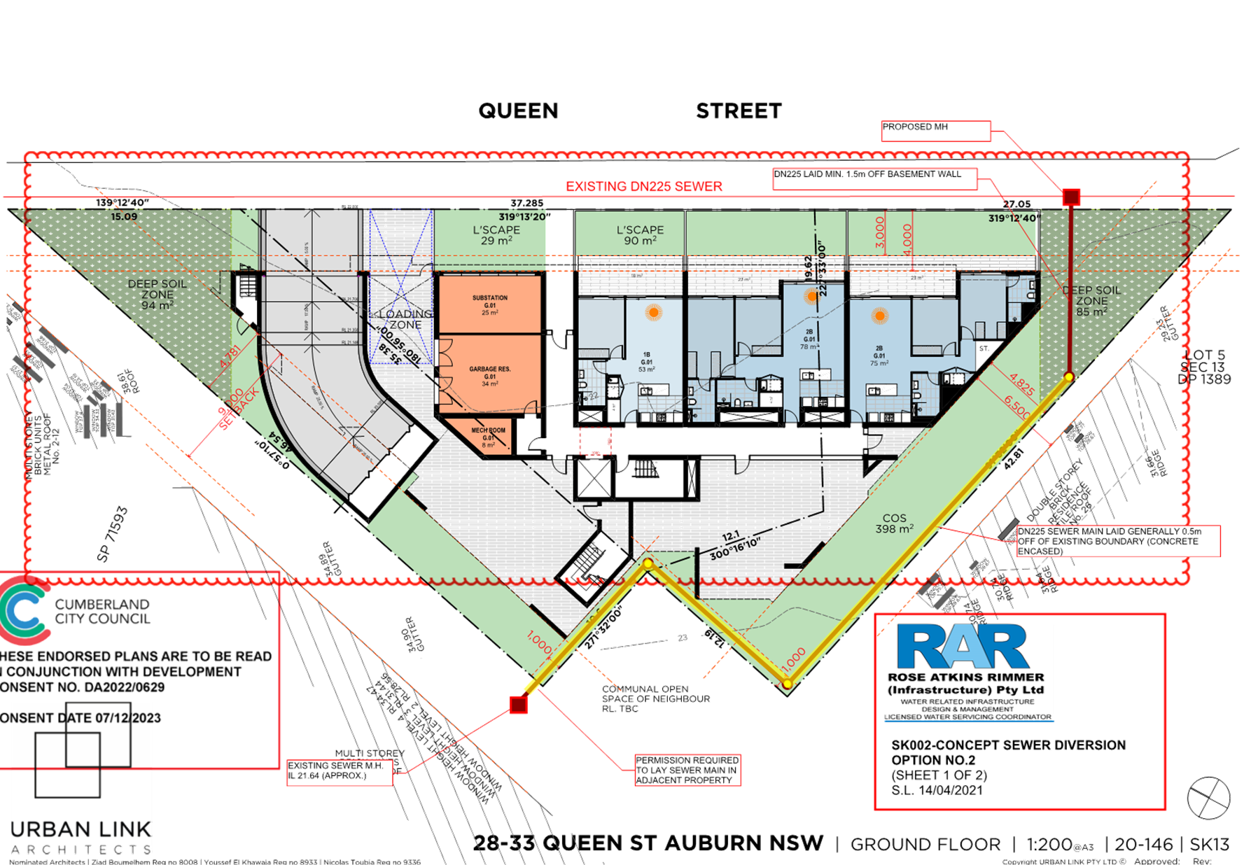
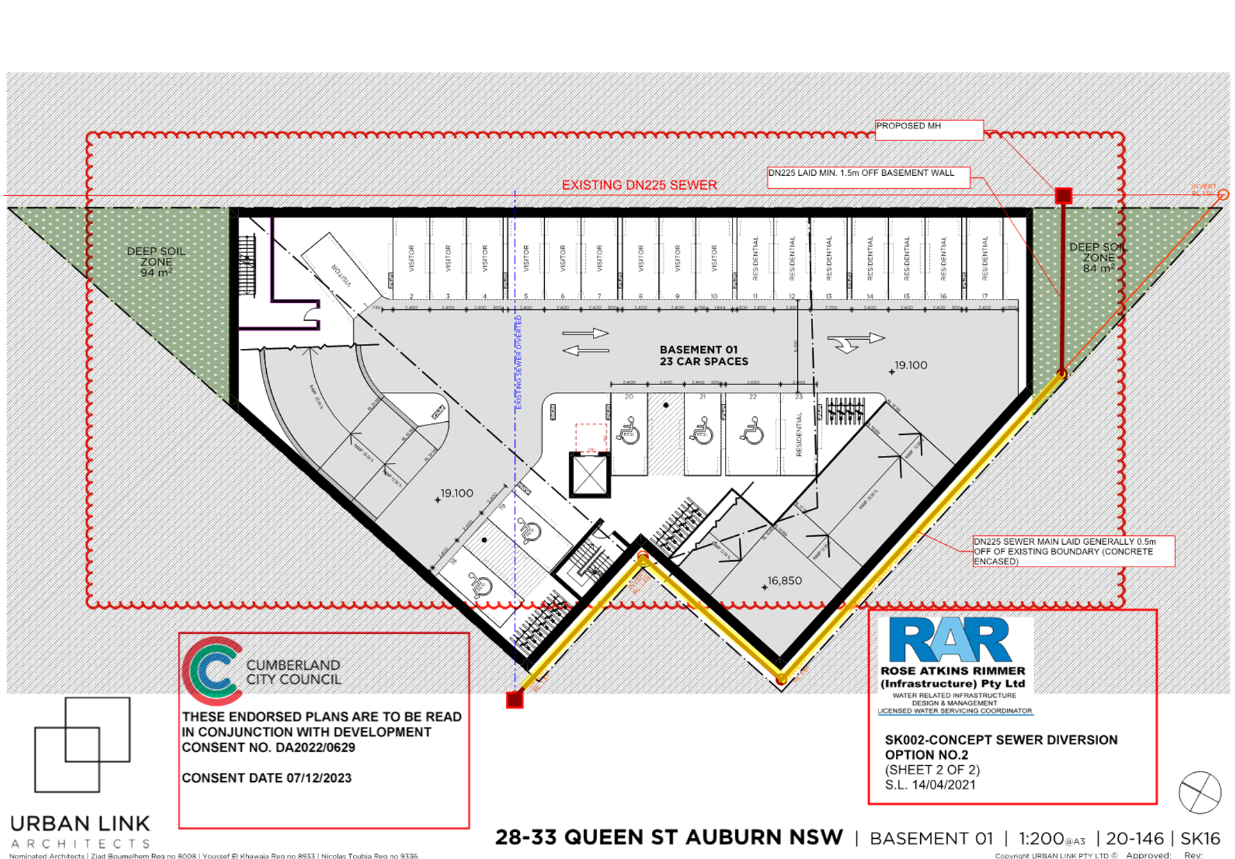
DOCUMENTS
ASSOCIATED WITH
REPORT ELPP040/24
Attachment 5
Redacted Submissions Received
Cumberland
Local Planning Panel Meeting
11 December 2024
DOCUMENTS
ASSOCIATED WITH
REPORT ELPP040/24
Attachment 6
Appendix A - "SEPP Housing" 2021 Chapter 4 Assessment
Table
Cumberland
Local Planning Panel Meeting
11 December 2024
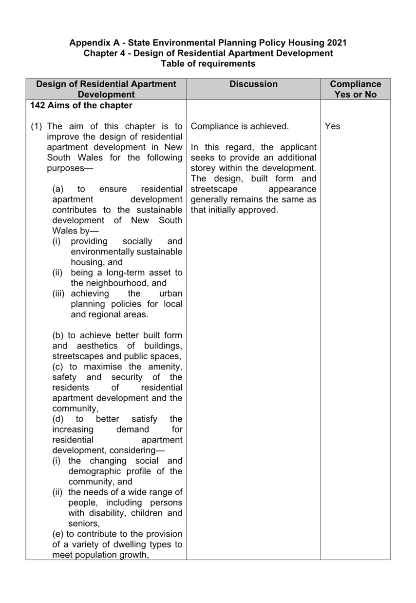
DOCUMENTS
ASSOCIATED WITH
REPORT ELPP040/24
Attachment 7
Appendix B - Apartment Design Guide Assessment Table
Cumberland
Local Planning Panel Meeting
11 December 2024
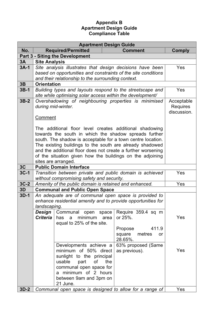
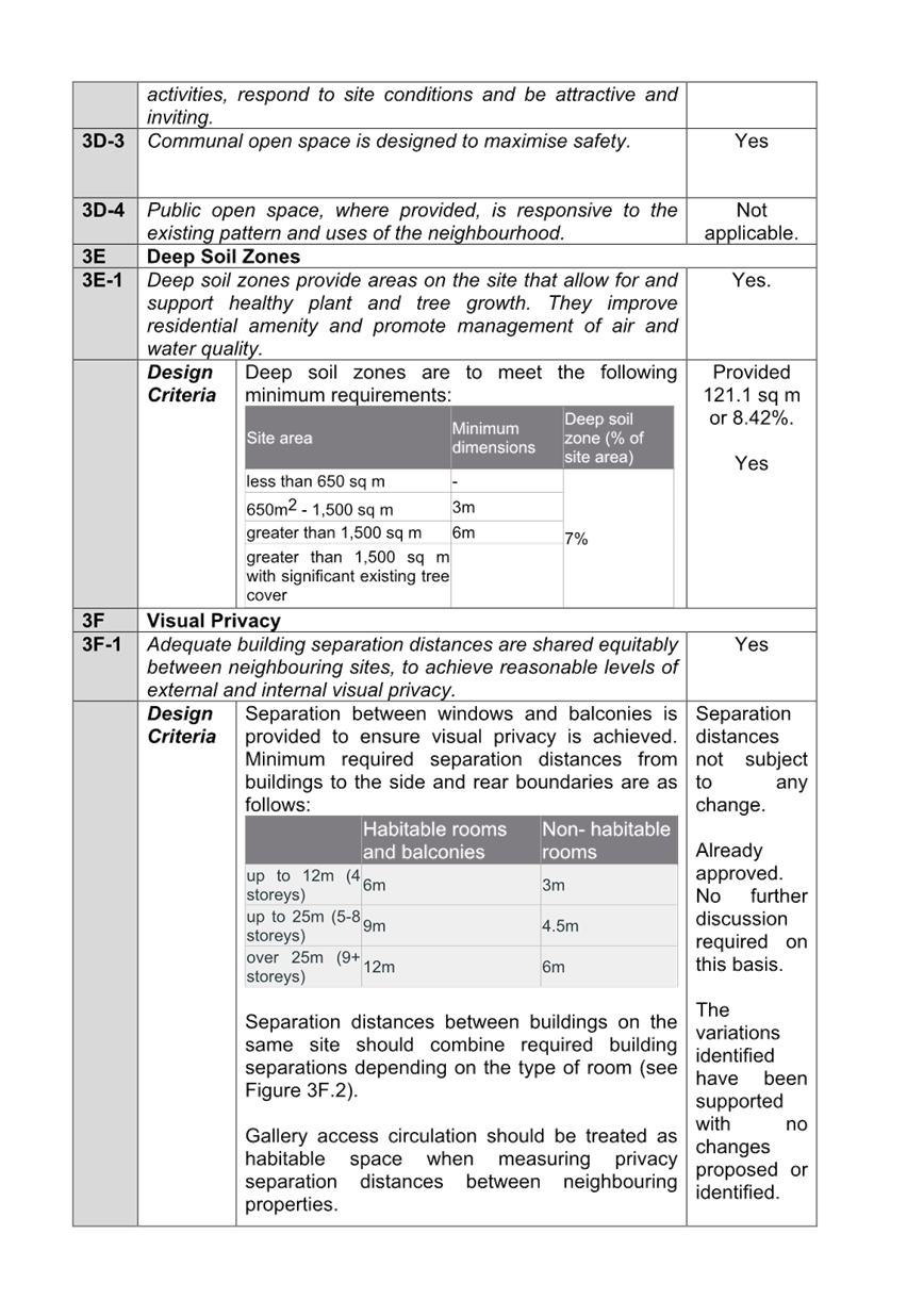
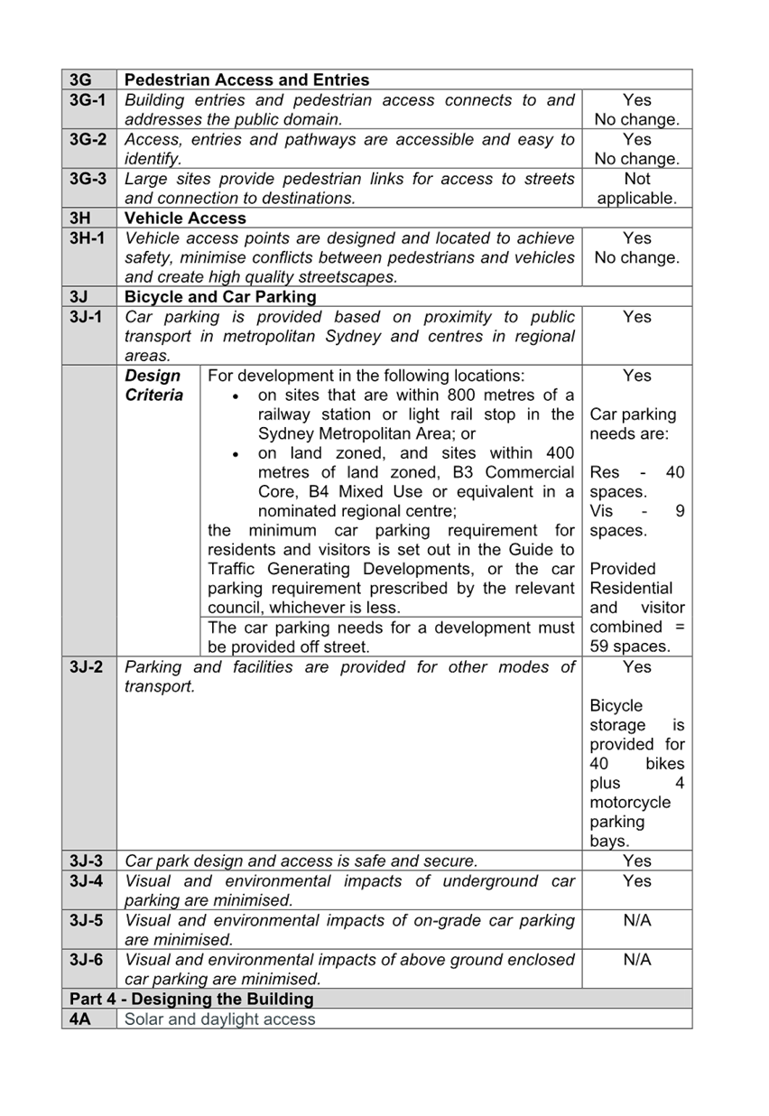
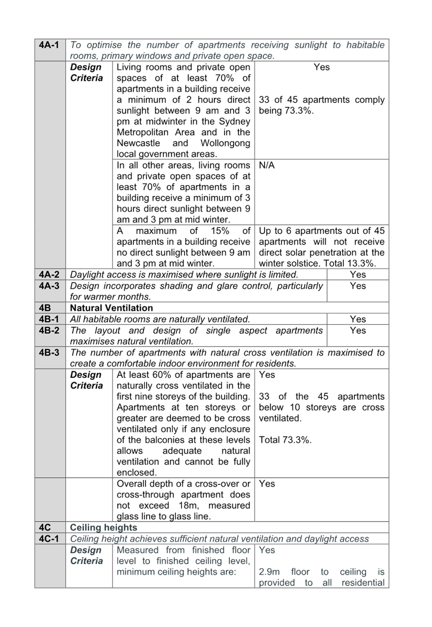
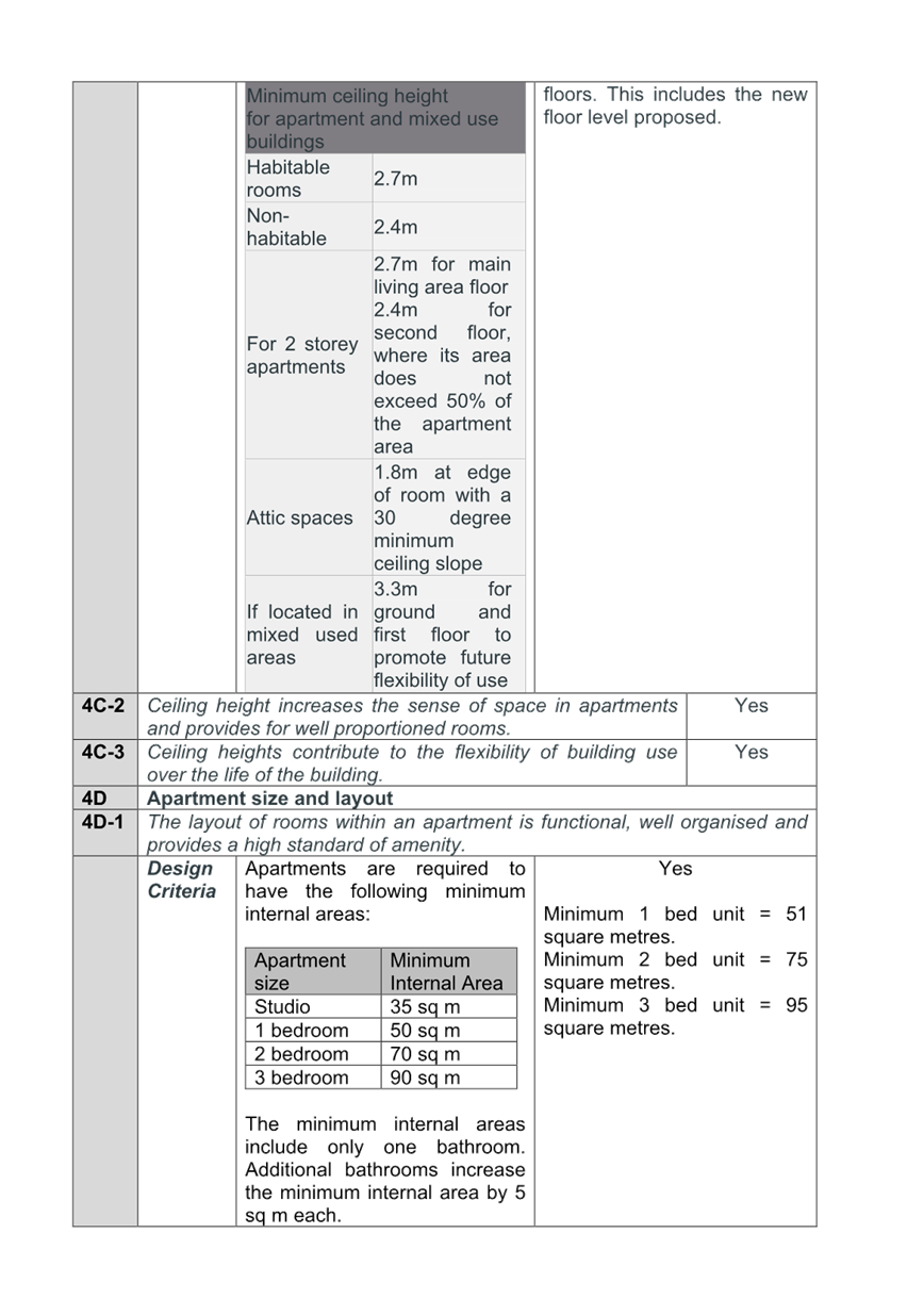
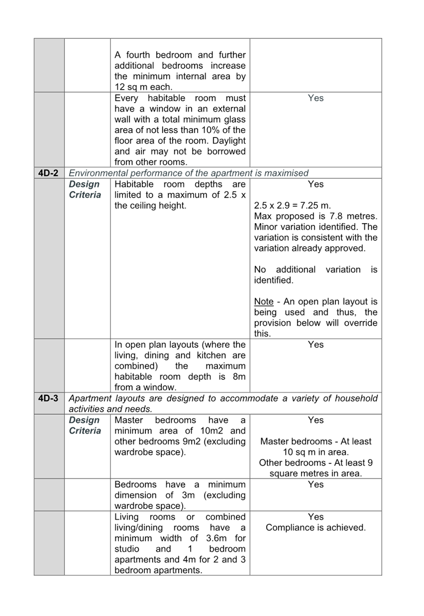
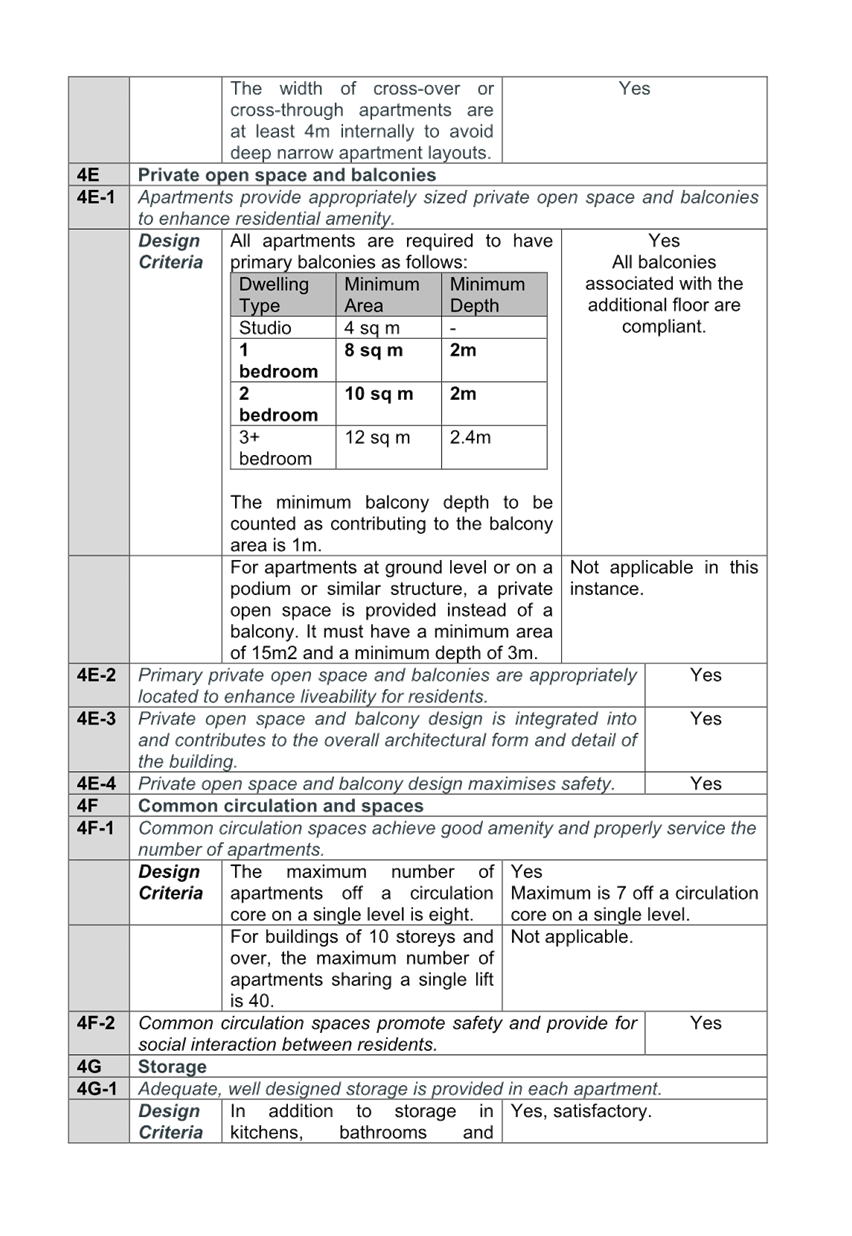
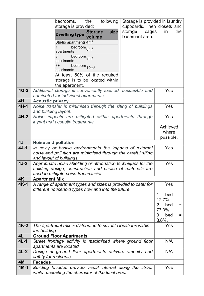
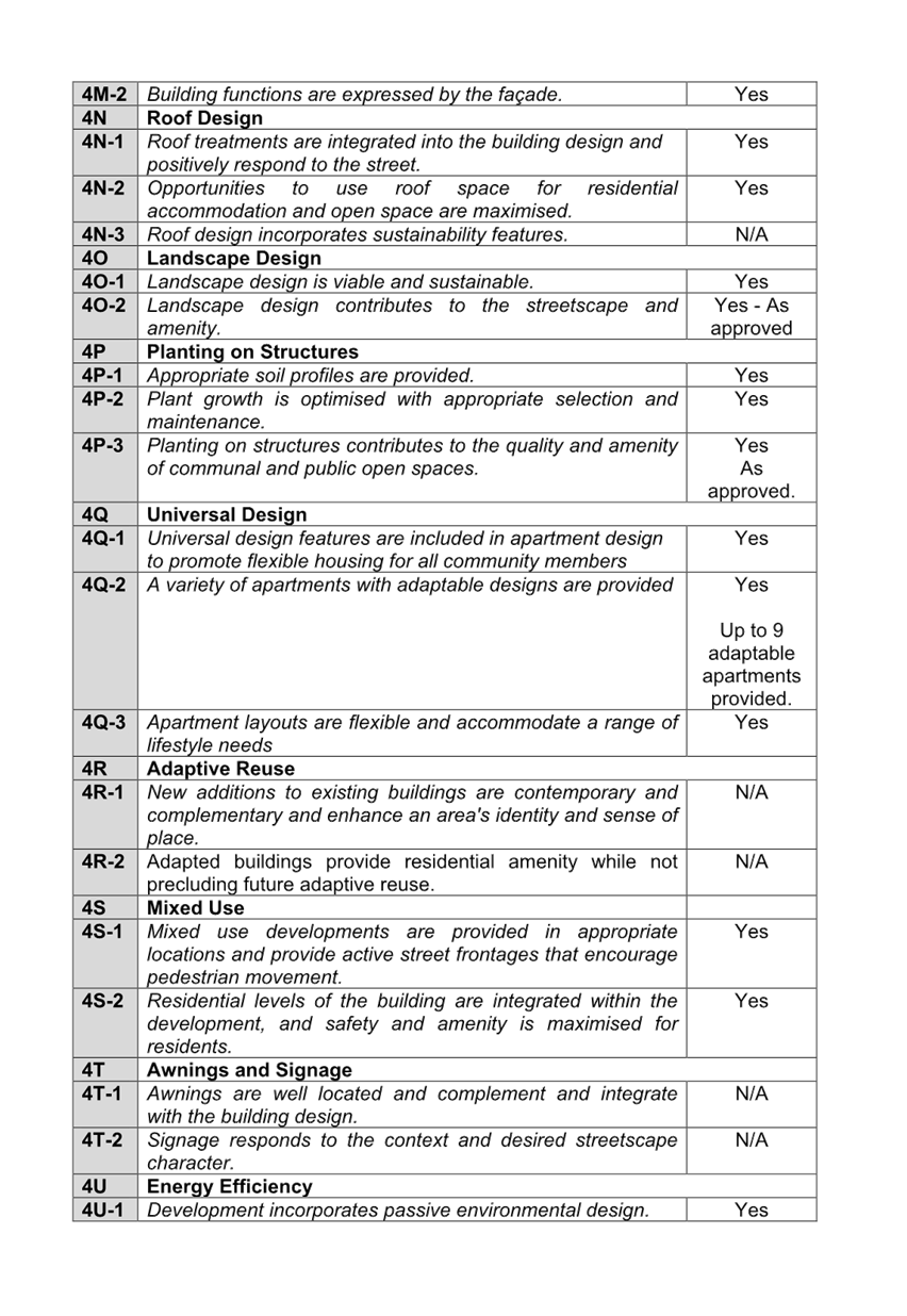
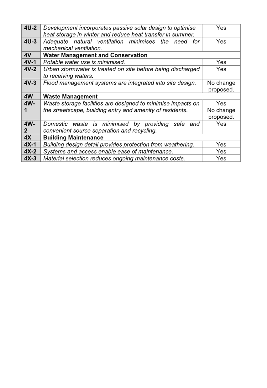
DOCUMENTS
ASSOCIATED WITH
REPORT ELPP040/24
Attachment 8
Appendix C - Cumberland Local Environmental Plan 2021
Assessment Table
Cumberland
Local Planning Panel Meeting
11 December 2024
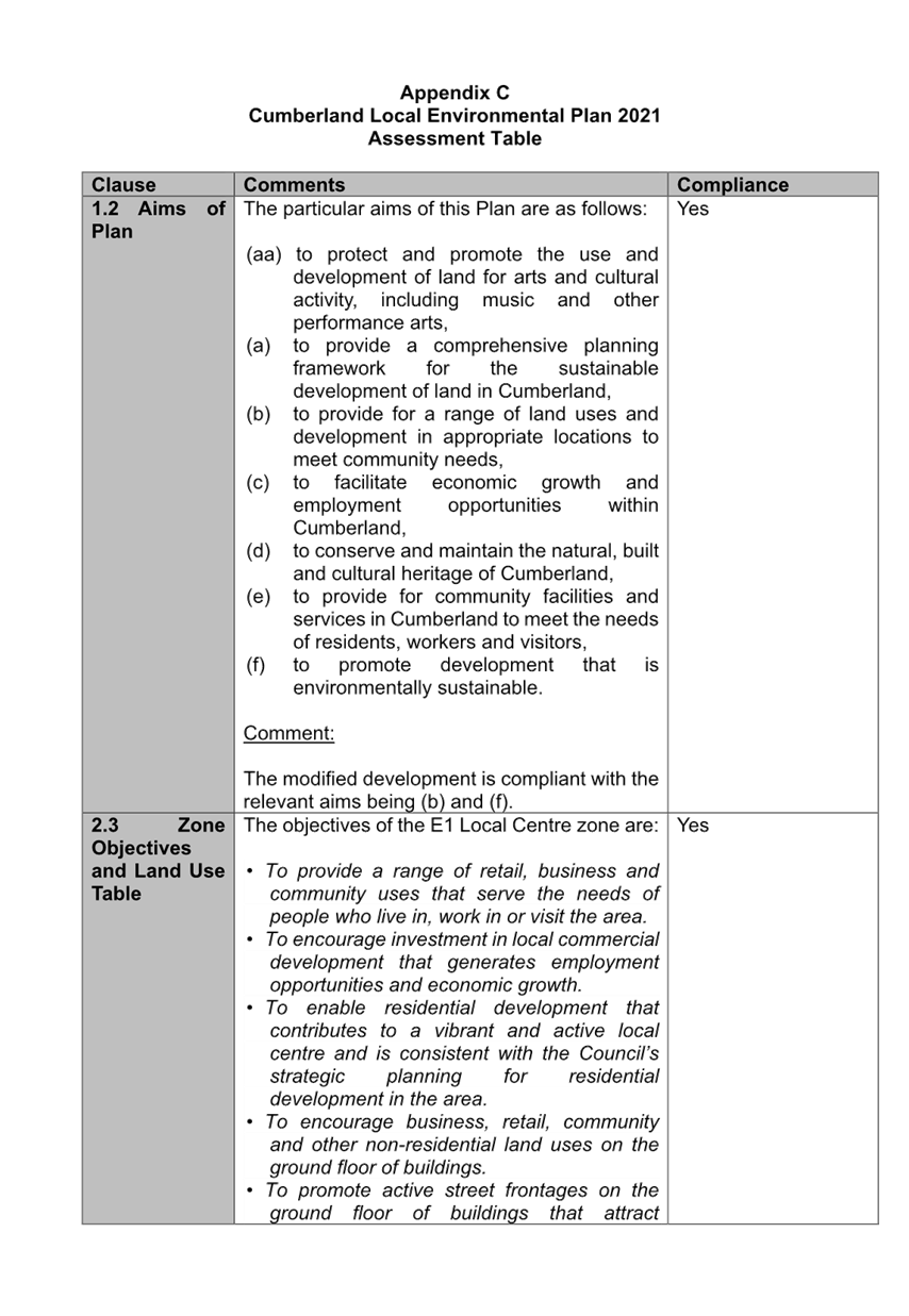
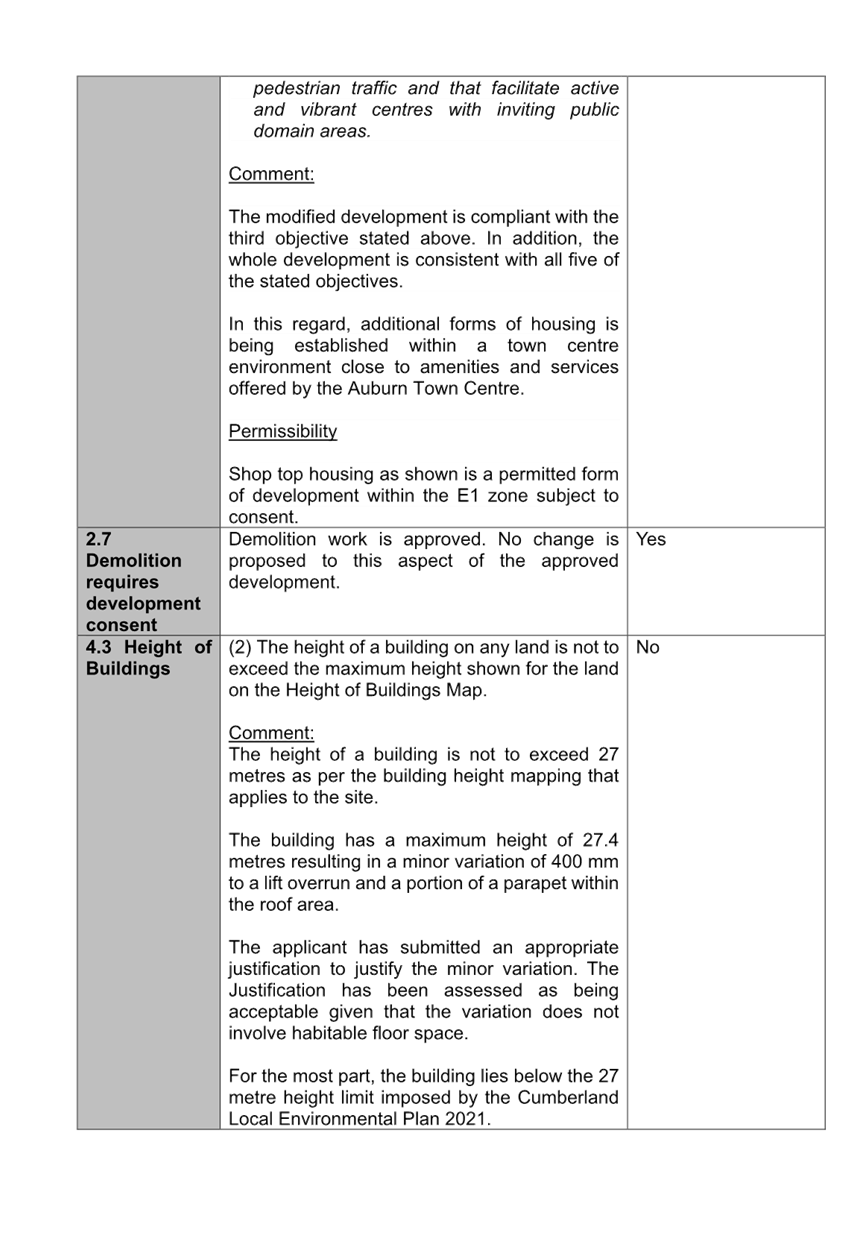
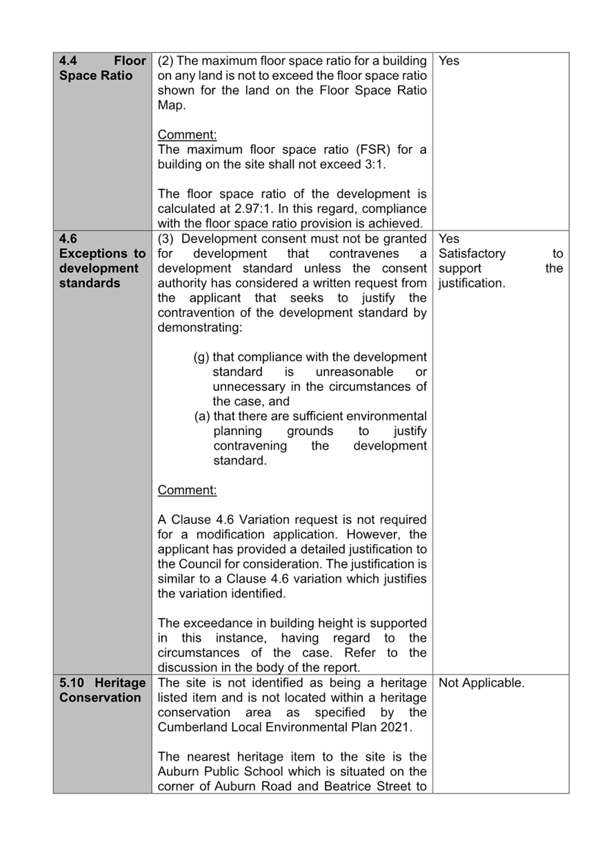
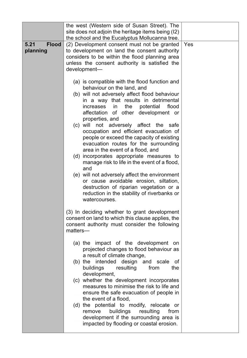
DOCUMENTS
ASSOCIATED WITH
REPORT ELPP040/24
Attachment 9
Appendix D - Cumberland Development Control Plan
Assessment Table
Cumberland
Local Planning Panel Meeting
11 December 2024