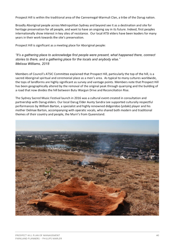
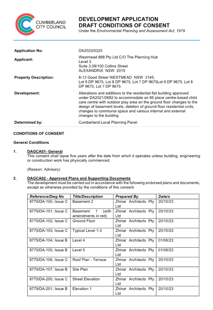
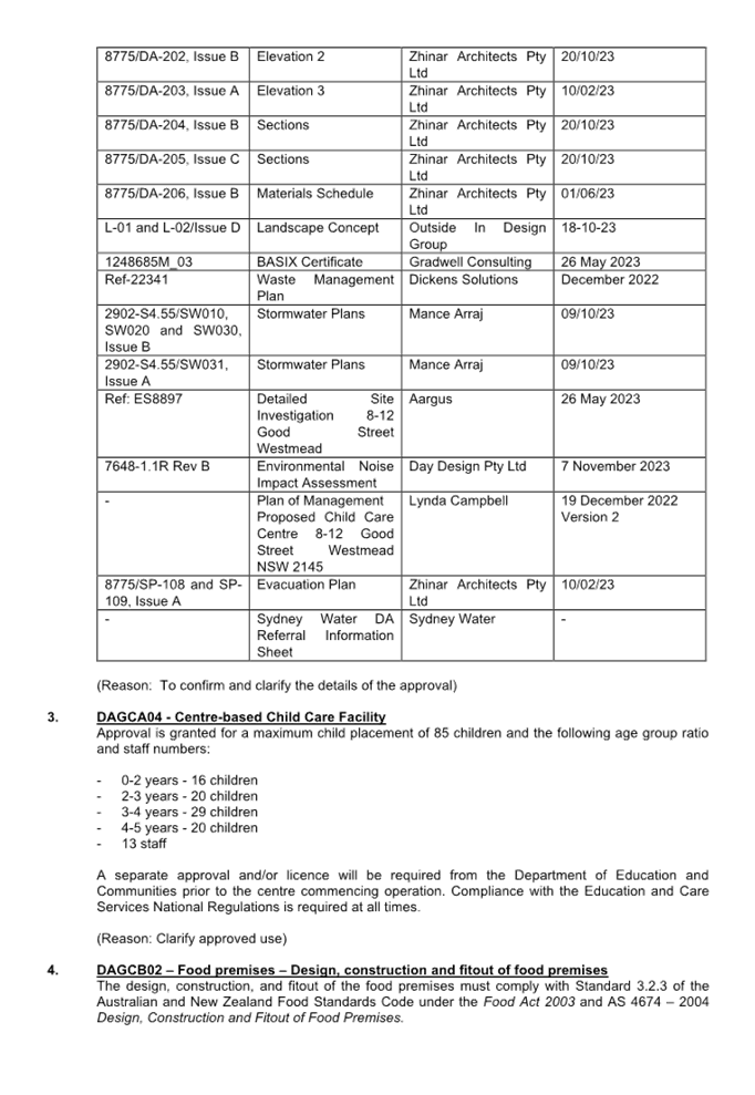
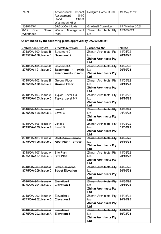
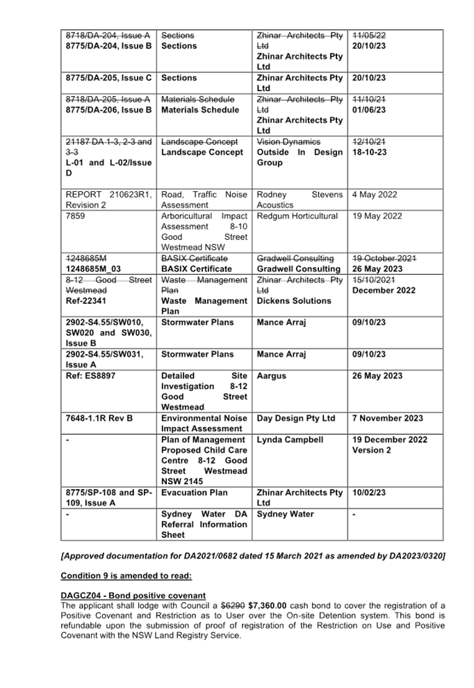
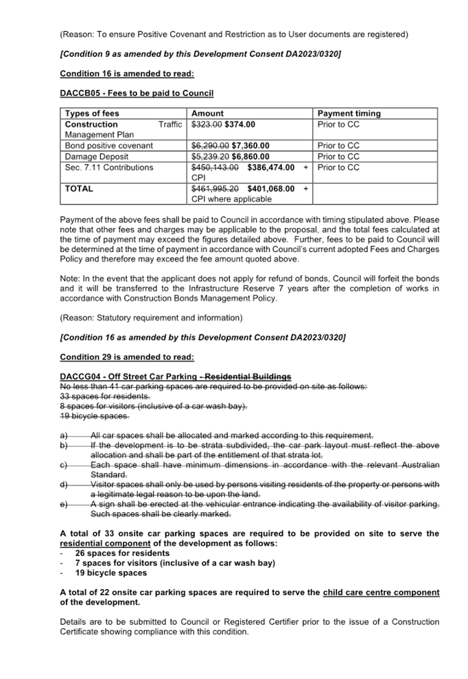
Cumberland Local Planning Panel Meeting
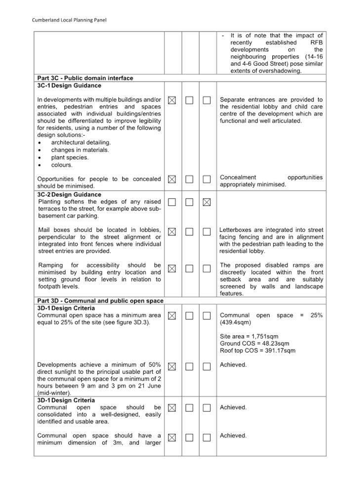
14 February 2024
A meeting of the Cumberland Local
Planning Panel will
be held at 11.30am via Electronic Determination on Wednesday, 14 February 2024.
Business as below:
Yours faithfully
Peter J. Fitzgerald
General
Manager
ORDER OF BUSINESS
1. Receipt of Apologies
2. Declarations of Interest
3. Reports:
- Development
Applications
- Planning
Proposals
4. Closed Session Reports
Cumberland Local Planning Panel Meeting
14 February 2024
CONTENTS
Report No. Name of Report Page
No.
1 Development
Applications
LPP001/24... Development Application - 8 - 12 Good Street, Westmead........................... 5
LPP002/24... Development Application - 45 - 47 Merrylands Road,
Merrylands.......... 267
LPP003/24... Development Application - Daruga Avenue, Pemulwuy............................ 409
LPP004/24... Development Application - 5 Cumberland Road, Auburn......................... 655
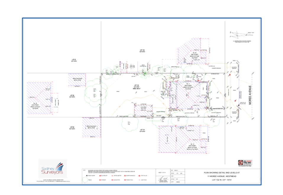
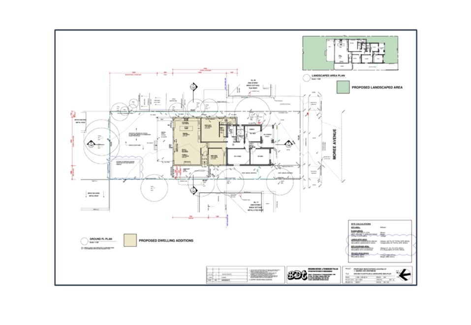
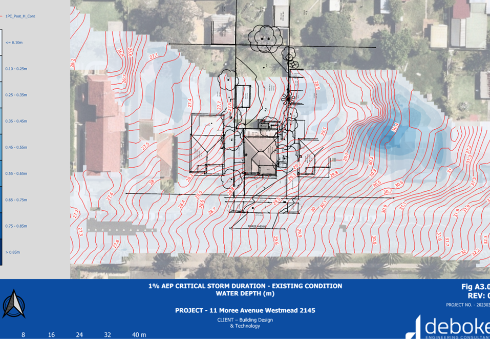
LPP005/24... Development Applicarion - 11 Moree Avenue, Greystanes...................... 723
Cumberland Local Planning Panel Meeting
14 February 2024
Item
No: LPP001/24
Development
Application - 8 - 12 Good Street, Westmead
Directorate: Environment
and Planning
Responsible
Officer: Executive
Manager Development and Building
|
Application
accepted
|
2 June 2023
|
|
Applicant
|
Westmead 888 Pty Ltd C/O The Planning
Hub
|
|
Owner
|
Westmead 888 Pty Ltd
|
|
Application
No.
|
DA2023/0320
|
|
Description
of Land
|
8-12 Good Street Westmead, Lot
9 DP 9675, Lot 8 DP 9675, Lot 7 DP 9675
|
|
Proposed
Development
|
Alterations and additions to
the residential flat building approved under DA2021/0682 to accommodate an 85
place centre-based child care centre with outdoor play area on the ground
floor changes to the design of basement levels, deletion of ground floor
residential units, changes to communal space and various internal and
external changes to the building
|
|
Site
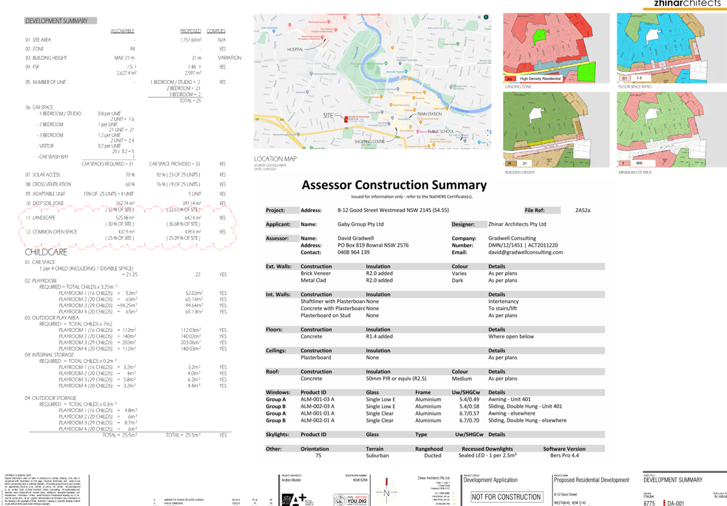
Area
|
1,751m2
|
|
Zoning
|
R4 High Density Residential
|
|
Disclosure
of political donations and gifts
|
Nil disclosure
|
|
Cost
of works
|
$742,916.00
|
|
Heritage
|
No
|
|
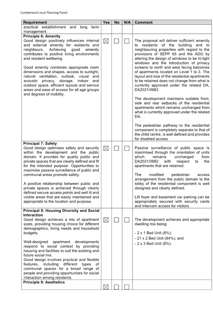
Principal
Development Standards
|
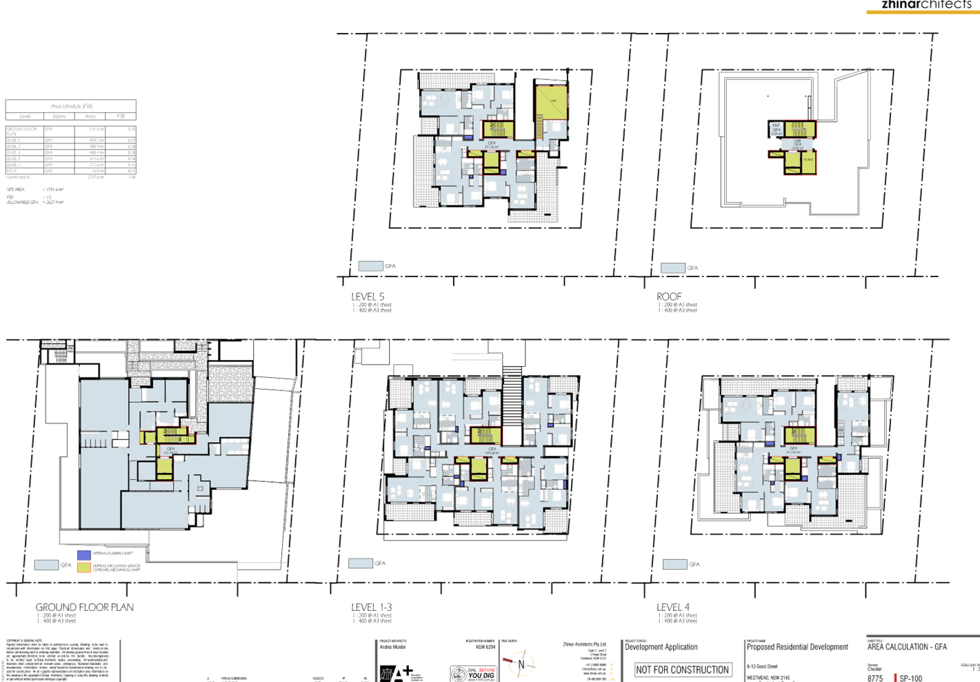
FSR
Permissible: 1.5:1
Proposed: 1.48:1
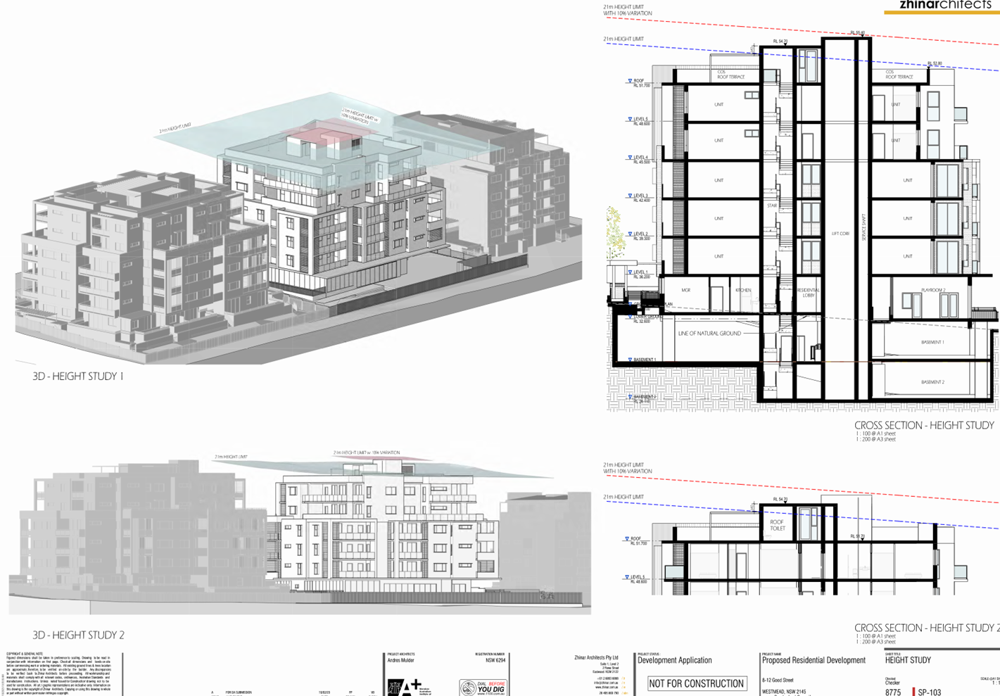
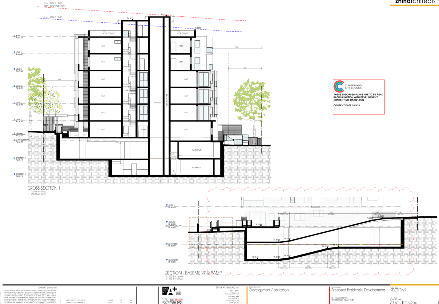
Height of Building
Permissible: 21m
Proposed: 22.96m
|
|
Issues
|
Height of buildings /
Cumberland Development Control Plan 2021 non-compliances / submissions
|
1. Development
Application No. DA2023/0320 was accepted on 2 June 2023 for the alterations and
additions to a residential flat building approved under DA2021/0682 to
accommodate an 86 place centre-based child care centre with outdoor play area
on the ground floor changes to the design of basement levels, deletion of
ground floor residential units, changes to communal space and various internal
and external changes to the building.
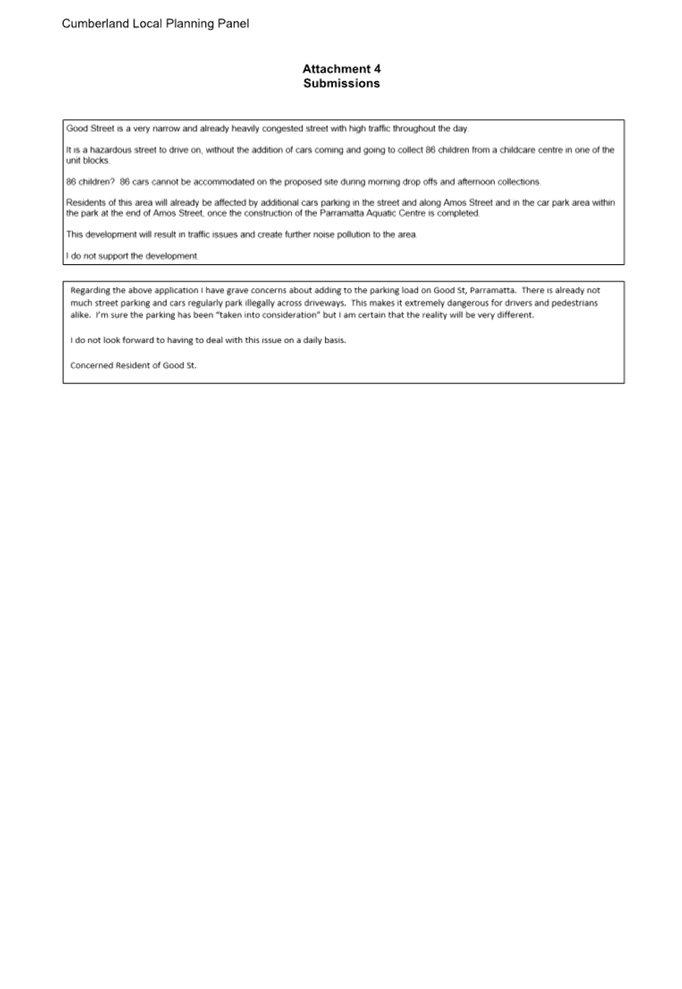
2. The
application was publicly notified to occupants and owners of the adjoining
properties for a period of 14 days between 22 June 2023 and 6 July 2023. In
response, two (2) submissions were received.
3. On 1
September 2023, a request for information was issued to the applicant detailing
various issues and in response, the applicant carried out a number of design
changes including a change to the provision of outdoor child play area and a
reduction in child capacity from 86 to 85.
4. The
variations are as follows:
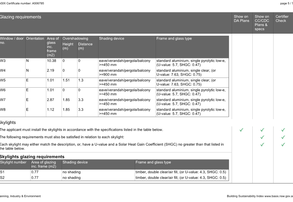
|
Control
|
Required
|
Provided
|
% variation
|
|
Height of buildings
CLEP, clause 4.3
|
21m
|
22.96m
|
9.3%
|
|
Extent of child play area
CDCP, Part E1, clause 2.2, C5
|
No encroachment of front setback permitted.
|
14sqm of the play area encroaches the front setback.
|
100%
|
|
Extent of basement level
CDCP, Part B3, clause 3.2, C3
|
Basement walls shall be setback minimum of 1.2m from side boundary
|
1m
|
16.6%
|
|
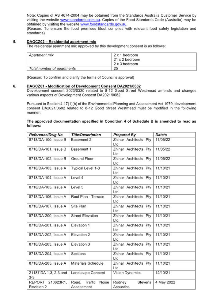
Residential apartment mix
CDCP, Part B5, clause 2.2, C1
|
Residential apartment mix shall comply with the following:
-
1 bedroom/studio dwellings = 10%
-
3 plus bedroom dwelling = 10%
- remaining
balance to be 2 bedroom dwellings
|
2 x 1 bedroom (8%)
21 x 2 bedroom
2 x 3 bedroom (8%)
|
20%
|
5. The
application is referred to the Panel as SEPP 65 applies to the development and
is 4 or more storeys in height.
6. The
application is recommended for Approval subject to the conditions as
recommended in the Council’s assessment report.
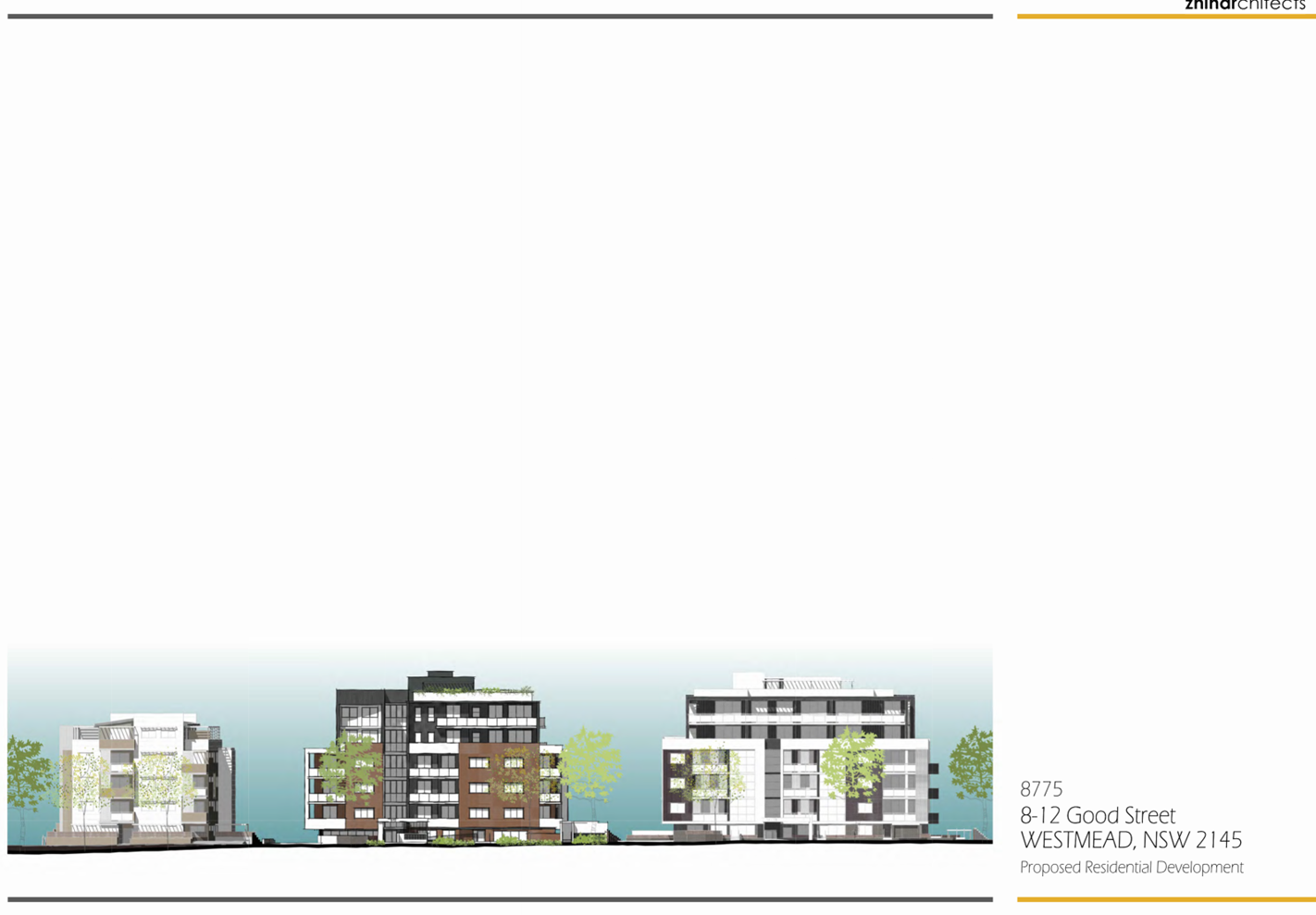
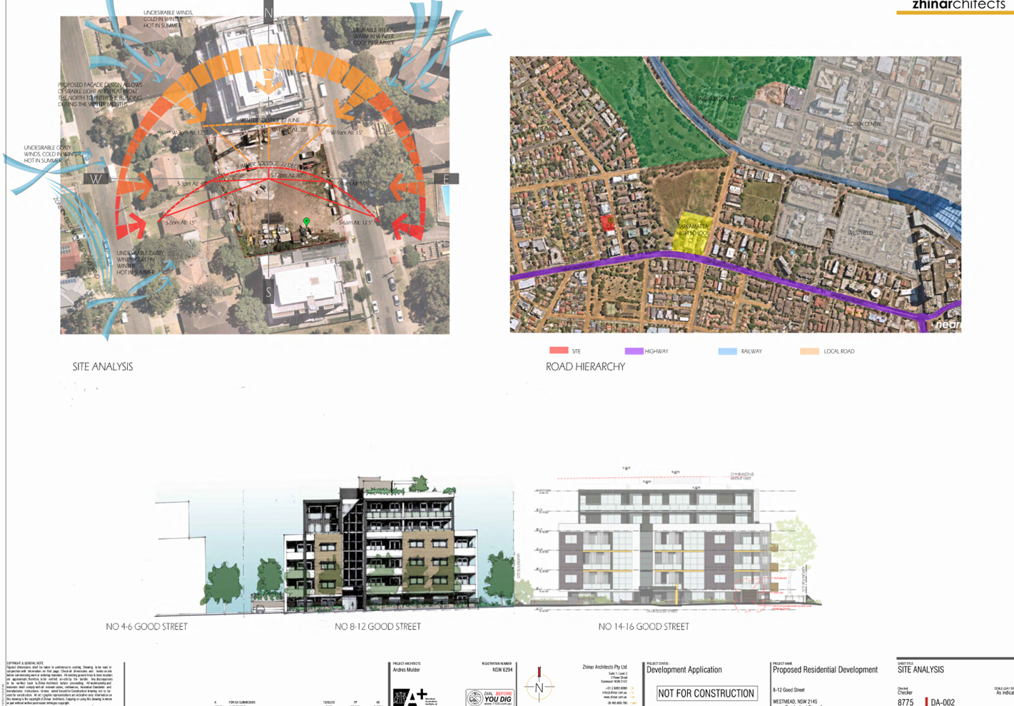
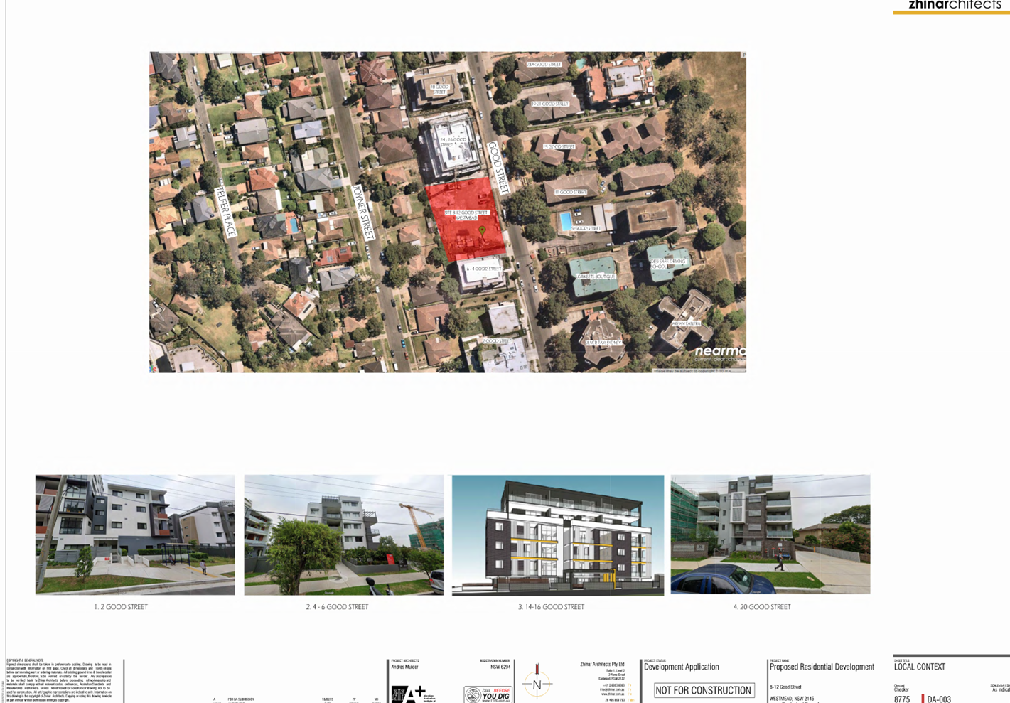
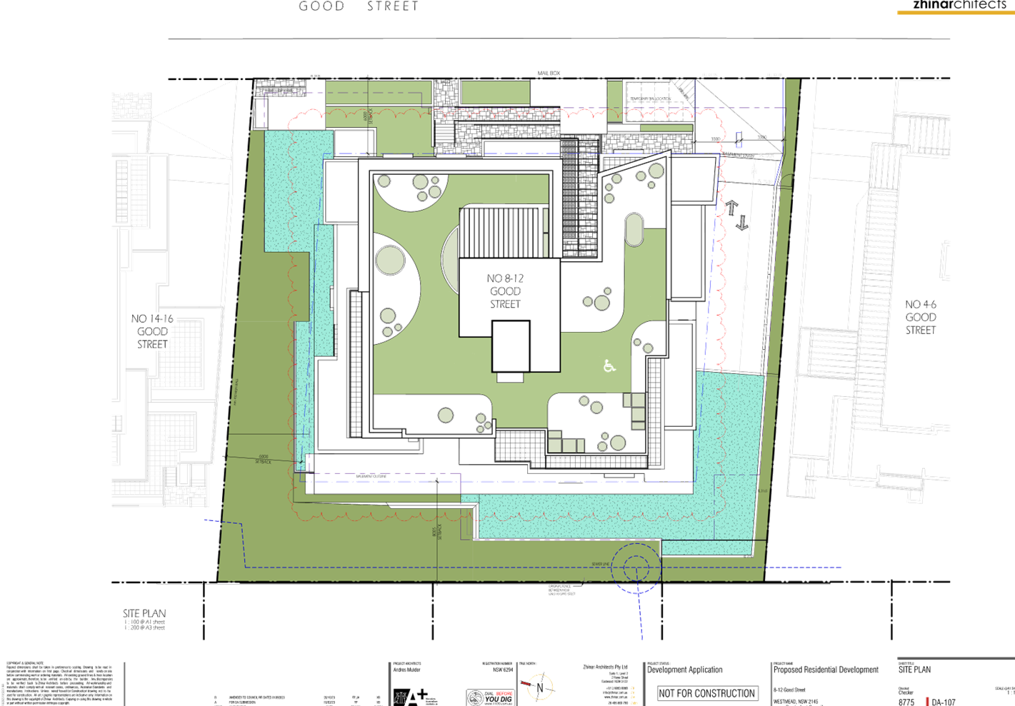
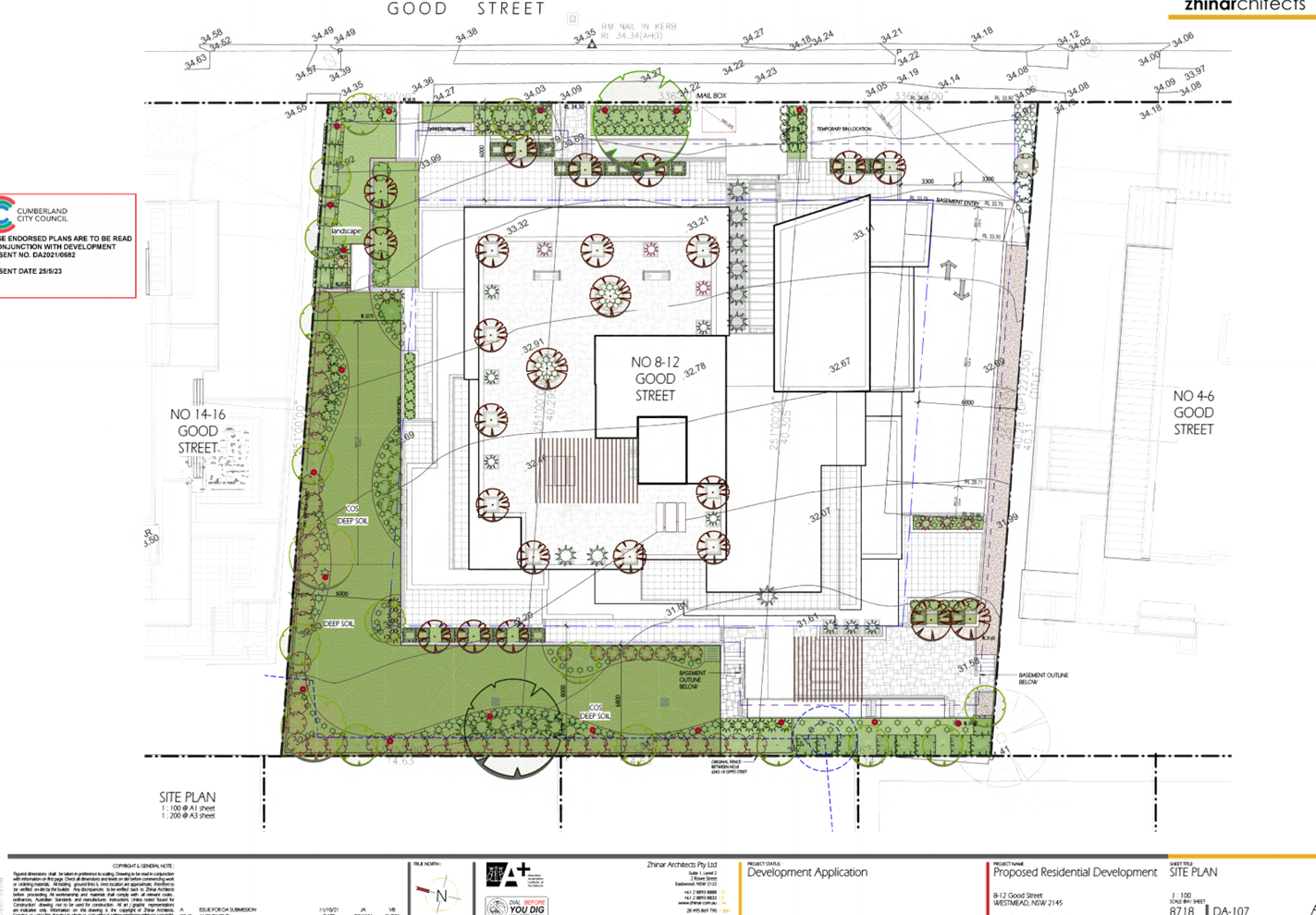
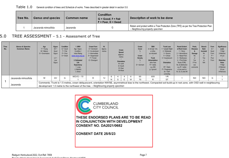
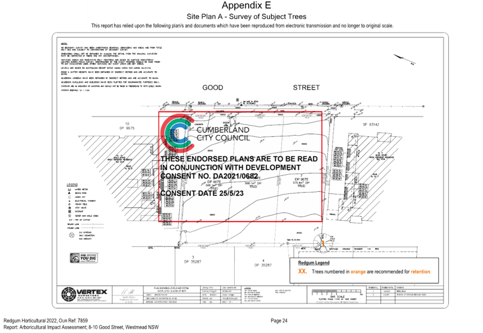
Subject Site and Surrounding
Area
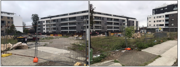
The subject site is comprised of
three (3) lots described as 8-12 Good Street Westmead. The legal description of
the lots is Lot 7 DP 9675, Lot 8 DP 9675 and Lot 9 DP 9675. The site is
rectangular in shape, has a total area measuring 1,751sqm and is currently void
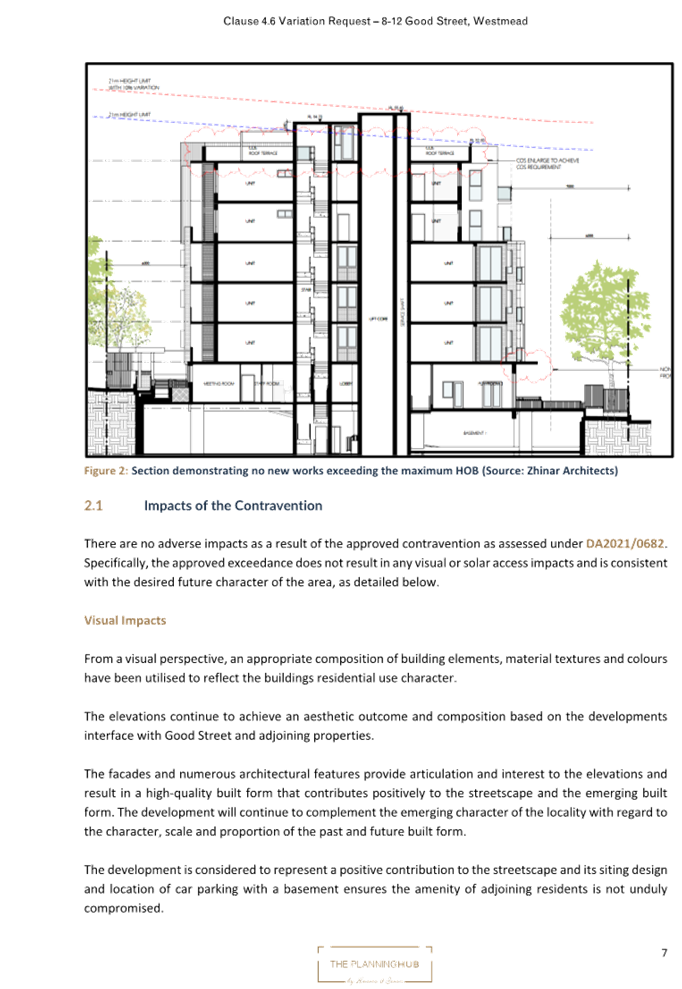
of any natural or built structures as shown in Figure 2.
Immediately adjoining development
includes multi storey contemporary residential flat buildings (RFB) to the
north and south and older forms of RFBs on the opposing side of Good Street to
the east. Immediately to the west is a five storey residential flat building
comprising 46 dwellings and two levels of basement parking which appears to be
in the final stages of construction (DA2019/141/1). A power pole and overhead
power lines are located above the footpath fronting the site.
The site is zoned R4 Residential
and is located at the interface to Parramatta Council’s Local Government
Area boundary to the east. The site is buffered by R2 Low Density Residential
land to the north and west and E3 Productivity Support zoned land to the south
as shown in Figure 1. The Great Western Highway runs perpendicular to Good
Street and is located approximately 90m south of the subject site.
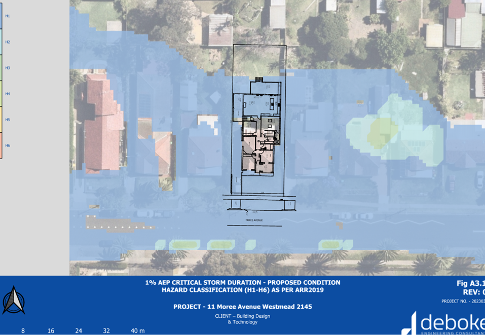
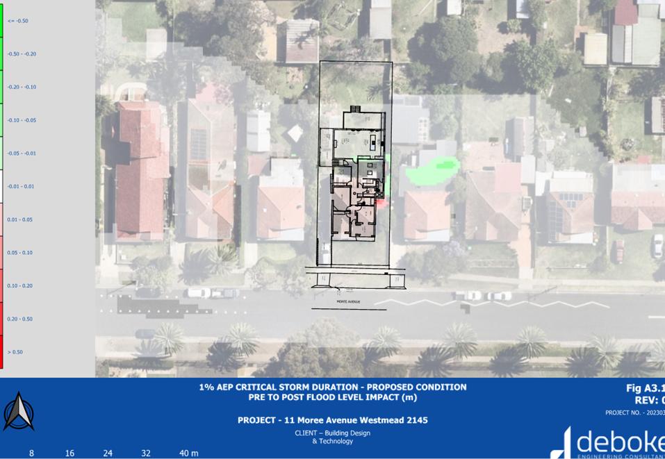
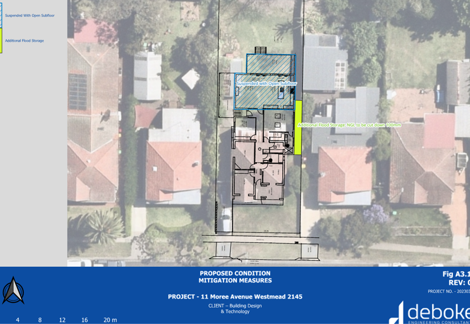
The site is identified as being
subject to a flood planning level according to Council’s mapping with
only a small portion of the southwestern corner being ‘Low Risk
(PMF)’ flood liable land.
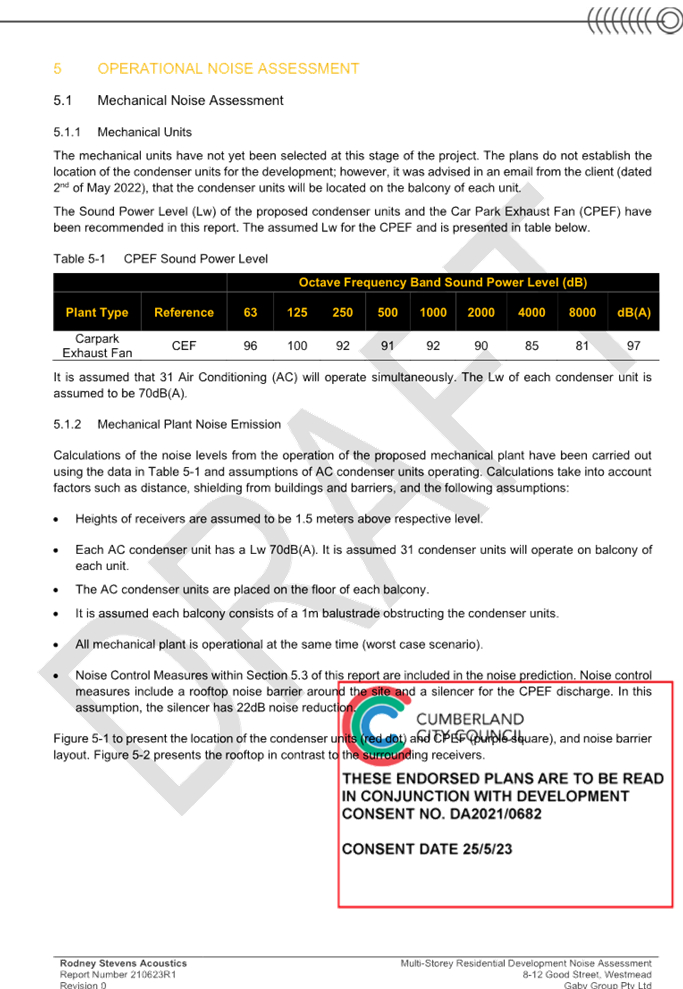
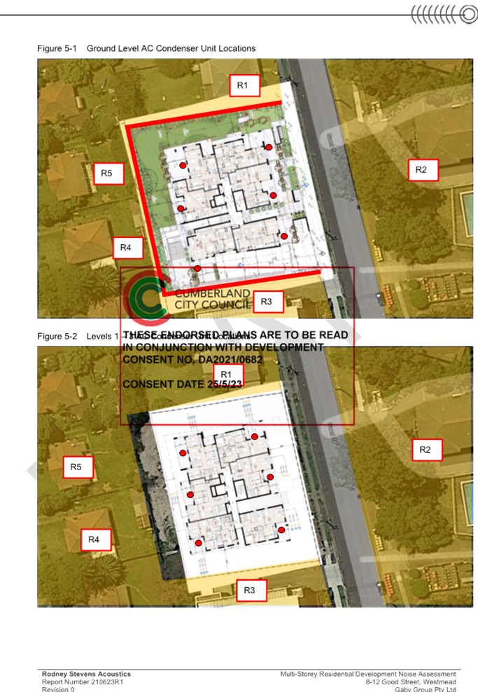
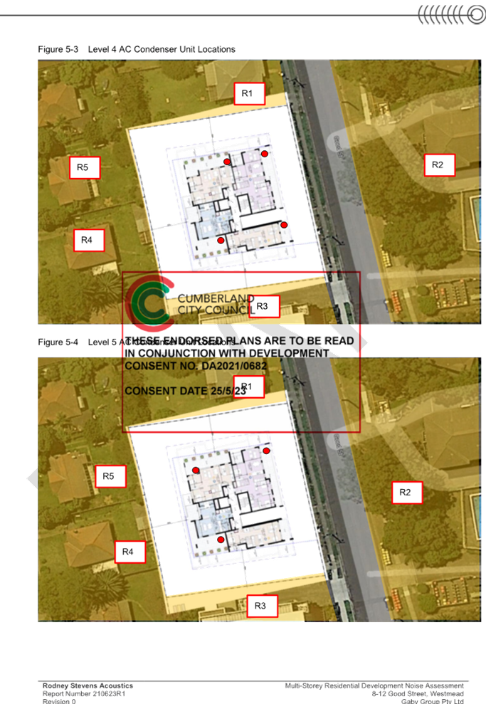
Figure
1 – Locality Plan of subject site
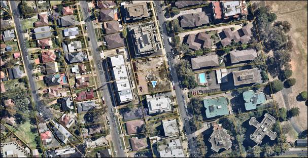
Figure
2 – Aerial view of subject site
Figure
3 – Site inspection photos taken 29 November 2023
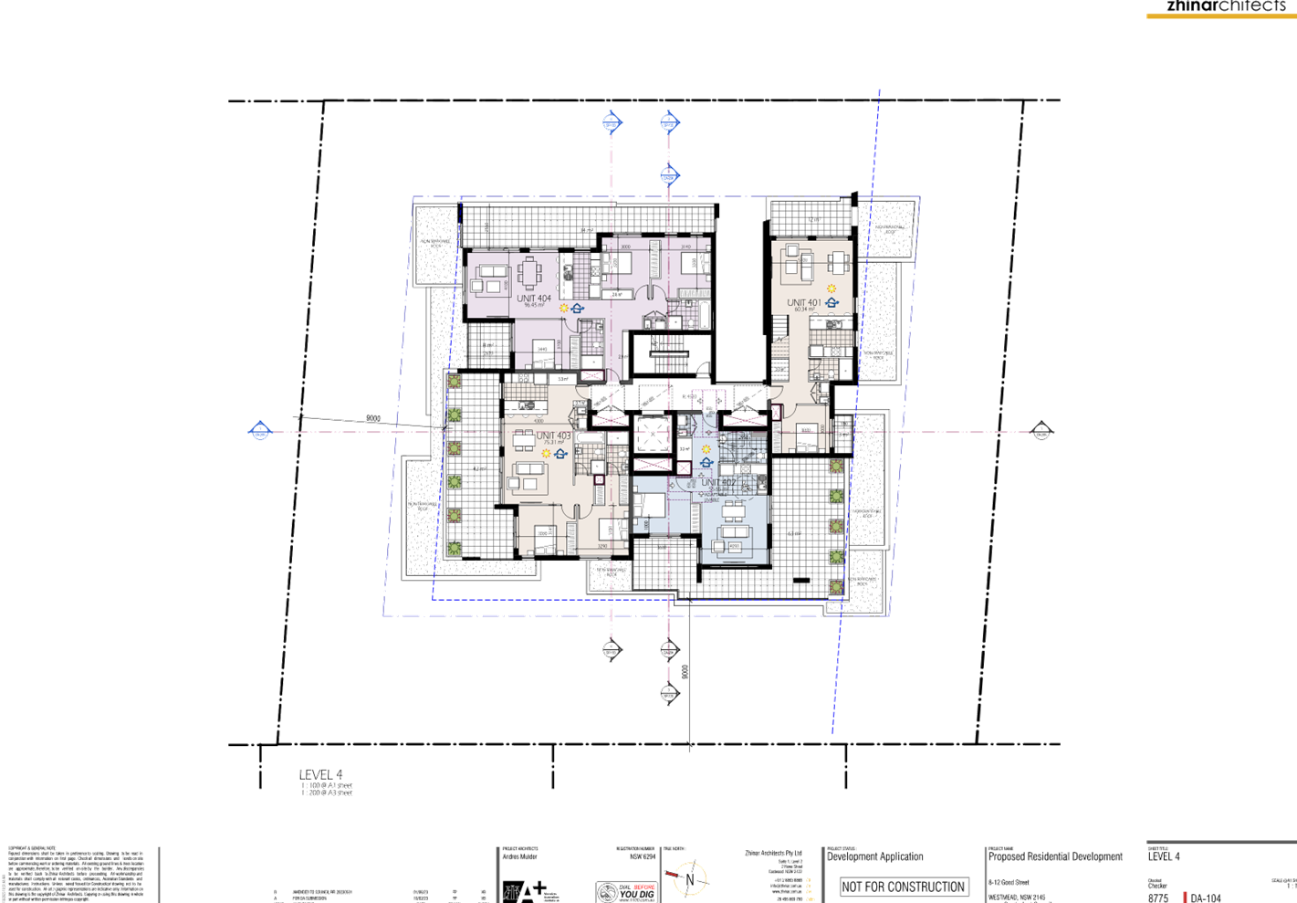
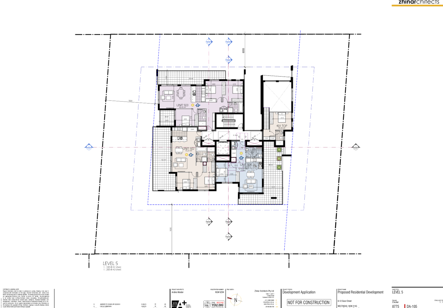
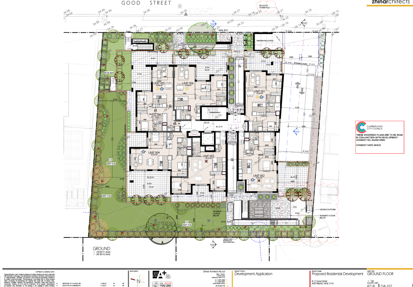
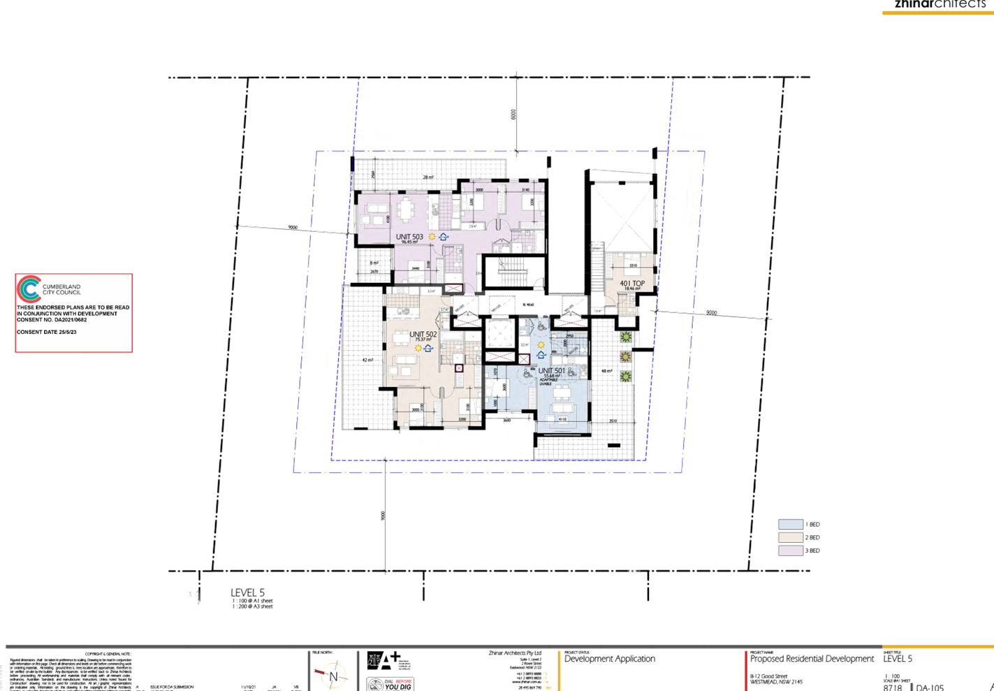
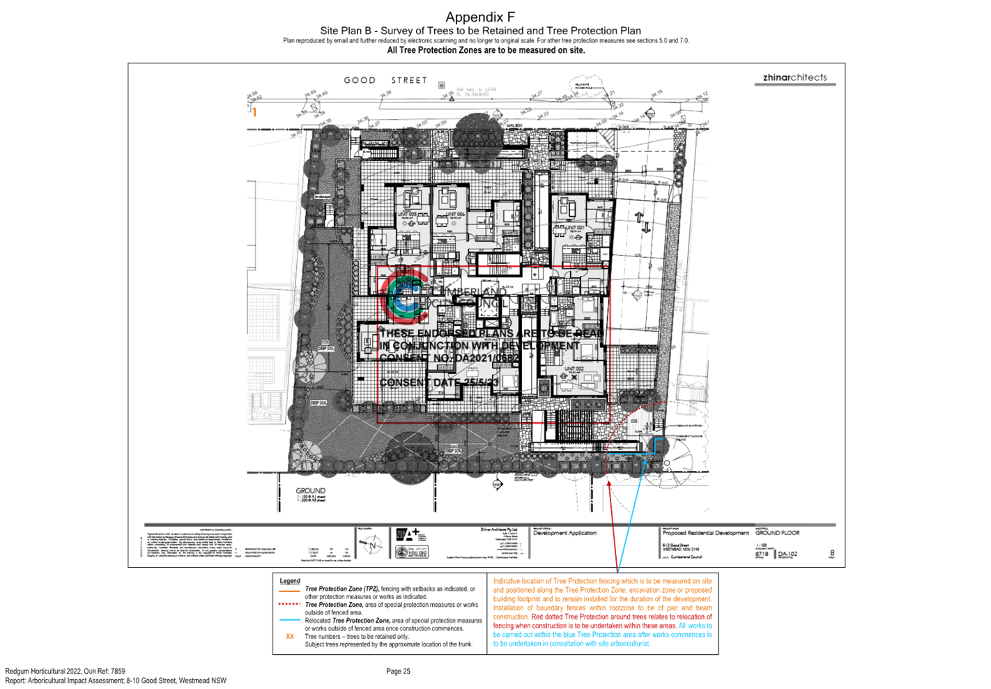
Description of The
Development
The applicant seeks approval for
an amending DA to introduce a new use and associated alterations and additions
to an approved Development Application (DA) for a residential flat building
development (DA2021/0682). The subject development application as originally
submitted proposed an 86 place centre-based child care centre. As noted earlier
in the report, the applicant has since implemented some design changes which
has caused child placements to be reduced from 86 to 85.
The introduction of the child care
centre results in modifications to various aspects of the development approved
under DA2021/0682 including the residential apartment mix, design of the
basement levels, the provision of communal space and various other internal and
external design changes to the building and the site. Following is a
description of the child care centre followed by the resulting changes to the
residential component of the development approved under DA2021/0682.
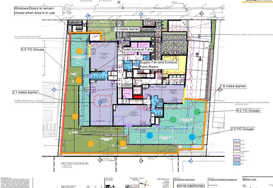
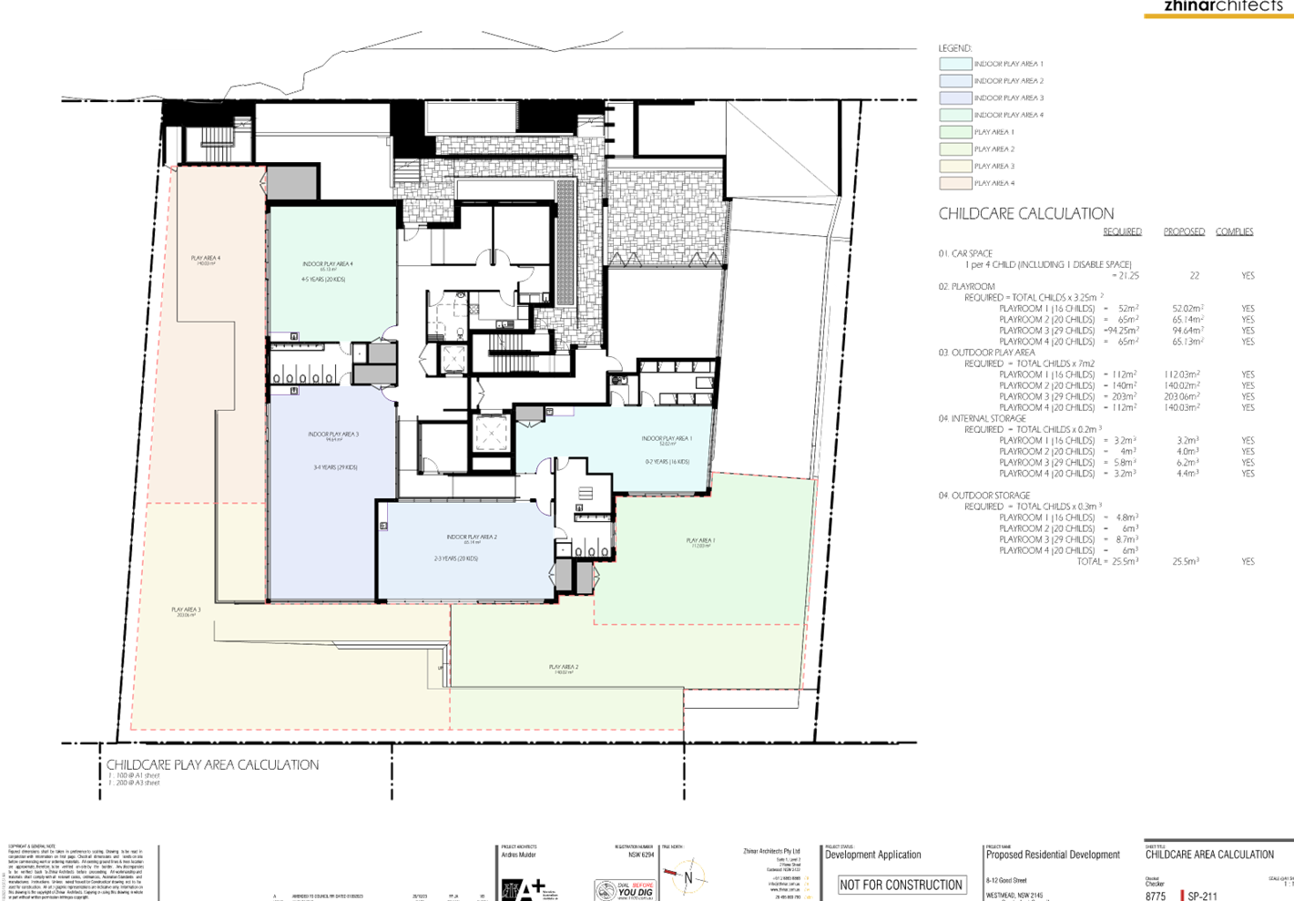
Centre-based child care centre
The new centre-based child care
centre will occupy the majority of the ground floor of the building which is
currently approved to accommodate six (6) residential apartments. The centre
comprises the following spaces:
Indoor child
play areas as described below:
|
Indoor playroom
|
Child age ratio
|
Floor area (sqm)
|
|
Playroom 1
|
0-2 years (16 children)
|
52.01
|
|
Playroom 2
|
2-3 years (20 children)
|
65.14
|
|
Playroom 3
|
3-4 years (29 children)
|
94.64
|
|
Playroom 4
|
4-5 years (20 children)
|
65.13
|
|
Total area (sqm)
|
276.92
|
·
Two (2) amenities rooms comprising toilets, sinks and a nappy
changing facility.
· A cot room and
bottle prep room.
· A managers’
office, a staff room and a meeting room.
· Four (4) internal
and two (2) external storage areas/facilities.
· A kitchen, a
laundry and a WC.
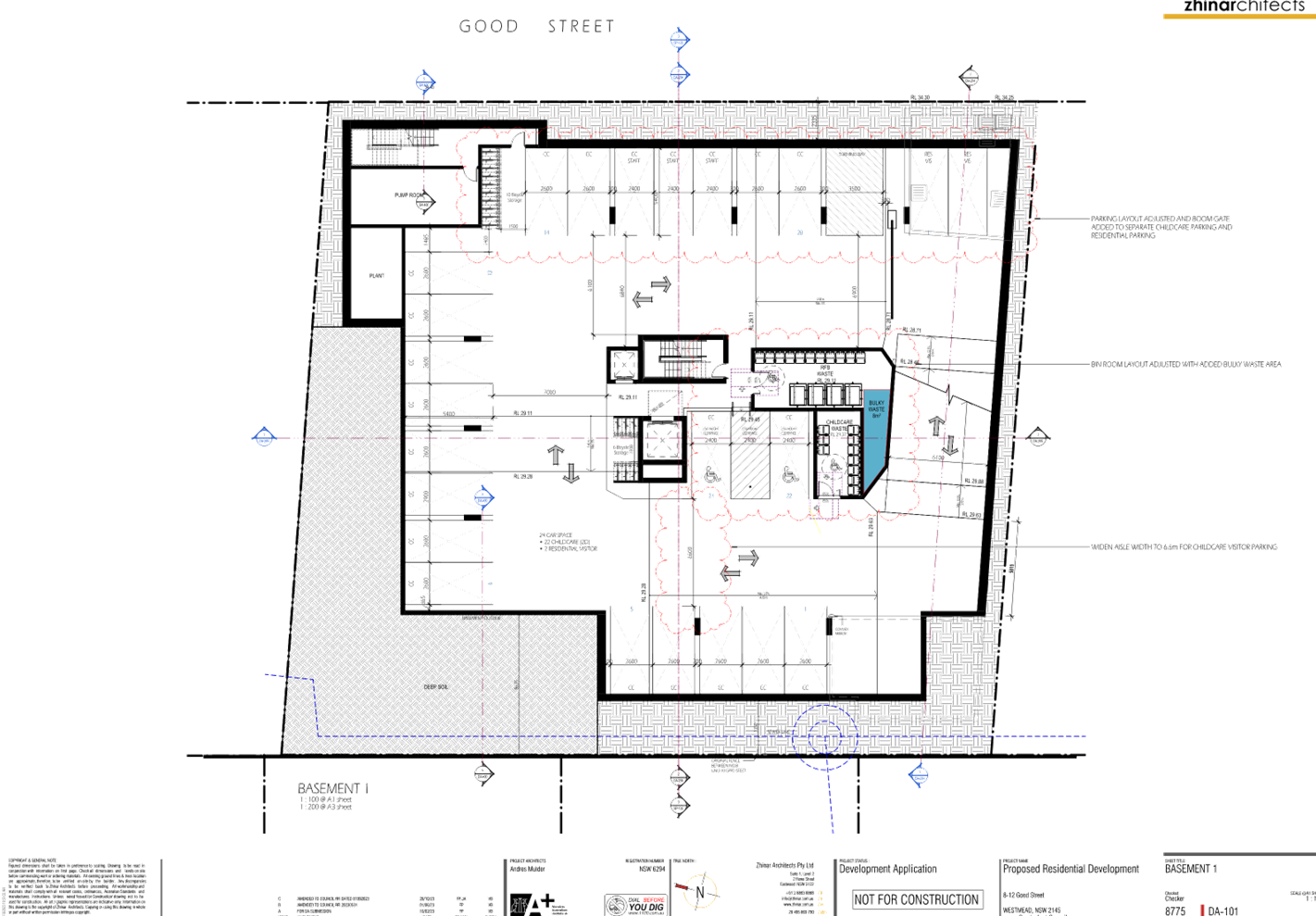
· Provision of
twenty-four (24) parking spaces, sixteen (16) bicycle spaces, a waste room, a
pump room and a plant room in Basement 1. The composition of changes to the
basement level associated with the child care centre is discussed in greater
detail below.
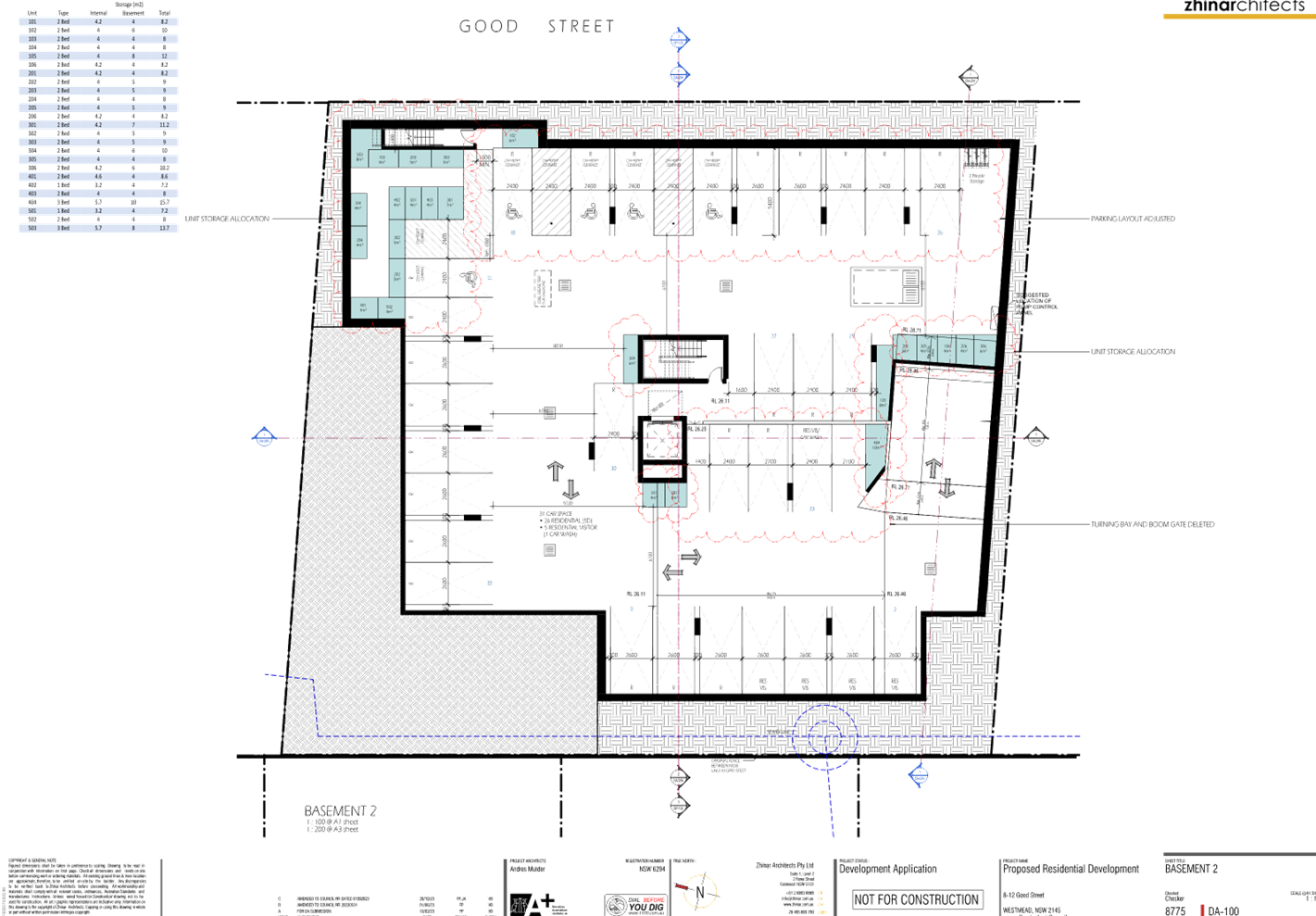
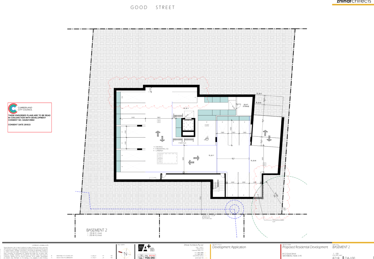
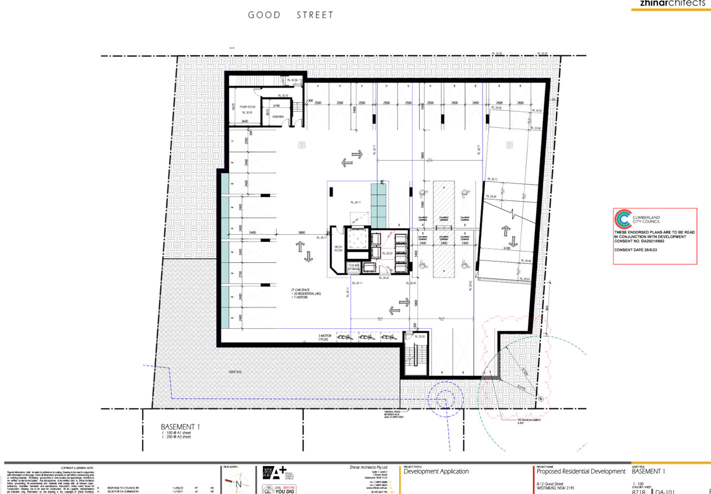
Basement level changes
Under DA2021/0682, ‘Basement
1’ accommodates parking of motor vehicles and various service-related
rooms/facilities associated with the residential apartments. The subject DA
proposes to increase the extent of the floor plate, and alter the layout to
accommodate parking and service-related rooms for use by the new child care
centre. The design changes are identified in detail as follows:
· Twenty-two (22)
parking spaces inclusive of two (2) disabled spaces are to be allocated for use
by the child care centre.
· A designated waste
room is added to serve the child care centre.
· A new lift
provides internal access to the child care centre.
· Two (2)
residential visitor spaces are located in the south eastern corner of the level
and is separated from the child care centre parking spaces by an automatic
gate.
Operational details
· The maximum number
of child placements is 85 comprising of the age ratios noted in the aforementioned
table identifying the indoor child play areas.
· Hours of operation
are 7.00am to 6.00pm, Monday to Friday.
· Thirteen (13)
staff are proposed.
Changes to the development as
approved under DA2021/0682
The addition of a child care
centre results in changes to the design of the residential component of the
development approved under DA2021/0682. The changes are detailed as follows:
Deletion of residential units
· Deletion of five
(5) ground floor residential apartments (Units 002 to 006) to accommodate the
new child care centre.
· Deletion of a
residential apartment (Unit 001) on the ground floor to accommodate a part
open/enclosed communal area to be used by the residents.
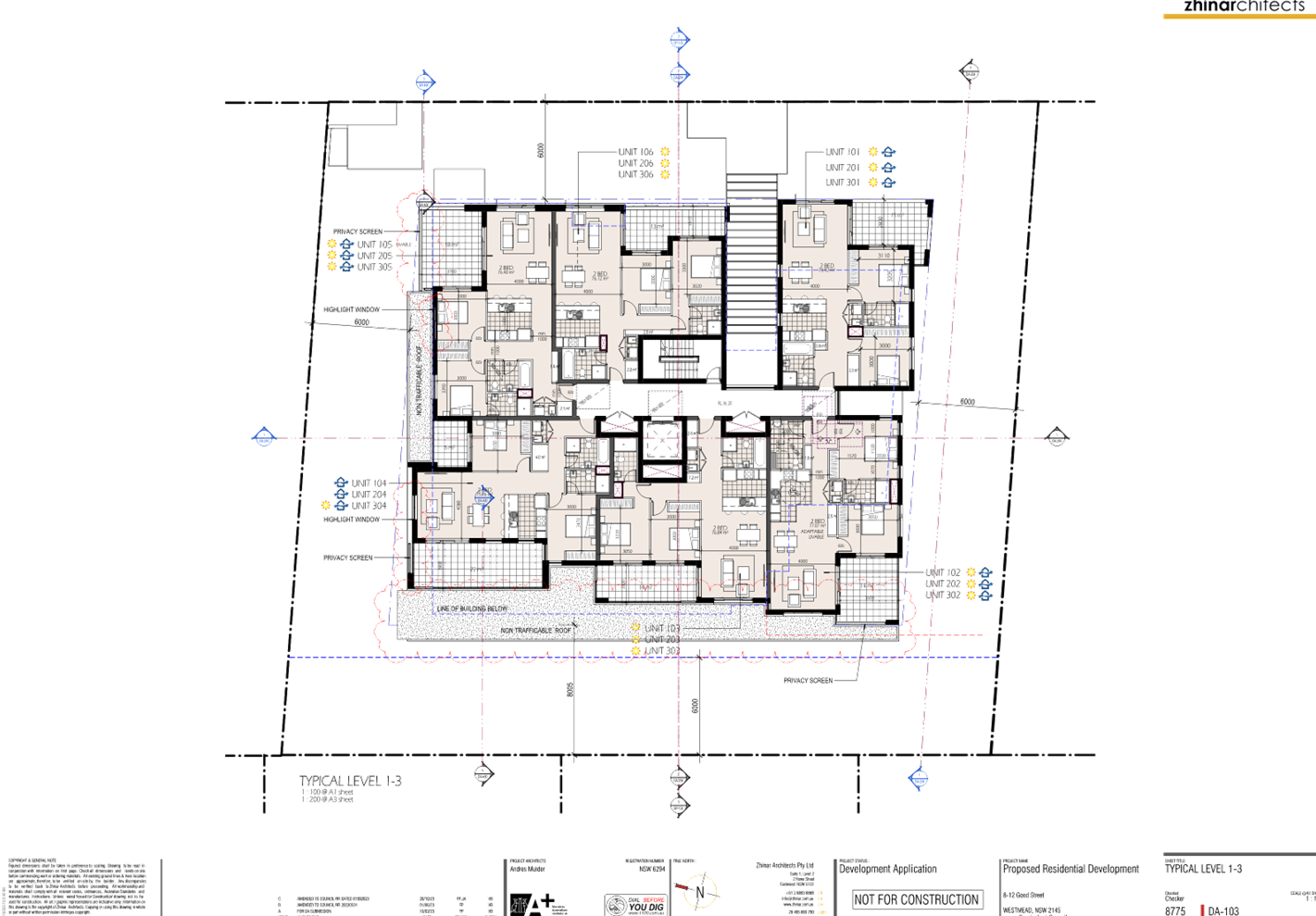
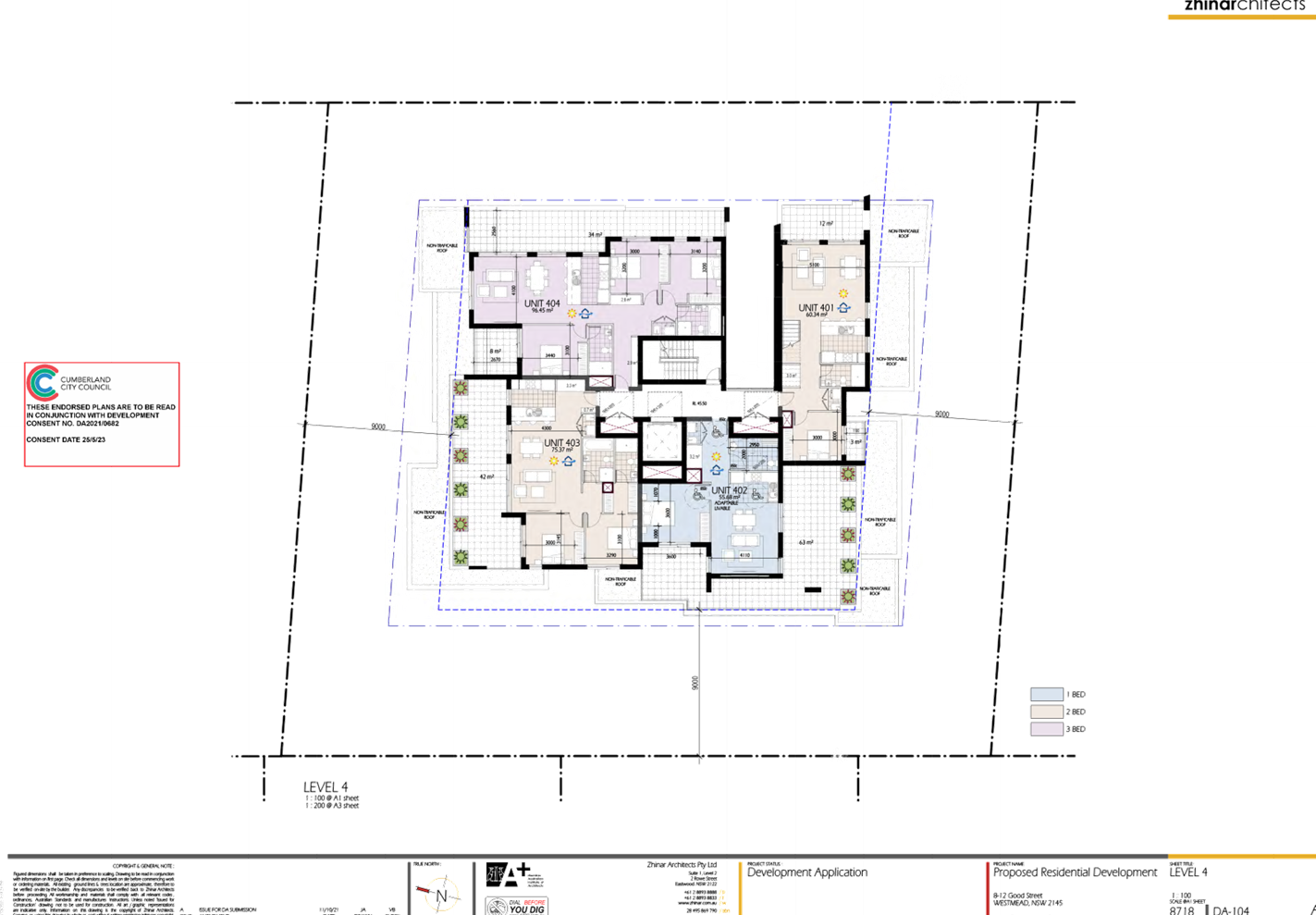
Change to unit mix
· The deletion of
the abovementioned residential apartments results in a change to the
residential apartment mix and yield as follows:
|
Approved unit mix
|
2 x 1 bedroom
27 x 2 bedroom
2 x 3 bedroom
|
|
Total units
|
31
|
|
Proposed unit mix
|
2 x 1 bedroom
21 2 bedroom
2 x 3 bedroom
|
|
Total units
|
25
|
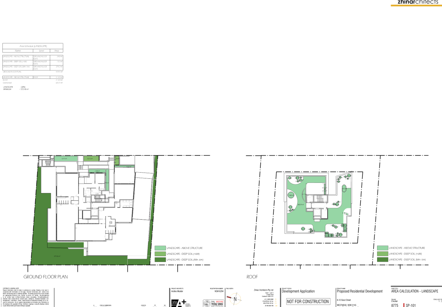
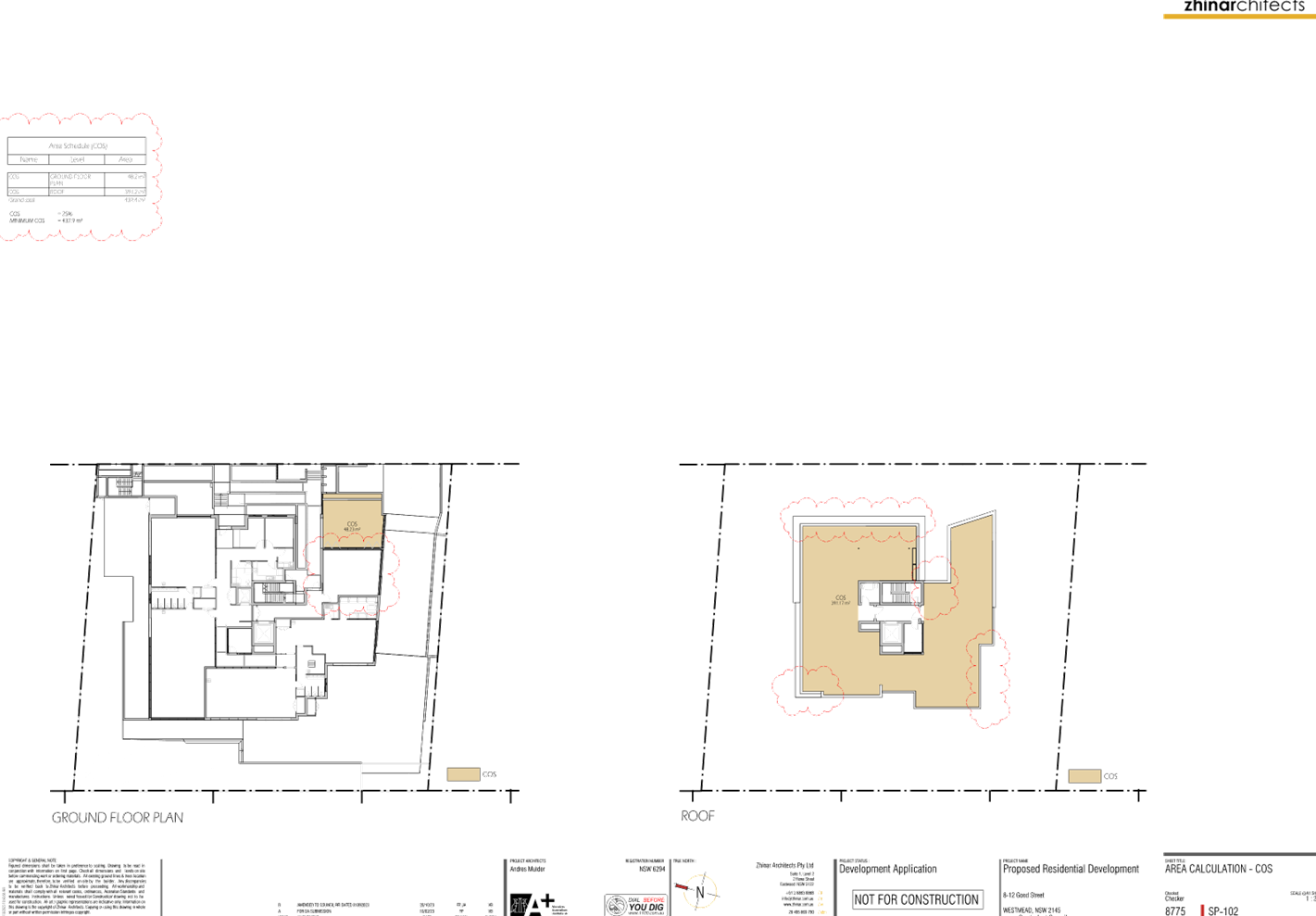
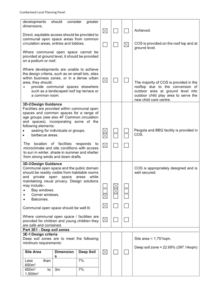
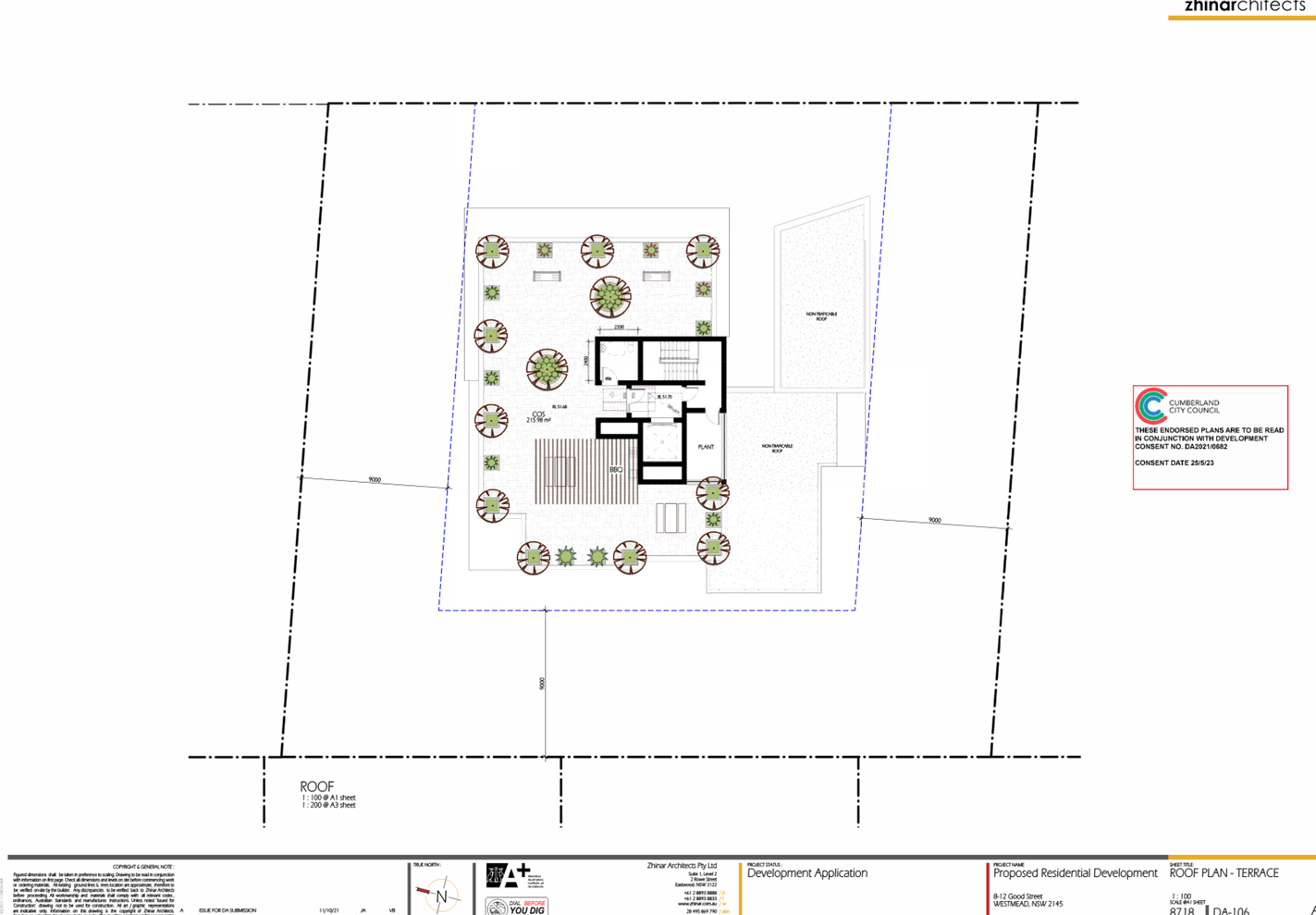
Provision of communal space
The allocation of communal open
space associated with the residential component of the development is modified
in response to the introduction of outdoor child play area that occupies the
entirety of the rear (west) and side (north) setback areas of the development
at ground level. The following allocation of communal space is proposed:
· Enclosed communal
space and open communal space is provided at the south eastern corner of the
ground floor amounting to areas of 40sqm and 48.23sqm respectively.
· Communal open
space on the roof level increases from 215.98sqm to 391.17sqm resulting in a
total provision of 439.4sqm.
External design changes
The following external design
changes to the building are sought:
· Non-trafficable
roof area is added to the floor slab of Level 1 extending over the northern and
western setbacks of the site to redirect view lines from balconies and windows
of the residential apartments to the outdoor play areas of the proposed child
care centre.
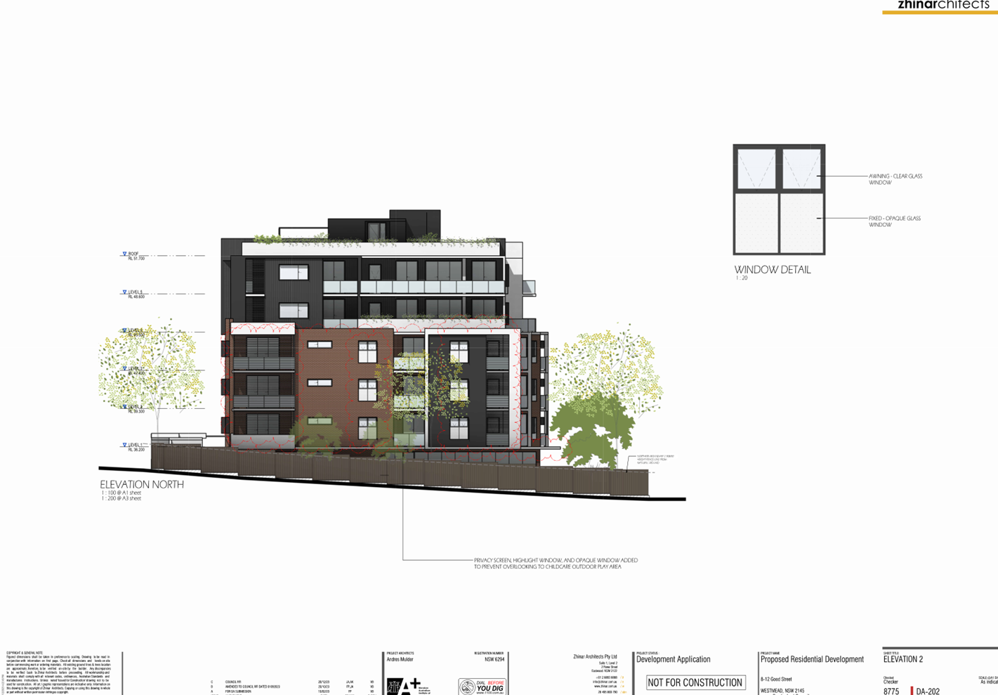
· Privacy screens
are added to the north facing balconies of Units 104, 105, 204, 205, 304 and
305 and to the west facing balcony of Unit 102.
· A north facing
window to a bedroom of Units 105, 205 and 305 is modified to be hi-light
windows.
· A north facing
window to the living room of Units 104, 204 and 304 is modified to be hi-light
windows.
· The west facing
living room window to Units 102, 202 and 302 are modified to be hi-light
windows.
· The extent of
communal open space on the roof level is altered as detailed above.
Basement level changes
Both ‘Basement 1’ and
‘2’ are modified with respect to the residential component of the
development. Design changes to Basement 1 include:
· The provision of
two (2) residential visitor parking spaces in the south eastern corner of the
level. An automatic gate provides separation from the parking spaces of the
child care centre.
· Sixteen (16)
bicycle spaces.
· A new lift
provides direct access to the child care centre.
· The position and
extent of the waste storage room is modified and now includes a bulky waste
storage space.
The building footprint of Basement
2 is increased to match Basement 1 and to accommodate the following design
changes:
· The parking layout
is modified to accommodate thirty-one (31) parking spaces consisting of
twenty-six (26) resident spaces (inclusive of five disabled spaces) and five
(5) visitor spaces (inclusive of a car wash space).
· Three (3) bicycle
spaces.
· Repositioning of
storage associated with the residential apartments throughout the level.
Other changes
Other changes to the development
approved under DA2021/0682 include the following:
· A centrally
located fire stair currently providing access to the residential levels is
modified to also provide access to the basement levels.
· Fire stair
providing egress from both basement levels located within the front setback is
repositioned.
· The extent of the
fire hydrant booster is modified.
· As a result of
outdoor area at ground level being converted to outdoor child play area, the
landscape concept plans are modified.
· As a result of the
change to the extent of the basement levels, the provision of deep soil zone is
altered to approximately 22.69% (397.14sqm).
History
On 9 February 2016, a development application
(DA2015/222/1) was approved under delegated authority for ‘Demolition of
existing structures; consolidation of 3 lots into 1 lot; construction of a 5
storey residential flat building comprising 33 units over basement parking
accommodating 40 carparking spaces’. Demolition works has occurred in
accordance with this development consent.
On 30 June 2021 pre-lodgement
advice was issued for ‘Alterations and additions to an approved
residential flat building to introduce an additional storey, reduce units from
33 to 31, changes to apartment mix reconfiguration and changes to basement
level’.
On 13 July 2022, a Deferred
Commencement approval was issued by the Cumberland Local Planning Panel to a
development application (DA2021/0682) for ‘Construction of a six storey
Residential Flat Building comprising 31 units with two levels of basement
parking and associated works’. On 25 May 2023, operational consent was
issued for DA2021/0682.
On 13 September 2022,
pre-lodgement advice (PL2022/0068) was issued for ‘Alterations and
additions to an approved residential flat building to accommodate a 90 place
child care centre on the ground floor’.
Applicants Supporting
Statement
The applicant has provided a
Statement of Environmental Effects prepared by The Planning Hub dated 30 May
2023 which was received by Council on 30 May 2023 in support of the
application.
Contact With Relevant
Parties
The assessing officer has
undertaken a site inspection of the subject site and surrounding properties and
has been in regular contact with the applicant throughout the assessment
process.
Internal Referrals
Development Engineer
The development application was
referred to Council’s Development Engineer for comment who has advised
that the development proposal is satisfactory with regard to stormwater
drainage, traffic and parking provision and therefore can be supported subject
to recommended conditions of consent.
Environment and Health
The development application was
referred to Council’s Environment and Health Officer for comment who has
advised that the development proposal is satisfactory with respect to acoustic
amenity and contamination and can be supported subject to recommended
conditions of consent.
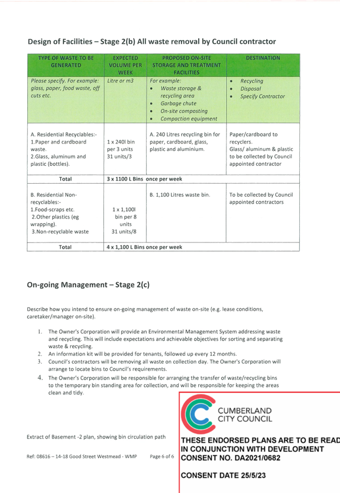
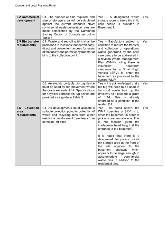
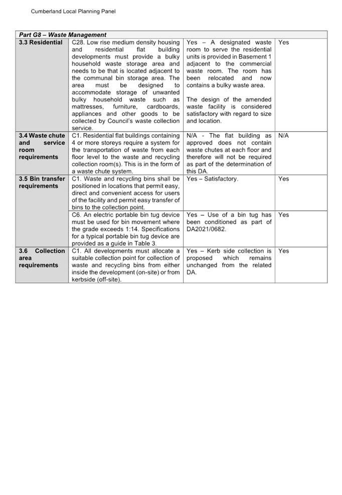
Waste Management
The development application was
referred to Council’s Waste Management Officer for comment who has raised
issue with the disposal of commercial and residential operational waste. It is
considered that the matters raised are able to be addressed by conditions of
consent as detailed in Attachment 1.
Childrens Development Team
No objection to the development
was raised.
External Referrals
Transport for NSW (TfNSW)
No objection to the development
was raised by TfNSW subject to conditions.
Endeavour Energy
No objection to the development
was raised by Endeavour Energy subject to conditions.
Sydney Water
No objection to the development
was raised by Sydney Water subject to conditions.
Planning Comments
The provisions of any
Environmental Planning Instruments (EP&A Act s4.15 (1)(a)(i))
State Environmental Planning
Policies
The proposed development is
affected by the following State Environmental Planning Policies:
|
State
Environmental Planning Policies (SEPPs)
|
Relevant
Clause(s)
|
Compliance
with Requirements
|
|
State Environmental Planning Policy No 65 –
Design Quality of Residential Apartment Development
|
Schedule 1 Design quality
principles and the Apartment Design Guide (ADG)
|
Design changes are proposed to
the residential component of the development in response to the addition of a
new child care centre. As such, an assessment against the relevant provisions
of State Environmental Planning Policy 65 – Design Quality of
Residential Apartment Development (SEPP 65) and the Apartment Design Guide
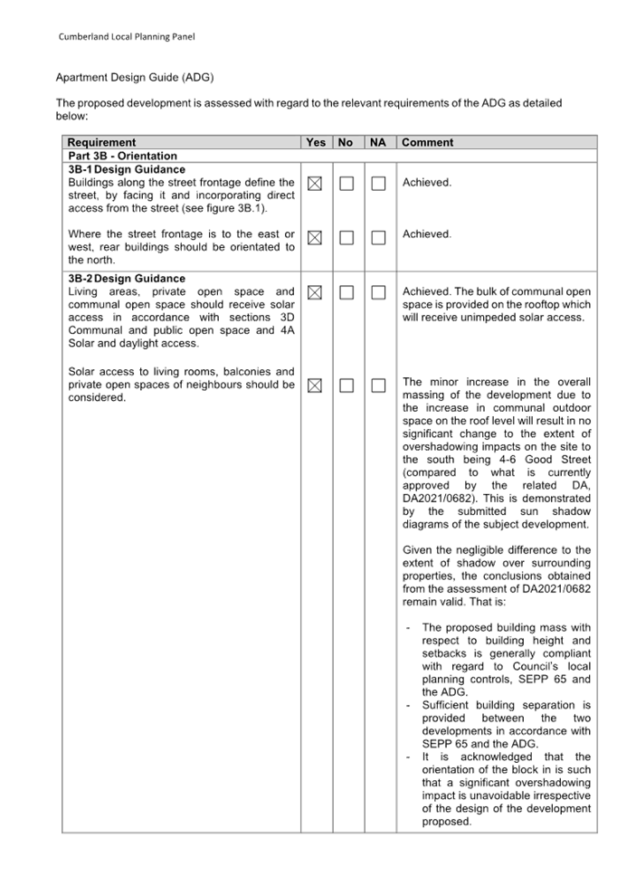
(ADG) is of relevance. The proposal is compliant with the relevant
requirements of the SEPP 65 and the ADG as detailed in the compliance table
at Attachment 7.
|
|
State Environmental Planning Policy (Biodiversity and
Conservation) 2021
|
Chapter 2 -Vegetation in non
Rural Areas
|
The proposal does not exceed
the biodiversity offsets scheme threshold as no vegetation removal is
proposed.
|
·
Chapter 6 - |
Water Catchments
Sydney Harbour Catchment
A detailed assessment is not
required given that there is no direct impact upon the catchment and no direct
impact upon watercourses. As such, the development is acceptable under the
new provisions that came into effect on Monday 21 November 2022.
|
|
State Environmental Planning Policy (Resilience and
Hazards) 2021
|
Chapter 2 - Coastal Management
|
The subject site is not identified as a coastal wetland or
‘land identified as “proximity area for coastal wetlands”
or coastal management area.
|
|
Chapter 4 - Remediation of
Land
Part 4.6
|
Part 4.6 - Contamination
and remediation to be considered in determining development application.
A Detailed Site
Investigation (DSI) was submitted with the application that concluded that
the risk to human health and the environment with regard to soil
contamination is negligible within the context of the child care centre.
Council’s Environmental Health Unit (EHU) has assessed the report and
has raised no objection to the development subject to conditions of consent.
As such, it is
considered that the development application is satisfactory under Part 4.6 of
Chapter 4 of this Policy.
|
|
State
Environmental Planning Policy (Building Sustainability Index: BASIX) 2004
|
Chapter 2 - Infrastructure
|
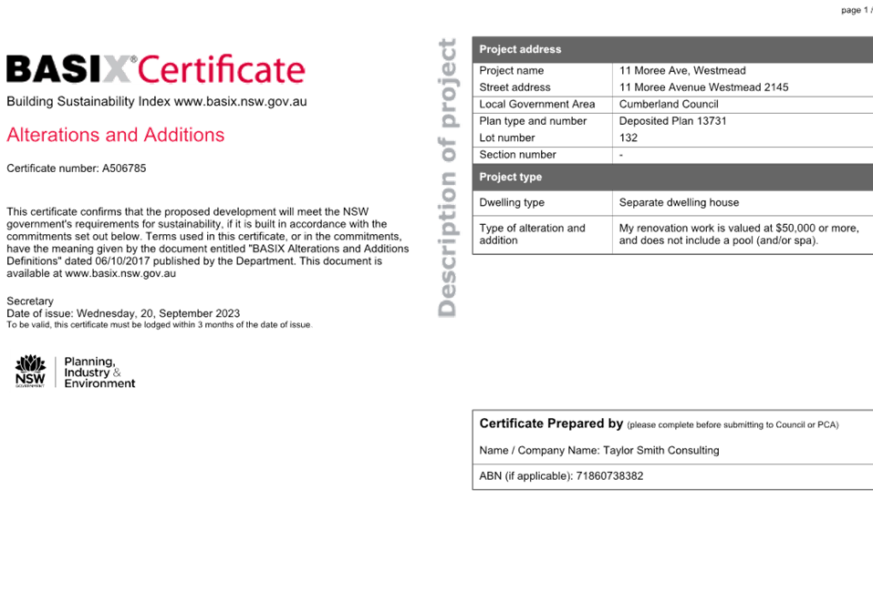
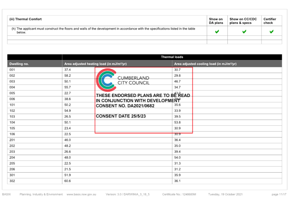
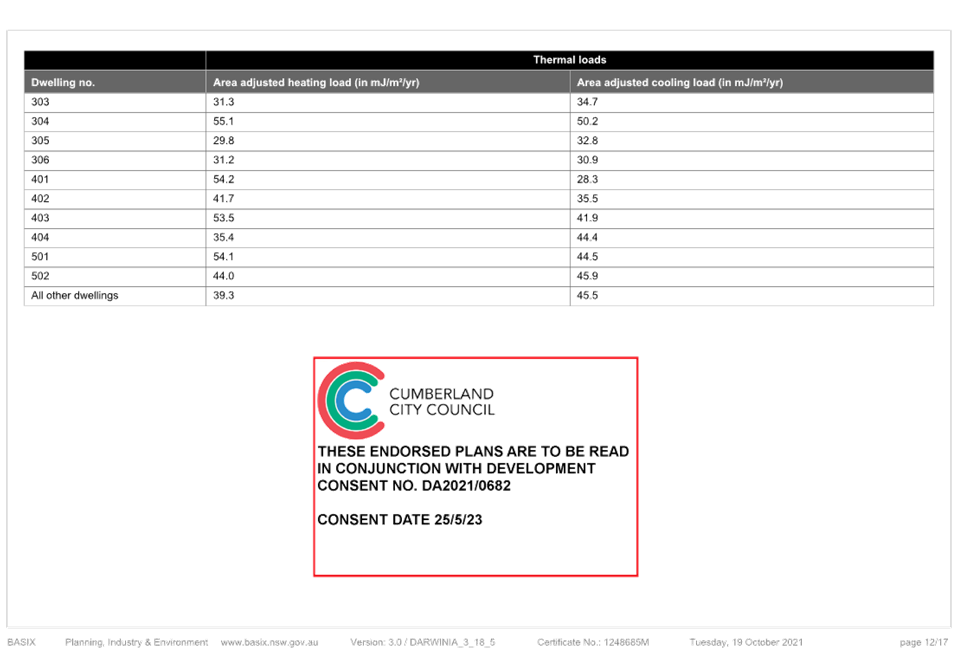
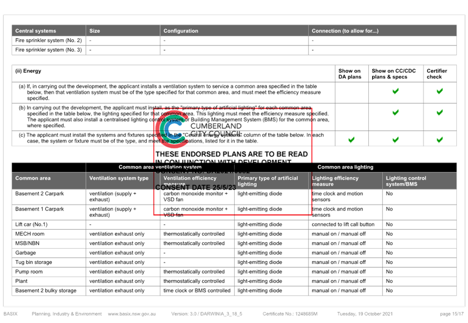
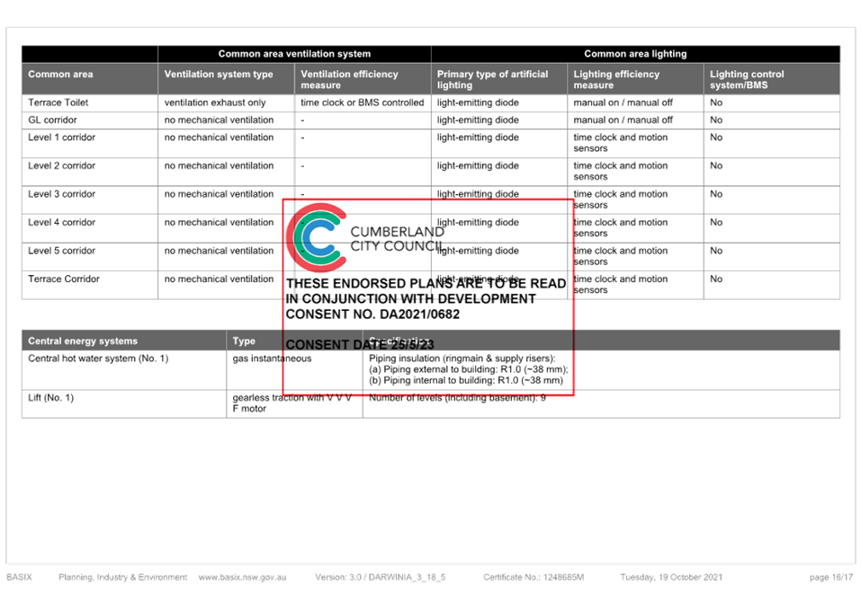
A BASIX Certificate (Certificate number: 1248685M_03) was
submitted in response to modifications to the unit mix and other changes to
the residential component of the development arising from the addition of a
child care centre.
|
|
State
Environmental Planning Policy (Sustainable Buildings) 2022
|
|
State Environmental
Planning Policy (Sustainable Buildings) 2022 sets sustainability
standards of buildings across NSW for residential and non-residential
development. The Sustainable Buildings SEPP was notified on 29 August 2022
and came into effect on 1 October 2023 to allow for the relevant industry to
adjust to the new standards.
In accordance with the savings
and transitional provisions of Clause 4.2 of the Sustainable Buildings SEPP 2022,
the policy does not apply as the development application was submitted but
not determined before 1 October 2023.
|
|
State Environmental Planning Policy (Industry and
Employment) 2021
|
Chapter 3 Advertising and
Signage
|
No signage is proposed as part of the development
application and thus no assessment of signage is required.
|
|
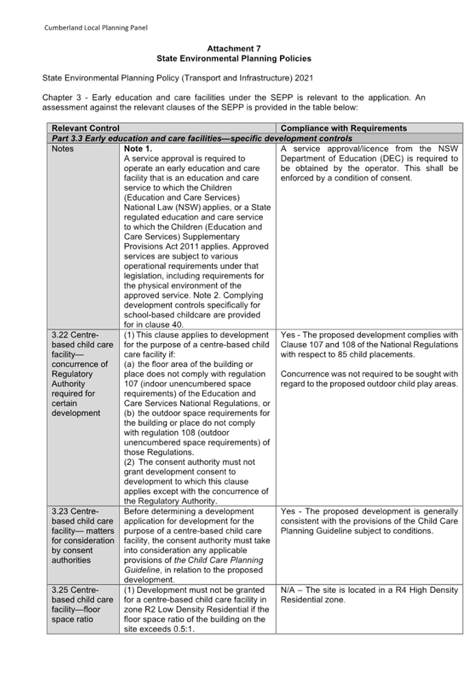
State Environmental Planning Policy (Transport and
Infrastructure) 2021
|
Chapter 2 - Infrastructure
Clause 2.48
|
The development site is located
within 5m of an overhead electricity power line. Clause 2.48 of the Policy
requires comment to be sought from the relevant energy provider (Endeavour
Energy) who raised no objection to the proposed development subject to
conditions.
|
|
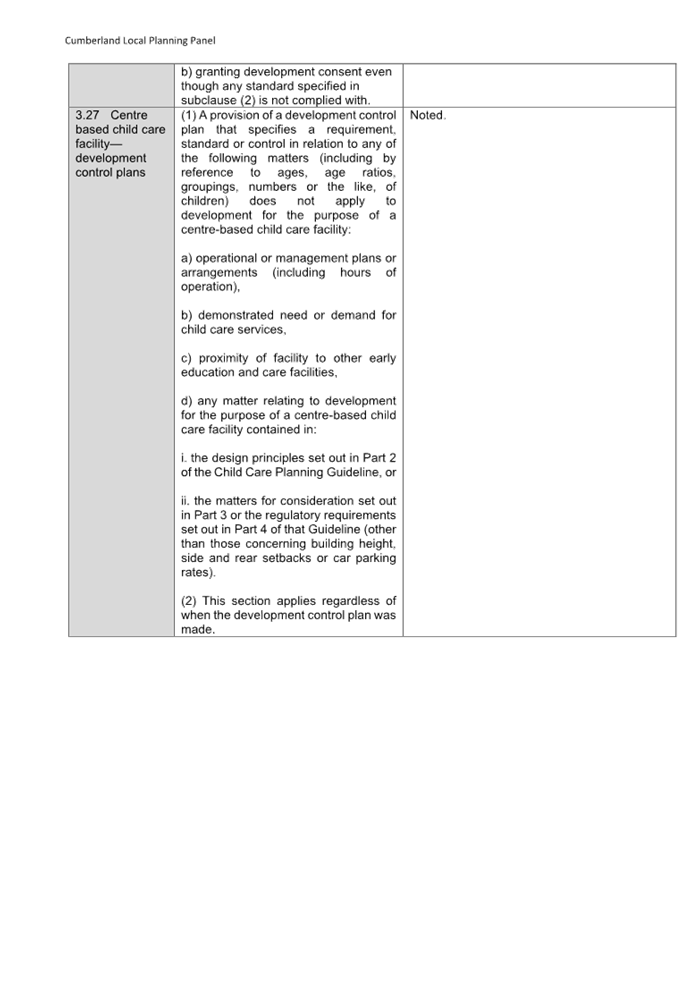
Chapter 3 -
Education Establishments and Child Care Facilities
|
Chapter 3 Educational
Establishments and Child Care Facilities.
The development is generally
compliant with the provisions specified in Chapter 3 of the Policy.
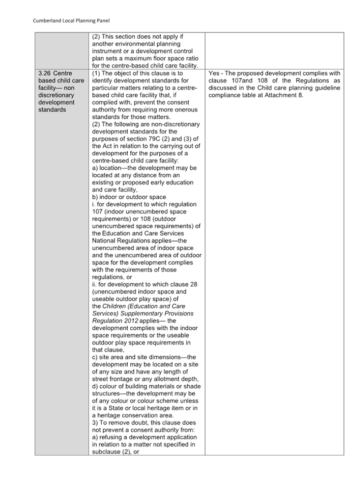
Clause 3.23 of the Policy
requires consideration of the Child Care Planning Guideline in relation to
the proposed development. The proposal has been assessed with regard to the
relevant provisions of the Guideline and is found to be compliant.
A detailed assessment against
the provisions of the Policy and the Guideline is provided in the assessment
table at Attachments 7 and 8.
|
(a) Statement
Environmental Planning Policy No. 65 - Design Quality of Residential Apartment
Development (SEPP 65)
SEPP 65 applies to the development
as the new child care centre requires design changes to the residential
component of the development approved under DA2021/0682. The design changes
result in a building that is over 3 storeys and contains more than 4 dwellings.
A design statement addressing the design quality principles prescribed by SEPP
65 was prepared by the project architect. Integral to SEPP 65 is the Apartment
Design Guide (ADG), which sets benchmarks for the appearance, acceptable
impacts and residential amenity of the development.
A comprehensive assessment against
SEPP 65 and the ADG is contained in Attachment 7.
Local Environmental Plans
Cumberland Local Environmental
Plan 2021 (CLEP)
The provision of the Cumberland
Local Environmental Plan 2021 is applicable to the development proposal. It is
noted that the development is generally compliant with the key statutory
requirements of the Cumberland Local Environmental Plan 2021 and the objectives
of the R4 High Density Residential.
(a) Permissibility:
The proposed development is
defined as a ‘centre-based child care centre’ and a
‘residential flat building’ and is permissible in the R4 High
Density Residential zone with consent.
centre-based child care
facility means -
(a) a building or place used
for the education and care of children that provides any one or more of the
following—
(i) long day care,
(ii) occasional child care,
(iii) out-of-school-hours
care (including vacation care),
(iv) preschool care, or
(b) an approved family day care
venue (within the meaning of the Children (Education and Care Services)
National Law (NSW))
residential flat building
means a building containing 3 or more dwellings, but does not include an
attached dwelling, co-living housing or multi dwelling housing.
Note -
Residential flat buildings are a
type of residential accommodation—see the definition of that term
in this Dictionary.
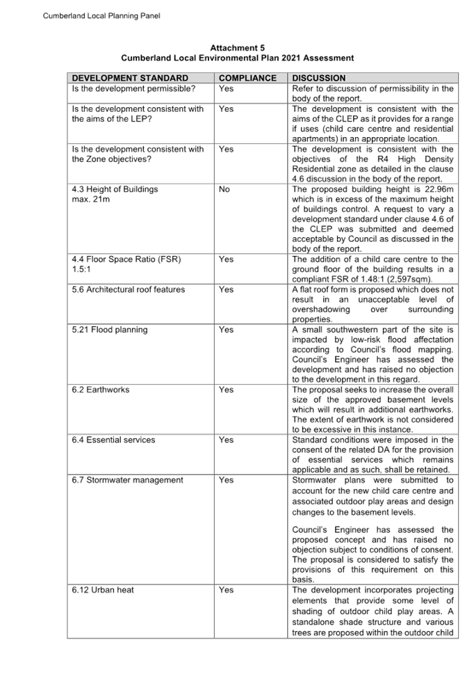
The relevant matters to be
considered under CLEP and the applicable clauses for the proposed development
are summarised below. A comprehensive CLEP assessment is contained in
Attachment 5.
Figure
4 – Cumberland LEP 2021 Compliance Table
|
DEVELOPMENT STANDARD
|
PROPOSED
|
VARIATION
|
DISCUSSION
|
|
4.4 Floor Space Ratio
1.5:1
|
1.48:1
|
Nil
|
Compliance is achieved.
|
|
4.3 Height of Buildings
21m
|
22.96m
|
9.3%
|
The applicant has submitted a
clause 4.6 request in accordance with Cumberland Local Environmental Plan
2021 to vary the height of buildings development standard.
|
Recent changes to the
provisions regarding Clause 4.6 Variations will not apply to the current
development application because the application was lodged prior to the new
provisions coming into effect on Wednesday 1 November 2023.
(b) Clause
4.6 – Variation to Building Height
Clause 4.6 allows the consent authority
to vary development standards in certain circumstances and provides an
appropriate degree of flexibility to achieve better design outcomes. The
consent authority may grant the exception as the Secretary’s concurrence
can be assumed where clause 4.6 is adopted as per the Department of Planning
Circular PS 20-002, dated 05 May 2020.
The applicant has submitted a
written request to vary the development standard for height of buildings. Based
on various case laws established by the Land and Environment Court of NSW such
as Four2five P/L v Ashfield Council [2015] NSWLEC 9, Randwick City Council v
Micaul Holdings P/L [2016] NSW LEC7 and Zhang and anor v Council of the City of
Ryde [2016] NSWLEC 1179, a 3 part assessment framework for a variation request proposed
under clause 4.6 has been considered and an assessment of the proposed
variance, following the 3 part test is discussed in detail below.
The 3 preconditions which must be
satisfied before the application can proceed are as follows:
1. Is
the proposed development consistent with the objectives of the zone?
Applicant’s justification:
The development continues to provide for the housing needs of the community,
continues to provide a range of unit types, will not preclude the ability of
other land uses to provide facilities or services to residents and does not
adversely impact the amenity of the surrounding residential environment.
Planner’s comment: The
development results in a reduction to the total yield (31 to 25 apartments) and
a change to the mix of apartments (refer to development description earlier in
this report). Notwithstanding, it is considered that a broad range of apartment
types is maintained and a satisfactory level of residential amenity (of
residents within the development and surrounding properties) will be maintained
by the provision of acoustic measures to limit the operational noise generated
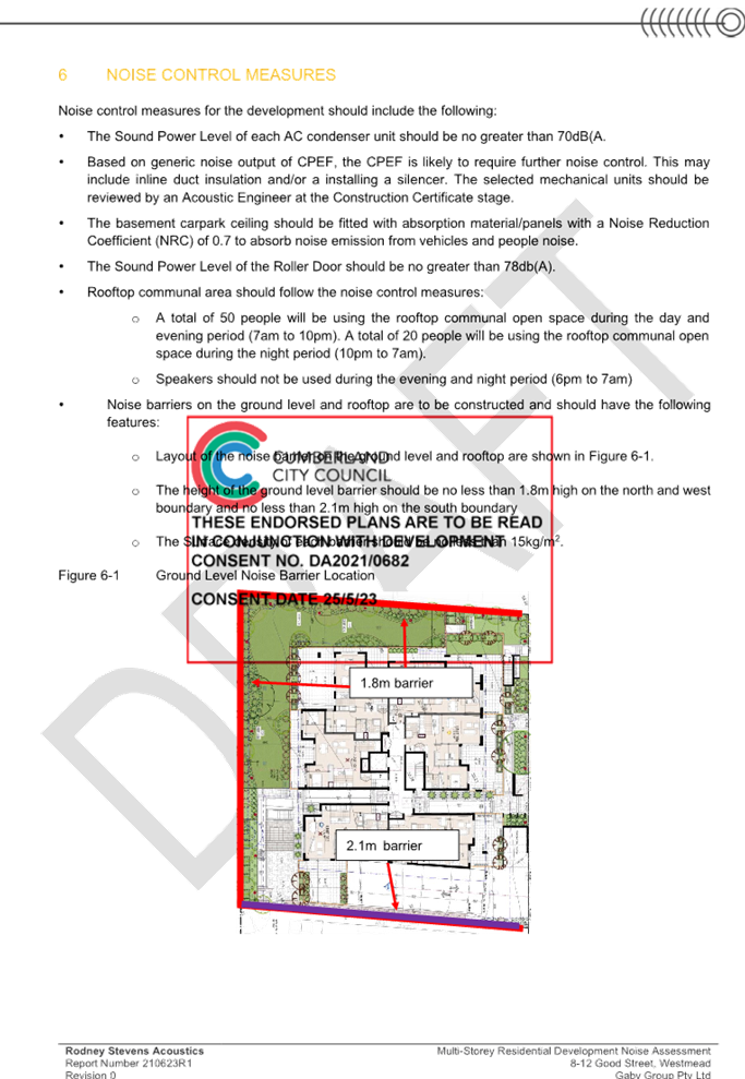
by the child care centre. This includes the provision of acoustic barriers
around the perimeter of outdoor child play areas which is supported by
Council’s Environmental Health Unit (EHU).
The development is considered to
satisfy the objectives of the R4 High Density Residential zone.
2. Is
the proposed development consistent with the objectives of the development
standard which is not met?
Applicant’s justification:
The development continues to provide a scale and intensity that is consistent
with surrounding development what is envisaged for the site and surrounding
area. The development is designed to be compatible with the character of the
locality and the proposed additions do not exceed the maximum building height
control. Material textures and colours have been utilised to reflect the
buildings commercial and residential use character. Strict compliance with the
height limit would not result in reduced solar access impacts.
Planner’s comment: It is
noteworthy that the extent of the building height breach remains unchanged from
what was considered and deemed to be appropriate by the Cumberland Local
Planning Panel under the related development application, DA2021/0682.
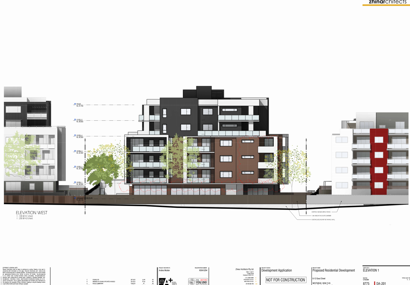
Additionally, based on an assessment of the architectural plans and amended sun
shadow diagrams of the development the following is acknowledged:
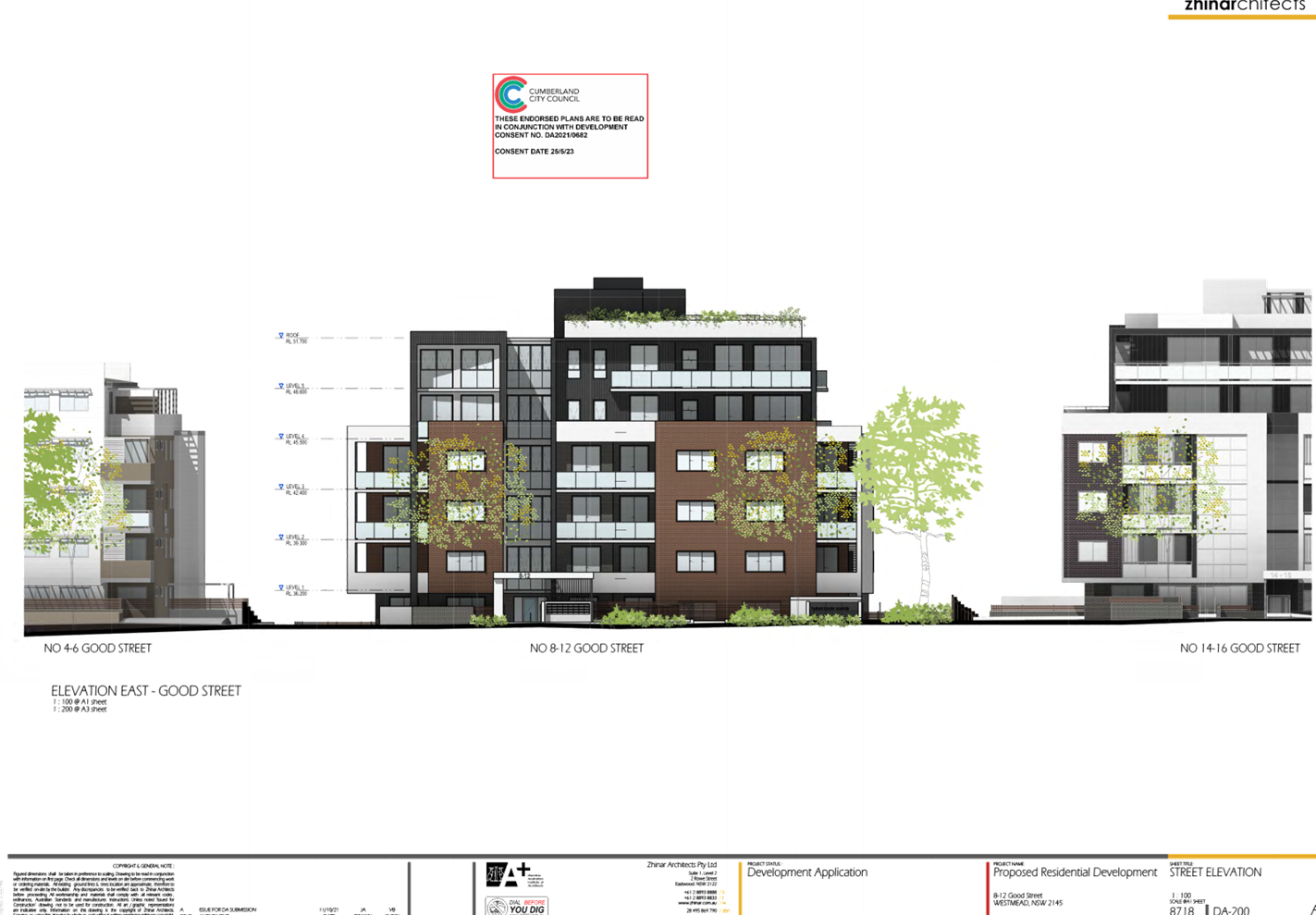
§ The height of the building remains
unchanged and is consistent with adjoining residential flat development to the
north and west which are of equivalent building heights.
§ The development maintains an
appearance that is consistent with contemporary residential flat development in
the area despite the introduction of a child care centre on the ground floor as
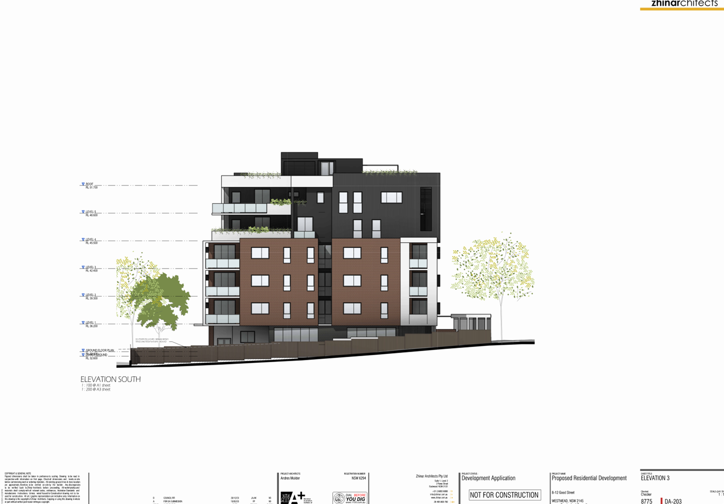
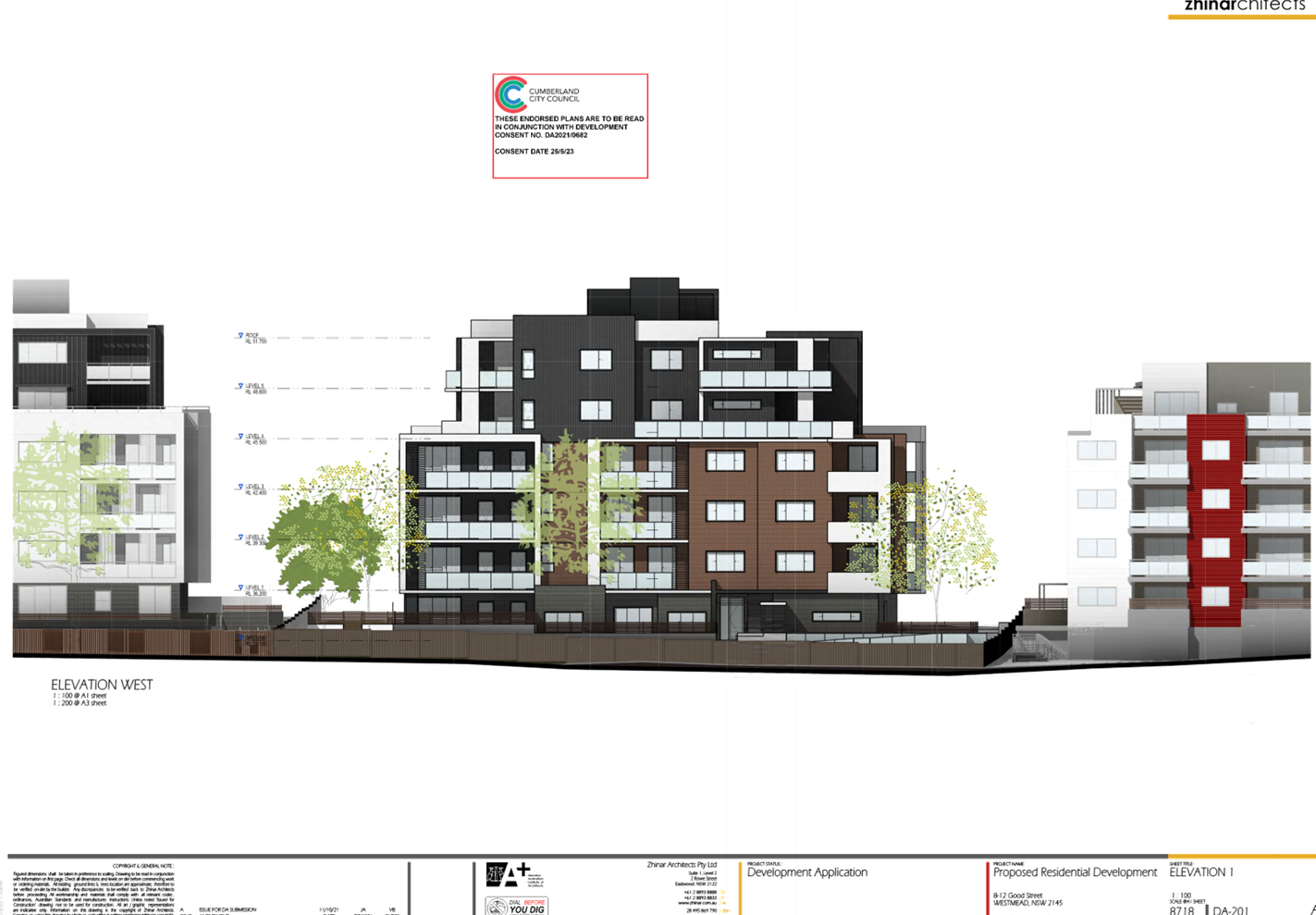
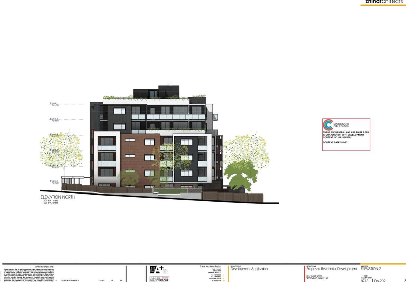
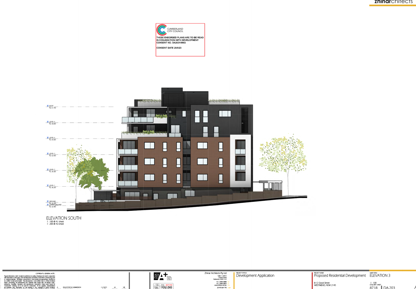
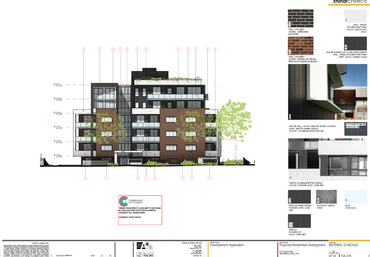
detailed in the submitted elevations in Attachment 2.
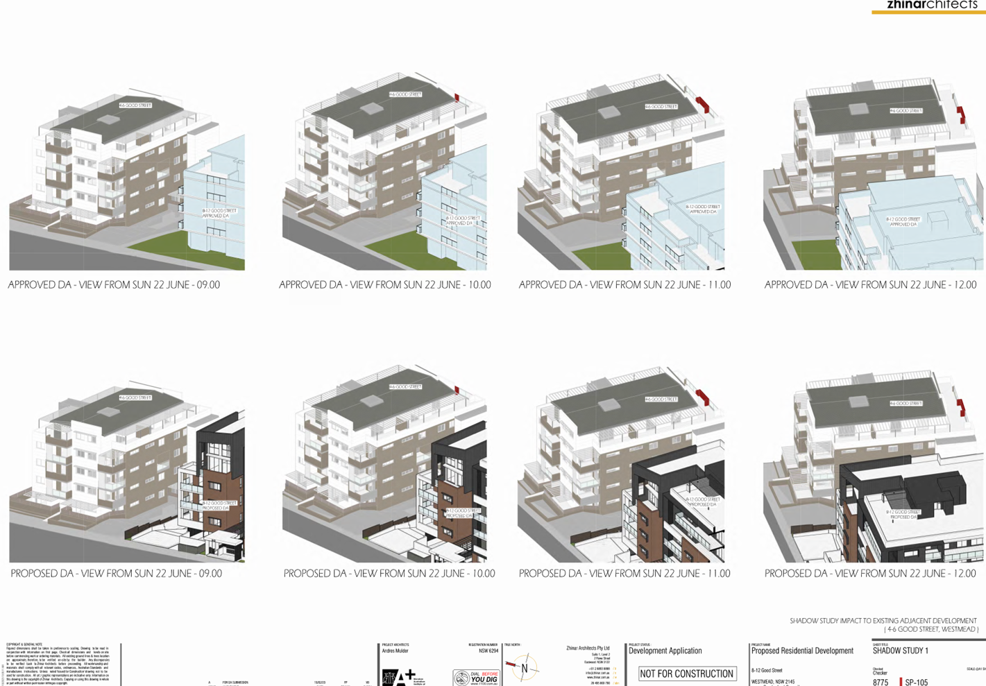
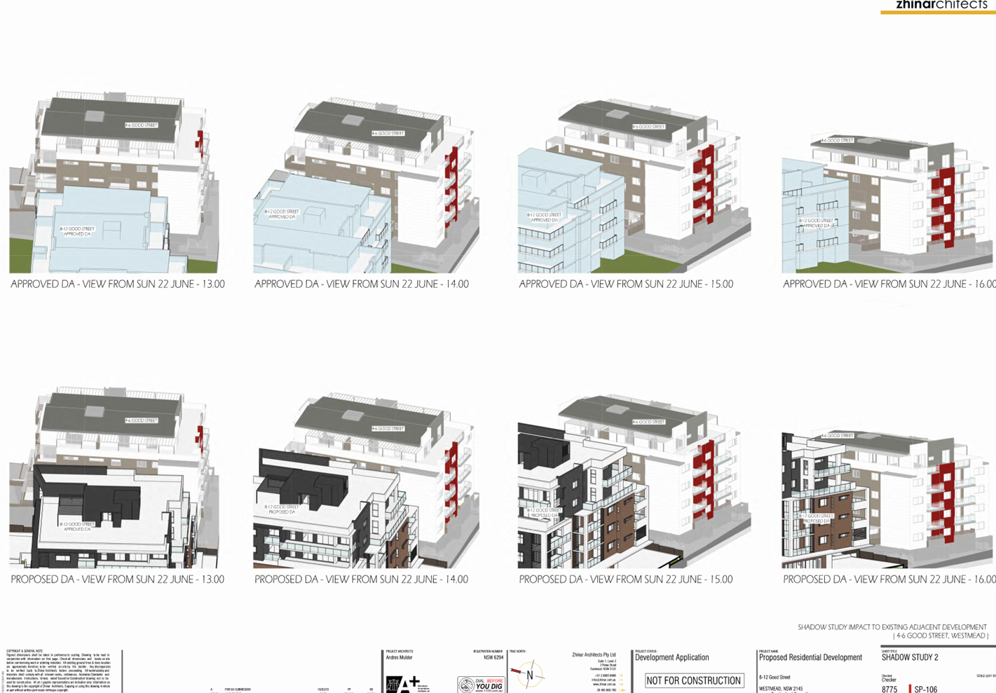
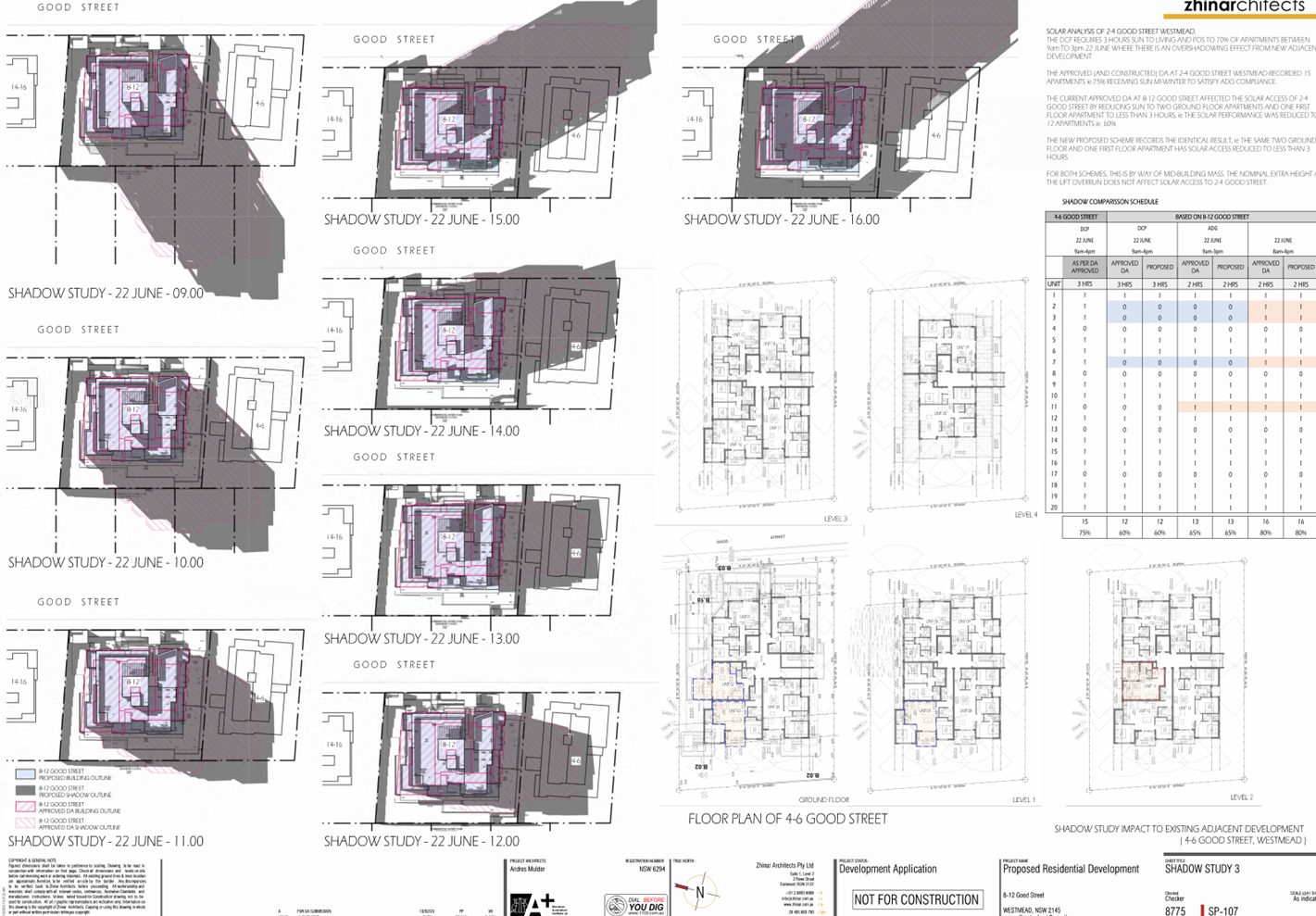
§ Sun shadow diagrams of the
development were submitted (refer to Figure 5 and 6) with the application
indicating no significant change to the extent of shadows over surrounding
properties compared to the development approved under DA2021/0682.
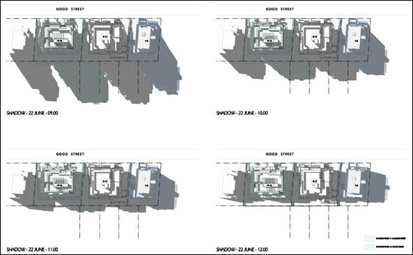
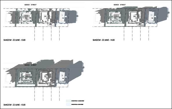
Figure
5. Extent of shadows cast by the approved development DA2021/0682
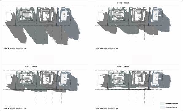
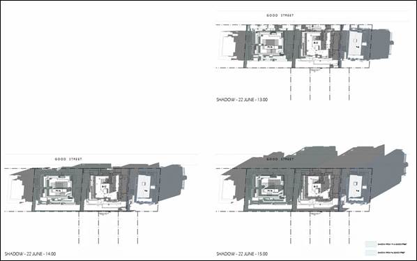
Figure
6. Extent of the shadows cast by the subject DA
Based on the above reasons,
Council considers the development to maintain consistency with the objectives
of the standard.
3. a) Is
compliance with the development standard unreasonable or unnecessary in the
circumstances of the case? And;
Applicant’s justification:
The proposed works do not result in a numerical increase in the approved
building height and therefore the exceedance continues to be reasonable as it
only relates to the lift overruns and roof structures and does not result in
adverse impacts on surrounding development.
Planner’s comment: Council
concurs with the justification provided by the applicant and considers
compliance to be unnecessary noting these building elements do not contain
internal habitable floor area, a relatively small in size and do not add
significantly to the shadow cast by the development. It is Council’s
opinion that to require a reworking of the design to achieve compliance would
be unreasonable in this instance.
b) Are
there sufficient environmental planning grounds to justify contravening the
development standard and therefore is the applicant’s written
justification well founded?
Applicant’s justification:
The proposed non-compliance was deemed acceptable under the related DA,
DA2021/0682, the proposed development does not result in additional variations
or adverse impacts on adjoining properties and the area of exceedance only
relates to the lift overrun, a small portion of the rooftop area to facilitate
stairs and services.
Planner’s comment: Council
considers that there are sufficient environmental planning grounds to justify
contravening the development standard noting the following:
§ Sufficient solar access is
maintained to surrounding residential development based on the sun shadow
diagrams which show no significant change to the extent of shadow cast over
these properties as currently approved.
§ As discussed above, the development
maintains compliance with the objectives of the prescribed land use zone and
the intent of the height of buildings development standard.
Council therefore considers the
applicant’s written justification to be well founded.
Conclusion:
Council is satisfied that the
applicant’s written request has adequately addressed the matters required
to be demonstrated by clause 4.6 subclause (3). Council is further satisfied
that the proposed development will be in the public interest because it is consistent
with the objectives of the particular standard and the objectives for
development within the zone in which the development is proposed to be carried
out.
It is the view of Council Officers
that justification provided is satisfactory and having considered the
application on its merit, the exception to the maximum height of buildings
development standard is considered acceptable in this instance.
The provisions of any proposed
instrument that is or has been the subject (EP&A Act s4.15 (1)(a)(ii))
No proposed planning instruments
applicable.
The provisions of any
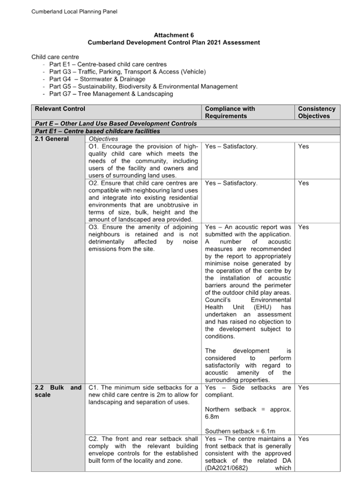
Development Control Plans (EP&A Act s4.15 (1)(a)(iii))
The Cumberland Development Control
Plan 2021 is relevant to the development proposal.
The development has been assessed
using the following chapters:
Child care centre component:
· Part E1 –
Centre-based child care centres
· Part G3 –
Traffic, Parking, Transport & Access (Vehicle)
· Part G4
– Stormwater & Drainage
· Part G5 –
Sustainability, Biodiversity & Environmental Management
· Part G7 –
Tree Management & Landscaping
Residential component:
· Part B3 –
Residential flat buildings
· Part B5 -
Adaptable housing and housing mix
· Part G3 –
Traffic, Parking, Transport & Access (Vehicle)
· Part G4
– Stormwater & Drainage
· Part G5 – Sustainability,
Biodiversity & Environmental Management
· Part G8 –
Waste Management
The development is found to comply
with the relevant provisions except for the following:
Figure
7 – Cumberland DCP 2021 - Compliance Table
|
Clause
|
Control
|
Proposed
|
Complies
|
|
Part E1, clause 2.2, C5
|
Extent of outdoor child play area
The front setback area shall not be used as or included in
the calculation of outdoor play space.
|
The outdoor child play area of the child care centre
encroaches approximately 7% (14sqm) of the front setback area of the
development which does not comply.
|
No
|
|
Part B3, clause 3.2, C3
|
Extent of basement walls
Where practicable, basement walls not located on the side
boundary shall have minimum setback of 1.2m from the side boundary to allow
planting.
|
The side setback of Basement 2 is extended towards the
southern side boundary resulting in a side setback of 1m.
|
No
|
|
Part B5, clause 2.2, C1
|
Residential apartment mix
A minimum provision of one bedroom/studio dwellings (10%),
and three plus-bedroom dwelling types (10%) with the balance provided as 2
bedroom dwellings.
|
Due to the deletion of six (6) ground floor residential
units to accommodate the new child care centre, the apartment mix is altered
to provide the following percentage yields:
- 8%
1 bedroom; and
- 8%
2 bedroom.
|
No
|
As indicated in the compliance
table above, the proposed development departs from three controls of the CDCP.
Irrespective of these departures,
it is considered that the proposal performs adequately from an environmental planning
viewpoint and may be supported for the reasons discussed below:
Extent of outdoor child play
area
The non-compliance in this
instance is considered acceptable noting the extent of the encroachment is
insignificant relative to the size of the front setback area (approximately 7%
of the front setback area) and the outdoor play area cannot be seen from the
public domain due to being screened by building elements including an outdoor
storage room and a fire egress stair. As such, it is considered that the visual
and acoustic amenity of children and users of the centre will not be
compromised by this non-compliance.
Extent of basement level walls
The non-compliance is considered
acceptable in this instance in noting that the southern wall of Basement 2 is
now in alignment with the currently approved wall of the basement level above.
This is more practical from a construction perspective. Planning-wise, the
building mass above ground level remains consistent with what was approved
under the related DA noting that the extension of Basement 2 will not be
completely underground and will therefore poses no impact on the amenity of the
adjacent properties.
Residential apartment mix
The apartment mix as approved
under DA2021/0682 provided yields of 6.4% for both 1 and 2 bedroom apartment
types. The proposed development reduces the degree of the non-compliance by
increasing the proportion of these apartment types to 8%. As the extent of the
non-compliance is reduced from what is currently approved, the non-compliance
is considered to be acceptable in this instance.
Car park provision
The provision of car parking for
both uses is fully compliant as detailed in the following table.
|
Use
|
Parking requirement
|
Proposed
|
Compliance
|
|
Child care centre
|
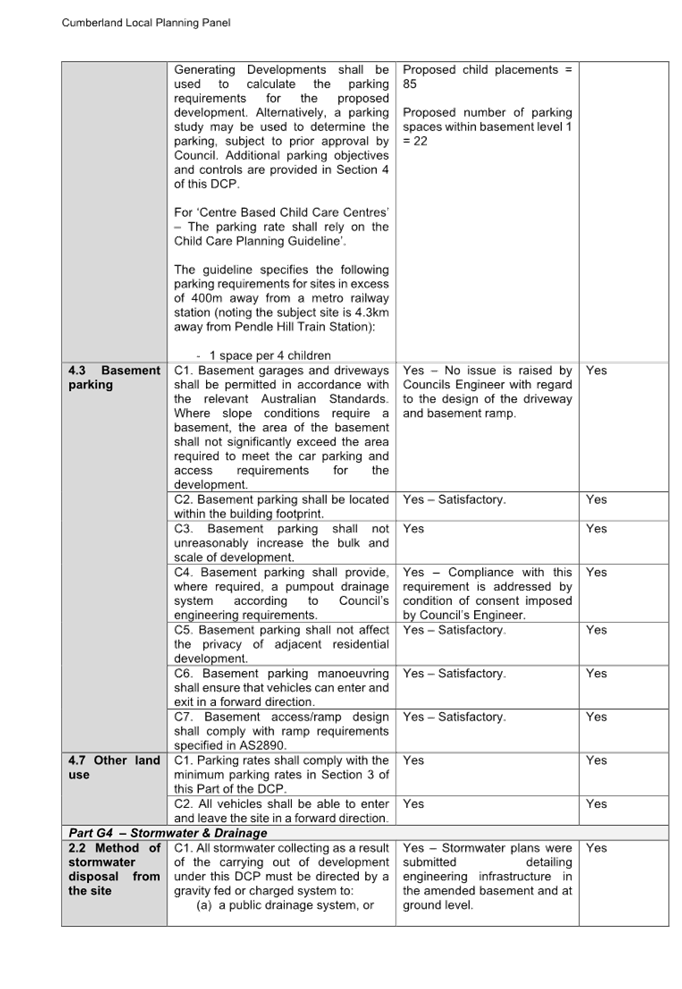
CDCP, Part G3, clause 3
Onsite parking is to comply at a minimum with the rates in
Table 1.
Table 1 specifies that For ‘Centre Based Child Care
Centres’ – The parking rate shall rely on the Child Care Planning
Guideline’ (The Guide).
The Guide specifies the following parking rate for centres
located more than 400m away from a metro strain station:
- 1
space per 4 children
|
Based on 85 child placements, 22 parking spaces are
provided in Basement 1.
|
Yes
|
|
Residential apartments
|
CDCP, Part G3, clause 3
Onsite parking is to comply at a minimum with the rates in
Table 1:
- 1
and 2 bedroom-1 space/dwelling
- 3
or more bedrooms–1.5 space/dwelling
- Visitor
parking–0.25 space/dwelling
- Bicycle
parking–1 space/3 dwellings
|
Based on an apartment mix of 2 x 1 bed, 21 x 2 bed and 2 x
3 bed, the following parking is provided:
26 x residential
7 visitor
19 bicycle
|
Yes
|
The provisions of any planning
agreement that has been entered into under section 7.4, or any draft planning
agreement that a developer has offered to enter into under section 7.4
(EP&A Act s4.15(1)(a)(iiia))
There is no draft planning
agreement associated with the subject Development Application.
The provisions of the
Regulations (EP&A Act s4.15 (1)(a)(iv))
The proposed development raises no
concerns as to the relevant matters arising from the Environmental Planning and
Assessment Regulation 2021 (EP&A Reg).
The Likely Environmental,
Social or Economic Impacts (EP&A Act s4.15 (1)(b))
It is considered that the proposed
development will have no significant adverse environmental, social or economic
impacts in the locality.
The suitability of the site for
the development (EP&A Act s4.15 (1)(c))
The subject site and locality is
not known to be affected by any natural hazards or other site constraints
likely to have a significant adverse impact on the proposed development.
Accordingly, it is considered that the development is suitable in the context
of the site and surrounding locality.
Submissions made in accordance with the Act or Regulation
(EP&A Act s4.15 (1)(d))
|
Advertised (Website)
|
Mail
|
Sign
|
Not Required
|
In accordance with Council’s
Notification requirements contained within the Cumberland Development Control
Plan 2021, the proposal was publicly notified including residents in the
adjoining Local Government Area of Parramatta for a period of 14 days between
22 June 2023 and 6 July 2023. The notification generated two (2) submissions in
respect of the proposal with none disclosing a political donation or gift. The
issues raised in the public submissions are summarised and commented on as
follows:
Figure
8 – Submissions summary table
|
Issue
|
Planner’s Comment
|
|
On-street parking availability
|
The provision of onsite
parking for both the child care centre and residential components of the
development are compliant with the parking requirements in the relevant
planning instruments as detailed in this report. Council’s Engineer has
undertaken a parking assessment and has raised no objection to the
development in this regard. As sufficient onsite parking is provided to cater
for the anticipated demand of the development, it is considered that there
will be no impact on the current availability of on-street parking in the
area.
|
|
Safety of pedestrians
|
The safety of children, staff
and visitors to the child care centre was considered as part of the
assessment. The development has been designed to ensure sufficient onsite
parking is provided within two levels of basement to accommodate the
anticipated demand for both uses of the development. With respect to the
child care centre, visitor spaces will be used by parents to drop off and
pick up children within the confines of the basement level negating the need
for vehicles to stop on the roadway. Likewise, sufficient parking is provided
in the basement levels to serve the residential component of the development
which is fully compliant with the relevant requirements of the Cumberland
Development Control Plan.
The onsite parking facilities for both components of the
development has been designed to ensure the safety of all stakeholders
including pedestrians will be maintained during the operation of both uses of
the development.
|
The public interest (EP&A
Act s4.15(1)(e))
In view of the foregoing analysis,
it is considered that the development, if carried out subject to the conditions
set out in the recommendation below, will have no significant adverse impacts
on the public interest.
Cumberland Local
Infrastructure Contributions Plan 2020
The development would require the
payment of contributions in accordance with Cumberland Local Infrastructure
Contributions Plan 2020.
Noting the decrease in number and
change to the mix of residential units (refer to description of development),
contributions imposed as part of the related DA, DA2021/0682 requires
amendment. The Section 7.11 contribution of $450,143.00 is amended to
$386,474.00 and will be applied as part of the ‘amending’ condition
of consent (Condition 6) in the Draft Notice of Determination.
Housing and Productivity
Contribution (HPC)
In accordance with s7.24 of the
Environmental Planning and Assessment Act, 1979 as amended by the Environmental
Planning and Assessment Amendment (Housing and Productivity Contribution) Act
2023, the development is subject to the (Housing and Productivity Contribution)
Act 2023.
In accordance with Part 2 of
Schedule 5 of the Environment Planning and Assessment (Housing and Productivity
Contribution) Order 2023 (‘the Order’), the Order does not apply to
a development consent granted to a pending development application (Pending
DA).
A ‘Pending DA’ as per
Schedule 1 of the Order and Schedule 6, Part 9, s16 of the EP&A Reg 2021 is
as follows:
(a) A
development application that is made, but not determined, before the
commencement of this Order, or
(b) A development
application that is made and determined before the commencement of this Order,
but has not been finally determined, or
(c) An
application for a complying development certificate that is made, but not
determined, before the commencement of this Order.
As the application was lodged on
the 02 June 2023, the provisions of the HPC do not apply.
Disclosure of Political
Donations And Gifts
The applicant and notification
process did not result in any disclosure of Political Donations and Gifts.
The development application has
been assessed in accordance with the relevant requirements of the Environmental
Planning and Assessment Act 1979, Environmental Planning and Assessment
Regulation 2021, Cumberland Local Environmental Plan 2021, Cumberland Development
Control Plan 2021 and is considered to be satisfactory for approval subject to
conditions.
The proposed development is
appropriately located within the R4 High Density Residential zone under the
relevant provisions of the Cumberland LEP, however variations in relation to
the height of buildings development standard under the Cumberland LEP and the
extent of child play area, basement level walls and the residential apartment
mix under the Cumberland DCP are sought.
Having regard to the assessment of
the proposal from a merit perspective, Council may be satisfied that the
development has been responsibly designed and provides for acceptable levels of
amenity for future residents. It is considered that the proposal successfully
minimises adverse impacts on the amenity of neighbouring properties. Hence the
development, irrespective of the departures noted above, is consistent with the
intentions of Council’s planning controls and represents a form of
development contemplated by the relevant statutory and non-statutory controls
applying to the land.
For these reasons, it is
considered that the proposal is satisfactory having regard to the matters of
consideration under Section 4.15 of the Environmental Planning and Assessment
Act 1979, and the development may be approved subject to conditions.
There are no consultation
processes for Council associated with this report.
There are no financial
implications for Council associated with this report.
There are no policy implications
for Council associated with this report.
Communication /
Publications:
The final outcome of this matter
will be notified in the newspaper. The objectors will also be notified in
writing of the outcome.
|
1. That
the Clause 4.6 variation request to contravene the height of buildings
development standard, pursuant to the Cumberland LEP 2021, be supported.
2. That
Development Application No. DA2023/0320 for alterations and additions to the
residential flat building approved under DA2021/0682 to accommodate an 85
place centre-based child care centre with outdoor play area on the ground
floor, changes to the design of basement levels, deletion of ground floor
residential units, changes to communal space and various internal and
external changes to the building on land at 8-12 Good Street WESTMEAD NSW
2145 be Approved subject to conditions listed in the attached schedule.
3. Persons
who have lodged a submission in respect to the application be notified of the
determination of the application.
|
1. Draft
Notice of Determination
2. Architectural
Plans
3. Clause
4.6 Request
4. Submissions
received
5. Cumberland
LEP Assessment
6. Cumberland
DCP Assessment
7. State
Environmental Planning Policies Assessment
8. Child
Care Planning Guideline Assessment
9. Approved
Architectural Plans DA2021/0682
DOCUMENTS
ASSOCIATED WITH
REPORT LPP001/24
Attachment 1
Draft Notice of Determination
Cumberland
Local Planning Panel Meeting
14 February 2024

DOCUMENTS
ASSOCIATED WITH
REPORT LPP001/24
Attachment 2
Architectural Plans
Cumberland
Local Planning Panel Meeting
14 February 2024
DOCUMENTS
ASSOCIATED WITH
REPORT LPP001/24
Attachment 3
Clause 4.6 Request
Cumberland
Local Planning Panel Meeting
14 February 2024

DOCUMENTS
ASSOCIATED WITH
REPORT LPP001/24
Attachment 4
Submissions received
Cumberland
Local Planning Panel Meeting
14 February 2024
DOCUMENTS
ASSOCIATED WITH
REPORT LPP001/24
Attachment 5
Cumberland LEP Assessement
Cumberland
Local Planning Panel Meeting
14 February 2024

DOCUMENTS
ASSOCIATED WITH
REPORT LPP001/24
Attachment 6
Cumberland DCP Assessment
Cumberland
Local Planning Panel Meeting
14 February 2024
DOCUMENTS
ASSOCIATED WITH
REPORT LPP001/24
Attachment 7
State Environmental Planning Policies Assessment
Cumberland
Local Planning Panel Meeting
14 February 2024


DOCUMENTS
ASSOCIATED WITH
REPORT LPP001/24
Attachment 8
Child Care Planning Guideline Assessment
Cumberland
Local Planning Panel Meeting
14 February 2024

DOCUMENTS
ASSOCIATED WITH
REPORT LPP001/24
Attachment 9
Approved Architectural Plans DA2021/0682
Cumberland
Local Planning Panel Meeting
14 February 2024
Cumberland Local Planning Panel Meeting
14 February 2024
Item
No: LPP002/24
Development
Application - 45 - 47 Merrylands Road, Merrylands
Directorate: Environment
and Planning
Responsible
Officer: Executive
Manager Development and Building
|
Application
accepted
|
19 June 2023.
|
|
Applicant
|
S Al Ghrabi.
|
|
Owner
|
Mr S Al Ghrabi.
|
|
Application
No.
|
DA2023/0285.
|
|
Description
of Land
|
45 - 47 Merrylands Road
Merrylands being Lot C in DP 320347 and Lot 25A in DP 417959.
|
|
Proposed
Development
|
Demolition of existing
structures and construction of a four storey residential apartment building
pursuant to Chapter 2 Affordable Housing of State Environmental Planning
Policy (Housing) 2021 comprising of 17 apartments over basement parking with
associated stormwater and landscaping works and strata
subdivision into 17 lots.
|
|
Site
Area
|
1277.30 sqm.
|
|
Zoning
|
R4 - High Density Residential.
|
|
Disclosure
of political donations and gifts
|
Nil disclosure.
|
|
Heritage
|
The site is not heritage
listed or within a Heritage Conservation Area.
|
|
Principal
Development Standards
|
Floor Space Ratio
Permissible: 0.8:1 (LEP).
Proposed:1.13:1 (this includes an additional bonus FSR of 33% as
per SEPP Housing 2021).
Height of Building
Permissible: 11m.
Proposed:11.65m.
|
|
Issues
|
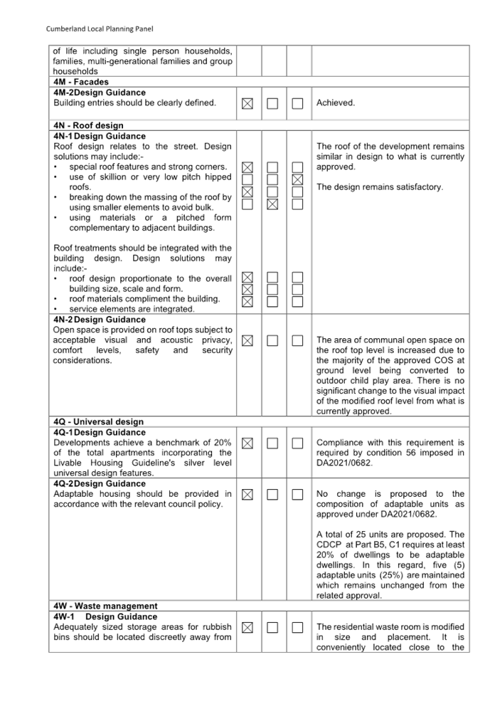
· Height
of Building.
· Apartment
size.
· Basement
side setback.
|
1. Development
Application 2023/0285 was accepted on the 19 June 2023 for the demolition of
existing structures and construction of a four storey residential apartment
building pursuant to Chapter 2 Affordable Housing of State Environmental
Planning Policy (Housing) 2021 comprising of 17 apartments over basement
parking with associated stormwater and landscaping works and strata subdivision
into 17 lots.
2. The
application was publicly notified to occupants and owners of the adjoining
properties for a period of fourteen days between 10 July 2023 and 24 July 2023.
In response, no submissions were received.
3. The
subject site is not listed as a heritage item or located within the heritage
conservation area within the Cumberland Local Environmental Plan 2021.
4. The
notable variations are delineated as follows:
|
Control
|
Required
|
Provided
|
% Variation
|
|
Apartment Design Guide
Visual Privacy (Part 3F)
|
6m
6m (habitable) & 3m (non habitable) (4 storeys)
|
Level 1 & Level 2:
4.5m separation to habitable rooms on the eastern and
western elevation.
|
25%
|
|
Apartment Design Guide
4D-1 - Apartment Layout.
|
70 sqm for 2 bedroom apartment
|
Unit 5: 67 sqm.
|
4.3%
|
|
Cumberland Local
Environmental Plan 2021.
Clause 4.3 - Height of
Buildings.
|
11m.
|
11.65m (Maximum)
|
5.9%
|
|
Cumberland DCP 2021
Part B3 Section 3.2 Control C1 and C3 - Basement
footprint.
|
Basement be contained within footprint of building.
Basement shall have a minimum setback of 1.2m from the
side boundary.
|
775 mm from eastern boundary
i)
.
|
35.4%.
|
5. The
application is referred to the Panel for determination.
6. The
application is recommended for approval subject to conditions as recommended in
the Council’s assessment report.
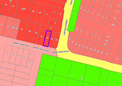
Subject Site And Surrounding
Area
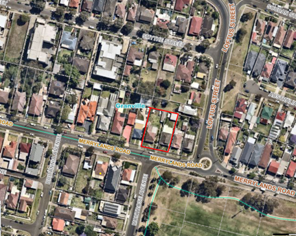
The subject site is located at
45-47 Merrylands Road Merrylands and consists of Lot C in DP 320347 and Lot 25A
in DP 417959. The site is regular in shape and has a total combined area of
1,277.3 square metres with a combined frontage of 31.09m to Merrylands Road,
Merrylands. The subject allotment is zoned R4 – High Density Residential
under the Cumberland Local Environmental Plan 2021. The site as a combined
entity contains two single storey clad dwellings (one dwelling house per
allotment), various trees along the western side boundary, two separate
vehicular crossovers, two fibro outbuildings and two detached fibro garages and
an awning.
The developments adjoining to the
east, west and north (rear) are older low density developments being dwelling
houses. The locality is undergoing transition and comprises of older low
density housing stock and newer high density developments being residential
apartment buildings and shop top housing developments.
Land to the north (bounded by
Mombri Street) and immediate west is zoned R4 High Density Residential. A
railway Line including the Merrylands Railway Station is located further to the
west being approximately 340m from the site and the Merrylands Town Centre is
located further west but on the western side of the Railway Line. Land to the
east (eastern side of Loftus Street) is zoned R3 Medium Density Residential and
land to the south is zoned R2 Low Density Residential. Granville Park is
located to the south east on the opposite side of Merrylands Road.
Figure
1 - Locality Plan of subject site edged in red. Source: Council’s
IntraMaps
Figure
2 - Zoning map with the subject site edged in purple. Source: Council’s
IntraMaps.
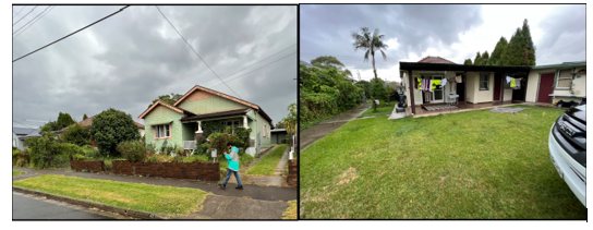
Photos
of the site taken during a site inspection on the 10 July 2023 are provided
below:
Description of The
Development
Council has received a development
application that was accepted on the 19 June 2023 for demolition of
existing structures and construction of a four storey residential
apartment building pursuant to Chapter 2 Affordable Housing of SEPP
(Housing) 2021 comprising of 17 apartments over basement parking with
associated stormwater and landscaping works and strata subdivision into 17
lots.
Key features of the development
proposal are as follows:
|
Basement
|
- 22
residential car spaces; including 18 residential parking spaces and 2
accessible spaces.
- 4
visitor parking spaces.
- Storage,
plant room, lifts and fire stairs.
|
|
Ground Floor
|
- 3 x 2 bedroom
apartments.
- 1 x 1 bedroom apartment.
- 1 x 3 bedroom apartment.
- Entry
foyer/lobby.
- Lift
and fire stair.
- Landscaped
Communal Open Space.
|
|
Level 1 and 2
|
The development provides 5 apartments per level
within Levels 1 & 2 (a total of 10) with the following breakdown:
- 1 x
1 bedroom apartments per level; and
- 4 x
2 bedroom apartments per level.
- Internal
foyer including a lift core and stairwells including fire escape stairwell.
|
|
Level 3
|
- 2 x 2
bedroom apartments;
- Roof top
communal open space.
|
The dwelling mix of the proposal
is as follows:
· 3 x 1 bedroom
apartments (17.6%).
· 13 x 2 bedroom
apartments (76.4%).
· 1 x 3 bedroom
apartment (5.88%).
Other works:
· Construction of a
new vehicular crossing along south-eastern corner of site leading to basement
entrance.
· Landscaping works
throughout site including planting of 13 trees.
· Ancillary
stormwater and driveway works.
· Strata subdivision
into 17 lots.
· 7 apartments out
of 17 apartments are proposed to be used as affordable housing units.
History
A Pre - Lodgement meeting
PL2022/0046 was held on the 24 November 2022 for the demolition of all existing
structures, consolidation of 2 lots into 1 allotment and the construction of a
four storey boarding house comprising of 38 double boarding rooms for 76
lodgers and 12 parking spaces.
The current application was
accepted by Council on the 19 June 2023 for determination.
The application was deferred
initially in relation to floor space ratio, building height, deep soil zone,
setbacks, amenity, stormwater management, parking and traffic impacts.
Amended plans and additional
information were submitted to Council on 31 October 2023 and 1 December 2023
respectively. The application did not warrant re-notification as the amendments
made did not result in a greater environmental impact to the locality.
Applicants Supporting
Statement
The applicant has provided a
Statement of Environmental Effects prepared by Think Planners dated 11 May 2023
and 14 November 2023 in support of the application.
Contact With Relevant
Parties
The assessing officer has
undertaken a site inspection of the subject site and surrounding properties and
has been in regular contact with the applicant throughout the assessment
process.
Internal Referrals
Development Engineering
The development application was
referred to Council’s Development Engineer for comment who has advised
that the development proposal is satisfactory and therefore can be supported
subject to recommended conditions of consent.
Environment and Health
The development application was
referred to Council’s Environment and Health Officer for comment who has
advised that the development proposal is satisfactory and therefore can be
supported subject to conditions of consent.
Tree Management
The development application was
referred to Council’s Tree Management Officer for comment who has advised
that the development proposal is satisfactory and therefore can be supported
subject to conditions of consent.
Waste Management
The development application was
referred to Council’s Waste Management Officer for comment who has
advised that the development proposal is satisfactory and therefore can be
supported subject to conditions of consent.
External Referrals
Endeavour Energy
The development application was
referred to Endeavour Energy for comment. As per correspondence of 23 July
2023, it was advised that the development is supportable in terms of
electricity connection and there is adequate clearance to the existing
electricity asset close by subject to conditions.
Planning Comments
The provisions of any Environmental Planning Instruments
(EP&A Act s4.15 (1)(a)(i))
|
State
Environmental Planning Policies (SEPPs)
|
Relevant
Clause(s)
|
Compliance
with Requirements
|
|
· State Environmental Planning Policy (Biodiversity and Conservation)
2021
|
Chapter
2 -Vegetation in non Rural Areas.
|
N/A-
The development application does not seek to remove any significant
vegetation, which hold any biodiversity or ecological values, on the site.
|
|
Chapter
6 - Water Catchments Sydney Harbour Catchment.
|
It
is determined that given location, a detailed assessment is not required as
there is no direct impact upon the catchment and there is no direct impact
upon watercourses. As such, the development is acceptable under the new
provisions that came into effect on Monday 21 November 2022.
|
|
· State Environmental Planning Policy (Resilience and Hazards) 2021
|
Chapter
2 - Coastal Management.
|
The
subject site is not identified as a coastal wetland or ‘land identified
as “proximity area for coastal wetlands” or coastal management
area.
|
|
Chapter
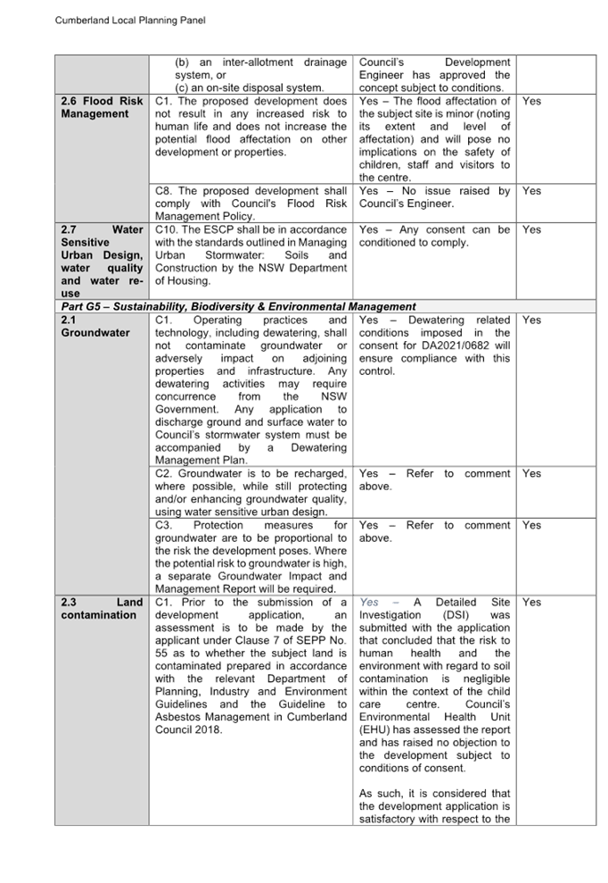
4 - Remediation of Land.
Part
4.6.
|
Part 4.6 - Contamination and remediation to be considered in
determining development application.
Comments
Yes – A detailed site
investigation report prepared by Geotechnical Consultants Australia Pty Ltd,
dated 30 October 2023 was provided with the application. The report concludes
that the site can be made suitable for the proposed use after implementation
of the recommended remedial action plan (RAP).
A remediation action plan prepared by Geotechnical
Consultants Australia Pty Ltd, dated 30 October 2023 has also been submitted
with the DA. The report concludes that the site is suitable for the proposed development subject
to conditions.
The report and recommendations have been reviewed by
Council’s Environmental and Health Officer and considered to be
satisfactory, subject to conditions.
As such, it is
considered that the development application is satisfactory under Part 4.6 of
Chapter 4 of the State Policy.
|
|
· State Environmental Planning Policy (Transport and Infrastructure) 2021
|
Chapter
2 - Infrastructure.
Clause
2.48
Clause
2.122
|
State
Environmental Planning Policy (Transport and Infrastructure) 2021 is relevant
to the development application as follows.
Chapter
2 - Infrastructure.
Where
relevant, appropriate referrals have been undertaken to service authorities.
Generally,
no objections have been raised to the proposed development. Appropriate
conditions are applied to the recommendation for Panel consideration to
address any relevant matters raised.
Division 17 - Roads and
Traffic.
The site access is located within 90m distance from
section of classified road (Merrylands Road and Loftus Street), and as per
the Schedule 3 Traffic-generating development to be referred to
TfNSW—Chapter 2, Column 3 of the SEPP, the development does not trigger
referral to TfNSW under the SEPP as the proposal is for less than 75
dwellings and generates less than 50 vehicle trips per hour.
This was confirmed by TfNSW in the correspondence of
14 September 2023.
|
|
· State
Environmental Planning Policy (Building Sustainability Index BASIX) 2004
|
|
BASIX Certificate Number No.
1392050M_02 dated 24 January 2024 and prepared by Taylor Smith Consulting has
been submitted to the Council and considered as being satisfactory.
|
|
· State Environmental
Planning Policy (Sustainable Buildings) 2022
|
|
State Environmental Planning
Policy (Sustainable Buildings) 2022 sets sustainability standards of
buildings across NSW for residential and non-residential development. The
Sustainable Buildings SEPP was notified on 29 August 2022 and came into
effect on 1 October 2023 to allow for the relevant industry to adjust to the
new standards.
In accordance with the savings
and Transitional provisions of Clause 4.2 of the Sustainable Buildings SEPP
2022, the policy does not apply as the development application was submitted
but not determined before 1 October 2023.
|
|
· State Environmental
Planning Policy (Housing) 2021
|
Chapter 2 – Affordable housing
Part 2 Development for affordable housing
Division 1 – In-fill affordable housing
|
Refer to discussion below.
|
·
Chapter 4 - Design of residential apartment
development |
Refer to discussion below.
|
State Environmental Planning
Policy (Housing) 2021
On 14 December 2023, the NSW
Government consolidated the provisions of State Environmental Planning Policy
No 65 – Design Quality of Residential Apartment Development (SEPP 65)
into the Housing SEPP and the Environmental Planning and Assessment Regulation
2021 (the Regulation). In addition, the NSW Government implemented in-fill affordable
housing reforms to encourage private developers to boost affordable housing and
deliver more market housing.
The process of consolidation does
not affect the operations of the provisions or the Apartment Design Guide. An
assessment of the Apartment Design Guide (ADG) is contained in Attachment B.
As per Schedule 7A Savings and
transitional provisions, Section 8(1) of the State Environmental Planning
Policy (Housing) 2021, the consolidated provisions regarding SEPP 65 and the
housing reforms relating to in-fill affordable housing will not apply to the
current development application as the amendment made to this policy by the
amending policy does not apply to a development application made but not
finally determined before the commencement date. The subject development
application was lodged prior to the consolidated provisions coming into effect
on 14 December 2023.
Therefore, an assessment against
the controls under Chapter 2 – Affordable Housing, (Part 2 Development
for affordable housing, Division 1 – In-fill affordable housing)
and Chapter 4 Design of residential apartment development of the State
Environmental Policy (Housing) 2021 which commenced on the 14 December 2023 do
not apply to this application.
Chapter 2 – Affordable
housing (Part 2 Development for affordable housing, Division 1 In-fill
affordable housing)
The assessment of the proposal was
carried out against the now historical version dated 10 November 2023 - 13
December 2023 of Chapter 2 – Affordable Housing, (Part 2 Development for affordable
housing, Division 1 – In-fill affordable housing) given the time of
lodgement of the development application and based on the savings provisions
discussed above.
It should be noted that the
proposal fully complies with the key planning controls contained within the
Housing SEPP and is considered acceptable from an environmental planning
viewpoint.
A relevant assessment against the
requirements of the SEPP is contained in Appendix A.
Clause 19 (3a)
Development consent must not be
granted to development to which this Division applies unless the consent
authority has considered whether the design of the residential development is
compatible with—
(a) the
desirable elements of the character of the local area
A consent authority must not
consent to development to which this Division applies unless it has taken into
consideration whether the design of the development is compatible with the
character of the local area. The SEPP (Housing) 2021 does not contain any
guidance for assessing whether a proposal is compatible with the character of
the local area. However, a planning principle for assessing compatibility in
the urban environment was established by Senior Commissioner Roseth of the Land
and Environment Court in the judgement for Project Venture Developments Pty Ltd
v Pittwater Council [2005] NSWLEC 191. This involves asking the following two
questions:
· Are the
proposal’s physical impacts on surrounding development acceptable? The
physical impacts include constraints on the development potential of
surrounding sites.
· Is the
proposal’s appearance in harmony with the buildings around it and the
character of the street?
A merit assessment of the
character of the local area should consider the following 3 steps:
· Step 1 –
Identify the ‘local area’.
· Step 2 –
Determine the character of the ‘local area’.
· Step 3 –
Determine whether the design of the proposed development is compatible with the
character of the ‘local area’.
An assessment against each step is
provided below:
Step 1 – Identify the
local area.
This assessment identifies the
local area as primarily the visual catchment of the site (defined by green
outline) as viewed from within the site, directly adjacent to the site and
surrounding streets, which is defined on the map below.
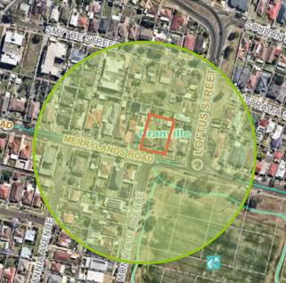
Figure
3 - Locality area catchment.
Step 2 – Determine the
character (present and future) of the local area.
The zoning of the broader locality
and immediate area comprises R4 High Density Residential, land to the south of
Merrylands Road is zoned R2 Low Density Residential and land to the east
(eastern side of Loftus Street) is zoned R3 Medium Density Residential under
the CLEP 2021.
Present character of the area
The character of the local area
comprises the visual catchment of regular shaped allotments viewed from the
site and surrounding streets, which include: -
1. single
storey dwellings to its northern, eastern and western boundaries,
2. 3
storey walk-up flat buildings located further to the south of Merrylands Road
(60 Merrylands Road);
3. The
locality is also within the proximity of Woodville Road commercial precinct.
Educational establishments and public recreation areas are located within the
wider locality.
Future character of the area
The locality is in transition from
lower density residential dwellings towards high density residential flat
buildings and multi dwelling housing development particularly to support the
increasing demand of affordable housing within the close proximity of public
transport hub and major commercial centre. The transition issue is clear with
regard to height and setbacks for the proposed development. It is considered
that the site is ideal for future urban intensification as it is located within
a high density precinct within proximity to the Merrylands Train Station and
CBD and would not be inconsistent with the desired future character of the
locality.
Step 3 - Determine if the
development is compatible with the character of the local area.
In accordance with the Land and
Environment Court’s ‘Planning Principle’ and case law
compatibility is best defined as ‘capable of existing together in
harmony’. In order to test compatibility two questions are to be
considered. These questions, as well as a response to each, are provided below:
· Are the
proposal’s physical impacts on surrounding development acceptable? The
physical impacts include constraints on the development potential of
surrounding sites.
The height, FSR and landscaping of
the proposed development are designed to maintain the harmony within the
streetscape, whilst contributing to the site context and constraint.
The 11m height limit requirement
is breached for part of the roof slab and the lift overrun as discussed later
in the report. However, the development does not pose any unreasonable
overshadowing impacts on adjoining properties. The proposal is a permissible
land use, meets the FSR requirement (in accordance with SEPP (Housing)) and
contributes to the provision of affordable housing within the proximity of
public transport hub and major commercial centre. Appropriate setbacks and
privacy treatments are provided to minimise any adverse impacts to the
adjoining properties. The proposal is appropriately articulated to complement
the existing and changing streetscape within the local area. The overall
design represents the form of development that is envisaged under the planning
controls.
Step 4 - Is the
proposal’s appearance in harmony with the buildings around it and the
character of the street?
To be compatible, a development
should contain, or at least respond to, the key aesthetic elements that make up
the character of the surrounding area. The front and side setbacks are
considered compatible with the existing streetscape. The proposal is considered
to maintain an appropriate residential character which is consistent with the
streetscape and does not result in unreasonable impacts to the neighbouring
properties. As discussed above, the proposed development is not considered to
be inconsistent with the existing and desired future streetscape character of
the area surrounding the subject site.
State Environmental Planning
Policy No. 65 - Design Quality of Residential Apartment Development (SEPP 65)
As stated earlier in the report, on 14 December 2023 SEPP 65
was repealed with no savings or transitional provisions preserving the
operation of State Environmental Planning Policy 65 - Design Quality of
Residential Apartment Development (SEPP 65). Despite this, a comprehensive
merit assessment against the SEPP 65 and Apartment
Design Guide (ADG) controls is contained in at Appendix B:
The proposal involves the following non-compliance with the
ADG controls:
|
No.
|
Clause
|
Comment
|
Yes
|
No
|
N/A
|
|
3F
|
Visual Privacy
|
|
3F-1
|
Separation
between windows and balconies is provided to ensure visual privacy is
achieved. Minimum required separation distances from buildings to the side
and rear boundaries are as follows:
Building
Height = 12m / 4 storeys
- Habitable Rm / Balc = 6m
- Non-Habitable Rm = 3m
Note:
Separation distances between
buildings on the same site should combine required building separations
depending on the type of room.
|
The proposal generally complies with the building
separation requirements. However, there is a minor variation on Level 1 and
Level 2 along the eastern and Western elevations.
Eastern and Western Separation:
Required = 6m.
Provided = Minimum 4.5m to
section of the habitable rooms’ external walls on Level 1 and 2.
Given that these rooms
have been designed with recessed north/south facing windows with blank walls
to the east and west side boundaries, visual
privacy will be reasonably maintained and therefore considered
satisfactory.
|
|
|
|
|
4D
|
Apartment
Size and Layout
|
|
4D-1
|
Apartments are required to have the following minimum
internal areas:
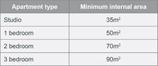
The
minimum internal areas include only one bathroom. Additional bathrooms
increase the minimum internal area by 5m2 each.
|
All
apartments comply with the minimum internal areas with the exception of
Unit 05 (2 bedroom unit) which provides an internal area of 67 sqm (requires
70 sqm). However, the departure is minor and considered acceptable given the
overall design incorporates a functional and well organised layout with
appropriate room sizes and provides a reasonable level of residential
amenity.
|
|
|
|
Local Environmental Plans
The provision of the Cumberland
LEP 2021 is applicable to the development proposal. It is noted that the
development generally achieves compliance with the key statutory requirements
of the Cumberland LEP 2021
(a) Permissibility:
The proposed development is
defined as a ‘residential flat building’ under the provisions of
CLEP 2021. Residential flat buildings are permitted with consent in the R4 -
High Density Residential zone which applies to the land as follows:
residential flat building
means a building containing 3 or more dwellings but does not include an
attached dwelling or multi dwelling housing.
Note -
Residential flat buildings are
a type of residential accommodation—see the definition of that
term in this Dictionary.
The main provisions of the
Cumberland LEP 2021 relevant to the development are prescribed in the table
below. A comprehensive LEP assessment is contained in Appendix C.
Figure 3 - Cumberland LEP 2021
Compliance Table
|
DEVELOPMENT STANDARD
|
COMPLIANCE
|
DISCUSSION
|
|
4.3 Height of Buildings
Max 11m
|
No
Refer to Clause 4.6 Variation below.
|
11.65m - Clause 4.6 request to contravene the height of
building development standard was submitted with the application.
|
|
4.4
Floor Space Ratio
0.8:1
|
Yes
Total allowable FSR:
• 1.2:
· 0.8:1(1,021.84 sqm sqm) under CLEP.
and
0.33:1 additional permitted under Clause 17 Housing SEPP
2021.
|
The development provides a total
GFA of 1,436.5 sqm which equates to a total FSR of 1.13:1, which complies
with the maximum FSR of 1.33:1 under the Housing SEPP 2021.
|
|
4.6 Exceptions to Development
Standards
|
Yes
|
A written request in accordance with Clause 4.6 of the
CLEP 2021 to vary the building height development standard was submitted.
Refer to detailed assessment below.
|
(a) Clause
4.6 - Exceptions to Development Standards
Height of Buildings
The proposal seeks to contravene
the Height of Building Development Standard under Clause 4.3 of the CLEP that
requires that the height of building is not to exceed 11m on the subject site.
It is noted that the residential
apartment building predominantly complies with the 11m maximum building height
requirement, however the only portion of the building that exceeds the maximum
building height is limited to non-habitable structures including the lift over-run
and concrete roof slab as shown in the 3D height planes. The architectural
plans provide RLs of the NGL and finish roof level showing compliance of the
habitable floor height.
The proposed building has a
maximum building height of 11.65m to the top of the lift over run (5.9%) and
11.15m to the concrete roof slab (1.36%). This equates to a maximum of
5.9% variation to the permitted height of buildings under the Cumberland LEP
2021.
Clause 4.6 allows the consent
authority to vary development standards in certain circumstances and provides
an appropriate degree of flexibility to achieve better design outcomes. The
consent authority may grant the exception as the Secretary’s concurrence
can be assumed where clause 4.6 is adopted as per the Department of Planning
Circular PS 18-003, dated 21 February 2018.
The applicant has submitted a
written request to vary the development standards for building height. Based on
various case laws established by the Land and Environment Court of NSW such as Four2five
P/L v Ashfield Council [2015] NSWLEC 9, Randwick City Council v Micaul Holdings
P/L [2016] NSW LEC7 and Zhang and anor v Council of the City of Ryde [2016]
NSWLEC 1179, a 3 part assessment framework for a variation request proposed
under clause 4.6 has been considered and an assessment of the proposed
variance, following the 3 part test is discussed in detail below.
The 3 preconditions which must be
satisfied before the application can proceed are as follows:
1. Is
the proposed development consistent with the objectives of the zone?
Applicant’s
justification:
The Applicant states the proposal
is consistent with the objectives of the R4 Zone being:
· Consistency with
the objectives is evident as the proposal ensures that the high density nature
of the zone is retained and there is not a significant change to the character
of the locality. In addition, the proposal complements and enhances the local
streetscape by virtue of the careful siting of the development.
· The proposal
presents as a 3 storey form when viewed from the street and the variation will
have a minimal impact on the character of the locality.
Planner’s Comment:
Residential apartment buildings
are a permitted land use and the locality is undergoing a transition
particularly to support the increasing demand of affordable housing within the
close proximity of public transport hub and major commercial centre. The
proposed development is consistent with the objectives of the R4 High Density
Residential zone.
2. Is
the proposed development consistent with the objectives of the development
standard which is not met?
Applicant’s
justification:
In relation to objective (a) the
minor non-compliance to the roof elements located at the rear of the building
will not be perceivable from the street level where a 3 storey form is
maintained. In this regard, the variation will have a minimal visual impact of
the development. Further, it will not have any adverse impacts on solar access
or privacy for neighbouring properties given the variation is from the roof
form and that the development complies with the visual separation requirements
under the ADG.
It is further noted that the
breach of the development standard is a direct result of applying the
affordable housing bonus under the SEPP (Housing) 2021, which permits greater
FSR. Hence in the context of ‘appropriate development density’ the
proposal is compliant with the FSR (having regard to the bonus for affordable
housing) and the additional FSR does necessitate a minor breach to the height
standard.
Planner’s comment:
The objectives of the building
height standard are to enable appropriate development density to be achieved
and to ensure that the height of the building is compatible with the character
of the locality as outlined above. The proposal is compliant with the maximum
FSR development standard inclusive of the bonus provision under the
SEPP(Housing). The increased height does not result in an additional level for
residential use as it comprises portion of the portions of roof slab of the 4th
storey and the top of the lift core.
The departure sought is modest and
does not unreasonably impact on adjoining properties. The additional height
does not result in the appearance of bulk when viewed from the existing streetscape
and would not impinge on the changing streetscape that is anticipated for the
immediate area. Given that the proposed development responds to the site and
does so without compromising relationships with adjoining development, the
proposal is consistent with the objectives of height requirements and
development within the R4 zone.
It shall be noted that the
increased height does not result in an additional level for habitable use, as
it only comprises portion of the roof slab and lift overrun.
3. a)
Is compliance with the development standard
unreasonable or unnecessary
in the circumstances of the case?
Applicant’s
justification:
The minor variation is not
considered to impact the compatibility of the development with the character of
the locality, given that the majority of the proposed building form is
contained below the maximum permitted height control, and the top level which
exceeds the height control is recessed to the rear of the site and will not be
visible when viewing the building from the street level.
The height breach, arising from
the additional permitted FSR for affordable housing, is appropriate and
demonstrates environmental planning grounds through the delivery of affordable
housing and this aligns directly with the Objects of the Environmental Planning
and Assessment Act 1979.
Planner’s comment:
Council Officers are satisfied
that the proposed variation has been appropriately justified and can be
supported in this instance. The height breach is limited to an overall building
height of 11.65m for the lift over run. The additional height will not be
visible from the adjacent streets and properties. The proposed variation to the
development standard is necessary to provide the safety features of the roof
top terraces and is consistent with the scale of the development within the R4
zone located in the immediate vicinity of the site. The departure sought is
modest and does not unreasonably impact on views of the heritage item or
adjoining properties. Given the site topography, the additional height does not
result in the appearance of bulk when viewed from the existing streetscape,
would not impinge on the changing streetscape that is anticipated for the
immediate area and does not result in additional overshadowing to the adjoining
properties. It is considered, therefore, that the non-compliance with the
Development Standard is not unreasonable or unnecessary in the circumstances of
the case.
b) Are
there sufficient environmental planning grounds to justify contravening
the development standard and therefore is the applicant’s
written justification well founded?
Applicant’s
justification:
The design of the building ensures
that all habitable floor spaces are contained below the maximum building height
line which indicates that the variation is not simply a means of achieving
additional development yield on the site, but a site specific design response.
Social and affordable housing
reforms: The NSW Government has announced new measures to boost the supply of
affordable and social housing in the state. The proposed changes include
amendments to the existing in-fill affordable housing provisions under the
Housing SEPP to introduce a new floor space bonus of 30 per cent and a height
bonus of 30 per cent for residential developments with at least 15 per cent
affordable housing. The proposed changes by the NSW government demonstrates the
need for a height bonus to accompany a floor space ratio bonus. Under the
proposed legislation the development would receive a 30 percent height bonus and
would comply with the maximum building height requirement.
Planner’s comment:
The unique circumstances of the
case are considered to warrant support of the departure. Given that the
proposed development responds to the site and does so without unduly compromising
relationships with adjoining development, and does not unduly compromise other
relevant controls, the proposal is consistent with the objectives of building
height, and development within the R4 zone. In this regard, the exception is
well founded and can be supported.
Conclusion:
Council is satisfied that the
applicant’s written request has adequately addressed the matters required
to be demonstrated by clause 4.6 subclause (3). Council is further satisfied
that the proposed development will be in the public interest because it is
consistent with the objectives of the particular standard and the objectives
for development within the zone in which the development is proposed to be
carried out.
It is the view of Council Officers
that justification provided is satisfactory and having considered the
application on its merit, the contravention to the maximum building height
development standard is considered acceptable in this instance.
The provisions of any
Development Control Plans (EP&A Act s4.15 (1)(a)(iii))
The Cumberland Development Control
Plan (DCP) 2021 provides guidance for the design and operation of development
to achieve the aims and objectives of the Cumberland LEP 2021.
A comprehensive assessment and
compliance table is contained in Appendix C.
A summary of the DCP non-compliances is provided in the
following table.
|
Control
|
Provided
|
Complies
(Yes/No)
|
|
Part
B3 – Residential Flat Buildings
|
|
Section 3.2 Control C1 and C3 -
Basement footprint
Minimum
setback of 1.2m from the side boundary
|
775 mm from the eastern
boundary.
A basement side setback of
1.2m is required. However, setback of 775 mm is proposed along the western
boundary. This is considered satisfactory as the proposal
complies with the minimum deep soil requirements, side setbacks and
landscaping requirements and will not result in any impacts
on trees on adjacent sites.
|
No -
Acceptable in this instance.
|
The provisions of any planning
agreement that has been entered into under section 7.4, or any draft planning
agreement that a developer has offered to enter into under section 7.4
(EP&A Act s4.15(1)(a)(iiia))
There is no draft planning
agreement associated with the subject Development Application.
The provisions of the
Regulations (EP&A Act s4.15 (1)(a)(iv))
The proposed development raises no
concerns as to the relevant matters arising from the Environmental Planning and
Assessment Regulations 2021 (EP&A Reg).
The Likely Environmental,
Social or Economic Impacts (EP&A Act s4.15 (1)(b))
It is considered that the proposed
development will have no significant adverse environmental, social or economic
impacts in the locality.
The suitability of the site for
the development (EP&A Act s4.15 (1)(c))
The subject site and locality is
not known to be affected by any natural hazards or other site constraints
likely to have a significant adverse impact on the proposed development.
Accordingly, it is considered that the development is suitable in the context
of the site and surrounding locality.
Submissions made in accordance with the Act or Regulation
(EP&A Act s4.15 (1)(d))
|
Advertised (Website)
|
Mail
|
Sign
|
Not Required
|
In accordance with Council’s
notification requirements contained within the Cumberland Development Plan
2021, the proposal was publicly notified for a period of 14 days between 10
July 2023 and 24 July 2023. In response, Council received no submissions.
The public interest (EP&A
Act s4.15(1)(e))
In view of the foregoing analysis
it is considered that the development, if carried out subject to the conditions
set out in the recommendation below, will have no significant adverse impacts
on the public interest.
Cumberland Local
Infrastructure Contributions Plan 2020
The development would require the
payment of contributions in accordance with Cumberland Local Infrastructure
Contributions Plan 2020.
In accordance with the
Contribution Plan a contribution is payable, pursuant to Section 7.11 of the
EP&A Act, calculated on the cost of works. A total contribution of $251,595.00
would be payable prior to the issue of a Construction Certificate.
The calculation is based on:
· 3 x 1 bedroom unit
· 13 x 2 bedroom
unit
· 1 x 3 bedroom unit
· Credit of 2 x 3
bedroom (existing dwellings on subject site).
Housing and Productivity
Contribution (HPC)
In accordance with s7.24 of the
Environmental Planning and Assessment Act, 1979 as amended by the Environmental
Planning and Assessment Amendment (Housing and Productivity Contribution) Act
2023, the development is subject to the (Housing and Productivity Contribution)
Act 2023.
In accordance with Part 2 of
Schedule 5 of the Environment Planning and Assessment (Housing and Productivity
Contribution) Order 2023 (‘the Order’), the Order does not apply to
a development consent granted to a pending development application (Pending
DA).
A ‘Pending DA’ as per
Schedule 1 of the Order and s16, Part 9 of the EP&A Reg 2021 is as follows:
a) a
development application that is made, but not determined, before the
commencement of this Order, or
b) a
development application that is made and determined before the commencement of
this Order, but has not been finally determined, or
c) an
application for a complying development certificate that is made, but not
determined, before the commencement of this Order.
As the application was lodged on
the 19 June 2023, the HPC provisions do not apply to this application.
Disclosure of Political
Donations and Gifts
The applicant and notification
process did not result in any disclosure of Political Donations and Gifts.
The development application has
been assessed in accordance with the relevant requirements of the Environmental
Planning and Assessment Act 1979, State Environmental Planning Policy (Housing
2021), Cumberland Local Environmental Plan 2021, State Environmental Planning
Policy (Biodiversity and Conservation) 2021, State Environmental Planning
Policy (Building Sustainability Index: BASIX) 2004, Cumberland Development
Control Plan 2021 and is satisfactory for approval subject to conditions.
The proposed development is
appropriately located within the R4 – High Residential Density under the
relevant provisions of the 2021. The proposal is generally consistent with all
statutory and non-statutory controls applying to the development. Having regard
to the assessment of the proposal from a merit perspective, Council may be
satisfied that the development has been responsibly designed and provides for
acceptable levels of amenity for future residents. It is considered that the
proposal successfully minimises adverse impacts on the amenity of neighbouring
properties. Hence the development, irrespective of the departures noted above,
is consistent with the intentions of Council’s planning controls and
represents a form of development contemplated by the relevant statutory and
non-statutory controls applying to the land.
For these reasons, it is
considered that the proposal is satisfactory having regard to the matters of
consideration under Section 4.15 of the Environmental Planning and Assessment
Act 1979, and the development may be approved subject to conditions.
There are no consultation
processes for Council associated with this report.
There are no financial
implications for Council associated with this report.
There are no policy implications
for Council associated with this report.
Communication /
Publications:
The final outcome of this matter
will be notified in the newspaper. The objectors will also be notified in
writing of the outcome.
|
1. That
the Clause 4.6 variation request to contravene the Height of Building
development standard, pursuant to the Cumberland LEP 2021, be supported.
2. That
Development Application 2023/0285 for demolition of existing structures and
construction of a four storey residential apartment building pursuant to
Chapter 2 Affordable Housing of SEPP (Housing) 2021 comprising of 17
apartments over basement parking with associated stormwater and landscaping
works and strata subdivision into 17 lots on land at 45 - 47 Merrylands Road,
Merrylands be approved subject to conditions listed in the attached schedule.
|
1. Draft Notice
of Determination
2. Appendix
A - State Environmental Planning Policy - Housing 2021
3. Appendix
B - Apartment Design Guide Assessment
4. Appendix
C - Cumberland Local Environmental Plan 2021 Assessment
5. Appendix
D - Cumberland Development Control Plan 2021 Assessment
6. Clause
4.6 Variation Request
7. Architectural
Plans
8. Landscape
Plans
9. Shadow
Diagrams
DOCUMENTS
ASSOCIATED WITH
REPORT LPP002/24
Attachment 1
Draft Notice of Determination
Cumberland
Local Planning Panel Meeting
14 February 2024
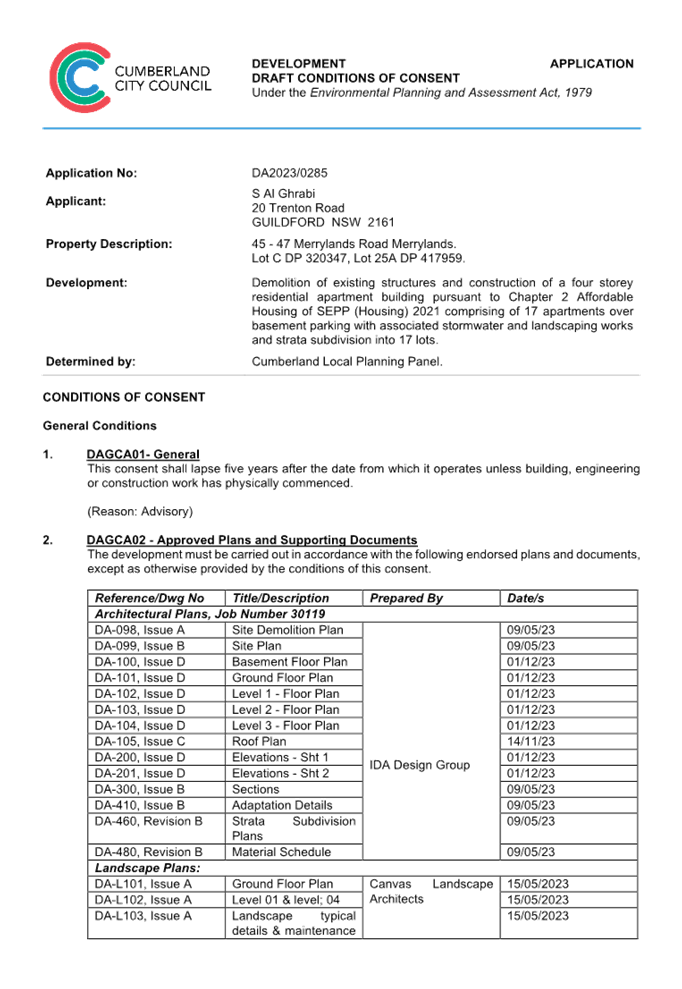
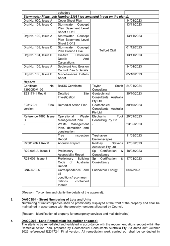
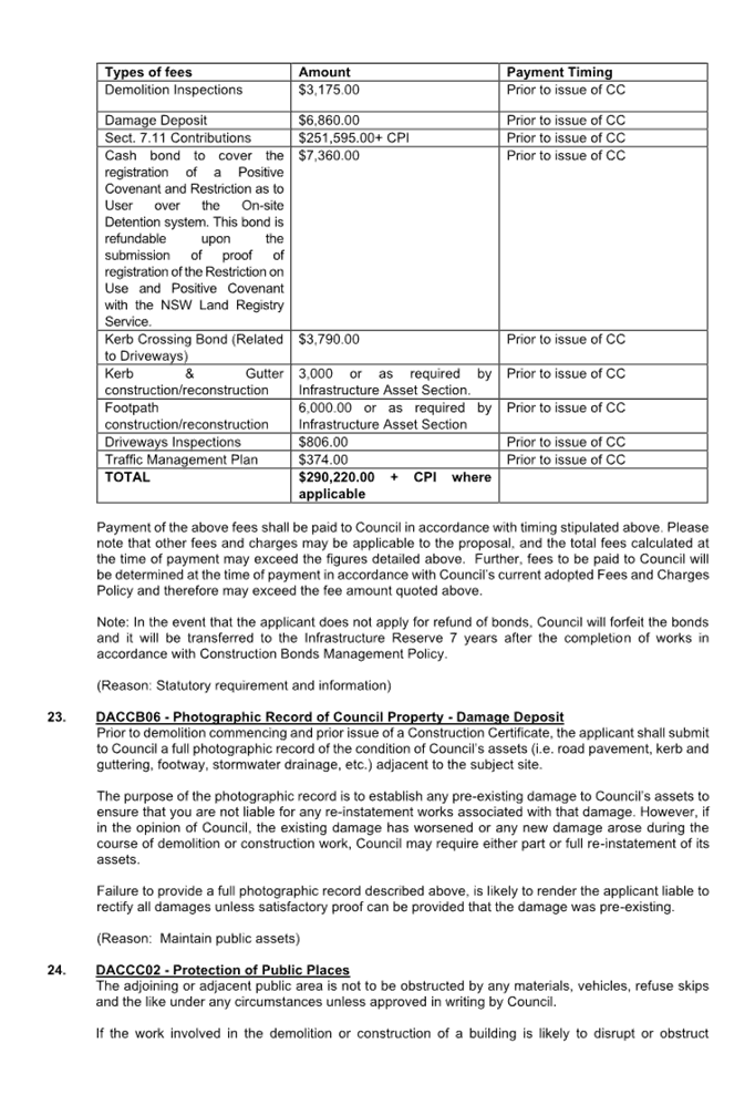
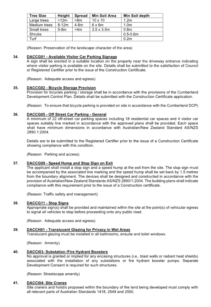

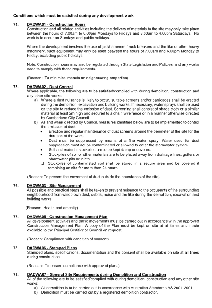


DOCUMENTS
ASSOCIATED WITH
REPORT LPP002/24
Attachment 2
Appendix A - State Environmental Planning Policy -
Housing 2021
Cumberland
Local Planning Panel Meeting
14 February 2024
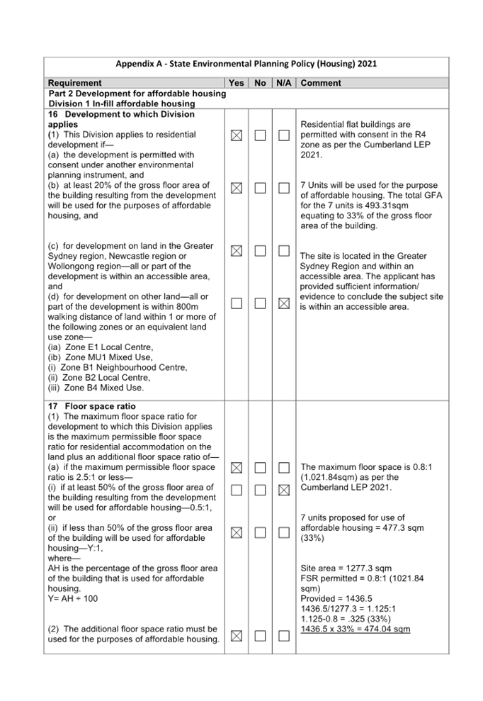
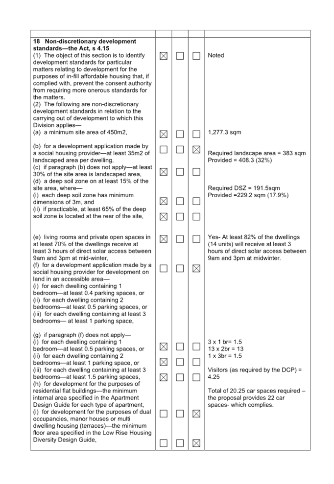
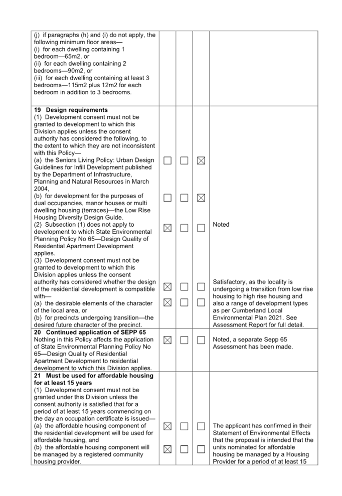

DOCUMENTS
ASSOCIATED WITH
REPORT LPP002/24
Attachment 3
Appendix B - Apartment Design Guide Assessment
Cumberland
Local Planning Panel Meeting
14 February 2024
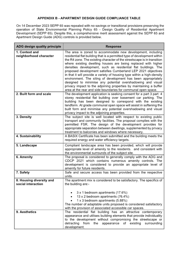
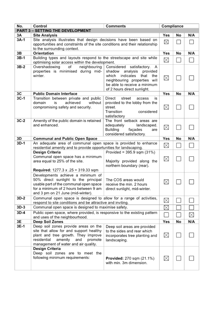
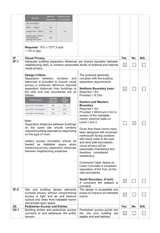
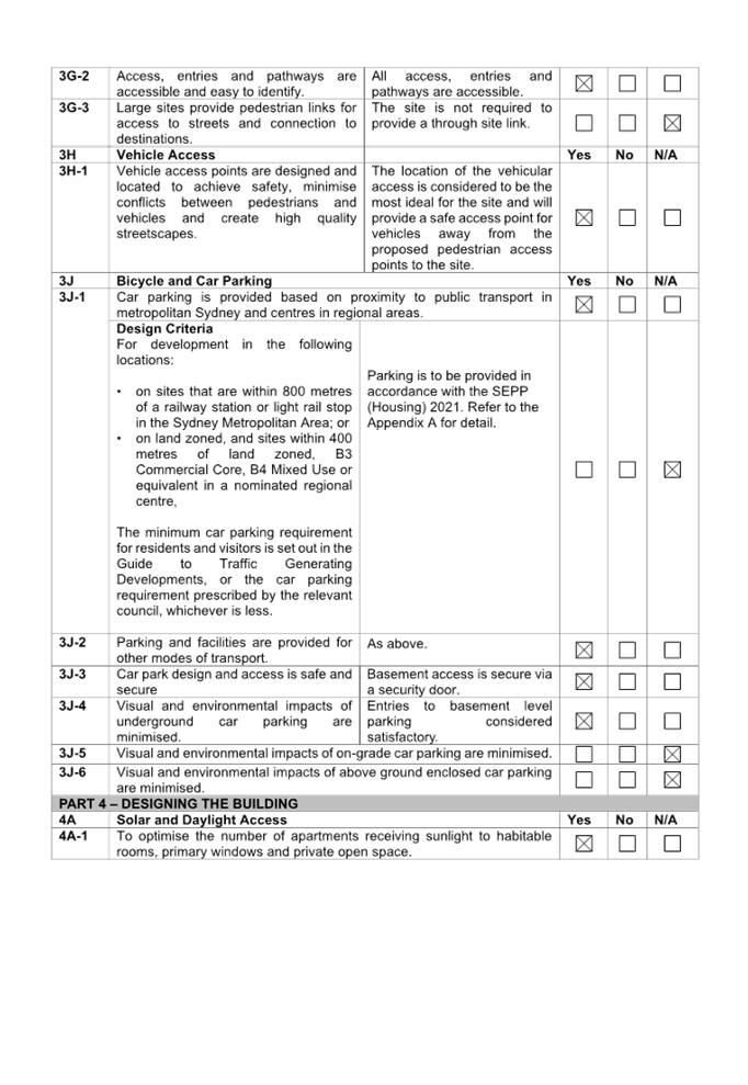
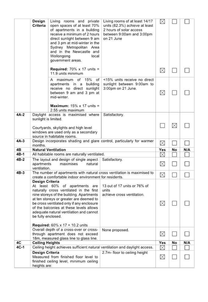

DOCUMENTS
ASSOCIATED WITH
REPORT LPP002/24
Attachment 4
Appendix C - Cumberland Local Environmental Plan 2021
Assessment
Cumberland
Local Planning Panel Meeting
14 February 2024
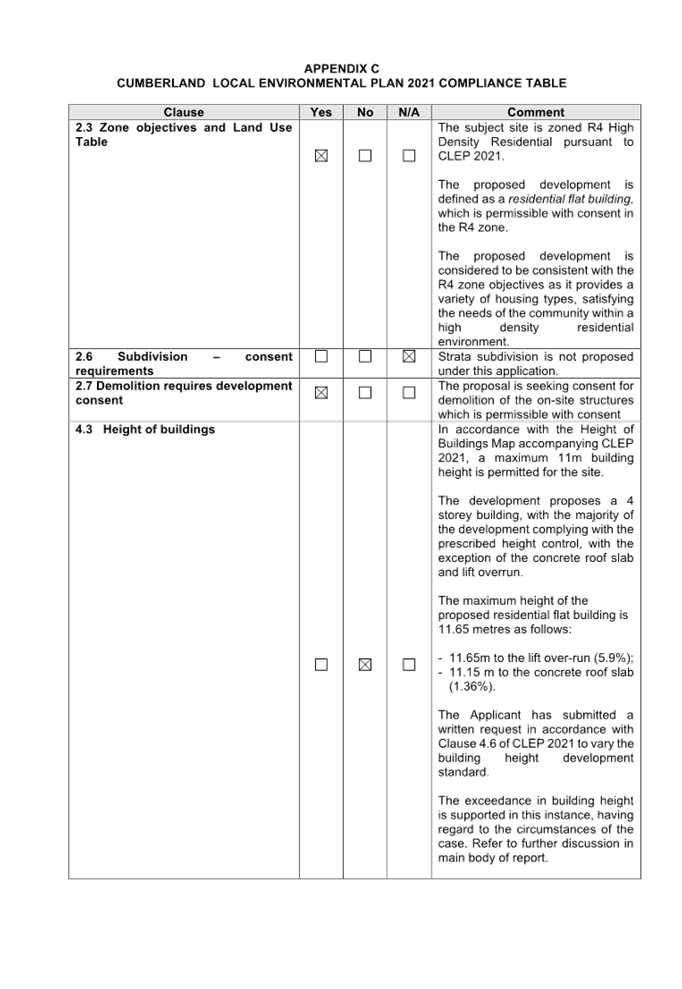
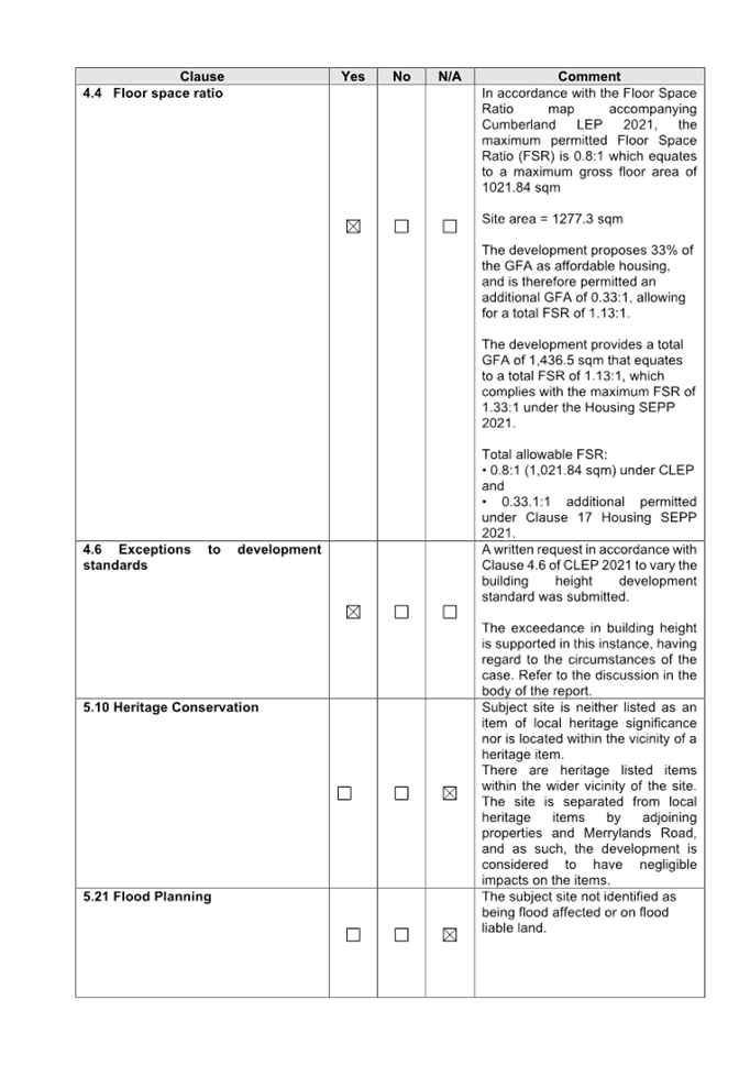
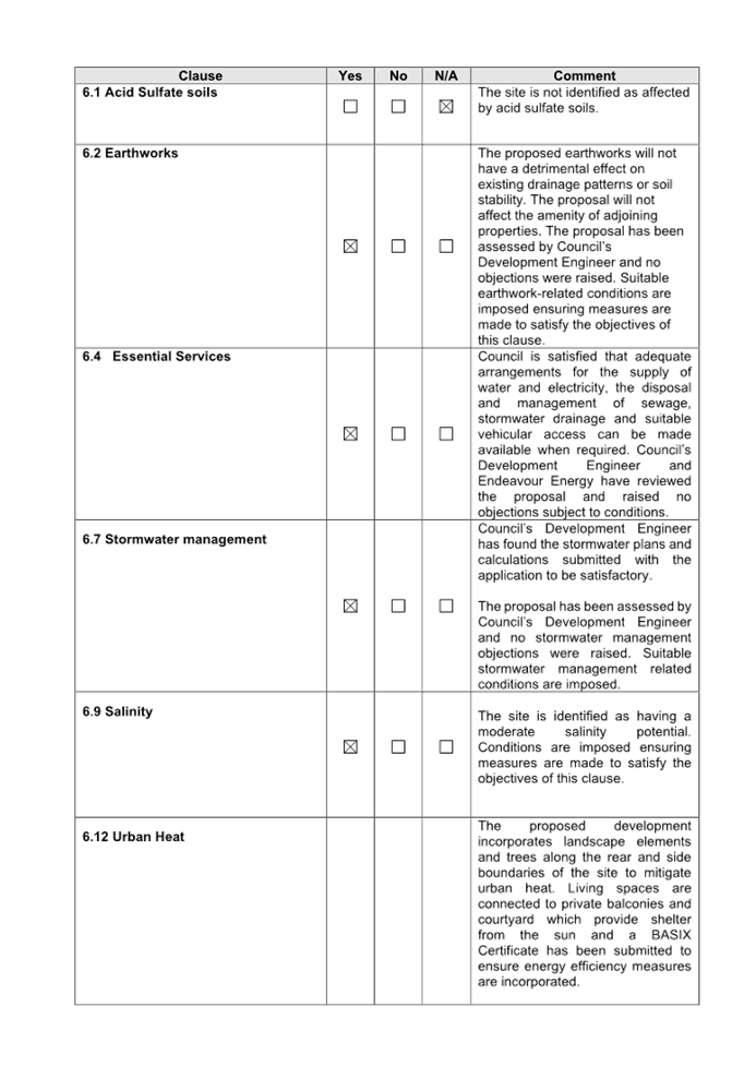

DOCUMENTS
ASSOCIATED WITH
REPORT LPP002/24
Attachment 5
Appendix D - Cumberland Development Control Plan 2021
Assessment
Cumberland
Local Planning Panel Meeting
14 February 2024
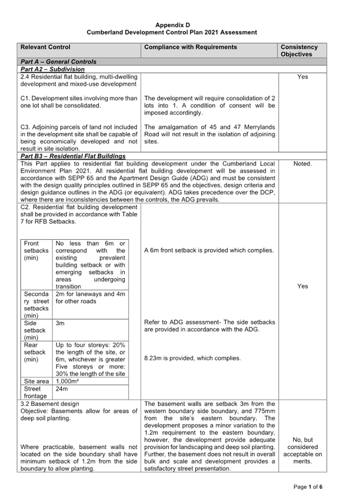
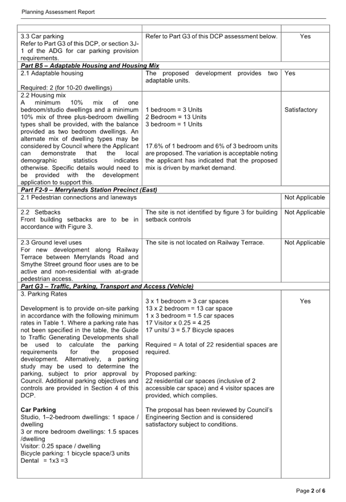
DOCUMENTS
ASSOCIATED WITH
REPORT LPP002/24
Attachment 6
Clause 4.6 Variation Request
Cumberland
Local Planning Panel Meeting
14 February 2024
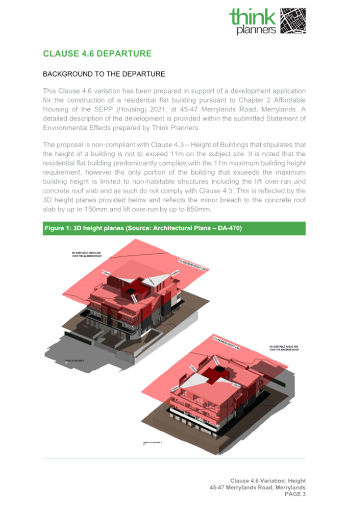
DOCUMENTS
ASSOCIATED WITH
REPORT LPP002/24
Attachment 7
Architectural Plans
Cumberland
Local Planning Panel Meeting
14 February 2024
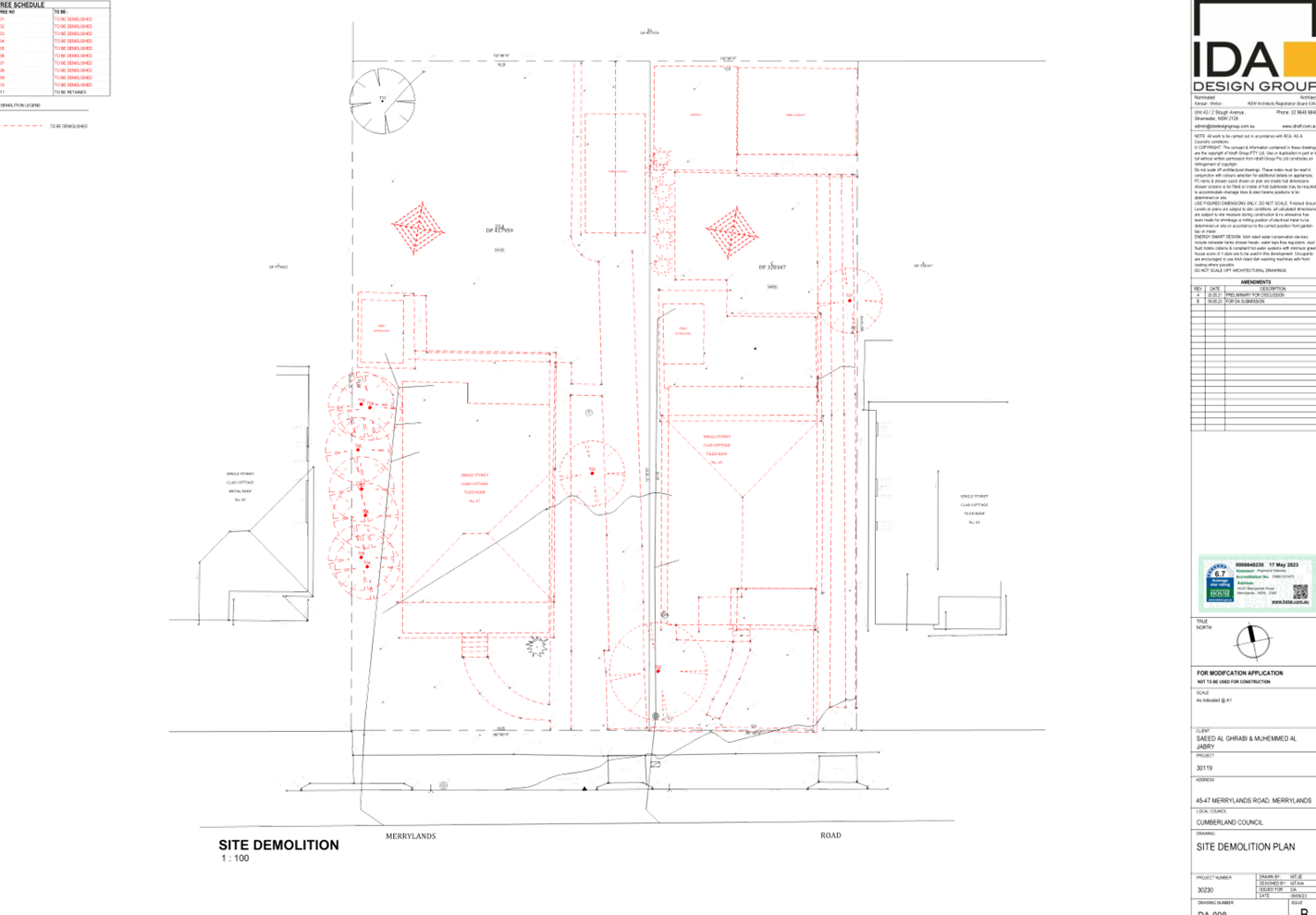
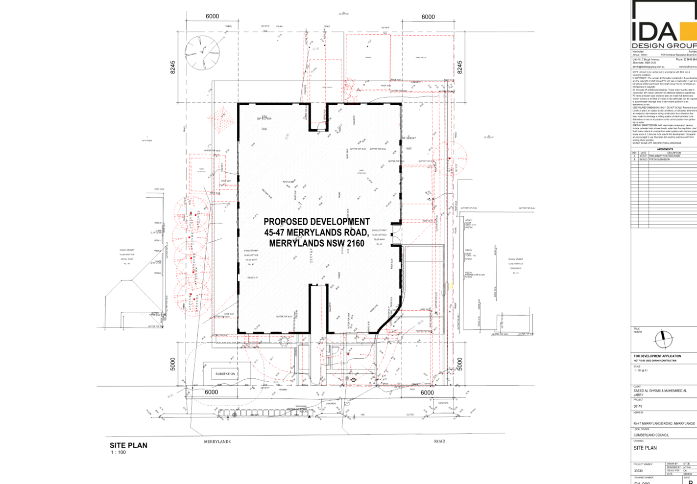
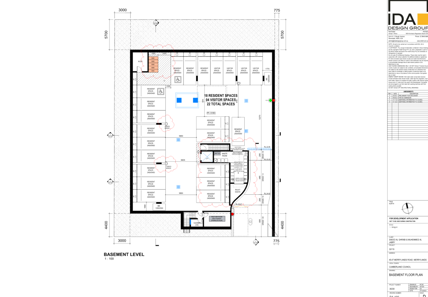
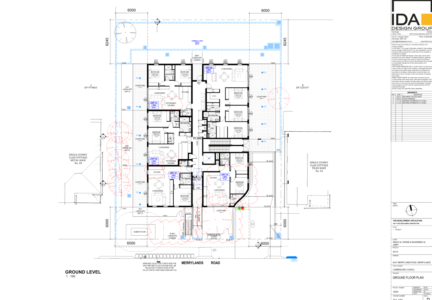
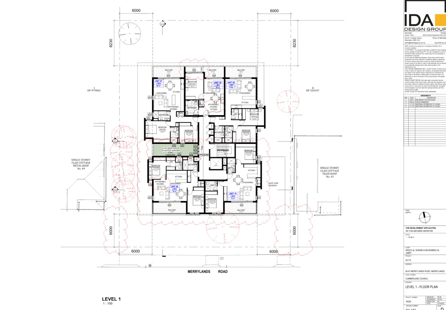
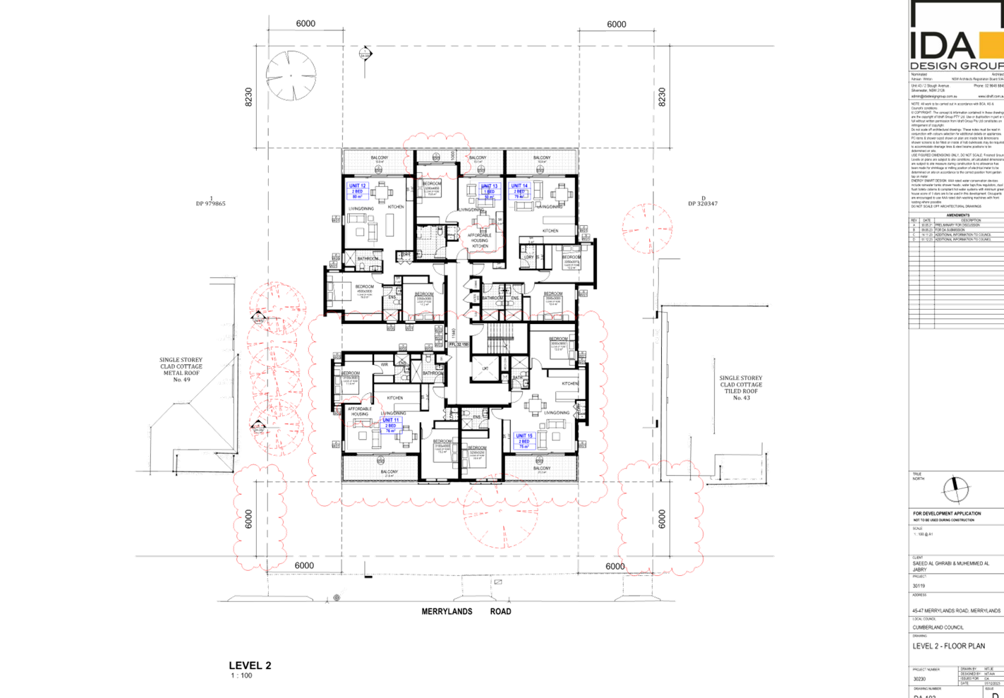
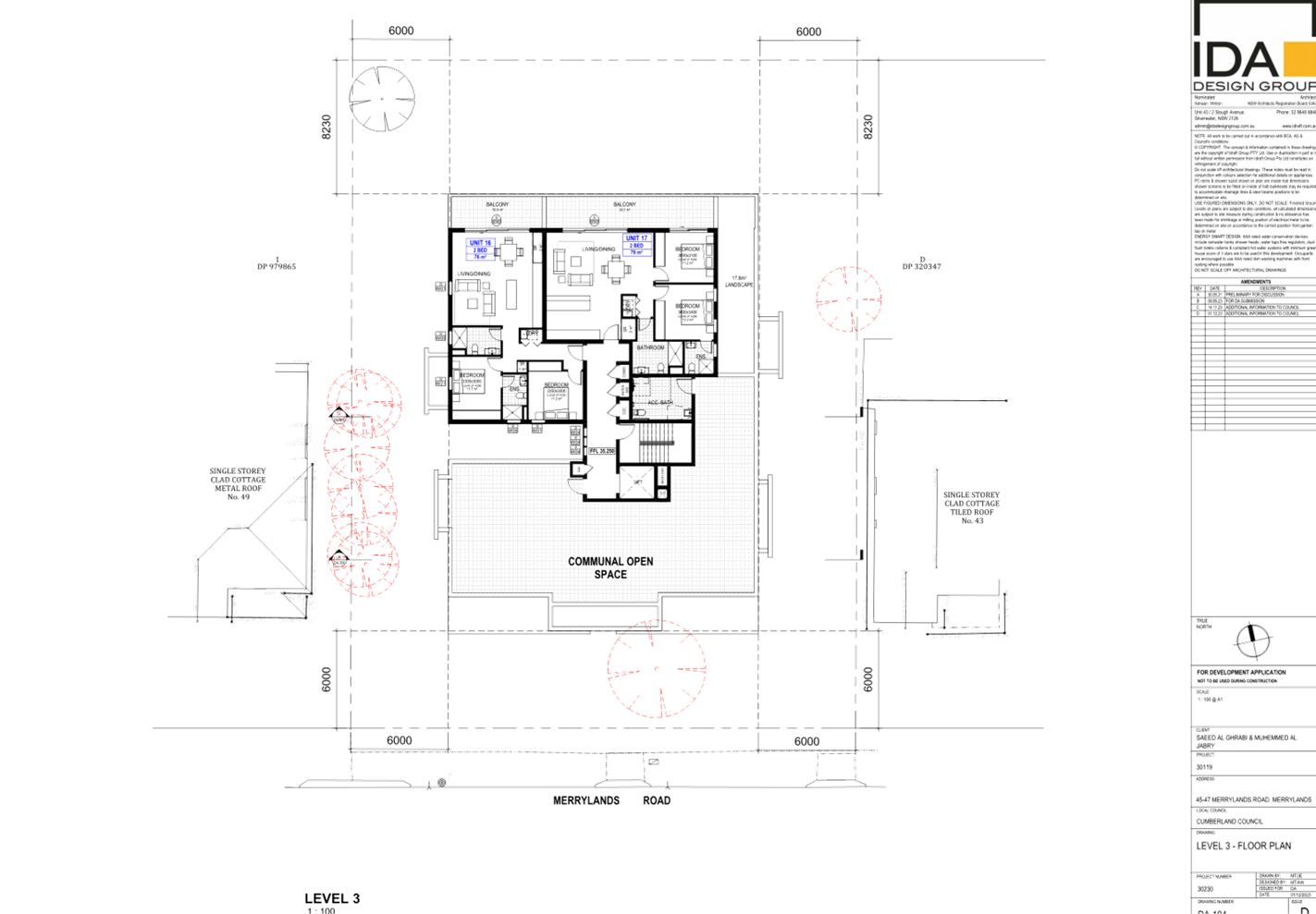
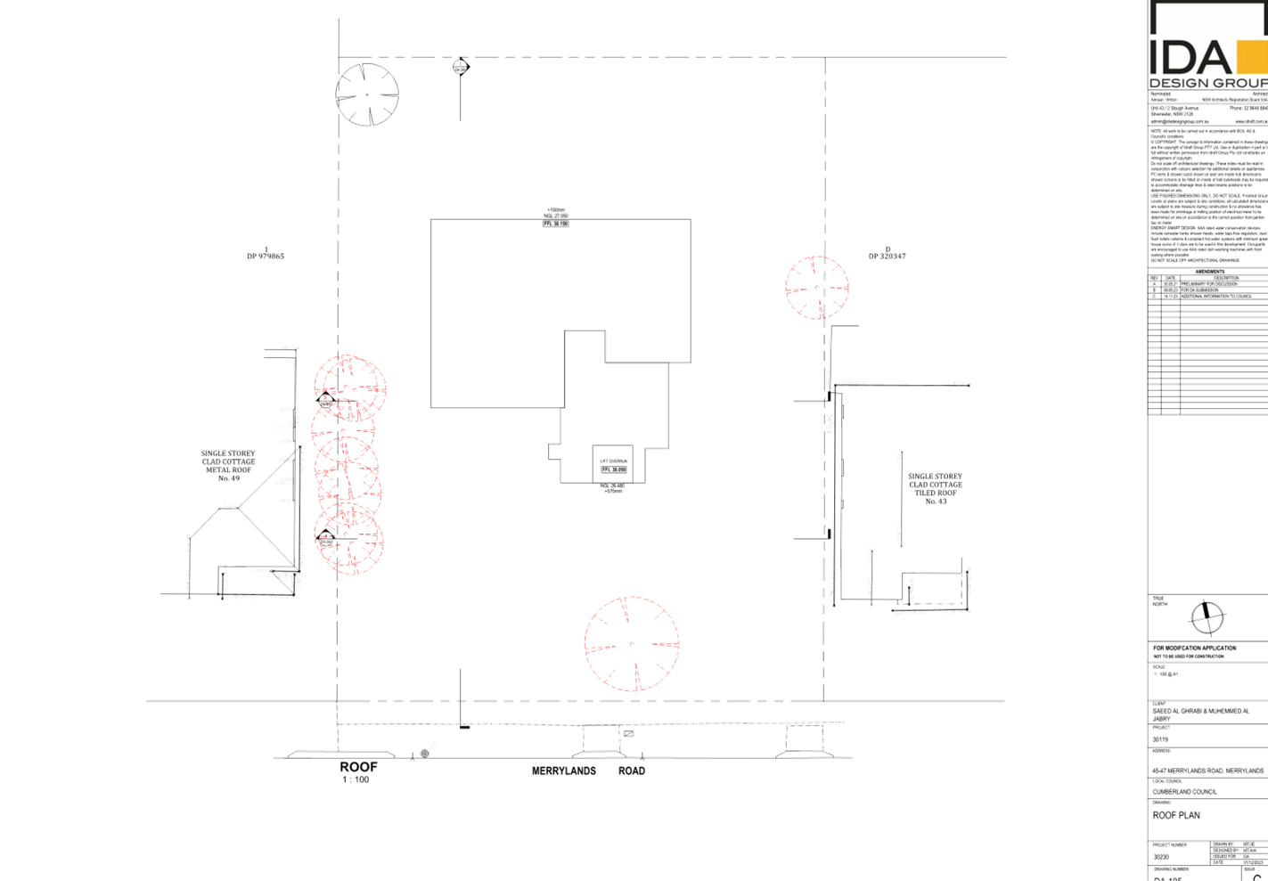
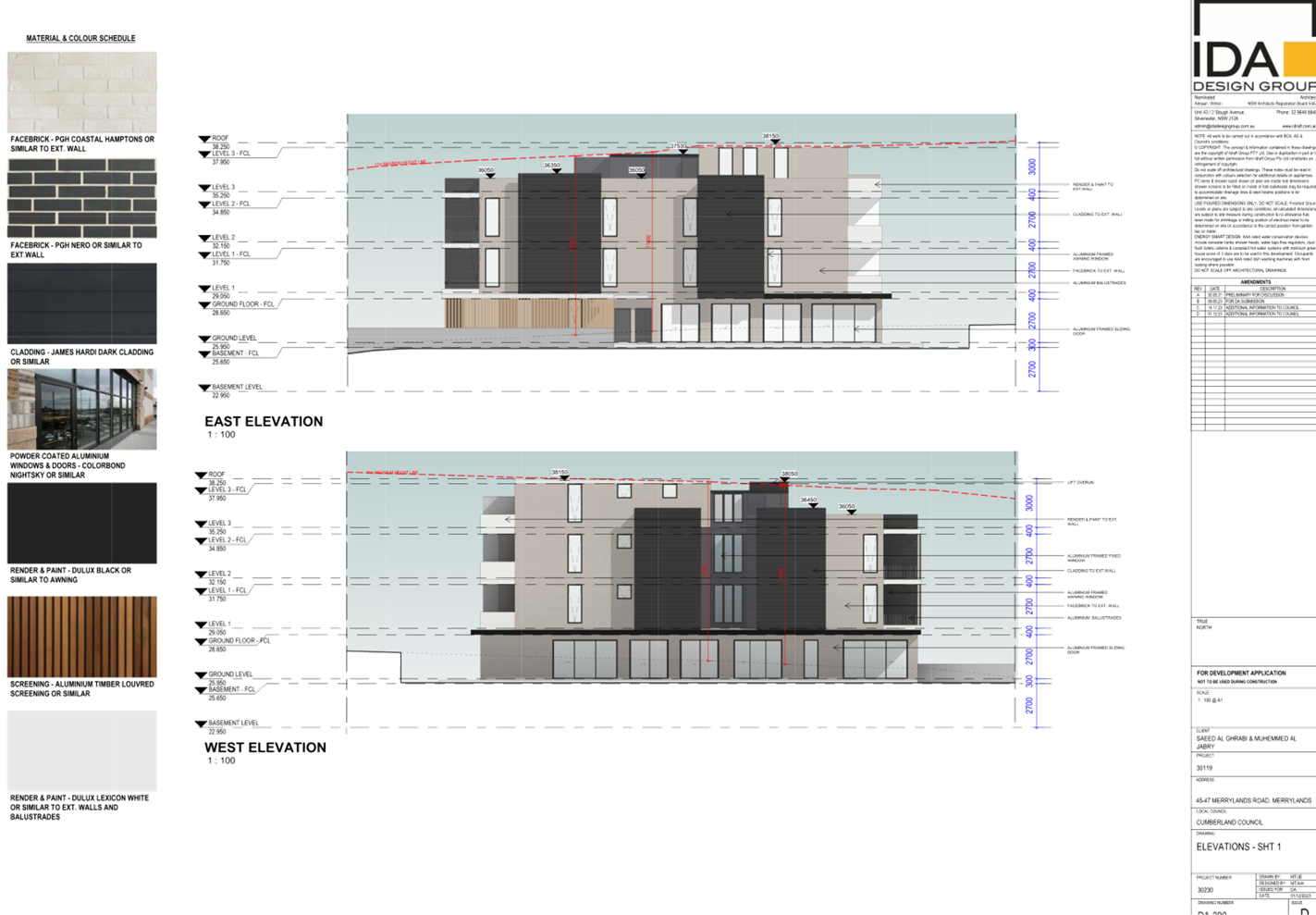
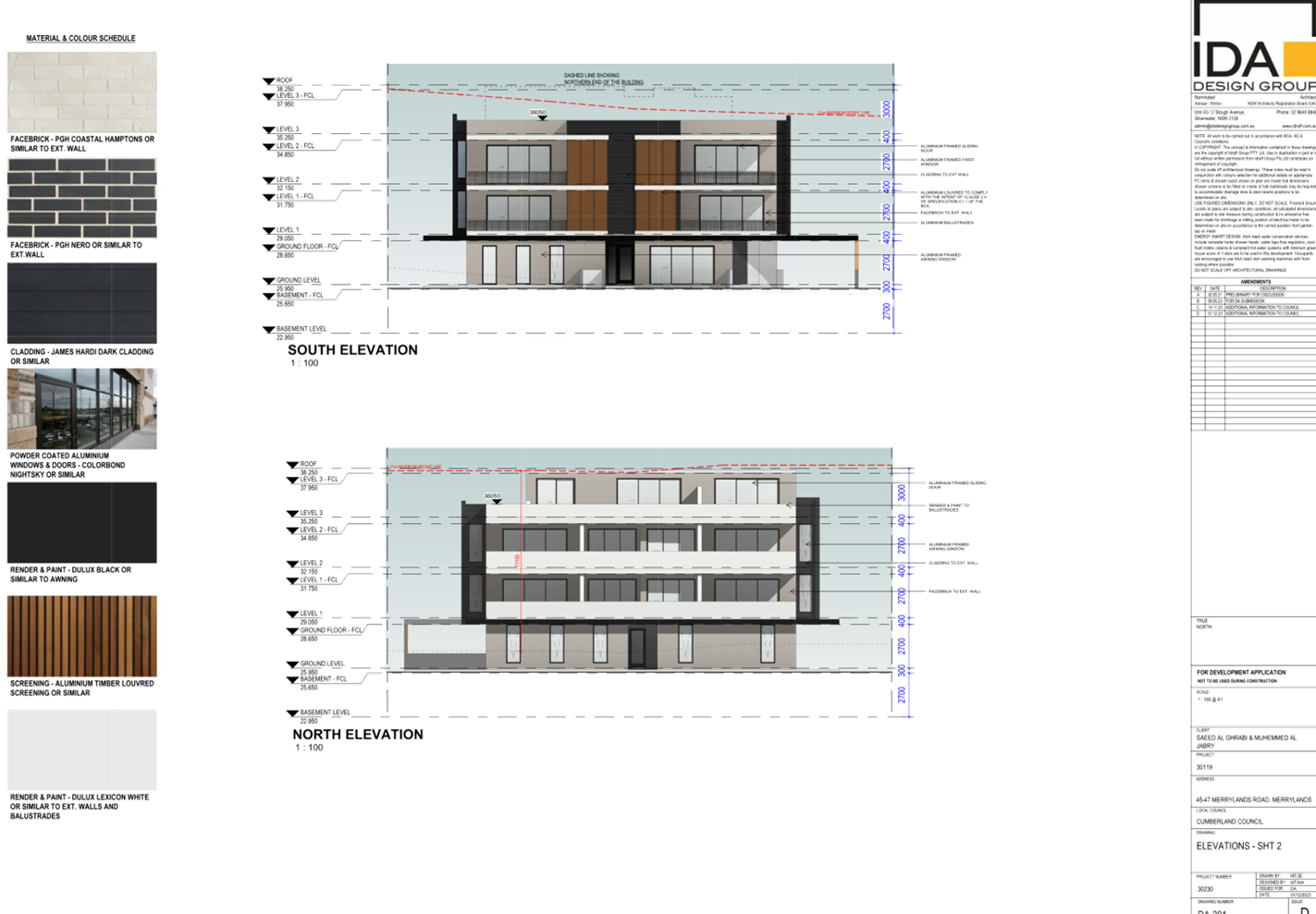
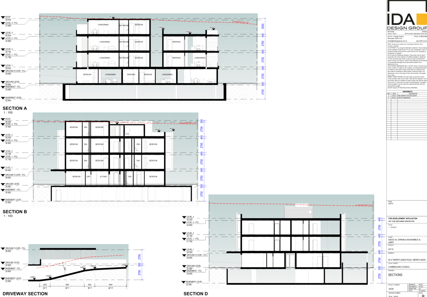
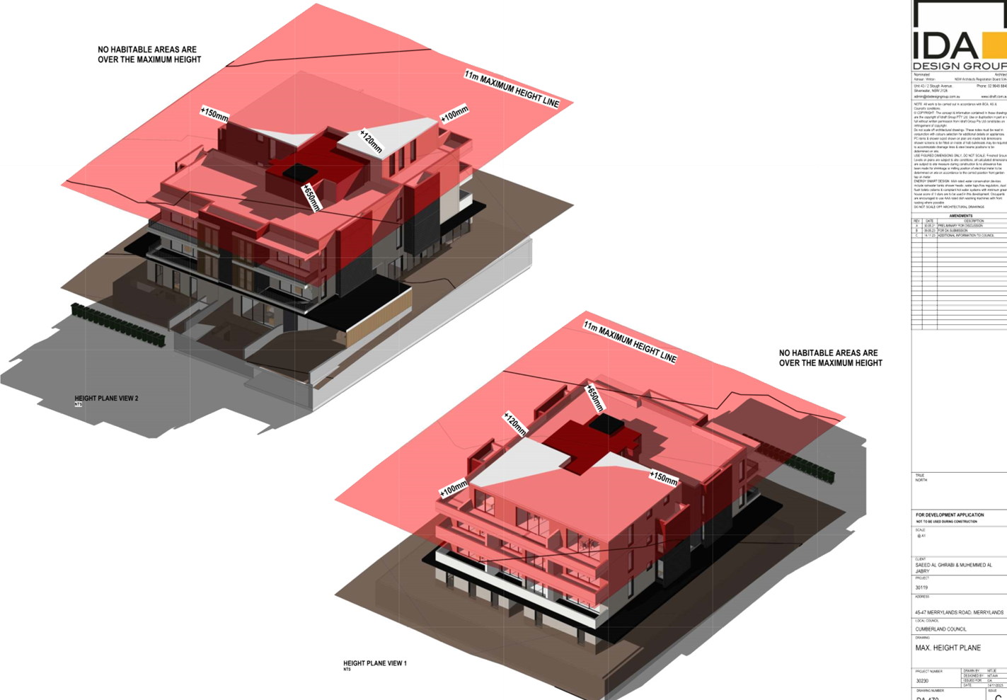
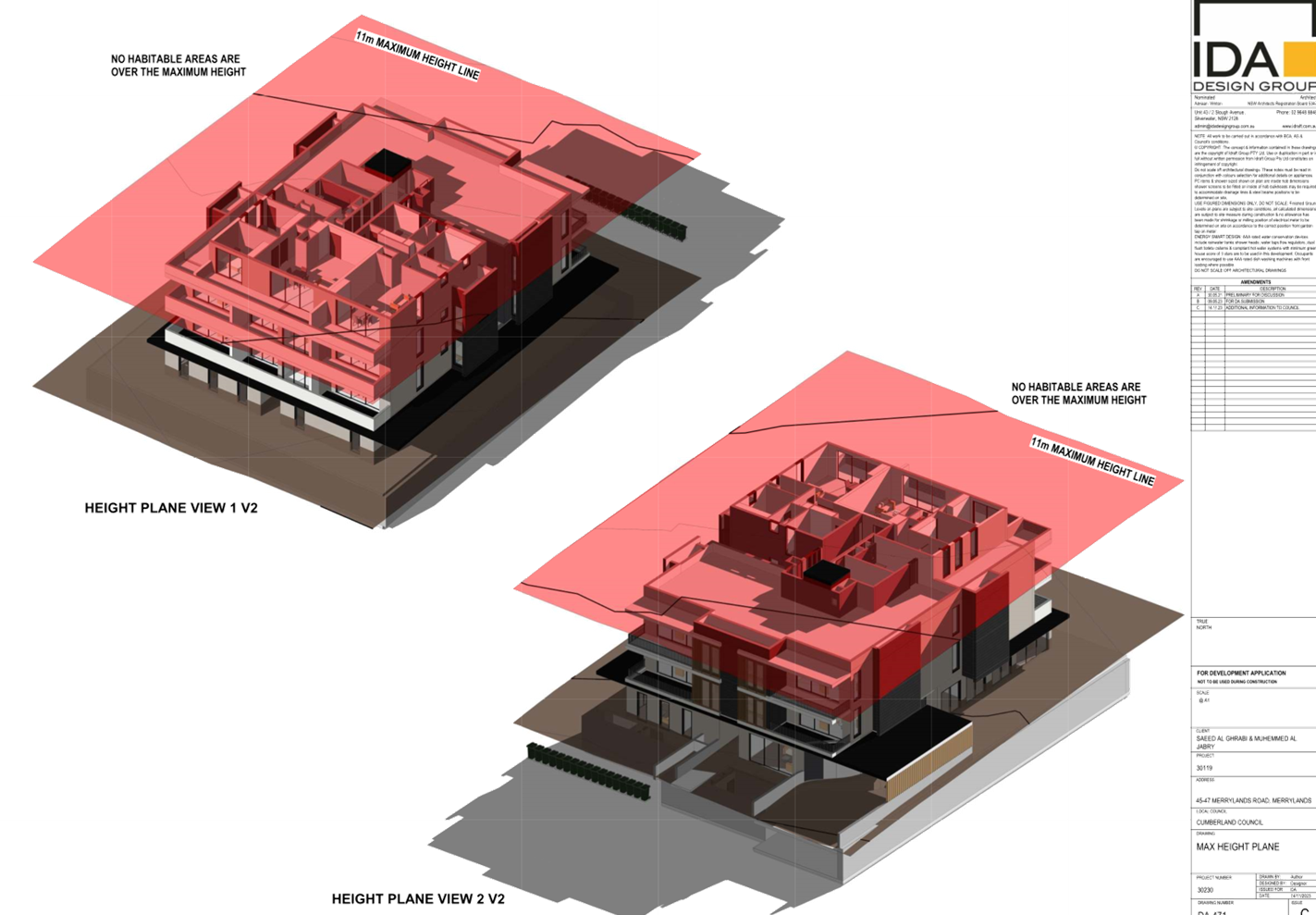
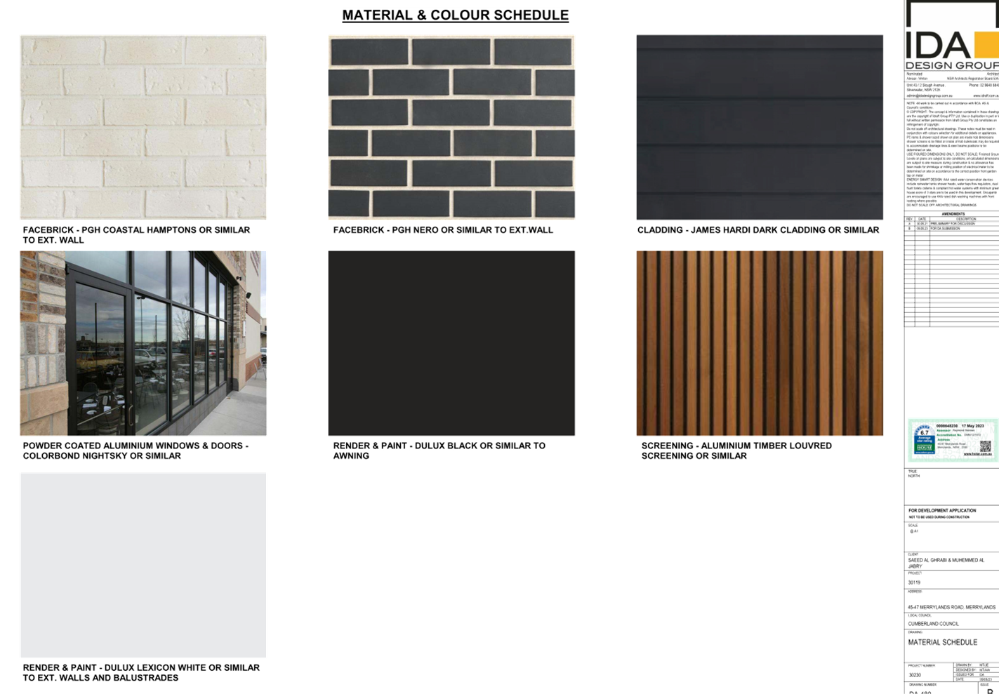
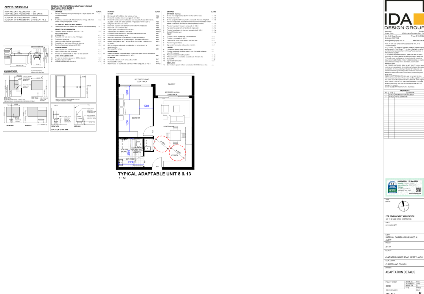
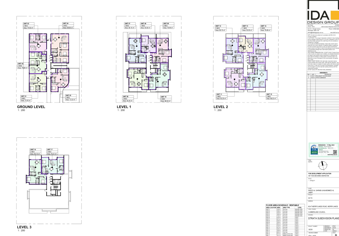
DOCUMENTS
ASSOCIATED WITH
REPORT LPP002/24
Attachment 8
Landscape Plans
Cumberland
Local Planning Panel Meeting
14 February 2024
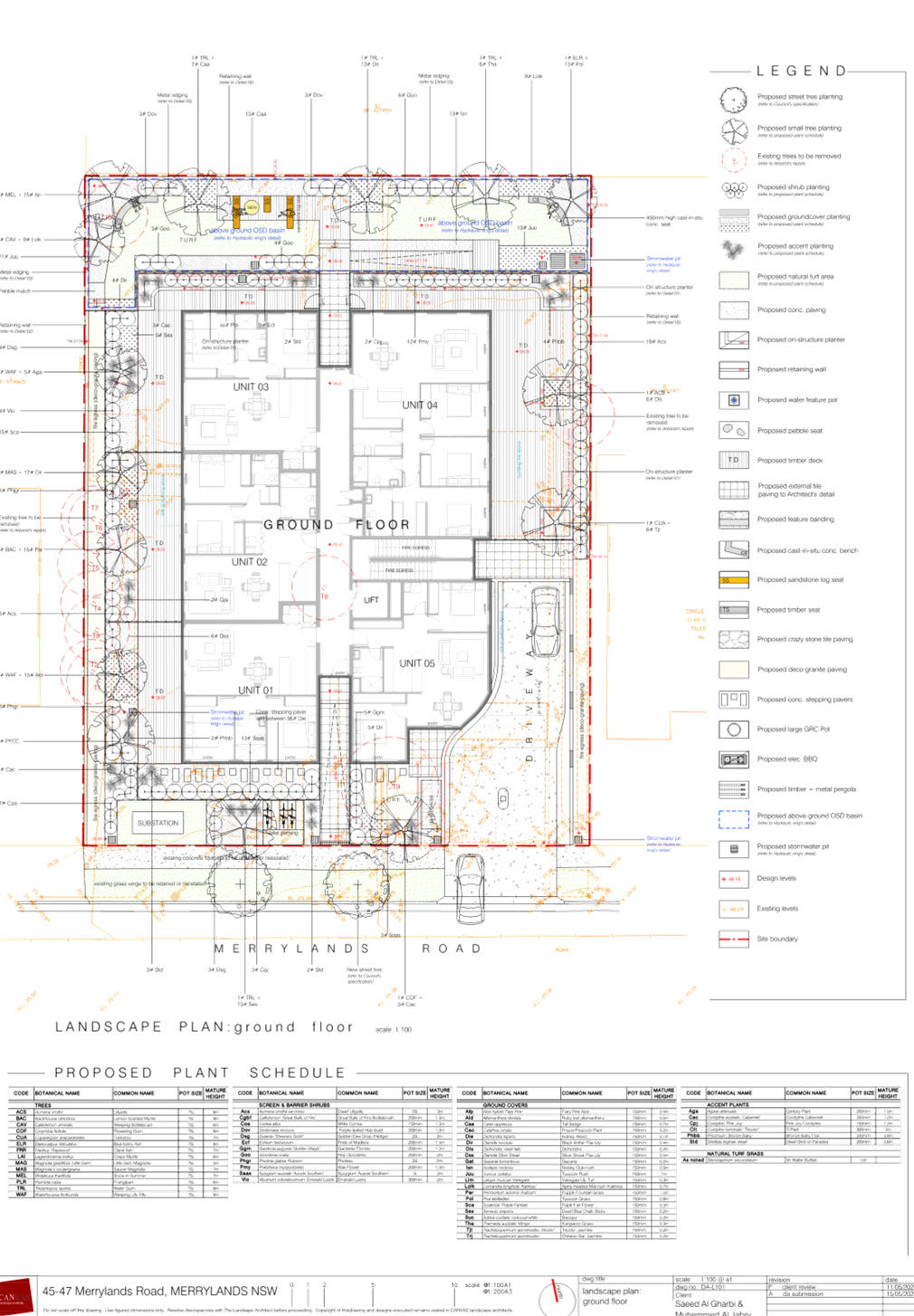
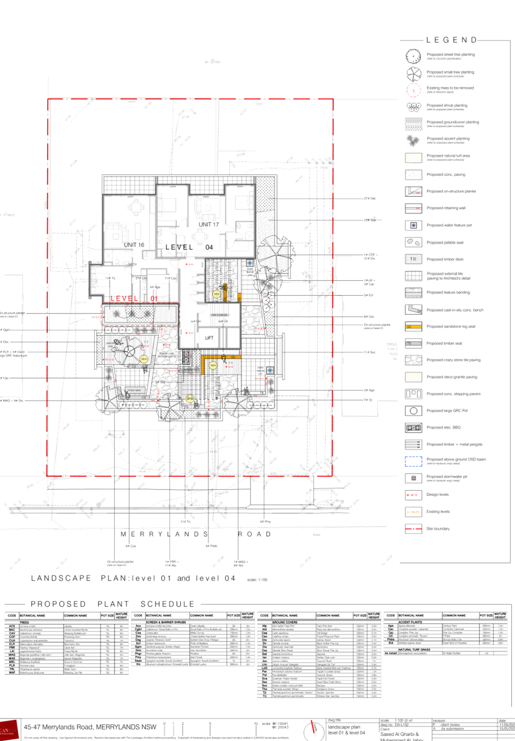
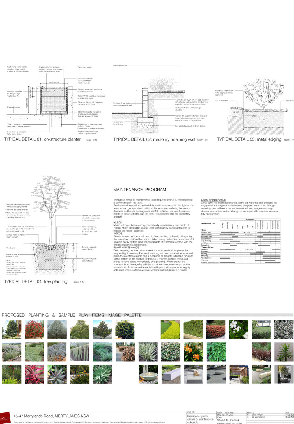
DOCUMENTS
ASSOCIATED WITH
REPORT LPP002/24
Attachment 9
Shadow Diagrams
Cumberland
Local Planning Panel Meeting
14 February 2024
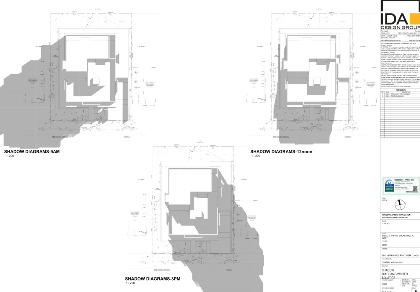

Cumberland Local Planning Panel Meeting
14 February 2024
Item
No: LPP003/24
Development
Application - Daruga Avenue, Pemulwuy
Directorate: Environment
and Planning
Responsible
Officer: Executive
Manager Development and Building
|
Application
accepted
|
Friday 14 July 2023.
|
|
Applicant
|
Cityscape Planning + Projects.
|
|
Owner
|
Cumberland City Council and The
Trust Company Limited.
|
|
Application
No.
|
DA2023/0354.
|
|
Description
of Land
|
Daruga Avenue Pemulwuy being:
Lot
202 in DP 1121844.
Lot 669 in DP 1148337.
Part Lot 901 in DP 1078814
being 2 Foundation Place Pemulwuy.
Part Clunies Ross Road
Reserve.
|
|
Proposed
Development
|
Construction of Prospect Hill
pathway to lookout and associated landscaping.
|
|
Site
Area
|
The site the subject of the
works occupies 9,528.4 square metres.
|
|
Zoning
|
Cumberland Local Environmental
Plan 2021:
· C2
- Environmental Conservation Zone for Lot 202 in DP 1121844. Small portion of
lot not zoned.
· RE1
- Public Recreation Zone for Lot 669 in DP 1148337.
The following land is zoned
IN1 General Industrial under State Environmental Planning Policy (Industry
and Employment) 2021 Chapter 2 - Western Sydney Employment Area.
· Clunies
Ross Road Reserve.
· Lot
901 in 1078814 being 2 Foundation Place.
|
|
Disclosure
of political donations and gifts
|
Nil disclosure.
|
|
Cost
of Works
|
$3,521,100.00.
|
|
Heritage
|
Yes - Number I01662 being
Prospect Hill which is a State Heritage listing.
|
|
Principal
Development Standards
|
Not applicable for the site.
|
|
Issues
|
Nil.
|
1. Development
Application Number 2023/0354 for the construction of the Prospect Hill pathway
to a new lookout and associated landscaping was accepted by Council on Friday
14 July 2023.
2. The application
was publicly notified to occupants and owners of the adjoining properties for a
period of twenty nine (29) days between Thursday 31 August and Thursday 28
September 2023. Council received 3 submissions to the development application,
however 2 are from one objector.
3. The
subject site is listed as a State heritage item within the Cumberland Local
Environmental Plan 2021 being Prospect Hill - Heritage Item I01662.
4. The
development application is referred to the Panel as the development is
occurring on land owned and managed by Cumberland City Council.
5. The
development application is recommended for approval subject to conditions as
recommended in the Council’s assessment report.
Subject Site and Surrounding
Area
Prospect Hill is located at
Pemulwuy and has significant heritage value. The subject site is a large
irregular shaped parcel of land situated between the industrial and residential
areas of Pemulwuy.
The site comprises of four lots
with the following property description:
· Lot 202 in DP
1121844.
· Lot 669 in DP
1148337.
· Part Lot 901 DP
1078814 being 2 Foundation Place.
· Part Clunies Ross
Road Reserve.
The development site being that
area the subject of development works has an irregular shape, occupies an area
of 9,528.4 square metres and has a frontage of 60 metres to Reconciliation Rise
to the south. The overall site area is considerably larger at 19,000 square
metres being the wider area according to the statement of environmental effects.
While the site faces
Reconciliation Rise, Council’s property rating system has the site facing
Daruga Avenue.
Prospect Hill is listed as a State
Heritage Item (Number I01662) within the Cumberland Local Environmental Plan
2021 due to the significance of the area to the people of the Darug nation.
The site is situated on the summit
of Prospect Hill with extensive panoramic views to the north, east and west.
There are extensive residential areas to the north and east while industrial
and warehouse developments predominate to the northwest, west and southwest.
Extensive clearing of trees has
occurred within and adjacent to the site which is a result of former activities
including agricultural and pastoral activities and quarrying. As a result, the
site is relatively open. Notwithstanding this, there are small trees or shrubs
scattered across the area.
Key site constraints
There are key site constraints
that must be considered as follows:
1. Powerlines
that cross through the site.
2. Easements
passing through the site as follows:
· Lot 202 in DP
1121844 - Easements accommodating Endeavour Energy assets.
· Road reserve
incorporating part of Clunies Ross Street.
3. The
site is identified as being bushfire prone possessing both Vegetation Buffer
and Vegetation Category 3 lands as per the relevant mapping.
It is noted that the western part
of the site is in private ownership. However, landowner consent has been
submitted by the relevant party which authorises the making of the development
application.
Vehicle access to the area is
limited with the only parking area available along Reconciliation Rise and Butu
Wargun Drive. The site has been cordoned off to prevent unauthorised access to
the hilltop and to prevent antisocial activities occurring across the area.
The location of the site is shown
below with the general allotments affected by the development outlined in
purple with the development site the subject of the works outlined in red.
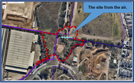
The land zoning map under the
Cumberland Local Environmental Plan 2021 is outlined below. There are two land
parcels not zoned under the local planning instrument. Instead, the two parcels
are zoned IN1 General Industrial under State Environmental Planning Policy
(Industry and Employment) 2021 Chapter 2 - Western Sydney Employment Area.
It is also identified that a small
portion of the site within Lot 202 in DP 1121844 with dimensions of
approximately 4 metres x 12 metres is not zoned under the relevant planning
instruments that apply to the site.
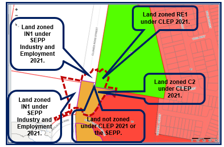
Photos
of the site taken Sunday 27 August 2023 are attached below.
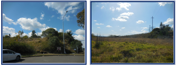
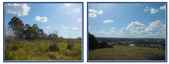
Description of The
Development
Prospect Hill is listed on the
State Heritage Register as an item of State Heritage Significance. The current
condition of the park does not represent the significance of the site and area
and upgrade works are essential to permit the site to be properly used.
On Wednesday 20 March 2019,
Cumberland City Council adopted the “Prospect Hill Plan of
Management” that provides for the framework for managing the land and
outlines how the land is intended to be used, improved then maintained for the
future.
The Plan of Management
incorporated a Landscape Masterplan to illustrate the proposed improvements to
the site and to facilitate the establishment of facilities for the users of the
land (Page 62).
The Plan of Management has been
prepared with extensive consultation and engagement with the local community
and Aboriginal stakeholders.
The proposed development that
forms the development application represents an initial development in the
delivery of the broader Landscape Masterplan. The initial development focusses
upon the area from Reconciliation Rise to the summit of Prospect Hill. It is
expected that future development applications will be lodged for future development
to permit the Masterplan to be fulfilled.
The Plan of Management is attached
to the report for the consideration of the Panel.
The development application is
consistent with the Plan of Management and proposes the following works:
· Establish a
walking track along the ridgeline between the lookout at Prospect Hill and
Reconciliation Rise.
· Construct
unobtrusive viewing areas at Prospect Hill, looking south-east using low
maintenance materials.
· Construct new
pathways that are 2.5 metres wide to provide access to the “events and
performance spaces, look out and summit knoll area.
· Provide seating at
entry points, along pathways and at viewing points and provide a future
ceremonial plaza and event space.
· Provide a low key
and secure perimeter at the Reconciliation Rise entry to restrict existing
unauthorised vehicle entry from that location.
· Removal of
existing vegetation to allow for construction works to proceed.
Proposed Layout
The proposed layout is demonstrated as follows:
· A single shared path
provides access to Prospect Hill from Reconciliation Rise.
· The pedestrian path to
the lookout sweeps around a performance area and follows the contours of the
hill up to the Ceremonial Plaza.
· The path then switches
back to a landing which intersects with the stairs and sweeps on up to the base
of the knoll.
· The path meets the
ridgeline path at the base of the hill which wraps around the base of the knoll
to the lookout.
· To the south of the
knoll, a lookout platform is provided with topo scope signage and bench
seating.
· In addition to the path,
a stair access connects Reconciliation Rise to the performance space and a set
of stairs connects the performance space to the base of the knoll.
· The site will be
subjected to landscaping corresponding to site conditions and will be fenced
off to prevent unauthorised access.
New building works
The following works are required:
· The entry area of
Reconciliation Rise will be represented as a stone clad feature wall with place
name signage, a gated entry with secure fencing and bench seating, drinking
fountain and bin located outside the secure perimeter.
· The fencing and
gate at this location will be a steel palisade type product and the space
behind this entry area will be provided with feature basalt boulders.
· The pathways will
be a mix of at-grade concrete finishes at the lower and upper levels of the
site and elevated mesh to steel, walkways through the site midsections.
· The stairs are
also provided with a concrete finish and the landings at these spaces will be
an exposed aggregate finish.
· Galvanised hand
rails are also provided to the stairs, elevated pathways and ramps together
will tactile ground surface indicators at all required locations.
· Low retaining
walls along the pathways can also perform a seating role to allow users to rest
and contemplate views and the broader site experience including the event space
and future ceremonial area.
· The lookout will
feature an elevated platform of mesh to steel and will feature bench seating
and steel balustrades along its perimeter.
Operations and Management
Prospect Hill is currently visited
by various users including Aboriginal groups and school groups as part of
teaching Aboriginal history and culture. It is also an important venue to the
Aboriginal community for the annual NAIDOC Week and Reconciliation Day (3 May)
events.
The development proposal is
therefore only seeking to accommodate the existing activities and user groups
and particularly the Aboriginal communities in a more functional manner that
recognises and respects the cultural importance of the site.
Further, it is not intended as
part of the initial stage of the development to attract more intensive or
frequent use of the site. Generally only Council organised events will be
taking place within the area. The Council events will be “invitation
only” to the relevant user groups.
Access from Reconciliation Rise
will therefore be restricted by the electronic gate and secure perimeter and
access will be on a need only basis and formally requested basis through
Council. On the days of events, the gates will be opened either electronically
or by Council rangers between the hours of 6 am and 6 pm. At all other times,
the area will remain closed to the general public. The practice will occur
until the embellishment of the broader site is complete that will allow more
public use.
History
A pre lodgement meeting was held
with Council officers on Tuesday 30 May 2023 with the pre lodgement minutes being
issued shortly after.
The development application was
accepted by Council on Friday 14 July 2023 for determination.
Applicants Supporting
Statement
The applicant has provided a
Statement of Environmental Effects prepared by Cityscape Planning and Projects
which is dated June 2023.
Contact With Relevant
Parties
The assessing officer has
undertaken a site inspection of the subject site and surrounding properties and
has been in regular contact with the applicant throughout the assessment
process.
Internal Referrals
Aboriginal Engagement and
Programs
The development application was
referred to Council’s Aboriginal Engagement and Programs Officer for
comment in relation to the Aboriginal Cultural Heritage Assessment Report
submitted by Apex Archaeology. As per the comments of Thursday 5 October 2023,
no objections are raised to the development application. Furthermore, there are
no conditions recommended for any consent that may be issued.
Development Engineering
The development application was
referred to Council’s Development Engineer for comment who has advised
that the development proposal is satisfactory subject to conditions.
Environment and Health
The development application was
referred to Council’s Environment and Health Officer for comment who has advised
that the development proposal is unsatisfactory on the grounds that an acoustic
report was not submitted to address any events occurring at the ceremonial
area. However, there is no objection overall to the development and conditions
are provided.
It should be noted that events
when they do occur are seldom in nature and attracting very limited numbers
within an area that is not located near residents. It is considered that an
acoustic report is not required. However, the applicant will be required to
submit a plan of management addressing how noise from any events held at the
lookout are minimised / mitigated. This is addressed at draft Condition 7 for
Panel consideration.
Parks and Open Space
The development application was
referred to Council’s Parks and Open Space Department for assessment. As
per advice of Tuesday 5 September 2023:
· The proposal is
consistent with the plan of management and delivers on what the plan seeks to
undertake.
· The proposal is
consistent with the objectives of the plan of management.
· The planting
scheme is appropriate for the location and the planting aligns with the
relevant objectives for regeneration of the site.
· The
recommendations made in the accessibility report should be included into any
consent issued.
No conditions are provided given
the proposal being consistent with the Plan of Management for the site.
Property / Governance and
Risk
The development application was
referred to Council’s Property, Governance and Risk Department. No
objections were received in relation to the development application.
Tree Management
The development application was
referred to Council’s Tree Management Officer for comment who has advised
that the development proposal is satisfactory subject to conditions.
Waste Management
The development application was
referred to Council’s Waste Management Officer for comment who has
advised that the development is satisfactory. There are no objections to the
proposed development and no conditions are required.
External Referrals
Endeavour Energy
Endeavour Energy has provided
conditions addressing relevant concerns in relation to easements. All relevant
conditions are included into the recommendation for Panel consideration.
Office of Environment and
Heritage (Heritage)
The development application was
initially considered as being Integrated Development and requiring a General
Terms of Approval pursuant to Section 90 of the National Parks and Wildlife Act
1974 and Section 58 of the Heritage Act 1977.
As per correspondence of Friday 22
December 2023, there is no harm to Aboriginal objects arising from the
development and an Aboriginal Heritage Impact Permit is not required. The
development is not integrated development, and no general terms of approval is
required. However general conditions are provided for any consent that may be
issued.
New South Wales Police -
Cumberland Local Area Command
The development application was
referred to New South Wales Police - Cumberland Local Area Command for review.
As per the comments of Tuesday 29 August 2023, the development application is
supported subject to conditions.
Planning Comments
The provisions of any
Environmental Planning Instruments (EP&A Act s4.15 (1)(a)(i))
State Environmental Planning
Policies
The proposed development is
affected by the following State Environmental Planning Policies:
|
State
Environmental Planning Policies (SEPPs)
|
Relevant
Clause(s)
|
Compliance
with Requirements
|
|
· State
Environmental Planning Policy (Biodiversity and Conservation) 2021.
|
Chapter 2 -Vegetation in non
Rural Areas.
|
There is a need to clear 1,094
square metres of native vegetation across the site.
The area clearing threshold is
5,000 square metres for native vegetation due to the wider site occupying
more than 10,000 square metres in area.
Note: This is
allowed for sites between 10,000 sq m and 40,000 sq m in size.
The area clearing threshold is
not exceeded and the site the subject of the works is not identified on the
mapping as an area containing biodiversity significance.
The development application
includes the removal of small trees and shrubs which are of limited
ecological value. The vegetation will be replaced with improved endemic
planting to enhance the local area.
The proposal does not exceed
the biodiversity offsets scheme threshold. Therefore, the proposed vegetation
removal is considered acceptable.
|
|
Chapter 6 -
Water Catchments.
Sydney Harbour Catchment.
|
It is determined that given its
location, a detailed assessment is not required given that there is no direct
impact upon the catchment and no direct impact upon watercourses. As such,
the development is acceptable under the new provisions that came into effect
on Monday 21 November 2022.
However, given that the site is
situated on the summit of a hill, the development application includes the
following protective features to protect catchments below the ridgeline
during construction:
· Vegetation swales, dispersion trenches and a stormwater
management system appropriate for the location that connects to existing
trunk drainage systems.
· Suitable sediment and erosion controls at locations where
soil erosion could occur during construction.
|
|
· State
Environmental Planning Policy (Resilience and Hazards) 2021.
|
Chapter 2 - Coastal Management.
|
The subject site is not
identified as a coastal wetland or ‘land identified as “proximity
area for coastal wetlands” or coastal management area.
As such, no assessment of
Chapter 2 is required in this instance.
|
|
Chapter 4 - Remediation of
Land.
Part 4.6.
|
Part 4.6 - Contamination
and remediation to be considered in determining development application.
Comments
The site and
broader area have a long history of quarry activities commencing during the
1950s and concluding during the 1970s which raises the potential for
contamination from refuelling of various plant and equipment on site at the
time.
A preliminary
site investigation has been conducted for the site with a report prepared by
SESL Australia Reference Number J001516 and dated February 2019 identifying
that the site was contaminated and requiring major remediation works.
A remediation
action plan has been prepared by SESL Australia Reference Number J001516 and
dated March 2019. It is determined that the most appropriate option available
is for on site management to occur.
A validation
report prepared by EDP Reference number S-00943.SRVR.001 and dated November
2022 states that remediation works have been completed and the site is
considered suitable for public open space use.
On the grounds
that Council’s Environment and Health Officer has raised no objection
to the development in terms of land contamination issues, it is concluded
that the development application is satisfactory under Part 4.6 of Chapter 4
of the State Policy.
|
|
· State
Environmental Planning Policy (Industry and Employment) 2021.
|
Chapter 2
Western Sydney Employment
Area.
|
The land known as Clunies Ross
Road Reserve and Lot 901 in 1078814 being 2 Foundation Place falls under
Chapter 2 of the State Policy.
A detailed assessment covering
the land parcels as relevant is attached at Appendix A.
It is determined that the
relevant provisions are complied with. In addition:
· The
development is permissible with consent within the IN1 General Industrial
zone that is applied to the land.
· The
heritage matters have been addressed with the Heritage Office of New South
Wales.
· The
relevant provisions are complied with.
|
|
Chapter 3 Advertising and
Signage.
|
The entry area of
Reconciliation Rise will be represented as a stone clad feature wall with
place name signage and a gated entry with secure fencing. The proposed sign
will read “Prospect Hill”.
The sign will have dimensions
of 3.8 metres x 275 mm and having an area of 1.045 square metres. The sign
read “Prospect Hill” being a geographical name of a locality.
It is not advertising signage
that promotes any good or service or an event and the wording is neither
business or building identification signage.
A detailed assessment is not
required given that the sign specifies a geographical feature being a hill.
|
|
State Environmental Planning Policy (Sustainable
Buildings) 2022
|
|
State Environmental Planning
Policy (Sustainable Buildings) 2022 sets sustainability standards of
buildings across NSW for residential and non-residential development. The
Sustainable Buildings SEPP was notified on Thursday 29 August 2022 and came
into effect on Sunday 1 October 2023 to allow for the relevant industry to
adjust to the new standards.
In accordance with the savings
and
transitional provisions of
Clause 4.2 of the Sustainable Buildings SEPP
2022, this policy does not
apply to the subject development application given timing of lodgement and
acceptance.
|
|
· State Environmental
Planning Policy (Transport and Infrastructure) 2021.
|
Chapter 2 - Infrastructure.
|
State Environmental Planning
Policy (Transport and Infrastructure) 2021 is relevant to the development
application as follows.
|
|
Clause 2.48
|
Chapter 2 - Infrastructure.
Determination of development
applications (Subpart (2)) - Give written notice to electricity providers and
take account of responses received within 21 days.
Comment
Given the presence of easements
and various electricity assets managed and operated by Endeavour Energy,
Council has referred the development application to Endeavour Energy for
review.
Endeavour
Energy has provided conditions addressing relevant concerns in relation to
easements. All relevant conditions are included into the recommendation for
Panel consideration.
|
Local
Environmental Plans
Cumberland Local Environmental
Plan 2021
The provision of the Cumberland
Local Environmental Plan 2021 is applicable to that part of the development
occurring across Lot 202 in DP 1121844 and Lot 669 in DP 1148337. The
development across the land parcels and different zonings achieves compliance
with the key statutory requirements of the Cumberland Local Environmental Plan
2021 and the objectives of the following zones:
· C2 - Environmental
Conservation Zone for Lot 202 in DP 1121844.
· RE1 - Public Recreation
Zone for Lot 669 in DP 1148337.
Note: A small portion of
land on Lot 202 in DP 1121844 does not have any zoning under any planning
instrument with the area affected by between 48 and 60 square metres. Given the
wording of Clause 2.4 of the Cumberland Local Environmental Plan 2021 which
reads as:
Unzoned land
(1) Development
may be carried out on unzoned land only with development consent.
(2) In
deciding whether to grant development consent, the consent authority—
(a)
must consider whether the development will impact on adjoining zoned land and,
if so, consider the objectives for development in the zones of the adjoining
land, and
(b) must
be satisfied that the development is appropriate and is compatible with
permissible land uses in any such adjoining land.
Council officers may consider the
development across the affected area under Subclause 2(a) and 2(b) and apply
the provisions accordingly as part of the assessment.
(a) Permissibility:
The proposed development as
demonstrated by the Statement of Environmental Effects is defined as a Recreation
Area which is defined as:
recreation area
means a place used for outdoor recreation that is normally open to the public,
and includes—
(a) a
children’s playground, or
(b) an
area used for community sporting activities, or
(c) a
public park, reserve or garden or the like, and any ancillary buildings, but
does not include a recreation facility (indoor), recreation facility (major) or
recreation facility (outdoor).
A recreation area is a permissible
development with consent across both zones. Coupled with the permissibility
that is achieved for the IN1 General Industrial zone under State Environmental
Planning Policy (Industry and Employment) 2021 - Chapter 2 Western Sydney
Employment Area, it is considered that the development across all four allotments
is permissible with consent.
Given this finding, it is
considered that the proposed development is permitted across that part of Lot
202 in DP 1121844 that is not zoned under any of the planning instruments that
apply to the site.
The relevant matters to be
considered under the Cumberland Local Environmental Plan 2021 and the
applicable clauses for the proposed development are summarised below. A
comprehensive LEP assessment is contained in Appendix B.
Cumberland
LEP 2021 Compliance Table
|
DEVELOPMENT STANDARD
|
COMPLIANCE
|
DISCUSSION
|
|
4.3 Height of Buildings.
|
N/A
|
No building height requirements
apply to the site and no formal buildings are to be constructed.
|
|
4.4 Floor Space Ratio.
|
N/A
|
No floor space ratio requirements apply to the affected
land and no floor space ratio is generated by the proposed works.
|
The provisions of any proposed
instrument that is or has been the subject (EP&A Act s4.15 (1)(a)(ii))
There are no draft planning
instruments that needs to be considered for the purpose of the development
application.
The provisions of any
Development Control Plans (EP&A Act s4.15 (1)(a)(iii))
The Cumberland Development Control
Plan 2021 is relevant to the development proposal and the development has been
assessed using the relevant controls. The development is found to comply with
the relevant provisions. A detailed assessment is provided at Appendix C
attached to the report for clarity.
Car parking requirements
A car park is not proposed to
service the development and there are no car parking requirements for such
developments. Council engineers have supported the development with conditions
without the need for a car park.
The applicant has advised in a
written statement dated Friday 20 October 2023 that given the State Heritage significance
of the subject site, there is no likelihood that the Office of Environment and
Heritage would issue an approval to a development proposal that sought to
include a car park on the subject site.
On Page VI and VII of the Plan of
Management, the Masterplan for the Prospect Hill area is suggesting the
development of car parking with access from Clunies Ross Drive especially once
the entire hill is developed to its full potential. The plan is not suggesting
on site car parking to service the initial stages of the Prospect Hill
redevelopment.
The development of future car
parking is situated on another part of the site that does not form part of the
current development application.
On this basis and, given that
there is a long term masterplan in place for the hill, including the
development of a future car park to service the area for the long term, the
proposal to rely on the street car parking within the vicinity of the entry to
the site is considered to be acceptable.
The provisions of any planning
agreement that has been entered into under section 7.4, or any draft planning
agreement that a developer has offered to enter into under section 7.4
(EP&A Act s4.15(1)(a)(iiia))
There is no draft planning
agreement associated with the subject Development Application.
The provisions of the
Regulations (EP&A Act s4.15 (1)(a)(iv))
The proposed development raises no
concerns as to the relevant matters arising from the Environmental Planning and
Assessment Regulations 2021 (EP&A Reg).
The Likely Environmental,
Social or Economic Impacts (EP&A Act s4.15 (1)(b))
It is considered that the proposed
development will have no significant adverse environmental, social or economic
impacts in the locality.
The suitability of the site for
the development (EP&A Act s4.15 (1)(c))
The site is identified as being
bushfire prone on the relevant Council bushfire prone areas map. As per the
requirements of Clause 4.14 of the Environmental Planning and Assessment Act
1979, Council cannot consent to development unless it demonstrates that it
conforms to the specifications and requirements of Planning for Bushfire
Protection 2019 prepared by the NSW Rural Fire Service.
As demonstrated by the documents
submitted, the site is not located close to major bushland areas and the
bushfire prone status is largely related to smaller vegetation areas and
grasses located across the site.
The development application is not
proposing any buildings and there is no permanent onsite occupation occurring.
In addition, the grasses and vegetation will be removed as part of the works
which in turn will reduce any fire hazard.
The relevant legislation has been
considered and it is determined that formal referral to the New South Wales
bushfire brigade is not required because a building is not proposed.
It is considered that the
development is suitable in the context of the site and surrounding locality and
is consistent with the Prospect Hill Plan of Management dated March 2019.
Submissions made in accordance
with the Act or Regulation (EP&A Act s4.15 (1)(d))
|
Advertised (Website)
|
Mail
|
Sign
|
Not Required
|
In accordance with Council’s
Notification requirements contained within the Cumberland Development Control
Plan 2021, the proposal was publicly notified for a period of twenty nine (29)
days between Thursday 31 August and Thursday 28 September 2023. During the
notification period, Council received 3 submissions. The issues raised in the
public submissions are summarised and commented on as follows:
|
Issue
|
Planner’s Comment
|
|
The plans do not properly locate the site. References to a
geographical landmark should be made.
|
The information submitted including the statement of
environmental effects clearly outlines the location of the site.
|
|
Is the site part of the Masterplan?
|
The site is governed by the Prospect Hill Plan of
Management. It is determined that the proposed development is consistent with
the Plan of Management.
|
|
There is loud party noise from the top of the hill and
fireworks are often let off which has set the grass on fire in the past. We
have made numerous complaints to Police due to poor behaviour during the early
hours of the morning. This includes illegal drinking, drug taking and
parties.
|
The development application has been referred to the
Cumberland Local Area Command for comment. The development application is
supported subject to conditions.
The proposed development will result in improvements being
made and as such the issues raised are less likely to occur or would cease.
|
The public interest (EP&A
Act s4.15(1)(e))
In view of the foregoing analysis,
it is considered that the development, if carried out subject to the conditions
set out in the recommendation below, will have no significant adverse impacts
on the public interest.
Cumberland Local Infrastructure
Contributions Plan 2020
As per advice received from
Council’s Senior Contributions Advisor dated Wednesday 23 August 2023, a
contribution is not payable for the development on the grounds that this is a
Council development application.
Housing and Productivity
Contribution (HPC)
In accordance with s7.24(4) of the
Environmental Planning and Assessment Act, 1979 as amended by the Environmental
Planning & Assessment Amendment (Housing and Productivity Contribution) Act
2023, the development is subject to the (Housing and Productivity Contribution)
Act 2023.
In accordance with Part 2 of
Schedule 5 of the Environment Planning & Assessment (Housing and
Productivity Contribution) Order 2023 (‘the Order’), the Order does
not apply to a development consent granted to a pending development application
(Pending DA).
A ‘Pending DA’ as per
Schedule 1 of the Order and Schedule 6, part 9, s16 of the Regs 2021 is as
follows:
(a) a
development application that is made, but not determined, before the
commencement of this Order, or
(b) a
development application that is made and determined before the commencement of
this Order, but has not been finally determined, or
(c) an
application for a complying development certificate that is made, but not
determined, before the commencement of this Order.
The contribution would not apply
to such an application for a lookout and associated pathways.
Disclosure of Political
Donations and Gifts
The applicant and notification
process did not result in any disclosure of Political Donations and Gifts.
The proposed development is
appropriately located within the following zones:
· C2 - Environmental
Conservation Zone for Lot 202 in DP 1121844.
· RE1 - Public Recreation
Zone for Lot 669 in DP 1148337.
Under the Cumberland Local
Environmental Plan 2021.
· IN1 General Industrial
for Clunies Ross Road Reserve and Lot 901 in 1078814 being 2 Foundation Place.
Under State Environmental Planning
Policy (Industry and Employment) 2021 Chapter 2 - Western Sydney Employment
Area.
The proposal is generally
consistent with all statutory and non-statutory controls applying to the
development. The development is considered to perform adequately in terms of
its relationship to its surrounding built and natural environment, particularly
having regard to impacts on adjoining properties.
For these reasons, it is considered
that the proposal is satisfactory having regard to the matters of consideration
under Section 4.15 of the Environmental Planning and Assessment Act 1979, and
the development may be approved subject to conditions.
|
1. That
Development Application 2023/0354 on land at Lot 202 in DP 1121844, Lot 669
in DP 1148337, Part Lot 901 in DP 1078814 being 2 Foundation Place Pemulwuy
and Part Clunies Ross Road Reserve for Construction of Prospect Hill pathway
to lookout and associated landscaping be approved subject to conditions as
provided in the attached Schedule.
2. Persons
whom have lodged a submission in respect to the application be notified of
the determination of the application.
|
1. Draft Notice
of Determination
2. Architectural
Plans
3. Stormwater/Engineering
Plans
4. Redacted
Submissions
5. Cumberland
City Council Prospect Hill Plan of Management March 2019 (Includes the
Landscape Master Plan details)
6. Appendix
A - State Environmental Planning Policy (Industry and Employment) 2021
Assessment Table
7. Appendix
B - Cumberland Local Environmental Plan 2021 Assessment Table
8. Appendix
C - Cumberland Development Control Plan 2021 Assessment Table
DOCUMENTS
ASSOCIATED WITH
REPORT LPP003/24
Attachment 1
Draft Notice of Determination
Cumberland
Local Planning Panel Meeting
14 February 2024
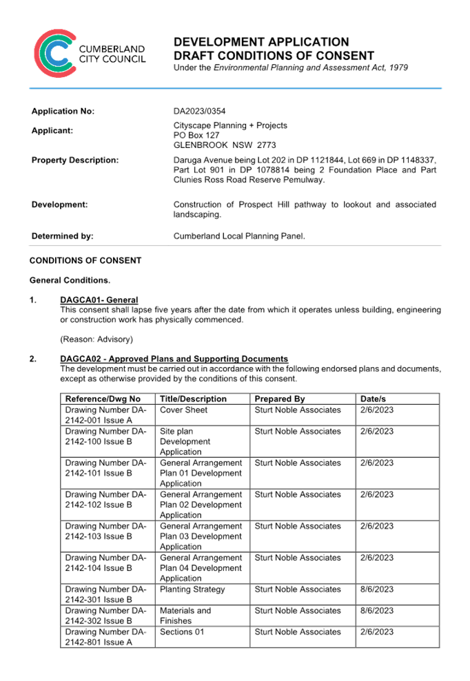

DOCUMENTS
ASSOCIATED WITH
REPORT LPP003/24
Attachment 2
Architectural Plans
Cumberland
Local Planning Panel Meeting
14 February 2024
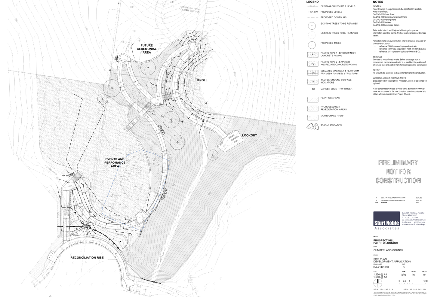

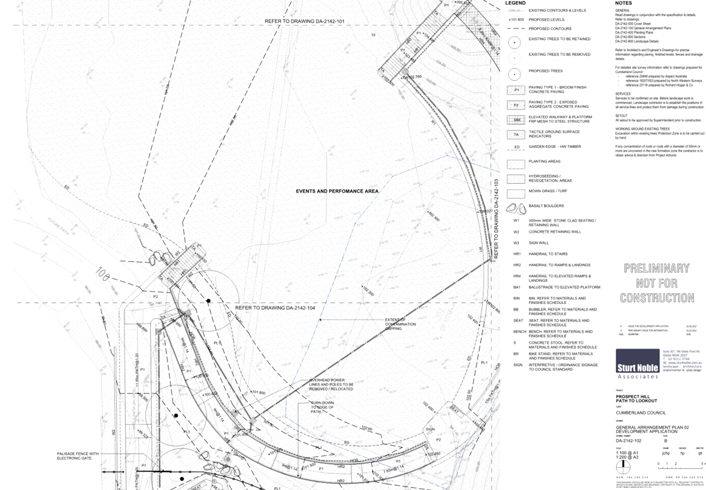

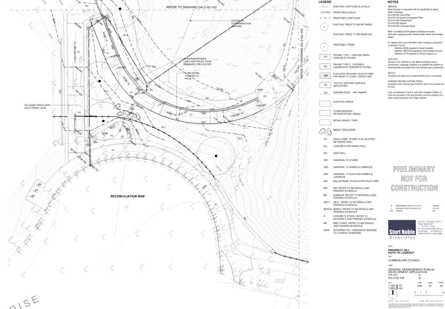
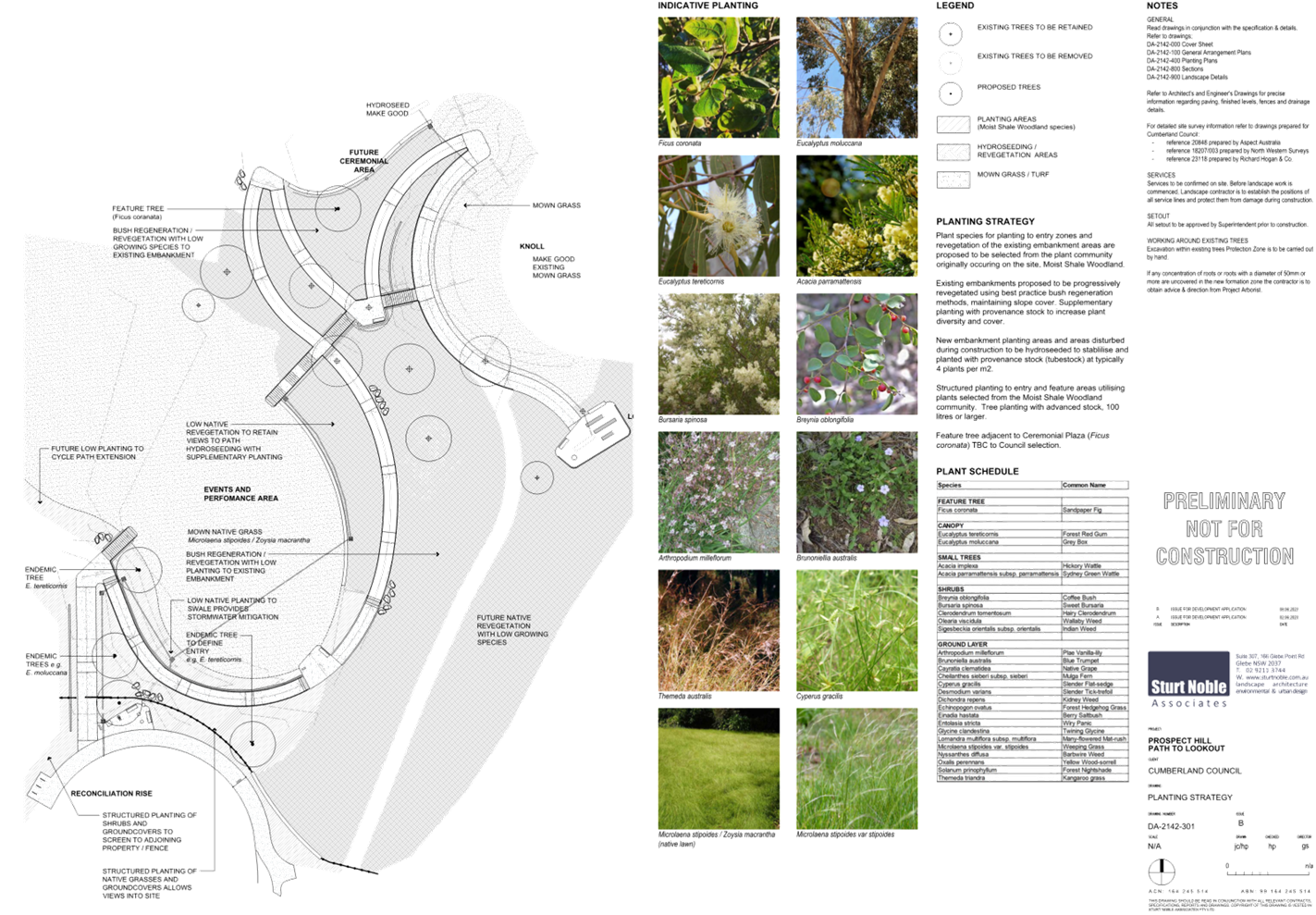

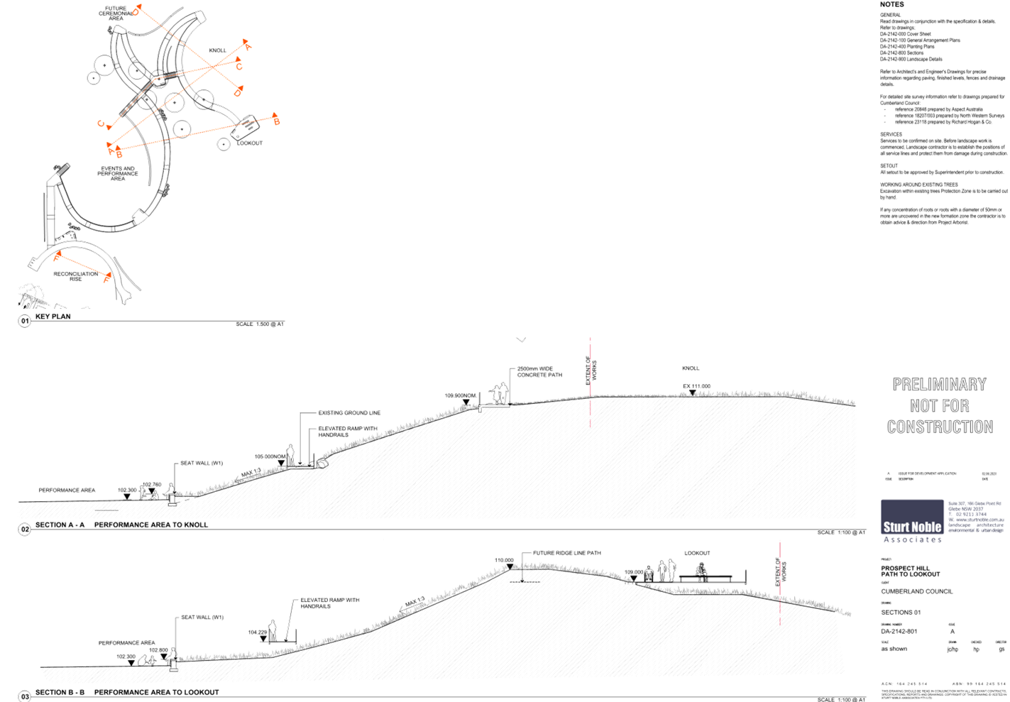
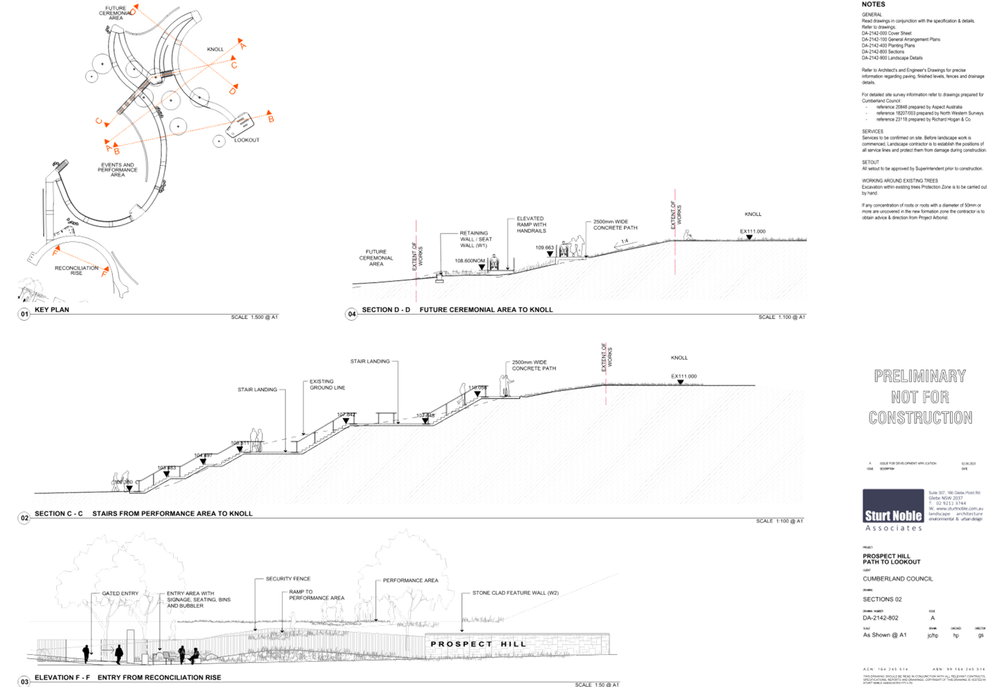
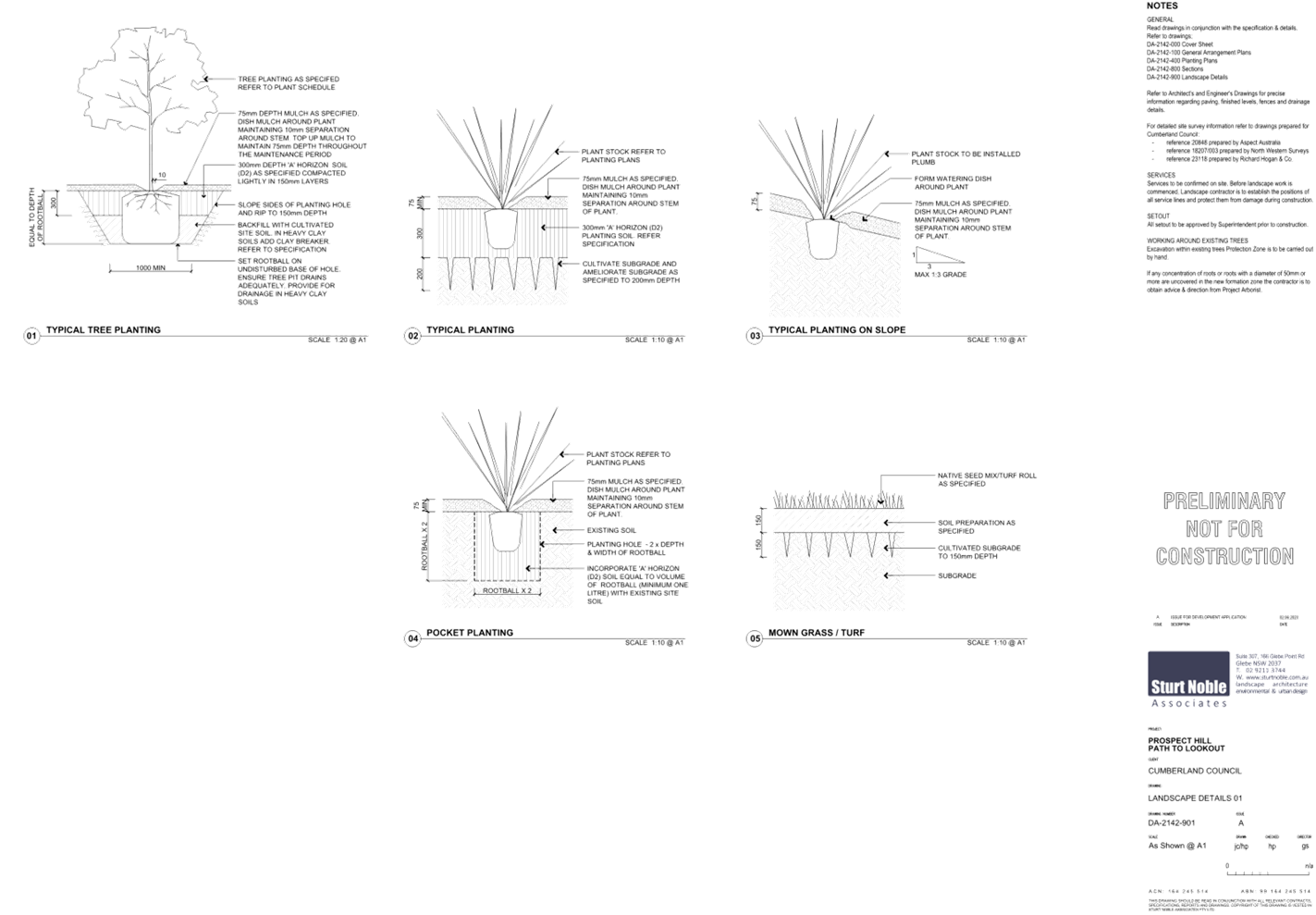
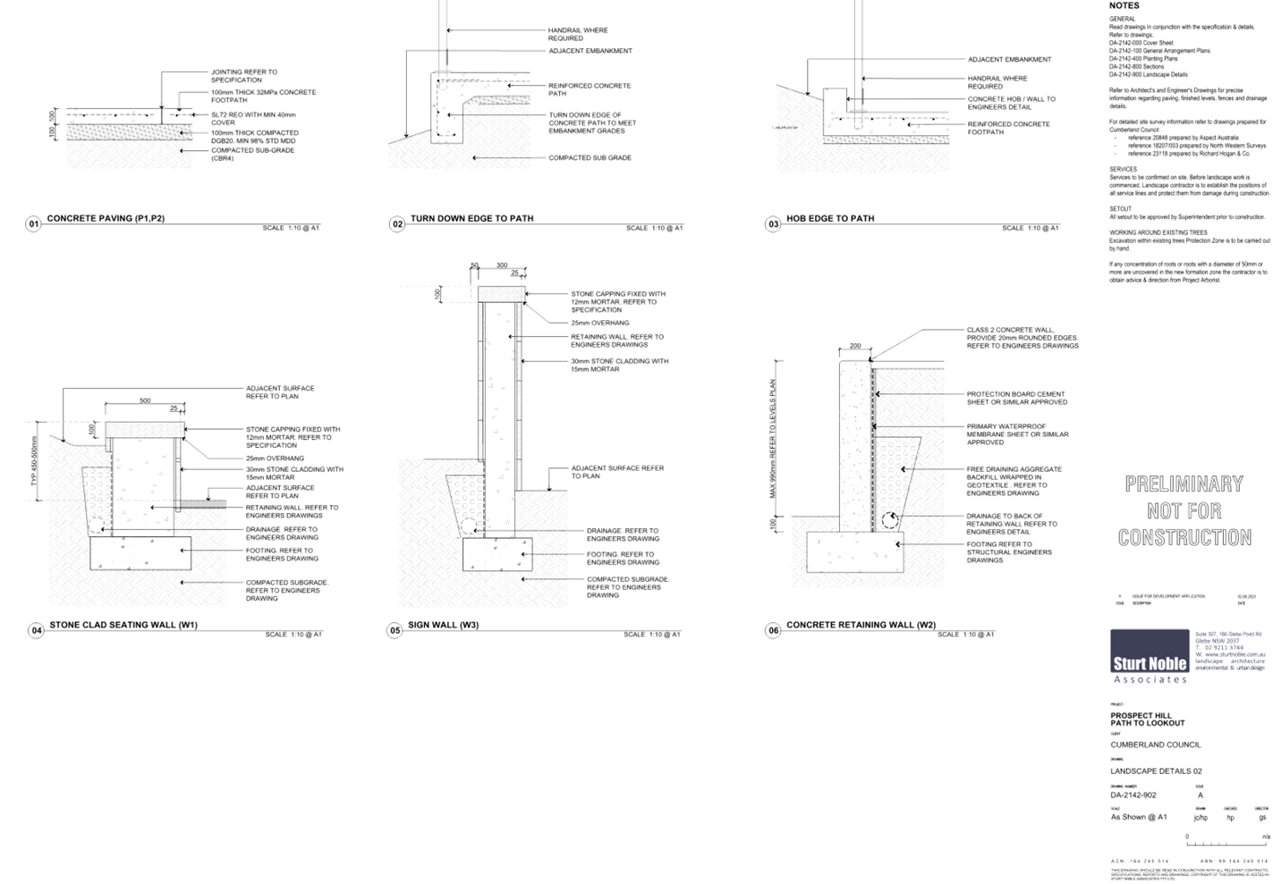
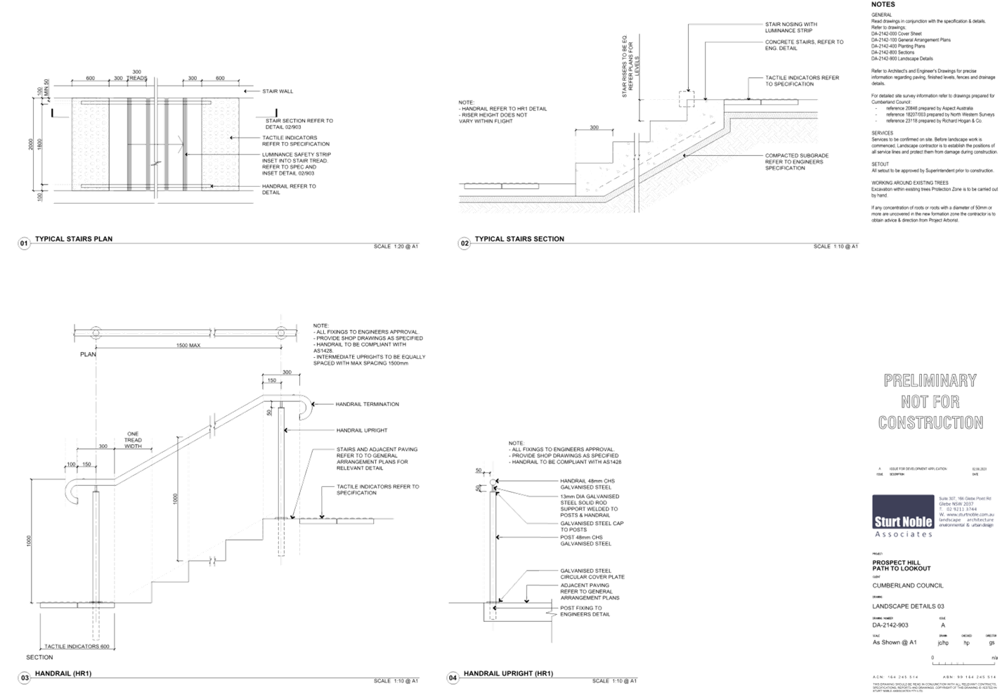
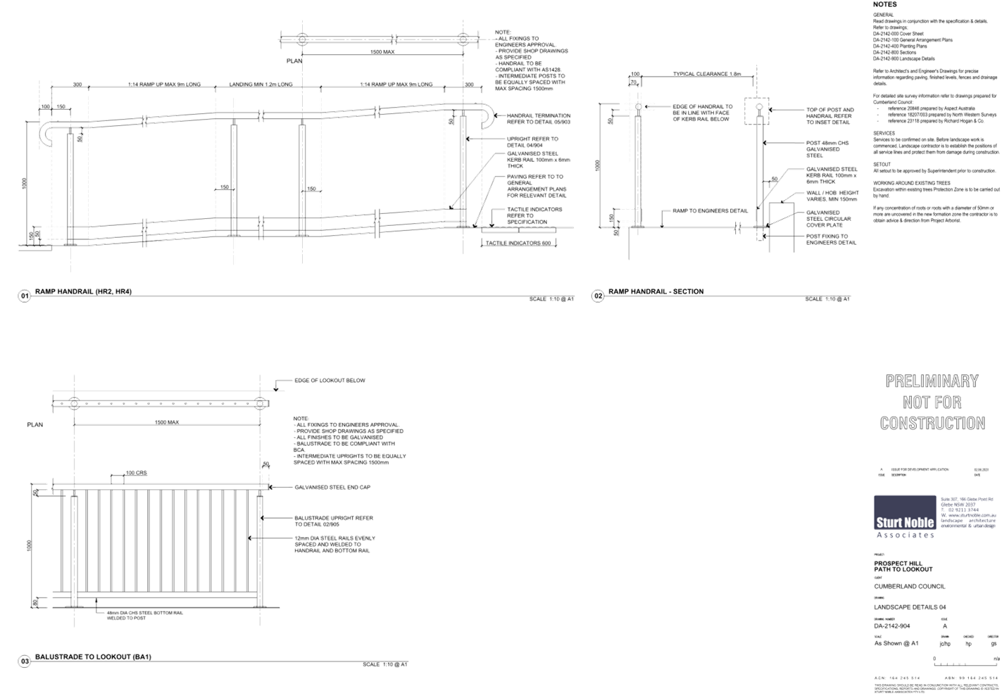
DOCUMENTS
ASSOCIATED WITH
REPORT LPP003/24
Attachment 3
Stormwater/Engineering Plans
Cumberland
Local Planning Panel Meeting
14 February 2024
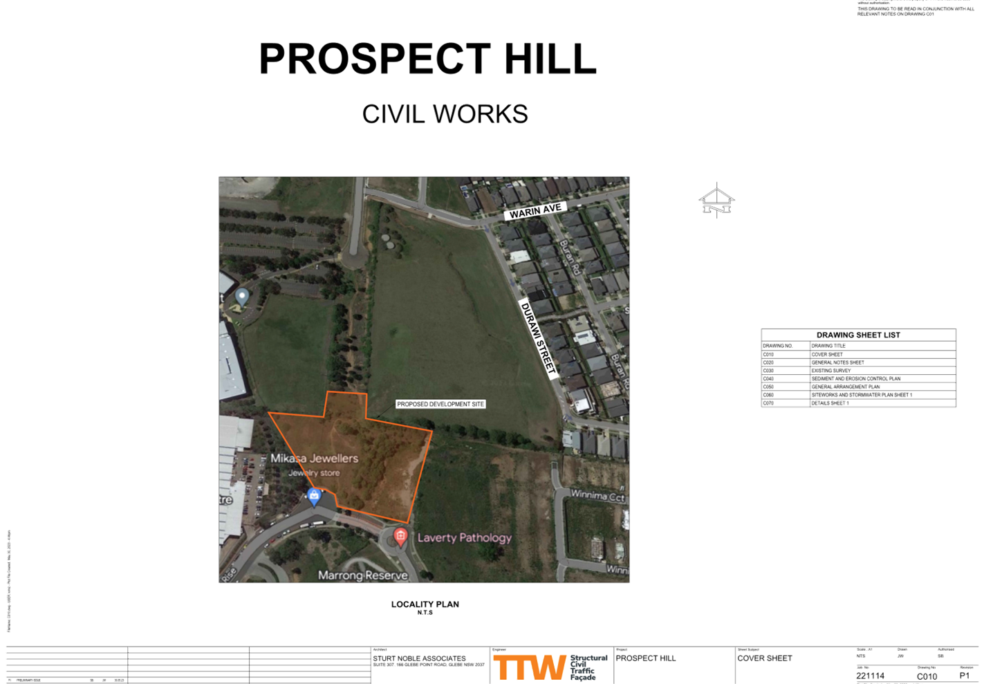
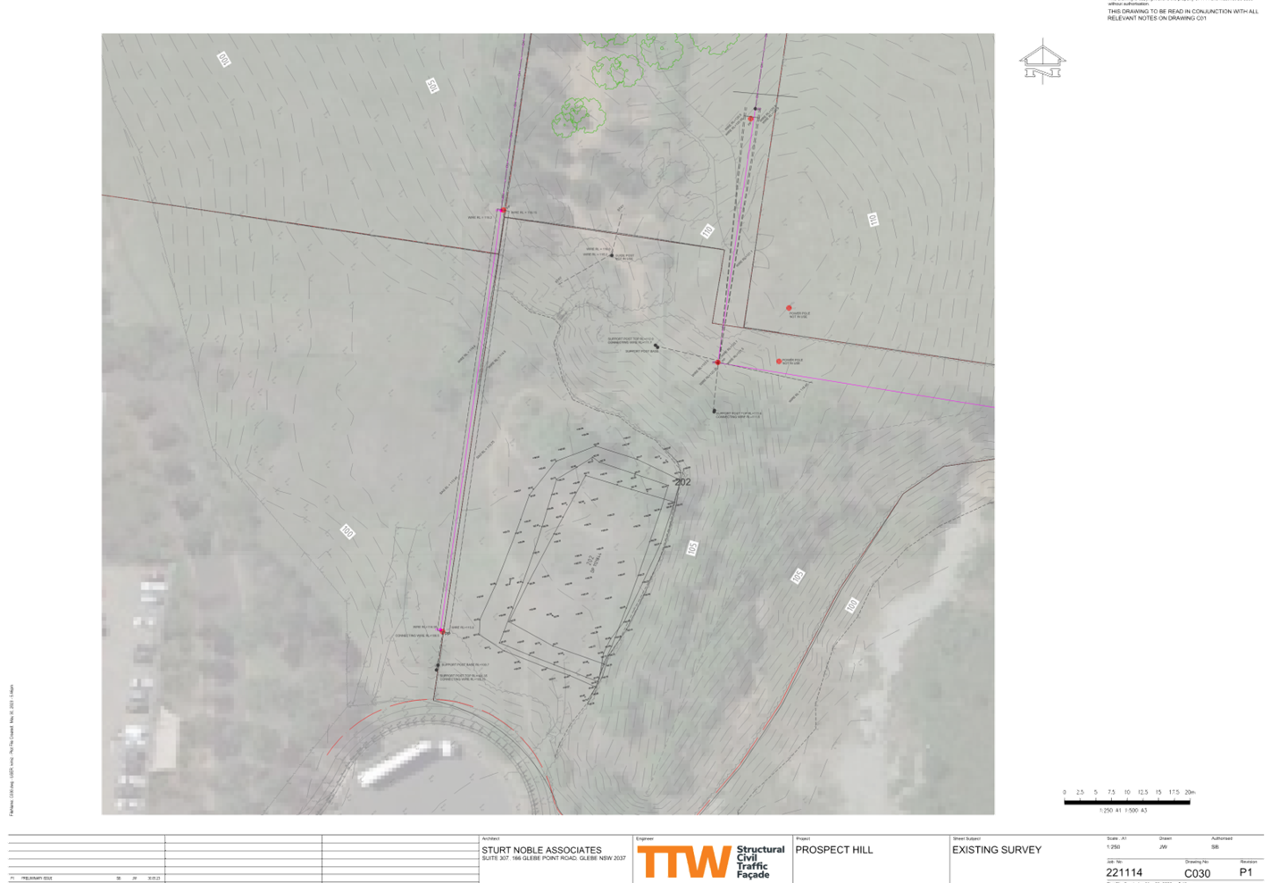
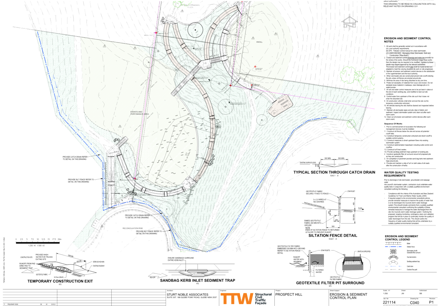
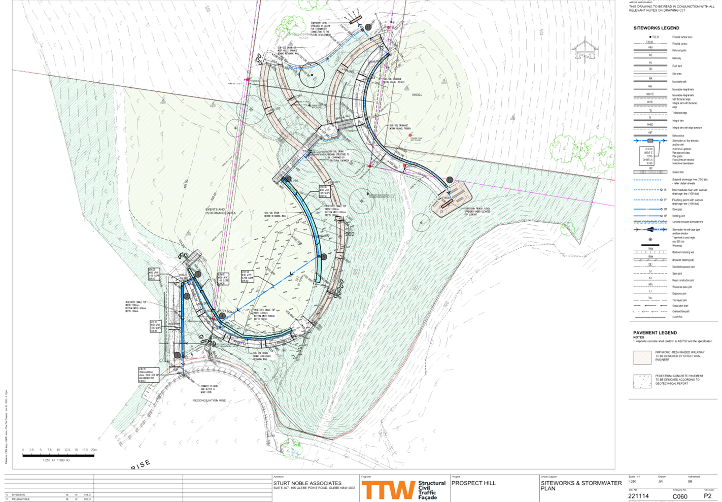
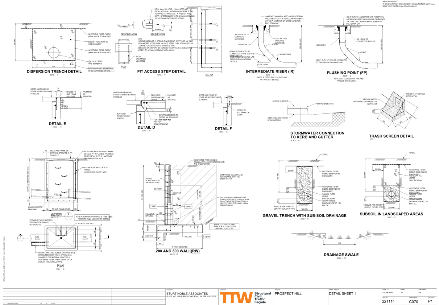
DOCUMENTS
ASSOCIATED WITH
REPORT LPP003/24
Attachment 4
Redacted Submissions
Cumberland
Local Planning Panel Meeting
14 February 2024
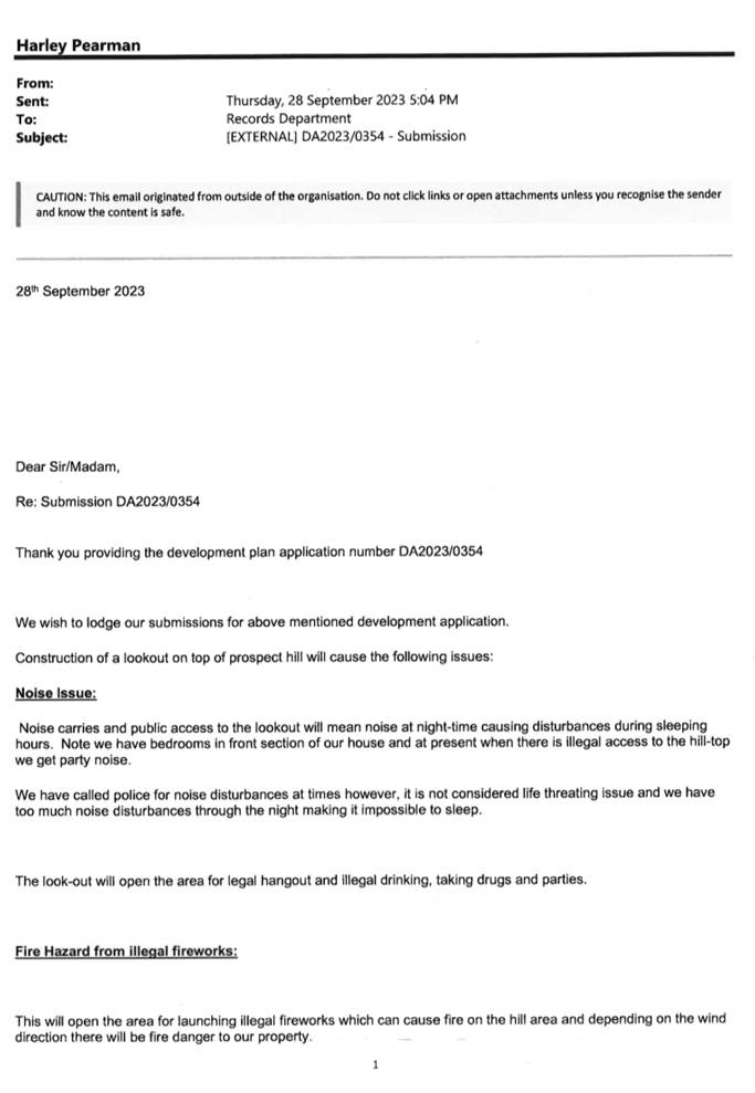
DOCUMENTS
ASSOCIATED WITH
REPORT LPP003/24
Attachment 5
Cumberland City Council Prospect Hill Plan of
Management March 2019 (Includes the Landscape Master Plan details)
Cumberland
Local Planning Panel Meeting
14 February 2024


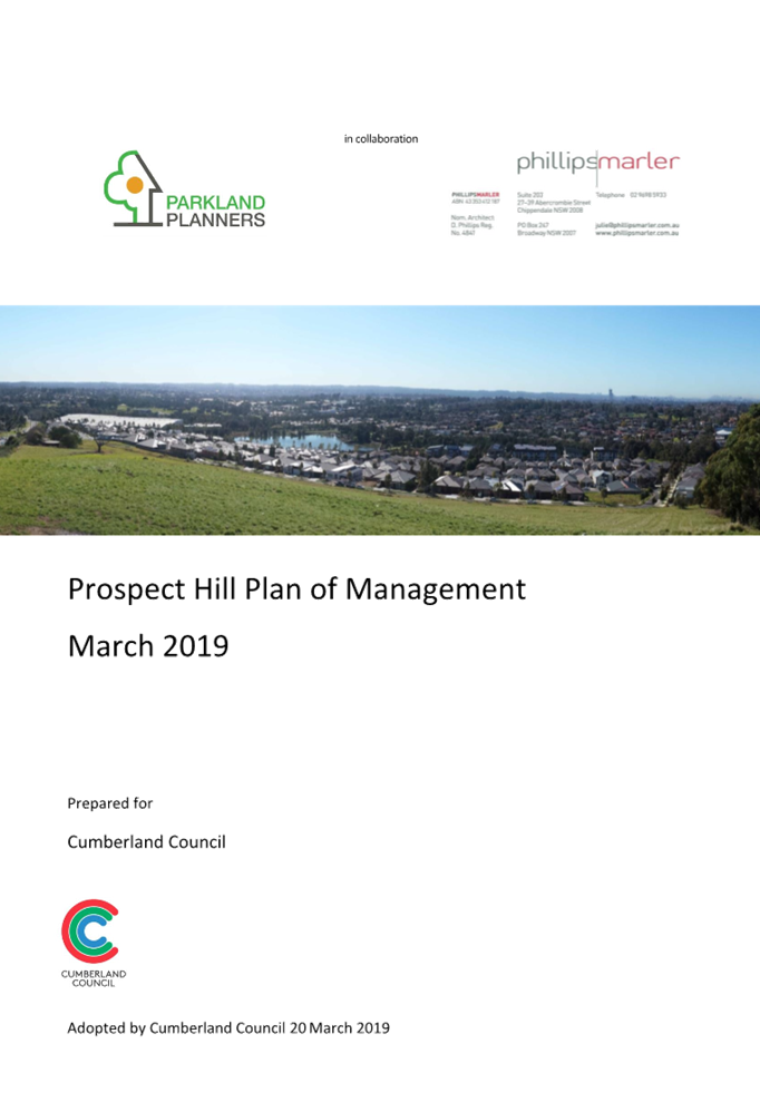


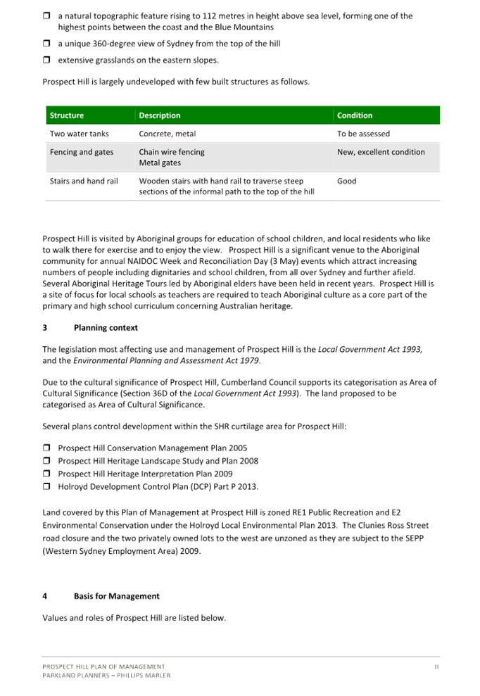
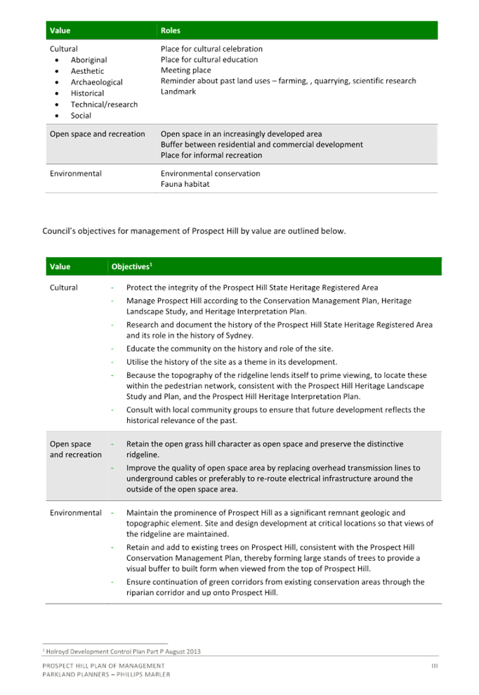
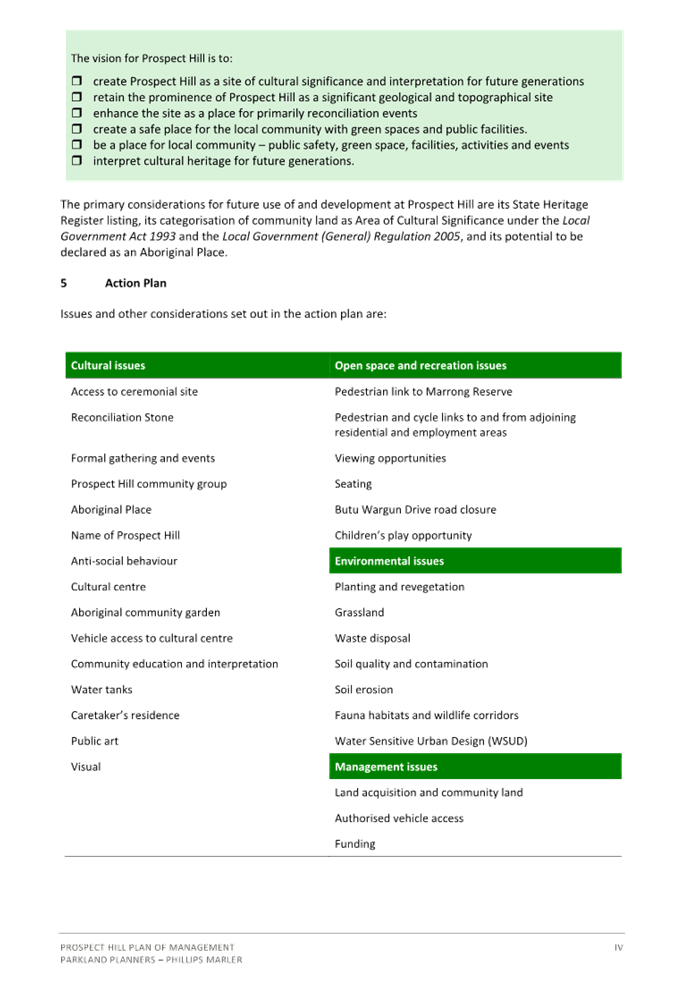
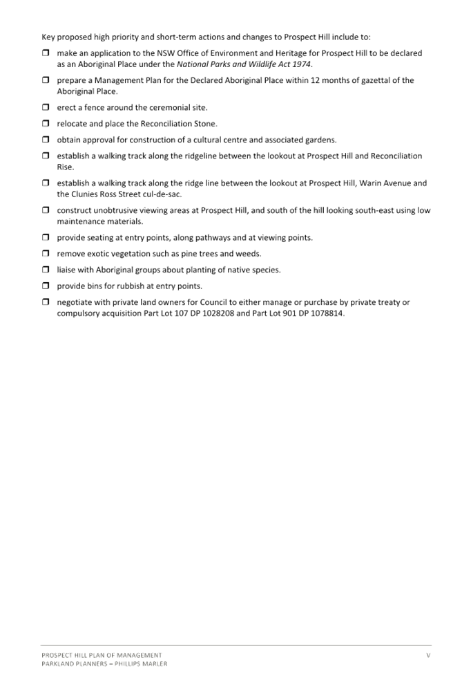
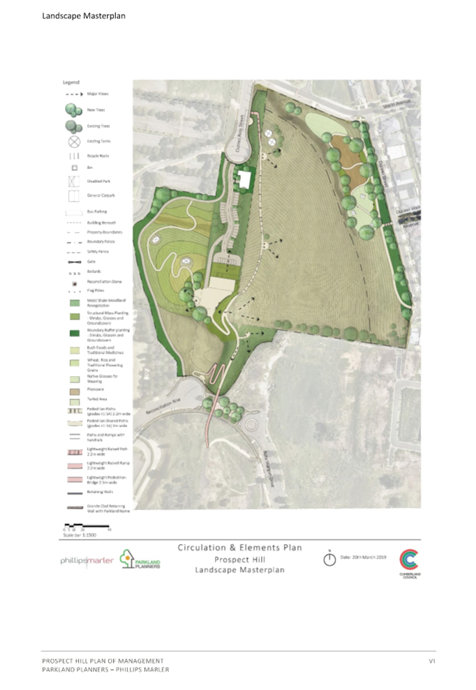
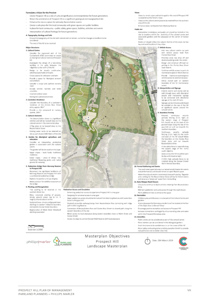
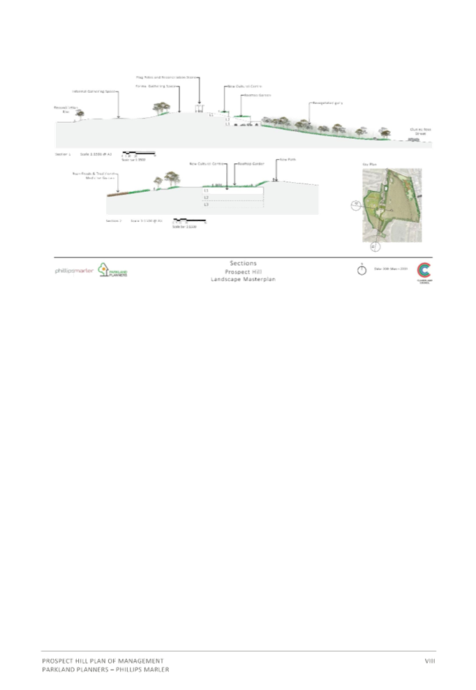
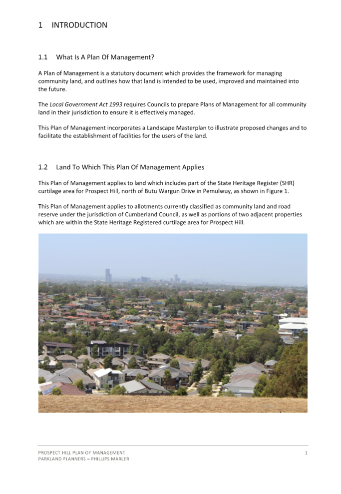
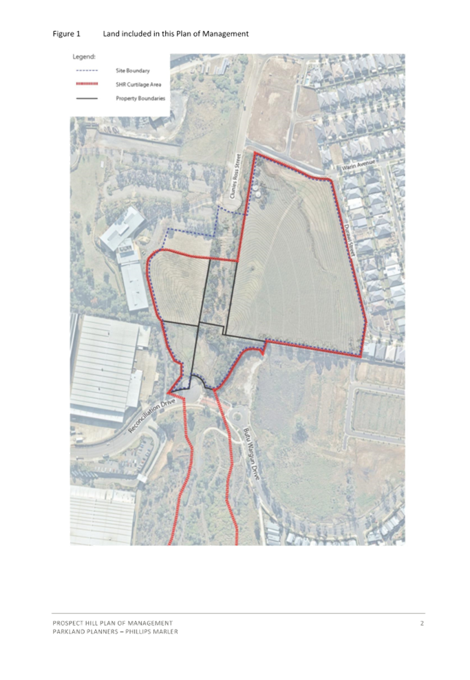
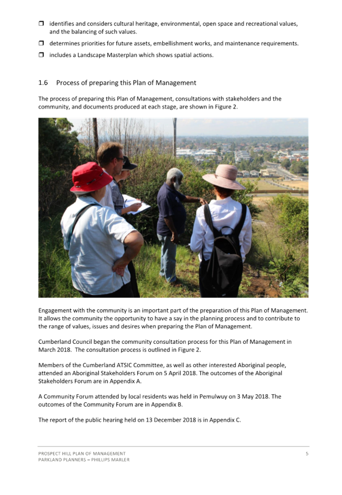
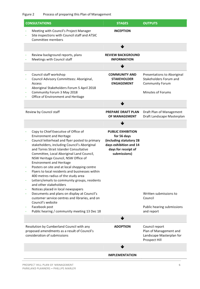

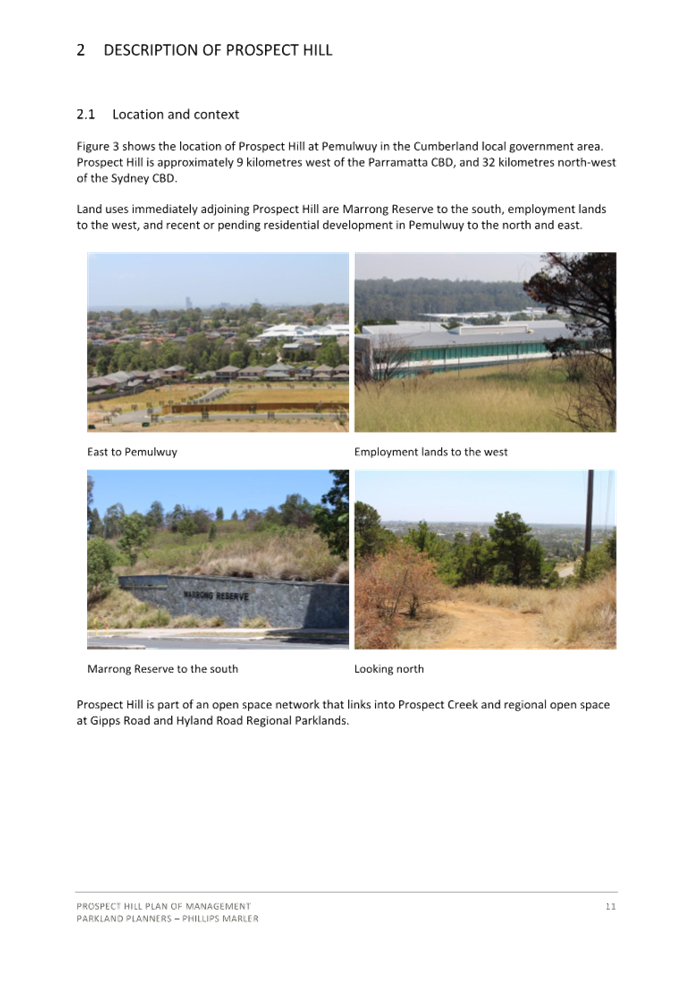
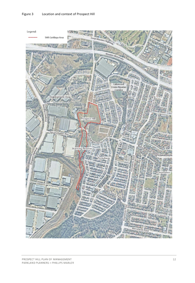
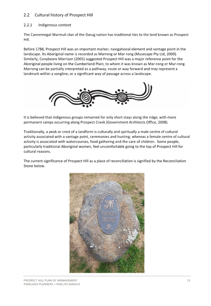
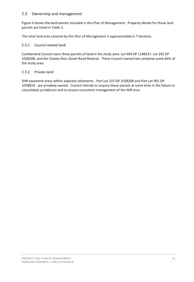
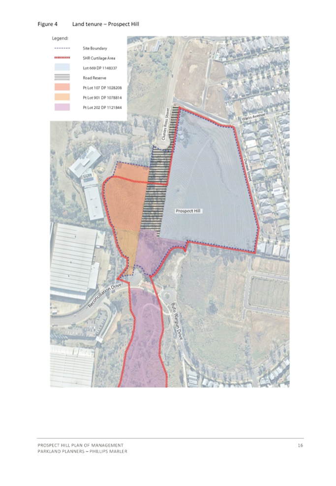
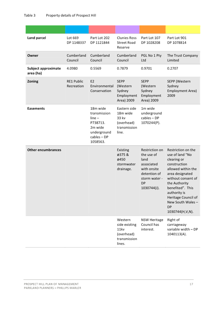
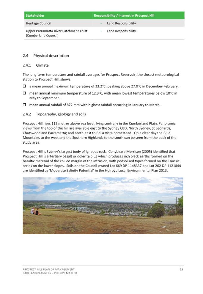
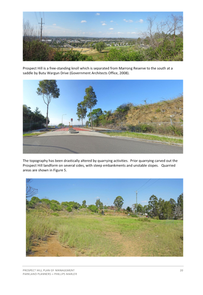
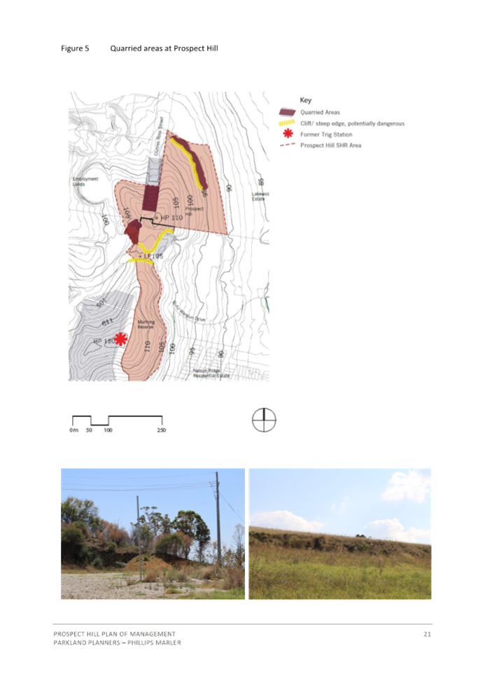
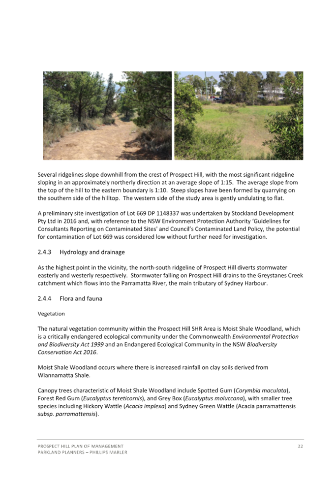

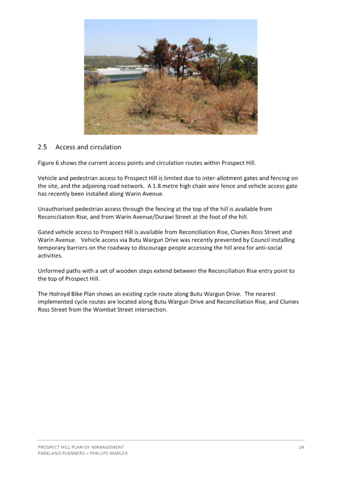
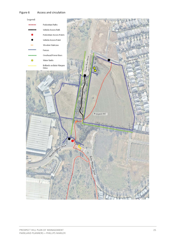
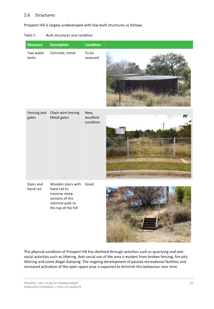
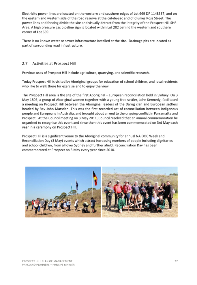
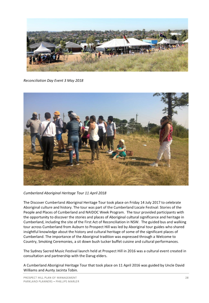
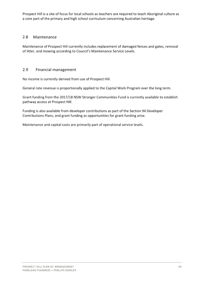

DOCUMENTS
ASSOCIATED WITH
REPORT LPP003/24
Attachment 6
Appendix A - State Environmental Planning Policy
(Industry and Employment) 2021 Assessment Table
Cumberland
Local Planning Panel Meeting
14 February 2024
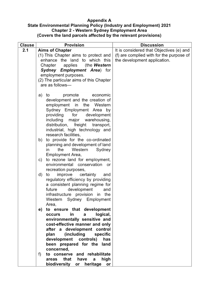
DOCUMENTS
ASSOCIATED WITH
REPORT LPP003/24
Attachment 7
Appendix B - Cumberland Local Environmental Plan 2021
Assessment Table
Cumberland
Local Planning Panel Meeting
14 February 2024

DOCUMENTS
ASSOCIATED WITH
REPORT LPP003/24
Attachment 8
Appendix C - Cumberland Development Control Plan 2021
Assessment Table
Cumberland
Local Planning Panel Meeting
14 February 2024
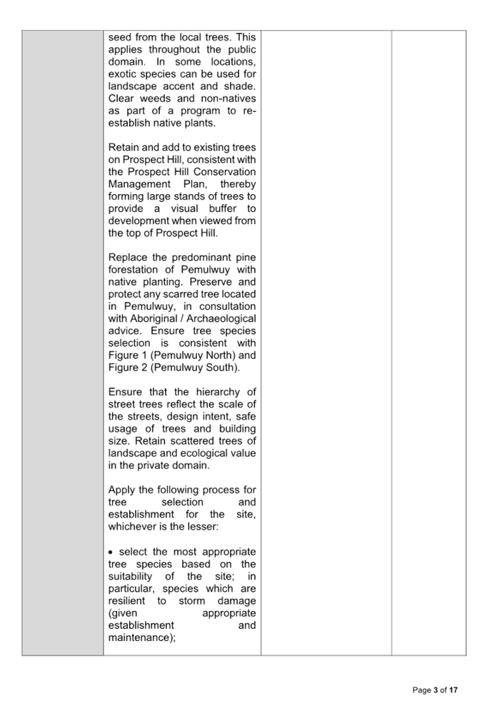
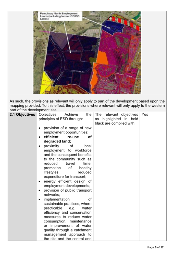
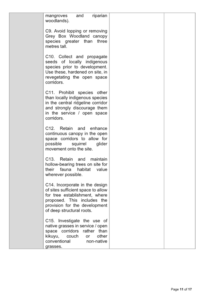
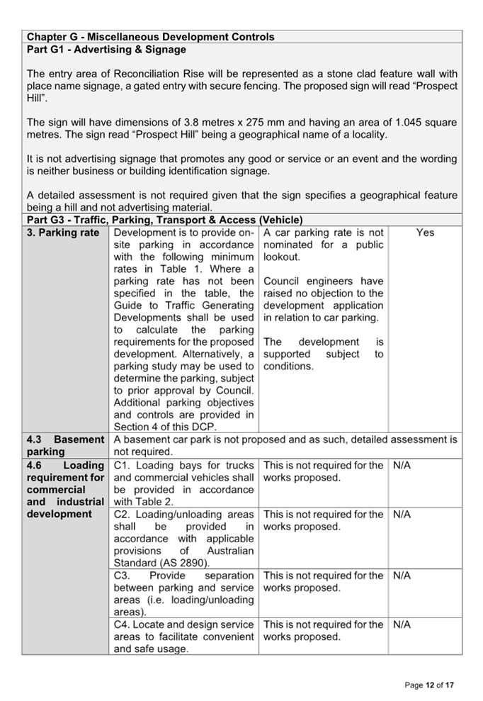
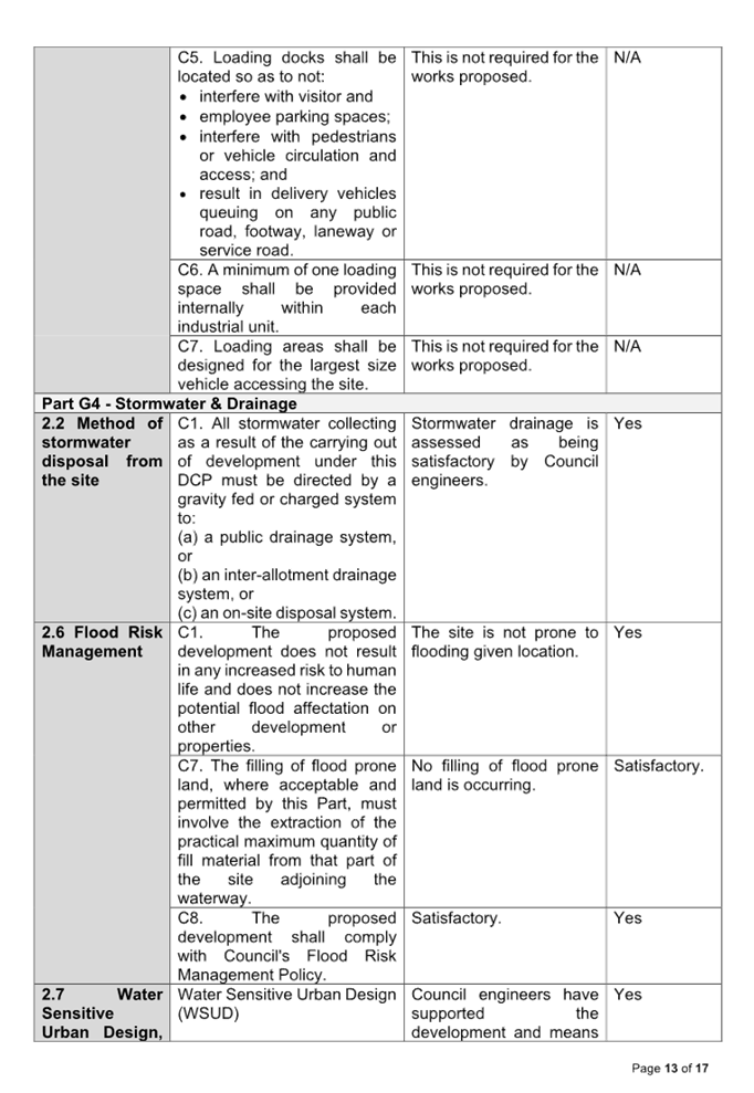
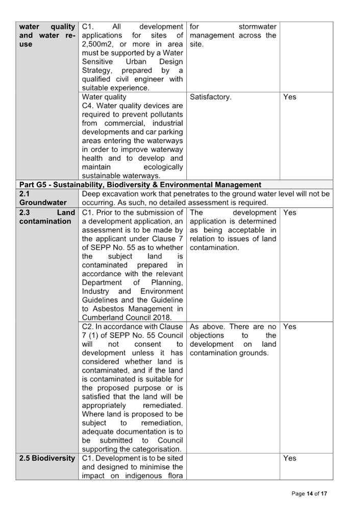
Cumberland Local Planning Panel Meeting
14 February 2024
Item
No: LPP004/24
Development
Application - 5 Cumberland Road, Auburn
Directorate: Environment
and Planning
Responsible
Officer: Executive
Manager Development and Building
|
Application
accepted
|
19 September 2023
|
|
Applicant
|
Mr P Perras
|
|
Owner
|
Mrs S B Rijal & Mr R Rijal
|
|
Application
No.
|
DA2023/0519
|
|
Description
of Land
|
5 Cumberland Road AUBURN
NSW 2144
|
|
Proposed
Development
|
Construction of a secondary
dwelling under SEPP Housing 2021
|
|
Site
Area
|
392m2
|
|
Zoning
|
R2 Low Density Residential
|
|
Disclosure
of political donations and gifts
|
Nil disclosure
|
|
Heritage
|
No – Subject site is not
Heritage Listed or within a Heritage Conservation Area
|
|
Principal
Development Standards
|
Minimum Lot Size
Permissible: 450m2
Proposed: 392m2
|
|
Issues
|
Minimum Lot size for detached
secondary dwelling under SEPP Housing 2021
|
1. Development
Application No. DA2023/0519 was accepted on 19 September 2023 for the
construction of a secondary dwelling under State Environmental Planning Policy
(Housing) 2021 at 5 Cumberland Road Auburn NSW 2144.
2. The
application was publicly notified to occupants and owners of the adjoining
properties for a period of 14 days between 6 October 2023 and 20 October 2023.
In response, nil (0) submissions were received.
3. The
variations are as follows:
|
Control
|
Required
|
Proposed
|
% variation
|
|
Minimum Lot size
State Environmental Planning Policy (Housing) 2021
|
450m2
|
392m2
|
12.89 %
|
4. The
application is referred to the Panel as the proposal contravenes a development
standard by more than 10%.
5. Approval
of the application is recommended subject to the conditions as recommended in
the Council’s assessment report.
Subject Site and Surrounding
Area
The site is legally defined as Lot
41 Sec B DP 3850 and is known as 5 Cumberland Road AUBURN NSW 2144. The
site has an area of 392m2 and a frontage to Cumberland Road of 10.06m. The site
is relatively flat in topography.
A site inspection of the premises
was carried out on 21 December 2023, and it was confirmed that the site is
currently occupied by a single storey dwelling, with ancillary attached and
detached structures including a detached metal carport structure within the
front setback, and a detached metal shed at the rear. The existing structures
on site appear to have been built before the year of 1949 in accordance with
Council’s records. No trees are located within the subject site. There
are two (2) trees located in front of the subject site, on council’s
nature strip. The site is not identified as a flood affected lot. A Sydney water
sewer traverses the site towards the rear.
The existing developments
adjoining the site include single storey dwelling developments with ancillary
detached structures to the rear. The area consists of predominately low-density
residential buildings, inclusive of one and two storey dwellings, secondary
dwellings, and dual occupancy developments.
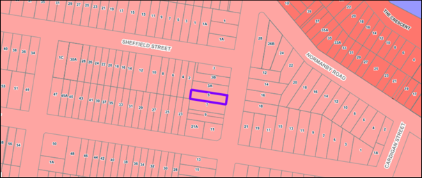
Figure
1 – Locality Plan of subject site (Source: IntraMaps)
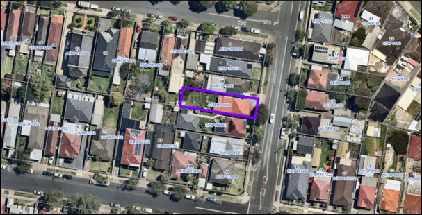
Figure
2 – Aerial view of subject site (Source: NearMap)
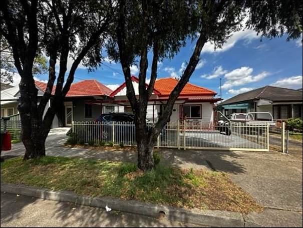
Figure
3 – Street view of subject site
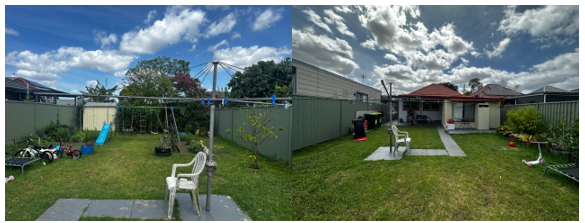
Figure
4: Rear of the subject site
Description of Proposal
Council received development
application DA2023/0519 on 19 September 2023 seeking approval for construction
of a secondary dwelling under SEPP Housing 2021. The detailed breakdown of the
proposal is shown below:
Construction of:
· A single storey
detached secondary dwelling consisting of:
- A
porch/entry;
- Open
Living / Dining area;
- Kitchen/Laundry
area;
- Two
(2) bedrooms; and
- Bathroom/ensuite
(servicing Bed 1)
Site History
No relevant or recent
Environmental Planning and Assessment Act 1979 (EPA) orders or relevant
historical approvals for the subject site.
Note: Council’s records
indicate that the existing primary dwelling was built prior to the year of
1949. Documentary evidence relating to Miscellaneous Property Matters dated
7/01/1988 has been located within Council’s system displaying the
existing carport structure located within the front setback.
Applicants Supporting
Statement
The applicant has provided a
Statement of Environmental Effects dated August 2023 in support of the
application.
The applicant has also submitted a
Clause 4.6 statement prepared by Camille Lattouf from Little Developer Co.
dated 21 November 2023 which was received by Council on 22 November 2023 in
support of the application. The variation request is in relation to the minimum
lot size for a secondary dwelling under the SEPP (Housing) 2021.
Contact With
Relevant Parties
The assessing officer has
undertaken a site inspection of the subject site and surrounding properties and
has been in regular contact with the applicant throughout the assessment
process.
Internal Referrals
Not Applicable. No internal
referrals were required for this development application.
External Referrals
Sydney Water Corporation
Due to the presence of a sewer
line traversing through the rear of the site the development application was
referred to the Sydney Water Corporation for comments. Advice has been received
by the relevant government authority (Sydney Water) on 23 October 2023. Sydney
Water did not raise any objections to the proposed development subject to the
recommended conditions including Sydney Water ‘Tap In’ Building
Plan, Out of Scope Building Plan Approval and General Tree Planting
Requirements.
Planning Comments
The provisions of any
Environmental Planning Instruments (EP&A Act s4.15 (1)(a)(i))
State Environmental Planning
Policies
The proposed development is
affected by the following State Environmental Planning Policies:
|
· State
Environmental Planning Policy (Biodiversity and Conservation) 2021
|
Chapter 2 -Vegetation in non
Rural Areas
|
The development application
does not include the removal of trees.
The proposal does not exceed
the biodiversity offsets scheme threshold. Therefore, the proposed vegetation
removal is considered acceptable.
|
|
Chapter 6 -
Water Catchments
Sydney Harbour Catchment
|
The proposed development
raises no issues as no impact on the Sydney Harbour Catchment is envisaged.
It
is determined that given location, a detailed assessment is not required as
there is no direct impact upon the catchment and no direct impact upon watercourses.
As such, the development is acceptable under the new provisions that came
into effect on Monday 21 November 2022.
|
|
· State
Environmental Planning Policy (Resilience and Hazards) 2021
|
Chapter 4 - Remediation of
Land
Part 4.6
|
Part 4.6 - Contamination
and remediation to be considered in determining development application.
A review of Council’s
files has revealed that the site has been historically used for residential
purposes and there is no evidence to suggest that the site is contaminated or
used for potentially contaminating activities.
As such, it is
considered that the development application is satisfactory under Part 4.6 of
Chapter 4 of the State Policy.
|
|
· State
Environmental Planning Policy (Building Sustainability Index: BASIX) 2004
|
|
BASIX Certificate number 1414889S issued 16 August 2023
has been submitted and determined as being acceptable for approval.
|
|
· State Environmental Planning
Policy (Sustainable Buildings) 2022
|
Chapter 2 Standards for
residential Development -BASIX
|
State Environmental Planning
Policy (Sustainable Buildings) 2022 sets sustainability standards of
buildings across NSW for residential and non-residential development. The
Sustainable Buildings SEPP was notified on 29 August 2022 and came into
effect on 1 October 2023 to allow for the relevant industry to adjust to the new
standards.
In accordance with the savings
and transitional provisions of Clause 4.2 of the Sustainable Buildings SEPP
2022, this policy does not apply as the development application was submitted
but not determined before 1 October 2023.
|
State Environmental Planning
Policy (Housing) 2021
The application has been submitted
under Chapter 3 Part 1 Division 2 of the SEPP (Housing) 2021. It should be
noted that the proposal generally complies with the key planning controls
contained within the SEPP (Housing) 2021, with the exception of Clause 53(2)(a)
which states that for a detached secondary dwelling the development must have a
minimum site area of 450m2.
Notwithstanding the variation
noted above, the proposed development is considered acceptable from an
environmental planning viewpoint and a comprehensive assessment against SEPP
(Housing) 2021 and a discussion of the clause 4.6 request is provided below.
|
Relevant Clause
|
Planning Commentary
|
Compliance
|
|
50 Application of Part
This Part applies to development
for the purposes of a secondary dwelling on land in a residential zone if
development for the purposes of a dwelling house is permissible on the land
under another environmental planning instrument.
|
The subject site is zoned R2 Low Density Residential. This Part applies to development for the
purposes of a secondary dwelling on land in a residential zone if development
for the purposes of a dwelling house is permissible on the land under another
environmental planning instrument. As per the definitions of this division of
the SEPP, a residential zone includes R2 Low Density Residential Zone.
In this regard,
a secondary dwelling is permissible under the provisions of SEPP (Housing)
2021.
|
Yes
|
|
51 A secondary dwelling
cannot be subdivided from the subject lot
|
Subdivision is not proposed as part of the subject
application.
|
Yes
|
|
52 (2) Development consent must not be granted
for development to which this Part applies unless—
|
The proposed secondary dwelling is assessed against Division
2, Clause 52(2) of the SEPP (housing) 2021. Refer to the detailed assessment
against all subclauses of Clause 52 below.
|
Yes
|
|
Subclause 2(a)
Only one (1) primary dwelling
and only one (1) secondary dwelling is permitted on the subject land
|
The application proposes one secondary dwelling at the
rear of an existing primary dwelling.
|
Yes
|
|
Subclause 2(b)
the
total floor area of the principal dwelling and the secondary dwelling is no
more than the maximum floor area permitted for a dwelling house on the land
under another environmental planning instrument, and
|
The site is on land
zone R2 Low Density Residential. No FSR is applicable in land zoned R2 under
the Cumberland Local Environmental Plan CLEP 2021.
|
Yes
|
|
Subclause 2(c)
the total floor
area of the secondary dwelling is—
(i)
>60 m2 or
ii)
(ii) the greater floor
area permitted in another EPI
|
Proposed internal floor area of the secondary dwelling is 59.6m².
|
Yes
|
|
53(2)(a) Site area
minimum of 450m²
|
The site is subject to a minimum site area requirement of
450m2. The proposed development has a site area of 392m2,
which is deficient by 58m2 equating to a 12.89% variation to the
minimum site area requirement.
A written request to vary the development standard was
submitted in accordance with clause 4.6(3)(a) and (b) of the Cumberland Local
Environmental Plan 2021. Please see Clause 4.6 variation discussion below.
|
No – Please see Clause 4.6 discussion below.
|
|
53(2)(b) Same number of
parking spaces as before
|
No changes to existing parking arrangements proposed as
part of this application.
|
N/A
|
Clause 4.6 – Variation
to Clause 53(2)(a) - Minimum Site Area
Clause 4.6 allows the consent
authority to vary development standards in certain circumstances and provides
an appropriate degree of flexibility to achieve better design outcomes. The
consent authority may grant the exception as the Secretary’s concurrence
can be assumed where clause 4.6 is adopted as per the Department of Planning
Circular PS 20-002, dated 05 May 2020.
As previously discussed, the
application seeks to vary the minimum site area requirement of 450m2 for a
detached secondary dwelling as required by Clause 53(2)(a) of State
Environmental Planning Policy (Housing) 2021. The subject lot has a site area
of 392m2 which varies the standard by 58m2, equating to a 12.89% variation.
A written request has been
submitted to Council in accordance with clause 4.6(3)(a) and (b) of Cumberland
LEP 2021 seeking to justify contravention of the development standard by
demonstrating:
a) That
compliance with the development standard is unreasonable or unnecessary in the
circumstances of the case; and
b) That
there are sufficient environmental planning grounds to justify contravening the
standard.
The applicant has submitted a
written request to vary the development standard for Minimum Site Area. Based
on various case laws established by the Land and Environment Court of NSW such
as Wehbe v Pittwater Council [2007] NSWLEC 827, Randwick City Council
v Micaul Holdings Pty Ltd [2016] NSW LEC 7, Moskovich v Waverley Council [2016]
NSWLEC 1015, and Four2five P/L v Ashfield Council [2015] NSWLEC 9, a 3 part
assessment framework for a variation request proposed under clause 4.6 has been
considered and an assessment of the proposed variance, following the 3 part
test is discussed in detail below.
The 3 preconditions which must be
satisfied before the application can proceed are as follows:
1. Is
the proposed development consistent with the objectives of the zone?
The objectives of the R2 Low
Density Residential zone are as follows:
· To provide for the
housing needs of the community within a low density residential environment.
· To enable other
land uses that provide facilities or services to meet the day to day needs of
residents.
· To encourage
residential development that maintains the amenity of the surrounding area.
· To ensure that
non-residential land uses are located in a setting that minimises impacts on
the amenity of a low-density residential environment.
Applicant’s
justification:
The proposed development is for
the purpose of a secondary dwelling, which is consistent with the suburban,
low-density development usually permitted within the R2 Low Density Residential
zone. The proposed development and lot size non-compliance raises no
inconsistencies with the objectives of the R2 zone given it proposes a
permissible land use and will contribute to the provision of local and
affordable rental housing. It will not result in any conflict with the
adjoining properties such as overshadowing, privacy, solar impacts and view
impacts. Furthermore, the proposal is not visible from the streetscape and does
not detract from the character of the urban fabric.
Planner’s comment:
The proposal has been designed to
positively contribute to the housing needs within the community and maintains
adequate essential services and amenities. The proposal is consistent with the
zone objectives, and complies with the permitted use of residential housing,
due to its ability to help sustain the community’s housing needs.
2. Is
the proposed development consistent with the objectives of the development
standard which is not met?
As no objectives are explicitly
mentioned, the proposed development is to follow the principles of the SEPP
(Housing) 2021. This is due to be being classified as a “development
standard” as defined in section 1.4 of the Environmental Planning and
Assessment Act. Clause 53 is not a development standard that has been expressly
excluded from the operation of Clause 4.6. Accordingly, the principles of the
SEPP (Housing) 2021 are as follows:
3. Principles
of Policy
The principles of this Policy
are as follows:
(a) enabling
the development of diverse housing types, including purpose-built rental
housing,
(b) encouraging
the development of housing that will meet the needs of more vulnerable members
of the community, including very low to moderate income
households, seniors and people with a disability,
(c) ensuring
new housing development provides residents with a reasonable level of
amenity,
(d) promoting
the planning and delivery of housing in locations where it will make
good use of existing and planned infrastructure and services,
(e) minimising
adverse climate and environmental impacts of new housing development,
(f) reinforcing
the importance of designing housing in a way that reflects and enhances its
locality,
(g) supporting
short-term rental accommodation as a home-sharing activity and contributor
to local economies, while managing the social and environmental
impacts from this use,
(h) mitigating
the loss of existing affordable rental housing.
Applicant’s
justification:
The non-compliance with the Housing
SEPP Minimum Lot Size control for secondary dwellings for the purpose of
achieving appropriate housing needs is supported by the Cumberland Council
Development Control Plan 2021. Furthermore, the proposed development aims to
achieve the objects of the EP&A Act, including:
· Object of the
EP&A Act to promote the orderly and economic use and development of land
through the provision of housing in an appropriately zoned location,
· Object of the
EP&A Act to promote good design and amenity of the built environment,
· Deliver more
housing consistent with the Priorities of the Cumberland Council and its local
housing strategy,
· Achieving the
objectives of the Greater Sydney Region Plan 2018 and the Central City District
Plan regarding the provision of housing supply, choice, and affordability in
the right locations.
Despite the non-compliance with
the standard, the proposed development will have a negligible impact on the
surrounding development with respect to overshadowing, views, visual impact,
and privacy due to the appropriate and considerate design of the secondary
dwelling.
Planner’s comment:
The likely intent of the
development standard at clause 53(2)(a) is to ensure overdevelopment does not
occur and residents of the subject development and surrounding sites are
provided with a satisfactory level of amenity. Council is satisfied that the
development adequately achieves these outcomes (with regard to building mass,
siting, and amenity requirements) as detailed in the relevant planning instruments
in the attachments to this report.
4. a)
Is compliance with the
development standard unreasonable or unnecessary
in the circumstances of the case?
Applicant’s
justification:
The applicant maintains that in
this instance, compliance with the lot size standard is considered unnecessary
as the proposal is complementary to the existing character of the locality and
is permissible under Council’s DCP controls. The impacts of the proposed
development are not greater than an otherwise strictly complying development.
Therefore, it is considered that the proposed variation is not a major
departure from the controls, or the desired development outcome envisaged by
the planning controls.
The applicant proceeds to argue
the following matters:
· With respect to
the subject site, compliance with the 450sqm minimum lot size for a secondary
dwelling standard is considered unnecessary in this case because the proposed
development complies with the objectives of the subject development standard
set by Council. The objectives of the development standards and the five tests
under Wehbe v Pittwater Council have been addressed.
· The development is
considered to have sufficient environmental planning grounds given the
development complies with the objectives of the development standards and has
no environmental impacts beyond what would be expected of a strictly complying
development. It is also consistent with Council’s minimum lot size of
380sqm.
· The development
will be in the public interest because it raises no inconsistencies with the
objectives of the R2 zone and complies with the objectives of the development
standard and Council’s DCP objectives for the comparable control. The
proposed development is a permissible land use under the Housing SEPP, will
contribute new affordable rental housing options and has been designed to
minimise any conflict with the adjoining properties such as overshadowing,
privacy, sunlight impacts and view impacts.
· The case also
identifies that the outcome of the breach to a development standard does not
necessarily need to be a neutral or better outcome, if the relevant
environmental planning grounds to assess it against don't require such.
· With regard to
bulk and scale, overshadowing, visual impact, and privacy the objective of the
development standard is to maintain the prevailing suburban, low density
character and amenity by limiting the height and scale of secondary dwelling
development. The proposed development is otherwise consistent with these
controls, including Council’s comparable control of 380sqm as a minimum
lot size.
Planner’s comment:
It is considered that the proposal
is consistent with the desired low-density character of the area. The proposal
provides a height, bulk and scale that is generally consistent with the
relevant planning instruments, and the correlation between the building height
and density is considered appropriate. As demonstrated in the attached
assessment tables the development is compliant with the building mass, and
amenity requirements of the relevant planning instruments. If the development
were made to comply there would be no significant improvement with respect to
the abovementioned characteristics. In this regard, Council considers
compliance to be unnecessary in the circumstances of the case.
b)
Are there sufficient environmental planning grounds to justify contravening
the development standard and therefore is the applicant’s
written justification well founded?
Applicant’s
justification:
The site is identified within the
R2 Low Density Residential zoning under the Cumberland LEP 2021.
Development for the purposes of a
‘secondary dwellings’ are permitted under the Housing SEPP, as it
is within the R2 zone under the Cumberland LEP 2011, a prescribed zone.
As set out by Clause 53(2) of the
Housing SEPP, the minimum lot size for a secondary dwelling is 450sqm, contrary
to Council’s control, to which this proposal complies, of 380sqm.
The proposed development is
comprised of one secondary dwelling development at the rear of the existing
property.
The applicant proceeds to argue
that there are sufficient environmental planning grounds to justify
contravening standards:
· Cumberland Council
does not provide any more onerous standards, but rather has a Development
Control Plan provision (Part B, Clause 2.21, C7, Cumberland DCP 2021) which
permits secondary dwellings that are detached on lots that are at least 380sqm.
The proposed lot size is consistent with this control, and therefore
Council’s intent for where secondary dwellings are appropriate.
· The proposed
development is considered to be in the public interest by increasing the supply
of affordable secondary housing in a well-established location with good
connectivity to services, transport and employment. Furthermore, the proposal
is appropriately designed to ensure minimal significant or adverse impacts on
the locality or adjacent properties. The proposal achieves the relevant
controls under the Cumberland DCP 2021 and is therefore consistent with the
relevant housing strategies and complies with the objectives of the Clause.
Below are the relevant objectives under the DCP and the zone.
· The proposed
secondary dwelling design is appropriately integrated into the property, and is
of a scale, size and design that is subservient to the existing primary
dwelling. The proposal does not detract from the amenity of neighbouring
dwellings. The functionality of the proposed development is not compromised by
this non-compliance.
· The proposed
development is for the purpose of a secondary dwelling, which is consistent
with the suburban, low-density development permitted within the R2 Low Density
Residential zone.
· The proposed
development, and lot size non-compliance, raises no inconsistencies with the
objectives of the R2 zone given it proposes a permissible land use, and will
contribute to the provision of local and affordable rental housing. It will not
result in any conflict with the adjoining properties such as overshadowing, privacy,
solar impacts and view impacts. Furthermore, the proposal is not visible from
the streetscape, and does not detract from the character of the urban fabric.
Planner’s comment:
Council considers that the
development will protect the amenity of residents within the development and
the adjoining properties subject to conditions of consent. The bulk and scale
of the development is such that surrounding properties will receive sufficient
solar amenity.
Council’s controls consider
a lot of 380m² to be of suitable size to accommodate a secondary dwelling.
This is a specific control contained in the CDCP2021, Part B, Section 2.21, C7
which states, “The minimum site area for a detached secondary dwelling
shall not be less than 380m2.”
Council considers the applicants
justification to be well founded and the Lot to be appropriate in size (392m2)
to accommodate the proposed development. On this basis, it is considered that
there are sufficient environmental planning grounds to vary the standard.
Conclusion:
Council is satisfied that the
applicant’s written request has adequately addressed the matters required
to be demonstrated by clause 4.6 subclause (3). Council is further
satisfied that the proposed development will be in the public interest as it is
consistent with the objectives of the particular standard and the objectives
for development within the zone in which the development is proposed to be
carried out.
It is the view of Council that the
justification provided is satisfactory and having considered the application on
its merit, the exception to the Minimum Site Area development standard is
considered acceptable in this instance.
Local Environmental Plans
Cumberland Local Environmental
Plan (LEP) 2021
The provision of the LEP is
applicable to the development proposal. The development achieves compliance
with the key statutory requirements of the LEP and the objectives of the R2 Low
Density Residential Zone.
(a) Permissibility:
The proposed development is
defined as a ‘secondary dwelling’. It is noted that secondary
dwellings are not permissible under the LEP. However, State Environmental
Planning Policy (Housing) 2021 permits development for the purpose of a secondary
dwelling on residential zoned land if development for the purpose of a dwelling
house is permissible on the land and overrides the LEP in the event of any
inconsistency.
In this regard, forms of
development are permissible in the prescribed land use zone in accordance with
the LEP and SEPP Housing.
The relevant matters to be
considered under Cumberland LEP 2021 and a comprehensive assessment and
compliance table is contained in Appendix A.
The provisions of any proposed
instrument that is or has been the subject (EP&A Act s4.15 (1)(a)(ii))
No proposed planning instruments
applicable.
The provisions of any
Development Control Plans (EP&A Act s4.15 (1)(a)(iii))
The Cumberland Development Control
Plan 2021 (CDCP) provides guidance for the design and operation of development
to achieve the aims and objectives of the Cumberland Local Environmental Plan
2021. A comprehensive assessment and compliance table is contained in Appendix
B.
The proposed development complies
with the provisions of the CDCP in full.
The provisions of any planning
agreement that has been entered into under section 7.4, or any draft planning
agreement that a developer has offered to enter into under section 7.4
(EP&A Act s4.15(1)(a)(iiia))
There is no draft planning
agreement associated with the subject Development Application.
The provisions of the
Regulations (EP&A Act s4.15 (1)(a)(iv))
The proposed development raises no
concerns as to the relevant matters arising from the Environmental Planning and
Assessment Regulation 2021 (EP&A Reg).
The Likely Environmental,
Social or Economic Impacts (EP&A Act s4.15 (1)(b))
It is considered that the proposed
development will have no significant adverse environmental, social or economic
impacts in the locality.
The suitability of the site for
the development (EP&A Act s4.15 (1)(c))
The subject site and locality are
not known to be affected by any natural hazards or other site constraints
likely to have a significant adverse impact on the proposed development.
Accordingly, it is considered that the development is suitable in the context
of the site and surrounding locality.
Submissions made in accordance
with the Act or Regulation (EP&A Act s4.15 (1)(d))
In accordance with Council’s
Notification requirements contained within the Cumberland Development Control
Plan 2021, the proposal was publicly notified for a period of 14 days between 6
October 2023 and 20 October 2023. As a result of the public exhibition of the
application, Council received nil (0) submissions.
The public interest (EP&A
Act s4.15(1)(e))
It is considered that the
development will have no significant adverse impacts on the public interest.
Cumberland Local Infrastructure
Contributions Plan 2020
The development would require the
payment of contributions in accordance with Cumberland Local Infrastructure
Contributions Plan 2020.
In accordance with the
Contribution Plan a contribution is payable, pursuant to Section 7.11 of the
EP&A Act, calculated on the cost of works. A total contribution of $10,625.00
would be payable prior to the issue of a Construction Certificate.
Housing And Productivity
Contribution (HPC)
In accordance with s7.24 of the
Environmental Planning and Assessment Act, 1979 as amended by the Environmental
Planning and Assessment Amendment (Housing and Productivity Contribution) Act
2023, the development is subject to the (Housing and Productivity Contribution)
Act 2023.
In accordance with Part 2 of
Schedule 5 of the Environment Planning and Assessment (Housing and Productivity
Contribution) Order 2023 (‘the Order’), the Order does not apply to
a development consent granted to a pending development application (Pending
DA).
A ‘Pending DA’ as per
Schedule 1 of the Order and s16 of the EP&A Reg 2021 is as follows:
a) a
development application that is made, but not determined, before the
commencement of this Order, or
b) a
development application that is made and determined before the commencement of
this Order, but has not been finally determined, or
c) an
application for a complying development certificate that is made, but not determined,
before the commencement of this Order.
As the application was lodged on
the 19 September 2023, the HPC provisions do not apply to this application.
Disclosure of Political
Donations and Gifts
The applicant and notification
process did not result in any disclosure of Political Donations and Gifts.
The development application has
been assessed in accordance with the relevant requirements of the Environmental
Planning and Assessment Act 1979, State Environmental Planning Policy (Housing)
2021, Cumberland LEP 2021, and Cumberland DCP 2021, and is considered to be
satisfactory for approval subject to the conditions of the development consent.
Having regard to the assessment of
the proposal from a merit perspective, Council is satisfied that the applicant
have provided a sufficient Clause 4.6 variation in relation to the minimum site
area.
The proposed development is
appropriately located within the R2 – Low Density Residential Zone under
the relevant provisions of the Cumberland LEP 2021.
Accordingly, the development has
been responsibly designed and provides for acceptable levels of amenity for
future residents. It is considered that the proposal successfully minimises
adverse impacts on the amenity of neighbouring properties. Hence the
development, irrespective of the departures noted above, is consistent with the
intentions of Council’s planning controls and represents a form of
development contemplated by the relevant statutory and non-statutory controls
applying to the land.
For these reasons, it is
considered that the proposal is satisfactory having regard to the matters of
consideration under Section 4.15 of the Environmental Planning and Assessment
Act 1979, and the development may be approved subject to conditions.
There are no consultation
processes for Council associated with this report.
There are no financial
implications for Council associated with this report.
There are no policy implications
for Council associated with this report.
Communication /
Publications:
The final outcome of this matter
will be notified in the newspaper. The objectors will also be notified in
writing of the outcome.
|
1. That
the Clause 4.6 variation request to vary the minimum lot size for a secondary
dwelling development standard, pursuant to the State Environmental Planning
Policy (Housing) 2021, be supported.
2. That
Development Application No. DA2023/0519 for construction of a secondary
dwelling under SEPP Housing 2021 on land at 5 Cumberland Road AUBURN be
Approved subject to conditions listed in the attached schedule.
|
1. Draft Notice
of Determination
2. Architectural
Plans
3. Clause
4.6 Variation
4. Appendix
A - Cumberland LEP Assessment Table
5. Appendix
B - Cumberland DCP Assessment Table
DOCUMENTS
ASSOCIATED WITH
REPORT LPP004/24
Attachment 1
Draft Notice of Determination
Cumberland
Local Planning Panel Meeting
14 February 2024
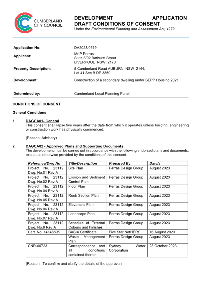

DOCUMENTS
ASSOCIATED WITH
REPORT LPP004/24
Attachment 2
Architectural Plans
Cumberland
Local Planning Panel Meeting
14 February 2024
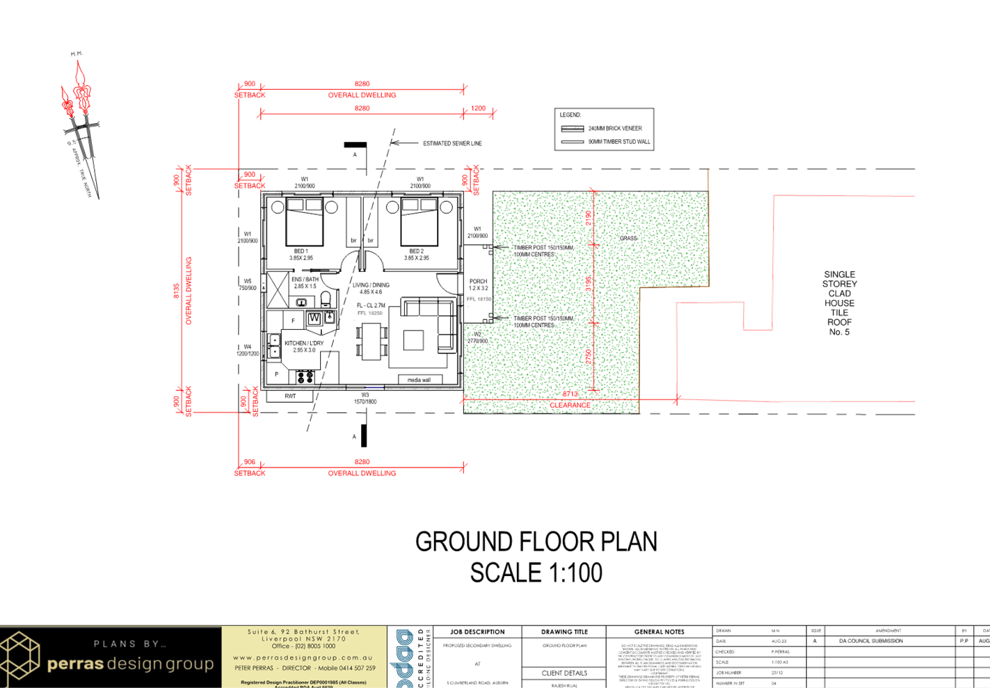
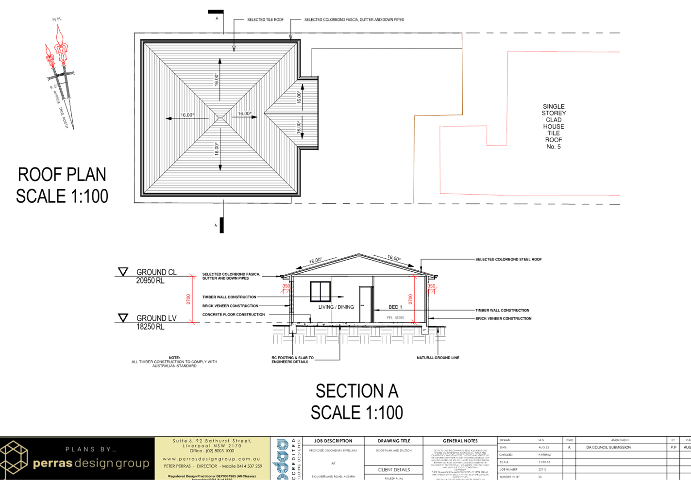
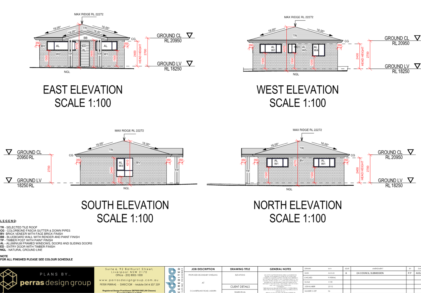
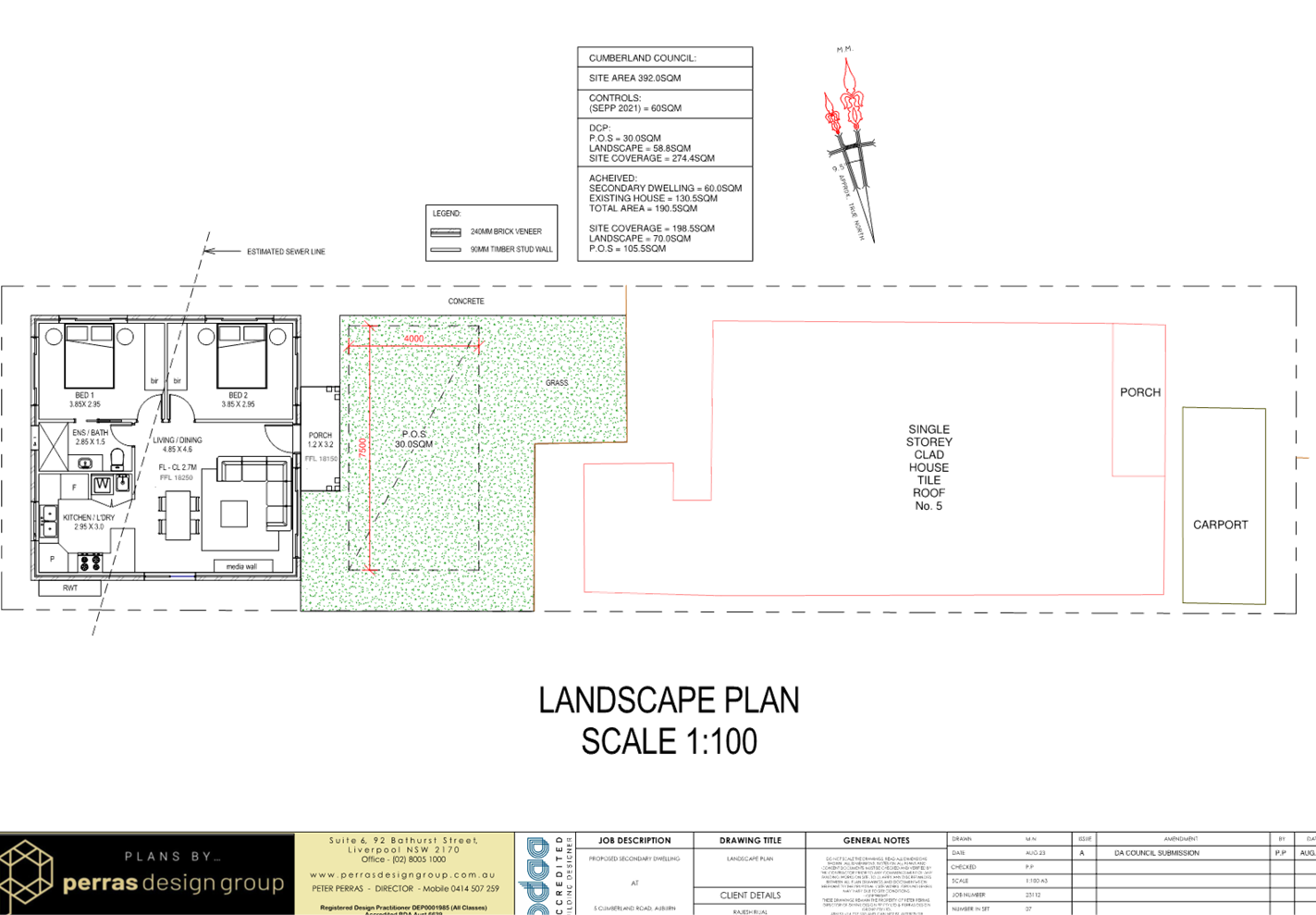
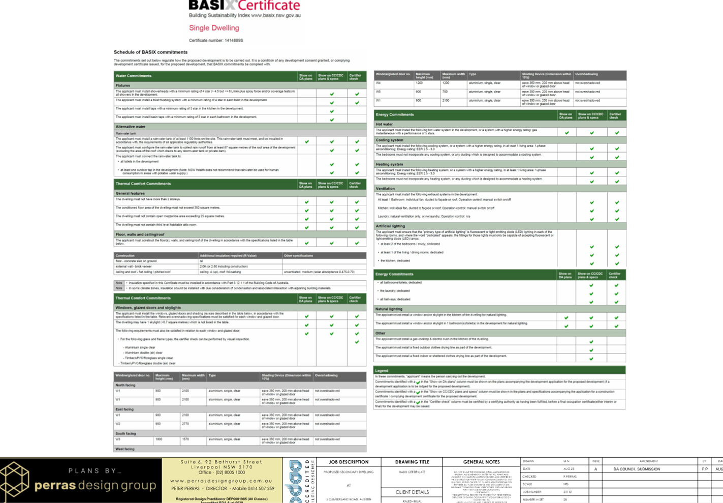
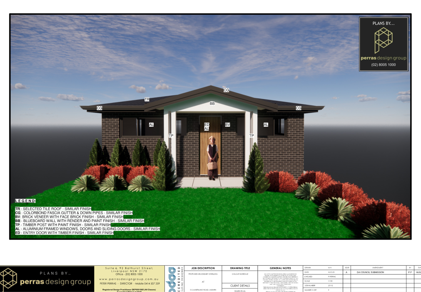
DOCUMENTS
ASSOCIATED WITH
REPORT LPP004/24
Attachment 3
Clause 4.6 Variation
Cumberland
Local Planning Panel Meeting
14 February 2024
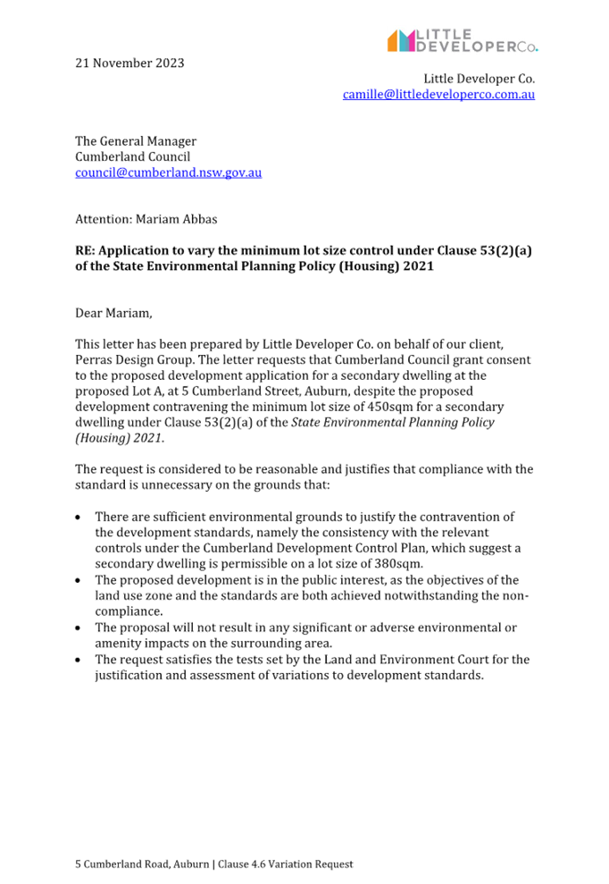

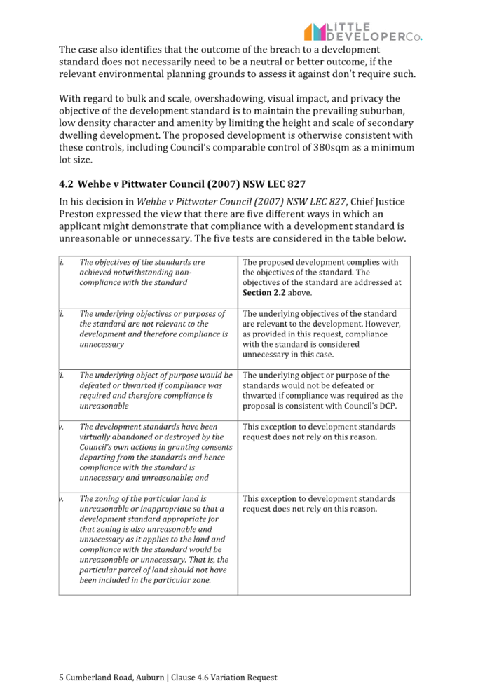
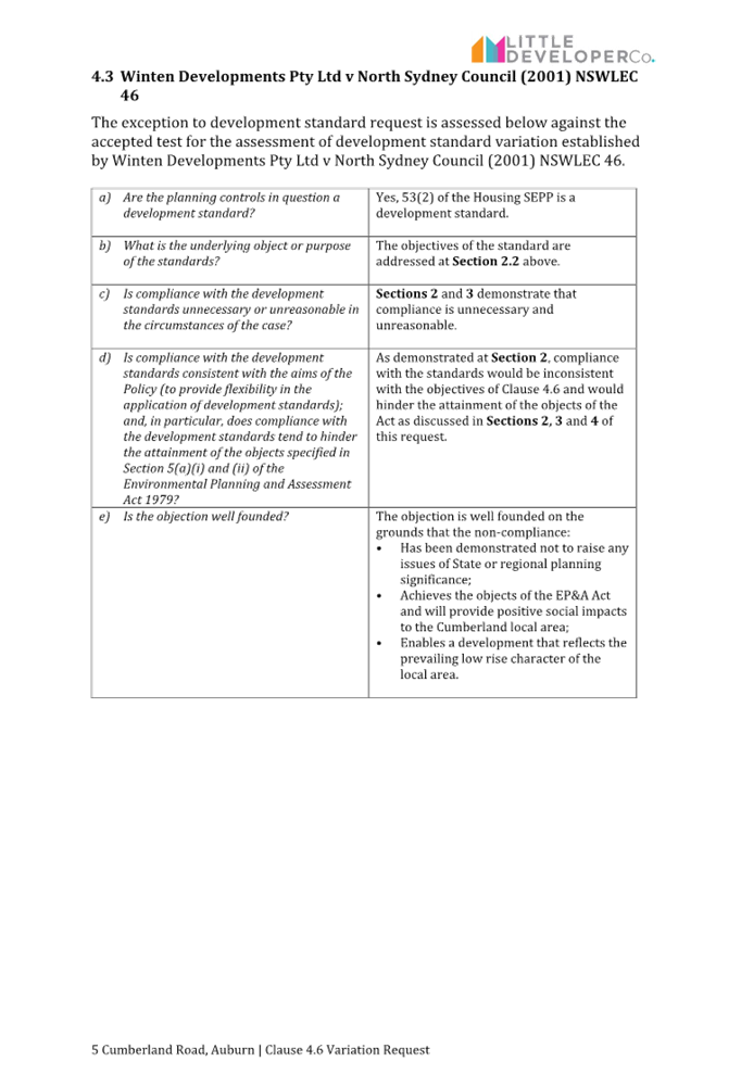

DOCUMENTS
ASSOCIATED WITH
REPORT LPP004/24
Attachment 4
Appendix A - Cumberland LEP Assessment Table
Cumberland
Local Planning Panel Meeting
14 February 2024
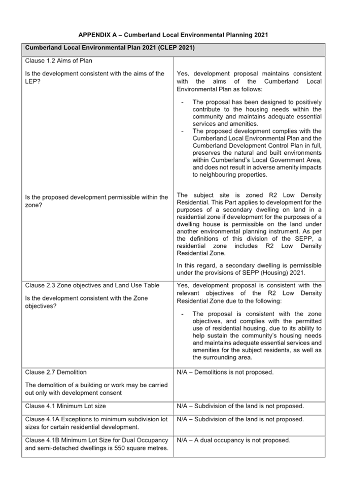
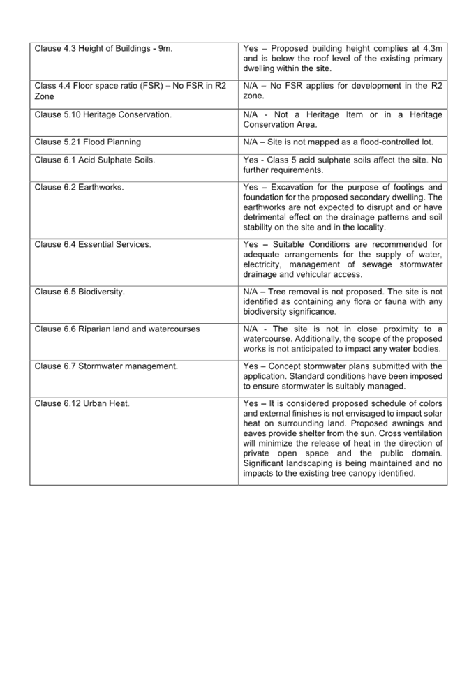
DOCUMENTS
ASSOCIATED WITH
REPORT LPP004/24
Attachment 5
Appendix B - Cumberland DCP Assessment Table
Cumberland
Local Planning Panel Meeting
14 February 2024
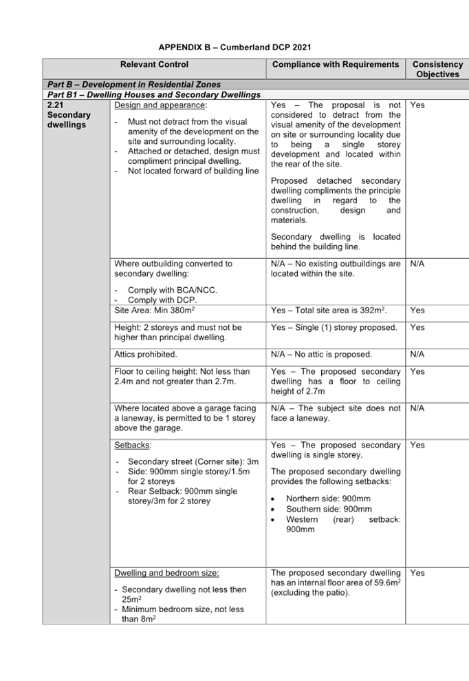
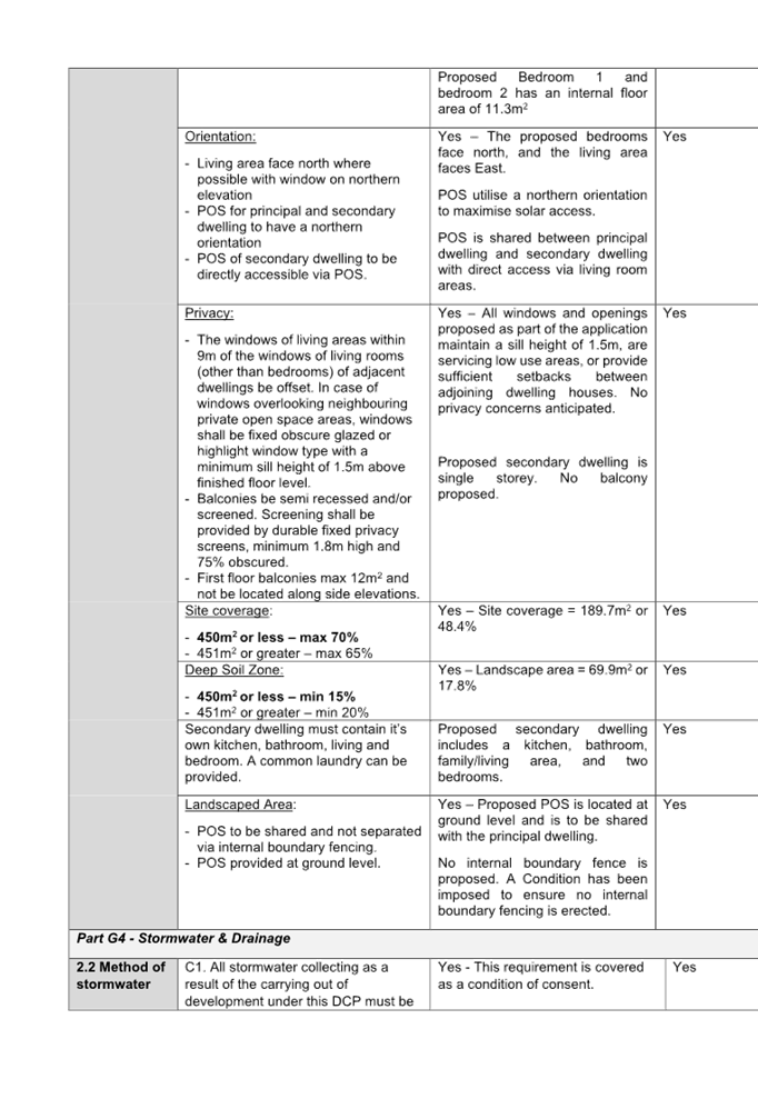
Cumberland Local Planning Panel Meeting
14 February 2024
Item
No: LPP005/24
Development
ApplicaTion - 11 Moree Avenue, Greystanes
Directorate: Environment
and Planning
Responsible
Officer: Executive
Manager Development and Building
|
Application
accepted
|
10 October 2023
|
|
Applicant
|
M Makhoul
|
|
Owner
|
W Cui & L Chen
|
|
Application
No.
|
DA2023/0591
|
|
Description
of Land
|
11 Moree Avenue WESTMEAD
NSW 2145, Lot 132 DP 13731
|
|
Proposed
Development
|
Partial demolition and rear extension of existing heritage listed
dwelling with attached carport.
|
|
Site
Area
|
645m2
|
|
Zoning
|
R2 Low Density Residential
Zone
|
|
Disclosure
of political donations and gifts
|
Nil disclosure
|
|
Heritage
|
Yes – Heritage Listed
and within a Heritage Conservation Area
|
|
Principal
Development Standards
|
Height of Building
Permissible: 9m
Proposed:6.3m
|
|
Issues
|
Heritage
|
1. Development
Application No. DA2023/0591 was accepted on 10 October 2023 for the partial
demolition and rear extension of existing heritage listed dwelling with
attached carport.
2. The
application was publicly notified to occupants and owners of the adjoining
properties for a period of 14 days between 19 October 2023 and 2 November 2023.
In response, one submission in support of the subject application was received.
3. The
application was publicly re-notified to occupants and owners of the adjoining
properties for a period of 7 days between 29 November 2023 and 6 December 2023
due to the provision of amended plans. In response, no submissions were
received.
4. The
subject site is listed as a heritage item of local significance and is located
within the Toohey’s Palm Estate Group conservation area in the Cumberland
Local Environmental Plan 2021 as Heritage Item no. I301. The heritage item is a
Girraween, Inter-war bungalow.
5. The
application is referred to the Panel as the proposal is considered to be
contentious / sensitive development involving partial demolition of the rear of
an existing dwelling of heritage significance, to facilitate a new rear
extension.
6. The
application is recommended for Approval subject to the conditions as
recommended in the Council’s assessment report.
Subject Site And Surrounding
Area
The site forms Lot 132 in DP 13731
and is known as 11 Moree Avenue, Westmead. The site has an area of 645 square
metres and has a frontage to MOREE AVENUE of 15.24m. The site has a fall of
approximately 1.12m from front to rear.
A site inspection of the premises
carried out on 18 October 2023 confirmed that the site is currently occupied by
a one storey single dwelling, a detached garage and 4 trees.
The existing developments
adjoining the site include detached single dwellings to the north, east and
west and a school to the south.
The site contains a heritage item
(No. I301), that being the Girraween, Inter-war bungalow. The house was built
in 1928 and directly relates to the “Toohey’s Palm Estate
Subdivision and contains evidence of the pattern of residential development in
the suburb of Westmead and within the broader Cumberland LGA. The building is
aesthetically significant since the dwelling is largely an intact Inter-war
Bungalow that makes a significant contribution to the character of the streetscape.
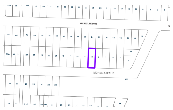
Figure
1 – Locality Plan of subject site
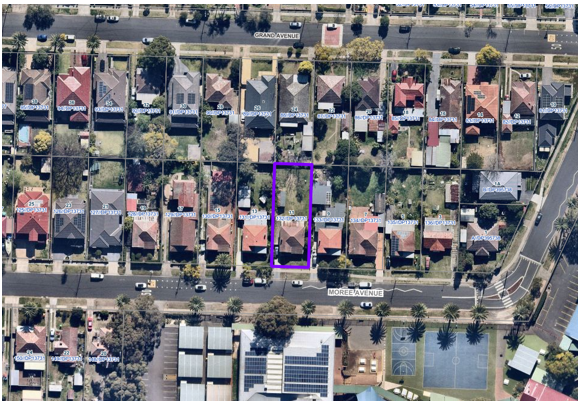
Figure
2 – Aerial view of subject site
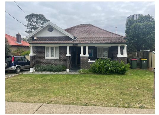
Figure
3 – Street view of subject site 11 Moree Avenue Westmead
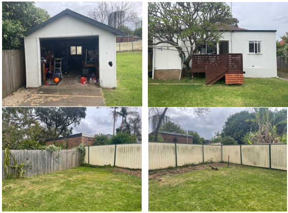
Figure
4 – Backyard of subject site as viewed from existing dwelling.
Description of The
Development
Council has received a development
application for partial demolition and rear extension of existing heritage
listed dwelling with attached carport. which comprises of the following:
Demolition of the following
structures:
· rear of the
existing dwelling consisting of the rear veranda and the skillion roof directly
above,
· 1 existing tree,
and
· existing detached
garage.
Alterations and additions to the
rear of existing dwelling, which comprises of the following:
· 2 additional bedrooms,
· 1 additional
bathroom,
· A new
kitchen/dining/family area,
· A patio to the
rear consisting of bbq area, and
· An attached
carport on the western elevation of the proposed extension.
Applicants Supporting
Statement
The applicant has provided a
Statement of Environmental Effects prepared by Minto Planning Services dated 22
September 2023 and was received by Council on 25 September 2023 in support of
the application.
Contact With Relevant
Parties
The assessing officer has
undertaken a site inspection of the subject site and surrounding properties and
has been in regular contact with the applicant throughout the assessment
process.
Internal Referrals
Development Engineering
The development application was
referred to Council’s Development Engineer for comments who has advised
that the development proposal is satisfactory as the proposed development will
not result in adverse flooding impacts to the subject site and adjoining
properties and therefore can be supported subject to the recommended conditions
of consent.
Building Surveying
The development application was
referred to Council’s Building Surveyor for comments who has advised that
the development proposal is satisfactory as the proposed development complies
with the relevant provisions of the National Construction Code 2019 and
therefore can be supported subject to the recommended conditions of consent.
Tree Management
The development application was
referred to Council’s Tree Management Officer for comments who has
advised that the development proposal is satisfactory as the proposed
development does not result in adverse unreasonable impacts to any adjacent
trees and therefore can be supported subject to the recommended conditions of
consent.
Planning Comments
The provisions of any Environmental
Planning Instruments (EP&A Act s4.15 (1)(a)(i))
State Environmental Planning
Policies
The proposed development is
affected by the following State Environmental Planning Policies:
|
State
Environmental Planning Policies (SEPPs)
|
Relevant
Clause(s)
|
Compliance
with Requirements
|
|
· State
Environmental Planning Policy (Biodiversity and Conservation) 2021.
|
Chapter 2 -Vegetation in non
Rural Areas.
|
The development application
requires the removal of 1 tree which has been assessed by Council’s
Landscape and Tree officer as being acceptable, subject to conditions.
The proposal does not exceed
the biodiversity offsets scheme threshold. Therefore, the proposed vegetation
removal is considered acceptable.
|
|
Chapter 6 -
Water Catchments.
Sydney Harbour Catchment.
|
It is determined that given the
location, a detailed assessment is not required given that there is no direct
impact upon the catchment and no direct impact upon watercourses. As such,
the development is acceptable under the new provisions that came into effect
on Monday 21 November 2022.
|
|
· State
Environmental Planning Policy (Resilience and Hazards) 2021.
|
Chapter 2 - Coastal
Management.
|
The subject site is not
identified as a coastal wetland or ‘land identified as “proximity
area for coastal wetlands” or coastal management area.
|
·
Chapter 3. |
Potentially
hazardous or potentially offensive development is not proposed.
|
|
Chapter 4 - Remediation of
Land.
Part 4.6.
|
A review of Council’s files has revealed that the
site has been historically used for residential purposes and there is no
evidence to suggest that the site is contaminated or used for potentially
contaminating activities. Additionally, no excavation is proposed.
As such, it is
considered that the development application is satisfactory under Part 4.6 of
Chapter 4 of the State Policy.
|
|
· State
Environmental Planning Policy (Building Sustainability Index: BASIX) 2004.
|
Clause 6
|
BASIX Certificate number A506785 (dated 20 September 2023)
has been submitted and determined as being acceptable for approval.
|
|
· State Environmental Planning Policy
(Sustainable Buildings) 2022
|
Clause 4.2
|
State Environmental Planning Policy (Sustainable
Buildings) 2022 sets sustainability standards of buildings across NSW for
residential and non-residential development. The Sustainable Buildings SEPP
was notified on 29 August 2022 and came into effect on 1 October 2023 to
allow for the relevant industry to adjust to the new standards. In accordance
with the savings and transitional provisions of Clause 4.2 of the Sustainable
Buildings SEPP 2022, this policy does not apply as the development
application was submitted on 25th September 2023 but not
determined before 1 October 2023.
|
Local Environmental Plans
Cumberland Local Environmental
Plan 2021
The provision of the Cumberland
Local Environmental Plan 2021 is applicable to the development proposal. It is
noted that the development achieves compliance with the key statutory
requirements of the Cumberland Local Environmental Plan 2021 and the objectives
of the R2 Low Density Residential Zone.
(a) Permissibility:
The proposed development is
defined as alteration and additions to a “Dwelling House” and is
permissible in the R2 Low Density Residential Zone with consent.
“Dwelling House
means a building containing only one dwelling”.
The relevant matters to be
considered under the Cumberland Local Environmental Plan 2021 and the
applicable clauses for the proposed development are summarised below. A comprehensive
LEP assessment is contained in Appendix A.
Cumberland
LEP 2021 Compliance Table
|
DEVELOPMENT STANDARD
|
COMPLIANCE
|
DISCUSSION
|
|
4.1 Minimum Subdivision lot size:
Required: 450m2
|
N/A
|
N/A. There is no change
to the existing subdivision pattern.
|
|
4.3 Height of Buildings
Max 9m
|
Yes
|
The maximum building height
complies at 6.46m.
|
|
4.4 Floor Space Ratio
No FSR in R2 Zone
|
N/A
|
N/A. There is no prescribed FSR applicable to the site
zoned R2.
|
|
4.6 Exceptions to Development Standards
|
N/A
|
N/A
|
|
5.10 Heritage Conservation
|
|
The proposed development
contains a heritage item (I301) and is within the Toohey’s Palm Estate
Group conservation area. The proposed development is also in the vicinity of
the heritage item (I295), which is Westmead Public School and heritage items
(I300) and (I302), which are inter-war bungalows.
The application has been
supported by a Heritage Impact Statement prepared by Archnex Designs dated
November 2023.
The proposed development is not
considered to result in any adverse impacts to the heritage significance of
the subject heritage item and heritage conservation area as scale of the
proposed development complement existing dwelling and proposed roof pitch is
lower than existing roof ridge of the heritage item.
Moreover, the proposed
location of the carport is not considered to result in any adverse
unreasonable impacts towards the heritage significance of the subject and
adjoining properties as:
- it
is setback 20 metres from the front property boundary,
- is
not proposed to be attached to the heritage item, and
- achieves
similar setback to the setback of garage at 19 Moree Avenue (another
neighbouring heritage item), which is also a part of the Toohey’s Palm
Estate Conservation Area.
Additionally, the proposed
development seeks to utilises materials that will complement heritage fabric
of the existing heritage item and subject conservation area.
In conclusion, the proposed development conserves the
environmental heritage of Cumberland and is considered sympathetic to the
heritage values and maintains the overall character of the conservation area
by respecting the original built form, architectural style and low-density
residential character of the area
|
|
5.21 Flood Planning
|
|
The site is flood affected by
the 1% AEP. The proposed development has been reviewed by Council’s
Development Engineer, who has deemed it to be acceptable, subject to
conditions.
|
|
6.1 Acid Sulphate Soils
|
N/A
|
The proposed development is not affected by Acid Sulphate
Soils.
|
|
6.2 Earthworks
|
Yes
|
Minor earthworks are proposed to
facilitate the construction of the alterations and additions. No adverse
impacts are anticipated given the minor nature of the proposed development.
|
|
6.4 Essential Services
|
Yes
|
Suitable conditions are
recommended for adequate arrangements for the supply of water, electricity,
management of sewage stormwater drainage and vehicular access
|
|
6.5 Biodiversity
|
N/A
|
The removal of a tree is
proposed however, it is considered exempt as per part G7 of the Cumberland
DCP because the tree is within 2m of the existing building envelope and is
less than 4 m tall.
|
|
6.7 Stormwater management
|
Yes
|
Conditions shall be imposed to
ensure that the stormwater system is adequately managed.
|
|
6.12 Urban Heat
|
Yes
|
The site complies with the deep
soil zone and solar access requirements.
|
The provisions of any
Development Control Plans (EP&A Act s4.15 (1)(a)(iii))
The Cumberland Development Control
Plan 2021 is relevant to the development proposal.
The development has been assessed
against the following chapters:
· B1: Single
Dwellings and Secondary Dwellings
· G2: Heritage
· G3: Traffic,
Parking, Transport and Access (Vehicle)
· G4: Stormwater and
Drainage
· G5:
Sustainability, Biodiversity and Environmental Management
· G7: Tree
Management and Landscaping
· G8: Waste
Management
The proposed development complies
with the provisions of Council’s Cumberland DCP 2021 and is considered
acceptable from an environmental planning view point.
The provisions of the
Regulations (EP&A Act s4.15 (1)(a)(iv))
The proposed development raises no
concerns as to the relevant matters arising from the Environmental Planning and
Assessment Regulations 2021 (EP&A Reg).
The Likely Environmental,
Social or Economic Impacts (EP&A Act s4.15 (1)(b))
It is considered that the proposed
development will have no significant adverse environmental, social or economic
impacts in the locality.
The suitability of the site for
the development (EP&A Act s4.15 (1)(c))
The subject site and locality is
not known to be affected by any natural hazards or other site constraints
likely to have a significant adverse impact on the proposed development.
Accordingly, it is considered that the development is suitable in the context
of the site and surrounding locality.
Submissions made in accordance
with the Act or Regulation (EP&A Act s4.15 (1)(d))
In accordance with Council’s
notification requirements contained within the Cumberland DCP 2021, the
proposal was publicly notified for a period of 14 days between 19 October 2023
and 2 November 2023. The notification generated one submission in respect of
the proposal. The issues raised in the public submissions are summarised and
commented on as follows:
In accordance with Council’s
Notification requirements contained within the Cumberland DCP 2021, the
proposal was publicly re-notified for a period of 7 days between 29 November
2023 and 6 December 2023 due to amendments to the proposed plans. The
notification generated no submissions.
Heritage Committee
The Heritage Committee was
notified of the Development Application for comment who has made no objection
to the proposal.
Submissions
summary table
|
Issue
|
Planner’s Comment
|
|
Submitter supports the project as it does not adversely
affect the heritage item nor the Toohey’s Palm Estate Conservation
area.
|
Support is noted
|
The public interest (EP&A
Act s4.15(1)(e))
In view of the foregoing analysis,
it is considered that the development, if carried out subject to the conditions
set out in the recommendation below, will have no significant adverse impacts
on the public interest.
Cumberland Local Infrastructure
Contributions Plan 2020
The development would not require
the payment of contributions in accordance with Cumberland Local Infrastructure
Contributions Plan 2020.
Housing And Productivity
Contribution (HPC)
In accordance with Schedule 2 of
the Order, the proposed development is exempt from the HPC as DA2023/0591 is
seeking consent for partial demolition and rear extension of existing heritage
listed dwelling with attached carport.
The development application has
been assessed in accordance with the relevant requirements of the Environmental
Planning and Assessment Act 1979, State Environmental Planning Policy
(Biodiversity and Conservation) 2021, State Environmental Planning Policy
(Resilience and Hazards) 2021, State Environmental Planning Policy (Building
Sustainability Index: BASIX) 2004, State Environmental Planning Policy
(Sustainable Buildings) 2022, Cumberland LEP and Cumberland DCP and is
considered to be satisfactory for approval, subject to conditions.
The proposed development is
appropriately located within the R2 Low Density Residential Zone under the
relevant provisions of the Cumberland LEP. The proposal is consistent with all
statutory and non-statutory controls applying to the development. The
development is considered to perform adequately in terms of its relationship to
its surrounding built and natural environment, particularly having regard to
impacts on adjoining properties.
For these reasons, it is
considered that the proposal is satisfactory having regard to the matters of
consideration under Section 4.15 of the Environmental Planning and Assessment
Act 1979, and the development may be approved subject to conditions.
There are no consultation
processes for Council associated with this report.
There are no financial
implications for Council associated with this report.
There are no policy implications
for Council associated with this report.
Communication /
Publications:
The final outcome of this matter
will be notified in the newspaper. The objectors will also be notified in writing
of the outcome.
|
1. That
Development Application No. DA2023/0591 for partial demolition and rear
extension of existing heritage listed dwelling with attached carport at 11
Moree Avenue WESTMEAD NSW 2145 be Approval subject to conditions listed
in the attached schedule.
2. Persons
whom have lodged a submission in respect to the application be notified of
the determination of the application.
|
1. Draft Notice
of Determination
2. Architectural
Plans
3. Submissions
Received
4. Cumberland
LEP Assessment
5. Cumberland
DCP Assessment
6. Heritage
Impact Statement
7. Flood
Impact Study
8. BASIX
Certificate
DOCUMENTS
ASSOCIATED WITH
REPORT LPP005/24
Attachment 1
Draft Notice of Determination
Cumberland
Local Planning Panel Meeting
14 February 2024
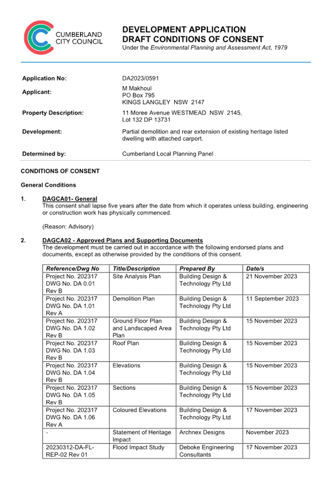
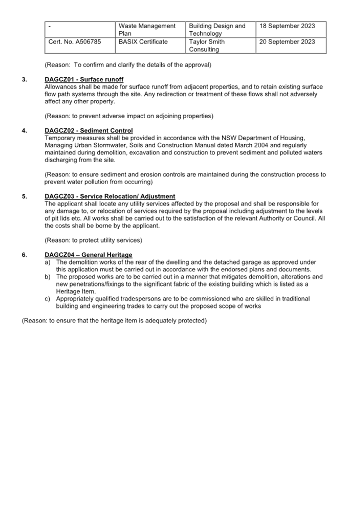
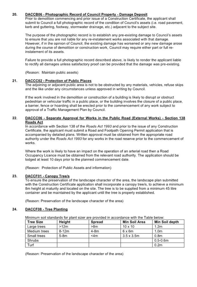

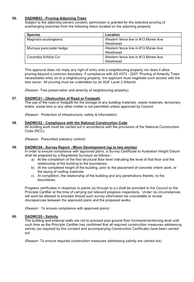
DOCUMENTS
ASSOCIATED WITH
REPORT LPP005/24
Attachment 2
Architectural Plans
Cumberland
Local Planning Panel Meeting
14 February 2024
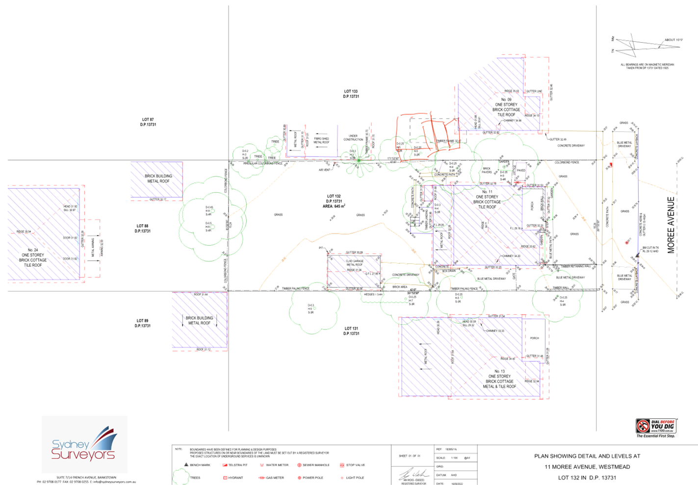
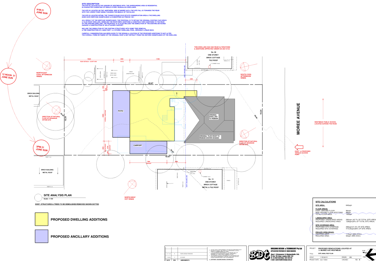
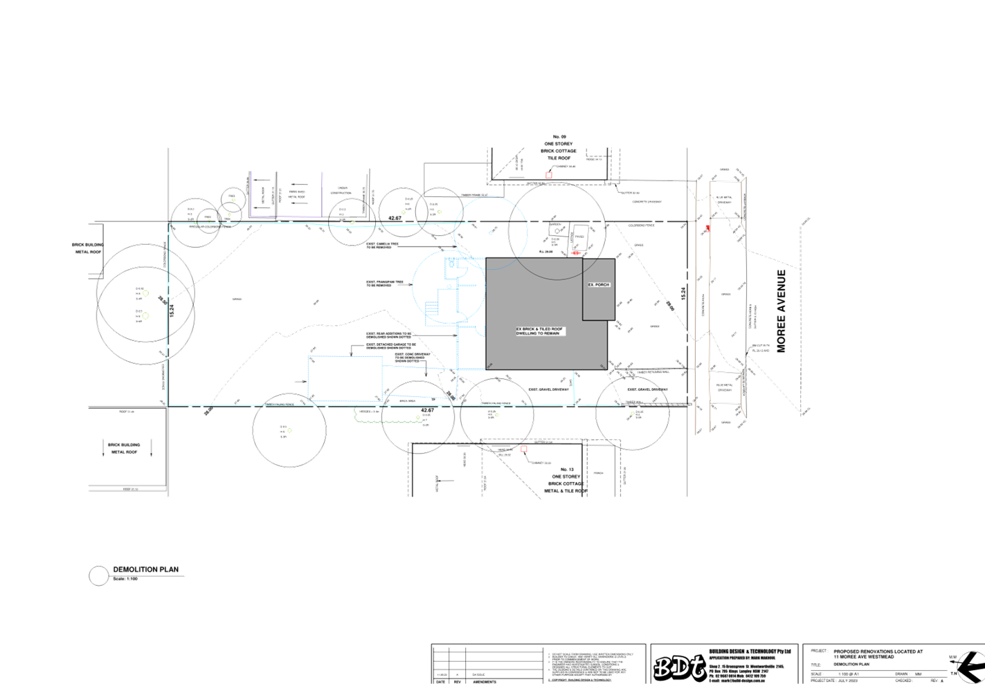
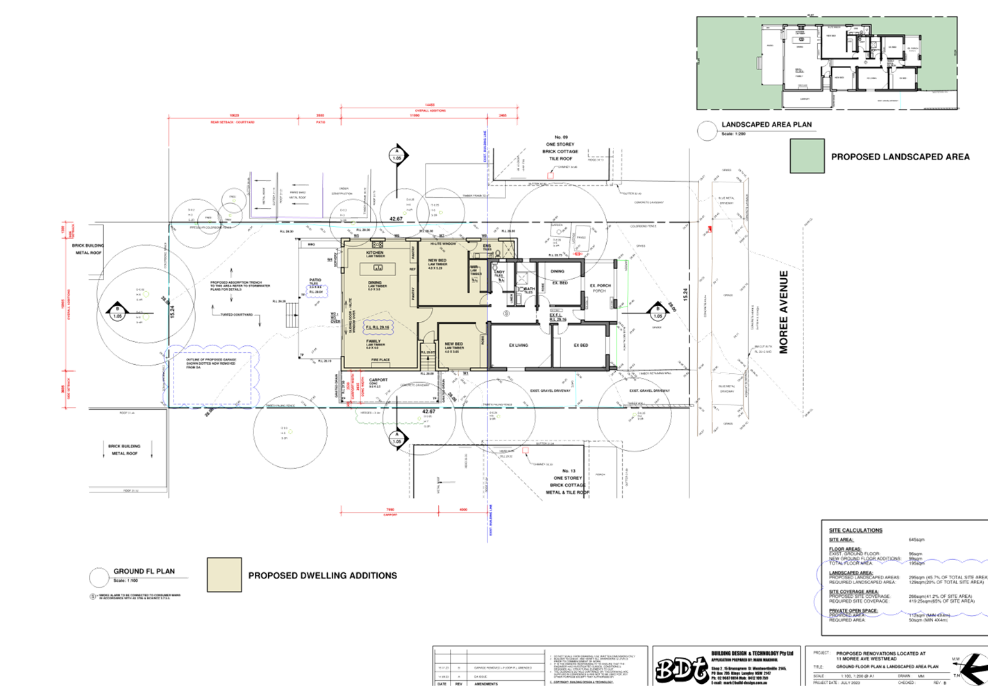
DOCUMENTS
ASSOCIATED WITH
REPORT LPP005/24
Attachment 3
Submissions Received
Cumberland
Local Planning Panel Meeting
14 February 2024
DOCUMENTS
ASSOCIATED WITH
REPORT LPP005/24
Attachment 4
Cumberland LEP Assessment
Cumberland
Local Planning Panel Meeting
14 February 2024
DOCUMENTS
ASSOCIATED WITH
REPORT LPP005/24
Attachment 5
Cumberland DCP Assessment
Cumberland
Local Planning Panel Meeting
14 February 2024
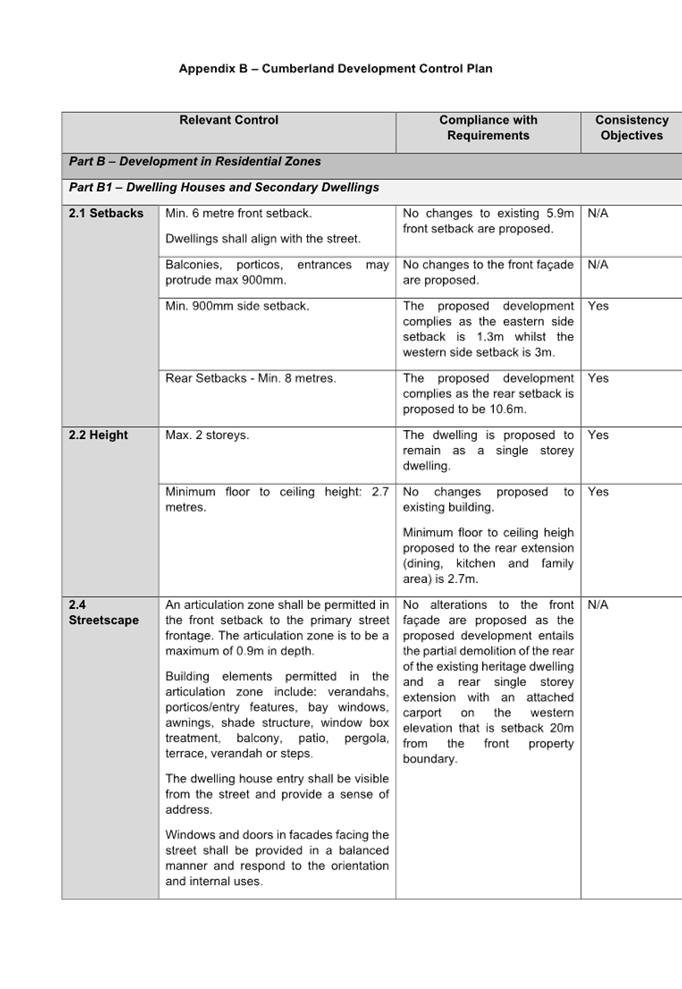
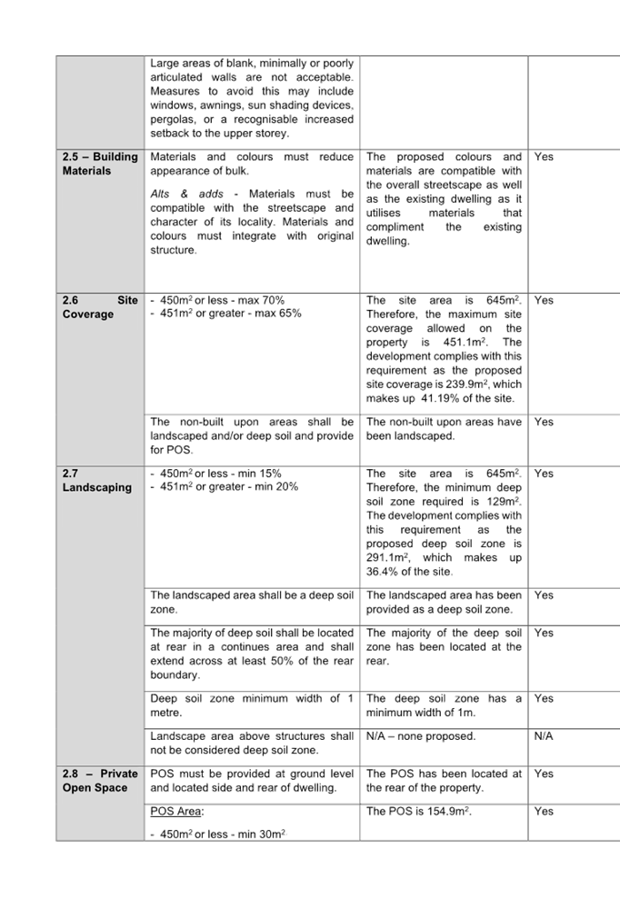
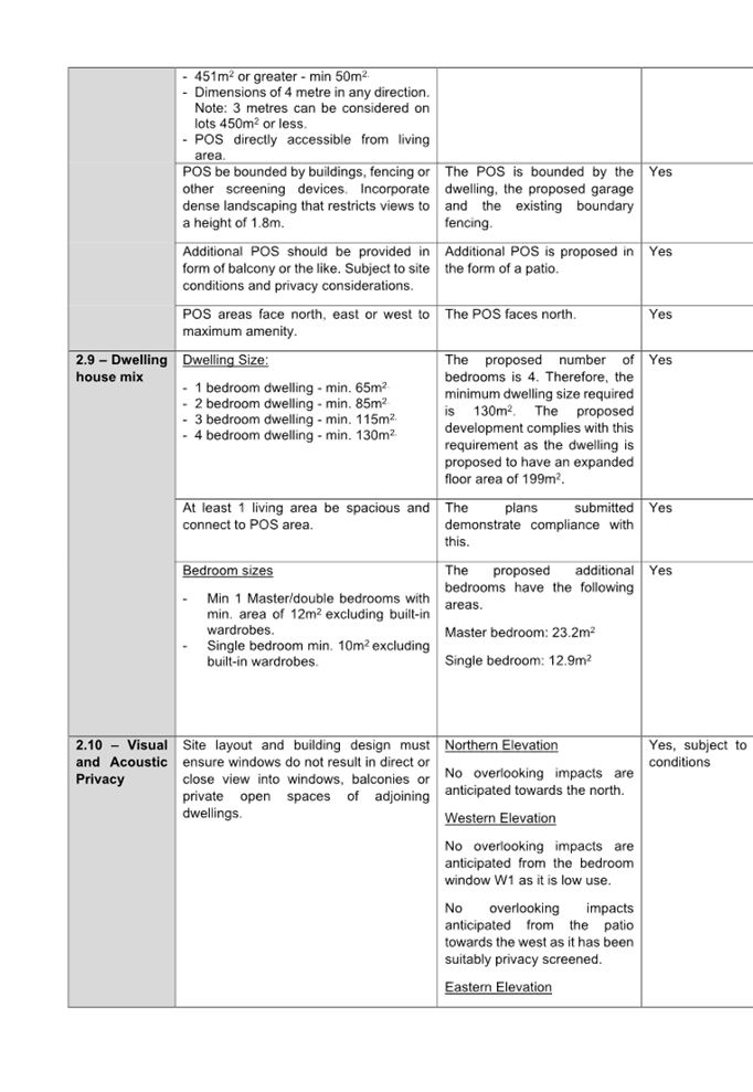
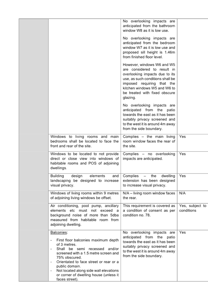
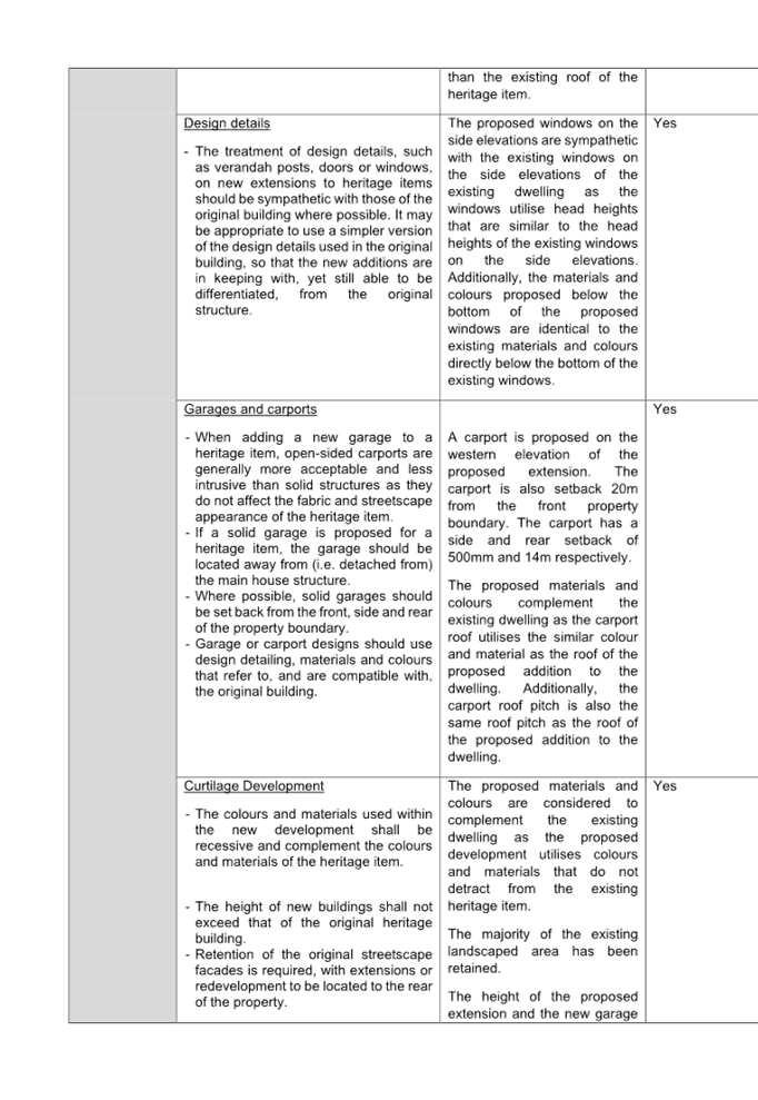
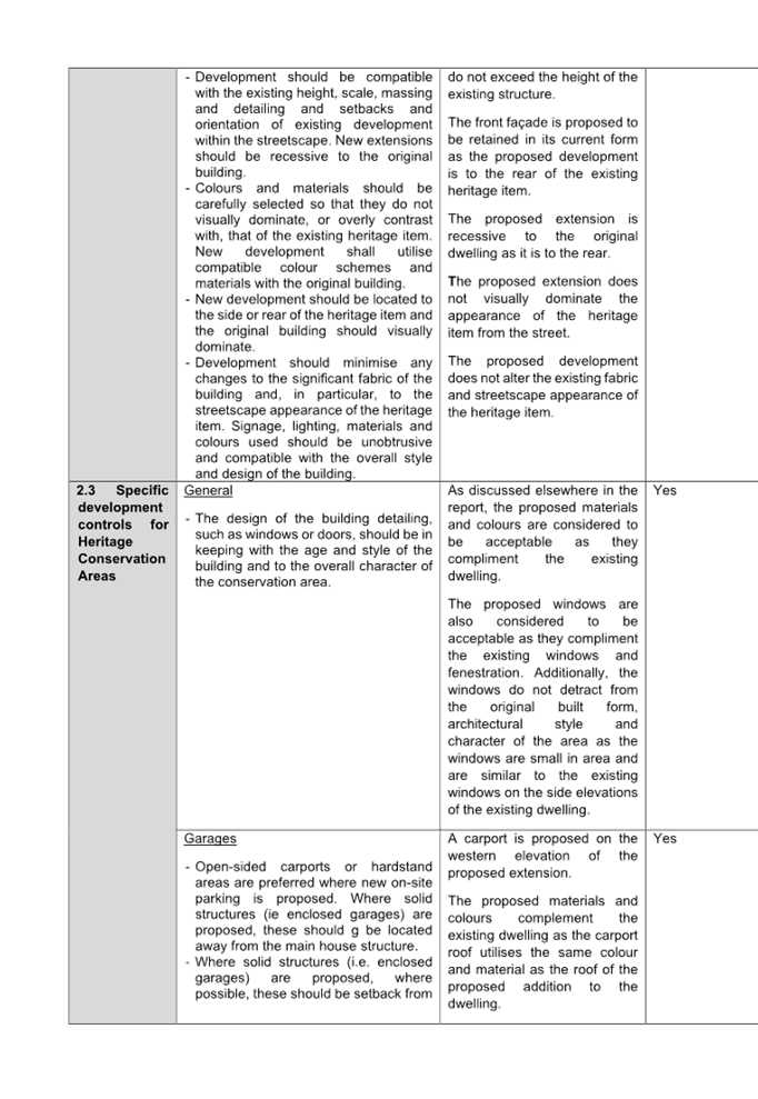
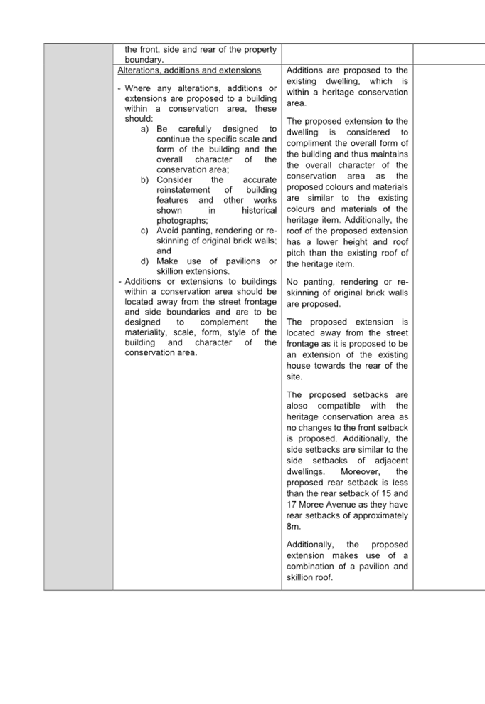
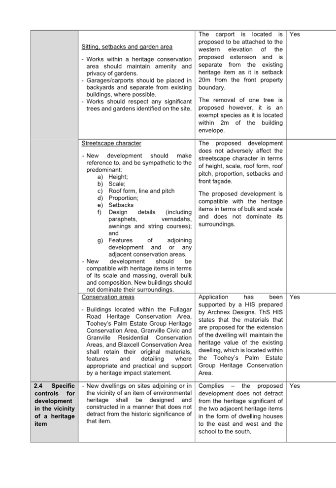
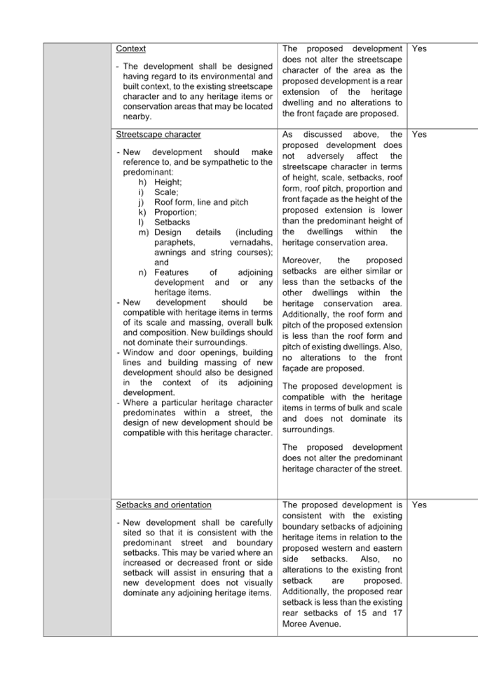
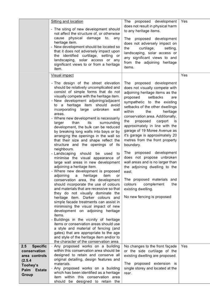
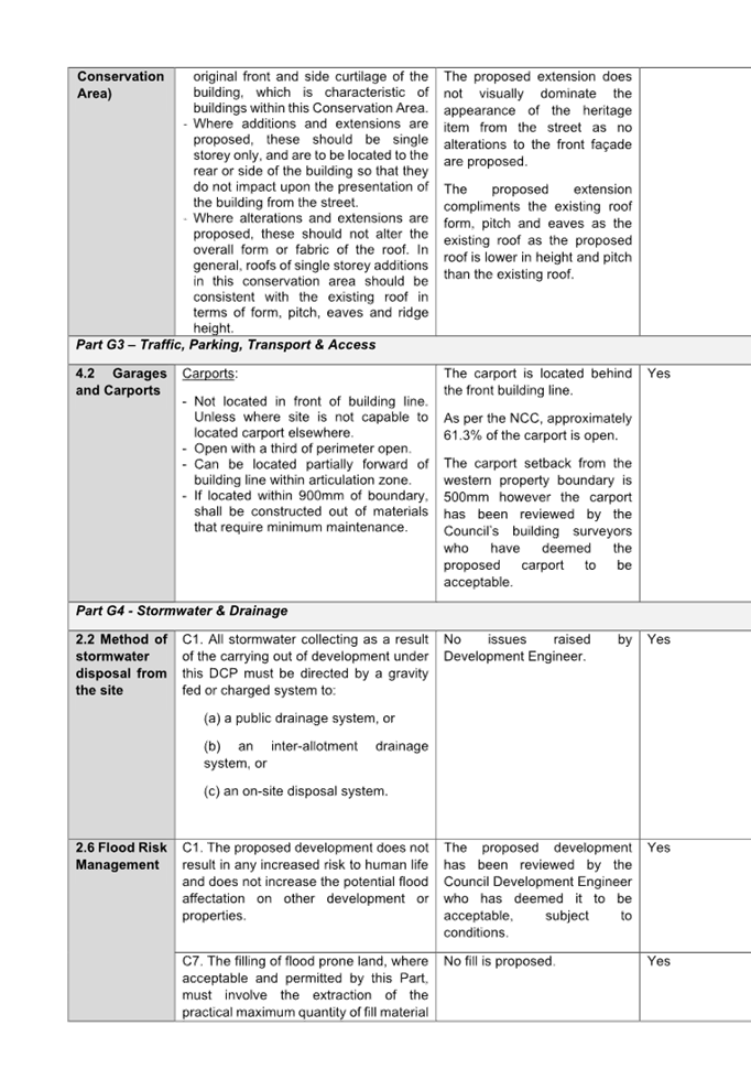
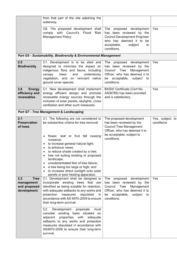
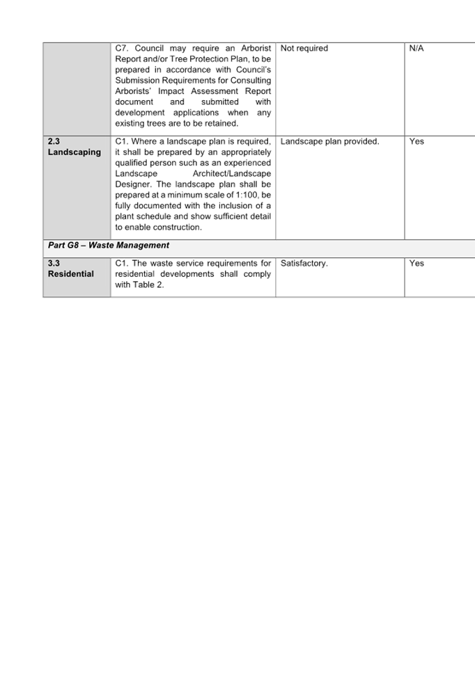
DOCUMENTS
ASSOCIATED WITH
REPORT LPP005/24
Attachment 6
Heritage Impact Statement
Cumberland
Local Planning Panel Meeting
14 February 2024
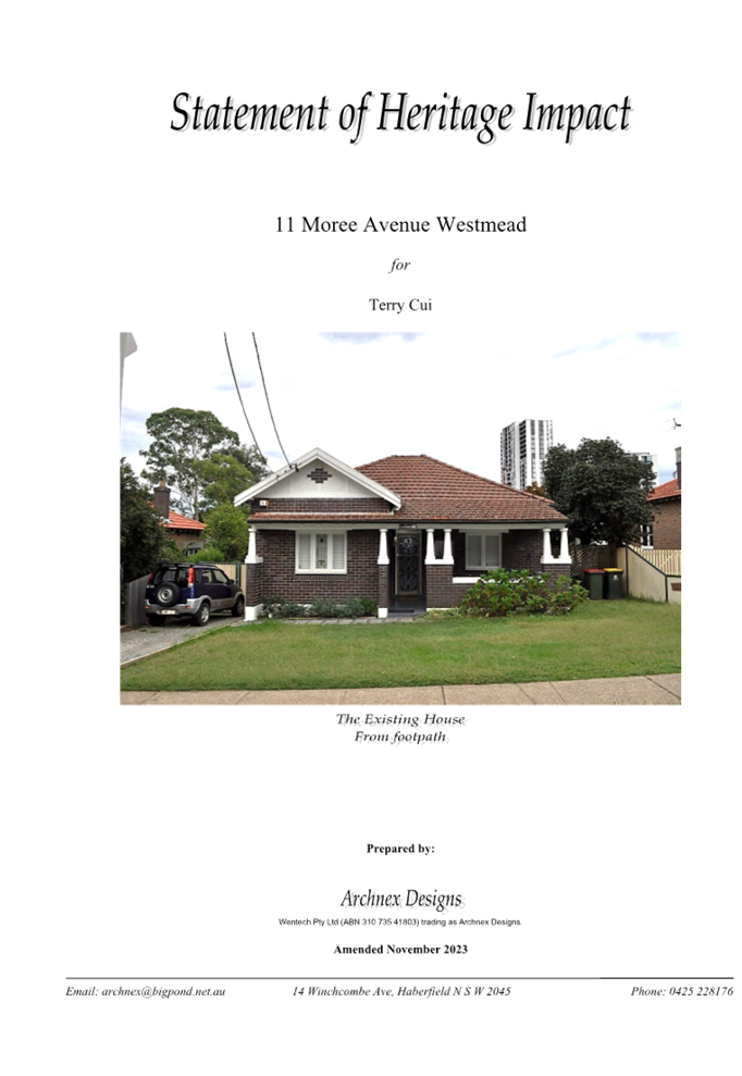
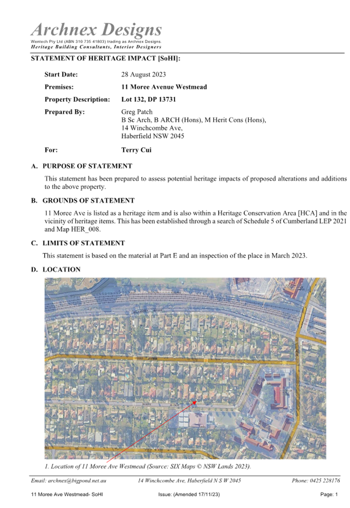
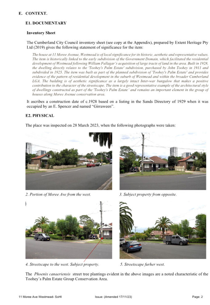
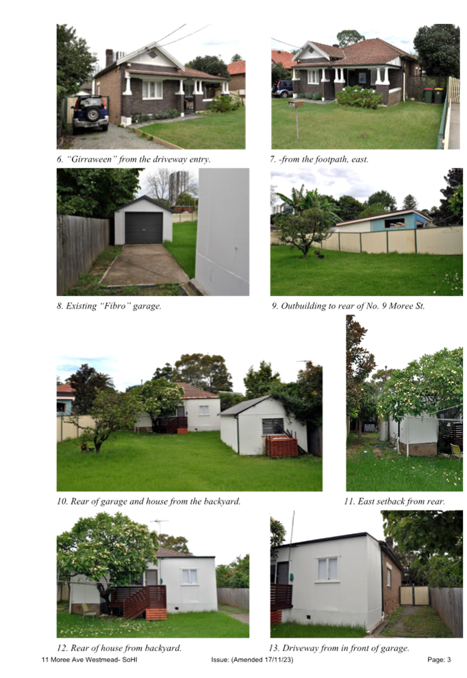
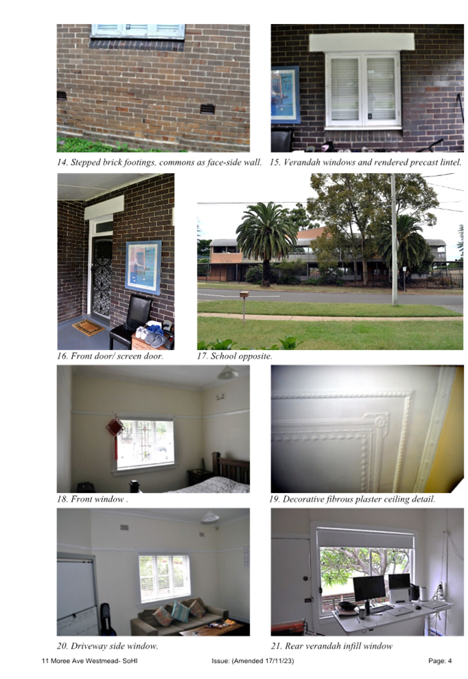
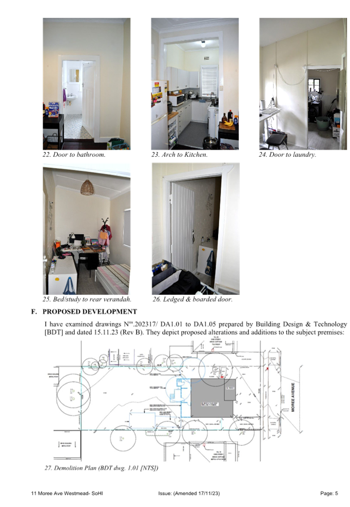
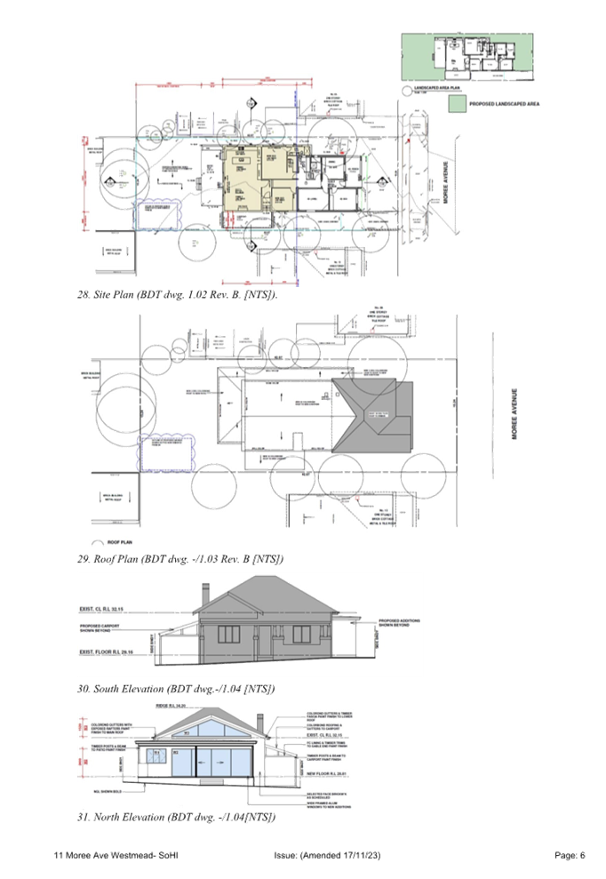
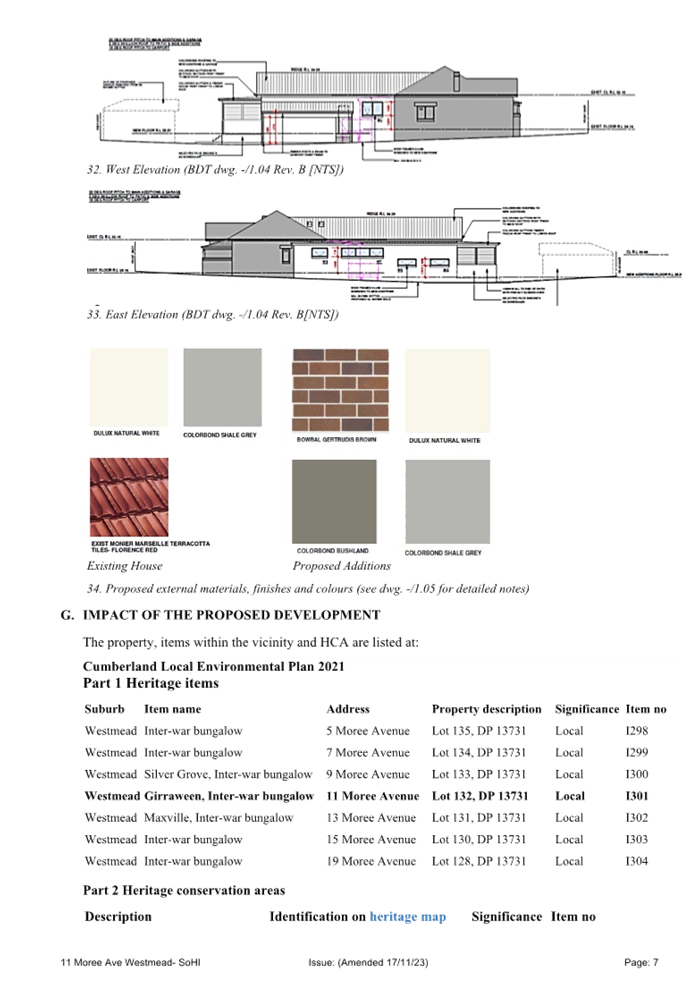
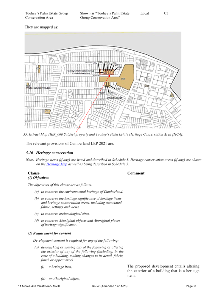
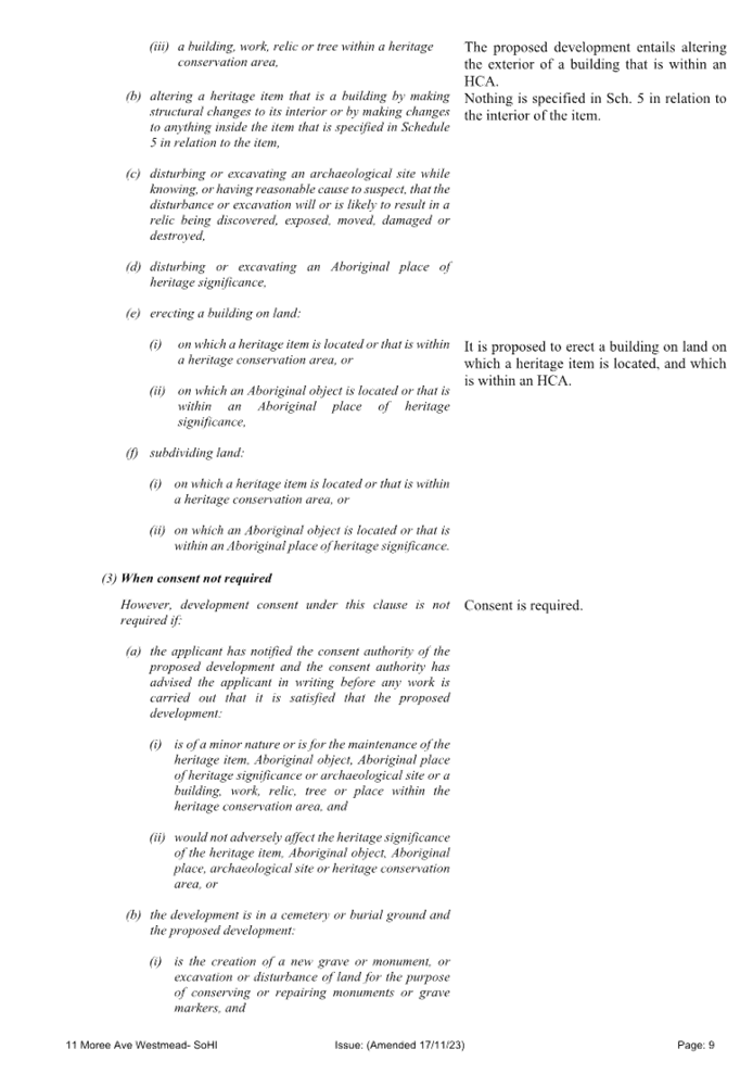
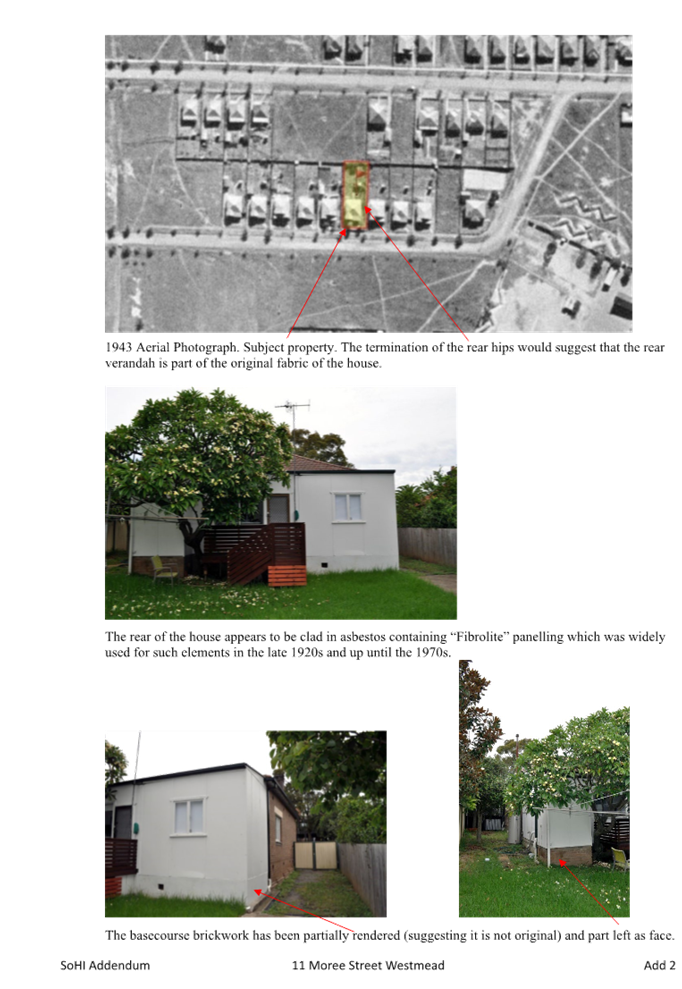

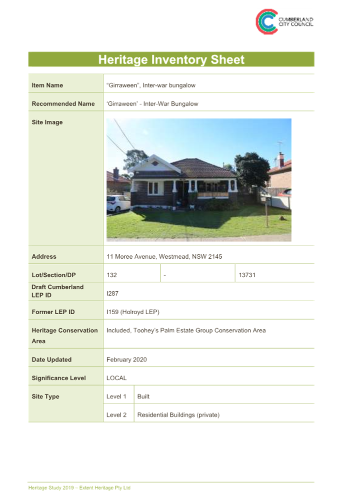
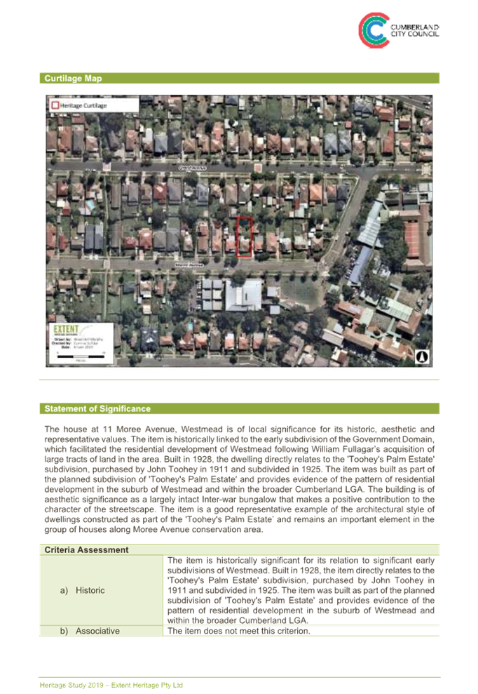
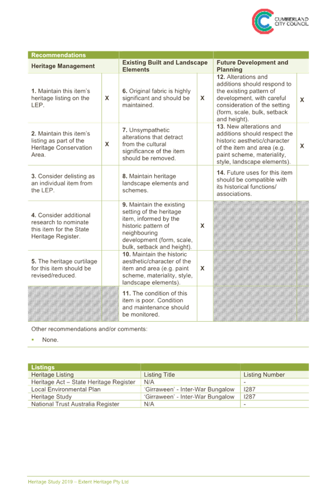
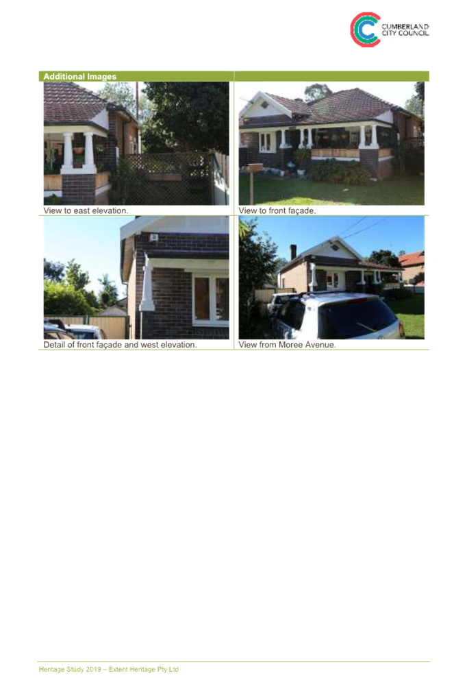
DOCUMENTS
ASSOCIATED WITH
REPORT LPP005/24
Attachment 7
Flood Impact Study
Cumberland
Local Planning Panel Meeting
14 February 2024
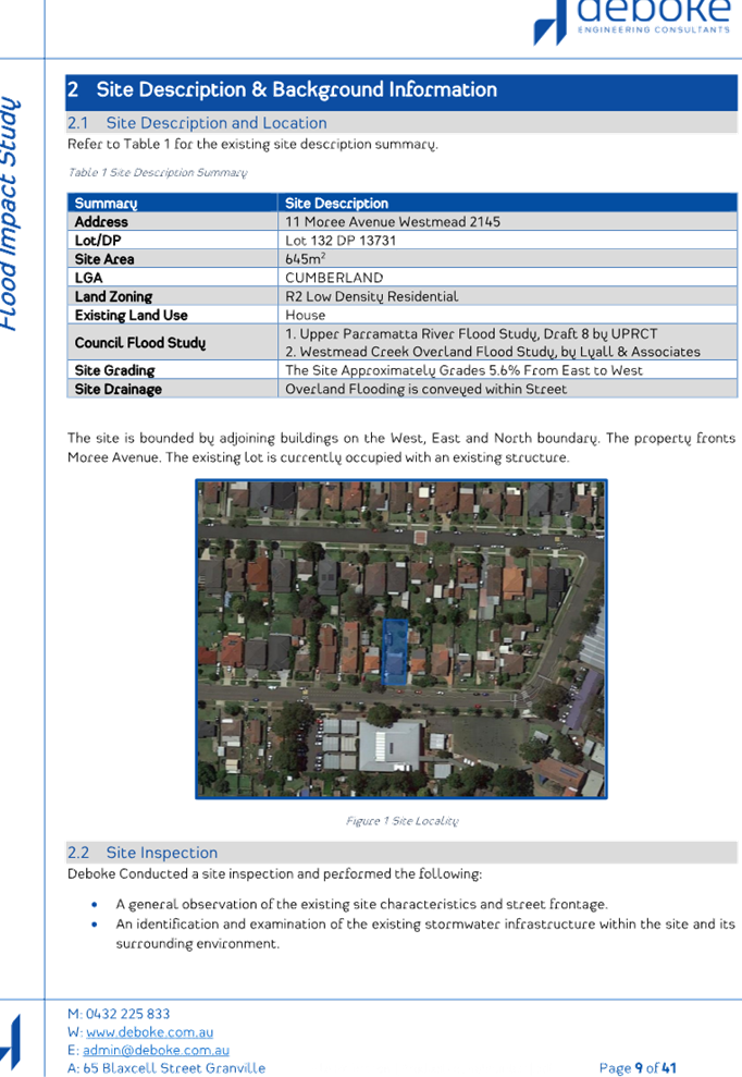
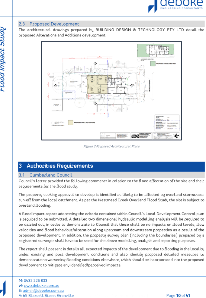
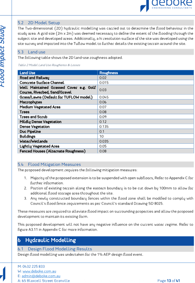

DOCUMENTS
ASSOCIATED WITH
REPORT LPP005/24
Attachment 8
BASIX Certificate
Cumberland
Local Planning Panel Meeting
14 February 2024