1 November 2023
A
meeting of the Traffic Committee
will be held at 9.30am in Merrylands Administration Building, 16
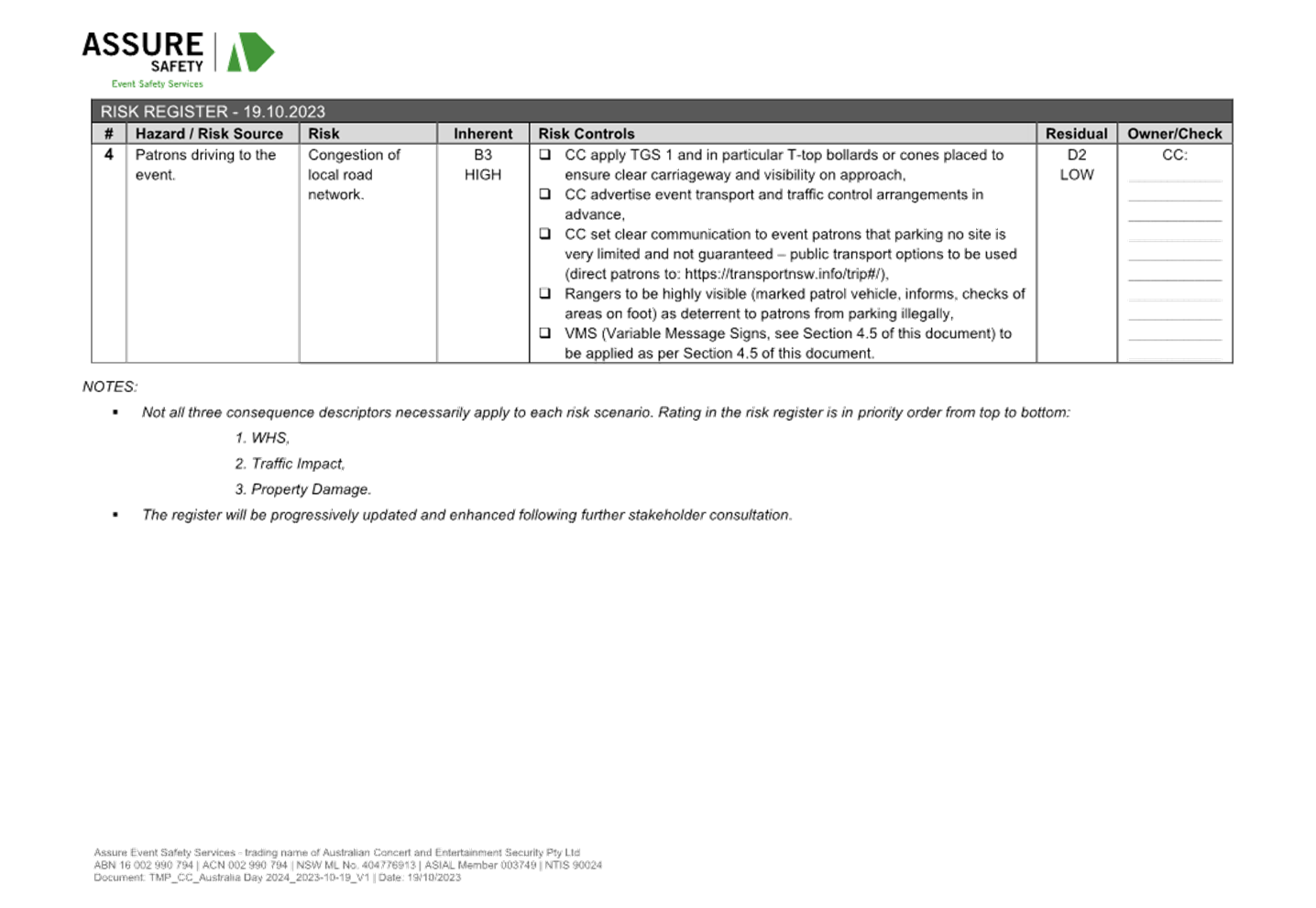
Memorial Avenue, Merrylands on Wednesday, 1 November 2023.
Business as below:
Yours faithfully
Peter J. Fitzgerald
General Manager
ORDER OF BUSINESS
1.
Apologies
2.
Declarations of Interest
3.
Confirmation of Previous Minutes endorsed by Council
4.
Summary of Reports.............................................. 5
5.
Reports
-
Part 1 - Recommended for Approval under Delegated Authority
-
Part 2 - Recommendation to Council
CONTENTS
Report No. Name
of Report Page
No.
Part 1 - Recommended for Approval under Delegated
Authority
CTC-23-169 JONATHAN
STREET, GREYSTANES - PROPOSED 'BUS ZONE' SIGNAGE.. 9
CTC-23-170 SMITH
STREET, PENDLE HILL – PROPOSED ‘BUS ZONE’ SIGNAGE 17
CTC-23-171 LENA
PLACE, MERRYLANDS – PROPOSED PARKING RESTRICTIONS.............................. 29
Part 2 - Recommendation to Council
CTC-23-172 KIHILLA
ROAD, AUBURN - ROAD SAFETY CONCERNS...................... 51
CTC-23-173 KIRKHAM
ROAD, AUBURN – ROAD SAFETY CONCERNS...................... 55
CTC-23-174 PENDLE
WAY, PENDLE HILL – ROAD SAFETY CONCERNS...................... 65
CTC-23-175 JOYCE
STREET, PENDLE HILL – ROAD SAFETY CONCERNS........... 75
CTC-23-176 CUMBERLAND
ROAD, AUBURN – ROAD SAFETY CONCERNS........... 85
CTC-23-177 HANBURY
STREET, GREYSTANES- ROAD SAFETY CONCERNS........... 89
CTC-23-178 LACKEY
STREET, MERRYLANDS – ROAD SAFETY CONCERNS........... 99
CTC-23-179 LISGAR
STREET, MERRYLANDS – ROAD SAFETY CONCERNS......... 109
CTC-23-180 MAGOWAR
ROAD, GIRRAWEEN – ROAD SAFETY CONCERNS......... 125
CTC-23-181 REES
STREET, MAYS HILL - ROAD SAFETY CONCERNS.................... 135
CTC-23-182 SUSAN
STREET, AUBURN- ROAD SAFETY CONCERNS.................... 145
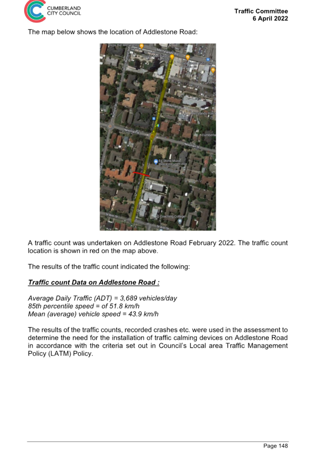
CTC-23-183 ADDLESTONE
ROAD, MERRYLANDS – ROAD SAFETY CONCERNS...... 155
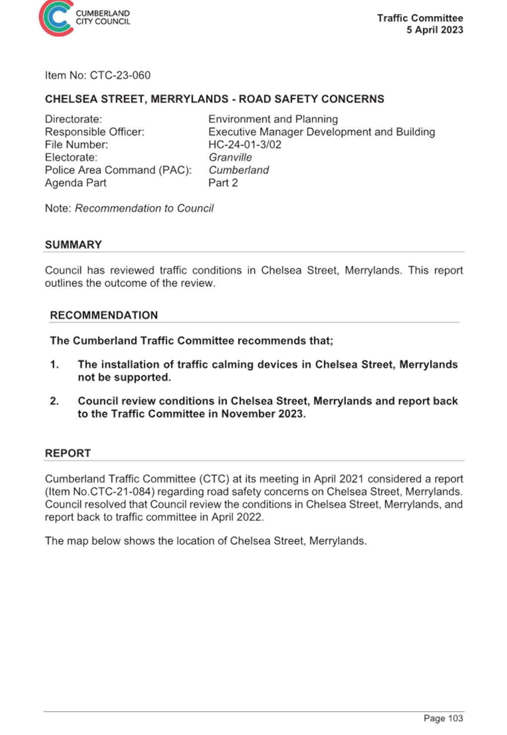
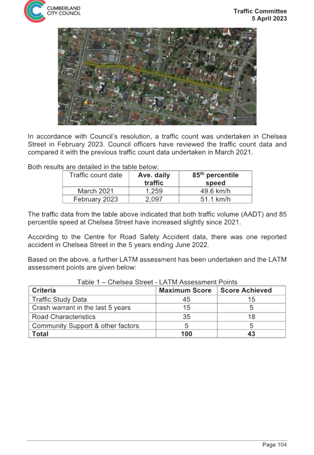
CTC-23-184 CHELSEA
STREET, MERRYLANDS - ROAD SAFETY CONCERNS......... 165
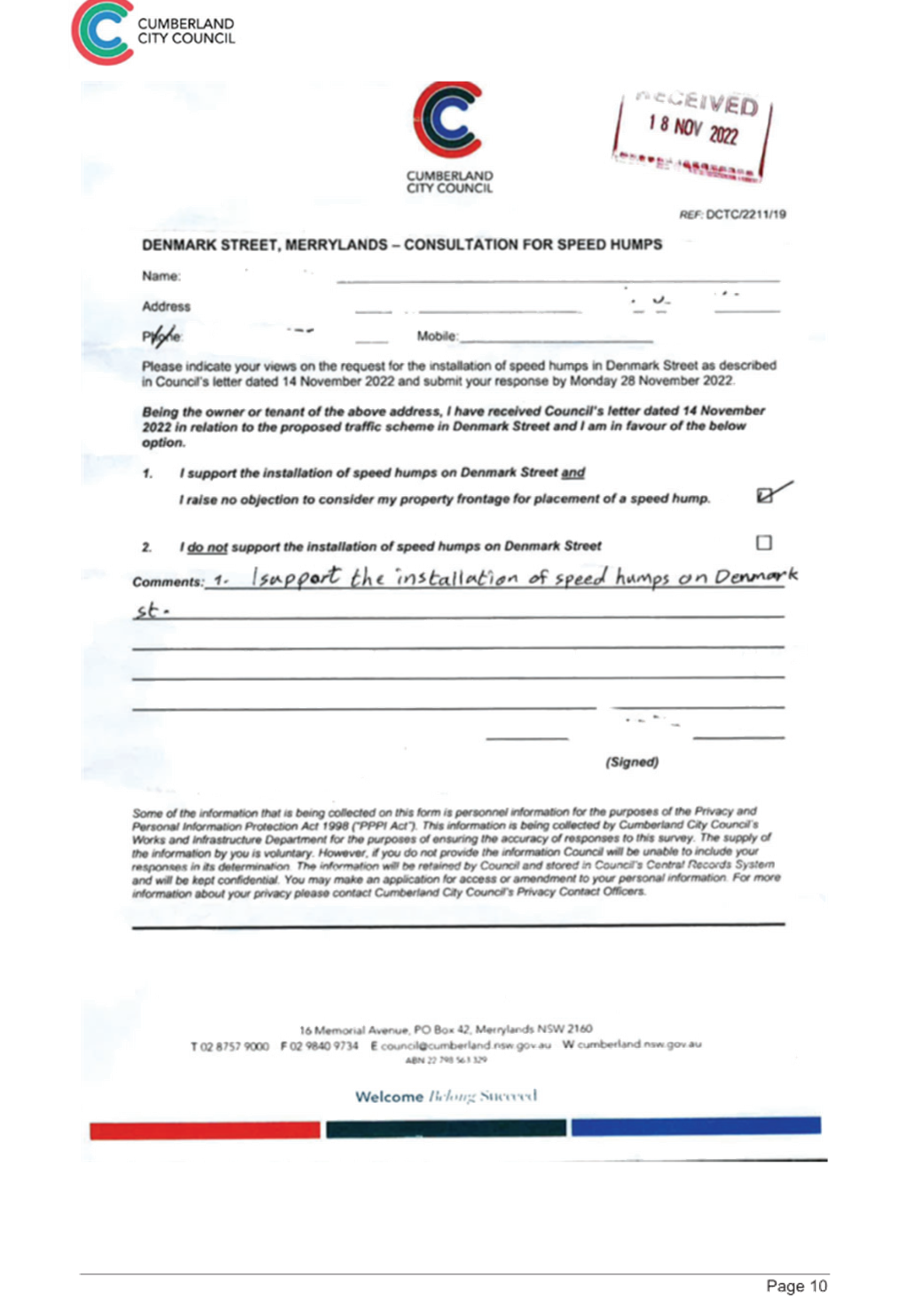
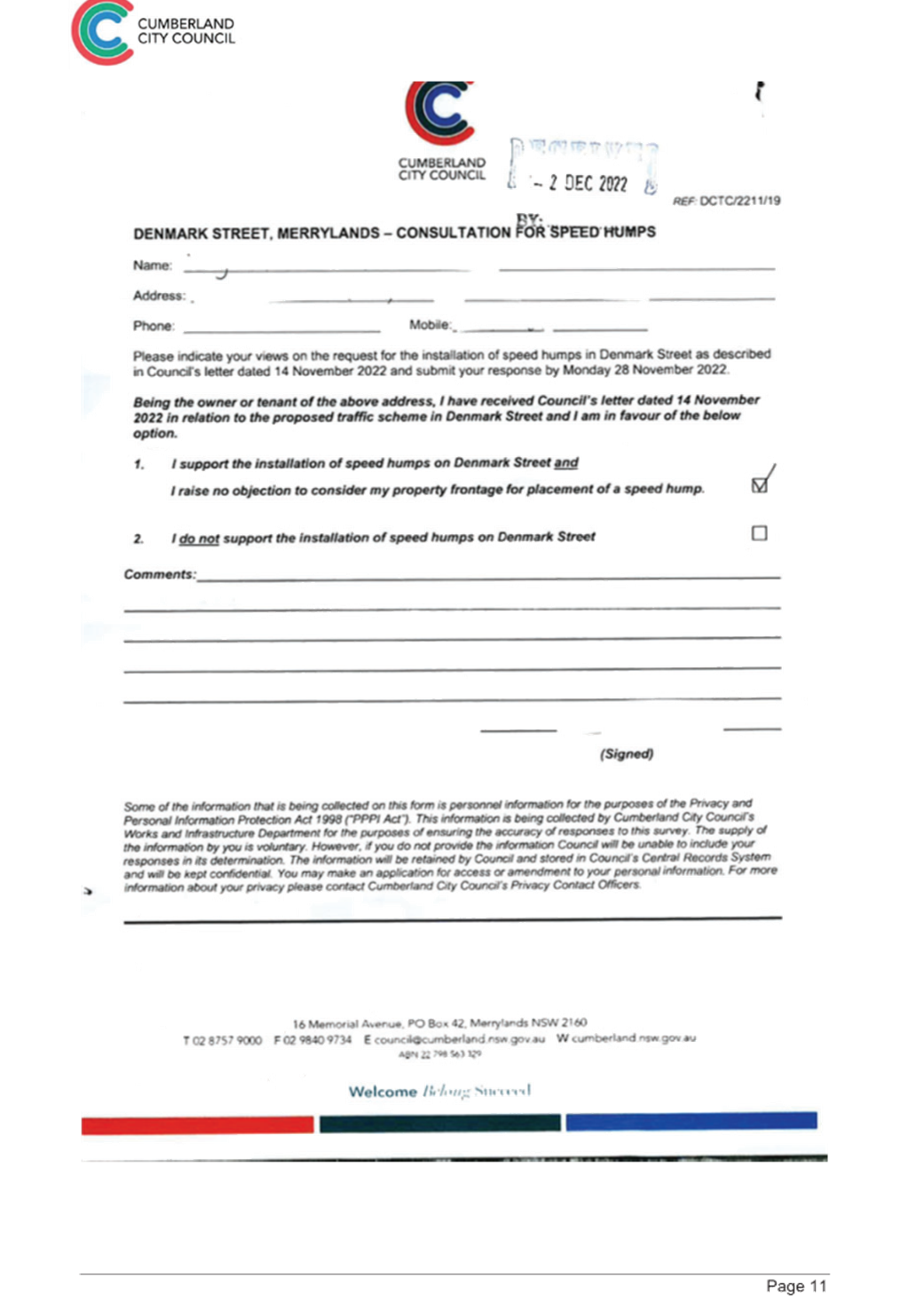
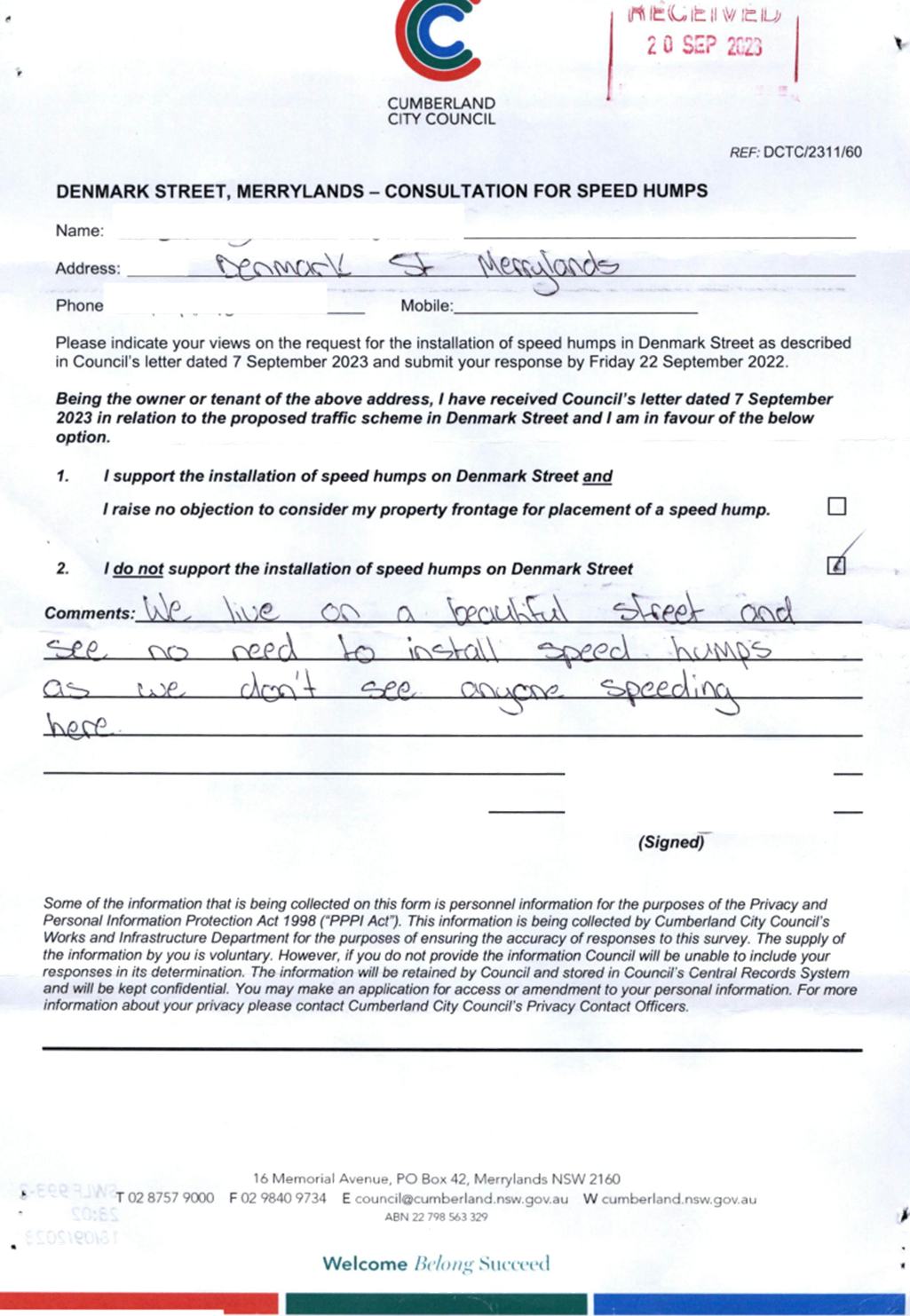
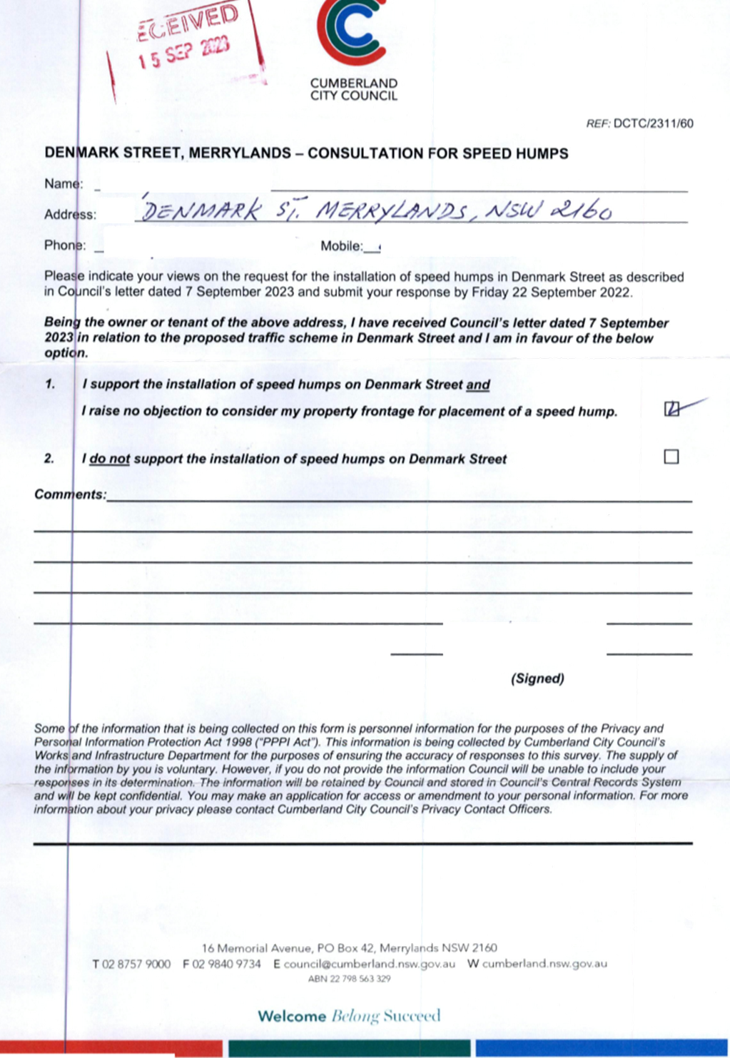
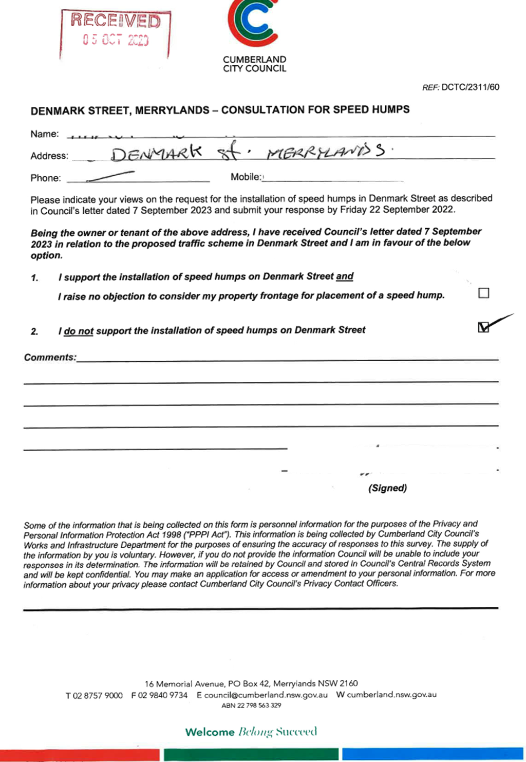
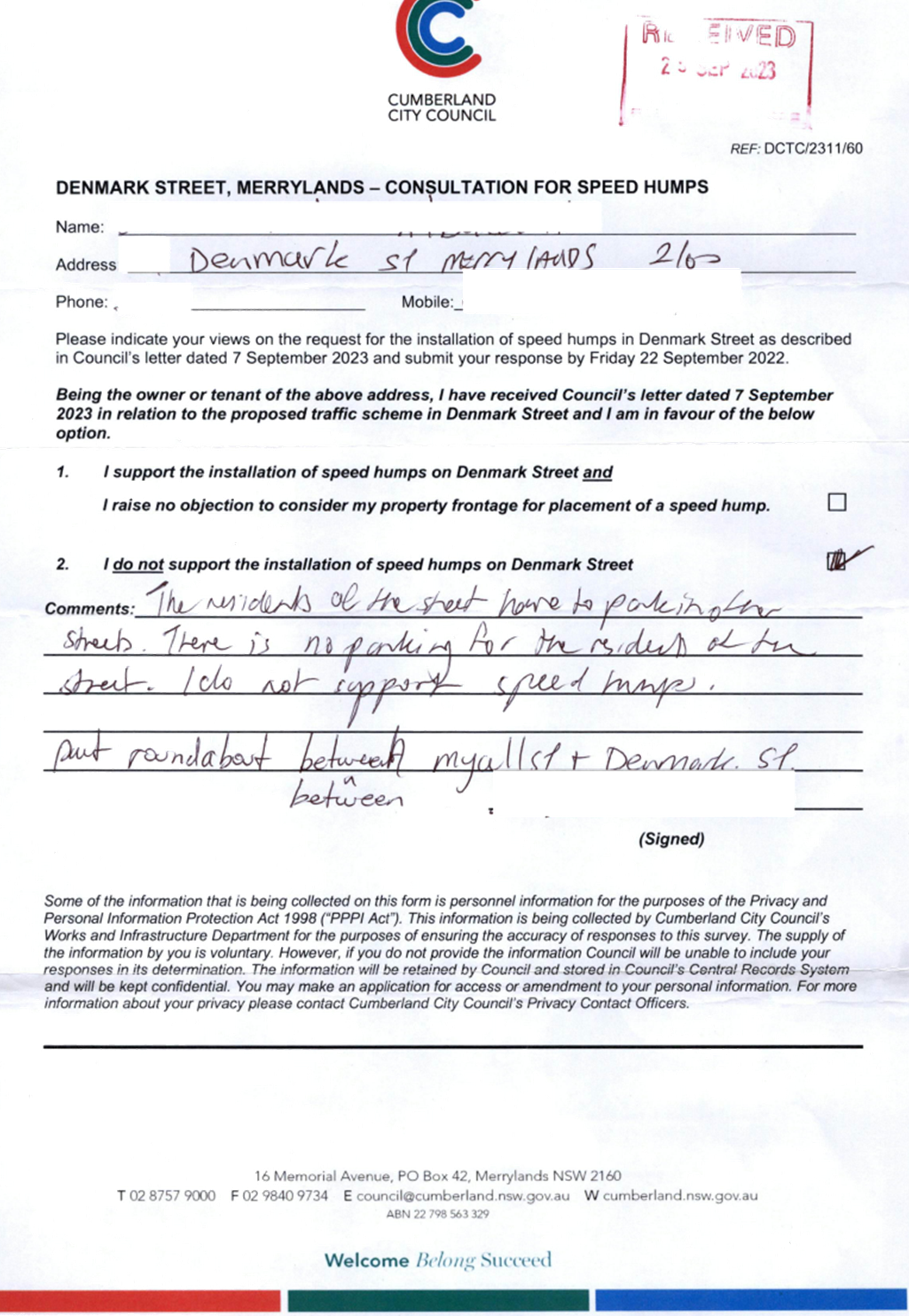
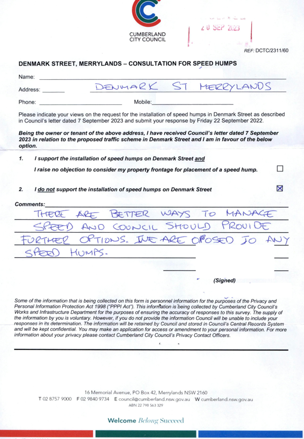
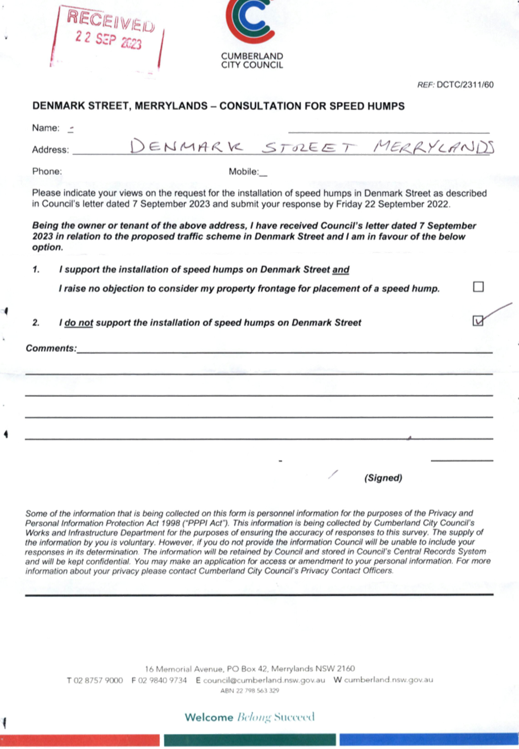
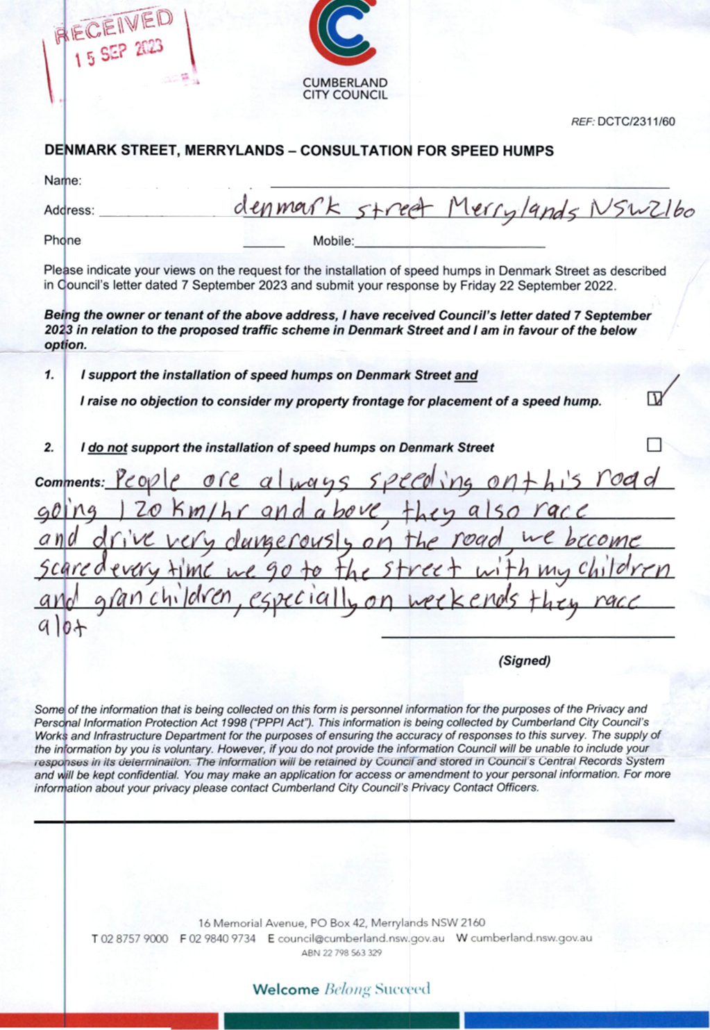
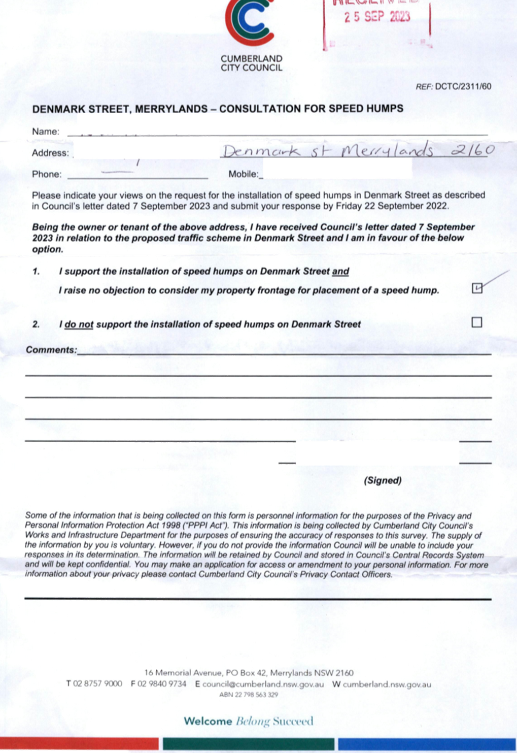
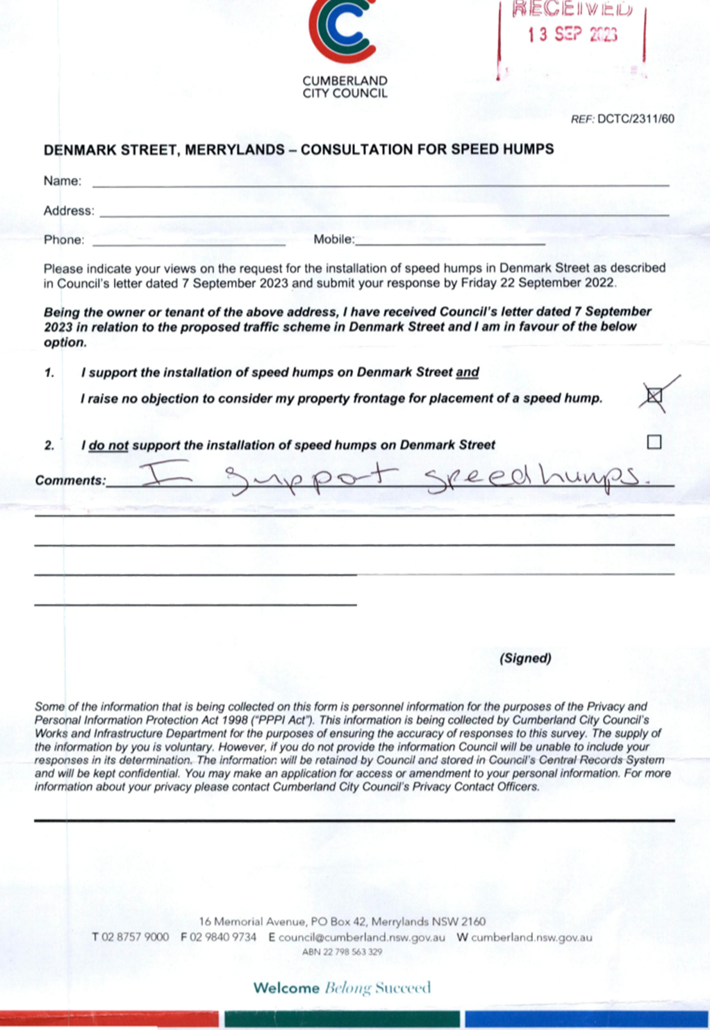
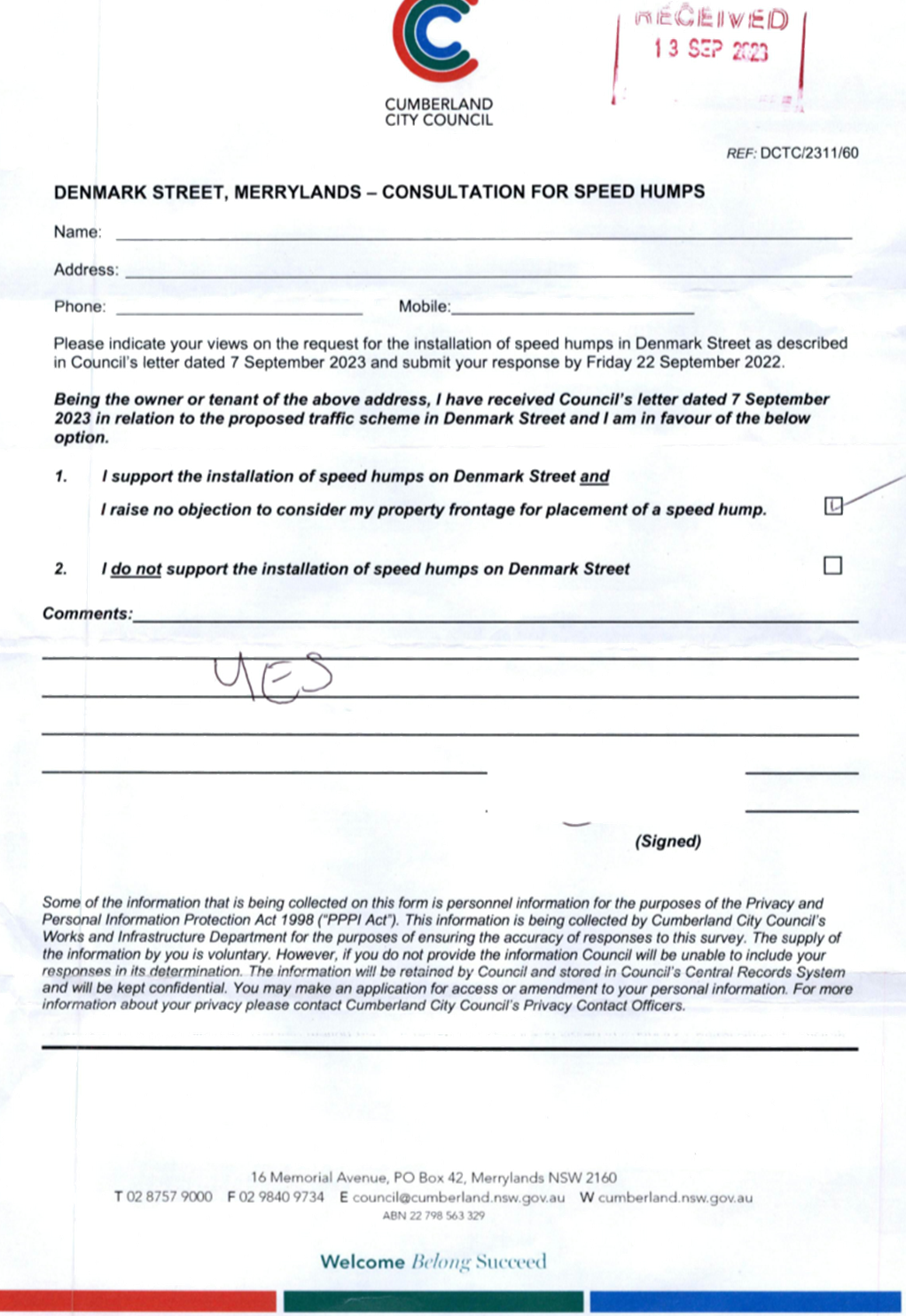
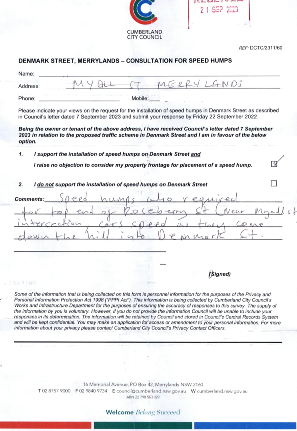
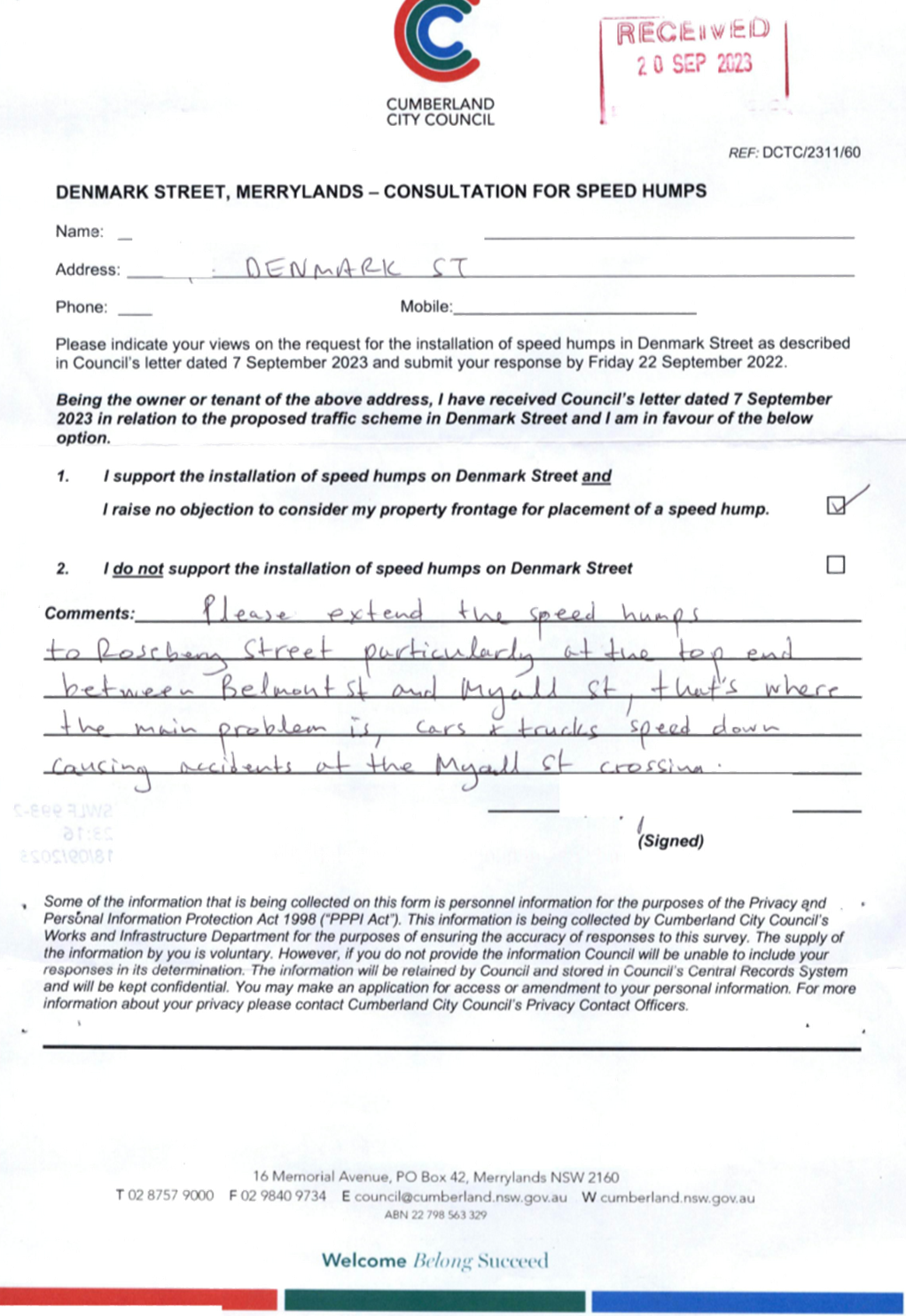
CTC-23-185 DENMARK
STREET, MERRYLANDS – ROAD SAFETY CONCERNS......... 175
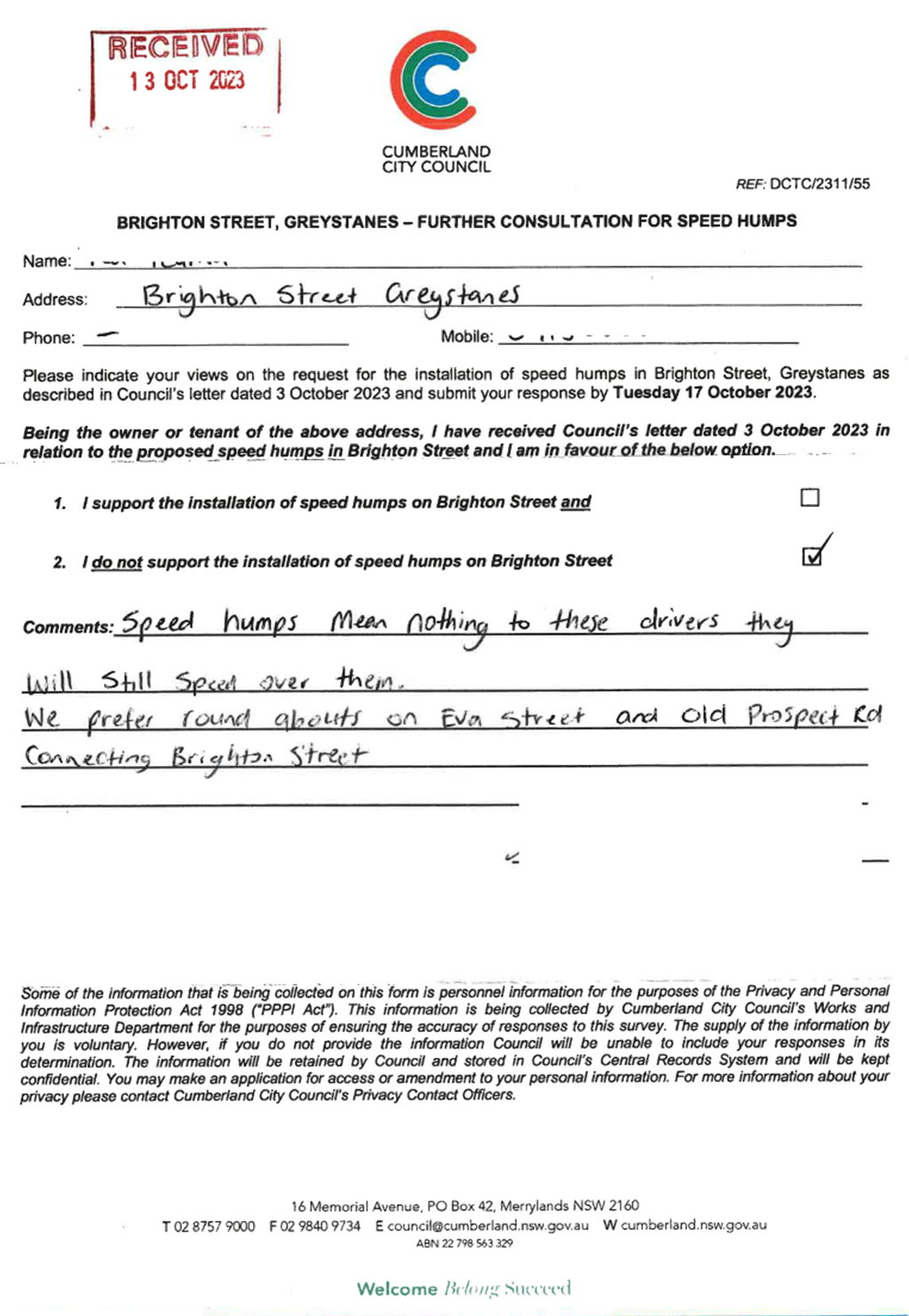
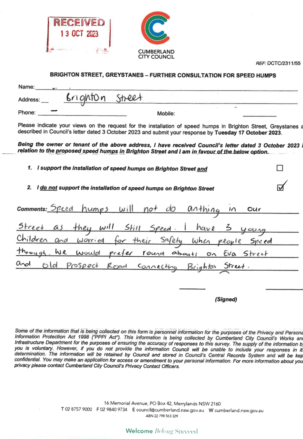
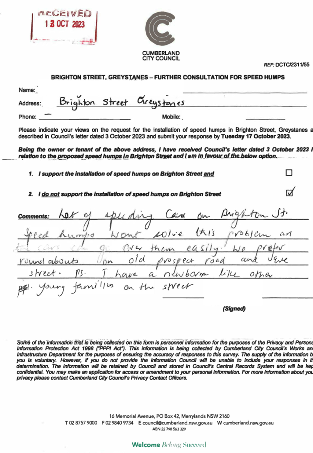
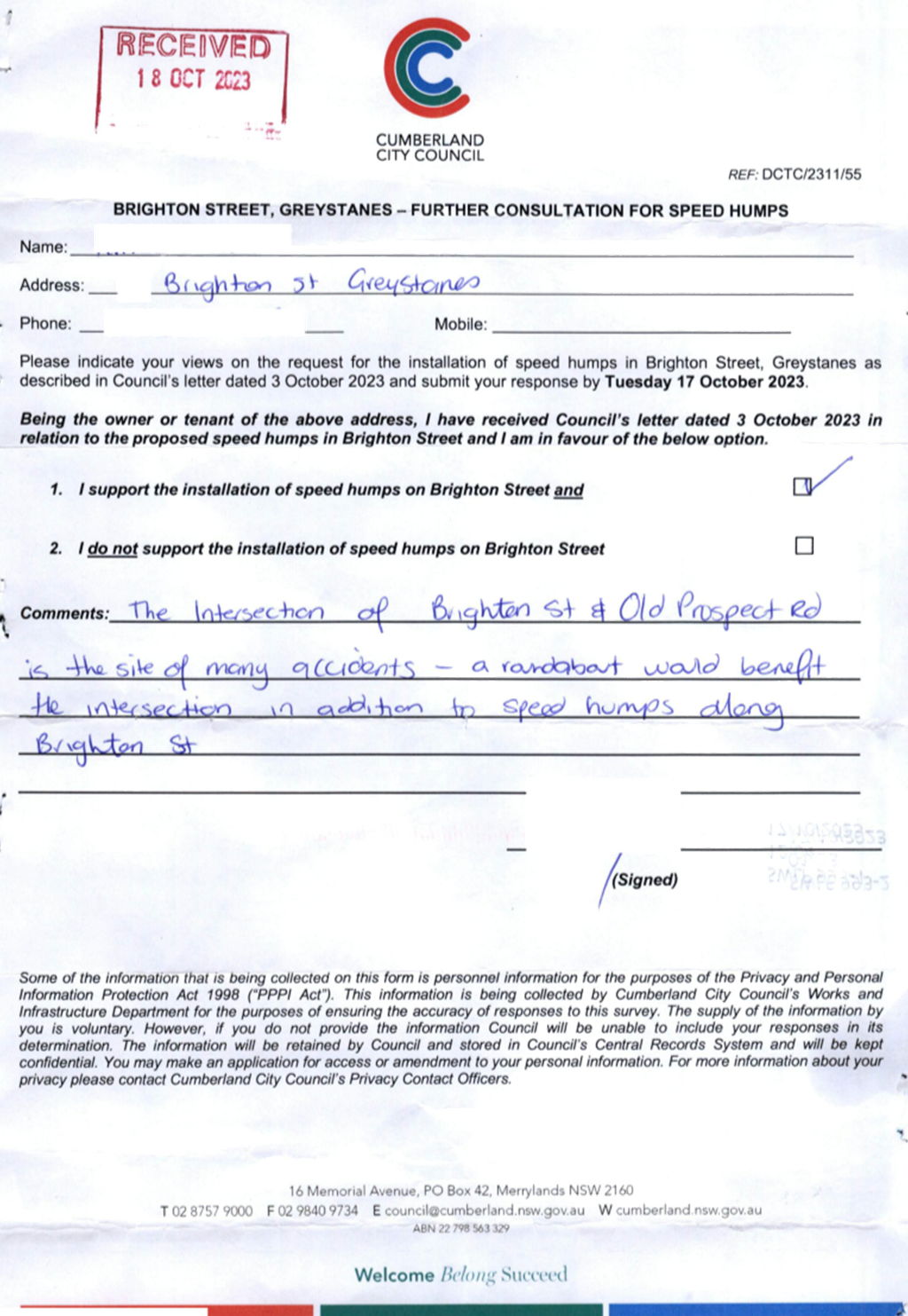
CTC-23-186 BRIGHTON
STREET, GREYSTANES – ROAD SAFETY CONCERNS...... 217
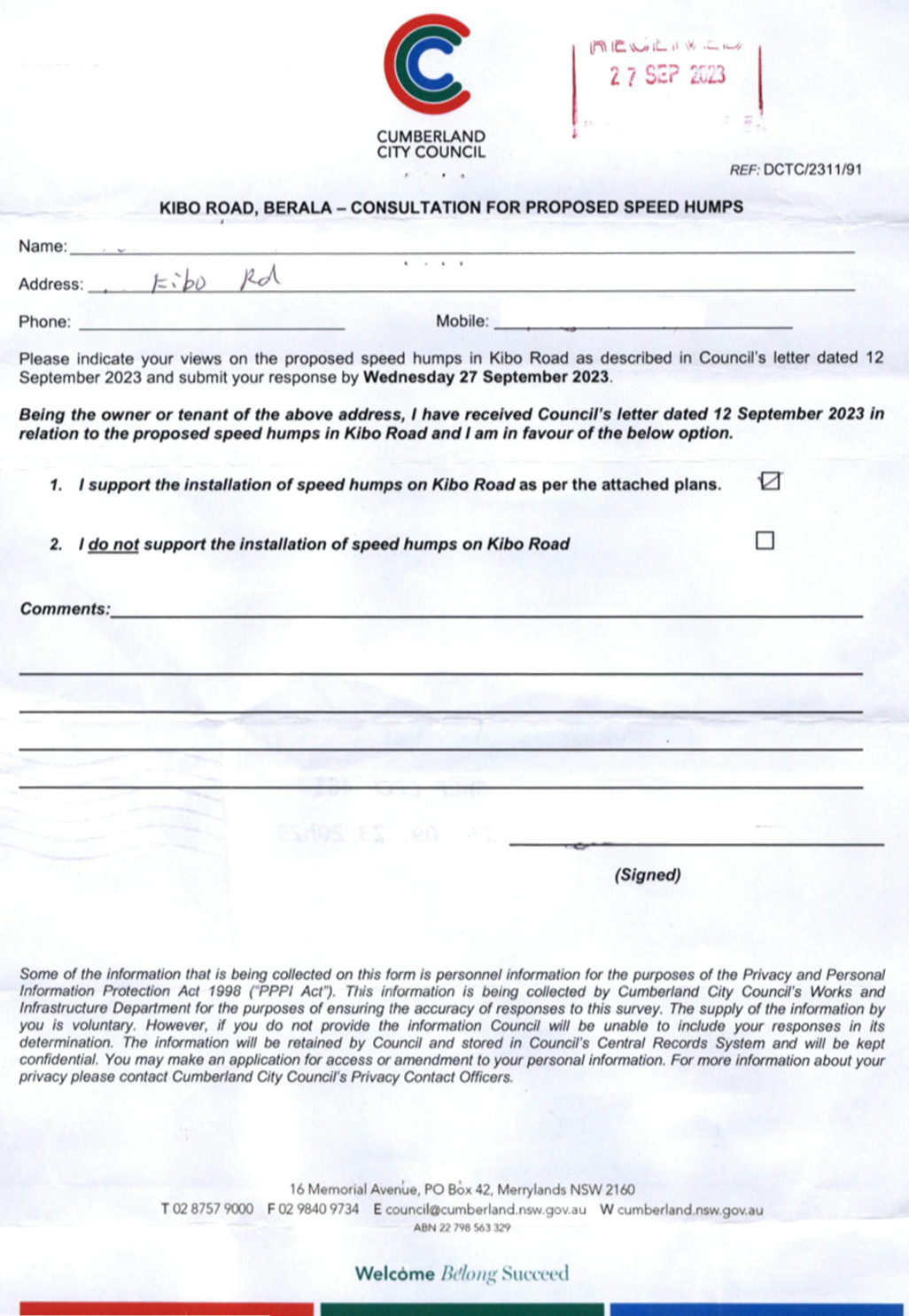
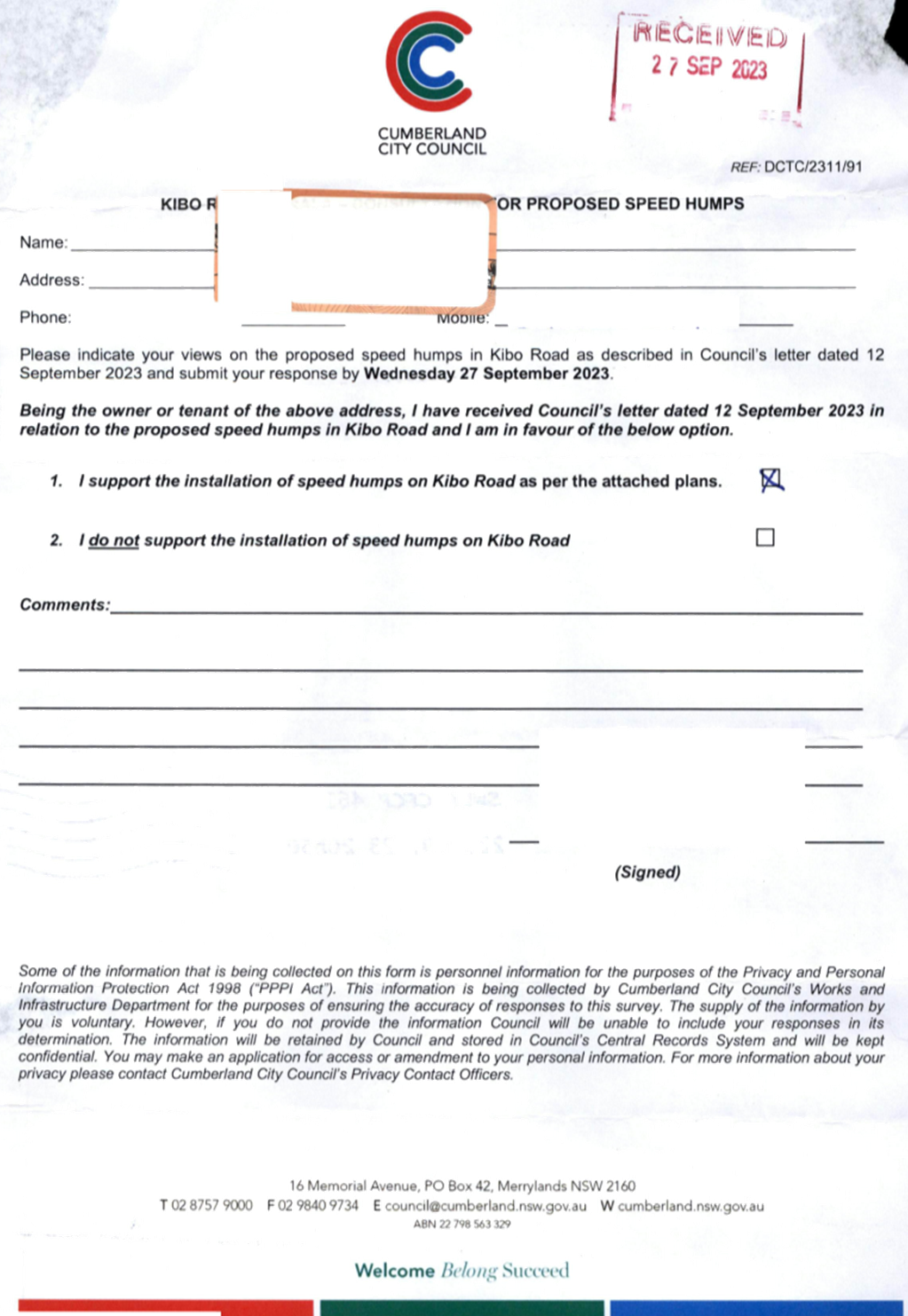
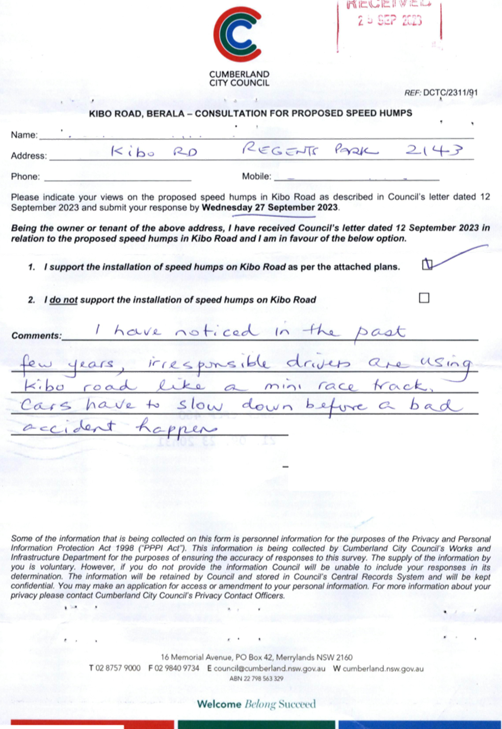
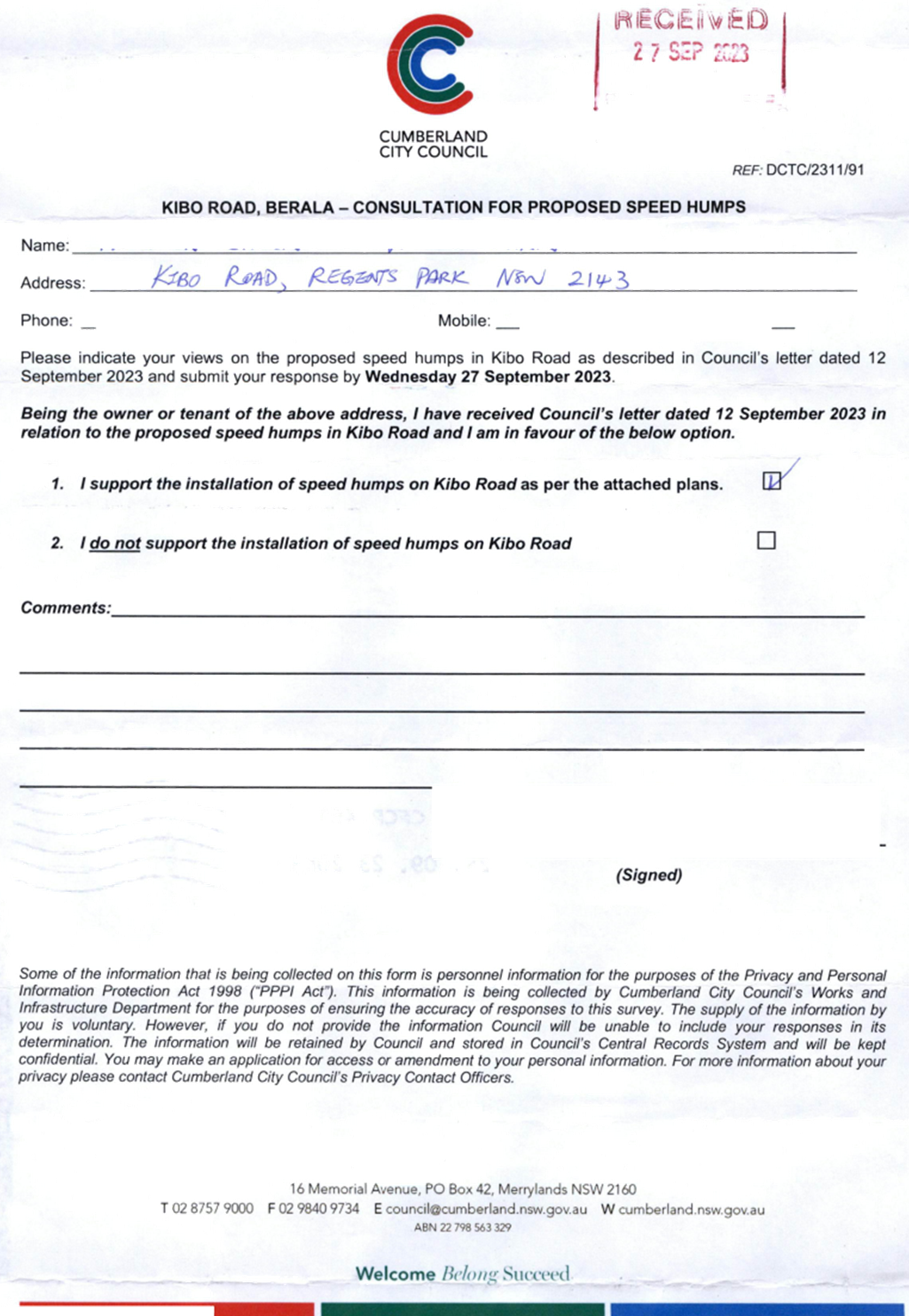
CTC-23-187 KIBO
ROAD, REGENTS PARK – PROPOSED REFUGE ISLAND...... 245
CTC-23-188 KIBO
ROAD, REGENTS PARK – PROPOSED SPEED HUMPS......... 255
CTC-23-189 BELGIUM
STREET, AUBURN - REQUEST OF ROAD WIDENING.. 273
CTC-23-190 CLARENCE
STREET, MERRYLANDS – ROAD SAFETY CONCERNS...... 339
CTC-23-191 DELLWOOD
STREET, SOUTH GRANVILLE - REQUEST FOR A PEDESTRIAN CROSSING............. 343
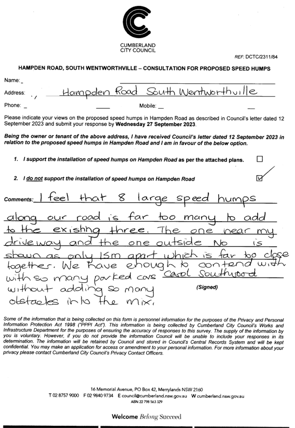
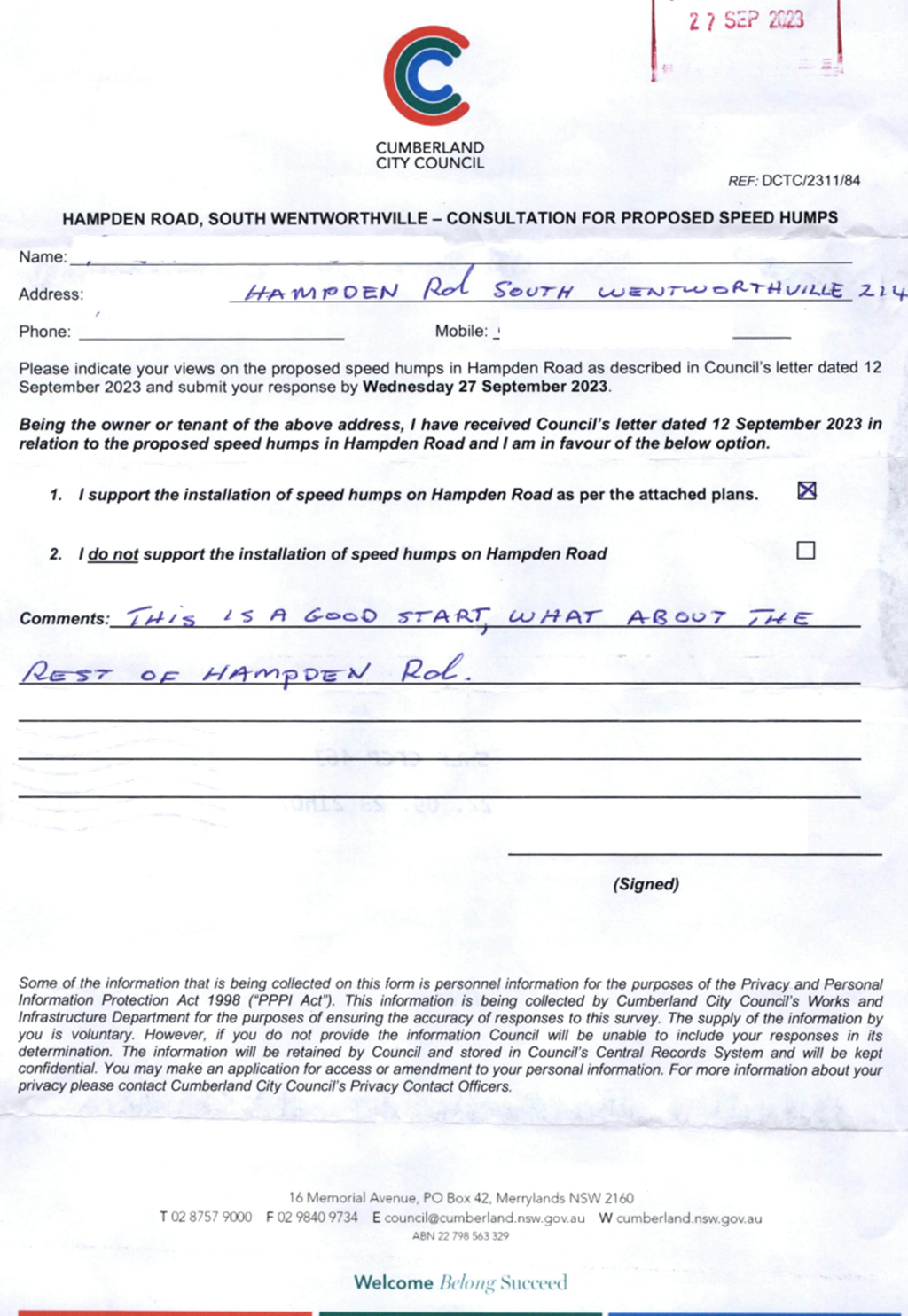
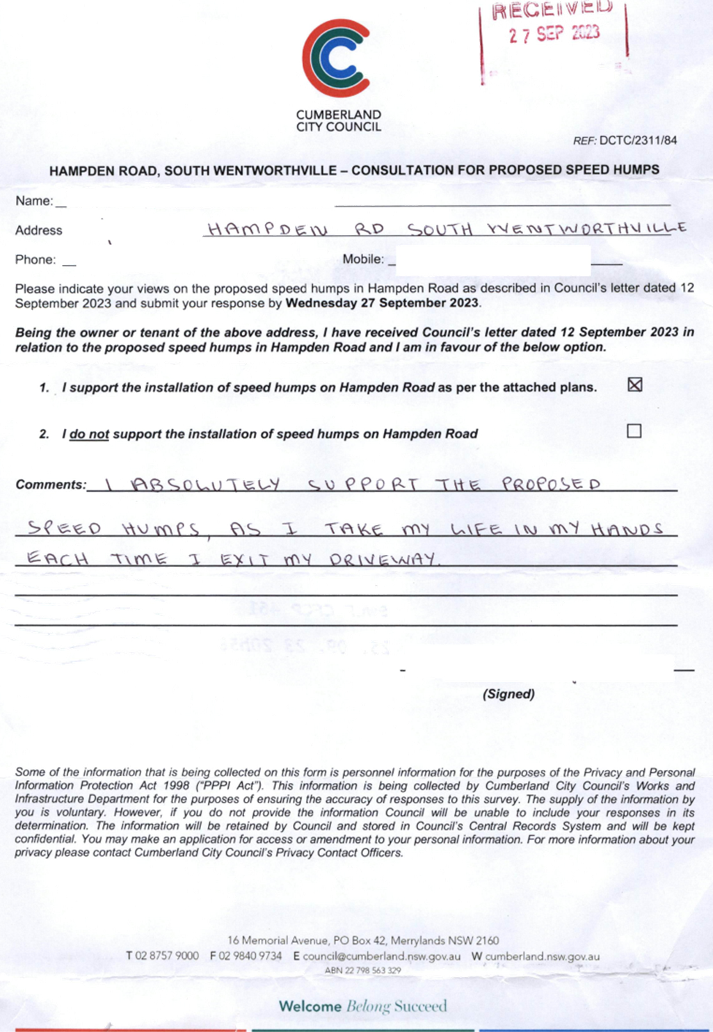
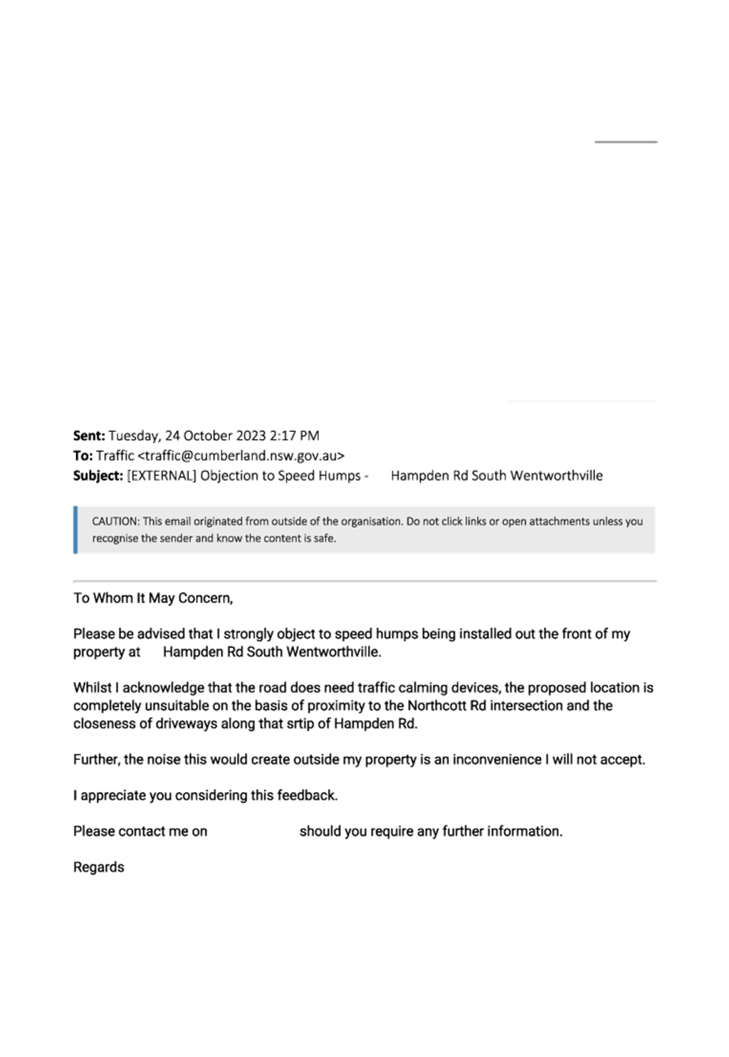
CTC-23-192 HAMPDEN
ROAD, SOUTH WENTWORTHVILLE – ROAD SAFETY CONCERNS.................... 351
CTC-23-193 HAWKSVIEW
STREET, GUILDFORD AND MERRYLANDS - ROAD SAFETY CONCERN..................................... 381
CTC-23-194 LANSDOWNE
STREET, MERRYLANDS – ROAD SAFETY CONCERNS.................................. 415
CTC-23-195 TOONGABBIE
ROAD, TOONGABBIE - ROAD SAFETY CONCERNS AT THE BEND............................................ 499
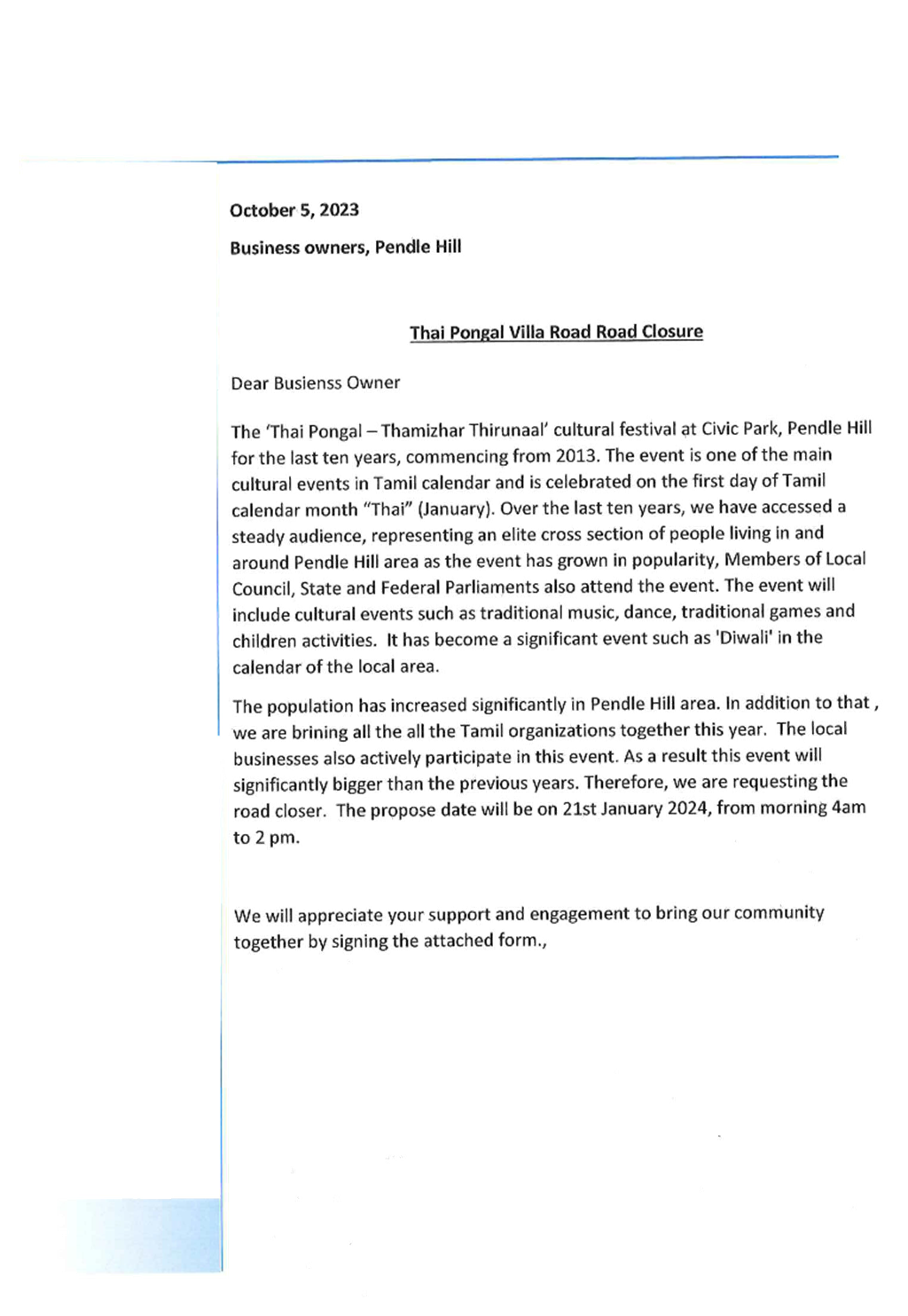
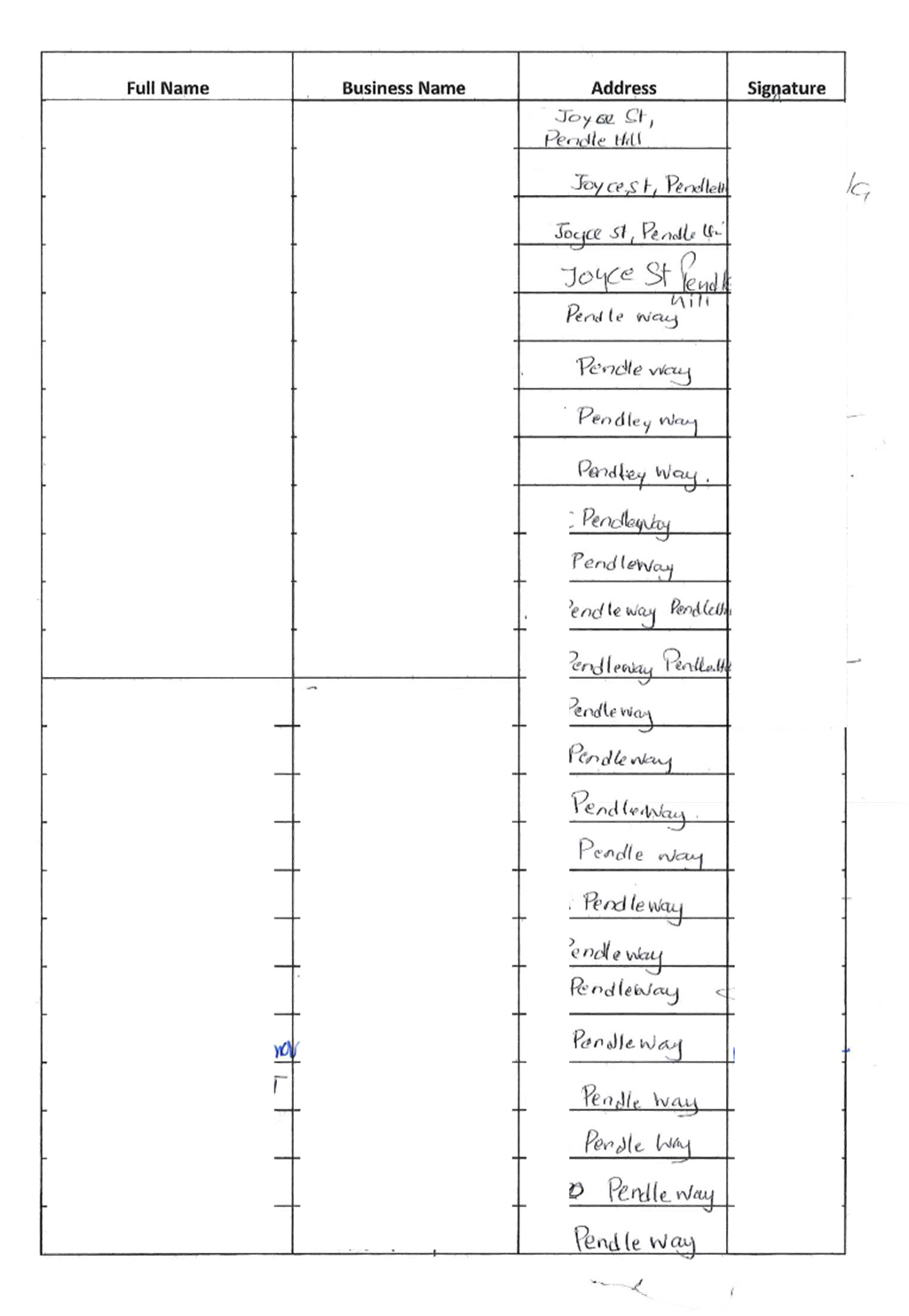
CTC-23-196 PENDLE
WAY, PENDLE HILL – PROPOSED TEMPORARY ROAD CLOSURE FOR ‘THAI PONGAL
FESTIVAL 2024’............................ 509
CTC-23-197 TOONGABBIE
ROAD, TOONGABBIE – REVIEW OF ROAD SAFETY CONCERNS.................................. 537
CTC-23-198 TEMPORARY
ROAD CLOSURE FOR ‘AUSTRALIA DAY’ CELEBRATIONS 547
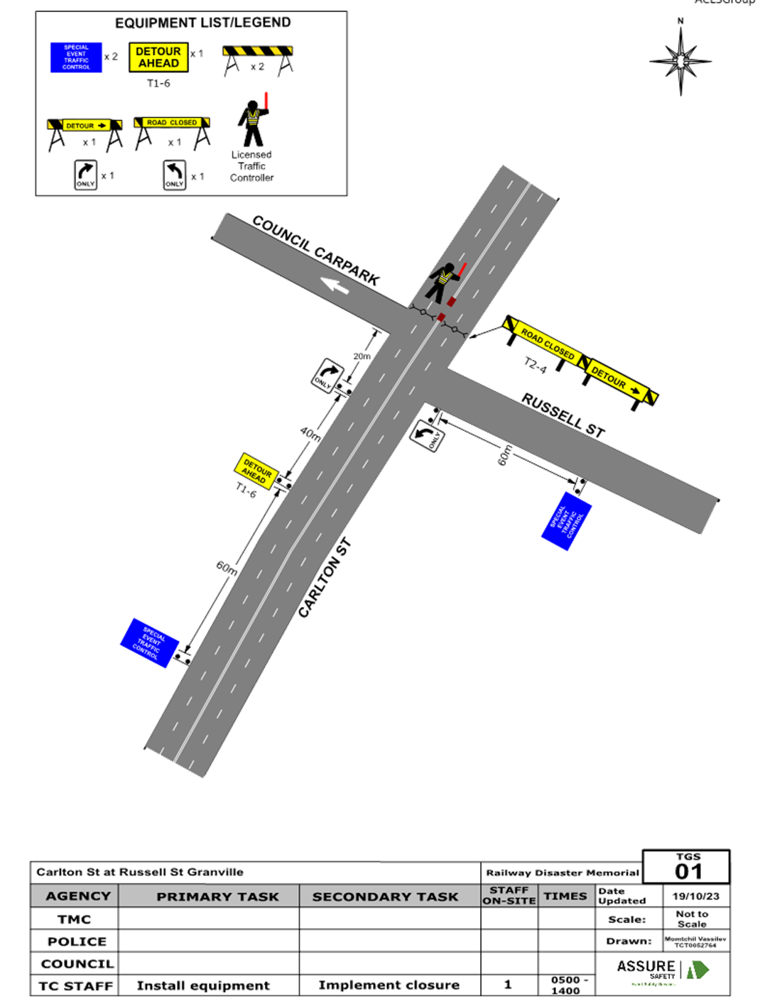
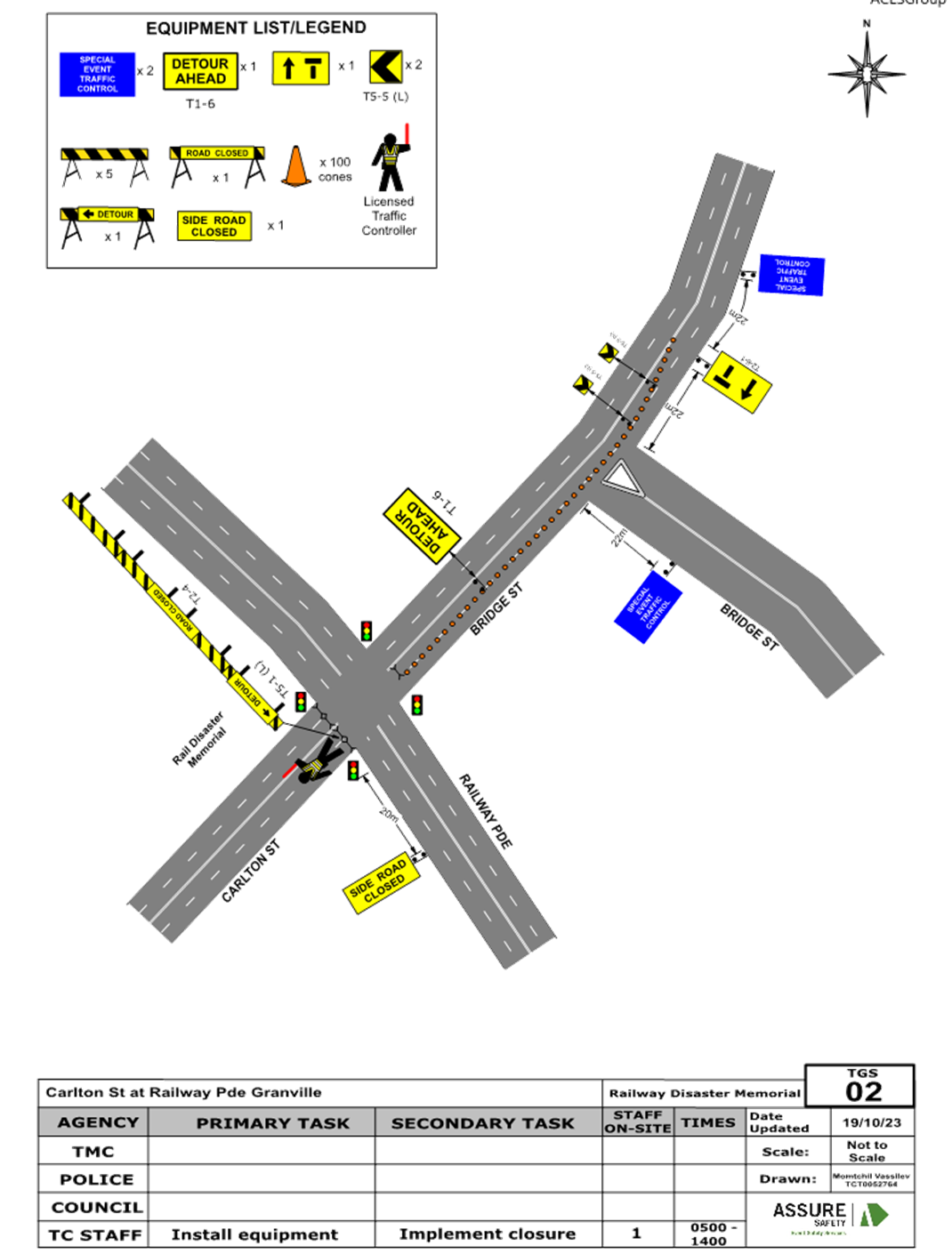
CTC-23-199 CARLTON
STREET, GRANVILLE - PROPOSED TEMPORARY ROAD CLOSURE FOR GRANVILLE RAILWAY
DISASTER MEMORIAL. 567
CTC-23-200 JOSEPH
STREET, LIDCOMBE - TEMPORARY ROAD CLOSURE FOR LUNAR NEW YEAR CELEBRATIONS 587
CTC-23-201 MERRYLANDS
ROAD, MERRYLANDS - TEMPORARY ROAD CLOSURE FOR ‘NOWRUZ’ PERSIAN NEW
YEAR CELEBRATIONS........................... 593
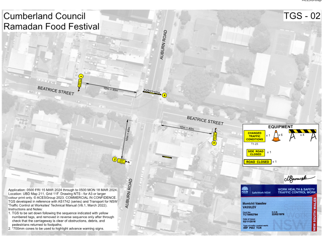
CTC-23-202 TEMPORARY
ROAD CLOSURES IN THE AUBURN CBD FOR RAMADAN FOOD FESTIVAL 2024.................. 601
1 November 2023
Summary of Reports
Part 1 - Recommended for Approval under Delegated
Authority
|
Item #
|
Title
|
Electorate
|
Police Area Command (PAC)
|
|
Fairfield
|
Granville
|
Prospect
|
Auburn
|
Cumberland
|
Auburn
|
|
CTC-23-169
|
JONATHAN STREET, GREYSTANES
- PROPOSED 'BUS ZONE' SIGNAGE
|
|
|
´
|
|
´
|
|
|
CTC-23-170
|
SMITH STREET, PENDLE HILL
– PROPOSED ‘BUS ZONE’ SIGNAGE
|
|
|
´
|
|
´
|
|
|
CTC-23-171
|
LENA PLACE, MERRYLANDS
– PROPOSED PARKING RESTRICTIONS
|
|
´
|
|
|
´
|
|
Part 2 - Recommendation to Council
|
Item #
|
Title
|
Electorate
|
Police Area Command (PAC)
|
|
Fairfield
|
Granville
|
Prospect
|
Auburn
|
Cumberland
|
Auburn
|
|
CTC-23-172
|
KIHILLA ROAD, AUBURN - ROAD
SAFETY CONCERNS
|
|
|
|
´
|
|
´
|
|
CTC-23-173
|
KIRKHAM ROAD, AUBURN
– ROAD SAFETY CONCERNS
|
|
|
|
´
|
|
´
|
|
CTC-23-174
|
PENDLE WAY, PENDLE HILL
– ROAD SAFETY CONCERNS
|
|
|
´
|
|
´
|
|
|
CTC-23-175
|
JOYCE STREET, PENDLE HILL
– ROAD SAFETY CONCERNS
|
|
|
´
|
|
´
|
|
|
CTC-23-176
|
CUMBERLAND ROAD, AUBURN
– ROAD SAFETY CONCERNS
|
|
|
|
´
|
|
´
|
|
CTC-23-177
|
HANBURY STREET, GREYSTANES-
ROAD SAFETY CONCERNS
|
|
|
´
|
|
´
|
|
|
CTC-23-178
|
LACKEY STREET, MERRYLANDS
– ROAD SAFETY CONCERNS
|
|
´
|
|
|
´
|
|
|
CTC-23-179
|
LISGAR STREET, MERRYLANDS
– ROAD SAFETY CONCERNS
|
|
´
|
|
|
´
|
|
|
CTC-23-180
|
MAGOWAR ROAD, GIRRAWEEN
– ROAD SAFETY CONCERNS
|
|
|
´
|
|
´
|
|
|
CTC-23-181
|
REES STREET, MAYS HILL -
ROAD SAFETY CONCERNS
|
|
´
|
|
|
´
|
|
|
CTC-23-182
|
SUSAN STREET, AUBURN- ROAD
SAFETY CONCERNS
|
|
|
|
´
|
|
´
|
|
CTC-23-183
|
ADDLESTONE ROAD, MERRYLANDS
– ROAD SAFETY CONCERNS
|
|
´
|
|
|
´
|
|
|
CTC-23-184
|
CHELSEA STREET, MERRYLANDS
- ROAD SAFETY CONCERNS
|
|
´
|
|
|
´
|
|
|
CTC-23-185
|
DENMARK STREET,
MERRYLANDS – ROAD SAFETY CONCERNS
|
|
´
|
|
|
´
|
|
|
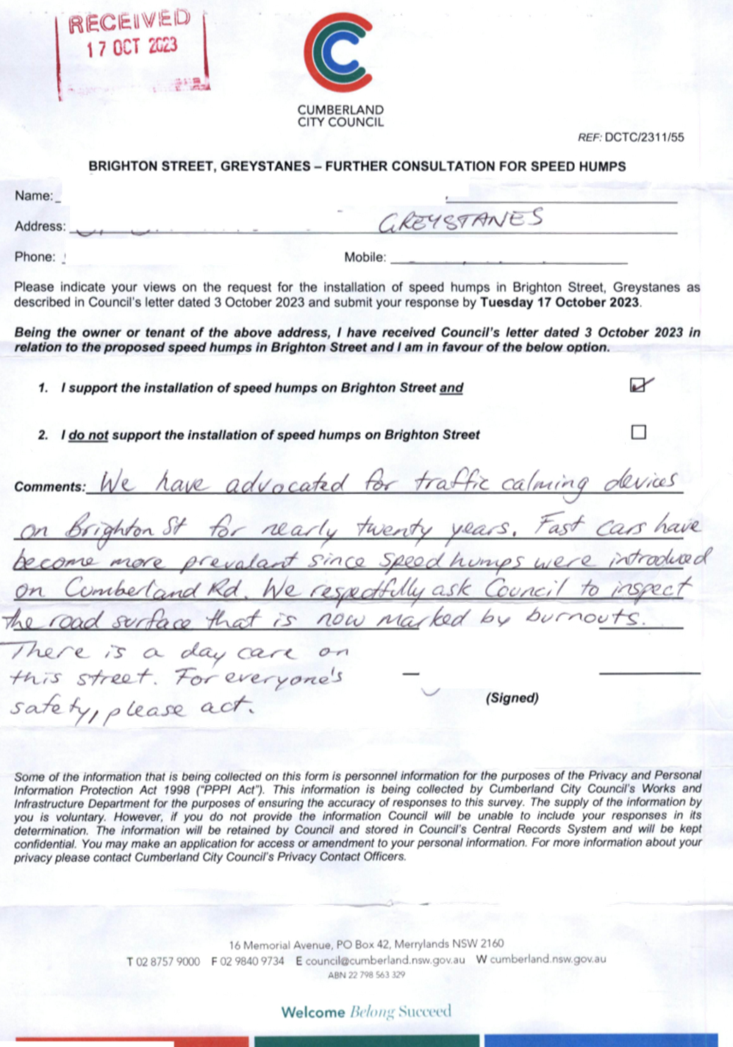
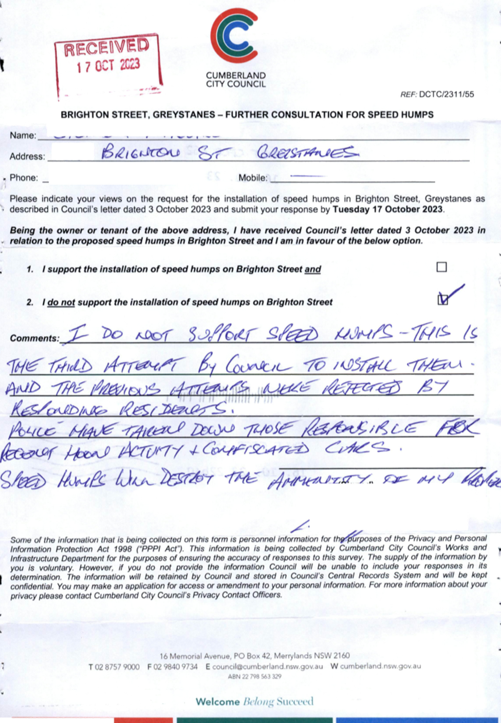
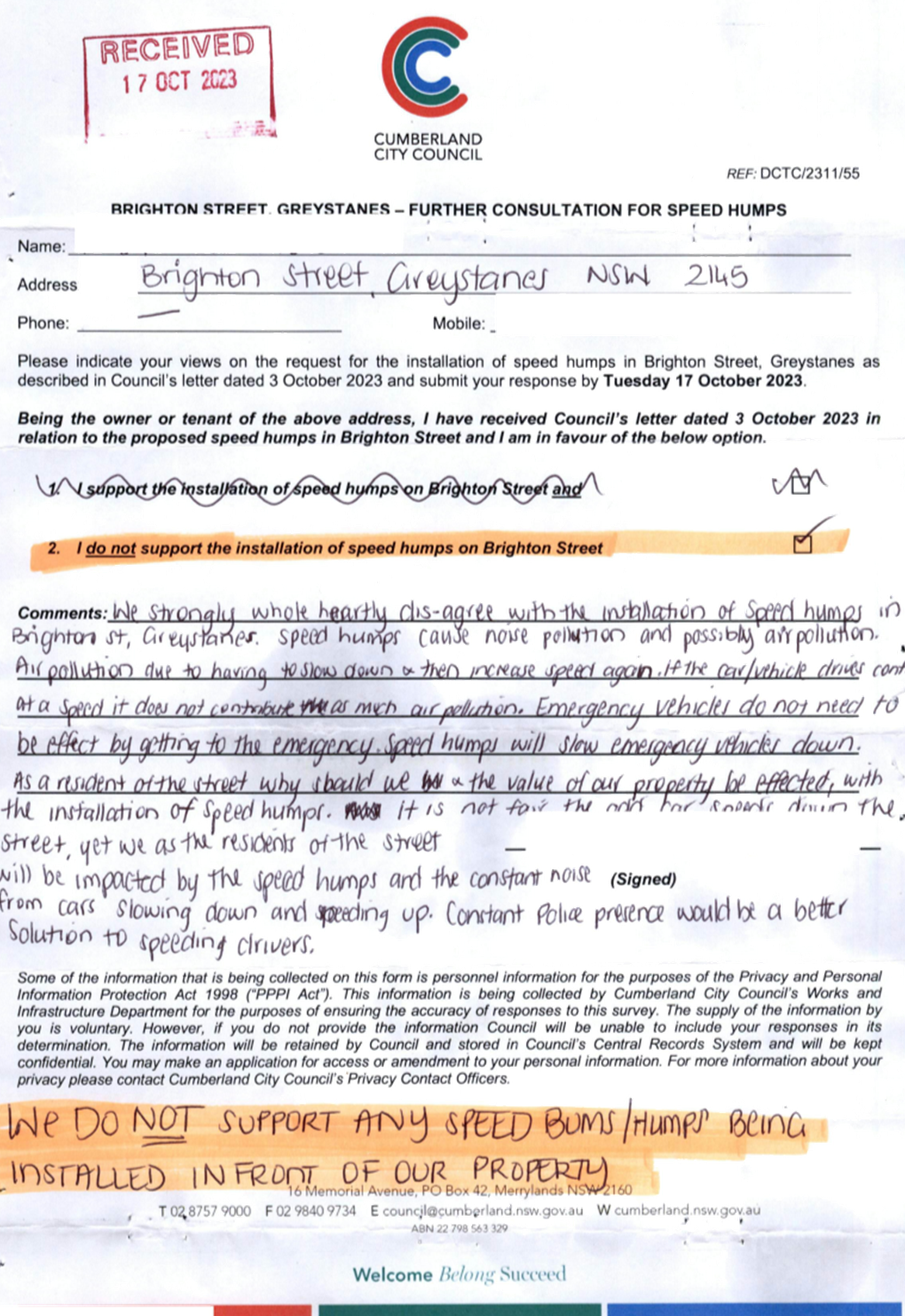
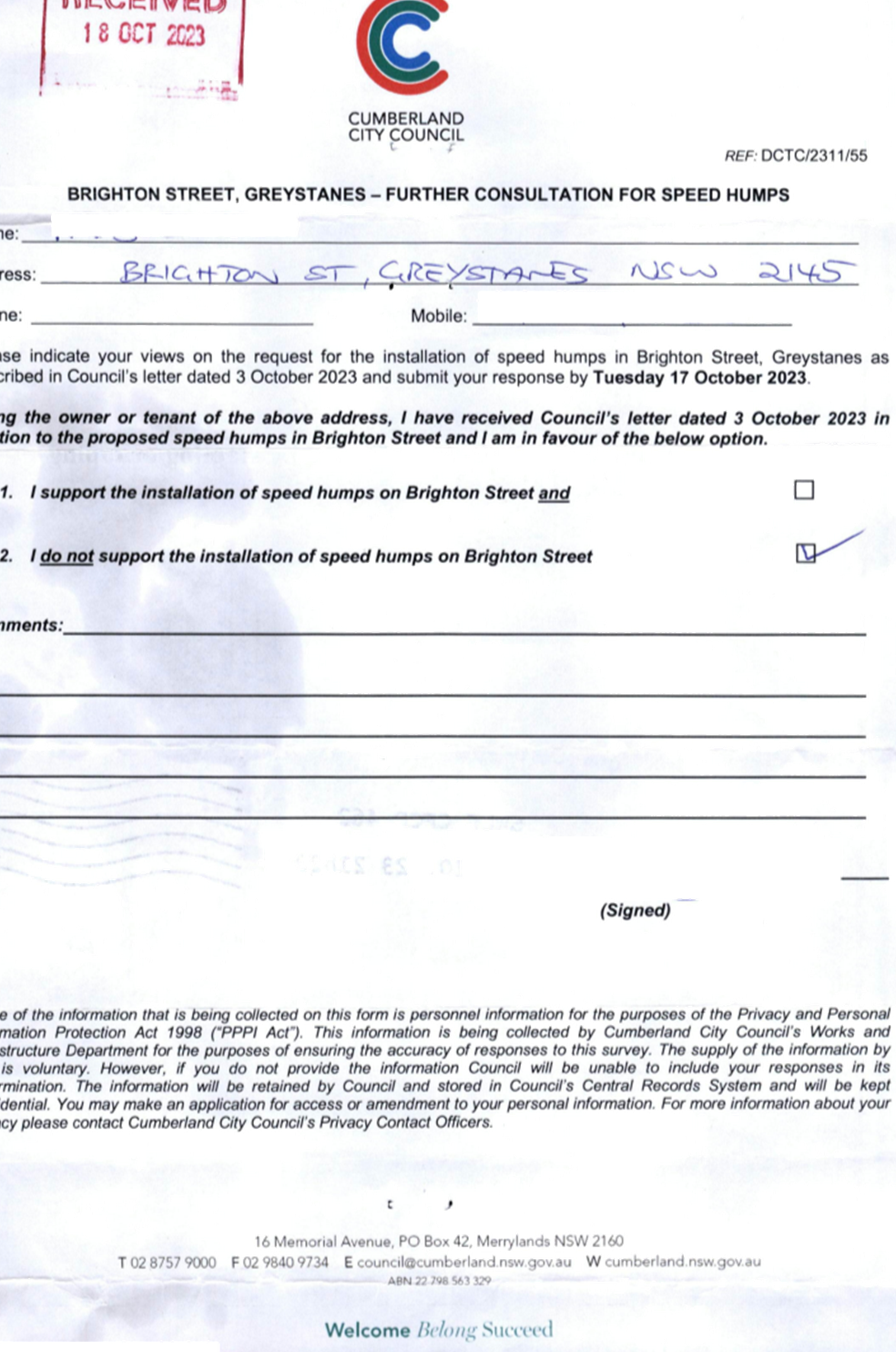
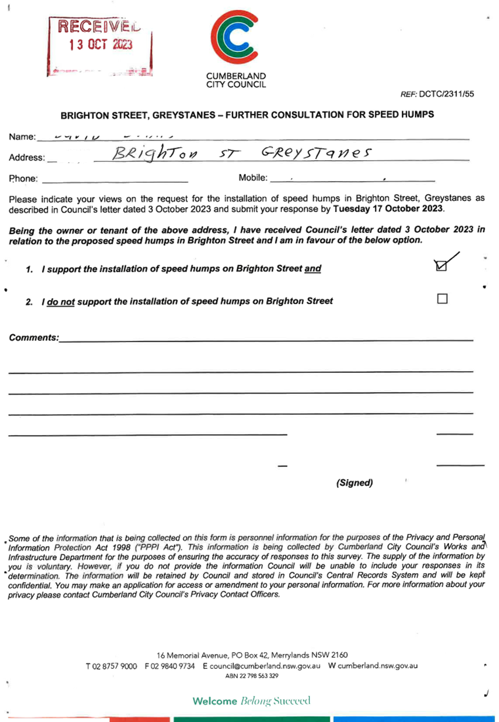
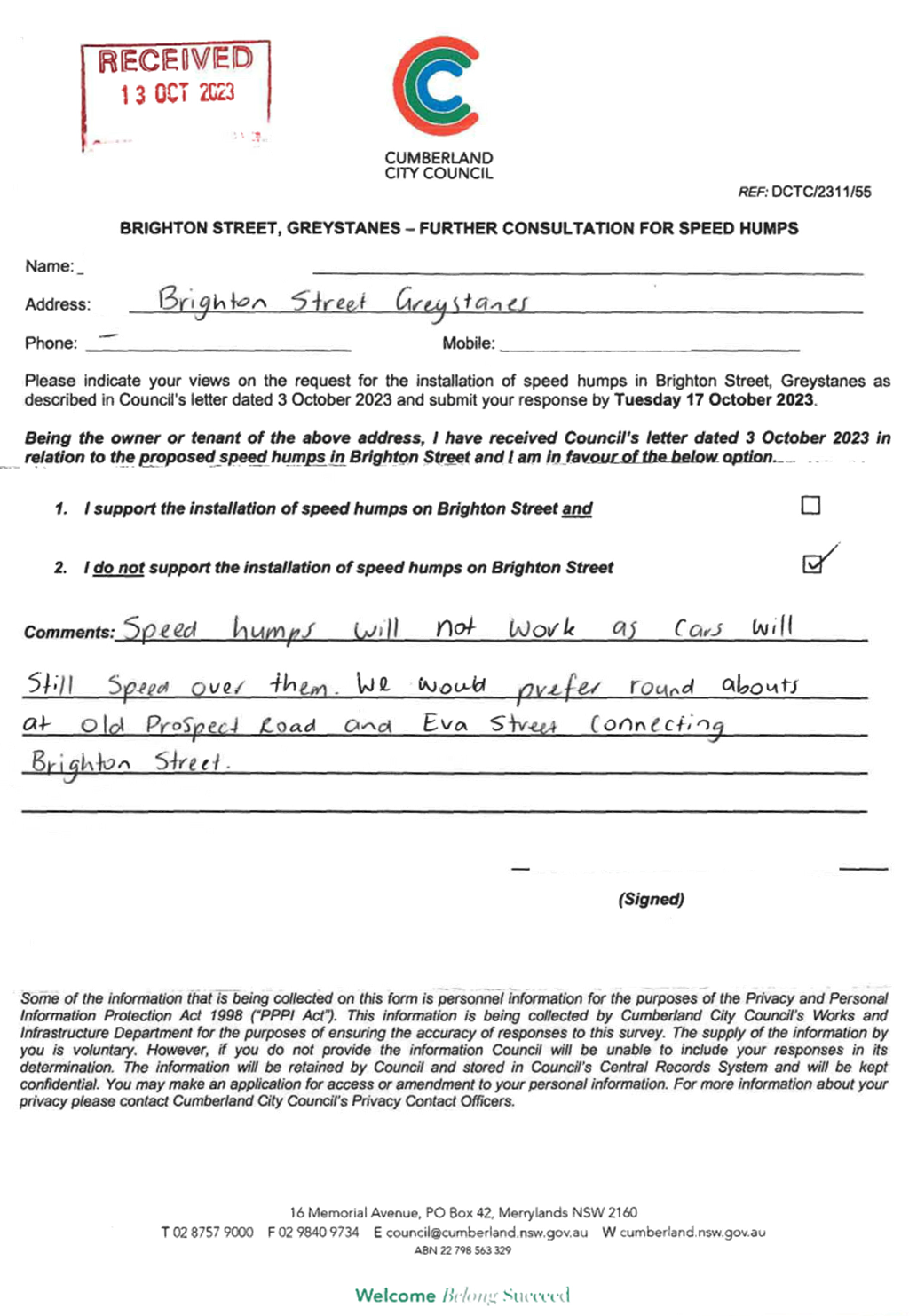
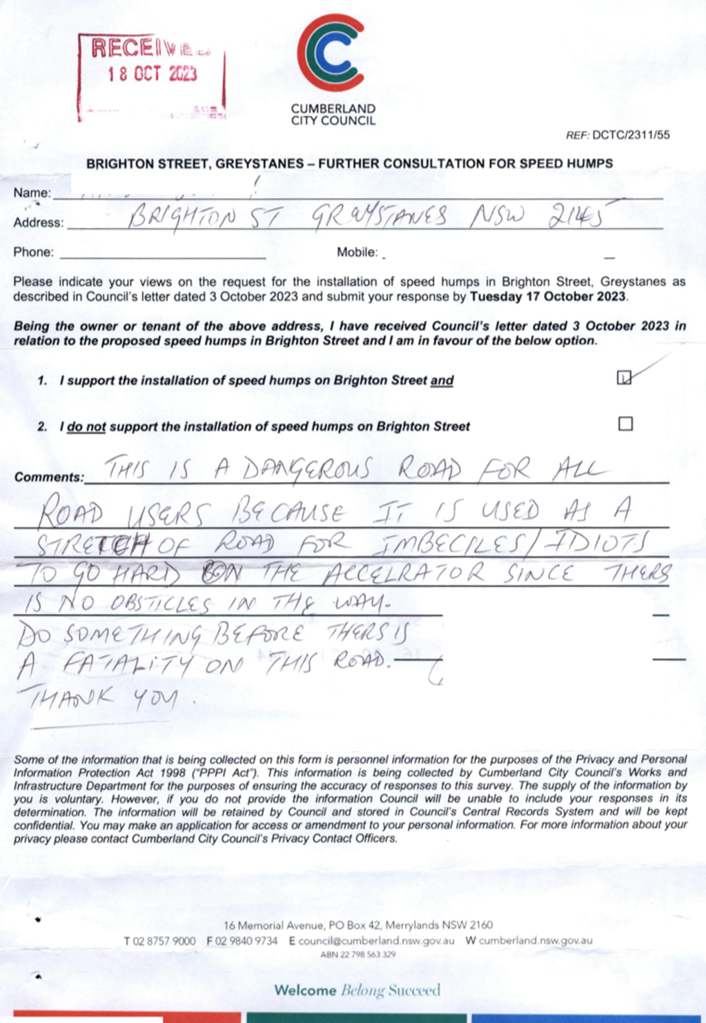
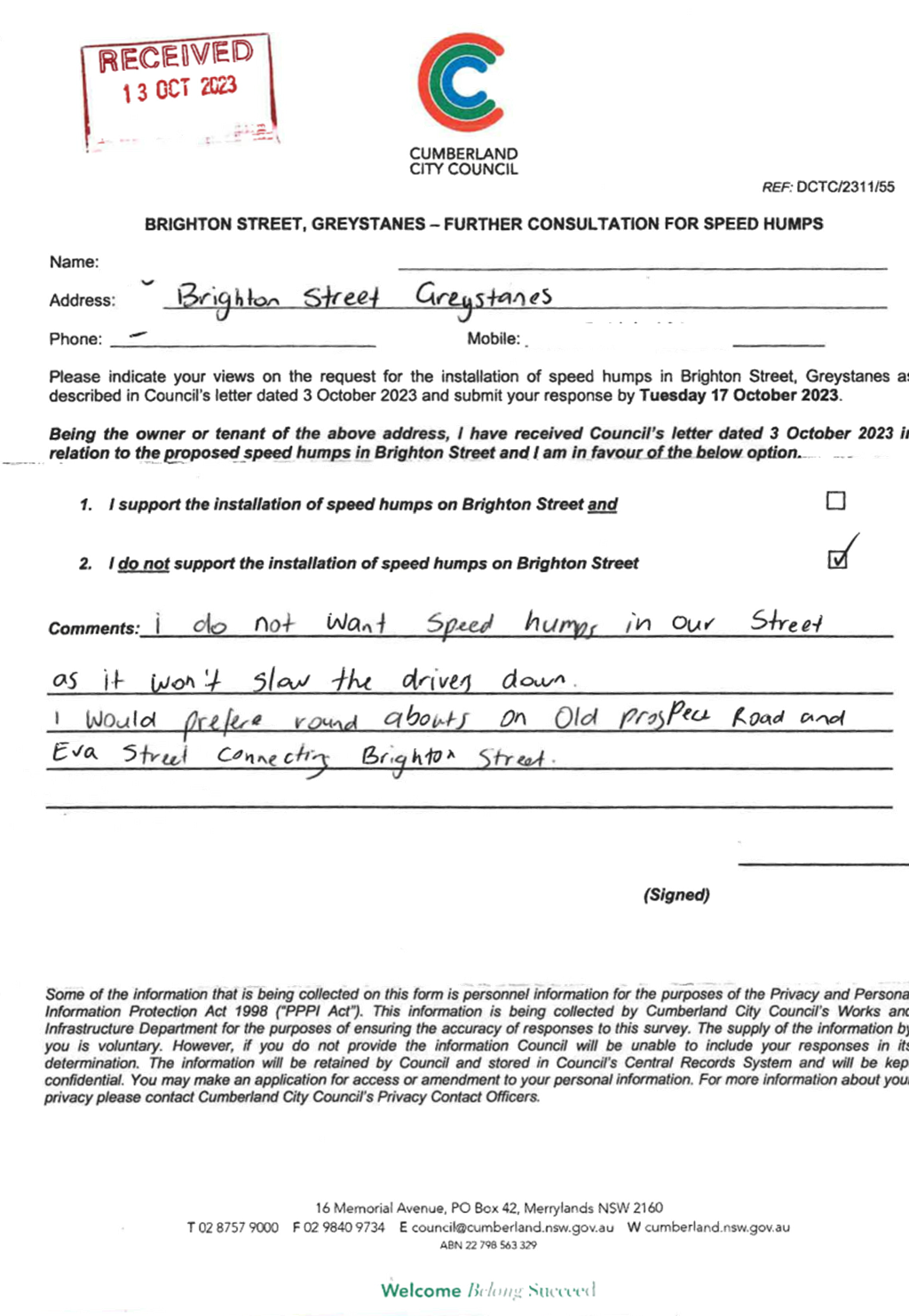
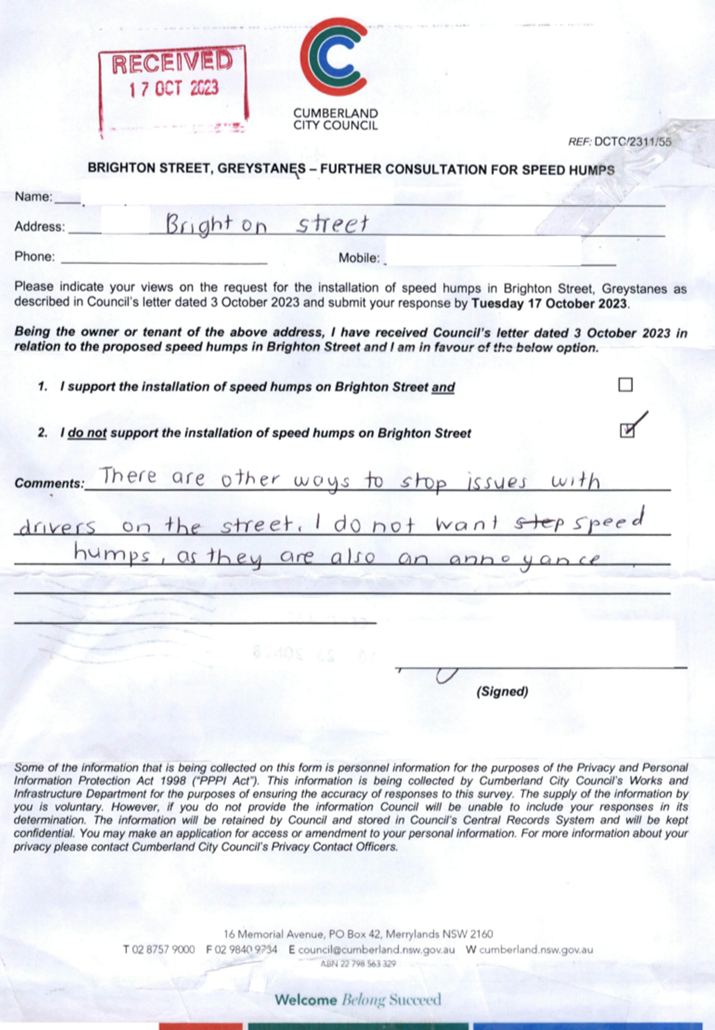
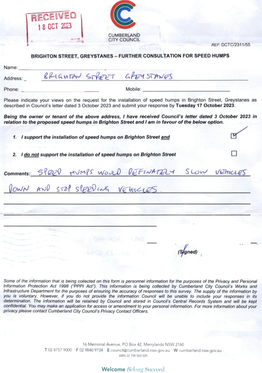
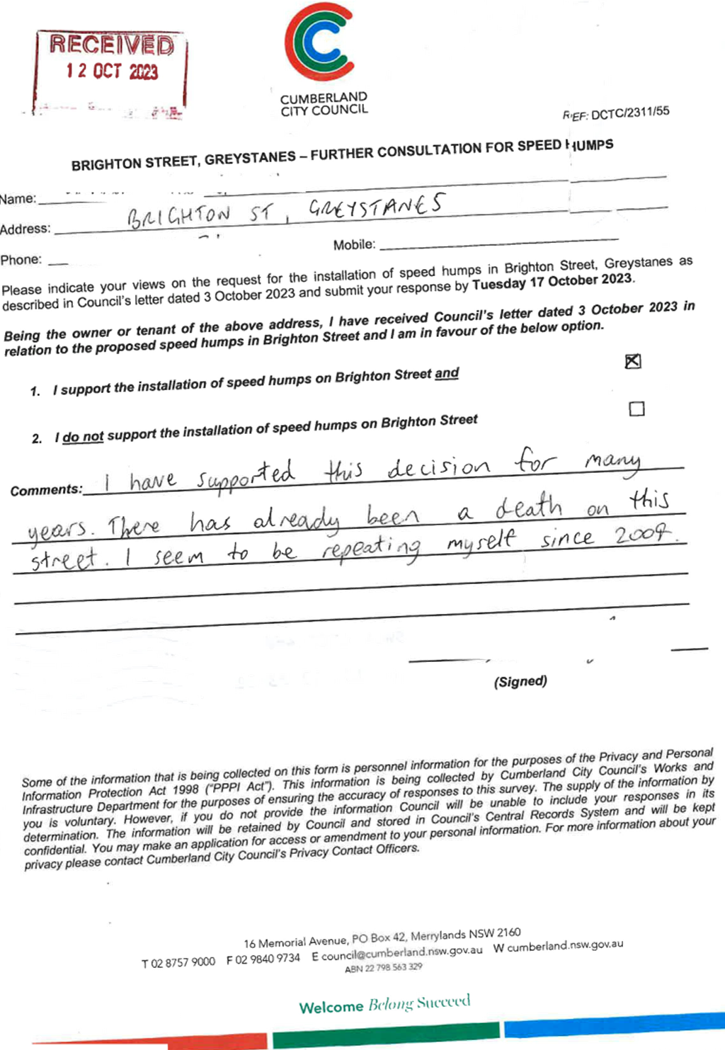
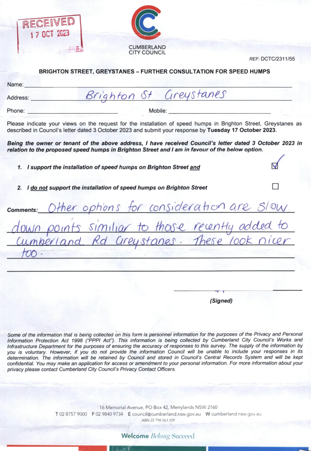
CTC-23-186
|
BRIGHTON STREET, GREYSTANES
– ROAD SAFETY CONCERNS
|
|
|
´
|
|
´
|
|
|
CTC-23-187
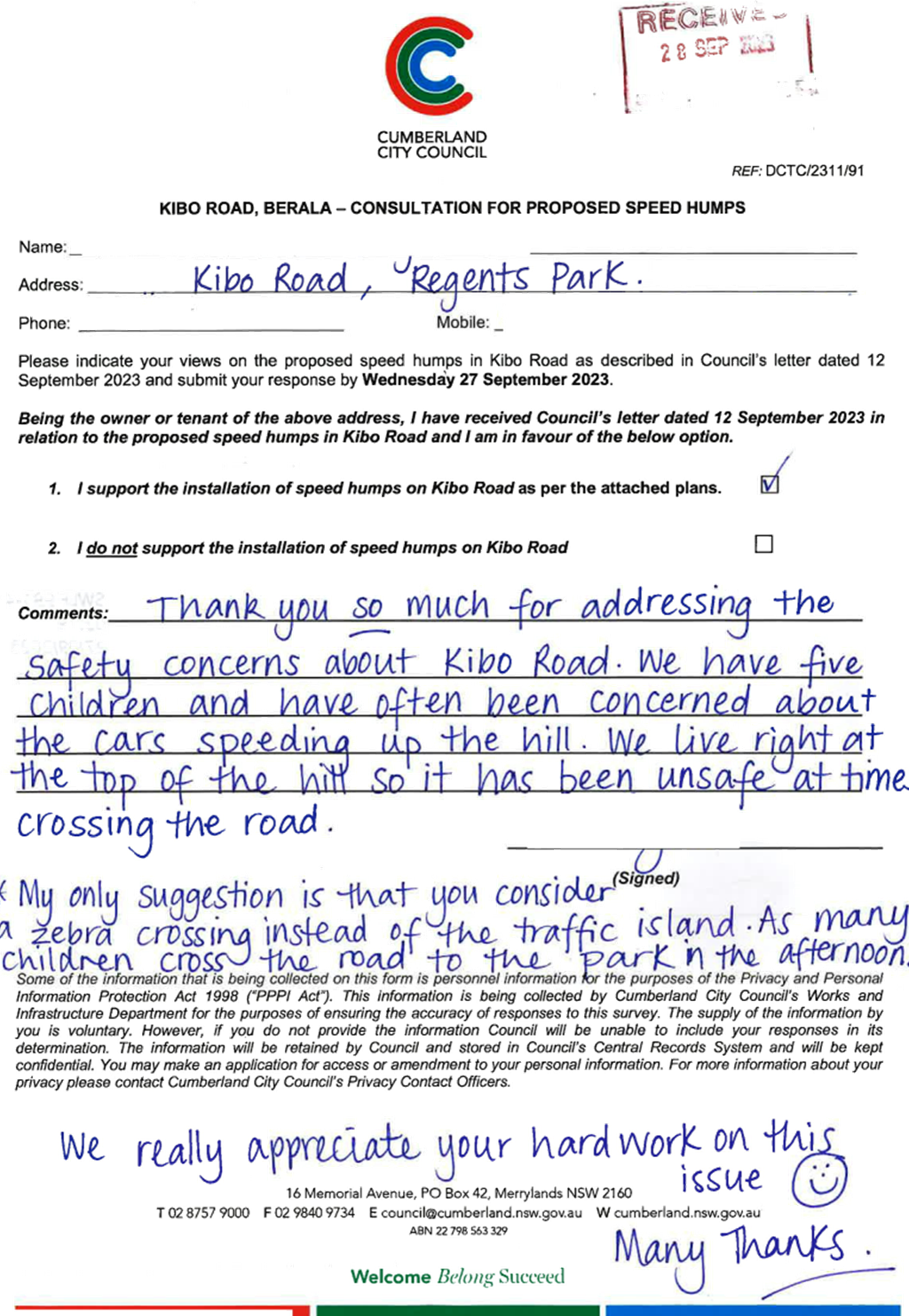
|
KIBO ROAD, REGENTS PARK
– PROPOSED REFUGE ISLAND
|
|
|
|
´
|
|
´
|
|
CTC-23-188
|
KIBO ROAD, REGENTS PARK
– PROPOSED SPEED HUMPS
|
|
|
|
´
|
|
´
|
|
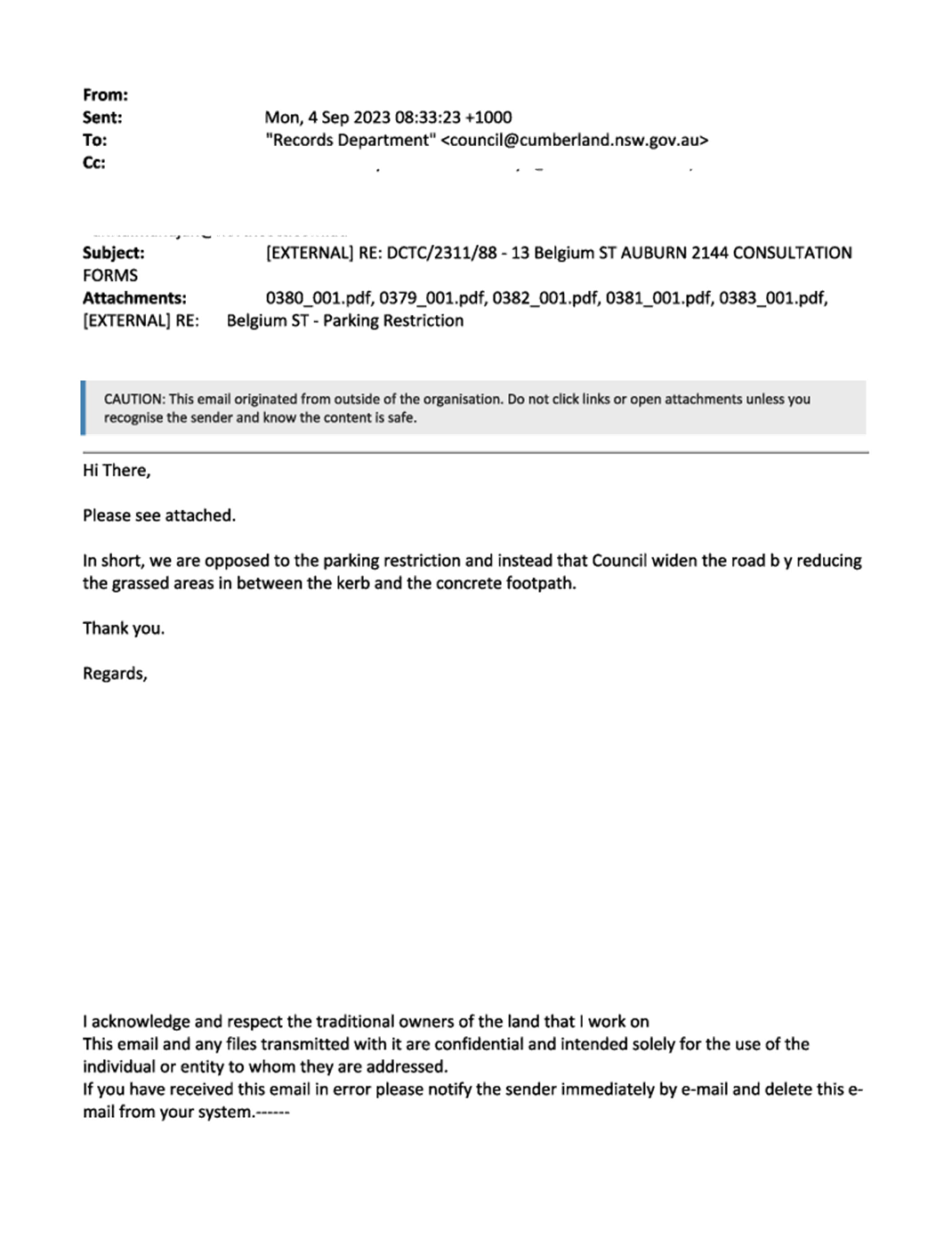
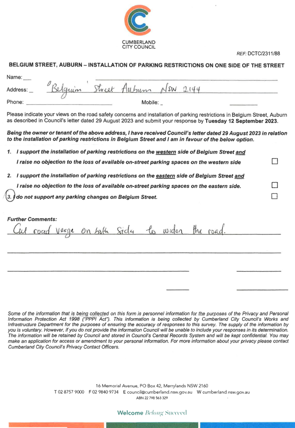
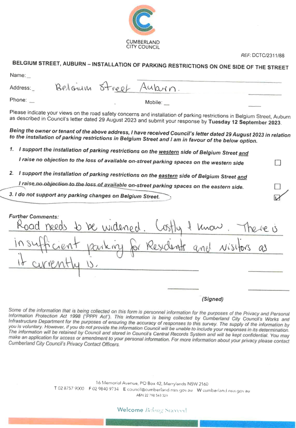
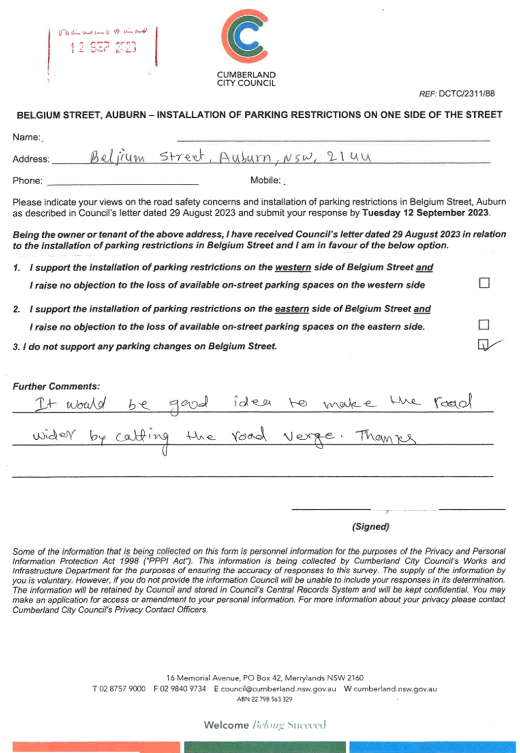
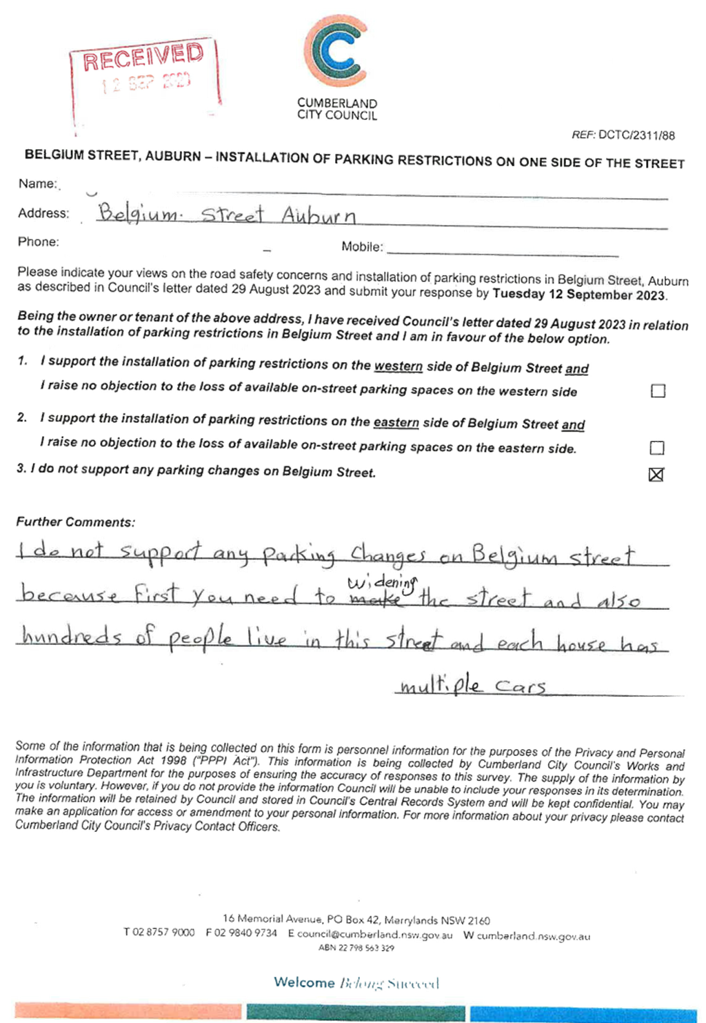
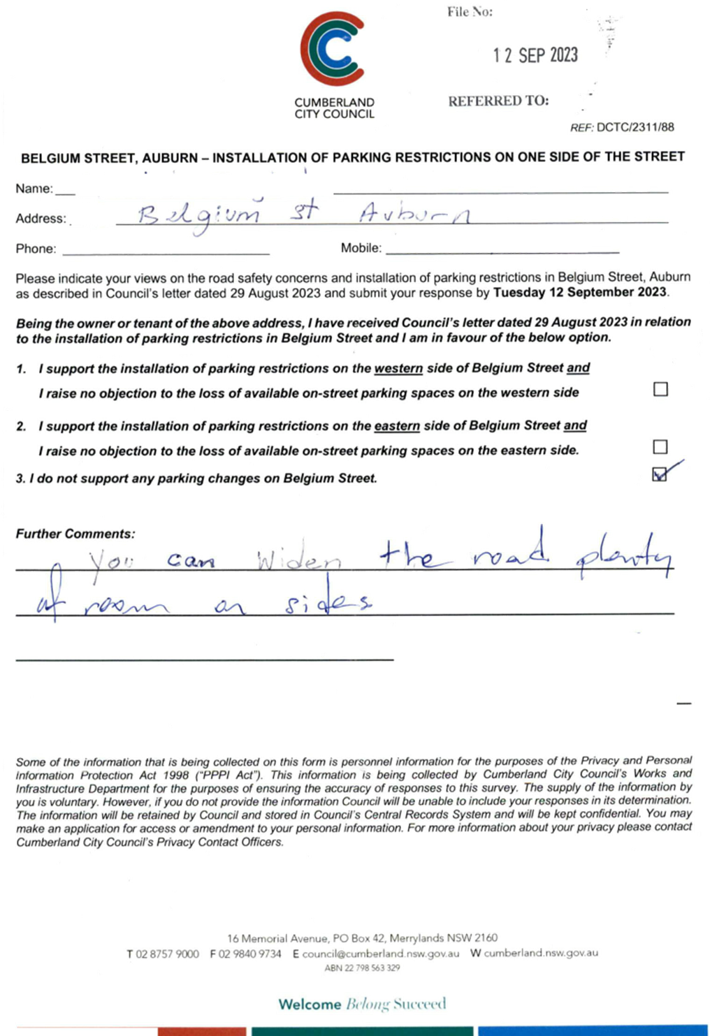
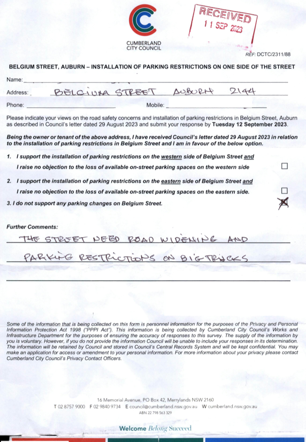
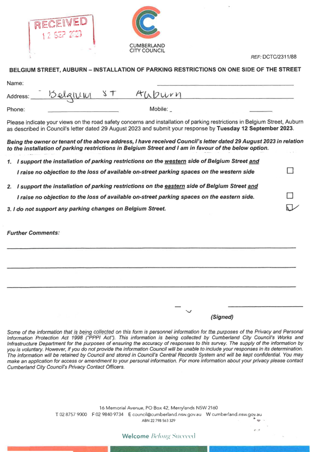
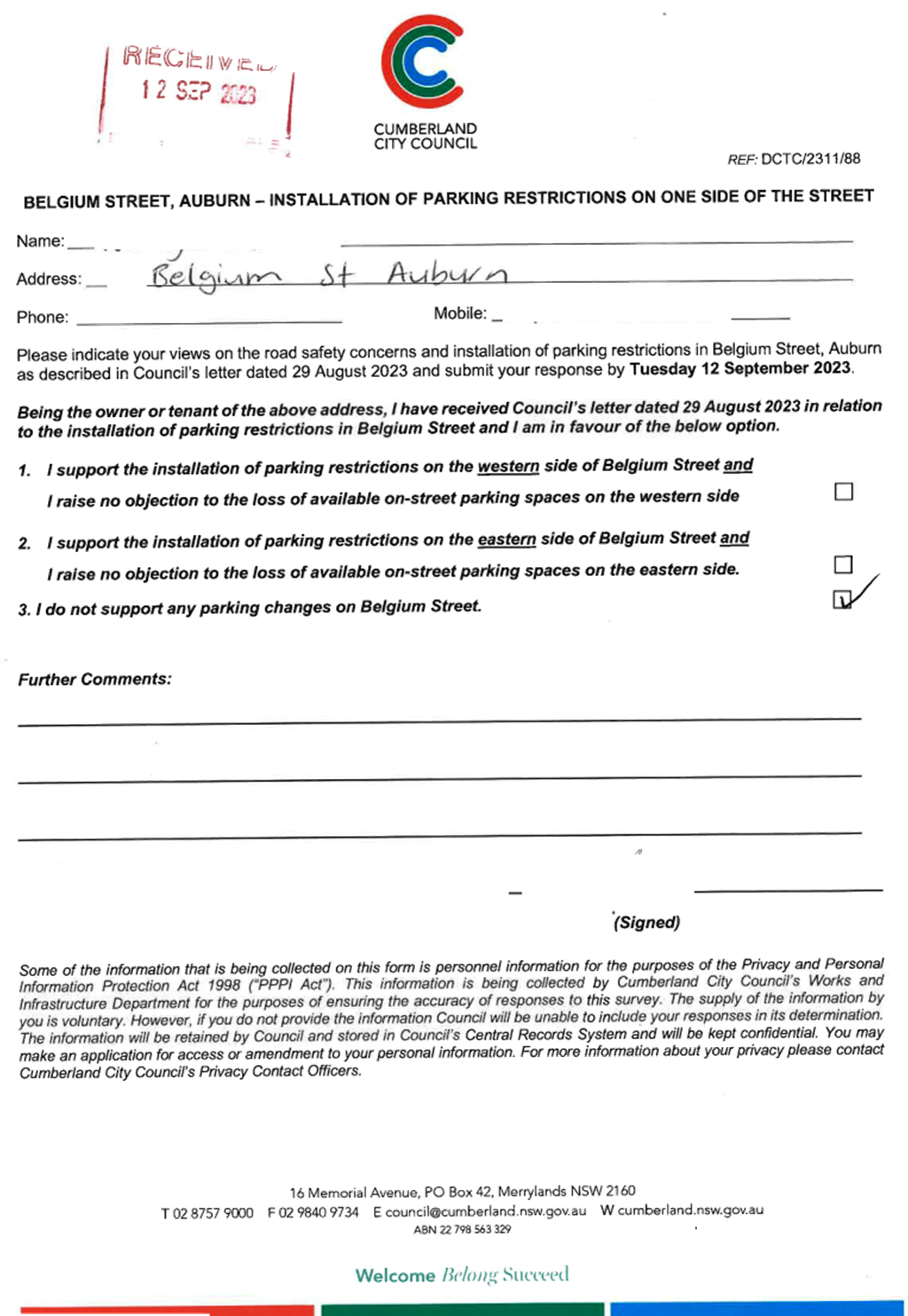
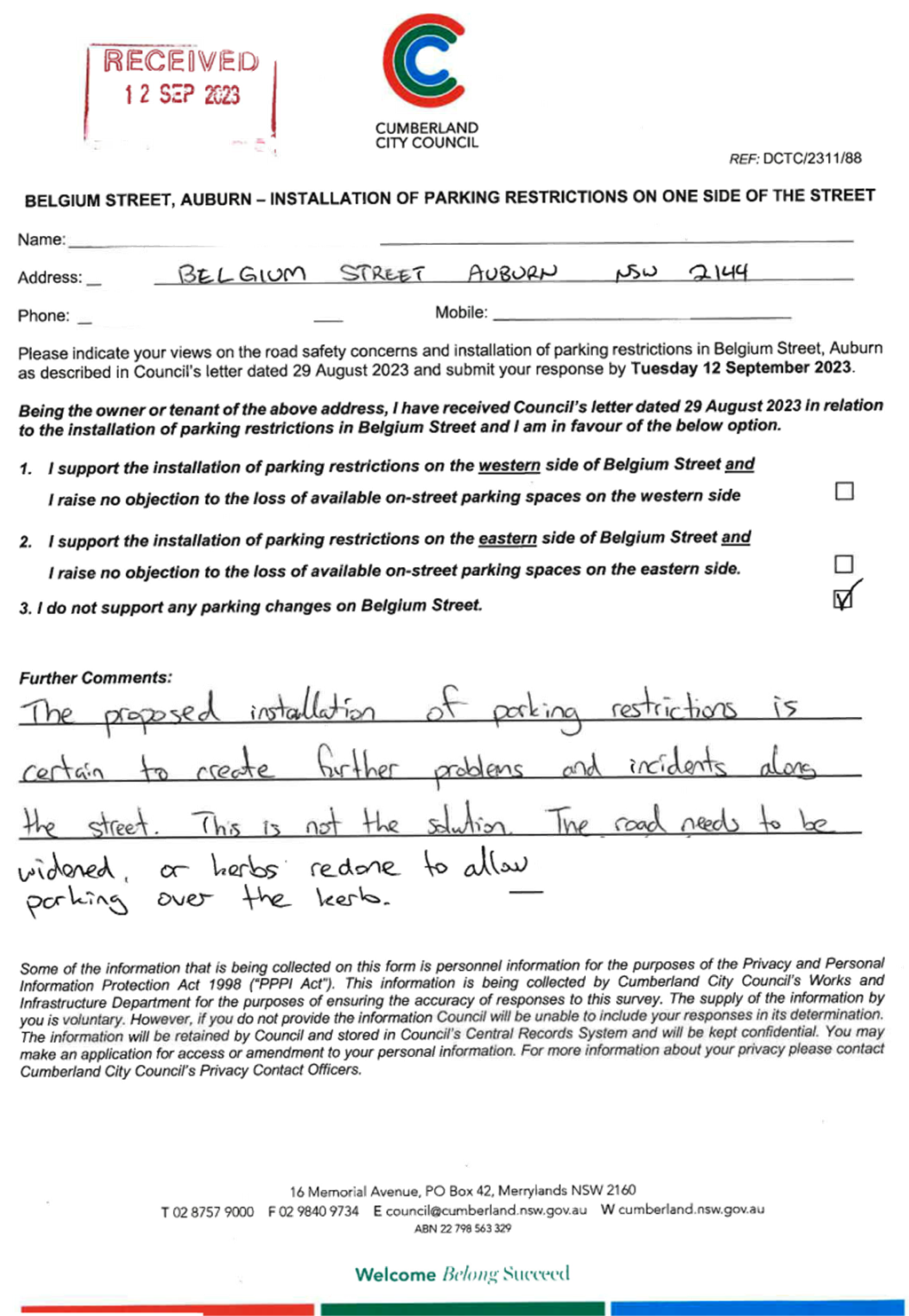
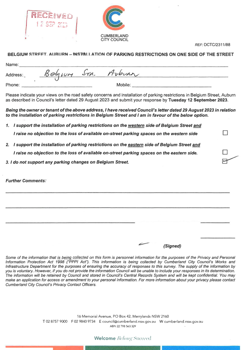
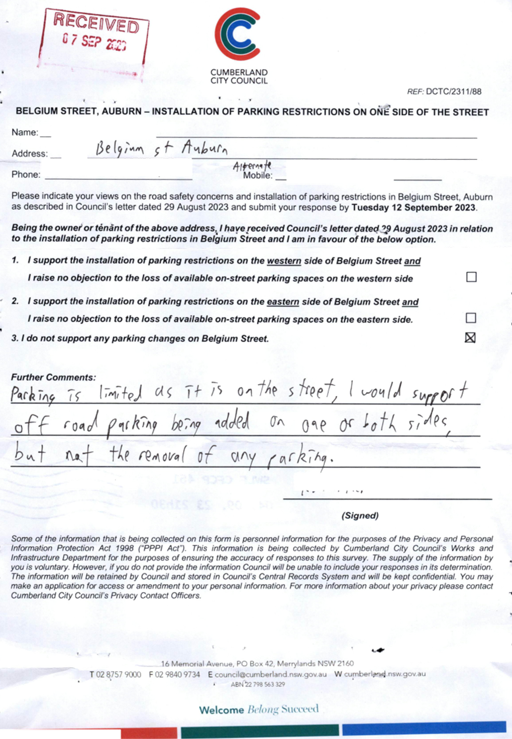
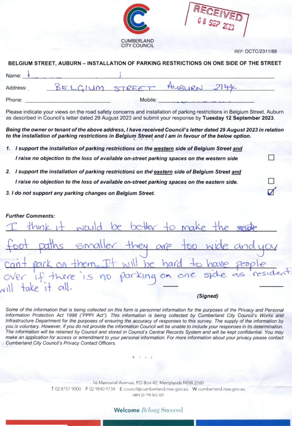
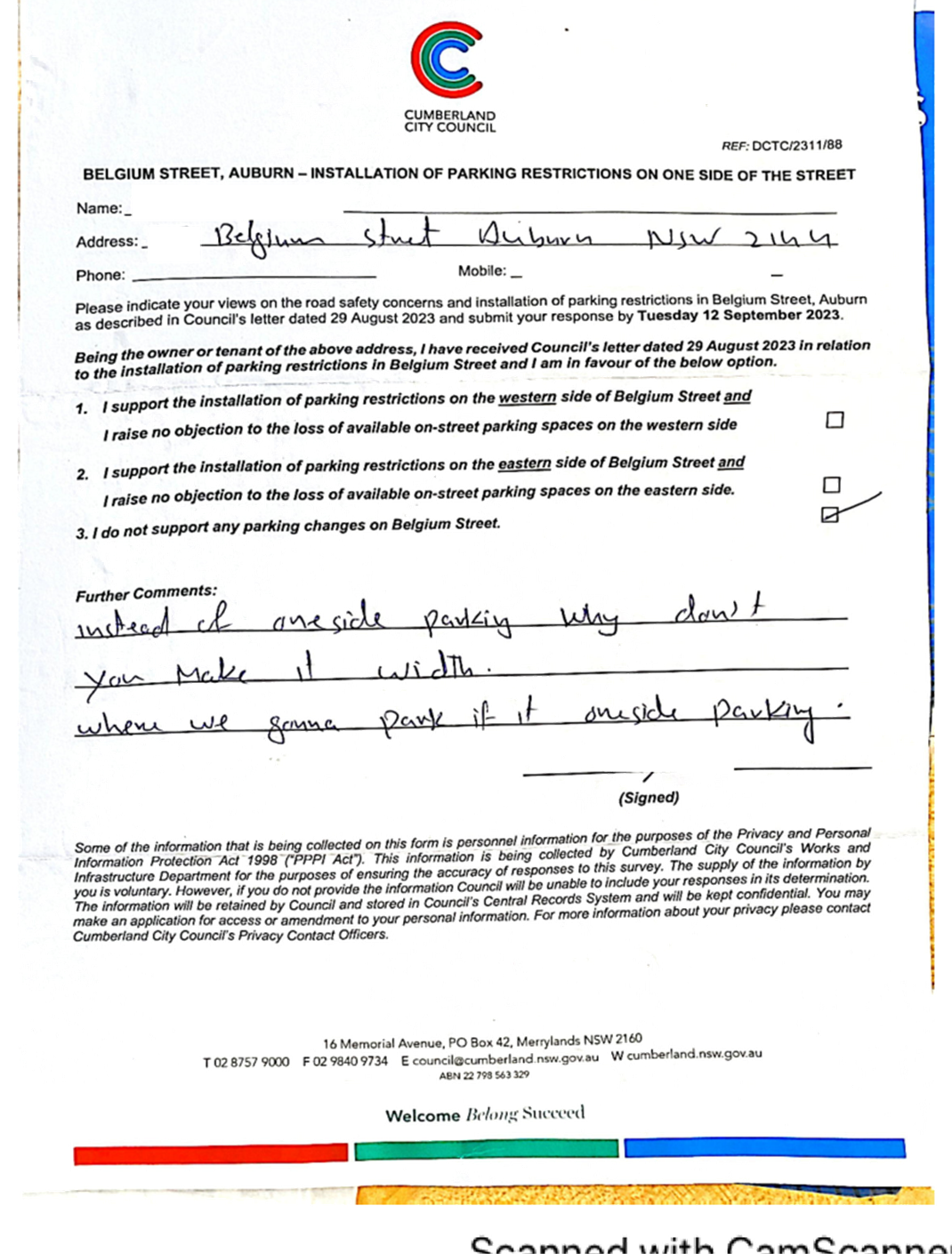
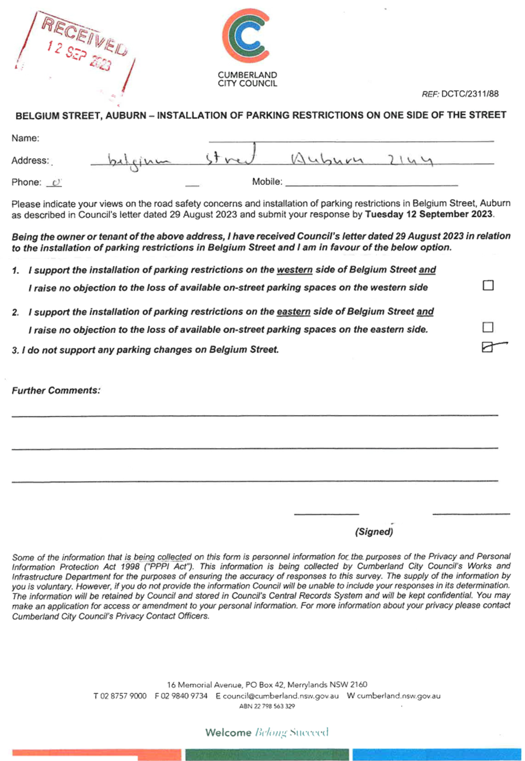
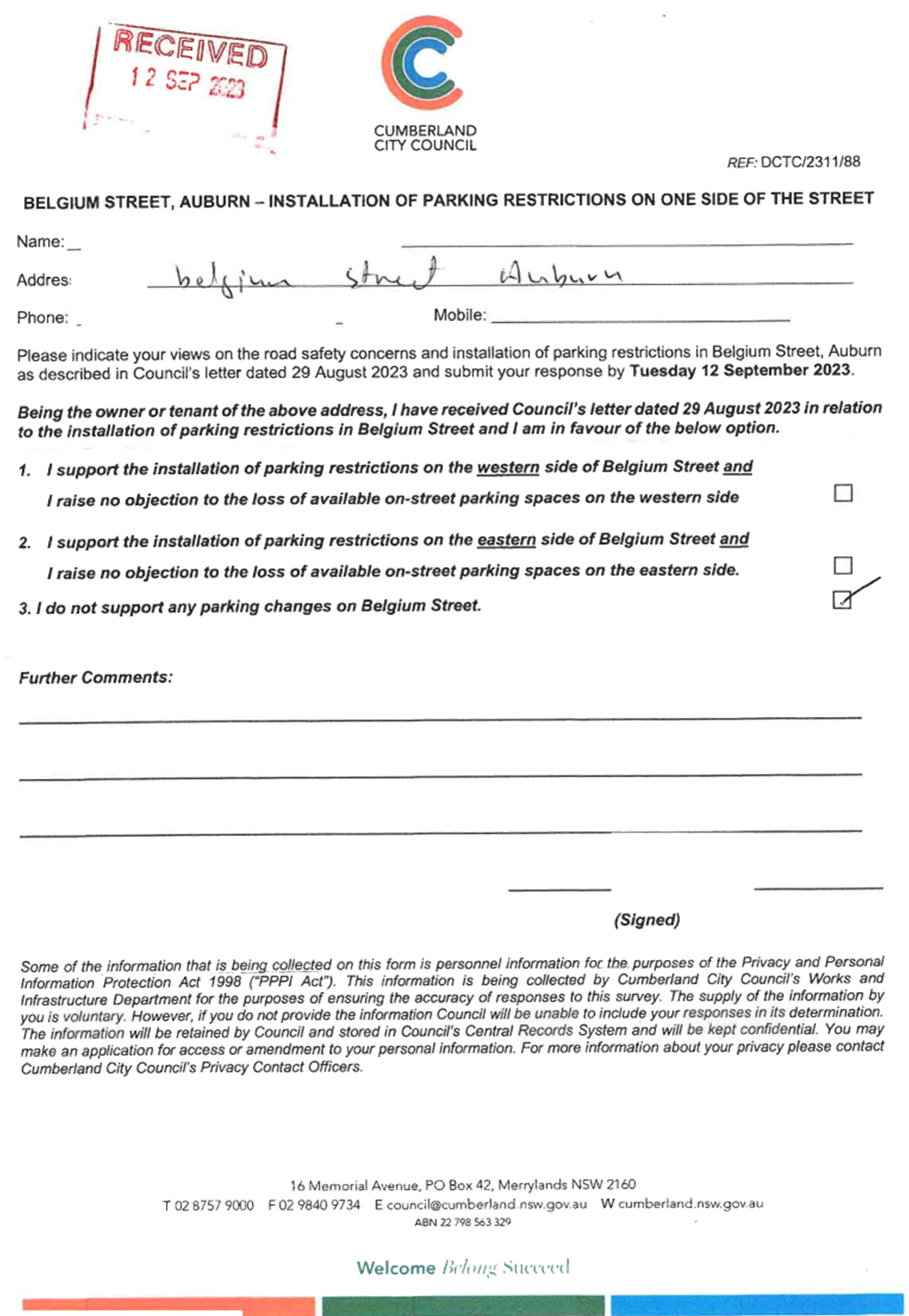
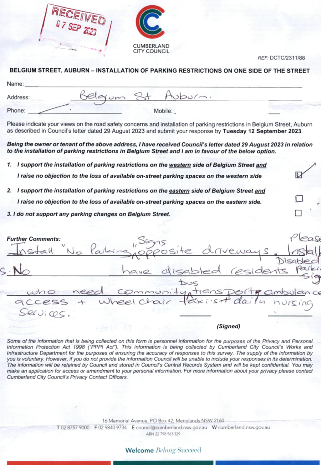
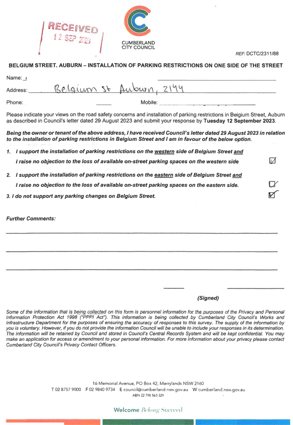
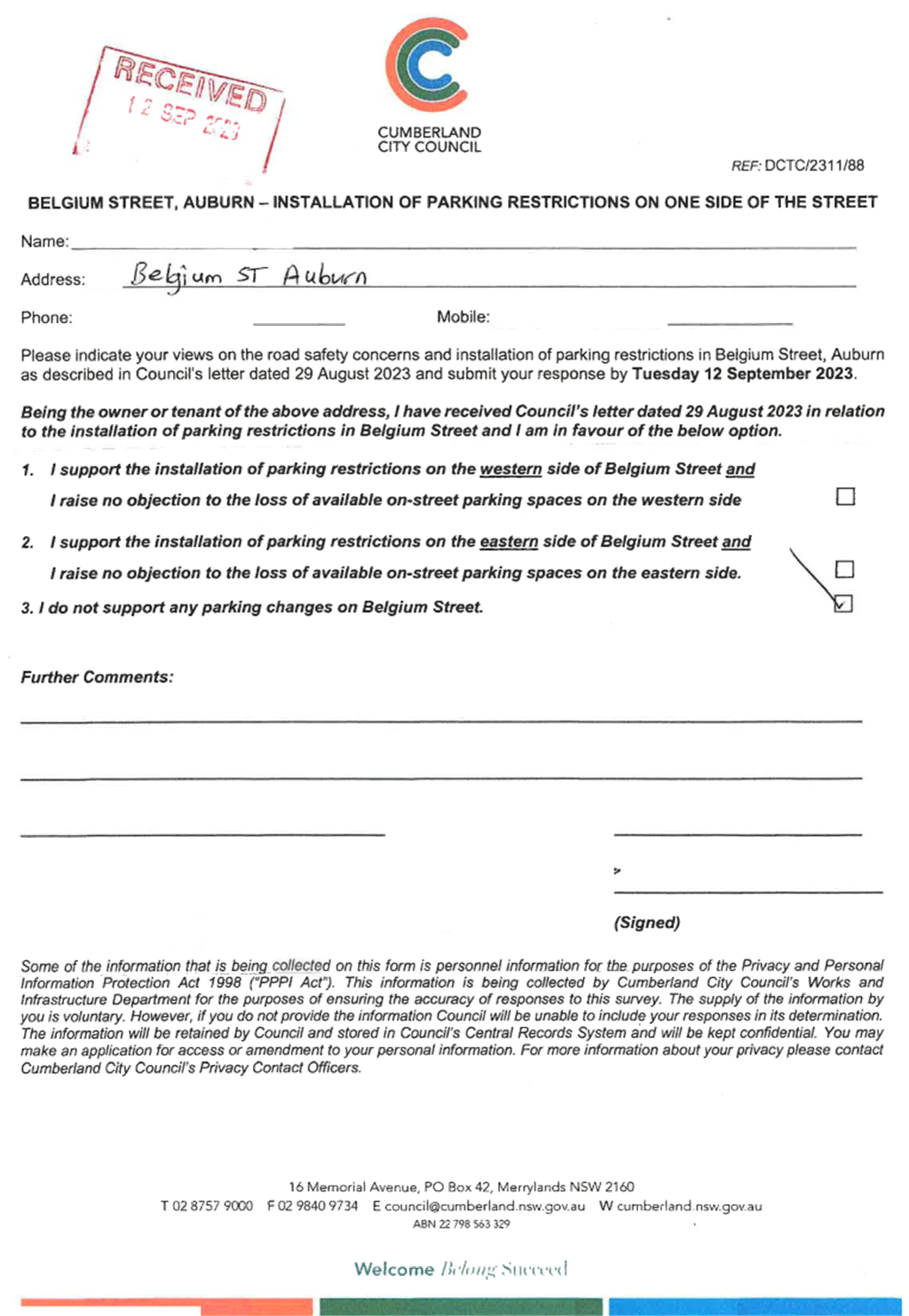
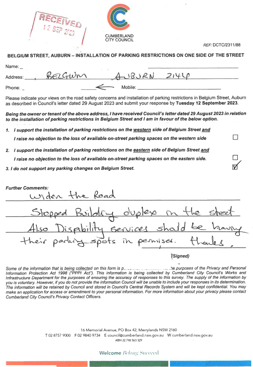
CTC-23-189
|
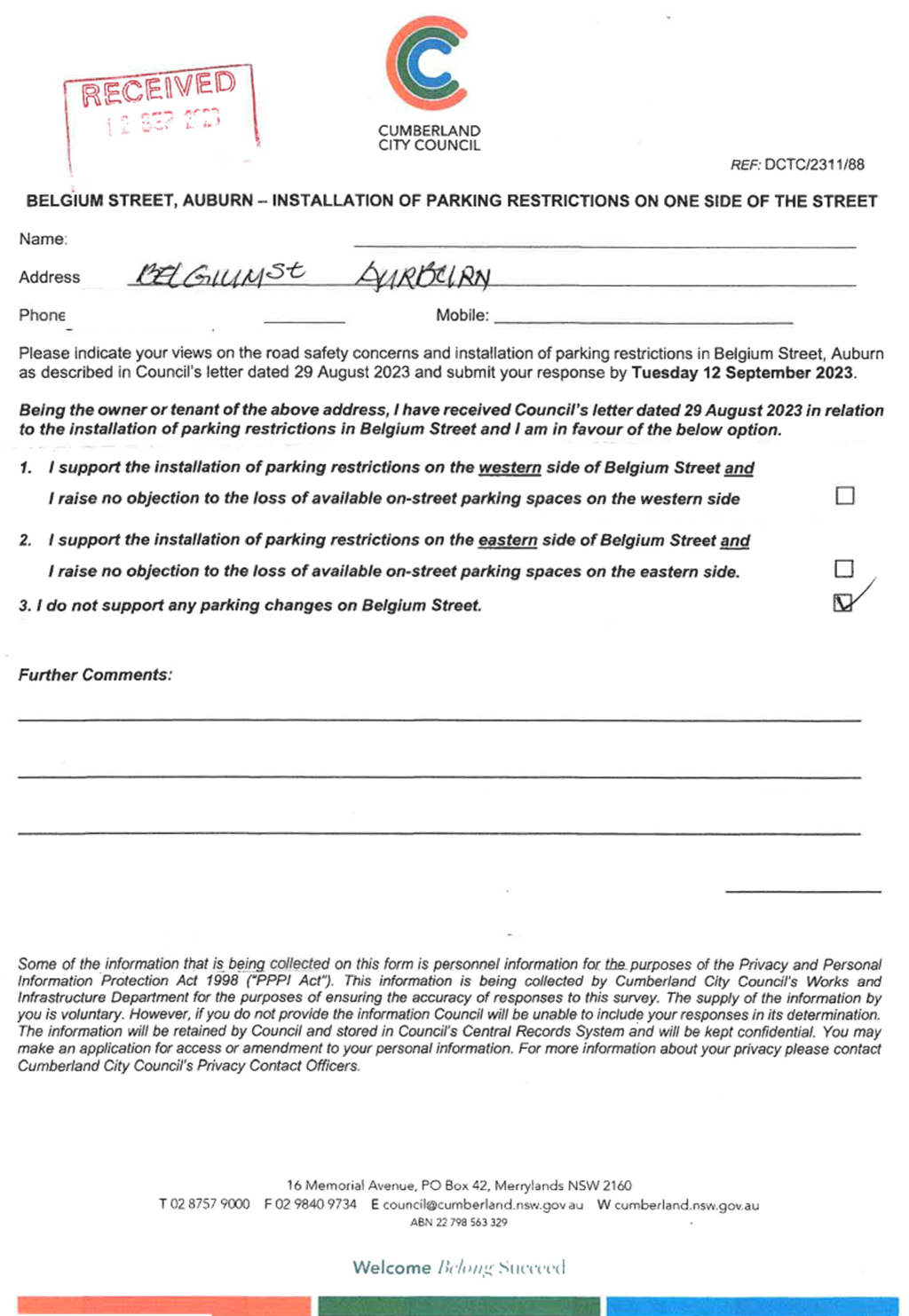
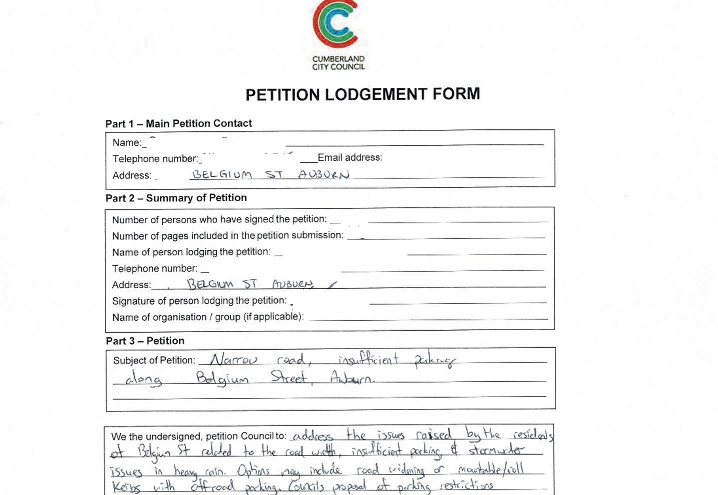
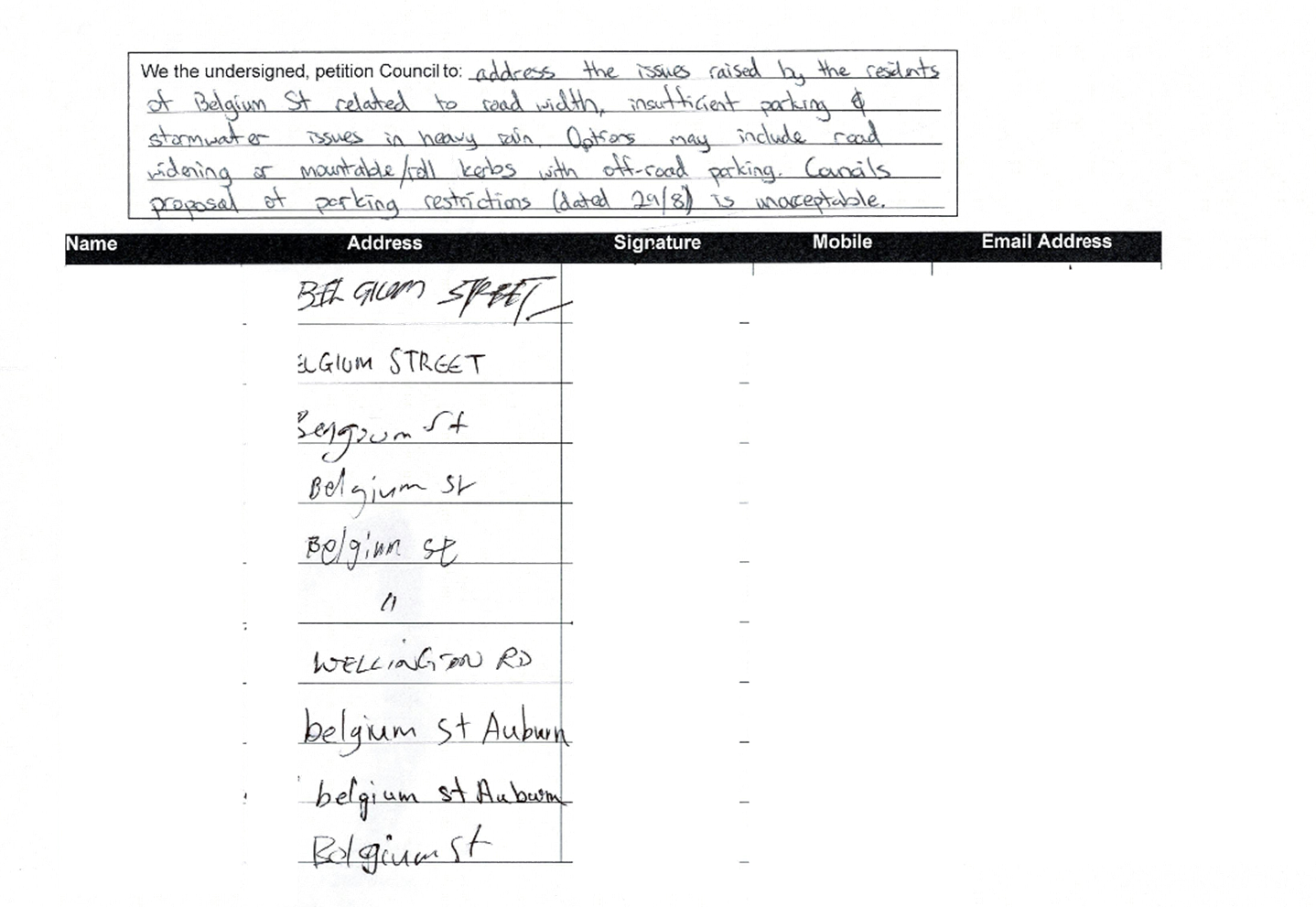
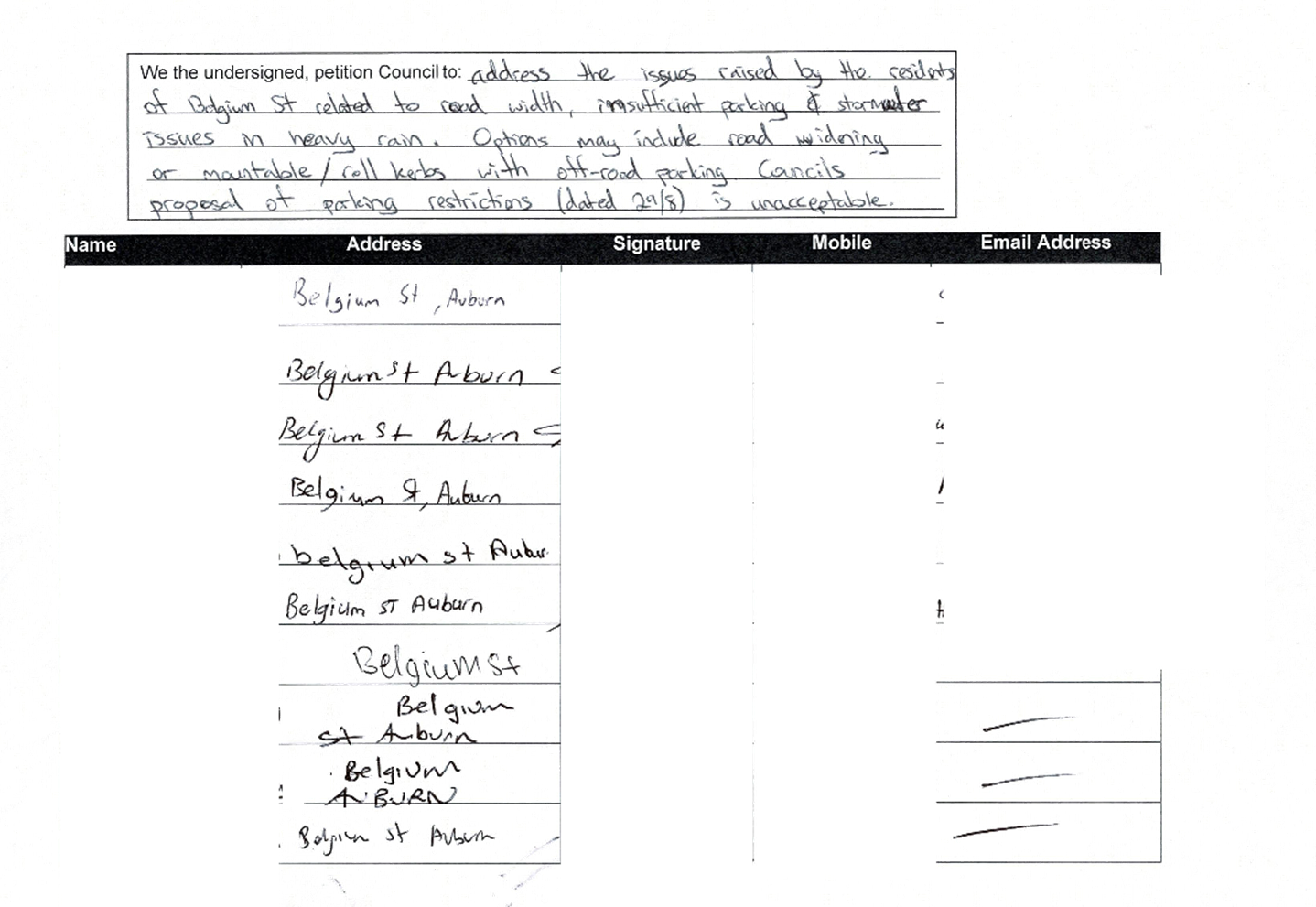
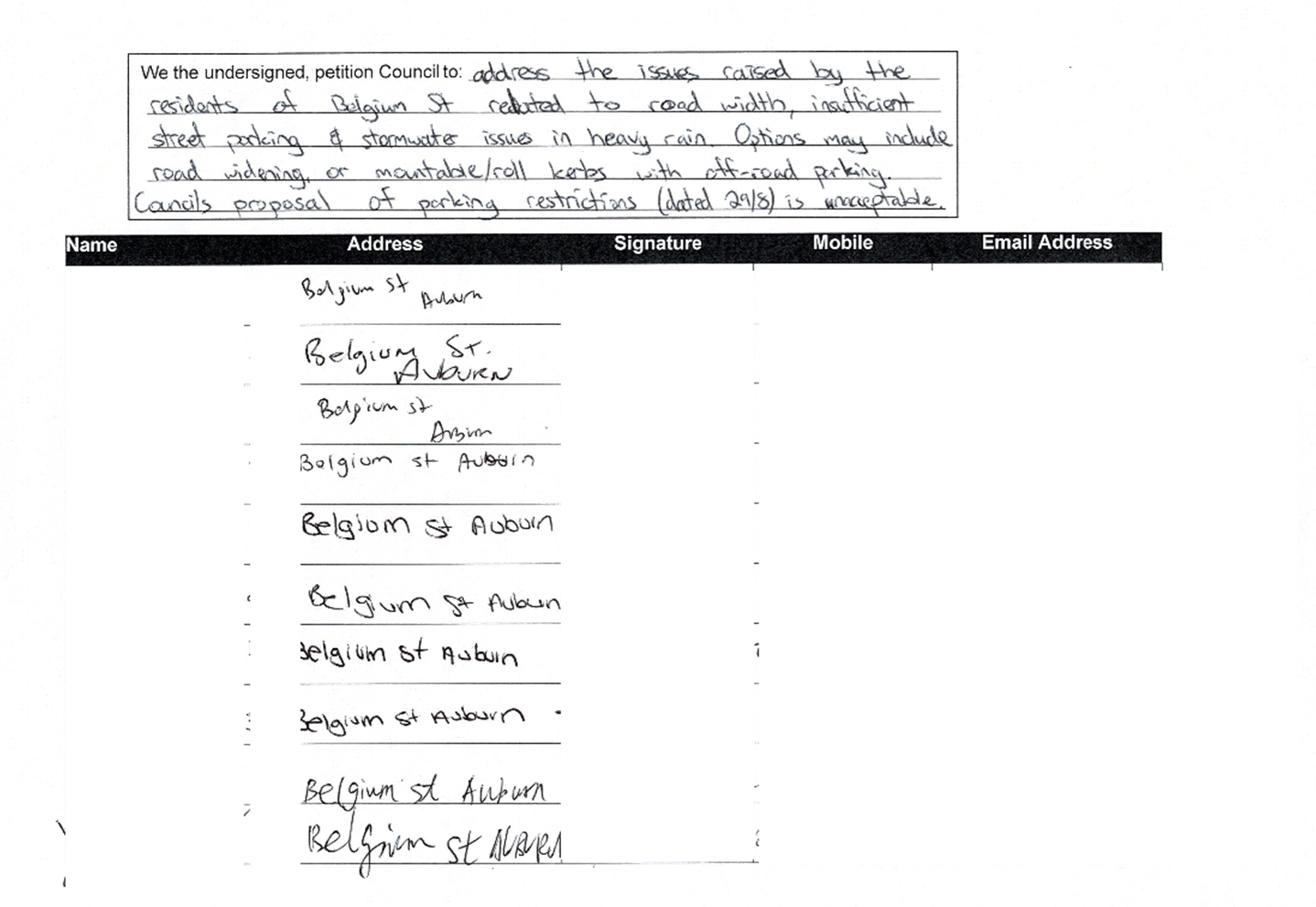
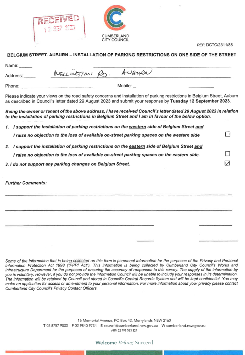
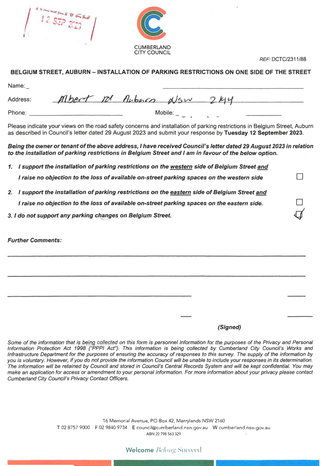
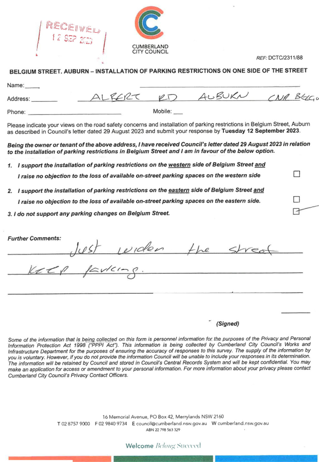
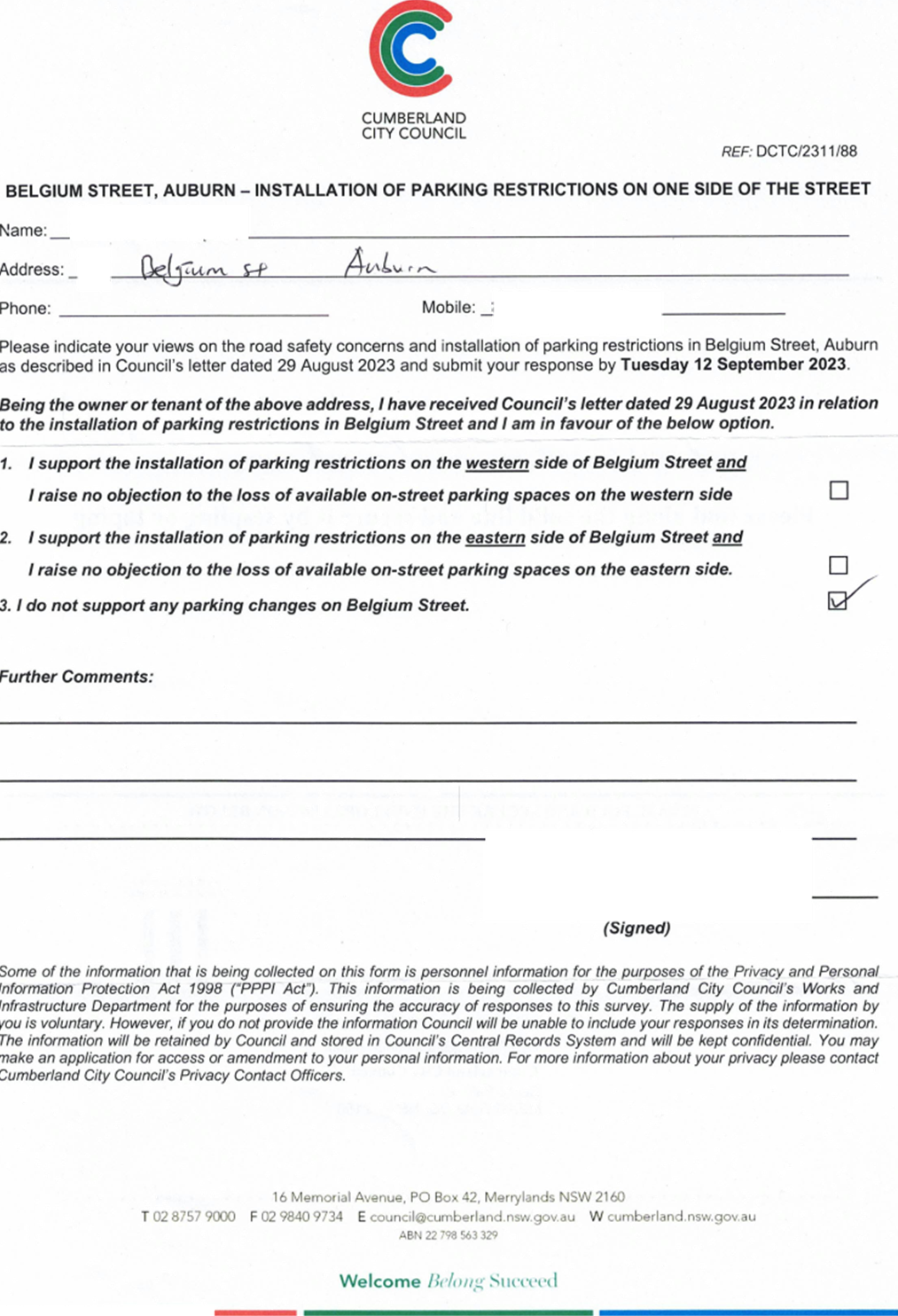
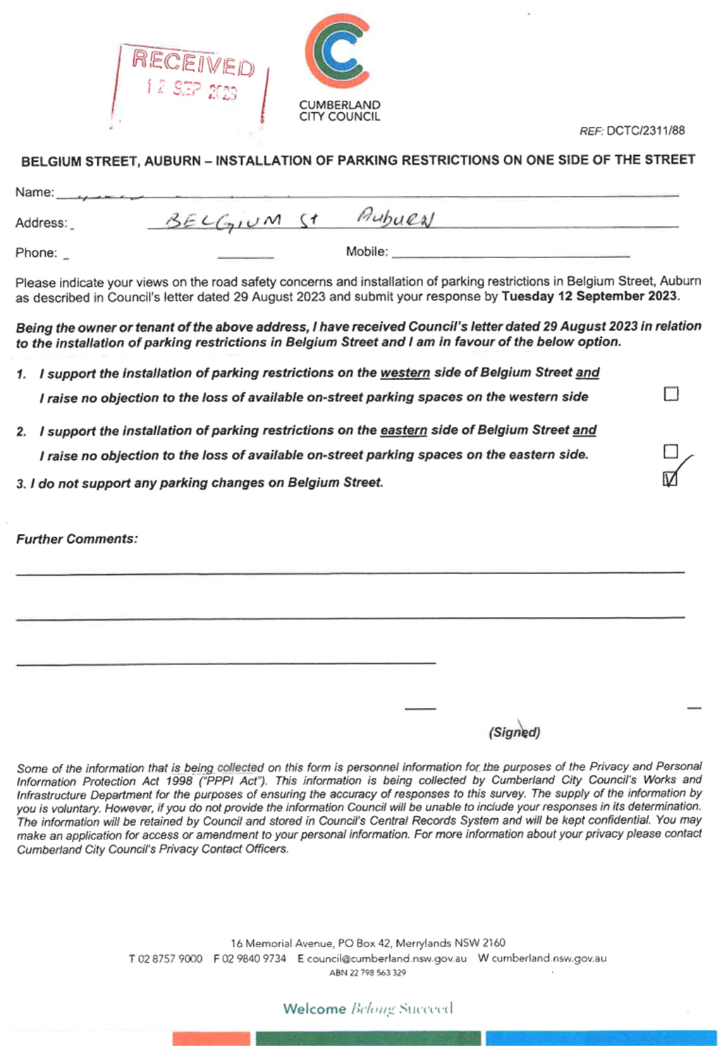
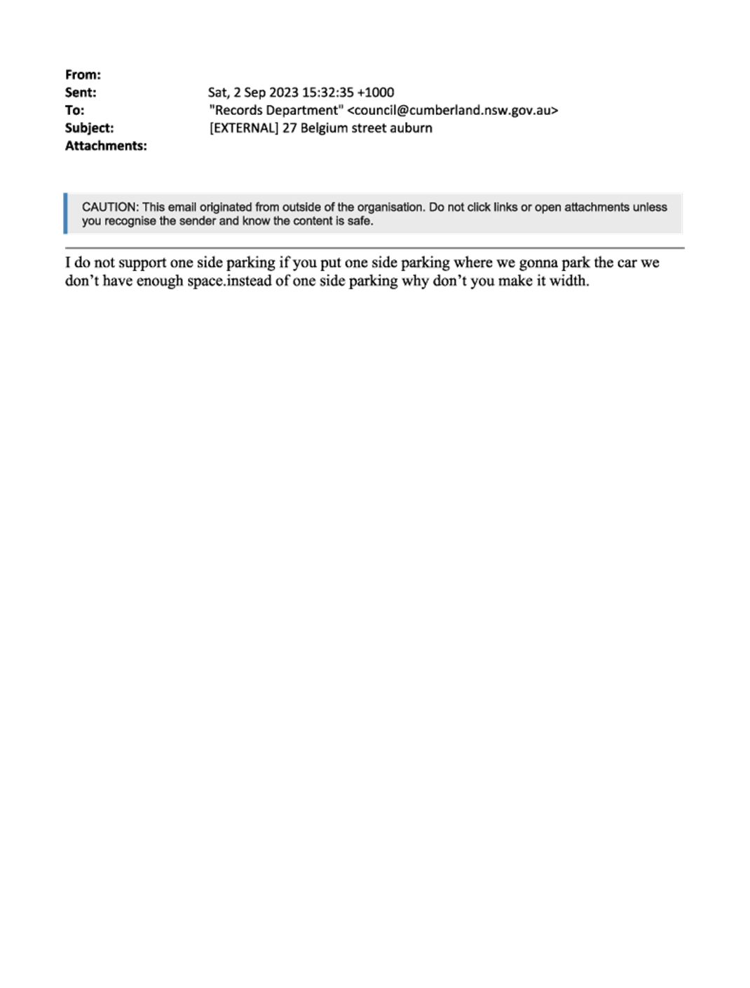
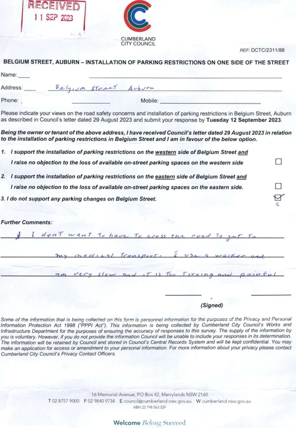
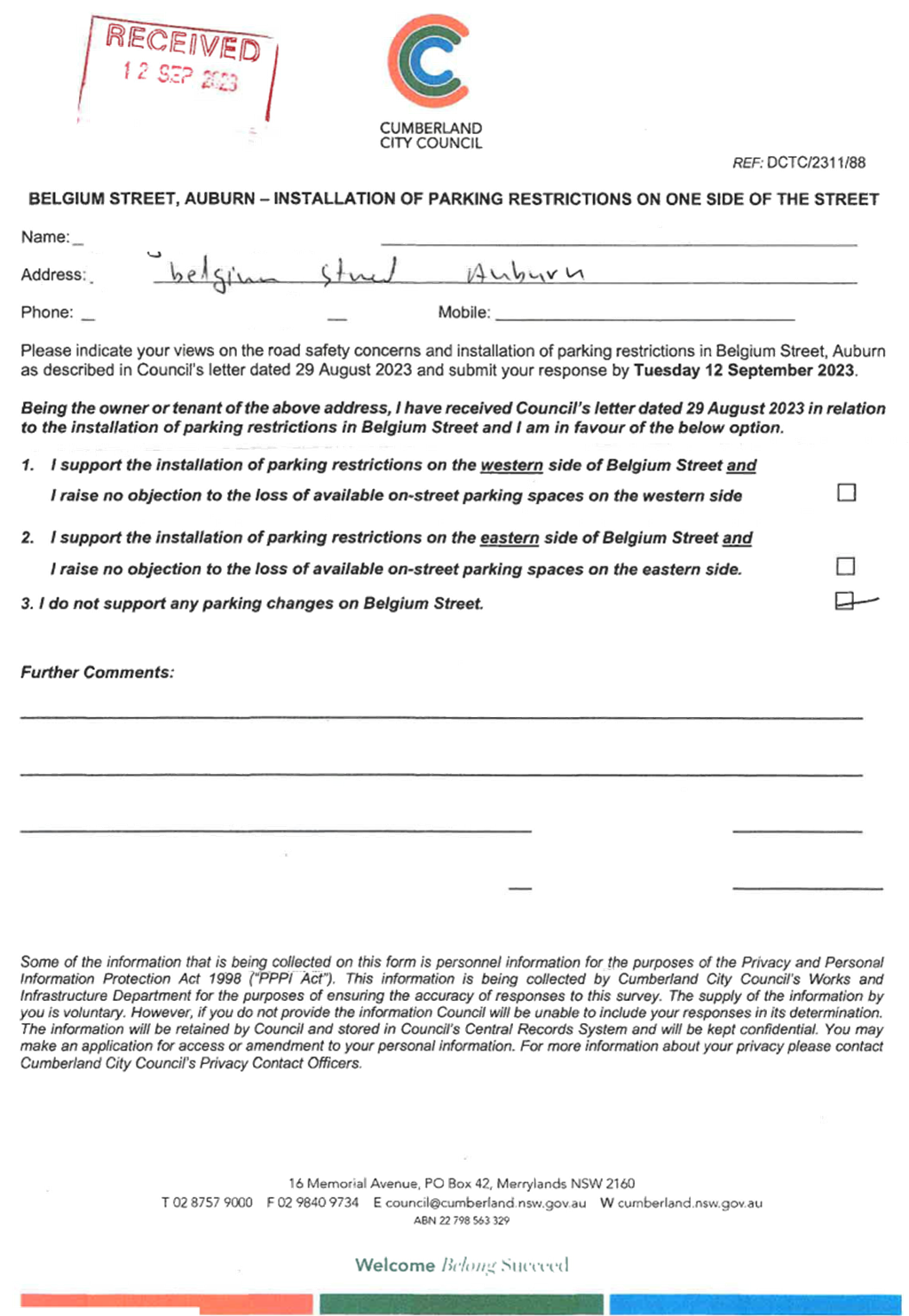
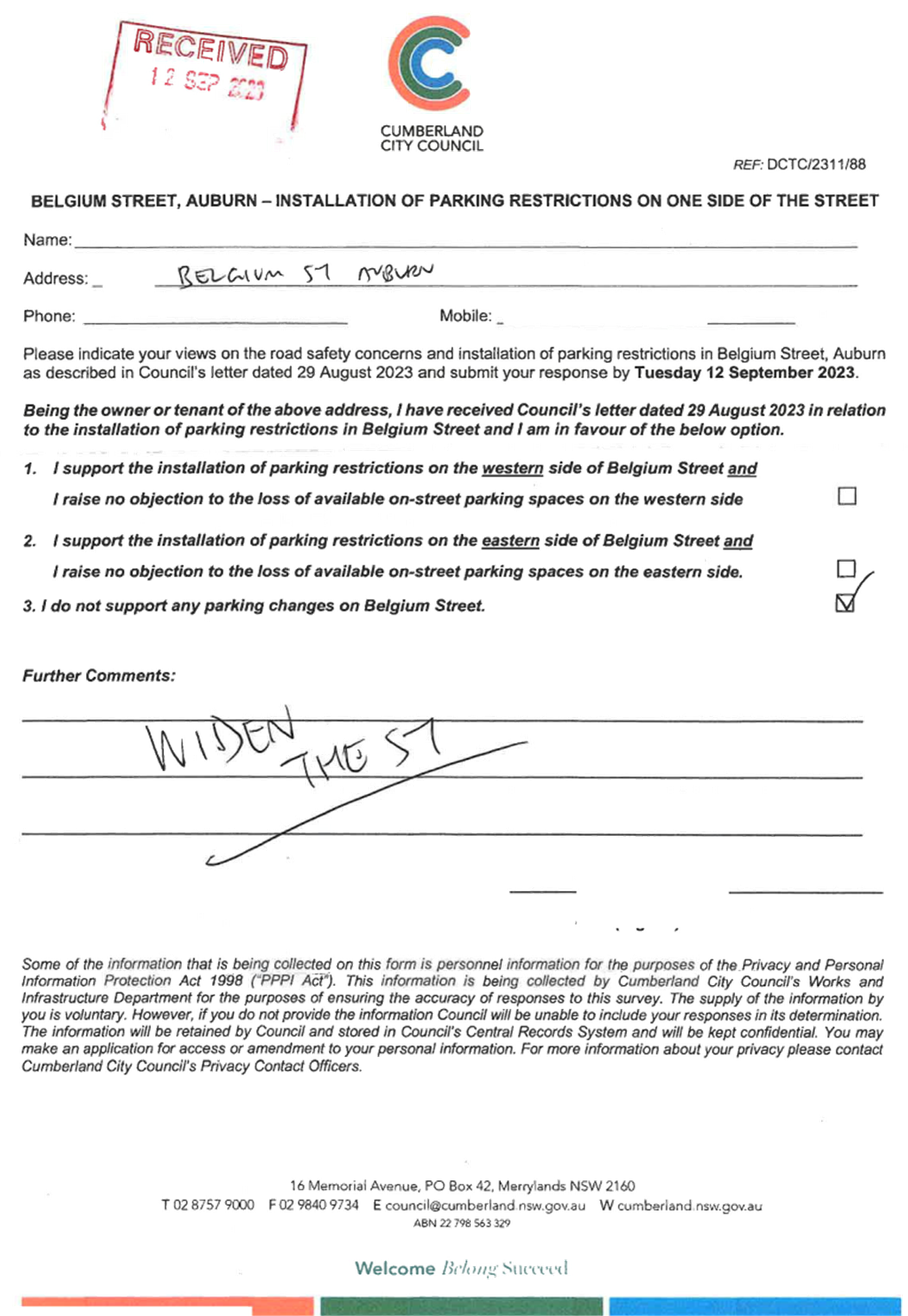
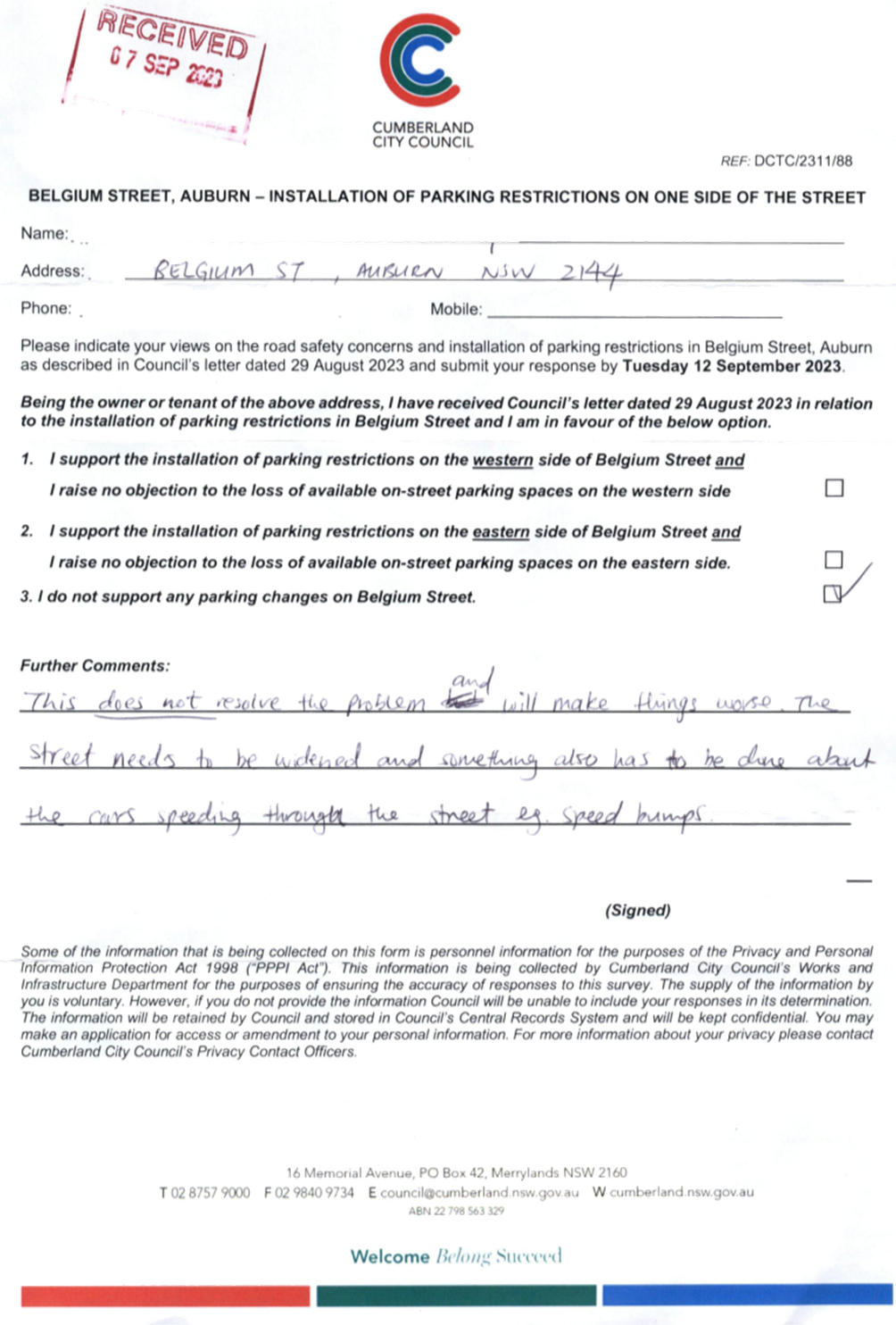
BELGIUM STREET, AUBURN -
REQUEST OF ROAD WIDENING
|
|
|
|
´
|
|
´
|
|
CTC-23-190
|
CLARENCE STREET, MERRYLANDS
– ROAD SAFETY CONCERNS
|
|
´
|
|
|
´
|
|
|
CTC-23-191
|
DELLWOOD STREET, SOUTH
GRANVILLE - REQUEST FOR A PEDESTRIAN CROSSING
|
|
´
|
|
|
´
|
|
|
CTC-23-192
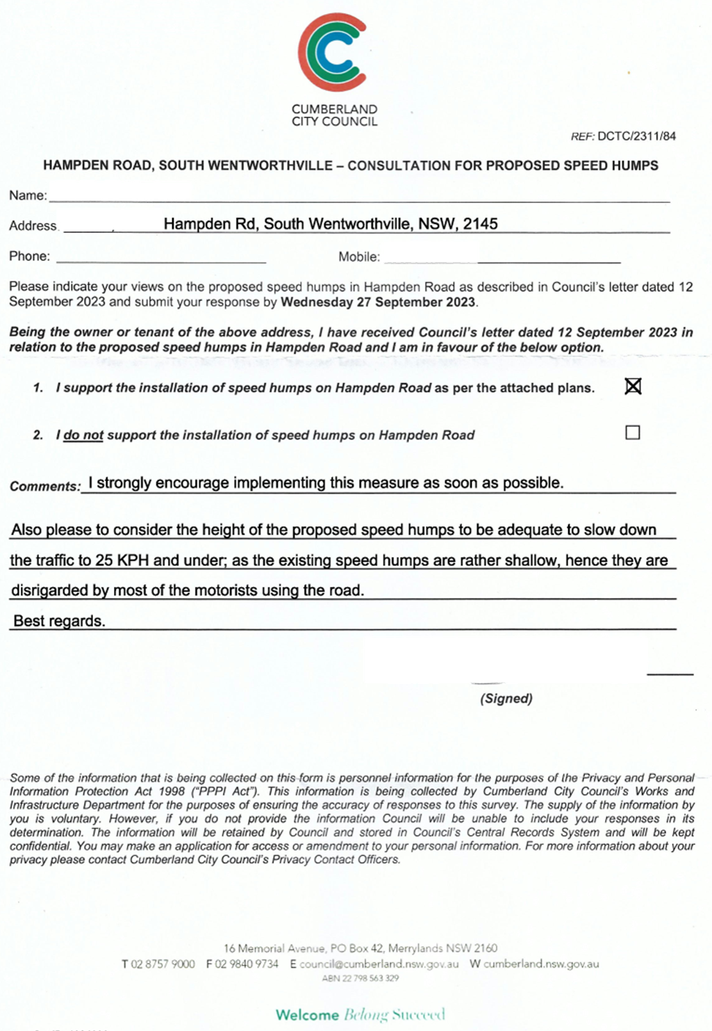
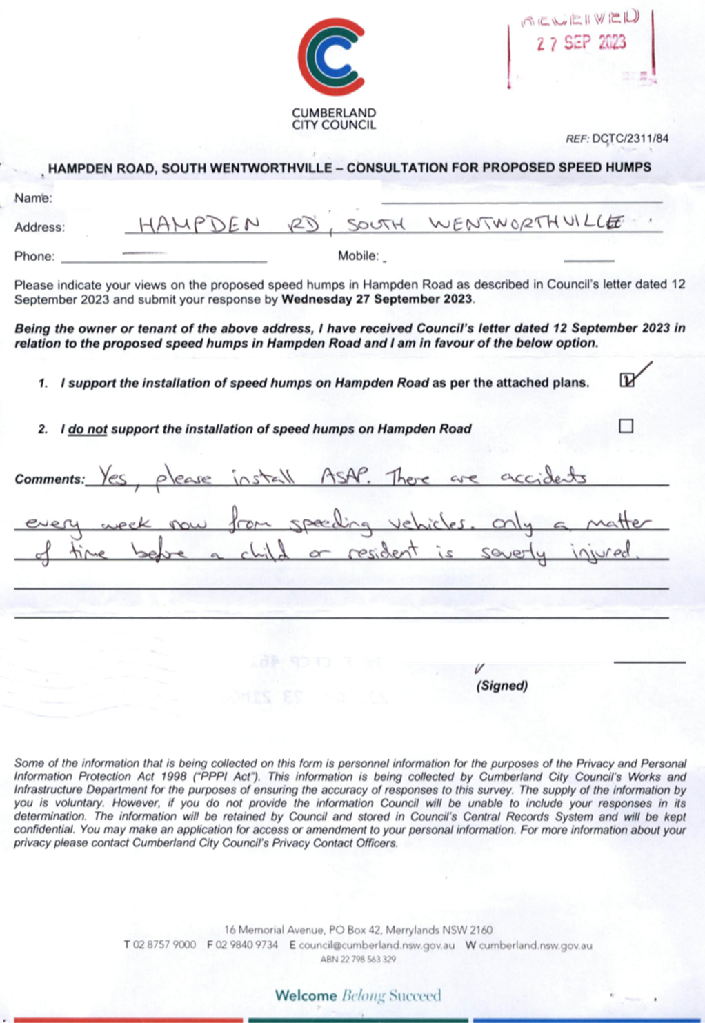
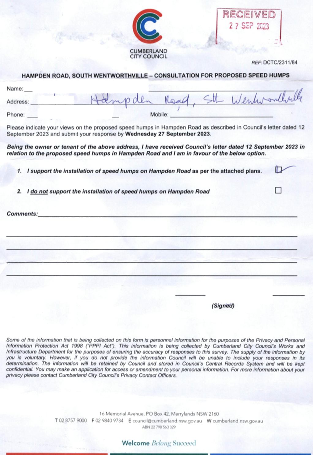
|
HAMPDEN ROAD, SOUTH
WENTWORTHVILLE – ROAD SAFETY CONCERNS
|
|
´
|
|
|
´
|
|
|
CTC-23-193
|
HAWKSVIEW STREET, GUILDFORD
AND MERRYLANDS - ROAD SAFETY CONCERN
|
|
´
|
|
|
´
|
|
|
CTC-23-194
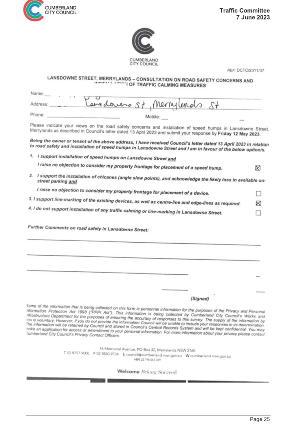
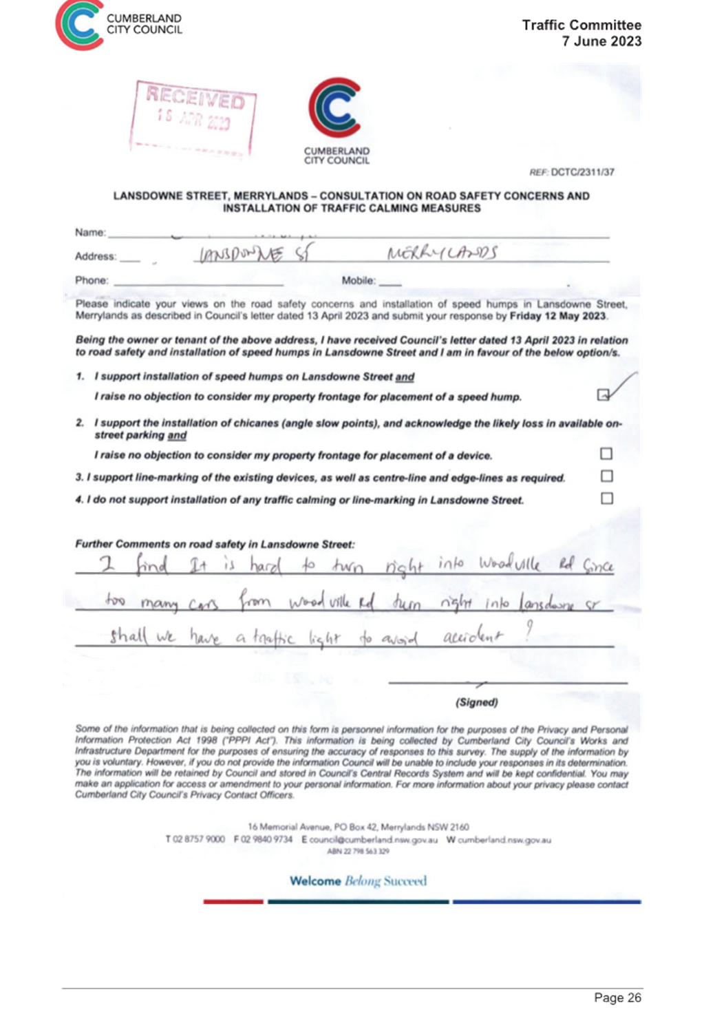
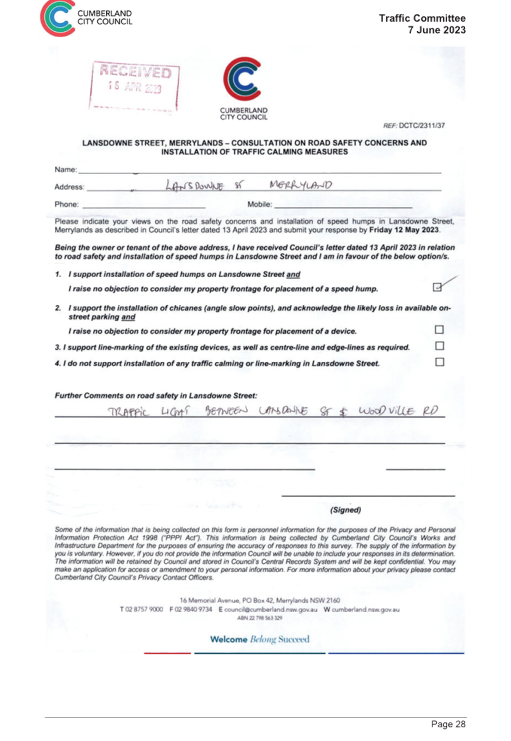
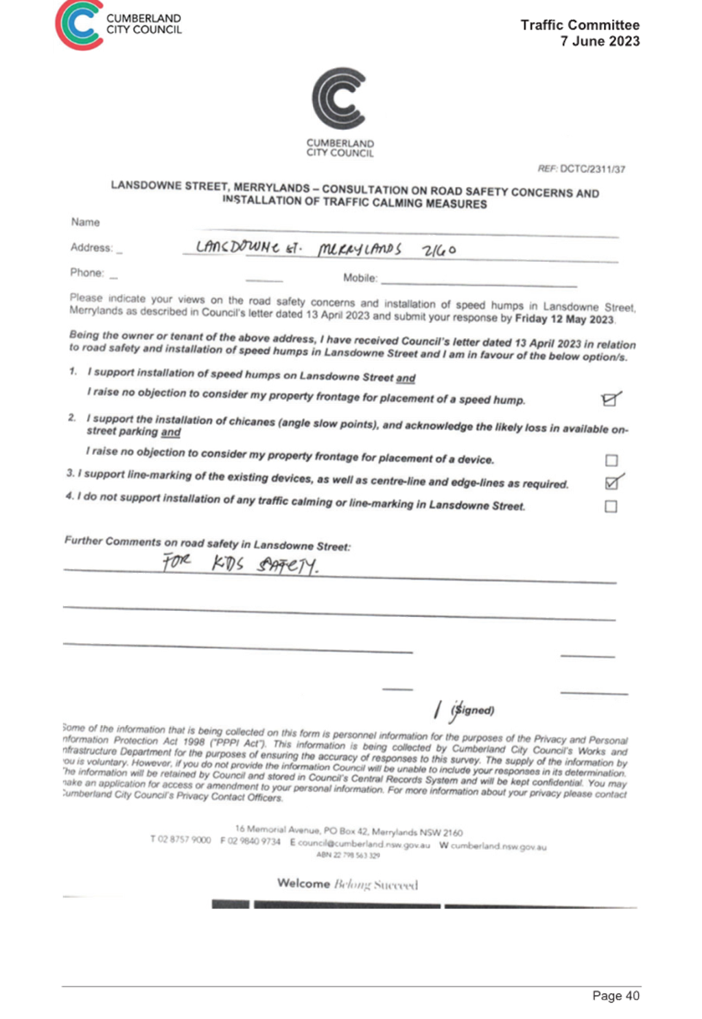
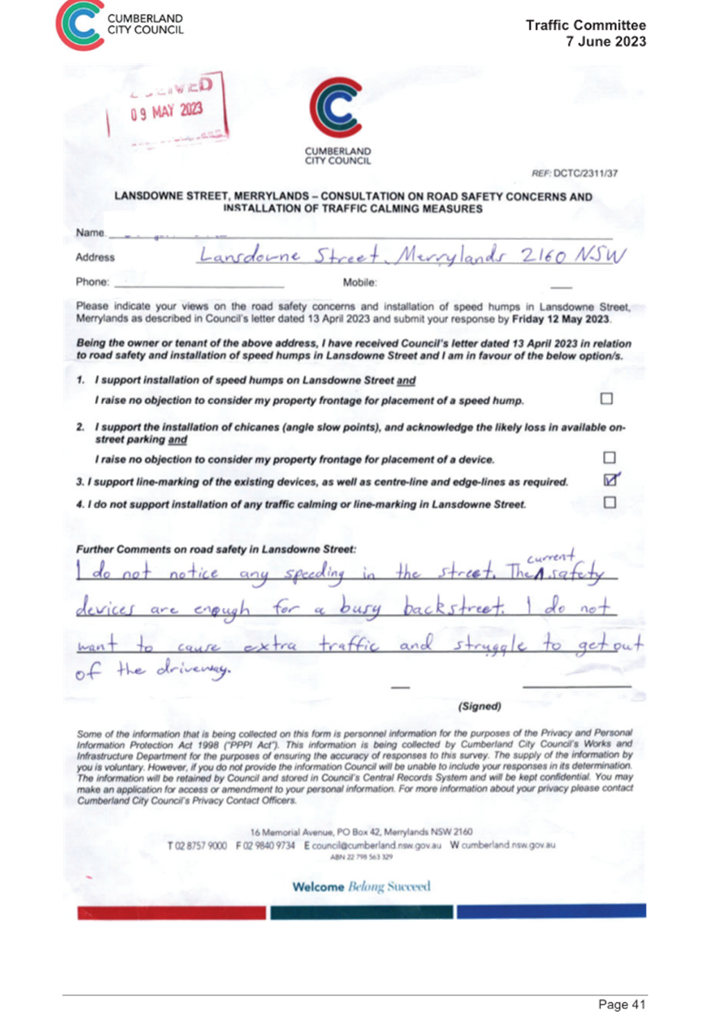
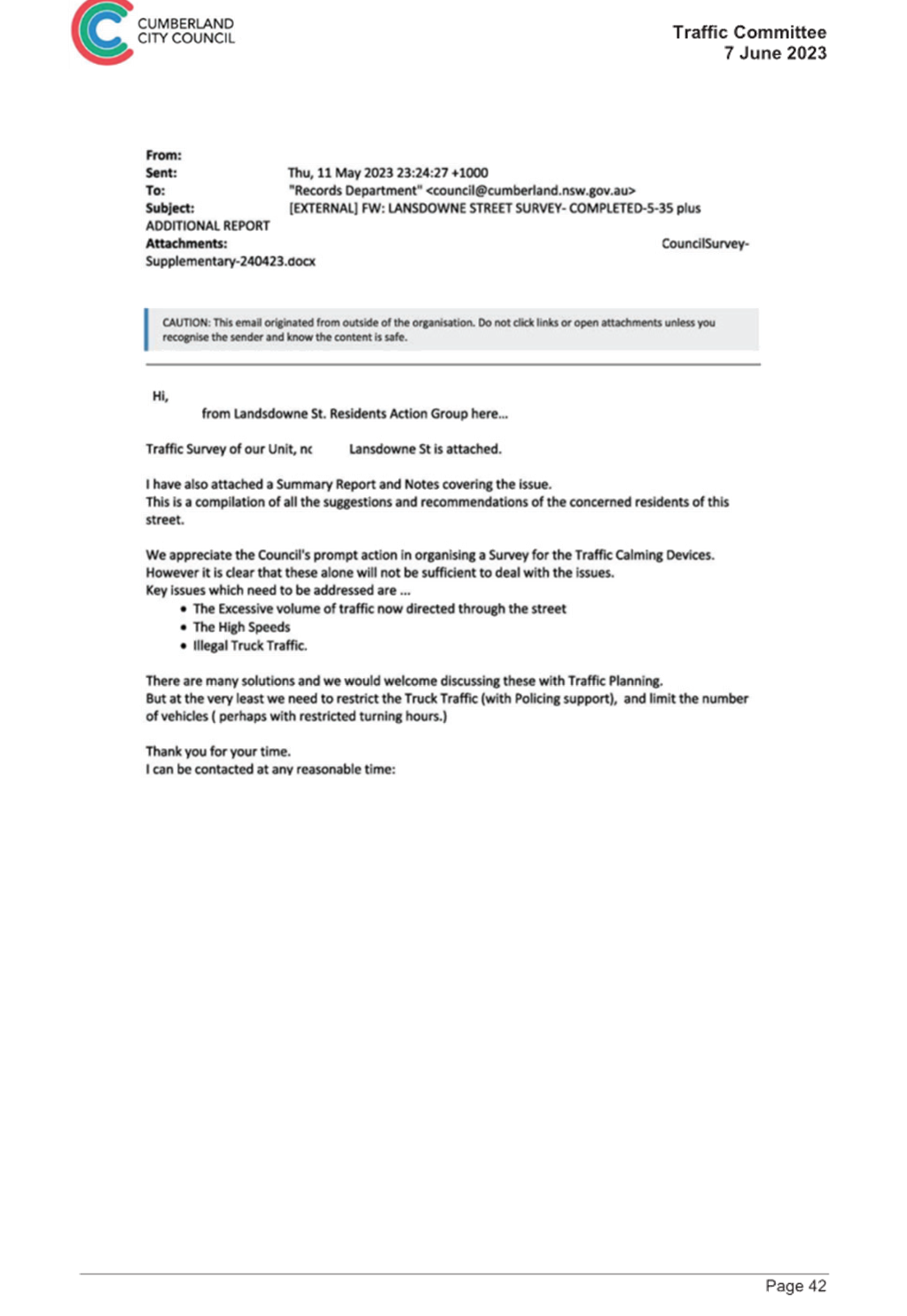
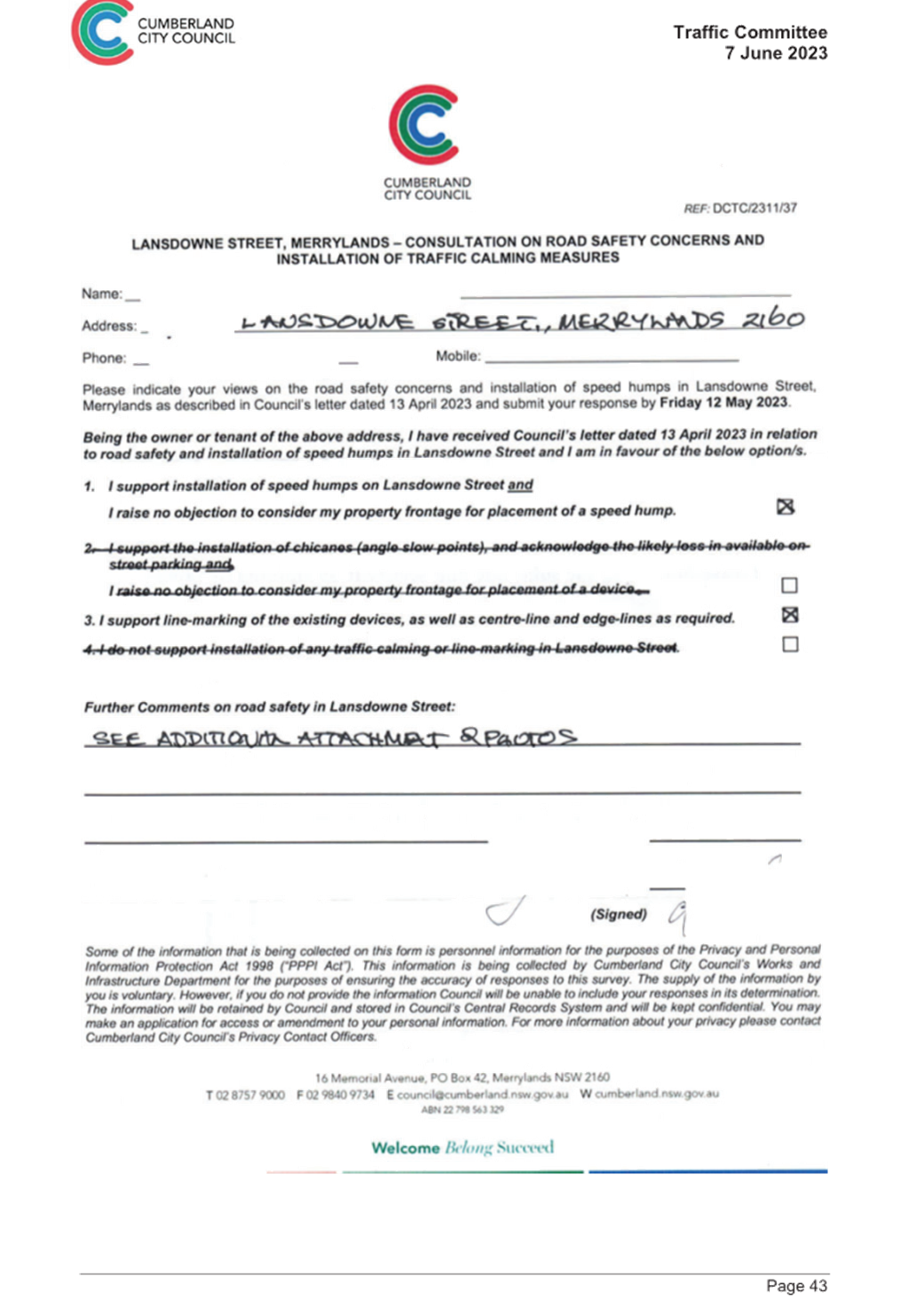
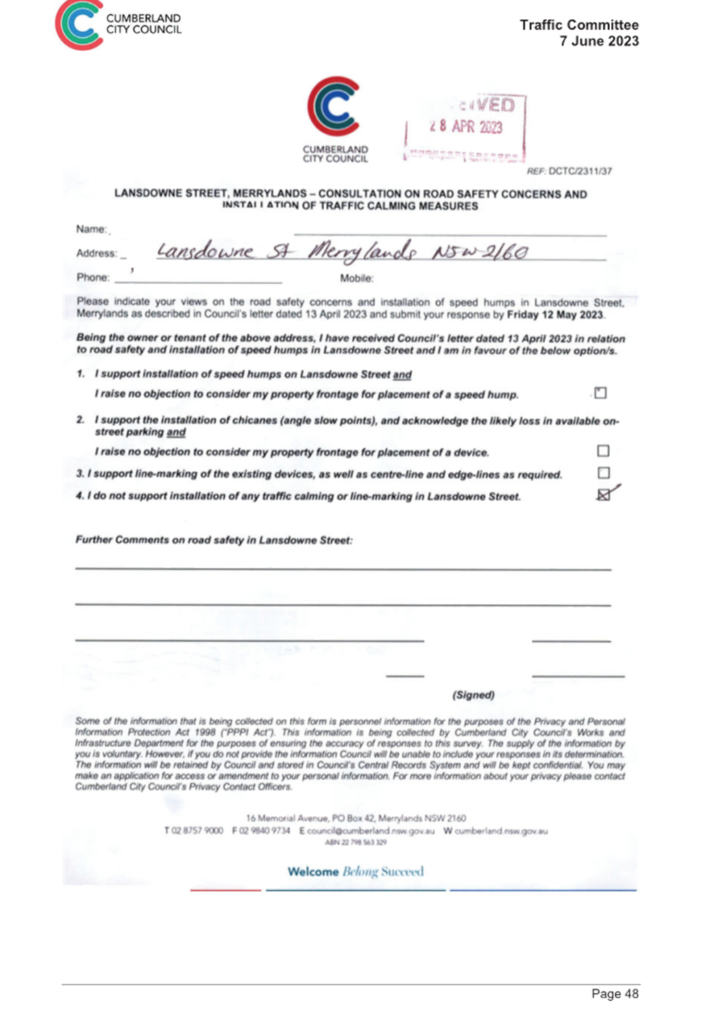
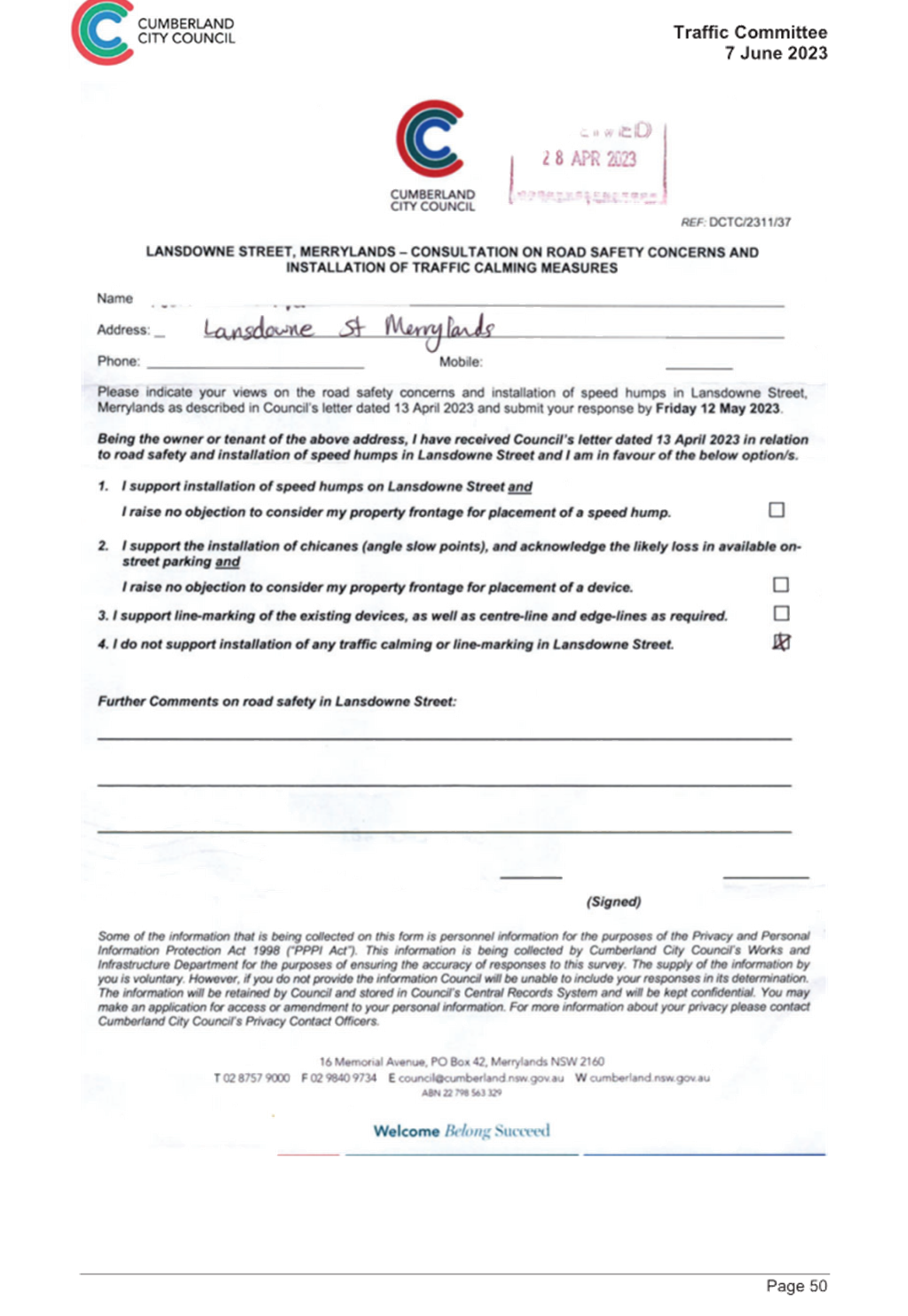
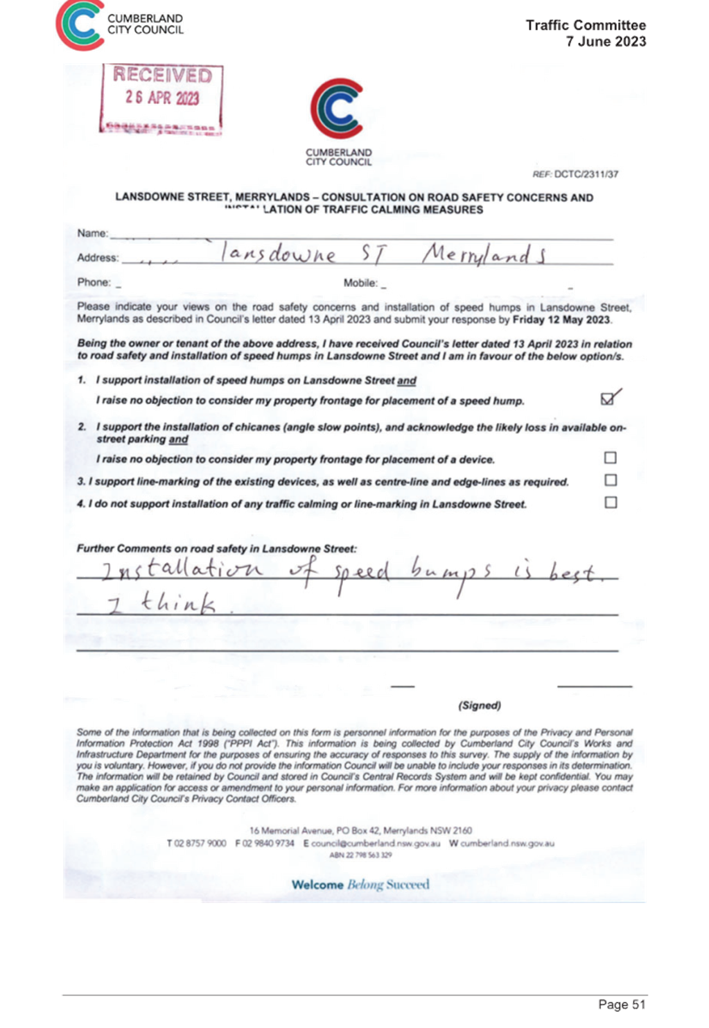
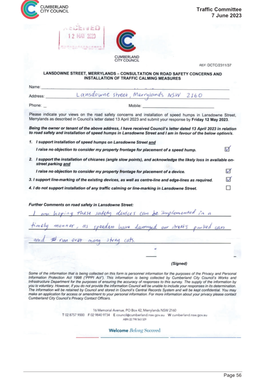
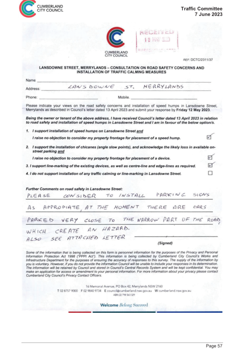
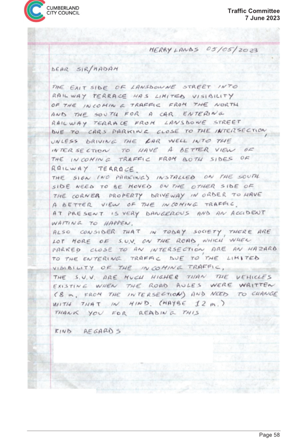
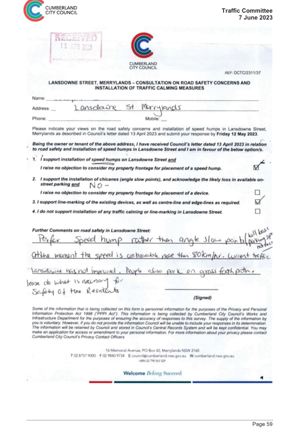
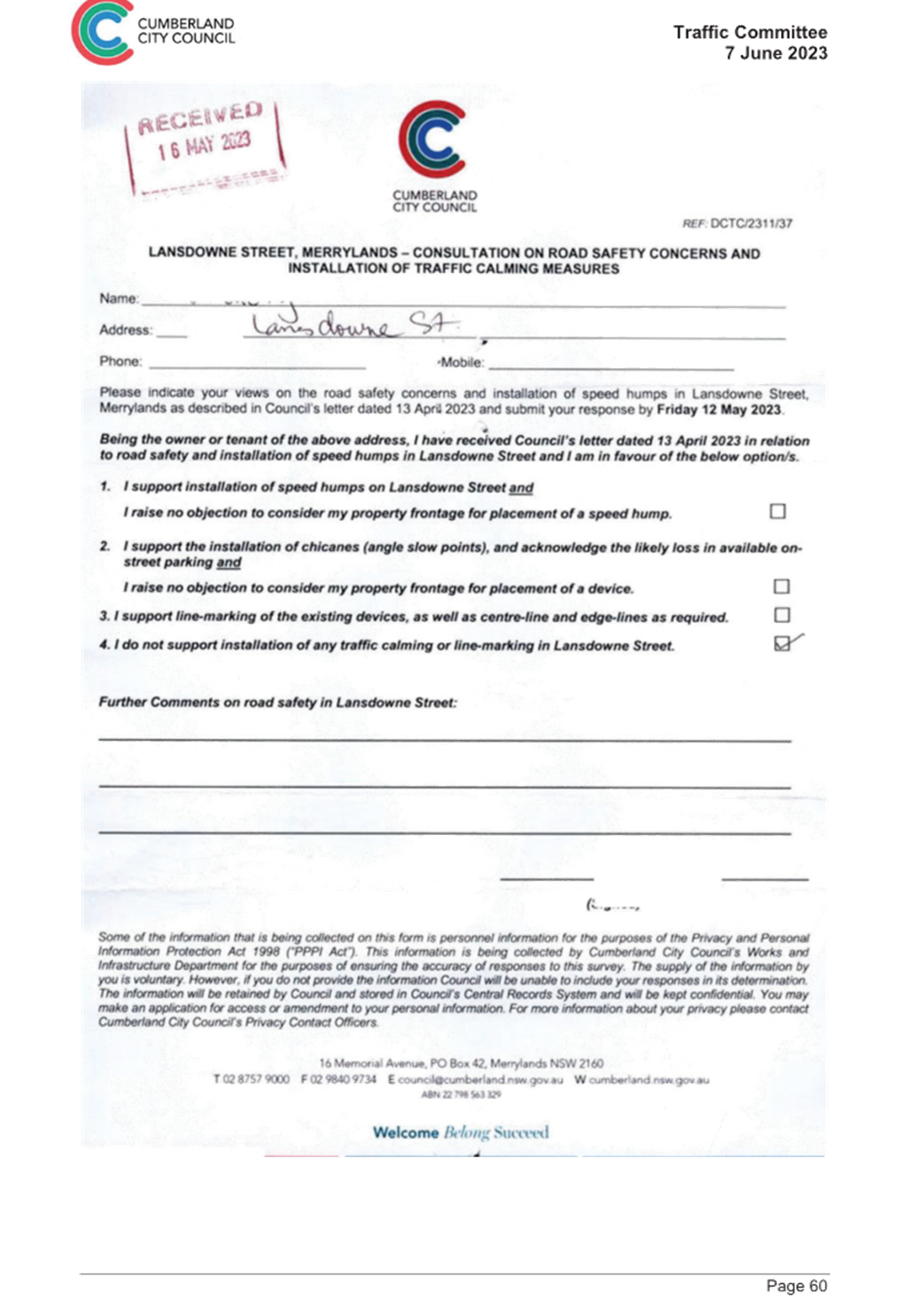
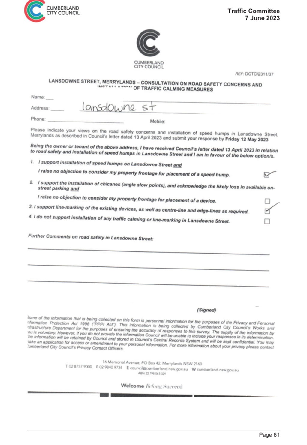
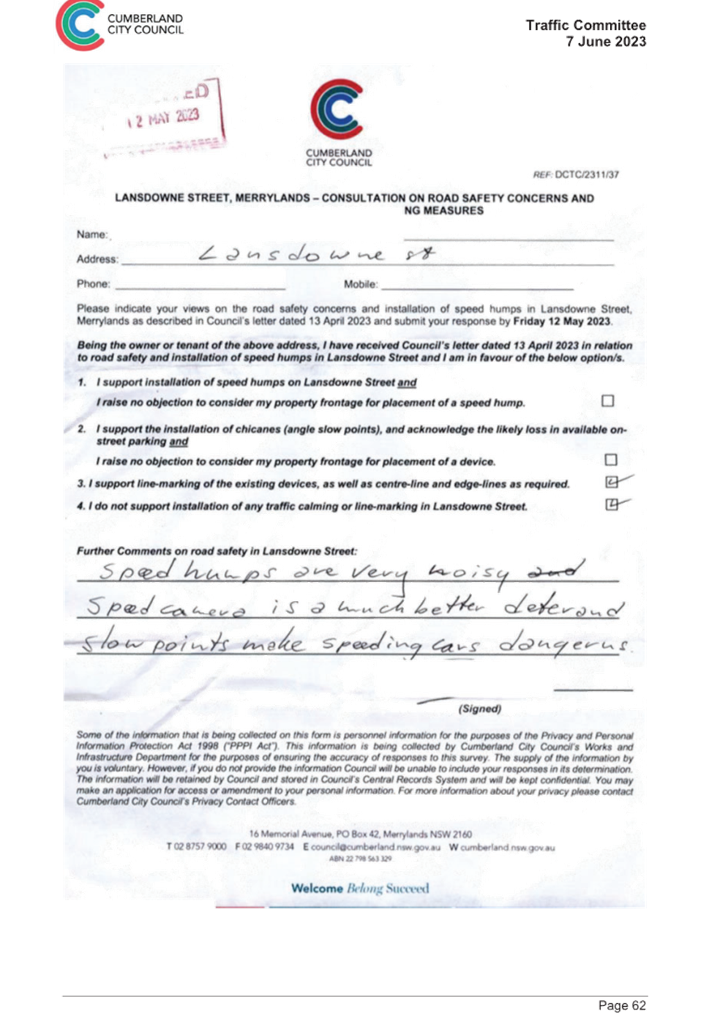
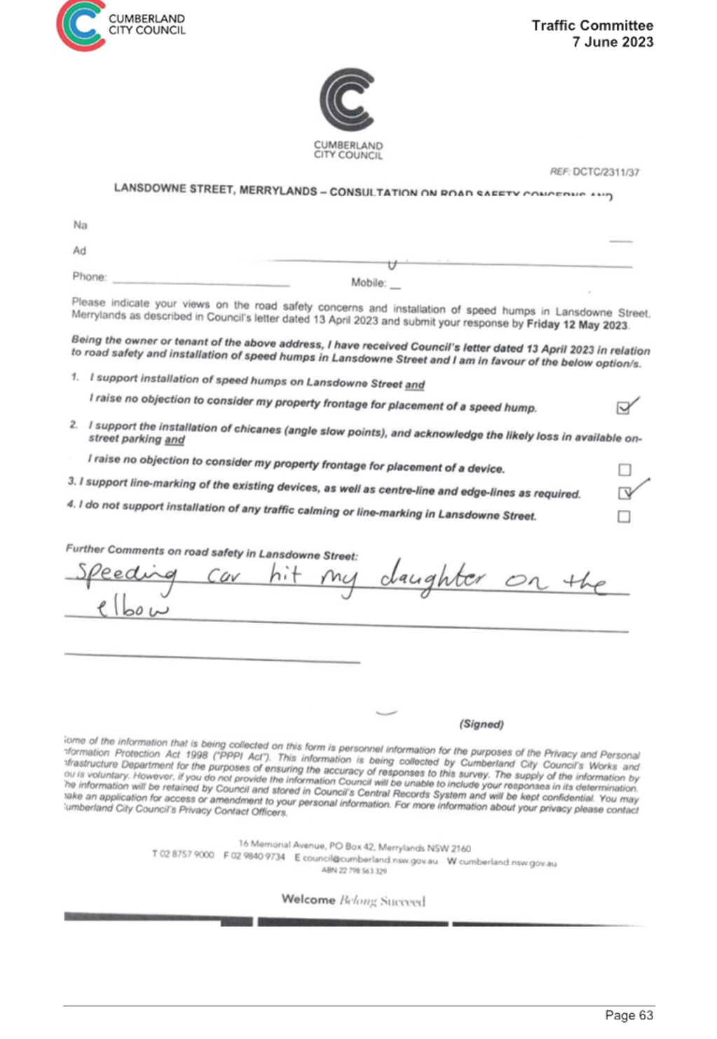
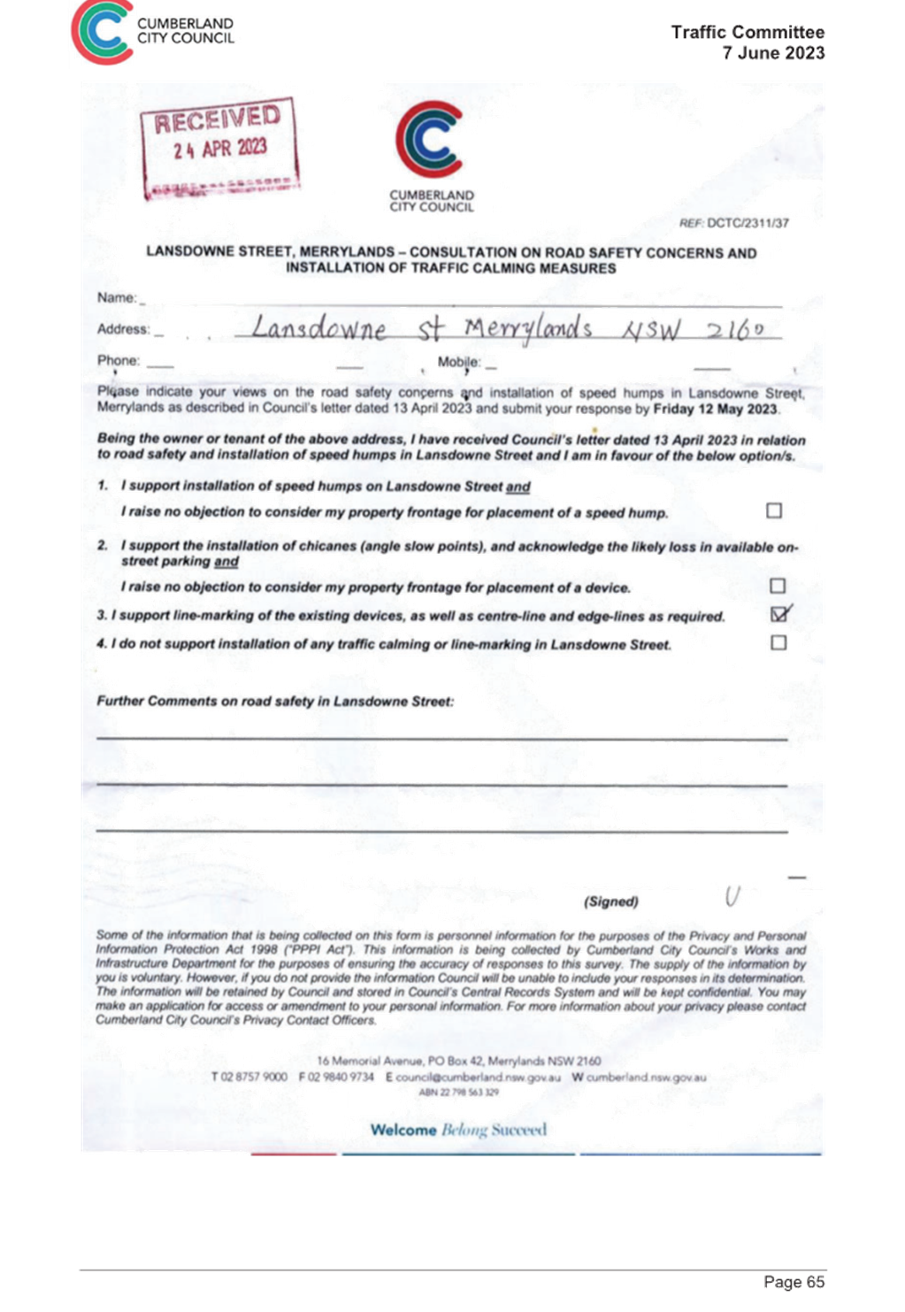
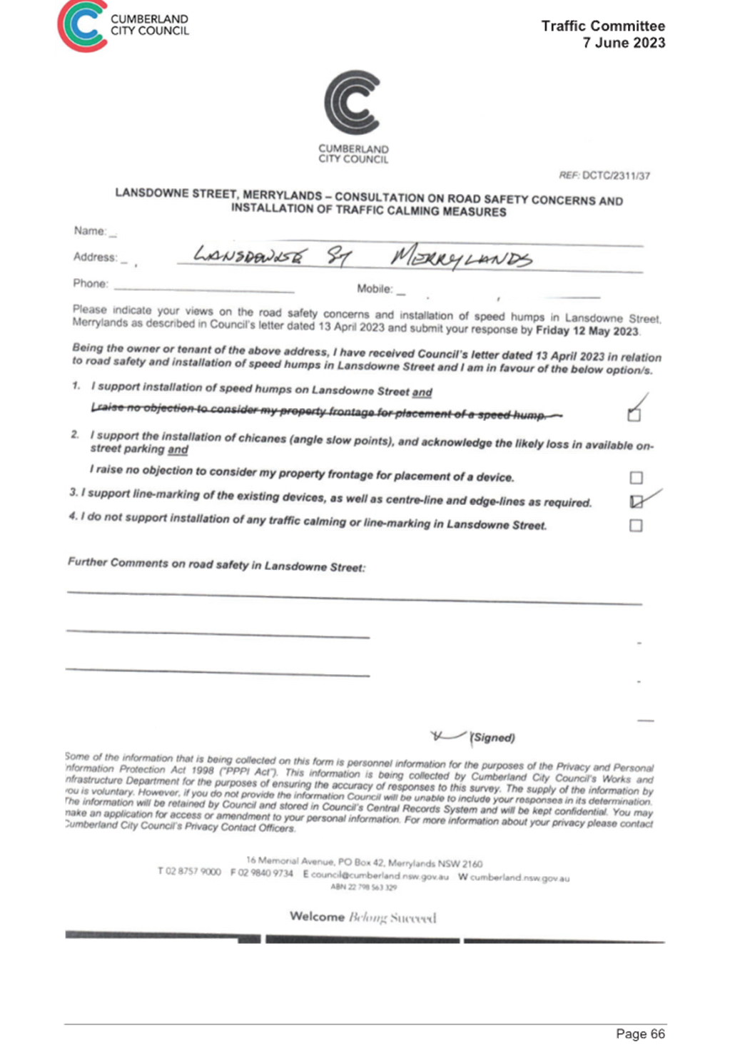
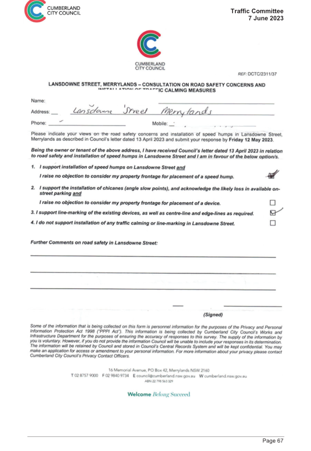
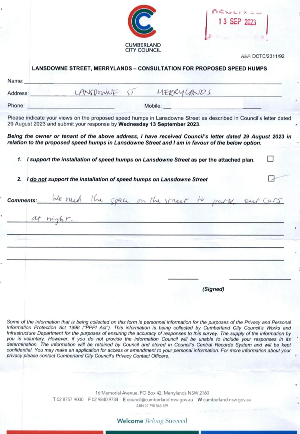
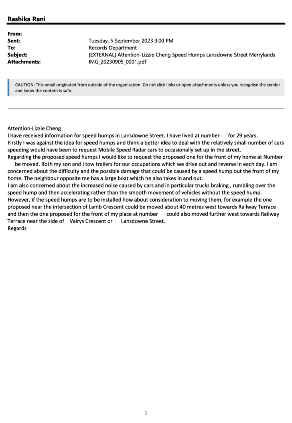
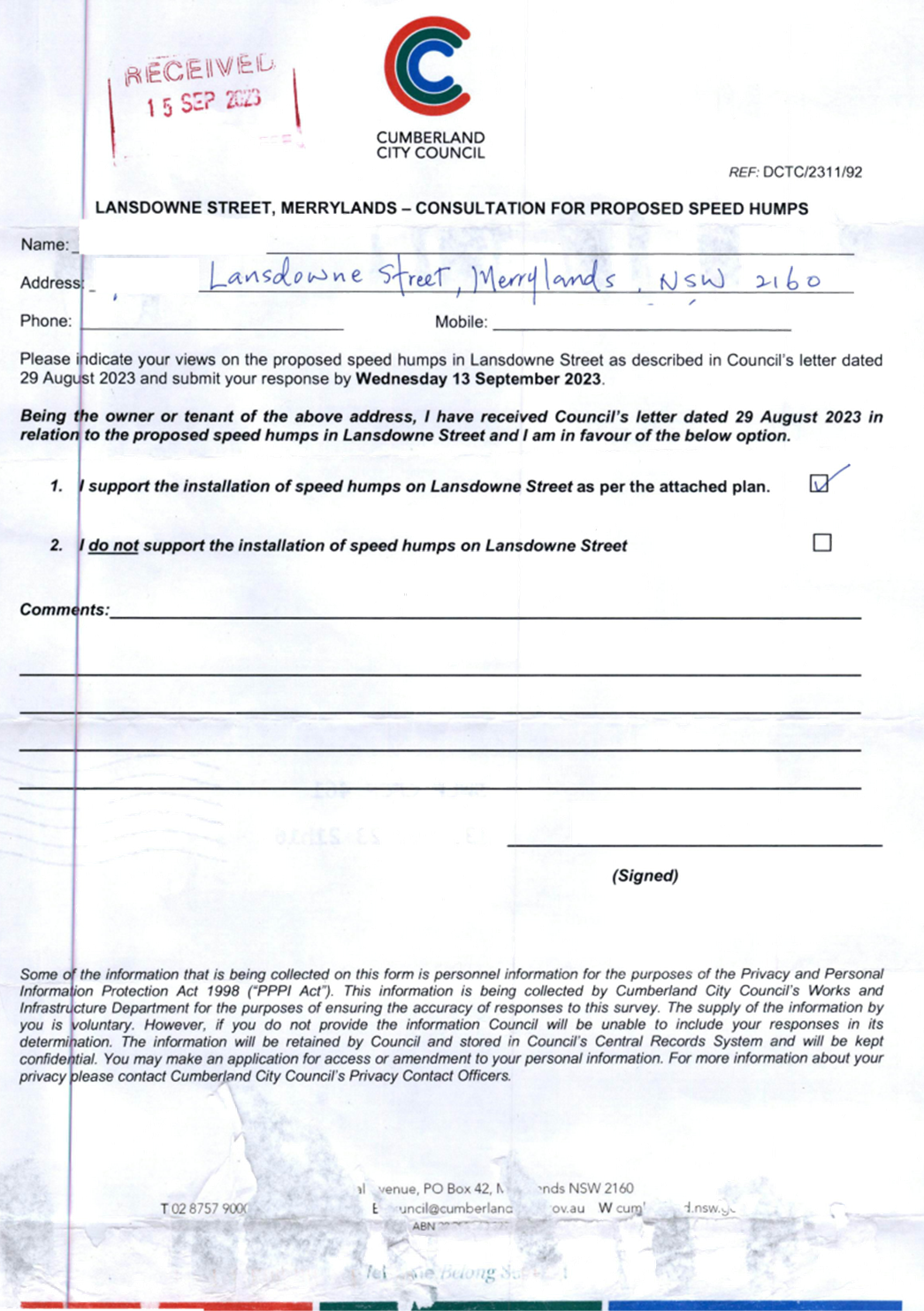
|
LANSDOWNE STREET,
MERRYLANDS – ROAD SAFETY CONCERNS
|
|
´
|
|
|
´
|
|
|
CTC-23-195
|
TOONGABBIE ROAD, TOONGABBIE
- ROAD SAFETY CONCERNS AT THE BEND
|
|
|
´
|
|
´
|
|
|
CTC-23-196
|
PENDLE WAY, PENDLE HILL
– PROPOSED TEMPORARY ROAD CLOSURE FOR ‘THAI PONGAL FESTIVAL
2024’
|
|
|
´
|
|
´
|
|
|
CTC-23-197
|
TOONGABBIE ROAD, TOONGABBIE
– REVIEW OF ROAD SAFETY CONCERNS
|
|
|
´
|
|
´
|
|
|
CTC-23-198
|
TEMPORARY ROAD CLOSURE FOR
‘AUSTRALIA DAY’ CELEBRATIONS
|
|
´
|
|
|
´
|
|
|
CTC-23-199
|
CARLTON STREET,
GRANVILLE - PROPOSED TEMPORARY ROAD CLOSURE FOR GRANVILLE RAILWAY
DISASTER MEMORIAL
|
|
´
|
|
|
´
|
|
|
CTC-23-200
|
JOSEPH STREET, LIDCOMBE -
TEMPORARY ROAD CLOSURE FOR LUNAR NEW YEAR CELEBRATIONS
|
|
|
|
´
|
|
´
|
|
CTC-23-201
|
MERRYLANDS ROAD, MERRYLANDS
- TEMPORARY ROAD CLOSURE FOR ‘NOWRUZ’ PERSIAN NEW YEAR
CELEBRATIONS
|
|
´
|
|
|
´
|
|
|
CTC-23-202
|
TEMPORARY ROAD CLOSURES IN
THE AUBURN CBD FOR RAMADAN FOOD FESTIVAL 2024
|
|
|
|
´
|
|
´
|
1 November 2023
Part 1
Recommended for Approval under Delegated Authority
1 November 2023
Item
No: CTC-23-169
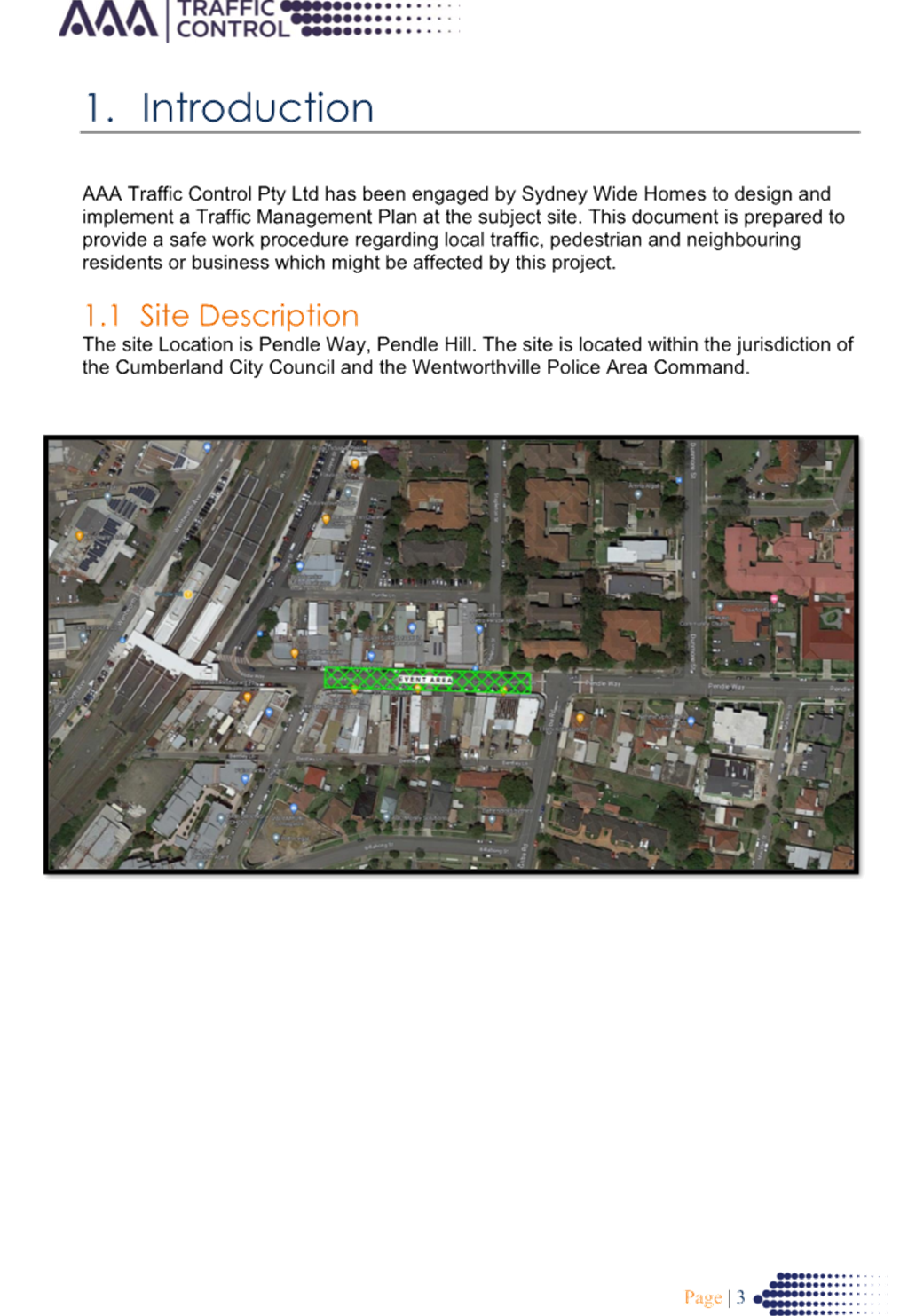
JONATHAN
STREET, GREYSTANES - PROPOSED 'BUS ZONE' SIGNAGE
Directorate: Environment
and Planning
Responsible
Officer: Executive
Manager Development and Building
Electorate: Prospect
Police Area
Command (PAC): Cumberland
Agenda Part Part
1
Note: Recommended
for Approval under Delegated Authority
Council has received request from
the bus operator, Transit Systems, for the installation of ‘Bus
Zone’ signs at the existing bus stop outside No. 46 Jonathan Street,
Greystanes, to prevent vehicles from parking too close to the bus stop.
This report outlines the outcome
of the investigation into this matter.
|
The Cumberland Traffic Committee recommends that:
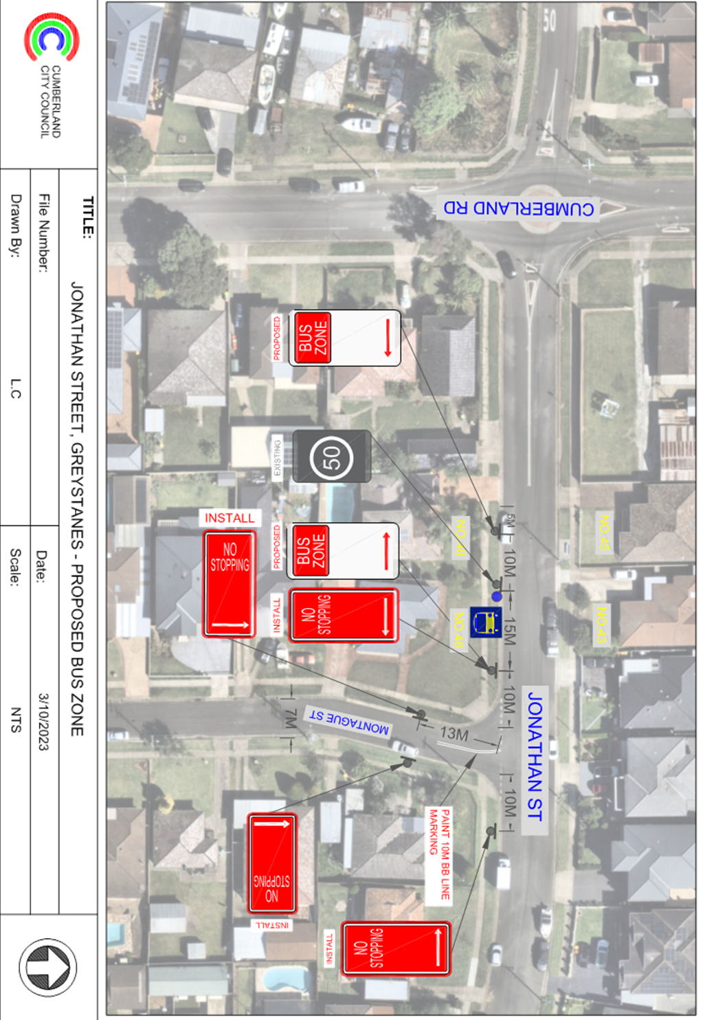
1. The installation of
‘Bus Zone’ signs on the southern side of Jonathan Street,
Greystanes outside No.46 in accordance with the attached plan be approved.
2. The installation of
‘No Stopping’ Signs and ‘BB’ line marking at the
intersection of Jonathan Street and Montague Street, Greystanes in
accordance with the attached plan be approved.
3. The adjacent
/concerned residents be notified of the outcome.
|
Council has received a request from the bus operator,
Transit Systems, for the installation of ‘Bus Zone’ signs at the
existing bus stop outside No. 46 Jonathan Street, Greystanes to prevent
vehicles parking at the existing bus stop at this location.
Jonathan Street is a local road
that runs in an east-west direction with a speed limit of 50 km/h. It has a
width of approximately 9.5m and parking is permitted on both sides of the road
unless signposted. There is an existing bus stop on the southern side of Jonathan
Street outside No.46. This bus stop is not signposted with ‘Bus
Zone’ signs.
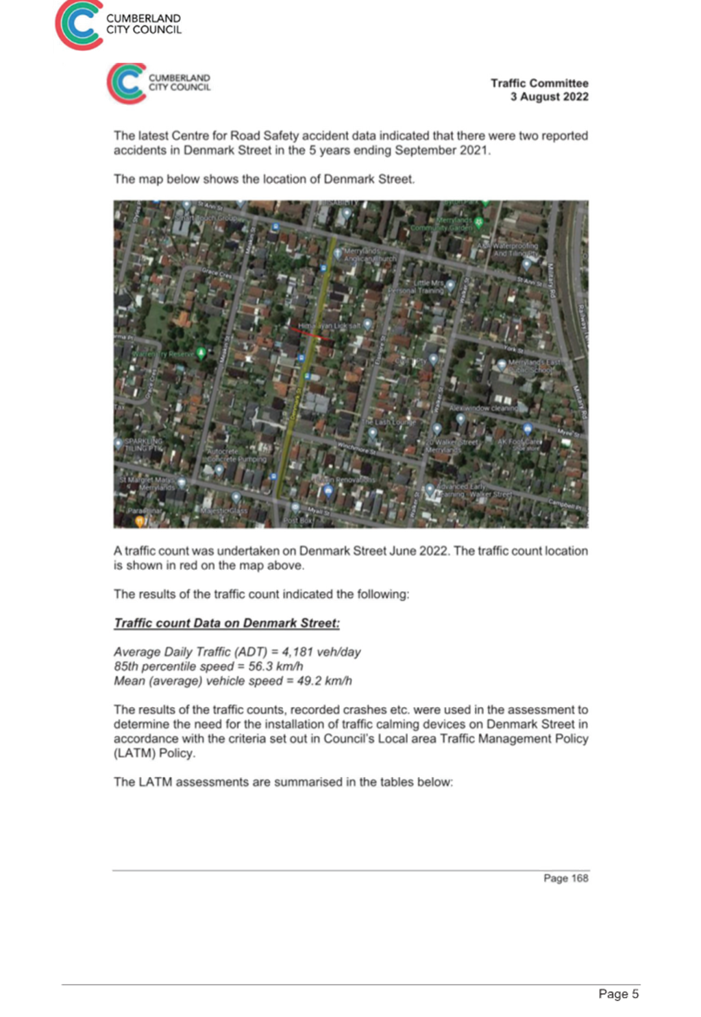
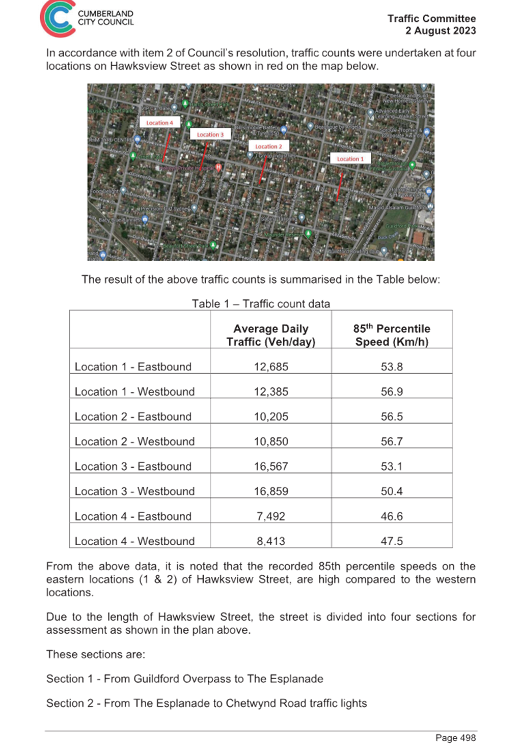
The map below shows the location
of the bus stop:
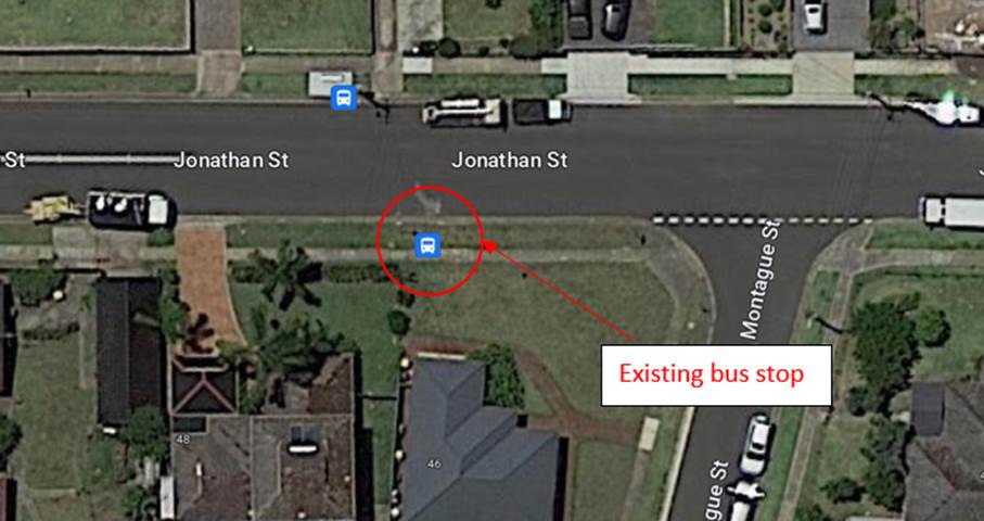 Locality Plan
In accordance with the NSW Road
Rules 195:
‘A driver (except the
driver of a public bus) must not stop at a bus stop, or on the road, within 20
metres before a sign on the road that indicates the bus stop, and 10 metres
after the sign, unless the driver stops at a place on a length of road, or in
an area, to which a parking control sign applies, and the driver is permitted
to stop at that place under these Rules’
Council officers have consulted
with the bus operator (Transit Systems) and were advised by the representative
that vehicles often park at the bus stop and installation of ‘Bus
Zone’ signs at this location would benefit bus commuters.
In order to reinforce the road
rules at the existing bus stop on the southern side of Jonathan Street outside
No.46 and the intersection of Jonathan Street and Montague Street, it is
proposed to install 'Bus Zone' and 'No Stopping' signs with ‘BB’
line marking as per attached plan. The ‘No Stopping’ signs in
Montague Street are proposed at 13m to allow for vehicles to pass a parked
vehicle without encroaching into the proposed 10m ‘BB’ centre line.
Consultation was carried out with
the impacted and adjacent residents for a period of 14 days starting from 3
October 2023 to 17 October 2023 for the proposal. One objection was received,
with the residents believing that the signage is not necessary. However,
the intention of the signs are to strengthen the Road Rules requirements and it
is proposed to install the signage.
Consultation was carried out with
the impacted and adjacent residents for a period of 14 days from 3 October 2023
to 17 October 2023 for the proposal. One objection was received, where the
resident believing that the signage is not necessary.
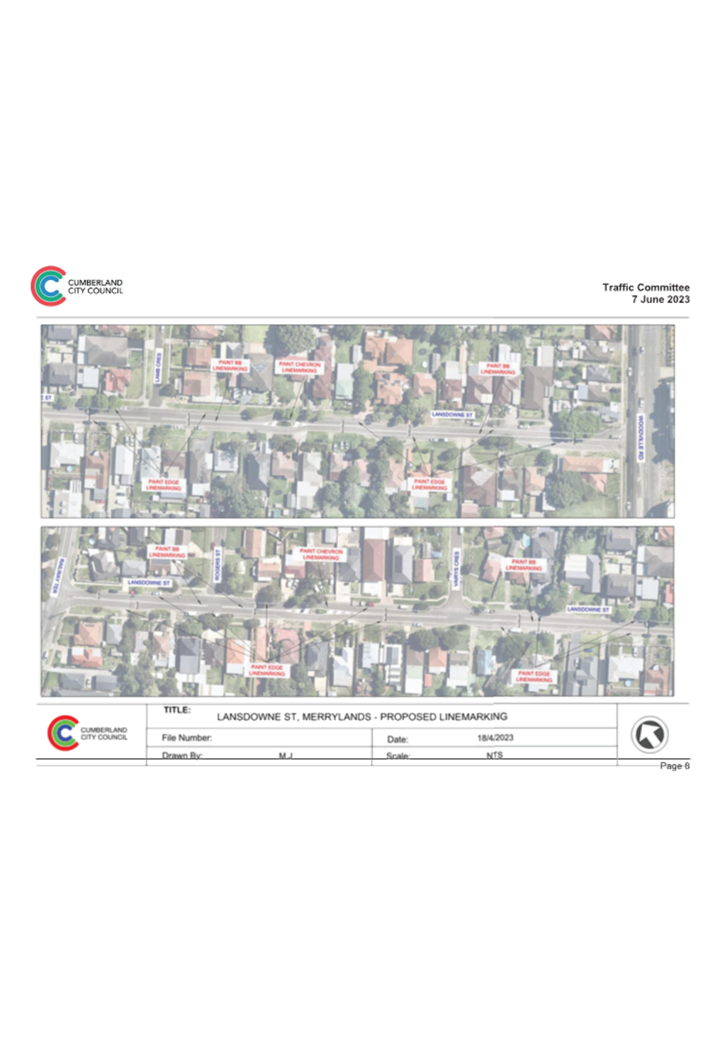
1. Plan
- Jonathan Street, Greystanes – Proposed ‘Bus Zone’ and
‘No Stopping’ Signs and Line Marking
DOCUMENTS
ASSOCIATED WITH
REPORT CTC-23-169
Attachment 1
Plan - Jonathan Street, Greystanes – Proposed
‘Bus Zone’ and ‘No Stopping’ Signs and Line Marking
1 November 2023
1 November 2023
Item
No: CTC-23-170
SMITH STREET,
PENDLE HILL – PROPOSED ‘BUS ZONE’ SIGNAGE
Directorate: Environment
and Planning
Responsible
Officer: Executive
Manager Development and Building
Electorate: Prospect
Police Area
Command (PAC): Cumberland
Agenda Part Part
1
Note: Recommended
for Approval under Delegated Authority
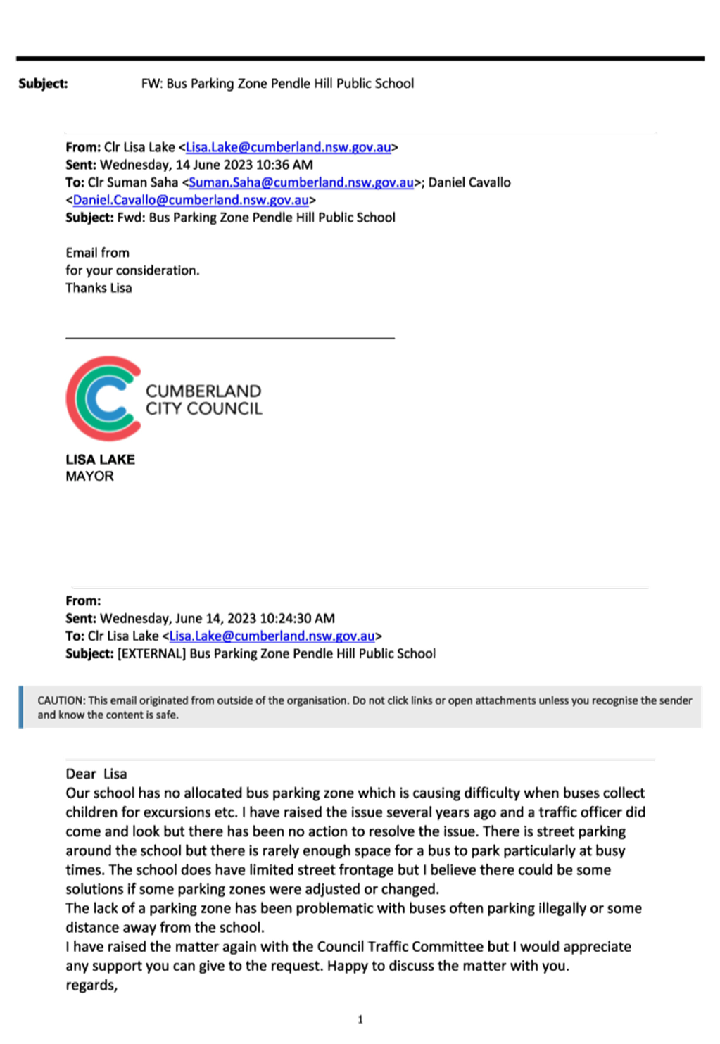
Council has received a request
from the Principal of Pendle Hill Public School for the provision of a Bus Zone
area outside the school for school buses to park during school hours.
This report outlines the outcome
of the investigation into this matter.
|
The Cumberland Traffic Committee recommends that:
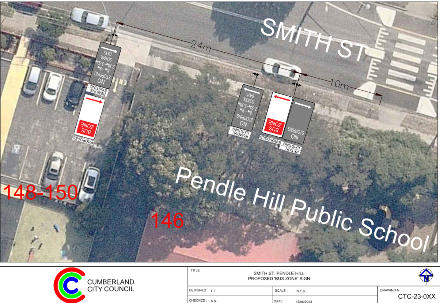
1. The
conversion of the existing ‘No Stopping 8am – 9am, 2:30pm –
3:30pm School Days’ signage on the southern side of Smith
Street, Pendle Hill outside Pendle Hill Public School to ‘Bus
Zone’ signage in accordance with the attached plan be approved.
2. The
adjacent property and the school be notified of the outcome.
|
Council has received a request
from the Principal of Pendle Hill Public School for the provision of a
‘Bus Zone’ area outside the school for school buses to park during
school hours. The school does not have any bus parking area in the streets
surrounding the school for picking up students for excursions and similar
activities during school hours.
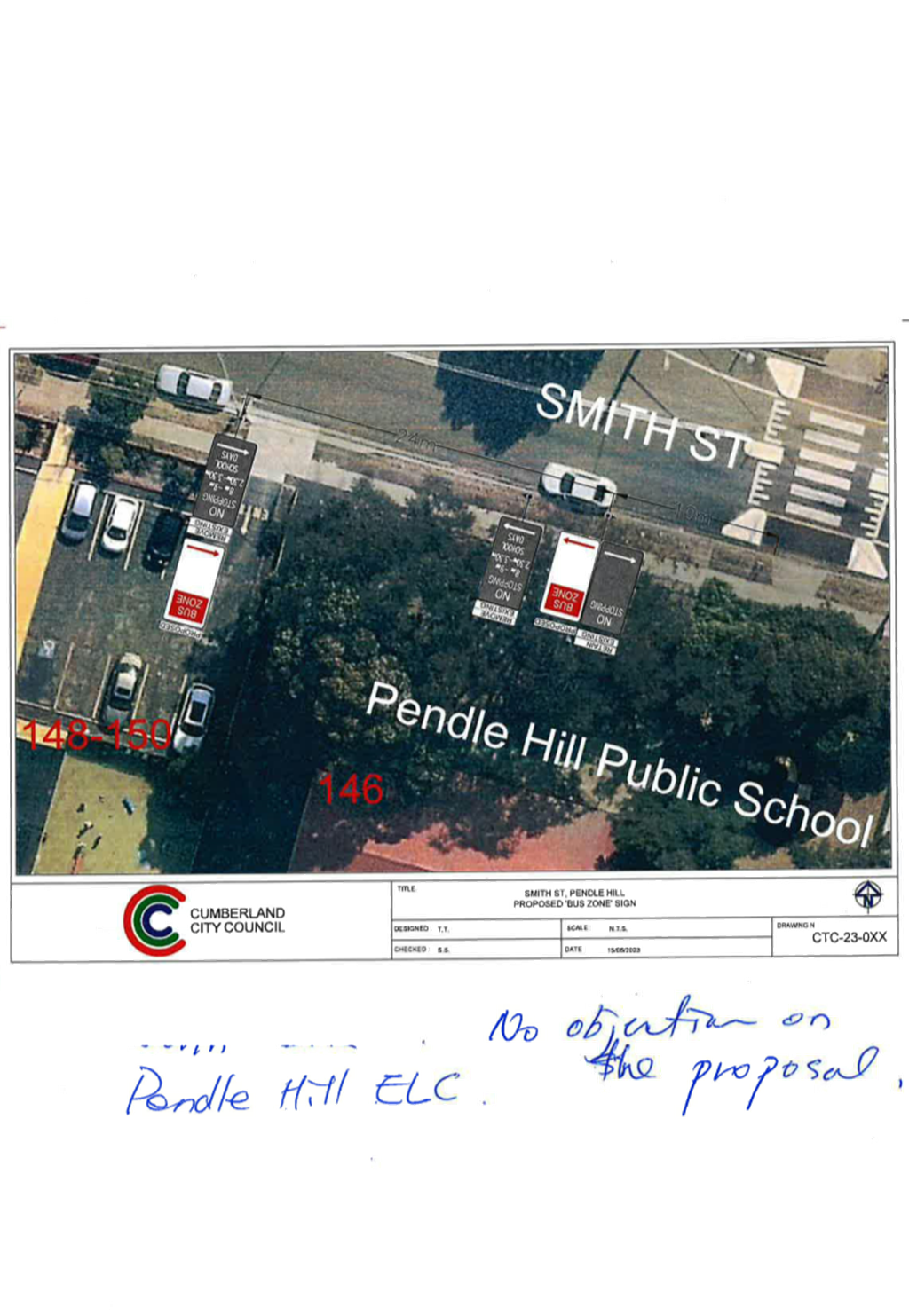
Pendle Hill Public School is
located at 146 Smith Street, Pendle Hill with a frontage at Smith Street and
back access from Arnett Street. Currently, there is no Bus Zone outside the
school.
The school principal alleged that
school buses cannot park safely outside the school frontage to pick up or drop
off students due to the lack of a Bus Zone around the school.

Locality Plan
In order to improve the safety and
convenience for school buses to pick up and drop off students, it is proposed
to replace the existing part-time ‘No Stopping’ zone on the
southern side of Smith Street along the school frontage with ‘Bus
Zone’ restrictions.
Council officers door knocked the
child care centre located at 148-150 Smith Street which will be directly
impacted by the proposal on 29 September 2023 and discussed with the Principal
of Pendle Hill Public School on 17 October 2023. Both of them expressed their
support for the proposed Bus Zone on Smith Street.
1. Plan - Smith
Street, Pendle Hill – Proposed ‘Bus Zone’ Signs.
2. Submissions
DOCUMENTS
ASSOCIATED WITH
REPORT CTC-23-170
Attachment 1
Plan - Smith Street, Pendle Hill –
Proposed ‘Bus Zone’ Signs.
1 November 2023
DOCUMENTS
ASSOCIATED WITH
REPORT CTC-23-170
Attachment 2
Submissions
1 November 2023
Item
No: CTC-23-171
LENA PLACE,
MERRYLANDS – PROPOSED PARKING RESTRICTIONS
Directorate: Environment
and Planning
Responsible
Officer: Executive
Manager Development and Building
Electorate: Granville
Police Area
Command (PAC): Cumberland
Agenda Part Part
1
Note: Recommended
for Approval under Delegated Authority
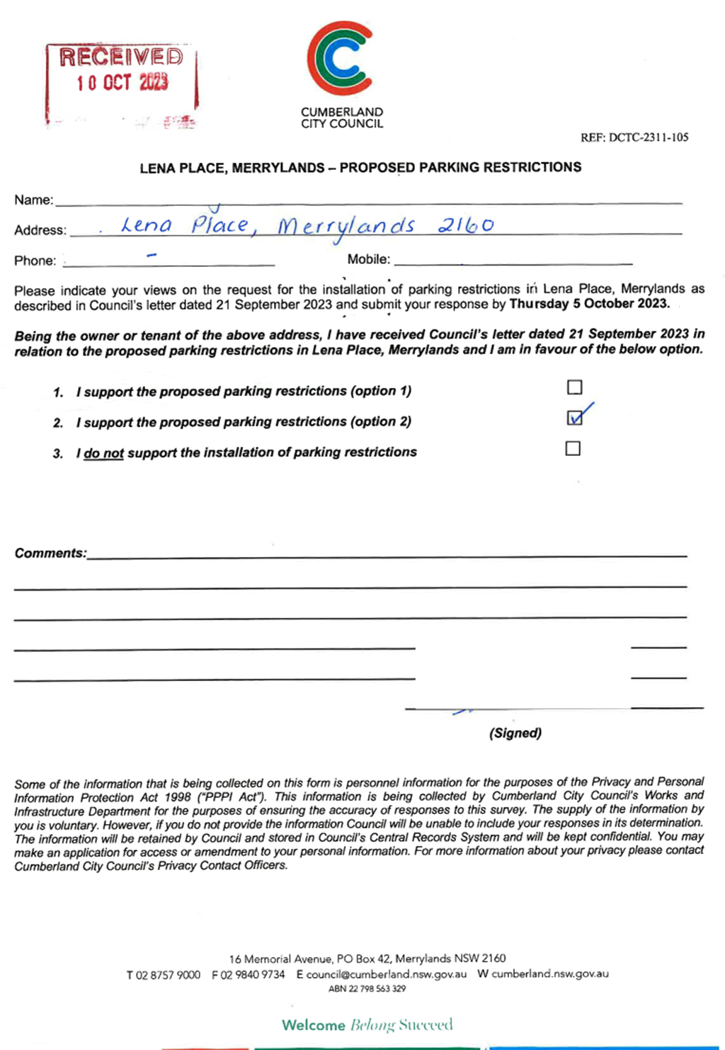
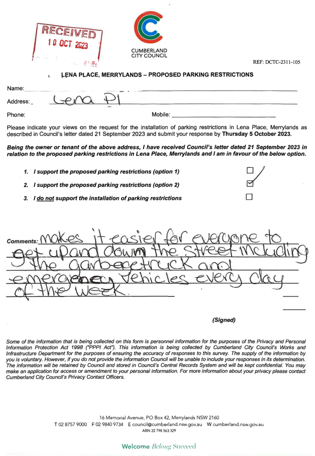
Council has received requests from
local residents regarding the installation of parking restrictions in Lena
Place, Merrylands due to vehicles having difficulty to access the street when
cars are parked on both sides of the street.
This report outlines the outcome
of the investigation and consultation into this matter.
|
The Cumberland Traffic Committee recommends that:
1. The
existing 'No Parking 6 AM to 12 PM Thursday’ signage on the
northern side of Lena Place between Burnett Street and Hillier Street be
replaced with ‘No Parking’ signage in accordance with the
attached plan.
2. The
affected /concerned residents be notified of the outcome.
|
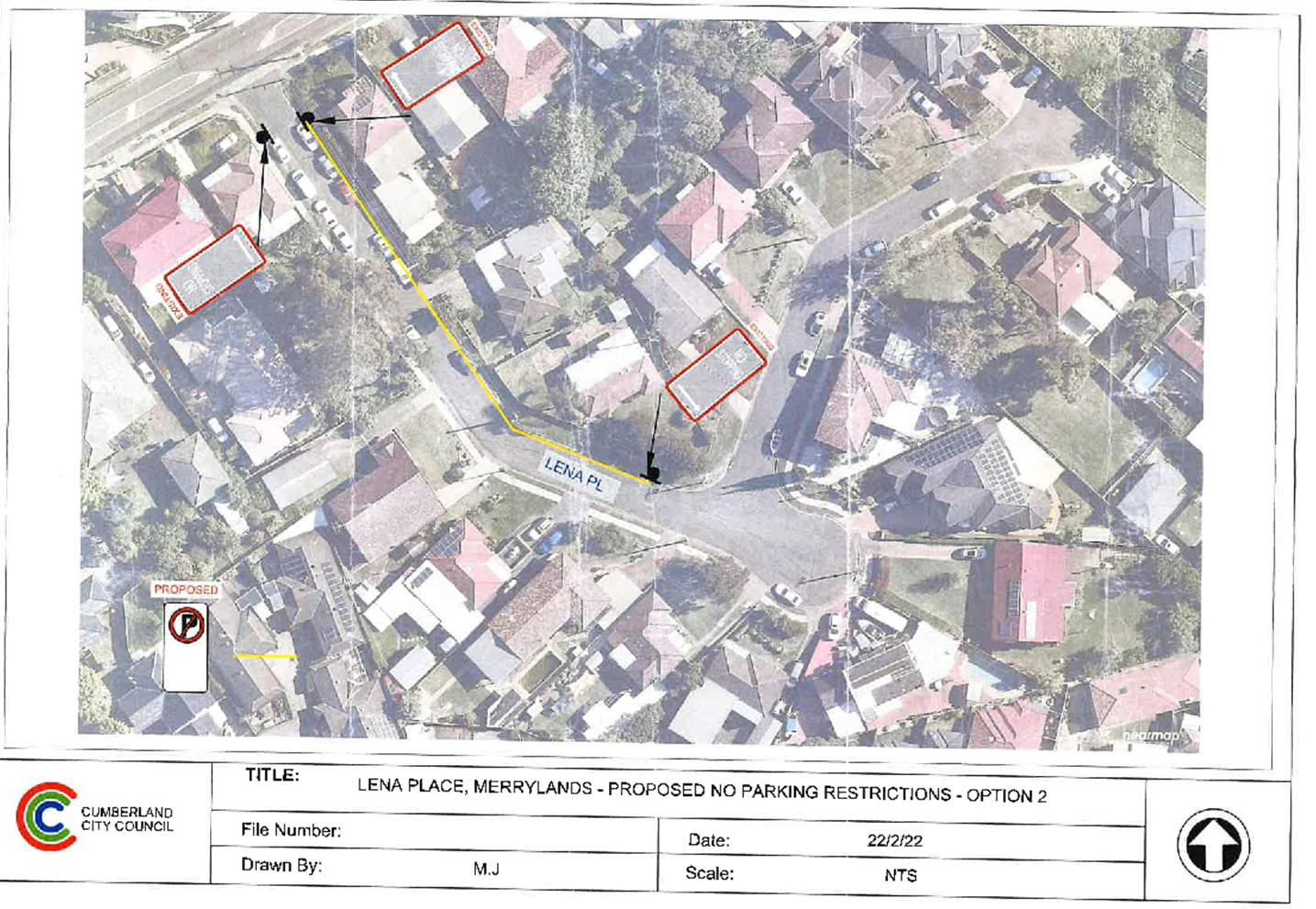
Lena Place is a local road that
runs in an easterly direction from Burnett Street and
ends in a cul-de-sac. The speed
limit of the street is 50 km/hr. It has a width of approximately 7m and parking
is permitted on both sides of the road in accordance
with Road Rules unless
signposted.
Hillier Street is a local road
that runs in a northerly direction from Lena Place and ends
in a cul-de-sac. The speed limit
of the street is 50 km/hr. It has a width of approximately 7m and parking is
permitted on both sides of the road in accordance with Road Rules
unless signposted.
Vehicles should be parked in a
staggered manner to provide 3m clearance for passing
vehicles.
Cumberland Traffic Committee
(CTC) at its meeting in April 2022 considered a report (CTC-22-061) regarding
the provision of parking restrictions in Lena Place, Merrylands during waste
collection nights and Council resolved to support the proposal.
Following the installation of
the parking restrictions, Council received requests from the residents in Lena
Place to further investigate the possibility of providing full-time parking
restrictions on one side of Lena Place particularly at the bend outside No. 1.
The map below shows the location of Lena Place:
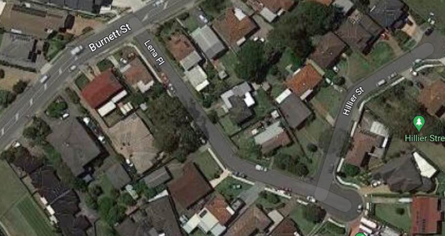
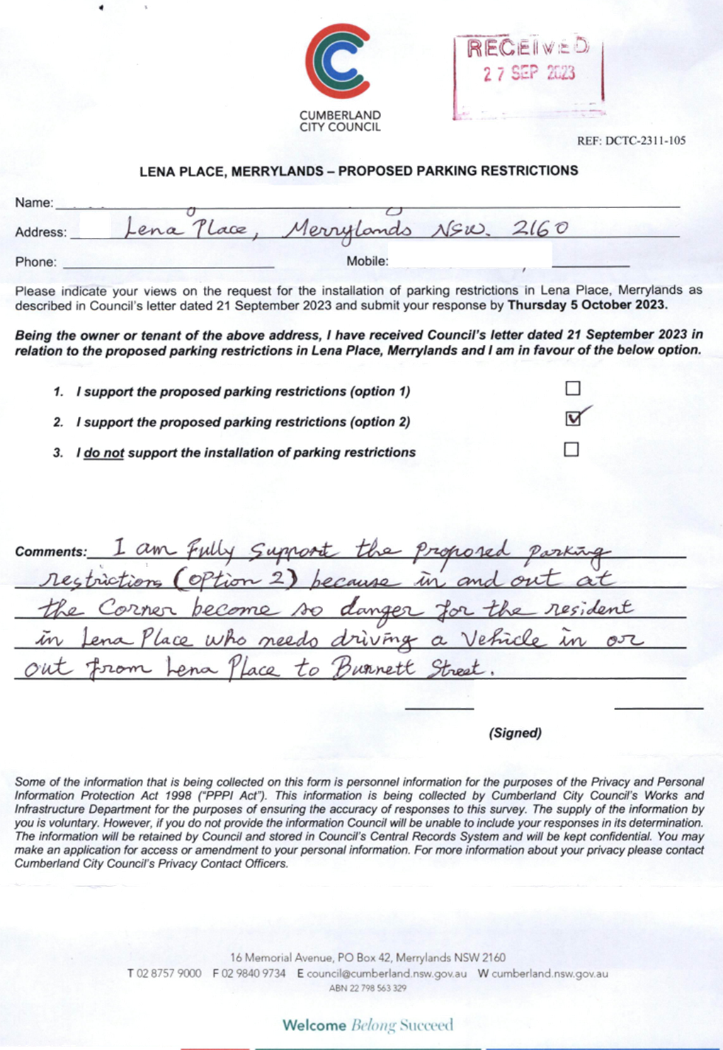
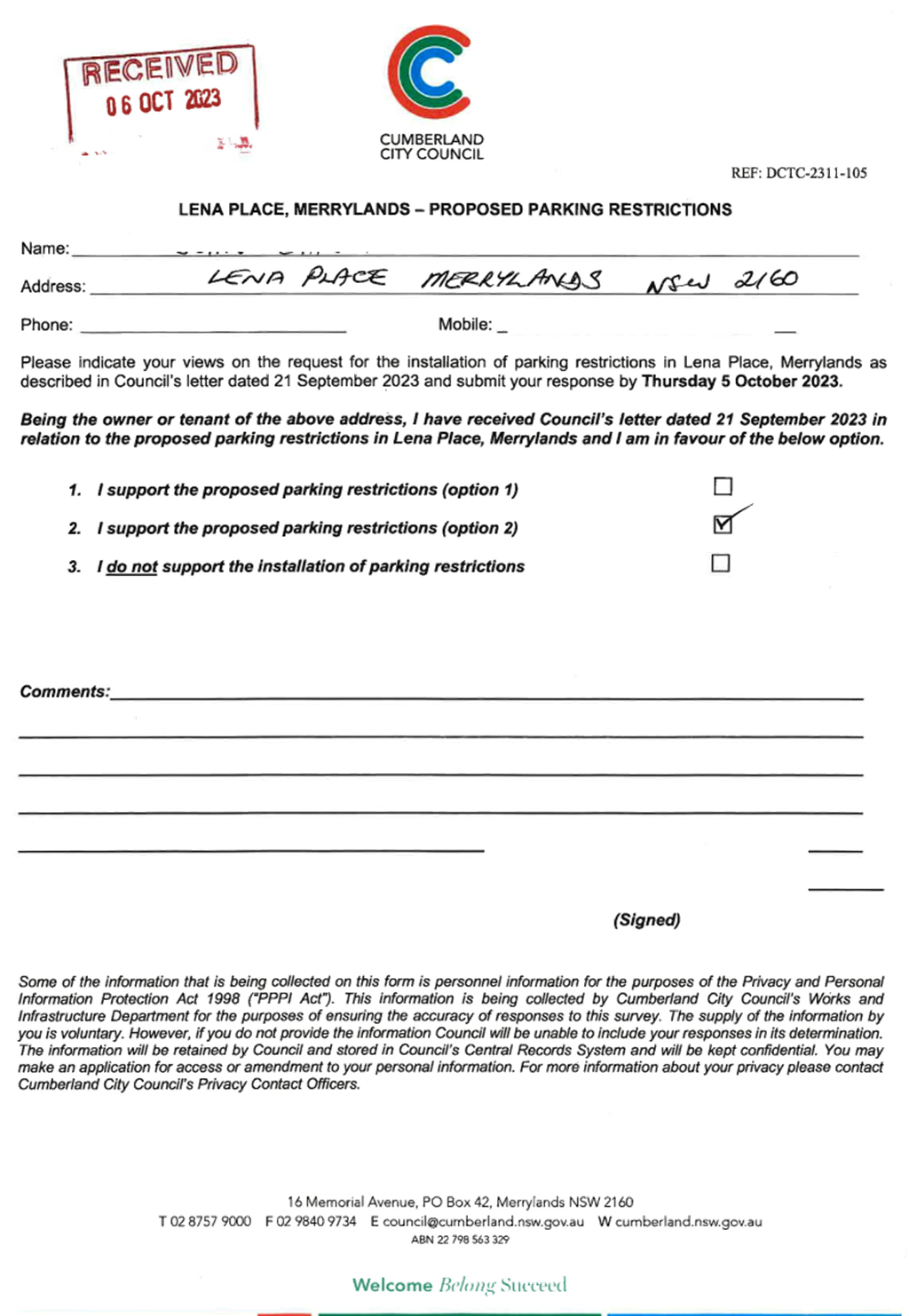
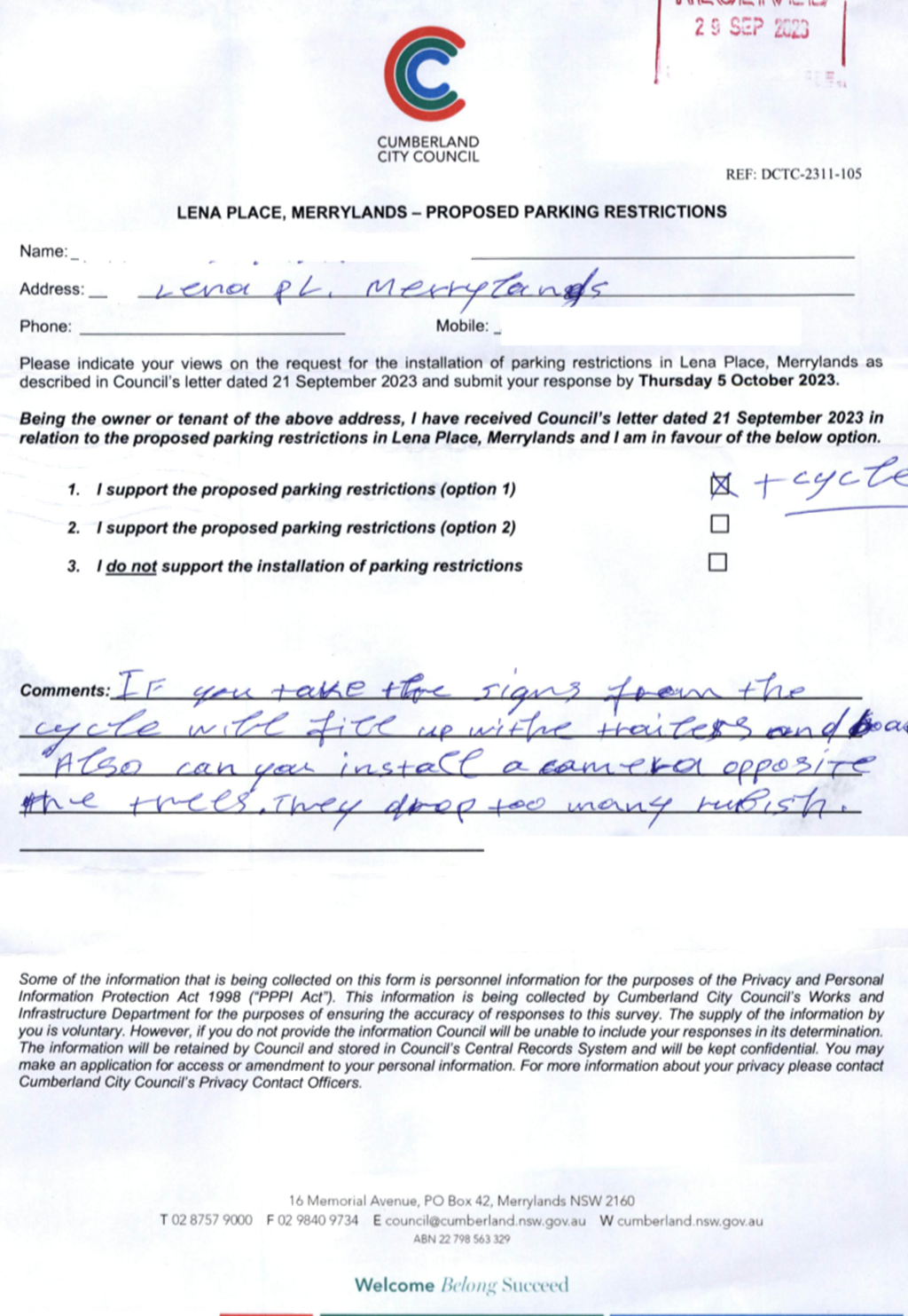
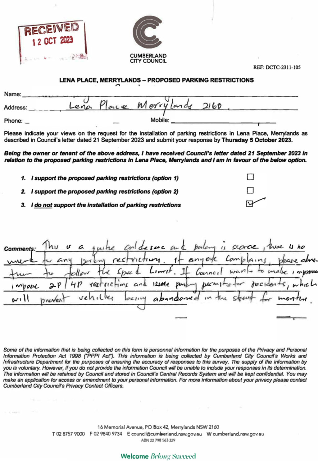
It is alleged by the residents that when cars are parked on
both sides of the street on Lena Place particularly at the bend outside No.1,
vehicles are not able to access the street due to the narrow road width.
An inspection revealed that parked vehicles in Lena Place
will severely restrict access for through traffic, including emergency
vehicles.
Residents who live in Lena Place were consulted with three
options from 21 September 2023 to 5 October 2023. The options were as follows:
1. Support
the proposed parking restrictions on the northern side of Lena Place outside
the bend.
2. Support
the proposed parking restriction on the northern side of Lena Place between
Burnett Street and Hillier Street.
3. Do
not support the installation of parking restrictions.
A total of 14 letters with attached survey forms were
distributed to residents/owners in Lena Place. Council received 7 responses
(50% of the total letters sent) by the closing date. A summary of the results
is shown in the table below:
|
Support the
proposed parking restrictions
|
Object to the
proposed parking restrictions
|
Total
Responses
received
|
|
Option 1
|
Option 2
|
Option 3
|
|
|
1
(14%)
|
5
(72%)
|
1
(14%)
|
7
|
The resident who objected to the
proposed parking restrictions was concerned about the lack of parking spaces in
the street and being unable to park in front of the property.
Based on the feedback from
residents in Lena Place, the majority of those who responded to the survey
supported full-time parking restrictions on the northern side of Lena Place
between Burnett Street and Hillier Street.
Considering that all properties
in Lena Place have off-street parking, such as a garage and/or long driveways,
it is proposed that the existing 'No Parking 6 AM to 12 PM Thursday' signs on
the northern side of Lena Place in Merrylands be replaced with full time 'No
Parking' signs, in accordance with the attached plan.
The proposal was notified to the
impacted resident for a period of 14 days from 21 September 2023 to 5 October
2023.
A total of 14 letters were
distributed to the residents / owners with an attached survey form.
Council received 7 responses
(50% of the total letters sent) by the closing date, out of these, one response
supported option 1, 5 responses supported option 2 and one response objected to
the proposed parking restrictions.
1. Plan - Lena Pl -
No Parking - OPTION 2
2. Submissions
DOCUMENTS
ASSOCIATED WITH
REPORT CTC-23-171
Attachment 1
Plan - Lena Pl - No Parking - OPTION 2
1 November 2023

DOCUMENTS
ASSOCIATED WITH
REPORT CTC-23-171
Attachment 2
Submissions
1 November 2023
Part 2
Recommendation to Council
1 November 2023
Item
No: CTC-23-172
KIHILLA ROAD,
AUBURN - ROAD SAFETY CONCERNS
Directorate: Environment
and Planning
Responsible
Officer: Executive
Manager Development and Building
Electorate: Auburn
Police Area
Command (PAC): Auburn
Agenda Part Part
2
Note: Recommendation
to Council
Council has received a request
from a local resident for the installation of traffic calming devices on
Kihilla Road, Auburn due to speeding concerns.
This report outlines the outcome
of the review.
|
The Cumberland Traffic Committee recommends that:
1. The installation of
traffic calming devices on Kihilla Road, Auburn not be supported.
2. The concerned
resident be notified of the outcome.
|
Council has received a request
from a local resident for the installation of traffic calming devices on
Kihilla Road, Auburn, due to speeding concerns.
Kihilla Road is a local road that
runs in a north-south direction between Great Western Highway and Rawson
Street. Kihilla Road is approximately 700m long and has a width of 9.5m. The
speed limit in the street is 50km/h, and parking is permitted on both sides of
the road unless otherwise signposted.
Cumberland Traffic Committee
considered a report on the proposed intersection treatment at Kihilla Road and
Argyle Street at its 2 August 2023 meeting and recommended the installation of
speed cushions on the Kihilla Road approaches to the intersection. Council
approved the recommendations in September 2023 and the proposal is included in
Council’s future Works Program.
The latest Centre for Road Safety
accident data indicated that there were no reported accidents related to
speeding in Kihilla Road in the last 5 years ending December 2022.
The map below shows the location
of Kihilla Road.
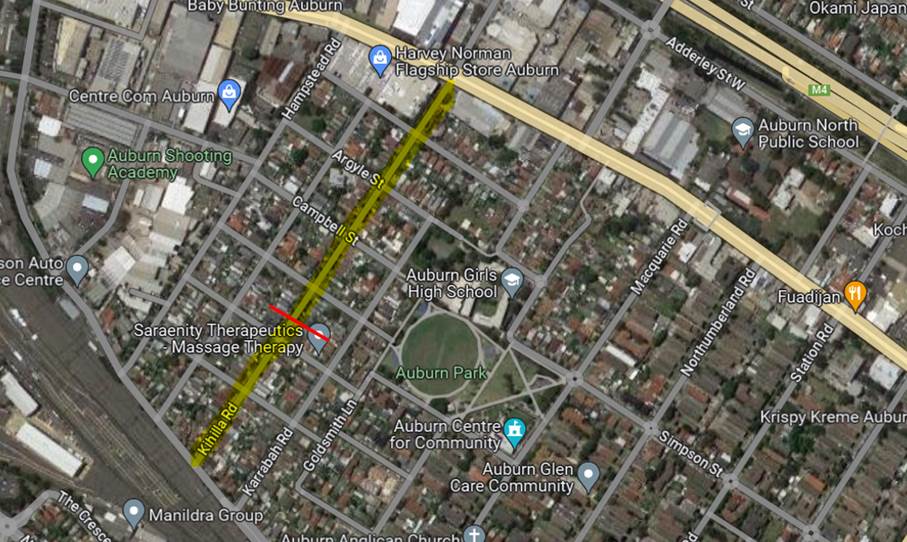 Locality Plan
A traffic count was undertaken on
Kihilla Road in February 2023. The traffic count location is shown in red on
the map above.
The results of the traffic count
indicated the following:
Traffic count Data on
Kihilla Road, Auburn:
Average
Daily Traffic (ADT) = 1,102 veh/day,
85th percentile speed = 43.2 km/h,
Mean (average) vehicle speed = 37 km/h.
The result of the traffic count
and recorded crashes were used in the assessment to determine the need for the installation
of traffic calming devices on Kihilla Road in accordance with the criteria set
out in Council’s Local Area Traffic Management Policy (LATM) Policy.
The LATM assessments are
summarised in the tables below:
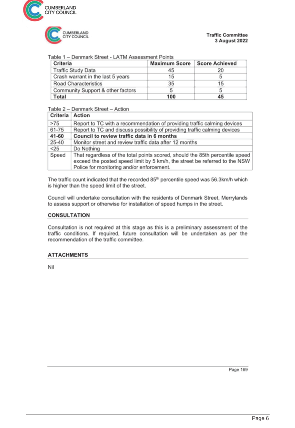
Table 1 – Kihilla Road -
LATM Assessment Points
|
Criteria
|
Maximum Score
|
Score Achieved
|
|
Traffic Study Data
|
45
|
10
|
|
Crash warrant in the
last 5 years
|
15
|
0
|
|
Road Characteristics
|
35
|
9
|
|
Community Support &
other factors
|
5
|
5
|
|
Total
|
100
|
24
|
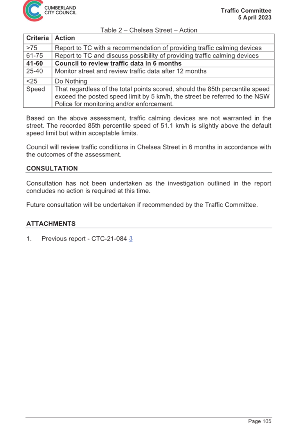
Table 2 – Kihilla Road
– Action
|
Criteria
|
Action
|
|
>75
|
Report to TC with a
recommendation of providing traffic calming devices
|
|
61-75
|
Report to TC and
discuss possibility of providing traffic calming devices
|
|
41-60
|
Council to review
traffic data in 6 months
|
|
25-40
|
Monitor street and
review traffic data after 12 months
|
|
<25
|
Do Nothing
|
|
Speed
|
That regardless of the
total points scored, should the 85th percentile speed exceed the posted speed
limit by 5 km/h, the street be referred to the NSW Police for monitoring
and/or enforcement.
|
The traffic count data indicated
that the recorded 85th percentile speed was 43.2 km/h which is below
the default speed limit of a 50km/h street.
Based on the above assessment,
traffic calming devices are not warranted in the street. Therefore, the request
for the installation of traffic calming devices on Kihilla Road cannot be
supported and no action will be taken at this time.
Consultation has not been
undertaken as the investigation outlined in the report concludes no action is
required.
Future consultation will be
undertaken if recommended by the traffic committee.
Nil
1 November 2023
Item
No: CTC-23-173
KIRKHAM ROAD,
AUBURN – ROAD SAFETY CONCERNS
Directorate: Environment
and Planning
Responsible
Officer: Executive
Manager Development and Building
Electorate: Auburn
Police Area
Command (PAC): Auburn
Agenda Part Part
2
Note: Recommendation
to Council
Council has reviewed traffic
conditions on Kirkham Road, Auburn.
|
The Cumberland Traffic Committee recommends that the
installation of traffic calming devices on Kirkham Road, Auburn not be
supported.
|
Cumberland Traffic Committee (CTC)
at its meeting in March 2022 considered a report (CTC-22-045) regarding
speeding concerns on Kirkham Road, Auburn. Council resolved that:
1. The
installation of traffic calming devices on Kirkham Road, Auburn not be
supported.
2. Council
review conditions in Kirkham Road, Auburn in June 2023 and report back to
traffic committee.
In accordance with Council’s
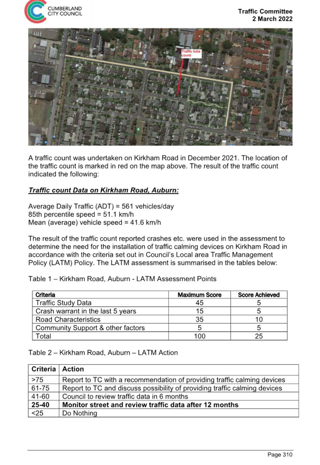
resolution, a traffic count was undertaken on Kirkham Road in June 2023. The
traffic count location is shown in red on the map below.
Council officers have reviewed the
traffic count data and compared it with the previous traffic count data
undertaken in December 2021.
|
Traffic
count date
|
Average
Daily Traffic
|
85th
Percentile Speed
|
|
December
2021
|
561
|
51.1
km/h
|
|
June
2023
|
560
|
52.7
km/h
|
The traffic count data from the
table above indicated that traffic volume (ADT) and the recorded 85th
percentile speeds on Kirkham Road are similar compared to the traffic data
collected in 2021.
The latest Centre for Road Safety
accident data indicated that there were no reported accidents on Kirkham Road
in the last 5 years ending December 2022 in relation to speeding.
Council’s Officers have
undertaken a further review of the traffic conditions on Kirkham Road in
accordance with Cumberland City Council Local Area Traffic Management (LATM)
Policy.
The LATM assessments are
summarised in the tables below:
Table 1 – Kirkham Road -
LATM Assessment Points
|
Criteria
|
Maximum Score
|
Score Achieved
|
|
Traffic Study Data
|
45
|
5
|
|
Crash warrant in the
last 5 years
|
15
|
0
|
|
Road Characteristics
|
35
|
11
|
|
Community Support &
other factors
|
5
|
5
|
|
Total
|
100
|
21
|
Table 2 – Kirkham Road
– Action
|
Criteria
|
Action
|
|
>75
|
Report to TC with a recommendation of providing traffic
calming devices
|
|
61-75
|
Report to TC and discuss possibility of providing traffic
calming devices
|
|
41-60
|
Council to review traffic data in 6 months
|
|
25-40
|
Monitor street and review traffic data after 12 months
|
|
<25
|
Do Nothing
|
|
Speed
|
That regardless of the total points scored, should the
85th percentile speed exceed the posted speed limit by 5 km/h, the street be
referred to the NSW Police for monitoring and/or enforcement.
|
The traffic count indicated that
the recorded 85th percentile speed was 52.7 km/h which is within acceptable
range for a local street with a 50 km/h speed limit.
Based on the above assessment,
traffic calming devices are not warranted on the street at this time.
Consultation has not been undertaken as the investigation
outlined in the report concludes no action is required.
Consultation will be undertaken if recommended by the
Traffic Committee.
1. Previous report
CTC-22-045
DOCUMENTS
ASSOCIATED WITH
REPORT CTC-23-173
Attachment 1
Previous report CTC-22-045
1 November 2023
Item
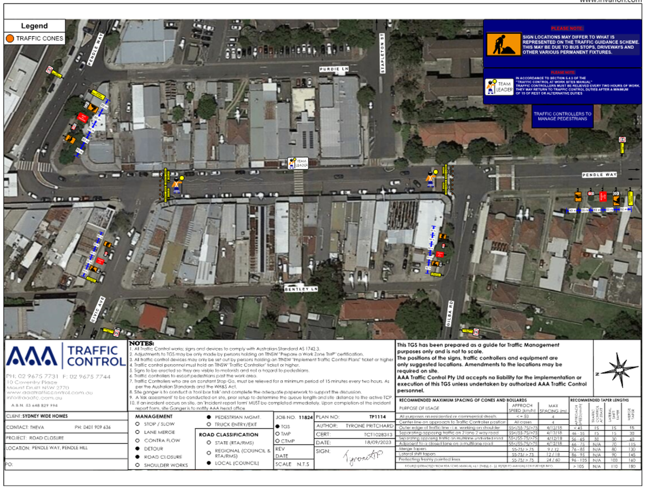
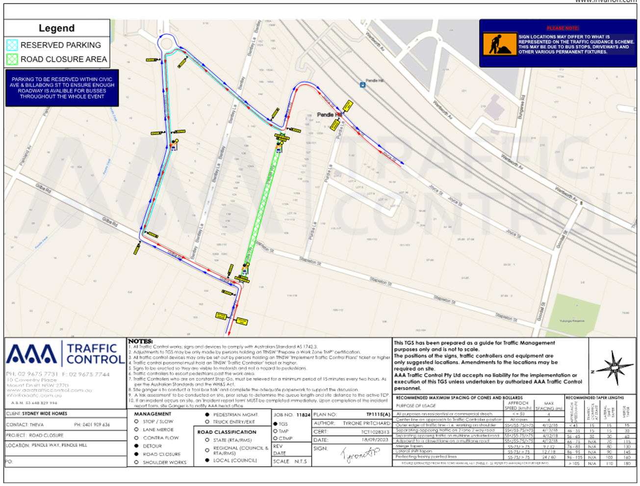
No: CTC-23-174
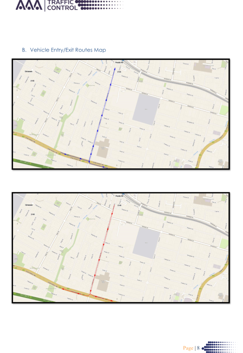
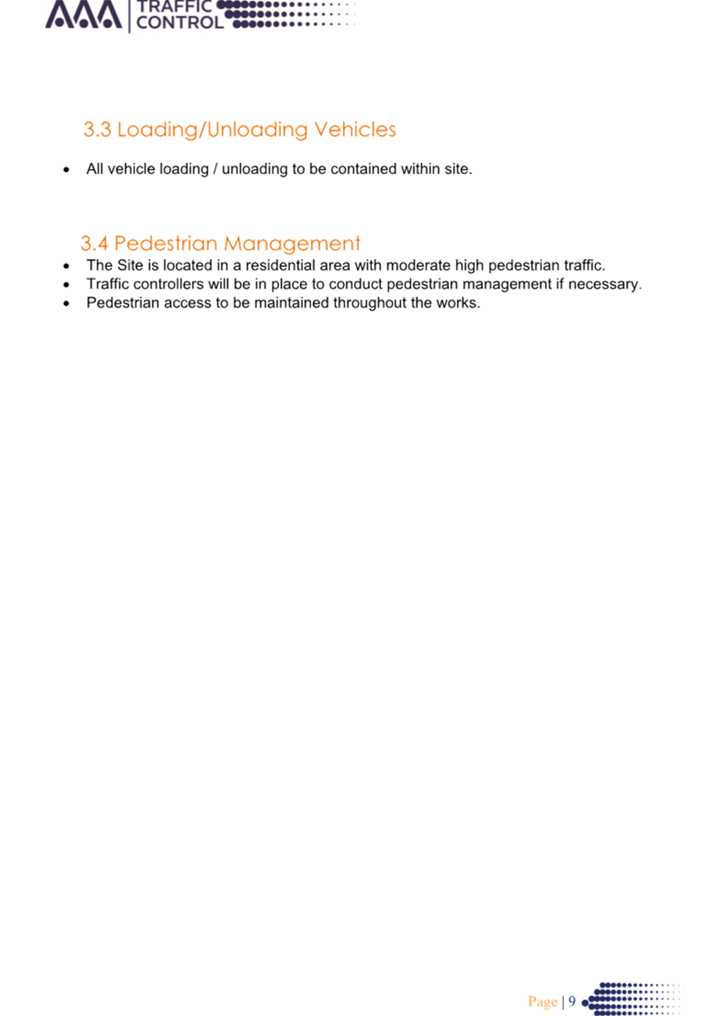
PENDLE WAY,
PENDLE HILL – ROAD SAFETY CONCERNS
Directorate: Environment
and Planning
Responsible
Officer: Executive
Manager Development and Building
Electorate: Prospect
Police Area
Command (PAC): Cumberland
Agenda Part Part
2
Note: Recommendation
to Council
Council has reviewed traffic
conditions on Pendle Way, Pendle Hill.
|
The Cumberland Traffic Committee recommends that:
1. The
installation of traffic calming devices on Pendle Way, Pendle Hill not be
supported.
2. Council
review conditions in Pendle Way, Pendle Hill, in November 2024 and report
back to Traffic Committee if required.
|
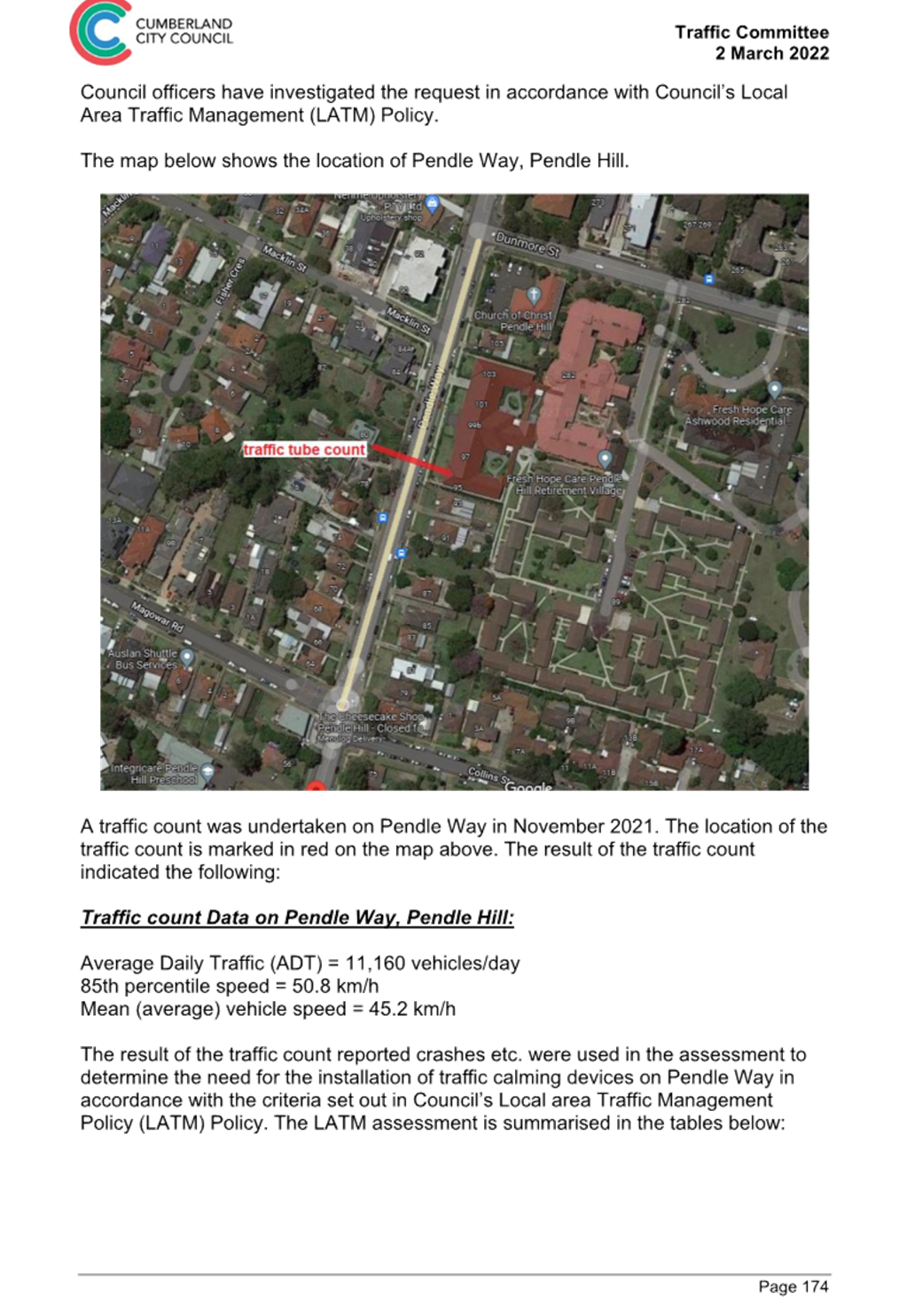
Cumberland Traffic Committee (CTC)
at its meeting in March 2022 considered a report (CTC-22-046) regarding
speeding concerns on Pendle Way, Pendle Hill. Council resolved that:
· The Traffic
Committee recommends the installation of traffic calming devices on Pendle Way,
Pendle Hill not be supported.
The report also noted that a
further review would be undertaken in 12 months.
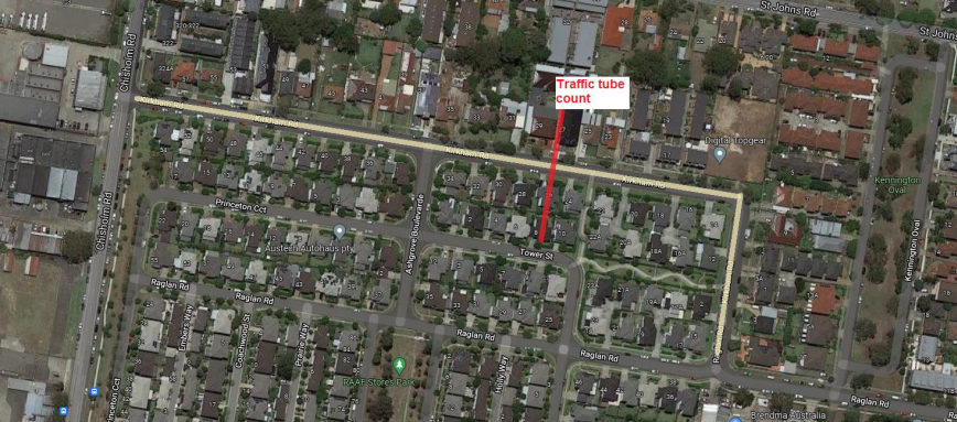
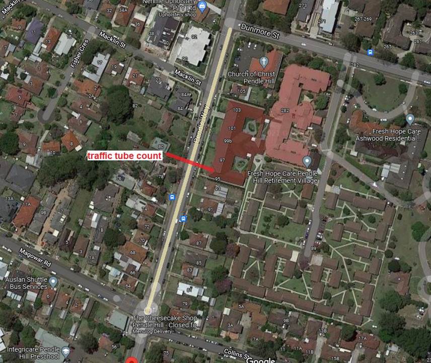
A traffic count was undertaken on
Pendle Way in June 2023. The traffic count location is shown in red on the map
below.
Council officers have reviewed
the traffic count data and compared it with the previous traffic count data
undertaken in November 2021.
|
Traffic
count date
|
Average
Daily Traffic
|
85th
Percentile Speed
|
|
November
2021
|
11,160
|
50.8
km/h
|
|
June
2023
|
12,397
|
49.0
km/h
|
The traffic count data from the table above indicated that
the traffic volume (ADT) has increased while the recorded 85th percentile
speeds have reduced in Pendle Way since 2021.
The latest Centre for Road Safety accident data indicated
that there was 1 reported accident at this section of Pendle Way in the last 5
years ending December 2022 in relation to speeding. This accident occurred 30
metres north from the intersection of Magowar Road, relating to a vehicle
losing control and hitting an object.
Council’s Officers have undertaken a further review of
the traffic conditions Pendle Way in accordance with Council’s Local Area
Traffic Management (LATM) Policy.
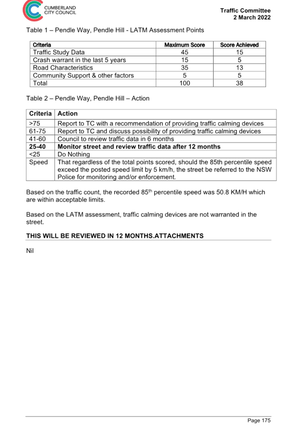
The LATM assessments are summarised in the tables below:
Table 1 – Pendle
Way - LATM Assessment Points
|
Criteria
|
Maximum Score
|
Score Achieved
|
|
Traffic Study Data
|
45
|
15
|
|
Crash warrant in the
last 5 years
|
15
|
5
|
|
Road Characteristics
|
35
|
14
|
|
Community Support &
other factors
|
5
|
5
|
|
Total
|
100
|
39
|
Table 2 – Pendle Way – Action
|
Criteria
|
Action
|
|
>75
|
Report to TC with a recommendation of providing traffic
calming devices
|
|
61-75
|
Report to TC and discuss possibility of providing traffic
calming devices
|
|
41-60
|
Council to review traffic data in 6 months
|
|
25-40
|
Monitor street and review traffic data after 12 months
|
|
<25
|
Do Nothing
|
|
Speed
|
That regardless of the total points scored, should the
85th percentile speed exceed the posted speed limit by 5 km/h, the street be
referred to the NSW Police for monitoring and/or enforcement.
|
The traffic count indicated that
the recorded 85th percentile speed was 49.0 km/h which is below the 50km/h
speed limit of the street.
Based on the above assessment,
traffic calming devices are not warranted on the street. Council will review
traffic conditions on Pendle Way in 12 months and report back to the Traffic
Committee if required.
Consultation has not been undertaken as the investigation
outlined in the report concludes no action is required.
Consultation will be undertaken if recommended by the
Traffic Committee.
1. Previous report
CTC-22-046
DOCUMENTS
ASSOCIATED WITH
REPORT CTC-23-174
Attachment 1
Previous report CTC-22-046
1 November 2023
Item
No: CTC-23-175
JOYCE STREET,
PENDLE HILL – ROAD SAFETY CONCERNS
Directorate: Environment
and Planning
Responsible
Officer: Executive
Manager Development and Building
Electorate: Prospect
Police Area
Command (PAC): Cumberland
Agenda Part Part
2
Note: Recommendation
to Council
Council has reviewed traffic
conditions in Joyce Street, Pendle Hill.
|
The Cumberland Traffic Committee recommends that:
1. The
installation of traffic calming devices on Joyce Street, Pendle Hill not be
supported.
2. Council
review conditions on Joyce Street, Pendle Hill in June 2024 and report back
to Traffic Committee if required.
|
Cumberland Traffic Committee (CTC)
at its meeting in April 2022 considered a report (CTC-22-081) regarding traffic
calming devices on Joyce Street, Pendle Hill. Council resolved that:
1. The
installation of traffic calming devices on Joyce Street, Pendle Hill not be
supported.
2. Council
review conditions in Joyce Street, Pendle Hill in June 2023, and
i) report
back to traffic committee.
In accordance to Council’s
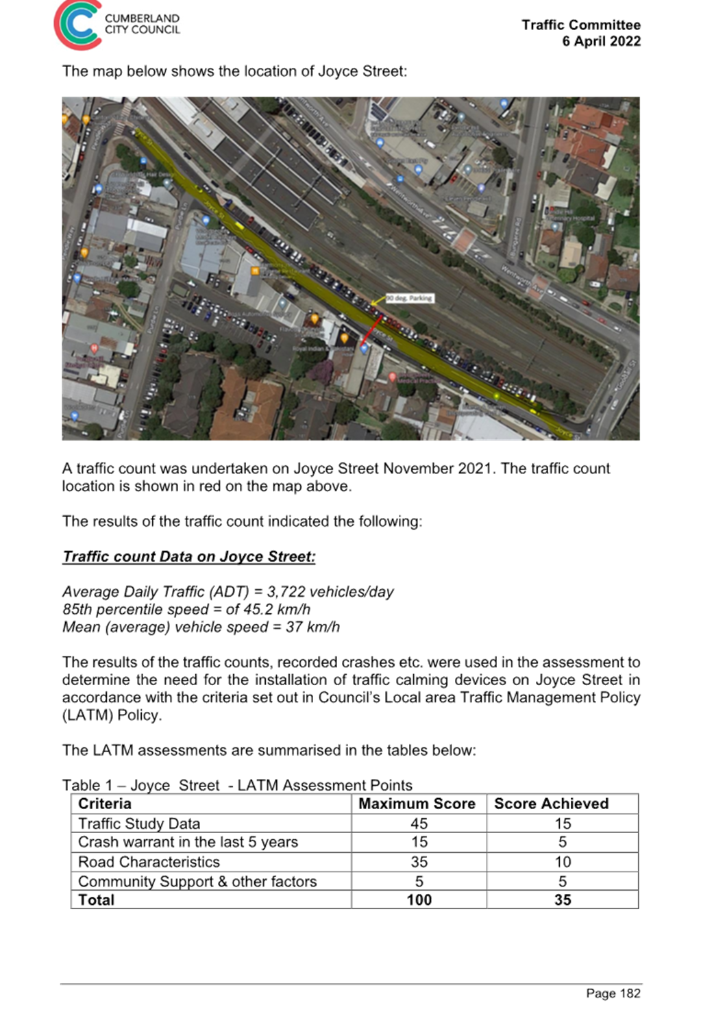
resolution, a traffic count was undertaken on Joyce Street in June 2023. The
traffic count location is shown in red on the map below.
Council officers have reviewed
the traffic count data taken in June 2023 and compared it with the previous
traffic count data undertaken in November 2021.
|
Traffic
count date
|
Average
Daily Traffic
|
85th
Percentile Speed
|
|
November
2021
|
3,722
|
45
km/h
|
|
June
2023
|
3,114
|
44.8
km/h
|
The traffic count data from the table above indicated that
both traffic volume (ADT) and the recorded 85th percentile speeds in Joyce
Street have reduced since 2021.
The latest Centre for Road Safety accident data indicated
that there was 1 reported accident at this section of Joyce Street in the last
5 years ending December 2022. This accident occurred 100 metres west from the
intersection of Goodall Street, in relation to a vehicle losing control and
hitting an object.
Council officers have undertaken a further review of the
traffic conditions Joyce Street in accordance with Council’s Local Area
Traffic Management (LATM) Policy.
The LATM assessments are summarised in the tables below:
Table 1 – Joyce Street - LATM Assessment Points
|
Criteria
|
Maximum Score
|
Score Achieved
|
|
Traffic Study Data
|
45
|
15
|
|
Crash warrant in the
last 5 years
|
15
|
5
|
|
Road Characteristics
|
35
|
16
|
|
Community Support &
other factors
|
5
|
5
|
|
Total
|
100
|
41
|
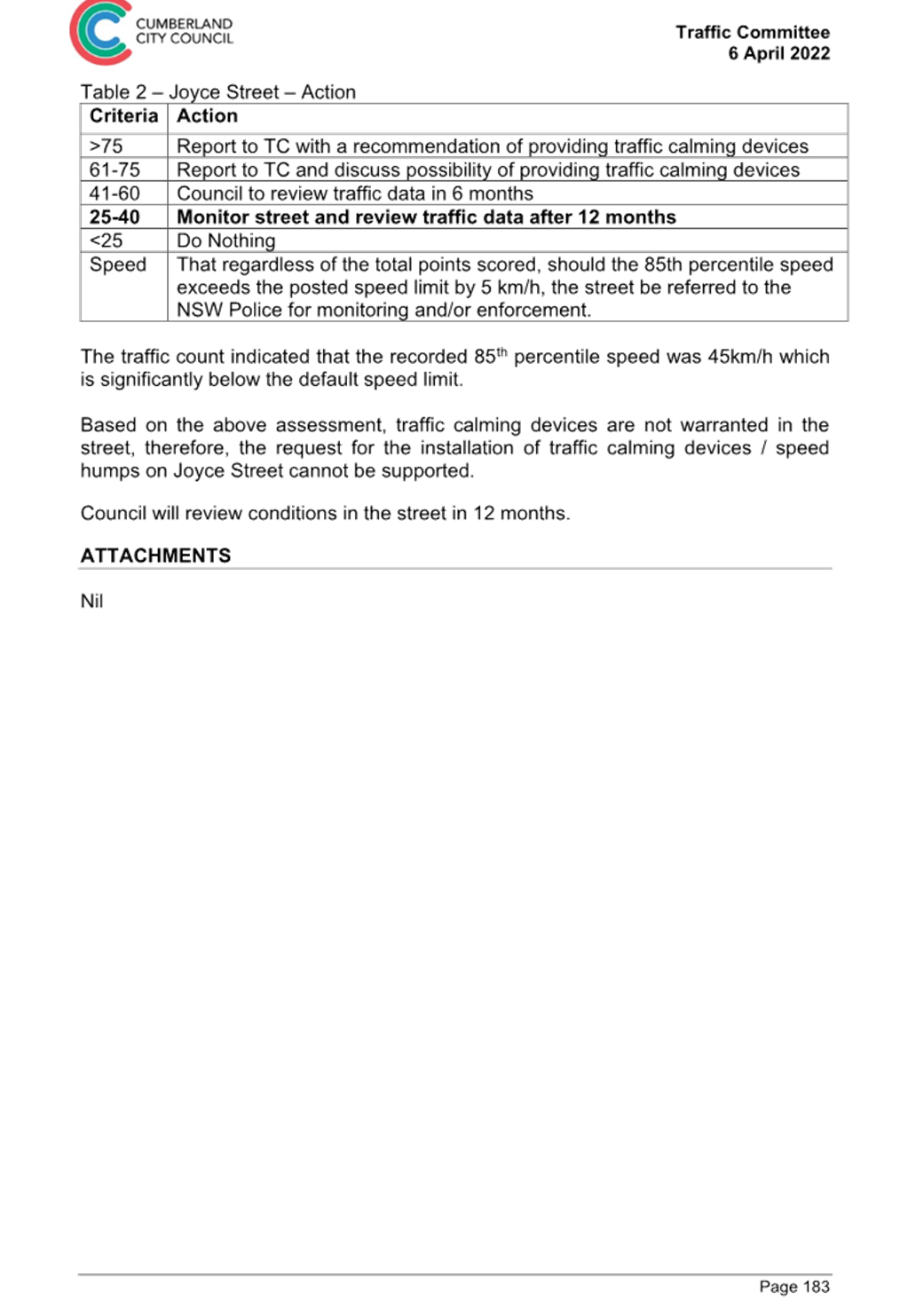
Table 2 – Joyce Street – Action
|
Criteria
|
Action
|
|
>75
|
Report to TC with a recommendation of providing traffic
calming devices
|
|
61-75
|
Report to TC and discuss possibility of providing traffic
calming devices
|
|
41-60
|
Council to review traffic data in 6 months
|
|
25-40
|
Monitor street and review traffic data after 12 months
|
|
<25
|
Do Nothing
|
|
Speed
|
That regardless of the total points scored, should the
85th percentile speed exceed the posted speed limit by 5 km/h, the street be
referred to the NSW Police for monitoring and/or enforcement.
|
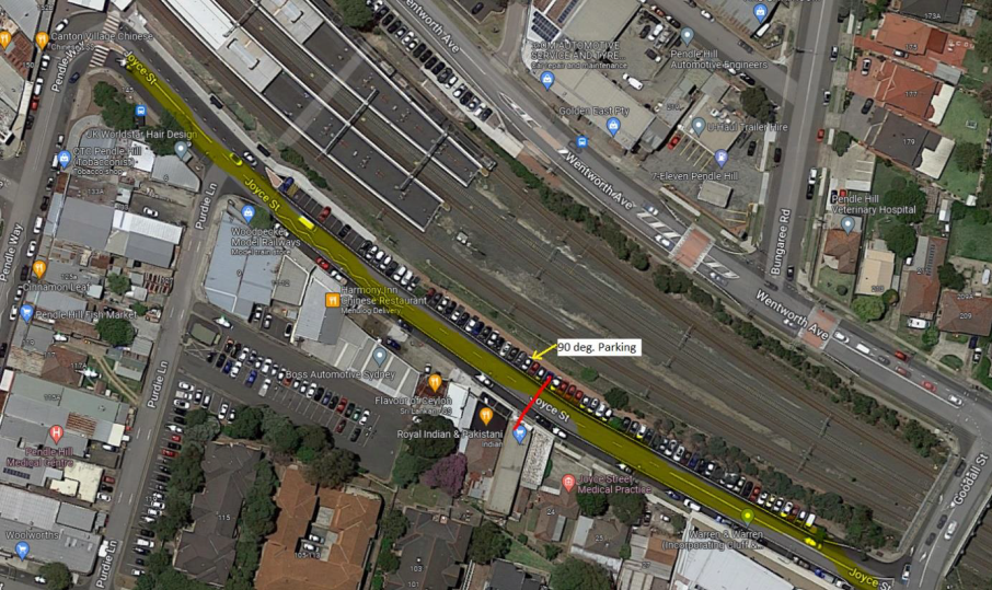
The traffic count indicated that
the recorded 85th percentile speed was 44.8 km/h which is below the 50km/h
speed limit of the street.
Based on the above assessment,
traffic calming devices are not warranted on the street. Council will review
traffic conditions on Joyce Street in 6 months and report back to Traffic
Committee if required.
Consultation has not been undertaken as the investigation
outlined in the report concludes no action is required.
Consultation will be undertaken if recommended by the
Traffic Committee.
1. Previous report
CTC-22-081
DOCUMENTS
ASSOCIATED WITH
REPORT CTC-23-175
Attachment 1
Previous report CTC-22-081
1 November 2023
Item
No: CTC-23-176
CUMBERLAND
ROAD, AUBURN – ROAD SAFETY CONCERNS
Directorate: Environment
and Planning
Responsible
Officer: Executive
Manager Development and Building
Electorate: Auburn
Police Area
Command (PAC): Auburn
Agenda Part Part
2
Note: Recommendation
to Council
Council has received safety
concerns regarding traffic conditions on Cumberland Road, Auburn between
Chiswick Road and Rickard Street due to speeding issues.
This report outlines the outcome
of the review.
|
The Cumberland Traffic Committee recommends that:
1. The
installation of traffic calming devices on Cumberland Road, Auburn between
Chiswick Road and Rickard Street not be supported.
2. Council
review conditions on Cumberland Road, Auburn in November 2024, and report
back to the Traffic Committee if required.
|
Cumberland Road, Auburn is a local
collector road that runs in a north-south direction between St Johns Road and
The Crescent. The speed limit is 50km/h and parking is permitted on both sides
of the road unless signposted. Cumberland Road is approximately 2.8 km long and
12.5m wide.
Council has received a request
from a local resident for the installation of traffic calming devices on
Cumberland Road. The resident has raised speeding in the vicinity of their
property in the section between Chiswick Road and Elm Road.
For this investigation, Council
has considered the approximately 360m long section of Cumberland Road between
Chiswick Road and Rickard Street which comprises the section where the resident
has complained.
A traffic count was undertaken on
Cumberland Road in June 2023. The traffic count location is shown in red on the
map below.
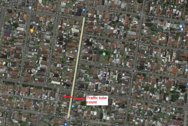
Council officers have reviewed
the traffic count data and the details are given below:
Both results are detailed in the table below:
Average Daily Traffic = 8,302
Veh/day
85th percentile speed =
49.5 km/hr
Median speed =
43.2 km/hr
The latest Centre for Road Safety accident data indicated
that there were no reported accidents in this section of Cumberland Road
between Rickard Street and Chiswick Road in the last 5 years ending December
2022.
Council officers have undertaken a further review of the
traffic conditions Cumberland Road in accordance with Council’s Local
Area Traffic Management (LATM) Policy.
The LATM assessments are summarised in the tables below:
Table 1 – Cumberland Road - LATM Assessment Points
|
Criteria
|
Maximum Score
|
Score Achieved
|
|
Traffic Study Data
|
45
|
15
|
|
Crash warrant in the
last 5 years
|
15
|
0
|
|
Road Characteristics
|
35
|
10
|
|
Community Support &
other factors
|
5
|
5
|
|
Total
|
100
|
30
|
Table 2 – Cumberland Road – Action
|
Criteria
|
Action
|
|
>75
|
Report to TC with a recommendation of providing traffic
calming devices
|
|
61-75
|
Report to TC and discuss possibility of providing traffic
calming devices
|
|
41-60
|
Council to review traffic data in 6 months
|
|
25-40
|
Monitor street and review traffic data after 12 months
|
|
<25
|
Do Nothing
|
|
Speed
|
That regardless of the total points scored, should the
85th percentile speed exceed the posted speed limit by 5 km/h, the street be
referred to the NSW Police for monitoring and/or enforcement.
|
The traffic count data indicated
that the recorded 85th percentile speed was 49.5 km/h which is below
the default speed limit of the street.
Based on the above assessment,
traffic calming devices are not warranted on the street. Council will review
traffic conditions on Cumberland Road in 12 months and report back to the
Traffic Committee if required.
Consultation has not been undertaken as the investigation
outlined in the report concludes no action is required.
Consultation will be undertaken if recommended by the
Traffic Committee.
Nil
1 November 2023
Item
No: CTC-23-177
HANBURY
STREET, GREYSTANES- ROAD SAFETY CONCERNS
Directorate: Environment
and Planning
Responsible
Officer: Executive
Manager Development and Building
Electorate: Prospect
Police Area
Command (PAC): Cumberland
Agenda Part Part
2
Note: Recommendation
to Council
Council has reviewed traffic
conditions on Hanbury Street, Greystanes.
|
The Cumberland Traffic Committee recommends that:
1. The
installation of traffic calming devices on Hanbury Street, Greystanes not be
supported.
2. Council
request Cumberland Police Area Command to undertake random speed surveillance
in Hanbury Street, Greystanes.
3. Council
review conditions in Hanbury Street, Greystanes in November 2024 and report
back to Traffic Committee if required.
|
Cumberland Traffic Committee
(CTC) at its meeting in June 2022 considered a report (CTC-22-025) regarding
road safety concern on Hanbury Street, Greystanes
Council resolved that the
installation of traffic calming devices on Hanbury Street, Greystanes not be
supported and Council review conditions in Hanbury Street, Greystanes and
report to Traffic Committee in June 2023.
In accordance with Council’s resolution, a review of
the traffic condition in Hanbury Street is conducted and traffic count was
undertaken on Hanbury Street in June 2023.
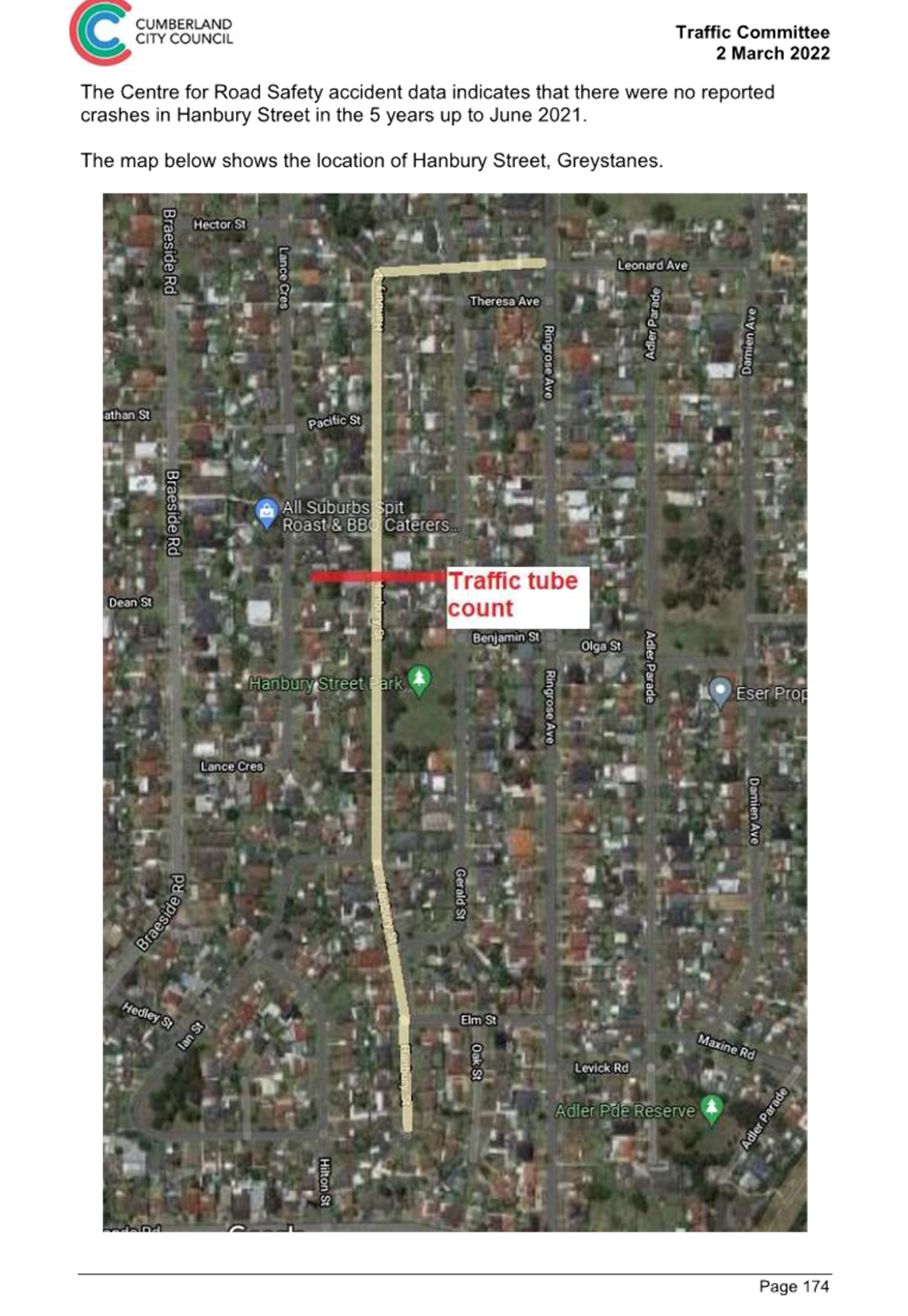
The traffic count location is shown in red on the map below.
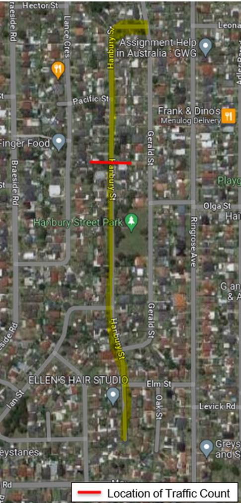
Council officers have reviewed the traffic count data and
compared it with the previous traffic count data undertaken in November 2021.
Both results are detailed in the table below:
|
Traffic
Count Date
|
Average
Daily Traffic
|
85th
Percentile speed
|
|
November
2021
|
554
veh/day
|
55.6
km/h
|
|
June
2023
|
476
veh/day
|
56.5
km/h
|
The traffic data from the table
above indicated that the traffic volume (ADT) has slightly decreased and the
recorded 85th percentile is similar to the data collected in
November 2021.
The latest Centre for Road and Safety accident data
indicated that there were no reported accidents in the last 5 years ending
December 2022.
Council officers have undertaken a further review of the
traffic conditions on Hanbury Street in October 2023 in accordance with
Cumberland City Council Local Area Traffic Management (LATM) Policy.
The LATM assessments are summarised in the tables below:
Table 1 – Hanbury
Street - LATM Assessment Points
|
Criteria
|
Maximum Score
|
Score Achieved
|
|
Traffic Study Data
|
45
|
5
|
|
Crash warrant in the
last 5 years
|
15
|
0
|
|
Road Characteristics
|
35
|
13
|
|
Community Support &
other factors
|
5
|
5
|
|
Total
|
100
|
23
|
Table 2 – Hanbury
Street – Action
|
Criteria
|
Action
|
|
>75
|
Report to TC with a
recommendation of providing traffic calming devices
|
|
61-75
|
Report to TC and
discuss possibility of providing traffic calming devices
|
|
41-60
|
Council to review
traffic data in 6 months
|
|
25-40
|
Monitor street and
review traffic data after 12 months
|
|
<25
|
Do Nothing
|
|
Speed
|
That regardless of the
total points scored, should the 85th percentile speed exceed the posted speed
limit by 5 km/h, the street be referred to the NSW Police for monitoring
and/or enforcement.
|
The traffic count indicated that the recorded 85th
percentile speed was 56.5km/h, which is above the posted speed limit of 50km/h,
the matter will be referred to the NSW Police Force for speed enforcement.
Based on the above assessment,
traffic calming devices are not warranted on the street. However, due to the
high recorded speeds, it is proposed that the street be reviewed in 12
months’ time and reported to the Traffic Committee if required.
It is noted that, due to the low
traffic volume (476 vehicles/day), centre line marking is not warranted in
accordance with the RMS (TfNSW) Delineation Guidelines.
Consultation has not been undertaken as the investigation
outlined in the report concludes no action is required.
Consultation will be undertaken if recommended by the
Traffic Committee.
1. Previous report
– CTC-22–025
DOCUMENTS
ASSOCIATED WITH
REPORT CTC-23-177
Attachment 1
Previous report – CTC-22–025
1 November 2023
Item
No: CTC-23-178
LACKEY STREET,
MERRYLANDS – ROAD SAFETY CONCERNS
Directorate: Environment
and Planning
Responsible
Officer: Executive
Manager Development and Building
Electorate: Granville
Police Area
Command (PAC): Cumberland
Agenda Part Part
2
Note: Recommendation
to Council
Council has reviewed traffic
conditions in Lackey Street between Robertson Street and Excelsior Street, Merrylands.
|
The Cumberland Traffic Committee recommends that the
installation of traffic calming devices on Lackey Street, Merrylands not be
supported.
|
Cumberland Traffic Committee (CTC)
at its meeting in March 2022 considered a report (CTC-22-027) regarding the
installation of traffic calming devices on Lackey Street, Merrylands between
Robertson Street and Excelsior Street due to speeding concerns. Council
resolved that:
1. The
installation of traffic calming devices on Lackey Street, Merrylands not be
supported.
2. Council
review conditions in Lackey Street, Merrylands, and report back to traffic
committee in June 2023.
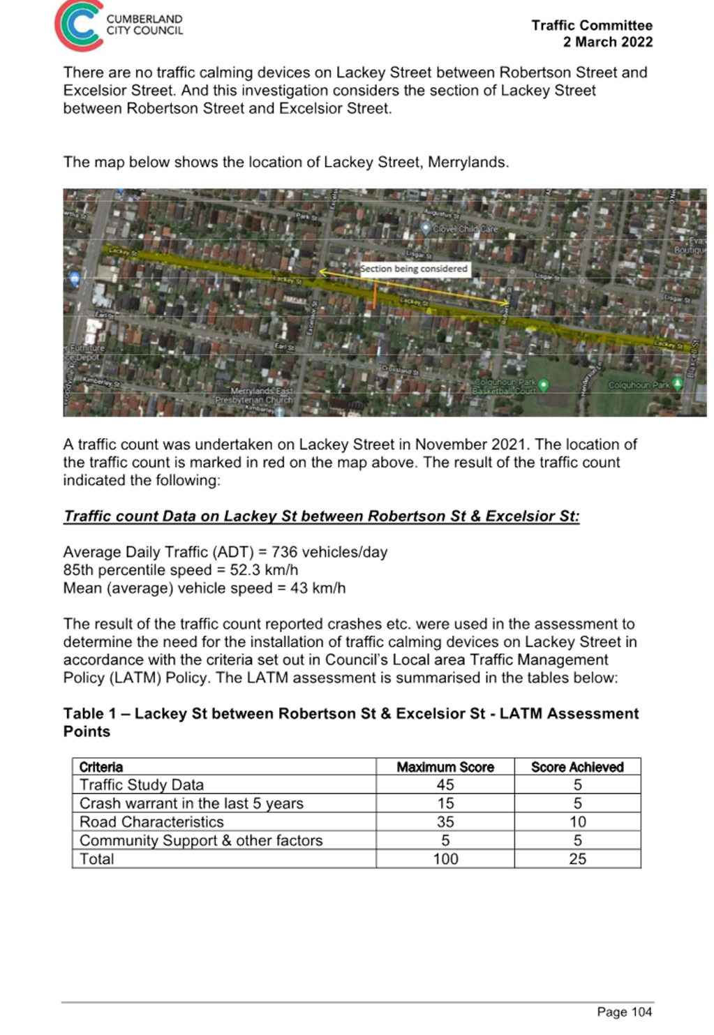
A traffic count was undertaken in
Lackey Street in June 2023. The traffic count location is shown in orange on
the map below.
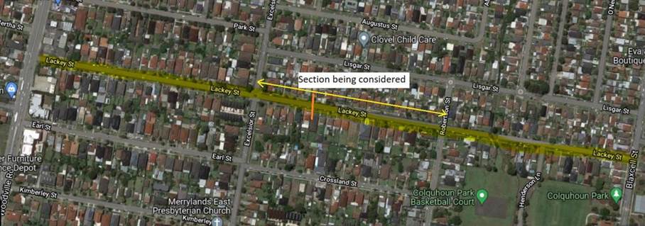
Council officers have reviewed
the traffic count data and compared it with the previous traffic count data
undertaken in November 2021.
|
Traffic
Count Date
|
Average
Daily Traffic
|
85th
Percentile Speed
|
|
November
2021
|
736
|
52.3
km/h
|
|
June
2023
|
671
|
52.4
km/h
|
The traffic count data from the table above indicated that
traffic volume (ADT) in Lackey Street has reduced since 2021, while the
recorded 85th percentile speed maintained at a similar level.
The latest Centre for Road Safety accident data indicated
that there were no reported accidents in Lackey Street between Robertson Street
and Excelsior Street in the last 5 years ending December 2022 in relation to
speeding.
Council officers have undertaken a further review of the
traffic conditions of Lackey Street in accordance with Council’s Local
Area Traffic Management (LATM) Policy.
The LATM assessments are summarised in the tables below:
Table 1 – Lackey Street - LATM Assessment Points
|
Criteria
|
Maximum Score
|
Score Achieved
|
|
Traffic Study Data
|
45
|
5
|
|
Crash warrant in the
last 5 years
|
15
|
0
|
|
Road Characteristics
|
35
|
10
|
|
Community Support &
other factors
|
5
|
5
|
|
Total
|
100
|
20
|
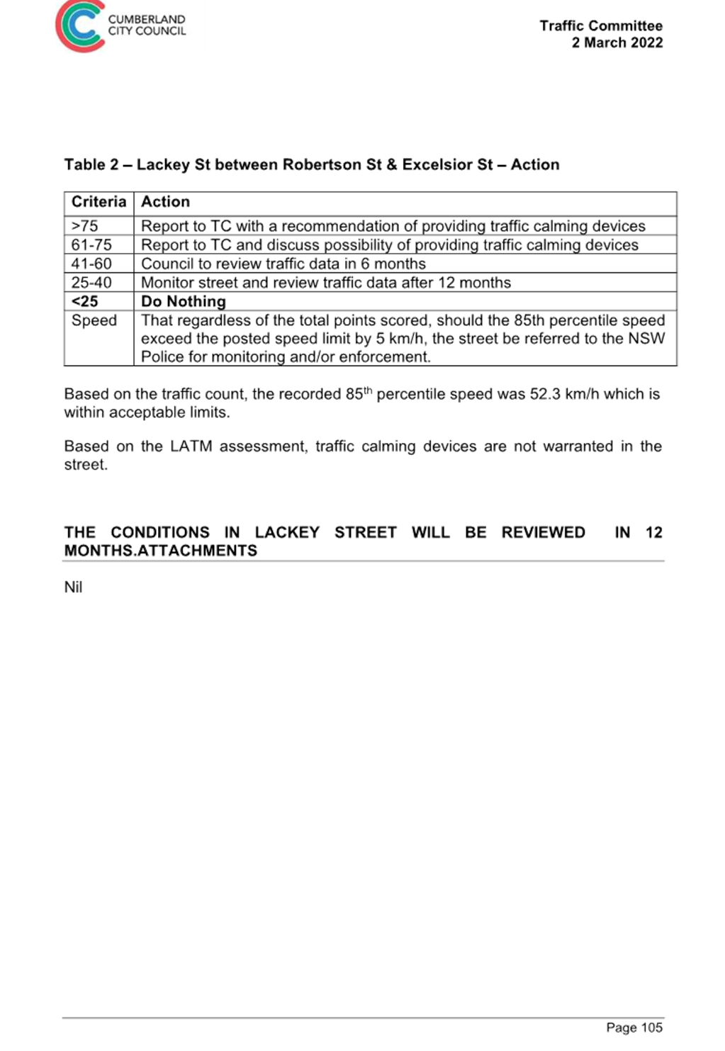
Table 2 – Lackey Street – Action
|
Criteria
|
Action
|
|
>75
|
Report to TC with a recommendation of providing traffic
calming devices
|
|
61-75
|
Report to TC and discuss possibility of providing traffic
calming devices
|
|
41-60
|
Council to review traffic data in 6 months
|
|
25-40
|
Monitor street and review traffic data after 12 months
|
|
<25
|
Do Nothing
|
|
Speed
|
That regardless of the total points scored, should the
85th percentile speed exceed the posted speed limit by 5 km/h, the street be
referred to the NSW Police for monitoring and/or enforcement.
|
The traffic count indicated that
the recorded 85th percentile speed was 52.4 km/h which is within acceptable
range for a local street with a 50km/h speed limit.
Based on the above assessment,
traffic calming devices are not warranted on the street at this time.
It is also noted that, due to the
low average daily traffic volume (671 vehicles/day), the road does not warrant
any line marking in accordance with the RMS (TfNSW) Delineation Guidelines.
Consultation has not been undertaken as the investigation
outlined in the report concludes no action is required.
Consultation will be undertaken if recommended by the
Traffic Committee.
1. Previous report
CTC-22-027
DOCUMENTS
ASSOCIATED WITH
REPORT CTC-23-178
Attachment 1
Previous report CTC-22-027
1 November 2023
Item
No: CTC-23-179
LISGAR STREET,
MERRYLANDS – ROAD SAFETY CONCERNS
Directorate: Environment
and Planning
Responsible
Officer: Executive
Manager Development and Building
Electorate: Granville
Police Area
Command (PAC): Cumberland
Agenda Part Part
2
Note: Recommendation
to Council
Council has reviewed traffic
conditions in Lisgar Street, Merrylands.
|
The Cumberland Traffic Committee recommends that:
1. The
installation of traffic calming devices on Lisgar Street, Merrylands not be
supported.
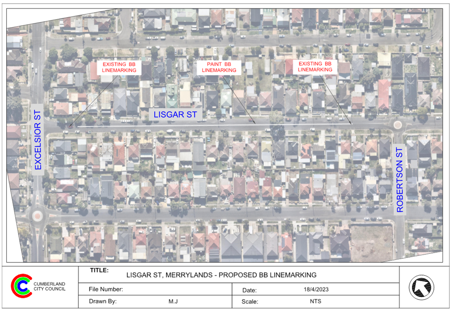
2. Council
provide ‘BB’ centre line marking in Lisgar Street between
Excelsior Street and Robertson Street linking the existing centre line
marking at both ends in accordance with the attached plan.
3. Council
review conditions in Lisgar Street, Merrylands, and report back to Traffic
Committee in November 2024 if required.
|
Cumberland Traffic Committee
(CTC) at its meeting in February 2023 considered a report (CTC-23-025)
regarding road safety concerns on Lisgar Street, Merrylands including the
outcome of consultation undertaken and resolved the following:
1. Council
to review the traffic count data in Lisgar Street between Excelsior Street and
Robertson Street, Merrylands and report back to the Traffic Committee in June
2023.
2. Council
request Cumberland Police Area Command to undertake random speed surveillance
in Lisgar Street, Merrylands.
In accordance with Council’s resolution, a traffic
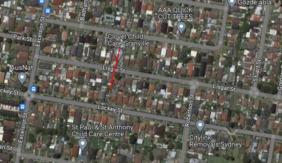
count was undertaken on Lisgar Street in 2023. The traffic count location is
shown in red on the map below.
The results of the traffic count indicated the following:
Traffic count
Data on Lisgar Street, Merrylands:
|
Average Daily Traffic (ADT) – Veh/day
|
2,547
|
|
85th percentile speed (km/h)
|
56
|
|
Mean (average) vehicle speed (km/hr)_
|
48
|
The latest Centre for Road and Safety accident data on
Lisgar Street indicated that there were no reported accidents in the last 5
years ending December 2022.
Council’s officers have undertaken a further review of
the traffic conditions on Lisgar Street in accordance with Council’s
Local Area Traffic Management (LATM) Policy.
The LATM assessments are summarised in the tables below:
Table 1 – Lisgar
Street - LATM Assessment Points
|
Criteria
|
Maximum Score
|
Score Achieved
|
|
Traffic Study Data
|
45
|
20
|
|
Crash warrant in the
last 5 years
|
15
|
0
|
|
Road Characteristics
|
35
|
10
|
|
Community Support &
other factors
|
5
|
5
|
|
Total
|
100
|
35
|
Table 2 – Lisgar
Street – Action
|
Criteria
|
Action
|
|
>75
|
Report to TC with a
recommendation of providing traffic calming devices
|
|
61-75
|
Report to TC and
discuss possibility of providing traffic calming devices
|
|
41-60
|
Council to review
traffic data in 6 months
|
|
25-40
|
Monitor street and
review traffic data after 12 months
|
|
<25
|
Do Nothing
|
|
Speed
|
That regardless of the total
points scored, should the 85th percentile speed exceed the posted speed limit
by 5 km/h, the street be referred to the NSW Police for monitoring and/or
enforcement.
|
Based on the above assessment,
Council will review traffic conditions in Lisgar Street in 12 months and report
back to Traffic Committee if required.
It is noted that there is
‘BB’ centre line marking in Lisgar Street at its intersections with
Excelsior Street and Robertson Street. Due to the high recorded speeds in
Lisgar Street, it is proposed to provide ‘BB’ centre line marking
in Lisgar Street linking the centre line markings at both ends.
Consultation has not been undertaken as the investigation
outlined in the report concludes no action is required.
Consultation will be undertaken if recommended by the
Traffic Committee.
1. Plan - Lisgar
Street Merrylands - Proposed 'BB' line marking
2. Previous
report CTC-23-025
3. Extract
of Minutes of Traffic Committee for item CTC-23-025
DOCUMENTS
ASSOCIATED WITH
REPORT CTC-23-179
Attachment 1
Plan - Lisgar Street Merrylands - Proposed 'BB' line
marking
1 November 2023
DOCUMENTS
ASSOCIATED WITH
REPORT CTC-23-179
Attachment 2
Previous report CTC-23-025
1 November 2023
DOCUMENTS
ASSOCIATED WITH
REPORT CTC-23-179
Attachment 3
Extract of Minutes of Traffic Committee for item
CTC-23-025
1 November 2023

1 November 2023
Item
No: CTC-23-180
MAGOWAR ROAD,
GIRRAWEEN – ROAD SAFETY CONCERNS
Directorate: Environment
and Planning
Responsible
Officer: Executive
Manager Development and Building
Electorate: Prospect
Police Area
Command (PAC): Cumberland
Agenda Part Part
2
Note: Recommendation
to Council
Council has reviewed traffic
conditions on Magowar Road, Girraween between Targo Road and Girraween Road.
|
The Cumberland Traffic Committee recommends that:
1. The
installation of traffic calming devices on Magowar Road, Girraween not be
supported.
2. Council
review conditions on Magowar Road, Girraween in November 2024, and report
back to Traffic Committee if required.
|
Cumberland Traffic Committee (CTC)
at its meeting in August 2021 considered a report (CTC-21-206) regarding
speeding concerns on Magowar Road, Girraween. Council resolved that:
1. The
installation of traffic calming devices on Magowar Road, Girraween between
Targo Road and Girraween Road not be approved.
2. Council
review conditions in Magowar Road, Girraween and report back to traffic
committee in November 2022.
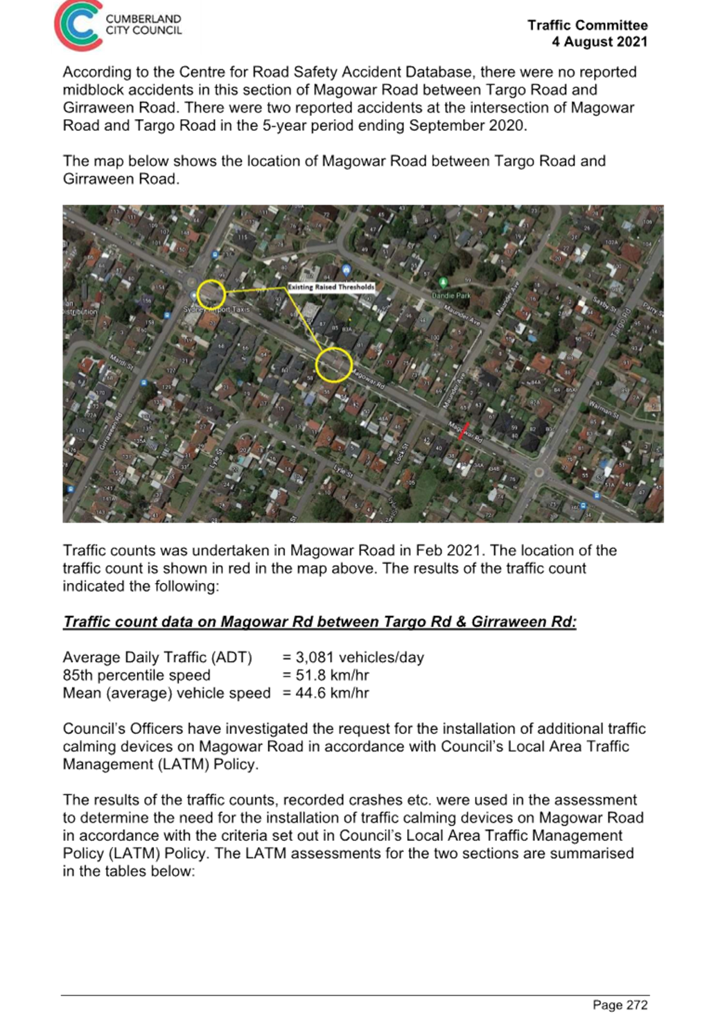
A traffic count was undertaken on
Magowar Road in March 2023. The traffic count location is shown in red on the
map below.
Council officers have reviewed
the traffic count data and compared it with the previous traffic count data
undertaken in December 2020.
|
Traffic
Count Date
|
Average
Daily Traffic
|
85th
Percentile Speed
|
|
February
2021
|
3,081
|
51.8
km/h
|
|
March
2023
|
2,998
|
50.1
km/h
|
The traffic count data from the table above indicated that
both traffic volume (ADT) and the recorded 85th percentile speeds in Magowar
Road have reduced slightly since 2021.
The latest Centre for Road Safety accident data indicated
that there were no reported accidents at this section of Magowar Road in the
last 5 years ending December 2022 in relation to speeding.
Council’s Officers have undertaken a further review of
the traffic conditions Magowar Road in accordance with Council’s Local
Area Traffic Management (LATM) Policy.
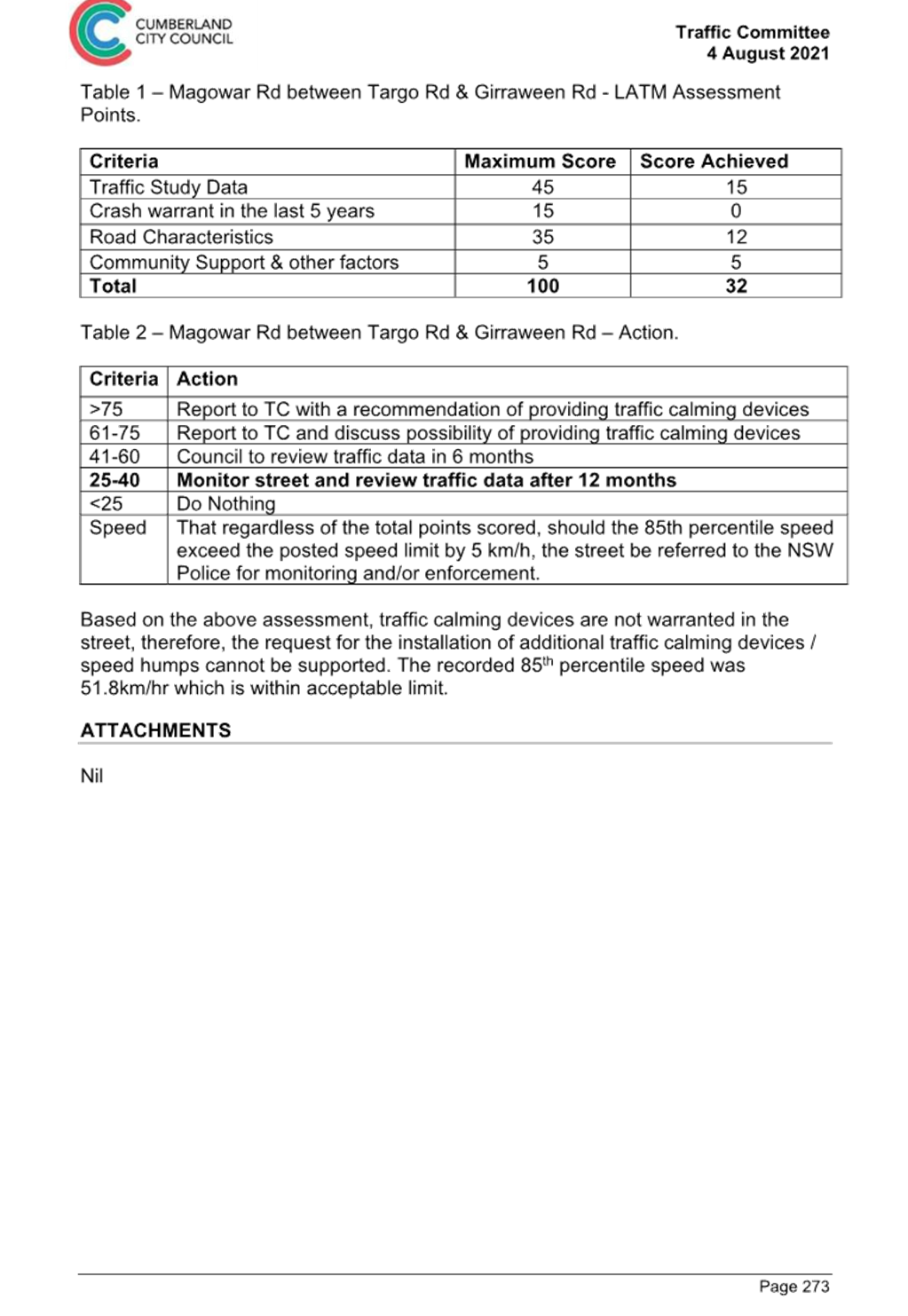
The LATM assessments are summarised in the tables below:
Table 1 – Magowar Road - LATM Assessment Points
|
Criteria
|
Maximum Score
|
Score Achieved
|
|
Traffic Study Data
|
45
|
15
|
|
Crash warrant in the
last 5 years
|
15
|
0
|
|
Road Characteristics
|
35
|
12
|
|
Community Support &
other factors
|
5
|
5
|
|
Total
|
100
|
32
|
Table 2 – Magowar Road – Action
|
Criteria
|
Action
|
|
>75
|
Report to TC with a recommendation of providing traffic
calming devices
|
|
61-75
|
Report to TC and discuss possibility of providing traffic
calming devices
|
|
41-60
|
Council to review traffic data in 6 months
|
|
25-40
|
Monitor street and review traffic data after 12 months
|
|
<25
|
Do Nothing
|
|
Speed
|
That regardless of the total points scored, should the
85th percentile speed exceed the posted speed limit by 5 km/h, the street be
referred to the NSW Police for monitoring and/or enforcement.
|
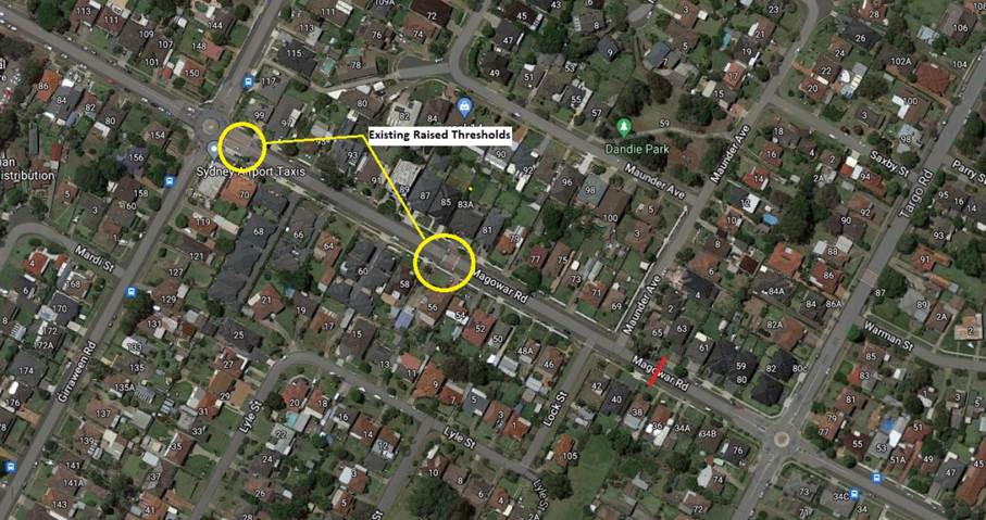
The traffic count indicated that
the recorded 85th percentile speed was 50.1km/h which is acceptable range for a
local street with a 50km/h speed limit.
It should be noted that this
section of Magowar Road has roundabouts at both ends and two raised thresholds
installed.
Based on the above assessment,
Council will review traffic conditions on Magowar Road in 12 months and report
back to the Traffic Committee if required.
Consultation has not been undertaken as the investigation
outlined in the report concludes no action is required.
Consultation will be undertaken if recommended by the
Traffic Committee.
1. Previous report
CTC-21-206
DOCUMENTS
ASSOCIATED WITH
REPORT CTC-23-180
Attachment 1
Previous report CTC-21-206
1 November 2023
Item
No: CTC-23-181
REES STREET,
MAYS HILL - ROAD SAFETY CONCERNS
Directorate: Environment
and Planning
Responsible
Officer: Executive
Manager Development and Building
Electorate: Granville
Police Area
Command (PAC): Cumberland
Agenda Part Part
2
Note: Recommendation
to Council
Council has reviewed traffic
conditions in Rees Street, Mays Hill.
This report outlines the outcome
of the review.
|
The Cumberland Traffic Committee recommends that:
1. The
installation of traffic calming devices on Rees Street, Mays Hill not be
supported.
2. Council
review conditions in Rees Street, Mays Hill and report back to Traffic
Committee in November 2024 if required.
|
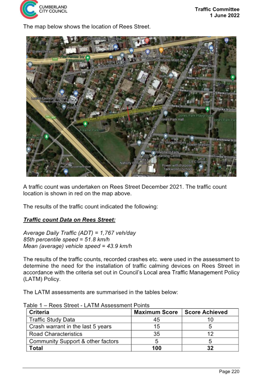
Cumberland Traffic Committee at
its meeting in June 2022 considered a report (CTC-22-116) regarding road safety
concerns on Rees Street, Mays Hill.
Council resolved that:
1. The
installation of traffic calming devices on Rees Street, Mays Hill not be supported.
2.
Council review conditions in Rees Street in August 2023 and report back to
Traffic Committee.
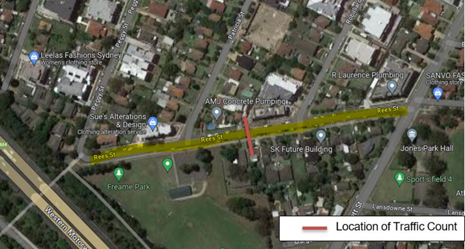
In accordance with Council’s resolution, a traffic
count was undertaken on Rees Street in June 2023. The traffic count location is
shown in red on the map below.


Council officers have reviewed the traffic count data and
compared it with the previous traffic count data undertaken in December 2021.
Both results are detailed in the table below:
|
Traffic
Count Date
|
Average
Daily Traffic
|
85th
Percentile speed
|
|
December
2021
|
1,767
veh/day
|
51.8
km/h
|
|
June
2023
|
1,900
veh/day
|
49.3
km/h
|
The traffic data from the table
above indicated that the traffic volume (ADT) has increased slightly and the
recorded 85th percentile has slightly decreased since 2021.
The latest Centre for Road and Safety accident data
indicated that there was 1 reported accident in the last 5 years ending
December 2022 in Rees Street. The accident was related to vehicle turning from
opposing directions.
Council officers have undertaken a further review of the
traffic conditions on Rees Street in October 2023 in accordance with
Council’s Local Area Traffic Management (LATM) Policy.
The LATM assessments are summarised in the tables below:
Table 1 – Rees
Street - LATM Assessment Points
|
Criteria
|
Maximum Score
|
Score Achieved
|
|
Traffic Study Data
|
45
|
10
|
|
Crash warrant in the
last 5 years
|
15
|
5
|
|
Road Characteristics
|
35
|
12
|
|
Community Support &
other factors
|
5
|
5
|
|
Total
|
100
|
32
|
Table 2 – Rees Street
– Action
|
Criteria
|
Action
|
|
>75
|
Report to TC with a
recommendation of providing traffic calming devices
|
|
61-75
|
Report to TC and
discuss possibility of providing traffic calming devices
|
|
41-60
|
Council to review
traffic data in 6 months
|
|
25-40
|
Monitor street and
review traffic data after 12 months
|
|
<25
|
Do Nothing
|
|
Speed
|
That regardless of the
total points scored, should the 85th percentile speed exceed the posted speed
limit by 5 km/h, the street be referred to the NSW Police for monitoring and/or
enforcement.
|
The traffic count indicated that the recorded 85th
percentile speed was 49.3km/h which is below the default speed limit of the
street.
Based on the above assessment,
traffic calming devices are not warranted on the street. Council will review
traffic conditions in Rees Street in 12 months and report back to the Traffic
Committee if required.
Consultation has not been undertaken as the investigation
outlined in the report concludes no action is required.
Consultation will be undertaken if recommended by the
Traffic Committee.
1. Previous report
– CTC-22-116
DOCUMENTS
ASSOCIATED WITH
REPORT CTC-23-181
Attachment 1
Previous report – CTC-22-116
1 November 2023
Item
No: CTC-23-182
SUSAN STREET,
AUBURN- ROAD SAFETY CONCERNS
Directorate: Environment
and Planning
Responsible
Officer: Executive
Manager Development and Building
Electorate: Auburn
Police Area
Command (PAC): Auburn
Agenda Part Part
2
Note: Recommendation
to Council
Council has reviewed traffic
conditions on Susan Street, Auburn.
This report outlines the outcome
of the review.
|
The Cumberland Traffic Committee recommends that:
1. The
installation of traffic calming devices on Susan Street, Auburn not be
supported.
2. Council
review conditions in Susan Street, Auburn and report back to the Traffic
Committee in November 2024 if required.
|
Cumberland Traffic Committee at
its meeting in June 2022 considered a report (CTC-22-117) regarding road safety
concerns on Susan Street, Mays Hill.
Council resolved that:
1. The
installation of traffic calming devices on Susan Street, Auburn not be supported.
2. Council
review conditions in Susan Street, Auburn and report to Traffic Committee in
August 2023.
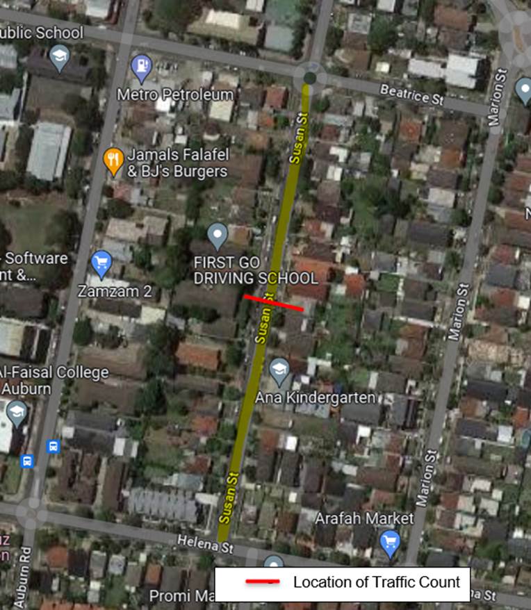
In accordance with Council’s resolution, a traffic
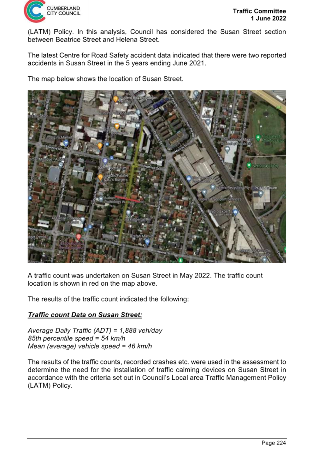
count was undertaken on Susan Street in June 2023. The traffic count location
is shown in red on the map below.
Council officers have reviewed the traffic count data and
compared it with the previous traffic count data undertaken in May 2022.
Both results are detailed in the table below:
|
Traffic
Count Date
|
Average
Daily Traffic
|
85th
Percentile speed
|
|
May
2022
|
1,888
veh/day
|
54
km/h
|
|
June
2023
|
2,004
veh/day
|
53.2
km/h
|
The traffic data from the table
above indicated that the traffic volume (ADT) has increased slightly and the
recorded 85th percentile speed is similar to the traffic data
collected in 2022.
The latest Centre for Road and Safety accident data
indicated that there were no reported accidents in this section of Susan Street
in the last 5 years ending December 2022.
Council officers have undertaken a further review of the
traffic conditions on Susan Street in October 2023 in accordance with
Council’s Local Area Traffic Management (LATM) Policy.
The LATM assessments are summarised in the tables below:
Table 1 – Susan
Street - LATM Assessment Points
|
Criteria
|
Maximum Score
|
Score Achieved
|
|
Traffic Study Data
|
45
|
15
|
|
Crash warrant in the
last 5 years
|
15
|
0
|
|
Road Characteristics
|
35
|
12
|
|
Community Support &
other factors
|
5
|
5
|
|
Total
|
100
|
32
|
Table 2 – Susan
Street – Action
|
Criteria
|
Action
|
|
>75
|
Report to TC with a
recommendation of providing traffic calming devices
|
|
61-75
|
Report to TC and
discuss possibility of providing traffic calming devices
|
|
41-60
|
Council to review
traffic data in 6 months
|
|
25-40
|
Monitor street and review
traffic data after 12 months
|
|
<25
|
Do Nothing
|
|
Speed
|
That regardless of the
total points scored, should the 85th percentile speed exceed the posted speed
limit by 5 km/h, the street be referred to the NSW Police for monitoring
and/or enforcement.
|
The traffic count indicated that the recorded 85th
percentile speed was 53.2km/h which is within acceptable range for a local
street with a 50km/h speed limit.
Based on the above assessment,
Council will review traffic conditions in Susan Street in 12 months and report
back to the Traffic Committee if required.
It is also noted that Susan Street
has 40m long ‘BB’ centre line marked from the roundabout at its
intersection with Beatrice Street.
Consultation has not been undertaken as the investigation
outlined in the report concludes no action is required.
Consultation will be undertaken if recommended by the
Traffic Committee.
1. Previous report
– CTC-22-117
DOCUMENTS
ASSOCIATED WITH
REPORT CTC-23-182
Attachment 1
Previous report – CTC-22-117
1 November 2023
Item
No: CTC-23-183
ADDLESTONE
ROAD, MERRYLANDS – ROAD SAFETY CONCERNS
Directorate: Environment
and Planning
Responsible
Officer: Executive
Manager Development and Building
Electorate: Granville
Police Area
Command (PAC): Cumberland
Agenda Part Part
2
Note: Recommendation
to Council
Council has reviewed traffic
conditions on Addlestone Road, Merrylands.
|
The Cumberland Traffic Committee recommends that:
1. The
installation of traffic calming devices on Addlestone Road, Merrylands not be
supported.
2. Council
review conditions on Addlestone Road, Merrylands in November 2024, and report
back to the Traffic Committee if required.
|
Cumberland Traffic Committee (CTC)
at its meeting in April 2022 considered a report (CTC-22-074) regarding the
provision of traffic calming devices on Addlestone Road, Merrylands.
Council resolved that:
1. The
installation of traffic calming devices on Addlestone Road, Merrylands not be
supported.
2. Council
review conditions in Addlestone Road, Merrylands in June 2023, and report back
to traffic committee.
In accordance with Council’s
resolution, a traffic count was undertaken on Addlestone Road in June 2023. The
traffic count location is shown in red on the map below.
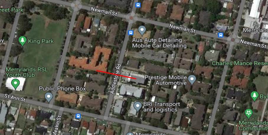
Council officers have reviewed
the traffic count data and compared it with the previous traffic count data
undertaken in February 2022.
Both results are detailed in the table below:
|
Traffic
Count Date
|
Average
Daily Traffic
|
85th
Percentile Speed
|
|
February
2022
|
3,689
|
51.8
km/h
|
|
June
2023
|
3,706
|
50
km/h
|
The traffic count data from the table above indicated that
the recorded 85th percentile speeds in Addlestone Road have reduced
since 2022. The average daily traffic volume has increased slightly.
The latest Centre for Road Safety accident data indicated
that there were no reported accidents related to speeding in Addlestone Road between
Newman Street and St Ann Street in the last 5 years ending December 2022.
Council officers have undertaken a further review of the
traffic conditions Addlestone Road in accordance with Council’s Local
Area Traffic Management (LATM) Policy.
The LATM assessments are summarised in the tables below:
Table 1 – Addlestone Road - LATM Assessment Points
|
Criteria
|
Maximum Score
|
Score Achieved
|
|
Traffic Study Data
|
45
|
15
|
|
Crash warrant in the
last 5 years
|
15
|
0
|
|
Road Characteristics
|
35
|
12
|
|
Community Support &
other factors
|
5
|
5
|
|
Total
|
100
|
32
|
Table 2 – Addlestone Road – Action
|
Criteria
|
Action
|
|
>75
|
Report to TC with a recommendation of providing traffic
calming devices
|
|
61-75
|
Report to TC and discuss possibility of providing traffic
calming devices
|
|
41-60
|
Council to review traffic data in 6 months
|
|
25-40
|
Monitor street and review traffic data after 12 months
|
|
<25
|
Do Nothing
|
|
Speed
|
That regardless of the total points scored, should the
85th percentile speed exceed the posted speed limit by 5 km/h, the street be
referred to the NSW Police for monitoring and/or enforcement.
|
The traffic count indicated that
the recorded 85th percentile speed was 50 km/h which is at the speed
limit of the street.
Based on the above assessment,
Council will review traffic conditions on Addlestone Road in 12 months and
report back to Traffic Committee if required.
Consultation has not been undertaken as the investigation
outlined in the report concludes no action is required.
Consultation will be undertaken if recommended by the
Traffic Committee.
1. Previous report
CTC-22-074
DOCUMENTS
ASSOCIATED WITH
REPORT CTC-23-183
Attachment 1
Previous report CTC-22-074
1 November 2023
Item
No: CTC-23-184
CHELSEA STREET,
MERRYLANDS - ROAD SAFETY CONCERNS
Directorate: Environment
and Planning
Responsible
Officer: Executive
Manager Development and Building
Electorate: Granville
Police Area
Command (PAC): Cumberland
Agenda Part Part
2
Note: Recommendation
to Council
Council has reviewed traffic
conditions in Chelsea Street, Merrylands.
This report outlines the outcome
of the review.
|
The Cumberland Traffic Committee recommends that:
1. The
installation of traffic calming devices on Chelsea Street, Merrylands not be
supported.
2. Council
review conditions in Chelsea Street, Merrylands in November 2024, and report
back to Traffic Committee if required.
|
Cumberland Traffic Committee
considered a report on the conditions in Chelsea Street, Merrylands in April
2023 (CTC-23-060).
Council resolved that:
1. The installation of traffic calming devices in Chelsea Street,
Merrylands
not be supported.
2. Council review conditions in Chelsea Street, Merrylands and report
back
to the Traffic Committee in November 2023.
Following the Council
resolution, traffic count was undertaken in July 2023. The traffic count
location is shown in red on the map below.
The map below shows the location of Chelsea Street.
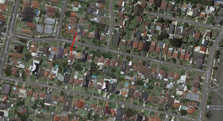
The results of the traffic count
indicated the following:
Traffic count
Data on Chelsea Street, Merrylands:
Average Daily Traffic (ADT) = 915 veh/day,
85th percentile speed = 49.1 km/h,
Mean (average) vehicle speed = 40.7 km/h.
The latest Centre for Road Safety accident data indicated
that there were no reported accidents in Chelsea Street in the last 5 years
ending September 2022.
Council officers have investigated the request for the
installation of traffic calming devices on Chelsea Street in accordance with
Council’s Local Area Traffic Management (LATM) Policy.
The result of the traffic count
and recorded crashes were used in the assessment to determine the need for the
installation of traffic calming devices on Chelsea Street in accordance with
the criteria set out in Council’s Local Area Traffic Management Policy
(LATM) Policy.
The LATM assessments are
summarised in the tables below:
Table 1 – Chelsea Street between Howard Street and
Adrian Place - LATM Assessment Points
|
Criteria
|
Maximum Score
|
Score Achieved
|
|
Traffic Study Data
|
45
|
15
|
|
Crash warrant in the
last 5 years
|
15
|
0
|
|
Road Characteristics
|
35
|
12
|
|
Community Support &
other factors
|
5
|
5
|
|
Total
|
100
|
32
|
Table 2 – Chelsea
Street between Howard Street and Adrian Place – Action
|
Criteria
|
Action
|
|
>75
|
Report to TC with a
recommendation of providing traffic calming devices
|
|
61-75
|
Report to TC and
discuss possibility of providing traffic calming devices
|
|
41-60
|
Council to review
traffic data in 6 months
|
|
25-40
|
Monitor street and
review traffic data after 12 months
|
|
<25
|
Do Nothing
|
|
Speed
|
That regardless of the
total points scored, should the 85th percentile speed exceed the posted speed
limit by 5 km/h, the street be referred to the NSW Police for monitoring
and/or enforcement.
|
The traffic count indicated that
the recorded 85th percentile speed is 49.1 km/h, which is below the
default speed limit.
Based on the above assessment,
Council will review traffic conditions in Chelsea Street in 12 months and
report back to the Traffic Committee if required.
Consultation has not been undertaken as the investigation
outlined in the report concludes no action is required.
Future consultation will be undertaken if recommended by the
Traffic Committee.
1. Previous Report -
CTC-23-060
DOCUMENTS
ASSOCIATED WITH
REPORT CTC-23-184
Attachment 1
Previous Report - CTC-23-060
1 November 2023
Item
No: CTC-23-185
DENMARK
STREET, MERRYLANDS – ROAD SAFETY CONCERNS
Directorate: Environment
and Planning
Responsible
Officer: Executive
Manager Development and Building
Electorate: Granville
Police Area
Command (PAC): Cumberland
Agenda Part Part
2
Note: Recommendation
to Council
Council has received requests from
local residents for the installation of traffic calming devices on Denmark
Street, Merrylands due to speeding concerns.
This report outlines the outcome
of the investigation into this matter.
|
The Cumberland Traffic Committee recommends that:
1. The installation
of traffic calming devices on Denmark Street, Merrylands be supported in
principle.
2. Council prepares
design of speed humps and undertake consultation with directly affected and
adjacent properties and report back to the Traffic Committee.
|
Cumberland Traffic Committee
(CTC) at its meeting in February 2023 considered a report (CTC-23-022)
regarding road safety concerns on Denmark Street, Merrylands. Council resolved
to undertake traffic count data on Denmark Street along with community
consultation and report back to the Traffic Committee in June 2023.
Resident consultation
In accordance with
Council’s resolution, a consultation was carried out with the residents
of Denmark Street in September 2023. A total of 61 letters were distributed to
the residents / owners with an attached survey form.
Council received 14 valid
responses (23% of the total letters sent) by the closing date, with 2 invalid/
anonymous responses not counted. Eight responses (57.1%) supported the
installation of speed humps, including 1 response indicated support but do not
want the speed hump in front of the resident’s property frontage, and six
(42.9%) opposed to the proposal.
Feedback was also received
during the consultation, there were two (2) responses concerned about the
speeding issue in Roseberry Street near Myall Street. One response also
suggested the provision of a roundabout at the intersection of Myall Street and
Denmark Street.
In comparison to the response
rate in 2022, there was a significant increase from 4.2% in 2022 to 23% in
2023.
Traffic count data review
A traffic count was undertaken
on Denmark Street in March 2023. The traffic count location is shown in red on
the map below.
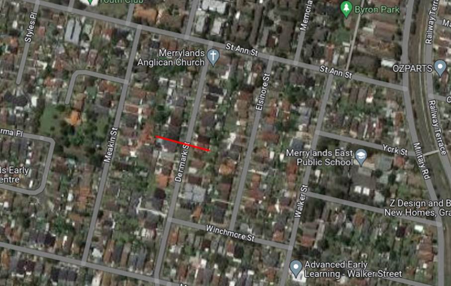
The results of the traffic count
indicated the following:
Traffic count
Data on Denmark Street, Merrylands:
Average Daily Traffic (ADT) = 4,540 veh/day,
85th percentile speed = 55.1 km/h,
Mean (average) vehicle speed = 48.1 km/h.
Based on the consultation and
traffic count results, the 85th percentile speed in Denmark Street
is over the speed limit and the majority of the responses received by Council
supported the installation of speed humps. Therefore, it is proposed that the
provision of speed humps on Denmark Street, Merrylands be supported in
principle, subject to the detailed consultation with the directly affected
residents.
Council proposes to undertake
design of speed humps based on the submissions and consult with the directly
affected and adjacent residents. The consultation results will be reported to a
future Traffic Committee.
The proposal was notified to the
impacted resident for a period of 14 days from 8 September 2023 to 22 September
2023. A total of 61 letters were distributed to the residents / owners with an
attached survey form.
Council received 14 valid
responses (23% of the total letters sent) by the closing date, 2 invalid/
anonymous responses were not counted. Eight responses (57.1%) supported the
installation of speed humps, including 1 response indicated support but do not
want the speed hump in front of the resident’s property frontage, and six
(42.9%) opposed to the proposal.
1. Previous report -
CTC-23-022
2. Submissions
DOCUMENTS
ASSOCIATED WITH
REPORT CTC-23-185
Attachment 1
Previous report - CTC-23-022
DOCUMENTS
ASSOCIATED WITH
REPORT CTC-23-185
Attachment 2
Submissions
1 November 2023
Item
No: CTC-23-186
BRIGHTON
STREET, GREYSTANES – ROAD SAFETY CONCERNS
Directorate: Environment
and Planning
Responsible
Officer: Executive
Manager Development and Building
Electorate: Prospect
Police Area
Command (PAC): Cumberland
Agenda Part Part
2
Note: Recommendation
to Council
Council has received a request
from a local resident for the installation of traffic calming measures on
Brighton Street, Greystanes due to speeding concerns.
This report outlines the outcome
of the investigation into this matter.
|
The Traffic Committee recommends that:
1. The
installation of speed humps in Brighton Street, Greystanes not be supported.
2. Council
review traffic conditions in Brighton Street, Greystanes in April 2024 and
report back to the Traffic Committee.
3. Council
notify the concerned residents of the outcome.
|
Brighton Street is a local road that runs in a north-south
direction between Old Prospect Road and Whalans Road with a posted speed limit
of 50 km/h. It has a width of approximately 10.2m and parking is permitted on
both sides of the road unless signposted. Cumberland Country Golf Club and the
Golf Course is located on the eastern side of Brighton Street.
There is ‘BB’ centre line marked in Brighton
Street.
Council has received concerns from
a local resident regarding road safety on Brighton Street, Greystanes.
The matter was previously
investigated and reported to Cumberland Traffic Committee (CTC) in the past.
Previous investigations including consultation did not receive sufficient
support from the residents.
The map below shows the location
of Brighton Street.
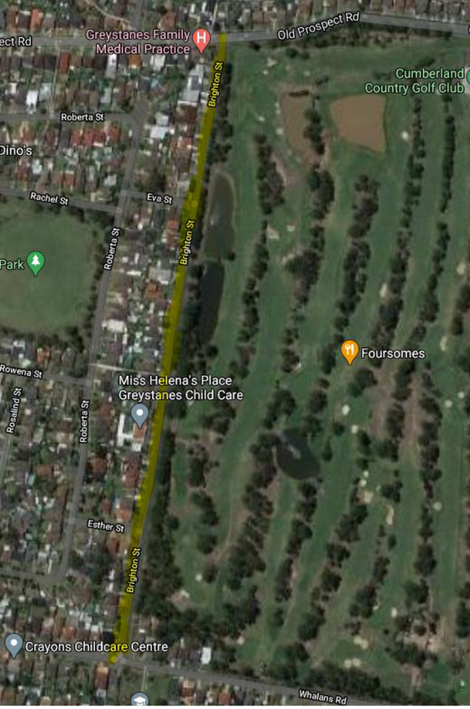
Following previous consultation,
Council undertook further consultation with the residents in Brighton Street in
October 2023. A total of 49 letters were distributed to the residents / owners.
Council received 21 responses by
the closing date, out of the total responses received, 10 responses (47.6%)
supported the proposed speed humps and 11 (52.4%) responses objected to the
proposal.
The main concerns raised by the
residents who objected to the proposed traffic calming devices were noise
caused by the speed humps and devaluation of the properties. Some residents
also believed that speed humps are not effective in slowing down traffic.
The latest Centre for Road
Safety accident data indicated that there were no reported accidents related to
speeding in Brighton Street in the last 5 years ending December 2022.
Based on the above results, the
majority of the responses received by Council objected to the proposal.
Therefore, it is suggested that the installation of speed humps on Brighton
Street not be approved due to the lack of support from the residents.
It should be noted that Brighton
Street has ‘BB’ centre lines marked which provides a calming effect
on traffic and keeping the traffic on the correct side of the road.
It is also proposed that Council
undertake traffic counts in Brighton Street and assess traffic conditions in
the street and report back to the Traffic Committee in April 2024.
The proposal was notified to the
residents in Brighton Street for a period of 14 days from 4 October 2023 to 17
October 2023.
Council received 21 responses
(42.9% of the total letters sent) by the closing date, out of the total
responses received, 10 responses (47.6%) supported the proposed speed humps and
11 (52.4%) responses objected to the proposal.
1. Submissions
DOCUMENTS
ASSOCIATED WITH
REPORT CTC-23-186
Attachment 1
Submissions
1 November 2023
Item
No: CTC-23-187
KIBO ROAD,
REGENTS PARK – PROPOSED REFUGE ISLAND
Directorate: Environment
and Planning
Responsible
Officer: Executive
Manager Development and Building
Electorate: Auburn
Police Area
Command (PAC): Auburn
Agenda Part Part
2
Note: Recommendation
to Council
The report provides an update on
the proposed pedestrian refuge island on Kibo Road, Regents Park.
|
The Cumberland Traffic Committee recommends that:
1. The
proposed Pedestrian Refuge Island with associated signage and line marking on
Kibo Road, Regents Park (adjacent to Kibo Reserve) be finalised in accordance
with the attached plan and included in Council’s Capital Works Program.
2. Council
liaise with Australia Post for the relocation of the mailbox.
3. The
affected / concerned residents be notified of Council’s resolution.
|
In August 2023, Cumberland
Traffic Committee considered a report on the road safety concerns in Kibo Road
Regents Park. Council resolved that:
1. The
installation of speed humps in Kibo Road, Regents Park, be approved in
accordance with the attached plan.
2. The
installation of a pedestrian refuge island on Kibo Road, Regents Park outside
Kibo Reserve, be approved in accordance with the attached plan.
3. Council
undertake consultation with directly affected and adjacent residents on these
plans and amend as required following consultation.
4. The
concerned residents be notified of the outcome.
Consultation undertaken regarding
the speed humps in item 1 above is reported in a separate report.
In accordance with items 2 and 3
of Council’s resolution above, a consultation regarding the proposed
pedestrian refuge was undertaken with the directly affected and adjacent
residents in Kibo Road, Regents Park from 1 September 2023 to 15 September
2023. A total of 11 letters with a plan of the proposed pedestrian refuge and
associated ‘Mail Zone’ relocation were distributed to the affected
residents/ owners.
Council received 2 responses by
the closing date, both responses objected to the proposed pedestrian refuge
island. The main reason for the objection was the loss of on-street parking
spaces outside the existing small businesses due to the relocation of the
‘Mail Zone’.
As per the Australian Standards,
‘No Stopping’ restrictions must be provided on both sides of a
pedestrian refuge Island. Consequently, the existing mailbox on the northern
side of Kibo Road outside the reserve must be relocated as it will fall within
the ‘No Stopping’ zone associated with the refuge.
It is noted that amending the proposal
to relocate the pedestrian refuge away from the mailbox is not a feasible
option and any relocation will impact on other properties and the existing
‘Bus Zone’ adjacent to the park. It is proposed to provide
‘Mail Zone’ signage at the new mailbox location to facilitate
mailbox service. Council will liaise with Australia Post regarding the
relocation of the existing mailbox.
It's important to note that there
are currently twelve 90-degree angle parking spaces outside No 26-32, commonly
used by customers of three local small businesses. Converting one parking space
to a ‘Mail Zone’ will not significantly impact on the overall
parking situation.
Given the significant public
interest in the matter, it is recommended that the plan for the pedestrian
refuge island on Kibo Road, Regents Park, be finalised in accordance with the
approved plan and included on Council’s Capital Works Program.
The proposal was notified to the impacted resident for a
period of 14 days from 1 September 2023 to 15 September 2023.
A total of 11 letters with a plan
of the proposed refuge island and associated ‘Mail Zone’ relocation
were distributed to the affected residents/ owners.
Council received 2 responses
(18.2% of the total letters sent) by the closing date, both responses objected
to the proposed pedestrian refuge island.
1. Plan – Kibo
Road, Regents Park – Proposed refuge island
2. Submissions
DOCUMENTS
ASSOCIATED WITH
REPORT CTC-23-187
Attachment 1
Plan – Kibo Road, Regents Park – Proposed
refuge island
1 November 2023
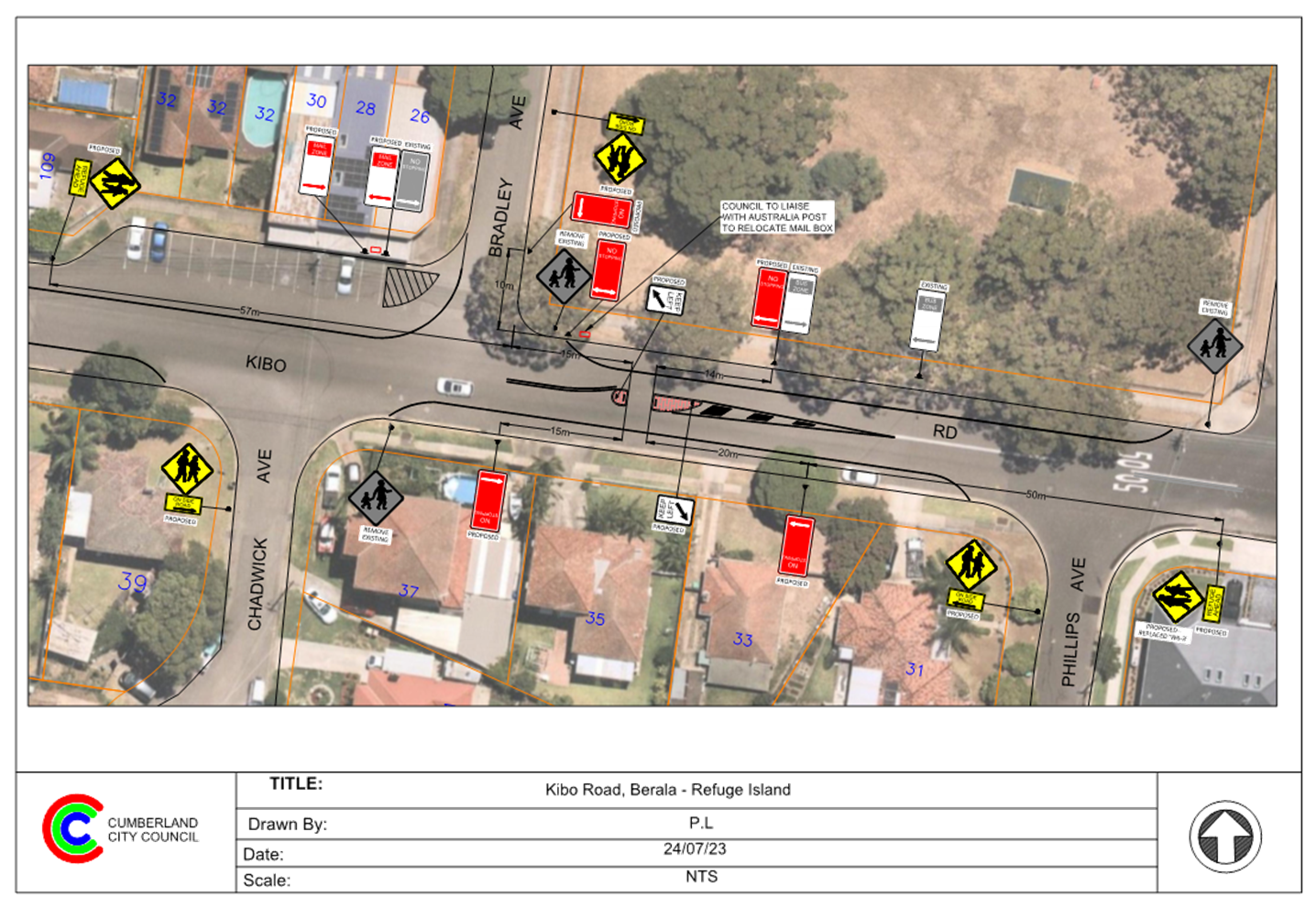
DOCUMENTS
ASSOCIATED WITH
REPORT CTC-23-187
Attachment 2
Submissions
1 November 2023
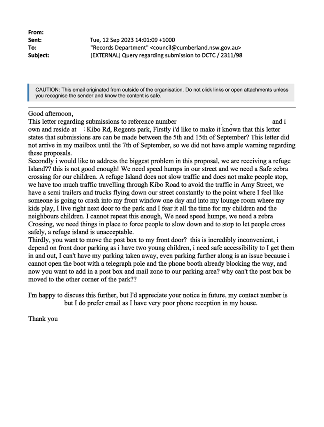
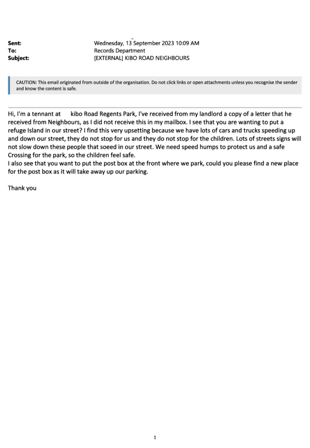
1 November 2023
Item
No: CTC-23-188
KIBO ROAD,
REGENTS PARK – PROPOSED SPEED HUMPS
Directorate: Environment
and Planning
Responsible
Officer: Executive
Manager Development and Building
Electorate: Auburn
Police Area
Command (PAC): Auburn
Agenda Part Part
2
Note: Recommendation
to Council
Council has undertaken
consultation with directly affected and adjacent residents regarding the
proposed pedestrian refuge.
This report outlines the outcome
of the consultation.
|
The Cumberland Traffic Committee recommends that:
1. The
proposed speed humps and associated signage on Kibo Road, Regents Park in
accordance with the attached plan be approved.
2. The
affected / concerned residents be notified of Council’s resolution.
|
In August 2023,Cumberland
Traffic Committee considered a report on the road safety concerns in Kibo Road
Regents Park. Council resolved that:
1. The
installation of speed humps in Kibo Road, Regents Park, be approved in
accordance with the attached plan.
2. The
installation of a pedestrian refuge island on Kibo Road, Regents Park outside
Kibo Reserve, be approved in accordance with the attached plan.
3. Council
undertake consultation with directly affected and adjacent residents on these
plans and amend as required following consultation.
4. The
concerned residents be notified of the outcome.
Consultation undertaken regarding
the pedestrian refuge island on Kibo Road in accordance with items 2 and 3
above is reported in a separate report.
In accordance with item 1 of Council’s resolution
above, a consultation was carried out with affected residents of Kibo Road,
Regents Park from 13 September 2023 to 27 September 2023. A total of 27
letters, each with an attached plan and a survey form, were distributed to the
affected residents/owners. Council received 8 responses (29.6% of the total
letters sent) by the closing date. Of these, 6 responses (75%) supported the
proposed speed humps, while 2 responses (25%) objected to the proposal.
One objection received by Council was from a directly
affected resident concerned about the potential loss of on-street parking and
property devaluation due to speed humps. It should be noted that the proposed
speed humps will not impact on any available on-street parking. The other
objection received is from a resident whose property is not directly affected
and no reason was given for the objection.
Given that the majority of
residents supported the proposed speed humps and the significant public
interest in the matter, it is recommended that the plan for the speed humps on
Kibo Road, Regents Park, be finalised in accordance with the approved plan and
included on Council’s Capital Works Program.
The proposal was notified to the impacted resident for a
period of 14 days from 13 September 2023 to 27 September 2023.
A total of 27 letters, each with an attached plan and a
survey form, were distributed to the affected residents/owners. Council
received 8 responses (29.6% of the total letters sent) by the closing date. Of
these, 6 responses (75%) supported the proposed speed humps, while 2 responses
(25%) objected to the proposal.
1. Plan – Kibo
Road, Regents Park – Proposed Speed Humps
2. Submissions
DOCUMENTS
ASSOCIATED WITH
REPORT CTC-23-188
Attachment 1
Plan – Kibo Road, Regents Park – Proposed
Speed Humps
1 November 2023
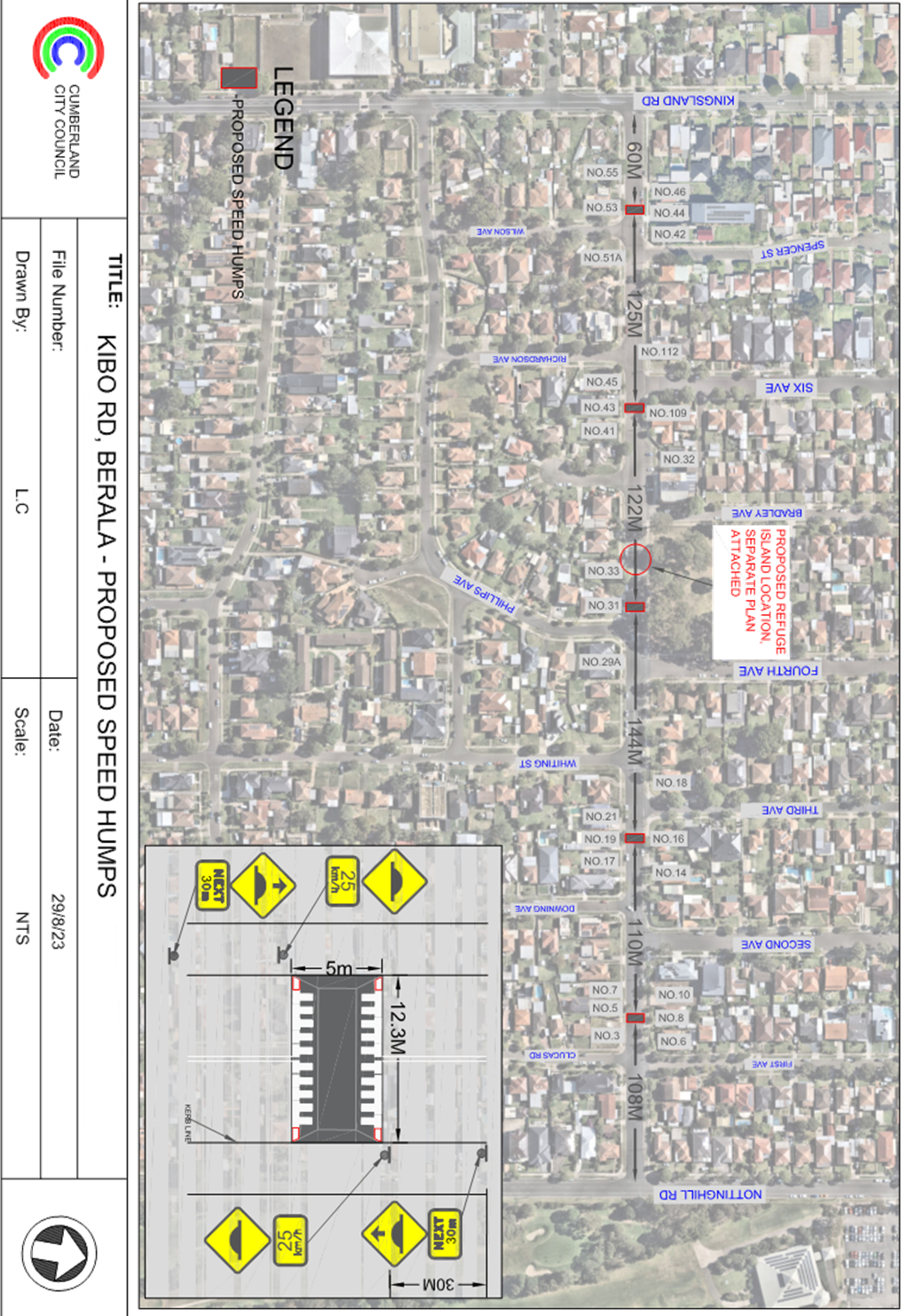
DOCUMENTS
ASSOCIATED WITH
REPORT CTC-23-188
Attachment 2
Submissions
1 November 2023
Item
No: CTC-23-189
BELGIUM
STREET, AUBURN - REQUEST OF ROAD WIDENING
Directorate: Environment
and Planning
Responsible
Officer: Executive
Manager Development and Building
Electorate: Auburn
Police Area
Command (PAC): Auburn
Agenda Part Part
2
Note: Recommendation
to Council
Council has received requests
from residents in Belgium Street, Auburn concerning various issues including
the narrow width of the street.
This report outlines the outcome
of the investigation into this matter.
|
The Cumberland Traffic Committee recommends that:
1. The
installation of parking restrictions in Belgium Street, Auburn not be
supported due to community objections.
2. Council
note the alternate options provided to respond to issues identified in the
report.
3. Council
investigate the option of indented parking in Belgium Street, Auburn, and
provide a further report to the Cumberland Traffic Committee.
4. Council
notify concerned residents of the outcome.
|
Belgium Street is a local road that runs in a north-south
direction between Wellington Road and Albert Road, with a speed limit of 50
km/h. The street is approximately 410m in length and has a width of approximately
7.1m. Parking is permitted on both sides of the road in accordance with Road
Rules unless otherwise signposted. Belgium Street consists mainly of
low-density houses, with some duplexes and granny flats.
Council has received requests from residents on Belgium
Street to widen the road due to its narrowness. Residents allege that two-way
traffic cannot be maintained when vehicles are parked on both sides of the
street, and they experience difficulties entering or exiting their properties
due to parked vehicles. Residents are also concerned about constant speeding
issues on Belgium Street and damage to vehicles' side mirrors caused by
speeding motorists.
The latest accident data from the Centre for Road Safety
indicates that there were two reported accidents in Belgium Street near
Wellington Road in the last five years ending in December 2022. One accident
occurred while a vehicle attempted a U-turn on Wellington Road at its
intersection with Belgium Street. The cause of the other accident was not
clear, as it was recorded as 'other manoeuvring’.
Council officers have investigated the matter and found that
Belgium Street is approximately 7.1 metres wide, which is similar to many other
streets in Cumberland City. Inspections revealed that Belgium Street is
relatively straight with good sightlines, and there are multiple driveways on
both sides of the street to allow vehicles to give way to oncoming traffic when
cars are parked. It was also found that 'No Stopping' restrictions exist at
the intersection of Belgium Street and Wellington Road, providing
additional room for vehicles to turn in and out of Belgium Street safely.
A review of the traffic count in Belgium Street conducted in
October 2023 indicated that the Average Daily Traffic (ADT) on Belgium Street
was 446 vehicles per day, and the recorded 85th percentile speed was
45 km/h, which is below the default speed limit of 50 km/h. Average peak hour
traffic volumes were 30 in morning and 45 in evening peak hours.
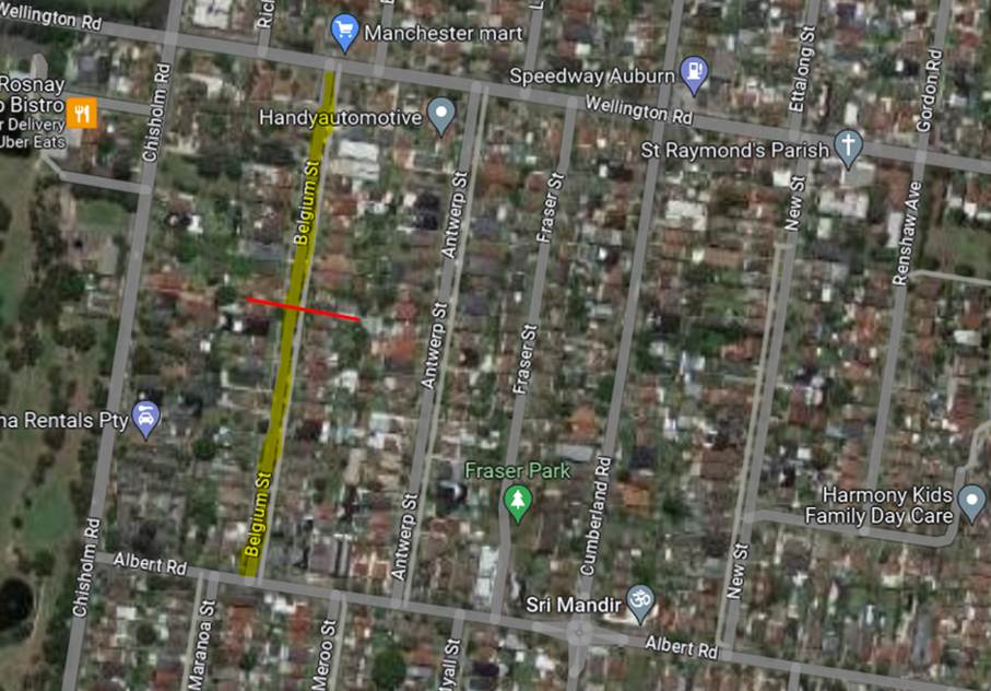
In response to the concerns raised by the residents
regarding the traffic issues caused by the narrowness of the street, several
options have been considered. These options are:
1. Introducing
parking restrictions in the street to allow for two way traffic
2. Widening
of the road
3. Providing
parking on nature strips or indented parking
The above options are discussed further below:
1. Introducing
parking restrictions on one side of the road
Council undertook consultation with residents, proposing
parking restrictions on one side of the street. Several submissions including a
petition were received where majority of residents do not support the proposed
parking restrictions. Instead, they would like Council to widen the road or
provide rolled kerbs in the street.
2. Widening
of the road
Council officers investigated the request for widening the
road. The scope of work for the demolition and reconstruction of new kerb and
gutter is significant, and is likely to result in the removal of street trees.
property boundary level adjustments, driveway reconstructions, adjustment of
drainage infrastructure, and utility relocation and/or adjustment. The costs of
these works will also be high compared to other solutions if this option was
progressed. Given these factors, it is advised that this option should be
progress at this time.
3. Providing
parking on nature strips or indented parking
Providing
rolled kerbs and allowing parking on the nature strip
Normally, parking on the nature
strip is illegal under the Road Rules and if allowed, may damage utilities
underneath due to the low cover depth for the services under the nature strip.
In the case of Belgium Street, providing rolled kerbs will require demolishing
approximately 800m long standard kerb and gutter (on both sides) and providing
concrete slabs on the nature strip. It should be noted that removing parking
along the current kerb and moving to nature strip may encourage speeding in the
street and create sight distance issues for vehicles driving out of the driveways.
Given these factors, it is advised that this option should be progress at this
time.
·Indented parking
Council officers have reviewed
this option, and indented parking could be provided at some locations where
sufficient distance is available between the driveways. This option would also
for a wider space on the road at these locations. Further analysis would be
required to confirm the total number of indented parking spaces provided and
the net result of on-street parking at this location.
Based on the options provided and the significant community
interest on the matter, it is recommended that Council investigate the option
of indented parking in Belgium Street, Auburn, and provide a further report to
the Cumberland Traffic Committee.
The proposed parking restrictions were consulted with the
residents for a period of 14 days from 29 August 2023 to 12 September 2023.
A total of 58 letters were distributed with an attached
survey from to the residents / owners. Council received 31 responses and 29
(94%) objected to the proposal.
Council also received a petition signed by residents from 27
properties in Belgium Street objecting to the proposed parking restrictions and
requesting widening of the street.
1. Submissions
DOCUMENTS
ASSOCIATED WITH
REPORT CTC-23-189
Attachment 1
Submissions
1 November 2023
Item
No: CTC-23-190
CLARENCE
STREET, MERRYLANDS – ROAD SAFETY CONCERNS
Directorate: Environment
and Planning
Responsible
Officer: Executive
Manager Development and Building
Electorate: Granville
Police Area
Command (PAC): Cumberland
Agenda Part Part
2
Note: Recommendation
to Council
Council has received safety
concerns regarding traffic conditions on Clarence Street, Merrylands due to
speeding issues.
This report outlines the outcome
of the investigation into this matter.
|
The Cumberland Traffic Committee recommends that the
Council undertake consultation with the residents of Clarence Street,
Merrylands between Merrylands Road and Leeds Street to assess support or
otherwise for the installation of speed humps.
|
Clarence Street is a local road
that runs in a north-south direction between Merrylands Road and Burnett
Street. Clarence Street is approximately 1 km long and has a width of
approximately 12m.The posted speed limit is 50km/hr and parking are permitted on
both sides of the road unless signposted. Clarence Street provides access to
Holroyd School and there is 40km/hr School Zone at the front of the school.
There is morning (6:30AM-9:30AM)
and evening (3:00PM-7:00PM) right turn bans at the Clarence Street intersection
for vehicles on Merrylands Road on weekdays.
Merrylands Road is line marked for
4 lanes of traffic, 2 lanes in each direction in this section.
Council has received concerns from
a local resident regarding vehicles speeding in Clarence Street towards
Merrylands Road.
Council officers have investigated the street. A raised threshold
is in place on Clarence Street south of Walpole Street. The 40km/hr School Zone
commences approximately 30m south of Walpole Street and is provided up to a
location between Leeds Street and Shannon Avenue which covers the frontage of
Holroyd School. In accordance with the resident’s concerns, Council
officers have considered Clarence Street section south of Leeds Street for the
analysis.
The
map below shows the location of Clarence Street, Merrylands. The School Zone
location is indicated in the map.
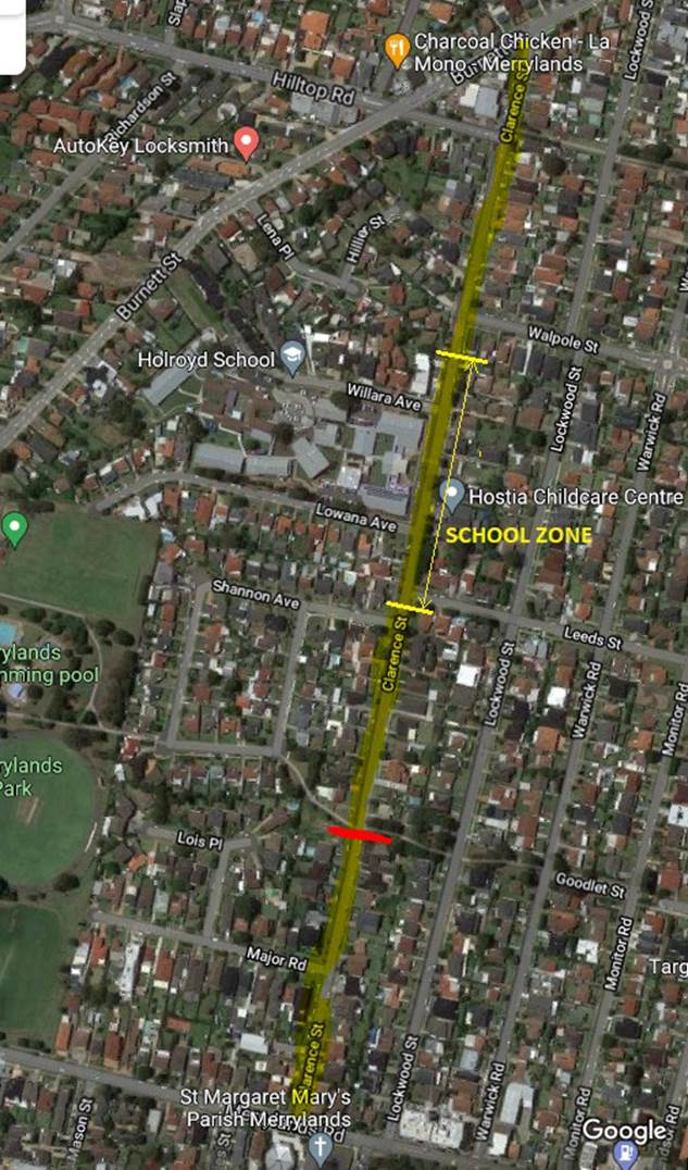
A traffic count was undertaken on Clarence Street in March
2023. The traffic count location is shown in red on the map above.
Traffic count data:
Average Daily Traffic = 2,503 veh/day
85th Percentile speed = 58.9 km/hr
The latest Centre for Road Safety accident data on Clarence
Street indicated that there were two reported accidents in this section in the
last 5 years ending December 2022. All of them are related to pedestrian
movement. One accident occurred at Merrylands Road and the other occurred
midblock in Clarence Street.
Council officers have undertaken a further review of the
traffic conditions on Clarence Street in August 2023 in accordance with
Council’s Local Area Traffic Management (LATM) Policy. The LATM
assessments are summarised in the tables below:
Table 1 – Clarence
Street - LATM Assessment Points
|
Criteria
|
Maximum Score
|
Score Achieved
|
|
Traffic Study Data
|
45
|
25
|
|
Crash warrant in the
last 5 years
|
15
|
5
|
|
Road Characteristics
|
35
|
10
|
|
Community Support &
other factors
|
5
|
5
|
|
Total
|
100
|
45
|
Table 2 – Clarence
Street – Action
|
Criteria
|
Action
|
|
>75
|
Report to TC with a
recommendation of providing traffic calming devices
|
|
61-75
|
Report to TC and
discuss possibility of providing traffic calming devices
|
|
41-60
|
Council to review
traffic data in 6 months
|
|
25-40
|
Monitor street and
review traffic data after 12 months
|
|
<25
|
Do Nothing
|
|
Speed
|
That regardless of the
total points scored, should the 85th percentile speed exceed the posted speed
limit by 5 km/h, the street be referred to the NSW Police for monitoring
and/or enforcement.
|
The traffic count indicated that the recorded 85th
percentile speed was 58.9 km/h which is significantly high compared to the
speed limit of 50km/hr of the street. Also, there is a School Zone in Clarence
Street.
Based on the above, it is proposed
to undertake consultation with the residents of Clarence Street for the
installation of speed humps.
Subject to endorsement of the
recommendation, consultation will be undertaken with residents to assess
support or otherwise for the installation of speed humps.
Nil
1 November 2023
Item
No: CTC-23-191
DELLWOOD STREET,
SOUTH GRANVILLE - REQUEST FOR A PEDESTRIAN CROSSING
Directorate: Environment
and Planning
Responsible
Officer: Executive
Manager Development and Building
Electorate: Granville
Police Area
Command (PAC): Cumberland
Agenda Part Part
2
Note: Recommendation
to Council
Council has received a petition
from residents for the provision of a pedestrian crossing on Dellwood Street,
South Granville, near the existing car park and local shops.
This report outlines the outcome
of the review.
|
The Cumberland Traffic Committee recommends that:
1. The
proposed marked pedestrian crossing in Dellwood Street, South Granville,
including kerb blisters and signage in accordance with the attached plan be
approved.
2. Council
forward final design plans to Transport for NSW for concurrence.
3. Council
notify the Taxi Council regarding the reduction in length of the existing
‘Taxi Zone’.
4. Council
undertake consultation with the businesses regarding the proposed marked
pedestrian crossing in Dellwood Street, South Granville and report back to
the Traffic Committee if objections are received.
|
Council has received a petition
from residents for the provision of a pedestrian crossing on Dellwood Street,
South Granville, between the existing car park and local shops. The petition
has been signed by over 170 residents living in the surrounding road network.
The petitioners allege that the
location adjacent to the car park is used by many pedestrians to access the
shops and other facilities.
This section of Dellwood Street
is between Blaxcell Street and Pegler Avenue.
Dellwood Street is a local road
that runs in an east–west direction between Blaxcell Street and Clyde
Street. The section of interest is between Blaxcell Street and Pegler Avenue.
This section of Dellwood Street is approximately 100m long and 12.5m wide, with
a default speed limit of 50 km/h.
Currently, William Lamb Park
with a car park is situated on the northern side of this section of Dellwood Street,
while local shops are situated on the southern side of the street. Parking
restrictions apply on both sides of the street at this section of Dellwood
Street.
Furthermore, roundabouts are
located at the intersections of Dellwood Street with Blaxcell Street and Pegler
Avenue. Additionally, a median island is also incorporated in this particular
section of Dellwood Street.
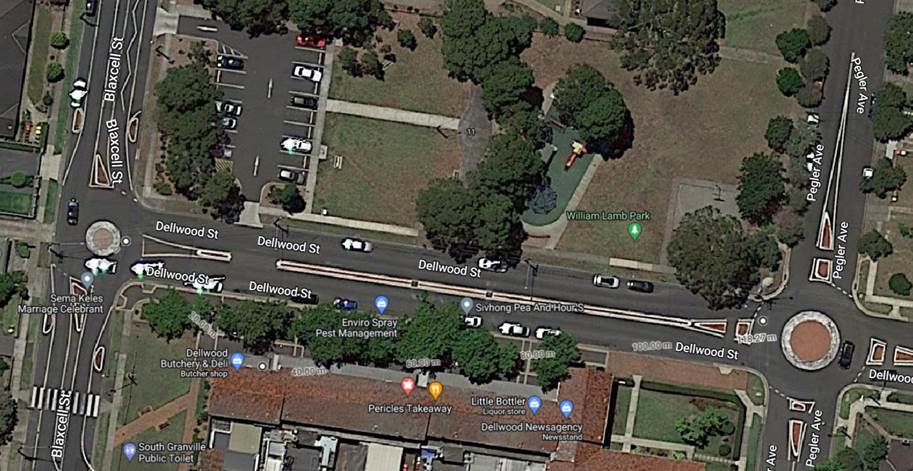
Following the petition, Council officers have observed
pedestrian patterns in the section of Dellwood Street. Based on the observations,
it was noted that there is frequent pedestrian crossing activity between the
car park, the park on the northern side and the shops on the southern side at
this section of Dellwood Street.
The following pedestrian and vehicle counts were taken on 19
October 2023 in Dellwood Street adjacent to the car park.
|
Period
|
Vehicles
|
Pedestrians
|
|
Adults
|
Elderly &
students
|
Total
|
|
12:00 – 13:00
|
327
|
58
|
27
|
85
|
|
13:00 – 14:00
|
330
|
54
|
48
|
102
|
|
15:00 – 16:00
|
472
|
67
|
28
|
95
|
The hourly vehicle volumes are low compared to the standard
warrants; however, the pedestrian numbers are high including elderly and
students.
Transport for NSW has now provided guideline to Local
Governments to utilise reduced warrants on local roads, subject to satisfying
safety requirements outlined in the Australian Standards and Austroads
Guidelines.
In accordance with the minimum criteria specified in the
Australian Standards AS 1742.10 and the Transport for NSW guideline for Local
Governments, Council officers consider that the location on Dellwood Street in
the vicinity of the car park qualifies for the provision of a marked pedestrian
crossing.
The attached concept plan shows the location of the proposed
crossing.
The existing ‘Taxi Zone’ on the southern side of
Dellwood Street east of the Blaxcell Street roundabout is 8.1m long. Due to the
location of the proposed pedestrian crossing, the existing ‘Taxi
Zone’ length has to be reduced to 5.5m which is as per the standard
requirement. There are ‘No Stopping’ zones on either side of the
‘Taxi Zone’ which will assist taxis to drive in and out of the kerb
side parking.
The pedestrian crossing is
associated with ‘No Stopping’ restrictions on the approaches and
exit sides as indicated in the plan. Council will undertake consultation with
affected businesses in the area. Council will also notify the Taxi Council
regarding the reduction in length of the existing ‘Taxi Zone’.
Consultation with the affected
businesses will be undertaken if recommended by the Traffic Committee.
1. Plan –
Dellwood Street, South Granville - Proposed pedestrian crossing.
DOCUMENTS
ASSOCIATED WITH
REPORT CTC-23-191
Attachment 1
Plan – Dellwood Street, South Granville -
Proposed pedestrian crossing.
1 November 2023
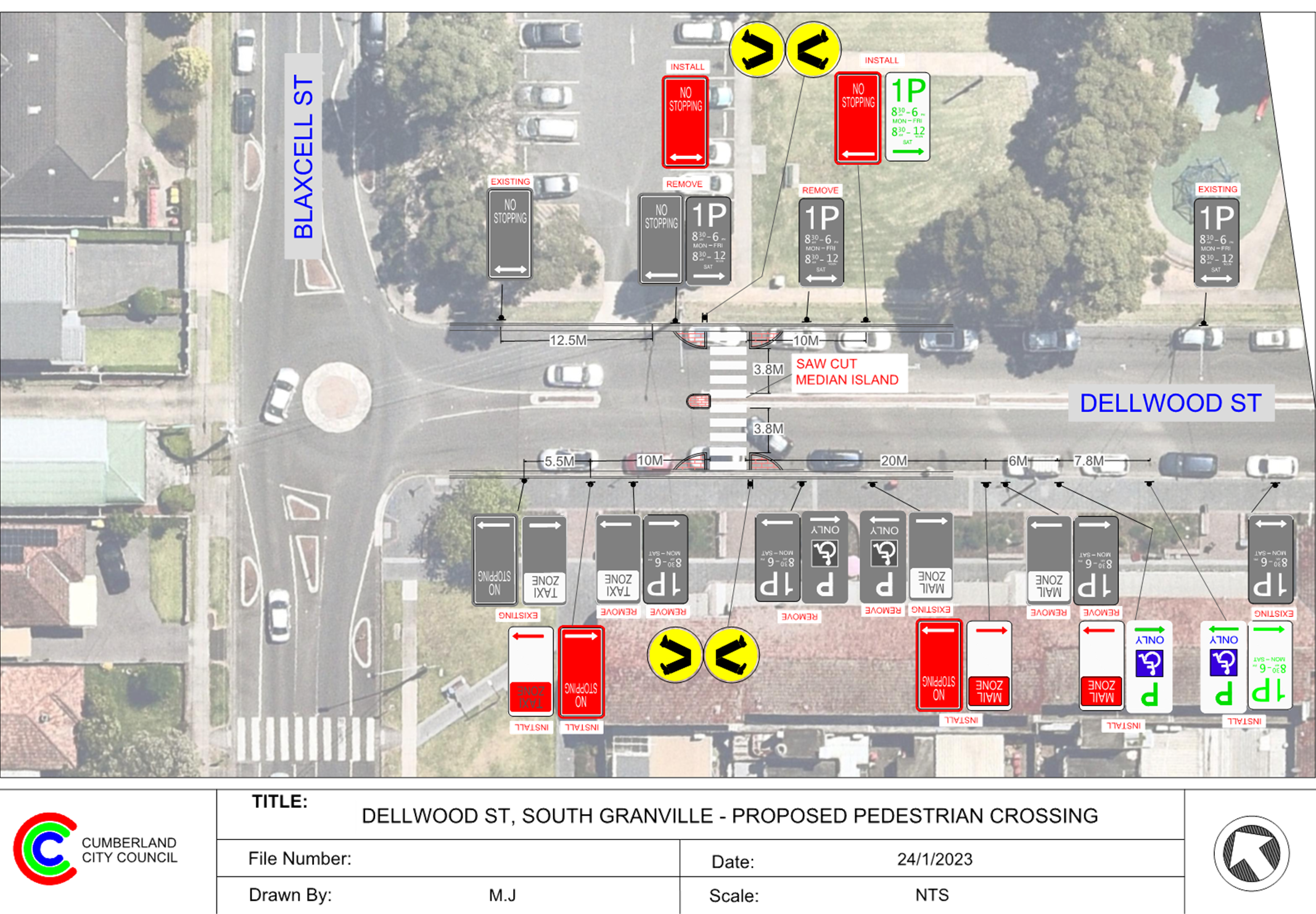
1 November 2023
Item
No: CTC-23-192
HAMPDEN ROAD,
SOUTH WENTWORTHVILLE – ROAD SAFETY CONCERNS
Directorate: Environment
and Planning
Responsible
Officer: Executive
Manager Development and Building
Electorate: Granville
Police Area
Command (PAC): Cumberland
Agenda Part Part
2
Note: Recommendation
to Council
Council has undertaken
consultation with the adjacent properties for the installation of speed humps
on Hampden Road, South Wentworthville.
This report outlines the outcome
of the consultation into this matter.
|
The Cumberland Traffic Committee recommends that:
1. The
installation of speed humps on Hampden Road, South Wentworthville, in
accordance with the attached plan be approved.
2. Council
notify affected/ concerned residents of the outcome.
|
Cumberland Traffic Committee
(CTC) at its meeting in August 2023 considered a report (CTC-23-133) regarding
road safety concerns on Hampden Road, South Wentworthville.
Council resolved that:
1. The installation of speed humps in Hampden Road, South
Wentworthville in accordance with attached plans be approved in principle.
2. Council undertake consultation with adjacent properties and
report back to the Traffic Committee in November 2023.
In accordance with
Council’s resolution, consultation was carried out with the residents of
Hampden Road in September 2023. A total of 86 letters were distributed to the
residents / owners with an attached survey form and plans of the proposed speed
humps.
Council received 12 responses,
with 9 (75%) that supported the proposal and 3 (25%) that opposed the proposed
speed humps. While the majority of residents that responded to the consultation
supported the provision of speed humps, the residents opposing the speed humps
indicated the reason for objection being the loss of on-street parking spaces,
concerns about the number of proposed speed humps and potential noise impacts.
Following consideration of the
feedback provided, the plan has been updated to remove locations where speed
humps have not been supported. Based on this, it is recommended that the
provision of speed humps as shown on the attached plan be approved.
The proposal was notified to the
impacted resident for a period of 14 days from 13 September 2023 to 27
September 2023.
A total of 86 letters were
distributed to the residents / owners with an attached survey form and a plan
of the proposed speed humps. Council received 12 responses, 9 (75%) supporting
the proposal and 3 (25%) opposing the proposed speed humps.
1. Plans –
Hampden Road, South Wentworthville – Proposed speed humps
2. Previous
report CTC-23-133
3. Submissions
DOCUMENTS
ASSOCIATED WITH
REPORT CTC-23-192
Attachment 1
Plans – Hampden Road, South Wentworthville
– Proposed speed humps
1 November 2023
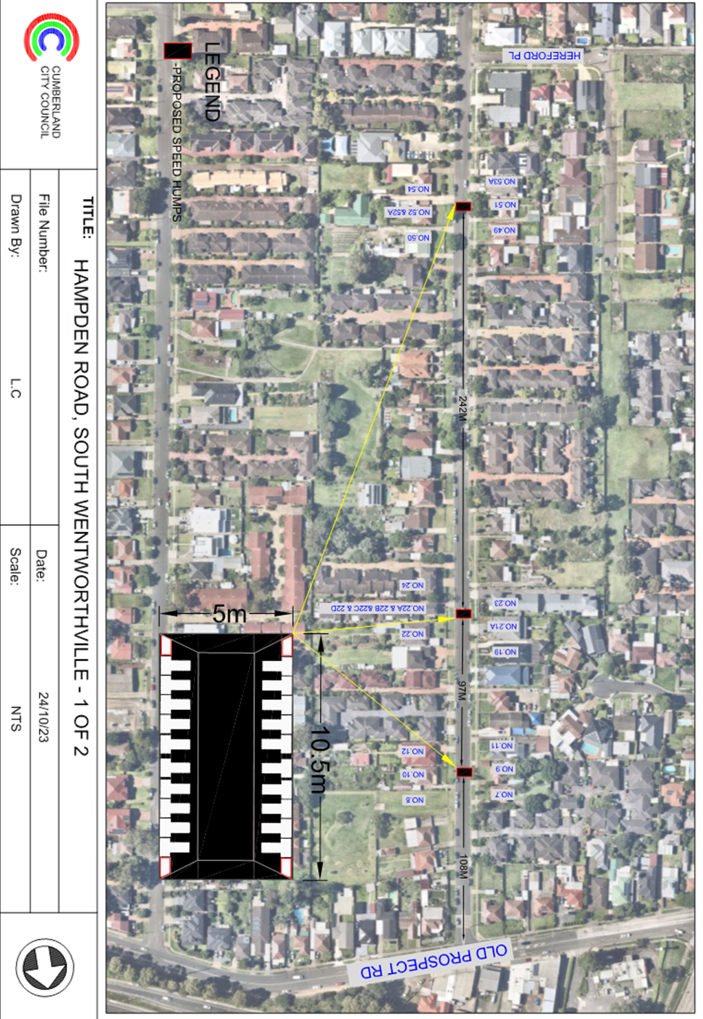
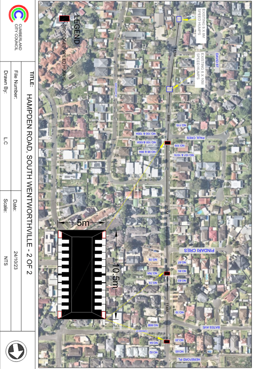
DOCUMENTS
ASSOCIATED WITH
REPORT CTC-23-192
Attachment 2
Previous report CTC-23-133
DOCUMENTS
ASSOCIATED WITH
REPORT CTC-23-192
Attachment 3
Submissions
1 November 2023
Item
No: CTC-23-193
HAWKSVIEW
STREET, GUILDFORD AND MERRYLANDS - ROAD SAFETY CONCERN
Directorate: Environment
and Planning
Responsible
Officer: Executive
Manager Development and Building
Electorate: Granville
Police Area
Command (PAC): Cumberland
Agenda Part Part
2
Note: Recommendation
to Council
Council has reviewed traffic
conditions in Hawksview Street, Guildford / Merrylands.
This report outlines the
investigation regarding the above.
|
The Cumberland Traffic Committee recommends that:
1. The
installation of speed humps in Hawksview Street, Guildford/ Merrylands in
accordance with the attached plan be approved.
2. Council
notify affected/ concerned residents of the outcome.
|
Hawksview Street is a regional road that runs in an
east-west direction with a posted speed limit of 50km/h. It has a width of
approximately 12.5m and parking is permitted on both sides of the road unless
signposted.
Council has received concerns from local residents regarding
road safety on Hawksview Street, Guildford/ Merrylands. The matter was
investigated and reported to Cumberland Traffic Committee (CTC) in the past, a
summary of the reports and recommendations are listed below:
Background
7 June 2023
CTC considered a report
(CTC-23-087) on the road safety concerns of a fatal accident in Hawksview
Street. Based on the report, Council resolved in July 2023 that:
1. The
existing ‘S1’ line marking in Hawksview Street be replaced with
‘BB’ line marking.
2. Council
undertake a detailed review of conditions in Hawksview Street, Merrylands and
report back to the Traffic Committee in August 2023.
3. Council
liaise with the State Member for Granville, Ms Julia Finn MP, regarding any
review of traffic conditions on Hawksview Street.
2 August 2023
CTC considered a report
(CTC-23-135) on the road safety concerns with a detailed review of Hawksview
Street. Based on the report, Council resolved in September 2023 that:
1. The
installation of traffic calming devices in Hawksview Street in Guildford and Merrylands,
between Guildford Overpass and Chetwynd Road, be approved in principle.
2. Council
prepare speed hump design and undertake consultation with directly affected and
adjacent residents.
3. Council
report back to the Traffic Committee the outcomes of consultation on the
proposal in November 2023.
4. The
Member for Granville be notified of the recommendation.
5. The
State Government be requested to review the location for a speed camera.
The map below show the location/
section of Hawksview Street, Guildford/ Merrylands between Guildford Overpass
and Chetwynd Road.
The latest Centre for Road Safety
accident data indicated that there were eight (8) reported accidents in
Hawksview Street between Guildford Overpass and Chetwynd Road in the last 5 years
ending December 2022. All of them were the result of turning vehicles failing
to give way at intersections.
In accordance with the item 2 of
the recommendation above, Council prepared concept plans for speed humps and
consultation was undertaken with the residents of Hawksview Street between
Chetwynd Road and Oxford Street Overpass in September 2023.
A total of 50 letters were
distributed to the residents/ owners with an attached survey form with a plan
of the proposed speed humps. Council received 7 responses (14% of the total
letters sent) by the closing date, 6 supporting the proposal and 1 opposing the
proposed speed humps with various reasons such as emergency vehicles delay,
amenity and future detours.
Based on the above result, the
majority of the responses received supported the proposal. Therefore, it is
proposed that the proposed speed humps in Hawksview Street be approved.
In relation to the resolution for
a speed camera at this location, the request has been forwarded to Transport
for NSW for consideration. At this stage, no response has been received
by Council.
The proposal was notified to the
adjacent and impacted residents for a period of 14 days from 21 September 2023
to 6 October 2023.
Council received 7 responses (14%
of the total response sent) by the closing date, 6 (86%) supported the proposal
and 1 (14%) opposed to the proposed speed humps with various reason such as
emergency vehicles delay, amenity and future detours.
1. Plan –
Hawksview Street – Proposed Speed Humps
2. Previous
Report - CTC-23-135 - Hawksview Street, Guildford, and Merrylands - Road Safety
Concerns.
3. Extract
Council Minute of CTC-23-135
4. Submissions
DOCUMENTS
ASSOCIATED WITH
REPORT CTC-23-193
Attachment 1
Plan – Hawksview Street – Proposed Speed
Humps
1 November 2023
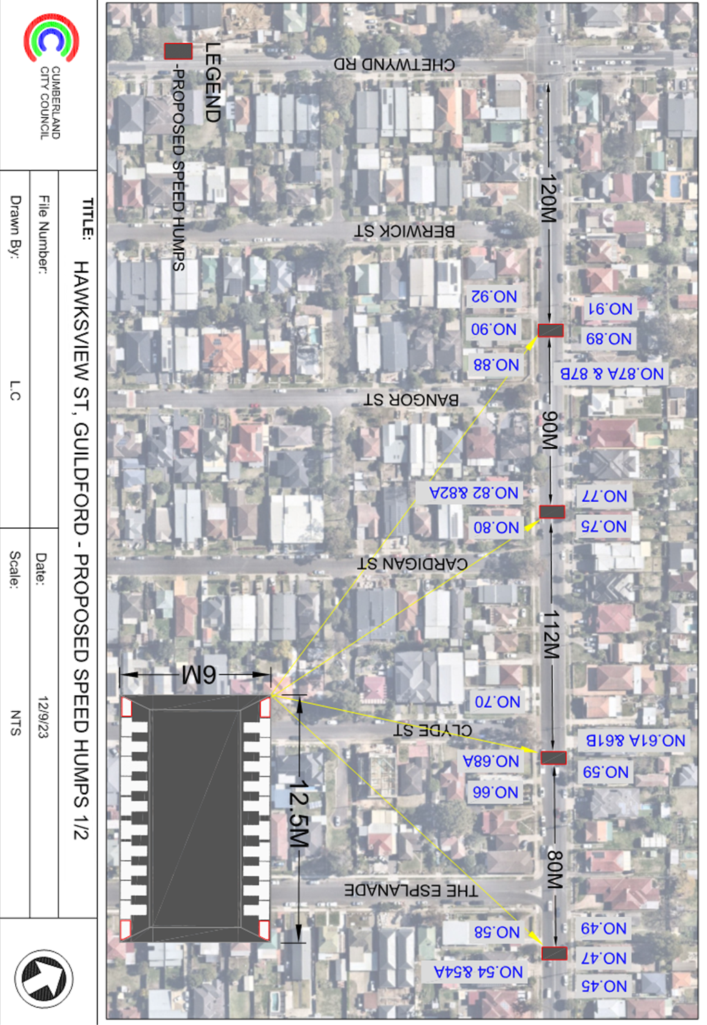
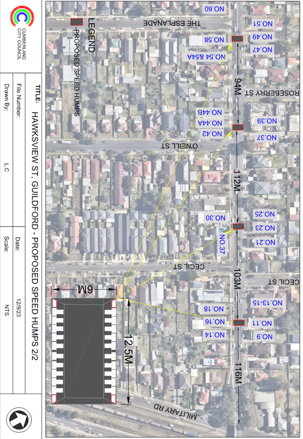
DOCUMENTS
ASSOCIATED WITH
REPORT CTC-23-193
Attachment 2
Previous Report - CTC-23-135 - Hawksview Street,
Guildford, and Merrylands - Road Safety Concerns.
DOCUMENTS
ASSOCIATED WITH
REPORT CTC-23-193
Attachment 3
Extract Council Minute of CTC-23-135
1 November 2023
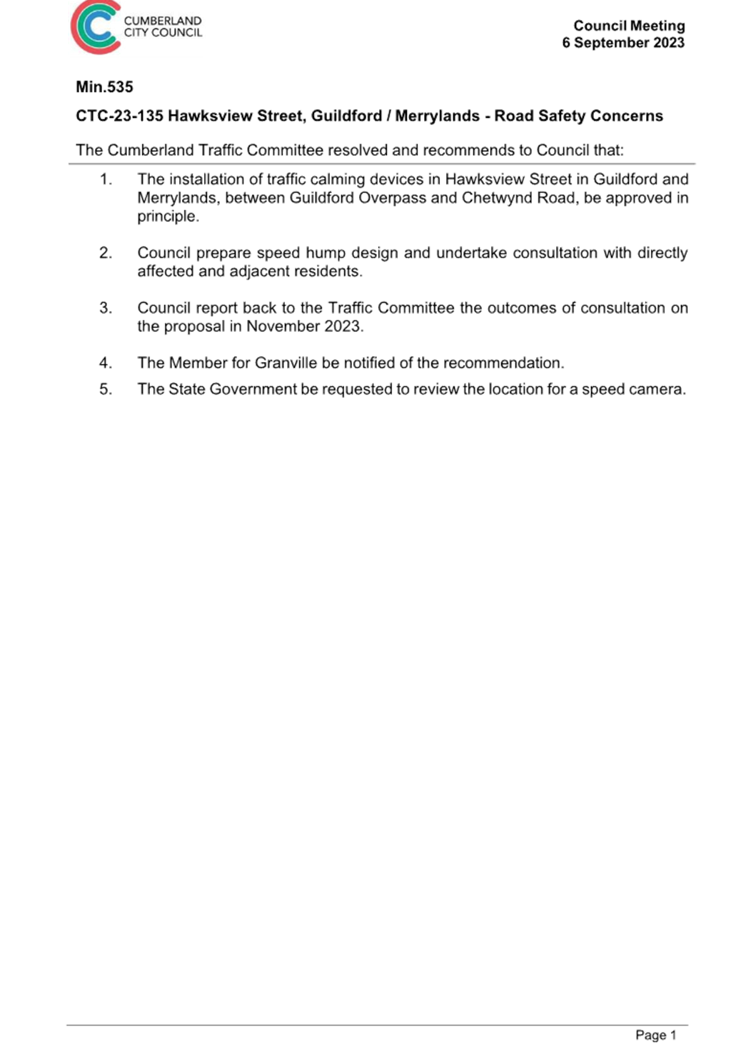
DOCUMENTS
ASSOCIATED WITH
REPORT CTC-23-193
Attachment 4
Submissions
1 November 2023
Item
No: CTC-23-194
LANSDOWNE
STREET, MERRYLANDS – ROAD SAFETY CONCERNS
Directorate: Environment
and Planning
Responsible
Officer: Executive
Manager Development and Building
Electorate: Granville
Police Area
Command (PAC): Cumberland
Agenda Part Part
2
Note: Recommendation
to Council
Council has received requests from
local residents for the installation of traffic calming devices on Lansdowne
Street, Merrylands due to speeding concerns.
This report outlines the outcome
of the investigation into this matter.
|
The Cumberland Traffic Committee recommends that:
1. The
installation of speed humps along Lansdowne Street, Merrylands, in accordance
with the attached plans be approved.
2. Council
notify residents of the outcome of the proposal.
|
Cumberland Traffic Committee
(CTC) at its meeting in June 2023 considered a report (CTC-23-086) regarding
road safety concerns on Lansdowne Street, Merrylands. Council resolved the
following in July 2023:
1. Note
the findings from the community consultation and review of technical
information.
2.
Endorse a staged approach to response to traffic issues in Lansdowne Street,
Merrylands, which includes:
a.
Implementation of the line marking scheme in the street in accordance with the
attached plan
b.
In-principle support of the installation of speed humps as a traffic calming
device in the street, with the preparation of a design and consultation with
adjacent residents to the proposed location of the speed humps.
3.
Forward a detailed line marking plan to Transport for NSW for concurrence.
4.
Provide a further report to the Traffic Committee in November 2023 on the
status on the response of traffic issues in Lansdowne Street, Merrylands.
5.
Council investigate further opportunities to restrict heavy vehicle movements
along
Lansdowne Street, Merrylands.
6. Notify
residents of the outcome of the proposal.
Proposed Speed Humps
In accordance with
Council’s resolution for Item 2, Council officers prepared design of
speed humps in Lansdowne Street and undertook consultation with the residents
in August 2023. A total of 30 letters were distributed to the residents /
owners with an attached survey form and a plan of the proposed speed humps.
Council received 4 responses
(13.3% of the total letters sent) received by the closing date, one supporting
the proposed speed humps and three opposing the proposal.
While the majority of responses
received were not in favour, this was based on a small number of
submissions. It is noted that there was interest in previous consultation
undertaken earlier in the year for the provision of speed humps on the
street. Given the submissions received in earlier consultation and the
community interest on the matter, it is recommended that the installation of
speed humps along Lansdowne Street be approved.
Opportunities to Restrict
Heavy Vehicle Movements
In accordance with
Council’s resolution on Item 5, Council officers’ have undertaken
investigations on opportunities to restrict heavy vehicle movements in
Lansdowne Street, Merrylands. Council Officers’ undertook traffic counts in
early 2023 which indicated low volumes of small to medium trucks accessing the
street. Furthermore, there was no evidence of large trucks accessing the street
due to the existing road layout.
As a consequence of the above
findings, it is unlikely that Transport for NSW will provide approval for
restricting truck movements in Lansdowne Street, Merrylands.
Council will continue to monitor
the street and the surrounding area should the current prevailing conditions
change and provide further reports to the Cumberland Traffic Committee and
Council if needed.
The
proposal was notified to the adjacent and impacted residents for a period of 14
days from 30 August 2023 to 13 September 2023.
A total of 30 letters were
distributed to the residents / owners with an attached survey form and a plan
of the proposed speed humps. Council received 4 responses (13.3% of the total
letters sent) received by the closing date, one supporting the proposed speed
humps and three opposing the proposal.
1. Plan - Lansdowne
Street, Merrylands - Proposed speed humps
2. Previous
report CTC-23-086
3. Submissions
DOCUMENTS
ASSOCIATED WITH
REPORT CTC-23-194
Attachment 1
Plan - Lansdowne Street, Merrylands - Proposed speed
humps
1 November 2023
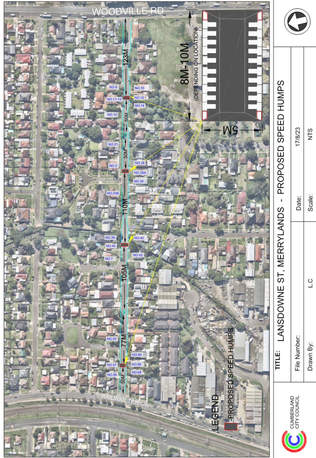
DOCUMENTS
ASSOCIATED WITH
REPORT CTC-23-194
Attachment 2
Previous report CTC-23-086
DOCUMENTS
ASSOCIATED WITH
REPORT CTC-23-194
Attachment 3
Submissions
1 November 2023
Item
No: CTC-23-195
TOONGABBIE
ROAD, TOONGABBIE - ROAD SAFETY CONCERNS AT THE BEND
Directorate: Environment
and Planning
Responsible
Officer: Executive
Manager Development and Building
Electorate: Prospect
Police Area
Command (PAC): Cumberland
Agenda Part Part
2
Note: Recommendation
to Council
Council has received concerns from
motorists regarding the recently installed speed cushions on Toongabbie Road,
Toongabbie at the bend outside No.93 and 99.
This report outlines the outcome
of the review.
|
The Cumberland Traffic Committee recommends that:
1. Council
approve in-principle full width speed humps on both sides of the bend at 93
to 99 Toongabbie Road, Toongabbie to replace the existing speed cushions.
2. Council
prepare concept plan for the speed humps and undertake consultation with
affected and adjacent residents and report back to the Traffic Committee.
3. Council
notify the concerned resident / motorist of the outcome.
|
Cumberland Traffic Committee
(CTC) at its meeting in October 2022 considered a report (CTC-22-175) regarding
the provision of speed cushions on Toongabbie Road, Toongabbie at the bend
outside No.93 and 99.
Council resolved to support the
provision of speed cushions at this location and two speed cushions were
installed accordingly as shown on the map below.
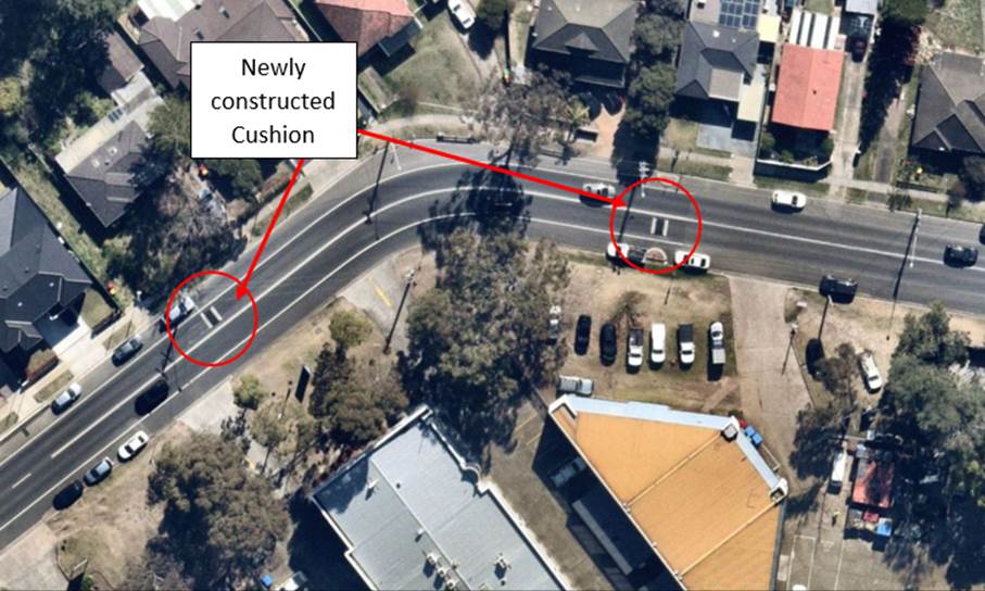
The speed cushions were approved and installed only on the
single directional travel lanes and not across the whole road. Following the
construction of the speed cushions, Council received concerns from residents
who alleged that vehicles frequently drive on the wrong side of the road to
avoid these cushions.
Council requested the Cumberland Police Area Command to
monitor the location as it is illegal to cross the ‘BB’ centre line
marked at this location.
Due to the short distance between the cushions
(approximately 60m), Council did not approve installation of full width speed
humps across the whole road.
In order to enhance safety at this location, it is proposed
that the existing speed cushions be replaced with full-width speed humps to
prevent motorists from driving onto the wrong side of the road. It is also
proposed that Council relocate the existing speed cushions (either one or both)
to appropriate distance on either side of the bend.
A design will be prepared and affected residents consulted
prior to a further report to the Traffic Committee.
Subject to endorsement,
consultation on the proposal will be undertaken by Council.
1. Previous report
– CTC-22-175
DOCUMENTS
ASSOCIATED WITH
REPORT CTC-23-195
Attachment 1
Previous report – CTC-22-175
1 November 2023
Item
No: CTC-23-196
PENDLE WAY,
PENDLE HILL – PROPOSED TEMPORARY ROAD CLOSURE FOR ‘THAI PONGAL
FESTIVAL 2024’
Directorate: Environment
and Planning
Responsible
Officer: Executive
Manager Development and Building
Electorate: Prospect
Police Area
Command (PAC): Cumberland
Agenda Part Part
2
Note: Recommendation
to Council
For the committee to consider 11-hour closure of Pendle Way,
Pendle Hill for ‘Thai Pongal Festival 2024’.
This report outlines the outcome of the investigation into
this matter.
|
The Traffic Committee recommends that the temporary
closure of Pendle Way, Pendle Hill (between Gilba Road and Civic Avenue)
between the hours of 3:00am and 2:00pm Sunday 21 January 2024 be approved subject
to the following conditions:
1. All affected businesses, residents and emergency
stakeholders being notified/consulted of the closure.
2. Complying with the notification requirements of the Roads
Act 1993, i.e. placing public notices in a newspaper and erecting notices
on the road.
3. Bus
operators be consulted of the closure.
4. Approval
of a Traffic Management Plan by Transport for NSW and the Transport
Management Centre.
|
Council has received an
application for the temporary closure of Pendle Way, Pendle Hill between Gilba
Road and Civic Avenue from 3:00am to 2:00pm Sunday 21 January 2024 for the Thai
Pongal Festival.
Pendle Way, Pendle Hill is a local collector road that runs in a
north-south direction linking Pendle Hill Station to the north and Great
Western Highway to the south. Shops and small businesses are occupying along
this section of street with time restricted and parking permitted on both side
of the road.
Transit Systems bus service operates 705 Blacktown to Parramatta
via Pendle Hill Station daily. The event organiser has consulted with the bus
operator and received no objection. It is also noted that CDC Bus operates
school afternoon drop off on Monday to Friday from Girraween High School to
Pendle Hill Station via Joyce Street and this service will not be affected by
the Sunday Road closure.
The Thai Pongal Festival has been occurring in Civic Park, Pendle
Hill in the last 10 years and Council has previously received no complaints
from the public. The event organiser is expecting 300 to 400 festival attendees
at the Thai Pongal Festival - 2024 and have the majority support from local
businesses that the event to be held on Pendle Way, Pendle Hill. It is noted
that the event is scheduled to be carried out on Sunday 21 January 2024 between
the hours of 7:00am and 12:00pm.
The road closure will be between 3:00 am and 2:00pm.
The Traffic Management Plan and Traffic Control Plan for the
community event is attached.
The Traffic Management Plan will be forwarded to Transport for NSW
for approval.
The event organisers will carry out consultation with all
affected businesses and residents and any objection received will be forwarded
to Council for consideration.
1. Plan –
Traffic Management & Traffic Control Plan– Thai Pongal Festival 2024
2. Submissions
DOCUMENTS
ASSOCIATED WITH
REPORT CTC-23-196
Attachment 1
Plan – Traffic Management & Traffic Control
Plan– Thai Pongal Festival 2024
DOCUMENTS
ASSOCIATED WITH
REPORT CTC-23-196
Attachment 2
Submissions
1 November 2023
Item
No: CTC-23-197
TOONGABBIE
ROAD, TOONGABBIE – REVIEW OF ROAD SAFETY CONCERNS
Directorate: Environment
and Planning
Responsible
Officer: Executive
Manager Development and Building
Electorate: Prospect
Police Area
Command (PAC): Cumberland
Agenda Part Part
2
Note: Recommendation
to Council
Council has reviewed traffic
conditions on Toongabbie Road, Toongabbie.
This report outlines the outcome
of the review.
|
The Cumberland Traffic Committee recommends that:
1. The
installation of traffic calming devices on Toongabbie Road, Toongabbie not be
supported.
2. Council
review conditions on Toongabbie Road, Toongabbie, and report back to Traffic
Committee in November 2024 if required.
|
Cumberland Traffic Committee (CTC)
at its meeting in February 2021 considered a report (CTC-21-013) regarding
speeding concerns on Toongabbie Road, Toongabbie.
Council resolved that:
1. The
installation of traffic calming devices on Toongabbie Road, Toongabbie not be
supported.
2. Council
review traffic conditions in Toongabbie Road, between Portia Road and Targo
Road in November 2021 and report back to traffic committee in February 2022.
3. Council
request Cumberland Police Area Command to monitor speeding in Toongabbie Road
between Portia Road and Targo Road.
In accordance with item 3 above,
Cumberland Police Area Command was requested to monitor speeding in the area.
A traffic count was undertaken on
Toongabbie Road in March 2023. The traffic count location is shown in red on the
map below.
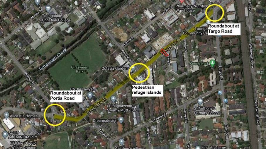
Council officers have reviewed
the traffic count data and compared it with the previous traffic count data
undertaken in November 2020.
Both results are detailed in the table below:
|
Traffic
Count Date
|
Average
Daily Traffic
|
85th
Percentile Speed
|
|
November
2020
|
5,303
|
55.1
km/h
|
|
March
2023
|
5,014
|
53.5
km/h
|
The traffic count data from the table above indicated that
both traffic volume (ADT) and the recorded 85th percentile speed in
Toongabbie Road has reduced slightly since 2020.
The latest Centre for Road Safety accident data indicated
that there were 2 reported accidents at this section of Toongabbie Road in the
last 5 years ending December 2022. Both accidents were related to vehicles
losing control and hitting objects.
Council officers have undertaken a further review of the
traffic conditions of Toongabbie Road in accordance with Council’s Local
Area Traffic Management (LATM) Policy. The LATM assessments are summarised in
the tables below:
Table 1 – Toongabbie Road - LATM Assessment Points
|
Criteria
|
Maximum Score
|
Score Achieved
|
|
Traffic Study Data
|
45
|
15
|
|
Crash warrant in the
last 5 years
|
15
|
5
|
|
Road Characteristics
|
35
|
15
|
|
Community Support &
other factors
|
5
|
5
|
|
Total
|
100
|
40
|
Table 2 – Toongabbie Road – Action
|
Criteria
|
Action
|
|
>75
|
Report to TC with a recommendation of providing traffic
calming devices
|
|
61-75
|
Report to TC and discuss possibility of providing traffic
calming devices
|
|
41-60
|
Council to review traffic data in 6 months
|
|
25-40
|
Monitor street and review traffic data after 12 months
|
|
<25
|
Do Nothing
|
|
Speed
|
That regardless of the total points scored, should the
85th percentile speed exceed the posted speed limit by 5 km/h, the street be
referred to the NSW Police for monitoring and/or enforcement.
|
The traffic count data indicated
that the recorded 85th percentile speed was 53.5 km/h which is
within acceptable range for a local street with a 50km/h speed limit.
Based on the above assessment,
traffic calming devices are not warranted on the street. Council will review
traffic conditions on Toongabbie Road in 12 months and report back to Traffic
Committee if required.
Consultation has not been undertaken as the investigation
outlined in the report concludes no action is required.
Consultation will be undertaken if
recommended by the Traffic Committee.
1. Previous report
CTC-21-013
DOCUMENTS
ASSOCIATED WITH
REPORT CTC-23-197
Attachment 1
Previous report CTC-21-013
1 November 2023
Item
No: CTC-23-198
TEMPORARY ROAD
CLOSURE FOR ‘AUSTRALIA DAY’ CELEBRATIONS
Directorate: Environment
and Planning
Responsible
Officer: Executive
Manager Development and Building
Electorate: Granville
Police Area
Command (PAC): Cumberland
Agenda Part Part
2
Note: Recommendation
to Council
For the Committee to consider the
two (2) hour closure of a short section of Pitt Street, Merrylands to
facilitate 2024 Australia Day Celebrations in Holroyd Gardens at the corner of
Pitt Street & Walpole Street.
The event will be managed by
Council.
|
That the Traffic Committee recommends that the
temporary two hour closure of Pitt Street in accordance with the attached
traffic control plan between 8:30PM and 10:30PM on Friday January 26, 2024 be
approved subject to concurrence and approval of a Traffic Management Plan
(TMP) by Transport for NSW.
|
Australia Day is
celebrated annually in Holroyd Gardens at the corner of Pitt Street &
Walpole Street. The event will be managed by Council.
Australia Day will be
celebrated on Friday January 26, 2024 commencing from 6:00PM and finishing at
9:00PM. Approximately 1,000 people are expected to attend the event throughout
the duration. There will be fireworks at the end of the event.
The road closure will be
on Pitt Street between the two eastern and western approaches of the staggered
intersection of Walpole Street. The road closures will be between 8:30PM and
10:30PM to facilitate event patrons to evacuate the area safely and cross Pitt
Street to access their parked cars or walk to Merrylands station which is less
than 900m from Holroyd Gardens.
The event is classified
as Class 3 in accordance with the Special Event Guidelines.
The map below shows the
street network and Holroyd Gardens.
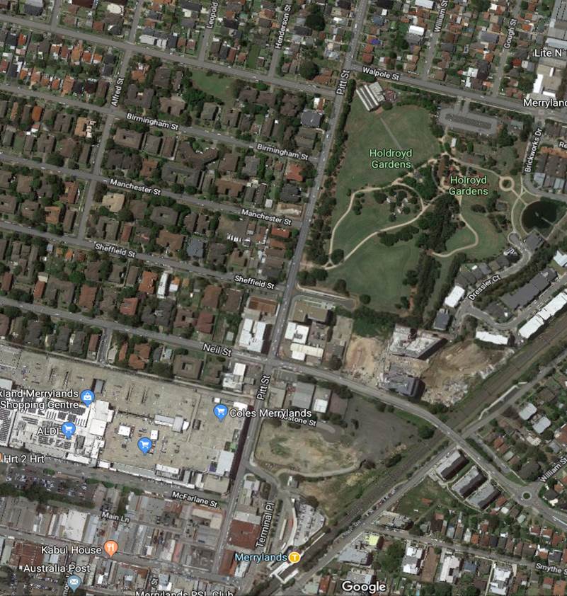
The Traffic Management
Plan and Traffic Guidance Scheme (TGS) are attached.
The Traffic Management
Plan (TMP) will be submitted to Transport for NSW for approval.
1. Traffic Management
Plan - Australia Day 2024
2. Traffic
Guidance Scheme - Australia Day 2024
DOCUMENTS
ASSOCIATED WITH
REPORT CTC-23-198
Attachment 1
Traffic Management Plan - Australia Day 2024
DOCUMENTS
ASSOCIATED WITH
REPORT CTC-23-198
Attachment 2
Traffic Guidance Scheme - Australia Day 2024
1 November 2023
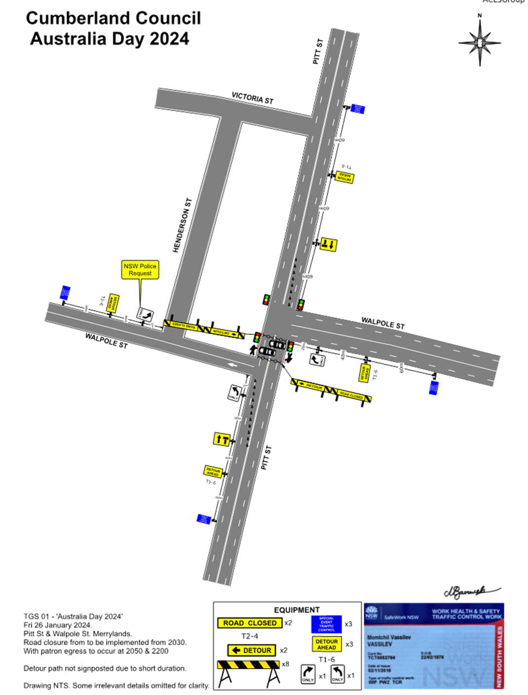
1 November 2023
Item
No: CTC-23-199
CARLTON
STREET, GRANVILLE - PROPOSED TEMPORARY ROAD CLOSURE FOR GRANVILLE RAILWAY
DISASTER MEMORIAL
Directorate: Environment
and Planning
Responsible
Officer: Executive
Manager Development and Building
Electorate: Granville
Police Area
Command (PAC): Cumberland
Agenda Part Part
2
Note: Recommendation
to Council
Cumberland City Council organising
the “Granville Railway Disaster Memorial” event has proposed the
temporary closure of Carlton Street, Granville between Railway Parade and
Council car park entry adjacent to Russell Street. The memorial event is
scheduled on Wednesday 18 January 2024 from 7:00 AM to 1:00 PM.
This report gives details of the
closure.
|
The Cumberland Traffic Committee recommends that:
1. Council
approves the temporary full road closure of Carlton Street, Granville between
Railway Parade and Council car park entry adjacent to Russell Street from
5:00 AM to 2:00PM on Thursday 18 January 2024 subject to approval from
Transport for NSW for the Traffic Management Plan and Traffic Guidance
Scheme.
2. The
Traffic Management Plan and Traffic Guidance Scheme be forwarded to City of
Parramatta for concurrence.
|
Cumberland Council organising the “Granville Railway
Disaster Memorial” event has proposed the temporary closure of Carlton
Street, Granville between Railway Parade and Council car park entry adjacent to
Russell Street. The memorial event is scheduled on Thursday 18 January 2024
from 7:00 AM to 1:00 PM. The traffic guidance scheme will be implemented from
5:00AM to 2:00PM.
This is an annual memorial service to commemorate the lives
lost due to the 1977 Granville Rail Disaster. Families of the victims,
survivors, and rescue personnel numbering 100 to 150 persons are expected to
attend the event.
The Railway Disaster memorial is located on the southwestern
corner of the Carlton Street & Railway Parade traffic lights. Please see a
street view of the memorial below:
The event organisers have identified that as in previous
years, the attendees will meet at the Granville Townhall and march along
Carlton Street towards the memorial.
The plan overleaf shows the location of closure:
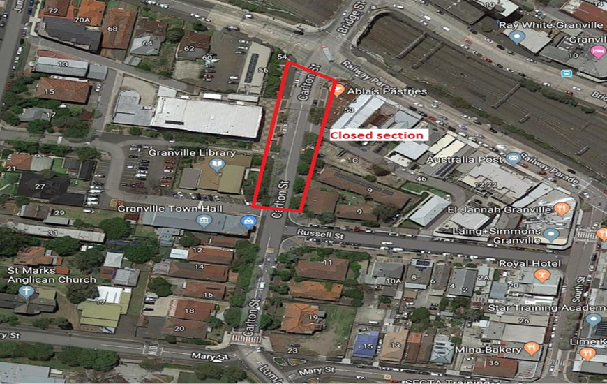
Following the event conducted previous years, event
debriefings by Council staff observed that the events were successful without
any issues.
Copies of the Traffic Management
Plan (TMP) and Traffic Guidance Scheme (TGS) are attached.
Council’s Event team will carry out the following
notification activities, subject to Traffic Committee endorsement of the
temporary road closure:
· Council
media release.
· Letter
box notifications are sent to local residents and businesses in Granville and
surrounding areas to advise them of changes to traffic.
· Council’s
traffic contractor will have VMS boards present.
1. Granville Railway
Disaster Memorial 2023 – Traffic Management Plan
2. Granville
Train Disaster - Traffic Guidance Scheme
DOCUMENTS
ASSOCIATED WITH
REPORT CTC-23-199
Attachment 1
Granville Railway Disaster Memorial 2023 –
Traffic Management Plan
DOCUMENTS
ASSOCIATED WITH
REPORT CTC-23-199
Attachment 2
Granville Train Disaster - Traffic Guidance Scheme
1 November 2023
Item
No: CTC-23-200
JOSEPH STREET,
LIDCOMBE - TEMPORARY ROAD CLOSURE FOR LUNAR NEW YEAR CELEBRATIONS
Directorate: Environment
and Planning
Responsible
Officer: Executive
Manager Development and Building
Electorate: Auburn
Police Area
Command (PAC): Auburn
Agenda Part Part
2
Note: Recommendation
to Council
Council
has received an application from Council’s Events Section requesting
the closure of Joseph Street, Lidcombe between Railway Street and Bridge Street
to facilitate 2024 Lunar New Year Celebrations.
This report
outlines the outcome
of the investigation into this matter.
|
The Cumberland Traffic Committee recommends that the
temporary road closure of Joseph Street between Railway Street and Bridge
Street be approved in accordance with the attached traffic guidance scheme
between the hours of 7:00AM, Friday, 9 February 2024 and 1:00AM, Saturday, 10
March 2024 subject to:
1. All affected businesses and
emergency stakeholders being notified of the closure.
2. Complying with
the notification requirements of the Roads
Act 1993, i.e., placing public notices in a newspaper and erecting notices on the road.
3. Approval of a Traffic
Management Plan by Transport Management Centre.
|
Council proposes to hold the 2024 Lunar New Year
Celebrations in three areas include Auburn, Barela and Lidcombe. Road closure
is required for the street festival event on Joseph Street, Lidcombe.
The event will commence from 6:00PM and finishing at 10:00PM
on Friday, 9 February 2024. The road closure is required on Joseph Street
between Railway Street and Bridge Street, from 7:00AM, Friday, 9 February 2024
to 1:00AM, Saturday, 10 March 2024 to facilitate event patrons to assemble and
evacuate the area safely.
The event is classified as a Class 3 event in accordance
with the Special Event Guidelines.
The map below shows the
street network around Joseph Street in this area.

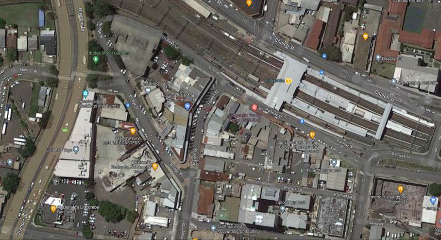
The attached Traffic Guidance Scheme (TGS) shows the signage
and the road section to be closed.
The TGS and Traffic Management
Plan (TMP) will be submitted to Transport for NSW for approval.
Council’s Event team will carry out the following
notification activities, subject to Traffic Committee endorsement of the
temporary road closure:
· Council media release.
· Letter box notifications are sent to local residents
and businesses in the area.
· Council’s traffic contractor will have VMS
boards present.
1. Traffic Guidance
Scheme
DOCUMENTS
ASSOCIATED WITH
REPORT CTC-23-200
Attachment 1
Traffic Guidance Scheme
1 November 2023
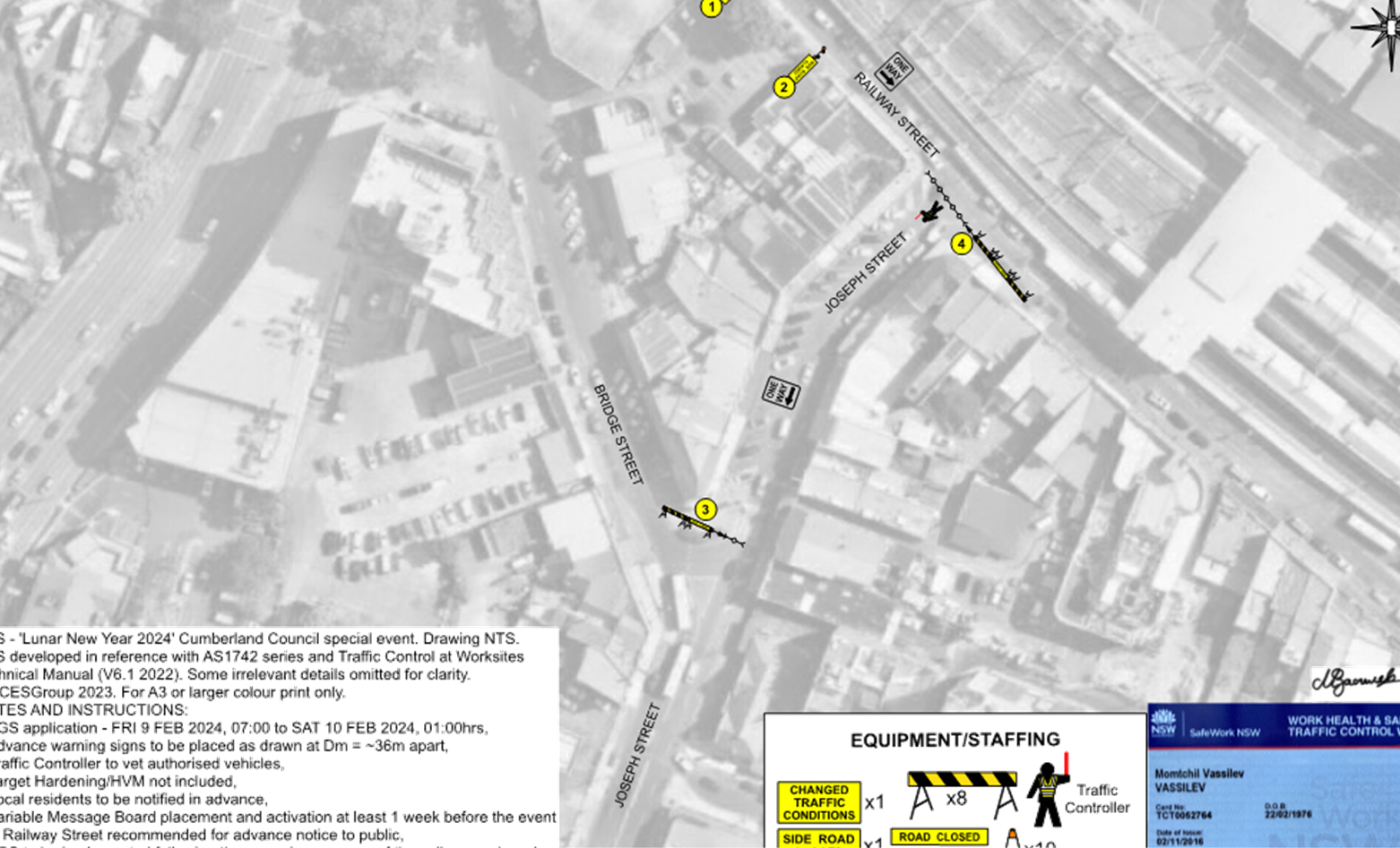
1 November 2023
Item
No: CTC-23-201
MERRYLANDS
ROAD, MERRYLANDS - TEMPORARY ROAD CLOSURE FOR ‘NOWRUZ’ PERSIAN NEW
YEAR CELEBRATIONS
Directorate: Environment
and Planning
Responsible
Officer: Executive
Manager Development and Building
Electorate: Granville
Police Area
Command (PAC): Cumberland
Agenda Part Part
2
Note: Recommendation
to Council
Council
has received an application from Council’s Events Section requesting
the closure of Merrylands Road, Merrylands between Treves Street and Miller
Street to facilitate 2024 Nowruz Celebrations.
This report
outlines the outcome
of the investigation into this matter.
|
The Cumberland Traffic Committee recommends that the
temporary road closure of Merrylands Road between Treves Street and Miller
Street be approved in accordance with the attached traffic guidance scheme
between the hours of 7:00AM, Saturday, 23 March 2024 and 2:00AM, Sunday, 24
March 2024 subject to:
1. All affected businesses and
emergency stakeholders being notified of the closure.
2. Complying with
the notification requirements of the Roads
Act 1993, i.e., placing public notices in a newspaper and erecting notices on the road.
3. Approval of a Traffic
Management Plan by Transport Management Centre.
|
Following inaugural celebration by Cumberland City Council
of ‘Nowruz’, the Persian New Year at The Granville Centre in 2023,
the event will move to Merrylands in 2024. The new location has been selected
to deliver the event with the inclusion of the new public space Merrylands
Civic Square.
The closure of Merrylands Road between Treves Street and
Miller Street for this event aims to provide additional event celebration space
and crucially to provide opportunities for local town centre businesses to
achieve maximum benefit from the event by being located in or close to the
event site. This local business engagement outcome is linked to funding being
received by NSW Government so is crucial to the event delivery.
The road closure will be on Merrylands Road between Treves
Street and Miller Street, from 7:00AM, Saturday, 23 March 2024 to 2:00AM,
Sunday, 24 March 2024.
The event is classified as Class 3 in accordance with the
Special Event Guidelines.
The map below shows the street network around Merrylands
Road in this area.

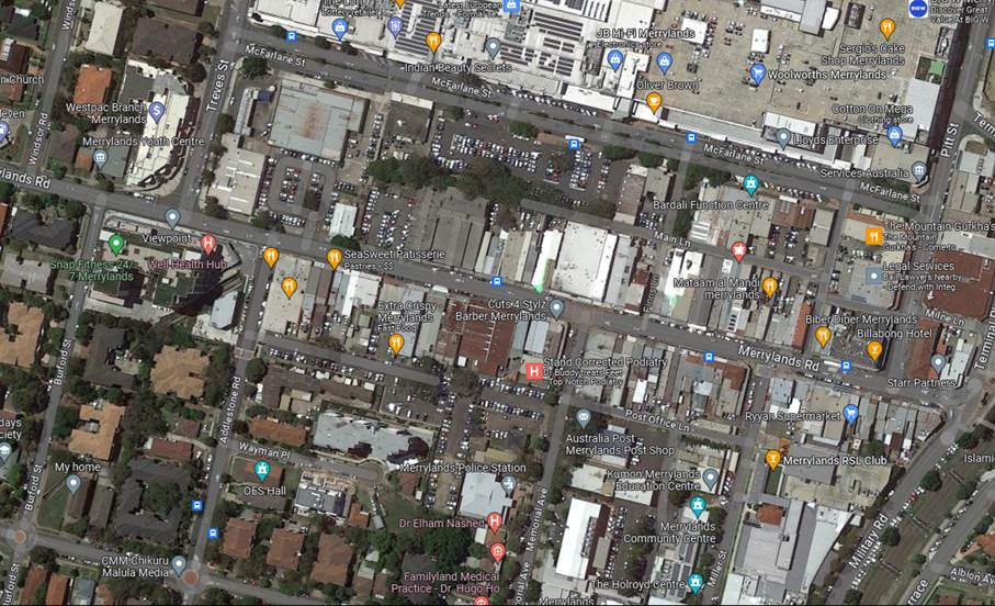
The attached Traffic Guidance Scheme (TGS) shows the signage
and the road section to be closed.
The TGS and Traffic Management
Plan (TMP) will be forwarded to Transport for NSW for approval.
Council’s Event team will carry out the following
notification activities, subject to Traffic Committee endorsement of the
temporary road closure:
· Council media
release.
· Letter box
notifications are sent to local residents and businesses in the area.
· Council’s
traffic contractor will have VMS boards present.
1. Nowruz Event -
Traffic Guidance Scheme
DOCUMENTS
ASSOCIATED WITH
REPORT CTC-23-201
Attachment 1
Nowruz Event - Traffic Guidance Scheme
1 November 2023
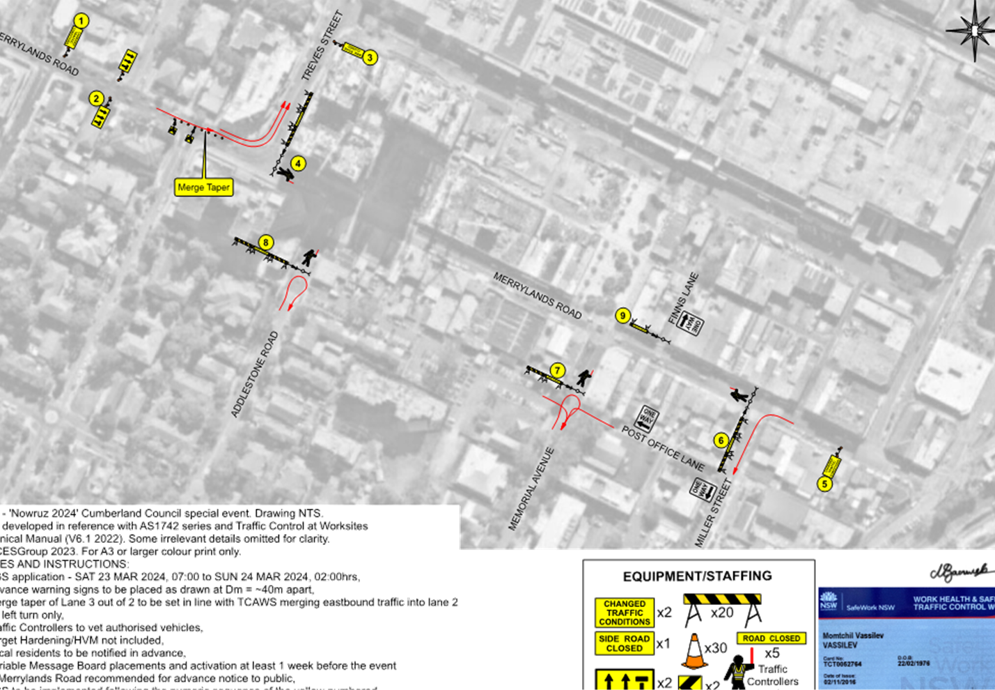
1 November 2023
Item
No: CTC-23-202
TEMPORARY ROAD
CLOSURES IN THE AUBURN CBD FOR RAMADAN FOOD FESTIVAL 2024
Directorate: Environment
and Planning
Responsible
Officer: Executive
Manager Development and Building
Electorate: Auburn
Police Area
Command (PAC): Auburn
Agenda Part Part
2
Note: Recommendation
to Council
Council has received an application from Council’s
Events Section requesting the closure of selected roads in the Auburn CBD to
facilitate ‘Ramadan Street Festival 2024’.
This report
outlines the outcome
of the investigation into this matter.
|
The
Cumberland Traffic Committee recommends that the temporary closure of Auburn
Road between Queen Street and Beatrice Street and the eastern section of Mary
Street, between Harrow Road and Auburn Road, Auburn on 3 days and two nights
within the period between 5:00 AM on Friday 15 March 2024 and 5:00 AM on
Monday 18 March 2024 be approved subject to:
1. All affected businesses and emergency stakeholders
being notified of the closure.
2. Complying with the notification requirements of the Roads
Act 1993, i.e., placing public notices in a newspaper and erecting notices on the road.
3. Approval of a Traffic Management Plan by Transport Management Centre.
4. Temporary bus routes and bus zones replacing the
existing bus zones in the closed area be provided in consultation with the
bus operator.
|
Council proposes to hold the annual ‘Ramadan Street
Festival’ in the Auburn CBD in March 2024.
‘Ramadan Street Festival 2024’ provides free
access to cultural event celebrating the local community. Council is committed to delivering the event to focus interest
on the local area, while keeping a community spirit and attracting
visitors from the Sydney metropolitan area.
The
event will involve street stalls with food and merchandise.
Council
is planning to deliver a one-night street food festival in Auburn, consistent
with recent Ramadan festival operations in 2022 and 2023. This event being an annual
event, no issues were encountered during the event held previous years.
In
response to a request from the Council's Events Committee, Council Officers are
investigating the feasibility of extending the event to a two-night event. Consequently,
the Council Events team is seeking approval for an extended road closure period
to ensure that the necessary permissions are in place to accommodate any
potential variations that may arise between now and the event scheduled for
March 2024.
The
exact date and duration of the closure will be determined through consultation
with the community and affected businesses, and this information is currently
pending. If the duration is extended, the road is proposed to be closed from
5:00 AM on the first day of the event and reopen at 5:00 AM on the third day of
the event.
The Traffic Guidance Scheme (TGS) are attached. Transport for NSW will be forwarded the Traffic
Management Plan with the updated details for approval.
Road Closures:
The road closure
from morning will prevent any parking within the event
area and also provide time for event officers to set up stalls and other furniture
required for the event.
The closure is as follows:
· Auburn Road between
Queen Street and Beatrice Street
· Eastern section of Mary Street,
between Harrow Road and Auburn Road
The map below
shows the road closures in yellow/
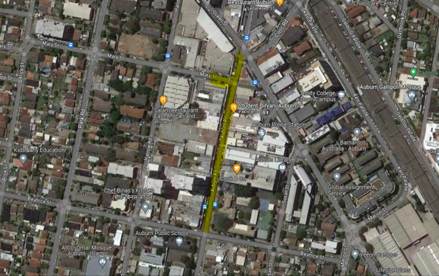
Council’s Event team will
carry out the following notification activities, subject to Traffic Committee
endorsement of the temporary road closure:
· Council media release.
· Letter box notifications are sent to local residents and
businesses in the area.
· Council’s traffic contractor will have VMS boards
present.
1. Traffic Guidance
Scheme (TGS) – Ramadan Food Festival 2024 - Part 1
2. Traffic
Guidance Scheme (TGS) – Ramadan Food Festival 2024 - Part 2
DOCUMENTS
ASSOCIATED WITH
REPORT CTC-23-202
Attachment 1
Traffic Guidance Scheme (TGS) – Ramadan
Food Festival 2024 - Part 1
1 November 2023
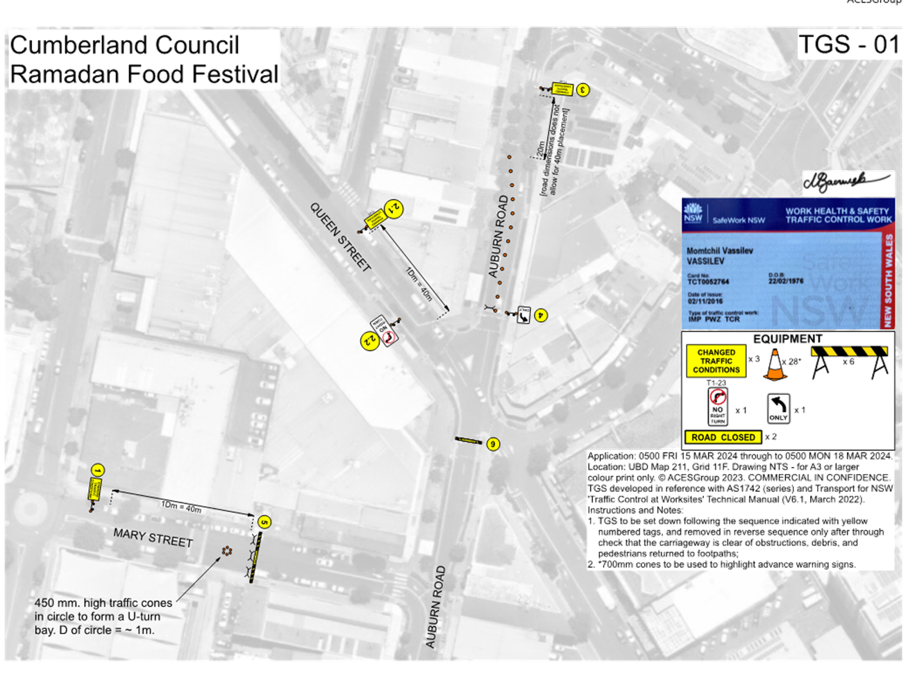
DOCUMENTS
ASSOCIATED WITH
REPORT CTC-23-202
Attachment 2
Traffic Guidance Scheme (TGS) – Ramadan
Food Festival 2024 - Part 2
1 November 2023