13 July 2022
A meeting of the Cumberland Local
Planning Panel will
be held at 11:30am at the Auburn Administration Building, 1 Susan Street Auburn
on Wednesday, 13 July 2022.
Business as below:
Yours faithfully
Melissa Attia
Acting
General Manager
ORDER OF BUSINESS
1. Receipt of Apologies
2. Declarations of Interest
3. Address by invited
speakers
4. Reports:
- Development
Applications
- Planning
Proposals
5. Closed Session Reports
Cumberland Local Planning Panel Meeting
13 July 2022
CONTENTS
Report No. Name of Report Page
No.
Development Applications
LPP037/22... Development Application -
16-20 South Street & 2A Russell Street, Granville 5
LPP038/22... Development Application -
15 Neil Street, Merrylands.............................. 211
LPP039/22... Development Application -
8 -12 Good Street, Westmead....................... 535
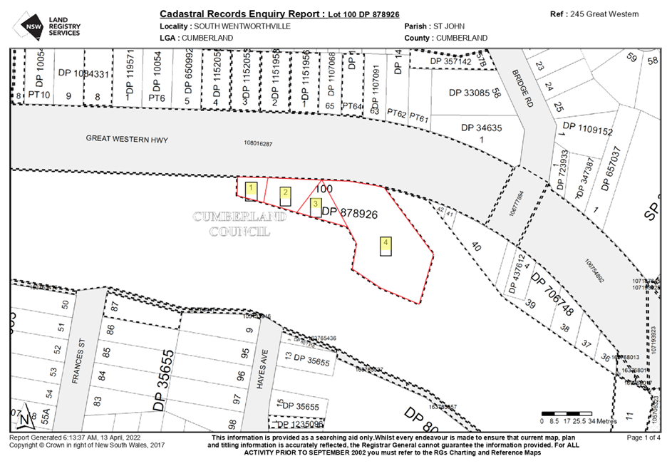
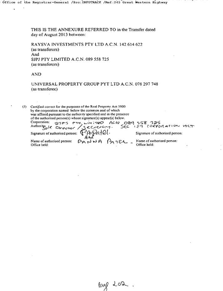
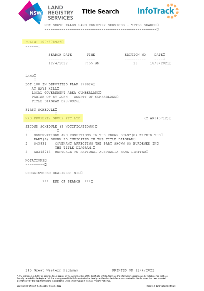
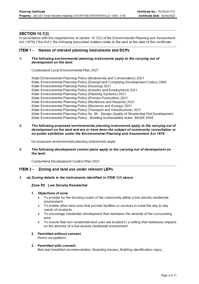
LPP041/22... Planning Proposal Request
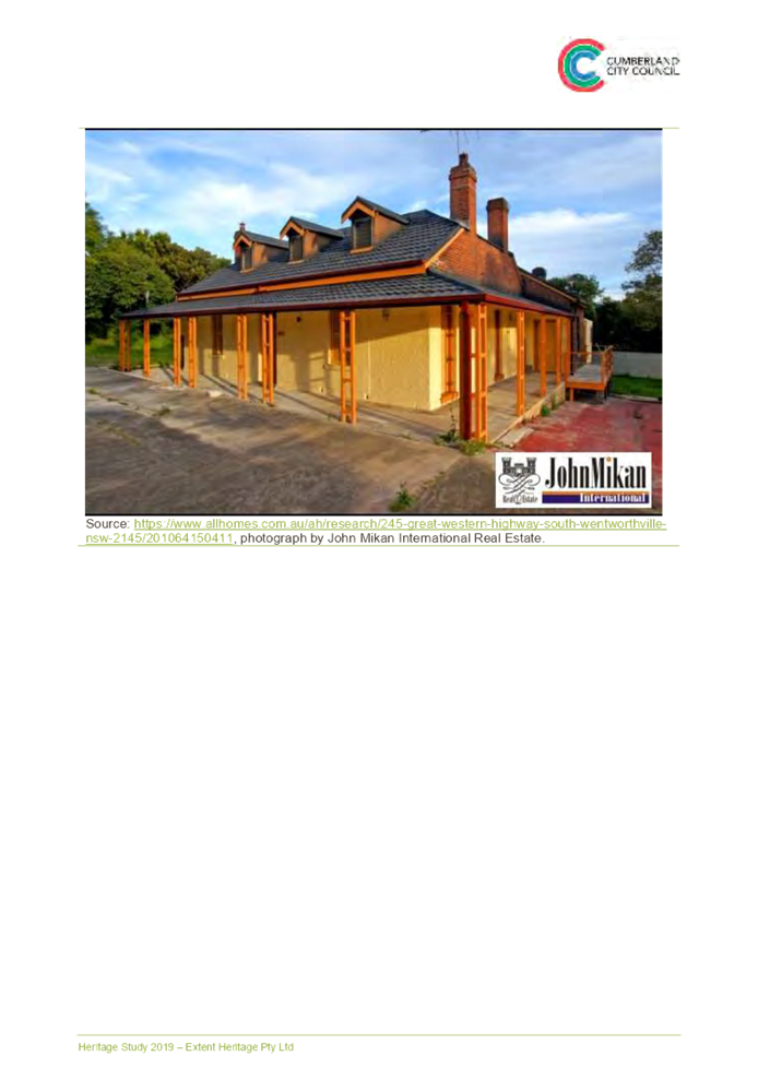
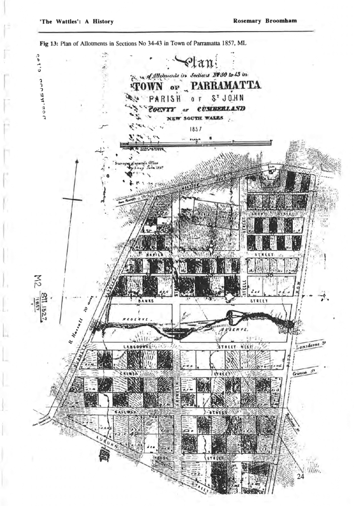
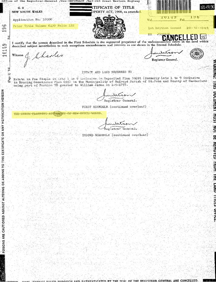
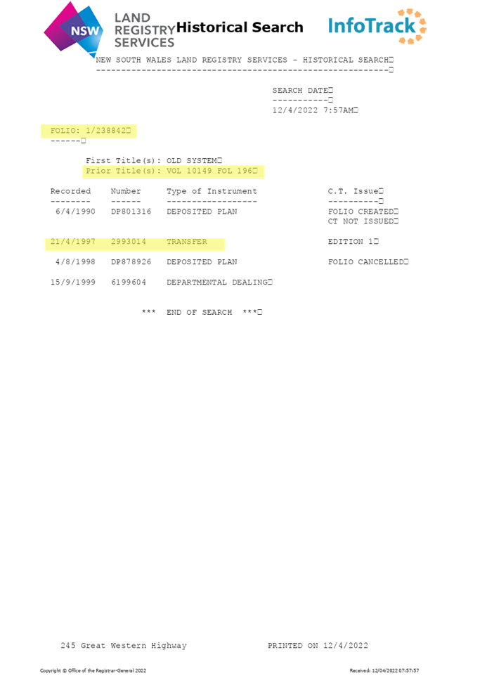
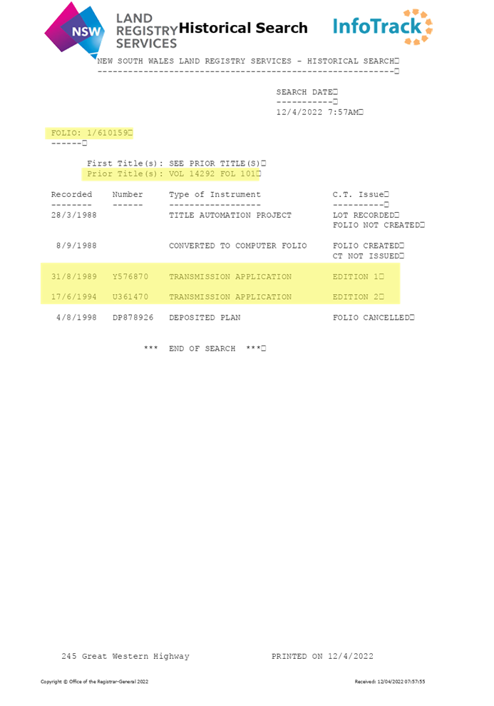
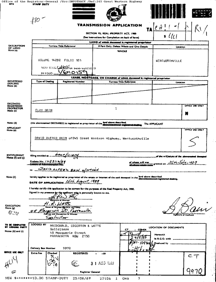
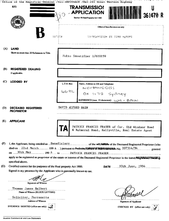
for 245-247 Great Western Highway, South Wentworthville (The Wattles)......................................................................... 815
Cumberland Local Planning Panel Meeting
13 July 2022
Item
No: LPP037/22
Development
Application - 16-20 South Street & 2A Russell Street, Granville
Responsible
Division: Environment
& Planning
Officer: Executive
Manager Development and Building
File
Number: DA2022/0097
|
Application
accepted
|
Monday 21 March 2022.
|
|
Applicant
|
Royal Granville Operations Pty
Ltd T/A Royal Granville Hotel.
|
|
Owner
|
RHG Nominees Pty Ltd.
|
|
Application
No.
|
DA2022/0097.
|
|
Description
of Land
|
16-20 South Street and 2A
Russell Street Granville being Lot 100 and 101 in DP 747211.
|
|
Proposed
Development
|
Alterations
and additions to the Royal Granville Hotel, construct a new restaurant and a
new outdoor smoking room on the ground floor, construct new office space and
terraces across Levels 1 and 2, construct a rooftop terrace to the building
and new signage.
|
|
Site
Area
|
867 Square metres.
|
|
Zoning
|
B2 Local Centre Zone.
|
|
Disclosure
of political donations and gifts
|
Nil disclosure.
|
|
Heritage
|
Yes - Heritage Listed item
Number I86 under the Cumberland Local Environmental Plan 2021.
|
|
Principal
Development Standards
|
Floor Space Ratio
Permissible: 2.0:1.
Proposed: 2.21:1.
And
Height of Building
Permissible: 15 Metres.
Proposed: 14.61 Metres.
|
|
Issues
|
Floor space ratio.
Car parking.
|
1. Development Application No. DA2022/0097 was
accepted on Monday 21 March 2022 for alterations and additions to the existing
Royal Granville Hotel,
construct a new restaurant, a new outdoor smoking room on the ground floor,
construct new office space and terraces across Levels 1 and 2, construct a
rooftop terrace to the building to be used in conjunction with the pub and new
signage.
2. The application was publicly notified
to occupants and owners of the adjoining properties for a period of fourteen
(14) days between Friday 18 March 2022 and Friday 1 April 2022. In response, Council
received no submissions.
3. The subject site is listed as a local
heritage under the Cumberland Local Environmental Plan 2021 as Item Number I86
being the Royal Granville Hotel building.
4. The numerical variations are as follows:
|
Control
|
Required
|
Provided
|
% variation
|
|
Floor space ratio
Clause 4.4 of the Cumberland
Local Environmental Plan 2021.
|
2.0:1.
|
2.21:1.
|
10.5%.
|
|
Awnings
Part C - Subpart 3.10 Cumberland
Development Control Plan 2021.
|
Minimum depth of 2.4 metres.
|
2 metres deep.
|
16.6%.
|
|
Car parking
Part G3 - Subpart 3 Cumberland
Development Control Plan 2021.
|
43 spaces.
|
No car parking spaces.
|
100%.
|
5. The application is referred to the Panel as the development
contravenes a development standard by more than 10%.
6. The application is recommended
for approval subject to conditions
as recommended in the Council’s assessment report.
Subject
Site and Surrounding Area
The site is
known as Lot 100 and 101 in DP 747211 or 16 to 20 South Street and 2A Russell
Street Granville. The site has two street frontages with South Street to the
east and Russell Street to the north.
As a
combined entity, the site occupies an area of 867 square metres and has the
following dimensions:
· Northern and southern boundary - 36.49 metres.
· Eastern and western boundary - 23.775 metres.
A pub and
hotel is situated across most of the site which is a three storey building
comprising of a pub on the ground floor and a hotel on Levels 1 and 2. The
building is listed as a heritage item within the Cumberland Local Environmental
Plan 2021 as heritage item Number I86.
There are
also various additions and outbuildings situated across the site including
awnings, a garage, a separate building used as a TAB, storage area and
accessways.
The original
pub and hotel on site were constructed in 1884 and since that date, there have
been various alterations to the building. The building is located on a
prominent corner of Granville close to the railway and is visible from the
railway line.
The site is
devoid of car parking spaces including loading and unloading zones. However,
there is a loading zone situated at the front of the site on Russell Street.
The land is situated
within zone B2 Local Centre while land to the west is located within zone B4
Mixed Use under the Cumberland Local Environmental Plan 2021.
The site is positioned
within the town centre of Granville and as such, commercial premises and
business forms the dominant land use. However, there are heritage listed
dwellings to the immediate west and there is a heritage conservation area close
by.
The
Royal Granville Hotel has a full approved and operational hotel liquor licence
- License Number LIQH400105207.
Crucial elements of the
locality include.
· Two conjoined dwellings to the immediate west at
2 to 4 Russell Street which are also listed as heritage items (Number I81
within the Cumberland Local Environmental Plan 2021).
· A heritage conservation area, with 7 allotments
to the west incorporating various streets including Carlton Street which is the
closest intersection to the site affected by the listing.
· Additional heritage listed buildings to the north
east situated on the eastern side of South Street being Youngs building
(Heritage item I85).
· A lack of onsite car parking with the nearest
public car parks situated in Mary Street located at least 150 metres from the
site.
· The Granville Railway Station being located 100
metres walking distance from the site to the north.
The aerial photo below
shows the site in detail.

The zoning of the site is provided below.

Photos of
the site taken are provided below taken Thursday 17 March 2022.

Description of The
Development
Development
application 2022/0097 is proposing alterations and additions to the Royal
Granville Hotel, construct a new restaurant and a new outdoor smoking room on
the ground floor, construct new office space and terraces across Levels 1 and
2, construct a rooftop terrace to the building to be used in conjunction with
the pub and new signage.
The proposed
works are described in detail below.
Ground
Floor
The western
half of the building at ground level will be renovated which includes the
demolition of the TAB, removal of internal walls, removal of an office, removal
of an internal garage and removal of a small internal beer garden.
There will
also be limited demolition work undertaken at the south east portion of the
building which will permit the construction of a semi outdoor smoke area facing
South Street.
A new
restaurant will be constructed across the western side of the pub with the
plans showing 29 tables and seating for 124 patrons. However, as described
within the report, seating will need to be capped at 90 patrons.
A new entry
will be constructed across the northern elevation and a new lift will be installed
linking the ground floor with Levels 1 and 2 and the rooftop terrace. The
rooftop terrace will be used in association with the pub for private functions
but subject to pre booking arrangements.
General
access to the upper floors and rooftop terrace from the ground floor will be
prevented via the installation of a swipe card system into the lift to prevent
patrons using the pub and restaurant from accessing the upper floors. This will
also require appropriate security to ensure no conflicts between office workers
and guests during daytime operating hours.
The outdoor
gaming lounge and the lounge situated at the north east corner of the building
are not subject to any significant change. However, it is identified that an
internal stair linking the new restaurant with the pub will need to be altered
to an accessible ramp to ensure equitable access between amenities.
First
Floor
The existing
hotel rooms facing the corner of South Street and Russell Street will be
converted to 5 office suites and 1 meeting room. This will only require
internal upgrades to the existing rooms and construction of new walls within
the existing building floorplate.
The plans
show the construction of 2 new office suites with both new office suites being
provided with a terrace. There is 1 office suite and terrace facing South
Street and 1 office suite and terrace facing Russell Street. A common foyer,
lift and stair access will be constructed providing access to the various
offices.
Second
Floor
The proposed
works across the second floor are relatively similar to what is occurring
across the first floor. The existing hotel rooms facing the corner of South
Street and Russell Street will be converted to 10 office suites and 1
storeroom. This will only require internal upgrades to the existing rooms and
construction of new walls within the existing building footprint.
The plans
show the construction of 2 office suites with both new office suites being
provided with a terrace. There is 1 office suite and terrace facing South Street
and 1 office and terrace facing Russell Street. A common foyer, lift and stair
access will be constructed providing access to the various offices.
Third floor
The third
floor features lift and stair access, toilets and a terrace occupying most of the
floor level. The terrace is surrounded by a parapet wall that is 1.8 metres in
height. No detailed fit-out works is provided for this.
The terrace
will only be used in association with the pub for private functions but subject
to pre booking arrangements.
There will
be a need for controls addressing access to the rooftop terrace including
limiting patron numbers, its hours of use and security measures. Conditions
74, 76, 77 and 78 attached to the recommendation addresses such matters for the
Panel’s consideration.
The details
of the works are shown in the table below.
|
Level
|
New works
|
Area
|
|
Ground
Floor
|
1 new
restaurant or eatery.
|
184 square
metres.
|
|
|
1 new
outdoor smoke area.
|
77.1
square metres including the bar area facing South Street.
|
|
First Floor
|
There will
be 5 new office suites and 1 meeting room within the existing building.
|
Various
and ranging between 13 square metres and 29 square metres in area.
Meeting
room occupies 43 square metres.
|
|
|
1 x new
office and terrace facing Russell Street.
|
New office
occupies 168 square metres.
New
terrace occupies 119.3 square metres.
|
|
|
1 x new
office and terrace facing South Street.
|
New office
occupies 133 square metres.
New
terrace occupies 77.8 square metres.
|
|
Second
floor
|
There will
be 10 new office suites within the existing building.
|
Various
and ranging between 6.8 square metres and 27.6 square metres in area.
Storeroom
occupies 9.1 square metres.
|
|
|
1 x new
office and terrace facing Russell Street.
|
New office
occupies 168 square metres.
New terrace
occupies 119.3 square metres.
|
|
|
1 x new
office and terrace facing South Street.
|
New office
occupies 133 square metres.
New
terrace occupies 77.8 square metres.
|
|
Third
floor
|
Third
floor terrace, access and utilities.
|
Excluding
access, the terrace occupies 732 square metres.
|
|
Floor
space ratio
|
|
2.21:1
or 1,916 square metres.
|
Proposed signage
The
development application includes the erection of one LED sign to be situated on
the façade of the building facing the street corner. As shown in the
photos attached to the report, the LED sign at the street corner has already
been erected without consent. The sign has dimensions of 5.08 metres x 1.042
metres and occupies an area of 5.29 square metres. As shown in the assessment
report, the size of the sign at the corner location is not supported and should
be reduced in area.
Other
matters
The
statement of effects specifies that:
· The hotel management seeks to retain
the current hours of operation of the pub which are 24 hours daily.
· There are 5 full time staff working
on site but this will increase due to the new restaurant.
· The fit-out of the restaurant and the
terrace level will be the subject of a separate development application and the
applicant seeks a specific condition addressing this.
· The use of the new offices will be
the subject of separate development applications and the applicant seeks a
condition addressing this.
History of The Application
The history
of the application is:
· Monday 22 March 2021 - A pre
lodgement meeting was held between the applicant and Council staff for a
proposal that encompassed alterations and additions to the heritage listed
building. The pre lodgement notes were issued on Friday 26 March 2022. Plans
were presented within the application that demonstrated a floor space ratio of
2.87:1 which was not supported.
· Tuesday 13 July 2021 - A second pre
lodgement meeting was held between Council officers and the applicant to
discuss a modified development for the heritage listed site. Plans were presented
within the application that demonstrated a reduced floor space ratio of
2.142:1. The applicant was requested to review this further and appropriate
written advice provided.
· Monday 21 March 2022 - The
development application was accepted by Council for the works as prescribed in
this application. The
floor space ratio as calculated in this application being 2.21:1 is slightly
increased from that shown in the second pre lodgement application. This has
occurred because there were changes to the layouts and floor areas of each
level which necessitated another detailed assessment of the floor space ratio
of the building.
· Friday
13 May 2022 - The applicant provides Council with additional information
including a Clause 4.6 Variation request to the floor space ratio.
Council
Initiated Planning Proposal for Granville Town Centre and Surrounds
Further to
the above, Council has prepared a Planning Proposal for targeted locations in
the Granville Town Centre and surrounds (Council Ref CS-220). The planning
controls seek to implement a new planning framework for development that
capitalises on land use opportunities for housing diversity and jobs growth,
that also supports connectivity and liveability objectives.
The Planning
Proposal also seeks to apply consistent height of buildings and floor space
ratio controls for all land zoned B2 Local Centre and B4 Mixed Use, bounded by
Carlton Street, Russell Street, Mary Street and South Street. In this regard,
the Planning Proposal seeks to retain a building height limit of 15 metres but
a change to the floor space ratio from 2.0:1 to 2.1:1. The Planning Proposal
was endorsed by Council in June 2021 to be forwarded to the Department of
Planning for a Gateway Determination. At this time, additional information
has been sought by the Department prior to making a Gateway Determination, and
this information is being prepared by Council officers.
It is
identified that should the Planning Proposal progress in its current form to
conclusion, the proposed floor space ratio of the development the subject of
the development application would still need to be varied; however, would be
subject to a smaller variation of 5.2%.
Applicants Supporting Statement
The
applicant has provided a Statement of Environmental Effects prepared by Specialists Town Planning Services which is
dated December 2021 in support of the development application.
Contact With Relevant
Parties
The assessing officer has
undertaken a site inspection of the subject site and surrounding properties and
has been in regular contact with the applicant throughout the assessment
process.
Internal Referrals
Development Engineer
The development application was referred to Council’s Development
Engineer for comment who has advised that the development proposal is not
satisfactory due to a shortfall of car parking on site. A traffic study was
submitted for assessment by the engineer to justify the shortfall of car
parking. Nevertheless, the engineer has provided conditions of consent should
Council staff support the application. The engineer’s concerns are
addressed below under the Cumberland Development Control Plan 2021 under Part
G3 (Subpart 3) - Parking Rate.
Environmental Health Officer
The development application was referred to Council’s
Environmental Health Officer for comment who has advised that the development
proposal including the acoustic report is satisfactory subject to conditions.
Notwithstanding this, conditions will be imposed accordingly addressing noise
and patronage as recommended by the updated acoustic report as follows:
· The ground floor
restaurant should not open past midnight.
· The number of
patrons using the ground floor courtyard eatery should not exceed 90.
· The number of
patrons using the rooftop terrace should not exceed 80.
· There should be a
limit of 12 staff using each office terrace between 7 am and 12 midnight on
each floor.
Building Surveyor
The development application was referred to Council’s
Building Surveyor for assessment who has advised that the development
application is satisfactory subject to conditions:
Heritage Consultant
Council engaged a heritage consultant to review the heritage
impact assessment report prepared by Weir Philips. The report was determined as
being acceptable. Council’s heritage consultant has recommended that:
· A photographic archival recording of the Royal Granville
Hotel should be undertaken prior to any new work to document any change.
· Where possible, existing doorways, walls and windows should
be reused.
· Original building materials that need to be removed
including decorative elements, floorboards and bricks should be carefully
removed, labelled and be retained.
Condition number 51 attached to the recommendation
addresses relevant heritage protection for the building.
External Referrals
Cumberland
Police Area Command
As per
comments of Wednesday 30 March 2022, the development application is supported
subject to conditions as advised by the Crime Prevention Officer. All
conditions and controls contained within the liquor licence must be complied
with and all the conditions as recommended should be incorporated into any
consent issued.
Endeavour
Energy
As per
comments of Tuesday 29 March 2022, the development application is supported
subject to conditions.
Planning Comments
The provisions of any Environmental
Planning Instruments (EP&A Act s4.15 (1)(a)(i))
The proposed development is affected by the following State Environmental
Planning Policies:
|
State
Environmental Planning Policies (SEPPs)
|
Relevant Clause(s)
|
Compliance with Requirements
|
|
· State
Environmental Planning Policy (Biodiversity and Conservation) 2021.
|
Chapter 2 -Vegetation in non
Rural Areas.
|
N/A - No native vegetation
removal is proposed as part of the development application.
The removal of a single
non-native tree within a courtyard and shrubs growing alongside a wall does
not constitute the removal of significant vegetation for the purpose of the
State Policy. As such, no detailed assessment is required.
|
|
Chapter 6 - Bushland in Urban
Areas.
|
N/A - No bushland zoned or
reserved for public open space is affected by the development application.
|
|
Chapter 10 - Sydney Harbour
Catchment.
|
The development raises no issues as no impact on the
catchment is envisaged.
(Note: - the subject site is not identified in the
relevant map as ‘land within the ‘Foreshores and Waterways
Area’ or ‘Wetland Protection zone’, is not a
‘Strategic Foreshore Site’ and does not contain any heritage
items within the catchment area. Hence the provisions are not directly
relevant to the development application.
|
|
· State
Environmental Planning Policy (Resilience and Hazards) 2021.
|
Chapter 2 - Coastal Management.
|
The subject site is not
identified as a coastal wetland or ‘land identified as “proximity
area for coastal wetlands” or coastal management area.
|
|
Chapter 4 - Remediation of
Land.
|
Part 4.6 - Contamination
and remediation to be considered in determining development application.
Comments
It is known in
the records and archives that the hotel building was constructed in 1884 and
would not have any known history of contamination.
Further, no
excavation work on site is required and no ground disturbance will be
occurring.
Council’s
Environmental Health Officer has not raised any concern in relation to land
contamination.
As such, it is
considered that the development application is satisfactory when considered
under Part 4.6 of Chapter 4 of the State Policy.
|
|
· State
Environmental Planning Policy (Industry and Employment) 2021.
|
Chapter 3 Advertising and
Signage.
|
The development application is
requesting the erection of one LED sign and an appropriate assessment using
Chapter 3 is provided. However, it is identified that the Heritage Impact
Assessment report prepared by Weir Philips does not address the sign and its
impact upon the building.
It is also noted that
Council’s Heritage Consultant does not address the impact of the sign
upon the building.
It is considered that the
proposed sign in its current form and size (5.08 metres x 1.042 metres) is
not supported for the corner location due to its size and adverse impact to
the streetscape and the heritage listed building. It is considered
appropriate to reduce the size of the LED sign to dimensions of 1.279 metres
x 669 mm which is consistent with a 2013 development consent.
This is addressed at Condition
Number 62 attached to the condition set for Panel consideration.
A detailed assessment of the
proposed sign is attached at Appendix A to the report.
|
|
· State
Environmental Planning Policy (Transport and Infrastructure) 2021.
|
Chapter 2 - Infrastructure.
|
State Environmental Planning
Policy (Transport and Infrastructure) 2021 is relevant to the development
application as follows.
Chapter 2 - Infrastructure.
2.48 Determination of
development applications (Subpart (2) - Give written notice to electricity
providers and take account of responses received within 21 days.
Comment
As previously described earlier
in the report, the development application was referred to Endeavour Energy
for Comment. As per comments of Tuesday 29 March 2022, the development
application is supported subject to conditions.
|
|
· State
Environmental Planning Policy (Precincts Central River City) 2021.
|
Chapter 6 - Urban Renewal
Precincts.
Part 6.1 to 6.8.
|
Applies to all development on
land where the application involves a subdivision, has a capital investment
value of more than $5 million and is not exempt or complying development.
The development application has
a capital investment value of $2,644,000 which is below the minimum threshold
of $5 million. Additionally, there is no subdivision proposed for the site.
As a result, the State Policy
is not applicable to the development application.
|
Local Environmental Plans
The
provision of the Cumberland Local Environmental Plan 2021 is applicable to the
development that is proposed. It is noted that the development achieves
compliance with most of the provisions of the Cumberland Local Environmental
Plan 2021 except for floor space ratio.
Permissibility:
The proposed development
is defined as:
1 - A pub and alterations
and additions to a pub. A pub is defined as:
“Licensed premises under the Liquor Act 2007 the
principal purpose of which is the retail sale of liquor for consumption on the
premises, whether or not the premises include hotel or motel accommodation and
whether or not food is sold or entertainment is provided on the
premises”.
Note—
Pubs are a type of food and drink premises—see
the definition of that term in this Dictionary.
2 - Office Premises which is defined as:
“A building or place used for the purpose of
administrative, clerical, technical, professional or similar activities that do
not include dealing with members of the public at the building or place on a
direct and regular basis, except where such dealing is a minor activity (by
appointment) that is ancillary to the main purpose for which the building or
place is used”.
Note—
Office premises are a type of commercial
premises—see the definition of that term in this Dictionary.
3 - Food and Drink
Premises which is defined as:
“Premises that are used for the preparation and retail
sale of food or drink (or both) for immediate consumption on or off the
premises, and includes any of the following—
(a) a restaurant or cafe,
(b) take away food and drink premises,
(c) a pub,
(d) a small bar.
Note—
Food and drink premises are a type of retail
premises—see the definition of that term in this Dictionary”.
The three land uses are permissible within the B2 Local
Centre zone subject to consent.
The relevant matters to be considered under the Cumberland
Local Environmental Plan 2021 and the applicable clauses for the proposed
development are summarised below. A comprehensive LEP assessment is contained
in Appendix B.
Cumberland Local Environmental Plan 2021 Compliance Table.
|
DEVELOPMENT
STANDARD
|
COMPLIANCE
|
DISCUSSION
|
|
4.3 Height of Buildings
15 metres.
|
Yes
|
The building has a maximum
height of 14.61 metres.
|
|
4.4 Floor Space Ratio
2.0:1
|
No
|
The building has a maximum floor space ratio of 2.21:1.
|
|
4.6 Exceptions to Development
Standards
|
Yes
|
Refer to detailed assessment below.
|
|
5.10 Heritage
|
Yes
|
Significant works are being
undertaken to the heritage listed Royal Granville Hotel building, but
Council’s heritage consultant considers the works as being consistent
with the heritage nature of the building and acceptable for the site.
|
Clause 4.6 - Variation to floor space ratio
Clause 4.6 allows the consent authority to contravene the
development standards in certain circumstances and provides an appropriate
degree of flexibility to achieve better design outcomes. The consent authority
may grant the exception as the Secretary’s concurrence can be assumed
where clause 4.6 is adopted as per the Department of Planning Circular PS
18-003, dated 21 February 2018.
The applicant has submitted a written request to contravene
the development standards for floor space ratio. Based on various case laws
established by the Land and Environment Court of NSW such as Four2five P/L v
Ashfield Council [2015] NSWLEC 9, Randwick City Council v Micaul Holdings P/L
[2016] NSW LEC7 and Zhang and Anor v Council of the City of Ryde [2016]
NSWLEC 1179, a 3 part assessment framework for a variation request proposed
under clause 4.6 has been considered and an assessment of the proposed
variance, following the 3 part test is discussed in detail below.
The 3 preconditions which must be satisfied before the
application can proceed are as follows:
1. Is the proposed
development consistent with the objectives of the zone?
Applicant’s
Response
The objectives of the B2 zone are:
“To provide a range of retail, business,
entertainment and community uses that serve the needs of people who live in,
work in and visit the local area”.
The
proposed development seeks to maintain an existing heritage listed commercial
building and to continue its use as a ‘food and drink premises’ and
‘offices’. The additional courtyard eatery will offer a venue for
local people to enjoy food and drink. The additional internal facilities
including new retrofitted lift and office space will offer much needed
commercial floor close to public transport.
“To encourage employment opportunities in accessible
locations”.
The
proposed first and second floor levels offer much needed office space within
walking distance from Granville Train Station and several bus routes. The
additional spaces are considered to support employment generation.
“To maximise public transport patronage and encourage
walking and cycling”.
Due to
the age and heritage significance of the building, the site is not capable of
providing any off street parking spaces and relies entirely on public
transport. The proposal is within walking distance from Granville Train Station
and several bus routes. The site is also within walking distance of
Granville’s residential area and it is considered that several end users
will be walking to and from the premises.
It is
our view that the proposed development is entirely consistent with the
objectives of the zone and well aligned with the objectives of Clause 4.4. In
view of these consistencies and in absence of any significant objections from
the local community, the proposal is in the public interest.
Planner’s
Comments
The
proposed development will:
· Provide a new restaurant and office space within an area
close to public transport.
· Offer new office space within a suitable location in
proximity to services.
· Will support new employment opportunities.
It is
considered that the three objectives are complied with and the
applicant’s supporting statement is supported. It is also noted that
during the notification period. Council received no submissions which suggests
that the development would be satisfactory to the location.
2. Is the proposed
development consistent with the objectives of the development standard which is
not met?
Applicant’s
Response
The
objectives of FSR development standard are as follows:
(a) to establish a maximum floor space ratio to enable
appropriate development density,
The subject site is zoned B2
Commercial Centre which anticipates three storey commercial buildings generally
built to boundaries as determined by the applicable planning controls. The
proposal seeks to fill in the void towards west, contained within the existing
established height plane by the subject building. The proposed additions are
designed to ensure that the additional gross floor area is contained within the
existing building envelope and well within the maximum height standards. The
design of the proposal ensures that the existing building envelope is entirely
capable of accommodating the additional gross floor area proposed. To the
casual observer along both street frontages, the proposal will appear generally
as a compliant commercial building. That is, the additional floor space ratio
is internalised within the approved building form.
The
proposal is therefore considered consistent with Objective (a).
(b) to ensure that development intensity reflects its
locality.
The
site and immediate surrounding area are zoned B2 Commercial Centre with a
maximum height of 15m. This will anticipate three storey commercial buildings
generally built to boundaries as reflected in the applicable planning controls.
The land to the immediate west of the subject site has a floor space ratio of
2.1:1.
The
proposed floor space ratio is consistent with the above objective as follows:
· The proposed additions are entirely confined within the
existing building envelope and it will not be seen as an overdevelopment of the
site.
· The proposed floor space ratio will not be noticeable to a
casual observer and the building will remain consistent with existing and any
future commercial building in the immediate vicinity.
· The proposed extension is sympathetic to the existing
fabric of the building as supported by applicants’ heritage consultant
and Council’s appointed heritage consultant. It is anticipated that the
development will positively contribute to the existing and desired future built
character of local area when viewed in connection with the existing and
emerging development context.
· The built form of this development is considered compatible
with the context and not of a form that may be interpreted as visually
“jarring” from South Street, Russell Street or neighbouring
properties.
· There are no significant views that the proposed addition
will block or obscure.
· There will be no additional overshadowing impacts for the
adjoining property to the south and west, primarily due to their existing
footprint and openings.
· The
proposal is designed in such a way that there will be no adverse privacy
impacts on the adjoining commercial development to the east and south and
residential/commercial development to the west.
The proposal is therefore
consistent with Objective (b).
Planner’s
Comments
the
proposed development is determined as being acceptable to the streetscape.
Additionally:
· The
development raises no height issues.
· The
works are consistent with the heritage nature of the building.
· The
proposed additions are sympathetic to the existing fabric of the building and
compatible to the locality and building materials and colours are acceptable.
· There
are no important view lines interrupted by the building works.
· The
shadows created by the new works will fall mainly across commercial / retail
premises to the south.
· Does
not create adverse privacy issues to the west or south.
It is
considered that the development is acceptable in relation to the objectives of
the development standard.
3. a) Is compliance with
the development standard unreasonable or unnecessary in the circumstances of
the case?
Applicant’s
Response
Compliance with the development standard is unreasonable and
unnecessary for the following reasons:
· The
development is in the public interest because it is consistent with the
objectives of the development standard and the objectives of the zone.
· The
development supports the Granville Town Centre in which food and drink premises
and offices are being created close to public transport services.
· The
development supports employment generation.
· The
development is contained within the existing building envelope and within the
maximum height limit and result in a building that appears to comply with the
floor space ratio provision.
· The
extension is sympathetic to the existing fabric of the building.
· There
are no adverse shadowing or privacy issues being created.
Planner’s
Comments
The development supports the Granville Town Centre and
employment generation and all new building works being consistent with
Council’s expectations for the site.
Council’s heritage consultant has advised in writing
that the proposed works are suitable and acceptable and has architectural merit
which lays the grounds for supporting the development. As such, the applicants
claim may be supported.
b) Are there sufficient
environmental planning grounds to justify contravening the development standard
and therefore is the applicant’s written justification well founded?
Applicant’s
Response
Contravention
of the development standard would result in a more satisfactory environmental
planning outcome. The additional floor area is unavoidable due to the following
reasons:
· To
maintain the fabric of existing heritage listed building.
· To
offer modern facilities and reasonable amenity for the end users of the
commercial building.
· To
offer additional gross floor area to ensure long term economic viability of the
heritage building.
The
economic benefits of additional floor area towards continued commercial use of
a heritage listed building should be given weight in the consideration of the
variation request.
Specifically:
· The
proposal is consistent with the objectives of Clause 4.4 of the Cumberland
Local Environmental Plan 2021.
· The
additional gross floor area does not significantly alter the character or
presentation of the existing building in terms of its relationship with
adjoining buildings nor does it bring with it a form of development on the site
that is noticeably larger than the surrounding development. That is, the
non-complaint element will not bring with it a form greater than anticipated by
the relevant development standards and controls.
· The
contravention to the floor space ratio development standard does not result in
a built form that is visually ‘’jarring’’ or out of
context with the surrounding development.
· There
is an absence of any significant material impacts attributed to the proposed
breach on the amenity or the environmental values of surrounding properties.
· There
will be no additional overshadowing impacts on the adjoining buildings to the
south and west, primarily due to their existing footprint and openings.
There will be no adverse visual
privacy impacts on adjoining properties.
· The
acoustic report and plan of management submitted with the development
application confirms that any acoustic impacts on adjoining properties will be
within industry acceptable standards.
· There
will be no adverse impacts on the existing streetscape or built character of
the locality.
Planner’s
comment:
It is considered
appropriate to support the development for the following reasons:
· The
proposal is consistent with the objectives of Clause 4.4 of the Cumberland
Local Environmental Plan 2021 and the development is appropriately located
within the Granville Town Centre.
· The
additional gross floor area does not significantly alter the character or
presentation of the existing building in terms of its relationship with
adjoining buildings and the heritage character of the building is retained.
· There
will be no adverse overshadowing impacts onto the adjoining buildings to the
south and west and shadows that will occur will crossover commercial
properties.
· There
will be no adverse visual privacy impacts onto adjoining properties.
· There
will be no adverse impacts on the existing streetscape or built character of
the locality.
Conclusion:
Council is satisfied that the applicant’s written
request has adequately addressed the matters required to be demonstrated by
clause 4.6 subclause (3). Council is further satisfied that the proposed development
will be in the public interest because it is consistent with the objectives of
the particular standard and the objectives for development within the zone in
which the development is proposed to be carried out.
It is the view of Council Officers that the justification
provided is satisfactory and having considered the application on its merit,
the contravention to the floor space ratio development standard is considered
acceptable in this instance.
The provisions of any proposed instrument that is or has
been the subject (EP&A Act s4.15 (1)(a)(ii))
There are no draft planning instruments that needs to be
considered under the stated heading.
The provisions of any
Development Control Plans (EP&A Act s4.15 (1)(a)(iii))
The Cumberland Development
Control Plan 2021 is the applicable development control plan and the following
chapters and provisions are relevant to the proposed development.
· Part
C - Development in Business zones.
· Part
F2.2 - Granville Town Centre.
· Part
G1 - Advertising and Signage.
· Part
G2 - Heritage
· Part
G3 - Traffic, Parking, Transport and Access (Vehicle).
· Part
G4 - Stormwater and Drainage.
A
comprehensive assessment and compliance table is contained in Appendix C and D.
The following table outlines the variations identified and such variations are
described below.
|
Part
|
Control
|
Proposed
|
Complies
|
|
Awnings
Part C - Subpart 3.10
|
Awnings to be a minimum of 2.4
metres deep.
|
Awning is 2 metres deep.
|
No
|
|
Part G3 - Subpart 3
|
Car parking rates.
Additional requires 12 spaces at 1 space per 40 square
metres of gross floor area.
|
Nil spaces.
|
No
|
As indicated in the compliance table above, the proposed
development departs from the following:
Awnings Part C (Subpart 3.10) - Awnings to be a minimum
2.4 metres deep.
Comments
The awning will be extended along the Russell Street
frontage but will only be 2 metres deep. This will be a variation to the
current awning which is approximately 3 metres deep and will result in a
variation to the control of 16%
It is possible to achieve compliance; however it is noted
that a street tree will be impacted by an enlarged awning and Council’s
heritage consultant did not raise any concerns with the variation.
Given the presence of the street tree, it is considered
appropriate to support the awning that is 2 metres deep. The variation of 400
mm or 16.6% is considered reasonable. This is further reinforced by the fact
that Council’s heritage consultant did not raise any visual concerns in
relation to the size of the extended awning along the Russell Street frontage
of the site.
Car parking Part G3 (Subpart 3) - Parking Rate
The pub on site was constructed in 1884 at a time when motor
vehicles did not exist, car parking rates would not have been a consideration
during the initial design and construction of the building. As such, there are
no car parking spaces presently provided on site.
The development will require 1 car space per 40 square
metres for the food and drink premises and offices. As such, the car parking
rate is the same across the whole development.
The current shortfall of car parking is 31 spaces which will
increase by 12 spaces to 43 spaces. Council’s engineers have assessed the
traffic study and advises that the development is not supported for the
following reasons:
· A
minimum of 12 additional off street car parking spaces is required to support
the development with an appropriate driveway access to the public road.
· A
minimum of 1 off street loading bay is required.
· A
car space is required for people with disabilities.
· There
is no provision for parking bikes on site.
In response to the concerns raised by the engineer, a
Traffic Impact Assessment report prepared by Multipro Consultants Pty Ltd and
dated May 2022 has considered the issue of car parking. A request is made to
support the development notwithstanding the variation of car parking identified
on merit for the following reasons:
· The
site is located 100 metres from the Granville Railway Station and train services
to Parramatta, Richmond, Liverpool and to the city are readily available.
· The
site is located within walking distance to bus services including services to
Parramatta, Hurstville, Fairfield and other suburban areas.
· There
is a car park facility within 200 metres of the site.
The traffic study is recommending the following:
· Permanent
staff use public transport.
· Management
should publicise on the official website on how to get to the hotel using
public transport.
· Carpooling
be encouraged by patrons.
· During
all hours of operation, a dedicated staff member should be made responsible for
organising transport (Taxi/Uber) for their patrons as needed.
· Clear
signage be made at the entrance of the premises advising patrons to be
respectful of the parking needs of other businesses and residents within the
area if they choose to park on the streets.
· Any
lease agreement for the first and second floors should incorporate clear
advisory notes that the premises do not offer off street car parking and staff
should rely on public transport.
· Staff
and security personnel be encouraged to report improper or illegal parking of
any patrons of surrounding streets.
Planning considerations
Given the absence of car parking and the inability to
provide on-site car parking, the applicant is relying on public transport and
patron management to address the car parking issue. It is agreed that the site
is situated close to train and bus services making public transport a viable
option for use and there is a public car park within 200 metres of the site
opposite the railway line. While Council engineers do not support the
development, it is considered appropriate to support the development on merit.
The building is a heritage item and the provision of on site
car parking would have a negative impact upon the building, including the need
to demolish parts of the western side of the heritage listed building, which
would not be supported.
It is also identified that the heritage building is being
protected and retained.
It is noted that a detailed survey of how patrons arrive and
depart the premises is not provided within the traffic study as the proposed
uses are new to the site and it is difficult to provide such data.
Should the Panel support the development on merit, it is
considered appropriate to condition any consent such that the recommendations
of the traffic report are complied with. The recommendations of the traffic
report provide reasonable and suitable approaches to managing traffic and car
parking on a site that has no viable options available in relation to onsite
car parking.
Proposed condition number 79 attached to the
recommendation addresses the matter.
Loading and unloading
A loading zone is provided directly at the front of the pub
on Russell Street which is not subject to change. While it is available for the
use of other businesses for loading and unloading purposes, the loading zone
will continue to be available to the premises for such operations.
The provisions of any planning agreement that has been
entered into under section 7.4, or any draft planning agreement that a
developer has offered to enter into under section 7.4 (EP&A Act
s4.15(1)(a)(iiia))
There is no draft planning agreement associated with the
subject Development Application.
The provisions of the Regulations (EP&A Act s4.15
(1)(a)(iv))
The proposed development raises no concerns as to the
relevant matters arising from the Environmental Planning and Assessment
Regulations 2021.
The Likely Environmental, Social or Economic Impacts
(EP&A Act s4.15 (1)(b))
The Plan of Management addresses such matters as:
· Operation
of the terraces associated with the offices.
· Maximum
intensity of use of the ground floor eatery and operations of the rooftop
terrace.
· Noise
controls.
· Prevention
of access to the first and second storey offices by patrons and the
installation of a swipe card system.
Conditions 74, 76, 77 and 78 attached to the recommendation
addresses details within the plan of management and the 4 items stated above.
This will ensure that the proposed development
will have no significant adverse environmental, social or economic impacts in
the locality.
The suitability of the site for the development (EP&A
Act s4.15 (1)(c))
The subject site and locality are not known to be affected
by any natural hazards or other site constraints likely to have a significant
adverse impact on the proposed development. Accordingly, it is considered that
the development is suitable in the context of the site and surrounding
locality.
Submissions made in accordance with the Act or Regulation
(EP&A Act s4.15 (1)(d))
|
Advertised (Website)
|
Mail
|
Sign
|
Not Required
|
In accordance with Council’s Notification requirements
contained within the Cumberland Development Control Plan 2021, the development application was publicly notified to
occupants and owners of the adjoining properties for a period of fourteen (14)
days between Friday 18 March 2022 and Friday 1 April 2022. In response, Council
received no submissions.
The public interest (EP&A Act s4.15(1)(e))
In view of the foregoing analysis, it is considered that the
development, if carried out subject to the conditions set out in the recommendation
below, will have no significant adverse impacts on the public interest.
Cumberland Local
Infrastructure Contributions Plan 2020
In accordance with the Cumberland Local Infrastructure
Contributions Plan 2020, Contribution Plan a contribution of $26,444 is payable
prior to the issue of a construction certificate. This is addressed at
Condition number 18 and 19 attached to the recommendation.
The development application has been assessed in accordance
with the following;
· Environmental
Planning and Assessment Act 1979.
· State
Environmental Planning Policy (Biodiversity and Conservation) 2021.
· State
Environmental Planning Policy (Resilience and Hazards) 2021.
· State Environmental Planning Policy (Industry and Employment)
2021.
· State Environmental Planning Policy (Transport and
Infrastructure) 2021.
· Cumberland
Local Environmental Plan 2021.
· Cumberland
Development Control Plan 2021.
The proposed development is appropriately located within the
B2 Local centre zone under the provisions of the Cumberland Local Environmental
Plan 2021 however, variations in relation to Clause 4.4 (Floor space ratio) of
the Cumberland Local Environmental Plan 2021, and Part C (Subpart 3.10) - Depth
of awnings and Part G3 (Subpart 3) - Car Parking Rates of the Cumberland
Development Control Plan 2021 are sought.
Having regard to the assessment of the proposal from a merit
perspective, Council may be satisfied that the development has been responsibly
designed and provides for acceptable levels of amenity for future residents. It
is considered that the proposal successfully minimises adverse impacts on the
amenity of neighbouring properties. Hence the development, irrespective of the
departures noted above, is consistent with the intentions of Council’s
planning controls and represents a form of development contemplated by the
relevant statutory and non-statutory controls applying to the land.
For these reasons, it is considered that the proposal is
satisfactory having regard to the matters of consideration under Section 4.15
of the Environmental Planning and Assessment Act 1979, and the
development may be approved subject to conditions.
There are no consultation
processes for Council associated with this report.
There are no financial
implications for Council associated with this report.
There are no policy implications
for Council associated with this report.
Communication /
Publications:
The final outcome of this matter
will be notified in the newspaper. The objectors will also be notified in
writing of the outcome.
|
1. That
the applicants written request to contravene the development standard
relating to floor space ratio as contained within Clause 4.4 of the
Cumberland Local Environmental Plan 2021 be supported.
2. That Development Application 2022/0097 to construct a new and a new outdoor smoking room
on the ground floor, construct new office space and terraces across Levels 1
and 2, construct a rooftop terrace to the building on land at 16-20
South Street and 2A Russell Street Granville be approved
subject to conditions as recommended in Council’s assessment
report.
|
1. Draft
Notice of Determination
2. Architectural
Plans
3. Clause
4.6 Statement for FSR Variation
4. Heritage
Impact Statement
5. Council's
Heritage Assessment
6. Appendix
A - SEPP (Industry & Employment 2021) Assessment Table
7. Appendix
B - Cumberland Local Environmental Plan 2021 - Compliance Table
8. Appendix
C - Cumberland Development Control Plan 2021 - Compliance Table
9. Appendix
D - Cumberland Development Control Plan - Heritage Assessment Table
10. Approved
Elevation Plans under DA193/2013
DOCUMENTS
ASSOCIATED WITH
REPORT LPP037/22
Attachment 1
Draft Notice of Determination
Cumberland Local Planning Panel Meeting
13 July 2022


DOCUMENTS
ASSOCIATED WITH
REPORT LPP037/22
Attachment 2
Architectural Plans
Cumberland Local Planning Panel Meeting
13 July 2022


DOCUMENTS
ASSOCIATED WITH
REPORT LPP037/22
Attachment 3
Clause 4.6 Statement for FSR Variation
Cumberland Local Planning Panel Meeting
13 July 2022


DOCUMENTS
ASSOCIATED WITH
REPORT LPP037/22
Attachment 4
Heritage Impact Statement
Cumberland Local Planning Panel Meeting
13 July 2022


DOCUMENTS
ASSOCIATED WITH
REPORT LPP037/22
Attachment 5
Council's Heritage Assessment
Cumberland Local Planning Panel Meeting
13 July 2022


DOCUMENTS
ASSOCIATED WITH
REPORT LPP037/22
Attachment 6
Appendix A - SEPP (Industry & Employment 2021)
Assessment Table
Cumberland Local Planning Panel Meeting
13 July 2022


DOCUMENTS
ASSOCIATED WITH
REPORT LPP037/22
Attachment 7
Appendix B - Cumberland Local Environmental Plan 2021
- Compliance Table
Cumberland Local Planning Panel Meeting
13 July 2022


DOCUMENTS
ASSOCIATED WITH
REPORT LPP037/22
Attachment 8
Appendix C - Cumberland Development Control Plan 2021
- Compliance Table
Cumberland Local Planning Panel Meeting
13 July 2022


DOCUMENTS
ASSOCIATED WITH
REPORT LPP037/22
Attachment 9
Appendix D - Cumberland Development Control Plan -
Heritage Assessment Table
Cumberland Local Planning Panel Meeting
13 July 2022


DOCUMENTS
ASSOCIATED WITH
REPORT LPP037/22
Attachment 10
Approved Elevation Plans under DA193/2013
Cumberland Local Planning Panel Meeting
13 July 2022


Cumberland
Local Planning Panel Meeting
13 July 2022
Item
No: LPP038/22
Development
Application - 15 Neil Street, Merrylands
Responsible
Division: Environment
& Planning
Officer: Executive
Manager Development and Building
File
Number: DA2022/0131
|
Application
accepted
|
Wednesday 16 March 2022.
|
|
Applicant
|
HB & Sons Pty Ltd.
|
|
Owner
|
HB & Sons Pty Ltd.
|
|
Application
No.
|
DA2022/0131.
|
|
Description
of Land
|
15 Neil Street Merrylands
being Lot 1 in DP 1225307.
|
|
Proposed
Development
|
Alterations and additions to an approved mixed use
development including the provision of an additional 8 residential storeys
accommodating an additional 30 residential apartments, minor amendments to
existing apartment layouts, minor
amendments to the basement car park layout and modifications to the design
and materials of the development.
|
|
Site
Area
|
The site area for the purposes
of the assessment and calculation of floor space ratio is 673 square metres
being all that land within Zone B6 Enterprise Corridor.
The overall site occupies 765
square metres which includes that part of the land zoned RE1 Public
Recreation to be dedicated to Council.
|
|
Zoning
|
Part B6 - Enterprise Corridor.
Part RE1 - Public Recreation.
Pursuant to the Cumberland Local
Environmental Plan 2021.
|
|
Disclosure
of political donations and gifts
|
Nil disclosure.
|
|
Heritage
|
No heritage listing under the
Cumberland Local Environmental Plan 2021.
Heritage item in vicinity of
the site being the Goodlet and Smith (Brickmaking plant, chimney and Hoffman
Kiln and chimney) - Item Number I172.
|
|
Principal
Development Standards
|
Floor Space ratio
Permissible: 8.5:1.
Proposed: 8.49:1.
Height of Building
Permissible: 54 metres.
Proposed: 55.8 metres to the
lift overrun.
|
|
Issues
|
Design Excellence Panel.
Height.
Building Separation.
Solar access to south facing
apartments.
Habitable room depths.
|
1. Development
Application 2022/0131 was accepted on Wednesday 16 March 2022 for alterations
and additions to an approved mixed use development including the provision of
an additional 8 residential storeys accommodating an additional 30 apartments,
minor amendments to existing apartment layouts, minor amendments to the basement car park layout and modifications to the
design and materials of the development.
2. The application
was publicly notified to occupants and owners of the adjoining properties for a
period of fourteen days between Friday 1 April 2022 and Friday 15 April 2022.
In response, Council received 2 submissions.
3. The
variations are:
|
Control
|
Required
|
Provided
|
% variation
|
|
Part 3F - Visual privacy and separation distances.
Apartment Design Guide.
|
12 metres - habitable rooms to a boundary.
6 metres for non habitable rooms to a boundary.
|
Eastern side of building at Level 13 and 14 - 2 bedroom
windows setback 2.2 and 4 metres from the boundary.
Eastern side of building at Level 15 - living room windows
setback 4 metres and terraces setback 2.2 metres.
Bedroom windows setback 4 metres.
|
63.4%.
66.7% for the living room
windows.
81.7% for the terrace.
33.3%.
|
|
Part 4A-1 - Solar and daylight access.
Apartment Design Guide.
|
15% of apartments receive no sunlight midwinter.
|
For new development - 7 apartments.
For entire development - 14 apartments.
|
23.3%.
24%.
|
|
Part 4D2 - Habitable room depths.
Apartment Design Guide.
|
8 metres from a window.
|
NE facing apartments are 8.6 metres.
|
7.5%.
|
|
Clause 4.3 Height of buildings -
CLEP 2021.
|
54 metres.
|
55.8 metres.
|
3.3%.
|
|
Part 3.1 Building Envelope (Side
setbacks).
Part B3 Residential Flat
Buildings Chapter CDCP 2021.
Similar provisions at Chapter C
(Part 3.2 and Subpart C6) and Chapter F2 (Part 3.3.5 Subpart C5) CDCP 2021.
|
3 metres.
|
2.2 metres
|
26.6%.
|
4. The
development application is referred to the Panel as the proposal is an
apartment building for which State Environmental Planning Policy 65
“Design Quality of Residential Apartment Development” applies.
5. The application is recommended for approval subject to conditions as recommended in
the Council assessment report.
Subject Site and Surrounding
Area
The site has a legal description
of Lot 1 in DP 1225307 and is known 15 Neil Street, Merrylands. The site is
located within the “Merrylands Neil Street Precinct” and situated
on the northern side of Neil Street, the eastern side of McLeod Road and the
southern side of Dressler Court. The site has a splayed frontage of 36.84
metres to Neil Street, which is the southern boundary of the site with a total
area of approximately 765 square metres or 673 square metres which excludes the
area zoned RE1 and earmarked for acquisition.
Most of the site is within zone B6
Enterprise Corridor while the western part of the site is within zone RE1
(Public Recreation). The part of the land that is zoned RE1 (Public Recreation)
is also shown in the Cumberland Local Environmental Plan 2021 as being
earmarked for acquisition as open space. The basement car park supporting the
development encroaches into the area earmarked for acquisition but this is
approved and no change is proposed.
The site is generally flat with a
slight fall towards the north western corner. The site is situated within that
part of Merrylands that is undergoing a transition with the construction of 8
to 16 storey residential apartment buildings recently being completed within
the immediate locality.
The site is situated close to the
town centre of Merrylands which includes Stockland Merrylands Mall that
provides extensive shopping facilities and services to the area and a railway
station / public transport node.
The site being Lot A benefits from
development consent DA2012/493/1 for the demolition of existing structures,
subdivision of the land into 2 lots and construction of a 9 storey mixed use
building containing 28 residential apartments and 2 commercial units (Lot A)
and a part 7 / part 8 storey residential flat building containing 59 units on
Lot B totalling 87 apartments (being 7 x 1 bedroom + study, 65 x 2 bedroom, 7 x
2 bedroom + study and 8 x 3 bedroom) above 3 levels of basement parking
containing 122 car spaces including the provision of new roads, site works and
landscaping.
Construction work across Lot B has been completed.
In addition to the above, there are other matters to
consider as follows:
· A railway line being
located approximately 98 metres to the east.
· McLeod Road having a
left turn in / left turn out to maintain satisfactory vehicle circulation
within the locality.
The site is burdened by two easements being:
· A - Easement for
electricity purposes.
· B - Easement for
drainage.
There are other easements being:
· C - Easement for
services but this is situated on land to the immediate north which is not part
of the development site. The easement will allow a future driveway to pass over
the land connecting the basement car park with Dressler Court.
· S - Easement for Support.
This easement is located across the adjoining site to the north zoned RE1. The
easement encompasses the common open space area.
The location of the site and
aerial photo is provided below.

The zoning of the land is provided below. The western part
of the site is zoned RE1 Public Recreation however the land has not been
subdivided and the area shown RE1 has not been dedicated to Council.

Photos of the site taken
Friday 1 April 2022 shows the completed building on Lot B and vacant land known
as Lot A.

Description of The
Development
Development Application 2022/0131
is proposing alterations and additions to an approved 9 storey mixed use
commercial / retail apartment building at 15 Neil Street Merrylands.
Currently, there is consent in
place for 9 storey mixed use commercial / apartment building housing 28
apartments, 1 commercial / retail tenancy and a 6 level basement car park for
99 vehicles on Lot A. Vehicle access to and from the building is approved from
Dressler Court.
The development application is
proposing the following additional works.
· Construct an additional
8 storeys to the approved development encompassing 30 additional apartments
including 24 x 2 bedroom apartments, 5 x 3 bedroom apartments and 1 x 4 bedroom
apartment.
As a result of the above, the development will now feature
58 apartments comprising of 45 x 2 bedroom apartments, 12 x 3 bedroom
apartments and 1 x 4 bedroom apartment. In addition, the height of the building
will increase to 17 storeys which includes the rooftop access, storage room and
services.
· Provide a useable
rooftop terrace area occupying 191 square metres which includes amenities. When
compared to the original plans. The rooftop terrace occupied 280 square metres
but no amenities, landscaping areas or services can be identified on the plans.
While the rooftop common space is smaller, it is now provided with amenities
and landscaping including a BBQ facility which will improve its use and
functionality.
There are minor alterations to the approved basement car
park levels but limited to changes in line marking of car parking spaces, a
reduction of 8 car parking spaces from 99 to 91 and alterations and additions
to services and utilities.
The development application includes amendments / adjustments
to the approved design scheme across the ground floor of the building
including:
· A minor alteration to
the position of the driveway.
· Alteration to the main
entry doors and the introduction of a ground floor entry facing Neil Street.
This includes the addition of an awning overhanging into the Neil Street public
domain area. It is considered appropriate not to support that part of the
awning that overhangs into the public domain. It is recommended that the awning
be contained within the boundary of the site and the matter is at condition 8
attached to the recommendation.
· Alterations to the north
facing access doors and fire escapes within the northern elevation of the
building.
· An increase in the size
of the commercial tenancy from 119.8 square metres to 138 square metres.
· Alterations to the
approved stormwater system.
There are minor amendments to the apartments across Levels 1
to 7 of the building which includes:
· Alterations to the 3
bedroom apartment on each level including the bedrooms, living areas and
balconies. The changes are relatively limited in extent and do not alter the
configuration of the affected apartments. The changes include the adjustment of
walls and windows.
· Alterations to the
balconies, balustrades and windows of the north facing apartments.
· An addition of one extra
bedroom to apartments numbered 23 and 27 on Levels 6 and 7 so that they become
3 bedroom apartments.
· Alterations to the
design and building materials of the development.
The details of the proposed
changes are outlined in the table below:
|
Components
|
Based upon Approval under Modification
2012/493/3
|
As proposed in Development Application
2022/0131
|
|
No of storeys.
|
9 (Includes the rooftop access level).
|
17 (Includes
the rooftop access level).
|
|
No. of apartments.
|
28.
|
58.
|
|
Basement levels.
|
6.
|
6.
|
|
Car parking spaces.
|
80 Residential car parking
spaces.
13 Visitor parking spaces.
6 Commercial parking spaces.
Total - 99 car parking spaces.
|
71 Residential car parking
spaces.
12 Visitor parking spaces.
8 Commercial parking spaces.
1 car wash bay shown.
Total - 91 spaces
excluding the car wash bay.
|
|
Commercial
premises.
|
1 - Approved at 119.8
square metres.
|
1 Modified and now
occupying an area of 138 square metres.
|
|
Residential unit
mix
|
21 x 2 bedroom apartments.
7 x 3 bedroom apartments.
|
45 x 2 bedroom apartments.
12 x 3 bedroom apartments.
1 x 4 bedroom apartment.
|
The altered development will
feature a gross floor area of 5,713.7 square metres resulting in a floor space
ratio of 8.49:1 and a maximum building height of 55.8 metres to the topmost
part of the lift shaft.
History
The following applications have
been approved to date for the development site.
1. Development
application 2012/493/1 for demolition of existing structures; subdivision of
land into 2 lots and construction of a 9-storey mixed use building containing
28 residential units and 2 commercial units on Lot A and a part 7 part 8 storey
residential fat building containing 59 units on Lot B totalling 87 units (being
7 x 1 bedroom + study; 65 x bedroom, 7 x 2 bedroom + study and 8 x 3 bedroom);
above 3 levels of basement parking containing 122 car spaces, provision of new
roads, site works and landscaping.
This was approved as deferred
commencement consent on Monday 28 October 2013 subject to conditions.
2. Modification
application 2012/493/2 was issued on Wednesday 6 May 2015 for minor alterations
to Building A including modifying the vehicle access point, basement car park
and Schedule A conditions. The modification consent allowed the original
deferred commencement consent to become operative following changes to the
conditions.
3. Modification
application 2012/493/3 was issued on Wednesday 20 April 2016 for two additional
levels of basement car parking to support Building A and minor internal changes
to the ground floor of the building. The consent incorporated changes to
Building B but they are not relevant to the building the subject of the latest
application.
4. Modification
application 2012/493/8 was issued on Friday 17 April 2020 to modify conditions
to introduce staged works for Buildings A and B.
5. A
Planning Proposal was undertaken for the precinct between 2014 and 2017 to
amend the planning controls including the heights and floor space of buildings
and to amend the zoning controls of the precinct (Number HC-23-11-18). The
Planning Proposal was affected on Monday 27 June 2016. The current Cumberland
Local Environmental Plan 2021 provides for a floor space ratio of 8.5:1 and
building height limit 54 metres.
6. A
pre lodgement Meeting (PL2021/0100) was held with Council on Thursday 14
October 2021 for alterations and additions to the approved development. The pre
lodgement notes were issued on Thursday 25 November 2021 and the applicant was
required to address issues such as excess floor space ratio, height and
compliance with the planning instruments as part of any future development
application to be made.
7. The
subject development application was accepted by Council on Wednesday 16 March
2022 for assessment and determination.
Applicants Supporting
Statement
The applicant has provided a
Statement of Environmental Effects prepared by Think Planers and dated Tuesday
15 February 2022 which was accepted by Council on Wednesday 16 March 2022.
Contact With Relevant
Parties
The assessing officer has
undertaken a site inspection of the subject site and surrounding properties and
has been in regular contact with the applicant throughout the assessment
process.
Internal Referrals
Development Engineer
The development application was
referred to Council’s Development Engineer for comment who has advised
that the development proposal is satisfactory subject to conditions.
Environmental Health Officer
The development application was
referred to Council’s Environmental Health Officer for comment who has
advised that the development proposal is satisfactory subject to conditions.
There are conditions addressing such matters as noise and acoustics and dust
controls.
Waste Management Officer
The development application was
referred to Council’s Waste Management Officer for comment who has
advised that the development proposal is satisfactory. There are no conditions
required.
External Referrals
Design Excellence Panel
The original pre lodgement
application 2021/0100 was first referred to the Cumberland Design Excellence
Panel with a meeting being held on Thursday 11 November 2021 for discussion and
comment. This occurred because the proposed building exceeded a height of 25
metres.
The Cumberland Design Excellence
Panel did not support the proposed development.
The Panel is of the view that the
new requirement for design excellence due to the additional height is
challenging, if not impossible to achieve without reconsideration of the
building design as a whole (i.e. updating the 8 floors of the original approved
design) required.
The Panel did not support the
proposed increased development (16) storeys as presented at the pre lodgement
stage. The Panel advised the applicant to address the recommendations of their
report with appropriate design amendments made for further review at the
development application stage.
Following the lodgement of the
development application, the proposal was presented to the Cumberland Design
Excellence Panel on Tuesday 12 April 2022. The Panel did not support the
proposal. The Panel’s comments of November 2021 and April 2022 are
attached to the assessment report as appendixes for Panel consideration.
Following from the comments
provided by the Panel, the applicant provides the responses below to address
the issues raised.
· Replanning
the ground plane and pedestrian and vehicular access into the building to
achieve improved amenity to the public realm and the apartments.
Applicant’s response
The ground floor has been the
subject of a redesign and the main pedestrian entrance is now from Neil Street.
The ground floor including levels have been adjusted to allow for the changes.
An awning is introduced into the front of the development to provide shelter.
Planner’s comment
The ground floor of the
development has been redesigned to improve pedestrian access and overall
amenity.
· Replanning
each floor to increase the number of apartments receiving winter sunlight,
whilst maintaining summer shading. This should take into consideration the
potential reduction of sunlight due to any adjoining buildings that may
overshadow the site.
Applicant’s response
As per correspondence of Thursday
19 May 2022, no changes to apartment layout is proposed because the development
achieves 75% solar access which complies with the Apartment Design Guide.
Planner’s comment
As per the Apartment Design Guide
at Part 4A-1, at least 44 or 58 apartments or 76% of the total number within
the development will receive adequate solar penetration. The applicant’s
statement is therefore supported.
· Consideration
be given to reorienting the entry to the south to allow apartments access to
the full northern elevation.
· Replanning
each floor to provide natural cross-ventilation to all apartments. The
apartments should have windows on two differently oriented faces of the
building to provide genuine passive cooling. The effectiveness of the cross
ventilation design should be demonstrated with diagrams.
Applicant’s response
As per correspondence of Thursday
19 May 2022, the requirement for the vehicle access ramp from Dressler Court
limits where the building core can be placed. The building core cannot be
relocated.
A new entry is incorporated into
the southern elevation at ground level to improve connectivity to Neil Street.
The building achieves cross
ventilation to 81% of the total number of apartments as demonstrated by the
cross ventilation diagrams submitted.
Planner’s comments
The plans are now showing a
pedestrian access from Neil Street which improves amenity and pedestrian access
to the building.
The building achieves cross
ventilation to 46 apartments which is 79.4% of the total number of apartments
within the building. Compliance with the Apartment Design Guide in relation to
cross ventilation is achieved.
· The
roof top common space should incorporate generous weather protection, wind
protection, attractive hard landscaping with appropriate soft landscaping with
consideration given to additional items which provide genuine communal amenity
in addition to the BBQ, such as built-in or loose seating, tables and lounges.
Loose furniture should be selected to suit the environmental conditions and
located in safe, well-protected conditions created through the developed
design.
Applicant’s response
The common area roof terrace has
been modified and furniture is added. Additionally, planter boxes and
landscaping are added in accordance with the recommendation of the wind
assessment report.
Planner’s Comment
The rooftop common area is
improved with amenities, outdoor furniture, planting and a BBQ facility to
ensure its use. While it is smaller in area at 191 square metres or the
equivalent of 28.3% of the site, it still complies with part 3D-1 of the
Apartment Design Guide which requires a common area to occupy at least 25% of
the site area, albeit located at the roof top consistent with the original
approval. Furthermore, there will be opportunity for the intended occupants to
use the adjoining public open spaces to the north and west of the site for
recreational activities.
· Increase
the internal floor heights to maintain internal amenity for residents.
Applicant’s response
As per correspondence of Thursday
19 May 2022, floor to ceiling heights of each floor is compliant with the
Apartment Design Guide.
Planner’s Comment
The floor to ceiling heights of
each level is 2.7 metres which is compliant with Part 4C-1 of the Apartment
Design Guide which requires a minimum floor to ceiling height of 2.7 metres. It
is also identified that the floor to floor height is generally 3.1 metres.
· The
potential impacts of the height increase will need to be clearly addressed and
ameliorated.
Applicant’s response
The height of the development has
been decreased and the bulk and scale of the lift overrun has been reduced.
Amendments have been made to the roof area to reflect the changes made.
Planner’s Comment
The height of the development has
been decreased and the lift overrun structure is significantly improved. The
improves the overall appearance of the building which includes a minor
reduction in shadowing.
Final
comment
It is considered that the changes
made to the plans by the architect generally address the issues raised by the
Cumberland Design Excellence Panel. As such, the development as amended, is
supported by Council officers and the level of servicing and amenities is improved
for future residents. It is also noted that the development generally complies
with the amenity controls of the Apartment Design Guide.
Endeavour Energy
The development application was
referred to Endeavour Energy for Comment. As per advice of Tuesday 29 March
2022, there are no objections raised to the development. Condition 3 attached
to the condition set addresses the matters raised by Endeavour Energy.
Planning Comments
The provisions of any
Environmental Planning Instruments (EP&A Act s4.15 (1)(a)(i))
State Environmental Planning
Policies
The proposed development is
affected by the following State Environmental Planning Policies:
|
State Environmental
Planning Policies (SEPPs)
|
Relevant
Clause(s)
|
Compliance
with Requirements
|
|
· State Environmental
Planning Policy (Biodiversity and Conservation) 2021
|
Chapter 2 -Vegetation in non
Rural Areas.
|
N/A - No vegetation removal is
proposed as part of the development application.
|
|
Chapter 6 - Bushland in Urban
Areas.
|
N/A - No bushland zoned or
reserved for public open space is affected by the development application.
|
|
Chapter 10 - Sydney Harbour
Catchment.
|
The development raises no issues as no impact on the
catchment is envisaged.
(Note: - the subject site is not identified in the
relevant map as ‘land within the ‘Foreshores and Waterways
Area’ or ‘Wetland Protection zone’, is not a
‘Strategic Foreshore Site’ and does not contain any heritage
items within the catchment area. Hence the provisions are not directly relevant
to the development application.
|
|
· State
Environmental Planning Policy (Resilience and Hazards) 2021
|
Chapter 2 - Coastal
Management.
|
The subject site is not
identified as a coastal wetland or ‘land identified as “proximity
area for coastal wetlands” or coastal management area.
|
|
Chapter 4 - Remediation of
Land
|
Part 4.6 - Contamination
and remediation to be considered in determining a development application.
Discussion
It is considered satisfactory to rely on the contamination
reports provided under the original consent for which the requirements have
been addressed. In this regard, the Phase 2 Detailed Environmental Site
Assessment (Stage 2 ESA) prepared by Geotechnique Pty Ltd (REF 12864/1-AA)
dated 17 April 2013 may be relied upon.
Conditions 89 to 92 attached to the original development
consent 2012/493/1 addresses land contamination. No additional assessment is
warranted as part of the latest development application.
|
|
· State
Environmental Planning Policy (Transport and Infrastructure) 2021
|
Chapter 2 - Infrastructure.
Part 2.48
|
Chapter 2 - Infrastructure.
2.43 - Electricity
transmission
Comments
The development application has
been referred to Endeavour Energy for comment. As per written advice of
Tuesday 29 March 2022, no objection is raised to the proposed development.
Condition number 3 addresses the recommendations of Endeavour Energy as provided
to Council.
Division 17 Roads and
Traffic
Part 2.118 - Development with
frontage to Classified Road.
Part 2.119 - Impact of road
noise or vibration on non road development.
Neil Street is a classified
regional road however, no referral to Transport for New South Wales is
required in this instance.
An updated acoustic assessment
provided by VIPAC (Report number 20E-22-0053-TRP-26627-0) and dated Thursday
3 March 2022 addresses all relevant noise impacts from internal and external
sources in a satisfactory manner.
Part 2.121 Traffic Generating
Development (Schedule 3).
Generally, there are no
significant changes occurring to the basement car park. The changes sought do
not create issues with respect to Division 17. No formal referral to
Transport for New South Wales (Roads and Maritime Services) is required.
|
|
· State
Environmental Planning Policy (Building Sustainability Index BASIX) 2004
|
|
BASIX Certificate Number 1277513M, dated Monday 14
February 2022 and prepared by “Econ max homes” has been submitted
to the Council and determined as being satisfactory.
|
State Environmental Planning
Policy No. 65 - (Design Quality of Residential Apartment Development).
State Environmental Planning
Policy 65 applies to the development as the building is 3 storeys or more and
contains more than 4 dwellings. A design statement addressing the design
quality principles prescribed by SEPP 65 was prepared by the project architect.
Integral to SEPP 65 is the Apartment Design Guide (ADG), which sets benchmarks
for the appearance, acceptable impacts and residential amenity of the
development.
It is considered that the proposal
is generally compliant except for the provisions as shown in the table below.
A comprehensive assessment against
SEPP 65 and the ADG is contained in Appendix A.
|
Control
|
Required
|
Provided
|
Yes / No
|
|
Part 3F - Visual privacy and separation distances.
|
For over 25 metres or 9 storeys.
12 metres - habitable rooms to a boundary.
6 metres for non habitable rooms to a boundary.
(Distances between buildings on the same site to be
combined depending on type of room.
|
Eastern side of the building is situated on the boundary
and the plans show:
· A solid wall element
to Level 12.
· 2 bedroom windows
facing east on Levels 13 and 14 being setback 2.2 and 4 metres from the
eastern boundary.
· Living room windows
setback 4 metres and terraces setback 2.2 metres from the eastern boundary on
Level 15.
· 2 bedroom windows
setback 4 metres from boundary on Level 15.
|
No for the eastern elevation on levels 13 to 15.
|
|
4A-1 - Solar and daylight access.
|
Maximum of 15% of apartments receive no sunlight
midwinter.
|
Of the new
apartments, 7 will not have sunlight at the winter solstice being 23%.
For the whole
development, 14 apartments will not have sunlight at the winter solstice
being 24%.
|
No
No
|
|
Part 4D2 - Habitable room depths.
|
Habitable room depths should not exceed 8 metres.
|
The habitable room depths for the NE facing apartments are
8.6 metres creating a variation of 600 mm or 7.5%
|
No
|
The variations presented above are described below.
1 - Part 3F - Visual Privacy and Separation Distances -
The following setbacks are required:
For buildings over 25 metres or 9 storeys.
· 12 metres for
habitable rooms to a boundary.
· 6 metres for non
habitable rooms to a boundary.
(Distances between buildings on the same site to be combined
depending on type of room).
The east facing windows encompassing:
· Bedroom windows on
the 13th and 14th storey.
· Bedroom windows, a
living area window and a terrace on the 15th storey.
Are setback 2.2 to 4 metres from the eastern boundary of the
site.
· The variation for
the bedroom windows ranges from 33.3% to 63.4%.
· The variation for
the top floor terrace is 81.7%.
· The variation for
the top floor east facing living area is 66.7%.
The variation is considered acceptable on the following
grounds.
· The windows
overlook the roof of the adjoining building and not to apartments.
· The windows of the
affected apartments are not visible from any habitable west facing window of
the adjoining eastern development. Further, the west facing windows of the
adjoining building comprise corridor windows and non habitable windows such as
bathrooms.
· The windows and
top floor terrace are recessed away from the eastern boundary to promote
privacy for the top floor apartments.
· View lines from
the affected apartments / windows are not oriented directly towards the eastern
building but east towards the railway line and more distant apartment
buildings.
It is considered that on privacy
grounds, the development in its current form has merit and should be supported.
4A-1 - Solar and daylight
access - Maximum of 15% of apartments receive no sunlight midwinter.
Of the new apartments, 7 will not
have sunlight at the winter solstice being 23%.
For the whole development, at
least 14 apartments will not have sunlight at the winter solstice being 24%.
The previous approval provided for
7 apartments to receive no direct sunlight at the winter solstice which equated
to 25% of the total number within the development.
Within the latest application, the
variation in percentage terms is 24%. As such, the variation is marginally
reduced by 1 percentage point. In relation to the entire development, the
number of apartments that face the south in percentage terms is generally
consistent with the original consent issued.
It is also identified that all the
apartments are offered extensive view lines due to the wide setbacks being
provided. As such, all the apartments will have adequate levels of daylight and
the BASIX Certificate submitted demonstrates satisfactory compliance with the
relevant water and energy provisions.
It is considered appropriate to
support the variation identified.
Part 4D2 - Habitable room
depths - Habitable room depths should not exceed 8 metres.
The habitable room depths for the
north east facing apartments are 8.6 metres creating a variation of 600 mm. The
variation is limited to that part of the kitchen that will feature space for a
refrigerator, cupboards and relevant support services. It is considered that an
adverse amenity is not being created by the minor variation of 600 mm or 7.5%.
Local Environmental Plans
The provision of the Cumberland
Local Environmental Plan 2021 is applicable to the proposed development. It is
noted that the development achieves compliance with most of the provisions of
the Cumberland Local Environmental Plan 2021 except for building height.
(a) Permissibility:
The proposed development is
identified as being shop top housing which is defined by the Cumberland Local
Environmental Plan 2021 as being:
“one or more dwellings
located above the ground floor of a building, where at least the ground floor
is used for commercial premises or health services facilities”.
Note—
Shop top housing is a type of
residential accommodation—see the definition of that term in this
Dictionary.
Shop top housing is a permissible
form of development on the site within the B6 Enterprise Corridor subject to
consent as prescribed in Schedule 1 (Clause 24) Additional Permitted Uses of
the Cumberland Local Environmental Plan 2021.
Note: The approved basement car
park is situated across land zoned both B6 Enterprise Corridor and RE1 (Public
Recreation). The minor changes sought to the basement car park would be
permissible with consent within both zones across the site on the grounds that
the basement car park forms part of the approved and proposed development.
A comprehensive assessment and
compliance table is contained in Appendix B.
The main provisions of the
Cumberland Local Environmental Plan 2021 relevant to the development are
prescribed in the table below.
|
DEVELOPMENT
STANDARD
|
COMPLIANCE
|
DISCUSSION
|
|
4.3 Height of Buildings
54 Metres maximum.
|
No
|
The development has a height of
55.8 metres resulting in a variation of 1.8 metres or 3.3%.
|
|
4.4 Floor Space Ratio.
8.5:1 Maximum.
|
Yes
|
The development exhibits a floor space ratio of 8.49:1
which is compliant.
Note
The floor space ratio is based on a site of 673 square
metres excluding the area zoned RE1.
|
|
4.6 Exceptions to Development Standards.
|
Yes
|
The Clause 4.6 Variation request is assessed as being
satisfactory.
|
|
Flood prone land.
|
Yes
Satisfactory based on Engineers
assessment.
|
The land is prone to flooding
and overland flow; however, Council engineers have supported the development.
|
Clause 4.6 - Variation to
Building Height Limit
Clause 4.6 allows the consent
authority to vary development standards in certain circumstances and provides
an appropriate degree of flexibility to achieve better design outcomes. The
consent authority may grant the exception as the Secretary’s concurrence
can be assumed where clause 4.6 is adopted as per the Department of Planning
Circular PS 18-003, dated 21 February 2018.
The applicant has submitted a
written request to contravene the development standard for height. Based on
various case laws established by the Land and Environment Court of NSW such as
Four2five P/L v Ashfield Council [2015] NSWLEC 9, Randwick City Council v
Micaul Holdings P/L [2016] NSW LEC7 and Zhang and Anor v Council of the City of
Ryde [2016] NSWLEC 1179, a 3 part assessment framework for a variation request
proposed under clause 4.6 has been considered and an assessment of the proposed
variance, following the 3 part test is discussed in detail below.
The 3 preconditions which must be
satisfied before the application can proceed are as follows:
1. Is
the proposed development consistent with the objectives of the zone?
The applicant has provided a
justification addressing the matter.
Applicant’s justification
The proposal is consistent with the objectives of the B6 -
Enterprise Corridor Zone, being:
· To promote
business along main roads and to encourage a mix of compatible uses.
· To provide a range
of employment uses (including business, office, retail and light industrial
uses).
· To maintain the
economic strength of centres by limiting retailing activity.
The proposal is consistent with the zone objectives in which
the high density nature of the zone is retained and there is no significant
change to the character of the locality. In addition, the proposal complements
and enhances the local streetscape by virtue of the careful siting of the
development as per DA2012/943.
Planner’s comment
It is considered that:
· The development is
compatible to the Merrylands Town Centre and consistent with the form of
development envisaged by the planning controls that apply to the site.
· Integrates
residential and commercial development in an accessible location within the
Merrylands Town Centre close to public transport services such as rail and bus
services.
· Provides high
density residential development close to a retail centre but does not compete
with the centre.
2. Is
the proposed development consistent with the objectives of the development
standard which is not met?
The applicant has provided a
justification addressing the matter.
Applicant’s justification
In accordance with the provisions
of this clause it is considered that compliance with the
development standard is unreasonable or unnecessary in the circumstances of the
case as the underlying objectives of the control are achieved.
The objectives of the building height development standard
are stated as:
a) to
establish a maximum height of buildings to enable appropriate development
density,
b) to
ensure that the height of buildings is compatible with the character of the
locality,
c) to
minimise the visual impact of development,
d) to
ensure sufficient solar access and privacy for neighbouring properties.
The proposal remains consistent with the objectives based on
the following:
a) The
development proposal is consistent with the intent of the maximum height
control and will provide an attractive building that addresses the site’s
frontages.
b) The
non-compliance is minor in nature with the majority of the building being
compliant with the building height control and with the structure associated
with the rooftop communal open space and service overruns recessed, its impact
to the streetscape is negligible as it will be visually unnoticeable when
viewed from the street level and therefore satisfies objective (c).
c) The
departure will not unreasonably impact on the solar access of adjoining
properties or the public areas in the vicinity of the site which satisfies
objective (d).
d) The
departure does not impact on the achievement of suitable land use intensity
(demonstrated by compliance with FSR) and the proposal maintains an appropriate
height of 16 storeys, which satisfies objective (b).
Due to the minor nature of the variation it will not have
any adverse amenity impacts. In this regard:
· The variation will
be visually unnoticeable and will have no adverse impact on the physical bulk,
height or scale of the development.
· The variation will
not lead to a reduction in solar penetration on site or to adjoining properties
including a planned future park nor will it lead to sunlight loss or
overshadowing.
· The proposed
variation will not lead to view loss or interrupt views to and from the site.
· The proposed
variation will not lead to a reduction in privacy afforded to existing
residents or future residents of the proposal.
The proposal has been designed to ensure that privacy
impacts are mitigated and the proposal will not obstruct existing view
corridors.
The proposed development will
permit the site to develop to its full zoning potential whilst complementing
the future vision envisioned for the site by providing an attractive mixed use
building that provides good address to the street frontages and complying with
key planning controls applying to the proposal.
Detailed shadow analysis
demonstrates that an adjoining residential property to the site’s
immediate eastern boundary achieves adequate solar access.
The proposal is not located within
a low-density area and the proposal represents an appropriate built form on the
site.
Planner’s comment
The following comments are made:
· The height of the development
is generally consistent with the height provisions of the Cumberland Local
Environmental Plan at Clause 4.3 and the variation does not impact habitable
floor areas of the building.
· The variations are
limited to the lift overrun, fire stairs and associated services that provides
rooftop common open space and facilities required by the residents.
· The site benefits
from being close to the Merrylands Railway Station, public transport and
Stockland Mall Merrylands and associated services.
· There are no
significant adverse privacy concerns raised given location.
· The development
provides for an adequate level of servicing to sustain the increases that are
sought.
· The floor space
ratio of the development is complaint with the floor space ratio provision at
Clause 4.4.
· The tower building
provides a suitable urban form to the street corner.
3. a)
Is compliance with the development standard unreasonable or unnecessary in the
circumstances of the case?
Applicant’s justification
Strict compliance with the
prescriptive building height requirement is unreasonable and unnecessary in the
context of the proposal and its particular circumstances.
The proposed development meets the
underlying intent of the control and is a compatible form of development that
does not result in unreasonable environmental amenity impacts.
The proposal will not have any
adverse effect on the surrounding locality, which will be characterised by high
density development of comparable height and character.
Planner’s comment
It is identified that the
development largely achieves compliance with most remaining controls that apply
to the site and an adequate level of servicing is achieved to service the new
part of the development. On the grounds identified, compliance with the development
standard is considered unreasonable or unnecessary in the circumstances of the
case.
b) Are there sufficient
environmental planning grounds to justify contravening the development standard
and therefore is the applicant’s written justification well founded?
Applicant’s justification
a) The contravention of the height
control does not raise any matter of significance for state or regional
environmental planning given the nature of the development proposal and minor
nature of the variation.
b) There is no public benefit in
maintaining the development standard as it relates to the current proposal as
the proposal is consistent with the underlying objectives of the control and
the fact that the minor non-compliance does not lead to excessive bulk and
scale, and it will not set an undesirable precedent for future development
within the locality.
Planner’s Comment
It is considered that there are adequate environmental
planning grounds to justify contravening the height of the development standard
for the following reasons.
· The proposal
satisfies the objectives of the B6 zone and the objectives of the building
height standards.
· With Neil Street
at the location being 4 lanes wide, adequate separation between the building
and future development to the south will be achieved. In this regard, adverse
loss of daylight to future developments on the southern side of Neil Street
will not occur. In this regard, the shadows created by the building are
considered as being acceptable for the site.
· The variation
enables the provision of the rooftop common open space area for the residents
of the building which is appropriate for the location.
· The development
does not exhibit excessive bulk and scale.
· The tower exhibits
a slender format with appropriate design facing north, south and west.
Conclusion:
It is the view of Council Officers
that justification provided is satisfactory and having considered the
application on its merit, the contravention to the maximum building height of Clause
4.3 is considered acceptable in this instance.
The provisions of any proposed
instrument that is or has been the subject (EP&A Act s4.15 (1)(a)(ii))
The proposed development is not
affected by any relevant Draft Environmental Planning Instruments.
The provisions of any
Development Control Plans (EP&A Act s4.15 (1)(a)(iii))
The Cumberland DCP 2021 is the
relevant development control plan to consider which provides guidance for the
design and operation of development to achieve the aims and objectives of the
Cumberland Local Environmental Plan 2021. A comprehensive assessment and
compliance table is contained in Appendix C and D attached to the report.
The following chapters are relevant to the development:
· Residential Flat
Buildings Chapter - Part B3.
· Development in
Business Zones Chapter - Part C
· Development in
Business Site Specific Chapter - Part F2.
An assessment demonstrates that a high degree of compliance
is achieved.
Part B3, Subpart 2.1 and 2.2 of
the chapter addresses matters relating to compliance with State Environmental
Planning Policy 65 - Design Quality of Residential Apartment Development and
the Apartment Design Guide. There are variations identified but these have been
addressed above and do not need further discussion.
The following table highlights
non-compliances with the development control plan which relates primarily to
side setbacks:
|
Part
|
Control
|
Proposed
|
Complies
|
|
Part 3.1
Residential Flat Buildings
Chapter.
Similar provisions at Chapter C
(Part 3.2 and Subpart C6) and Chapter F2 (Part 3.3.5 Subpart C5).
|
Building Envelope - Side setbacks to be 3 metres.
|
2.2 metres
|
No
|
Discussion
The upper three floor of the
development have a setback as close as 2.2 metres from the eastern property
boundary. It is considered appropriate to support the variation and the reasons
for such action are addressed under Part 3F - Visual Privacy and Separation
Distances of the Apartment Design Guide described above.
The provisions of any planning
agreement that has been entered into under section 7.4, or any draft planning
agreement that a developer has offered to enter into under section 7.4 (EP&A
Act s4.15(1)(a)(iiia))
There is no draft planning
agreement associated with the subject Development Application.
The provisions of the
Regulations (EP&A Act s4.15 (1)(a)(iv))
The proposed development raises no
concerns as to the relevant matters arising from the Environmental Planning and
Assessment Regulations 2021 (EP&A Reg).
The Likely Environmental,
Social or Economic Impacts (EP&A Act s4.15 (1)(b))
It is considered that the proposed
development will have no significant adverse environmental, social or economic
impacts in the locality.
The suitability of the site for
the development (EP&A Act s4.15 (1)(c))
The subject site and locality are
not known to be affected by any natural hazards or other site constraints
likely to have a significant adverse impact on the proposed development.
Accordingly, it is considered that the development is suitable in the context
of the site and surrounding locality.
Submissions made in accordance
with the Act or Regulation (EP&A Act s4.15 (1)(d))
|
Advertised (Council Website)
|
Mail
|
Sign
|
Not Required
|
In
accordance with Council’s Notification requirements contained
within the Cumberland Development Control Plan 2021, the development
application was notified for a period of fourteen (14) days between Friday 1
April and Friday 15 April 2022. During the notification period, Council
received 2 submissions. The submissions are addressed below as follows.
|
Issue
|
Planner’s Comment
|
|
The development seeks an additional 1.8 metres above the
maximum height limit of 54 metres. The additional height should not be
accepted.
|
The variation to the height control is 1.8 metres of 3.3%.
The variation is limited to the lift over run, stair access, a toilet and
services.
The variation does not impact habitable and liveable floor
areas of the building.
A Clause 4.6 Variation request is made to the Council for
assessment which is assessed as being satisfactory.
|
|
The Neil Street precinct has restricted access with the
single lane railway overpass right on its doorstep and the Neil Street Pitt
Street intersection has been flagged in various traffic studies as being
problematic with congestion.
|
The issues of traffic flows of the locality have been
addressed as part of the studies undertaken prior to the change to the
planning controls for the location.
|
|
The new road recently built that connects to Dressler
Court is already congested. Vehicles are regularly being parked within the no
stopping zones and illegal right hand turns are being made into Neil Street.
The railway bridge should be widened to stop drag racing
and dangerous driving for east bound traffic.
|
While noted, illegal parking movements or incorrect
traffic movements are not the result of the proposed development. This is a
law enforcement matter for the Police to enforce.
|
|
A roundabout should be constructed at the intersection of
Pitt Street / McLeod Road and Sheffield Street to improve vehicle
circulation. At the present time, a series of inefficient turns are required
in order to travel to Parramatta or to address this, illegal turns are
undertaken.
|
The traffic flows within the locality are not subject to
change and are mainly designed to permit left turns in / left turns out. This
is considered as being more efficient rather than permitting right hand turns
in an area that experiences high traffic flows.
|
|
There is inadequate car parking to support the development
and the increases that are proposed.
|
The original development consent provided an adequate
supply of car parking to support the expected intensity of use.
An assessment of car parking identifies an adequate supply
of spaces to support 58 apartments.
|
|
It is calculated that 18.9% of the apartments do not have
adequate supply of sunlight.
|
It is identified that 7 of the 30 new apartments will not
achieve the solar penetration requirement due to orientation.
However, it is identified that across the entire
development, the total number of apartments that do not receive solar
penetration has not increased in percentage terms.
The development is supported given that in percentage
terms, the development is consistent with the outcomes established within the
original approval.
|
|
The bedrooms do not feature full window height.
|
Bedroom windows are determined and assessed as being
satisfactory.
|
The public interest (EP&A
Act s4.15(1)(e))
In view of the foregoing analysis
it is considered that the development, if carried out subject to the conditions
set out in the recommendation below, will have no significant adverse impacts
on the public interest.
Cumberland Local
Infrastructure Contributions Plan 2020
In accordance with the
Contribution Plan a contribution is payable with the amount being $826,479.80.
The matter concerning contributions is addressed at conditions 12 and 13
attached to the condition set for Panel consideration.
Disclosure of Political
Donations and Gifts
The applicant and notification
process did not result in any disclosure of Political Donations and Gifts.
The development application has been assessed in accordance
with the relevant requirements of the Environmental Planning and Assessment Act
1979 and the following planning instruments:
· State
Environmental Planning Policy (Biodiversity and Conservation) 2021.
· State
Environmental Planning Policy (Transport and Infrastructure) 2021.
· State
Environmental Planning Policy (Building Sustainability Index BASIX) 2004.
· State
Environmental Planning Policy No. 65 - (Design Quality of Residential Apartment
Development) and the Apartment Design Guide.
· Cumberland
Local Environmental Plan 2021.
· Cumberland
Development Control Plan 2021.
The proposed development is appropriately located within the
B6 Enterprise Corridor zone under the relevant provisions of the Cumberland
Local Environmental Plan 2021.
Variations are requested in relation to:
· Part
3F of the Apartment Design Guide - Visual privacy and separation distances.
· Part
4A-1 of the Apartment Design Guide - Solar and daylight access.
· Part
4D2 of the Apartment Design Guide - Habitable room depths.
· Clause
4.3 of the Cumberland Local Environmental Plan 2021 - Height of buildings.
· Part
3.1 of Chapter B3 of the Cumberland Development Control Plan 2021 - Building
Envelope and related parts at Chapter C - Part 3.2 (Subpart C6) and Chapter F2
-Part 3.3.5 (Subpart C5).
The proposal is generally consistent with all other
statutory and non-statutory controls applying to the development. The
variations have been discussed within the body of the report and considered
acceptable. The development is considered to perform adequately in terms of its
relationship to its surrounding built and natural environment, particularly
having regard to impacts on adjoining properties.
For these reasons, it is
considered that the proposal is satisfactory having regard to the matters of
consideration under Section 4.15 of the Environmental Planning and Assessment
Act 1979, and the development may be approved subject to conditions.
There are no consultation
processes for Council associated with this report.
There are no financial
implications for Council associated with this report.
There are no policy implications
for Council associated with this report.
Communication /
Publications:
The final outcome of this matter
will be notified in the newspaper. The objectors will also be notified in
writing of the outcome.
|
1. That
the applicants written request to contravene the development standard
relating to building height as contained within Clause 4.3 of the Cumberland
Local Environmental Plan 2021 be supported.
2. That
Development Application No. DA2022/0131 for alterations and additions to an
approved mixed use development including the provision of an additional 8
residential storeys accommodating an additional 30 residential
apartments, minor amendments to existing apartment layouts, minor amendments
to the basement car park layout and modifications to the design and materials
of the development on land at 15 Neil Street Merrylands be approved subject
to conditions.
3. Persons
whom have lodged a submission in respect to the application be notified of
the determination of the application.
|
1. Draft Notice
of Determination
2. Architectural
Plans, Landscape Plans and Shadow
3. Redacted
Submissions
4. Appendix
A - Apartment Design Guide Assessment Table
5. Appendix
B - Cumberland Local Environmental Plan 2021 Assessment Table
6. Appendix
C - Cumberland Development Control Plan 2021 Assessment Table - Residential
Flat Buildings Chapter
7. Appendix
D - Cumberland Development Control Plan 2021 Assessment Table - Development in
Business Zones and Site Specific Chapters
8. Cumberland
Design Excellence Panel Notes - 11 November 2021
9. Cumberland
Design Excellence Panel Notes - 12 April 2022
10. Statement
of Environmental Effects including Clause 4.3 Variation Request
11. Original
Approved Plans
DOCUMENTS
ASSOCIATED WITH
REPORT LPP038/22
Attachment 1
Draft Notice of Determination
Cumberland Local Planning Panel Meeting
13 July 2022


DOCUMENTS
ASSOCIATED WITH
REPORT LPP038/22
Attachment 2
Architectural Plans, Landscape Plans and Shadow
Cumberland Local Planning Panel Meeting
13 July 2022


DOCUMENTS
ASSOCIATED WITH
REPORT LPP038/22
Attachment 3
Redacted Submissions
Cumberland Local Planning Panel Meeting
13 July 2022


DOCUMENTS
ASSOCIATED WITH
REPORT LPP038/22
Attachment 4
Appendix A - Apartment Design Guide Assessment Table
Cumberland Local Planning Panel Meeting
13 July 2022


DOCUMENTS
ASSOCIATED WITH
REPORT LPP038/22
Attachment 5
Appendix B - Cumberland Local Environmental Plan 2021
Assessment Table
Cumberland Local Planning Panel Meeting
13 July 2022


DOCUMENTS
ASSOCIATED WITH
REPORT LPP038/22
Attachment 6
Appendix C - Cumberland Development Control Plan 2021
Assessment Table - Residential Flat Buildings Chapter
Cumberland Local Planning Panel Meeting
13 July 2022


DOCUMENTS
ASSOCIATED WITH
REPORT LPP038/22
Attachment 7
Appendix D - Cumberland Development Control Plan 2021
Assessment Table - Development in Business Zones and Site Specific Chapters
Cumberland Local Planning Panel Meeting
13 July 2022


DOCUMENTS
ASSOCIATED WITH
REPORT LPP038/22
Attachment 8
Cumberland Design Excellence Panel Notes - 11 November
2021
Cumberland Local Planning Panel Meeting
13 July 2022


DOCUMENTS
ASSOCIATED WITH
REPORT LPP038/22
Attachment 9
Cumberland Design Excellence Panel Notes - 12 April
2022
Cumberland Local Planning Panel Meeting
13 July 2022


DOCUMENTS
ASSOCIATED WITH
REPORT LPP038/22
Attachment 10
Statement of Environmental Effects including Clause
4.3 Variation Request
Cumberland Local Planning Panel Meeting
13 July 2022


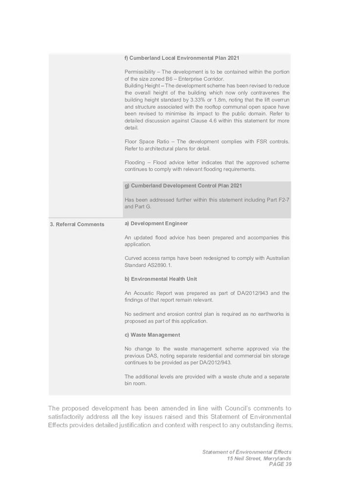



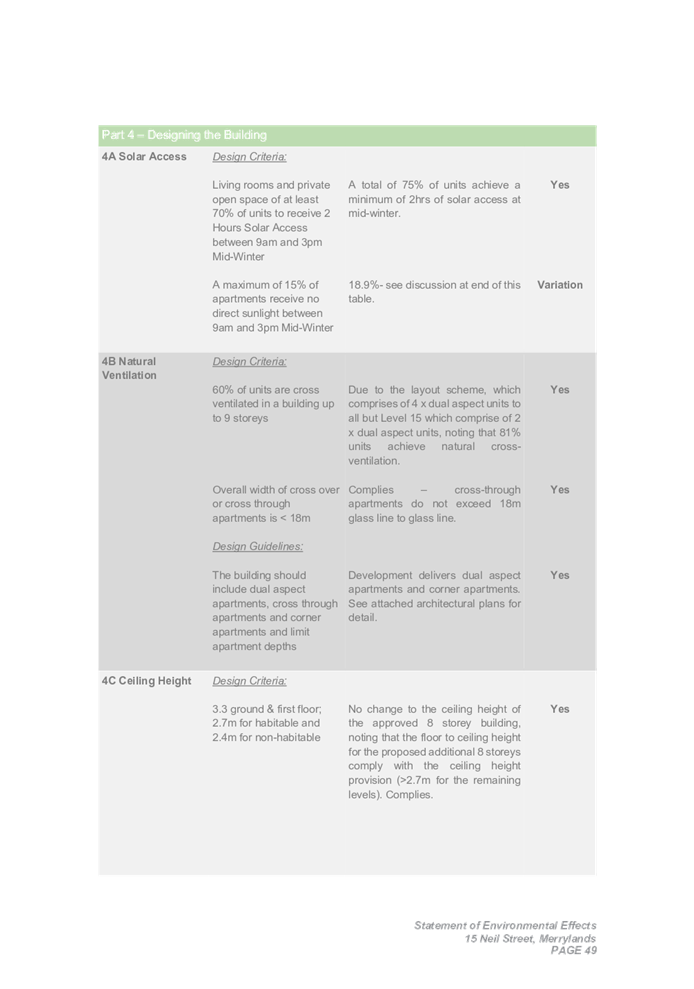

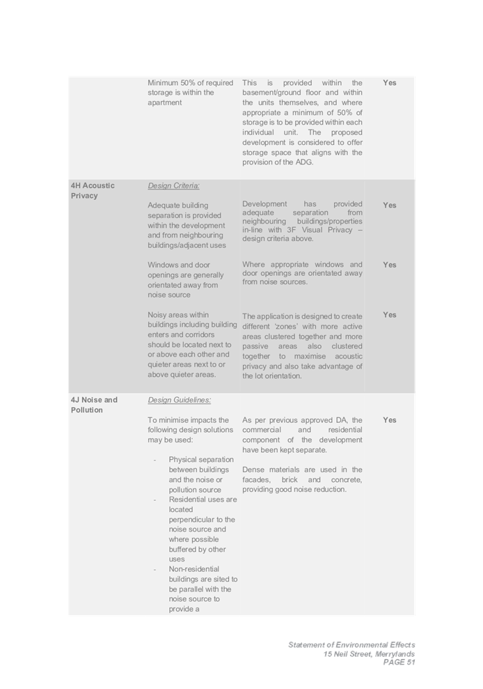
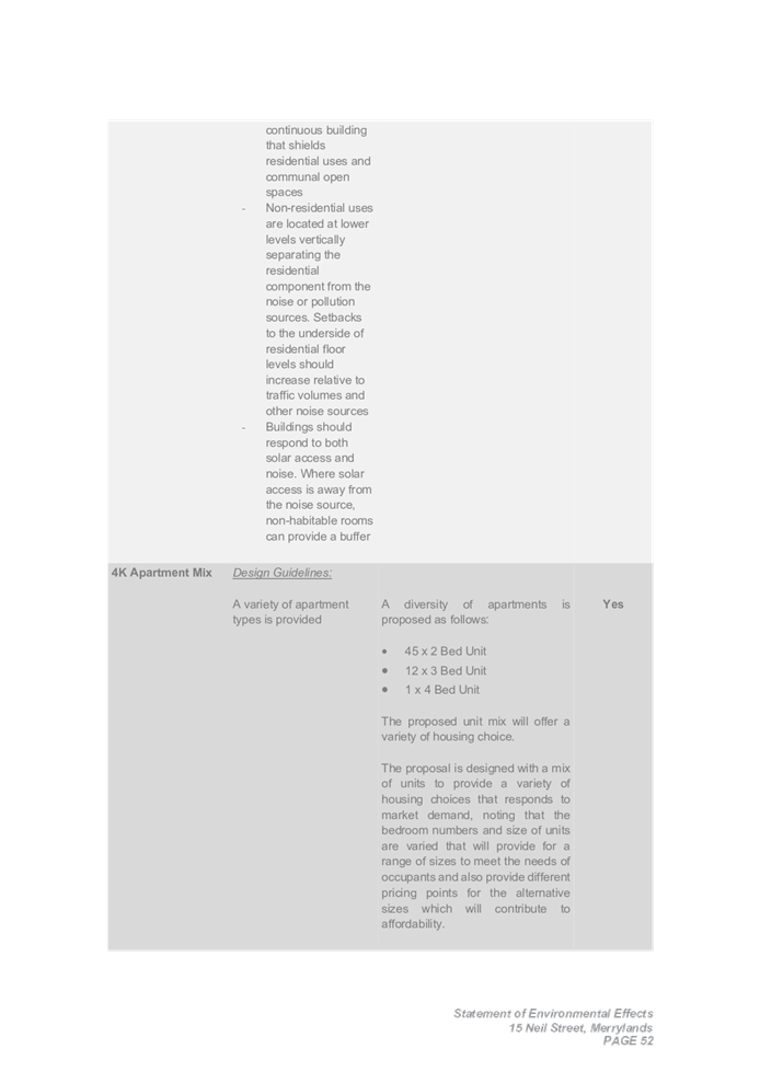
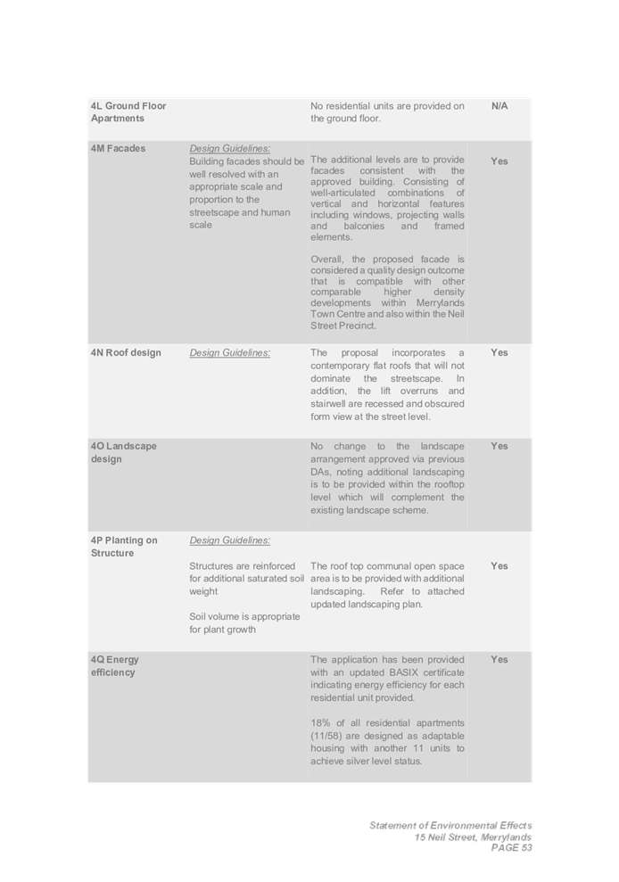
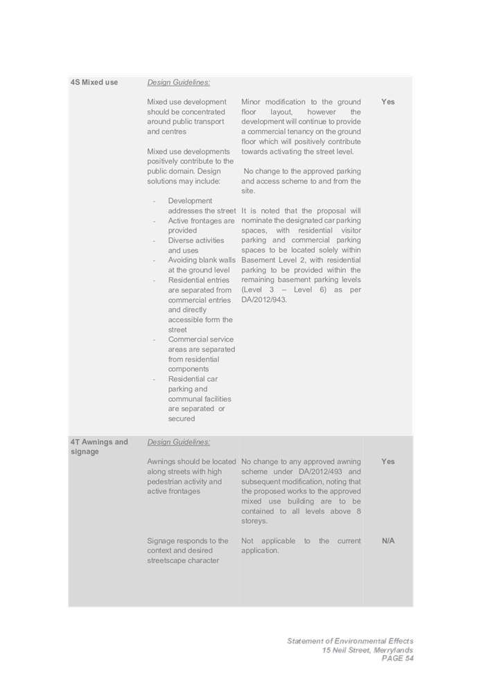
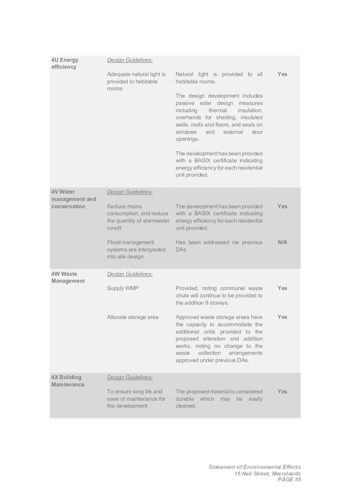
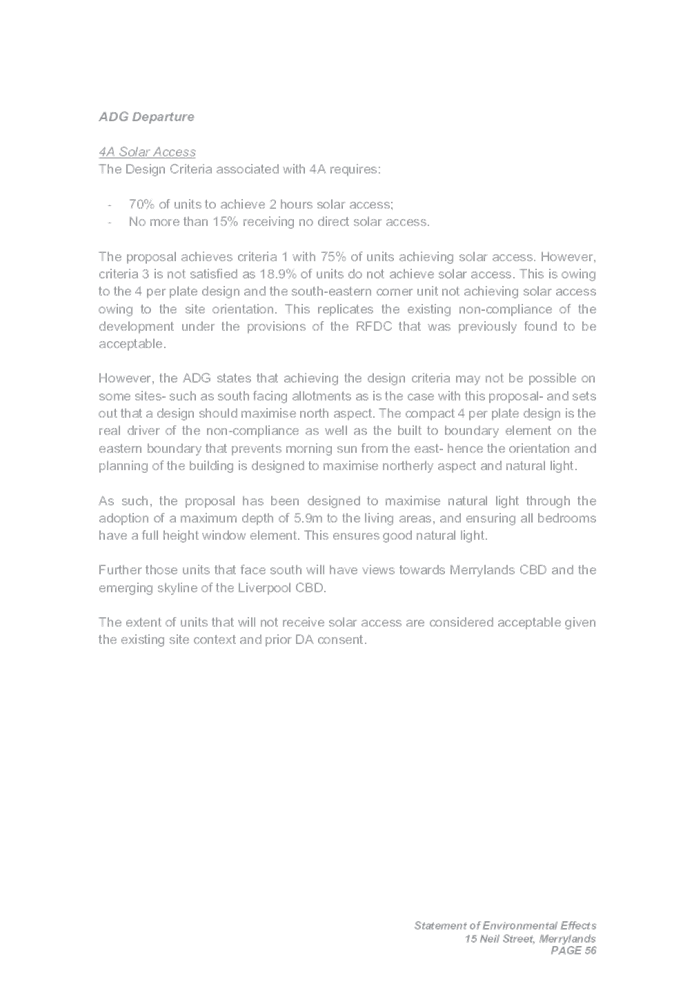
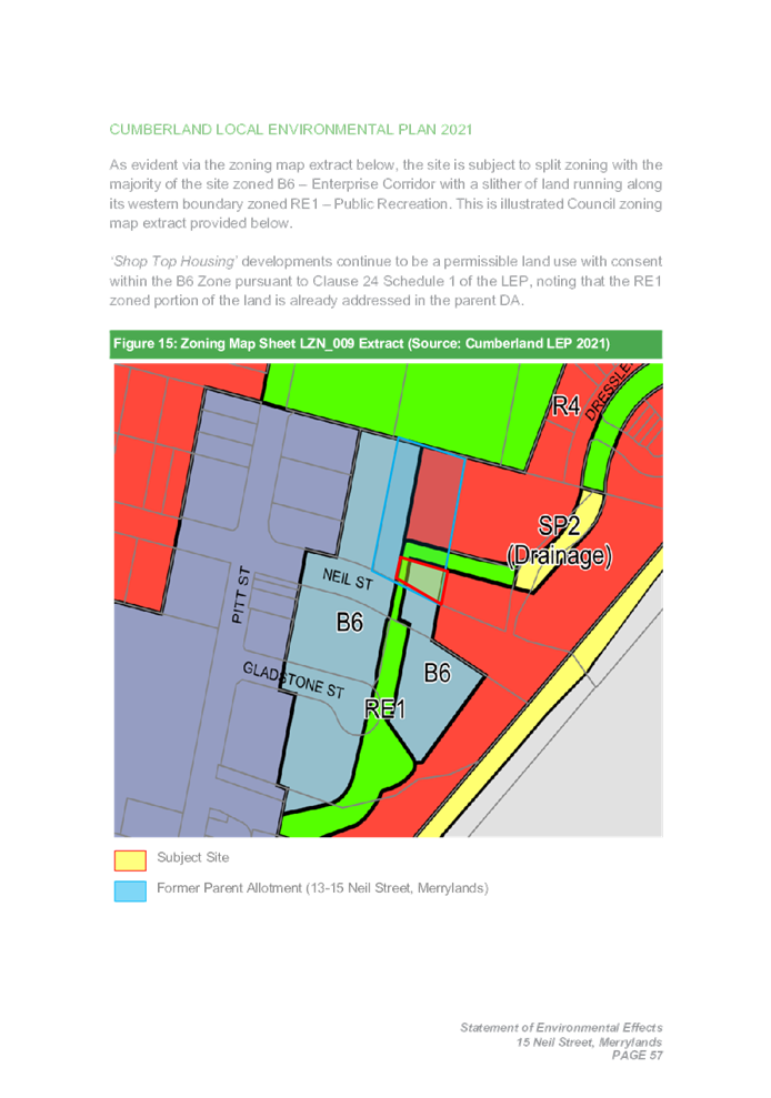
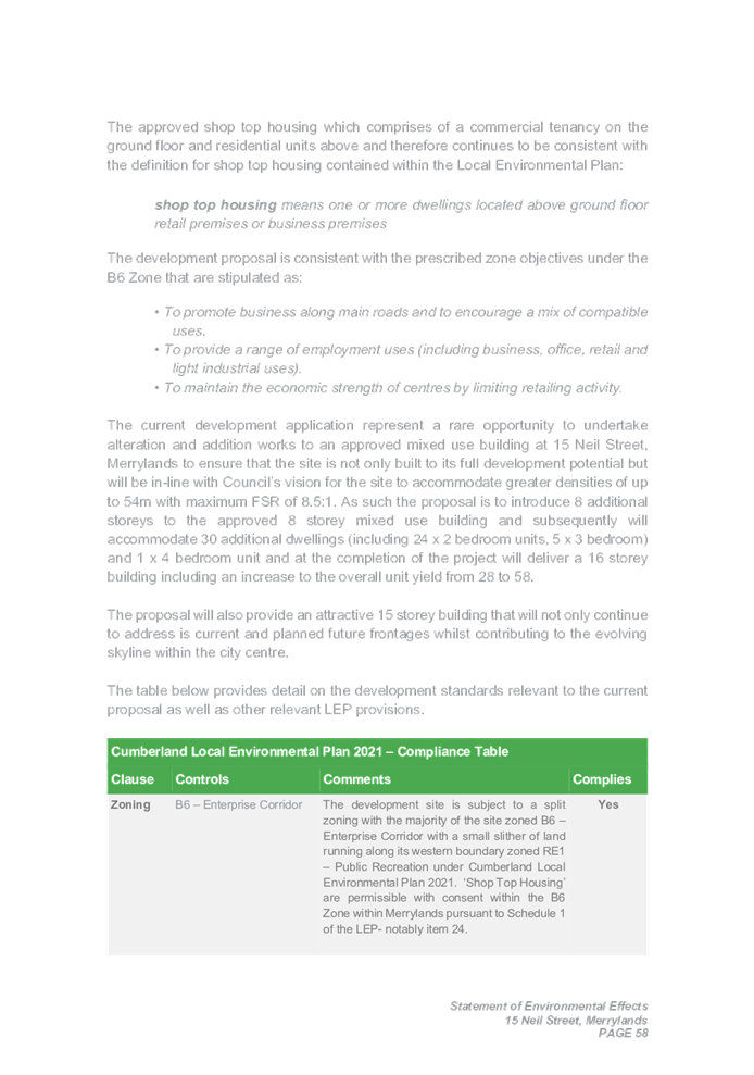
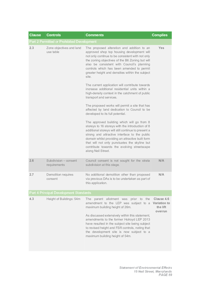
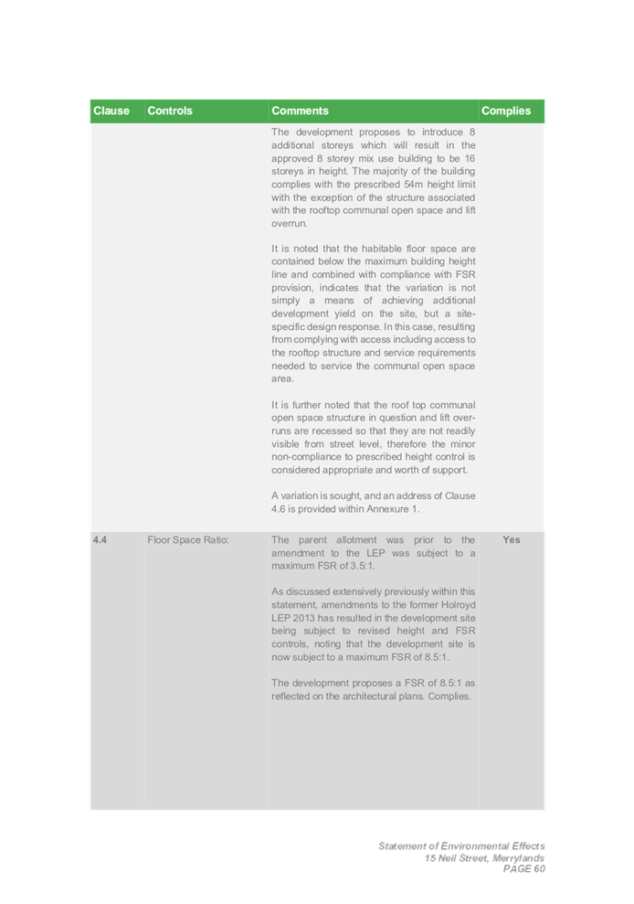
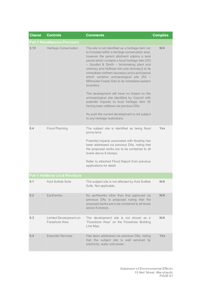
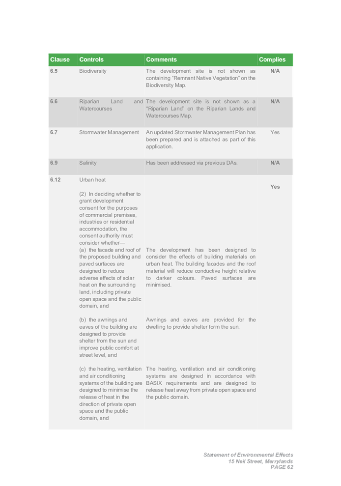
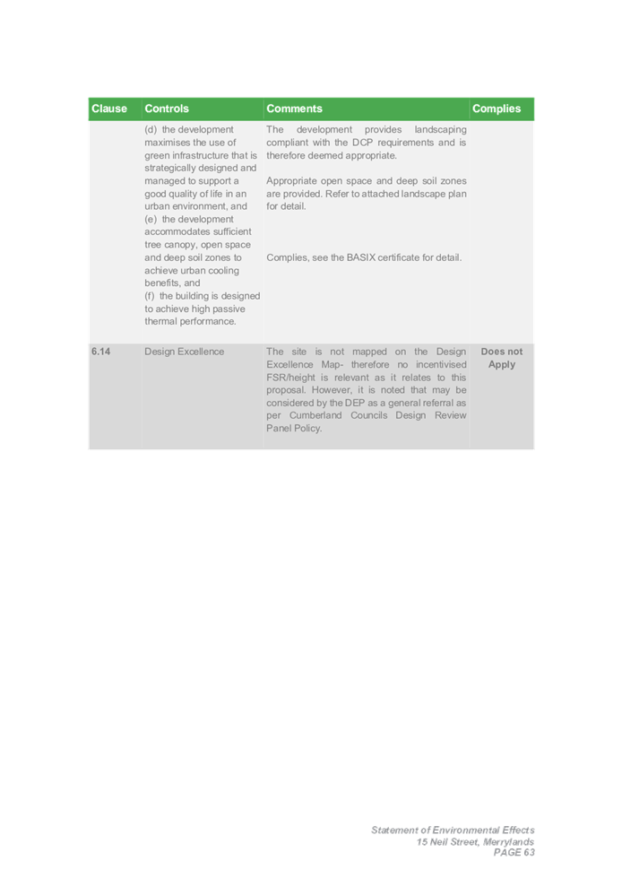
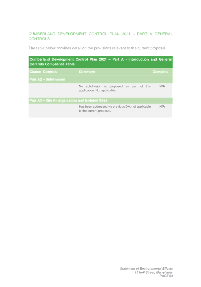
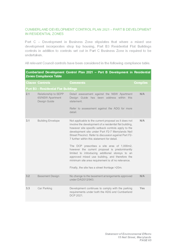
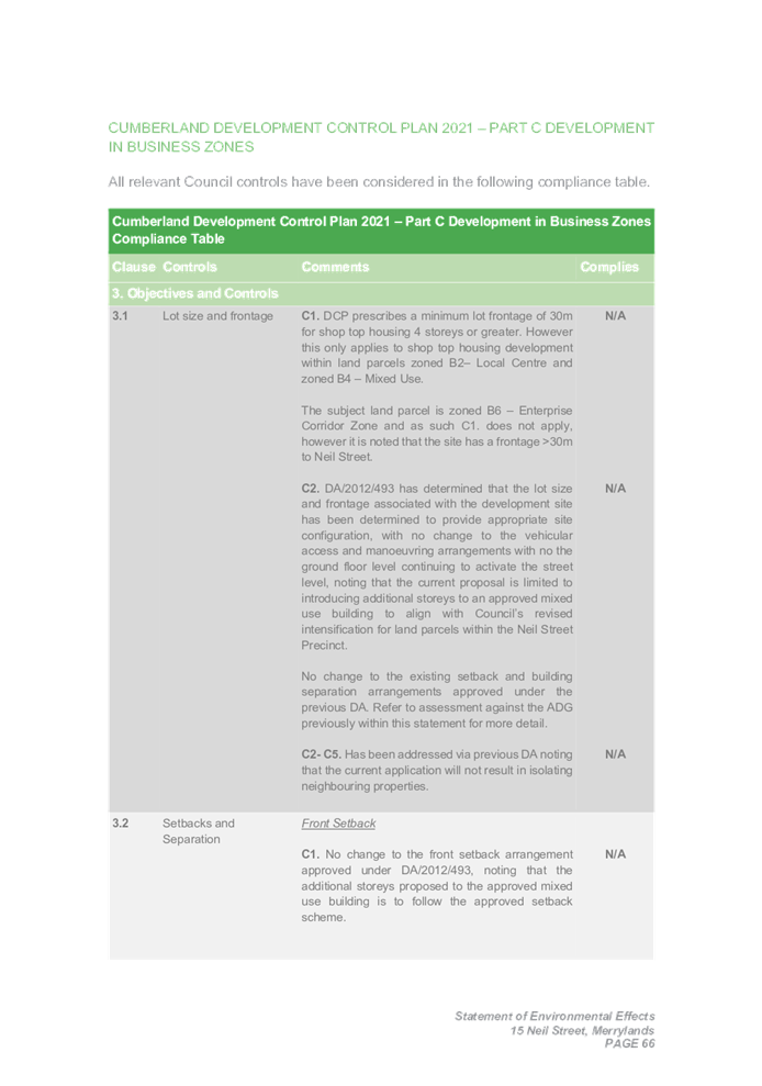
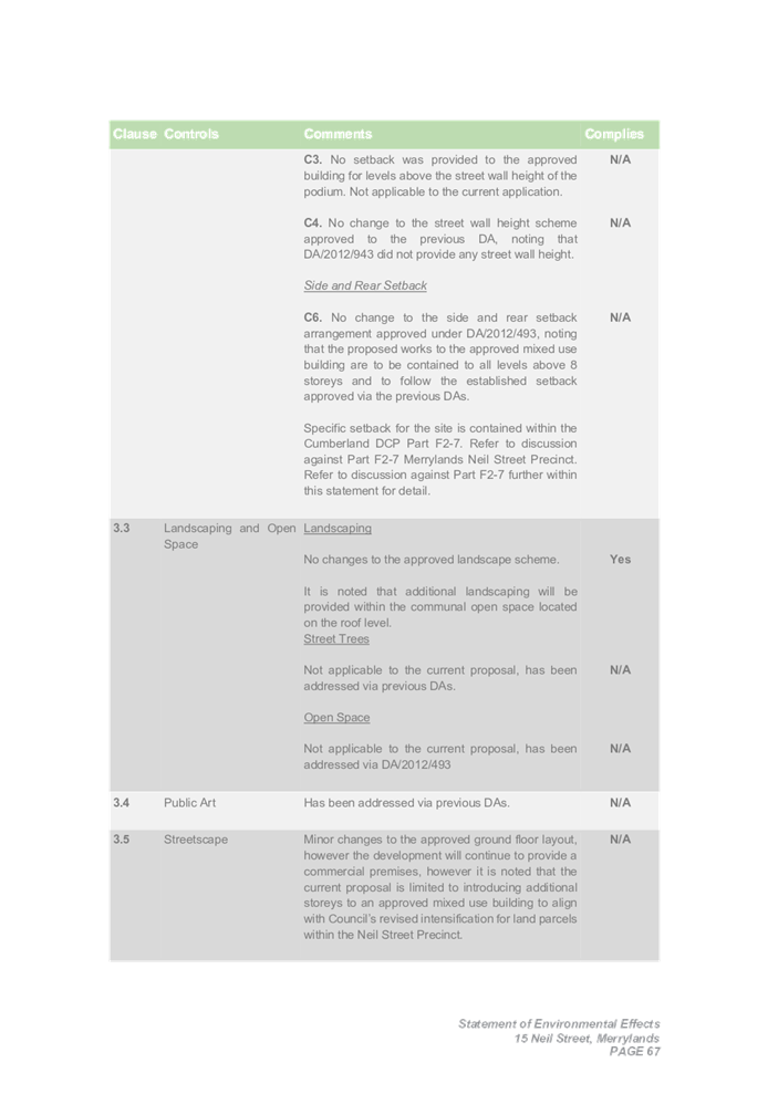
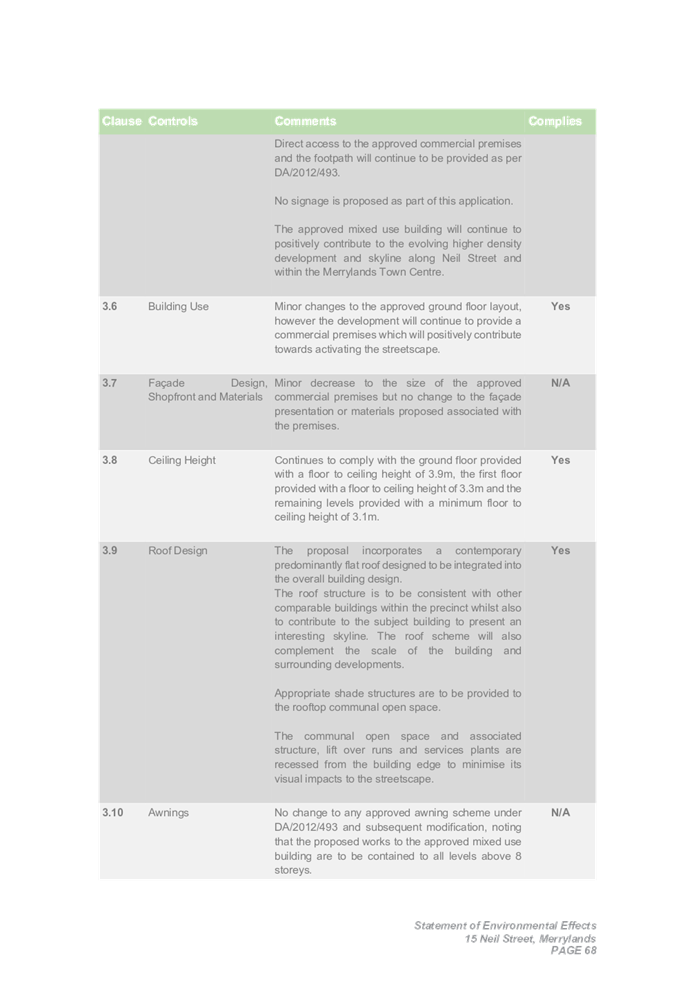
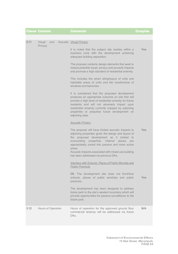
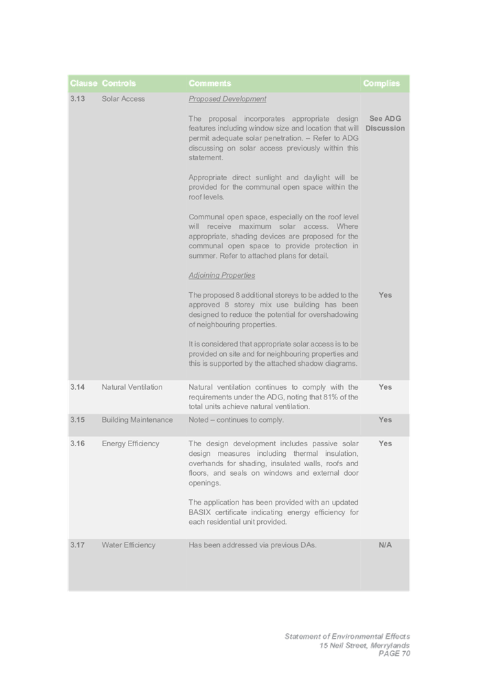
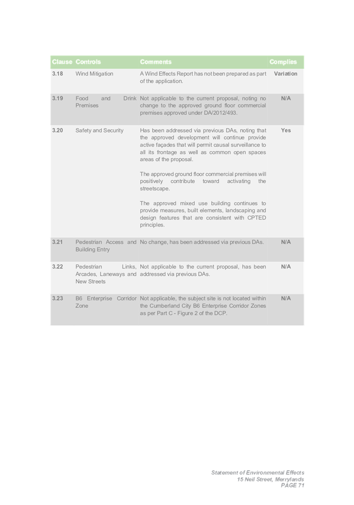
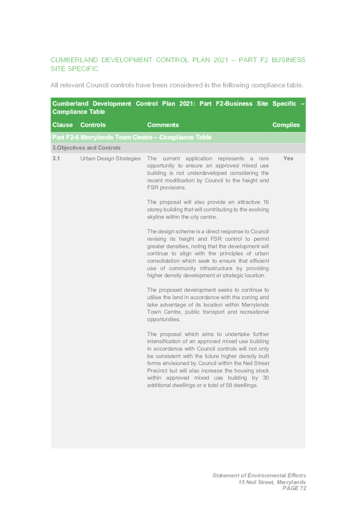
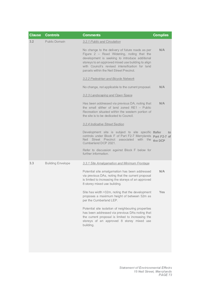
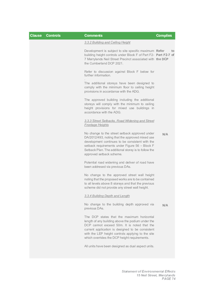
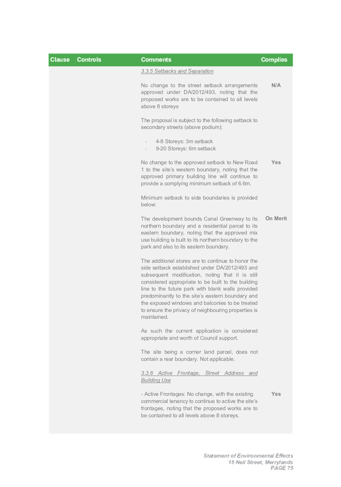
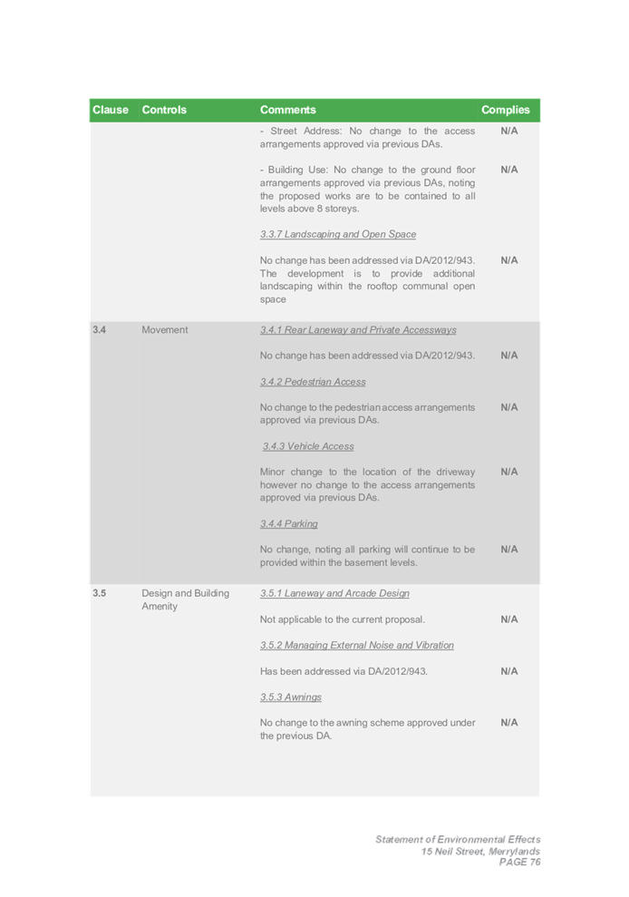
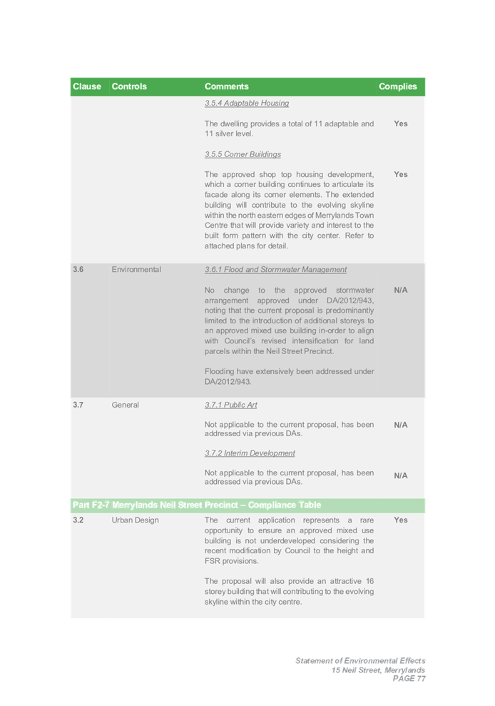
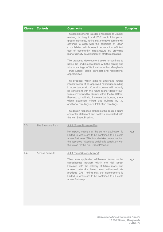
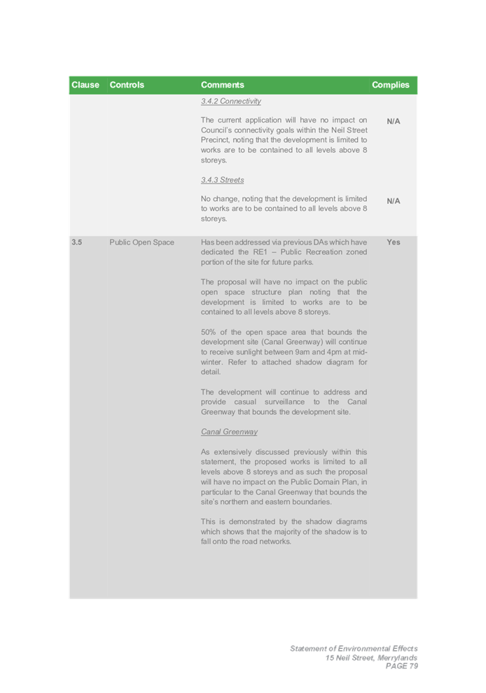
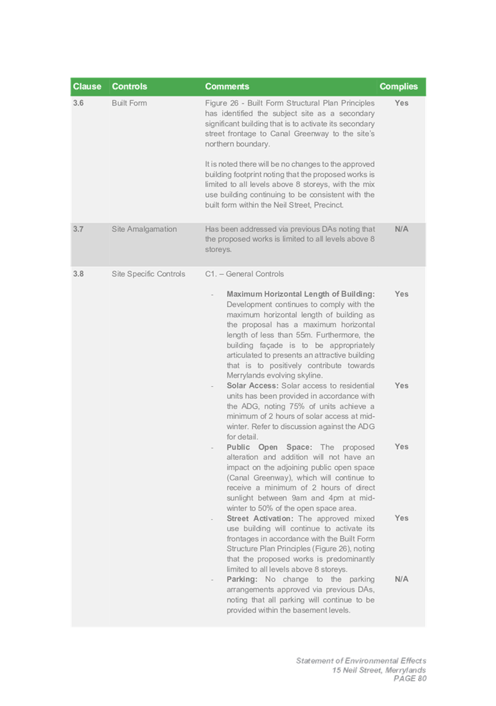
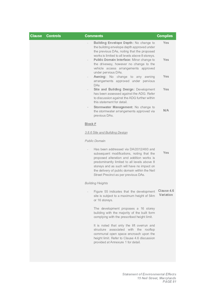
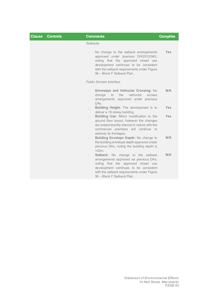
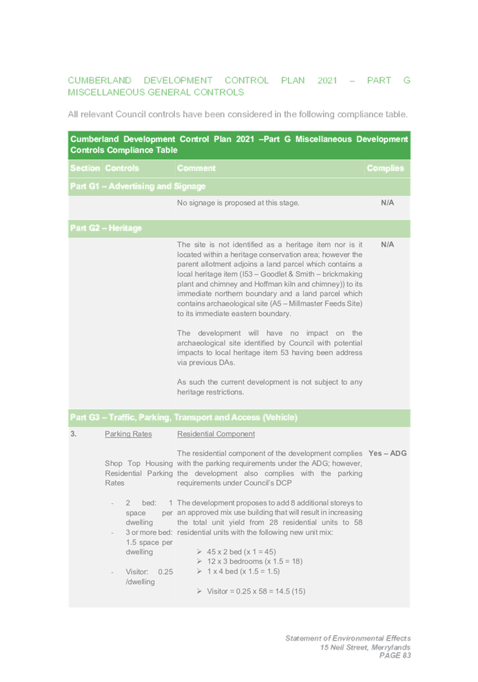
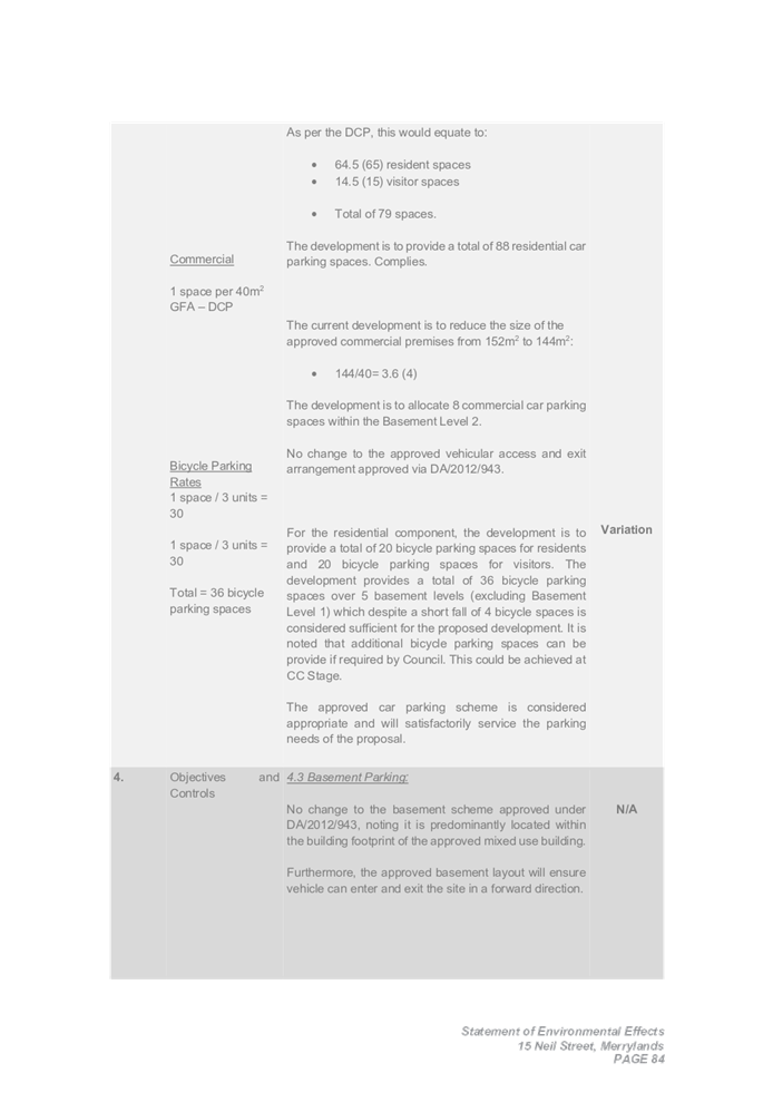
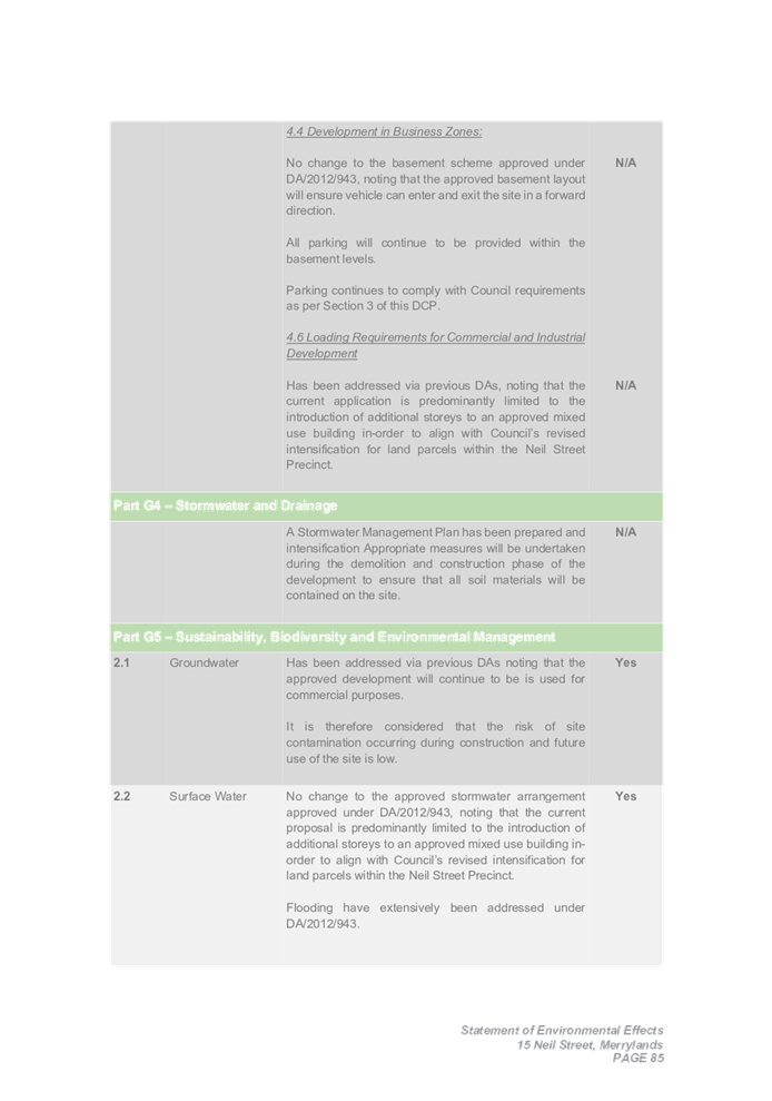
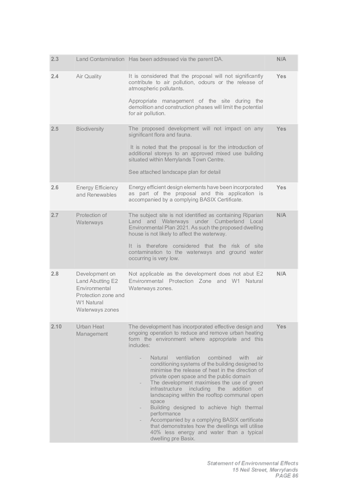
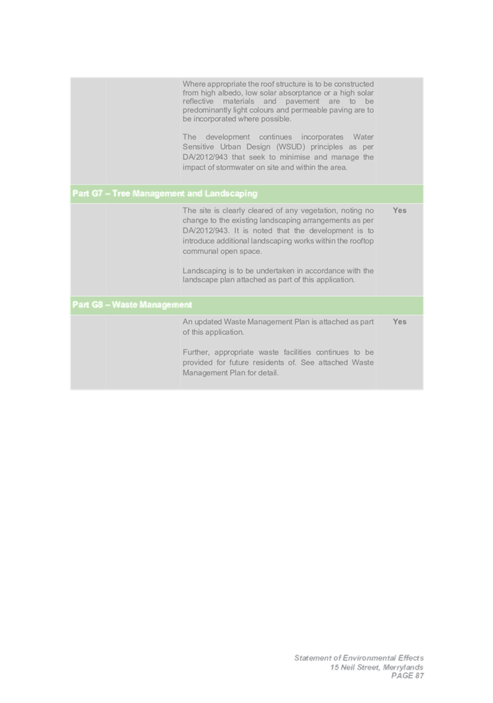
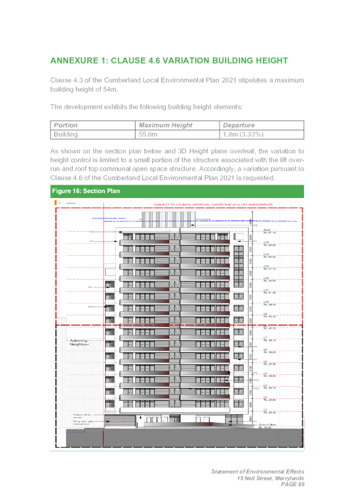
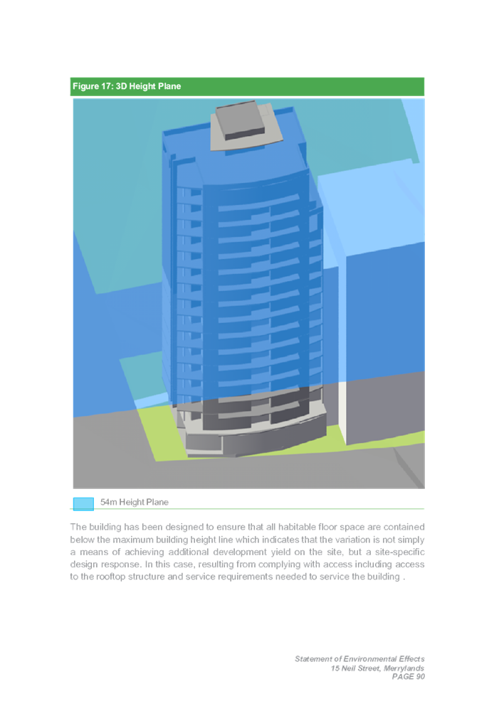

DOCUMENTS
ASSOCIATED WITH
REPORT LPP038/22
Attachment 11
Original Approved Plans
Cumberland Local Planning Panel Meeting
13 July 2022
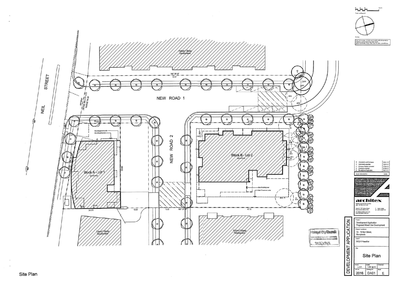
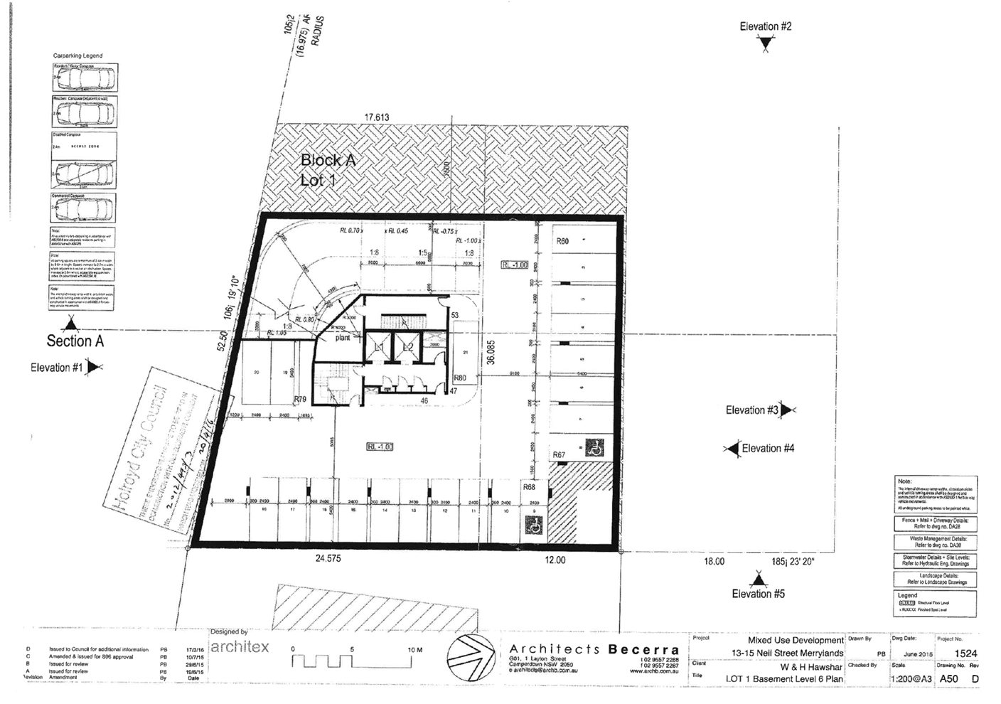
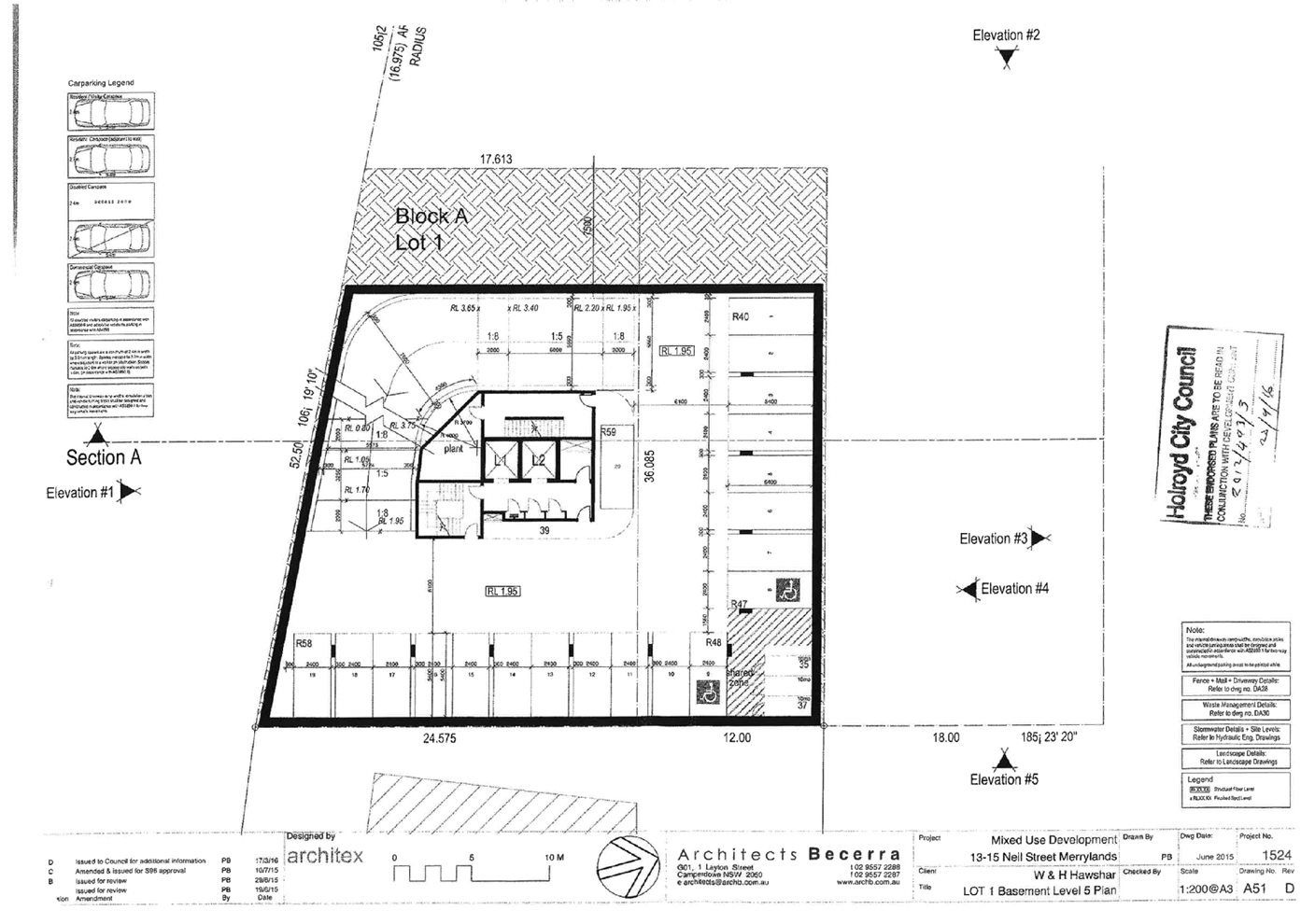
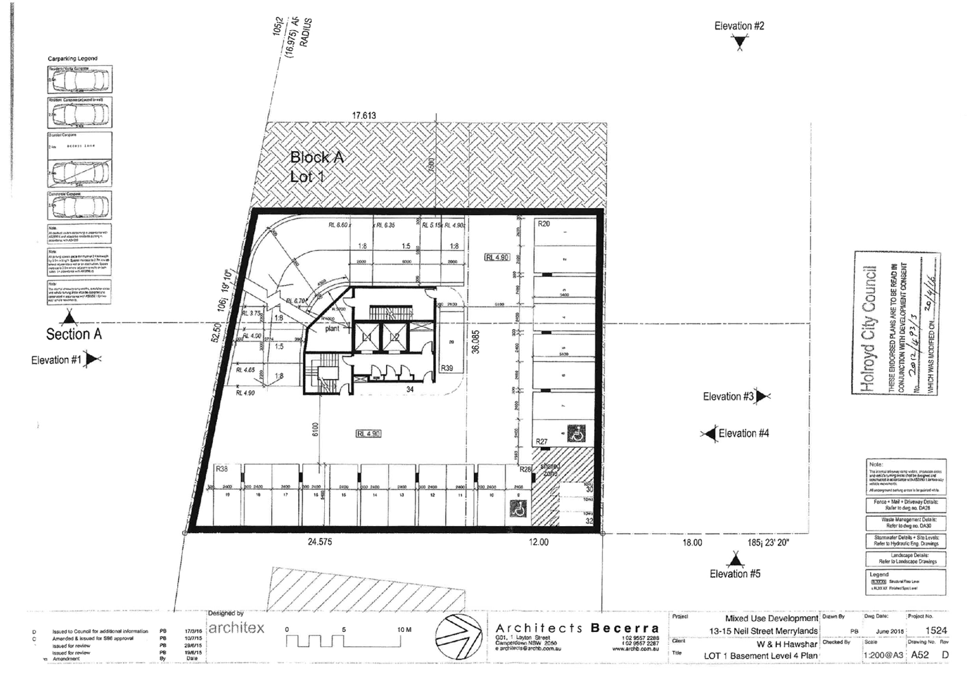
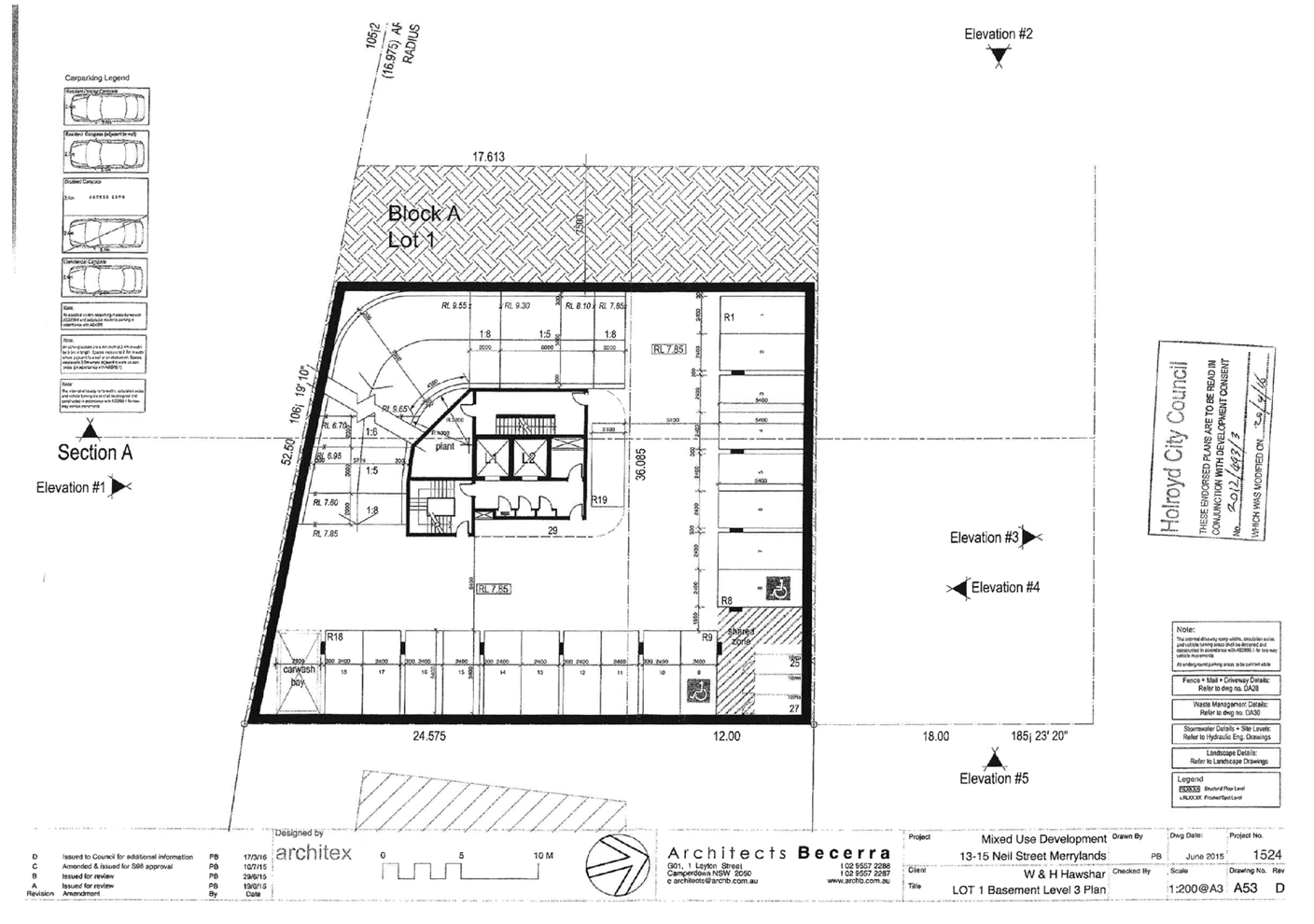
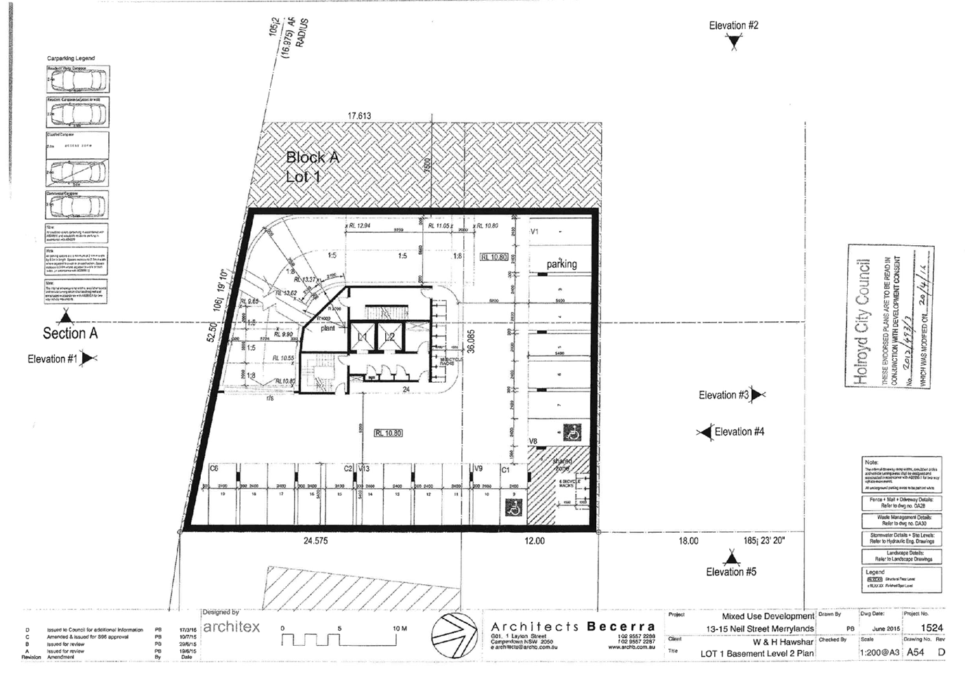
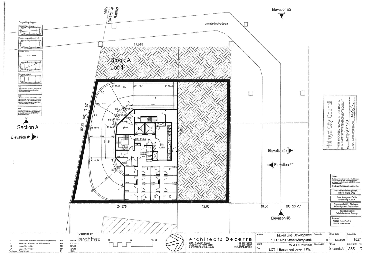
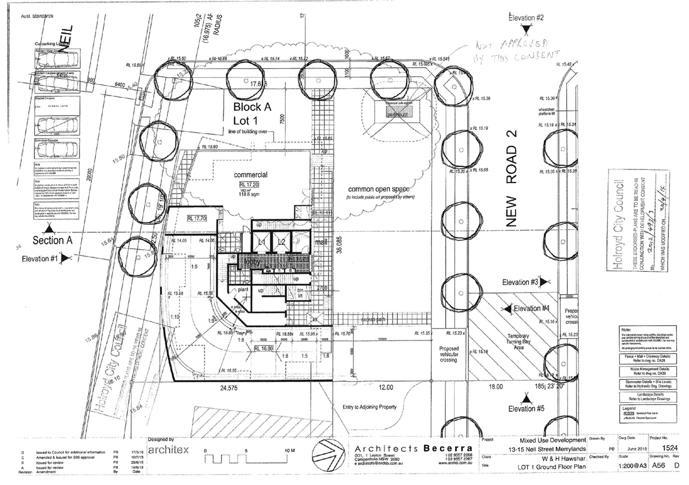
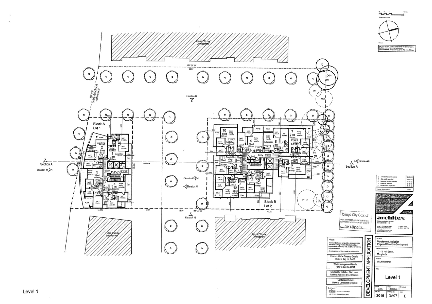
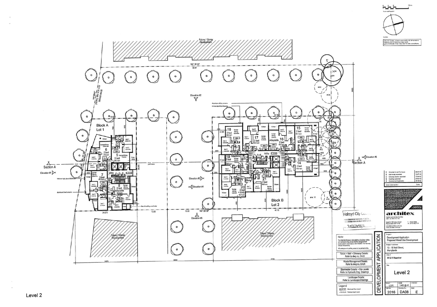
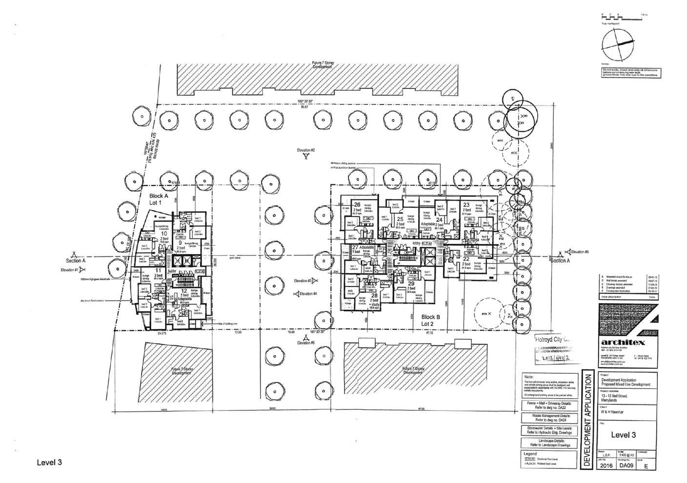
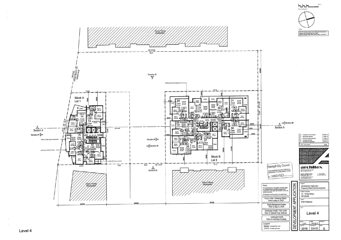
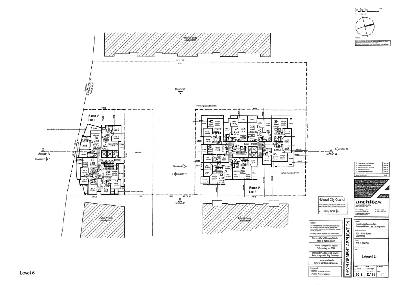
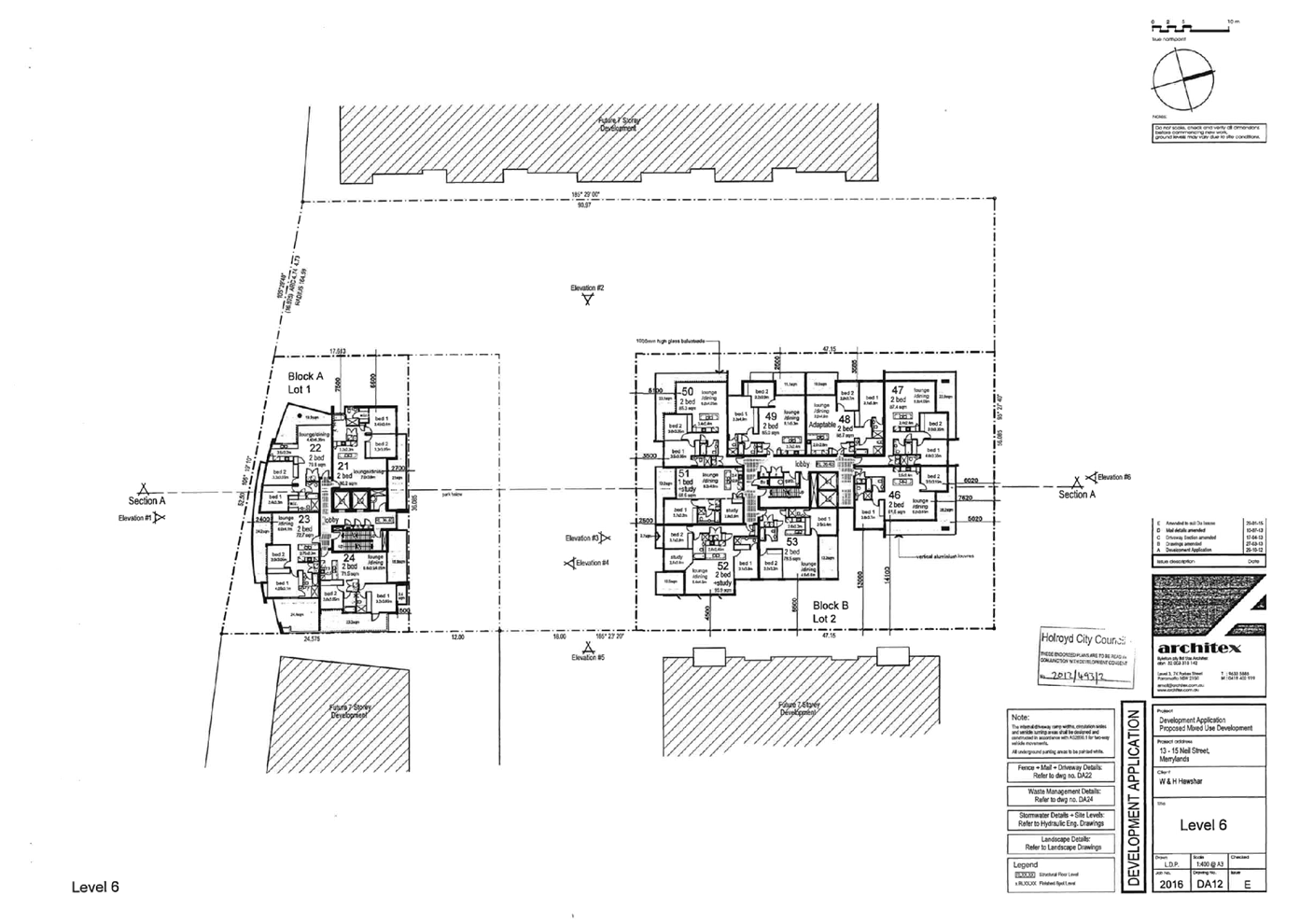
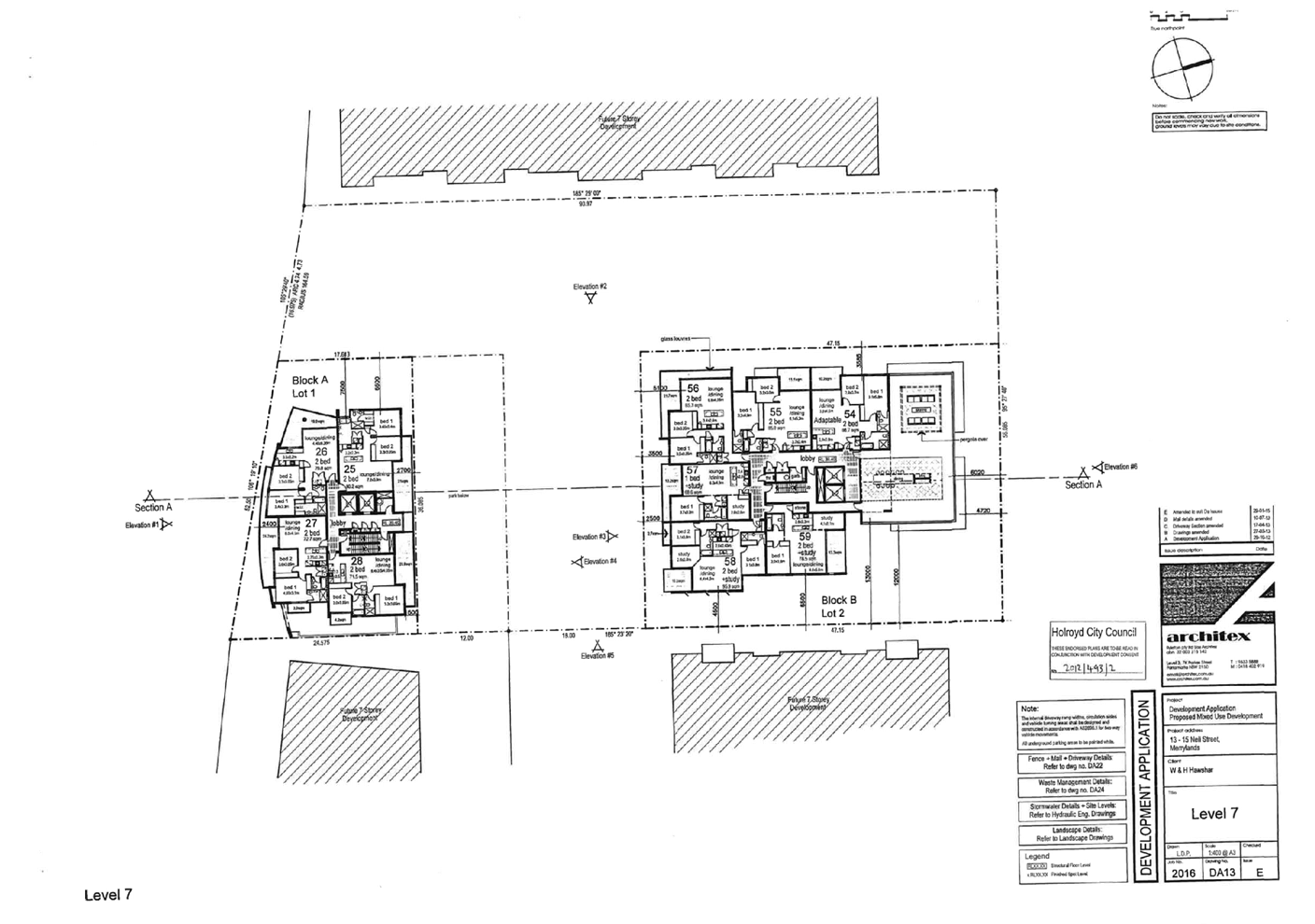
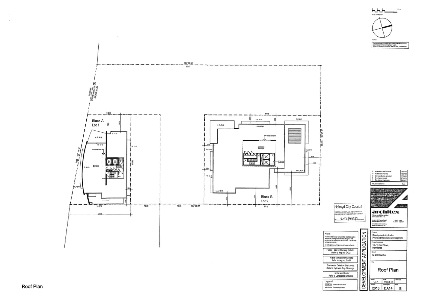
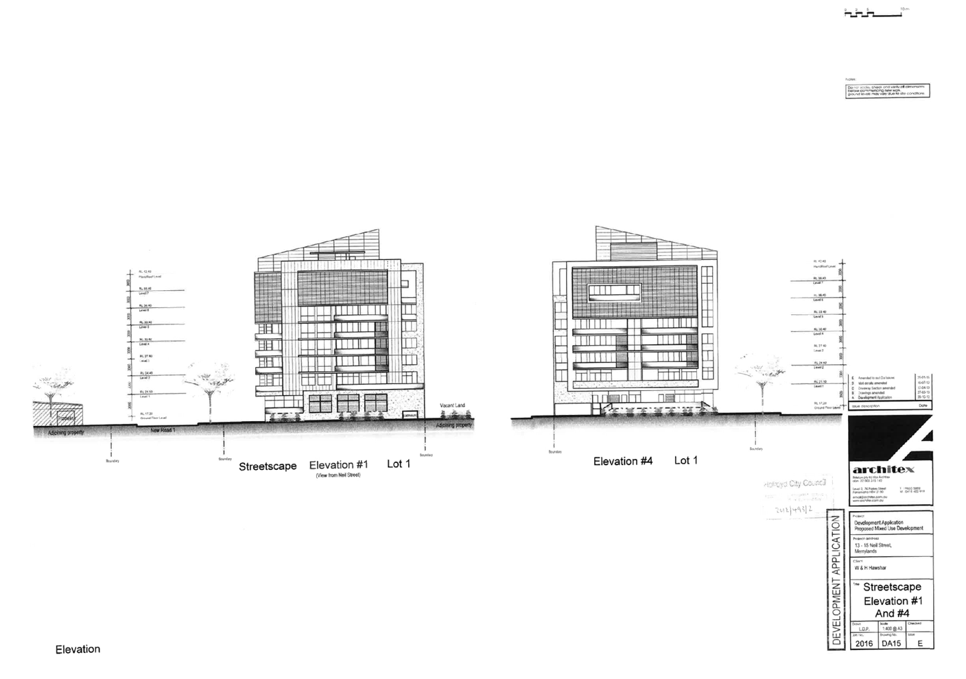
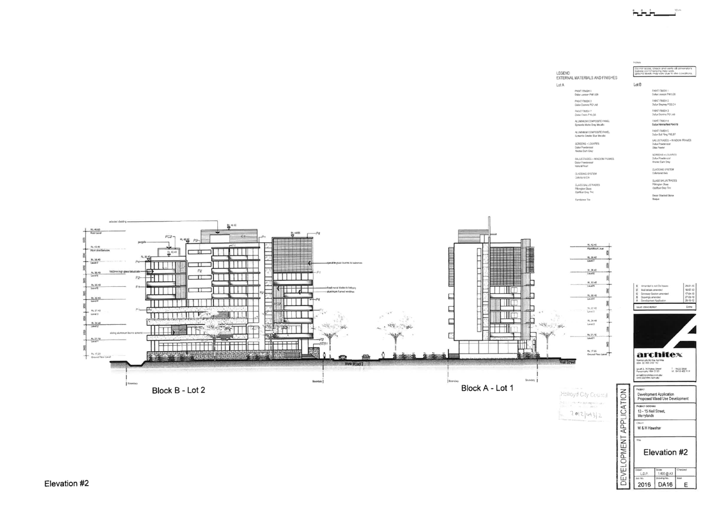
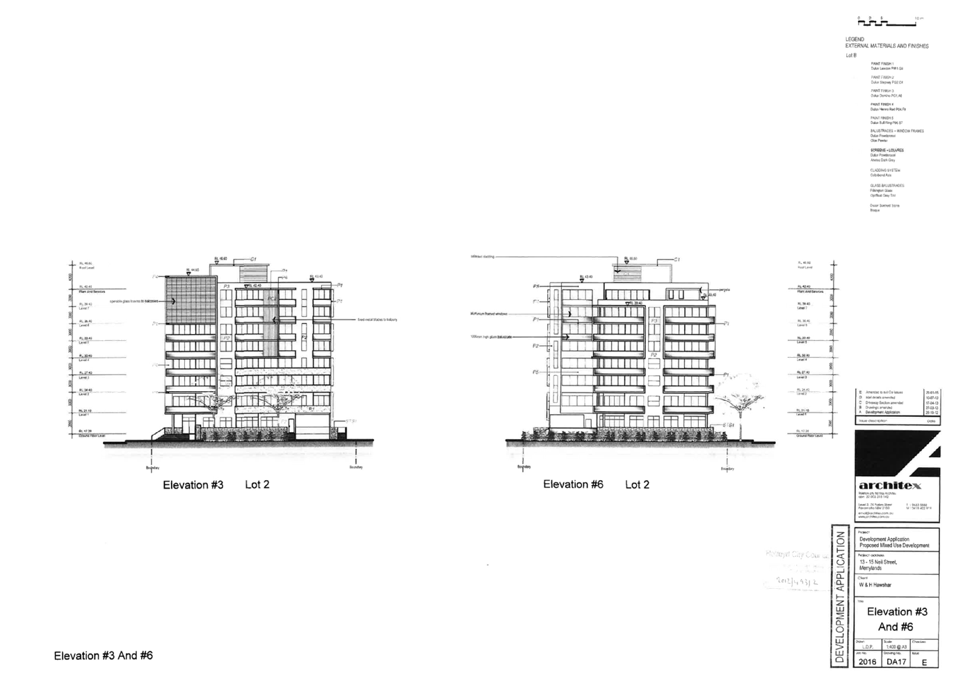
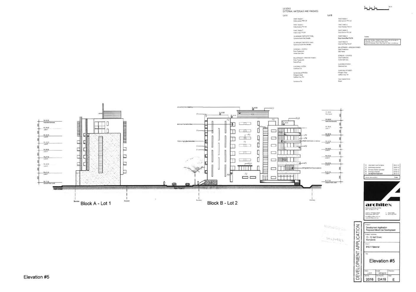
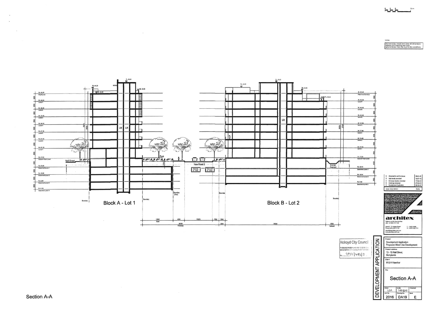
Cumberland
Local Planning Panel Meeting
13 July 2022
Item
No: LPP039/22
Development
Application - 8 -12 Good Street, Westmead
Responsible
Division: Environment
& Planning
Officer: Executive
Manager Development and Building
File
Number: DA2021/0682
|
Application
accepted
|
20 December 2021
|
|
Applicant
|
Zhinar Architects
|
|
Owner
|
Westmead 888 Pty Ltd
|
|
Application
No.
|
DA2021/0682
|
|
Description
of Land
|
8-12 Good Street
WESTMEAD NSW 2145, Lots 7, 8 & 9 DP 9675
|
|
Proposed
Development
|
Construction of a six storey
Residential Flat Building comprising 31 units with two levels of basement
parking and associated works
|
|
Site
Area
|
1,751sqm
|
|
Zoning
|
R4 High Density Residential
|
|
Disclosure
of political donations and gifts
|
Nil disclosure
|
|
Heritage
|
The site is not listed as
heritage item and it is not located within Heritage Conservation Area.
|
|
Principal
Development Standards
|
FSR
Permissible: 1.5:1
(2,626.5sqm)
Proposed: 1.48:1 (2,598.33sqm)
Height of Building
Permissible: 21m
Proposed: 22.96m
|
|
Issues
|
Height of building
Visual privacy
Setbacks
Adaptable housing
Housing mix
Submissions
|
1. Development
Application No. DA2021/0682 was accepted on 20 December 2021 for the
construction of a six storey Residential Flat Building comprising 31 units with
two levels of basement parking and associated works
2. The
application was publicly notified to occupants and owners of the adjoining
properties for a period of 14 days between 25 February 2022 and 11 March 2022.
In response, two (2) submissions were received.
3. On
21 April 2022, a Request for Further Information (RFI) was issued to the
applicant identifying various matters of concern including a request for
additional acoustic details, a non-compliant Floor Space Ratio (FSR), a
building height non-compliance and tree retention.
On 23 May 2022, additional
information was submitted to Council in response to the abovementioned RFI. A
revised clause 4.6 request to vary the height of building development standard
was also submitted.
4. The
notable variations are as follows:
|
CLEP
|
|
Control
|
Required
|
Provided
|
% variation
|
|
Clause 4.3 Height of Buildings
|
21m (max)
|
22.96m
|
9.3%
|
|
CDCP
|
|
|
|
|
Control
|
Required
|
Provided
|
% variation
|
|
Part B1, Clause 3.1
Rear setback
|
12m (min)
|
9m
|
25%
|
|
Part B1, Clause 3.2
Basement side setback
|
1.2m (min)
|
1m
|
20%
|
|
Part B5, Clause 2.1
Adaptable housing
|
More than 20 dwellings require 20% adaptable units
|
16.21% (5 units)
|
28.57%
|
|
Part B5, Clause 2.2
Housing mix
|
10% or 4 x 1 bedroom
10% or 4 x 3 bedroom
|
6.4% or 1 x 1 bedroom unit
6.4% or 1 x 3 bedroom units
|
75%
75%
|
|
SEPP 65 and ADG
|
|
Control
|
Required
|
Provided
|
% variation
|
|
Part 3F-1 Setback of balconies to side and rear boundaries
|
9m
|
8.8m (approx.)
|
2.2%
|
5. The application is
referred to the Panel as the proposal is considered to be sensitive development
as it relates to development to which State Environmental Planning Policy No 65
– Design Quality of Residential Apartment Development applies and is more
than four storeys in height.
6. The
application is recommended for Deferred Commencement Approval subject to
conditions as recommended in Council’s assessment report.
Subject Site And Surrounding
Area
The subject site is comprised of
three (3) lots described as 8-12 Good Street Westmead. The legal description of
the lots are Lot 7 DP 9675, Lot 8 DP 9675 and Lot 9 DP 9675. The site is
rectangular in shape, has a total area measuring 1,751sqm and is currently void
of any natural or built structures as shown in Figure 2.
Immediately adjoining development
includes multi storey contemporary residential flat buildings (RFB) to the
north and south and older forms of RFBs on the opposing side of Good
Street to the east. Immediately to the west is a five storey residential flat
building comprising 46 dwellings and two levels of basement parking which is
currently under construction (DA2019/141/1). A power pole and overhead power
lines are located above the footpath fronting the site.
The site is zoned R4 Residential
and is located at the interface to Cumberland Council’s Local Government
Area boundary to the east. The site is buffered by R2 Low Density Residential
land to the north and west and B6 Enterprise Corridor zoned land to the south
as shown in Figure 1. The Great Western Highway runs perpendicular to Good
Street and is located approximately 90m south of the subject site.
The site is identified as being
subject to a flood planning level according to Council’s mapping with
only a small portion of the southwestern corner of the site being ‘Low
Risk (PMF)’ flood liable land.
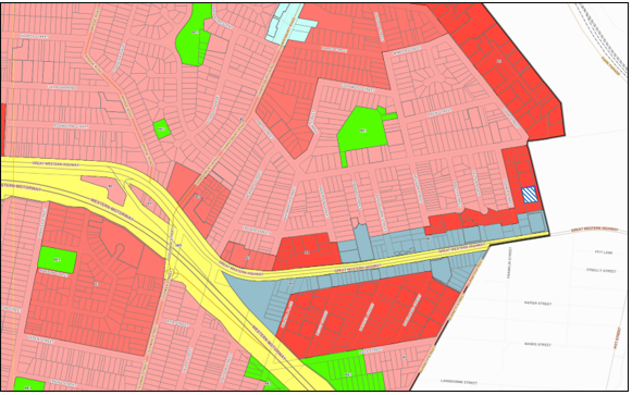
Figure
1 – Locality Plan of subject site hatched in ‘blue’
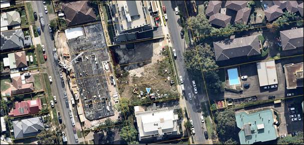
Figure
2 – Aerial view of subject site
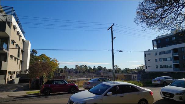
Figure
3 – Street view of subject site taken 22 June 2022
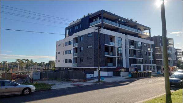
Figure
4 – Existing development to the north, 14-18 Good Street
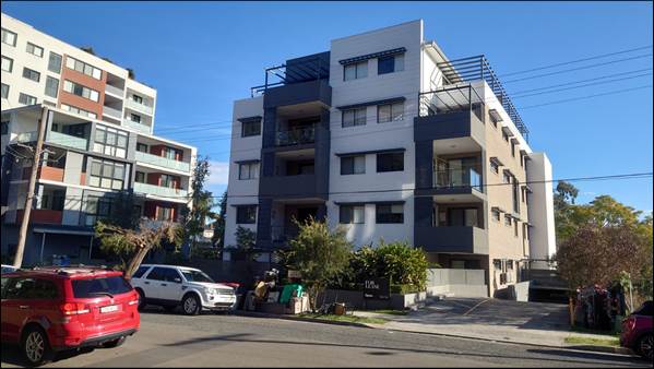
Figure
5 – Existing development to the south, 4-6 Good Street
Description of The
Development
Council has received a development
application for construction of a six storey residential flat building
comprising a total of 31 units (consisting of a 2 x 1 bedroom, 27 x 2 bedroom
and 2 x 3 bedroom apartments, inclusive of five adaptable units), two basement
levels consisting of a total of 41 parking spaces and communal areas located on
the roof top and within the northern and western setback areas to the building.
The development has a building height of 22.96m, an FSR of 1.48:1.
A breakdown of the development by floor is provided below.
Basement 2
· Fourteen (14)
residential parking spaces inclusive of one (1) disabled space.
· One (1) car wash
bay is provided.
· Provision for the
parking of nineteen (19) bicycles is provided adjacent to the lift core.
· Storage space for
units and (1) bulky storage room.
Basement 1
· Twenty (20)
residential parking spaces inclusive of four (4) disabled spaces.
· Seven (7) visitor
parking spaces.
· Storage space for
units and a bin storage room.
· Tug bin storage
device.
· A mechanical room,
a pump room and an MSB/NBN room.
Ground floor
· Six (6) x 2
bedroom apartments identified as Units 001, 002, 003, 004, 005 and 006 with
associated private courtyards.
· Units 001, 005 and
006 possesses direct access from Good Street in addition to access via an
internal corridor within the building.
· A temporary bin
storage area is provided adjacent to the eastern side of the driveway.
· Landscape area is
provided within the northern and western side setbacks.
· An outdoor
communal area is situated in the south eastern corner of the site.
Level 1 to 3
· Six (6) x 2
bedroom apartments identified as Units 101, 201, 301, 102, 202, 302, 102, 203,
303, 104, 204, 304, 105, 205, 305, 106, 206 and 306.
· Each level has one
(1) adaptable unit identified as Units 102, 202 and 302.
· Level 4
· A total of four
(4) apartments consisting of one (1) x 1 bedroom, two (2) x 2 bedroom and one
(1) x 3 bedroom units are proposed on this level identified as Units 401, 402,
403 and 404.
· Unit 401 contains
a second level master bedroom with an ensuite on Level 5.
· Unit 402 is an
adaptable unit.
Level 5
· A total of three
(3) apartments consisting of a 1, 2 and 3 bedroom units are located on this
level and are identified as Units 501, 502 and 503.
· Unit 501 is an
adaptable unit.
Roof
· 215.98sqm of
communal open space is located on the roof level and consists of a pergola over
a BBQ area.
· A communal
bathroom and plant room is provided.
· Landscaping is
proposed around the perimeter of the roof level.
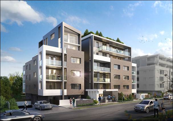
Figure 6 – Montage of the
proposed development
History
On 9 February 2016, a development
application (DA2015/222/1) was approved under delegated authority for
‘demolition of existing structures; consolidation of 3 lots into 1 lot;
construction of a 5 storey residential flat building comprising 33 units over
basement parking accommodating 40 carparking spaces’.
Demolition of the subject site was
undertaken to completion in 2018 in accordance with development consent
DA2015/222/1.
On 30 June 2021, Pre-lodgement
advice (PL2021/0048) was provided for a development involving
‘alterations and additions to an approved residential flat building, to
introduce an additional storey, reduce units from 33 to 31, changes to
apartment mix reconfiguration and changes to basement level’.
Applicants Supporting
Statement
The applicant has provided a
Statement of Environmental Effects prepared by The Planning Hub dated 16
November 2021 and was received by Council on 20 December 2021 in support of the
application.
Contact With Relevant
Parties
The assessing officer has
undertaken a site inspection of the subject site and surrounding properties and
has been in regular contact with the applicant throughout the assessment
process.
Internal Referrals
Development Engineer
The development application was
referred to Council’s Development Engineer for comment who has advised
that the development proposal is satisfactory subject to the imposition of a
‘Schedule A’ condition relating to the creation of an easement and
the inclusion of ‘Schedule B’ conditions of consent.
Environment and Health
The development application was
referred to Council’s Environment and Health Officer for comment who has
advised that the development proposal is satisfactory regarding to noise impact
and contamination and therefore can be supported subject to recommended
conditions of consent.
Tree Management Officer
The development application was
referred to Council’s Tree Management Officer for comment who has advised
that the development proposal is satisfactory subject to the imposition of
conditions of consent.
Waste Management
The development application was
referred to Council’s Waste Management Officer for comment who has
advised that the development proposal is satisfactory regarding the proposed
waste management and therefore can be supported subject to recommended
conditions of consent.
External Referrals
Endeavour Energy
The development application was
referred to Endeavour Energy for comment who has advised that no objection is
raised subject to conditions of consent relating to the required energy
infrastructure for the development.
Transport for NSW (TfNSW)
The development application was
referred to TfNSW for comment who has advised that no objection is raised
noting that traffic generation is not likely to adversely impact the classified
road network.
Sydney Water Corporation
The development application was
referred to Sydney Water for comment who has advised that no objection is
raised subject to the inclusion of conditions of consent to ensure water and
wastewater servicing is provided to the development.
Planning Comments
The provisions of any
Environmental Planning Instruments (EP&A Act s4.15 (1)(a)(i))
State Environmental Planning
Policies
The proposed development is
affected by the following State Environmental Planning Policies:
(a) State
Environmental Planning Policy (Resilience and Hazards) 2021 (Resilience and
Hazards SEPP) – Chapter 4 Remediation of Land
Chapter 4 of the Resilience and
Hazards SEPP requires Council to be satisfied that the site is suitable or can
be made suitable to accommodate the proposed development. The matters listed
within Clause 4.6 have been considered in the assessment of the development application.
|
Matter for
Consideration
|
Yes/No
|
|
Does the application
involve re-development of the site or a change of land use?
|
Yes
No
|
|
Does the application involve re-development of the site
or a change of land use?
|
Yes
No
|
|
In the development
going to be used for a sensitive land use (e.g.: residential, educational,
recreational, childcare or hospital)?
|
Yes
No
|
|
Does information available to you indicate that an
activity listed below has ever been approved, or occurred at the site?
acid/alkali plant and
formulation, agricultural/horticultural activities, airports, asbestos production
and disposal, chemicals manufacture and formulation, defence works, drum
re-conditioning works, dry cleaning establishments, electrical manufacturing
(transformers), electroplating and heat treatment premises, engine works,
explosive industry, gas works, iron and steel works, landfill sites, metal
treatment, mining and extractive industries, oil production and storage,
paint formulation and manufacture, pesticide manufacture and formulation,
power stations, railway yards, scrap yards, service stations, sheep and
cattle dips, smelting and refining, tanning and associated trades, waste
storage and treatment, wood preservation
|
Yes
No
|
|
Is the site listed on
Council’s Contaminated Land database?
|
Yes
No
|
|
Is the site subject to EPA
clean-up order or other EPA restrictions?
|
Yes
No
|
|
Has the site been the subject of
known pollution incidents or illegal dumping?
|
Yes
No
|
|
Does the site adjoin any
contaminated land/previously contaminated land?
|
Yes
No
|
|
Has the appropriate level of
investigation been carried out in respect of contamination matters for
Council to be satisfied that the site is suitable to accommodate the proposed
development or can be made suitable to accommodate the proposed development?
|
Yes
No
|
|
Details of contamination investigations carried out at the
site:
The
applicant has submitted a Preliminary Site Investigation (PSI) prepared by
STS Geo Environmental dated December 2014 for a previously approved RFB
(DA2015/22/1) which concluded that the site is suitable to be redeveloped for
the purpose of an RFB with basement level parking. The PSI is considered to
be valid to the proposed for the following reasons:
- The proposed development is a
multi storey RFB that proposes bulk excavation to accommodate two levels of
basement which is similar in scale to the previously approved development.
- A review of aerial photography
of the subject site since the issue of the PSI to today confirms that no works
have been carried out on the site other than demolition of the existing
dwelling houses and onsite trees which occurred sometime between 18 January
2018 and 5 May 2018.
It
is further noted that Council’s Environmental Health Officer has
assessed the proposal and has raised no issue with regard to contamination
subject to the inclusion of conditions in any consent to address the
discovery of contaminated waste throughout the course of construction.
|
(b) Statement
Environmental Planning Policy No. 65 - Design Quality of Residential Apartment
Development (SEPP 65)
SEPP 65 applies to the development
as the building is 3 storeys or more and contains more than 4 dwellings. A
design statement addressing the design quality principles prescribed by SEPP 65
was prepared by the Ian Conroy, registration number 8317. Integral to SEPP 65
is the Apartment Design Guide (ADG), which sets benchmarks for the appearance,
acceptable impacts and residential amenity of the development.
Following a detailed assessment of
the proposal against the provisions of SEPP 65 and the ADG, the proposal is
generally considered compliant with the exception of the building separation
criteria specified under Part 3F – Visual privacy of the ADG as discussed
below:
· Part 3F-1 Design
criteria specifies that where a building reaches 5-8 storeys, ‘habitable
rooms and balconies’ must be setback at least 9m from side and rear
boundaries. Levels 4 and 5 of the development (the fifth and sixth floors)
contain balconies (to Units 404 and 503) that pose minor encroachments of
approximately 20cm on the east elevation. Similarly, north facing balconies
pose encroachments with respect to north facing balconies of Units 403 and 502.
The non-compliances are acceptable in this instance as the extent of the encroachments
are minor at approximately 2.2% and pose no significantly detrimental amenity
impact.
A comprehensive assessment against
SEPP 65 and the ADG is contained in Attachment 5.
(c) State
Environmental Planning Policy (Transport and Infrastructure) 2021 (Transport
and Infrastructure SEPP) – Chapter 2 Infrastructure
The development proposes works
within 5m of an exposed overhead electricity power line. Clause 2.48 of the
Policy requires comment to be sought from the relevant energy provider, Endeavour
Energy. Endeavour Energy has raised no objection to the development subject to
the inclusion of conditions of consent. The proposed development is considered
to satisfy Clause 2.48 of the SEPP on this basis.
(d) State
Environmental Planning Policy (Biodiversity and Conservation) 2021
(Biodiversity and Conservation SEPP) – Chapter 2 Vegetation in non-rural
areas
The proposal does not exceed the
biodiversity offsets scheme threshold noting the subject site is currently void
of any vegetation and trees.
(e) State
Environmental Planning Policy (Building Sustainability Index: BASIX) 2004
BASIX Certificate 1248685M dated
19 October 2021 and prepared by Gradwell Consulting has been submitted and is
considered to be satisfactory.
Regional Environmental Plans
The proposed development is
affected by the following Regional Environmental Plans:
(a) State
Environmental Planning Policy (Biodiversity and Conservation) 2021
(Biodiversity and Conservation SEPP) – Chapter 10 Sydney Harbour
Catchment
The subject site is identified as
being located within the area affected by the Sydney Harbour Catchment. The
proposed development raises no issues as no impact on the catchment is
envisaged.
(Note: - the subject site is not
identified in the relevant map as ‘land within the ‘Foreshores and
Waterways Area’ or ‘Wetland Protection zone’, is not a
‘Strategic Foreshore Site’ and does not contain any heritage items.
Hence the majority of the SEPP is not directly relevant to the proposed development).
Local Environmental Plans
Cumberland Local Environmental
Plan 2021 (CLEP)
The provisions of the CLEP is
applicable to the development proposal. It is noted that the development
achieves compliance with the key statutory requirements of the CLEP and the
objectives of the R4 High Density Residential land use zone.
(a) Permissibility
The proposed development is
defined as a ‘Residential Flat Building’ and is permissible in the
R4 High Density Residential zone with consent.
residential flat building means a
building containing 3 or more dwellings, but does not include an attached
dwelling, co-living housing or multi dwelling housing.
Note—
Residential flat buildings are a
type of residential accommodation
residential accommodation means a
building or place used predominantly as a place of residence, and includes any
of the following—
(h) residential flat
buildings
The relevant matters to be
considered under CLEP and the applicable clauses for the proposed development
are summarised below. A comprehensive CLEP assessment is contained in
Attachment 6.
Figure
7 – Cumberland LEP 2021 Compliance Table
|
DEVELOPMENT STANDARD
|
COMPLIANCE
|
DISCUSSION
|
|
4.3 Height of Buildings
Permissible = 21m
|
No
|
Proposed building
height = 22.96m
|
|
4.4 Floor Space Ratio (FSR) =
1.5:1
|
Yes
|
Proposed FSR = 1.48:1
(2,598.33sqm)
|
|
4.6 Exceptions to Development
Standards
|
Yes
|
Refer to detailed assessment below.
|
(b) Clause
4.6 – Variation to Height of Buildings
The proposal seeks to contravene
the Height of Building Development Standard under Clause 4.3 of the CLEP that
stipulates the height of building is not to exceed 21m on the subject site.
The proposed building has a
maximum building height of 22.96m to the lift over-run, communal bathroom and
stairwell. This equates to a 9.3% variation to the permitted height of
buildings under the CLEP.
Figure
8 – Height plane diagram of the proposed development
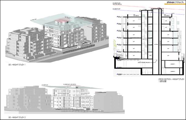
Clause 4.6 allows the consent
authority to vary development standards in certain circumstances and provides
an appropriate degree of flexibility to achieve better design outcomes. The
consent authority may grant the exception as the Secretary’s concurrence
can be assumed where clause 4.6 is adopted as per the Department of Planning
Circular PS 18-003, dated 21 February 2018.
The applicant has submitted a
written request to vary the development standard for height of buildings. Based
on various case laws established by the Land and Environment Court of NSW such
as Four2five P/L v Ashfield Council [2015] NSWLEC 9, Randwick City Council v
Micaul Holdings P/L [2016] NSW LEC7 and Zhang and Anor v Council of the City of
Ryde [2016] NSWLEC 1179, a 3 part assessment framework for a variation request
proposed under clause 4.6 has been considered and an assessment of the proposed
variance, following the 3 part test is discussed in detail below.
The 3 preconditions which must be
satisfied before the application can proceed are as follows:
1. Is
the proposed development consistent with the objectives of the zone?
Applicants Response:
The proposal satisfies the
objectives of the R4 High Density Residential zone are as follows:
“To provide for the
housing needs of the community within a high density residential
environment”
The proposed development provides
a scale and intensity that is consistent with surrounding development envisaged
for the site and surrounding area.
“To provide a variety of
housing types within a high density residential environment”
The proposed development provides
for a range of unit types in a well-designed high density residential
environment consistent with recent development in the area.
“To enable other land
uses that provide facilities or services to meet the day to day needs of
residents”
The proposed development is not
inconsistent with this objective as it does not preclude the ability for other
land uses that provide facilities or serves to be developed in the area.
“To ensure that non-residential
land uses are located in a setting that minimises impacts on the amenity of a
high density residential environment”
The proposed development has been
sited and designed to ensure it does not adversely impact on the amenity of the
surrounding high density residential environment and is consistent with the
existing and desired future character of the area.
“To encourage residential
development that maintains the amenity of the surrounding area”
The proposed development has been
sited and designed to ensure it does not adversely impact on the amenity of the
surrounding high density residential environment.
Planners Comments:
The development provides for an
appropriate mix of dwelling types in a high density residential environment and
maintains the amenity of surrounding land uses as detailed in the attached
CDCP, SEPP 65 and ADG assessment tables.
The proposed development is
considered to be consistent with the objectives of the R4 High Density
Residential zone.
2. Is
the proposed development consistent with the objectives of the development
standard which is not met?
Applicants Response:
The consistency of the proposal
against the objectives of the maximum building height standard is outlined
below:
“To establish a maximum
height of buildings to enable appropriate development density”
The proposed development provides
a scale and intensity that is consistent with surrounding development and
development envisaged for the site and surrounding area.
“To ensure that the
height of buildings is compatible with the character of the locality”
The proposed development has been
designed to ensure it is compatible with the character of the locality. The
proposed minor height variation does not result in any adverse visual or
character impacts and is not readily apparent from surrounding development or
the public domain.
“To minimise the visual
impact of development”
The proposed development has been
designed to minimise visual impacts on the surrounding area. An appropriate
composition of building elements, material textures and colours have been
utilised to reflect the buildings commercial and residential use character.
“To ensure sufficient
solar access and privacy for neighbouring properties”
DA2015/222/1 reduced the solar
compliance for 4-6 Good Street, Westmead to 12 units (60%) receiving at least 2
hours of direct sunlight between 9am and 3pm on 21 June. The proposed
development will result in the same solar access impact as DA2015/22/1 by
reducing the solar compliance for 4-6 Good Street, Westmead to 12 units (60%)
receiving at least 2 hours direct sunlight between 9am and 3pm.
The Explanation of Intended Effect
for the Draft Design and Place SEPP was publicly exhibited in February 2021.
The Draft Design and Place SEPP intends to amend the Apartment Design Guide to
increase the range of hours in which a development may achieve solar access. On
that basis, additional calculations have been provided in the solar study for
4-6 Good Street detailing solar access between 8am and 4pm on 21 June. The
extended range results in a total of 16 units (80%) at 4-6 Good Street,
Westmead receiving the minimum of 2 hours between 8am and 4pm on 21 June.
Therefore, the minor solar access
impacts are deemed to be reasonable based on the development not resulting in
an increased impact fork the development previously approved on the site by
Council and the development achieving compliance with the intended controls
under the Draft Design and Place SEPP.
The proposed height variation does
not result in any increased solar access impacts from a development
demonstrating strict compliance with the 21m height limit. Strict compliance
with the height limit would not result in reduced solar access impacts and
therefore the proposed variation is deemed to be reasonable.
Planners Comment:
The scale of the development at
six storeys is consistent with recently constructed developments adjoining the
subject site to the north and south which are six and five storeys
respectively. The development to the north was approved with a minor deviation
of the maximum permitted building height (1.2m or 5.7%). The extent of this
non-compliance is similar to the one sought by the subject application being
1.96m or 9.3%. It is further noted that construction is underway for a five
storey residential building at 11-17 Joyner Street which sits directly behind
the subject site. In this regard, the proposed development is considered to be
compatible with the character of the area which is characterised by contemporary
residential flat buildings of up to six storeys in height.
The proposed development is also
considered to be visually consistent in the streetscape as it satisfies the
design requirements of the ADG and does not pose an unreasonable amenity impact
on surrounding properties in accordance with the relevant requirements of the
CDCP, SEPP 65 and ADG.
The proposed development is
considered to be consistent with the objectives of height of buildings
development standard.
3. a) Is
compliance with the development standard unreasonable or unnecessary in the
circumstances of the case?
Applicants Response:
The proposal provides a built form
that is reflective of the future higher density-built form envisaged for the
area. The numeric increase in building height for the proposed development is
approximately 1.965m. The proposed height exceedance is deemed to be reasonable
as it involves a minimal percentage of the building volume, only relates lift
overruns and roof structures, it does not result in adverse impacts on surrounding
development and is the result of providing rooftop communal open space which
provides a better planning outcome for the site than strict compliance with the
height control.
The proposed development,
including the proposed building elements that exceed the height limits, will
continue to achieve the objectives of the standard. It is therefore considered
that the objectives of the development standard are met notwithstanding the
breach of the height of buildings standard.
Planners Comments:
It is noted that if compliance was
strictly adhered to, there would be no significant improvement with regard to
solar amenity to surrounding properties or to the visual impact of the
development from the public domain. It is further noted that only ancillary
structures of the building mass including the lift core, communal bathroom and
stairwell breach the height limit while the remainder of the building mass
remains compliant.
It is considered that strict
adherence to the height of building development standard would result in a
negligible improvement to the appearance of the building and the amenity of the
surrounding properties. Compliance with the development standard is considered
to be unnecessary in this instance.
b) Are there sufficient environmental
planning grounds to justify contravening the development standard and therefore
is the applicant’s written justification well founded?
Applicants Response:
It is our opinion that there are sufficient environmental
planning grounds to justify contravening the building height standard in this
instance. These are as follows:
· The proposed development
is consistent with the objectives of the zone and the objectives of the
building height control.
· The proposal does not
result in any adverse impacts on adjoining properties
· The height variation
only includes a minor portion of the building and is a result of providing
rooftop communal open space which provides a better planning outcome for the
site than strict compliance with the height control
· The area of exceedance
only consists of the lift overrun, a small portion of the roof space of a
toilet to facilitate the use of the rooftop communal open space, stairs and
services.
It is considered the objectives of the LEP height standard are
achieved in this instance where the proposal produces a high quality-built form
that ensures a high level of amenity for residents.
Whilst the built form exceeds the
building height control applicable to the site, it is considered that the
proposed design does not unreasonably detract from the amenity of adjacent
residents or the existing quality of the environment as demonstrated in
architectural plans prepared by Zhinar Architects.
Strict compliance with the
building height development standard would result in a development that does
not achieve the desired development density for the site, reduces residential
amenity through the removal of rooftop communal open space and would be
inconsistent with the desired future character of the area.
Planners Comment:
The variation of 1.96m or 9.3% is
considered minor and it is acknowledged that the part of the building which
exceeds the height limit constitutes a small proportion of the overall building
mass. It is noted that the development as proposed does not result in an
unreasonable amenity impact by way of privacy, overshadowing or visual impact
to the immediately surrounding properties. The applicant’s justification
is therefore considered to be well founded.
Conclusion:
Council is satisfied that the
applicant’s written request has adequately addressed the matters required
to be demonstrated by clause 4.6 subclause (3). Council is further satisfied
that the proposed development will be in the public interest because it is
consistent with the objectives of the particular standard and the objectives
for development within the zone in which the development is proposed to be
carried out.
It is the view of Council Officers
that justification provided is satisfactory and having considered the
application on its merit, the exception to the maximum building height
development standard is considered acceptable in this instance.
The provisions of any
Development Control Plans (EP&A Act s4.15 (1)(a)(iii))
The Cumberland DCP 2021 (CDCP) is
in force as of 5 November 2021. The subject development application was lodged
on 20 December 2021 and as such is subject to the requirements of the CDCP.
The CDCP provides guidance for the
design and operation of development to achieve the aims and objectives of the
CLEP.
A comprehensive assessment and
compliance table is contained in Attachment 7.
The following table highlights
non-compliances with the CDCP at Part B – Development in Residential
Zones, which relate primarily to building setbacks, and housing mix. The variations
sought are considered satisfactory on merit in this instance:
Figure
9 – CDCP Compliance Table
|
Clause
|
Control
|
Proposed
|
Complies
|
|
Part B1
3.1 Building envelope
|
C2. Rear setback
30% of the length of the site.
(30% of 40.31m)
For 5 storeys and higher = 12m (min)
|
9m
|
No but considered acceptable on merit.
|
|
Part B1
3.2 Basement design
|
C3. Basement walls shall have a minimum setback of 1.2n
from side boundaries.
|
1m to the southern side setback
|
No but acceptable on merit.
|
|
Part B5, Clause 2.1
Adaptable housing
|
More than 20 dwellings requires 20% adaptable units
|
16.21% (5 units)
|
28.57%
|
|
Part B5
2.2 Housing mix
|
C1. A 10% dwelling mix of 1 bedroom and 3 bedroom units is
10%.
|
6.4% of 1 bedroom and 6.4% of 3 bedroom units
|
No but acceptable on merit.
|
Irrespective
of these departures, it is considered that the proposal performs adequately
from an environmental planning viewpoint and may be supported for the reasons
discussed below:
Part B1
- Clause
3.1 Building envelope, C2
Rear setback of building envelope
Council’s comment: It is
noted that the Apartment Design Guide (ADG) permits a minimum rear setback of
9m for upper levels which takes precedence over Council’s control.
Notwithstanding this is considered acceptable noting it provides articulation
and visual relief to the upper levels of the building. In addition, the
proposed articulation and setback is generally consistent with the approved
developments on the adjoining sites.
- Clause
3.2 Basement design, C3
Side setback of basement levels
Council’s comment: Some
landscaping is provided along the front and rear parts of the setback area
which provides adequate visual amenity to the neighbouring site and from the
public domain. The non-compliance is also considered to be minor at 20cm. On
this basis, the non-compliance is considered to be acceptable on merit.
Part B5
- Clause
2.1 Adaptable housing, C1
Provision of adaptable dwellings
Council’s comment: The
development proposes five (5) adaptable units. This equates to a deficiency of
two (2) units or 28.57%. The non-compliance is supportable on the basis that at
least 20% of the units must achieve compliance with the Livable Housing
Guideline's silver level universal design features as a condition of consent.
Therefore, despite the minor deviation, the development will still achieve the
intent of the control by providing an adequate number of dwellings that can be
made to cater for the disabled, the elderly and families with young children.
- Clause
2.2 Housing mix, C1
Dwelling mix
Council’s comment:
Notwithstanding the non-compliance, a broad range of apartment types is
provided which includes 1, 2 and 3 bedroom units. This satisfies the intent of
the control, being the provision of a wide variety of dwelling types in the area.
It is further noted that the recently constructed RFB developments adjoining
the subject site were approved with more significant deviations to apartment
mix. 14-18 Good Street was approved with only 2.6% and 7.9% of 1 bedroom and 3
bedroom units respectively. On this basis, the deviations are considered to be
acceptable on merit.
The provisions of any planning
agreement that has been entered into under section 7.4, or any draft planning
agreement that a developer has offered to enter into under section 7.4 (EP&A
Act s4.15(1)(a)(iiia))
There is no draft planning
agreement associated with the subject Development Application.
The provisions of the
Regulations (EP&A Act s4.15 (1)(a)(iv))
The proposed development raises no
concerns as to the relevant matters arising from the Environmental Planning and
Assessment Regulations 2000 (EP&A Reg).
The Likely Environmental,
Social or Economic Impacts (EP&A Act s4.15 (1)(b))
It is considered that the proposed
development will have no significant adverse environmental, social or economic
impacts in the locality.
The suitability of the site for
the development (EP&A Act s4.15 (1)(c))
The subject site and locality is
not known to be affected by any natural hazards or other site constraints
likely to have a significant adverse impact on the proposed development.
Accordingly, it is considered that the development is suitable in the context
of the site and surrounding locality.
Submissions made in accordance
with the Act or Regulation (EP&A Act s4.15 (1)(d))
|
Advertised (Council Website)
|
Mail
|
Sign
|
Not Required
|
In
accordance with Council’s Notification requirements contained within the
Cumberland DCP 2021, the proposal was publicly notified for a period of 14 days
between 25 February 2022 and 11 March 2022. The notification generated
two (2) submissions in respect of the proposal with none declaring a political
donation or gift. The issues raised in the public submissions are summarised
and commented on as follows:
Figure
10 – Submissions summary table
|
Issue
|
Planner’s Comment
|
|
Inappropriate density
|
The development proposes a total of 31 residential units
which is consistent with the immediately adjacent developments to the north
(14-18 Good Street), the south (4-6 Good Street) and west (11-17 Joyner
Street) which comprise dwelling yields of 38, 20 and 46 respectively.
As detailed throughout this report, the bulk and scale and
dwelling yield of the development is generally compliant with the relevant
provisions and controls of CLEP, CDCP, SEPP 65 and the ADG.
The proposal is considered to be of an appropriate density
noting the existence of similar density RFB development in the area.
|
|
Lack of on-street parking
|
The development provides sufficient onsite parking within
two basement levels that satisfies the relevant objectives and controls of
the Cumberland Development Control Plan 2021, State Environmental Planning
Policy No. 65 – Design Quality of Residential Apartment Development
and the Apartment Design Guide.
Specifically, the development is able to provide
sufficient numbers of resident and visitor parking to satisfy clause 3 of
Part G3 of CDCP as follows:
|
Type of space
|
Required
|
Proposed
|
Approved
|
|
Resident
|
32
|
34
|
33
|
|
Visitor
|
8
|
7
|
8
|
It is further noted that a traffic report was submitted
with the application to determine the parking implications of the proposal.
Council’s Engineer has assessed the report and has raised no objection
to the provision of onsite parking.
On this basis, it is considered that the development will
not pose a significantly detrimental impact on the availability of on-street
parking in the area.
|
The public interest (EP&A
Act s4.15(1)(e))
In view of the foregoing analysis
it is considered that the development, if carried out subject to the conditions
set out in the recommendation below, will have no significant adverse impacts
on the public interest.
Cumberland Local
Infrastructure Contributions Plan 2020
The development would require the
payment of contributions in accordance with Cumberland Local Infrastructure
Contributions Plan 2020.
In accordance with the
Contribution Plan a contribution is payable, pursuant to Section 7.11 of the
EP&A Act, calculated on the cost of works. A total contribution of
$450,143.00 would be payable prior to the issue of a Construction Certificate.
Disclosure of Political
Donations And Gifts
The applicant and notification
process did not result in any disclosure of Political Donations and Gifts.
The development application has
been assessed in accordance with the relevant requirements of the Environmental
Planning and Assessment Act 1979, State Environmental Planning Policy
(Resilience and Hazards) 2021, Statement Environmental Planning Policy No. 65 -
Design Quality of Residential Apartment Development, State Environmental
Planning Policy (Transport and Infrastructure) 2021, State Environmental
Planning Policy (Biodiversity and Conservation) 2021, State Environmental Planning
Policy (Building Sustainability Index: BASIX) 2004, Cumberland LEP 2021 and
Cumberland DCP 2021 and is considered to be satisfactory for approval subject
to conditions.
The proposed development is
appropriately located within the R4 High Density Residential zone under the
relevant provisions of the Cumberland LEP 2021. The proposal is generally
consistent with all statutory and non-statutory controls applying to the
development. Minor non-compliances with Council’s controls have been
discussed in the body of this report. The development is considered to perform
adequately in terms of its relationship to its surrounding built and natural
environment, particularly having regard to impacts on adjoining properties.
For these reasons, it is
considered that the proposal is satisfactory having regard to the matters of
consideration under Section 4.15 of the Environmental Planning and Assessment
Act 1979, and the development may be approved subject to conditions.
There are no consultation processes
for Council associated with this report.
There are no financial
implications for Council associated with this report.
There are no policy implications
for Council associated with this report.
Communication /
Publications:
The final outcome of this matter
will be notified in the newspaper. The objectors will also be notified in
writing of the outcome.
|
1. That
the applicant’s written request to contravene the development standard
relating to height as contained within Clause 4.3 of the Cumberland Local
Environmental Plan 2021 be supported.
2. Development
Application No. DA2021/0682 for construction of a six storey Residential Flat
Building comprising 31 units with two levels of basement parking and
associated works on land at 8-12 Good Street WESTMEAD NSW 2145 be approved by
Deferred Commencement subject to conditions as recommended in Council’s
assessment report.
3. Persons
whom have lodged a submission in respect to the application be notified of
the determination of the application.
|
1. Draft Notice
of Determination
2. Clause
4.6 Variation Request
3. Architectural
Plans
4. Submissions
Received
5. SEPP
65 and ADG Assessment
6. Cumberland
Local Environmental Plan 2021 Assessment
7. Cumberland
Development Control Plan 2021 Assessment
8. Draft
Reasons for Recommendation
DOCUMENTS
ASSOCIATED WITH
REPORT LPP039/22
Attachment 1
Draft Notice of Determination
Cumberland Local Planning Panel Meeting
13 July 2022
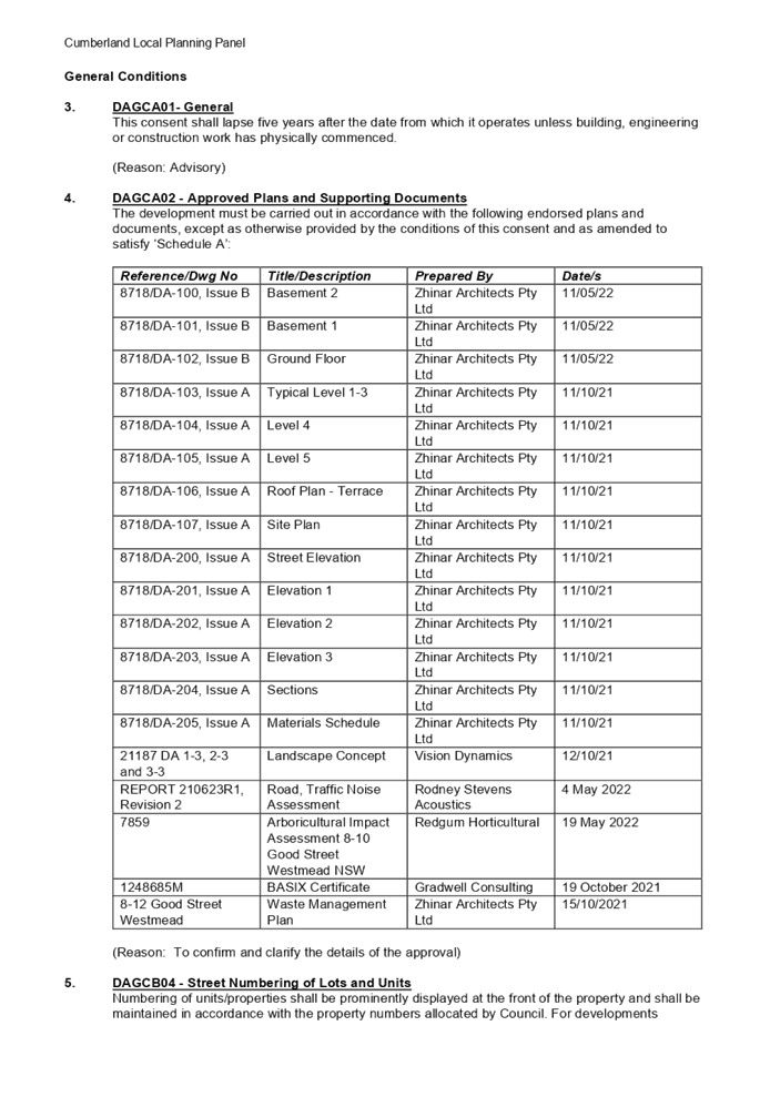
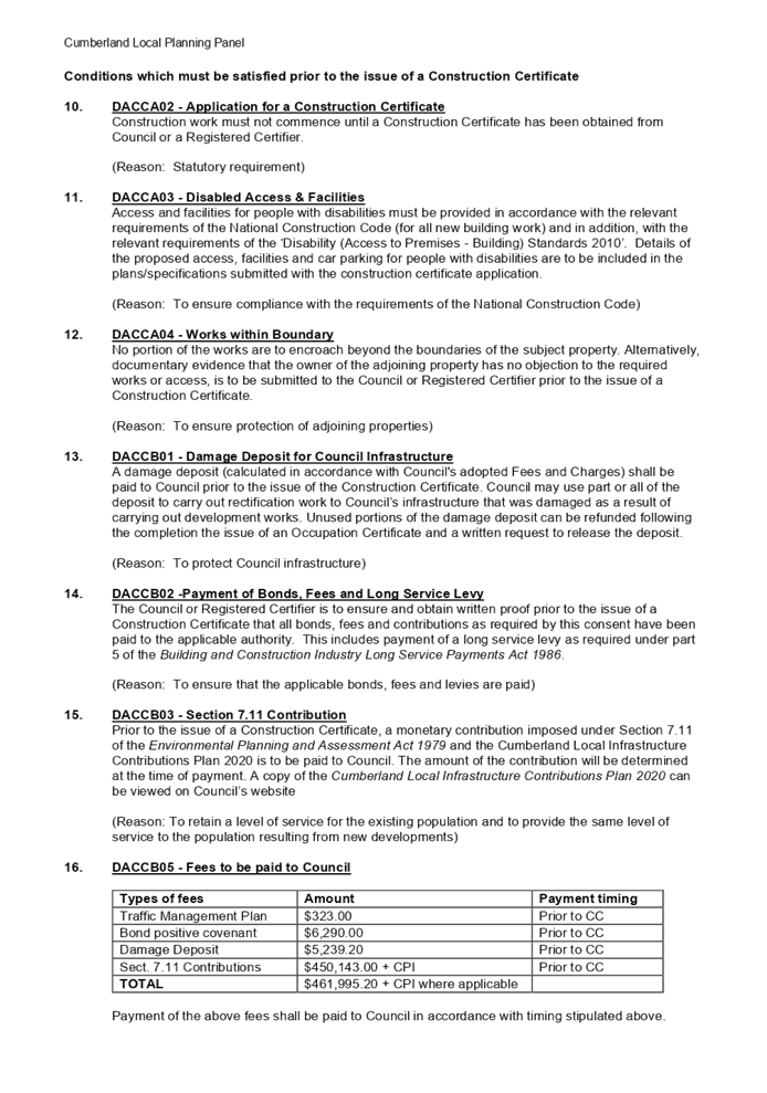



DOCUMENTS
ASSOCIATED WITH
REPORT LPP039/22
Attachment 2
Clause 4.6 Variation Request
Cumberland Local Planning Panel Meeting
13 July 2022
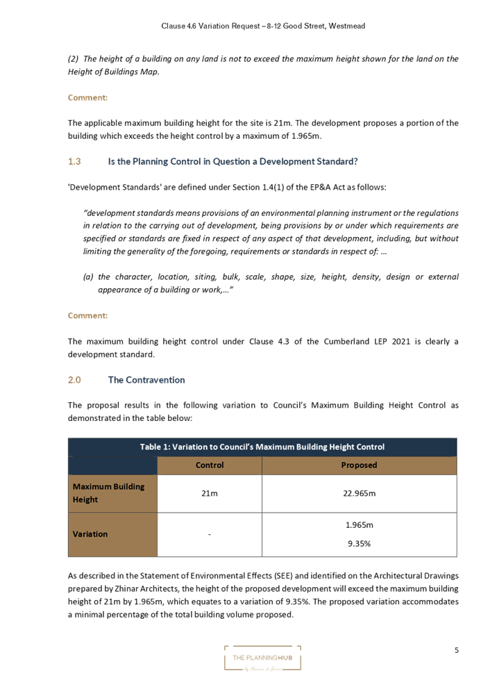
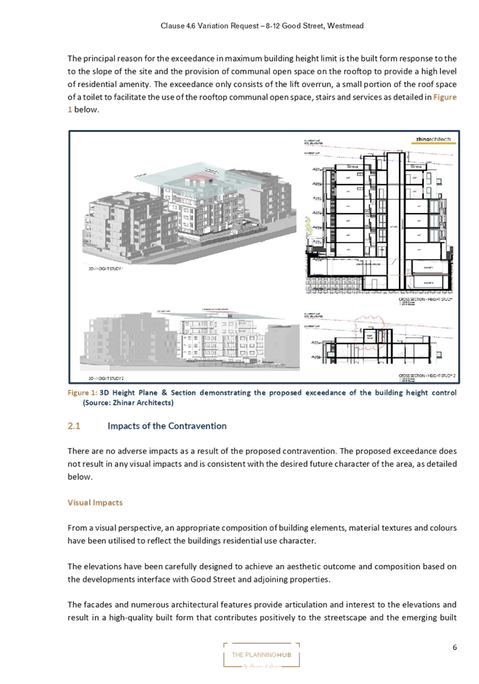
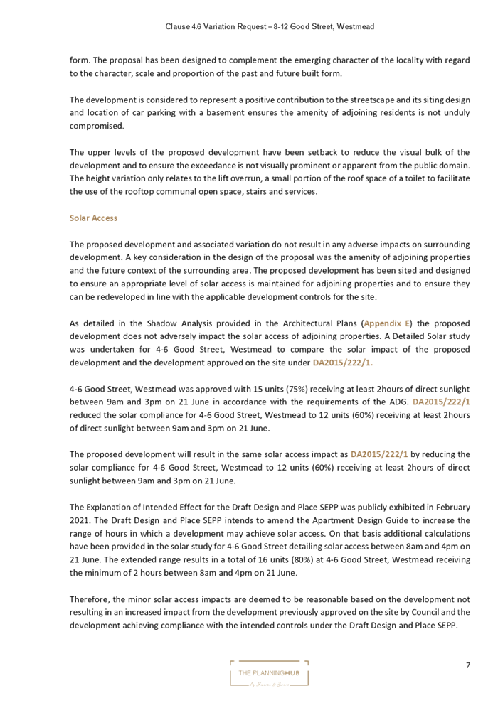
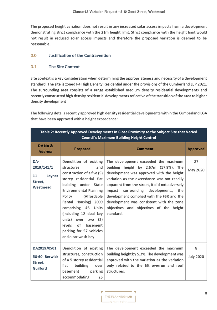
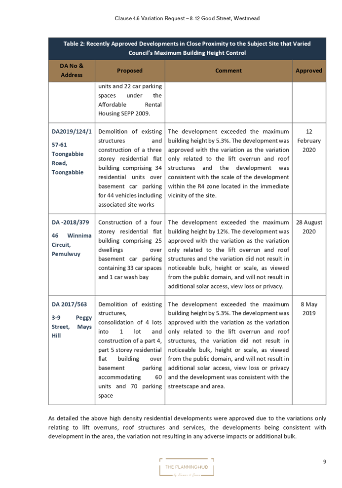
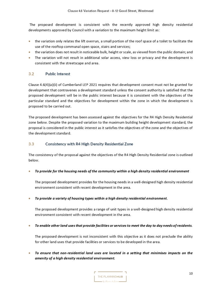
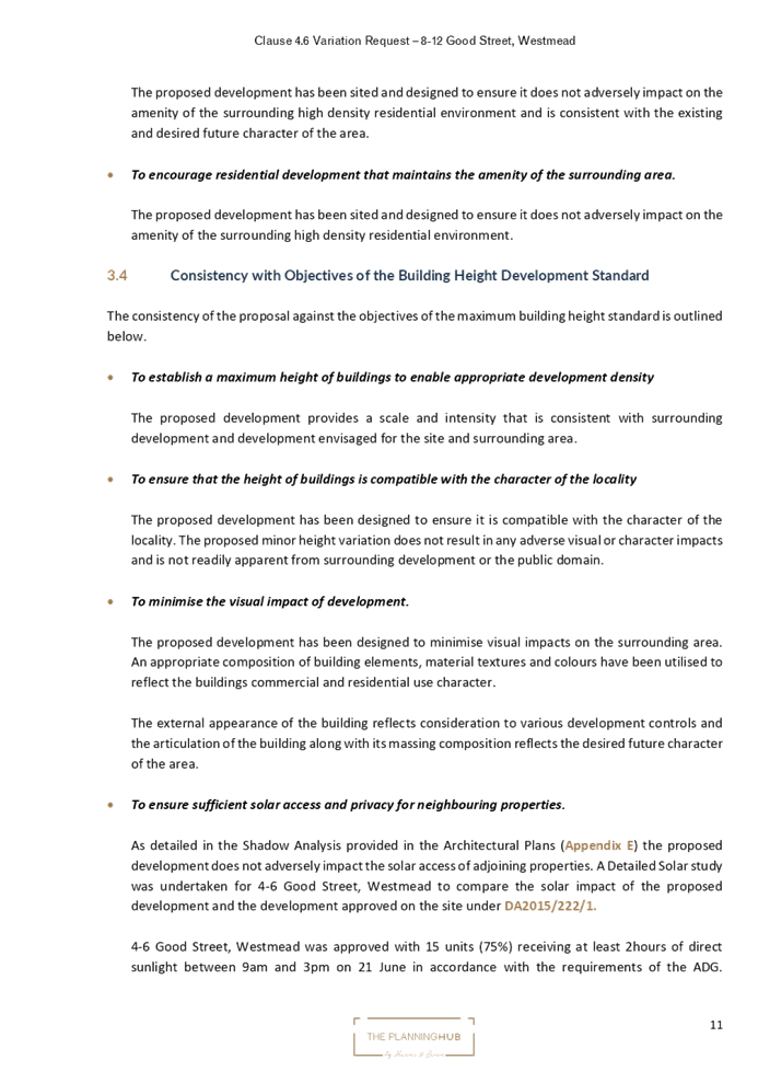
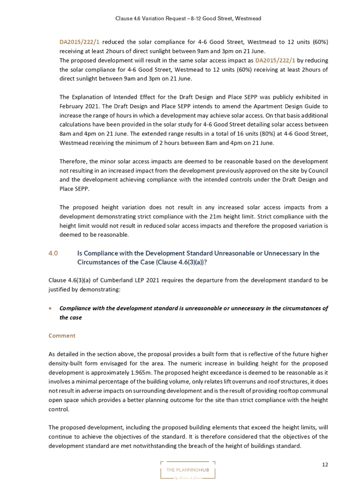
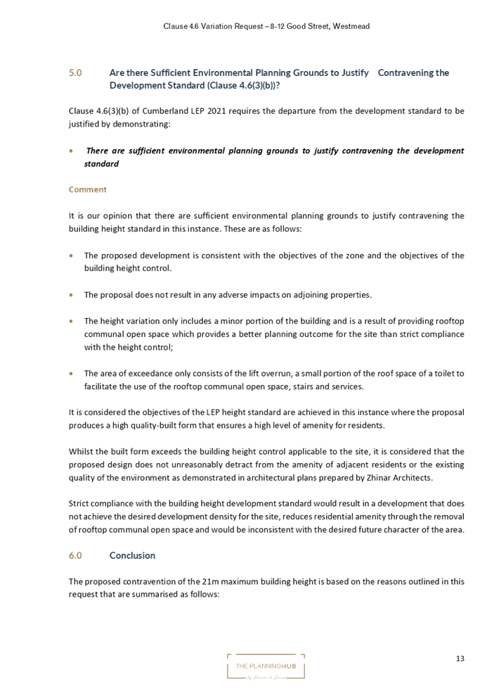

DOCUMENTS
ASSOCIATED WITH
REPORT LPP039/22
Attachment 3
Architectural Plans
Cumberland Local Planning Panel Meeting
13 July 2022
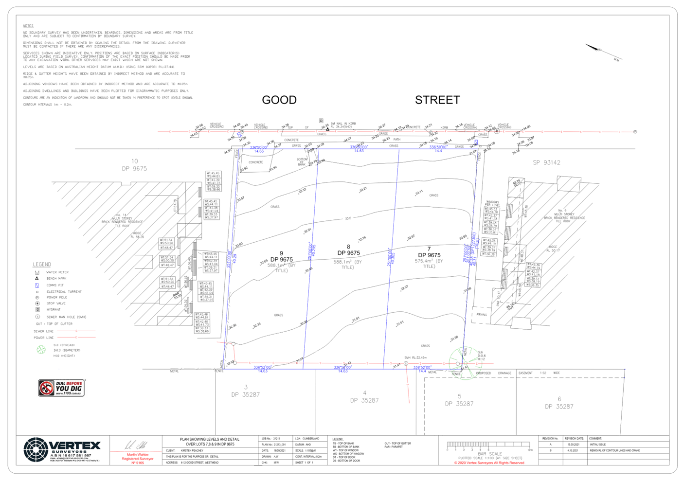
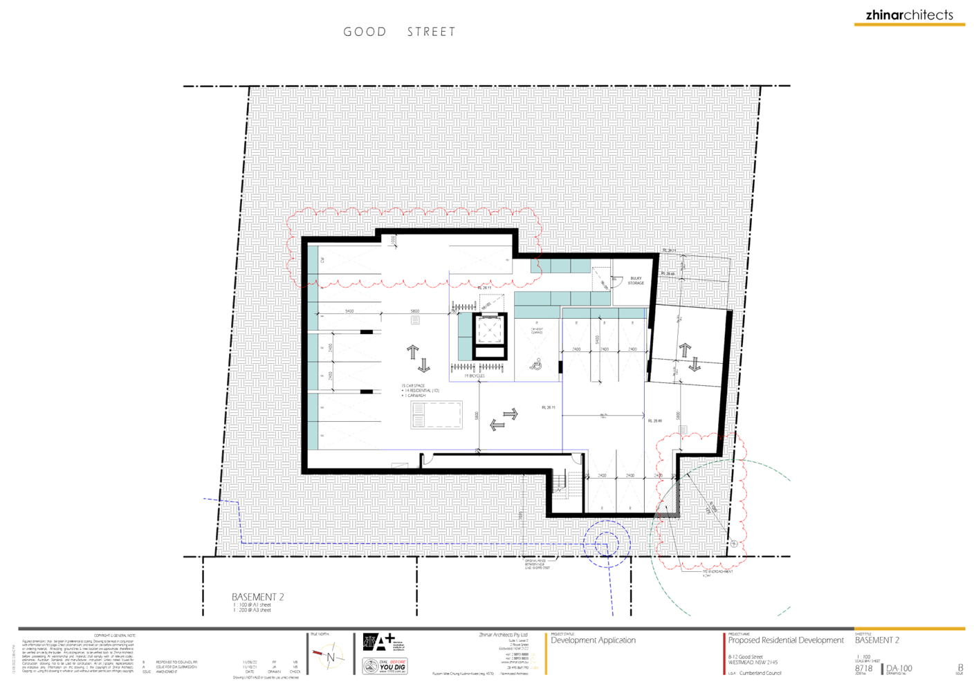
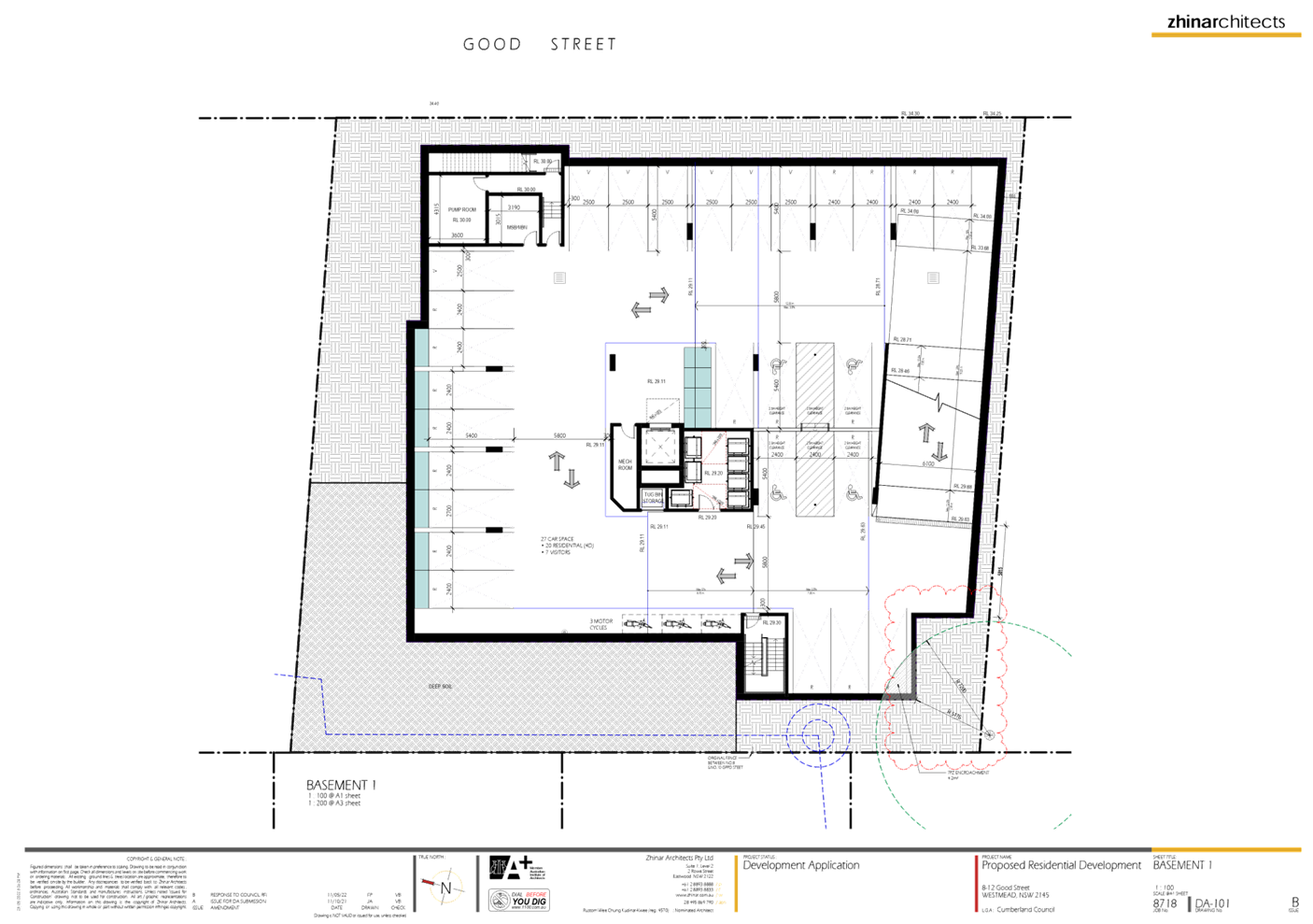
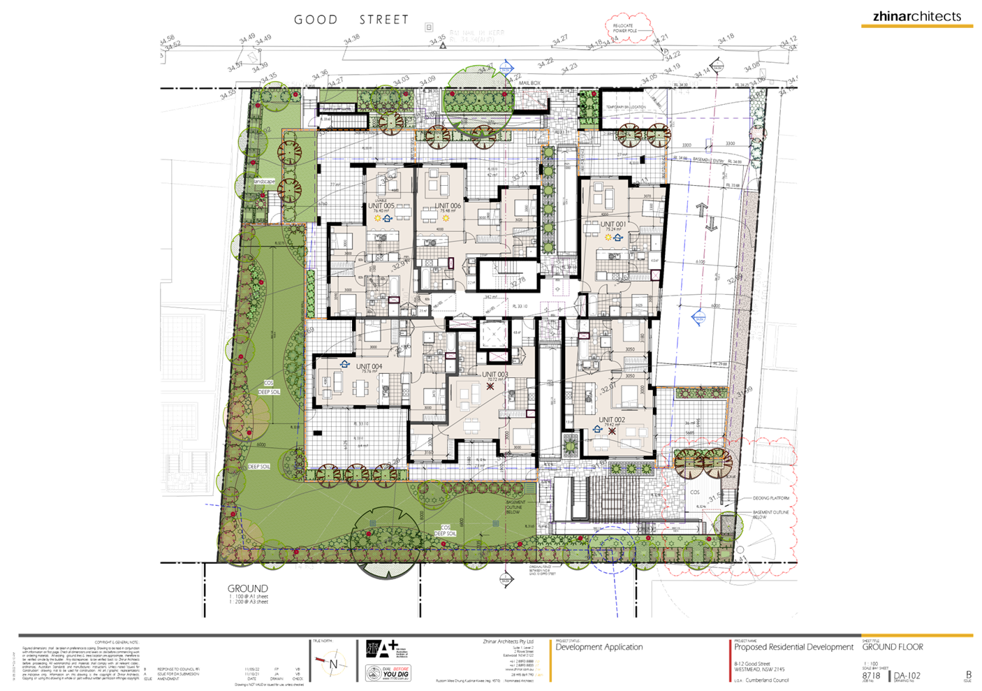
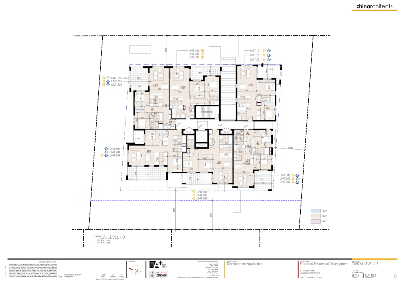
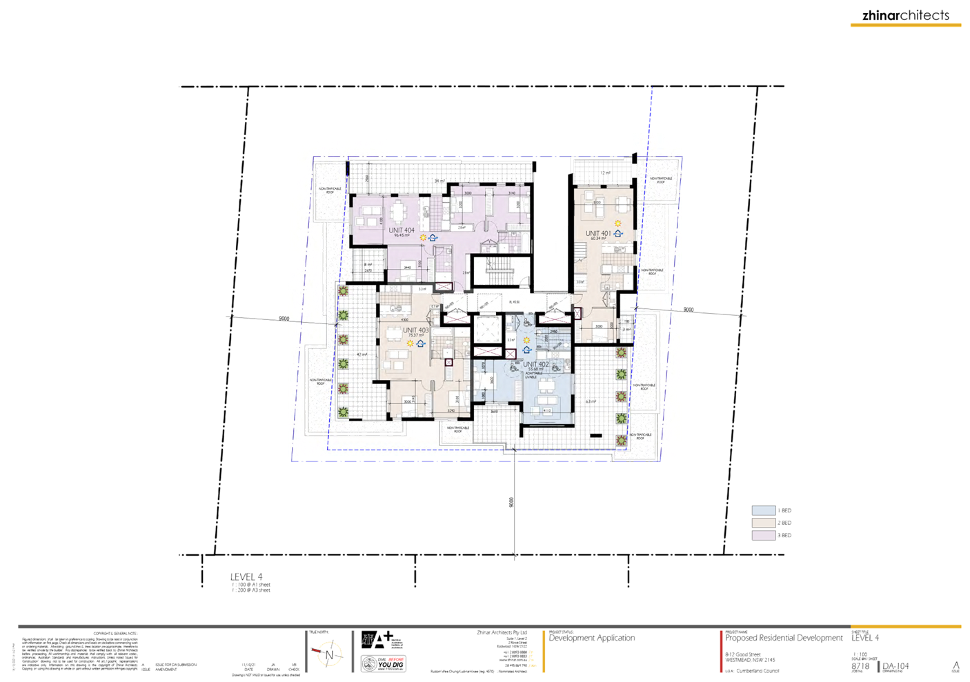
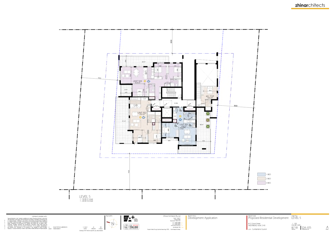
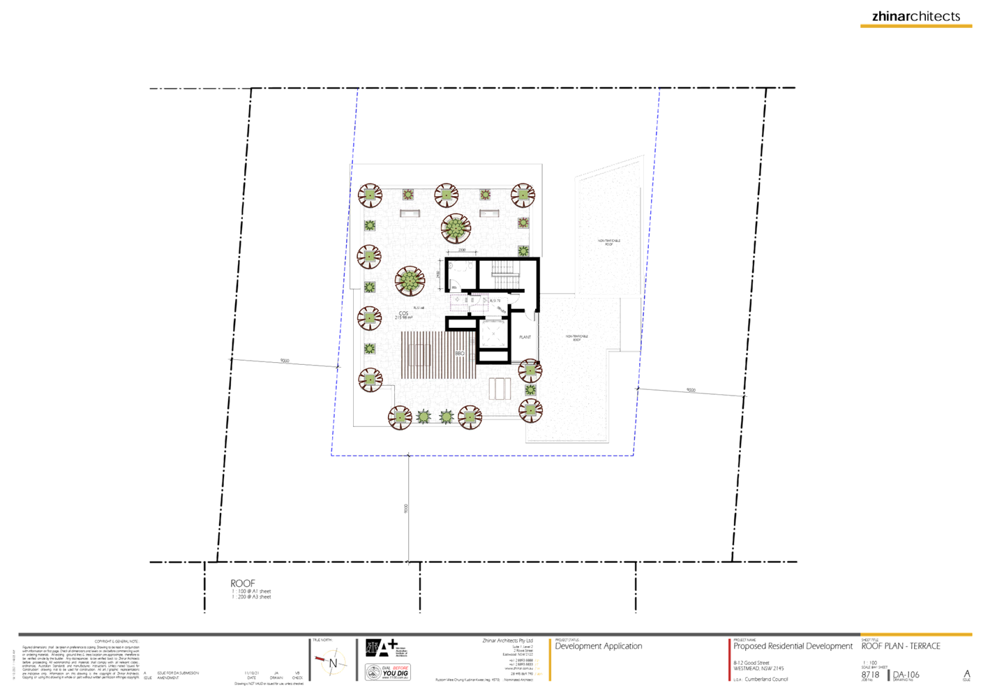
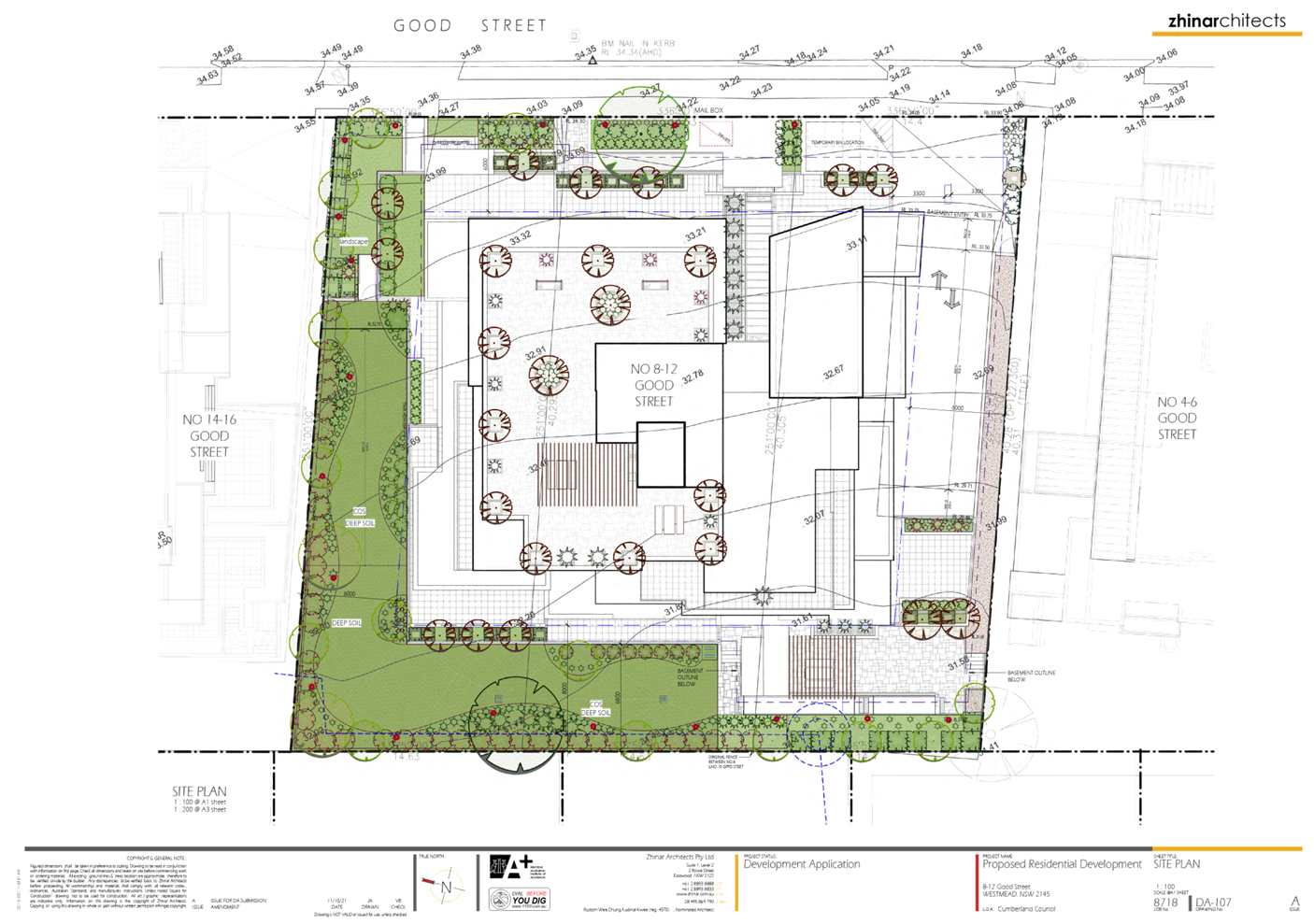
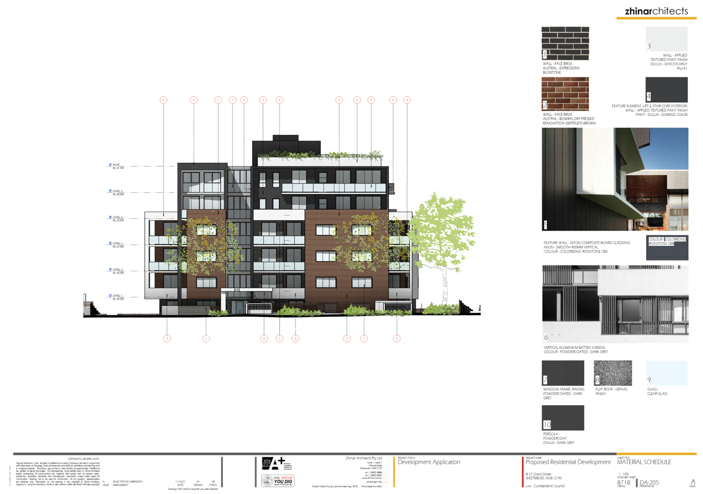
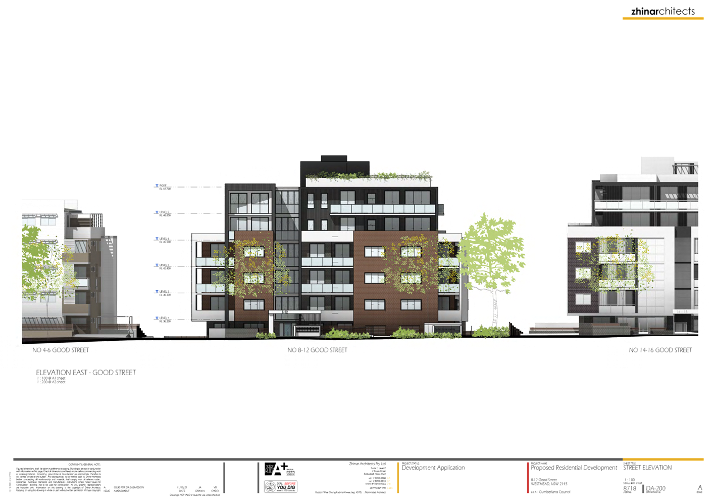
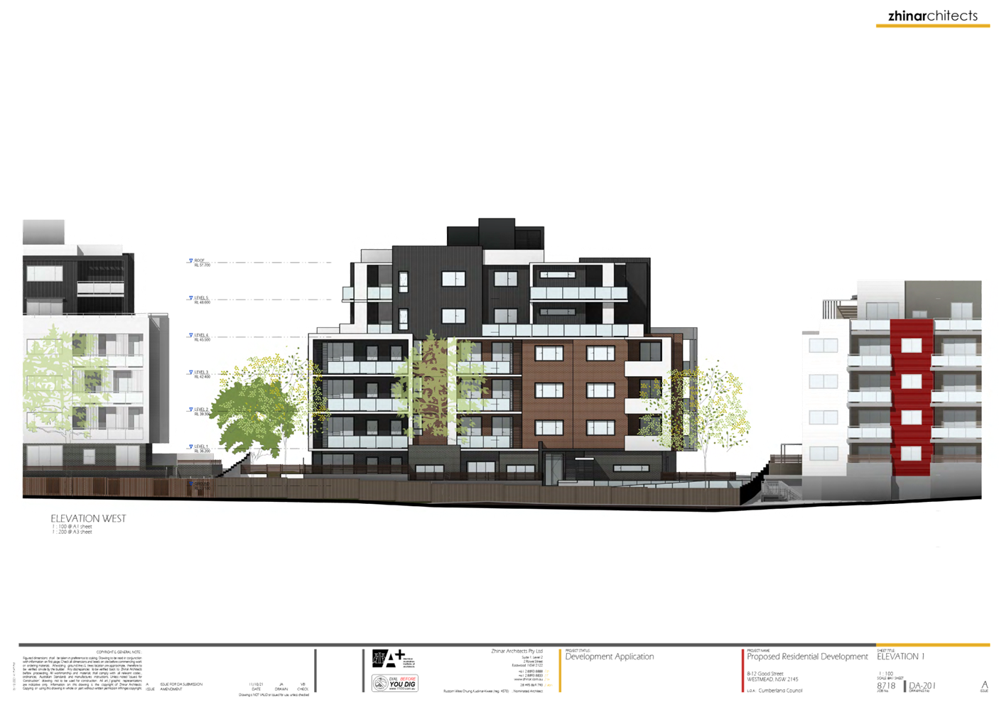
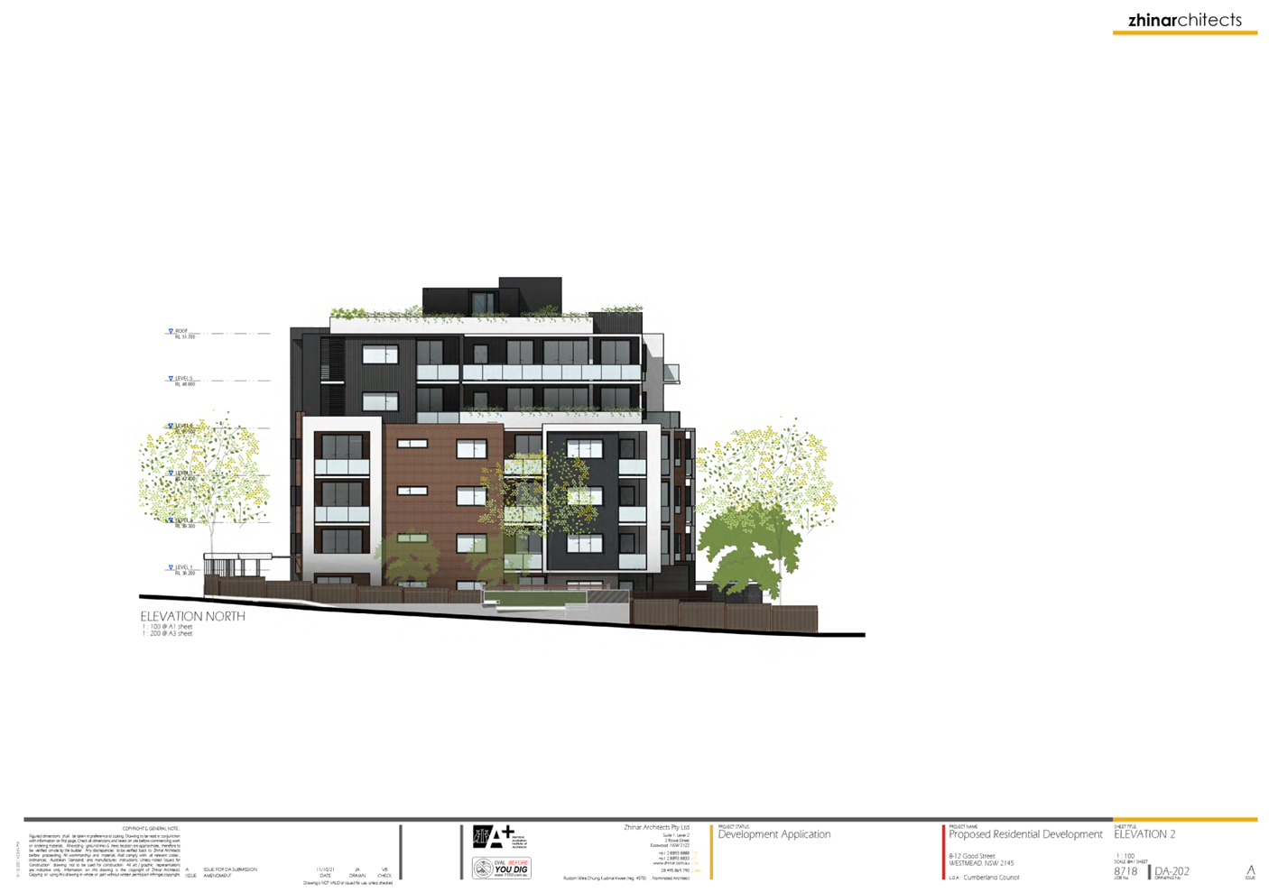
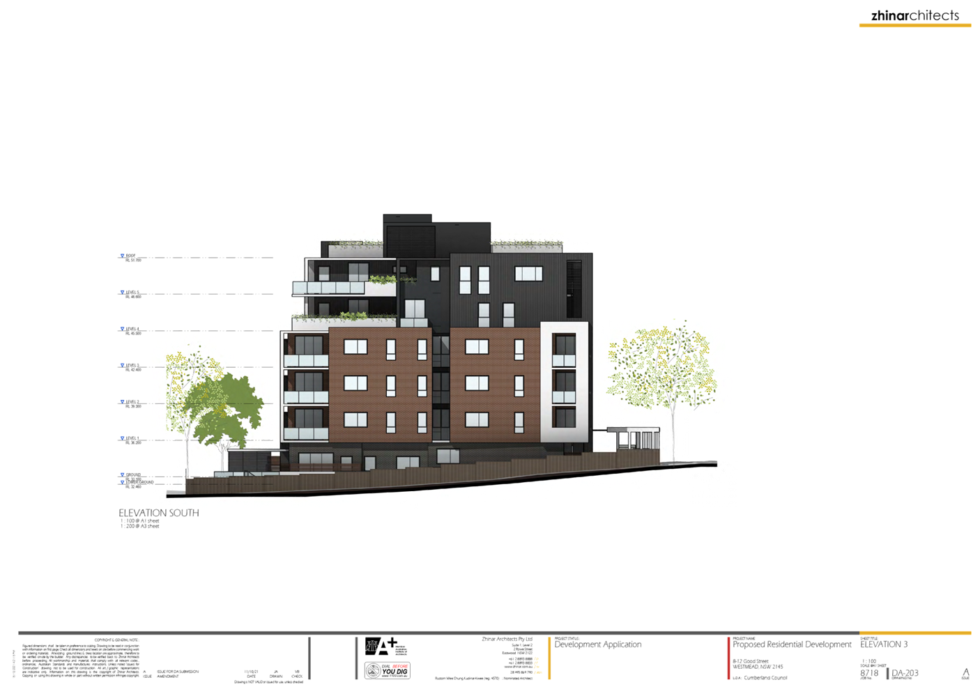
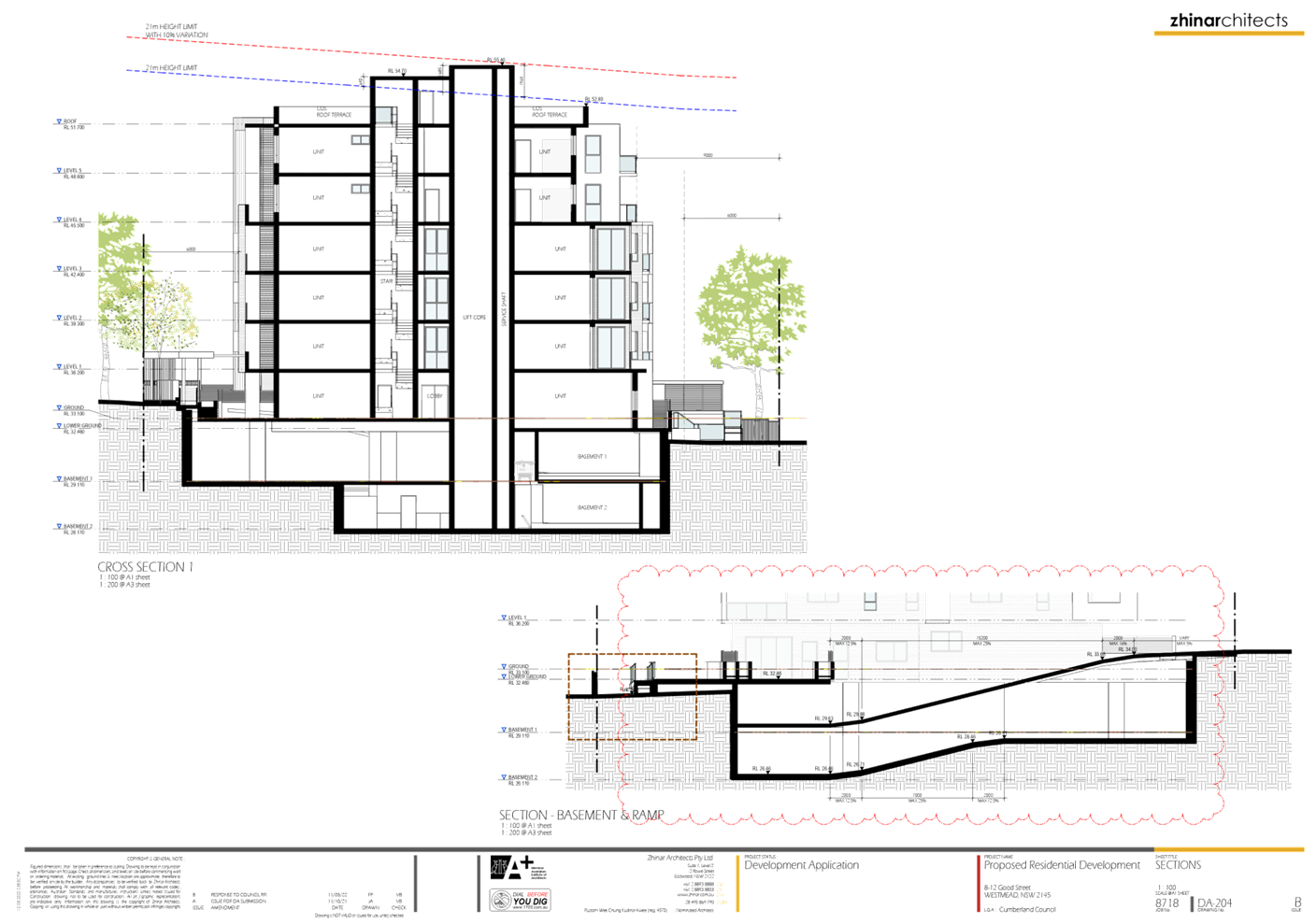
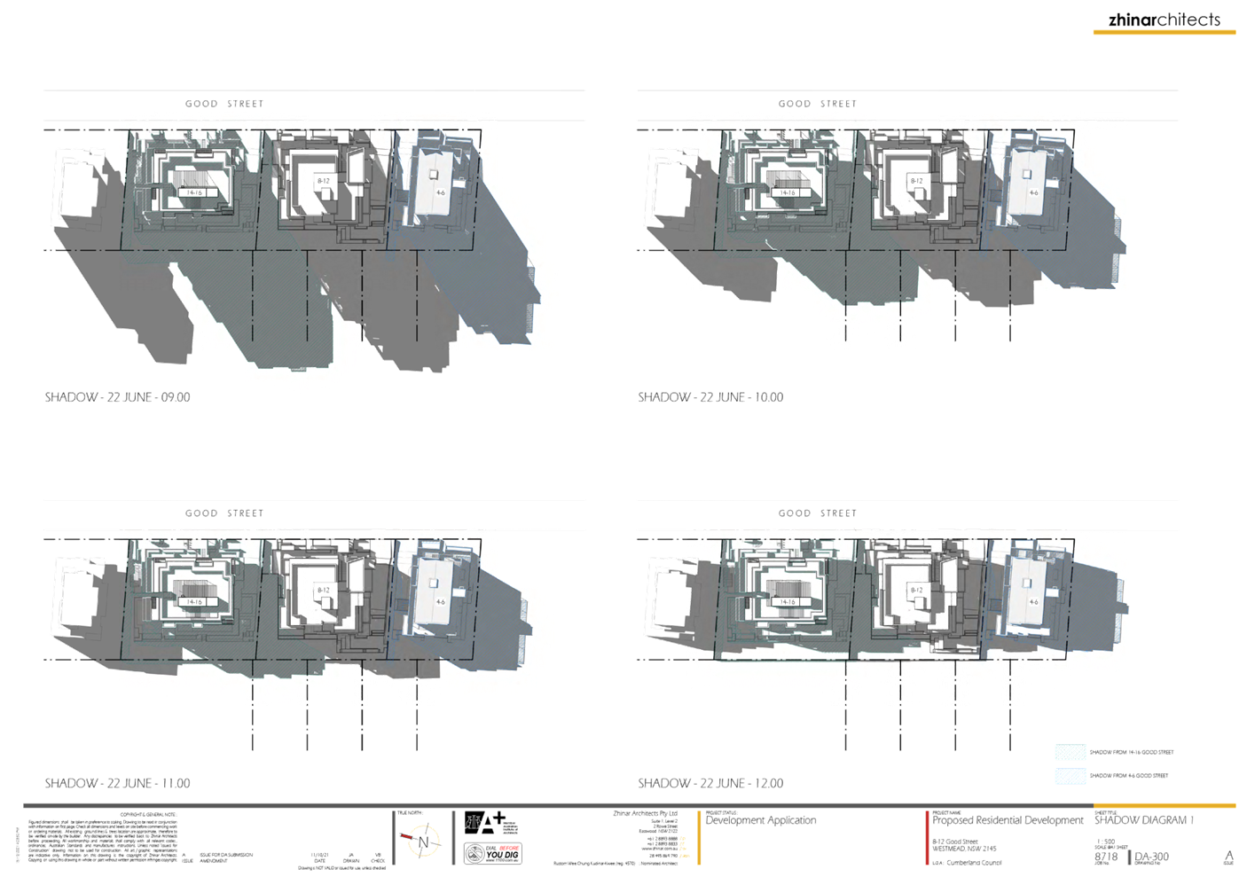
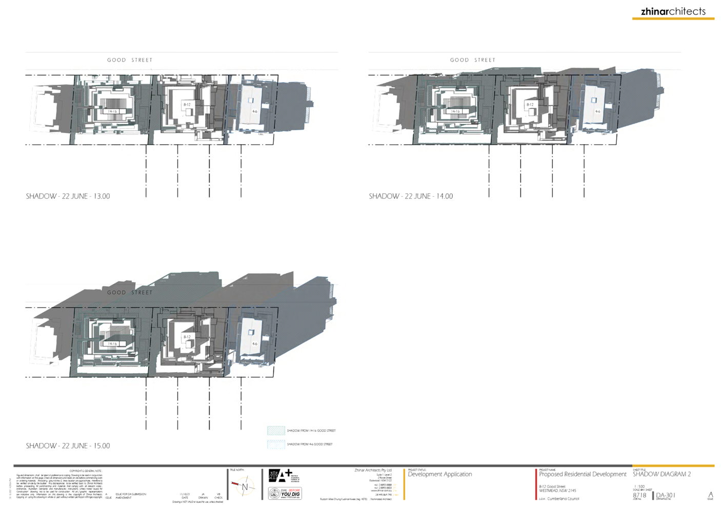
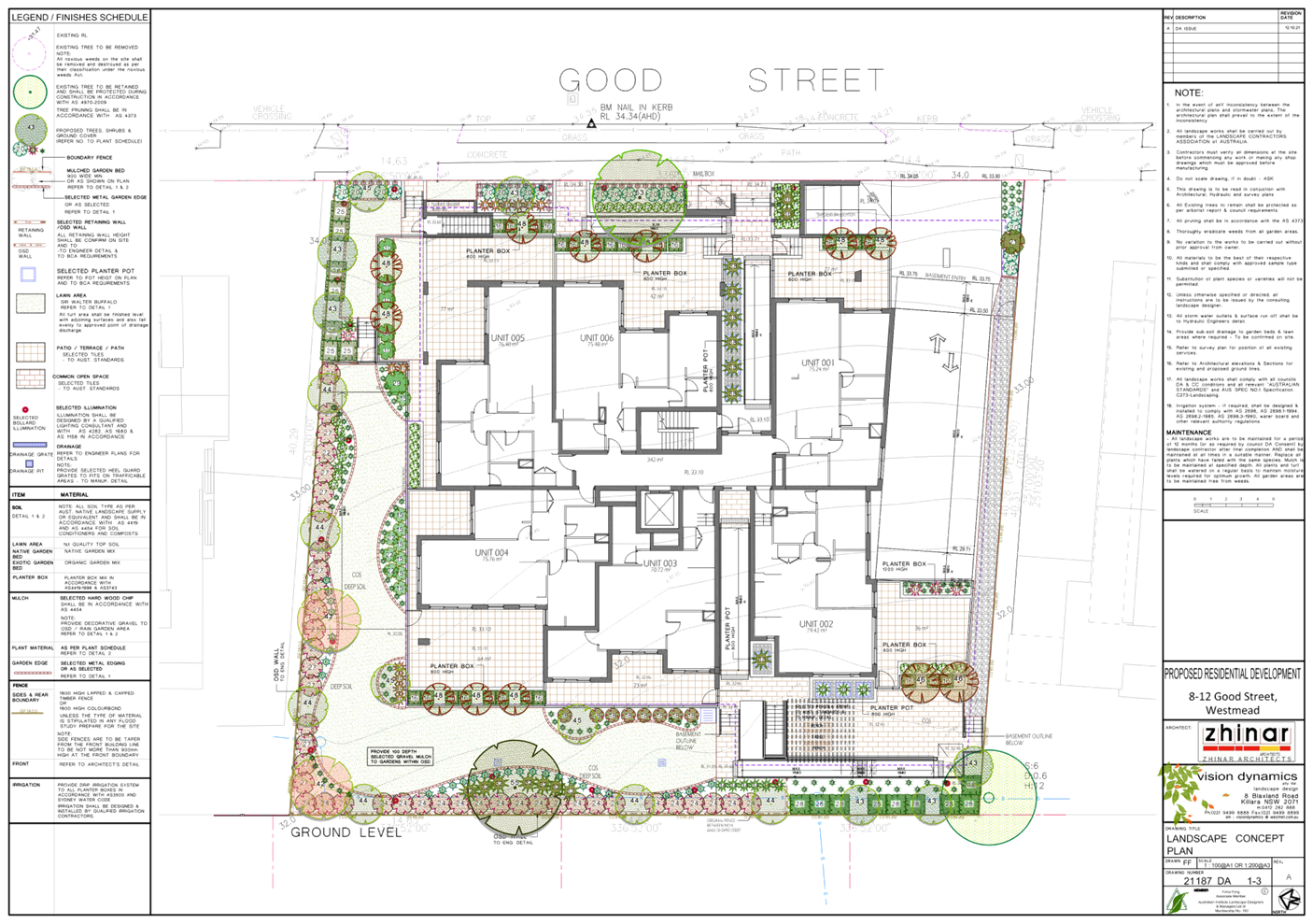
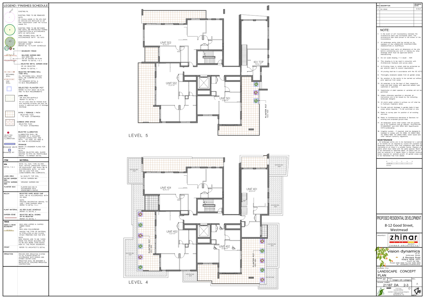
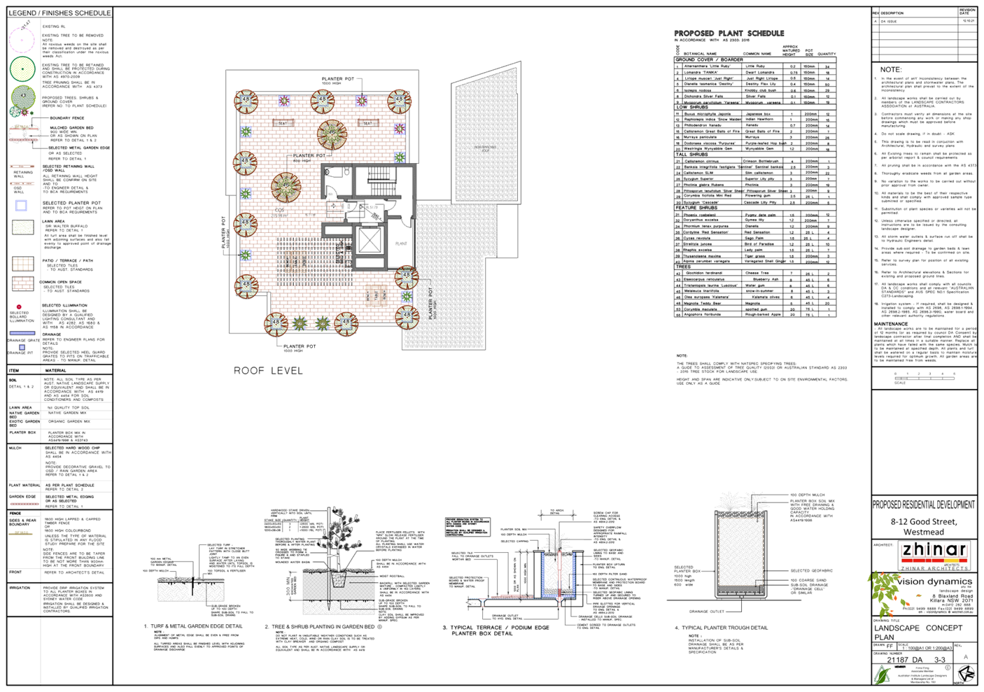
DOCUMENTS
ASSOCIATED WITH
REPORT LPP039/22
Attachment 4
Submissions Received
Cumberland Local Planning Panel Meeting
13 July 2022
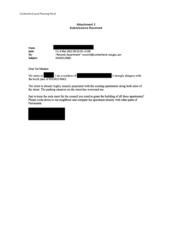

DOCUMENTS
ASSOCIATED WITH
REPORT LPP039/22
Attachment 5
SEPP 65 and ADG Assessment
Cumberland Local Planning Panel Meeting
13 July 2022
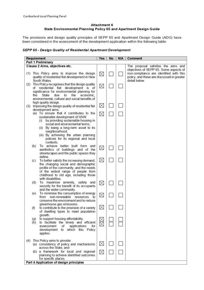
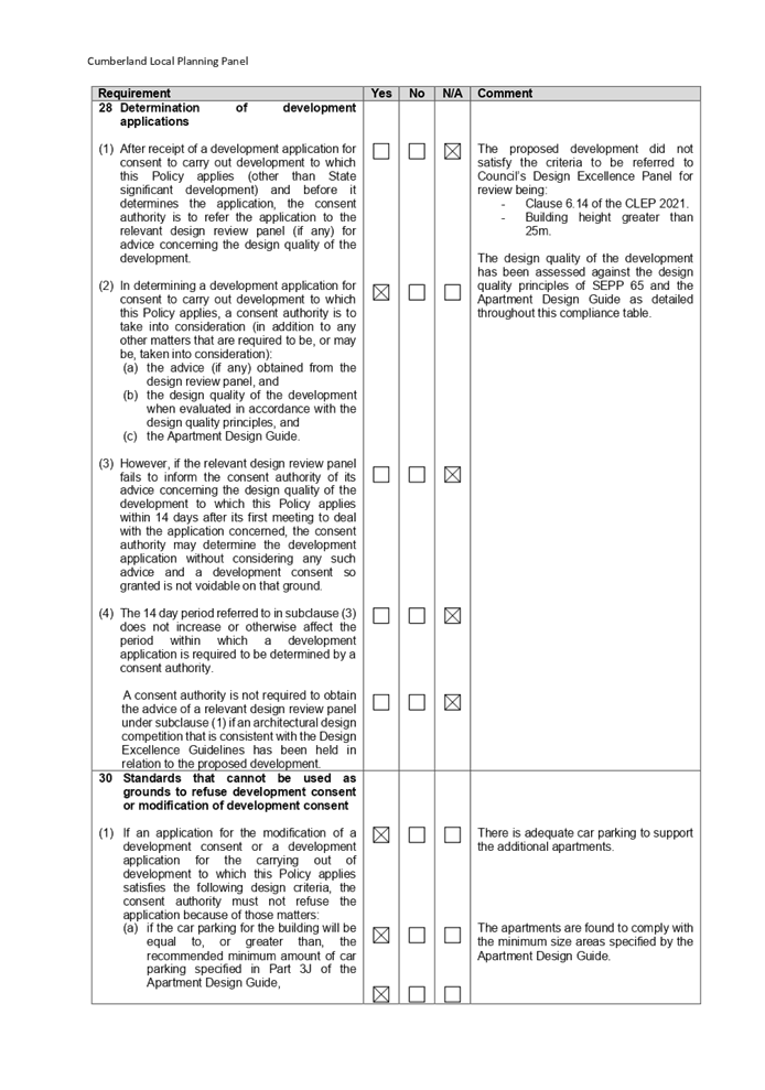
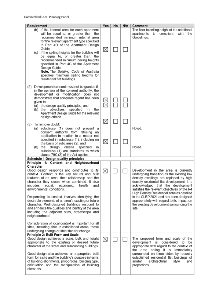
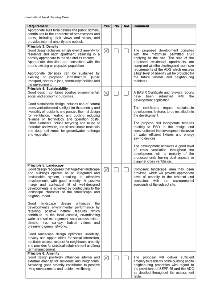
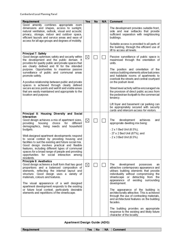
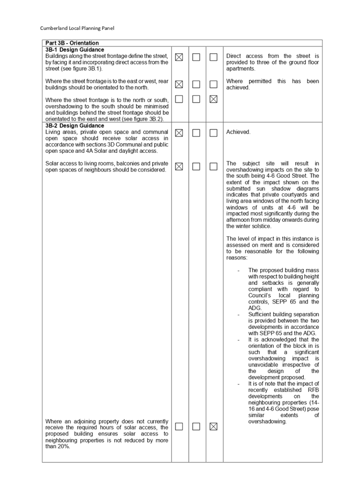
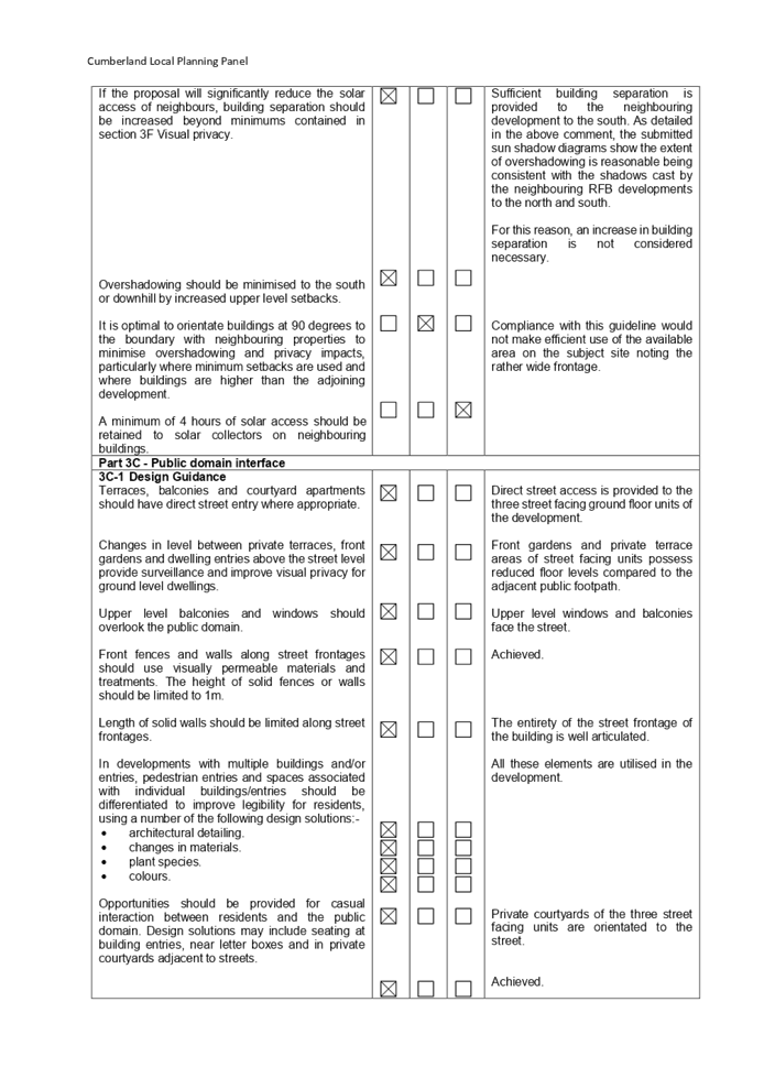
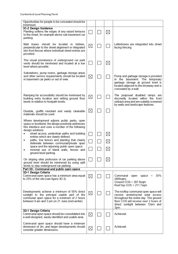
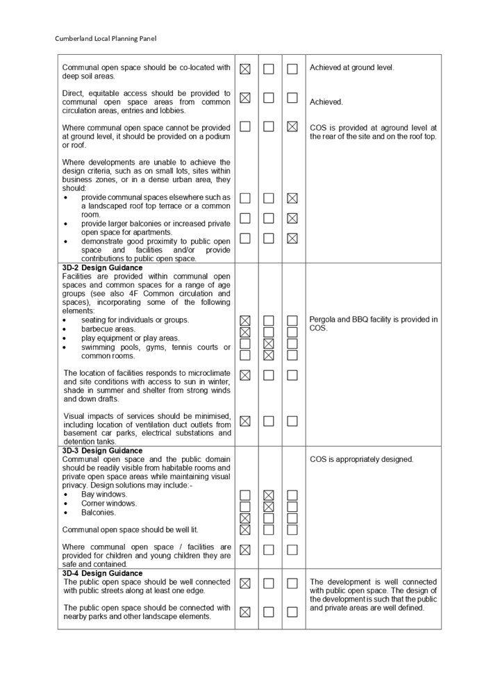
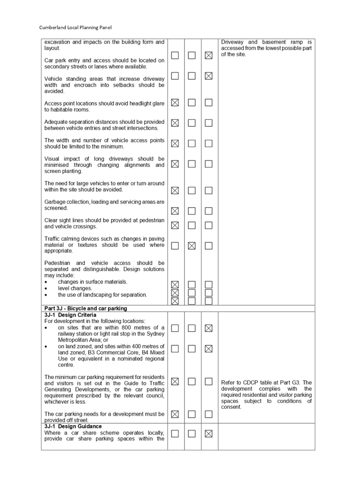
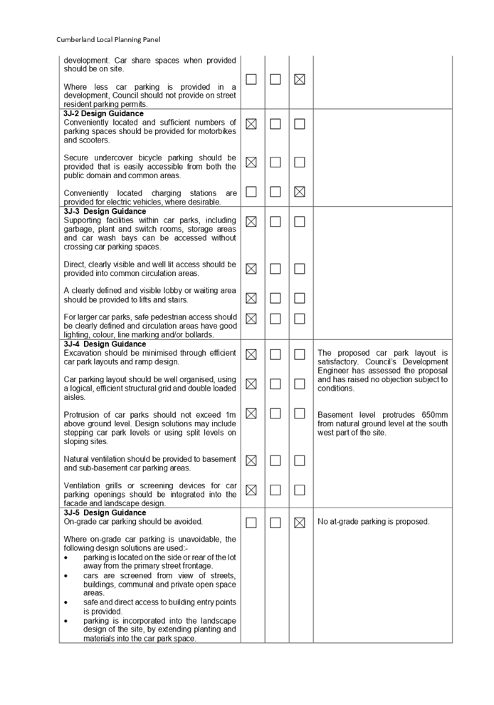
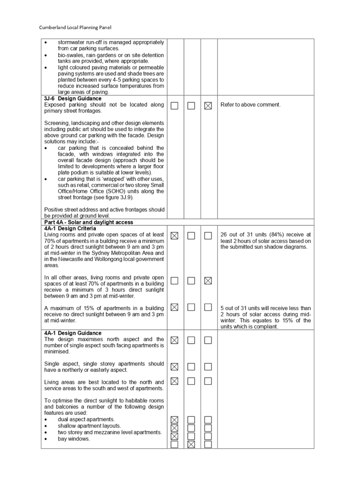
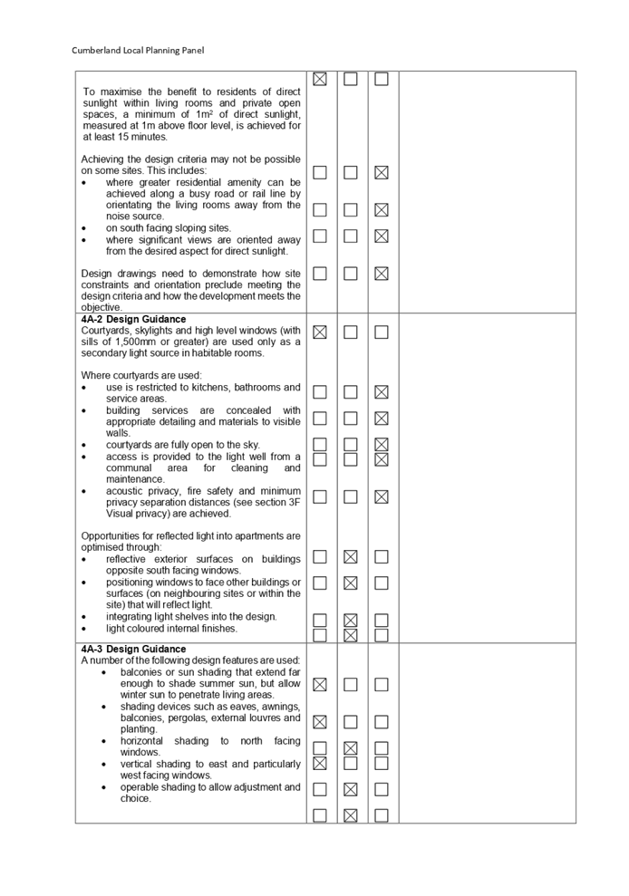
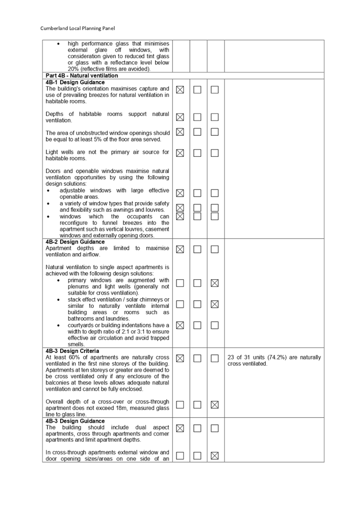
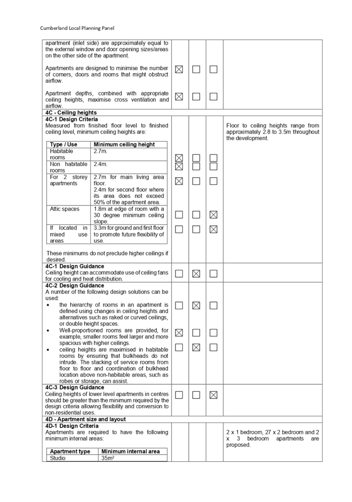
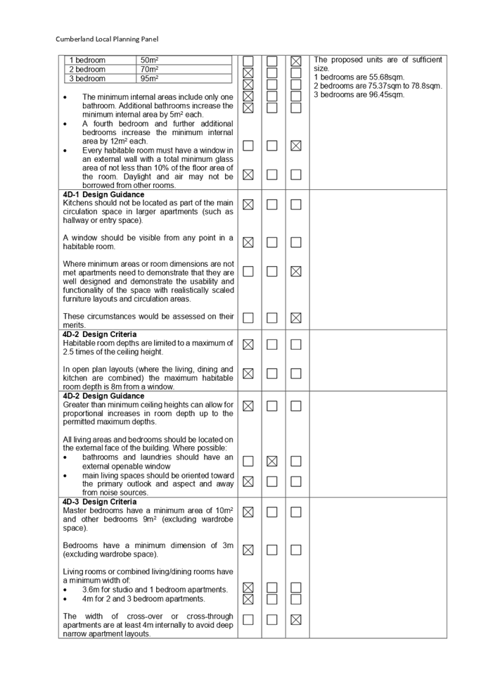
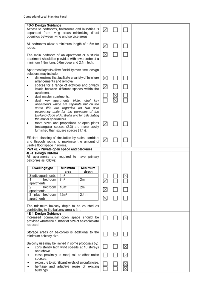
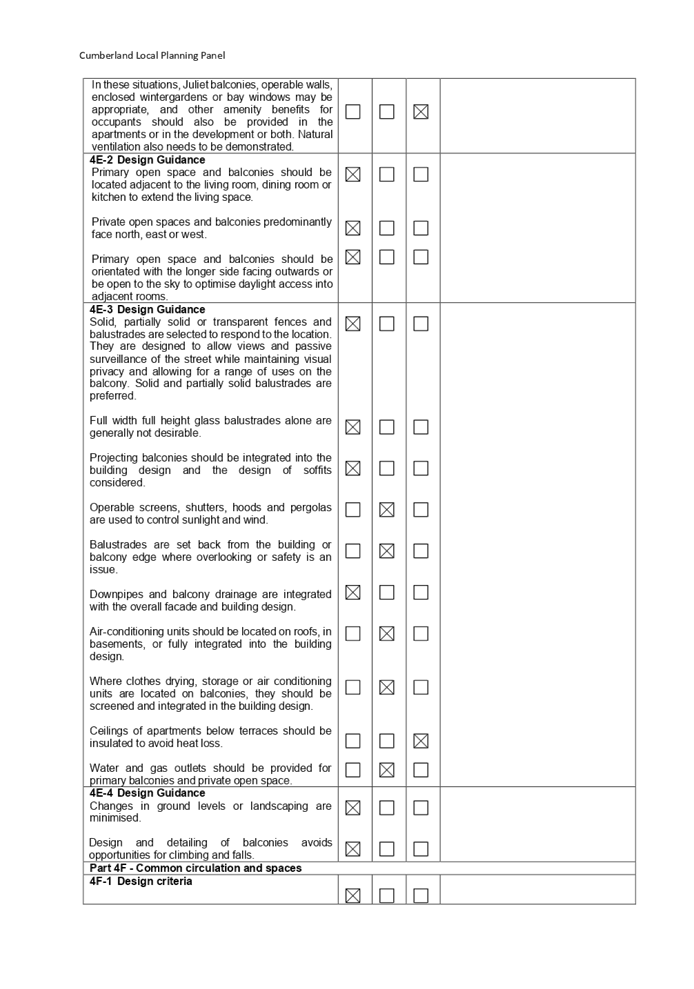
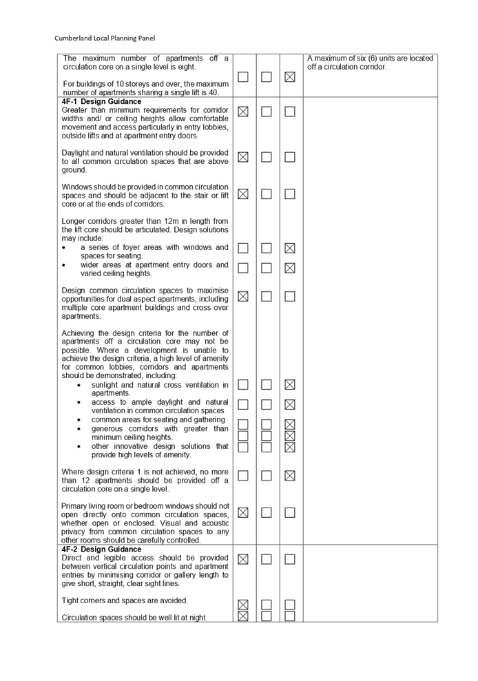
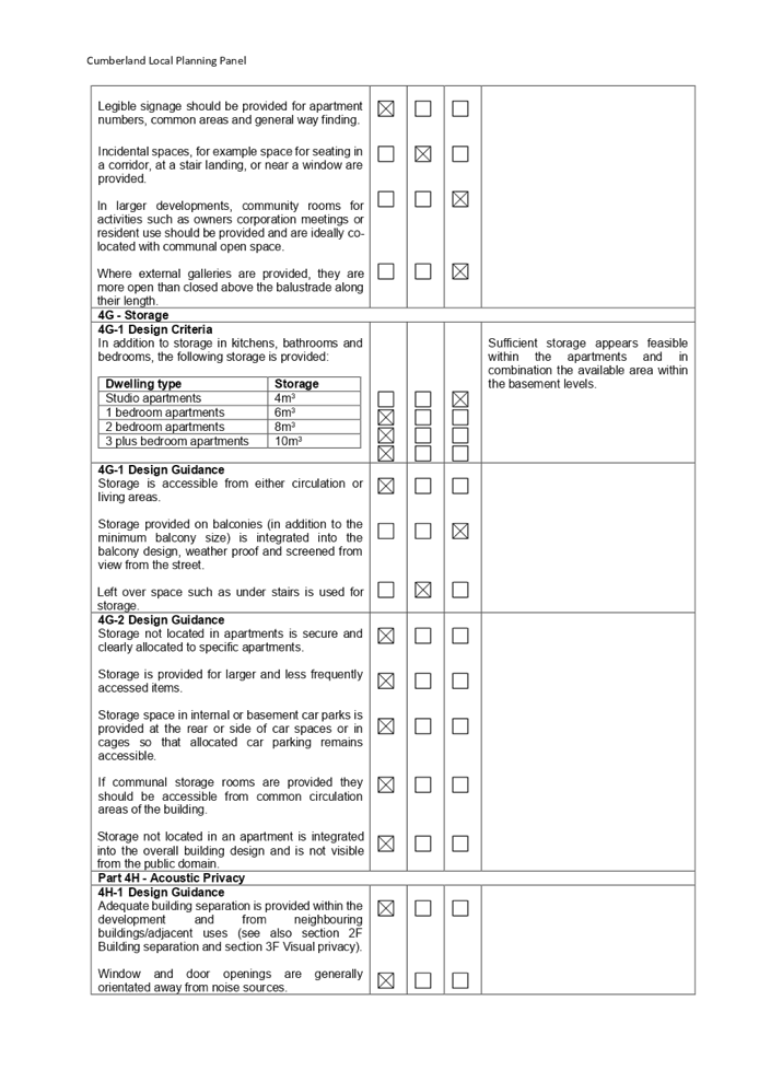
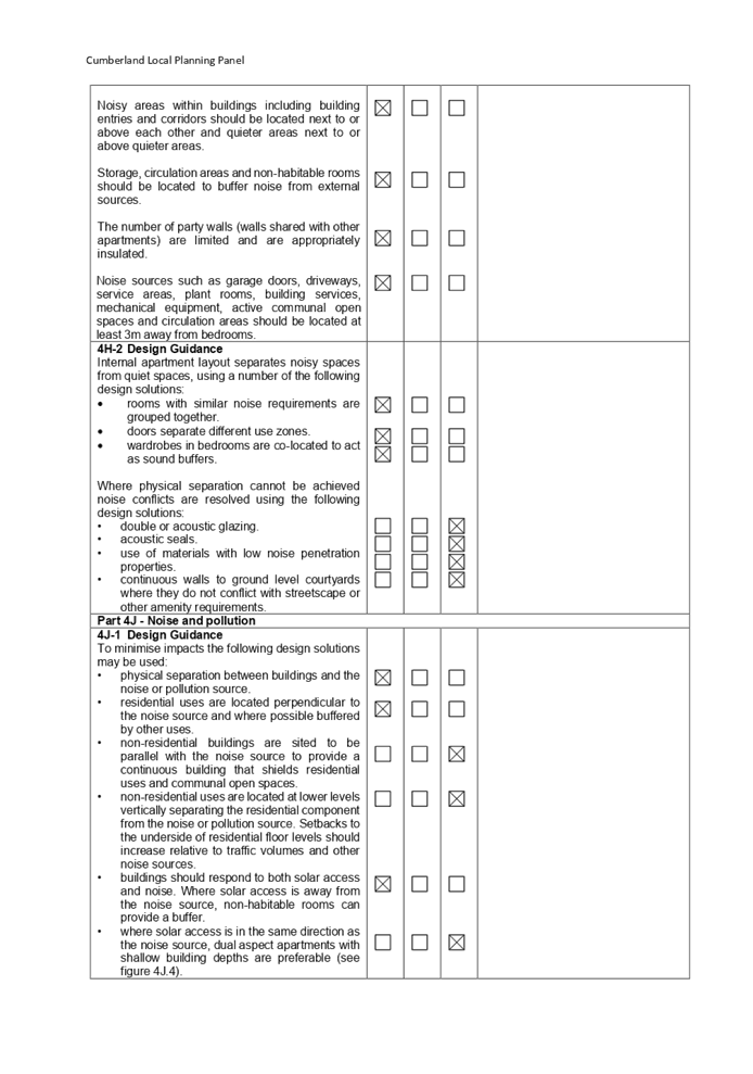
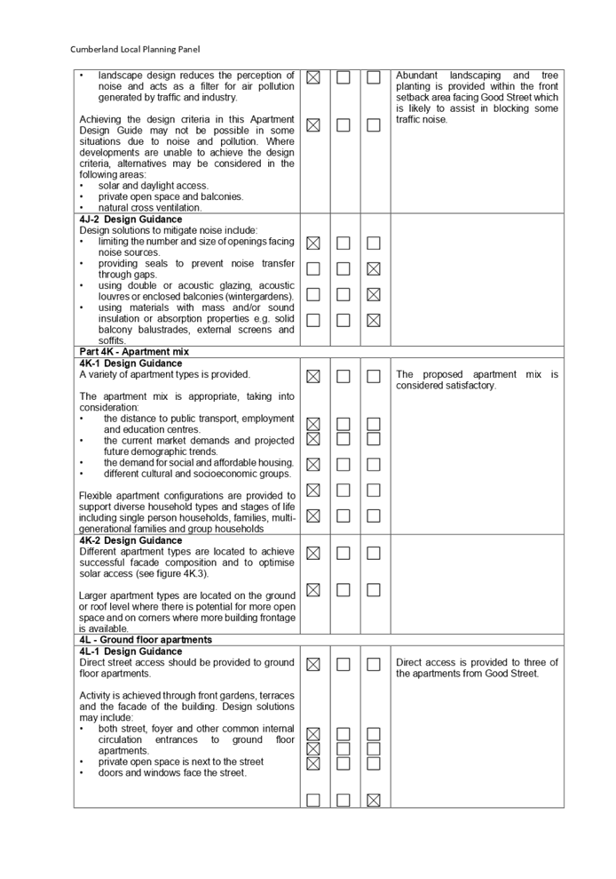
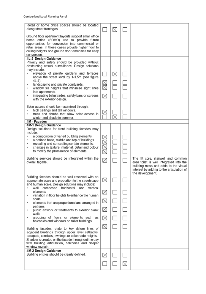
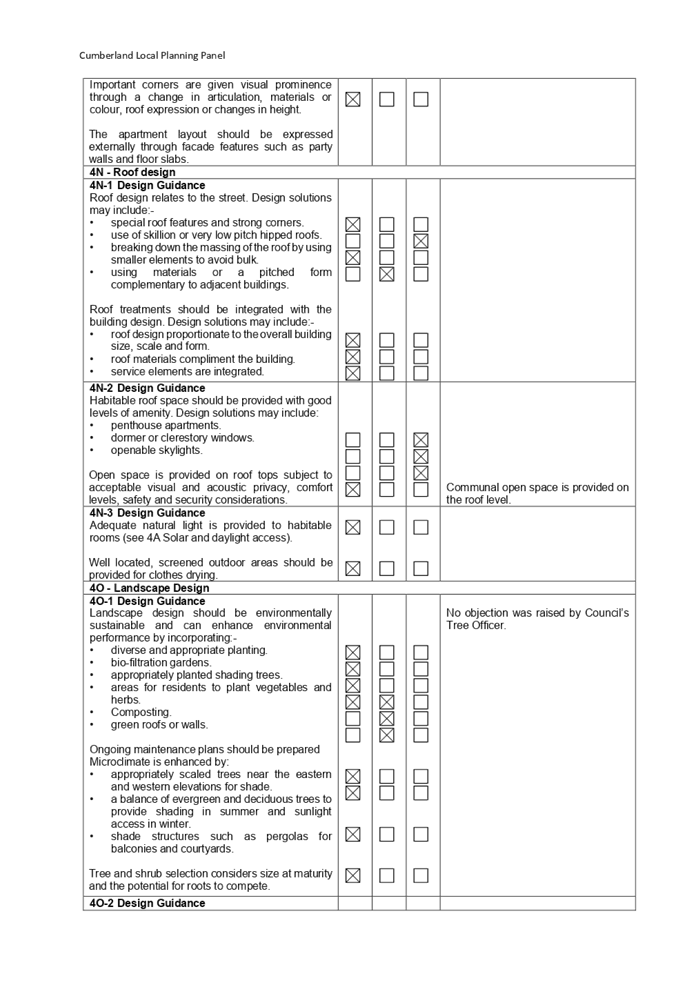
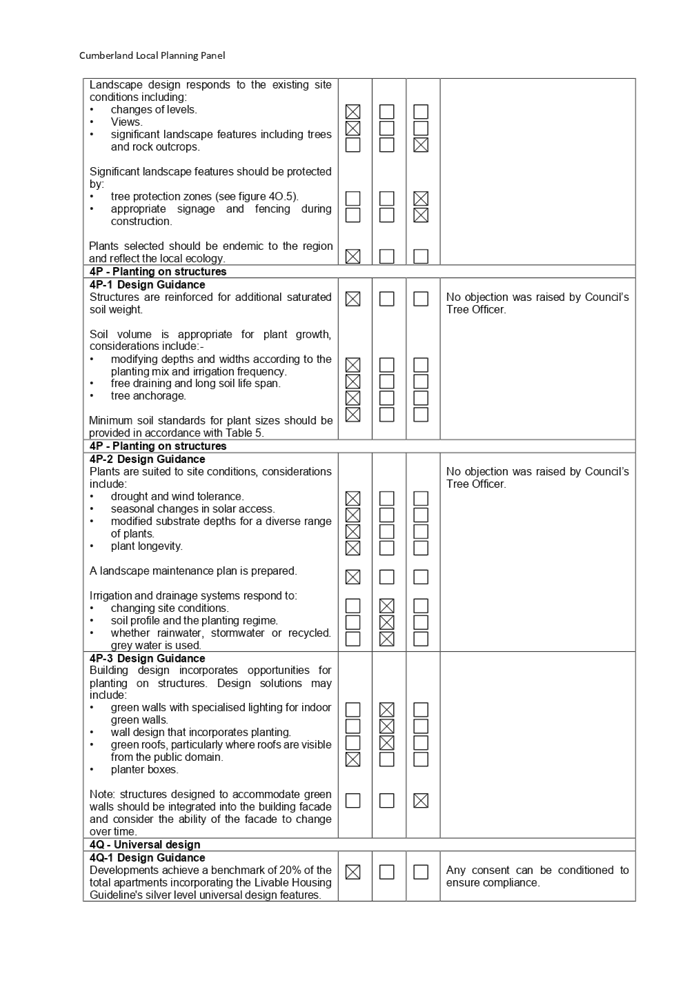
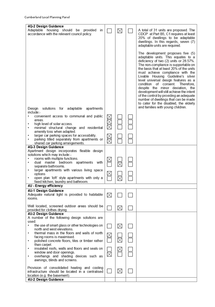
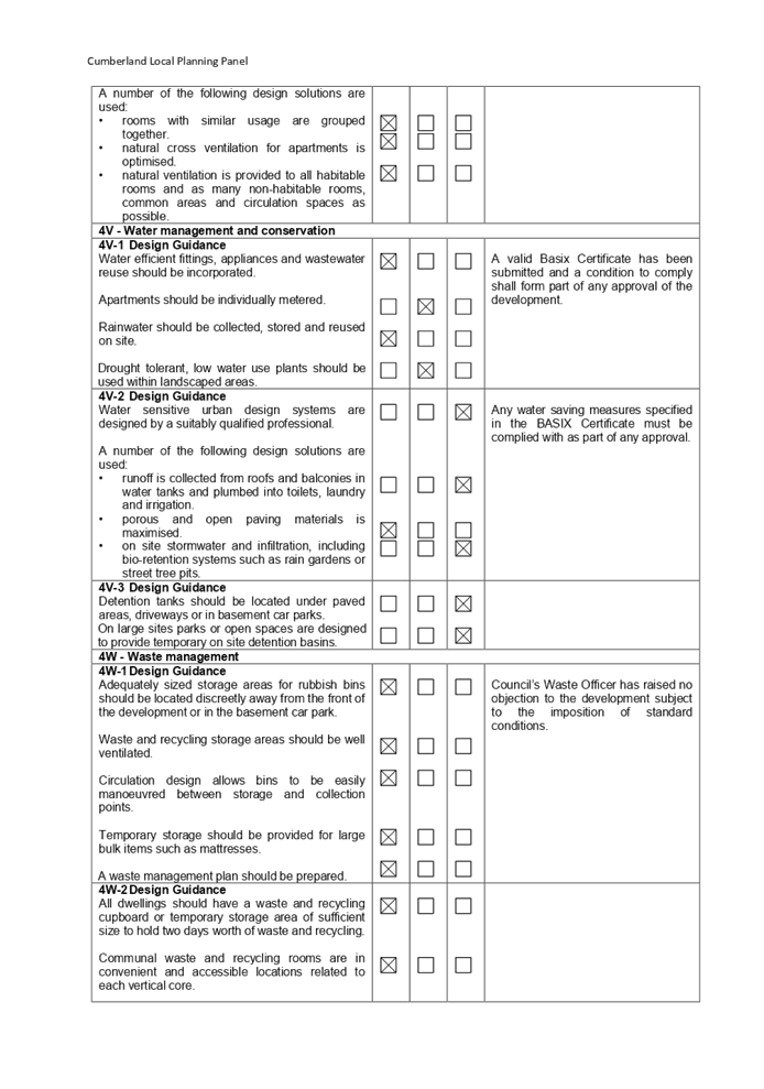

DOCUMENTS
ASSOCIATED WITH
REPORT LPP039/22
Attachment 6
Cumberland Local Environmental Plan 2021 Assessment
Cumberland Local Planning Panel Meeting
13 July 2022
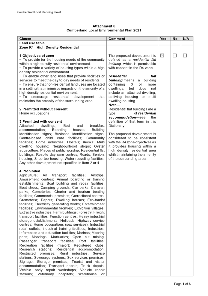
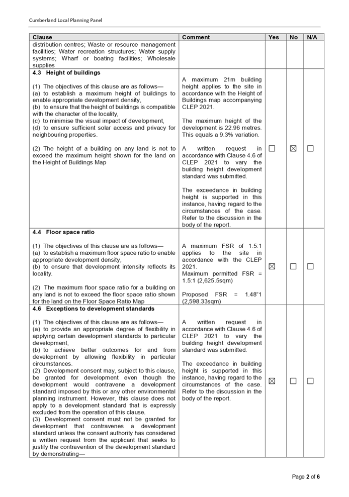
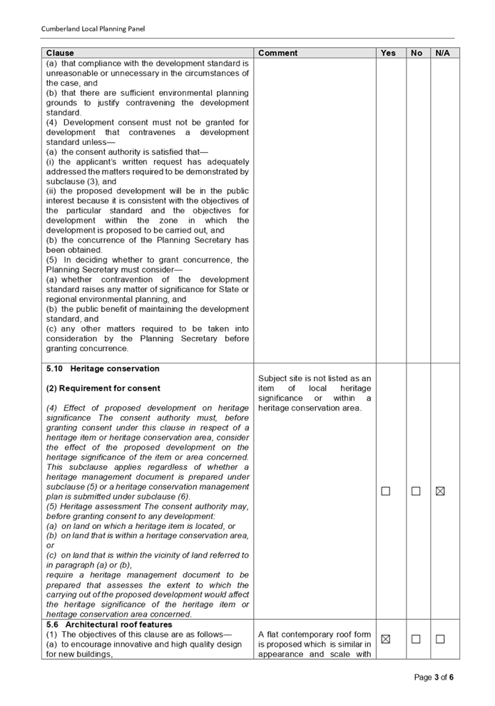
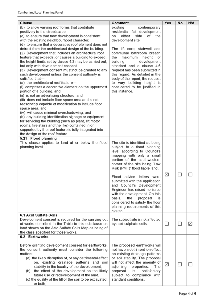
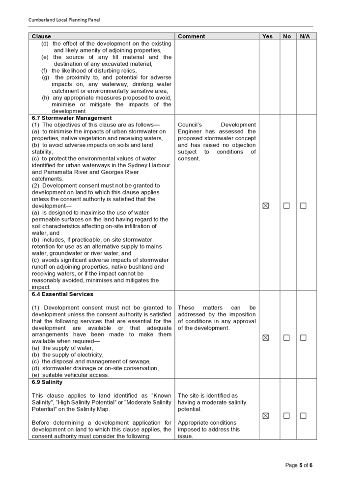
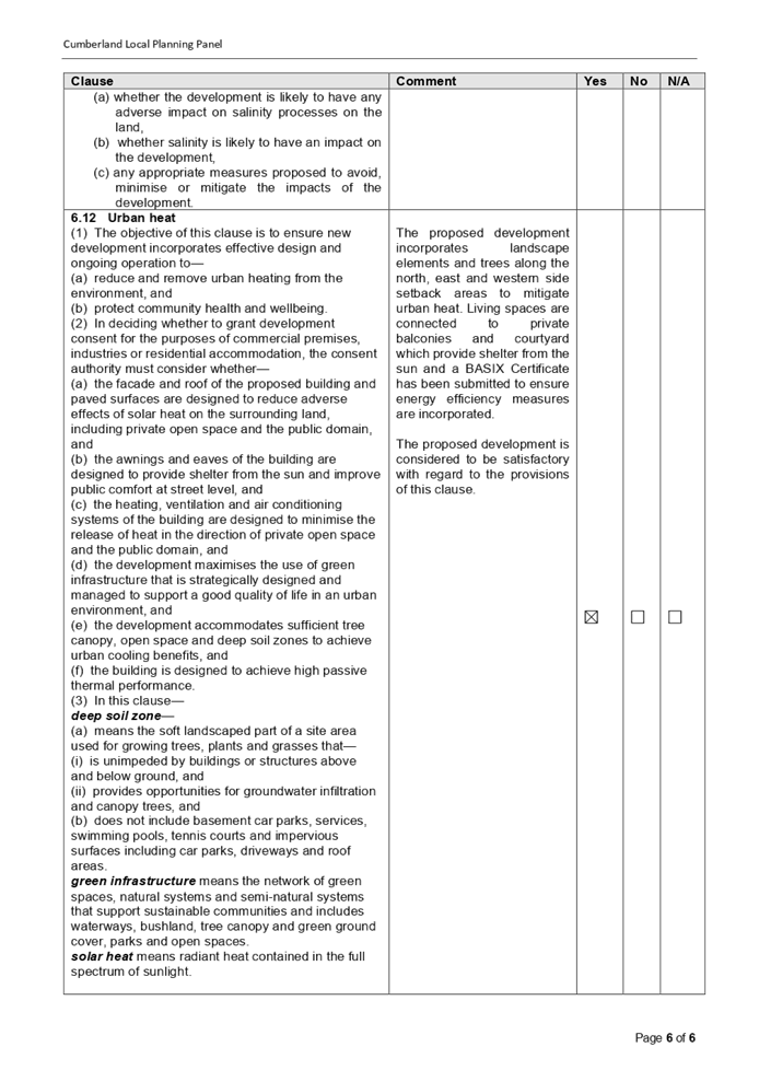
DOCUMENTS
ASSOCIATED WITH
REPORT LPP039/22
Attachment 7
Cumberland Development Control Plan 2021 Assessment
Cumberland Local Planning Panel Meeting
13 July 2022
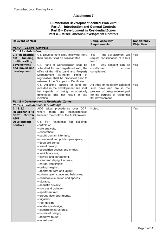
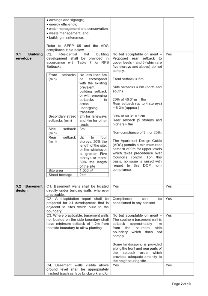
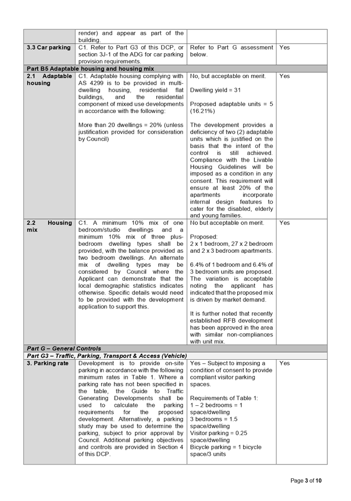
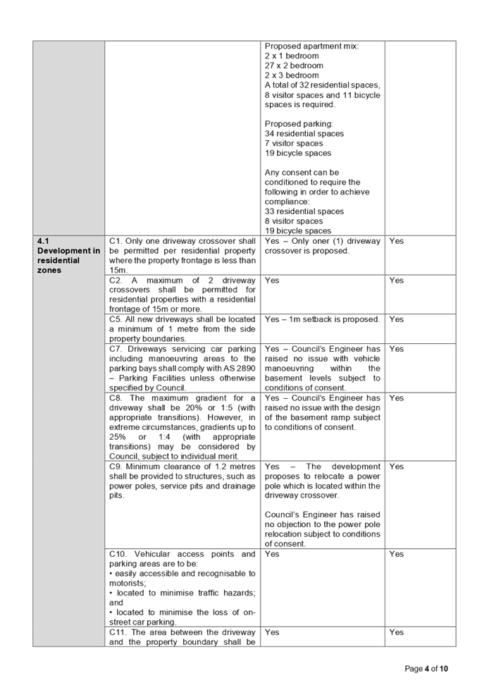
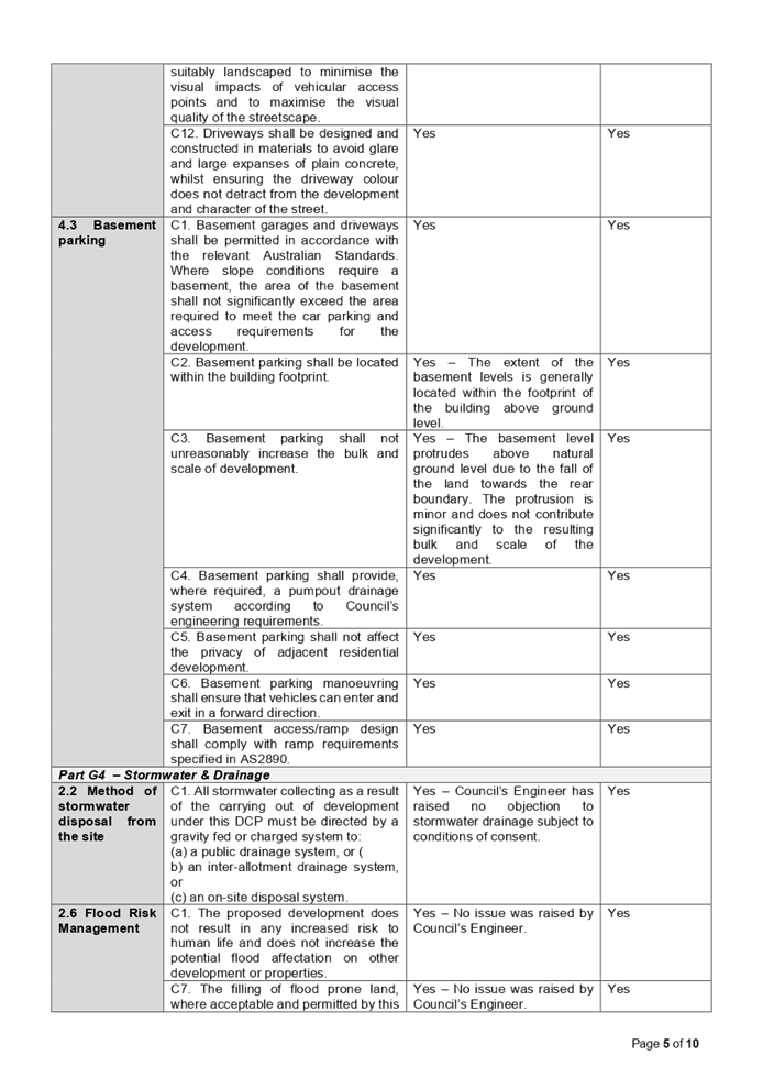
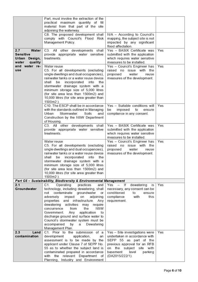
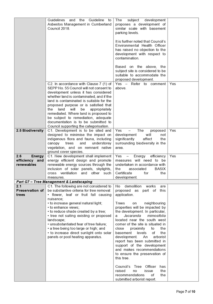
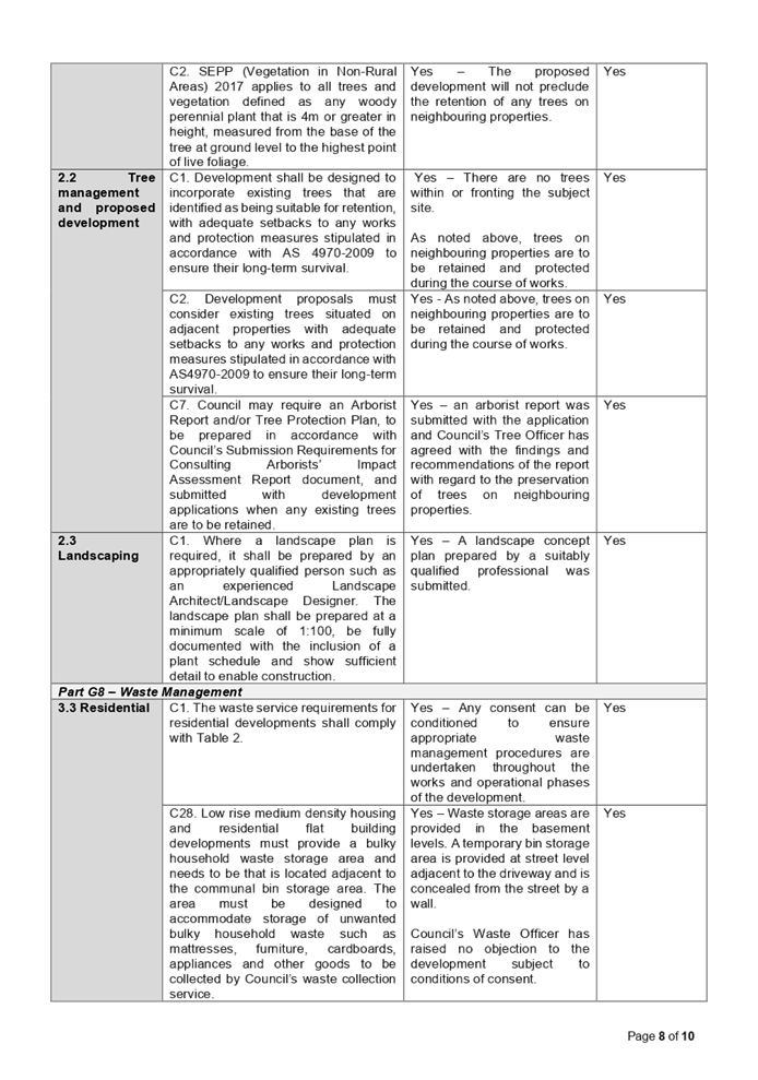
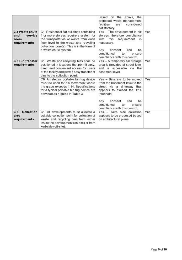
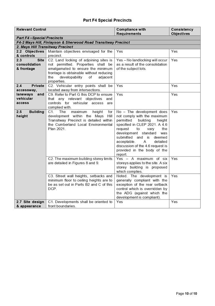
DOCUMENTS
ASSOCIATED WITH
REPORT LPP039/22
Attachment 8
Draft Reasons for Recommendation
Cumberland Local Planning Panel Meeting
13 July 2022
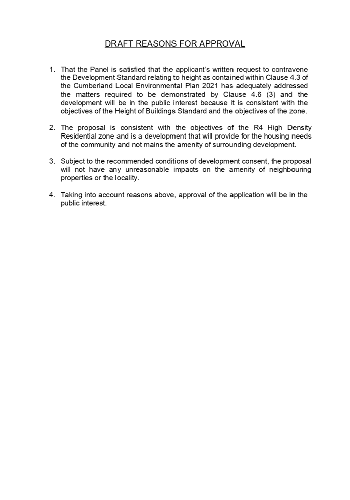
Cumberland Local Planning Panel Meeting
13 July 2022
Item
No: LPP041/22
Planning
Proposal Request for 245-247 Great Western Highway, South Wentworthville (The
Wattles)
Responsible
Division: Environment
& Planning
Officer: Senior
Strategic Planner
File
Number: PP2022/0003
|
Lodged
|
18 February 2022, revised April 2022
|
|
Proponent
|
NRB Property Group Pty Ltd
|
|
Landowner
|
NRB Property Group Pty Ltd
|
|
Site address
|
245-247 Great Western Highway, South
Wentworthville
|
|
Site area
|
Approximately 4,775m2
|
|
Site description and existing Use
|
Irregular shaped allotment with
primary frontage to the Great Western Highway and Parramatta-Liverpool T-way.
The site is bounded by the Great Western Highway to the North, the M4 access
on-ramp to the East and the M4 Motorway to the South and West. Existing
development on the site includes a local heritage house. The rest of the site
is vacant and undeveloped.
|
|
Existing planning
controls
|
Land zone
|
R2 Low Density Residential
|
|
Height of buildings
|
9m
|
|
Floor space ratio
|
N/A
|
|
Additional Permitted Uses
|
N/A
|
|
Requested planning controls
|
Land zone
|
R2 Low Density Residential
|
|
Height of buildings
|
25m
|
|
Floor space ratio
|
1:1
|
|
Additional Permitted Uses
|
Food and drink premises, and hotel or motel
accommodation.
|
|
Recommended planning controls
|
Land zone
|
R2 Low Density Residential
|
|
Height of buildings
|
18m
|
|
Floor space ratio
|
1:1
|
|
Additional Permitted Uses
|
Café or restaurant, and hotel or motel
accommodation, with the hotel/motel capped at 76 rooms.
|
Heritage
|
The site contains a local heritage item listed in the Cumberland
LEP 2021 (The Wattles, a Victorian/Georgian Residence, I244). Surrounding
heritage items include an item listed on the State Heritage Register
(Essington,
I
00204)
and a local heritage item listed in Cumberland LEP 2021 (Milestone Group,
Parramatta to Greystanes, I125).
|
|
Disclosure of political donations
and gifts
|
N/A
|
|
Previous considerations
|
N/A
|
This report provides an overview
of a Planning Proposal Request submitted to Council on 18 February 2022 for
245-247 Great Western Highway, South Wentworthville (The site).
The Planning Proposal Request seeks to facilitate
redevelopment of the site for the purpose of a 5-6 storey hotel/motel with
between 76-80 bedrooms, rooftop dining/bar, pool, gymnasium, conference room,
and health and well-being centre on the western side of the site, and the
adaptive reuse of The Wattles heritage house for a café/restaurant on
the eastern side of the site. It is proposed to also reinstate the heritage
gardens around The Wattles as part of the proposal.
It is noted that the site is subject to an active
development consent for the construction of a hotel/motel and alterations to
the Wattles to be used in conjunction with the hotel (DA2010/93/1). Existing
use rights cannot be relied on for the proposed additional uses as the site has
never been lawfully used as hotel/motel.
Council officers provided preliminary feedback to the
Proponent on their initial Planning Proposal Request, outlining various
concerns and requesting additional information to allow for proper assessment
of the proposal. In response to this early feedback, the Proponent lodged a
revised Planning Proposal Request in late April 2022. The status of the
Planning Proposal Request is shown in Figure 1.
This report recommends that Panel supports an amended
proposal to be reported to Council with a recommendation to proceed to Gateway.
It is noted that the Proponent has offered to enter into a revised Voluntary
Planning Agreement should the proposal proceed through Gateway.
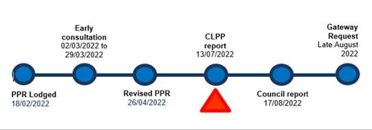
Figure 1: Status of
the Planning Proposal
The site and its context
The site is a large (4,775m2) irregular shaped
allotment bounded on all sides by major roads, including the Great Western
Highway and Liverpool-Parramatta T-way on the northern boundary, the M4 Smart
Motorway to the south, and the M4 on-ramp to the south-east (Figure 2). The
south-eastern part of the site is occupied by a local heritage residence known
as ‘The Wattles’. The rest of the site is vacant and unoccupied.
The surrounding context is dominated by older-style low density residential
developments, generally one storey. Further along the Great Western Highway, to
the east and west, there are some recently constructed low-rise medium and
high-density developments (3-4 storeys maximum).
The site is located approximately 2km from Parramatta CBD
(to the east), 1.5km from Wentworthville Principal Local Centre (north-west),
1.2km from the Westmead Health and Education Precinct (north-east) and the
broader Greater Parramatta and Olympic Peninsula (GPOP) area. The Coleman T-way
bus stop provides a regular bus service between Parramatta and Liverpool.
Cumberland 2030: Our Local Strategic Planning Statement (LSPS) identifies the
site as being part of an area to be investigated for medium to high-density
residential development (Figure 3).
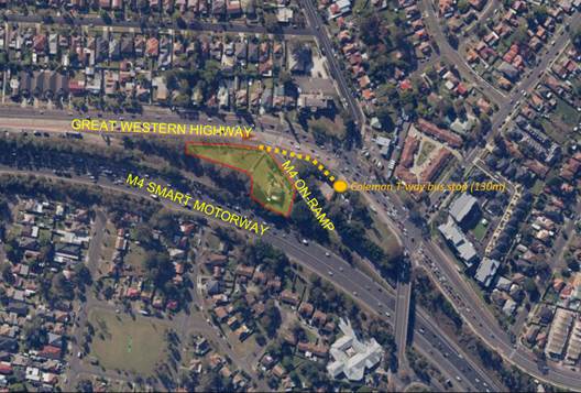
Figure 2: The site in its local context


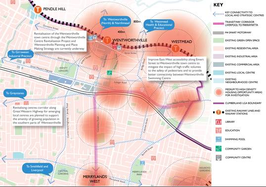
Figure 3: The site in its
regional context
Existing planning controls
Land zone
The site is zoned R2 Low Density Residential and surrounded
on all sides by major road and transit corridors zoned SP2 Infrastructure. The
dominant surrounding zone is R2 Low Density Residential with some R3 Medium
Density Residential to the east, and a mix of business/commercial and
high-density residential uses to the west (Figure 4).
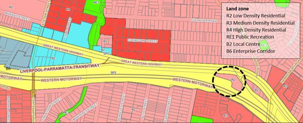
Figure 4: Existing land zone
Height of buildings
The site’s maximum height of buildings control is
currently 9 metres, consistent with surrounding residential lands.
Approximately 400 metres to the west, on the opposite side of the Great Western
Highway, height controls of 15m to 18m are applied to lands zoned for high
density residential. Further west, heights of 17m to 32m are applied to
business/commercial lands. See Figure 5.
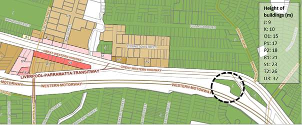 Figure 5: Existing height of
buildings
Floor space ratio
There is currently no floor space ratio (FSR) applied to the
site. Approximately 150 metres to the east, on the corner of Hawkesbury Road
and Great Western Highway, an FSR of 0.7:1 is applied to land zoned for medium
density housing. Approximately 400 metres to the west, on the opposite side of
Great Western Highway, land zoned for high density residential has an FSR of
1.2:1 and 1.5:1. See Figure 6.
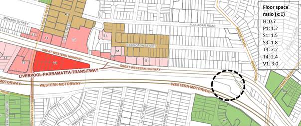
Figure 6: Existing FSR
Heritage
The site contains a local heritage
item listed in the Cumberland LEP 2021 (The Wattles, a Victorian/Georgian
Residence, I244). Surrounding heritage items include an item listed on the
State Heritage Register (Essington, I00204) and a local heritage item listed in
the Cumberland LEP 2021 (Milestone Group, Parramatta to Greystanes, I125). See
Figure 7. These items are further discussed in the ‘Heritage’
section of this report.
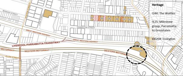
Figure 7:
Existing heritage on and around the site
Development
Approvals History
The site is subject to an active consent for demolition of
existing sheds and garages, construction of a two-storey motel/motel with 48
rooms, rooftop dining/bar, basement car parking and alterations to ‘The
Wattles’ for use in conjunction with the motel and associated site works.
The DA was approved by the former Holroyd City Council on 28 October 2010
(DA2010/93/1). On 26 October 2015, a building inspection was carried out by
Council which confirmed the demolition of existing sheds and garages, which
activated the consent. Elevations of the approved hotel/motel show that the
approved building height is 10.2 metres (Figure 8).
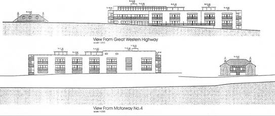
Figure 8: Elevations of the approved hotel/motel
Planning
Proposal Request
The Planning Proposal Request seeks to facilitate
redevelopment of the site for the purpose of a larger (5-6 storey) hotel/motel with
76-80 rooms, rooftop dining/bar, pool, gymnasium, conference room, health and
well-being centre, and basement car parking on the western side of the site,
and the adaptive reuse of The Wattles heritage house for a
café/restaurant on the eastern side of the site. Indicative concept
plans are shown in Figures 9 and 10.
To achieve the objectives and intended outcomes, the
proposal seeks to amend the Cumberland LEP 2021 as follows:
· Amend
the site’s height of buildings control from 9 metres to 25 metres
· Apply
an FSR of 1:1 to the site, noting that there is currently no FSR
· Amend
Schedule 1 to include ‘food and drink premises’ and ‘hotel
and motel accommodation’ as additional permitted uses on the site.
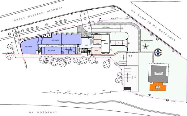
Figure 9: Concept design
layout plan
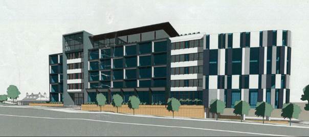
Figure 10: Concept view
showing the proposed hotel and existing heritage house
Voluntary
Planning Agreement
Through the application of the Cumberland Planning
Agreements Policy and Guideline, Council seeks to ensure a fair and reasonable
apportionment of the costs and benefits of development and deliver planning
outcomes that contribute to a net public benefit for the wider community.
The Proponent has offered to enter into a Voluntary Planning
Agreement to deliver a range of public benefits including:
· Public domain
upgrade and footpath connection on the southern side of the Great Western
Highway frontage
· Environmental
Heritage Item Conservation and Enhancement Works, including the restoration of
The Wattles heritage house and gardens
· Any further
contributions to meet policy requirements.
Early consultation
The Proponent’s initial Planning Proposal Request was
placed on early consultation from 2 March 2022 to 29 March 2022 in accordance
with policy requirements. The proposal and supporting material were published
on the Have Your Say section of Council’s website and direct mailout to
surrounding landowners and occupants. The proposal was also referred to
relevant Council staff, former members of Council’s heritage committee,
Heritage NSW and Transport for NSW.
Council received three community submissions and two agency
submissions. The concerns raised in community and public authority submissions
can be addressed through amendments to the proposed height and density controls
and the preparation of a site-specific DCP to guide future development of the
site. Certain matters can also be further addressed at the DA stage, as
outlined in the Key Issues section of this report.
Community
submissions
Three
community submissions were made by local residents, including one submission in
support of the proposal and two submissions from former members of
Council’s heritage committee members which, while generally supportive of
the restoration and adaptive re-use of The Wattles, raised concerns about the
proposal.
Key concerns
raised in community submissions included: traffic, access, and parking; lack of
access to open space; poor amenity due to the location on a busy road;
potential precedent for allowing hotels in low density residential areas; and
potential impacts on the heritage house. The matters are summarised and
responded to in the attached Summary of Community Submission and further
addressed in the ‘key issues’ section of this report.
TfNSW submission
On 4 April 2022, Transport for NSW (TfNSW) made a submission
which did not object to the proposal but raised concerns. The submission
recommends certain changes to the proposed scheme and the supporting traffic
study to address potential vehicular access and safety issues and reduce
traffic volumes and the number of car parking spaces required. TfNSW provided an
amended submission on 22 June 2022 that provided further design guidance and
more flexible options for mitigating potential impacts. The matters raised in
TfNSW submissions are further discussed in the ‘key issues’ section
of this report.
Heritage NSW submission
On 26 May 2022, NSW Heritage made a submission which states
that there are ‘no direct impacts identified on items listed on the State
Heritage Register.’ The submission notes that, given that The Wattles is
a local heritage item, Council is responsible for assessment of impacts in
relation to that item and Heritage NSW do not require any further
referral/consultation on this planning proposal.
Key Issues
Built form
Given the site’s location and context, Council
officers consider the proposed height and density controls to be greater than
what is required for the future potential of the site. The concept plans show
that the proposed hotel/motel development would dominate the northern frontage
(especially as the site is located on a high point of the Great Western
Highway) and would have a major impact on The Wattles heritage house and its
setting.
There may be some scope to increase the site’s height
and density controls, especially as the site is within walking distance from
the T-way and is identified by Cumberland 2030: Our Local Strategic Planning
Statement (LSPS) as being part of an area for potential future medium and/or
high-density housing.
This report recommends that the proposed height control of
25 metres (5 to 6 storeys) be reduced to a maximum of 18 metres and supports
the proposed FSR of 1:1. This would facilitate construction a hotel/motel of up
to 4 storeys plus rooftop terrace, with three floors dedicated to hotel rooms
(25 x 40m2 bedrooms per floor equals 1,000m2 per floor,
which equates to 3,040m2 over three floors or 0.63:1 of total GFA).
The recommended controls would encourage redevelopment of
the site in a form that is consistent with the recently constructed low-rise
residential developments to the east and west of the site (townhouse/terrace
housing and small-scale residential apartment buildings). This report also
recommends preparation of a site-specific DCP to support the LEP controls and
guide the future development of the site.
Council officers considered the consequence of applying the
recommended height and density controls to the entire site, including the
eastern part of the site that is occupied by The Wattles. This is considered
acceptable as any future development application involving the eastern side of
the site would be assessed on merit and would be required to demonstrate that
any proposed works would not impact on the heritage item or its setting.
Limiting the proposed height and density controls to only the western part of
the site is not considered appropriate as it may unreasonably constrain design
options. An alternate means of ensuring the ongoing conservation of The Wattles
may be to specify in Clause 4.3 (Height of buildings) and 4.4 (Floor space
ratio) of the Cumberland LEP 2021 that the proposed height and density controls
only apply to development for the purpose of hotel or motel accommodation on
the site.
Vehicular access and
safety
The proposed vehicular access arrangements have the
potential to create road safety issues for westbound motorists and buses
traveling along the Great Western Highway and T-way corridor. Council officers
requested that the Proponent amends the planning proposal and prepares
situatable site-specific DCP controls to address the matters raised in
TfNSW’s submission dated 22 June 2022, including:
· Provision of a
deceleration/storage lane, consistent with Austroads guidelines, on the
site’s northern boundary and relocate the entry/exit driveway as close as
possible to the western property boundary
· If the above
recommendation is not feasible or achievable, consider redesigning the internal
driveway to provide space for vehicles to be stored onsite rather than queuing
on the Great Western Highway and/or T-way
· Provide mitigation
and/or management measures to ensure appropriate on-site manoeuvring, adequate
vehicle turnaround facilities, and wayfinding signate to ensure vehicle travel
paths are clear
· Provide more
clarity over the ‘worst case’ traffic and parking impacts,
specifically by clarifying whether or not the proposed hotel/motel facilities
will be for exclusive use by guests of the hotel/motel or open to the public,
and lack of clarity over the number of rooms proposed.
The Proponent’s
traffic consultant provided a response to TfNSW’s submission which states
that:
· The entry driveway
location meets the relevant sightline requirements, is consistent with other
intersections and sites in the vicinity and is considered appropriate
· Details of on-site
manoeuvring and wayfinding signage can be provided at DA stage
· The recommended
deceleration lane on approach to the proposed entry driveway is not considered
necessary as:
o it can be demonstrated that the
entry driveway exceeds ASD requirements under all relevant assessment criteria
o previous approved development on the
site not requiring one
o access via the kerbside dedicated
bus lane that carries low bus volumes
o the proposal is likely to generate
only low traffic volumes
o there are examples of other
comparable traffic generating developments and public roads along the Great
Western Highway in the vicinity not requiring use of slip lanes (including the
M4 on-ramp intersection)
· The proposed
hotel/motel facilities such as the conference room, gymnasium and roof terrace
are intended as ancillary to the main hotel/motel use.
It is noted that any future DA for the site would be
required to demonstrate consistency with the provisions of the State
Environmental Planning Policy (Transport and Infrastructure) 2021. In terms of
vehicular access and safety, Clause 2.118 of the SEPP stipulates that a consent
authority must not issue development consent unless:
(a) where practicable and safe, vehicular
access to the land is provided by a road other than the classified road, and
(b) the safety, efficiency and ongoing
operation of the classified road will not be adversely affected by the
development as a result of—
(i) the design of the vehicular access to
the land, or
(ii) the emission of smoke or dust from the
development, or
(iii) the nature, volume or frequency of
vehicles using the classified road to gain access to the land…
TfNSW requested local provisions be introduced into Part 6
of the Cumberland LEP 2021 to limit the use of hotel/motel facilities by guests
only, and to require ‘suitable concurrence’ prior to issue of
development consent. Council officers are of the view that these provisions are
unnecessary as any future DA for the site will be:
· Required to
demonstrate that the hotel/motel facilities are ancillary to the hotel/motel,
otherwise the facilities would fall under the definition of ‘indoor
recreation facilities’ and this land use is prohibited in the R2 zone.
· Clause 2.121 of
the Transport and Infrastructure SEPP requires concurrence of TfNSW prior to
issue of development consent for any development proposed on a State classified
road and requiring more than 50 car parking spaces.
Traffic, transport and
parking
Consistent with the advice of TfNSW, this report recommends
that the number of hotel/motel rooms to is capped at 76 rooms to address
potential traffic and parking issues. The Proponent’s Transport
Assessment Report indicates that, if the proposal was capped at this level, it
would result in approximately 40 vehicle trips during peak times (30 trips for
the hotel and motel and 10 trips for the proposed heritage cottage).
The Proponent’s Transport Assessment acknowledges
that, based on Cumberland DCP 2021, a minimum of 106 parking spaces must be
provided for the proposed hotel/motel development; however, only 79 parking
spaces plus 6 motorcycle spaces are proposed. The traffic report suggests that
it is reasonable to reduce the number of parking spaces required as a large
proportion of the customers of the proposed café and restaurant will be
from the proposed hotel.
To ensure that traffic, transport, and parking are
adequately considered and addressed for the proposal, detailed provisions are
proposed for inclusion in a site-specific Development Control Plan.
Noise, vibrations and
emissions
A noise intrusion assessment was conducted to determine the
impacts of existing road traffic noise on the proposed development. Noise from
the Great Western Highway was assessed, due to its proximity to the north
façade of the proposed development. The assessment found that a Category
3 construction would be required for both the north and south façade
– that is, special construction with increased attenuation to achieve
internal noise levels, as recommended in the SEPP.
An operational noise assessment was conducted to determine
the potential noise emissions of the proposed development that would likely
impact the surrounding sensitive receivers. It was deemed that the mechanical
plant on the roof terrace could be a potential source of noise emissions
requiring mitigation, with other potential noise emissions to be likely
dominated by existing road traffic noise on the Great Western Highway and M4
Motorway. At this stage, further assessment is required, concerning the
operational noise emissions of the proposed development, with such
consideration to be given during the future DA stage of the proposal.
The study has shown that, from an acoustic perspective, the
site would be suitable for the intended uses. Specific constructions and
mitigation measures would require further investigation during the future DA
stage of the proposal. It is noted that Clause 2.118(C) of the Transport and
Infrastructure SEPP requires that:
(c) the
development is of a type that is not sensitive to traffic noise or vehicle
emissions, or is appropriately located and designed, or includes measures, to
ameliorate potential traffic noise or vehicle emissions within the site of the
development arising from the adjacent classified road.
Council officers are of the view that the proposed
commercial uses are less sensitive than the types of residential land uses that
are currently permitted on the site under the R2 zoning, and that adequate
measures can be incorporated into the design to mitigate the impact of traffic
noise and emissions and assessed at DA stage.
Suitability
of the proposed additional permitted uses
Hotel
or motel accommodation means a building or place (whether or not licensed
premises under the Liquor Act 2007) that provides temporary or short-term accommodation on a
commercial basis and that—
(a) comprises
rooms or self-contained suites, and
(b) may
provide meals to guests or the general public and facilities for the parking of
guests’ vehicles,
but
does not include backpackers’ accommodation, a boarding house, bed and
breakfast accommodation or farm stay accommodation.
Note—
Hotel
or motel accommodation is a type of tourist and visitor
accommodation—see the definition of that term in this Dictionary.
Hotel
or motel accommodation is considered to be a suitable use for the western part
of the site, subject to careful design, as outlined in this report. Despite
being part of an area to be investigated for medium to high-density residential
development, this particular site is not considered suitable for intensified
residential development due to its ‘island’ location between
several road transport corridors and the associated acoustic, pollution and
amenity impacts.
Short-term
accommodation (hotel) is considered a more desirable outcome as it can leverage
the high exposure nature of the site and is not as susceptible to the
previously listed constraints. The proposed commercial uses may also facilitate
the restoration and ongoing conservation of The Wattles heritage house and
gardens.
Food and drink premises means premises that are used
for the preparation and retail sale of food or drink (or both) for immediate
consumption on or off the premises, and includes any of the following—
(a) a restaurant or cafe,
(b) take away food and drink premises,
(c) a pub,
(d) a small bar.
Council officers consider the child term ‘restaurant
or café’ to be more suitable than the proposed ‘food and
drink premises’ for this site noting that the child term better reflects
the intended use of a café/restaurant on the eastern side of the site.
Allowing a pub on the site may have further traffic and parking implications.
Heritage
The planning proposal is
supported by a Heritage Impact Statement prepared by Sue Rosen Associates which
concludes that, with appropriate refinement, the hotel/motel concept could be
rendered to a solution that activates the site, while respecting and
maintaining the heritage significance of The Wattles. The advice notes that:
· The concept is
preferrable to other options considered for the site, which include subdivision
and construction of multiple dwellings, which would likely have unacceptable
adverse impact on the significance of The Wattles and its setting
· The proposed
commercial uses have the potential to generate income to fund the ongoing
conservation and maintenance of The Wattles and its setting.
· The proposal will
allow the Wattles to be accessed and appreciated by a wider audience, and
activates what could continue to be a ‘forgotten’ site
· Compared to the
approved multi-storey hotel (DA2010/93/1), the concept hotel/motel has been
moved an additional 6 metres away to the west of The Wattles, retaining an
appropriate curtilage
· Views of the
original building from the Great Western Highway will be maintained, if not
improved; with potential for an exterior up-lighting installation and
appropriately sympathetic signage to lift the presence of the historic site
· To enable its
adaptive reuse as a café/restaurant, there is opportunity to include a
sympathetic low-scale addition to the rear of The Wattles to install amenities,
commercial kitchen and associated services. This would mitigate impact on
significant fabric, detailing and layout of the residence
· The proposed
additional height allowance increases the ability of the concept hotel/motel to
be a viable business, providing short-term accommodation in easy distance of
the Parramatta CBD
· There is potential
in the design to further mitigate the visual impact of the structure on The
Wattles and surrounding streetscape at the detailed DA design stage. This could
occur through the refining of form, material, colours and finishes, and
landscaping.
Council officers had the Proponent’s Heritage Impact
Statement peer reviewed by an independent heritage advisor, Extent Heritage,
which confirms that the proposal is acceptable in terms of heritage outcomes,
subject to careful design, consistent with best practice guidelines, and the
preparation of suitable DCP controls. The advice identifies a range of heritage
enhancement opportunities and mitigation measures for potential impacts, as
summarised below:
· The Statement of
Heritage impact should include an assessment of historical archaeological
impacts, as there is potential for historical archaeological materials and
relics to be present on the site. It is recommended that this is additional
information is provided by the Proponent as part of the planning proposal
process
· The proposed
planning controls will have a major impact on the heritage values of the site,
including overshadowing and obstruction of key views, as well as obscuring the
understanding and interpretation of the site as a colonial period
Victorian/Georgian homestead. New development must consider appropriate
heights, setbacks, and siting to ensure these core heritage values are
maintained
· Potential impacts
on surrounding heritage items must be carefully considered. It is noted that
further consideration of this will be considered as part of any DA for the site
· Opening up the
landscaping and reinstating the heritage gardens and landscaping around the Wattles
are supported
· Due to its scale
and location, the proposed hotel has the potential to have a major impact on
the setting of The Wattles; however, this impact may be mitigated through
careful design, including appropriate colours, setbacks, and materials
· Prior to the
demolition of alteration of any structures within the study area, archival
photographic recording is recommended as per Heritage Council guidelines
· A heritage
interpretation strategy is recommended as part of the DA process
· Adaptive reuse of
The Wattles as a café/restaurant is supported, subject to certain
conservation measures that ensure any changes to the building are complimentary
and sympathetic to the historical context
· The proposed
buildings should be carefully designed to respect the built environment and
heritage items in the vicinity, taking into consideration the bulk, height,
scale and siting, massing, setback, key view lines and materiality of the new
development. The design should be guided by the relevant controls in Cumberland
DCP 2021 and NSW Heritage Office guidelines.
As outlined in the ‘built form’ section of this
report, the bulk and scale of the hotel would need to be significantly scaled
back to reduce impacts on The Wattles and its setting. Further, to ensure that
heritage is adequately addressed for the proposal, detailed provisions are
proposed for inclusion in a site-specific DCP.
Schedule
of Heritage Conservation Works
The planning proposal is supported
by a Schedule of Conservation Works prepared by Dr Roy Lumby of Hericon
consulting and assessed by Sue Rosen Associates has identified the existing
heritage item that need to be restored based on a visual assessment carried out
on site. The assessment has been limited to the outer fabric and interior with
restrictions to accessing roof or under floor areas of the existing heritage
cottage. It is recommended that this be updated to address the internal fabric
and assessed at the DA stage.
Clause
5.10 Heritage Conservation
The proposed site is also affected
by clause 5.10 Heritage Conservation provisions under Cumberland LEP 2021 which
a proponent requires to obtain development consent for any building work
proposed from the consent authority and prepare necessary documentation as
required such as a heritage management document or conservation management plan
after considering the extent and heritage significance of the property. There
are also conservation incentives. These provisions are subject to further
assessment at the DA stage should the planning proposal proceed.
Contamination and acid
sulphate soils
The planning proposal is supported by a preliminary
contamination assessment that concludes that the proposal is unlikely to have
any significant impacts as a result but indicates the site may need to be
remediated should the planning proposal progresses and a DA is lodged since the
site had been used for residential and commercial uses in the past and shows
potential contamination sources, such as asbestos, potential underground
storage tank within the site.
The consultant also considered the mapping, geology, and
elevation of the site and concluded that it is unlikely that acid sulphate
soils are present on site. Council’s acid sulphate soils maps do not
indicate any affectation on site. Should the proposal progress to a DA stage,
further detailed investigations and acid sulphate soils management plan may
need to be prepared if required.
Amended Planning Proposal
Following consideration of the submission received and key
issues identified above, an amended planning proposal is recommended for the site.
It is proposed to:
· Amend the
site’s height of buildings control from 9 metres to 18 metres
· Apply an FSR of
1:1 to the site
· Amend Schedule 1
to include ‘café or restaurant’ and ‘hotel or motel
accommodation’ as additional permitted uses on the site, with the
hotel/motel component capped at 76 rooms.
The amended planning proposal seeks to provide a balanced
approach for the site in supporting development, maintaining the heritage
significance of The Wattles building, and ensuring that the transport network
can accommodate additional development in the area.
Site-specific
Development Control Plan
Should the proposal proceed to Gateway, it is recommended
that a site-specific DCP be developed to address matters as outlined below,
including:
· Land
use – location of uses on site
· Building
siting – setbacks and separation
· Building
envelope – storeys, upper-level setbacks, ground floor height
· Solar
access and overshadowing
· Open
space and landscaped areas
· Movement
and access – pedestrian and vehicle entry/exit points and paths
· Managing
transport demand – onsite car parking provision, location and safety
· Heritage
– conservation provisions and key view lines to the heritage item
· Stormwater
– detention and outlet
Strategic Merit Assessment
Need for the proposal
The proposed additional uses are prohibited in the
site’s R2 Low Density Residential zone. While it has been demonstrated
that there is an active development consent for the construction of a
hotel/motel and alterations to the Wattles to be used in conjunction with the
hotel (DA2010/93/1), existing use rights cannot be relied on for the proposed
additional uses as the subject site has never been lawfully used as
hotel/motel. In addition, the proposed height and FSR are significantly higher
than existing controls and cannot therefore be pursued under clause 4.6 of
Cumberland LEP 2021 (Exceptions to development standards). A site-specific
planning proposal is considered the most appropriate means of achieving the intended
outcomes.
Consistency with
Greater Sydney Region Plan
The proposal is broadly consistent with the Greater Sydney
Region Plan, including:
· Objectives
3 and 4. Infrastructure aligns with forecast growth and infrastructure use is
maximised: The proposal and its proposed uses will allow for more intense
activity and use of land within walking distance to a strategic bus corridor
and is also located adjacent to M4 Motorway and Great Western
highway.
· Objective
6. Services and Infrastructure meet the community’s changing needs: This
proposal endeavours to provide a hotel and motel development on site which
gives effect to this objective and conservation of an existing heritage item
via adaptive re-use to be opened to the public, visitors, and tourists as a
restaurant.
· Objectives
8 and 12. Greater Sydney’s communities are culturally rich with
diverse neighbourhoods and brings people together: This proposal endeavours a
multi-level hotel development and restaurant on site providing tourist and visitor
accommodation and a place to celebrate cultural and social events, gatherings
and open up the Wattles Cottage by a dining experience for those diverse
communities, by restoring and retaining the historical, cultural and aesthetic
significance of the cottage.
· Objective
10. Greater housing supply: the proposal provides short term or temporary
transit accommodation solution as an additional permitted use for the R2 zoned
site given its constraints and unsuitability for standard residential and is
strategically positioned within close proximity of other strategic housing and
job growth areas such as Westmead South precinct, Westmead Health and Education
Precinct and local centres where addition to supply of significant jobs and housing
is anticipated and earmarked in the near future.
· Objective
13. Environmental heritage is identified: The proposal will enable the
conservation and enhancement of an existing local heritage item the Wattles on
site and the enhancement of another local item located outside the site’s
boundary.
· Objectives
15 and 19. A Metropolis of Three Cities: integrated land use and transport
creates walkable and 30-minute cities and Greater Parramatta is stronger and
better connected: The proposal will provide temporary or short term
accommodation facilities as a transit hotel/location to incoming public,
visitors and tourists, workers on a strategic transport corridor with public
transport bus services to closer to Parramatta CBD, Westmead Health and
Education Precinct, and other centres within Cumberland. This could provide a
greater level of opportunity for future residents to access jobs and other
services.
· Objective
22. Investment and business activity in centres: the intended proposal seeks to
generate approximately 40 additional jobs approximately 76 motel/hotel units
within the completed development which supports the broader Parramatta CBD and
Westmead Health Innovation district.
· Objectives
28 and 30. Scenic and cultural landscapes are protected, and urban tree canopy
cover is increased. The proposal enables 40m or more separation distance to
maintain the visual garden setting around the existing heritage cottage,
encourages landscaping around the heritage item and contributes to increasing
the tree canopy within and outside the site.
Consistency
with the Central City District Plan
There is
strategic merit in forwarding this proposal for a Gateway Determination, as the
amended proposal is generally consistent with the following Planning Priorities
of the Central City District Plan:
· Planning
Priority C1. Planning for a city supported by infrastructure: this planning
proposal will supply social related infrastructure and contribute towards
transport infrastructure improvements.
· Planning
Priority C3. Providing services and infrastructure to meet people’s
changing needs: This planning proposal will provide a hotel or motel
development and encourage the adaptive re-use and enhancement of an existing
heritage item which is the Wattles Cottage to the public, visitors and tourists
and the nearby residential neighbourhoods.
· Planning
Priority C4. Fostering healthy, creative, culturally rich, and socially
connected communities: the planning proposal will provide a hotel/motel
development with other hotel facilities such as well-being, gymnasium which
provides facilities for visitors and tourists and The Wattles cottage heritage
as a restaurant next to residential neighbourhoods at the Westmead South
precinct. It contributes to the development of a place that facilitates a
community culture and connection for social gatherings and events and provides
temporary transit location for temporary accommodation closer to services and
jobs.
· Planning
Priority C5. Providing housing supply, choice, and affordability, with access
to jobs, services and public transport: The proposal enables short term transit
accommodation provisions located closer to a strategic bus transport corridor
and state roads with access to jobs, services, public transport, and nearby
larger centres including within 30 minutes of the Greater Parramatta City
Centre.
· Planning
Priority C6. Creating and renewing great places and local centres and
respecting the district’s heritage: The planning proposal contributes to
the restoration and enhancement of the Wattles heritage cottage as a great
place along with a multi-level hotel or motel development. It is designed to
respect the existing heritage item on site with an over 40m separation distance
with setbacks from the proposed hotel development and further preserve and
enhance its heritage significance, restoration of the cottage and surrounding
landscaped gardens without being demolished.
· Planning
Priorities C7 and C8. Growing a stronger and more competitive Parramatta and
delivering a more connected GPOP economic corridor: The proposed
non-residential uses introduced for the site will provide economic vitality and
revitalisation to an isolated underutilised site to further broaden short term
transit accommodation options within greater Parramatta and Cumberland City
region to attract more visitors, tourists and community to the area through the
enhancement and restoration of the Wattles heritage cottage, its landscape
gardens and the proposed hotel/motel development with other well-being
facilities which can be enjoyed by visitors and
patrons.
· Planning
Priority C10. Growing investment, business opportunities and jobs in strategic
centres: This planning proposal will provide access to jobs and services in
Westmead and Wentworthville which is identified as Cumberland’s local
centres and South Wentworthville area which is considered a future
investigation area for housing growth.
Consistency with Cumberland 2030: Our Local Strategic
Planning Statement
The proposal is
in an area identified in Cumberland City’s Centres Framework outside a
local centre in South Wentworthville within proximity of Wentworthville,
Westmead centres and Parramatta CBD. The site is also located in a key
strategic corridor in Cumberland and within a future housing investigation
area, and is broadly consistent with Cumberland 2030: Our Local Strategic
Planning Statement, including:
· Planning
Priority 5. Delivering housing diversity to suit changing needs: This proposal
will deliver short term or temporary transit accommodation and restaurant use
within a prime location that is located closer to jobs, facilities and services
within South Wentworthville, Westmead, Parramatta CBD, and Wentworthville where
housing diversity is being delivered to suit changing needs. The proposal
maintains the site’s existing R2 low density residential zoning given the
site’s unsuitable nature and location for proposed housing but introduces
two non-residential additional permitted uses to make the site more economically
viable for redevelopment and restore existing Wattles Heritage Cottage through
conservation.
· Planning
Priority 8. Celebrate our natural built and cultural diversity: This proposal
will provide a place for social interaction through the proposed hotel or motel
development and restoration and further enhancement of the Wattles Cottage
(existing local heritage item and other items located outside) within the site
for broader community, visitors, and tourists.
· Planning
Priority 10. Support a strong and diverse local economy across town centres and
employment hubs: This planning proposal will encourage new diverse activities
that support the local economy and broader community for an underutilised site
that has been vacant for years without being developed or being recognised
given its existing local heritage significance.
· Planning
Priority 11. Promote access to local jobs, education opportunities and care
services: This planning proposal will result in the creation of new jobs and
deliver a high-quality multi-level hotel or motel development with other hotel
facilities and restore, conserve, and enhance the existing Wattles Cottage
which is one of Cumberland’s oldest heritage items opened to the broader
community, visitors and tourists.
· Planning
Priority 13. Protect and enhance natural and green spaces and sporting
facilities: The planning proposal will enable landscaping around the heritage
item and provision of more trees to beautify the site and enhance the heritage
significant wattles cottage and the hotel/motel and its broader surrounds
including Great Western Highway.
Council officers support an
amended proposal progressing to the next phase of assessment, subject to
certain changes to the scheme as outlined in this report. The Planning Proposal
Request is found to be broadly consistent with the strategic planning framework
and policy context and is likely to deliver a wide range of benefits to the
local community, including the restoration and adaptive reuse of a
‘forgotten’ local heritage house and gardens, employment
opportunities, and services and facilities.
The planning proposal request was
placed on early consultation as outlined in this report. Further statutory
consultation will occur if the proposal proceeds to Gateway.
Financial implications are
outlined in the report.
The report recommends that an
amended planning proposal for the site be reported to Council for
consideration. Should Council resolve to forward the proposal to the Department
of Planning and Environment for a Gateway Determination, there will be policy
implications associated with the subsequent stages of the planning proposal
process. These will be outlined in subsequent Council reports.
Communication /
Publications:
The outcome of this matter will be
notified on Council’s website. Submitters will also be notified in
writing of the outcome.
|
That Cumberland Local Planning Panel (CLPP)
recommend that Council supports, for the purpose of a Gateway Determination,
an amended planning proposal for 245-247 Great Western Highway, South
Wentworthville, with the following planning controls on the site:
· Amend
the site’s height of buildings control from 9 metres to 18 metres
· Apply
an FSR of 1:1 to the site
· Amend
Schedule 1 to include ‘café or restaurant’, and
‘hotel or motel accommodation’ as additional permitted uses on
the site, with the hotel/motel component capped at 76 rooms.
|
1. Planning
Proposal Request
2. Planning
Proposal Concept Plans
3. Architectural
Plans for Approved DA
4. Traffic
Impact Assessment
5. Heritage
Impact Statement
6. Schedule
of Conservation Works
7. Peer
Review of Heritage Impact Statement
8. Noise
Assessment Report
9. Preliminary
Contamination Assessment
10. Acid
Sulphate Soils Assessment
11. Transport
for NSW submission (April)
12. Transport
for NSW Submission
13. Proponent's
Response to Transport for NSW Submission
14. Heritage
NSW Submission
15. Summary
of Community Submissions
DOCUMENTS
ASSOCIATED WITH
REPORT LPP041/22
Attachment 1
Planning Proposal Request
Cumberland Local Planning Panel Meeting
13 July 2022

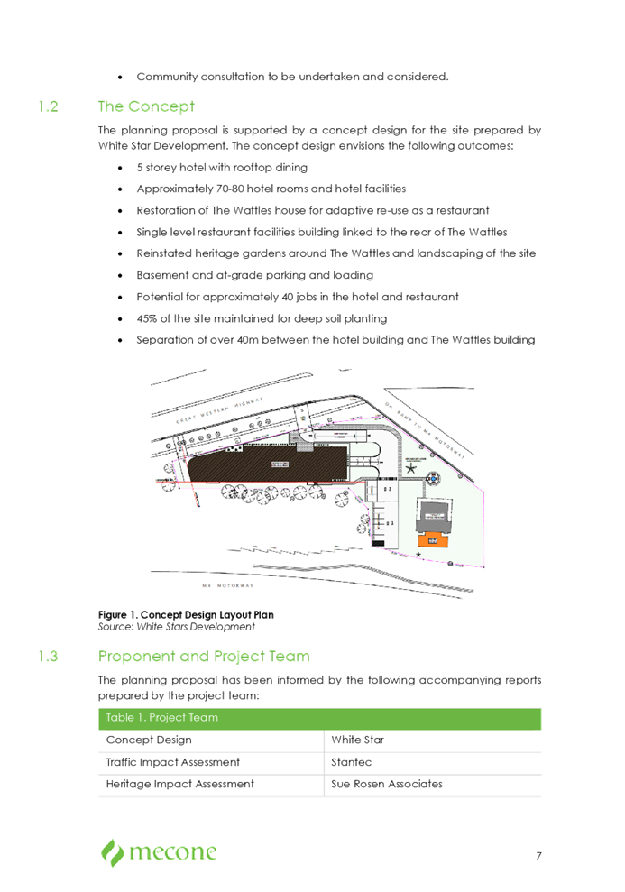
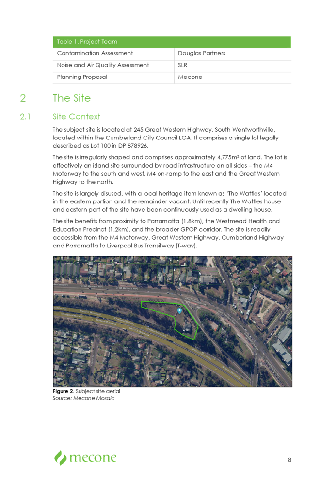
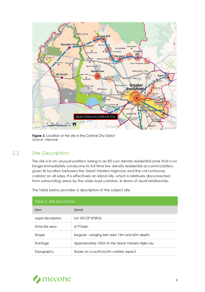
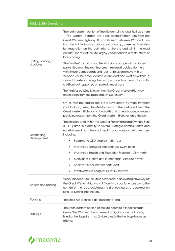

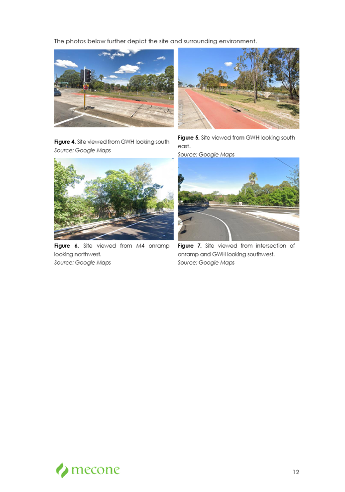
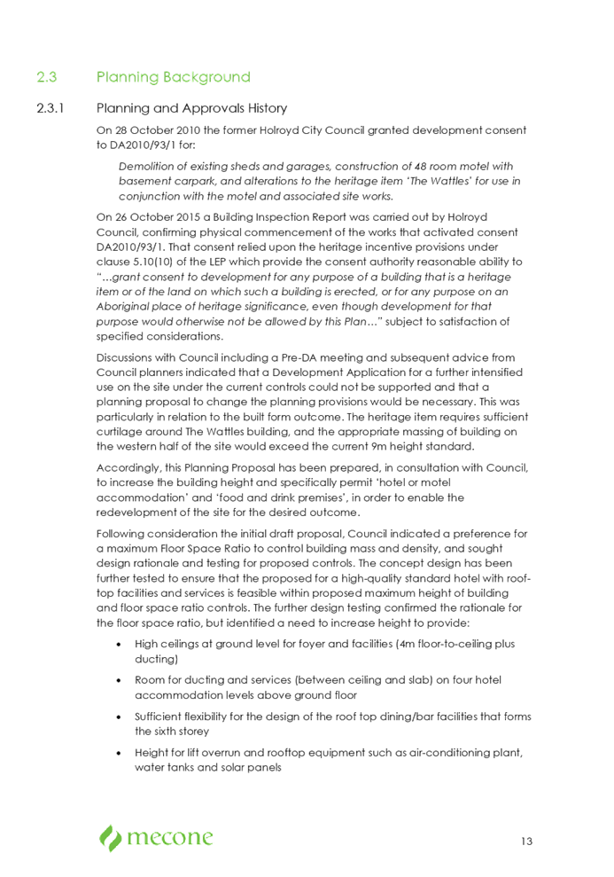

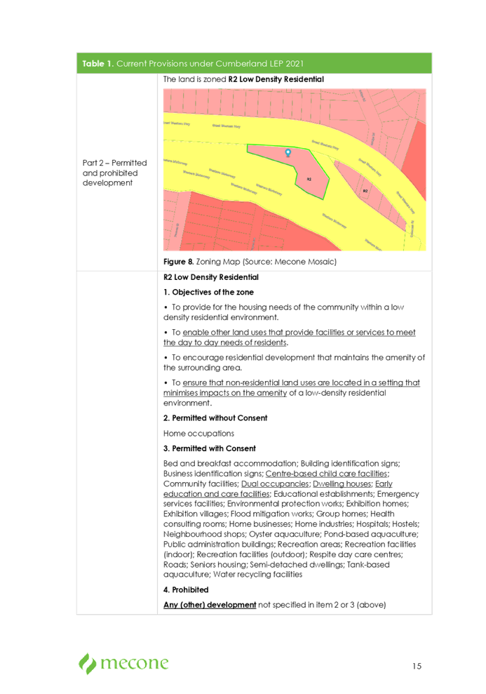
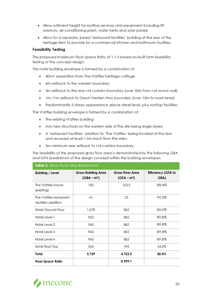
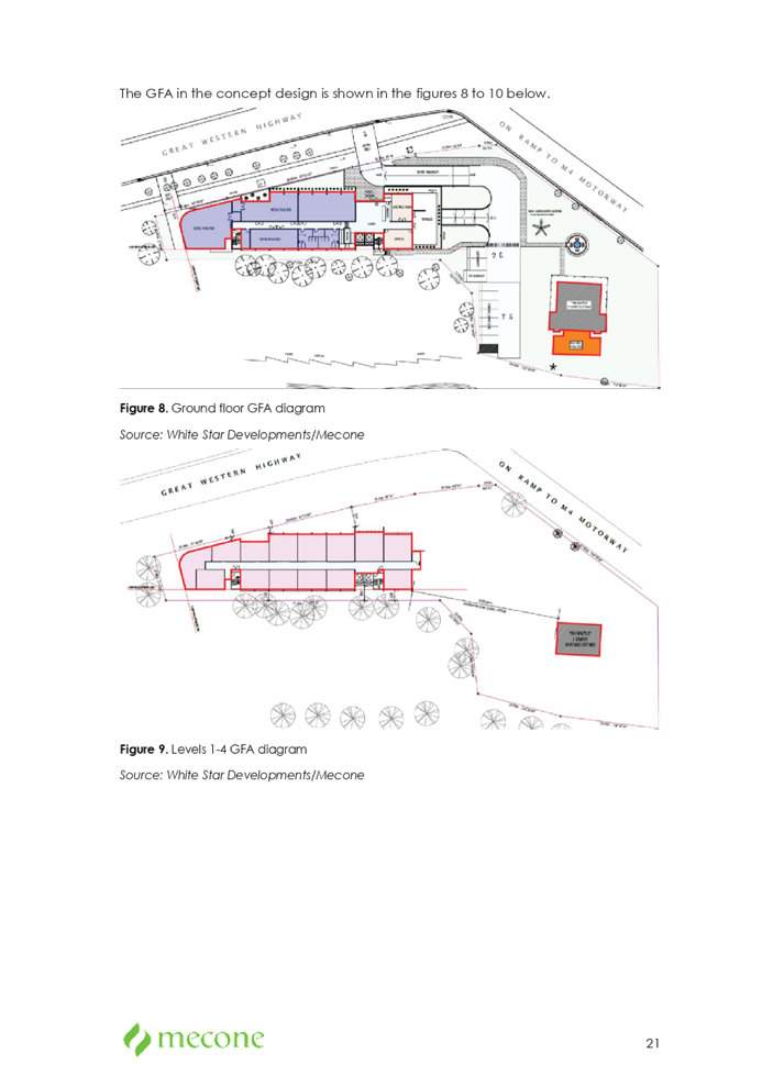
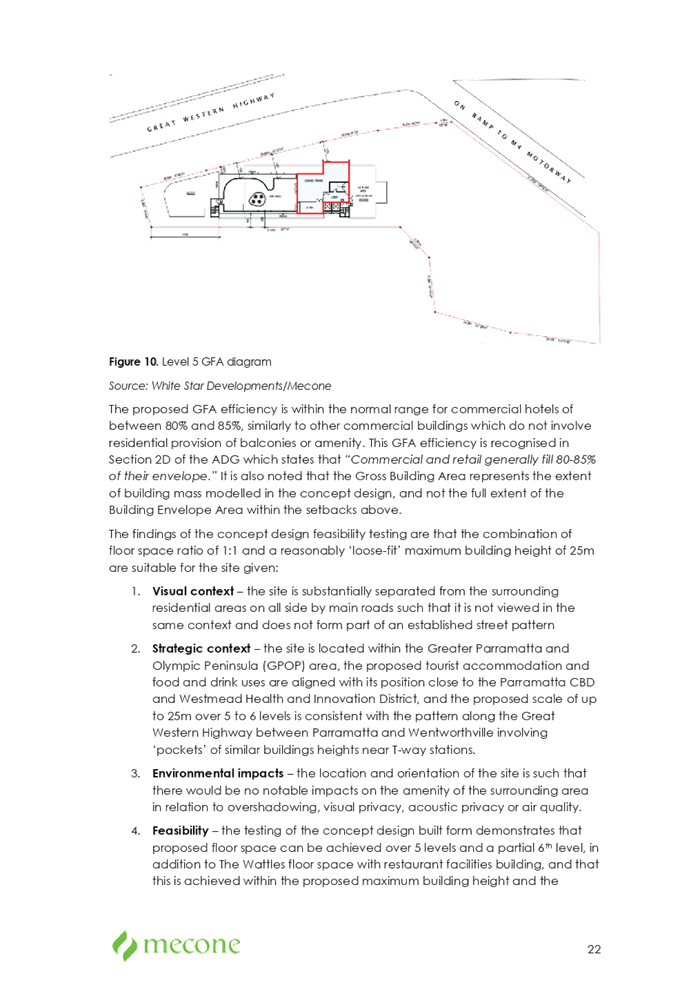

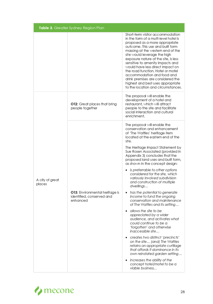
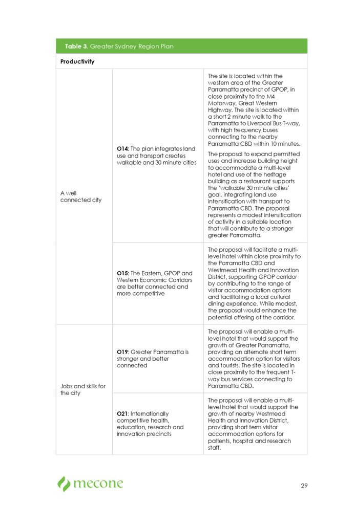
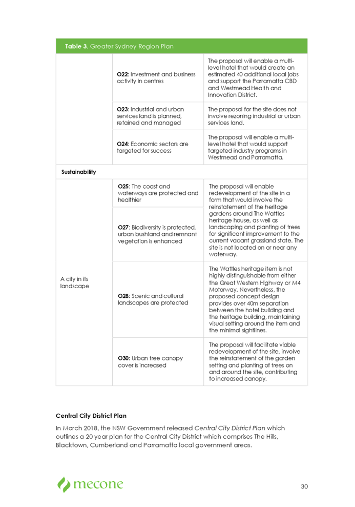
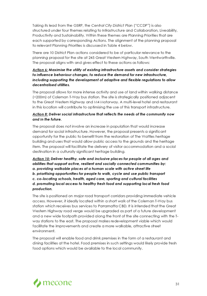
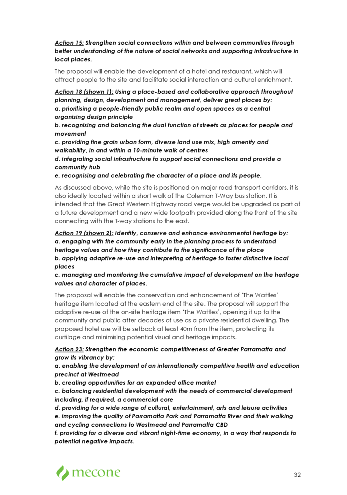
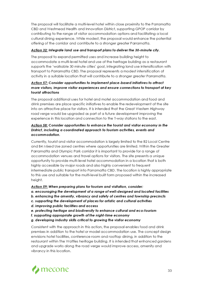
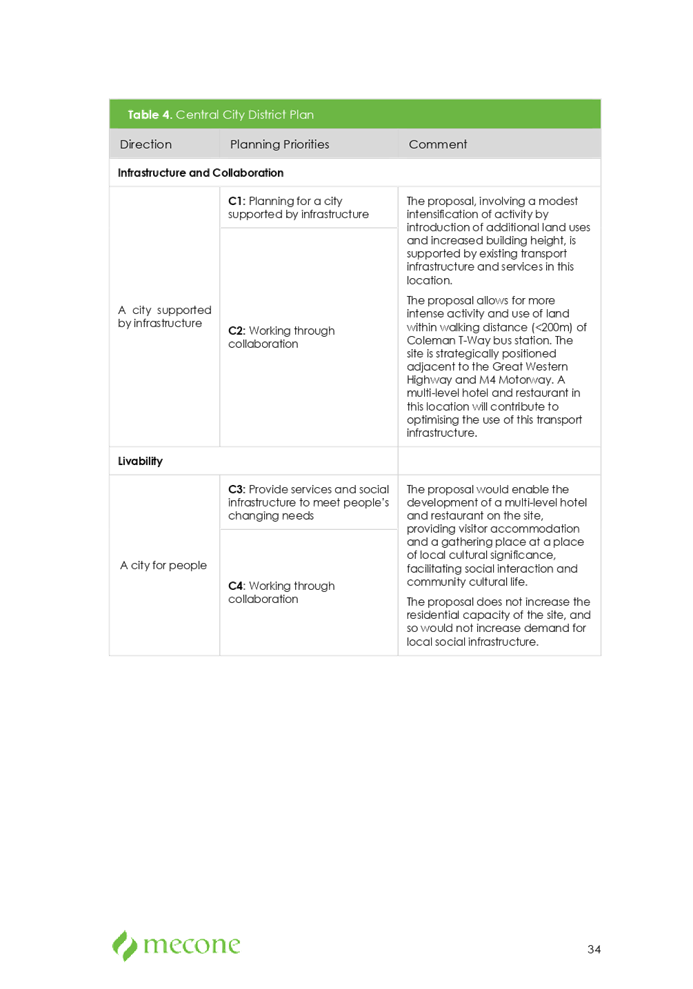
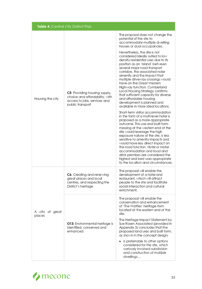
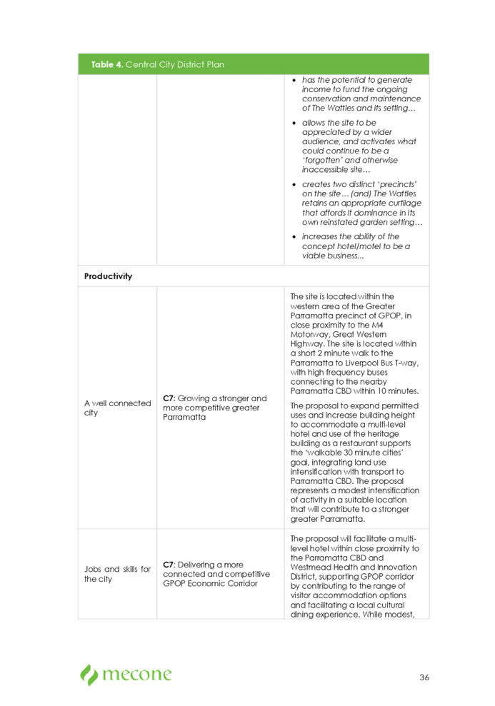
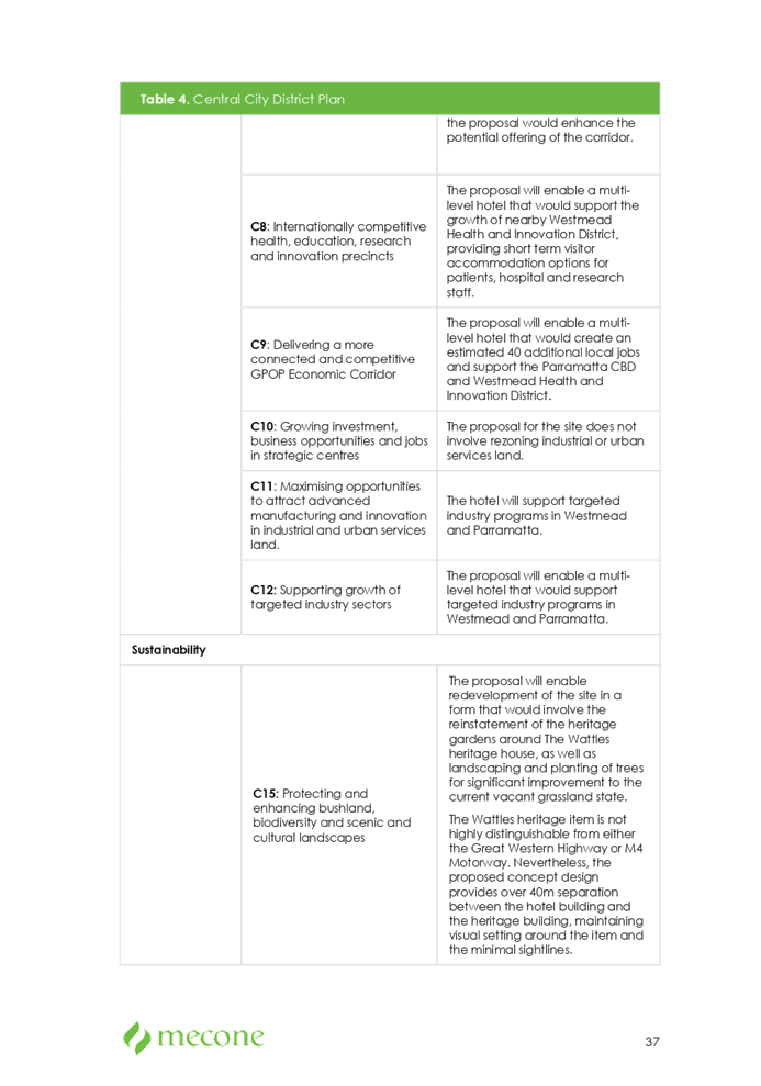
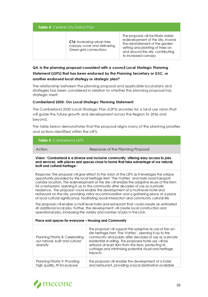
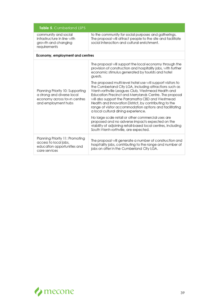
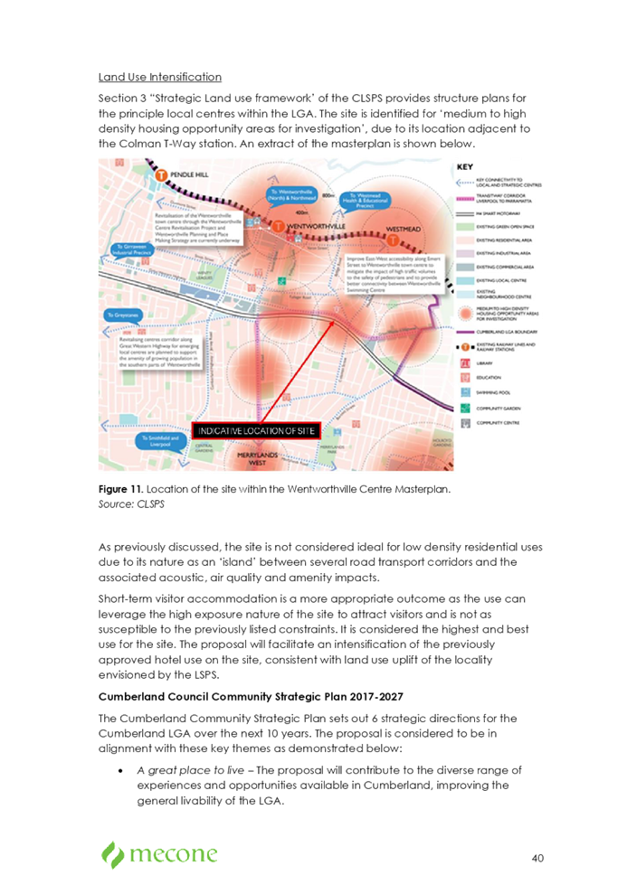
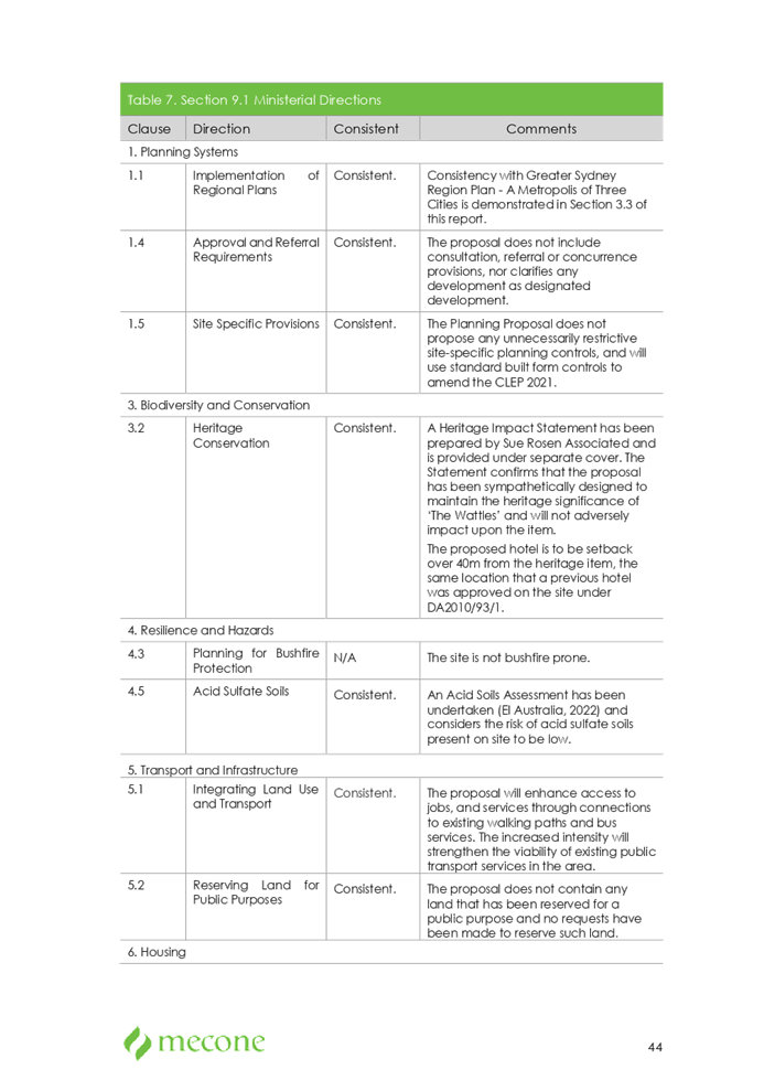
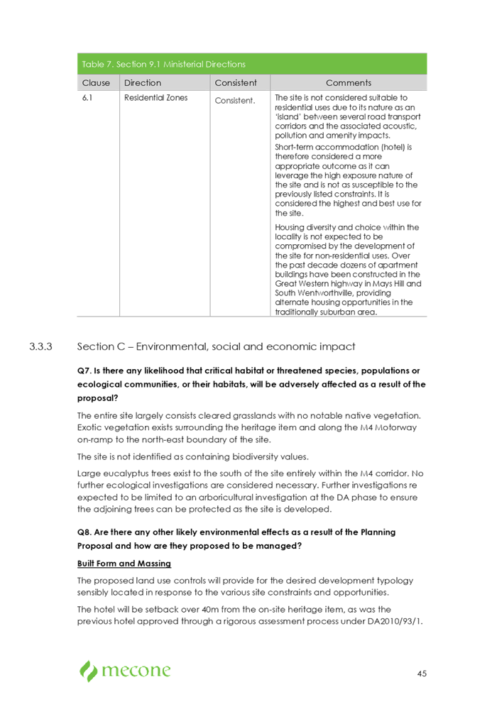
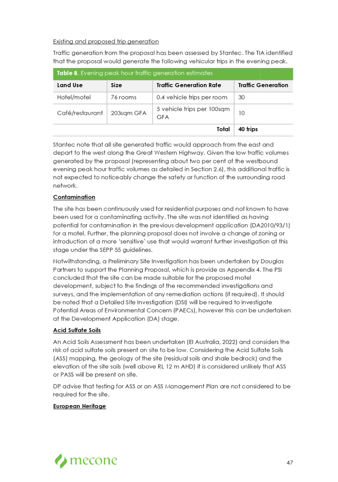

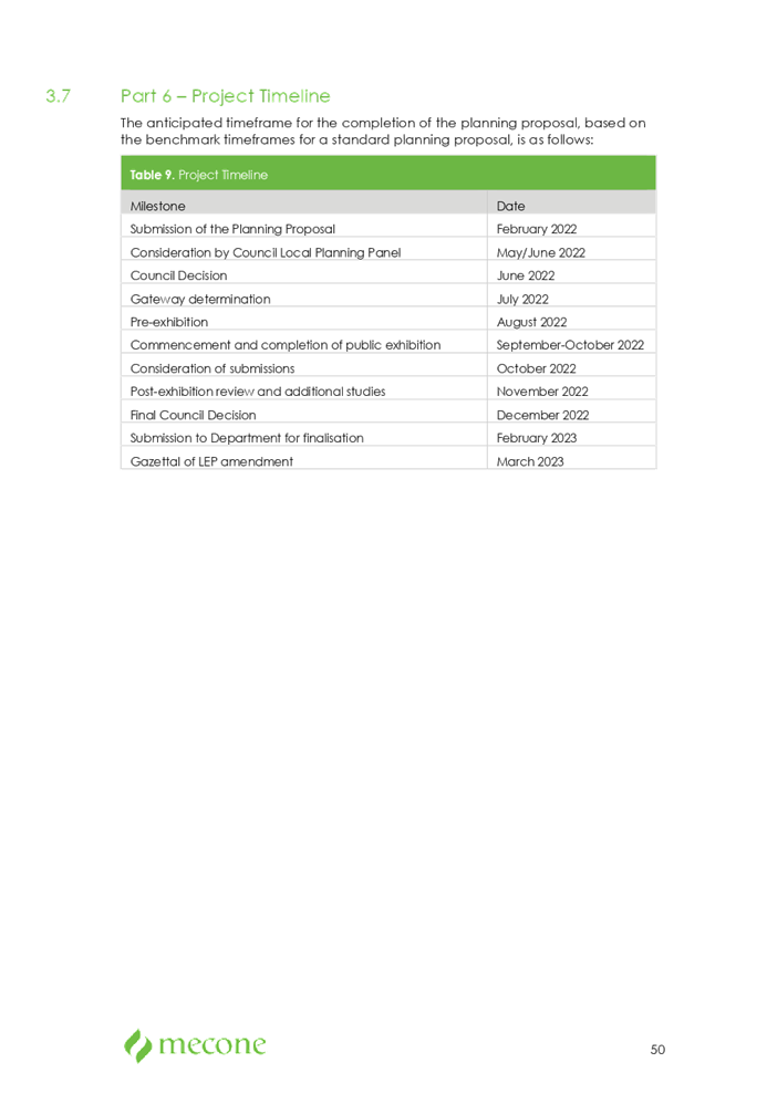

DOCUMENTS
ASSOCIATED WITH
REPORT LPP041/22
Attachment 2
Planning Proposal Concept Plans
Cumberland Local Planning Panel Meeting
13 July 2022
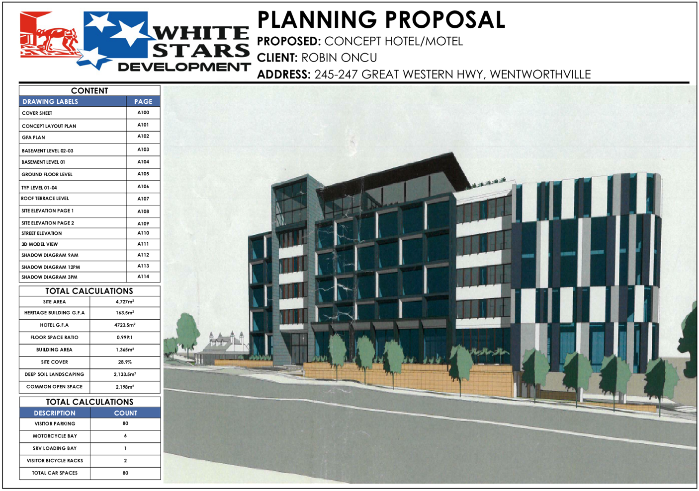
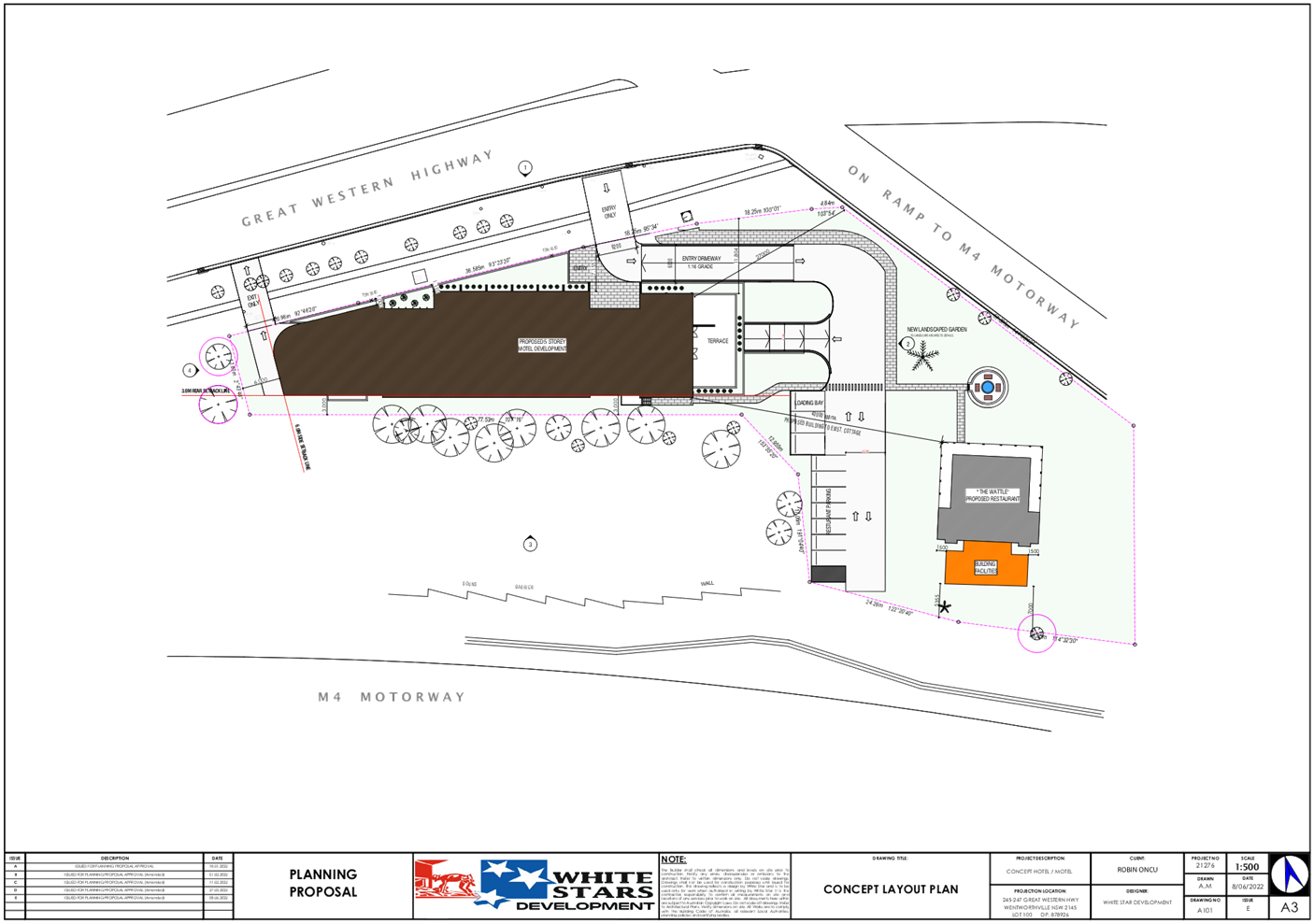
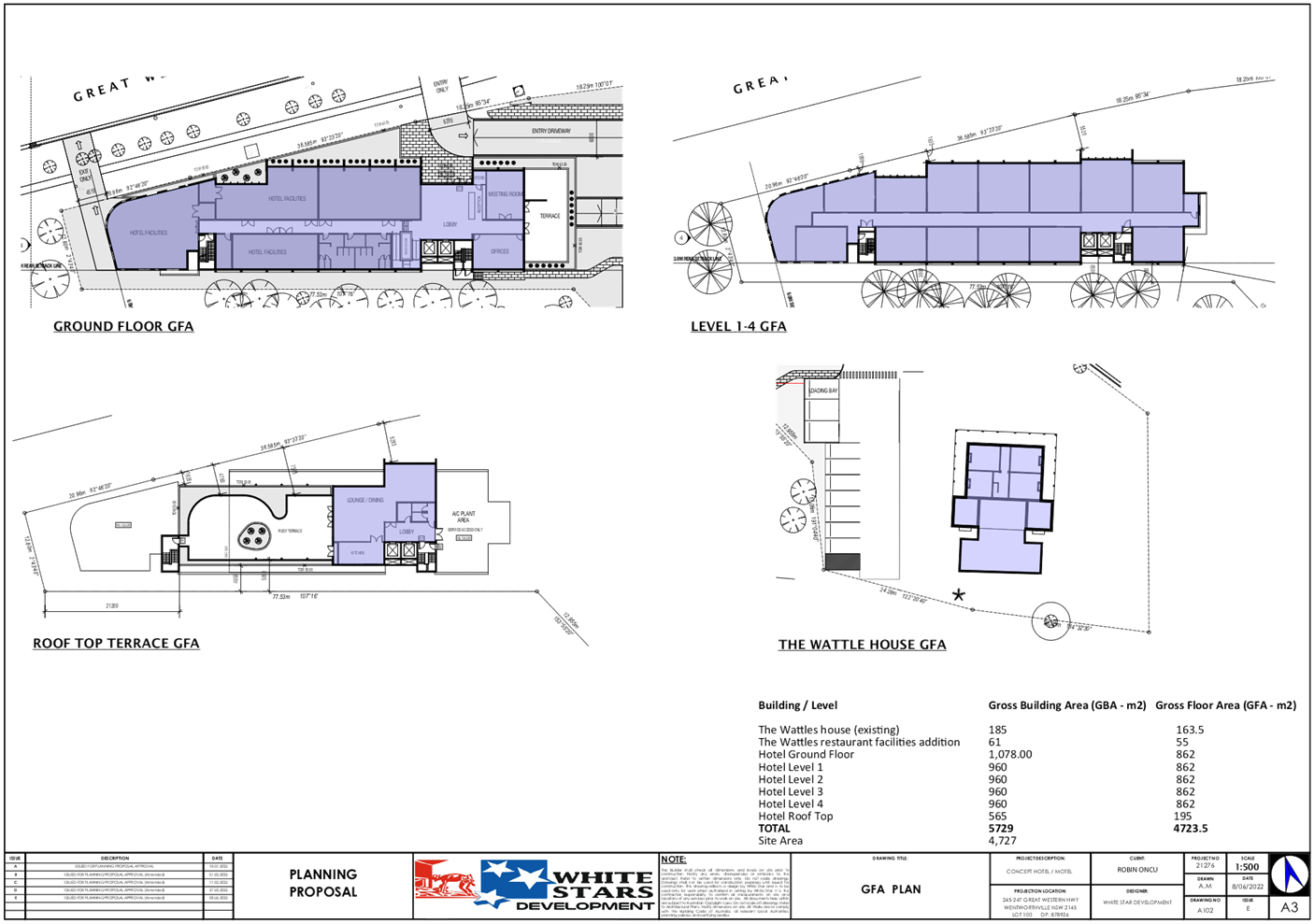
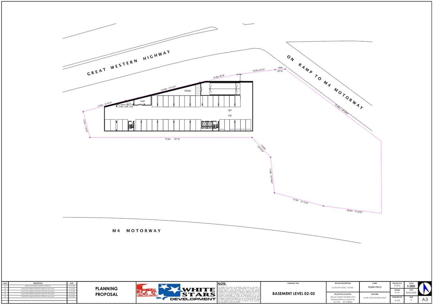
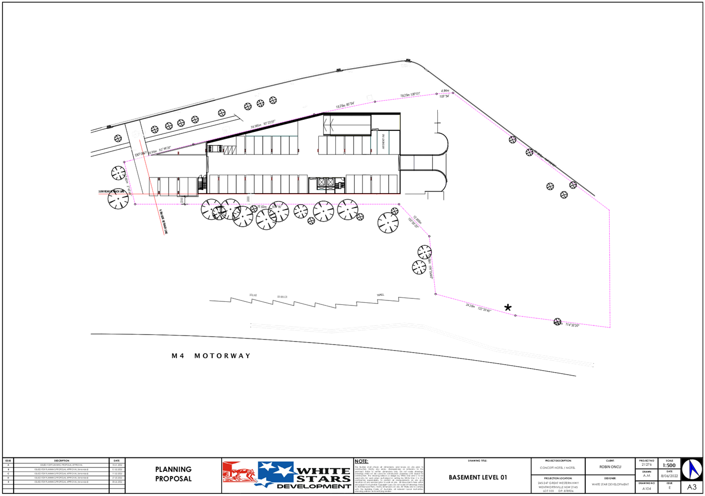
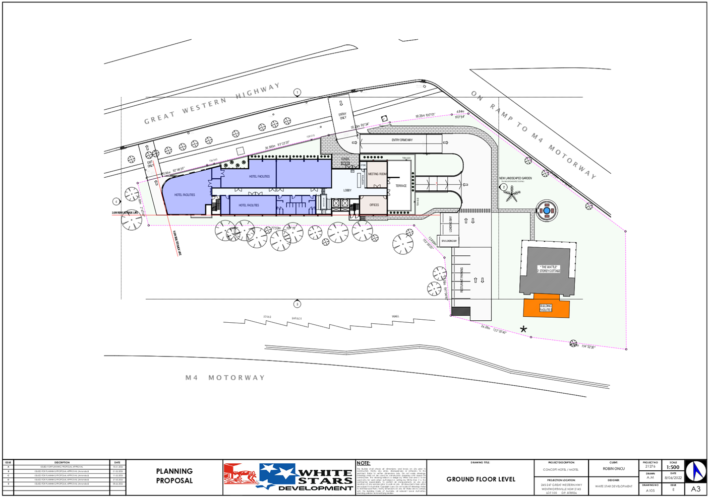
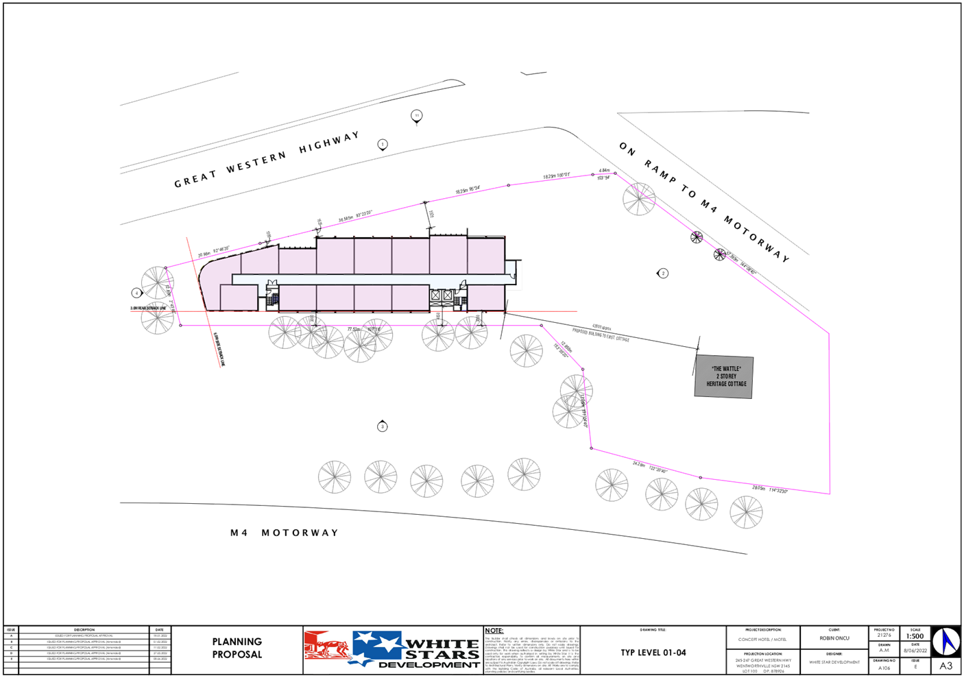
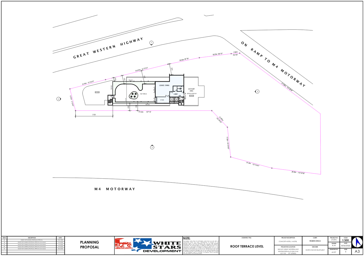
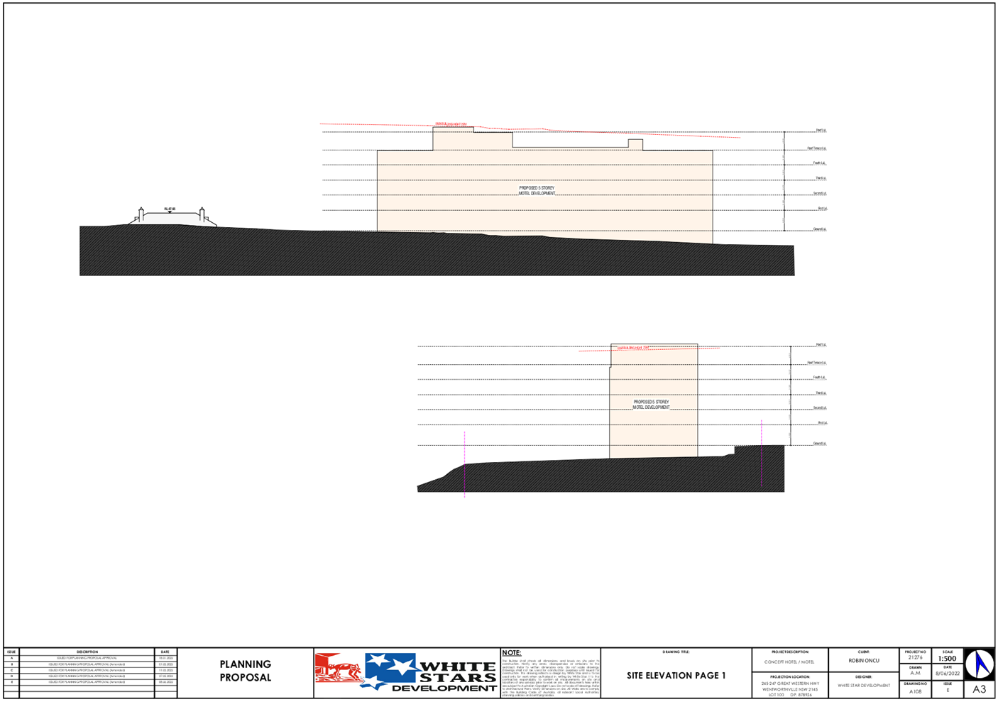
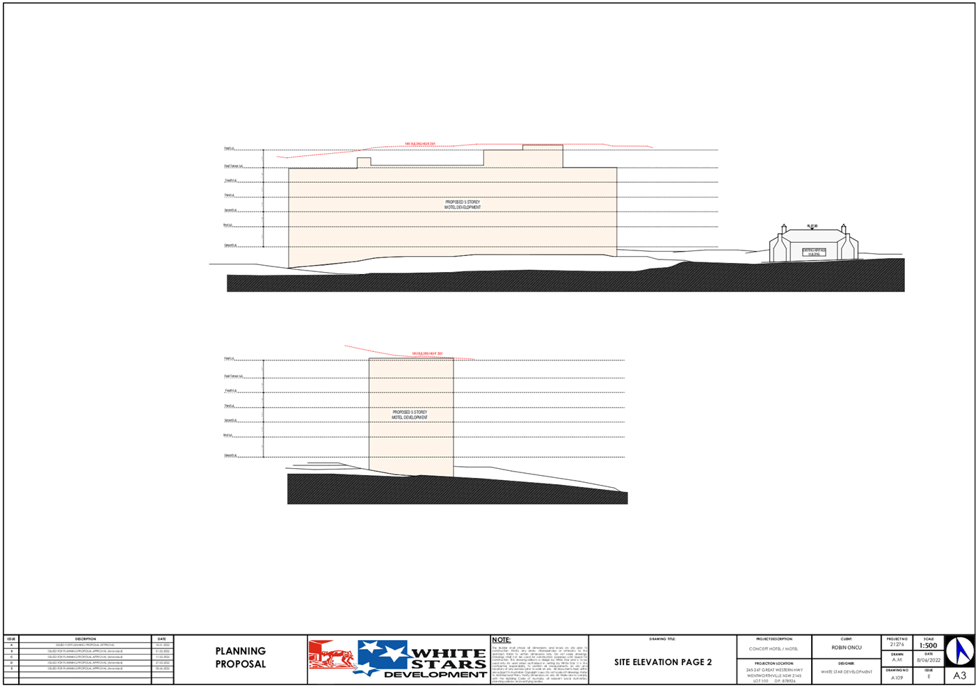
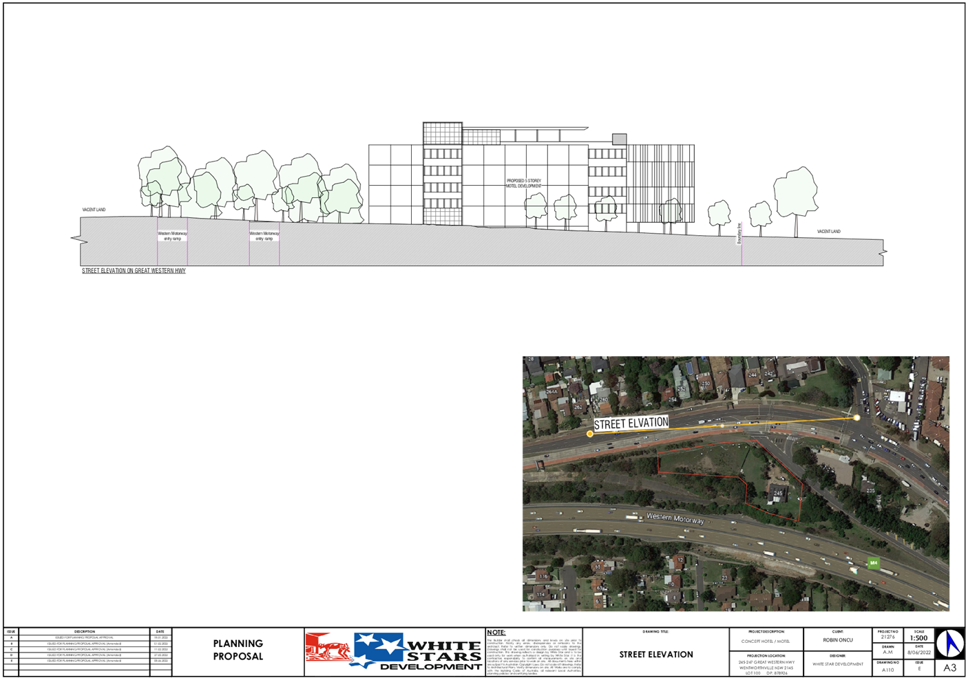

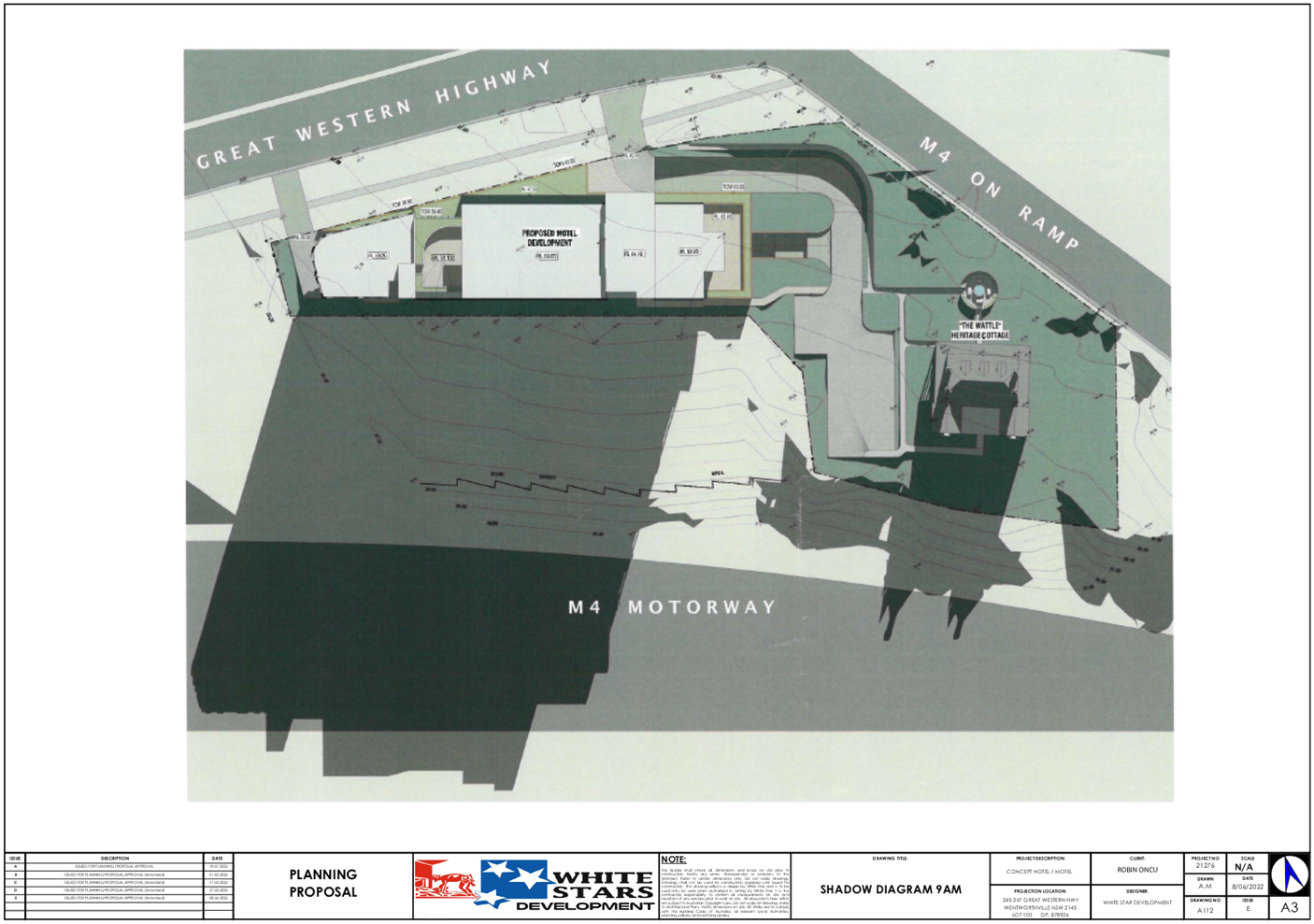
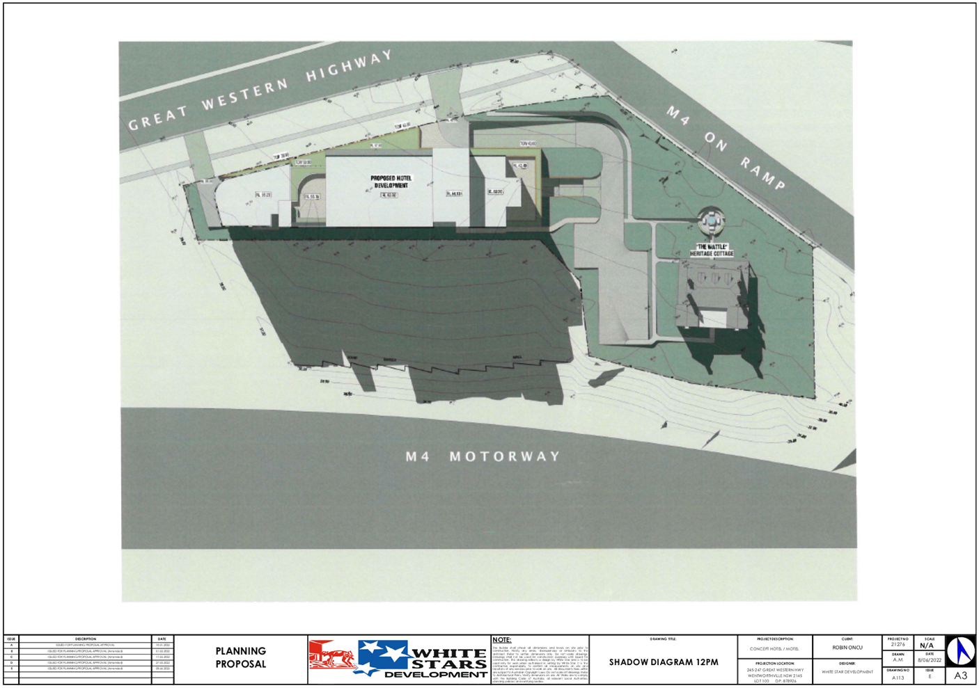
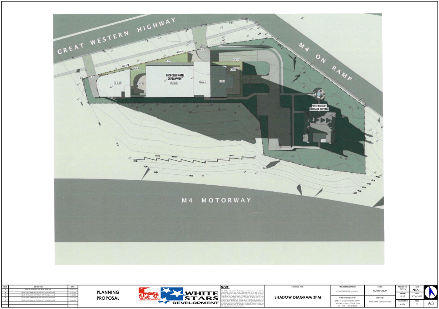
DOCUMENTS
ASSOCIATED WITH
REPORT LPP041/22
Attachment 3
Architectural Plans for Approved DA
Cumberland Local Planning Panel Meeting
13 July 2022
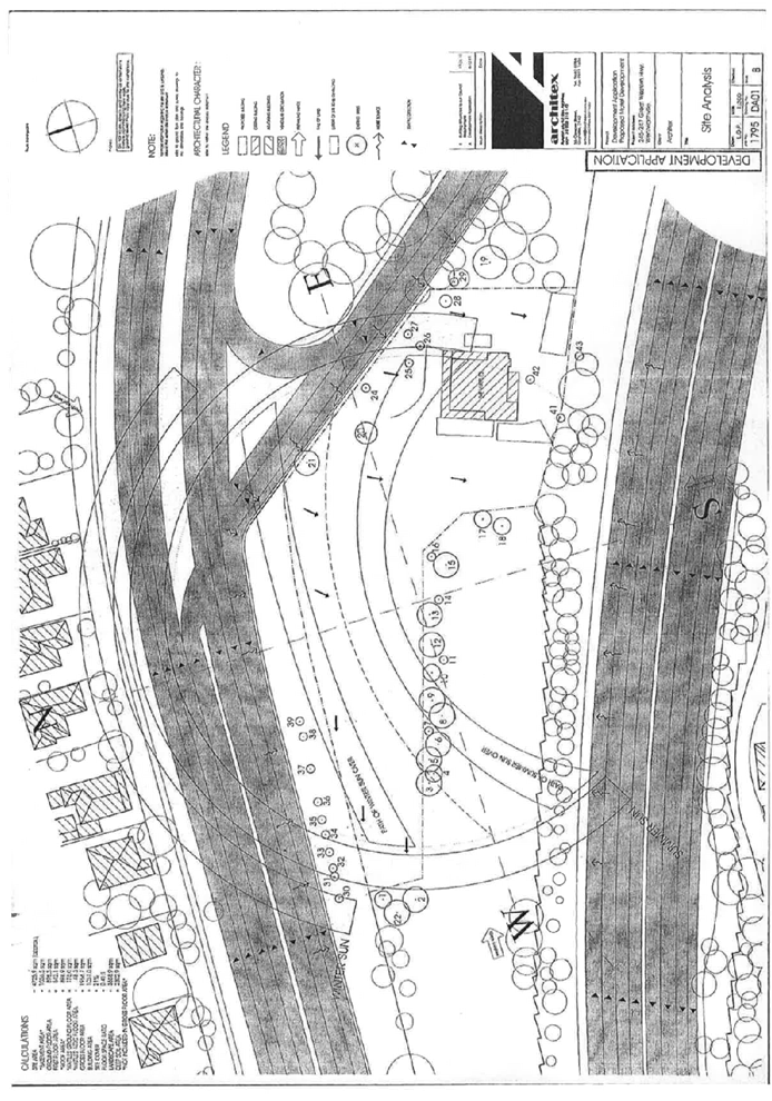
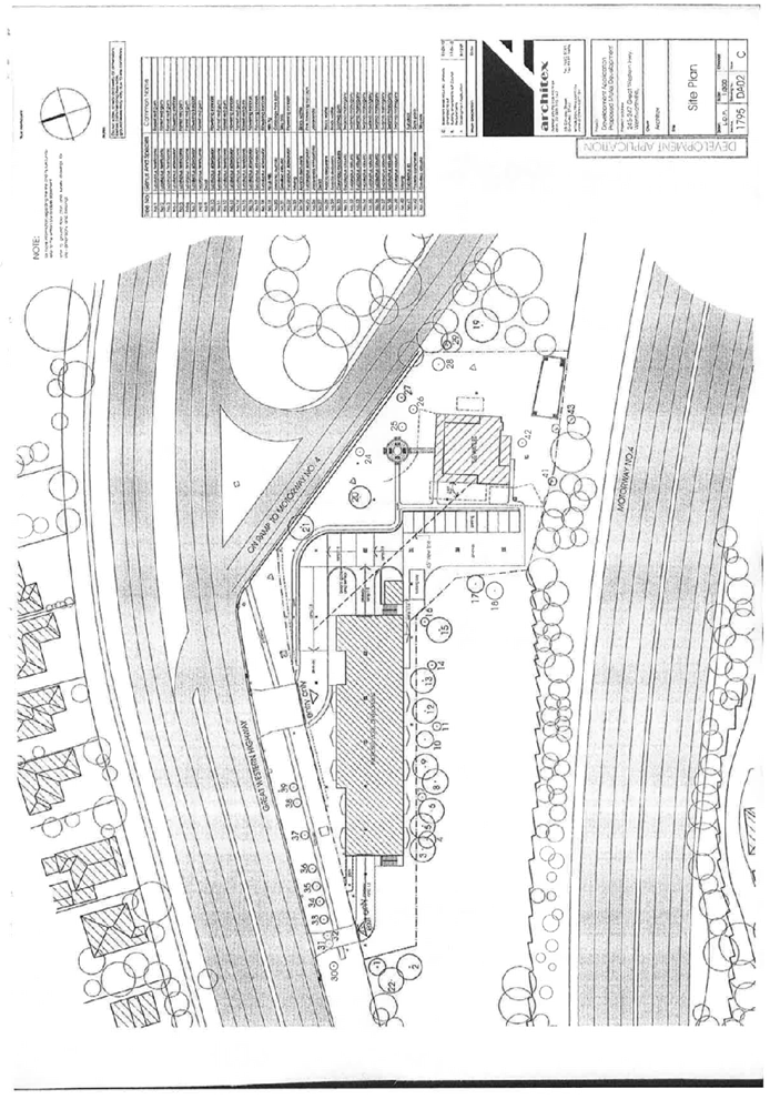
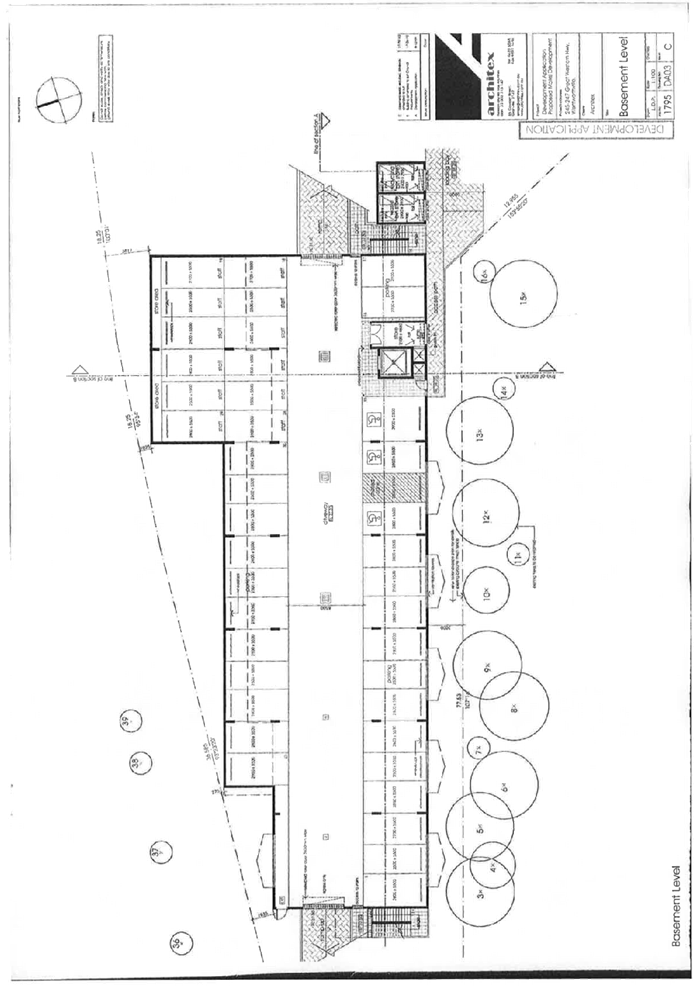
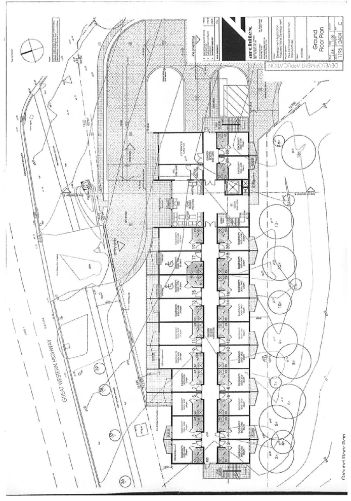
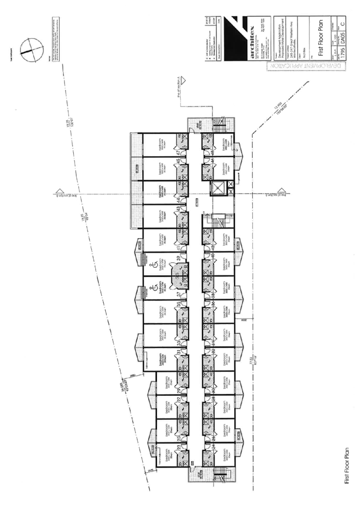
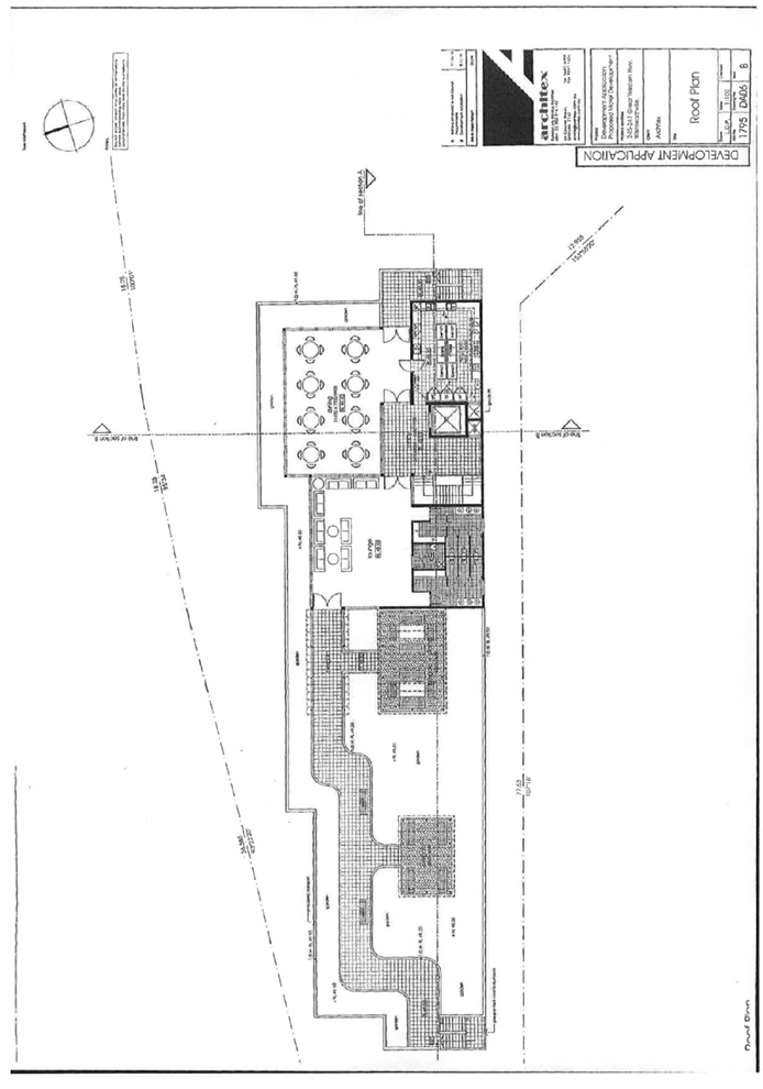
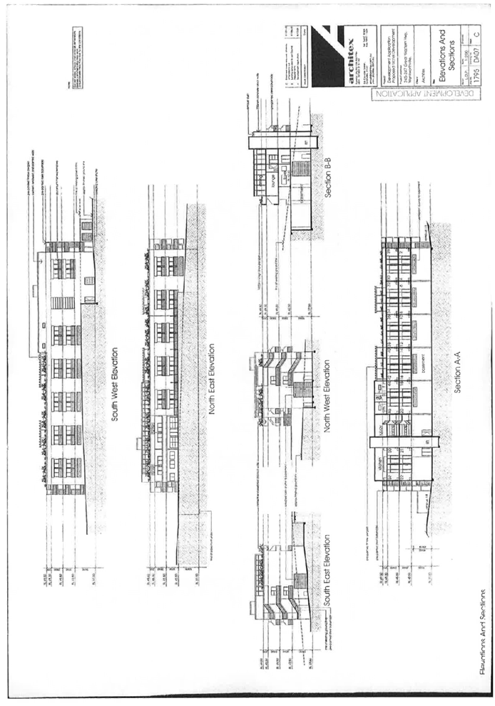
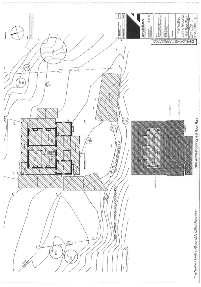
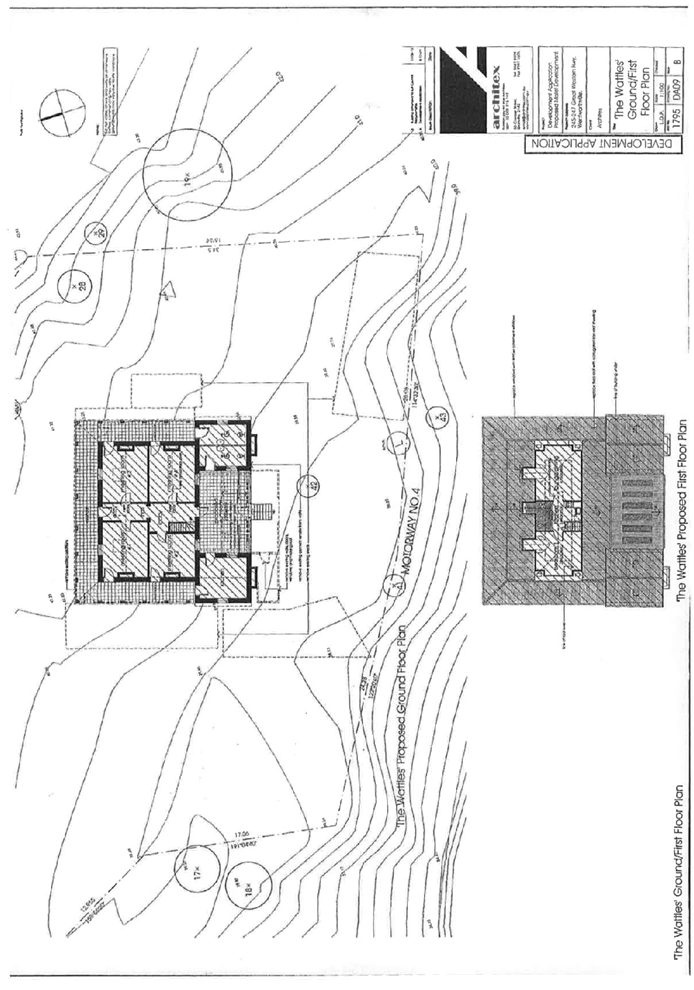
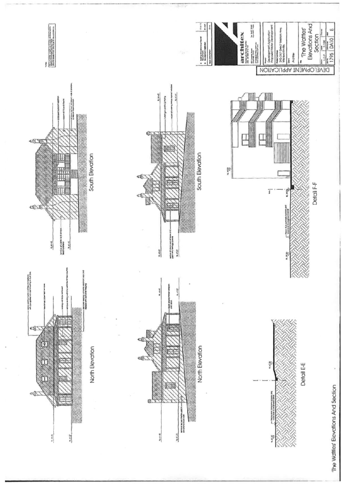
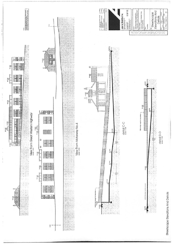
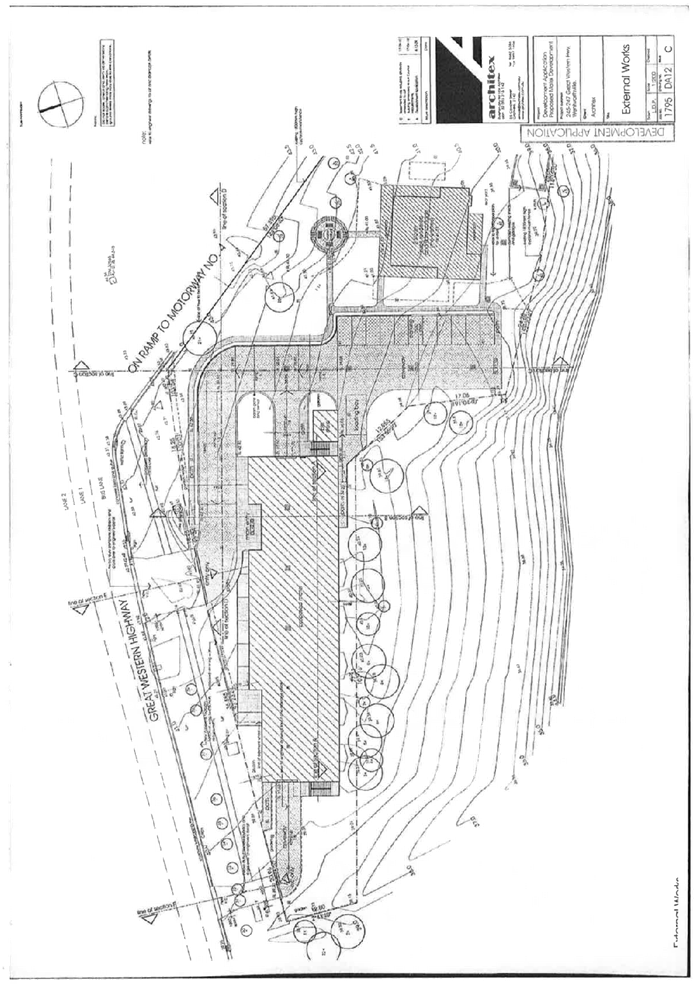
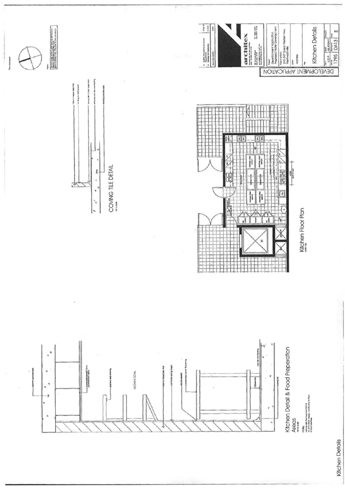
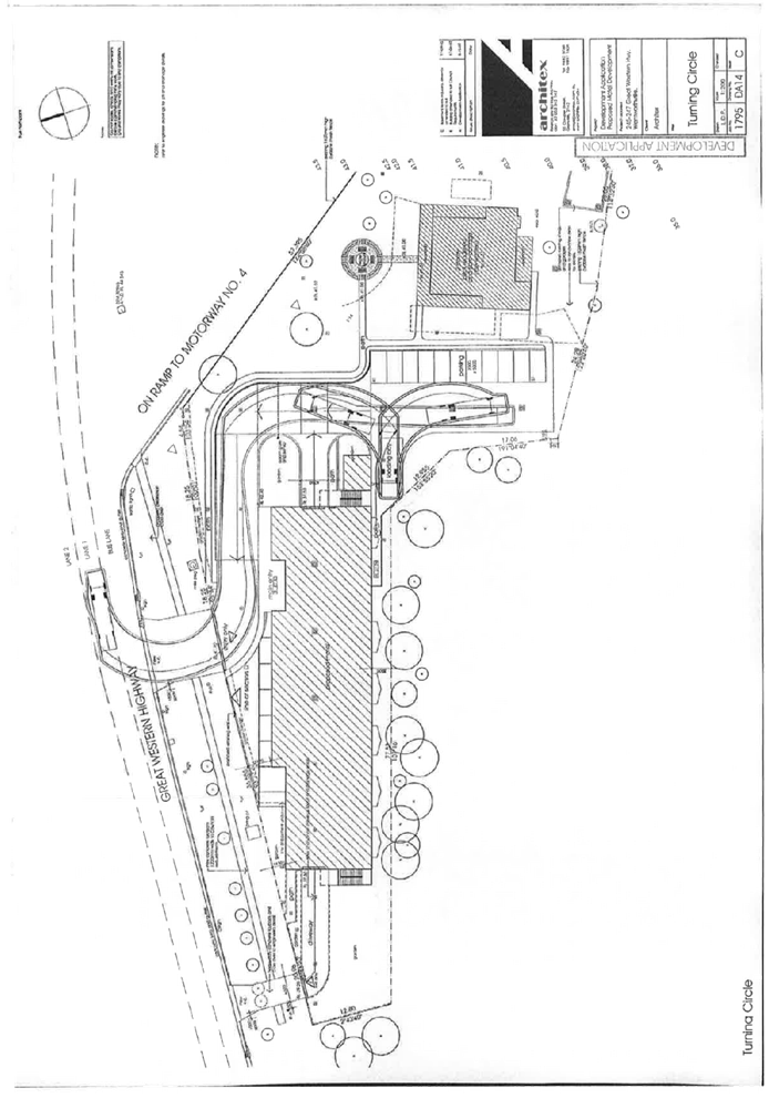
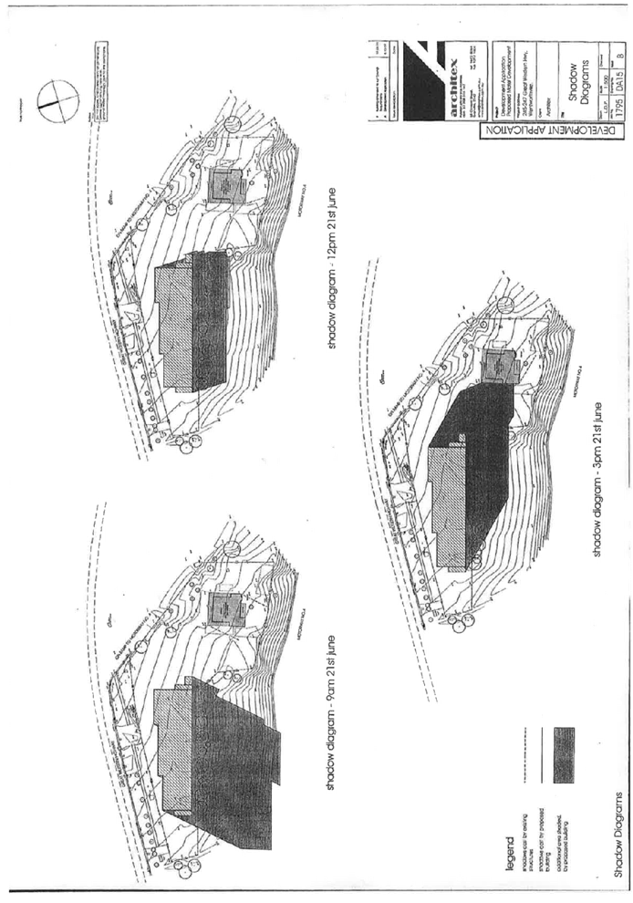
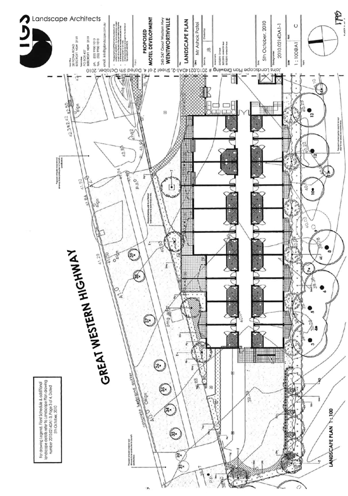
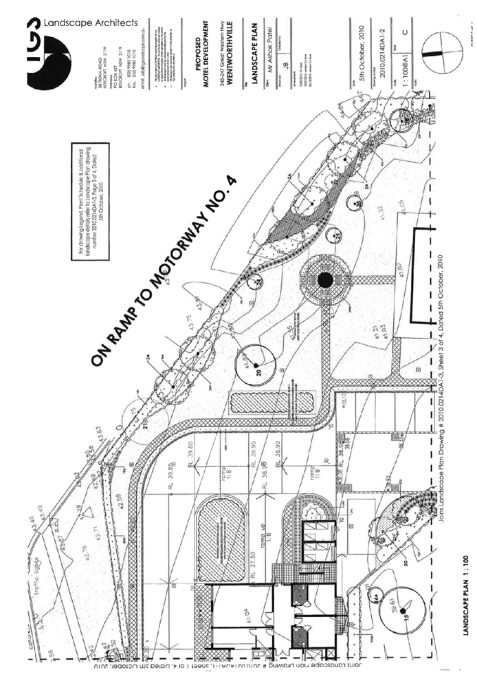
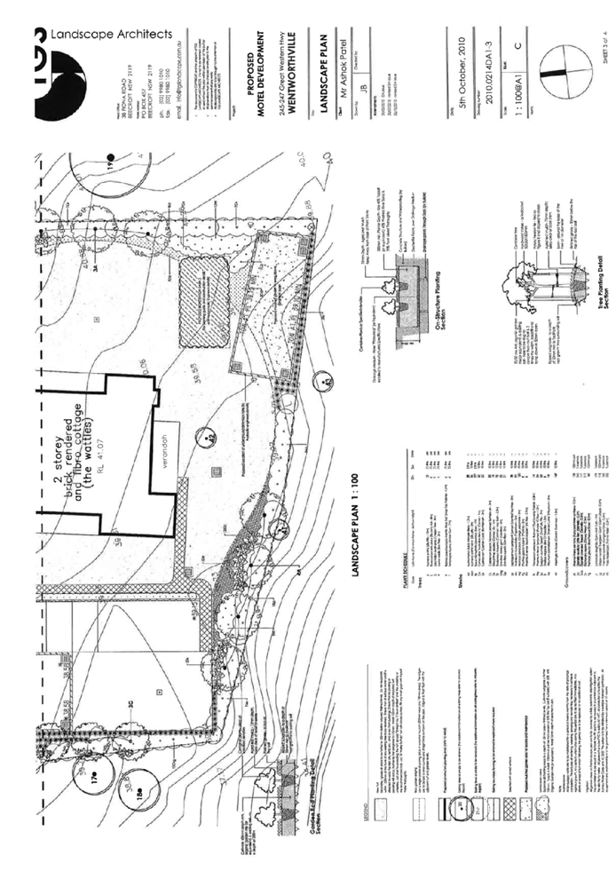
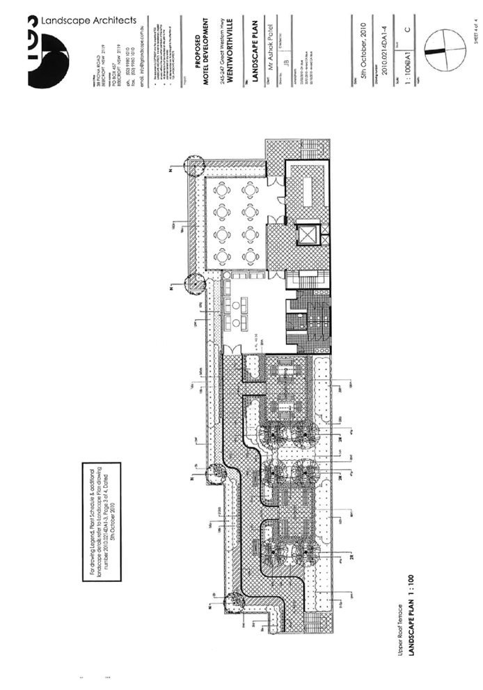
DOCUMENTS
ASSOCIATED WITH
REPORT LPP041/22
Attachment 4
Traffic Impact Assessment
Cumberland Local Planning Panel Meeting
13 July 2022
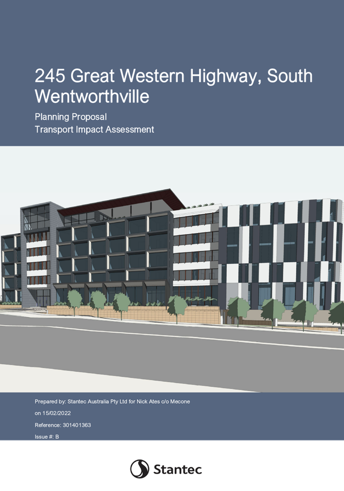
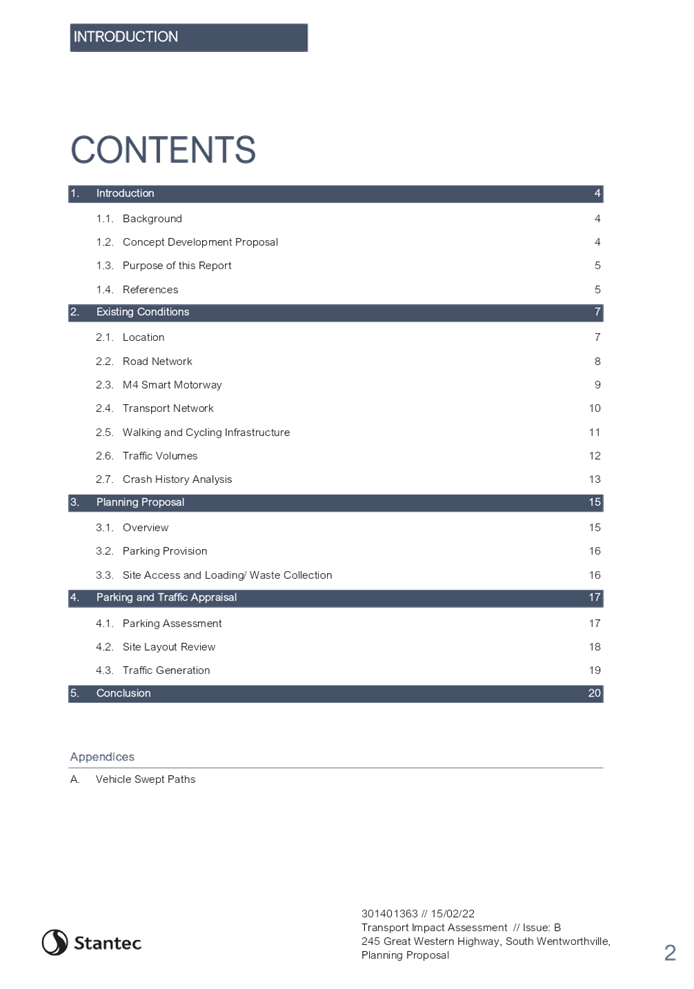
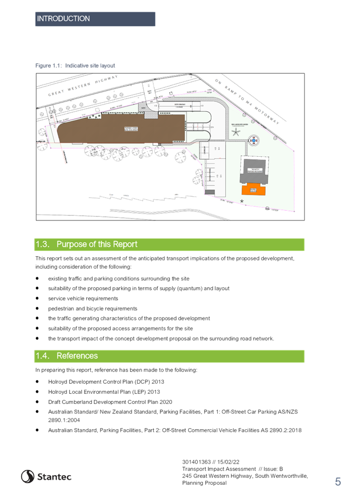

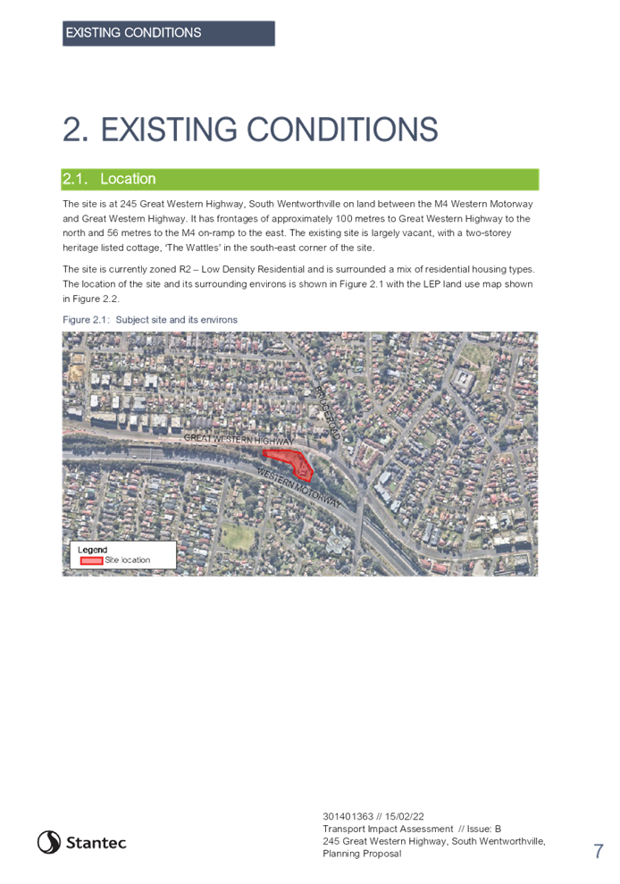
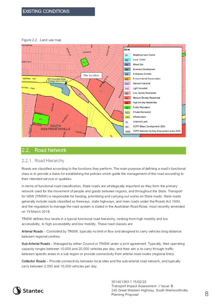
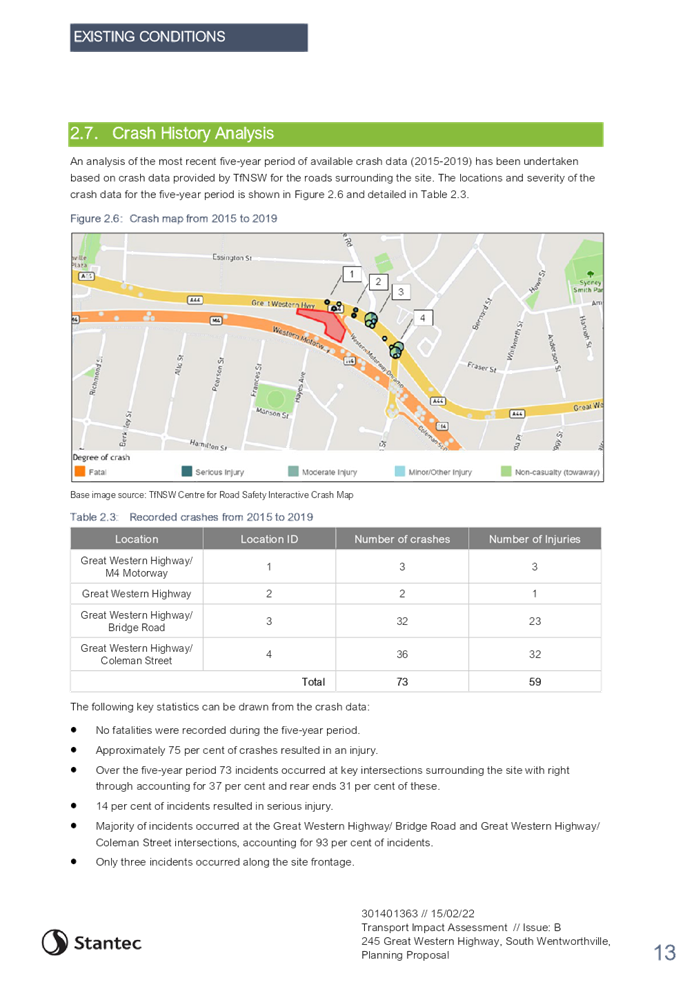

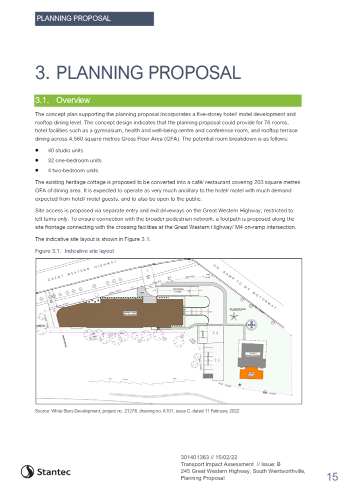
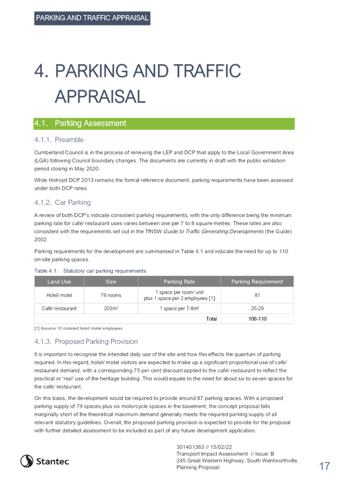
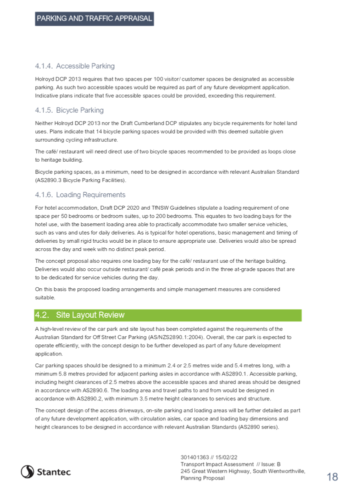
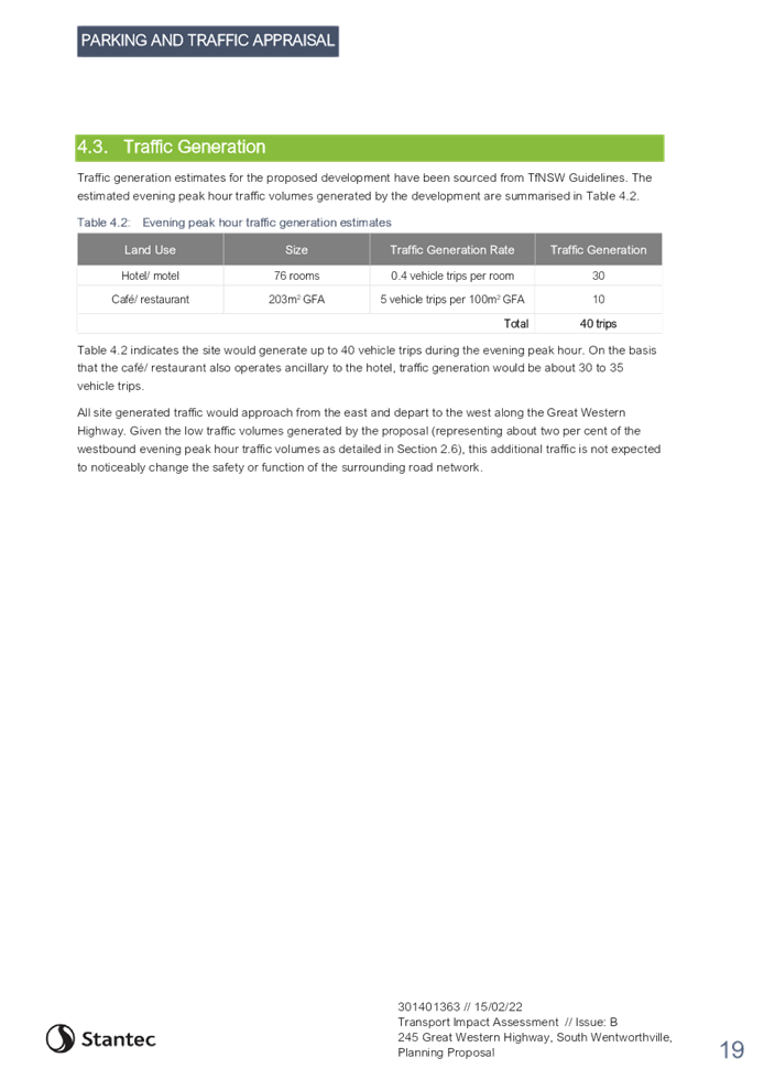
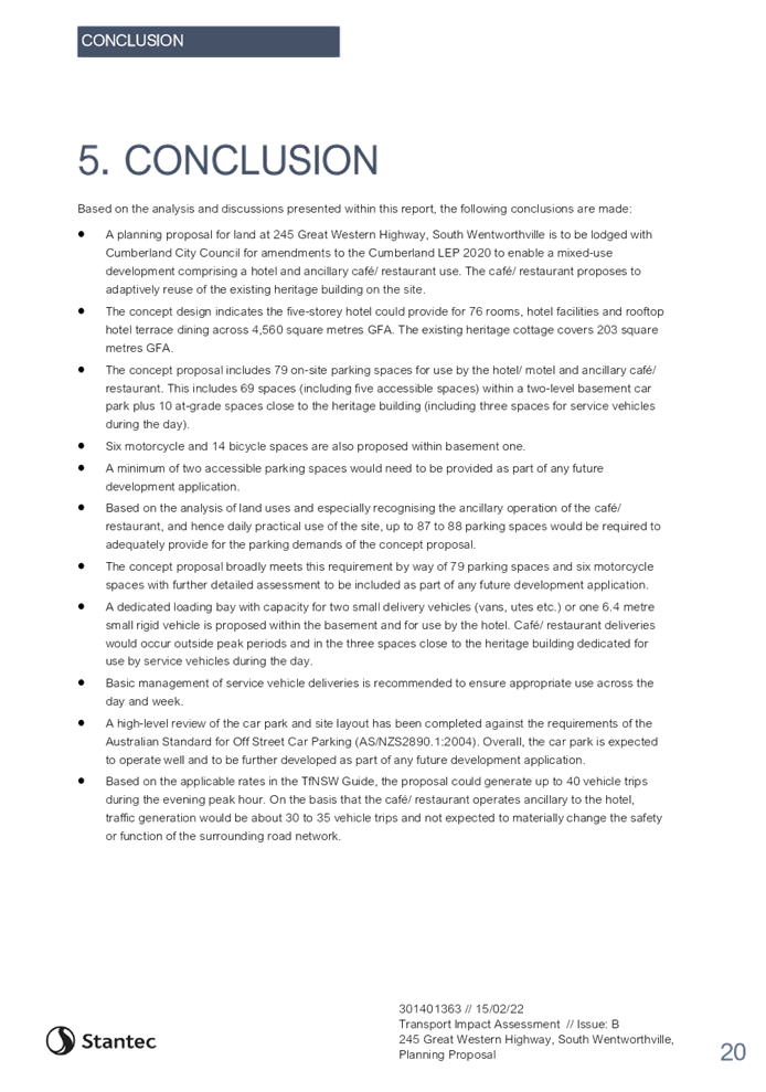
DOCUMENTS
ASSOCIATED WITH
REPORT LPP041/22
Attachment 5
Heritage Impact Statement
Cumberland Local Planning Panel Meeting
13 July 2022
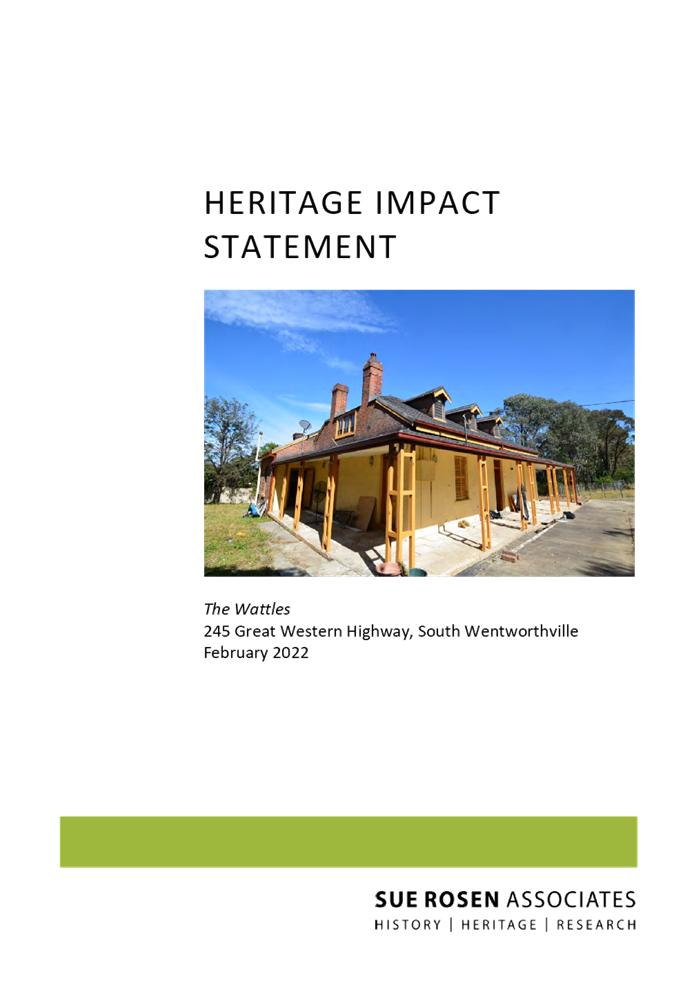

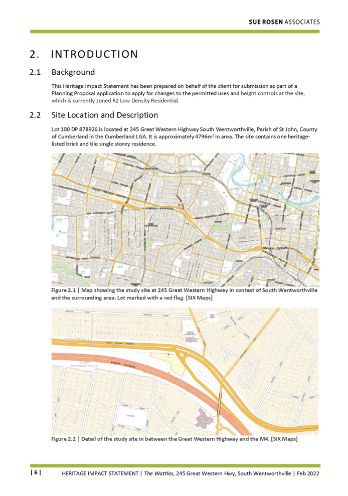
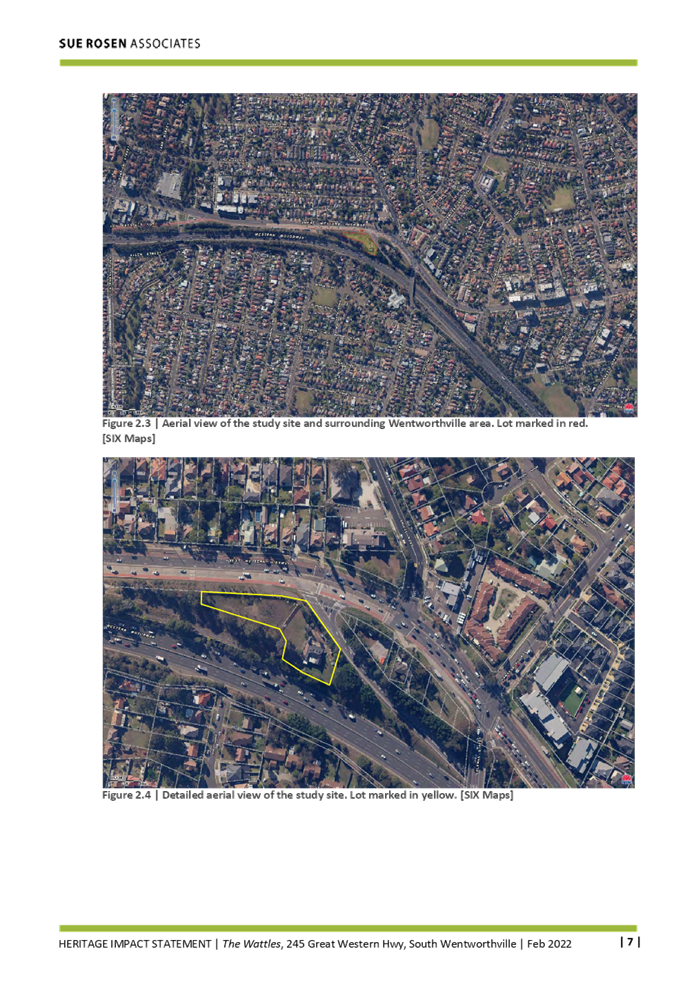
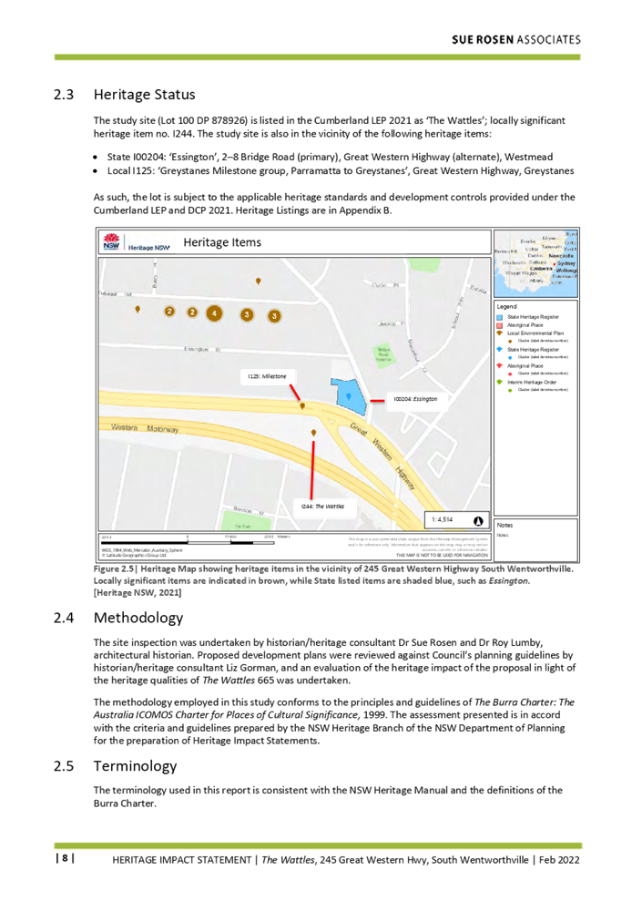
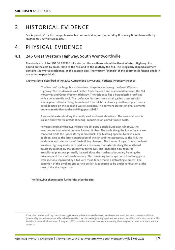
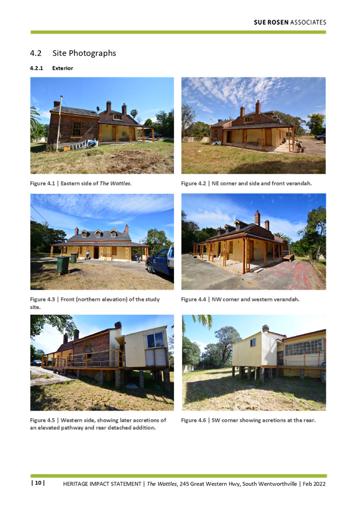
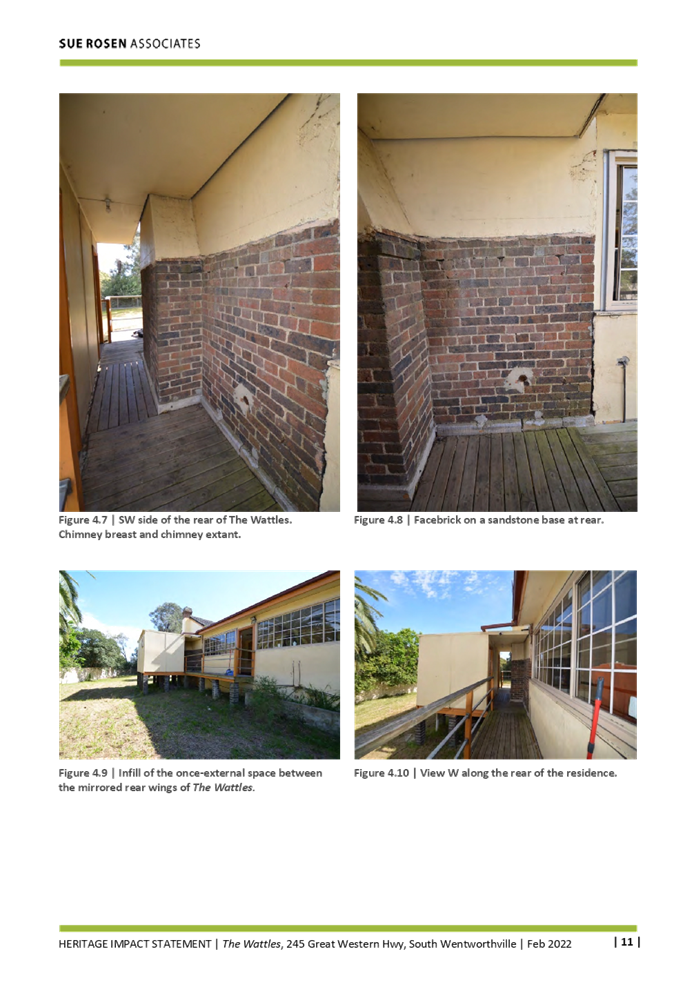
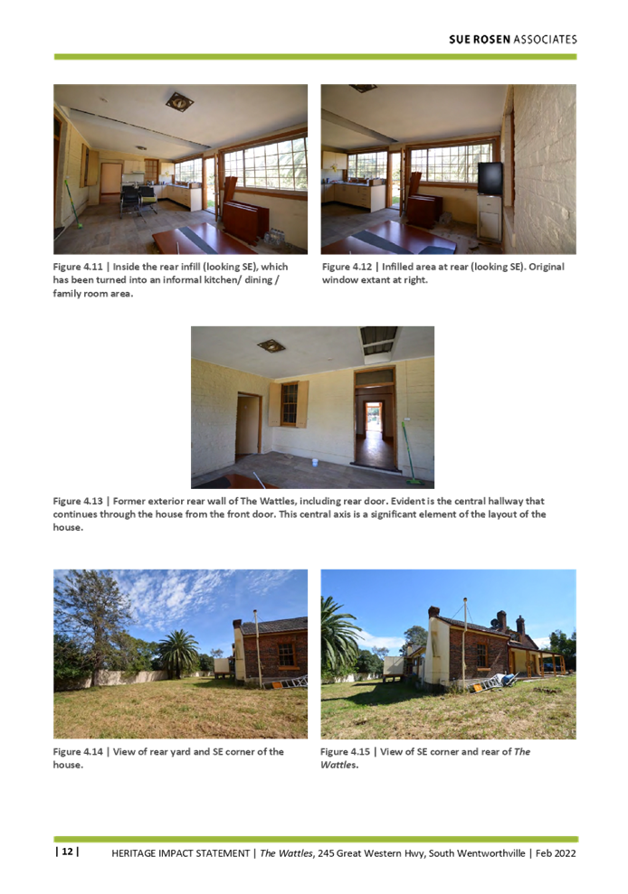
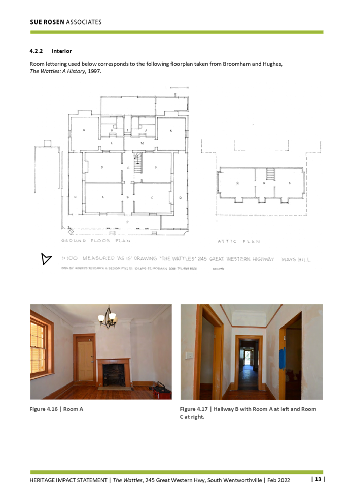
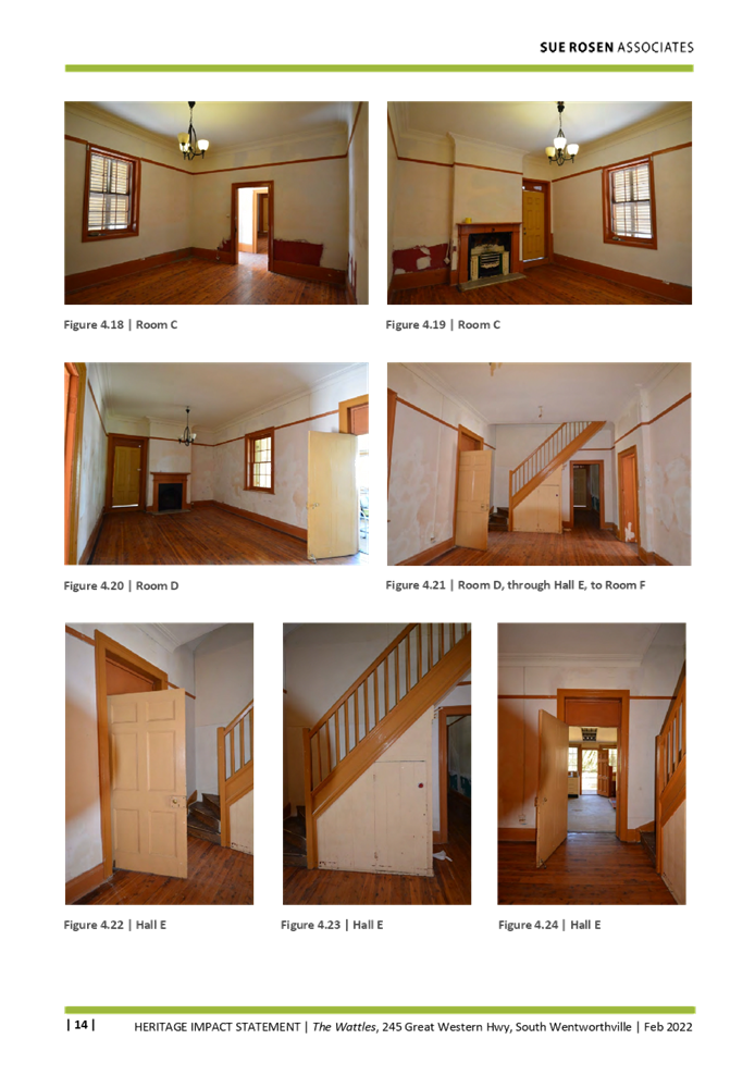
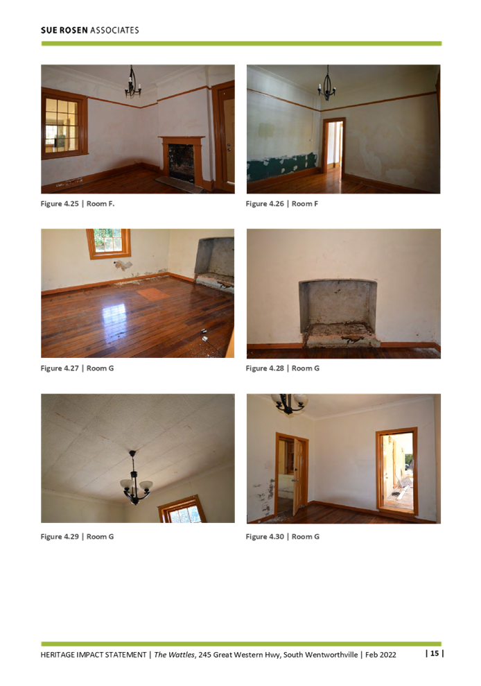
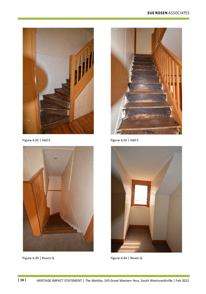
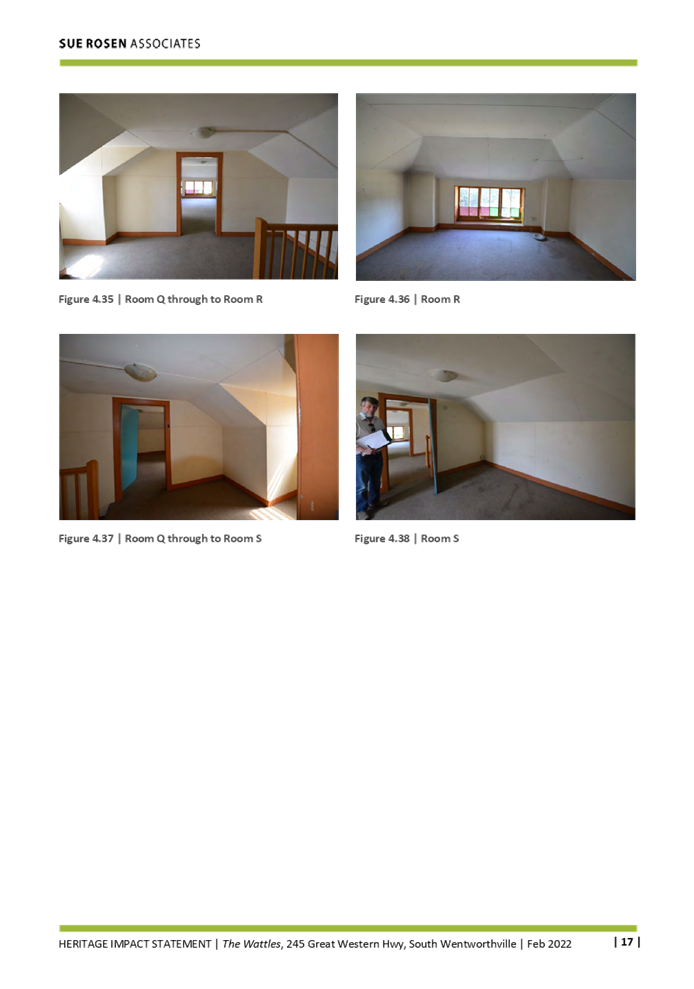
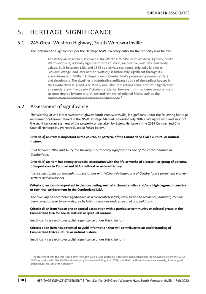
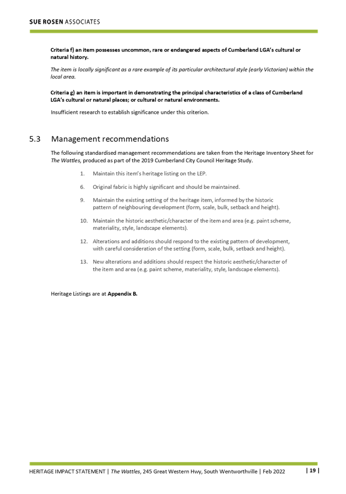
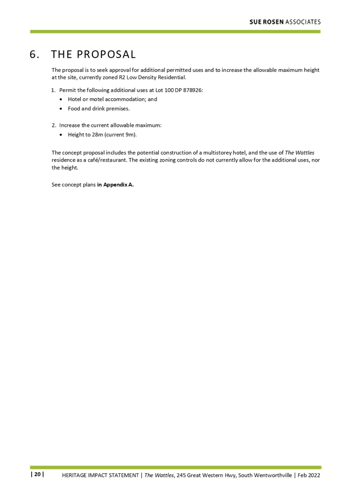
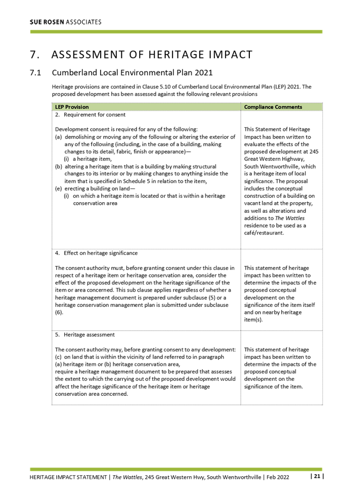
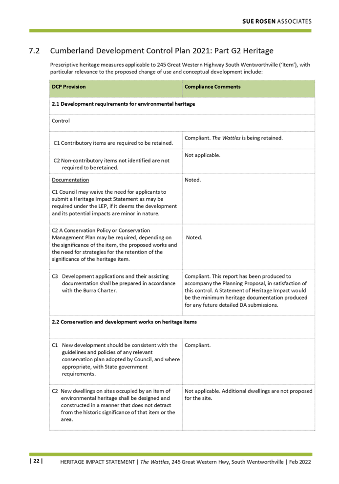
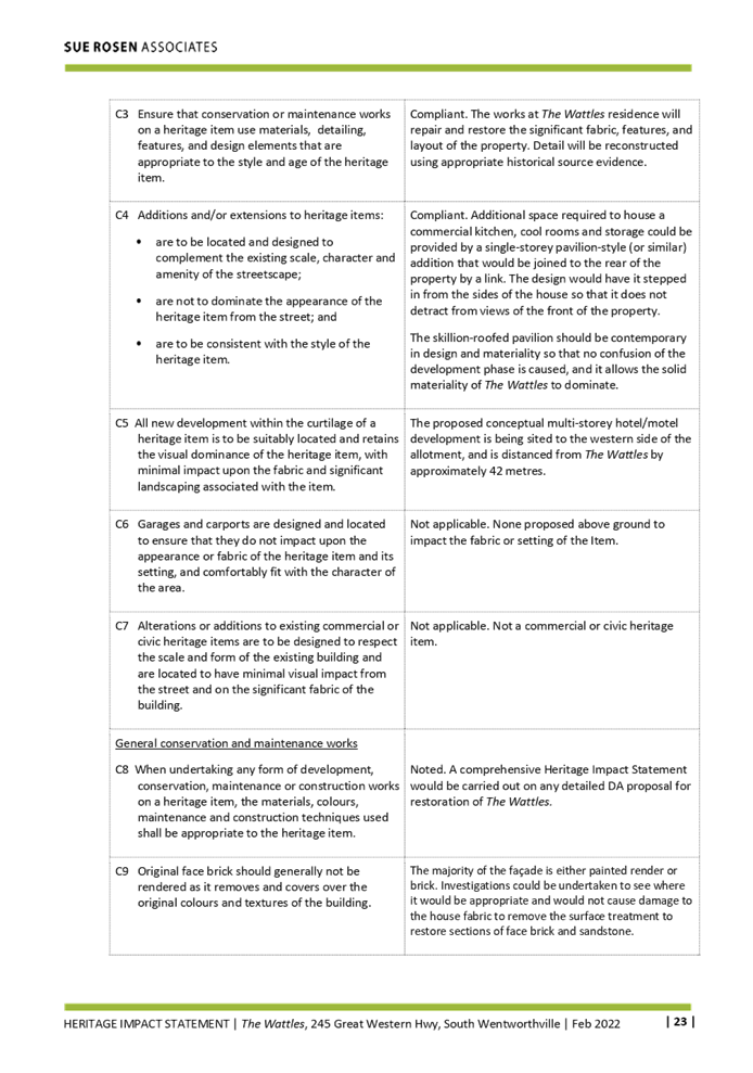
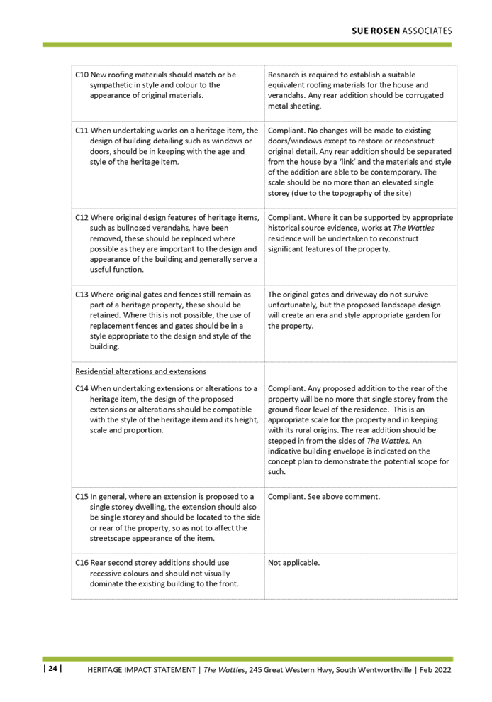
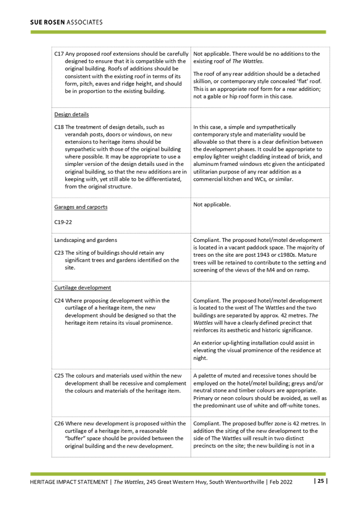
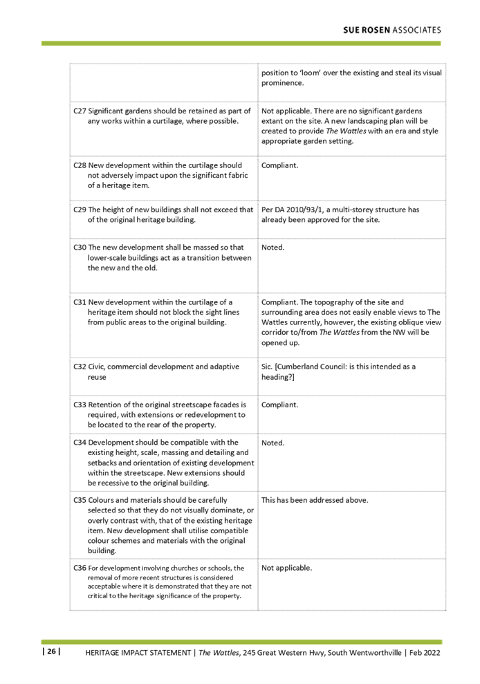
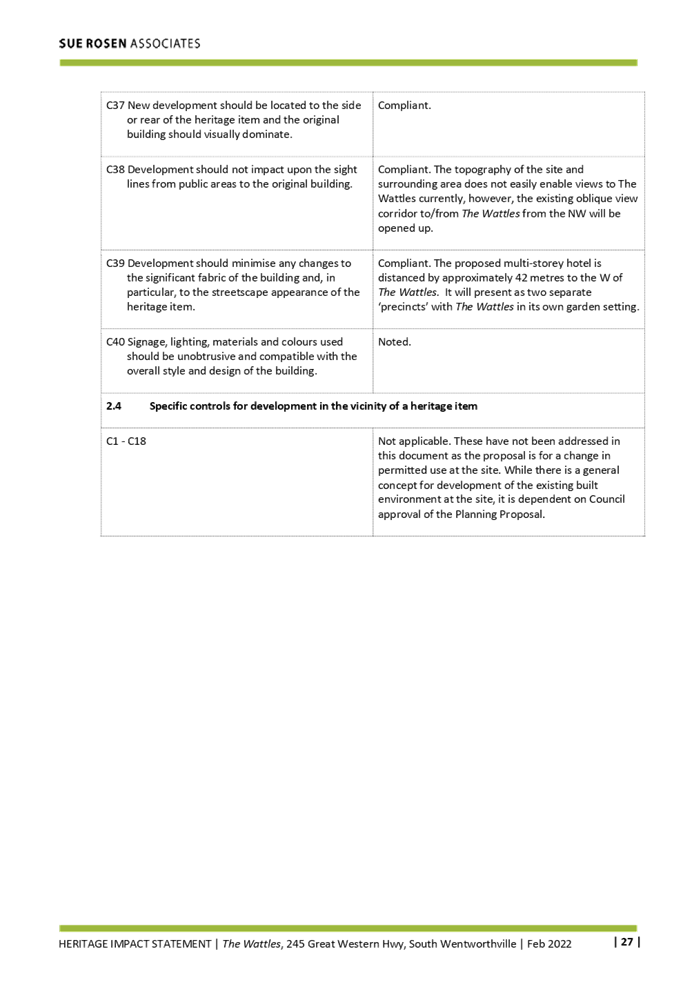
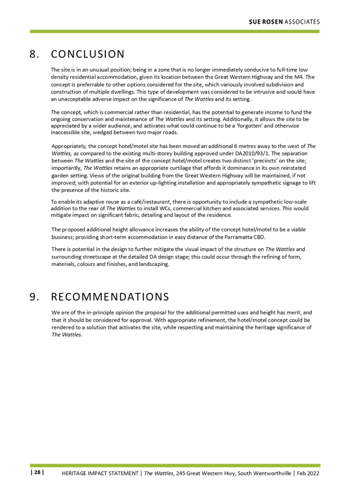
DOCUMENTS
ASSOCIATED WITH
REPORT LPP041/22
Attachment 6
Schedule of Conservation Works
Cumberland Local Planning Panel Meeting
13 July 2022
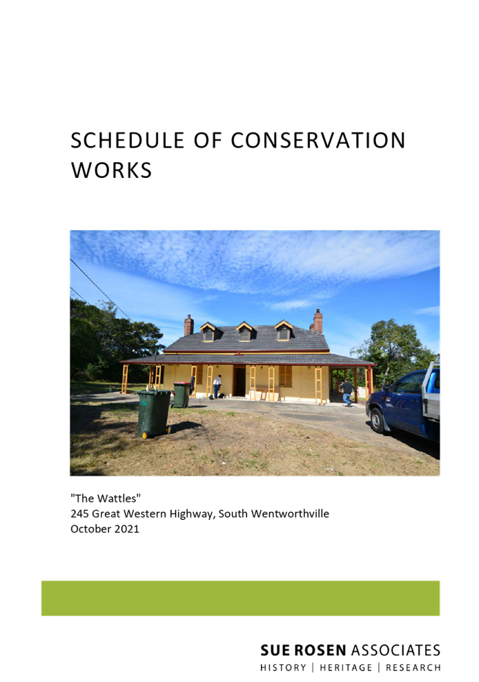

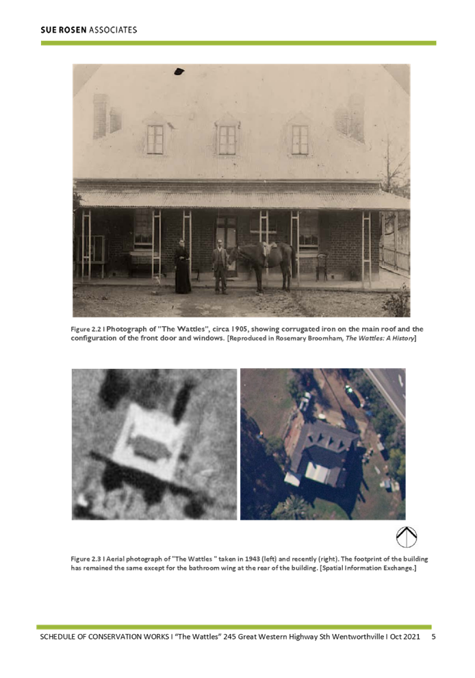
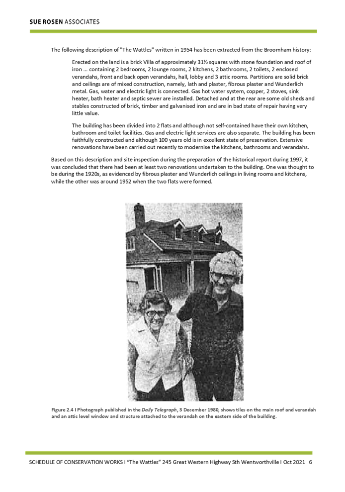
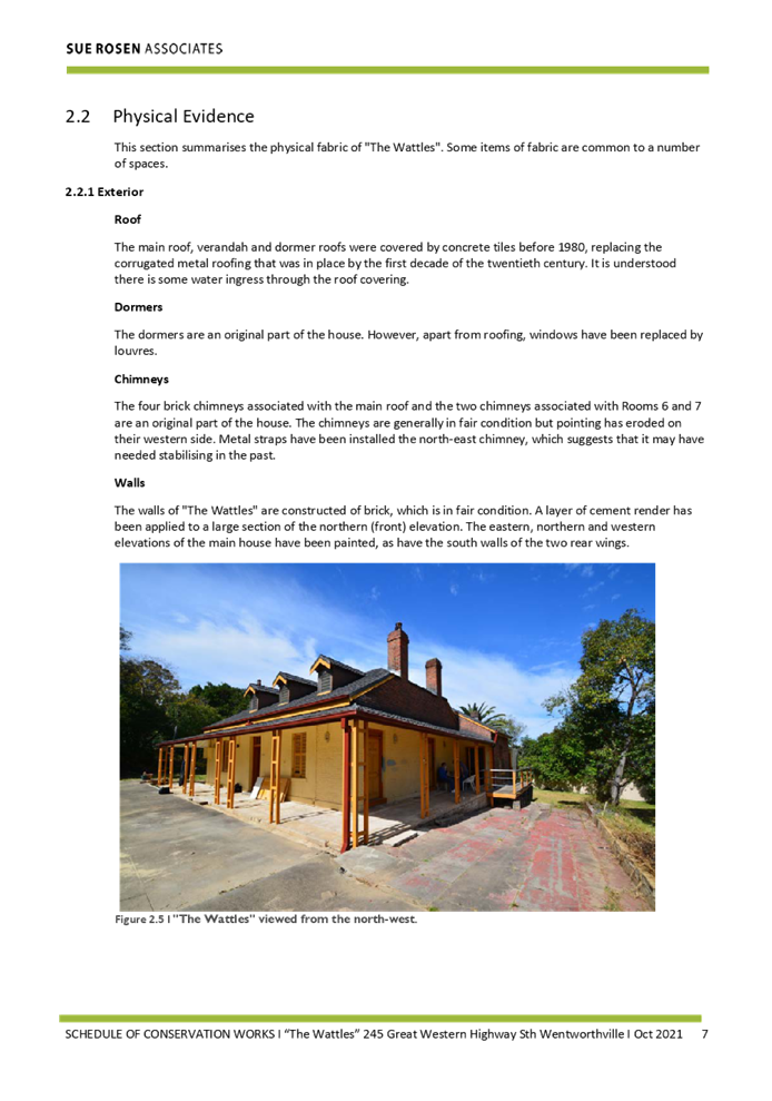
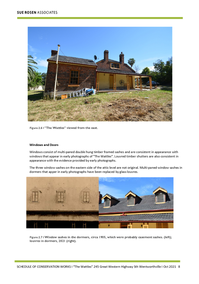
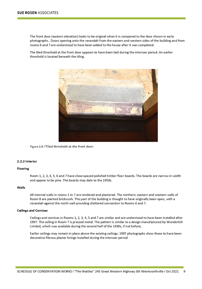
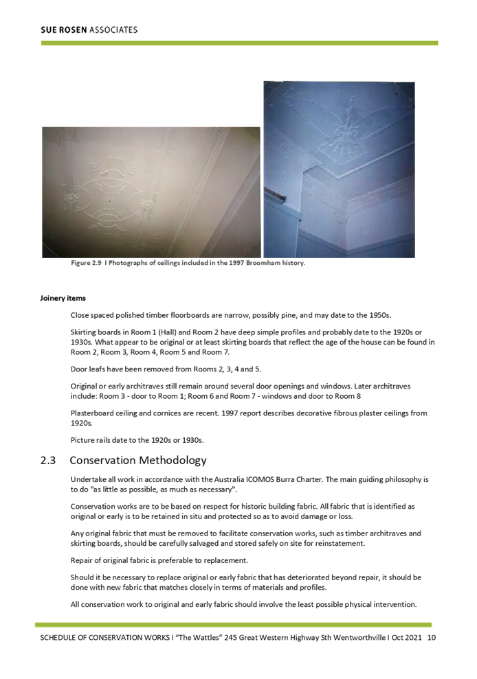
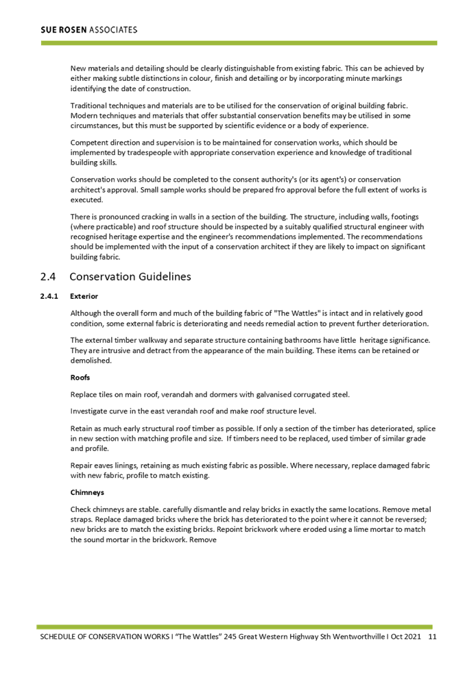
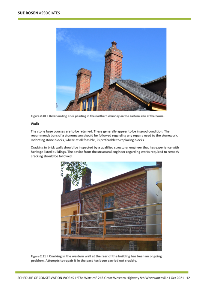
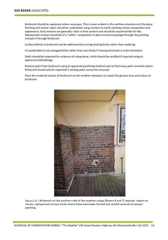
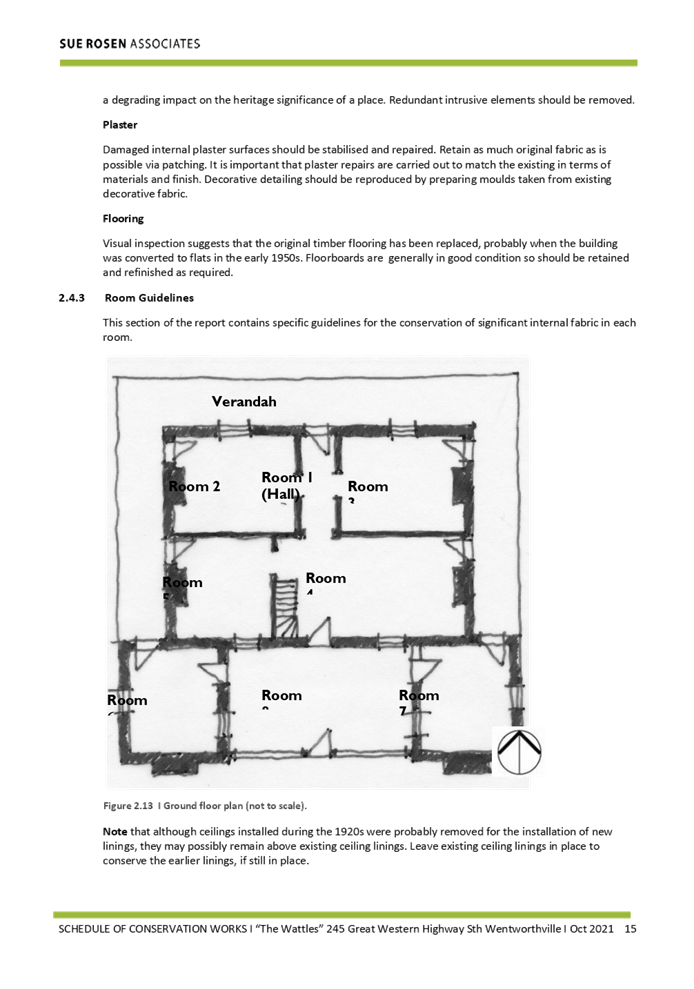
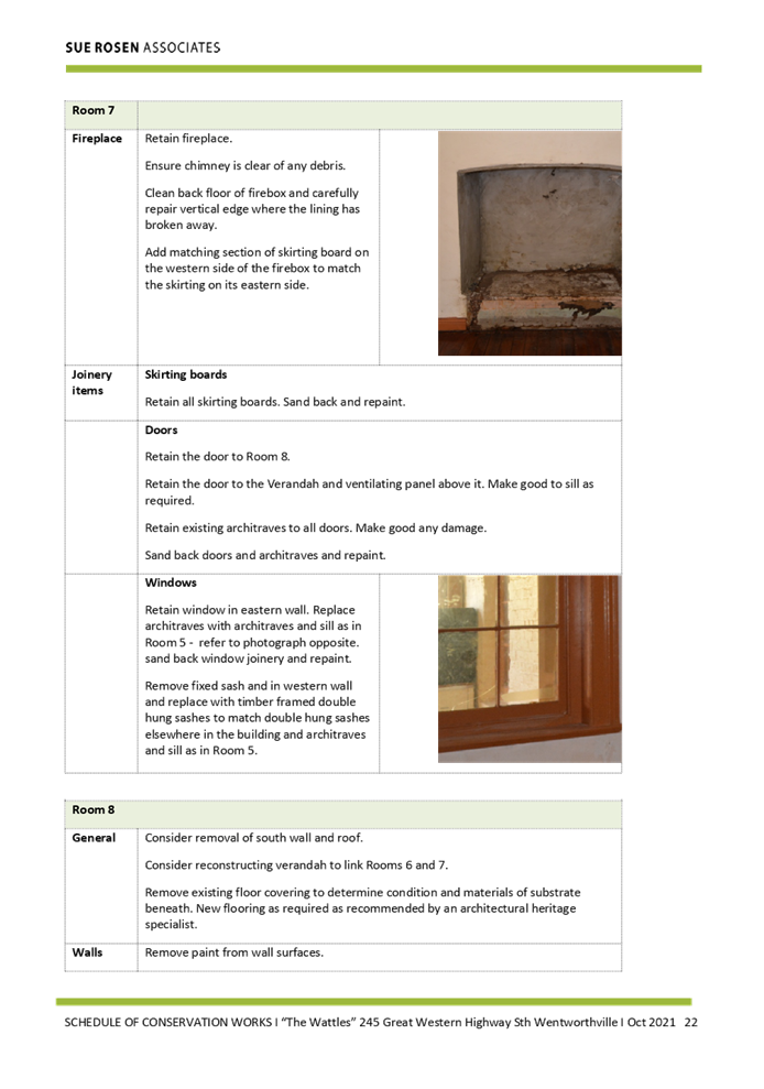
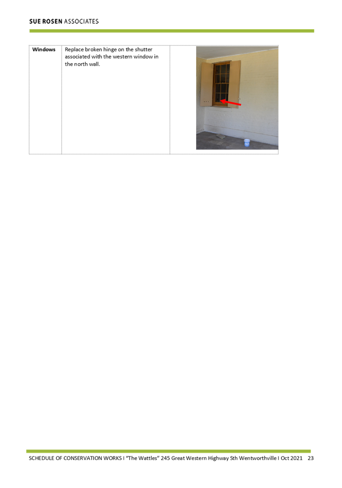
DOCUMENTS
ASSOCIATED WITH
REPORT LPP041/22
Attachment 7
Peer Review of Heritage Impact Statement
Cumberland Local Planning Panel Meeting
13 July 2022
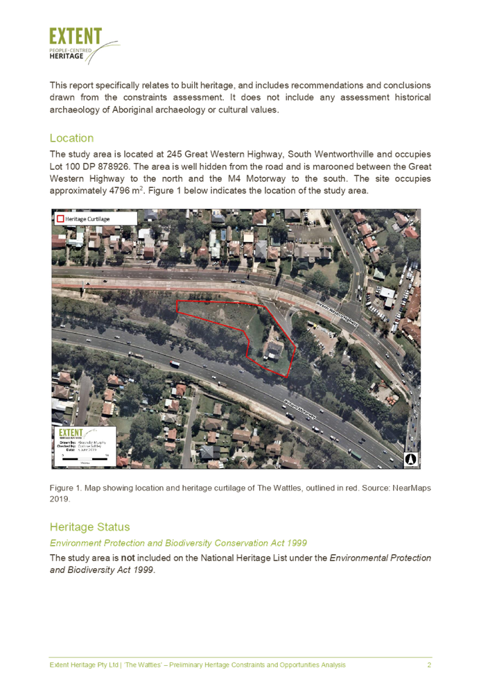


DOCUMENTS
ASSOCIATED WITH
REPORT LPP041/22
Attachment 8
Noise Assessment Report
Cumberland Local Planning Panel Meeting
13 July 2022
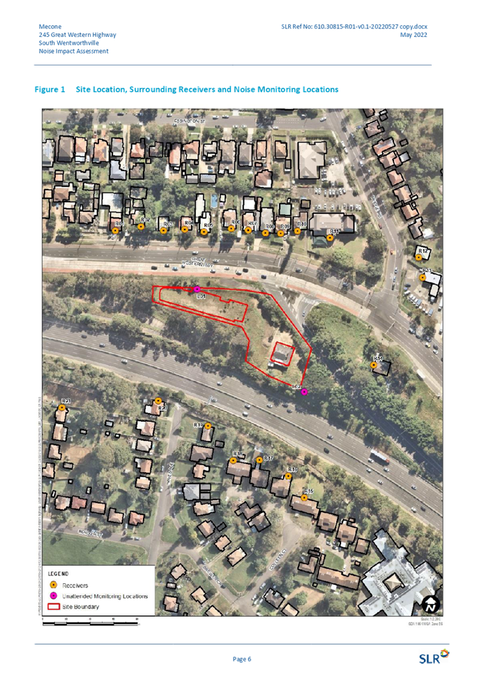
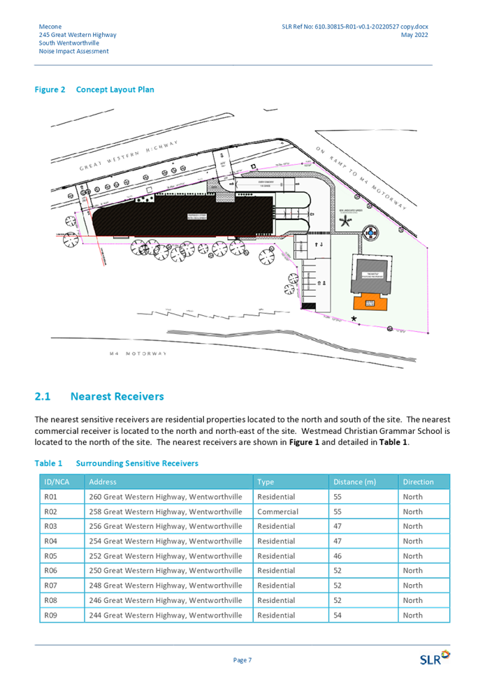
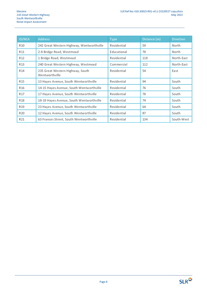
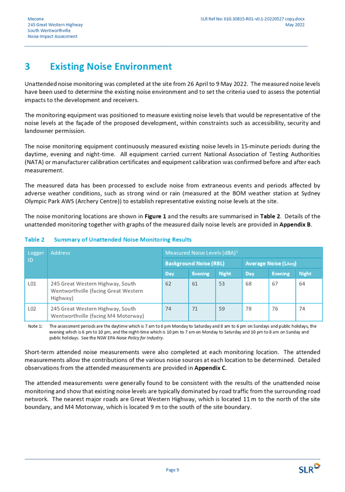
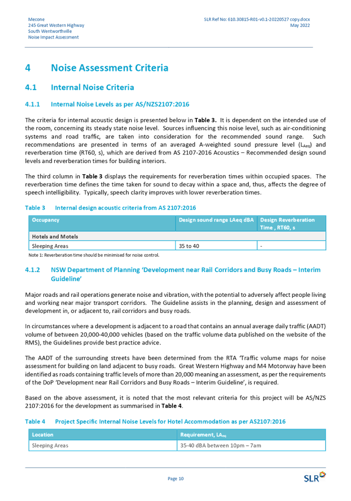
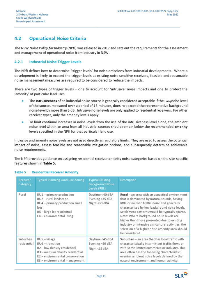
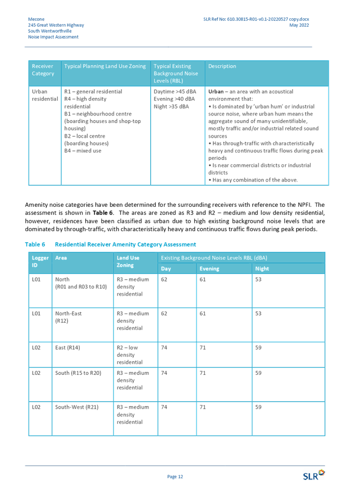
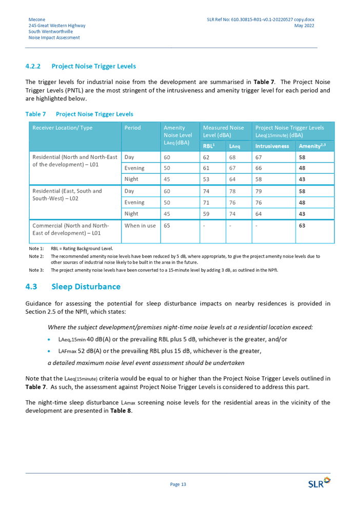
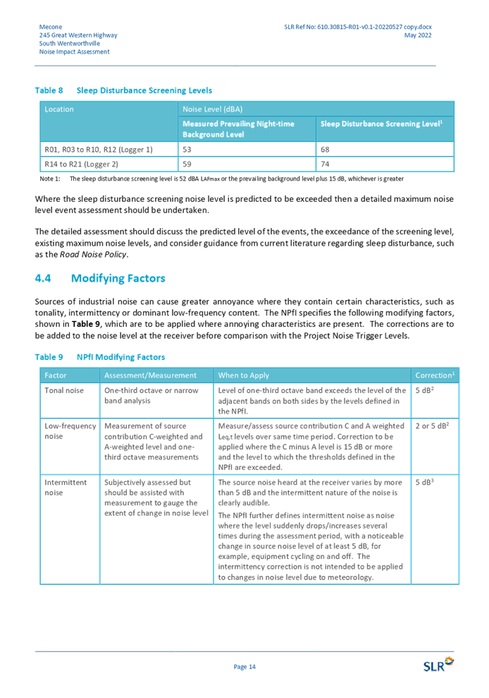
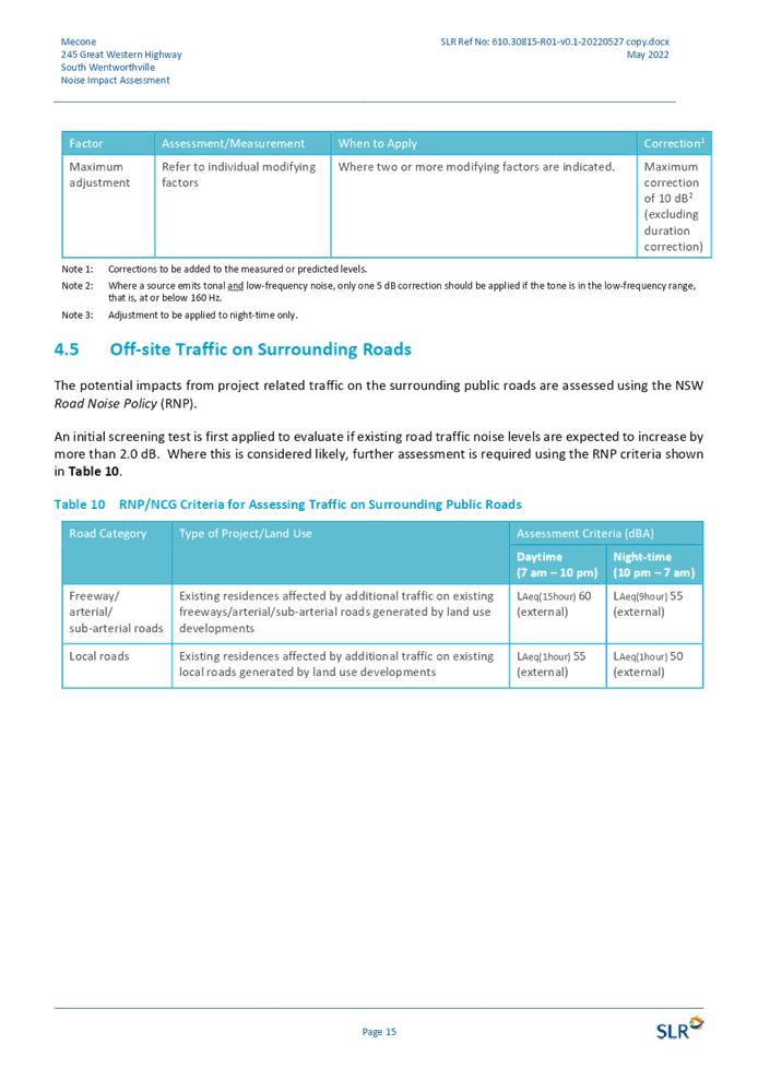
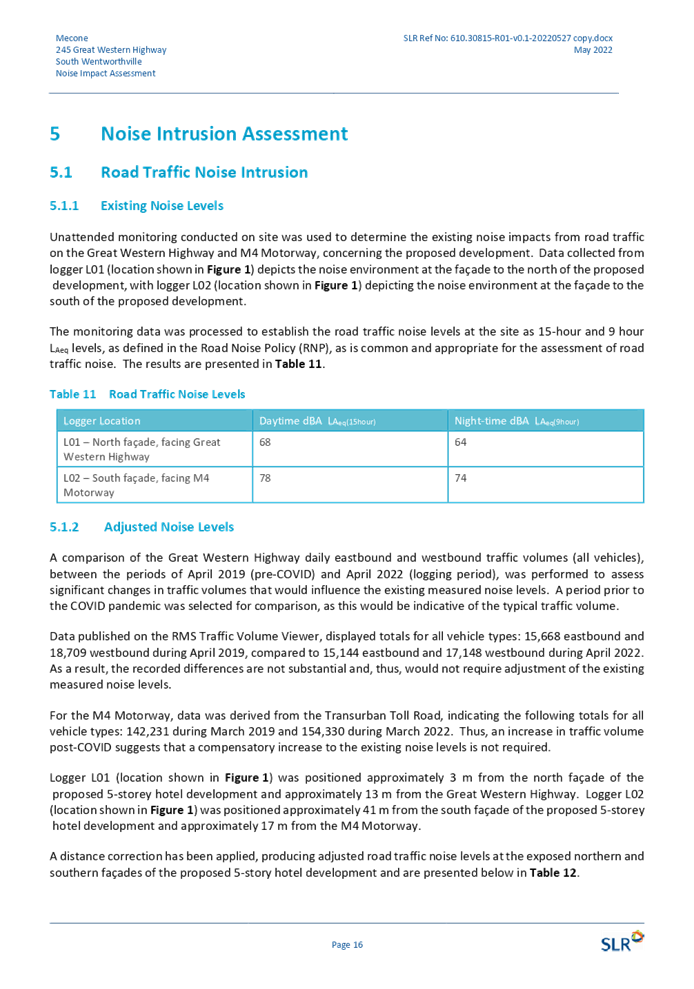
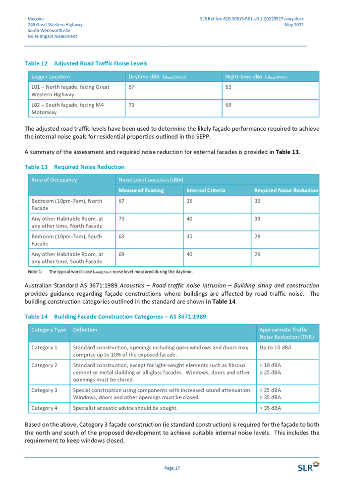
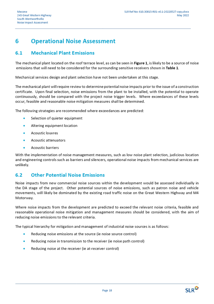
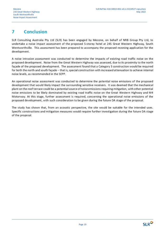

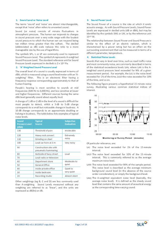

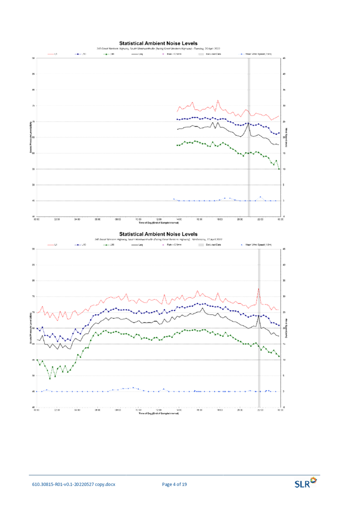
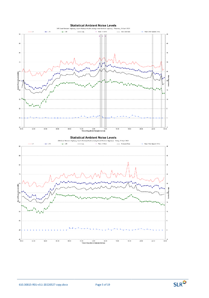
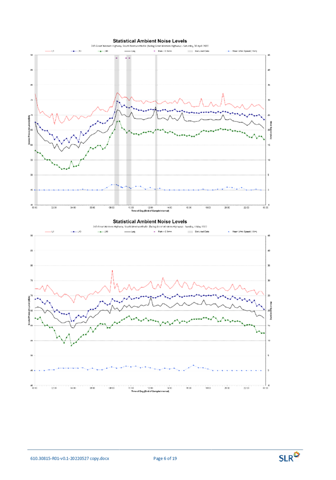
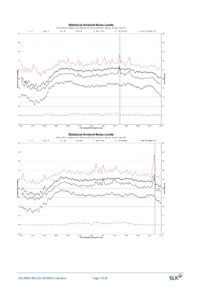
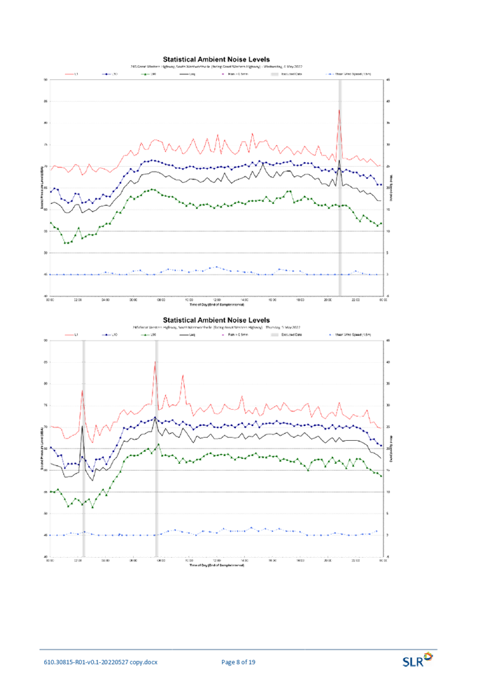
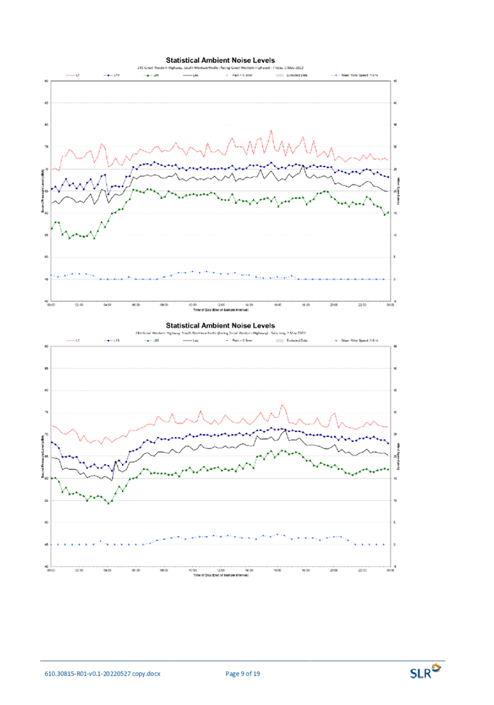
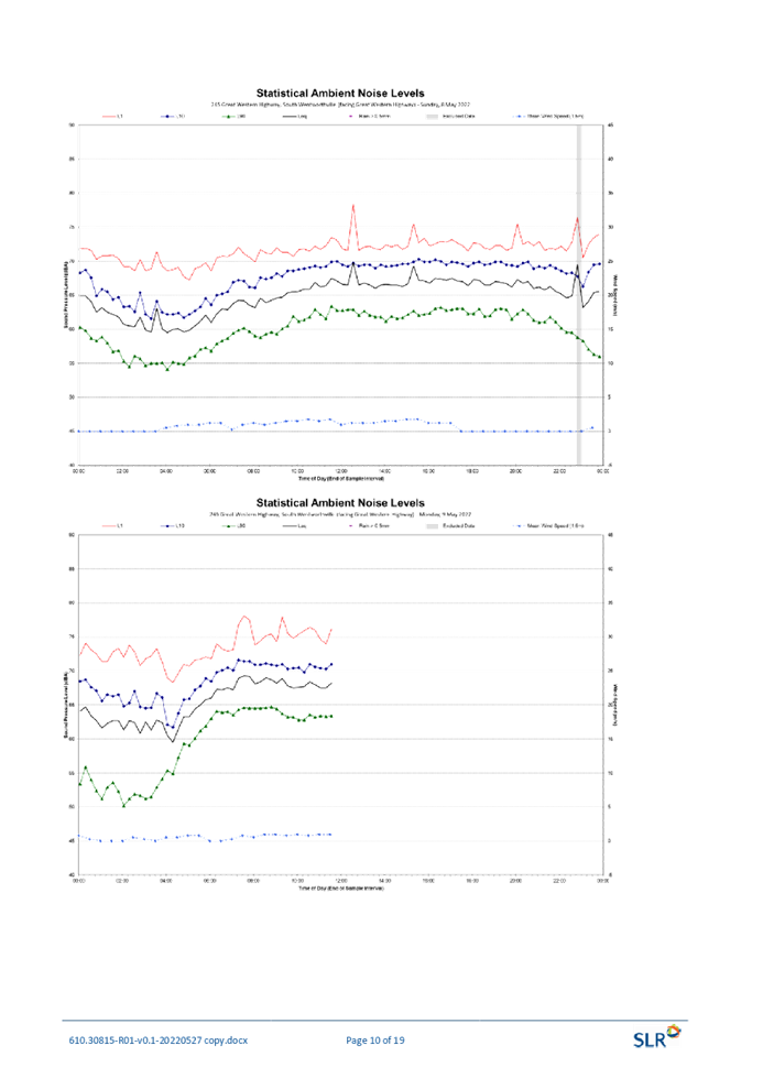
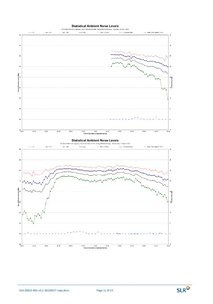
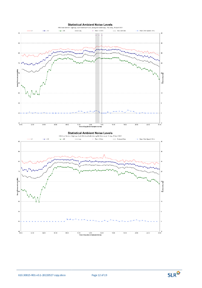
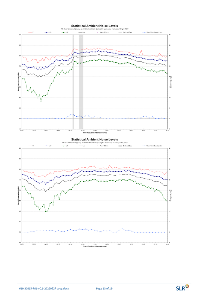
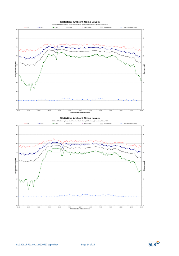
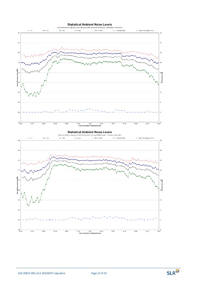
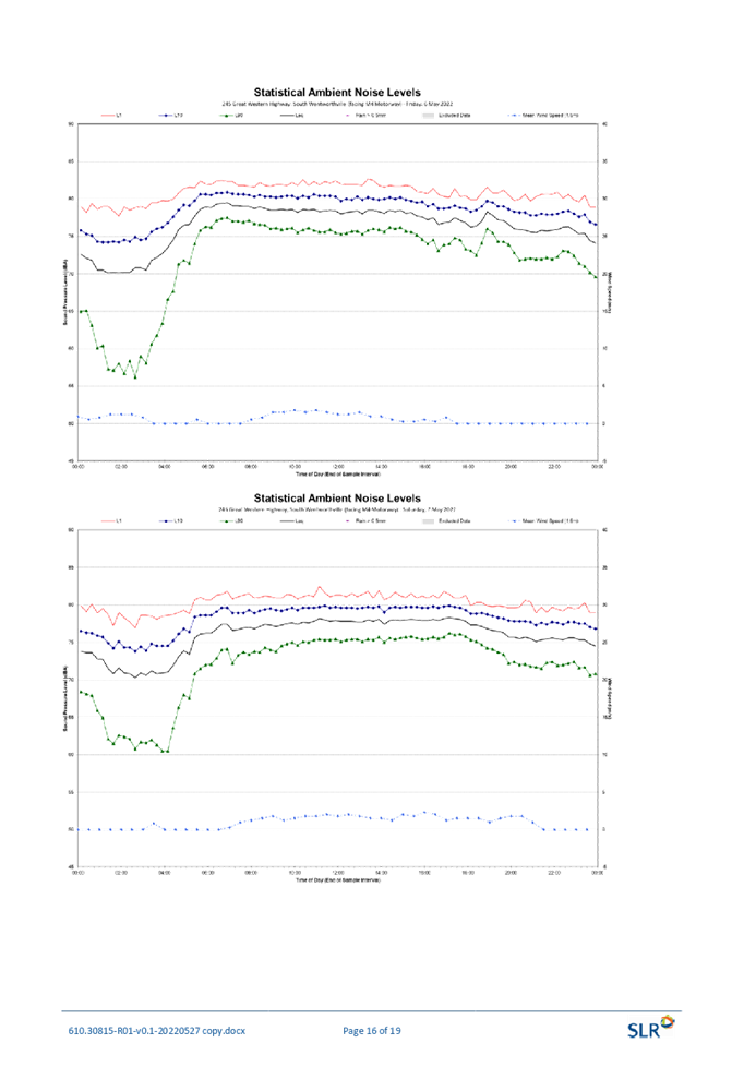
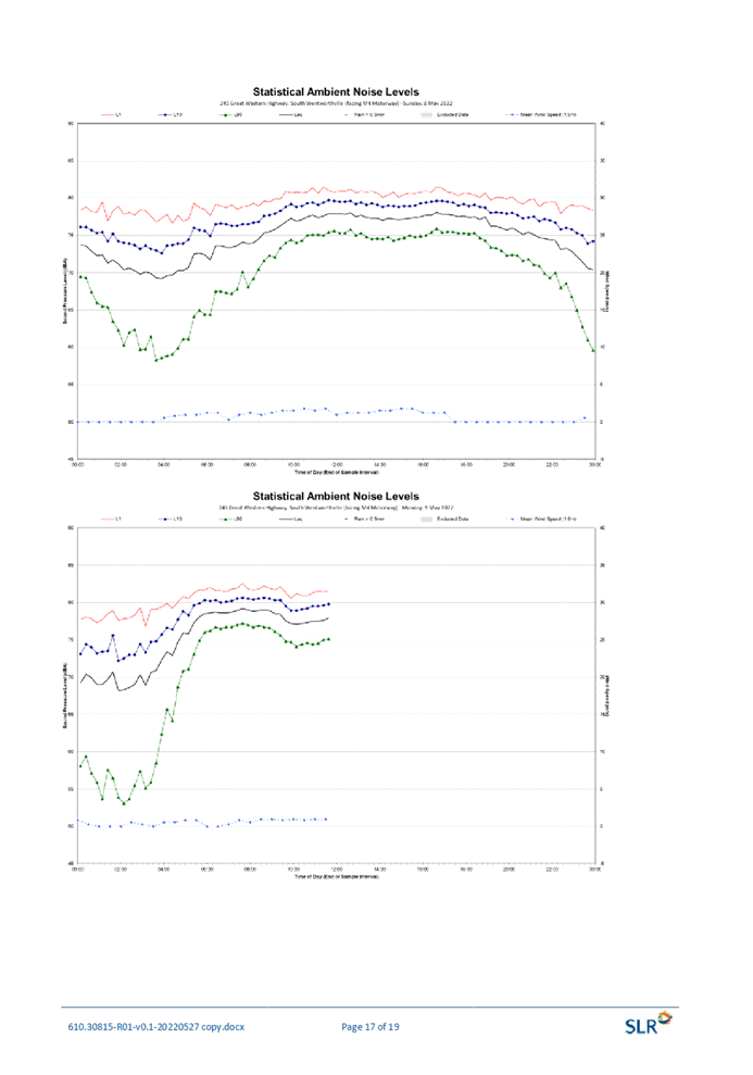

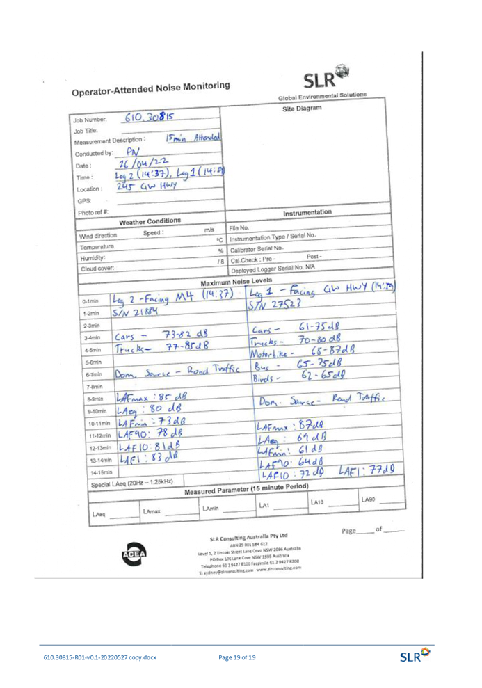

DOCUMENTS
ASSOCIATED WITH
REPORT LPP041/22
Attachment 9
Preliminary Contamination Assessment
Cumberland Local Planning Panel Meeting
13 July 2022
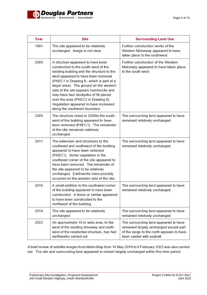
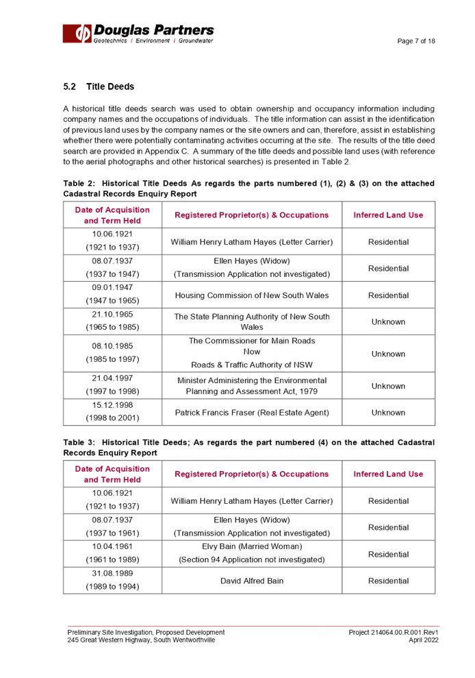
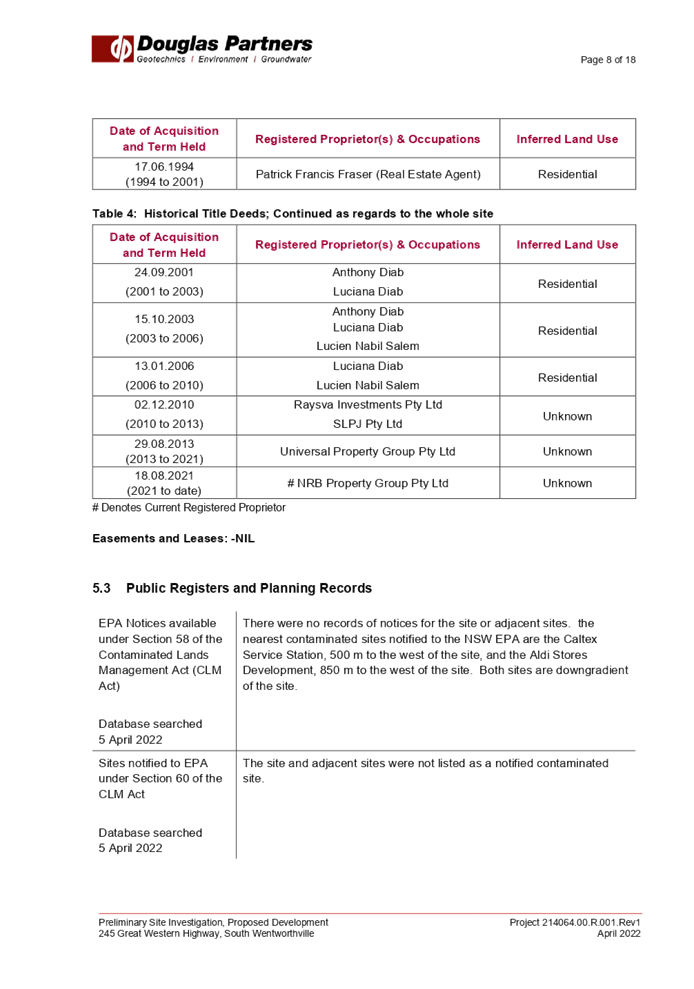
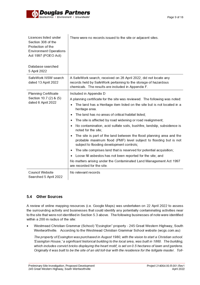
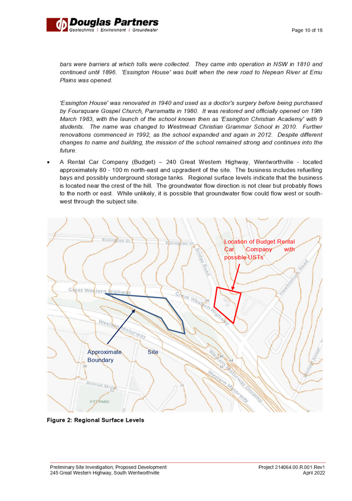


DOCUMENTS
ASSOCIATED WITH
REPORT LPP041/22
Attachment 10
Acid Sulphate Soils Assessment
Cumberland Local Planning Panel Meeting
13 July 2022
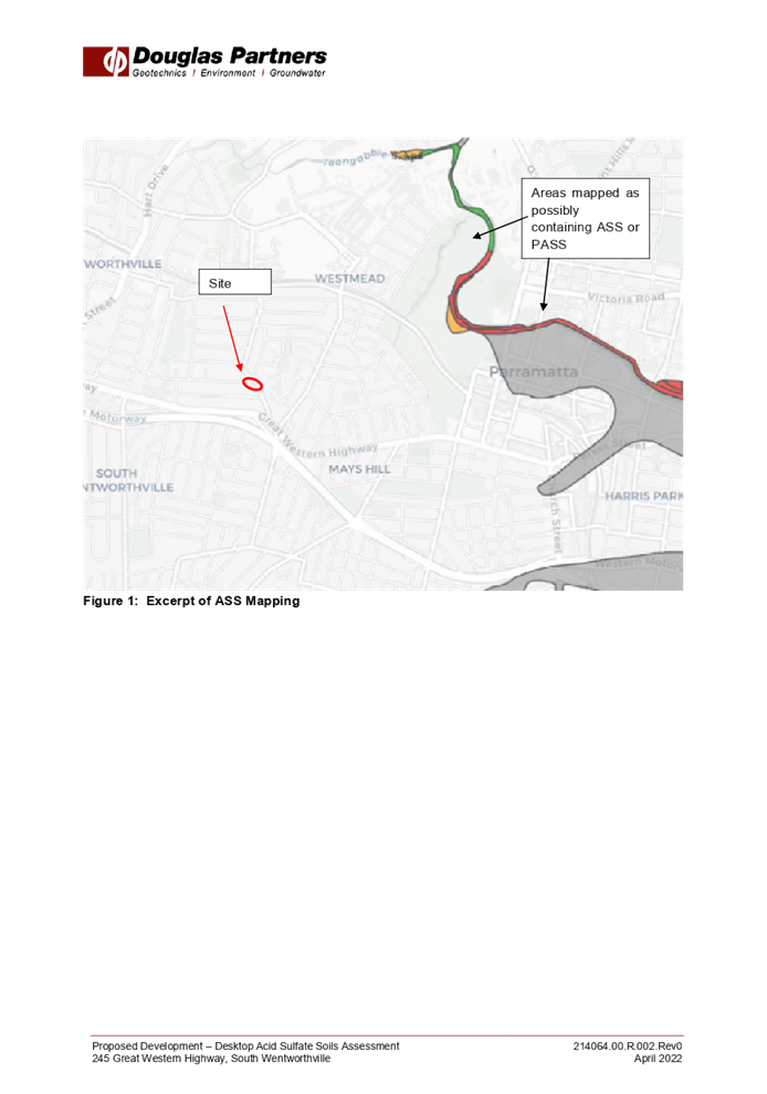
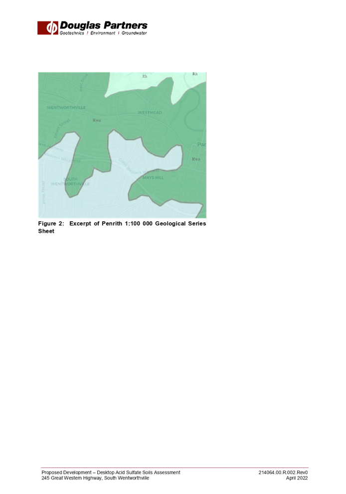
DOCUMENTS
ASSOCIATED WITH
REPORT LPP041/22
Attachment 11
Transport for NSW submission (April)
Cumberland Local Planning Panel Meeting
13 July 2022
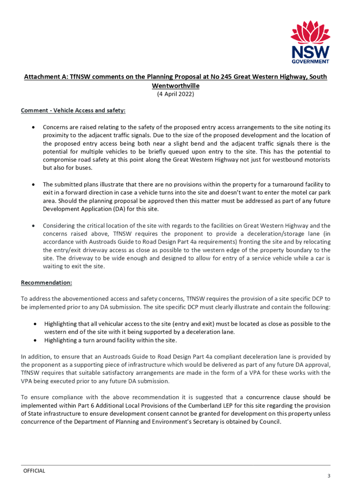
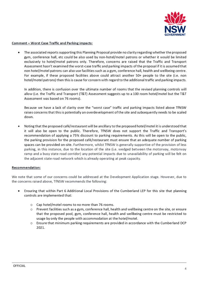
DOCUMENTS
ASSOCIATED WITH
REPORT LPP041/22
Attachment 12
Transport for NSW Submission
Cumberland Local Planning Panel Meeting
13 July 2022
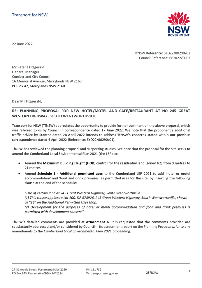
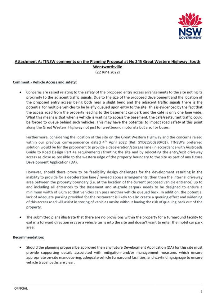
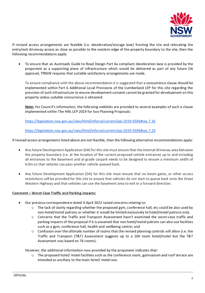
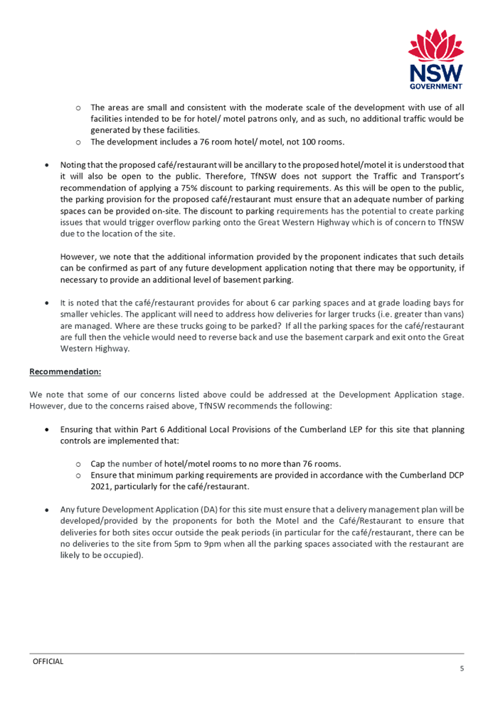
DOCUMENTS
ASSOCIATED WITH
REPORT LPP041/22
Attachment 13
Proponent's Response to Transport for NSW Submission
Cumberland Local Planning Panel Meeting
13 July 2022
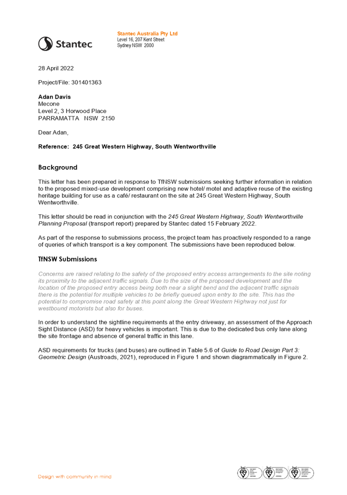
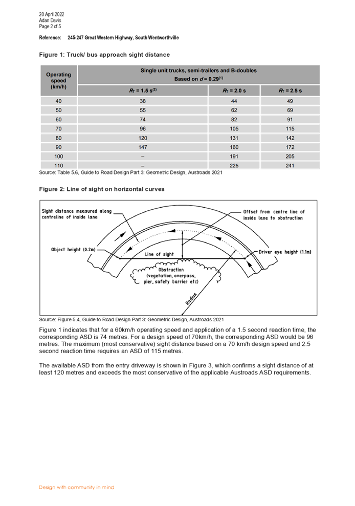
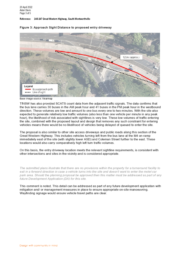
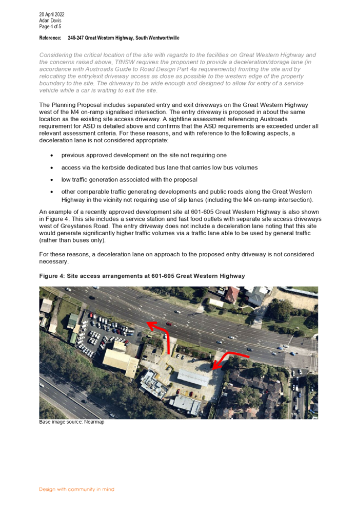
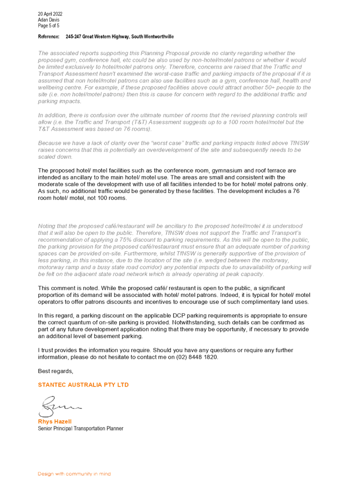
DOCUMENTS
ASSOCIATED WITH
REPORT LPP041/22
Attachment 14
Heritage NSW Submission
Cumberland Local Planning Panel Meeting
13 July 2022
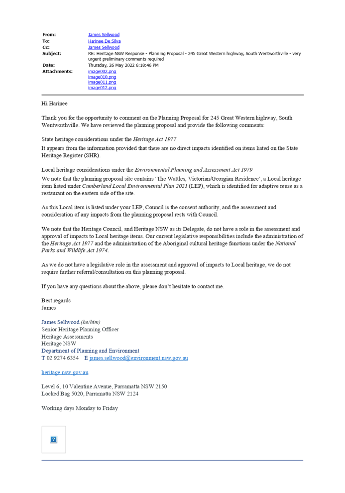
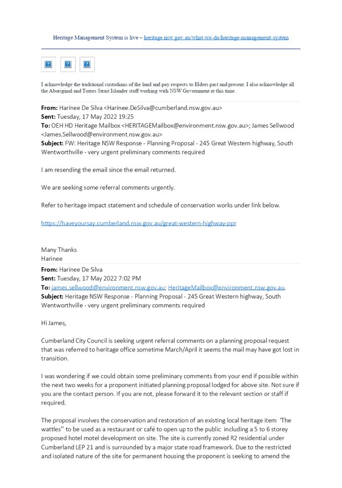
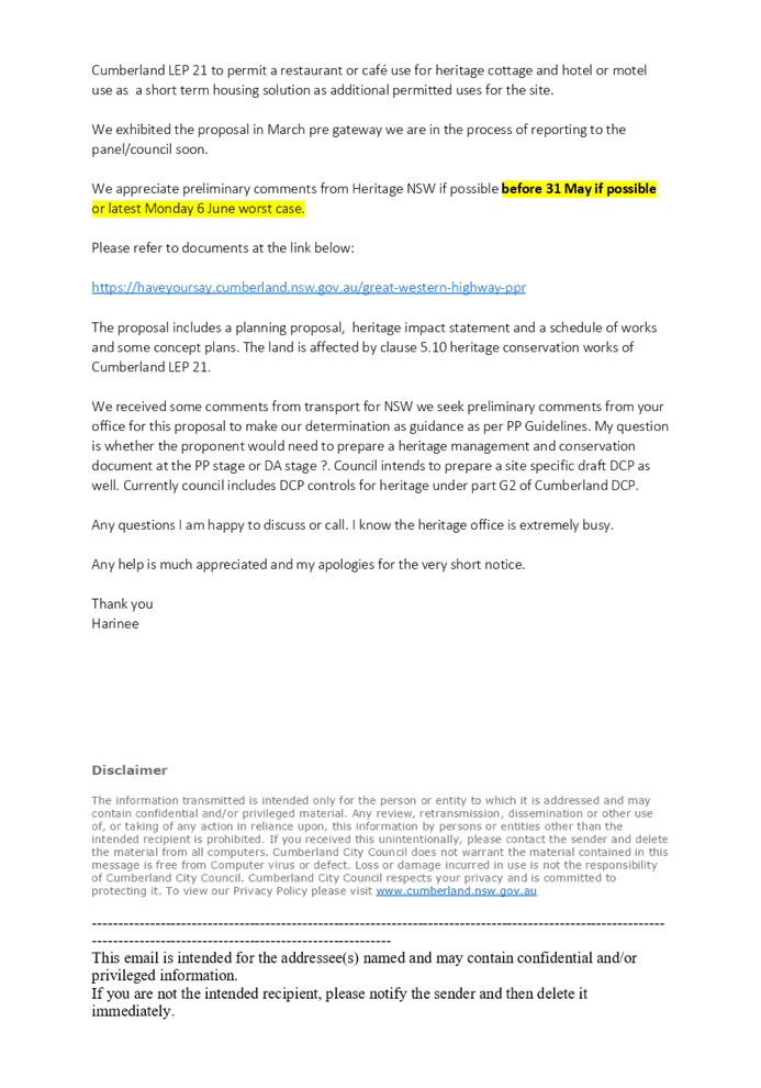

DOCUMENTS
ASSOCIATED WITH
REPORT LPP041/22
Attachment 15
Summary of Community Submissions
Cumberland Local Planning Panel Meeting
13 July 2022
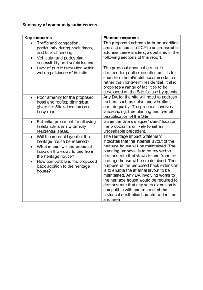


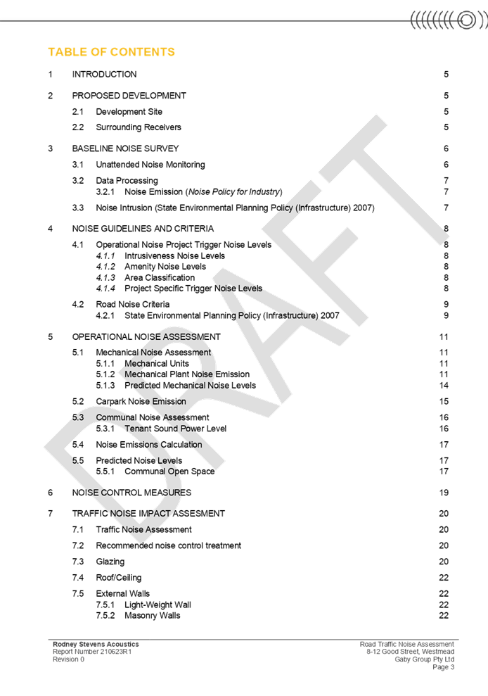
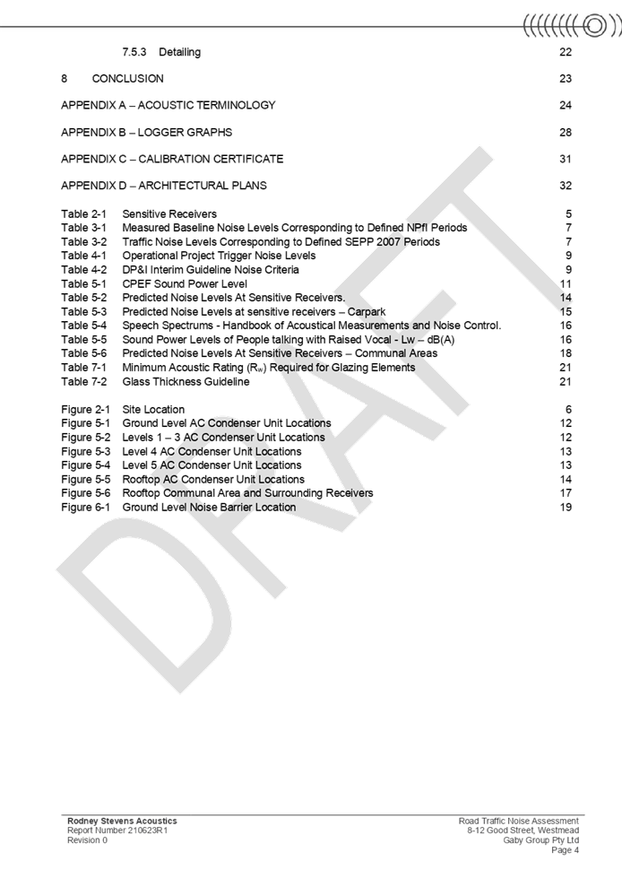
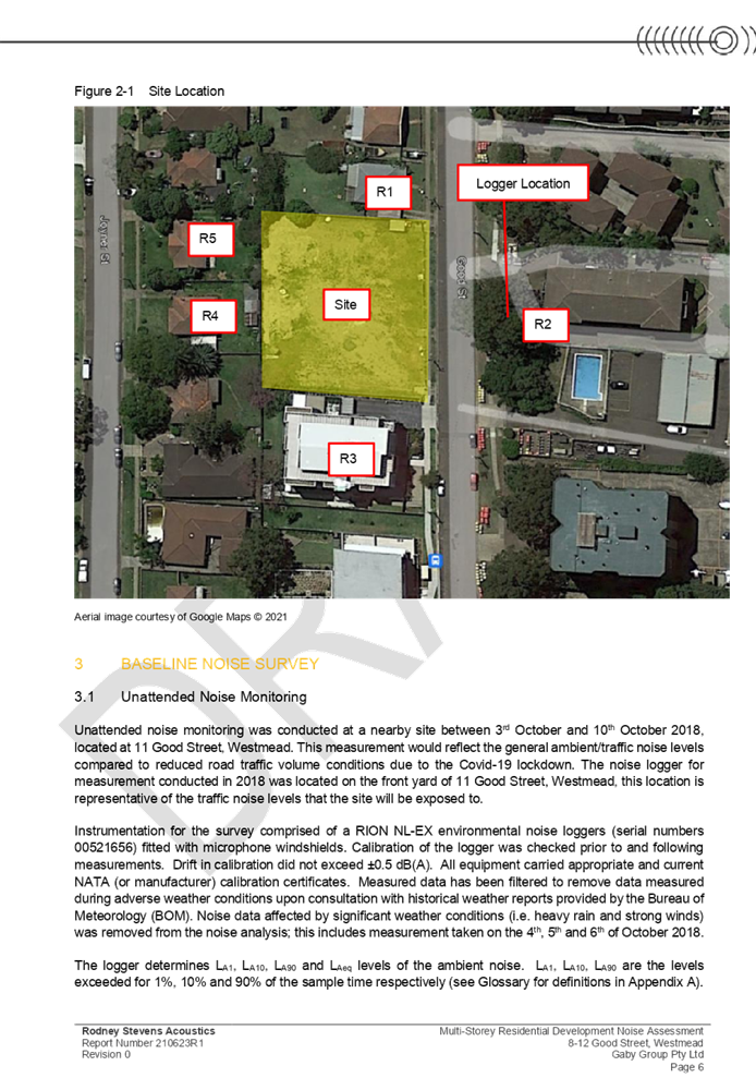
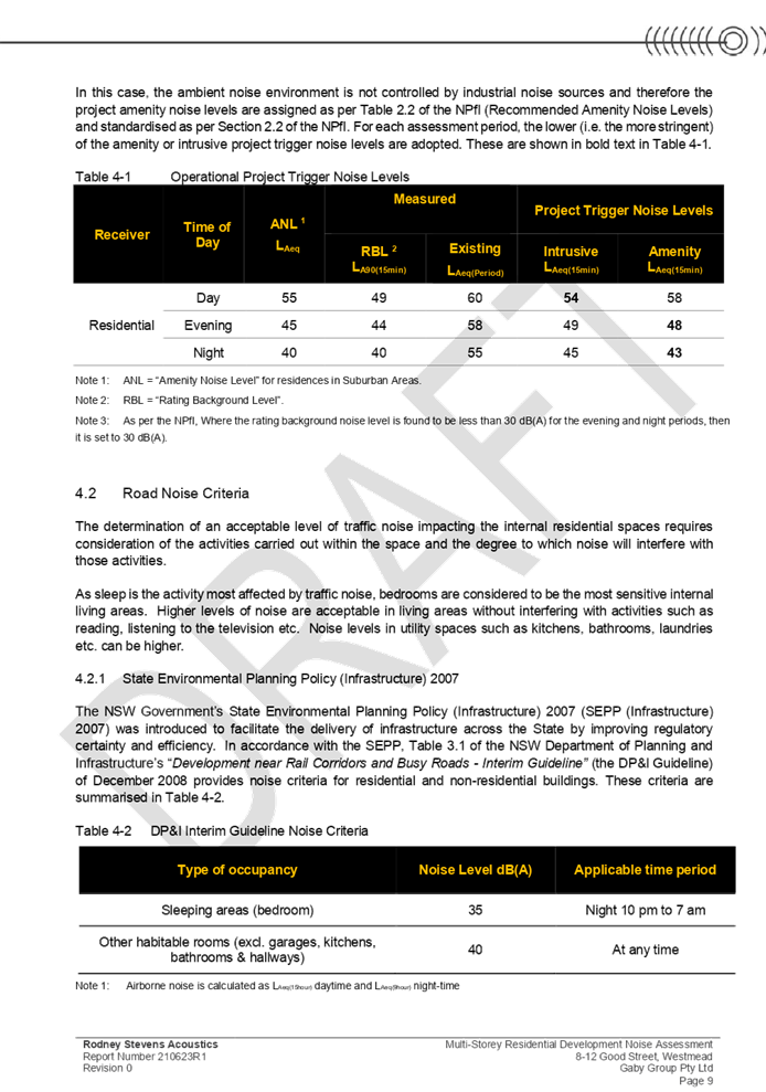
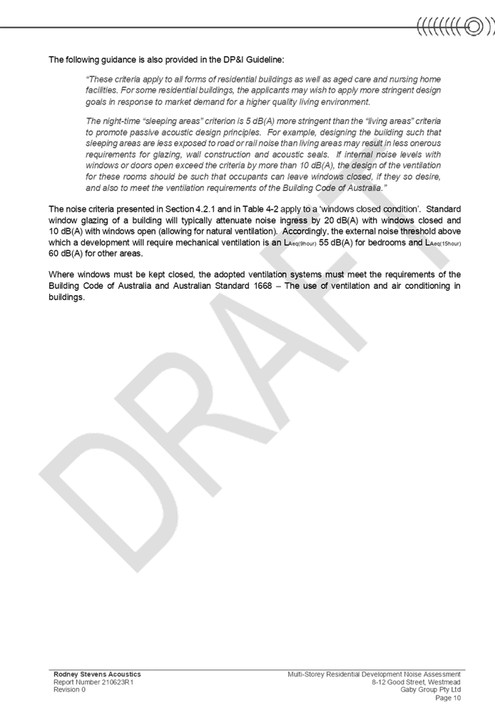
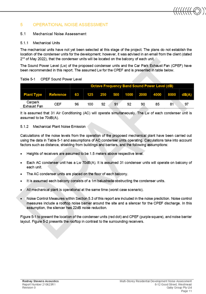
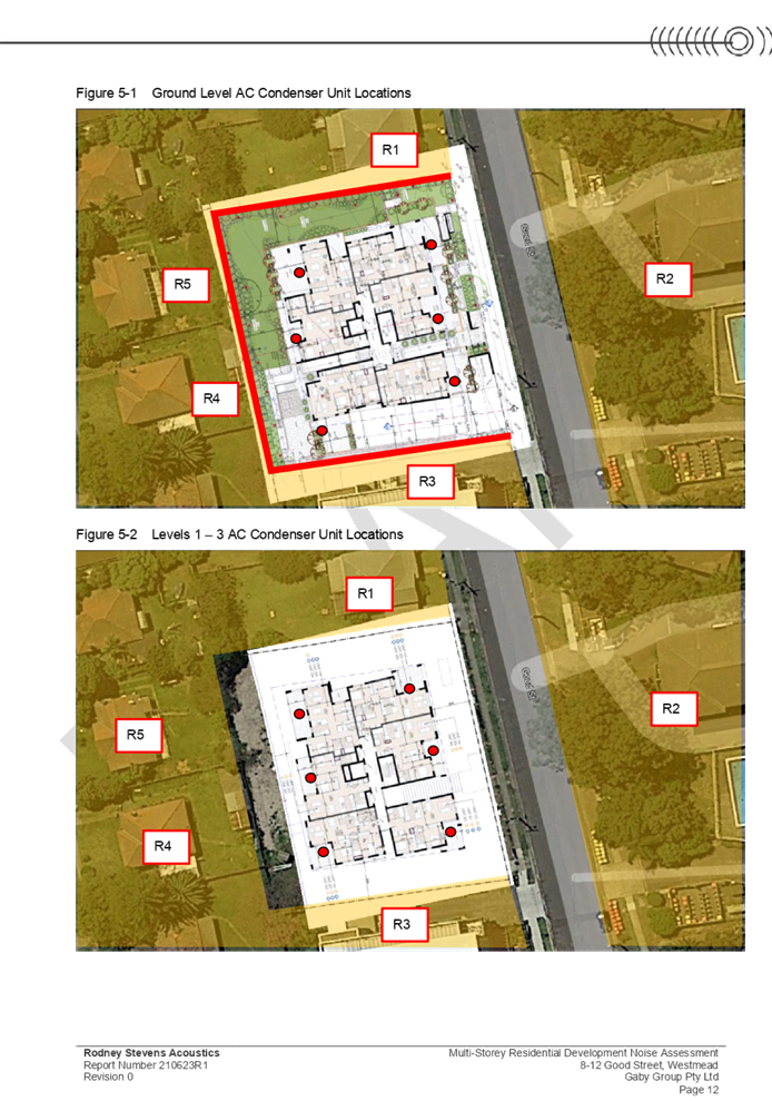
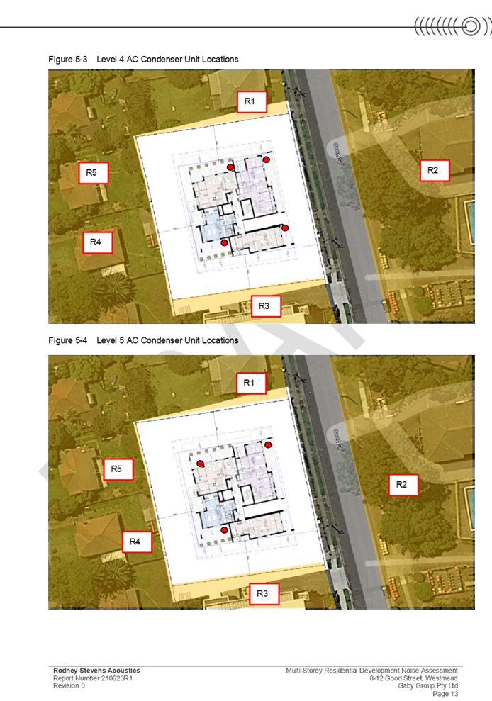
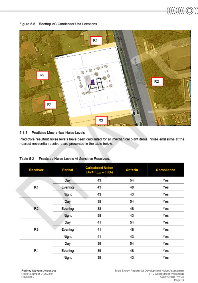
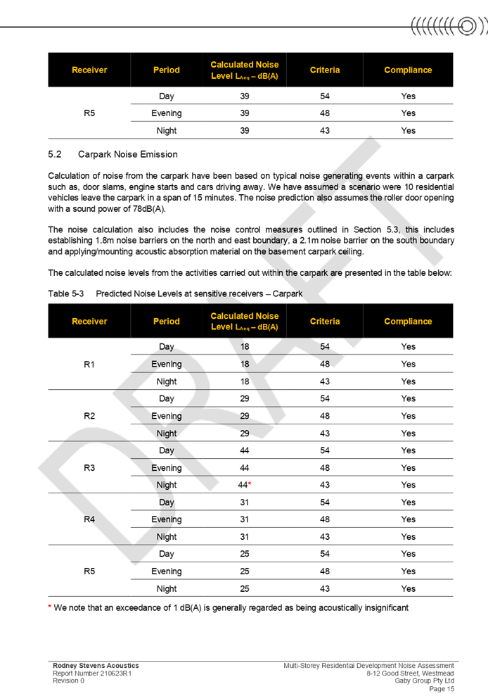
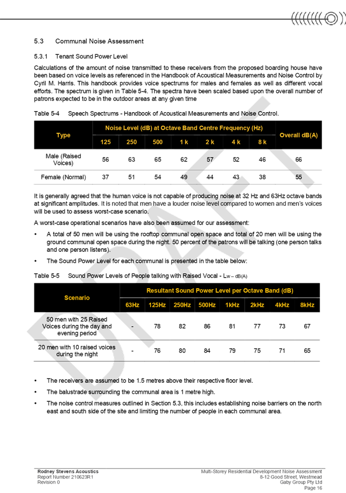
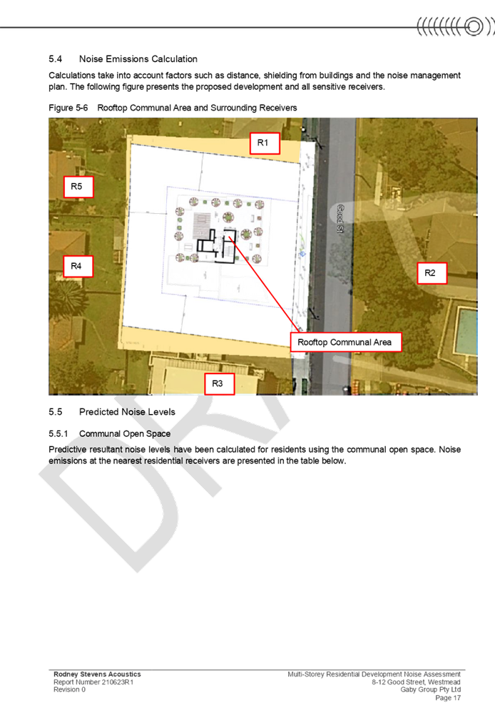
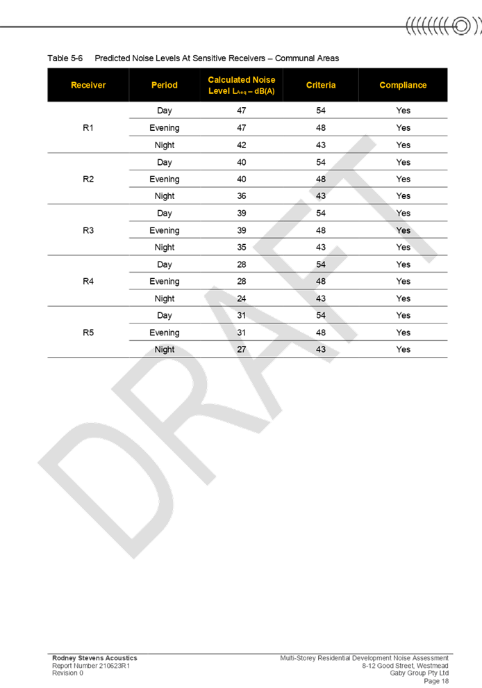
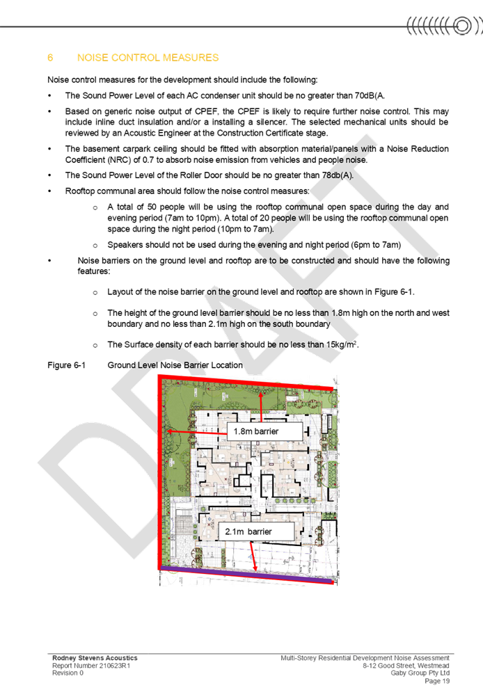
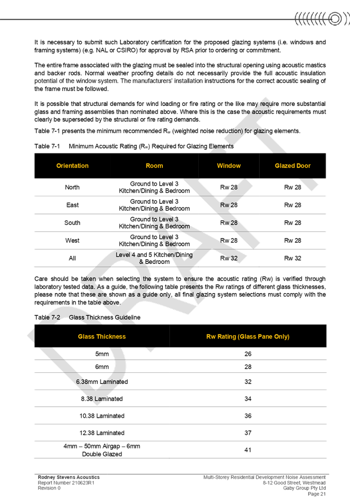
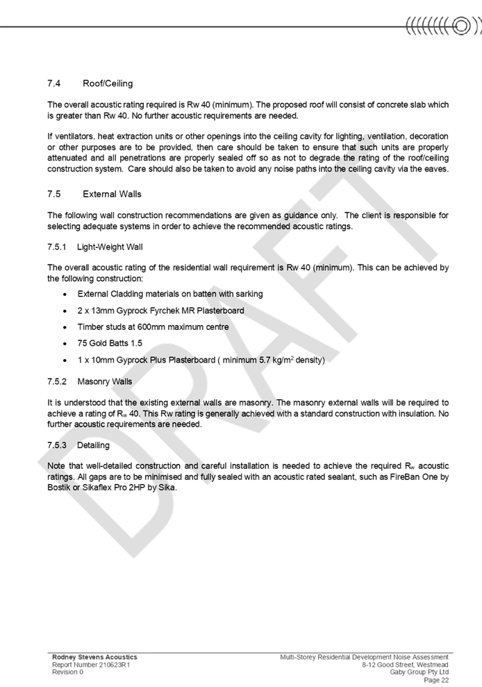
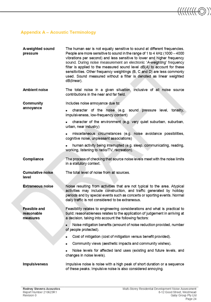
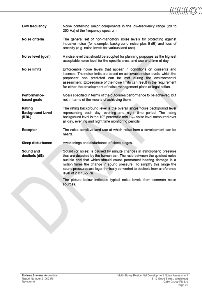
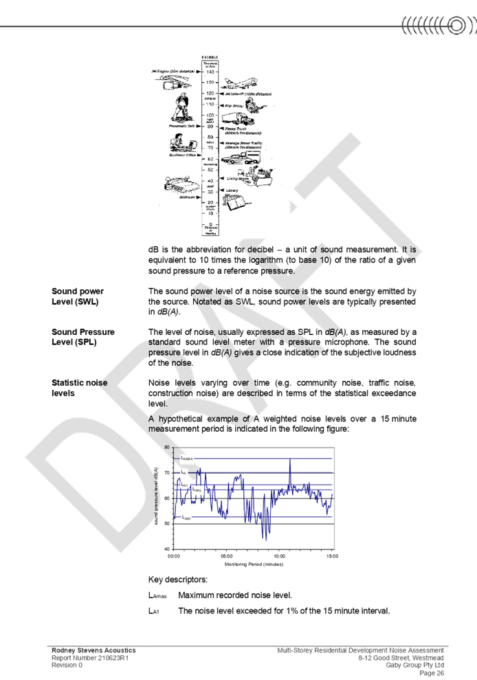
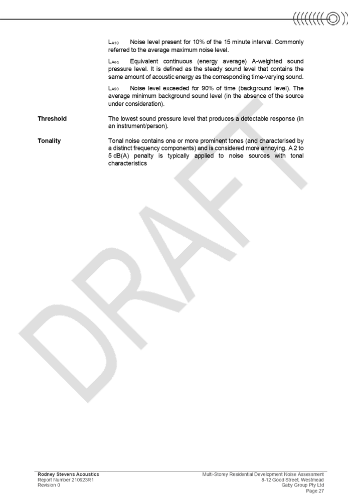
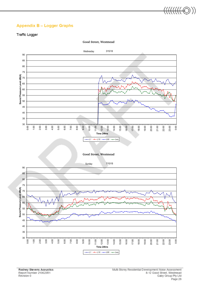
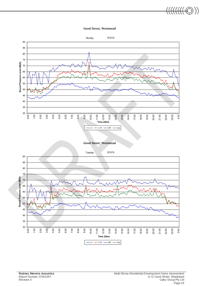
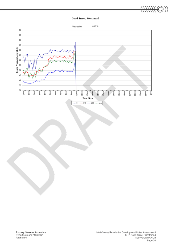
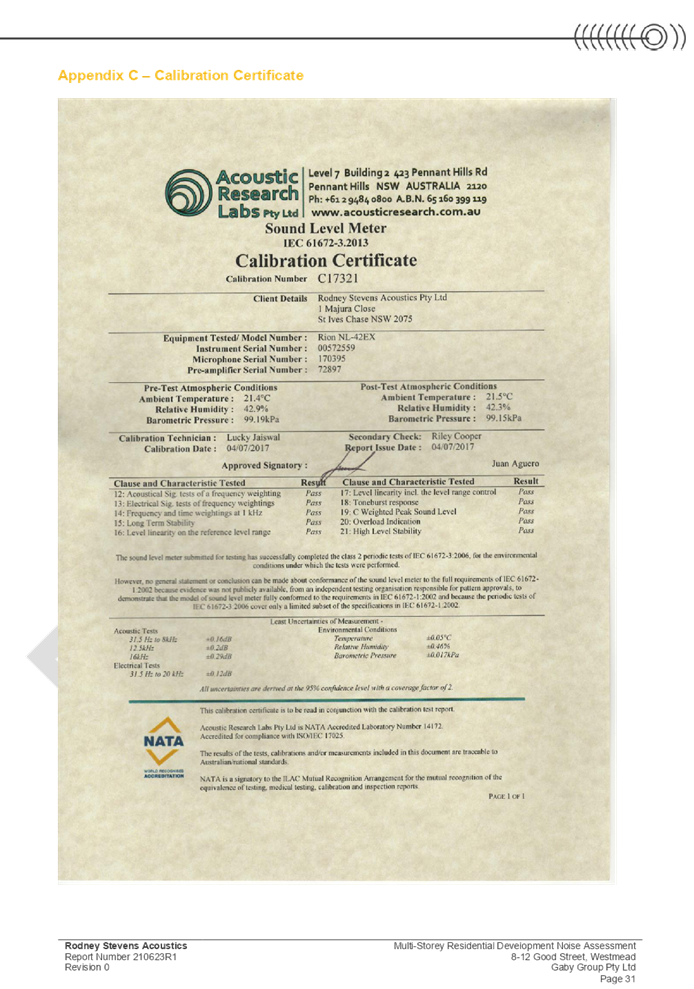
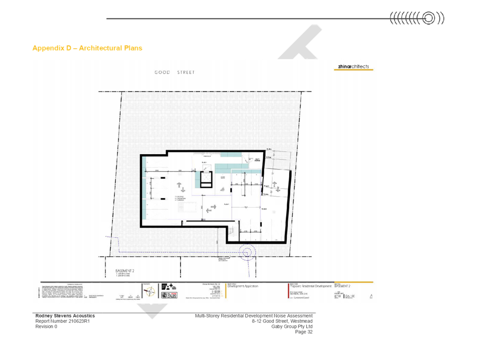
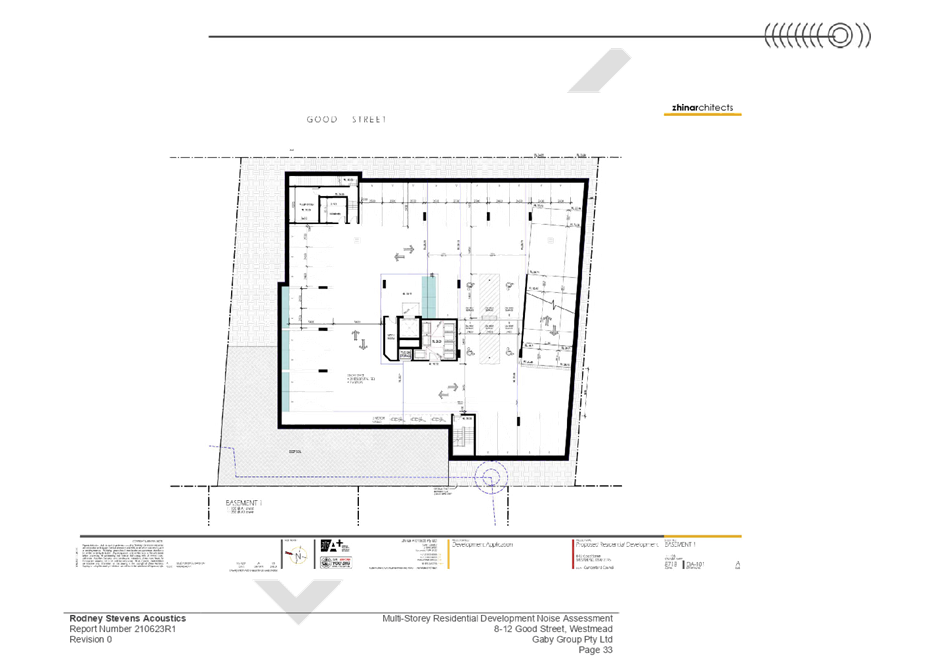

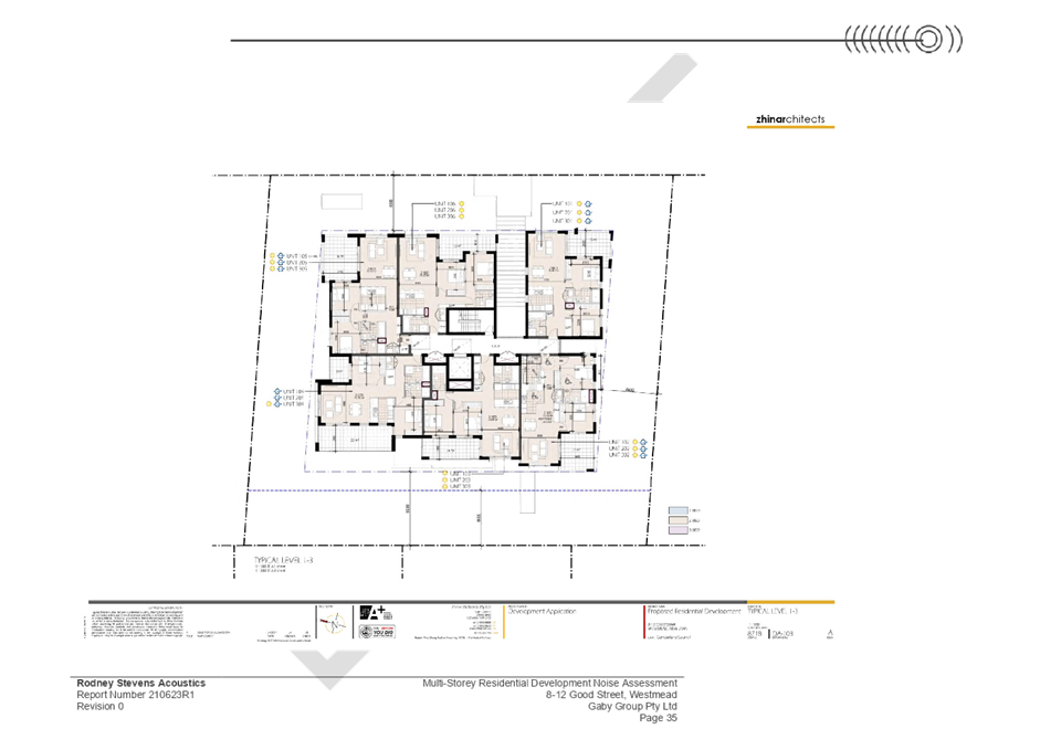
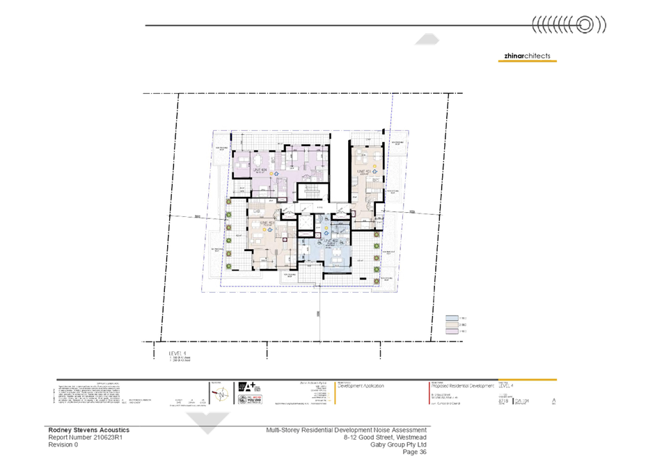
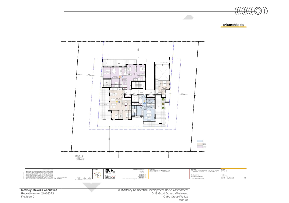
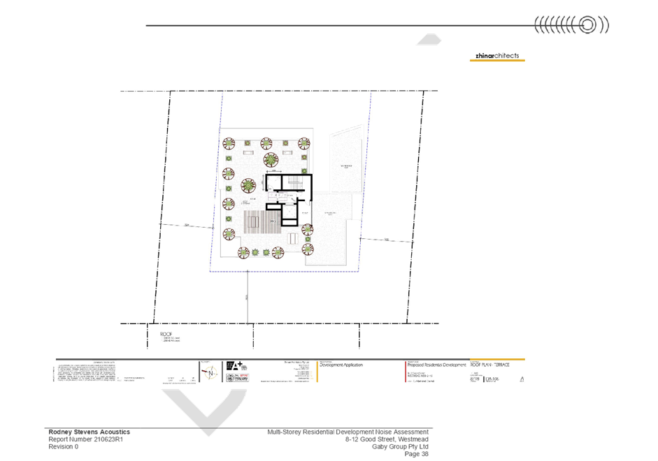
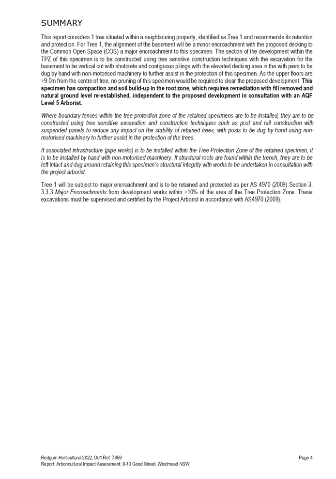
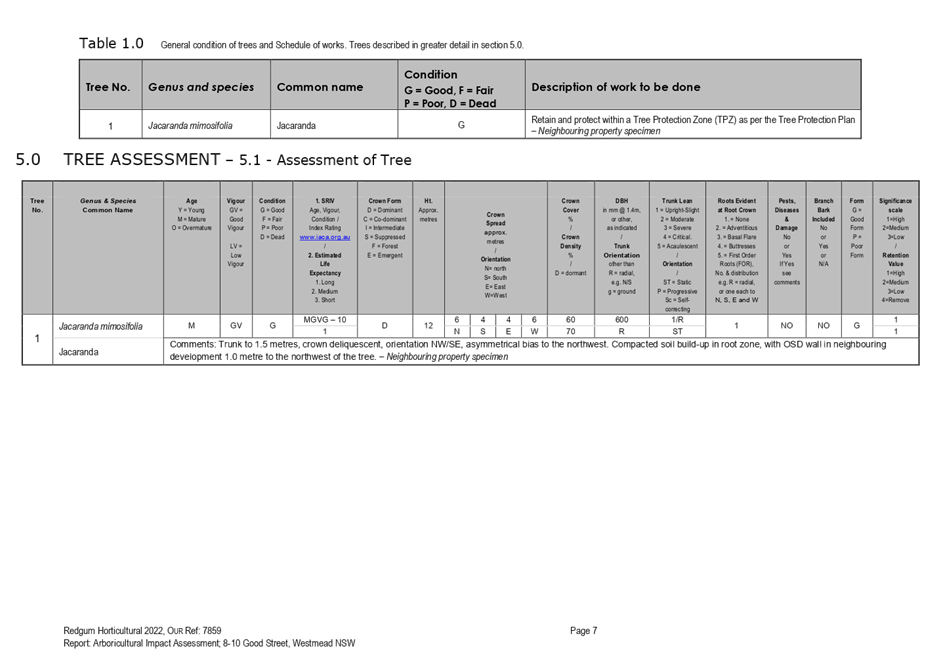
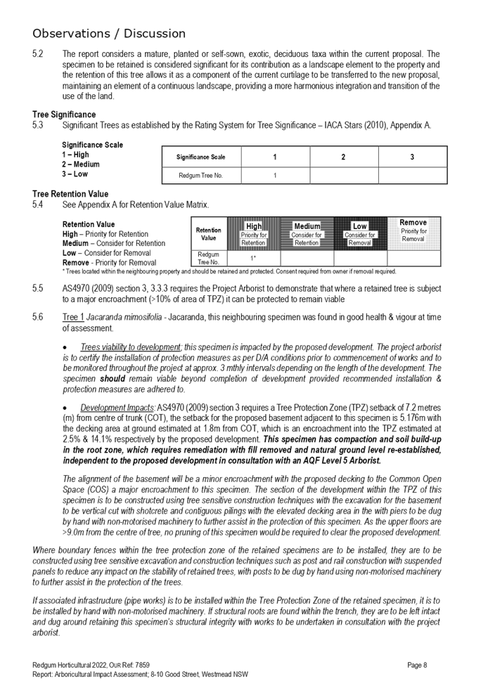
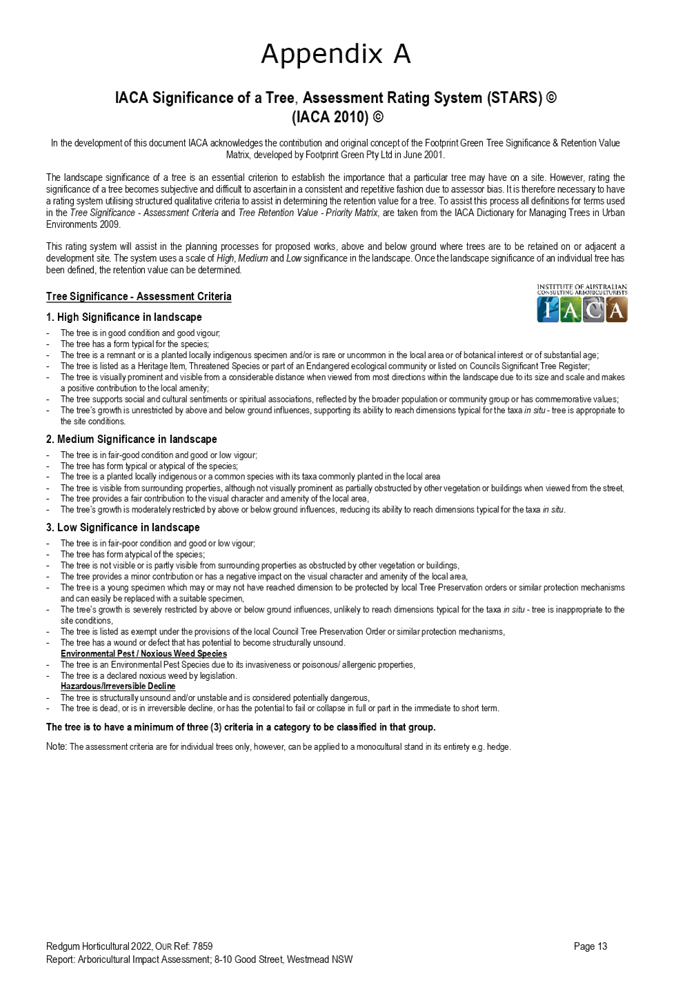
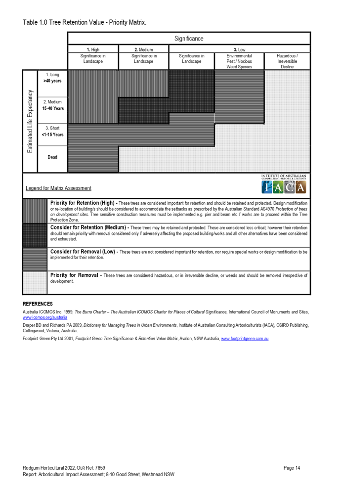
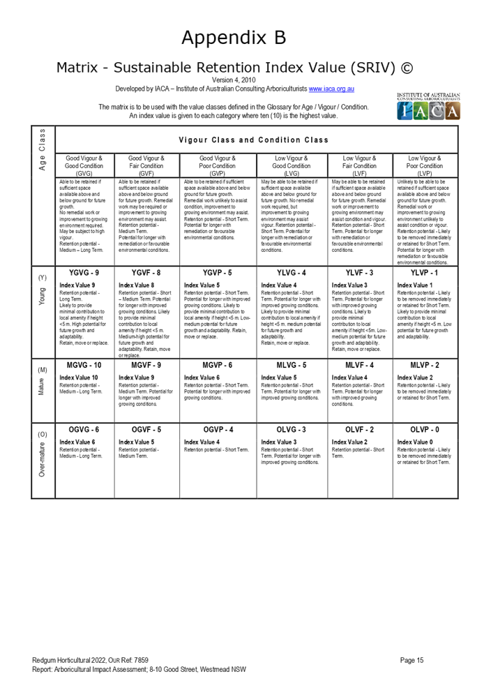

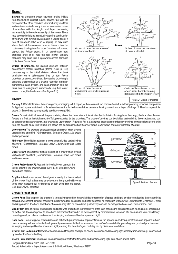
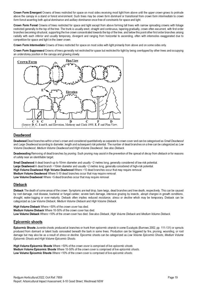
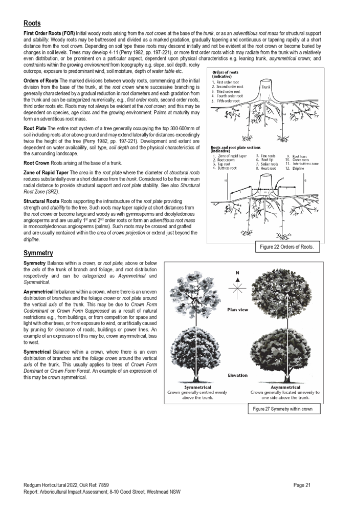
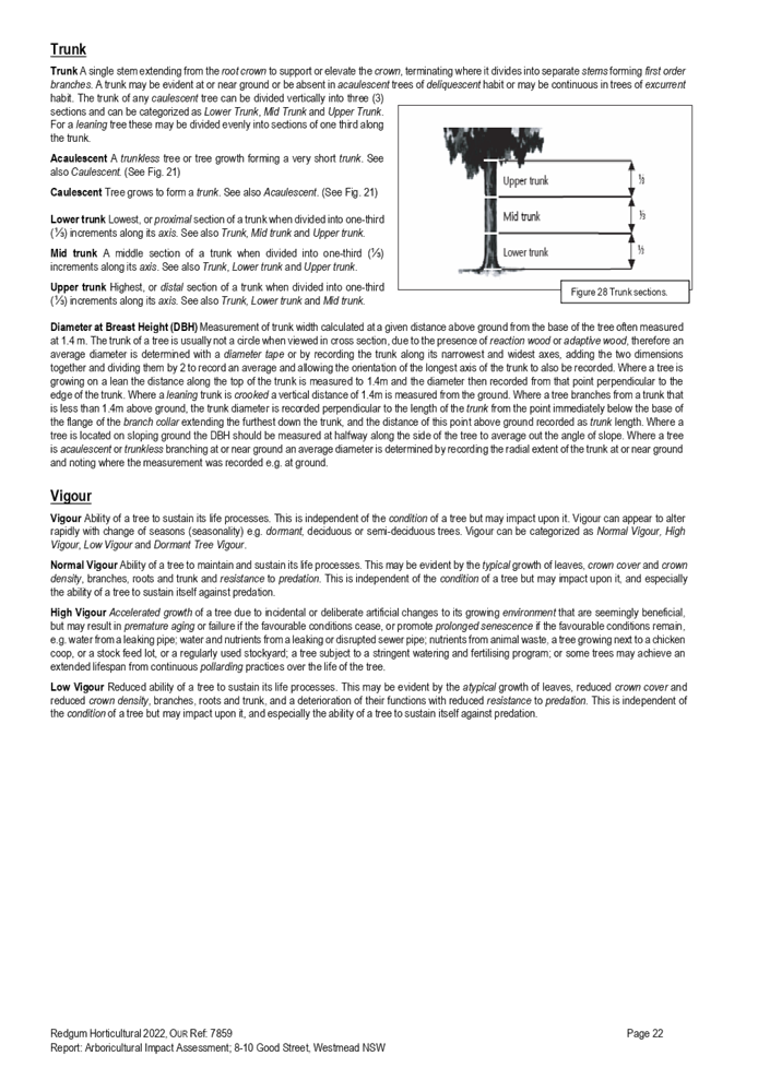
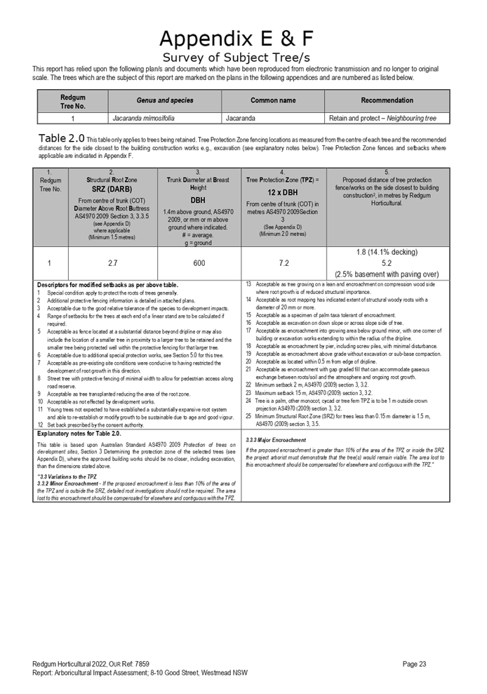
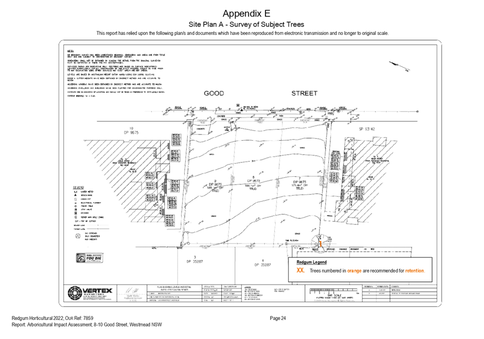
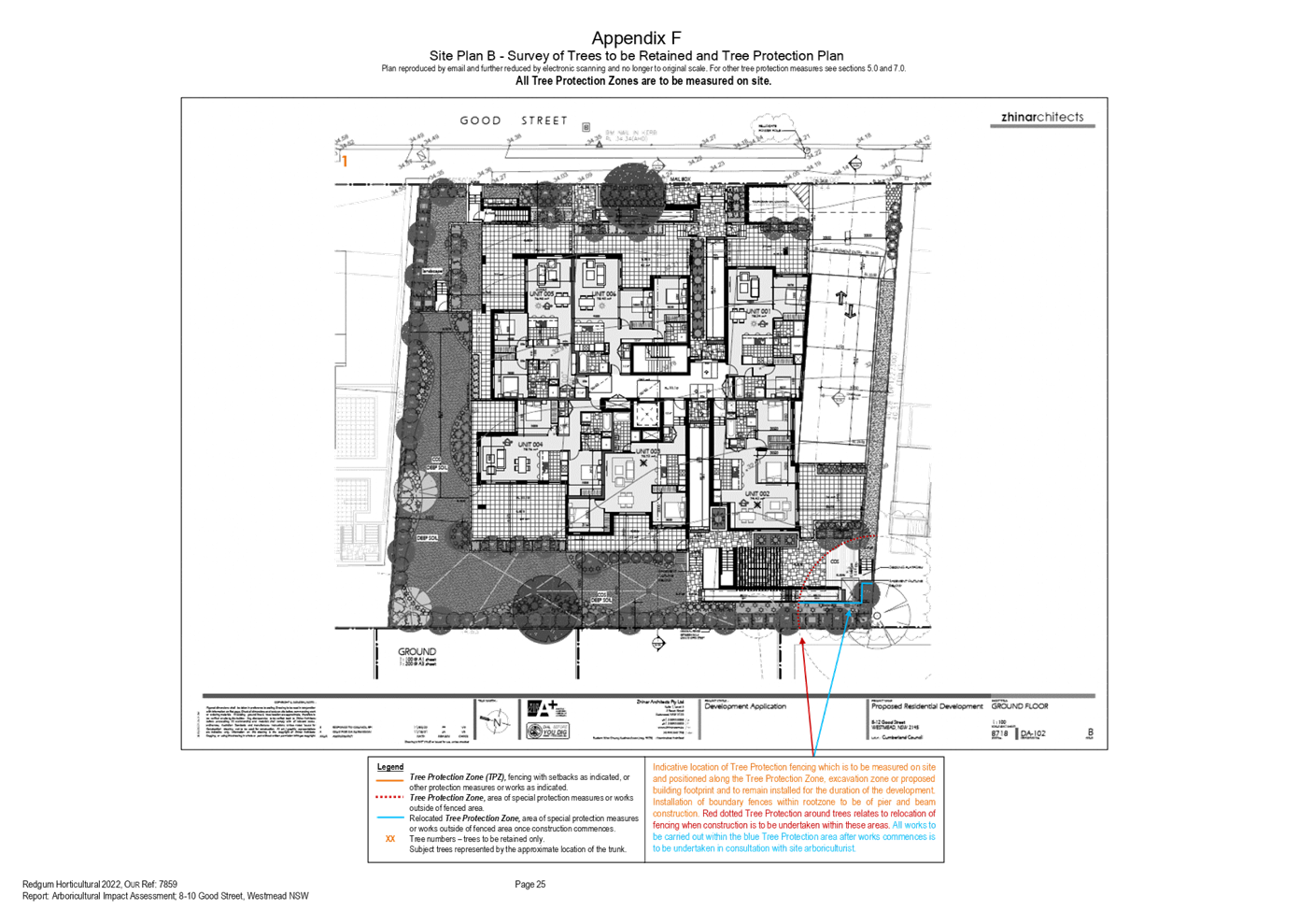
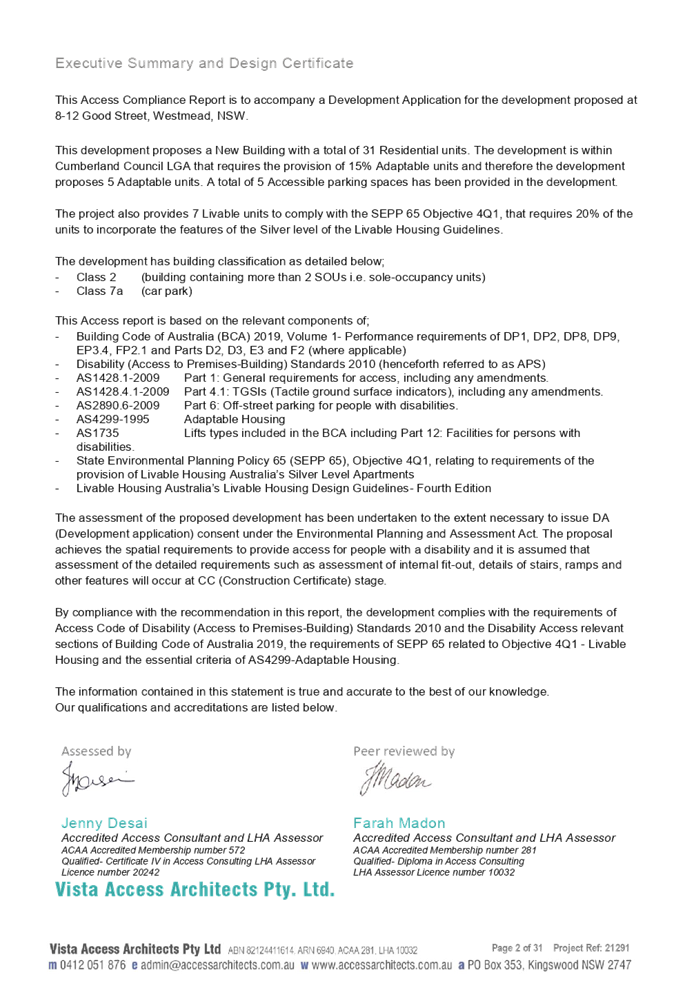
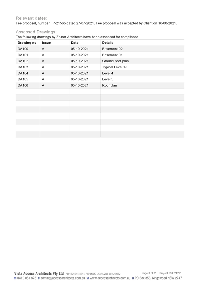
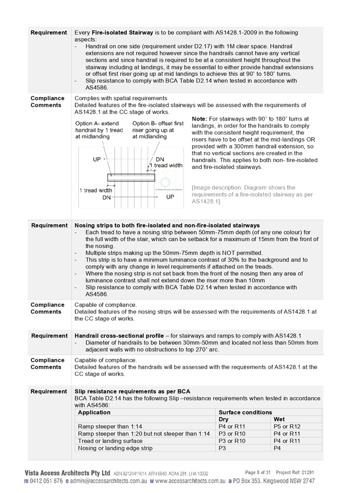
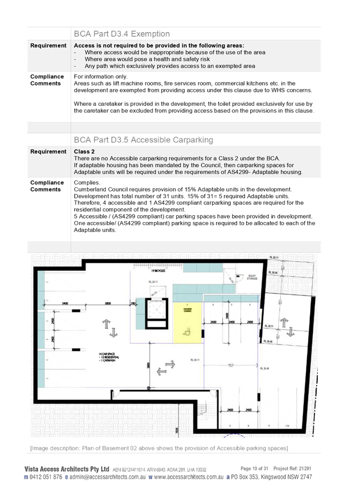
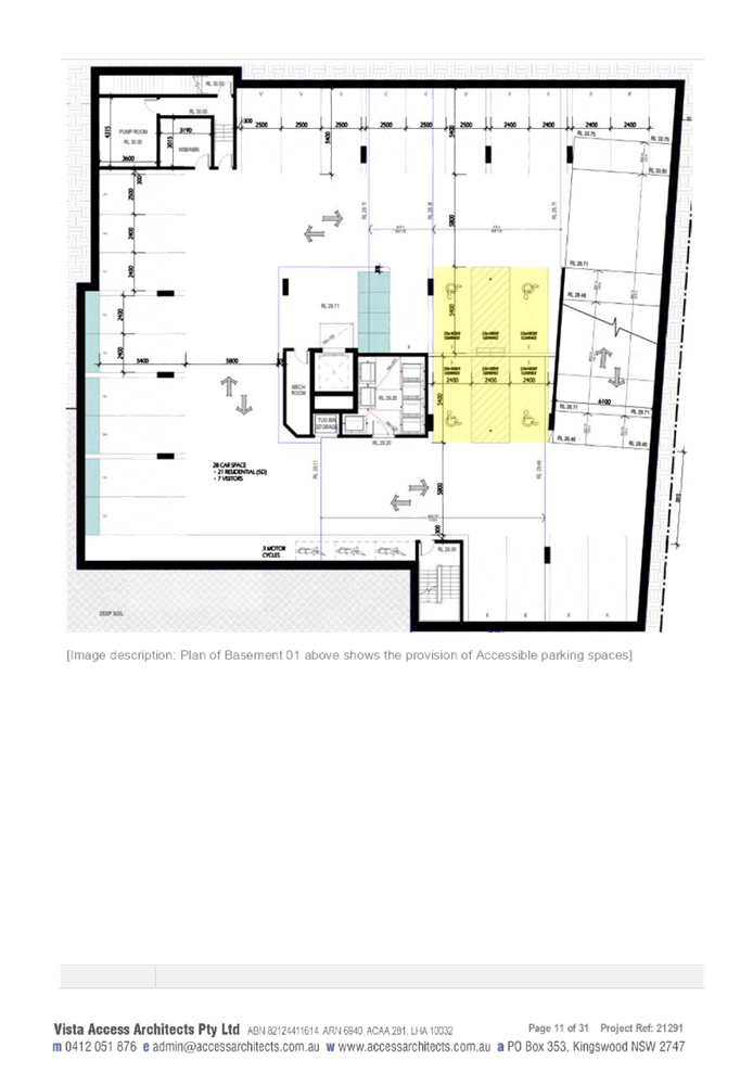
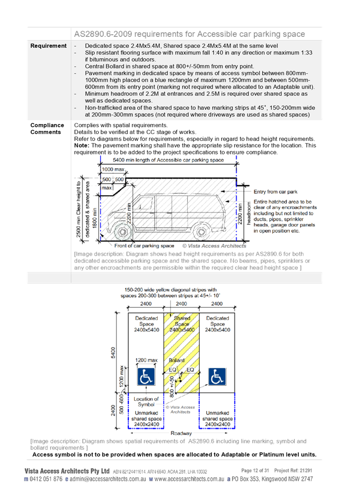
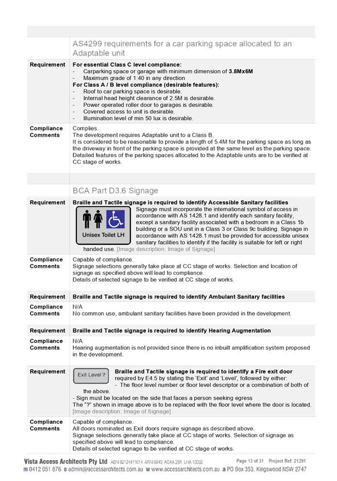
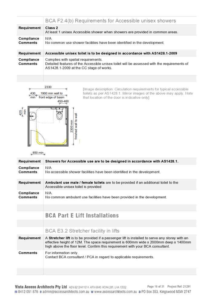
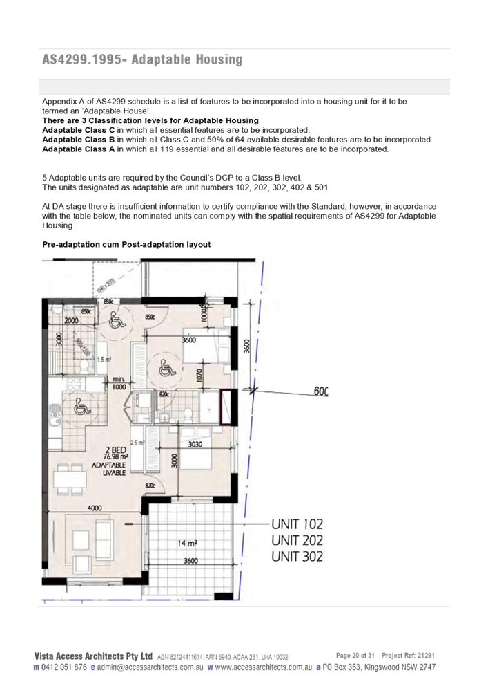
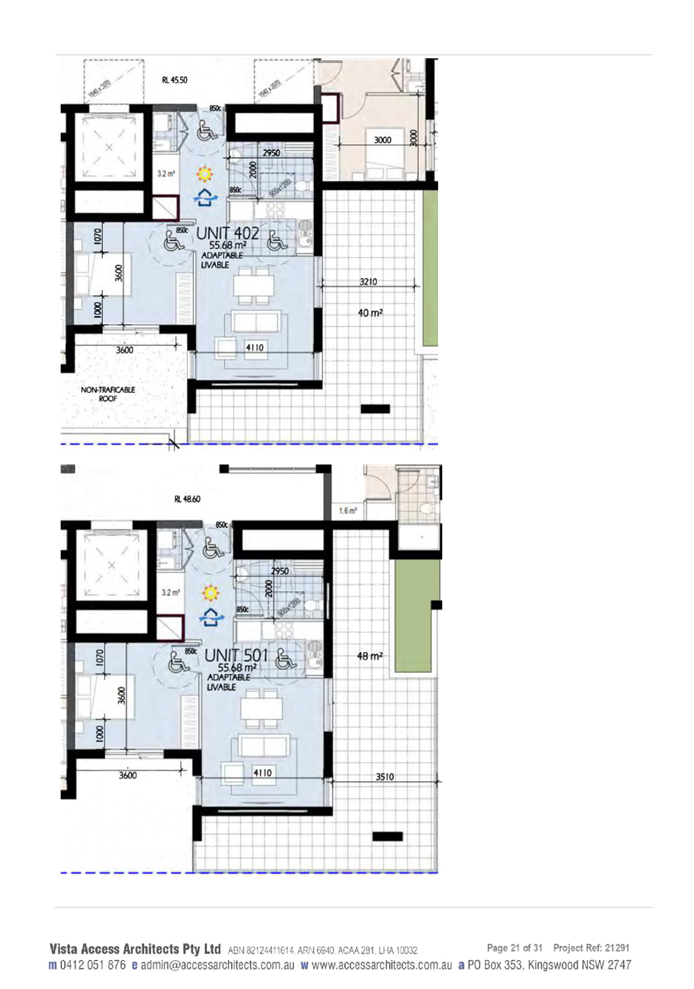
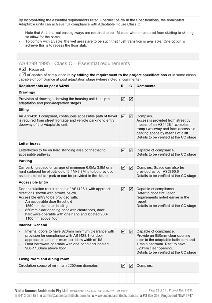
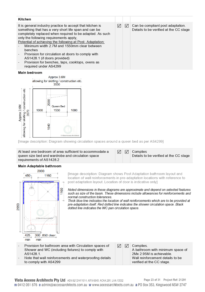
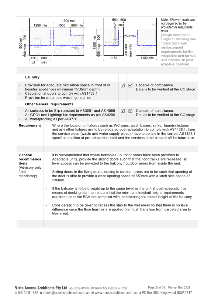
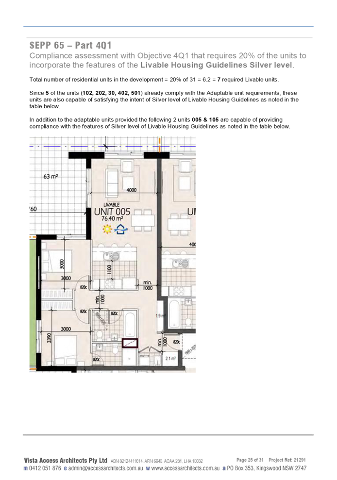
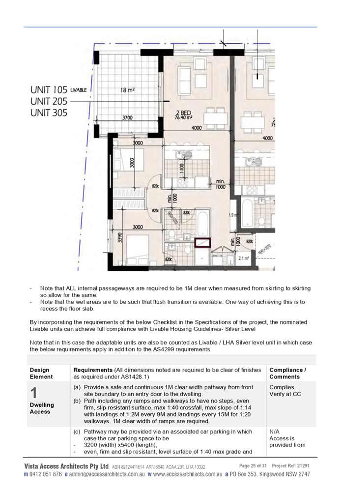
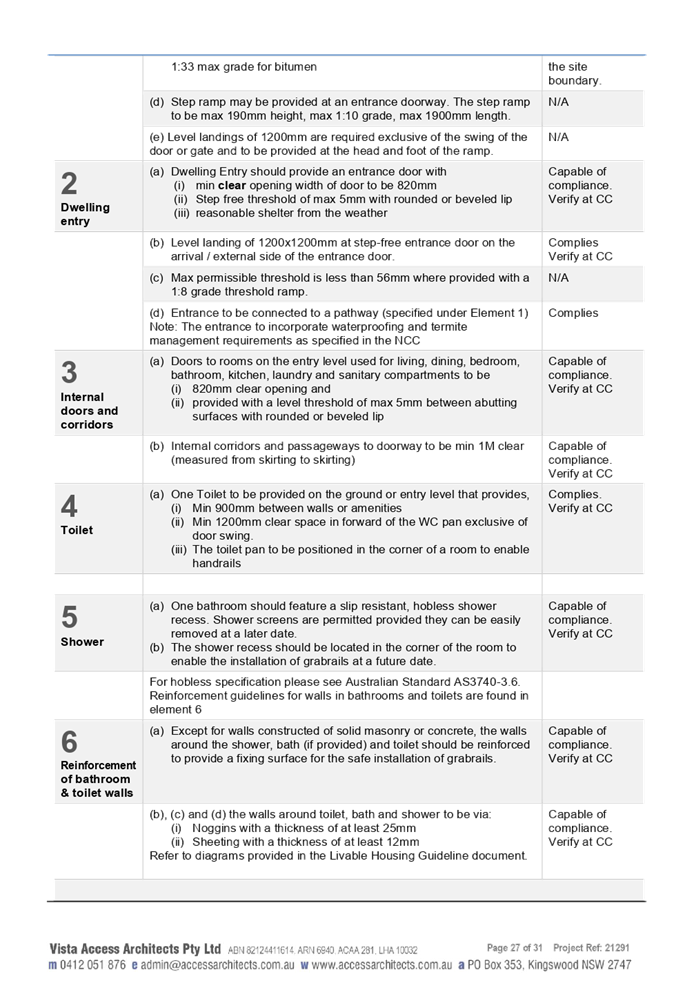
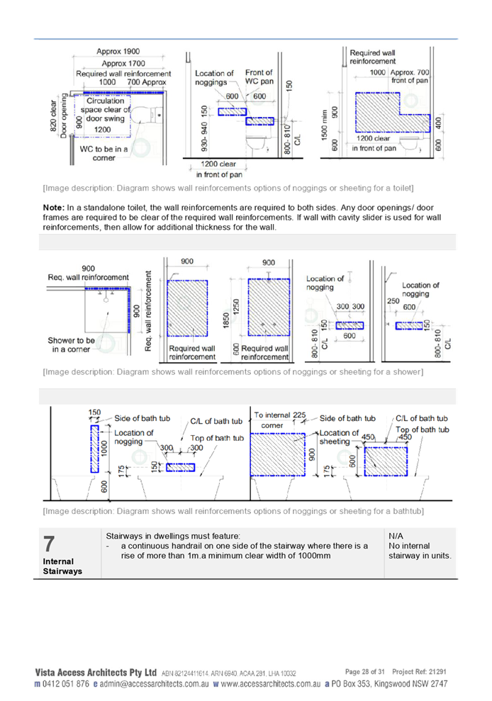

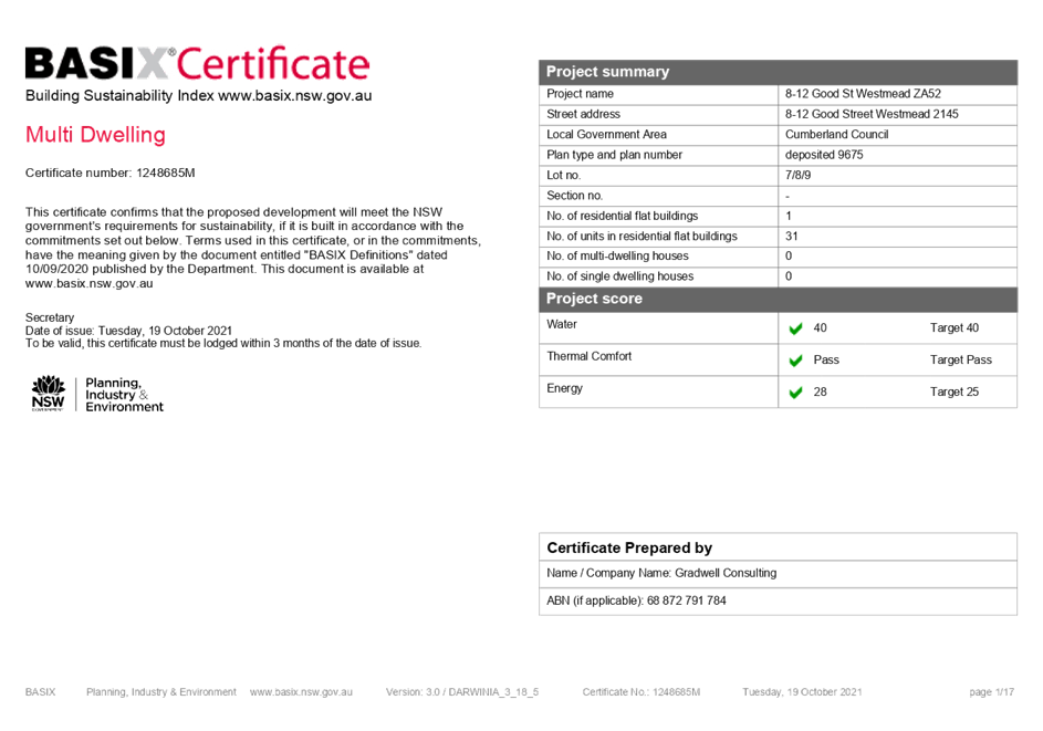
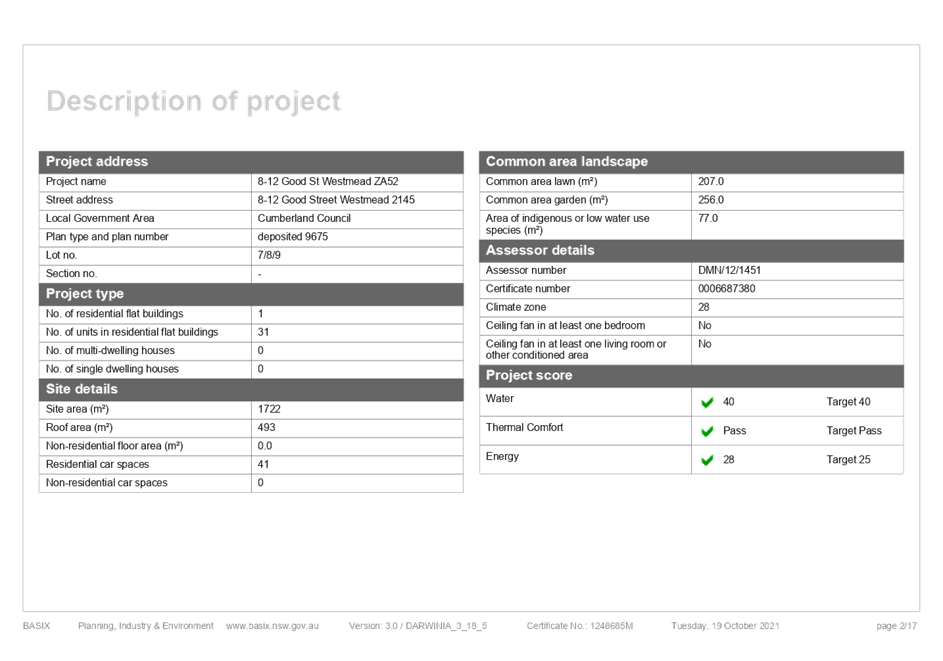
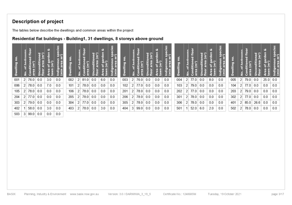
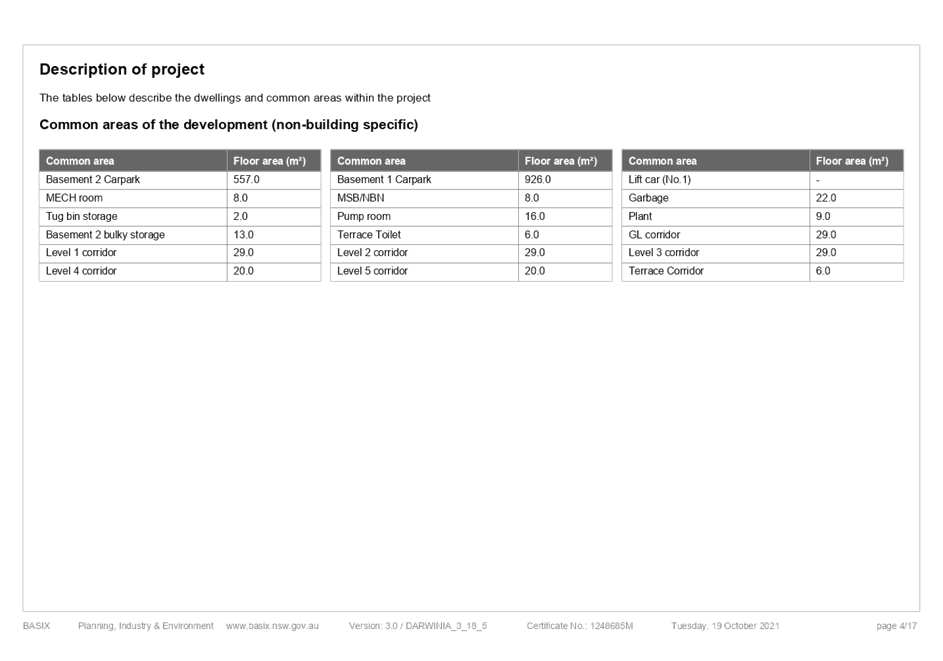
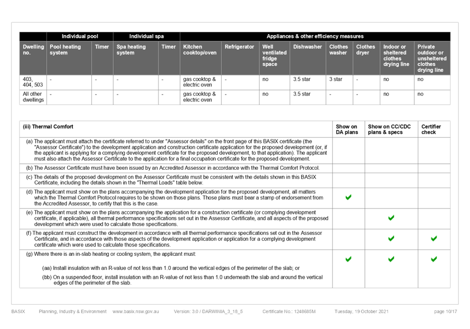
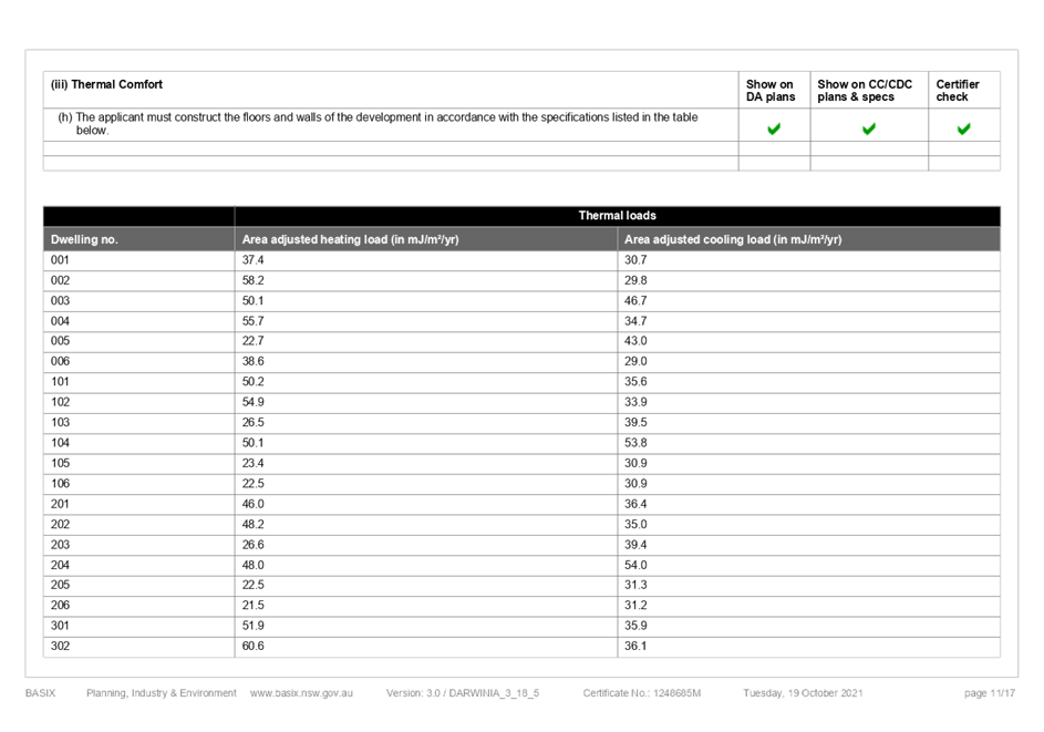
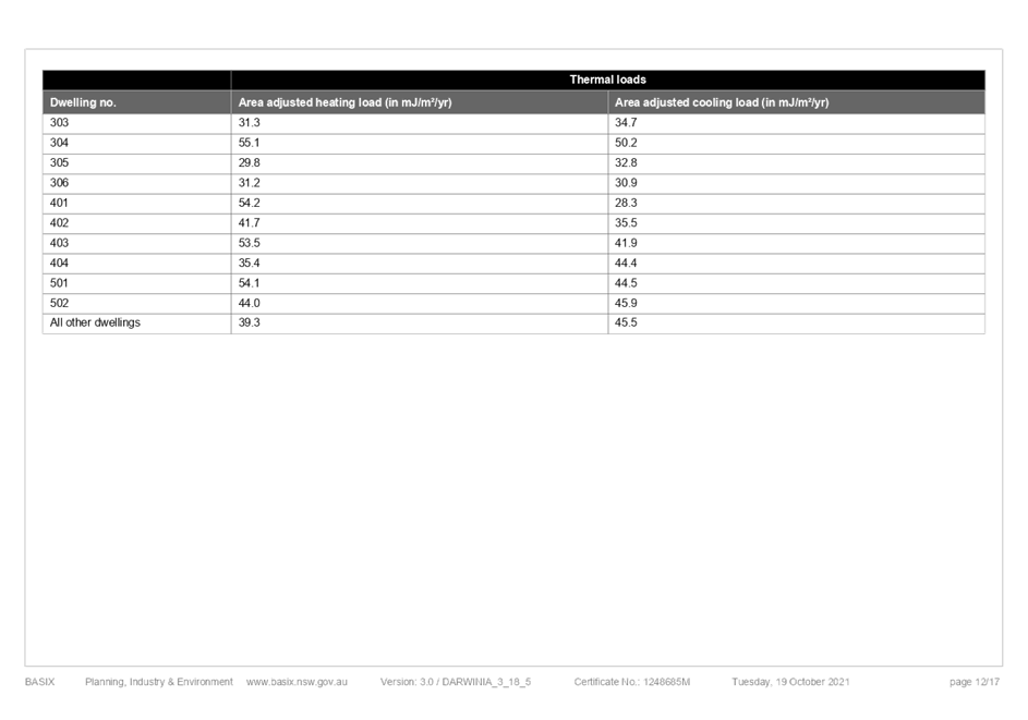
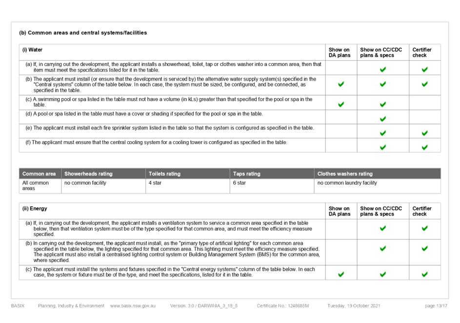
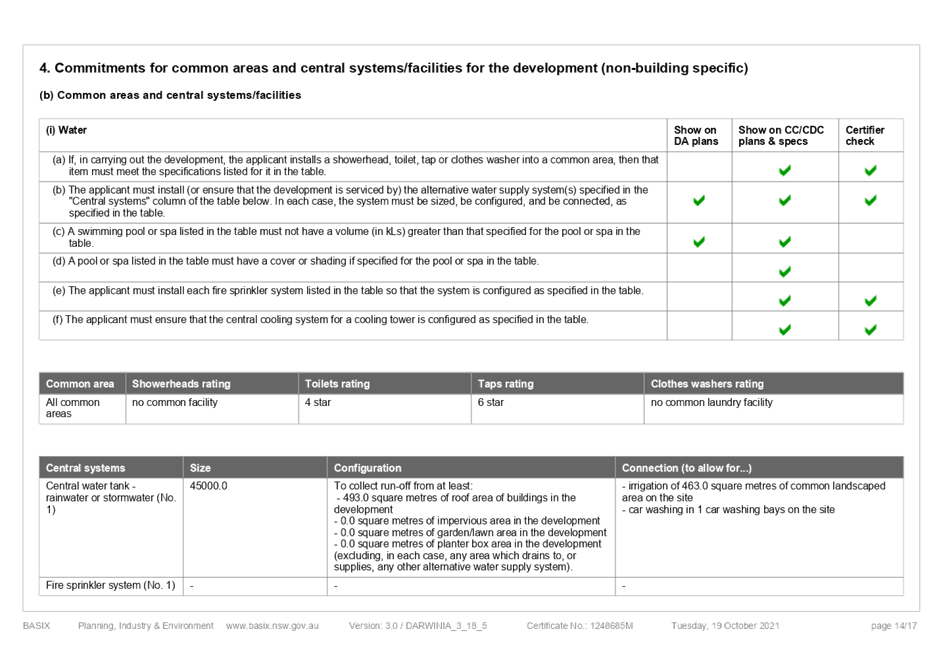
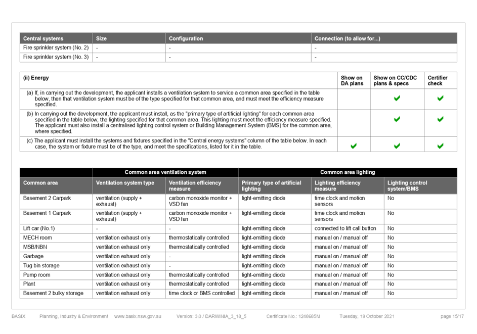
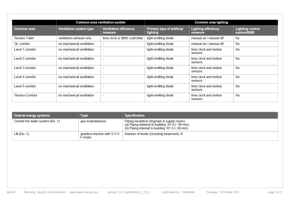
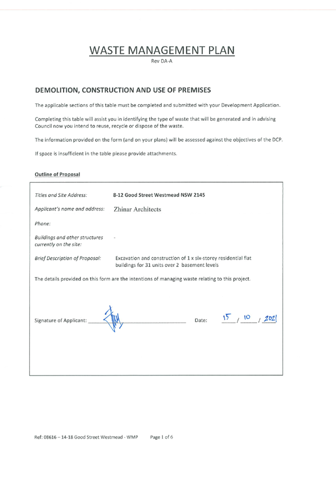

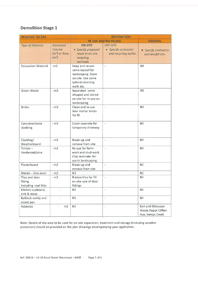
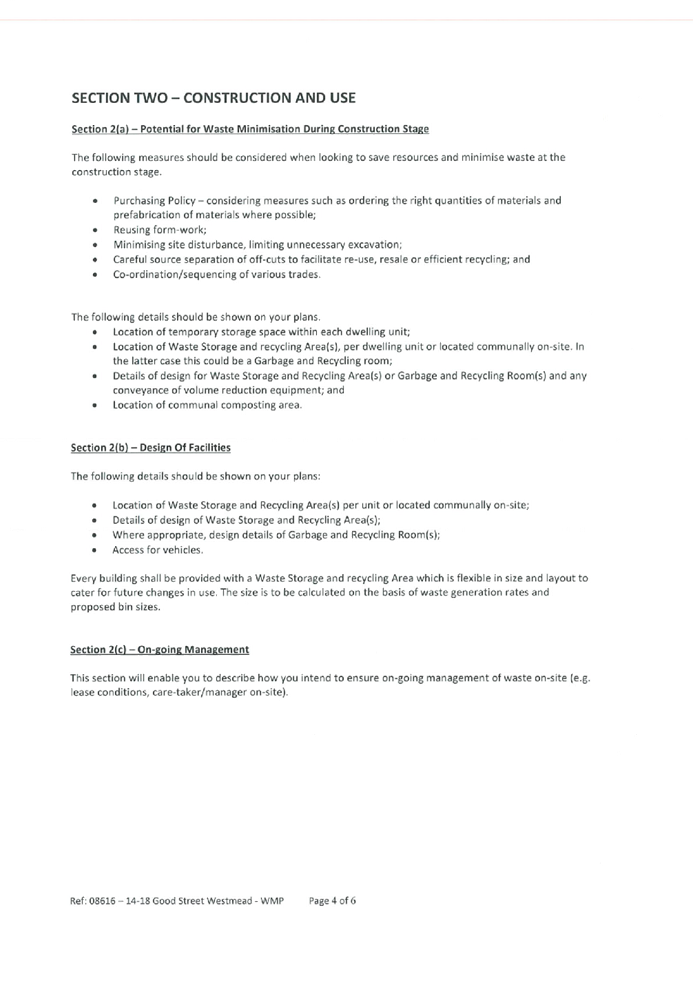
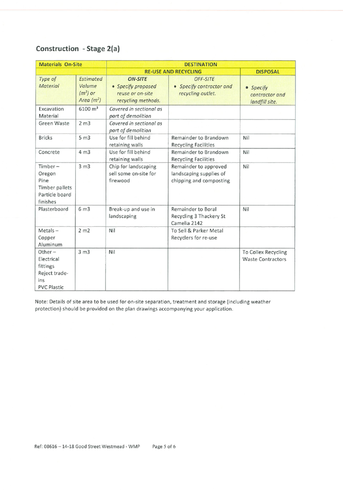
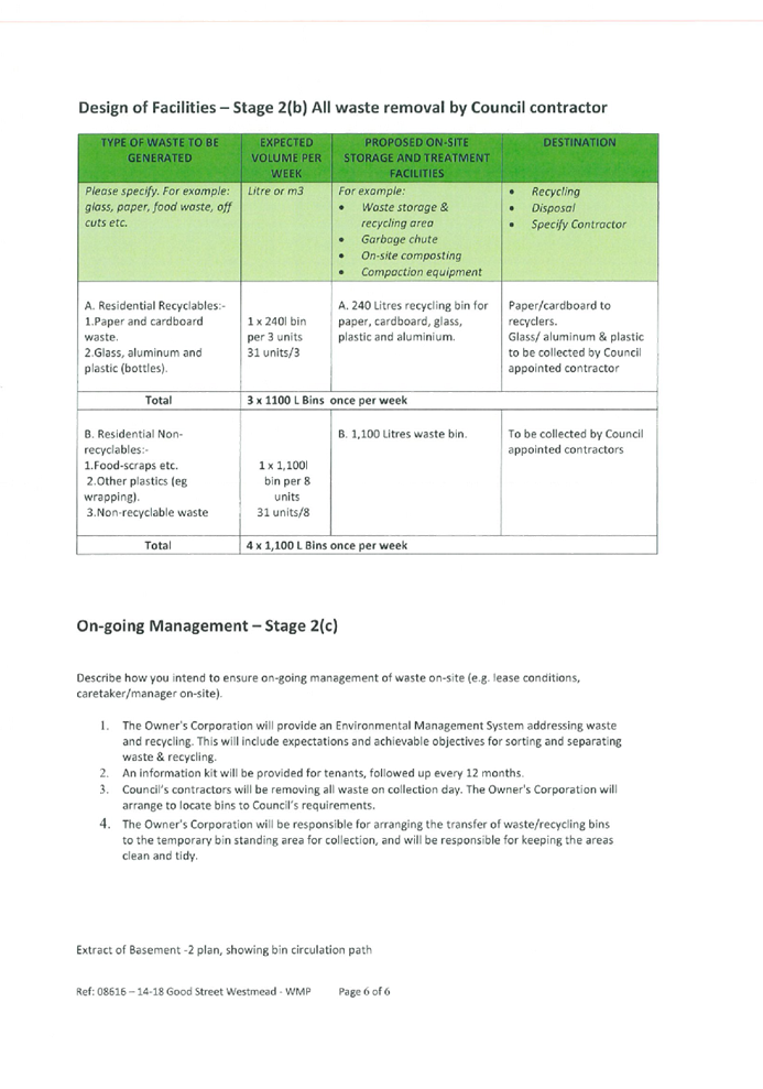


 Figure 5: Existing height of
buildings


