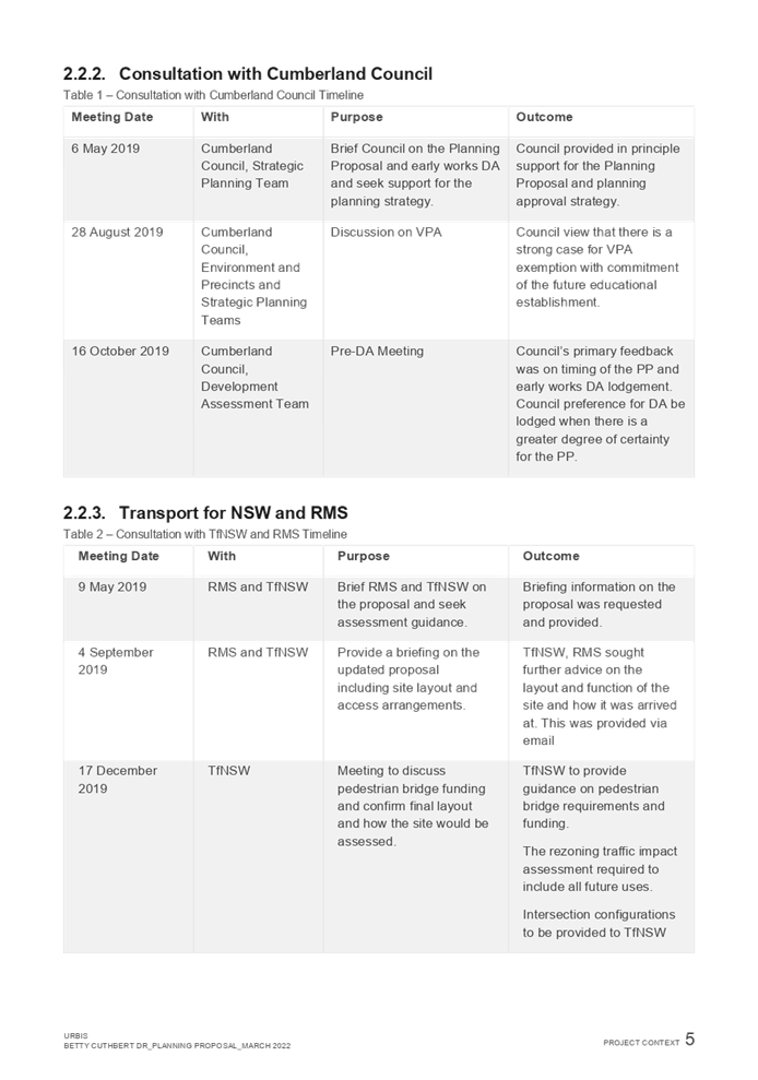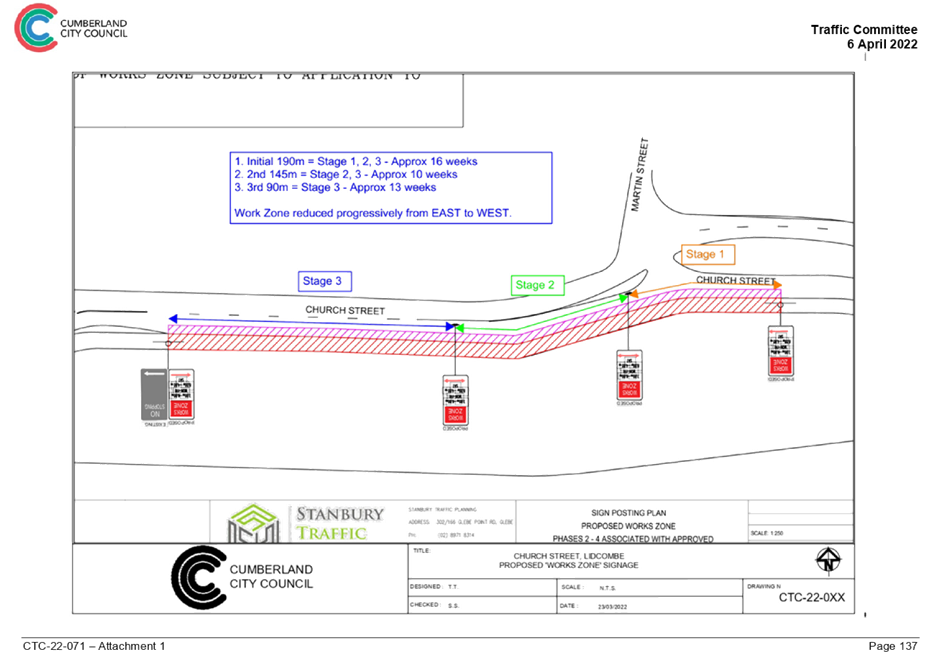
Council Meeting
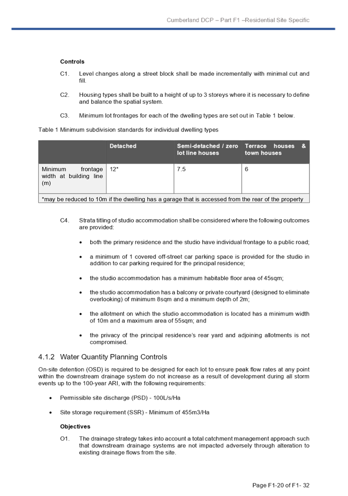
Wednesday, 4 May 2022 at 6:30pm
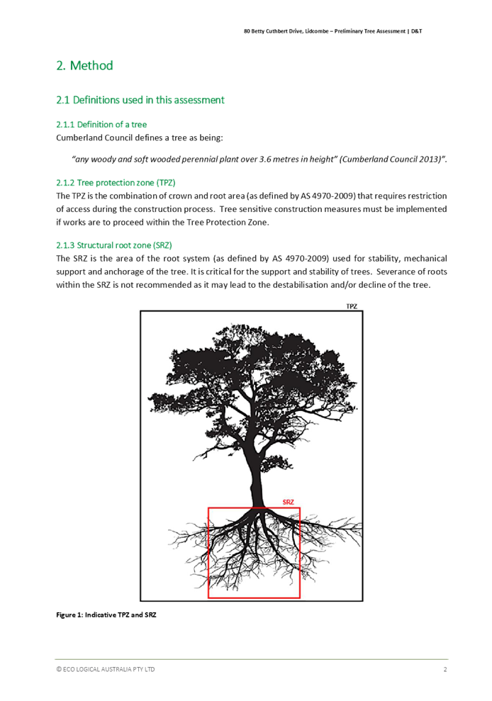
Cumberland City Council Chambers
Merrylands Service Centre, 16 Memorial Avenue, Merrylands
Council Meeting
Wednesday, 4 May 2022 at 6:30pm
Cumberland City Council Chambers
Merrylands Service Centre, 16 Memorial Avenue, Merrylands
Councillor Contact Details
|
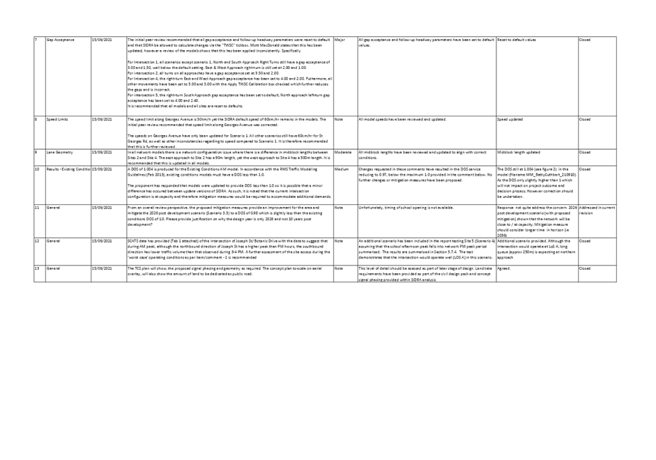
Granville Ward |
||
|
Clr Steve Christou |
0419 651 187 |
|
|
Clr Ola Hamed |
0405 070 007 |
|
|
Clr Joseph Rahme |
0418 995 471 |
|
|
Greystanes Ward |
||
|
Clr Diane Colman |
0400 279 200 |
Diane.Colman@cumberland.nsw.gov.au |
|
Clr Greg Cummings |
0417 612 717 |
|
|
Clr Eddy Sarkis |
0418 306 918 |
|
|
Regents Park Ward |
||
|
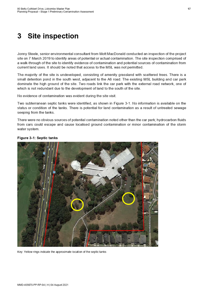
Clr Kun Huang (Deputy Mayor) |
0418 911 774 |
|
|
Clr Sabrin Farooqui |
0400 322 999 |
Sabrin.Farooqui@cumberland.nsw.gov.au |
|
Clr Helen Hughes |
0400 264 534 |
Helen.Hughes@cumberland.nsw.gov.au |
|
South Granville Ward |
||
|
Clr Glenn Elmore |
0418 459 527 |
|
|
Clr Mohamad Hussein |
0400 281 726 |
Mohamad.Hussein@cumberland.nsw.gov.au |
|
Wentworthville Ward |
||
|
Clr Suman Saha |
0419 546 950 |
|
|
Clr Lisa Lake (Mayor) |
0418 669 681 |
|
|
Clr Michael Zaiter |
0418 432 797 |
|
For information on Council services and facilities please visit www.cumberland.nsw.gov.au
Council Meeting
4 May 2022
1 Opening Prayer / Acknowledgement of Country / National Anthem
2 Notice of Live Streaming of Council meeting
3 Apologies / Requests for Leave of Absence
4 Declarations of Pecuniary & Non Pecuniary Conflicts of Interest
5 Confirmation of Previous Minutes
C05/22-54 Minutes of the Ordinary Meeting of Council - 20 April 2022........... 5
Nil
7 Public Forum / Presentation of Petitions
8 Items Resolved by Exception
Nil
Director Community and Organisation Development
Nil
Director Finance & Commercial Services
C05/22-55 Quarter 3 - Quarterly Budget Review Statement............................ 17
Director Environment & Planning
C05/22-56 Submission On The Sydney Metro West Environmental Impact Statement 41
C05/22-57 Planning Proposal for 80 Betty Cuthbert Drive, Lidcombe............ 71
C05/22-58 Report on Variations for Development Standards Approved Under Delegation - October to December 2021 Quarter and January to March 2022 Quarter 729
Nil
10 Reports of Council Committees
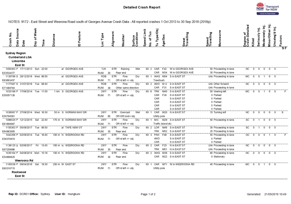
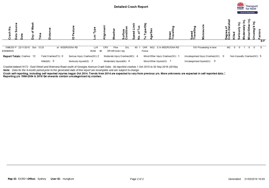
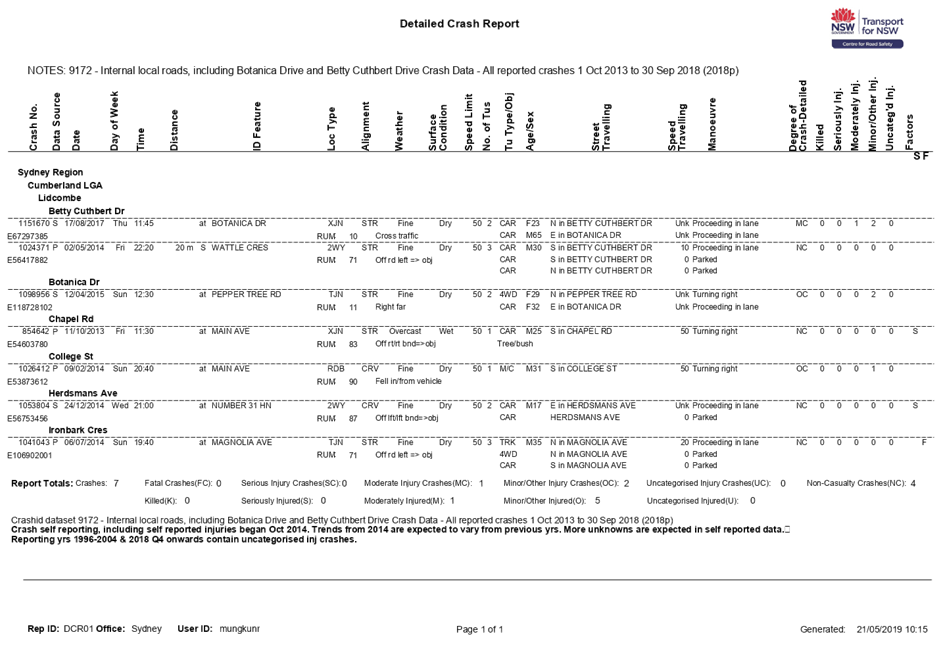
C05/22-59 Traffic Committee - Minutes of Meeting Held on 6 April 2022.... 739
Nil
Nil
Nil
Nil
16 Close
Council Meeting
4 May 2022
Item No: C05/22-54
Minutes of the Ordinary Meeting of Council - 20 April 2022
Responsible Division: General Manager
Officer: Executive Manager General Manager's Unit
|
That Council confirm the minutes of the Ordinary Meeting of Council held on 20 April 2022 |
Attachments
DOCUMENTS
ASSOCIATED WITH
REPORT C05/22-54
Attachment 1
Draft Council Meeting Minutes - 20 April 2022
4 May 2022
Item No: C05/22-55
Quarter 3 - Quarterly Budget Review Statement
Responsible Division: Finance & Commercial Services
Officer: Acting Director Finance & Commercial Services
File Number: S-57-50
Community Strategic Plan Goal: Transparent and accountable leadership
Summary
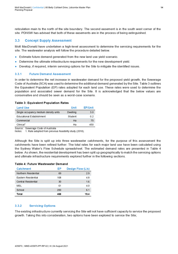
The attached Quarterly Budget Review Statement (QBRS) refers to the period ended 31 March 2022. The QBRS indicates that Council’s overall financial position is steady due to actions taken to offset significant revenue losses associated with the current COVID-19 outbreak.
Quarterly Budget Review Statement
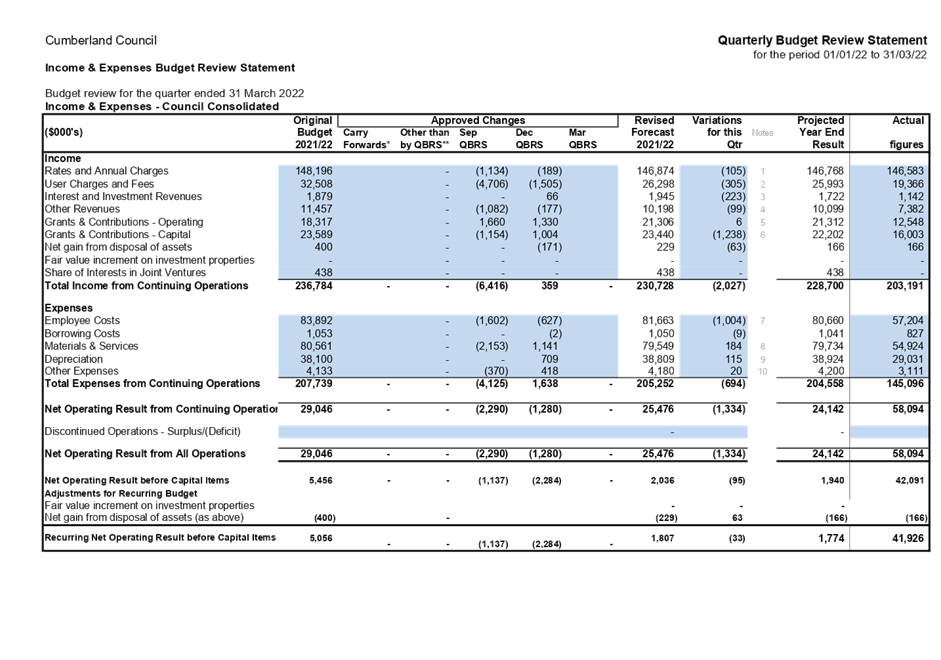
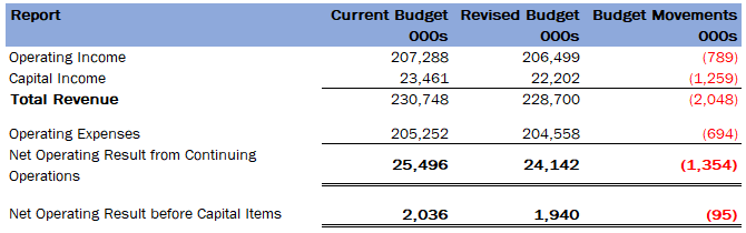
As at the end of Quarter 3, Council is forecasting a recurring budget surplus of $1.94m; this forecast assumes that current temporary and permanent savings measures continue, and that remaining income estimates are realised.
In the context of the path of the pandemic and its significant impact on Council’s income, the reductions that have been made reflect the expected losses until the end of the financial year. It is imperative that Council’s budget position continue to be monitored closely for the remainder of the financial year.
The savings identified to cover income losses have largely come from employee costs savings and services that were unable to be delivered in the first part of the financial year as a result of the public health order.
|
Recommendation
That Council approve the revised estimates of income and expenditure for 2021/22 contained in the Quarterly Budget Review Statement. |
Report
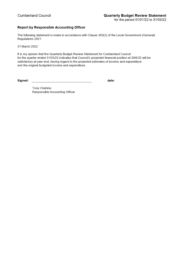
Clause 203(2) of the Local Government (General) Regulation 2021 (the Regulation) requires that Council’s Responsible Accounting Officer prepare and submit a Quarterly Budget Review Statement (QBRS) that shows, by reference to the estimate of income and expenditure set out in the Operational Plan adopted by Council for the relevant year, a revised estimate of the income and expenditure for that year.
The QBRS, compiled for the information of Council and the community, provides a summary of Council’s financial position at the end of each quarter as to its progress against both the original Operational Plan and the last revised budget, as well as any recommended revisions identified as part of the budget review process. The Operational Plan profit has decreased from the current approved budget surplus of $2.04m to a surplus of $1.94m, excluding capital income, as per the below table.
Significant material Operational Plan revisions arising in the March 2022 quarter forecast are as follows:
Income Impacts:
· Forecast decrease in rates and annual charges of $0.1m due to reduction in supplementary rates.
· Forecast decrease in user charges of $0.3m was mainly attributable to fire safety compliance charges ($400k) and learn to swim fees ($240k), offset by recovery of childcare fees ($390k).
· Forecast decrease in other revenue of $0.1m was attributable to fines income.
Expense Impacts:
· Materials & Contracts have increased by $0.2m mainly due to increased fuel costs ($206k), and legal costs ($127k) and contractor expense ($188k) offset by savings on utilities ($335k).
· Depreciation & amortisation has increased by $0.1m due to decommissioning of a number of asset segments.
· Employee costs have been reduced by $1.0m, due to YTD savings on casual employees and lower occupancy rates across council.
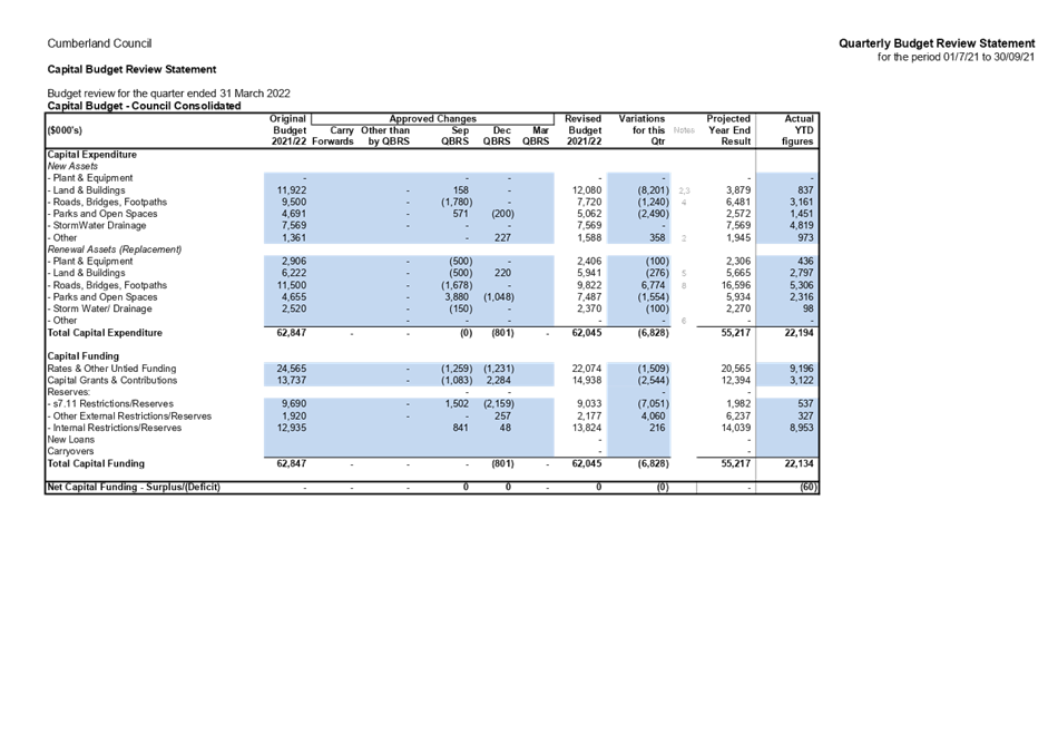
The projected total capital expenditure has been decreased to $55.2m. The following reallocations and funding adjustments have been made to the program:
· Allocation of grant funds towards LRCI major road projects - $4.7m
· Allocation of grant funds towards additional road safety projects - $755k
· New project for works at Guildford Supermarket - $850k
· Allocation of reserve funds towards s355 projects - $468k.
· Deferral of funding towards the Merrylands Civic Square Project - $6.3m
· Deferral of s7.11 funded projects - $3.6m
· Deferral of works on the Parramatta Rd Urban Amenity Improvement - $2m
· Reduction of general funded COVID emergency funds to be allocated to new Infrastructure and Community reserves - $1.5m.
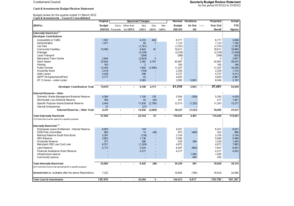
Cash Forecast
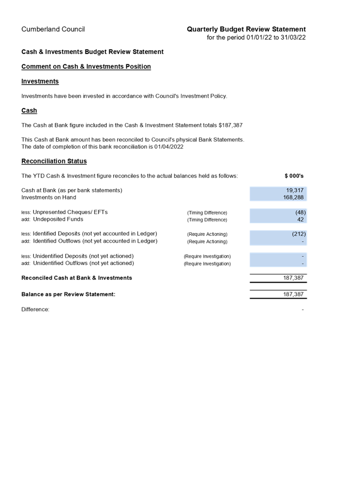
The projected Cash and Investments position of Council is forecast to increase to $159.8m. Council’s estimated unallocated cash balance is forecast to finish at $10.5m.
Community Engagement
There are no consultation processes for Council associated with this report.
Policy Implications
There are no policy implications for Council associated with this report.
Risk Implications
There are no risk implications for Council associated with this report.
Financial Implications
CONCLUSION
As at the end of the third quarter, Council’s net operating result before capital is projected to finish the year at a surplus of $1.94m. Close monitoring of Councils income is required to ensure that Council’s plan to financial recovery in the medium to longer term remains on course to be achieved.
Attachments
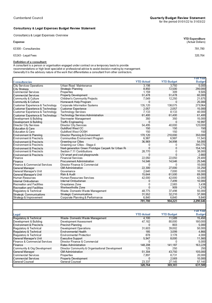
1. Q3 2021-22 Quarterly Budget Review Statement
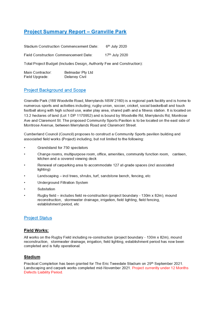
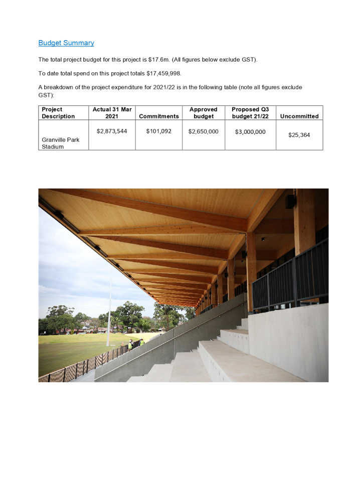
2. Q3 2021-22 Budget Review for Granville Stadium
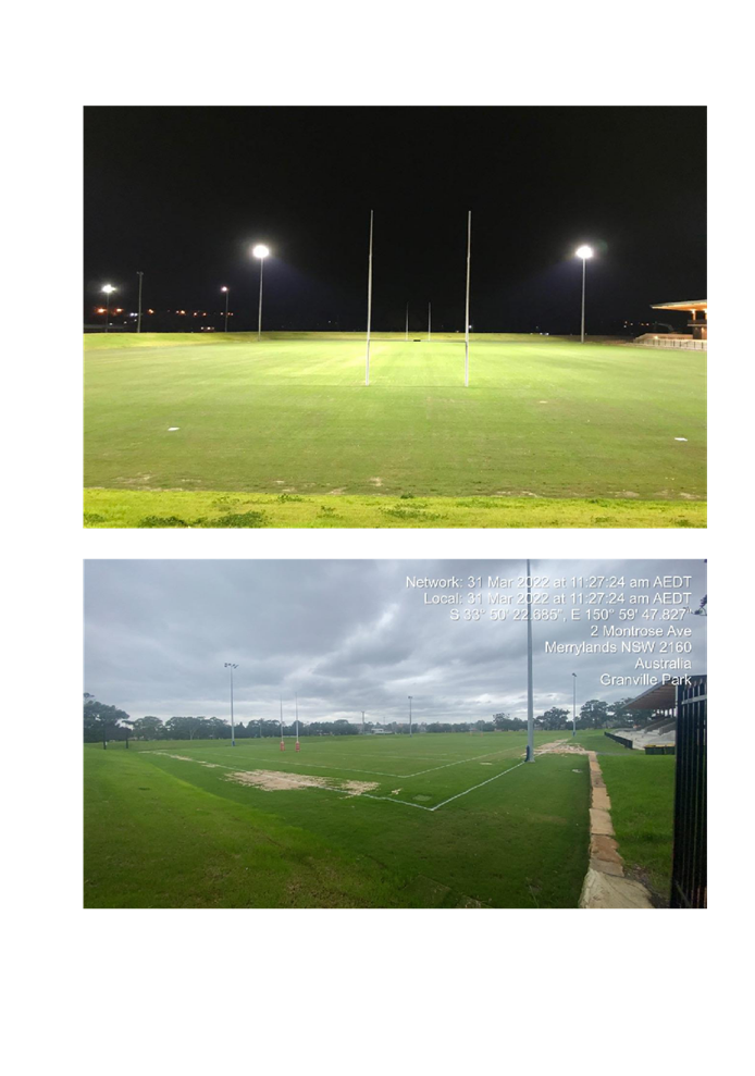
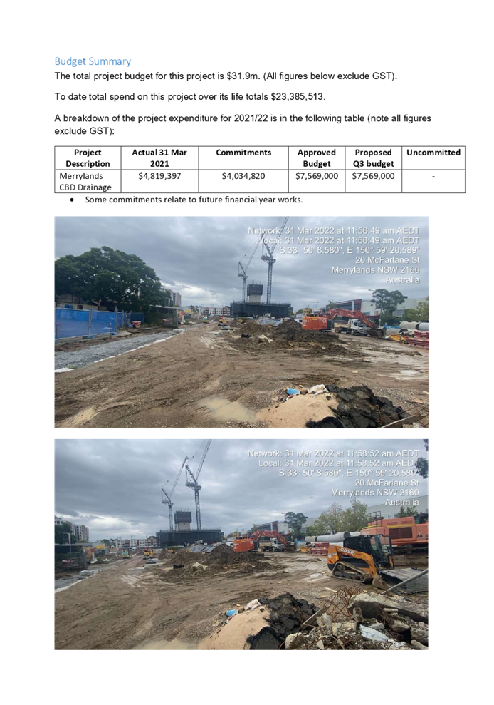
3. Q3 2021-22 Budget Review for Merrylands CBD Major Drainage
DOCUMENTS
ASSOCIATED WITH
REPORT C05/22-55
Attachment 1
Q3 2021-22 Quarterly Budget Review Statement
DOCUMENTS
ASSOCIATED WITH
REPORT C05/22-55
Attachment 2
Q3 2021-22 Budget Review for Granville Stadium
Attachment 3
Q3 2021-22 Budget Review for Merrylands CBD Major Drainage
4 May 2022
Item No: C05/22-56
Submission On The Sydney Metro West Environmental Impact Statement
Responsible Division: Environment & Planning
Officer: Director Environment & Planning
File Number: CS-205
Community Strategic Plan Goal: A resilient built environment
Summary
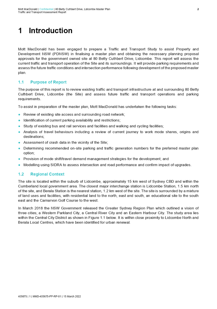
In March 2022, the NSW Government released the Environment Impact Statement for Sydney Metro West for major civil construction (consisting of tunnel fit-out, station building and fit-out) and operation of the line between Westmead and Sydney CBD (Stage 3).
This report presents a summary of the project with key considerations outlined for Council. It is recommended that Council endorse the draft submission and forward to the Department of Planning and Environment. The submission is due in early May 2022.
|
Recommendation That Council: 1. Endorse the draft submission in Attachment 1 and forward it to the Department of Planning and Environment. 2. Delegate authority to the General Manager to finalise the draft submission, including any minor typographical or editorial changes. |
Report
Background
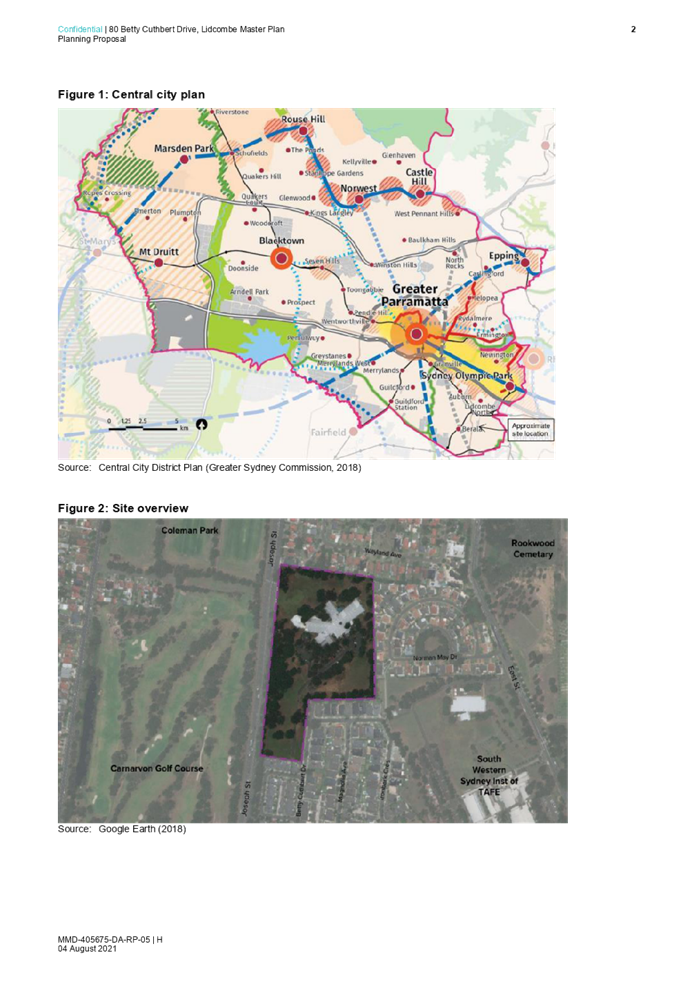
Sydney Metro is Australia’s biggest public transport program. It includes the Sydney Metro North West Line (Rouse Hill-Chatswood) (opened in 2019), Sydney Metro City and South West (due to open in 2024), Sydney Metro West (this project) and the proposed Sydney Metro – Western Sydney Airport (Figure 1).
Sydney Metro West will provide a direct and frequent connection between Westmead and the Sydney CBD, doubling the existing rail capacity with a target time between the two centres of around 20 minutes and helping to relieve the congested T1 Western Line, T9 Northern Line and T2 Inner West and Leppington Line.
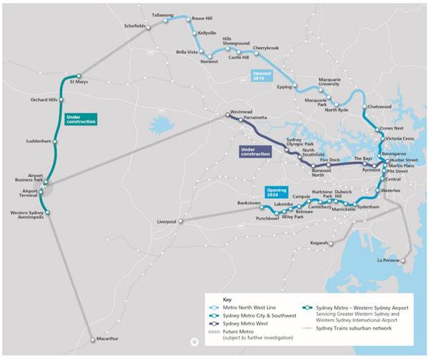
Figure 1: Sydney Metro Network (Source: Chapter 1 – Introduction and context, page 1-2)
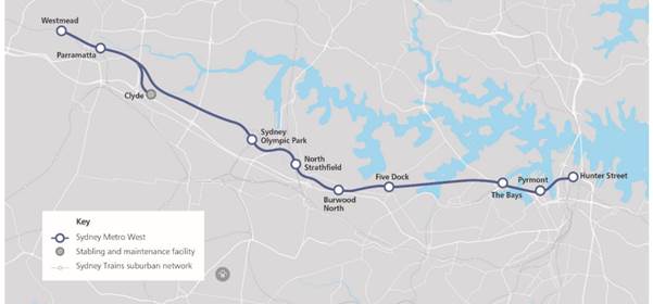
Figure 2: Sydney Metro West (Source: Chapter 1 – Introduction and context, page 1-3)
Staged Planning Approval
Sydney Metro West is being assessed as a staged infrastructure application under section 5.20 of the Environmental Planning and Assessment Act 1979 (EP&A Act).
Previous Applications
The Concept and major civil construction work for Sydney Metro West between Westmead and The Bays (Stage 1 of the planning approval process, application number SSI-10038) was approved by the Minister for Planning and Public Places on 11 March 2021.
The Concept included:
· Construction and operation of new passenger rail infrastructure between Westmead and the central business district of Sydney, including:
o Tunnels, stations (including surrounding areas) and associated rail facilities
o Stabling and maintenance facilities (including associated underground and overground connections to tunnels)
· Modification of existing rail infrastructure (including stations and surrounding areas)
· Ancillary development.
The next stage was the Sydney Metro West planning application (Stage 1 of the planning approval process) which included major civil construction work between Westmead and The Bays, including:
· Enabling works such as demolition, utility supply to construction sites, utility adjustments, and modifications to the existing transport network
· Tunnel excavation including tunnel support activities between Westmead and The Bays
· Station excavation for new metro stations at Westmead, Parramatta, Sydney Olympic Park, North Strathfield, Burwood North, Five Dock and The Bays
· Shaft excavation for services facilities
· Civil work for the stabling and maintenance facility at Clyde.
These works commenced in 2021 and will continue through to the end of 2026.
The Environmental Impact Statement for Stage 2 of the planning approval process was for major civil construction between The Bays and Sydney CBD, and was exhibited from 3 November 2021 to 15 December 2021. These works would commence in 2023 and would continue through to the end of 2025.
Current proposal
Stage 3 of the planning approval process, the subject of this report, includes tunnel fit-out, construction of stations, ancillary facilities and station precincts, and operation and maintenance of the Sydney Metro West line (the proposal). These works would commence in 2024 and would continue through to the beginning of 2030.
The proposal would involve:
· Fit-out of tunnels including rail systems for metro train operations
· Construction, fit-out and operation of:
o Metro station buildings and the surrounding metro precincts
o A services facility and traction substations
o A control centre, test track and stabling and maintenance facility at Clyde
· Space for non-station uses at metro stations (e.g. retail, commercial and/or community facilities)
· Provisions for over and/or adjacent station development within metro precincts
· Rail interchange support works, including work to the existing T1 Western Line at Westmead and T9 Northern Line at North Strathfield
· Transport network modifications such as new interchange facilities and changes to public transport networks to serve metro stations
· Subdivision of sites
· Operation and maintenance of the Sydney Metro West line.
Sydney Metro notes that components of this proposal are subject to further design development, and changes may be made during the ongoing design that take into account the outcomes of community and stakeholder engagement and environmental investigations.
A suite of documents consisting of the Environmental Impact Assessment (EIS) and supporting documents is on exhibition between 23 March 2022 and 4 May 2022.
Proposed metro station at Westmead
The EIS identifies a proposed metro station at Westmead, which would provide an interchange with the existing rail system, Parramatta Light Rail, and buses.
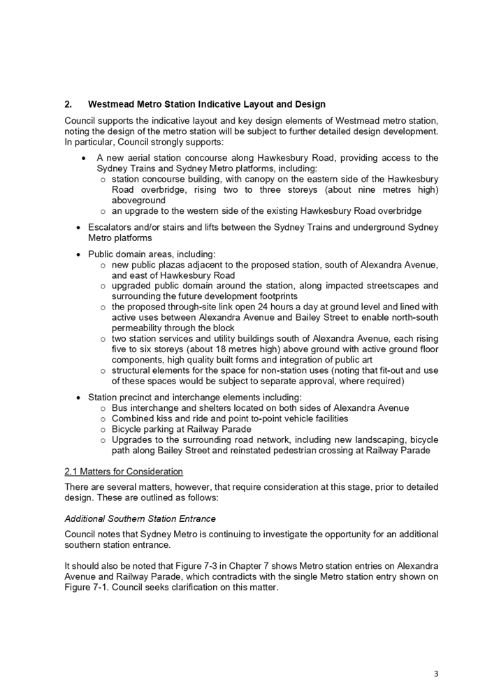
The key elements of the proposal that are relevant to Cumberland City are outlined as follows:
· A new aerial station concourse along Hawkesbury Road, providing access to the Sydney Trains and Sydney Metro platforms, including:
o Station concourse building, with canopy on the eastern side of the Hawkesbury Road overbridge, rising two to three storeys (about nine metres high) aboveground
o An upgrade to the western side of the existing Hawkesbury Road overbridge
· Escalators and/or stairs and lifts between the Sydney Trains and underground Sydney Metro platforms
· Public domain areas, including:
o New public plazas adjacent to the proposed station, south of Alexandra Avenue, and east of Hawkesbury Road
o Upgraded public domain around the station, along impacted streetscapes and surrounding the future development footprints
o Through-site link, open 24 hours a day at ground level and lined with active uses between Alexandra Avenue and Bailey Street to enable north-south permeability through the block
o Two station services and utility buildings south of Alexandra Avenue, each rising five to six storeys (about 18 metres high) above ground, with some active frontages indicated
o Structural elements for the space for non-station uses (fit-out and use of these spaces would be subject to separate approval, where required)
· Station precinct and interchange elements including:
o Bus interchange and shelters located on both sides of Alexandra Avenue
o Combined kiss and ride and point to-point vehicle facilities
o Bicycle parking at Railway Parade
o Upgrades to the surrounding road network, including new landscaping, bicycle path along Bailey Street and reinstated pedestrian crossing at Railway Parade
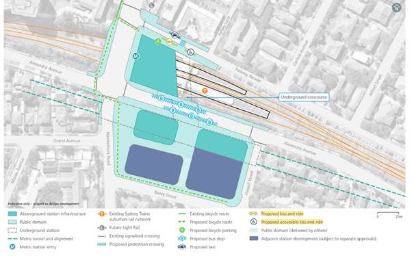
Figure 3: Westmead Metro Station Indicative Layout and Key Design Elements (Source: Chapter 7 - Westmead metro station, page 7-5)
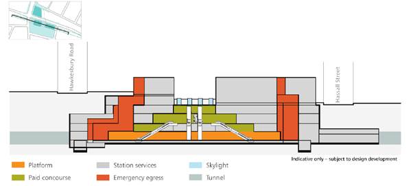
Figure 4: Westmead Metro Station Indicative Long-Section (Source: Chapter 7 - Westmead metro station, page 7-6)
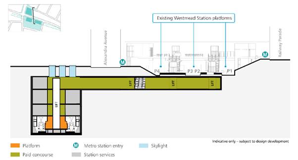
Figure 5: Westmead Metro Station Indicative Cross-Section (Source: Chapter 7 - Westmead metro station, page 7-6)
Draft Submission
Council officers have reviewed the EIS and supporting documents, and have prepared a draft submission with specific comments on the following matters:
· Provision of commuter carpark
· Southern entrance required
· Station indicative layout and design
· Hawkesbury Road and its surrounds
· Traffic and transport
· Non-Aboriginal heritage
· Operational and construction noise and vibration
· Contamination, erosion and sediment control and air quality
· Business impacts
· Flooding and stormwater and biodiversity
The proposal is generally supported and some matters for consideration have been raised in the draft submission (see Attachment 1). The key issues raised in the submission are outlined below.
Need for commuter carpark at Westmead
There is currently limited parking available at Westmead to support commuter demand for public transport services at this location. The introduction of metro to Westmead will provide an additional form of public transport service that will make the precinct more attractive to use.
At the present time, the broader public transport network does not adequately support non-car access to this location, with missing links to adjoining suburbs, such as Wentworthville and Merrylands. As a result, car travel is used for local residents to access the train network.
The current proposal for Sydney Metro West does not provide commuter car parking at Westmead. It is requested that investigations are undertaken for commuter car parking to be provided at Westmead to support existing and future transport networks, and for Council to be involved in these investigations with State agencies.
Bus routes servicing the Westmead area
In line with the above issue raised about commuter carparking, the adequacy of bus services for residents likely to use or encouraged to use metro needs to be reviewed. To further encourage a modal shift to public transport, any changes required to the bus routes to provide further bus services for residents in nearby areas to access the metro should be reviewed and implemented.
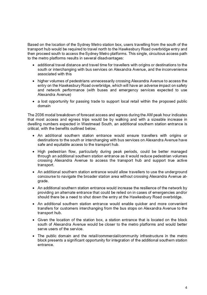
Additional southern entrance for Westmead metro station
The proposal notes that Sydney Metro is continuing to investigate the opportunity for an additional southern station entrance. Pedestrians should have access to an easy and intuitive transfer between the two train modes, with the current proposal being inefficient and requiring more pedestrians to access metro by crossing Alexandra Avenue to access the entry on the Hawkesbury Road overbridge.
Westmead South is the residential gateway into the Westmead Health and Innovation Precinct and a future Town Centre. Council strongly recommends the provision of an additional southern station entrance be provided to ensure safe, equitable and legible connections for travellers with origins or destinations to or from the south.
Community Engagement
The exhibition of the Environmental Impact Statement for Sydney Metro West for major civil construction (consisting of tunnel fit-out, station building and fit-out) and operation of the line between Westmead and Sydney CBD (Stage 3) commenced on 23 March 2022 and ends on 4 May 2022. Sydney Metro are undertaking their own engagement sessions with the community and stakeholders.
Policy Implications
Sydney Metro West is identified as an important transport initiative in Cumberland 2030: Our Local Planning Statement. This project provides an opportunity for future land use planning in Westmead South to integrate with this infrastructure investment.
Risk Implications
There are minimal risk implications for Council associated with this report. The public exhibition process enables Council to make a submission and to raise any relevant issues that can be addressed as part of the project.
Financial Implications
There are no financial implications for Council associated with this report.
CONCLUSION
This report provides an overview of Stage 3 of the approval process for Sydney Metro West. The attached submission identifies key issues identified by Council officers and provides recommendations for consideration.
It is recommended that Council forward the submission to the Department of Planning and Environment for consideration as part of the environmental approval process.
Attachments
1. Cumberland City Council Submission - Sydney Metro West Stage 3 EIS
DOCUMENTS
ASSOCIATED WITH
REPORT C05/22-56
Attachment 1
Cumberland City Council Submission - Sydney Metro West Stage 3 EIS
4 May 2022
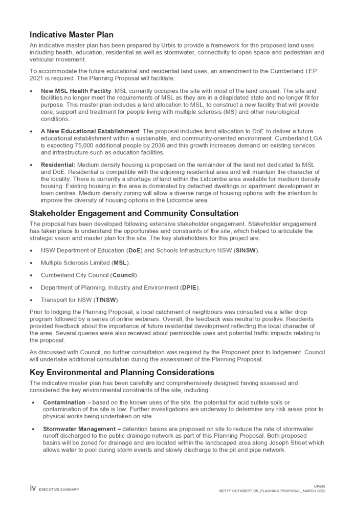
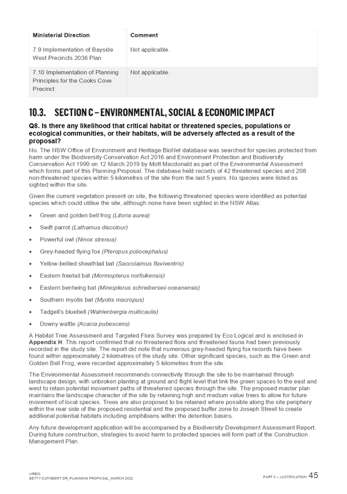
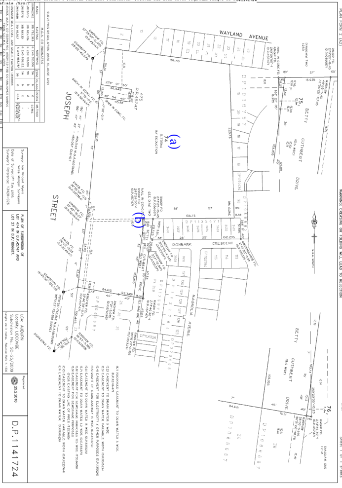
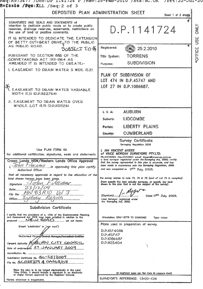
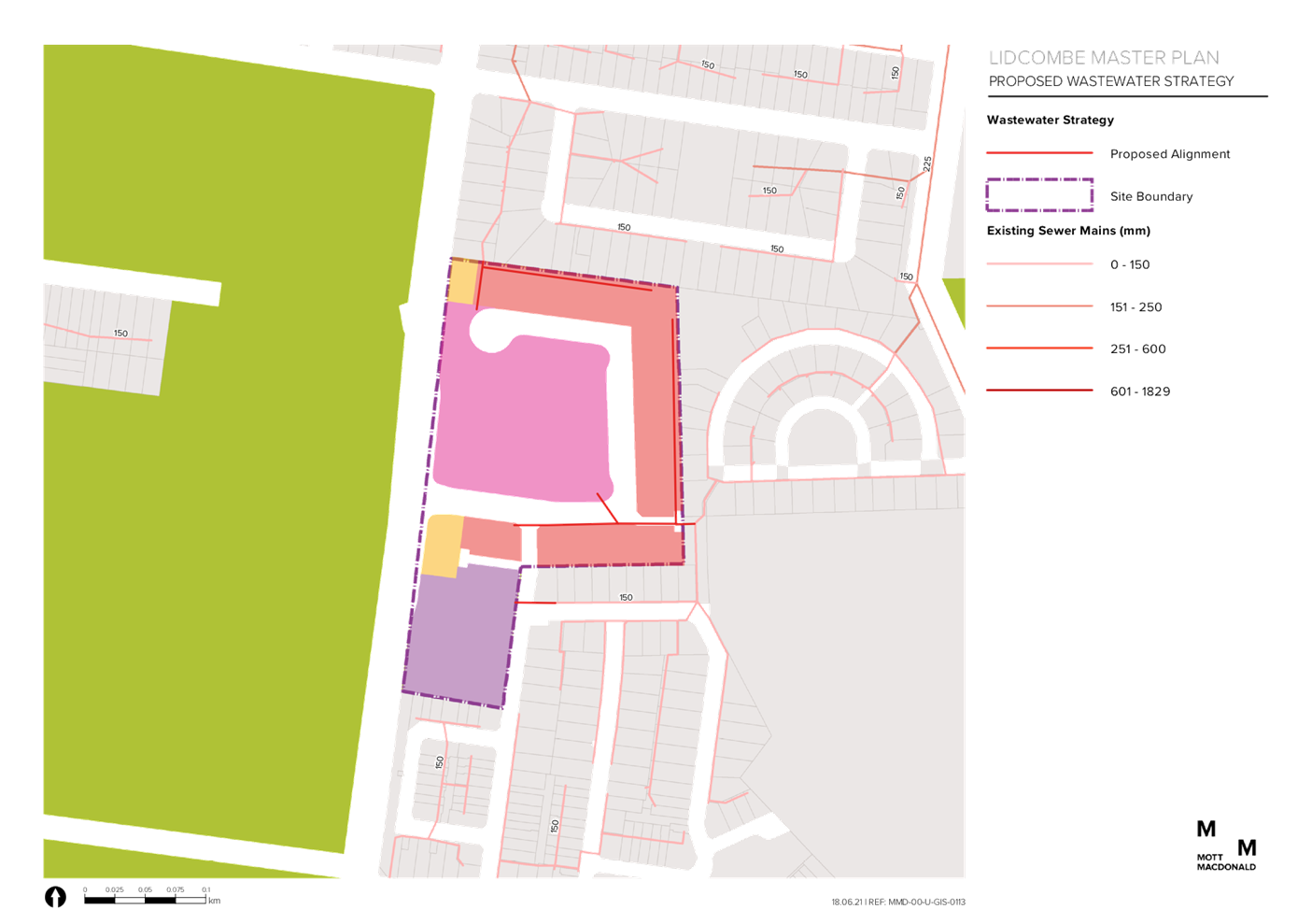
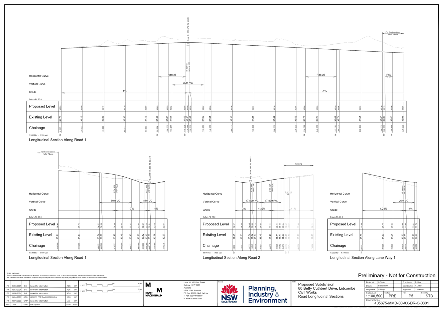
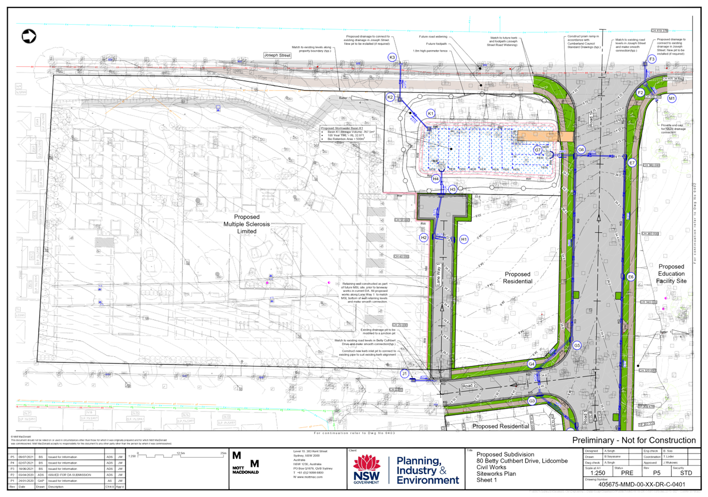
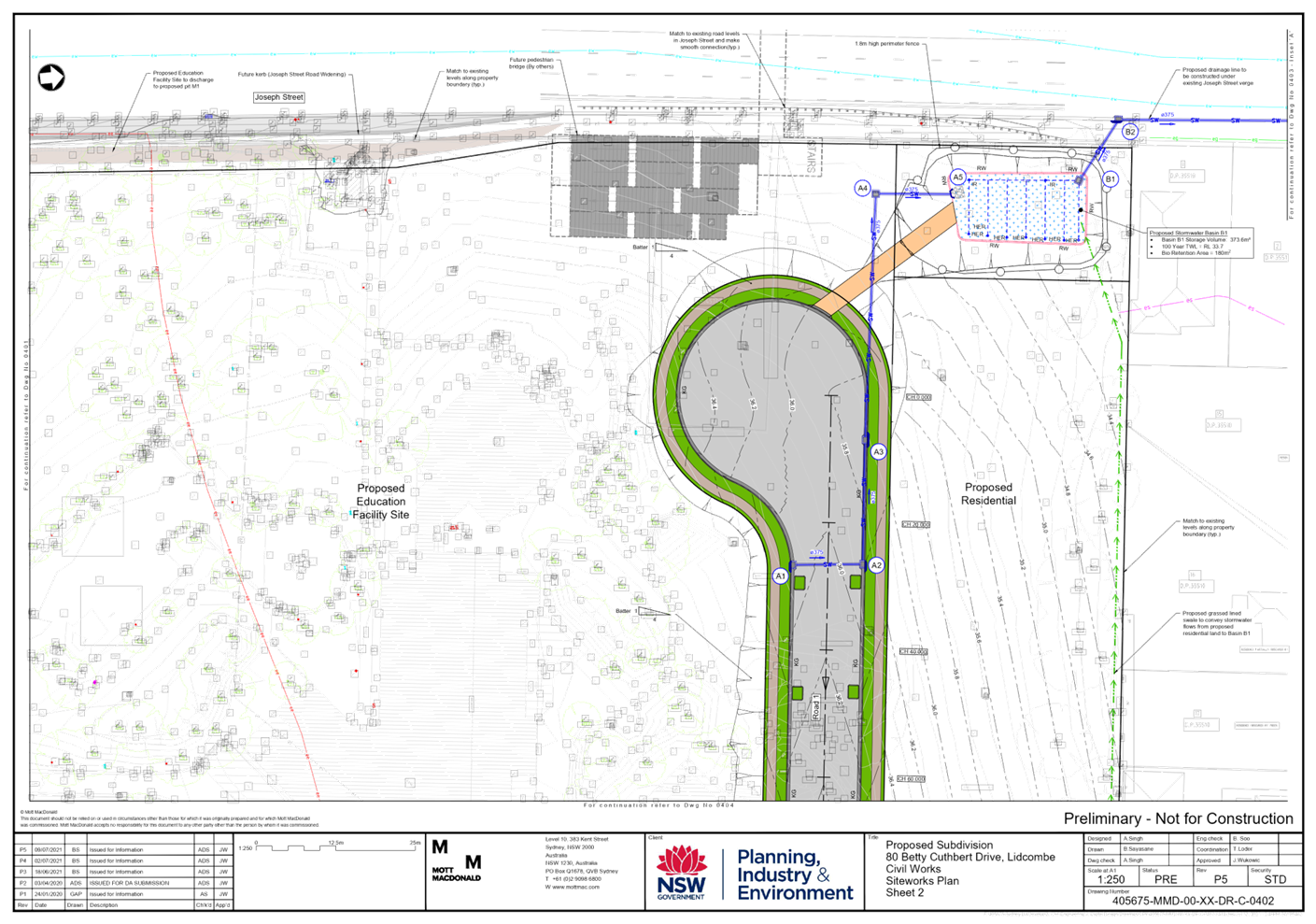
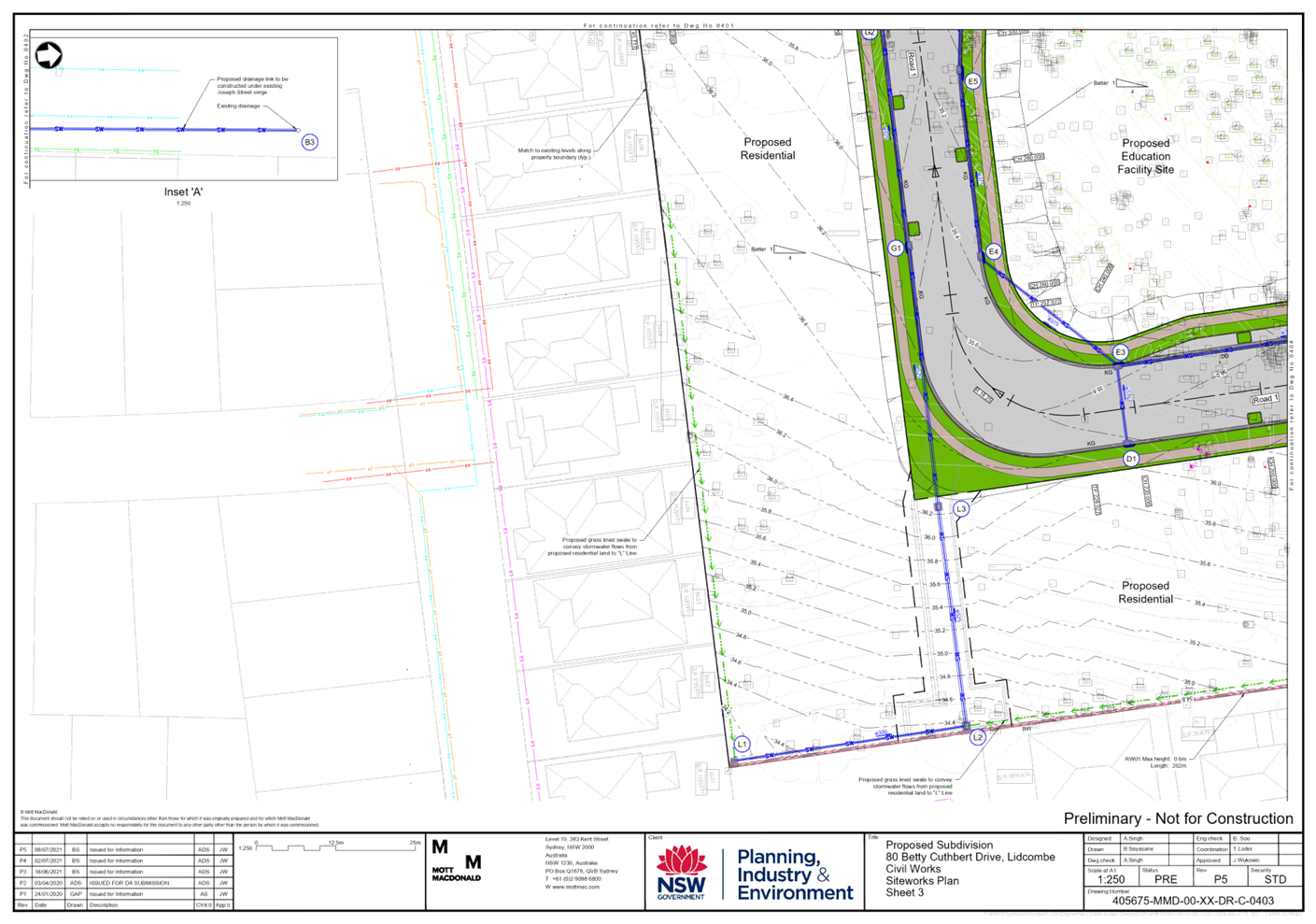
Item No: C05/22-57
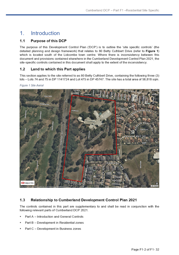
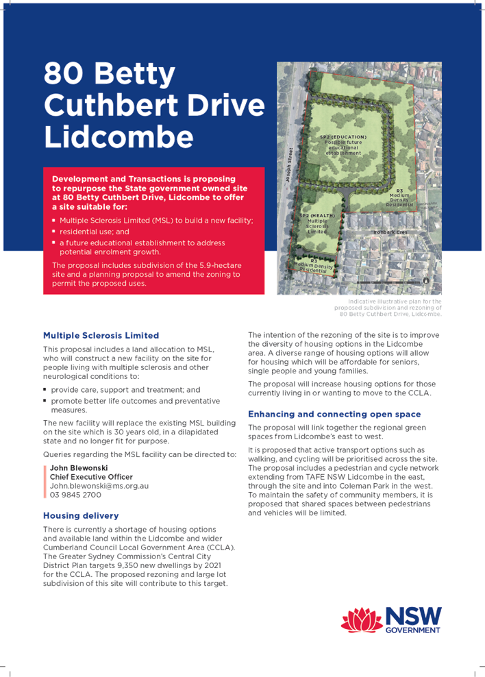
Planning Proposal for 80 Betty Cuthbert Drive, Lidcombe
Responsible Division: Environment & Planning
Officer: Director Environment & Planning
File Number: PP2021/0002
Community Strategic Plan Goal: A resilient built environment
Summary
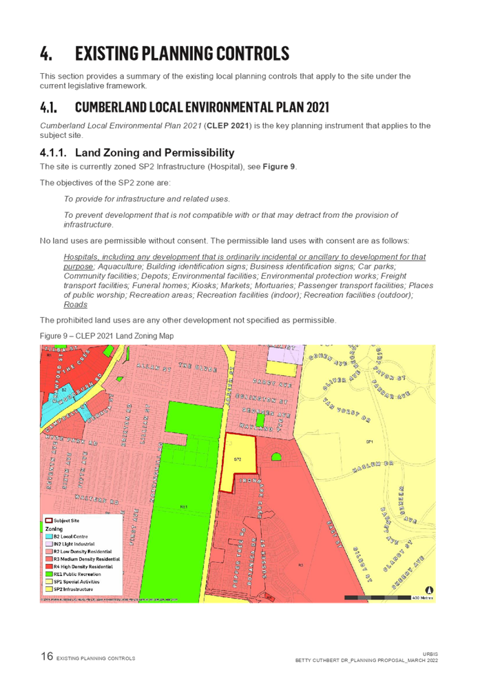
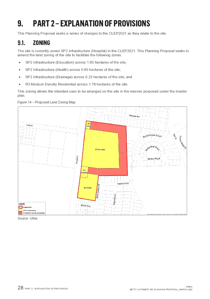
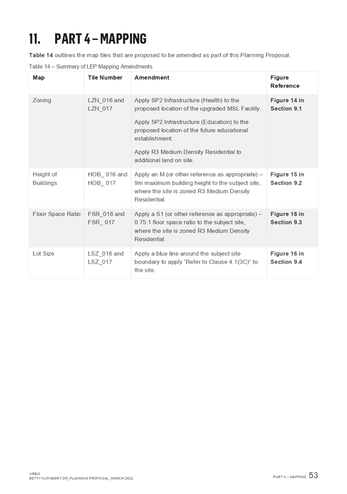
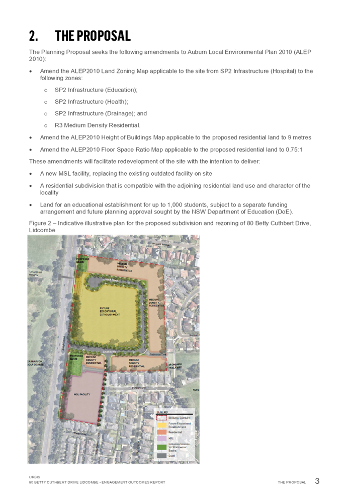
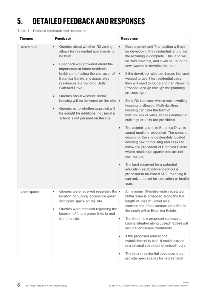
This planning proposal seeks to amend the Cumberland Local Environmental Plan 2021 for 80 Betty Cuthbert Drive, Lidcombe, to:
· Rezone the site from SP2 Hospital to SP2 Educational Establishment, SP2 Hospital, SP2 Drainage and R3 Medium Density Residential.
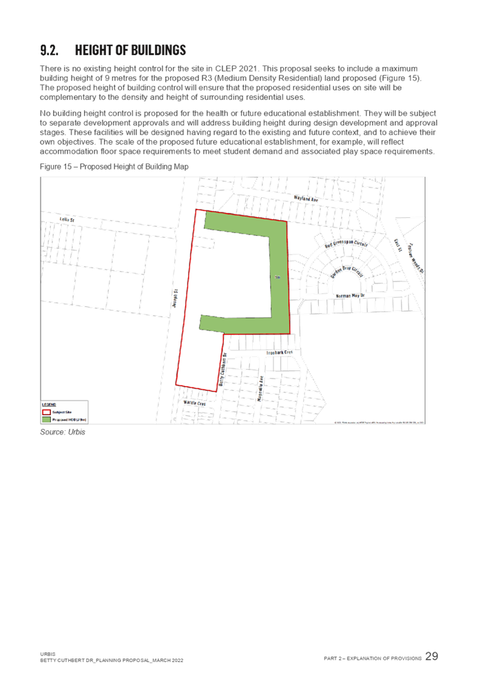
· Amend the Height of Building control for the site from nil to 9m in the proposed R3 Medium Density Residential zone.
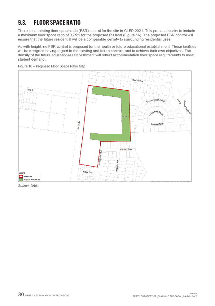
· Amend the Floor Space Ratio control for the site from nil to 0.75:1 in the proposed R3 Medium Density Residential zone.
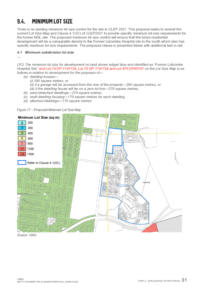
· Amend clause 4.1(3C) and associated mapping to allow maximum subdivision lot sizes in the proposed R3 Medium Density Residential zone between 170sqm and 350sqm, consistent with Botanica (former Lidcombe Hospital site) to the south.
The proposal was placed on early consultation and reported to the Cumberland Local Planning Panel in April 2022. The Panel supported the Council officer recommendation to proceed to a Gateway Determination and provided further advice, as outlined in this report. The Proponent has elected not to enter into a Planning Agreement with Council on the basis that the proposal will deliver a range of public benefits.
It is recommended that Council endorse the planning proposal and that this be forwarded to the Department of Planning and Environment for a Gateway Determination. It is also recommended that Council endorse the draft site specific Development Control Plan.
|
Recommendation That Council: 1. Endorse a planning proposal for 80 Betty Cuthbert Drive, Lidcombe, that seeks to amend the Cumberland Local Environmental Plan 2021 to: a. Rezone the Site from SP2 Hospital to SP2 Educational Establishment, SP2 Hospital, SP2 Drainage and R3 Medium Density Residential. b. Amend the Height of Building control for the site from nil to 9m within the R3 Medium Density Residential zone. c. Amend the Floor Space Ratio control for the site from nil to 0.75:1 within the R3 Medium Density Residential zone. d. Amend clause 4.1(3C) and associated mapping to allow maximum subdivision lot sizes between 170sqm and 350sqm on the R3 part of the Site, consistent with Botanica. 2. Endorse that the planning proposal for 80 Betty Cuthbert Drive, Lidcombe, be forwarded to the Department of Planning and Environment for a Gateway Determination. 3. Endorse the draft site specific Development Control Plan associated with the planning proposal for 80 Betty Cuthbert Drive, Lidcombe, as provided in Attachment 3. 4. Note that, subject to the receipt of a Gateway Determination by the Department of Planning and Environment, the planning proposal and site specific Development Control Plan for 80 Betty Cuthbert Drive, Lidcombe, will be exhibited concurrently. 5. Note that the proponent has elected not to enter into a Planning Agreement with Council on the basis that the proposal will deliver a range of public benefits. |
Report
Background
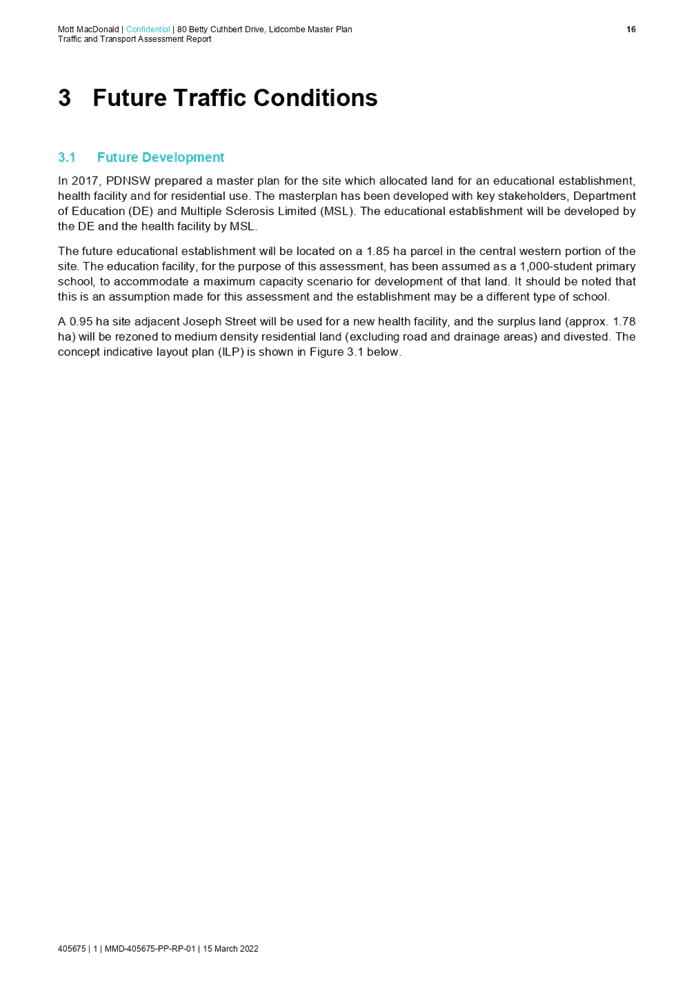
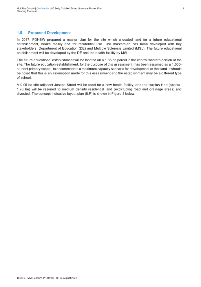
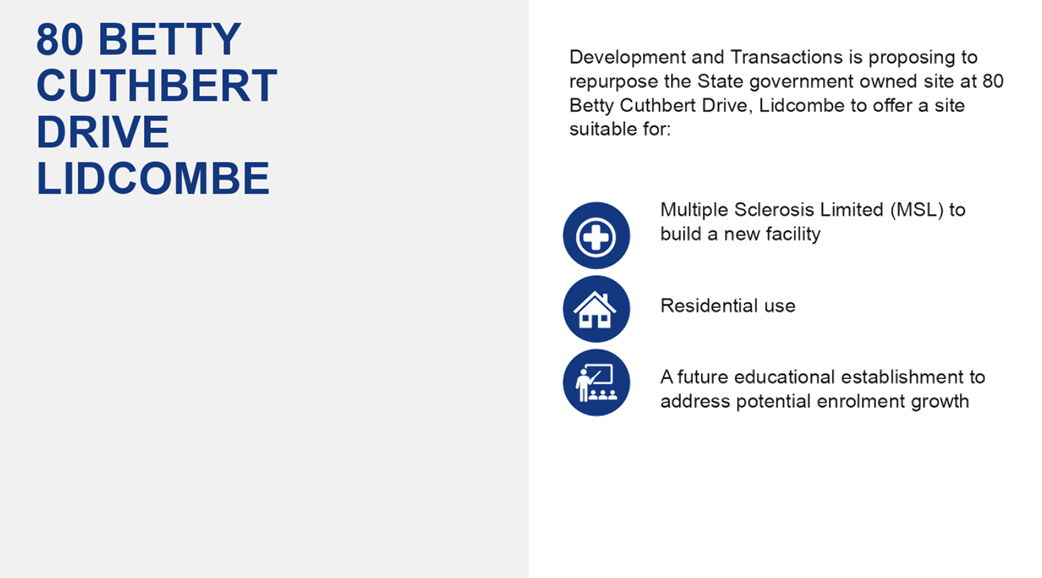
Property and Development NSW lodged the Planning Proposal Request for 80 Betty Cuthbert Drive, Lidcombe, in September 2021.
The proposal seeks to facilitate the redevelopment of the site for a mix of health, education, and residential uses by amending the Cumberland LEP 2021, to:
· Rezone the Site from SP2 Hospital to SP2 Educational Establishment, SP2 Hospital, SP2 Drainage and R3 Medium Density Residential.
· Amend the Height of Building control for the site from nil to 9m in the proposed R3 Medium Density Residential zone.
· Amend the Floor Space Ratio control for the site from nil to 0.75:1 in the proposed R3 Medium Density Residential zone.
· Amend clause 4.1(3C) and associated mapping to allow maximum subdivision lot sizes in the proposed R3 Medium Density Residential zone between 170sqm and 350sqm, consistent with the adjoining Botanica estate.
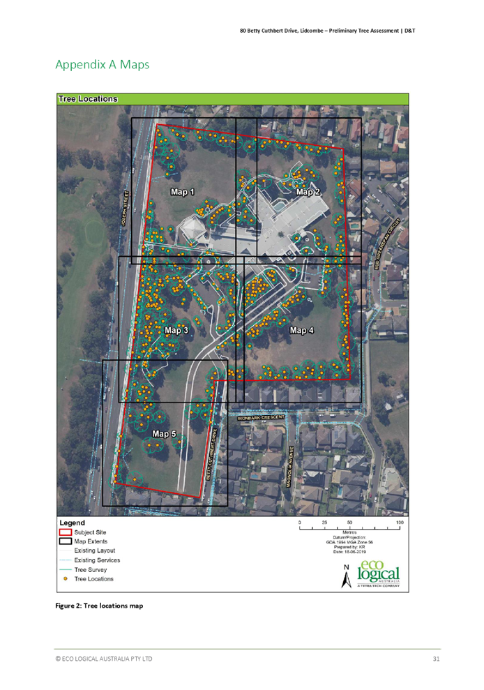
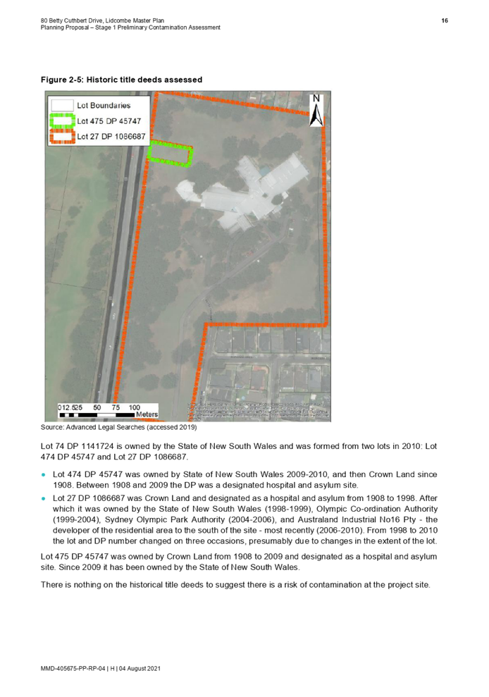
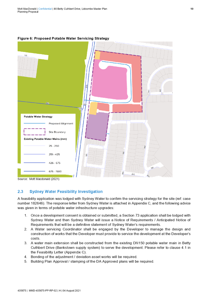
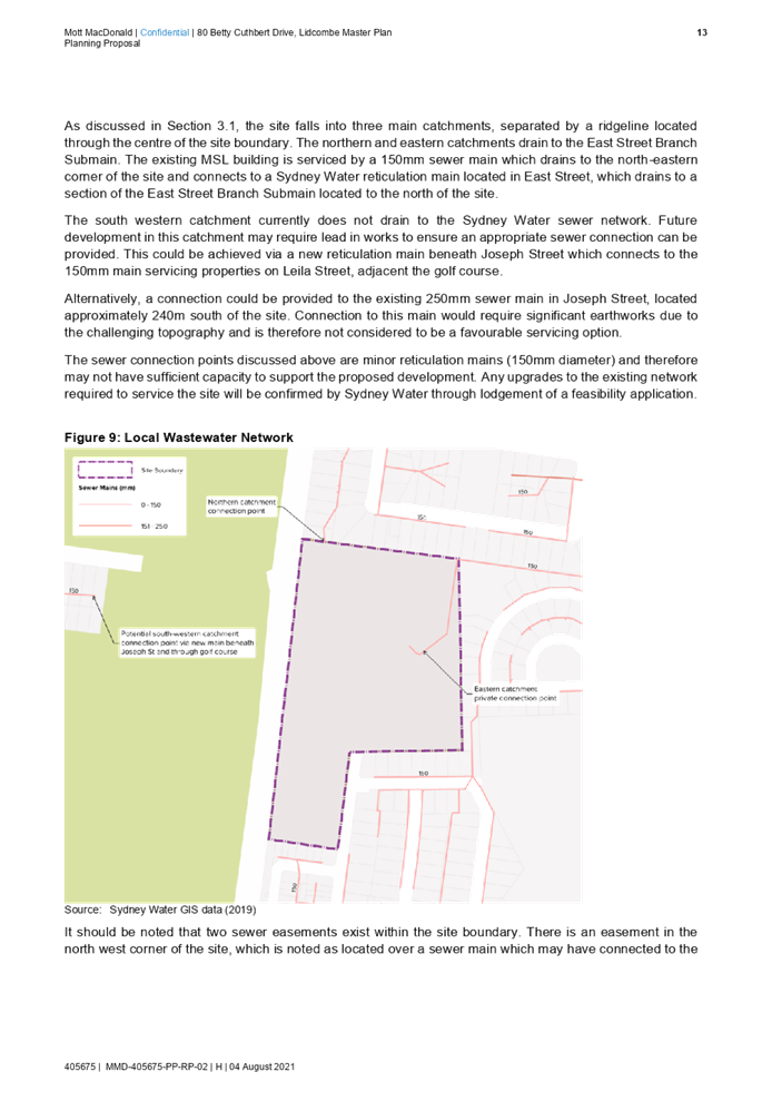
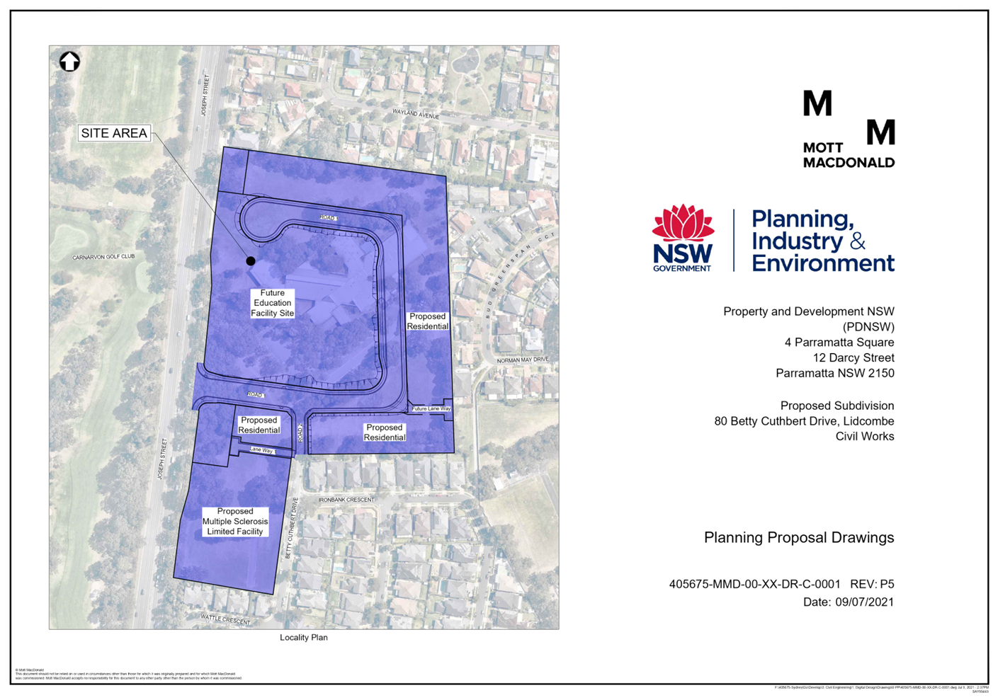
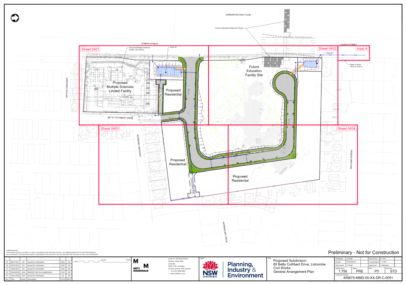
The status of the planning proposal is shown in Figure 1.
![]()
Figure 1 Planning Proposal Status
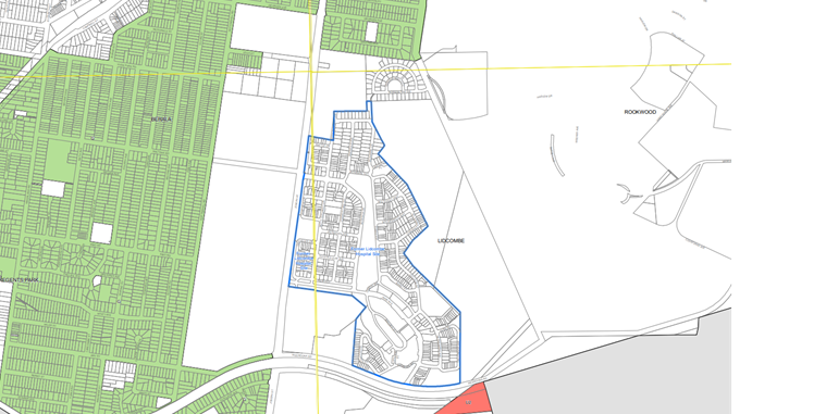
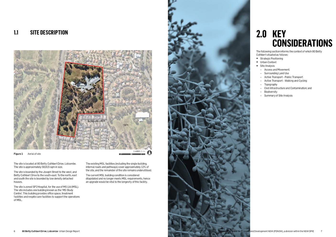
The Site and its context
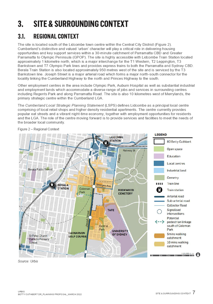
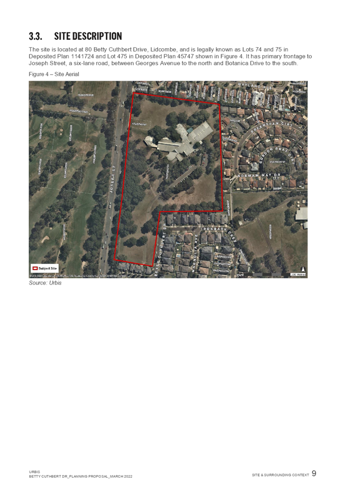
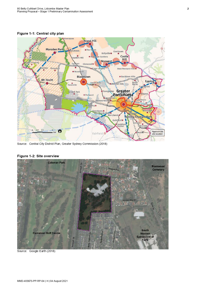
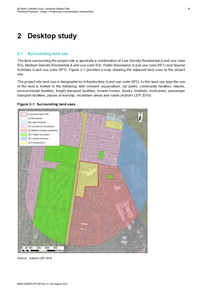
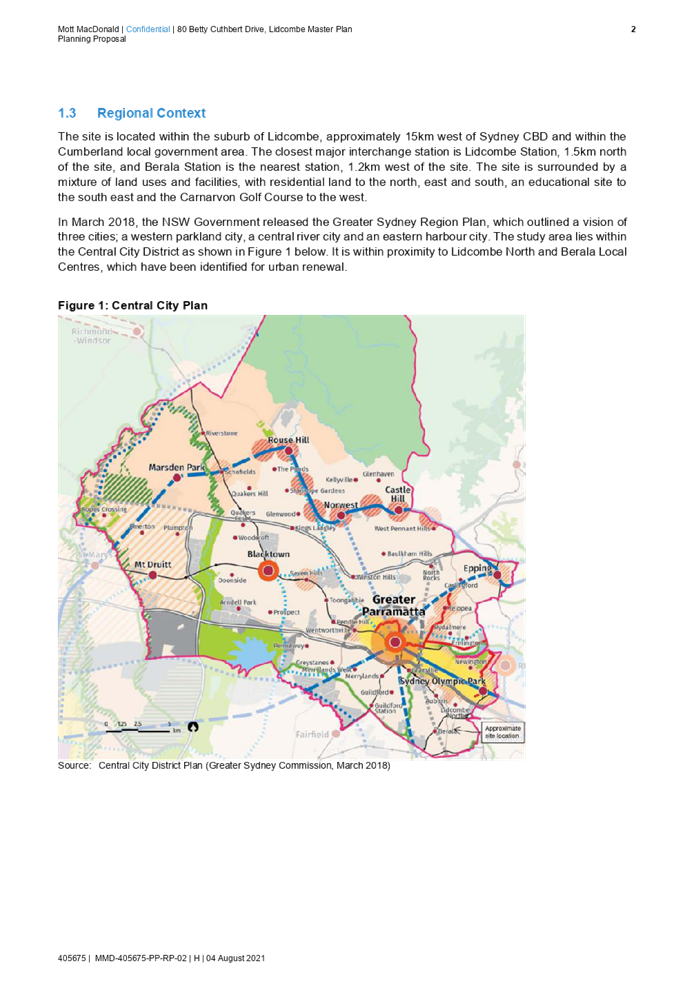
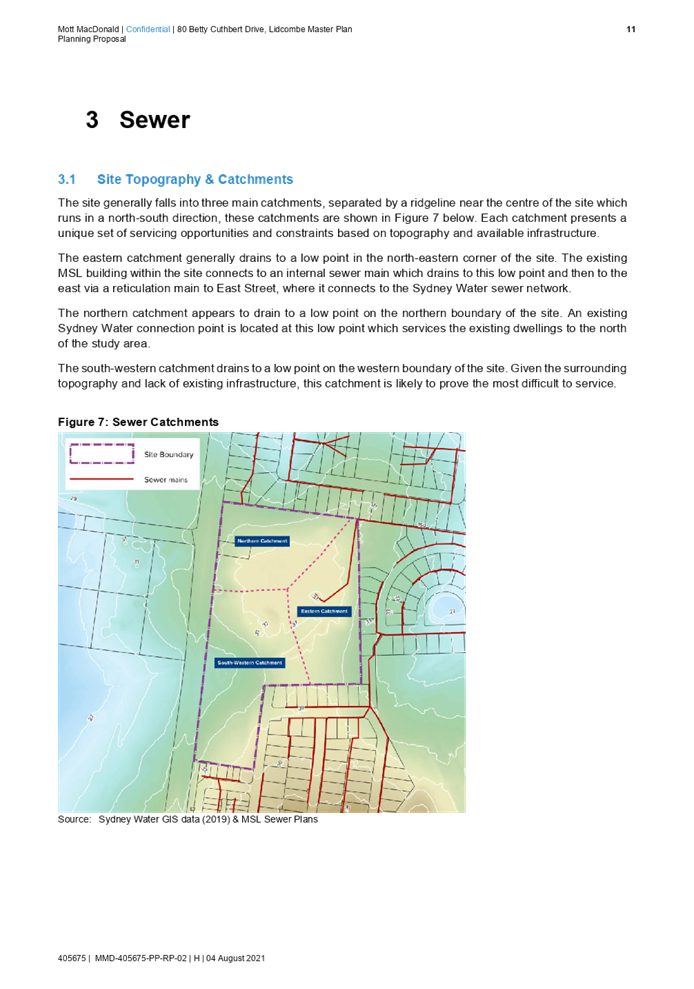
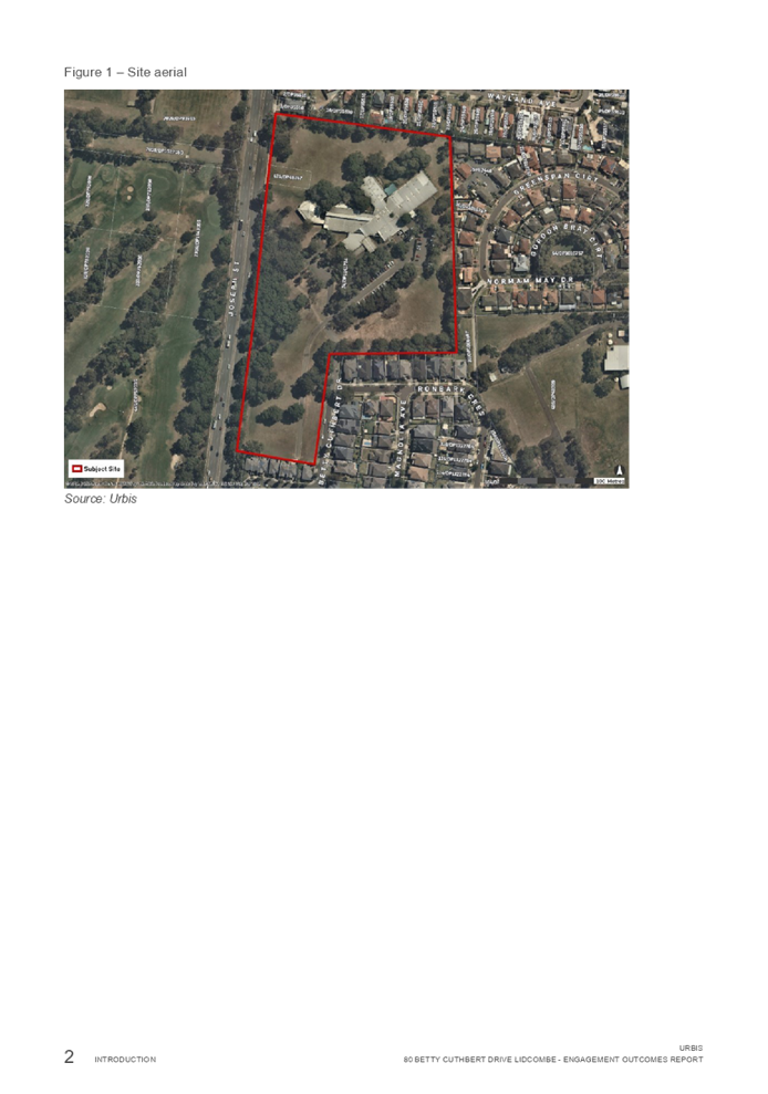
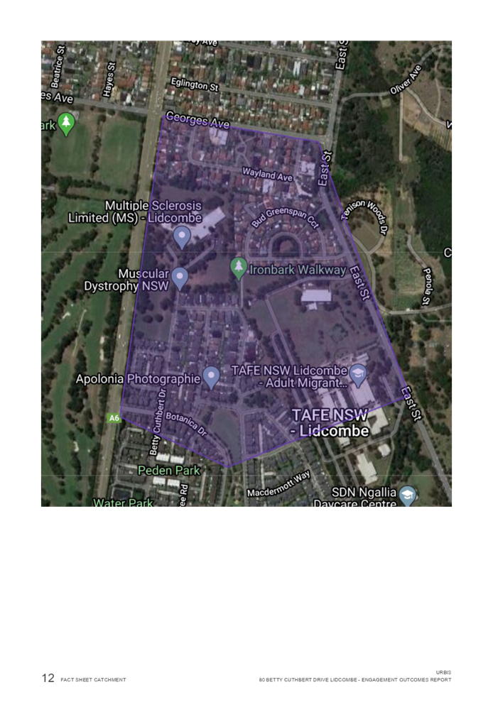
The site at 80 Betty Cuthbert Drive, Lidcombe, is located approximately 10km south-east of Parramatta CBD, 3km south of Lidcombe Principal Local Centre and 2km east of Berala Local Centre (Figure 2).
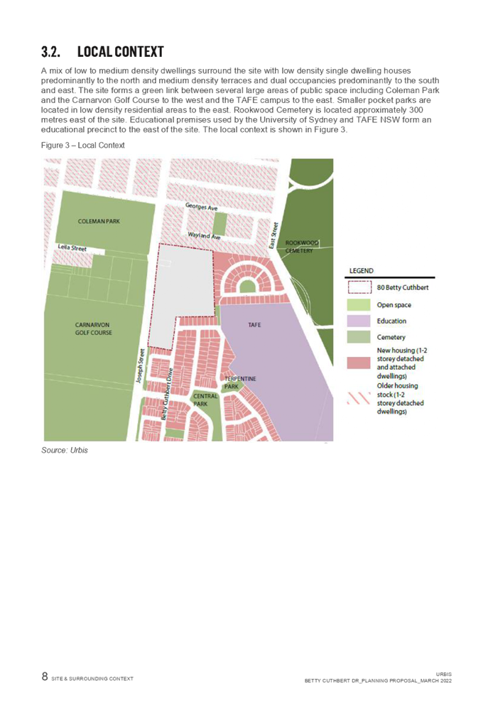
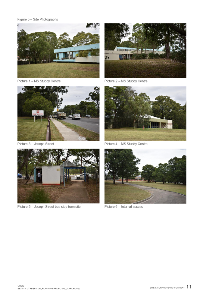
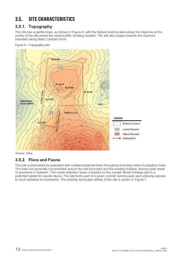
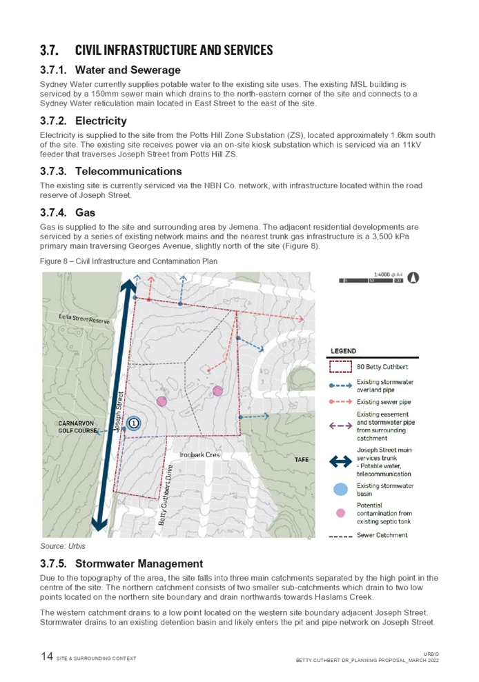
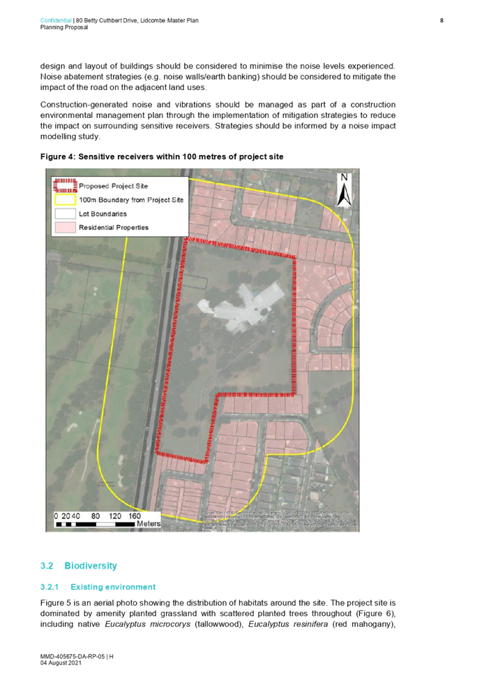
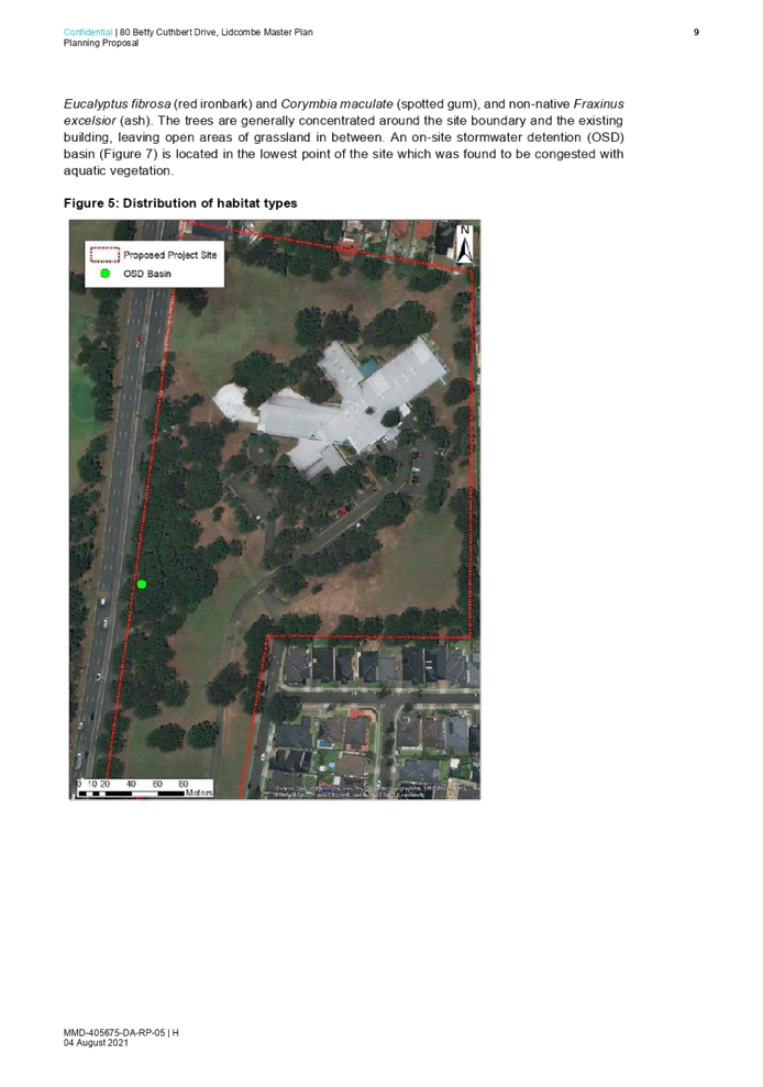
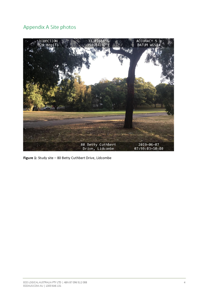
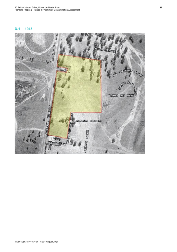
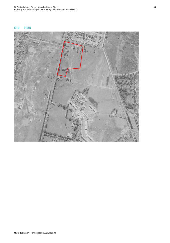
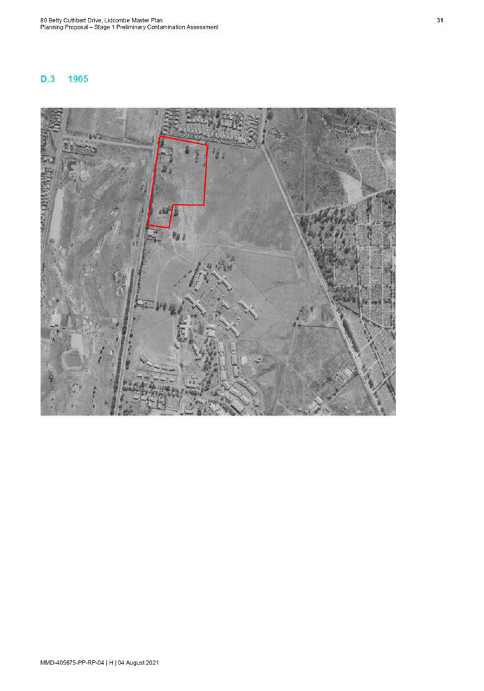
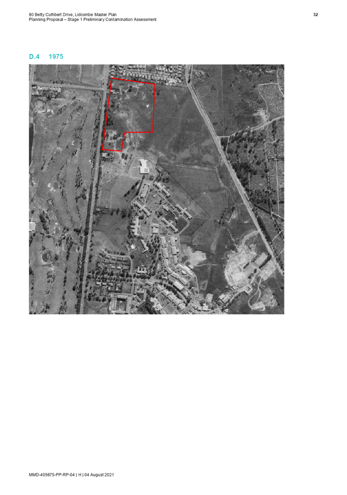
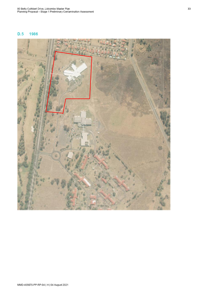
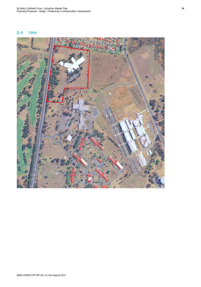
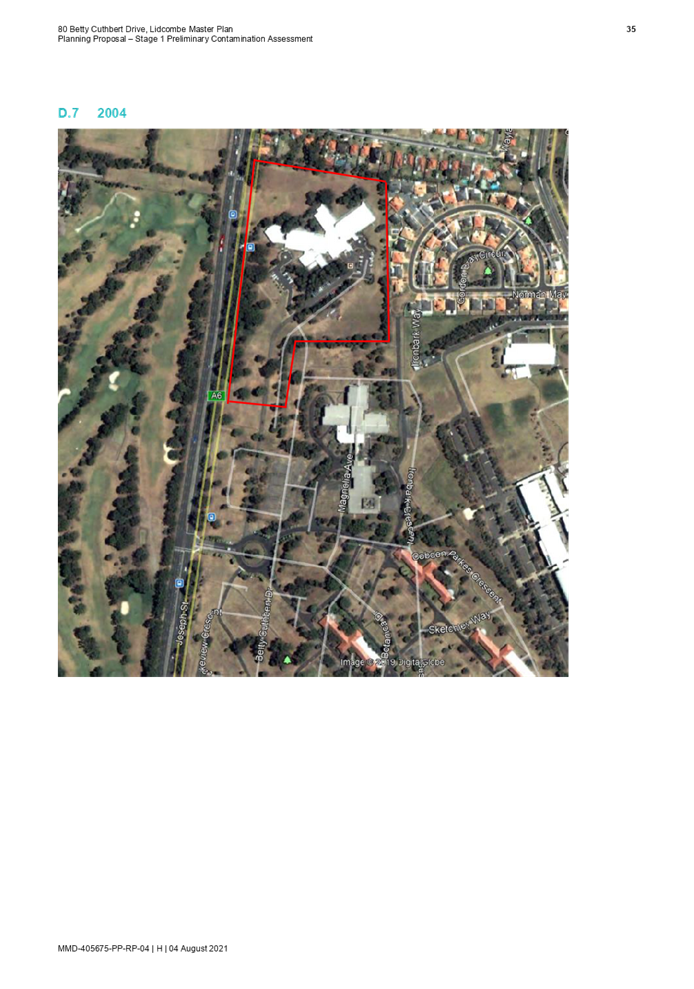
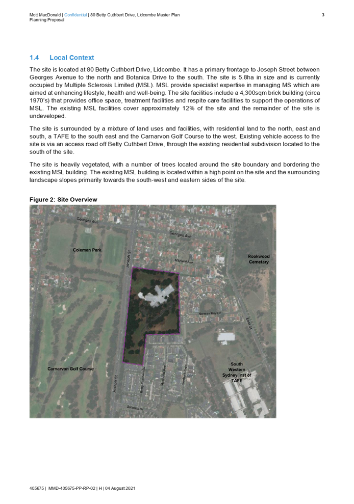
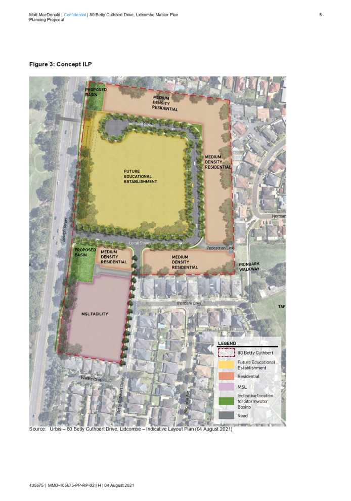
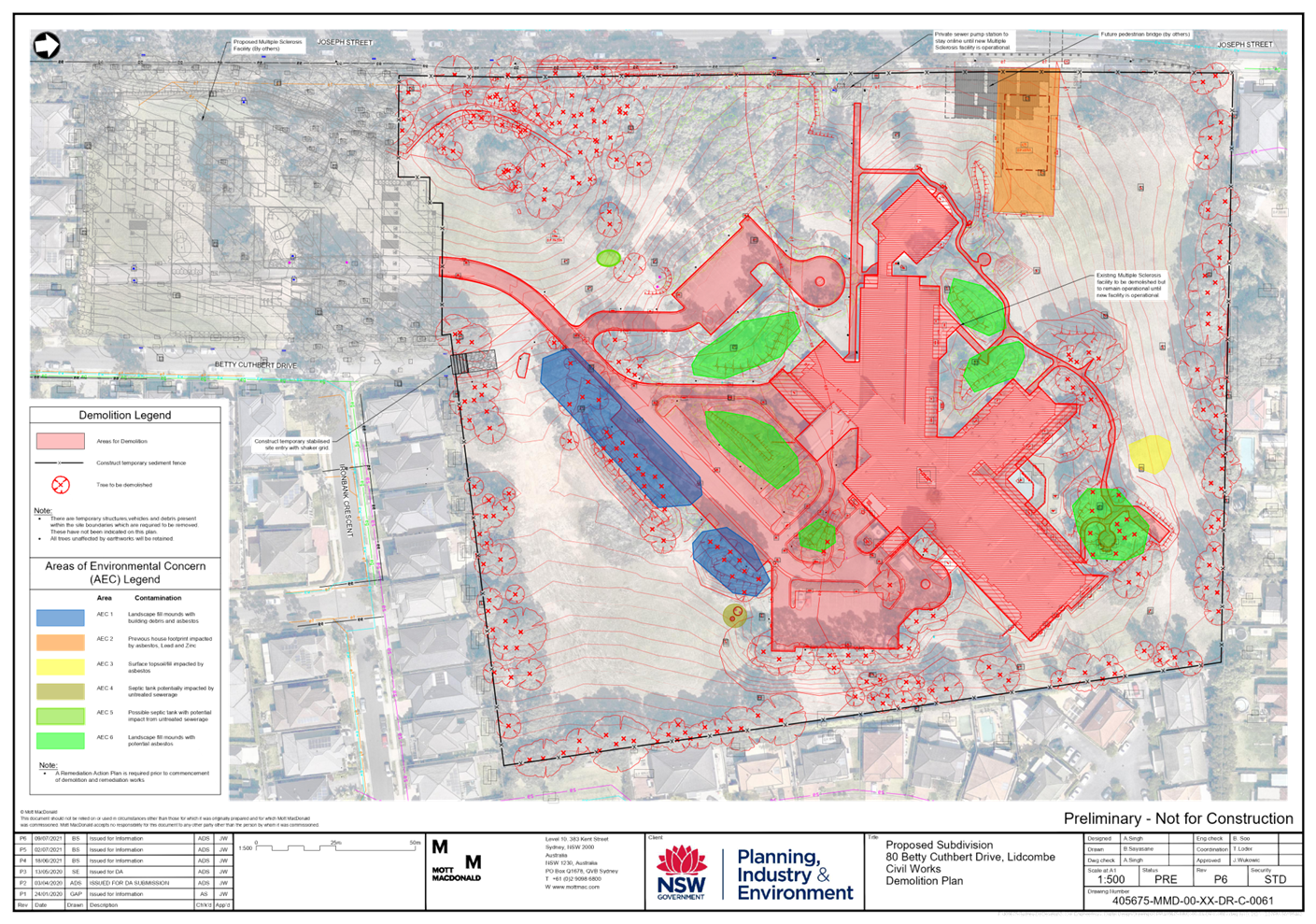
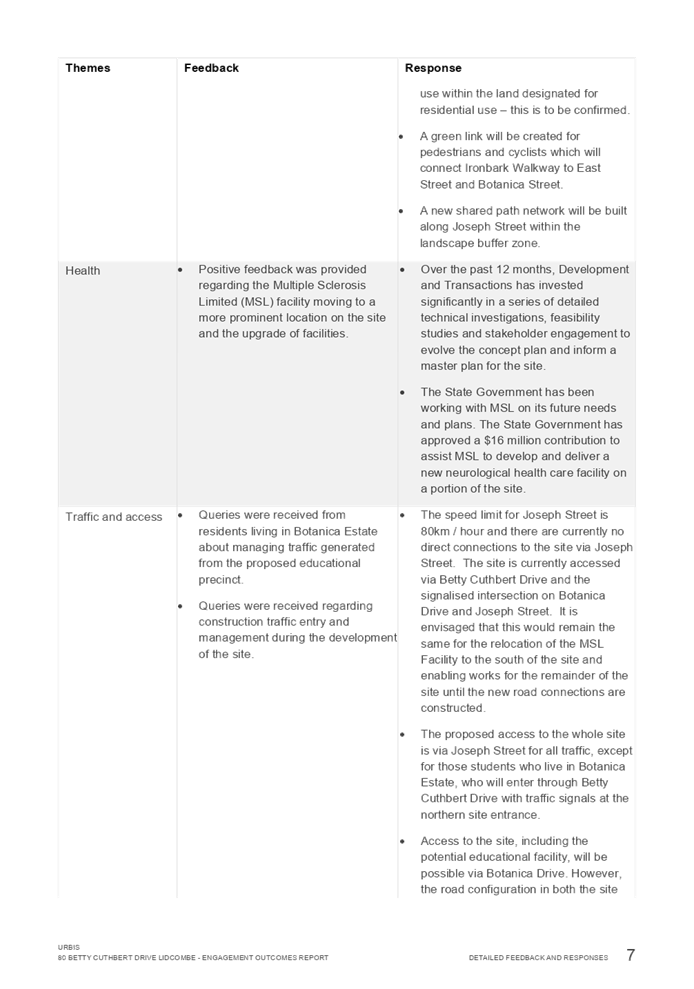
The north-central part of the Site is occupied by a Multiple Sclerosis Facility built in the 1970s. The rest of the Site is undeveloped and contains internal roads and vegetation (Figure 3).
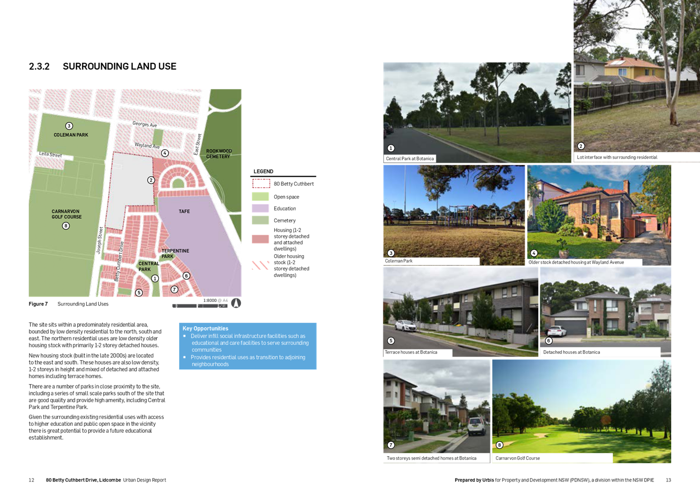
Surrounding land uses include:
· To the north and east – established residential neighbourhoods, dominated by 1-2 storey detached dwellings
· To the south – the ‘Botanica’ estate (former Lidcombe hospital site), with a mix 1-2 storey attached and detached houses
· To the south-east – Lidcombe TAFE and Sydney University Cumberland Campus
· The west – Carnarvon Golf Course and Coleman Park.
![]()
![]()
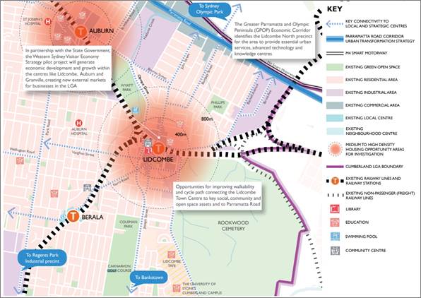
Figure 2: The Site in its regional context
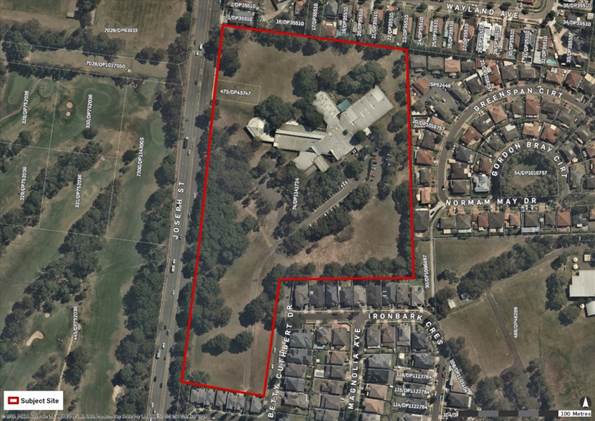
Figure 3: The Site in its local context
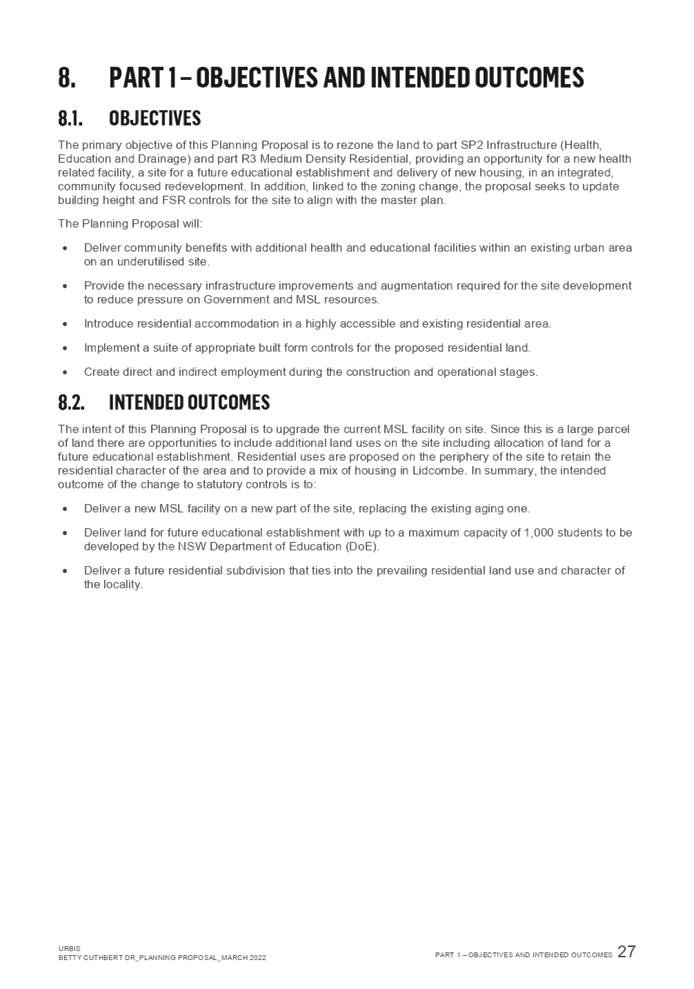
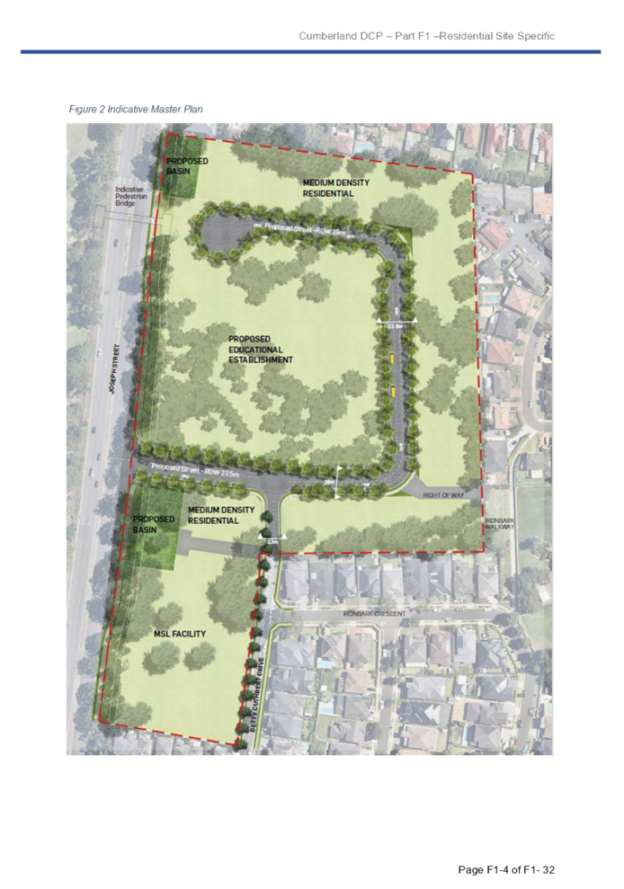
Objectives and intended outcomes
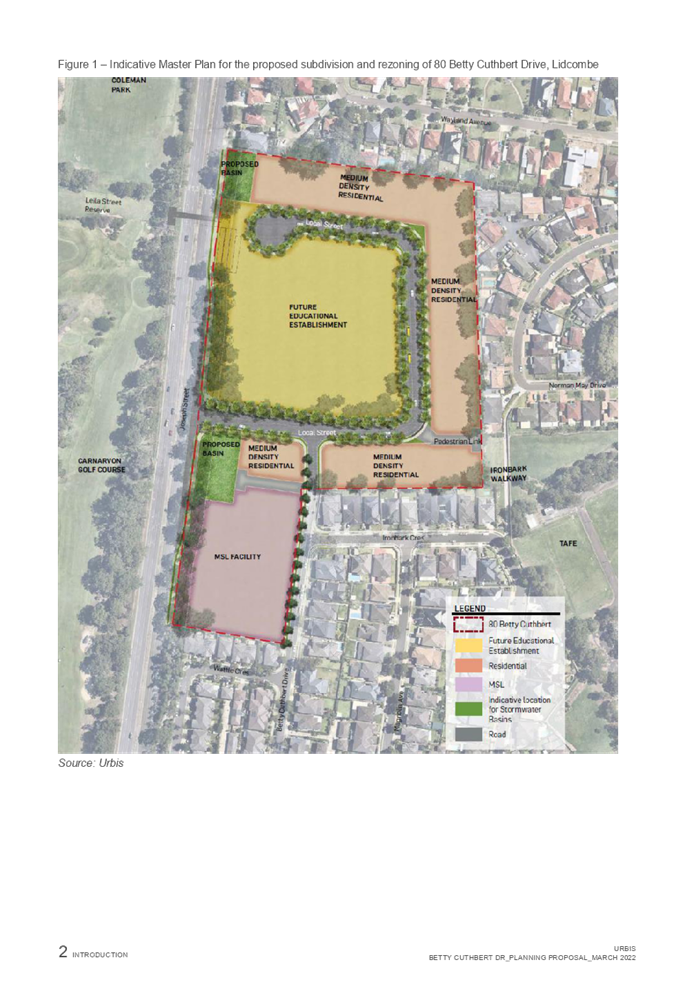
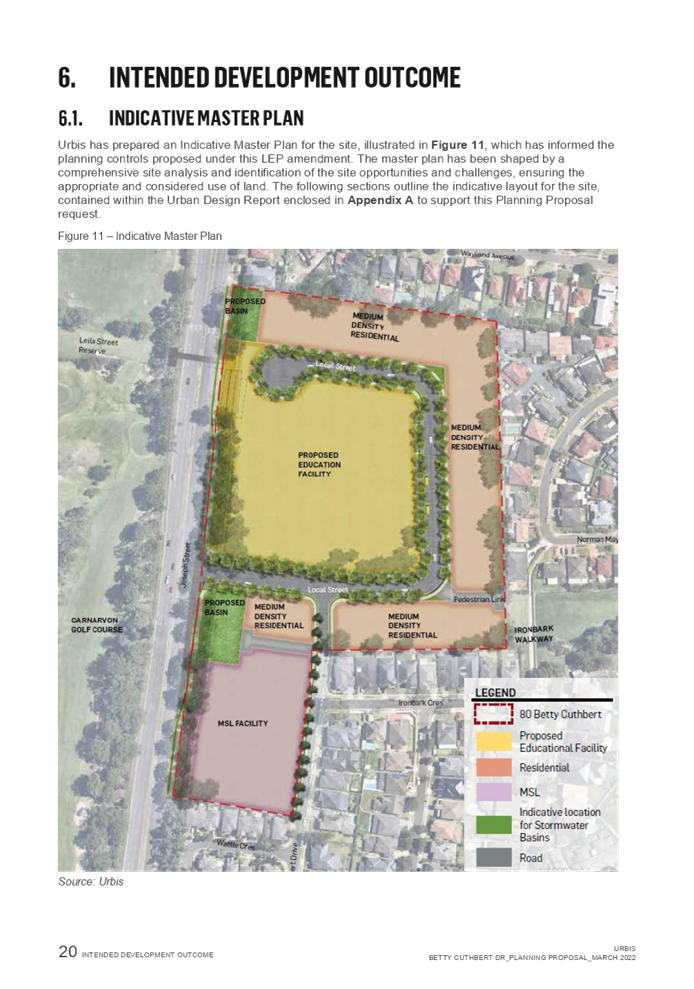
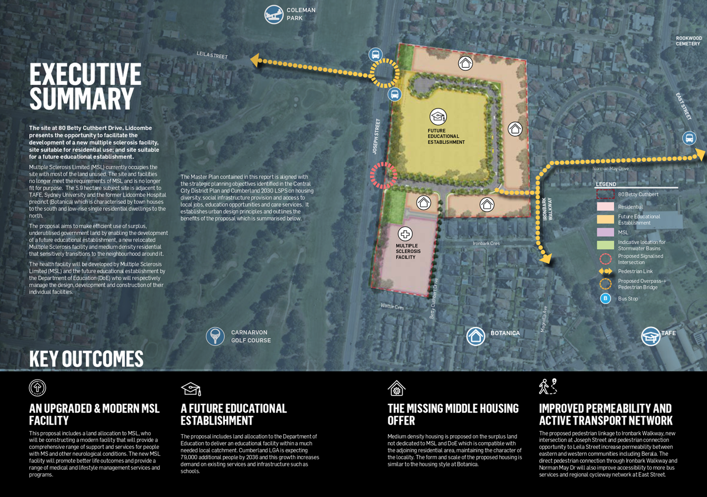
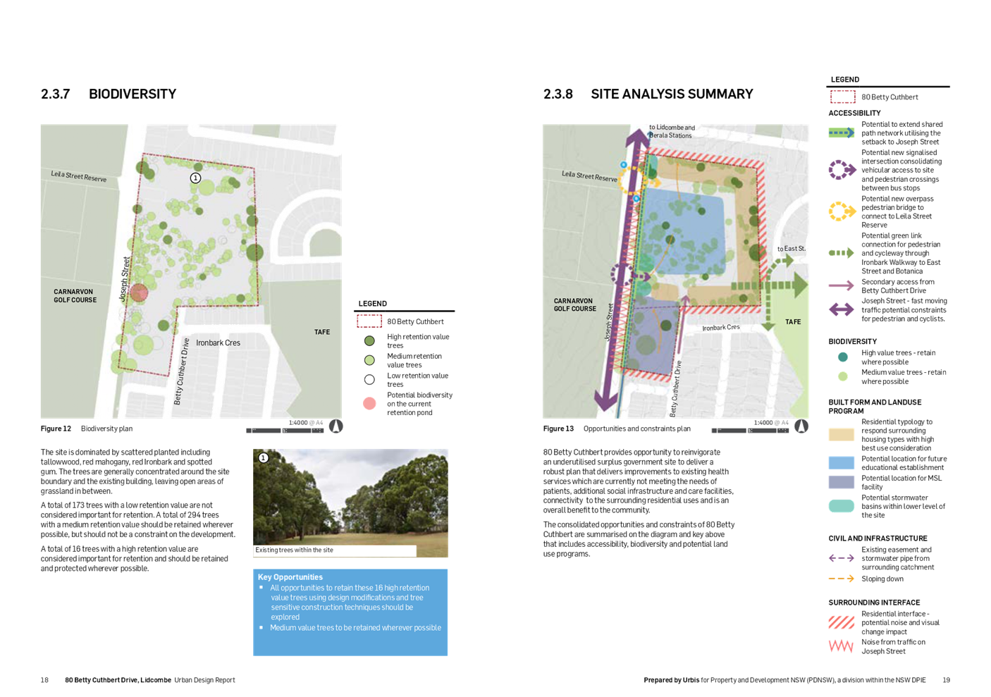
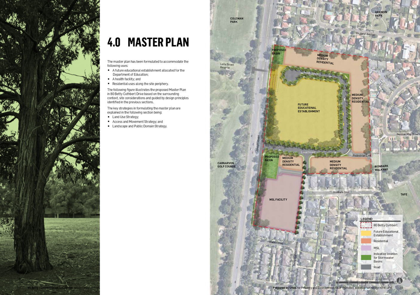
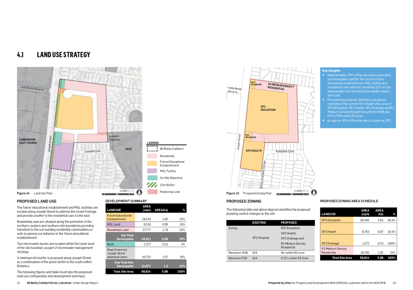
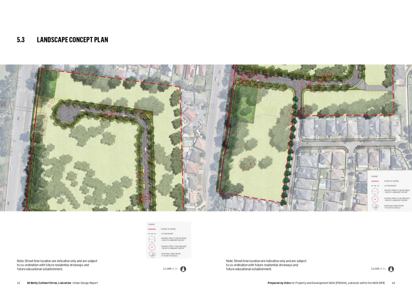
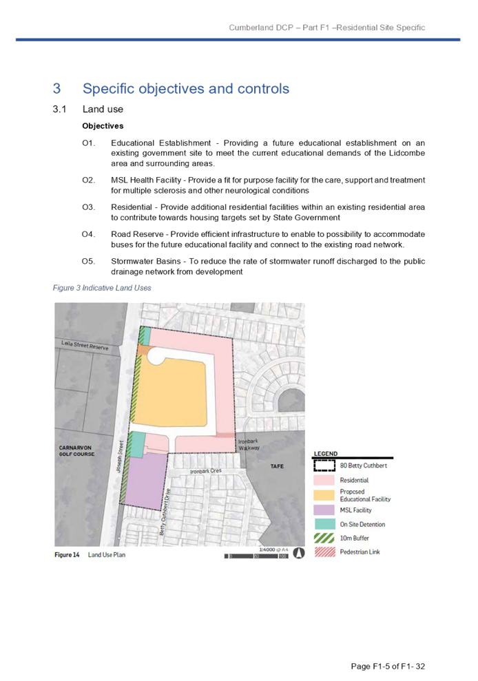
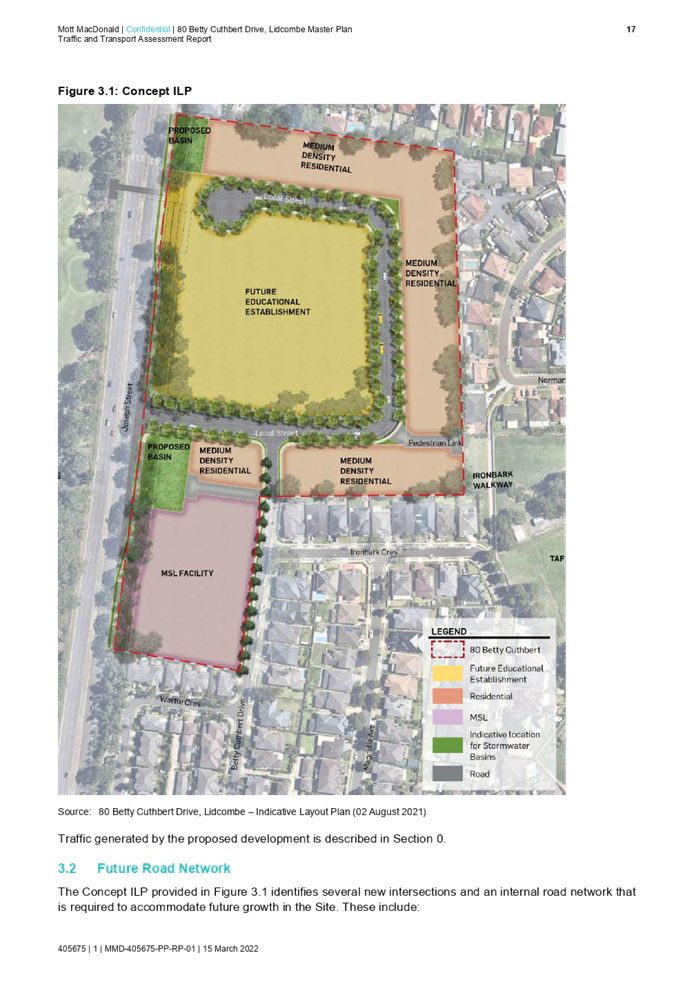
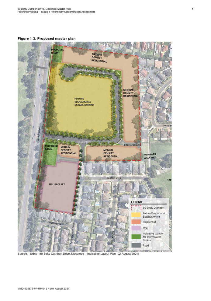
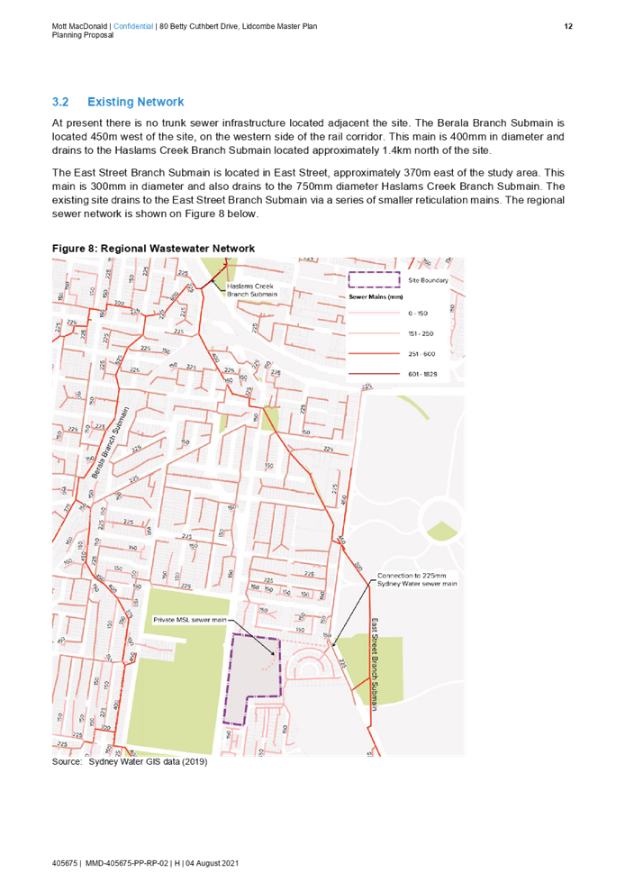
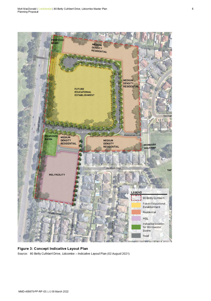
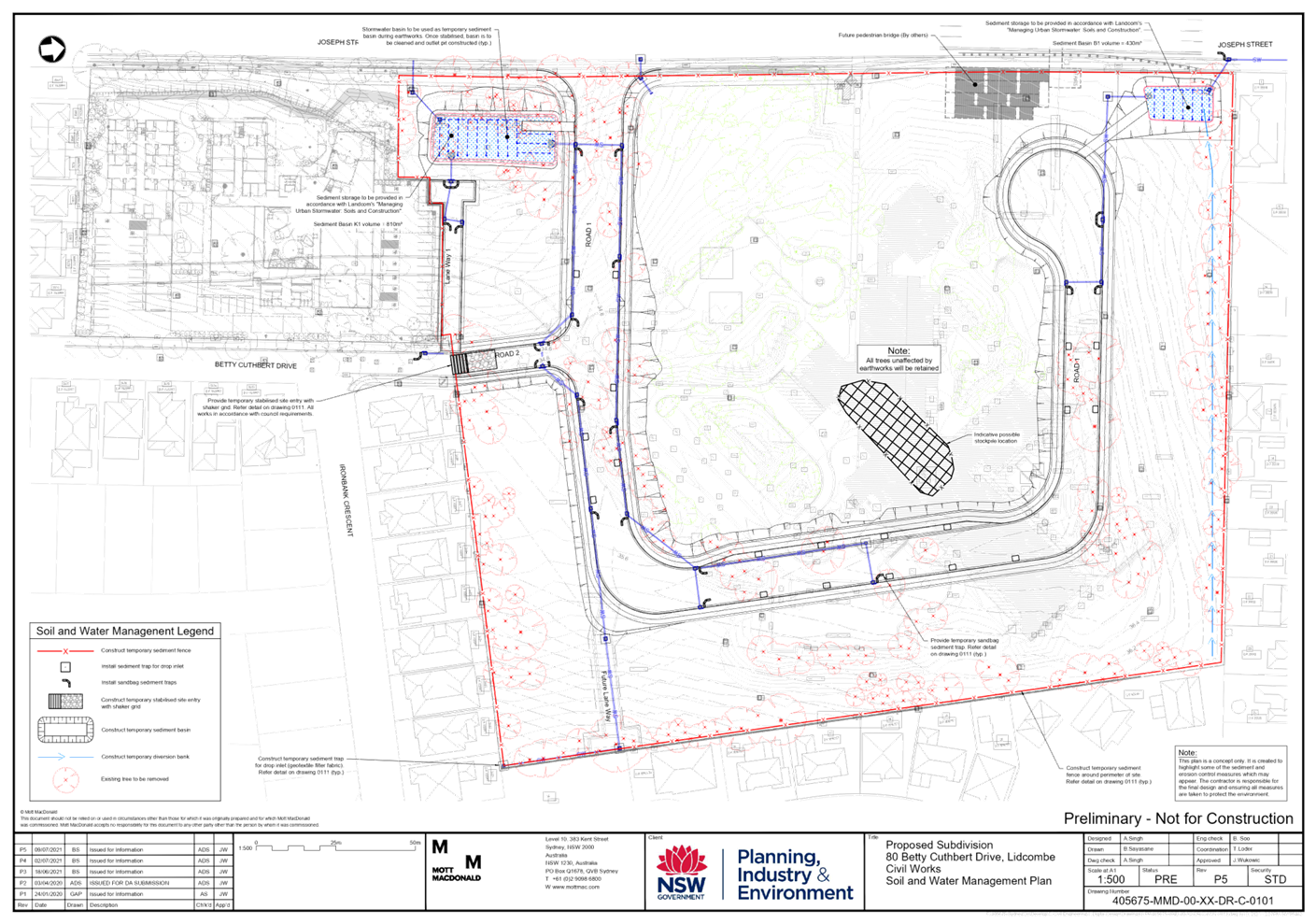
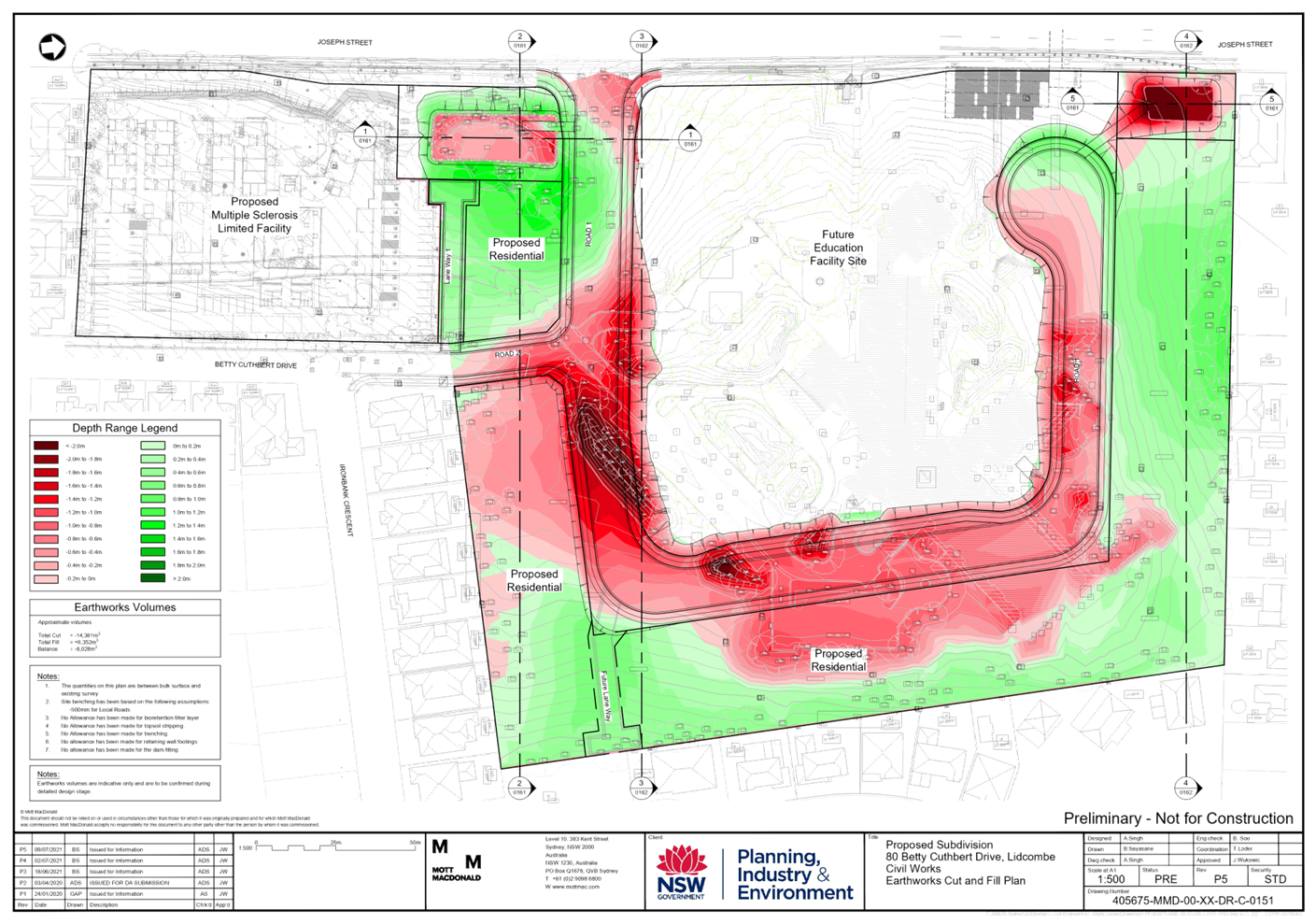
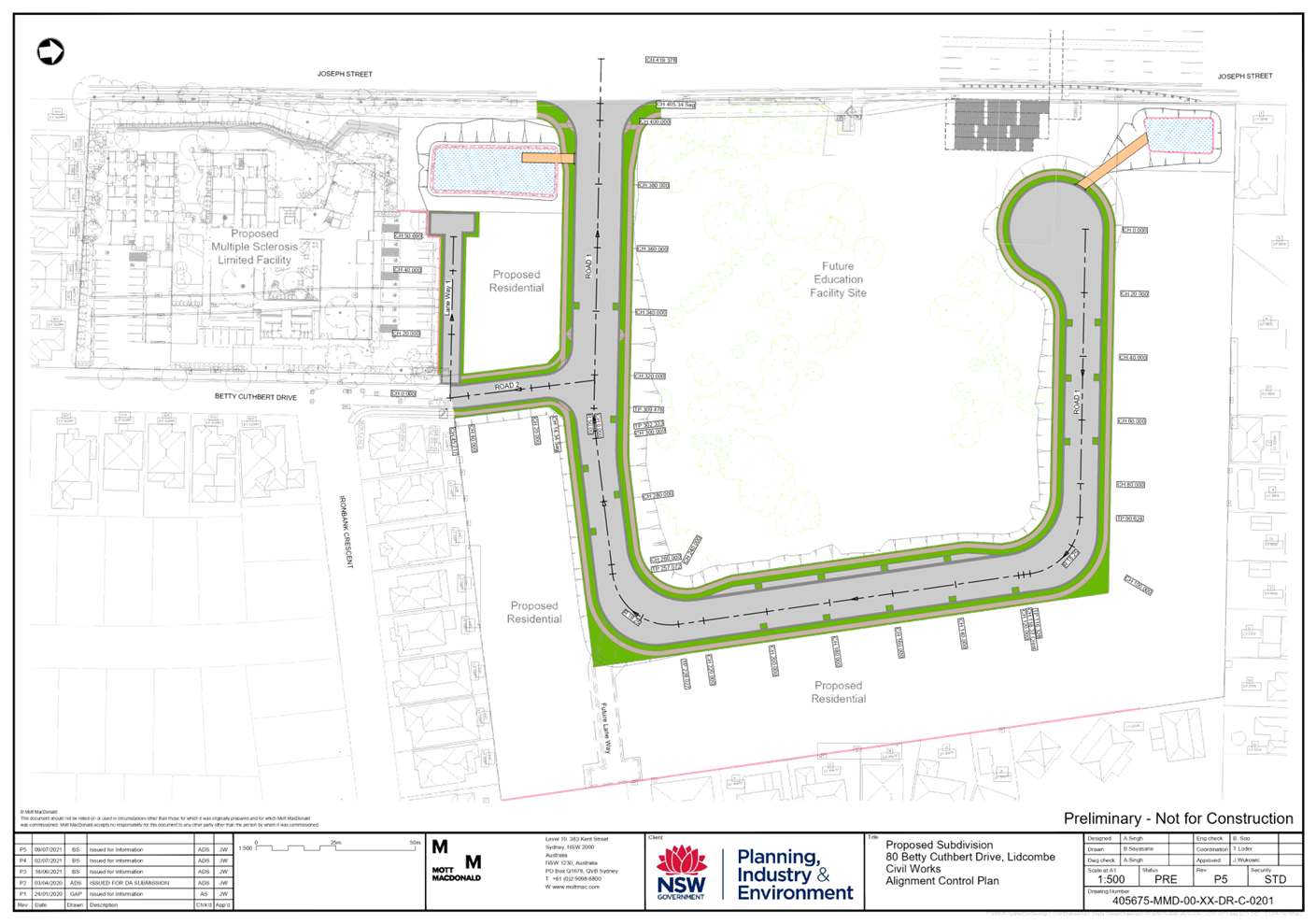
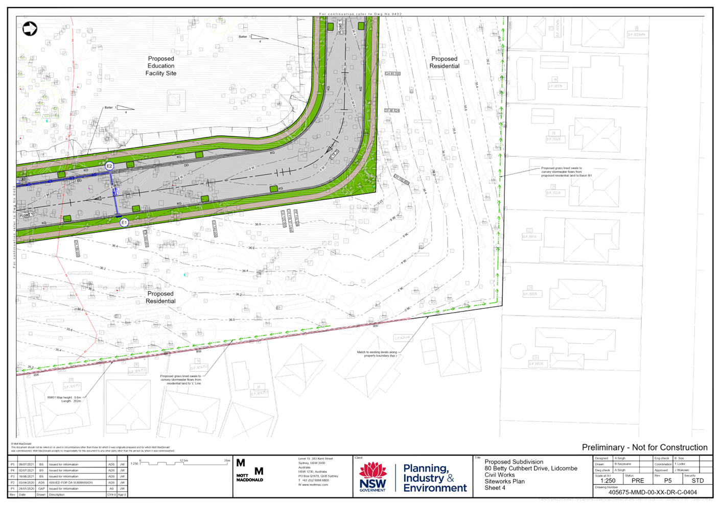
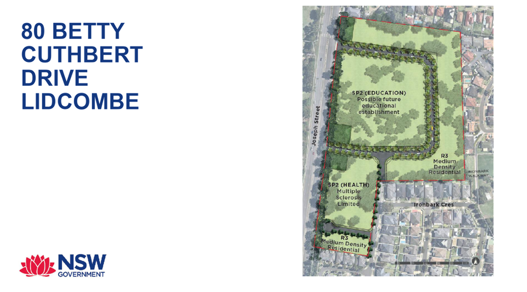
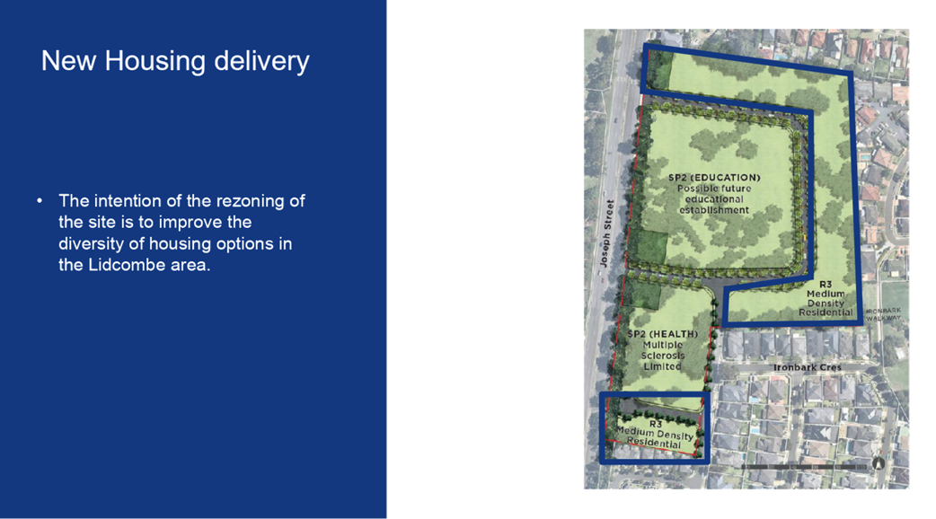
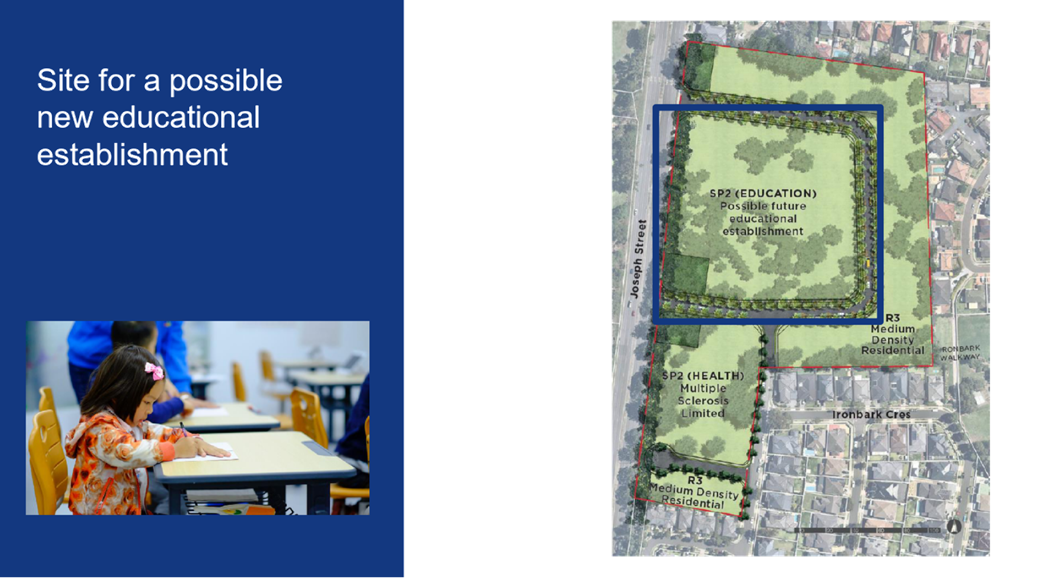
The Planning Proposal Request seeks to facilitate redevelopment of the Site for a mix of health, education, and residential land uses, as shown in the masterplan at Figure 4, and summarised below.
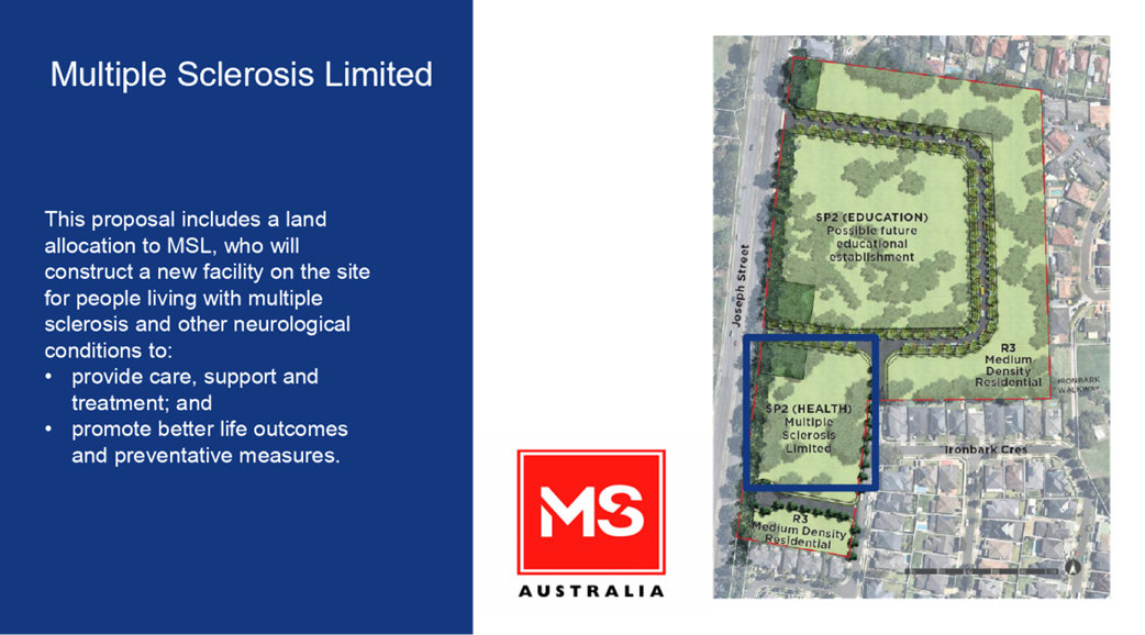
· A new Multiple Sclerosis (MSL) Facility: This is a permitted use on the site and has already been approved. On 15 November 2021, the Sydney Central City Planning Panel issued development consent for the new MSL Facility, which will include 20 two-bedroom units for temporary accommodation, provision of carparking and new access driveways, drainage and stormwater detention works and tree removal (DA2021/0435).
· Medium density housing: The proposed planning controls for this part of the site are the same as those for the adjoining Botanica estate (former Lidcombe Hospital Site) to the south. Property and Development NSW intends to sell this part of the site to a private developer.
· Educational establishment: The type and scale of educational establishment is yet to be confirmed, and is subject to the preparation of a business case by NSW Department of Education (DoE) and approval by NSW Treasury. Until a business case is approved, the NSW Government is unable to provide a firm commitment to the type of educational establishment or timing for delivery.
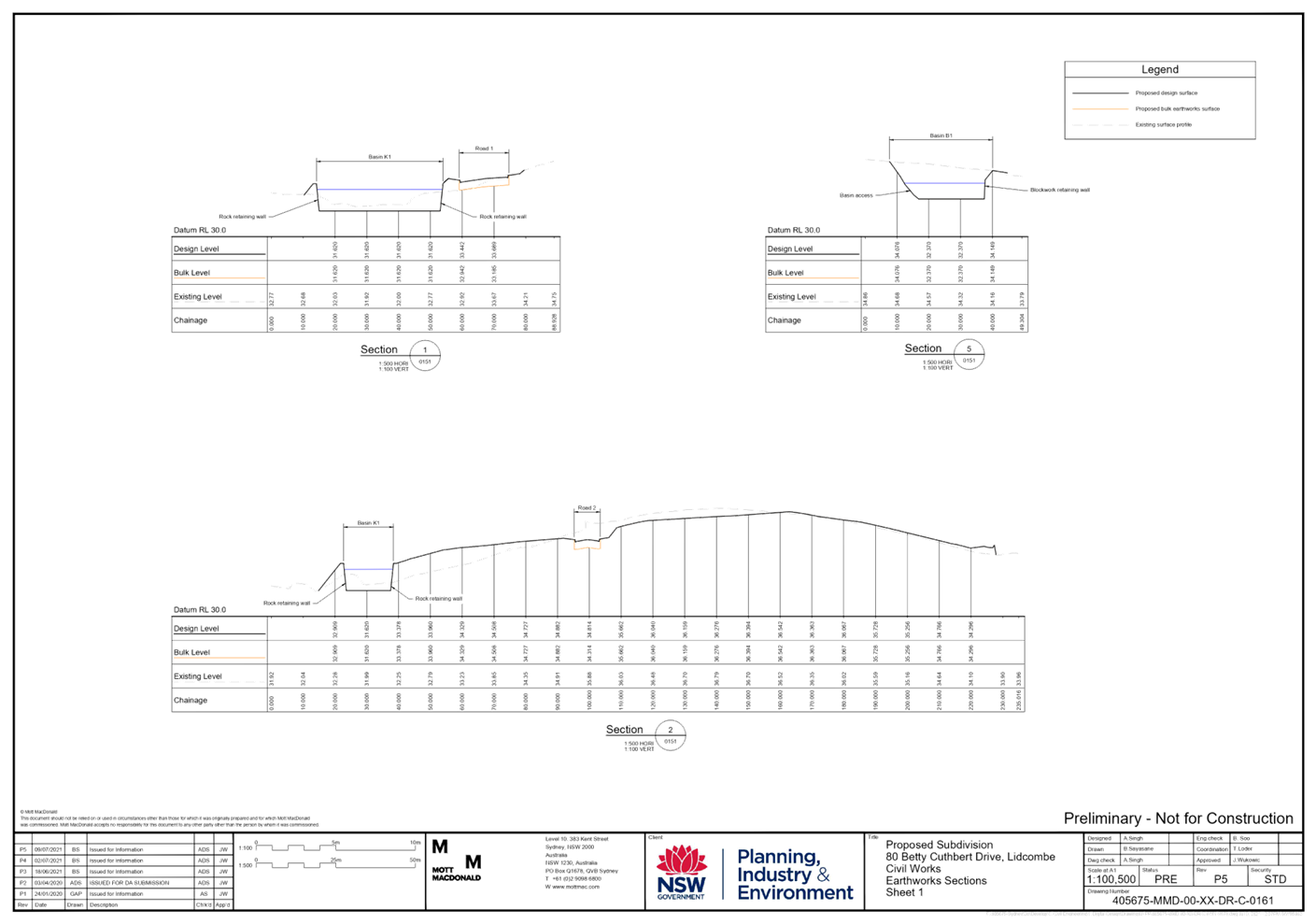
· Stormwater detention basins and local roads: To serve the development.
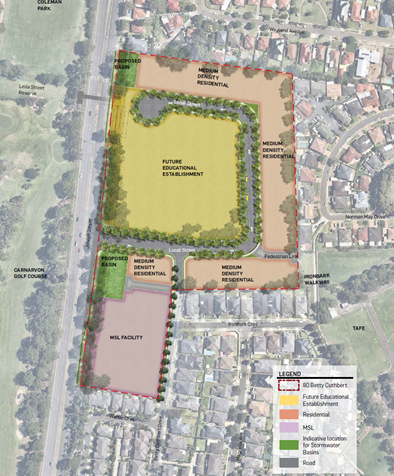
Figure 4: Indicative masterplan
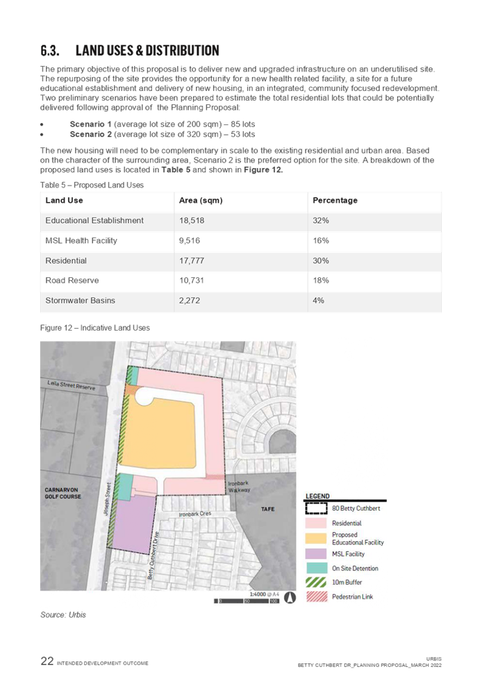
Explanation of provisions
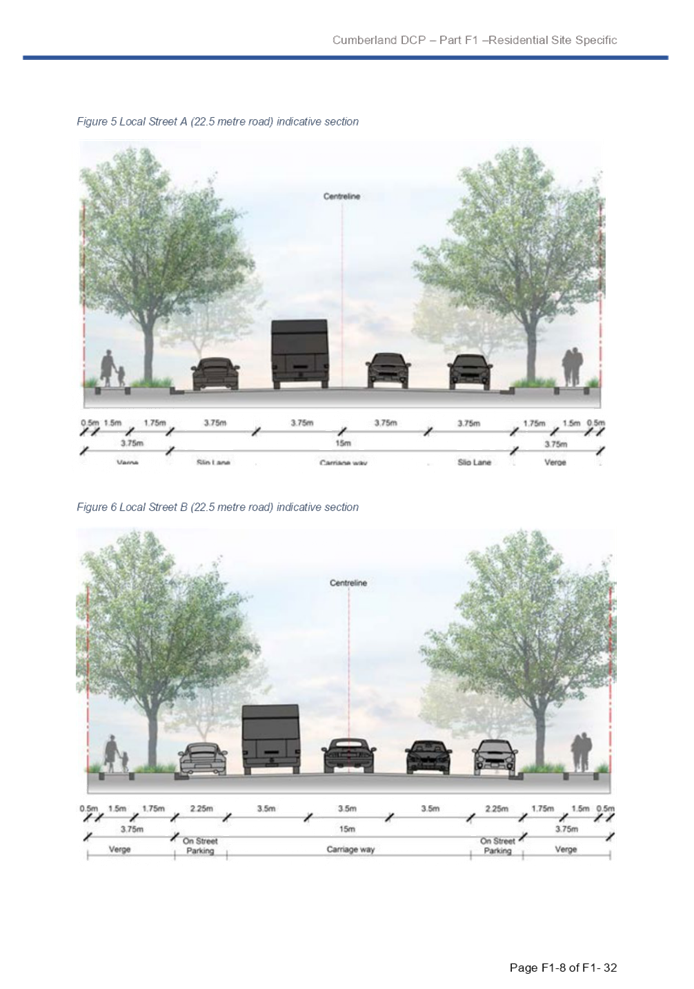
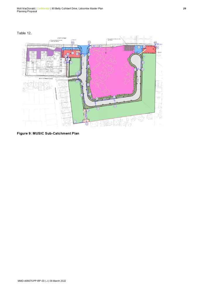
The proposal seeks to amend Cumberland LEP 2021 as summarised in Table 1 below and shown in Figures 5 to 12.
|
Control |
Existing |
Proposed |
|
Land Zone |
SP2 Hospital
|
Part SP2 Educational Establishment (32%) Part SP2 Hospital (16%) Part SP2 Drainage (4%) Part R3 Medium Density Residential (30%) |
|
Height of Buildings |
N/A |
9m within R3 zone |
|
Floor Space Ratio |
N/A |
0.75:1 within R3 zone |
|
Lot Size |
N/A |
Amend clause 4.1(3C) and associated mapping to allow maximum subdivision lot sizes between 170sqm and 350sqm on the R3 part of the Site, consistent with Botanica. |
Table 1: Proposed amendments to Cumberland LEP 2021
![]()
![]()
![]()
![]()
![]()
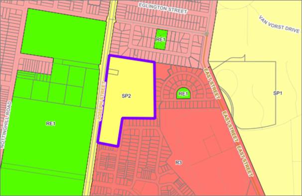
Figure 5: Existing land zoning
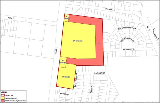
Figure 6: Proposed land zoning
![]()
![]()
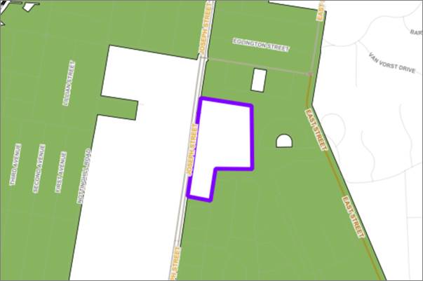
Figure 7: Existing height of buildings

Figure 8: Proposed height of buildings
![]()
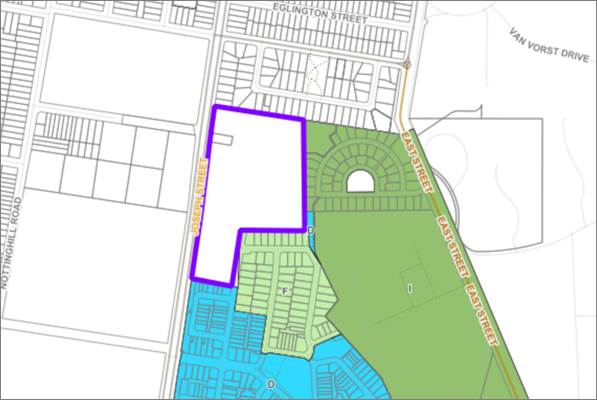
Figure 9: Existing floor space ratio
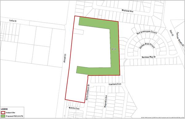
Figure 10: Proposed floor space ratio
![]()
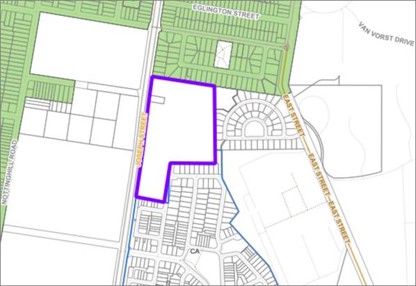
Figure 11: Existing lot size
|
|
Figure 12: Proposed lot size (see existing Cumberland LEP Clause 4.1(3C) below)
Site provision for minimum lot size (Clause 4.1(3C))
There is an existing clause in the Cumberland LEP that outlines site-specific minimum lot size requirements on adjoining land to the Site, as outlined below. It is proposed that these provisions apply to the residential component of the Site.
4.1 Minimum subdivision lot size
(3C) The minimum lot size for development on land shown edged blue and identified as “Former Lidcombe Hospital Site” on the Lot Size Map is as follows in relation to development for the purposes of—
(a) dwelling houses—
(i) 350 square metres, or
(ii) if a garage will be accessed from the rear of the property—290 square metres, or
(iii) if the dwelling house will be on a zero lot line—270 square metres,
(b) semi-detached dwellings—270 square metres,
(c) multi dwelling housing—170 square metres for each dwelling,
(d) attached dwellings—170 square metres
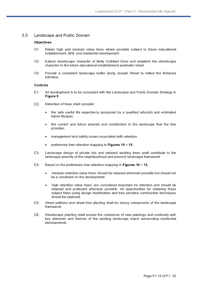
Development Control Plan
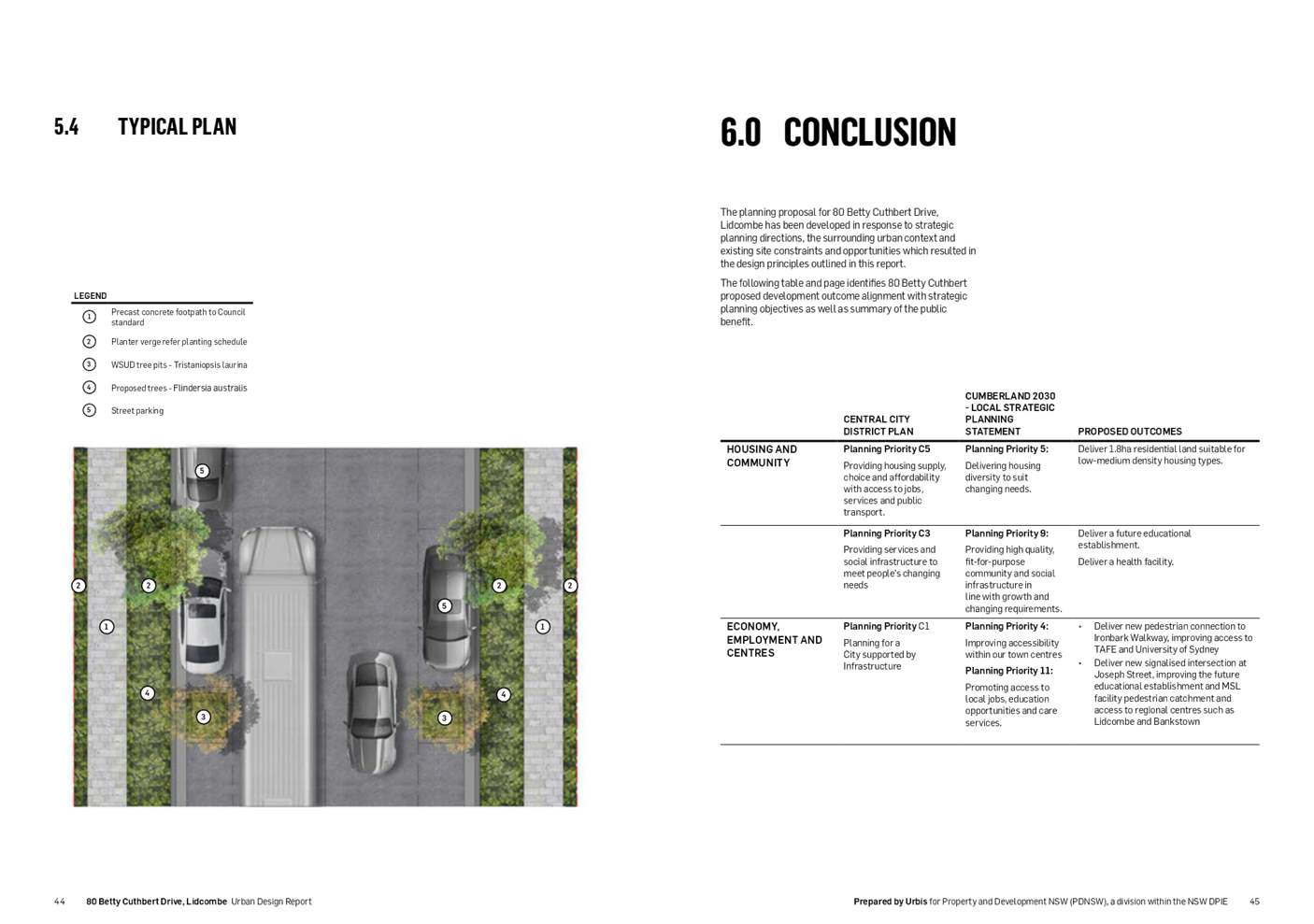
A draft site-specific Development Control Plan (draft DCP) has been prepared to guide the future development of the site. Key elements of the draft DCP include:
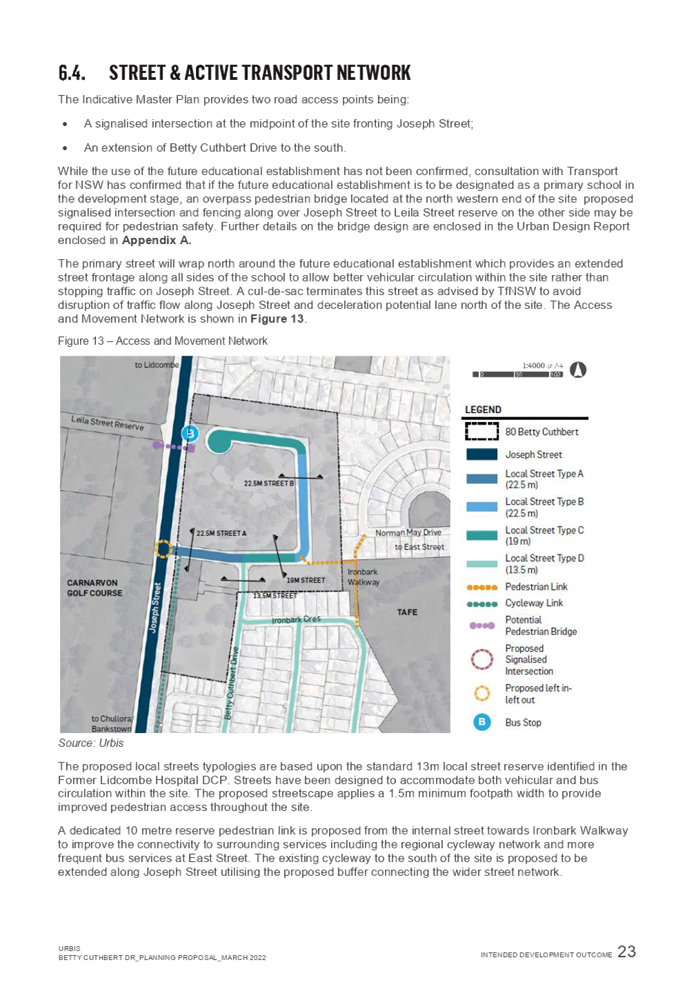
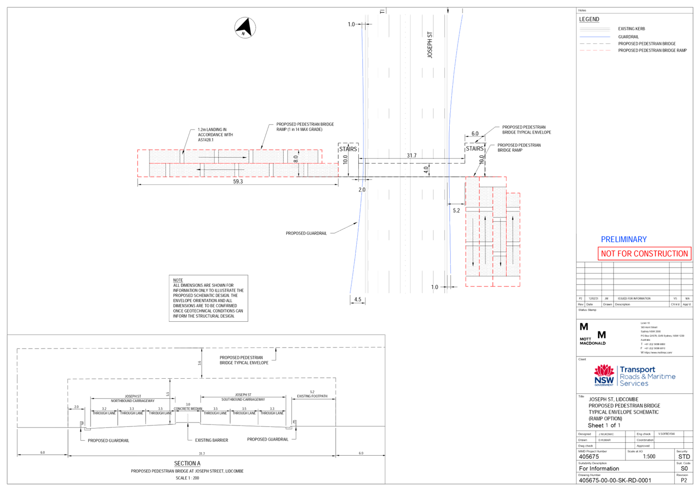
· An indicative masterplan, showing the proposed location of proposed landuses and key infrastructure to be delivered on the site. The Proponent would need to obtain subdivision approval from Council prior to before any rezoning occurs.
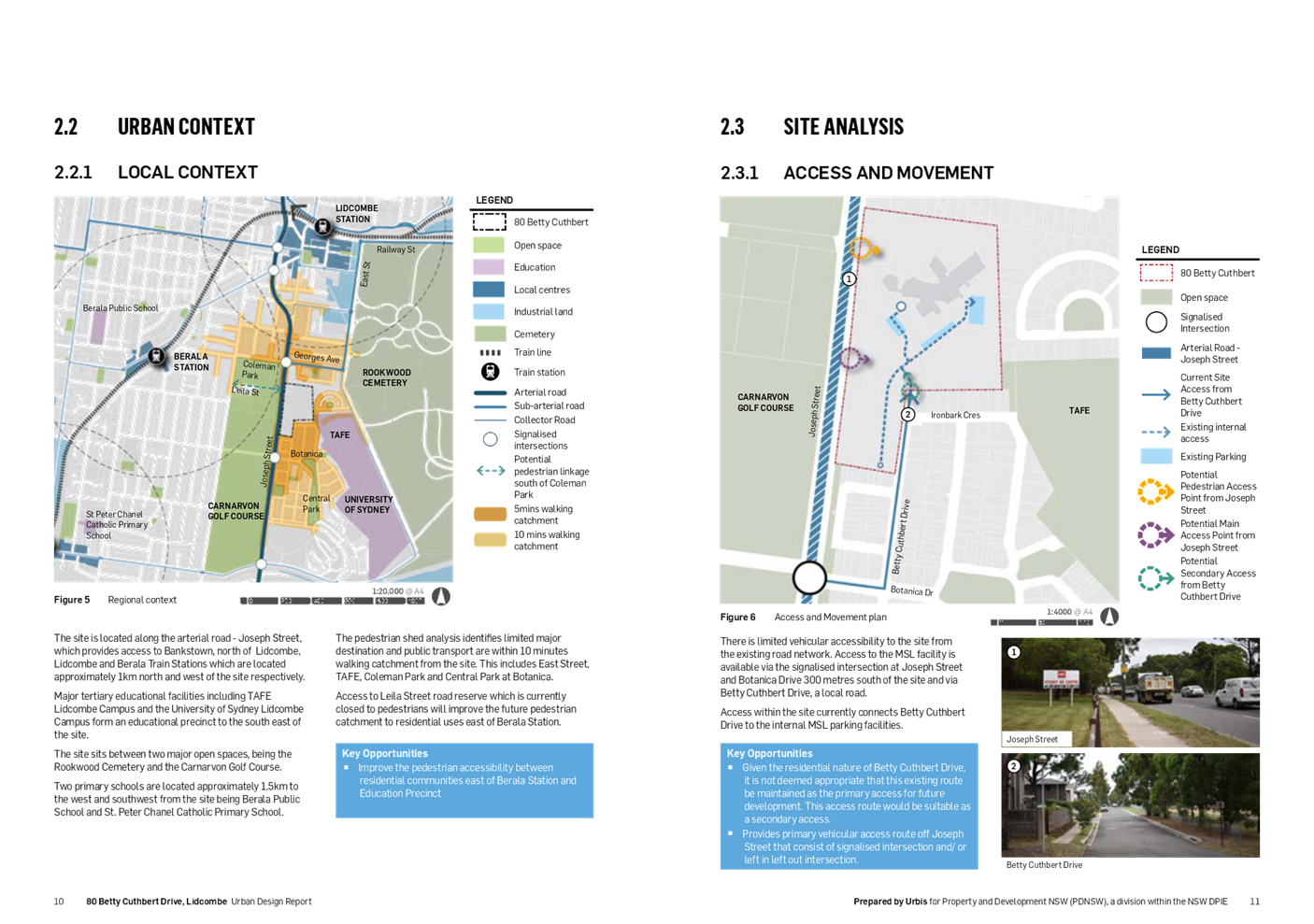
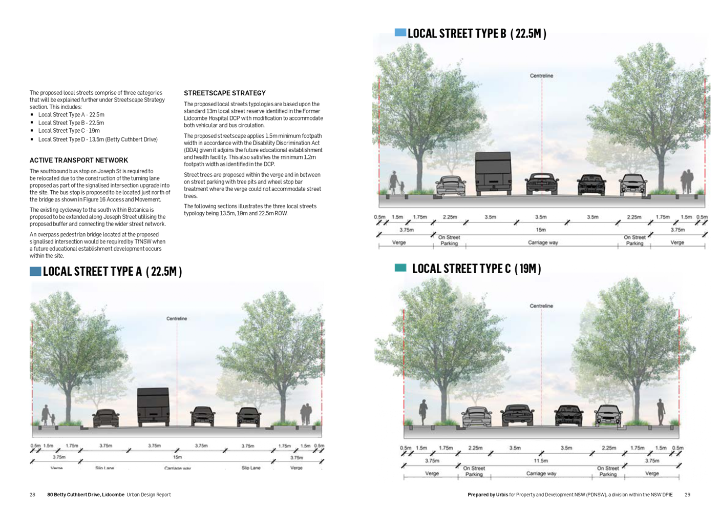
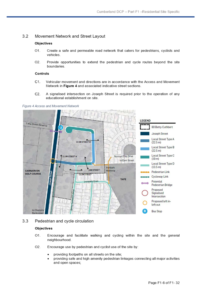
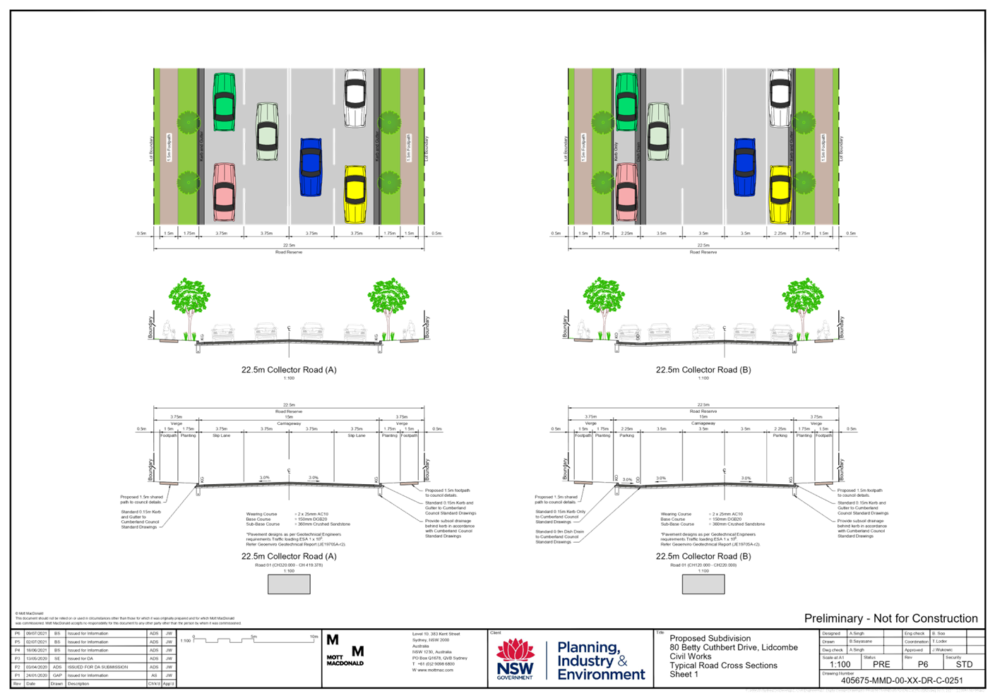
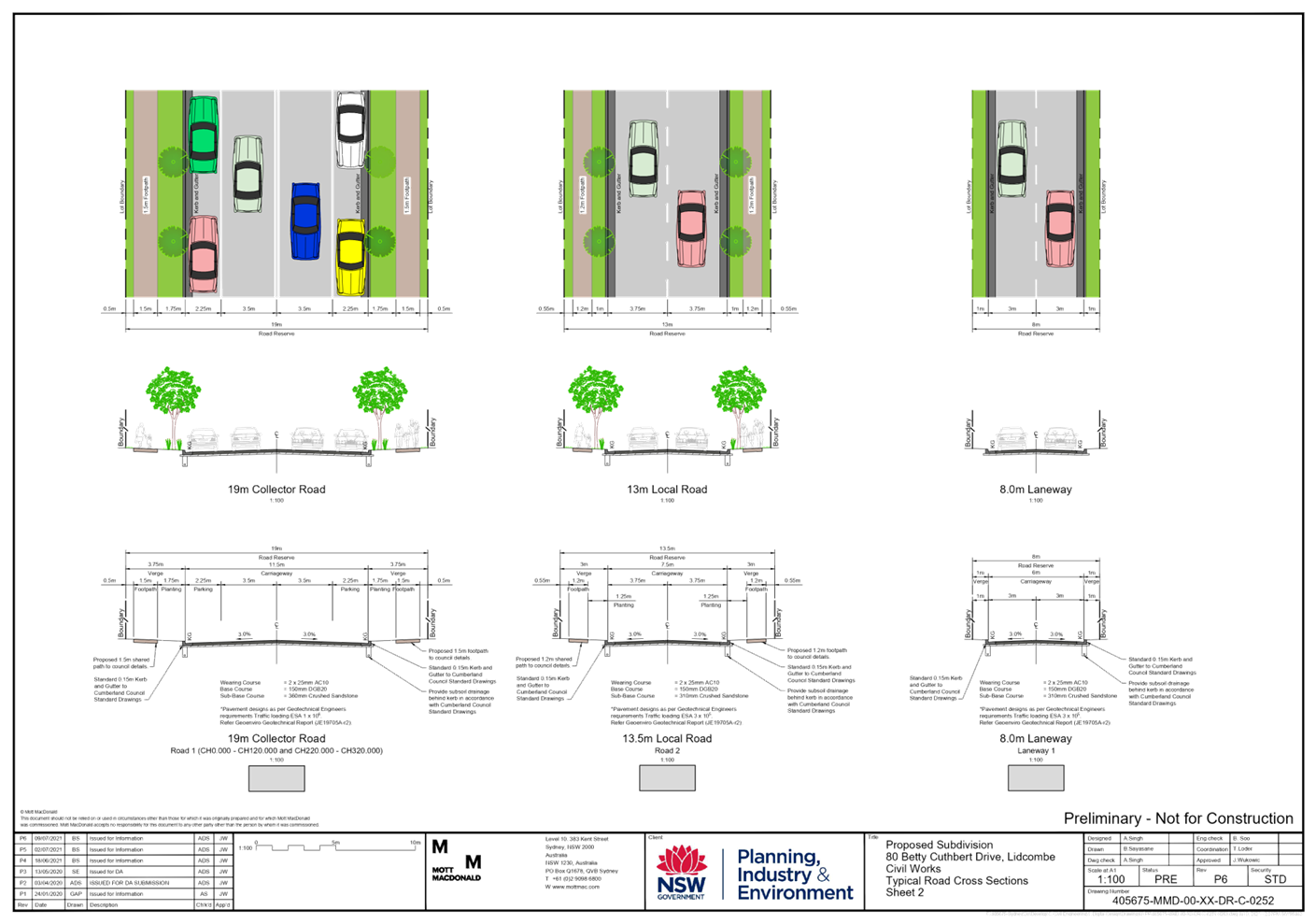
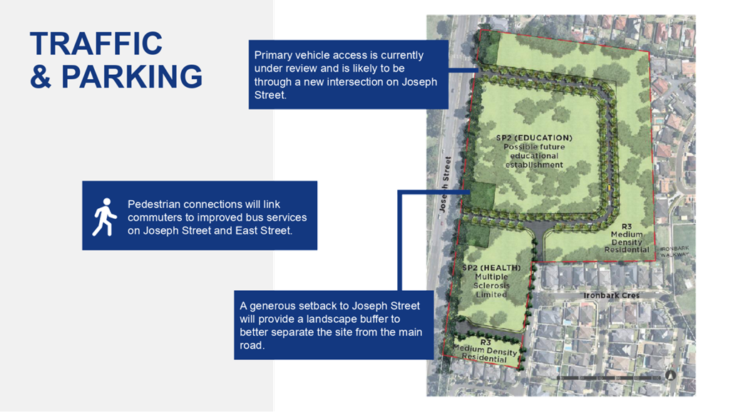
· Objectives and controls for the proposed movement network and street layout. This includes a requirement for a signalised intersection on Joseph Street to be delivered before occupation of the educational establishment.
· Objectives and controls for the proposed medium density housing, which are consistent with those for the Botanica estate (Former Lidcombe Hospital site) to the south.
Public benefit offer
Through the application of the Cumberland Planning Agreements Policy and Guideline, Council seeks to ensure a fair and reasonable apportionment of the costs and benefits of development and deliver planning outcomes that contribute to a net public benefit for the community.
The Proponent has elected not to enter into a Planning Agreement with Council on the basis that the proposal will deliver a range of public benefits. The Planning Proposal Request is supported by an Assessment of Public Benefits which provides an estimation of the State Government’s proposed direct investment into 80 Betty Cuthbert Drive, Lidcombe, and the expected quantitative public benefits derived from the NSW Government’s direct investment into the site.
Early consultation
The Proponent carried out community consultation from May to June 2020, before the Planning Proposal Request was lodged with Council.
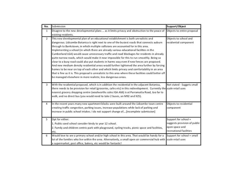
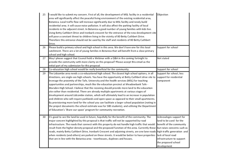
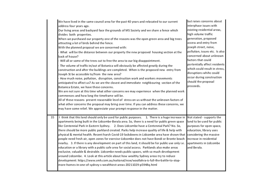
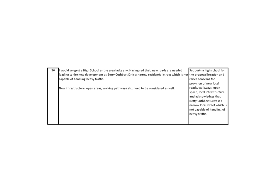
Council officers placed the Planning Proposal Request on early consultation from 6 October 2021 to 3 November 2021, in accordance with policy requirements. In response, Council received a total of 36 submissions, including eight objections, 20 submissions in support of the proposal and eight neutral submissions. Items covered in the submission included:
· Most submissions expressed strong support for the establishment of a new school on the site
· Many submissions requested for additional uses be delivered on the site as part of the proposal, including open space and commercial/retail uses, to reduce the need for residents to drive to other surrounding areas to access services and facilities
· Concerns about potential impacts associated with the proposed school and residential component, including pedestrian safety, traffic and parking, and amenity impacts such as privacy and noise.
Advice from the Cumberland Local Planning Panel
Council officers reported the Planning Proposal Request to the Cumberland Local Planning Panel on 13 April 2022, recommending that the Panel supports the proposal for the purpose of a Gateway Determination.
The Panel agreed with the Council officer recommendation and requested that certain matters be subject to more detailed consideration including, where relevant, in the preparation of future planning controls for the site. These matters are outlined and responded to below.
|
|
Panel advice/recommendation |
Planner response |
|
1. |
Identify significant trees in the site-specific Development Control Plan (DCP). |
The draft DCP is updated to identify significant trees on the site. |
|
2. |
The means of promoting public transport use, including the most effective way of providing bus access and whether bringing buses on to the site is the optimal solution, recognising that these buses may serve more than just the school. |
Public bus services are located along Joseph Street with a bus stop directly next to the site. Also, the future State Significant Development Application for the educational establishment will require a Green Travel Plan to ensure the development incorporate ways to encourage public transit use. |
|
3. |
The provision of pedestrian linkages from the school to the areas to the east and whether the link as shown on the drawings is sufficient or whether additional linkages should be provided. |
The current masterplan is indicative, it is anticipated that future DAs (including for residential uses and the future educational establishment) will consider pedestrian linkages.
|
|
4. |
The acknowledgment of the adjoining state heritage item being the former Lidcombe hospital site and its associated relationship to the subject site and the need for appropriate planning controls in the DCP to ensure an acceptable development interface with that item. |
The overall masterplan for 80 Betty Cuthbert Drive has been designed to reflect the landscaped character of development to the south within the Former Lidcombe hospital site which is reflected in the current DCP controls.
Council officers have reviewed the Former Lidcombe Hospital DCP to analyse controls in relation to heritage significance. Section 3.1 of the DCP states: New development is compatible with the overall residential character of the former Lidcombe Hospital site and the heritage core precinct (as identified on the NSW State Heritage Register).
It is not considered necessary to add any specific controls relating to heritage given the built up nature between the site and the distance between the state listed heritage precinct core (see Figure 13 below).
|
Table 2: Panel advice and Planner response
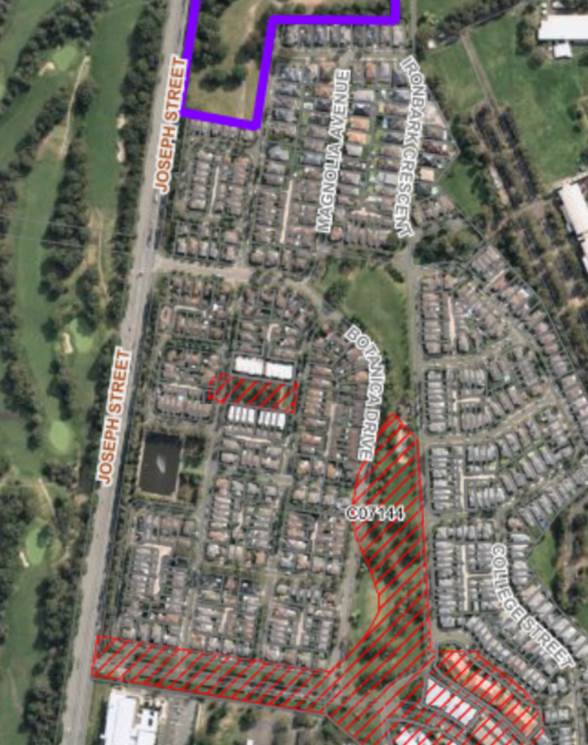
Figure 13: The Site (purple outline) and State heritage precinct core (red hatching)
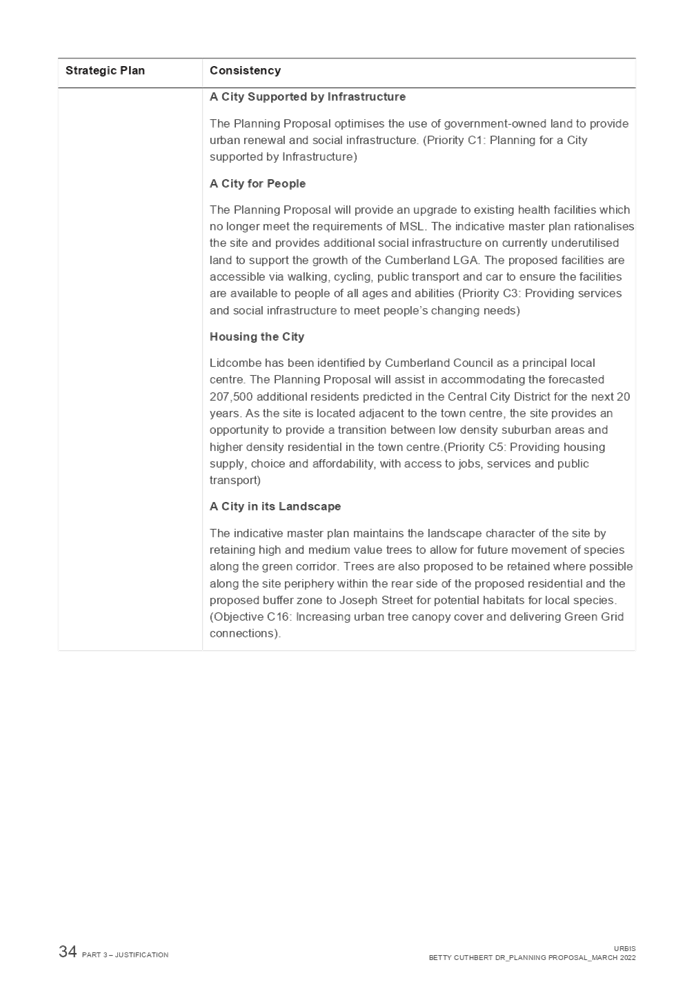
Strategic merit assessment
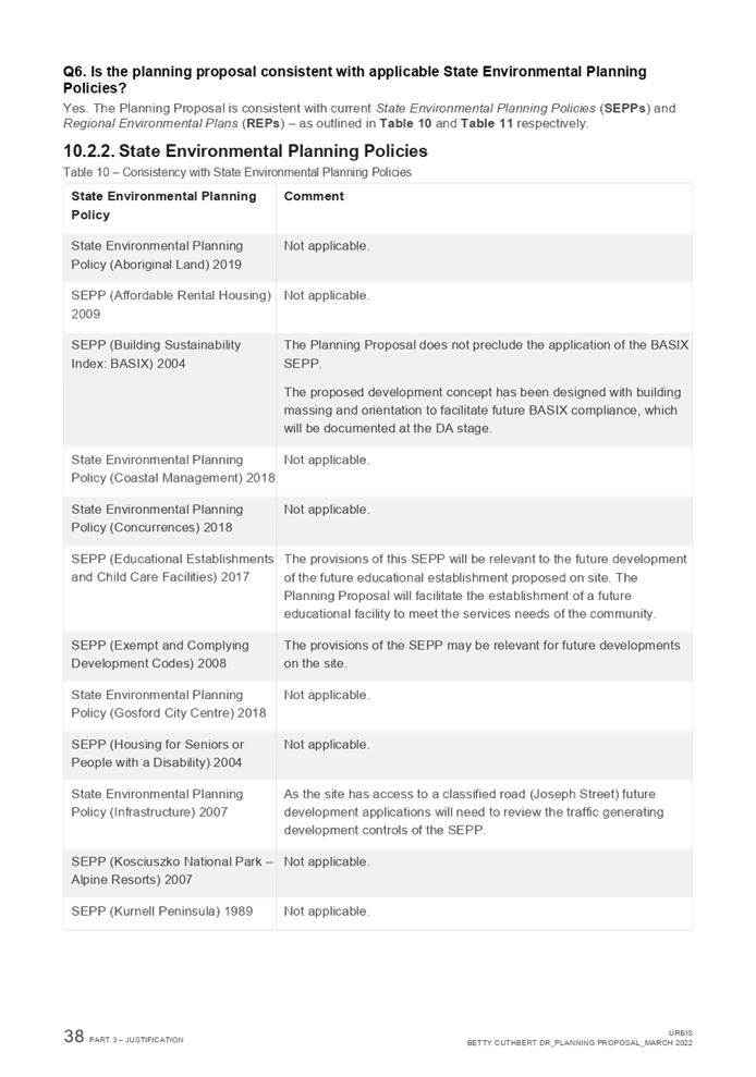
The proposal is broadly consistent with the strategic planning framework and policy context, as outlined below.
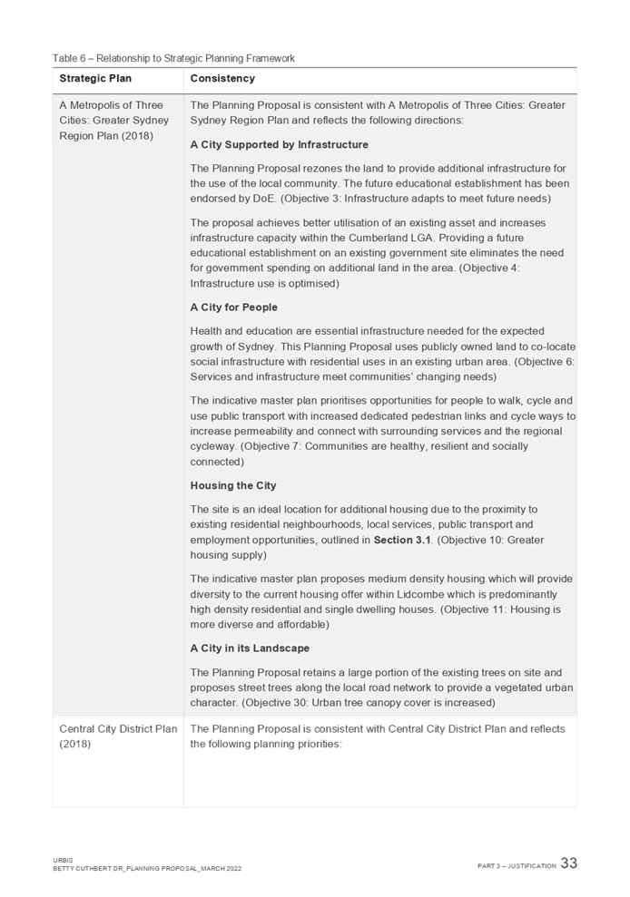
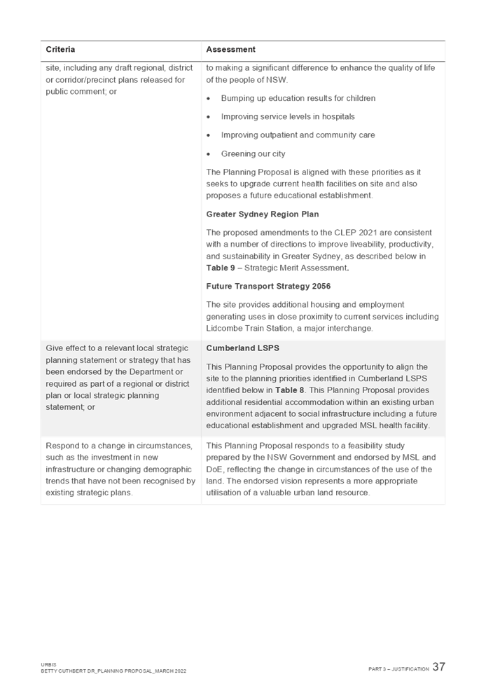
Consistency with Greater Sydney Region Plan - A Metropolis of Three Cities
The proposal is broadly consistent with the Greater Sydney Region Plan, including:
· Objective 3: Infrastructure adapts to meet future needs. The proposal seeks to deliver an educational establishment and supporting roads and stormwater infrastructure to meet the needs of Cumberland’s rapidly growing population.
· Objective 10: Greater housing supply: the proposal provides a greater amount of housing supply than would be possible without the proposed rezoning.
· Objective 11: Housing is more diverse and affordable: The proposal aims to deliver a mix of housing types and sizes, including ‘missing middle’ attached housing, similar to the Botanica site to the south.
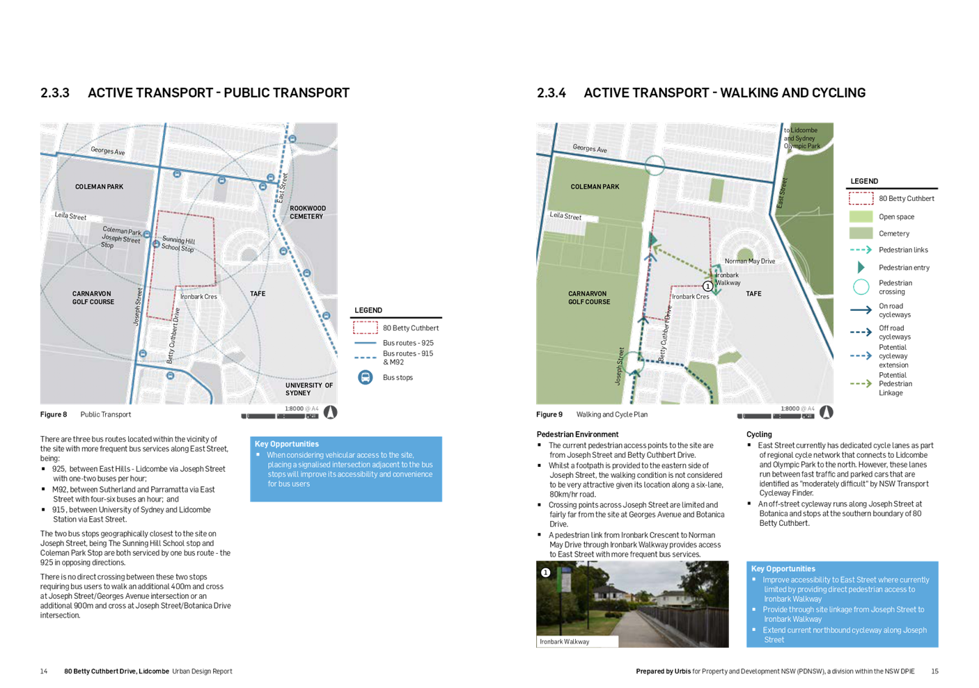
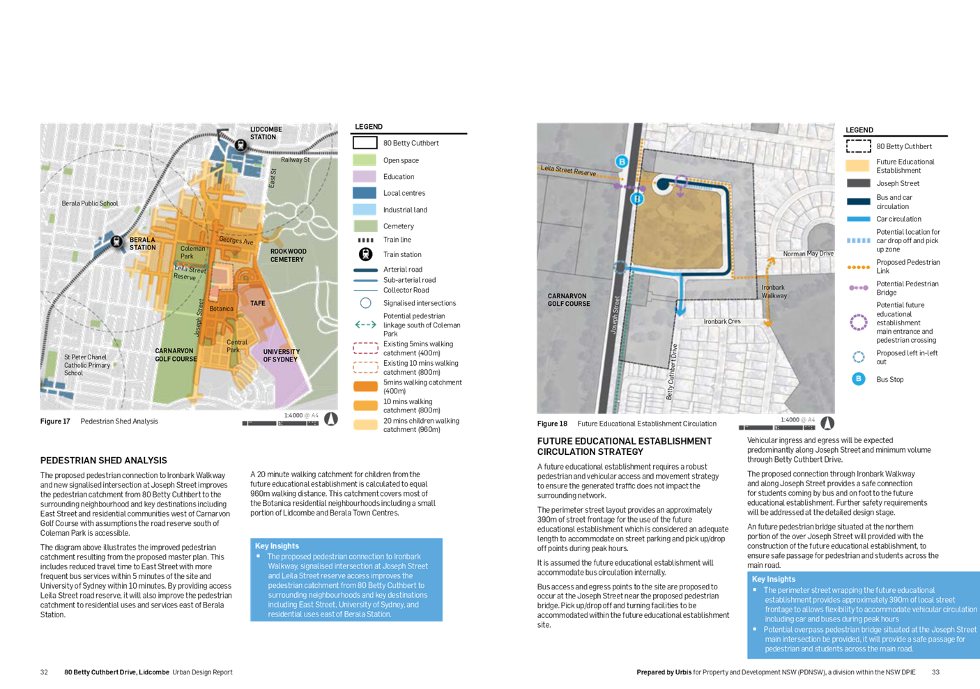
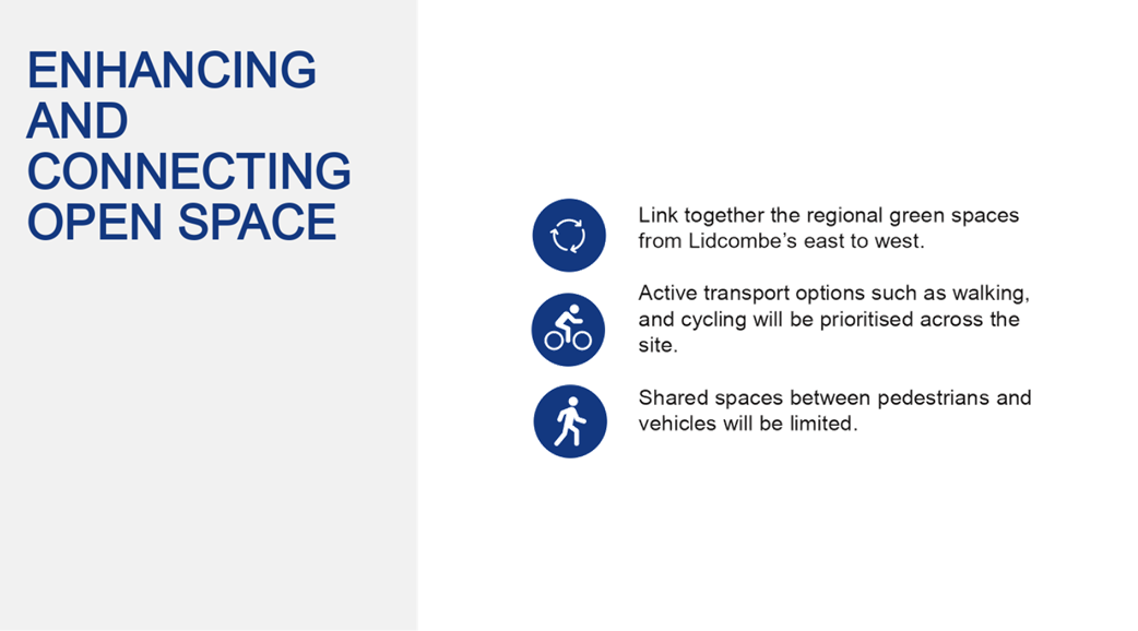
· Objective 14. integrated land use and transport creates a walkable and 30-minute cities: The proposal will improve pedestrian permeability and active transport network. The proposed pedestrian linkage to Ironbark Walkway, new intersection at Joseph Street and pedestrian connection opportunity to Leila Street increase permeability between eastern and western communities, including Berala. The direct pedestrian connection through Ironbark Walkway and Norman May Drive will also improve accessibility to more bus services and regional cycleway network at East Street.
Consistency with the Central City District Plan
The proposal is generally consistent with the Central City District Plan, including:
· Priority C1: Planning for a city supported by infrastructure. The proposal seeks to deliver a new MSL facility, educational establishment, and supporting infrastructure including roads, drainage and pedestrian links.
· Priority C3: Providing services and social infrastructure to meet people’s changing needs. The proposal will facilitate redevelopment of a large, underutilised Government site for a mix of land uses, including a new MSL facility and educational establishment.
· Priority C5: Providing housing supply, choice and affordability with access to jobs, services and public transport. The proposal seeks to deliver additional housing in close proximity to established residential neighbourhoods, services and facilities, including public transport.
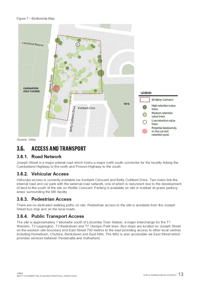
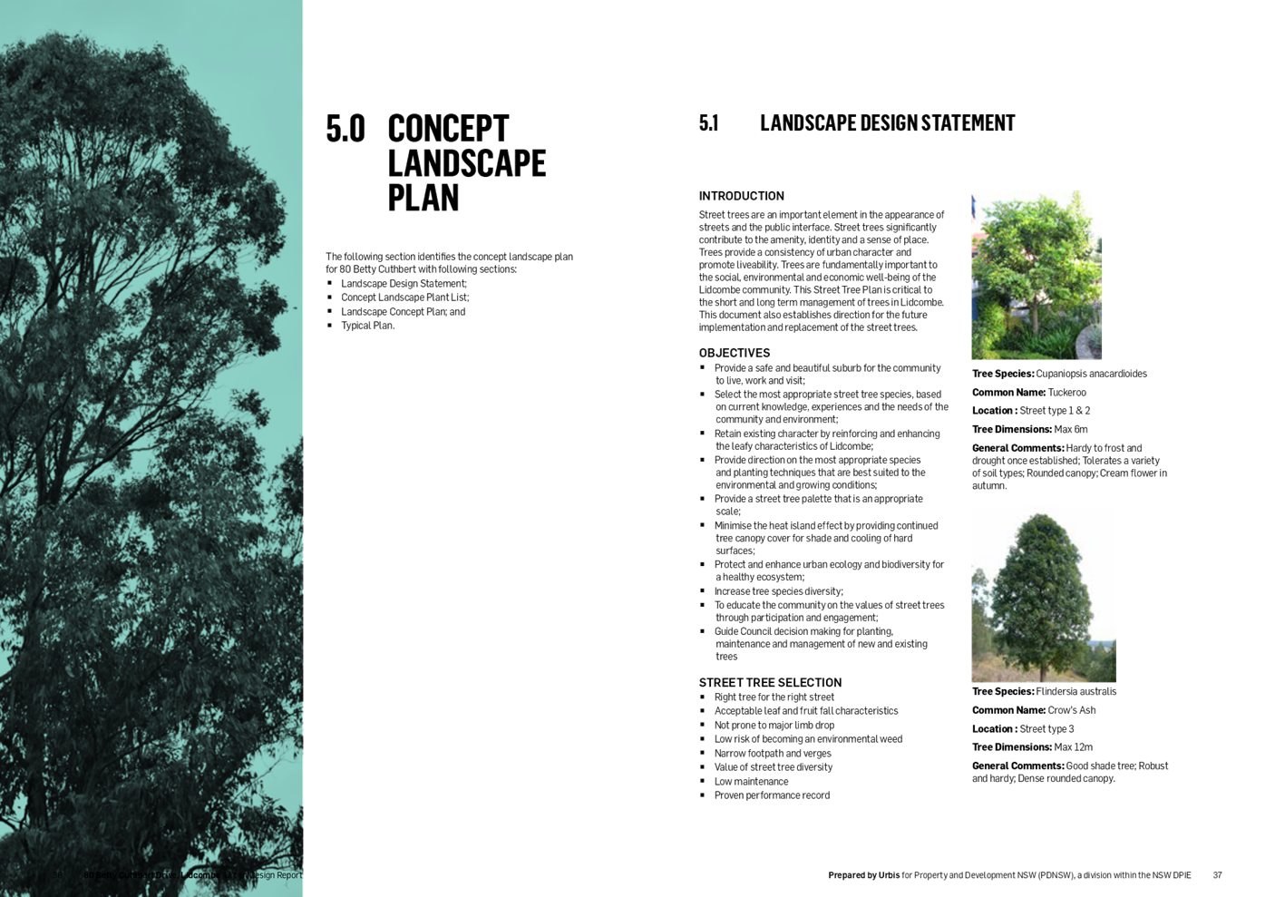
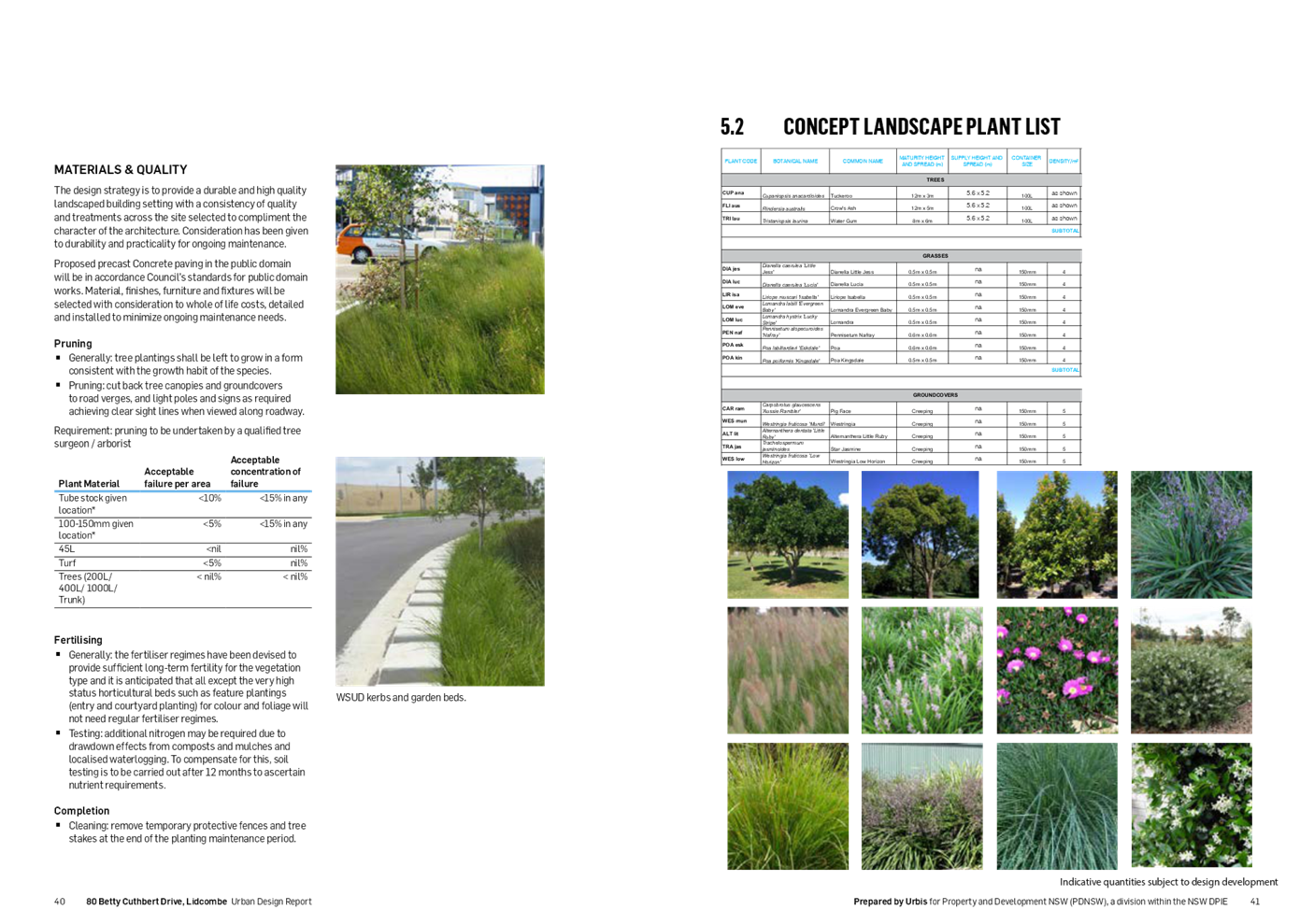
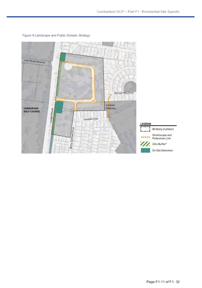
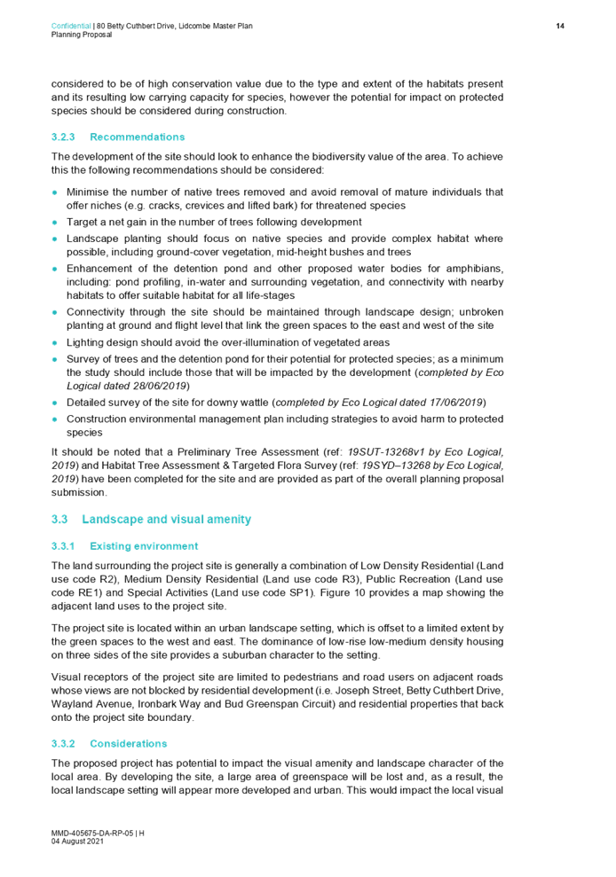
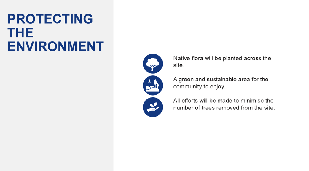
· Priority C16: Increasing urban tree canopy cover and delivering Green Grid connections. The indicative master plan maintains the landscape character of the site by retaining high and medium value trees to allow for future movement of species along the green corridor. Trees are also proposed to be retained where possible along the site periphery within the rear side of the proposed residential and the proposed buffer zone to Joseph Street for potential habitats for local species.
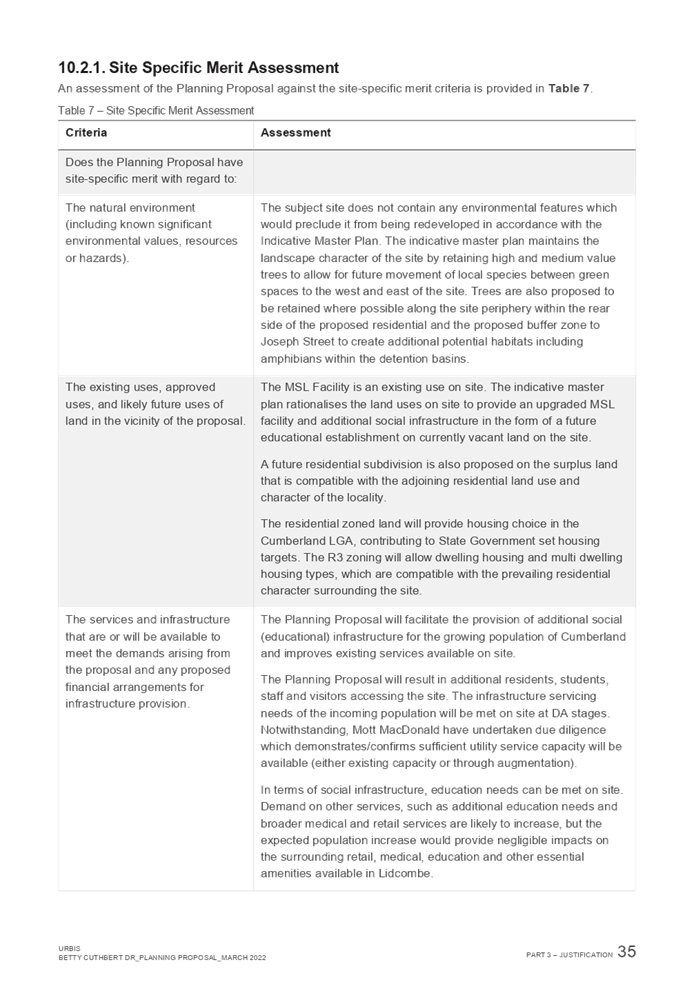
Consistency with Cumberland 2030: Our Local Strategic Planning Statement (LSPS)
The proposal is generally consistent with Cumberland 2030: Our :Local Strategic Planning Statement, including:
· Objective P4: Improving accessibility within our town centres. The proposal will make it easier for current and future residents to access other nearby centres and surrounding neighbourhoods through the provision of pedestrian and cycle links.
· Objective P5: Delivering housing diversity to suit changing needs. The proposal seeks to deliver a mix of housing types and sizes, similar to the Botanica site to the south.
· Objective P9. Providing high quality, fit-for-purpose community and social infrastructure in line with growth and changing requirements. Redeveloping the site for a school and MSL facility will provide valuable social infrastructure to meet the needs of Cumberland’s rapidly growing population.
· Objective P13: Protecting, enhancing and increasing natural and green spaces. The proposal seeks to retain significant vegetation and to provide tree planting along Joseph Street.
Key considerations
Social and economic
· The proposal will deliver social infrastructure to meet the needs of the local area and wider region.
· The proposal will deliver a range of employment opportunities in the health and education sector, with access to Lidcombe TAFE and Sydney University Cumberland Campus.
· In addition to ongoing employment opportunities, the proposal will also result in a temporary increase in construction jobs.
Urban design and built form
· The proposed planning controls for the residential component will result in a similar built form outcome as the Former Lidcombe Hospital site to the south.
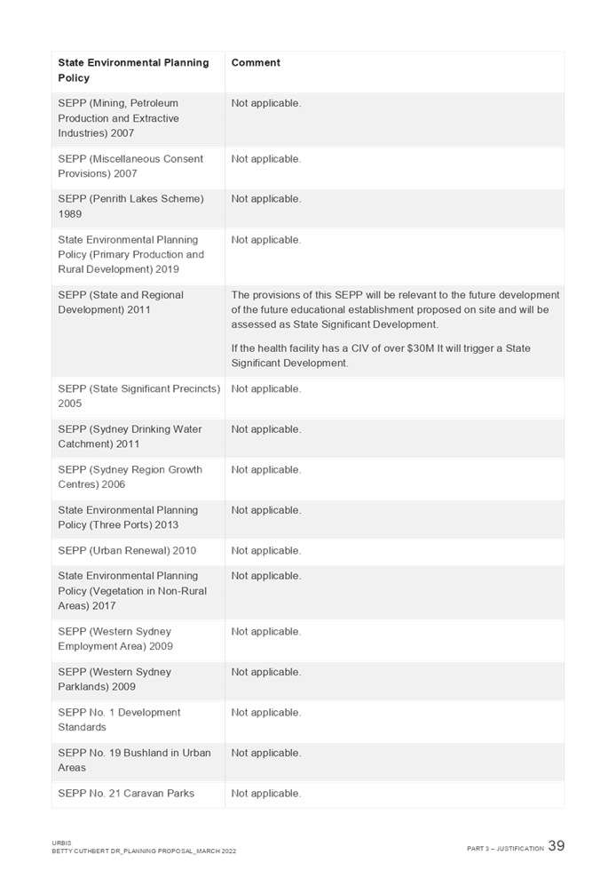
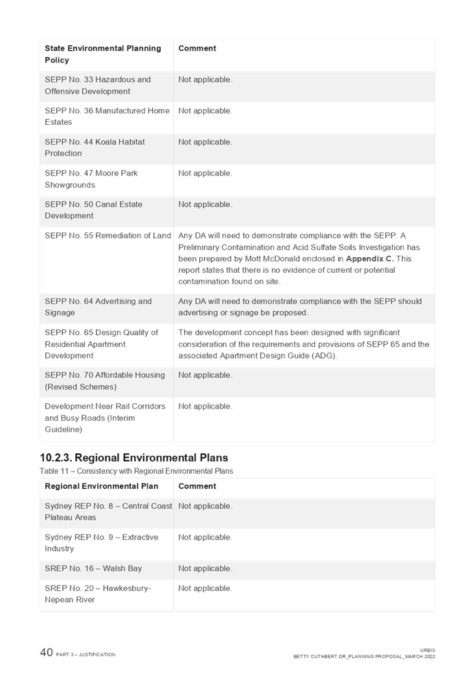
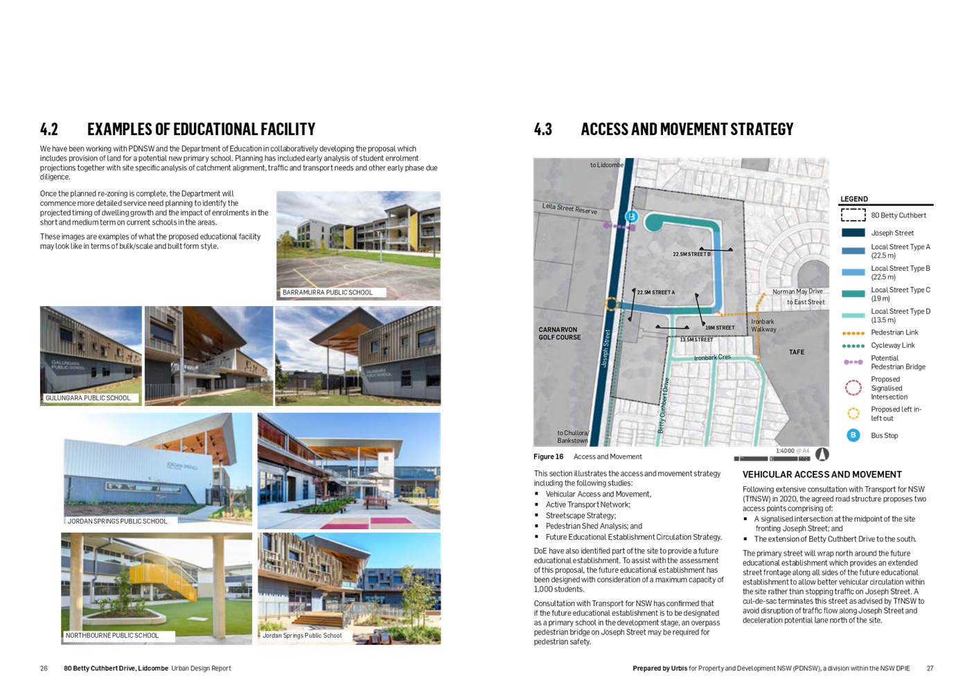
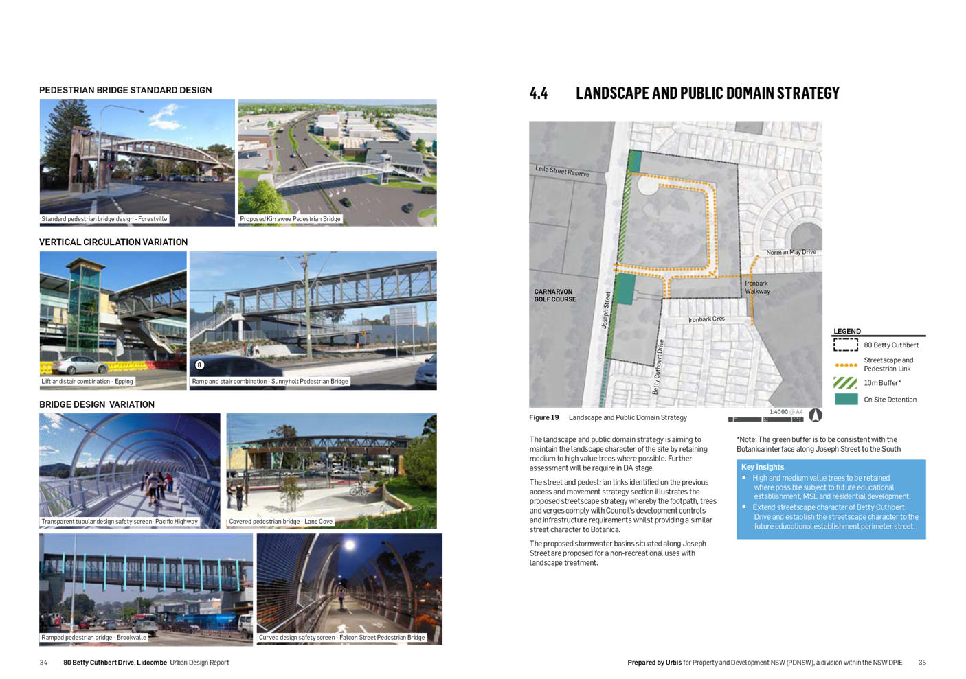
· The proposed school will be required to meet the design controls and design quality principles in the State Environmental Planning Policy (Transport and Infrastructure) (SEPP) (formerly Education SEPP) and associated Design Guide for Schools.
· The design of the MSL facility has been approved by Sydney Central City Planning Panel.
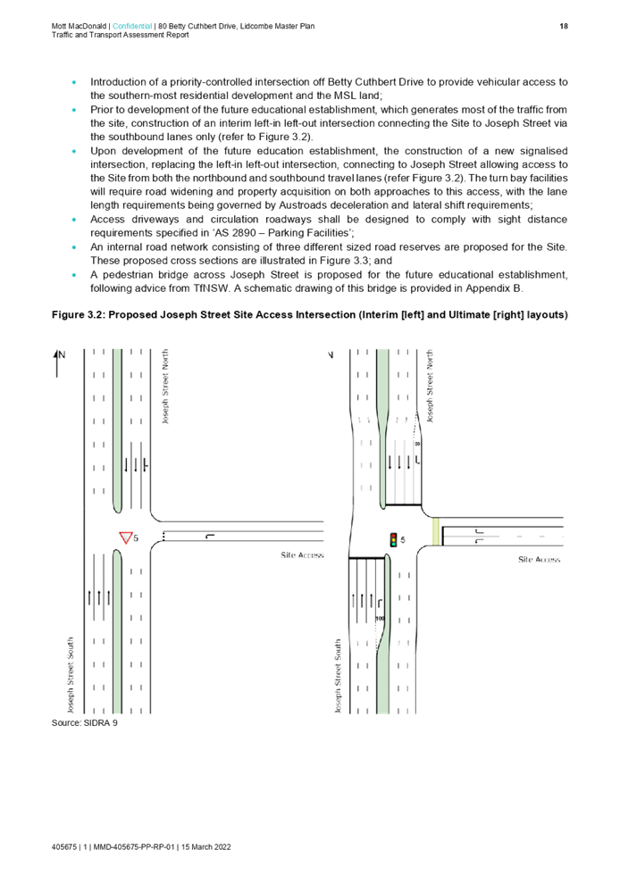
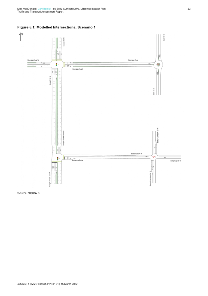
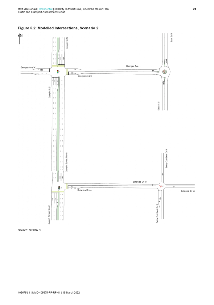
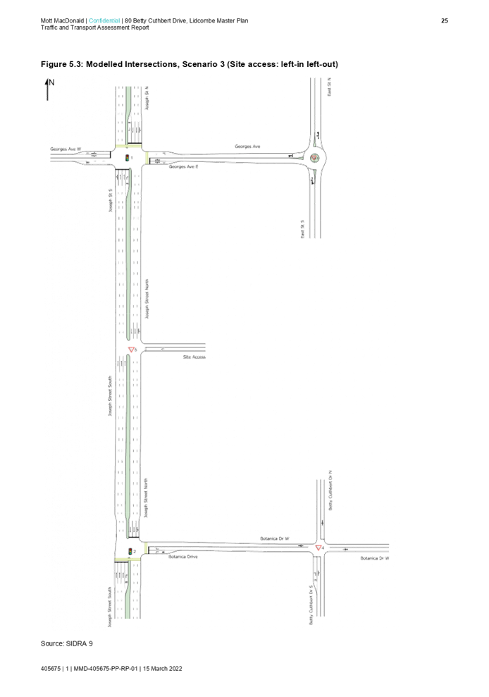
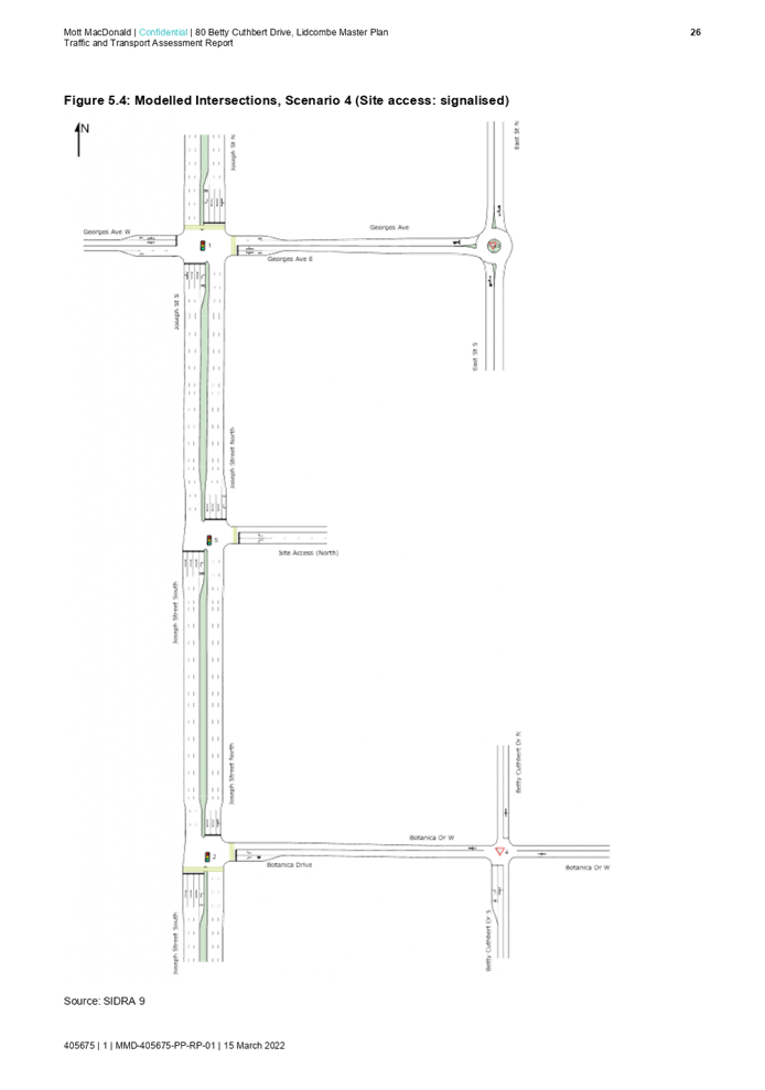
Traffic and access
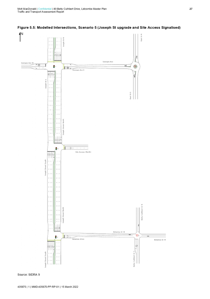
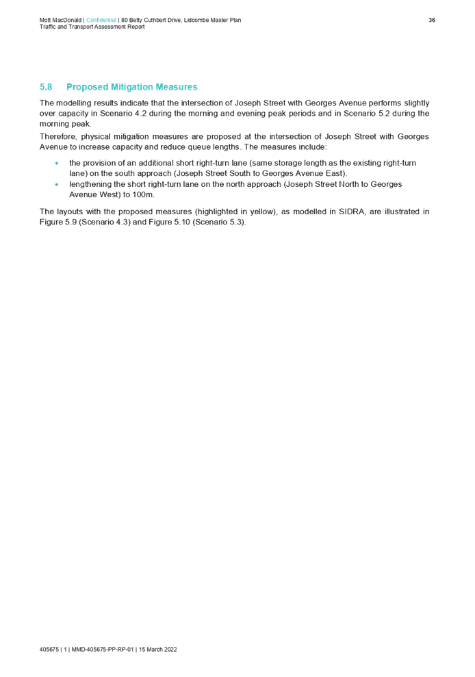
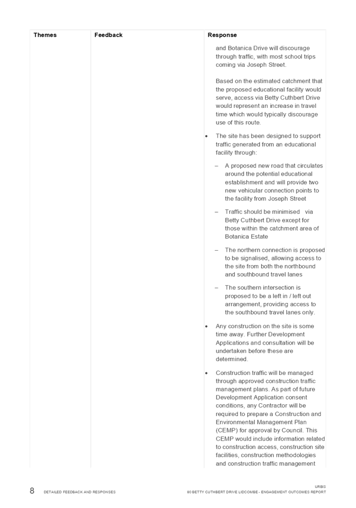
· Transport for NSW requirements have been addressed in the masterplan. The concept layout for the master plan includes the introduction of an interim left-in left-out connection to Joseph Street. This connection is to be converted to a signalised intersection before the educational establishment is operational.
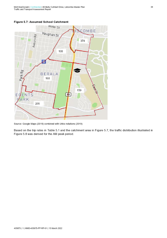
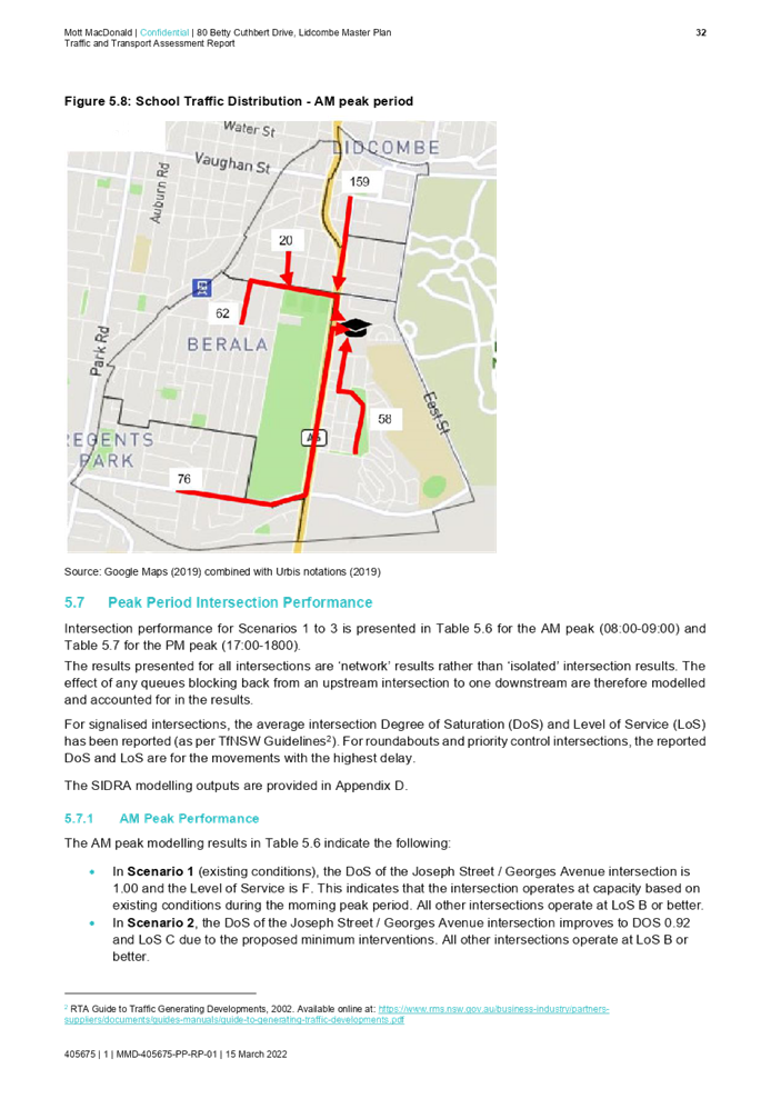
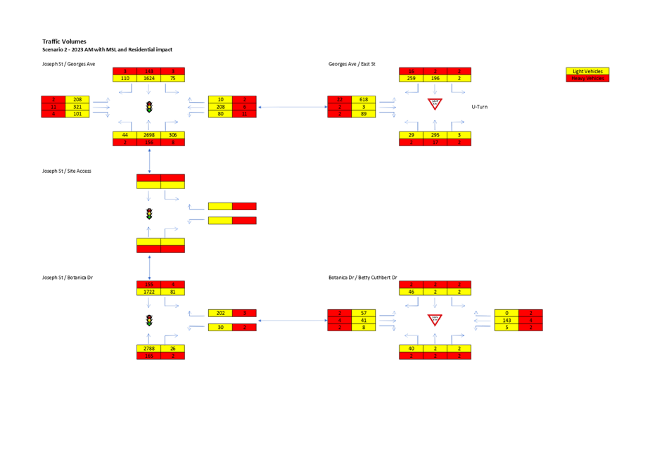
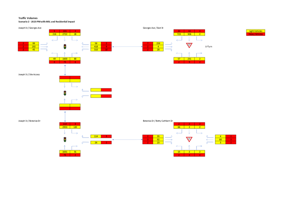
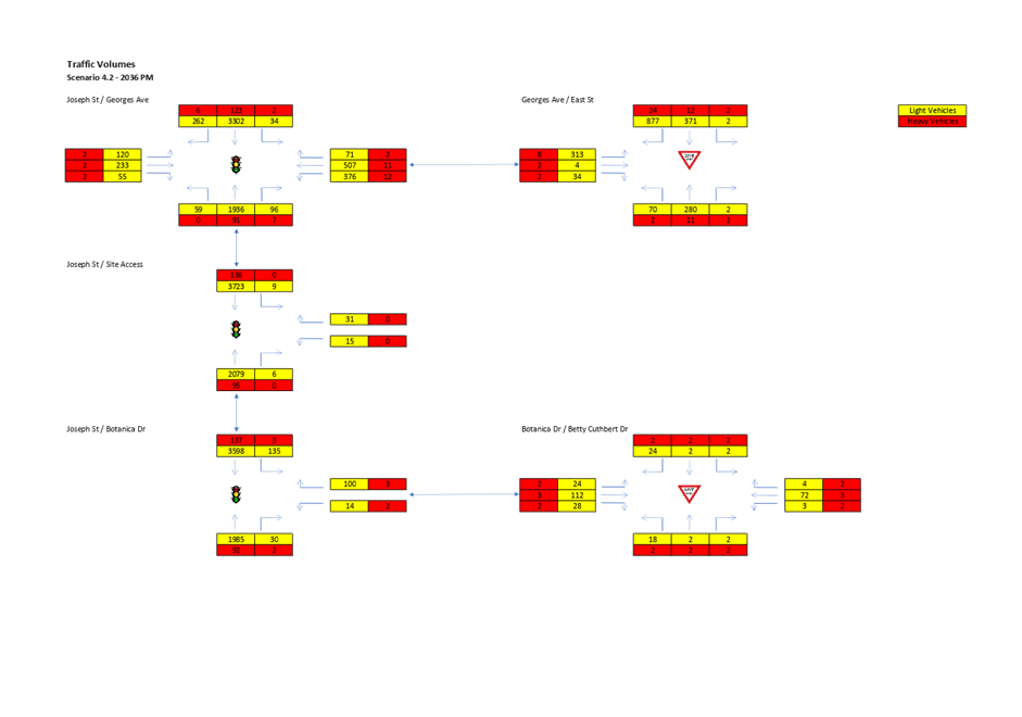
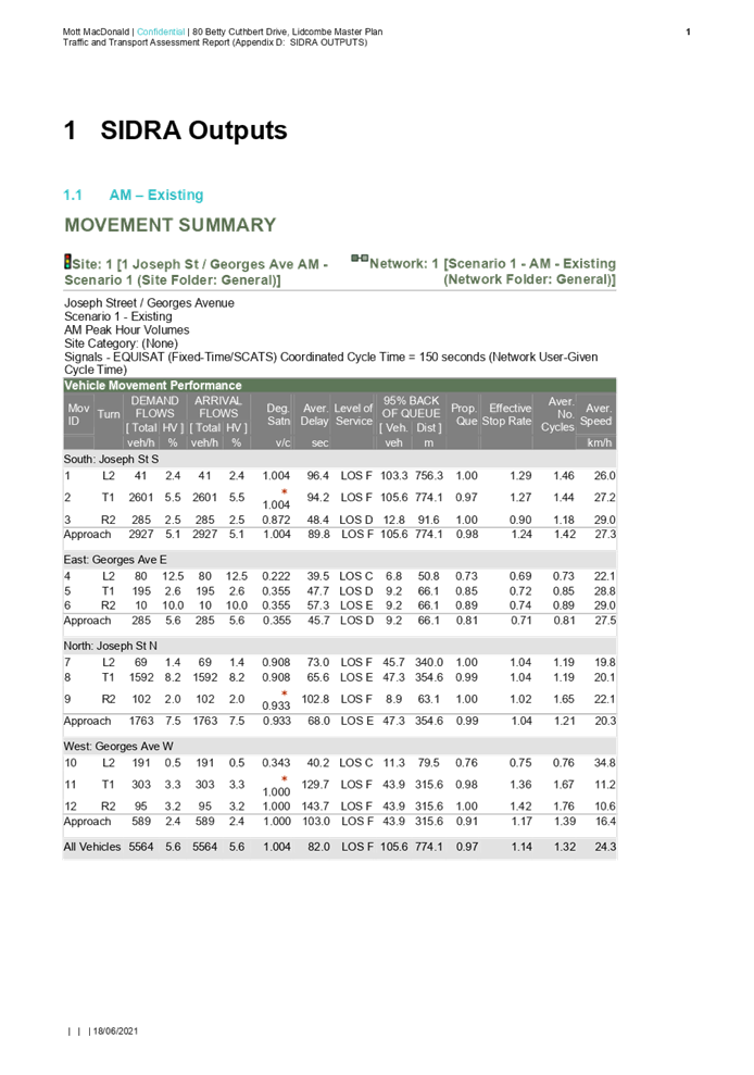
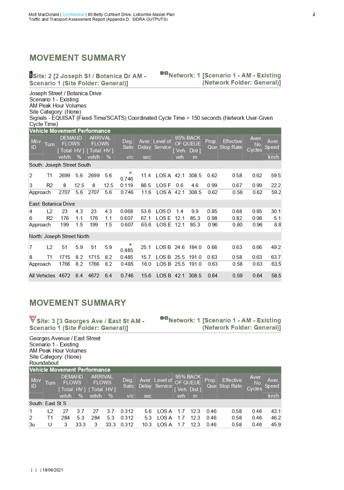
· The Proponent will also be required to address local requirements and issues as part of any development application for the educational establishment. A traffic report will be required to show, at a minimum: school and cumulative traffic between 8-9.30am and 2-4pm; sweep path analysis on proposed cul-de-sac; and operational management details for the school.
Environmental
The Planning Proposal Request is supported by a range of technical studies that address the following matters.
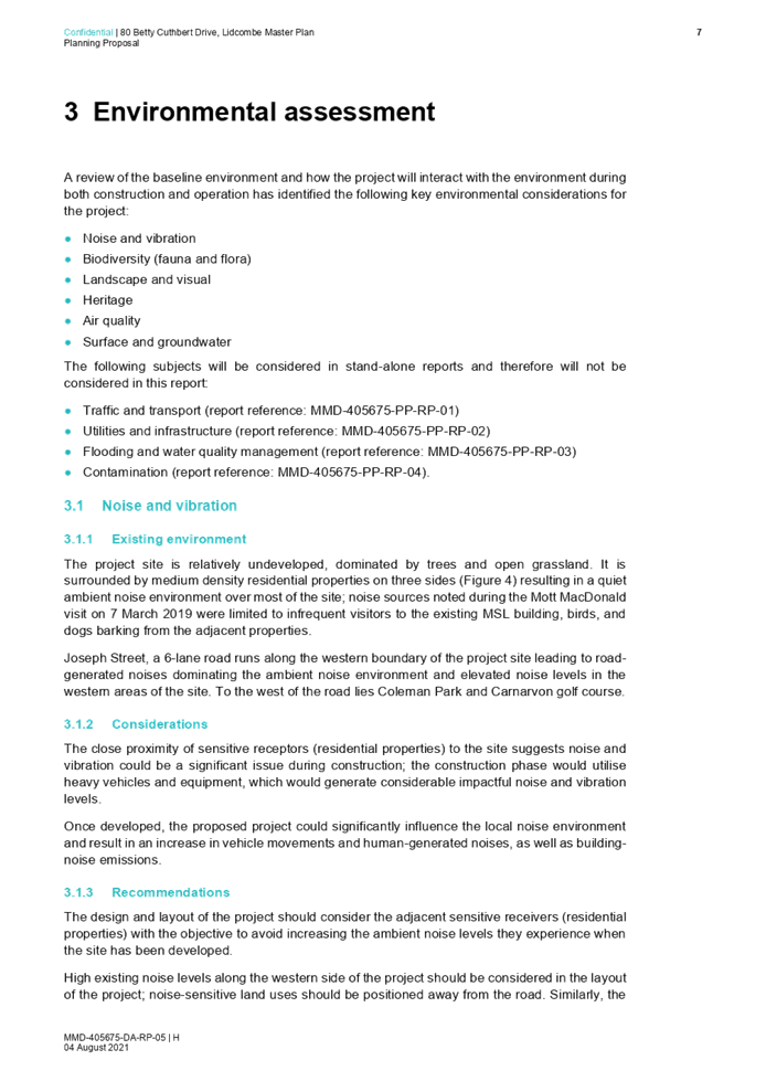
· Noise and vibration: The development would impact adjacent residents during both construction and operation. The development would also be subject to significant noise levels from Joseph Street. It is noted that the masterplan provides for large setbacks to, and significant tree planting, along Joseph Street which may help to mitigate noise impacts.
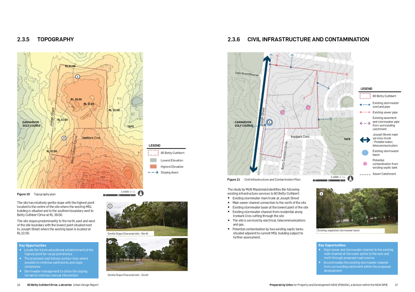
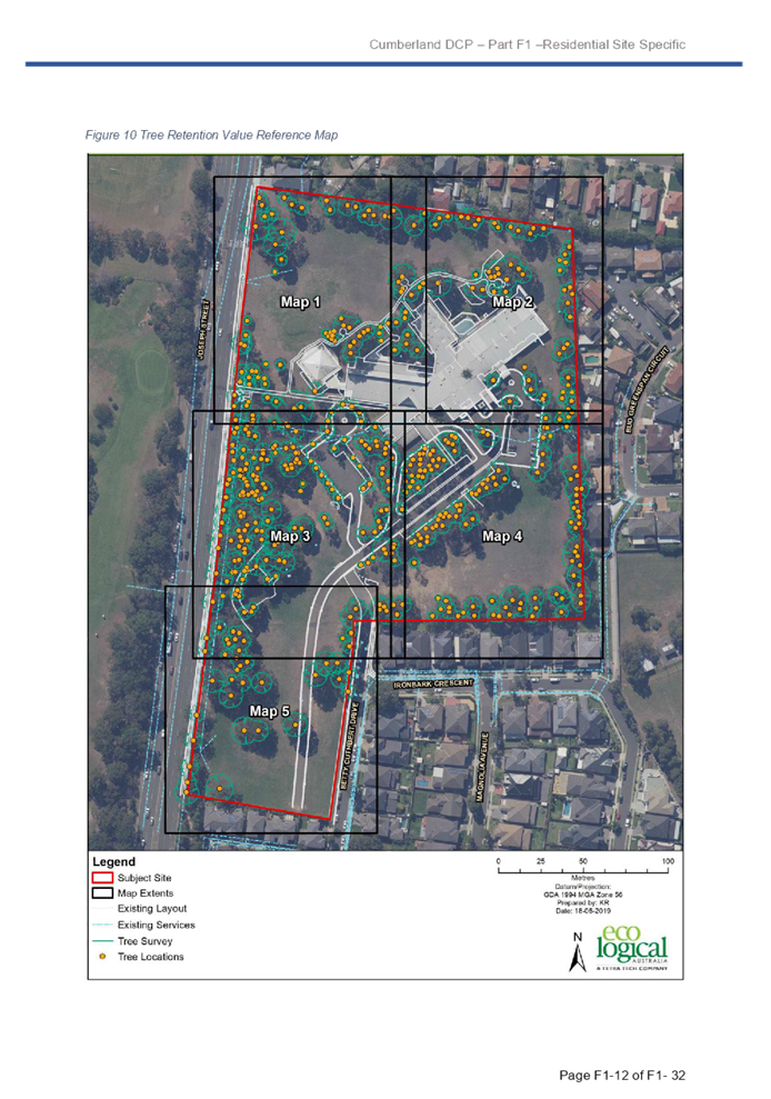
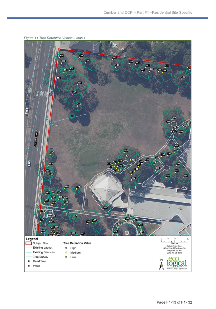
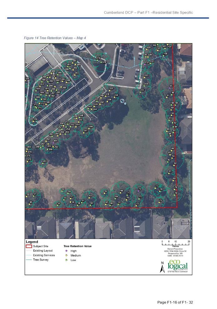
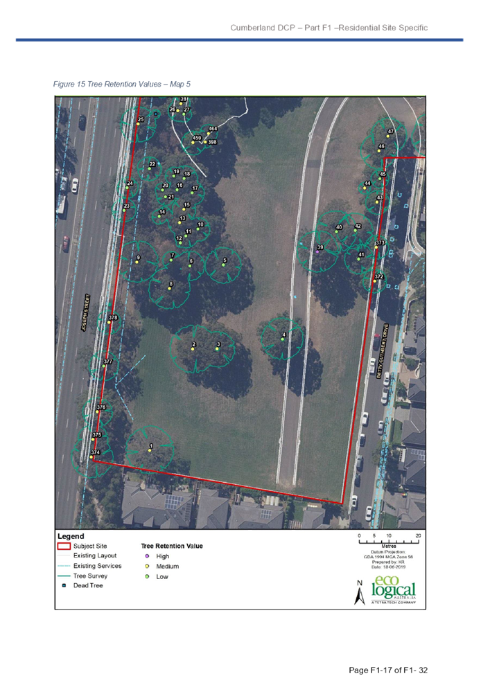
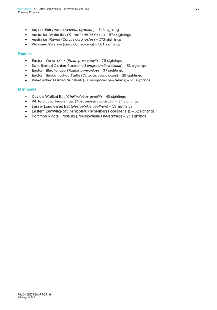
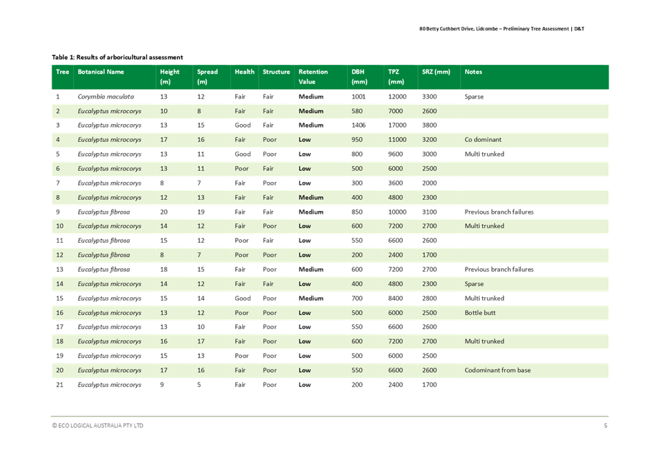
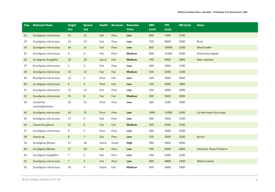
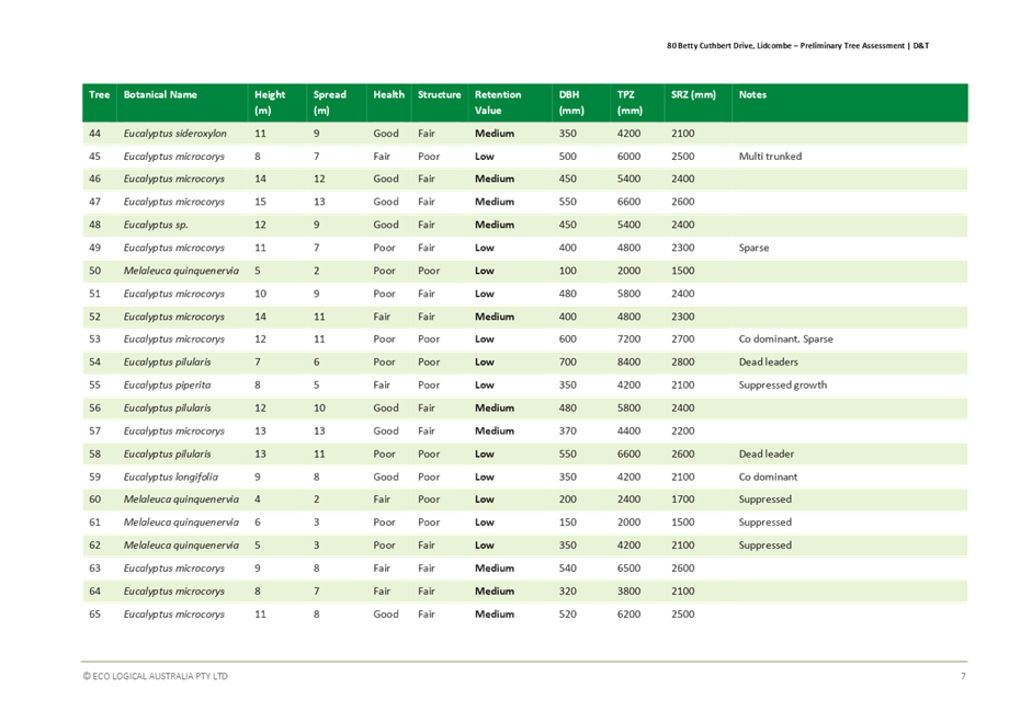
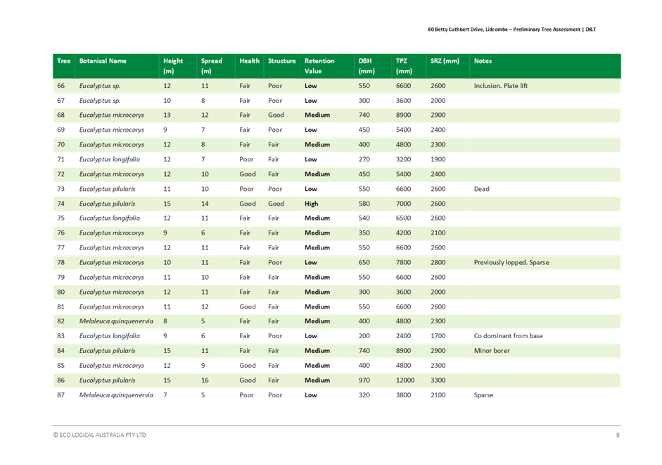
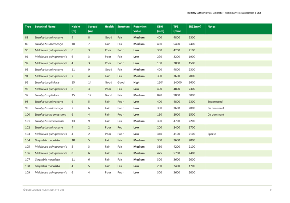
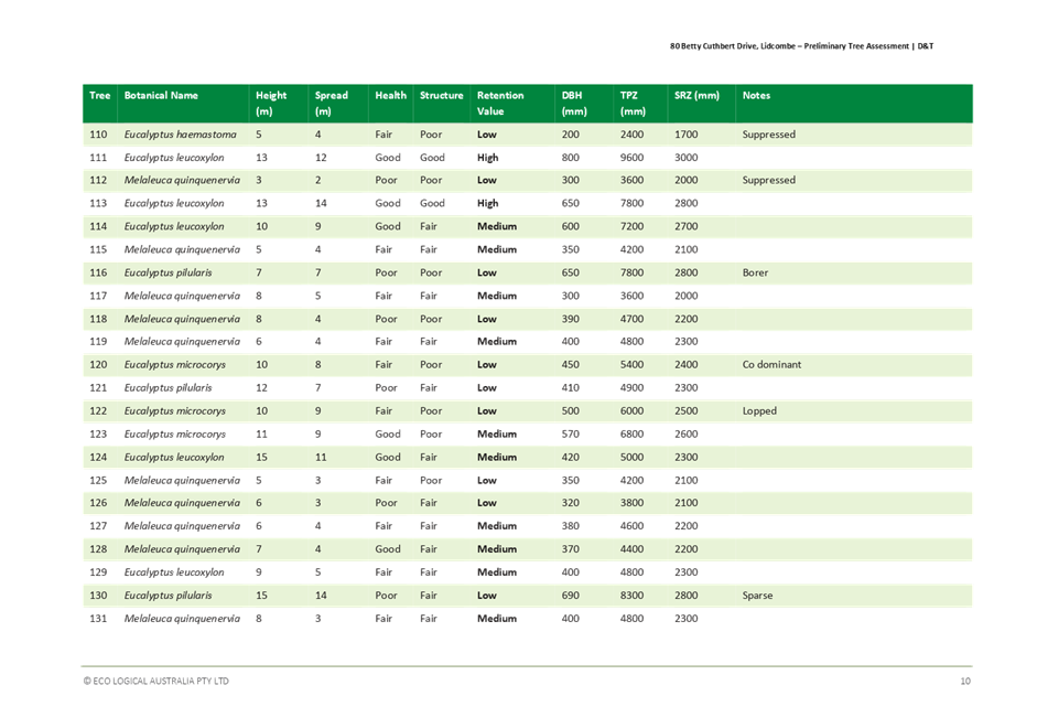
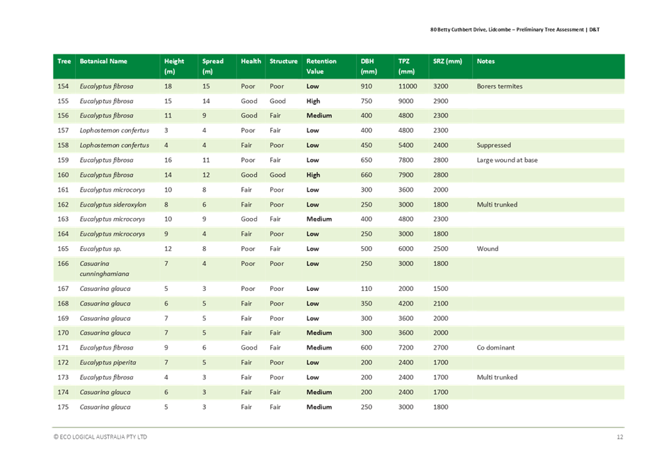
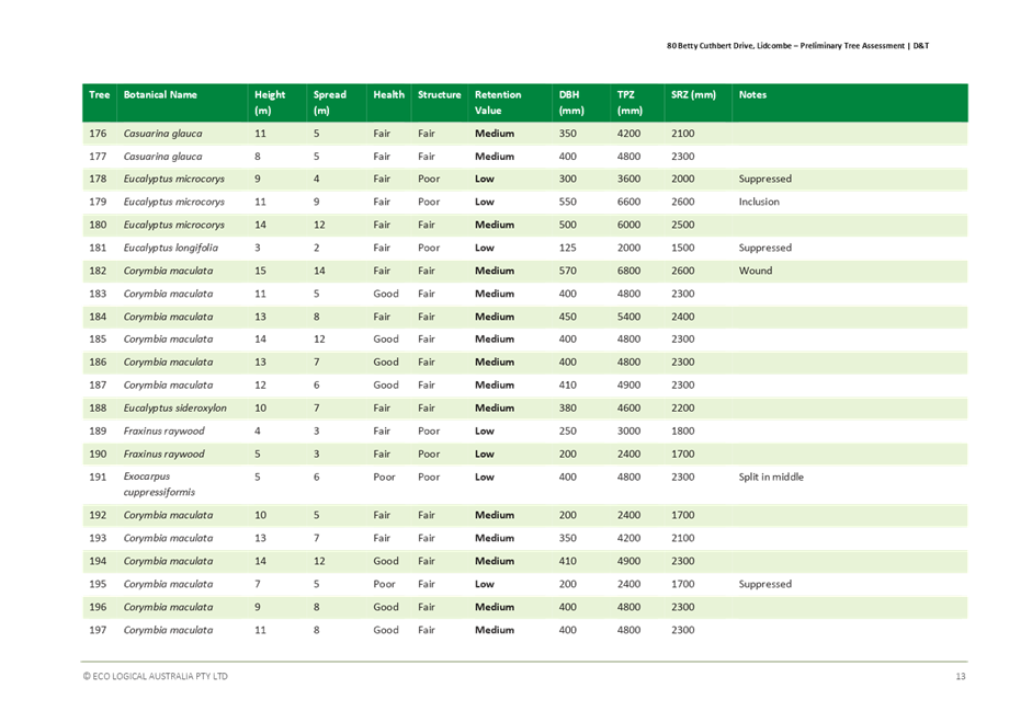
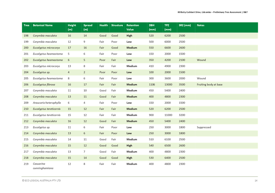
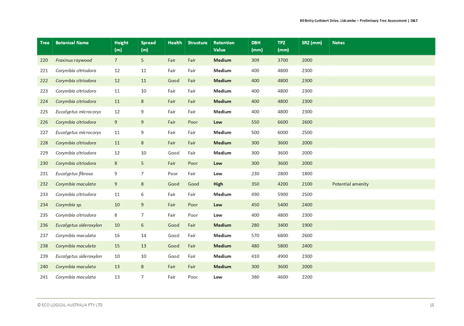
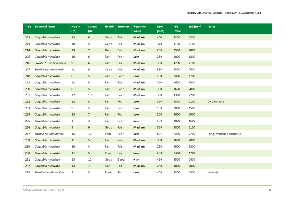
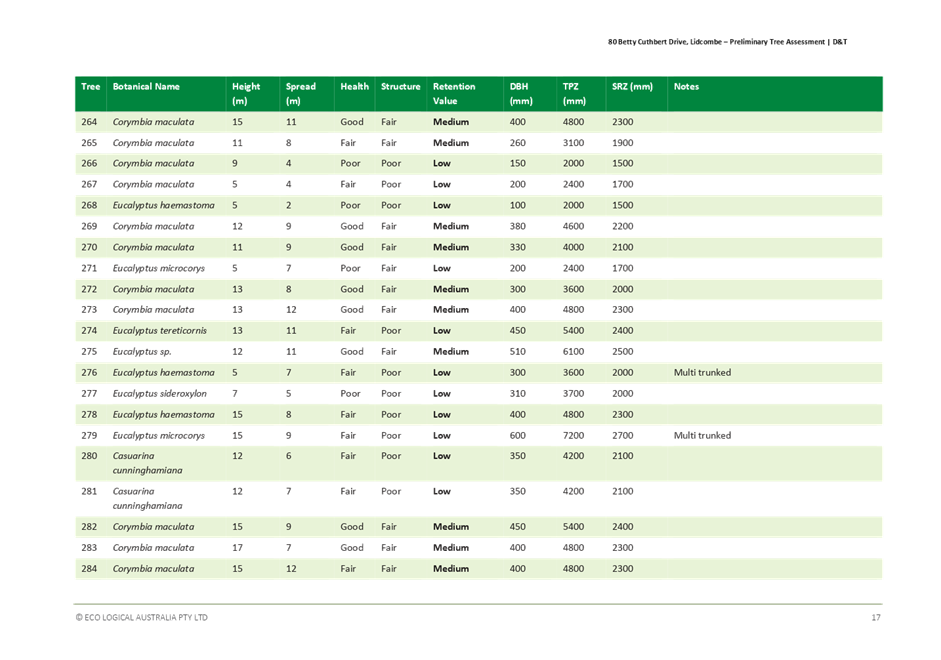
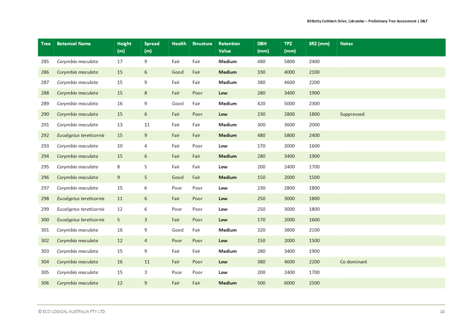
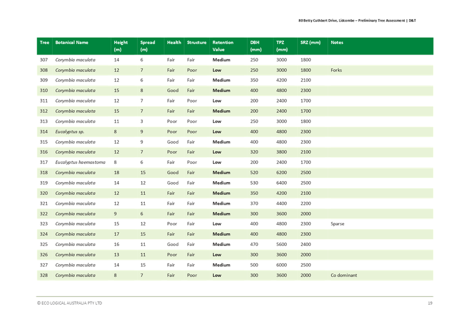
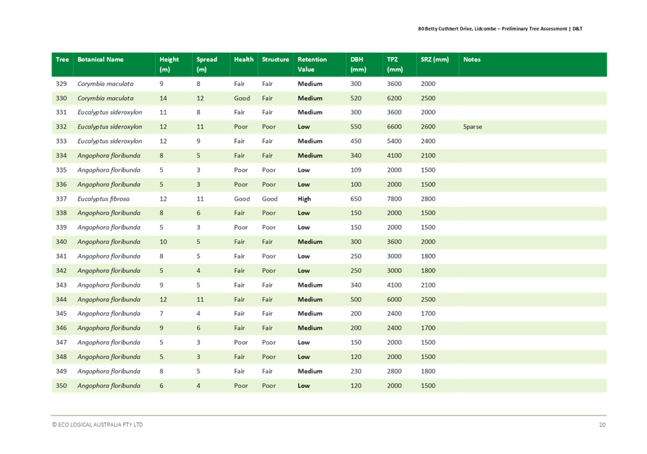
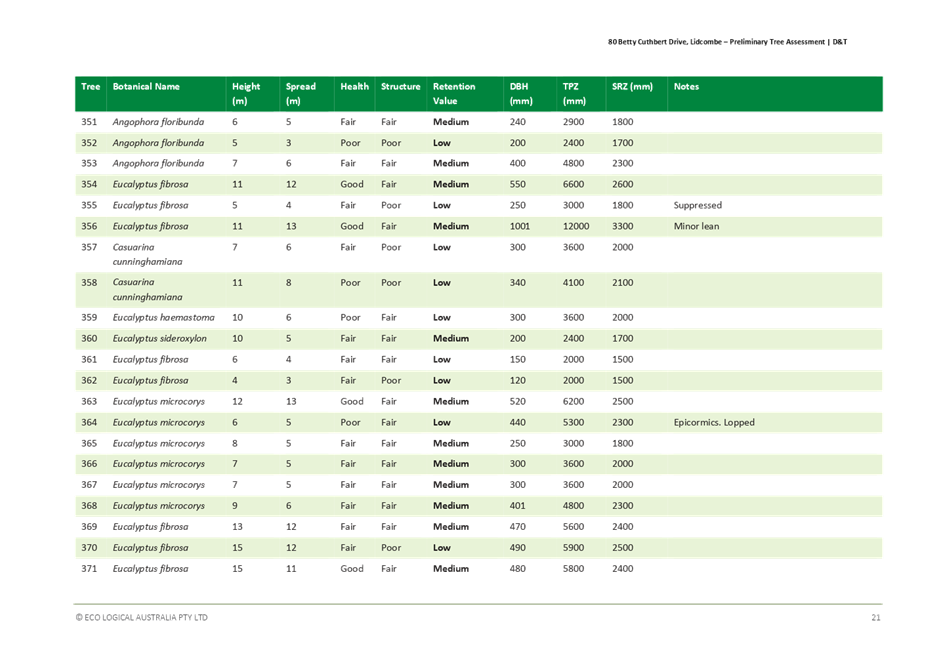
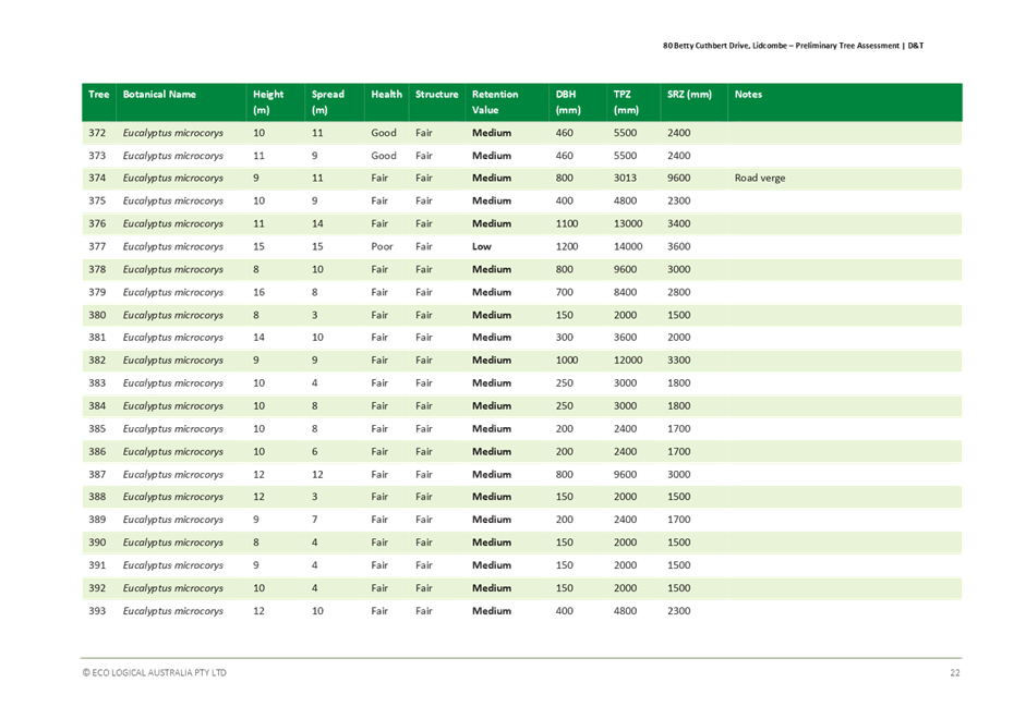
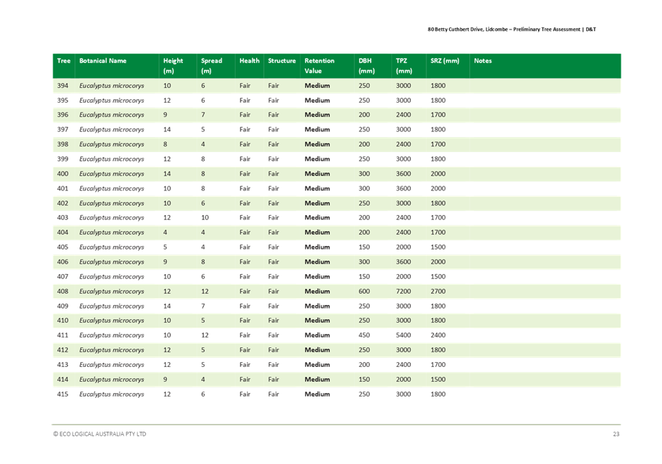
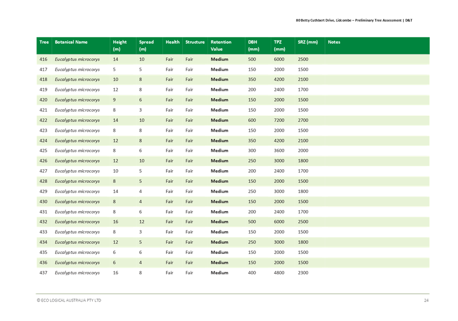
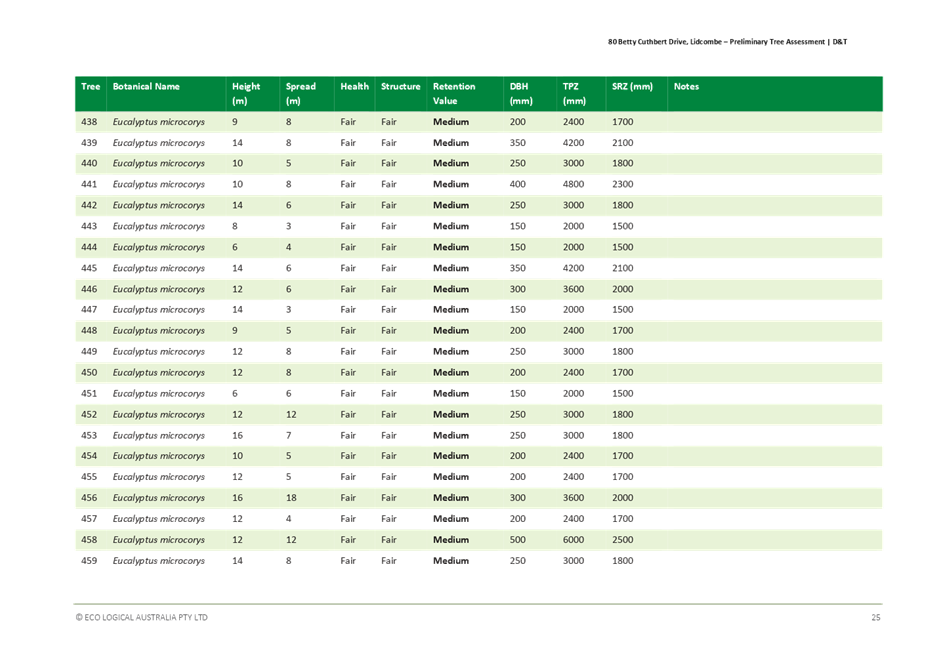
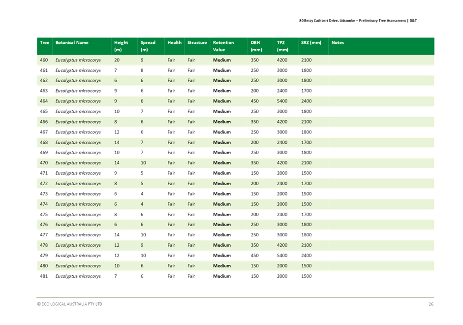
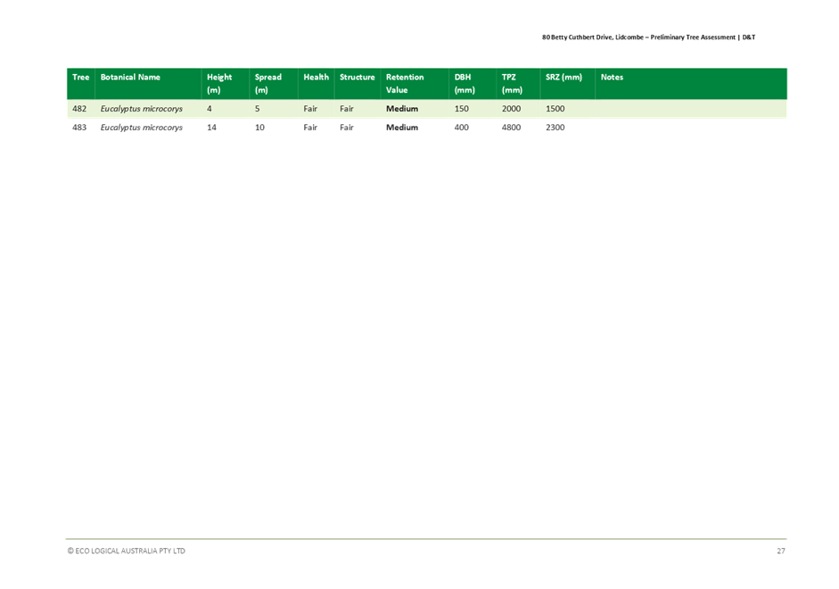
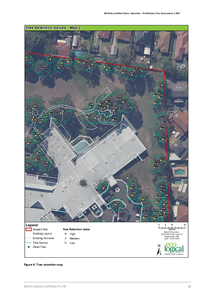
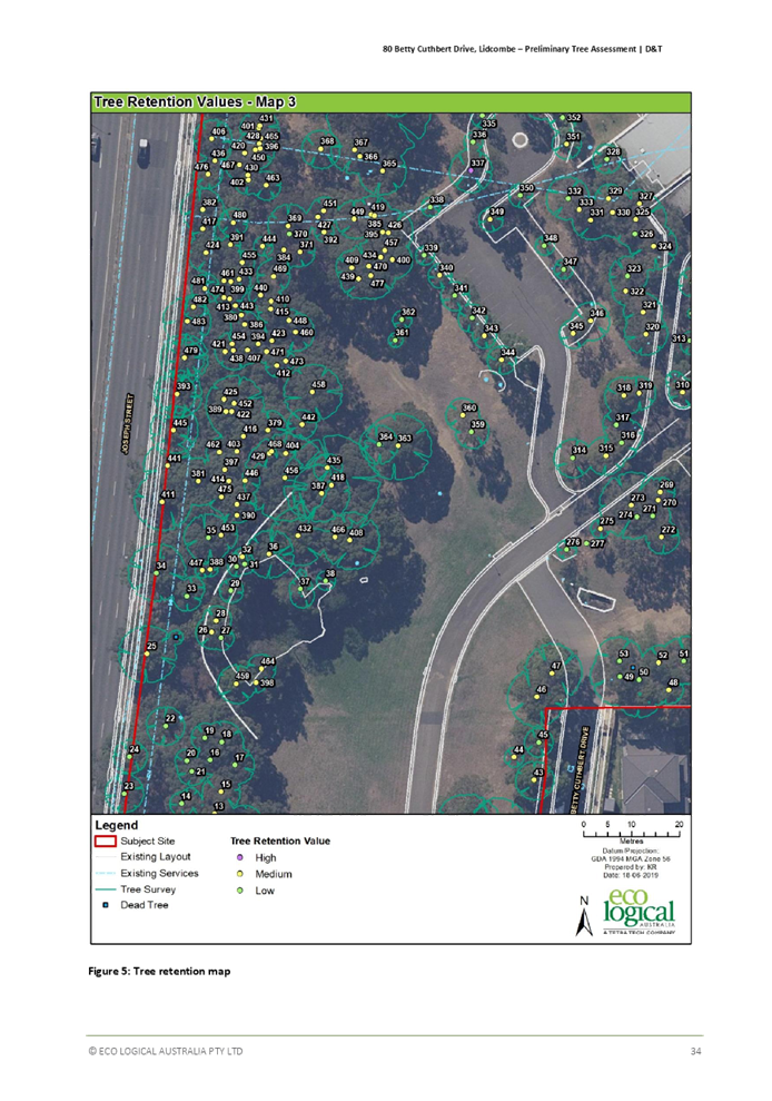
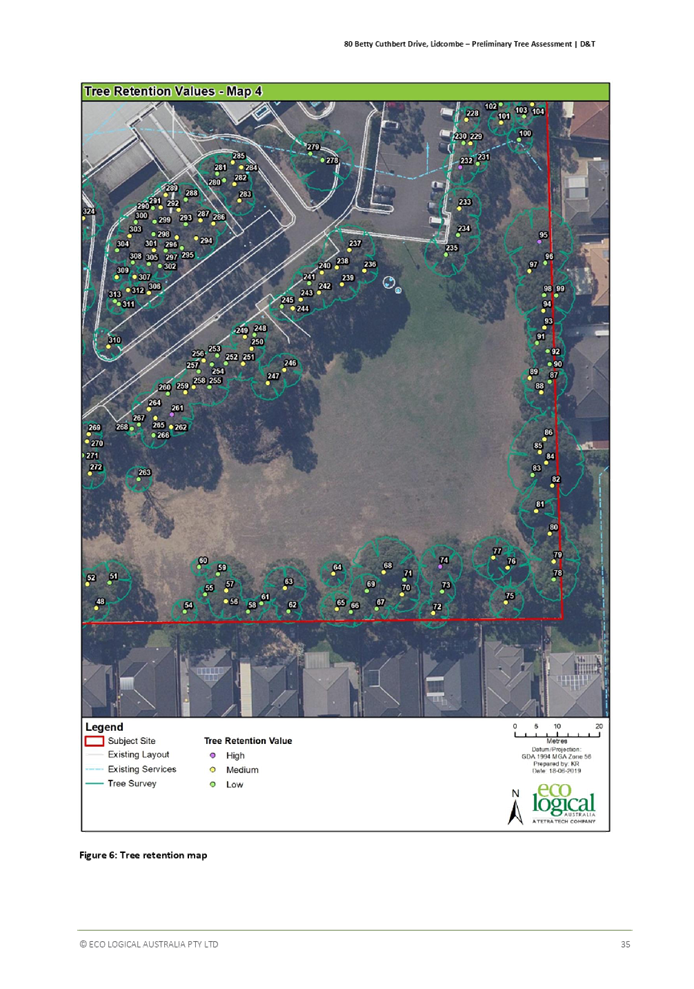
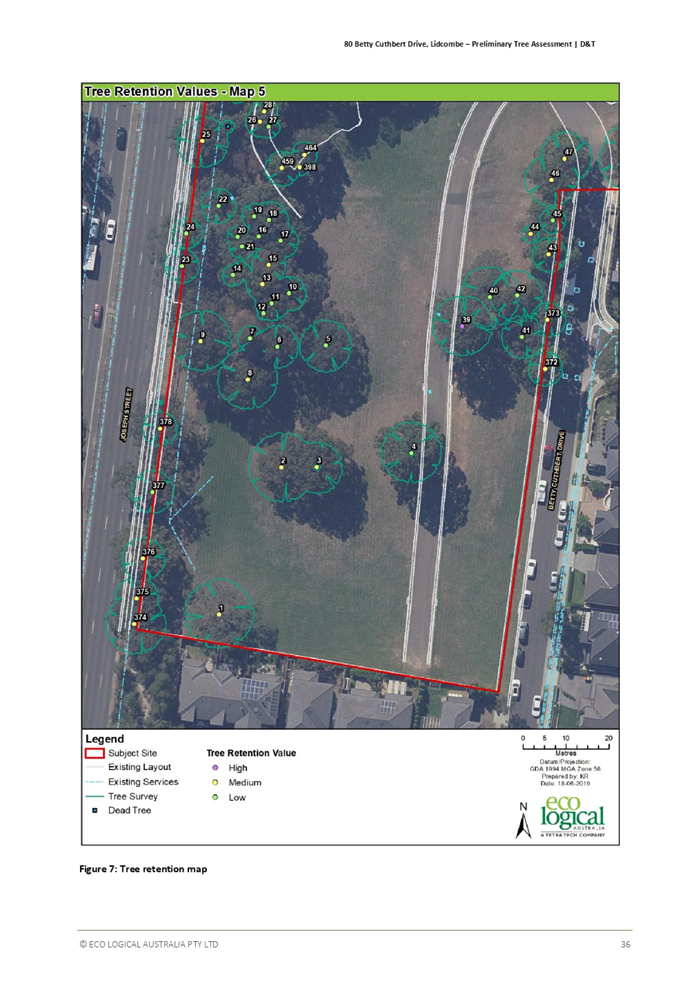
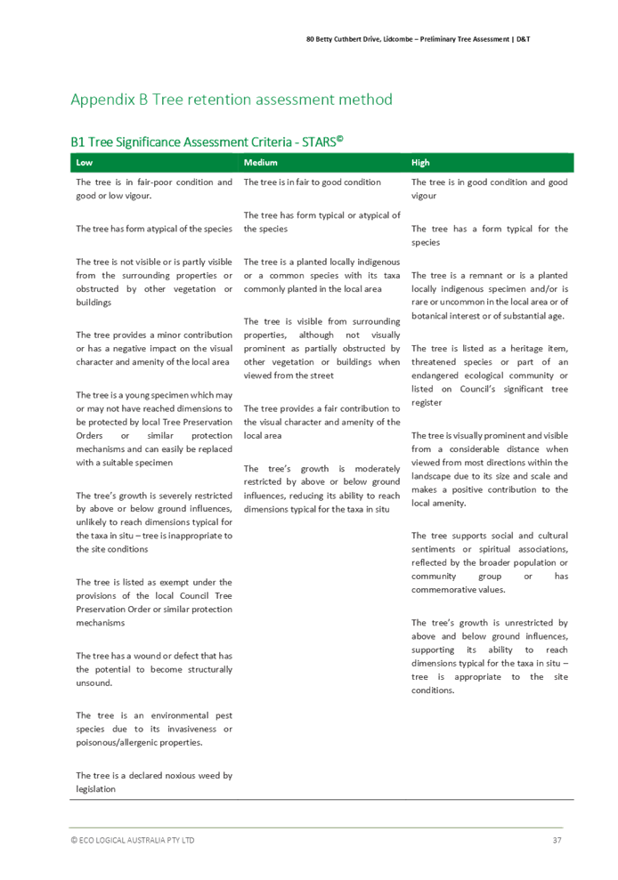
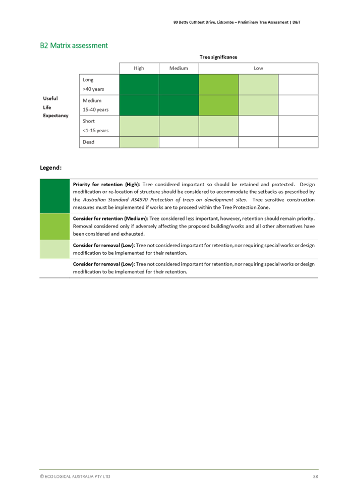
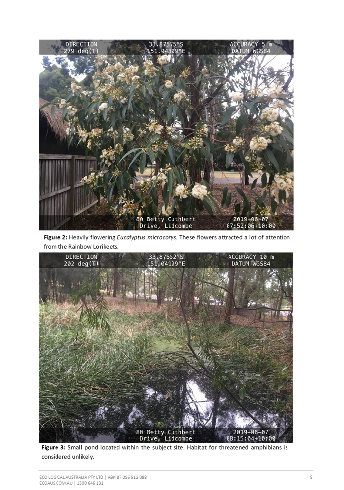
· Trees and vegetation: The site contains 16 trees with high retention value and should be retained and protected wherever possible. All opportunities for retaining these subject trees using design modification and tree sensitive construction techniques should be explored.
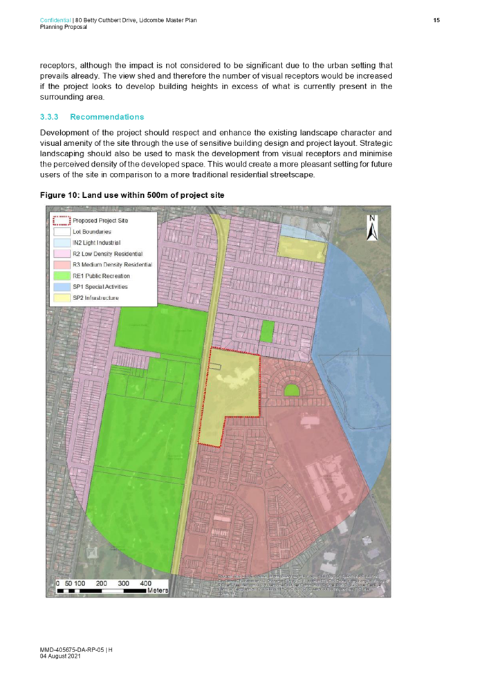
· Landscape and visual: The Project has the potential to impact the visual amenity and landscape character of the local area. If the proposal proceeds past Gateway, a site-specific Development Control Plan will be in place to guide the future development of the site.
· Air quality: The focus of an impact on air quality from the proposed project would be during the construction phase, as the proposed land uses would not involve significant air emissions.
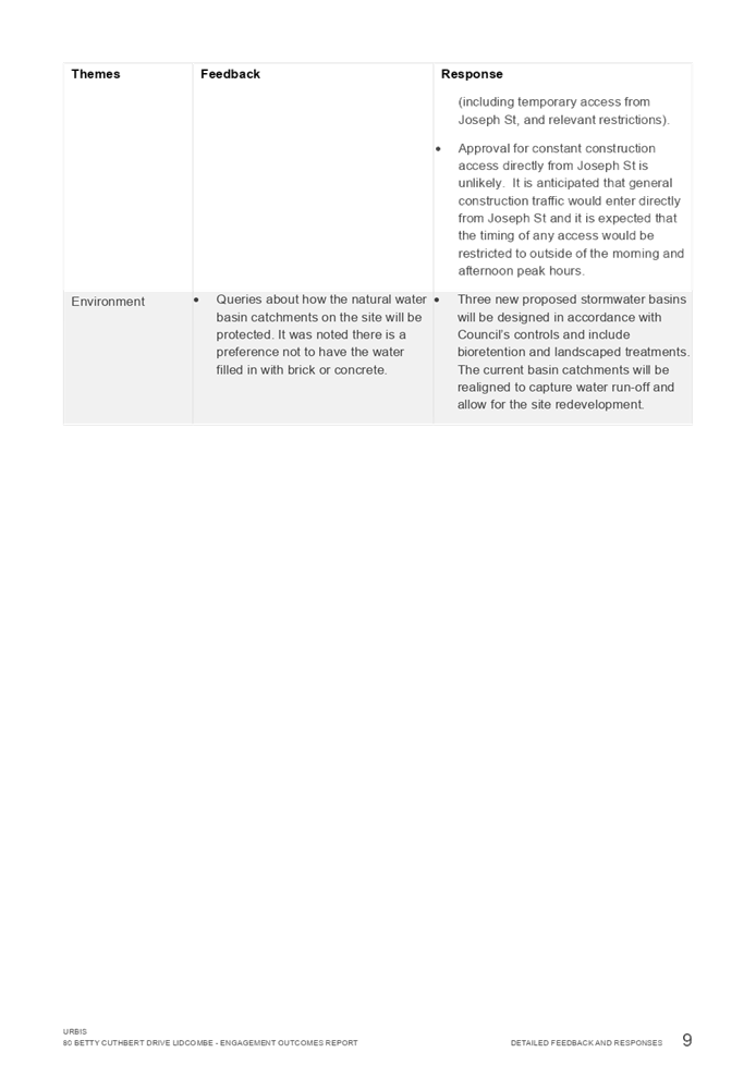
· Surface and groundwater: Due to proposed land uses, the project will likely only interact with the ground water through a pollution pathway during construction.
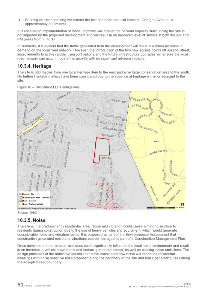
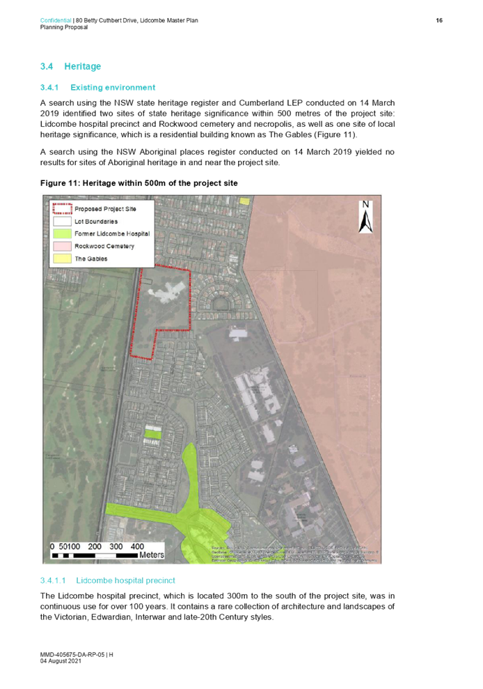
· Heritage: The site does not contain a heritage item, nor are there any heritage items immediately adjacent to the Site.
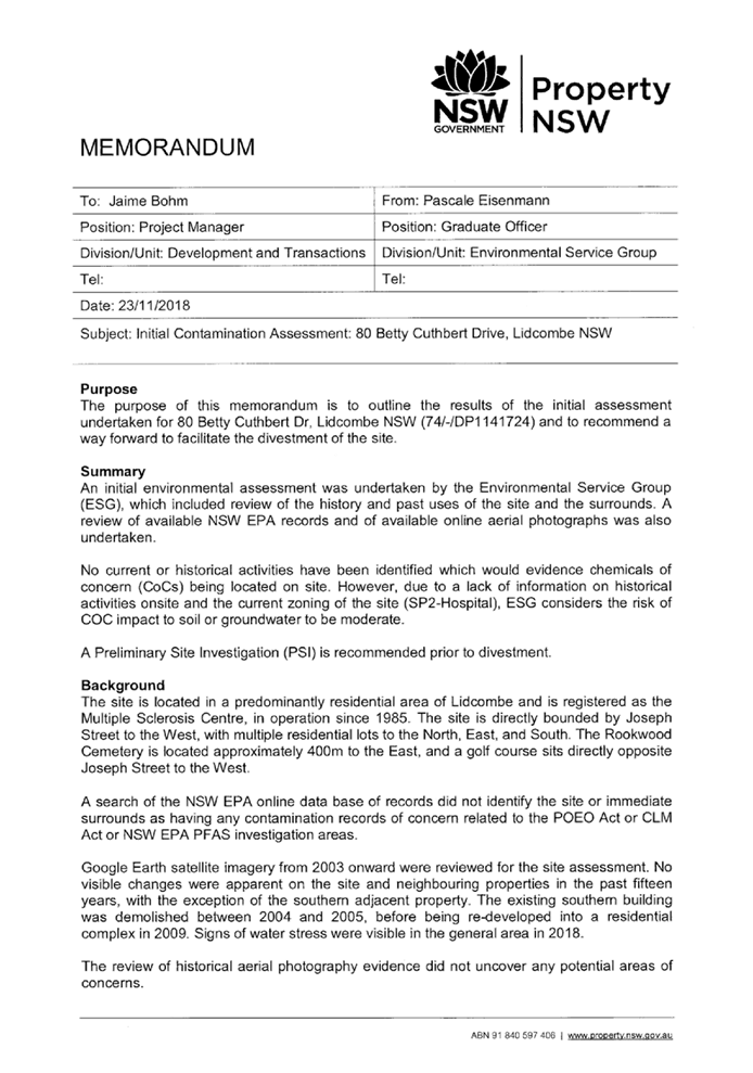
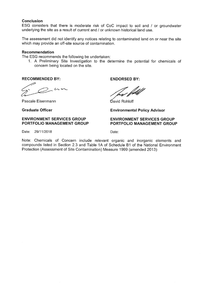
· Contamination and Acid Sulphate Soils: The site was found to have a low risk of contamination; however, further investigations are recommended before the site is redeveloped.
The above matters will be further considered at development application stage should the proposal proceed to Gateway and finalisation.
Next Steps
Following review of the planning proposal by Council officers and advice provided by the Cumberland Local Planning Panel, the planning proposal is provided for consideration by Council. It is recommended that Council endorse the planning proposal and that this be forwarded to the Department of Planning and Environment for a Gateway Determination. It is also recommended that Council endorse the draft site specific Development Control Plan.
Should Council support the proposal and a Gateway Determination is provided by the Department of Planning and Environment, the planning proposal and site-specific Development Control Plan will be exhibited concurrently. A further report will then be provided to Council.
Community Engagement
Both the Proponent and Council officers have carried out early consultation on the proposal, as outlined in this report. Further statutory consultation will be carried out by Council officers if the proposal proceeds past Gateway.
Policy Implications
Policy implications are outlined in the main body of this report.
Risk Implications
There are no risk implications for Council associated with this report.
Financial Implications
It is noted that the Proponent has elected not to enter into a Planning Agreement with Council on the basis that the proposal will deliver a range of public benefits. On this basis, there are no financial implications for Council.
CONCLUSION
The Planning Proposal Request for 80 Betty Cuthbert Drive, Lidcombe, is consistent with the strategic planning framework and policy context and will deliver a wide range of benefits, including a new MSL facility, educational establishment, and diverse housing. It is recommended that the planning proposal and site-specific Development Control Plan is endorsed, and that the planning proposal is forwarded to the Department of Planning and Environment for a Gateway Determination.
Attachments
3. Draft Site Specific Development Control Plan
4. Department of Education Letter
5. Assessment of Public Benefits (confidential)
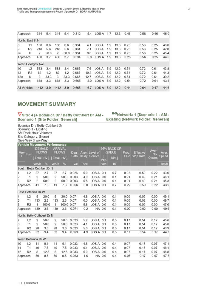
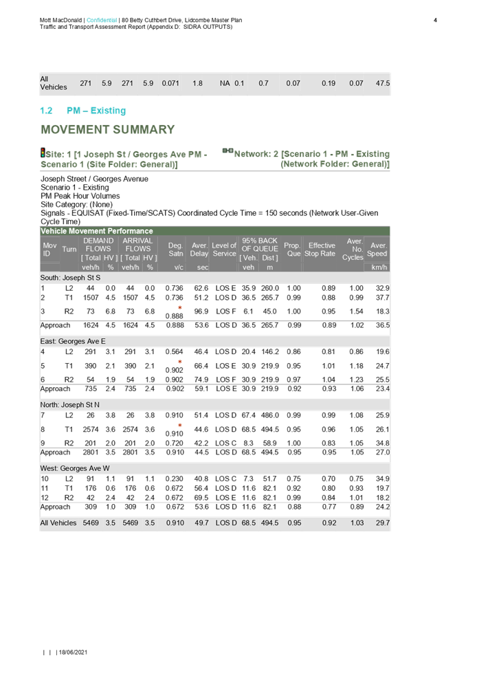
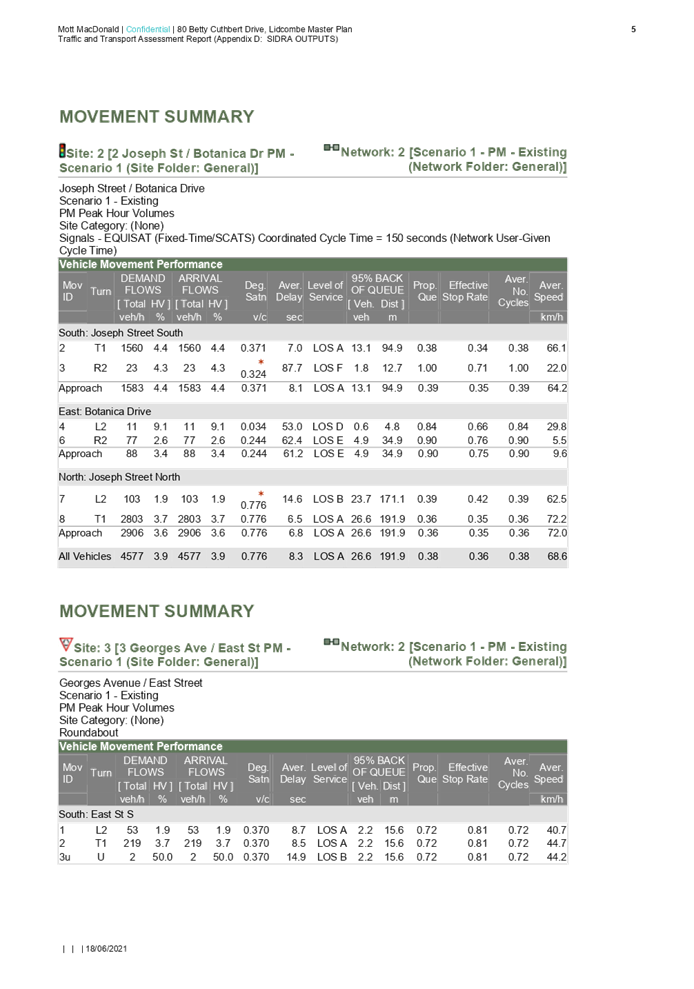
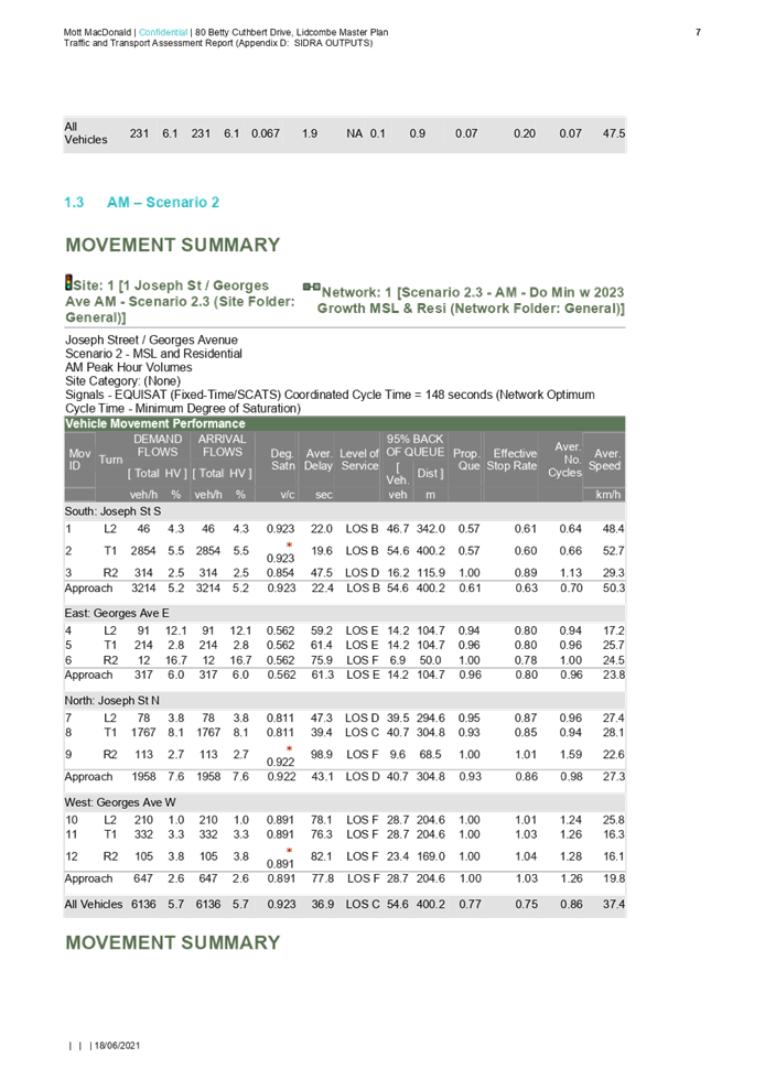
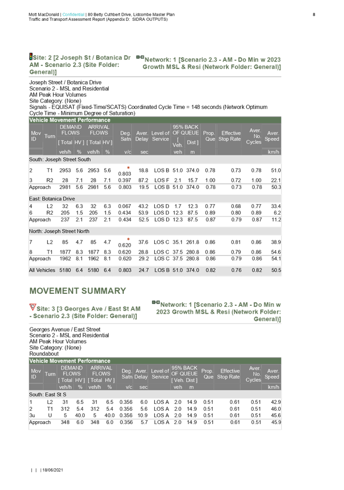
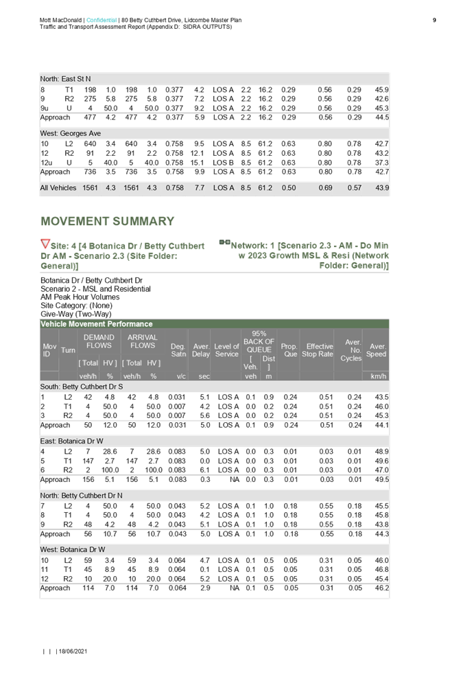
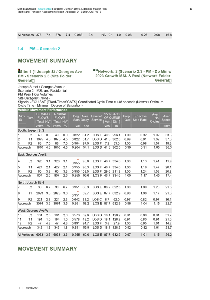
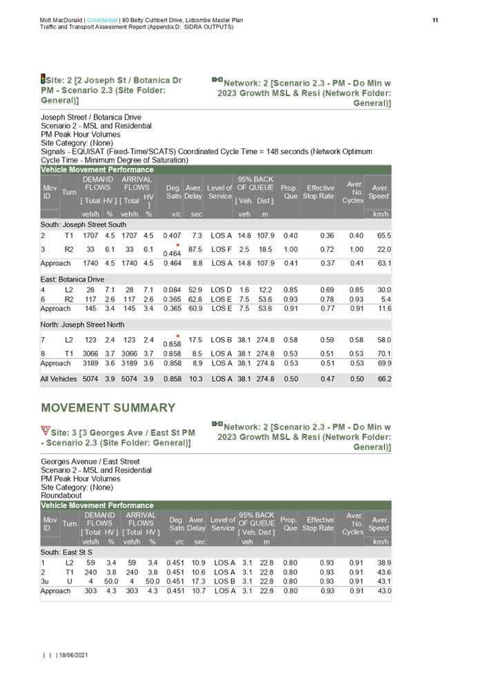
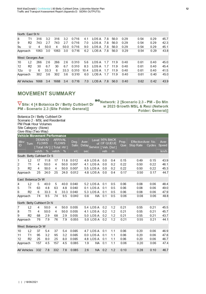
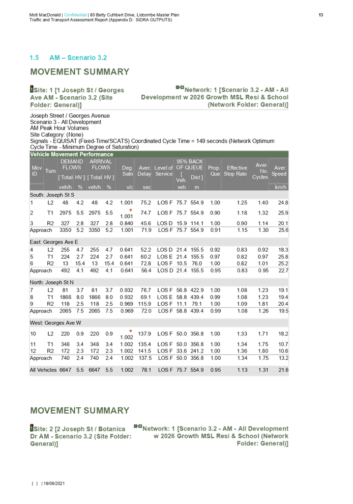
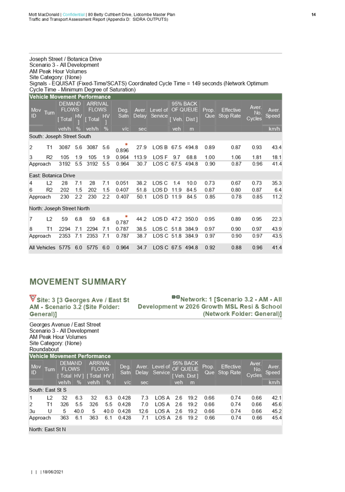
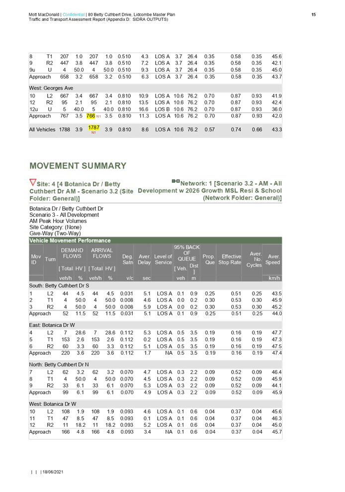
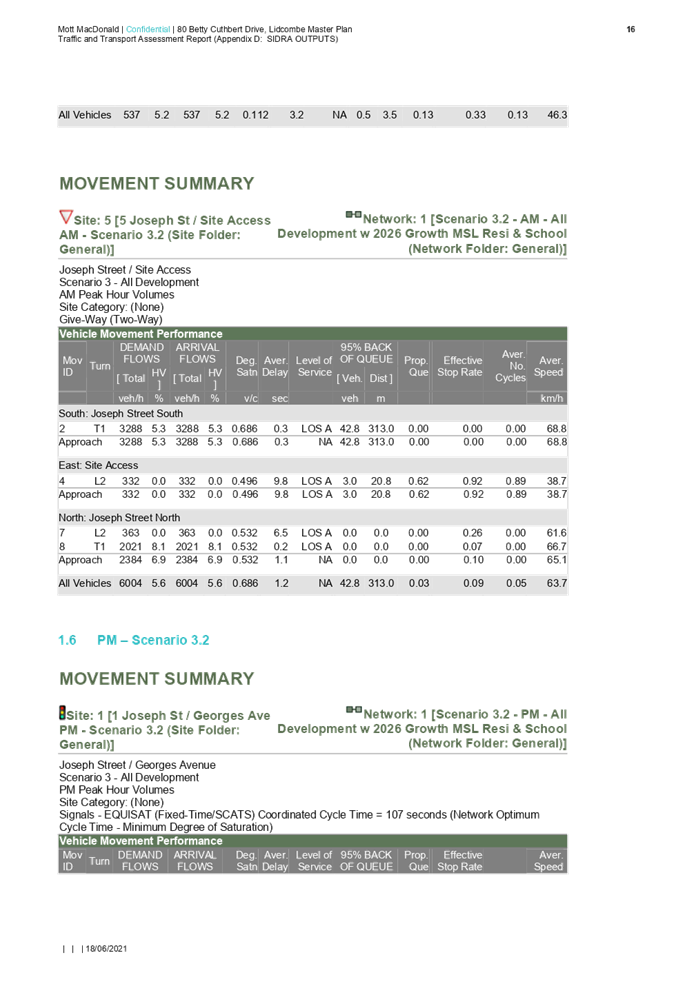
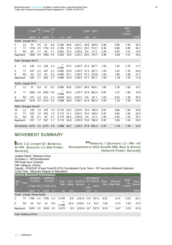
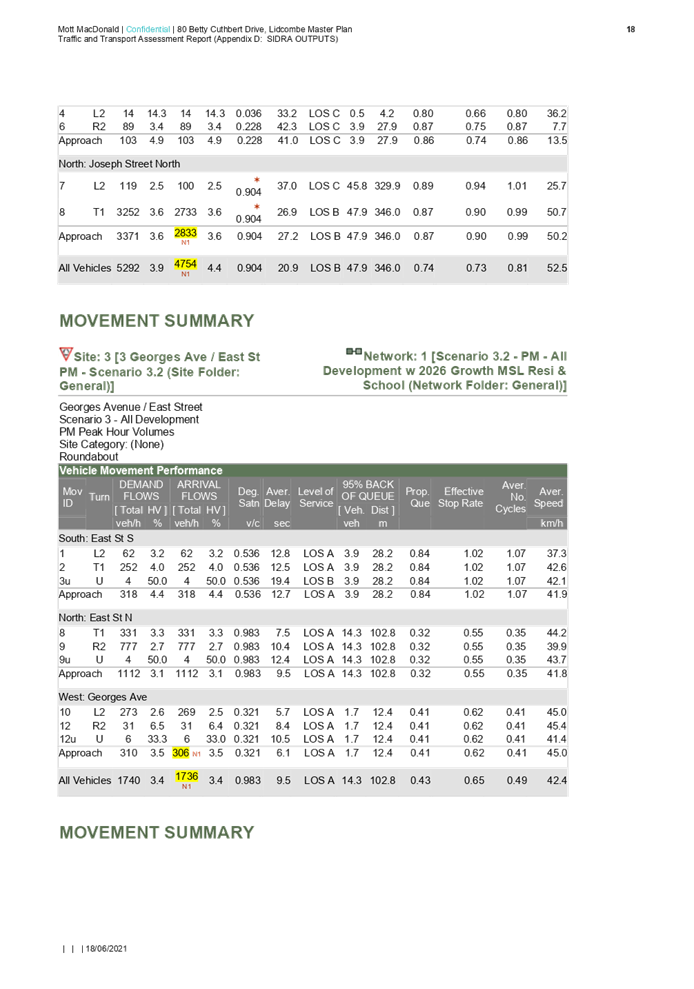
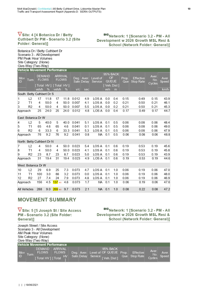
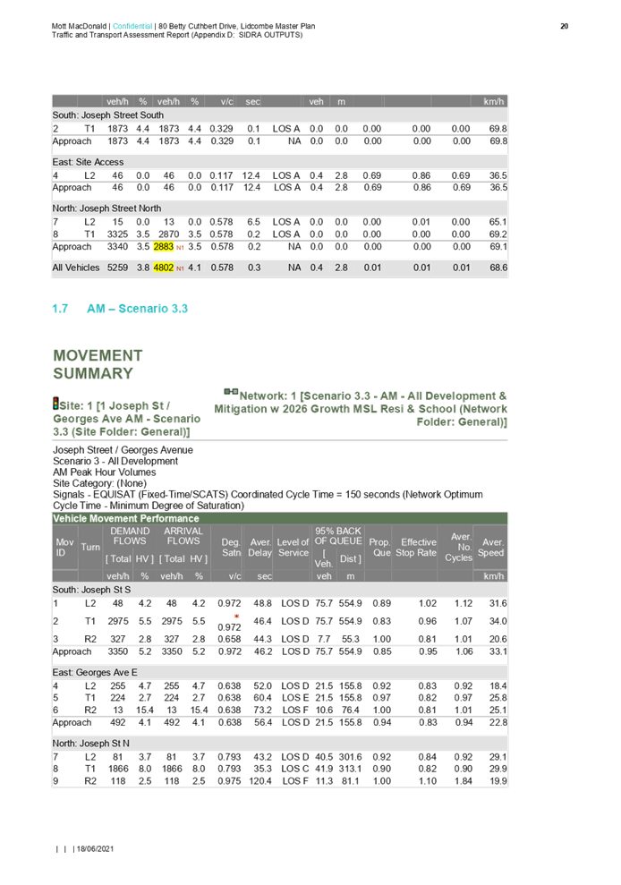
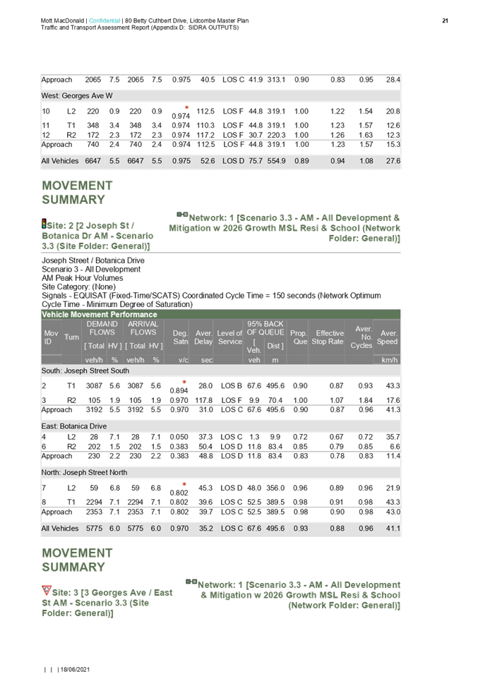
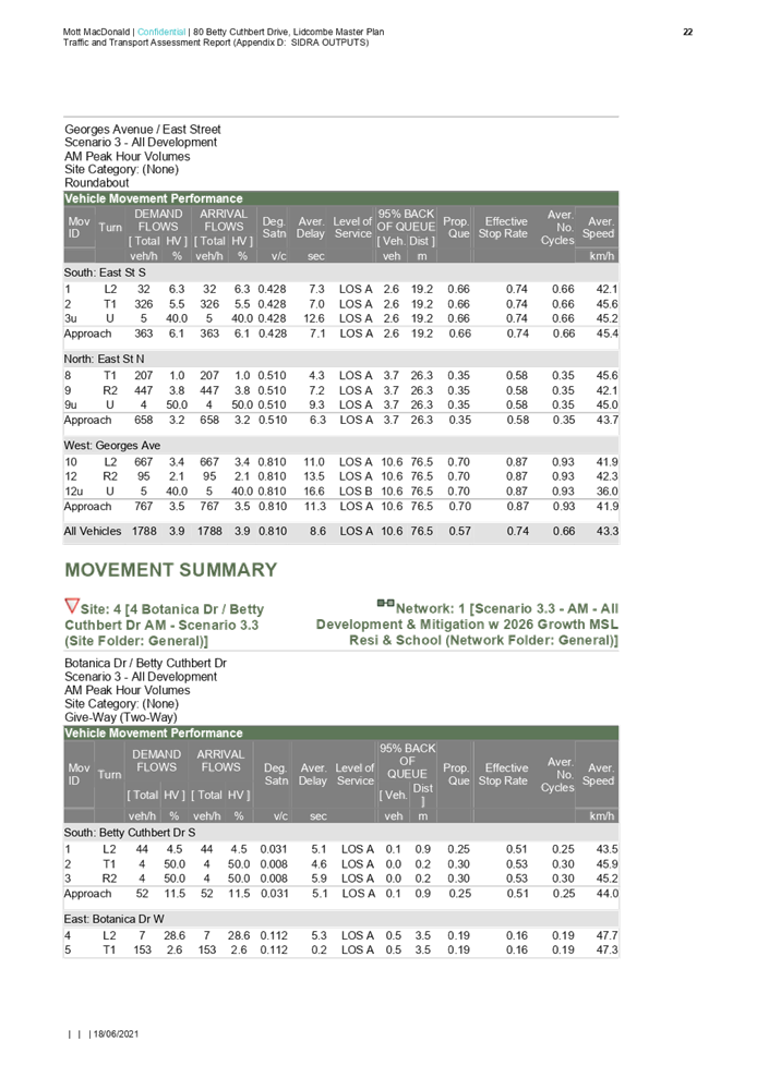
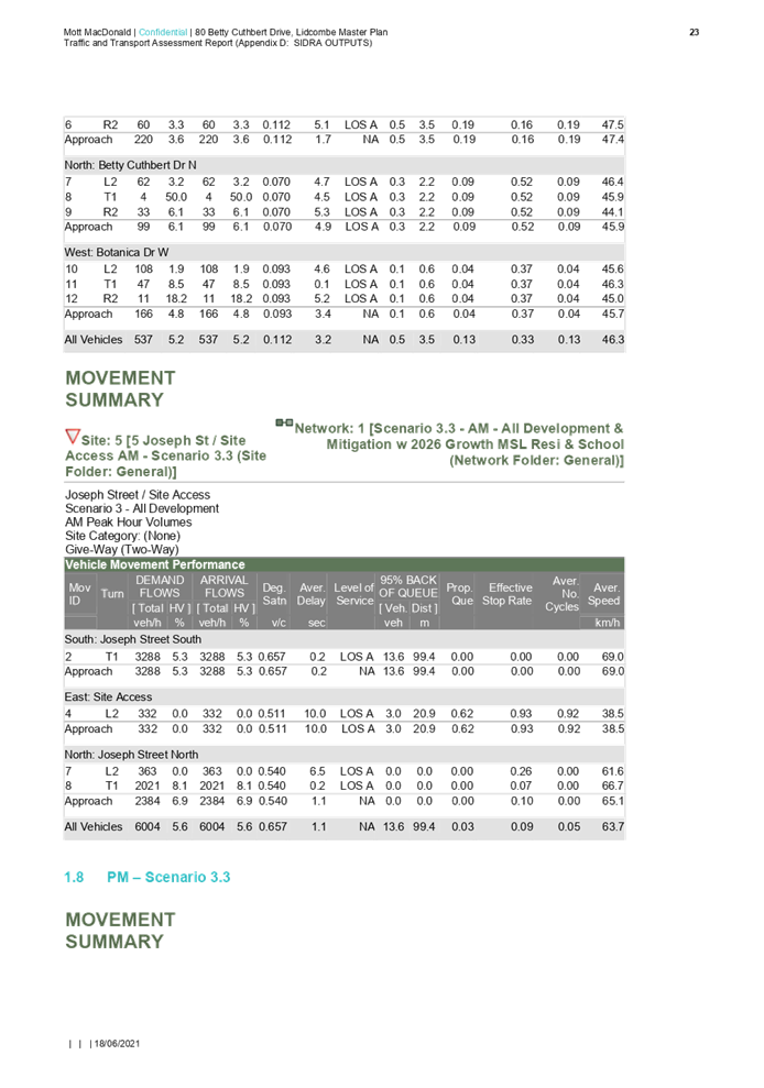
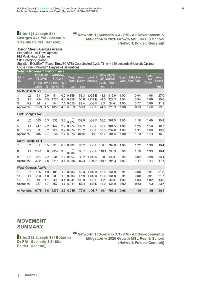
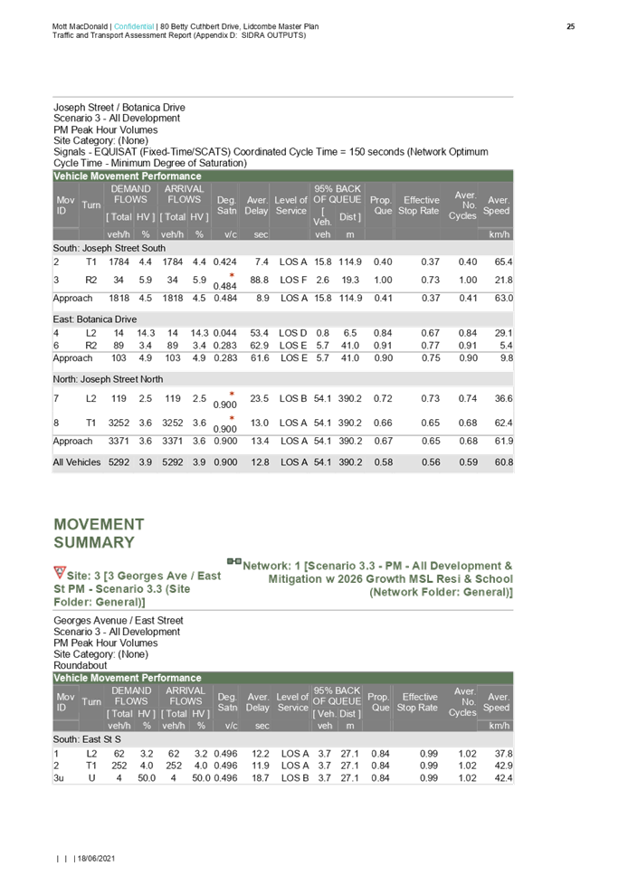
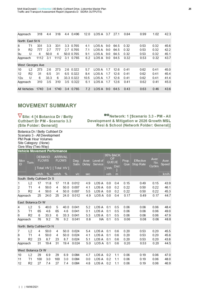
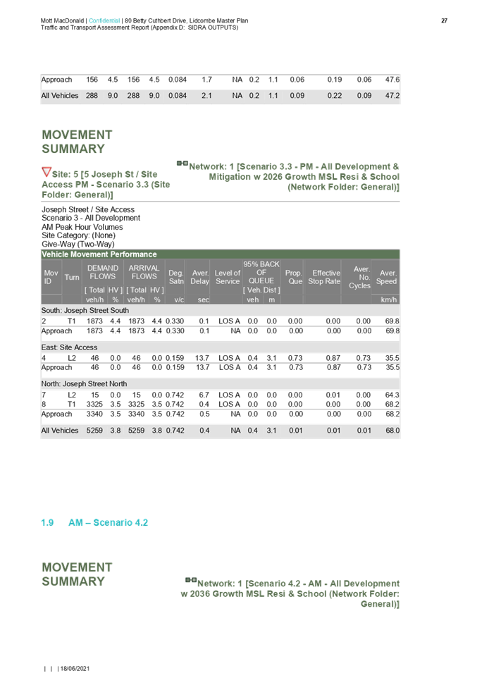
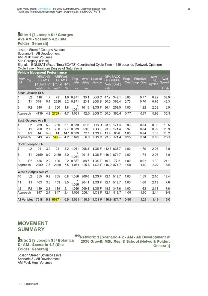
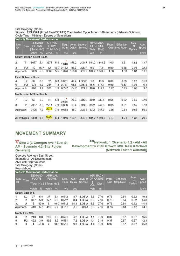
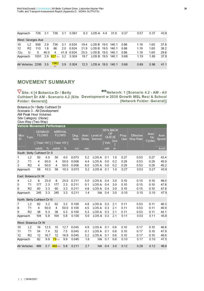
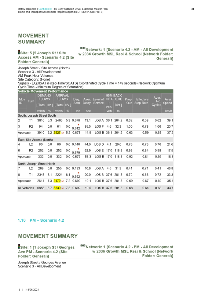
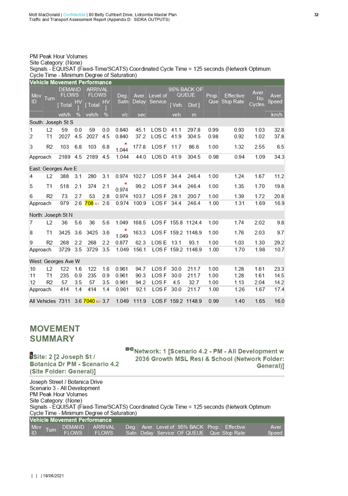
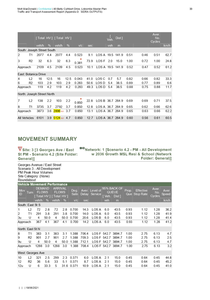
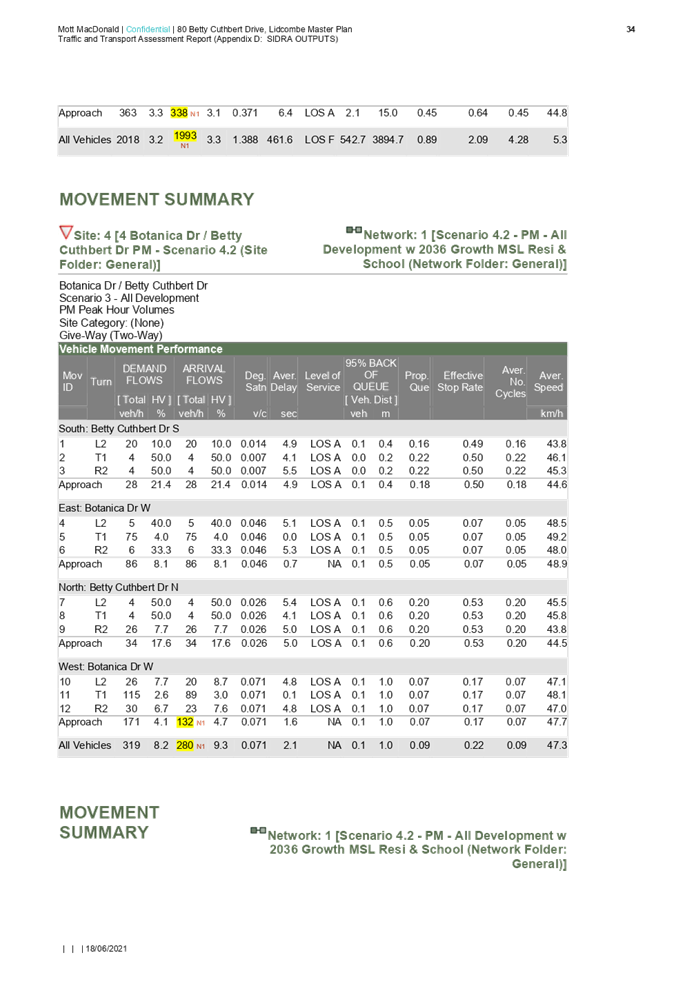
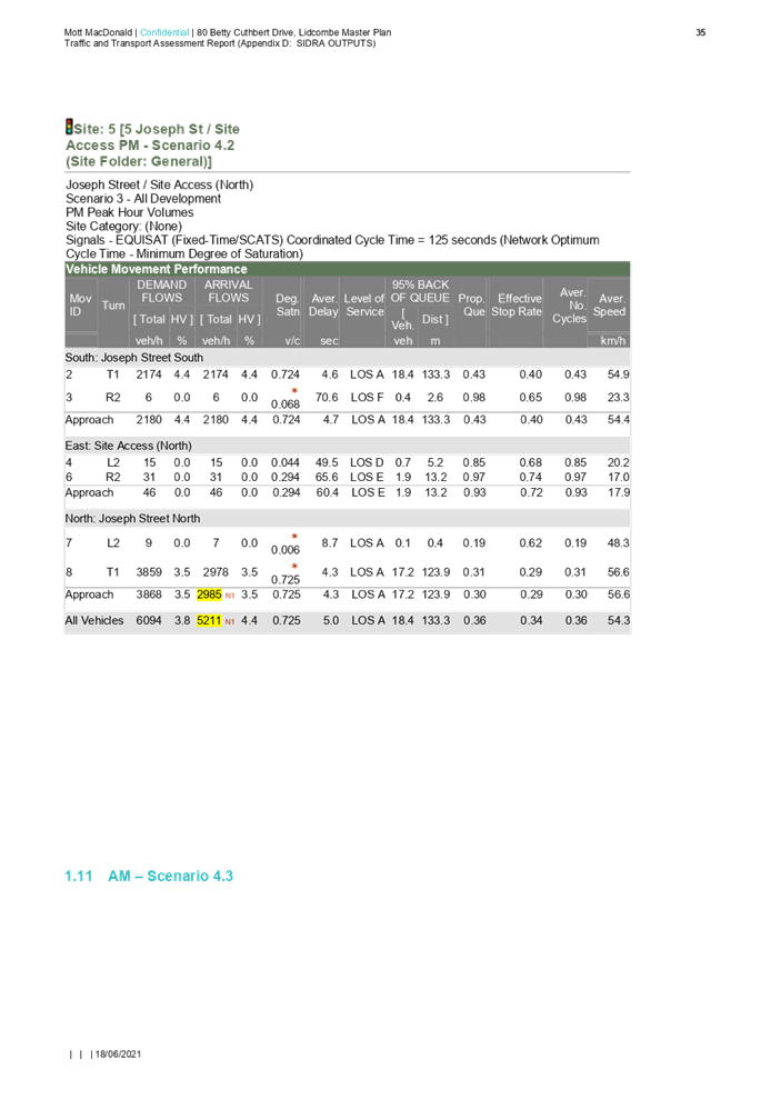
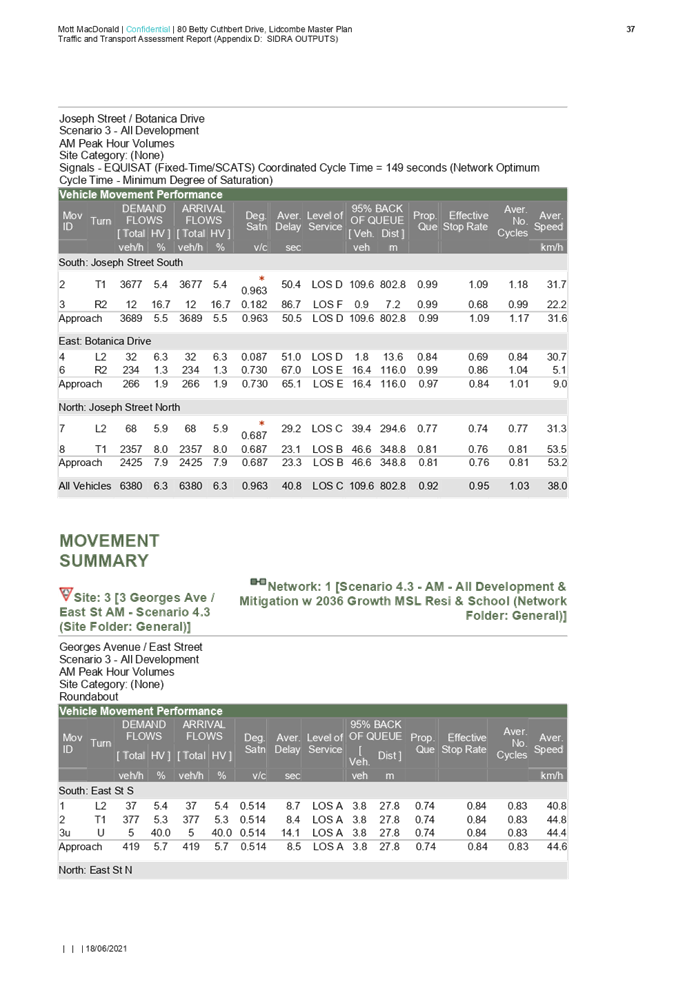
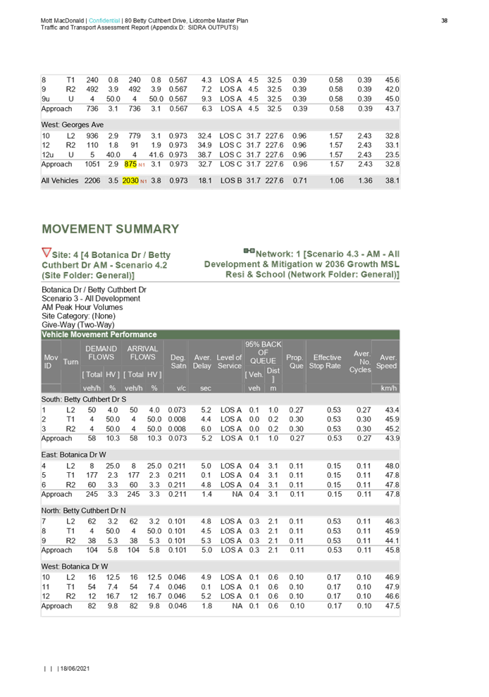
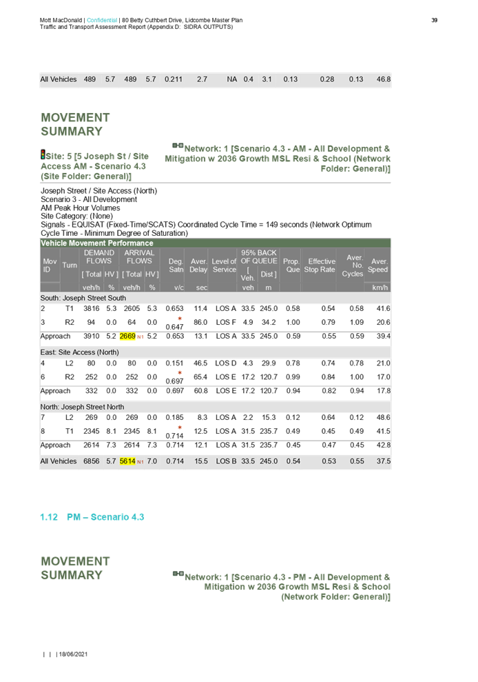
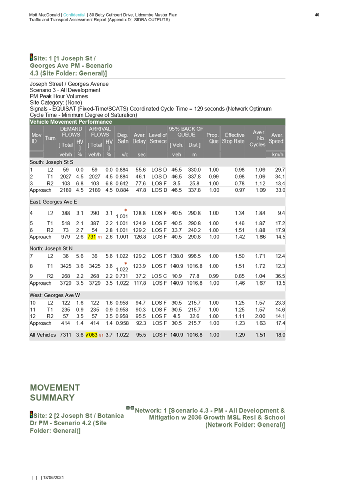
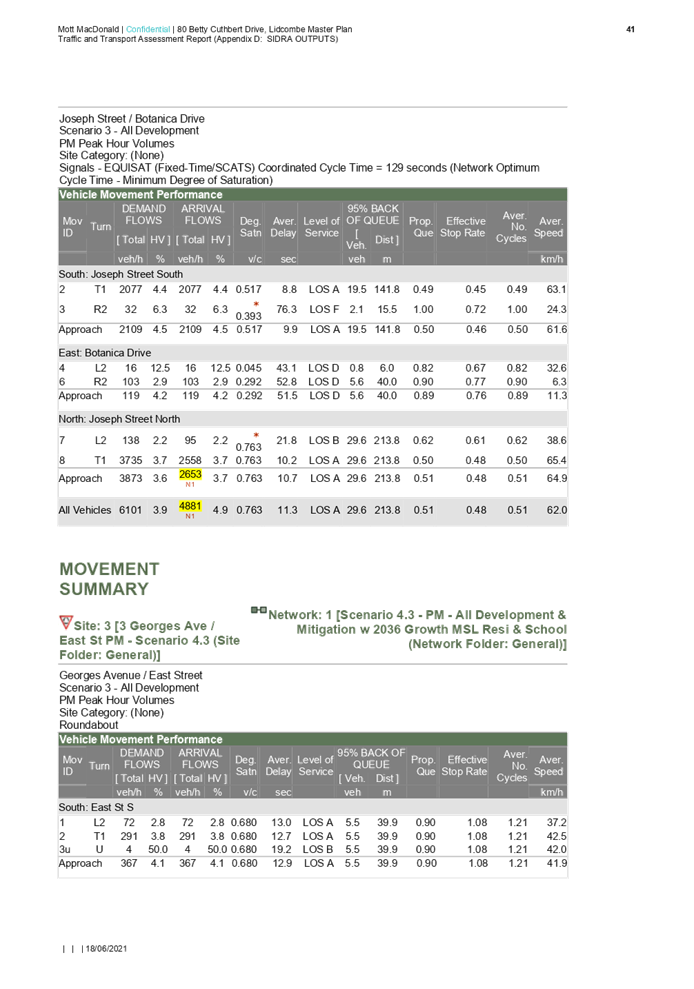
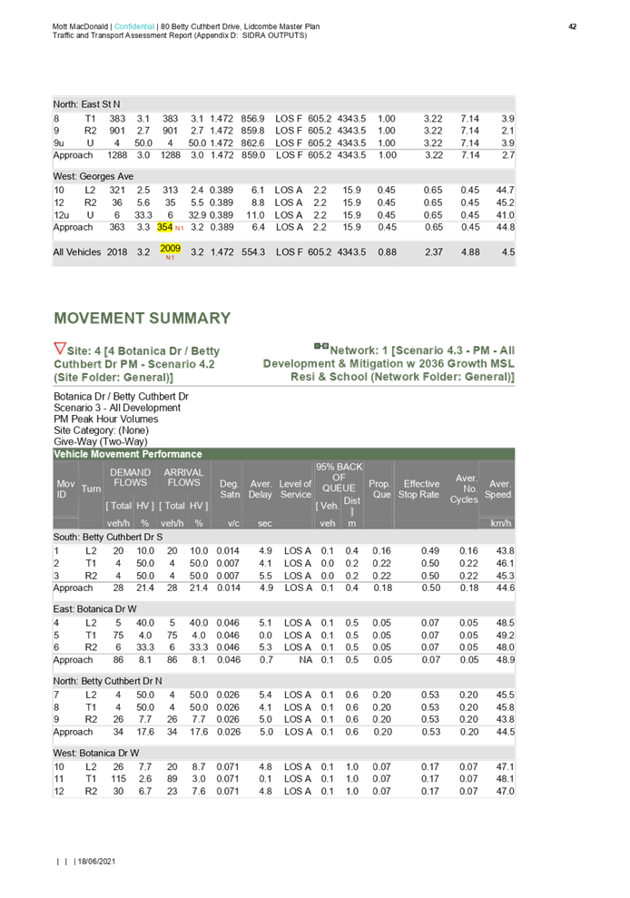
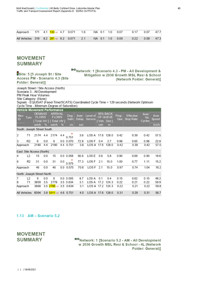
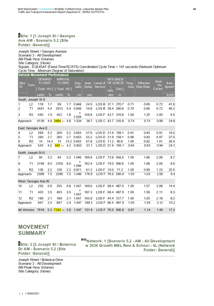
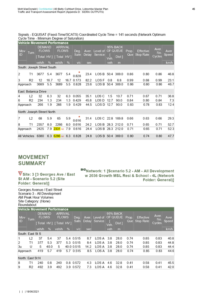
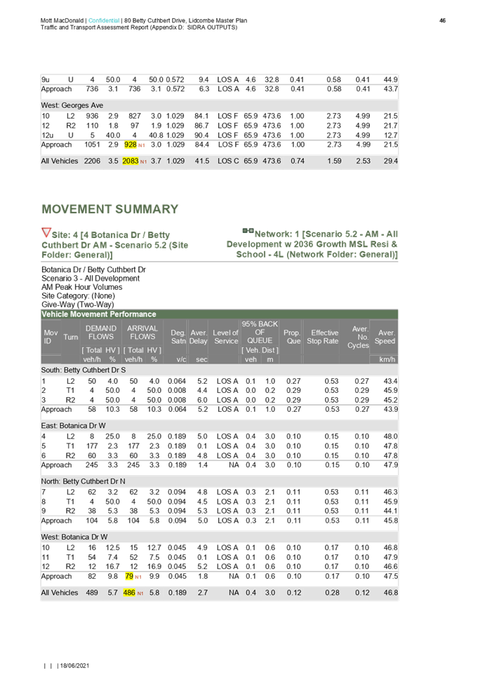
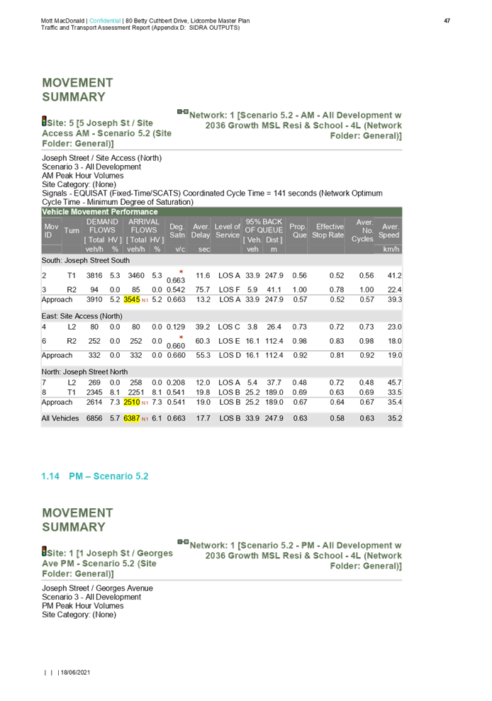
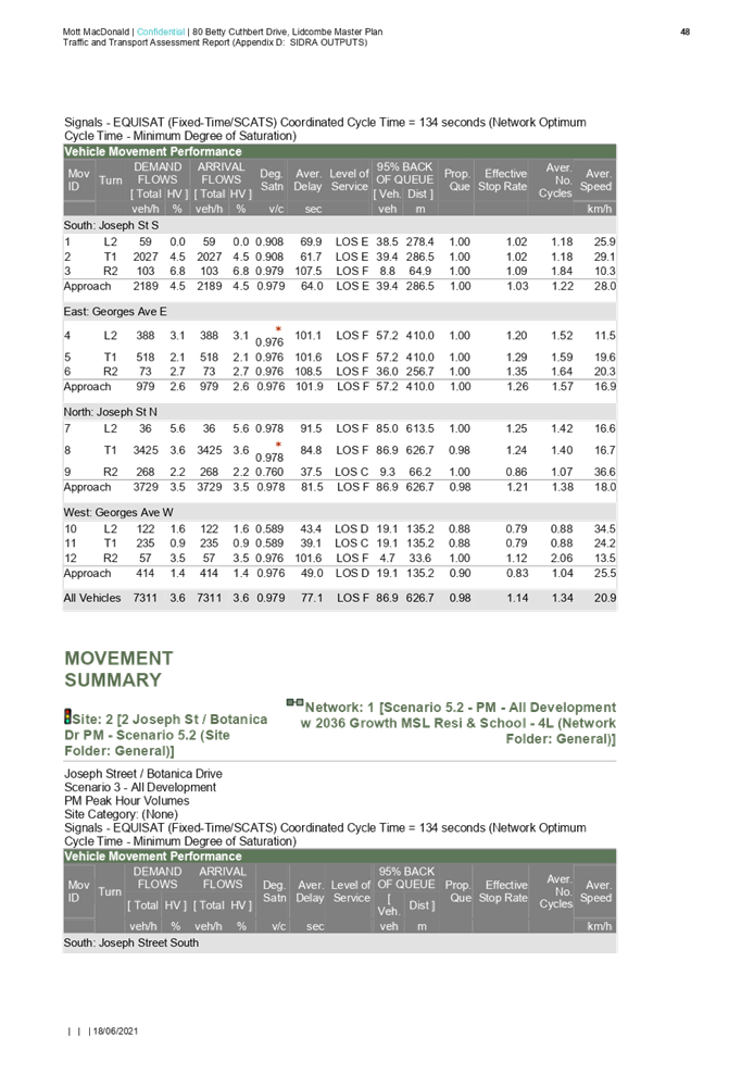
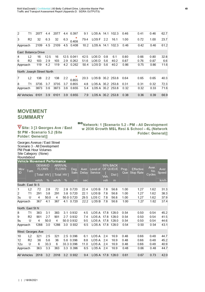
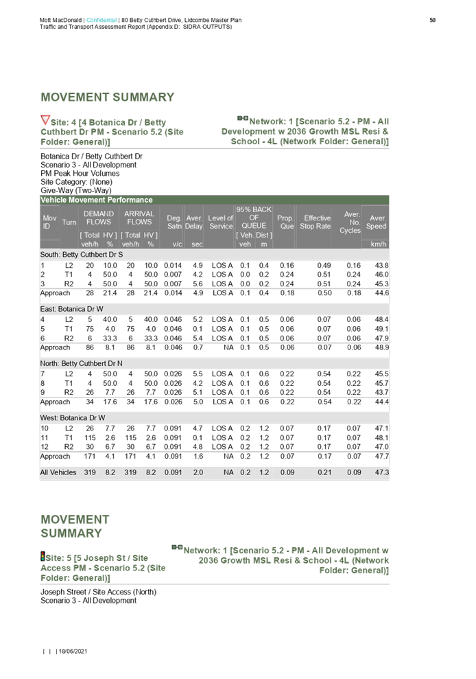
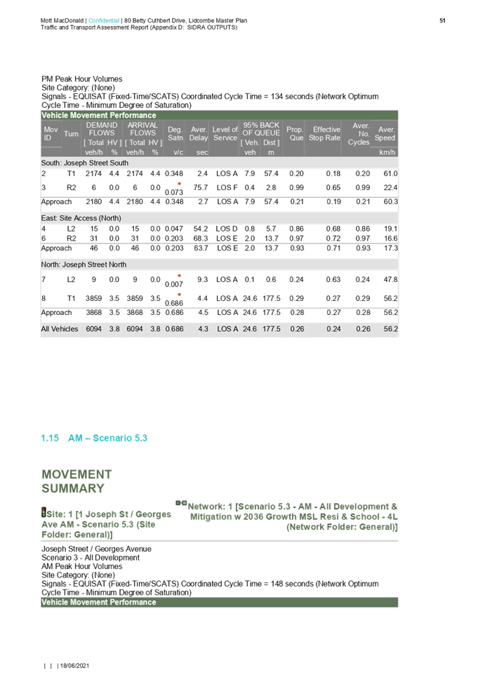
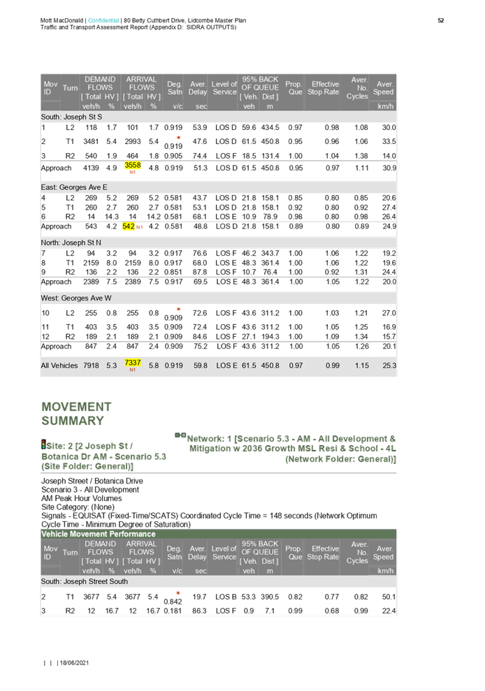
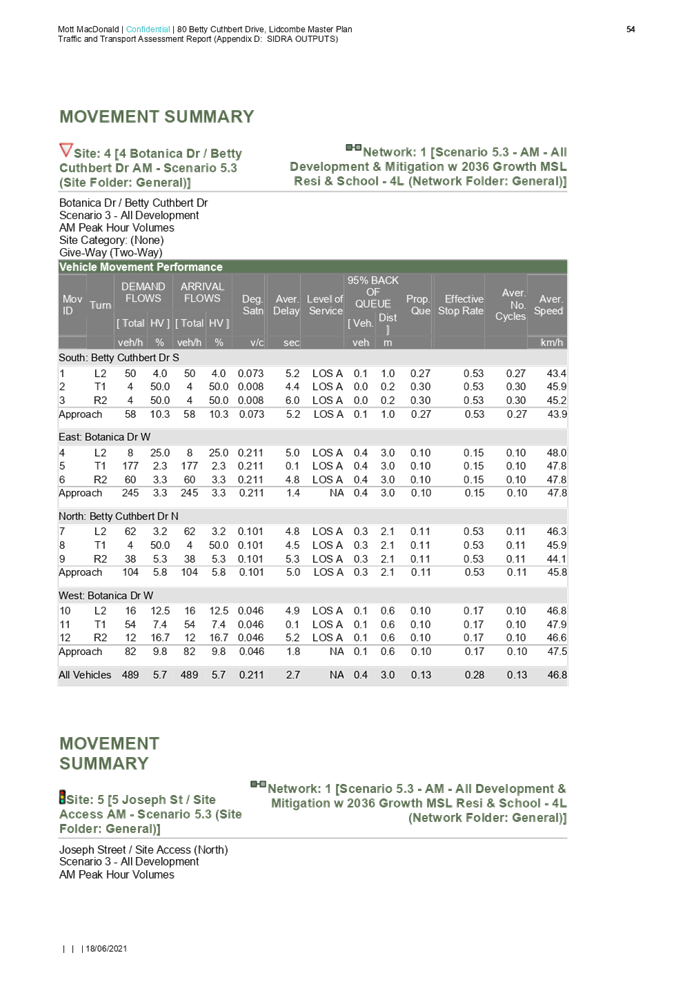
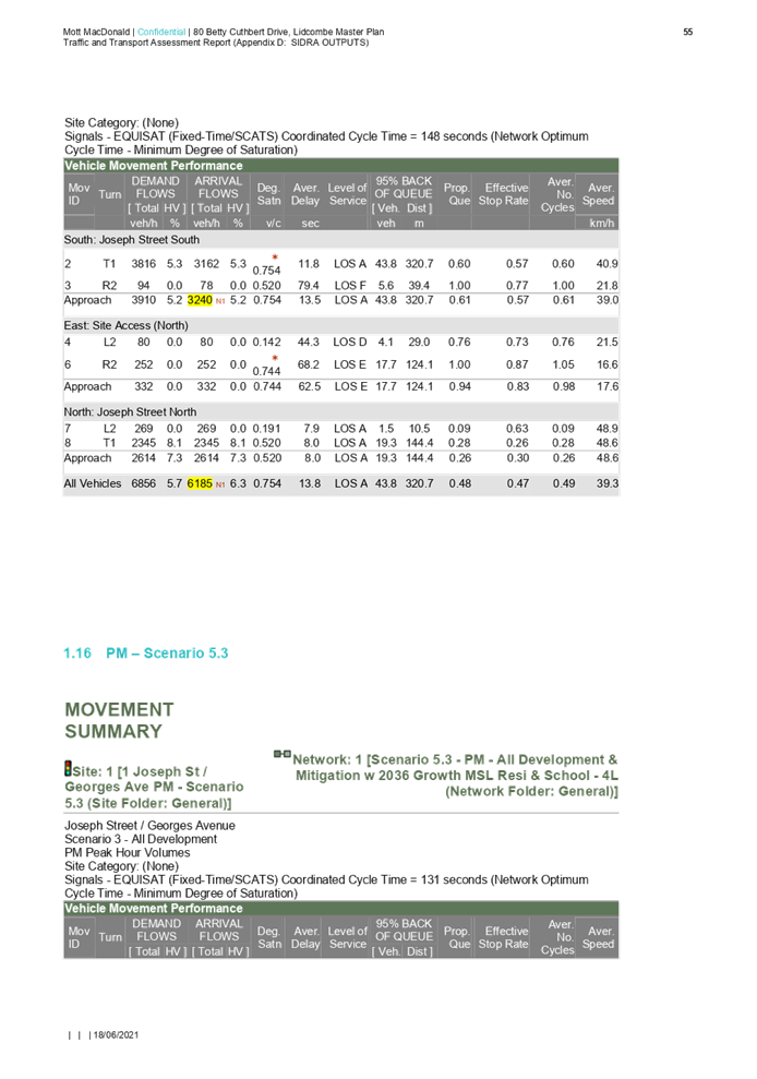
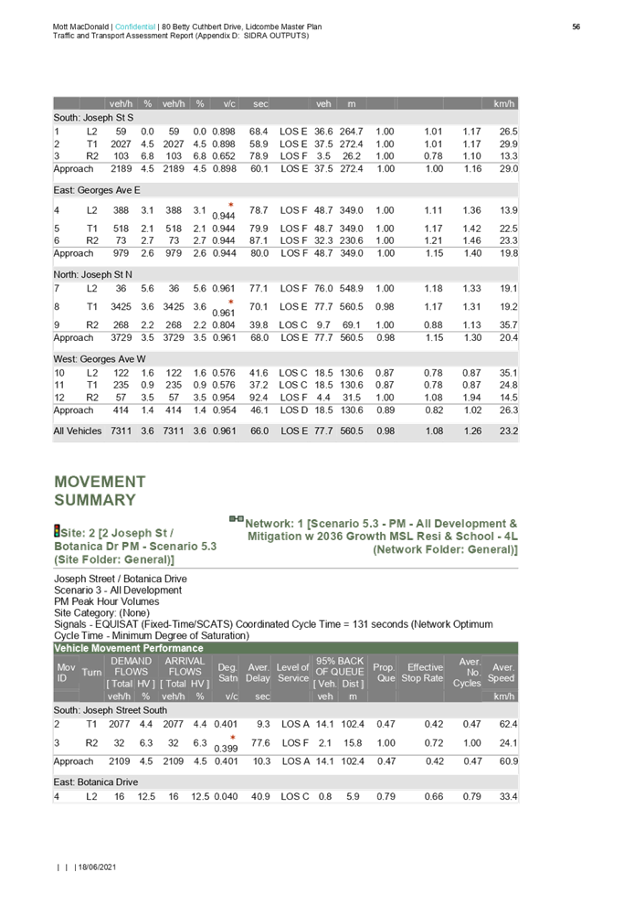
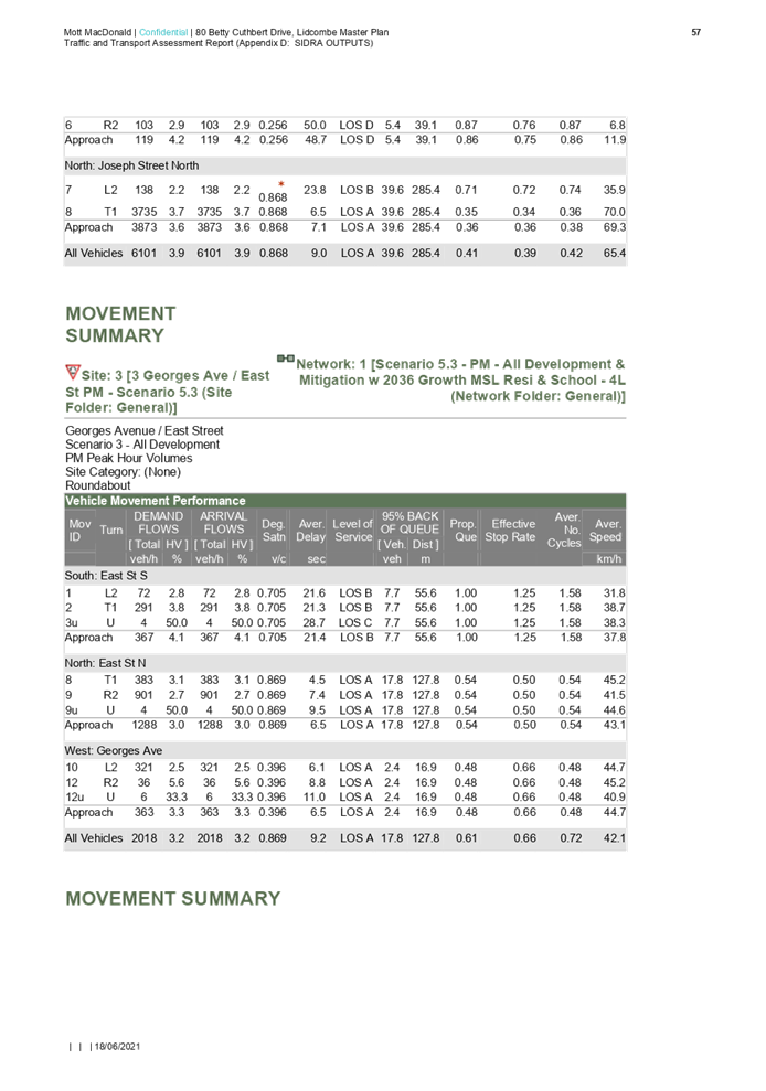
6. Traffic and Transport Assessment Report
7. Environmental Assessment Report
8. Preliminary Tree Assessment
9. Habitat Assessment and Targeted Flora Survey
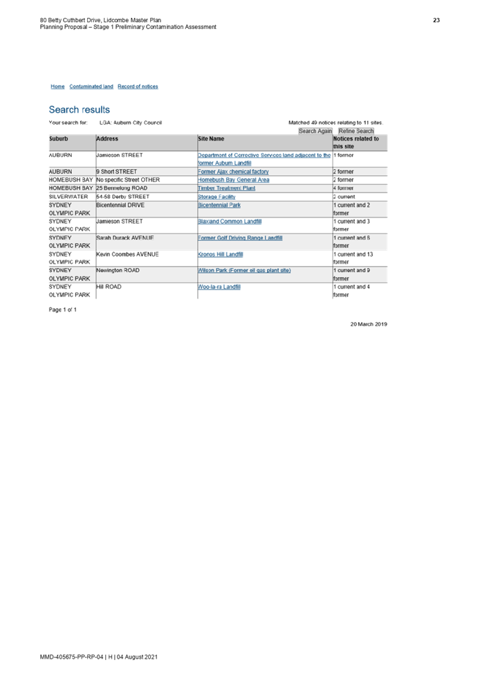
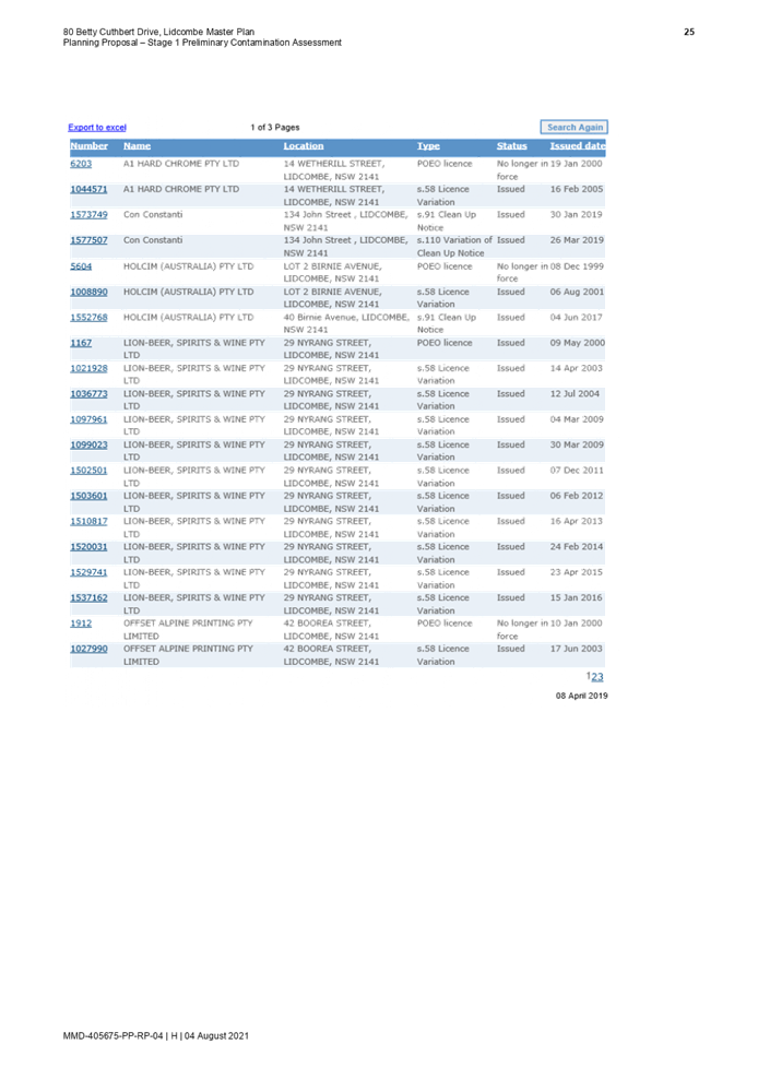
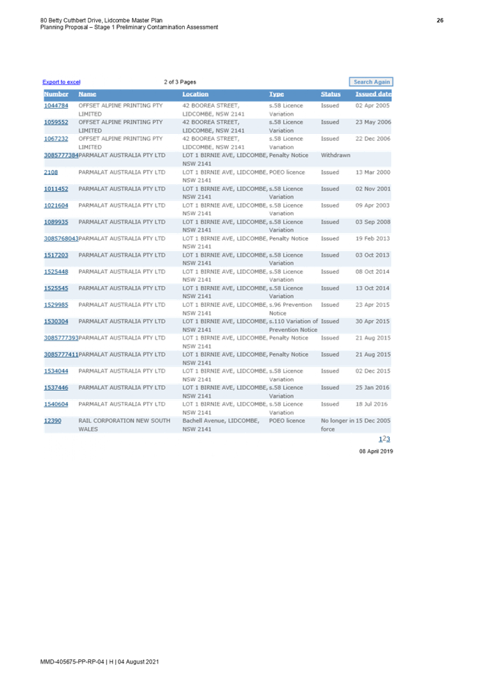
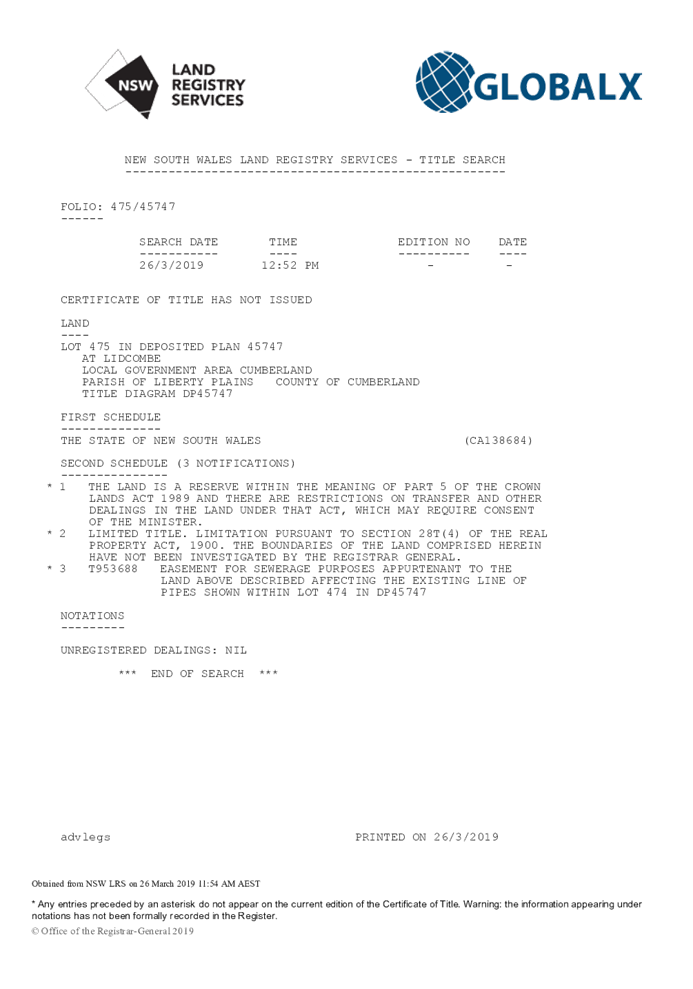
10. Preliminary Contamination and Acid Sulfate Soils Investigation Report
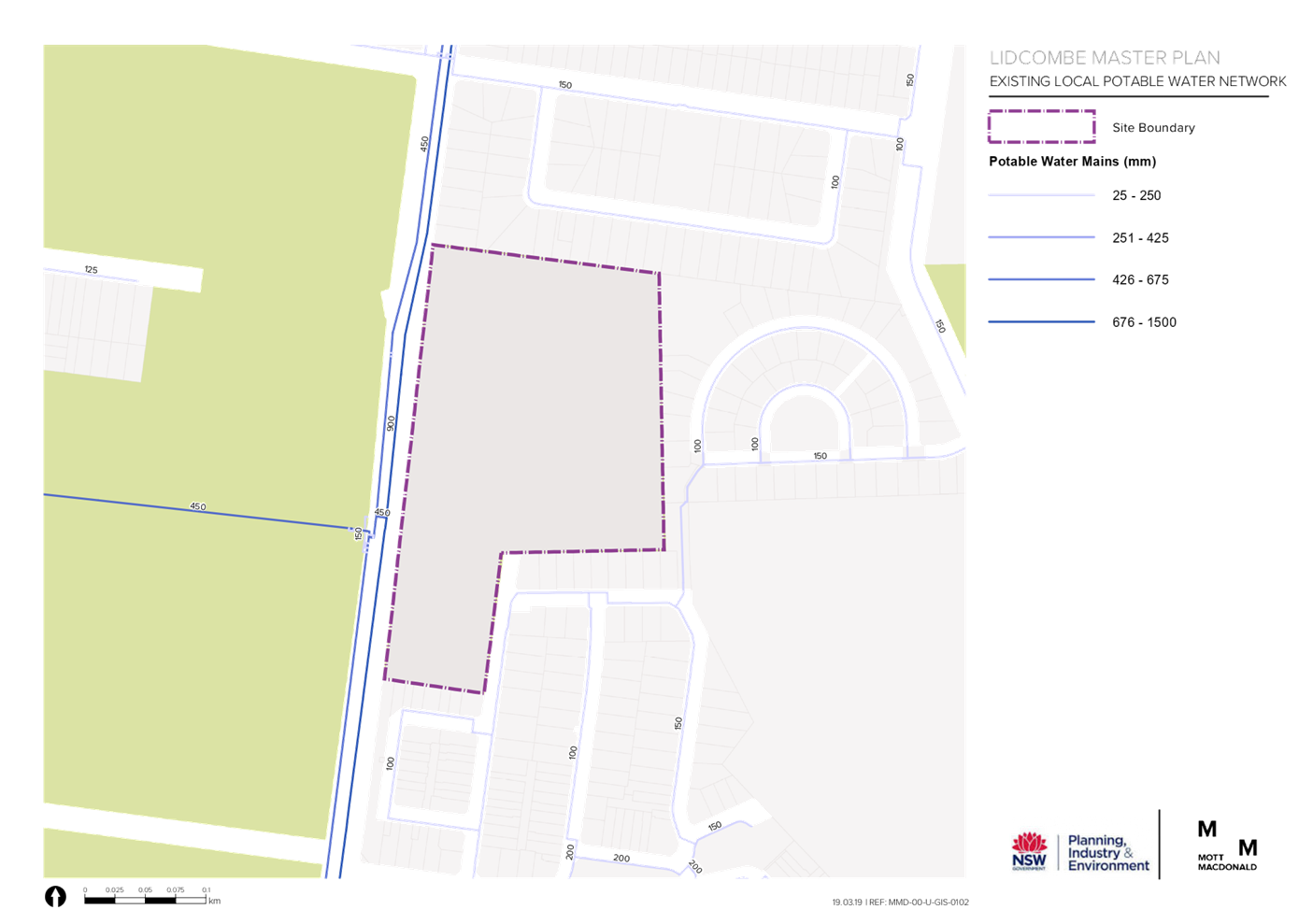
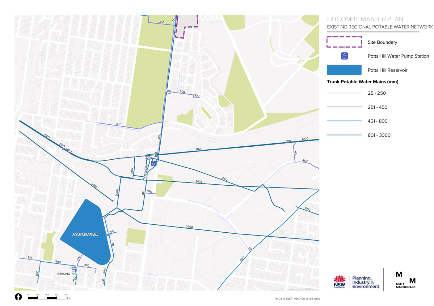
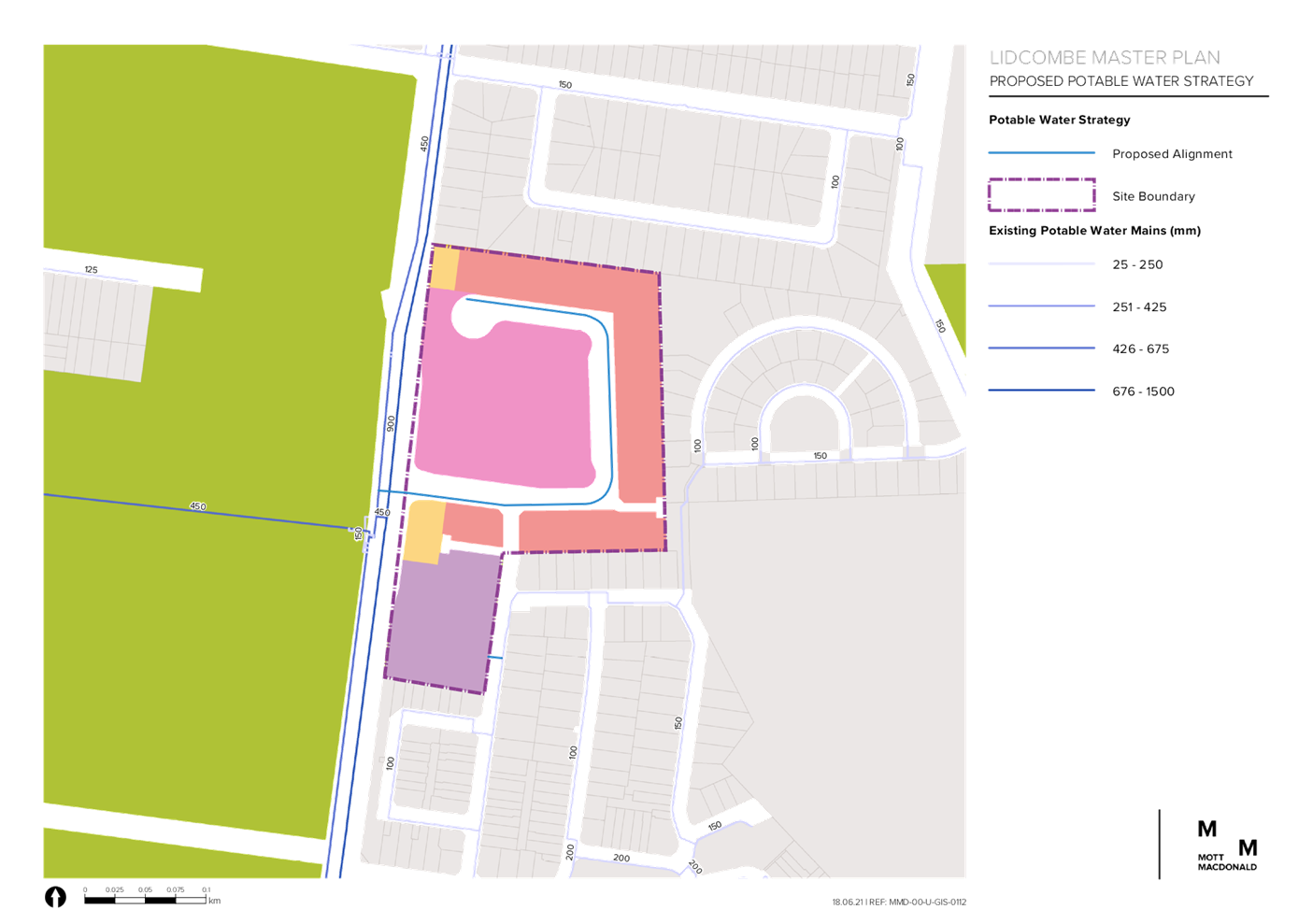
11. Utilities and Services Report
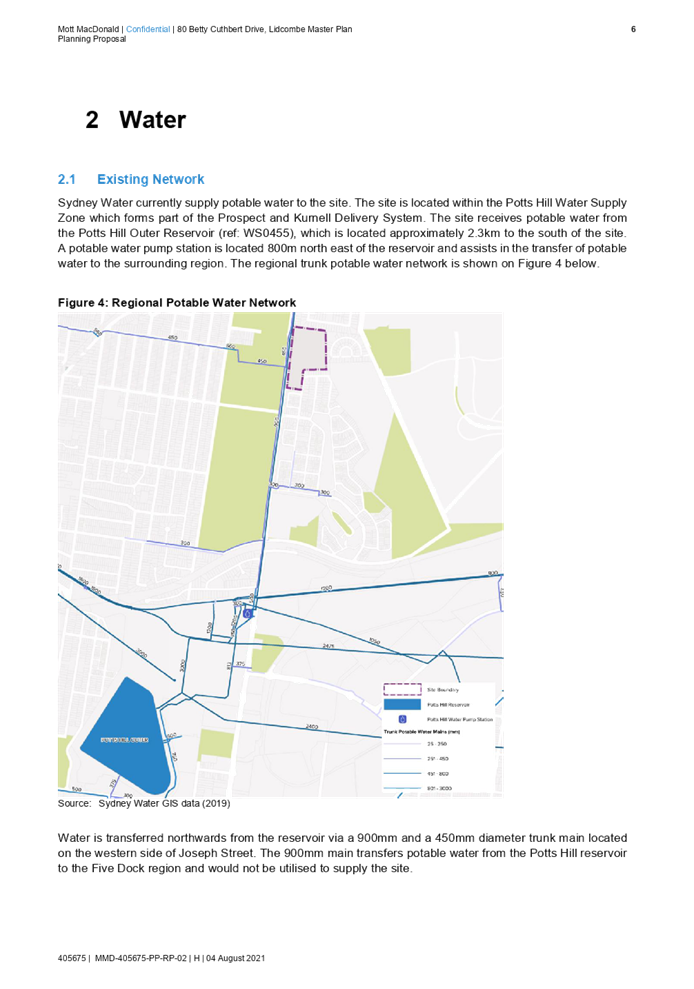
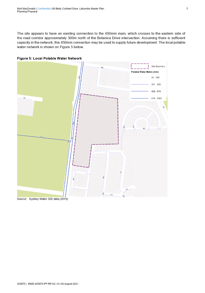
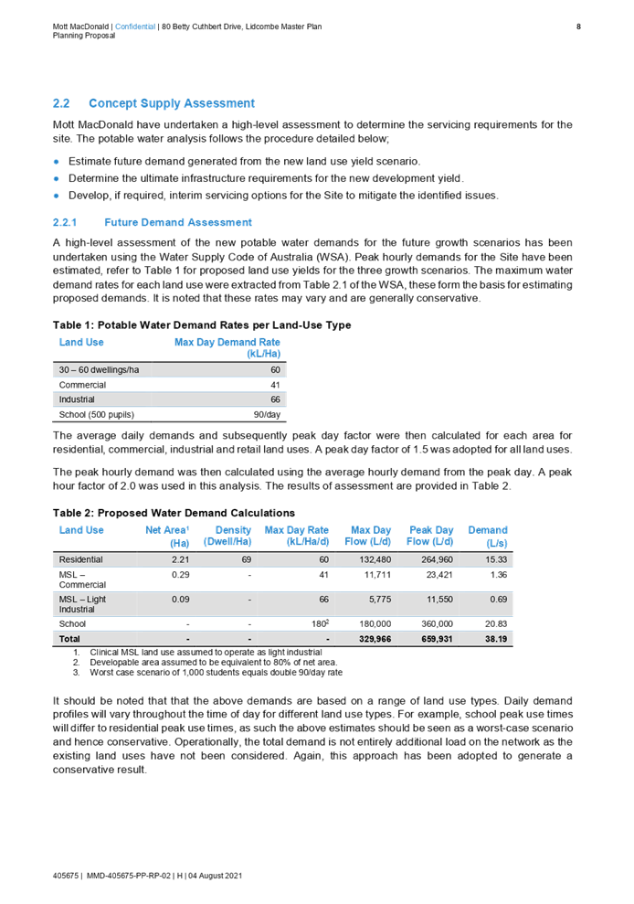
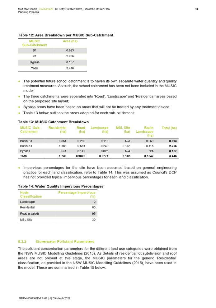
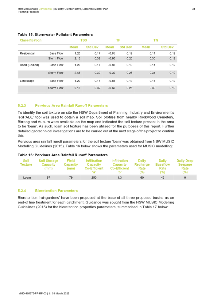
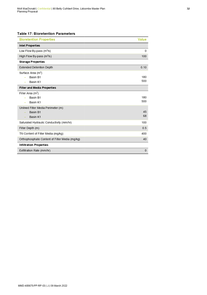
12. Water Cycle Management Report
13. Engagement Outcomes Report - Proponent
14. Summary of Submissions - Council Officer Early Consultation
DOCUMENTS
ASSOCIATED WITH
REPORT C05/22-57
Attachment 1
Planning Proposal Request
Attachment 3
Draft Site Specific Development Control Plan
DOCUMENTS
ASSOCIATED WITH
REPORT C05/22-57
Attachment 6
Traffic and Transport Assessment Report
DOCUMENTS
ASSOCIATED WITH
REPORT C05/22-57
Attachment 7
Environmental Assessment Report
Attachment 9
Habitat Assessment and Targeted Flora Survey
Attachment 10
Preliminary Contamination and Acid Sulfate Soils Investigation Report
DOCUMENTS
ASSOCIATED WITH
REPORT C05/22-57
Attachment 14
Summary of Submissions - Council Officer Early Consultation
4 May 2022
Item No: C05/22-58
Report on Variations for Development Standards Approved Under Delegation - October to December 2021 Quarter and January to March 2022 Quarter
Responsible Division: Environment & Planning
Officer: Director Environment & Planning
File Number: PS20/002
Community Strategic Plan Goal: A resilient built environment
Summary
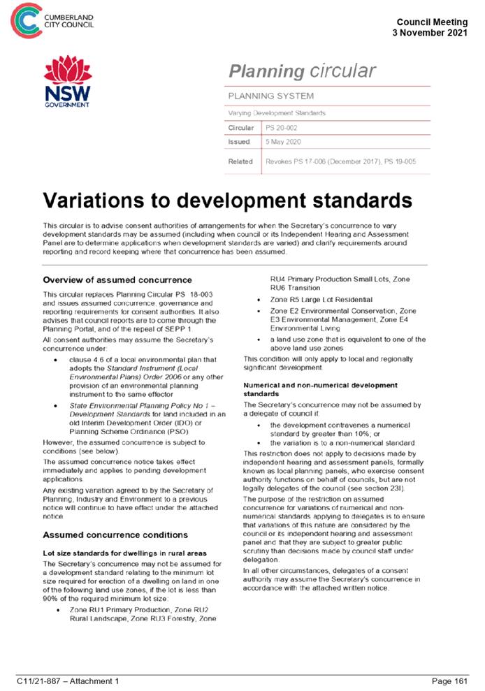
The purpose of this report is to provide details of the development applications where a variation to a development standard has been approved under delegation in accordance with the reporting requirements of the Planning circular PS 20-002 issued by the Department of Planning, Industry and Environment on 5 May 2020.
|
Recommendation
That Council receive and note this report. |
Report
On 5 May 2020 the Department of Planning, Industry and Environment issued Planning Circular PS 20-002 Variations to Development Standards. The purpose of the circular is as follows:
“to advise consent authorities of arrangements for when the Secretary’s concurrence to vary development standards may be assumed (including when council or its Independent Hearing and Assessment Panel are to determine applications when development standards are varied) and clarify requirements around reporting and record keeping where that concurrence has been assumed.”
By way of background, the objective of clause 4.6 of a Local Environmental Plan (LEP) is to provide an appropriate degree of flexibility in applying certain development standards so as to achieve better outcomes for and from development. The clause is a mechanism by which a development standard within a planning instrument can be varied provided that particular requirements are satisfied. A planning instrument includes an LEP, State Environmental Planning Policy or Regional Environmental Plan. In the case of Cumberland City Council, the relevant LEP’s were the Auburn LEP 2010, Holroyd LEP 2013 and Parramatta LEP 2011. It is currently the Cumberland LEP 2021.
Clause 4.6 also requires that development consent must not be granted for development that contravenes a development standard unless the concurrence of the Planning Secretary has been obtained. The circular however, provides that consent authorities can assume the concurrence of the Planning Secretary under clause 4.6 of an LEP (which adopts the Standard Instrument (Local Environmental Plans) Order 2006), or any other provision of an environment planning instrument to the same effect, in accordance with Clause 55 of the Environmental Planning and Assessment Regulation 2021 with the following exceptions of relevance to the purpose of this report:
· A delegate of Council cannot assume the Secretary’s concurrence if the development contravenes a numerical standard by greater than 10%; or the variation is to a non-numerical standard.
This restriction does not apply to decisions made by the Cumberland Local Planning Panel and the Sydney Central City Planning Panel who are not legal delegates of Council.
Procedural and reporting requirements
In addition to maintaining a publicly available online register of all variations to development standards approved by a consent authority or its delegates and submitting a report of all approved variations (including those made under delegation) through the NSW Planning Portal, the Department is now also requiring that a report of variations approved under delegation from a council be provided to a meeting of the Council at least once each quarter.
|
CLAUSE 4.6 VARIATIONS TO DEVELOPMENT STANDARDS APPROVED UNDER DELEGATION
|
||||
|
DA No. & Determination date |
Address |
Description of Development |
Development Standard |
Extent of Variation |
|
October - December 2021 Quarter and January – March 2022 Quarter |
||||
|
DA-2021/0252 23 December 2021 |
8-10 Mary Street, Auburn |
Use the existing building as hostel for people with disabilities, and alteration to the existing car park |
Minimum Site Area under the State Environmental Planning Policy (Housing for Seniors or People with Disability) 2004. Required: 1000sqm, Proposed 948.5sqm |
5.15% |
Community Engagement
There are no consultation processes for Council associated with this report.
Policy Implications
There are no policy implications for Council associated with this report.
Risk Implications
There are no risk implications for Council associated with this report.
Financial Implications
There are no financial implications for Council associated with this report.
CONCLUSION
The reporting obligations required by Planning Circular PS 20-002 issued by the Department of Planning, Industry and Environment on 5 May 2020, with regards to variations to development standards approved under delegation have been satisfied. It is recommended that Council receive and note this report.
Attachments
DOCUMENTS
ASSOCIATED WITH
REPORT C05/22-58
Attachment 1
Planning Circular - Variations to Development Standards
4 May 2022
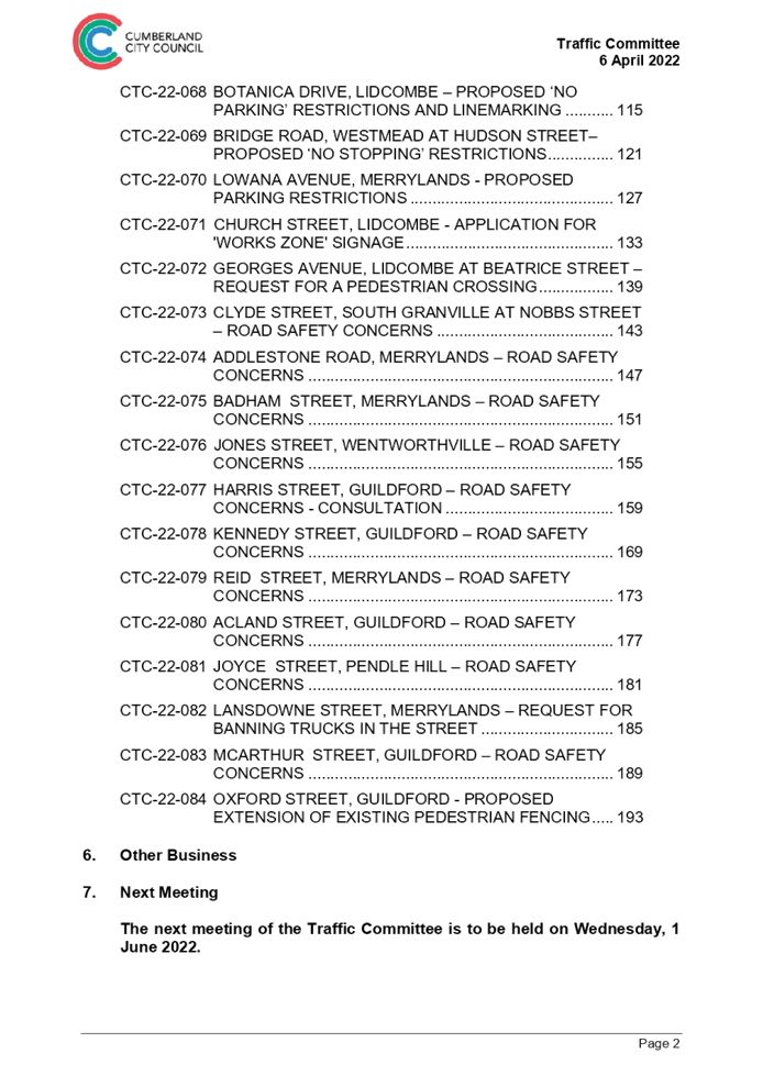
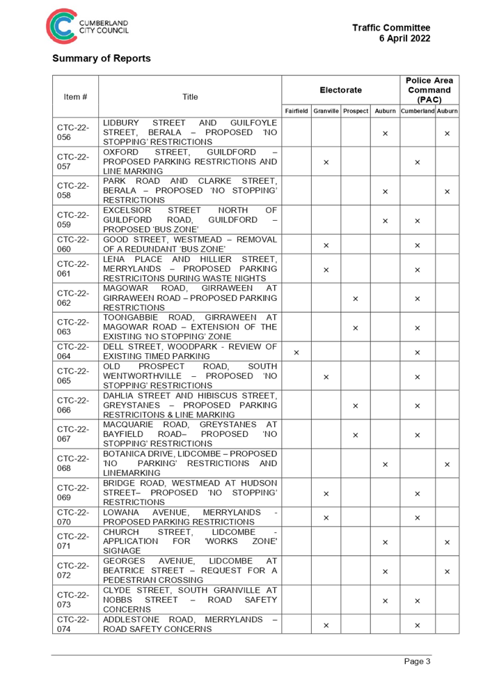
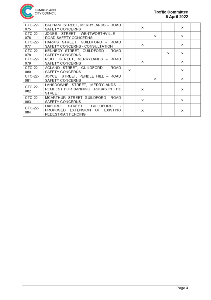
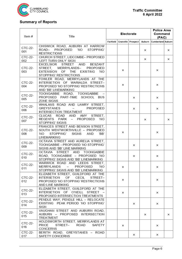
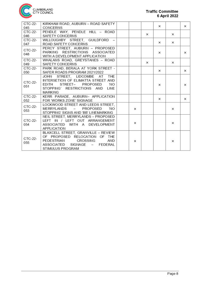
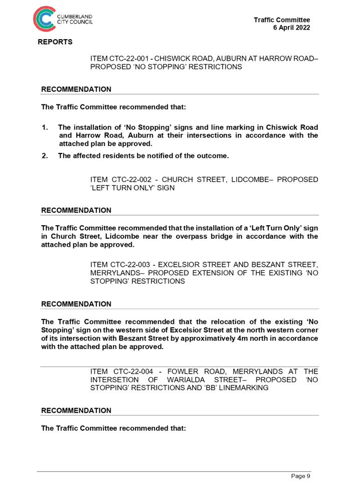
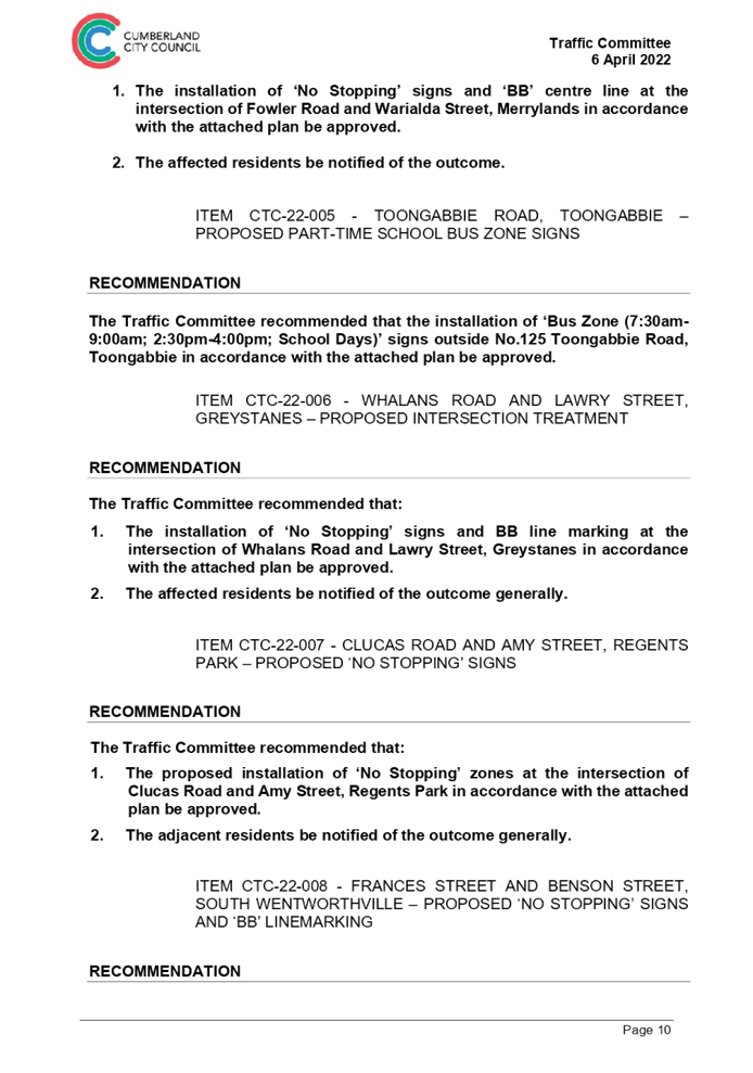
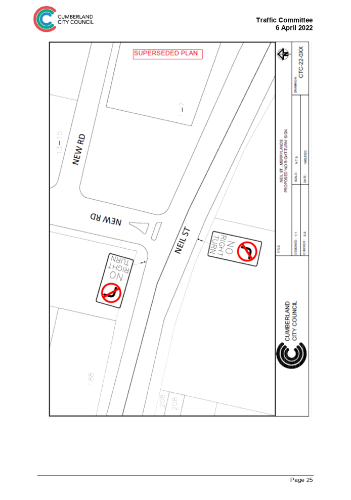
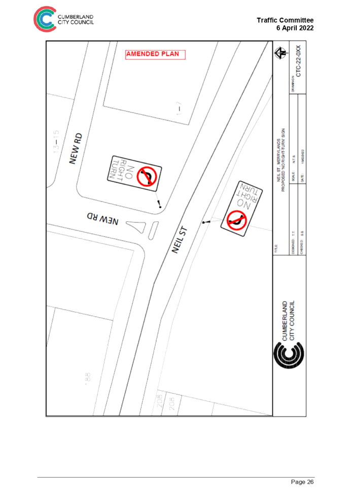
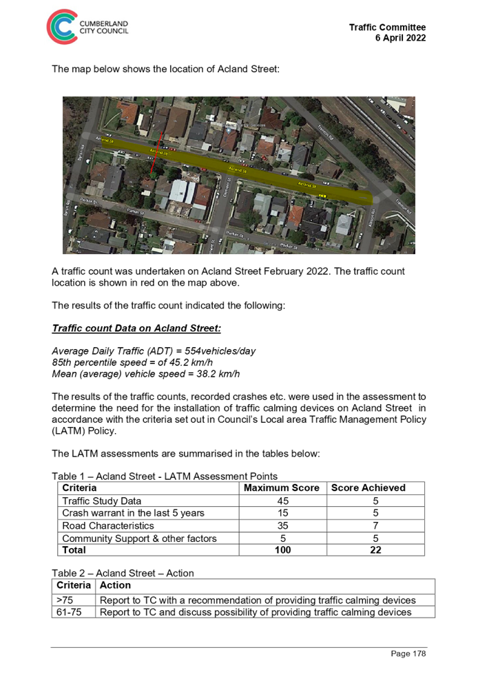
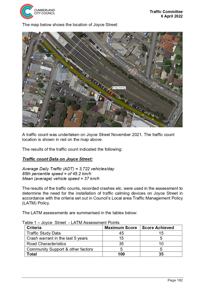
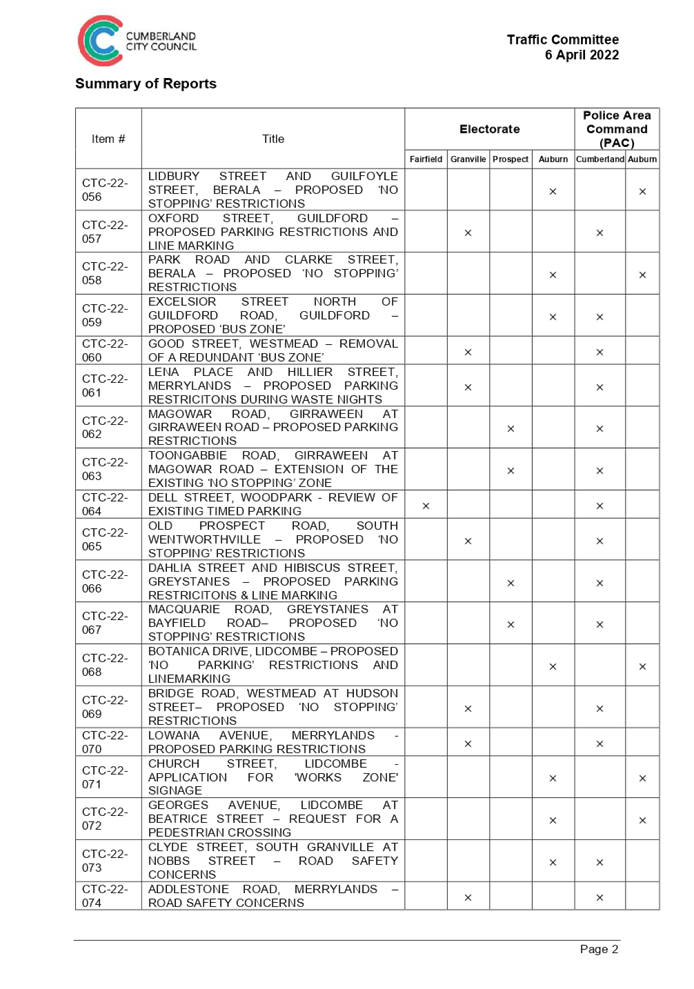
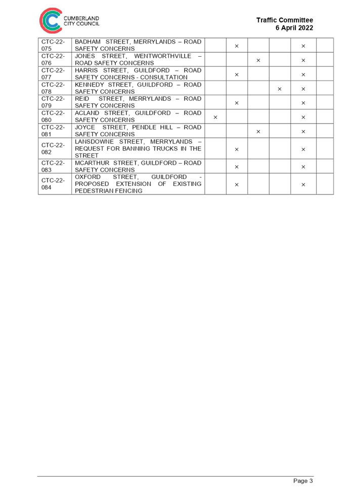
Item No: C05/22-59
Traffic Committee - Minutes of Meeting Held on 6 April 2022
Responsible Division: Environment & Planning
Officer: Director Environment & Planning
File Number: T-28-02/08
Community Strategic Plan Goal: A resilient built environment
Summary
This report presents the minutes of the Cumberland Traffic Committee meeting held on 6 April 2022.
|
Recommendation That Council: 1. Receive and note the minutes of Part 1 Items of the Cumberland Traffic Committee meeting held on 6 April 2022; and 2. The minutes of Part 2 Items of the Cumberland Traffic Committee meeting held on 6 April 2022 be received, and recommendations contained therein be approved. |
Report
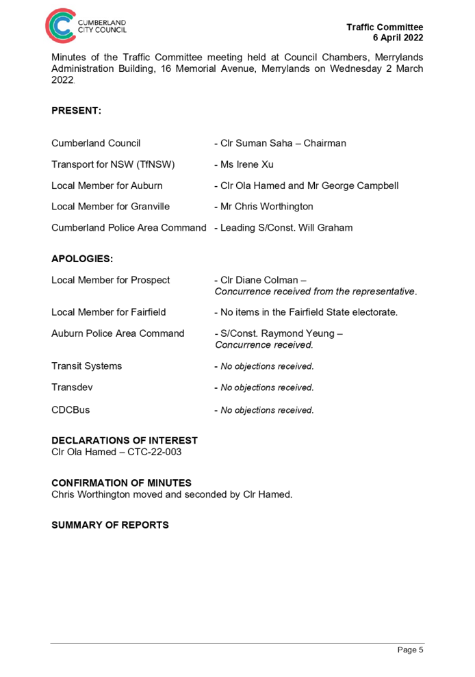
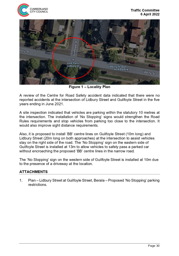
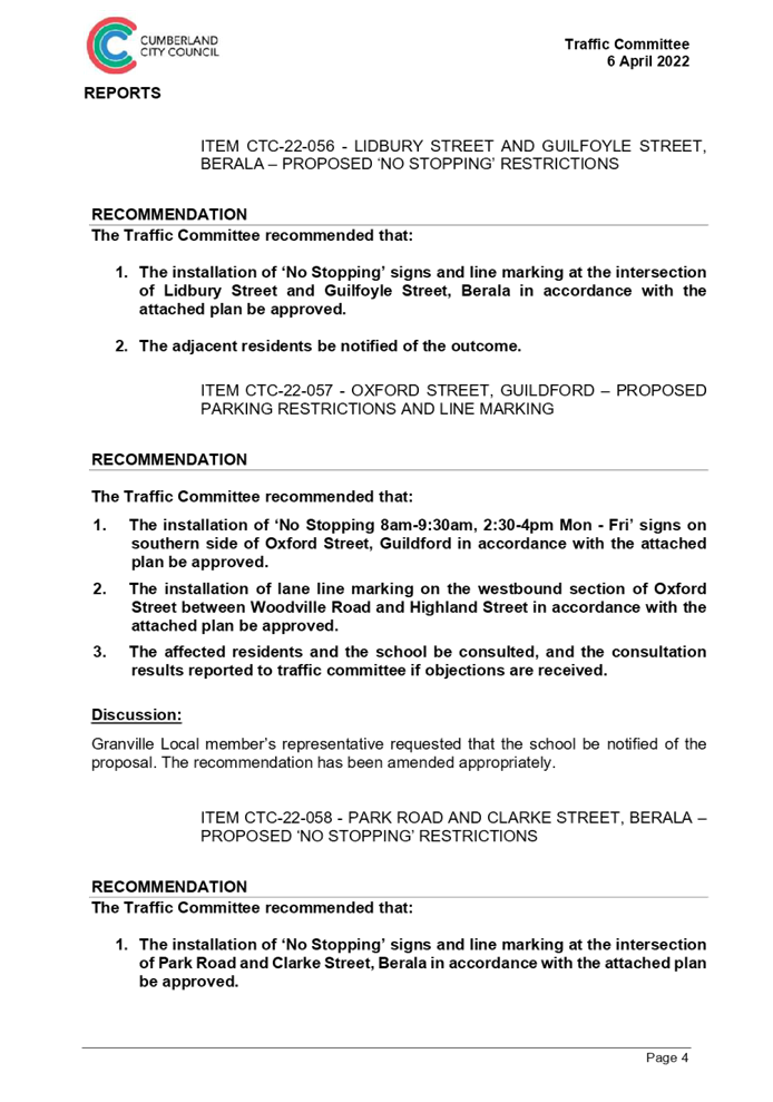
A meeting of the Cumberland Traffic Committee was held on 6 April 2022 at the Merrylands Council Chambers.
In accordance with the Cumberland Local Traffic Committee Terms of Reference, approved by Council on 20 May 2020 (Min. 694 - C05/20-443), the Part 1 items have been approved under delegated authority.
The minute of the meeting is presented for approval of Part 2 items.
The following table provides Part 1 and Part 2 items in the agenda:
|
Meeting date |
Part 1 items approved under delegated authority. |
Part 2 items for Council determination. |
|
6 April 2022 |
CTC-22-056 to 071 |
CTC-22-072 to 084 |
Community Engagement
Community consultation will occur in accordance with the recommendations of each report.
Policy Implications
There are no policy implications for Council associated with this report.
Risk Implications
There are no risk implications for Council associated with this report.
Financial Implications
The expenditure of funds associated with implementing the recommendations not approved under delegated authority will be included in Council’s traffic facility construction program.
Attachments
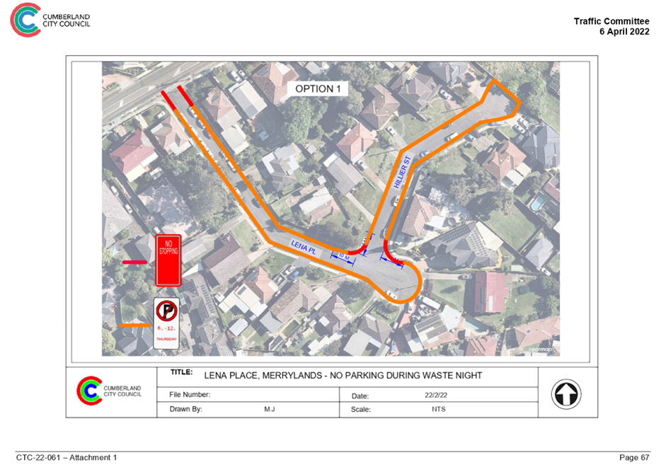
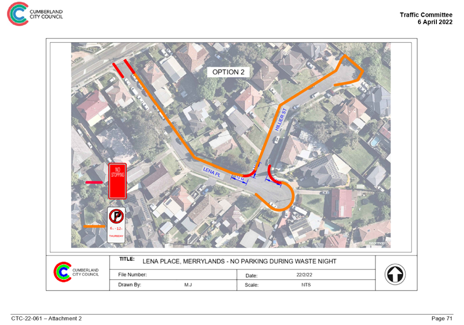
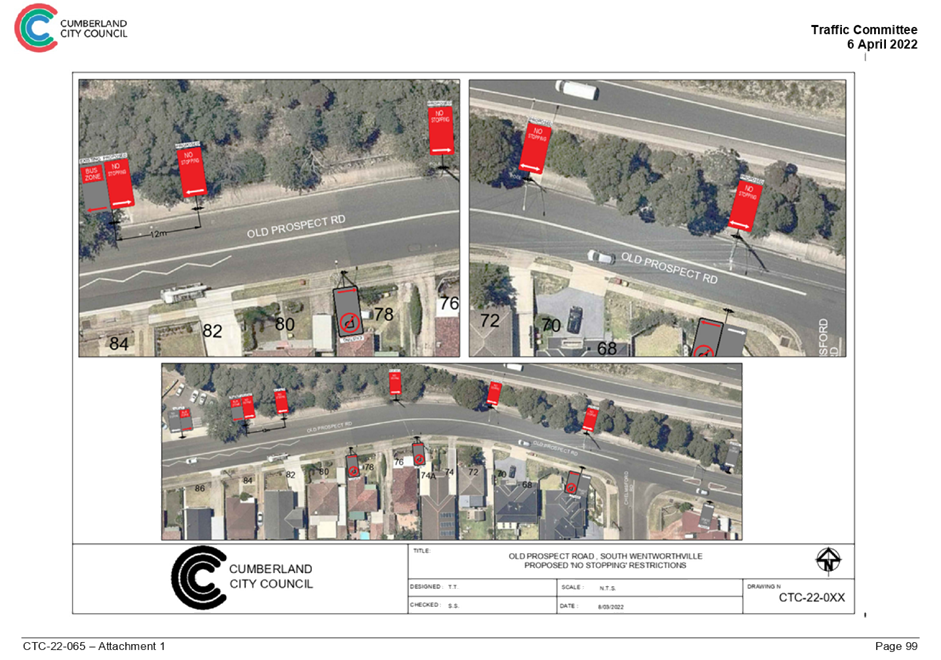
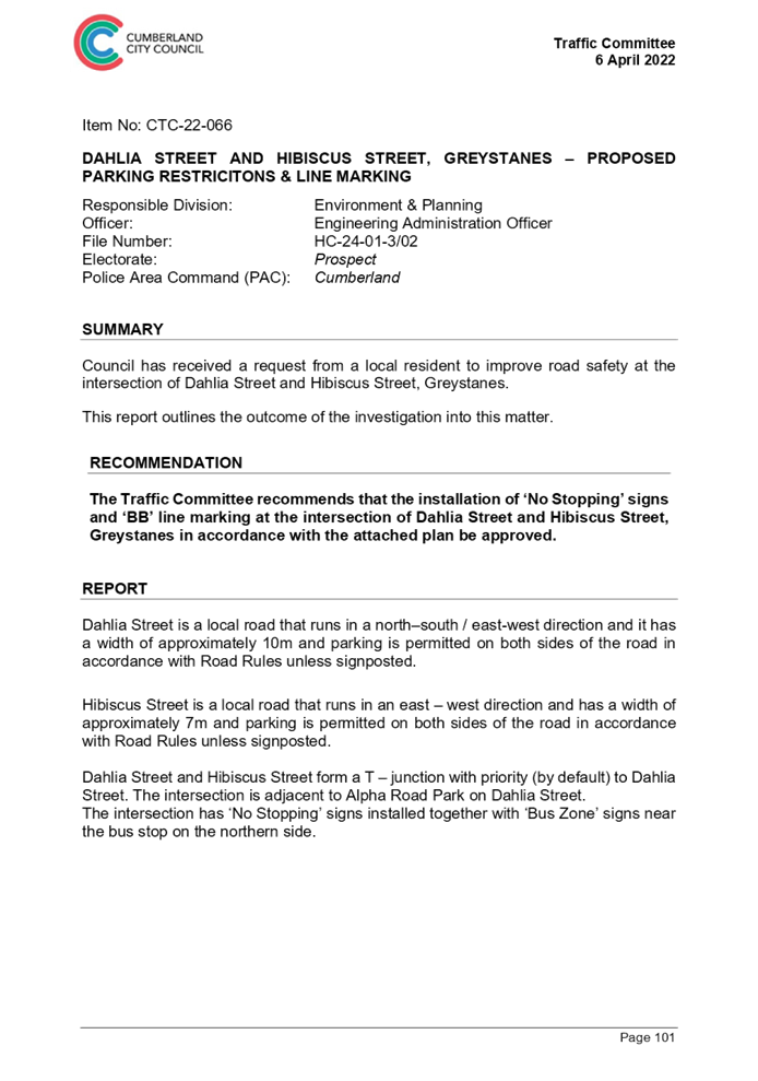
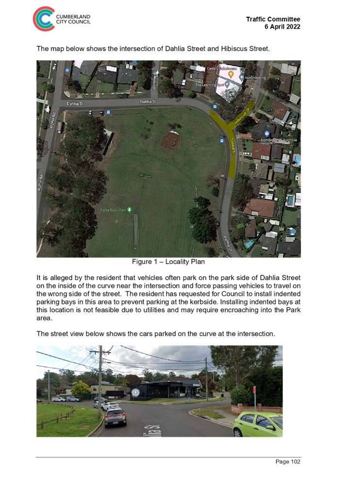
1. Agenda of the Meeting of Cumberland Traffic Committee of 6 April 2022
2. Minutes of the Meeting of Cumberland Traffic Committee of 6 April 2022
DOCUMENTS
ASSOCIATED WITH
REPORT C05/22-59
Attachment 1
Agenda of the Meeting of Cumberland Traffic Committee of 6 April 2022
Attachment 2
Minutes of the Meeting of Cumberland Traffic Committee of 6 April 2022