9 March 2022
A meeting of the Cumberland Local
Planning Panel will
be held at 11:30am via Electronic Determination on Wednesday, 9 March 2022.
Business as below:
Yours faithfully
Peter J. Fitzgerald
General
Manager
ORDER OF BUSINESS
1. Receipt of Apologies
2. Declarations of Interest
3. Reports:
- Development
Applications
- Planning
Proposals
4. Closed Session Reports
Cumberland Local Planning Panel Meeting
9 March 2022
CONTENTS
Report No. Name
of Report Page
No.
Development Applications – Electronic Determination
LPP004/22... Development Application for 31-33
Killeen Street, Auburn........................... 5
LPP005/22... Development Application for 15 Mary
Street & 13 Harrow
Road Auburn....................................................................................................... 71
LPP006/22... Development Application for 10
Patricia Street Mays Hill......................... 255
LPP007/22... Development Application for Land
adjacent to 3 South Parade,
Auburn............................................................................................................... 403
LPP008/22... Development Application for Land
adjacent 35-39 Auburn
Road Auburn..................................................................................................... 463
LPP009/22... Development Application for - Land
adjacent to 665-669
Merrylands Road Greystanes........................................................................ 525
LPP010/22... Development Application for 41 Auburn
Road Auburn.............................. 601
LPP011/22... Development Application for 22-26
Joseph Street Lidcombe.................. 663
LPP012/22... Development Application for 27
Sherwood Road Merrylands.................. 721
LPP013/22... Development Application for 60
Railway Street Lidcombe....................... 803
LPP014/22... Development Application for Rawson St
entrance of Auburn
Railway Station Auburn................................................................................... 865
LPP015/22... Development Application for 67 Rawson
Street, Auburn.......................... 945
Cumberland Local Planning Panel Meeting
9 March 2022
Item No:
LPP004/22
Development
Application for 31-33 Killeen Street, Auburn
Responsible
Division: Environment
& Planning
Officer: Executive
Manager Development and Building
File
Number: DA2021/0607
|
Application
accepted
|
Monday 22 November 2021.
|
|
Applicant
|
Cumberland City Council C/ Mr
G Bakewell.
|
|
Owner
|
Cumberland City Council.
|
|
Application
No.
|
DA2021/0607.
|
|
Description
of Land
|
31 - 33 Killeen Street Auburn
being lots19 and 20 in DP 6713.
|
|
Proposed
Development
|
Demolition of existing
building and construction of a two-storey depot building for NSW State
Emergency Services (SES) containing administration spaces, parking,
associated amenities, and erection of two building identification signs.
|
|
Site
Area
|
1,078.1 Square metres.
|
|
Zoning
|
Zone - RE1 Public Recreation.
|
|
Disclosure
of political donations and gifts
|
Nil disclosure.
|
|
Heritage
|
Not a heritage listed site-
but is in the vicinity of a heritage item- Auburn Botanic Gardens.
|
|
Principal
Development Standards
|
Not applicable to the site.
|
|
Issues
|
“Nil”.
|
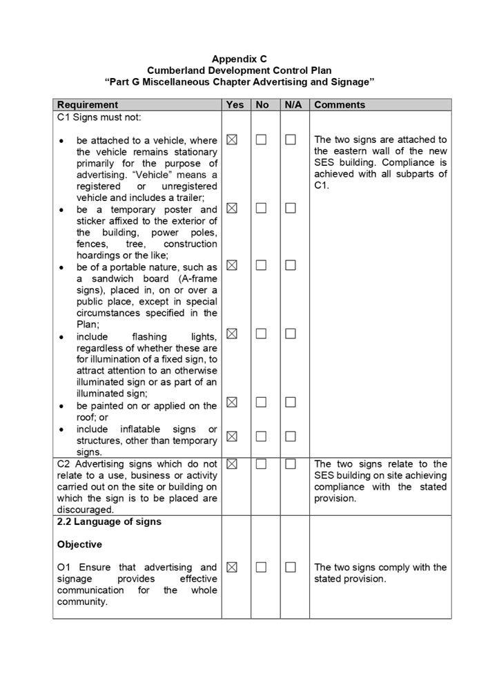
1. Development
Application 2021/0607 was accepted on Monday 22 November 2021 for the
demolition of the existing building and construction of a two-storey depot
building for the New South Wales State Emergency Services containing
administration spaces, parking, associated amenities and erection of two
building identification signs.
2. The
application was publicly notified to occupants and owners of the adjoining
properties for a period of fourteen (14) days between Friday 26 November and
Friday 10 December 2021. In response, Council received one submission.
3. There
are no variations identified to the planning controls that apply to the site.
4. The
development application is referred to the Panel as the proposal is a Council
development on Council owned land.
5. The
application is recommended for approval subject to conditions as provided I in
the attached schedule.
The site forms part of the
larger Council depot area which is used for the storage and maintenance of
Council owned equipment and hardware. The Council stores equipment such as garbage
trucks and maintenance vehicles on site and undertakes maintenance to such
vehicles.
Soil and road based surfaces
such as cement and asphalt is also stored on site.
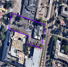
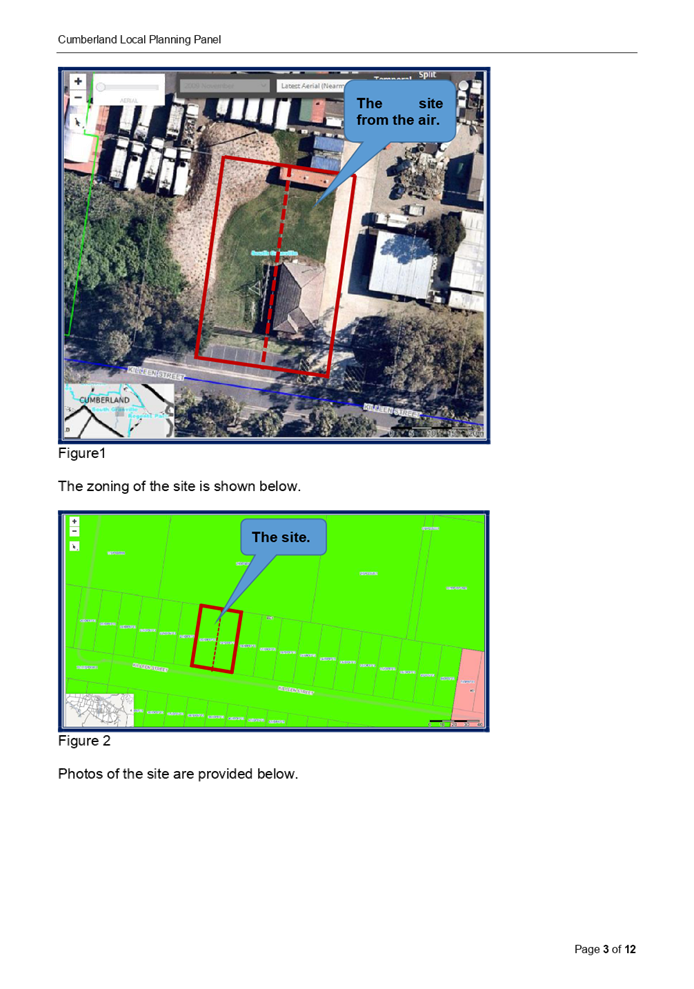
The subject site is known as 31
and 33 Killeen Street has a frontage of 26.82 metres to Killeen Street, is
40.215 metres in length and occupies an area of 1,078.1 square metres.
There is a NSW State Emergency
Service (SES) maintenance shed, an SES operations building and an older
building being a lunch room situated at the southern side of the depot site
facing Killeen Street and generally confined to five lots being:-
• Lots
19 and 20 in DP 6713 comprising the subject site.
• Lots
15, 16 and 17 in DP 6713 comprising the remaining SES buildings but excluded
from the development site.
Access to the whole area is via
two driveways from Killeen Street.
The Auburn Botanic Gardens,
Auburn Tennis Club and Council depot site are the dominant land uses within the
locality. The nearest residential property is situated on the southern side of
Killeen Street where there are three dwelling houses. The dwellings are
situated between 35 and 72 metres from the site.
The nearby Auburn Botanic
Gardens is listed as a heritage item within the Cumberland Local Environmental
Plan 2021 and is listed as Item I5 for Landscape heritage. The development site
does not interfere with the heritage listed gardens and the subject site is not
listed as a heritage item within the Cumberland Local Environmental Plan 2021.
There are parklands within the
wider area including three soccer grounds within an area facing Chiswick Road
and Wellington Road.
The location of the site is
shown below.
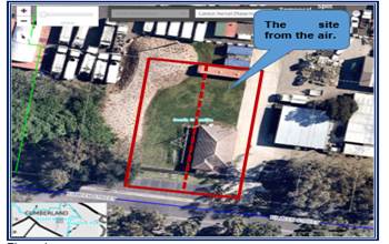
Figure1
The zoning of the site is shown below.
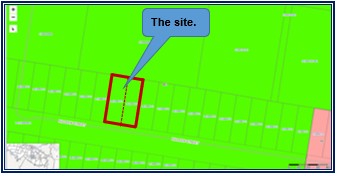
Figure 2
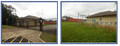
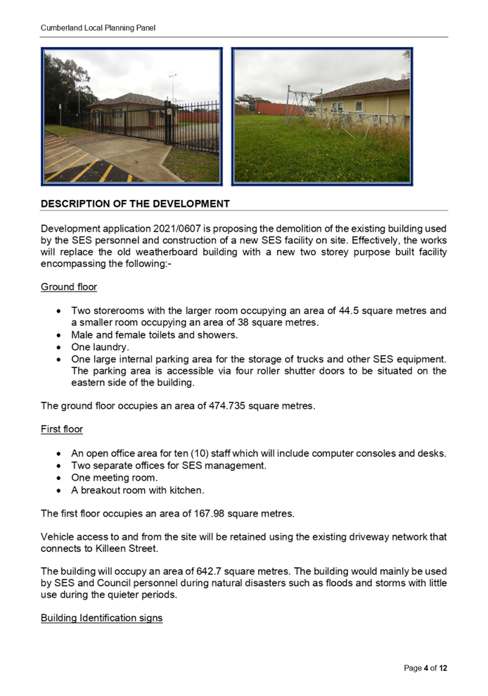
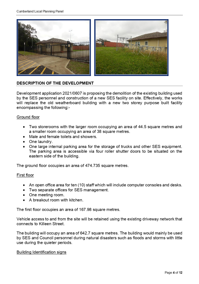
Photos of the site are provided below.
Development application 2021/0607 is proposing the
demolition of the existing building used by the SES personnel and construction
of a new SES facility on site. Effectively, the works will replace the old
weatherboard building with a new two storey purpose built facility encompassing
the following:-
Ground floor
• Two
storerooms with the larger room occupying an area of 44.5 square metres and a
smaller room occupying an area of 38 square metres.
• Male and
female toilets and showers.
• One
laundry.
• One
large internal parking area for the storage of trucks and other SES equipment.
The parking area is accessible via four roller shutter doors to be situated on
the eastern side of the building.
The ground floor occupies an area of 474.735 square metres.
First floor
• An
open office area for ten (10) staff which will include computer consoles and
desks.
• Two
separate offices for SES management.
• One
meeting room.
• A breakout
room with kitchen.
The first floor occupies an area of 167.98 square metres.
Vehicle access to and from the site will be retained using
the existing driveway network that connects to Killeen Street.
The building will occupy an area of 642.7 square metres. The
building would mainly be used by SES and Council personnel during natural
disasters such as floods and storms with little use during the quieter periods.
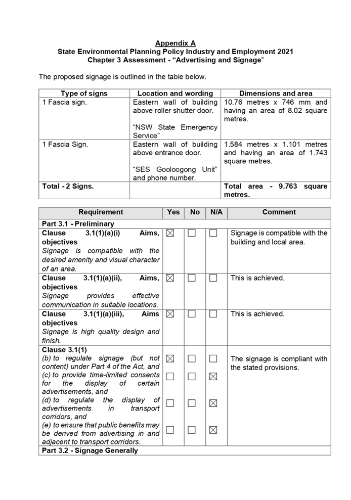
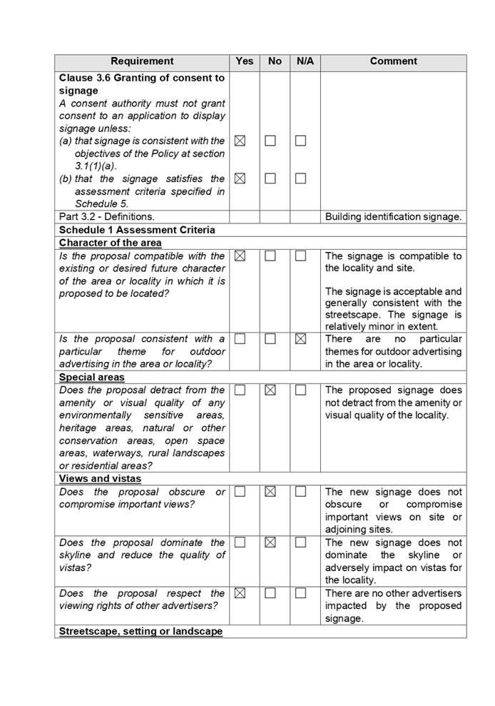
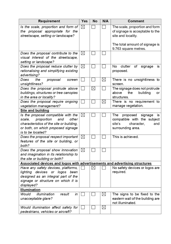
Building Identification signs
The development application includes the erection of two
building identification signs as follows facing east:-
• 1
sign situated above the roller shutter doors that reads “NSW State
Emergency Service” which has dimensions of 10.76 metres x 746 mm and
having an area of 8.02 square metres.
• 1
sign situated above the entrance door of the building that reads “SES
Gooloogong Unit” and phone number. The sign has dimensions of 1.584
metres x 1.101 metres and having an area of 1.743 square metres.
The
development application was accepted by Council on Monday 22 November 2021 and
was notified between Friday 26 November and Friday 10 December 2021. There was
one submission received.
The
applicant has provided a Statement of Environmental Effects prepared by Graham Bakewell Architect which was received
by Council on Wednesday 27 October 2021 in support of
the application.
The
assessing officer has undertaken a site inspection of the subject site and
surrounding properties and has been in regular contact with the applicant
throughout the assessment process.
Development Engineer
The development application was referred to Council’s
Development Engineer for comment who has advised that the development proposal
is satisfactory. Conditions are provided addressing stormwater drainage and
engineering related matters.
Building Surveyor
The development application was referred to Council’s
Building Surveyor for comment who has advised that the development proposal is
satisfactory subject to conditions.
Environment and Health
The development application was referred to Council’s
Environment and Health Officer for comment who has advised that the development
proposal is satisfactory. A waste analysis classification report was prepared
by Trinitas Group which included soil testing. The testing is satisfactory and
the development is supported subject to conditions.
Parks / Open Space
The development application was referred to Council’s
Public Spaces, Planning and Design Department for comment where staff have
advised that the development application is satisfactory and no comment
required.
Waste Management
The development application was referred to Council’s
Waste Management Officer for comment who has advised that the development
proposal is satisfactory and no conditions are required.
The
development application was referred to Ausgrid for comment who have advised
that no decision is required. There are no objections to the development and no
conditions are required.
The provisions of any Environmental
Planning Instruments (EP&A Act s4.15 (1)(a)(i))
State Environmental
Planning Policies
The proposed development is affected by the following State Environmental
Planning Policies:
|
State
Environmental Planning Policies (SEPPs)
|
Relevant
Clause(s)
|
Compliance
with Requirements
|
|
· State
Environmental Planning Policy (Biodiversity and Conservation) 2021
|
Chapter 2 -Vegetation in non
Rural Areas.
|
The development application
does not seek to remove any significant trees, which hold any biodiversity or
ecological values, on the site. The proposal does not trigger the provisions
of Chapter 2.
|
·
Chapter 6 - Bushland in Urban Areas. |
The site
is identified as being within zone RE1 Public Recreation under the Cumberland
Local Environmental Plan 2021 and large areas within the vicinity of the site
constitute recreation areas and parklands.
Throughout
this area, there have been extensive tree planting. There is a cluster of
trees nearby to the west which do not form part of any bushland area. No tree
clearing is required on the site as all works are clear of trees and the
foliage area. As such, a detailed assessment using Chapter 6 is not required.
The proposal does not involve the disturbance of any
bushland zoned or reserved for public open space.
|
·
Chapter 10 - Sydney Harbour
Catchment. |
The proposed development raises no issues as no impact on
the catchment is envisaged.
(Note: - the subject site is not identified in the
relevant map as ‘land within the ‘Foreshores and Waterways
Area’ or ‘Wetland Protection zone’, is not a
‘Strategic Foreshore Site’ and does not contain any heritage
items. Hence the majority of the State Policy is not directly relevant to the
proposed development).
|
|
· State
Environmental Planning Policy (Resilience and Hazards) 2021
|
Chapter 2 - Coastal
Management.
|
The subject site is not
identified as a coastal wetland nor is it a land identified as in
“proximity area for coastal wetlands”.
|
·
Chapter 4 - Remediation of Land. |
During the late 1950s and for
most of the 1960s, the site was used as a disposal site for rubbish prior to
it being closed by the late 1960s then redeveloped for the Council depot
site.
A Waste Analysis and
Classification Report prepared by Trinitas Group and dated Monday 10 January
2022 has been submitted with the development application. The report
concludes that any materials transported off site maybe classified as general
solid waste - Non putrescible. Council’s Environmental Health
Unit has reviewed the proposal and has determined that the development
application is supported subject to conditions.
Council is satisfied that the
site is suitable for the proposed development.
|
|
· State
Environmental Planning Policy (Industry and Employment) 2021
|
Chapter 3 - Advertising and
Signage.
|
The
development application includes the erection of two building identification
signs on the eastern façade of the building as follows:-
· 1 sign situated above the roller shutter doors that reads “NSW
State Emergency Service” which has dimensions of 10.76 metres x 746 mm
and having an area of 8.02 square metres.
· 1 sign situated above the entrance door of the building that reads
“SES Gooloogong Unit” and phone number. The sign has dimensions
of 1.584 metres x 1.101 metres and having an area of 1.743 square metres.
The signs
are not exempt development under State Environmental Planning Policy
“Exempt and Complying Development Codes” 2008 (Clause 2.85) on
the grounds that the area of the signage exceeds 2.5 square metres. As such,
both signs have been considered under the State Policy and considered to be
acceptable under the relevant provisions.
A comprehensive assessment is contained at Appendix A
attached to the report.
The signs the subject of the
development application have been considered under the provisions and
determined as being acceptable for approval.
|
Local Environmental Plans
Cumberland Local Environmental Plan 2021
The provisions of the Cumberland Local Environmental Plan
2021 are applicable to the development application. It is noted that the
development achieves compliance with the key statutory requirements of the Cumberland
Local Environmental Plan 2021 and the relevant objectives of the REI Public
Recreation zone.
(a) Permissibility:
The proposed development is defined as a depot and forms
part of a larger depot site for the SES and Council. A depot is defined as:-
“A building or place used for the storage (but not
sale or hire) of plant, machinery or other goods (that support the operations
of an existing undertaking) when not required for use, but does not include a
farm building”.
Given that the SES is already using the site as a
“depot” and the proposed development is replacing an existing
building with a new purpose building for the storage of plant, machinery,
vehicles and equipment that is used to support the operations, it is considered
that permissibility is achieved in the REI Public Recreation zone.
A building identification sign is defined as:-
“A sign that identifies or names a building and that
may include the name of a building, the street name and number of a building,
and a logo or other symbol but does not include general advertising of
products, goods or services”.
“Note Building identification signs are a type of
signage see the definition of that term in this dictionary”.
The two signs are attached to the building forming part of
the building. It is considered that the two building identification signs are
permissible with consent as ancillary structures attached to the building.
The relevant matters to be considered under the Cumberland
Local Environmental Plan 2021 and the applicable clauses for the proposed
development are summarised below. A comprehensive LEP assessment is contained
at Appendix B.
|
DEVELOPMENT
STANDARD
|
COMPLIANCE
|
DISCUSSION
|
|
4.3 Height of Buildings.
Not applicable.
|
N/A.
|
The building is two storeys in
height and rises no higher than 8.55 metres above the natural ground level.
|
|
4.4 Floor Space Ratio.
Not applicable.
|
N/A.
|
The building has a floor area of 642.7 square metres which
would provide a floor space ratio of 0.596:
|
|
4.6 Exceptions to Development Standards.
|
N/A.
|
Not applicable.
|
The provisions of any proposed instrument that is or has
been the subject (EP&A Act s4.15 (1)(a)(ii))
The proposed development is not affected by any relevant
draft environmental planning instrument.
The provisions of any Development Control Plans (EP&A
Act s4.15 (1)(a)(iii))
The Cumberland Development Control Plan 2021 is in force as
of 5 November 2021. The Cumberland Development Control Plan provides guidance
for the design and operation of development to achieve the aims and objectives
of the Cumberland Local Environmental Plan 2021.
It is identified that there are few provisions that can be
applied to the development given location and zoning of the site. Generally, a
merit assessment is required to be made for the development.
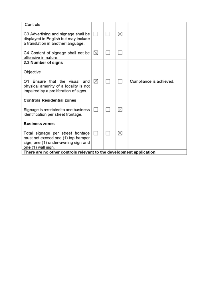
It is identified that the “Advertising and
Signage” chapter is relevant under the Miscellaneous Development Controls
of Part G for the building identification signs to be erected. It is determined
that the two signs are acceptable when considered under the relevant
provisions. A detailed assessment is at Attachment C.
Given location on Council owned land and the merit
assessment undertaken, the replacement State Emergency Service building is
acceptable for the locality.
Car parking
There are no car parking provisions for depots however, if
the first floor of the building was to be classified wholly as office, then the
area of 167 square metres would require 4 spaces based on the development
control plan rate of 1 space per 40 square metres. The entire site is provided
with adequate car parking with designated car parks situated in Killeen Street
directly at the front of the site, another Council car park on the depot site
along its northern curtilage facing Chiswick Road, car parking areas adjacent
to the main depot buildings plus another 40 car parking spaces available along
the eastern side of the depot. Council engineers have raised no issues with the
existing car parking arrangements available.
The provisions of any planning agreement that has been
entered into under section 7.4, or any draft planning agreement that a
developer has offered to enter into under section 7.4 (EP&A Act
s4.15(1)(a)(iiia))
There is no draft planning agreement associated with the
subject Development Application.
The provisions of the Regulations (EP&A Act s4.15
(1)(a)(iv))
The proposed development raises no concerns as to the
relevant matters arising from the Environmental Planning and Assessment
Regulations 2000 (EP&A Reg).
The Likely Environmental, Social or Economic Impacts
(EP&A Act s4.15 (1)(b))
It is considered that the proposed development will have no
significant adverse environmental, social or economic impacts in the locality.
The suitability of the site for the development (EP&A
Act s4.15 (1)(c))
The subject site and locality is not known to be affected by
any natural hazards or other site constraints likely to have a significant
adverse impact on the proposed development. Accordingly, it is considered that the
development is suitable in terms of its size, scale, height and bulk in the
context of the site and surrounding area.
Submissions made in accordance with the Act or Regulation
(EP&A Act s4.15 (1)(d))
|
Advertised (Council
Website)
|
Mail
|
Sign
|
Not Required
|
In accordance with Council’s Notification requirements
contained within the Cumberland Development Control Plan, the development
application was notified for a period of fourteen (14) days between Friday 26
November and Friday 10 December 2021.
There was one submission received.
The issues raised in the public submissions are summarised
and commented on as follows:
|
Issue
|
Planner’s Comment
|
|
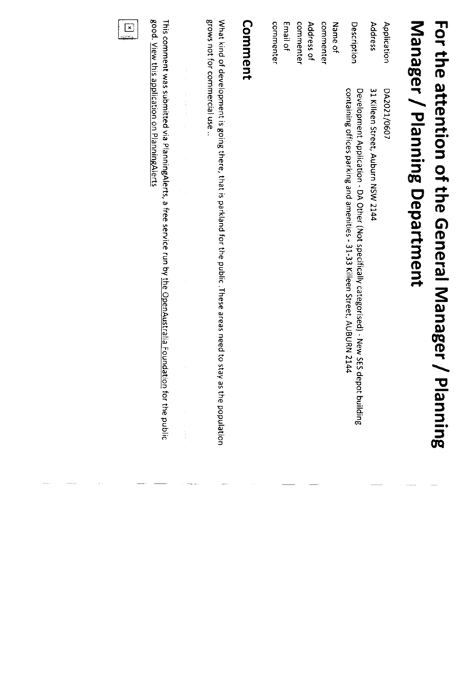
This is parkland for the public and the area must stay and
not be used for commercial gain.
|
While the site is within a public recreation zone, the site
is currently in use as a Council and SES depot and will continue to do so.
This is a replacement SES building on Council land to support SES operations.
There is no impact to recreation areas close by or other
related reserves.
|
The public interest (EP&A Act s4.15(1)(e))
In view of the foregoing analysis it is considered that the
development, if carried out subject to the conditions set out in the
recommendation below will have no significant adverse impacts on the public
interest.
CUMBERLAND LOCAL INFRASTRUCTURE CONTRIBUTIONS
PLAN 2020
A contribution is not required to be paid for such a
development on Council’s land in accordance with the Cumberland Local
Infrastructure Contributions Plan 2020.
The applicant and notification process did not result in any
disclosure of Political Donations and Gifts.
The development application has been assessed in accordance
with the relevant requirements of the Environmental Planning and Assessment Act
1979 and the following relevant state environmental planning policies:-
a) State Environmental
Planning Policy (Biodiversity and Conservation) 2021.
b) State Environmental
Planning Policy (Resilience and Hazards) 2021.
c) State Environmental
Planning Policy (Industry and Employment) 2021.
d) Cumberland Local
Environmental Plan 2021.
e) Cumberland Development
Control Plan.
The development is considered to be satisfactory for
approval subject to conditions.
|
1.
That Development Application 2021/0607 for Demolition of
existing building and construction of a two-storey depot building for NSW
State Emergency Services containing administration spaces, parking,
associated amenities and erection of two
building identification signs on land at 31 – 33 Killeen Street
Auburn be approved subject to conditions.
2.
Persons whom have lodged a submission in respect to the
application be notified of the determination of the application.
|
1. Appendix
A - State Environmental Planning Policy 64
2. Appendix
B - Cumberland Local Environmental Plan
3. Appendix
C - Cumberland Development Control Plan
4. Draft
Notice of Determination
5. Draft
Reasons for Approval
6. Submission
No. 1 Redacted
7. Assessment
Report
DOCUMENTS
ASSOCIATED WITH
REPORT LPP004/22
Attachment 1
Appendix A - State Environmental Planning Policy 64
Cumberland Local Planning Panel Meeting
9 March 2022
DOCUMENTS
ASSOCIATED WITH
REPORT LPP004/22
Attachment 2
Appendix B - Cumberland Local Environmental Plan
Cumberland Local Planning Panel Meeting
9 March 2022

DOCUMENTS
ASSOCIATED WITH
REPORT LPP004/22
Attachment 3
Appendix C - Cumberland Development Control Plan
Cumberland Local Planning Panel Meeting
9 March 2022
DOCUMENTS
ASSOCIATED WITH
REPORT LPP004/22
Attachment 4
Draft Notice of Determination
Cumberland Local Planning Panel Meeting
9 March 2022


DOCUMENTS
ASSOCIATED WITH
REPORT LPP004/22
Attachment 5
Draft Reasons for Approval
Cumberland Local Planning Panel Meeting
9 March 2022

DOCUMENTS
ASSOCIATED WITH
REPORT LPP004/22
Attachment 6
Submission No. 1 Redacted
Cumberland Local Planning Panel Meeting
9 March 2022
DOCUMENTS
ASSOCIATED WITH
REPORT LPP004/22
Attachment 7
Assessment Report
Cumberland Local Planning Panel Meeting
9 March 2022


Cumberland
Local Planning Panel Meeting
9 March 2022
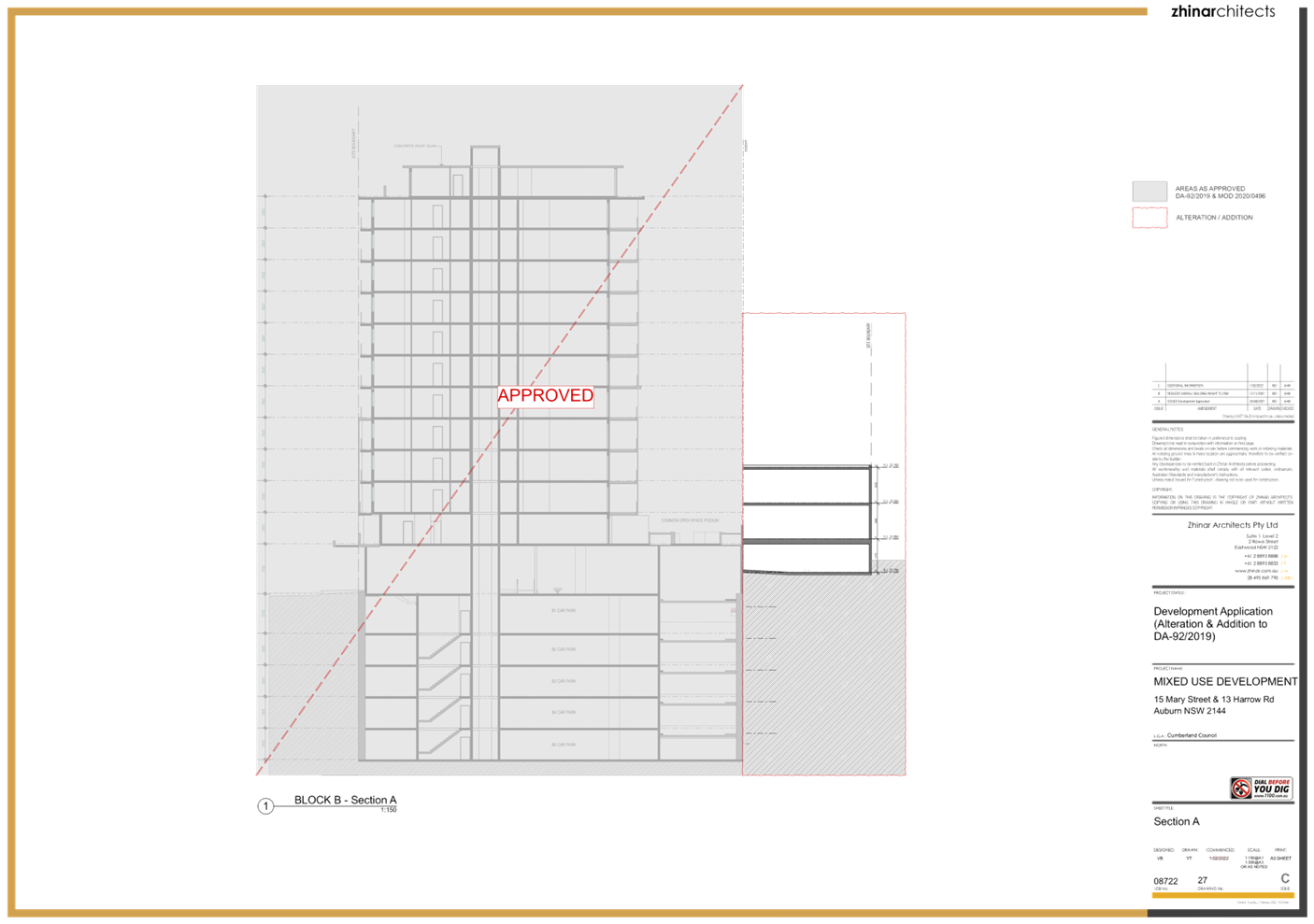
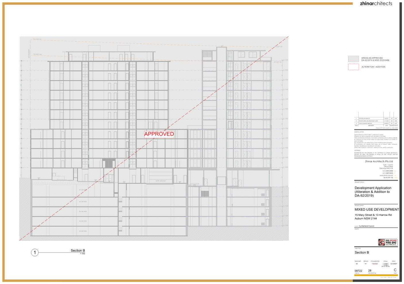
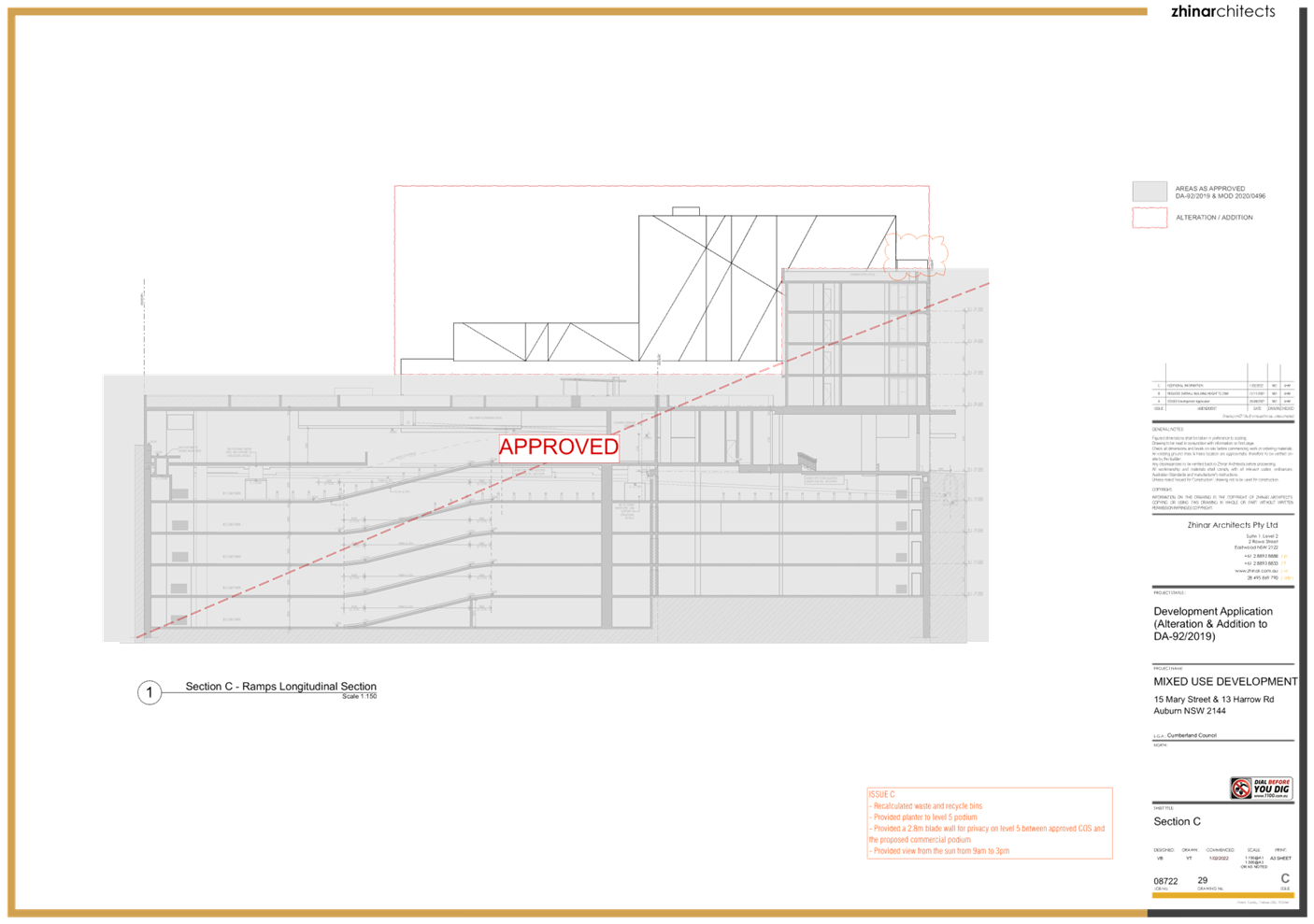
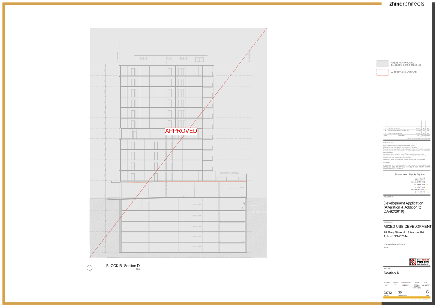
Item No: LPP005/22
Development
Application for 15 Mary Street & 13 Harrow Road Auburn
Responsible
Division: Environment
& Planning
Officer: Executive
Manager Development and Building
File Number: DA2021/0597
|
Application
lodged
|
21
October 2021.
|
|
Applicant
|
Group
A8 Pty Ltd.
|
|
Owner
|
Group
A8 Pty Ltd.
|
|
Application
No.
|
DA2021/0597.
|
|
Description
of Land
|
15
Mary Street and 13 Harrow Road Auburn.
Lot
919 in DP 1266699 and Lot 27 in DP 1093256.
|
|
Proposed
Development
|
Construction
of a seven (7) storey commercial building with ground floor parking at 13
Harrow Road, Auburn and alterations and additions to the approved mixed use
development at 15 Mary Street, Auburn including the reduction of communal
open space area, provision of vehicular access and reconfiguration of the
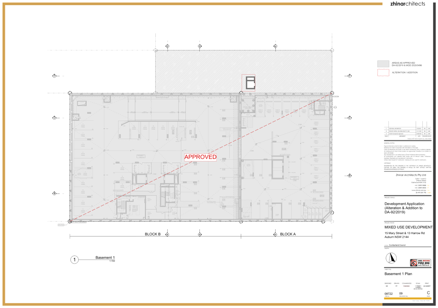
basement level 2 to facilitate parking and lift access requirements for the
new building.
|
|
Site
Area
|
3,340.86
square metres.
|
|
Zoning
|
B4 -
Mixed Use under the Auburn LEP 2010.
|
|
Disclosure
of political donations and gifts
|
Nil
disclosure.
|
|
Heritage
|
Yes
- Land is located in the vicinity of a heritage item.
|
|
Principal
Development Standards
|
FSR
Permissible:
5:1.
Proposed:
4.99:1.
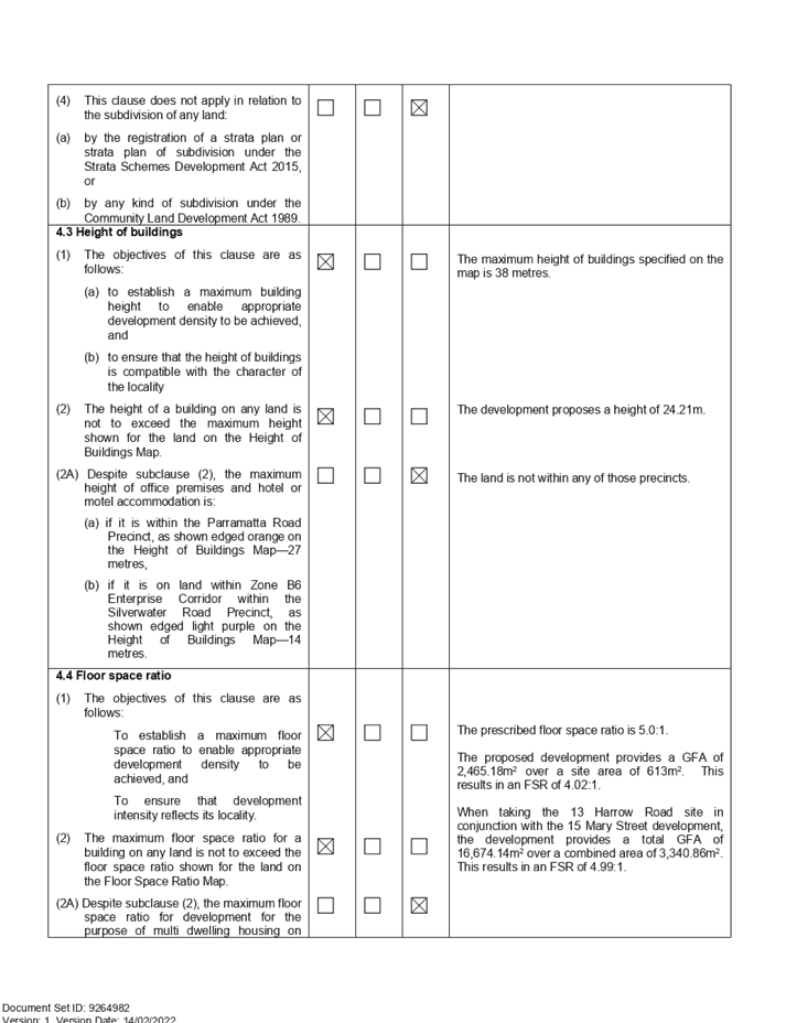
Height
of Building
Permissible:
38m.
Proposed:
24.21m.
|
|
Issues
|
Compliance
with SEPP 65 and the Apartment Design Guide.
|
|
Assessing
Officer
|
Glenn
Apps - Cohesive Planning.
|
1. Development Application 2021/0597 was received on 21 October
2021 for the construction of a 7 storey commercial building with ground floor
parking at 13 Harrow Road, Auburn. The proposal also involves alterations and
additions to the approved mixed use development at 15 Mary Street, Auburn
including the reduction of the approved communal open space area, provision of
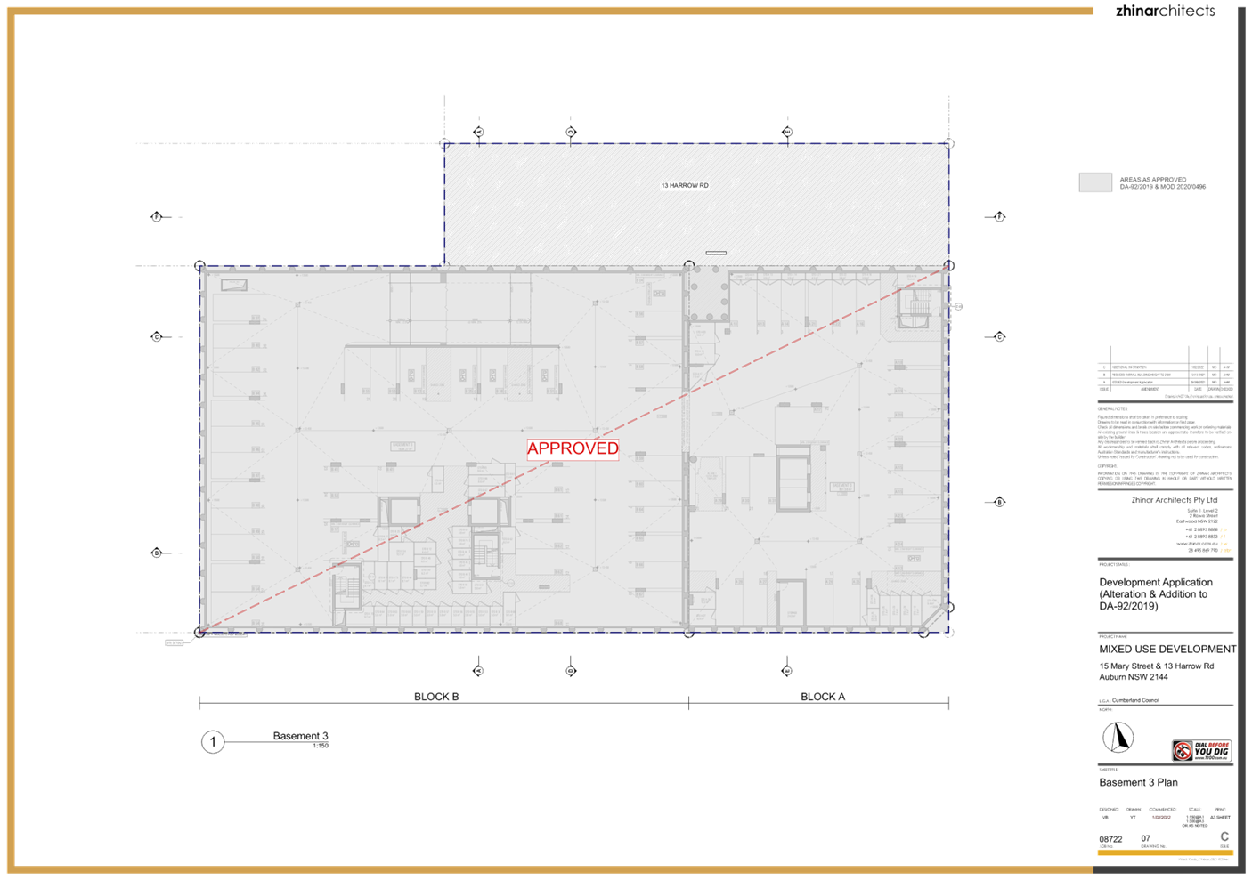
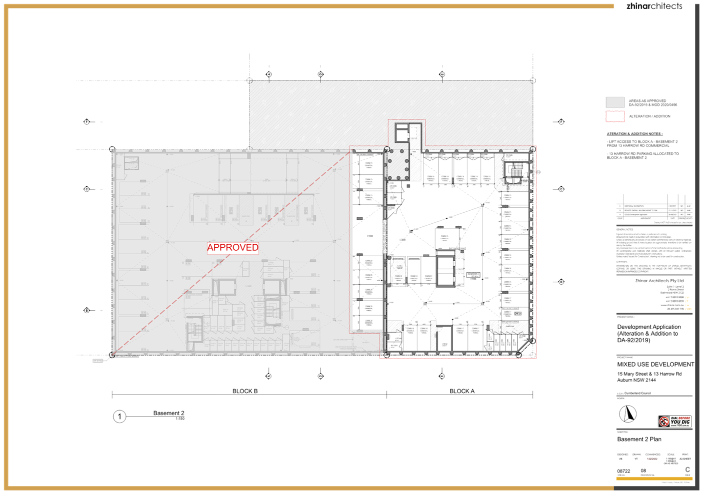
vehicular access and reconfiguration of the basement level 2 to facilitate
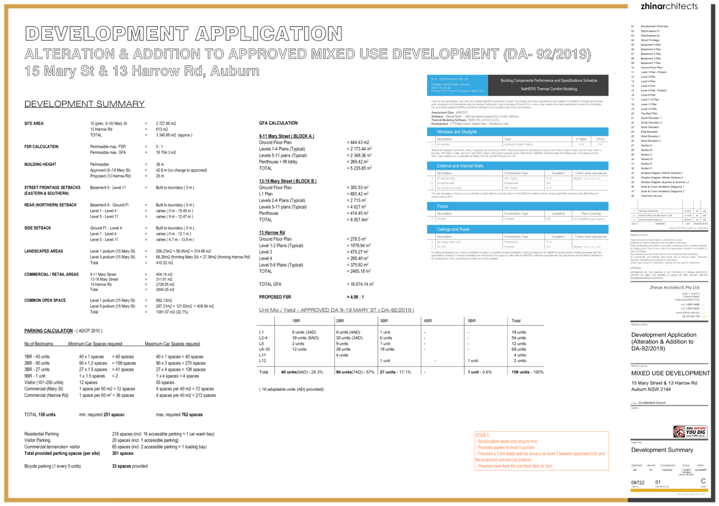
parking and lift access requirements for the new building.
2. In total, the proposed development
will provide for 2,465.18m2 of commercial floorspace. The proposal
does not alter the yield of the approved development over 15 Mary Street, which
will maintain the approved 158 residential units and 13 commercial suites.
3. Notification of the application did not result in
the receipt of public submissions.
4. The proposed development does not involve any
variation to a development standard.
5. The application is recommended for approval
subject to the conditions as provided in the attached schedule.
6. The application is referred to the Panel as State
Environmental Planning Policy No.65 - Design Quality of Residential Apartment
Development applies to the development.
7. The application has been assessed by an independent
planning consultant, Mr. Glenn Apps.
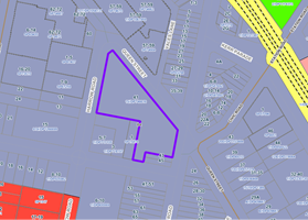
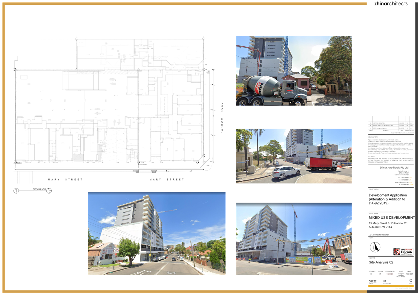
The subject site is known as Lot
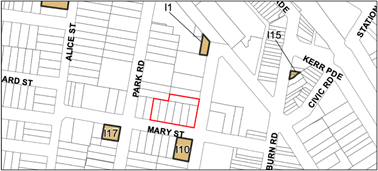
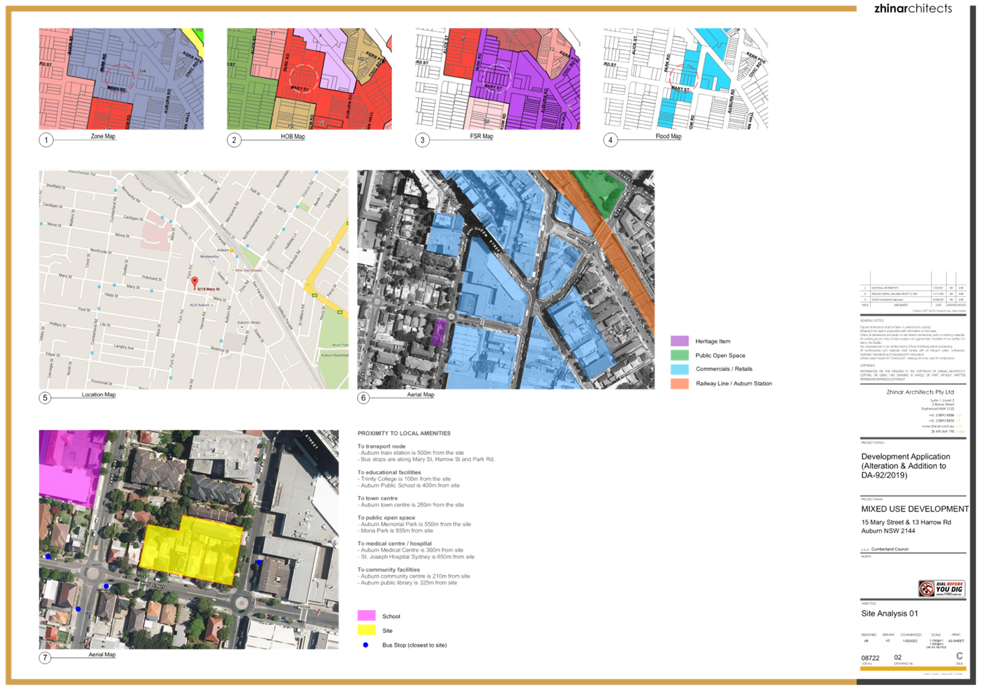
919, DP1266699 and Lot 27, DP1093256, 15 Mary Street and 13 Harrow Road, Auburn.
The subject site is located on the northwest corner of Mary Street and Harrow Road.
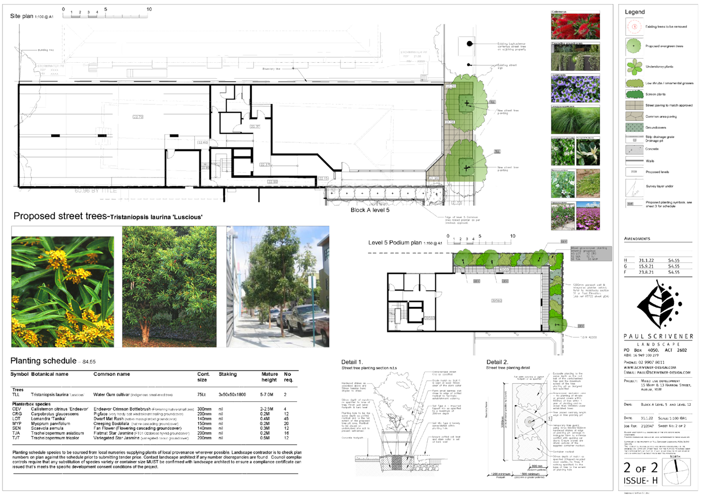
The location of the site is shown at Figure 1. An aerial image of the
site and surrounding area is at Figure 2.
The site is situated within a mixed-use zone within the
Auburn town centre and is approximately 400m walking distance to Auburn railway
station.
The site has a frontage to Mary Street of 74.63m to the
south and a frontage to Harrow Road of 48.7m to the east. The combined
site has a total area of 3,340.86m2. The 13 Harrow Road site over
which the commercial building is proposed has a frontage to Harrow Road of
12.19m and an area of 613m2.
The land is occupied by a single storey residential
building as shown in Figure 3. The building has been approved for demolition
under a previous development application. The land comprising 15 Mary Street
features a mixed-use development which is currently under construction.
The site is adjoined by a
townhouse building to the north. Land to the west is developed with
single storey dwellings. A place of worship and commercial buildings exist
across Harrow Road to the east. Land across Mary Street to the south is
generally comprised of professional consulting rooms.
Figure 1 –
Locality Plan of subject site (source: SixMaps)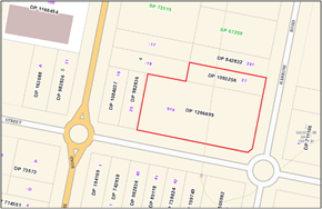
Figure 2 –
Aerial view of subject site (source: SixMaps)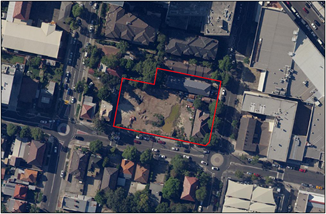
Figure 3 – Street
view of subject site showing adjoining mixed use building adjoining
Description of the
proposed development
Council has received a development application which
proposes:
- the
construction of a 7 storey commercial building;
- ground
floor parking; and
- alterations
and additions to the approved mixed use development at 15 Mary Street, Auburn
including the reduction of communal open space area, provision of vehicular
access and reconfiguration of the basement level 2 to facilitate parking and
lift access requirements for the new building.
The demolition of the existing building on 13 Harrow Road
was approved under previous development application DA2021/0328 (see History
below).
In detail,
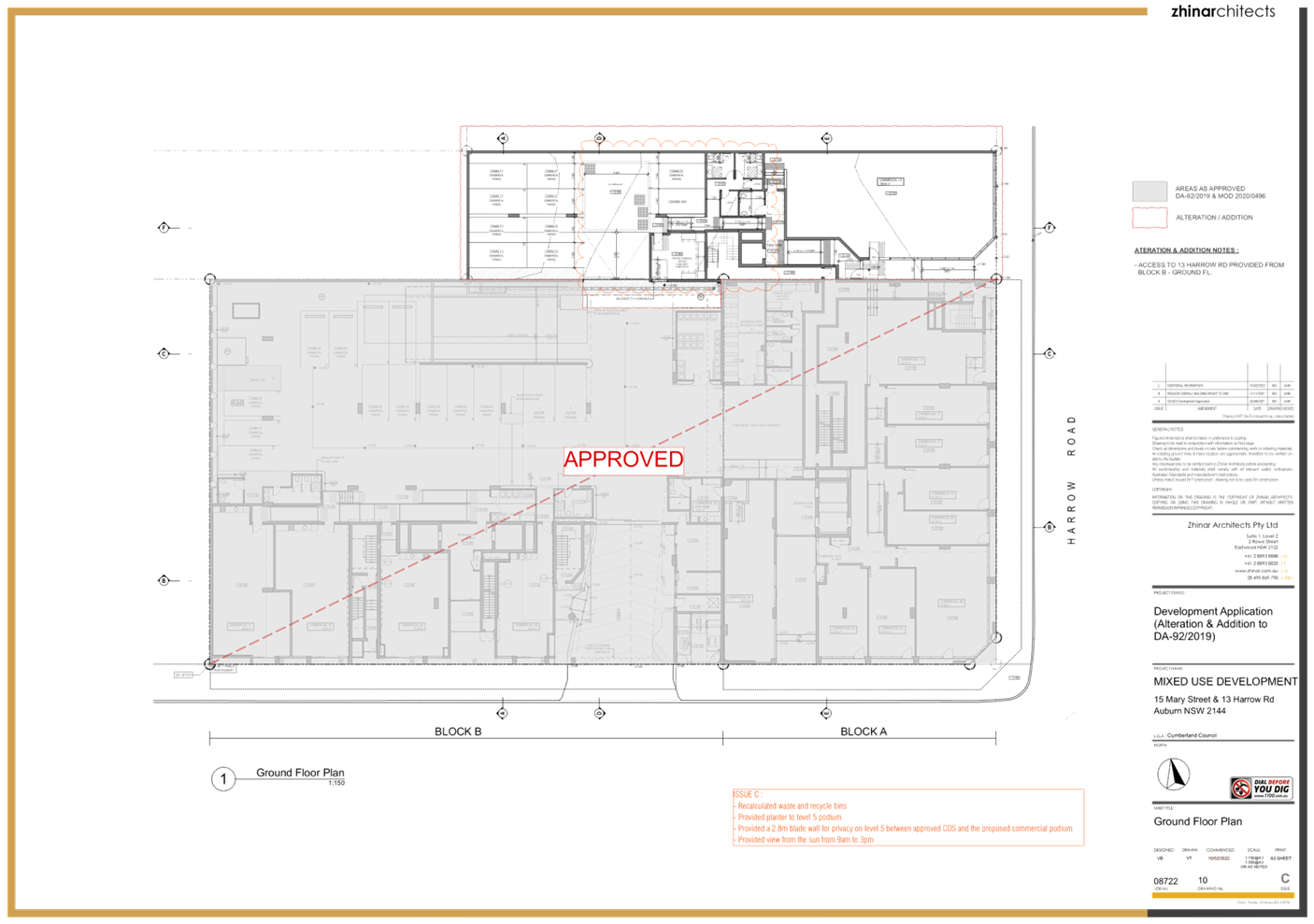
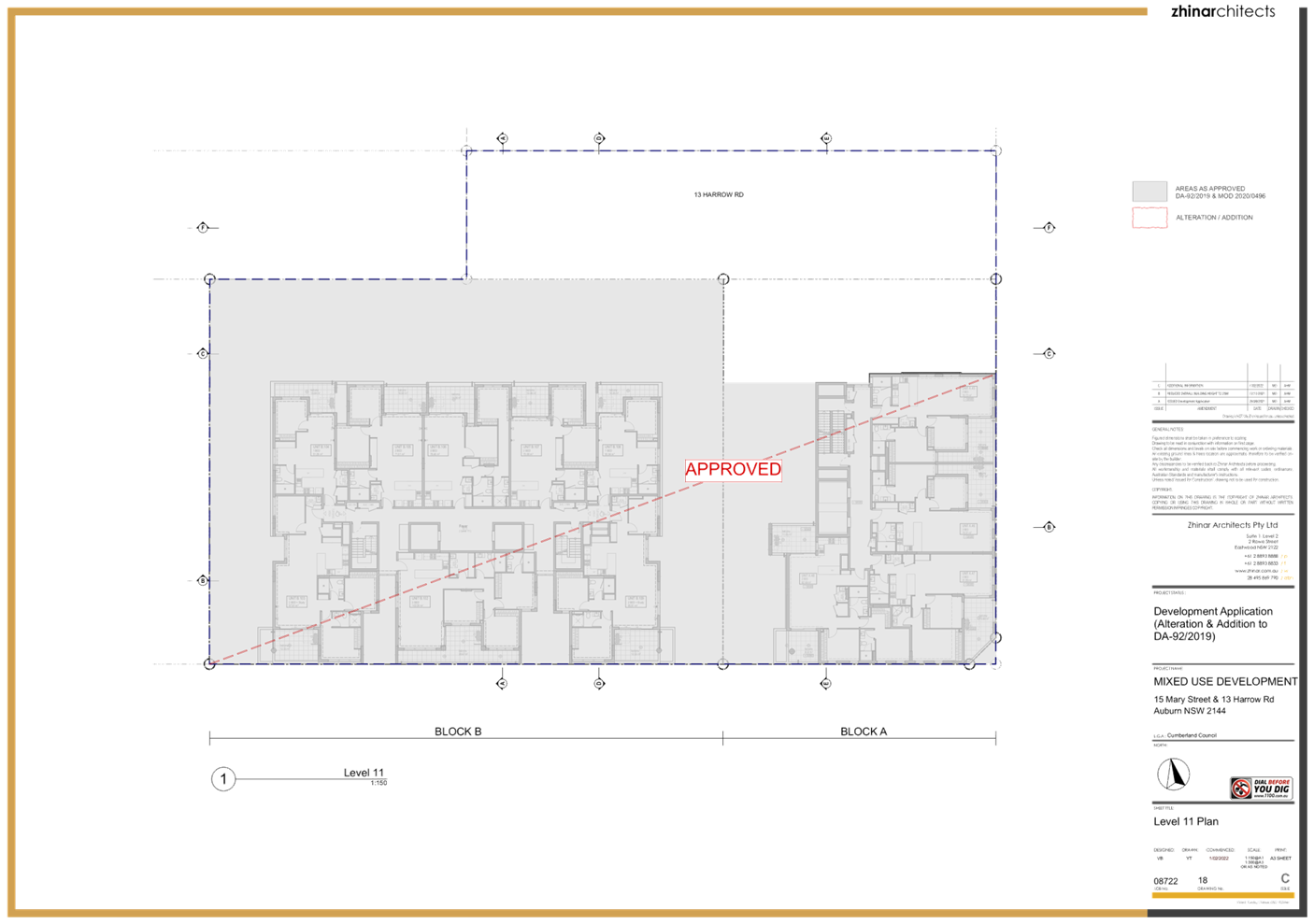
the development will provide the following:
· Ground floor:
- 1 x commercial tenancy of 188.68m2;
- 9 carparking spaces accessed via 15
Mary Street;
- loading bay;
- commercial waste room;
- amenities and access;
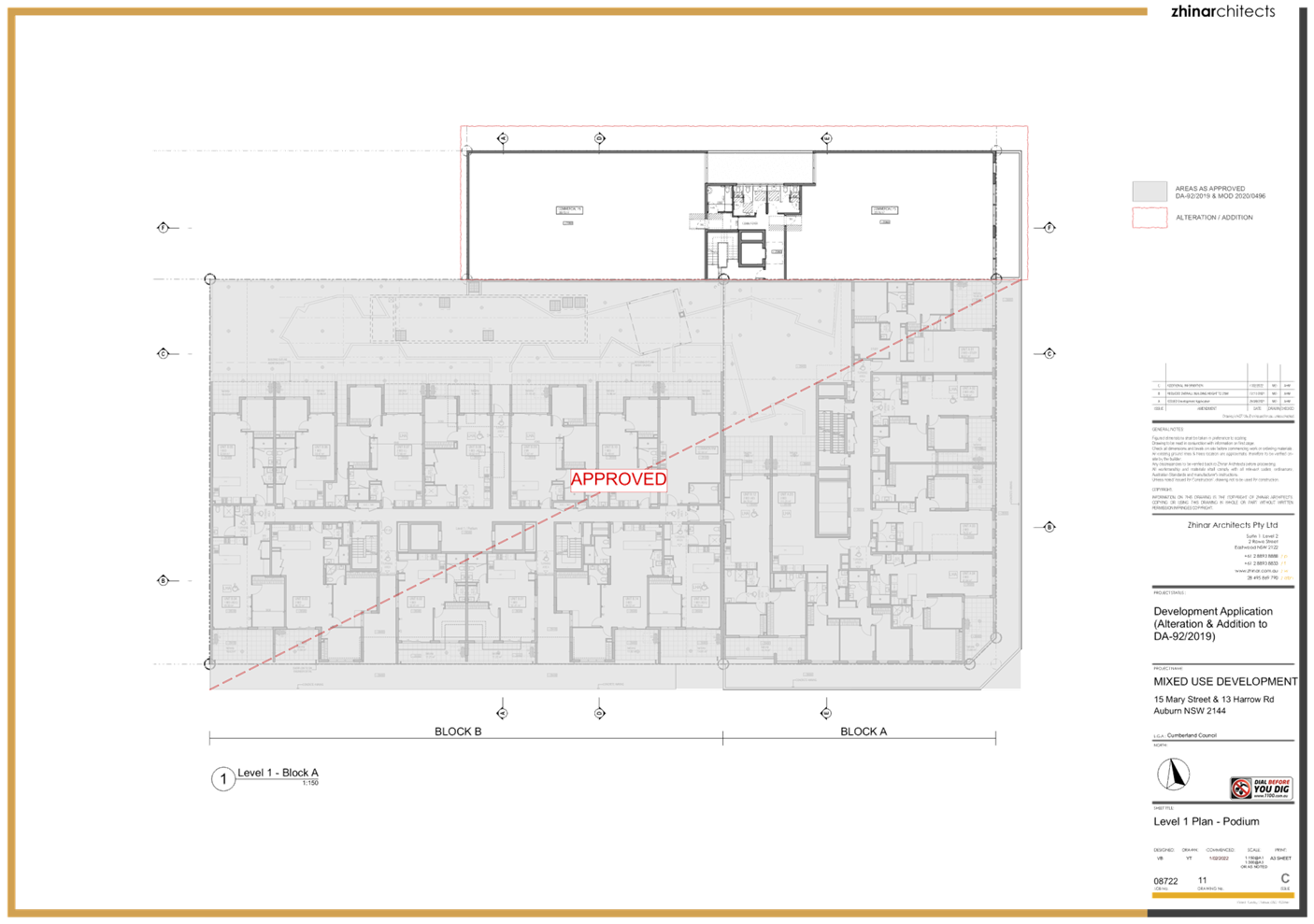
· First floor and Second floor (each):
- 2 x commercial tenancy of 233.76m2
and 269.70m2;
- amenities and access;
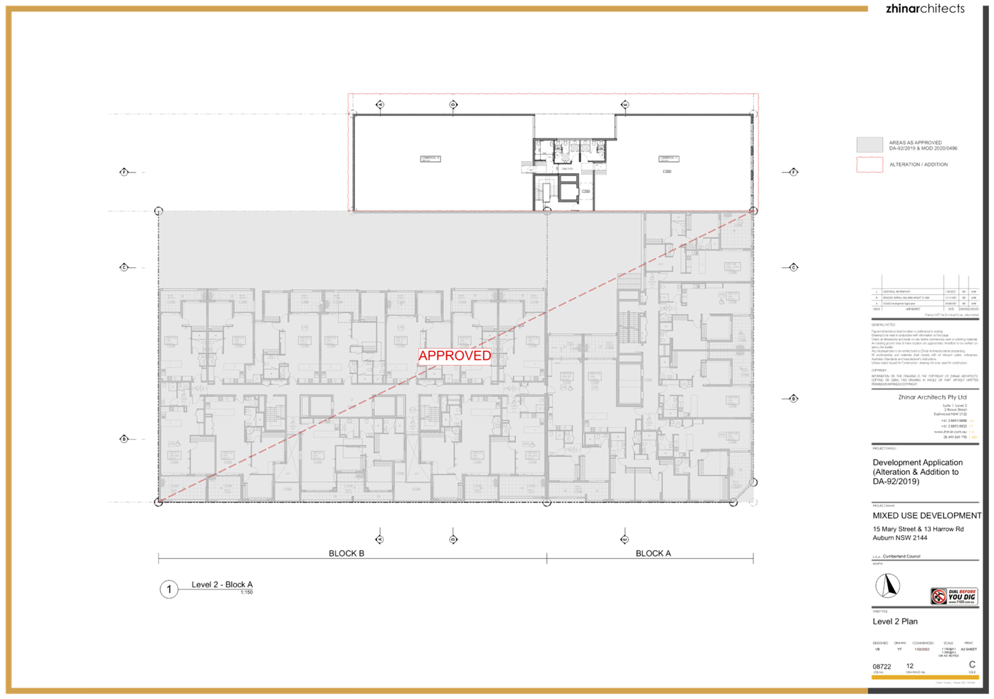
· Third floor:
- 2 x commercial tenancy of 233.76m2
and 209.50m2;
- amenities and access;
· Fourth floor:
- 1 x commercial tenancy of 225.69m2;
- amenities and access;
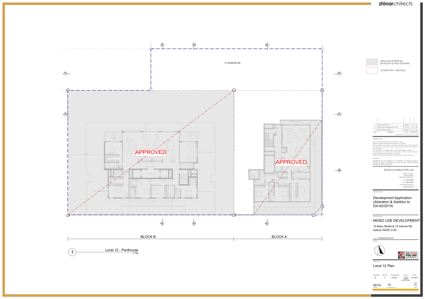
· Fifth floor:
- 1 x commercial tenancy of 147.20m2;
- amenities and access;
- podium area;
· Sixth floor:
- 1 x commercial tenancy of 147.20m2;
- amenities and access.
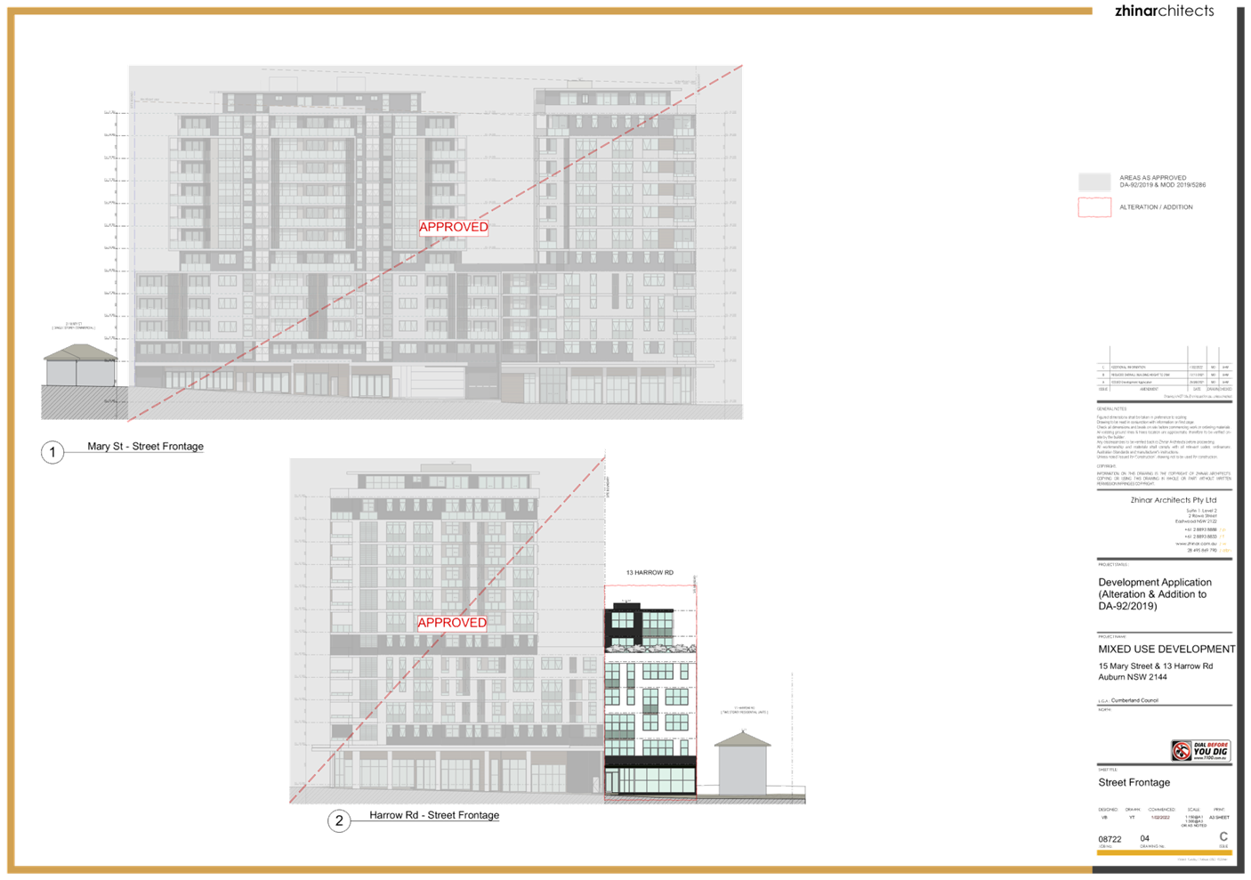
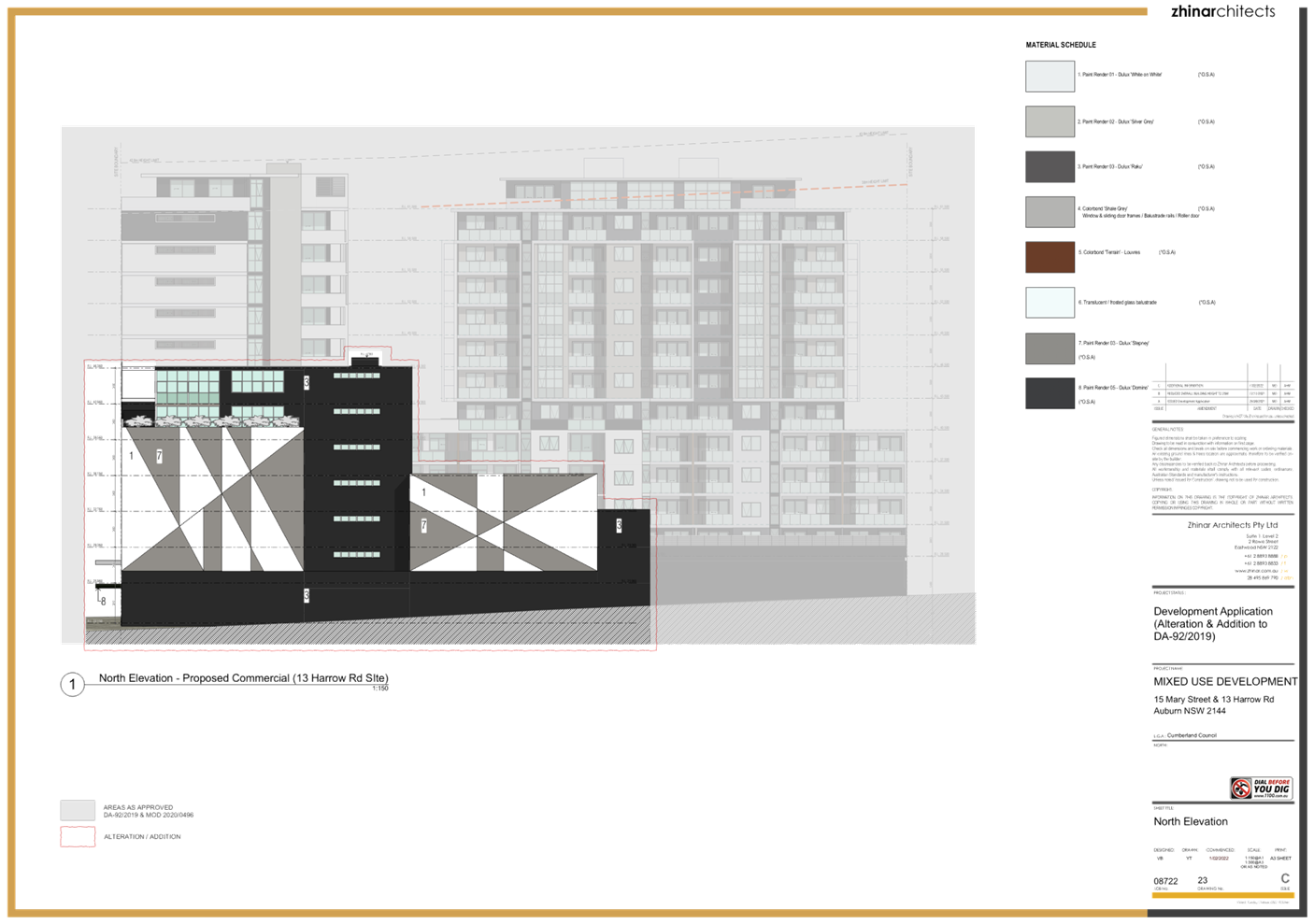
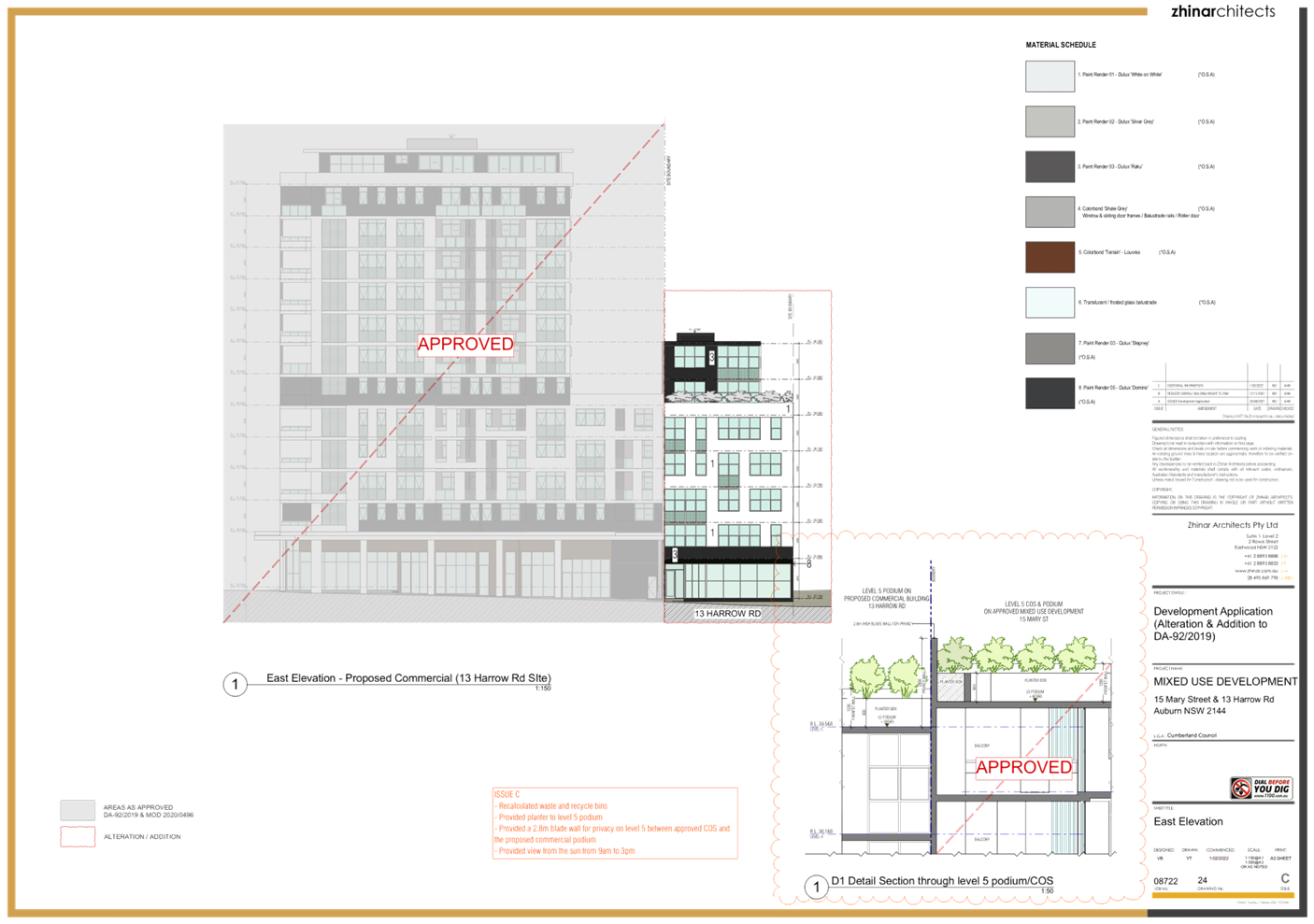
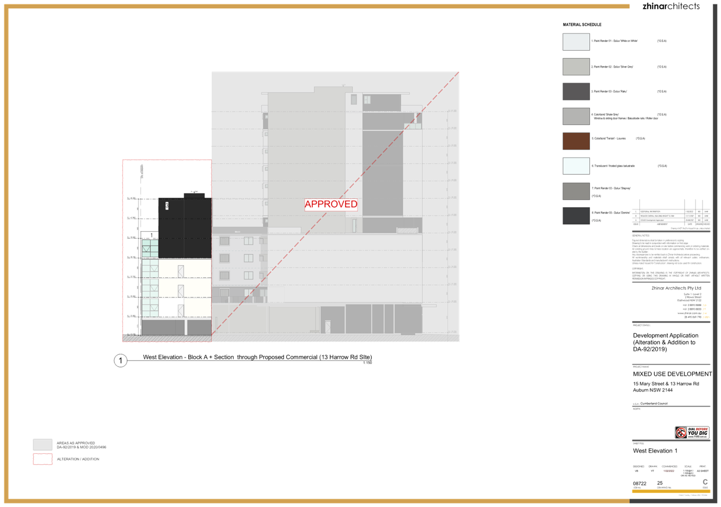
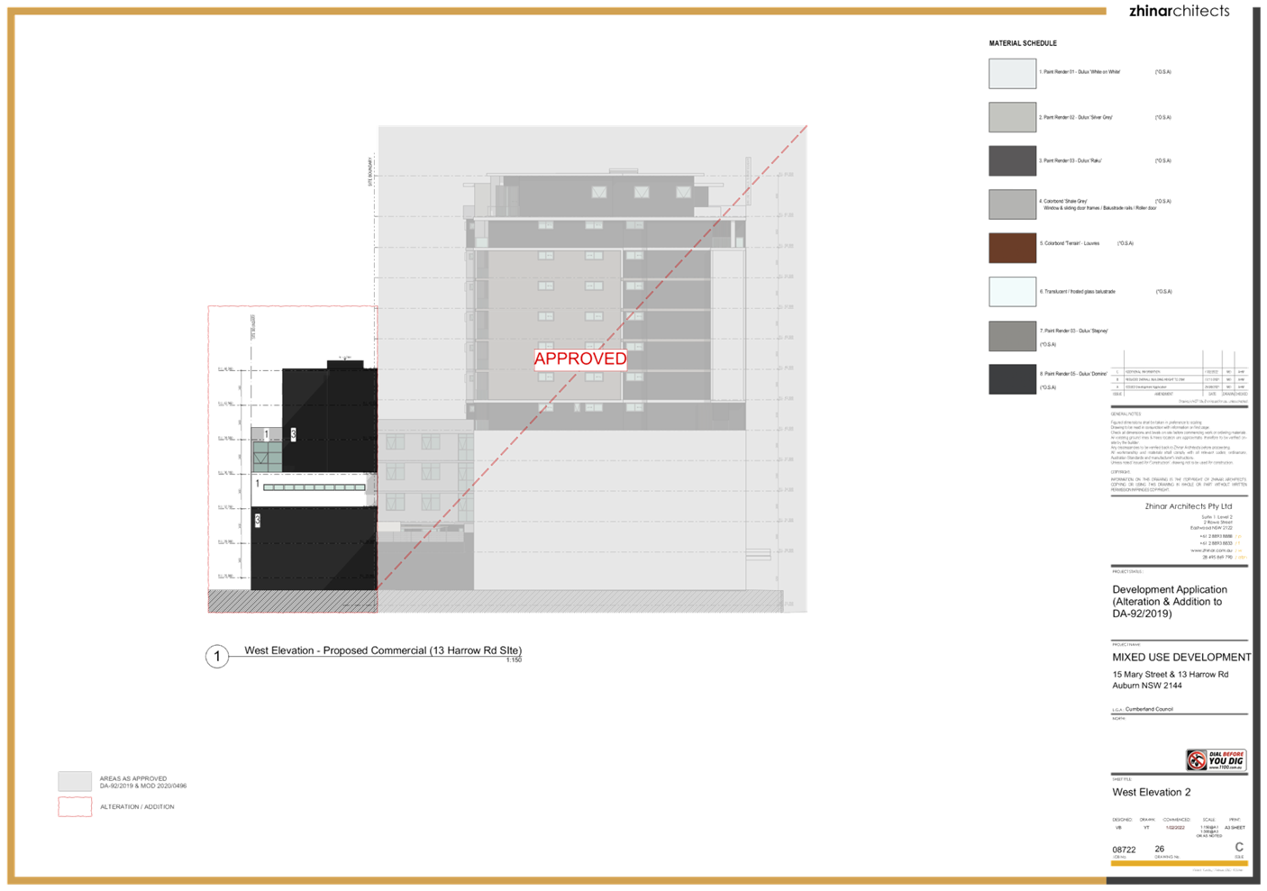
The proposed
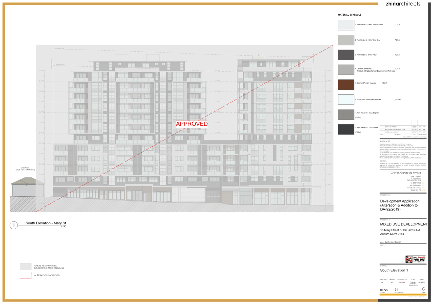
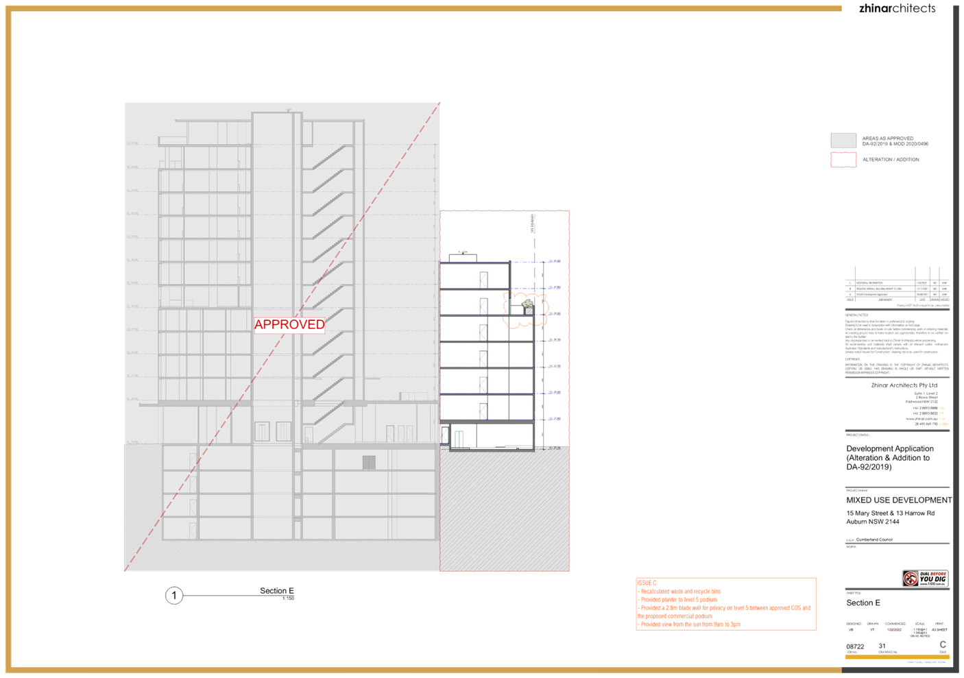
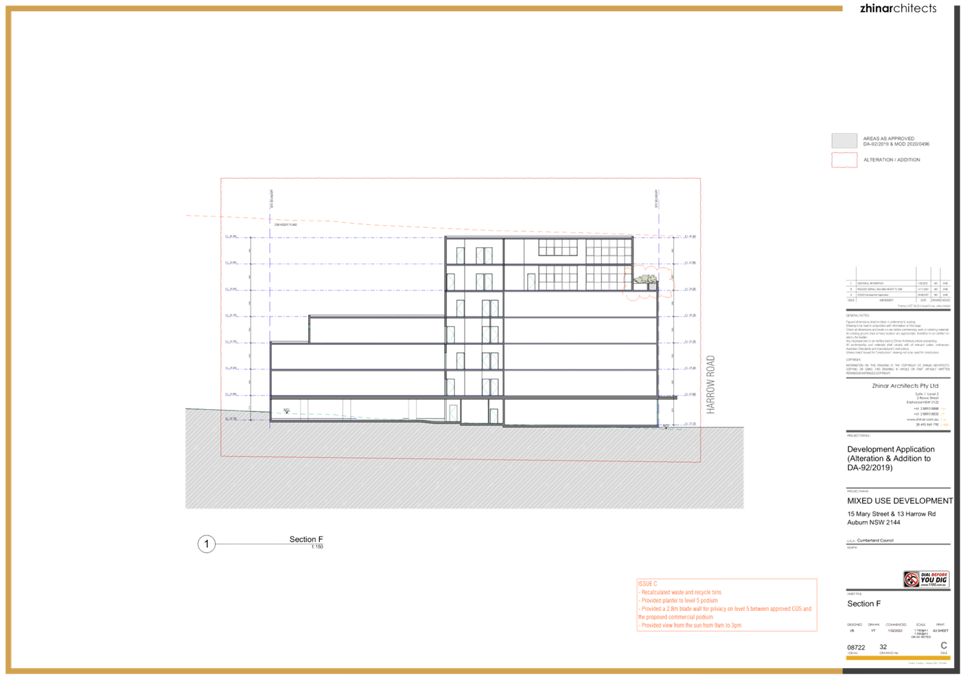
development presents a 5-storey street wall to Harrow Road which is consistent
with the approved development at 15 Mary Street. The proposed development seeks
to use the same materials and colour palette as that used in the development at
15 Mary Street which will result in a uniform facade presentation. The podium
on top of the 5th storey features a landscape edge which is in
keeping with the treatment of the open space podium on the approved development
at 15 Mary Street and will further assist in ensuring the two buildings read as
one consistent design.
Side
elevations are treated to provide visual interest to the building when viewed
from the building at 15 Mary Street. The treatment of the northern elevation
also provides visual interest to the building when viewed from the land to the
north and from Harrow Road, at least until such time as the land to the north is
similarly developed.
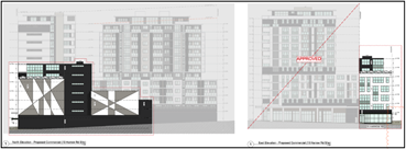
Figure 4 – Extracts of northern
and eastern elevations
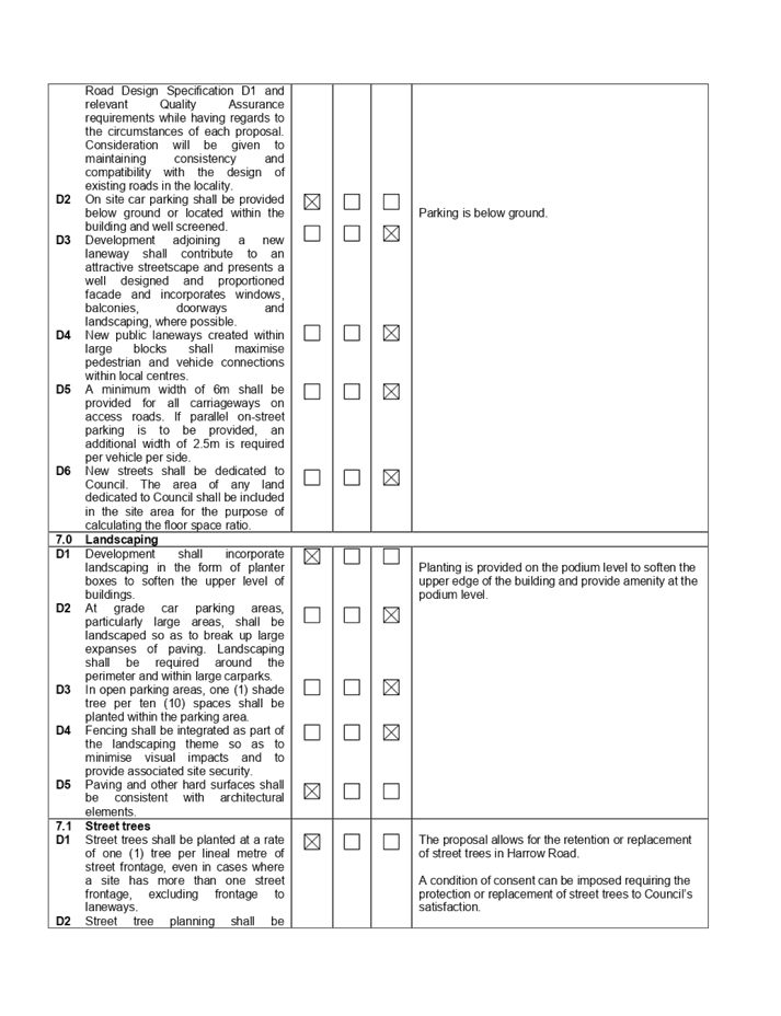
Parking for
9 vehicles (8 of which are in a stacked formation) is proposed and is accessed
via the ground level parking of 15 Mary Street.
Figure 5 – Vehicular access
between 15 Mary Street and 13 Harrow Road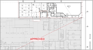
The
development, when considered as a whole, exceeds the minimum number of car
parking spaces required under the Auburn DCP 2010. Sufficient parking is
therefore provided for the proposed development and all components of the
existing, approved development.
Pedestrian
access is also afforded from the Basement 2 parking level of 15 Mary Street to
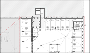
the proposed building via a lift as shown below.
Figure 6 – Pedestrian access
between 15 Mary Street and 13 Harrow Road
A condition of consent will require the consolidation of
13 Harrow Road with 15 Mary Street.
DA-52/2017 was lodged with Council
on 10 February 2017 for the demolition of existing dwelling houses and the
construction of a 12 storey mixed use development comprising 105 residential
units and 2 commercial tenancies over 4 levels of basement parking at 13-19
Mary Street, Auburn.
DA-52/2017 was granted deferred
commencement consent on 21 December 2017.
The deferred commencement matters
were completed, and the consent became operative on the 13 April 2018.
DA-92/2019 was lodged on 25 March
2019 for the construction of an additional 12 storey mixed use building
component at 9-11 Mary Street, Auburn. That DA also proposed a number of alterations
and additions to the 12 storey mixed use building which was approved by
DA-52/2017 at 13-19 Mary Street, Auburn.
DA-92/2019 was granted consent on
the 3 September 2019.
Modification application
MOD2019/5286 was lodged on the 20 December 2019 to modify DA-92/2019 to add a 5
bedroom penthouse apartment on top of the western tower in place of the rooftop
common open space.
MOD2019/5286 was approved on the
13 February 2020.
MOD2020/0496 was lodged on the 21
January 2021 to amend the layout of the ground floor commercial component and
the fire stair arrangements.
MOD2020/0496 was approved on the
12 March 2021.
DA2021/0328 was lodged on 22 June
2021 for the demolition of existing structures at 13 Harrow Road and the
provision of communal open space over that land. DA2021/0328 also proposed
alterations and additions to the mixed-use development at 15 Mary Street
approved under DA-92/2019 including ground floor access to the open space at 13
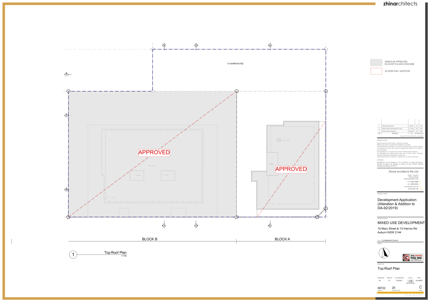
Harrow Road, provision of communal open space on level 5 podium, removal of
rooftop communal open space and construction of a 3 bedroom unit, and changes
to corridor windows on levels 6 to 11.
DA2021/0328 was approved on the 8
September 2021.
Applicants Supporting
Documents
The
development application is supported by the following reports.
|
Document
|
Prepared by
|
Dated
|
|
Architectural
plans
|
Zhinar
Architects
|
1 February 2022
|
|
Landscape
plans
|
Paul
Scrivener Landscape
|
31 January 2022
|
|
Statement
of Environmental Effects
|
The
Planning Hub
|
8 October 2021
|
|
Architects
Design Statement
|
Zhinar
Architects
|
November 2021
|
|
SEPP 65
Design Verification
|
Zhinar
Architects
|
November 2021
|
|
Waste
Management Plan
|
Rolz Group
|
24 January 2022
|
|
Geotechnical
Investigation
|
STS
Geotechnics
|
September 2021
|
|
Preliminary
Site Investigation
|
EI
Australia
|
24 November 2021
|
|
Cost
Report
|
Quantex
Consulting
|
20 August 2021
|
|
BCA
Section J Compliance Report
|
Eco
Certificates
|
23 August 2021
|
|
Stormwater
Design Plans
|
Quantum
Engineers
|
21 September 2021
|
|
Survey
plan
|
SDG
|
21 April 2021
|
|
Traffic
and Parking Assessment
|
Varga
Traffic Planning
|
29 September 2021
|
|
Acoustic
Assessment
|
Acoustic
Logic
|
8 September 2021
|
|
Access
Report
|
Vista
Access Architects
|
29 September 2021
|
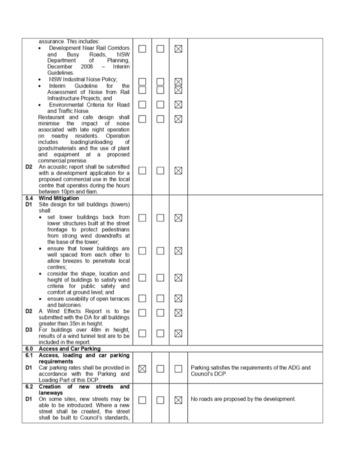
Contact with relevant
parties
The
consulting planner carrying out the assessment undertook a site inspection on
22 November 2021. Council’s officer with carriage of the DA has been in
regular contact with the applicant throughout the assessment process.
INTERNAL/EXTERNAL
REFERRALS
|
Referral
Body
|
Satisfactory
|
|
Development
Engineering
|
Yes
- subject to conditions including the provision of mirrors within the carpark
to improve safety and flood certification.
|
|
Waste
Management
|
Yes
- subject to conditions.
|
|
Environmental
Health Unit
|
Yes
- subject to conditions.
|
|
NSW
Police
|
No
objections raised.
|
|
Ausgrid
|
No
objections raised and conditions have been provided.
|
The
provisions of any Environmental Planning Instruments (EP&A Act s4.15
(1)(a)(i))
State Environmental Planning Policies
The modification application is affected by the following
State Environmental Planning Policies:
(a) State Environmental
Planning Policy No. 65 - Design Quality of Residential Apartment Development
(SEPP 65)
While SEPP 65 does not apply to the proposed commercial
building, the carrying out of that building may have implications for the
residential component of the mixed-use development to which SEPP 65 applies.
An assessment of relevant matters
under the ADG has been carried out to confirm that the proposed commercial
development does not result in any non-compliance with the provisions of the
ADG for the residential component of the approved development at 15 Mary
Street.
A comprehensive assessment against SEPP 65 and the ADG is contained
in Appendix A of Attachment 4.
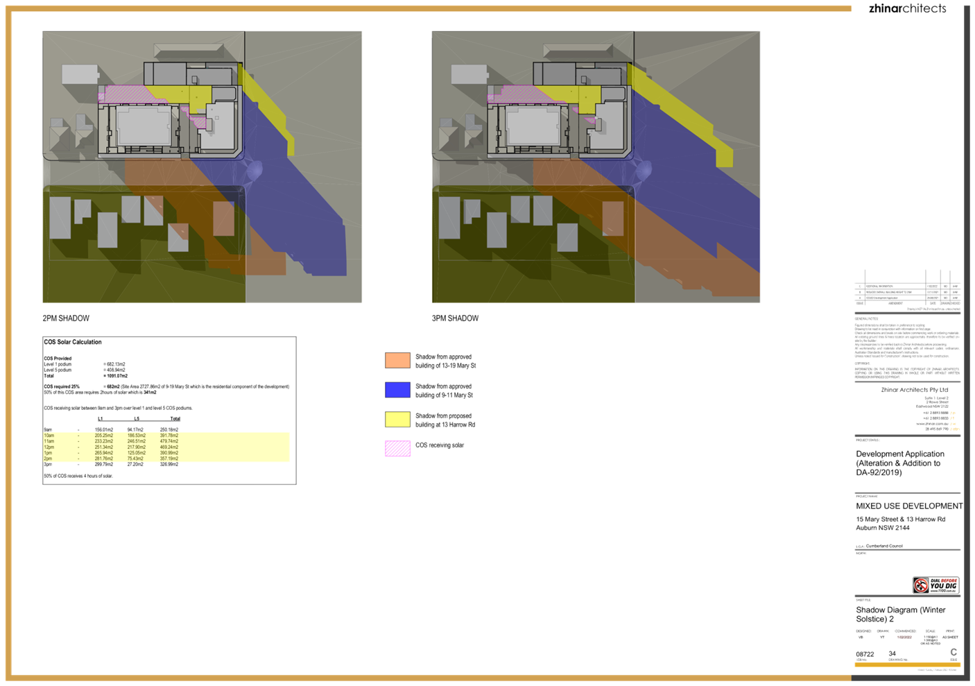
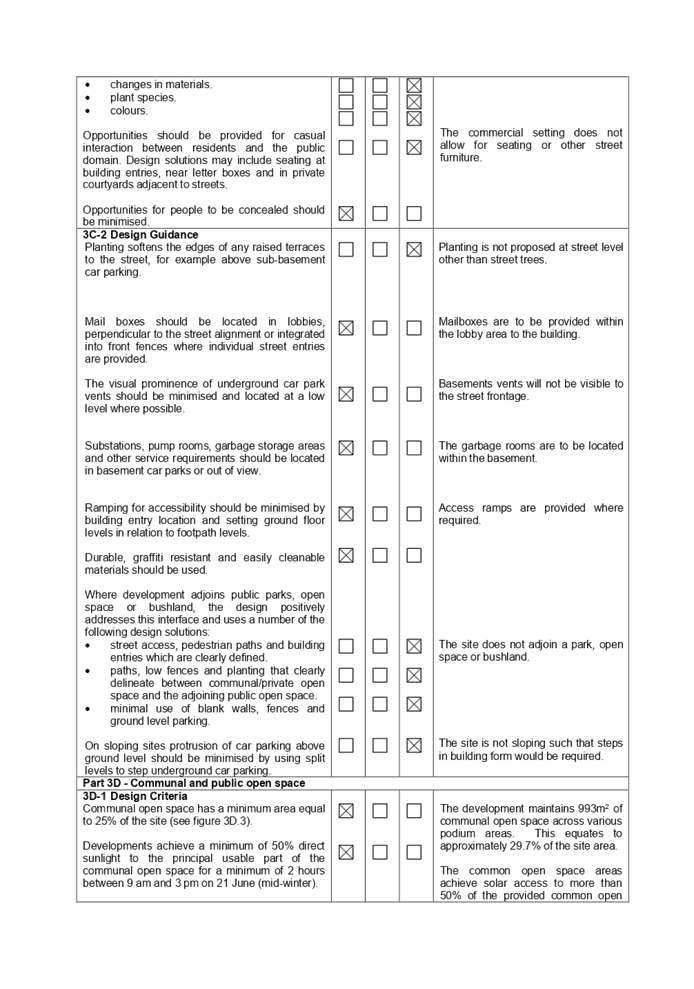
Common open space
Common open space reduced over
that provided under DA2021/0328 because of the development of the 13 Harrow
Road land which was previously provided as common open space.
Notwithstanding, the common open
space exceeds the minimum 25% required under the ADG and is provided as
follows:
|
AREA
|
SIZE (m2)
|
% OF SITE AREA
|
|
Podium (level 1)
|
584.57
|
17.5
|
|
Podium (level 5 between towers)
|
287.31
|
8.6
|
|
Podium (level 5 eastern tower)
|
121.63
|
3.6
|
|
TOTAL
|
993.1
|
29.7
|
The proposed commercial building
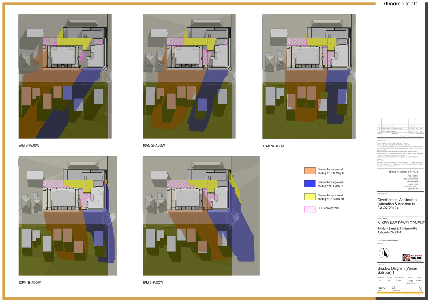
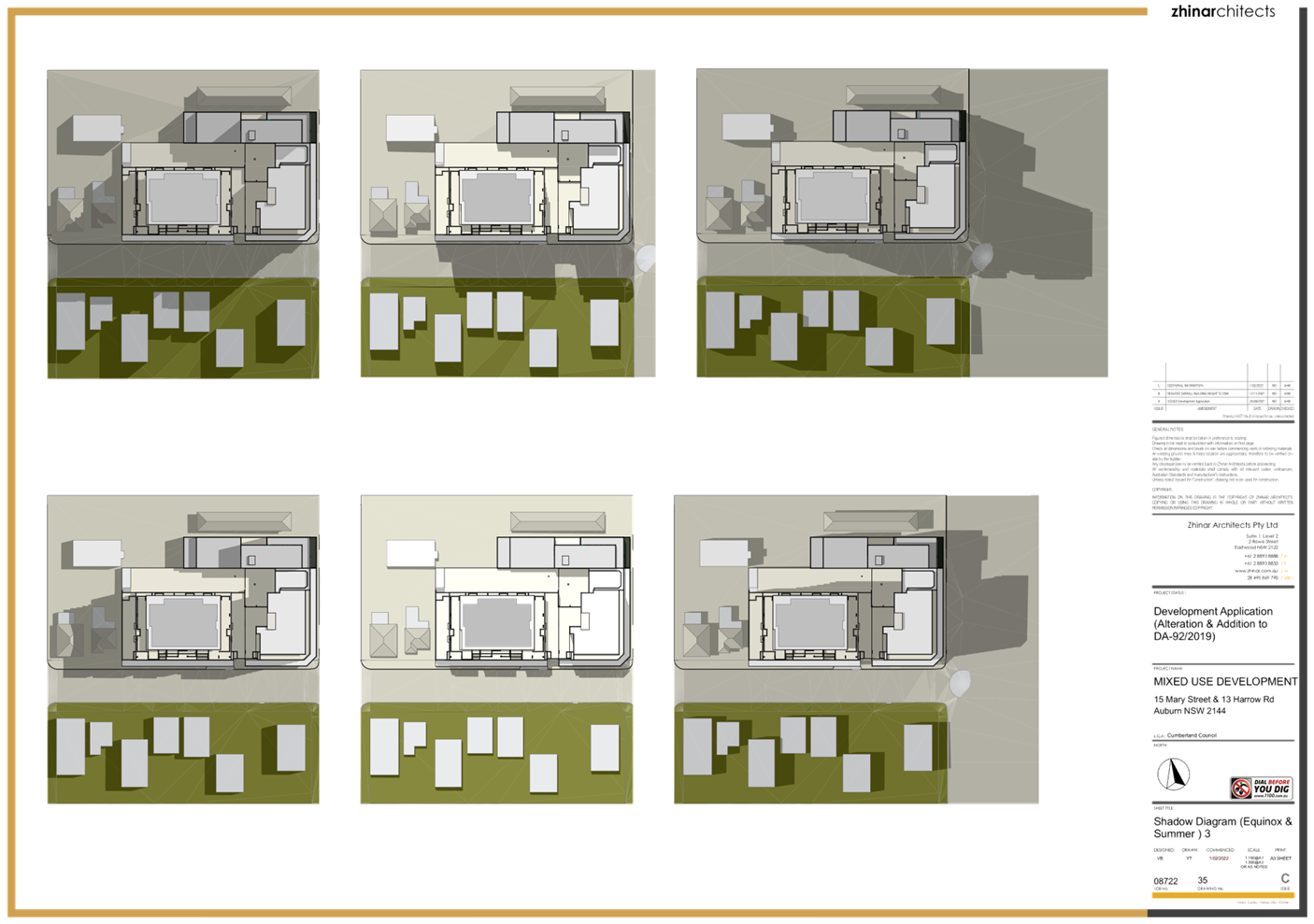
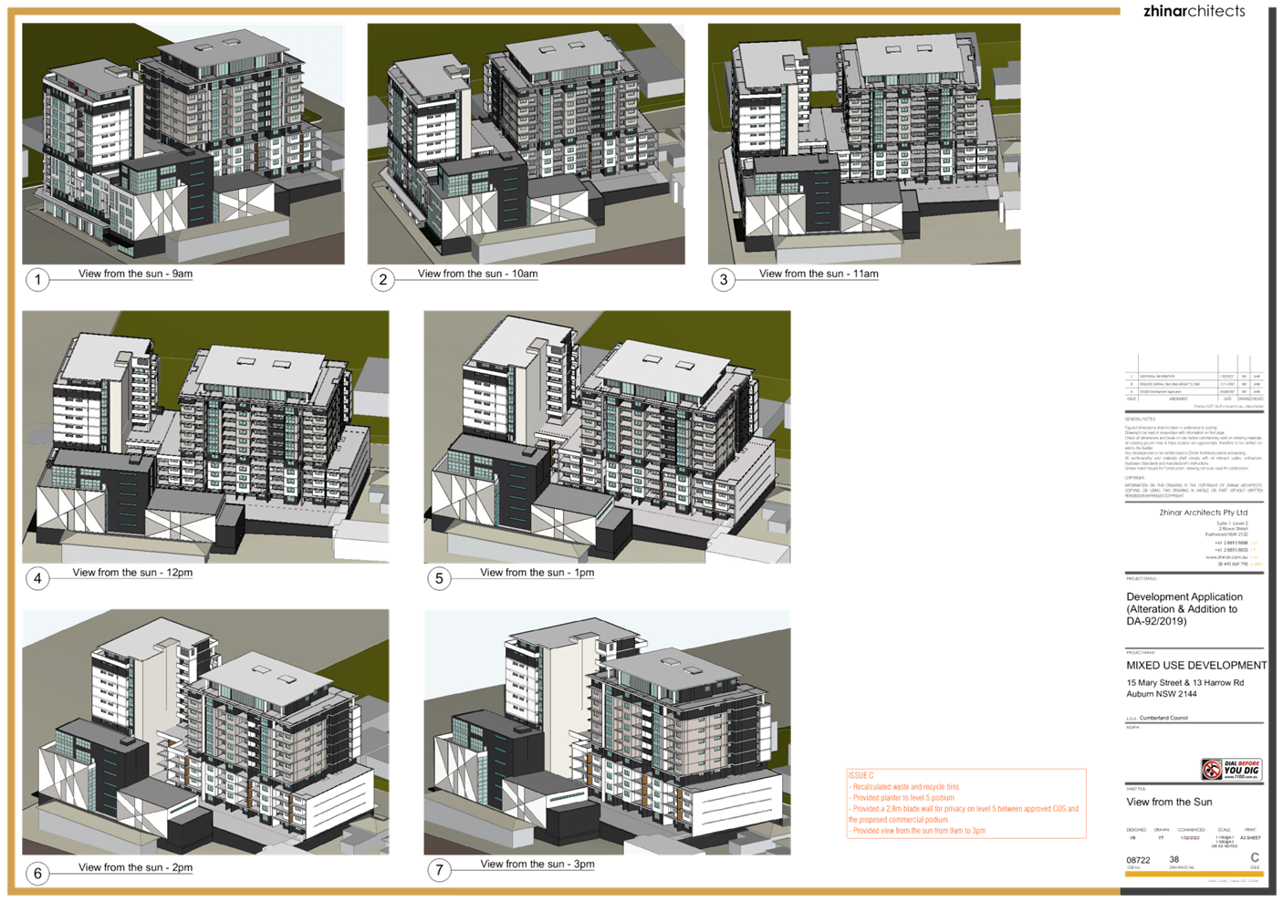
also reduces solar access to the common open space on the Level 1 podium and
the Level 5 podium on the eastern tower of 15 Mary Street.
Notwithstanding the reduction in
solar access, the ADG benchmark of 50% of the common open space areas achieving
2 hours solar access between 9am and 3pm on the winter solstice is met, with
more than 50% of the provided common open space receiving solar access between
10am and 2pm.
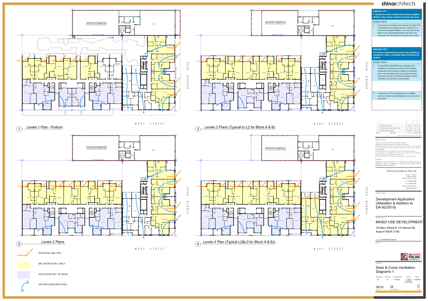
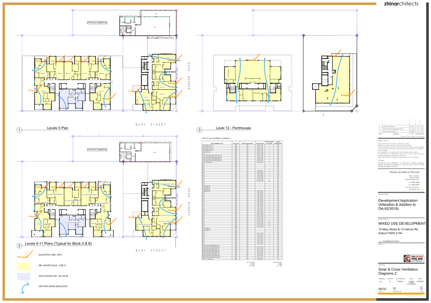
Solar access
The proposed commercial building
results in a reduction of the number of apartments receiving compliant solar
access from 120 apartments to 118 apartments. Notwithstanding this
reduction, the development maintains 75% of apartments achieving the required 2
hours direct sunlight between 9 am and 3 pm at mid-winter, which exceeds the
benchmark of 70% established by the ADG.
The carrying out of the commercial
building will not increase the number of apartments that receive no direct
sunlight between 9 am and 3 pm at mid-winter.
Cross ventilation
The proposed development does not
result in a decrease in the number of apartments that achieve cross
ventilation.
The proposed development does not
unreasonably reduce the amenity of the residential component of the
development,
State Environmental Planning Policy (Resilience and
Hazards) 2021
Chapter 4 - Remediation of Land.
A Preliminary Site Analysis has been provided and has been
considered by Council’s Environmental Health Unit and found to be
satisfactory in its methodology and conclusions.
The recommendations of the report are to be adopted via
conditions of consent.
Local Environmental Plans
Auburn LEP 2010
The
provision of the Auburn LEP 2010 is applicable to the development proposal as
the development application was lodged prior to the commencement of the
Cumberland LEP 2021 on 5 November 2021.
Clause
1.8A of the Cumberland LEP 2021 contains the following savings provision:
1.8A Savings provision relating to
development applications
If a development application has been made before the
commencement of this Plan in relation to land to which this Plan applies and
the application has not been finally determined before that commencement, the
application must be determined as if this Plan had not commenced.
The
proposed development achieves compliance with the key statutory requirements of
the Auburn LEP 2010 and the objectives of the B4 Mixed Use zone.
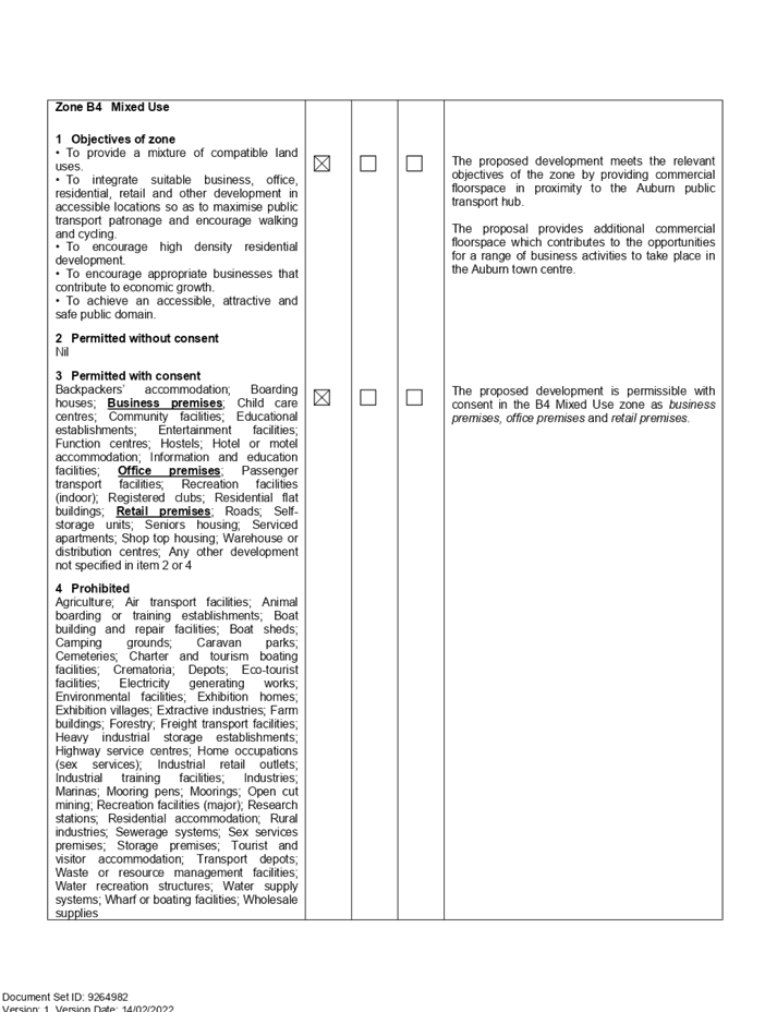
(a) Permissibility:-
The development provides commercial floorspace for “business
premises”, “office premises”
or “retail premises”. Each use is permissible
in the B4 Mixed Use zone with consent.
The relevant matters to be considered under Auburn LEP 2010
and the applicable clauses for the proposed development are summarised
below. A comprehensive LEP assessment is
contained in Appendix B of Attachment 4.
Figure 7 – Auburn 2010 Compliance
Table
|
DEVELOPMENT STANDARD
|
COMPLIANCE
|
DISCUSSION
|
|
4.3
|
Height of Buildings
Maximum 38m
|
Yes
|
The proposed development
provides a maximum height of 24.21m.
|
|
4.4
|
Floor Space Ratio
Maximum 5.0:1
|
Yes
|
The proposed development
provides a GFA of 2,465.18m2 over a site area of 613m2.
This results in an FSR of 4.02:1 over the 13 Harrow Road site.
When taking the 13 Harrow Road
site in conjunction with the 15 Mary Street development, the total GFA of the
resulting development over the combined site area of 3,340.86m2 is
16,674.14m2. This results in an FSR of 4.99:1 over the combined
sites.
|
(b) Zone objectives:-
The proposed development
is consistent with the objectives of the B4 Mixed Use zone, as follows.
|
OBJECTIVE
|
PLANNER’S COMMENT
|
|
To provide a mixture of compatible land uses.
|
The proposal is compatible with the emerging character of
the Auburn town centre and contributes to the vitality of the town centre by
providing commercial floor space opportunities.
|
|
To integrate suitable business, office, residential,
retail and other development in accessible locations so as to maximise public
transport patronage and encourage walking and cycling.
|
The proposed development is located within an accessible
location and in proximity to the range of services available in the Auburn
town centre.
|
|
To encourage high density residential development.
|
The proposed development maintains higher density
residential development within the town centre approved under previous
development applications.
|
|
To encourage appropriate businesses that contribute to
economic growth.
|
The proposal provides commercial floor space to allow for
business growth in the town centre.
|
|
To achieve an accessible, attractive and safe public
domain.
|
The development will provide opportunities for passive
surveillance and create a vibrant street.
The development will help to activate the south western
part of the Auburn town centre.
|
(c) Heritage:-
The subject land is in proximity to various items of
environmental heritage, particularly the Auburn Ambulance Station at 54 Queen
Street, Auburn (Item I1) and a Georgian dwelling at 8 Mary Street, Auburn (Item
I10).
Having regard to the separation of the subject land from
those heritage items, the proposed development does not impact on either item
or affect the interpretation of either item.
Figure 8 –
Extract of Heritage Map
The provisions of any proposed instrument (EP&A Act
s4.15 (1)(a)(ii))
(a) Draft State Environmental
Planning Policy (Environment)
The
modified development does not raise issues
relating to the draft SEPP(Environment).
(b) Cumberland
Local Environmental Plan
The Cumberland Local Environmental
Plan commenced on 5 November 2021 and was a draft at the time the development
application was lodged. The Cumberland Local Environmental Plan remains a
matter for consideration under Section 4.15(1)(a)(ii) of the Act as a draft
instrument.
Under the Cumberland LEP, the
subject land retains its B4 Mixed Use zoning and will continue to permit the
development.
The subject land retains its
maximum FSR of 5:1.
The Cumberland LEP has increased
the maximum building height from 38m to 60m. The proposed development has a
maximum height of 24.21m and thus complies with that standard.
No other changes to the planning
controls will affect the proposed development.
The proposal is satisfactory when considered
against the development standards and other provisions of the Cumberland LEP.
The provisions of any
Development Control Plans (EP&A Act s4.15 (1)(a)(iii))
The
Auburn DCP 2010 is applicable to the development proposal as the development
application was lodged prior to the commencement of the Cumberland DCP 2021 on
5 November 2021.
Clause
1.1.4 of the Cumberland DCP 2021 contains the following savings provision:
1.1.4
Savings Provision
This
DCP does not apply to an application under the EP&A Act which was lodged
with Council but not finally determined before the commencement of this DCP.
Any application lodged before the commencement of this DCP will be assessed in
accordance with any relevant previous DCPs or other Council’s policy
which applied at the time of application lodgement.
The
Auburn DCP 2010 therefore applies and provides guidance for the design and
operation of development to achieve the aims and objectives of the Auburn LEP
2010
The proposed development has been
assessed against the Residential Flat Buildings provisions and the Local
Centres provisions of the Auburn DCP.
The proposed development complies
with the provisions of those parts of the Auburn DCP 2010 and is
considered acceptable from an environmental planning point of view.
A
comprehensive assessment and compliance table is contained in Appendix C of
Attachment 4.
The provisions of any planning agreement that has been
entered into under section 7.4, or any draft planning agreement that a
developer has offered to enter into under section 7.4 (EP&A Act
s4.15(1)(a)(iiia))
There is no planning agreement or draft planning agreement
associated with the subject land or development application.
The provisions of the Regulations (EP&A Act s4.15
(1)(a)(iv))
The proposed development raises no concerns as to the
relevant matters arising from the Environmental Planning and Assessment
Regulations 2000 (EP&A Reg).
The Likely Environmental, Social or Economic Impacts
(EP&A Act s4.15 (1)(b))
It is considered that the proposed development will have no
significant adverse environmental, social or economic impacts in the locality.
The proposed development will contribute to the availability
of commercial floorspace within the Auburn town centre which will have positive
economic effects by providing opportunities for business growth in the centre.
The suitability of the site for the development (EP&A
Act s4.15 (1)(c))
The subject site and locality are not known to be affected
by any natural hazards or other site constraints likely to have a significant
adverse impact on the modified development. Accordingly, it is considered
that the proposed development is suitable in the context of the site and
surrounding locality.
Submissions made in accordance with the Act or Regulation
(EP&A Act s4.15 (1)(d))
In accordance with Council’s Notification requirements
contained within the Auburn DCP 2010, the
Development Application was publicly notified for a period of 14 days between 3
December 2021 and 17 December 2021.
No submissions were received as a result of that
notification.
The public interest (EP&A Act s4.15(1)(e))
In view of the foregoing analysis, it is considered that the
development, if carried out subject to the conditions set out in the
recommendation below, will have no significant adverse impacts on the public
interest.
CUMBERLAND LOCAL INFRASTRUCTURE CONTRIBUTIONS
PLAN 2020
This
part of the Act relates to the collection of monetary contributions from
applicants for use in developing key local infrastructure.
Comments:
The proposed development requires a contribution of
$39,213.00 to be paid in accordance with the Cumberland Local Infrastructure
Contributions Plan 2020. This figure is subject to
indexation as per the relevant plan.
The Development Application has been assessed in accordance
with the relevant requirements of the Environmental Planning
and Assessment Act 1979, SEPP 65 –
Design Quality of Residential Apartment Development, Auburn LEP 2010 and Auburn DCP 2010 and is considered to be satisfactory
for approval subject to conditions.
Having regard to the assessment of the proposal from a merit
perspective, the Panel may be satisfied that the development has been
responsibly designed and provides for acceptable levels of amenity for future residents.
It is considered that the proposal successfully minimises adverse impacts on
the amenity of neighbouring properties. The development is consistent with the
intentions of Council’s planning controls and represents a form of
development contemplated by the relevant statutory and non-statutory controls
applying to the land.
For these reasons, it is considered that the proposal is
satisfactory having regard to the matters of consideration under Section 4.15
of the Environmental Planning and Assessment Act 1979, and the
development may be approved subject to conditions.
|
That That Development Application No.
DA2021/0597 for the construction of a 7 storey commercial building with
ground floor parking at 13 Harrow Road, AUBURN NSW 2144 and alterations and
additions to the approved mixed use development at 15 Mary Street Auburn be
approved subject to conditions.
|
1. Draft Notice
of Determination
2. Architectural
Plans
3. Landscape
Plans
4. Apartment
Design Guide Assessment
5. Auburn
Local Environmental Plan 2010
6. Local
Centres Chapter Assessment
7. Residential
Flat Buildings Chapter
DOCUMENTS
ASSOCIATED WITH
REPORT LPP005/22
Attachment 1
Draft Notice of Determination
Cumberland Local Planning Panel Meeting
9 March 2022

DOCUMENTS
ASSOCIATED WITH
REPORT LPP005/22
Attachment 2
Architectural Plans
Cumberland Local Planning Panel Meeting
9 March 2022


DOCUMENTS
ASSOCIATED WITH
REPORT LPP005/22
Attachment 3
Landscape Plans
Cumberland Local Planning Panel Meeting
9 March 2022

DOCUMENTS
ASSOCIATED WITH
REPORT LPP005/22
Attachment 4
Apartment Design Guide Assessment
Cumberland Local Planning Panel Meeting
9 March 2022

DOCUMENTS
ASSOCIATED WITH
REPORT LPP005/22
Attachment 5
Auburn Local Environmental Plan 2010
Cumberland Local Planning Panel Meeting
9 March 2022


DOCUMENTS
ASSOCIATED WITH
REPORT LPP005/22
Attachment 6
Local Centres Chapter Assessment
Cumberland Local Planning Panel Meeting
9 March 2022
DOCUMENTS
ASSOCIATED WITH
REPORT LPP005/22
Attachment 7
Residential Flat Buildings Chapter
Cumberland Local Planning Panel Meeting
9 March 2022
Cumberland
Local Planning Panel Meeting
9 March 2022
Item No: LPP006/22
Development
Application for 10 Patricia Street Mays Hill
Responsible
Division: Environment
& Planning
Officer: Executive
Manager Development and Building
File
Number: DA2021/0425
|
Application
accepted
|
16 August 2021
|
|
Applicant
|
Mr E Rizk
|
|
Owner
|
Patricia 888 Pty Ltd
|
|
Application
No.
|
DA2021/0425
|
|
Description
of Land
|
8, 10 & 12 Patricia
Street MAYS HILL NSW 2145, Lot 76, Lot 77 & Lot 78, DP
13239
|
|
Proposed
Development
|
Demolition of existing
structures and construction of a part four, part five storey residential flat
building comprising of 30 residential units over basement car parking and
strata subdivision
|
|
Site
Area
|
2148m2
|
|
Zoning
|
R4 High Density Residential
Zone
|
|
Disclosure
of political donations and gifts
|
Nil disclosure
|
|
Heritage
|
The site is not listed as
heritage item, and it is not located within Heritage Conservation Area.
|
|
Principal
Development Standards
|
FSR
Permissible: 1.2:1
Proposed: 1.99:1
Height of Building
Permissible: 15m
Proposed: 15.65m
|
|
Issues
|
· Building
height
· Dimension
of deep soil area
· Landlocking
of adjoining site - 6 Patricia Street
· Site
coverage
· Rear
setbacks
· Number of
storeys
|
1. Development
Application No. DA2021/0425 was accepted on 16 August 2021 for the Demolition
of existing structures and construction of part four (4), part five (5) storey residential
flat building comprising of 31 residential units over basement car parking and
strata subdivision.
2. The
application was publicly notified to occupants and owners of the adjoining
properties for a period of twenty one (21) days between 17 September 2021 and 8
October 2021. In response, no submissions were received.
3. The
subject site is not listed as a heritage item or located within the heritage
conservation area in the Holroyd Local Environmental Plan 2013.
4. The
subject application has been assessed against the relevant provisions of the
Environmental Planning and Assessment Act 1979, State Environmental Planning
Policy No 65 – Design Quality of Residential Apartment Development,
Holroyd Local Environmental Plan (HLEP) 2013 and Holroyd Development Control
Plan (HDCP 2013).
5. The
notable variations are as follows:
|
Control
|
Required
|
Provided
|
%
variation
|
|
Building
Height (HLEP 2013)
|
15m
|
15.65m
(Maximum)
|
4.3%
|
|
Deep
soil area (ADG)
|
Minimum
dimension = 6m
|
5.5m
|
8.3%
|
|
Building
separation/ visual privacy (ADG)
|
6m
(habitable) & 3m (non habitable) (4 storeys)
|
3.83m
for Unit 8 balcony (Ground floor - rear)
5.952m – 5.979m for Units 9, 10, 17 & 25 part
of balcony edges
(Level
1-3 - rear)
|
36%
0.8%
|
|
Apartment
Size (ADG)
|
2
bedroom with additional bathroom 75m²
|
74.5m²
for Units nos. 5, 12 & 20
|
0.6%
|
|
Site
coverage (HDCP 2013)
|
30%
|
38.3%
|
27.7%
|
|
Rear
Setbacks (HDCP 2013)
|
9.2m
(4 storeys)
|
6m
|
34.7%
|
|
Basement
side setback (HDCP 2013)
|
3m
|
1.5m
along the section of western boundary
2m
along the section of southern boundary
|
50%
33.3%
|
|
Number
of storey (HDCP 2013)
|
4
|
5
(basement protrusion along the south- eastern elevation)
|
25%
|
6. The application is
referred to the Panel as it is a residential flat building development of 4 or
more storeys to which the State Environmental Planning Policy No 65 –
Design Quality of Residential Apartment Developments applies.
7. The
application is recommended for Approval subject to the conditions as provided
in the attached schedule.
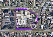
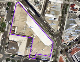
SUBJECT SITE AND SURROUNDING
AREA
The subject site is known as 8-12
Patricia Street, Mays Hill and is legally described as Lot 76, Lot 77 & Lot
78 in DP 13239. The subject site is located on the western side of Patricia
Street, Mays Hill within the R4 High Density Residential zone. The site forms a
regular midblock with a total area of 2148m2 (by calculation) and a combined
frontage of 46m to Patricia Street. The site has a fall of approximately 4.5m
from the north western corner to the south eastern front corner. The site is
currently occupied by detached single dwelling houses, associated outbuildings
and vegetation.
The subject site and neighbouring
allotments are zoned R4 – High Density Residential. The site is bounded
by single storey dwelling house to its immediate northern and southern
boundaries with a current DA2021/0636 at 14-16 Patricia Street under assessment
by Council for a four storey residential flat building to the adjoining
southern boundary. Surrounding the subject site is a mixture of building types
including newly constructed residential flat buildings up to 4 storeys in
height and single storey dwellings.
There is a transition occurring
currently within the immediate locality for older stock housing sites being
developed into residential flat buildings.
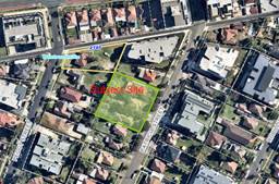
Figure 1 –
Aerial view of subject site
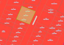
Figure 2 –
Zoning map


Figure
3 & 4 – Street view of subject site
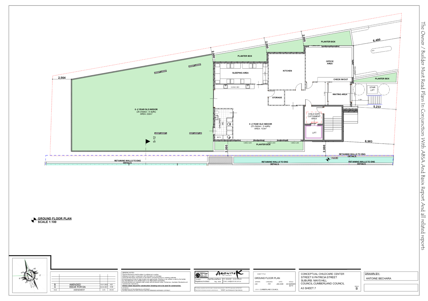
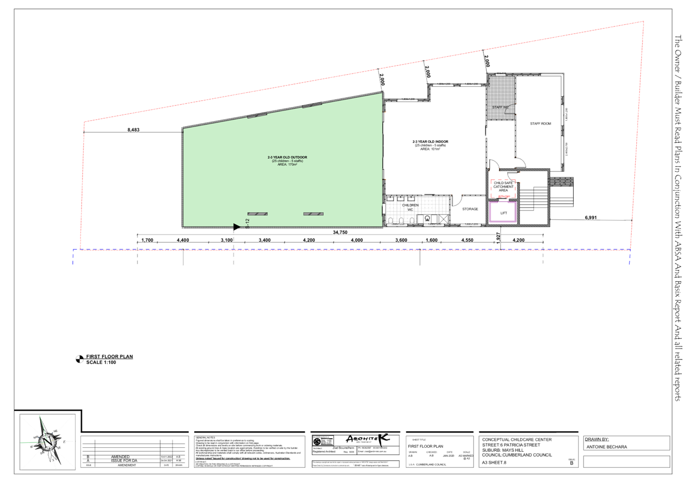
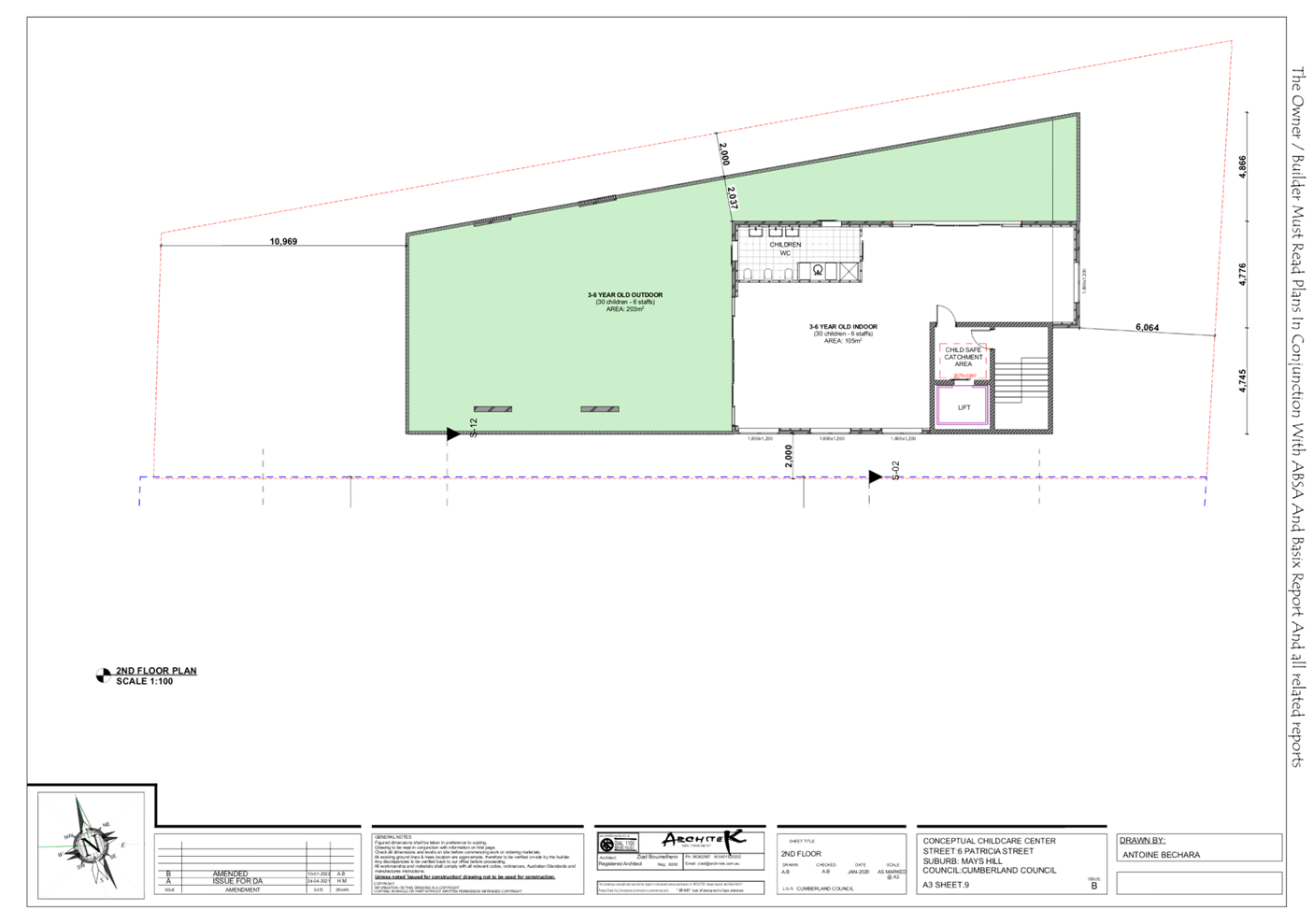
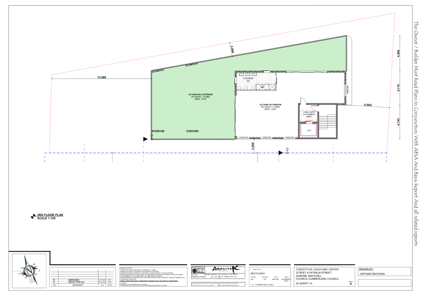
Description of the
development
Council
has received a development application, as amended on 27 January 2022, for
demolition of existing structures and construction of a part four (4), part
five (5) storey residential flat building comprising of 30 residential units
over basement car parking and strata subdivision
Key
features of the development proposal are as follows:-
|
Level
|
Details
|
|
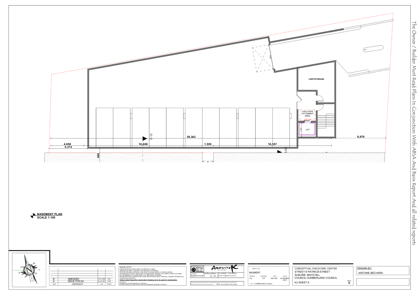
Basement
|
38 residential car spaces (including 5 accessible parking
spaces and
1 car wash bay)
12 bicycle spaces
Storage, plant room, lifts and fire stairs
|
|
Ground floor level
|
8 residential units
Communal Open Space
|
|
Level 1
|
8 residential units
|
|
Level 2
|
8 residential units
|
|
Level 3
|
6 residential units
|
|
Rooftop
|
Terrace/Communal Open Space, non-trafficable roof, lifts
and fire stairs
|
The
dwelling mix of the proposal is as follows:
- 3 x 1
Bed Unit (10%);
- 25 x
2 Bed Unit (83.3%); and
- 2 x 3
Bed Unit (6.67%).

Figure
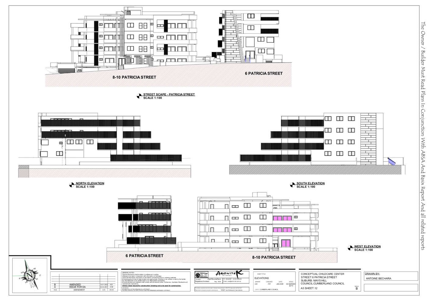
5 – Perspective of proposed development – Street frontage
Applicant’s
Supporting Statement
The
applicant has provided a Statement of Environmental Effects prepared by All
About Planning dated 31 January 2022 in support of the application.
Contact with relevant
parties
The
assessing officer has undertaken a site inspection of the subject site and
surrounding properties and has been in regular contact with the applicant
throughout the assessment process.
Development
Engineer
The
development application was referred to Council’s Development Engineer
for comment who has advised that the development proposal is satisfactory with
regard to stormwater management and car parking and therefore can be supported
subject to recommended conditions of consent.
Environment
and Health
The
development application was referred to Council’s Environment and Health
Officer for comment who has advised that the development proposal is
satisfactory regarding to noise impact and contamination and therefore can be
supported subject to recommended conditions of consent.
Tree
Management Officer
The
development application was referred to Council’s Tree Management Officer
for comment who has advised that the development proposal is satisfactory with
regard to the trees removal and therefore can be supported subject to
recommended conditions of consent.
Waste
Management
The
development application was referred to Council’s Waste Management
Officer for comment who has advised that the development proposal is
satisfactory regarding the proposed waste management and therefore can be
supported subject to recommended conditions of consent.
The
development application was referred to Endeavour Energy for comment who has
advised that the development proposal is satisfactory in terms of electricity
connection and therefore can be supported subject to recommended conditions of
consent.
The
provisions of any Environmental Planning Instruments (EP&A Act s4.15
(1)(a)(i))
(a) State Environmental Planning
Policy No 65 – Design Quality of Residential Apartment Development (SEPP
65)
SEPP 65
applies to the development as the building is 3 storeys or more, and contains
more than 4 dwellings. A design statement addressing the design quality
principles prescribed by SEPP 65 was prepared by the project architect, Ziad
Boumelhem, registration number 8008. Integral to SEPP 65 is the Apartment
Design Guide (ADG), which sets benchmarks for the appearance, acceptable
impacts and residential amenity of the development.
A
comprehensive assessment against the SEPP 65 and Apartment Design Guide (ADG)
controls is provided at Attachment 5.
The
proposal involves the following non-compliance with the ADG controls:
• 3F
Visual Privacy
Objective
3F-1 of the ADG states that minimum separation distances from buildings to side
and rear boundaries are as follows.
|
Building (height)
|
Habitable rooms and balconies
|
Non-habitable rooms
|
|
Up to 12m (4 storeys)
|
6m
|
3m
|
The
proposal generally complies with the building separation requirements with the
exception of POS of Unit 8 on ground floor and Units 9, 10, 17 and 25 on Level
1 to 3 along the western elevation. Where 6m building separation is required,
Unit 8 on ground floor proposes 3.83m setbacks and Units 9, 10, 17 and 25 on
Level 1 to 3 propose 5.952m – 5.979m setbacks along the western
elevation. Notwithstanding this, a 1.5m high privacy screen proposed along the
sides of Unit 8 balcony is considered satisfactory to maintain reasonable
privacy with the adjoining properties. Non compliances with the building
separation requirement for balcony edges of Units 9, 10, 17 and 25 are
considered minor in nature and not likely to result in unacceptable privacy
impact on the adjoining properties to the west, also noting that the adjoining
development on the western side at 3- 9 Peggy Street was approved as 4 to 5
storey residential flat buildings under DA2017/563/1 with rear setbacks of
11.6m.
Note:
Given that the 5th storey component does not constitute as ‘residential
/habitable floor” given that it is primarily a result of basement
protrusion, building separation for the fifth storey is not required in this
instance.
• 3E
Deep Soil Area
Objective
3E -1 of the ADG states that deep soil areas are to meet the following minimum
requirements :
|
1.
Site area
|
2.
Minimum dimensions
|
3.
Deep soil zone
4.
(% of site area)
|
|
5.
Greater than 1,500m2
|
6.
6m
|
7.
7%
|
Deep
soil area of 496.1m2, which is 23% of the site area, including the side, rear
and front setback areas is proposed. However, the deep soil area along the side
and rear setbacks provides a varying dimension of 5.5m to 6.3.
While
it is acknowledged that deep soil dimension is deficient at some sections, it
is noted that an overall compliant deep soil area as well as communal open
space are proposed. The proposed deep soil dimension is considered acceptable.
In addition, this area is considered to have been appropriately landscaped (via
trees, shrubs and vegetation) and is co – located with communal open
space which is considered to improve residential amenity and promote effective
management of water and air quality.
• 4D
Apartment Size and Layout
Design
criteria of 4D -1 of the ADG states that the minimum apartment internal areas
including an additional bathroom equates to 75m². Units nos. 5, 12 and 20
are proposed with internal size of 74.5m², which is a marginal shortfall
of 0.5m². The shortfall is considered acceptable, as the apartments have
been provided with a functional design and compliant size of living area,
bedrooms and POS. Non-compliance with the internal size of the apartment is
supported in this instance.
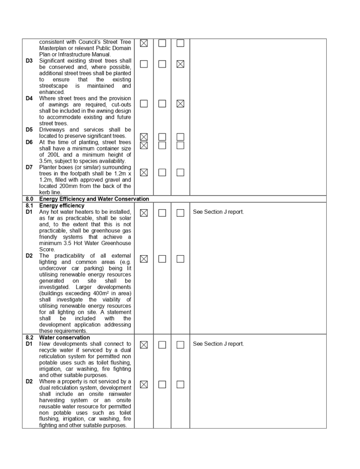
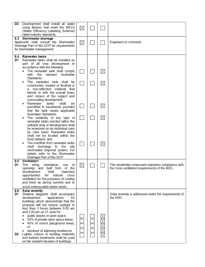
(f) State Environmental
Planning Policy (Building Sustainability Index: BASIX) 2004
BASIX
certificate no. 1185197M_02 dated 9 February 2022 was submitted with the
application. The certificate achieves target scores and is consistent with the
architectural plans.
Local
Environmental Plans
(g) Cumberland
Local Environmental Plan 2021 (CLEP)
The
Cumberland Local Environmental Plan 2021 (CLEP) has been gazetted on the NSW
Legislation website and commenced on 5 November 2021. The CLEP 2021 is prepared
to provide a single planning framework for the future planning of Cumberland
City. The CLEP 2021 harmonises and repeals the three LEPs previously applicable
to the Cumberland local government area, those being:
• Holroyd
Local Environmental Plan 2013,
• Parramatta
Local Environmental Plan 2011, and
• Auburn
Local Environmental Plan 2010.
However,
as the subject application was lodged prior to the gazettal of the Cumberland
LEP 2021, in accordance with Clause 1.8A - Savings provision relating to
development applications, the application is assessed under the provisions of
the Holroyd LEP 2013. As the Cumberland LEP was an exhibited draft at the
lodgement of the subject application, the provisions of the Cumberland LEP are
also considered in the assessment of the application and are considered to be
satisfactory.
(h) Holroyd
Local Environmental Plan 2013 (HLEP 2013)
The
proposed development is defined as a ‘residential flat building’
under the provisions of HLEP 2013. Residential flat buildings are permitted
with consent in the R4 – High Density Residential zone which applies to
the land as follows:
residential
flat building means a building containing 3 or more dwellings, but does not
include an attached dwelling or multi dwelling housing.
Note—
Residential
flat buildings are a type of residential accommodation—see the
definition of that term in this Dictionary.
The
relevant matters to be considered under Holroyd LEP 2013 and the applicable
clauses for the proposed development are summarised below. A comprehensive LEP
assessment is contained in Attachment 6.
Figure
6 –Holroyd LEP 2013 Compliance Table
|
DEVELOPMENT STANDARD
|
COMPLIANCE
|
DISCUSSION
|
|
4.3 Height of Buildings
Max 15m
|
N
|
15.65m - Clause 4.6 request to contravene the height of
building development standard was submitted with the application.
|
|
4.4 Floor
Space Ratio
1.2:1 (2577.6m²)
|
Y
|
1.99:1 (GFA of 2576m²)
|
|
4.6 Exceptions to Development Standards
|
Y
|
Refer to detailed discussions below.
|
|
5.10
Heritage Conservation
|
N/A
|
The site is not listed as heritage item and it is not
located within Heritage Conservation Area.
|
|
5.21
Flooding
|
N/A
|
The site is not impacted by flooding.
|
|
6.7
Stormwater Management
|
Y
|
The proposed stormwater management submitted with the
application is considered satisfactory, subject to conditions imposed.
|
Clause
4.6 Exceptions to Development Standards
Height
of Buildings
The
proposal seeks to contravene the Height of Building Development Standard under
Clause 4.3 of the HLEP that stipulates the height of building is not to exceed
15m on the subject site.
The
proposed building has a maximum building height of 15.65m to the lift over-run
(east), 15.49m to the fire stairs and 15.28m to the lift over-run (west). This
equates to a maximum of 4.3% variation to the permitted height of buildings
under the Holroyd LEP 2013.
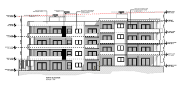
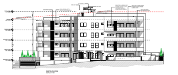
Figures
7 & 8 –North and East Elevations showing the extent of height
variation
Clause
4.6 allows the consent authority to vary development standards in certain
circumstances and provides an appropriate degree of flexibility to achieve
better design outcomes. The consent authority may grant the exception as the
Secretary’s concurrence can be assumed where clause 4.6 is adopted as per
the Department of Planning Circular PS 18-003, dated 21 February 2018.
The
applicant has submitted a written request to vary the development standards for
building height. Based on various case laws established by the Land and
Environment Court of NSW such as Four2five P/L v Ashfield Council [2015] NSWLEC
9, Randwick City Council v Micaul Holdings P/L [2016] NSW LEC7 and Zhang and
anor v Council of the City of Ryde [2016] NSWLEC 1179, a 3 part assessment
framework for a variation request proposed under clause 4.6 has been considered
and an assessment of the proposed variance, following the 3 part test is
discussed in detail below.
The 3
preconditions which must be satisfied before the application can proceed are as
follows:
1. Is
the proposed development consistent with the objectives of the zone?
Applicant’s
justification:
The
subject proposal complies with the above objectives through the provision of a well-designed,
aesthetic high density residential development in a very convenient and
connected location. The subject development will also meet a demonstrated
community need for apartment style accommodation and increase the overall
supply of residential housing. The proposed residential units will be located
in close proximity to public transport and both public and private recreation
facilities and areas.
Planner’s
Comment:
The
proposed development is considered to be consistent with the objectives of the
R4 High Density Residential zone in that a variety of housing types within a
high density residential environment is provided, which is contributory to the
existing local character of the streetscapes.
2. Is the proposed
development consistent with the objectives of the development standard which is
not met?
Applicant’s
justification:
The
proposal will not have a significant detrimental impact on the amenity of
adjoining and nearby properties nor have a negative impact on the surrounding
land uses. The proposal is in keeping with the clearly transitioning future
character of the area and the detailed and coherent architectural design will
have a positive contribution to the streetscape and is also consistent with the
aims and objectives of Council’s planning control.
• The
primary variations in building height being the single fire exit and the two
lift over-runs are located central to the proposed building where they will not
impact on adjoining properties by way of overshadowing, bulk and scale, and
privacy.
• The minor
nature of the 15m Height of Building variations (outlined previously) of 490mm
or 3.3%, 650mm or 4.3%, and 0.282m or 1.88% (of the standards) will not result
in any perceptible or substantial additional view loss.
• The
proposed non-compliant Height of Building detailed in this submission does not
result in additional general visual amenity or any view corridor impacts.
• Further
to the above and more specifically, compliance with the subject LEP standards
will not result in any substantial improvement or reduction in the impacts of
the proposal on visual amenity or view corridors from nearby properties.
• The
development satisfies all other town planning standards, including FSR, building
design, setbacks, parking, traffic management, visual amenity and view sharing
and impacts.
• The minor
degree of variations to the Height of Buildings control as outlined earlier,
mean that compliance with these LEP controls would not result in a substantial
difference to the proposal or it’s built form, but will result in
complying fire access and lift arrangements whilst delivering 30 well located
and well-designed residential units. Thereby compliance with the standards is
unreasonable and unnecessary in the circumstances.
Planner’s
comment:
The
objectives of the building height standard are to enable appropriate
development density to be achieved and to ensure that the height of the
building is compatible with the character of the locality as outlined above.
The proposal is compliant with the maximum FSR development standard. The
increased height does not result in an additional level for residential use, as
it comprises portion of the lift over run and fire exit.
The
departure sought is considered to be modest and does not unreasonably impact on
adjoining properties. The additional height does not result in the appearance
of bulk when viewed from the existing streetscape and would not impinge on the
changing streetscape that is anticipated for the immediate area. Given that the
proposed development responds to the site and does so without compromising
relationships with adjoining development, the proposal is considered to be
consistent with the objectives of height requirements and development within
the R4 zone.
3. a) Is compliance with
the development standard unreasonable or unnecessary in the circumstances of
the case?
Applicant’s
justification:
Application
of the Height of Buildings development standard is unreasonable and unnecessary
in this instance, and compliance would not result in a better development
outcome, not merely because the development has been shown to be consistent
with the applicable R4 High Density Residential zone objectives (as discussed
above), but for the following additional reasons:
• The
building elements related to the primary variations in building height being
the single fire exit and the two lift over-runs are respectively minor only
2.5m x 4.5m, 2.5 x 3m (both lift over-runs) in area, therefore the potential
visual impacts created by these elements and their height variations are
limited, especially in the context of the proposed whole 4 storey 30
residential flat building development.
• The
primary variations in building height being the single fire exit and the two
lift over-runs are located central to the proposed building where they will not
impact on adjoining properties by way of overshadowing, bulk and scale, and
privacy.
• Related
to the above, the streetscape impact of the above non-complying building
heights is meaningfully reduced by the position of the associated building
elements being central to the building footprint (and setbacks of same to the
street), predominantly shielded by the rest of the building from view at street
level.
• The bulk,
scale and form of the building has been well articulated both horizontally and
vertically through a cohesive and well considered architectural design adopted.
• There is
public benefit to supporting the subject variation, in as much the proposal
will deliver to the community a quality residential flat building in an
excellent location, contributing to the variety of dwellings in the area. To
get the fire exit roof and lift over-runs to comply with the height control
fully would require the loss of one or more of the proposed units which is not
necessary or reasonable in the circumstances (with the main building form
complying with the height control) and which is not in the public interest.
For all
the above substantive reasons, strict compliance with the Height of Buildings
control is unreasonable and unnecessary in the circumstances.
Planner’s
comment:
Council
Officers are satisfied that the proposed variation has been appropriately
justified and can be supported in this instance. The height breach is limited
to an overall building height of 15.65m (RL 50.890) for the top of the lift
core. The additional height of the lift core will not be visible from the
adjacent streets and properties. The proposed variation to the development
standard is necessary for the structure containing the lift core and in order
to achieve required FFLs, and is consistent with the scale of the development
within the R4 zone located in the immediate vicinity of the site. The departure
sought is considered to be modest and does not unreasonably impact on adjoining
properties. The additional height does not result in the appearance of bulk
when viewed from the existing streetscape, would not impinge on the changing
streetscape that is anticipated for the immediate area and does not result in
additional overshadowing to the adjoining properties. It is considered,
therefore, that the non-compliance with the Development Standard is not
unreasonable or unnecessary in the circumstances of the case.
b) Are there sufficient
environmental planning grounds to justify contravening the development standard
and therefore is the applicant’s written justification well founded?
The
unique circumstances of the case are considered to warrant support of the
departure. Given that the proposed development responds to the site and does so
without unduly compromising relationships with adjoining development, and does
not unduly compromise other relevant controls, the proposal is considered to be
consistent with the objectives of building height, and development within the
R4 zone. In this regard, the exception is well founded and can be supported.
Conclusion:
Council
is satisfied that the applicant’s written request has adequately
addressed the matters required to be demonstrated by clause 4.6 subclause (3).
Council is further satisfied that the proposed development will be in the
public interest because it is consistent with the objectives of the particular
standard and the objectives for development within the zone in which the
development is proposed to be carried out.
It is
the view of Council Officers that justification provided is satisfactory and
having considered the application on its merit, the contravention to the
maximum building height development standard is considered acceptable in this
instance.
Draft
State Environmental Planning Policy (Design and Place)
The
draft SEPP Design and Place as exhibited aims to simplify and consolidate how
to address the need for sustainable and resilient places and deliver good
design in NSW.
The changes
proposed include consolidating the following existing SEPPs:
• SEPP
65 – Design Quality of Residential Apartment Development
• SEPP
(Building Sustainability Index: BASIX) 2004
The
draft SEPP has been not notified to any consent authorities and is therefore
not a mandatory matter for consideration under the Act.
The
provisions of any proposed instrument that is or has been the subject (EP&A
Act s4.15 (1)(a)(ii))
The
provisions of any Development Control Plans (EP&A Act s4.15 (1)(a)(iii))
Cumberland
Development Control Plan (DCP) 2021
The
Cumberland DCP 2021 is in force as of 5 November 2021. However, as the subject
application was lodged prior to the Cumberland DCP coming into force, in
accordance with Clause 1.1.4 - Savings provision of Part A - Introduction, the
application is assessed under the provisions of the Holroyd DCP 2013. As the
Cumberland DCP 2021 was adopted by Council at the lodgement of the subject
application, the provisions of the Cumberland DCP are also considered in the
assessment of the application and are considered to be satisfactory.
Holroyd
Development Control Plan (DCP) 2013
The
Holroyd DCP 2013 provides guidance for the design and operation of development
to achieve the aims and objectives of the DCP. A comprehensive assessment and
compliance table is contained in Attachment 7.
The
proposed development generally complies with the provisions of Holroyd DCP 2013
with the exception of the following matters which are outlined in the table
below.
• Site
coverage
Where a
maximum permitted site coverage is 30%, the proposal will result in site
coverage of 38.3%. Non-compliance with the site coverage requirement however is
considered acceptable as the proposed development will maintain an adequate
provision to be made on site for deep soil planting, landscaping, driveways,
communal open space and On-Site Detention.
• Rear
setbacks
Where
20% of the length of the site or 9.2m (4 storeys) is required as rear setback,
only 6m has been provided for ground to level 3. This variation is considered
as acceptable, as the proposed development will still continue to satisfy the
ADG requirements for building separation and visual privacy, maintain
residential amenity and will not result in further overshadowing to the
adjoining properties.
• Basement
side setback
A
basement side setback of 3m is required. However, setbacks of 1.5m is proposed
along the western boundary and 2m is proposed along the southern boundary. This
is considered satisfactory as the proposal complies with the minimum deep soil
requirements, side setbacks and landscaping requirements and will not result in
any impacts on trees on adjacent sites.
• Number
of storeys
The
proposed development presents as a 4 storey built form with 4 residential
levels. However, is technically defined as a part 5 storey development as
the basement protrudes more than 1.2m above NGL at certain sections and
therefore, is constituted as a ’storey’.
The
proposed development will result in a part 5 storey development, where a
maximum of 4 storey is permitted. Variation to this control is considered
acceptable as the protrusion relates only to a to small portion of the
building, the departure is primarily from the basement by 200mm, and that the
proposal adequately responds to the landform in the context of the site topography
and the. The development will still be perceived as a 4 storey development as
the protrusion will not result in an additional ‘habitable floor’
and there are no adverse impacts associated with the additional storey.
• Landlocking
of adjoining site
The
proposal will result in the land locking of the adjoining northern property No.
6 Patricia Street, Mays Hill which is an existing single storey dwelling.
The
site isolation principles established by the Land and Environment Court have
been considered in the assessment of the development application. Development
proposals that create land locking or site isolation shall provide
documentation that demonstrates a reasonable attempt has been made by the
applicants to purchase the land locked site(s), including written valuation
that represent the affected sites potential value. Consistent with the Planning
Principle of Karavellas v Sutherland Shire Council [2004] NSWLEC 251
(Karavellas v Sutherland Shire Council), the application is supported by an
offer to the owner of the isolated property at 6 Patricia Street, with the
offer being based on two recent independent valuations. Two valuation reports
prepared by two independent registered valuers indicating the market values of
the subject site were issued, and the highest and best value was considered
based on the likely additional yield the site would be able to generate. On
this basis, the offer was made to purchase the property higher than the
valuations tendered. The reasonable and objectively valued offer(s) made by the
proponents were not accepted by the owners. The offer is deemed a reasonable
offer by the Planning Principle of Karavellas v Sutherland Shire Council.
In the
judgement of Cornerstone Property Group Pty Ltd Vs Warringah Council [2004]
NSWLEC 189, planning principle to site isolation was further considered as
follows:-
Can
orderly and economic use and development of the separate site be achieved if
amalgamation is not feasible.
Future
redevelopment sites
The
current development application demonstrates that orderly and economic use and
development of the subject site can be carried out, noting the consistency with
the relevant planning controls. The adjoining allotment can be developed in an
orderly and economic manner that is consistent with key planning controls and
also providing appropriate levels of amenity in terms of privacy and solar
access and natural ventilation.
Conceptual
plans for the adjoining landlocked site have been prepared and submitted
showing that the site can be redeveloped to provide a development outcome that
will align with the R4 zoning provisions and the HLEP 2013 and that can with a
flexible application of the HDCP 2013 achieve the desired outcomes of the key
development controls.
Based
on the above discussion, it is considered that the orderly and economic use and
development of 6 Patricia Street as a separate site is considered achievable
without further amalgamation.
The
provisions of any planning agreement that has been entered into under section
7.4, or any draft planning agreement that a developer has offered to enter into
under section 7.4 (EP&A Act s4.15(1)(a)(iiia))
There
is no draft planning agreement associated with the subject Development
Application.
The
provisions of the Regulation (EP&A Act s4.15 (1)(a)(iv))
The
proposed development raises no concerns as to the relevant matters arising from
the Environmental Planning and Assessment Regulation 2000 (EP&A Reg).
The
Likely Environmental, Social or Economic Impacts (EP&A Act s4.15 (1)(b))
It is
considered that the proposed development will have no significant adverse
environmental, social or economic impacts in the locality.
The
suitability of the site for the development (EP&A Act s4.15 (1)(c))
The
subject site and locality are not known to be affected by any natural hazards
or other site constraints likely to have a significant adverse impact on the
proposed development. Accordingly, it is considered that the development is
suitable in the context of the site and surrounding locality.
Submissions
made in accordance with the Act or Regulation (EP&A Act s4.15 (1)(d))
|
Advertised (Council Website)
|
Mail
|
Sign
|
Not Required
|
In accordance with Council’s Notification
requirements contained within the Holroyd DCP 2013, the proposal was publicly
notified for a period of 21 days between 17 September 2021 and 8 October 2021.
In response Council received no submissions.
The
public interest (EP&A Act s4.15(1)(e))
In view
of the foregoing analysis, it is considered that the development, if carried
out subject to the conditions set out in the recommendation below, will have no
significant adverse impacts on the public interest.
CUMBERLAND LOCAL INFRASTRUCTURE CONTRIBUTIONS
PLAN 2020
The
development would require the payment of contributions in accordance with
Cumberland Local Infrastructure Contributions Plan 2020.
In
accordance with the Contribution Plan a contribution is payable, pursuant to
Section 7.11of the EP&A Act, calculated on the cost of works. A total
contribution for 3 x 1 bedroom, 25 x 2 bedroom and 2 x 3 bedroom units of $439,581.00
(including credit for 3 x 3 bedroom dwellings) would be payable prior to the
issue of a Construction Certificate
Disclosure of Political Donations and Gifts
The
applicant and notification process did not result in any disclosure of
Political Donations and Gifts.
The Application has been assessed
in accordance with the relevant requirements of the Environmental Planning and
Assessment Act 1979, Environmental Planning and Assessment Regulation 2000,
State Environmental Planning Policy (Building Sustainability Index: BASIX)
2004, State Environmental Planning Policy No. 65 (SEPP 65) – Design
Quality of Residential Apartment Development, State Environmental Planning
Policy (Biodiversity and Conservation) 2021, State Environmental Planning
Policy (Resilience and Hazards) 2021, State Environmental Planning Policy
(Transport and Infrastructure) 2021, Holroyd Local Environmental Plan 2013,
Cumberland Local Environmental Plan 2021, Cumberland Development Control Plan
2021, and Holroyd Development Control Plan 2013 and is considered to be
satisfactory.
|
That the Clause 4.6 request
to contravene the height of building development standard under Clause 4.3 of
the Holroyd LEP 2013, be supported.
That Development Application
No. DA2021/0425 for demolition of existing structures and construction of a
part four, part five storey residential flat building comprising of 30
residential units over basement car parking and strata subdivision on land at
8, 10 & 12 Patricia Street Mays Hill NSW 2145 be granted approval
subject to conditions listed in the attached schedule.
|
1. Development
Assessment Report
2. Draft
Notice of Determination
3. Architectural
Plans
4. HDC
Compliance Table
5. Stormwater
Plans
6. HLEP
Compliance Table
7. Clause
4.6 Variation
DOCUMENTS
ASSOCIATED WITH
REPORT LPP006/22
Attachment 1
Development Assessment Report
Cumberland Local Planning Panel Meeting
9 March 2022
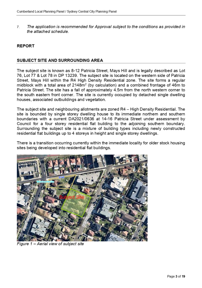
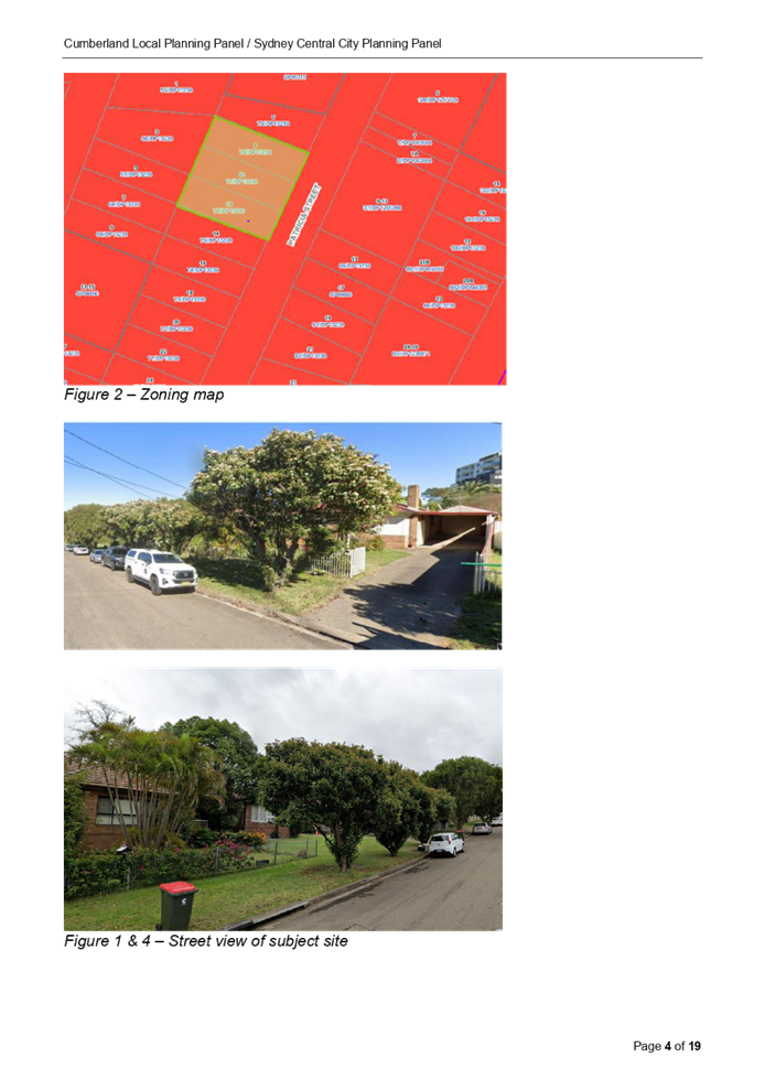
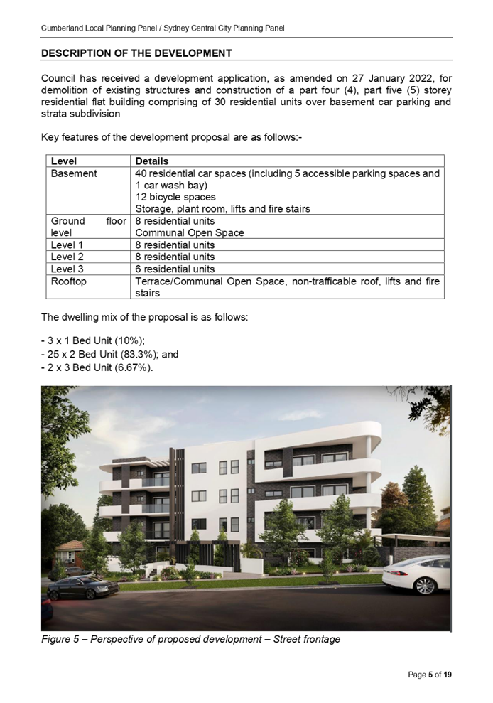

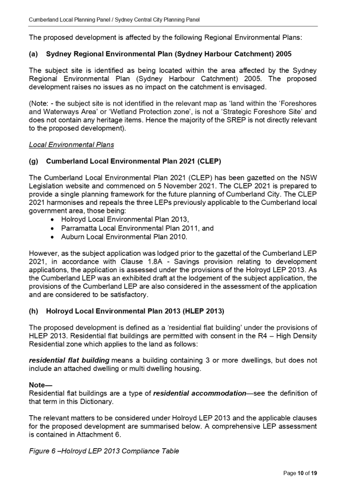
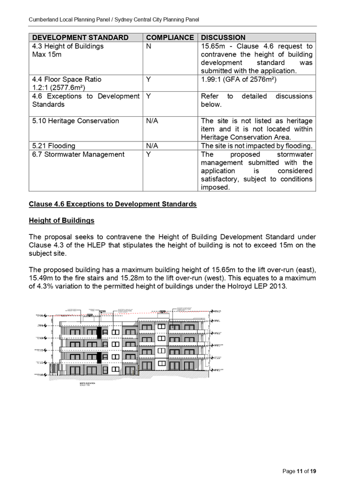
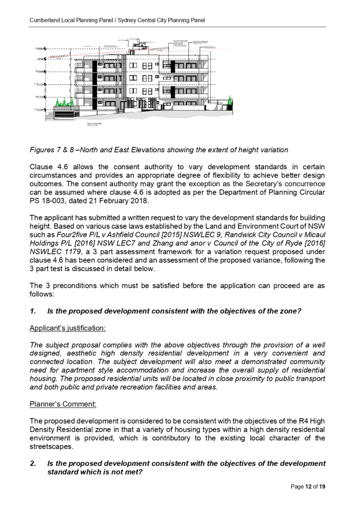


DOCUMENTS
ASSOCIATED WITH
REPORT LPP006/22
Attachment 2
Draft Notice of Determination
Cumberland Local Planning Panel Meeting
9 March 2022

DOCUMENTS
ASSOCIATED WITH
REPORT LPP006/22
Attachment 3
Architectural Plans
Cumberland Local Planning Panel Meeting
9 March 2022
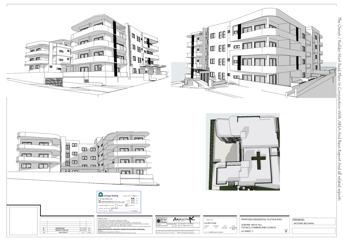
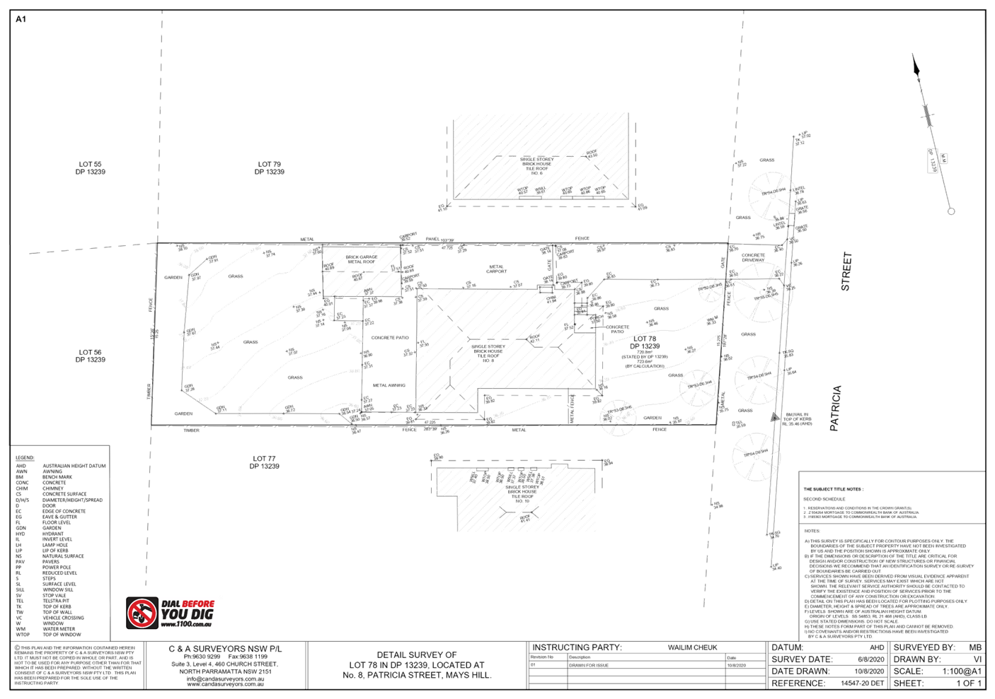
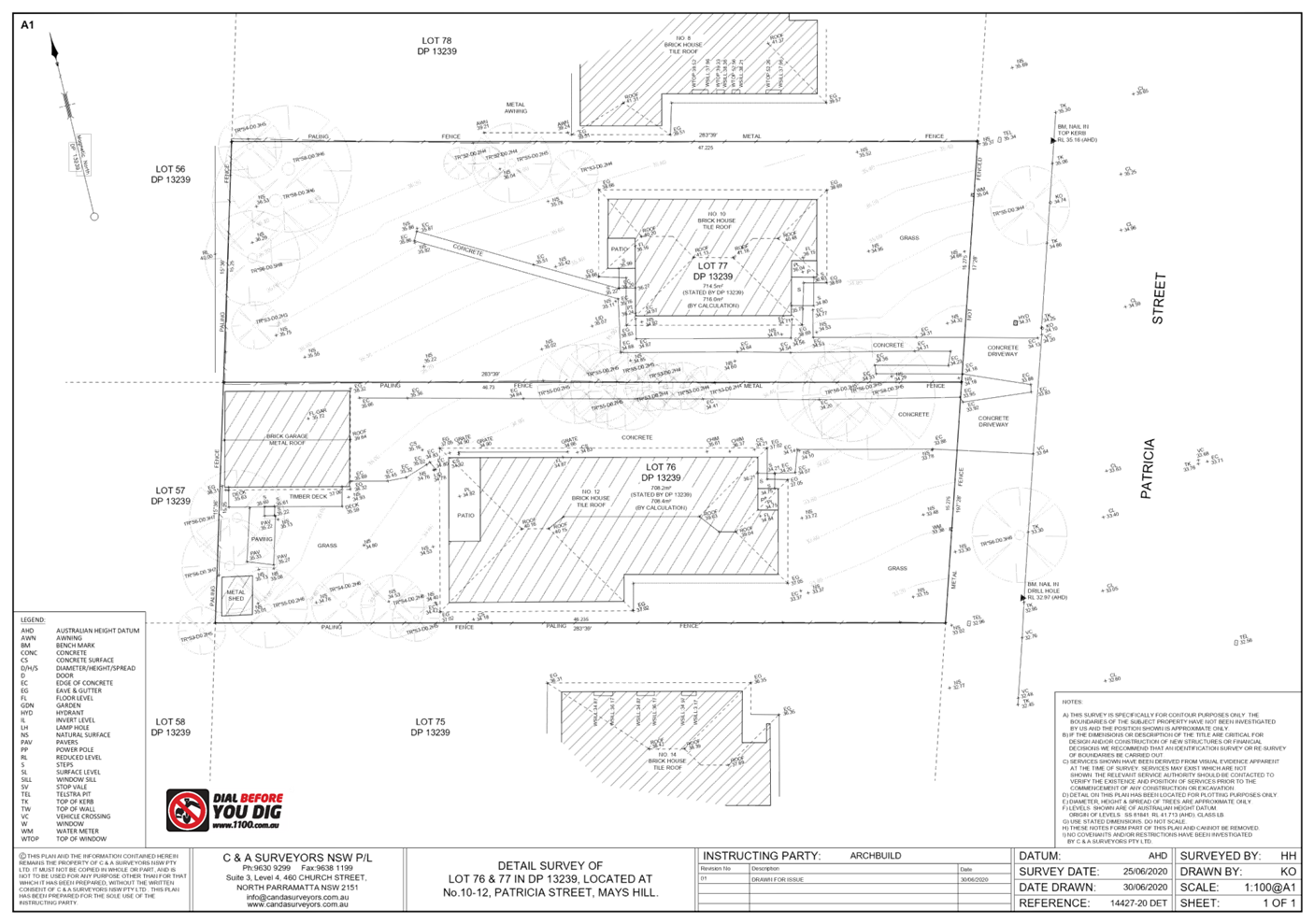
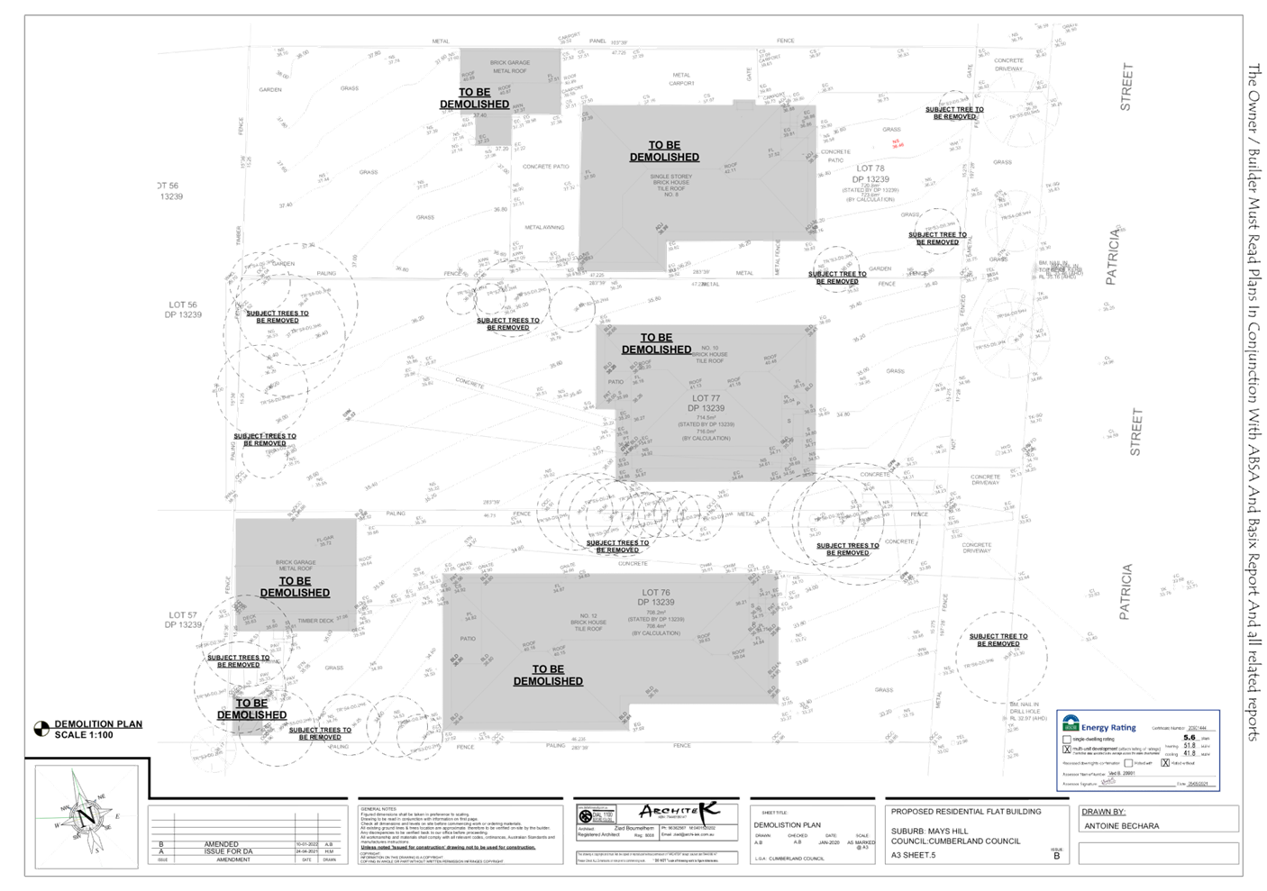
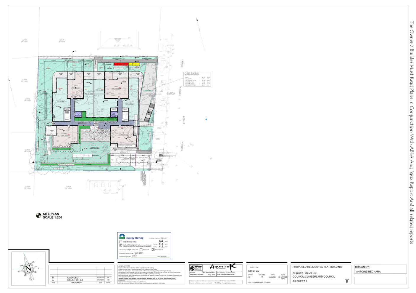
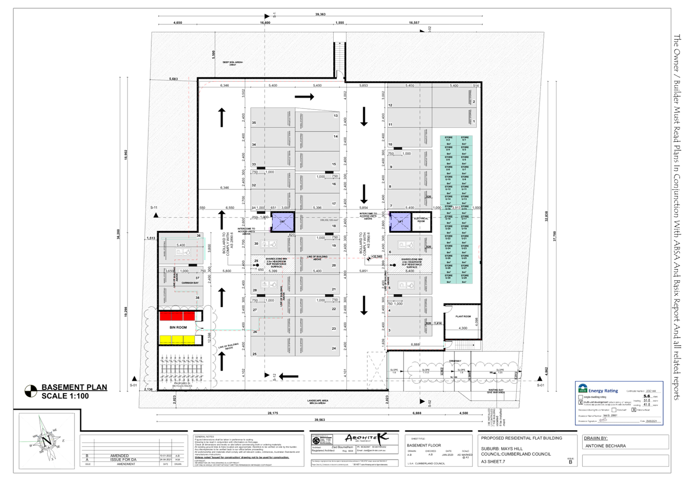
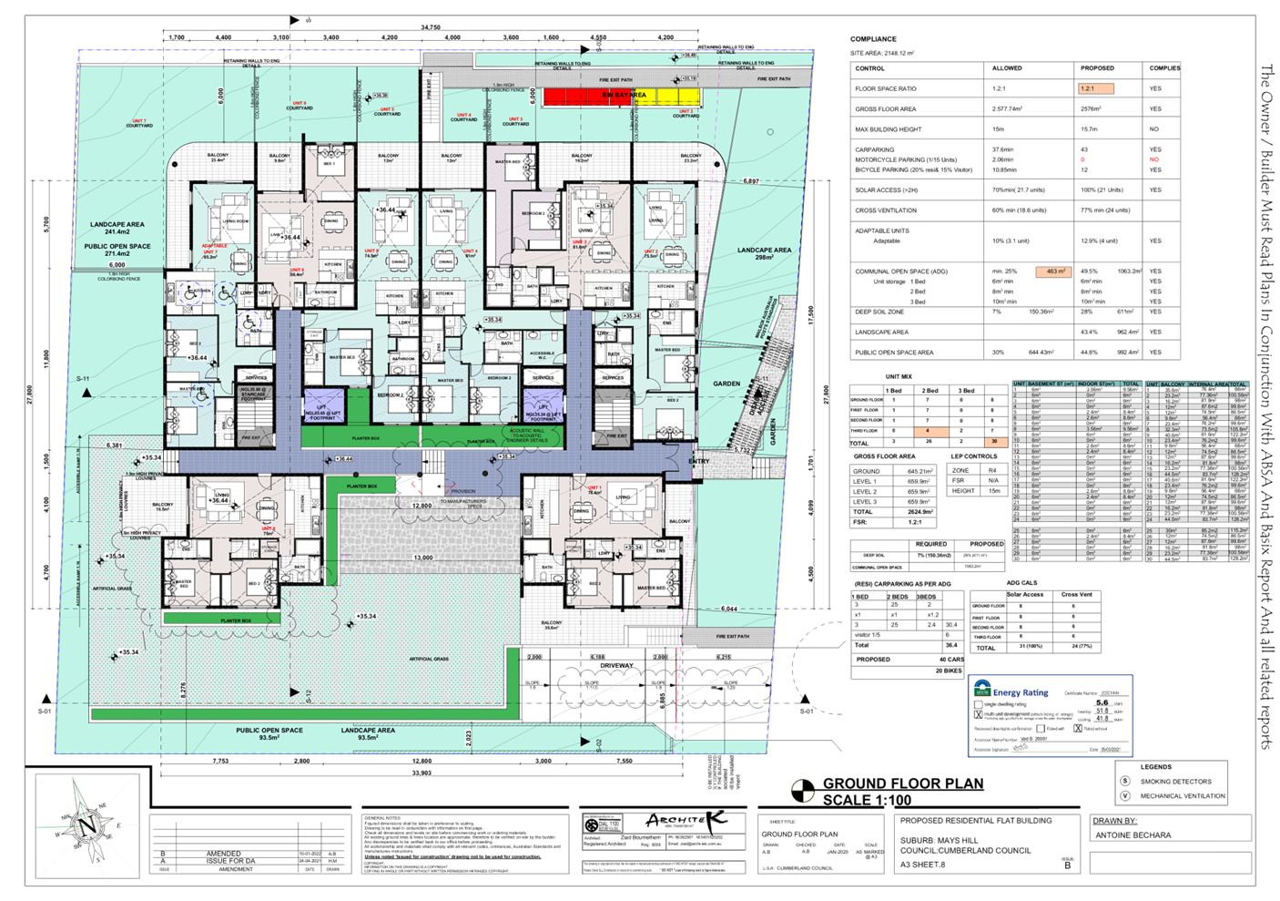
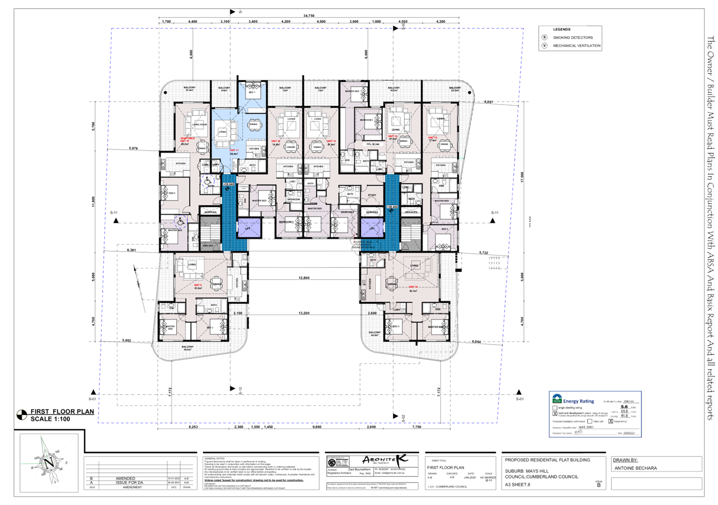
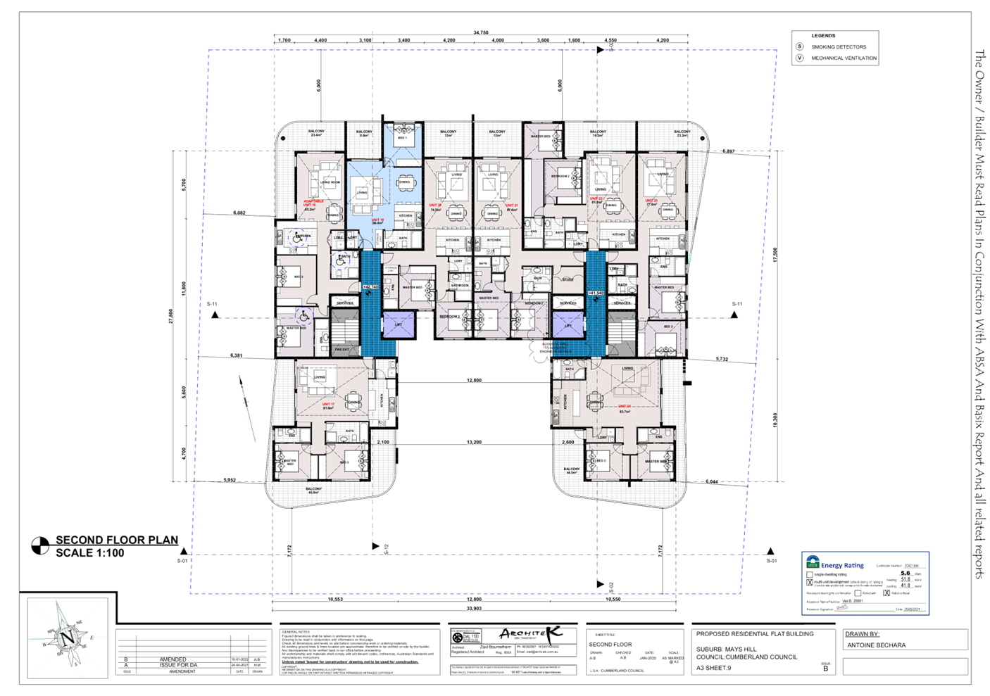
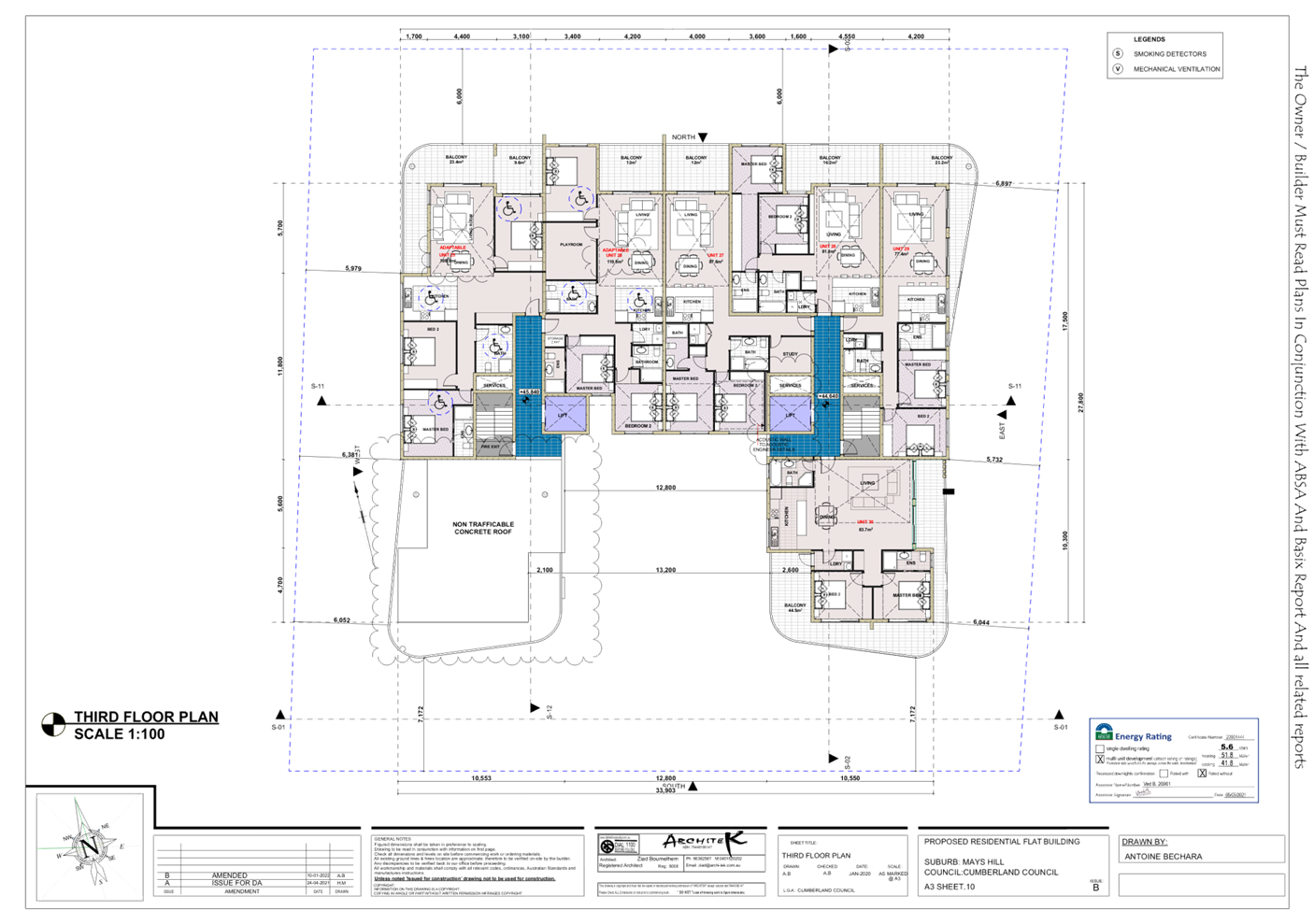
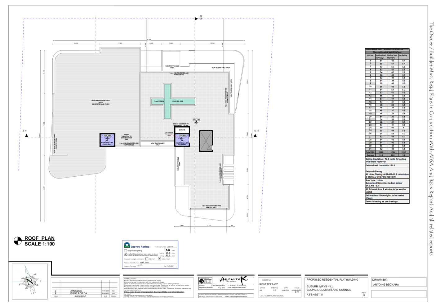
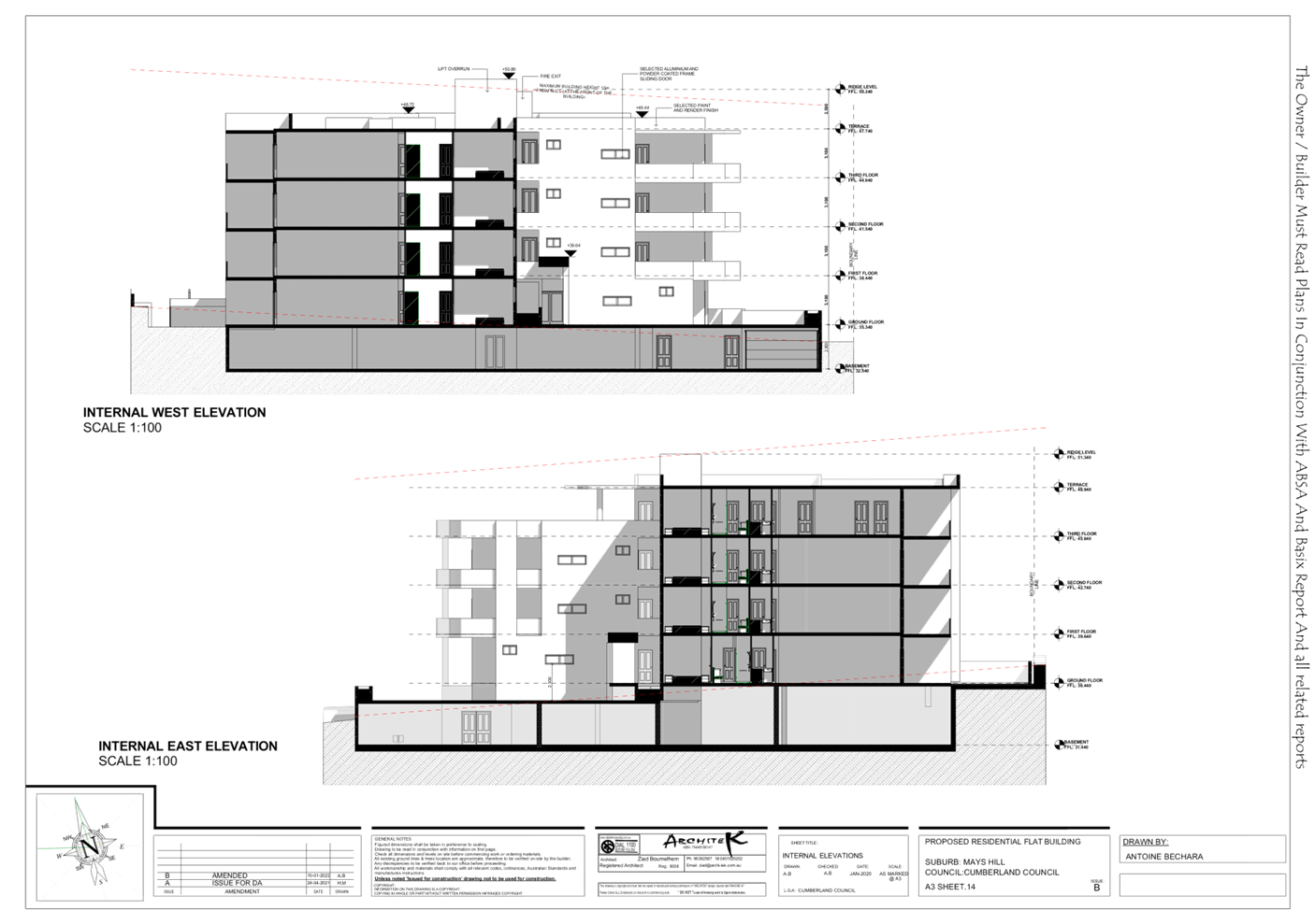
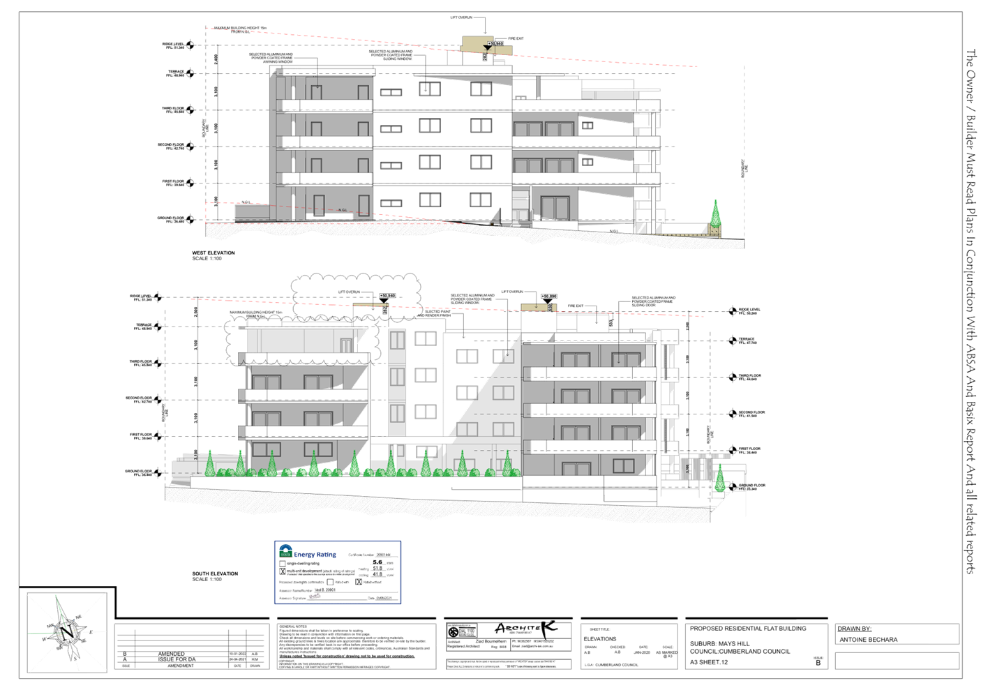
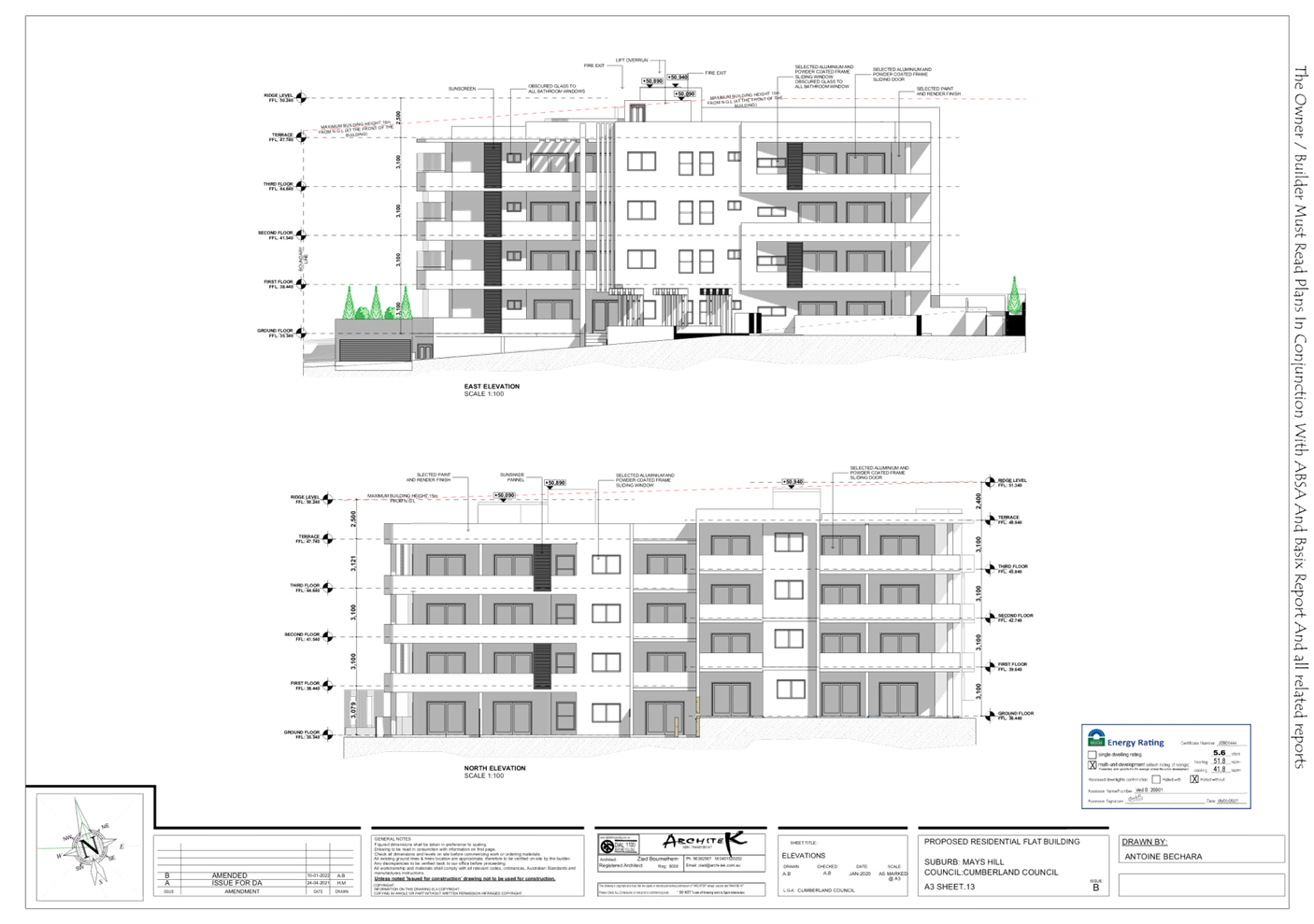
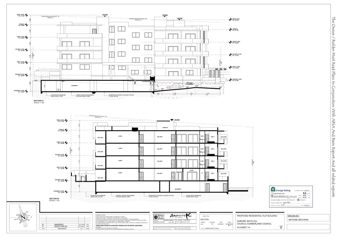
DOCUMENTS
ASSOCIATED WITH
REPORT LPP006/22
Attachment 4
HDC Compliance Table
Cumberland Local Planning Panel Meeting
9 March 2022
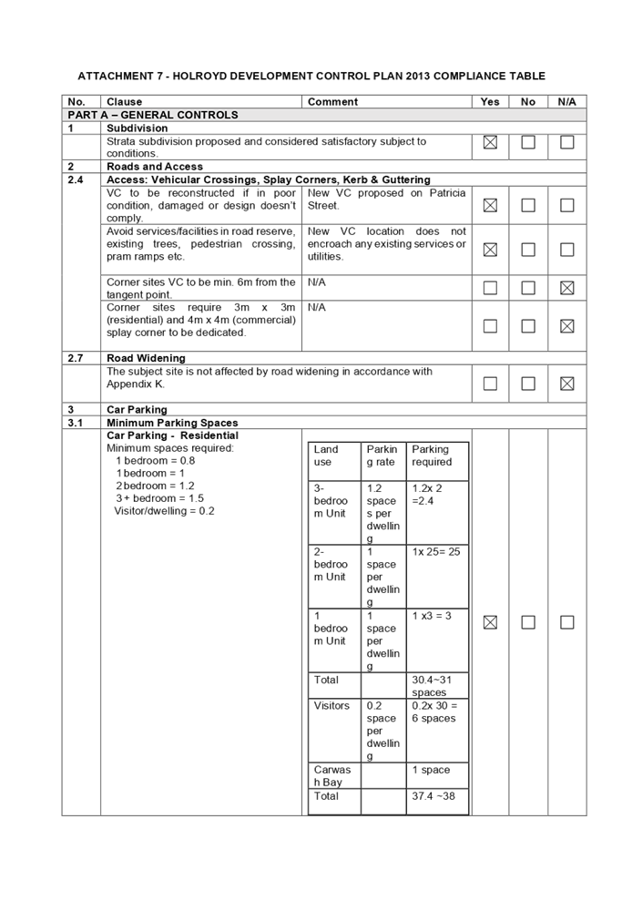
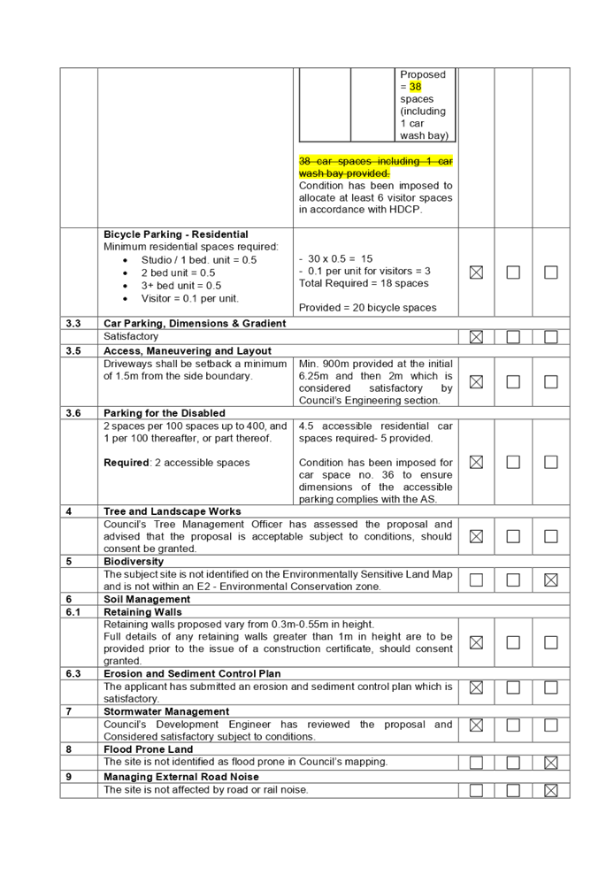
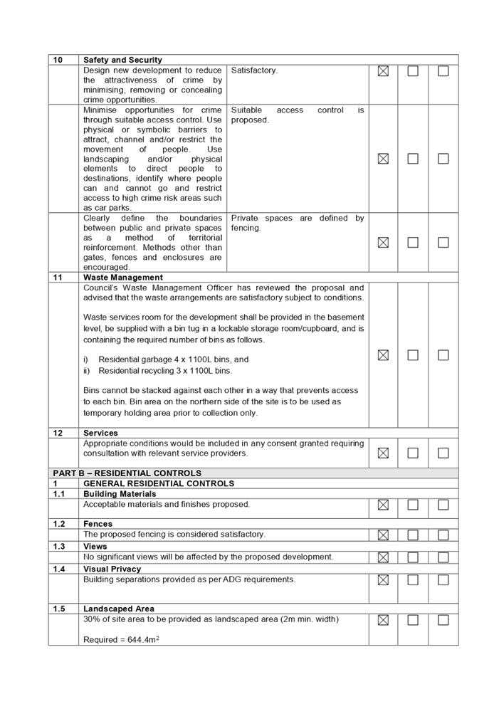
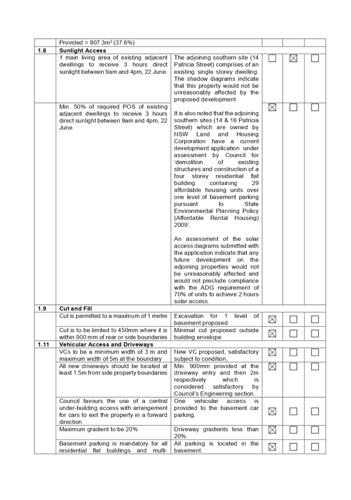
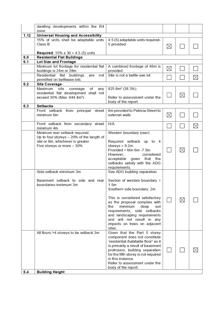
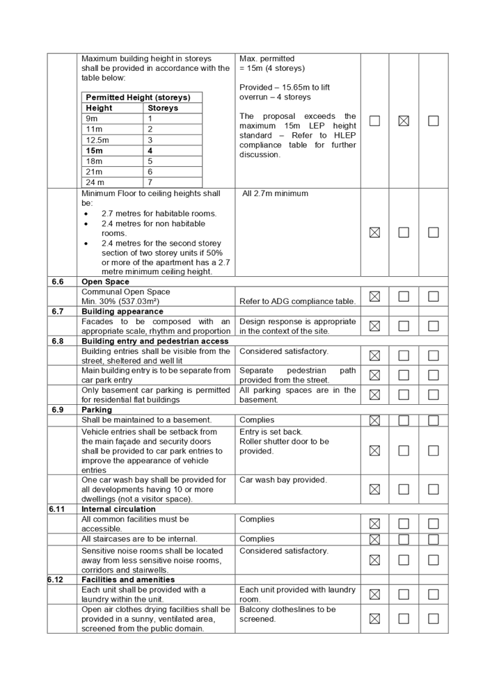
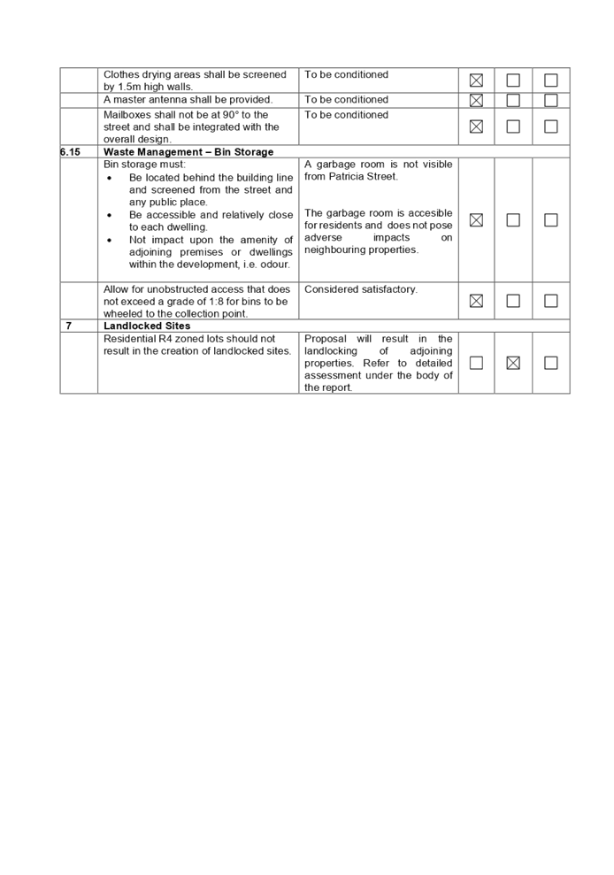
DOCUMENTS
ASSOCIATED WITH
REPORT LPP006/22
Attachment 5
Stormwater Plans
Cumberland Local Planning Panel Meeting
9 March 2022
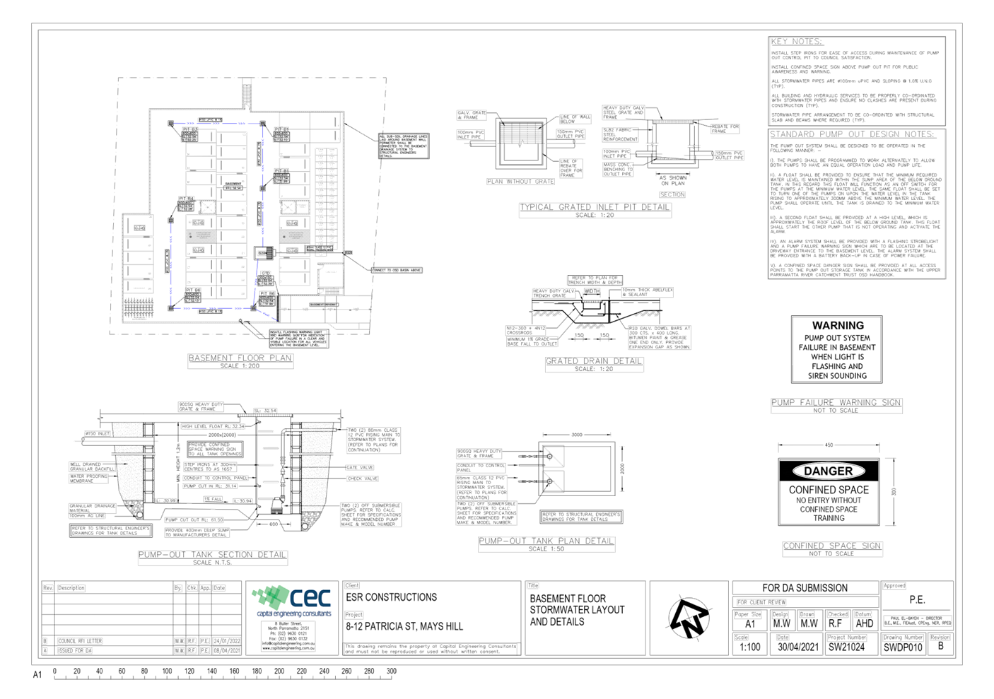
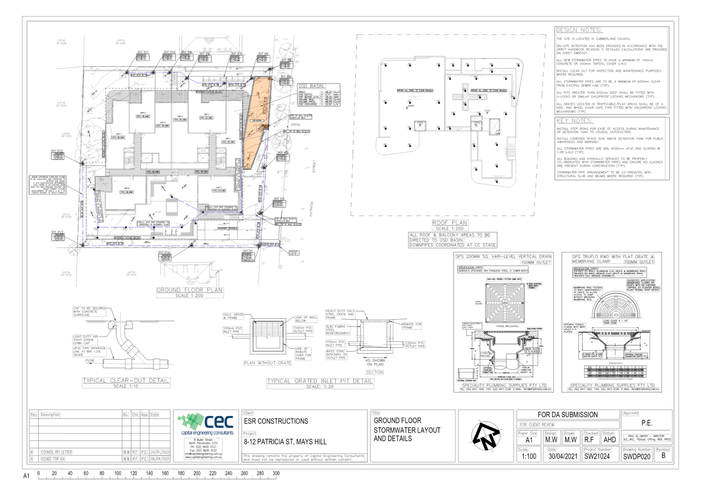
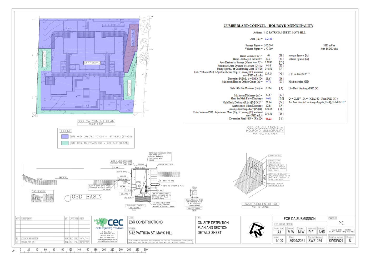
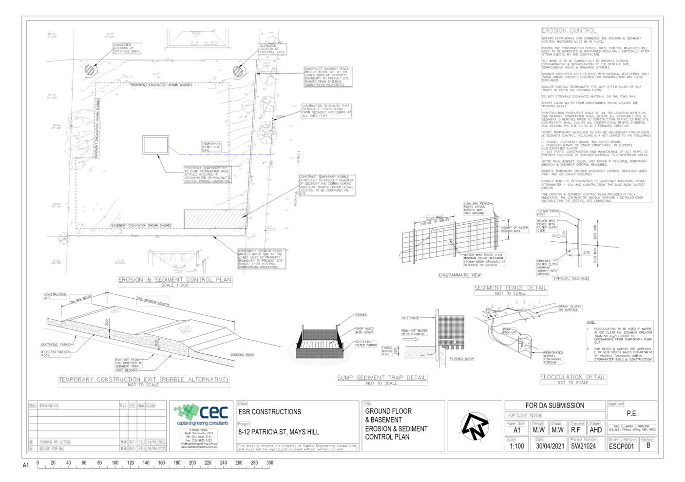
DOCUMENTS
ASSOCIATED WITH
REPORT LPP006/22
Attachment 6
HLEP Compliance Table
Cumberland Local Planning Panel Meeting
9 March 2022
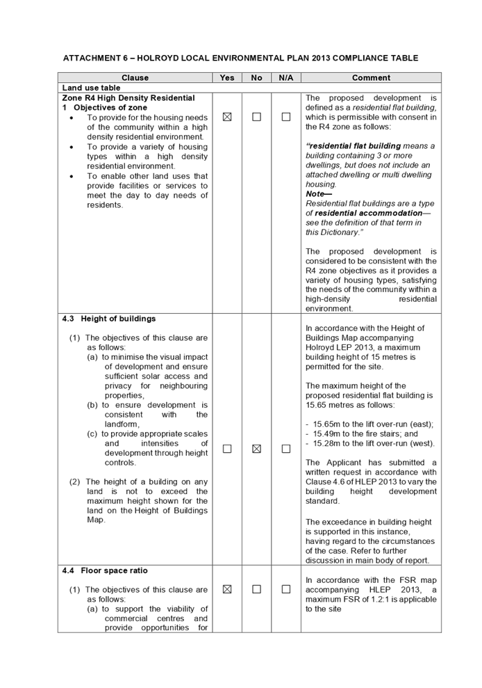
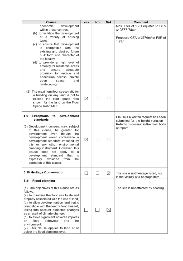
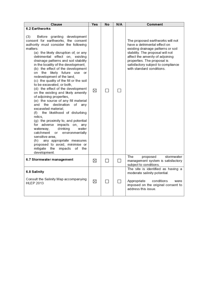
DOCUMENTS
ASSOCIATED WITH
REPORT LPP006/22
Attachment 7
Clause 4.6 Variation
Cumberland Local Planning Panel Meeting
9 March 2022

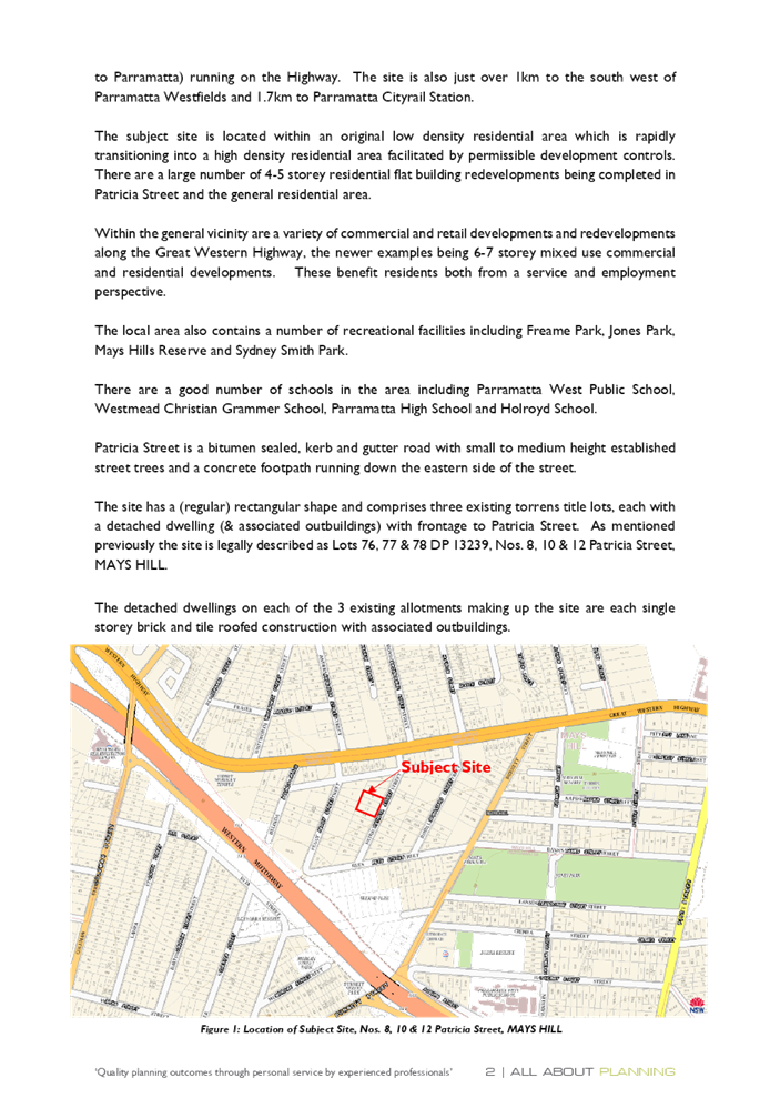
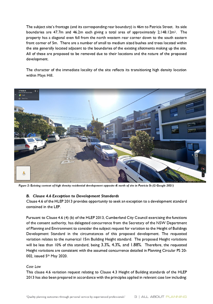
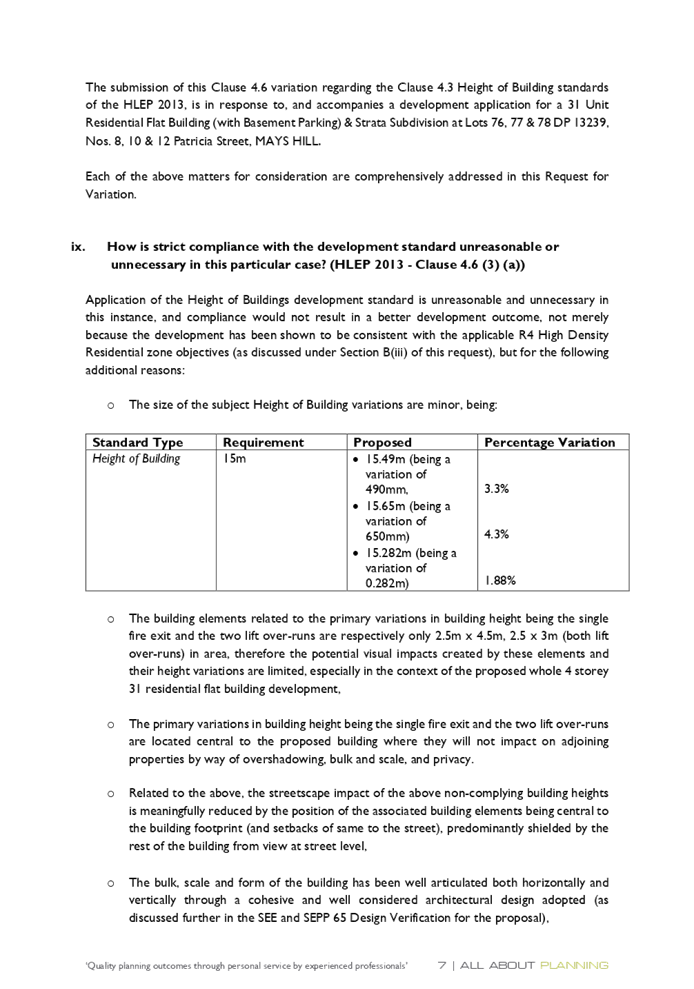


Cumberland
Local Planning Panel Meeting
9 March 2022
Item No: LPP007/22
Development
Application for Land adjacent to 3 South Parade, Auburn
Responsible
Division: Environment
& Planning
Officer: Executive
Manager Development and Building
File
Number: DA2022/0003
|
Application
accepted
|
21 January 2022
|
|
Applicant
|
Urbis Pty Ltd
|
|
Owner
|
Cumberland City Council
|
|
Application
No.
|
DA2022/0003
|
|
Description
of Land
|
Land adjacent to 3 South
Parade, Auburn NSW 2144
|
|
Proposed
Development
|
Use of the land as a
telecommunications facility with third party advertising on a 32 inch
electronic display screen incorporated in the payphone structure on the
public footpath adjacent to 3 South Parade, Auburn NSW 2144
|
|
Zoning
|
SP2 - Infrastructure Zone
|
|
Disclosure
of political donations and gifts
|
Nil disclosure
|
|
Heritage
|
The subject site does not
contain a heritage item and is not located within a Heritage Conservation
Area.
|
|
Principal
Development Standards
|
Permissible:
Floor Space Ratio – No
FSR prescribed to the subject site (CLEP 2021)
The proposal is for the use of
a telecommunication facility located on the public footpath and no GFA
applicable in this instance.
Permissible:
Height of Buildings – No
maximum building height prescribed to the subject site (CLEP 2021)
Proposed: 2.735m
|
1. On,
20 November 2020, Federal Court of Australia has determined that the new
generation Smart City payphone structure, which was previously exempt from the
requirement for development consent, does not qualify as being “Low
impact Facilities” under the Telecommunications Act 1997. As such, a
Development Application and associated Building Information Certificate are now
required for the use of the existing Telstra payphone structure at the subject
site.
2. Development
Application No. DA2022/0003 was accepted on 21 January 2022 for the use of the
telecommunications facility with a third party advertising on a 32 inches
electronic display screen incorporated in the payphone structure on the public
footpath adjacent to 3 South Parade, Auburn NSW 2144.
3. The
application was publicly notified to occupants and owners of the adjoining
properties for a period of 14 days between 2
February 2022 and 16
February 2022. In response, no submissions were
received.
4. The
subject application has been assessed against the relevant provisions of the
relevant State Environmental Planning Policies, Cumberland Local Environmental
Plan 2021 and the Cumberland Development Control Plan 2021.
5. The application is
referred to the Panel as Council is the owner of the land where this
development is proposed.
The application is recommended for conditional approval subject to the
conditions as provided in Attachment 1.
Report:
SUBJECT SITE AND SURROUNDING
AREA
The subject site is located on the public footpath adjoining
No. 3 South Parade, Auburn. A site inspection of the payphone structure carried
out on 15 February 2022 confirmed that the structure being a Smart City
payphone, the 32 inches screen within the front elevation and 75 inches on the
rear elevation currently exists, refer to Figures 3 and 4 below.
 The
site is zoned SP2 Infrastructure containing Auburn train station and is
surrounded by B4 Mixed Use zoned land to north, south, and west and R2 Low
Density Residential land to the east of the site. The existing developments
adjoining the site include commercial use development comprising of retail
tenancies.
The
site is zoned SP2 Infrastructure containing Auburn train station and is
surrounded by B4 Mixed Use zoned land to north, south, and west and R2 Low
Density Residential land to the east of the site. The existing developments
adjoining the site include commercial use development comprising of retail
tenancies.


Figure 1 – Aerial view of subject site
Figure 2 –
Zoning Map of subject site
|

|

|
|
Figure 3 –
Street view of subject structure
|
Figure 4 –
Street view of subject structure
|
Description of the
development
Council has received a development application for the use
of an existing new generation Smart City payphone booth erected within the
footpath adjoining No. 3 South Parade, Auburn as a telecommunications facility
with a third-party advertising on a 32 inches electronic display screen within
the front elevation, which is incorporated in the payphone structure.
The payphone structure measures 2.735 metres in height and
1.2 metres in width and includes an electronic display area above the payphone
measuring 381mm x 687mm (32 inches) proposed to be used for a third-party
advertising.
The payphone structure and the 32-inch electronic display
screen have been constructed and installed and are currently in operation.
It is acknowledged that the electronic display on the rear
elevation of the structure, measuring 75 inches, has been approved by Council
under DA2019/86. This component has been installed and is currently operating.
A Building Information Certificate (BIC) is required for the
payphone structure and the associated 32 inches electronic display; conditions
of consent have been recommended to address this requirement.
· Development Application DA2019/86 was approved as a Deferred
Commencement on 29 May 2019 for the use of a digital display sign affixed to a
Telstra payphone rear elevation for a third party advertising. Operative
consent was issued on 4 February 2020.
· On 20 November 2020, the Federal Court of Australia (e.g., Telstra
Corporation Limited v Melbourne City Council [2021] HCASL 82) has
determined that the new generation payphone structure which was previously
exempt from the requirement for development consent, does not qualify as
“Low impact Facilities” under the Telecommunications Act 1997.
As a result, existing structures already built on Council’s land require
development consent for its use as a telecommunication facility.
· A Pre Lodgement meeting was held with the applicant on
27 May 2021 under PL2021/0049 and the meeting notes advised the applicant to
lodge a Development Application and associated Building Information Certificate
to obtain the required approvals for all components of the
structure/telecommunication facility.
Applicants
Supporting Statement
The
applicant has provided a Statement of Environmental Effects prepared by Urbis dated November
2021 and was received by Council on 21 January
2022 in support of the application.
Contact
with Relevant Parties
The
assessing officer has undertaken a site inspection of the subject site and
surrounding properties and has been in regular contact with the applicant
throughout the assessment process.
Internal
Referrals
The
application was not required to be referred to any of Council’s internal
departments for review.
External
Referrals
The
application was not required to be referred to any external government
authorities for comment.
Planning
Comments
The
provisions of any Environmental Planning Instruments (EP&A Act s4.15 (1)(a)(i))
(a) Roads Act 1993
As the
proposal is not located adjacent to a classified road, approval pursuant to
subclause 138(1) of the Roads Act 1993 is not required for this development
application.
(b) Telecommunications (Low-Impact Facilities) Determination
2018
Pursuant to
the Telecommunications (Low-impact Facilities) Determination 2018, the proposal
is not classified as a low impact facility and as such, state and local
planning requirements apply.
(c) Telecommunications Act 1997
The Telecommunications
Act establishes a framework for regulating the actions of telecommunications
carriers and service providers. The existing payphone structure was previously
built pursuant to Schedule 3 of the Telecommunications Act 1997.
(d) Telecommunications Code of Practice 2018
The
Telecommunications Code of Practice 2018 commenced on 20 February 2018 and
replaces the Telecommunications Code of Practice 1997. The Code of Practice
imposes a range of requirements on service providers that engage in, or propose
to engage in a land entry activity. The Code also requires the applicant to
comply with industry best practice, in the design, planning and installation of
facilities. The proposed development relates to the use of an existing payphone
structure that was built pursuant to Schedule 3 of the Telecommunications Act
1997.
(e) State Environmental Planning Policy (Infrastructure) 2007
(ISEPP)
The provisions of the ISEPP 2007
have been considered in the assessment of the development application.
Clause 115 – Development
permitted with consent
(1) Development
for the purposes of telecommunications facilities, other than development in
clause 114 or development that is exempt development under clause 20 or 116,
may be carried out by any person with consent on any land.
(3) Before
determining a development application for development to which this clause
applies, the consent authority must take into consideration any guidelines
concerning site selection, design, construction or operating principles for
telecommunications facilities that are issued by the Secretary for the purposes
of this clause and published in the Gazette.
Telecommunication facility is a prohibited land use within
the SP2 zone under the Cumberland Local Environmental Plan 2021. The proposed
use of the existing telecommunication facility relies on clause 115(1) of the
ISEPP 2007 for its permissibility, in which telecommunications facilities may
be carried out by any person with consent on any land.
Pursuant to clause 115(3) of the ISEPP 2007, before
determining the proposal, the consent authority must take into consideration of
any guidelines concerning the site selection, design, construction and
operation of telecommunication facilities. The proposal was accompanied with
the report of compliance to the principles of NSW Telecommunications Facilities
Guideline including Broadband 2010. These principles are:
· Principle
1: A Telecommunications facility is to be designed and sited to minimise
· visual
impact.
· Principle
2: Telecommunications facilities should be co-located wherever practical.
· Principle
3: Health standards for exposure to radio emissions will be met; and
· Principle
4: Minimise disturbance and risk and maximise compliance.
These matters have been considered as part of the assessment
of this application and are considered satisfactory. Refer to Attachment 4.
(f) State Environmental Planning Policy No 64—Advertising
and Signage
The proposed signage is ‘advertisement’ as
defined under SEPP 64 as follows:
Advertisement means signage to which Part 3 applies and
includes any advertising structure for the advertisement
The subject proposal is subject to assessment under Part 3
of SEPP 64 and the guidelines included in Schedule 1 of the Policy.
Clause
|
Comments
|
|
8 Granting of consent to
signage
A consent authority must not
grant development consent to an application to display signage unless the
consent authority is satisfied:
(a) that the signage is
consistent with the objectives of this Policy as set out in clause 3 (1) (a),
and
(b) that the signage the
subject of the application satisfies the assessment criteria specified in
Schedule 1.
|
Satisfactory. Assessment
of the proposal has concluded that the design of the proposed signage is compatible
with the character of the area which is predominantly for business use.
The location of the signage is considered suitable and will not have any
adverse impact on the amenity of the surrounding developments.
|
|
10 Prohibited
advertisements
(1) Despite the provisions of
any other environmental planning instrument, the display of an advertisement
is prohibited on land that is an environmentally sensitive area, heritage
area (excluding railway stations), natural or other conservation area, open space,
waterway, residential (but not a mixed residential and business zone or
similar zone), scenic protection area, national park, nature reserve
(2) This clause does not
apply to the following:
(a) The Mount Panorama
Precinct.
(b) The display of an advertisement
at a public sporting facility situated on land zoned public recreation under
an EPI being an advertisement that provides information about the sponsors of
the teams or organisations using the sporting facility or about the products
of those sponsors.
|
The site is not located on land
that is an environmentally sensitive area and is not located nearby to a
heritage conservation area.
|
|
12 Consent Authority
For the purposes of this
Policy, the consent authority is—
(a) the council of
a local government area in the case of an advertisement displayed in the
local government area (unless paragraph (c), (d) or (e) applies), or
(b) TfNSW in the
case of an advertisement displayed on a vessel, or
(c) the Minister
for Planning in the case of an advertisement displayed by or on behalf of
RailCorp, NSW Trains, Sydney Trains, Sydney Metro or TfNSW on a railway
corridor, or
(d) the Minister
for Planning in the case of an advertisement displayed by or on behalf of RMS
on—
(i) a
road that is a freeway or tollway (under the Roads Act 1993) or associated road use land that is adjacent to such a
road, or
(ii) a
bridge constructed by or on behalf of TfNSW on any road corridor, or
(iii) land
that is owned, occupied or managed by TfNSW, or
(e) the Minister
for Planning in the case of an advertisement displayed on transport corridor
land comprising a road known as the Sydney Harbour Tunnel, the Eastern
Distributor, the M2 Motorway, the M4 Motorway, the M5 Motorway, the M7
Motorway, the Cross City Tunnel or the Lane Cove Tunnel, or associated road
use land that is adjacent to such a road.
|
Council is considered the
consent authority for the subject proposal.
|
13 Matters for
consideration
(1) A consent
authority (other than in a case to which subclause (2) applies) must not
grant consent to an application to display an advertisement to which this
Policy applies unless the advertisement or the advertising structure, as the
case requires:
(a) is consistent
with the objectives of this Policy as set out in clause 3 (1) (a), and
(b) has been
assessed by the consent authority in accordance with the assessment criteria
in Schedule 1 and the consent authority is satisfied that the proposal is
acceptable in terms of its impacts, and
(c) satisfies any
other relevant requirements of this Policy.
|
The proposed signage is
considered to be in a suitable location and will have acceptable impacts on
the local area.
The development application is
limited to the use of the existing sign on the payphone for third party
advertising. The third party advertising will be displayed on a screen that
is part of a public payphone operated by Telstra. The subject site is located
on the pedestrian footpath and will not have any detrimental impacts on the
traffic flows within the locality.
|
|
14 Duration of Consents
(1) A consent granted under
this part ceases to be in force:
(a) on the expiration of 15
years after the date on which the consent becomes effective and operates
(b) if a lesser period is
specified by the consent authority, that lesser period
(2) The consent authority may
specify a period less than 15 years only if:
(a) before the commencement
of this Part, the consent authority had adopted a policy of granting consents
in relation to applications to display advertisements for a lesser period and
the duration of the consent authority is consistent with that policy
(b) the area in which the
advertisement is undergoing change in accordance with an EPI that aims to
change the nature and character of development and where the proposed
advertisement would be inconsistent with that change
(c) the specification of a
lesser period if required by another provision of this Policy.
|
Council will impose a condition
restricting the consent to a period of fifteen (15) years.
|
|
16 Transport Corridor Land
(1) Despite clause 10
(1) and the provisions of any other environmental planning instrument, the
display of an advertisement on transport corridor land is permissible with
development consent in the following cases—
(a) the display of
an advertisement by or on behalf of RailCorp, NSW Trains, Sydney Trains,
Sydney Metro or TfNSW on a railway corridor,
(b) the display of
an advertisement by or on behalf of TfNSW on—
(i) a
road that is a freeway or tollway (under the Roads Act 1993) or associated road use land that is adjacent to such a
road, or
(ii) a
bridge constructed by or on behalf of TfNSW on any road corridor, or
(iii) land
that is owned, occupied or managed by TfNSW and that is within 250 metres of
a classified road,
(c) the display of
an advertisement on transport corridor land comprising a road known as the
Sydney Harbour Tunnel, the Eastern Distributor, the M2 Motorway, the M4
Motorway, the M5 Motorway, the M7 Motorway, the Cross City Tunnel or the Lane
Cove Tunnel, or associated road use land that is adjacent to such a road.
(2) Before determining
an application for consent to the display of an advertisement in such a case,
the Minister for Planning may appoint a design review panel to provide advice
to the Minister concerning the design quality of the proposed advertisement.
(3) The Minister must
not grant consent to the display of an advertisement in such a case
unless—
(a) the relevant
local council has been notified of the development application in writing and
any comments received by the Minister from the local council within 28 days
have been considered by the Minister, and
(b) the advice of
any design review panel appointed by the Minister has been considered by the
Minister, and
(c) the Minister
is satisfied that the advertisement is consistent with the Guidelines.
(4) This clause does
not apply to the display of an advertisement if the Minister determines that
display of the advertisement is not compatible with surrounding land use,
taking into consideration any relevant provisions of the Guidelines.
|
The site is not situated within
land designated as a transport corridor and as such, Clause 16 is not
applicable.
|
|
17 Advertisements with display area
greater than 20 square metres or higher than 8 metres above ground
(1) This clause applies
to an advertisement:
(a) that has a
display area greater than 20 square metres, or
(b) that is higher
than 8 metres above the ground.
(2) The display of an
advertisement to which this clause applies is advertised development for the
purposes of the Act.
(3) The consent
authority must not grant consent to an application to display an
advertisement to which this clause applies unless:
(a) the applicant
has provided the consent authority with an impact statement that addresses
the assessment criteria in Schedule 1 and the consent authority is satisfied
that the proposal is acceptable in terms of its impacts, and
(b) the
application has been advertised in accordance with section 79A of the Act,
and
(c) the consent
authority gave a copy of the application to RMS at the same time as the
application was advertised in accordance with section 79A of the Act if the
application is an application for the display of an advertisement to which
clause 18 applies.
|
Clause 17 does not apply to the
proposed development for the following reasons:
· The proposed signage has an area of 0.26m2
which does not exceed an area of 20m2; and
D1
· Has a maximum height of 1.886 metres above ground.
|
18 Advertisements
greater than 20 square metres and within 250 metres of, and visible from, a
classified road
(1) This clause applies
to the display of an advertisement to which clause 17 applies, that is within
250 metres of a classified road any part of which is visible from the
classified road.
(2) The consent
authority must not grant development consent to the display of an
advertisement to which this clause applies without the concurrence of RMS.
(3) In deciding whether
or not concurrence should be granted, RMS must take into consideration:
(a) the impact of
the display of the advertisement on traffic safety, and
(b) the
Guidelines.
(c) (Repealed)
(4) If RMS has not
informed the consent authority within 21 days after the copy of the
application is given to it under clause 17 (3) (c) (ii) that it has granted,
or has declined to grant, its concurrence, RMS is taken to have granted its
concurrence.
(5) Nothing in this
clause affects clause 16.
(6) This clause does
not apply when the Minister for Planning is the consent authority.
|
The proposed sign has an area of
0.26m2 and is not located on a classified road. As such, RMS
referral is not required and Clause 18 is not applicable.
|
19 Advertising
display area greater than 45 square metres
The consent authority must
not grant consent to the display of an advertisement with an advertising
display area greater than 45 square metres unless—
(a) a development
control plan is in force that has been prepared on the basis of an
advertising design analysis for the relevant area or precinct, or
(b) in the case of
the display of an advertisement on transport corridor land, the consent
authority is satisfied that the advertisement is consistent with the
Guidelines.
|
The proposed advertisement is
less than 45m2, as such Clause 19 does not apply.
|
|
20 Location
of certain names and logos
(1) The name or logo of
the person who owns or leases an advertisement or advertising structure may
appear only within the advertising display area.
(2) If the advertising
display area has no border or surrounds, any such name or logo is to be
located—
(a) within the
advertisement, or
(b) within a strip
below the advertisement that extends for the full width of the advertisement.
(3) The area of any
such name or logo must not be greater than 0.25 square metres.
(4) The area of any
such strip is to be included in calculating the size of the advertising
display area
|
All logos associated with the
proposed third party advertising is integrated within the payphone structure.
There are no logos within the frames or devices to be erected.
|
ENVIRONMENTAL PLANNING INSTRUMENTS (EPIs)
The proposed development is affected by the following
consolidated State Environmental Planning Policies that came into effect on 1
March 2022. No savings provision is indicated within the new SEPPs, as no
policy changes have been made. The SEPP consolidation does not change the legal
effect of the existing SEPPs, with section 30A of the Interpretation Act 1987
applying to the transferred provisions. In this regard, the following matters
have been incorporated in the planning assessment of the proposed development
under s4.15 of the Environmental Planning and Assessment Act 1979.
|
State Environmental
Planning Policies (SEPPs)
|
Relevant
Clause(s)
|
Compliance
with Requirements
|
|
· State
Environmental Planning Policy (Biodiversity and Conservation) 2021
|
Chapter 2 -Vegetation in
non-Rural Areas.
|
The development application
does not seek to remove any significant trees, which hold any biodiversity or
ecological values, on the site. The proposal does not trigger the provisions
of Chapter 2.
|
·
Chapter 6 - Bushland in Urban Areas. |
The proposal does not involve the disturbance of any
bushland zoned or reserved for public open space.
|
·
Chapter 10 - Sydney Harbour Catchment. |
The proposed development raises no issues as no impact on
the catchment is envisaged.
(Note: - the subject site is not identified in the
relevant map as ‘land within the ‘Foreshores and Waterways
Area’ or ‘Wetland Protection zone’, is not a ‘Strategic
Foreshore Site’ and does not contain any heritage items. Hence the
majority of the State Policy is not directly relevant to the proposed
development).
|
|
· State
Environmental Planning Policy (Resilience and Hazards) 2021
|
Chapter 2 - Coastal
Management.
|
The subject site is not
identified as a coastal wetland nor is it a land identified as in
“proximity area for coastal wetlands”.
|
·
Chapter 4 - Remediation of Land. |
The
site is not identified in Council’s records as being contaminated. A
site inspection reveals the site does not have any obvious history of a
previous land use that may have caused contamination and there is no specific
evidence that indicates the site is contaminated. Further to that, no
physical works are proposed as part of this application, as the structure is
existing.
|
|
· State
Environmental Planning Policy (Transport and Infrastructure) 2021
|
Chapter 2 - Infrastructure
|
The proposed use of land as a
telecommunication facility been considered under the provisions and
determined as being acceptable for approval.
|
|
· State
Environmental Planning Policy (Industry and Employment) 2021
|
Chapter 3 - Advertising and
Signage.
|
The signs the subject of the
development application have been considered under the provisions and
determined as being acceptable for approval.
|
Local Environmental Plans
Cumberland Local Environmental Plan 2021 (CLEP 2021)
The
provision of the CLEP 2021 is applicable to the development proposal. It is
noted that the development achieves compliance with the key statutory
requirements of the CLEP 2021 and the objectives of the SP2
Infrastructure Zone.
(a) Permissibility:
The proposed development is defined as a
‘telecommunications facility’ and ‘signage’. Signage is
permissible in the SP2 Infrastructure Zone with consent; however,
‘telecommunications facility’ is a prohibited land use within the
SP2 zone. Under Clause 115 of the ISEPP 2007, telecommunications facilities may
be carried out by any person with consent on any land. As such, the proposal is
permissible (Refer to ISEPP 2007 discussion within the report).
Telecommunications facility means—
(a) any part of the infrastructure of a
telecommunications network, or
(b) any line, cable, optical fibre, fibre access node,
interconnect point equipment, apparatus, tower, mast, antenna, dish, tunnel,
duct, hole, pit, pole, or other structure in connection with a
telecommunications network, or
(c) any other thing used in or in connection with a
telecommunications network.
signage means any sign, notice, device, representation, or
advertisement that advertises or promotes any goods, services or events and any
structure or vessel that is principally designed for, or that is used for, the
display of signage, and includes any of the following—
(a) an advertising structure,
(b) a building identification sign,
(c) a business identification sign,
but does not include a traffic sign or traffic control
facilities.
A comprehensive LEP assessment is contained in Attachment 7.
The provisions of any proposed instrument that is or has
been the subject (EP&A Act s4.15 (1)(a)(ii))
N/A
The provisions of any Development Control Plans (EP&A
Act s4.15 (1)(a)(iii))
The
Cumberland DCP 2021 provides guidance for the design and operation of
development to achieve the aims and objectives of the Cumberland LEP 2021.
A
comprehensive assessment and compliance table is contained in Attachment
8.
The proposed development complies with the provisions of the
Cumberland DCP 2021 and is considered acceptable from an environmental planning
viewpoint.
The provisions of any planning agreement that has been
entered into under section 7.4, or any draft planning agreement that a
developer has offered to enter into under section 7.4 (EP&A Act
s4.15(1)(a)(iiia))
There is no draft planning agreement associated with the
subject Development Application.
The provisions of the Regulations (EP&A Act s4.15
(1)(a)(iv))
The proposed development raises no concerns as to the
relevant matters arising from the Environmental Planning and Assessment
Regulations 2000 (EP&A Reg).
The Likely Environmental, Social or Economic Impacts (EP&A
Act s4.15 (1)(b))
It is considered that the proposed development will have no
significant adverse environmental, social or economic impacts in the locality.
The suitability of the site for the development (EP&A
Act s4.15 (1)(c))
The subject site and locality is not known to be affected by
any natural hazards or other site constraints likely to have a significant
adverse impact on the proposed development. Accordingly, it is considered that
the development is suitable in the context of the site and surrounding
locality.
Submissions made in accordance with the Act or Regulation
(EP&A Act s4.15 (1)(d))
|
Advertised (Council Website)
|
Mail
|
Sign
|
Not Required
|
In accordance with Council’s Notification requirements
contained within the Cumberland DCP 2021, the proposal was publicly notified
for a period of 14 days between 2 February 2022 and 16 February 2022. No
submissions were received in respect of the proposed development.
The public interest (EP&A Act s4.15(1)(e))
In view of the foregoing analysis, it is considered that the
development, if carried out subject to the conditions set out in the recommendation
below, will have no significant adverse impacts on the public interest.
Cumberland Local Infrastructure Contributions Plan 2020
The development would not require the payment of
contributions in accordance with Cumberland Local Infrastructure Contributions
Plan 2020.
Disclosure of Political Donations and Gifts
The applicant and notification process did not result in any
disclosure of Political Donations and Gifts.
Conclusion
The development application has been assessed in accordance
with the relevant requirements of the Environmental Planning and Assessment Act
1979, Environmental Planning and Assessment Regulation 2000, Roads Act 1993,
Telecommunications Act 1997, State Environmental Planning Policy (Biodiversity
and Conservation) 2021, State Environmental Planning Policy (Resilience and
Hazards) 2021, State Environmental Planning Policy (Transport and
Infrastructure) 2021, State Environmental Planning Policy (Industry and
Employment) 2021,Cumberland LEP 2021 and Cumberland DCP 2021 and is considered
to be satisfactory for approval, subject to conditions.
|
That Development Application No. DA2022/0003 for
the use of the land as a telecommunications facility with third party
advertising on a 32-inch electronic display screen incorporated in the
payphone structure on the public footpath adjacent to 3 South Parade, Auburn
NSW 2144 be Approved subject to attached
conditions.
|
1. Draft Notice
of Determination
2. Site
Plan
3. Elevation
Plan
4. NSW
Telecommunications Facilities Guideline Including Broadband 2010
5. State
Environmental Planning Policy No 64 - Advertising and Signage
6. Cumberland
Local Environmental Plan 2021
7. Cumberland
Development Control Plan 2021
8. Draft
Reasons for Recommendation
DOCUMENTS
ASSOCIATED WITH
REPORT LPP007/22
Attachment 1
Draft Notice of Determination
Cumberland Local Planning Panel Meeting
9 March 2022

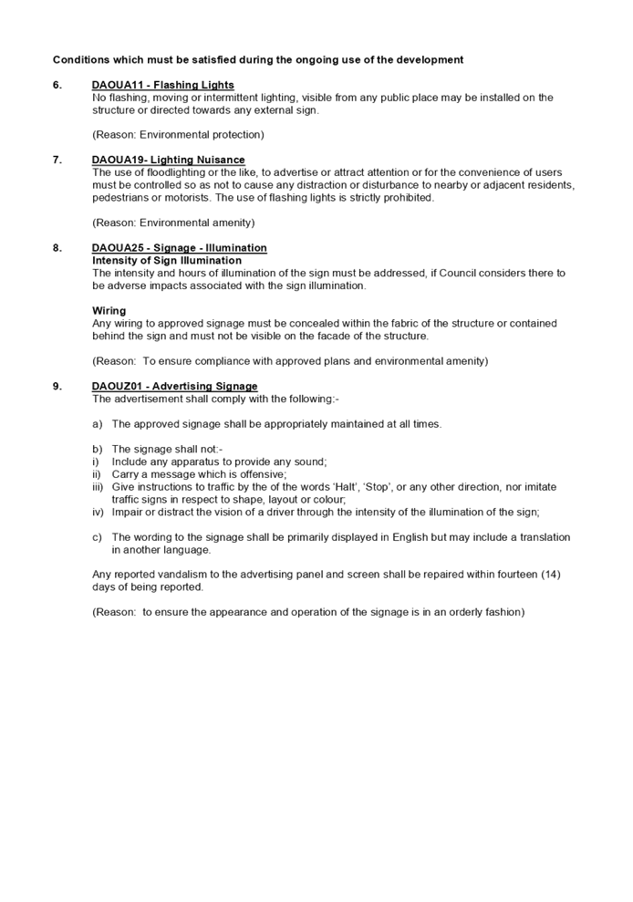
DOCUMENTS
ASSOCIATED WITH
REPORT LPP007/22
Attachment 2
Site Plan
Cumberland Local Planning Panel Meeting
9 March 2022
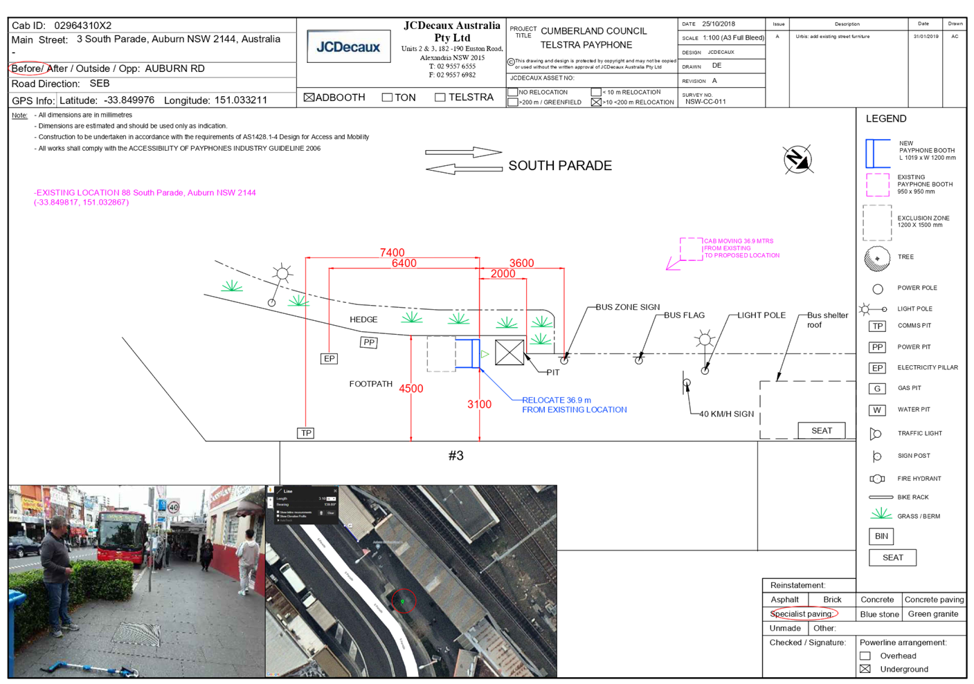
DOCUMENTS
ASSOCIATED WITH
REPORT LPP007/22
Attachment 3
Elevation Plan
Cumberland Local Planning Panel Meeting
9 March 2022
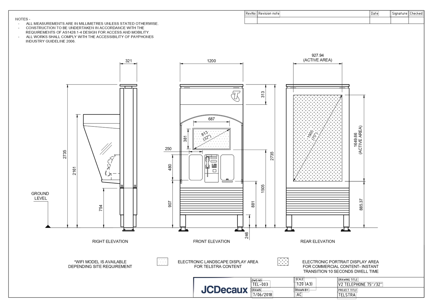
DOCUMENTS
ASSOCIATED WITH
REPORT LPP007/22
Attachment 4
NSW Telecommunications Facilities Guideline Including Broadband
2010
Cumberland Local Planning Panel Meeting
9 March 2022
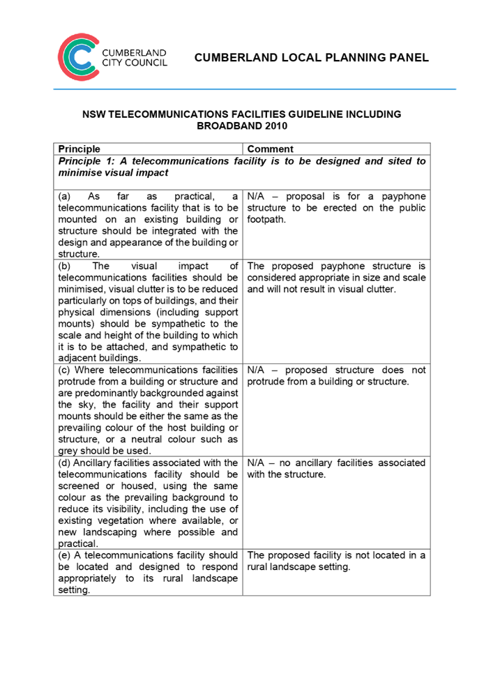

DOCUMENTS
ASSOCIATED WITH
REPORT LPP007/22
Attachment 5
State Environmental Planning Policy No 64 -
Advertising and Signage
Cumberland Local Planning Panel Meeting
9 March 2022
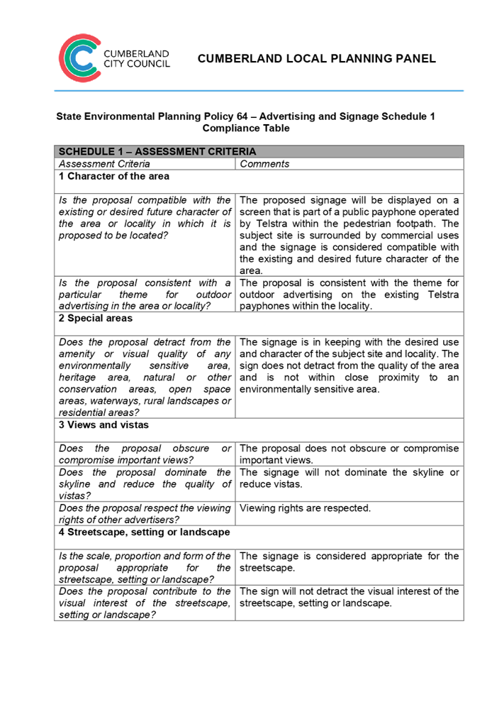
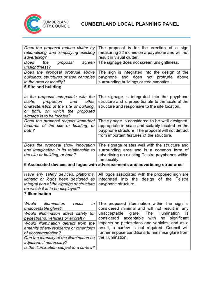

DOCUMENTS
ASSOCIATED WITH
REPORT LPP007/22
Attachment 6
Cumberland Local Environmental Plan 2021
Cumberland Local Planning Panel Meeting
9 March 2022
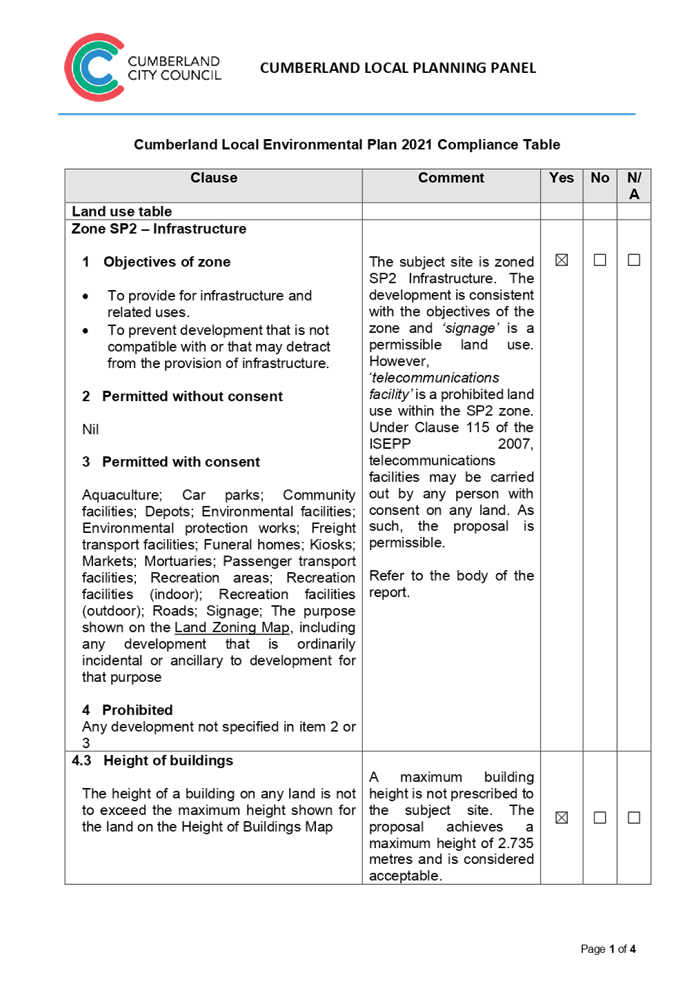
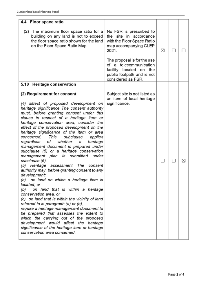
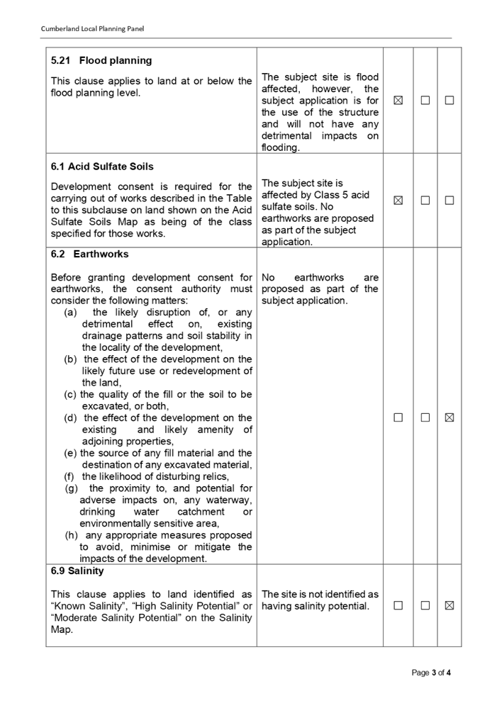

DOCUMENTS
ASSOCIATED WITH
REPORT LPP007/22
Attachment 7
Cumberland Development Control Plan 2021
Cumberland Local Planning Panel Meeting
9 March 2022
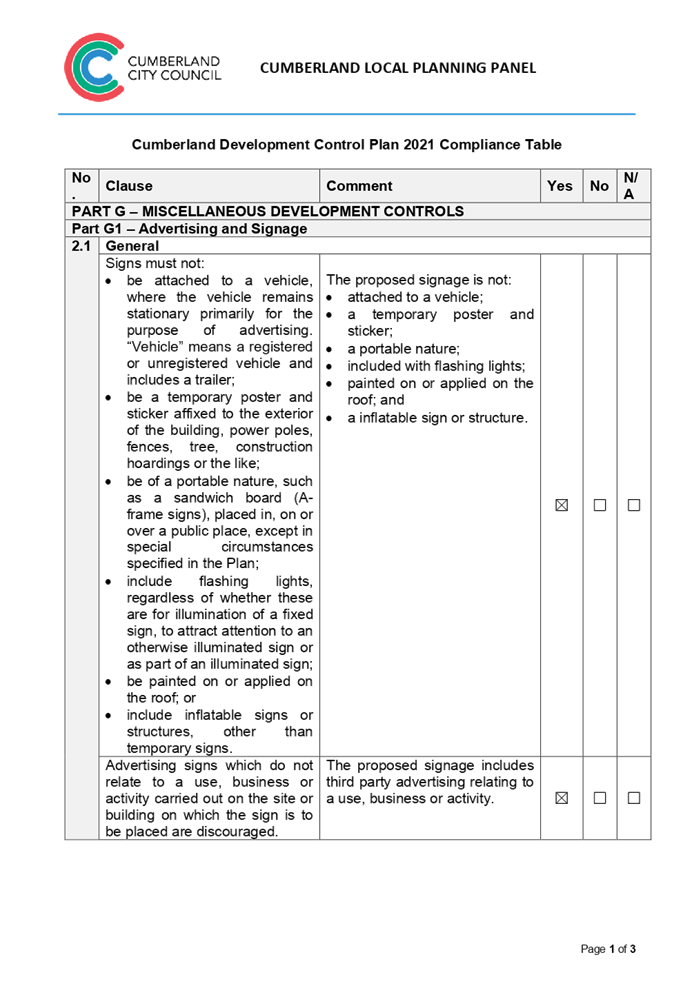
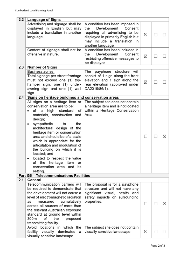
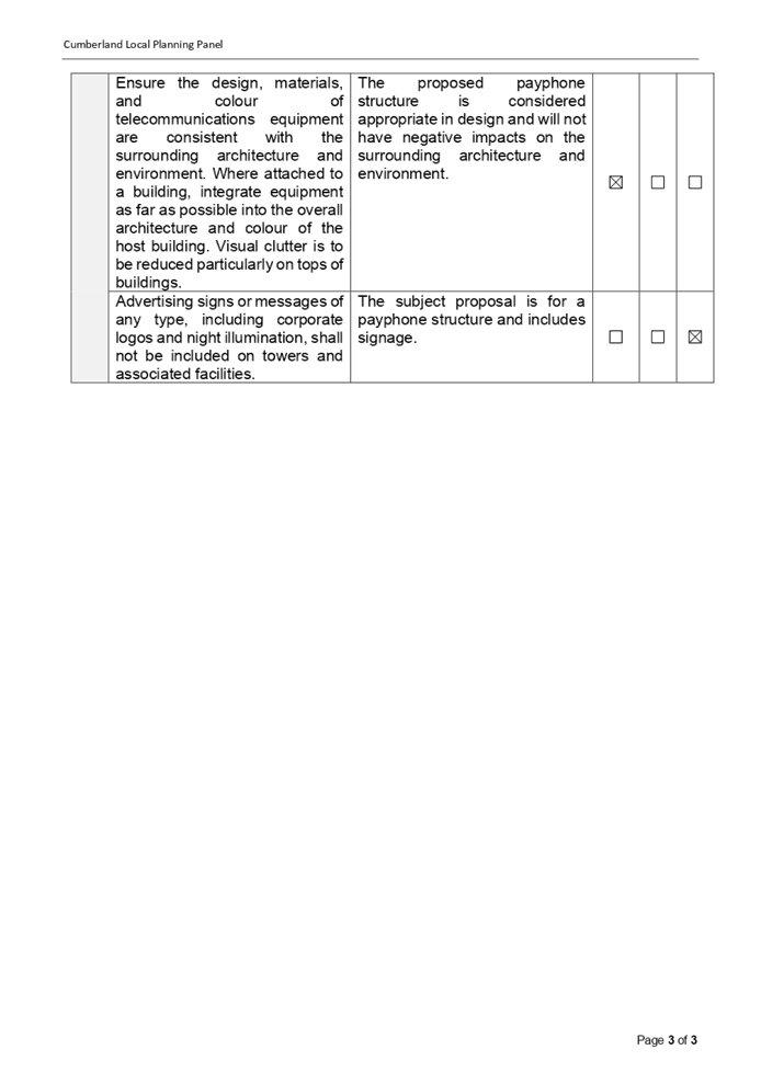
DOCUMENTS
ASSOCIATED WITH
REPORT LPP007/22
Attachment 8
Draft Reasons for Recommendation
Cumberland Local Planning Panel Meeting
9 March 2022

Cumberland Local Planning Panel Meeting
9 March 2022
Item No: LPP008/22
Development Application
for Land adjacent 35-39 Auburn Road Auburn
Responsible
Division: Environment
& Planning
Officer: Executive
Manager Development and Building
File
Number: DA2022/0005
|
Application
accepted
|
21 January 2022
|
|
Applicant
|
Urbis Pty Ltd
|
|
Owner
|
Cumberland City Council
|
|
Application
No.
|
DA2022/0005
|
|
Description
of Land
|
Land adjacent to 35-39 Auburn
Road, AUBURN NSW 2144
|
|
Proposed
Development
|
Use of the land as a
telecommunications facility with third party advertising on a 32 inch electronic
display screen incorporated in the payphone structure on the public footpath
adjacent to 35-39 Auburn Road, AUBURN NSW 2144
|
|
Zoning
|
B4 – Mixed Use Zone
|
|
Disclosure
of political donations and gifts
|
Nil disclosure
|
|
Heritage
|
The subject site does not
contain a heritage item and is not located within a Heritage Conservation
Area.
|
|
Principal
Development Standards
|
Permissible:
Floor Space Ratio –
2.4:1 (CLEP 2021)
The proposal is for the use of
a telecommunication facility located on the public footpath and no GFA
applicable in this instance.
Permissible:
Height of Buildings –
18m (CLEP 2021)
Proposed: 2.735m
|
1. On, 20 November 2020, Federal Court of Australia
has determined that the new generation Smart City payphone structure, which was
previously exempt from the requirement for development consent, does not
qualify as being “Low impact Facilities” under the Telecommunications
Act 1997. As such, a Development Application and associated Building
Information Certificate are now required for the use of the existing Telstra
payphone structure at the subject site.
2. Development Application No. DA2022/0005 was accepted
on 21 January 2022 for the use of the telecommunications facility with a third
party advertising on a 32 inches electronic display screen incorporated in the
payphone structure on the public footpath adjacent to 35-39 Auburn Road, AUBURN
NSW 2144.
3. The application was publicly notified to
occupants and owners of the adjoining properties for a period of 14 days between 2 February 2022
and 16 February 2022. In response, no submissions were received.
4. The subject application has been assessed against
the relevant provisions of the relevant State Environmental Planning Policies,
Cumberland Local Environmental Plan 2021 and the Cumberland Development Control
Plan 2021.
5. The
application is referred to the Panel as Council is the owner of the land where
this development is proposed.
6. The application is recommended for conditional
approval subject to the conditions as provided in Attachment 1.
Subject Site and
surrounding area
The subject site is located on the public footpath adjoining
No. 35-39 Auburn Road, Auburn. A site inspection of the payphone structure
carried out on 15 February 2022 confirmed that the structure being a Smart City
payphone, the 32 inches screen within the front elevation and 75 inches on the
rear elevation currently exists, refer to Figures 3 and 4 below.
The site is zoned B4 Mixed Use and
is surrounded by B4 Mixed Use zoned land. The existing developments adjoining
the site include commercial use development comprising of retail tenancies.
i)


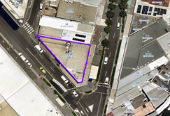
Figure 1 –
Aerial view of subject site
Figure 2 –
Zoning Map of subject site
|
|
|
|
Figure 3 –
Street view of subject structure
|
Figure 4 –
Street view of subject structure
|
Description of the
development
Council has received a development
application for the use of an existing new
generation Smart City payphone booth erected within the footpath adjoining
No. 35-39 Auburn Road, Auburn as a telecommunications facility with a third
party advertising on a 32 inches electronic display screen within the front
elevation, which is incorporated in the payphone structure.
The payphone structure measures 2.735 metres in height and
1.2 metres in width and includes an electronic display area above the payphone
measuring 381mm x 687mm (32 inches) proposed to be used for a third party
advertising.
The payphone structure and the 32 inch electronic display
screen have been constructed and installed and are currently in operation.
It is acknowledged that the electronic display on the rear
elevation of the structure, measuring 75 inches, has been approved by Council
under DA2019/64. This component has been installed and is currently operating.
A Building Information Certificate (BIC) is required for the
payphone structure and the associated 32 inches electronic display; conditions
of consent have been recommended to address this requirement.
· Development Application DA2019/64 was approved as a Deferred
Commencement on 29 May 2019 for the use of a digital display sign affixed to a
Telstra payphone rear elevation for a third party advertising. Operative
consent was issued on 10 February 2020.
· On 20 November 2020, the Federal Court of
Australia (e.g., Telstra Corporation Limited v Melbourne City Council [2021]
HCASL 82) has determined that the new generation payphone structure which was
previously exempt from the requirement for development consent, does not
qualify as “Low impact Facilities” under the Telecommunications Act 1997. As a result, existing structures already built
on Council’s land require development consent for its use as a
telecommunication facility.
· A Pre Lodgement meeting was held with the applicant on 27 May 2021 under
PL2021/0049 and the meeting notes advised the applicant to lodge a Development
Application and associated Building Information Certificate to obtain the
required approvals for all components of the structure/telecommunication
facility.
Applicants Supporting
Statement
The
applicant has provided a Statement of Environmental Effects prepared by Urbis dated November
2021 and was received by Council on 21 January
2022 in support of the application.
Contact with relevant
parties
The
assessing officer has undertaken a site inspection of the subject site and
surrounding properties and has been in regular contact with the applicant
throughout the assessment process.
The
application was not required to be referred to any of Council’s internal
departments for review.
The application
was not required to be referred to any external government authorities for
comment.
The
provisions of any Environmental Planning Instruments (EP&A Act s4.15
(1)(a)(i))
(a) Roads Act 1993
As the
proposal is not located adjacent to a classified road, approval pursuant to
subclause 138(1) of the Roads Act 1993 is not required for this
development application.
(b) Telecommunications
(Low-Impact Facilities) Determination 2018
Pursuant to the Telecommunications
(Low-impact Facilities) Determination 2018, the proposal is not classified as a
low impact facility and as such, state and local planning requirements
apply.
(c) Telecommunications Act 1997
The Telecommunications Act
establishes a framework for regulating the actions of telecommunications
carriers and service providers. The existing payphone structure was previously
built pursuant to Schedule 3 of the Telecommunications Act 1997.
(d) Telecommunications Code of
Practice 2018
The Telecommunications Code of
Practice 2018 commenced on 20 February 2018 and replaces the Telecommunications
Code of Practice 1997. The Code of Practice imposes a range of requirements on
service providers that engage in, or propose to engage in a land entry
activity. The Code also requires the applicant to comply with industry best
practice, in the design, planning and installation of facilities. The
proposed development relates to the use of an existing payphone structure that
was built pursuant to Schedule 3 of the Telecommunications Act 1997.
State
Environmental Planning Policy (Infrastructure) 2007 (ISEPP)
The provisions of the ISEPP 2007
have been considered in the assessment of the development application.
Clause 115 – Development
permitted with consent
(1) Development for the purposes of telecommunications
facilities, other than development in clause 114 or development that is exempt
development under clause 20 or 116, may be carried out by any person with
consent on any land.
(3) Before determining a development application for development to which
this clause applies, the consent authority must take into consideration any
guidelines concerning site selection, design, construction or operating principles
for telecommunications facilities that are issued by the Secretary for the
purposes of this clause and published in the Gazette.
Pursuant to clause 115(3) of the ISEPP 2007, before
determining the proposal, the consent authority must take into consideration of
any guidelines concerning the site selection, design, construction and
operation of telecommunication facilities. The proposal was accompanied with
the report of compliance to the principles of NSW Telecommunications Facilities
Guideline including Broadband 2010. These principles are:
•
Principle 1: A Telecommunications facility is to be designed and sited to
minimise visual impact;
• Principle
2: Telecommunications facilities should be co-located wherever practical;
• Principle
3: Health standards for exposure to radio emissions will be met; and
• Principle
4: Minimise disturbance and risk and maximise compliance.
These matters have been considered
as part of the assessment of this application and are considered satisfactory.
Refer to Attachment 4.
(e) State Environmental Planning
Policy No 64—Advertising and Signage
The
proposed signage is ‘advertisement’ as defined under SEPP 64
as follows:
Advertisement means
signage to which Part 3 applies and includes any advertising structure for the
advertisement
The subject proposal is subject to
assessment under Part 3 of SEPP 64 and the guidelines included in Schedule 1 of
the Policy.
|
Clause
|
Comments
|
|
8 Granting of consent to
signage
A consent authority must not
grant development consent to an application to display signage unless the consent
authority is satisfied:
(a) that the signage is
consistent with the objectives of this Policy as set out in clause 3 (1) (a),
and
(b) that the signage the
subject of the application satisfies the assessment criteria specified in
Schedule 1.
|
Satisfactory. Assessment
of the proposal has concluded that the design of the proposed signage is
compatible with the character of the area which is predominantly for business
use. The location of the signage is considered suitable and will not have
any adverse impact on the amenity of the surrounding developments.
|
|
10 Prohibited
advertisements
(1) Despite the provisions of
any other environmental planning instrument, the display of an advertisement
is prohibited on land that is an environmentally sensitive area, heritage
area (excluding railway stations), natural or other conservation area, open
space, waterway, residential (but not a mixed residential and business zone
or similar zone), scenic protection area, national park, nature reserve
(2) This clause does not
apply to the following:
(a) The Mount Panorama
Precinct.
(b) The display of an
advertisement at a public sporting facility situated on land zoned public
recreation under an EPI being an advertisement that provides information
about the sponsors of the teams or organisations using the sporting facility
or about the products of those sponsors.
|
The site is not located on land
that is an environmentally sensitive area and is not located nearby to a
heritage conservation area.
|
|
12 Consent Authority
For the purposes of this
Policy, the consent authority is—
(a) the council of
a local government area in the case of an advertisement displayed in the
local government area (unless paragraph (c), (d) or (e) applies), or
(b) TfNSW in the
case of an advertisement displayed on a vessel, or
(c) the Minister
for Planning in the case of an advertisement displayed by or on behalf of
RailCorp, NSW Trains, Sydney Trains, Sydney Metro or TfNSW on a railway
corridor, or
(d) the Minister
for Planning in the case of an advertisement displayed by or on behalf of RMS
on—
(i) a
road that is a freeway or tollway (under the Roads Act 1993) or associated road use land that is adjacent to such a
road, or
(ii) a
bridge constructed by or on behalf of TfNSW on any road corridor, or
(iii) land
that is owned, occupied or managed by TfNSW, or
(e) the Minister
for Planning in the case of an advertisement displayed on transport corridor
land comprising a road known as the Sydney Harbour Tunnel, the Eastern
Distributor, the M2 Motorway, the M4 Motorway, the M5 Motorway, the M7
Motorway, the Cross City Tunnel or the Lane Cove Tunnel, or associated road
use land that is adjacent to such a road.
|
Council is considered the
consent authority for the subject proposal.
|
13 Matters for
consideration
(1) A consent
authority (other than in a case to which subclause (2) applies) must not
grant consent to an application to display an advertisement to which this
Policy applies unless the advertisement or the advertising structure, as the
case requires:
(a) is consistent
with the objectives of this Policy as set out in clause 3 (1) (a), and
(b) has been
assessed by the consent authority in accordance with the assessment criteria
in Schedule 1 and the consent authority is satisfied that the proposal is acceptable
in terms of its impacts, and
(c) satisfies any
other relevant requirements of this Policy.
|
The proposed signage is
considered to be in a suitable location and will have acceptable impacts on
the local area.
The development application is
limited to the use of the existing sign on the payphone for third party
advertising. The third party advertising will be displayed on a screen that
is part of a public payphone operated by Telstra. The subject site is located
on the pedestrian footpath and will not have any detrimental impacts on the
traffic flows within the locality.
|
|
14 Duration of Consents
(1) A consent granted under
this part ceases to be in force:
(a) on the expiration of 15
years after the date on which the consent becomes effective and operates
(b) if a lesser period is
specified by the consent authority, that lesser period
(2) The consent authority may
specify a period less than 15 years only if:
(a) before the commencement
of this Part, the consent authority had adopted a policy of granting consents
in relation to applications to display advertisements for a lesser period and
the duration of the consent authority is consistent with that policy
(b) the area in which the
advertisement is undergoing change in accordance with an EPI that aims to
change the nature and character of development and where the proposed
advertisement would be inconsistent with that change
(c) the specification of a
lesser period if required by another provision of this Policy.
|
Council will impose a condition
restricting the consent to a period of fifteen (15) years.
|
|
16 Transport Corridor Land
(1) Despite clause 10
(1) and the provisions of any other environmental planning instrument, the
display of an advertisement on transport corridor land is permissible with
development consent in the following cases—
(a) the display of
an advertisement by or on behalf of RailCorp, NSW Trains, Sydney Trains,
Sydney Metro or TfNSW on a railway corridor,
(b) the display of
an advertisement by or on behalf of TfNSW on—
(i) a
road that is a freeway or tollway (under the Roads Act 1993) or associated road use land that is adjacent to such a
road, or
(ii) a
bridge constructed by or on behalf of TfNSW on any road corridor, or
(iii) land
that is owned, occupied or managed by TfNSW and that is within 250 metres of
a classified road,
(c) the display of
an advertisement on transport corridor land comprising a road known as the
Sydney Harbour Tunnel, the Eastern Distributor, the M2 Motorway, the M4
Motorway, the M5 Motorway, the M7 Motorway, the Cross City Tunnel or the Lane
Cove Tunnel, or associated road use land that is adjacent to such a road.
(2) Before determining
an application for consent to the display of an advertisement in such a case,
the Minister for Planning may appoint a design review panel to provide advice
to the Minister concerning the design quality of the proposed advertisement.
(3) The Minister must
not grant consent to the display of an advertisement in such a case
unless—
(a) the relevant
local council has been notified of the development application in writing and
any comments received by the Minister from the local council within 28 days
have been considered by the Minister, and
(b) the advice of
any design review panel appointed by the Minister has been considered by the
Minister, and
(c) the Minister
is satisfied that the advertisement is consistent with the Guidelines.
(4) This clause does
not apply to the display of an advertisement if the Minister determines that
display of the advertisement is not compatible with surrounding land use,
taking into consideration any relevant provisions of the Guidelines.
|
The site is not situated within
land designated as a transport corridor and as such, Clause 16 is not
applicable.
|
|
17 Advertisements with display area
greater than 20 square metres or higher than 8 metres above ground
(1) This clause applies
to an advertisement:
(a) that has a
display area greater than 20 square metres, or
(b) that is higher
than 8 metres above the ground.
(2) The display of an
advertisement to which this clause applies is advertised development for the
purposes of the Act.
(3) The consent
authority must not grant consent to an application to display an
advertisement to which this clause applies unless:
(a) the applicant
has provided the consent authority with an impact statement that addresses
the assessment criteria in Schedule 1 and the consent authority is satisfied
that the proposal is acceptable in terms of its impacts, and
(b) the
application has been advertised in accordance with section 79A of the Act,
and
(c) the consent
authority gave a copy of the application to RMS at the same time as the
application was advertised in accordance with section 79A of the Act if the
application is an application for the display of an advertisement to which
clause 18 applies.
|
Clause 17 does not apply to the
proposed development for the following reasons:
· The proposed signage has an area of 0.26m2
which does not exceed an area of 20m2; and
D1
· Has a maximum height of 1.886 metres above ground.
|
18 Advertisements
greater than 20 square metres and within 250 metres of, and visible from, a
classified road
(1) This clause applies
to the display of an advertisement to which clause 17 applies, that is within
250 metres of a classified road any part of which is visible from the
classified road.
(2) The consent
authority must not grant development consent to the display of an
advertisement to which this clause applies without the concurrence of RMS.
(3) In deciding whether
or not concurrence should be granted, RMS must take into consideration:
(a) the impact of
the display of the advertisement on traffic safety, and
(b) the
Guidelines.
(c) (Repealed)
(4) If RMS has not
informed the consent authority within 21 days after the copy of the
application is given to it under clause 17 (3) (c) (ii) that it has granted,
or has declined to grant, its concurrence, RMS is taken to have granted its
concurrence.
(5) Nothing in this
clause affects clause 16.
(6) This clause does
not apply when the Minister for Planning is the consent authority.
|
The proposed sign has an area of
0.26m2 and is not located on a classified road. As such, RMS
referral is not required and Clause 18 is not applicable.
|
19 Advertising
display area greater than 45 square metres
The consent authority must
not grant consent to the display of an advertisement with an advertising
display area greater than 45 square metres unless—
(a) a development
control plan is in force that has been prepared on the basis of an
advertising design analysis for the relevant area or precinct, or
(b) in the case of
the display of an advertisement on transport corridor land, the consent
authority is satisfied that the advertisement is consistent with the
Guidelines.
|
The proposed advertisement is
less than 45m2, as such Clause 19 does not apply.
|
|
20 Location
of certain names and logos
(1) The name or logo of
the person who owns or leases an advertisement or advertising structure may
appear only within the advertising display area.
(2) If the advertising
display area has no border or surrounds, any such name or logo is to be
located—
(a) within the
advertisement, or
(b) within a strip
below the advertisement that extends for the full width of the advertisement.
(3) The area of any
such name or logo must not be greater than 0.25 square metres.
(4) The area of any
such strip is to be included in calculating the size of the advertising
display area
|
All logos associated with the
proposed third party advertising is integrated within the payphone structure.
There are no logos within the frames or devices to be erected.
|
ENVIRONMENTAL PLANNING
INSTRUMENTS (EPIs)
The proposed development
is affected by the following consolidated State Environmental Planning Policies
that came into effect on 1 March 2022. No savings provision is indicated within
the new SEPPs, as no policy changes have been made. The SEPP consolidation does
not change the legal effect of the existing SEPPs, with section 30A of the
Interpretation Act 1987 applying to the transferred provisions. In this regard,
the following matters have been incorporated in the planning assessment of the
proposed development under s4.15 of the Environmental Planning and Assessment
Act 1979.
|
State Environmental
Planning Policies (SEPPs)
|
Relevant
Clause(s)
|
Compliance
with Requirements
|
|
· State
Environmental Planning Policy (Biodiversity and Conservation) 2021
|
Chapter 2 -Vegetation in
non-Rural Areas.
|
The development application
does not seek to remove any significant trees, which hold any biodiversity or
ecological values, on the site. The proposal does not trigger the provisions
of Chapter 2.
|
·
Chapter 6 - Bushland in Urban Areas. |
The proposal does not involve the disturbance of any
bushland zoned or reserved for public open space.
|
·
Chapter 10 - Sydney Harbour Catchment. |
The proposed development raises no issues as no impact on
the catchment is envisaged.
(Note: - the subject site is not identified in the
relevant map as ‘land within the ‘Foreshores and Waterways
Area’ or ‘Wetland Protection zone’, is not a ‘Strategic
Foreshore Site’ and does not contain any heritage items. Hence the
majority of the State Policy is not directly relevant to the proposed
development).
|
|
· State
Environmental Planning Policy (Resilience and Hazards) 2021
|
Chapter 2 - Coastal
Management.
|
The subject site is not
identified as a coastal wetland nor is it a land identified as in
“proximity area for coastal wetlands”.
|
·
Chapter 4 - Remediation of Land. |
The
site is not identified in Council’s records as being contaminated. A
site inspection reveals the site does not have any obvious history of a
previous land use that may have caused contamination and there is no specific
evidence that indicates the site is contaminated. Further to that, no
physical works are proposed as part of this application, as the structure is
existing.
|
|
· State
Environmental Planning Policy (Transport and Infrastructure) 2021
|
Chapter 2 - Infrastructure
|
The proposed use of land as a
telecommunication facility been considered under the provisions and
determined as being acceptable for approval.
|
|
· State
Environmental Planning Policy (Industry and Employment) 2021
|
Chapter 3 - Advertising and
Signage.
|
The signs the subject of the
development application have been considered under the provisions and
determined as being acceptable for approval.
|
Local Environmental Plans
Cumberland Local Environmental Plan 2021 (CLEP 2021)
The
provision of the CLEP 2021 is applicable to the development proposal. It is
noted that the development achieves compliance with the key statutory
requirements of the CLEP 2021 and the objectives of the B4 Mixed Use
Zone.
(a) Permissibility:
The proposed development is
defined as a ‘telecommunications facility’ and ‘signage’
and are permissible in the B4 Mixed Use Zone with consent.
Telecommunications facility means—
(a) any part of the
infrastructure of a telecommunications network, or
(b) any line, cable,
optical fibre, fibre access node, interconnect point equipment, apparatus,
tower, mast, antenna, dish, tunnel, duct, hole, pit, pole or other structure in
connection with a telecommunications network, or
(c) any other thing
used in or in connection with a telecommunications network.
signage means
any sign, notice, device, representation or advertisement that advertises or
promotes any goods, services or events and any structure or vessel that is
principally designed for, or that is used for, the display of signage, and
includes any of the following—
(a) an advertising
structure,
(b) a building
identification sign,
(c) a business
identification sign,
but does not include a traffic
sign or traffic control facilities.
A comprehensive LEP assessment is
contained in Attachment 7.
The provisions of any proposed instrument that is or has
been the subject (EP&A Act s4.15 (1)(a)(ii))
N/A
The provisions of any Development Control Plans (EP&A
Act s4.15 (1)(a)(iii))
The Cumberland
DCP 2021 provides guidance for the design and operation of development to
achieve the aims and objectives of the Cumberland LEP 2021.
A
comprehensive assessment and compliance table is contained in Attachment
8.
The proposed development complies with the provisions of the
Cumberland DCP 2021 and is considered acceptable from an environmental planning
viewpoint.
The provisions of any planning agreement that has been
entered into under section 7.4, or any draft planning agreement that a developer
has offered to enter into under section 7.4 (EP&A Act s4.15(1)(a)(iiia))
There is no draft planning agreement associated with the
subject Development Application.
The provisions of the Regulations (EP&A Act s4.15
(1)(a)(iv))
The proposed development raises no concerns as to the
relevant matters arising from the Environmental Planning and Assessment
Regulations 2000 (EP&A Reg).
The Likely Environmental, Social or Economic Impacts
(EP&A Act s4.15 (1)(b))
It is considered that the proposed development will have no
significant adverse environmental, social or economic impacts in the locality.
The suitability of the site for the development (EP&A
Act s4.15 (1)(c))
The subject site and locality is not known to be affected by
any natural hazards or other site constraints likely to have a significant
adverse impact on the proposed development. Accordingly, it is considered that
the development is suitable in the context of the site and surrounding
locality.
Submissions made in accordance with the Act or Regulation
(EP&A Act s4.15 (1)(d))
|
Advertised (Council Website)
|
Mail
|
Sign
|
Not Required
|
In accordance with Council’s Notification requirements
contained within the Cumberland DCP 2021, the proposal was publicly notified
for a period of 14 days between 2 February 2022 and 16 February 2022. No submissions
were received in respect of the proposed development.
The public interest (EP&A Act s4.15(1)(e))
In view of the foregoing analysis it is considered that the
development, if carried out subject to the conditions set out in the
recommendation below, will have no significant adverse impacts on the public
interest.
CUMBERLAND LOCAL INFRASTRUCTURE CONTRIBUTIONS
PLAN 2020
The development would not require the payment of
contributions in accordance with Cumberland Local Infrastructure Contributions
Plan 2020.
Disclosure of Political Donations and Gifts
The
applicant and notification process did not result in any disclosure of
Political Donations and Gifts.
The development application has been assessed in accordance
with the relevant requirements of the Environmental Planning and Assessment Act
1979, Environmental Planning and Assessment Regulation 2000, Roads Act 1993,
Telecommunications Act 1997, State Environmental Planning Policy (Biodiversity
and Conservation) 2021, State Environmental Planning Policy (Resilience and
Hazards) 2021, State Environmental Planning Policy (Transport and
Infrastructure) 2021, State Environmental Planning Policy (Industry and
Employment) 2021,Cumberland LEP 2021 and Cumberland DCP 2021 and is considered
to be satisfactory for approval, subject to conditions.
|
That Development Application No. DA2022/0005 for the use of the land as a
telecommunications facility with third party advertising on a 32 inch electronic
display screen incorporated in the payphone structure on the public footpath
adjacent to 35-39 Auburn Road, Auburn NSW 2144 be Approved subject to
attached conditions.
|
1. Draft Notice
of Determination
2. Site
Plan
3. Elevation
Plan
4. NSW
Telecommunications Facilities Guideline including Broadband 2010 Compliance
Table
5. State
Environmental Planning Policy -64 Advertising and Signage
6. Cumberland
Local Environmental Plan 2021
7. Cumberland
Development Control Plan
8. Draft
reasons for recommendation
DOCUMENTS
ASSOCIATED WITH
REPORT LPP008/22
Attachment 1
Draft Notice of Determination
Cumberland Local Planning Panel Meeting
9 March 2022


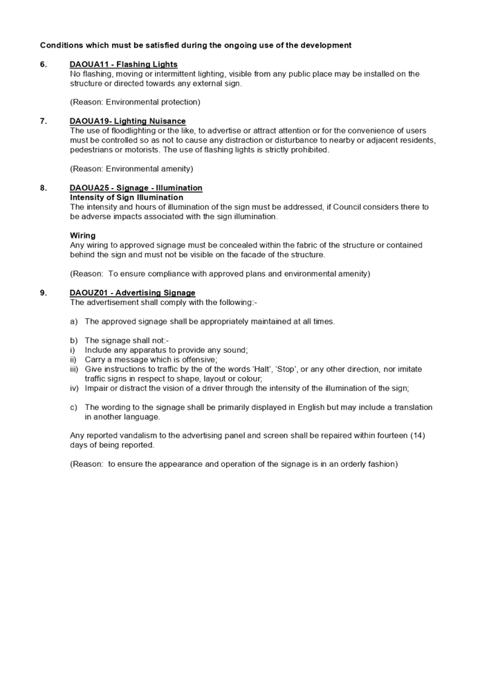
DOCUMENTS
ASSOCIATED WITH
REPORT LPP008/22
Attachment 2
Site Plan
Cumberland Local Planning Panel Meeting
9 March 2022

DOCUMENTS
ASSOCIATED WITH
REPORT LPP008/22
Attachment 3
Elevation Plan
Cumberland Local Planning Panel Meeting
9 March 2022
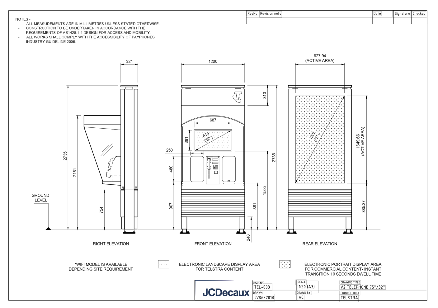
DOCUMENTS
ASSOCIATED WITH
REPORT LPP008/22
Attachment 4
NSW Telecommunications Facilities Guideline including
Broadband 2010 Compliance Table
Cumberland Local Planning Panel Meeting
9 March 2022


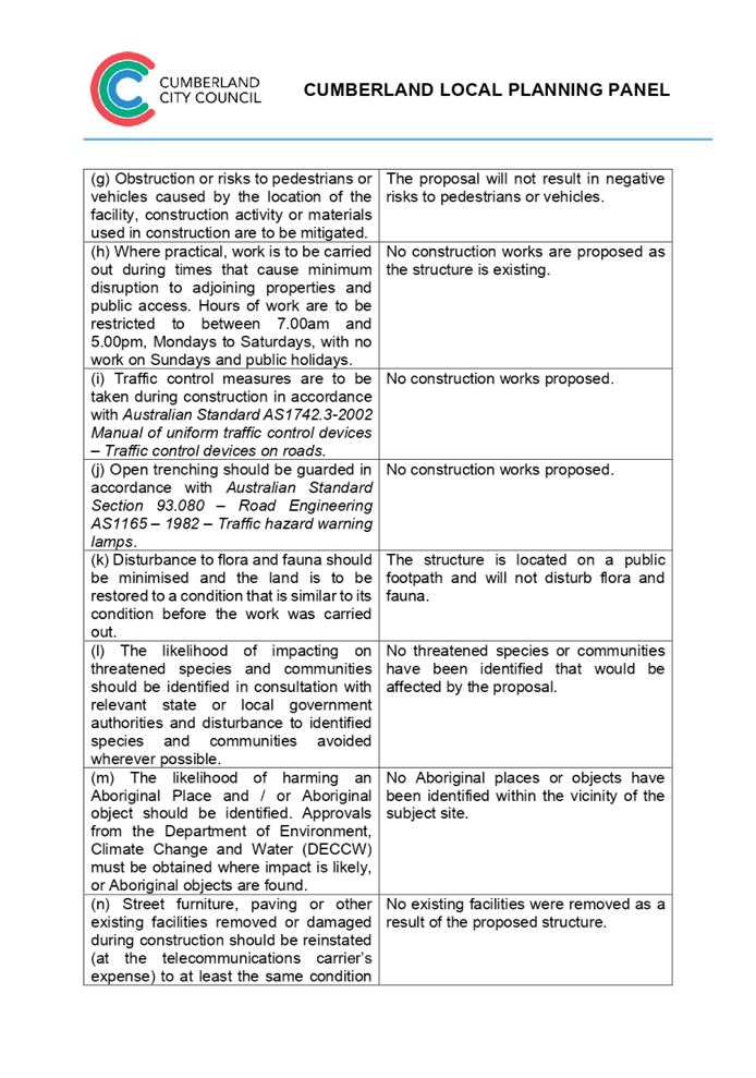
DOCUMENTS
ASSOCIATED WITH
REPORT LPP008/22
Attachment 5
State Environmental Planning Policy -64
Advertising and Signage
Cumberland Local Planning Panel Meeting
9 March 2022


DOCUMENTS
ASSOCIATED WITH
REPORT LPP008/22
Attachment 6
Cumberland Local Environmental Plan 2021
Cumberland Local Planning Panel Meeting
9 March 2022

DOCUMENTS
ASSOCIATED WITH
REPORT LPP008/22
Attachment 7
Cumberland Development Control Plan
Cumberland Local Planning Panel Meeting
9 March 2022


DOCUMENTS
ASSOCIATED WITH
REPORT LPP008/22
Attachment 8
Draft reasons for recommendation
Cumberland Local Planning Panel Meeting
9 March 2022

Cumberland Local Planning Panel Meeting
9 March 2022
Item No: LPP009/22
Development
Application for - Land adjacent to 665-669 Merrylands Road Greystanes
Responsible
Division: Environment
& Planning
Officer: Executive
Manager Development and Building
File
Number: DA2022/0006
|
Application
accepted
|
21 January 2022
|
|
Applicant
|
Urbis Pty Ltd
|
|
Owner
|
Cumberland City Council
|
|
Application
No.
|
DA2022/0006
|
|
Description
of Land
|
Land adjacent to 665-669
Merrylands Road, GREYSTANES NSW 2145
|
|
Proposed
Development
|
Use of the land as a
telecommunications facility with third party advertising on a 32 inch
electronic display screen incorporated in the payphone structure on the
public footpath adjacent to 665-669 Merrylands Road, GREYSTANES NSW 2145
|
|
Zoning
|
B2 – Local Centre
|
|
Disclosure
of political donations and gifts
|
Nil disclosure
|
|
Heritage
|
The subject site does not
contain a heritage item and is not located within a Heritage Conservation
Area.
|
|
Principal
Development Standards
|
Permissible:
Floor Space Ratio – 2:1
(CLEP 2021)
The proposal is for the use of
a telecommunication facility located on the public footpath and no GFA
applicable in this instance.
Permissible:
Height of Buildings –
17m (CLEP 2021)
Proposed: 2.735m
|
1. On,
20 November 2020, Federal Court of Australia has determined that the new
generation Smart City payphone structure, which was previously exempt from the
requirement for development consent, does not qualify as being “Low
impact Facilities” under the Telecommunications Act 1997. As such, a
Development Application and associated Building Information Certificate are now
required for the use of the existing Telstra payphone structure at the subject
site.
2. Development
Application No. DA2022/0006 was accepted on 21 January 2022 for the use of the
telecommunications facility with a third party advertising on a 32 inches
electronic display screen incorporated in the payphone structure on the public
footpath adjacent to 665-669 Merrylands Road, GREYSTANES NSW 2145.
3. The
application was publicly notified to occupants and owners of the adjoining
properties for a period of 14 days between 2 February 2022 and 16 February
2022. In response, no submissions were received.
4. The
subject application has been assessed against the relevant provisions of the
relevant State Environmental Planning Policies, Cumberland Local Environmental
Plan 2021 and the Cumberland Development Control Plan 2021.
5. The
application is referred to the Panel as Council is the owner of the land where
this development is proposed.
6. The
application is recommended for conditional approval subject to the conditions
as provided in Attachment 1. [Insert summary of report]
Subject Site and
surrounding area
The subject site is
located on the public footpath adjoining No. 665-669 Merrylands Road,
Greystanes (Greystanes Shopping Centre). A site inspection of the payphone
structure carried out on 15 February 2022 confirmed that the structure being a
Smart City payphone, the 32 inches screen within the front elevation and 75
inches on the rear elevation currently exists, refer to Figures 3 and 4 below.
The site is zoned B2
Local Centre and is surrounded by B2 zoned land adjoining to the west, R2 Low
Density Residential zoned land to the north and east and R3 Medium Density
Residential zoned land to the south and west. The existing developments
adjoining the site include commercial use development comprising of retail
tenancies and single and two storey dwelling houses.
Figure 1 –
Aerial view of subject site
ii)
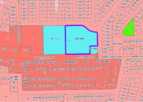
iii)
Figure 2
– Zoning Map of subject site
|
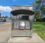
|
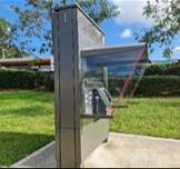
|
|
Figure 3 –
Street view of subject structure
|
Figure 4 –
Street view of subject structure
|
Description of the development
Council has received a development application for the use
of an existing new generation Smart City payphone booth erected within the
footpath adjoining No. 665-699 Merrylands Road, Greystanes as a
telecommunications facility with a third party advertising on a 32 inches
electronic display screen within the front elevation, which is incorporated in
the payphone structure.
The payphone structure measures 2.735 metres in height and
1.2 metres in width and includes an electronic display area above the payphone
measuring 381mm x 687mm (32 inches) proposed to be used for a third party
advertising.
The payphone structure and the 32 inch electronic display
screen have been constructed and installed and are currently in operation.
It is acknowledged that the electronic display on the rear
elevation of the structure, measuring 75 inches, has been approved by Council
under DA2019/87. This component has been installed and is currently operating.
A Building Information Certificate (BIC) is required for the
payphone structure and the associated 32 inches electronic display; conditions
of consent have been recommended to address this requirement.
• Development
Application DA2019/87 was approved on 29 May 2019 for the use of a digital
display sign affixed to a Telstra payphone rear elevation for a third party
advertising.
• On
20 November 2020, the Federal Court of Australia (e.g., Telstra Corporation
Limited v Melbourne City Council [2021] HCASL 82) has determined that the new
generation payphone structure which was previously exempt from the requirement
for development consent, does not qualify as “Low impact
Facilities” under the Telecommunications Act 1997. As a result, existing
structures already built on Council’s land require development consent
for its use as a telecommunication facility.
• A
Pre Lodgement meeting was held with the applicant on 27 May 2021 under
PL2021/0049 and the meeting notes advised the applicant to lodge a Development
Application and associated Building Information Certificate to obtain the
required approvals for all components of the structure/telecommunication
facility.
Applicants Supporting
Statement
The
applicant has provided a Statement of Environmental Effects prepared by Urbis
dated November 2021 and was received by Council on 21 January 2022 in support
of the application.
Contact with relevant
parties
The
assessing officer has undertaken a site inspection of the subject site and
surrounding properties and has been in regular contact with the applicant
throughout the assessment process.
The
application was not required to be referred to any of Council’s internal
departments for review.
The
application was not required to be referred to any external government
authorities for comment.
The provisions of any
Environmental Planning Instruments (EP&A Act s4.15 (1)(a)(i))
(a) Roads
Act 1993
As the proposal is not
located adjacent to a classified road, approval pursuant to subclause 138(1) of
the Roads Act 1993 is not required for this development application.
(b) Telecommunications
(Low-Impact Facilities) Determination 2018
Pursuant to the
Telecommunications (Low-impact Facilities) Determination 2018, the proposal is
not classified as a low impact facility and as such, state and local planning
requirements apply.
(c) Telecommunications
Act 1997
The Telecommunications
Act establishes a framework for regulating the actions of telecommunications
carriers and service providers. The existing payphone structure was previously
built pursuant to Schedule 3 of the Telecommunications Act 1997.
(d) Telecommunications
Code of Practice 2018
The Telecommunications
Code of Practice 2018 commenced on 20 February 2018 and replaces the
Telecommunications Code of Practice 1997. The Code of Practice imposes a range
of requirements on service providers that engage in, or propose to engage in a
land entry activity. The Code also requires the applicant to comply with
industry best practice, in the design, planning and installation of facilities.
The proposed development relates to the use of an existing payphone structure
that was built pursuant to Schedule 3 of the Telecommunications Act 1997.
(a) State Environmental Planning
Policy (Infrastructure) 2007 (ISEPP)
The provisions of the ISEPP 2007
have been considered in the assessment of the development application.
Clause 115 – Development
permitted with consent
(1) Development for the purposes of telecommunications
facilities, other than development in clause 114 or development that is exempt
development under clause 20 or 116, may be carried out by any person with
consent on any land.
(3) Before determining a development application for development to which
this clause applies, the consent authority must take into consideration any
guidelines concerning site selection, design, construction or operating
principles for telecommunications facilities that are issued by the Secretary
for the purposes of this clause and published in the Gazette.
Pursuant to clause 115(3) of the ISEPP 2007, before
determining the proposal, the consent authority must take into consideration of
any guidelines concerning the site selection, design, construction and
operation of telecommunication facilities. The proposal was accompanied with
the report of compliance to the principles of NSW Telecommunications Facilities
Guideline including Broadband 2010. These principles are:
•
Principle 1: A Telecommunications facility is to be designed and sited to
minimise
visual
impact;
• Principle
2: Telecommunications facilities should be co-located wherever practical;
•
Principle 3: Health standards for exposure to radio emissions will be met; and
•
Principle 4: Minimise disturbance and risk and maximise compliance.
These matters have been considered
as part of the assessment of this application and are considered satisfactory.
Refer to Attachment 4.
(b) State
Environmental Planning Policy No 64—Advertising and Signage
The proposed signage is ‘advertisement’
as defined under SEPP 64 as follows:
Advertisement means
signage to which Part 3 applies and includes any advertising structure for the
advertisement
The subject proposal is subject to
assessment under Part 3 of SEPP 64 and the guidelines included in Schedule 1 of
the Policy.
|
Clause
|
Comments
|
|
8 Granting of consent to
signage
A consent authority must not
grant development consent to an application to display signage unless the
consent authority is satisfied:
(a) that the signage is
consistent with the objectives of this Policy as set out in clause 3 (1) (a),
and
(b) that the signage the
subject of the application satisfies the assessment criteria specified in
Schedule 1.
|
Satisfactory. Assessment
of the proposal has concluded that the design of the proposed signage is
compatible with the character of the area which is predominantly for business
use. The location of the signage is considered suitable and will not
have any adverse impact on the amenity of the surrounding developments.
|
|
10 Prohibited
advertisements
(1) Despite the provisions of
any other environmental planning instrument, the display of an advertisement
is prohibited on land that is an environmentally sensitive area, heritage
area (excluding railway stations), natural or other conservation area, open
space, waterway, residential (but not a mixed residential and business zone
or similar zone), scenic protection area, national park, nature reserve
(2) This clause does not
apply to the following:
(a) The Mount Panorama
Precinct.
(b) The display of an
advertisement at a public sporting facility situated on land zoned public
recreation under an EPI being an advertisement that provides information
about the sponsors of the teams or organisations using the sporting facility
or about the products of those sponsors.
|
The site is not located on land
that is an environmentally sensitive area and is not located nearby to a
heritage conservation area.
|
|
12 Consent Authority
For the purposes of this
Policy, the consent authority is—
(a) the council of
a local government area in the case of an advertisement displayed in the
local government area (unless paragraph (c), (d) or (e) applies), or
(b) TfNSW in the
case of an advertisement displayed on a vessel, or
(c) the Minister
for Planning in the case of an advertisement displayed by or on behalf of
RailCorp, NSW Trains, Sydney Trains, Sydney Metro or TfNSW on a railway
corridor, or
(d) the Minister
for Planning in the case of an advertisement displayed by or on behalf of RMS
on—
(i) a
road that is a freeway or tollway (under the Roads Act 1993) or associated road use land that is adjacent to such a
road, or
(ii) a
bridge constructed by or on behalf of TfNSW on any road corridor, or
(iii) land
that is owned, occupied or managed by TfNSW, or
(e) the Minister
for Planning in the case of an advertisement displayed on transport corridor
land comprising a road known as the Sydney Harbour Tunnel, the Eastern
Distributor, the M2 Motorway, the M4 Motorway, the M5 Motorway, the M7
Motorway, the Cross City Tunnel or the Lane Cove Tunnel, or associated road
use land that is adjacent to such a road.
|
Council is considered the
consent authority for the subject proposal.
|
13 Matters for
consideration
(1) A consent
authority (other than in a case to which subclause (2) applies) must not
grant consent to an application to display an advertisement to which this
Policy applies unless the advertisement or the advertising structure, as the
case requires:
(a) is consistent
with the objectives of this Policy as set out in clause 3 (1) (a), and
(b) has been
assessed by the consent authority in accordance with the assessment criteria
in Schedule 1 and the consent authority is satisfied that the proposal is acceptable
in terms of its impacts, and
(c) satisfies any
other relevant requirements of this Policy.
|
The proposed signage is
considered to be in a suitable location and will have acceptable impacts on
the local area.
The development application is
limited to the use of the existing sign on the payphone for third party
advertising. The third party advertising will be displayed on a screen that
is part of a public payphone operated by Telstra. The subject site is located
on the pedestrian footpath and will not have any detrimental impacts on the
traffic flows within the locality.
|
|
14 Duration of Consents
(1) A consent granted under
this part ceases to be in force:
(a) on the expiration of 15
years after the date on which the consent becomes effective and operates
(b) if a lesser period is
specified by the consent authority, that lesser period
(2) The consent authority may
specify a period less than 15 years only if:
(a) before the commencement
of this Part, the consent authority had adopted a policy of granting consents
in relation to applications to display advertisements for a lesser period and
the duration of the consent authority is consistent with that policy
(b) the area in which the
advertisement is undergoing change in accordance with an EPI that aims to
change the nature and character of development and where the proposed
advertisement would be inconsistent with that change
(c) the specification of a
lesser period if required by another provision of this Policy.
|
Council will impose a condition
restricting the consent to a period of fifteen (15) years.
|
|
16 Transport Corridor Land
(1) Despite clause 10
(1) and the provisions of any other environmental planning instrument, the
display of an advertisement on transport corridor land is permissible with
development consent in the following cases—
(a) the display of
an advertisement by or on behalf of RailCorp, NSW Trains, Sydney Trains,
Sydney Metro or TfNSW on a railway corridor,
(b) the display of
an advertisement by or on behalf of TfNSW on—
(i) a
road that is a freeway or tollway (under the Roads Act 1993) or associated road use land that is adjacent to such a
road, or
(ii) a
bridge constructed by or on behalf of TfNSW on any road corridor, or
(iii) land
that is owned, occupied or managed by TfNSW and that is within 250 metres of
a classified road,
(c) the display of
an advertisement on transport corridor land comprising a road known as the
Sydney Harbour Tunnel, the Eastern Distributor, the M2 Motorway, the M4
Motorway, the M5 Motorway, the M7 Motorway, the Cross City Tunnel or the Lane
Cove Tunnel, or associated road use land that is adjacent to such a road.
(2) Before determining
an application for consent to the display of an advertisement in such a case,
the Minister for Planning may appoint a design review panel to provide advice
to the Minister concerning the design quality of the proposed advertisement.
(3) The Minister must
not grant consent to the display of an advertisement in such a case
unless—
(a) the relevant
local council has been notified of the development application in writing and
any comments received by the Minister from the local council within 28 days
have been considered by the Minister, and
(b) the advice of
any design review panel appointed by the Minister has been considered by the
Minister, and
(c) the Minister
is satisfied that the advertisement is consistent with the Guidelines.
(4) This clause does
not apply to the display of an advertisement if the Minister determines that
display of the advertisement is not compatible with surrounding land use,
taking into consideration any relevant provisions of the Guidelines.
|
The site is not situated within
land designated as a transport corridor and as such, Clause 16 is not
applicable.
|
|
17 Advertisements with display area
greater than 20 square metres or higher than 8 metres above ground
(1) This clause applies
to an advertisement:
(a) that has a
display area greater than 20 square metres, or
(b) that is higher
than 8 metres above the ground.
(2) The display of an
advertisement to which this clause applies is advertised development for the
purposes of the Act.
(3) The consent authority
must not grant consent to an application to display an advertisement to which
this clause applies unless:
(a) the applicant
has provided the consent authority with an impact statement that addresses
the assessment criteria in Schedule 1 and the consent authority is satisfied
that the proposal is acceptable in terms of its impacts, and
(b) the
application has been advertised in accordance with section 79A of the Act,
and
(c) the consent
authority gave a copy of the application to RMS at the same time as the
application was advertised in accordance with section 79A of the Act if the
application is an application for the display of an advertisement to which
clause 18 applies.
|
Clause 17 does not apply to the
proposed development for the following reasons:
· The proposed signage has an area of 0.26m2
which does not exceed an area of 20m2; and
D1
· Has a maximum height of 1.886 metres above ground.
|
18 Advertisements
greater than 20 square metres and within 250 metres of, and visible from, a
classified road
(1) This clause applies
to the display of an advertisement to which clause 17 applies, that is within
250 metres of a classified road any part of which is visible from the
classified road.
(2) The consent authority
must not grant development consent to the display of an advertisement to
which this clause applies without the concurrence of RMS.
(3) In deciding whether
or not concurrence should be granted, RMS must take into consideration:
(a) the impact of
the display of the advertisement on traffic safety, and
(b) the
Guidelines.
(c) (Repealed)
(4) If RMS has not
informed the consent authority within 21 days after the copy of the
application is given to it under clause 17 (3) (c) (ii) that it has granted,
or has declined to grant, its concurrence, RMS is taken to have granted its
concurrence.
(5) Nothing in this
clause affects clause 16.
(6) This clause does
not apply when the Minister for Planning is the consent authority.
|
The proposed sign has an area of
0.26m2 and is not located on a classified road. As such, RMS
referral is not required and Clause 18 is not applicable.
|
19 Advertising
display area greater than 45 square metres
The consent authority must
not grant consent to the display of an advertisement with an advertising
display area greater than 45 square metres unless—
(a) a development
control plan is in force that has been prepared on the basis of an
advertising design analysis for the relevant area or precinct, or
(b) in the case of
the display of an advertisement on transport corridor land, the consent
authority is satisfied that the advertisement is consistent with the
Guidelines.
|
The proposed advertisement is
less than 45m2, as such Clause 19 does not apply.
|
20 Location
of certain names and logos
(1) The name or logo of
the person who owns or leases an advertisement or advertising structure may
appear only within the advertising display area.
(2) If the advertising
display area has no border or surrounds, any such name or logo is to be
located—
(a) within the
advertisement, or
(b) within a strip
below the advertisement that extends for the full width of the advertisement.
(3) The area of any
such name or logo must not be greater than 0.25 square metres.
(4) The area of any
such strip is to be included in calculating the size of the advertising
display area
|
All logos associated with the
proposed third party advertising is integrated within the payphone structure.
There are no logos within the frames or devices to be erected.
|
ENVIRONMENTAL PLANNING
INSTRUMENTS (EPIs)
The proposed development
is affected by the following consolidated State Environmental Planning Policies
that came into effect on 1 March 2022. No savings provision is indicated within
the new SEPPs, as no policy changes have been made. The SEPP consolidation does
not change the legal effect of the existing SEPPs, with section 30A of the
Interpretation Act 1987 applying to the transferred provisions. In this regard,
the following matters have been incorporated in the planning assessment of the
proposed development under s4.15 of the Environmental Planning and Assessment
Act 1979.
|
State Environmental
Planning Policies (SEPPs)
|
Relevant
Clause(s)
|
Compliance
with Requirements
|
|
· State
Environmental Planning Policy (Biodiversity and Conservation) 2021
|
Chapter 2 -Vegetation in
non-Rural Areas.
|
The development application
does not seek to remove any significant trees, which hold any biodiversity or
ecological values, on the site. The proposal does not trigger the provisions
of Chapter 2.
|
·
Chapter 6 - Bushland in Urban Areas. |
The proposal does not involve the disturbance of any
bushland zoned or reserved for public open space.
|
·
Chapter 10 - Sydney Harbour
Catchment. |
The proposed development raises no issues as no impact on
the catchment is envisaged.
(Note: - the subject site is not identified in the
relevant map as ‘land within the ‘Foreshores and Waterways
Area’ or ‘Wetland Protection zone’, is not a
‘Strategic Foreshore Site’ and does not contain any heritage
items. Hence the majority of the State Policy is not directly relevant to the
proposed development).
|
|
· State
Environmental Planning Policy (Resilience and Hazards) 2021
|
Chapter 2 - Coastal
Management.
|
The subject site is not
identified as a coastal wetland nor is it a land identified as in
“proximity area for coastal wetlands”.
|
·
Chapter 4 - Remediation of Land. |
The
site is not identified in Council’s records as being contaminated. A
site inspection reveals the site does not have any obvious history of a
previous land use that may have caused contamination and there is no specific
evidence that indicates the site is contaminated. Further to that, no
physical works are proposed as part of this application, as the structure is
existing.
|
|
· State
Environmental Planning Policy (Transport and Infrastructure) 2021
|
Chapter 2 - Infrastructure
|
The proposed use of land as a
telecommunication facility been considered under the provisions and
determined as being acceptable for approval.
|
|
· State Environmental
Planning Policy (Industry and Employment) 2021
|
Chapter 3 - Advertising and
Signage.
|
The signs the subject of the
development application have been considered under the provisions and
determined as being acceptable for approval.
|
Local Environmental Plans
Cumberland Local Environmental Plan 2021 (CLEP 2021)
The provision of the CLEP 2021 is applicable to the
development proposal. It is noted that the development achieves compliance with
the key statutory requirements of the CLEP 2021 and the objectives of the B2
Local Centre Zone.
(a) Permissibility:
The proposed development is
defined as a ‘telecommunications facility’ and
‘signage’ and are permissible in the B2 Local Centre Zone with
consent.
Telecommunications facility
means—
(a) any part of the
infrastructure of a telecommunications network, or
(b) any line, cable, optical
fibre, fibre access node, interconnect point equipment, apparatus, tower, mast,
antenna, dish, tunnel, duct, hole, pit, pole or other structure in connection
with a telecommunications network, or
(c) any other thing used in
or in connection with a telecommunications network.
signage means any sign, notice,
device, representation or advertisement that advertises or promotes any goods,
services or events and any structure or vessel that is principally designed
for, or that is used for, the display of signage, and includes any of the
following—
(a) an advertising
structure,
(b) a building
identification sign,
(c) a business
identification sign,
but does not include a traffic
sign or traffic control facilities.
A comprehensive LEP assessment is
contained in Attachment 7.
The provisions of any proposed instrument that is or has
been the subject (EP&A Act s4.15 (1)(a)(ii))
N/A
The provisions of any Development Control Plans (EP&A
Act s4.15 (1)(a)(iii))
The
Cumberland DCP 2021 provides guidance for the design and operation of
development to achieve the aims and objectives of the Cumberland LEP 2021.
A
comprehensive assessment and compliance table is contained in Attachment
8.
The proposed development complies with the provisions of the
Cumberland DCP 2021 and is considered acceptable from an environmental planning
viewpoint.
The provisions of any planning agreement that has been
entered into under section 7.4, or any draft planning agreement that a
developer has offered to enter into under section 7.4 (EP&A Act
s4.15(1)(a)(iiia))
There is no draft planning agreement associated with the
subject Development Application.
The provisions of the Regulations (EP&A Act s4.15
(1)(a)(iv))
The proposed development raises no concerns as to the
relevant matters arising from the Environmental Planning and Assessment
Regulations 2000 (EP&A Reg).
The Likely Environmental, Social or Economic Impacts
(EP&A Act s4.15 (1)(b))
It is considered that the proposed development will have no
significant adverse environmental, social or economic impacts in the locality.
The suitability of the site for the development (EP&A
Act s4.15 (1)(c))
The subject site and locality is not known to be affected by
any natural hazards or other site constraints likely to have a significant
adverse impact on the proposed development. Accordingly, it is considered that
the development is suitable in the context of the site and surrounding
locality.
Submissions made in accordance with the Act or Regulation
(EP&A Act s4.15 (1)(d))
|
Advertised (Council Website)
|
Mail
|
Sign
|
Not Required
|
In accordance with Council’s Notification requirements
contained within the Cumberland DCP 2021, the proposal was publicly notified
for a period of 14 days between 2 February 2022 and 16 February 2022. No
submissions were received in respect of the proposed development.
The public interest (EP&A Act s4.15(1)(e))
In view of the foregoing analysis it is considered that the
development, if carried out subject to the conditions set out in the
recommendation below, will have no significant adverse impacts on the public
interest.
CUMBERLAND LOCAL INFRASTRUCTURE CONTRIBUTIONS
PLAN 2020
The development would not require the payment of
contributions in accordance with Cumberland Local Infrastructure Contributions
Plan 2020.
Disclosure of Political Donations and Gifts
The
applicant and notification process did not result in any disclosure of
Political Donations and Gifts.
The
development application has been assessed in accordance with the relevant
requirements of the Environmental Planning and Assessment Act 1979,
Environmental Planning and Assessment Regulation 2000, Roads Act 1993,
Telecommunications Act 1997, State Environmental Planning Policy (Biodiversity
and Conservation) 2021, State Environmental Planning Policy (Resilience and
Hazards) 2021, State Environmental Planning Policy (Transport and
Infrastructure) 2021, State Environmental Planning Policy (Industry and
Employment) 2021,Cumberland LEP 2021 and Cumberland DCP 2021 and is considered
to be satisfactory for approval, subject to conditions.
Communication /
Publications:
The final outcome of this matter
will be notified in the newspaper. The objectors will also be notified in
writing of the outcome.
|
That Development Application No. DA2022/0006 for the use of the land as a
telecommunications facility with third party advertising on a 32 inch
electronic display screen incorporated in the payphone structure on the
public footpath adjacent to 665-669 Merrylands Road, GREYSTANES NSW 2145 be
Approved subject to attached conditions.
|
1. Draft Notice
of Determination
2. Site
Plan
3. Elevation
Plan
4. NSW
Telecommunications Facilities Guideline Including Broadband 2010
5. State
Environmental Planning Policy No. 64 - Advertising and Signage
6. Cumberland
Local Environmental Plan 2021
7. Cumberland
Development Control Plan 2021
8. Draft
Reasons for Recommendation
DOCUMENTS
ASSOCIATED WITH
REPORT LPP009/22
Attachment 1
Draft Notice of Determination
Cumberland Local Planning Panel Meeting
9 March 2022
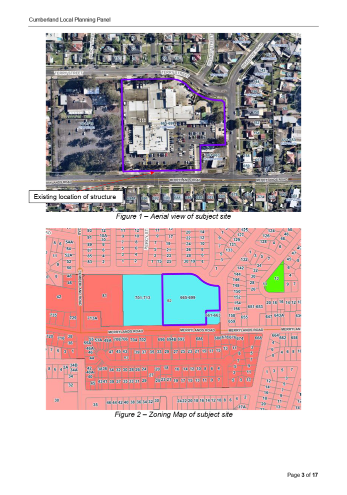
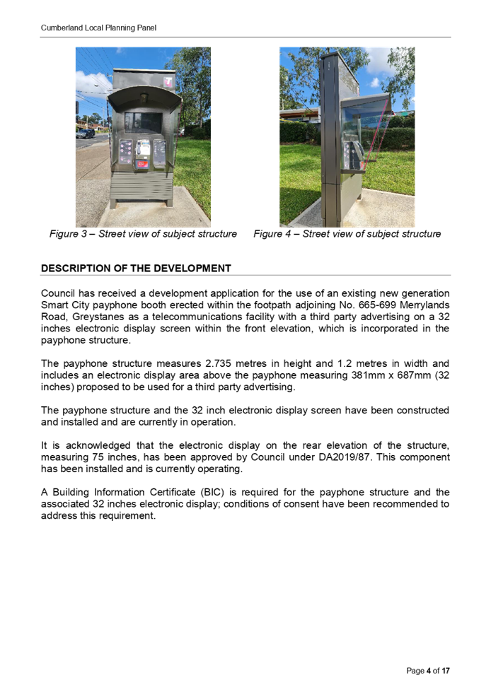

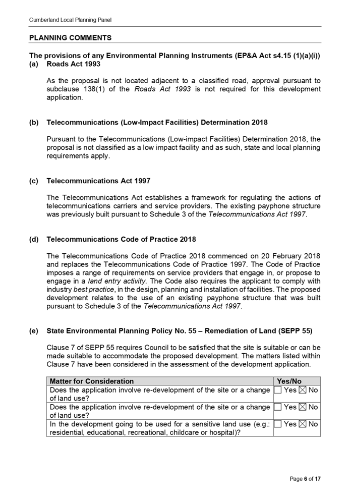
DOCUMENTS
ASSOCIATED WITH
REPORT LPP009/22
Attachment 2
Site Plan
Cumberland Local Planning Panel Meeting
9 March 2022
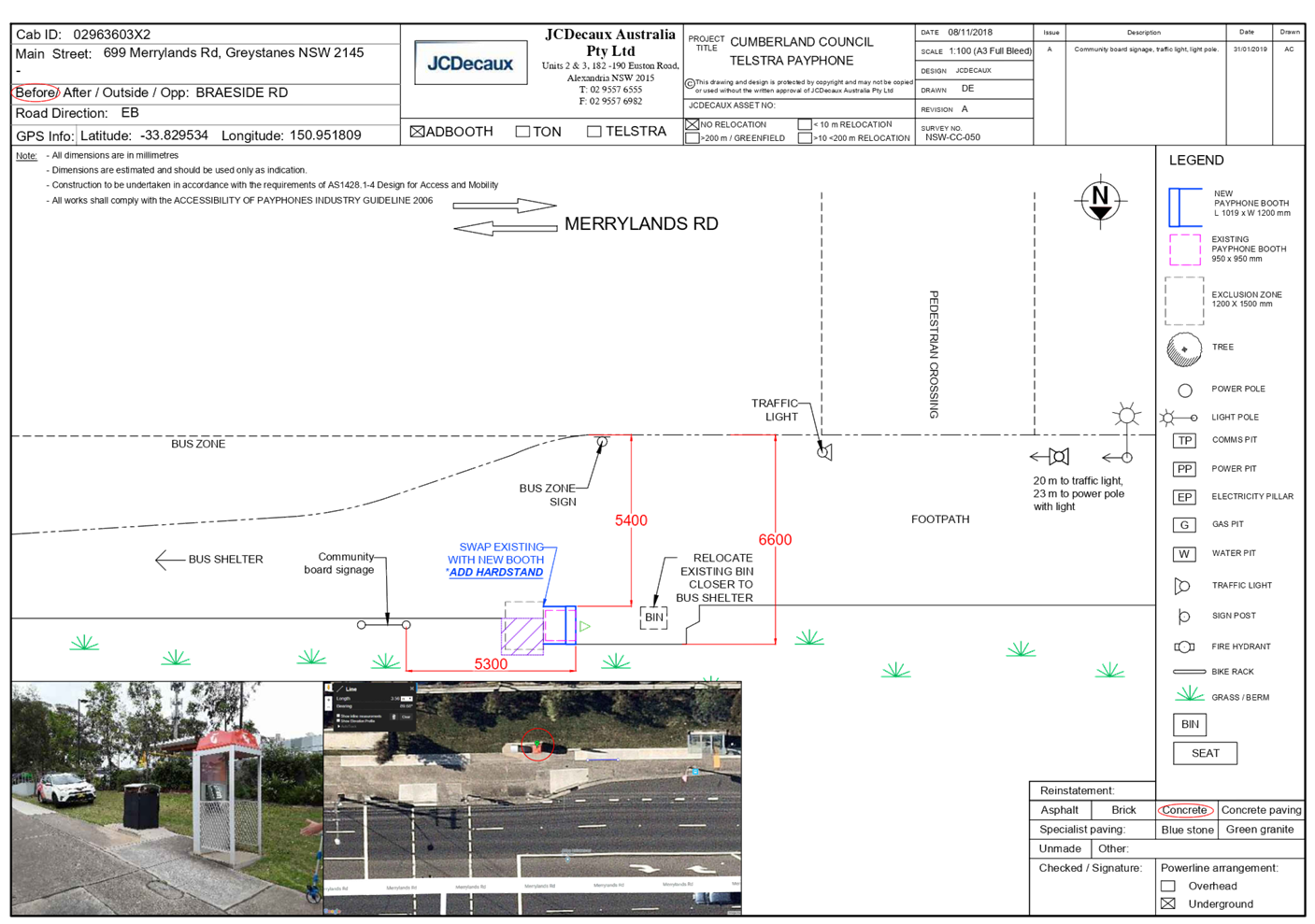
DOCUMENTS
ASSOCIATED WITH
REPORT LPP009/22
Attachment 3
Elevation Plan
Cumberland Local Planning Panel Meeting
9 March 2022

DOCUMENTS
ASSOCIATED WITH
REPORT LPP009/22
Attachment 4
NSW Telecommunications Facilities Guideline Including
Broadband 2010
Cumberland Local Planning Panel Meeting
9 March 2022

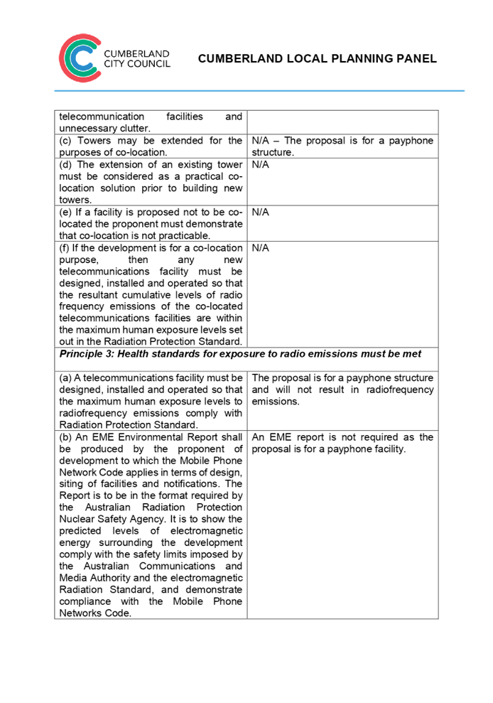

DOCUMENTS
ASSOCIATED WITH
REPORT LPP009/22
Attachment 5
State Environmental Planning Policy No. 64 -
Advertising and Signage
Cumberland Local Planning Panel Meeting
9 March 2022

DOCUMENTS
ASSOCIATED WITH
REPORT LPP009/22
Attachment 6
Cumberland Local Environmental Plan 2021
Cumberland Local Planning Panel Meeting
9 March 2022
DOCUMENTS
ASSOCIATED WITH
REPORT LPP009/22
Attachment 7
Cumberland Development Control Plan 2021
Cumberland Local Planning Panel Meeting
9 March 2022

DOCUMENTS
ASSOCIATED WITH
REPORT LPP009/22
Attachment 8
Draft Reasons for Recommendation
Cumberland Local Planning Panel Meeting
9 March 2022

Cumberland Local Planning Panel Meeting
9 March 2022
Item No: LPP010/22
Development
Application for 41 Auburn Road Auburn
Responsible
Division: Environment
& Planning
Officer: Executive
Manager Development and Building
File
Number: DA2022/0007
|
Application
accepted
|
21 January 2022
|
|
Applicant
|
Urbis Pty Ltd
|
|
Owner
|
Cumberland City Council
|
|
Application
No.
|
DA2022/0007
|
|
Description
of Land
|
Land adjacent to 41 Auburn Rd,
Auburn NSW 2144
|
|
Proposed
Development
|
Use of the land as a telecommunications
facility with third party advertising on a 32 inch electronic display screen
incorporated in the payphone structure on the public footpath adjacent to 41
Auburn Rd, Auburn NSW 2144
|
|
Zoning
|
B4 – Mixed Use Zone
|
|
Disclosure
of political donations and gifts
|
Nil disclosure
|
|
Heritage
|
The subject site does not
contain a heritage item and is not located within a Heritage Conservation
Area.
|
|
Principal
Development Standards
|
Permissible:
Floor Space Ratio – 5:1
(CLEP 2021)
The proposal is for the use of
a telecommunication facility located on the public footpath and no GFA
applicable in this instance.
Permissible:
Height of Buildings –
60m (CLEP 2021)
Proposed: 2.735m
|
1. On, 20 November 2020, Federal Court of Australia
has determined that the new generation Smart City payphone structure, which was
previously exempt from the requirement for development consent, does not
qualify as being “Low impact Facilities” under the Telecommunications
Act 1997. As such, a Development Application and associated Building
Information Certificate are now required for the use of the existing Telstra
payphone structure at the subject site.
2. Development Application No. DA2022/0007 was accepted
on 21 January 2022 for the use of the telecommunications facility with a third
party advertising on a 32 inches electronic display screen incorporated in the
payphone structure on the public footpath adjacent to 41 Auburn Rd, Auburn
NSW 2144.
3. The application was publicly notified to
occupants and owners of the adjoining properties for a period of 14 days between 2 February 2022
and 16 February 2022. In response, no submissions were received.
4. The subject application has been assessed against
the relevant provisions of the relevant State Environmental Planning Policies,
Cumberland Local Environmental Plan 2021 and the Cumberland Development Control
Plan 2021.
5. The
application is referred to the Panel as Council is the owner of the land where
this development is proposed.
6. The application is recommended for conditional
approval subject to the conditions as provided in Attachment 1.
Report:
Subject Site and surrounding area
The subject
site is located on the public footpath adjoining No. 41 Auburn Road, Auburn. A
site inspection of the payphone structure carried out on 15 February 2022
confirmed that the structure being a Smart City payphone, the 32 inches screen
within the front elevation and 75 inches on the rear elevation currently
exists, refer to Figures 3 and 4 below.
The site is
zoned B4 Mixed Use and is surrounded by B4 Mixed Use zoned land. The existing
developments adjoining the site include commercial use development comprising
of retail tenancies.
Figure 1 –
Aerial view of subject site
Figure 2 –
Zoning Map of subject site
|
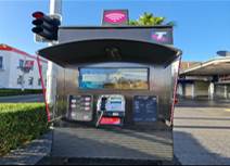
|
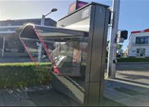
|
|
Figure 3 –
Street view of subject structure
|
Figure 4 –
Street view of subject structure
|
Description of the
development
Council has received a development application for the use
of an existing new generation Smart City payphone booth erected within the
footpath adjoining No. 41 Auburn Road, Auburn as a telecommunications facility
with a third party advertising on a 32 inches electronic display screen within
the front elevation, which is incorporated in the payphone structure.
The payphone structure measures 2.735 metres in height and
1.2 metres in width and includes an electronic display area above the payphone
measuring 381mm x 687mm (32 inches) proposed to be used for a third party
advertising.
The payphone structure and the 32 inch electronic display
screen have been constructed and installed and are currently in operation.
It is acknowledged that the electronic display on the rear
elevation of the structure, measuring 75 inches, has been approved by Council
under DA2019/84. This component has been installed and is currently operating.
A Building Information Certificate (BIC) is required for the
payphone structure and the associated 32 inches electronic display; conditions
of consent have been recommended to address this requirement.
· Development Application DA2019/84 was approved on 29 May
2019 for the use of a digital display sign affixed to a Telstra payphone rear
elevation for a third party advertising.
· On 20 November 2020, the Federal Court of
Australia (e.g., Telstra Corporation Limited v Melbourne City Council [2021]
HCASL 82) has determined that the new generation payphone structure which was
previously exempt from the requirement for development consent, does not
qualify as “Low impact Facilities” under the Telecommunications Act 1997. As a result, existing structures already built
on Council’s land require development consent for its use as a
telecommunication facility.
· A Pre Lodgement meeting was held with the applicant on
27 May 2021 under PL2021/0049 and the meeting notes advised the applicant to
lodge a Development Application and associated Building Information Certificate
to obtain the required approvals for all components of the
structure/telecommunication facility.
Applicants Supporting
Statement
The
applicant has provided a Statement of Environmental Effects prepared by Urbis dated November
2021 and was received by Council on 21 January
2022 in support of the application.
Contact with relevant
parties
The
assessing officer has undertaken a site inspection of the subject site and surrounding
properties and has been in regular contact with the applicant throughout the
assessment process.
The
application was not required to be referred to any of Council’s internal
departments for review.
The
application was not required to be referred to any external government
authorities for comment.
The
provisions of any Environmental Planning Instruments (EP&A Act s4.15
(1)(a)(i))
(a) Roads Act 1993
As the proposal
is not located adjacent to a classified road, approval pursuant to subclause
138(1) of the Roads Act 1993 is not required for this development application.
(b) Telecommunications
(Low-Impact Facilities) Determination 2018
Pursuant to the Telecommunications
(Low-impact Facilities) Determination 2018, the proposal is not classified as a
low impact facility and as such, state and local planning requirements
apply.
(c) Telecommunications Act 1997
The Telecommunications Act
establishes a framework for regulating the actions of telecommunications
carriers and service providers. The existing payphone structure was previously
built pursuant to Schedule 3 of the Telecommunications Act 1997.
(d) Telecommunications Code of
Practice 2018
The Telecommunications Code of
Practice 2018 commenced on 20 February 2018 and replaces the Telecommunications
Code of Practice 1997. The Code of Practice imposes a range of requirements on
service providers that engage in, or propose to engage in a land entry
activity. The Code also requires the applicant to comply with industry best
practice, in the design, planning and installation of facilities. The
proposed development relates to the use of an existing payphone structure that
was built pursuant to Schedule 3 of the Telecommunications Act 1997.
State
Environmental Planning Policy (Infrastructure) 2007 (ISEPP)
The provisions of the ISEPP 2007
have been considered in the assessment of the development application.
Clause 115 – Development
permitted with consent
(1) Development for the purposes of telecommunications
facilities, other than development in clause 114 or development that is exempt
development under clause 20 or 116, may be carried out by any person with consent
on any land.
(3) Before determining a development application for development to which
this clause applies, the consent authority must take into consideration any
guidelines concerning site selection, design, construction or operating principles
for telecommunications facilities that are issued by the Secretary for the
purposes of this clause and published in the Gazette.
Pursuant to clause 115(3) of the ISEPP 2007, before
determining the proposal, the consent authority must take into consideration of
any guidelines concerning the site selection, design, construction and
operation of telecommunication facilities. The proposal was accompanied with
the report of compliance to the principles of NSW Telecommunications Facilities
Guideline including Broadband 2010. These principles are:
• Principle
1: A Telecommunications facility is to be designed and sited to minimise
visual impact;
• Principle
2: Telecommunications facilities should be co-located wherever practical;
• Principle
3: Health standards for exposure to radio emissions will be met; and
• Principle
4: Minimise disturbance and risk and maximise compliance.
These matters have been considered
as part of the assessment of this application and are considered satisfactory.
Refer to Attachment 4.
(e) State
Environmental Planning Policy No 64—Advertising and Signage
The proposed signage is ‘advertisement’
as defined under SEPP 64 as follows:
Advertisement means
signage to which Part 3 applies and includes any advertising structure for the
advertisement
The subject proposal is subject to
assessment under Part 3 of SEPP 64 and the guidelines included in Schedule 1 of
the Policy.
|
Clause
|
Comments
|
|
8 Granting of consent to signage
A consent authority must not
grant development consent to an application to display signage unless the
consent authority is satisfied:
(a) that the signage is
consistent with the objectives of this Policy as set out in clause 3 (1) (a),
and
(b) that the signage the
subject of the application satisfies the assessment criteria specified in
Schedule 1.
|
Satisfactory. Assessment
of the proposal has concluded that the design of the proposed signage is
compatible with the character of the area which is predominantly for business
use. The location of the signage is considered suitable and will not
have any adverse impact on the amenity of the surrounding developments.
|
|
10 Prohibited
advertisements
(1) Despite the provisions of
any other environmental planning instrument, the display of an advertisement
is prohibited on land that is an environmentally sensitive area, heritage
area (excluding railway stations), natural or other conservation area, open
space, waterway, residential (but not a mixed residential and business zone
or similar zone), scenic protection area, national park, nature reserve
(2) This clause does not
apply to the following:
(a) The Mount Panorama
Precinct.
(b) The display of an
advertisement at a public sporting facility situated on land zoned public
recreation under an EPI being an advertisement that provides information
about the sponsors of the teams or organisations using the sporting facility
or about the products of those sponsors.
|
The site is not located on land
that is an environmentally sensitive area and is not located nearby to a
heritage conservation area.
|
|
12 Consent Authority
For the purposes of this
Policy, the consent authority is—
(a) the council of
a local government area in the case of an advertisement displayed in the
local government area (unless paragraph (c), (d) or (e) applies), or
(b) TfNSW in the
case of an advertisement displayed on a vessel, or
(c) the Minister
for Planning in the case of an advertisement displayed by or on behalf of
RailCorp, NSW Trains, Sydney Trains, Sydney Metro or TfNSW on a railway
corridor, or
(d) the Minister
for Planning in the case of an advertisement displayed by or on behalf of RMS
on—
(i) a
road that is a freeway or tollway (under the Roads Act 1993) or associated road use land that is adjacent to such a
road, or
(ii) a
bridge constructed by or on behalf of TfNSW on any road corridor, or
(iii) land
that is owned, occupied or managed by TfNSW, or
(e) the Minister
for Planning in the case of an advertisement displayed on transport corridor
land comprising a road known as the Sydney Harbour Tunnel, the Eastern
Distributor, the M2 Motorway, the M4 Motorway, the M5 Motorway, the M7
Motorway, the Cross City Tunnel or the Lane Cove Tunnel, or associated road
use land that is adjacent to such a road.
|
Council is considered the
consent authority for the subject proposal.
|
13 Matters for
consideration
(1) A consent
authority (other than in a case to which subclause (2) applies) must not
grant consent to an application to display an advertisement to which this
Policy applies unless the advertisement or the advertising structure, as the
case requires:
(a) is consistent
with the objectives of this Policy as set out in clause 3 (1) (a), and
(b) has been
assessed by the consent authority in accordance with the assessment criteria
in Schedule 1 and the consent authority is satisfied that the proposal is acceptable
in terms of its impacts, and
(c) satisfies any
other relevant requirements of this Policy.
|
The proposed signage is
considered to be in a suitable location and will have acceptable impacts on
the local area.
The development application is
limited to the use of the existing sign on the payphone for third party
advertising. The third party advertising will be displayed on a screen that
is part of a public payphone operated by Telstra. The subject site is located
on the pedestrian footpath and will not have any detrimental impacts on the
traffic flows within the locality.
|
|
14 Duration of Consents
(1) A consent granted under
this part ceases to be in force:
(a) on the expiration of 15
years after the date on which the consent becomes effective and operates
(b) if a lesser period is
specified by the consent authority, that lesser period
(2) The consent authority may
specify a period less than 15 years only if:
(a) before the commencement
of this Part, the consent authority had adopted a policy of granting consents
in relation to applications to display advertisements for a lesser period and
the duration of the consent authority is consistent with that policy
(b) the area in which the
advertisement is undergoing change in accordance with an EPI that aims to
change the nature and character of development and where the proposed
advertisement would be inconsistent with that change
(c) the specification of a
lesser period if required by another provision of this Policy.
|
Council will impose a condition
restricting the consent to a period of fifteen (15) years.
|
|
16 Transport Corridor Land
(1) Despite clause 10
(1) and the provisions of any other environmental planning instrument, the
display of an advertisement on transport corridor land is permissible with
development consent in the following cases—
(a) the display of
an advertisement by or on behalf of RailCorp, NSW Trains, Sydney Trains,
Sydney Metro or TfNSW on a railway corridor,
(b) the display of
an advertisement by or on behalf of TfNSW on—
(i) a
road that is a freeway or tollway (under the Roads Act 1993) or associated road use land that is adjacent to such a
road, or
(ii) a
bridge constructed by or on behalf of TfNSW on any road corridor, or
(iii) land
that is owned, occupied or managed by TfNSW and that is within 250 metres of
a classified road,
(c) the display of
an advertisement on transport corridor land comprising a road known as the
Sydney Harbour Tunnel, the Eastern Distributor, the M2 Motorway, the M4
Motorway, the M5 Motorway, the M7 Motorway, the Cross City Tunnel or the Lane
Cove Tunnel, or associated road use land that is adjacent to such a road.
(2) Before determining
an application for consent to the display of an advertisement in such a case,
the Minister for Planning may appoint a design review panel to provide advice
to the Minister concerning the design quality of the proposed advertisement.
(3) The Minister must
not grant consent to the display of an advertisement in such a case
unless—
(a) the relevant
local council has been notified of the development application in writing and
any comments received by the Minister from the local council within 28 days
have been considered by the Minister, and
(b) the advice of
any design review panel appointed by the Minister has been considered by the
Minister, and
(c) the Minister
is satisfied that the advertisement is consistent with the Guidelines.
(4) This clause does
not apply to the display of an advertisement if the Minister determines that
display of the advertisement is not compatible with surrounding land use,
taking into consideration any relevant provisions of the Guidelines.
|
The site is not situated within
land designated as a transport corridor and as such, Clause 16 is not
applicable.
|
|
17 Advertisements with display area
greater than 20 square metres or higher than 8 metres above ground
(1) This clause applies
to an advertisement:
(a) that has a
display area greater than 20 square metres, or
(b) that is higher
than 8 metres above the ground.
(2) The display of an
advertisement to which this clause applies is advertised development for the
purposes of the Act.
(3) The consent
authority must not grant consent to an application to display an
advertisement to which this clause applies unless:
(a) the applicant
has provided the consent authority with an impact statement that addresses
the assessment criteria in Schedule 1 and the consent authority is satisfied
that the proposal is acceptable in terms of its impacts, and
(b) the
application has been advertised in accordance with section 79A of the Act,
and
(c) the consent
authority gave a copy of the application to RMS at the same time as the
application was advertised in accordance with section 79A of the Act if the
application is an application for the display of an advertisement to which
clause 18 applies.
|
Clause 17 does not apply to the
proposed development for the following reasons:
· The proposed signage has an area of 0.26m2
which does not exceed an area of 20m2; and
D1
· Has a maximum height of 1.886 metres above ground.
|
18 Advertisements
greater than 20 square metres and within 250 metres of, and visible from, a
classified road
(1) This clause applies
to the display of an advertisement to which clause 17 applies, that is within
250 metres of a classified road any part of which is visible from the
classified road.
(2) The consent
authority must not grant development consent to the display of an
advertisement to which this clause applies without the concurrence of RMS.
(3) In deciding whether
or not concurrence should be granted, RMS must take into consideration:
(a) the impact of
the display of the advertisement on traffic safety, and
(b) the
Guidelines.
(c) (Repealed)
(4) If RMS has not
informed the consent authority within 21 days after the copy of the
application is given to it under clause 17 (3) (c) (ii) that it has granted,
or has declined to grant, its concurrence, RMS is taken to have granted its
concurrence.
(5) Nothing in this
clause affects clause 16.
(6) This clause does
not apply when the Minister for Planning is the consent authority.
|
The proposed sign has an area of
0.26m2 and is not located on a classified road. As such, RMS
referral is not required and Clause 18 is not applicable.
|
|
19 Advertising
display area greater than 45 square metres
The consent authority must
not grant consent to the display of an advertisement with an advertising
display area greater than 45 square metres unless—
(a) a development
control plan is in force that has been prepared on the basis of an
advertising design analysis for the relevant area or precinct, or
(b) in the case of
the display of an advertisement on transport corridor land, the consent
authority is satisfied that the advertisement is consistent with the
Guidelines.
|
The proposed advertisement is
less than 45m2, as such Clause 19 does not apply.
|
|
20 Location
of certain names and logos
(1) The name or logo of
the person who owns or leases an advertisement or advertising structure may
appear only within the advertising display area.
(2) If the advertising
display area has no border or surrounds, any such name or logo is to be
located—
(a) within the
advertisement, or
(b) within a strip
below the advertisement that extends for the full width of the advertisement.
(3) The area of any
such name or logo must not be greater than 0.25 square metres.
(4) The area of any
such strip is to be included in calculating the size of the advertising
display area
|
All logos associated with the
proposed third party advertising is integrated within the payphone structure.
There are no logos within the frames or devices to be erected.
|
ENVIRONMENTAL PLANNING INSTRUMENTS (EPIs)
The proposed development is affected by the following
consolidated State Environmental Planning Policies that came into effect on 1
March 2022. No savings provision is indicated within the new SEPPs, as no
policy changes have been made. The SEPP consolidation does not change the legal
effect of the existing SEPPs, with section 30A of the Interpretation Act 1987
applying to the transferred provisions. In this regard, the following matters
have been incorporated in the planning assessment of the proposed development
under s4.15 of the Environmental Planning and Assessment Act 1979.
|
State Environmental
Planning Policies (SEPPs)
|
Relevant
Clause(s)
|
Compliance
with Requirements
|
|
· State
Environmental Planning Policy (Biodiversity and Conservation) 2021
|
Chapter 2 -Vegetation in
non-Rural Areas.
|
The development application
does not seek to remove any significant trees, which hold any biodiversity or
ecological values, on the site. The proposal does not trigger the provisions
of Chapter 2.
|
·
Chapter 6 - Bushland in Urban Areas. |
The proposal does not involve the disturbance of any
bushland zoned or reserved for public open space.
|
·
Chapter 10 - Sydney Harbour Catchment. |
The proposed development raises no issues as no impact on
the catchment is envisaged.
(Note: - the subject site is not identified in the
relevant map as ‘land within the ‘Foreshores and Waterways
Area’ or ‘Wetland Protection zone’, is not a ‘Strategic
Foreshore Site’ and does not contain any heritage items. Hence the
majority of the State Policy is not directly relevant to the proposed
development).
|
|
· State
Environmental Planning Policy (Resilience and Hazards) 2021
|
Chapter 2 - Coastal
Management.
|
The subject site is not
identified as a coastal wetland nor is it a land identified as in
“proximity area for coastal wetlands”.
|
·
Chapter 4 - Remediation of Land. |
The
site is not identified in Council’s records as being contaminated. A
site inspection reveals the site does not have any obvious history of a
previous land use that may have caused contamination and there is no specific
evidence that indicates the site is contaminated. Further to that, no
physical works are proposed as part of this application, as the structure is
existing.
|
|
· State
Environmental Planning Policy (Transport and Infrastructure) 2021
|
Chapter 2 - Infrastructure
|
The proposed use of land as a
telecommunication facility been considered under the provisions and
determined as being acceptable for approval.
|
|
· State
Environmental Planning Policy (Industry and Employment) 2021
|
Chapter 3 - Advertising and
Signage.
|
The signs the subject of the
development application have been considered under the provisions and
determined as being acceptable for approval.
|
Local Environmental Plans
Cumberland Local Environmental Plan 2021 (CLEP 2021)
The
provision of the CLEP 2021 is applicable to the development proposal. It is
noted that the development achieves compliance with the key statutory
requirements of the CLEP 2021 and the objectives of the B4 Mixed Use
Zone.
(a) Permissibility:
The proposed development is
defined as a ‘telecommunications facility’ and ‘signage’
and are permissible in the B4 Mixed Use Zone with consent.
Telecommunications facility means—
(a) any part of the
infrastructure of a telecommunications network, or
(b) any line, cable,
optical fibre, fibre access node, interconnect point equipment, apparatus,
tower, mast, antenna, dish, tunnel, duct, hole, pit, pole or other structure in
connection with a telecommunications network, or
(c) any other thing
used in or in connection with a telecommunications network.
signage means
any sign, notice, device, representation or advertisement that advertises or
promotes any goods, services or events and any structure or vessel that is
principally designed for, or that is used for, the display of signage, and
includes any of the following—
(a) an advertising
structure,
(b) a building
identification sign,
(c) a business
identification sign,
but does not include a traffic
sign or traffic control facilities.
A comprehensive LEP assessment is
contained in Attachment 7.
The provisions of any proposed instrument that is or has
been the subject (EP&A Act s4.15 (1)(a)(ii))
(a) Draft State Environmental
Planning Policy (Environment)
N/A
The provisions of any Development Control Plans (EP&A
Act s4.15 (1)(a)(iii))
The
Cumberland DCP 2021 provides guidance for the design and operation of
development to achieve the aims and objectives of the Cumberland LEP 2021.
A
comprehensive assessment and compliance table is contained in Attachment
8.
The proposed development complies with the provisions of the
Cumberland DCP 2021 and is considered acceptable from an environmental planning
viewpoint.
The provisions of any planning agreement that has been
entered into under section 7.4, or any draft planning agreement that a
developer has offered to enter into under section 7.4 (EP&A Act
s4.15(1)(a)(iiia))
There is no draft planning agreement associated with the
subject Development Application.
The provisions of the Regulations (EP&A Act s4.15
(1)(a)(iv))
The proposed development raises no concerns as to the
relevant matters arising from the Environmental Planning and Assessment
Regulations 2000 (EP&A Reg).
The Likely Environmental, Social or Economic Impacts
(EP&A Act s4.15 (1)(b))
It is considered that the proposed development will have no
significant adverse environmental, social or economic impacts in the locality.
The suitability of the site for the development (EP&A
Act s4.15 (1)(c))
The subject site and locality is not known to be affected by
any natural hazards or other site constraints likely to have a significant
adverse impact on the proposed development. Accordingly, it is considered that
the development is suitable in the context of the site and surrounding locality.
Submissions made in accordance with the Act or Regulation
(EP&A Act s4.15 (1)(d))
|
Advertised (Council Website)
|
Mail
|
Sign
|
Not Required
|
In accordance with Council’s Notification requirements
contained within the Cumberland DCP 2021, the proposal was publicly notified
for a period of 14 days between 2 February 2022 and 16 February 2022. No submissions
were received in respect of the proposed development.
The public interest (EP&A Act s4.15(1)(e))
In view of the foregoing analysis it is considered that the
development, if carried out subject to the conditions set out in the
recommendation below, will have no significant adverse impacts on the public
interest.
CUMBERLAND LOCAL INFRASTRUCTURE CONTRIBUTIONS
PLAN 2020
The development would not require the payment of
contributions in accordance with Cumberland Local Infrastructure Contributions
Plan 2020.
Disclosure of Political Donations and Gifts
The
applicant and notification process did not result in any disclosure of
Political Donations and Gifts.
The development application has been assessed
in accordance with the relevant requirements of the Environmental Planning and
Assessment Act 1979, Environmental Planning and Assessment Regulation 2000,
Roads Act 1993, Telecommunications Act 1997, State Environmental Planning
Policy (Biodiversity and Conservation) 2021, State Environmental Planning
Policy (Resilience and Hazards) 2021, State Environmental Planning Policy
(Transport and Infrastructure) 2021, State Environmental Planning Policy
(Industry and Employment) 2021,Cumberland LEP 2021 and Cumberland DCP 2021 and
is considered to be satisfactory for approval, subject to conditions.
|
That Development Application No. DA2022/0007 for the use of the land as a
telecommunications facility with third party advertising on a 32 inch
electronic display screen incorporated in the payphone structure on the
public footpath adjacent to 41 Auburn Road, Auburn NSW 2144 be Approved
subject to attached conditions.
|
1. Draft notice
of Determination
2. Site
Plan
3. Elevation
Plan
4. NSW
Telecommunications Facilities Guideline Including Broadband 2010
5. State
Environmental Planning Policy No. 64 - Advertising & Signage Table
6. Cumberland
Local Environmental Plan 2021
7. Cumberland
Development Control Plan 2021
8. Draft
Reasons for Recommendation
DOCUMENTS
ASSOCIATED WITH
REPORT LPP010/22
Attachment 1
Draft notice of Determination
Cumberland Local Planning Panel Meeting
9 March 2022

DOCUMENTS
ASSOCIATED WITH
REPORT LPP010/22
Attachment 2
Site Plan
Cumberland Local Planning Panel Meeting
9 March 2022
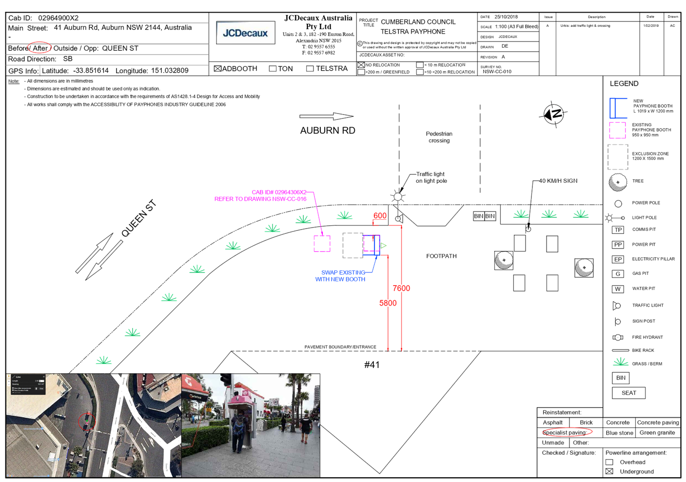
DOCUMENTS
ASSOCIATED WITH
REPORT LPP010/22
Attachment 3
Elevation Plan
Cumberland Local Planning Panel Meeting
9 March 2022
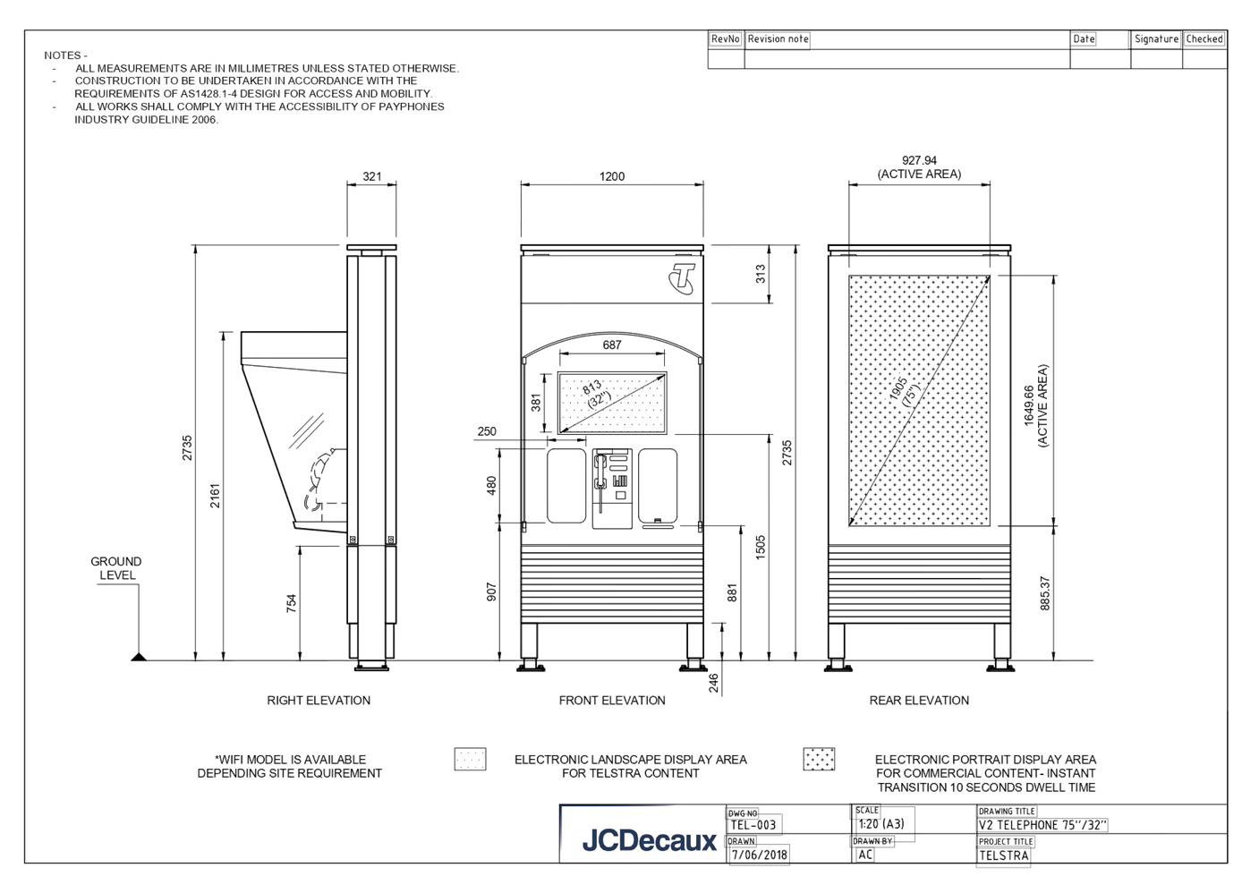
DOCUMENTS
ASSOCIATED WITH
REPORT LPP010/22
Attachment 4
NSW Telecommunications Facilities Guideline Including
Broadband 2010
Cumberland Local Planning Panel Meeting
9 March 2022
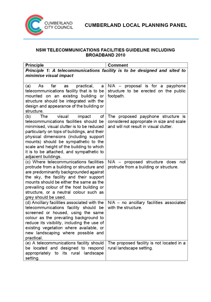
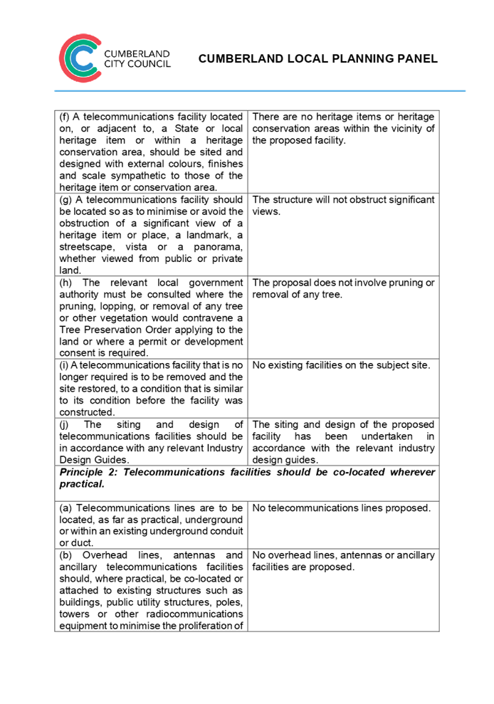

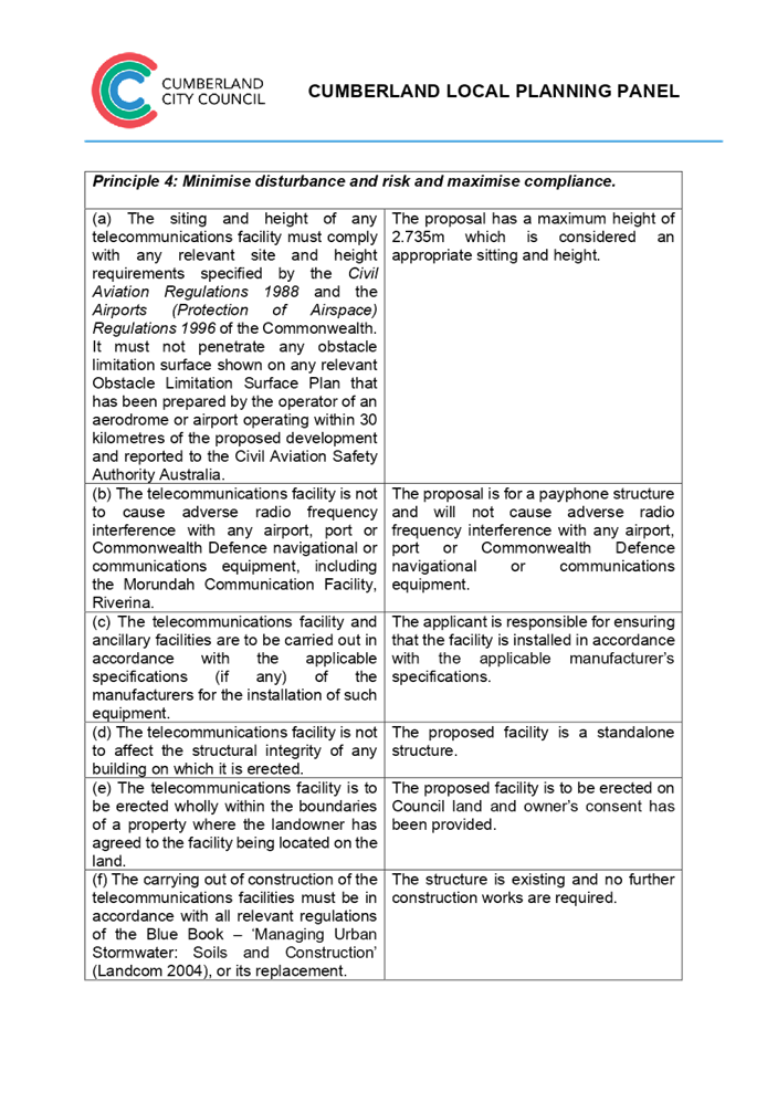

DOCUMENTS
ASSOCIATED WITH
REPORT LPP010/22
Attachment 5
State Environmental Planning Policy No. 64 - Advertising
& Signage Table
Cumberland Local Planning Panel Meeting
9 March 2022

DOCUMENTS
ASSOCIATED WITH
REPORT LPP010/22
Attachment 6
Cumberland Local Environmental Plan 2021
Cumberland Local Planning Panel Meeting
9 March 2022

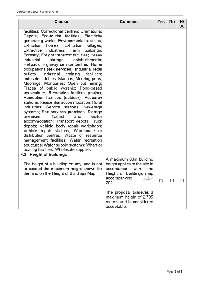
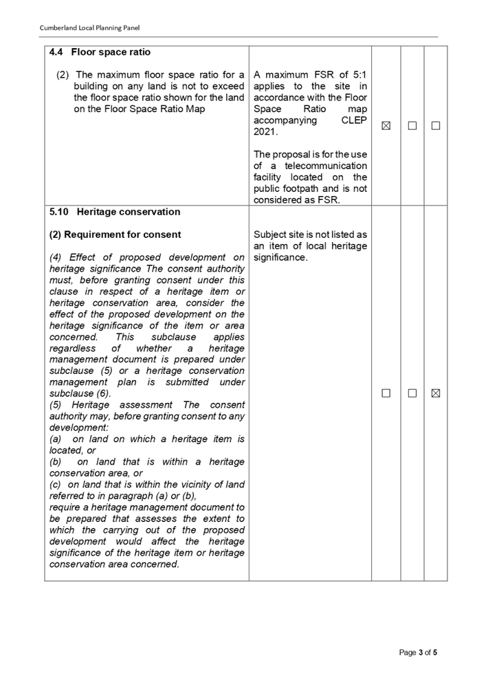
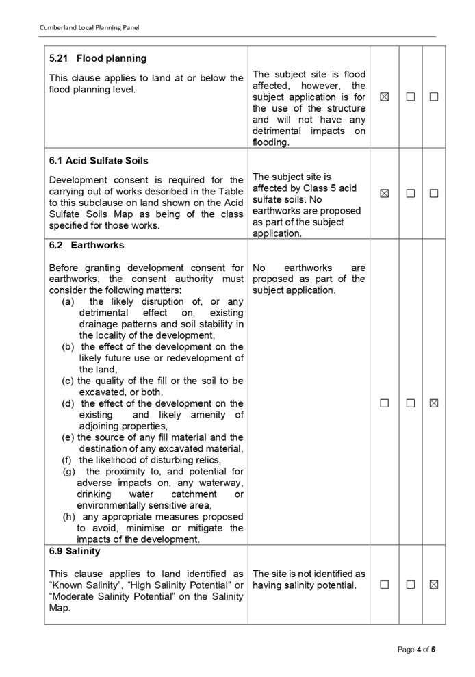

DOCUMENTS
ASSOCIATED WITH
REPORT LPP010/22
Attachment 7
Cumberland Development Control Plan 2021
Cumberland Local Planning Panel Meeting
9 March 2022
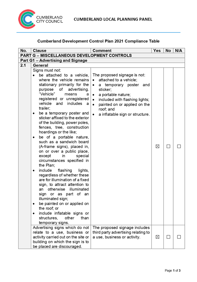

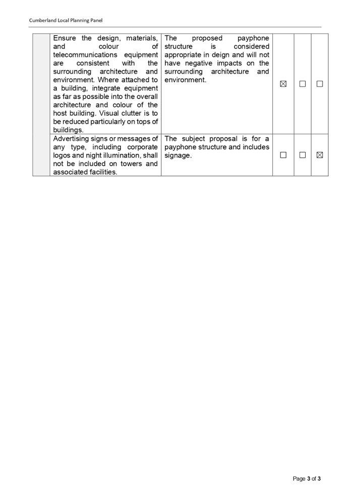
DOCUMENTS
ASSOCIATED WITH
REPORT LPP010/22
Attachment 8
Draft Reasons for Recommendation
Cumberland Local Planning Panel Meeting
9 March 2022

Cumberland Local Planning Panel Meeting
9 March 2022
Item No: LPP011/22
Development
Application for 22-26 Joseph Street Lidcombe
Responsible
Division: Environment
& Planning
Officer: Executive
Manager Development and Building
File
Number: DA2022/0008
|
Application
accepted
|
21 January 2022
|
|
Applicant
|
Urbis Pty Ltd
|
|
Owner
|
Cumberland City Council
|
|
Application
No.
|
DA2022/0008
|
|
Description
of Land
|
Land adjacent to 22- 26 Joseph
Street, Lidcombe NSW 2141
|
|
Proposed
Development
|
Use of the land as a
telecommunications facility with third party advertising on a 32 inch
electronic display screen incorporated in the payphone structure on the
public footpath adjacent to 22- 26 Joseph Street, Lidcombe NSW 2141
|
|
Zoning
|
B4 – Mixed Use Zone
|
|
Disclosure
of political donations and gifts
|
Nil disclosure
|
|
Heritage
|
The subject site does not
contain a heritage item and is not located within a Heritage Conservation
Area.
|
|
Principal
Development Standards
|
Permissible:
Floor Space Ratio – 5:1
(CLEP 2021)
The proposal is for the use of
a telecommunication facility located on the public footpath and no GFA
applicable in this instance.
Permissible:
Height of Buildings –
60m (CLEP 2021)
Proposed: 2.735m
|
1. On, 20 November 2020, Federal Court of Australia
has determined that the new generation Smart City payphone structure, which was
previously exempt from the requirement for development consent, does not
qualify as being “Low impact Facilities” under the Telecommunications
Act 1997. As such, a Development Application and associated Building
Information Certificate are now required for the use of the existing Telstra
payphone structure at the subject site.
2. Development Application No. DA2022/0008 was accepted
on 21 January 2022 for the use of the telecommunications facility with a third
party advertising on a 32 inches electronic display screen incorporated in the
payphone structure on the public footpath adjacent to 22- 26 Joseph Street,
Lidcombe NSW 2141.
3. The application was publicly notified to
occupants and owners of the adjoining properties for a period of 14 days between 2 February 2022
and 16 February 2022. In response, no submissions were received.
4. The subject application has been assessed against
the relevant provisions of the relevant State Environmental Planning Policies,
Cumberland Local Environmental Plan 2021 and the Cumberland Development Control
Plan 2021.
5. The
application is referred to the Panel as Council is the owner of the land where
this development is proposed.
6. The application is recommended for conditional
approval subject to the conditions as provided in Attachment 1.
Subject Site and
surrounding area
The subject site is located on the public footpath adjoining
No. 22- 26 Joseph Street, Lidcombe. A site inspection of the payphone structure
carried out on 15 February 2022 confirmed that the structure being a Smart City
payphone, the 32 inches screen within the front elevation and 75 inches on the
rear elevation currently exists, refer to Figures 3 and 4 below.
The site is zoned B4 Mixed Use and is surrounded by B4 Mixed
Use zoned land. The existing developments adjoining the site include commercial
use development comprising of retail tenancies.

iv)


Figure 1 – Aerial
view of subject site
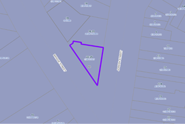
Figure 2 –
Zoning Map of subject site
|
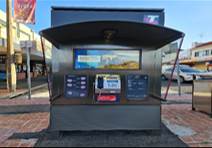
|
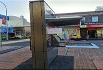
|
|
Figure 3 –
Street view of subject structure
|
Figure 4 –
Street view of subject structure
|
Description of the
development
Council has received a development application for the use
of an existing new generation Smart City payphone booth erected within the
footpath adjoining No. 22-26 Joseph Street, Lidcombe as a telecommunications
facility with a third party advertising on a 32 inches electronic display
screen within the front elevation, which is incorporated in the payphone
structure.
The payphone structure measures 2.735 metres in height and
1.2 metres in width and includes an electronic display area above the payphone
measuring 381mm x 687mm (32 inches) proposed to be used for a third party
advertising.
The payphone structure and the 32 inch electronic display
screen have been constructed and installed and are currently in operation.
It is acknowledged that the electronic display on the rear
elevation of the structure, measuring 75 inches, has been approved by Council
under DA2019/88. This component has been installed and is currently operating.
A Building Information Certificate (BIC) is required for the
payphone structure and the associated 32 inches electronic display; conditions
of consent have been recommended to address this requirement.
· Development Application DA2019/88 was approved on 29 May
2019 for the use of a digital display sign affixed to a Telstra payphone rear
elevation for a third party advertising.
· On 20 November 2020, the Federal Court of
Australia (e.g., Telstra Corporation Limited v Melbourne City Council [2021]
HCASL 82) has determined that the new generation payphone structure which was
previously exempt from the requirement for development consent, does not
qualify as “Low impact Facilities” under the Telecommunications Act 1997. As a result, existing structures already built
on Council’s land require development consent for its use as a
telecommunication facility.
· A Pre Lodgement meeting was held with the applicant on
27 May 2021 under PL2021/0049 and the meeting notes advised the applicant to
lodge a Development Application and associated Building Information Certificate
to obtain the required approvals for all components of the
structure/telecommunication facility.
Applicants Supporting
Statement
The
applicant has provided a Statement of Environmental Effects prepared by Urbis dated November
2021 and was received by Council on 21 January
2022 in support of the application.
Contact with relevant
parties
The
assessing officer has undertaken a site inspection of the subject site and surrounding
properties and has been in regular contact with the applicant throughout the
assessment process.
The
application was not required to be referred to any of Council’s internal
departments for review.
The
application was not required to be referred to any external government
authorities for comment.
The
provisions of any Environmental Planning Instruments (EP&A Act s4.15
(1)(a)(i))
(a) Roads Act 1993
As the
proposal is not located adjacent to a classified road, approval pursuant to
subclause 138(1) of the Roads Act 1993 is not required for this
development application.
(b) Telecommunications
(Low-Impact Facilities) Determination 2018
Pursuant to the Telecommunications
(Low-impact Facilities) Determination 2018, the proposal is not classified as a
low impact facility and as such, state and local planning requirements
apply.
(c) Telecommunications Act 1997
The Telecommunications Act
establishes a framework for regulating the actions of telecommunications
carriers and service providers. The existing payphone structure was previously
built pursuant to Schedule 3 of the Telecommunications Act 1997.
(d) Telecommunications Code of
Practice 2018
The Telecommunications Code of
Practice 2018 commenced on 20 February 2018 and replaces the Telecommunications
Code of Practice 1997. The Code of Practice imposes a range of requirements on
service providers that engage in, or propose to engage in a land entry
activity. The Code also requires the applicant to comply with industry best
practice, in the design, planning and installation of facilities. The
proposed development relates to the use of an existing payphone structure that
was built pursuant to Schedule 3 of the Telecommunications Act 1997.
(e) State Environmental Planning
Policy (Infrastructure) 2007 (ISEPP)
The provisions of the ISEPP 2007
have been considered in the assessment of the development application.
Clause 115 – Development
permitted with consent
(1) Development for the purposes of telecommunications
facilities, other than development in clause 114 or development that is exempt
development under clause 20 or 116, may be carried out by any person with
consent on any land.
(3) Before determining a development application for development to which
this clause applies, the consent authority must take into consideration any
guidelines concerning site selection, design, construction or operating principles
for telecommunications facilities that are issued by the Secretary for the
purposes of this clause and published in the Gazette.
Pursuant to clause 115(3) of the ISEPP 2007, before
determining the proposal, the consent authority must take into consideration of
any guidelines concerning the site selection, design, construction and
operation of telecommunication facilities. The proposal was accompanied with
the report of compliance to the principles of NSW Telecommunications Facilities
Guideline including Broadband 2010. These principles are:
• Principle
1: A Telecommunications facility is to be designed and sited to
minimise
visual impact;
• Principle
2: Telecommunications facilities should be co-located wherever practical;
• Principle
3: Health standards for exposure to radio emissions will be met; and
• Principle
4: Minimise disturbance and risk and maximise compliance.
These matters have been considered
as part of the assessment of this application and are considered satisfactory.
Refer to Attachment 4.
(f) State Environmental Planning
Policy No 64—Advertising and Signage
The proposed signage is ‘advertisement’
as defined under SEPP 64 as follows:
Advertisement means
signage to which Part 3 applies and includes any advertising structure for the
advertisement
The subject proposal is subject to
assessment under Part 3 of SEPP 64 and the guidelines included in Schedule 1 of
the Policy.
|
Clause
|
Comments
|
|
8 Granting of consent to
signage
A consent authority must not
grant development consent to an application to display signage unless the
consent authority is satisfied:
(a) that the signage is
consistent with the objectives of this Policy as set out in clause 3 (1) (a),
and
(b) that the signage the
subject of the application satisfies the assessment criteria specified in
Schedule 1.
|
Satisfactory. Assessment
of the proposal has concluded that the design of the proposed signage is
compatible with the character of the area which is predominantly for business
use. The location of the signage is considered suitable and will not
have any adverse impact on the amenity of the surrounding developments.
|
|
10 Prohibited
advertisements
(1) Despite the provisions of
any other environmental planning instrument, the display of an advertisement
is prohibited on land that is an environmentally sensitive area, heritage
area (excluding railway stations), natural or other conservation area, open
space, waterway, residential (but not a mixed residential and business zone
or similar zone), scenic protection area, national park, nature reserve
(2) This clause does not
apply to the following:
(a) The Mount Panorama
Precinct.
(b) The display of an
advertisement at a public sporting facility situated on land zoned public
recreation under an EPI being an advertisement that provides information
about the sponsors of the teams or organisations using the sporting facility
or about the products of those sponsors.
|
The site is not located on land
that is an environmentally sensitive area and is not located nearby to a
heritage conservation area.
|
|
12 Consent Authority
For the purposes of this
Policy, the consent authority is—
(a) the council of
a local government area in the case of an advertisement displayed in the
local government area (unless paragraph (c), (d) or (e) applies), or
(b) TfNSW in the
case of an advertisement displayed on a vessel, or
(c) the Minister
for Planning in the case of an advertisement displayed by or on behalf of
RailCorp, NSW Trains, Sydney Trains, Sydney Metro or TfNSW on a railway
corridor, or
(d) the Minister
for Planning in the case of an advertisement displayed by or on behalf of RMS
on—
(i) a
road that is a freeway or tollway (under the Roads Act 1993) or associated road use land that is adjacent to such a
road, or
(ii) a
bridge constructed by or on behalf of TfNSW on any road corridor, or
(iii) land
that is owned, occupied or managed by TfNSW, or
(e) the Minister
for Planning in the case of an advertisement displayed on transport corridor
land comprising a road known as the Sydney Harbour Tunnel, the Eastern
Distributor, the M2 Motorway, the M4 Motorway, the M5 Motorway, the M7
Motorway, the Cross City Tunnel or the Lane Cove Tunnel, or associated road
use land that is adjacent to such a road.
|
Council is considered the
consent authority for the subject proposal.
|
13 Matters for
consideration
(1) A consent
authority (other than in a case to which subclause (2) applies) must not grant
consent to an application to display an advertisement to which this Policy
applies unless the advertisement or the advertising structure, as the case
requires:
(a) is consistent
with the objectives of this Policy as set out in clause 3 (1) (a), and
(b) has been
assessed by the consent authority in accordance with the assessment criteria
in Schedule 1 and the consent authority is satisfied that the proposal is
acceptable in terms of its impacts, and
(c) satisfies any
other relevant requirements of this Policy.
|
The proposed signage is
considered to be in a suitable location and will have acceptable impacts on
the local area.
The development application is
limited to the use of the existing sign on the payphone for third party advertising.
The third party advertising will be displayed on a screen that is part of a
public payphone operated by Telstra. The subject site is located on the
pedestrian footpath and will not have any detrimental impacts on the traffic
flows within the locality.
|
|
14 Duration of Consents
(1) A consent granted under
this part ceases to be in force:
(a) on the expiration of 15
years after the date on which the consent becomes effective and operates
(b) if a lesser period is
specified by the consent authority, that lesser period
(2) The consent authority may
specify a period less than 15 years only if:
(a) before the commencement
of this Part, the consent authority had adopted a policy of granting consents
in relation to applications to display advertisements for a lesser period and
the duration of the consent authority is consistent with that policy
(b) the area in which the
advertisement is undergoing change in accordance with an EPI that aims to
change the nature and character of development and where the proposed
advertisement would be inconsistent with that change
(c) the specification of a
lesser period if required by another provision of this Policy.
|
Council will impose a condition
restricting the consent to a period of fifteen (15) years.
|
|
16 Transport Corridor Land
(1) Despite clause 10
(1) and the provisions of any other environmental planning instrument, the
display of an advertisement on transport corridor land is permissible with
development consent in the following cases—
(a) the display of
an advertisement by or on behalf of RailCorp, NSW Trains, Sydney Trains,
Sydney Metro or TfNSW on a railway corridor,
(b) the display of
an advertisement by or on behalf of TfNSW on—
(i) a
road that is a freeway or tollway (under the Roads Act 1993) or associated road use land that is adjacent to such a
road, or
(ii) a
bridge constructed by or on behalf of TfNSW on any road corridor, or
(iii) land
that is owned, occupied or managed by TfNSW and that is within 250 metres of
a classified road,
(c) the display of
an advertisement on transport corridor land comprising a road known as the
Sydney Harbour Tunnel, the Eastern Distributor, the M2 Motorway, the M4 Motorway,
the M5 Motorway, the M7 Motorway, the Cross City Tunnel or the Lane Cove
Tunnel, or associated road use land that is adjacent to such a road.
(2) Before determining
an application for consent to the display of an advertisement in such a case,
the Minister for Planning may appoint a design review panel to provide advice
to the Minister concerning the design quality of the proposed advertisement.
(3) The Minister must
not grant consent to the display of an advertisement in such a case unless—
(a) the relevant
local council has been notified of the development application in writing and
any comments received by the Minister from the local council within 28 days
have been considered by the Minister, and
(b) the advice of
any design review panel appointed by the Minister has been considered by the
Minister, and
(c) the Minister
is satisfied that the advertisement is consistent with the Guidelines.
(4) This clause does
not apply to the display of an advertisement if the Minister determines that
display of the advertisement is not compatible with surrounding land use,
taking into consideration any relevant provisions of the Guidelines.
|
The site is not situated within
land designated as a transport corridor and as such, Clause 16 is not applicable.
|
|
17 Advertisements with display area
greater than 20 square metres or higher than 8 metres above ground
(1) This clause applies
to an advertisement:
(a) that has a
display area greater than 20 square metres, or
(b) that is higher
than 8 metres above the ground.
(2) The display of an
advertisement to which this clause applies is advertised development for the
purposes of the Act.
(3) The consent
authority must not grant consent to an application to display an
advertisement to which this clause applies unless:
(a) the applicant
has provided the consent authority with an impact statement that addresses
the assessment criteria in Schedule 1 and the consent authority is satisfied
that the proposal is acceptable in terms of its impacts, and
(b) the
application has been advertised in accordance with section 79A of the Act,
and
(c) the consent
authority gave a copy of the application to RMS at the same time as the
application was advertised in accordance with section 79A of the Act if the
application is an application for the display of an advertisement to which
clause 18 applies.
|
Clause 17 does not apply to the
proposed development for the following reasons:
· The proposed signage has an area of 0.26m2
which does not exceed an area of 20m2; and
D1
· Has a maximum height of 1.886 metres above ground.
|
18 Advertisements
greater than 20 square metres and within 250 metres of, and visible from, a
classified road
(1) This clause applies
to the display of an advertisement to which clause 17 applies, that is within
250 metres of a classified road any part of which is visible from the
classified road.
(2) The consent
authority must not grant development consent to the display of an
advertisement to which this clause applies without the concurrence of RMS.
(3) In deciding whether
or not concurrence should be granted, RMS must take into consideration:
(a) the impact of
the display of the advertisement on traffic safety, and
(b) the
Guidelines.
(c) (Repealed)
(4) If RMS has not
informed the consent authority within 21 days after the copy of the
application is given to it under clause 17 (3) (c) (ii) that it has granted,
or has declined to grant, its concurrence, RMS is taken to have granted its
concurrence.
(5) Nothing in this
clause affects clause 16.
(6) This clause does
not apply when the Minister for Planning is the consent authority.
|
The proposed sign has an area of
0.26m2 and is not located on a classified road. As such, RMS
referral is not required and Clause 18 is not applicable.
|
|
19 Advertising
display area greater than 45 square metres
The consent authority must
not grant consent to the display of an advertisement with an advertising
display area greater than 45 square metres unless—
(a) a development
control plan is in force that has been prepared on the basis of an
advertising design analysis for the relevant area or precinct, or
(b) in the case of
the display of an advertisement on transport corridor land, the consent
authority is satisfied that the advertisement is consistent with the
Guidelines.
|
The proposed advertisement is
less than 45m2, as such Clause 19 does not apply.
|
|
20 Location
of certain names and logos
(1) The name or logo of
the person who owns or leases an advertisement or advertising structure may
appear only within the advertising display area.
(2) If the advertising
display area has no border or surrounds, any such name or logo is to be
located—
(a) within the
advertisement, or
(b) within a strip
below the advertisement that extends for the full width of the advertisement.
(3) The area of any
such name or logo must not be greater than 0.25 square metres.
(4) The area of any such
strip is to be included in calculating the size of the advertising display
area
|
All logos associated with the
proposed third party advertising is integrated within the payphone structure.
There are no logos within the frames or devices to be erected.
|
ENVIRONMENTAL PLANNING INSTRUMENTS (EPIs)
The proposed development is affected by the following
consolidated State Environmental Planning Policies that came into effect on 1
March 2022. No savings provision is indicated within the new SEPPs, as no
policy changes have been made. The SEPP consolidation does not change the legal
effect of the existing SEPPs, with section 30A of the Interpretation Act 1987
applying to the transferred provisions. In this regard, the following matters
have been incorporated in the planning assessment of the proposed development
under s4.15 of the Environmental Planning and Assessment Act 1979.
|
State Environmental
Planning Policies (SEPPs)
|
Relevant
Clause(s)
|
Compliance
with Requirements
|
|
· State Environmental
Planning Policy (Biodiversity and Conservation) 2021
|
Chapter 2 -Vegetation in
non-Rural Areas.
|
The development application
does not seek to remove any significant trees, which hold any biodiversity or
ecological values, on the site. The proposal does not trigger the provisions
of Chapter 2.
|
·
Chapter 6 - Bushland in Urban Areas. |
The proposal does not involve the disturbance of any
bushland zoned or reserved for public open space.
|
·
Chapter 10 - Sydney Harbour
Catchment. |
The proposed development raises no issues as no impact on
the catchment is envisaged.
(Note: - the subject site is not identified in the
relevant map as ‘land within the ‘Foreshores and Waterways
Area’ or ‘Wetland Protection zone’, is not a
‘Strategic Foreshore Site’ and does not contain any heritage
items. Hence the majority of the State Policy is not directly relevant to the
proposed development).
|
|
· State
Environmental Planning Policy (Resilience and Hazards) 2021
|
Chapter 2 - Coastal Management.
|
The subject site is not
identified as a coastal wetland nor is it a land identified as in
“proximity area for coastal wetlands”.
|
·
Chapter 4 - Remediation of Land. |
The
site is not identified in Council’s records as being contaminated. A
site inspection reveals the site does not have any obvious history of a
previous land use that may have caused contamination and there is no specific
evidence that indicates the site is contaminated. Further to that, no
physical works are proposed as part of this application, as the structure is
existing.
|
|
· State
Environmental Planning Policy (Transport and Infrastructure) 2021
|
Chapter 2 - Infrastructure
|
The proposed use of land as a
telecommunication facility been considered under the provisions and determined
as being acceptable for approval.
|
|
· State
Environmental Planning Policy (Industry and Employment) 2021
|
Chapter 3 - Advertising and
Signage.
|
The signs the subject of the
development application have been considered under the provisions and determined
as being acceptable for approval.
|
Local Environmental Plans
Cumberland Local Environmental Plan 2021 (CLEP 2021)
The
provision of the CLEP 2021 is applicable to the development proposal. It is
noted that the development achieves compliance with the key statutory
requirements of the CLEP 2021 and the objectives of the B4 Mixed Use
Zone.
(a) Permissibility:
The proposed development is
defined as a ‘telecommunications facility’ and ‘signage’
and are permissible in the B4 Mixed Use Zone with consent.
Telecommunications facility means—
(a) any part of the
infrastructure of a telecommunications network, or
(b) any line, cable,
optical fibre, fibre access node, interconnect point equipment, apparatus,
tower, mast, antenna, dish, tunnel, duct, hole, pit, pole or other structure in
connection with a telecommunications network, or
(c) any other thing
used in or in connection with a telecommunications network.
signage means
any sign, notice, device, representation or advertisement that advertises or
promotes any goods, services or events and any structure or vessel that is
principally designed for, or that is used for, the display of signage, and
includes any of the following—
(a) an advertising
structure,
(b) a building
identification sign,
(c) a business
identification sign,
but does not include a traffic
sign or traffic control facilities.
A comprehensive LEP assessment is
contained in Attachment 7.
The provisions of any proposed instrument that is or has
been the subject (EP&A Act s4.15 (1)(a)(ii))
N/A
The provisions of any Development Control Plans (EP&A
Act s4.15 (1)(a)(iii))
The
Cumberland DCP 2021 provides guidance for the design and operation of
development to achieve the aims and objectives of the Cumberland LEP 2021.
A
comprehensive assessment and compliance table is contained in Attachment
8.
The proposed development complies with the provisions of the
Cumberland DCP 2021 and is considered acceptable from an environmental planning
viewpoint.
The provisions of any planning agreement that has been
entered into under section 7.4, or any draft planning agreement that a
developer has offered to enter into under section 7.4 (EP&A Act
s4.15(1)(a)(iiia))
There is no draft planning agreement associated with the
subject Development Application.
The provisions of the Regulations (EP&A Act s4.15
(1)(a)(iv))
The proposed development raises no concerns as to the
relevant matters arising from the Environmental Planning and Assessment
Regulations 2000 (EP&A Reg).
The Likely Environmental, Social or Economic Impacts
(EP&A Act s4.15 (1)(b))
It is considered that the proposed development will have no
significant adverse environmental, social or economic impacts in the locality.
The suitability of the site for the development (EP&A
Act s4.15 (1)(c))
The subject site and locality is not known to be affected by
any natural hazards or other site constraints likely to have a significant
adverse impact on the proposed development. Accordingly, it is considered that
the development is suitable in the context of the site and surrounding
locality.
Submissions made in accordance with the Act or Regulation
(EP&A Act s4.15 (1)(d))
|
Advertised (Council Website)
|
Mail
|
Sign
|
Not Required
|
In accordance with Council’s Notification requirements
contained within the Cumberland DCP 2021, the proposal was publicly
notified for a period of 14 days between 2 February 2022 and 16 February 2022.
No submissions were received in respect of the proposed development.
The public interest (EP&A Act s4.15(1)(e))
In view of the foregoing analysis it is considered that the
development, if carried out subject to the conditions set out in the recommendation
below, will have no significant adverse impacts on the public interest.
CUMBERLAND LOCAL INFRASTRUCTURE CONTRIBUTIONS
PLAN 2020
The development would not require the payment of
contributions in accordance with Cumberland Local Infrastructure Contributions
Plan 2020.
Disclosure of Political Donations and Gifts
The
applicant and notification process did not result in any disclosure of
Political Donations and Gifts.
The development application has been assessed in accordance
with the relevant requirements of the Environmental Planning and Assessment Act
1979, Environmental Planning and Assessment Regulation 2000, Roads Act 1993,
Telecommunications Act 1997, State Environmental Planning Policy (Biodiversity
and Conservation) 2021, State Environmental Planning Policy (Resilience and
Hazards) 2021, State Environmental Planning Policy (Transport and
Infrastructure) 2021, State Environmental Planning Policy (Industry and
Employment) 2021,Cumberland LEP 2021 and Cumberland DCP 2021 and is considered
to be satisfactory for approval, subject to conditions.
|
That Development Application No. DA2022/0008 for the
use of the land as a telecommunications facility with third party advertising
on a 32 inch electronic display screen incorporated in the payphone structure
on the public footpath adjacent to 22- 26 Joseph Street, Lidcombe NSW
2141 be Approved subject to attached conditions.
|
1. Draft Notice
of Determination
2. Site
Plan
3. Elevation
Plan
4. NSW
Telecommunications Facilities Guideline Including Broadband 2010
5. State
Environmental Planning Policy No. 64 - Advertising and Signage
DOCUMENTS
ASSOCIATED WITH
REPORT LPP011/22
Attachment 1
Draft Notice of Determination
Cumberland Local Planning Panel Meeting
9 March 2022
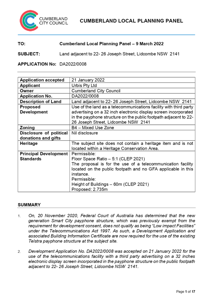
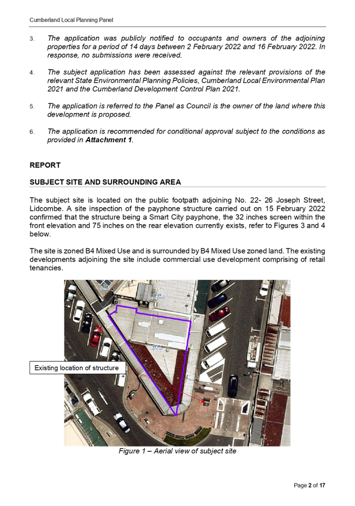
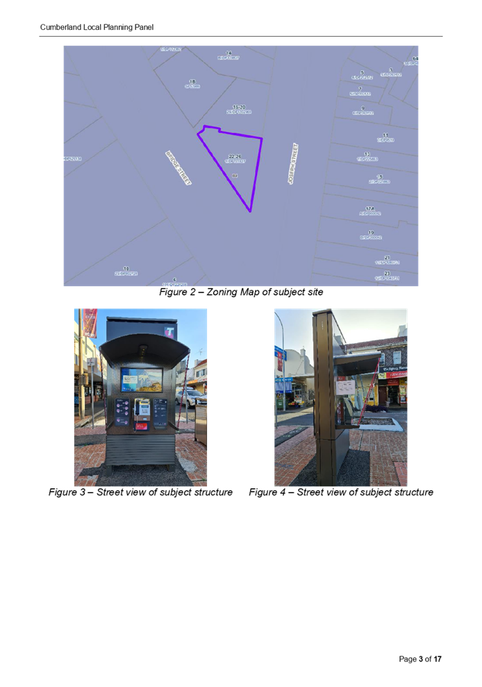
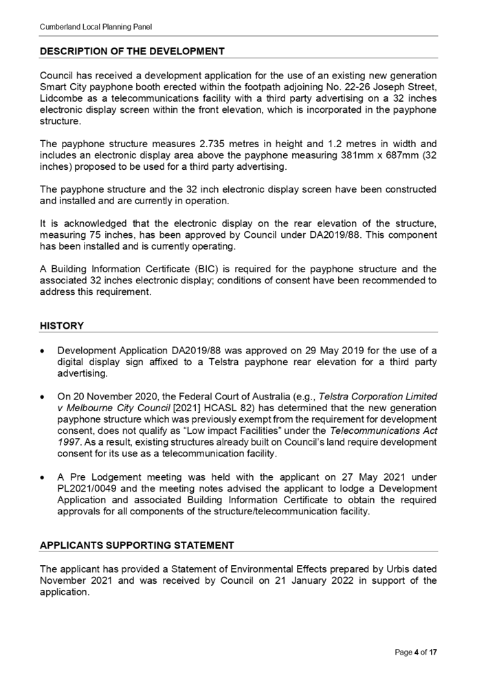

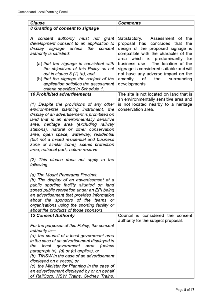
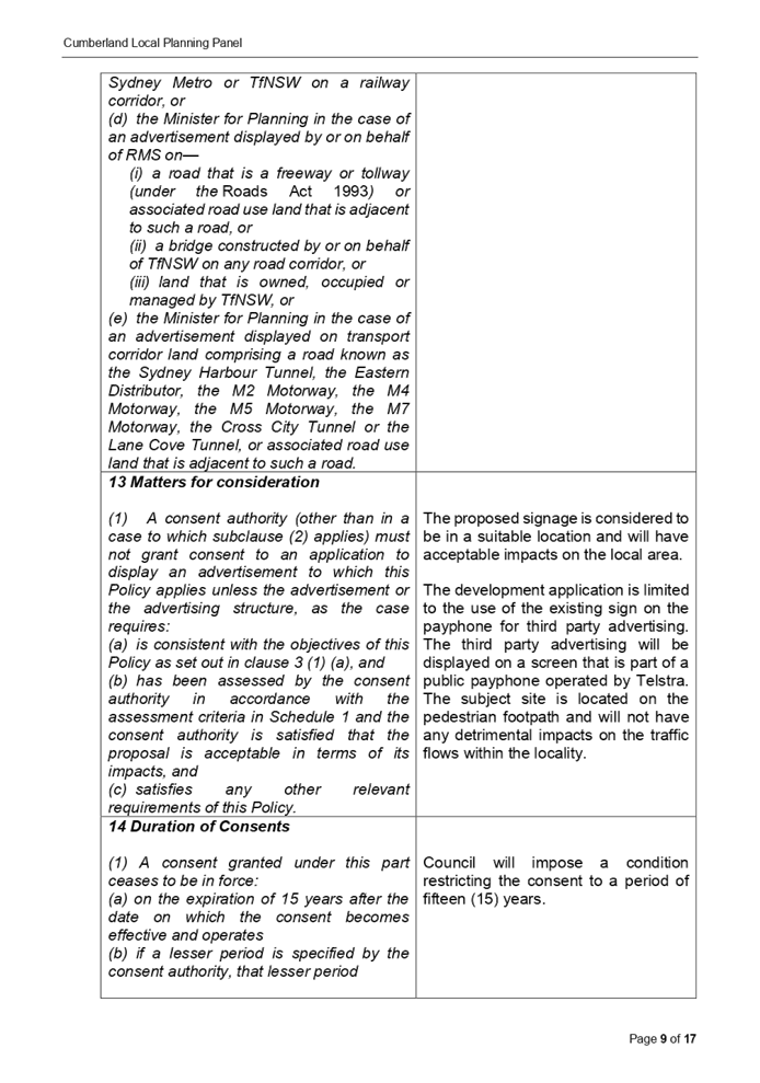
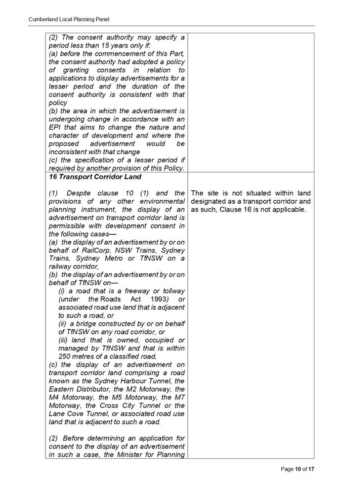


DOCUMENTS
ASSOCIATED WITH
REPORT LPP011/22
Attachment 2
Site Plan
Cumberland Local Planning Panel Meeting
9 March 2022
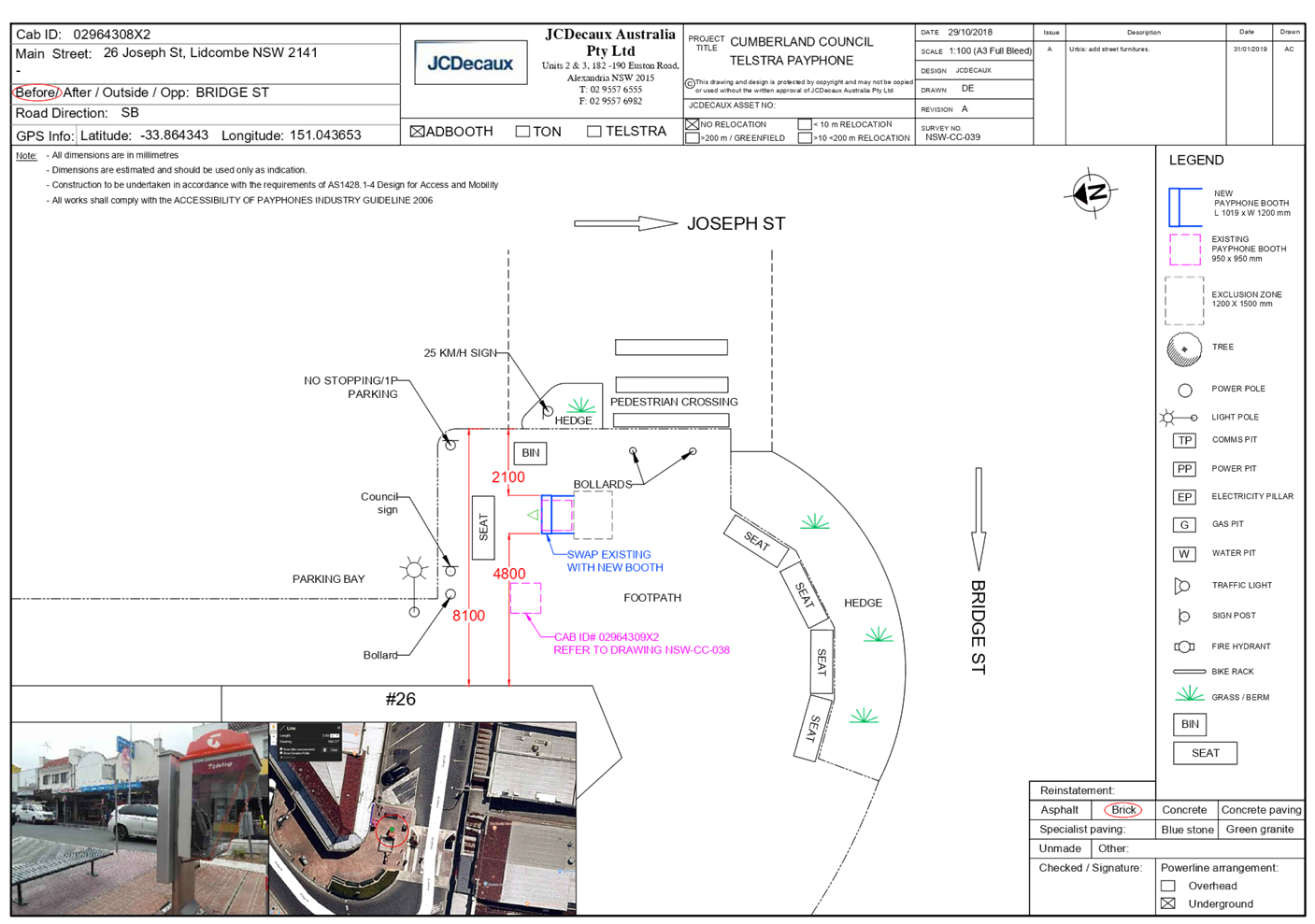
DOCUMENTS
ASSOCIATED WITH
REPORT LPP011/22
Attachment 3
Elevation Plan
Cumberland Local Planning Panel Meeting
9 March 2022
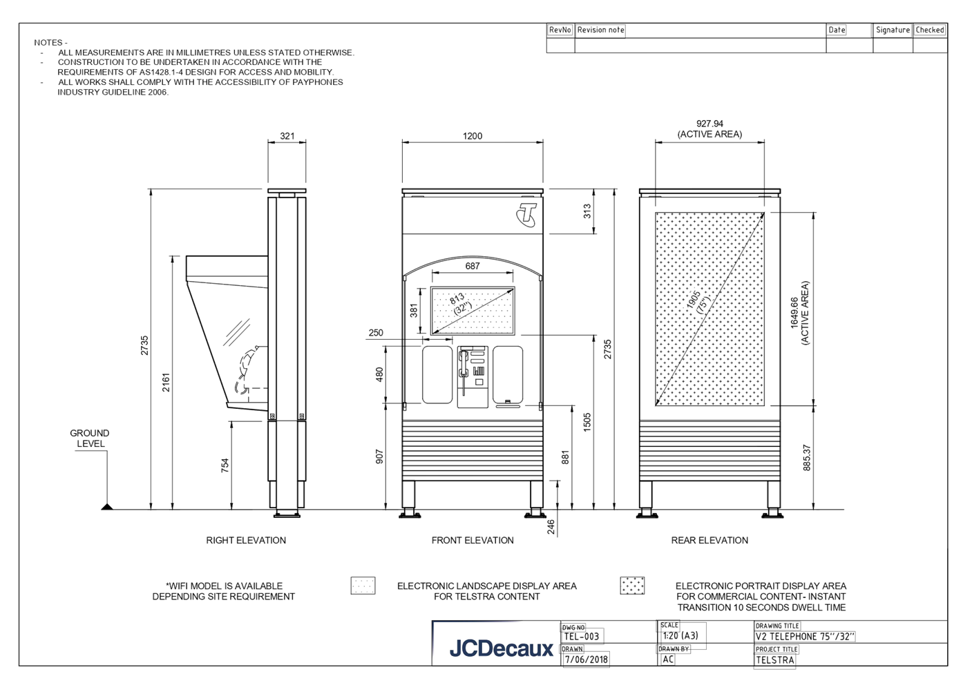
DOCUMENTS
ASSOCIATED WITH
REPORT LPP011/22
Attachment 4
NSW Telecommunications Facilities Guideline Including
Broadband 2010
Cumberland Local Planning Panel Meeting
9 March 2022
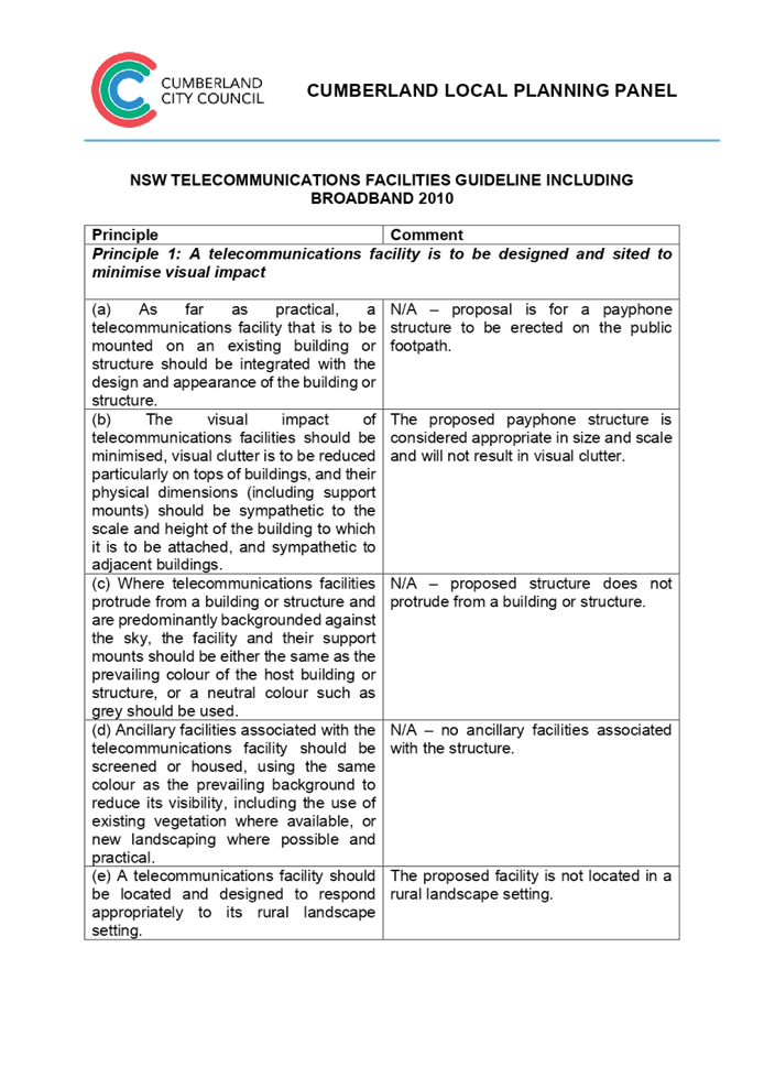
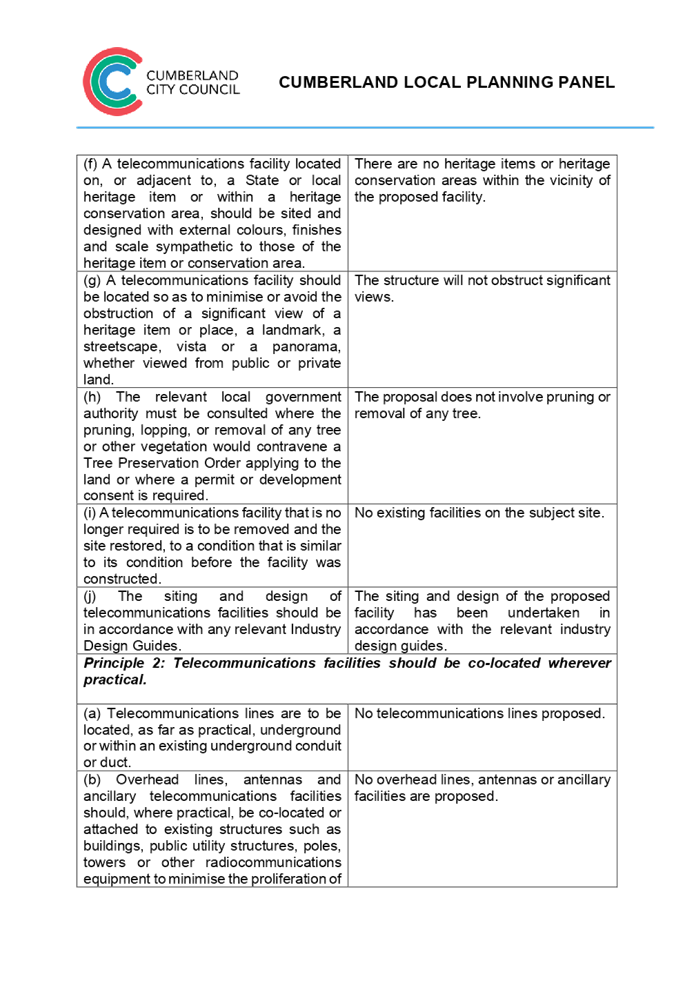

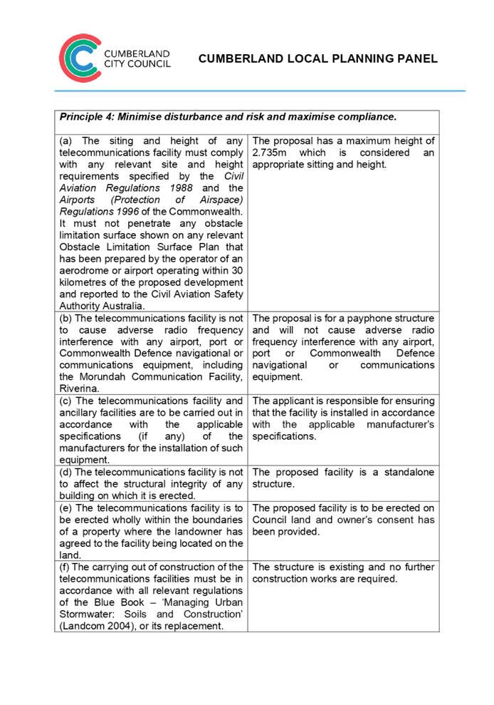
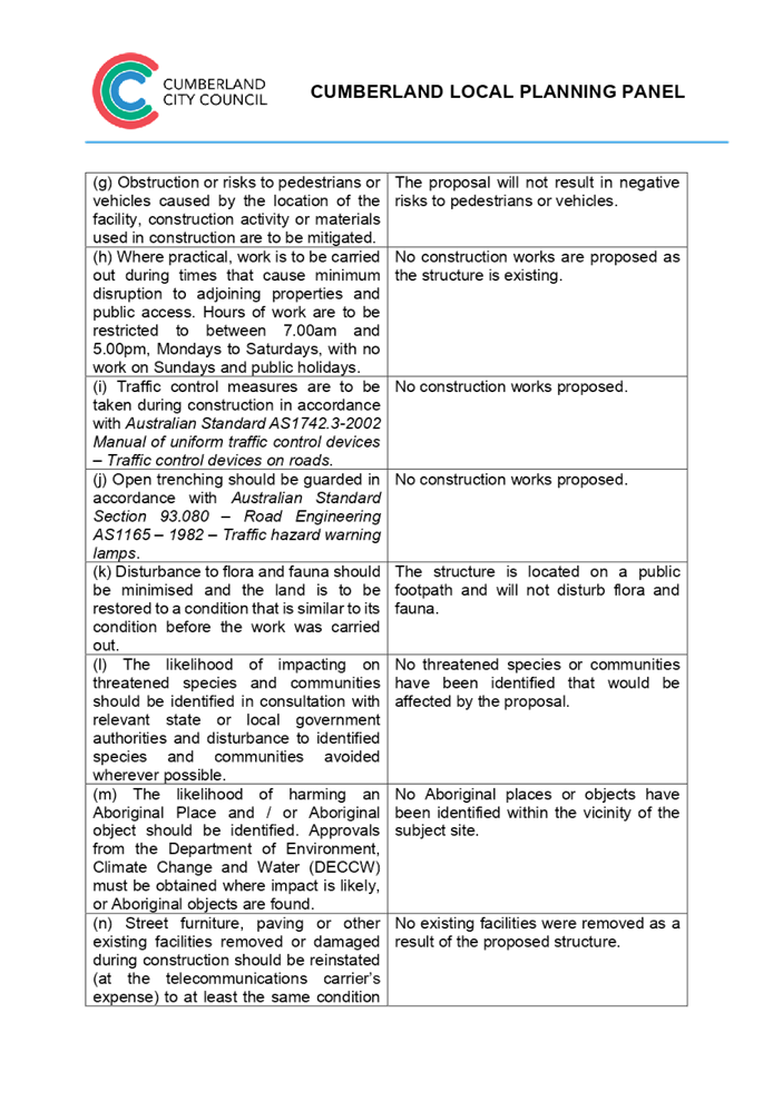

DOCUMENTS
ASSOCIATED WITH
REPORT LPP011/22
Attachment 5
State Environmental Planning Policy No. 64 -
Advertising and Signage
Cumberland Local Planning Panel Meeting
9 March 2022
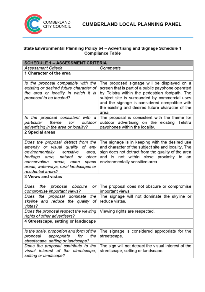
Cumberland
Local Planning Panel Meeting
9 March 2022
Item No: LPP012/22
Development
Application for 27 Sherwood Road Merrylands
Responsible
Division: Environment
& Planning
Officer: Executive
Manager Development and Building
File
Number: DA2022/0009
|
Application
accepted
|
21 January 2022
|
|
Applicant
|
Urbis Pty Ltd
|
|
Owner
|
Cumberland City Council
|
|
Application
No.
|
DA2022/0009
|
|
Description
of Land
|
Land adjacent to 27 Sherwood
Road, MERRYLANDS WEST NSW 2160
|
|
Proposed
Development
|
Use of the land as a
telecommunications facility with third party advertising on a 32 inch
electronic display screen incorporated in the payphone structure on the
public footpath adjacent to 27 Sherwood Road, MERRYLANDS WEST NSW 2160
|
|
Zoning
|
B2 – Local Centre Zone
|
|
Disclosure
of political donations and gifts
|
Nil disclosure
|
|
Heritage
|
The subject site does not
contain a heritage item and is not located within a Heritage Conservation
Area.
|
|
Principal
Development Standards
|
Permissible:
Floor Space Ratio –
2.2:1 (CLEP 2021)
The proposal is for the use of
a telecommunication facility located on the public footpath and no GFA
applicable in this instance.
Permissible:
Height of Buildings –
17-23m (CLEP 2021)
Proposed: 2.735m
|
1. On,
20 November 2020, Federal Court of Australia has determined that the new
generation Smart City payphone structure, which was previously exempt from the
requirement for development consent, does not qualify as being “Low
impact Facilities” under the Telecommunications Act 1997. As such, a
Development Application and associated Building Information Certificate are now
required for the use of the existing Telstra payphone structure at the subject
site.
2. Development
Application No. DA2022/0009 was accepted on 21 January 2022 for the use of the
telecommunications facility with a third party advertising on a 32 inches
electronic display screen incorporated in the payphone structure on the public
footpath adjacent to 27 Sherwood Road, MERRYLANDS WEST NSW 2160.
3. The
application was publicly notified to occupants and owners of the adjoining
properties for a period of 14 days between 2 February 2022 and 16 February
2022. In response, no submissions were received.
4. The
subject application has been assessed against the relevant provisions of the
relevant State Environmental Planning Policies, Cumberland Local Environmental
Plan 2021 and the Cumberland Development Control Plan 2021.
5. The
application is referred to the Panel as Council is the owner of the land where
this development is proposed.
6. The
application is recommended for conditional approval subject to the conditions
as provided in Attachment 1.
REPORT
Subject Site and surrounding
area
The subject site is located on the
public footpath adjoining No. 27 Sherwood Road, Merrylands West (McDonalds). A
site inspection of the payphone structure carried out on 15 February 2022
confirmed that the structure being a Smart City payphone, the 32 inches screen
within the front elevation and 75 inches on the rear elevation currently
exists, refer to Figures 3 and 4 below.
The site is zoned B2 Local Centre
and is surrounded by B2 zoned land adjoining to the north and south, R4 High
Density Residential zoned land opposite to the east and R2 Low Density
Residential zoned land to the west. The existing developments adjoining the
site include commercial and residential use development comprising of Coolibah
Hotel, a 4 storey mixed use development and single and two storey dwelling
houses.
Figure 1 –
Aerial view of subject site
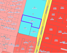
Figure 2 –
Zoning Map of subject site
|
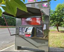
|
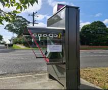
|
|
Figure 3 –
Street view of subject structure
|
Figure 4 –
Street view of subject structure
|
Description of the
development
Council has received a development application for the use
of an existing new generation Smart City payphone booth erected within the
footpath adjoining No. 27 Sherwood Road, Merrylands West as a telecommunications
facility with a third party advertising on a 32 inches electronic display
screen within the front elevation, which is incorporated in the payphone
structure.
The payphone structure measures 2.735 metres in height and
1.2 metres in width and includes an electronic display area above the payphone
measuring 381mm x 687mm (32 inches) proposed to be used for a third party
advertising.
The payphone structure and the 32 inch electronic display
screen have been constructed and installed and are currently in operation.
It is acknowledged that the electronic display on the rear
elevation of the structure, measuring 75 inches, has been approved by Council
under DA2019/86. This component has been installed and is currently operating.
A Building Information Certificate (BIC) is required for the
payphone structure and the associated 32 inches electronic display; conditions
of consent have been recommended to address this requirement.
· Development Application DA2019/86 was approved on 29 May
2019 for the use of a digital display sign affixed to a Telstra payphone rear
elevation for a third party advertising.
· On 20 November 2020, the Federal Court of
Australia (e.g., Telstra Corporation Limited v Melbourne City Council [2021]
HCASL 82) has determined that the new generation payphone structure which was
previously exempt from the requirement for development consent, does not
qualify as “Low impact Facilities” under the Telecommunications Act 1997. As a result, existing structures already built
on Council’s land require development consent for its use as a
telecommunication facility.
· A Pre Lodgement meeting was held with the applicant on
27 May 2021 under PL2021/0049 and the meeting notes advised the applicant to
lodge a Development Application and associated Building Information Certificate
to obtain the required approvals for all components of the
structure/telecommunication facility.
Applicants Supporting
Statement
The
applicant has provided a Statement of Environmental Effects prepared by Urbis dated November
2021 and was received by Council on 21 January
2022 in support of the application.
Contact with relevant
parties
The
assessing officer has undertaken a site inspection of the subject site and surrounding
properties and has been in regular contact with the applicant throughout the
assessment process.
The
application was not required to be referred to any of Council’s internal
departments for review.
The
application was not required to be referred to any external government
authorities for comment.
The
provisions of any Environmental Planning Instruments (EP&A Act s4.15
(1)(a)(i))
(a) Roads Act 1993
As the
proposal is not located adjacent to a classified road, approval pursuant to
subclause 138(1) of the Roads Act 1993 is not required for this
development application.
(b) Telecommunications
(Low-Impact Facilities) Determination 2018
Pursuant to the Telecommunications
(Low-impact Facilities) Determination 2018, the proposal is not classified as a
low impact facility and as such, state and local planning requirements
apply.
(c) Telecommunications Act 1997
The Telecommunications Act
establishes a framework for regulating the actions of telecommunications
carriers and service providers. The existing payphone structure was previously
built pursuant to Schedule 3 of the Telecommunications Act 1997.
(d) Telecommunications Code of
Practice 2018
The Telecommunications Code of
Practice 2018 commenced on 20 February 2018 and replaces the Telecommunications
Code of Practice 1997. The Code of Practice imposes a range of requirements on
service providers that engage in, or propose to engage in a land entry
activity. The Code also requires the applicant to comply with industry best
practice, in the design, planning and installation of facilities. The
proposed development relates to the use of an existing payphone structure that
was built pursuant to Schedule 3 of the Telecommunications Act 1997.
(e) State Environmental Planning
Policy (Infrastructure) 2007 (ISEPP)
The provisions of the ISEPP 2007
have been considered in the assessment of the development application.
Clause 115 – Development
permitted with consent
(1) Development for the purposes of telecommunications
facilities, other than development in clause 114 or development that is exempt
development under clause 20 or 116, may be carried out by any person with
consent on any land.
(3) Before determining a development application for development to which
this clause applies, the consent authority must take into consideration any
guidelines concerning site selection, design, construction or operating principles
for telecommunications facilities that are issued by the Secretary for the
purposes of this clause and published in the Gazette.
Pursuant to clause 115(3) of the ISEPP 2007, before
determining the proposal, the consent authority must take into consideration of
any guidelines concerning the site selection, design, construction and
operation of telecommunication facilities. The proposal was accompanied with
the report of compliance to the principles of NSW Telecommunications Facilities
Guideline including Broadband 2010. These principles are:
•
Principle 1: A Telecommunications facility is to be designed and sited to
minimise visual impact;
• Principle
2: Telecommunications facilities should be co-located wherever practical;
• Principle
3: Health standards for exposure to radio emissions will be met; and
•
Principle 4: Minimise disturbance and risk and maximise compliance.
These matters have been considered
as part of the assessment of this application and are considered satisfactory.
Refer to Attachment 4.
(f) State Environmental Planning
Policy No 64—Advertising and Signage
The proposed signage is ‘advertisement’
as defined under SEPP 64 as follows:
Advertisement means
signage to which Part 3 applies and includes any advertising structure for the
advertisement
The subject proposal is subject to
assessment under Part 3 of SEPP 64 and the guidelines included in Schedule 1 of
the Policy.
|
Clause
|
Comments
|
|
8 Granting of consent to
signage
A consent authority must not
grant development consent to an application to display signage unless the
consent authority is satisfied:
(a) that the signage is
consistent with the objectives of this Policy as set out in clause 3 (1) (a),
and
(b) that the signage the
subject of the application satisfies the assessment criteria specified in
Schedule 1.
|
Satisfactory. Assessment
of the proposal has concluded that the design of the proposed signage is
compatible with the character of the area which is predominantly for business
use. The location of the signage is considered suitable and will not
have any adverse impact on the amenity of the surrounding developments.
|
|
10 Prohibited
advertisements
(1) Despite the provisions of
any other environmental planning instrument, the display of an advertisement
is prohibited on land that is an environmentally sensitive area, heritage
area (excluding railway stations), natural or other conservation area, open
space, waterway, residential (but not a mixed residential and business zone
or similar zone), scenic protection area, national park, nature reserve
(2) This clause does not
apply to the following:
(a) The Mount Panorama
Precinct.
(b) The display of an
advertisement at a public sporting facility situated on land zoned public
recreation under an EPI being an advertisement that provides information
about the sponsors of the teams or organisations using the sporting facility
or about the products of those sponsors.
|
The site is not located on land
that is an environmentally sensitive area and is not located nearby to a
heritage conservation area.
|
|
12 Consent Authority
For the purposes of this
Policy, the consent authority is—
(a) the council of
a local government area in the case of an advertisement displayed in the
local government area (unless paragraph (c), (d) or (e) applies), or
(b) TfNSW in the
case of an advertisement displayed on a vessel, or
(c) the Minister
for Planning in the case of an advertisement displayed by or on behalf of
RailCorp, NSW Trains, Sydney Trains, Sydney Metro or TfNSW on a railway
corridor, or
(d) the Minister
for Planning in the case of an advertisement displayed by or on behalf of RMS
on—
(i) a
road that is a freeway or tollway (under the Roads Act 1993) or associated road use land that is adjacent to such a
road, or
(ii) a
bridge constructed by or on behalf of TfNSW on any road corridor, or
(iii) land
that is owned, occupied or managed by TfNSW, or
(e) the Minister
for Planning in the case of an advertisement displayed on transport corridor
land comprising a road known as the Sydney Harbour Tunnel, the Eastern
Distributor, the M2 Motorway, the M4 Motorway, the M5 Motorway, the M7
Motorway, the Cross City Tunnel or the Lane Cove Tunnel, or associated road
use land that is adjacent to such a road.
|
Council is considered the
consent authority for the subject proposal.
|
13 Matters for
consideration
(1) A consent
authority (other than in a case to which subclause (2) applies) must not
grant consent to an application to display an advertisement to which this
Policy applies unless the advertisement or the advertising structure, as the
case requires:
(a) is consistent
with the objectives of this Policy as set out in clause 3 (1) (a), and
(b) has been
assessed by the consent authority in accordance with the assessment criteria
in Schedule 1 and the consent authority is satisfied that the proposal is acceptable
in terms of its impacts, and
(c) satisfies any
other relevant requirements of this Policy.
|
The proposed signage is
considered to be in a suitable location and will have acceptable impacts on
the local area.
The development application is
limited to the use of the existing sign on the payphone for third party
advertising. The third party advertising will be displayed on a screen that
is part of a public payphone operated by Telstra. The subject site is located
on the pedestrian footpath and will not have any detrimental impacts on the
traffic flows within the locality.
|
|
14 Duration of Consents
(1) A consent granted under
this part ceases to be in force:
(a) on the expiration of 15
years after the date on which the consent becomes effective and operates
(b) if a lesser period is
specified by the consent authority, that lesser period
(2) The consent authority may
specify a period less than 15 years only if:
(a) before the commencement
of this Part, the consent authority had adopted a policy of granting consents
in relation to applications to display advertisements for a lesser period and
the duration of the consent authority is consistent with that policy
(b) the area in which the
advertisement is undergoing change in accordance with an EPI that aims to
change the nature and character of development and where the proposed
advertisement would be inconsistent with that change
(c) the specification of a
lesser period if required by another provision of this Policy.
|
Council will impose a condition
restricting the consent to a period of fifteen (15) years.
|
16 Transport Corridor Land
(1) Despite clause 10
(1) and the provisions of any other environmental planning instrument, the
display of an advertisement on transport corridor land is permissible with
development consent in the following cases—
(a) the display of
an advertisement by or on behalf of RailCorp, NSW Trains, Sydney Trains,
Sydney Metro or TfNSW on a railway corridor,
(b) the display of
an advertisement by or on behalf of TfNSW on—
(i) a
road that is a freeway or tollway (under the Roads Act 1993) or associated road use land that is adjacent to such a
road, or
(ii) a
bridge constructed by or on behalf of TfNSW on any road corridor, or
(iii) land
that is owned, occupied or managed by TfNSW and that is within 250 metres of
a classified road,
(c) the display of
an advertisement on transport corridor land comprising a road known as the
Sydney Harbour Tunnel, the Eastern Distributor, the M2 Motorway, the M4
Motorway, the M5 Motorway, the M7 Motorway, the Cross City Tunnel or the Lane
Cove Tunnel, or associated road use land that is adjacent to such a road.
(2) Before determining
an application for consent to the display of an advertisement in such a case,
the Minister for Planning may appoint a design review panel to provide advice
to the Minister concerning the design quality of the proposed advertisement.
(3) The Minister must not
grant consent to the display of an advertisement in such a case unless—
(a) the relevant
local council has been notified of the development application in writing and
any comments received by the Minister from the local council within 28 days
have been considered by the Minister, and
(b) the advice of
any design review panel appointed by the Minister has been considered by the
Minister, and
(c) the Minister
is satisfied that the advertisement is consistent with the Guidelines.
(4) This clause does
not apply to the display of an advertisement if the Minister determines that
display of the advertisement is not compatible with surrounding land use,
taking into consideration any relevant provisions of the Guidelines.
|
The site is not situated within
land designated as a transport corridor and as such, Clause 16 is not
applicable.
|
|
17 Advertisements with display area
greater than 20 square metres or higher than 8 metres above ground
(1) This clause applies
to an advertisement:
(a) that has a display
area greater than 20 square metres, or
(b) that is higher
than 8 metres above the ground.
(2) The display of an
advertisement to which this clause applies is advertised development for the
purposes of the Act.
(3) The consent authority
must not grant consent to an application to display an advertisement to which
this clause applies unless:
(a) the applicant
has provided the consent authority with an impact statement that addresses
the assessment criteria in Schedule 1 and the consent authority is satisfied
that the proposal is acceptable in terms of its impacts, and
(b) the
application has been advertised in accordance with section 79A of the Act,
and
(c) the consent
authority gave a copy of the application to RMS at the same time as the
application was advertised in accordance with section 79A of the Act if the
application is an application for the display of an advertisement to which
clause 18 applies.
|
Clause 17 does not apply to the
proposed development for the following reasons:
· The proposed signage has an area of 0.26m2
which does not exceed an area of 20m2; and
D1
· Has a maximum height of 1.886 metres above ground.
|
18 Advertisements
greater than 20 square metres and within 250 metres of, and visible from, a
classified road
(1) This clause applies
to the display of an advertisement to which clause 17 applies, that is within
250 metres of a classified road any part of which is visible from the
classified road.
(2) The consent
authority must not grant development consent to the display of an
advertisement to which this clause applies without the concurrence of RMS.
(3) In deciding whether
or not concurrence should be granted, RMS must take into consideration:
(a) the impact of
the display of the advertisement on traffic safety, and
(b) the
Guidelines.
(c) (Repealed)
(4) If RMS has not
informed the consent authority within 21 days after the copy of the
application is given to it under clause 17 (3) (c) (ii) that it has granted,
or has declined to grant, its concurrence, RMS is taken to have granted its
concurrence.
(5) Nothing in this
clause affects clause 16.
(6) This clause does
not apply when the Minister for Planning is the consent authority.
|
The proposed sign has an area of
0.26m2 and is not located on a classified road. As such, RMS
referral is not required and Clause 18 is not applicable.
|
19 Advertising
display area greater than 45 square metres
The consent authority must
not grant consent to the display of an advertisement with an advertising
display area greater than 45 square metres unless—
(a) a development
control plan is in force that has been prepared on the basis of an
advertising design analysis for the relevant area or precinct, or
(b) in the case of
the display of an advertisement on transport corridor land, the consent
authority is satisfied that the advertisement is consistent with the
Guidelines.
|
The proposed advertisement is
less than 45m2, as such Clause 19 does not apply.
|
20 Location
of certain names and logos
(1) The name or logo of
the person who owns or leases an advertisement or advertising structure may
appear only within the advertising display area.
(2) If the advertising
display area has no border or surrounds, any such name or logo is to be
located—
(a) within the
advertisement, or
(b) within a strip
below the advertisement that extends for the full width of the advertisement.
(3) The area of any
such name or logo must not be greater than 0.25 square metres.
(4) The area of any
such strip is to be included in calculating the size of the advertising
display area
|
All logos associated with the
proposed third party advertising is integrated within the payphone structure.
There are no logos within the frames or devices to be erected.
|
ENVIRONMENTAL PLANNING INSTRUMENTS (EPIs)
The proposed development is affected by the following
consolidated State Environmental Planning Policies that came into effect on 1
March 2022. No savings provision is indicated within the new SEPPs, as no
policy changes have been made. The SEPP consolidation does not change the legal
effect of the existing SEPPs, with section 30A of the Interpretation Act 1987
applying to the transferred provisions. In this regard, the following matters
have been incorporated in the planning assessment of the proposed development
under s4.15 of the Environmental Planning and Assessment Act 1979.
|
State Environmental
Planning Policies (SEPPs)
|
Relevant
Clause(s)
|
Compliance
with Requirements
|
|
· State
Environmental Planning Policy (Biodiversity and Conservation) 2021
|
Chapter 2 -Vegetation in
non-Rural Areas.
|
The development application
does not seek to remove any significant trees, which hold any biodiversity or
ecological values, on the site. The proposal does not trigger the provisions
of Chapter 2.
|
·
Chapter 6 - Bushland in Urban Areas. |
The proposal does not involve the disturbance of any
bushland zoned or reserved for public open space.
|
·
Chapter 10 - Sydney Harbour Catchment. |
The proposed development raises no issues as no impact on
the catchment is envisaged.
(Note: - the subject site is not identified in the
relevant map as ‘land within the ‘Foreshores and Waterways
Area’ or ‘Wetland Protection zone’, is not a ‘Strategic
Foreshore Site’ and does not contain any heritage items. Hence the
majority of the State Policy is not directly relevant to the proposed
development).
|
|
· State
Environmental Planning Policy (Resilience and Hazards) 2021
|
Chapter 2 - Coastal
Management.
|
The subject site is not
identified as a coastal wetland nor is it a land identified as in
“proximity area for coastal wetlands”.
|
·
Chapter 4 - Remediation of Land. |
The
site is not identified in Council’s records as being contaminated. A
site inspection reveals the site does not have any obvious history of a
previous land use that may have caused contamination and there is no specific
evidence that indicates the site is contaminated. Further to that, no
physical works are proposed as part of this application, as the structure is
existing.
|
|
· State
Environmental Planning Policy (Transport and Infrastructure) 2021
|
Chapter 2 - Infrastructure
|
The proposed use of land as a
telecommunication facility been considered under the provisions and
determined as being acceptable for approval.
|
|
· State
Environmental Planning Policy (Industry and Employment) 2021
|
Chapter 3 - Advertising and
Signage.
|
The signs the subject of the
development application have been considered under the provisions and
determined as being acceptable for approval.
|
Local Environmental Plans
Cumberland Local Environmental Plan 2021 (CLEP 2021)
The
provision of the CLEP 2021 is applicable to the development proposal. It is
noted that the development achieves compliance with the key statutory
requirements of the CLEP 2021 and the objectives of the B2 Local Centre
Zone.
(a) Permissibility:
The proposed development is
defined as a ‘telecommunications facility’ and ‘signage’
and are permissible in the B2 Local Centre Zone with consent.
Telecommunications facility means—
(a) any part of the
infrastructure of a telecommunications network, or
(b) any line, cable,
optical fibre, fibre access node, interconnect point equipment, apparatus,
tower, mast, antenna, dish, tunnel, duct, hole, pit, pole or other structure in
connection with a telecommunications network, or
(c) any other thing
used in or in connection with a telecommunications network.
signage means
any sign, notice, device, representation or advertisement that advertises or
promotes any goods, services or events and any structure or vessel that is
principally designed for, or that is used for, the display of signage, and
includes any of the following—
(a) an advertising
structure,
(b) a building
identification sign,
(c) a business
identification sign,
but does not include a traffic
sign or traffic control facilities.
A comprehensive LEP assessment is
contained in Attachment 7.
The provisions of any proposed instrument that is or has
been the subject (EP&A Act s4.15 (1)(a)(ii))
N/A
The provisions of any Development Control Plans (EP&A
Act s4.15 (1)(a)(iii))
The Cumberland
DCP 2021 provides guidance for the design and operation of development to
achieve the aims and objectives of the Cumberland LEP 2021.
A
comprehensive assessment and compliance table is contained in Attachment
8.
The proposed development complies with the provisions of the
Cumberland DCP 2021 and is considered acceptable from an environmental planning
view point.
The provisions of any planning agreement that has been
entered into under section 7.4, or any draft planning agreement that a
developer has offered to enter into under section 7.4 (EP&A Act
s4.15(1)(a)(iiia))
There is no draft planning agreement associated with the
subject Development Application.
The provisions of the Regulations (EP&A Act s4.15
(1)(a)(iv))
The proposed development raises no concerns as to the
relevant matters arising from the Environmental Planning and Assessment
Regulations 2000 (EP&A Reg).
The Likely Environmental, Social or Economic Impacts
(EP&A Act s4.15 (1)(b))
It is considered that the proposed development will have no
significant adverse environmental, social or economic impacts in the locality.
The suitability of the site for the development (EP&A
Act s4.15 (1)(c))
The subject site and locality is not known to be affected by
any natural hazards or other site constraints likely to have a significant
adverse impact on the proposed development. Accordingly, it is considered that
the development is suitable in the context of the site and surrounding
locality.
Submissions made in accordance with the Act or Regulation
(EP&A Act s4.15 (1)(d))
|
Advertised (Council Website)
|
Mail
|
Sign
|
Not Required
|
In accordance with Council’s Notification requirements
contained within the Cumberland DCP 2021, the proposal was publicly notified
for a period of 14 days between 2 February 2022 and 16 February 2022. No submissions
were received in respect of the proposed development.
The public interest (EP&A Act s4.15(1)(e))
In view of the foregoing analysis it is considered that the
development, if carried out subject to the conditions set out in the
recommendation below, will have no significant adverse impacts on the public
interest.
CUMBERLAND LOCAL INFRASTRUCTURE CONTRIBUTIONS
PLAN 2020
The development would not require the payment of
contributions in accordance with Cumberland Local Infrastructure Contributions
Plan 2020.
Disclosure of Political Donations and Gifts
The
applicant and notification process did not result in any disclosure of
Political Donations and Gifts.
The development
application has been assessed in accordance with the relevant requirements of
the Environmental Planning and Assessment Act 1979, Environmental Planning and
Assessment Regulation 2000, Roads Act 1993, Telecommunications Act 1997, State
Environmental Planning Policy (Biodiversity and Conservation) 2021, State
Environmental Planning Policy (Resilience and Hazards) 2021, State
Environmental Planning Policy (Transport and Infrastructure) 2021, State
Environmental Planning Policy (Industry and Employment) 2021,Cumberland LEP
2021 and Cumberland DCP 2021 and is considered to be satisfactory for approval,
subject to conditions.
|
That Development Application No. DA2022/0009 for the
use of the land as a telecommunications facility with third party advertising
on a 32 inch electronic display screen incorporated in the payphone structure
on the public footpath adjacent to 27 Sherwood Road, MERRYLANDS WEST
NSW 2160 be Approved subject to attached conditions.
|
1. Draft Notice
of Determination
2. Site
Plan
3. Elevation
Plan
4. NSW
Telecommunications Facilities Guideline including Broadband 2010
5. State
Environmental Planning Policy No. 64 - Advertising and Signage
6. Cumberland
Local Environmental Plan 2021 -
7. Cumberland
Development Control Plan 2021 -
8. Draft
reasons for recommendation
9. Assessment
Report
DOCUMENTS
ASSOCIATED WITH
REPORT LPP012/22
Attachment 1
Draft Notice of Determination
Cumberland Local Planning Panel Meeting
9 March 2022

DOCUMENTS
ASSOCIATED WITH
REPORT LPP012/22
Attachment 2
Site Plan
Cumberland Local Planning Panel Meeting
9 March 2022
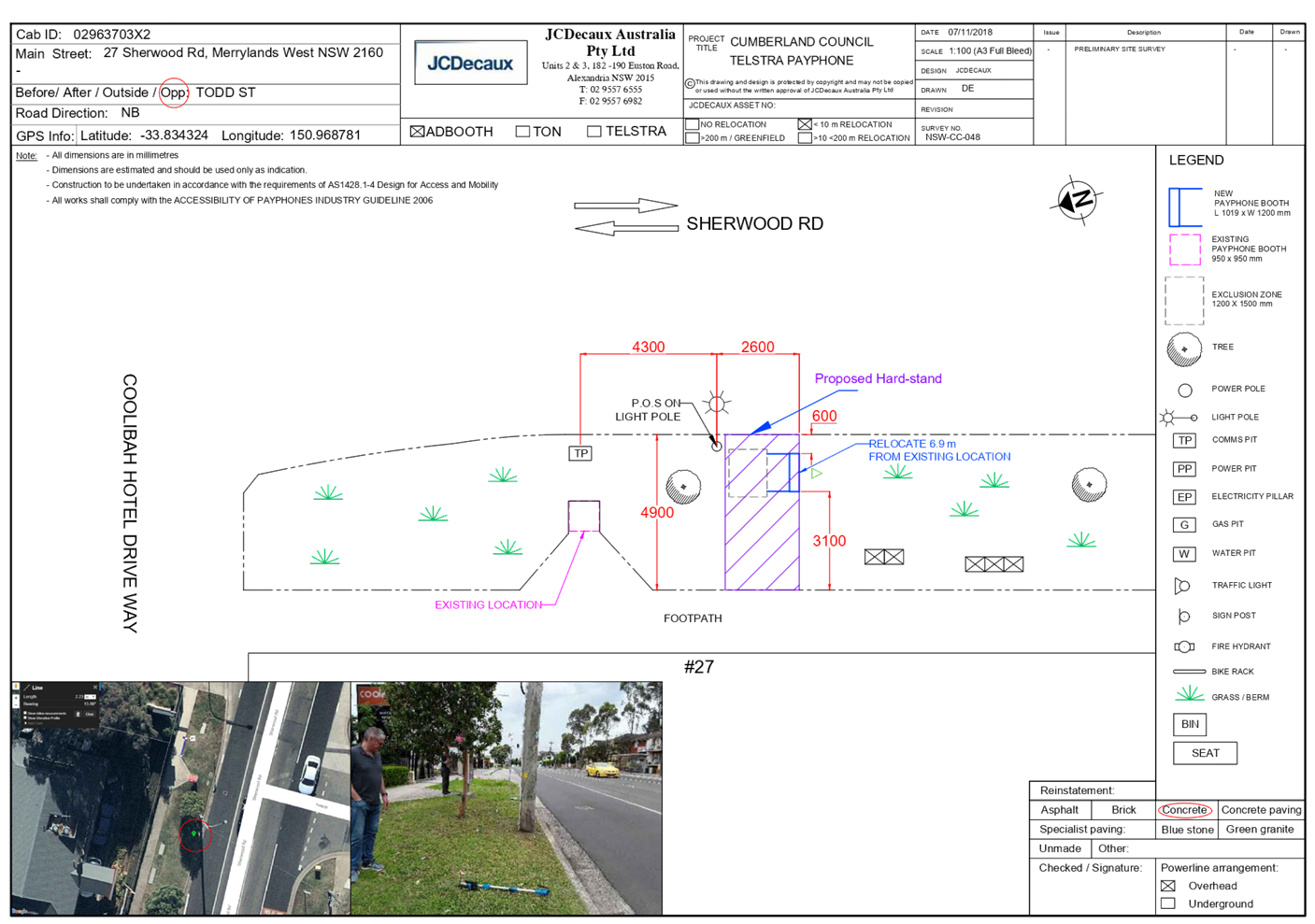
DOCUMENTS
ASSOCIATED WITH
REPORT LPP012/22
Attachment 3
Elevation Plan
Cumberland Local Planning Panel Meeting
9 March 2022
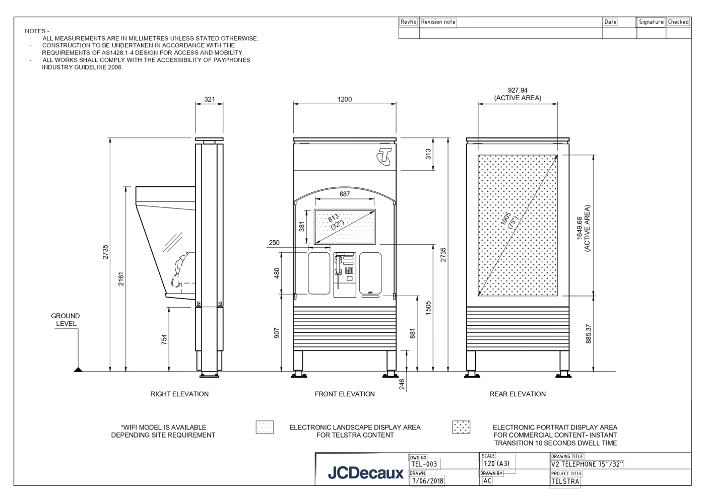
DOCUMENTS
ASSOCIATED WITH
REPORT LPP012/22
Attachment 4
NSW Telecommunications Facilities Guideline including
Broadband 2010
Cumberland Local Planning Panel Meeting
9 March 2022


DOCUMENTS
ASSOCIATED WITH
REPORT LPP012/22
Attachment 5
State Environmental Planning Policy No. 64 -
Advertising and Signage
Cumberland Local Planning Panel Meeting
9 March 2022
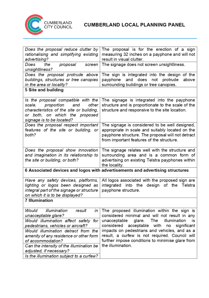
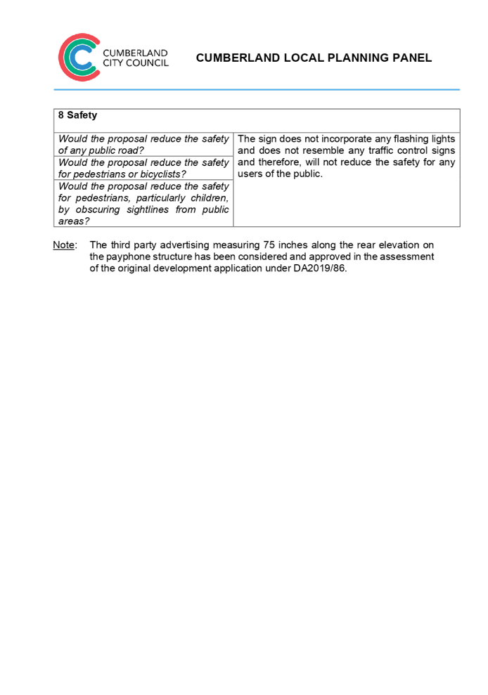
DOCUMENTS
ASSOCIATED WITH
REPORT LPP012/22
Attachment 6
Cumberland Local Environmental Plan 2021 -
Cumberland Local Planning Panel Meeting
9 March 2022
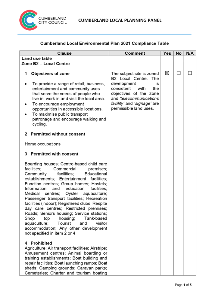
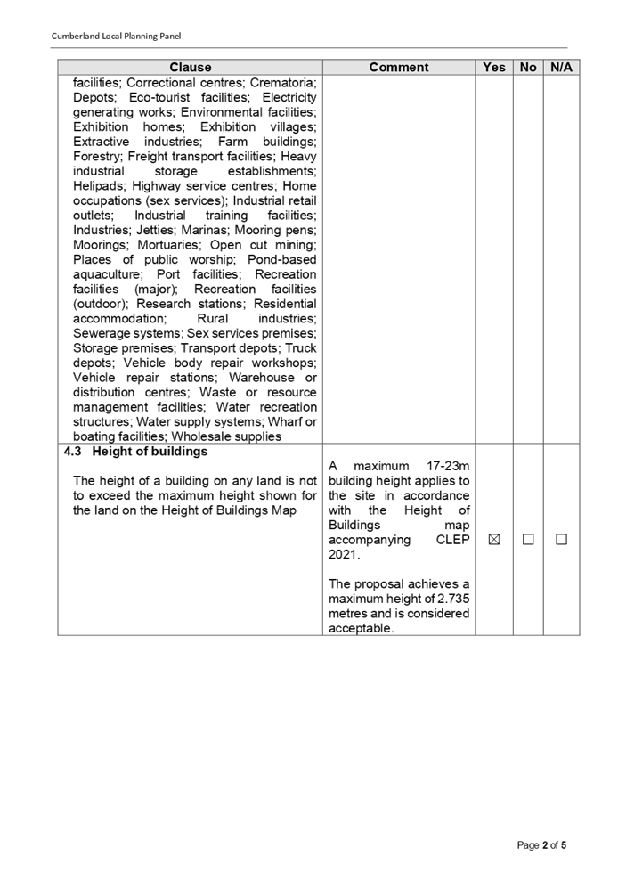

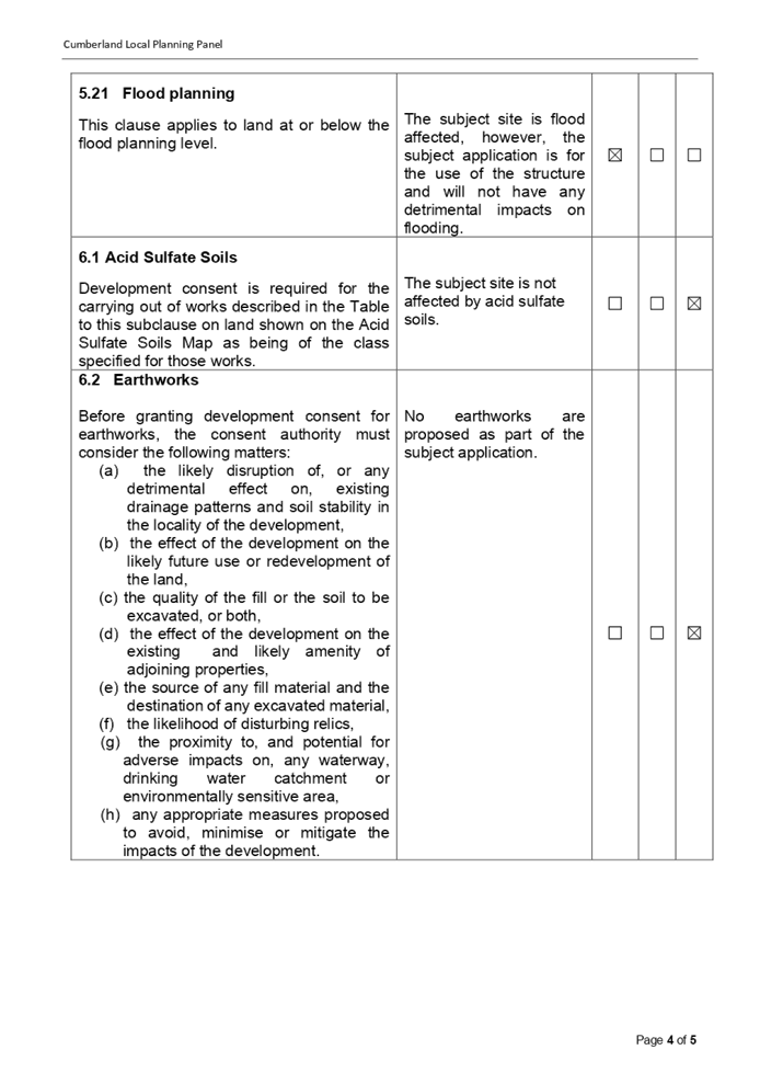
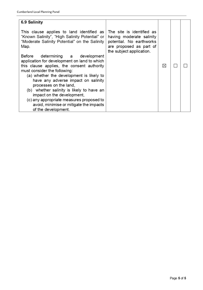
DOCUMENTS
ASSOCIATED WITH
REPORT LPP012/22
Attachment 7
Cumberland Development Control Plan 2021 -
Cumberland Local Planning Panel Meeting
9 March 2022


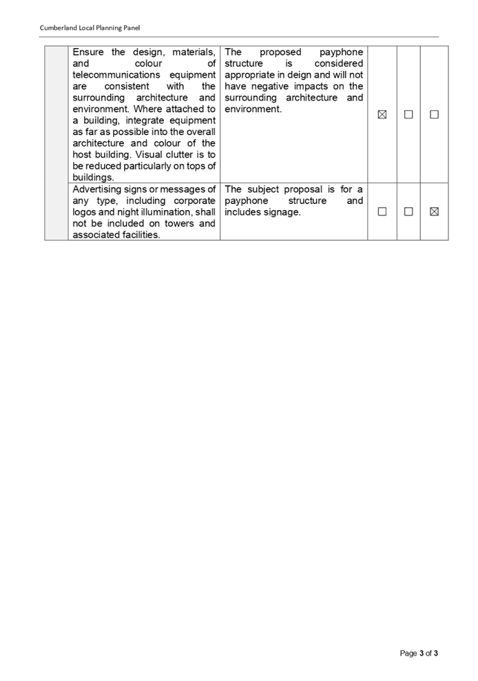
DOCUMENTS
ASSOCIATED WITH
REPORT LPP012/22
Attachment 8
Draft reasons for recommendation
Cumberland Local Planning Panel Meeting
9 March 2022

DOCUMENTS
ASSOCIATED WITH
REPORT LPP012/22
Attachment 9
Assessment Report
Cumberland Local Planning Panel Meeting
9 March 2022
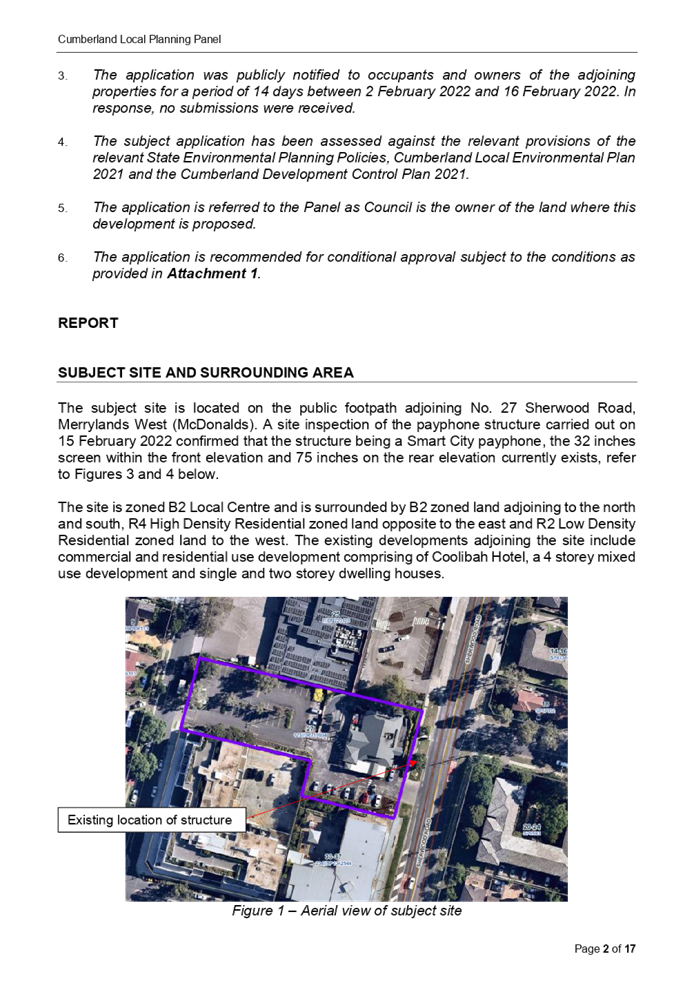
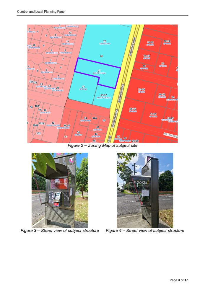
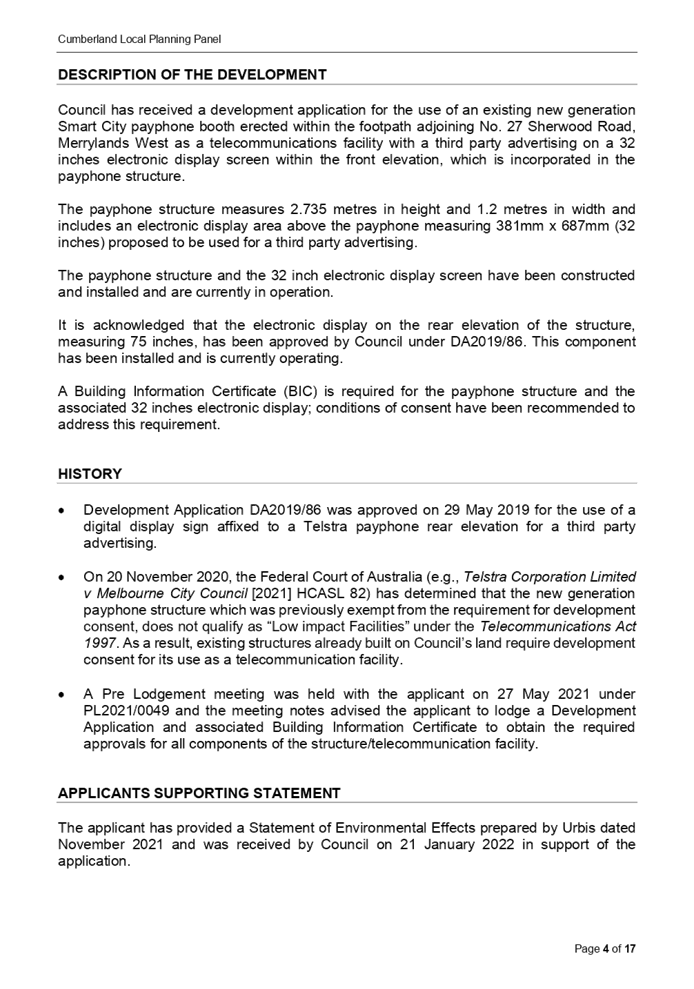
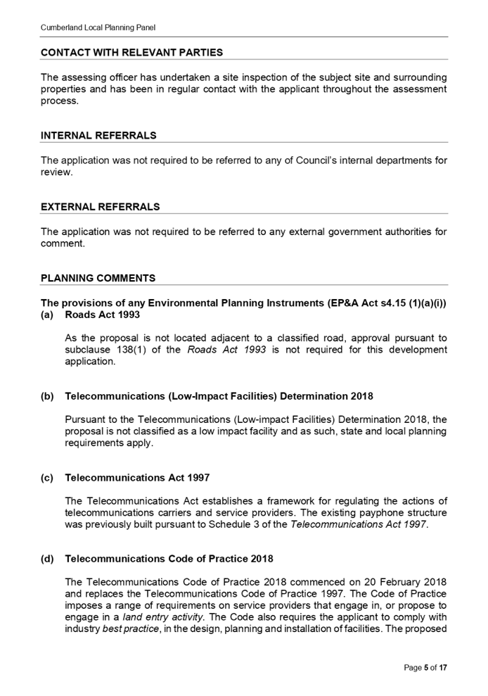
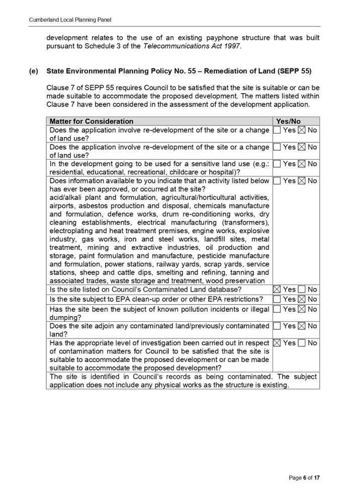
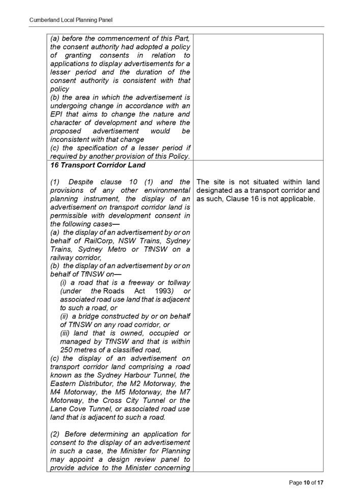
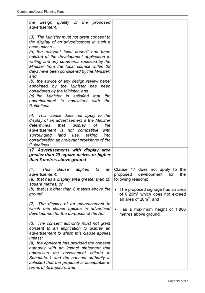
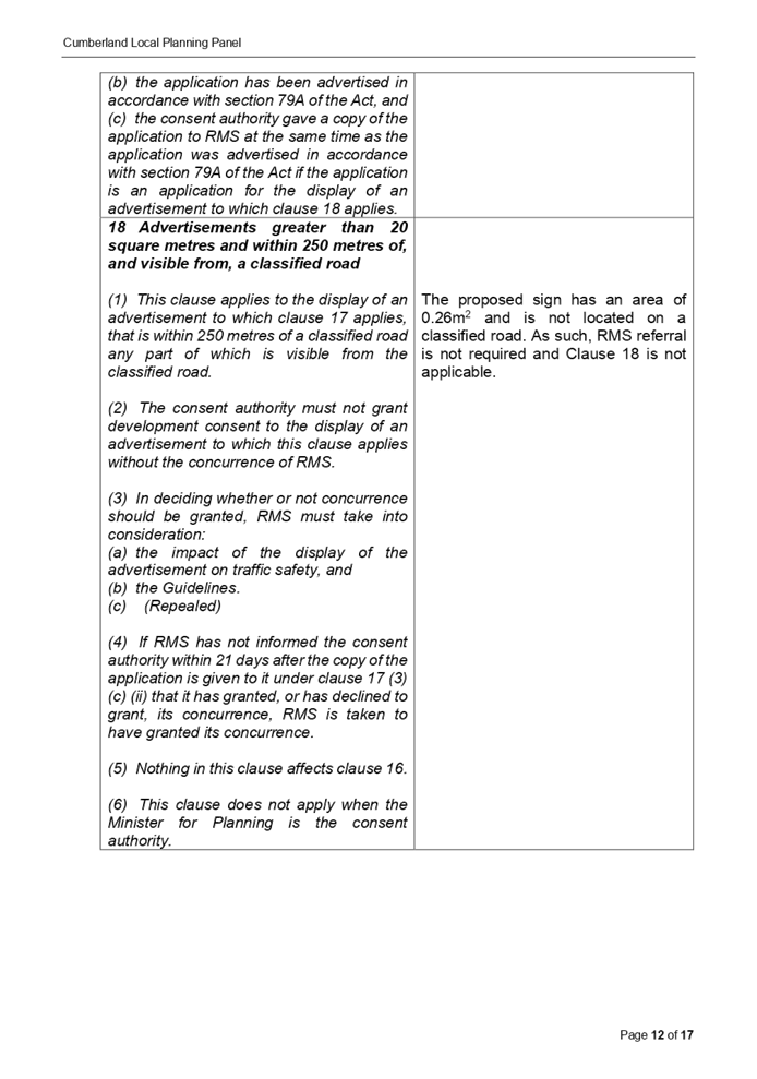
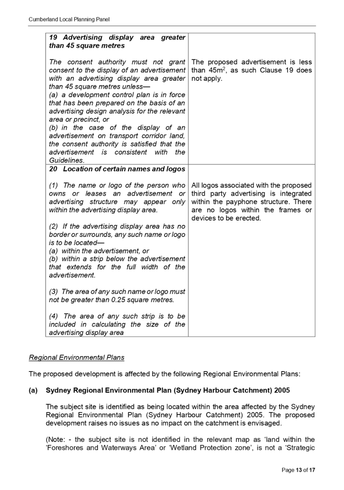
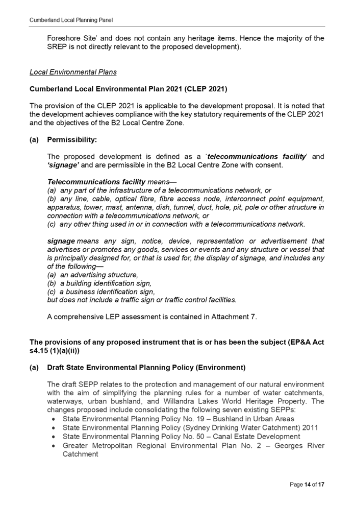


Cumberland
Local Planning Panel Meeting
9 March 2022
Item No: LPP013/22
Development
Appliccation for 60 Railway Street Lidcombe
Responsible
Division: Environment
& Planning
Officer: Executive
Manager Development and Building
File
Number: DA2022/0011
|
\Application
accepted
|
21 January 2022
|
|
Applicant
|
Urbis Pty Ltd
|
|
Owner
|
Cumberland City Council
|
|
Application
No.
|
DA2022/0011
|
|
Description
of Land
|
Land adjacent to 60 Railway
Street, LIDCOMBE NSW 2141
|
|
Proposed
Development
|
Use of the land as a
telecommunications facility with third party advertising on a 32 inch
electronic display screen incorporated in the payphone structure on the
public footpath adjacent to 60 Railway Street, LIDCOMBE NSW 2141
|
|
Zoning
|
B4 – Mixed Use Zone
|
|
Disclosure
of political donations and gifts
|
Nil disclosure
|
|
Heritage
|
The subject site does not
contain a heritage item and is not located within a Heritage Conservation
Area.
|
|
Principal
Development Standards
|
Permissible:
Floor Space Ratio – 5:1
(CLEP 2021)
The proposal is for the use of
a telecommunication facility located on the public footpath and no GFA
applicable in this instance.
Permissible:
Height of Buildings –
55m (CLEP 2021)
Proposed: 2.735m
|
1. On,
20 November 2020, Federal Court of Australia has determined that the new
generation Smart City payphone structure, which was previously exempt from the
requirement for development consent, does not qualify as being “Low
impact Facilities” under the Telecommunications Act 1997. As such, a
Development Application and associated Building Information Certificate are now
required for the use of the existing Telstra payphone structure at the subject
site.
2. Development
Application No. DA2022/0011 was accepted on 21 January 2022 for the use of the
telecommunications facility with a third party advertising on a 32 inches
electronic display screen incorporated in the payphone structure on the public
footpath adjacent to 60 Railway Street, LIDCOMBE NSW 2141.
3. The
application was publicly notified to occupants and owners of the adjoining
properties for a period of 14 days between 2 February 2022 and 16 February
2022. In response, no submissions were received.
4. The
subject application has been assessed against the relevant provisions of the
relevant State Environmental Planning Policies, Cumberland Local Environmental
Plan 2021 and the Cumberland Development Control Plan 2021.
5. The
application is referred to the Panel as Council is the owner of the land where
this development is proposed.
6. The
application is recommended for conditional approval subject to the conditions
as provided in Attachment 1.
Subject Site and surrounding
area
The subject
site is located on the public footpath adjoining No. 60 Railway Street,
Lidcombe. A site inspection of the payphone structure carried out on 15
February 2022 confirmed that the structure being a Smart City payphone, the 32
inches screen within the front elevation and 75 inches on the rear elevation
currently exists, refer to Figures 3 and 4 below.
The site is
zoned B4 Mixed Use and is surrounded by B4 Mixed Use zoned land. The existing
developments adjoining the site include commercial use development comprising
of retail tenancies and Lidcombe train station opposite to the north.
v)

vi)

Figure 1 –
Aerial view of subject site
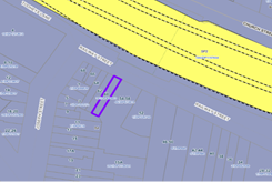
vii)
Figure 2 – Zoning Map of
subject site
|
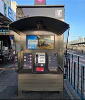
|
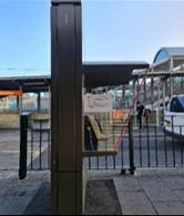
|
|
Figure 3 –
Street view of subject structure
|
Figure 4 –
Street view of subject structure
|
Description of the
development
Council has
received a development application for the use of an existing new generation
Smart City payphone booth erected within the footpath adjoining No. 60 Railway
Street, Lidcombe as a telecommunications facility with a third party
advertising on a 32 inches electronic display screen within the front
elevation, which is incorporated in the payphone structure.
The payphone
structure measures 2.735 metres in height and 1.2 metres in width and includes
an electronic display area above the payphone measuring 381mm x 687mm (32
inches) proposed to be used for a third party advertising.
The payphone
structure and the 32 inch electronic display screen have been constructed and
installed and are currently in operation.
It is
acknowledged that the electronic display on the rear elevation of the
structure, measuring 75 inches, has been approved by Council under DA2019/91.
This component has been installed and is currently operating.
A Building
Information Certificate (BIC) is required for the payphone structure and the
associated 32 inches electronic display; conditions of consent have been
recommended to address this requirement.
• Development
Application DA2019/91 was approved as a Deferred Commencement on 29 May 2019
for the use of a digital display sign affixed to a Telstra payphone rear
elevation for a third party advertising. Operative consent was issued on 29
January 2020.
• On
20 November 2020, the Federal Court of Australia (e.g., Telstra Corporation
Limited v Melbourne City Council [2021] HCASL 82) has determined that the new
generation payphone structure which was previously exempt from the requirement
for development consent, does not qualify as “Low impact
Facilities” under the Telecommunications Act 1997. As a result, existing
structures already built on Council’s land require development consent
for its use as a telecommunication facility.
• A
Pre Lodgement meeting was held with the applicant on 27 May 2021 under
PL2021/0049 and the meeting notes advised the applicant to lodge a Development
Application and associated Building Information Certificate to obtain the
required approvals for all components of the structure/telecommunication
facility.
Applicants Supporting
Statement
The
applicant has provided a Statement of Environmental Effects prepared by Urbis
dated November 2021 and was received by Council on 21 January 2022 in support
of the application.
CONTACT WITH RELEVANT PARTIES
The assessing officer has
undertaken a site inspection of the subject site and surrounding properties and
has been in regular contact with the applicant throughout the assessment
process.
INTERNAL REFERRALS
The application was not required
to be referred to any of Council’s internal departments for review.
EXTERNAL REFERRALS
The application was not required
to be referred to any external government authorities for comment.
PLANNING COMMENTS
The provisions of any
Environmental Planning Instruments (EP&A Act s4.15 (1)(a)(i))
(a) Roads
Act 1993
As the proposal is not located
adjacent to a classified road, approval pursuant to subclause 138(1) of the
Roads Act 1993 is not required for this development application.
(b) Telecommunications
(Low-Impact Facilities) Determination 2018
Pursuant to the
Telecommunications (Low-impact Facilities) Determination 2018, the proposal is
not classified as a low impact facility and as such, state and local planning
requirements apply.
(c) Telecommunications
Act 1997
The Telecommunications Act
establishes a framework for regulating the actions of telecommunications
carriers and service providers. The existing payphone structure was previously
built pursuant to Schedule 3 of the Telecommunications Act 1997.
(d) Telecommunications
Code of Practice 2018
The Telecommunications Code of
Practice 2018 commenced on 20 February 2018 and replaces the Telecommunications
Code of Practice 1997. The Code of Practice imposes a range of requirements on
service providers that engage in, or propose to engage in a land entry activity.
The Code also requires the applicant to comply with industry best practice, in
the design, planning and installation of facilities. The proposed development
relates to the use of an existing payphone structure that was built pursuant to
Schedule 3 of the Telecommunications Act 1997.
(a) State Environmental Planning Policy
(Infrastructure) 2007 (ISEPP)
The provisions of the
ISEPP 2007 have been considered in the assessment of the development
application.
Clause 115 –
Development permitted with consent
(1) Development
for the purposes of telecommunications facilities, other than development in
clause 114 or development that is exempt development under clause 20 or 116,
may be carried out by any person with consent on any land.
(3) Before
determining a development application for development to which this clause
applies, the consent authority must take into consideration any guidelines
concerning site selection, design, construction or operating principles for
telecommunications facilities that are issued by the Secretary for the purposes
of this clause and published in the Gazette.
Pursuant to clause 115(3)
of the ISEPP 2007, before determining the proposal, the consent authority must
take into consideration of any guidelines concerning the site selection,
design, construction and operation of telecommunication facilities. The
proposal was accompanied with the report of compliance to the principles of NSW
Telecommunications Facilities Guideline including Broadband 2010. These
principles are:
• Principle 1: A
Telecommunications facility is to be designed and sited to minimise
visual impact;
• Principle 2:
Telecommunications facilities should be co-located wherever practical;
• Principle 3:
Health standards for exposure to radio emissions will be met; and
• Principle 4:
Minimise disturbance and risk and maximise compliance.
These matters have been
considered as part of the assessment of this application and are considered
satisfactory. Refer to Attachment 4.
(g) State
Environmental Planning Policy No 64—Advertising and Signage
The proposed signage is
‘advertisement’ as defined under SEPP 64 as follows:
Advertisement means
signage to which Part 3 applies and includes any advertising structure for the
advertisement
The subject proposal is
subject to assessment under Part 3 of SEPP 64 and the guidelines included in
Schedule 1 of the Policy.
|
Clause
|
Comments
|
|
8 Granting of consent to
signage
A consent authority must not
grant development consent to an application to display signage unless the
consent authority is satisfied:
(a) that the signage is
consistent with the objectives of this Policy as set out in clause 3 (1) (a),
and
(b) that the signage the
subject of the application satisfies the assessment criteria specified in
Schedule 1.
|
Satisfactory. Assessment
of the proposal has concluded that the design of the proposed signage is
compatible with the character of the area which is predominantly for business
use. The location of the signage is considered suitable and will not
have any adverse impact on the amenity of the surrounding developments.
|
|
10 Prohibited
advertisements
(1) Despite the provisions of
any other environmental planning instrument, the display of an advertisement
is prohibited on land that is an environmentally sensitive area, heritage
area (excluding railway stations), natural or other conservation area, open space,
waterway, residential (but not a mixed residential and business zone or
similar zone), scenic protection area, national park, nature reserve
(2) This clause does not
apply to the following:
(a) The Mount Panorama
Precinct.
(b) The display of an advertisement
at a public sporting facility situated on land zoned public recreation under
an EPI being an advertisement that provides information about the sponsors of
the teams or organisations using the sporting facility or about the products
of those sponsors.
|
The site is not located on land
that is an environmentally sensitive area and is not located nearby to a
heritage conservation area.
|
|
12 Consent Authority
For the purposes of this
Policy, the consent authority is—
(a) the council of
a local government area in the case of an advertisement displayed in the
local government area (unless paragraph (c), (d) or (e) applies), or
(b) TfNSW in the
case of an advertisement displayed on a vessel, or
(c) the Minister
for Planning in the case of an advertisement displayed by or on behalf of
RailCorp, NSW Trains, Sydney Trains, Sydney Metro or TfNSW on a railway
corridor, or
(d) the Minister
for Planning in the case of an advertisement displayed by or on behalf of RMS
on—
(i) a
road that is a freeway or tollway (under the Roads Act 1993) or associated road use land that is adjacent to such a
road, or
(ii) a
bridge constructed by or on behalf of TfNSW on any road corridor, or
(iii) land
that is owned, occupied or managed by TfNSW, or
(e) the Minister
for Planning in the case of an advertisement displayed on transport corridor
land comprising a road known as the Sydney Harbour Tunnel, the Eastern
Distributor, the M2 Motorway, the M4 Motorway, the M5 Motorway, the M7
Motorway, the Cross City Tunnel or the Lane Cove Tunnel, or associated road
use land that is adjacent to such a road.
|
Council is considered the
consent authority for the subject proposal.
|
13 Matters for
consideration
(1) A consent
authority (other than in a case to which subclause (2) applies) must not
grant consent to an application to display an advertisement to which this
Policy applies unless the advertisement or the advertising structure, as the
case requires:
(a) is consistent
with the objectives of this Policy as set out in clause 3 (1) (a), and
(b) has been
assessed by the consent authority in accordance with the assessment criteria
in Schedule 1 and the consent authority is satisfied that the proposal is
acceptable in terms of its impacts, and
(c) satisfies any
other relevant requirements of this Policy.
|
The proposed signage is
considered to be in a suitable location and will have acceptable impacts on
the local area.
The development application is
limited to the use of the existing sign on the payphone for third party
advertising. The third party advertising will be displayed on a screen that
is part of a public payphone operated by Telstra. The subject site is located
on the pedestrian footpath and will not have any detrimental impacts on the
traffic flows within the locality.
|
|
14 Duration of Consents
(1) A consent granted under
this part ceases to be in force:
(a) on the expiration of 15
years after the date on which the consent becomes effective and operates
(b) if a lesser period is
specified by the consent authority, that lesser period
(2) The consent authority may
specify a period less than 15 years only if:
(a) before the commencement
of this Part, the consent authority had adopted a policy of granting consents
in relation to applications to display advertisements for a lesser period and
the duration of the consent authority is consistent with that policy
(b) the area in which the
advertisement is undergoing change in accordance with an EPI that aims to
change the nature and character of development and where the proposed
advertisement would be inconsistent with that change
(c) the specification of a
lesser period if required by another provision of this Policy.
|
Council will impose a condition
restricting the consent to a period of fifteen (15) years.
|
|
16 Transport Corridor Land
(1) Despite clause 10
(1) and the provisions of any other environmental planning instrument, the
display of an advertisement on transport corridor land is permissible with
development consent in the following cases—
(a) the display of
an advertisement by or on behalf of RailCorp, NSW Trains, Sydney Trains,
Sydney Metro or TfNSW on a railway corridor,
(b) the display of
an advertisement by or on behalf of TfNSW on—
(i) a
road that is a freeway or tollway (under the Roads Act 1993) or associated road use land that is adjacent to such a
road, or
(ii) a
bridge constructed by or on behalf of TfNSW on any road corridor, or
(iii) land
that is owned, occupied or managed by TfNSW and that is within 250 metres of
a classified road,
(c) the display of
an advertisement on transport corridor land comprising a road known as the
Sydney Harbour Tunnel, the Eastern Distributor, the M2 Motorway, the M4
Motorway, the M5 Motorway, the M7 Motorway, the Cross City Tunnel or the Lane
Cove Tunnel, or associated road use land that is adjacent to such a road.
(2) Before determining
an application for consent to the display of an advertisement in such a case,
the Minister for Planning may appoint a design review panel to provide advice
to the Minister concerning the design quality of the proposed advertisement.
(3) The Minister must
not grant consent to the display of an advertisement in such a case
unless—
(a) the relevant
local council has been notified of the development application in writing and
any comments received by the Minister from the local council within 28 days
have been considered by the Minister, and
(b) the advice of
any design review panel appointed by the Minister has been considered by the
Minister, and
(c) the Minister
is satisfied that the advertisement is consistent with the Guidelines.
(4) This clause does
not apply to the display of an advertisement if the Minister determines that
display of the advertisement is not compatible with surrounding land use,
taking into consideration any relevant provisions of the Guidelines.
|
The site is not situated within
land designated as a transport corridor and as such, Clause 16 is not
applicable.
|
|
17 Advertisements with display area
greater than 20 square metres or higher than 8 metres above ground
(1) This clause applies
to an advertisement:
(a) that has a
display area greater than 20 square metres, or
(b) that is higher
than 8 metres above the ground.
(2) The display of an
advertisement to which this clause applies is advertised development for the purposes
of the Act.
(3) The consent
authority must not grant consent to an application to display an
advertisement to which this clause applies unless:
(a) the applicant
has provided the consent authority with an impact statement that addresses
the assessment criteria in Schedule 1 and the consent authority is satisfied
that the proposal is acceptable in terms of its impacts, and
(b) the
application has been advertised in accordance with section 79A of the Act,
and
(c) the consent
authority gave a copy of the application to RMS at the same time as the
application was advertised in accordance with section 79A of the Act if the
application is an application for the display of an advertisement to which
clause 18 applies.
|
Clause 17 does not apply to the
proposed development for the following reasons:
· The proposed signage has an area of 0.26m2
which does not exceed an area of 20m2; and
· Has a maximum height of 1.886 metres above ground.
|
18 Advertisements
greater than 20 square metres and within 250 metres of, and visible from, a
classified road
(1) This clause applies
to the display of an advertisement to which clause 17 applies, that is within
250 metres of a classified road any part of which is visible from the
classified road.
(2) The consent
authority must not grant development consent to the display of an
advertisement to which this clause applies without the concurrence of RMS.
(3) In deciding whether
or not concurrence should be granted, RMS must take into consideration:
(a) the impact of
the display of the advertisement on traffic safety, and
(b) the
Guidelines.
(c) (Repealed)
(4) If RMS has not
informed the consent authority within 21 days after the copy of the
application is given to it under clause 17 (3) (c) (ii) that it has granted,
or has declined to grant, its concurrence, RMS is taken to have granted its
concurrence.
(5) Nothing in this
clause affects clause 16.
(6) This clause does
not apply when the Minister for Planning is the consent authority.
|
The proposed sign has an area of
0.26m2 and is not located on a classified road. As such, RMS
referral is not required and Clause 18 is not applicable.
|
|
19 Advertising display area greater
than 45 square metres
The consent authority must
not grant consent to the display of an advertisement with an advertising
display area greater than 45 square metres unless—
(a) a development
control plan is in force that has been prepared on the basis of an
advertising design analysis for the relevant area or precinct, or
(b) in the case of
the display of an advertisement on transport corridor land, the consent
authority is satisfied that the advertisement is consistent with the
Guidelines.
|
The proposed advertisement is
less than 45m2, as such Clause 19 does not apply.
|
|
20 Location
of certain names and logos
(1) The name or logo of
the person who owns or leases an advertisement or advertising structure may
appear only within the advertising display area.
(2) If the advertising
display area has no border or surrounds, any such name or logo is to be
located—
(a) within the
advertisement, or
(b) within a strip
below the advertisement that extends for the full width of the advertisement.
(3) The area of any
such name or logo must not be greater than 0.25 square metres.
(4) The area of any
such strip is to be included in calculating the size of the advertising
display area
|
All logos associated with the
proposed third party advertising is integrated within the payphone structure.
There are no logos within the frames or devices to be erected.
|
ENVIRONMENTAL
PLANNING INSTRUMENTS (EPIs)
The proposed development
is affected by the following consolidated State Environmental Planning Policies
that came into effect on 1 March 2022. No savings provision is indicated within
the new SEPPs, as no policy changes have been made. The SEPP consolidation does
not change the legal effect of the existing SEPPs, with section 30A of the
Interpretation Act 1987 applying to the transferred provisions. In this regard,
the following matters have been incorporated in the planning assessment of the
proposed development under s4.15 of the Environmental Planning and Assessment
Act 1979.
|
State Environmental
Planning Policies (SEPPs)
|
Relevant
Clause(s)
|
Compliance
with Requirements
|
|
· State
Environmental Planning Policy (Biodiversity and Conservation) 2021
|
Chapter 2 -Vegetation in
non-Rural Areas.
|
The development application
does not seek to remove any significant trees, which hold any biodiversity or
ecological values, on the site. The proposal does not trigger the provisions
of Chapter 2.
|
·
Chapter 6 - Bushland in Urban Areas. |
The proposal does not involve the disturbance of any
bushland zoned or reserved for public open space.
|
·
Chapter 10 - Sydney Harbour
Catchment. |
The proposed development raises no issues as no impact on
the catchment is envisaged.
(Note: - the subject site is not identified in the
relevant map as ‘land within the ‘Foreshores and Waterways
Area’ or ‘Wetland Protection zone’, is not a
‘Strategic Foreshore Site’ and does not contain any heritage
items. Hence the majority of the State Policy is not directly relevant to the
proposed development).
|
|
· State
Environmental Planning Policy (Resilience and Hazards) 2021
|
Chapter 2 - Coastal
Management.
|
The subject site is not
identified as a coastal wetland nor is it a land identified as in
“proximity area for coastal wetlands”.
|
·
Chapter 4 - Remediation of Land. |
The
site is not identified in Council’s records as being contaminated. A
site inspection reveals the site does not have any obvious history of a
previous land use that may have caused contamination and there is no specific
evidence that indicates the site is contaminated. Further to that, no
physical works are proposed as part of this application, as the structure is
existing.
|
|
· State
Environmental Planning Policy (Transport and Infrastructure) 2021
|
Chapter 2 - Infrastructure
|
The proposed use of land as a telecommunication
facility been considered under the provisions and determined as being
acceptable for approval.
|
|
· State
Environmental Planning Policy (Industry and Employment) 2021
|
Chapter 3 - Advertising and
Signage.
|
The signs the subject of the development
application have been considered under the provisions and determined as being
acceptable for approval.
|
Local Environmental
Plans
Cumberland Local
Environmental Plan 2021 (CLEP 2021)
The provision of the
CLEP 2021 is applicable to the development proposal. It is noted that the
development achieves compliance with the key statutory requirements of the CLEP
2021 and the objectives of the B4 Mixed Use Zone.
(a) Permissibility:
The proposed development
is defined as a ‘telecommunications facility’ and ‘signage’
and are permissible in the B4 Mixed Use Zone with consent.
Telecommunications
facility means—
(a) any
part of the infrastructure of a telecommunications network, or
(b) any
line, cable, optical fibre, fibre access node, interconnect point equipment,
apparatus, tower, mast, antenna, dish, tunnel, duct, hole, pit, pole or
other structure in connection with a telecommunications network, or
(c) any
other thing used in or in connection with a telecommunications network.
signage means any sign, notice, device, representation
or advertisement that advertises or promotes any goods, services or events and
any structure or vessel that is principally designed for, or that is used for,
the display of signage, and includes any of the following—
(a) an
advertising structure,
(b) a
building identification sign,
(c) a
business identification sign, but does not include a traffic sign or traffic
control
facilities.
A comprehensive LEP
assessment is contained in Attachment 7.
The provisions of any
proposed instrument that is or has been the subject (EP&A Act s4.15
(1)(a)(ii))
The provisions of any
Development Control Plans (EP&A Act s4.15 (1)(a)(iii))
The Cumberland DCP 2021
provides guidance for the design and operation of development to achieve the
aims and objectives of the Cumberland LEP 2021.
A comprehensive
assessment and compliance table is contained in Attachment 8.
The proposed development
complies with the provisions of the Cumberland DCP 2021 and is considered
acceptable from an environmental planning viewpoint.
The provisions of any
planning agreement that has been entered into under section 7.4, or any draft
planning agreement that a developer has offered to enter into under section 7.4
(EP&A Act s4.15(1)(a)(iiia))
There is no draft
planning agreement associated with the subject Development Application.
The provisions of the
Regulations (EP&A Act s4.15 (1)(a)(iv))
The proposed development
raises no concerns as to the relevant matters arising from the Environmental
Planning and Assessment Regulations 2000 (EP&A Reg).
The Likely
Environmental, Social or Economic Impacts (EP&A Act s4.15 (1)(b))
It is considered that
the proposed development will have no significant adverse environmental, social
or economic impacts in the locality.
The suitability of
the site for the development (EP&A Act s4.15 (1)(c))
The subject site and
locality is not known to be affected by any natural hazards or other site constraints
likely to have a significant adverse impact on the proposed development.
Accordingly, it is considered that the development is suitable in the context
of the site and surrounding locality.
Submissions made in
accordance with the Act or Regulation (EP&A Act s4.15 (1)) )(d))
|
Advertised (Council Website)
|
Mail
|
Sign
|
Not Required
|
In
accordance with Council’s Notification requirements contained within the
Cumberland DCP 2021, the proposal was publicly notified for a period of
14 days between 2 February 2022 and 16 February 2022. No submissions were
received in respect of the proposed development.
The public interest (EP&A
Act s4.15(1)(e))
In view of the foregoing analysis
it is considered that the development, if carried out subject to the conditions
set out in the recommendation below, will have no significant adverse impacts
on the public interest.
CUMBERLAND LOCAL INFRASTRUCTURE CONTRIBUTIONS
PLAN 2020
The development would not require
the payment of contributions in accordance with Cumberland Local Infrastructure
Contributions Plan 2020.
Disclosure of Political Donations and Gifts
The
applicant and notification process did not result in any disclosure of
Political Donations and Gifts.
The development application has been assessed in accordance
with the relevant requirements of the Environmental Planning and Assessment Act
1979, Environmental Planning and Assessment Regulation 2000, Roads Act 1993,
Telecommunications Act 1997, State Environmental Planning Policy (Biodiversity
and Conservation) 2021, State Environmental Planning Policy (Resilience and
Hazards) 2021, State Environmental Planning Policy (Transport and
Infrastructure) 2021, State Environmental Planning Policy (Industry and
Employment) 2021,Cumberland LEP 2021 and Cumberland DCP 2021 and is considered
to be satisfactory for approval, subject to conditions.
|
That Development Application No. DA2022/0011 for the use of the land as a
telecommunications facility with third party advertising on a 32 inch
electronic display screen incorporated in the payphone structure on the
public footpath adjacent to 60 Railway Street, LIDCOMBE NSW 2141 be Approved
subject to attached conditions.
|
1. Draft Notice
of Determination
2. Site
Plan
3. Elevation
Plan
4. NSW
Telecommunications Faculties Guideline Including Broadband 2010
5. State
Environmental Planning Policy No. 6 - Advertising and Signage
6. Cumberland
Local Environmental Plan 2021
7. Cumberland
Development Control Plan 2021 Compliance Table
8. Draft
Reasons for recommendation
DOCUMENTS
ASSOCIATED WITH
REPORT LPP013/22
Attachment 1
Draft Notice of Determination
Cumberland Local Planning Panel Meeting
9 March 2022


DOCUMENTS
ASSOCIATED WITH
REPORT LPP013/22
Attachment 2
Site Plan
Cumberland Local Planning Panel Meeting
9 March 2022
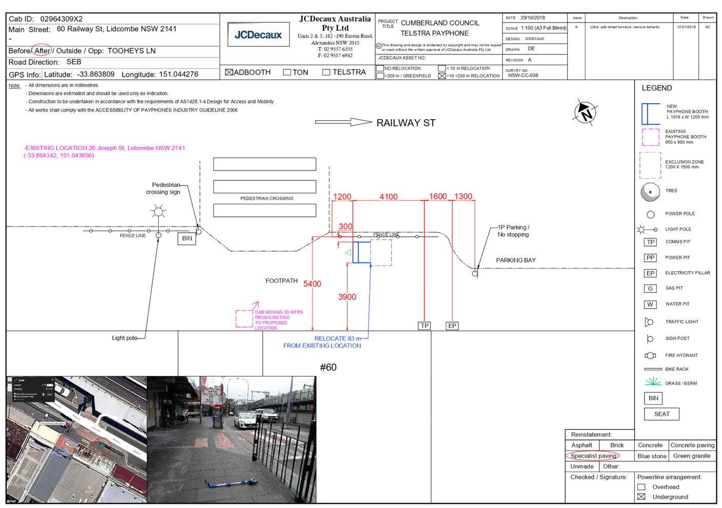
DOCUMENTS
ASSOCIATED WITH
REPORT LPP013/22
Attachment 3
Elevation Plan
Cumberland Local Planning Panel Meeting
9 March 2022
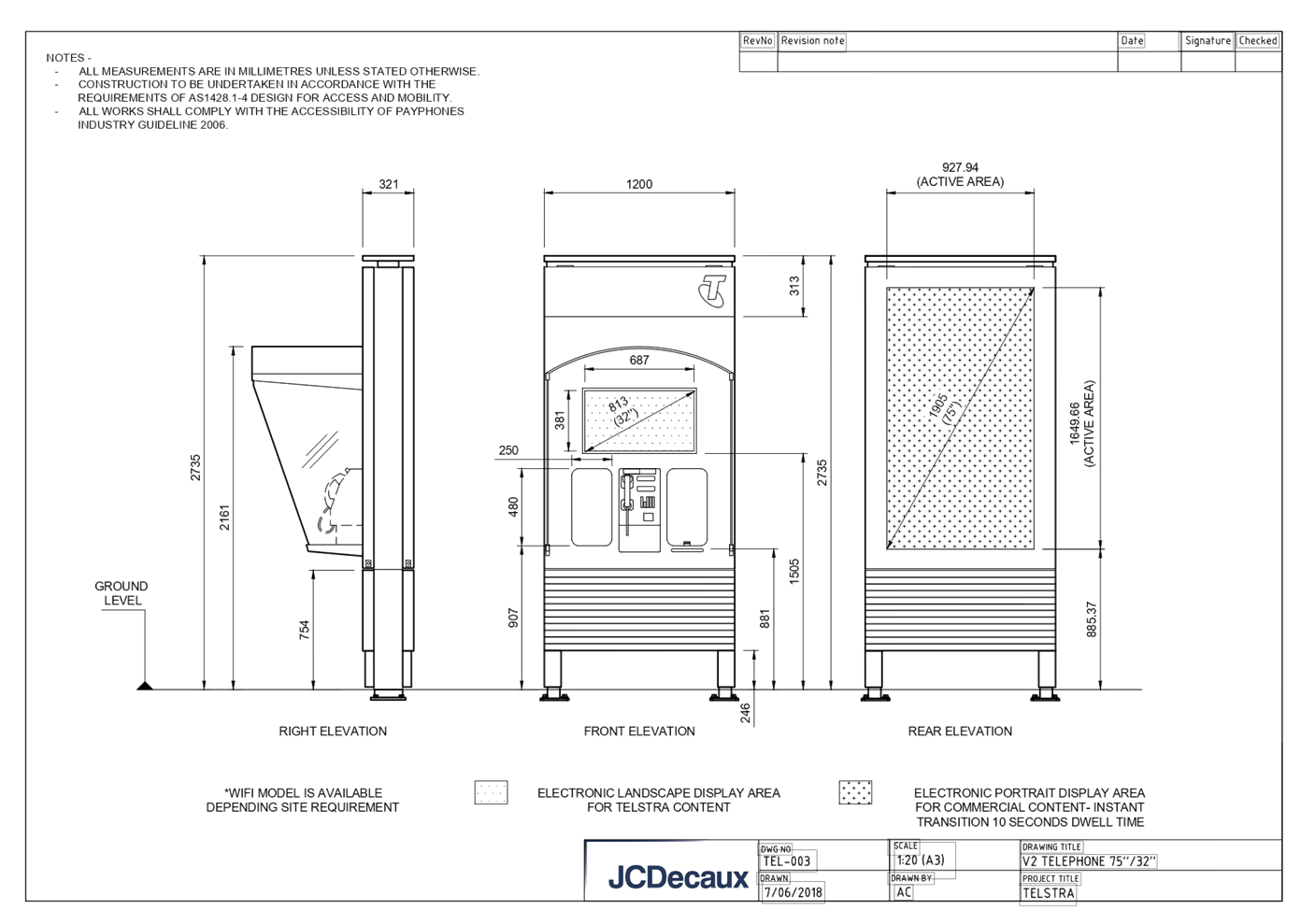
DOCUMENTS
ASSOCIATED WITH
REPORT LPP013/22
Attachment 4
NSW Telecommunications Faculties Guideline Including Broadband
2010
Cumberland Local Planning Panel Meeting
9 March 2022

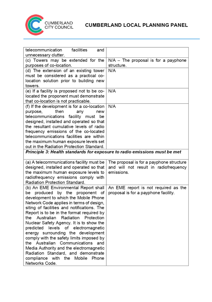

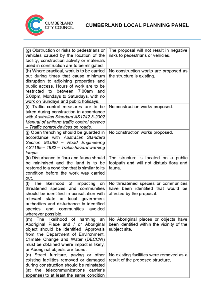
DOCUMENTS
ASSOCIATED WITH
REPORT LPP013/22
Attachment 5
State Environmental Planning Policy No. 6 -
Advertising and Signage
Cumberland Local Planning Panel Meeting
9 March 2022
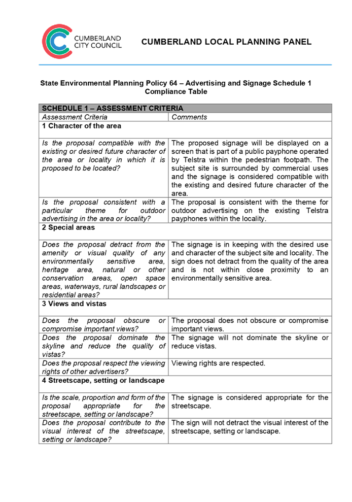
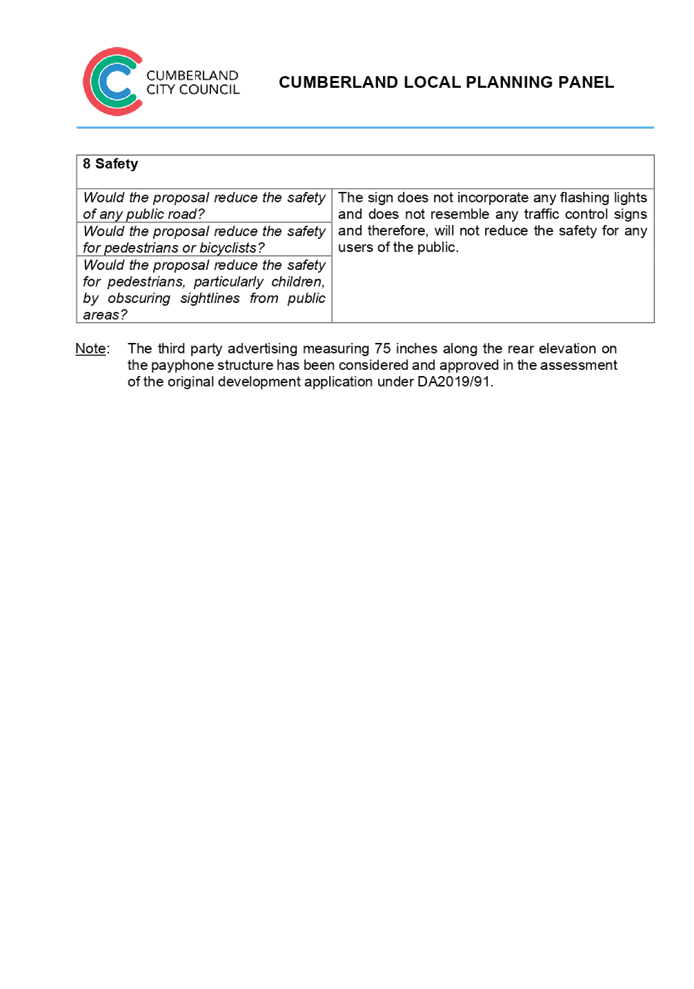
DOCUMENTS
ASSOCIATED WITH
REPORT LPP013/22
Attachment 6
Cumberland Local Environmental Plan 2021
Cumberland Local Planning Panel Meeting
9 March 2022
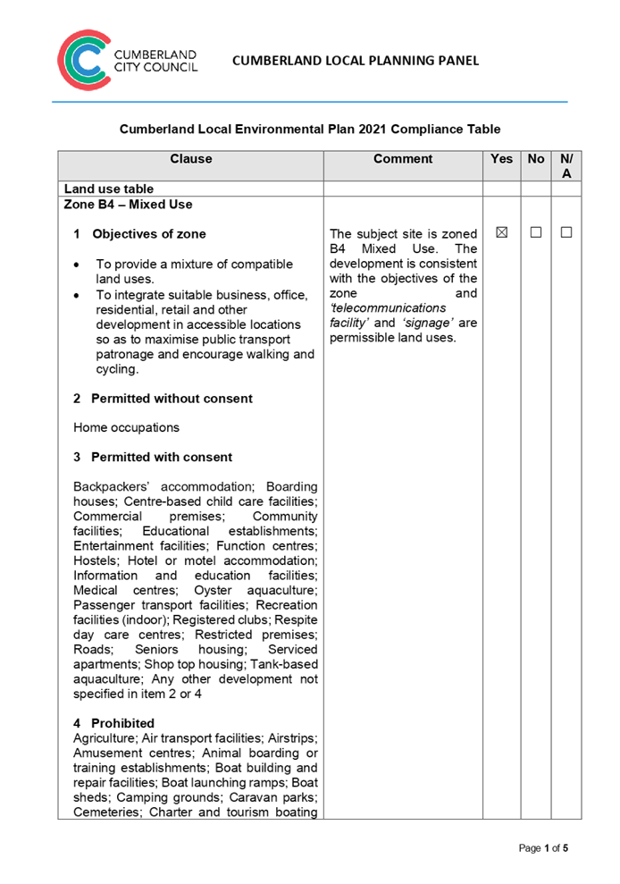
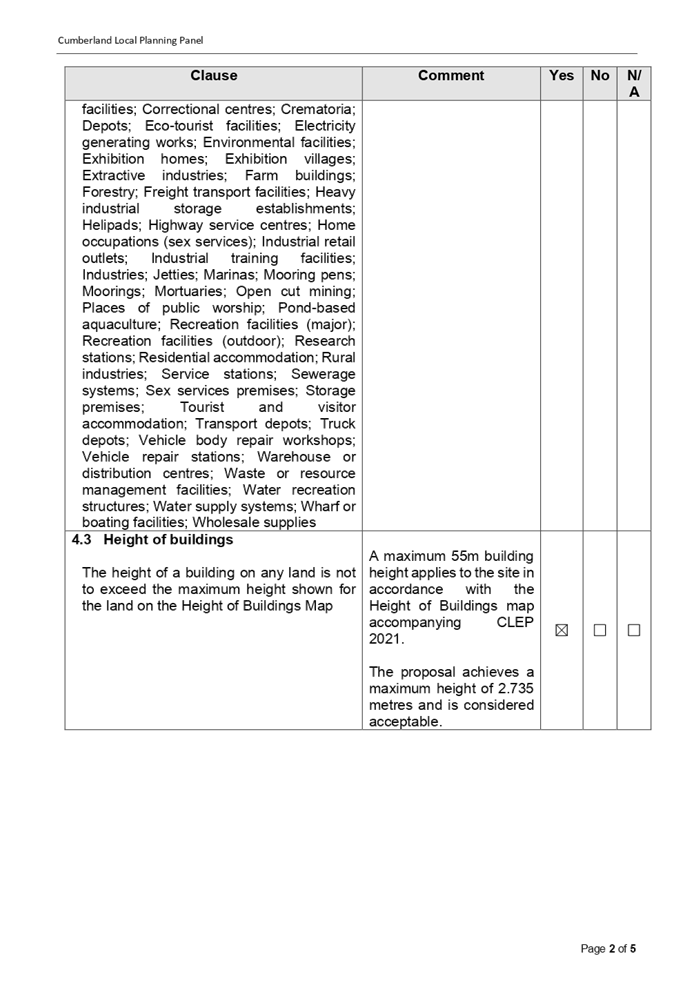
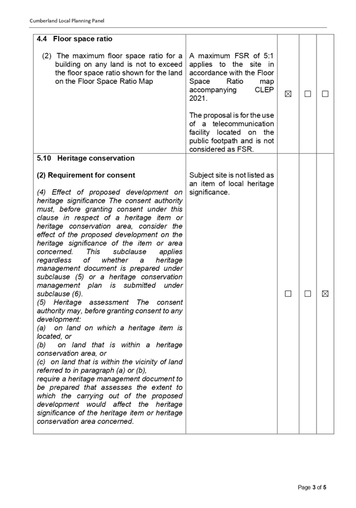
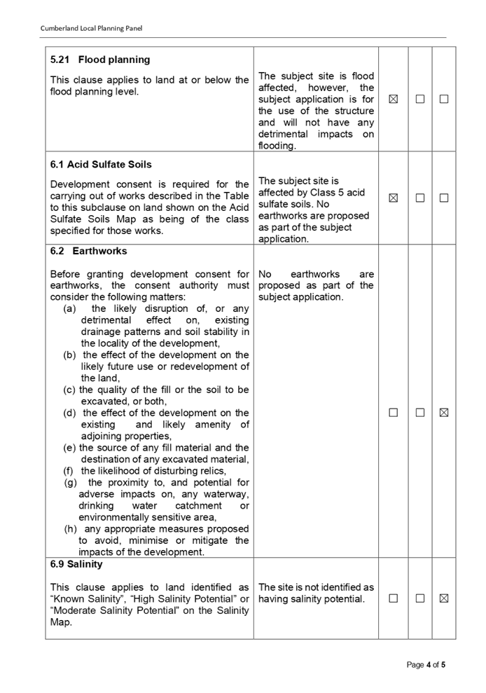

DOCUMENTS
ASSOCIATED WITH
REPORT LPP013/22
Attachment 7
Cumberland Development Control Plan 2021 Compliance
Table
Cumberland Local Planning Panel Meeting
9 March 2022


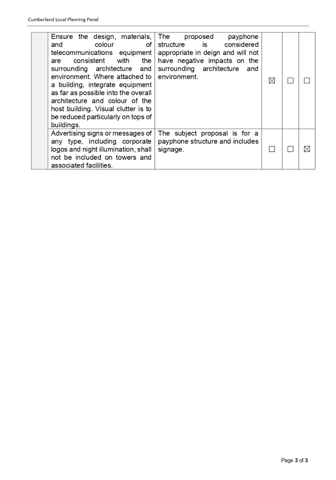
DOCUMENTS
ASSOCIATED WITH
REPORT LPP013/22
Attachment 8
Draft Reasons for recommendation
Cumberland Local Planning Panel Meeting
9 March 2022

Cumberland Local Planning Panel Meeting
9 March 2022
Item No: LPP014/22
Development
Application for Rawson St entrance of Auburn Railway Station Auburn
Responsible
Division: Environment
& Planning
Officer: Executive
Manager Development and Building
File
Number: DA2022/0012
|
Application
accepted
|
21 January 2022
|
|
Applicant
|
Urbis Pty Ltd
|
|
Owner
|
Cumberland City Council
|
|
Application
No.
|
DA2022/0012
|
|
Description
of Land
|
Land adjacent to Rawson Street
entrance of Auburn Railway Station, AUBURN NSW 2144
|
|
Proposed
Development
|
Use of the land as a telecommunications
facility with third party advertising on a 32 inch electronic display screen
incorporated in the payphone structure on the public footpath adjacent to the
Rawson Street entrance of Auburn Railway Station, AUBURN NSW 2144
|
|
Zoning
|
B4 – Mixed Use Zone
|
|
Disclosure
of political donations and gifts
|
Nil disclosure
|
|
Heritage
|
The subject site does not
contain a heritage item and is not located within a Heritage Conservation
Area.
|
|
Principal
Development Standards
|
Permissible:
Floor Space Ratio – 5:1
(CLEP 2021)
The proposal is for the use of
a telecommunication facility located on the public footpath and no GFA
applicable in this instance.
Permissible:
Height of Buildings –
55m (CLEP 2021)
Proposed: 2.735m
|
1. On,
20 November 2020, Federal Court of Australia has determined that the new
generation Smart City payphone structure, which was previously exempt from the
requirement for development consent, does not qualify as being “Low
impact Facilities” under the Telecommunications Act 1997. As such, a
Development Application and associated Building Information Certificate are now
required for the use of the existing Telstra payphone structure at the subject
site.
2. Development
Application No. DA2022/0012 was accepted on 21 January 2022 for the use of the
telecommunications facility with a third party advertising on a 32 inches
electronic display screen incorporated in the payphone structure on the public
footpath adjacent to the Rawson Street entrance of Auburn Railway Station,
AUBURN NSW 2144.
3. The
application was publicly notified to occupants and owners of the adjoining
properties for a period of 14 days between 2 February 2022 and 16 February
2022. In response, no submissions were received.
4. The
subject application has been assessed against the relevant provisions of the
relevant State Environmental Planning Policies, Cumberland Local Environmental
Plan 2021 and the Cumberland Development Control Plan 2021.
5. The
application is referred to the Panel as Council is the owner of the land where
this development is proposed.
6. The
application is recommended for conditional approval subject to the conditions
as provided in Attachment 1.
Subject Site and
surrounding area
The subject site is located on the public footpath adjoining
the Rawson Street entrance of Auburn Railway Station, Auburn. A site inspection
of the payphone structure carried out on 15 February 2022 confirmed that the
structure being a Smart City payphone, the 32 inches screen within the front
elevation and 75 inches on the rear elevation currently exists, refer to
Figures 3 and 4 below.
The site is zoned B4 Mixed Use and is surrounded by B4 Mixed
Use zoned land. The existing developments adjoining the site include commercial
use development comprising of retail tenancies and Auburn Railway Station.


Figure 1 – Aerial view of subject site

8.
Figure 2 – Zoning Map of subject site
description of the
development
Council has received a
development application for the use of an existing new generation Smart City
payphone booth erected within the footpath adjoining the Rawson Street entrance
of Auburn Railway Station, Auburn as a telecommunications facility with a third
party advertising on a 32 inches electronic display screen within the front
elevation, which is incorporated in the payphone structure.
The payphone structure measures
2.735 metres in height and 1.2 metres in width and includes an electronic
display area above the payphone measuring 381mm x 687mm (32 inches) proposed to
be used for a third party advertising.
The payphone structure and the
32 inch electronic display screen have been constructed and installed and are
currently in operation.
It is acknowledged that the
electronic display on the rear elevation of the structure, measuring 75 inches,
has been approved by Council under DA2019/82. This component has been installed
and is currently operating.
A Building Information
Certificate (BIC) is required for the payphone structure and the associated 32
inches electronic display; conditions of consent have been recommended to
address this requirement.
• Development
Application DA2019/82 was approved as a Deferred Commencement on 29 May 2019
for the use of a digital display sign affixed to a Telstra payphone rear
elevation for a third party advertising. Operative consent was issued on 30
January 2020.
• On 20 November
2020, the Federal Court of Australia (e.g., Telstra Corporation Limited v
Melbourne City Council [2021] HCASL 82) has determined that the new generation
payphone structure which was previously exempt from the requirement for
development consent, does not qualify as “Low impact Facilities”
under the Telecommunications Act 1997. As a result, existing structures already
built on Council’s land require development consent for its use as a
telecommunication facility.
• A Pre Lodgement
meeting was held with the applicant on 27 May 2021 under PL2021/0049 and the
meeting notes advised the applicant to lodge a Development Application and
associated Building Information Certificate to obtain the required approvals
for all components of the structure/telecommunication facility.
Applicants Supporting
Statement
The applicant has provided a Statement of Environmental
Effects prepared by Urbis dated November 2021 and was received by Council on 21
January 2022 in support of the application.
Contact with relevant
parties
The assessing officer has undertaken a site inspection
of the subject site and surrounding properties and has been in regular contact
with the applicant throughout the assessment process.
The development application was not required to be referred
to any of Council’s internal departments for review.
The development application was not required to be referred
to any external government authorities for comment.
The provisions of any Environmental Planning Instruments
(EP&A Act s4.15 (1)(a)(i))
(a) Roads Act 1993
As the proposal is not located
adjacent to a classified road, approval pursuant to subclause 138(1) of the Roads
Act 1993 is not required for this development application.
(b) Telecommunications
(Low-Impact Facilities) Determination 2018
Pursuant to the Telecommunications (Low-impact Facilities)
Determination 2018, the proposal is not classified as a low impact facility and
as such, state and local planning requirements apply.
(c) Telecommunications
Act 1997
The Telecommunications Act establishes a framework for
regulating the actions of telecommunications carriers and service providers.
The existing payphone structure was previously built pursuant to Schedule 3 of
the Telecommunications Act 1997.
(d) Telecommunications
Code of Practice 2018
The Telecommunications Code of Practice 2018 commenced on 20
February 2018 and replaces the Telecommunications Code of Practice 1997. The
Code of Practice imposes a range of requirements on service providers that
engage in, or propose to engage in a land entry activity. The Code also
requires the applicant to comply with industry best practice, in the
design, planning and installation of facilities. The proposed development
relates to the use of an existing payphone structure that was built pursuant to
Schedule 3 of the Telecommunications Act 1997.
(e) State Environmental Planning Policy
(Infrastructure) 2007 (ISEPP)
The provisions of the ISEPP 2007
have been considered in the assessment of the development application.
Clause 115 –
Development permitted with consent
• Development for the purposes
of telecommunications facilities, other than development in clause 114 or
development that is exempt development under clause 20 or 116, may be carried
out by any person with consent on any land.
• Before determining a development
application for development to which this clause applies, the consent authority
must take into consideration any guidelines concerning site selection, design,
construction or operating principles for telecommunications facilities that are
issued by the Secretary for the purposes of this clause and published in the
Gazette.
Pursuant to clause
115(3) of the ISEPP 2007, before determining the proposal, the consent
authority must take into consideration of any guidelines concerning the
site selection, design, construction and operation of telecommunication
facilities. The proposal was accompanied with the report of compliance to the
principles of NSW Telecommunications Facilities Guideline including Broadband
2010. These principles are:
• Principle
1: A Telecommunications facility is to be designed and sited to
minimise visual impact;
• Principle
2: Telecommunications facilities should be co-located wherever
practical;
• Principle
3: Health standards for exposure to radio emissions will be met; and
• Principle
4: Minimise disturbance and risk and maximise compliance.
These matters have been considered
as part of the assessment of this application and are considered satisfactory.
Refer to Attachment 4.
(f) State Environmental Planning Policy
No 64—Advertising and Signage
The proposed signage is ‘advertisement’
as defined under SEPP 64 as follows:
Advertisement means
signage to which Part 3 applies and includes any advertising structure for the
advertisement
The subject proposal is subject to
assessment under Part 3 of SEPP 64 and the guidelines included in Schedule 1 of
the Policy.
|
Clause
|
Comments
|
|
8 Granting of consent to signage
A consent authority must not
grant development consent to an application to display signage unless the
consent authority is satisfied:
(a) that the signage is consistent with the
objectives of this Policy as set out in clause 3 (1) (a), and
(b) that the signage the subject of the
application satisfies the assessment criteria specified in Schedule 1.
|
Satisfactory. Assessment
of the proposal has concluded that the design of the proposed signage is
compatible with the character of the area which is predominantly for business
use. The location of the signage is considered suitable and will not
have any adverse impact on the amenity of the surrounding developments.
|
|
10 Prohibited
advertisements
(1) Despite the provisions of
any other environmental planning instrument, the display of an advertisement
is prohibited on land that is an environmentally sensitive area, heritage
area (excluding railway stations), natural or other conservation area, open
space, waterway, residential (but not a mixed residential and business zone
or similar zone), scenic protection area, national park, nature reserve
(2) This clause does not
apply to the following:
(a) The Mount Panorama
Precinct.
(b) The display of an
advertisement at a public sporting facility situated on land zoned public
recreation under an EPI being an advertisement that provides information
about the sponsors of the teams or organisations using the sporting facility
or about the products of those sponsors.
|
The site is not located on land
that is an environmentally sensitive area and is not located nearby to a
heritage conservation area.
|
|
12 Consent Authority
For the purposes of this
Policy, the consent authority is—
(a) the council of
a local government area in the case of an advertisement displayed in the
local government area (unless paragraph (c), (d) or (e) applies), or
(b) TfNSW in the
case of an advertisement displayed on a vessel, or
(c) the Minister
for Planning in the case of an advertisement displayed by or on behalf of
RailCorp, NSW Trains, Sydney Trains, Sydney Metro or TfNSW on a railway
corridor, or
(d) the Minister
for Planning in the case of an advertisement displayed by or on behalf of RMS
on—
(i) a road that is
a freeway or tollway (under the Roads Act 1993) or associated road use land that is adjacent to such a
road, or
(ii) a bridge
constructed by or on behalf of TfNSW on any road corridor, or
(iii) land that is
owned, occupied or managed by TfNSW, or
(e) the Minister
for Planning in the case of an advertisement displayed on transport corridor
land comprising a road known as the Sydney Harbour Tunnel, the Eastern
Distributor, the M2 Motorway, the M4 Motorway, the M5 Motorway, the M7
Motorway, the Cross City Tunnel or the Lane Cove Tunnel, or associated road
use land that is adjacent to such a road.
|
Council is considered the
consent authority for the subject proposal.
|
13 Matters for
consideration
(1) A consent
authority (other than in a case to which subclause (2) applies) must not
grant consent to an application to display an advertisement to which this
Policy applies unless the advertisement or the advertising structure, as the
case requires:
(a) is consistent
with the objectives of this Policy as set out in clause 3 (1) (a), and
(b) has been
assessed by the consent authority in accordance with the assessment criteria
in Schedule 1 and the consent authority is satisfied that the proposal is acceptable
in terms of its impacts, and
(c) satisfies any
other relevant requirements of this Policy.
|
The proposed signage is
considered to be in a suitable location and will have acceptable impacts on
the local area.
The development application is
limited to the use of the existing sign on the payphone for third party
advertising. The third party advertising will be displayed on a screen that
is part of a public payphone operated by Telstra. The subject site is located
on the pedestrian footpath and will not have any detrimental impacts on the
traffic flows within the locality.
|
|
14 Duration of Consents
(1) A consent granted under
this part ceases to be in force:
(a) on the expiration of 15
years after the date on which the consent becomes effective and operates
(b) if a lesser period is
specified by the consent authority, that lesser period
(2) The consent authority may
specify a period less than 15 years only if:
(a) before the commencement
of this Part, the consent authority had adopted a policy of granting consents
in relation to applications to display advertisements for a lesser period and
the duration of the consent authority is consistent with that policy
(b) the area in which the
advertisement is undergoing change in accordance with an EPI that aims to
change the nature and character of development and where the proposed
advertisement would be inconsistent with that change
(c) the specification of a
lesser period if required by another provision of this Policy.
|
Council will impose a condition
restricting the consent to a period of fifteen (15) years.
|
|
16 Transport Corridor Land
(1) Despite clause 10
(1) and the provisions of any other environmental planning instrument, the
display of an advertisement on transport corridor land is permissible with
development consent in the following cases—
(a) the display of
an advertisement by or on behalf of RailCorp, NSW Trains, Sydney Trains,
Sydney Metro or TfNSW on a railway corridor,
(b) the display of
an advertisement by or on behalf of TfNSW on—
(i) a
road that is a freeway or tollway (under the Roads Act 1993) or associated road use land that is adjacent to such a
road, or
(ii) a
bridge constructed by or on behalf of TfNSW on any road corridor, or
(iii) land
that is owned, occupied or managed by TfNSW and that is within 250 metres of
a classified road,
(c) the display of
an advertisement on transport corridor land comprising a road known as the
Sydney Harbour Tunnel, the Eastern Distributor, the M2 Motorway, the M4
Motorway, the M5 Motorway, the M7 Motorway, the Cross City Tunnel or the Lane
Cove Tunnel, or associated road use land that is adjacent to such a road.
(2) Before determining
an application for consent to the display of an advertisement in such a case,
the Minister for Planning may appoint a design review panel to provide advice
to the Minister concerning the design quality of the proposed advertisement.
(3) The Minister must not
grant consent to the display of an advertisement in such a case unless—
(a) the relevant
local council has been notified of the development application in writing and
any comments received by the Minister from the local council within 28 days
have been considered by the Minister, and
(b) the advice of
any design review panel appointed by the Minister has been considered by the
Minister, and
(c) the Minister
is satisfied that the advertisement is consistent with the Guidelines.
(4) This clause does not
apply to the display of an advertisement if the Minister determines that
display of the advertisement is not compatible with surrounding land use,
taking into consideration any relevant provisions of the Guidelines.
|
The site is not situated within
land designated as a transport corridor and as such, Clause 16 is not
applicable.
|
|
17 Advertisements with display area
greater than 20 square metres or higher than 8 metres above ground
(1) This clause applies
to an advertisement:
(a) that has a display
area greater than 20 square metres, or
(b) that is higher
than 8 metres above the ground.
(2) The display of an
advertisement to which this clause applies is advertised development for the
purposes of the Act.
(3) The consent
authority must not grant consent to an application to display an
advertisement to which this clause applies unless:
(a) the applicant
has provided the consent authority with an impact statement that addresses
the assessment criteria in Schedule 1 and the consent authority is satisfied
that the proposal is acceptable in terms of its impacts, and
(b) the
application has been advertised in accordance with section 79A of the Act,
and
(c) the consent
authority gave a copy of the application to RMS at the same time as the application
was advertised in accordance with section 79A of the Act if the application
is an application for the display of an advertisement to which clause 18
applies.
|
Clause 17 does not apply to the
proposed development for the following reasons:
· The proposed signage has an area of 0.26m2
which does not exceed an area of 20m2; and
· Has a maximum height of 1.886 metres above ground.
|
18 Advertisements
greater than 20 square metres and within 250 metres of, and visible from, a
classified road
(1) This clause applies
to the display of an advertisement to which clause 17 applies, that is within
250 metres of a classified road any part of which is visible from the
classified road.
(2) The consent
authority must not grant development consent to the display of an
advertisement to which this clause applies without the concurrence of RMS.
(3) In deciding whether
or not concurrence should be granted, RMS must take into consideration:
(a) the impact of
the display of the advertisement on traffic safety, and
(b) the
Guidelines.
(c) (Repealed)
(4) If RMS has not
informed the consent authority within 21 days after the copy of the
application is given to it under clause 17 (3) (c) (ii) that it has granted,
or has declined to grant, its concurrence, RMS is taken to have granted its
concurrence.
(5) Nothing in this
clause affects clause 16.
(6) This clause does
not apply when the Minister for Planning is the consent authority.
|
The proposed sign has an area of
0.26m2 and is not located on a classified road. As such, RMS
referral is not required and Clause 18 is not applicable.
|
19 Advertising
display area greater than 45 square metres
The consent authority must
not grant consent to the display of an advertisement with an advertising
display area greater than 45 square metres unless—
(a) a development
control plan is in force that has been prepared on the basis of an
advertising design analysis for the relevant area or precinct, or
(b) in the case of
the display of an advertisement on transport corridor land, the consent
authority is satisfied that the advertisement is consistent with the
Guidelines.
|
The proposed advertisement is
less than 45m2, as such Clause 19 does not apply.
|
20 Location
of certain names and logos
(1) The name or logo of
the person who owns or leases an advertisement or advertising structure may
appear only within the advertising display area.
(2) If the advertising
display area has no border or surrounds, any such name or logo is to be
located—
(a) within the
advertisement, or
(b) within a strip
below the advertisement that extends for the full width of the advertisement.
(3) The area of any
such name or logo must not be greater than 0.25 square metres.
(4) The area of any
such strip is to be included in calculating the size of the advertising
display area
|
All logos associated with the
proposed third party advertising is integrated within the payphone structure.
There are no logos within the frames or devices to be erected.
|
ENVIRONMENTAL PLANNING
INSTRUMENTS (EPIs)
The proposed development is affected by the following
consolidated State Environmental Planning Policies that came into effect on 1
March 2022. No savings provision is indicated within the new SEPPs, as no
policy changes have been made. The SEPP consolidation does not change the legal
effect of the existing SEPPs, with section 30A of the Interpretation Act
1987 applying to the transferred provisions. In this regard, the following
matters have been incorporated in the planning assessment of the proposed development
under s4.15 of the Environmental
Planning and Assessment Act 1979.
Local Environmental Plans
Cumberland Local Environmental Plan 2021 (CLEP 2021)
The
provision of the CLEP 2021 is applicable to the development proposal. It is
noted that the development achieves compliance with the key statutory
requirements of the CLEP 2021 and the objectives of the B4 Mixed Use
Zone.
Permissibility:
The proposed development is
defined as a ‘telecommunications facility’ and ‘signage’
and are permissible in the B4 Mixed Use Zone with consent.
Telecommunications facility means—
(a) any part of the
infrastructure of a telecommunications network, or
(b) any line, cable,
optical fibre, fibre access node, interconnect point equipment, apparatus,
tower, mast, antenna, dish, tunnel, duct, hole, pit, pole or other structure in
connection with a telecommunications network, or
(c) any other thing
used in or in connection with a telecommunications network.
signage means
any sign, notice, device, representation or advertisement that advertises or
promotes any goods, services or events and any structure or vessel that is
principally designed for, or that is used for, the display of signage, and
includes any of the following—
(a) an advertising
structure,
(b) a building
identification sign,
(c) a business
identification sign,
but does not include a traffic
sign or traffic control facilities.
A comprehensive LEP assessment is
contained in Attachment 7.
The provisions of any proposed
instrument that is or has been the subject (EP&A Act s4.15 (1)(a)(ii))
N/A
The provisions of any Development Control Plans (EP&A
Act s4.15 (1)(a)(iii))
The
Cumberland DCP 2021 provides guidance for the design and operation of
development to achieve the aims and objectives of the Cumberland LEP 2021.
A
comprehensive assessment and compliance table is contained in Attachment
8.
The proposed development complies with the provisions of the
Cumberland DCP 2021 and is considered acceptable from an environmental planning
viewpoint.
The provisions of any planning agreement that has been
entered into under section 7.4, or any draft planning agreement that a
developer has offered to enter into under section 7.4 (EP&A Act
s4.15(1)(a)(iiia))
There is no draft planning agreement associated with the
subject Development Application.
The provisions of the Regulations (EP&A Act s4.15
(1)(a)(iv))
The proposed development raises no concerns as to the
relevant matters arising from the Environmental Planning and Assessment
Regulations 2000 (EP&A Reg).
The Likely Environmental, Social or Economic Impacts
(EP&A Act s4.15 (1)(b))
It is considered that the proposed development will have no
significant adverse environmental, social or economic impacts in the locality.
The suitability of the site for the development (EP&A
Act s4.15 (1)(c))
The subject site and locality is not known to be affected by
any natural hazards or other site constraints likely to have a significant
adverse impact on the proposed development. Accordingly, it is considered that
the development is suitable in the context of the site and surrounding
locality.
Submissions made in accordance with the Act or Regulation
(EP&A Act s4.15 (1)(d))
|
Advertised (Council Website)
|
Mail
|
Sign
|
Not Required
|
In accordance with
Council’s Notification requirements contained within the Cumberland DCP
2021, the proposal was publicly notified for a period of 14 days between 2
February 2022 and 16 February 2022. No submissions were received in respect of
the proposed development.
The public interest (EP&A Act s4.15(1)(e))
In view of the foregoing analysis it is considered that the
development, if carried out subject to the conditions set out in the
recommendation below, will have no significant adverse impacts on the public
interest.
CUMBERLAND LOCAL INFRASTRUCTURE CONTRIBUTIONS
PLAN 2020
The development would not require the payment of
contributions in accordance with Cumberland Local Infrastructure Contributions
Plan 2020.
Disclosure of Political Donations and Gifts
The applicant and notification process did not result in any
disclosure of Political Donations and Gifts.
The development application has been assessed in accordance
with the relevant requirements of the Environmental Planning and Assessment
Act 1979, Environmental Planning and Assessment
Regulation 2000, Roads Act 1993, Telecommunications Act 1997, State Environmental Planning Policy
(Biodiversity and Conservation) 2021, State Environmental Planning Policy
(Resilience and Hazards) 2021, State Environmental Planning Policy (Transport
and Infrastructure) 2021, State Environmental Planning Policy (Industry and
Employment) 2021,Cumberland LEP 2021 and Cumberland DCP 2021 and is
considered to be satisfactory for approval, subject to conditions.
|
That Development Application No. DA2022/0012 for the use of the land as a
telecommunications facility with third party advertising on a 32 inch
electronic display screen incorporated in the payphone structure on the
public footpath adjacent to the Rawson Street entrance of Auburn Railway
Station, AUBURN NSW 2144 be Approved subject to attached conditions.
|
1. Assessment
Report
2. Draft
notice of Determination
3. Site
Plan
4. Elevation
Plan
5. NSW
Telecommunications Facilities Guideline Including Broadband 2010
6. Appendix
A - State Environmental Planning Policy No. 64 - Assessment
7. Appendix
B - Cumberland Local Environmental plan 2021
8. Appendix
C - Cumberland Development Control Plan 2021
9. Draft
Reasons for Recommendation
DOCUMENTS
ASSOCIATED WITH
REPORT LPP014/22
Attachment 1
Assessment Report
Cumberland Local Planning Panel Meeting
9 March 2022
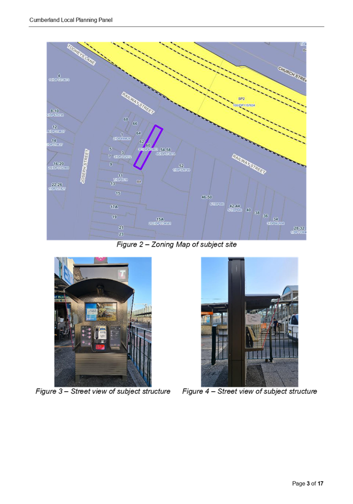
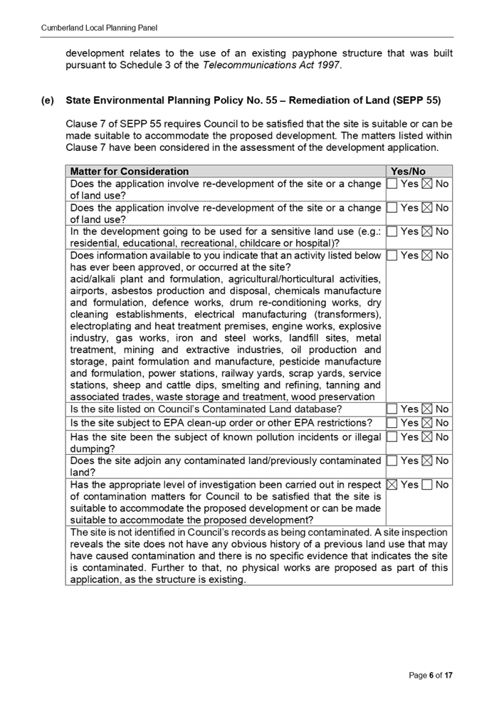


DOCUMENTS
ASSOCIATED WITH
REPORT LPP014/22
Attachment 2
Draft notice of Determination
Cumberland Local Planning Panel Meeting
9 March 2022
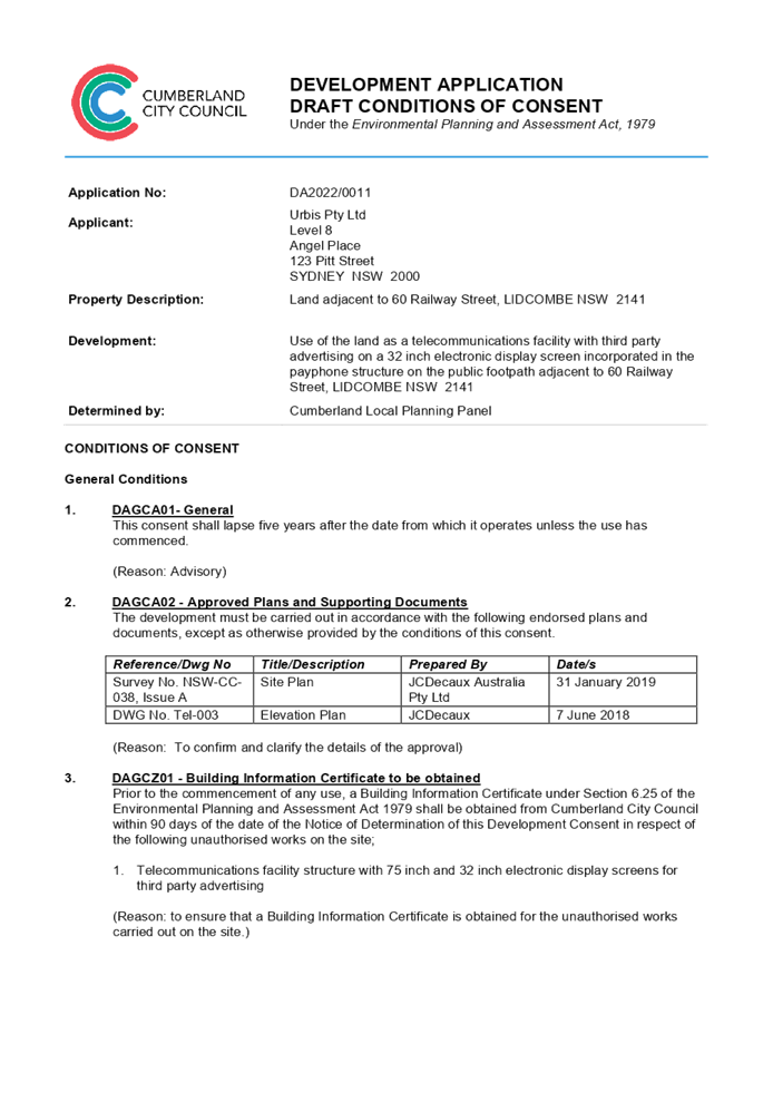

DOCUMENTS
ASSOCIATED WITH
REPORT LPP014/22
Attachment 3
Site Plan
Cumberland Local Planning Panel Meeting
9 March 2022
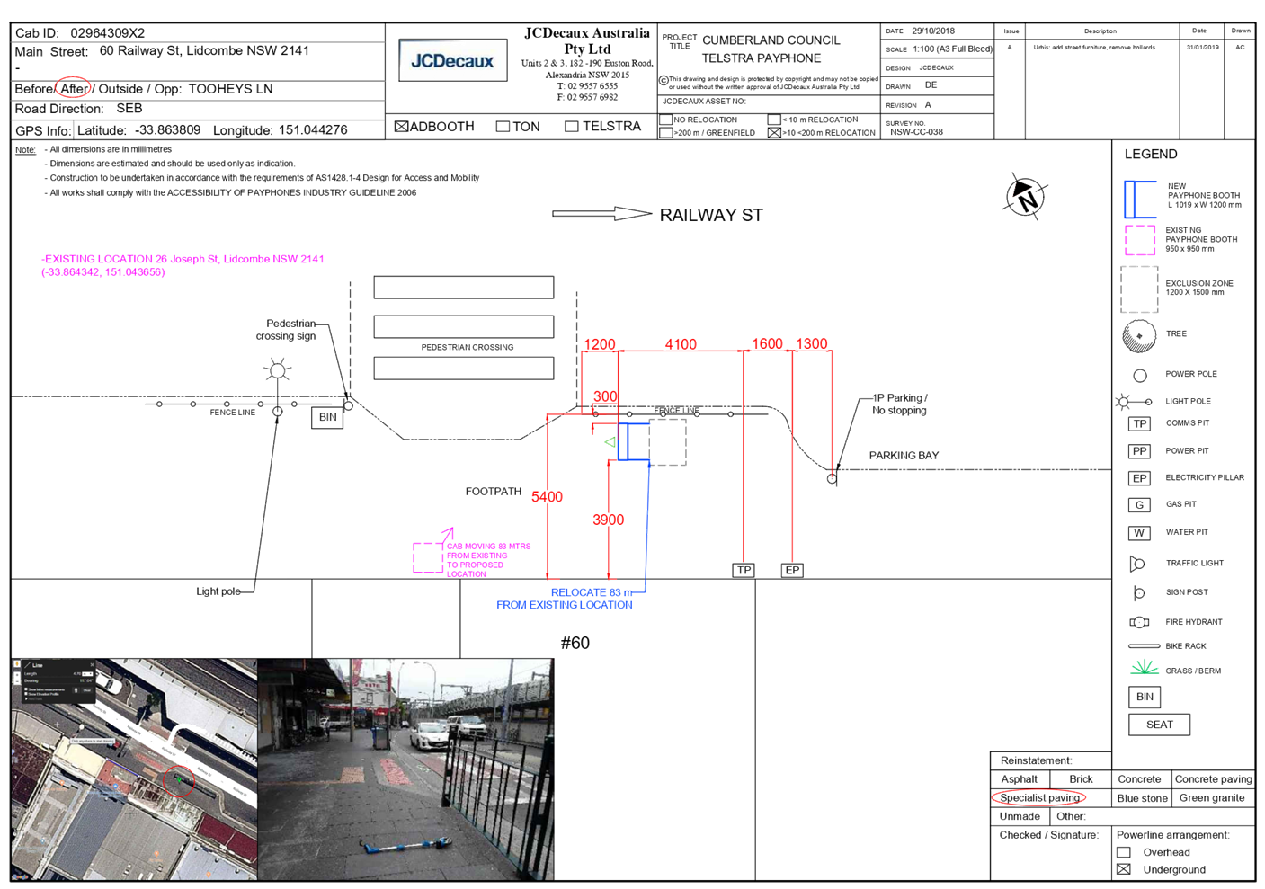
DOCUMENTS
ASSOCIATED WITH
REPORT LPP014/22
Attachment 4
Elevation Plan
Cumberland Local Planning Panel Meeting
9 March 2022
DOCUMENTS
ASSOCIATED WITH
REPORT LPP014/22
Attachment 5
NSW Telecommunications Facilities Guideline
Including Broadband 2010
Cumberland Local Planning Panel Meeting
9 March 2022


DOCUMENTS
ASSOCIATED WITH
REPORT LPP014/22
Attachment 6
Appendix A - State Environmental Planning Policy No.
64 - Assessment
Cumberland Local Planning Panel Meeting
9 March 2022
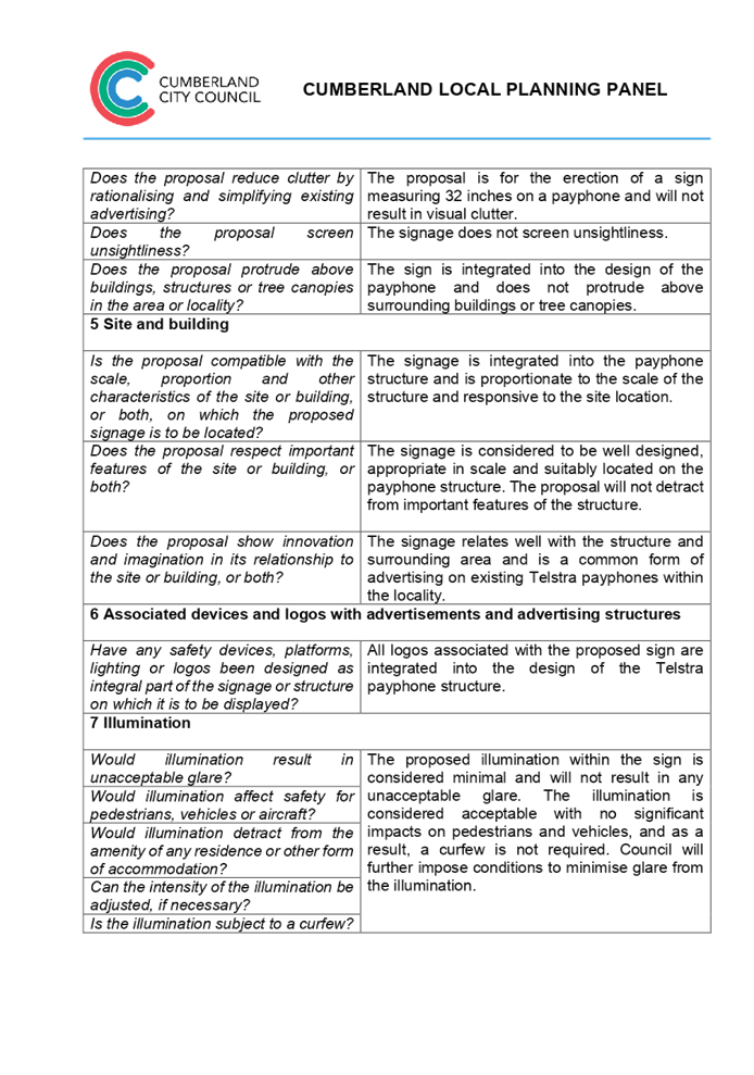

DOCUMENTS
ASSOCIATED WITH
REPORT LPP014/22
Attachment 7
Appendix B - Cumberland Local Environmental plan 2021
Cumberland Local Planning Panel Meeting
9 March 2022
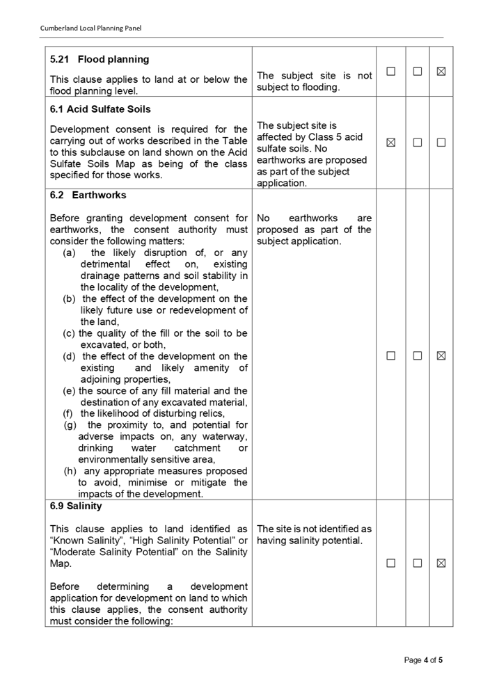

DOCUMENTS
ASSOCIATED WITH
REPORT LPP014/22
Attachment 8
Appendix C - Cumberland Development Control Plan 2021
Cumberland Local Planning Panel Meeting
9 March 2022


DOCUMENTS
ASSOCIATED WITH
REPORT LPP014/22
Attachment 9
Draft Reasons for Recommendation
Cumberland Local Planning Panel Meeting
9 March 2022

Cumberland Local Planning Panel Meeting
9 March 2022
Item No: LPP015/22
Development
Application for 67 Rawson Street, Auburn
Responsible
Division: Environment
& Planning
Officer: Executive
Manager Development and Building
File
Number: DA2022/0004
|
Application
accepted
|
21 January 2022
|
|
Applicant
|
Urbis Pty Ltd
|
|
Owner
|
Cumberland City Council
|
|
Application
No.
|
DA2022/0004
|
|
Description
of Land
|
Land adjacent to 67 Rawson
Street, AUBURN NSW 2141
|
|
Proposed
Development
|
Use of the land as a
telecommunications facility with third party advertising on a 32 inch
electronic display screen incorporated in the payphone structure on the
public footpath adjacent to 67 Rawson Street, AUBURN NSW 2141
|
|
Zoning
|
B4 – Mixed Use Zone
|
|
Disclosure
of political donations and gifts
|
Nil disclosure
|
|
Heritage
|
The subject site does not
contain a heritage item and is not located within a Heritage Conservation
Area.
|
|
Principal
Development Standards
|
Permissible:
Floor Space Ratio – 5:1
(CLEP 2021)
The proposal is for the use of
a telecommunication facility located on the public footpath and no GFA
applicable in this instance.
Permissible:
Height of Buildings –
55m (CLEP 2021)
Proposed: 2.735m
|
1. On, 20 November 2020, Federal Court of Australia
has determined that the new generation Smart City payphone structure, which was
previously exempt from the requirement for development consent, does not
qualify as being “Low impact Facilities” under the
Telecommunications Act 1997. As such, a Development Application and associated
Building Information Certificate are now required for the use of the existing
Telstra payphone structure at the subject site.
2. Development Application No. DA2022/0004 was
accepted on 21 January 2022 for the use of the telecommunications facility with
a third-party advertising on a 32 inches electronic display screen incorporated
in the payphone structure on the public footpath adjacent to 67 Rawson Street,
AUBURN NSW 2141.
3. The application was publicly notified to
occupants and owners of the adjoining properties for a period of 14 days between 2 February 2022
and 16 February 2022. In response, no submissions were received.
4. The subject application has been assessed against
the relevant provisions of the relevant State Environmental Planning Policies,
Cumberland Local Environmental Plan 2021, and the Cumberland Development
Control Plan 2021.
5. The application is
referred to the Panel as Council is the owner of the land where this
development is proposed.
6. The application is recommended for conditional approval subject to the
conditions as provided in Attachment 1.
Subject Site and surrounding
area
The subject site is located on the public footpath adjoining
No. 67 Rawson Street, Auburn. A site inspection of the payphone structure
carried out on 15 February 2022 confirmed that the structure being a Smart City
payphone, the 32 inches screen within the front elevation and 75 inches on the
rear elevation currently exists, refer to Figures 3 and 4 below.
The site is zoned B4 Mixed Use and is surrounded by B4 Mixed
Use zoned land. The existing developments adjoining the site include commercial
use development comprising of retail tenancies.

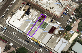
Figure
1 – Aerial view of subject site
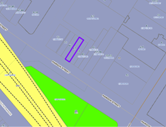
Figure 2 –
Zoning Map of subject site
|
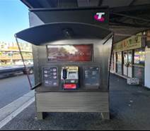
|
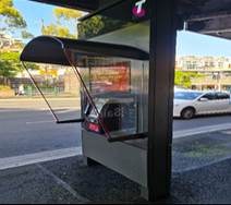
|
|
Figure 3 –
Street view of subject structure
|
Figure 4 –
Street view of subject structure
|
Description of the
development
Council has received a development application for the use
of an existing new generation Smart City payphone booth erected within the
footpath adjoining No. 67 Rawson Street, Auburn as a telecommunications
facility with a third-party advertising on a 32 inches electronic display
screen within the front elevation, which is incorporated in the payphone
structure.
The payphone structure measures 2.735 metres in height and
1.2 metres in width and includes an electronic display area above the payphone
measuring 381mm x 687mm (32 inches) proposed to be used for a third-party
advertising.
The payphone structure and the 32-inch electronic display
screen have been constructed and installed and are currently in operation.
It is acknowledged that the electronic display on the rear
elevation of the structure, measuring 75 inches, has been approved by Council
under DA2019/89. This component has been installed and is currently operating.
A Building Information Certificate (BIC) is required for the
payphone structure and the associated 32 inches electronic display; conditions
of consent have been recommended to address this requirement.
· Development Application DA2019/89 was approved as a
Deferred Commencement on 29 May 2019 for the use of a digital display sign
affixed to a Telstra payphone rear elevation for a third-party advertising.
Operative consent was issued on 30 January 2020.
· On 20 November 2020, the Federal Court of
Australia (e.g., Telstra Corporation Limited v Melbourne City Council [2021]
HCASL 82) has determined that the new generation payphone structure which was
previously exempt from the requirement for development consent, does not
qualify as “Low impact Facilities” under the Telecommunications Act 1997. As a result, existing structures already built
on Council’s land require development consent for its use as a
telecommunication facility.
· A Pre-Lodgement meeting was held with the applicant on
27 May 2021 under PL2021/0049 and the meeting notes advised the applicant to
lodge a Development Application and associated Building Information Certificate
to obtain the required approvals for all components of the
structure/telecommunication facility.
Applicants Supporting
Statement
The
applicant has provided a Statement of Environmental Effects prepared by Urbis dated November
2021 and was received by Council on 21 January
2022 in support of the application.
Contact with relevant
parties
The
assessing officer has undertaken a site inspection of the subject site and
surrounding properties and has been in regular contact with the applicant
throughout the assessment process.
The
application was not required to be referred to any of Council’s internal
departments for review.
The
application was not required to be referred to any external government
authorities for comment.
The
provisions of any Environmental Planning Instruments (EP&A Act s4.15 (1)(a)(i))
(a) Roads Act 1993
As the
proposal is not located adjacent to a classified road, approval pursuant to
subclause 138(1) of the Roads Act 1993 is not required for this
development application.
(b) Telecommunications
(Low-Impact Facilities) Determination 2018
Pursuant to the Telecommunications
(Low-impact Facilities) Determination 2018, the proposal is not classified as a
low impact facility and as such, state and local planning requirements
apply.
(c) Telecommunications Act 1997
The Telecommunications Act
establishes a framework for regulating the actions of telecommunications
carriers and service providers. The existing payphone structure was previously
built pursuant to Schedule 3 of the Telecommunications Act 1997.
(d) Telecommunications Code of
Practice 2018
The Telecommunications Code of
Practice 2018 commenced on 20 February 2018 and replaces the Telecommunications
Code of Practice 1997. The Code of Practice imposes a range of requirements on
service providers that engage in or propose to engage in a land entry
activity. The Code also requires the applicant to comply with industry best
practice, in the design, planning and installation of facilities. The
proposed development relates to the use of an existing payphone structure that
was built pursuant to Schedule 3 of the Telecommunications Act 1997.
(e) State Environmental Planning
Policy (Infrastructure) 2007 (ISEPP)
The provisions of the ISEPP 2007
have been considered in the assessment of the development application.
Clause 115 – Development
permitted with consent
(1) Development for the purposes of telecommunications
facilities, other than development in clause 114 or development that is exempt
development under clause 20 or 116, may be carried out by any person with
consent on any land.
(3) Before determining a development application for development to which
this clause applies, the consent authority must take into consideration any
guidelines concerning site selection, design, construction or operating
principles for telecommunications facilities that are issued by the Secretary
for the purposes of this clause and published in the Gazette.
Pursuant to clause 115(3) of the ISEPP 2007, before
determining the proposal, the consent authority must take into consideration of
any guidelines concerning the site selection, design, construction, and
operation of telecommunication facilities. The proposal was accompanied with
the report of compliance to the principles of NSW Telecommunications Facilities
Guideline including Broadband 2010. These principles are:
· Principle
1: A Telecommunications facility is to be designed and sited to minimise visual
impact.
· Principle
2: Telecommunications facilities should be co-located wherever practical.
· Principle
3: Health standards for exposure to radio emissions will be met; and
· Principle
4: Minimise disturbance and risk and maximise compliance.
These matters have been considered
as part of the assessment of this application and are considered satisfactory.
Refer to Attachment 4.
(f) State
Environmental Planning Policy No 64—Advertising and Signage
The proposed signage is ‘advertisement’
as defined under SEPP 64 as follows:
Advertisement means
signage to which Part 3 applies and includes any advertising structure for the
advertisement
The subject proposal is subject to
assessment under Part 3 of SEPP 64 and the guidelines included in Schedule 1 of
the Policy.
|
Clause
|
Comments
|
|
8 Granting of consent to
signage
A consent authority must not
grant development consent to an application to display signage unless the
consent authority is satisfied:
(a) that the signage is
consistent with the objectives of this Policy as set out in clause 3 (1) (a),
and
(b) that the signage the
subject of the application satisfies the assessment criteria specified in
Schedule 1.
|
Satisfactory. Assessment
of the proposal has concluded that the design of the proposed signage is
compatible with the character of the area which is predominantly for business
use. The location of the signage is considered suitable and will not
have any adverse impact on the amenity of the surrounding developments.
|
|
10 Prohibited
advertisements
(1) Despite the provisions of
any other environmental planning instrument, the display of an advertisement
is prohibited on land that is an environmentally sensitive area, heritage
area (excluding railway stations), natural or other conservation area, open
space, waterway, residential (but not a mixed residential and business zone
or similar zone), scenic protection area, national park, nature reserve
(2) This clause does not
apply to the following:
(a) The Mount Panorama
Precinct.
(b) The display of an
advertisement at a public sporting facility situated on land zoned public
recreation under an EPI being an advertisement that provides information
about the sponsors of the teams or organisations using the sporting facility
or about the products of those sponsors.
|
The site is not located on land
that is an environmentally sensitive area and is not located nearby to a
heritage conservation area.
|
|
12 Consent Authority
For the purposes of this
Policy, the consent authority is—
(a) the council of
a local government area in the case of an advertisement displayed in the
local government area (unless paragraph (c), (d) or (e) applies), or
(b) TfNSW in the
case of an advertisement displayed on a vessel, or
(c) the Minister
for Planning in the case of an advertisement displayed by or on behalf of
RailCorp, NSW Trains, Sydney Trains, Sydney Metro or TfNSW on a railway
corridor, or
(d) the Minister
for Planning in the case of an advertisement displayed by or on behalf of RMS
on—
(i) a
road that is a freeway or tollway (under the Roads Act 1993) or associated road use land that is adjacent to such a
road, or
(ii) a
bridge constructed by or on behalf of TfNSW on any road corridor, or
(iii) land
that is owned, occupied or managed by TfNSW, or
(e) the Minister
for Planning in the case of an advertisement displayed on transport corridor
land comprising a road known as the Sydney Harbour Tunnel, the Eastern
Distributor, the M2 Motorway, the M4 Motorway, the M5 Motorway, the M7
Motorway, the Cross City Tunnel or the Lane Cove Tunnel, or associated road
use land that is adjacent to such a road.
|
Council is considered the
consent authority for the subject proposal.
|
13 Matters for consideration
(1) A consent
authority (other than in a case to which subclause (2) applies) must not
grant consent to an application to display an advertisement to which this
Policy applies unless the advertisement or the advertising structure, as the
case requires:
(a) is consistent
with the objectives of this Policy as set out in clause 3 (1) (a), and
(b) has been
assessed by the consent authority in accordance with the assessment criteria
in Schedule 1 and the consent authority is satisfied that the proposal is
acceptable in terms of its impacts, and
(c) satisfies any
other relevant requirements of this Policy.
|
The proposed signage is
considered to be in a suitable location and will have acceptable impacts on
the local area.
The development application is
limited to the use of the existing sign on the payphone for third party
advertising. The third party advertising will be displayed on a screen that
is part of a public payphone operated by Telstra. The subject site is located
on the pedestrian footpath and will not have any detrimental impacts on the
traffic flows within the locality.
|
|
14 Duration of Consents
(1) A consent granted under
this part ceases to be in force:
(a) on the expiration of 15
years after the date on which the consent becomes effective and operates
(b) if a lesser period is
specified by the consent authority, that lesser period
(2) The consent authority may
specify a period less than 15 years only if:
(a) before the commencement
of this Part, the consent authority had adopted a policy of granting consents
in relation to applications to display advertisements for a lesser period and
the duration of the consent authority is consistent with that policy
(b) the area in which the
advertisement is undergoing change in accordance with an EPI that aims to
change the nature and character of development and where the proposed
advertisement would be inconsistent with that change
(c) the specification of a
lesser period if required by another provision of this Policy.
|
Council will impose a condition
restricting the consent to a period of fifteen (15) years.
|
|
16 Transport Corridor Land
(1) Despite clause 10
(1) and the provisions of any other environmental planning instrument, the
display of an advertisement on transport corridor land is permissible with
development consent in the following cases—
(a) the display of
an advertisement by or on behalf of RailCorp, NSW Trains, Sydney Trains,
Sydney Metro or TfNSW on a railway corridor,
(b) the display of
an advertisement by or on behalf of TfNSW on—
(i) a
road that is a freeway or tollway (under the Roads Act 1993) or associated road use land that is adjacent to such a
road, or
(ii) a
bridge constructed by or on behalf of TfNSW on any road corridor, or
(iii) land
that is owned, occupied or managed by TfNSW and that is within 250 metres of
a classified road,
(c) the display of
an advertisement on transport corridor land comprising a road known as the
Sydney Harbour Tunnel, the Eastern Distributor, the M2 Motorway, the M4
Motorway, the M5 Motorway, the M7 Motorway, the Cross City Tunnel or the Lane
Cove Tunnel, or associated road use land that is adjacent to such a road.
(2) Before determining
an application for consent to the display of an advertisement in such a case,
the Minister for Planning may appoint a design review panel to provide advice
to the Minister concerning the design quality of the proposed advertisement.
(3) The Minister must
not grant consent to the display of an advertisement in such a case
unless—
(a) the relevant
local council has been notified of the development application in writing and
any comments received by the Minister from the local council within 28 days
have been considered by the Minister, and
(b) the advice of
any design review panel appointed by the Minister has been considered by the
Minister, and
(c) the Minister
is satisfied that the advertisement is consistent with the Guidelines.
(4) This clause does
not apply to the display of an advertisement if the Minister determines that
display of the advertisement is not compatible with surrounding land use,
taking into consideration any relevant provisions of the Guidelines.
|
The site is not situated within
land designated as a transport corridor and as such, Clause 16 is not
applicable.
|
|
17 Advertisements with display area
greater than 20 square metres or higher than 8 metres above ground
(1) This clause applies
to an advertisement:
(a) that has a
display area greater than 20 square metres, or
(b) that is higher
than 8 metres above the ground.
(2) The display of an
advertisement to which this clause applies is advertised development for the
purposes of the Act.
(3) The consent
authority must not grant consent to an application to display an
advertisement to which this clause applies unless:
(a) the applicant
has provided the consent authority with an impact statement that addresses
the assessment criteria in Schedule 1 and the consent authority is satisfied
that the proposal is acceptable in terms of its impacts, and
(b) the
application has been advertised in accordance with section 79A of the Act,
and
(c) the consent
authority gave a copy of the application to RMS at the same time as the
application was advertised in accordance with section 79A of the Act if the
application is an application for the display of an advertisement to which
clause 18 applies.
|
Clause 17 does not apply to the
proposed development for the following reasons:
· The proposed signage has an area of 0.26m2
which does not exceed an area of 20m2; and
D1
· Has a maximum height of 1.886 metres above ground.
|
18 Advertisements
greater than 20 square metres and within 250 metres of, and visible from, a
classified road
(1) This clause applies
to the display of an advertisement to which clause 17 applies, that is within
250 metres of a classified road any part of which is visible from the
classified road.
(2) The consent
authority must not grant development consent to the display of an
advertisement to which this clause applies without the concurrence of RMS.
(3) In deciding whether
concurrence should be granted, RMS must take into consideration:
(a) the impact of
the display of the advertisement on traffic safety, and
(b) the
Guidelines.
(c) (Repealed)
(4) If RMS has not
informed the consent authority within 21 days after the copy of the
application is given to it under clause 17 (3) (c) (ii) that it has granted,
or has declined to grant, its concurrence, RMS is taken to have granted its
concurrence.
(5) Nothing in this
clause affects clause 16.
(6) This clause does
not apply when the Minister for Planning is the consent authority.
|
The proposed sign has an area of
0.26m2 and is not located on a classified road. As such, RMS
referral is not required and Clause 18 is not applicable.
|
19 Advertising
display area greater than 45 square metres
The consent authority must
not grant consent to the display of an advertisement with an advertising
display area greater than 45 square metres unless—
(a) a development
control plan is in force that has been prepared on the basis of an
advertising design analysis for the relevant area or precinct, or
(b) in the case of
the display of an advertisement on transport corridor land, the consent
authority is satisfied that the advertisement is consistent with the
Guidelines.
|
The proposed advertisement is
less than 45m2, as such Clause 19 does not apply.
|
|
20 Location
of certain names and logos
(1) The name or logo of
the person who owns or leases an advertisement or advertising structure may
appear only within the advertising display area.
(2) If the advertising
display area has no border or surrounds, any such name or logo is to be
located—
(a) within the
advertisement, or
(b) within a strip
below the advertisement that extends for the full width of the advertisement.
(3) The area of any
such name or logo must not be greater than 0.25 square metres.
(4) The area of any
such strip is to be included in calculating the size of the advertising
display area
|
All logos associated with the
proposed third party advertising is integrated within the payphone structure.
There are no logos within the frames or devices to be erected.
|
|
|
|
Local Environmental Plans
Cumberland Local Environmental Plan 2021 (CLEP 2021)
The
provision of the CLEP 2021 is applicable to the development proposal. It is
noted that the development achieves compliance with the key statutory
requirements of the CLEP 2021 and the objectives of the B4 Mixed Use
Zone.
(a) Permissibility:
The proposed development is
defined as a ‘telecommunications facility’ and
‘signage’ and are permissible in the B4 Mixed Use Zone with
consent.
Telecommunications
facility means—
(a) any
part of the infrastructure of a telecommunications network, or
(b) any
line, cable, optical fibre, fibre access node, interconnect point equipment,
apparatus, tower, mast, antenna, dish, tunnel, duct, hole, pit, pole or other
structure in connection with a telecommunications network, or
(c) any
other thing used in or in connection with a telecommunications network.
signage means any sign,
notice, device, representation or advertisement that advertises or promotes any
goods, services or events and any structure or vessel that is principally
designed for, or that is used for, the display of signage, and includes any of
the following—
(a) an
advertising structure,
(b) a
building identification sign,
(c) a
business identification sign,
but does not include a traffic
sign or traffic control facilities.
A comprehensive LEP assessment is
contained in Attachment 7.
The provisions of any proposed instrument that is or has
been the subject (EP&A Act s4.15 (1)(a)(ii))
N/A
The provisions of any Development Control Plans (EP&A
Act s4.15 (1)(a)(iii))
The
Cumberland DCP 2021 provides guidance for the design and operation of
development to achieve the aims and objectives of the Cumberland LEP 2021.
A
comprehensive assessment and compliance table is contained in Attachment
8.
The proposed development complies with the provisions of the
Cumberland DCP 2021 and is considered acceptable from an environmental planning
viewpoint.
The provisions of any planning agreement that has been
entered into under section 7.4, or any draft planning agreement that a
developer has offered to enter into under section 7.4 (EP&A Act
s4.15(1)(a)(iiia))
There is no draft planning agreement associated with the
subject Development Application.
The provisions of the Regulations (EP&A Act s4.15
(1)(a)(iv))
The proposed development raises no concerns as to the
relevant matters arising from the Environmental Planning and Assessment
Regulations 2000 (EP&A Reg).
The Likely Environmental, Social or Economic Impacts
(EP&A Act s4.15 (1)(b))
It is considered that the proposed development will have no
significant adverse environmental, social or economic impacts in the locality.
The suitability of the site for the development (EP&A
Act s4.15 (1)(c))
The subject site and locality is not known to be affected by
any natural hazards or other site constraints likely to have a significant
adverse impact on the proposed development. Accordingly, it is considered that
the development is suitable in the context of the site and surrounding
locality.
Submissions made in accordance with the Act or Regulation
(EP&A Act s4.15 (1)(d))
|
Advertised (Council Website)
|
Mail
|
Sign
|
Not Required
|
In accordance with Council’s Notification requirements
contained within the<Auburn DCP 2010 /Holroyd DCP 2013 /Parramatta DCP 2011/
Cumberland DCP 2021>, the proposal was publicly notified for a period of 14
days between 2 February 2022 and 16 February 2022. No submissions were received
in respect of the proposed development.
The public interest (EP&A Act s4.15(1)(e))
In view of the foregoing analysis it is considered that the
development, if carried out subject to the conditions set out in the
recommendation below, will have no significant adverse impacts on the public
interest.
CUMBERLAND LOCAL INFRASTRUCTURE CONTRIBUTIONS
PLAN 2020
The development would not require the payment of
contributions in accordance with Cumberland Local Infrastructure Contributions
Plan 2020.
Disclosure of Political Donations and Gifts
The
applicant and notification process did not result in any disclosure of
Political Donations and Gifts.
The development application has
been assessed in accordance with the relevant requirements of the Environmental
Planning and Assessment Act 1979, Environmental Planning and Assessment
Regulation 2000, Roads Act 1993, Telecommunications Act 1997, State
Environmental Planning Policy (Biodiversity and Conservation) 2021, State
Environmental Planning Policy (Resilience and Hazards) 2021, State
Environmental Planning Policy (Transport and Infrastructure) 2021, State
Environmental Planning Policy (Industry and Employment) 2021,Cumberland LEP
2021 and Cumberland DCP 2021 and is considered to be satisfactory for approval,
subject to conditions.
|
That Development Application No. DA2022/0004 for the use of the land
as a telecommunications facility with third party advertising on a 32 inch
electronic display screen incorporated in the payphone structure on the
public footpath adjacent to 67 Rawson Street, Auburn NSW 2144 be Approved
subject to attached conditions.
|
1. Draft Notice
of Determination
2. Site
Plan
3. Elevation
Plan
4. NSW
Telecommunications Facilities Guideline Including Broadband 2010
5. State
Environmental Planning Policy No 64 - Advertising and Signage
6. Cumberland
Local Environmental Plan 2021
7. Cumberland
Development Control Plan 2021
8. Draft
reasons for recommendation
DOCUMENTS
ASSOCIATED WITH
REPORT LPP015/22
Attachment 1
Draft Notice of Determination
Cumberland Local Planning Panel Meeting
9 March 2022


DOCUMENTS
ASSOCIATED WITH
REPORT LPP015/22
Attachment 2
Site Plan
Cumberland Local Planning Panel Meeting
9 March 2022
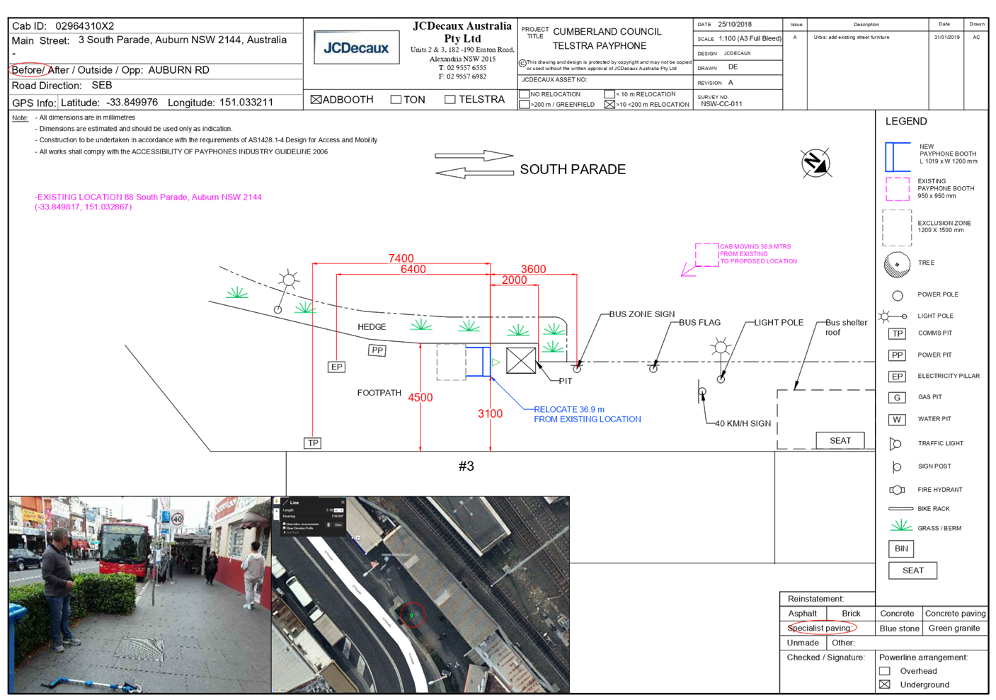
DOCUMENTS
ASSOCIATED WITH
REPORT LPP015/22
Attachment 3
Elevation Plan
Cumberland Local Planning Panel Meeting
9 March 2022
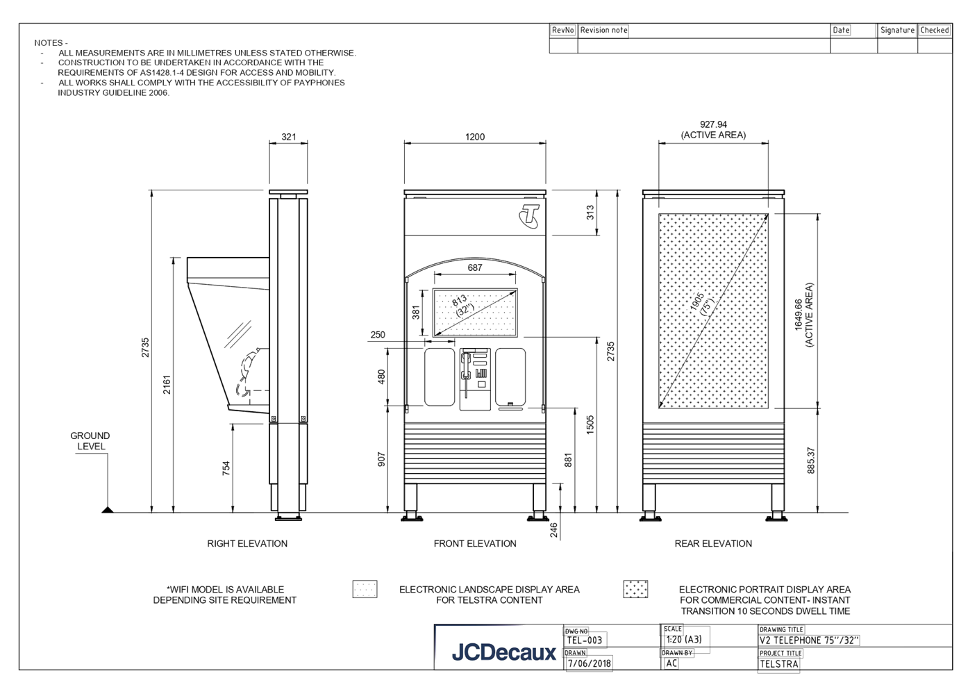
DOCUMENTS
ASSOCIATED WITH
REPORT LPP015/22
Attachment 4
NSW Telecommunications Facilities Guideline Including Broadband
2010
Cumberland Local Planning Panel Meeting
9 March 2022
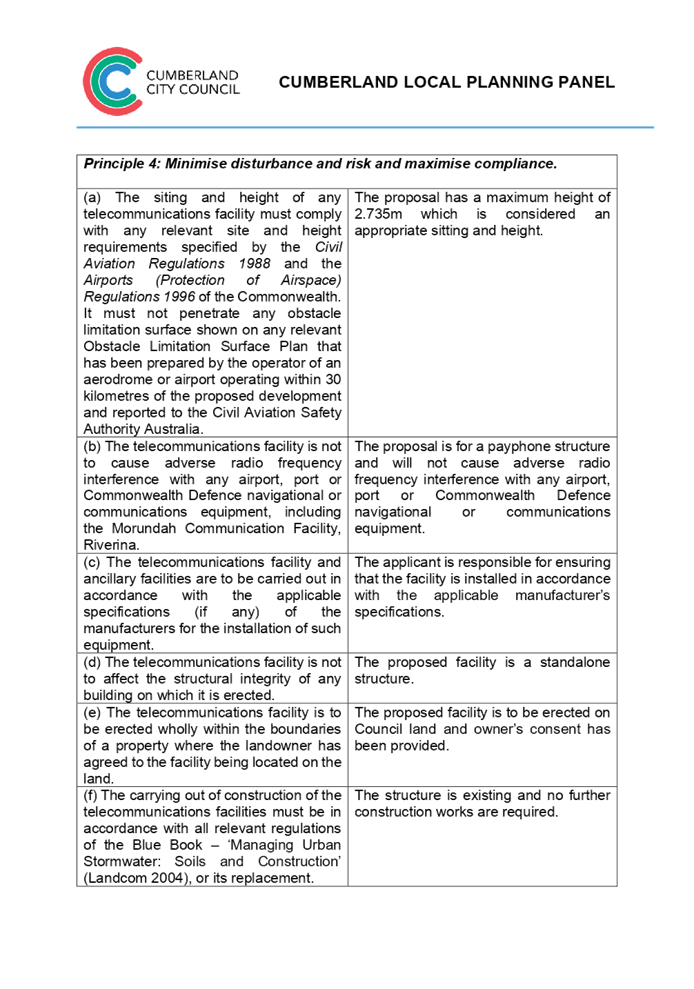

DOCUMENTS
ASSOCIATED WITH
REPORT LPP015/22
Attachment 5
State Environmental Planning Policy No 64 -
Advertising and Signage
Cumberland Local Planning Panel Meeting
9 March 2022
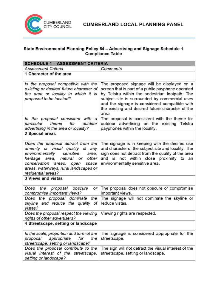

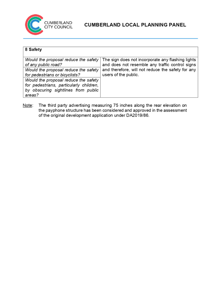
DOCUMENTS
ASSOCIATED WITH
REPORT LPP015/22
Attachment 6
Cumberland Local Environmental Plan 2021
Cumberland Local Planning Panel Meeting
9 March 2022
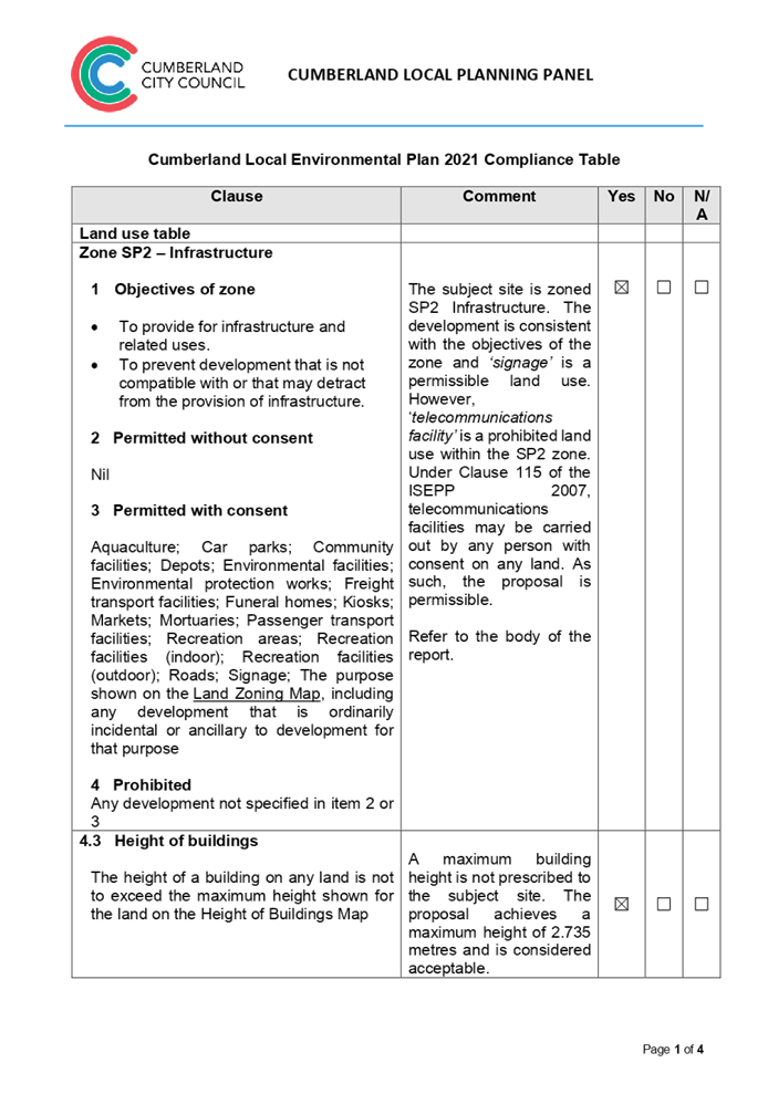

DOCUMENTS
ASSOCIATED WITH
REPORT LPP015/22
Attachment 7
Cumberland Development Control Plan 2021
Cumberland Local Planning Panel Meeting
9 March 2022

DOCUMENTS
ASSOCIATED WITH
REPORT LPP015/22
Attachment 8
Draft reasons for recommendation
Cumberland Local Planning Panel Meeting
9 March 2022