13 October 2021
A meeting of the Cumberland Local
Planning Panel will
be held at 11.30am via Zoom on Wednesday, 13 October 2021.
Business as below:
Yours faithfully
Peter J. Fitzgerald
General
Manager
ORDER OF BUSINESS
1. Receipt of Apologies
2. Confirmation of Minutes
3. Declarations of Interest
4. Address by invited
speakers
5. Reports:
- Development
Applications
- Planning
Proposals
6. Closed Session Reports
Cumberland Local Planning Panel Meeting
13 October 2021
CONTENTS
Report No. Name
of Report Page
No.
Development Applications – Public Meeting
LPP034/21... Section 8.3 Review Application for
535 Merrylands Road, Merrylands....... 9
LPP035/21... Modification to Development
Application for 1-7 Elvina Street, Greystanes 403
Development Applications – Electronic Determination
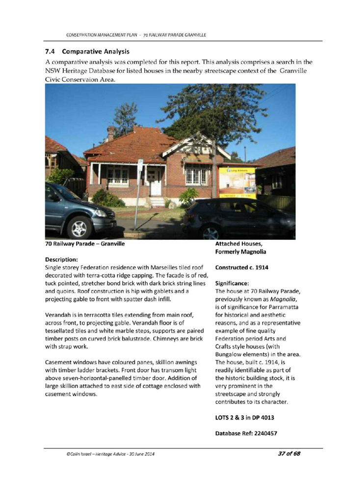
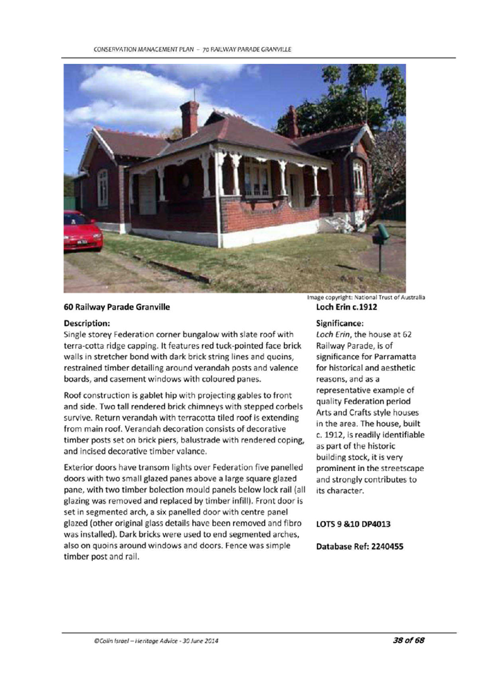
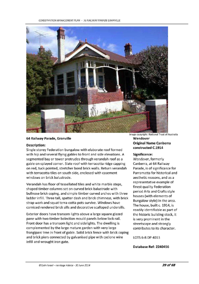
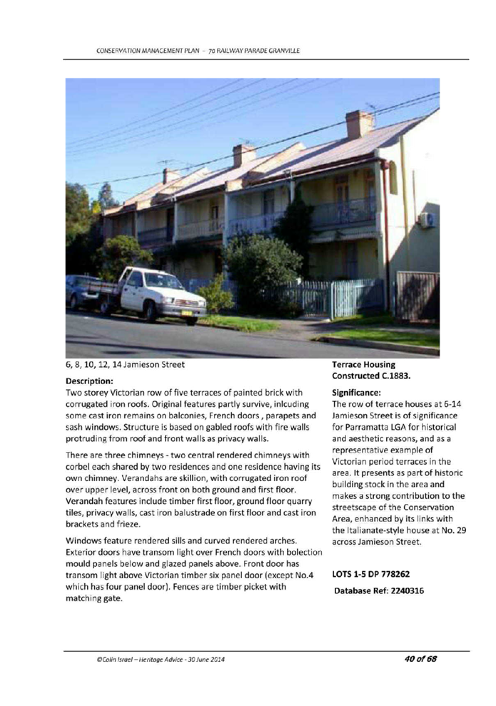
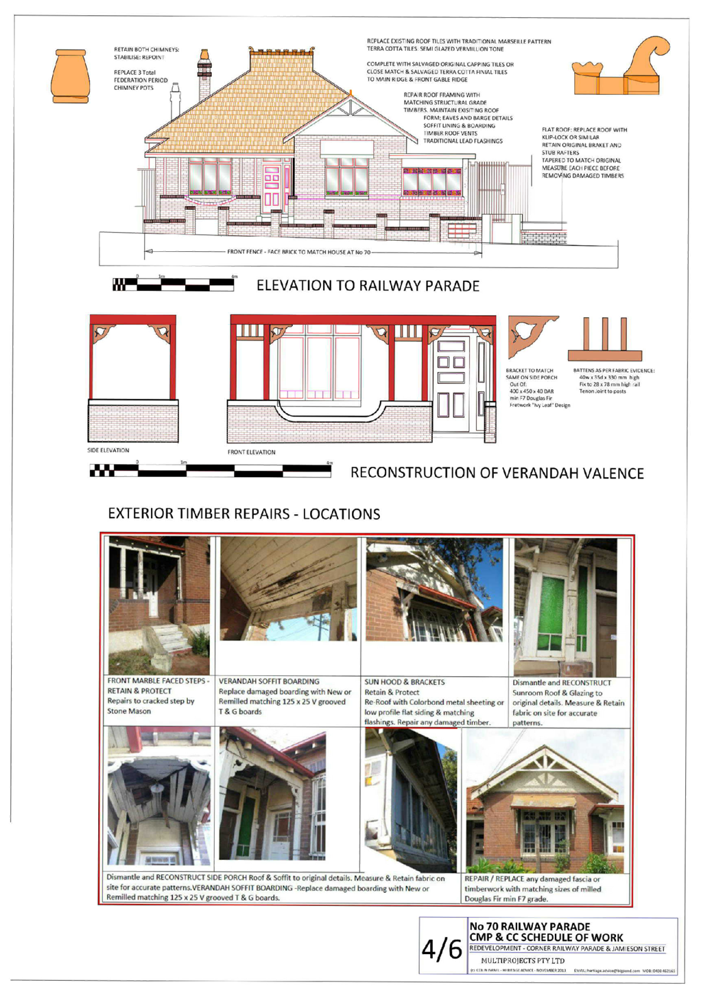
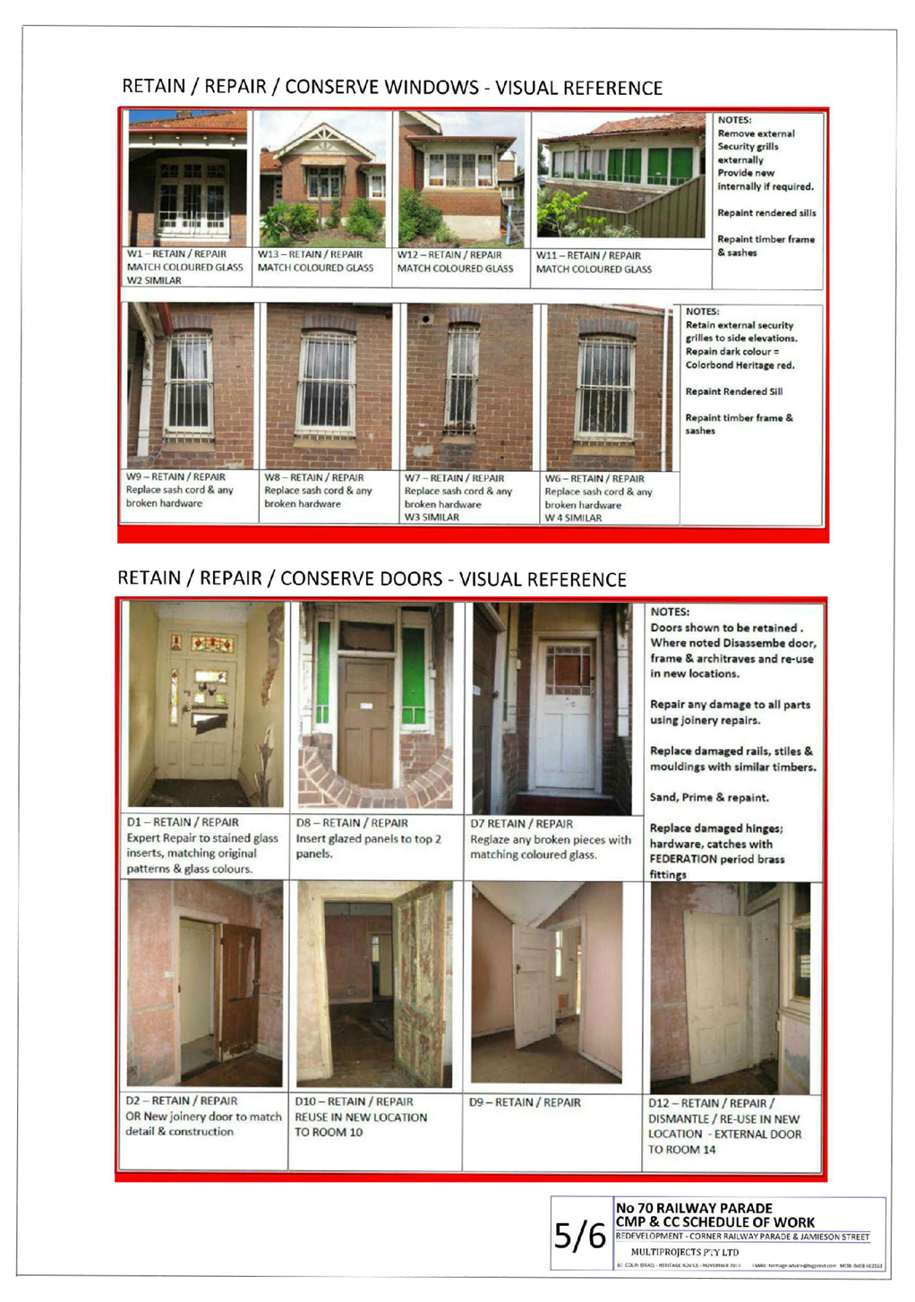
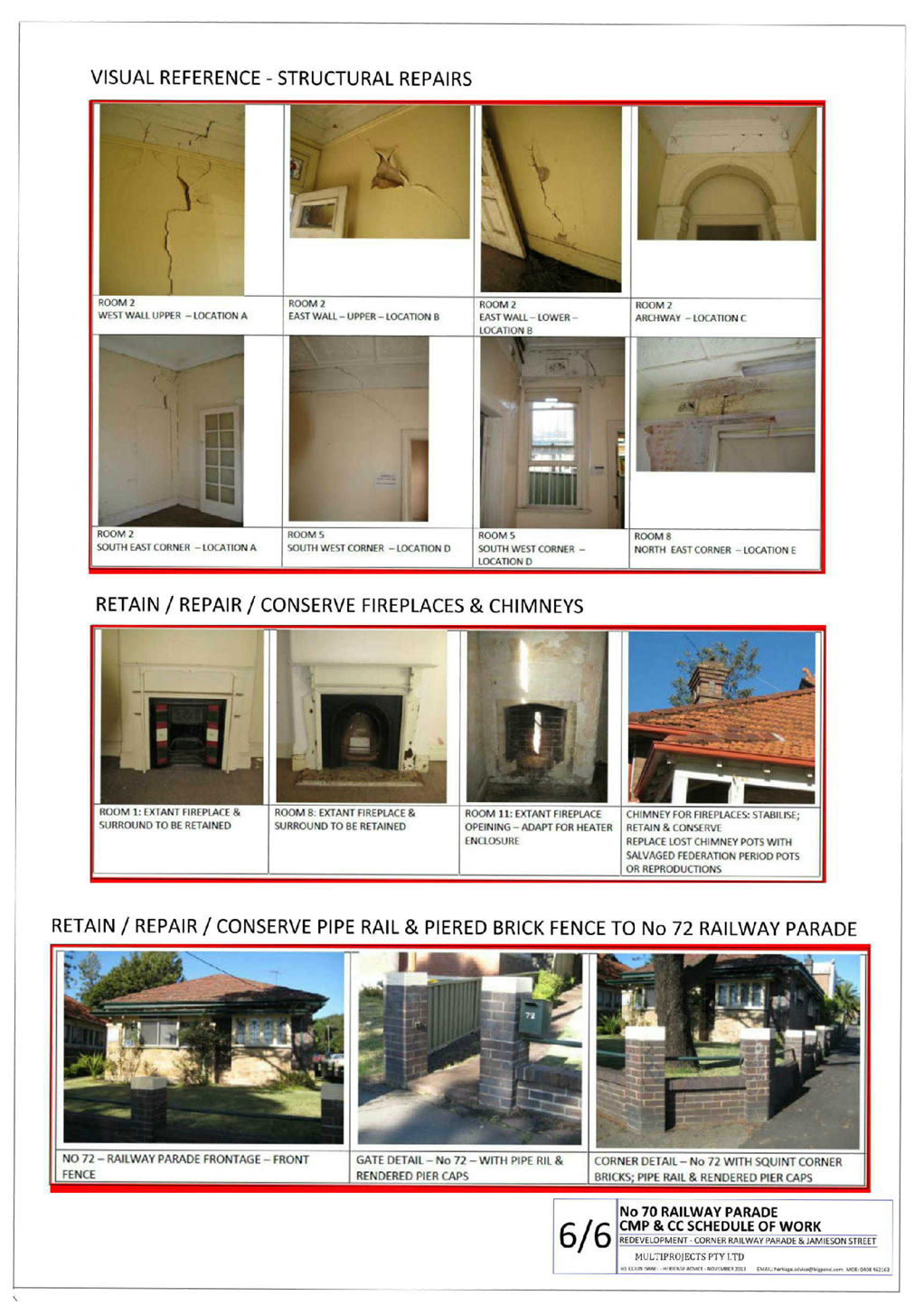
LPP036/21... Development Application for 7/70-72
Railway Parade, Granville............ 549
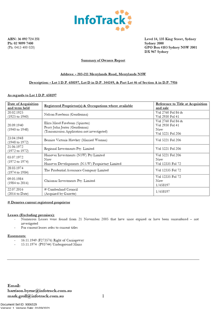
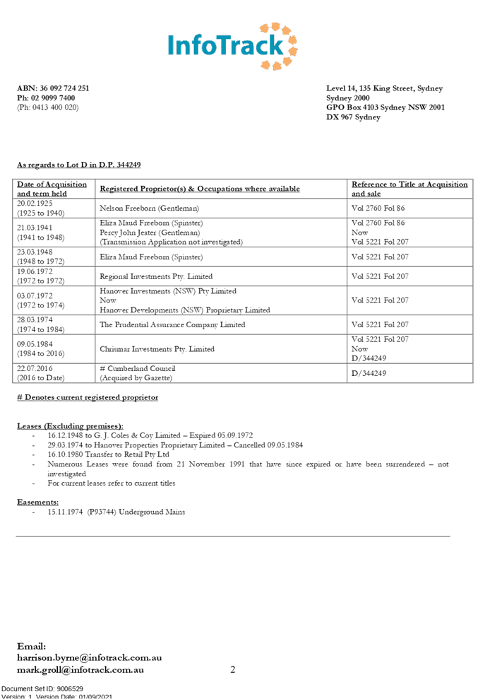
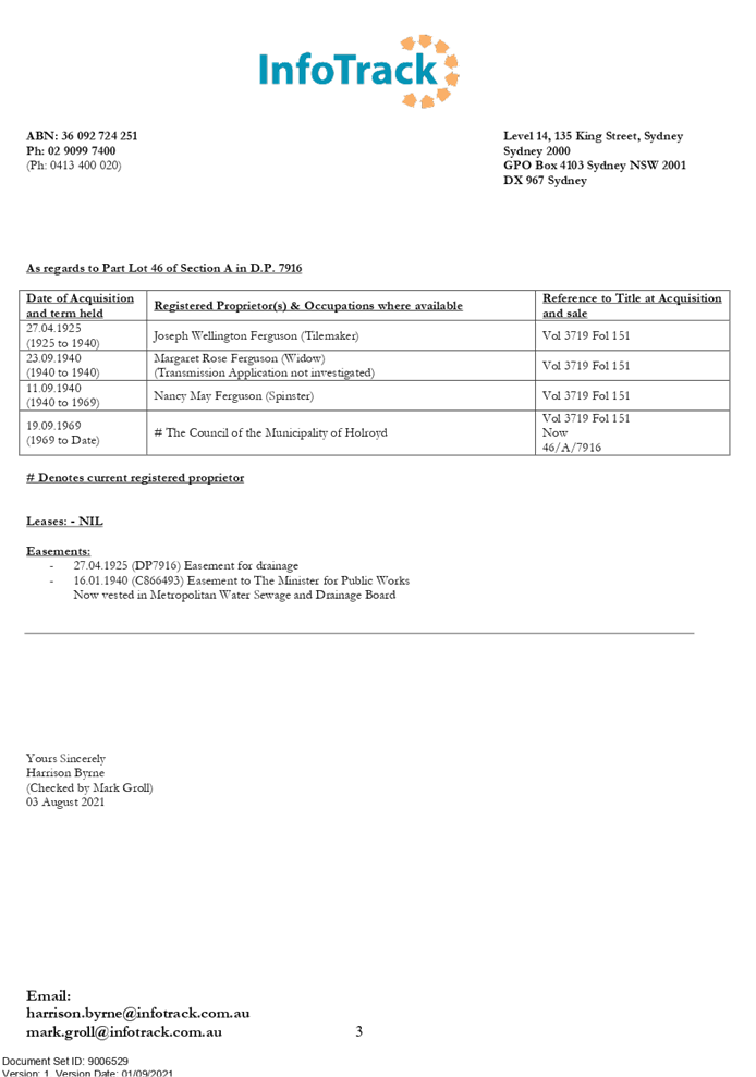
LPP037/21... Development Application for 203-211
Merrylands Road, Merrylands..... 829
LPP038/21... Development Application for 43 - 55
Karrabah Road, Auburn............... 1075
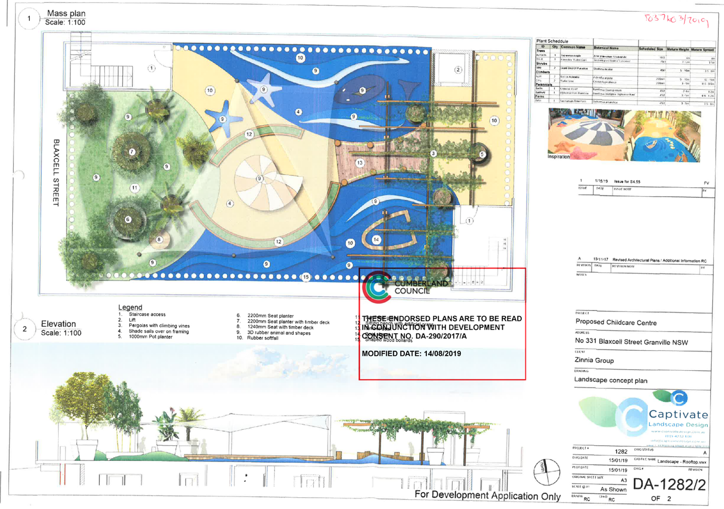
LPP039/21... Modification Application for 331
Blaxcell Street, South Granville.......... 1119
Cumberland Local Planning Panel Meeting
13 October 2021
Item No:
LPP034/21
Section 8.3
Review Application for 535 Merrylands Road, Merrylands
Responsible
Division: Environment
& Planning
Officer: Executive
Manager Development and Building
File
Number: REV2021/0003
|
Application
lodged
|
28 July 2021
|
|
Applicant
|
S Restifa
|
|
Owner
|
Saba Property Development Pty
Limited
|
|
Application
No.
|
REV2021/0003
|
|
Description
of Land
|
535 Merrylands Road, MERRYLANDS
NSW 2160
Lot 15 Sec B DP 2815
|
|
Proposed
Development
|
Section 8.3 Review of
DA2020/0301 refusal for the demolition of existing structures and removal of
trees and construction of a 90-bed residential aged care facility, including
at grade car parking and associated site improvements (State Environmental
Planning Policy (Housing for Seniors or People with a Disability) 2004
|
|
Site
Area
|
7,746m2
|
|
Zoning
|
R2 Low Density Residential
|
|
Disclosure
of political donations and gifts
|
Nil disclosure
|
|
Heritage
|
The subject site does not
contain a heritage item and is not located within the vicinity of the
heritage item or heritage conservation area.
|
|
Principal
Development Standards
|
Floor Space Ratio
Permissible: 0.5:1 (HLEP 2013)
/ 1.0:1 (SEPP (HSPD) 2004)
Proposed: 0.58:1 (calculated
in accordance with SEPP (HSPD) 2004)
Height of Building
Permissible: Max. 9m (HLEP
2013) / Max. 8m (SEPP (HSPD) 2004)
Proposed: Max. 9.1m
(calculated in accordance with SEPP (HSPD) 2004)
Clause 4.6 Written Request
submitted for variation sought to building height
|
|
Issues
|
· Suitability
of residential aged care facility on flood affected site
· Building
Height
|
1. On
28 July 2021, Council received a Section 8.3 Review application (REV2021/0003)
of DA2020/0301 refusal for the demolition of existing structures and removal of
trees and construction of a 90-bed residential aged care facility, including at
grade car parking and associated site improvements. The application is made
pursuant to State Environmental Planning Policy (Housing for Seniors or People
with a Disability) 2004.
2. The
application was publicly notified to occupants and owners of the adjoining
properties for a period of 14 days between 20 August 2021 and 3 September 2021.
In response, one (1) submission was received.
3. The
subject application has been assessed against the relevant provisions of the
Environmental Planning and Assessment Act 1979, State Environmental Planning
Policy (Housing for Seniors or People with a Disability) 2004, Holroyd Local
Environmental Plan 2013 (HLEP) and Holroyd Development Control Plan 2013
(HDCP).
4. The
proposal seeks the following numerical non-compliances which are considered
supportable as discussed in detail elsewhere in the report:
|
Control
|
Required
|
Provided
|
% variation
|
|
Building Height
Clause 40(4)(a) of SEPP (HSPD) 2004
|
Max. 8m
|
Max. 9.1m
|
13.75%
|
|
Building Height
Clause 40(4)(c) of SEPP (HSPD) 2004
|
Max. single storey in height in the rear 25% area of the
site
|
2 storeys
|
100%
|
5. The
application is referred to the Panel as the proposal contravenes 2 development
standards by more than 10%, and as the original development application
(DA2020/0301) was determined by the Panel, and as such the review of the
subject Section 8.3 Review application is required to be determined by the
Panel.
6. The
application is recommended for conditional approval subject to the conditions
as provided in the attached schedule.
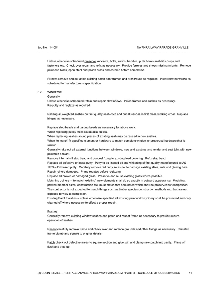
Subject Site and Surrounding
Area
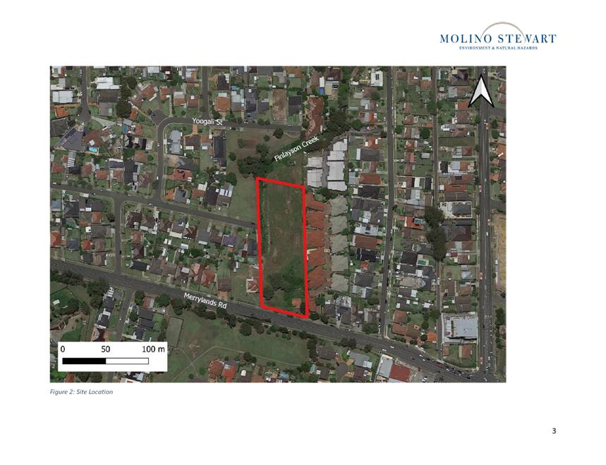
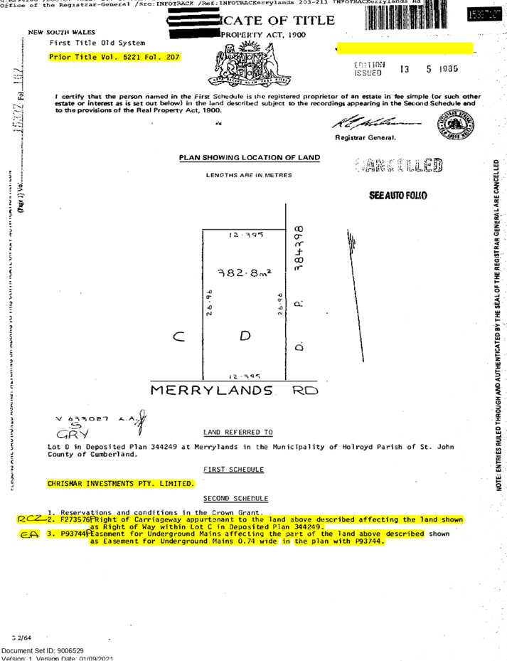
The subject site is legally
identified as Lot 15 Sec B DP2815, and known as 535 Merrylands Road,
Merrylands. The property has a site area of approximately 7,746m²
with a frontage of 33.61m to Merrylands Road. The site has a gradual fall from
the front to the rear of approximately 2.1m.
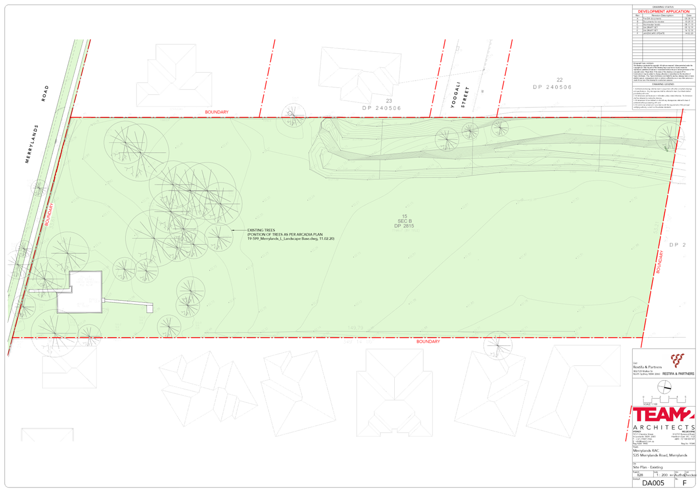
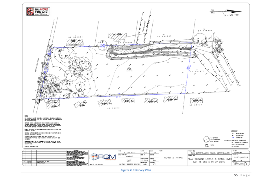
The subject site is situated on
the northern side of Merrylands Road and adjoins Leeton Street Park to the rear
of the site. An existing open grassed channel transverse the subject site along
the western boundary. The property is currently occupied by a vacant dwelling
house and vegetation. The site has been substantially vacant since 2009 or
earlier.
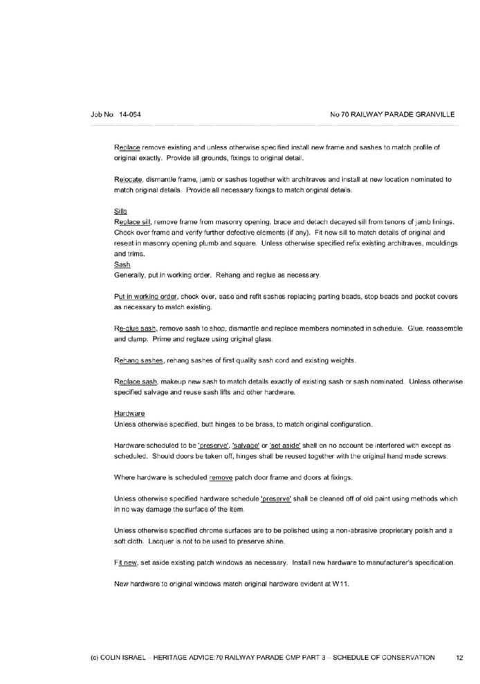
The subject allotment and
properties adjoining the site directly to the east and part west are zoned R2
– Low Density Residential under the Holroyd Local Environmental Plan
2013.
The immediate locality is
characterised by low to medium density housing.
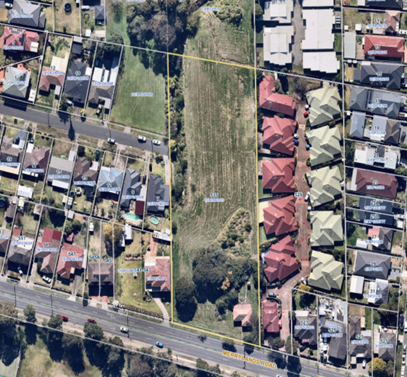
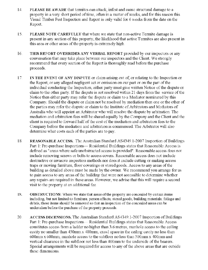
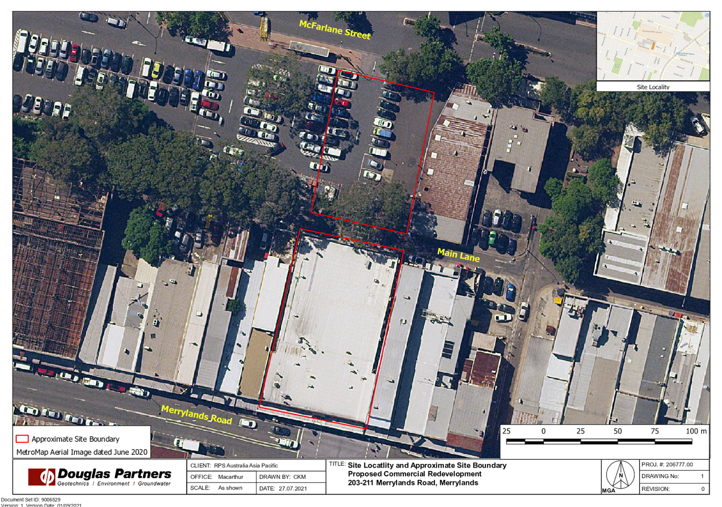
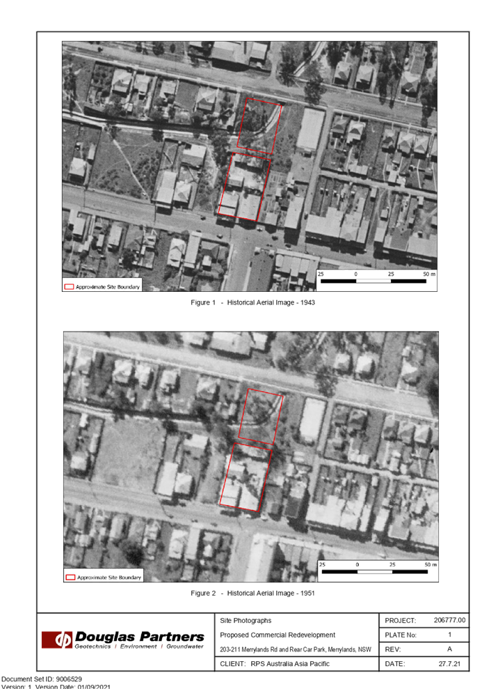
Figure
1 – Aerial image of subject site outlined in yellow
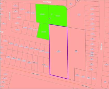
Figure
2 – Zoning Map. Subject site indicated in purple outline
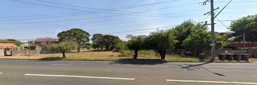
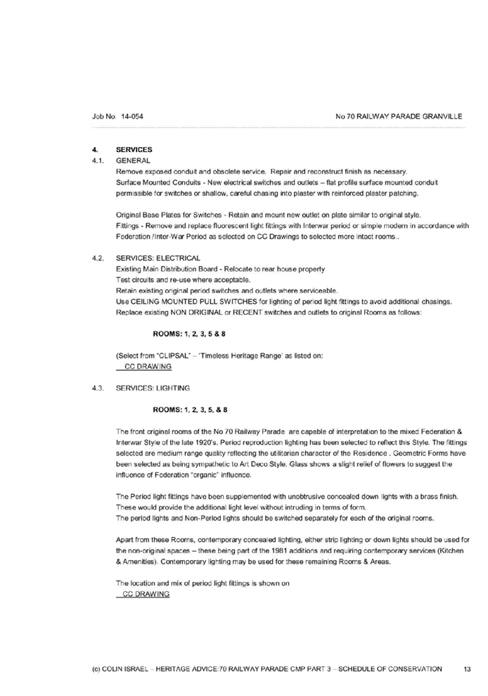
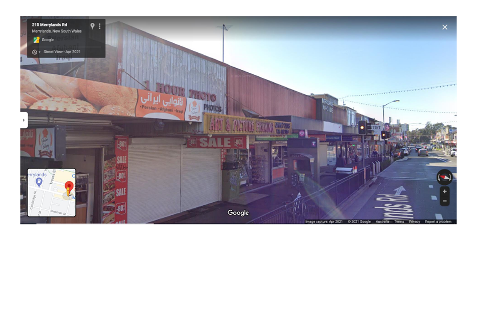
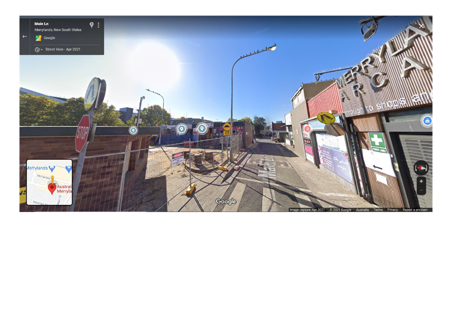
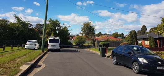
Figure
3 – Street view of subject site. Source: Google Maps
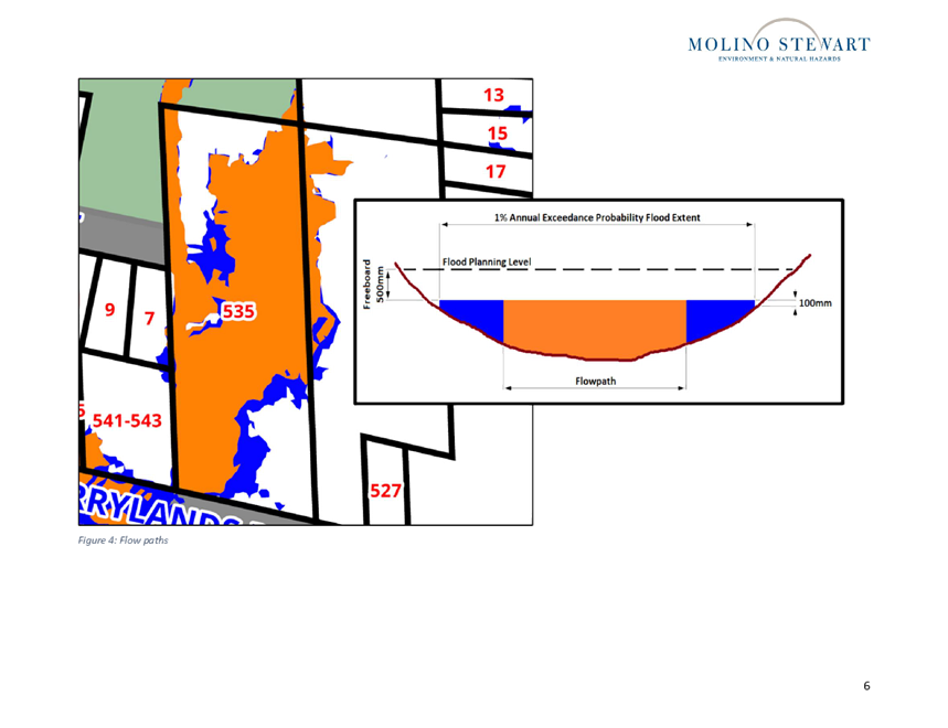
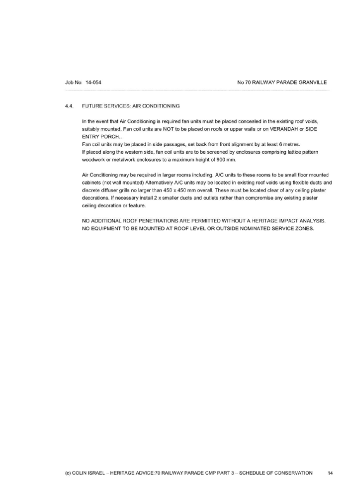
Figure
4 – View of the western boundary of subject site from Yoogali Street.
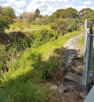
Figure
5 – View of existing grass channel along the western boundary of the
subject site.
Description of the Proposed
Development
Council has received a Section 8.3
Review application of DA2020/0303 refusal for the demolition of existing
structures and removal of trees and construction of a 90-bed residential aged
care facility, including at grade car parking and associated site improvements,
pursuant to State Environmental Planning Policy (Housing for Seniors or People
with a Disability) 2004.
Key features of the proposed
development are as follows:
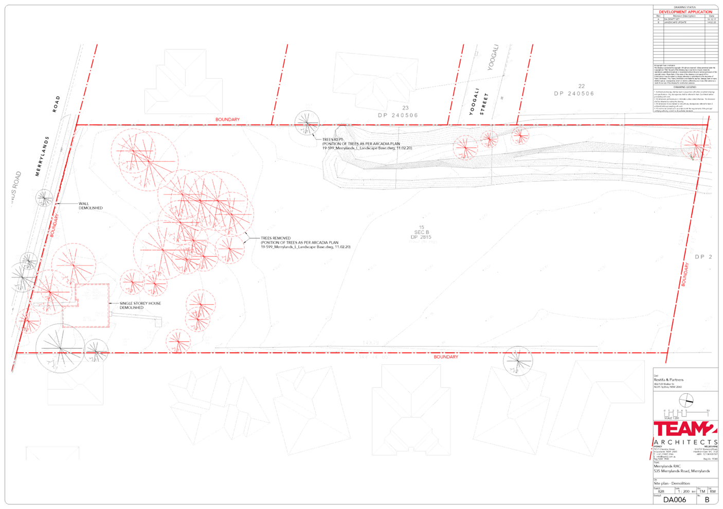
Demolition:
· Demolition
of all existing structures on site and removal of 25 trees.
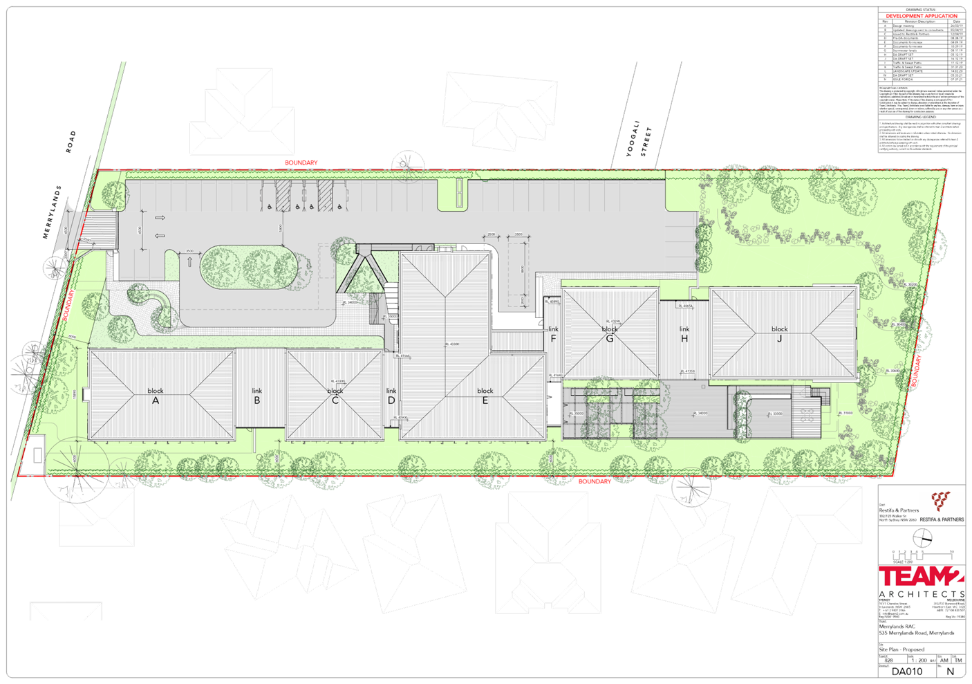
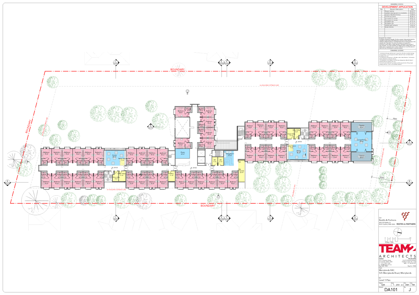
Construction / site works:
· Construction
of a 2 storey residential aged care facility comprising 90 beds/suites as
follows:
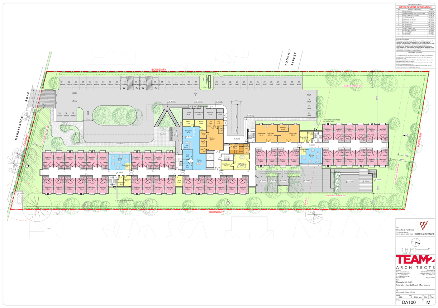
- Ground
Floor: 42 suites, reception/lobby, common dining rooms, outdoor landscaped
courtyard/gardens, nurse stations, kitchen, staff rooms, offices, linen room,
cleaner’s rooms, waste rooms, and mechanical plant room.
- Level
1: 48 suites, dining rooms with terraces, sitting rooms, office, nurse
stations, physio, and cleaner’s rooms.
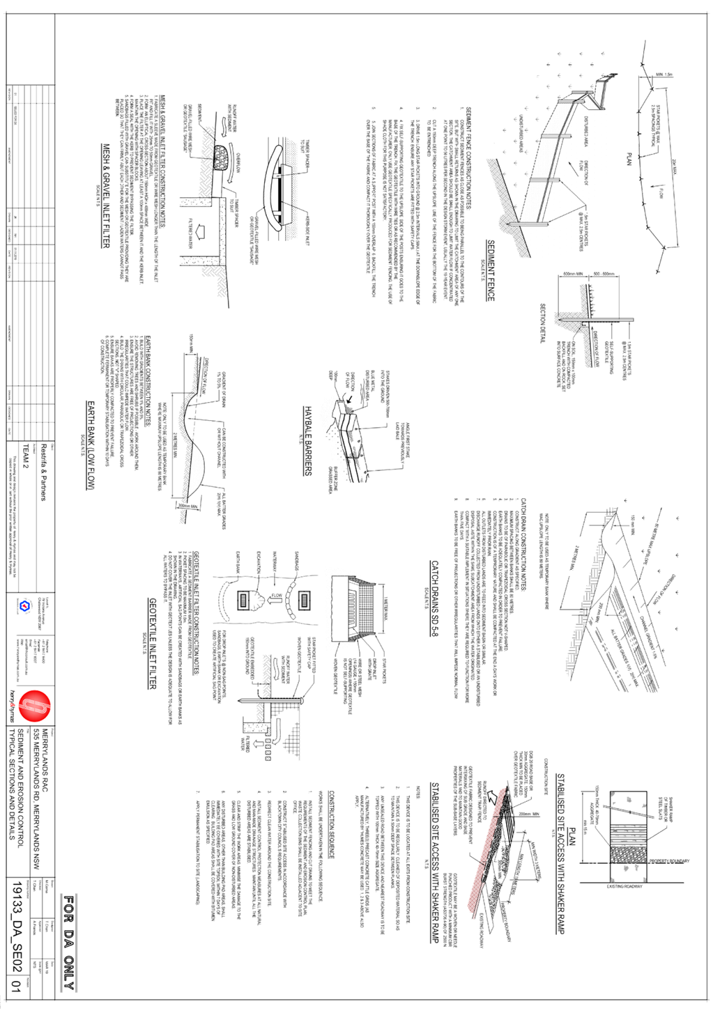
· Site
preparation, stormwater works, landscaping works and construction of civil
infrastructure works including a culvert system.
On-site car parking:
· At-grade
carpark accommodating 39 car parking spaces as follows:
- 22
resident/visitor car parking spaces (including 4 accessible parking spaces);
and
- 17
staff car parking spaces.
· Allocation
has also been made for emergency vehicles and loading dock.
Staff:
· The
proposed residential aged care facility is staffed and supervised 24 hours a
day.
· A
maximum of 30 staff at any one time will be working at the proposed residential
aged care facility.
Key amendments of the subject
proposal from the development proposed under DA2020/0301 are as follows:
· Reduction
of the ceiling height of Level 1 and 2 from 3.2m to 3.1m.
· Overall
reduction in height of the building from:
- 10.3m-11.6m
to 10.1m-11.4m (as calculated in accordance with HLEP 2013).
- 9.3m
to 9.1m (as calculated in accordance with SEPP (HSPD) 2004).
· Additional
landscaping added to improve the interface of the building with the ground
plane.
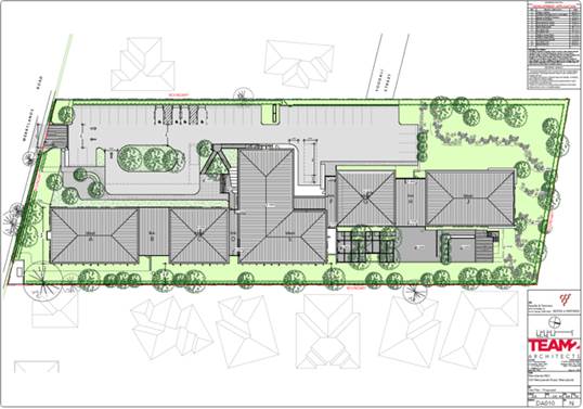
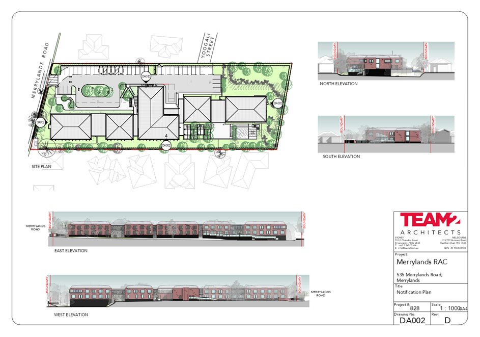
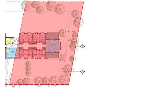
Figure
6 – Site Plan showing the proposed development at the subject site and
relationship with adjoining properties.
Background
On 28 November 2018, a preliminary
pre-lodgement meeting for a proposed residential aged care facility was held
with the applicant and Council staff on site.
On 7 May 2019, a pre-lodgement
meeting was held for a proposed 114 bed residential aged care facility with
at-grade car park, and associated site works (PDA/847).
On 12 May 2021, Development
Application DA2020/0301 for demolition of existing structures and removal of
trees and construction of a 90-bed residential aged care facility, including at
grade car parking and associated site improvements (State Environmental
Planning Policy (Housing for Seniors or People with a Disability) 2004) at 535
Merrylands Road, Merrylands; was refused by the Cumberland Local Planning
Panel, for the following reasons:
a) The
Clause 4.6 variation requests to vary the Height development standard, pursuant
to Clause 40(4)(a) & (c) of State Environmental Planning Policy (Housing
for Seniors of People with a Disability) 2004 are not considered to be well
founded.
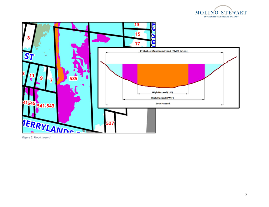
b) The
site is identified as flood prone land in Council’s mapping, impacted by
High Flood Risk area and flood way. The proposal is for the purposes of a
residential aged care which is identified as an unsuitable land use within the
medium/high flood risk area in Table 8 Land Use Categories for Development upon
Flood Prone Land - Section 8 - Flood Prone Land in Part A of Holroyd DCP 2013.
Having regard to the flood affectation of the site, the subject site is not
suitable for the proposed residential age care facility, and does not warrant
support, having regard to the particular vulnerabilities of the likely
occupants of the facility.
c) The
proposal is not in the public interest.
Application History
|
Date
|
Action
|
|
28 July 2021
|
Section 8.3 Review application (REV2021/0003) of
DA2020/0301 refusal lodged with Council.
|
|
3 August 2021
|
The application was referred to Council’s internal
departments for review.
|
|
20 August to 3 September 2021
|
The application was publicly
notified to adjoining and opposite owners, previous submitters, on
Council’s website, and a notice placed on the site for 14 days. In
response, one (1) submission was received.
|
|
13 October 2021
|
Application referred to CLPP for determination.
|
Applicants Supporting
Statement
The applicant has provided a
Statement of Environmental Effects (SEE) prepared by City Plan dated 19 March
2021, and a Section 8.2 Review of Determination DA2020/0301 Statement, prepared
by City Plan dated 14 July 2021, in support of the application.
Contact with Relevant
Parties
The assessing officer has
undertaken a site inspection of the subject site and surrounding properties and
has been in regular contact with the applicant throughout the assessment
process.
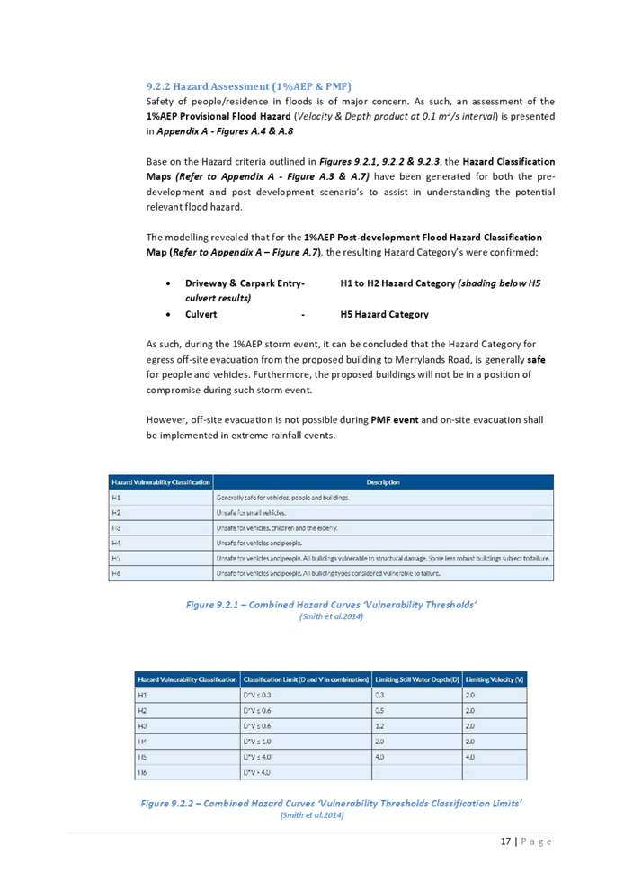
Internal Referrals
Development Engineer
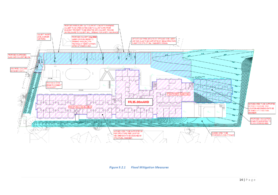
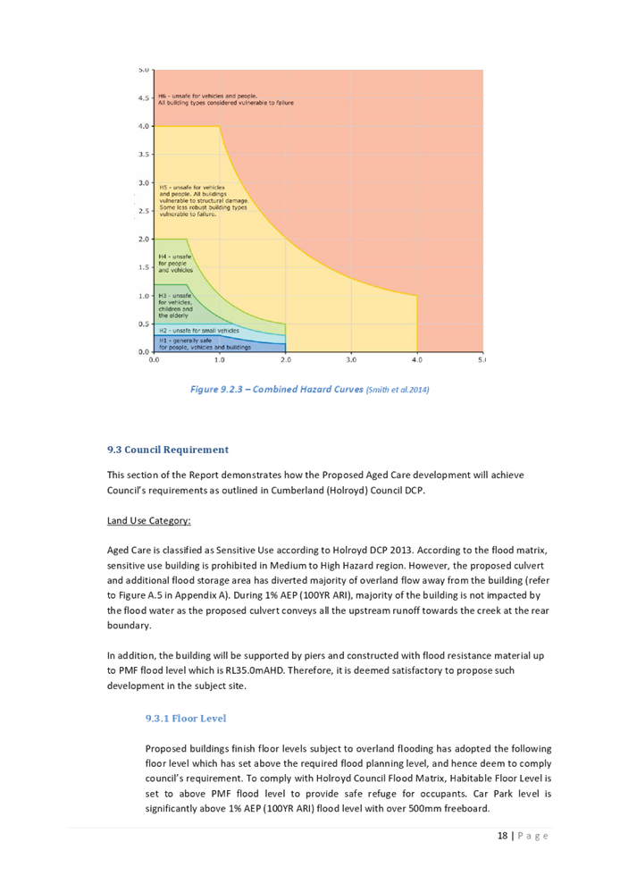
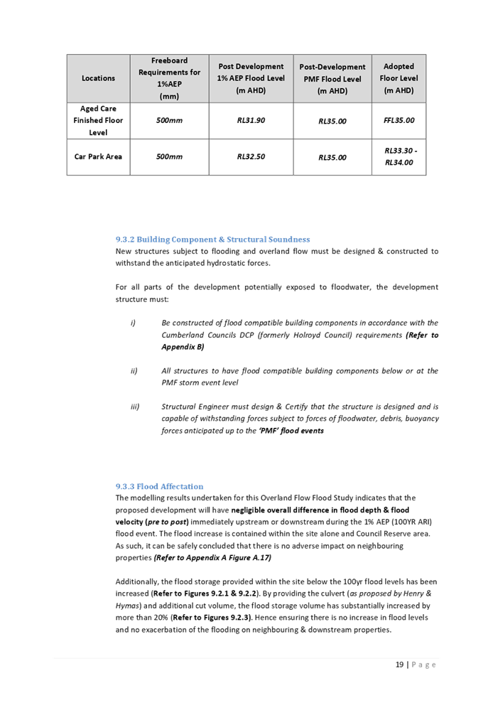
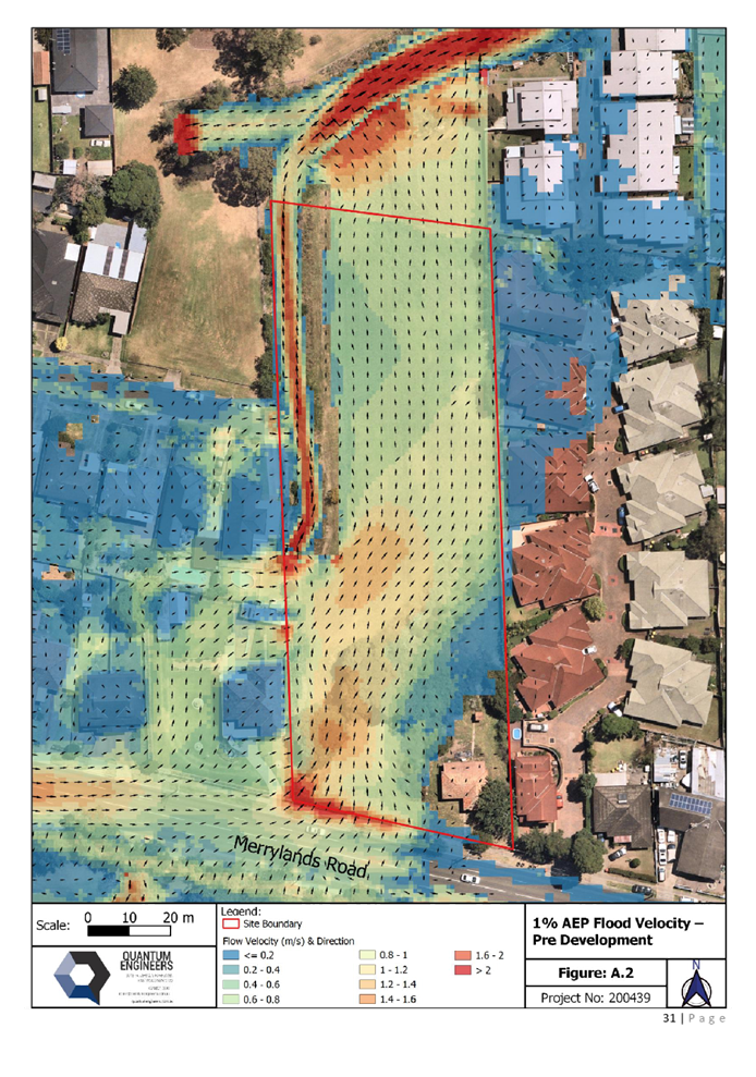
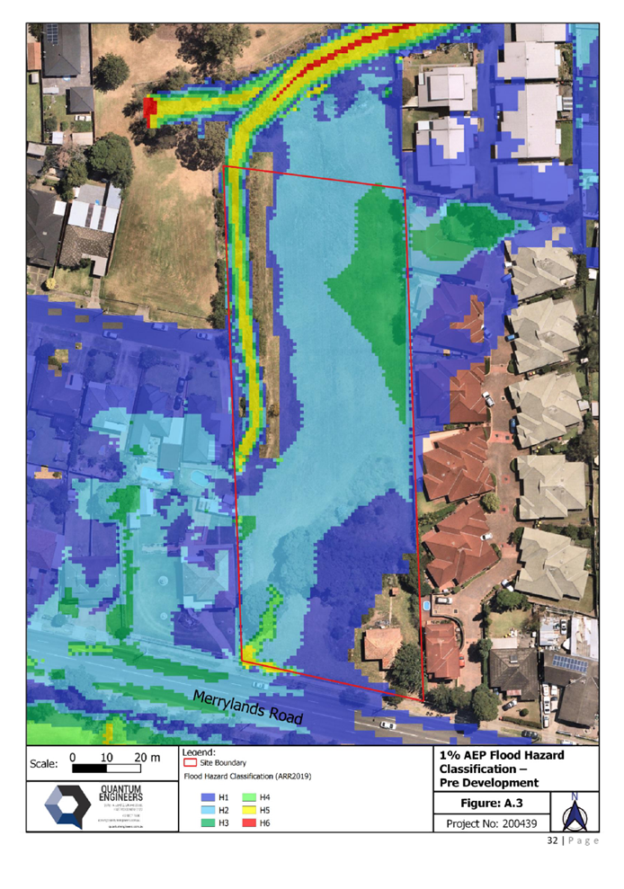
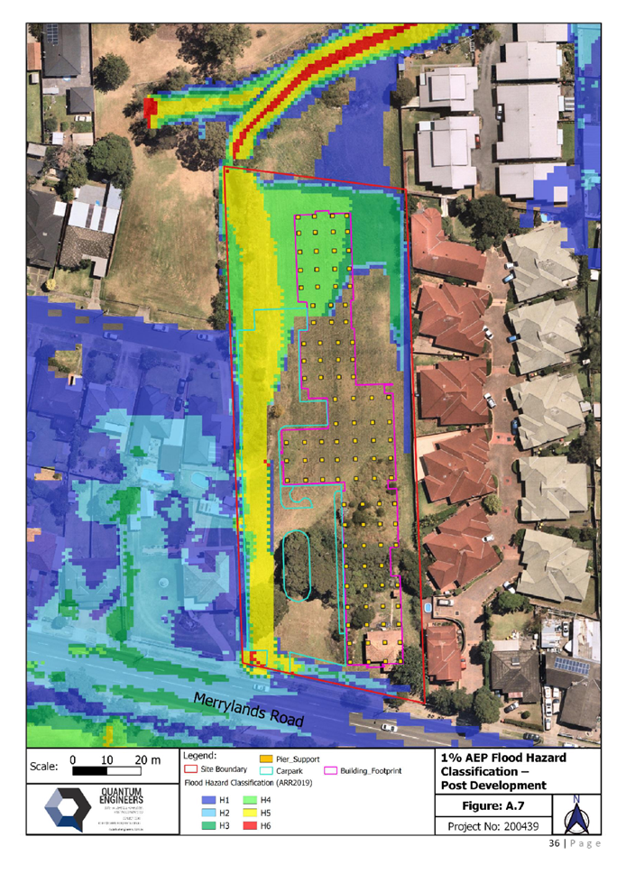
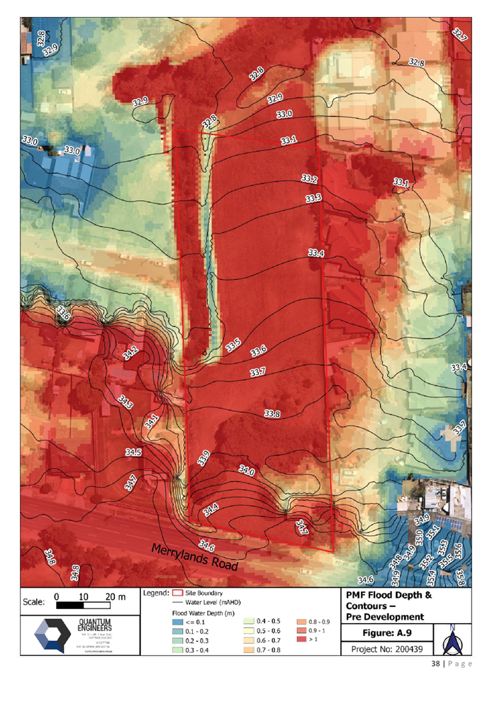
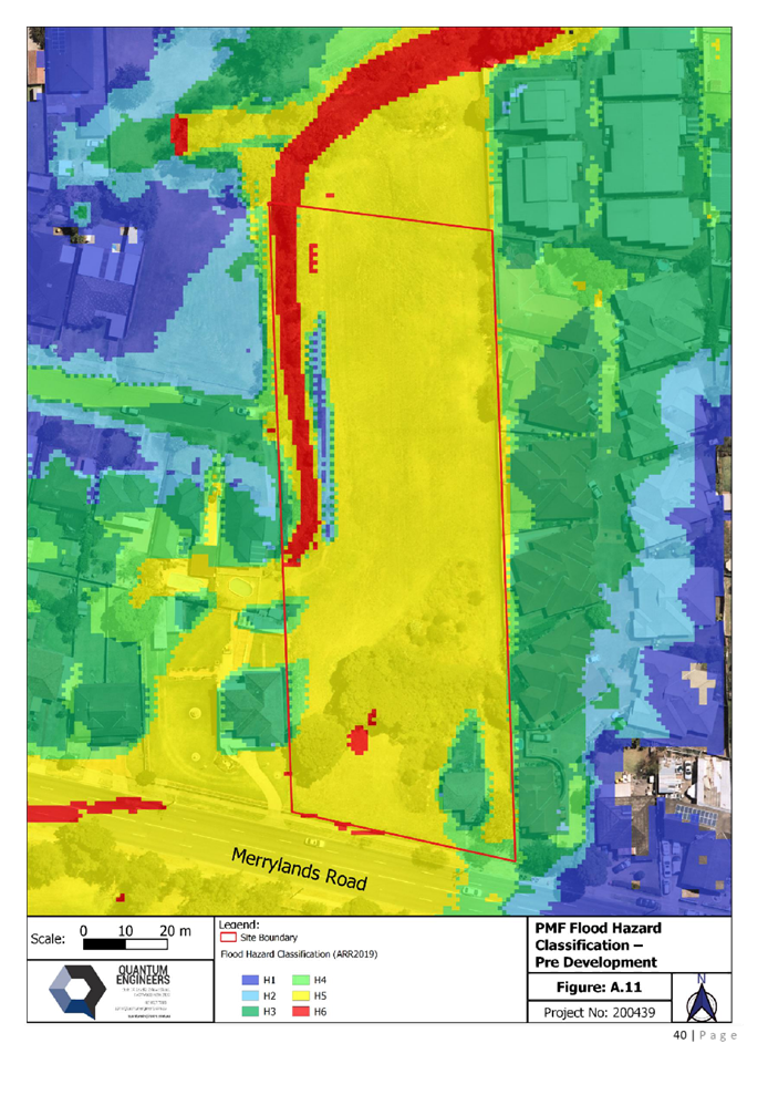
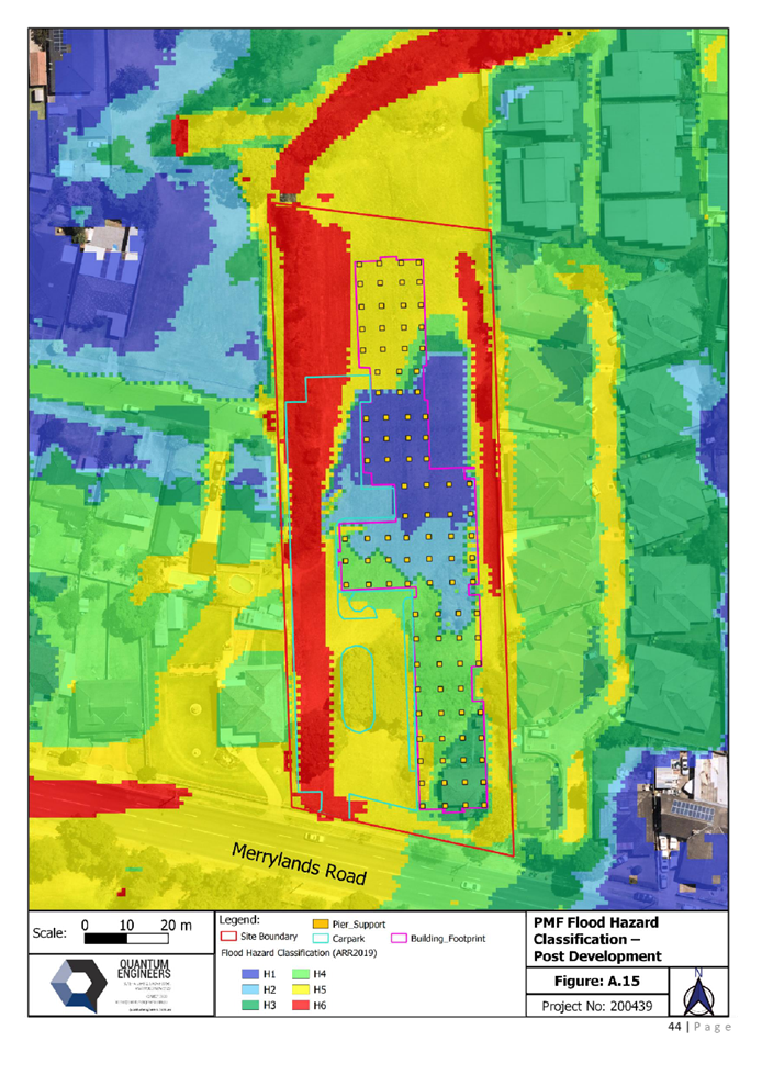
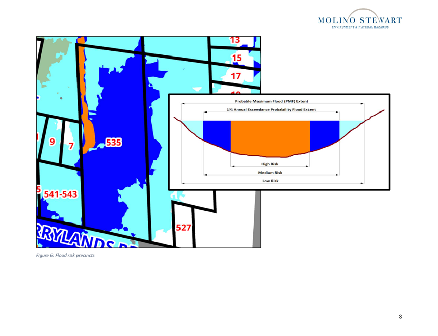
The subject site is identified as
being impacted by the 1% AEP storm event, and portions of the site is
identified as High Hazard Flood and Floodway. To ensure safety of aged care
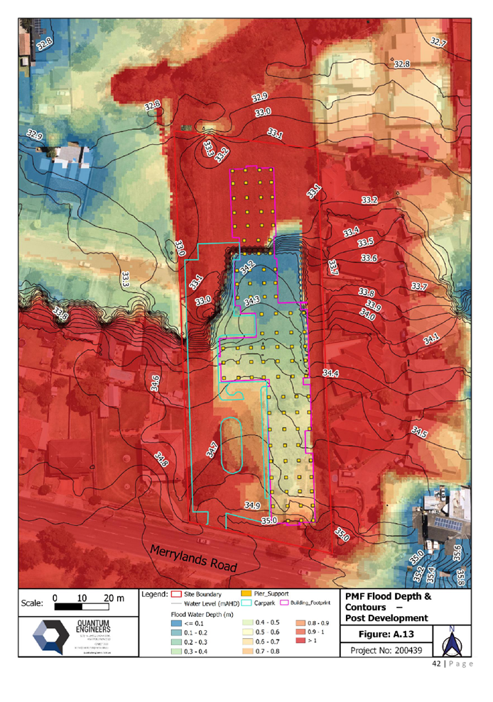
residents, the building has been designed with finished floor levels set above
the PMF flood level for safe refuge (FFL 35.00m AHD).
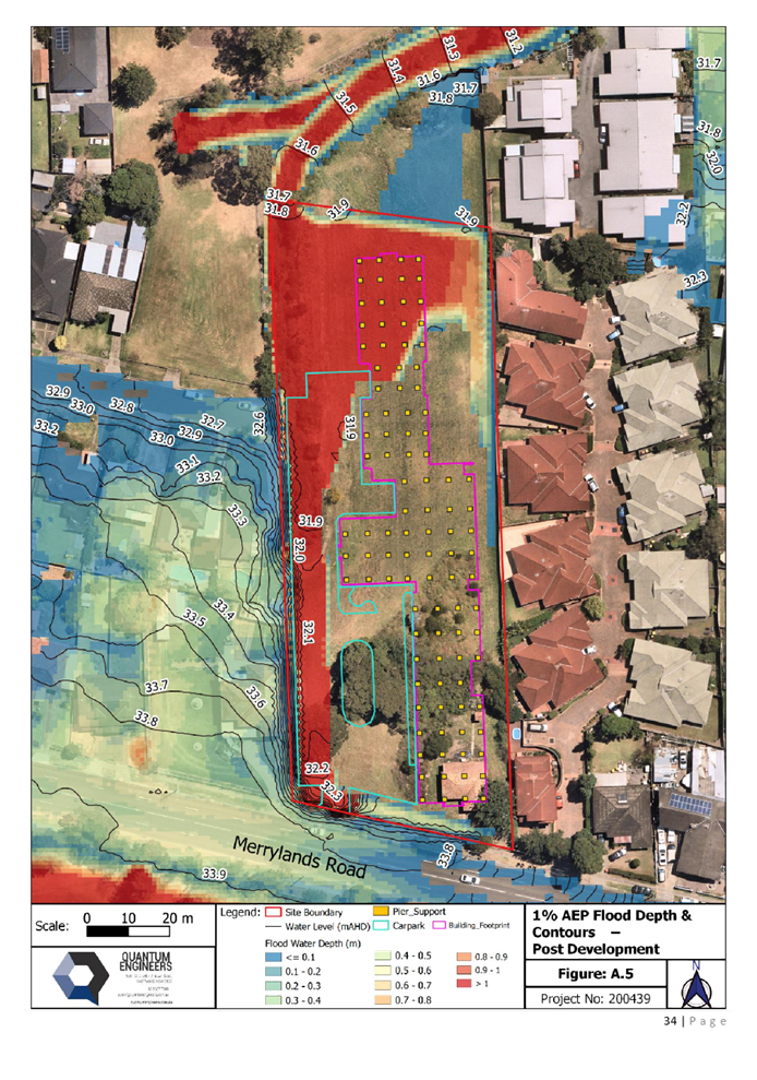
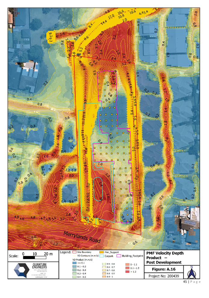
The building is to be constructed
to withstand the anticipated hydrostatic forces, flooding and overland flow.
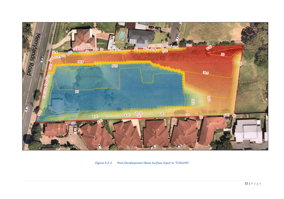
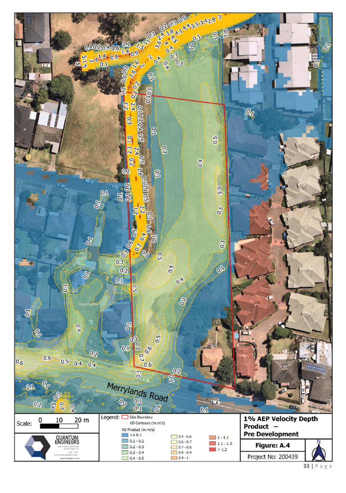
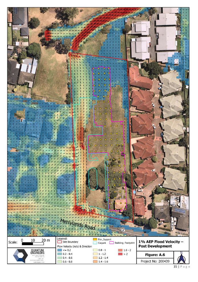
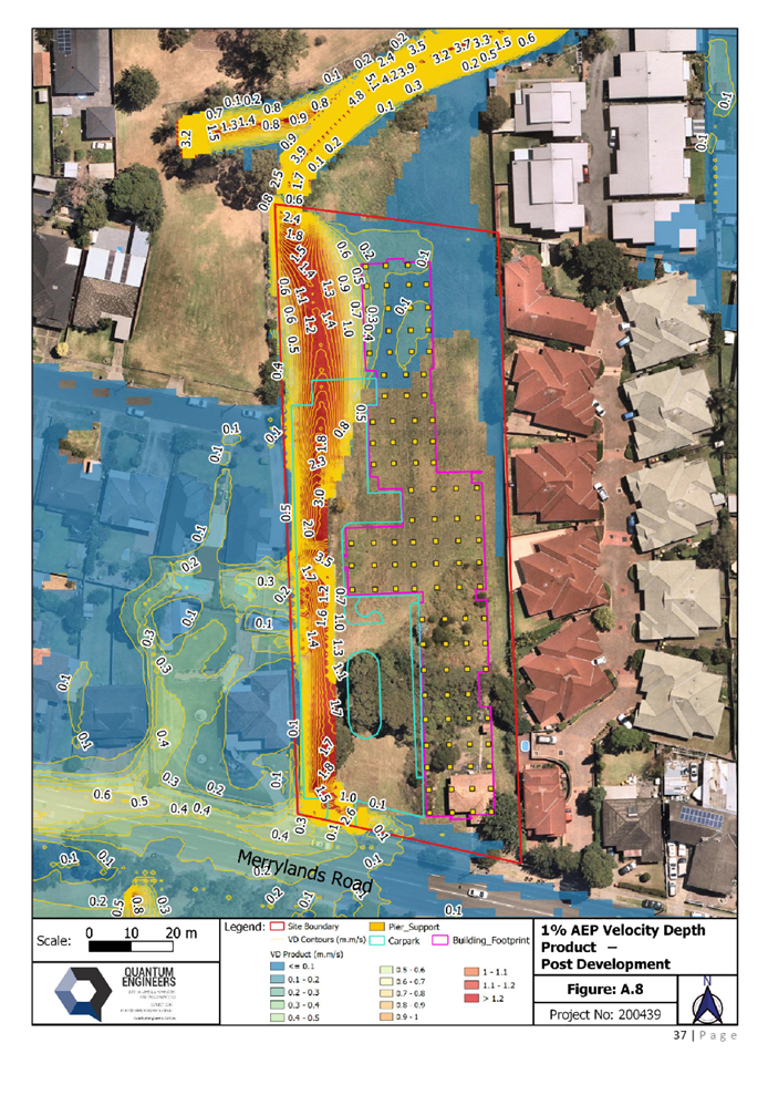
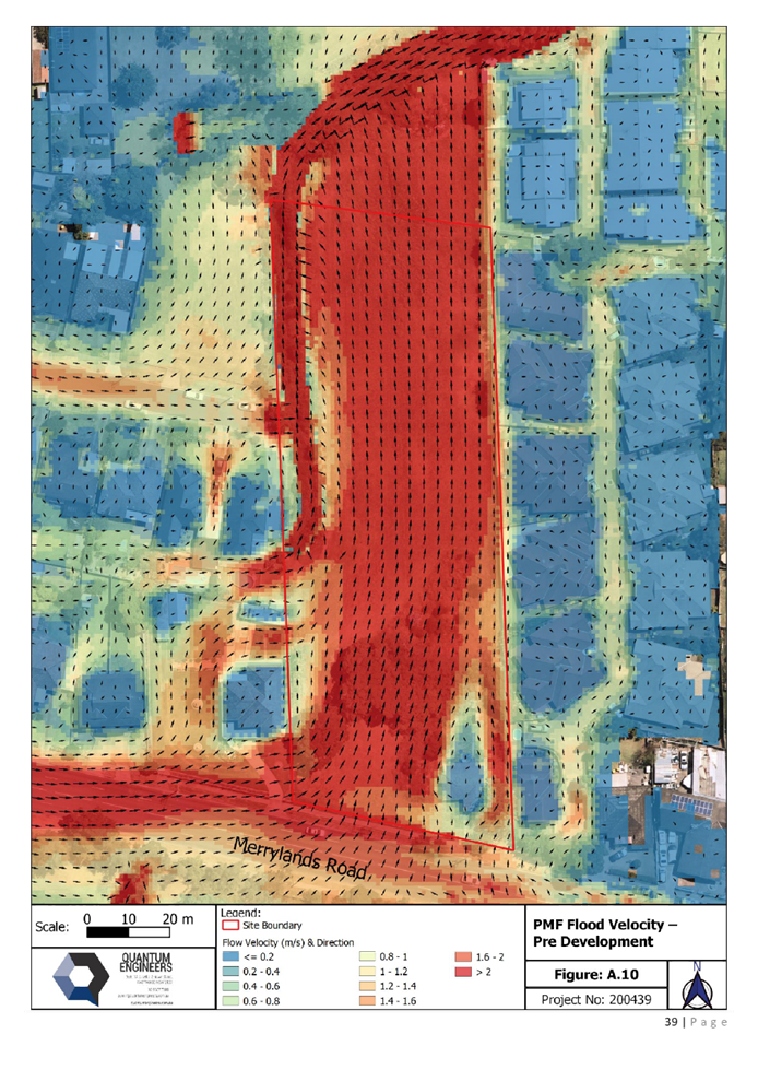
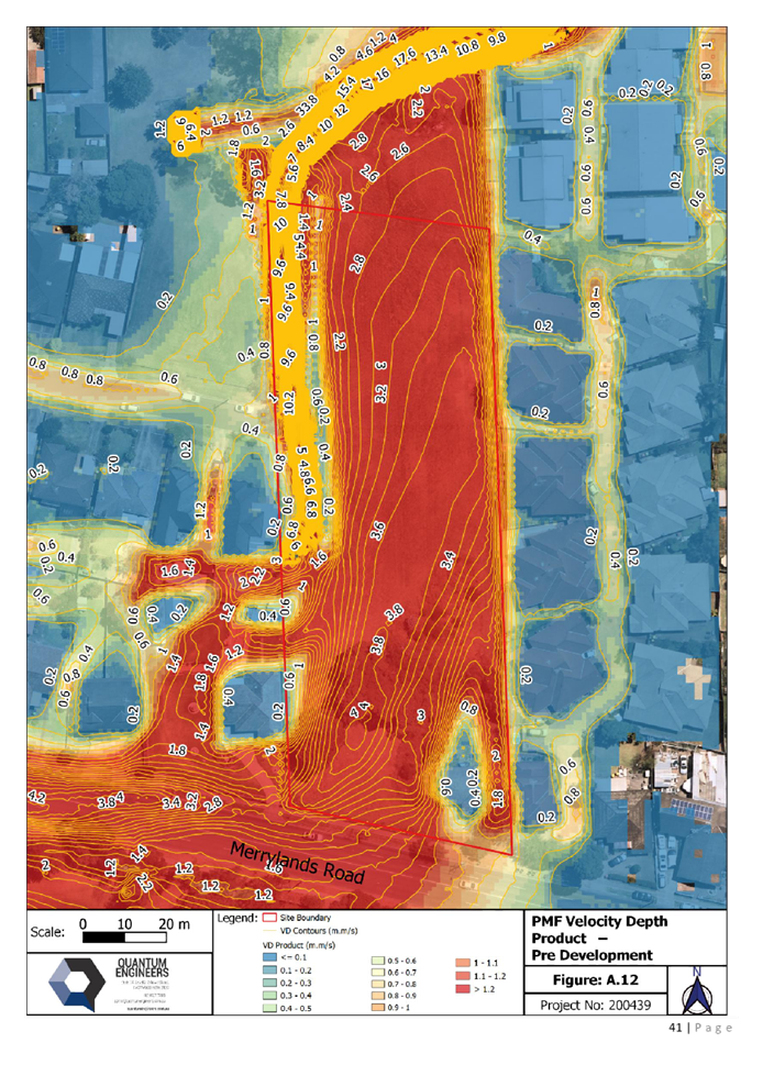
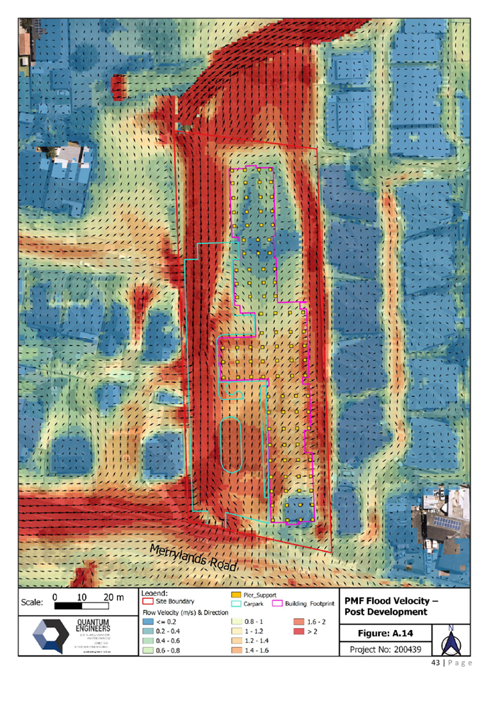
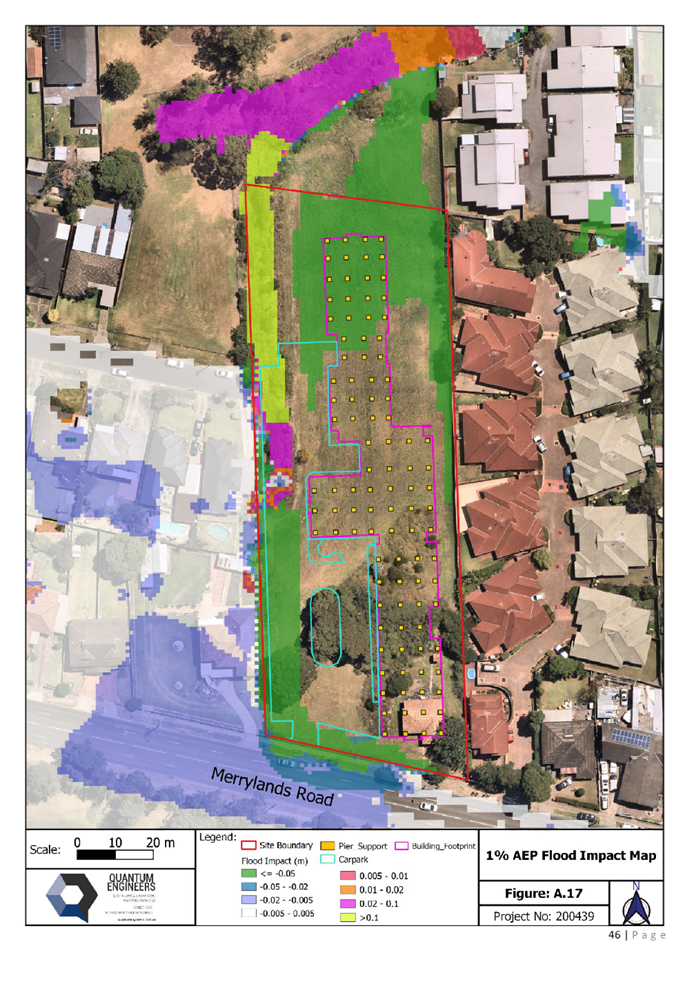
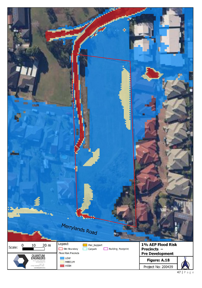
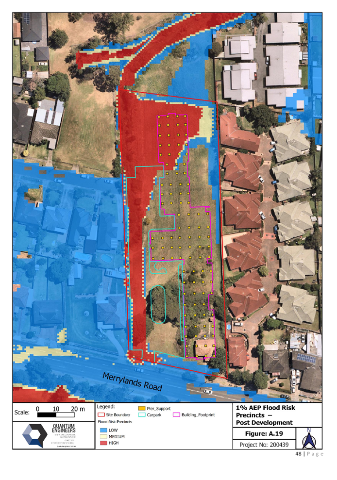
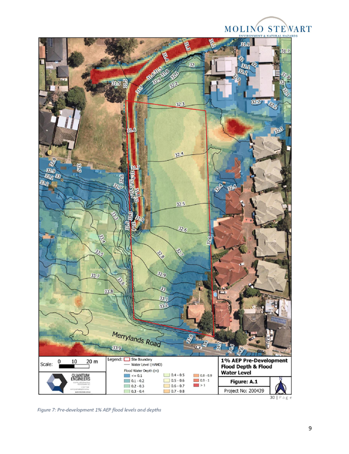
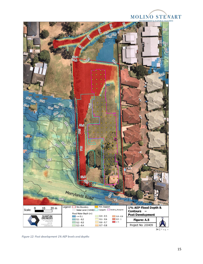
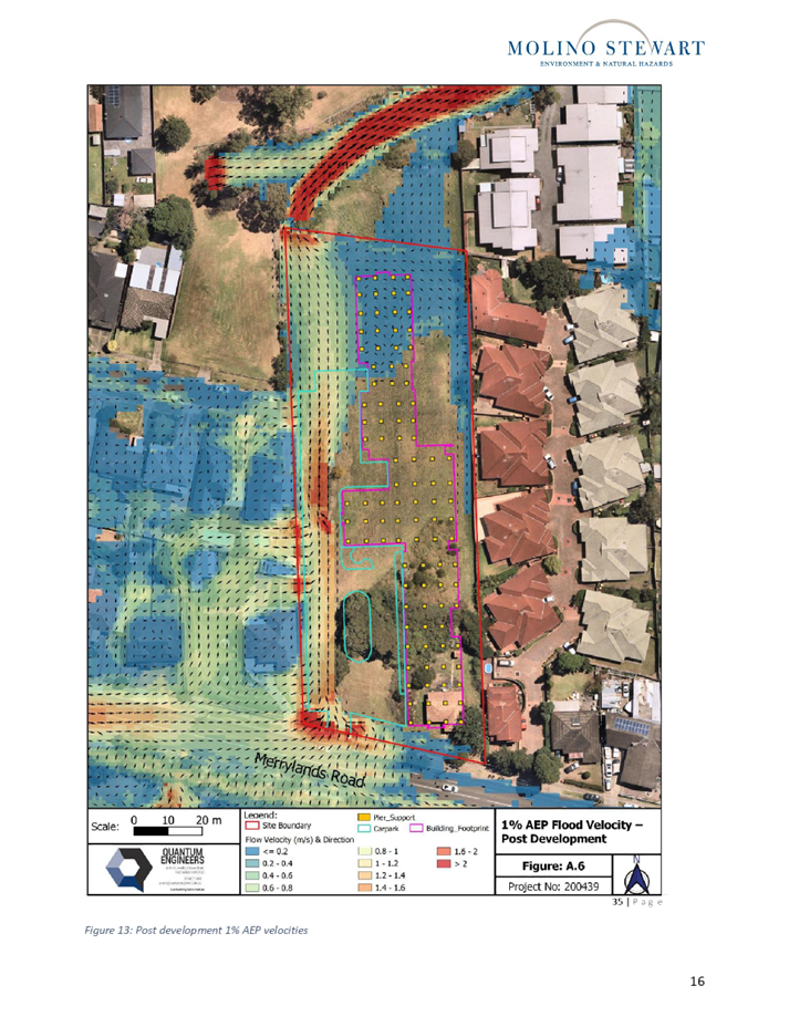
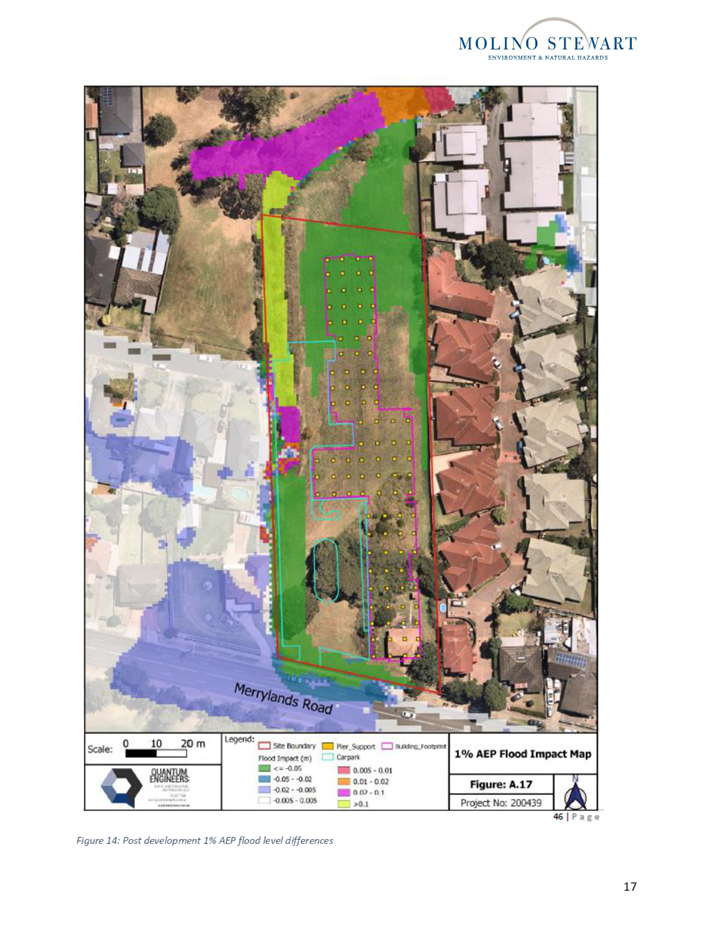
Flood modelling carried out
further indicates that the proposed development will have negligible overall
difference in flood depth and flood velocity (pre to post) immediately upstream
or downstream during the 1% AEP flood event. Additionally, pier construction
and flood storage as provided within the site below the 1 in 100 year flood
levels have been increased to ensure that there is no significant increase in
flood levels and no exacerbation of the flooding on neighbouring and downstream
properties.
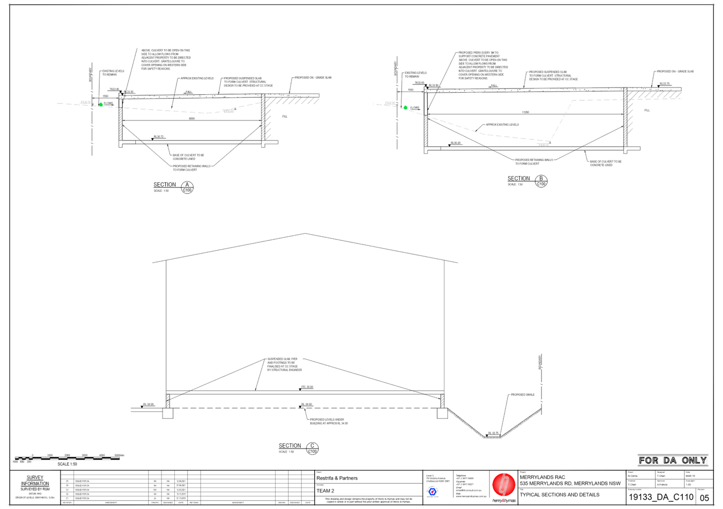
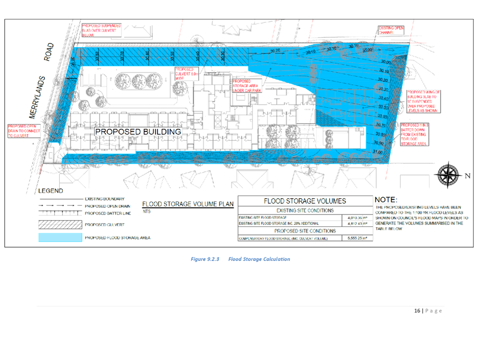
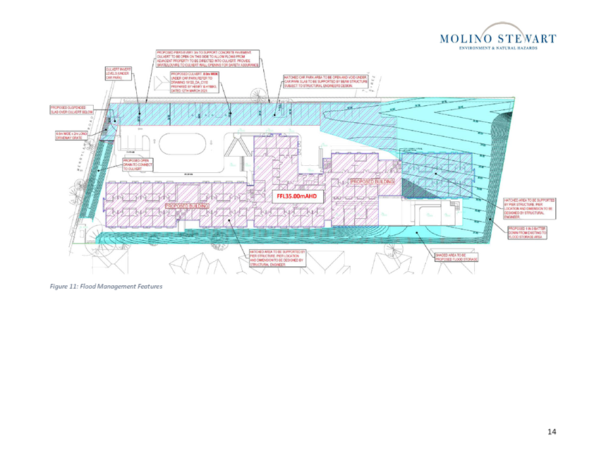
A culvert system has also been
designed through the site to collect and drain the traversing overland flow
from Merrylands Road and direct towards the reserve (Leeton St Park).
The proposal has been accompanied
by detailed stormwater plans, Overland Flow ‘Flood’ Assessment (Ref
No. 200439_Flood, Rev C, prepared by Quantum Engineers, dated 13/04/2021), and
Stormwater Report (Rev 04, prepared by Henry & Hyams, dated April 2021),
and Independent Peer Review of Flood Risk Management Report (prepared by Molino
Stewart Pty Ltd, dated 8 July 2021).
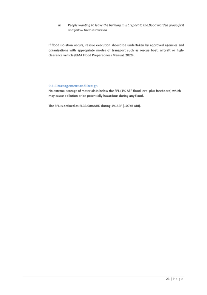
A flood warning system and Flood
Evacuation Strategy have been proposed as part of the reports to minimise the
risk of flood to occupants. Council’s Development Engineer has reviewed
the accompanying plans and reports and outlined that the justification provided
in Section 9.3 of the Overland Flow ‘Flood’ Assessment and the
Independent Peer Review of Flood Risk Management Report is considered
satisfactory.
The independent flood report
importantly indicated that:
· The
FFLs of the building ensure safe refuge for staff and residents within the
building. The emergency response in the event of a flood is for all staff and
residents to remain within the building as shown in Figure 7 below. There is no
direct threat to the occupants from flooding if they remain in the building
because the ground floor level of the building is above the PMF level and flood
waters cannot enter the building.
· The
facility is designed and equipped with sufficient food and medical supplies to
operate for at least 3 days in isolation due to potential external disruptions
other than flooding, and a minimum of 2 registered nurses are on site 24 hours
a day.
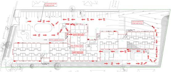
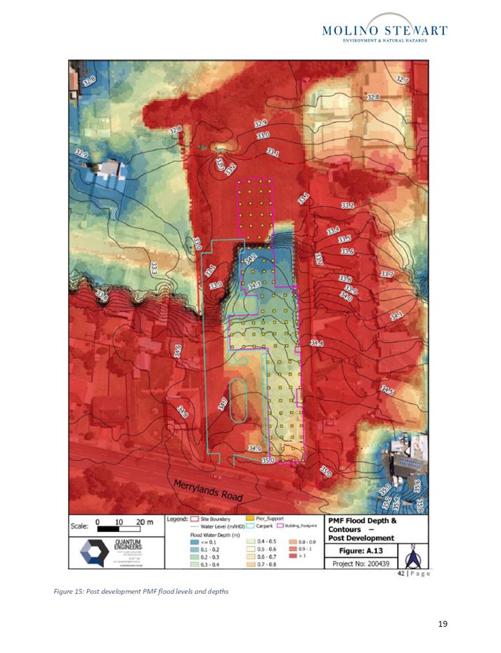
Figure
7 – On-site Evacuation Route (Extract from Overland Flow Flood
Assessment, prepared by Quantum Engineers, Rev C, dated 13 April 2021)
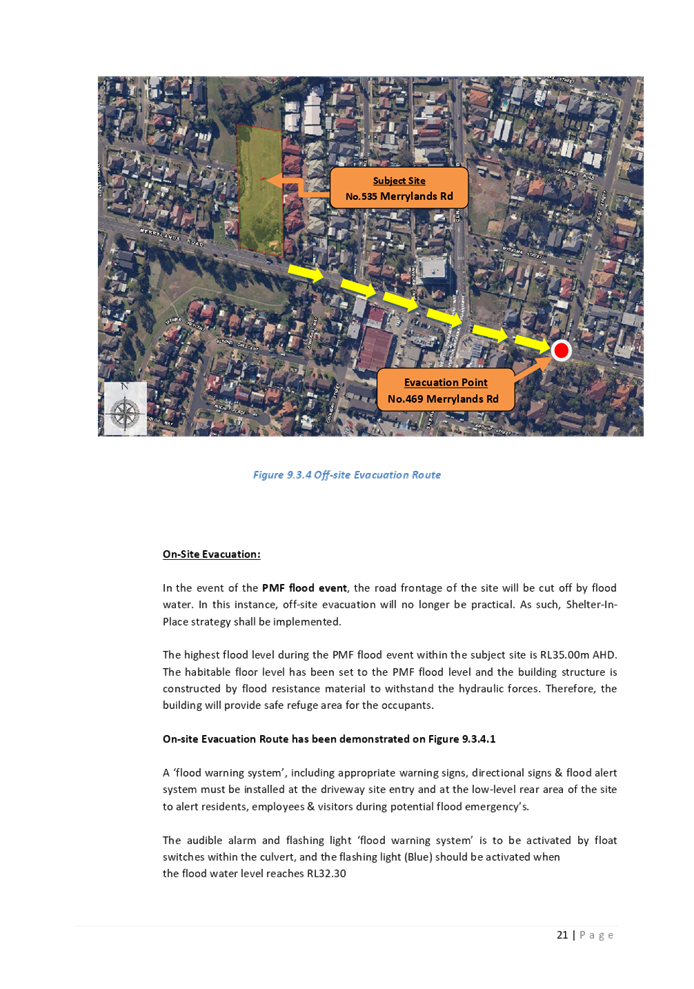
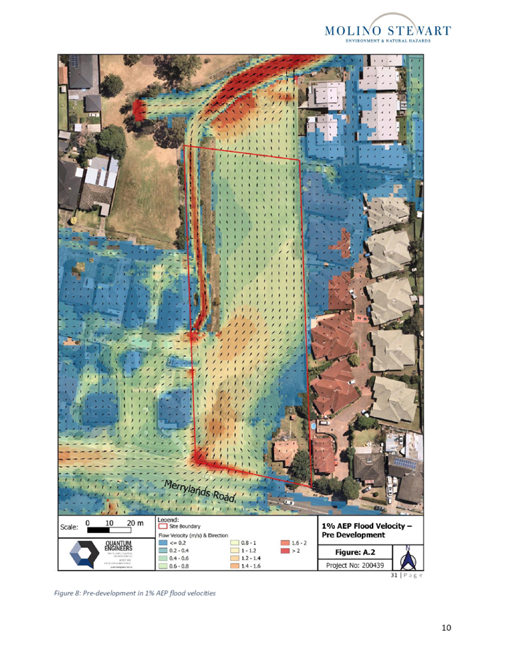
· Early
stage off-site evacuation can take place when there is a known specified event,
prior to the PMF flood event occurring. The evacuation point is located further
east of the site, towards the frontage of No. 469 Merrylands Road, Merrylands,
which is identified as an area located outside the PMF flood extents –
Refer to Figure 8 below. Early stage off-site evacuation is only recommended
when there is advance warning/notice of an anticipated flood event, with sufficient
time to safely evacuate residents that are considered vulnerable to stay on
site during the flood events. Those residents would be evacuated from the
facility until such time flood waters has receded.
· The
building has been designed with additional features summarised above to manage
the flood risks to occupants and the emergency response is for all residents
and staff to remain on site within the confines of the building during a flood
event.
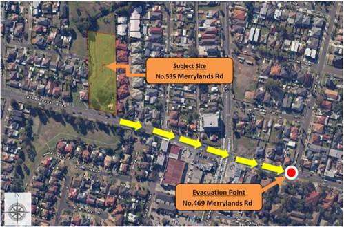
Figure
8 – Off-site Evacuation Route (Extract from Overland Flow Flood
Assessment, prepared by Quantum Engineers, Rev C, dated 13 April 2021)
In this regard, Council’s
Development Engineer has raised no objections to the proposal subject to the
imposition of recommended conditions requiring the above stated drainage, civil
and flood management works on site to ensure safety and protection from flood.
Environment and Health
The development is on land that
will be impacted by road noise and vibration as identified by State
Environmental Planning Policy (Infrastructure) 2007. Council’s
Environmental Health Officer has reviewed the submitted Acoustic Report
prepared by Acoustic Logic, dated 20 February 2020; and submitted plans, and
advised the proposal is acceptable with respect to road noise, subject to compliance
with conditions.
However, Council’s
Environmental Health Officer has advised that the submitted Acoustic Report has
not undertaken an assessment of noise from mechanical plant to ensure
appropriate plant selection and room design prior to construction. This matter
has been resolved via the imposition of appropriate conditions.
Tree Management
Council’s Tree Management
Officer has reviewed the proposal and considers the proposed tree removal,
planting and landscape works acceptable, subject to compliance with recommended
conditions.
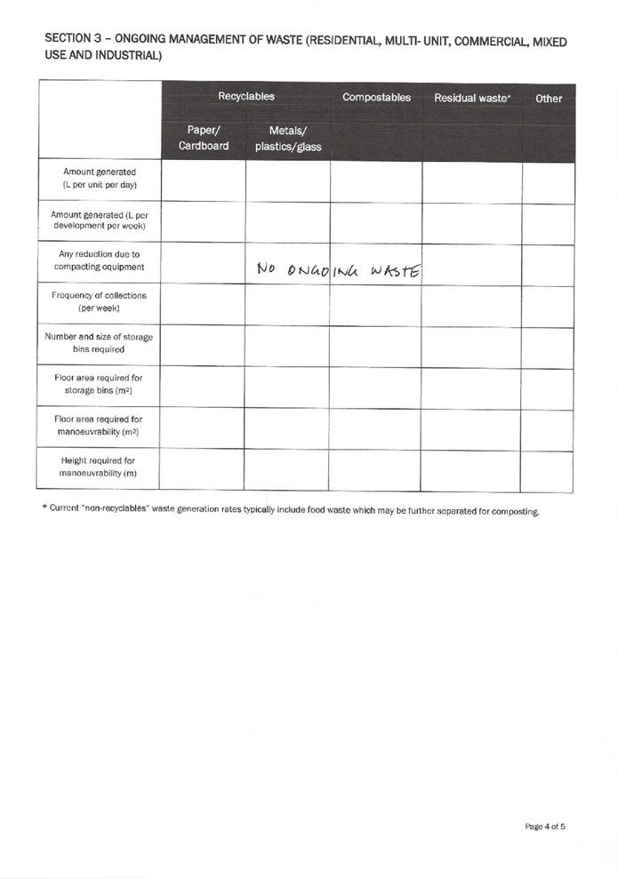
Waste Management
Council’s Waste Management
Officer has reviewed the proposed development and advises that the proposal is
generally satisfactory subject to safe manoeuvring of an 8.8m medium rigid
waste vehicle for on-site collection.
External Referrals
The subject Section 8.3 Review
application was not required to be referred to any external government
authorities for comment as revisions to the proposed development are only
associated with the height of the building, landscaping enhancements, and
window changes to the Merrylands Road façade; and as such not considered
to impact upon the external referrals received from Transport for NSW,
Endeavour Energy and NSW Police, as part of the DA2020/0301.
Details of comments received from
external referral bodies as part of DA2020/0301 which remain applicable to the
subject Section 8.3 Review application (REV2021/0003) are provided below:
Transport for NSW
The proposed development was
referred to Transport for NSW (TfNSW) in accordance with Clause 101 of State
Environmental Planning Policy (Infrastructure) 2007 for concurrence.
Correspondence from TfNSW dated 25
August 2020 outlined that no objections are raised by TfNSW subject to Council
being satisfied with the proposed access arrangements in terms of safety and
efficiency and the inclusion of the following requirements in any determination
issued:
1. The
proposed development will generate additional pedestrian movements in the area.
Pedestrian safety is to be considered in the vicinity.
2. The
layout of the proposed car parking areas associated with the subject
development (including driveways, grades, turn paths, sight distance
requirements in relation to landscaping and/or fencing, aisle widths, aisle
lengths, and parking bay dimensions) should be in accordance with
AS2890.1-2004, AS2890.6-2009 and AS2890.2-2018 for heavy vehicle usage. Parking
restrictions may be required to maintain the required sight distances at the
driveway.
Endeavour Energy
The proposed development was
referred to Endeavour Energy in accordance with Clause 45 of State
Environmental Planning Policy (Infrastructure) 2007. Correspondence from
Endeavour Energy dated 10 June 2020 raised no objections respect to the
proposal subject to the imposition of recommended conditions.
NSW Police
The application was referred to
NSW Police for comment regarding CPTED. Response dated 10 June 2020 indicates
that the proposal is satisfactory subject to conditions.
PLANNING COMMENTS
Section 8.3 of the
Environmental Planning and Assessment Act, 1979 (The EP&A Act)
The application has been assessed
against the relevant matters for consideration pursuant to Section 8.3 of the
EP&A Act subject to the following:
|
Requirements
|
Comment
|
|
(1)
An applicant for development consent may request a consent authority to
review a determination or decision made by the consent authority. The consent
authority is to review the determination or decision if duly requested to
do so under this Division.
|
The
applicant has made a request to review the determination of DA2020/0301.
|
|
(2) A determination or
decision cannot be
reviewed under this
Division—
(a) after the period within
which any appeal may be made to the Court has expired if no appeal was made,
or
(b) after the Court has
disposed of an appeal against the determination or decision.
|
DA2020/0301 was determined on
12 May 2021, in accordance with s8.10(1)(b)(i) of Environmental
Planning and Assessment Act 1979, the
review may be made 12 months after the relevant date. In this regard, the
review may occur anytime until 12 May 2022.
|
|
(3) In requesting a review,
the applicant may amend the proposed development the subject of the original
application for
development consent or for
modification of development consent. The consent authority may review the
matter having regard to the amended development, but only if it is satisfied
that it is substantially the same development.
|
In making and submitting the
review, the applicant has provided additional information to address the
reasons for refusal. Refer to discussion below.
Council is satisfied that the
proposal is substantially the same as that which was previously refused.
|
|
(4) The review of a
determination or decision made by a delegate of a council is to be
conducted—
(a) by the council (unless the
determination or decision may be made only by a local planning panel or
delegate of the council), or
(b) by another delegate of the
council who is not subordinate to the delegate who made the determination or
decision.
|
Noted – The development
application (DA2020/0301) under review was not determined by Council under
delegation rather was determined by the Cumberland Local Planning Panel and
therefore is not subject to subsection (b).
|
|
(5) The review of a determination or decision made by a
local planning panel is also to be conducted by the panel.
|
As the development application under review was determined
by the CLPP, this Section 8.3 application is also to be determined by the
CLPP.
|
Grounds of refusal
The grounds of refusal for the
original application are reviewed and addressed below:
a) The
Clause 4.6 variation requests to vary the Height development standard, pursuant
to Clause 40(4)(a) & (c) of State Environmental Planning Policy (Housing
for Seniors of People with a Disability) 2004 are not considered to be well
founded.
Applicant’s response:
To address the first reason for
refusal, the proposal has been amended in the following ways:
· Reduction
of the ceiling height of Level 1 and 2 from 3.2m to 3.1m.
· Additional
landscaping added to improve the interface of the building with the ground
plane.
This has resulted in an overall
reduction in the height of the building from 9.3m to 9.1m.
Whilst building height has been
raised as a reason for refusal in its own right, given that it is a two-storey
building we have assumed that the Panel's underlying concern may have related
more to the height variation being as a consequence of the need to raise its
floor level to the flood planning level. We have dealt with the issue of flooding
in the next section of this request. On the basis that we believe that flooding
has been appropriately addressed, building height should be considered on its
own merits.
The original Development
Application included two Clause 4.6 variations to development standards:
a) Clause
40(4)(a) of the Seniors SEPP: Building Height - maximum 8m.
b) Clause
40(4)(c) of the Seniors SEPP: Building Height - maximum single storey in height
in the rear 25% area of the site.
The applicant has now produced
amended plans which have reduced the ceiling heights of the proposal from 3.2m
to 3.1m. This reduces the overall building height from 9.3m to 9.1m.
The Clause 4.6 Variation for
Clause 40(4)(a) has been updated to reflect the amended height of the building.
It is noted that the percentage of the variation for the building height
standard has been reduced from 16.25% to 13.75% with this reduced building
height. The height in the rear 25% of the site remains the same given that the
proposed two storey form has not changed.
As outlined in the Clause 4.6
variations, the proposed contravention does not create any significant impact
on the amenity and solar access of the surrounding properties, and the minor
impact is now less than was proposed with the original plans.
Planner’s comment:
The subject Section 8.3 Review
Application is supported by two written requests prepared in accordance with
Clause 4.6 of Holroyd LEP 2013, to vary Clause 40 Development Standards –
Minimum sizes and building height, subclauses (a) and (c); contained in SEPP
(HSPD) 2004.
A detailed assessment of the
variations sought to both Clause 40(a) and 40(c) of SEPP (HSPD) 2004 is
provided under Clause 4.6 of HLEP 2013 of this report below.
b) The
site is identified as flood prone land in Council’s mapping, impacted by
High Flood Risk area and flood way. The proposal is for the purposes of a
residential aged care which is identified as an unsuitable land use within the
medium/high flood risk area in Table 8 Land Use Categories for Development upon
Flood Prone Land - Section 8 - Flood Prone Land in Part A of Holroyd DCP 2013.
Having regard to the flood affectation of the site, the subject site is not
suitable for the proposed residential age care facility, and does not warrant
support, having regard to the particular vulnerabilities of the likely
occupants of the facility.
Applicant’s response:
The subject site is identified as
being impacted by the 1% AEP storm event, and a portion of the site is
identified as High Hazard Flood and Floodway.
The original Development
Application included detailed stormwater plans, Overland Flow
‘Flood’ Assessment (Ref No. 200439_Flood, Rev C, prepared by
Quantum Engineers, dated 13/04/2021), and Stormwater Report (Rev 04, prepared
by Henry & Hyams, dated April 2021), all of which supported the development
in its current form. It is noted that the minor adjustment to the height of the
building does not have an impact on any of these reports.
In response to the flooding
constraints of the site, the building has been designed with finished floor
levels set above the PMF flood level for safe refuge (FFL 35.00m AHD) and will
be constructed to withstand the anticipated hydrostatic forces, flooding and
overland flow.
The above reports including flood
modelling which indicates that the proposed development will have negligible
overall difference in flood depth and flood velocity (pre to post) immediately
upstream or downstream during the 1% AEP flood event. Additionally, pier
construction and flood storage will be provided within the site below the 1 in
100 year flood levels has been increased to ensure that there is no significant
increase in flood levels and no exacerbation of the flooding on neighbouring
and downstream properties.
A culvert system has also been
designed through the site to collect and drain the traversing overland flow
from Merrylands Road and direct towards the reserve (Leeton St Park).
A further flooding report has now
been commissioned on this development – Independent Peer Review of Flood
Risk Management Report (prepared by Molino Stewart Pty Ltd, dated 8 July 2021).
The report prepared by Molino Stewart
provides an independent review to the flood risk management aspects of this
development. It is noted that Steven Molino (who undertook the review) is an
expert in Peer Review assessments.
The key conclusions from the
independent review conducted by Molino Stewart are:
· The
modelling by Quantum Engineers appears to correctly characterise flood
behaviour pre and post development for the 1% AEP flood and the PMF.
· The
proposed design will:
- Better
direct flood flows across the site.
- Prevent
property onsite from being damaged by the 1% AEP flood.
- Prevent
people on site having any significant risk of coming into contact with
floodwaters in the 1% AEP flood.
- Not
increase flood levels on private land off site and on public land confine the
increases in flood levels to within the creek banks.
- Keep
the building contents and occupants from coming into direct contact with any
floodwater up to the PMF.
- Be
able to be designed and built to resist the hydrostatic, hydrodynamic and
debris impact forces of floods up to the PMF.
· There
is a very small residual risk that people may come into contact with
floodwaters if they are outside of the building when it is flooding.
· Even
in the PMF the building will be isolated by flooding for no more than a couple
of hours.
· The
residents of the facility will have no imperative, motivation or ability to
independently leave the premises during a flood.
· The
facility must be designed to operate for at least three days in isolation due
to potential external disruptions other than flooding.
· That
residual risk is best managed by having a flood emergency response plan which
requires sheltering within the building whenever there is significant flooding
on site.
· The
development as proposed is compatible with the on-site risks and does not pose
an unacceptable risk to people or property.
· There
is no reason why the Development Application should be rejected on the grounds
of flooding.
This demonstrates that the
professional opinion of two consultant engineers and Council's development
engineer has concluded that the proposed flood risk has been managed within the
design and management of the building and that the impact of flooding on the
future residents has been adequately addressed.
It is unclear on what basis the
Panel formed a contrary view to the technical experts in this regard, and we
suggest that it is appropriate for the Panel to review that decision taking
into account this technical advice.
Planner’s comment:
An independent review of flood
risk management aspects of the proposed development has been carried out by
Molino Stewart Pty Ltd, dated 8 July 2021. The Report assesses the flood
affectation of the subject site and the risks that flooding poses to the
proposed development and its occupants, how expected risks are to be managed,
and whether that should be acceptable for the proposed residential aged
facility at the subject site.
As detailed in the body of the
report above, Council’s Development Engineer has reviewed the
accompanying plans and reports and raised no objections to the proposal,
subject to the imposition of recommended conditions in relation to drainage,
civil and flood management works on site to ensure safety and protection from
flood.
c) The
proposal is not in the public interest.
Applicant’s response:
As indicated above, flooding has
been addressed satisfactorily and does not present a significant risk to the
residents who would live on this site. Therefore, the benefits of providing
additional seniors housing supply, care facilities and employment generating
uses in a highly accessible and well serviced area outweigh any disadvantage
and as such the proposed development will be in the public interest.
Planner’s comment:
The proposal has been designed to
minimise adverse amenity impacts to adjoining properties, and adequately
address safety concerns to future occupants of the development relating to
flooding. In view of the foregoing analysis, it is considered that the
development, if carried out in accordance with recommended conditions contained
in the Draft Notice of Determination, would be in the public interest.
The provisions of any
Environmental Planning Instruments (EP&A Act s4.15 (1)(a)(i))
(a) Water
Management Act 2000
Correspondence dated 15 September
2020 received from Natural Resources Access Regulator (Water NSW) outlined that
the existing open grassed channel located along the western boundary of the
subject site is not identified as a watercourse, and as such a controlled
activity approval is not required to be obtained from Natural Resources Access
Regulator for the proposed works. In this regard, the proposed development is
not identified as ‘Integrated Development’ pursuant to Section
91(2) of the Water Management Act 2000.
State Environmental Planning
Policies
(a) State
Environmental Planning Policy (Housing for Seniors or People with a Disability)
2004
SEPP (Housing for Seniors or
People with a Disability) 2004 aims to provide access to affordable housing for
older people, people with disability and those on low income. The proposed
development has been assessed and found to generally comply with the provisions
of the SEPP (Housing for Seniors or People with a Disability) 2004.
A comprehensive assessment against
the provisions of the SEPP (Housing for Seniors or People with a Disability)
2004 has been undertaken, and is provided at Attachment 2. The following table
sets out the SEPP (HSPD) 2004 non-compliances, which are considered supportable
as discussed in detail below:
|
29
|
Consent Authority to Consider Certain Site
Compatibility Criteria for Development Applications to which Clause 24 Does
Not Apply
|
|
|
(1) This clause applies to a
development application made pursuant to this Chapter in respect of
development for the purposes of seniors housing (other than dual occupancy)
to which clause 24 does not apply.
Note. Clause 24 (1) sets out the development
applications to which that clause applies.
(2) A consent authority, in
determining a development application to which this clause applies, must take
into consideration the criteria referred to in clause 25 (5) (b) (i), (iii)
and (v).
(3) Nothing in
this clause limits the matters to which a consent authority may or must have
regard (or of which a consent authority must be satisfied under another
provision of this Policy) in determining a development application to which
this clause applies.
|
The subject site is not identified as requiring a
Site Compatibility Certificate. In this regard, Clause 24 does not apply to
the proposed development.
In accordance with Clause 29(1) & 29(2), the
consent authority is required to consider criteria referred to in Clause
25(5)(b)(i), (iii) and (v).
The proposal satisfies Clause 25(5)(b)(iii) and (v)
with respect to access to services and infrastructure, and appropriate bulk
and scale.
Clause 25 (5) (b) (i) states the following:
(b) is of the opinion that the proposed
development is compatible with the surrounding land uses having regard to (at
least) the following criteria—
(i) the natural environment (including known
significant environmental values, resources or hazards) and the existing uses
and approved uses of land in the vicinity of the proposed development,
Comment:
The subject site is identified as being impacted by the
1% AEP storm event, and portions of the site shown as High Hazard Flood and
is located within the flood way. Council’s Development Engineering has
reviewed the proposal and outlined that the proposed residential aged care
facility has been designed to have minimum finished floor levels set above
the PMF flood level to ensure safe refuge for future occupant. Pier
construction, flood storage and a culvert system has also been provided to
collect and drain the traversing overland flow from Merrylands Road and
direct towards the reserve (Leeton St Park), to not result in a significant
increase in flooding on neighbouring properties. Furthermore, an appropriate
flood evacuation plan has been provided. In this regard, the proposal is
considered to satisfy Clause 25(5)(b)(i) of SEPP (HSPD) 2004 as it has been
designed appropriately to respond to the environmental constraints of the
site.
|
|
33
|
Division 2 Design principles
Neighbourhood Amenity and Streetscape
The proposed development should:
(g) Be designed so that no building is constructed in a riparian zone.
|
Portions of the at-grade carpark and Blocks E, G & J
are located within the riparian zone as mapped within HLEP 2013. A concrete
culvert has been proposed to convey flows underground to ensure that a
minimum freeboard of 500mm to the proposed FFL can be achieved.
Council’s Development Engineer has reviewed the civil works proposed
and is satisfied that the development has been designed, sited and managed
appropriately in a manner which would minimise adverse environmental impacts.
|
|
40
|
Part
4 Development Standards to be complied with
Division
1 General Development Standards – Minimum Sizes & Building Height
|
|
|
(4) Height in zones
where residential flat buildings
are not permitted
If the development is proposed in a residential zone
where residential flat buildings are not permitted:
a)
The height of all buildings in
the proposed development must be 8
metres or less, and
Note. Development
consent for development for the purposes of seniors housing cannot be refused
on the ground of the height of the housing if all of the proposed buildings
are 8 metres or less in height. See clauses 48 (a), 49 (a) and 50 (a).
(c)
A building located in the rear 25% area of the site must not exceed 1 storey in height.
|
Residential flat buildings are not
permissible at the subject site.
a) All buildings are in excess of 8m in height.
c) Block J
is located within the rear 25% of the site, and 2 storeys in height.
The Applicant has submitted a Clause 4.6 written
request to vary the height standards prescribed by Clause 40(4)(a) and (c).
Refer to detailed assessment contained within the
body of the report.
|
|
48
|
Division 2 Residential care facilities
Standards that cannot be used to refuse development
consent for residential care facilities
(a) building height: if all proposed
buildings are 8 metres or less in height (and regardless of any other
standard specified by another environmental planning instrument limiting
development to 2 storeys), or
|
The building exceeds the 8m height limit.
The Applicant has submitted a Clause 4.6 written
request to vary the height standards prescribed by Clause 40(4)(a).
Refer to detailed assessment contained within the
body of the report.
|
(b) State
Environmental Planning Policy No. 55 – Remediation of Land (SEPP 55)
Clause 7 of SEPP 55 requires
Council to be satisfied that the site is suitable or can be made suitable to
accommodate the proposed development. The matters listed within Clause 7 have
been considered in the assessment of the development application.
|
Matter for Consideration
|
Yes/No
|
|
Does the application involve re-development of the site or
a change of land use?
|
Yes
No
|
|
In the development going to be used for a sensitive land
use (e.g.: residential, educational, recreational, childcare or hospital)?
|
Yes
No
|
|
Does information available to you indicate that an
activity listed below has ever been approved, or occurred at the site?
acid/alkali plant and
formulation, agricultural/horticultural activities, airports, asbestos
production and disposal, chemicals manufacture and formulation, defence
works, drum re-conditioning works, dry cleaning establishments, electrical
manufacturing (transformers), electroplating and heat treatment premises,
engine works, explosive industry, gas works, iron and steel works, landfill
sites, metal treatment, mining and extractive industries, oil production and
storage, paint formulation and manufacture, pesticide manufacture and
formulation, power stations, railway yards, scrap yards, service stations,
sheep and cattle dips, smelting and refining, tanning and associated trades,
waste storage and treatment, wood preservation
|
Yes
No
|
|
Is the site listed on
Council’s Contaminated Land database?
|
Yes
No
|
|
Is the site subject to EPA
clean-up order or other EPA restrictions?
|
Yes
No
|
|
Has the site been the subject of
known pollution incidents or illegal dumping?
|
Yes
No
|
|
Does the site adjoin any
contaminated land/previously contaminated land?
|
Yes
No
|
|
Has the appropriate level of
investigation been carried out in respect of contamination matters for
Council to be satisfied that the site is suitable to accommodate the proposed
development or can be made suitable to accommodate the proposed development?
|
Yes
No
|
|
A
Preliminary Site Investigation report prepared by Geotechnical Consultant
Australia, dated 4 May 2020, which includes a soil assessment, was submitted
with the application. The report did not reveal any potential matters of
concern with regard to contamination and concludes that the site is suitable
for its intended use, subject to compliance with the recommendations of the
report, which are to be imposed as conditions of consent. Council’s
Environmental Health department has also reviewed the report and determined
that the site is suitable for such a development given that the report
provides that the site is suitable for the proposed use.
|
(c) State
Environmental Planning Policy (Infrastructure) 2007 (ISEPP)
The provisions of the ISEPP 2007
have been considered in the assessment of the development application.
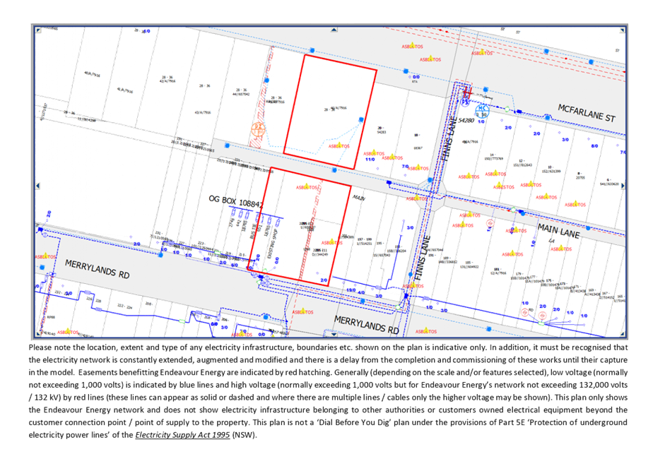
Clause 45 - Development likely
to affect an electricity transmission or distribution network
The proposed development occurs
within 5 metres of existing overhead electricity power lines. The proposed
development was referred to Endeavour Energy in accordance with Clause 45 of
State Environmental Planning Policy (Infrastructure) 2007. No objections were
raised by Endeavour Energy with respect to the proposal.
Clause 101 – Frontage to
classified road
The application is subject to
clause 101 of the ISEPP as the site has frontage to a classified road being
Merrylands Road. The proposed development was referred to Transport for NSW
(TfNSW) in accordance with Clause 101 of State Environmental Planning Policy
(Infrastructure) 2007 for concurrence.
Correspondence from TfNSW dated 25
August 2020 outlined that no objections are raised by TfNSW subject to Council
being satisfied with the proposed access arrangements in terms of safety and
efficiency and the inclusion of recommended requirements, should approval be
granted.
Clause 102 – Impact of
road noise or vibration on non-road development
The site has frontage to a
classified road being Merrylands Road, and the application is accompanied by an
Acoustic Impact Assessment. Council’s Environmental Health Officer has
reviewed the report and advised that appropriate measures are recommended to
ensure acceptable noise levels are maintained for bedrooms from road noise.
(d) Statement
Environmental Planning Policy No 19 - Bushland in Urban Areas (SEPP 19)
The subject site adjoins land
reserved for public open space purposes, being Leeton Street Park, to the rear
of the site. The proposal development is not considered to pose adverse impacts
on Leeton Street Park.
(e) State
Environmental Planning Policy (Vegetation in Non-Rural Areas) 2017
The proposal does not exceed the
biodiversity offsets scheme threshold. Council’s Tree Management Officer
has reviewed the proposal outlined that the vegetation removal is considered
acceptable. Please refer to the DCP compliance table for further discussion.
Regional Environmental Plans
The proposed development is
affected by the following Regional Environmental Plans:
(a) Sydney
Regional Environmental Plan (Sydney Harbour Catchment) 2005
The subject site is identified as
being located within the area affected by the Sydney Regional Environmental
Plan (Sydney Harbour Catchment) 2005. The proposed development raises no issues
as no impact on the catchment is envisaged.
(Note: - the subject site is not
identified in the relevant map as ‘land within the ‘Foreshores and
Waterways Area’ or ‘Wetland Protection zone’, is not a
‘Strategic Foreshore Site’ and does not contain any heritage items.
Hence the majority of the SREP is not directly relevant to the proposed
development).
Local Environmental Plans
Holroyd Local Environmental
Plan 2013
The provision of the Holroyd LEP
2013 is applicable to the development proposal. It is noted that the
development exceeds the maximum LEP building height and FSR permitted for the
site.
(a) Permissibility:-
The proposed development is
defined as a ‘seniors housing’, which is not listed as a permitted
land use with consent on R2 zoned land pursuant to HLEP 2013.
The proposed development is made
pursuant to SEPP (Housing for Seniors and People with a Disability) 2004. In
accordance with Clause 4(1)(a)(i) of SEPP (HSPD) 2004, the Policy applies to
land that is zoned primarily for urban purposes or land that adjoins land zoned
primarily for urban purposes, but only if development for the purposes of
dwelling houses is permitted on the land.
Dwelling houses are a land use
permitted with consent at the subject site pursuant to HLEP 2013.
In this regard, seniors housing in
the form of residential care facilities are permitted at the subject site in
accordance with Clause 4(1)(a)(i) of SEPP (HSDP) 2004.
(b) LEP
Building Height & Floor Space Ratio development standards
The maximum Building Height and
Floor Space Ratio development standards applicable to development at the
subject site as follows:
|
Development
Standard
|
Yes
|
No
|
N/A
|
Response
|
|
4.3 Height
of buildings
Max. 9 metres
|
|
|
|
The maximum height of
the proposed building is:
· Max. 10.1-11.4m as calculated in accordance
with the LEP definition of building height; and
· Max. 9.1m as calculated in accordance with the SEPP (HSPD) 2004 definition of
height.
The Applicant has submitted a Clause 4.6 written request
to vary the building height standards prescribed by SEPP (HSPD) 2004. Refer
to detailed assessment below.
|
|
4.4
Floor Space Ratio
Max. 0.5:1
(Max. GFA of 3,873m²)
|
|
|
|
Clause 48(b) of SEPP
(HSPD) 2004 states that if the density and scale of a residential aged care
facility when expressed as a FSR is 1:1 or less, the standard cannot be used
as ground for refusal.
· The FSR of the proposal as calculated in
accordance with the LEP definition of GFA is: 0.54:1.
- Total GFA = 4,200m²
- Ground Floor = 2,151.8m²
- Level 1 = 2,048.2m²
· The FSR of the proposal as calculated in
accordance with the SEPP (HSPD) 2004 definition of GFA is: 0.58:1.
- Total GFA = 4,523.9m²
- Ground Floor = 2,344.7m²
- Level 1 = 2,179.2m²
|
In
accordance with Clause 5(3) of SEPP (HSPD) 2004, this Policy prevails to
the extent of inconsistency with any other environmental planning instrument.
Notwithstanding, a comprehensive
assessment and compliance table of the proposal against the relevant planning
controls and development standards applicable to the site under the Holroyd LEP
2013 is attached to this report in Attachment 3.
(c) Clause
4.6 – Variations sought to maximum Building Height
Clause 4.6 allows the consent
authority to vary development standards in certain circumstances and provides
an appropriate degree of flexibility to achieve better design outcomes. The
consent authority may grant the exception as the Secretary’s concurrence
can be assumed where clause 4.6 is adopted as per the Department of Planning
Circular PS 18-003, dated 21 February 2018.
Variations Sought
The Applicant’s Clause 4.6
Variation Requests to SEPP (HSPD) 2004 Development Standards is contained at
Attachments 11 & 12.
The applicant has submitted 2
written requests to vary Clause 40 Development Standards – Minimum sizes
and building height, subclauses (a) and (c); contained in SEPP (HSPD) 2004:
Clause 40(4) Height in zones
where residential flat buildings are not permitted
If the development is proposed in
a residential zone where residential flat buildings are not permitted –
(a) The
height of all buildings in the proposed development must be 8 metres or less,
and
Note – Development consent
for development for the purposes of seniors housing cannot be refused on the
ground of the height of the housing if all of the proposed buildings are 8
metres or less in height. See clauses 48 (a), 49 (a) and 50 (a).
(b) A
building located in the rear 25% area of the site must not exceed 1 storey in
height.
Based on various case laws
established by the Land and Environment Court of NSW such as Four2five P/L v
Ashfield Council [2015] NSWLEC 9, Randwick City Council v Micaul Holdings P/L
[2016] NSW LEC7 and Zhang and anor v Council of the City of Ryde [2016] NSWLEC
1179, a 3 part assessment framework for a variation request proposed under
clause 4.6 has been considered and an assessment of the proposed variance,
following the 3 part test is discussed in detail below.
The 3 preconditions which must be
satisfied before the application can proceed are as follows:
1. Is
the proposed development consistent with the objectives of the zone?
2. Is
the proposed development consistent with the objectives of the development
standard which is not met?
3. a) Is
compliance with the development standard unreasonable or unnecessary in the
circumstances of the case? and;
b)
Are there sufficient environmental planning grounds to
justify contravening the development standard and therefore is the
applicant’s written justification well founded?
Assessment of Variation sought
to Clause 40(4)(a) of SEPP (HSPD) 2004:
Clause 40(4)(a) The height of
all buildings in the proposed development must be 8 metres or less
Extent of variation sought
It is noted that SEPP (HSPD) 2004
defines ‘height’ as follows:
height in relation to a building,
means the distance measured vertically from any point on the ceiling of the
topmost floor of the building to the ground level immediately below that point.
The maximum building height of the
proposed development is 9.1m. The majority of the building which exceeds the 8m
height limit comprises of the ceiling of Level 1. The extent of variation
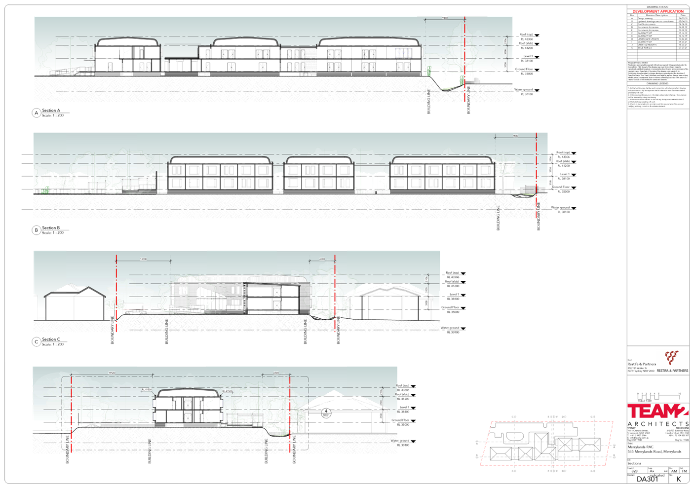
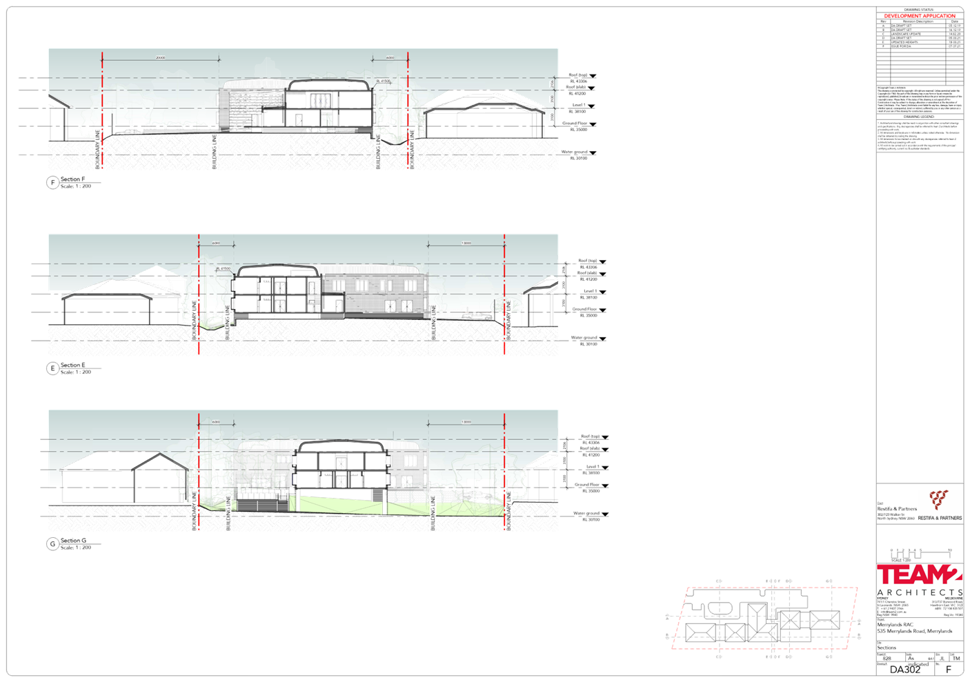
sought is detailed in Figures 9 & 10 below.
Figure
9 – Building height plane showing extent of 8m height variation sought in
blue
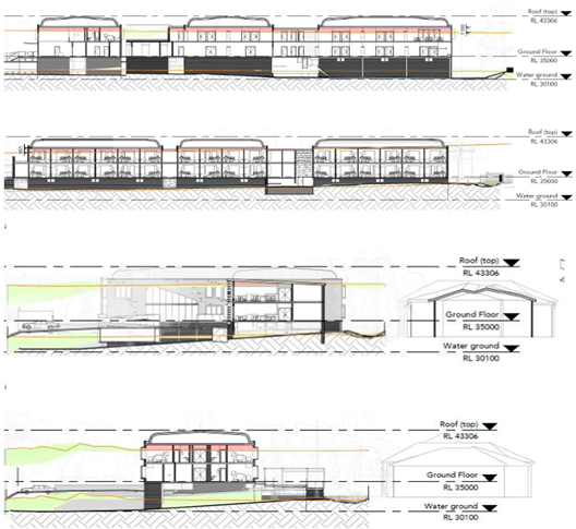
Figure
10 – Section plans showing extent of 8m height variation sought in red
1. Is
the proposed development consistent with the objectives of the zone?
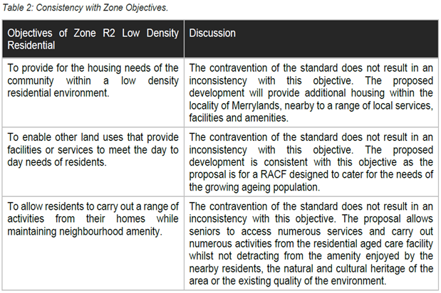
Zone R2 Low Density
Residential
1 Objectives of
zone
· To
provide for the housing needs of the community within a low density residential
environment.
· To
enable other land uses that provide facilities or services to meet the day to
day needs of residents.
· To
allow residents to carry out a range of activities from their homes while
maintaining neighbourhood amenity.
Applicant’s
justification:
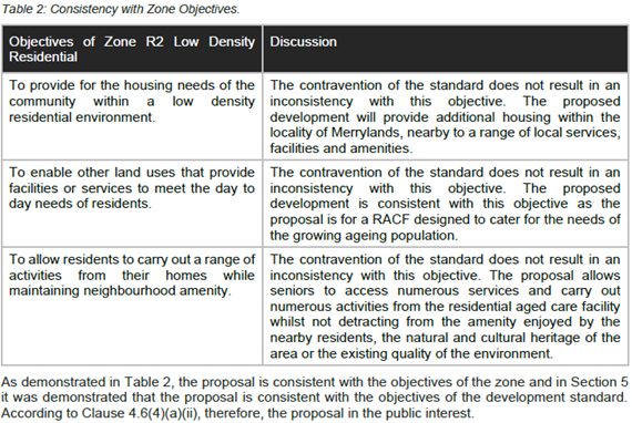
Planner’s comment:
The proposal is for the purposes
of a residential aged care facility, which is consistent with the R2 zone
objectives as it provides for the housing needs of the community, specifically
the ageing population of the locality. The residential aged care facility also
includes on-site services which provides residents with access to carry out a
range of activities in their home setting.
2. Is
the proposed development consistent with the objectives of the development
standard which is not met?
Applicant’s
justification:
The Applicant has referred to De
Stoop v Ku ring gai Council [2010] NSWLEC 1019 and Pathways Property Group Pty
Ltd v Ku-ring-gai Council [2017] NSWLEC 1486; to derive the assumed
intent/purpose (objectives) of the height standard in Clause 40(4)(a) as
follows:
· To ensure that the
development is compatible, by virtue of its bulk and scale, with the existing
and desired future character of the area;
· To not cause
unreasonable amenity impacts on adjoining developments.
Justification provided by the
Applicant based on the above assumed objective of the height standard is as
follows:
Bulk and scale
Consistent with the heights of the
adjoining development, the proposed RACF will be two storeys. The height
contravention is a result of the flood hazard of the land which required a
minimum FFL of RL 35000 to ensure that it is compatible with the raised flood
planning levels. As such, the built form is consistent with and appropriate to
the desired future character of the site, ensuring compatibility with the
streetscape by virtue of its scale and high-quality design which reduces building
bulk when viewed from the public domain.
To assist in breaking up the
façade, lightweight perforated screens are proposed between the
buildings to appear as links and are setback from the building line to reduce
the extent of building mass along the site’s elevations.
The overall bulk and scale of the
building remains similar to a height compliant development, only with the
emphasis on the vertical plane rather than the horizontal plane. A height
compliant scheme with the same compliant FSR (of 0.75:1) would take up more
site area and reduce the extent of setbacks and associated landscaping (which
in the non-compliant scheme) assists in reducing the apparent bulk and scale of
the building.
Views
Views from surrounding properties
will not be largely affected as a consequence of the contravention of the
development standard. Views in the surrounding area are generally limited to
street level views, sky and some canopy trees.
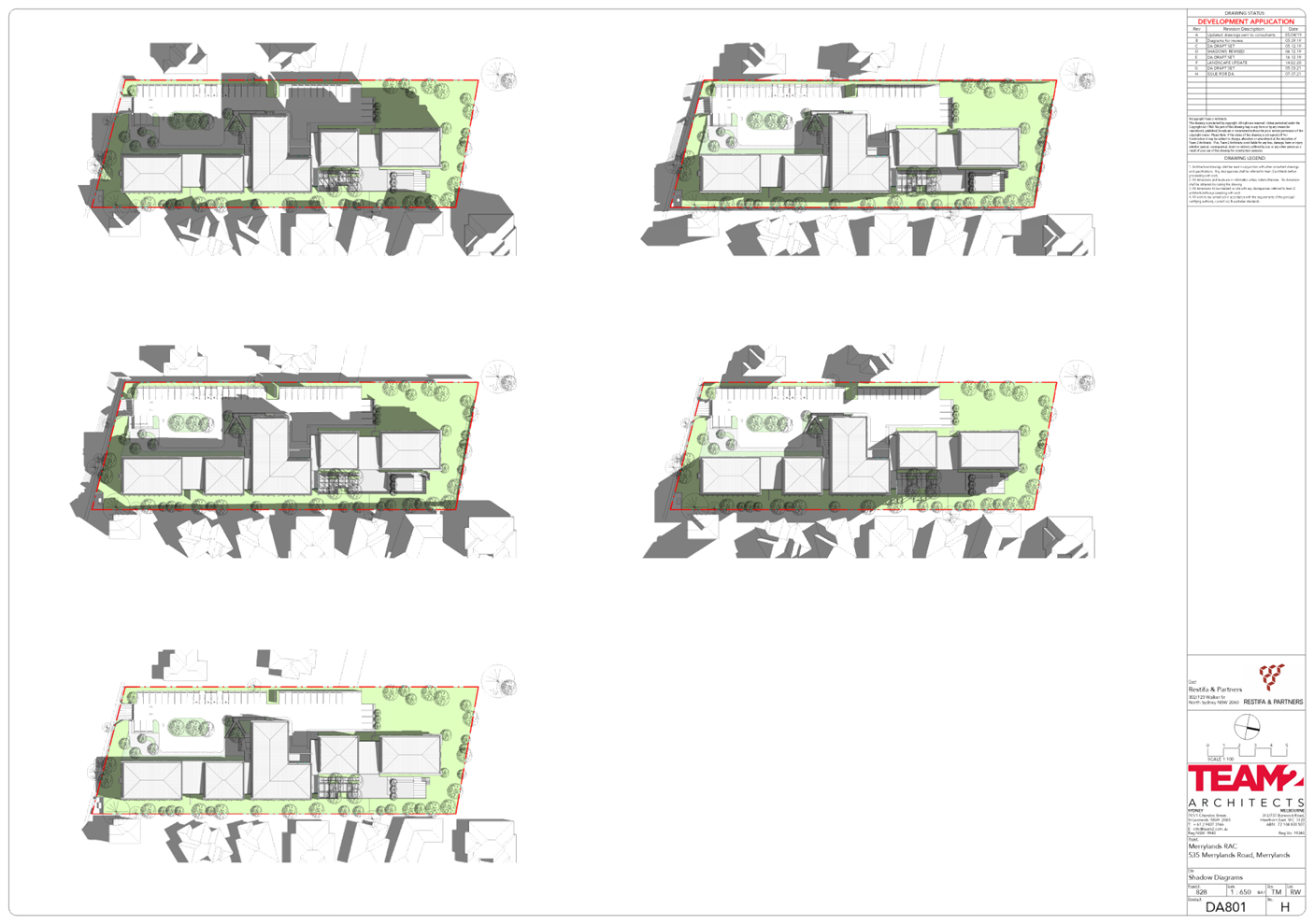
Overshadowing
It is somewhat difficult to assess
overshadowing when dealing with a ceiling height control rather than a
‘top of building height’, since the roof type and pitch can vary
and generate different shadow outcomes above the same ceiling height.
The properties at 541-543
Merrylands Road and 7 Yoogali Street will receive minor overshadowing to part
of their primary open space between 9am and 10:30am on 21 June. However, they
will not receive any additional overshadowing as a result of the proposal after
10:30am.
Three properties at 529 Merrylands
Road will receive additional overshadowing between 1:30pm and 3pm. However,
they will not receive any additional overshadowing between 9am and 1:30pm as a
result of the proposal.
All properties along the
north-eastern and north-western property boundary will receive in excess of 3
hours of direct sunlight between 9am and 3pm on 21 June. As detailed in the
overshadowing diagrams, the majority of the shadows will fall on the site
itself throughout the day.
Privacy
Where the proposed contraventions
occur, there is a proposed setback of 6 metres to the site’s eastern
property boundary and 13.87 metres to the site’s western property
boundary. The proposed setbacks, together with the considered design of the
proposed development ensures there would not be an unreasonable impact in terms
of privacy as a result of the scheme.
Visual Impact
The areas of contravention will
not have a visual impact as the two storey development is consistent with
surrounding development heights. As discussed above, the height contravention
is located away from the front setback to limit the building’s visual
presence onto the streetscape. The additional height, as a result of raised
flood planning levels, does not cause the building to appear overly dominant or
bulky. Design features including setbacks, articulation, materials and
associated landscaping, make the proposed development compatible with the
existing and future character of the area.
Planner’s comment:
Clause 40(4) of SEPP (HSPD) 2004
does not contain objectives which specify the intent of the prescribed height
standards.
The proposed development is
considered to be consistent with the derived assumed intent/purpose
(objectives) of the height standard in Clause 40(4)(a), for the following
reasons:
· The
immediate area is characterised by single and two-storey low to medium density
housing developments. It is expected that future development at the subject
site and in the immediate vicinity of the site would be a maximum of 2
storey/9m in height, having regard to the HLEP 2013 building height standard
applicable to the site and adjoining properties.
· The
subject site is identified to as a High Flood Risk area and is located within
the flood way. The proposed development has been designed with elevated
finished floor levels of RL 35.00 to achieve the required flood planning level
of the site and ensure the safety of the aged care facility residents.
· The
proposed development is 2 storeys in height, and setback a minimum distance of
6m from the eastern boundary. The finished floor level of the ground floor of
the proposed development is set approximately level with the top of the 1.8m
high common boundary fence of dwellings at 529 Merrylands Road. Blocks A, B, C,
D & E comprise of elevated floor levels, and are setback a minimum distance
of 6m from the eastern boundary for both the ground and first floor levels.
Visual privacy is adequately maintained between properties, noting that the design
of the east facing suite windows of Blocks A-E (inclusive) comprise of solid
elements with translucent corner windows, which restrict direct overlooking to
neighbouring properties.
· Greater
setbacks are provided from the proposed development to the western boundary, as
a result of the location of the at-grade car park along this boundary. The
proposed building provides a minimum setback of 13m, increasing to 20m and
30.5m to western boundary.
· The
two storey height and massing of the building across the site with recessed
elements between blocks, adequate setbacks to site boundaries, and perimeter
landscaping, is considered to present an appropriate built form when viewed
from neighbouring properties and public domain.
· Suite
windows facing both the eastern and western boundary have been designed to
provide adequate amenity for future occupants whilst ensuring privacy is
maintained between neighbouring properties.
· The
ground floor landscape garden/courtyard is setback min. 6m from the common
boundary. The garden/courtyard is raised approx. 2-2.3m above the existing
ground levels and considered to result is visual privacy and overlooking
impacts to neighbouring properties’ private open space areas.
· Landscaping
is proposed along the eastern boundary which comprises of a mix of tree
plantings with a mature height of 1-10m. This is considered to address
overlooking concerns from the proposed development.
· In
addition, the 6m setback provided from the terrace, and the existing 1.8m high
eastern boundary fence is considered to obscure direct sight lines to the rear
yard of the neighbouring dwellings. The mature perimeter landscaping proposed
along the eastern boundary will also ensure that privacy is maintained between
properties having regard to the elevated floor levels of the courtyard.
In this regard, the Clause 4.6
variation sought is considered acceptable as the design of the proposal is
compatible with both the existing and future desired character of the locality
and does not result in adverse amenity impacts on neighbouring properties.
3. a)
Is compliance with the development standard unreasonable or unnecessary in the
circumstances of the case? And;
Applicant’s
justification:
Bulk and scale
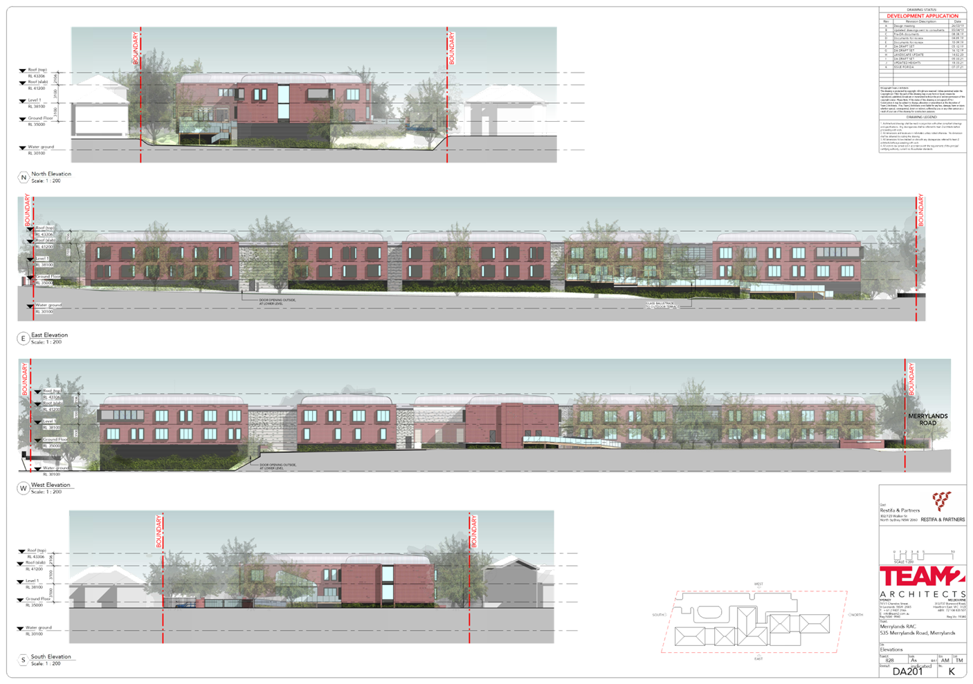
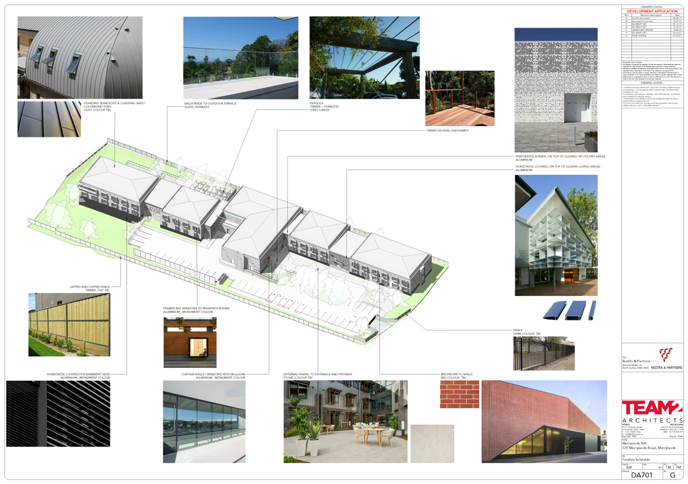
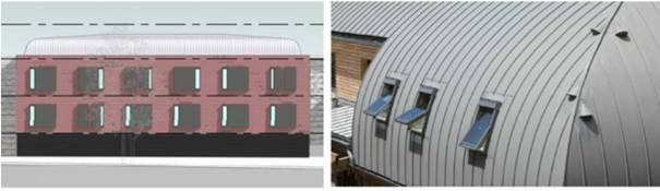
As identified below, the roof will
appear as an angled, rounded iron mansard which will reduce the visual impact
of bulk and scale as well as softening the appearance of the building through a
rounded finish. The contrast between building materials and the lightweight
nature of the iron roof serves to visually reduce the bulk and scale of the
proposed development. The proposed building respects and harmonises with the
surrounding residential area by setting back with a less obvious roof profile
and this rounding “steps in” the roof from the remainder of the building
envelope to reduce the bulk of the building when viewed from the adjoining
residential dwellings to the east and west.
Views
The proposed development will be
setback from the adjoining boundaries by at least 6 metres to the eastern
boundary and 13.87 metres to the western boundary.
The closest adjoining dwellings to
the area of contravention are located at 7 Yoogali Street and 529 Merrylands
Road. The dwelling at 7 Yoogali Street is orientated north/south, with
principal views towards the north and south. The proposal, located due east of
this dwelling, will not impact views currently enjoyed from this dwelling,
given their principal views are north/south.
The adjoining dwellings at 529
Merrylands Road are two-storey and single storey and orientated east/west with
their rear gardens adjoining the site. The site’s eastern common property
boundary between the proposed development and the adjoining dwellings comprises
a solid metal fence which currently limits views from the existing dwellings
across the subject site.
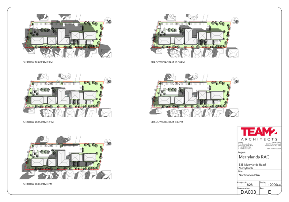
Overshadowing
Team 2 Architects have prepared
detailed shadow diagrams for the proposal. These demonstrate the proposed
seniors housing development above the 8m height standard within the R2 zoned
land would protect the amenity of neighbouring properties in relation to
sunlight, despite the noncompliance with the height standard.
Privacy
The substantial setbacks, together
with landscaping to the boundaries, will ensure the proposal does not result in
sightlines causing a loss of privacy to these adjoining dwellings on the
eastern and western boundary of the site.
Visual Impact
The proposed development as a
whole will be visually consistent in terms of design and materials in that is
represents fine grain urban form with large, landscaped setbacks to the
site’s boundaries, responding to the existing lower residential character
of the adjoining properties. The development provides considerable separation
between the proposed building and the adjoining low-density residential
development.
As demonstrated in Table 1 above,
the objectives of the building height development standard are achieved
notwithstanding the proposed variation.
In accordance with the decision in
Wehbe v Pittwater Council [2007] NSWLEC 827, Initial Action Pty Limited v
Woollahra Municipal Council [2018] NSWLEC 118, Al Maha Pty Ltd v Huajun
Investments Pty Ltd (2018) 233 LGERA 170; [2018] NSWCA 245 and RebelMH Neutral
Bay Pty Limited v North Sydney Council [2019] NSWCA 130, therefore, compliance
with the building height development standard is demonstrated to be
unreasonable or unnecessary and the requirements of Clause 4.6(3)(a) have been
met on this way alone.
Planner’s comment:
Council Officers are satisfied
that the proposed variation has been appropriately justified and can be
supported in this instance. The building is raised higher in response to the
conditions of the site and to achieve minimum finished floor levels required to
ensure safety and protection of residents and property during a flood event.
The height breach is limited to a maximum building height of 9.1m (RL41000 to
the ceiling of the building) and 11.406m (RL43306 to the uppermost ridge of
roof). The proposal is 2 storeys in height which is consistent with the
existing and desired future character of development within the immediate area.
A rounded roof design, and a mix of materials and finishes has been
incorporated to the external facades, together with recessed links in between
blocks, to alleviate the appearance of visual bulk when viewed from
neighbouring properties and the existing streetscape.
Furthermore, additional height
sought does not result in adverse amenity impacts with respect to visual
privacy and solar access on neighbouring properties. Given the proposal has
been designed to respond to the constraints of the site, strict compliance with
the SEPP (HSPD) 2004 maximum 8m height standard is considered unreasonable or
unnecessary in this instance.
3. b) Are there sufficient
environmental planning grounds to justify contravening the development standard
and therefore is the applicant’s written justification well founded?
Applicant’s
justification:
A compliant development would
result in a lesser built form, but in this case, the part of the building that
contravenes the standard does not cause any adverse impacts to surrounding
residential properties and is appropriately setback. Therefore, it can be
concluded that the proposal does not result in any unreasonable environmental
impacts and it is considered there are sufficient environmental planning
grounds to justify the contravention.
Some additional specific
environmental grounds to justify the contravention of the standard are
summarised as follows:
· The
proposed height of buildings was derived from careful consideration of the
site’s constraints and opportunities and in discussion with Council.
· Compliance
with the building height standard under the Seniors SEPP would restrict the
development to one storey in height and result in a poorer social outcome due
to loss of aged beds being delivered;
· A
minimum finished floor level (FFL) of RL 35000 is required for the proposed
development to ensure that it is compatible with the raised flood planning
levels of the land. The requirements of the FFL directly contribute to the
extent of height contravention that is proposed;
· There
is no increase in the intensity of development on the site. The proposal
provides considerably less GFA than allowed under the SEPP (approximately
3,389m² of GFA);
· The
design of the proposal incorporates generous setbacks and extensive landscape
planting to complement the built form and assist in reducing the scale of the
development when viewed from the adjoining property boundaries. This will
ensure the proposal results in minimal amenity impact and is compatible with
the surrounding area in terms of bulk and scale;
· The
contravention of the standard allows for a development that is consistent with
the existing and desired future character of the area;
· The
additional height will not have a detrimental visual impact on the surrounding
area;
· There
are no adverse environmental impacts such as unacceptable additional
overshadowing or overlooking as a result of the contravention of the standard;
· The
proposal would result in a better planning outcome than if compliance were to
be achieved, as it allows for the co-ordinated redevelopment of the site; and
· The
proposal will facilitate development to provide a modern, purpose built RACF to
assist in providing seniors housing within the Cumberland local government
area.
Planner’s comment:
Given that the proposed
development has been designed to respond to the site and does not result in
adverse amenity impacts to neighbouring sites, the proposal is considered to be
consistent with the assumed objectives of the building height standard and
development within the R2 zone, and as such warrants support of the departure.
In this regard, the exception is considered to be well founded and is supported
by Council.
Conclusion:
The applicant’s written
request has adequately addressed the matters required to be demonstrated by
Clause 4.6 subclause (3). Council is satisfied that the proposed development
will be in the public interest because the additional height of the proposal is
consistent with the objectives of the height standard, and the objectives for
development within the R2 zone in which the development is proposed to be
carried out.
It is the view of Council Officers
that justification provided is satisfactory and having considered the
application on its merit, the exception to the maximum 8m building height
development standard is supported.
Assessment of Variation sought
to Clause 40(4)(c) of SEPP (HSPD) 2004:
Clause 40(4)(c) A building
located in the rear 25% area of the site must not exceed 1 storey in height.
Extent of variation sought
It is noted that SEPP (HSPD) 2004
does not contain a definition for ‘storey’. The Standard Instrument
defines ‘storey’ as follows:
storey means a space within a
building that is situated between one floor level and the floor level next
above, or if there is no floor above, the ceiling or roof above, but does not
include—
(a) a
space that contains only a lift shaft, stairway or meter room, or
(b) a
mezzanine, or
(c) an
attic.
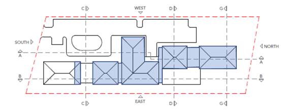
Block J of the proposal is located
within the rear 25% of the subject site and is 2 storeys in height. Extent of
variation sought shown in Figures 11 & 12 below.
Figure
11 – Applicant’s diagram showing extent of variation sought in red
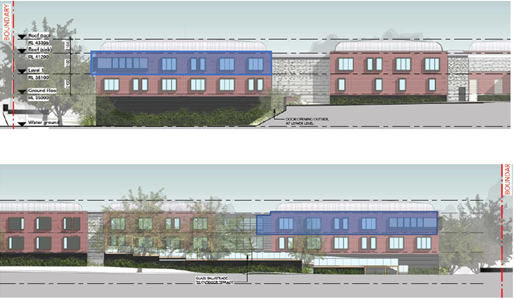
Figure 12 –
Applicant’s diagram showing extent of variation sought in blue
1. Is the
proposed development consistent with the objectives of the zone?
Applicant’s
justification:
Planner’s comment:
The proposal is for the purposes
of a residential aged care facility, which is consistent with the R2 zone
objectives as it provides for the housing needs of the community, specifically
the ageing population of the locality. The residential aged care facility also
includes on-site services which provides residents with access to carry out a
range of activities in their home setting.
2. Is
the proposed development consistent with the objectives of the development
standard which is not met?
Applicant’s
justification:
The Applicant has referred to
Pathways Property Group Pty Ltd v Ku-ring-gai Council [2017] NSWLEC 1486 and
Manderrah Pty Ltd v Woollahra Municipal Council and Anor [2013] NSWLEC 1196; to
derive the assumed intent/purpose (objectives) of the height standard in Clause
40(4)(c) as follows:
· To ensure that the
development is compatible by virtue of its bulk and scale to be consistent with
the existing and future character of the rear of the site; and
· To not cause
unreasonable amenity impacts on adjoining developments at the rear of the site.
Justification provided by the
Applicant based on the above assumed objective of the height standard is as
follows:
Bulk and scale
The rear of the site is defined,
in this case, as development at the northern end of the site (refer Figure 4).
At present there is no development to the immediate north and northwest of the
site as the land comprises Leeton Street Park, an area of public open space
zoned RE1 Public Recreation. To the northeast of the site, two-storey town
houses are located at 5 Mark Street and single storey dwellings are located at
529 Merrylands Road. Beyond Leeton Street Park to the northwest, single storey
and two-storey dwellings are situated along Yoogali Street.
In relation to the existing future
character, as detailed in Figure 6, there is no consistent rear setback
provided in the immediate locality, with rear setbacks varying between 2 metres
and 5.1 metres along the site's eastern extent and 2.3 metres and 3.5 metres
along the site's western extent.
The proposed development provides
a rear setback of 9.1 metres at first floor level, providing a significantly
larger setback when compared to the existing setback conditions of adjacent
residential development.
Physical separation to existing
development at the rear of the site will be retained by virtue of the
significant setbacks provided to the site's eastern boundary (approximately
16.5 metres) and western boundary (20.01 metres).
Consideration has been provided to
the RE1 Public Recreation zone at the rear of the site and an extensive, high
quality landscaping treatment incorporating a variety of canopy trees, palms
and climbers is proposed which will complement the existing landscaped setting
at the rear of the site
Privacy
The proposed development is
setback approximately 16.5 metres from the site's eastern property boundary at
first and second floor level and over 20 metres from the site's western
property boundary at first floor level to ensure privacy levels will be maintained
for the adjoining residential properties at 5 Mark Street, 529 Merrylands Road
and 7 and 8 Yoogali Street. To further assist in maintaining privacy levels,
large canopy trees (including spotted gum, cabbage gum, swamp mahogany and
river she-oak) expected to reach mature heights of 20 metres are proposed along
the site's northern and eastern site boundaries.
Overshadowing
Team 2 Architects have prepared
detailed shadow diagrams for the proposal. The shadow diagrams demonstrate that
the area of contravention at the rear of the site will not result in any
overshadowing impacts to adjoining dwellings. All properties along the
north-eastern and north-western property boundary will receive in excess of 3
hours of direct sunlight between 9am and 3pm on 21 June. The majority of the
shadows will fall on the site itself throughout the day.
Visual Impact
The portion of the building that
contravenes the one-storey height limit will have no visual impact. The
proposed development will be visually consistent in terms of design and
materials. The building is located centrally on the site, with large,
landscaped setbacks to the northern, eastern and western boundaries responding
to the existing lower residential character of the adjoining properties at the
rear of the site. Significant landscaping is proposed along the site's
boundaries, with tree species which will reach a mature height of 20 metres
specifically chosen to minimise any visual impacts.
Views
Views from the surrounding
properties will not be affected as a consequence of the portion of the building
that contravenes the one storey height limit. Views in the surrounding area are
generally limited to street level views.
Planner’s comment:
Clause 40(4) of SEPP (HSPD) 2004
does not contain objectives which specify the intent of the prescribed height
standards.
The proposed development is
considered to be consistent with the derived assumed intent/purpose
(objectives) of the height standard in Clause 40(4)(c), for the following
reasons:
· The
established and future character of development at the site and within the
immediate vicinity is considered to be 2 storeys in height having regard to the
maximum 9m HLEP 2013 building height development standard applicable to R2
zoned land.
· Existing
residences adjoining the subject site comprise of varying rear setbacks due to
the orientation and siting of the dwellings on their respective lots. It is
noted that dwellings behind the front dwelling at 529 Merrylands Road are
single storey in height with setbacks ranging from 2m-3m to each
dwellings’ rear boundary (being the subject site’s eastern
boundary).
· Although
all dwellings behind the building line of 529 Merrylands Road are single storey
in height, the 2 storey built form of Block J at the rear of the subject site
is not considered to be incompatible with the scale of both the existing and
future character of the rear of the site as a 2 storey height limit is
consistent with what is generally anticipated on R2 zoned land, and what would
occur should the rear of the subject site be an extension of Yoogali Street
comprising of residential allotments.
· Block
J provides a setback of 16.5m to the eastern boundary and is setback 20m and
minimum 8m from their respective western and northern boundary with Leeton
Street Park. The 2 storey height of Block J is not considered to result in
adverse overlooking concerns to dwellings at 529 Merrylands Road, as a result
of the setback provided the eastern boundary.
· Block
J being 2 storeys in height is also not considered to result in adverse
streetscape impacts when viewed from Yoogali Street or as viewed from the
public domain being Leeton Street Park.
· The
location of Block J at the subject site also does not pose overshadowing
impacts on adjoining properties, despite its 2 storey height.
In this regard, the departure
sought is considered to be acceptable as the second storey does not
unreasonably impact on adjoining properties. The additional storey within the
rear setback area does not result in the appearance of bulk when viewed from
the existing streetscape and would not impinge on the changing streetscape that
is anticipated for the immediate area. Given that the proposed development
responds to the site and does so without compromising relationships with
adjoining development, the height of Block J is consistent with the objectives
of height requirements and development within the R2 zone.
3. a)
Is compliance with the development standard unreasonable or unnecessary in the
circumstances of the case? And;
Applicant’s
justification:
Bulk and scale
In relation to the future
character of the site, the Holroyd DCP requires that rear setbacks of dwelling
houses and secondary dwellings at the upper storey are at least 7 metres from
the rear boundary. The DCP requires side setbacks of 900mm are to be provided.
It is therefore reasonable to
assume that an alternative likely future redevelopment of the subject site
would result in a two storey development which provides a reduced rear setback
of 7 metres. A proposed development would therefore similarly fall within the
rear 25% of the site.
The location of the proposed RACF,
which partially falls within the rear 25% of the site, would provide a
considerably lesser built form at the rear of the site, if developed in
accordance with the Holroyd DCP provisions.
When viewed from the rear of the
site, the proposed development will provide a compatible built form, with the
bulk of the built form reduced and setback to reduce the perceived scale and
mass of the development, as well as to reduce any potential amenity impacts.
There is limited scope for
redevelopment of the RE1 zoned land and therefore reasonable to assume future
development at the rear of the site is unlikely to change.
Overall, there is limited scope
for redevelopment at the rear of the site given the established residential
character of the area and it is therefore reasonable to assume development at
the rear of the site is unlikely to change. Notwithstanding this, the extent of
the variation is considered to be compatible by virtue of its bulk and scale
with future development at the rear of the site.
Privacy
The proposal does not cause
unreasonable direct overlooking of habitable rooms and principal private open
spaces to the rear of the site, specifically to 5 Mark Street, 529 Merrylands
Road and 7 and 8 Yoogali Street.
Overshadowing
Team 2 Architects have prepared
detailed shadow diagrams for the proposal. The shadow diagrams demonstrate that
the area of contravention at the rear of the site will not result in any
overshadowing impacts to adjoining dwellings. All properties along the north-eastern
and north-western property boundary will receive in excess of 3 hours of direct
sunlight between 9am and 3pm on 21 June. The majority of the shadows will fall
on the site itself throughout the day.
Visual Impact
The portion of the building that
contravenes the one-storey height limit will have no visual impact. The
proposed development will be visually consistent in terms of design and
materials. The building is located centrally on the site, with large,
landscaped setbacks to the northern, eastern and western boundaries responding
to the existing lower residential character of the adjoining properties at the
rear of the site. Significant landscaping is proposed along the site's
boundaries, with tree species which will reach a mature height of 20 metres
specifically chosen to minimise any visual impacts.
Views
Views from the surrounding
properties will not be affected as a consequence of the portion of the building
that contravenes the one storey height limit. Views in the surrounding area are
generally limited to street level views.
The proposed development achieves
compatibility with the existing and future character of built form and
landscape in the area. Generous landscaped setbacks and the reduction of
building heights near the site boundaries creates a transition in built form
from the site to its surrounds.
As demonstrated in Table 1 above,
the objectives of the building height development standard are achieved
notwithstanding the proposed variation.
In accordance with the decision in
Wehbe v Pittwater Council [2007] NSWLEC 827, Initial Action Pty Limited v
Woollahra Municipal Council [2018] NSWLEC 118, Al Maha Pty Ltd v Huajun
Investments Pty Ltd (2018) 233 LGERA 170; [2018] NSWCA 245 and RebelMH Neutral
Bay Pty Limited v North Sydney Council [2019] NSWCA 130, therefore, compliance
with the building height development standard is demonstrated to be
unreasonable or unnecessary and the requirements of Clause 4.6(3)(a) have been
met on this way alone.
Planner’s comment:
Council Officers are satisfied
that the proposed variation has been appropriately justified and can be
supported in this instance. The height breach of Block J to contain 2 storeys
at the rear of the site is consistent with the scale of development within the
R2 zone located within the immediate vicinity of the site and does not
unreasonably impact on adjoining properties. It is therefore considered that
strict compliance with the Development Standard is unreasonable or unnecessary
in the circumstances of the case.
3.b) Are there sufficient
environmental planning grounds to justify contravening the development standard
and therefore is the applicant’s written justification well founded?
Applicant’s
justification:
A compliant development would
result in a lesser built form, but in this case, the part of the building that
contravenes the standard does not cause any adverse impacts to surrounding
residential properties and is appropriately setback. Therefore, it can be
concluded that the proposal does not result in any unreasonable environmental
impacts and it is considered there are sufficient environmental planning
grounds to justify the contravention.
Some additional specific
environmental grounds to justify the contravention of the standard are
summarised as follows:
· The
proposed height of buildings was derived from careful consideration of the
site’s constraints and opportunities and in discussion with Council. A
similar yield could have been achieved from a height compliant development
however this would have taken up a significantly greater site area, to the
detriment of the landscape setting, tree retention and stormwater management. A
superior planning and design outcome is achieved as a result of the variation;
· There
is no increase in the intensity of development on the site. The proposal
provides considerably less GFA than allowed under the SEPP (approximately
3,389m² of GFA);
· The
proposal provides an opportunity to provide significant un-built upon open
space at the rear and provides amenity to the residents at the rear of the
development.
· The
contravention of the standard allows for a development that is consistent with
the existent and desired future character of the area;
· The
additional height will not have a detrimental visual impact on the surrounding
area;
· There
are no adverse environmental impacts such as unacceptable additional
overshadowing or overlooking as a result of the contravention of the standard;
· The
proposal would result in a better planning outcome than if compliance were to
be achieved, as it allows for the co-ordinated redevelopment of the site; and
· The
proposal will facilitate development to provide a modern, purpose built RACF to
assist in providing seniors housing within the Cumberland local government
area.
Planner’s comment:
The unique circumstances of the
case are considered to warrant support of the departure. Given that the
proposed development responds to the site and does so without unduly
compromising relationships with adjoining development, the proposal is considered
to be consistent with the objectives of building height in terms of the number
of storeys located within the rear setback area, and development within the R2
zone. In this regard, the exception is well founded and can be supported.
Conclusion:
Council is satisfied that the
applicant’s written request has adequately addressed the matters required
to be demonstrated by clause 4.6 subclause (3). Council is further satisfied
that the 2 storey height of the building within the rear setback area will be
in the public interest because it is consistent with the objectives of the
particular standard and the objectives for development within the zone in which
the development is proposed to be carried out.
It is the view of Council Officers
that justification provided is satisfactory and having considered the
application on its merit, the exception to the maximum building height
development standard is considered acceptable in this instance.
The provisions of any proposed
instrument that is or has been the subject (EP&A Act s4.15 (1)(a)(ii))
(a) Draft
Housing Diversity State Environmental Planning Policy (Draft Housing Diversity
SEPP)
The proposed Housing Diversity
SEPP is a government-led action to address housing diversity and affordability,
in line with the proposed NSW Housing Strategy and sets a 20 year vision for
housing in NSW.
The Draft Housing Diversity SEPP
will consolidate three housing-related SEPPs:
· State
Environmental Planning Policy (Affordable Rental Housing) 2009
· State
Environmental Planning Policy (Housing for Seniors and People with a
Disability) 2004
· State
Environmental Planning Policy No 70 – Affordable Housing (Revised
Schemes)
The Draft Housing Diversity SEPP
seeks to undertake the following:
· introduce
new definitions for build-to-rent housing, student housing and co-living;
· amend
some state-level planning provisions, particularly for boarding house and
seniors housing development;
· amend
some state-level planning provisions to support social housing developments
undertaken by the NSW Land and Housing Corporation (LAHC) on government-owned
land.
The proposed Housing SEPP would
make residential care facilities ‘state significant development’
when:
· the
development has a capital investment value of $30 million (in the Greater
Sydney region) or $20 million (elsewhere); and
· the
residential care facility component of the proposed development has a value of
at least 60 per cent of the capital investment value of the proposed
development.
(b) Draft
State Environmental Planning Policy (Environment)
The draft SEPP relates to the
protection and management of our natural environment with the aim of
simplifying the planning rules for a number of water catchments, waterways,
urban bushland, and Willandra Lakes World Heritage Property. The changes
proposed include consolidating the following seven existing SEPPs:
· State
Environmental Planning Policy No. 19 – Bushland in Urban Areas
· State
Environmental Planning Policy (Sydney Drinking Water Catchment) 2011
· State
Environmental Planning Policy No. 50 – Canal Estate Development
· Greater
Metropolitan Regional Environmental Plan No. 2 – Georges River Catchment
· Sydney
Regional Environmental Plan No. 20 – Hawkesbury-Nepean River (No.2-1997)
· Sydney
Regional Environmental Plan (Sydney Harbour Catchment) 2005
· Willandra
Lakes Regional Environmental Plan No. 1 – World Heritage Property.
The draft policy will repeal the
above existing SEPPs and certain provisions will be transferred directly to the
new SEPP, amended and transferred, or repealed due to overlaps with other areas
of the NSW planning system.
Changes are also proposed to the
Standard Instrument – Principal Local Environmental Plan. Some provisions
of the existing policies will be transferred to new Section 117 Local Planning
Directions where appropriate.
(c) Draft
Cumberland Local Environmental Plan (Draft CLEP)
The Draft Cumberland Local
Environmental Plan (Draft CLEP) has been prepared by Cumberland Council to
provide a single planning framework for the future planning of Cumberland City.
The changes proposed seek to harmonise and repeal the three existing LEPs
currently applicable to the Cumberland local government area, those being:
· Holroyd
Local Environmental Plan 2013,
· Parramatta
Local Environmental Plan 2011, and
· Auburn
Local Environmental Plan 2010.
The current planning controls for
the subject site, as contained within the HLEP 2013, are not proposed to change
under the Draft CLEP. A R2 land use zone is maintained for the subject site
under Draft CLEP as is a maximum building height of 9 metres, and maximum floor
space ratio of 0.5:1.
It is noted that ‘seniors
housing’ is listed as a permitted land use in the R2 zone under the Draft
Cumberland Local Environmental Plan.
The provisions of any Development
Control Plans (EP&A Act s4.15 (1)(a)(iii))
The Holroyd DCP 2013 (HDCP 2013)
provides guidance for the design and operation of development to achieve the
aims and objectives of the HLEP 2013.
A comprehensive assessment and
compliance table is contained in Attachment 4.
The following table highlights
non-compliances with the DCP, which relate primarily to flood affectation of
the site, site coverage and the rear setback requirement.
The variations sought are
considered satisfactory on merit in this instance as detailed in the following
table.
|
No.
|
Clause
|
Comment
|
|
|
PART A – GENERAL
CONTROLS
|
|
8
|
Flood Prone Land
|
|
|
|
Sensitive land uses such as residential aged care
facilities are identified as an unsuitable land use within medium/high flood
risk area in Table 7 of Section 8 Flood Prone Land in HDCP 2013.
|
The site is identified as a flood control lot on
Council’s Mapping system, specifically the site is shown as impacted by
the 1% AEP storm event, and portions of the site as High Flood Risk and located
within a flood way.
The proposal is for the purposes of a residential aged
care facility, which is identified within the sensitive land use category in
Table 7 – Land Use Categories for Development upon Flood Prone Land
– Section 8 – Flood Prone Land in Part A of HDCP 2013, as an
unsuitable land use within the medium/high flood risk area.
The proposal provides finished floor levels set above the
PMF flood level for safe refuge. Pier construction, flood storage and a
culvert system has also been provided to collect and drain the traversing
overland flow from Merrylands Road and direct towards the reserve (Leeton
Street Park), to not result in a significant increase in flooding on
neighbouring properties. In this regard, Council’s Development Engineer
is satisfied that the proposal has been designed appropriately with regard to
the flood affectation of the site and raised no objections to the development
subject to the imposition of recommended conditions requiring the above
stated drainage, civil and flood management works on site to ensure safety
and protection from flood. A flood warning system and Flood Evacuation
Strategy have also been proposed to minimise the risk of flood to occupants
|
|
|
PART B – RESIDENTIAL
CONTROLS
|
|
Whilst there are no specific
controls under that HDCP 2013 that are directly relevant to aged care
facility development, the proposal being a purpose built development have
been considered on merit and the site coverage and setbacks section of the
Dual Occupancy DCP (being the maximum development yield in an R2 zone) have
been considered in the assessment of the proposal.
|
|
3.0
|
DUAL
OCCUPANCY
|
|
|
3.6
|
Setbacks
|
|
|
|
Minimum rear setback required is 30% length of site
Required = 43.6-44.9m (min. 30% of site length)
|
Provided = 8.667m (5.97%)
The variation sought to the required rear setback is
considered supportable as the proposal adjoins Leeton Street Park to the
rear/northern boundary.
The northern elevation of the ground floor only comprises
of a corridor window, and the first floor lounge/dining and terraces do not
pose adverse concerns to properties located on Leeton Street as a result of
the 8.667m rear setback provided, perimeter landscaping proposed along the
northern boundary and the location of Leeton Street Park.
In this regard, the non-compliance to the required rear
setback provision is supportable as the proposal does not pose adverse
amenity impacts or restrict solar access to neighbouring properties.
|
|
The provisions of any planning
agreement that has been entered into under section 7.4, or any draft planning
agreement that a developer has offered to enter into under section 7.4
(EP&A Act s4.15(1)(a)(iiia))
There is no draft planning
agreement associated with the subject Development Application.
The provisions of the
Regulations (EP&A Act s4.15 (1)(a)(iv))
The proposed development raises no
concerns as to the relevant matters arising from the Environmental Planning and
Assessment Regulations 2000 (EP&A Reg).
The Likely Environmental,
Social or Economic Impacts (EP&A Act s4.15 (1)(b))
It is considered that the proposed
development will have no significant adverse environmental, social or economic
impacts in the locality.
The suitability of the site for
the development (EP&A Act s4.15 (1)(c))
The subject site and locality is
known to be affected by flooding and overland flow and has been designed to
incorporate appropriate measures to respond to the site constraints, to ensure
safe refuge for occupants and protection from flood. Accordingly, it is considered
that the development is suitable in the context of the site and surrounding
locality.
Submissions made in accordance
with the Act or Regulation (EP&A Act s4.15 (1)(d))
Advertised (Council website) Mail Sign
Not Required
In accordance with Council’s
Notification requirements contained within the Holroyd DCP 2013, the proposal
was publicly notified for a period of 14 days between 20 August 2021 and 3
September 2021.
The notification generated one (1)
submission in respect of the proposal with nil disclosing a political donation
or gift.
The issues raised in the public
submission are summarised and commented on as follows:
Submission
Summary table
|
|
Concern
|
Comment
|
|
1
|
Who is building this facility?
|
The proposed residential aged care facility is being
privately developed.
|
|
2
|
Is there going to be ample parking for staff, visitors and
trades people or are they going to be parking in already congested side
streets.
Is the entrance and exit on Merrylands Road?
|
D1
In accordance with Clause 48(d) of SEPP (HSPD) 2004, a
total of 9 resident/visitor spaces and 15 staff spaces are required for the
proposed residential aged care facility.
D2
D3
The proposal provides a total of 22 resident/visitor spaces
& 17 staff spaces within the at-grade car park.
D4
D5
All vehicular access to and from the site is via Merrylands
Road.
|
The public interest (EP&A
Act s4.15(1)(e))
In view of the foregoing analysis,
it is considered that the development, if carried out subject to the conditions
set out in the recommendation below, will have no significant adverse impacts
on the public interest.
Cumberland Local
Infrastructure Contributions Plan 2020
The development would require the
payment of contributions in accordance with Cumberland Local Infrastructure
Contributions Plan 2020.
In accordance with the
Contribution Plan a contribution is payable, pursuant to Section 7.12 of the
EP&A Act, calculated on the cost of works. A total contribution of
$150,333.00 would be payable prior to the issue of a Construction Certificate.
Disclosure of Political
Donations and Gifts
The applicant and notification
process did not result in any disclosure of Political Donations and Gifts.
The development application has
been assessed in accordance with the relevant requirements of the Environmental
Planning and Assessment Act 1979, SEPP (HSPD) 2004, SEPP55, ISEPP, SREP 2005,
Draft Environment SEPP, Draft CLEP, HLEP 2013 and the HDCP 2013 and is
considered to be satisfactory for approval, subject to conditions.
Having regard to the relevant
matters of consideration under Section 4.15 of the Environmental Planning and
Assessment Act 1979, it is considered that the proposed development is
acceptable for the reasons outlined in this report. It is recommended that the
Section 8.3 review application be approved subject to conditions.
|
1. That
the two Clause 4.6 variation requests to vary the Height development
standard, pursuant to Clause 40(4)(a) & (c) of State Environmental
Planning Policy (Housing for Seniors of People with a Disability) 2004, be
supported.
2. That
Section 8.3 Review application No. REV2021/0003 for Demolition of existing
structures and removal of trees and construction of a 90-bed residential aged
care facility, including at grade car parking and associated site
improvements (State Environmental Planning Policy (Housing for Seniors or
People with a Disability) 2004) on land at 535 Merrylands Road, MERRYLANDS
NSW 2160; be approved subject to the attached conditions, provided at
Attachment 1.
3. Persons
whom have lodged a submission in respect to the application be notified of
the determination of the application.
|
1. Draft
Notice of Determination
2. SEPP
(Housing for Seniors or People with a Disabilty 2004 Compliance Table
3. Holroyd
Local Environmental Plan 2013 Compliance Table
4. Holroyd
Development Control Plan 2013 Compliance Table
5. Architectural
Plans
6. Landscape
Plans
7. Stormwater
Plans
8. Stormwater
Report
9. Overland
Flow Flood Assessment (including Evacuation Strategy & Plan)
10. Independent
Peer Review of Flood Risk Management Report
11. Clause
4.6 Variation Request to SEPP (HSPD) 2004 Development Standards: Clause 40(4)(a)
- Height of all building of proposal must be 8m or less
12. Clause
4.6 Variation Request to SEPP (HSPD) 2004 Development Standards: Clause
40(4)(c) - A building located in the rear 25% of the site must not exceed 1
storey in height
13. Minutes
of the Cumberland Local Planning Panel for DA2020/0301 (Reasons for Refusal)
14. Draft
Reasons for Recommendation
DOCUMENTS
ASSOCIATED WITH
REPORT LPP034/21
Attachment 1
Draft Notice of Determination
Cumberland Local Planning Panel Meeting
13 October 2021
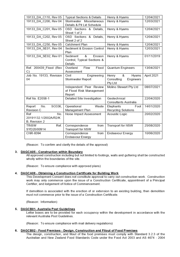
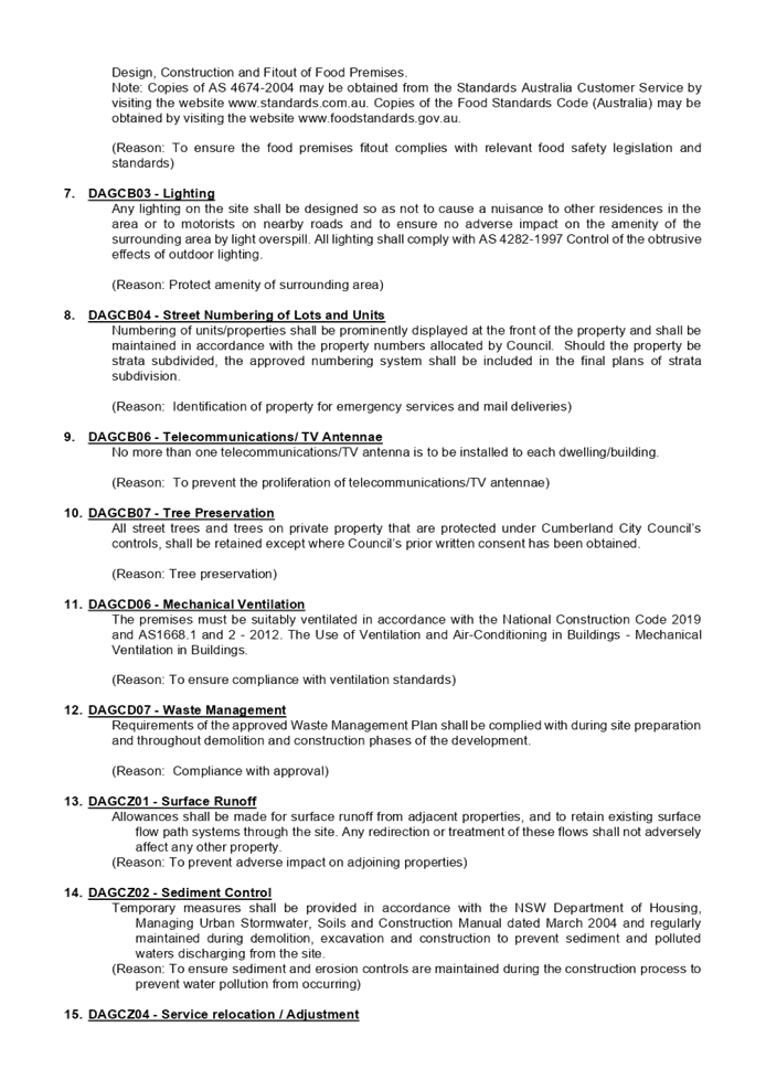
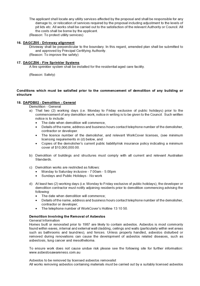

DOCUMENTS
ASSOCIATED WITH
REPORT LPP034/21
Attachment 2
SEPP (Housing for Seniors or People with a Disability
2004 Compliance Table
Cumberland Local Planning Panel Meeting
13 October 2021
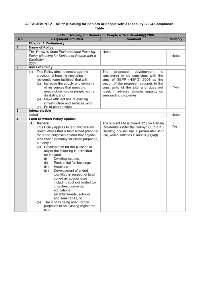
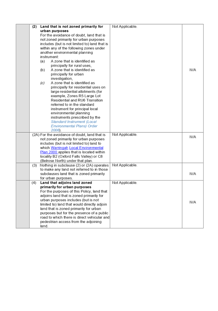
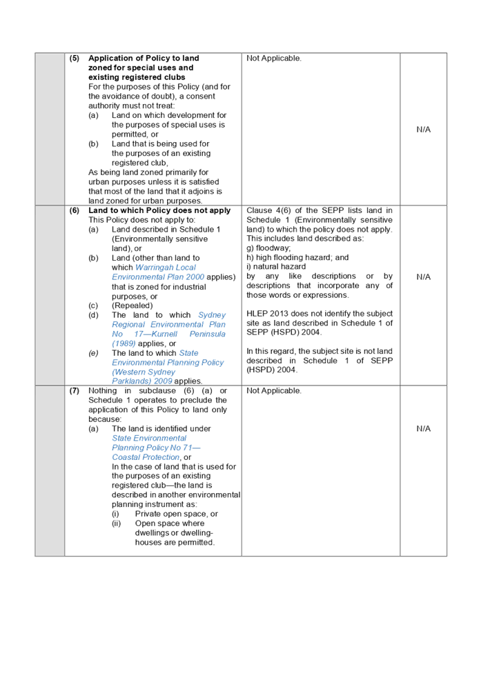
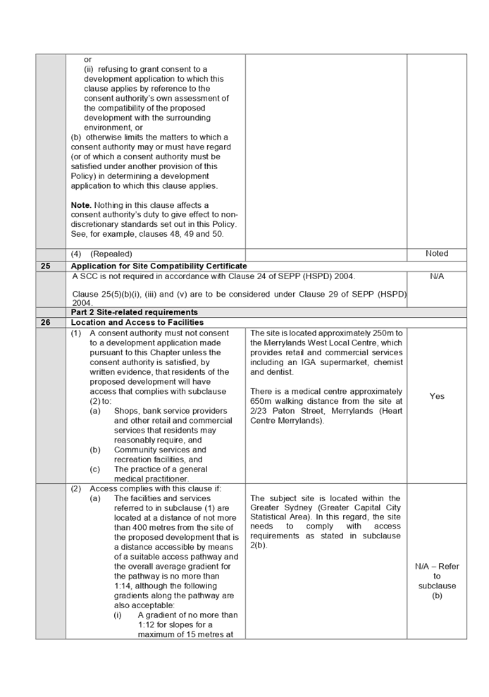
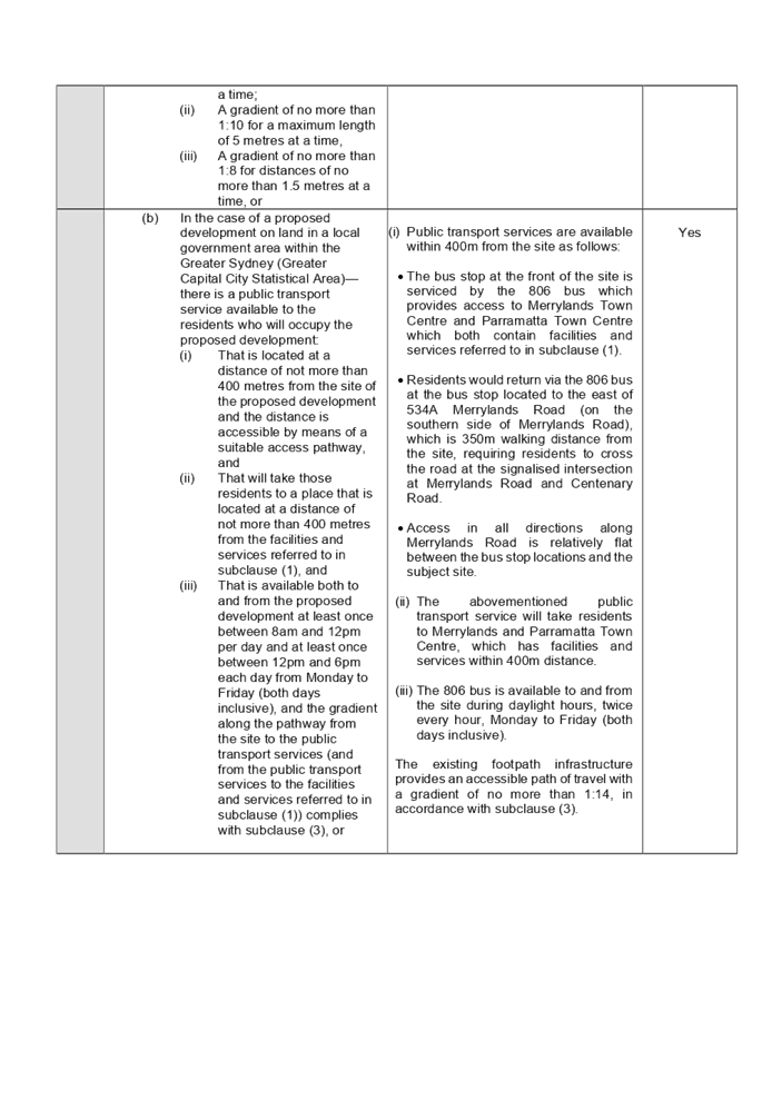
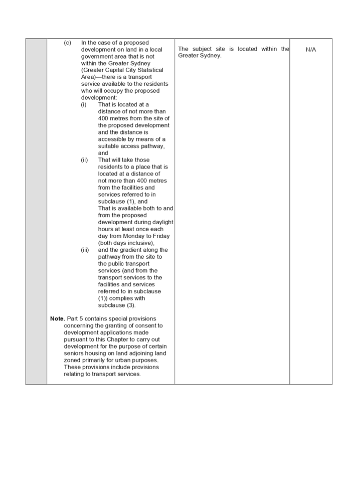
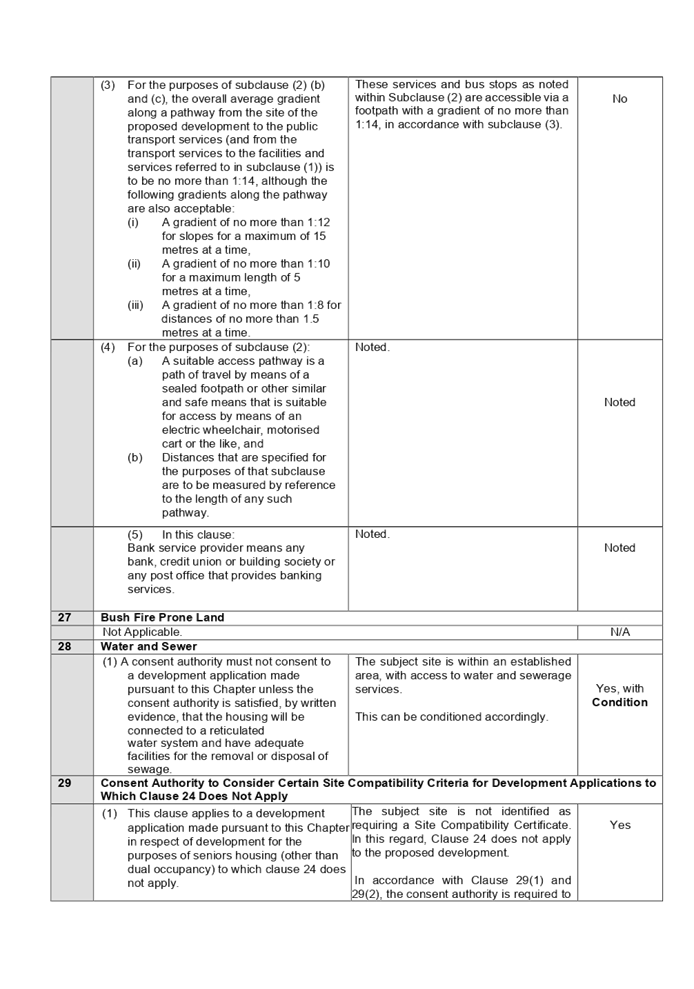
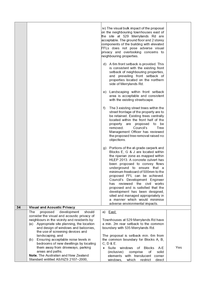
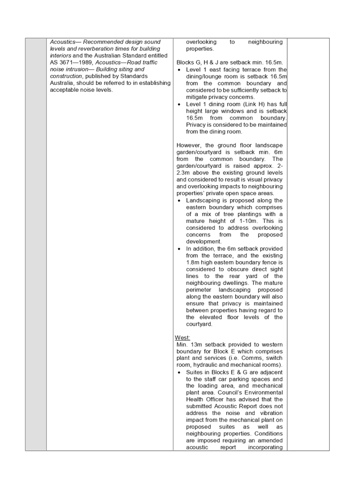
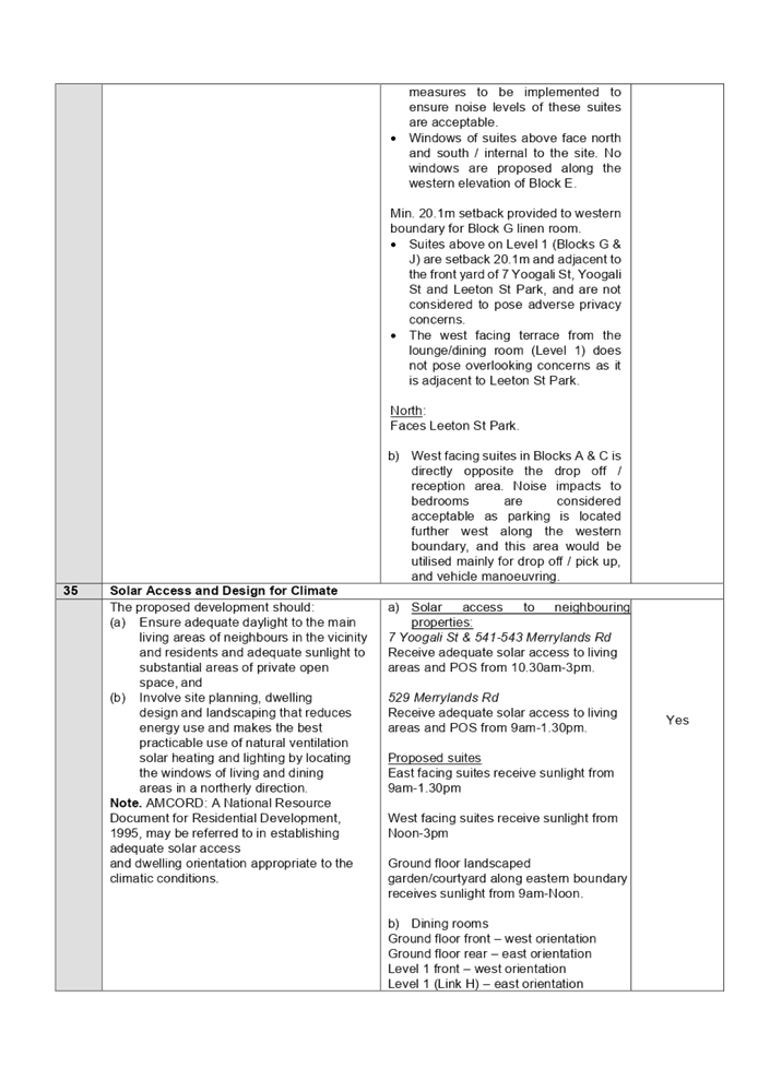
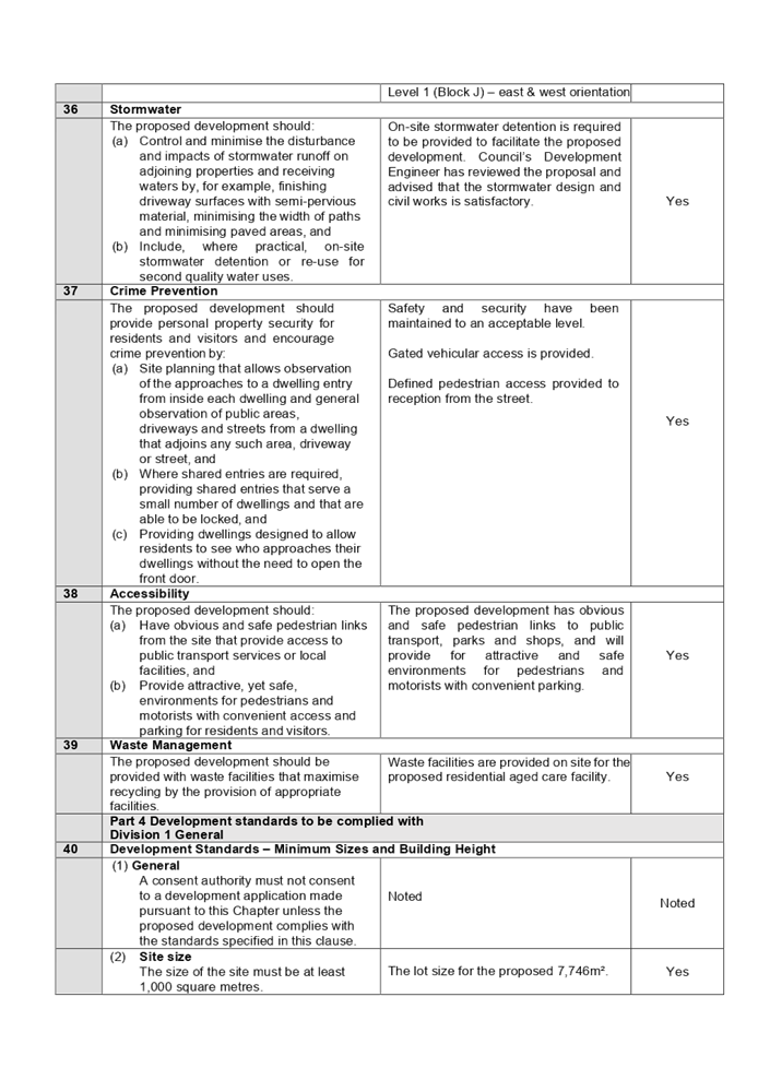
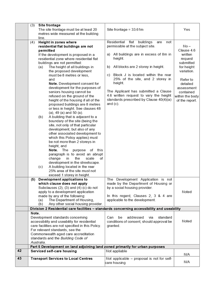
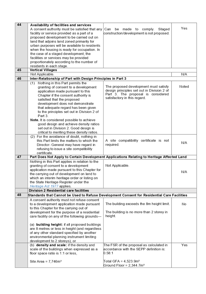
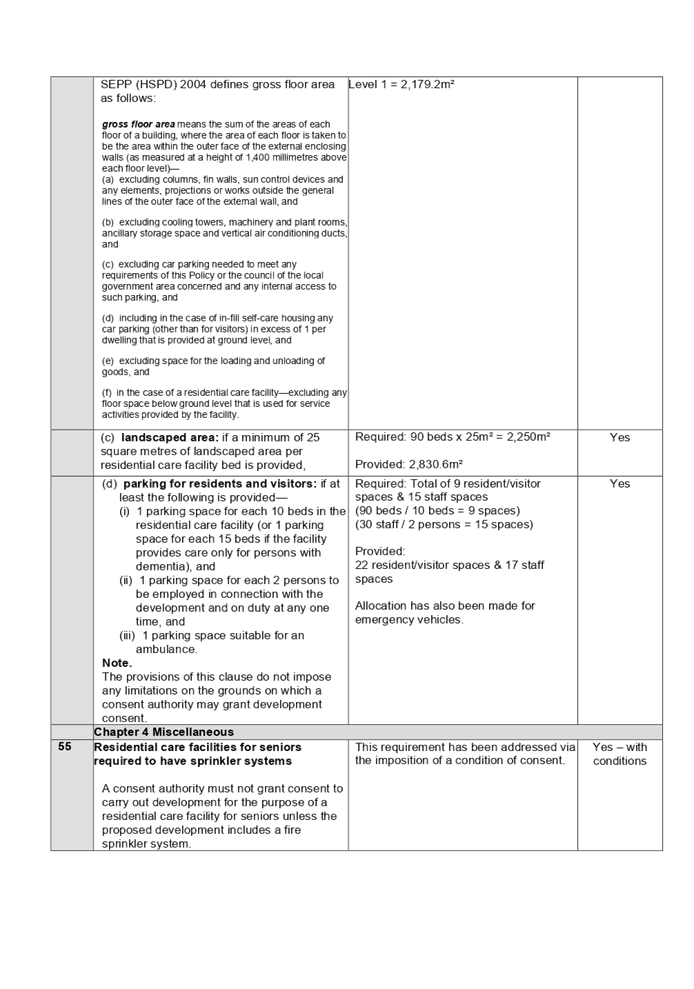
DOCUMENTS
ASSOCIATED WITH
REPORT LPP034/21
Attachment 3
Holroyd Local Environmental Plan 2013 Compliance Table
Cumberland Local Planning Panel Meeting
13 October 2021
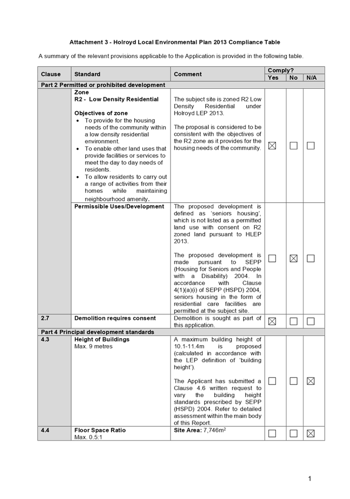
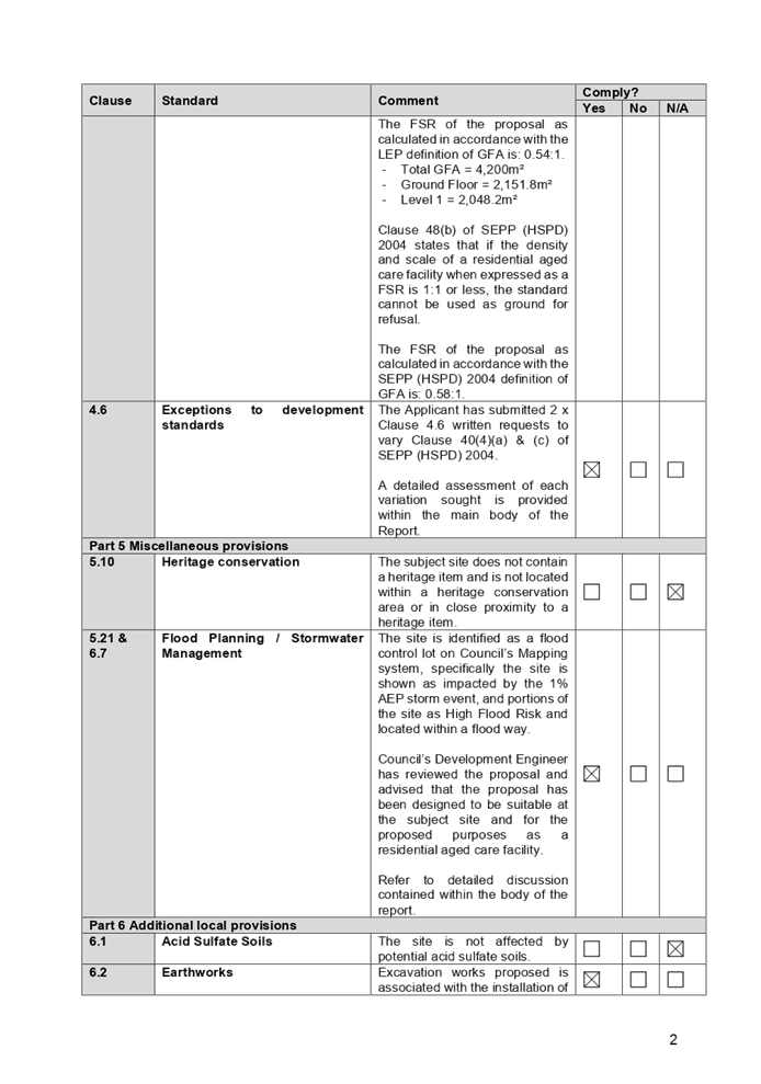
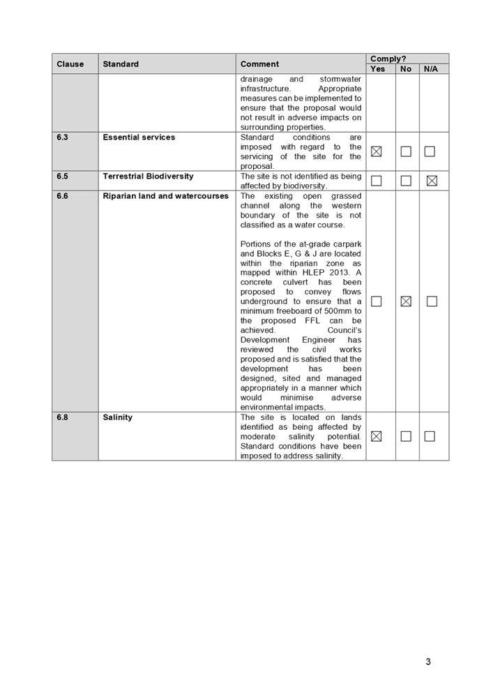
DOCUMENTS
ASSOCIATED WITH
REPORT LPP034/21
Attachment 4
Holroyd Development Control Plan 2013 Compliance Table
Cumberland Local Planning Panel Meeting
13 October 2021
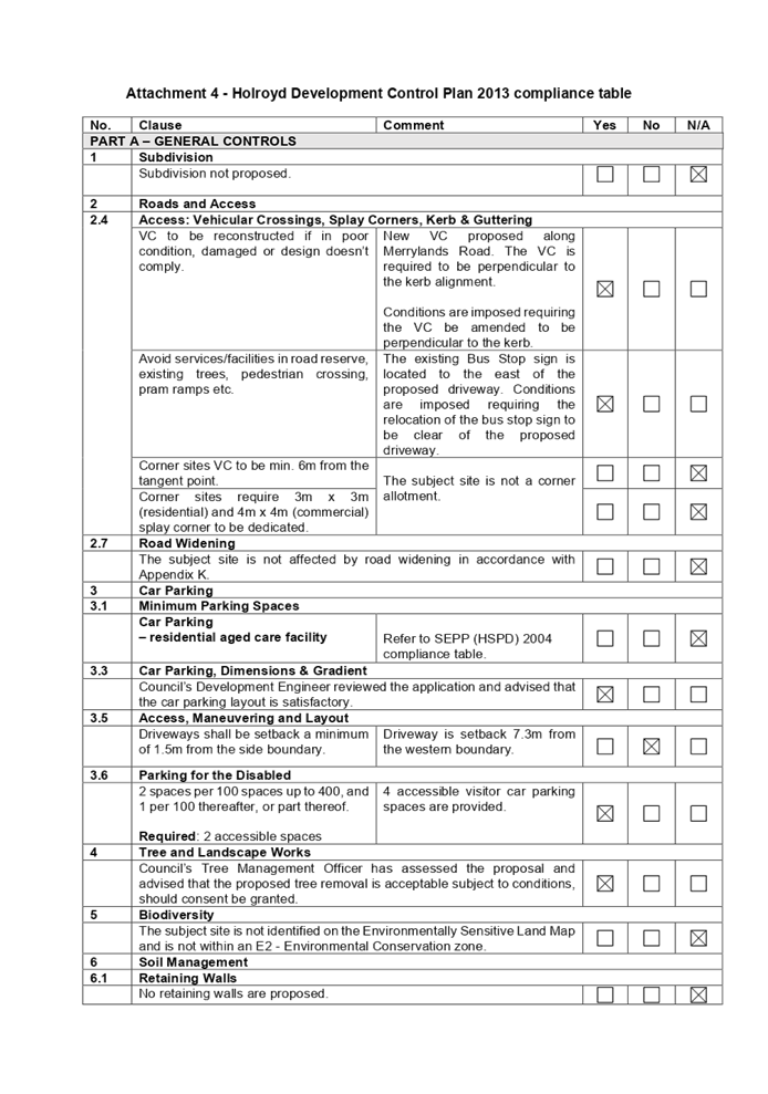
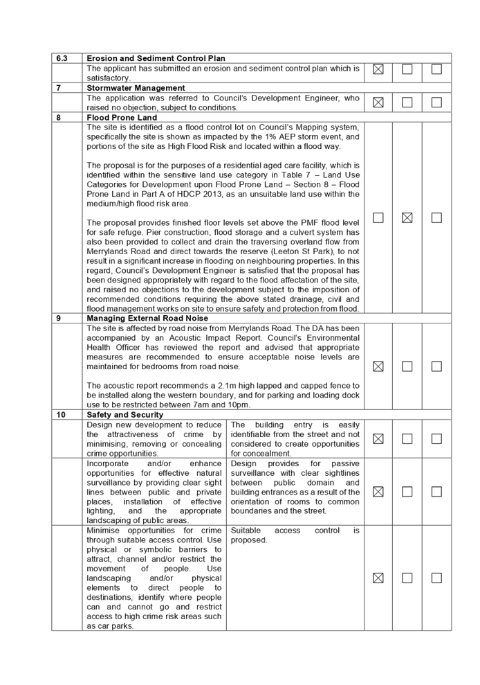
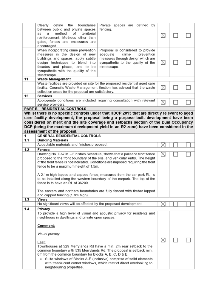
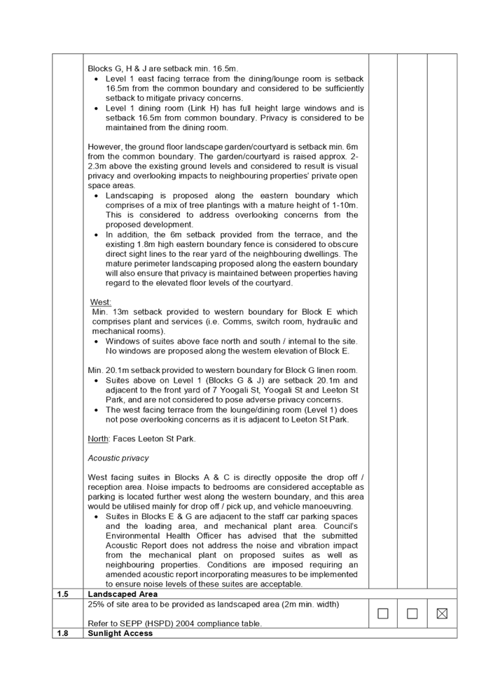
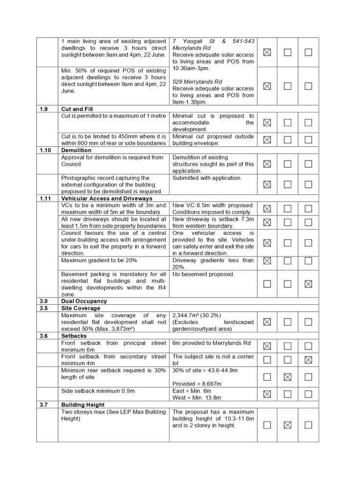
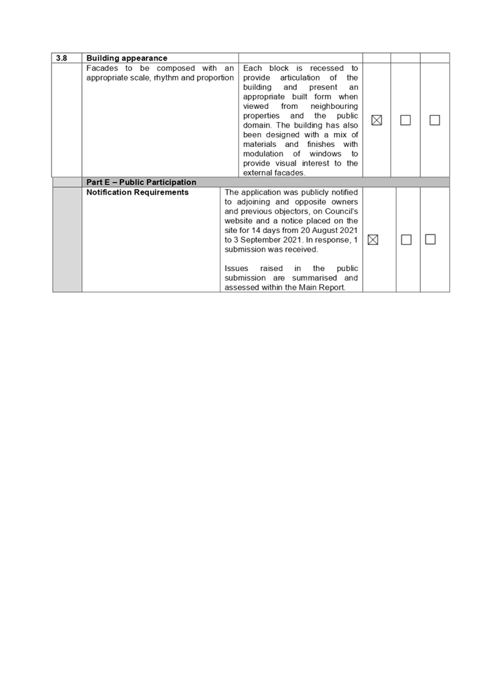
DOCUMENTS
ASSOCIATED WITH
REPORT LPP034/21
Attachment 5
Architectural Plans
Cumberland Local Planning Panel Meeting
13 October 2021
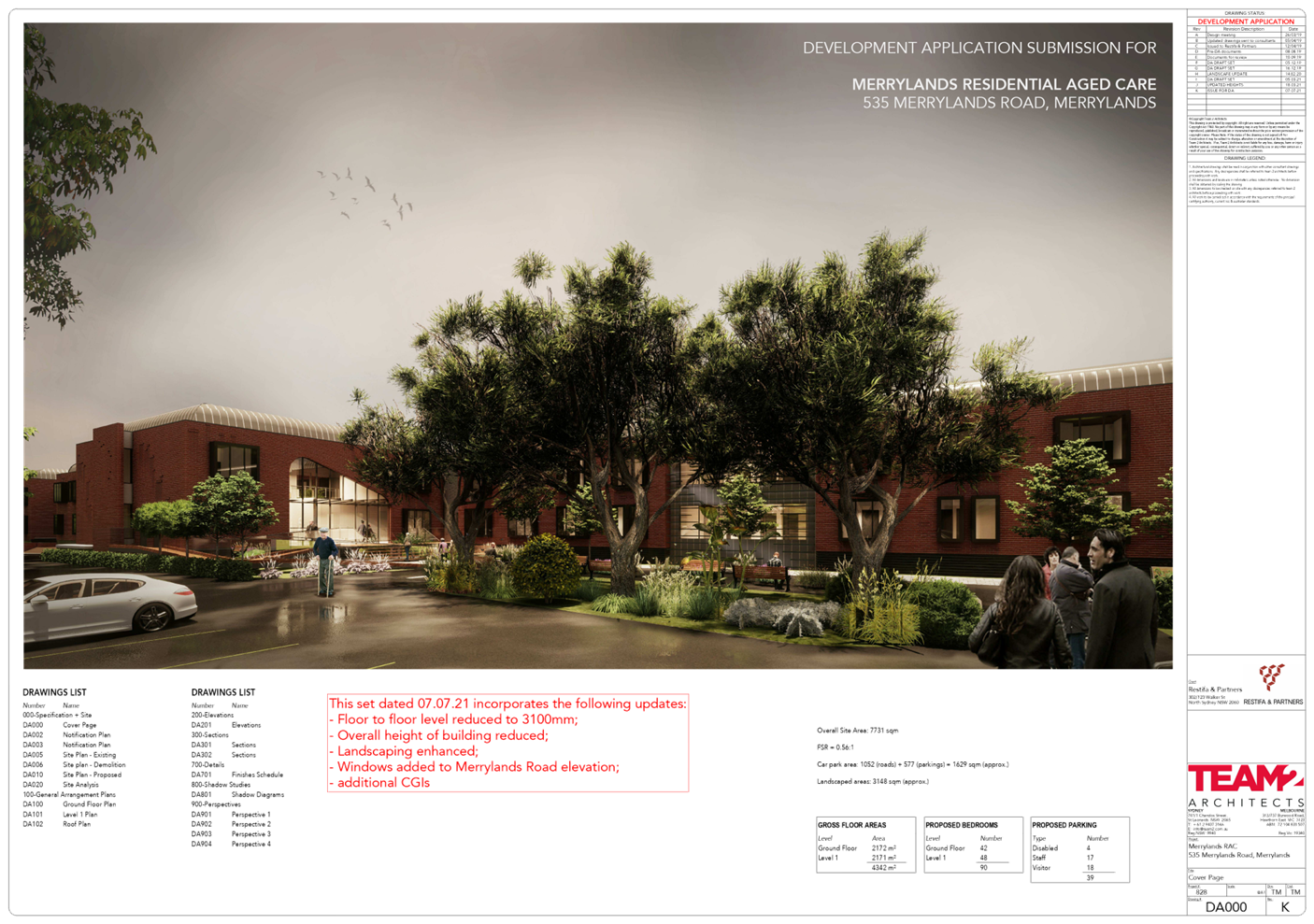
DOCUMENTS
ASSOCIATED WITH
REPORT LPP034/21
Attachment 6
Landscape Plans
Cumberland Local Planning Panel Meeting
13 October 2021
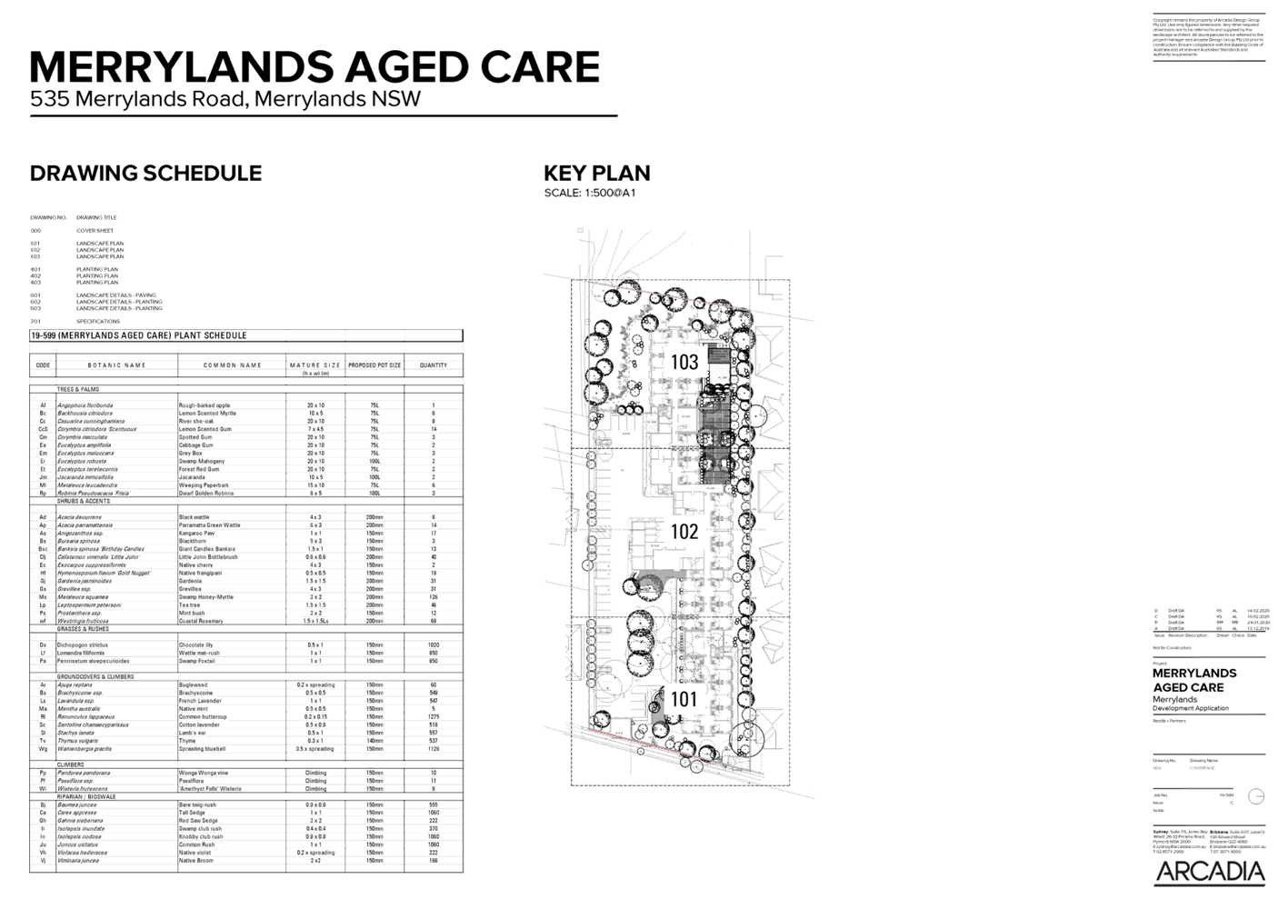
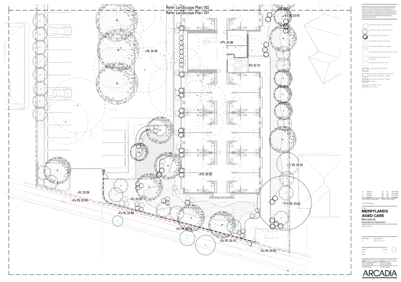
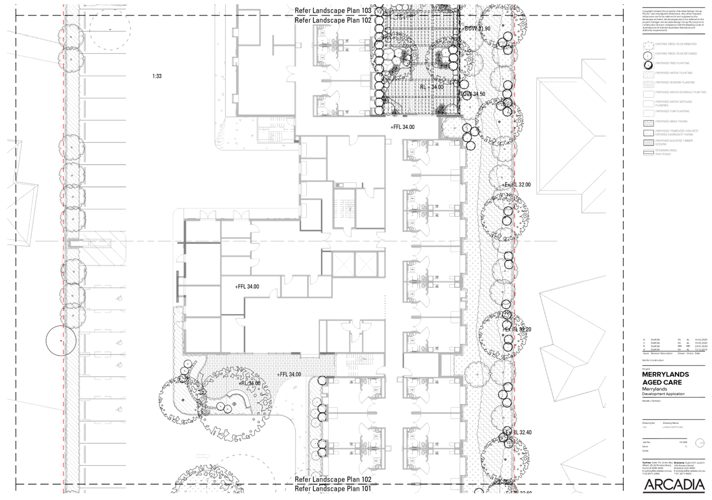
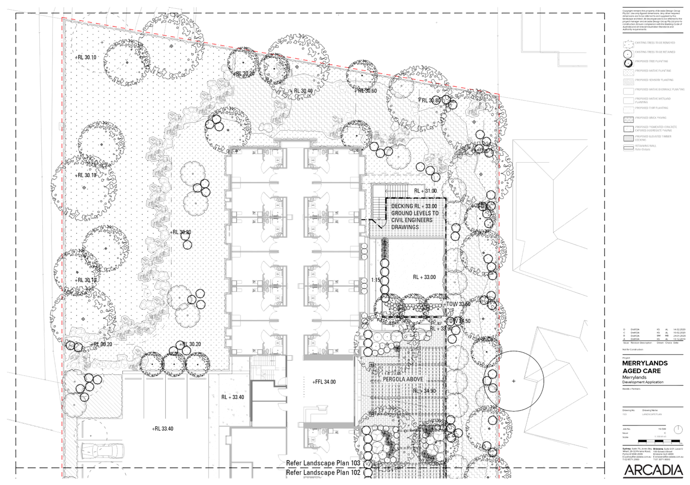
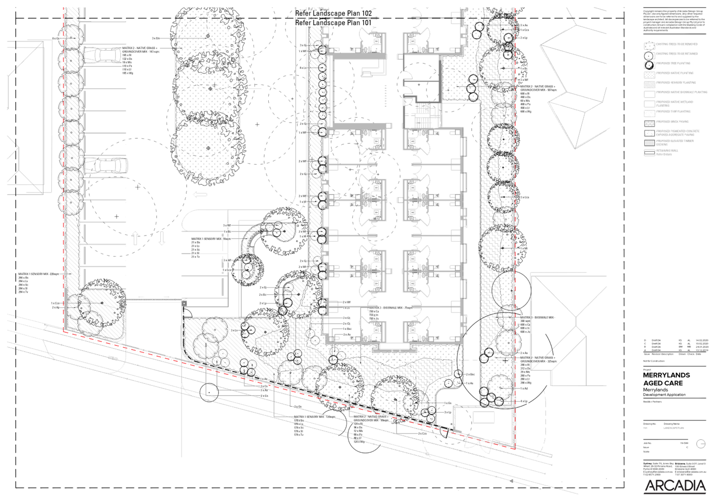
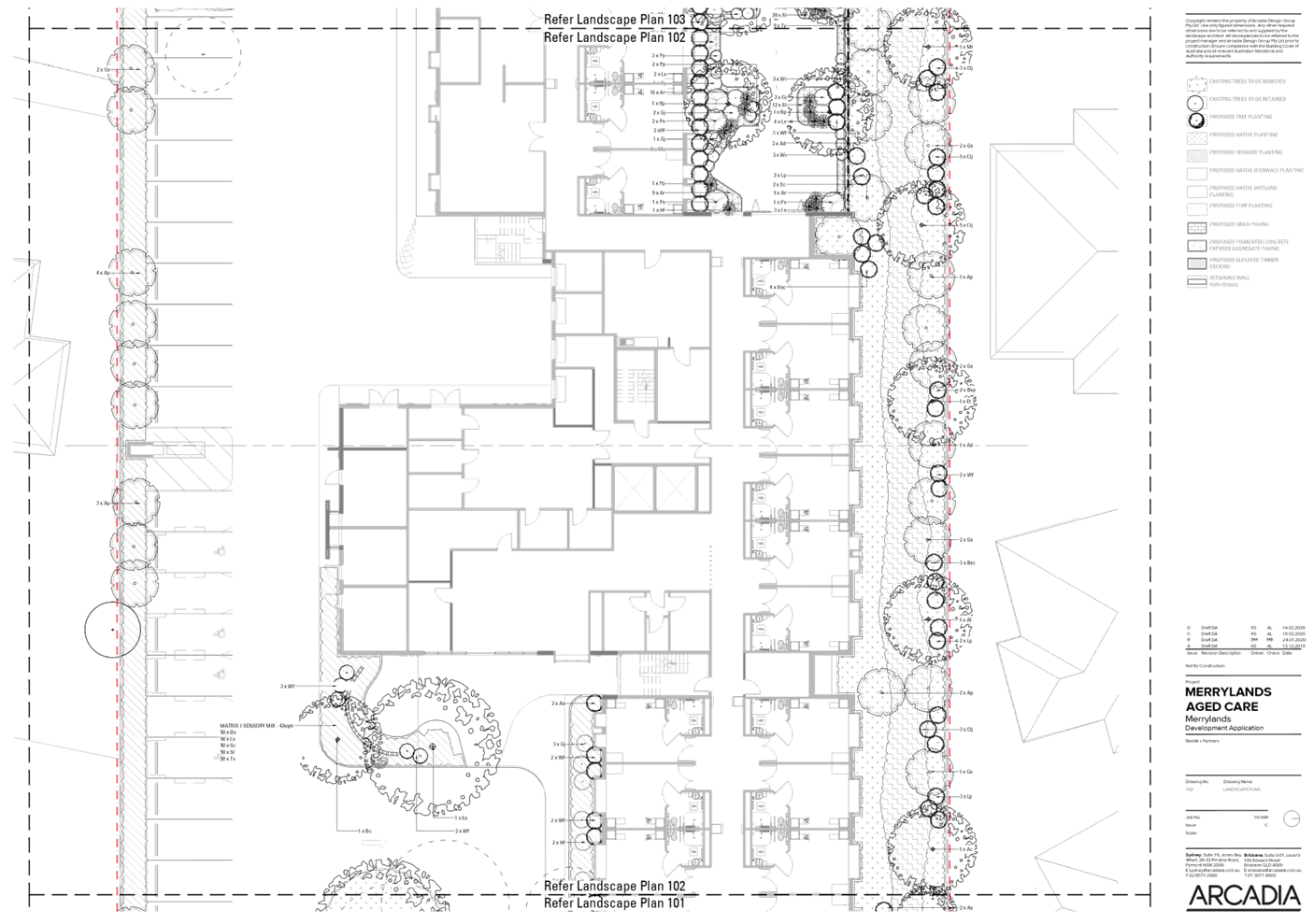
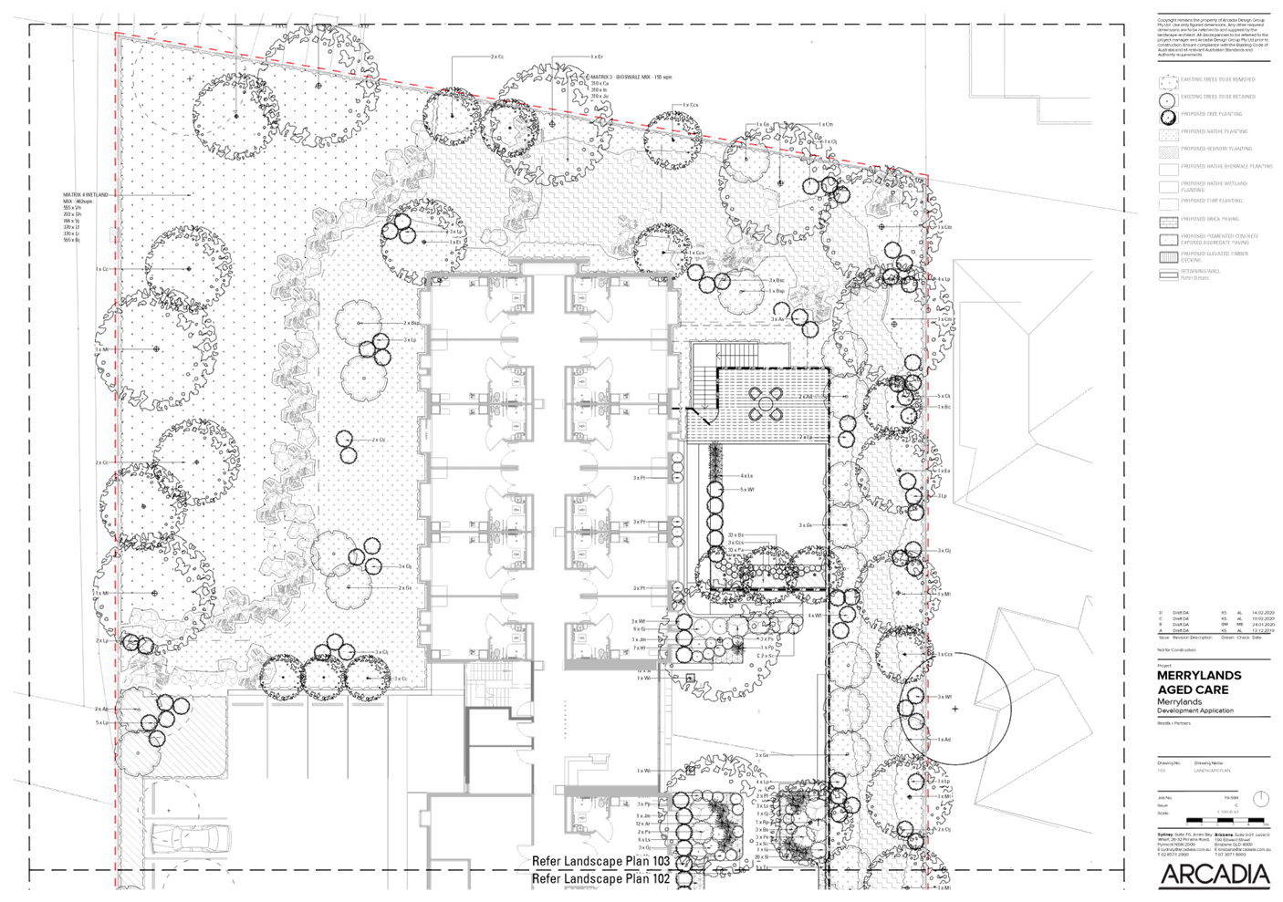
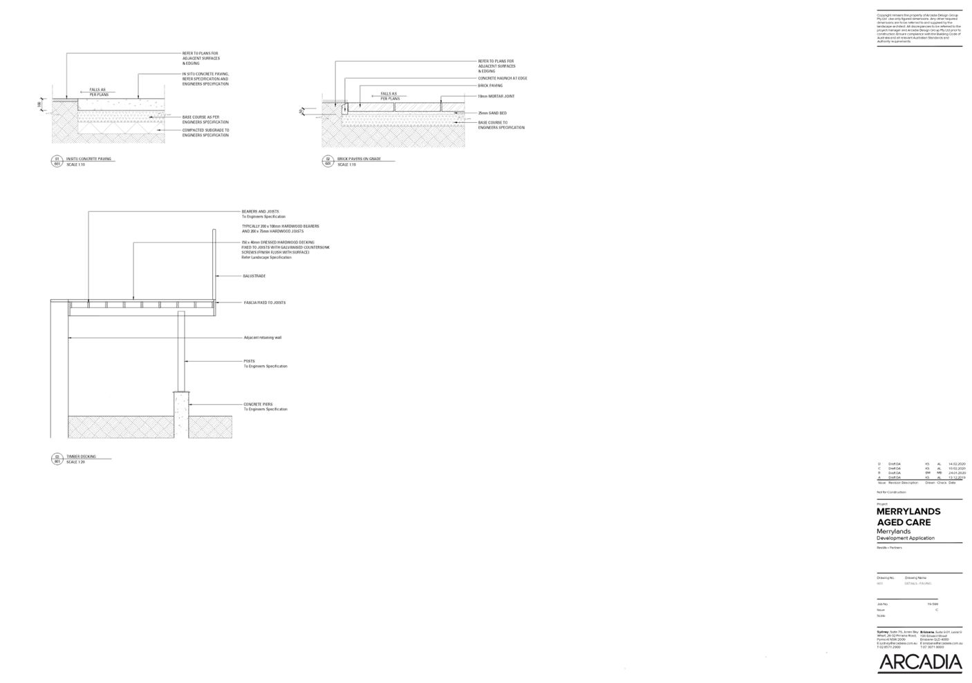
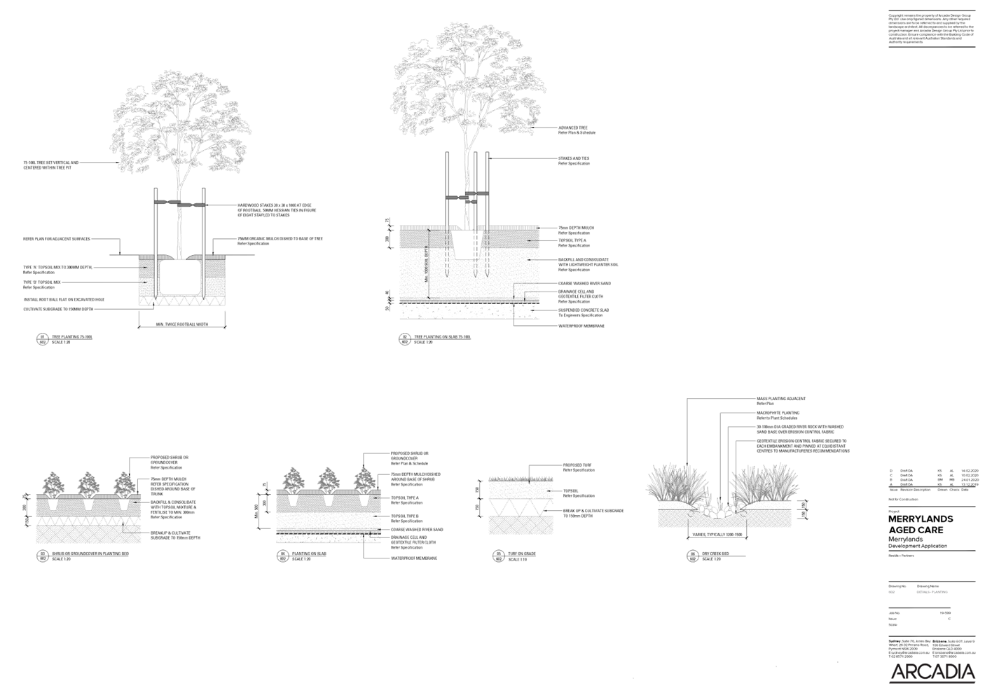
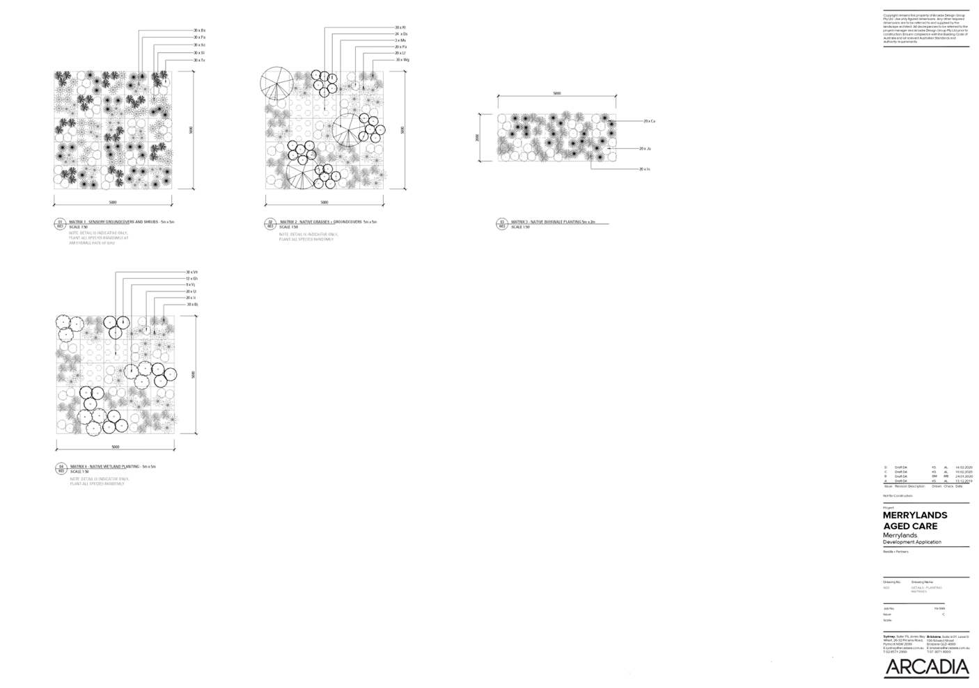
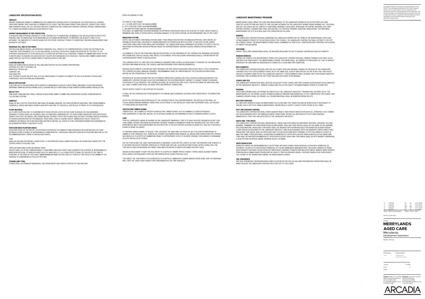
DOCUMENTS
ASSOCIATED WITH
REPORT LPP034/21
Attachment 7
Stormwater Plans
Cumberland Local Planning Panel Meeting
13 October 2021

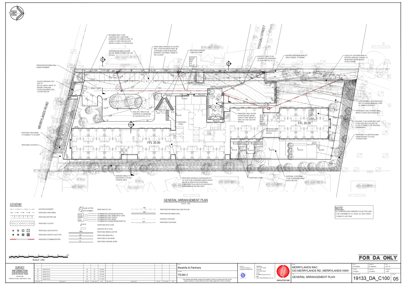
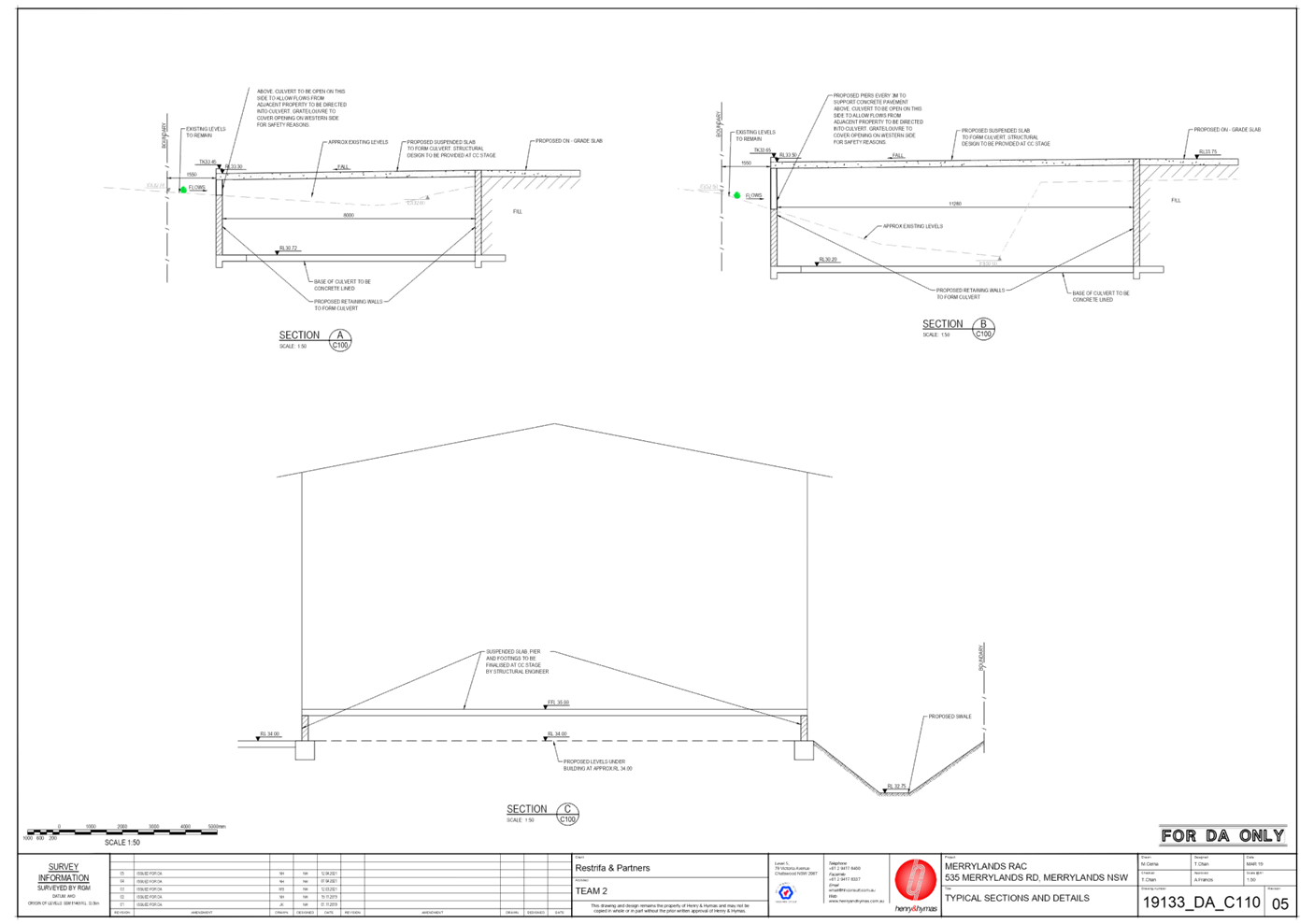
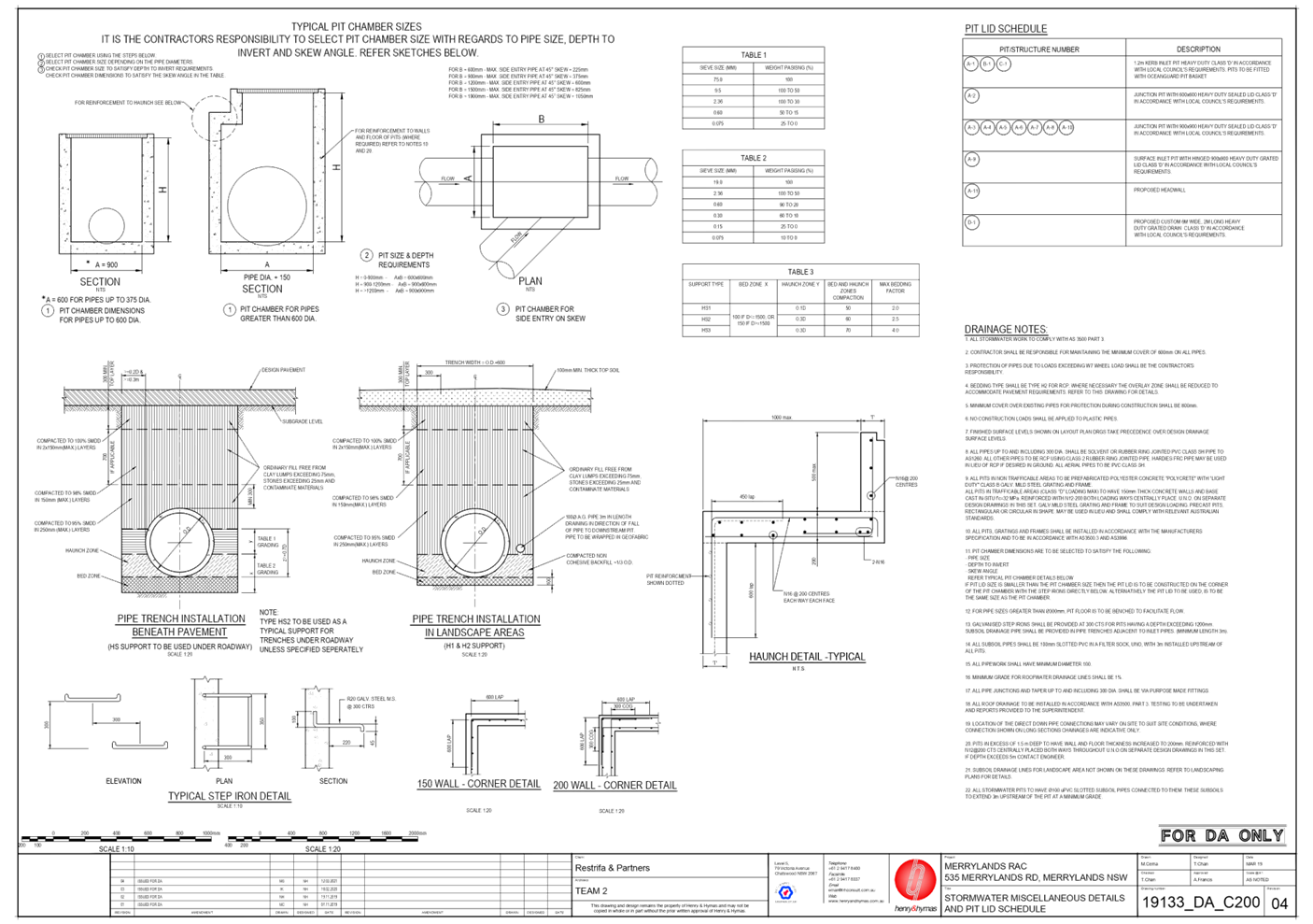
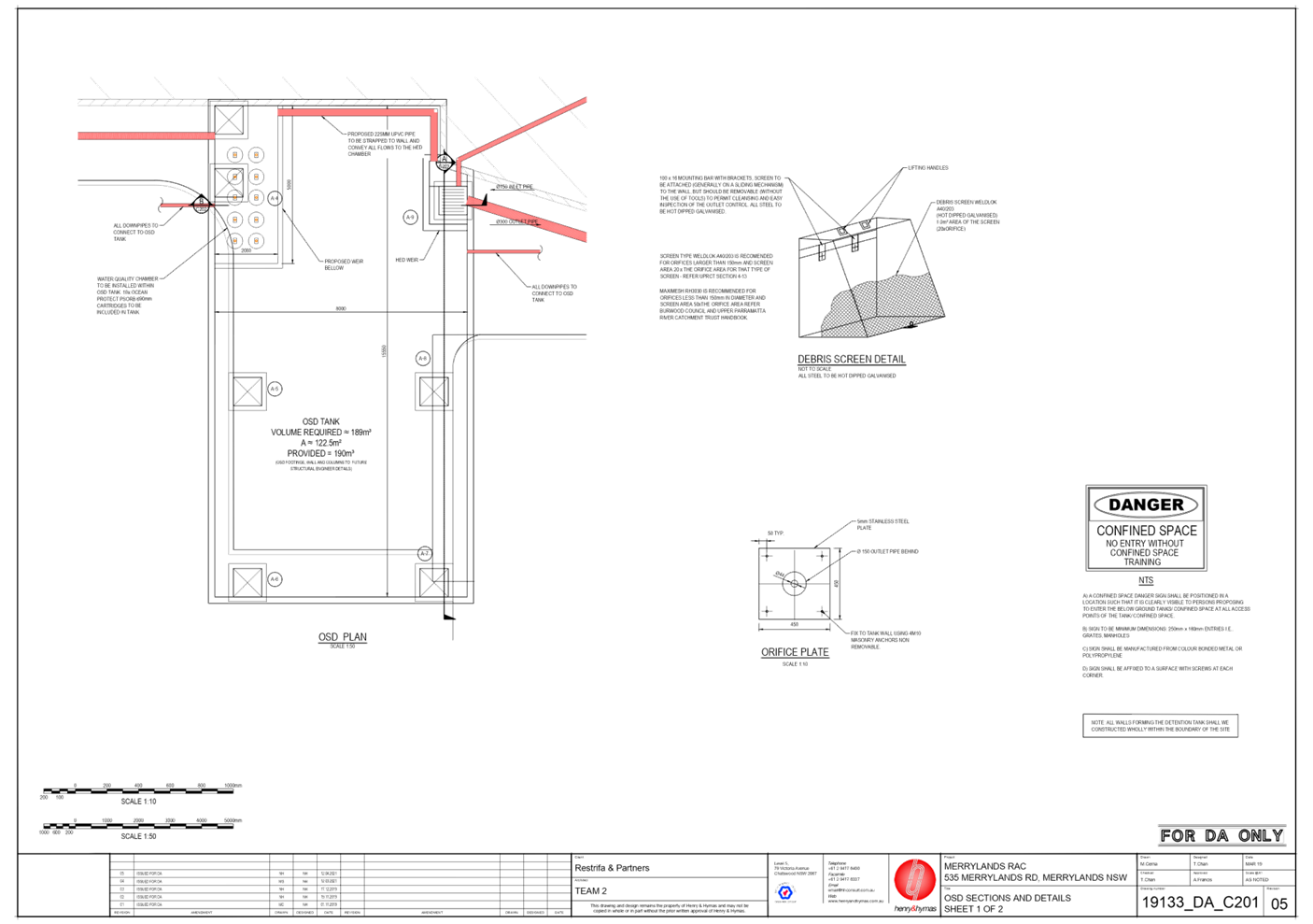
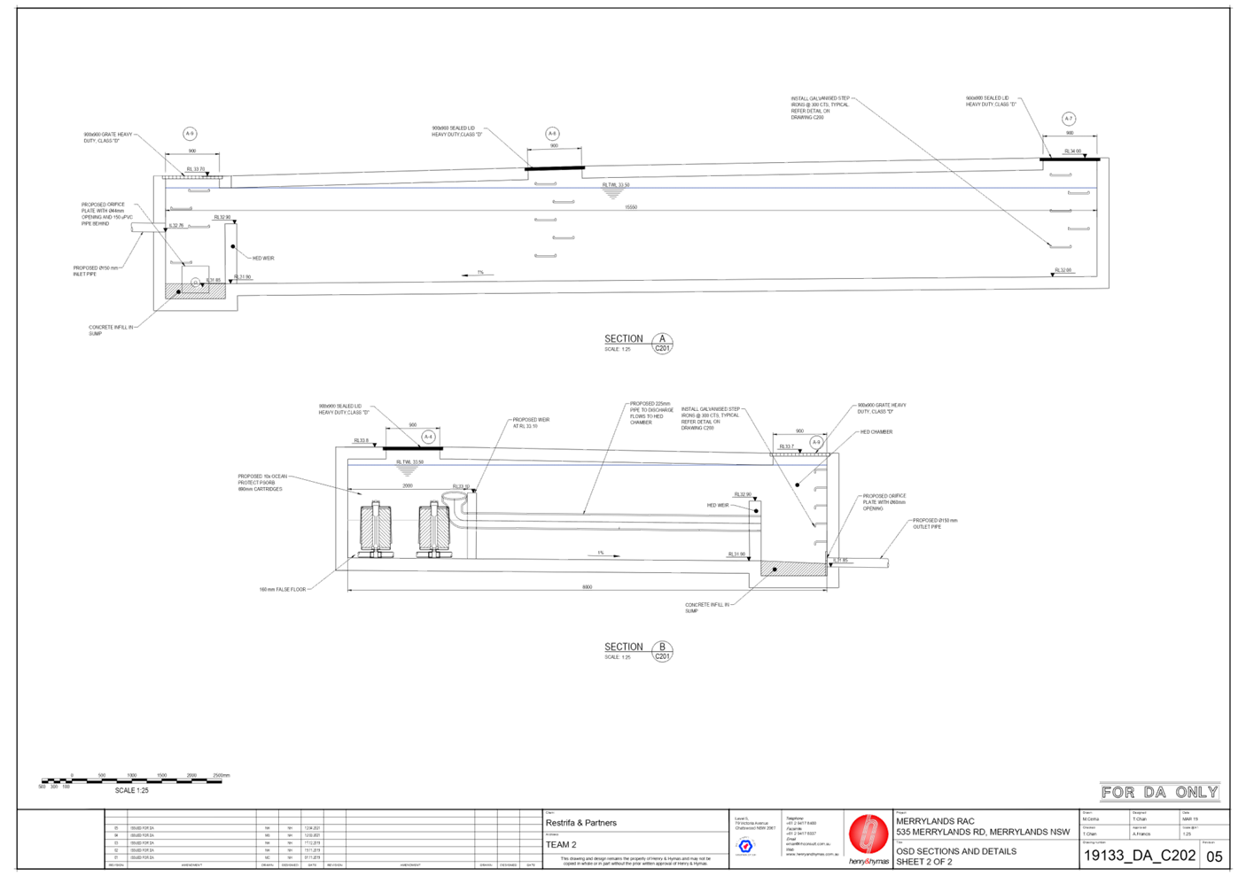
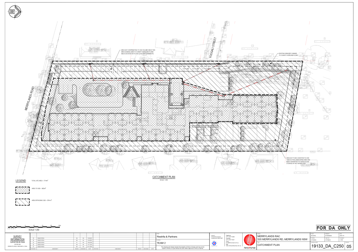
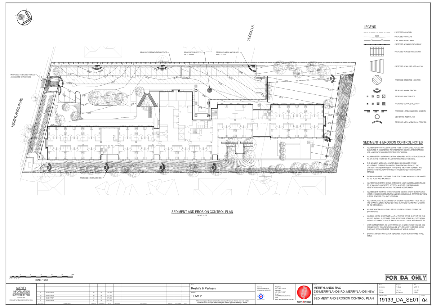
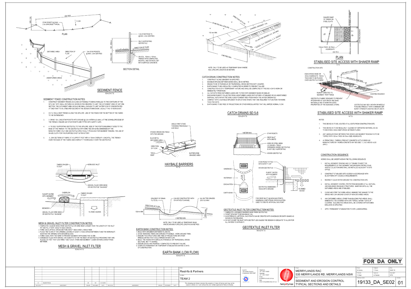
DOCUMENTS
ASSOCIATED WITH
REPORT LPP034/21
Attachment 8
Stormwater Report
Cumberland Local Planning Panel Meeting
13 October 2021
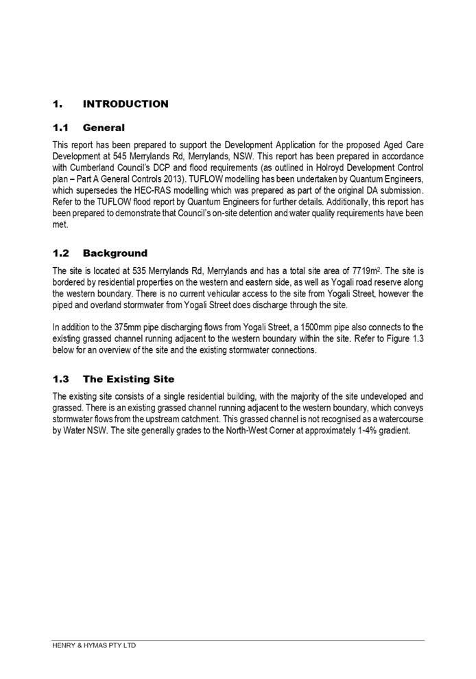
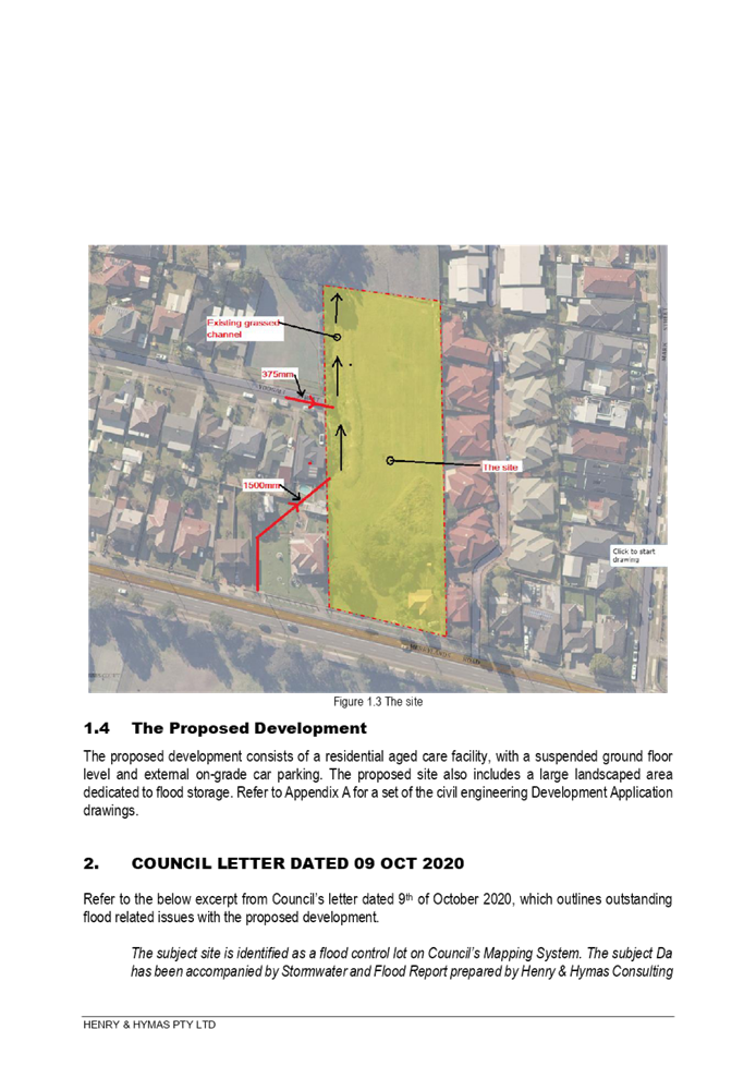
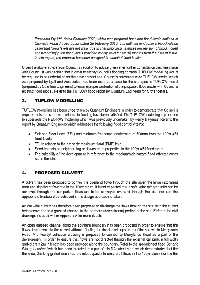
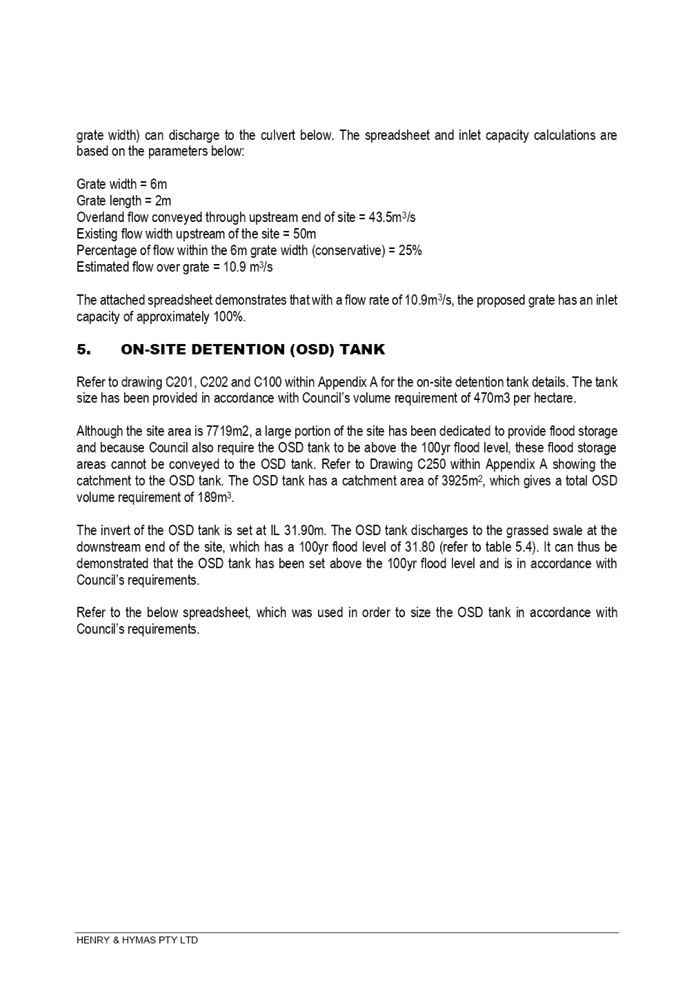
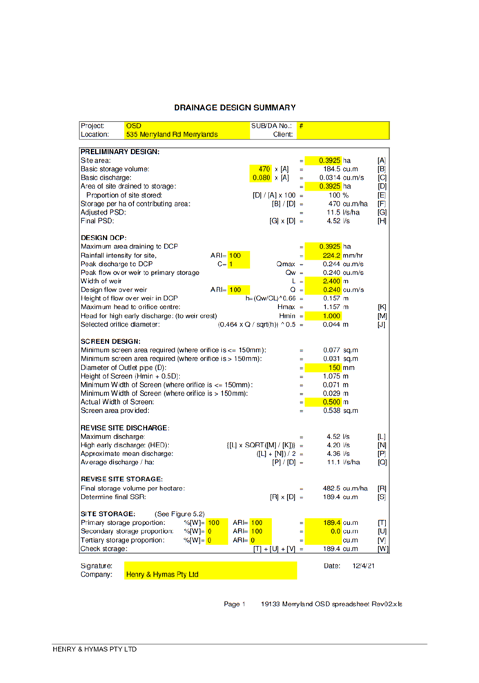
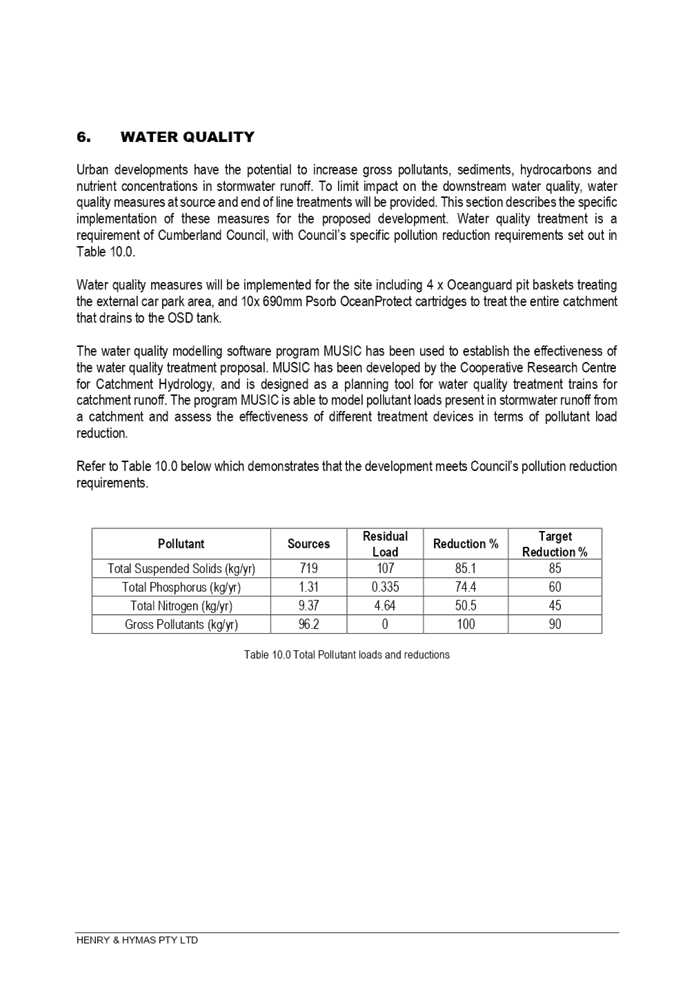
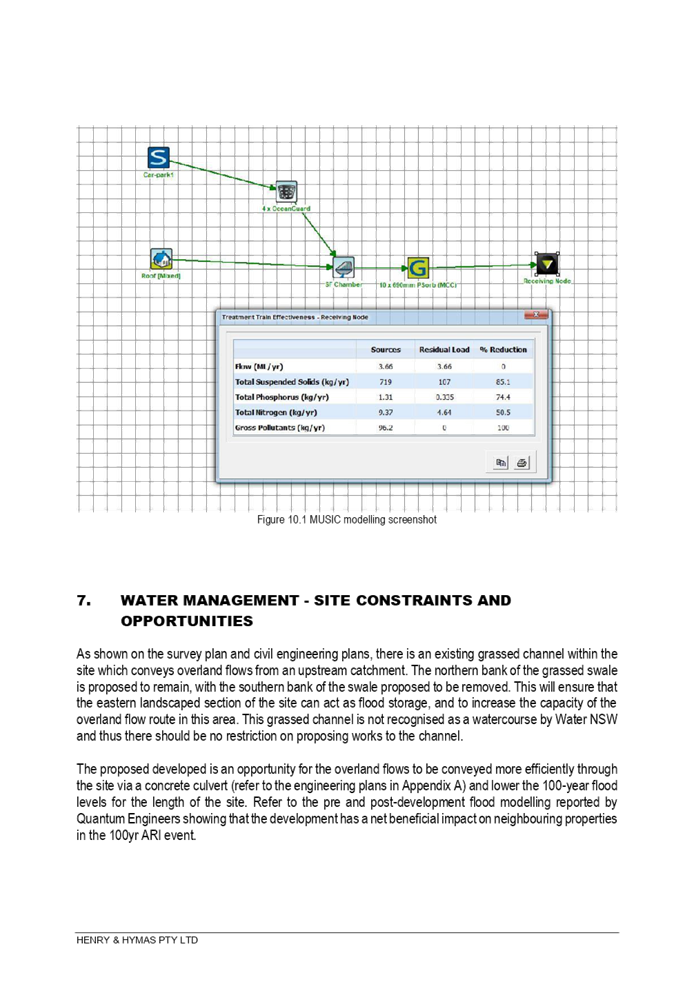
DOCUMENTS
ASSOCIATED WITH
REPORT LPP034/21
Attachment 9
Overland Flow Flood Assessment (including Evacuation
Strategy & Plan)
Cumberland Local Planning Panel Meeting
13 October 2021
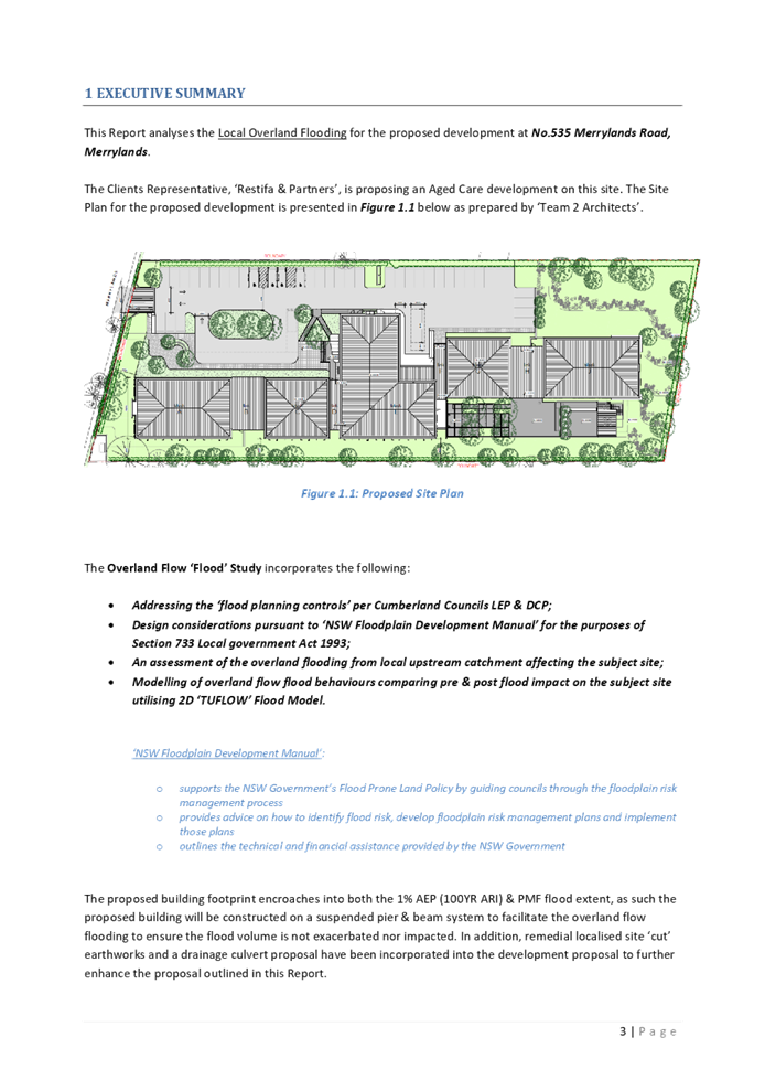
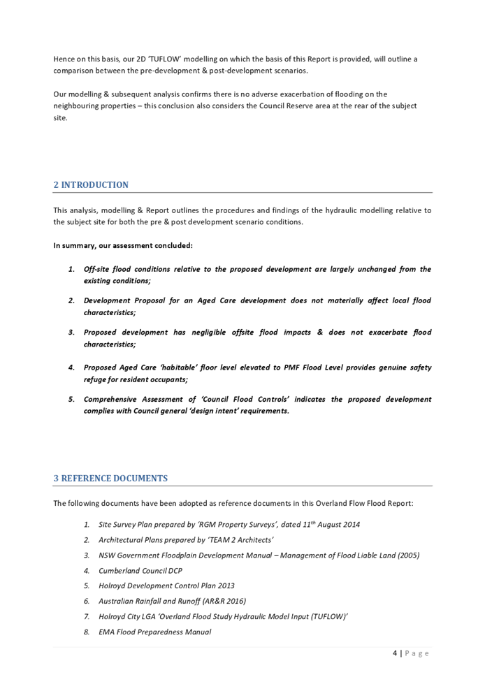
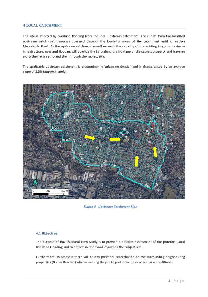
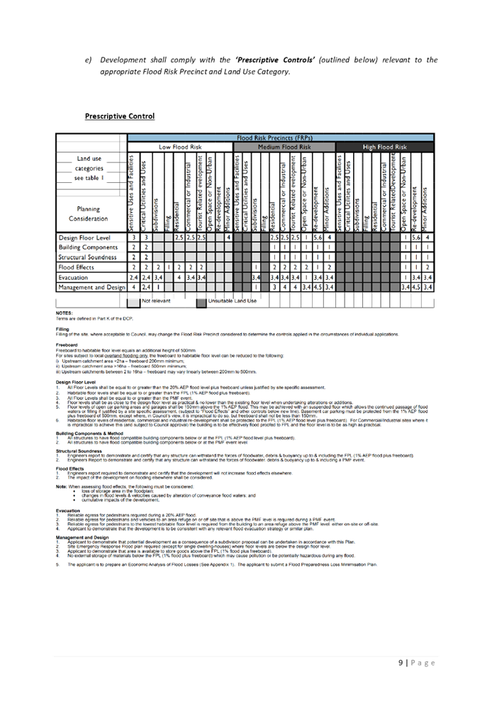
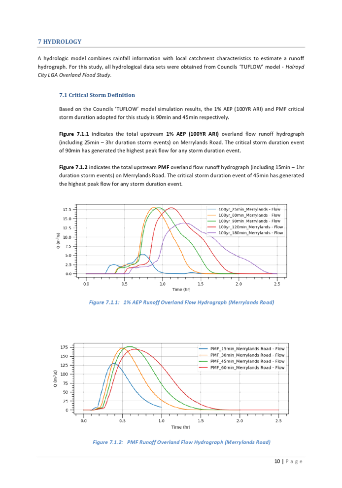
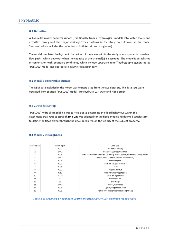
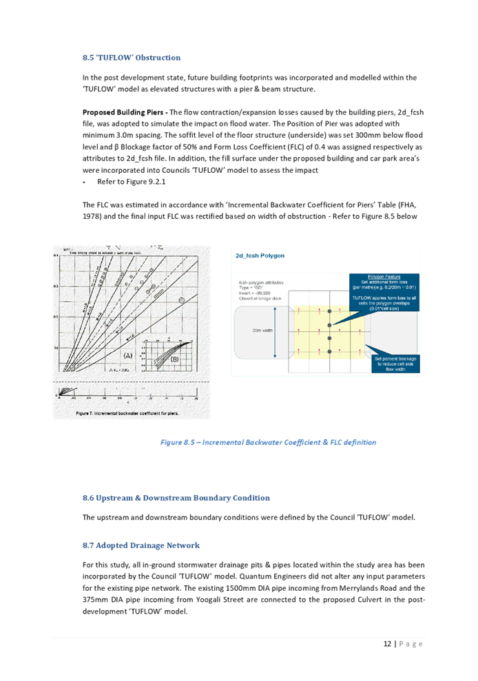
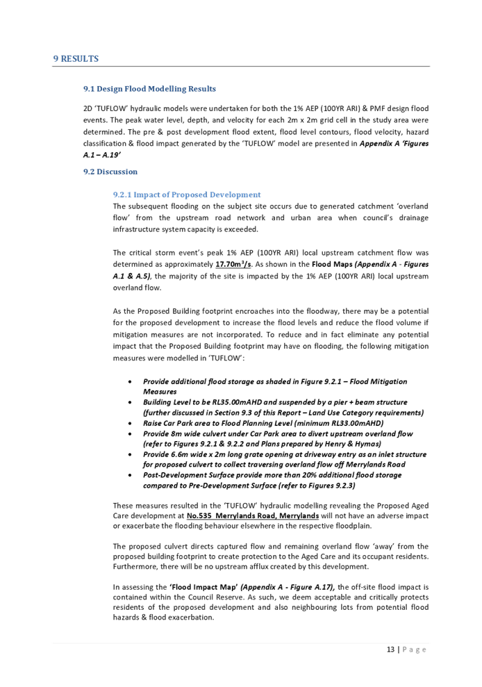
DOCUMENTS
ASSOCIATED WITH
REPORT LPP034/21
Attachment 10
Independent Peer Review of Flood Risk Management
Report
Cumberland Local Planning Panel Meeting
13 October 2021
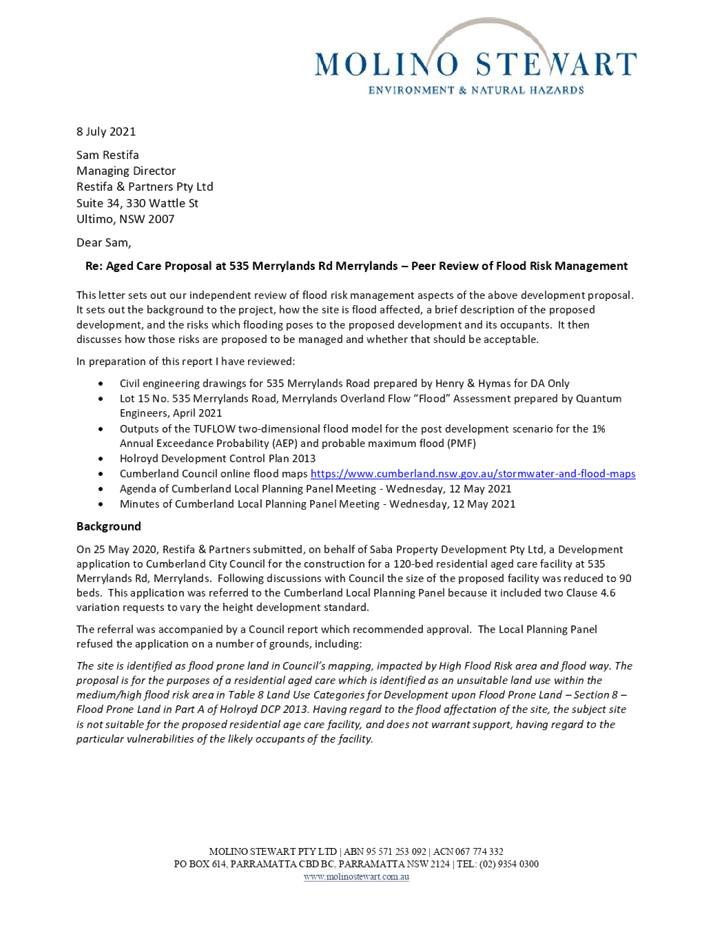
DOCUMENTS
ASSOCIATED WITH
REPORT LPP034/21
Attachment 11
Clause 4.6 Variation Request to SEPP (HSPD) 2004
Development Standards: Clause 40(4)(a) - Height of all building of proposal
must be 8m or less
Cumberland Local Planning Panel Meeting
13 October 2021
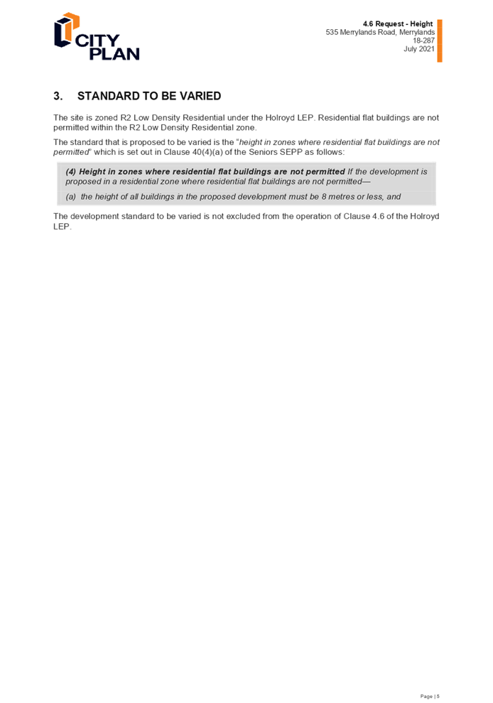
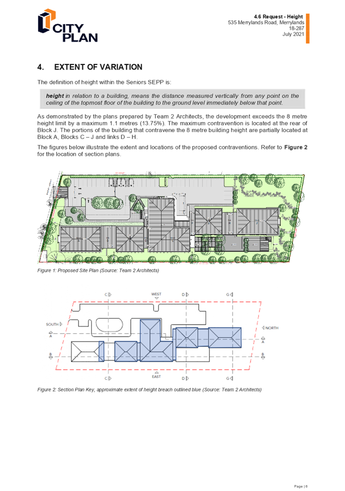
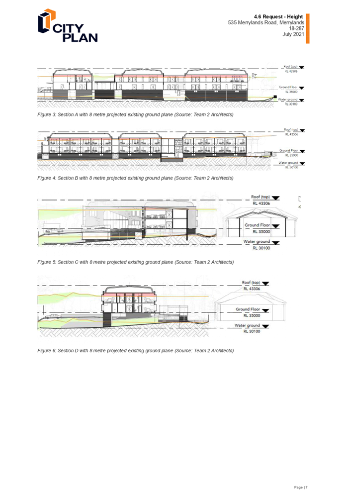
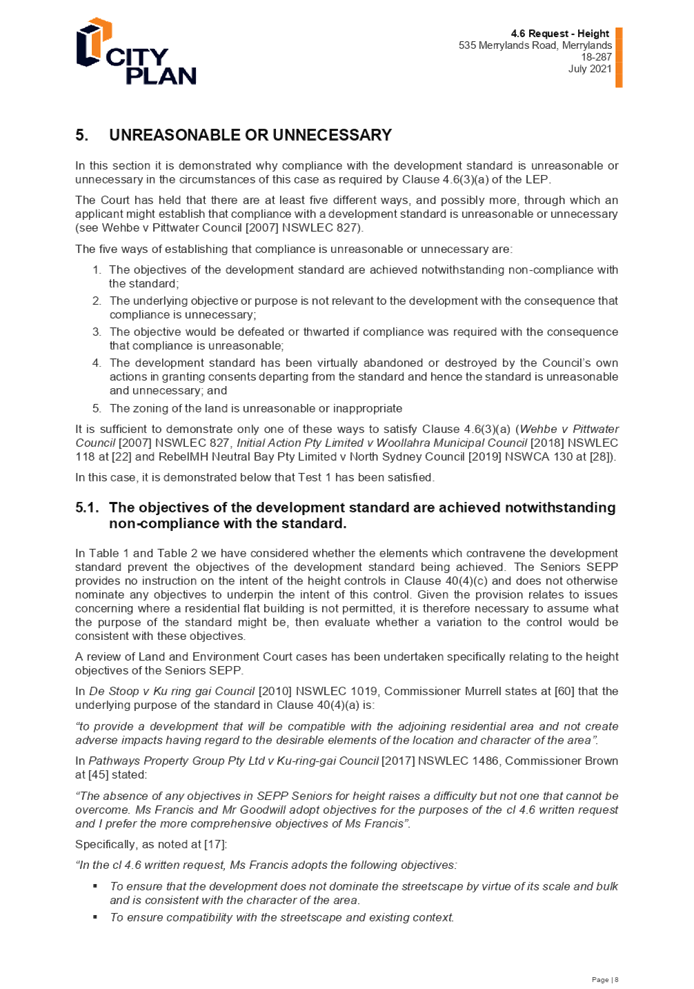
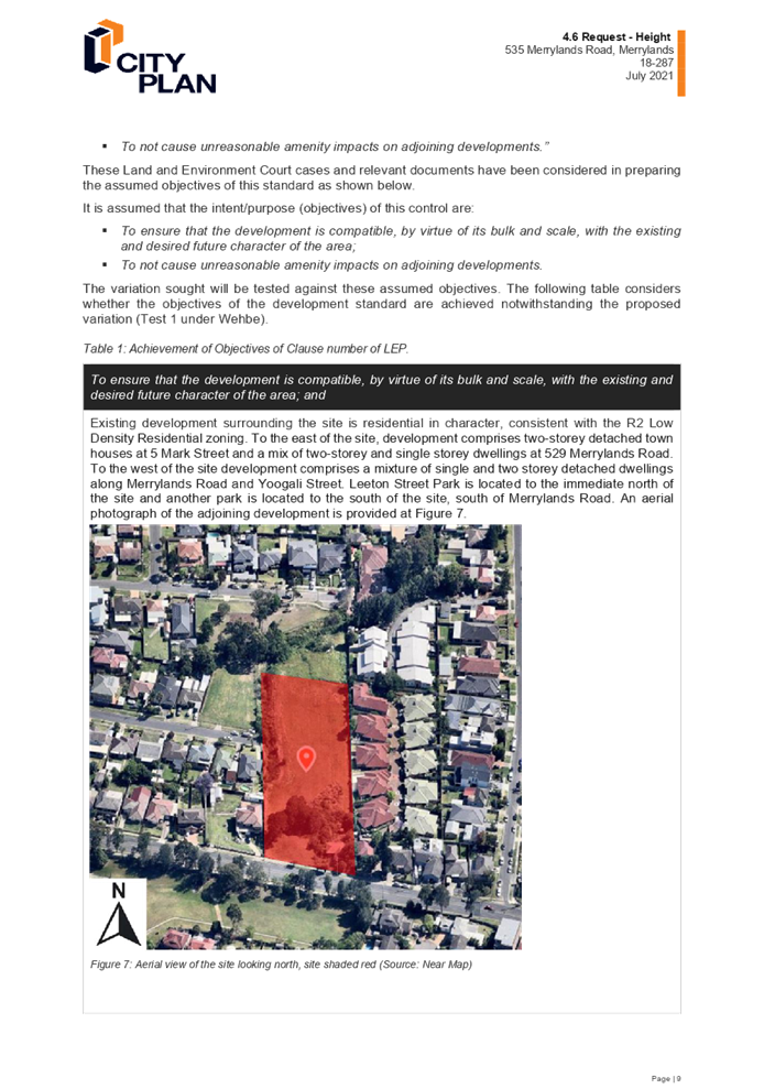
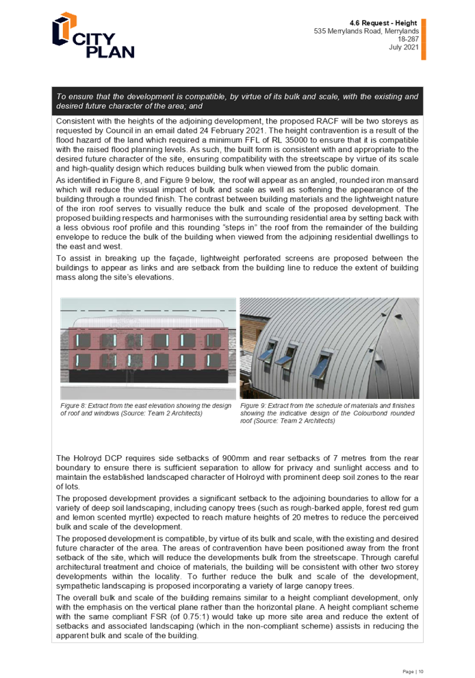
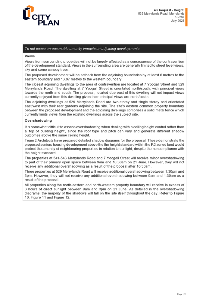
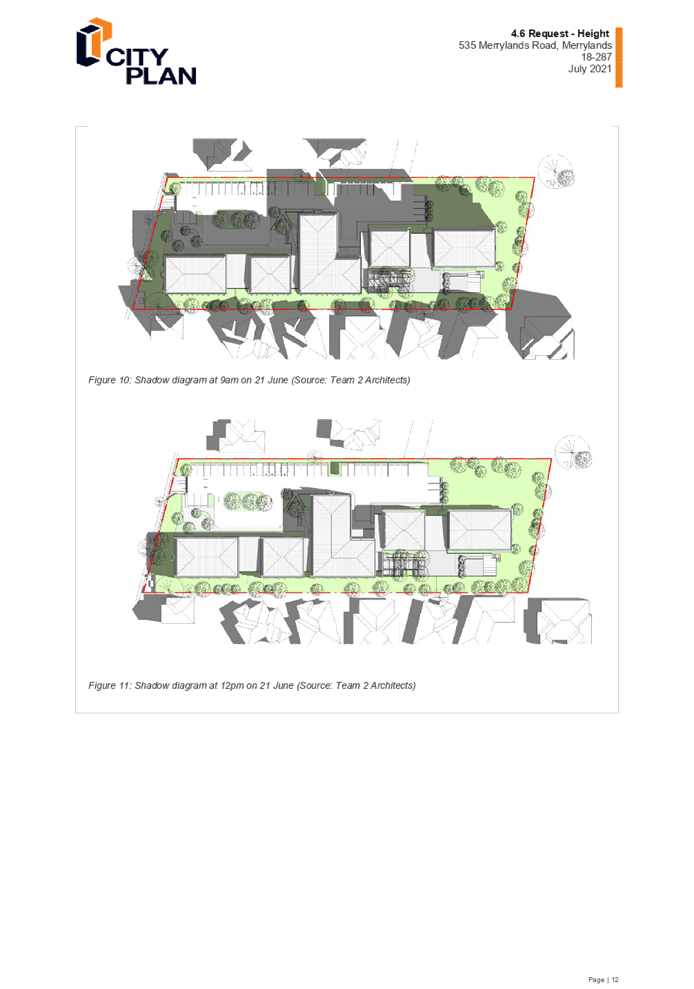
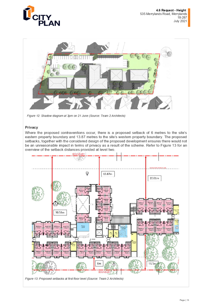
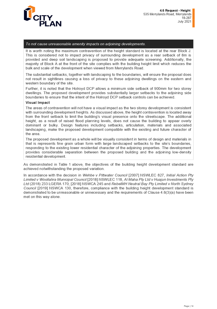
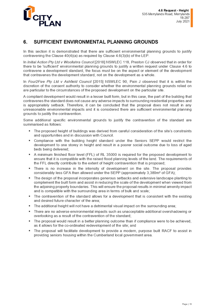
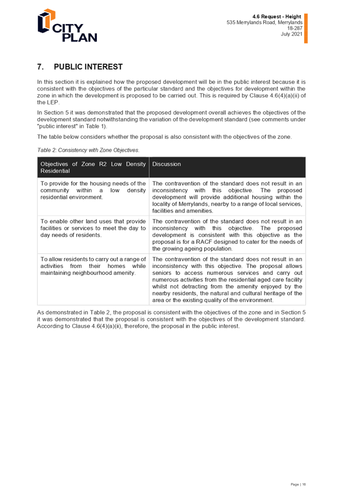
DOCUMENTS
ASSOCIATED WITH
REPORT LPP034/21
Attachment 12
Clause 4.6 Variation Request to SEPP (HSPD) 2004
Development Standards: Clause 40(4)(c) - A building located in the rear 25% of
the site must not exceed 1 storey in height
Cumberland Local Planning Panel Meeting
13 October 2021
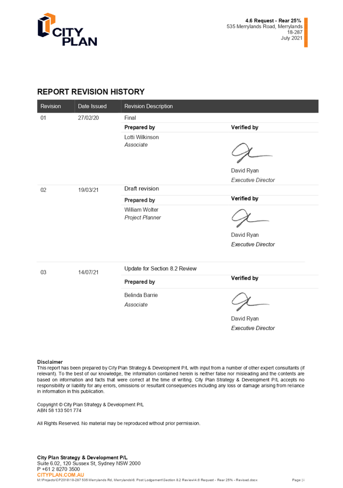
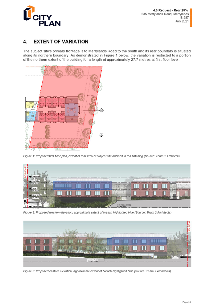
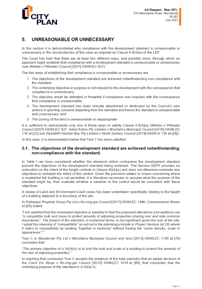
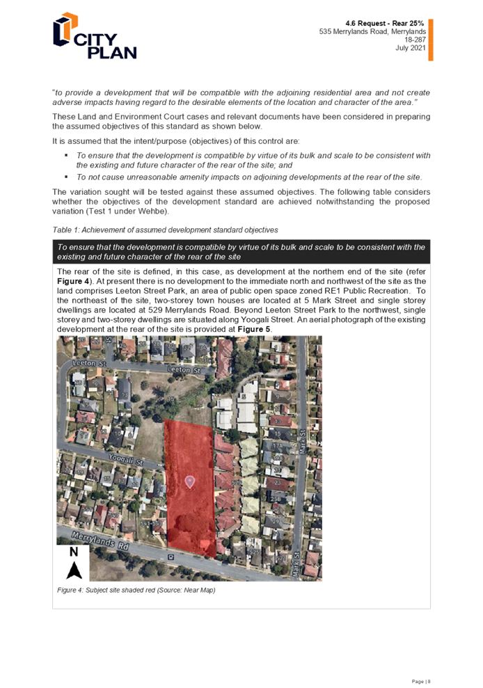
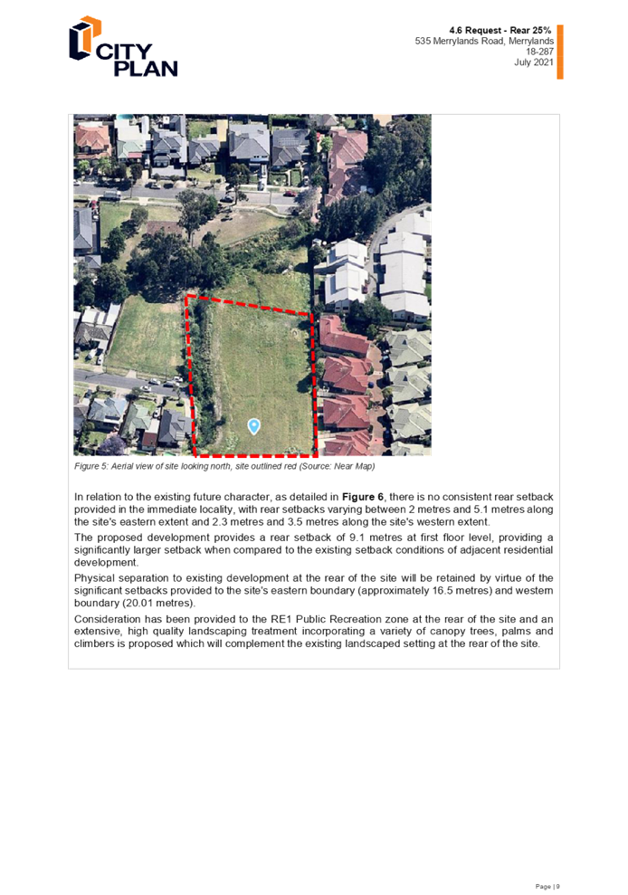
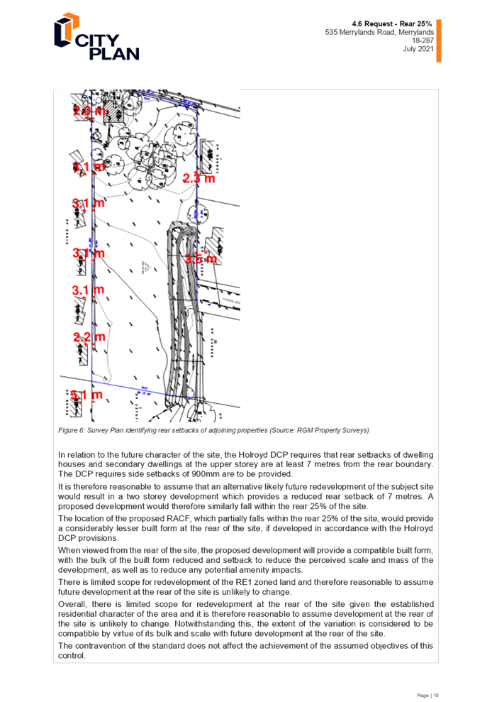
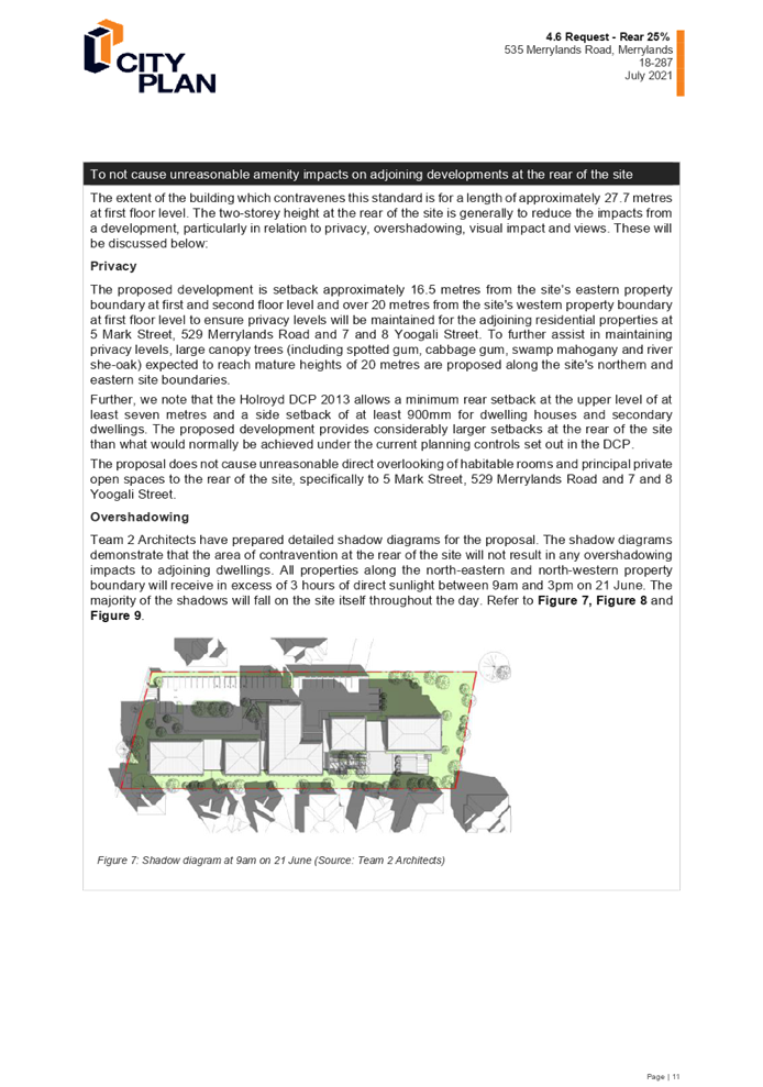
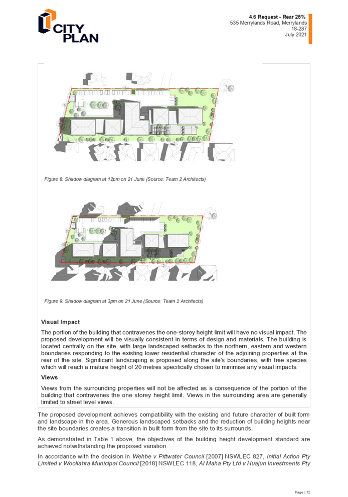

DOCUMENTS
ASSOCIATED WITH
REPORT LPP034/21
Attachment 13
Minutes of the Cumberland Local Planning Panel for
DA2020/0301 (Reasons for Refusal)
Cumberland Local Planning Panel Meeting
13 October 2021
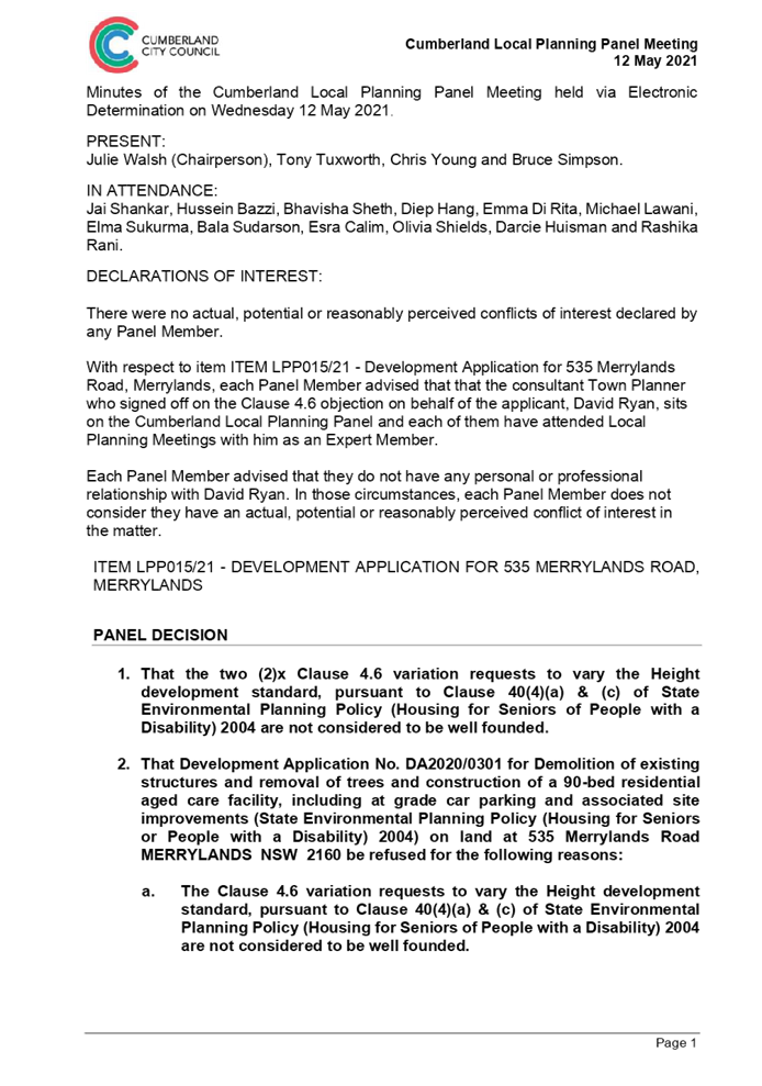
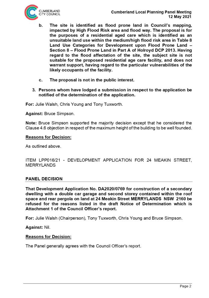

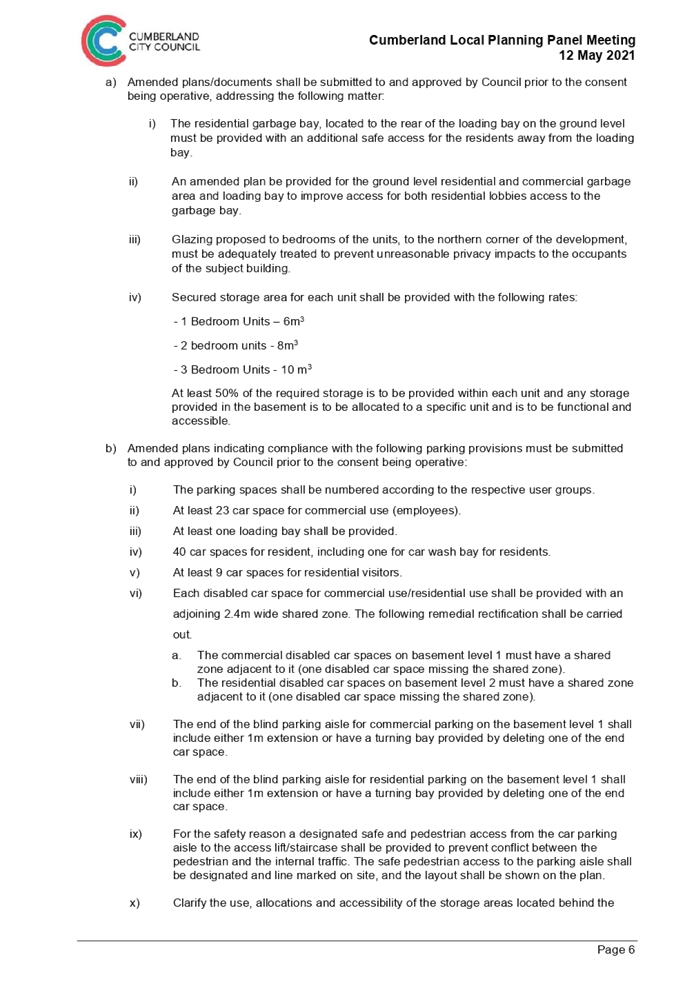
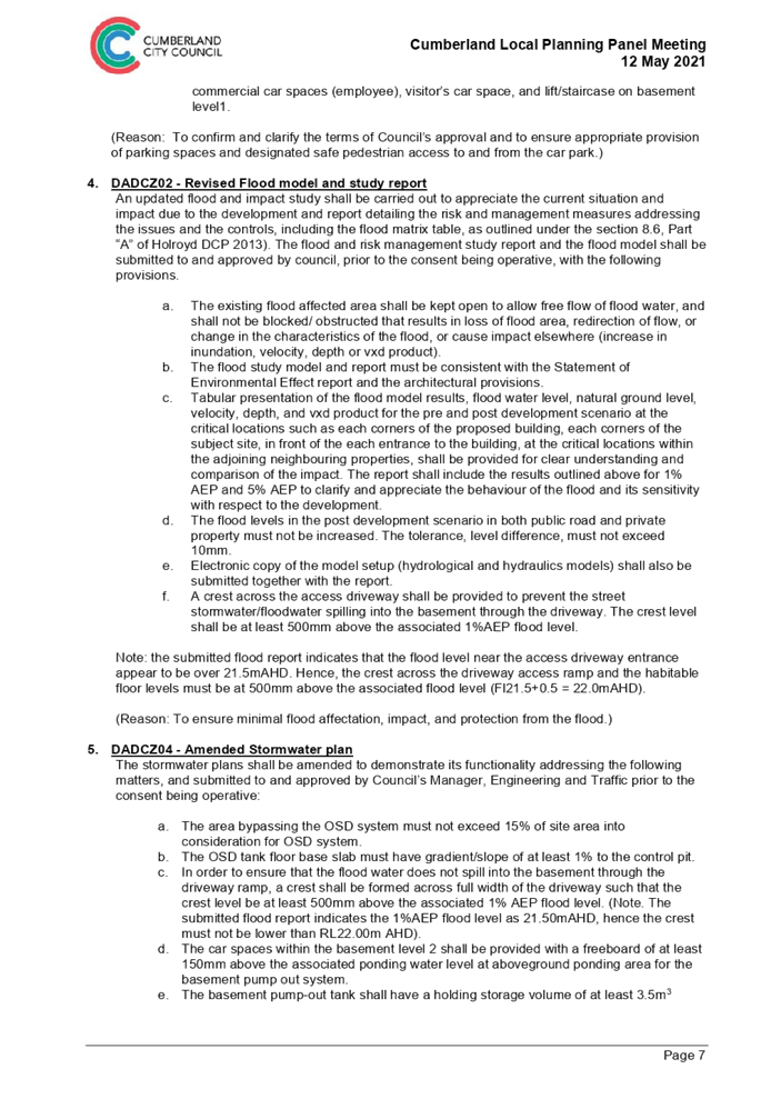
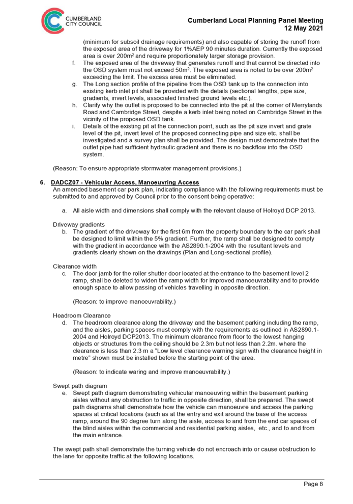
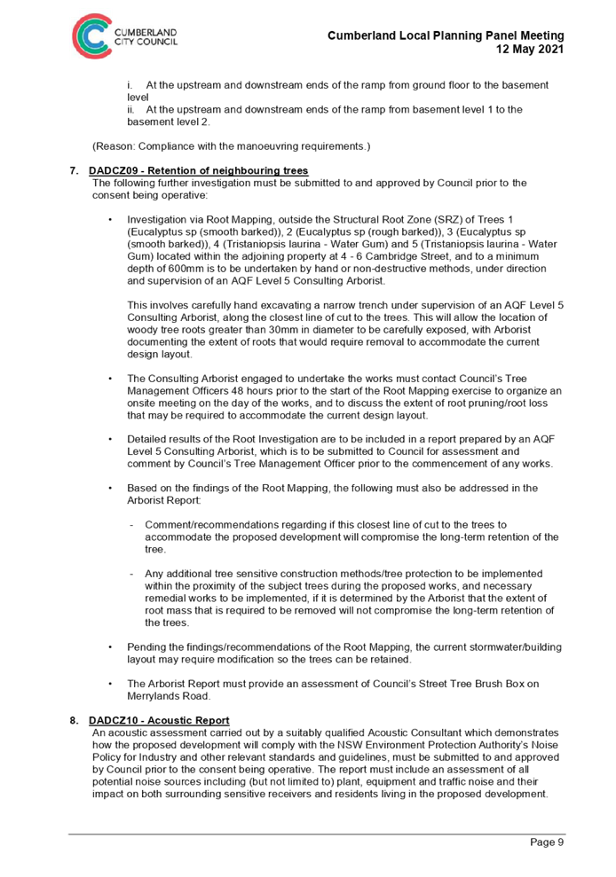


DOCUMENTS
ASSOCIATED WITH
REPORT LPP034/21
Attachment 14
Draft Reasons for Recommendation
Cumberland Local Planning Panel Meeting
13 October 2021
Cumberland Local Planning Panel Meeting
13 October 2021
Item No: LPP035/21
Modification
to Development Application for 1-7 Elvina Street, Greystanes
Responsible
Division: Environment
& Planning
Officer: Executive
Manager Development and Building
File
Number: MOD2021/0264
|
Application lodged
|
28
June 2021
|
|
Applicant
|
Gen
One Architects
|
|
Owner
|
Elvina
Properties Pty Ltd
|
|
Application No.
|
MOD2021/0264
|
|
Description of Land
|
1-7
Elvina Street GREYSTANES NSW 2145,
Lot
11 DP 236829, Lot 12 DP 236829, Lot 13 DP 236829 & Lot 14 DP 236829
|
|
Proposed Development
|
Section
4.56 modification application for various amendments to the approved mixed
use development (pursuant to State Environmental Planning Policy (Affordable
Rental Housing) 2009) including reconfiguration of basement level storage and
garbage rooms and layout of residential units 1 and 2, changes to windows in
western elevation and shopfront doors/glazing, and increase in overall
building height and basement floor level
|
|
Site Area
|
742.8m2
|
|
Zoning
|
B1
Neighbourhood Centre Zone
|
|
Disclosure of political donations and gifts
|
Nil
disclosure
|
|
Heritage
|
The
subject site is not heritage listed and is not within a heritage conservation
area.
|
|
Principal Development Standards
|
FSR
Permissible:
1.5:1 (including bonus 0.5:1 under ARH SEPP)
Proposed:
1.17:1
Height
of Building
Permissible:
11m
Proposed:
8.85m
|
|
Issues
|
Submissions
|
1. Modification
Application No. MOD2021/0264 was received on 28 June 2021 for Section 4.56
modification application for various amendments to the approved mixed use
development (pursuant to State Environmental Planning Policy (Affordable Rental
Housing) 2009 (ARH SEPP)) including reconfiguration of basement level storage
and garbage rooms and layout of residential units 1 and 2, changes to windows
in western elevation and shopfront doors/glazing, and increase in overall
building height and basement floor level.
2. The
application was publicly notified to occupants and owners of the adjoining
properties for a period of fourteen (14) days between 13 August 2021 and 27
August 2021. However, renotification was required due to error in the
description of the development and the application was publicly renotified to
occupants and owners of the adjoining properties for another fourteen (14) days
between 30 August 2021 and 13 September 2021. In response, ten (10) unique
submissions were received.
3. The
subject application has been assessed against the relevant provisions of State
Environmental Planning Policy (Affordable Rental Housing) 2009, Holroyd Local
Environmental Plan 2013 and Holroyd Development Control Plan 2013 (HDCP).
4. The
subject modification application does not include any numerical variations.
5. The
application is referred to the Panel as the proposal is considered to be
contentious development.
6. The
application is recommended for conditional approval subject to the conditions
as provided in Attachment 1.
Subject Site and Surrounding
Area
The site has a legal description
of Lots 11, 12, 13 and 14 in DP 236829 with approximate frontages of 21m to
Gozo Road and 27m to Elvina Street with total area of 742.8m2. The site is a
corner block situated on the southern side of Elvina Street and the eastern
side of Gozo Road. An existing driveway is located at the rear of the site
providing access to existing commercial premises at 9-11 Elvina Street. The
site slopes downward towards the south with level difference of approximately
2.1m between Elvina Street and the existing driveway at the rear. The site is
currently vacant.
Council’s car parking spaces
are located adjoining the front boundary of the subject site on Elvina Street comprising
of 9 spaces, including 2 accessible spaces. Directly adjoining the site towards
the east is a single storey commercial building with 3 separate tenancies. The
remaining development adjoining the site includes single to double storey
dwelling houses within the R2 Low Density Residential zone. Roberta Street Park
is located within the vicinity of the side towards the southeast.
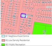
Figure
1 – Locality Plan of subject site (Intramap, 2021)
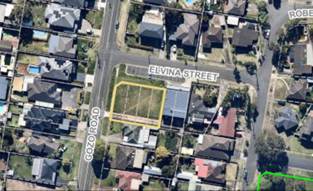
Figure
2 – Aerial view of subject site outlined in yellow (Intramap, 2021)
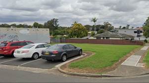
Figure
3 – Street view of subject site
Description of the Proposed
Development
Council has received a
modification application for Section 4.56 modification application for various
amendments to the approved mixed use development pursuant to ARH SEPP including
reconfiguration of basement level storage and garbage rooms and layout of
residential units 1 and 2, changes to windows in western elevation and
shopfront doors/glazing, and increase in overall building height and basement
floor level.
The proposal results in the
following amendments:
· Lowering
of basement FFL by 200mm.
· Increasing
overall building height by 250mm.
· Increasing
overall floor area by 11.3m².
· Reducing
commercial floor area by 20.47m².
· Addition
of a lift to basement and ground floor levels.
· Deletion
of staircases on the ground floor.
· Relocation
of Elvina Street pedestrian entry from the middle part to the eastern side of
the building.
· Relocation
of residential bin room towards the western side boundary of the site.
· Addition
of an electrical room.
· Relocation
of storage areas for residential units within the basement level.
· Reduction
in the internal size of shops and modification of the shopfront glazing/doors.
· Internal
layout changes to units 1 and 2.
Figure
4 – Physical comparison
|
Details
|
Approved
under Holroyd LEP 1991
|
Section 4.56 Proposed
Under Holroyd LEP 2013
|
|
Zoning
|
3(b) Business Neighbourhood
|
B1 Neighbourhood Centre –
|
|
Building Height
|
Approx. 8.6m
|
8.85m (increase by 250mm)
|
|
Overall FSR
|
1.16:1 (including bonus FSR under ARH SEPP)
|
1.17:1 (increase by 11.3m²)
|
|
No. of commercial units
|
2 (GFA – 171.47m²)
|
2 (GFA – 151m²)
|
|
No. of residential units
|
7
|
7
|
|
No. of car spaces
|
Basement level – 7 residential spaces (including 1
accessible space)
2 commercial visitor spaces
(including 1 accessible space)
|
Basement level – 7 residential spaces (including 1
accessible space)
2 commercial visitor spaces
(including 1 accessible space)
|
|
No. of bin rooms
|
1 commercial
1 residential
|
1 commercial
1 residential
|
History
1. On
15 January 2012, Council refused DA2012/315 for the demolition and erection of
a mixed use development containing two retail units and 8 residential units
above a basement parking level at 1-7 Elvina Street, Greystanes. The applicant
subsequently sought a review under s8.3 of the Environmental Planning and
Assessment Act (the Act).
2. Class
1 appeal was lodged at the Land and Environment Court on 15 November 2013
against the refusal of the s8.3 application.
3. On
20 December 2013, on the application of the Council, Biscoe J ordered separate
determination of two questions, being whether the application was for
“prohibited development”, and if not prohibited, whether clause
10(1) of the ARH SEPP applied to the development application. The Land and
Environment Court subsequently established the characterisation and
permissibility of the development as a mixed use with residential flat building
for which the ARH SEPP is applicable.
4. On
10 July 2015, the Land and Environment Court upheld the appeal for the proposed
development, as amended, as a deferred commencement consent for the demolition
and erection of a mixed use development containing two retail units and seven
residential units above a basement parking level for 9 car spaces. It should be
noted that the reference to demolition on the site on the description of the
original consent is an error, as the subject site has always been a vacant
land.
5. Operational
consent was issued on 7 July 2017. S4.54 application to extend the DA was
approved on 4 March 2020 with new expiry date of 7 July 2021. Subject to the
changes to the Environmental Planning and Assessment Regulation 2000 COVID
amendment, the expiry date of the application is 7 July 2023.
6. Construction
certificate has been issued for the original development consent and site
preparation works have commenced on the site.
Applicants Supporting
Statement
The applicant has provided a
Statement of Environmental Effects prepared by HDC Planning dated 14 May 2021
and was received by Council on 29 June 2021 in support of the application.
Contact with Relevant
Parties
The assessing officer has
undertaken a site inspection of the subject site and surrounding properties and
has been in regular contact with the applicant throughout the assessment
process.
Internal Referrals
Development Engineer
The development application was
referred to Council’s Development Engineer for comment who has advised
that the proposed modification within the basement level is satisfactory as it
does not alter previously approved stormwater management and traffic
arrangement, and therefore can be supported subject to recommended conditions
of consent.
Environment and Health
The development application was
referred to Council’s Environment and Health Officer for comment who has
advised that the development proposal is satisfactory as the acoustic impact
has been sufficiently addressed, and therefore can be supported subject to
recommended conditions of consent.
Waste Management
The development application was
referred to Council’s Waste Management Officer for comment who has
advised that the development proposal is satisfactory in addressing waste
management arrangement, and therefore can be supported subject to recommended
conditions of consent.
External Referrals
The application was not required
to be referred to any external government authorities for comment.
Planning Comments
Section 4.56 Modification by
consent authorities of consents granted by the Court:
|
Requirement
|
Comments
|
|
Council is satisfied that the development to which the
consent as modified relates is substantially the same development as the
development for which the consent was originally granted and before that
consent as originally granted was modified (if at all), and
|
The development as proposed to be modified is
substantially the same as the original consent. That is for the purpose of
mixed use development.
The principal and essential features of the original
approval are maintained. For these reasons the modification is qualitative
and quantitatively substantially the same development as approved, refer to
physical comparison in Figure 4.
The proposed changes to the
conditions of consent are considered to effect a change to the approved
building and use for the approved premises, and therefore it is deemed to be
substantially the same as originally consented.
|
|
Council has notified the application in accordance with:
(i) the
regulations, if the regulations so require, and
(ii) a
development control plan, if the consent authority is a council that has made
a development control plan that requires the notification or advertising of
applications for modification of a development consent, and
Council has notified, or made reasonable attempts to
notify, each person who made a submission in respect of the relevant
development application of the proposed modification by sending written
notice to the last address known to the consent authority of the objector or
other person, and
|
See discussion on “Public Notification” in
this report.
Previous objectors including the persons submitted under a
petition have been notified.
|
|
Council has considered any submissions made concerning the
proposed modification within any period prescribed by the regulations or
provided by the development control plan, as the case may be.
|
See discussion on “Public Notification” in
this report.
|
|
Relevant matters referred to in Section 4.15(1) of the act
have been taken into consideration.
Council has considered the reasons given by the consent
authority for the grant of the consent that is sought to be modified.
|
Proposed modification is not contrary to the public
interest and the likely environmental impacts of the development as modified
are considered acceptable.
The reason given by the Land and Environment Court for the
grant of the consent that is sought to be modified, in that the proposed development is of a type and scale that is
compatible with the character and amenity of the surrounding residential
area, as required by clause 9(3) of the Holroyd Local Environmental Plan
(LEP) 1991, has been considered. The proposed modification is consistent with
the reason granted and therefore it is supported.
|
|
After determining an application for modification of a
consent under this section, Council must send a notice of its determination
to each person who made a submission in respect of the application for
modification
|
Noted.
|
The provisions of any
Environmental Planning Instruments (EP&A Act s4.15 (1)(a)(i))
(a) State
Environmental Planning Policy No. 55 – Remediation of Land (SEPP 55)
Clause 7 of SEPP 55 requires
Council to be satisfied that the site is suitable or can be made suitable to
accommodate the proposed development. The matters listed within Clause 7 have
been considered in the assessment of the original development application. The
proposed modifications do not raise any new concerns regarding site contamination,
and it has no bearing under the subject modification application.
(b) State
Environmental Planning Policy (Infrastructure) 2007 (ISEPP)
The proposed modifications include
internal changes that do not require reassessment under the provisions of this
SEPP.
(c) Statement
Environmental Planning Policy No. 65 - Design Quality of Residential Apartment
Development (SEPP 65)
SEPP 65 applies to the development
as the building is 3 storeys or more and contains more than 4 dwellings. A
design statement addressing the design quality principles prescribed by SEPP 65
was prepared by the project architect under the original application. Integral
to SEPP 65 is the Apartment Design Guide (ADG), which sets benchmarks for the
appearance, acceptable impacts and residential amenity of the development. The
proposed modifications include internal and minor materials changes that do not
require reassessment under the provisions of this SEPP.
(d) State
Environmental Planning Policy (Affordable Rental Housing) 2009 (ARH SEPP)
The proposal is subject to the
provisions of Part 1 Preliminary and Part 2 (New affordable rental housing)
Division 1 (In-fill affordable housing) of the ARH SEPP. An assessment of the
proposed development against the provisions of the ARH SEPP was completed under
the original application. No changes to approved number of car spaces on site.
The proposed modifications for the internal changes do not require a
reassessment of the SEPP provisions, except for clause 13 regarding floor space
ratios as follows.
The maximum floor space ratio for
development to which this Division applies is the existing maximum floor space
ratio for any form of residential accommodation permitted on the land on which
the development is to occur, plus—
(a) if
the existing maximum floor space ratio is 2.5:1 or less—
(i) 0.5:1—if
the percentage of the gross floor area of the development that is used for
affordable housing is 50 per cent or higher,
The original application was
approved with 4 out of 7 units (57%) to be used for the purpose of affordable
housing. Therefore, the maximum floor space ratio (FSR) that applies to the
site is: 1.1 + 0.5 = 1.5:1 (GFA of 1,114.2m²). The proposed modification
application will maintain a compliant FSR of 1.17:1 (GFA of 869.69m²).
(e) State
Environmental Planning Policy (Vegetation in Non-Rural Areas) 2017
No tree removal is proposed under
this modification application. The provision of the Vegetation SEPP does not
apply.
(f) State
Environmental Planning Policy (Building Sustainability Index: BASIX) 2004
BASIX Certificate 1203675M dated issued
on 17 May 2021 prepared by Sustainability-Z Pty Ltd has been submitted with
Council and is considered to be satisfactory.
Regional Environmental Plans
The proposed development is
affected by the following Regional Environmental Plans:
(a) Sydney
Regional Environmental Plan (Sydney Harbour Catchment) 2005
The subject site is identified as
being located within the area affected by the Sydney Regional Environmental
Plan (Sydney Harbour Catchment) 2005. The proposed development raises no issues
as no impact on the catchment is envisaged.
(Note: - the subject site is not
identified in the relevant map as ‘land within the ‘Foreshores and
Waterways Area’ or ‘Wetland Protection zone’, is not a
‘Strategic Foreshore Site’ and does not contain any heritage items.
Hence the majority of the SREP is not directly relevant to the proposed
development).
Local Environmental Plans
Holroyd Local Environmental
Plan (LEP) 2013
(a) Permissibility:-
The zoning of the subject site
under the previous Holroyd LEP 1991 is identified as zone 3(b) Neighbourhood
Business zone.
The zoning of the subject site
under Holroyd LEP 2013 is identified as B1 Neighbourhood Centre zone.
Section 4.70(1) of the EP&A
Act 1979 stipulates that nothing in an environmental planning instrument prohibits,
or requires a further development consent to authorise, the carrying out of
development in accordance with a consent that has been granted and is in force.
The proposal, as modified, continues to meet the objective of the zone in that
the proposed development is of a type and scale that is compatible with the
character and amenity of the surrounding residential area. The proposed
modification application for various amendments to the approved mixed use
development is considered acceptable.
The relevant matters to be
considered under Holroyd Local Environmental Plan 2013 and the applicable
clauses for the proposed development are summarised below. The proposed
modifications do not result in any new non-compliances with the LEP. A
comprehensive assessment and compliance table is attached to this report in
Attachment 9 which demonstrates the development proposal’s compliance
with the relevant planning controls that are applicable to the site under the
Holroyd LEP 2013.
Figure
5 – Holroyd LEP 2013 Compliance Table
|
DEVELOPMENT STANDARD
|
COMPLIANCE
|
DISCUSSION
|
|
4.3 Height of Buildings
Max 11m
|
Yes
|
8.85m
|
|
4.4 Floor Space Ratio
Max 1:1
|
Yes
|
Refer to ARH SEPP
discussions above.
|
The provisions of any proposed
instrument that is or has been the subject (EP&A Act s4.15 (1)(a)(ii))
(a) Draft
State Environmental Planning Policy (Environment)
The draft SEPP relates to the
protection and management of our natural environment with the aim of
simplifying the planning rules for a number of water catchments, waterways,
urban bushland, and Willandra Lakes World Heritage Property. The changes
proposed include consolidating the following seven existing SEPPs:
· State
Environmental Planning Policy No. 19 – Bushland in Urban Areas
· State
Environmental Planning Policy (Sydney Drinking Water Catchment) 2011
· State
Environmental Planning Policy No. 50 – Canal Estate Development
· Greater
Metropolitan Regional Environmental Plan No. 2 – Georges River Catchment
· Sydney
Regional Environmental Plan No. 20 – Hawkesbury-Nepean River (No.2-1997)
· Sydney
Regional Environmental Plan (Sydney Harbour Catchment) 2005
· Willandra
Lakes Regional Environmental Plan No. 1 – World Heritage Property.
The draft policy will repeal the
above existing SEPPs and certain provisions will be transferred directly to the
new SEPP, amended and transferred, or repealed due to overlaps with other areas
of the NSW planning system.
Changes are also proposed to the
Standard Instrument – Principal Local Environmental Plan. Some provisions
of the existing policies will be transferred to new Section 117 Local Planning
Directions where appropriate.
(b) Draft
Cumberland Local Environmental Plan (Draft CLEP)
The Draft Cumberland Local
Environmental Plan (Draft CLEP) has been prepared by Cumberland Council to
provide a single planning framework for the future planning of Cumberland City.
The changes proposed seek to harmonise and repeal the three existing LEPs
currently applicable to the Cumberland local government area, those being:
· Holroyd
Local Environmental Plan 2013,
· Parramatta
Local Environmental Plan 2011, and
· Auburn
Local Environmental Plan 2010.
The current planning controls for
the subject site, as contained within the Holroyd LEP 2013 are not proposed to
change under the Draft CLEP.
The provisions of any
Development Control Plans (EP&A Act s4.15 (1)(a)(iii))
The Holroyd Development Control
Plan (DCP) 2013 provides guidance for the design and operation of development
to achieve the aims and objectives of the Holroyd LEP 2013. The original
development was assessed under Holroyd DCP 2007 and the proposed modifications
including internal changes will not result in any new non-compliances with the
relevant DCP controls. It is considered that the proposal, as modified, performs
adequately from an environmental planning viewpoint and is supported.
The development controls within
Parts A, B and C of Holroyd Development Control Plan 2013 should be used as a
guide, given that the assessment against the character of the local area
carried out under the ARH SEPP has considered the built form compatibility
under the original consent.
An assessment and compliance table
of the relevant DCP controls of which relate to the modifications proposed is
contained in Attachment 10.
The provisions of any planning
agreement that has been entered into under section 7.4, or any draft planning
agreement that a developer has offered to enter into under section 7.4
(EP&A Act s4.15(1)(a)(iiia))
There is no draft planning
agreement associated with the subject Development Application.
The provisions of the
Regulations (EP&A Act s4.15 (1)(a)(iv))
The proposed development raises no
concerns as to the relevant matters arising from the Environmental Planning and
Assessment Regulations 2000 (EP&A Reg).
The Likely Environmental,
Social or Economic Impacts (EP&A Act s4.15 (1)(b))
It is considered that the proposed
development will have no significant adverse environmental, social or economic
impacts in the locality.
The suitability of the site for
the development (EP&A Act s4.15 (1)(c))
The subject site and locality are
not known to be affected by any natural hazards or other site constraints
likely to have a significant adverse impact on the proposed development.
Accordingly, it is considered that the development is suitable in the context
of the site and surrounding locality.
Submissions made in accordance
with the Act or Regulation (EP&A Act s4.15 (1)(d))
Advertised (Council Website) Mail Sign
Not Required
In accordance with Council’s
Notification requirements contained within the Holroyd DCP 2013, the proposal
was publicly notified to occupants and owners of the adjoining properties for a
period of fourteen (14) days between 13 August 2021 and 27 August 2021.
However, renotification was required due to error in the description of the
development and the application was publicly renotified to occupants and owners
of the adjoining properties for another fourteen (14) days between 30 August
2021 and 13 September 2021. The notification generated ten (10) submissions in
respect of the proposal with nil disclosing a political donation or gift. The
issues raised in the public submissions are summarised and commented on as
follows:
Figure
6 – Submissions summary table
|
Issues raised
|
Planner’s Comments
|
|
Bond or insurance by developers/builders require a
certificate that if any damage done to our property, to have it rectified.
Ground cracks during construction.
|
Conditions 47 and 48 of the original consent require that
a dilapidation report shall be prepared and submitted to the Principal
Certifying Authority prior to commencement of works. The developer is liable
for any damage to the adjoining properties and provide sufficient measures to
avoid damages.
|
|
Rear lane access be kept free available and no access in
developing block driveway access at the rear. Clarification on east elevation
drawings brick wall whether this will block rear access.
|
Condition 123 of the consent requires that the rear lane
access to be kept free at all time, including during construction. No
structure proposed will be encroaching onto the rear lane access, which is a
right of way for 9-11 Elvina Street.
|
|
Increase height 3 storey/9.9m, overshadowing, should be 1
storey like existing shop next door, would affect adjoining property by mould
growth and damp area.
|
The proposal is 250mm increase to approved building
height, which will result in maximum height of 8.85m. The proposal is well
under the maximum building height of 11m that applies to the site. Shadow
diagram submitted with the application indicating the additional 250mm
building height maintains compliance solar access, as previously approved.
|
|
Privacy impact, overlooking for balconies and windows need
to be removed. South facing balconies look straight into the adjoining
property backyard. Huge, frosted windows, aluminium screen and planter boxes
are not solutions.
|
The privacy measures provided for the approved development
were considered satisfactory and the subject modification application does
not propose any changes. The rear setback of units 2, 3, 4, 5 and 6 is
approximately 6.5m from the southern boundary, which is considered providing
sufficient building separation to maintain privacy between the adjoining
properties.
|
|
Vehicle, traffic and parking impact, major safety concerns
near childcare and bus stop.
|
The car parking provision and traffic generation of the
approved development were considered satisfactory, and the subject
modification application does not propose any changes.
|
|
Odours from bins, attract vermin and rats.
|
Conditions 125, 126 and 128 of the consent require the
maintenance of the waste storage area. Should odours, leakage or vermin
infestation occur, Council’s compliance section should be contacted for
investigation and action.
|
|
Stress/emotional plea from the impact of development.
|
The proposed modification application relates mainly to
internal, minor materials and building height changes to a mixed use
development approved in 2015.
|
|
Inconsistent setbacks, should be residential zone as
adjoining properties.
|
The subject site is part of the B1 zone, which also
includes the existing commercial premises at 9-11 Elvina Street. These
existing commercial premises would be provided with similar setbacks as the
subject site. Therefore, consideration of setbacks applicable to residential
development will not apply to the subject site.
|
|
Noise pollution from 24 hours rear lane access. Additional
lift proposed creates noise and vibration intrusive to sleep and enjoyment.
|
Updated acoustic report has been submitted to address the
potential impact of lift addition to the development. Council’s
Environmental Health Officer has reviewed the documentation and considers the
information submitted to be satisfactory. The approved development has been
provided with conditions in the consent requiring separate consent to be
obtained for the use of the commercial premises, which will be subject to
further assessment regarding the use of the rear lane access.
|
|
Security issues from ARH development and graffiti on blank
walls.
|
There is no evidence to suggest that affordable rental
housing will attract anti-social behaviour and graffiti.
|
|
Visibility issues when reversing car and blind spot.
|
Condition 26 of the consent requires that sightline to be
maintain around the driveway to maintain safety.
|
|
Drainage and sewer not adequate and will impact on the
adjoining property.
|
Stormwater management plan has been reviewed by Council’s
Development Engineer, which considers the information submitted to be
satisfactory. Sewer connection will be monitored by Sydney Water.
|
|
Insufficient deep soil zone.
|
No changes proposed under the modification application to
this area.
|
|
Holroyd Council never approved plans in 2015.
|
Operational consent, which includes plans to satisfy the
deferred commencement consent, was issued on 7 July 2017.
|
|
Discrepancies in SEE slope of land and arborist report.
|
The assessment has been carried out based on the submitted
survey plan, which contains the correct levels on the site. The arborist
report submitted by error does not form part of this assessment.
|
|
No clothesline approved, will overhang on balconies.
|
Each unit has been provided with a laundry area that could
accommodate dryer and that portable clothes airer could be placed within the
balcony area.
|
|
Works commenced before the submission deadline and breach
COVID restriction.
|
Construction certificate has been issued for the original
consent, which allows for works to commence. However, matters relating to
works in breach of the COVID restriction shall be reported directly to the
NSW Police for action.
|
|
Proposed electrical room causes electrical surges.
|
The development will be certified by qualified consultants
who will ensure that sufficient electricity will be provided to the site to
avoid any electrical surges.
|
|
Is the DA still valid?
|
The consent is active till 2023.
|
The public interest (EP&A
Act s4.15(1)(e))
In view of the foregoing analysis,
it is considered that the development, if carried out subject to the conditions
set out in the recommendation below, will have no significant adverse impacts
on the public interest.
Section 7.11 (Formerly S94)
Contribution Towards Provision Or Improvement Of Amenities Or Services
This part of the Act relates to
the collection of monetary contributions from applicants for use in developing
key local infrastructure.
Comments:
The development does not require
the payment of contributions in accordance with Council’s Section 94
Contributions Plan
Disclosure Of Political
Donations And Gifts
The applicant and notification
process did not result in any disclosure of Political Donations and Gifts.
The development application has
been assessed in accordance with the relevant requirements of the Environmental
Planning and Assessment Act 1979, State Environmental Planning Policy 55
– Remediation of Land, State Environmental Planning Policy (Affordable Rental
Housing) 2009, State Environmental Planning Policy (Building Sustainability
Index: BASIX) 2004, Sydney Regional Environmental Plan (Sydney Harbour
Catchment) 2005, Draft Cumberland Local Environmental Plan, Holroyd Local
Environmental Plan 2013 and Holroyd Development Control Plan 2013.
The proposal is generally
consistent with all statutory and non-statutory controls applying to the
development. The development is considered to perform adequately in terms of
its relationship to its surrounding built and natural environment, particularly
having regard to impacts on adjoining properties.
For these reasons, it is
considered that the proposal is satisfactory having regard to the matters of
consideration under Section 4.15 and 4.55 of the Environmental Planning and
Assessment Act 1979, and the modified development may be approved subject to
conditions.
|
1. That
Modification Application No. MOD2021/0264 for Section 4.56 modification
application for various amendments to the approved mixed use development
(pursuant to State Environmental Planning Policy (Affordable Rental Housing)
2009) including reconfiguration of basement level storage and garbage rooms
and layout of residential units 1 and 2, changes to windows in western
elevation and shopfront doors/glazing, and increase in overall building
height and basement floor level on land at 1-7 Elvina Street GREYSTANES
NSW 2145 be approved subject to attached conditions.
2. Persons
whom have lodged a submission in respect to the application be notified of
the determination of the application.
|
1. Draft Notice
of Determination
2. Architectural
Plans
3. Shadow
Diagram
4. Stormwater
Plans
5. Submission
Received
6. DA2012/315
Consent
7. DA2012/315
Approved Plans
8. Holroyd
Local Environmental Plan 2013 Compliance Table
9. Holroyd
Development Control Plan 2013 Compliance Table
10. Draft
Reasons of Recommendation
DOCUMENTS
ASSOCIATED WITH
REPORT LPP035/21
Attachment 1
Draft Notice of Determination
Cumberland Local Planning Panel Meeting
13 October 2021
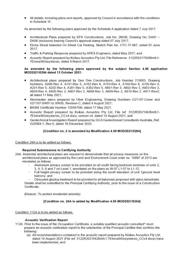

DOCUMENTS
ASSOCIATED WITH
REPORT LPP035/21
Attachment 2
Architectural Plans
Cumberland Local Planning Panel Meeting
13 October 2021
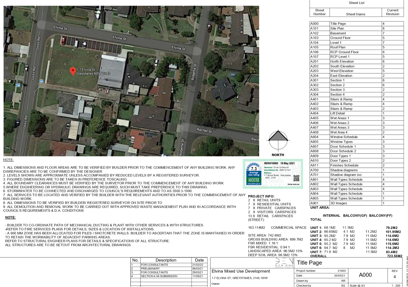
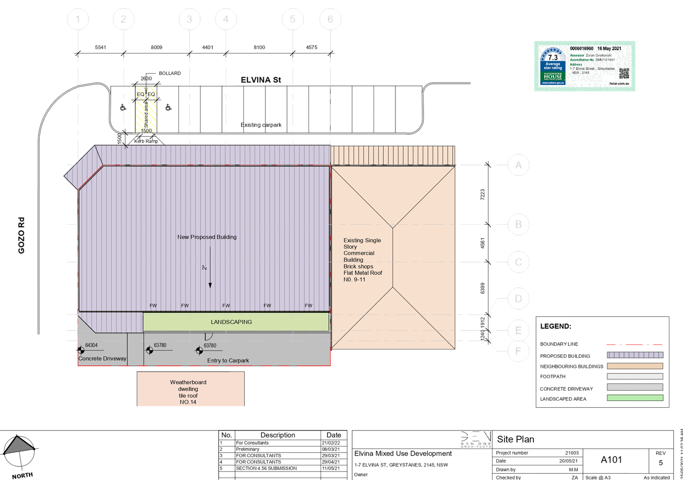
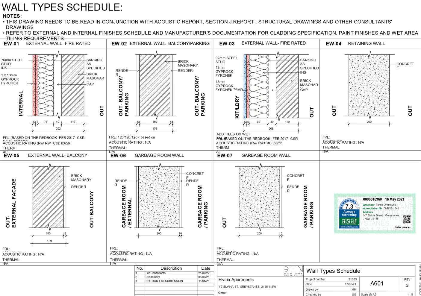
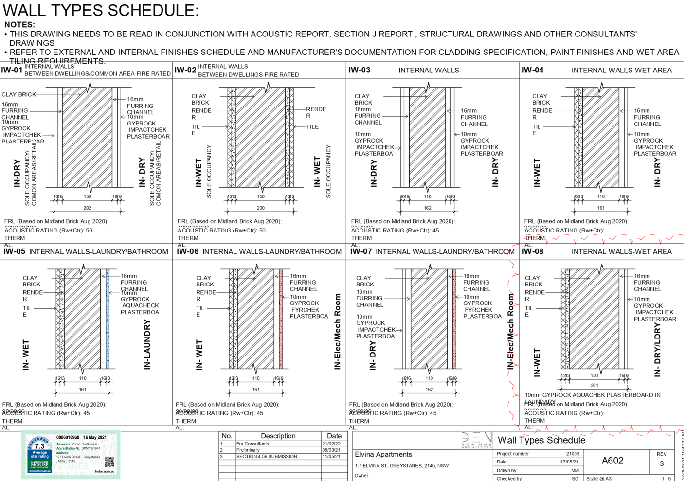
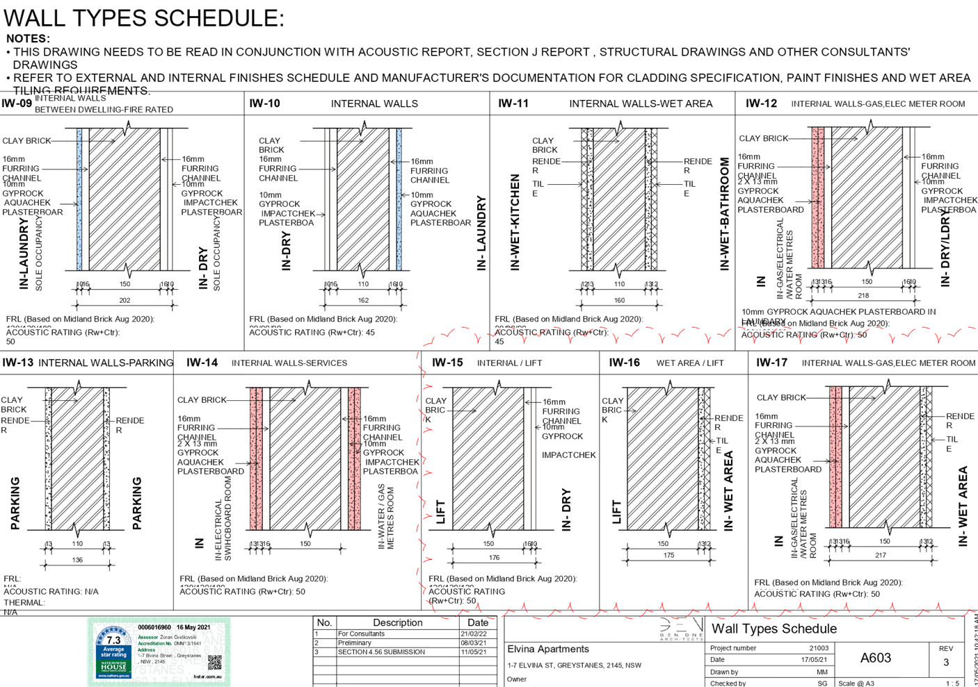
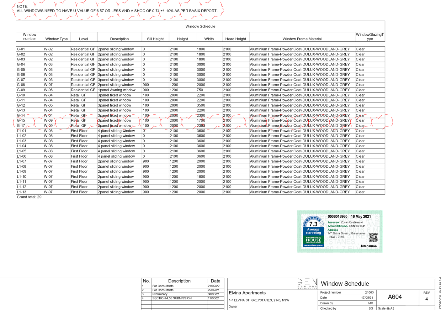
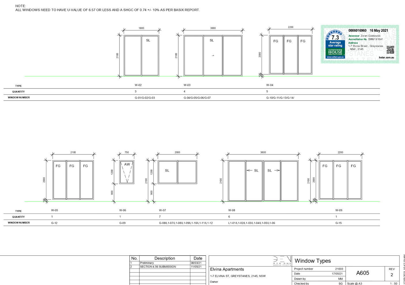
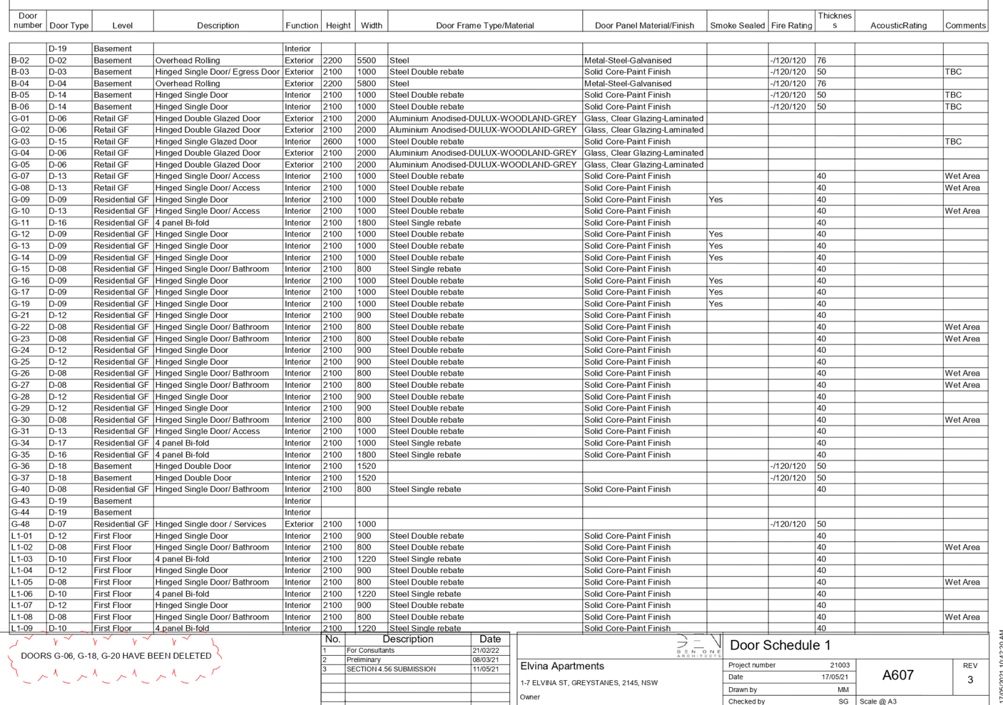
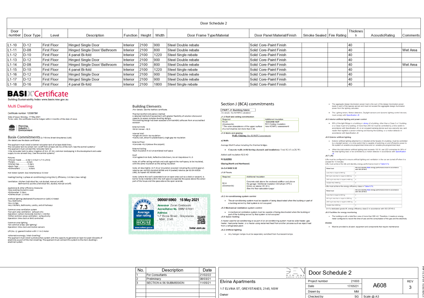
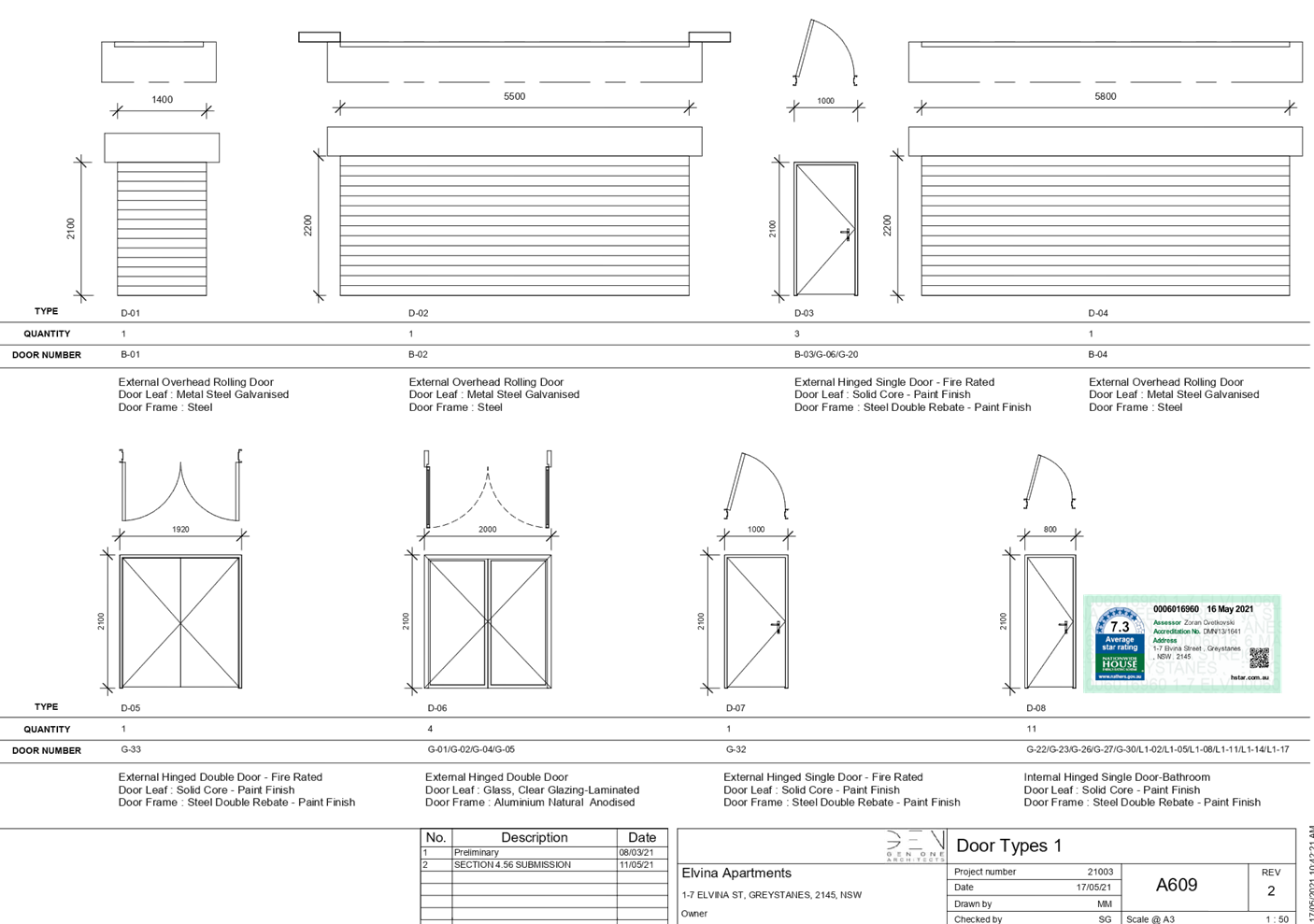
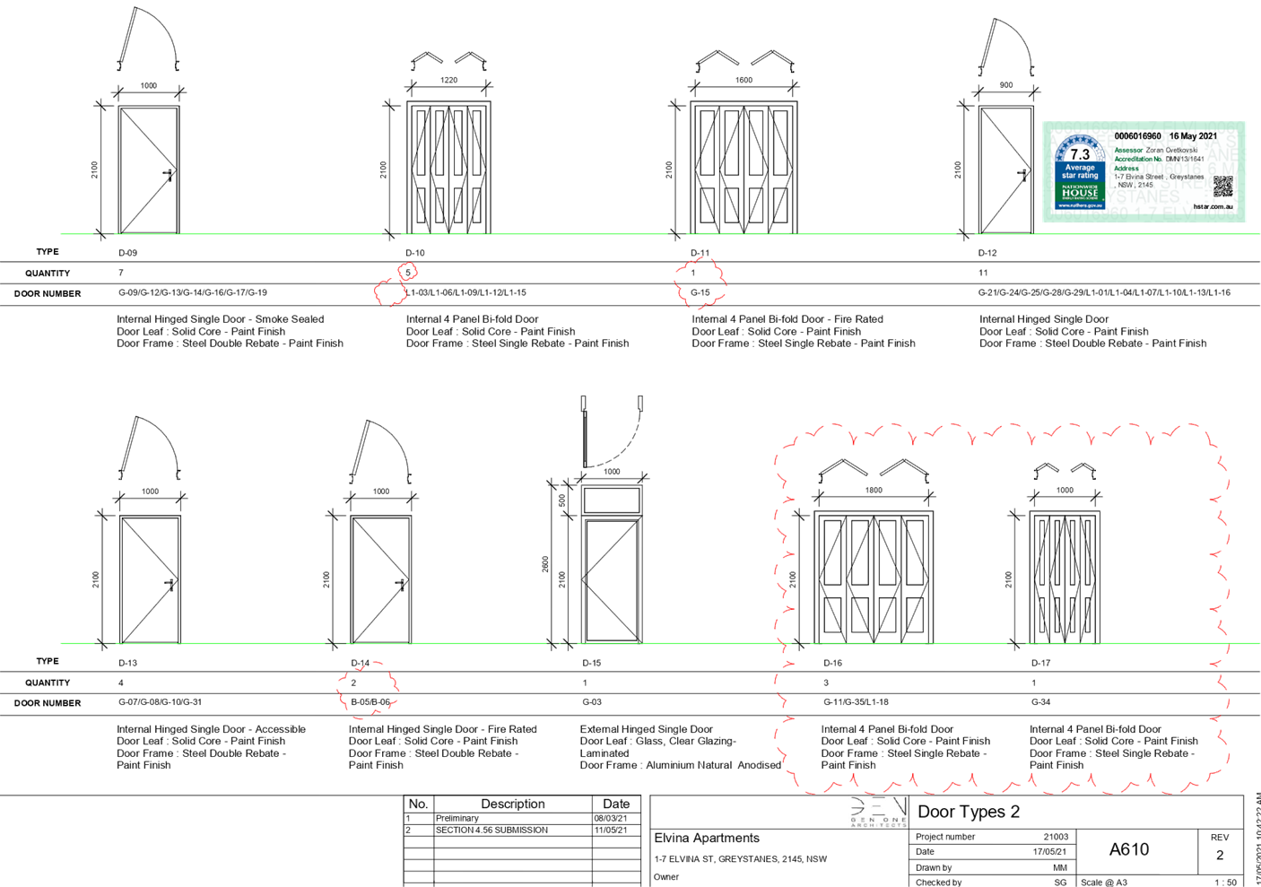
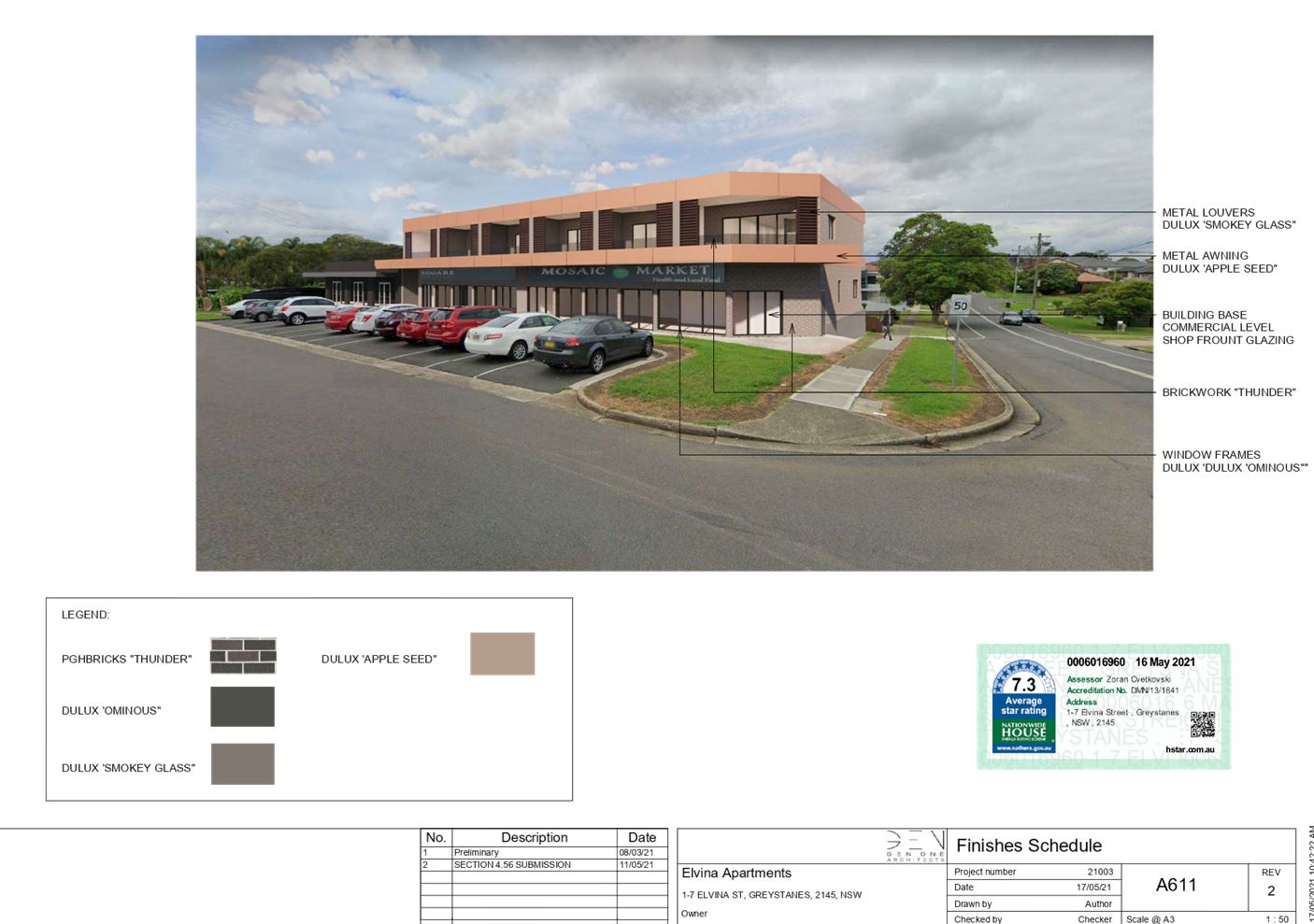
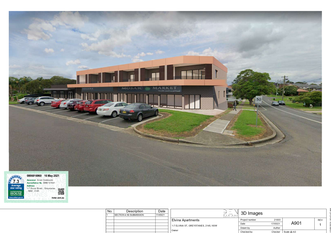
DOCUMENTS
ASSOCIATED WITH
REPORT LPP035/21
Attachment 3
Shadow Diagram
Cumberland Local Planning Panel Meeting
13 October 2021
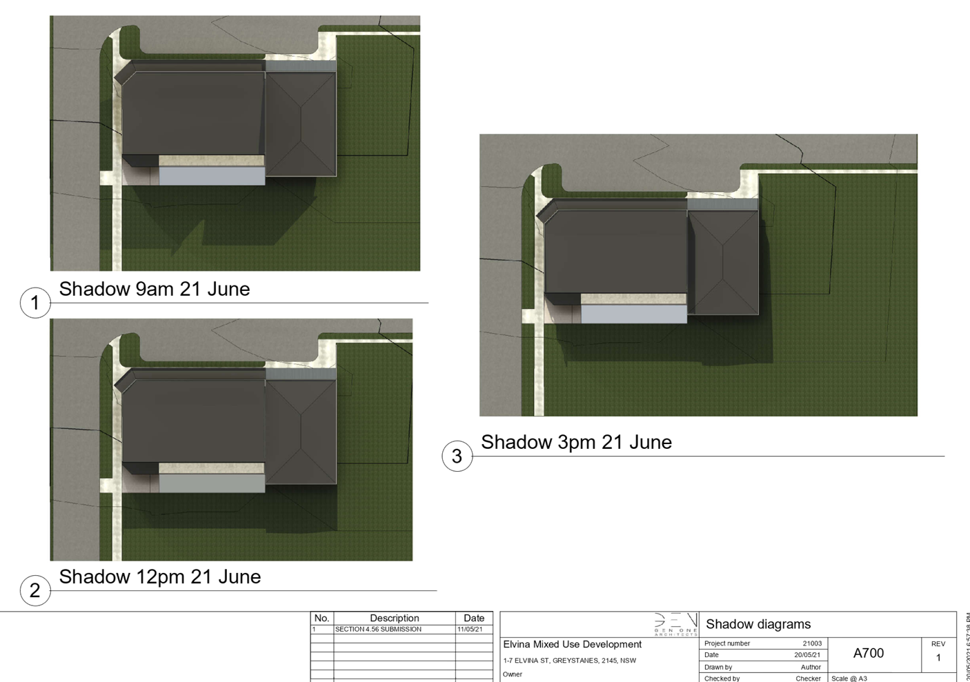
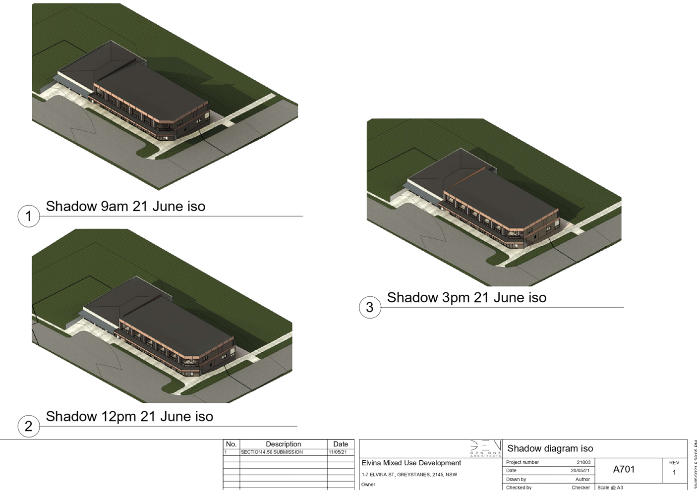
DOCUMENTS
ASSOCIATED WITH
REPORT LPP035/21
Attachment 4
Stormwater Plans
Cumberland Local Planning Panel Meeting
13 October 2021
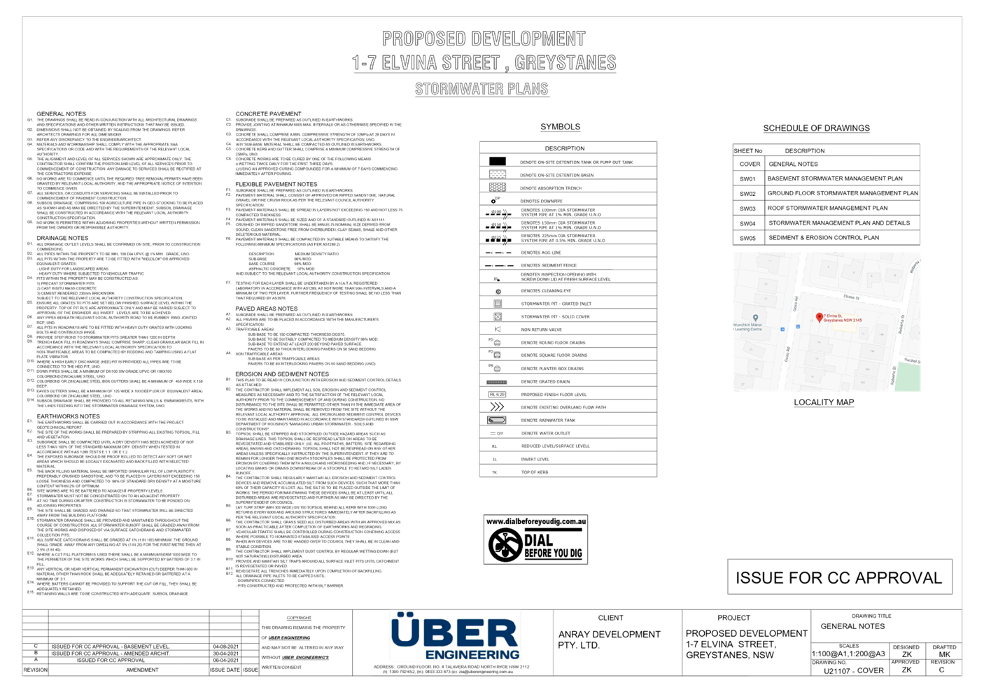
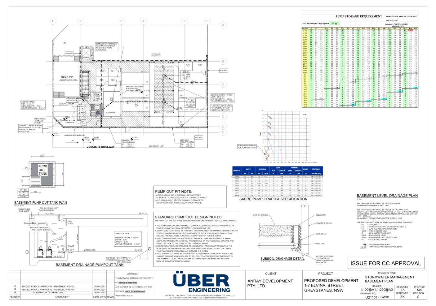
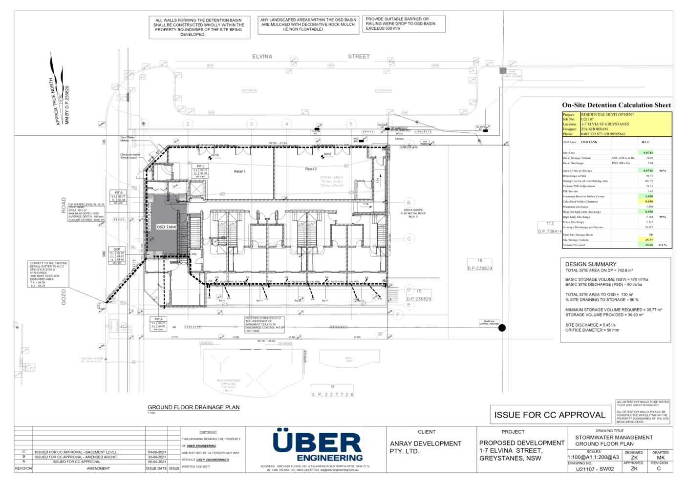
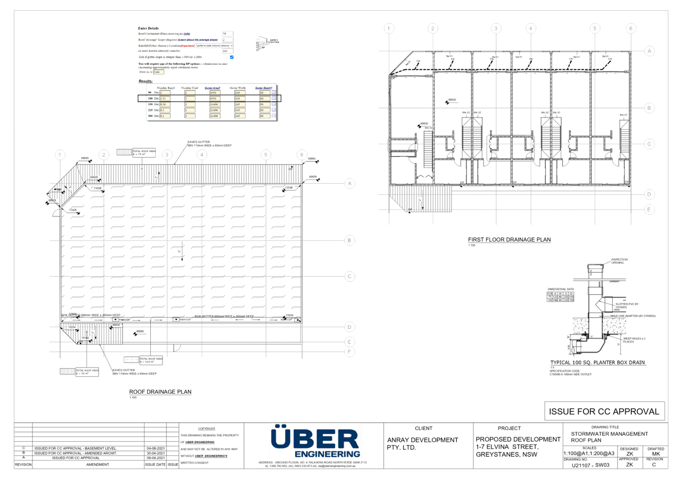
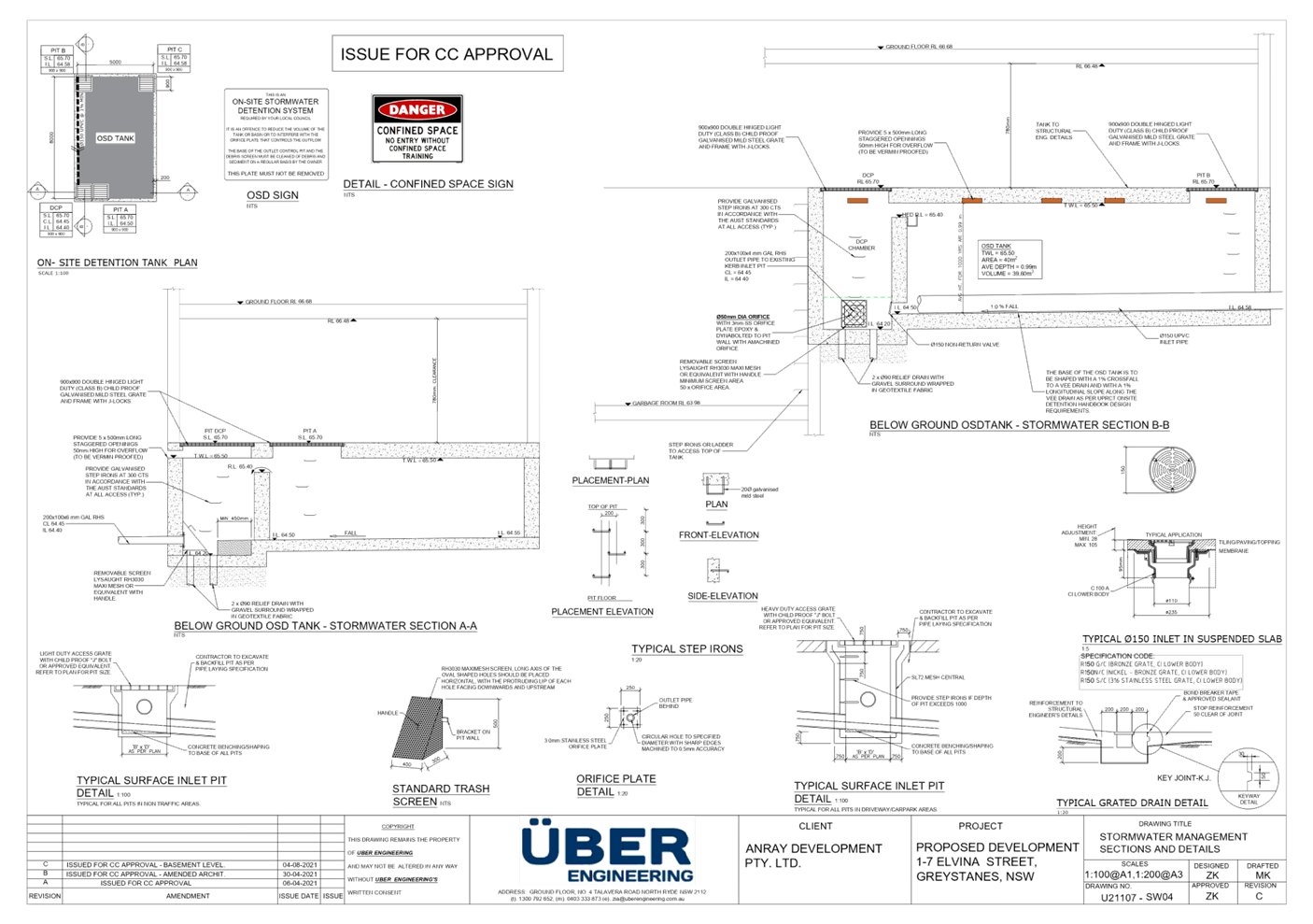
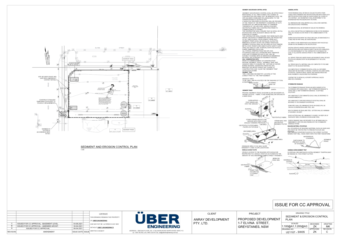
DOCUMENTS
ASSOCIATED WITH
REPORT LPP035/21
Attachment 5
Submission Received
Cumberland Local Planning Panel Meeting
13 October 2021
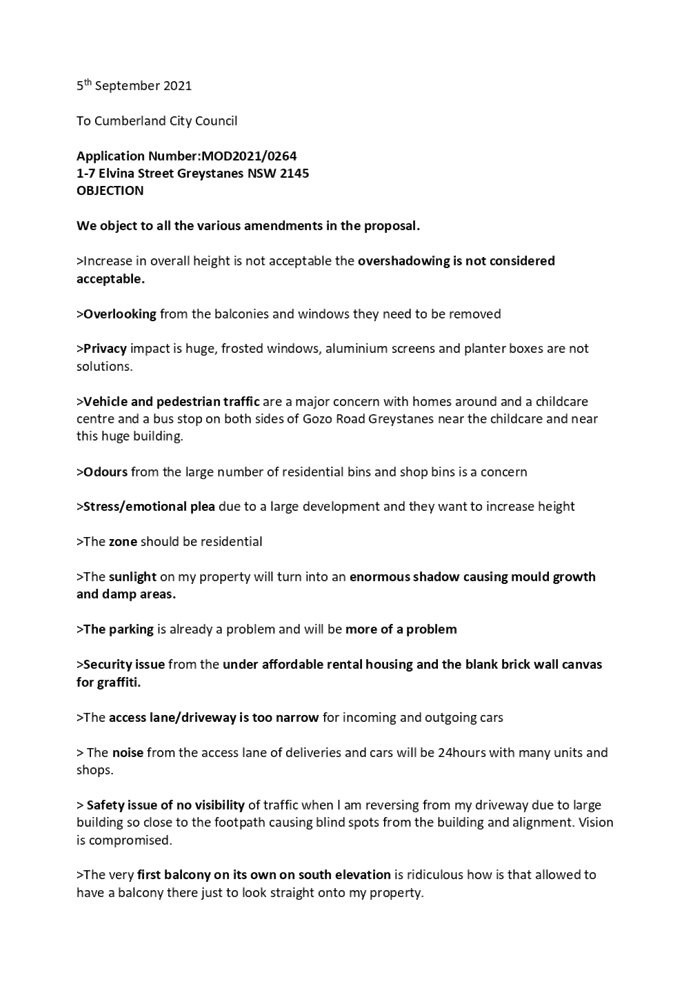


DOCUMENTS
ASSOCIATED WITH
REPORT LPP035/21
Attachment 6
DA2012/315 Consent
Cumberland Local Planning Panel Meeting
13 October 2021
DOCUMENTS
ASSOCIATED WITH
REPORT LPP035/21
Attachment 7
DA2012/315 Approved Plans
Cumberland Local Planning Panel Meeting
13 October 2021
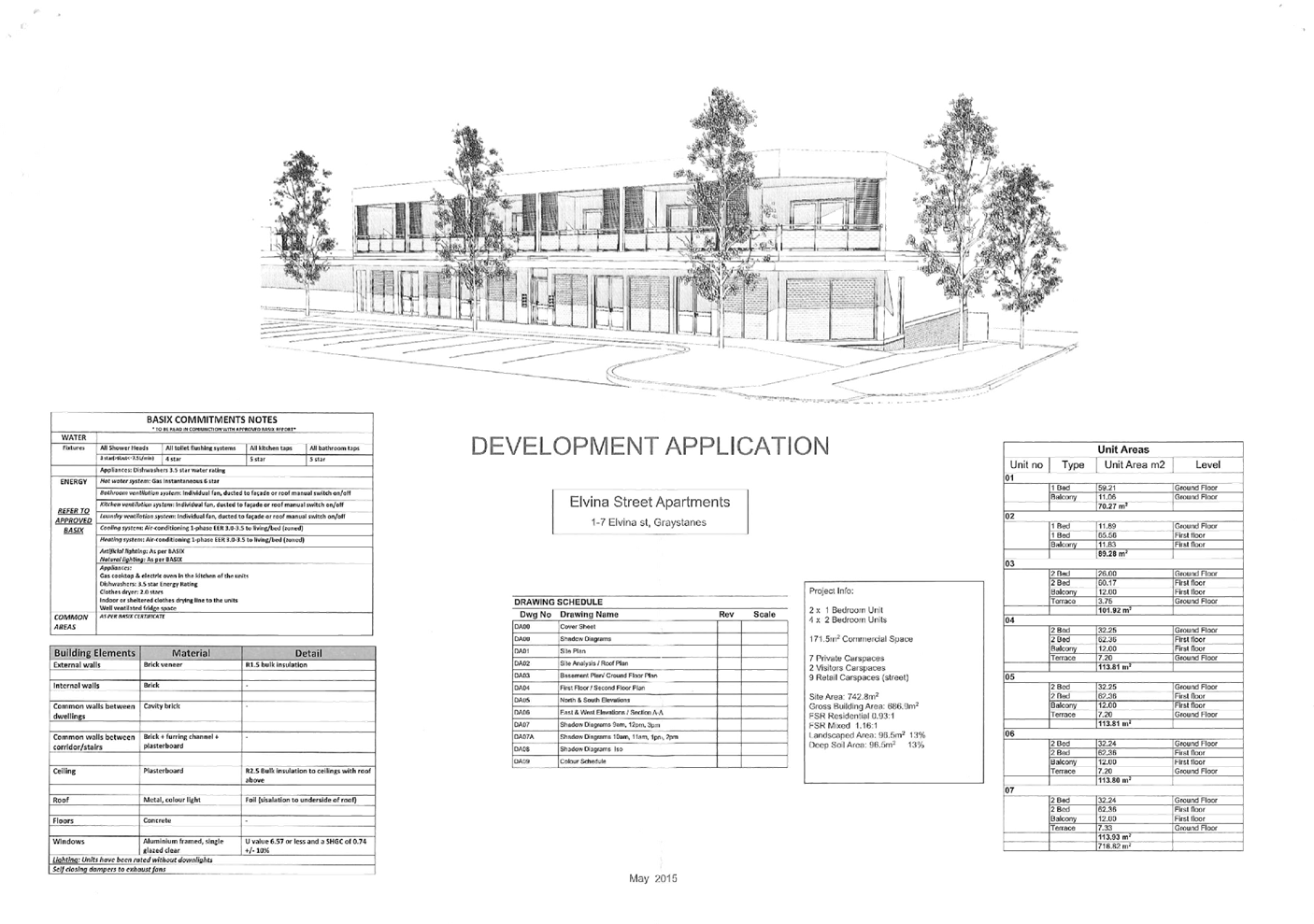
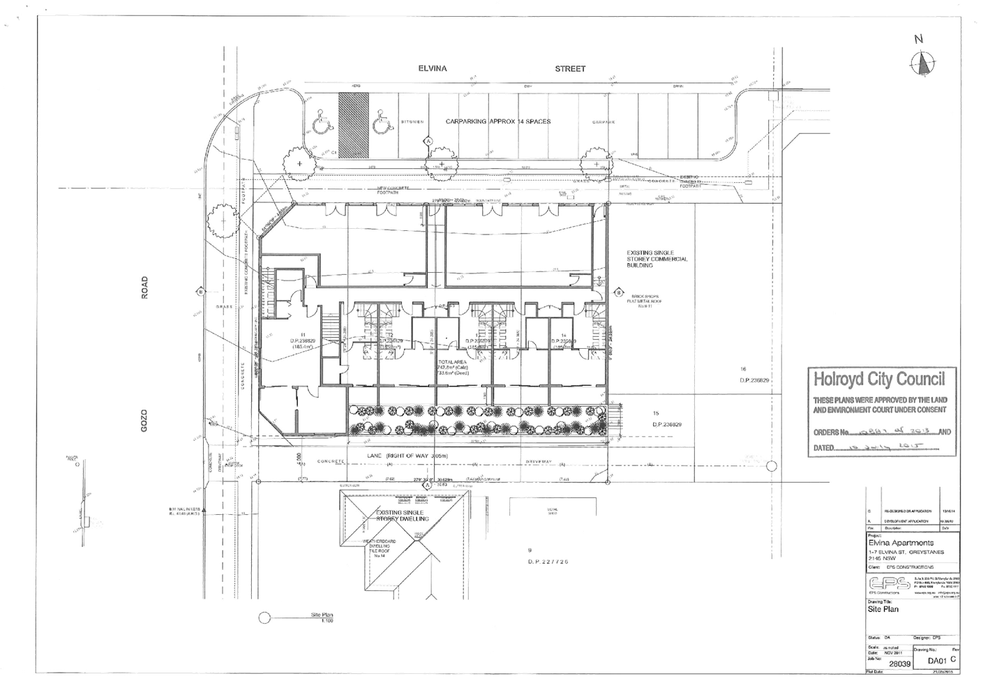
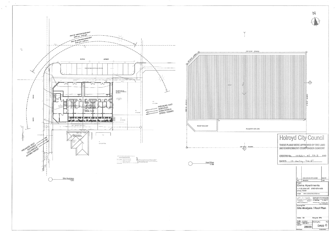
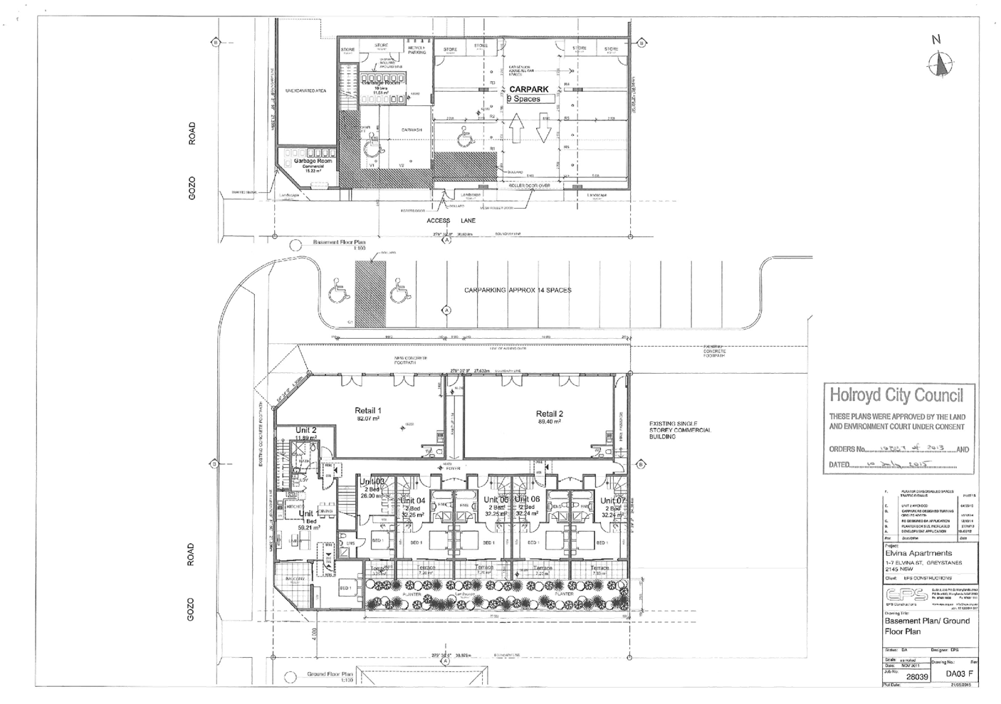
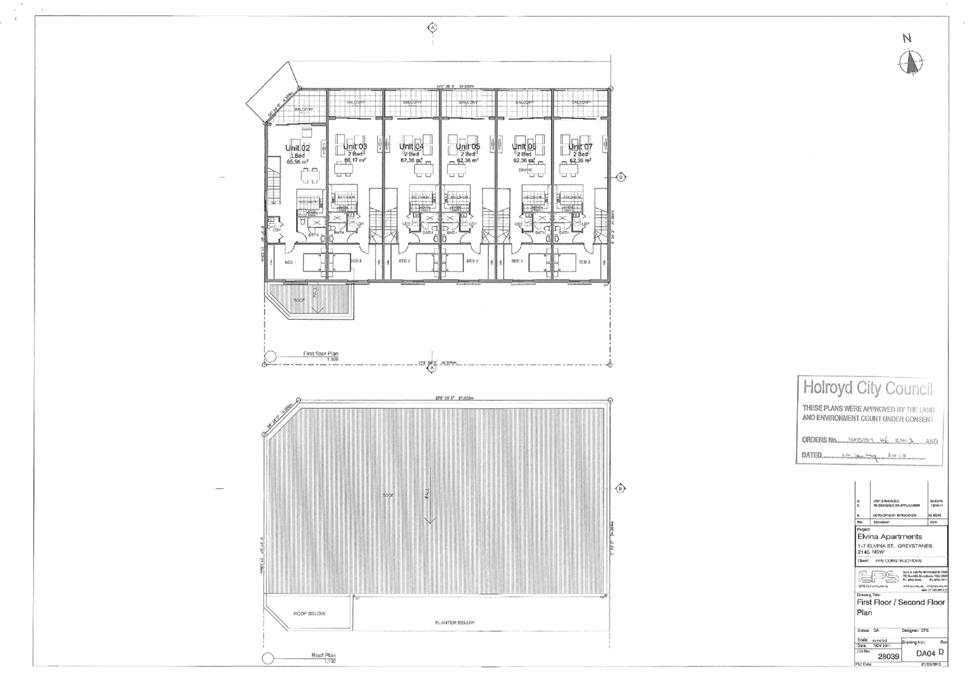
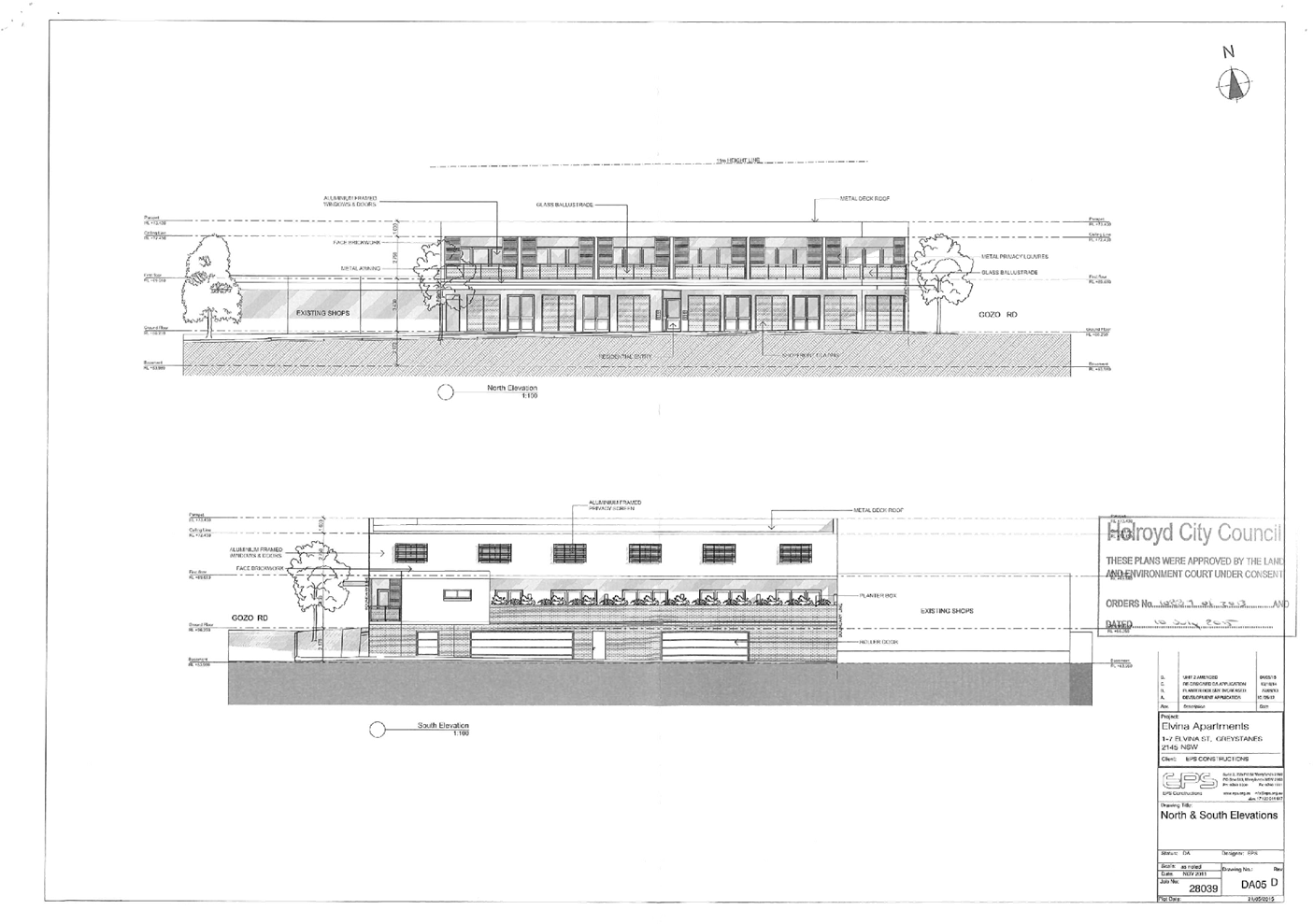
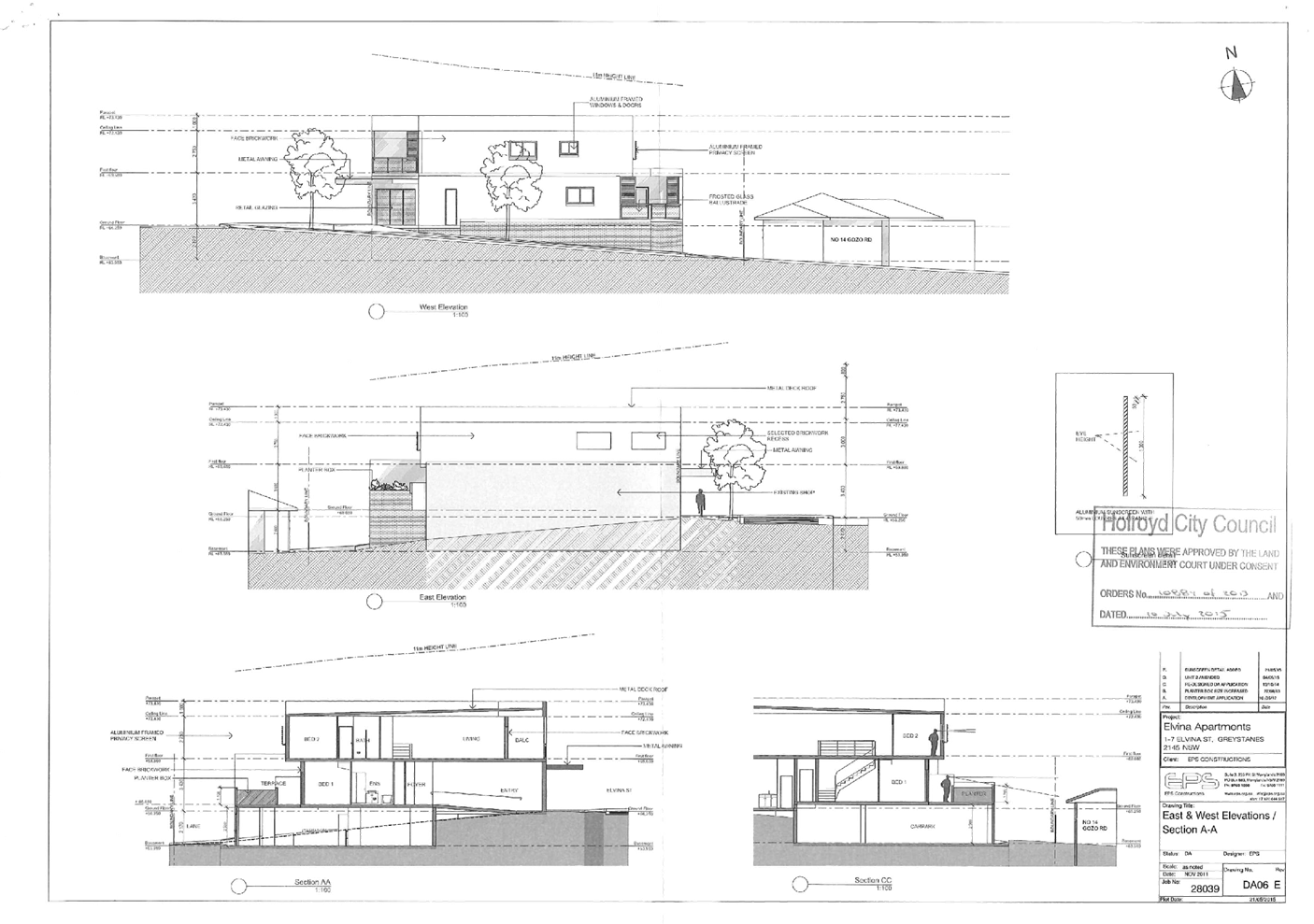
DOCUMENTS
ASSOCIATED WITH
REPORT LPP035/21
Attachment 8
Holroyd Local Environmental Plan 2013 Compliance Table
Cumberland Local Planning Panel Meeting
13 October 2021
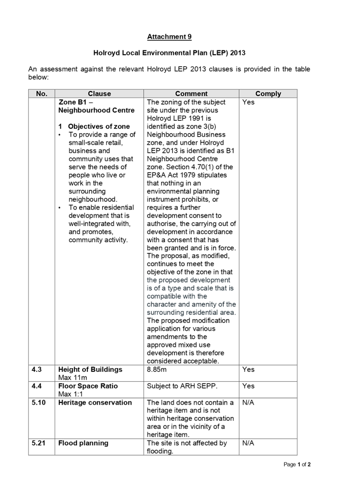
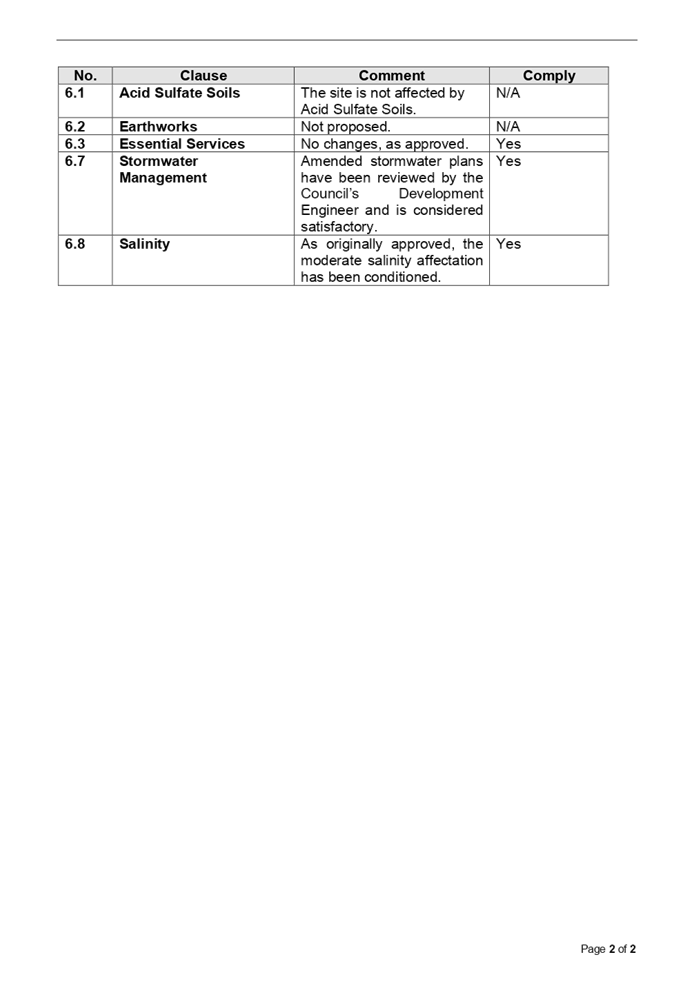
DOCUMENTS
ASSOCIATED WITH
REPORT LPP035/21
Attachment 9
Holroyd Development Control Plan 2013 Compliance Table
Cumberland Local Planning Panel Meeting
13 October 2021
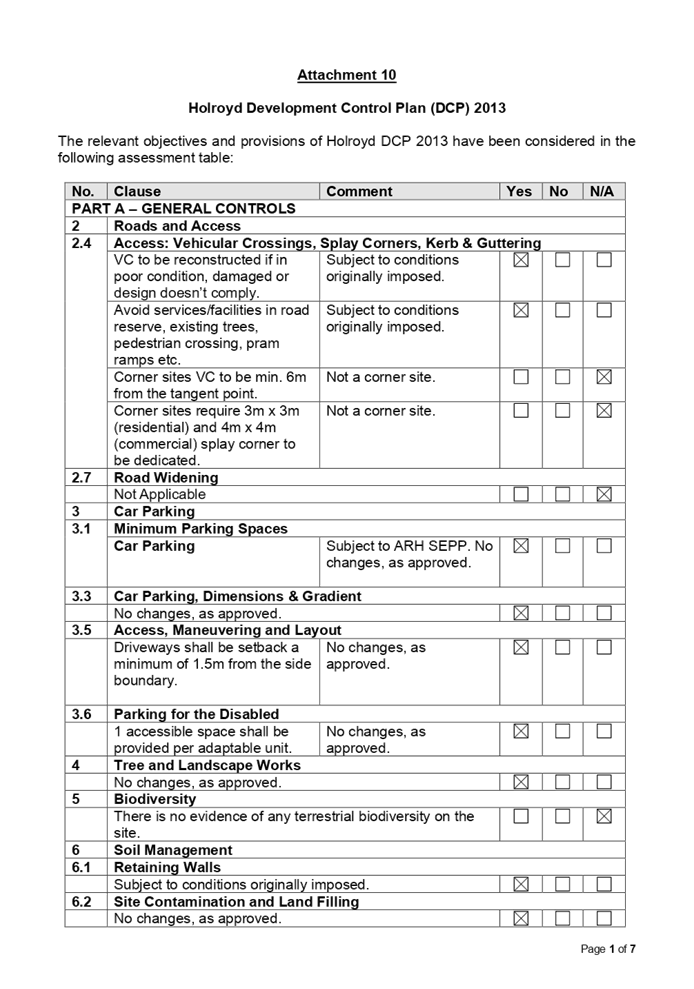
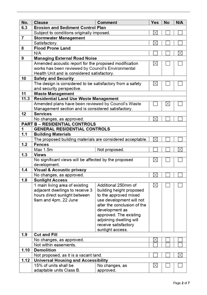
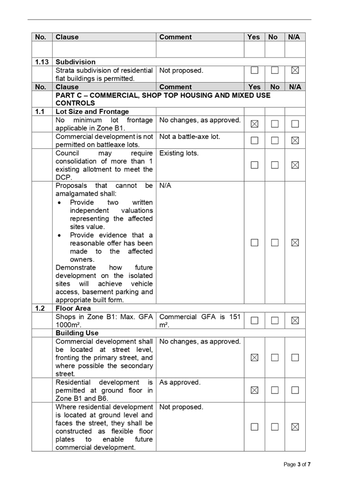
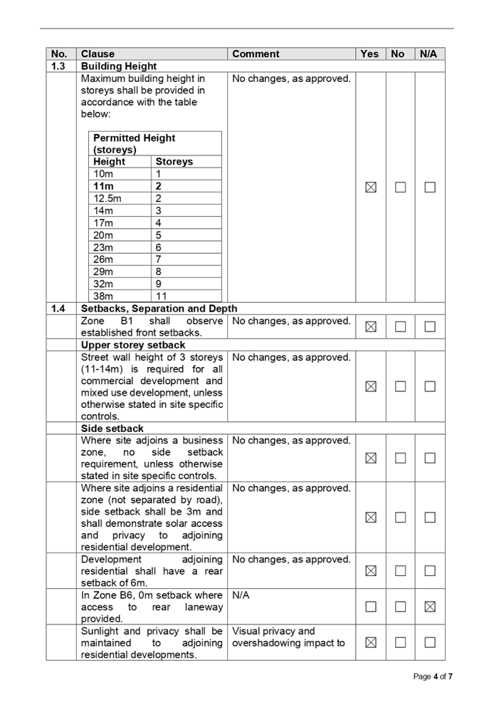
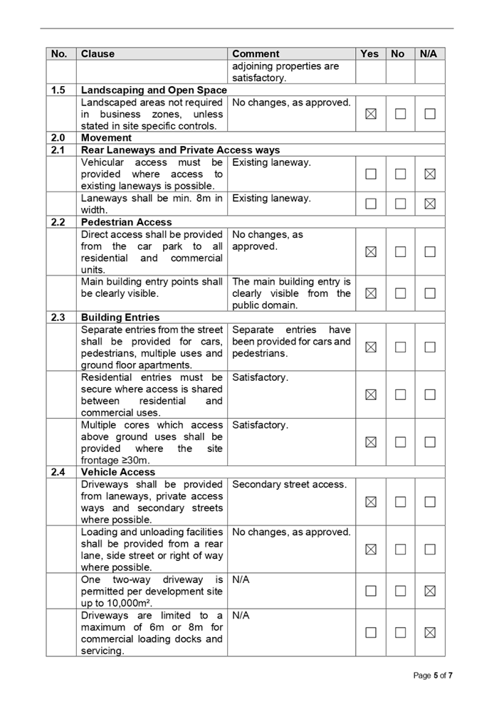
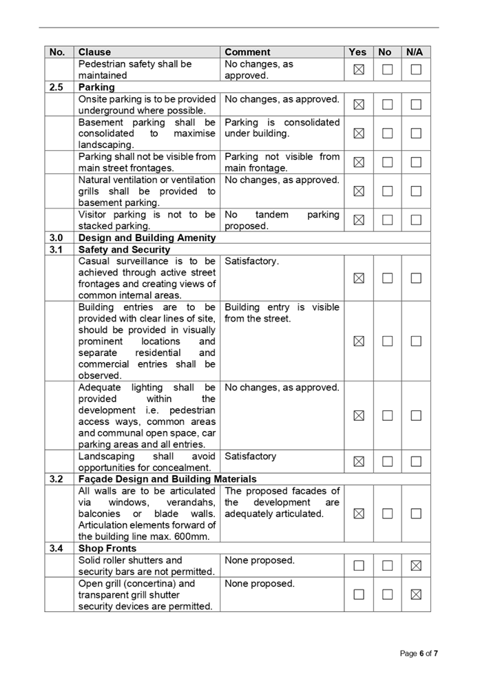
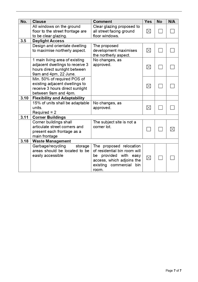
DOCUMENTS
ASSOCIATED WITH
REPORT LPP035/21
Attachment 10
Draft Reasons of Recommendation
Cumberland Local Planning Panel Meeting
13 October 2021
DRAFT REASONS FOR APPROVAL
MOD2021/0264 1-7 Elvina Street Greystanes
1. The Panel is satisfied that the
development, as modified, is substantially the same development for which
consent was originally granted.
2. The development, as modified, is
consistent with the objectives of the B1 Neighbourhood Centre zone of the
Holroyd Local Environmental Plan 2013 and also consistent with State
Environmental Planning Policy (Affordable Rental Housing) 2009.
3. The Panel has considered the matters
raised in written submissions and has determined that these matters have either
been adequately addressed in the design of the development or where not
specifically addressed in the development are not of such weight as to warrant
refusal of the application.
4. Subject to the recommended conditions, the
proposal will not have any unreasonable impacts on the amenity of neighbouring
properties or the locality.
5. Taking into account reasons above,
approval of the application will be in the public interest.
Cumberland Local Planning Panel Meeting
13 October 2021
Item No: LPP036/21
Development
Application for 7/70-72 Railway Parade, Granville
Responsible
Division: Environment
& Planning
Officer: Executive
Manager Development and Building
File
Number: DA2021/0126
|
Application
lodged
|
15 March 2021
|
|
Applicant
|
Australian Outdoor Living
|
|
Owner
|
Mr J He & Ms J W Ye
|
|
Application
No.
|
DA2021/0126
|
|
Description
of Land
|
7/70-72 Railway Parade, GRANVILLE
NSW 2142, Lot 7 SP 94811
|
|
Proposed
Development
|
Construction of a pergola over
existing balcony on a residential flat building
|
|
Site
Area
|
1136.5m2
|
|
Zoning
|
B4 Mixed Use Zone
|
|
Disclosure
of political donations and gifts
|
Nil disclosure
|
|
Heritage
|
Yes – Heritage
Conservation Area “Granville Conservation Area—Civic Precinct.
The site also contains Item I168, a local Heritage Item.
|
|
Principal
Development Standards
|
Height of Building
Permissible: 10m
Proposed: 12m (to RL of
pergola roof)
|
|
Issues
|
Heritage
Variation to Maximum Height
|
1. Development
Application No. DA2021/0126 was received on 15 March 2021 for the construction
of a pergola over existing balcony on a residential flat building.
2. The
application was publicly notified to occupants and owners of the adjoining
properties for a period of 14 days between 30 April 2021 and 14 May 2021. In
response, no submissions were received.
3. The
subject site is located within the heritage conservation area in the Parramatta
Local Environmental Plan 2011 as “Granville Conservation Area—Civic
Precinct”, the single dwelling located at 70 Railway Parade is identified
as Item I168 which is a local Heritage Item. The heritage item is a single
storey Federation Cottage and has a frontage to Railway Parade.
4. Pursuant
to DA2013/11209 (2013/359) approval was granted on 10 February 2014 (by
Parramatta City Council prior to amalgamation) for “Tree removal,
demolition of existing outbuildings at the rear of the site and construction of
a 4 storey residential flat building behind 2 existing dwelling houses
including a heritage listed dwelling house, restoration of the dwellings and
conversion of the dwellings to offices”. The building height of the
residential flat building approved under DA2013/11209 was 13.5 meters exceeding
the maximum building height by 3.5m. Unit 7 (the subject unit) is located on
the third floor of the building which is predominantly located above the
maximum building height of 10 meters, therefore the subject proposal for the
‘pergola’ is located partially above the maximum building height.
5. The
variations are as follows:
|
Control
|
Required
|
Provided
|
% variation
|
|
Height
|
10m
|
12m
|
20%
|
6. The
application is recommended for conditional approval subject to the conditions
as provided in the attached schedule.
7. The
application is referred to the Panel as the proposal contravenes a development
standard by more than 10%.
Subject Site and Surrounding
Area
The site is located on the south
eastern corner of the intersection between Railway Parade and Jamieson Street
Granville, within the ‘Granville Conservation Area — Civic’.
The site previously consisted of 3 adjoining Torrens title allotments
containing 2 single storey dwelling houses including a house listed as a
heritage item under LEP 2011, these three allotments have since been
amalgamated and are now known as Lot 0, Plan 94811 or 70-72 Railway Parade
Granville. The site currently contains 2 single dwellings (including 1 heritage
item) facing Railway Parade and a rear development being a four storey
residential flat building approved under DA/359/2013.
Unit 7 of 70-72 Railway Parade
Granville is a 3 bedroom adaptable unit with 2 associated parking spaces. Unit
7 is located on the third floor (top floor) and features a 38sqm balcony which
is accessible from both the open plan living area and the third bedroom.
70-72 Railway Parade Granville has
an overall area of 1136.5sqm and has a frontage of 29.82m to Railway Parade,
37.625m to Jamieson Street, and 30.989m to the laneway located to the rear of
the site. Unit 7 is located on the corner of Jamieson Street and the laneway
which runs along the rear of the site.
Surrounding the site area mix of
dwelling houses in the form of single dwellings and terrace houses and 3 three
storey residential flat buildings located along the opposite side of Jamieson
Street. Additionally, a 2 storey former Granville Masonic Hall located at 13
Jamieson Street, also located within the ‘Granville Conservation Area -
Civic Precinct’ and is located directly across from the unnamed rear
laneway. North of the site along Railway Parade is a Rail Corridor.
Figure
1 – Locality Plan of subject site
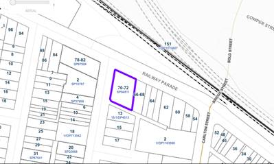
Figure
2 – Aerial view of subject site
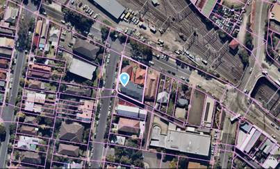
Figure
3 – Street view of subject site (Jamieson Street and rear laneway)
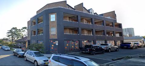
Figure
4 – Street view of Heritage Item (Railway Parade)
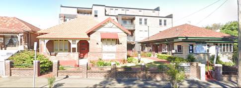
Description of the Proposed
Development
Council has received a development
application for the construction of an awning to be installed over an existing
balcony located on the third floor to be associated with unit 7 of 70-72
Railway Parade, Granville.
The proposed awning/pergola has a
total area of 25sqm and a height of 2.75m as measured from the finished floor
level of the existing balcony. The top of the awning measures 12m when measured
overall from the natural ground level of the subject site, therefore exceeding
the maximum building height.
The extent of the works is limited
to the south western corner and is solely located on the third floor;
therefore, the proposed structure does not detract or impact the heritage item
located within the site.
History
A history of previous development
is listed below:
· On
10 February 2014, Parramatta City Council approved the initial development
consent for tree removal, demolition existing outbuildings at the rear of the
site, construction of a 4 storey residential flat building at the rear of the
site and restoration of the two existing dwellings on the site (including the
heritage listed dwelling) and conversion to offices under DA/359/2013.
· On
6 February 2015, Parramatta City Council approved subdivision of the subject
site into 12 strata title lot under DA/747/2014).
· On
15 July 2016, Cumberland City Council approved a Section 96(2) modification
including conversion of Unit 7 to 3 bedroom unit, addition of car space for
extra unit and partial demolition works under M2016/170/A.
Applicants Supporting
Statement
The applicant has provided a Statement
of Environmental Effects prepared by Aus. Wide Consulting dated December 2020
and was received by Council on 15 March 2021 in support of the application.
Contact with Relevant
Parties
The assessing officer has
undertaken an inspection of the subject site and surrounding properties and has
been in regular contact with the applicant throughout the assessment process.
Internal Referrals
Heritage Committee
The development application was
referred to Council’s Heritage Committee for comment, no comments were
provided during assessment to indicate concerns with the proposed development.
Council notes that the extent of
the works is limited to a portion of the building which is south west facing,
which does not impact or detract from the heritage item and is not visible from
the heritage item at any point.
External Referrals
The application was not required
to be referred to any external government authorities for comment.
PLANNING COMMENTS
The provisions of any
Environmental Planning Instruments (EP&A Act s4.15 (1)(a)(i))
State Environmental Planning
Policies
The proposed development is
affected by the following State Environmental Planning Policies:
(a) Statement
Environmental Planning Policy No. 65 - Design Quality of Residential Apartment
Development (SEPP 65) and Apartment Design Guide
SEPP 65 applies to the development
as the structure is associated with a building that is 3 storeys or more and
contains more than 4 dwellings. Integral to SEPP 65 is the Apartment Design
Guide, which sets benchmarks for the appearance, acceptable impacts and
residential amenity of the development.
The proposal has been assessed and
found to remain in satisfactory compliance with the Apartment Design Guide in
the same manner as the original Development Application as applied under
DA2013/11209 (2013/359).
Figure
5 –SEPP 65 and Apartment Design Guide Compliance Table
|
Control
|
Required
|
Provided
|
|
3B-1
|
Building types
and layouts respond to the streetscape and site while optimising solar access
within the development.
|
The building
layout remains generally the same and the location of the proposed pergola
responds to the streetscape as it faces both the rear laneway and Jamieson
Street.
|
|
3B-2
|
Overshadowing
of neighbouring properties is minimised during mid-winter.
|
The awning is
not the highest point of the apartment building as the exiting building
height is 1.5m higher than the proposed awning height therefore the awning
does not create additional overshadowing of neighbouring sites.
|
|
4A-1
|
Living rooms
and private open spaces of at least 70% of apartments in a building receive a
minimum of 2 hours direct sunlight between 9 am and 3 pm at mid-winter in the
Sydney Metropolitan Area and in the Newcastle and Wollongong local government
areas.
|
Due to benefitting
from 3 aspects being north, south and west, Unit 7 will still receive the
minimum hours of solar access after installation of the proposed
awning/pergola to the primary living areas as the north facing living room
windows will remain unobstructed by the awning which is located on the
southern/western side of the building. A copy of the approved floor
plan and window locations for unit 7 is included in attachment 6.
|
|
4A-2
|
Daylight
access is maximised where sunlight is limited.
|
The proposed
awning has a varied depth between 1.3 – 2.4 metres deep allowing for
solar access to still be achieved into the balcony area. The sunlight access
received to the balcony area post awning installation is consistent with that
of the units located on lower levels.
|
|
4A-3
|
Design
incorporates shading and glare control, particularly for warmer months.
|
The proposed structure provides
shade to part of the existing balcony for utilisation in warmer months.
|
|
AE-1
|
Apartments
provide appropriately sized private open space and balconies to enhance
residential amenity. (3 bedroom apartment shall have a minimum 12sqm balcony
measured at 2.4m deep)
|
25sqm of the existing balcony is
to be covered by the proposed awning, the other 13sqm remains uncovered.
|
|
4E-2
|
Primary
private open space and balconies are appropriately located to enhance
liveability for residents.
|
While the balcony location
remains the same, the installation of the awning will allow tenants to better
utilise the area
|
Following assessment of the
proposal against the provisions of SEPP 65 and the Apartment Design Guide, the
proposal is generally considered compliant and is satisfactory with respect to
building amenity and design.
(b) State
Environmental Planning Policy (Infrastructure) 2007 (ISEPP)
The provisions of the ISEPP 2007
have been considered in the assessment of the development application. The
remains complaint with SEPP infrastructure in the same manner as the original
Development Application.
Clause 87 – Impact of
rail noise or vibration on non-rail development
The current application for the
open structure is subject to clause 87 of the ISEPP as the site is in or
adjacent to a rail corridor or however the proposal is not likely to be
adversely affected by rail noise or vibration as subject application is minimal
in nature, being an open structure and does not impose any additional concerns
or requirements to Clause 87.
Regional Environmental Plans
The proposed development is
affected by the following Regional Environmental Plans:
(a) Sydney
Regional Environmental Plan (Sydney Harbour Catchment) 2005
The subject site is identified as
being located within the area affected by the Sydney Regional Environmental
Plan (Sydney Harbour Catchment) 2005. The proposed development raises no issues
as no impact on the catchment is envisaged.
(Note: - the subject site is not
identified in the relevant map as ‘land within the ‘Foreshores and
Waterways Area’ or ‘Wetland Protection zone’, is not a
‘Strategic Foreshore Site’ and does not contain any heritage items.
Hence the majority of the SREP is not directly relevant to the proposed
development).
(b) Sydney
Regional Environmental Plan No 9—Extractive Industry (No 2—1995)
Local Environmental Plans
Parramatta Local Environment
Plan 2011
The provision of the Parramatta
Local Environment Plan 2011 is applicable to the development proposal. It is
noted that the development achieves compliance with the key statutory
requirements of the Parramatta Local Environment Plan 2011 the objectives of
the B4 Zone.
(a) Permissibility:-
The subject site is zoned as B4
Mixed Use zone under the provisions of PLEP 2011, where the approved
development, defined as mixed use development, is permissible with Council
consent. It is considered that the proposed structure in association with
unit 7 will not alter the use of the development on site as previously
approved. Therefore, the development remains consistent with the zone and
objectives of the PLEP 2011.
The relevant matters to be
considered under Parramatta Local Environment Plan 2011 and the applicable
clauses for the proposed development are summarised below. A comprehensive LEP
assessment is contained in Appendix A.
Figure
6 – Parramatta LEP 2011 Compliance Table
|
Development Standard
|
Proposed
|
Compliance
|
|
4.3 Height of Buildings Max 10m
|
12m as measured from
natural ground level (20%
variation)
|
No, but
Acceptable on Merit. Discussion
below.
|
(b) Clause
4.6 – Variation to Building Height
Clause 4.6 allows the consent
authority to vary development standards in certain circumstances and provides
an appropriate degree of flexibility to achieve better design outcomes. The
consent authority may grant the exception as the Secretary’s concurrence
can be assumed where clause 4.6 is adopted as per the Department of Planning
Circular PS 18-003, dated 21 February 2018.
The Applicant has submitted a
written request to vary the development standard for building height. Based on
various case laws established by the Land and Environment Court of NSW such as
Four2five P/L v Ashfield Council [2015] NSWLEC 9, Randwick City Council v
Micaul Holdings P/L [2016] NSW LEC7 and Zhang and anor v Council of the City of
Ryde [2016] NSWLEC 1179, a 3 part assessment framework for a variation request
proposed under clause 4.6 has been considered and an assessment of the proposed
variance, following the 3 part test is discussed in detail below.
The 3 preconditions which must be
satisfied before the application can proceed are as follows:
1. Is
the proposed development consistent with the objectives of the zone?
Applicant’s
justification:
‘The proposed works will not
be a visual impact, disruption of views, loss of privacy and loss of solar
access to existing development as it is lower than the current surrounding
second storey buildings built next to them and surrounding the street.
Planner’s comment:
Council agrees with the comments
made, and further notes that the proposed development will provide the current
and future tenants of unit 7 with useable outdoor space and is designed to
support the needs of the current unit 7 occupants and future occupants.
2. Is
the proposed development consistent with the objectives of the development
standard which is not met?
Applicant’s
justification:
‘It will blend in with the
surrounding buildings located across the road in 13 Jamieson Street, Granville
set at above 12 metres in height, 2 Carlton Street, Granville set at 12 metres
in height.’ The additional height is supported in principle through the
original development proposal for the RFB by Parramatta City Council, which
allows a height of 13.5m’.
Planner’s comment:
Council agrees with the comments
made, and further notes that while the proposal exceeds the maximum building
height on the allotment by 20%, the original DA sought a variation of 35% as a
height of 13.5m was approved. The overall height of the proposed awning does
not exceed beyond the height limit approved under DA/359/2013. Additionally, no
adjoining residential property is overshadowed by the proposed awning. Council
notes development across the narrow rear lane from the site, the former Masonic
Lodge Building has a wall height equivalent to the height of the existing RFB
on site and therefore, the proposed height of the pergola structure will have
no significant visual impact on the Jamieson Street and laneway facade of the
site. In terms of the Railway Parade facade, the upper level of floor 3 and
unit 7 is not visible and Council does not deem the proposal to be visually
obstructive or raise negative impact on the existing streetscape and the
vicinity of the site.
3. a)
Is compliance with the development standard unreasonable or unnecessary in the
circumstances of the case? And;
Applicant’s justification:
‘Located in B4 zone with
mixed business and residential, it is located around N2, M & Highlight Blue
which range from allowable height of up to 15 metres in height, it will blend
in with the surrounding buildings located across the road in 13 Jamieson Street
Granville set at above 12 metres in height, 2 Carlton street Granville set at
12 metres in height.’
Planner’s comment:
Council agrees with the comments
made, and further notes that given the floor level of the third floor is in
proximity to the maximum building height it would be unreasonable to expect an
awning structure such as the proposed achieve compliance with the building
height under the LEP. Compliance with the development standard is considered
unreasonable and unnecessary as the proposed development is consistent with the
objectives of the height of building standard, notwithstanding non-compliance
with the standard itself.
b) Are there sufficient
environmental planning grounds to justify contravening the development standard
and therefore is the applicant’s written justification well founded?
Applicant’s
justification:
The additional height is supported
in principle through the original development proposal for the RFB by
Parramatta City Council, which allows a height of 13.5m.
Planner’s comment:
Council concludes that the
proposed awning is of an appropriate scale and has no adverse environmental or
amenity impacts upon the surrounding built environment. Further, this structure
will assist by contributing a more useable outdoor space which can be utilised
year round.
Conclusion:
Council is satisfied that the
applicant’s written request has adequately addressed the matters required
to be demonstrated by clause 4.6 subclause (3). Council is further
satisfied that the proposed development will be in the public interest because
it is consistent with the objectives of the particular standard and the
objectives for development within the zone in which the development is proposed
to be carried out.
It is the view of Council Officers
that justification provided is satisfactory and having considered the
application on its merit, the exception to the maximum building height
development standard is considered acceptable in this instance.
The provisions of any proposed
instrument that is or has been the subject (EP&A Act s4.15 (1)(a)(ii))
(a) Draft
State Environmental Planning Policy (Environment)
The draft SEPP relates to the
protection and management of our natural environment with the aim of
simplifying the planning rules for a number of water catchments, waterways,
urban bushland, and Willandra Lakes World Heritage Property. The changes
proposed include consolidating the following seven existing SEPPs:
· State
Environmental Planning Policy No. 19 – Bushland in Urban Areas
· State
Environmental Planning Policy (Sydney Drinking Water Catchment) 2011
· State
Environmental Planning Policy No. 50 – Canal Estate Development
· Greater
Metropolitan Regional Environmental Plan No. 2 – Georges River Catchment
· Sydney
Regional Environmental Plan No. 20 – Hawkesbury-Nepean River (No.2-1997)
· Sydney
Regional Environmental Plan (Sydney Harbour Catchment) 2005
· Willandra
Lakes Regional Environmental Plan No. 1 – World Heritage Property.
The draft policy will repeal the
above existing SEPPs and certain provisions will be transferred directly to the
new SEPP, amended and transferred, or repealed due to overlaps with other areas
of the NSW planning system.
Changes are also proposed to the
Standard Instrument – Principal Local Environmental Plan. Some provisions
of the existing policies will be transferred to new Section 117 Local Planning
Directions where appropriate.
(b) Draft
Cumberland Local Environmental Plan (Draft CLEP)
The Draft Cumberland Local
Environmental Plan (Draft CLEP) has been prepared by Cumberland Council to
provide a single planning framework for the future planning of Cumberland City.
The changes proposed seek to harmonise and repeal the three existing LEPs
currently applicable to the Cumberland local government area, those being:
· Holroyd
Local Environmental Plan 2013,
· Parramatta
Local Environmental Plan 2011, and
· Auburn
Local Environmental Plan 2010.
The current planning controls for
the subject site, as contained within the Parramatta Local Environmental Plan
2011 are not proposed to change under the Draft CLEP.
The provisions of any
Development Control Plans (EP&A Act s4.15 (1)(a)(iii))
The Parramatta DCP 2011 provides
guidance for the design and operation of development to achieve the aims and
objectives of the Parramatta Local Environmental Plan 2011.
The proposed development does not
depart from the Parramatta DCP 2011 provisions.
A comprehensive assessment and
compliance table is contained in Appendix B.
The provisions of any planning
agreement that has been entered into under section 7.4, or any draft planning
agreement that a developer has offered to enter into under section 7.4
(EP&A Act s4.15(1)(a)(iiia))
There is no draft planning
agreement associated with the subject Development Application.
The provisions of the
Regulations (EP&A Act s4.15 (1)(a)(iv))
The proposed development raises no
concerns as to the relevant matters arising from the Environmental Planning and
Assessment Regulations 2000 (EP&A Reg).
The Likely Environmental,
Social or Economic Impacts (EP&A Act s4.15 (1)(b))
It is considered that the proposed
development will have no significant adverse environmental, social or economic
impacts in the locality.
The suitability of the site for
the development (EP&A Act s4.15 (1)(c))
The subject site and locality is
not known to be affected by any natural hazards or other site constraints
likely to have a significant adverse impact on the proposed development.
Accordingly, it is considered that the development is suitable in the context
of the site and surrounding locality.
Submissions made in accordance
with the Act or Regulation (EP&A Act s4.15 (1)(d))
Advertised (Council Website) Mail Sign
Not
Required
In accordance with Council’s
Notification requirements contained within the Parramatta DCP 2011, the
proposal was publicly notified for a period of 14 days between 30 April 2021
and 14 May 2021. No submissions were received in respect of the proposed
development.
The public interest (EP&A
Act s4.15(1)(e))
In view of the foregoing analysis,
it is considered that the development, if carried out subject to the conditions
set out in the recommendation below, will have no significant adverse impacts
on the public interest.
Cumberland Local
Infrastructure Contributions Plan 2020
The development does not require
the payment of contributions in accordance with Cumberland Local Infrastructure
Contributions Plan 2020.
Disclosure of Political
Donations and Gifts
The applicant and notification
process did not result in any disclosure of Political Donations and Gifts.
The proposed development is
appropriately located within the B4 zone under the relevant provisions of the
Parramatta LEP 2011, however a variation in relation to the maximum building
height under the Parramatta LEP 2011 is sought.
Having regard to the assessment of
the proposal from a merit perspective, Council may be satisfied that the
development has been responsibly designed and provides for acceptable levels of
amenity for current and future residents. It is considered that the proposal
successfully minimises adverse impacts on the amenity of neighbouring
properties. Hence the development, irrespective of the departure noted above,
is consistent with the intentions of Council’s planning controls and
represents a form of development contemplated by the relevant statutory and
non-statutory controls applying to the land.
For these reasons, it is
considered that the proposal is satisfactory having regard to the matters of
consideration under Section 4.15 of the Environmental Planning and Assessment
Act 1979, and the development may be approved subject to conditions.
|
That Development Application
No. DA2021/0126 for Construction of a pergola over existing balcony on a
residential flat building on land at 7/70-72 Railway Parade, GRANVILLE NSW
2142 be approved subject to attached conditions.
1. That
the panel support the Clause 4.6 variation to vary the Height of Building
development standards pursuant to the PLEP; and
2. That
Development Application No. DA2021/0126 for Construction of a pergola over
existing balcony on a residential flat building on land at 7/70-72 Railway Parade
GRANVILLE NSW 2142 be approved subject to attached conditions.
|
1. Draft Notice
of Determination
2. Architectural
Plans
3. Schedule
of External Finishes
4. Appendix
A - Parramatta Local Environmental Plan 2011 Compliance Table
5. Appendix
B - Parramatta Development Control Plan 2011 Compliance Table
6. Supporting
documents (from DA359/2013 and MOD2016/170)
7. Clause
4.6 Variation
8. Draft
Reasons for Recommendation
DOCUMENTS
ASSOCIATED WITH
REPORT LPP036/21
Attachment 1
Draft Notice of Determination
Cumberland Local Planning Panel Meeting
13 October 2021


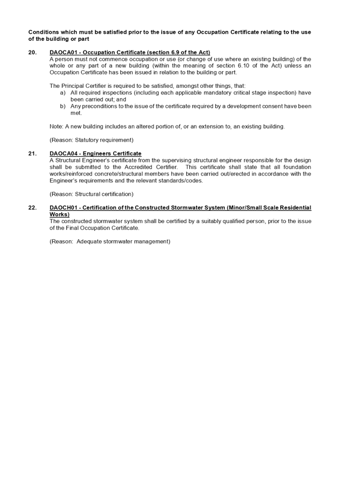
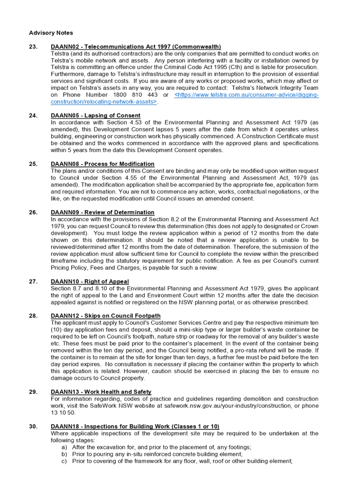

DOCUMENTS
ASSOCIATED WITH
REPORT LPP036/21
Attachment 2
Architectural Plans
Cumberland Local Planning Panel Meeting
13 October 2021

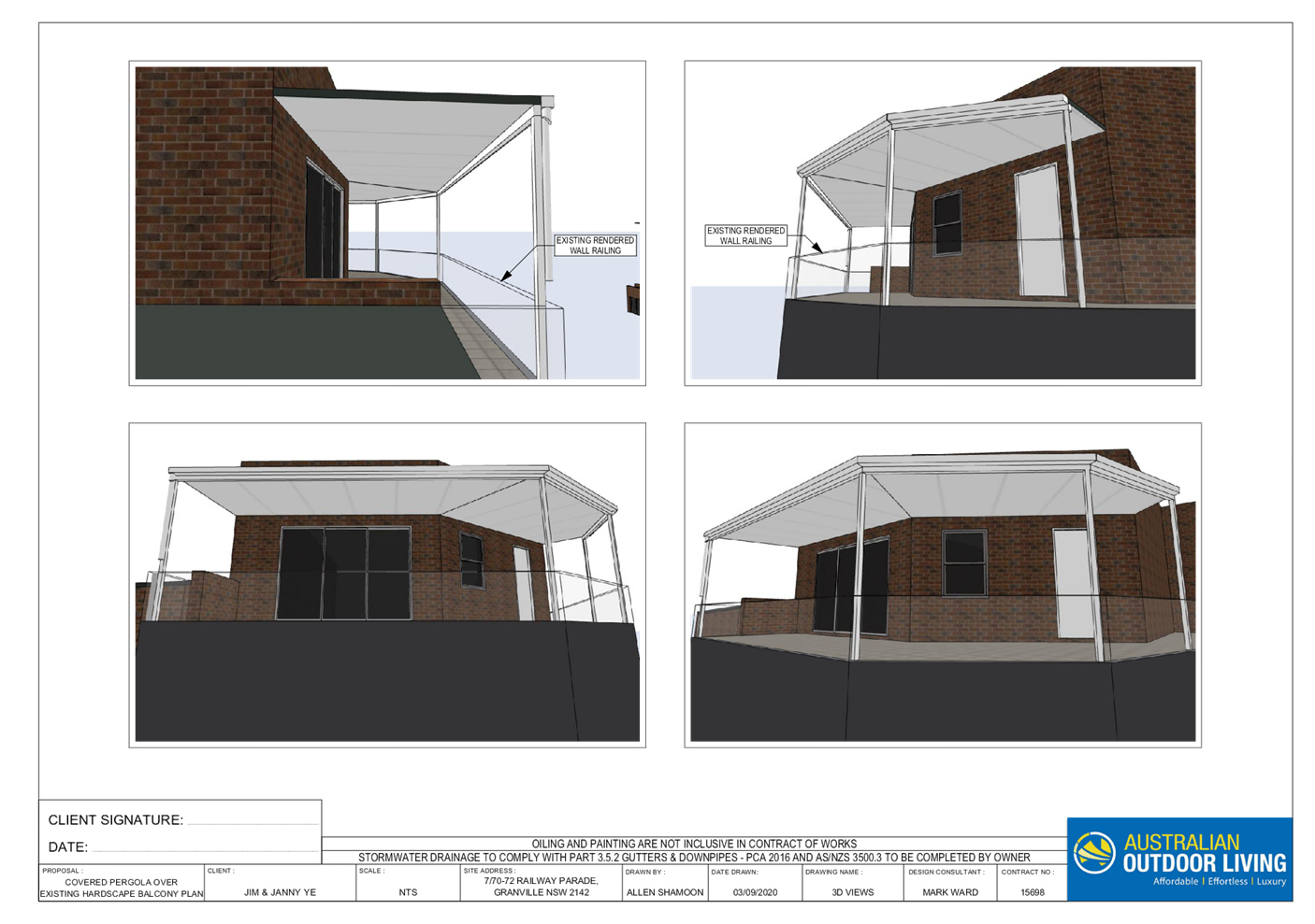
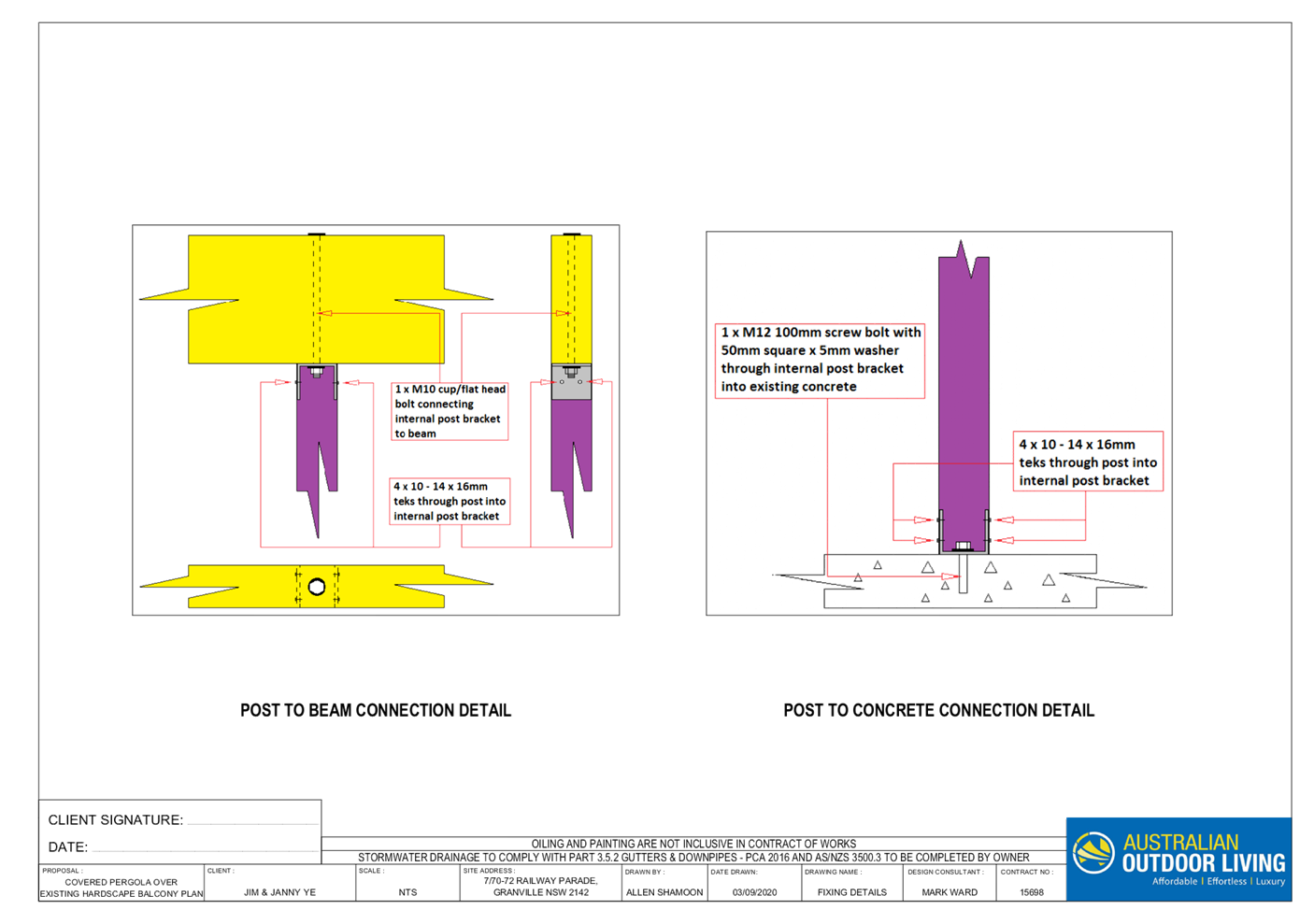
DOCUMENTS
ASSOCIATED WITH
REPORT LPP036/21
Attachment 3
Schedule of External Finishes
Cumberland Local Planning Panel Meeting
13 October 2021
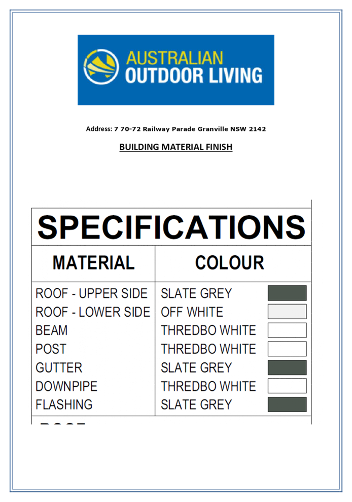
DOCUMENTS
ASSOCIATED WITH
REPORT LPP036/21
Attachment 4
Appendix A - Parramatta Local Environmental Plan 2011
Compliance Table
Cumberland Local Planning Panel Meeting
13 October 2021
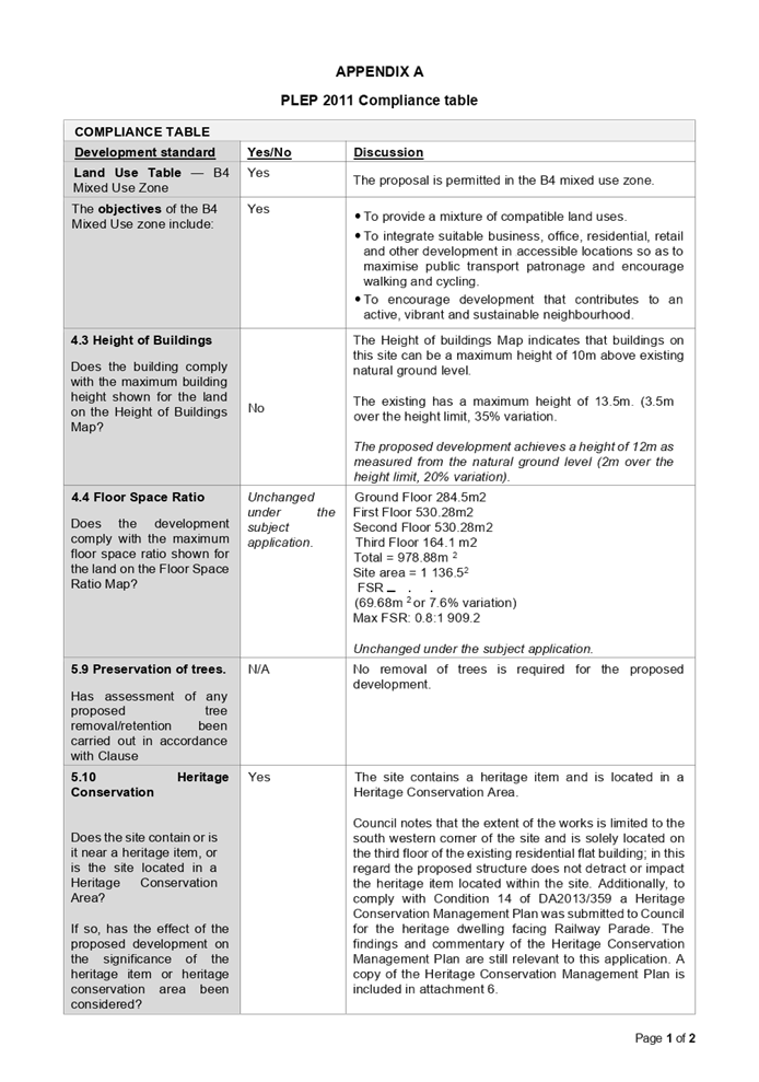
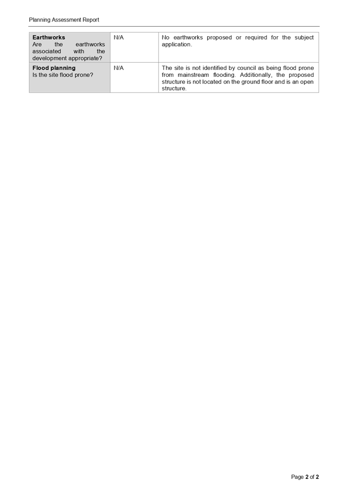
DOCUMENTS
ASSOCIATED WITH
REPORT LPP036/21
Attachment 5
Appendix B - Parramatta Development Control Plan 2011
Compliance Table
Cumberland Local Planning Panel Meeting
13 October 2021
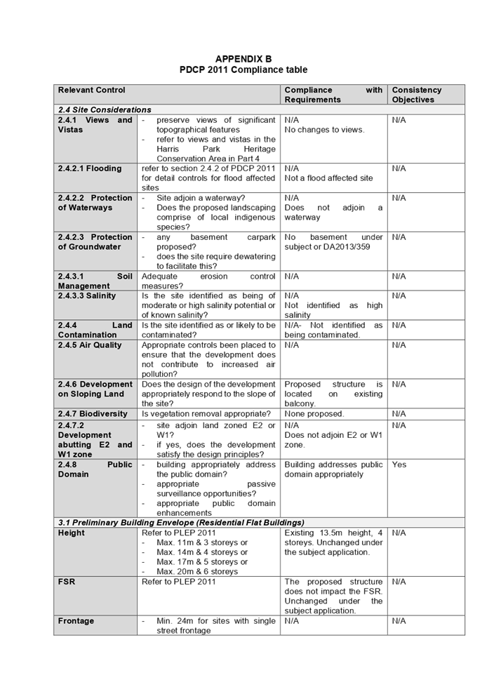
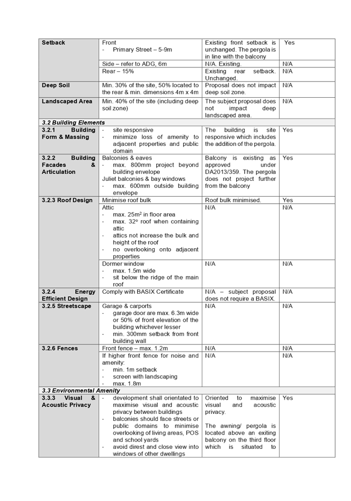
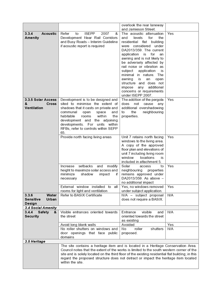
DOCUMENTS
ASSOCIATED WITH
REPORT LPP036/21
Attachment 6
Supporting documents (from DA359/2013 and MOD2016/170)
Cumberland Local Planning Panel Meeting
13 October 2021
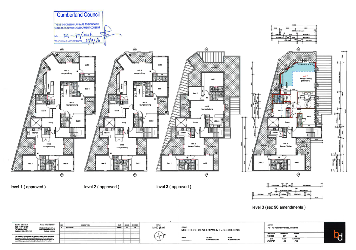
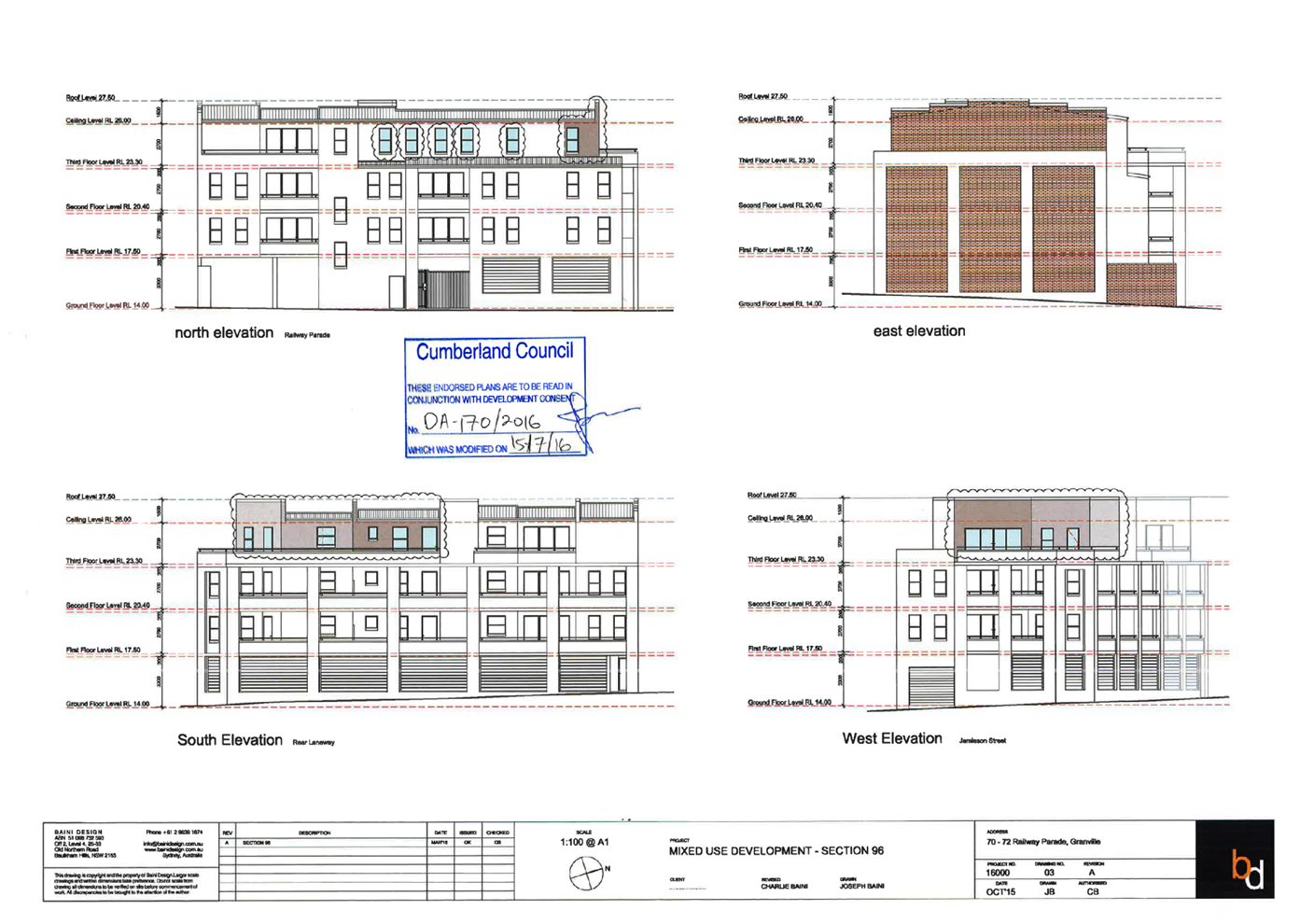
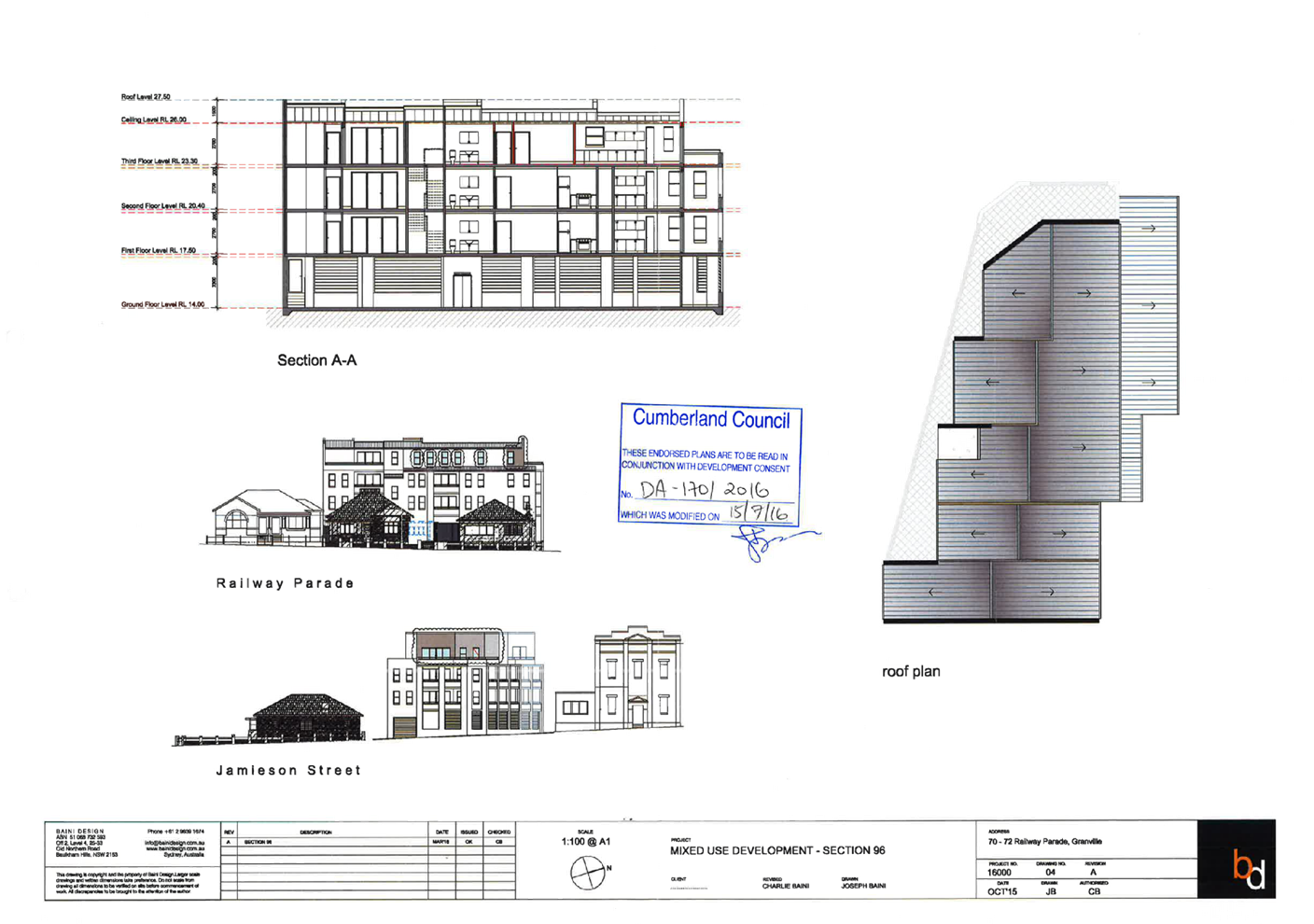
DOCUMENTS
ASSOCIATED WITH
REPORT LPP036/21
Attachment 7
Clause 4.6 Variation
Cumberland Local Planning Panel Meeting
13 October 2021
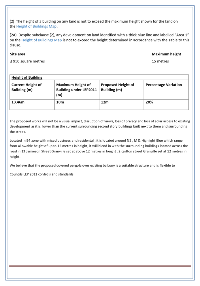
DOCUMENTS
ASSOCIATED WITH
REPORT LPP036/21
Attachment 8
Draft Reasons for Recommendation
Cumberland Local Planning Panel Meeting
13 October 2021
Cumberland Local Planning Panel Meeting
13 October 2021
Item No: LPP037/21
Development
Application for 203-211 Merrylands Road, Merrylands
Responsible
Division: Environment
& Planning
Officer: Executive
Manager Development and Building
File
Number: DA2021/0475
|
Application
lodged
|
1 September 2021
|
|
Applicant
|
Cumberland City Council
|
|
Owner
|
Cumberland City Council
|
|
Application
No.
|
DA2021/0475
|
|
Description
of Land
|
203-211 Merrylands Road MERRYLANDS
NSW 2160, Lot 18G DP 383945, Lot 1 DP 658197, Lot D DP 344249, Lot 46
Sec A DP 7916
|
|
Proposed
Development
|
Demolition of existing
buildings at 203-211 and 213 Merrylands Road, Merrylands (including
Merrylands Arcade) and use of Lot 46 Sec A DP 7916 (Part 28-36 McFarlane
Street, Merrylands) as a temporary laydown area.
|
|
Site
Area
|
202 – 211 Merrylands
Road: 1239.8m2
213 Merrylands Road:
233.6m2
28 – 36 McFarlane
Street: 1306m2
|
|
Zoning
|
202 – 211 Merrylands
Road: RE1 - Public Recreation
213 Merrylands Road:
RE1 - Public Recreation
28 – 36 McFarlane
Street: B4 - Mixed Use
|
|
Disclosure
of political donations and gifts
|
Nil disclosure
|
|
Heritage
|
No – The subject sites
are not listed as a heritage item or within a heritage conservation area.
|
|
Principal
Development Standards
|
Not applicable.
|
|
Issues
|
Nil
|
1. Development
Application No. DA2021/0475 was received on 1 September 2021 seeking consent
for the demolition of existing buildings and structures associated with the
Merrylands Arcade located at 203 – 211 Merrylands Road and 213 Merrylands
Road, temporary use of part 28-36 McFarlane as a lay down area including the
erection of temporary hoarding and fencing around the sites.
2. The
application was publicly notified to occupants and owners of the adjoining
properties for a period of 14 days between 10 September 2021 and 24 September
2021. In response, three (3) submissions were received and a total of two (2)
submissions were unique.
3. The
application is referred to the Cumberland Local Panel as the proposal is on
land owned by Cumberland City Council.
4. The
application is recommended for conditional approval subject to the conditions
as provided in the attached schedule.
Subject Sites and Surrounding
Area
The sites are legally described as
Lot 1 in DP 658197, Lot D in DP 344249, Lot 18G in DP 383945 and Lot 46,
Section A in DP 7916, commonly known as 202 – 211 Merrylands Road,
Merrylands 213 Merrylands Road, Merrylands and 28 – 36 McFarlane Street,
Merrylands. The sites have a combined area of 2923.4m2 and a summary on the
details of each site is as follows:
203 – 211 Merrylands
Road:
The sites are rectangular in shape
with a combined site area of 1239.8m2. The dimensions of the sites include a
frontage to Merrylands Road of 31 metres, depths of 44.04 along the eastern
boundary, 44.225 metres along the western boundary and a secondary street
frontage to Main Lane equal to 31 metres. The site is known as the
‘Merrylands Arcade’ and contains a number of various commercial
uses and provides a walkthrough for pedestrians from Merrylands Road toward
McFarlane Street. The site is also burdened by an easement for electricity
traversing through the centre of the site from the northern boundary to the southern
boundary.
213 Merrylands Road:
The site directly adjoins 203
– 211 Merrylands Road to the north, is rectangular in shape, has a site
area of 377.6m2 and accommodates a commercial building. The dimensions of the
site include a frontage of approximately 6.83 metres to Merrylands Road, depths
of 44.225 metres along the eastern and western boundaries and a secondary
street frontage width of approximately 6.83 metres presenting to Main Lane.
28 – 36 McFarlane Street:
The site is rectangular in shape with
a site area of 1306m2, a frontage of 35.54 metres to McFarlane Street, depths
of 42.74 metres along the eastern boundary, 42.77 metres at the western
boundary and a secondary street frontage of 35.54 metres fronting Main Lane.
Historically, the site has been used as a public car park and recently the site
has been excavated to facilitate works to the existing 6.95-metre-wide drainage
easement traversing through the centre of the site undertaken as exempt works
pursuant to the provisions of SEPP Infrastructure.
Zoning and Surrounding Uses:
203 – 211 and 213 Merrylands
Road are zoned RE1 – Public Recreation and 28 – 36 McFarlane Street
is zoned B4 Mixed Use. The sites are bounded within a predominant B4 Mixed use
zone and adjoin Main Lane to the rear which is zoned SP2 (Local Road). The
sites are located within the Merrylands Station and McFarlane Street Precinct
boundary and surrounding development includes a variety of commercial uses
predominately older single and two (2) storey commercial buildings and newer
high-rise mixed-use developments. The sites are also within the vicinity of
Merrylands Station and Merrylands Shopping Centre.
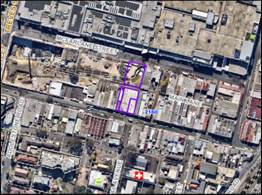
Figure
1: Aerial view of subject sites.
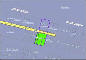
Figure
2: Land zoning map
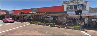
Figure
3: Street view of Merrylands Arcade
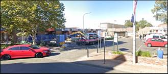
Figure
4: Street view of 28 – 36 McFarlane Street
Description of the Proposed
Development
The proposal seeks consent for the
demolition of buildings and structures associated with the Merrylands Arcade
located at 203 – 211 Merrylands Road and 213 Merrylands Road, temporary
use part 28-36 McFarlane Street as a lay down area including the erection of
temporary hoarding and fencing around the sites. The purpose of this
application is for Council to pursue future land use of the sites to
accommodate the Merrylands Civic Square which is subject to future development
consent.
History
28 – 36 McFarlane Street has
recently been excavated to facilitate works to the existing 6.95-metre-wide
drainage easement. These works were undertaken pursuant to State Environmental
Planning Policy (Infrastructure) 2007, Clauses 106, 111 and 125 which permits
development by or on behalf of a public authority for stormwater to not require
consent. Other than these works, there is no other notable history associated
with the sites that are relevant to the subject proposal.
Applicants Supporting
Statement
The applicant has provided a
Statement of Environmental Effects prepared by RPS Australia East Pty Ltd,
Revision 1 dated 1 September 2021 and was received by Council on 1 September
2021 in support of the application.
Contact With Relevant
Parties
Due to the current Public Health
Orders issued by the NSW Government in response to the COVID-19 pandemic, the
assessing officer has undertaken a desk top review of the subject site(s) and
surrounding properties and has been in regular contact with the applicant
throughout the assessment process.
Internal Referrals
Environment and Health
The development application was
referred to Council’s Environmental Health Officer for comment who has
advised that the proposal is satisfactory with regard to contamination,
remediation, air quality, water and general environmental protection.
Therefore, the proposed can be supported subject to conditions of consent.
Waste Management
The development application was
referred to Council’s Waste Management Officer for comment who has
advised that the development proposal is satisfactory and therefore can be
supported subject to recommended conditions of consent.
External Referrals
Endeavour Energy
The development application was
referred to Endeavour Energy for comment pursuant to Clause 45 of State
Environmental Planning Policy (Infrastructure) 2007. Endeavour Energy have
noted the following:
· 203
– 211 Merrylands Road is burdened by an easement benefitting Endeavour
Energy (indicated by red hatching in Figure 5 below) for underground mains /
cables which currently has no ‘Inservice’ electricity
infrastructure.
· Along
the Merrylands Road street verge/roadway there is a low voltage and 11,000 volt
/ 11 kilovolt high voltage underground cables (including a low voltage pillar
(indicated by the blue rectangle in Figure 5 below). A low voltage pillar to
the road verge from which there is a low voltage overhead ‘awning’
power lines / service conductor lines (the conductors are in troughs / ducts
fixed to the awnings / shop fronts) supplying premises to the west.
· Within
Main Lane there is a low voltage underground cabling for streetlighting which
also extend onto 28-36 McFarlane Street.
· Low
voltage underground cabling to the MacFarlane Street road verge/roadway.
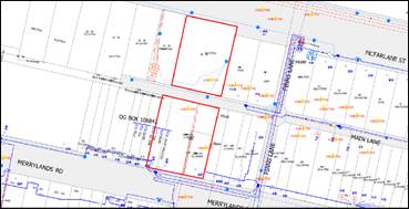
Figure
5: Site plan provided by Endeavour Energy - G/Net master facility model
Endeavour Energy has advised that
the proposal is satisfactory with regard to the above subject to conditional
requirements.
Planning Comments
The provisions of any
Environmental Planning Instruments (EP&A Act s4.15 (1)(a)(i))
State Environmental Planning
Policies
a) State
Environmental Planning Policy No. 55 – Remediation of Land (SEPP 55)
Pursuant to Clause 7 of SEPP 55
the consent authority must be satisfied that the site is suitable or can be
made suitable to accommodate future use. The matters listed within Clause 7
have been considered in the assessment of the development application.
|
Matters for
Consideration
|
Yes/No
|
|
Does the application involve re-development of the site or
a change of land use?
|
Yes No
|
|
Is the development going to be used for a sensitive land
use (e.g.: residential, educational, recreational, childcare or hospital)?
|
Yes No
|
|
Does information available to you indicate that an
activity listed below has ever been approved, or occurred at the site?
acid/alkali plant and
formulation, agricultural/horticultural activities, airports, asbestos
production and disposal, chemicals manufacture and formulation, defence
works, drum re-conditioning works, dry cleaning establishments, electrical
manufacturing (transformers), electroplating and heat treatment premises,
engine works, explosive industry, gas works, iron and steel works, landfill
sites, metal treatment, mining and extractive industries, oil production and
storage, paint formulation and manufacture, pesticide manufacture and
formulation, power stations, railway yards, scrap yards, service stations,
sheep and cattle dips, smelting and refining, tanning and associated trades,
waste storage and treatment, wood preservation.
|
Yes No
|
|
Is the site listed on
Council’s Contaminated Land database?
|
Yes No
|
|
Is the site subject to EPA
clean-up order or other EPA restrictions?
|
Yes No
|
|
Has the site been the subject of
known pollution incidents or illegal dumping?
|
Yes No
|
|
Does the site adjoin any
contaminated land/previously contaminated land?
|
Yes No
|
|
Has the appropriate level of
investigation been carried out in respect of contamination matters for
Council to be satisfied that the site is suitable to accommodate the proposed
development or can be made suitable to accommodate the proposed development?
|
Yes No
|
|
A Detailed Site Investigation
report prepared by Douglas Partners (Project 206777.00) dated August 2021 was
submitted with the application. The report did not reveal any potential
matters of concern with regard to contamination and concludes that the site
is suitable for the proposed demolition. Council’s Environmental Health
Officer has reviewed the report and determined that the site is suitable for
the proposal.
|
(b) State
Environmental Planning Policy (Infrastructure) 2007 (ISEPP 2007)
The provisions of the ISEPP 2007
have been considered in the assessment of the development application. Pursuant
to Clause 45 (b)(i) the associated works are proposed to be carried out within
the vicinity of an easement for electricity benefitting Endeavour Energy.
In accordance with Clause 45(2)
the application was referred to Endeavour Energy who has advised that 203
– 211 Merrylands Road is burdened by an easement benefitting Endeavour
Energy for the purposes underground mains/cables which currently has no
‘Inservice’ electricity infrastructure. Endeavour Energy has
reviewed the proposed works in respect to the electricity easement, raising no
objection to the proposal subject to conditional requirements noting compliance
with the requirements of Endeavour Energy.
(c) State
Environmental Planning Policy (Vegetation in Non-Rural Areas) 2017
The objective of the SEPP is to
protect the biodiversity values of trees and other vegetation and to preserve
the amenity of the area through the preservation of trees and other vegetation.
The proposal does not exceed the biodiversity offsets scheme threshold. The
proposal is consistent with the objectives of the SEPP.
(d) State
Environmental Planning Policy (Coastal Management) 2018
Not applicable. The subject site
is not identified as a coastal wetland or ‘land identified as
“proximity area for coastal wetlands” or coastal management area.
Regional Environmental Plans
The proposed development is
affected by the following Regional Environmental Plans:
(a) Sydney
Regional Environmental Plan (Sydney Harbour Catchment) 2005
The subject site is identified as
being located within the area affected by the Sydney Regional Environmental
Plan (Sydney Harbour Catchment) 2005. The proposed development raises no issues
as no impact on the catchment is envisaged.
(Note: - The subject site is not
identified in the relevant map as ‘land within the ‘Foreshores and
Waterways Area’ or ‘Wetland Protection zone’, is not a
‘Strategic Foreshore Site’ and does not contain any heritage items.
Hence the majority of the SREP is not directly relevant to the proposed
development).
Local Environmental Plans
Holroyd Local Environmental
Plan 2013 (HLEP 2013)
The provisions of HLEP 2013 are
applicable to the subject proposal. It is noted that the proposal achieves
compliance with the key statutory requirements of HLEP 2013.
(a) Permissibility:-
Under HLEP 2013 the subject sites
are zoned RE1 – Public Recreation and B4 Mixed Use. The proposal being
demolition of the buildings and structures associated with 203 – 211
Merrylands Road and 213 Merrylands Road, temporary use of part 28-36 McFarlane
as a lay down area including the erection of temporary hoarding and fencing
around the sites is sub servant to future uses on the subject sites and
permissible with consent.
(b) Part
4 – Principal Development Standards
There are no applicable Clauses
contained within Part 4 of HLEP 2013 relevant to the subject proposal.
(c) Part
5 – Miscellaneous Provisions
Outlined below are the applicable
Clauses contained within Part 5 of HLEP 2013.
|
Clause
|
Comment
|
|
Clause 5.10 – Heritage Conservation
|
The subject site(s) are not listed as items of heritage
significance or located within a heritage conservation area under Schedule 5
of HLEP 2013.
|
|
Clause 5.21 - Flood planning
|
The objectives of this clause are to minimise the flood
risk to life and property associated with the use of land, allow development
on land that is compatible with the flood function and behaviour on the land,
avoid adverse or cumulative impacts on flood behaviour and the environment
and enable the safe occupation and efficient evacuation of people in the
event of a flood. Council’s mapping system identifies that the sites
are flood prone land with low – medium risk. Council’s Development
Engineer has reviewed the proposal and has advised that the works not unduly
impact flood function, behaviour or increase potential flood affectation on adjoining properties.
Overall, the proposal is consistent with Clause 5.21.
|
(d) Part
6 – Additional Local Provisions
|
Clause
|
Comment
|
|
Clause 6.1 - Acid sulfate soils
|
Subject site is not identified on HLEP 2013 Acid Sulfate
Soils map.
|
|
Clause 6.2 – Earthworks
|
No significant earthworks are proposed as a part of this
application.
|
|
Clause 6.7 – Stormwater Management
|
No stormwater works are proposed as a part of this
application. These matters will be considered as apart any subsequent
application for redevelopment of the site(s).
|
|
Clause 6.8 - Salinity
|
The site is subject to moderate salinity. Suitable
conditions are recommended regarding salinity measures.
|
The provisions of any proposed
instrument that is or has been the subject (EP&A Act s4.15 (1)(a)(ii))
(a) Draft
State Environmental Planning Policy (Environment)
The draft SEPP relates to the
protection and management of our natural environment with the aim of
simplifying the planning rules for a number of water catchments, waterways,
urban bushland, and Willandra Lakes World Heritage Property. The changes
proposed include consolidating the following seven existing SEPPs:
· State
Environmental Planning Policy No. 19 – Bushland in Urban Areas
· State
Environmental Planning Policy (Sydney Drinking Water Catchment) 2011
· State
Environmental Planning Policy No. 50 – Canal Estate Development
· Greater
Metropolitan Regional Environmental Plan No. 2 – Georges River Catchment
· Sydney
Regional Environmental Plan No. 20 – Hawkesbury-Nepean River (No.2-1997)
· Sydney
Regional Environmental Plan (Sydney Harbour Catchment) 2005
· Willandra
Lakes Regional Environmental Plan No. 1 – World Heritage Property.
The draft policy will repeal the
above existing SEPPs and certain provisions will be transferred directly to the
new SEPP, amended and transferred, or repealed due to overlaps with other areas
of the NSW planning system. Changes are also proposed to the Standard
Instrument – Principal Local Environmental Plan. Some provisions of the
existing policies will be transferred to new Section 117 Local Planning
Directions where appropriate.
(b) Draft
Cumberland Local Environmental Plan (Draft CLEP)
The Draft Cumberland Local
Environmental Plan (Draft CLEP) has been prepared by Cumberland Council to
provide a single planning framework for the future planning of Cumberland City.
The changes proposed seek to harmonise and repeal the three existing LEPs
currently applicable to the Cumberland local government area, those being:
· Holroyd
Local Environmental Plan 2013,
· Parramatta
Local Environmental Plan 2011, and
· Auburn
Local Environmental Plan 2010.
The current planning controls for
the subject site, as contained within the are not proposed to change under the
Draft CLEP.
The provisions of any
Development Control Plans (EP&A Act s4.15 (1)(a)(iii))
The proposed is subject to the
provisions of Part A – General Controls of the Holroyd Development
Control Plan 2013 (HDCP 2013). This section of HDCP 2013 provides guidance for
waste management and demolition practices to minimise any adverse impact on
adjoining properties and the surrounding environment. The following table below
outlines including the proposals performance against the relevant controls
applicable.
|
Relevant Control
|
Compliance with Requirements
|
Compliance
|
|
Part A - General Controls
|
|
11.1. Site Waste Minimisation
and Management Plan
|
All applications for development, shall be accompanied by
a Site Waste Minimisation and Management Plan (SWMMP).
|
A Waste Management Plan prepared by RPS Australia East Pty
Ltd and dated 31 August has been submitted with the application.
|
Yes
|
|
In the Site Waste Minimisation and Management Plan,
outline measures to minimise and manage waste generated during:
a) Demolition;
b) Construction; and
c) Ongoing use of the site/premises.
|
The Waste Management Plan outlines measures on the type of
waste and volume expected to be generated, quantities of waste types,
treatment, re-use, recycling
methods and methods of appropriate disposal. The submitted
plan also outlines measures to minimise waste generation. These measures
include tracking the quantities of waste kept on-site in stockpiles and waste
storage containers located within the laydown area at 28-36 McFarlane Street.
The plan also demonstrates the management and reduction on
the consumption and use of natural resources and promote the reuse of environmentally
friendly materials where practical. Details regarding the disposal of waste
is provided along with methods of reuse to ensure waste is recycled where
practical.
|
Yes
|
|
Nominate in the Site Waste Minimisation and Management
Plan:
a) Volume
and type of waste and recyclables to be generated;
b) Storage
and treatment of waste and recyclables on site;
c) Disposal
of residual waste and recyclables; and
d) Operational
procedures for ongoing waste management once the development is complete.
|
The Waste Management Plan nominates the anticipated
generated expected volumes of waste from demolition, how that waste is
re-used and/or recycled including appropriate storage within the laydown area
and disposal methods.
|
Yes
|
|
State in the Site Waste Minimisation and Management Plan:
a) the method of recycling or disposal, and
b) the waste management service provider.
|
The Waste Management Plan outlines the maximisation of
recycling, reuse of demolition waste materials including the disposal by the
relevant licensed waste contractor(s).
|
Yes
|
|
11.2. Demolition of Buildings
|
Complete the Demolition section of the Site Waste
Minimisation and Management Plan (at Appendix A) satisfactorily and provide
details of onsite storage on plans.
|
The Waste Management Plan addresses the criteria outlined
in Appendix A appropriately with regard to waste handling and storage. In
addition to the Waste Management Plan, the applicant has submitted a
Demolition Plan providing details of demolition and storage within the
laydown area proposed at 28-36 McFarlane Street.
|
Yes
|
|
Maximise re-use and recycling of material.
|
The Waste Management Plan satisfactorily maximises
recycling and reuse of demolition waste materials.
|
Yes
|
|
Minimise waste disposal.
|
The Waste Management Plan outlines measures to minimise
waste disposal where practical.
|
Yes
|
|
Where applicable, give details of asbestos management and
disposal, consistent with Council’s Asbestos Cement Policy.
|
The Holroyd Asbestos Cement Policy has been superseded by
Cumberland City Council’s “Guideline to Asbestos Management in
Cumberland Council 2018”. The applicant has submitted a hazardous
material survey prepared by SLR Consulting Australia, dated 19 December 2019
identifying an asbestos containing materials register including provides
details on the location and presence of asbestos and hazardous materials
around the site. Subsequently, the Waste Management Plan and Demolition
Plan prepared by RPS Australia East Pty Ltd, dated 31 August provides details
on asbestos management and disposal including the disposal of other hazardous
materials.
In summary, the documents outline that asbestos waste
(where identified) is to be removed by suitably qualified licenced asbestos
removal contractors in accordance with the Workplace Health and Safety
Regulation 2017. Additional hazardous wastes are to be removed by
appropriately qualified and licenced contractors, in accordance with the
requirements of the Environmentally Hazardous Chemicals Act 1985 and the EPA
waste disposal guidelines. The applicant has supplied sufficient information
to demonstrate consistency with the guidelines for Asbestos Management.
|
Yes
|
The provisions of any planning
agreement that has been entered into under section 7.4, or any draft planning
agreement that a developer has offered to enter into under section 7.4
(EP&A Act s4.15(1)(a)(iiia))
There is no draft planning
agreement associated with the subject Development Application.
The provisions of the
Regulations (EP&A Act s4.15 (1)(a)(iv))
Pursuant to Clause 92(1)(b) the
consent authority must take into consideration the provisions of Australian
Standard AS 2601-2001 in respect to applications involving demolition. The
application has been supported with sufficient information regarding the types
of demolished materials, location of hazardous materials, waste disposal and re-use
including procedures for the safe demolition of Merrylands Arcade. The proposal
is considered to meet the requirements of Australian Standard AS2601-2001.
Nevertheless, conditions are recommended for compliance with the submitted
documents and Australian Standard AS2601-2001.
The Likely Environmental,
Social or Economic Impacts (EP&A Act s4.15 (1)(b))
This assessment demonstrates that
the proposal that the proposed demolition of the buildings and structures
associated with 203–211 Merrylands Road and 213 Merrylands Road,
temporary use part 28-36 McFarlane Street as a lay down area including the
erection of temporary hoarding and fencing around the sites does not result in
any significant adverse environmental, social or economic impacts in the
locality.
The suitability of the site for
the development (EP&A Act s4.15 (1)(c))
The proposal is consistent with
the relevant and applicable statutory requirements and policies. Therefore, it
is considered that the proposed is suitable for the site(s) and their surrounds.
Submissions made in accordance
with the Act or Regulation (EP&A Act s4.15 (1)(d))
Advertised (Council Website) Mail Sign
Not Required
In accordance with Council’s
Notification requirements contained within Holroyd Development Control Plan
2013, the proposal was publicly notified for a period of 14 days between 10
September 2021 and 24 September 2021. Following the notification period,
Council received three (3) submissions, with a total of two (2) unique
submissions. No submissions disclosed a political donation or gift. The issues
raised in the public submissions are summarised and commented on as follows:
· Existing
carpark located along McFarlane Street.
A submission raised a concern
regarding the existing carpark located 28-36 McFarlane Street. The primary
concern was the removal of the carpark and associated impact as a result of a
shortage for off-street car parking.
Planners Comment:
Historically, 28-36 McFarlane
Street has been used as a public car park, that has recently been fenced off
and undergone excavation to facilitate works to the existing 6.95-metre-wide
drainage easement traversing through the centre of the site. The subject
application seeks demolition of the existing Merrylands Arcade and temporary
use of this part of the site as a temporary laydown area. Following the works
associated with the subject application, the site will be reinstated. It is
noted that alternate public car parking is available at other locations in the
Merrylands Town Centre, which is in close proximity to the subject site.
· Pedestrian
Access between Merrylands Road and McFarlane Street.
Submissions drew concern regarding
future pedestrian connectivity between Merrylands Road and McFarlane Street.
Planners Comment:
The Merrylands Arcade historically
provided a walkthrough for pedestrians from Merrylands Road toward McFarlane
Street, which has been recently closed off by Council. The purpose of this application
is to demolish the Merrylands Arcade to facilitate the Merrylands Civic Square
which is proposed to provide public open space for the Merrylands Station and
McFarlane Street Precinct. The Civic Square is subject to further approval and,
as outlined in Holroyd Development Control Plan 2013, the controls related to
the Civic Square has an emphasis on a pedestrian permeability linkage by
reinforcing a pedestrian-friendly character and interface with the Stockland
Mall, via linking Merrylands Road and McFarlane Street. Therefore, the future
Merrylands Civic Square will assist in extending pedestrian linkages and
improve pedestrian mobility between Merrylands Road and McFarlane Street.
The public interest (EP&A
Act s4.15(1)(e))
The proposal has been assessed
under the relevant statutory requirements and it is determined that the
proposed is considered to be not contrary to the public interest.
Cumberland Local
Infrastructure Contributions Plan 2020
In accordance with the Cumberland
Local Infrastructure Contributions Plan 2020, the proposed works does not
require any contributions payable. The development would require the payment of
contributions in accordance with Cumberland Local Infrastructure Contributions
Plan 2020.
Disclosure of Political
Donations and Gifts
The applicant and notification
process did not result in any disclosure of Political Donations and Gifts.
The development application has
been assessed in accordance with the relevant statutory provisions contained
within the Environmental Planning and Assessment Act 1979, Environmental
Planning and Assessment Regulations 2000, relevant environmental planning
instruments, Holroyd Development Control Plan 2013 and Councils’
policies. The proposal is deemed satisfactory and for these reasons, it is
considered that the proposal may be approved subject to conditions.
|
1.
Pursuant to Section 4.16 of the Environmental Planning and
Assessment Act 1979, it is recommended that the Cumberland Local Planning
Panel grant consent to Development Application No. DA2021/0475 for the
demolition of existing buildings and structures associated with the
Merrylands Arcade located at 203 – 211 Merrylands Road and 213
Merrylands Road, temporary use of part 28-36 McFarlane as a lay down area
including the erection of temporary hoarding and fencing around the sites,
subject to conditions.
2.
Persons whom have lodged a submission in respect to the
application be notified of the determination of the application.
|
1. Draft Notice
of Determination
2. Demolition
Drawing
3. Demolition
Plan
4. Waste
Management Plan
5. Preliminary
Site Investigation
6. Hazardous
Building Report
7. Requirements
of Endeavour Energy
8. Draft
Reasons for Recommendation
DOCUMENTS
ASSOCIATED WITH
REPORT LPP037/21
Attachment 1
Draft Notice of Determination
Cumberland Local Planning Panel Meeting
13 October 2021
DOCUMENTS
ASSOCIATED WITH
REPORT LPP037/21
Attachment 2
Demolition Drawing
Cumberland Local Planning Panel Meeting
13 October 2021
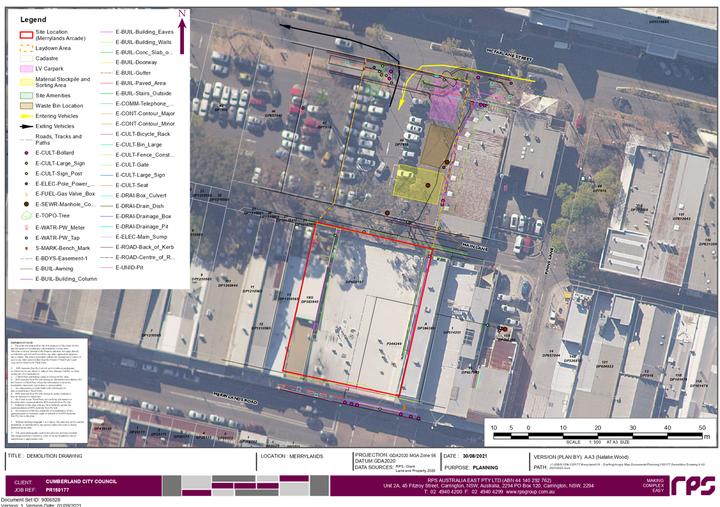
DOCUMENTS
ASSOCIATED WITH
REPORT LPP037/21
Attachment 3
Demolition Plan
Cumberland Local Planning Panel Meeting
13 October 2021
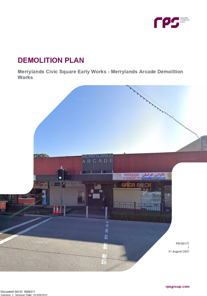
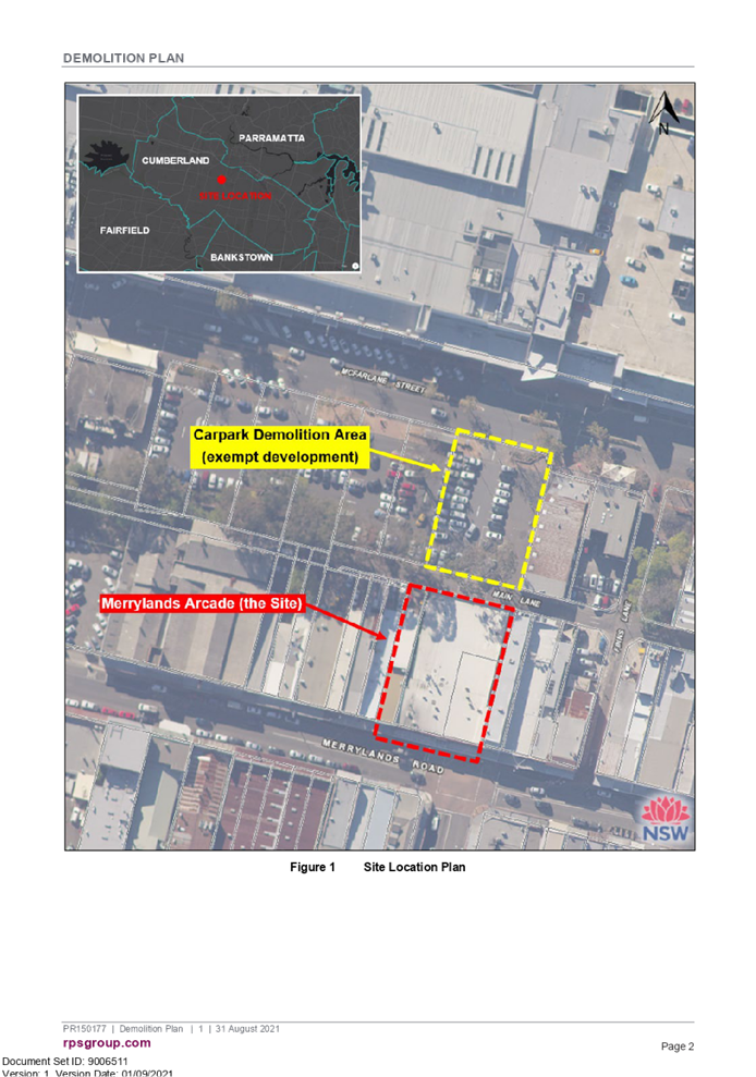
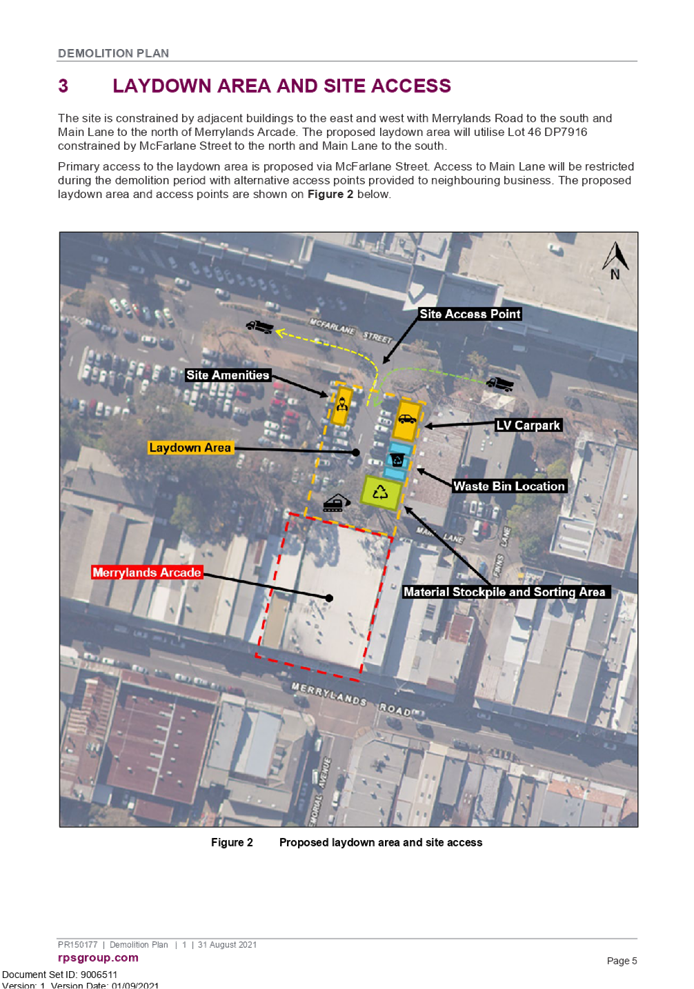
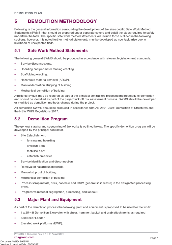
DOCUMENTS
ASSOCIATED WITH
REPORT LPP037/21
Attachment 4
Waste Management Plan
Cumberland Local Planning Panel Meeting
13 October 2021
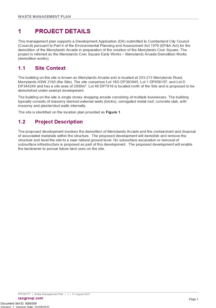
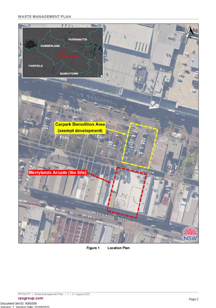

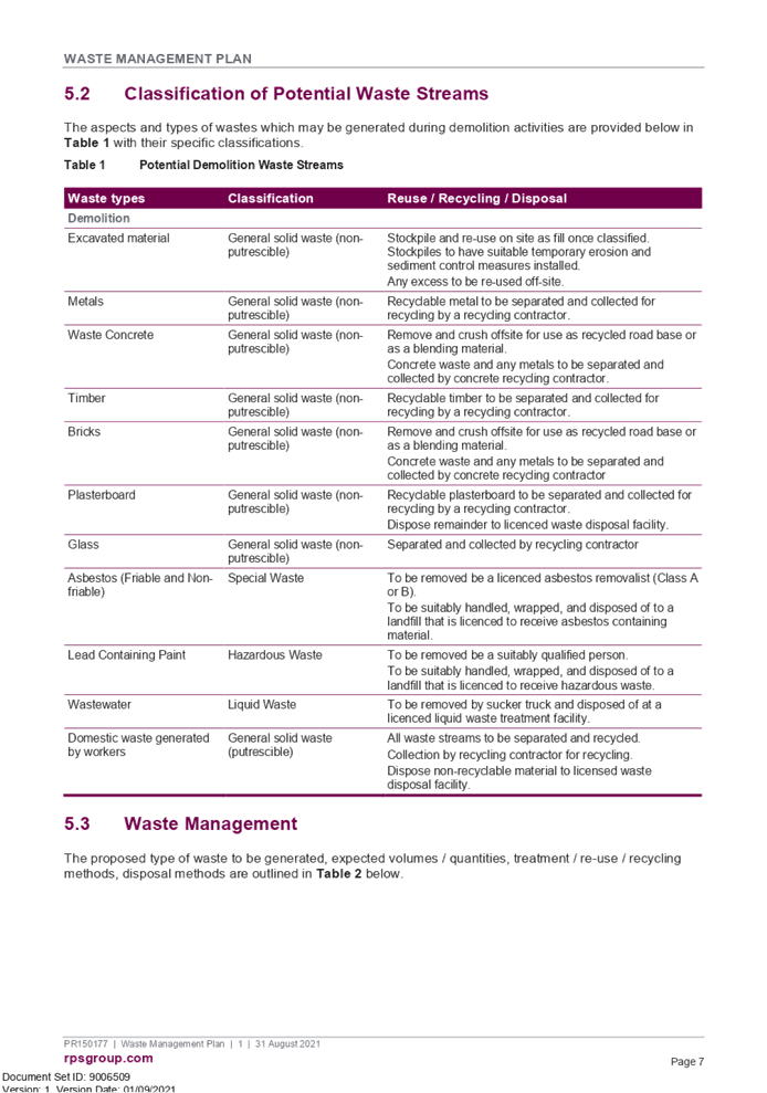
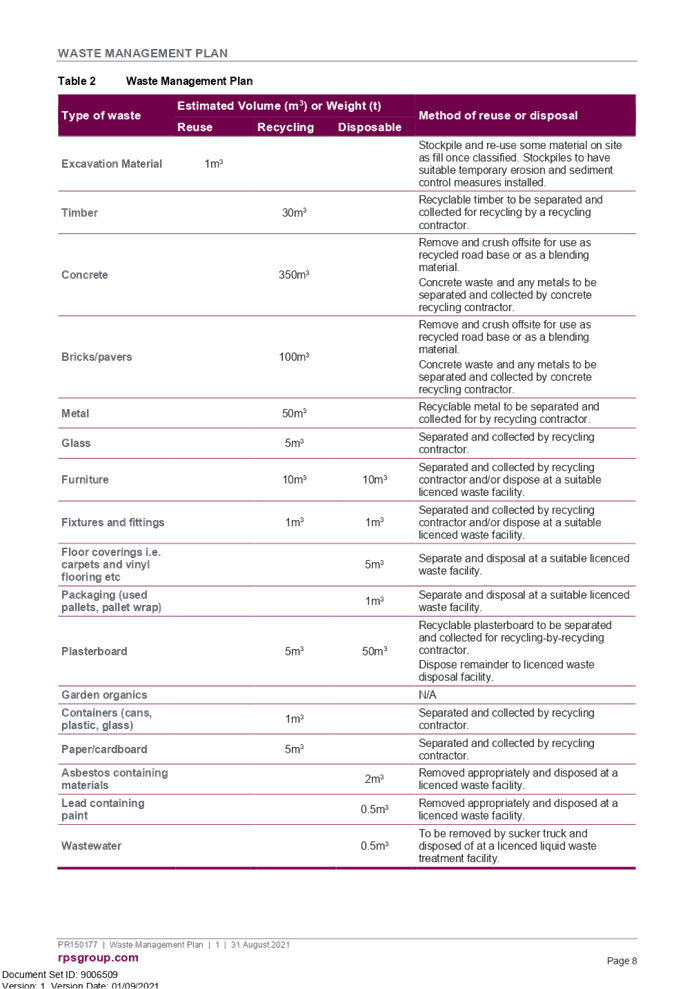
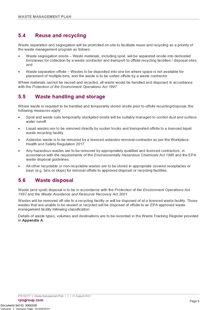
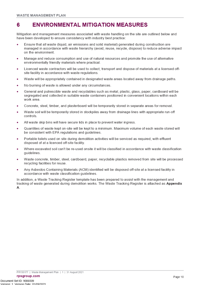


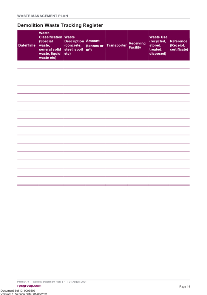
DOCUMENTS
ASSOCIATED WITH
REPORT LPP037/21
Attachment 5
Preliminary Site Investigation
Cumberland Local Planning Panel Meeting
13 October 2021
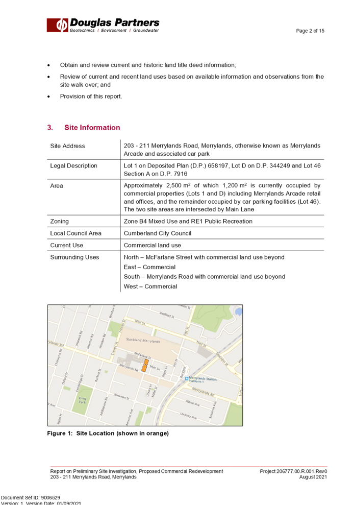
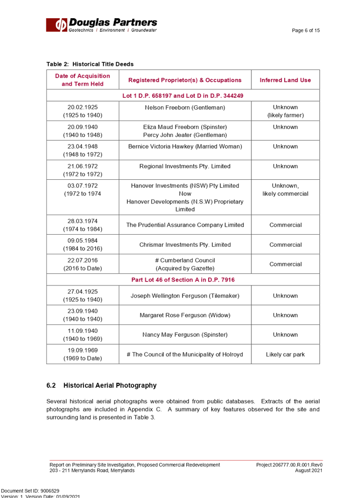
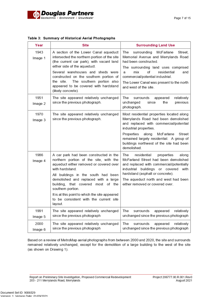
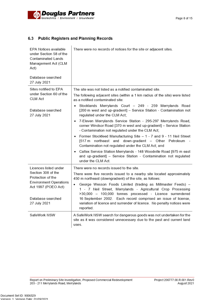
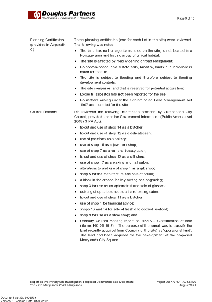
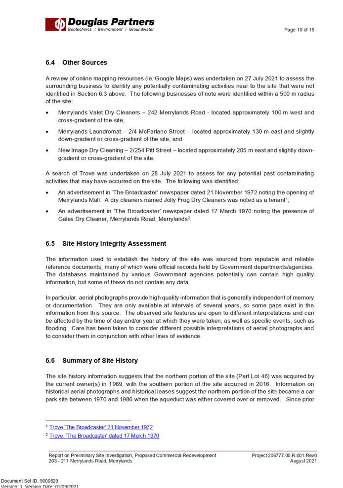
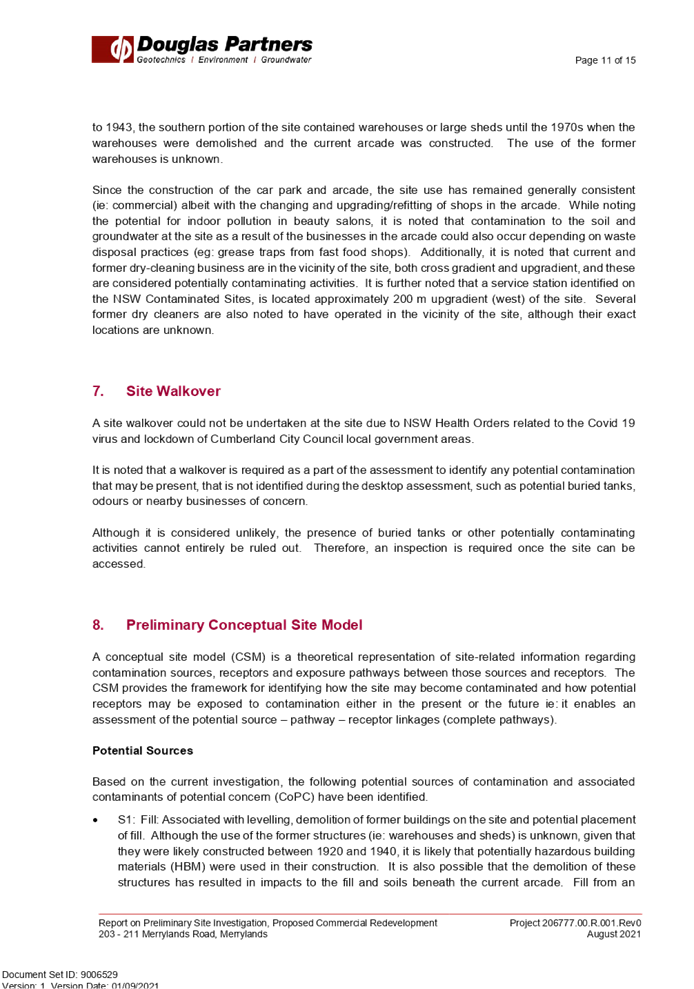
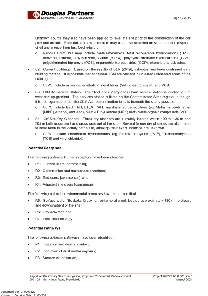
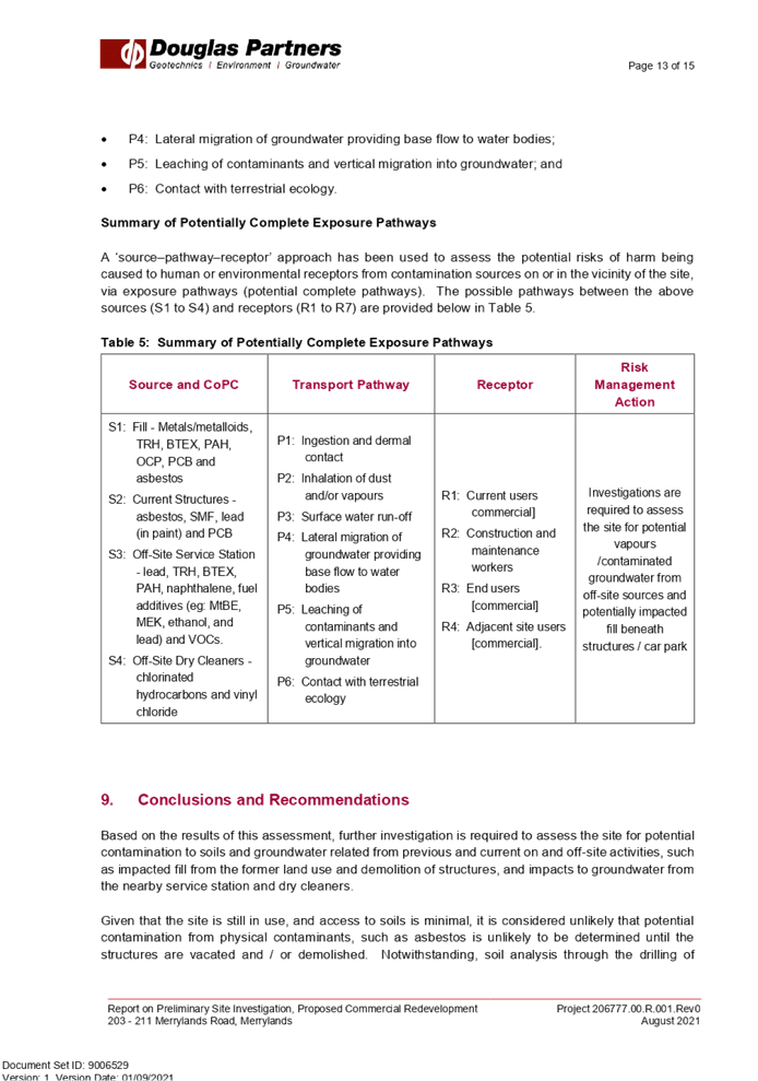


DOCUMENTS
ASSOCIATED WITH
REPORT LPP037/21
Attachment 6
Hazardous Building Report
Cumberland Local Planning Panel Meeting
13 October 2021

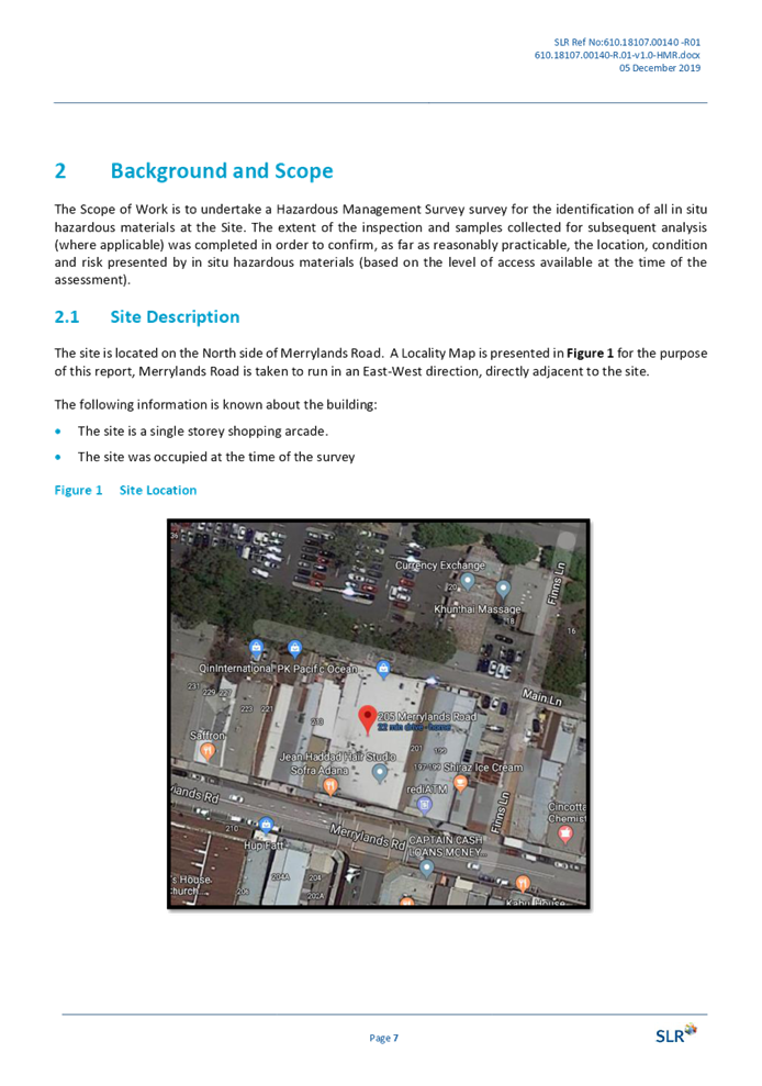


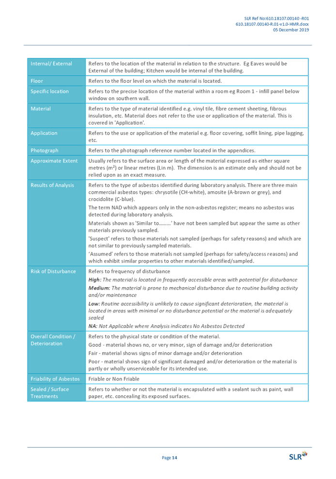
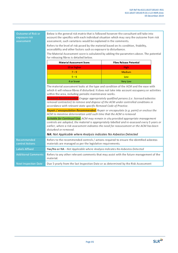
DOCUMENTS
ASSOCIATED WITH
REPORT LPP037/21
Attachment 7
Requirements of Endeavour Energy
Cumberland Local Planning Panel Meeting
13 October 2021
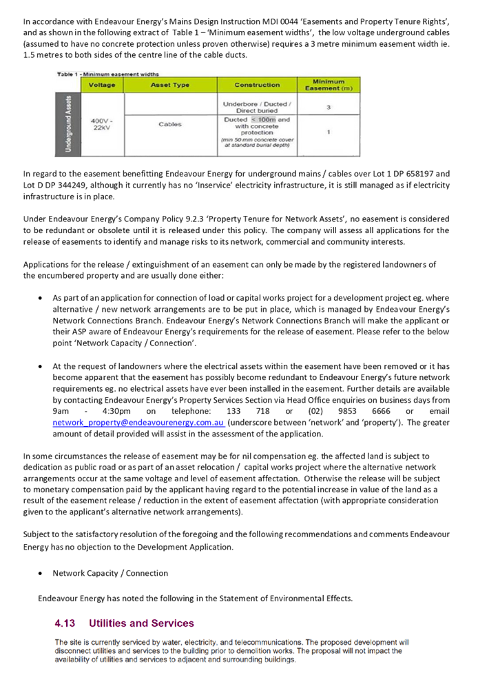
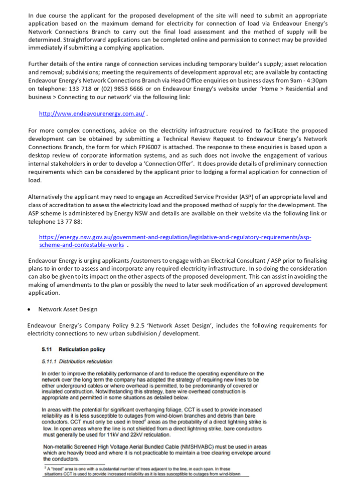
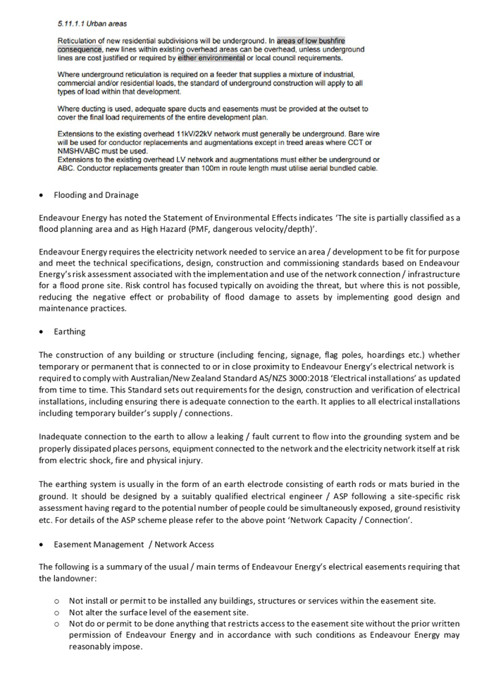

DOCUMENTS
ASSOCIATED WITH
REPORT LPP037/21
Attachment 8
Draft Reasons for Recommendation
Cumberland Local Planning Panel Meeting
13 October 2021
Cumberland Local Planning Panel Meeting
13 October 2021
Item No: LPP038/21
Development
Application for 43 - 55 Karrabah Road, Auburn
Responsible
Division: Environment
& Planning
Officer: Executive
Manager Development and Building
File
Number: DA2021/0451
|
Application
lodged
|
24 August 2021
|
|
Applicant
|
Mr G Bakewell
|
|
Owner
|
Cumberland City Council
|
|
Application
No.
|
DA2021/0451
|
|
Description
of Land
|
43 Karrabah Road, AUBURN NSW
2144, Lot 1 Sec 16 DP 939788;
45 Karrabah Road, AUBURN NSW
2144, Lot 2 Sec 16 DP 939788;
47 Karrabah Road, AUBURN NSW
2144, Lot 3 Sec 16 DP 939788;
49 Karrabah Road, AUBURN NSW
2144, Lot 1 DP 1182664;
51 Karrabah Road, AUBURN NSW
2144, Lot 6 DP 75498, Lot 1 DP 175728;
53 Karrabah Road, AUBURN NSW
2144, Lot 1 DP 1094958, Lot 2 DP 1094958;
55 Karrabah Road, AUBURN NSW
2144, Lot 1 DP 75966, Lot 1 DP 175761.
|
|
Proposed
Development
|
Demolition of all structures
and fences on land 43-55 Karrabah Road, Auburn
|
|
Site
Area
|
3,482.34m2
|
|
Zoning
|
Zone R3 Medium Density
Residential (Auburn LEP 2010)
|
|
Disclosure
of political donations and gifts
|
Nil disclosure
|
|
Heritage
|
No
|
|
Principal
Development Standards
|
N/A
|
|
Issues
|
Nil
|
1. Council
is in receipt of a development application, lodged to Council on the 6
September 2021, seeking approval for the demolition of all structures and
fences on land at 43, 45, 47, 49, 51, 53 and 55 Karrabah Road, Auburn.
2. The
application is referred to the Cumberland Local Planning Panel for
determination as the development is proposed on land for which Council is the
landowner, resulting in a conflict of interest.
3. The
application is recommended for conditional approval subject to the conditions as
provided in the attached schedule.
Subject Site and Surrounding
Area
The site forms Lot 6 DP 75498, Lot
1 DP 75966, Lot 1 DP 175728, Lot 1 DP 175761, Lot 1 Sec 16 DP 939788, Lot 2 Sec
16 DP 939788, Lot 3 Sec 16 DP 939788, Lot 1 DP 1094958, Lot 2 DP 1094958, Lot 1
DP 1182664 and is known as 43-55 Karrabah Road, AUBURN NSW 2144. The site
has a combined area of 3,482.34m2 and a combined primary street frontage
to Karrabah Road of 76.20 metres and a secondary street frontage to Beemra
Street of 45.70 metres.
The site is currently occupied by
dwelling houses, ranging from single storey to two-storey, with associates
structures. The existing developments adjoining the site include Auburn Park,
that shares the entire rear boundaries of these seven (7) sites. Located to the
north and north-east of the site is land associated with Auburn Girls High
School. Opposite these sites are existing dwellings. The location of these
sites is conveyed on the below map:-
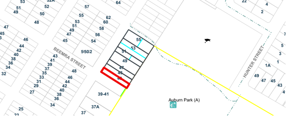
Figure
1 – Locality Plan of subject site
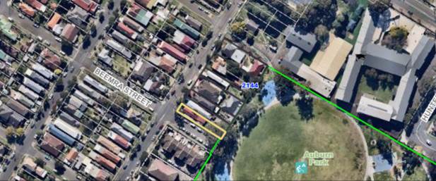
Figure
2 – Aerial view of subject site
Description of the Proposed
Development
Council is in receipt of a
development application to seek approval for the demolition of all structures
and fences on land at 43, 45, 47, 49, 51, 53 and 55 Karrabah Road, Auburn.
The NSW State Government has
provided funding to Cumberland City Council to carry-out the proposed
demolition works. An extension to Auburn Park is one of the four amenity
improvement projects under the Parramatta Road Urban Amenity Improvement
Program (PRUAIP), which aims to improve the amenity of the Parramatta Road
corridor by revitalising public open spaces
The abovementioned seven
properties are all owned by Cumberland City Council. Situated at the rear of
these sites is Auburn Park. The purpose of the proposed demolition of all the
buildings and associated structures on these sites is to provide additional
public open space in the future. This includes more grass surfaces as an
addition to Auburn Park, so that accessibility to this recreational reserve is
further improved via Karrabah Road and adjoining streets. Two (2) trees on the
sites are to be retained. All other trees on these seven properties are to be
removed. All street trees along the Karrabah Road and Beemra Street road
reserves are to be retained. The following is a site plan of the subject
properties:-

Applicants Supporting
Statement
The applicant has provided a
Statement of Environmental Effects prepared by Graham Bakewell dated August
2021 and was received by Council on the 6 September 2021 in support of the
application.
Contact with Relevant
Parties
The assessing officer has been in
regular contact with the applicant throughout the assessment process.
Internal Referrals
Parks and Recreation Officer
The development application was
referred to Council’s Parks & Recreation Officer for comment who has
advised that the proposed demolition works is satisfactory, provided that all
existing services are to be decommissioned except for one (1) water meter at either
43 or 45 Karrabah Road. The installation of a fence along Beemra Street and
Karrabah Road boundaries to prevent unauthorised vehicular access after
demolition is also to be provided at a later stage.
Tree Management Officer
The development application was
referred to Council’s Tree Management Officer for comment, who has
advised that the proposal is satisfactory subject to the imposition of standard
tree protection conditions in any consent. This includes the retention of the
following trees:-
|
Species
|
Location
|
|
Gums trees
|
Rear of Nos 43-45 Karrabah Road
|
|
Tree (unknown species)
|
Rear of 53 Karrabah Road
|
External Referrals
The application was not required
to be referred to any external government authorities for comment.
PLANNING COMMENTS
The provisions of any
Environmental Planning Instruments (EP&A Act s4.15 (1)(a)(i))
The proposed development is
affected by the following State Environmental Planning Policies:
(a) State
Environmental Planning Policy No. 55 – Remediation of Land (SEPP 55)
Clause 7 of SEPP 55 requires
Council to be satisfied that the site is suitable or can be made suitable to
accommodate the proposed development. The matters listed within Clause 7 have
been considered in the assessment of the development application.
|
Matter for Consideration
|
Yes/No
|
|
Does the application involve re-development of the site or
a change of land use?
|
Yes
No
|
|
In the development going to be used for a sensitive land
use (e.g.: residential, educational, recreational, childcare or hospital)?
|
Yes
No
|
|
Does information available to you indicate that an
activity listed below has ever been approved, or occurred at the site?
acid/alkali plant and
formulation, agricultural/horticultural activities, airports, asbestos
production and disposal, chemicals manufacture and formulation, defence
works, drum re-conditioning works, dry cleaning establishments, electrical
manufacturing (transformers), electroplating and heat treatment premises,
engine works, explosive industry, gas works, iron and steel works, landfill
sites, metal treatment, mining and extractive industries, oil production and
storage, paint formulation and manufacture, pesticide manufacture and
formulation, power stations, railway yards, scrap yards, service stations,
sheep and cattle dips, smelting and refining, tanning and associated trades,
waste storage and treatment, wood preservation
|
Yes
No
|
|
Is the site listed on
Council’s Contaminated Land database?
|
Yes
No
|
|
Is the site subject to EPA
clean-up order or other EPA restrictions?
|
Yes
No
|
|
Has the site been the subject of
known pollution incidents or illegal dumping?
|
Yes
No
|
|
Does the site adjoin any
contaminated land/previously contaminated land?
|
Yes
No
|
|
Has the appropriate level of
investigation been carried out in respect of contamination matters for
Council to be satisfied that the site is suitable to accommodate the proposed
development or can be made suitable to accommodate the proposed development?
|
Yes
No
|
|
The
site is not identified in Council’s records as being contaminated. A
site inspection reveals the site does not have any obvious history of a
previous land use that may have caused contamination and there is no specific
evidence that indicates the site is contaminated. The subject site is
currently used for residential purposes and contamination is not expected.
|
(b) State
Environmental Planning Policy (Vegetation in Non-Rural Areas) 2017
The proposal does not exceed the
biodiversity offsets scheme threshold as one (1) tree at the rear of 43
Karrabah Road, Auburn is to be retained. Therefore, the proposed vegetation
removal is considered acceptable.
Regional Environmental Plans
The proposed development is
affected by the following Regional Environmental Plans:
(a) Sydney
Regional Environmental Plan (Sydney Harbour Catchment) 2005
The subject site is identified as
being located within the area affected by the Sydney Regional Environmental
Plan (Sydney Harbour Catchment) 2005. The proposed development raises no issues
as no impact on the catchment is envisaged.
(Note: - the subject site is not
identified in the relevant map as ‘land within the ‘Foreshores and
Waterways Area’ or ‘Wetland Protection zone’, is not a
‘Strategic Foreshore Site’ and does not contain any heritage items.
Hence the majority of the SREP is not directly relevant to the proposed
development).
Local Environmental Plans
Auburn Local Environmental Plan
(ALEP) 2010
The provision of the ALEP is
applicable to the development proposal. It is noted that the development
achieves compliance with the key statutory requirements of the ALEP and the
objectives of the R3 Medium Density Residential.
(a) Permissibility:-
The proposed development involves
demolition works which is permissible pursuant to Part 2, Clause 2.7 of the
ALEP. There is no use associated with this application and relates to
demolition only. The following is an LEP compliance table assessment:-
|
DEVELOPMENT STANDARD
|
COMPLIANCE
|
DISCUSSION
|
|
4.3
Height of buildings
|
N/A
|
This
proposal involves demolition works only.
|
|
4.4
Floor space ratio
|
N/A
|
This
proposal involves demolition works only.
|
|
5.10
Heritage conservation
|
N/A
|
This
site not a heritage listed item, nor is the site located in a heritage
conservation area.
|
|
6.1
Acid sulphate soils
|
Yes
|
The
site has a class 5 rating. No concerns are raised in terms acid sulphate
soils.
|
|
6.2
Earthworks
|
N/A
|
The
proposal does not involve any earthworks.
|
|
6.3
Flood planning
|
N/A
|
The
site is not situated in a flood-risk area.
|
The provisions of any proposed
instrument that is or has been the subject (EP&A Act s4.15 (1)(a)(ii))
(a) Draft
State Environmental Planning Policy (Environment)
The draft SEPP relates to the
protection and management of our natural environment with the aim of
simplifying the planning rules for a number of water catchments, waterways,
urban bushland, and Willandra Lakes World Heritage Property. The changes
proposed include consolidating the following seven existing SEPPs:
· State
Environmental Planning Policy No. 19 – Bushland in Urban Areas
· State
Environmental Planning Policy (Sydney Drinking Water Catchment) 2011
· State
Environmental Planning Policy No. 50 – Canal Estate Development
· Greater
Metropolitan Regional Environmental Plan No. 2 – Georges River Catchment
· Sydney
Regional Environmental Plan No. 20 – Hawkesbury-Nepean River (No.2-1997)
· Sydney
Regional Environmental Plan (Sydney Harbour Catchment) 2005
· Willandra
Lakes Regional Environmental Plan No. 1 – World Heritage Property.
The draft policy will repeal the
above existing SEPPs and certain provisions will be transferred directly to the
new SEPP, amended and transferred, or repealed due to overlaps with other areas
of the NSW planning system.
Changes are also proposed to the
Standard Instrument – Principal Local Environmental Plan. Some provisions
of the existing policies will be transferred to new Section 117 Local Planning
Directions where appropriate.
(b) Draft
Cumberland Local Environmental Plan (Draft CLEP)
The Draft Cumberland Local
Environmental Plan (Draft CLEP) has been prepared by Cumberland Council to
provide a single planning framework for the future planning of Cumberland City.
The changes proposed seek to harmonise and repeal the three existing LEPs
currently applicable to the Cumberland local government area, those being:
· Holroyd
Local Environmental Plan 2013,
· Parramatta
Local Environmental Plan 2011, and
· Auburn
Local Environmental Plan 2010.
The current planning controls for
the subject site, as contained within the Auburn Local Environmental Plan 2010
are not proposed to change under the Draft CLEP.
The provisions of any
Development Control Plans (EP&A Act s4.15 (1)(a)(iii))
The Auburn Development Control
Plan 2010 (ADCP) provides guidance for the design and operation of development
to achieve the aims and objectives of the Auburn Local Environmental Plan 2010.
Since this proposal involves demolition works only, an ADCP compliance table
analysis is not required. Relevant conditions of development consent will be
imposed to ensure that demolition works are carried-out in accordance with the
relevant regulations, so that Council demolition requirements under Part 2 of
the ‘Waste’ chapter of the ADCP are adhered-to.
The provisions of any planning
agreement that has been entered into under section 7.4, or any draft planning
agreement that a developer has offered to enter into under section 7.4
(EP&A Act s4.15(1)(a)(iiia))
There is no draft planning
agreement associated with the subject Development Application.
The provisions of the
Regulations (EP&A Act s4.15 (1)(a)(iv))
The proposed demolition works
raises no concerns as to the relevant matters arising from the Environmental
Planning and Assessment Regulations 2000 (EP&A Reg).
The Likely Environmental,
Social or Economic Impacts (EP&A Act s4.15 (1)(b))
It is considered that the proposed
demolition works will have no significant adverse environmental, social or
economic impacts in the locality.
The suitability of the site for
the development (EP&A Act s4.15 (1)(c))
The subject site and locality is
not known to be affected by any natural hazards or other site constraints
likely to have a significant adverse impact on the proposed development.
Accordingly, it is considered that the proposed demolition works is suitable in
the context of the site and surrounding locality.
Submissions made in accordance
with the Act or Regulation (EP&A Act s4.15 (1)(d))
In accordance with Council’s
Notification requirements contained within the Auburn Development Control Plan
2010, the development application was not required to be publicly notified.
The public interest (EP&A
Act s4.15(1)(e))
In view of the foregoing analysis,
it is considered that the development, if carried out subject to the conditions
set out in the recommendation below, will have no significant adverse impacts
on the public interest.
Cumberland Local
Infrastructure Contributions Plan 2020
The development does not require
the payment of contributions in accordance with Council’s Section 7.11
Contributions Plan as the proposal does not involve any new residential and/or
subdivision development.
Disclosure of Political
Donations and Gifts
There was no disclosure of
Political Donations and Gifts.
The development application has
been assessed in accordance with the relevant requirements of the Environmental
Planning and Assessment Act 1979, SEPP 55 – Remediation of Land, SEPP
(infrastructure) 2007, SREP (Sydney Harbour Catchment) 2005, Auburn Local
Environmental Plan 2010 and Auburn Development Control Plan 2010 and is
considered to be satisfactory for approval subject to conditions.
|
That Development Application
No. DA2021/0451 for the demolition of all structures and fences on land 43-55
Karrabah Road, Auburn be approved subject to attached conditions.
|
1. Draft Notice
of Determination
2. Architectural
Plans
3. Locality
Map
4. Draft
Reasons for Recommendation
DOCUMENTS
ASSOCIATED WITH
REPORT LPP038/21
Attachment 1
Draft Notice of Determination
Cumberland Local Planning Panel Meeting
13 October 2021
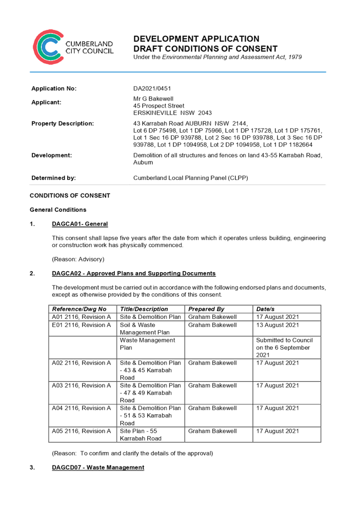
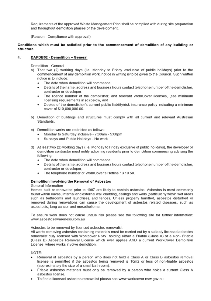
DOCUMENTS
ASSOCIATED WITH
REPORT LPP038/21
Attachment 2
Architectural Plans
Cumberland Local Planning Panel Meeting
13 October 2021
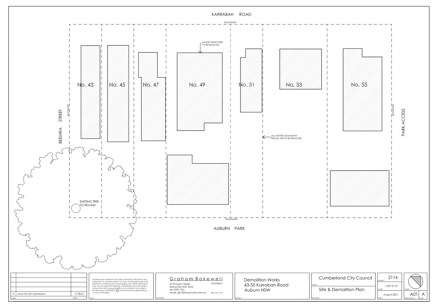
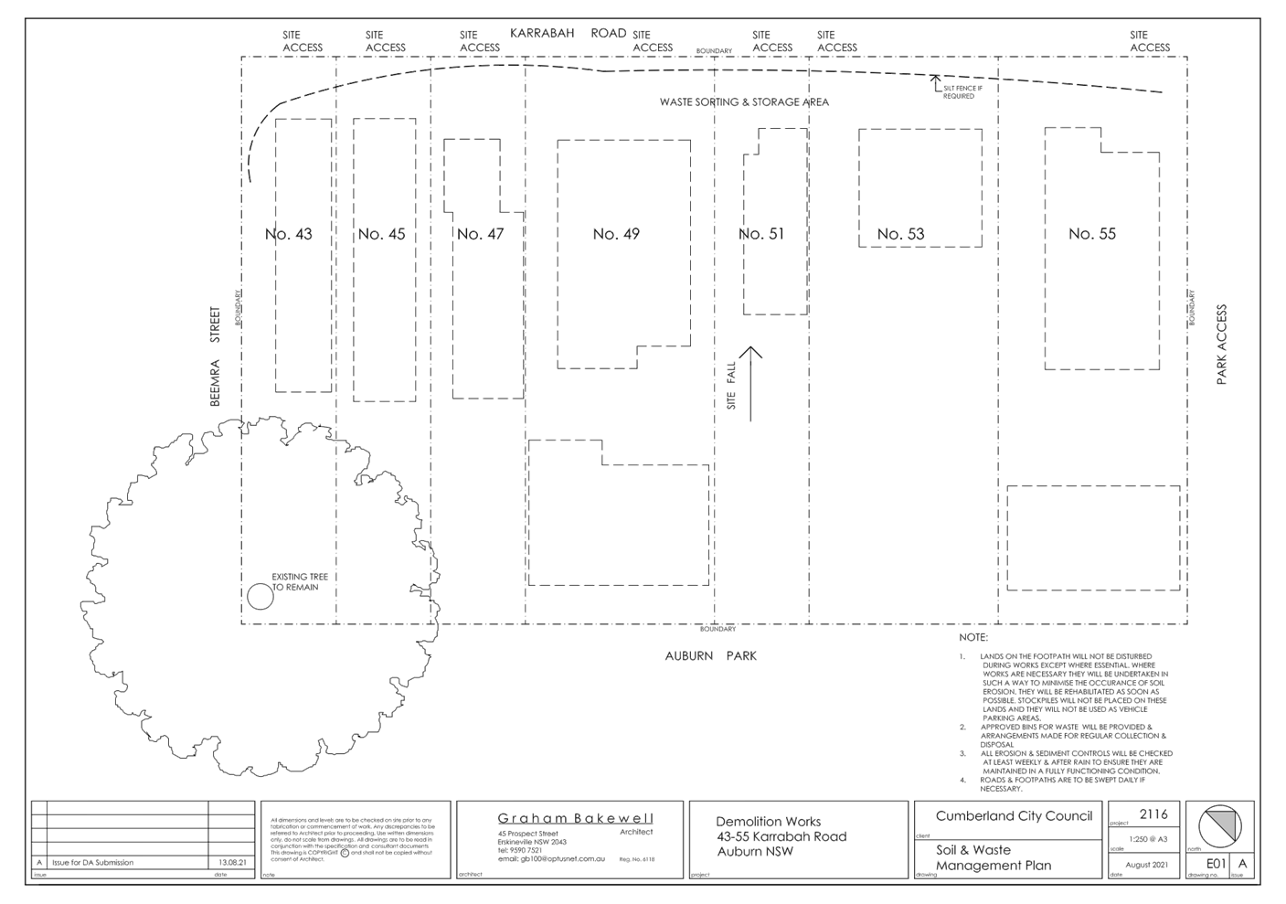
DOCUMENTS
ASSOCIATED WITH
REPORT LPP038/21
Attachment 3
Locality Map
Cumberland Local Planning Panel Meeting
13 October 2021
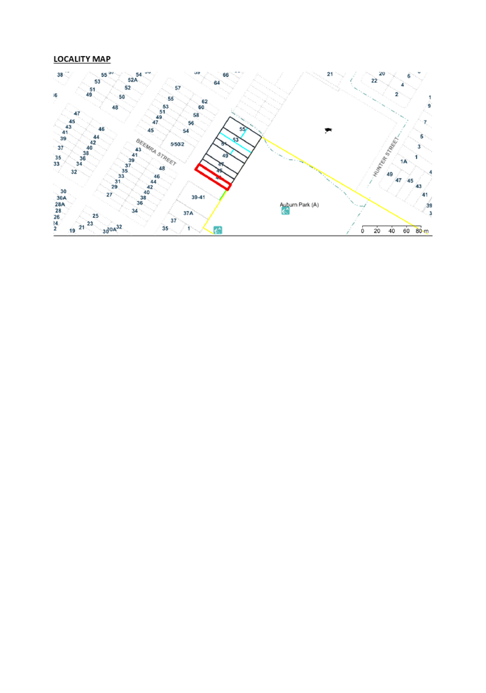
DOCUMENTS
ASSOCIATED WITH
REPORT LPP038/21
Attachment 4
Draft Reasons for Recommendation
Cumberland Local Planning Panel Meeting
13 October 2021
Cumberland Local Planning Panel Meeting
13 October 2021
Item No: LPP039/21
Modification
Application for 331 Blaxcell Street, South Granville
Responsible
Division: Environment
& Planning
Officer: Executive
Manager Development and Building
File Number: MOD2021/0156
|
Application lodged
|
28
April 2021.
|
|
Applicant
|
Zinnia
Group C/- Minto Planning Services Pty Ltd.
|
|
Owner
|
Ms
I Itaoui.
|
|
Application No.
|
MOD2021/0156
|
|
Description of Land
|
331
Blaxcell Street, South Granville.
Lot
40 and Lot 41 Sec 1 DP 5121
|
|
Proposed Development
|
Section
4.56 modification for alterations to an approved childcare centre including
construction of additional roof top level, reconfiguration of the ground
floor parking area, revision to internal and external areas of the upper
levels and provision of an external fire stair.
|
|
Site Area
|
1,340.6
Square metres.
|
|
Zoning
|
R4
High density residential zone.
|
|
Disclosure of political donations and gifts
|
Nil
disclosure.
|
|
Heritage
|
No
– Not Heritage Listed nor within Heritage Conservation Area
|
|
Principal Development Standards
|
Height of Building
Permissible:- 11 metres.
Proposed:- 13.6 metres.
Floor space ratio
Permissible:- 0.8:1.
Proposed:-
0.675:1.
|
|
Issues
|
Height
of the childcare centre building.
|
1. Development
Application No. 290/2017 was approved by the Land and Environment Court on the
9 February 2018 for demolition of the existing structures and construction of a
three storey childcare centre with ancillary signage as deferred commencement
consent subject to conditions. The development consent was made operational on
8 April 2019.
2. Modification
Application No. 290/2017/A was approved by the Cumberland Local Planning Panel
on the 14 August 2019 being a Section 4.56 application to modify an approved childcare
centre facility to provide additional general purpose rooms and a rooftop
outdoor play area.
3. Modification
Application No. MOD2021/0156 was received on 28 April 2021 being a Section 4.56
application for alterations to an approved childcare centre including
construction of additional roof top level, reconfiguration of the ground floor
parking area, revision to internal and external areas of the upper levels and
provision of an external fire stair.
4. The
application was publicly notified to occupants and owners of the adjoining
properties for a period of 14 days between 5 May 2021 and 19 May 2021. In
response, there were no submissions received.
5. The
variations are as follows:
|
Control
|
Required
|
Provided
|
% variation
|
|
Height
control of the Parramatta Local Environmental Plan 2011 Clause 4.3.
|
11
metres.
|
Original
DA-290/2017 approved 11 metres.
Previous
Section 4.56 DA-290/2017/A approved 13.6 metres
This
Section 4.56 MOD2021/0156 proposed 13.6 metres.
|
0%
23.6%
23.6%
|
6. The
application is referred to the Panel for determination as the modified
development contravenes the height requirement by more than 10%.
7. The
application is recommended for conditional approval subject to conditions as
provided in the attached schedule.
Subject Site and Surrounding
Area
The subject site is legally
described as Lots 40 and 41 Section 1 in DP 5121 and is known as 331 Blaxcell
Street, South Granville. The site is located on the eastern side of Blaxcell
Street, within the R4 High Density Residential zone, between Eve Street to the
northwest and Markey Street to the southwest. The site has a frontage of 24.36
metres to Blaxcell Street and occupies an area of 1,340.6 square metres.
The site has a fall towards the
rear of between 1.17 metres and 1.24 metres.
There is a single storey dwelling
house with a detached garage on the site. A small garden shed is situated
within the rear yard.
There is a mixture of housing
types within the locality ranging from older style post World War 2 housing to
recently constructed medium density developments. There are multi dwelling
developments close by situated at 319 to 325, 335 to 339 and 334 to 336
Blaxcell Street.
The Dellwood Street Neighbourhood
Shopping Centre is situated approximately 220 metres to the north.
The
location of the site is shown below.
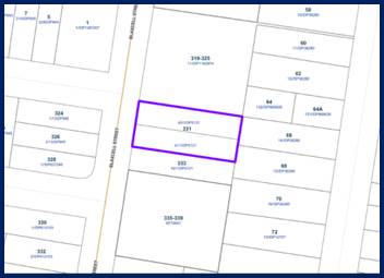
The
aerial photo of the site is shown below.
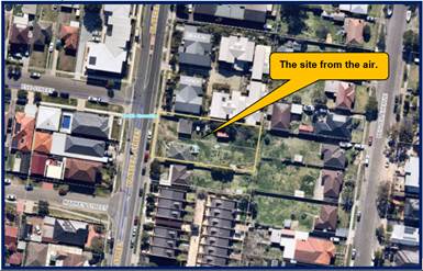
Photos
of the site are shown below.
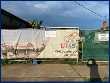
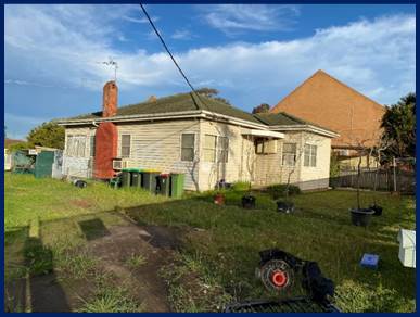
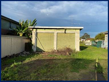
Description of the Proposed
Development
Council has received a Section
4.56 modification application to undertake changes to the approved childcare
centre including reconfiguration of the ground floor parking area, revision to
internal and external areas of the upper levels and provision of an external
fire stair.
The proposal is not considered to
be an intensification of the approved use because there is no increase in the
number of children to attend the centre. The intention of the proposal is to
enhance the approved design through more interactive and functional indoor and
outdoor play areas without increasing the centre’s capacity. The centre
will accommodate 92 children, 21 staff and 23 car spaces. In detail, the
changes are:-
Ground level
· Revision
of the car park layout to provide car parking spaces for 23 vehicles including
3 accessible spaces;
· Provision
of a turning bay;
· Relocate
the access driveway and provide a new security gate;
· Removal
of internal play area and outdoor play area;
· Relocate
lift and erection of external fire stairs;
· Provision
of a staff/meeting room with amenity facility;
· Provision
of storage area; and
· Erection
of new signage on the front fence.
Level One
· Redesign
the internal play areas and outdoor play areas to accommodate a total of 60
children including a play room for 30 x 2-3 year old children and another play
room for 30 x 3-6 year old 30 children;
· Relocate
the play room for 0-2 year old children to Level Two;
· Redesign
the outdoor play area;
· Relocate
lift and erection of external fire stairs; and
· Reconfigure
the internal layout to provide bathrooms/showers, offices, kitchen, and
internal and external store rooms.
Level Two
· Redesign
the internal and outdoor areas to provide a new play room for 32 x 0-2 year old
children
· Reduce
the amount of outdoor play area;
· Provision
of 1 additional general purpose room;
· Relocate
lift and erection of external fire stairs; and
· Reconfigure
the internal layout to provide bathrooms/nappy change area, cot room,
kitchen/bottle preparation area, and internal and external store rooms; and
· Erection
of external stairs to provide access from the lower and upper levels.
Rooftop
· Provision
of staff wellbeing room, storage room, laundry and amenity facilities for
children and adults;
· Provision
of outdoor play area;
· Erection
of under covered outdoor play area; and
· Relocate
lift and erection of external fire stairs.
The table below summaries the key
changes between the previous approvals and the proposed modifications under
this application.
|
|
Original application
approved by LEC on 8 April 2019
DA-290/2017
|
S4.56 modification
approved by CLPP on 14 August 2019
DA-290/2017/A
|
Current S4.56 modification
MOD2021/0156
|
|
Land Use
|
Childcare centre
|
Childcare centre
|
Childcare centre
|
|
GFA / FSR
Permissible 0.8:1
|
1,072.14 sq m / 1,343
sq m
0.798:1
|
1,071.71 sq m / 1,343
sq m
0.798:1
|
905.864 sq m / 1,343 sq m
0.675:1
|
|
HoB
Max. 11m
|
Max. 10.9m
|
Max. 13.6m
|
Max. 13.6m
|
|
No. of storeys
|
3 storeys
(GF, 1F, 2F)
|
4 storeys
(GF, 1F, 2F, rooftop)
|
4 storeys
(GF, 1F, 2F, rooftop)
|
|
Indoor Play area
Require 299m2
|
318.25 sq m
|
468 sq m
|
320.075 sq m
|
|
Outdoor Play area
Require 644m2
|
660.94 sq m
|
825.66 sq m
|
660.57 sq m
|
|
Car parking spaces
Require 23 spaces incl.
3 accessible spaces
|
23 spaces
Including 3 accessible
spaces
|
23 spaces
Including 3 accessible
spaces
|
23 spaces
Including 3 accessible spaces
|
|
Front setback (west)
|
GF: 40.32m
1F: 12.3m
2F: 19.685m
|
GF: 40.32m
1F: 12.3m
2F: 18.785m
rooftop: 19.7m
|
GF: 6m
1F: 13.5m
2F: 12.4m
rooftop: 21.6m
|
|
Rear setback (east)
|
GF: 3.509m
1F: 3.509m
2F: 9.28m
|
GF: 3.45m
1F: 3.5m
2F: 11.9m
rooftop: 8.4m
|
GF: 22.1m
1F: 9.1m
2F: 10.9m
rooftop: 12.8m
|
|
Layout
|
GF: at-grade car park, entry lobby, lift, stairs,
meeting room, children WC, Adult WC, storage, children play room.
1F: children play rooms, lift, stairs, office, staff
room, kitchen, storage, cots, children WC, Adult WC, undercover/outdoor play
area.
2F: general purpose rooms, office, lift, stairs,
laundry, storage, children WC, Adult WC, undercover/outdoor play area.
|
GF: at-grade car park, entry lobby, lift, stairs,
meeting room, children WC, Adult WC, storage, children play room.
1F: children play rooms, lift, stairs, office, staff
room, kitchen, storage, cots, children WC, Adult WC, undercover/outdoor play
area, shower.
2F: general purpose rooms, office, lift, stairs,
laundry, storage, children WC, Adult WC, undercover/outdoor play area
Rooftop:
undercover/outdoor play area, utility area.
|
GF: at-grade car park, entry
lobby. lift, stairs, staff/meeting room, Adult WC, storage,
1F: children play rooms, lift,
stairs, office, staff room, kitchen, storage, children WC, Adult WC,
undercover/outdoor play area, shower, hall.
2F: general purpose rooms,
lift, stairs, storage, Adult WC/nappy change, undercover/outdoor play area,
cots, kitchen/bottle preparation.
Rooftop: undercover/outdoor play area Staff room, storage, laundry,
children WC/nappy change, Adult WC, lift, stairs.
|
History
Development application 290/2017
was approved as a deferred commencement consent by the Land and Environment
Court on the 9 February 2018. The deferred commencement compliance notice
(Operational consent) associated with the consent was issued on 8 April 2019.
A Section 4.56 Modification of
Consent No. 290/2017/A was approved by the Cumberland Local Planning Panel on
the 14 August 2019 for Section 4.56 to modify an approved Child Care centre
facility to provide additional general purpose rooms and a rooftop outdoor play
area.
Applicants Supporting
Statement
The applicant has provided a
Statement of Environmental Effects prepared by Nauon Solutions dated March 2021
and the documents and was received by Council on 28 April 2021 in support of
the application. Subsequent to Council’s request of additional
information letter, the amended plans prepared by Chrofi Architects and a
letter prepared by Shaw Reynolds Lawyers dated 2 September 2021 were submitted
for Council’s considerations.
Contact with Relevant
Parties
The assessing officer has
undertaken a site inspection of the subject site and surrounding properties and
has been in regular contact with the applicant throughout the assessment
process.
Internal Referrals
Development Engineer
The modification application was
referred to Council’s Development Engineer for comment who has advised
that there is no objection to the modification sought and no engineering
conditions are required to be altered.
Building Surveyor
The development application was
referred to Council’s Building Surveyor for comment who has advised that
the development proposal is satisfactory and therefore can be supported subject
to recommended conditions of consent.
Environment and Health
The modification application was
referred to Council’s Environment and Health Officer for comment who has
advised that the changes sought are acceptable. There are no objections to the
modification sought and conditions are provided addressing matters of noise,
plan of management and site operations.
Children’s Services
The modification application was
referred to Council’s Children’s Services Department who have
advised that there are no objections to the changes that are sought.
Waste Management
The development application was
referred to Council’s Waste Management Officer for comment who has
advised that the development proposal is satisfactory and therefore can be
supported subject to recommended conditions of consent.
External Referrals
The application was not required
to be referred to any external government authorities for comment.
Planning Comments
Section 4.56 Modification by
consent authorities of consents granted by the Court:
|
Requirement
|
Comments
|
|
Council is satisfied
that the development to which the consent as modified relates is
substantially the same development as the development for which the consent
was originally granted and before that consent as originally granted was
modified (if at all), and
|
The development as
proposed to be modified is substantially the same as the original consent.
That is, a childcare centre. The modification seeks alterations to the
purpose built childcare centre as well as an addition a roof top children
play area and staff wellbeing room with associated amenities. The
modification seeks to redesign the approved childcare centre to improve the
interactive and function of the indoor and outdoor play area without
increasing the capacity of the facility. It is considered that the
modification is substantially the same as that initially approved.
|
|
Council has notified
the application in accordance with:
(i) the
regulations, if the regulations so require, and
(ii) a
development control plan, if the consent authority is a council that has made
a development control plan that requires the notification or advertising of
applications for modification of a development consent, and
Council has notified,
or made reasonable attempts to notify, each person who made a submission in
respect of the relevant development application of the proposed modification
by sending written notice to the last address known to the consent authority
of the objector or other person, and
|
The modification
application was notified as per the requirements of the Parramatta
Development Control Plan guidelines between 5 May and 19 May 2021. There were
no submissions to the modification that is sought.
There were two objections to the original development application.
Council records show that both residents who previously objected were
notified of the modification application. The residents who previously
objected to the development did not object to the modification that is being
sought.
|
|
Council has considered
any submissions made concerning the proposed modification within any period
prescribed by the regulations or provided by the development control plan, as
the case may be.
|
As previously mentioned, there were no
submissions to the modification that is being sought.
|
|
Relevant matters
referred to in Section 4.15(1) of the act have been taken into consideration.
Council has considered
the reasons given by the consent authority for the grant of the consent that
is sought to be modified.
|
Proposed modification
is not contrary to the public interest and the likely environmental impacts
of the development as modified are considered acceptable.
|
|
After determining an
application for modification of a consent under this section, Council must
send a notice of its determination to each person who made a submission in
respect of the application for modification
|
Noted.
|
The provisions of any
Environmental Planning Instruments (EP&A Act s4.15 (1)(a)(i))
State Environmental Planning
Policies
The proposed development is
affected by the following State Environmental Planning Policies:
(a) State
Environmental Planning Policy No. 55 – Remediation of Land (SEPP 55)
Clause 7 of SEPP 55 requires
Council to be satisfied that the site is suitable or can be made suitable to
accommodate the proposed development. The matters concerning land contamination
have been addressed during the processing of the original development
application for the redevelopment of the site to become the childcare centre.
(b) State
Environmental Planning Policy No. 64 – Advertising and Signage (SEPP 64)
The original Development
Application DA-290/2017 was approved with a wall sign attached to the front
façade of the building. The proposed modification is proposed to replace
the original wall sign with a new sign to be placed on the front boundary wall
being a business identification sign facing Blaxcell Street which is deemed to
be suitable and appropriate for the proposed use. A detailed assessment of the
SEPP 64 is attached within the Appendix A.
(c) State
Environmental Planning Policy (Educational Establishments and Child Care
Facilities) 2017
State Environmental Planning
Policy (Educational Establishments and Child Care Facilities) 2017 is
applicable to the modification application. An assessment shows that the
modification application is compliant with the relevant provisions of the State
Policy. A detailed assessment of the modification application using the State
Policy is attached within Appendix B.
Child Care Planning Guideline
(August 2017) Planning and Environment
The Child Care Planning Guideline
associated with the State Policy is also relevant to the modification
application and this part addresses the Design Quality Principles. The
modification application is found to be compliant with all the Design Quality
Principles 1 to 7. A detailed assessment of the Design Quality Principles is
addressed at Appendix C.
Regional Environmental Plans
The proposed development is
affected by the following Regional Environmental Plans:
(a) Sydney
Regional Environmental Plan (Sydney Harbour Catchment) 2005
The subject site is identified as
being located within the area affected by the Sydney Regional Environmental
Plan (Sydney Harbour Catchment) 2005. The proposed development raises no issues
as no impact on the catchment is envisaged.
(Note: - the subject site is not
identified in the relevant map as ‘land within the ‘Foreshores and
Waterways Area’ or ‘Wetland Protection zone’, is not a
‘Strategic Foreshore Site’ and does not contain any heritage items.
Hence the majority of the SREP is not directly relevant to the proposed
development).
Local Environmental Plans
Parramatta Local Environmental
Plan 2011
(a) Permissibility:-
The approved use is defined as a
“Centre Based Child Care Facility” under the PLEP 2011 and defined
as:-
(a) a
building or place used for the education and care of children that provides any
one or more of the following:-
(i) long
day care,
(ii) occasional
childcare,
(iii) out-of-school-hours
care (including vacation care),
(iv) preschool
care, or
(b) an
approved family day care venue (within the meaning of the Children (Education
and Care Services) National Law (NSW)),
Note.
An approved family day care venue
is a place, other than a residence, where an approved family day care service
(within the meaning of the Children (Education and Care Services) National Law
(NSW)) is provided.
but does not include:
(c) a
building or place used for home-based childcare or school-based childcare, or
(d) an
office of a family day care service (within the meanings of the Children
(Education and Care Services) National Law (NSW)), or
(e) a
babysitting, playgroup or child-minding service that is organized informally by
the parents of the children concerned, or
(f) a
child-minding service that is provided in connection with a recreational or
commercial facility (such as a gymnasium) to care for children while the
children’s parents are using the facility, or
(g) a
service that is concerned primarily with providing lessons or coaching in, or
providing for participation in, a cultural, recreational, religious or sporting
activity, or providing private tutoring, or
(h) a
child-minding service that is provided by or in a health services facility, but
only if the service is established, registered or licensed as part of the
institution operating in the facility.
A “Centre Based Child
Care Facility” is a permitted land use within the R4 High Density
Residential zone that applies to the land. A business identification sign attached
to the childcare centre is also permitted with consent.
The relevant matters to be
considered under the PLEP 2011 and the applicable clauses for the proposed
development are summarised below.
|
DEVELOPMENT STANDARD
|
COMPLIANCE
|
DISCUSSION
|
|
4.3 Height of Buildings
11 metres
Approved 13.6 metres (original
DA-290/2017)
Propose 13.6 metres.
|
No
|
The variation is 23.6%.
The variation occurs across
the entire top floor area being the children’s playground, staff
well-being room, storage area, amenity facilities, lift access, stair access,
pergola and shade sail.
A justification statement has
been lodged to support the modification application which is addressed below.
|
|
4.4 Floor space ratio
0.8:1
Propose 0.675:1.
|
Yes
|
Compliance is achieved.
|
(b) Clause
4.6 – Variation to Building Height
The clause will not be applicable
to this application. In accordance with case law, as outlined in the Land
Environment Court Case of Gann & Anor v Sutherland Shire Council [2008]
that there is power to modify a development application where the modification
would result in the breach of development standards. The court took the view
that development standards within an LEP did not operate to prohibit the grant
of consent if they were not complied with (and no objection pursuant to SEPP
No. 1 (now cl 4.6) had been lodged). Notwithstanding, the court held that
despite a SEPP No. 1 Objection not being required, Section 96(3) (now known as
cl 4.55(3)) of the Environmental Planning and Assessment Act 1979 (The Act) still
requires the consent authority to take into consideration those matters
referred to in Section 79C (now Cl4.15) of the Act. This case law has been
applied to Clause 4.6 of the Standard instrument (on which the PLEP 2011 is
derived).
Variation to building height
The maximum building height
permitted on the site is 11 metres. The original development application was
approved at 11 metres (three storeys) and hence the height of the childcare
centre was fully compliant with the provision. Under this S4.56 modification
application, the proposed additional roof top level is mainly outdoor play area
with shade structures with a small enclosed area (less than 30 square metres)
of enclosed area being the lift access, stairwell, staff well-being room,
amenity/nappy change area, laundry and storage area. The overall building
height reaches a maximum height of 13.6 metres being a maximum variation of
23.6%.
Generally, the rooftop play area
is open to the elements and neither of the elements form a defined fourth
storey to the building.
The applicant has addressed the
objectives of Clause 4.3 as follows:
Applicant’s comments
The approved height of the building was 13.6m under the
previous Section 4.56 modification and this proposal seeks to maintain this
approved height. The proposed height variation is considered suitable for the
site and surrounding on the following grounds:
· The
building height follows the approved height.
· The
proposal does not exceed the maximum FSR (it will reduce the approved FSR).
· The
proposal generally maintains the approved building’s footprint.
· The
building elements that trigger the variation are minor in relation to the
approved building.
· The
majority of the building remains below the 11m height maximum.
· The
proposed variation is consistent with the building height objectives under the
PLEP 2011.
· The
proposed variation is consistent with the R4 zoning objectives under the PLEP
2011.
· The
additional height when viewed from Blaxcell Street is minor and does not
materially alter the overall streetscape.
· Council
approved the outdoor play area on the roof and this application simply seeks to
enhance the overall design of the building, including the roof area.
· The
shadowing impacts are minor as demonstrated in the shadow diagrams.
· The
proposed variation does not result in an increase to privacy impacts due to the
measures incorporated in the skilful design.
· No
other development standards are varied as part of this application.
Figure below shows the difference between the approved
Section 4.56 modification (blue line) and proposed building height (red line).
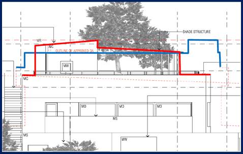
Planner’s comment
The discussion provided by the applicant is supported. In
this regard, the development is consistent with the objectives of the height
standard as the height of the modified childcare centre in storeys is generally
with the height of future buildings with the R4 (High Density Residential zone)
within the locality.
The variation is limited to the playground elements being
the parapet / screen, lift well, utility area, shade sail structure and
stairwells. These are utilities or amenities to support the rooftop playground
and do not function as an additional storey. In addition:-
· There
is no appreciable increase in shadowing to the south.
· The
proposed height is retained as approved under the previous modification to the childcare
centre on site.
· The
rooftop playground has a smaller footprint than the ground, first and second
floors of the childcare centre below.
· The
rooftop playground is setback away from the side boundaries of the site to
minimise adverse impacts such as solar access and privacy issues.
· The
enclosed area on the rooftop area is setback 6.2 metres from the southern side
boundary to minimise the bulk and scale of the rooftop area when viewed from
the southern adjoining properties.
· The
degree of privacy is satisfactory to all boundaries. The window openings of the
enclosed portion on the rooftop area relates to the amenity facility and
storage area of the staff well-being room which will not constitute any
overlooking onto the southern adjoining properties.
· The
rooftop playground does not contribute to mass, bulk and scale of the building.
· The
floor space ratio of the building is compliant with the standard applying to
the site.
When considering the above, the variation sought is
considered as being acceptable to the site.
Conclusion
It is the view of Council Officer that the justification
provided is satisfactory and having considered the application on its merit,
the variation to the maximum building height development standard is considered
acceptable in this instance.
The provisions of any proposed
instrument that is or has been the subject (EP&A Act s4.15 (1)(a)(ii))
(a) Draft
State Environmental Planning Policy (Environment)
The draft SEPP relates to the
protection and management of our natural environment with the aim of simplifying
the planning rules for a number of water catchments, waterways, urban bushland,
and Willandra Lakes World Heritage Property. The changes proposed include
consolidating the following seven existing SEPPs:
· State
Environmental Planning Policy No. 19 – Bushland in Urban Areas
· State
Environmental Planning Policy (Sydney Drinking Water Catchment) 2011
· State
Environmental Planning Policy No. 50 – Canal Estate Development
· Greater
Metropolitan Regional Environmental Plan No. 2 – Georges River Catchment
· Sydney
Regional Environmental Plan No. 20 – Hawkesbury-Nepean River (No.2-1997)
· Sydney
Regional Environmental Plan (Sydney Harbour Catchment) 2005
· Willandra
Lakes Regional Environmental Plan No. 1 – World Heritage Property.
The draft policy will repeal the above existing SEPPs and
certain provisions will be transferred directly to the new SEPP, amended and
transferred, or repealed due to overlaps with other areas of the NSW planning
system.
Changes are also proposed to the Standard Instrument –
Principal Local Environmental Plan. Some provisions of the existing policies
will be transferred to new Section 117 Local Planning Directions where
appropriate.
(b) Draft
Cumberland Local Environmental Plan (Draft CLEP)
The Draft Cumberland Local Environmental
Plan (Draft CLEP) has been prepared by Cumberland City Council to provide a
single planning framework for the future planning of Cumberland City. The
changes proposed seek to harmonise and repeal the three existing LEPs currently
applicable to the Cumberland local government area, those being:
· Holroyd
Local Environmental Plan 2013,
· Parramatta
Local Environmental Plan 2011, and
· Auburn
Local Environmental Plan 2010.
The current planning controls for
the subject site, as contained within the Parramatta Local Environmental Plan
2011 are not proposed to change under the Draft CLEP.
The provisions of any
Development Control Plans (EP&A Act s4.15 (1)(a)(iii))
The Parramatta Development Control
Plan provides guidance for the design and operation of development to achieve
the aims and objectives of the Parramatta Local Environmental Plan 2011.
Parramatta Development Control
Plan 2011
(a) Section
5.2 - Child Care Centres
The relevant objectives and
requirements of the Child Care Centres Part of Parramatta Development Control
Plan 2011 (PDCP) have been considered and a relevant assessment is provided at
Appendix D.
The Child Care Planning Guideline
will override many of the controls specified and as such, the controls now have
limited applicability to any childcare centre.
When considering the relevant
controls, it is identified that the application is not compliant with Part
5.2.3.2 - Building Height and Design. This is related to the height variation
of the roof top play area and staff well-being room under Clause 4.3 of the
PLEP 2011. The height matter has been comprehensively addressed above and
determined as being acceptable.
The modification is compliant with
the remaining relevant provisions of the PDCP 2011 addressing childcare
centres.
The provisions of any planning agreement that has been
entered into under section 7.4, or any draft planning agreement that a
developer has offered to enter into under section 7.4 (EP&A Act
s4.15(1)(a)(iiia))
There is no draft planning agreement associated with the
subject Development Application.
The provisions of the Regulations (EP&A Act s4.15
(1)(a)(iv))
The modified development raises no concerns as to the
relevant matters arising from the Environmental Planning and Assessment
Regulations 2000 (EP&A Reg).
The Likely Environmental, Social or Economic Impacts
(EP&A Act s4.15 (1)(b))
It is considered that the modified development will have no
significant adverse environmental, social or economic impacts in the locality.
The suitability of the site for the development (EP&A
Act s4.15 (1)(c))
The subject site and locality is not known to be affected by
any natural hazards or other site constraints likely to have a significant
adverse impact on the proposed development. Accordingly, it is considered that
the modified development is suitable in the context of the site and surrounding
locality.
Submissions made in accordance with the Act or Regulation
(EP&A Act s4.15 (1)(d))
Advertised (Council website) Mail
Sign Not Required
In accordance with Council’s Notification requirements
contained within the PDCP 2011 and Clause 119(2) and (4) of the Environmental
Planning and Assessment Regulation 2000, the modification application was
publicly notified for a period of fourteen (14) days between 5 May 2021 and 19
May 2021. There was no submission received to the modification that is sought.
The public interest (EP&A Act s4.15(1)(e))
In view of the foregoing analysis, it is considered that the
modified development, if carried out subject to the conditions set out in the
recommendation below, will have no significant adverse impacts on the public
interest.
Section 7.12 (Formerly S94A)
Fixed Development Consent Levies
This part of the Act relates to the collection of monetary
contributions from applicants for use in developing key local infrastructure.
Comments:
The modified development triggers additional cost of works
which would require the payment of contributions to be amended in accordance
with Parramatta Section 94A Contributions Plans (Amendment No. 5). In this
regard, the new contribution amount is $19,250.00. Should the Panel support the
modification application, Condition No. 5 of the development consent would need
to be updated to reflect the new contribution amount.
Disclosure of Political
Donations and Gifts
The applicant and notification process did not result in any
disclosure of Political Donations and Gifts.
The modification application has
been assessed in accordance with the relevant requirements of the Environmental
Planning and Assessment Act 1979, State Environmental Planning Policy
(Educational Establishments and Child Care Facilities) 2017, the Parramatta
Local Environmental Plan 2011 and associated Parramatta Development Control
Plan 2011. A variation to Clause 4.3 of the Parramatta Local Environmental Plan
2011 specific to height is sought.
Having regard to the assessment of
the proposal from a merit perspective, Council may be satisfied that the
development has been responsibly designed and provides for acceptable levels of
amenity. It is considered that the proposal successfully minimises adverse
impacts on the amenity of neighbouring properties. Hence the development, irrespective
of the departure noted above, is consistent with the intentions of
Council’s planning controls and represents a form of development
contemplated by the relevant statutory and non-statutory controls applying to
the land.
For these reasons, it is considered
that the proposal is satisfactory having regard to the matters of consideration
under Section 4.15 and Section 4.56 of the Environmental Planning and
Assessment Act 1979, and the modification may be approved subject to
conditions.
|
That Modification Application
MOD2021/0156 being a Section 4.56 modification for alterations to an approved
childcare centre including a reconfiguration of the ground floor parking
area, revision to internal and external areas of the upper levels and
provision of an external fire stair on land at 331 Blaxcell Street, South
Granville be approved subject to attached conditions listed in the attached
schedule.
|
1. Draft Notice
of Determination
2. Architectural
Plans
3. Landscape
Plans
4. Stormwater/Engineering
Plans
5. Plan
of Management
6. Appendix
A - Assessment Table of State Environmental Planning Policy No. 64 -
Advertising and Signage
7. Appendix
B - Assessment Table of State Environmental Planning Policy (Educational
Establishments and Child Care Facilities) 2017
8. Appendix
C - Assessment Table of Child Care Planning Guideline 2017
9. Appendix
D - Assessment Table of Holroyd Development Control Plan 2013
10. Appendix
E - Notice of Determination of the original Development Application DA-290/2017
and relevant copy of plans
11. Appendix
F - Notice of Determination of the subsequent Section 4.56 Modification
Application DA-290/2017/A and relevant copy of plans
12. Draft
Reasons for Recommendation
DOCUMENTS
ASSOCIATED WITH
REPORT LPP039/21
Attachment 1
Draft Notice of Determination
Cumberland Local Planning Panel Meeting
13 October 2021

DOCUMENTS
ASSOCIATED WITH
REPORT LPP039/21
Attachment 2
Architectural Plans
Cumberland Local Planning Panel Meeting
13 October 2021
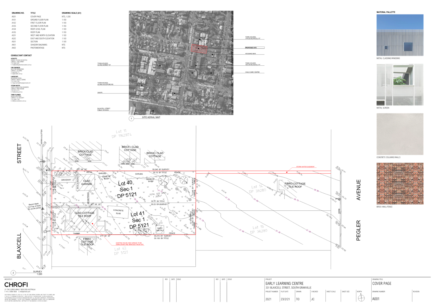
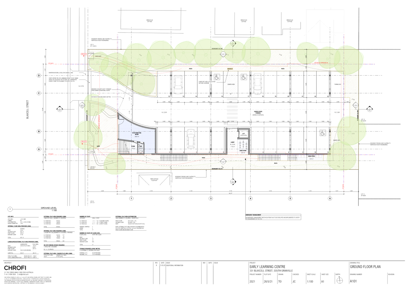
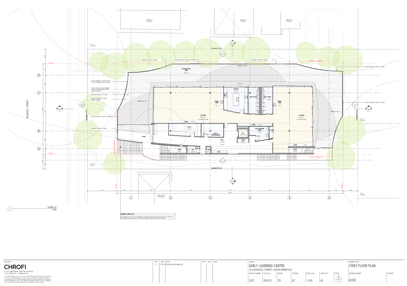
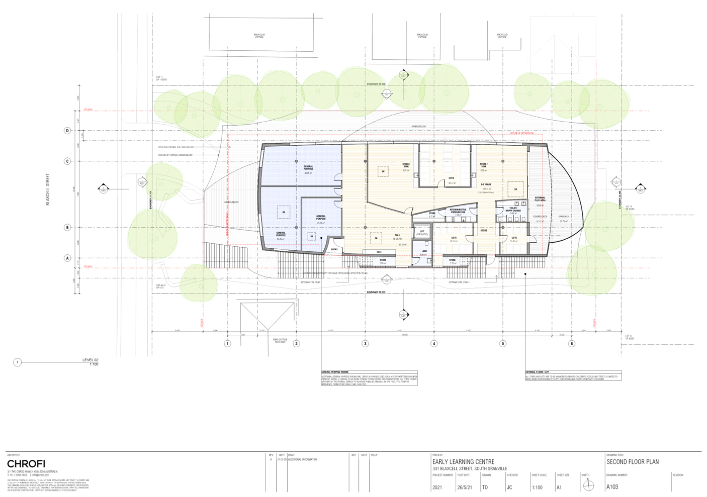
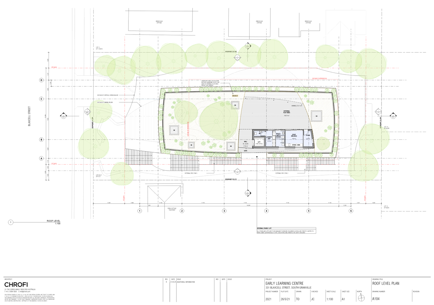
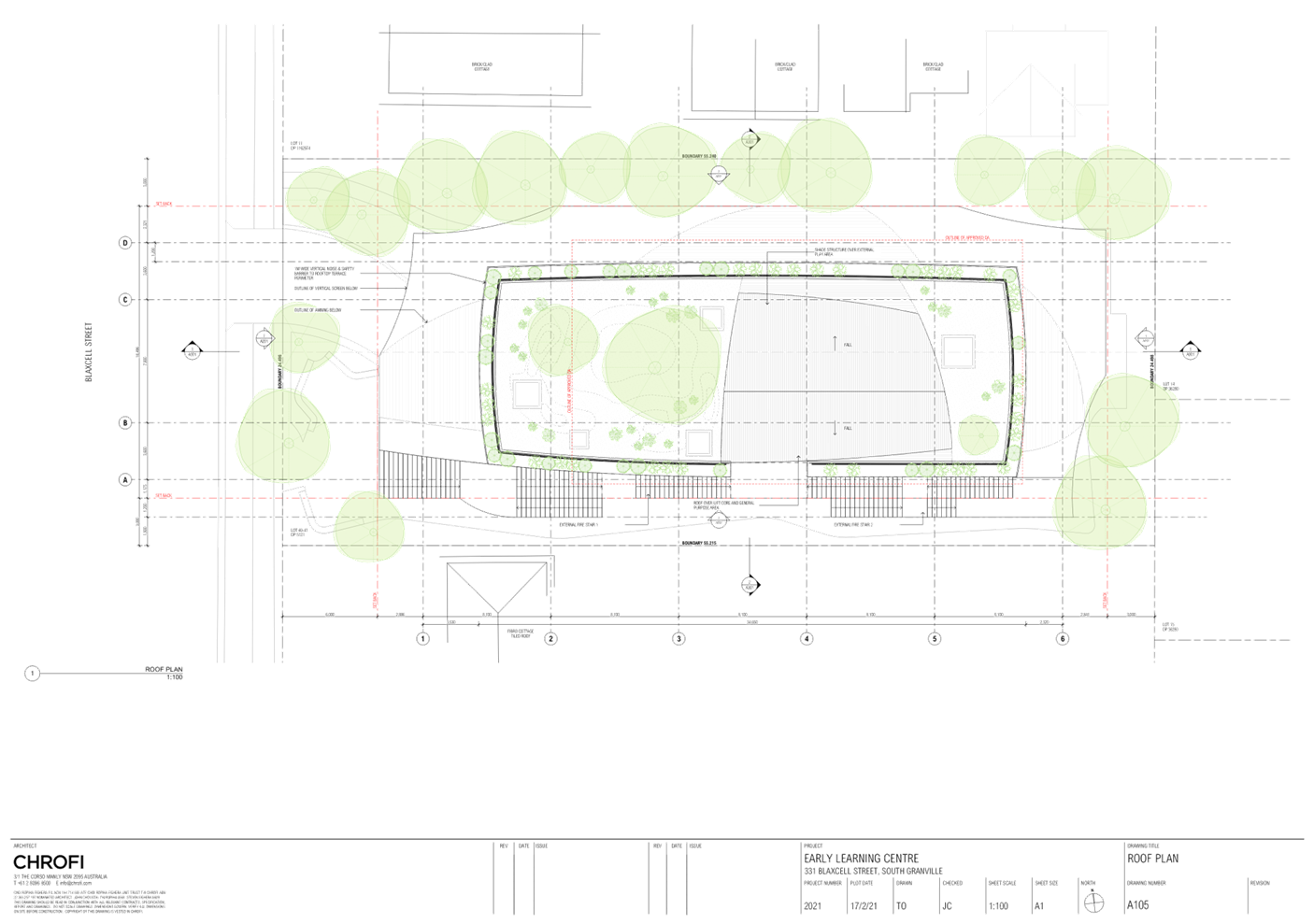
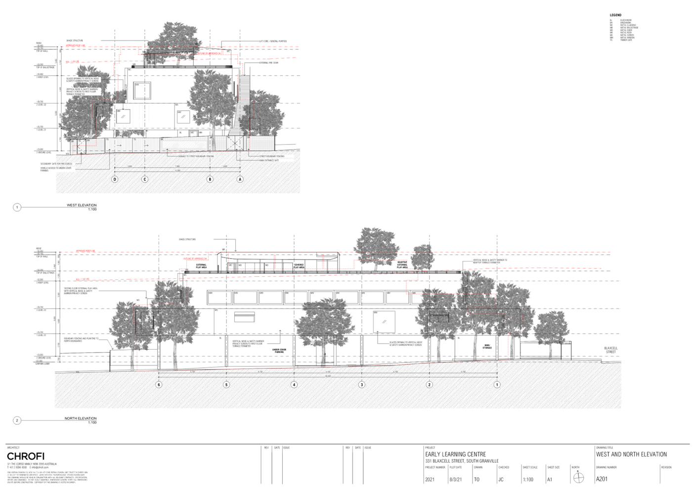
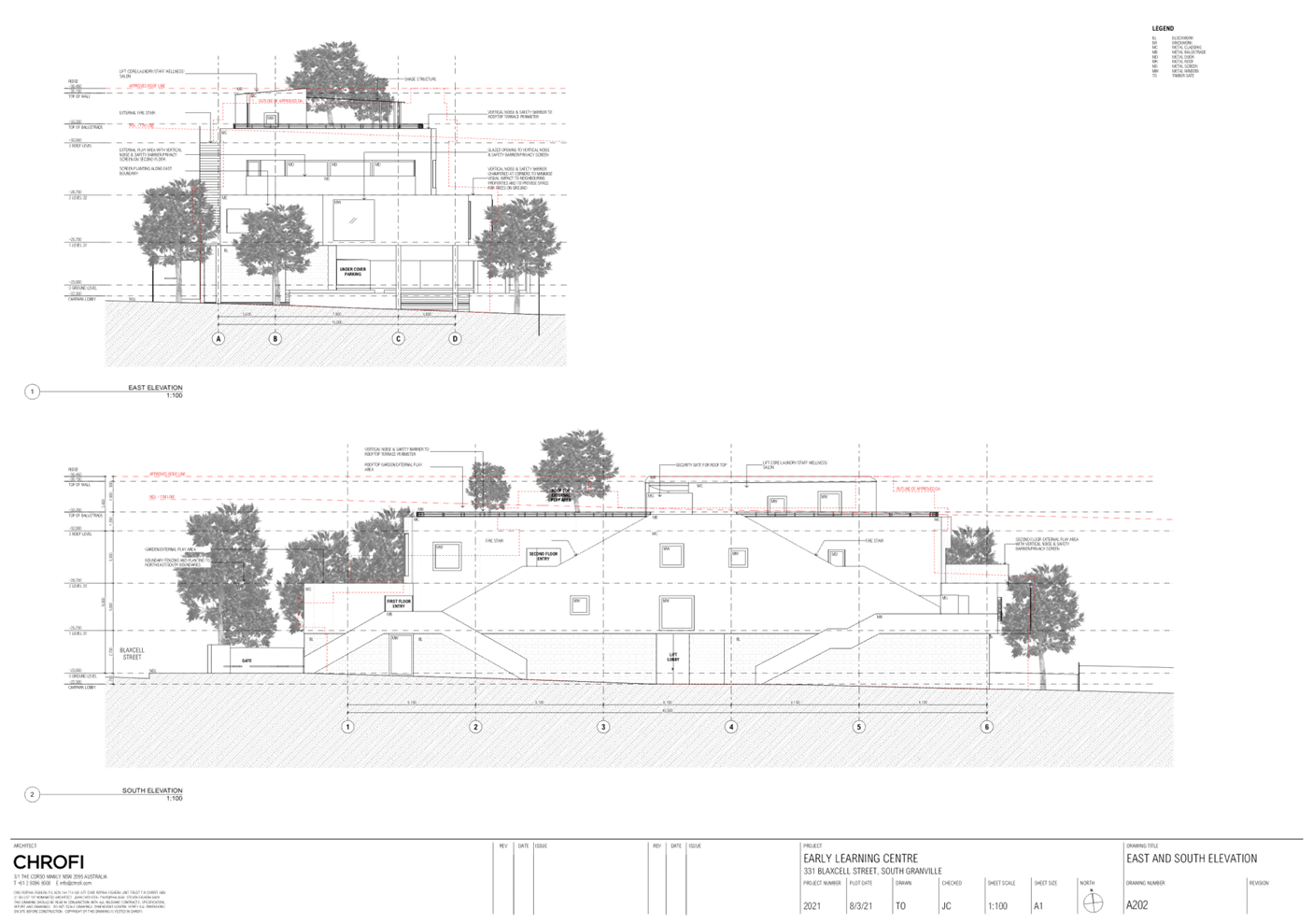
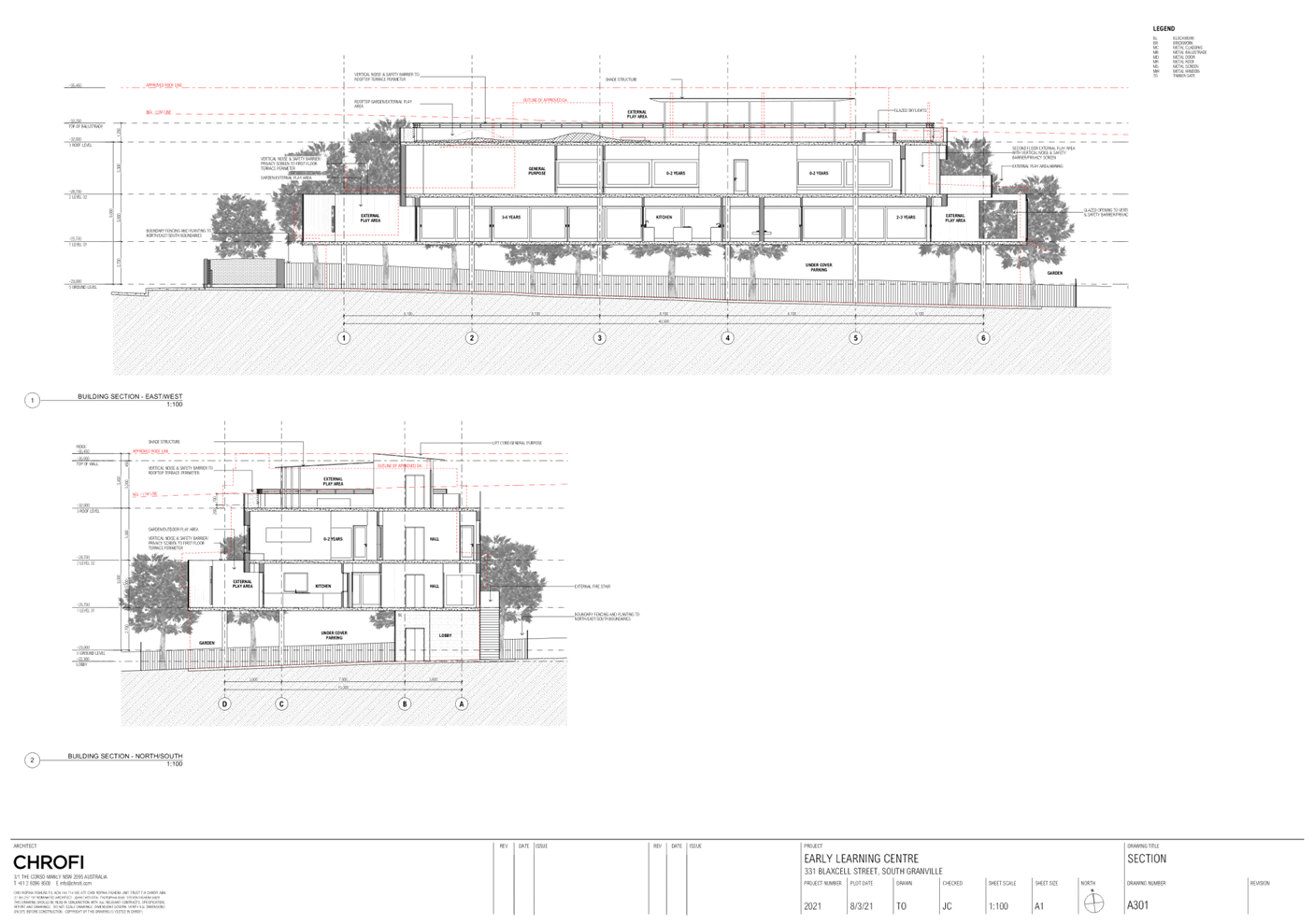
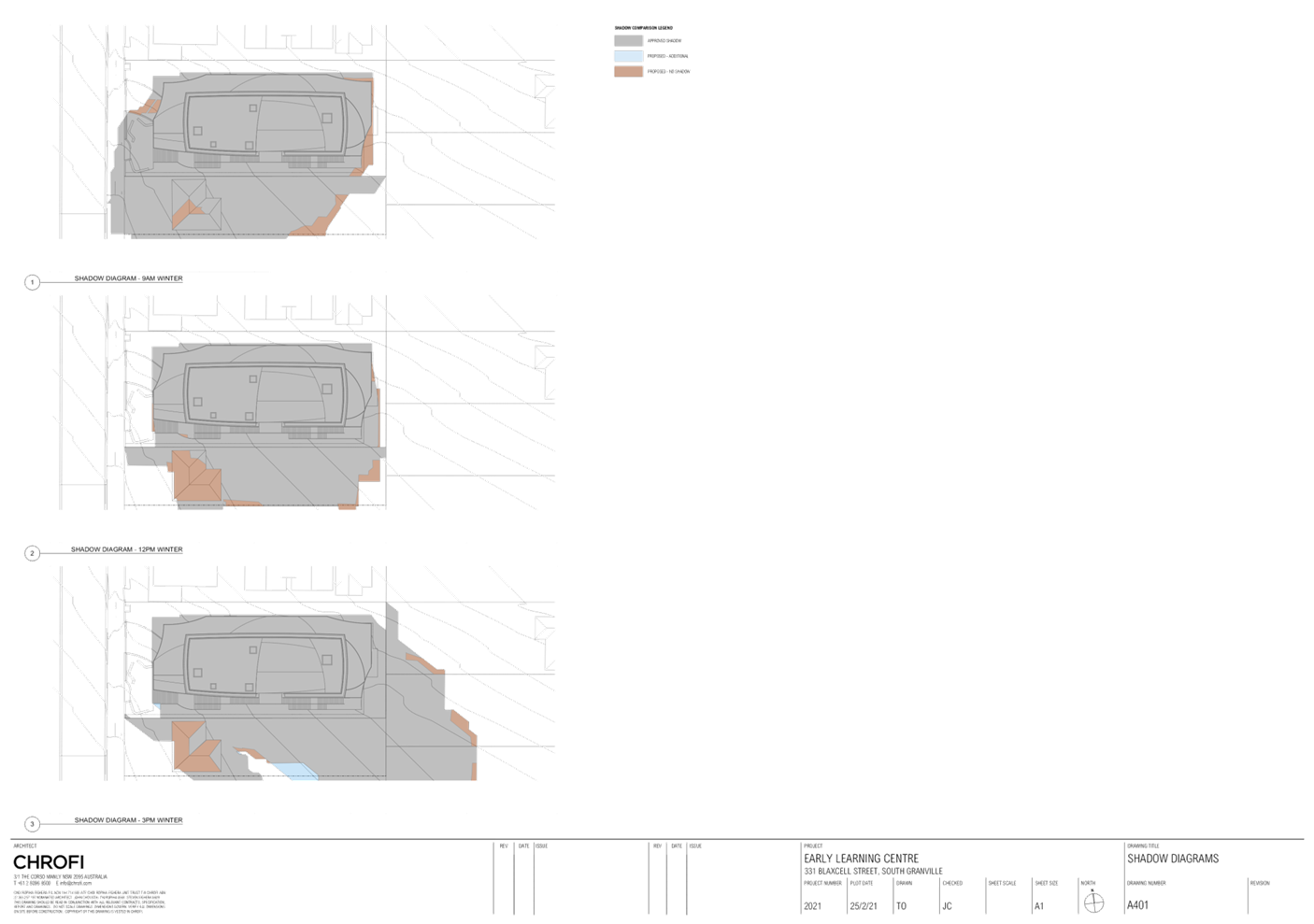
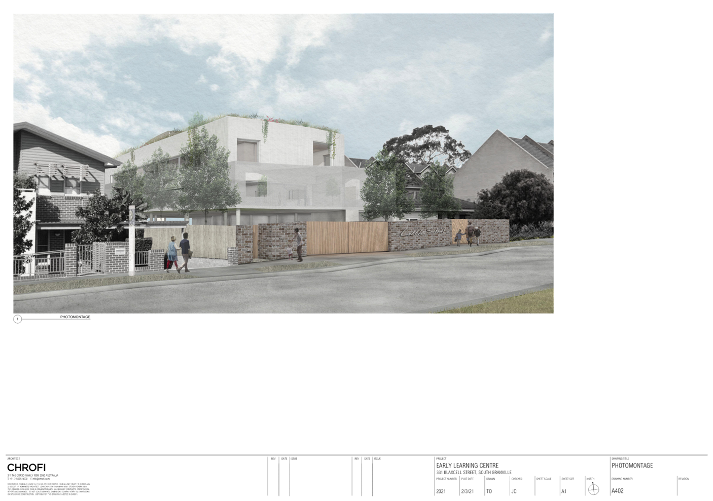
DOCUMENTS
ASSOCIATED WITH
REPORT LPP039/21
Attachment 3
Landscape Plans
Cumberland Local Planning Panel Meeting
13 October 2021
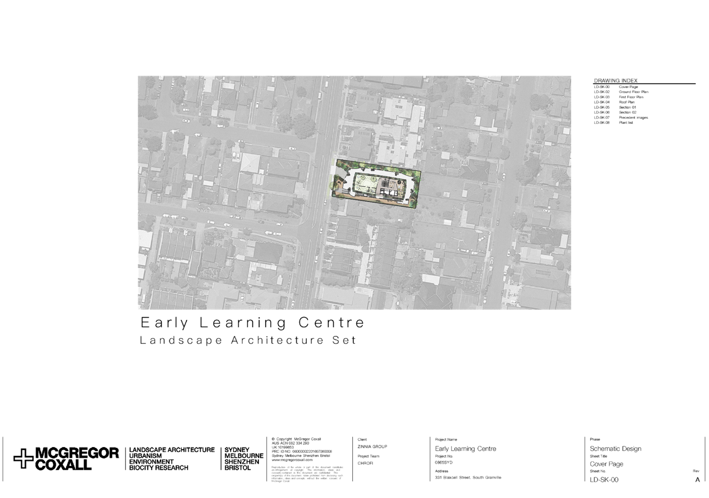
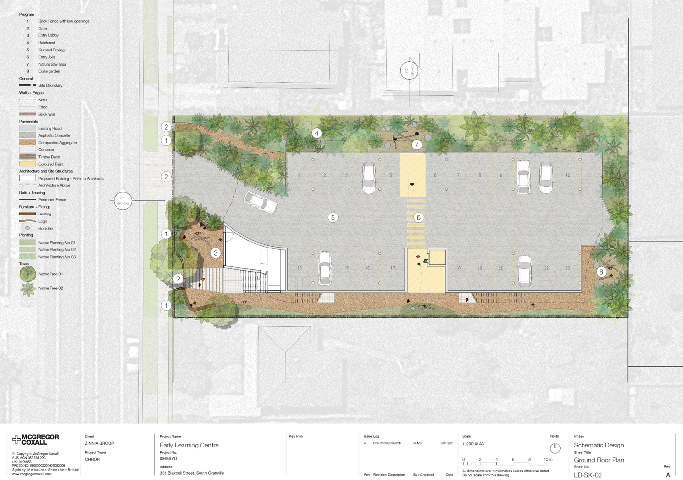
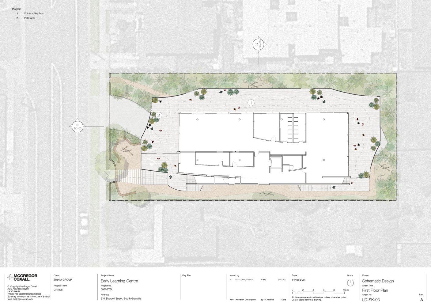
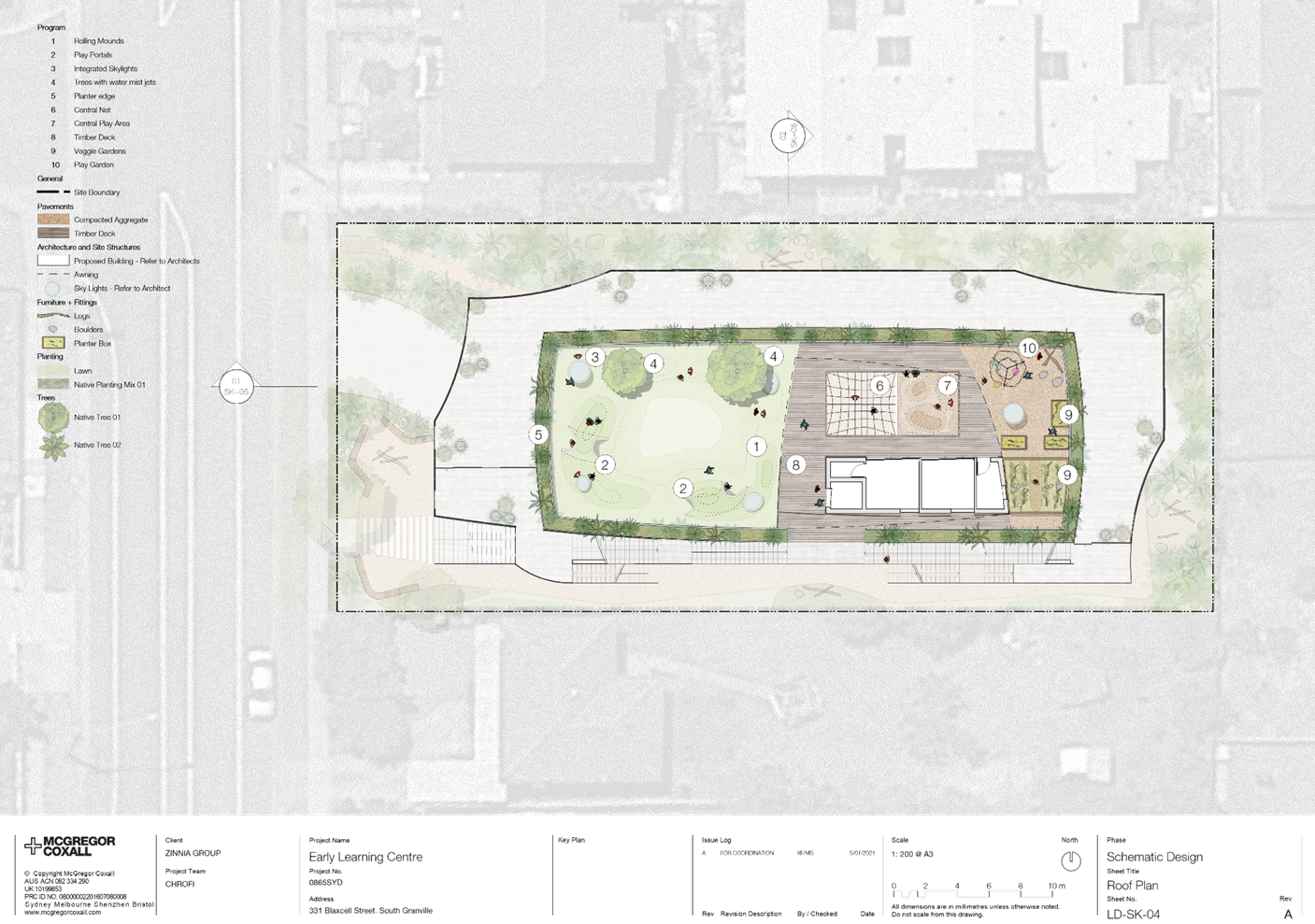
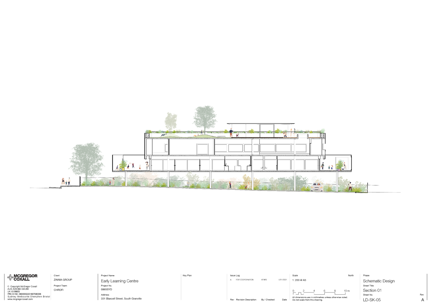
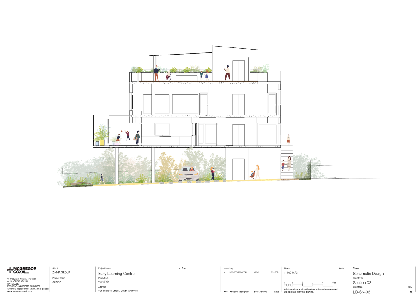
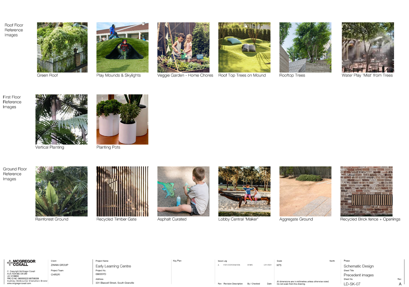
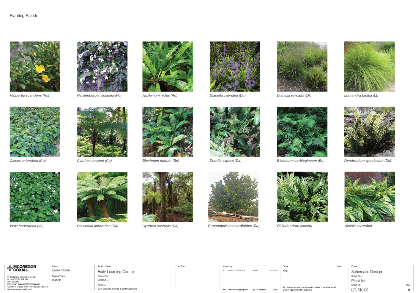
DOCUMENTS
ASSOCIATED WITH
REPORT LPP039/21
Attachment 4
Stormwater/Engineering Plans
Cumberland Local Planning Panel Meeting
13 October 2021
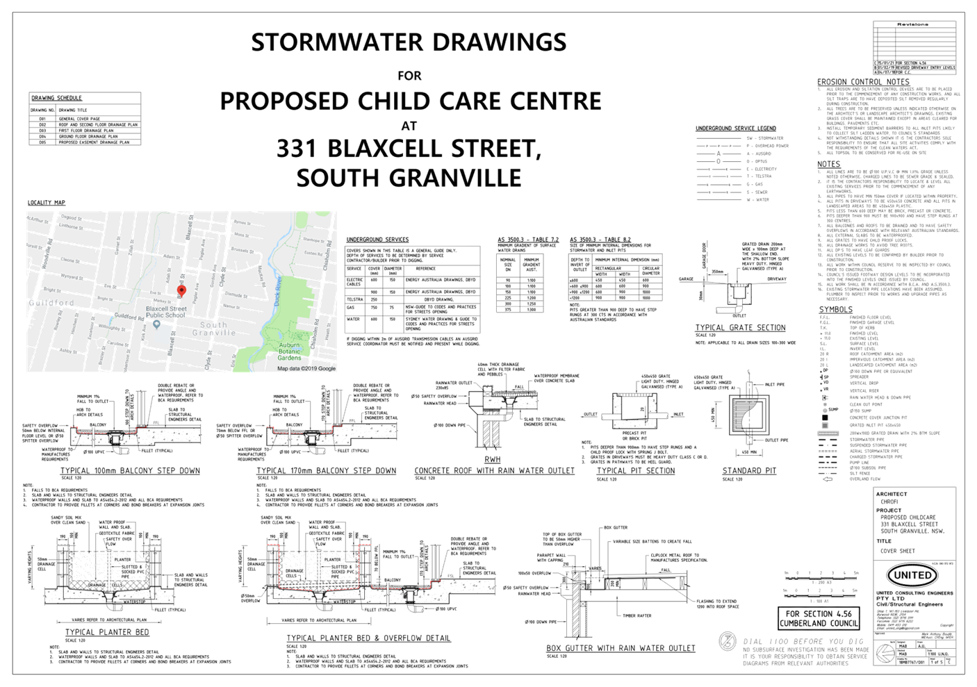

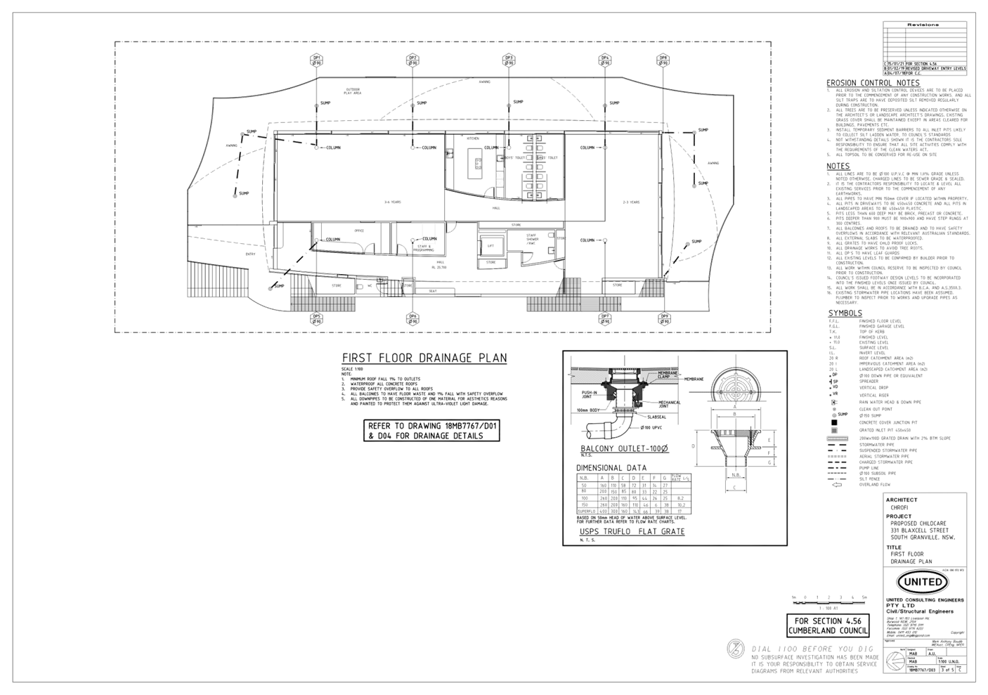
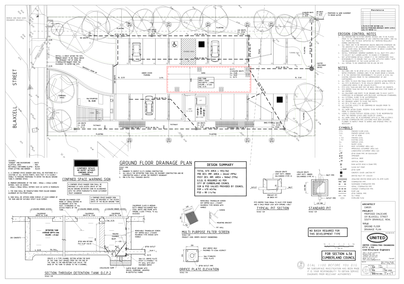
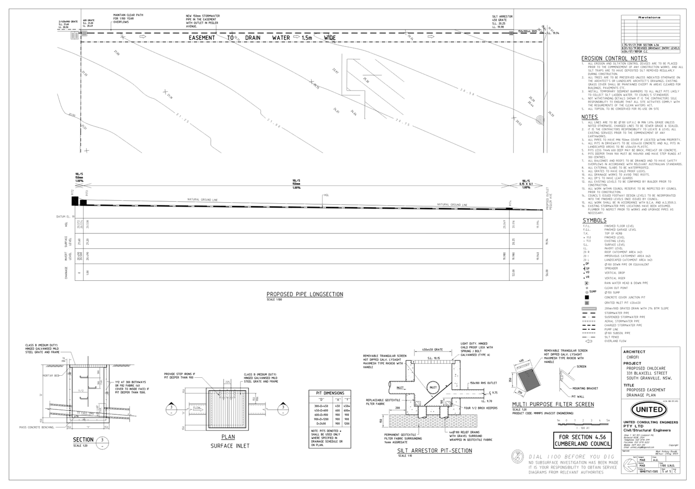
DOCUMENTS
ASSOCIATED WITH
REPORT LPP039/21
Attachment 5
Plan of Management
Cumberland Local Planning Panel Meeting
13 October 2021
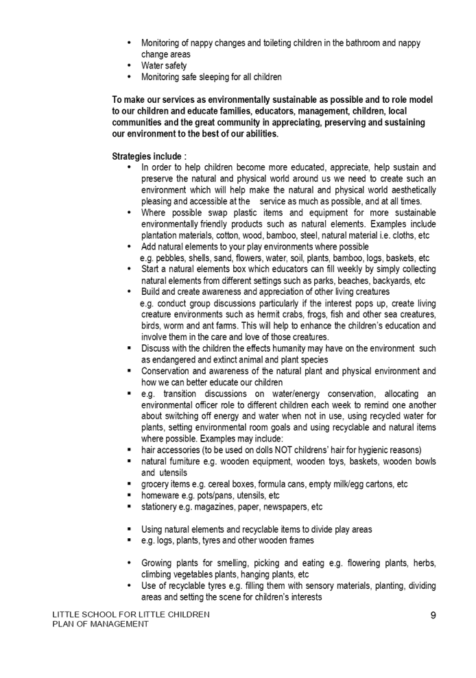
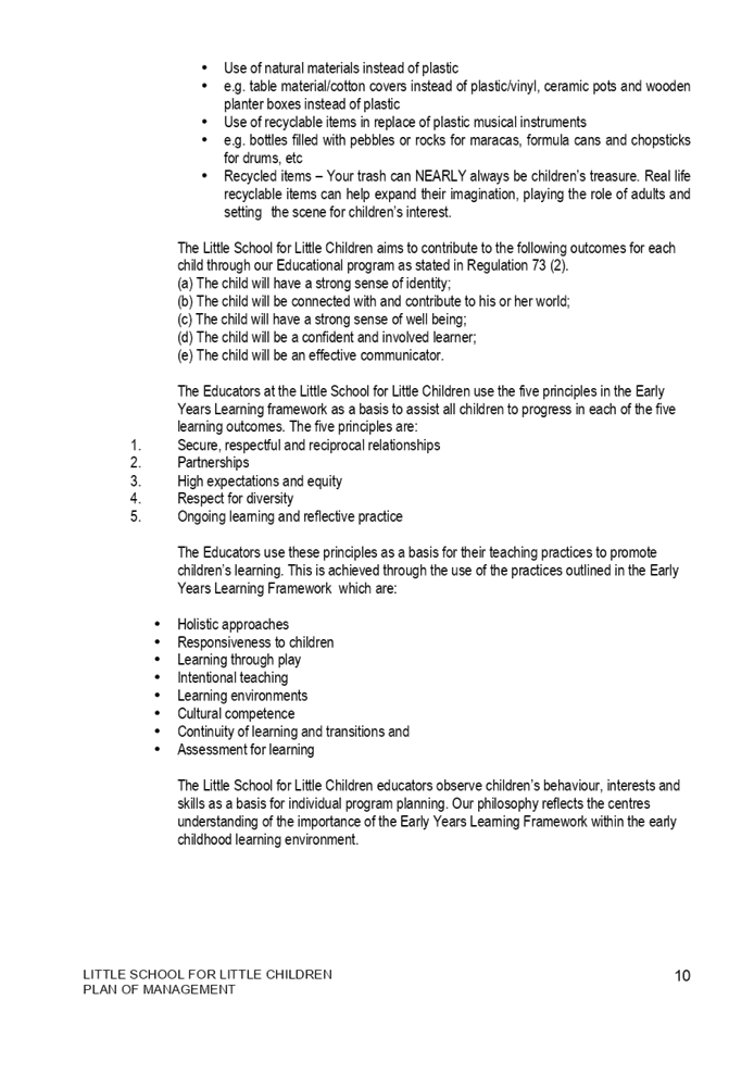
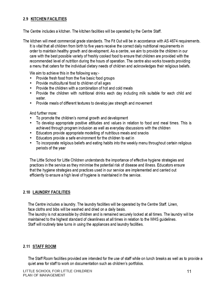
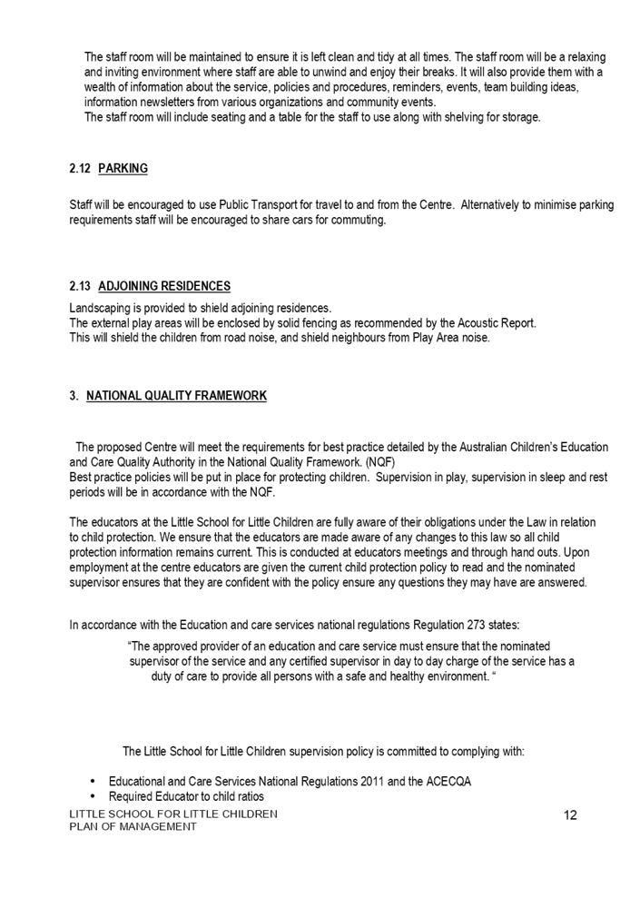
DOCUMENTS
ASSOCIATED WITH
REPORT LPP039/21
Attachment 6
Appendix A - Assessment Table of State Environmental
Planning Policy No. 64 - Advertising and Signage
Cumberland Local Planning Panel Meeting
13 October 2021
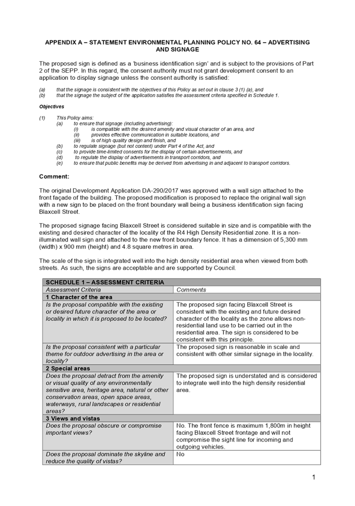
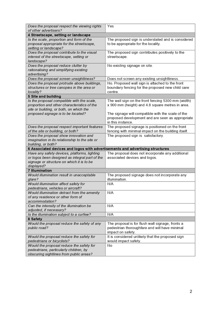
DOCUMENTS
ASSOCIATED WITH
REPORT LPP039/21
Attachment 7
Appendix B - Assessment Table of State Environmental
Planning Policy (Educational Establishments and Child Care Facilities) 2017
Cumberland Local Planning Panel Meeting
13 October 2021
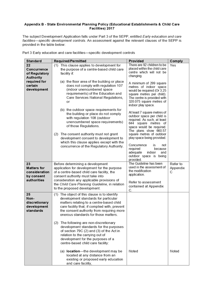
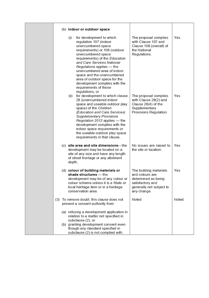
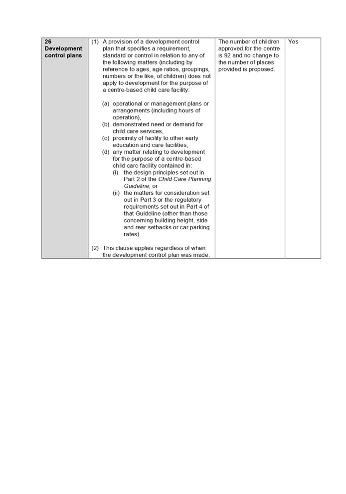
DOCUMENTS
ASSOCIATED WITH
REPORT LPP039/21
Attachment 8
Appendix C - Assessment Table of Child Care Planning
Guideline 2017
Cumberland Local Planning Panel Meeting
13 October 2021
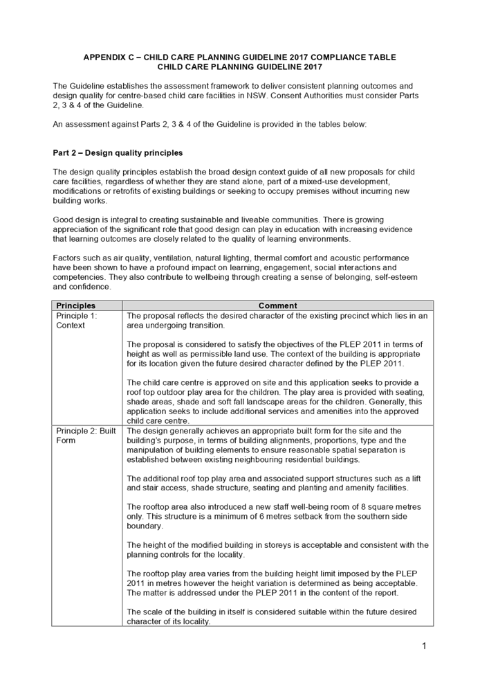
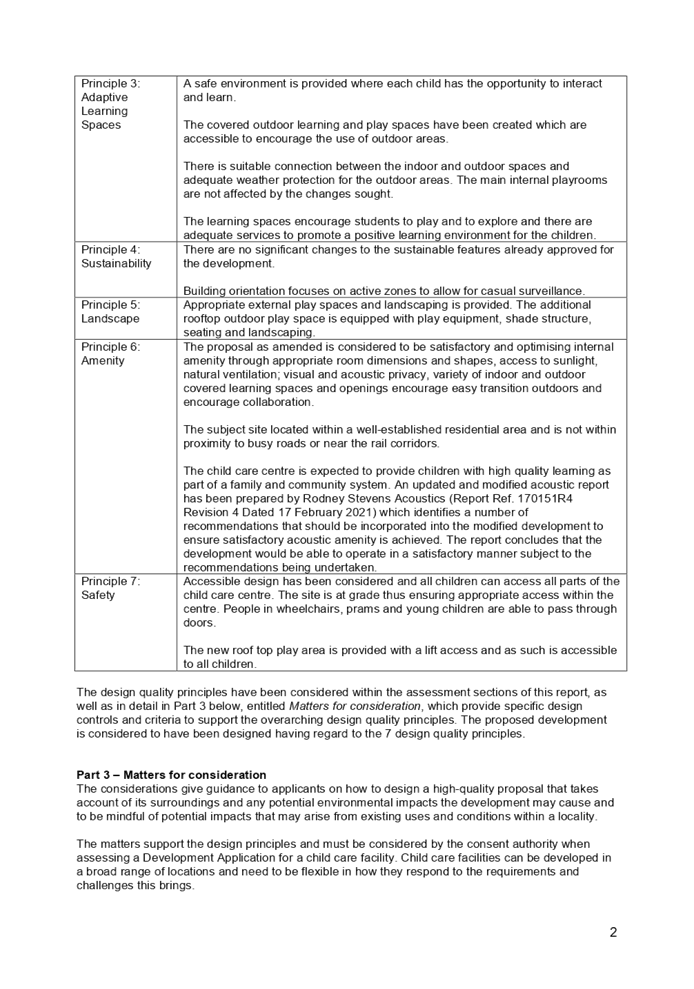
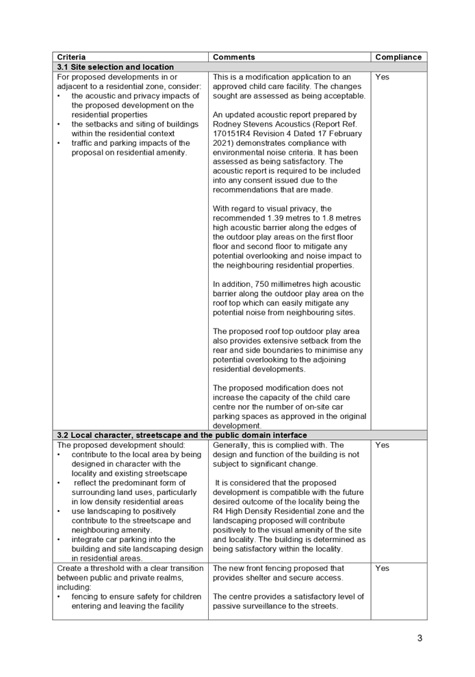
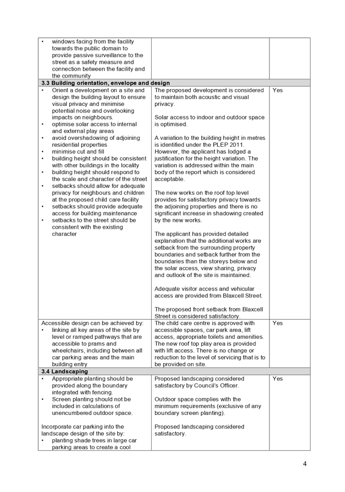
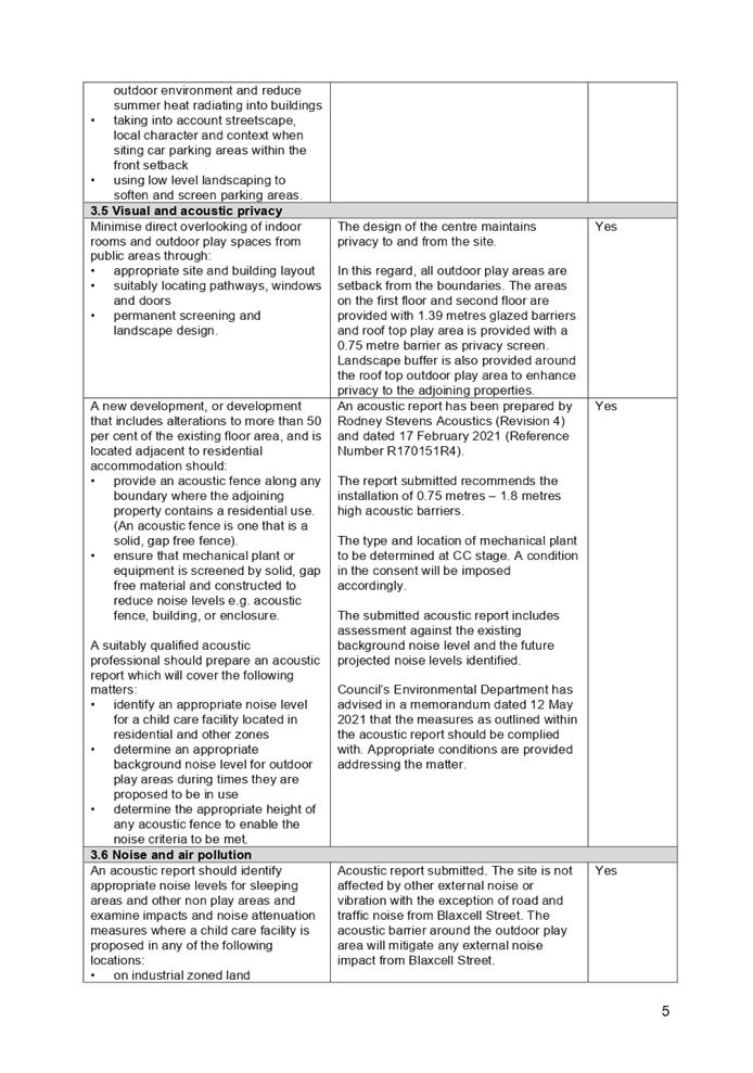
DOCUMENTS
ASSOCIATED WITH
REPORT LPP039/21
Attachment 9
Appendix D - Assessment Table of Holroyd Development
Control Plan 2013
Cumberland Local Planning Panel Meeting
13 October 2021
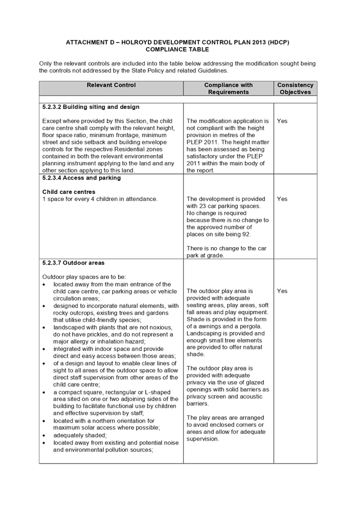
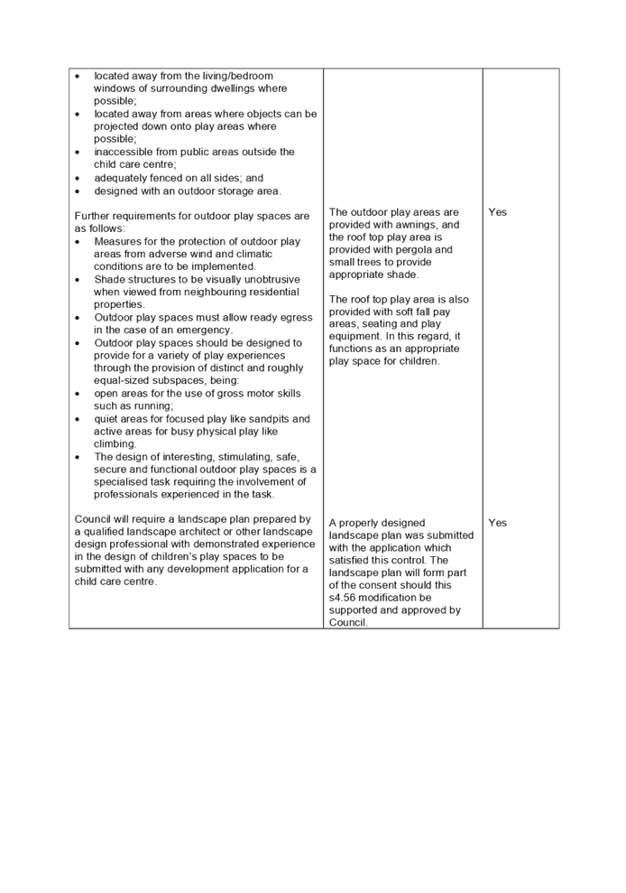
DOCUMENTS
ASSOCIATED WITH
REPORT LPP039/21
Attachment 10
Appendix E - Notice of Determination of the original
Development Application DA-290/2017 and relevant copy of plans
Cumberland Local Planning Panel Meeting
13 October 2021
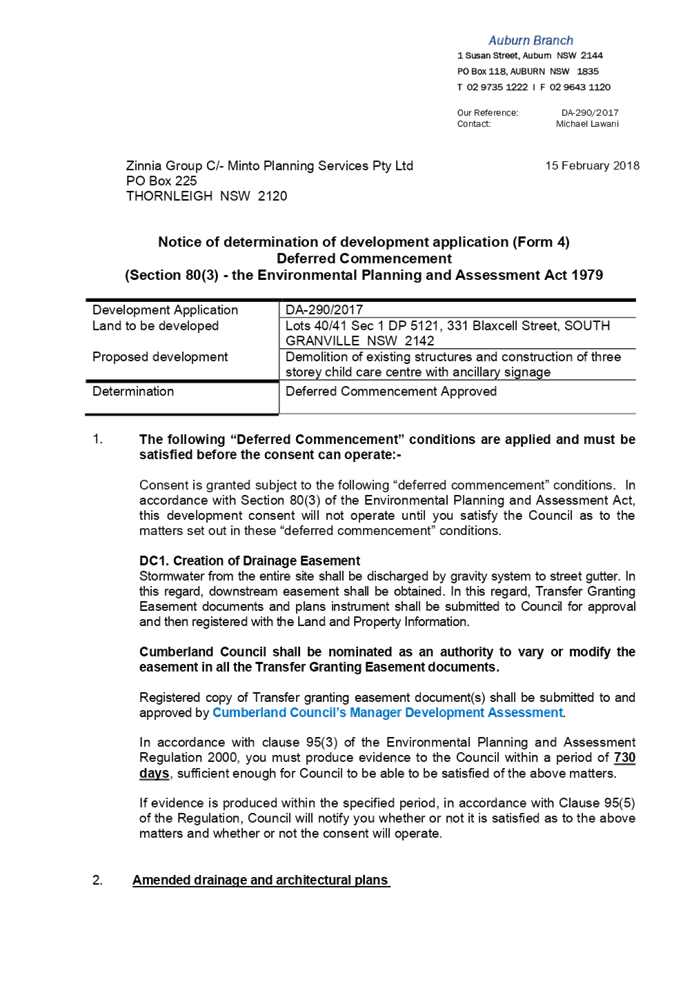
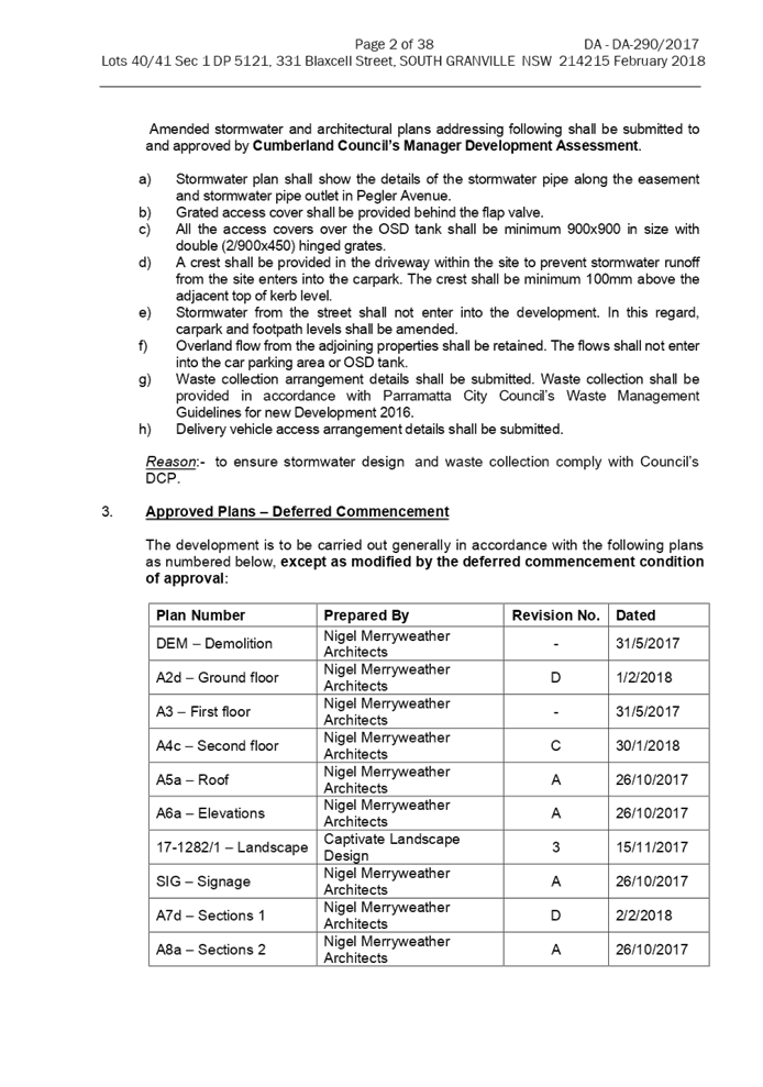
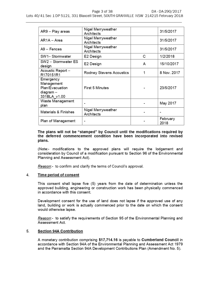
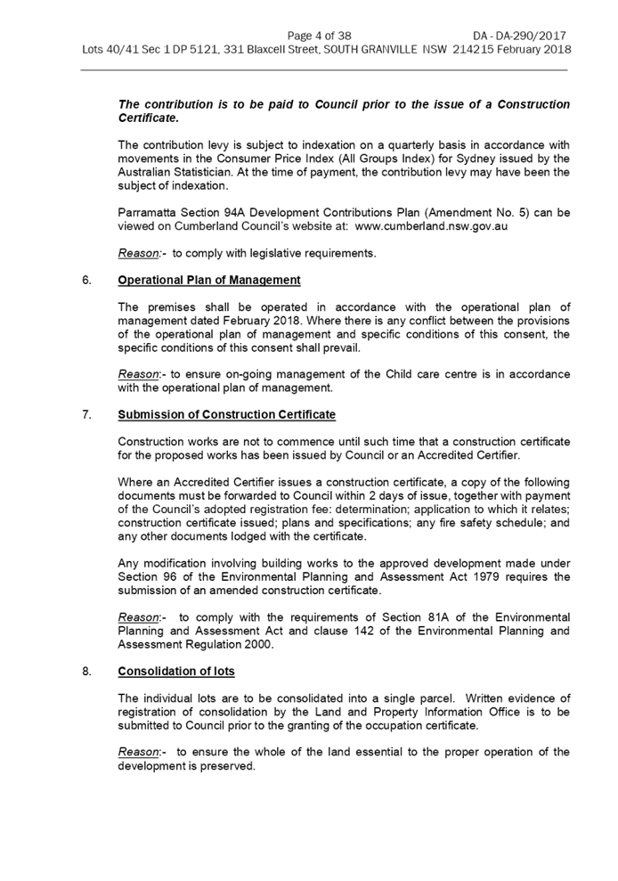
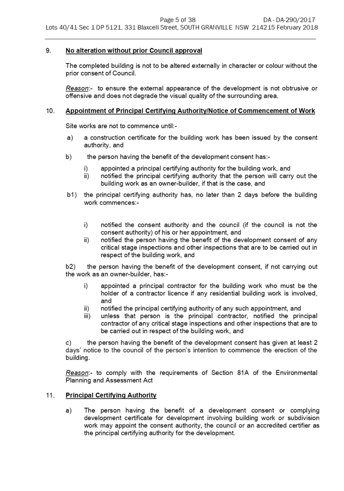
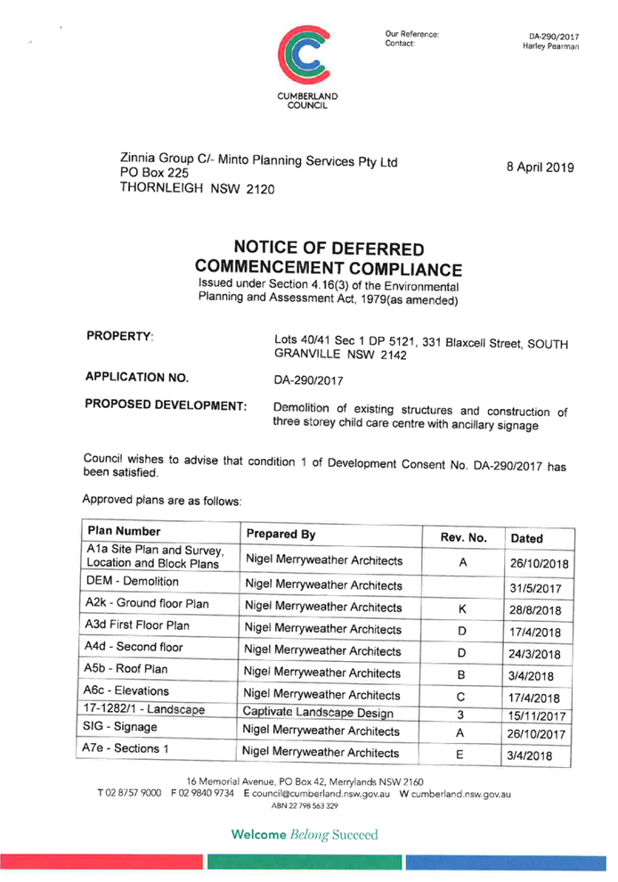

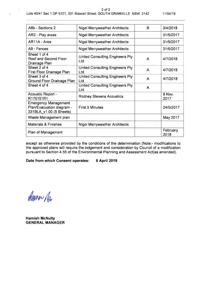
DOCUMENTS
ASSOCIATED WITH
REPORT LPP039/21
Attachment 11
Appendix F - Notice of Determination of the subsequent
Section 4.56 Modification Application DA-290/2017/A and relevant copy of plans
Cumberland Local Planning Panel Meeting
13 October 2021
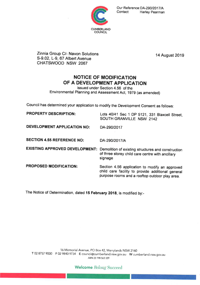
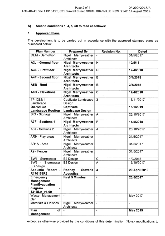
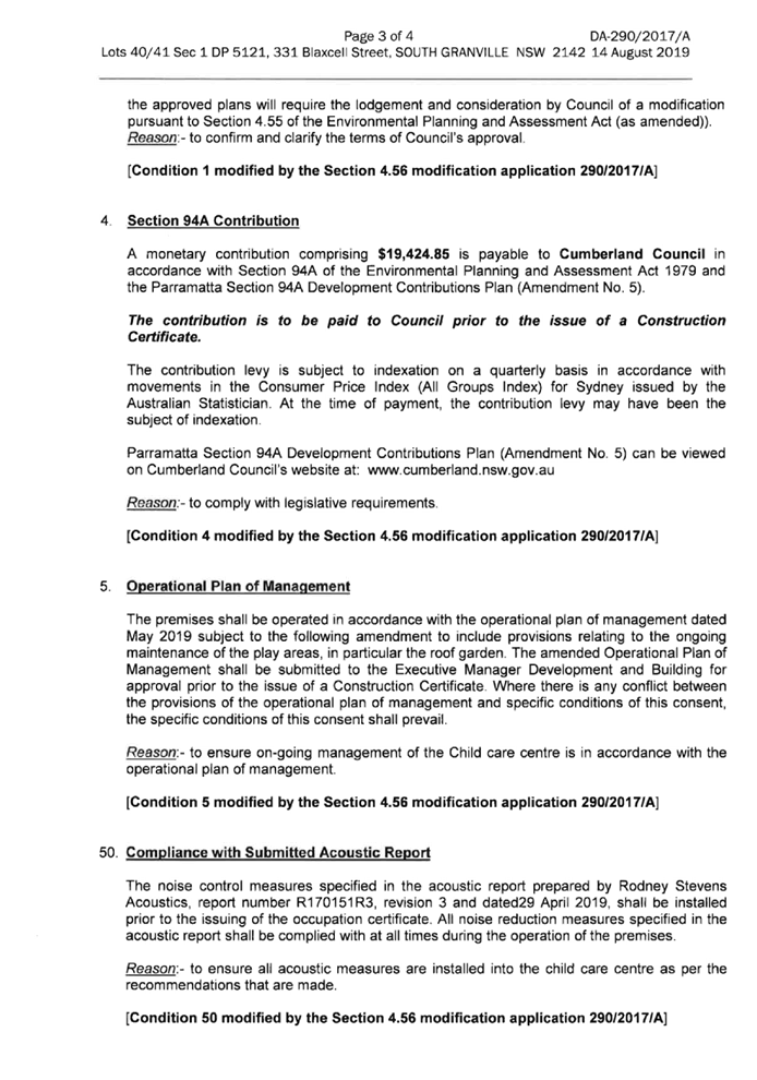

DOCUMENTS
ASSOCIATED WITH
REPORT LPP039/21
Attachment 12
Draft Reasons for Recommendation
Cumberland Local Planning Panel Meeting
13 October 2021