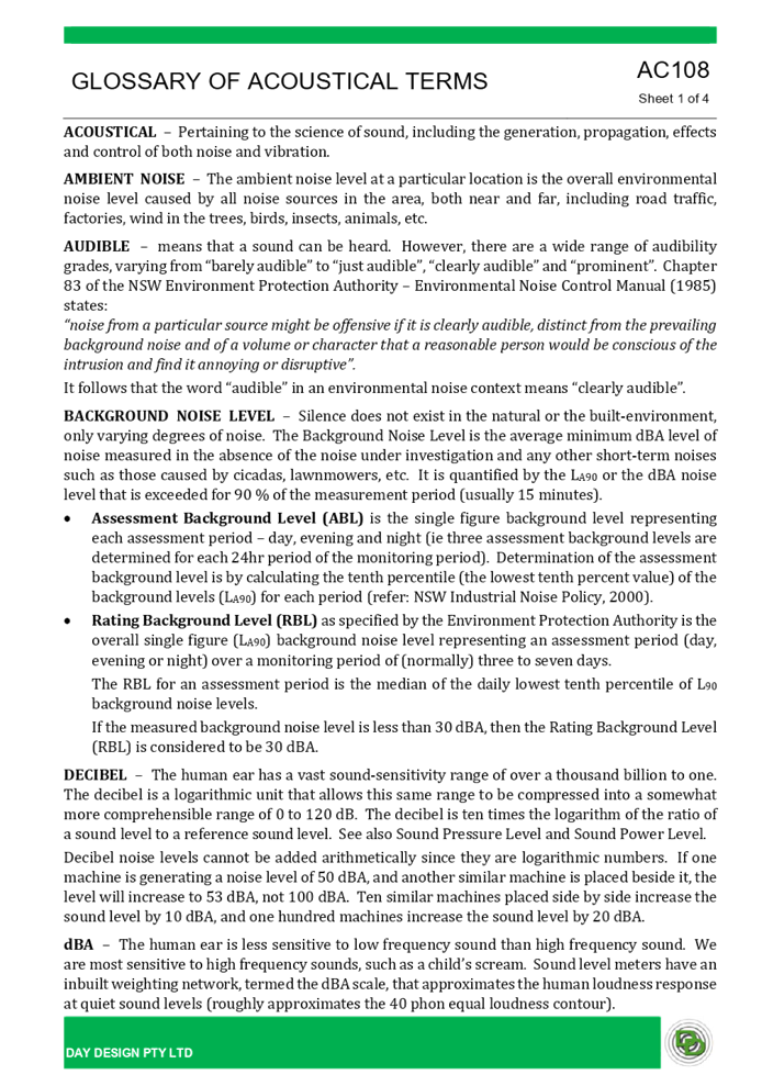
9 June 2021
A meeting of the Cumberland Local
Planning Panel will
be held at 11.30am via Zoom on Wednesday, 9 June 2021.
Business as below:
Yours faithfully
Peter Fitzgerald
Acting
General Manager
ORDER OF BUSINESS
1. Receipt of Apologies
2. Confirmation of Minutes
3. Declarations of Interest
4. Address by invited
speakers
5. Reports:
- Development
Applications
- Planning
Proposals
6. Closed Session Reports
Cumberland Local Planning Panel Meeting
9 June 2021
CONTENTS
Report No. Name of Report Page
No.
Development Applications
LPP023/21... Development Application
for 3-5 Haig Street, Wentworthville...................... 5
LPP024/21... Modification Application
for 14 Civic Avenue, Pendle Hill......................... 327
LPP025/21... Development Application
for 33 Montague Street, Greystanes............... 469
LPP026/21... Development Application
for 27 Allison Road, Guildford........................... 515
LPP027/21... Planning Proposal for Coronation
site, 233-259 Merrylands Road
....................... and 54 59 McFarlane
Street, Merrylands..................................................... 693
Cumberland Local Planning Panel Meeting
9 June 2021
Cumberland
Local Planning Panel Meeting
9 June 2021
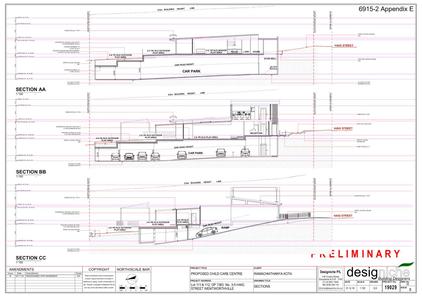
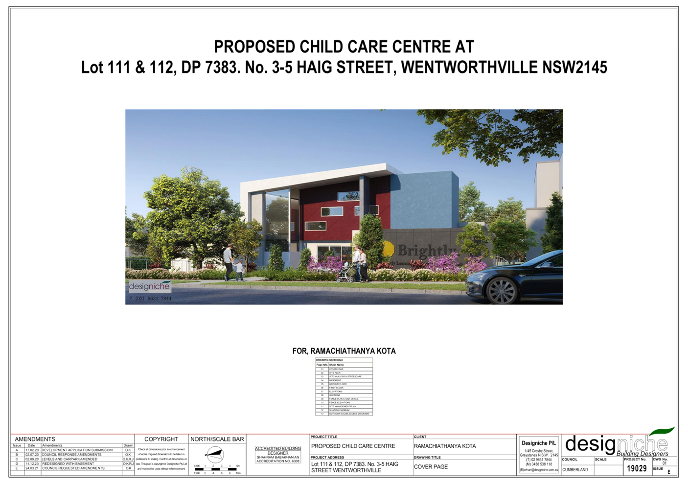
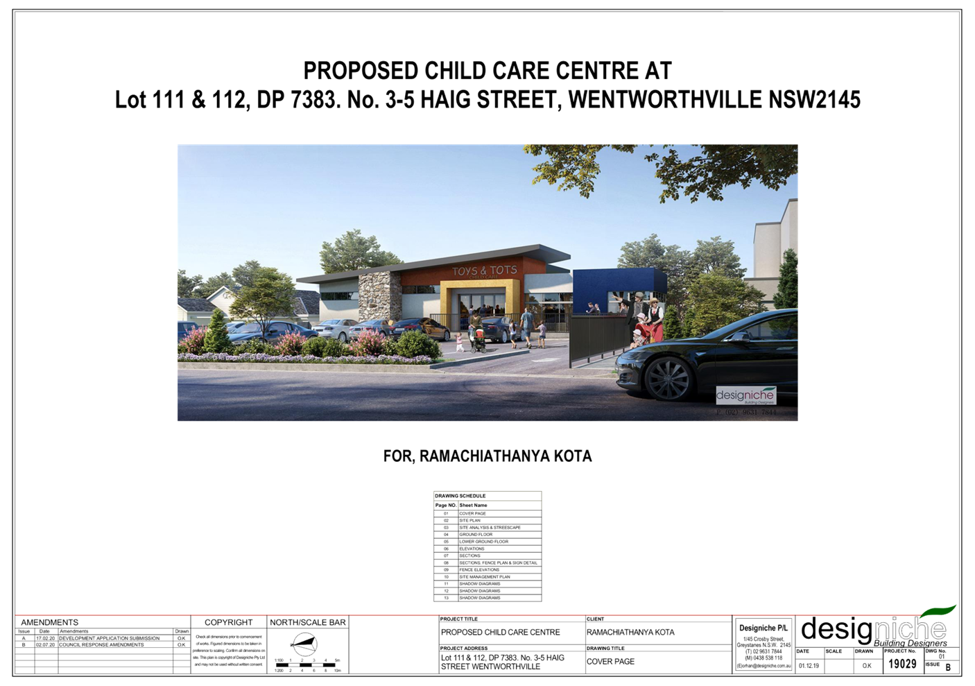
Item
No: LPP023/21
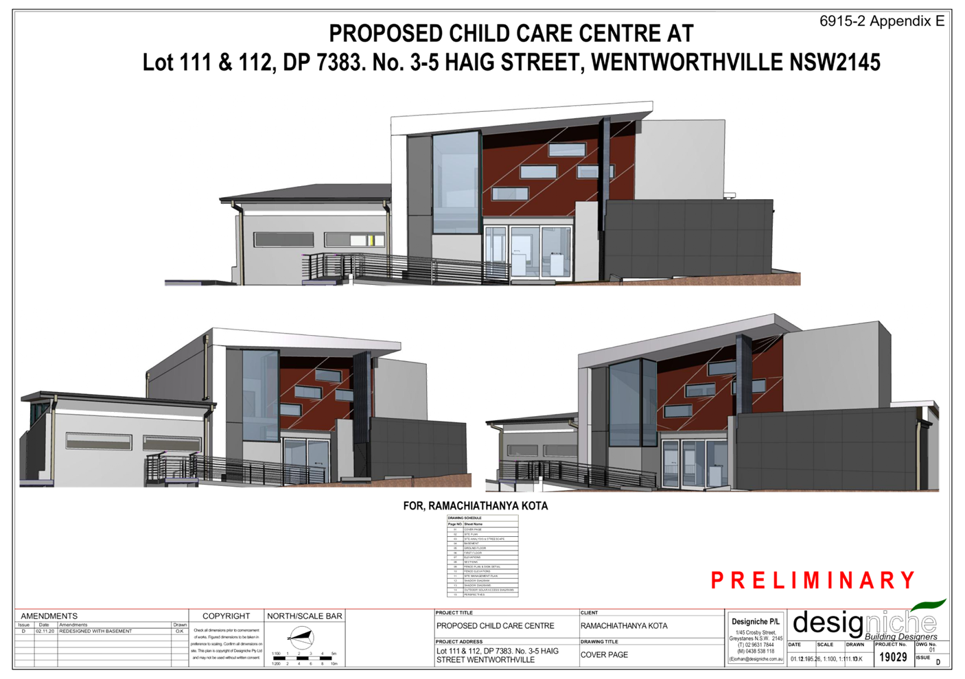
Development
Application for 3-5 Haig Street, Wentworthville
Responsible
Division: Environment
& Planning
Officer: Executive
Manager Development and Building
File
Number: DA2020/0792
|
Application
lodged
|
13 January 2021
|
|
Applicant
|
E Miletic
|
|
Owner
|
Mr R Kota
|
|
Application
No.
|
DA2020/0792
|
|
Description
of Land
|
3-5 Haig Street,
Wentworthville
Lots 111 & 112 in DP 7383
|
|
Proposed
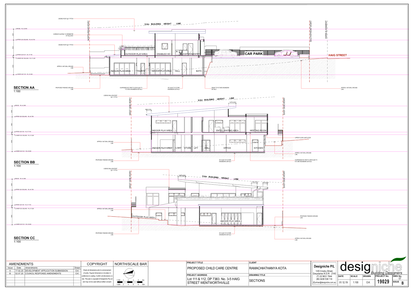
Development
|
Demolition of existing
structures and construction of a part 1 storey, part 2 storey, 62 place child
care centre above basement parking and associated site works
|
|
Site
Area
|
1,347m2
|
|
Zoning
|
R2 – Low Density
Residential
|
|
Disclosure
of political donations and gifts
|
Nil disclosure
|
|
Heritage
|
The subject site does not
contain a heritage item and is not located within a heritage conservation
area.
|
|
Principal
Development Standards
|
FSR
Permissible: Max. 0.5:1
Proposed: 0.36:1
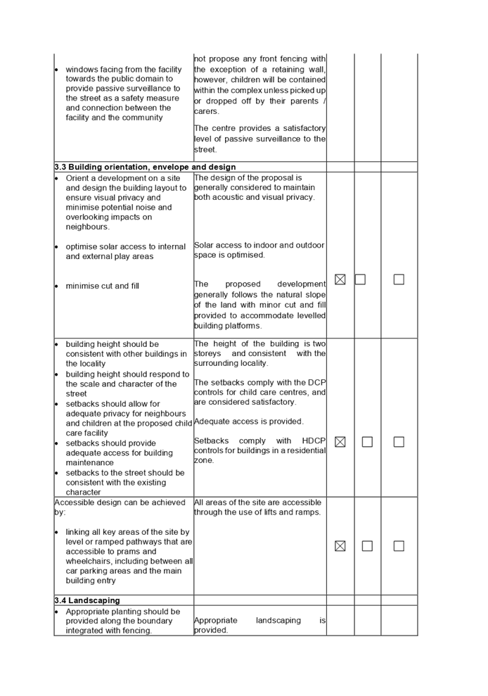
Height of Building
Permissible: Max. 9m
Proposed: Max. 7.6m
|
|
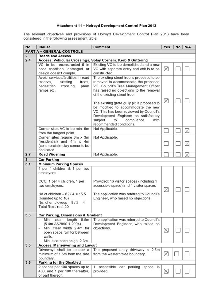
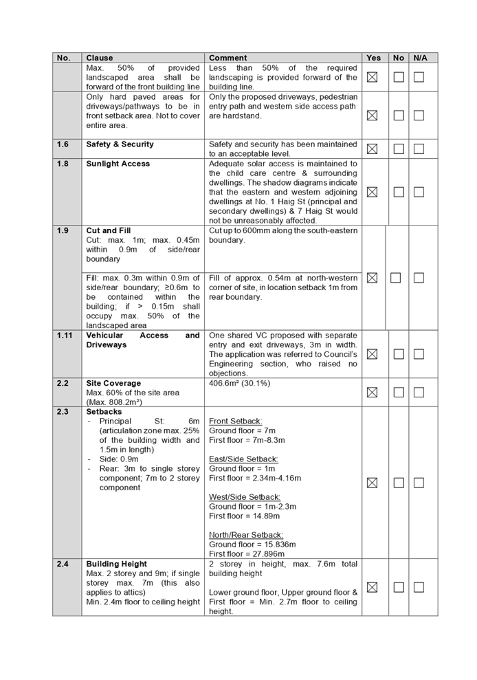
Issues
|
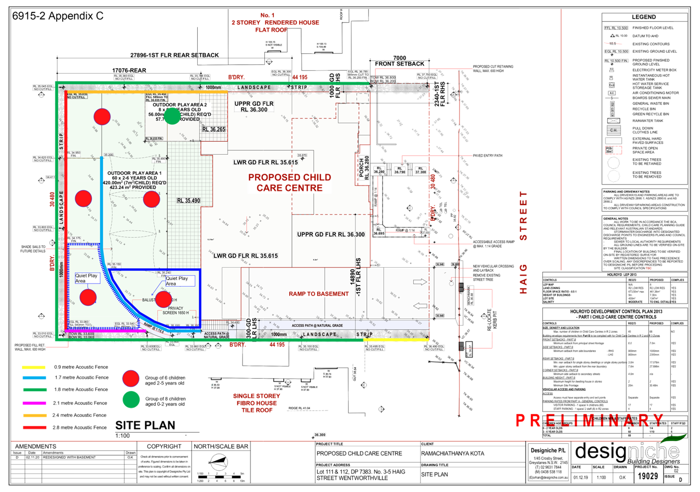
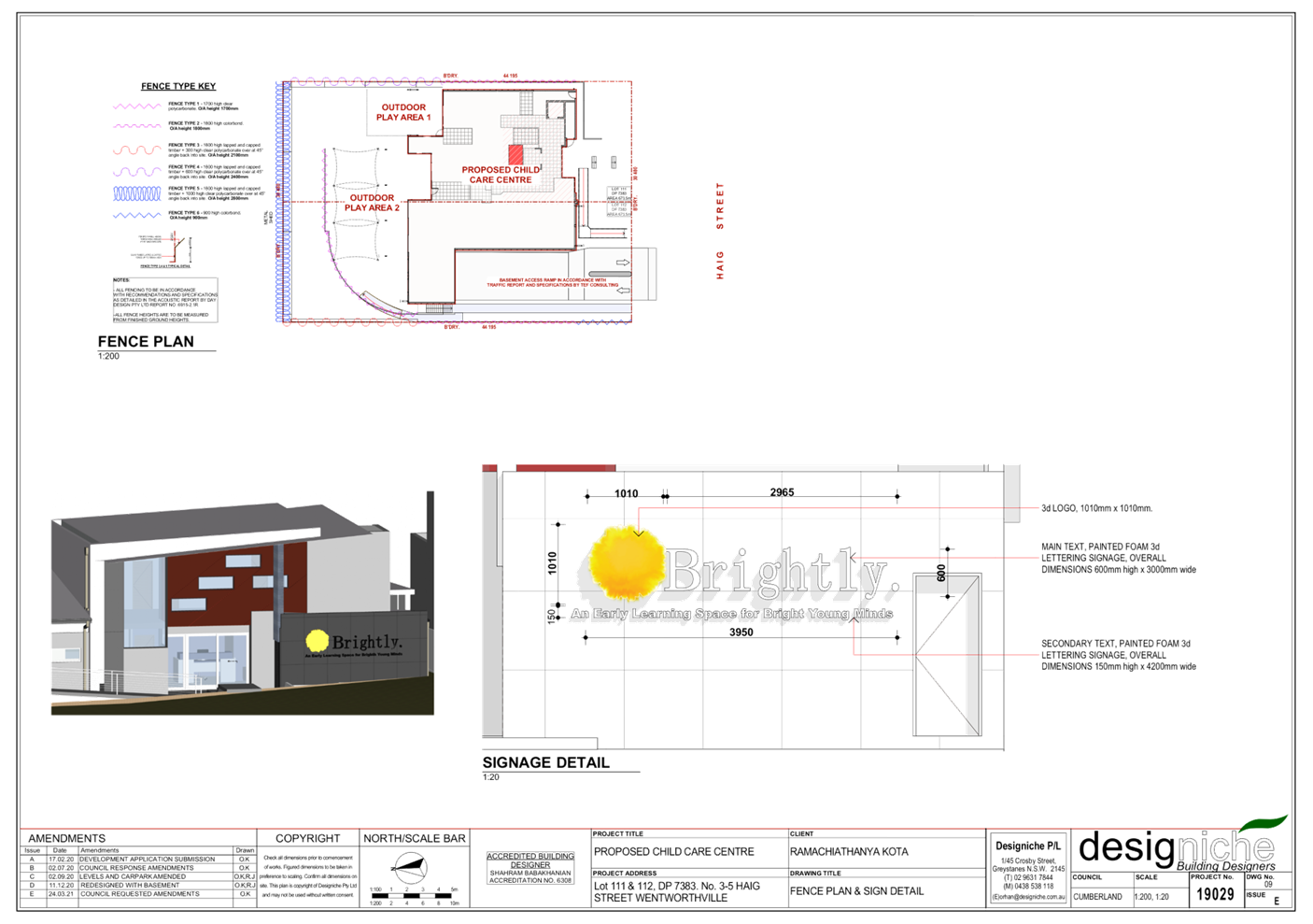
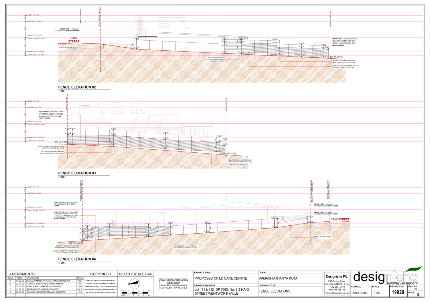
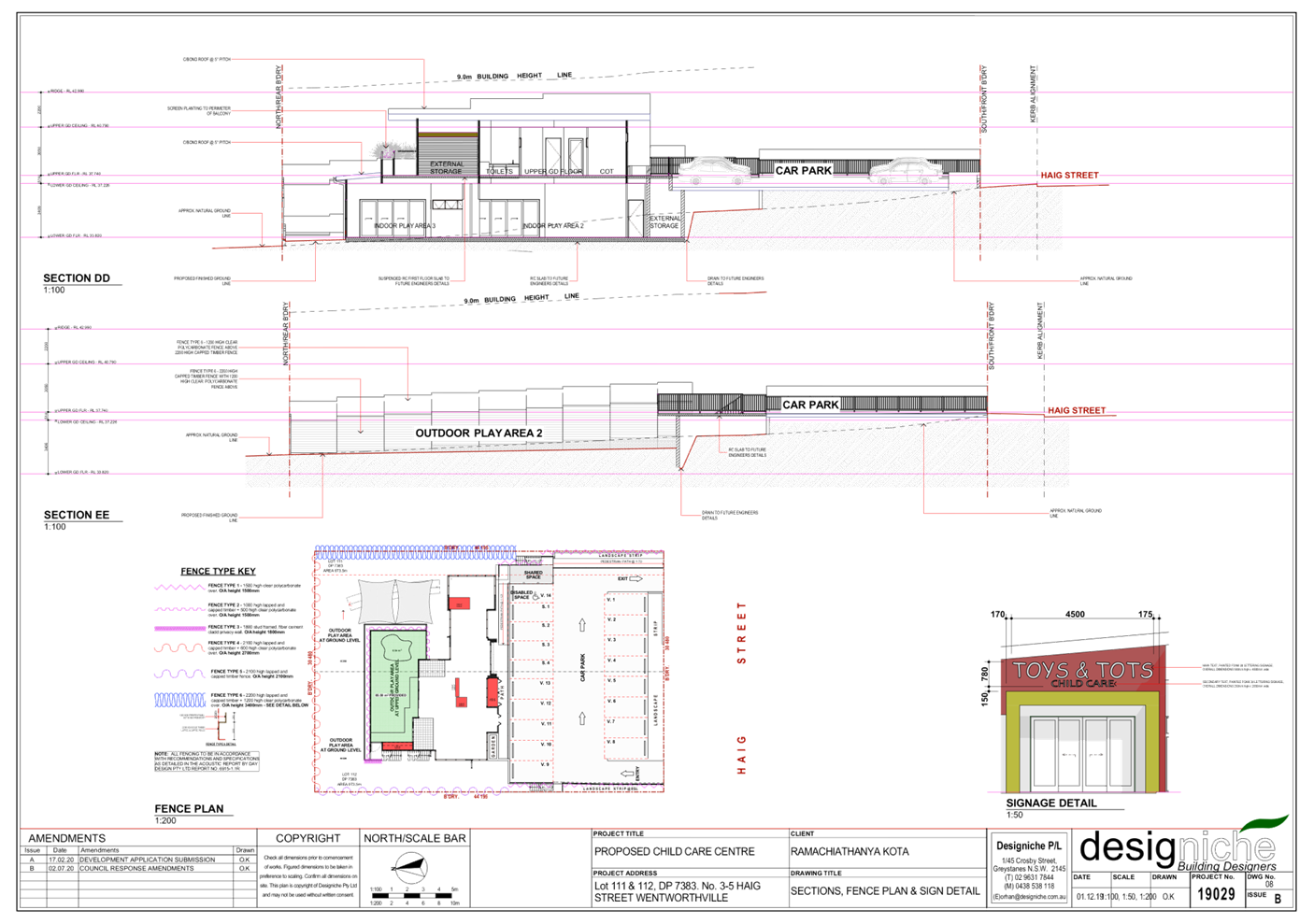
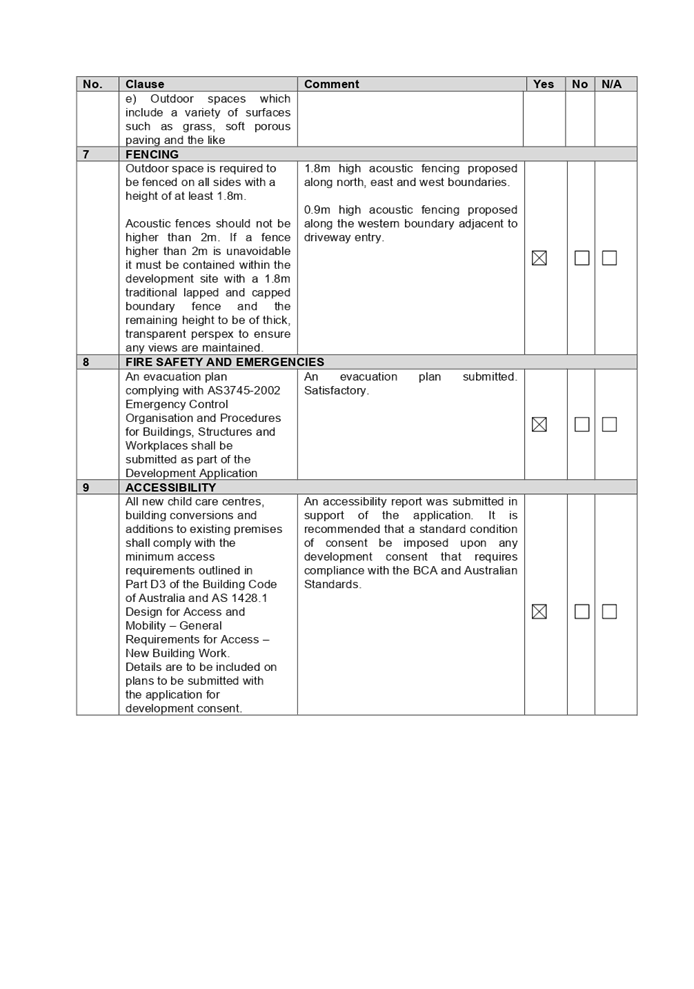
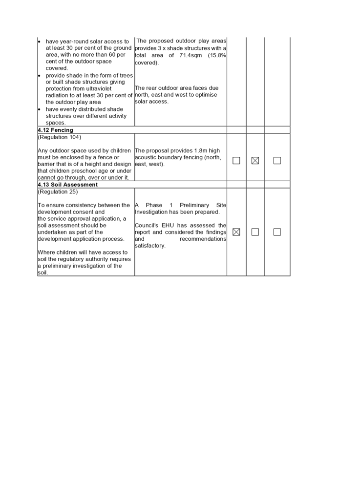
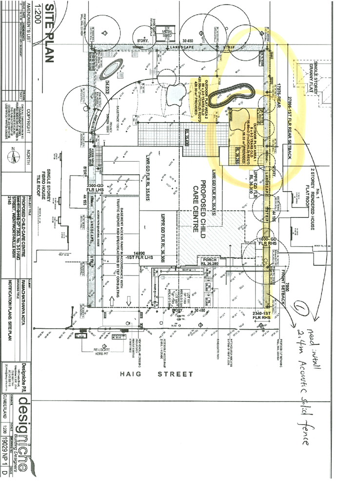
Fence height
Landscaped Area
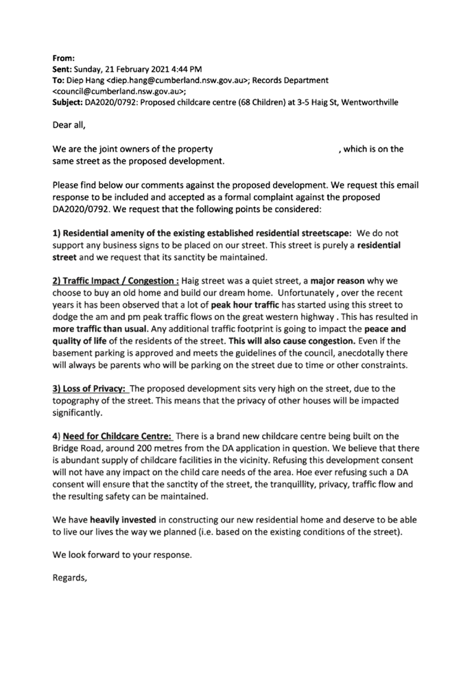
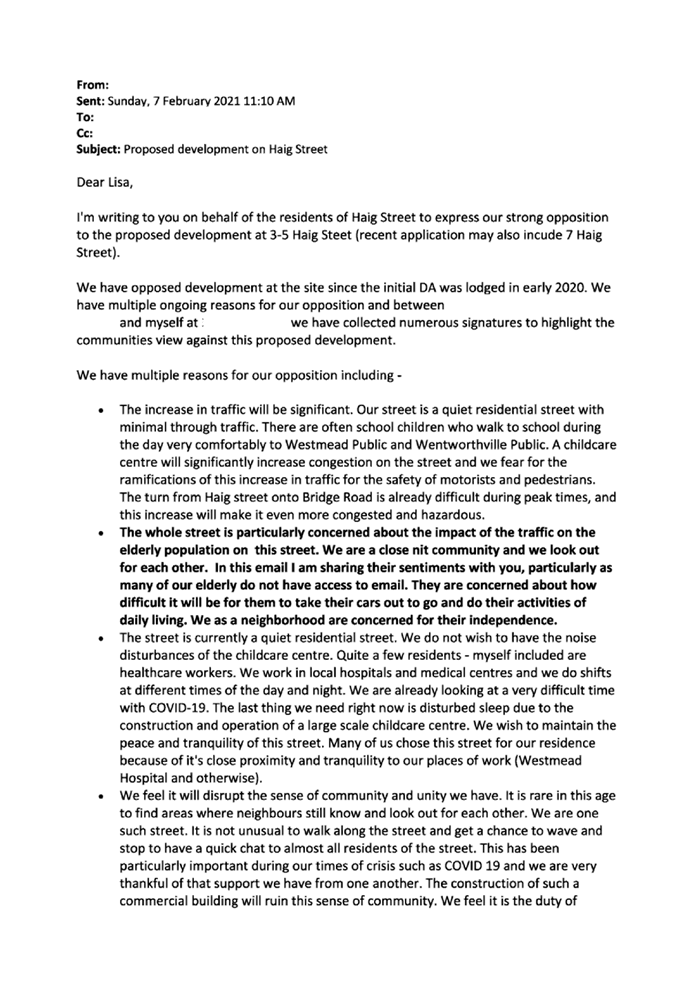
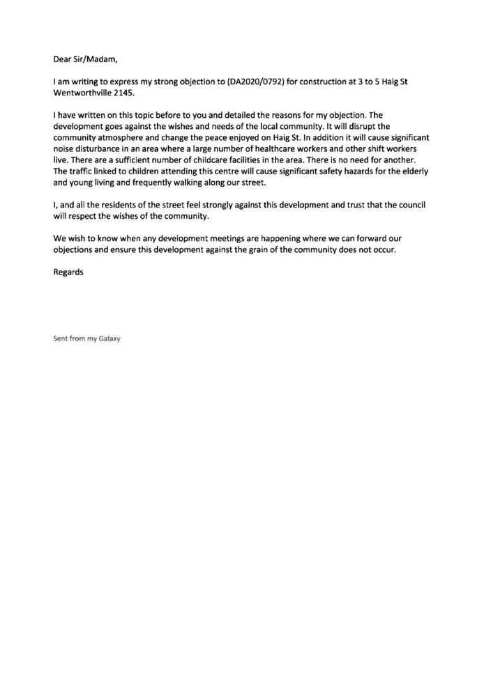
Submissions
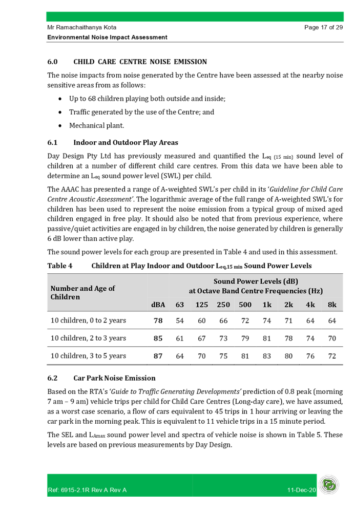
|
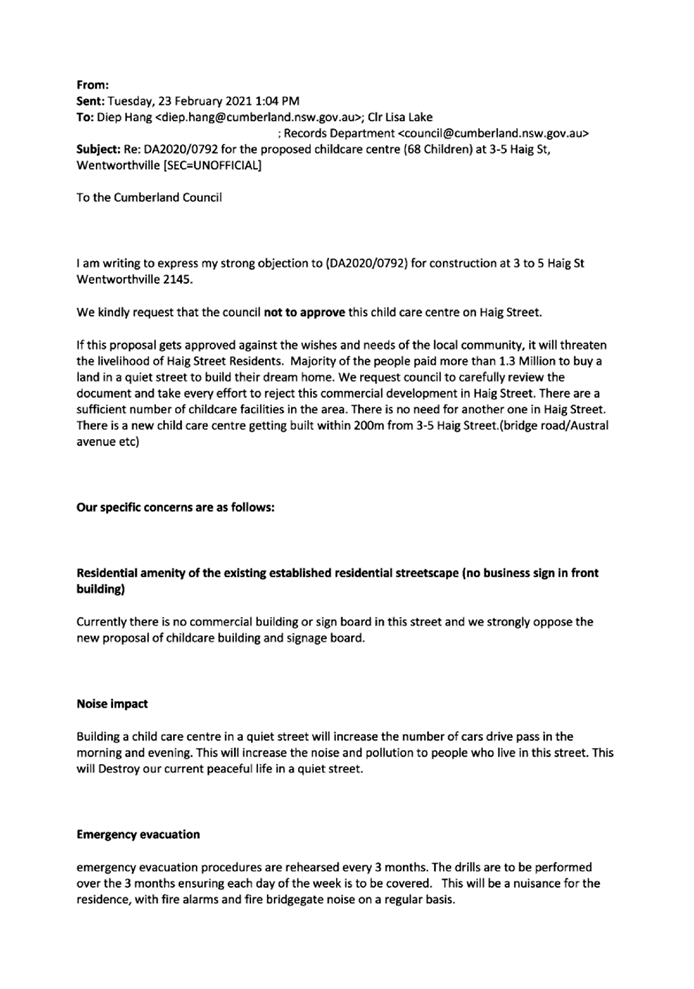
1. Development
Application No. DA2020/0792 was lodged on 13 January 2021 for the demolition of
existing structures and construction of a part 1 storey, part 2 storey, 68
place child care centre above basement parking and associated site works.
2. The
application was publicly notified to occupants and owners of the adjoining
properties, published online on Council’s website, and a site notice was
placed at the property for a period of 14 days between 3 February 2021 and 17
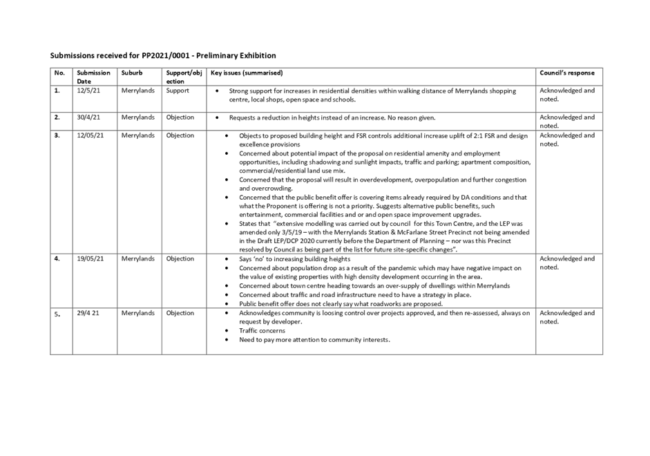
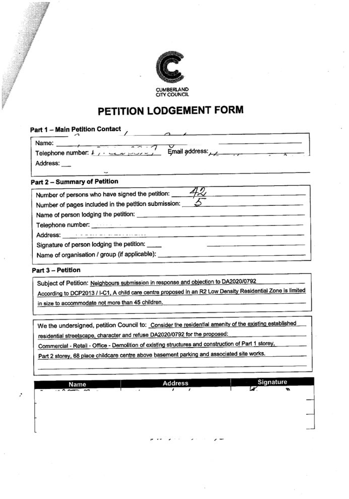
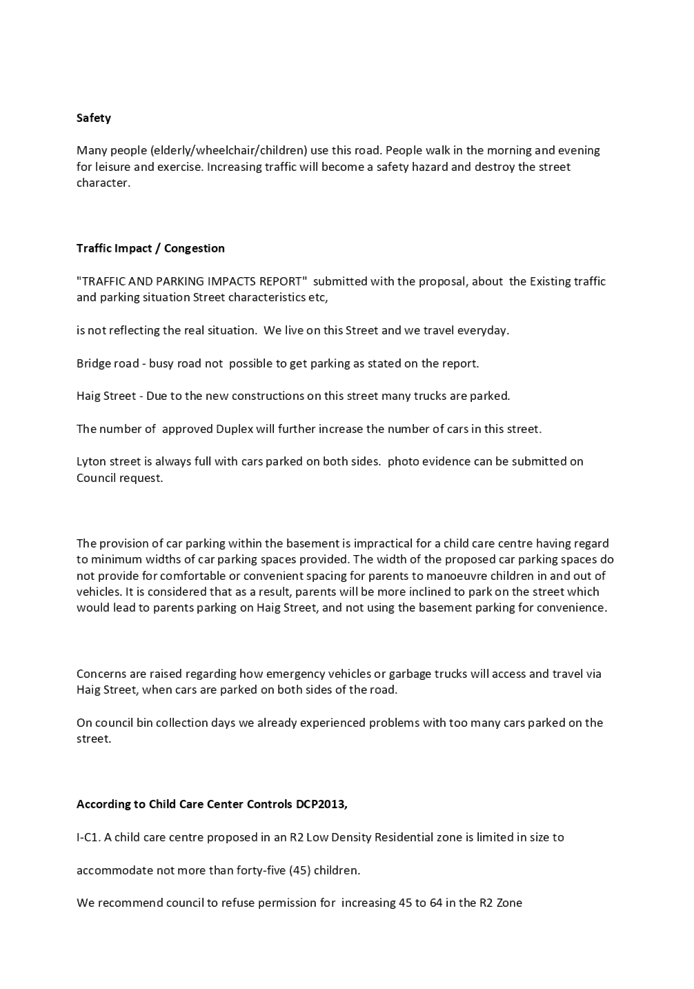
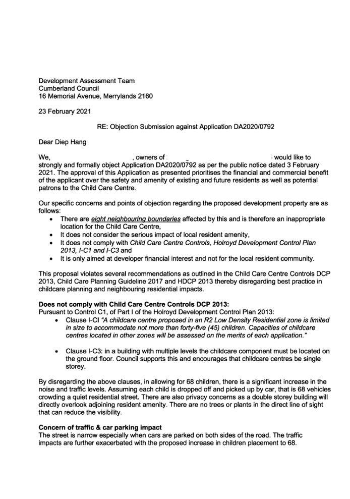
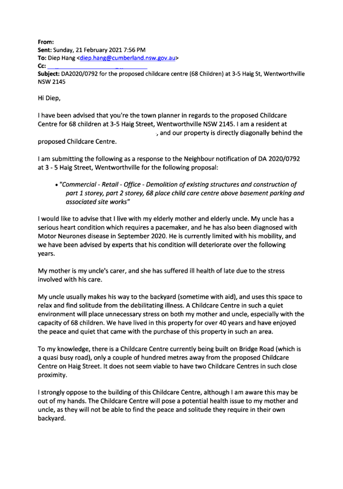
February 2021. In response, a total of 18 unique submissions (including 1
petition containing 42 signatures) were received.
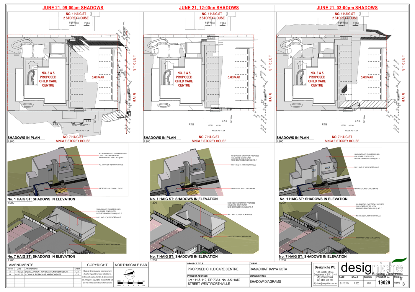
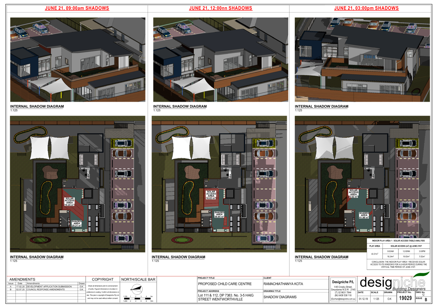
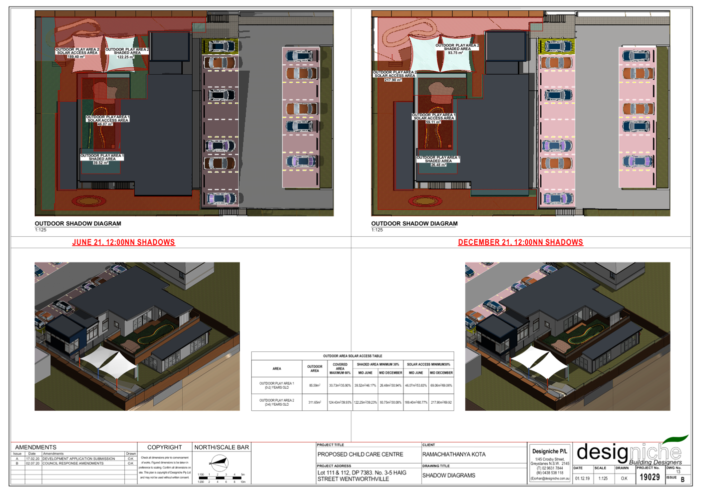
3. Council
through its assessment identified a number of concerns with the proposal
relating to the provision of indoor play space for children, vehicular access
and basement design, stormwater, and protection of the neighbouring tree. These
matters have been appropriately addressed by the reduction of children
placements from 68 to 62, and the submission of amended plans and revised
arboricultural impact report. The amended plans and additional information were
provided to Council on 31 March 2021 and did not warrant re-notification.
4. The
proposed development seeks the following notable variations:
|
Control
|
Required
|
Provided
|
% variation
|
|
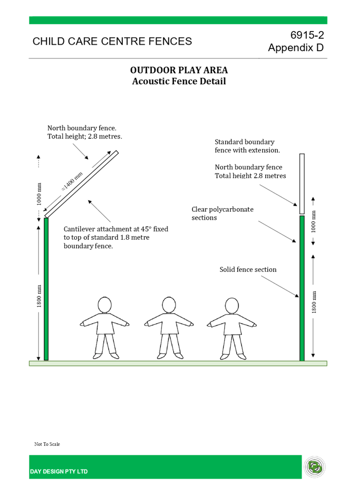
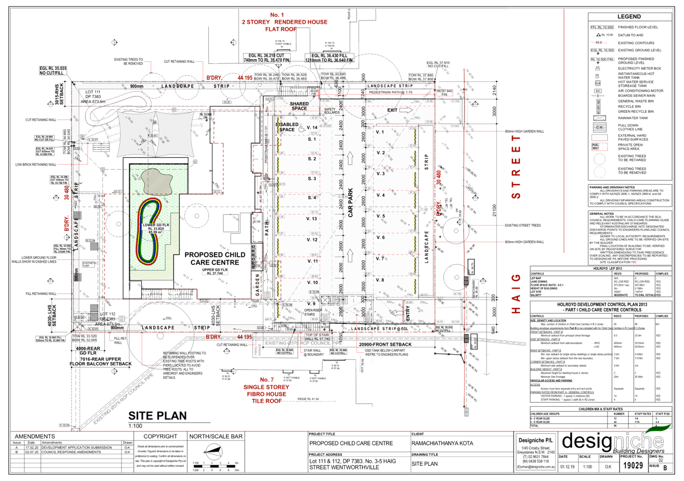
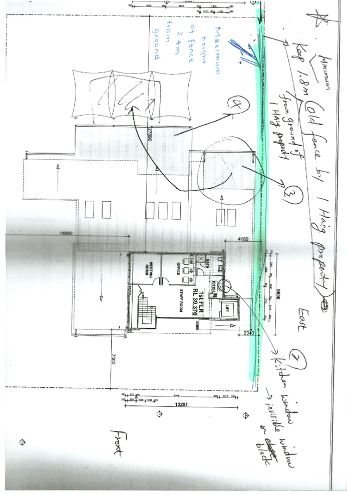
Fence Height:
Max. 2.4m above retaining wall.
(HDCP 2013)
|
Max. 2.4m
|
Northern boundary fence = 2.8m
|
16.67%
|
|
Landscaping: 25% and minimum 2m dimensions
(HDCP 2013)
|
Min. 336.75m²
|
209.9m² landscaped area provided with min. 2m
dimension.
|
37.7%
|
5. The application is
referred to the Cumberland Local Planning Panel (CLPP) for determination as the
matter is considered to be contentious.
6. It
is recommended that the application be approved as deferred commencement
consent subject to conditions provided in the Draft Notice of Determination at
Attachment 1.
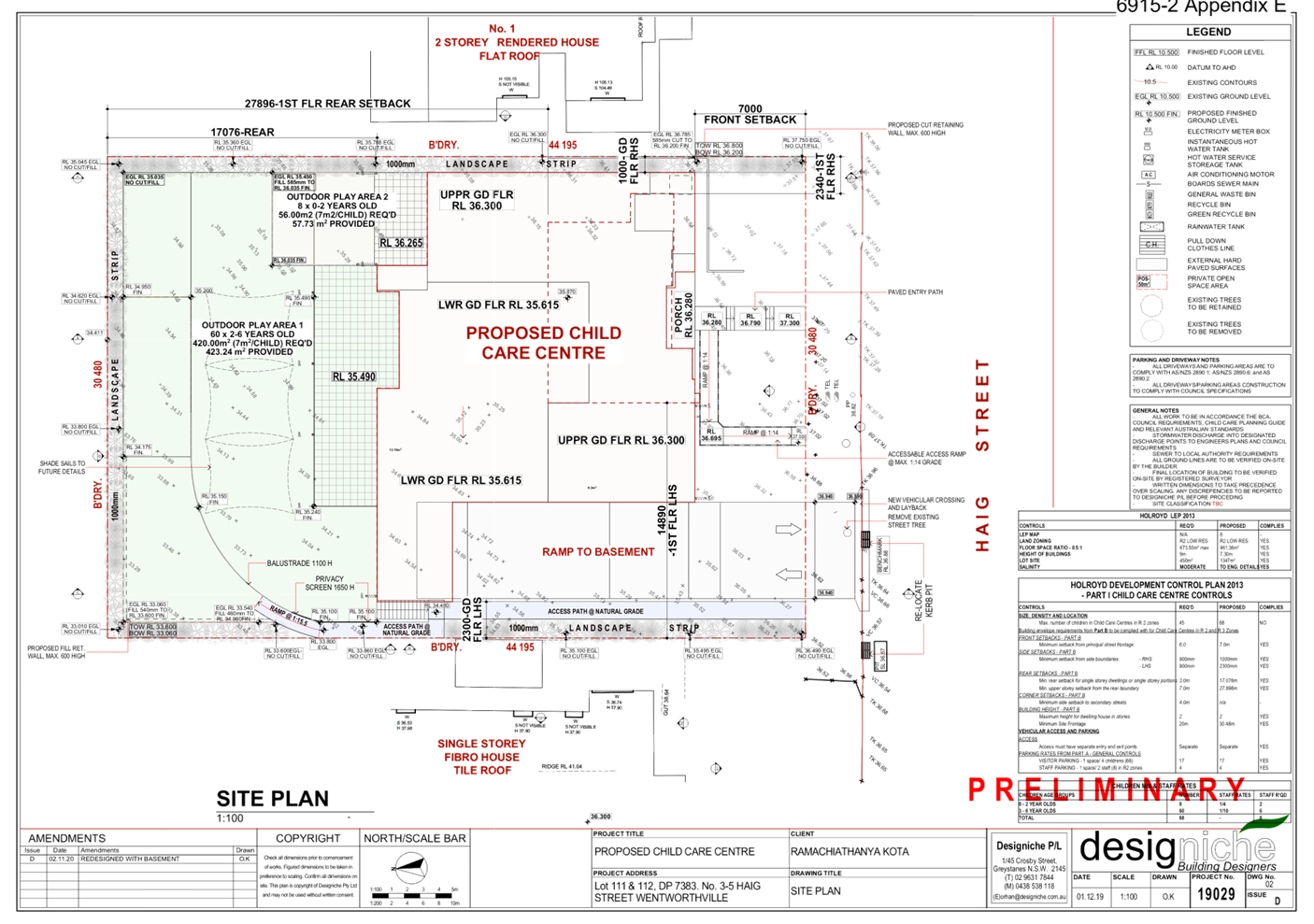
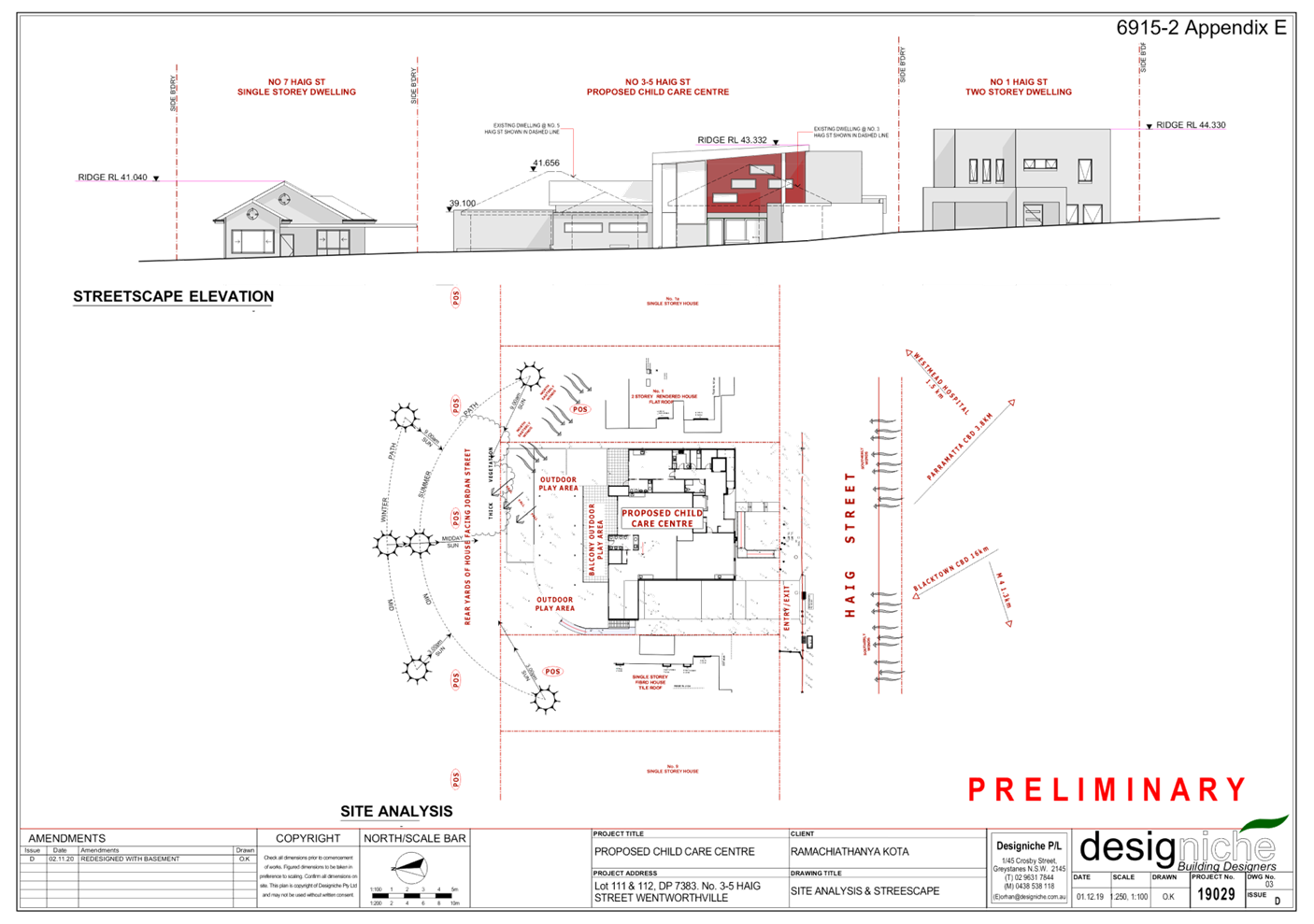
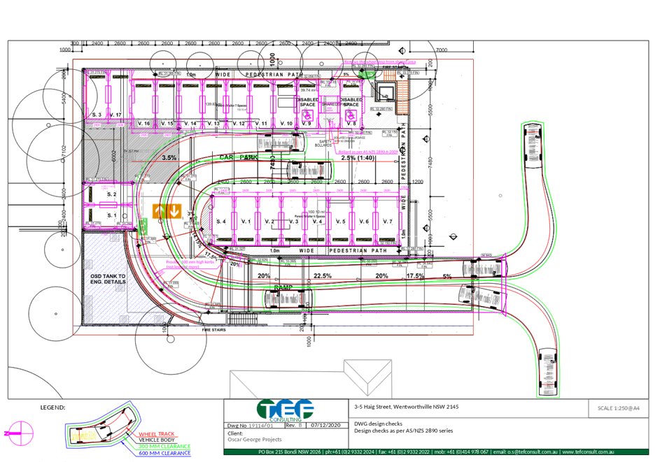
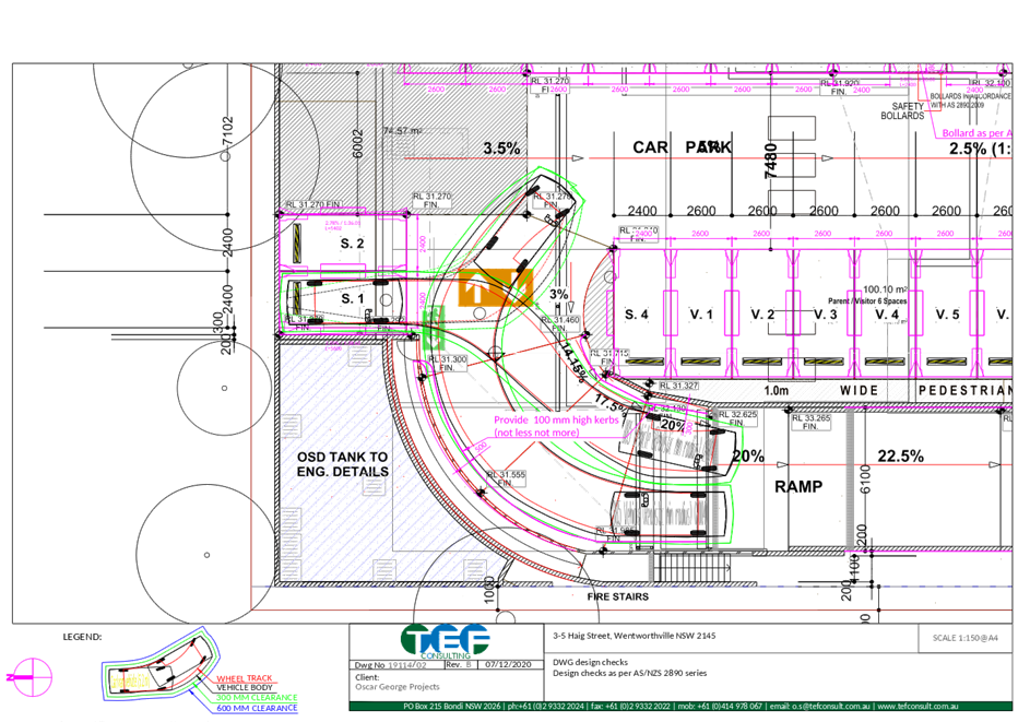
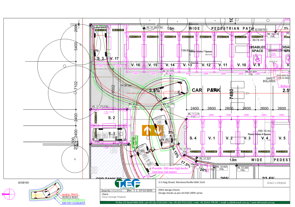
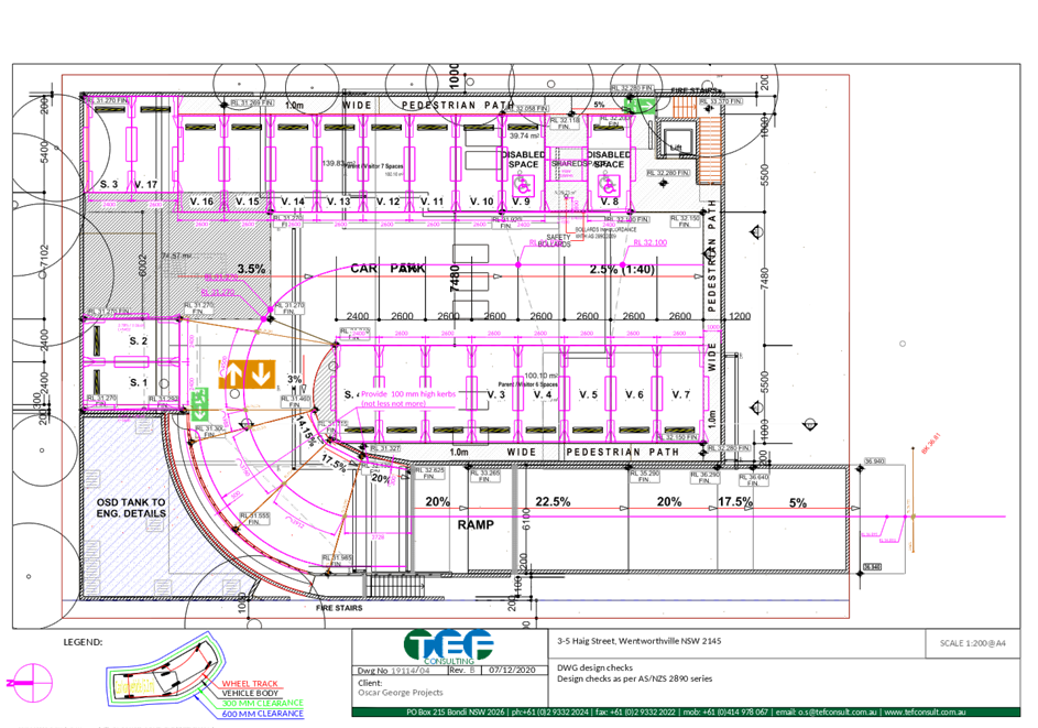
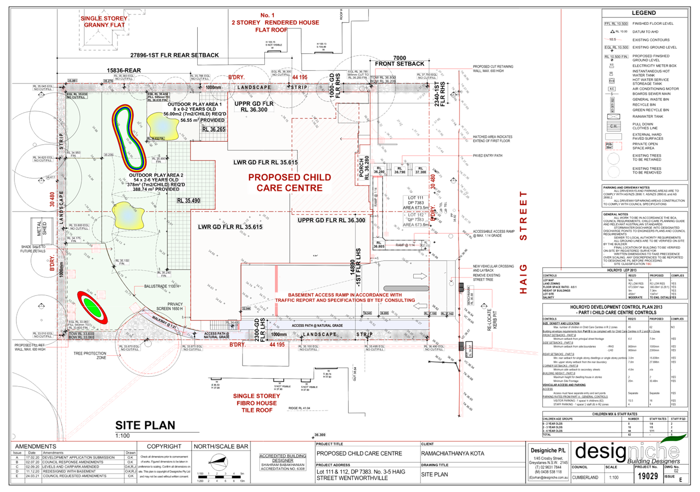
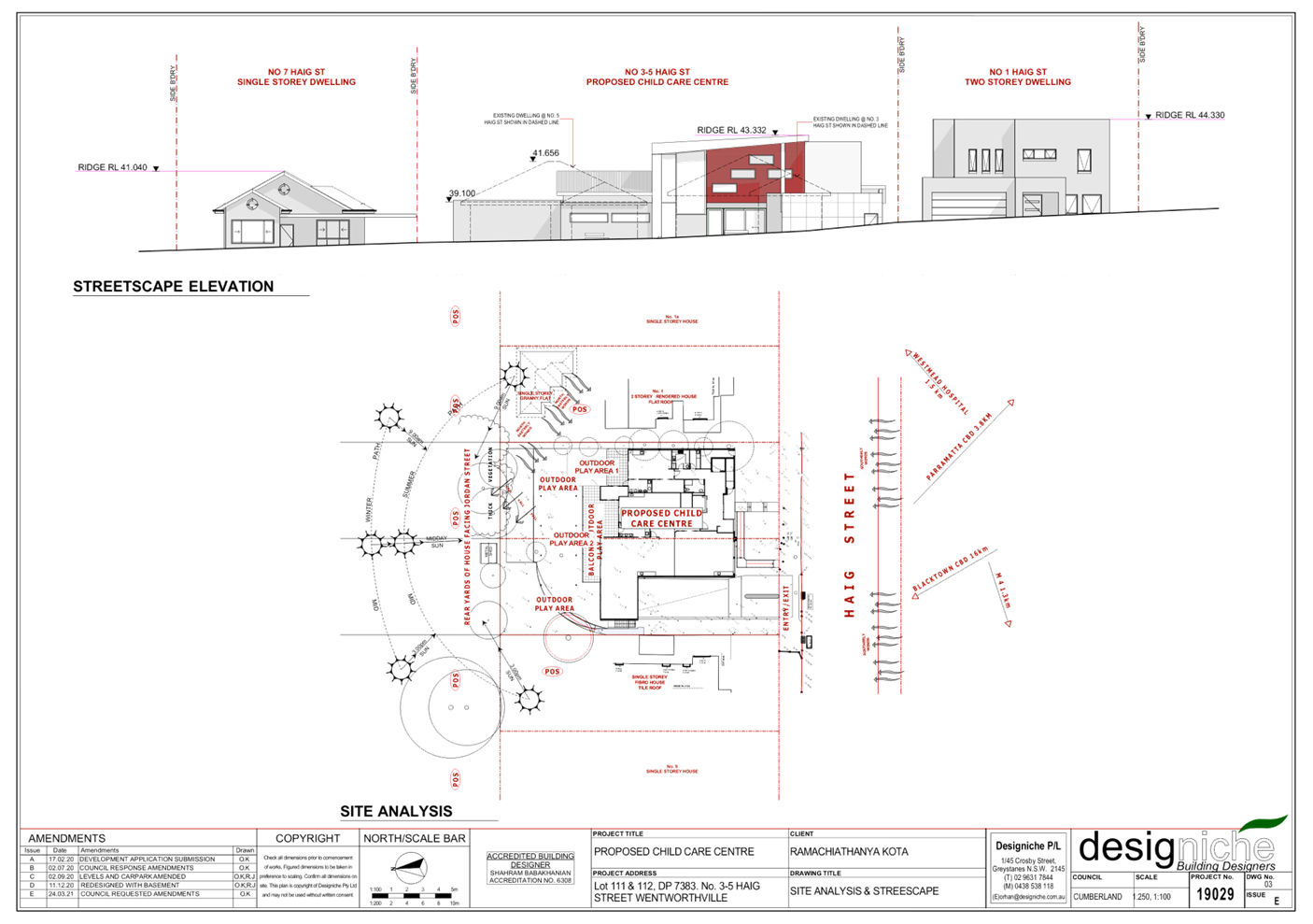
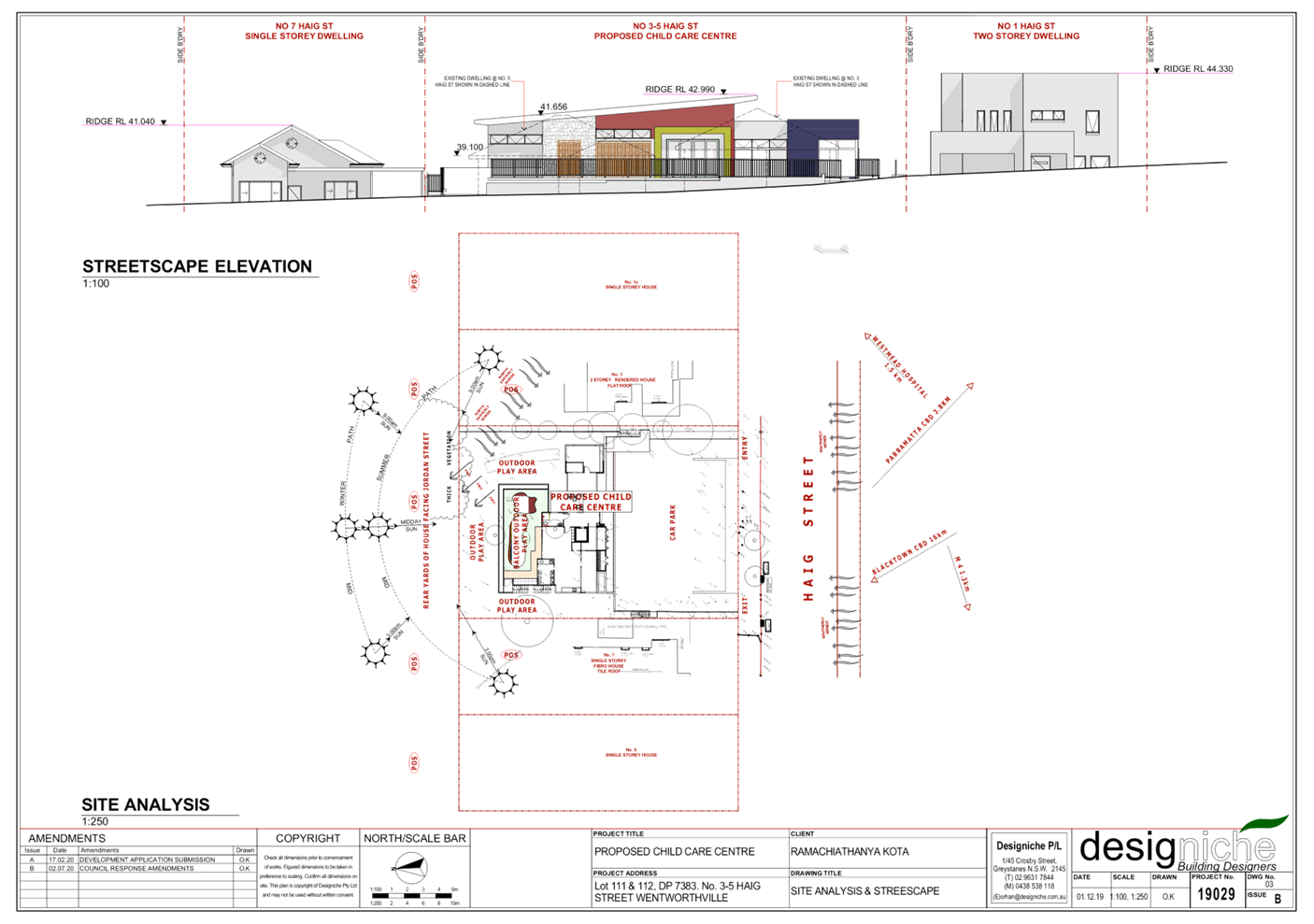
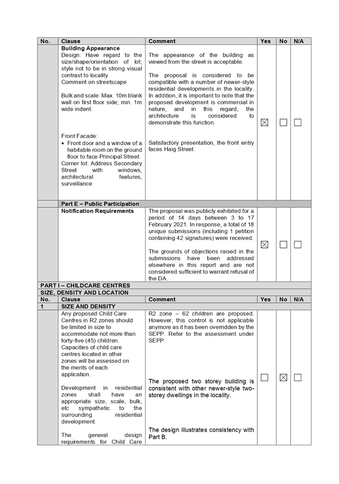
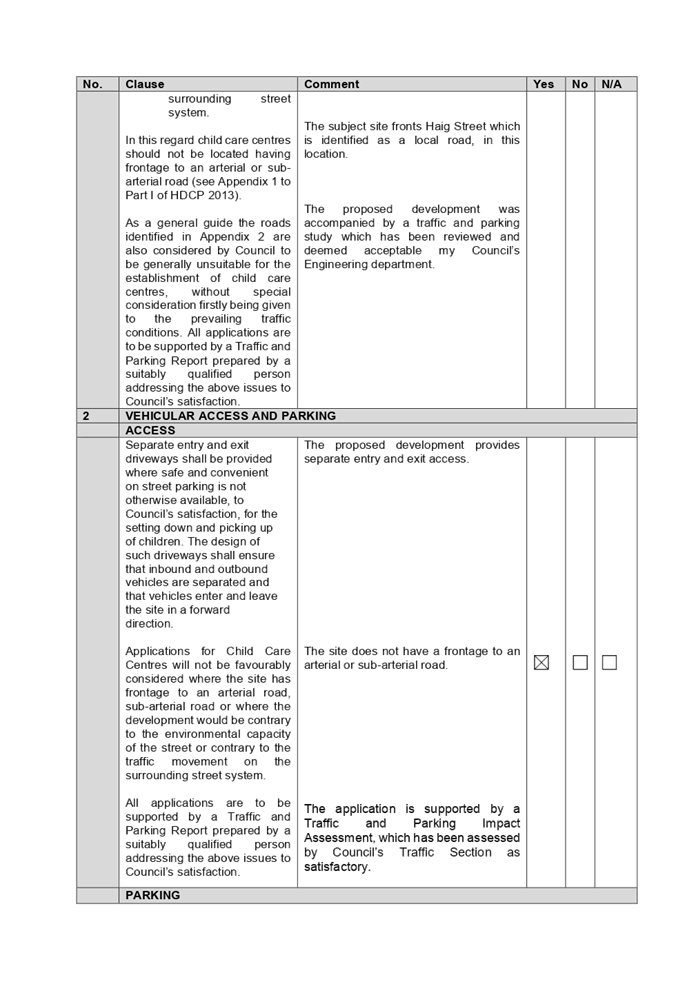
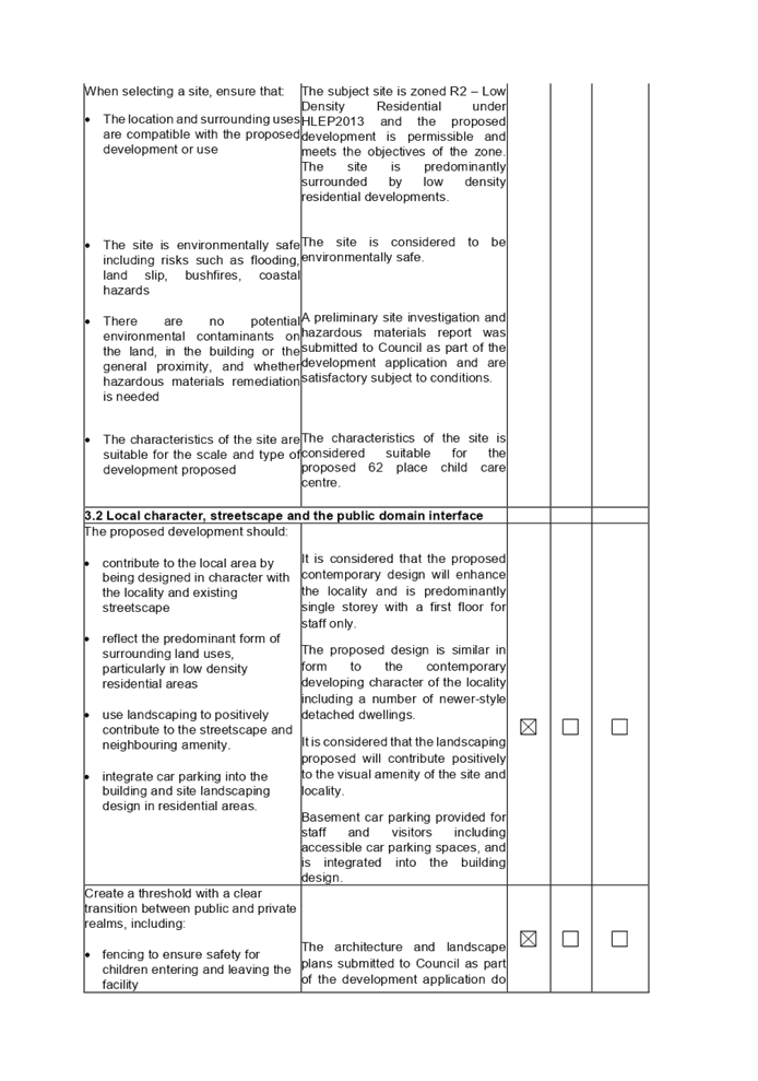
Subject Site and Surrounding
Area
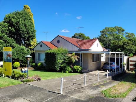
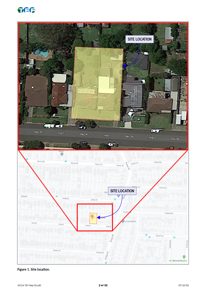
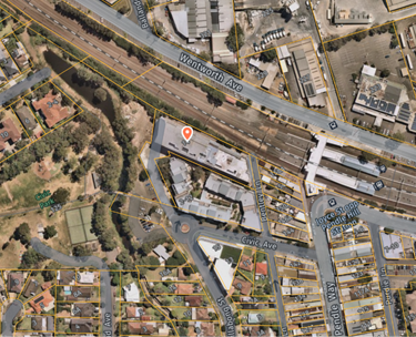
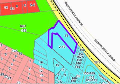
The subject site is known as 3-5
Haig Street, Wentworthville which has a total site area of 1,347m², and a
frontage of 30.24m to Haig Street. The site has a significant cross fall of
approximately 4.6m (10.4%) from the front/south to rear/north, and 2m (6.5%)
from the eastern to western side boundaries.
The property is currently occupied
by detached dwelling houses. The site adjoins a two storey dwelling house and
detached secondary dwelling to the east, and detached dwelling houses directly
to the north and west. The immediate area is characterised by low density
residential housing.
The subject site and surrounding
properties are zoned R2 – Low Density Residential under the Holroyd Local
Environmental Plan 2013.
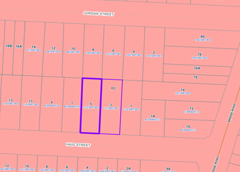
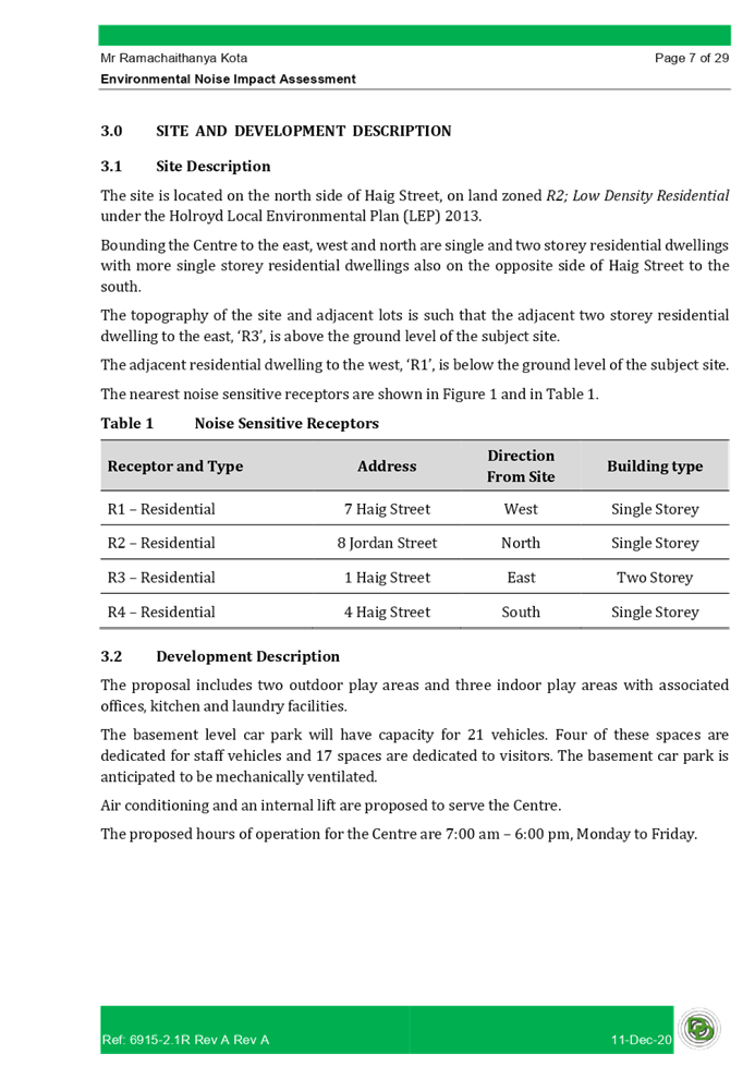
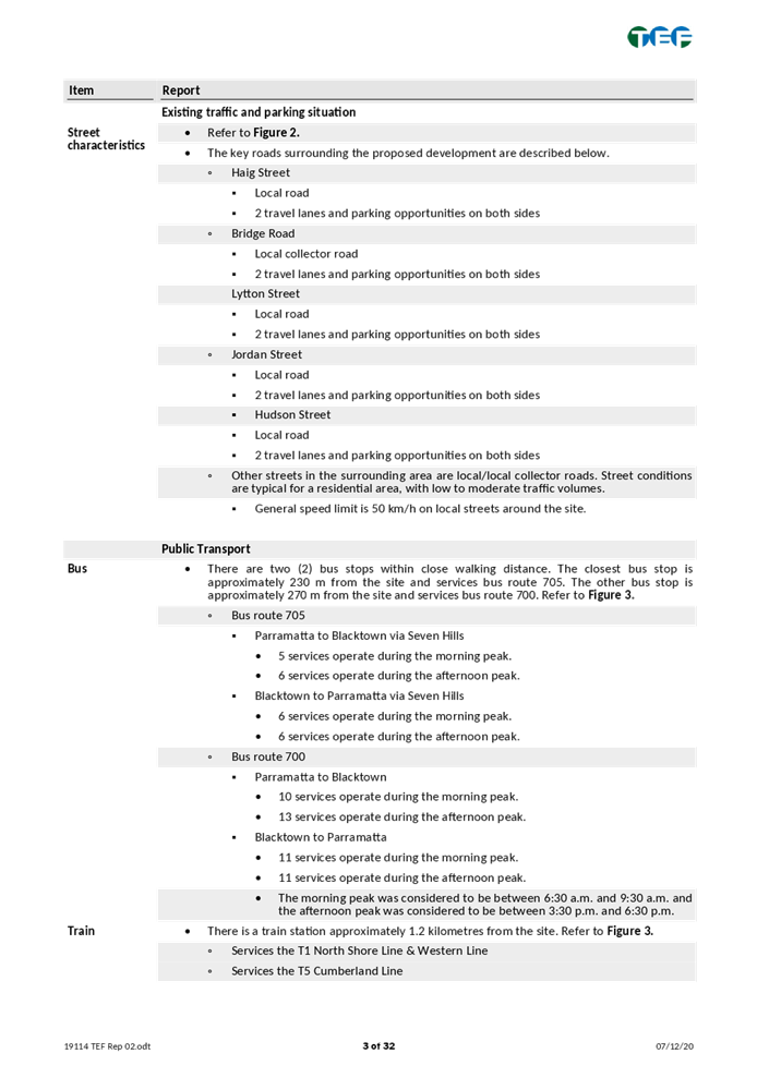
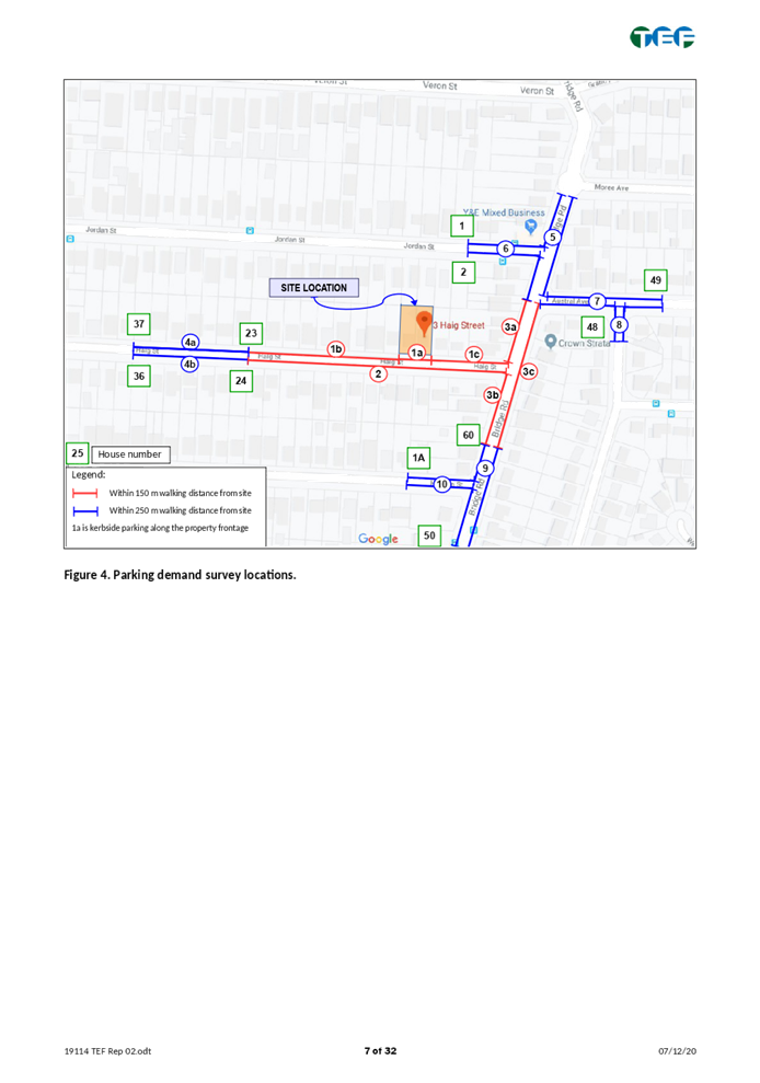
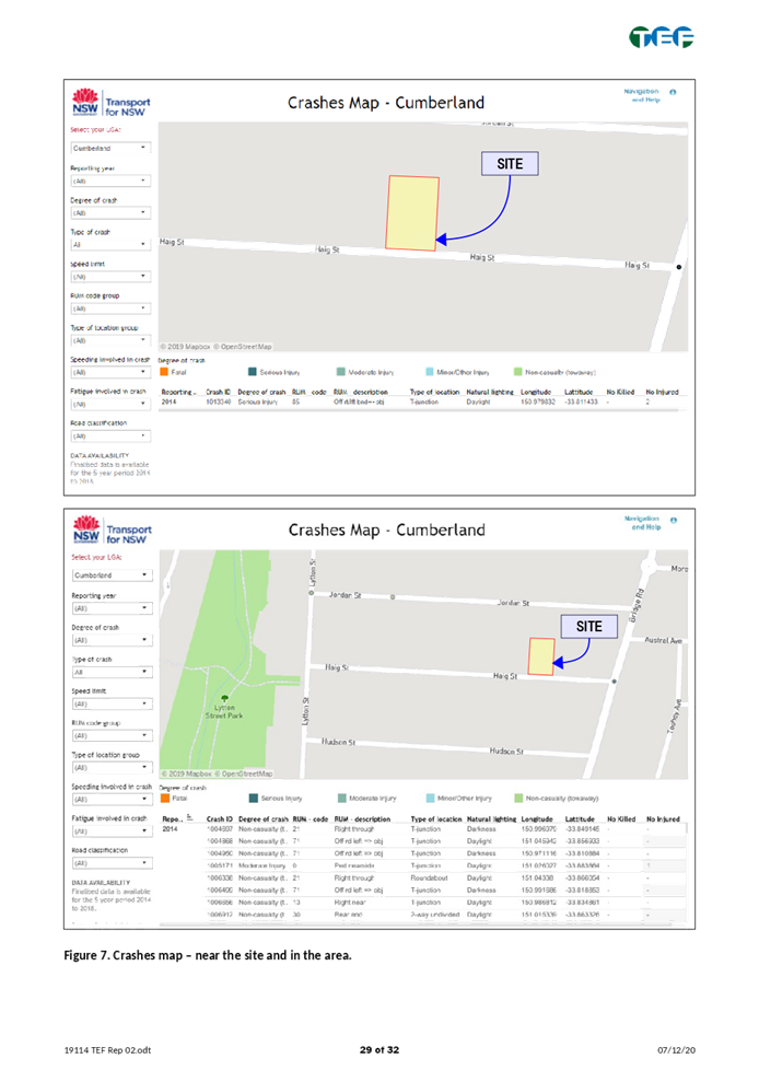
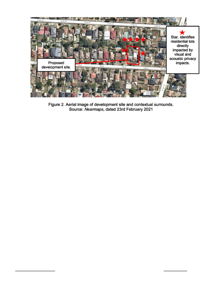
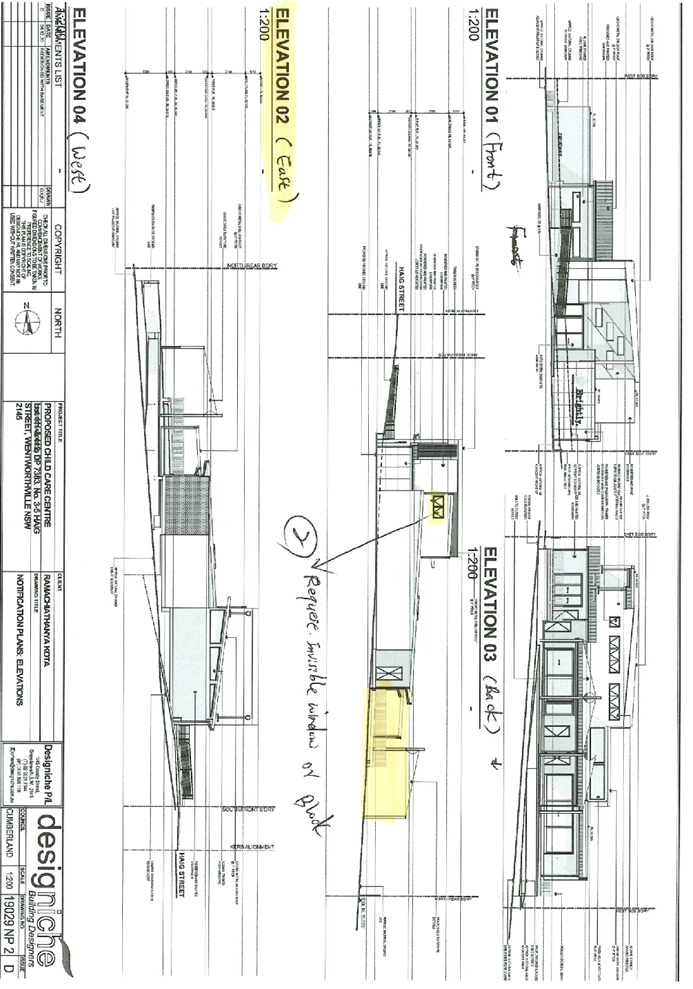
Figure
1 – Locality Plan of subject site indicated in purple outline.
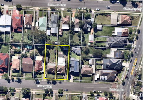
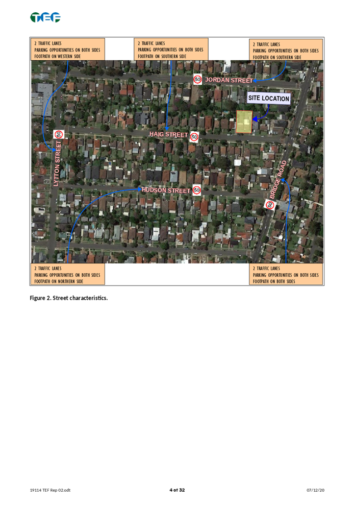
Figure
2 – Aerial view of subject site indicated in yellow outline (NearMaps)
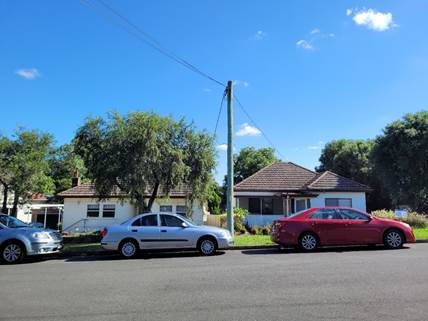
Figure
3 – Street view of subject site. Left: 5 Haig St, Wentworthville. Right:
3 Haig St, Wentworthville.
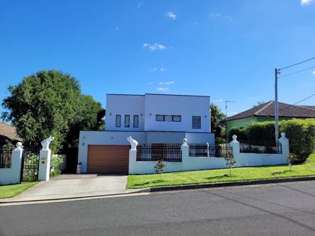
Figure
4 – Street view of 1 Haig St, Wentworthville, directly adjoining the
subject site to the east.
Figure
5 – Street view of 7 Haig St, Wentworthville, directly adjoining the
subject site to the west.
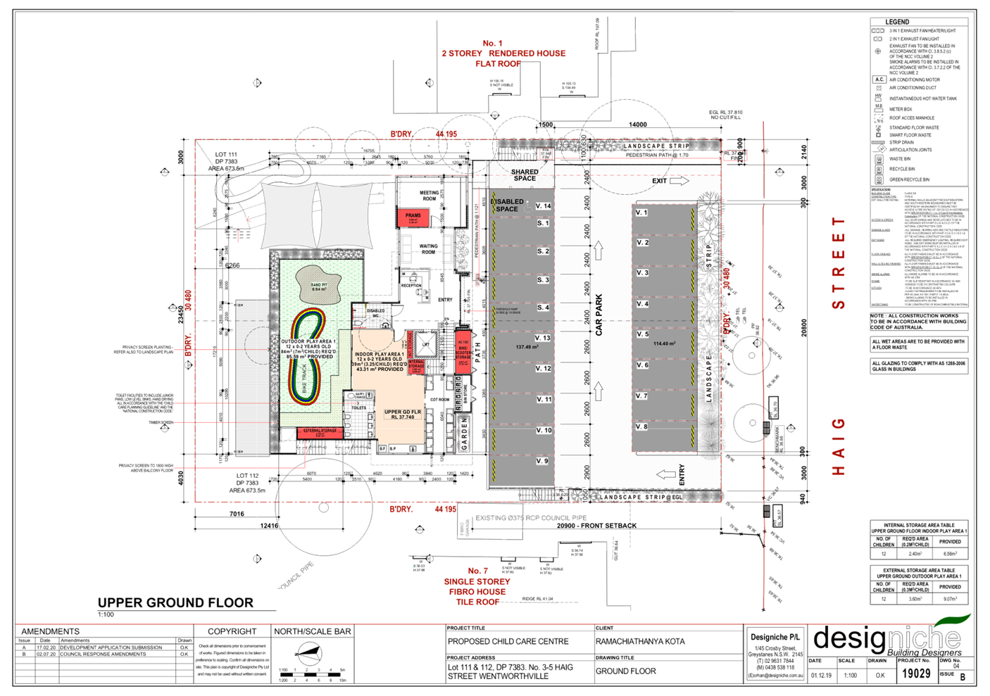
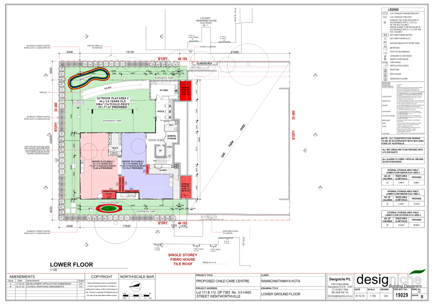
Description of the Proposed
Development
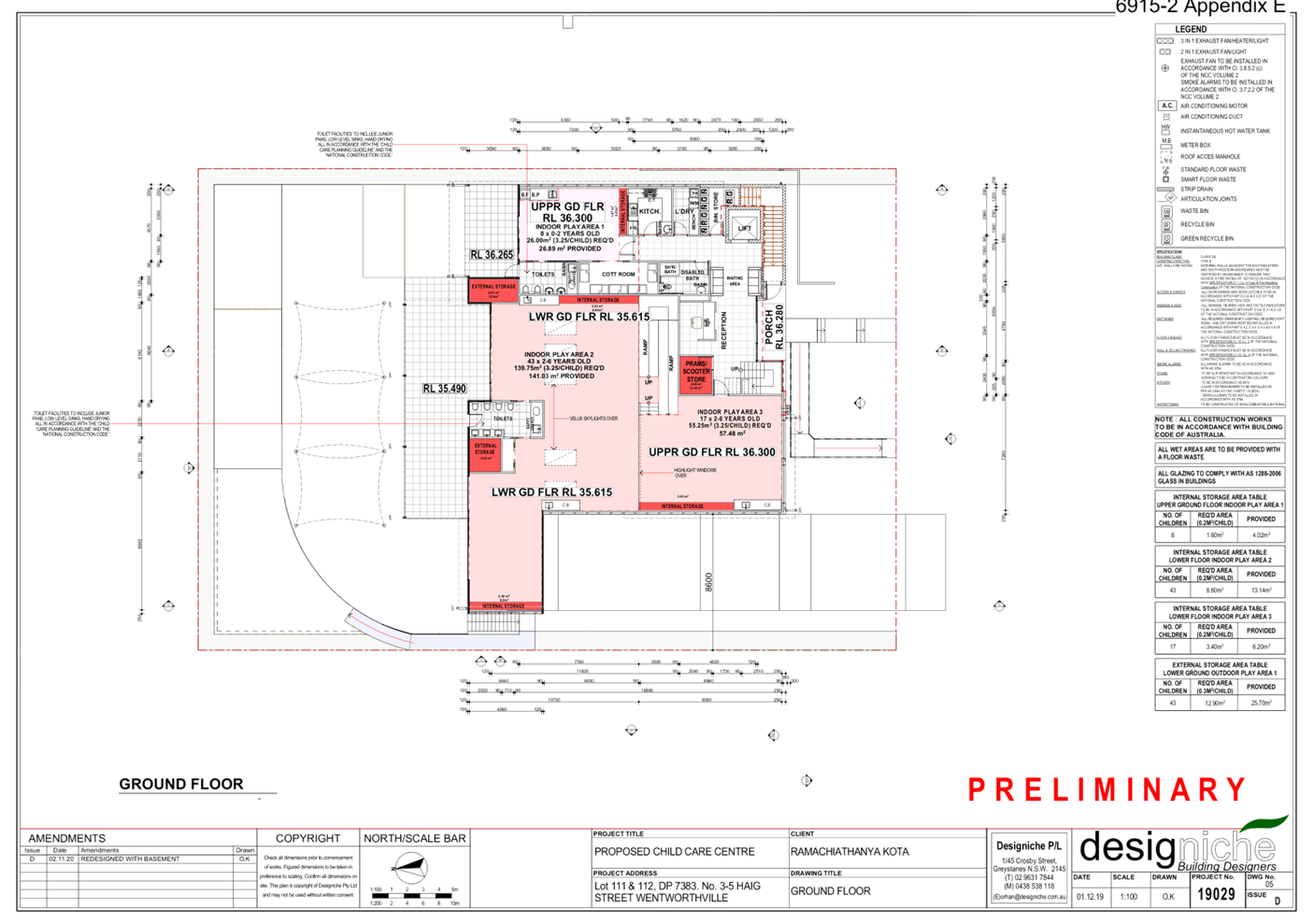
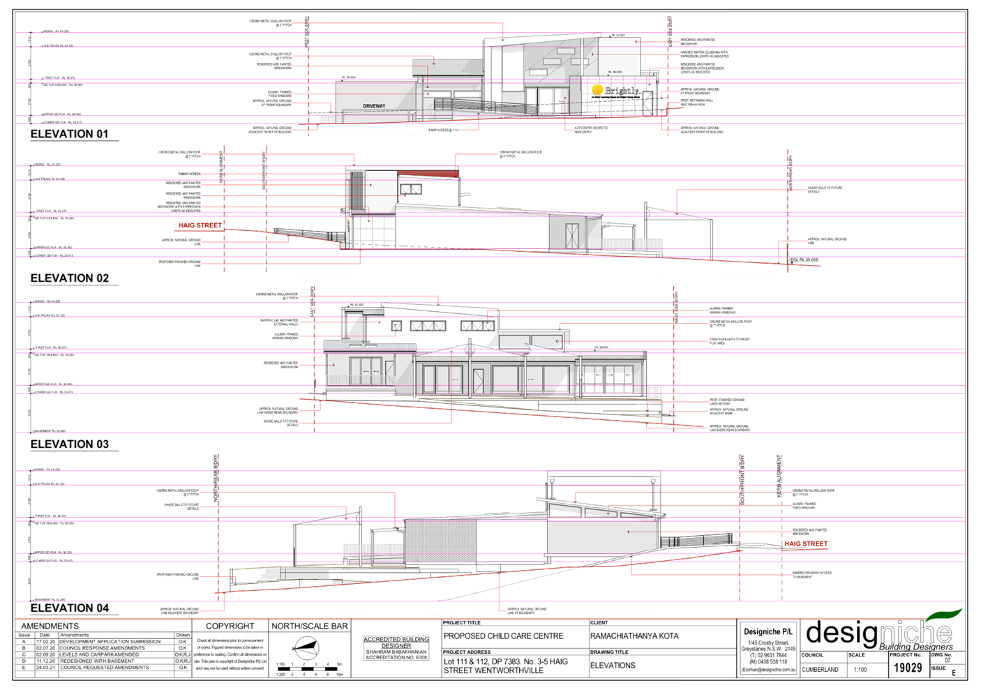
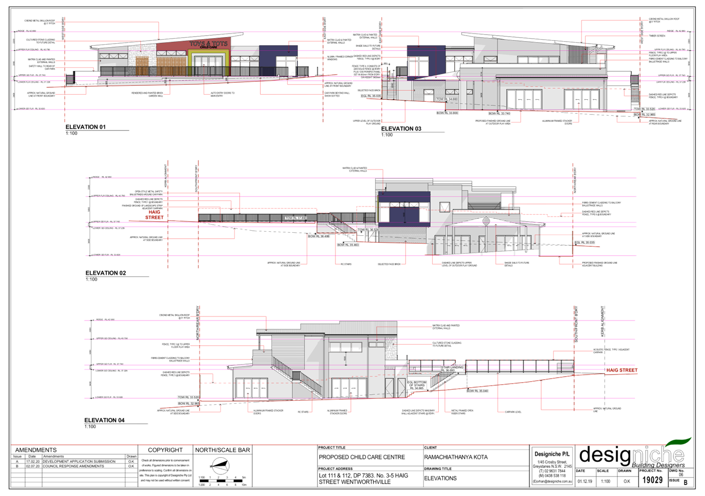
The proposed development involves
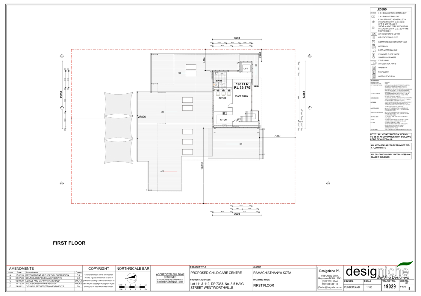
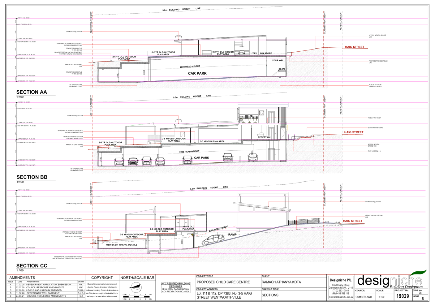
the demolition of existing structures and construction of a two storey 62 place
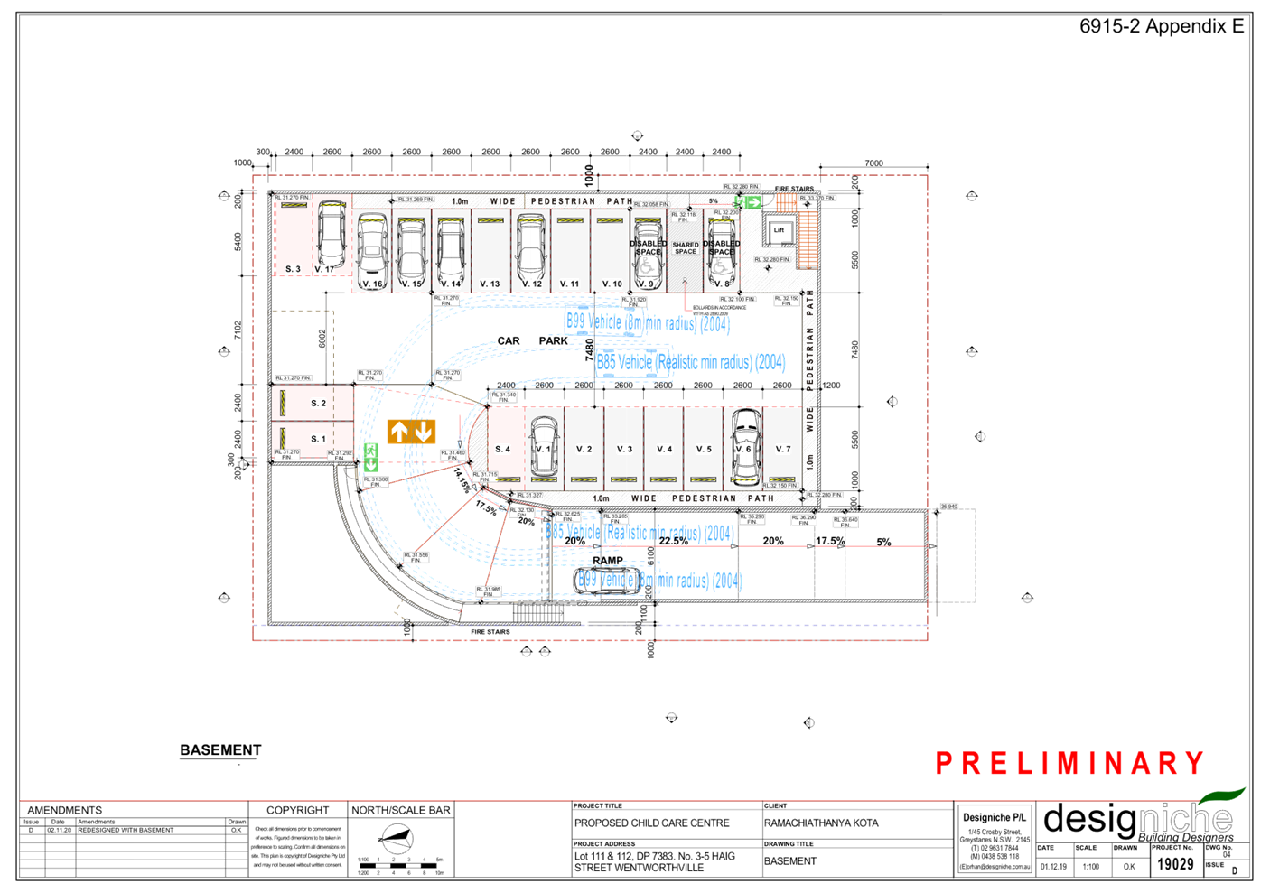
centre-based childcare facility over basement car parking.
Key features of the development
proposal are as follows:-
· Demolition
of two single storey dwellings and all existing structures, and removal of 9
trees (including 1 street tree).
· Construction
of a two-storey childcare facility accommodating 62 children.
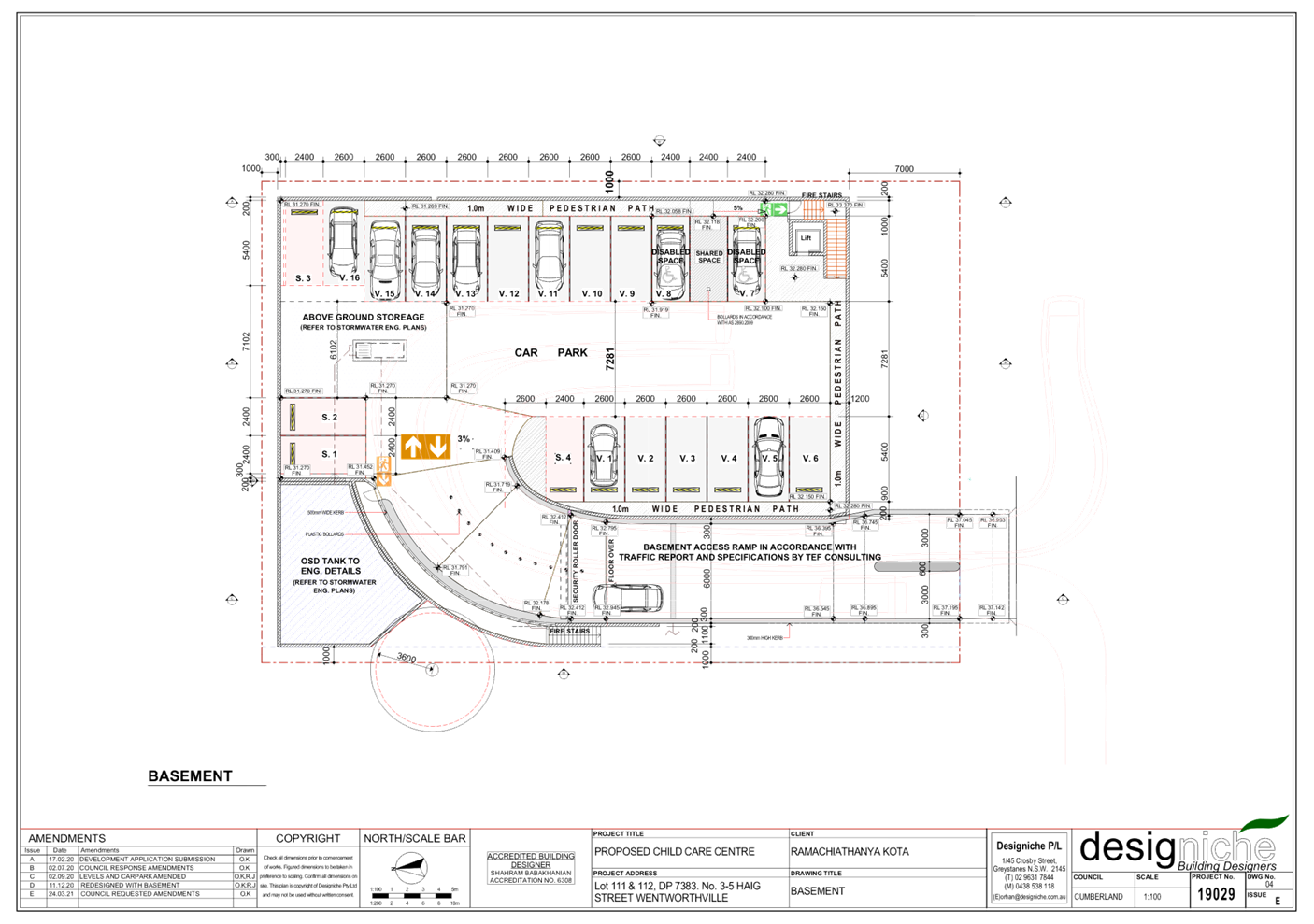
· Construction
of a basement level car parking area including 2 fire stairs, one lift and
accommodating 20 car parking spaces allocated as follows:
- Staff:
4 spaces.
- Visitors:
16 spaces (inclusive of 1 accessible car parking space).
· Lot
consolidation of existing 2 allotments into 1 allotment.
· The
facility proposes to accommodate 62 children, as follows:
o 8 children – 0-2 yrs
o 10 children – 2-3 yrs
o 44 children – 3-5 yrs
· The
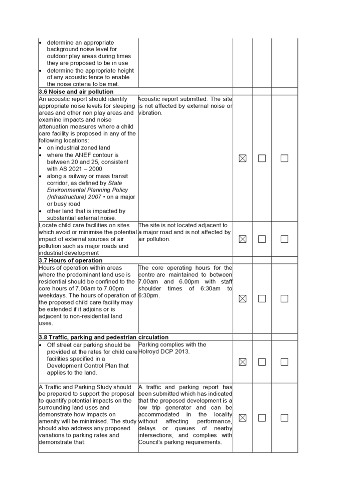
proposed centre will operate from 7.00am to 6.00pm Monday to Friday (excluding
public holidays), with staff ‘shoulder times’ of 6.30am to 6.30pm.
The centre will employ 8 staff.
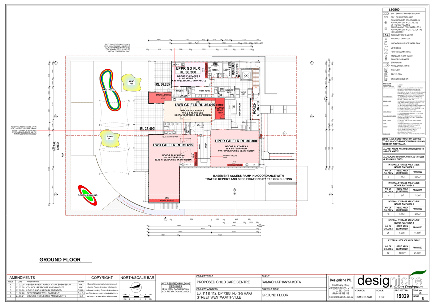
· The
ground floor level contains 3 bathrooms (including 1 accessible bathroom),
multiple storage areas, reception area, kitchen, laundry, prams/scooter
storage, bin room, 1 cot room, bottle preparation/craft bench area, indoor and
outdoor play areas and a lift/stairs.
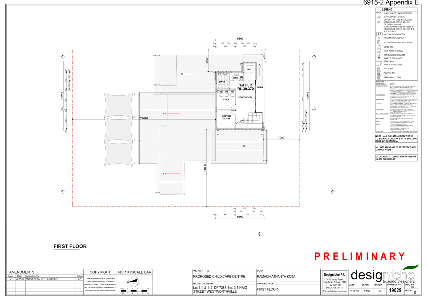
· The
first floor level contains an office, bathroom, staff room, kitchen, storage
and a lift/stairs.
· Consent
is not sought for signage as part of this application. It is the intention for
signage to be addressed under the Exempt Development provisions (as indicated
in the Statement of Environmental Effects).
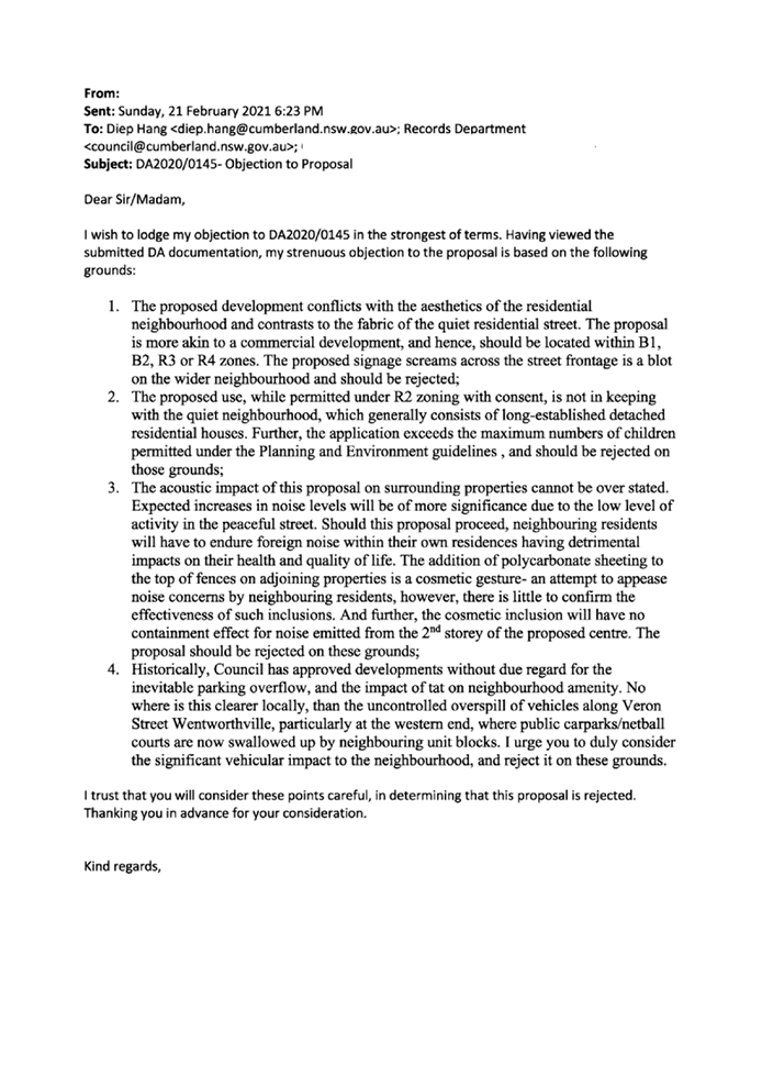
Background
On 9 September 2020, DA2020/0145
for demolition of existing structures and construction of a 56 place child care
centre with at-grade car parking, at 3-5 Haig St Wentworthville; was refused by
the Cumberland Local Planning Panel, for the following reasons:
· Streetscape
presentation of at-grade car park within the front setback area,
· Excessive
cut and fill, and requirement of excessive fence heights above retaining walls,
· Inadequate
information with respect to plans showing secondary dwelling at 1 Haig St,
impacts of proposed works to trees on neighbouring properties, waste
arrangements, operational plan of management and owner’s consent from
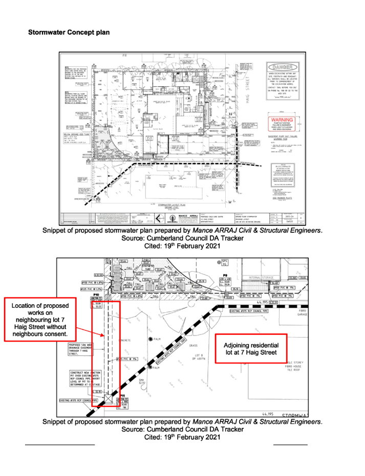
adjoining property for the proposed stormwater easement.
The subject development
application proposes a design which incorporates a basement car park which has
removed the dominance of the car parking area from the front setback area, to
be compatible with the established local character. The proposal also involves
minimal cut and fill to accommodate the building platforms and provides
acoustic fencing along the boundaries of an acceptable height to minimise
privacy and noise impacts on neighbouring properties.
Plans submitted has included and
considered impacts on the secondary dwelling at 1 Haig St. Impacts on adjoining
trees and waste arrangements has also been addressed as part of the proposal.
Owner’s consent from required downstream properties is imposed as a
deferred commencement condition for the creation of a drainage easement for
legal disposal of stormwater to Council’s system.
History
|
Date
|
Action
|
|
13 January
2021
|
Development
Application DA2020/0792 was lodged with Council.
|
|
13 January
2021
|
The
application was referred to Council’s internal departments for review.
|
|
3 February
2021 to 17 February 2021
|
The
application was publicly notified to adjoining and opposite owners, published
online, and a site notice was
placed at the property for 14 days. In response, a total of 18 unique
submissions (including 1 petition containing 42 signatures) were received.
|
|
9 March
2021
|
Application
was deferred with respect to indoor play area provisions, vehicular access,
engineering, tree protection and waste room matters.
|
|
31 March
2021
|
Amended
plans and revised arboricultural impact report was received by Council, which
forms part of the final assessment for consideration by the Panel.
|
|
9 June
2021
|
Application referred to CLPP for determination.
|
Applicants Supporting
Statement
The applicant has provided a
Statement of Environmental Effects prepared by Miletic-Mieler Development
Consultants Pty Ltd dated December 2020, and response letter dated 30 March
2021, in support of the application
Contact with Relevant
Parties
The assessing officer has
undertaken a site inspection of the subject site and surrounding properties and
has been in regular contact with the applicant throughout the assessment
process.
Internal Referrals
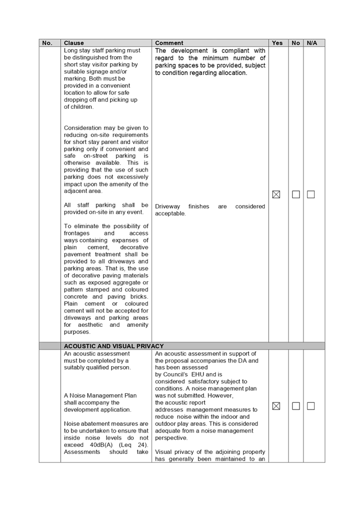
Development Engineer
The development application was
referred to Council’s Development Engineering section for comment who has
advised that the development is supported, although deferred commencement
consent is required to enable an easement to be created for stormwater disposal
and to address minor basement parking manoeuvring matters.
Environment and Health
The development application was
referred to Council’s Environmental Health Officer for comment who has
advised that the development is supported subject to conditions to address the
fit-out for food preparation area, acoustic assessment, noise attenuation
measures, soil assessment, and site contamination.
Tree Management Officer
The development application was
referred to Council’s Tree Management Officer for comment who has advised
that the development is supported subject to the imposition of conditions
relating to tree removal and protection of the neighbouring tree at 7 Haig
Street, Wentworthville, and recommended amendments to the planting schedule.
Children’s Services
The development application was
referred to Council’s Children’s Services section for comment who
has advised that the development is supported, and conditions are provided in
relation to compliance with the provisions of the Education and Care Services
National Regulations and Law.
Waste Management
The development application was
referred to Council’s Waste Management Officer for comment who has
advised that ongoing waste management and waste storage room arrangements are
satisfactory.
External Referrals
The application was not required
to be referred to any external government authorities for comment.
PLANNING COMMENTS
The provisions of any
Environmental Planning Instruments (EP&A Act s4.15 (1)(a)(i))
State Environmental Planning
Policies
The proposed development is
affected by the following State Environmental Planning Policies:
(a) State
Environmental Planning Policy No. 55 – Remediation of Land (SEPP 55)
Clause 7 of SEPP 55 requires
Council to be satisfied that the site is suitable or can be made suitable to
accommodate the proposed development. The matters listed within Clause 7 have
been considered in the assessment of the development application.
|
Matter for
Consideration
|
Yes/No
|
|
Does the application involve re-development of the site or
a change of land use?
|
Yes
No
|
|
Is the development going to be used for a sensitive land
use (e.g.: residential, educational, recreational, childcare or hospital)?
|
Yes
No
|
|
Does information available to you indicate that an
activity listed below has ever been approved, or occurred at the site?
acid/alkali plant and
formulation, agricultural/horticultural activities, airports, asbestos
production and disposal, chemicals manufacture and formulation, defence works,
drum re-conditioning works, dry cleaning establishments, electrical
manufacturing (transformers), electroplating and heat treatment premises,
engine works, explosive industry, gas works, iron and steel works, landfill
sites, metal treatment, mining and extractive industries, oil production and
storage, paint formulation and manufacture, pesticide manufacture and
formulation, power stations, railway yards, scrap yards, service stations,
sheep and cattle dips, smelting and refining, tanning and associated trades,
waste storage and treatment, wood preservation
|
Yes
No
|
|
Is the site listed on
Council’s Contaminated Land database?
|
Yes
No
|
|
Is the site subject to EPA
clean-up order or other EPA restrictions?
|
Yes
No
|
|
Has the site been the subject of
known pollution incidents or illegal dumping?
|
Yes
No
|
|
Does the site adjoin any
contaminated land/previously contaminated land?
|
Yes
No
|
|
Has the appropriate level of
investigation been carried out in respect of contamination matters for
Council to be satisfied that the site is suitable to accommodate the proposed
development or can be made suitable to accommodate the proposed development?
|
Yes
No
|
|
A
Preliminary Site Investigation report prepared by EI Australia, dated 6 March
2020 was submitted with the application. The report did not reveal any
potential matters of concern with regard to contamination and concludes that
the site is suitable for its intended use, subject to compliance with the
recommendations of the report, which are to be imposed as conditions of
consent. Council’s Environmental Health team has also reviewed the
report and determined that the site is suitable for such a development given
that the report provides that the site is suitable for the proposed
use.
|
(b) State
Environmental Planning Policy (Educational Establishments and Child Care
Facilities) 2017
The relevant provisions of the
SEPP have been considered in the assessment of the Application.
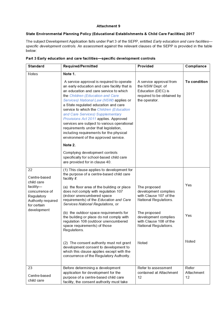
It is noted that State
Environmental Planning Policy (Educational Establishments and Child Care
Facilities) 2017 commenced on 1 September 2017. The SEPP applies to any
proposals for new schools or child care centres or proposed alterations and
additions to existing centres. The relevant provisions of the SEPP have been
considered in the assessment of the Application.
A comprehensive assessment and
compliance table is attached to this report in Attachment 9.
The following table indicates that
the development provides compliant indoor and outdoor play area for proposed 62
children in accordance with SEPP (Educational Establishments and Child Care
Facilities) 2017:
|
Control
|
Required
|
Provided
|
|
Indoor unencumbered space
(regulation 107 SEPP 2017 and part 4.9 the Guideline)
|
3.25m² x 62 = 201.5m²
|
217.6m²
|
|
Outdoor unencumbered space
(regulation 108 SEPP 2017 and part 4.9 the Guideline)
|
7m² x 62 = 434m²
|
451.4m²
|
(c) State
Environmental Planning Policy (Vegetation in Non-Rural Areas) 2017
The proposal includes removal of 8
existing trees within the site and 1 street tree. However, this does not exceed
the biodiversity offsets scheme threshold. Therefore, the proposed vegetation
removal is considered acceptable. Please refer to the HDCP 2013 compliance
table at Attachment 11 for further comment regarding the proposed tree removal.
Regional Environmental Plans
The proposed development is
affected by the following Regional Environmental Plans:
(a) Sydney
Regional Environmental Plan (Sydney Harbour Catchment) 2005
The subject site is identified as
being located within the area affected by the Sydney Regional Environmental
Plan (Sydney Harbour Catchment) 2005. The proposed development raises no issues
as no impact on the catchment is envisaged.
(Note: - the subject site is not
identified in the relevant map as ‘land within the ‘Foreshores and
Waterways Area’ or ‘Wetland Protection zone’, is not a
‘Strategic Foreshore Site’ and does not contain any heritage items.
Hence the majority of the SREP is not directly relevant to the proposed
development).
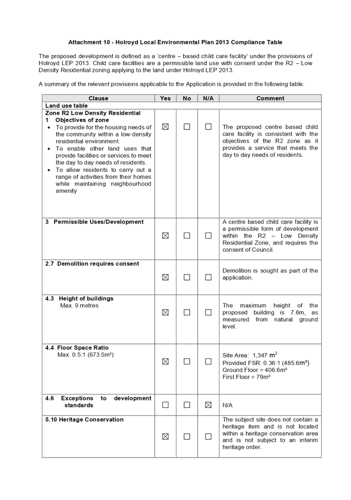
Local Environmental Plans
Holroyd Local Environmental
Plan 2013
The proposed development is
defined as a ‘centre based child care facility’ under the
provisions of Holroyd Local Environmental Plan (LEP) 2013. Centre based child
care facilities are a permissible land use with consent under the R2 –
Low Density Residential zoning applying to the land under Holroyd LEP 2013.
centre-based child care facility
means—
(a) a
building or place used for the education and care of children that provides any
one or more of the following—
i. long
day care,
ii. occasional
child care,
iii. out-of-school-hours
care (including vacation care),
iv. preschool
care, or
(b) an
approved family day care venue (within the meaning of the Children (Education
and Care Services) National Law (NSW)),
The relevant matters to be
considered under the Holroyd LEP 2013 are summarised below:
|
Development
Standard
|
Yes
|
No
|
N/A
|
Response
|
|
4.3
Height of buildings
Max. 9 metres
|
|
|
|
The maximum height of
the proposed building is 7.6m.
|
|
4.4
Floor Space Ratio
Max. 0.5:1
(Max. GFA of 673.5m²)
|
|
|
|
Provided FSR: 0.36:1
(485.6m²)
Ground Floor =
406.6m²
First Floor =
79m²
|
A comprehensive assessment and
compliance table is attached to this report in Attachment 10 which demonstrates
the development proposal’s compliance with the relevant planning controls
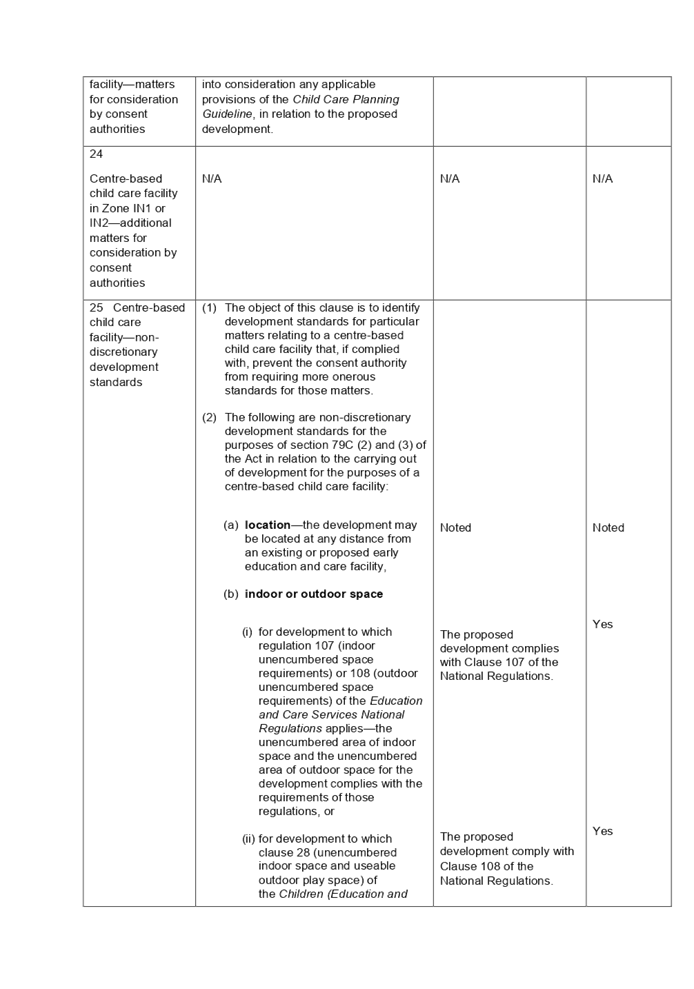
that are applicable to the site under the Holroyd LEP 2013.
The provisions of any proposed
instrument that is or has been the subject (EP&A Act s4.15 (1)(a)(ii))
(a) Draft
State Environmental Planning Policy (Environment)
The draft SEPP relates to the
protection and management of our natural environment with the aim of
simplifying the planning rules for a number of water catchments, waterways,
urban bushland, and Willandra Lakes World Heritage Property. The changes
proposed include consolidating the following seven existing SEPPs:
· State
Environmental Planning Policy No. 19 – Bushland in Urban Areas
· State
Environmental Planning Policy (Sydney Drinking Water Catchment) 2011
· State
Environmental Planning Policy No. 50 – Canal Estate Development
· Greater
Metropolitan Regional Environmental Plan No. 2 – Georges River Catchment
· Sydney
Regional Environmental Plan No. 20 – Hawkesbury-Nepean River (No.2-1997)
· Sydney
Regional Environmental Plan (Sydney Harbour Catchment) 2005
· Willandra
Lakes Regional Environmental Plan No. 1 – World Heritage Property.
The draft policy will repeal the
above existing SEPPs and certain provisions will be transferred directly to the
new SEPP, amended and transferred, or repealed due to overlaps with other areas
of the NSW planning system.
Changes are also proposed to the
Standard Instrument – Principal Local Environmental Plan. Some provisions
of the existing policies will be transferred to new Section 117 Local Planning
Directions where appropriate.
(b) Draft
Cumberland Local Environmental Plan (Draft CLEP)
The Draft Cumberland Local
Environmental Plan (Draft CLEP) has been prepared by Cumberland City Council to
provide a single planning framework for the future planning of Cumberland City.
The changes proposed seek to harmonise and repeal the three existing LEPs
currently applicable to the Cumberland local government area, those being:
· Holroyd
Local Environmental Plan 2013,
· Parramatta
Local Environmental Plan 2011, and
· Auburn
Local Environmental Plan 2010.
The current planning controls for
the subject site, as contained within the Holroyd LEP 2013 are not proposed to
change under the Draft CLEP.
The provisions of any
Development Control Plans (EP&A Act s4.15 (1)(a)(iii))
The Holroyd DCP 2013 provides
guidance for the design and operation of development to achieve the aims and
objectives of the Holroyd LEP 2013.
The proposed development is
generally compliant with the relevant provisions, subject to the imposition of
conditions. Parts A, B & I of HDCP 2013 apply to the proposal. A
comprehensive assessment and compliance table is attached to this report at
Attachment 11 which demonstrates the development proposal’s compliance
with the relevant planning controls that are applicable to the site.
The assessment provided in
Attachment 11 indicates that there is a minor non-compliance with the HDCP 2013
with regard to the rear fence height and landscaped area, which are discussed
below as acceptable:
|
PART B – RESIDENTIAL
CONTROLS
|
|
1
|
GENERAL RESIDENTIAL CONTROLS
|
|
1.2
|
Fences
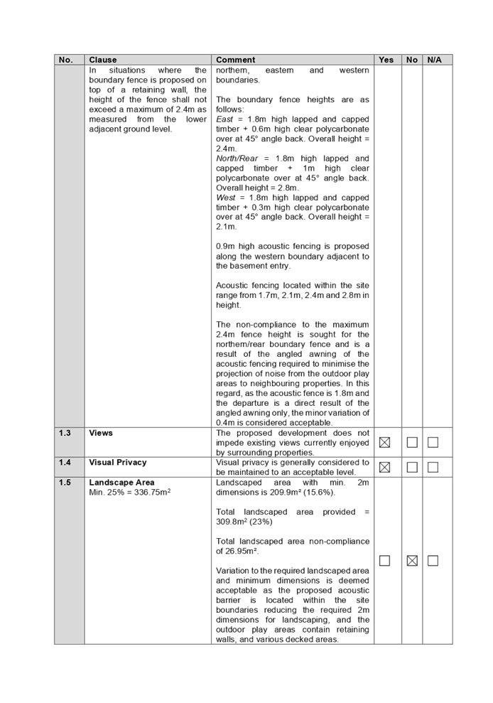
In
situations where the boundary fence is proposed on top of a retaining wall,
the height of the fence shall not exceed a maximum of 2.4m as measured from
the lower adjacent ground level.
|
1.8m high
acoustic fencing is proposed along the northern/rear boundary. The overall
northern boundary fence height is 2.8m (1.8m high lapped and capped timber +
1m high clear polycarbonate over at 45° angle back).
The
non-compliance to the maximum 2.4m fence height is sought for the
northern/rear boundary fence and is a result of the angled awning of the
acoustic fencing required to minimise the projection of noise from the
outdoor play areas to neighbouring properties. In this regard, as the
acoustic fence is 1.8m and the departure is a direct result of the angled
awning only, the minor variation of 0.4m is considered acceptable.
|
|
1.5
|
Landscape Area
Min. 25% = 336.75m2
|
Total landscaped area with min. 2m dimensions provided is
209.9m² (15.6%).
Total landscaped area provided = 309.8m2 (23%)
Total landscaped area non-compliance of 26.95m².
Variation to the required landscaped area and minimum
dimensions is deemed acceptable as the total landscaped area provided on site
represents a shortfall of 26.95m², and the proposed acoustic fencing is
located within the site boundaries reducing the required 2m dimensions for
landscaping, and the outdoor play areas contain retaining walls, and various
decked areas.
|
The provisions of any planning
agreement that has been entered into under section 7.4, or any draft planning
agreement that a developer has offered to enter into under section 7.4
(EP&A Act s4.15(1)(a)(iiia)
There is no draft planning
agreement associated with the subject Development Application.
The provisions of the
Regulations (EP&A Act s4.15 (1)(a)(iv))
The proposed development raises no
concerns as to the relevant matters arising from the Environmental Planning and
Assessment Regulations 2000 (EP&A Reg).
The Likely Environmental,
Social or Economic Impacts (EP&A Act s4.15 (1)(b))
It is considered that the proposed
development will have no significant adverse environmental, social or economic
impacts in the locality.
The suitability of the site for
the development (EP&A Act s4.15 (1)(c))
The subject site and locality is
not known to be affected by any natural hazards or other site constraints
likely to have a significant adverse impact on the proposed development.
Accordingly, it is considered that the development is suitable in the context
of the site and surrounding locality.
Submissions made in accordance
with the Act or Regulation (EP&A Act s4.15 (1)(d))
|
Advertised (Council
website)
|
Mail
|
Sign
|
Not Required
|
In accordance with Council’s
Notification requirements contained within Holroyd DCP 2013, the proposal was
publicly notified for a period of 14 days between 3 February 2021 and 17
February 2021. In response, Council received a total of 18 unique submissions
(including 1 petition containing 42 signatures) in respect of the proposal,
with nil disclosing a political donation or gift.
The additional information and
amended plans did not warrant re-notification of the application.
The issues raised in the public
submissions are summarised and commented on as follows:
Figure
6 – Submissions summary table
|
|
Concern
|
Comment
|
|
1
|
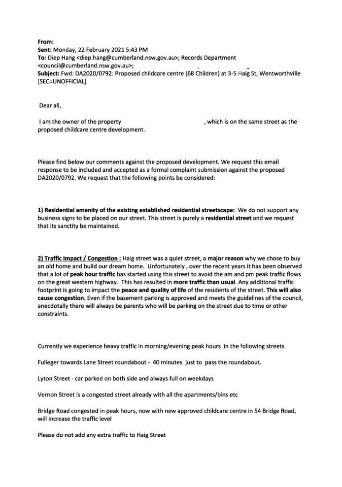
Residential amenity of the existing established
residential streetscape.
The commercial building is excessive and out of character
in a residential context.
|
It is noted that the proposed development is for a purpose
built childcare centre.
The proposal incorporates a skillion and flat roof design,
appropriate building setbacks, and materials which is consistent with
contemporary-style housing development in the surrounding area, and as such
not considered out of character with its immediate streetscape.
|
|
2
|
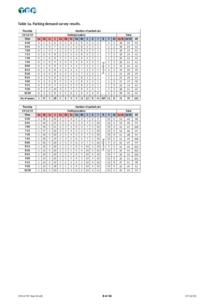
Traffic impact/congestion to Haig Street, and surrounding road
network, and pedestrian movement.
There would be potentially over 300 and possibly more
extra vehicle movements per day in the early morning, throughout the day,
late afternoon and early evening. The traffic survey included in the proposal
was undertaken during a quieter period of the year with schools closed for
holidays and people on holidays from work thus not providing a true and
accurate record.
|
Under the Holroyd Development Control Plan 2013, the
required parking rate for child care centres is 1 space per 4 children and 1
space per 2 staff, which equates to total of 20 spaces required for 62
children. This rate has been provided on site, which takes into account staff
and visitor parking demands.
The proposed parking arrangement and swept path have been
reviewed by Council’s Engineer and considered satisfactory, subject to
deferred commencement conditions to address manoeuvring within the basement.
The Traffic Report accompanying the application has been
carried out based on surveys during peak times AM and PM between 6.30am
– 10.00am and 2.30pm – 6.30pm on Thursday 19 December 2019.
Council noted the additional traffic to be generated by the proposal and the
findings from the Traffic and Parking Impact Assessment Report. Council’s
Development Engineer has advised that the proposed development is a low trip
generator and can be accommodated in the locality without affecting
performance of existing street, delays or queues of nearby intersections, and
complies with Council’s parking requirements.
|
|
3
|
Loss of privacy/overlooking to neighbouring properties
|
The first floor comprises of staff facilities being the
office, kitchen and staff room. The rear/north facing windows are 1.5m high
sill windows and do not pose adverse overlooking concerns, noting the
substantial 27.896m first floor setback provided to the rear boundary. The
eastern first floor window also has a 1.5m sill height and setback 4.16m and
does not pose visual privacy concerns to neighbouring properties.
1.8m high acoustic fencing is proposed along the northern,
eastern and western boundaries. In addition, 2.4m high (east), 2.8m high
(north), and 2.1m high (west) acoustic fencing is proposed within the site
adjacent to the outdoor play areas. The acoustic fencing is considered to adequately
maintain privacy between properties.
|
|
4
|
The proposed child care is not suitable for the street and
area, and there is no demand for the proposal.
There is already a child care centre being constructed at
54 Bridge Road, Westmead, in close proximity to the subject site.
There is an oversupply of child care centres in the area.
|
A childcare centre is permissible with consent on the site
and there is no limit on the number of childcare centres within any given
locality. The development application has been assessed as generally
compliant with the relevant controls as demonstrated within this report and
associated attachments.
|
|
5
|
The proposed child care centre is for 68 children
placements and exceeds the maximum 45 children placements prescribed in HDCP
2013.
|
The subject site is zoned R2 – Low Density
Residential under HLEP 2013. The development application (as amended)
proposes 62 children.
The maximum number of children control contained in HDCP
2013 is not applicable as it has been overridden by the SEPP.
|
|
6
|
The proposal appears extremely high in elevation and
imposes on nearby properties.
Childcare centres are required to be single storey. The
proposal is two storey in height.
|
The proposal is two storey in height above basement car
parking and has a maximum building height of 7.6m, which complies with the
maximum 9m building height standard prescribed by HLEP 2013.
Childcare centres are permitted to be a maximum of two
storey in height. The first floor level of the child care centre contains
staff facilities.
|
|
7
|
Noise impacts of the child care centre on the private open
space areas and living areas of neighbouring properties.
|
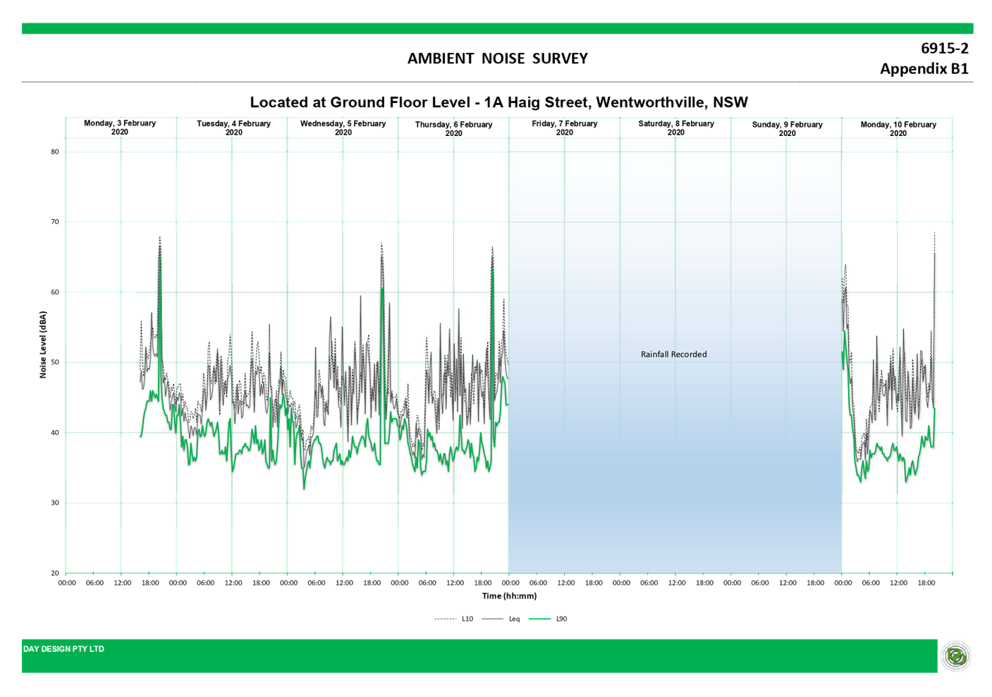
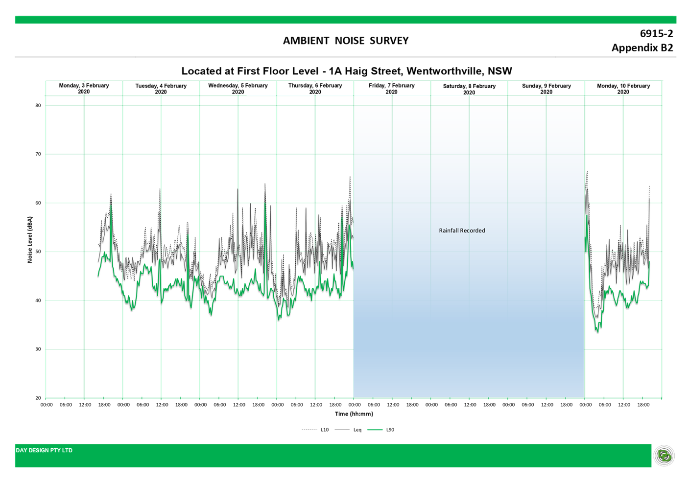
The subject proposal is accompanied by an Acoustic
Report which assesses the noise generated from the proposed development. The
submitted acoustic report recommends acoustic fencing to minimise noise
impact and demonstrates that the proposed centre can be accommodated on the
site without noise nuisance to adjoining neighbours.
Council’s Environmental Health Officer has reviewed
the acoustic report and found it to be acceptable, subject to conditions.
|
|
8
|
Parents are more likely to park on the street and will not
use the basement car park.
|
An Operational Management Plan (OMP) shall be enforced by way
of conditions to encourage the use of the basement parking facility. All
pickup and drop-off are expected to take place within the basement, noting
that basement parking enables parents to walk children directly into the
child care centre.
|
|
9
|
Evacuation issues associated with the assembly of staff
and children in a small area close to the road.
Nuisance of emergency evacuation procedures on
neighbouring properties.
|
An evacuation and emergency plan has been submitted with
the application that identifies procedures for evacuation and emergency in
accordance with Regulations 97 and 168 of the Education and Care Services
National Regulations.
|
|
10
|
Property devaluation.
|
There
is no evidence which suggests that the proposal will reduce property values.
This is not a matter for consideration under Section 4.15 of the
Environmental Planning and Assessment Act 1979.
|
|
11
|
Proposal will impact on health conditions of residents.
|
The
proposal has been designed to ensure residential amenity is maintained to
neighbouring properties. Appropriate conditions are imposed to mitigate
environmental impacts of the proposal the demolition and construction phase.
|
|
12
|
Flow of stormwater onto neighbouring properties.
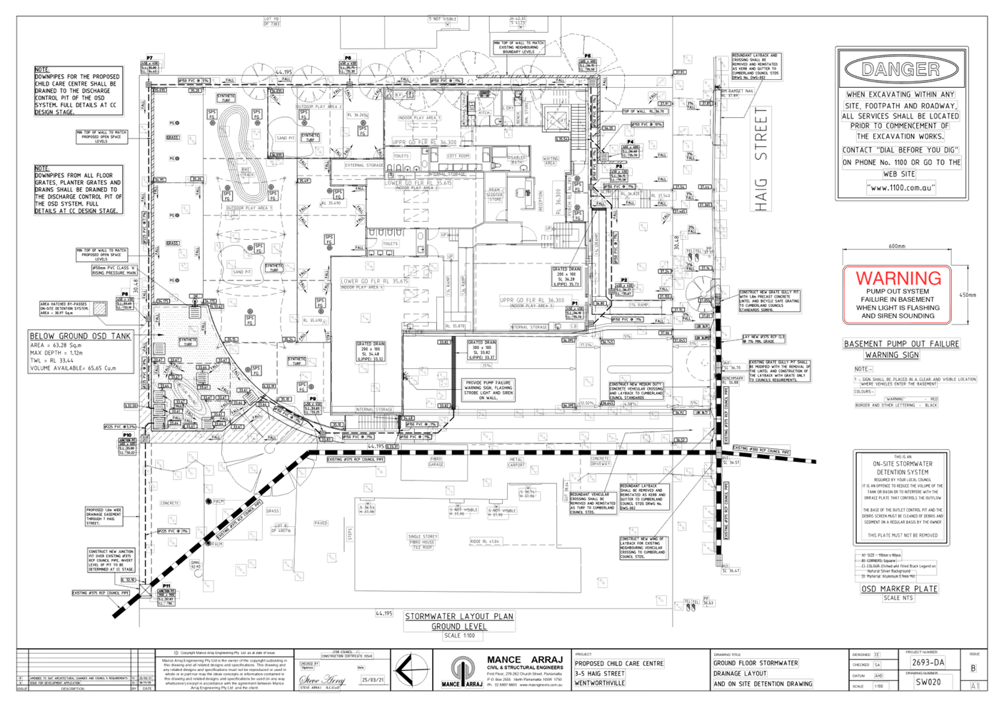
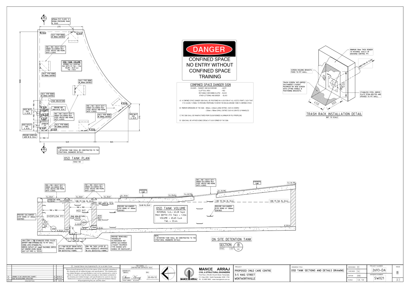
Overland flow swale for the OSD water and stormwater impact.
|
The proposed development’s drainage system is
designed to retain stormwater run-off from site through an underground
on-site stormwater detention system to be constructed at the site. This will
assist in ensuring that stormwater run-off is managed appropriately without
resulting in any ponding within the site and not impacting the children and
the adjoining neighbours. The engineering plans have been assessed by
Council’s Development Engineer who are satisfied that the proposed
stormwater system is in accordance with the requirements listed in the
Holroyd Development Control Plan 2013. It is noted that no swale is proposed
within the site boundaries.
|
|
13
|
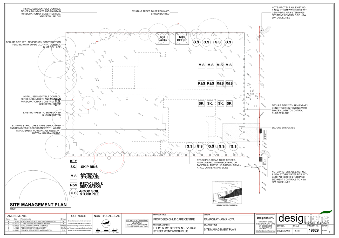
Construction related impacts.
|
Council imposes standard conditions of consent requiring
any development to be constructed to have minimal impacts on adjoining
properties. In any case where construction is not in accordance with the
conditions of consent or the approved plans, concerns shall be raised with
Council’s Compliance Team for further investigation and action.
In addition, conditions are imposed requiring a
dilapidation report to be prepared for any adjoining or nearby properties
that may be subject to potential damage as a result of any works being
undertaken on the development site. The dilapidation report provides a record
of the state of neighbouring properties prior to any works commencing and is
designed to assist all parties should damage occur as a result of development
works
|
|
14
|
Signage.
|
It is advised that signage is not proposed under the
subject application as indicated within the applicant’s Statement of
Environmental Effects.
|
|
15
|
Plans show works at No. 7 Haig Street without
neighbours’ consent.
|
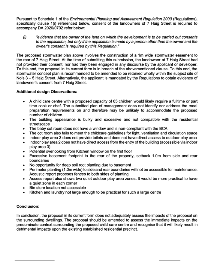
A 1.25m wide drainage easement is proposed through No. 7
Haig Street to connect to Council’s existing pipe, to permit the
disposal of stormwater to Jordan Street.
Deferred commencement conditions are imposed requiring
written owner’s consent from No. 7 Haig Street for the proposed
drainage easement, prior to the development consent being operational.
|
|
16
|
The design of the outdoor and indoor play areas does not
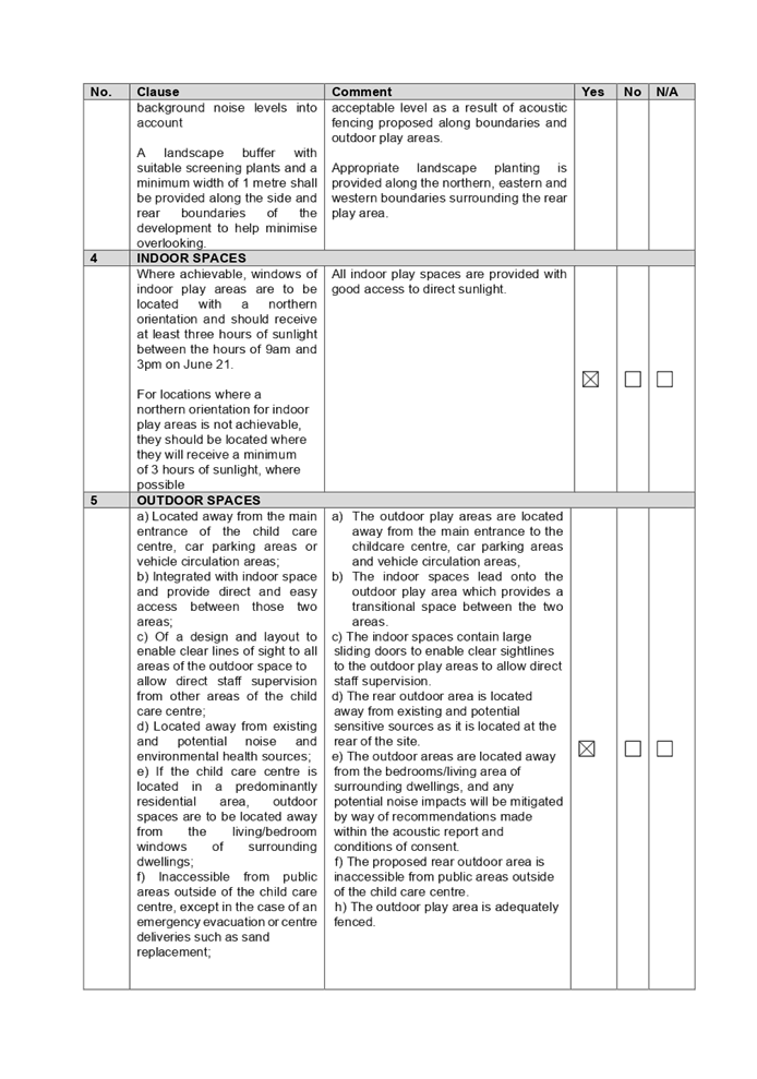
receive adequate amenity for children.
|
All indoor and outdoor play spaces are provided with good
access to direct sunlight and natural ventilation.
|
|
17
|
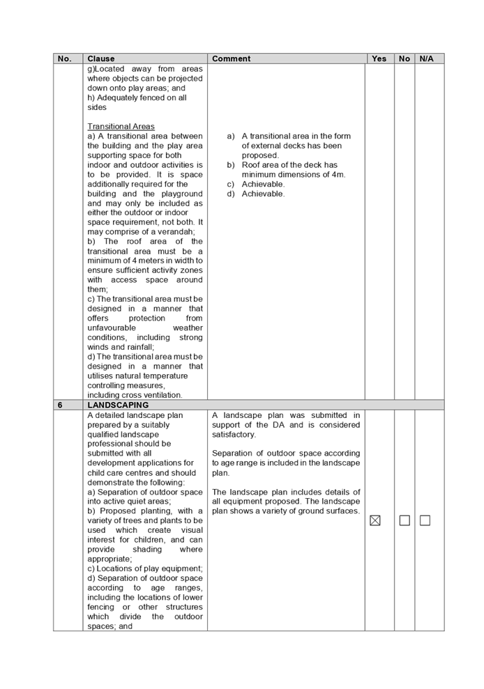
Proposed landscaping not accessible for maintenance.
|
Council's
Tree Management Officer has recommended the plantings and trees shown on the
landscape plan located between the northern, western and eastern acoustic
fencing to be replaced with Acmena smithii "minor", as these shrubs
are capable of growing and surviving within the constraints of the two fences
and can form a hedge in the order of 2.5-3m in height. Having regard to the
planting species selected, maintenance of the landscaped area can be carried
out within the site.
Conditions are also imposed
requiring a fully automated commercial grade irrigation system to be
installed to planting areas.
|
|
18
|
Excessive basement footprint.
|
Whilst basement parking shall not be located outside the
building footprint for single dwellings and dual occupancies, this provision
does not apply to child care centres.
The basement provides a 1m setback to the eastern,
northern and western boundaries.
Conditions are imposed requiring a dilapidation report to
be prepared for any adjoining or nearby properties that may be subject to
potential damage as a result of any works being undertaken on the development
site. The dilapidation report provides a record of the state of neighbouring
properties prior to any works commencing and is designed to assist all
parties should damage occur as a result of development works.
|
|
19
|
The centre cannot accommodate the proposed 68 children
having regard to the size of the kitchen and laundry facilities provided.
|
The proposed development provides adequate facilities
within the centre with respect to laundry, kitchen and waste, to accommodate
and service the proposed 62 children placements.
|
|
20
|
Plans do not include and consider the existing secondary
dwelling at No. 1 Haig Street.
|
Plans submitted identify the existing secondary dwelling
at No. 1 Haig St and impacts to this residence has been taken into
consideration in the assessment of the proposed development.
|
|
21
|
Parking of emergency vehicles and garbage trucks.
|
There is no requirement to provide parking for emergency
vehicles on site. The development provides adequate car parking on site in
accordance with the applicable planning instruments that apply to the
development.
|
|
22
|
Asbestos impact
|
The Preliminary Site Assessment conducted by EI Australia
Pty Ltd has been reviewed by Council’s Environmental Health Section and
considered to be satisfactory, subject to the imposition of condition
requiring submission of Hazardous Material Survey prior to demolition.
|
|
23
|
Children safety
|
The proposal provides suitable safe and secure fencing to
all outdoor areas which is considered satisfactory.
|
|
24
|
Baby cot room does not have a window and is non-compliant
with the BCA.
|
The baby cot room does not contain a window. Conditions
are imposed requiring compliance with the National Construction Code and this
matter can be addressed as part of the Construction Certificate application.
|
The public interest (EP&A
Act s4.15(1)(e))
In view of the foregoing analysis
it is considered that the development, if carried out subject to the conditions
set out in the recommendation below, will have no significant adverse impacts
on the public interest.
Cumberland Local
Infrastructure Contributions Plan 2020
The development would require the
payment of contributions in accordance with Cumberland Local Infrastructure
Contributions Plan 2020.
In accordance with the
Contribution Plan a total contribution of $25,556.00 would be payable prior to
the issue of a Construction Certificate, pursuant to Section 7.12 of the
EP&A Act.
Conditions are imposed in the
Draft Notice of Determination requiring the payment of these contributions
prior to the issue of any Construction Certificate for the development.
Disclosure of Political
Donations and Gifts
The applicant and notification
process did not result in any disclosure of Political Donations and Gifts.
The Application has been assessed
in accordance with the relevant requirements of the Environmental Planning and
Assessment Act 1979, State Environmental Planning Policy No. 55 –
Remediation of Land, State Environmental Planning Policy (Educational
Establishments and Child Care Facilities) 2017, Education and Care Services
National Regulations, Draft Cumberland Local Environmental Plan 2020, Holroyd
Local Environmental Plan 2013 and the Holroyd Development Control Plan 2013,
and is considered to be satisfactory for deferred commencement approval,
subject to conditions.
|
1. That
Development Application No. DA2020/0792 for demolition of existing structures
and construction of a part 1 storey, part 2 storey, 62 place child care
centre above basement parking and associated site works on land at 3-5 Haig
Street, Wentworthville; be approved as deferred commencement consent subject
to attached conditions, provided at Attachment 1.
2. Persons
whom have lodged a submission in respect to the application be notified of
the determination of the application.
|
1. Draft
Notice of Determination
2. Architectural
Plans
3. Landscape
Plan
4. Stormwater
Engineering Plans
5. Acoustic
Report & Noise Management Plan
6. Traffic
Report
7. Operational
Plan of Management
8. Previous
Architectural Plans Refused under DA2020-0145-1
9. State
Environmental Planning Policy (Educational Establishments & Child Care
Facilities) 2017
10. Holroyd
Local Environmental Plan 2013 Compliance Table
11. Holroyd
Development Control Plan 2013
12. Child
Care Planning Guideline 2017
13. Submissions
Received
DOCUMENTS
ASSOCIATED WITH
REPORT LPP023/21
Attachment 1
Draft Notice of Determination
Cumberland Local Planning Panel Meeting
9 June 2021

DOCUMENTS
ASSOCIATED WITH
REPORT LPP023/21
Attachment 2
Architectural Plans
Cumberland Local Planning Panel Meeting
9 June 2021
DOCUMENTS
ASSOCIATED WITH
REPORT LPP023/21
Attachment 3
Landscape Plan
Cumberland Local Planning Panel Meeting
9 June 2021
DOCUMENTS
ASSOCIATED WITH
REPORT LPP023/21
Attachment 4
Stormwater Engineering Plans
Cumberland Local Planning Panel Meeting
9 June 2021
DOCUMENTS
ASSOCIATED WITH
REPORT LPP023/21
Attachment 5
Acoustic Report & Noise Management Plan
Cumberland Local Planning Panel Meeting
9 June 2021


DOCUMENTS
ASSOCIATED WITH
REPORT LPP023/21
Attachment 6
Traffic Report
Cumberland Local Planning Panel Meeting
9 June 2021


DOCUMENTS
ASSOCIATED WITH
REPORT LPP023/21
Attachment 7
Operational Plan of Management
Cumberland Local Planning Panel Meeting
9 June 2021


DOCUMENTS
ASSOCIATED WITH
REPORT LPP023/21
Attachment 8
Previous Architectural Plans Refused under
DA2020-0145-1
Cumberland Local Planning Panel Meeting
9 June 2021
DOCUMENTS
ASSOCIATED WITH
REPORT LPP023/21
Attachment 9
State Environmental Planning Policy (Educational
Establishments & Child Care Facilities) 2017
Cumberland Local Planning Panel Meeting
9 June 2021

DOCUMENTS
ASSOCIATED WITH
REPORT LPP023/21
Attachment 10
Holroyd Local Environmental Plan 2013 Compliance Table
Cumberland Local Planning Panel Meeting
9 June 2021

DOCUMENTS
ASSOCIATED WITH
REPORT LPP023/21
Attachment 11
Holroyd Development Control Plan 2013
Cumberland Local Planning Panel Meeting
9 June 2021
DOCUMENTS
ASSOCIATED WITH
REPORT LPP023/21
Attachment 12
Child Care Planning Guideline 2017
Cumberland Local Planning Panel Meeting
9 June 2021
DOCUMENTS
ASSOCIATED WITH
REPORT LPP023/21
Attachment 13
Submissions Received
Cumberland Local Planning Panel Meeting
9 June 2021


Cumberland
Local Planning Panel Meeting
9 June 2021
Item
No: LPP024/21
Modification
Application for 14 Civic Avenue, Pendle Hill
Responsible
Division: Environment
& Planning
Officer: Executive
Manager Development and Building
File
Number: MOD2020/0309
|
Application
lodged
|
14 September 2020
|
|
Applicant
|
NR Pendle Pty Ltd
|
|
Owner
|
NR Pendle Pty Ltd
|
|
Application
No.
|
MOD2020/0309
|
|
Description
of Land
|
14 Civic Avenue PENDLE HILL
NSW 2145, Lot 100 DP 1027238
|
|
Proposed
Development
|
Section 4.55(2) application
for various modifications to approved mixed use development including
reconfiguration of basement car park, residential units and commercial space,
and alterations to façade treatment
|
|
Site
Area
|
4,173.00 m2
|
|
Zoning
|
B2- Local Centre
|
|
Disclosure
of political donations and gifts
|
Nil disclosure
|
|
Heritage
|
The subject site is not
heritage listed, is not located in the vicinity of any heritage items and is
not located within or in the vicinity of Heritage Conservation Area.
|
|
Principal
Development Standards
|
FSR
Permissible:
2:1
Approved:1.39:1
Proposed:1.63:1
|
Height
of Building
Permissible:
17m
Approved:
22.1m (maximum height of RL 59.25)
Proposed:
22m
(maximum height of RL 59.10)
|
|
Issues
|
- Unauthorised works (No Construction
Certificate obtained for completed works on site with the exclusion of
demolition, bulk excavation, shoring and piling)
- Building height
- Building depth and separation
- Apartment layout
- Basement design
- Traffic, parking and access
- Submission
|
1. Modification
Application No. MOD2020/0309 was received on 14 September 2020 for various
modifications to an approved mixed use development including reconfiguration of
basement car park, residential units and commercial space, and alterations to
façade treatment
2. The
application was publicly notified to occupants and owners of the adjoining
properties for a period of 21 days between 30 October 2020 and 20 November
2020. In response, one (1) submission was received.
3. The
assessment of the application identified issues including proximity of the
as-built balconies and On-Site Detention System to Sydney Trains electrical
assets, exceedance in building height, ground floor and basement
reconfiguration, stormwater, traffic and parking. As such the application was
deferred on 20 January 2021 seeking additional information. Amended plans and
information were provided to Council on 26 February 2021 and 31 March 2021. The
amended plans did not warrant re-notification as they are submitted to address
issues raised by Council and Sydney Trains.
Note: The building works
(subject of this modification) have already been completed without consent and
this application is seeking to regularise the unauthorised works. Further, it
is noted that no Construction Certificate was obtained for completed works on
site with the exclusion of demolition, bulk excavation, shoring and piling.
4. The
subject application has been assessed against the relevant provisions of the
Environmental Planning and Assessment Act 1979, State Environmental Planning
Policy No 65 – Design Quality of Residential Apartment Development (SEPP
65), Apartment Design Guide, Holroyd Local Environmental Plan 2013 (HLEP) and
Holroyd Development Control Plan 2013 (HDCP).
5. The
proposal seeks the following non-compliances which are considered supportable
as discussed in detail elsewhere in the report:
|
Control
|
Required
|
Approved
|
Proposed
|
% Variation
|
|
Building
Height
|
i)
Max. 17m
ii)
(HLEP 2013)
|
iii)
22.1m
|
- 22m to top of lift core
|
29.4%
|
|
Building Depth (ADG)
|
iv)
12-18m
|
v)
19.4m (along
the northern portion- Units 01 & 02)
|
vi)
22m
vii)
(along the
northern portion- Units 01 & 02)
|
22.2%
|
|
Building Separation
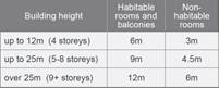
(Between habitable rooms and balconies) (ADG)
|
viii) Min. 9m - 5 storeys and above
|
8m
|
Level 4: 6m from COS
|
33.3%
|
|
Apartment layout (ADG)
|
ix)
8m – open plan
layouts
|
8m
|
10m
|
25%
|
|
Basement setback (HDCP)
|
3 metres (basement)
|
Min 1.25m, max 6m (along southern boundary)
|
0.45m along southern boundary
|
85%
|
Note: Only new non-compliances
have been discussed within the body of the report which are proposed under the
subject modification application. The original consent with the approved
architectural plans is attached at Attachment 4.
6. The
original development application DA2014/111/1 was determined by the former
Holroyd City Council at its meeting on 18 March 2015. The application is being
reported to the Cumberland Local Planning Panel (CLPP) for determination as it
is a development that contravenes a development standard by more than 10%.
7. The
application is recommended for retrospective approval subject to the conditions
in the draft notice of determination in Attachment 1.
Subject Site and Surrounding
Area
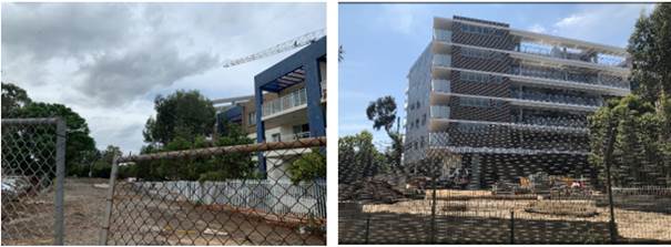
The subject site is known as 14
Civic Avenue Pendle Hill, and is legally described as Lot 82, 100 in DP 1027238.
The site is located on the northern side of Civic Avenue within the B2 Local
Centre zone.
The site is an irregular allotment
with a narrow frontage to Civic Avenue of 15.9m with access to the site being
through an access handle along the western boundary and a frontage of 35.445m
to Bentley Lane along the eastern boundary. The site has a total area of 4,173m2
and has a slope of approximately 4m from north western boundary to the
south eastern boundary.
During a site inspection it was
observed that the proposed works have already been completed without consent
and this application is seeking to regularise the unauthorised works.
The site adjoins the T1 and T5
rail line at its north-eastern boundary. Civic Park, Council’s car park
and Pendle Creek are located west of the site. Further to the east along
Bentley Lane are one to two storey shop top housing development.
The site is located approximately
100m north-west of the Pendle Hill Railway Station. The southern adjoining
property contains a part 3 & 4 storey mixed use development at 2-12 Civic
Avenue Pendle Hill. Further to the south, is a recently constructed 5 storey
mixed use development.
Figure
1 – Aerial view of subject
Figure
2 – Locality Plan of subject site
Figure
3, 4, 5, 6, 7 & 8 – subject site
Description of the Proposed
Development
Council has received a
modification application for alterations and additions to an approved mixed use
development incorporating the following works:
Basement Level
· Basement
reconfiguration resulting in an increased basement footprint along southern
boundary to accommodate 79 x total car spaces (including 65 x residential
spaces, and 14 x residential visitor spaces).
· Relocation
of stairs and lifts to a central core.
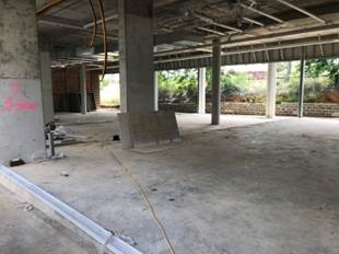
Ground Floor
· Deletion
of open spaces between commercial areas.
· Modify
layout of commercial/retail tenancies with a total commercial floor area of
420m² and changes to opaque glazing on north east façade.
· Relocation
of resident’s gym, services, bin, storage and amenities central to the
ground floor.
· Provision
of additional residential common room with size of 353m2.
· Relocation
of residential lobbies central to the ground floor.
· Provision
of residential storage areas.
· 36
x residential bicycle spaces located central to the ground floor, and 10 x
commercial/visitor bicycle spaces adjoining Bentley Lane.
· Provision
of 21 x commercial parking spaces within existing at grade parking area.
Level 1 – Level 3
· Deletion
of a 1 bedroom unit from Level 1 – Level 3, resulting in 16 x units per
floor.
· Minor
reconfiguration of internal layout of units, including larger bedrooms, larger
window areas and ensuites within 2 bedroom units with reduced setbacks to
northern boundary/railway corridor.
Level 4
· Additional
unit at Level 4 resulting in a total of 10 x units at this level.
· Minor
reduction of the communal open space area at the southern portion of the fourth
floor.
· Increased
building setback to the southern boundary.
· Minor
changes to location of services rooms.
Level 5
· Additional
unit at Level 5 resulting in a total of 8 x units at this level.
· Reduction
in balcony area of northern Units 01 & 02, and relocation of balcony for
northern Unit 01.
· Reconfiguration
of north-eastern facing units as a result of modified unit mix.
· Minor
changes to location of services rooms.
· Addition
of fire resistant glazing upon level 5 void area.
Roof/Level 6
· Deletion
of part of rooftop communal open space area.
· Changes
to façade treatments
A comparison of the originally
approved development and the proposed modified development is stipulated in the
following table.
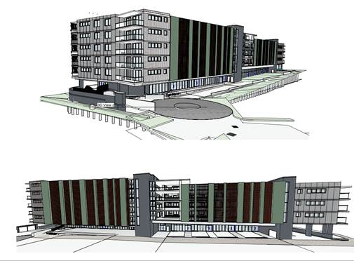
Figure
8 – Physical comparison
|
Feature
|
Approved
|
Modified
|
|
Maximum Building Height
|
22.1m – Max RL 59.25 (lift
overrun)
|
22m – Max RL 59.10 (lift
overrun)
|
|
GFA
|
5,790m2
|
6,785.3m2 (Increased GFA of 995.3m2)
|
|
Floor Space Ratio
|
1.39:1
|
1.63:1
|
|
Commercial Tenancies
|
5 x retail/commercial tenancies with an area of 390m2
|
4 x retail/commercial tenancies with an area of 420m2
|
|
Unit Mix
|
12 x 1 bedroom units
45 x 2 bedroom units
9 x 3 bedroom units
Total 66 units
|
12 x 1 bedroom units
49 x 2 bedroom units
5 x 3 bedroom units
Total 66 units
|
|
Car Parking Spaces
|
95 car spaces (as amended by previous S4.55 application)
comprising:
Residential spaces = 61
Visitor spaces = 14
Commercial spaces = 20; and a designated car wash
Total car spaces = 95 and a car wash bay
|
100 car spaces comprising:
Residential spaces = 65
Residential Visitor spaces = 14
Total Residential = 79
*Commercial spaces = 21; and a designated car wash
Total car spaces = 100 and a designated car wash
|
|
Vehicular access
|
Via Civic Avenue
|
Via Civic Avenue
|
|
Basement (along southern boundary)
|
Min setback = 1m
Max setback = 6m
|
.45m setback proposed.
|
|
Communal Space
|
Ground Floor = 759m² (including the Gym/common room)
Roof top – 641m²
Total area – 1,400m²
|
Ground Floor = 995.4m² (including the Gym/common room
and common terrace)
Roof top (Level 4) – 576.4m²
Total area – 1,571.8m²
|
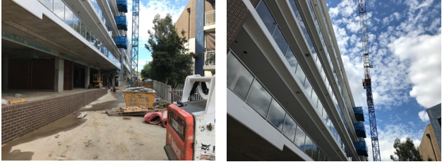
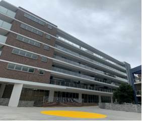
Figure
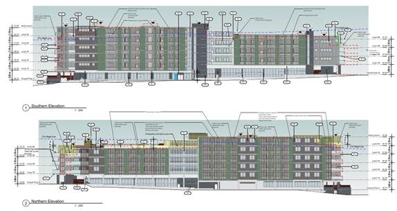
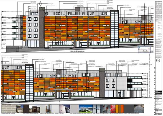
9: Proposed Elevations
Figure
10: Approved Elevations
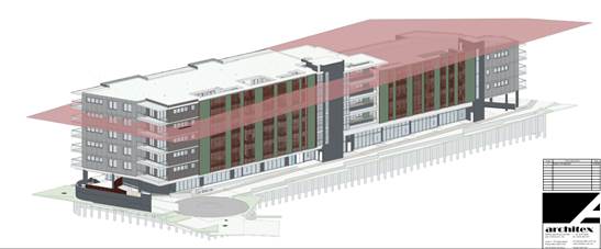
Figure
11: Proposed 3D Height Plane
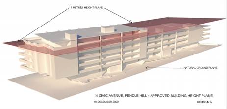
Figure
12: Approved 3D Height Plane
Figure
13: 3D Perspective View
History
· Development
Application 2014/111/1 was approved by the former Holroyd City Council at its
meeting on 18 March 2015 for the Demolition of existing structures;
construction of a part 4 & 6 storey mixed use development accommodating 66
residential units; 390m2 of commercial spaces (5 units) over
basement parking accommodating 99 carparking spaces and associated strata
subdivision thereof.
· Operational
consent was issued by Council on 27 May 2016.
· M2014/111/2
S4.55(1A) modification was approved on 27 May 2016 seeking alterations to the
north eastern elevation façade and deletion of a basement level to
facilitate Sydney Trains requirements and accommodating 95 carparking spaces.
· Construction
Certificate CC2014/111/1 dated 7 November 2019 for demolition and M2014/111/2CC
dated 21 November 2019 for bulk excavation, piling and shoring by a Private
Certifier.
· M2014/111/3
S4.55(1A) modification was refused by Cumberland Council on 10 September 2019
seeking to modify condition No. 15 with regards to timing of S7.11
contributions payments.
· MOD2019/5258
S4.55(1) modification was approved on 29 January 2020 to remove the reference
to DA2013/152/2 from condition 2 in DA2014/111/2.
· Building
Information Certificate HBC2019/0087 for piling, excavation, half of slab on
ground by Cumberland City Council dated 23 June 2020.
· Building
Information Certificate HBC2020/0232 was lodged on 28 September 2020 for the
unauthorised building works that have been undertaken without Construction
Certificate. It is to be noted that the subject BIC is currently being assessed
by Council and is on hold until such time the subject modification application
is determined.
The history of the subject
modification application is provided as below:
|
Date
|
Action
|
|
14/09/2020
|
The subject Development Application was lodged.
|
|
15/10/2020
|
The Development Application was referred to
Council’s internal and external departments for review.
|
|
30/10/2020 to 20/11/2020
|
Application placed on public notification for 21 days. In
response, one submission was received.
|
|
20/01/2021
|
The application was deferred seeking additional
information with regard to Sydney Trains requirements, ground floor retail
layout, basement reconfiguration, stormwater, traffic and parking.
|
|
26/02/2021
|
Amended plans and additional information were received by
Council. Amended plans did not warrant re notification.
|
|
31/03/2021
|
Further additional information was submitted to address
Sydney Trains matters with regard to summary of design changes (rail specific
potential impacts) and impact assessment on the rail corridor from the design
changes.
|
|
13/05/2021
|
Sydney Trains concurrence received.
|
|
9/06/2021
|
Application referred to CLPP for determination.
|
Applicants Supporting
Statement
The applicant has provided an amended Statement of
Environmental Effects dated 25 February 2021 prepared by Chapman Planning Pty
Ltd; and Design Verification Statement, prepared by a registered architect
Robert Del Pizzo – Architex in support of the application.
Contact with Relevant Parties
The assessing officer has undertaken a site inspection of
the subject site and surrounding properties and has been in regular contact
with the applicant throughout the assessment process.
Internal Referrals
Development Engineer
The development application was
referred to Council’s Development Engineer for comment who has advised
that the development proposal is satisfactory having regard to stormwater
management and the changes proposed to the basement reconfiguration, including
parking provision, and the proposed modifications can therefore be supported,
subject to recommended conditions of consent, which have been included in the
recommended conditions of consent.
Building Surveyor
The development application was
referred to Council’s Building Surveyor for comment who has advised that
the development proposal is satisfactory with regard to the proposed
modifications and therefore can be supported subject to compliance with
National Construction Code which have been included in the recommended
conditions of consent. Further, a construction certificate will be
required for the balance of works including but not limited to installation of
fire safety system, waterproofing, internal finishing to the units, ground floor
area, removal of the temporary lift, completion of the brickworks and external
finishes.
Environment and Health
The development application was
referred to Council’s Environmental Health Unit for comment who has
advised that the proposal is satisfactory with regard to acoustic assessment
and noise attenuation measure, subject to recommended conditions of consent,
which have been included in the recommended conditions of consent.
Waste Management
The development application was
referred to Council’s Waste Management Officer for comment who has
advised that the development proposal is satisfactory in terms of the proposed
waste collection, and therefore can be supported subject to recommended
conditions of consent, which have been included in the recommended conditions
of consent.
External Referrals
Department of Planning,
Industry and Environment
The proposal was referred to
Natural Resources Access Regulator (NRAR) -Department of Planning, Industry and
Environment for comment as the original application required approval under the
Water Management Act 2000, however it was advised that the proposed
modifications would not have any impact on the issued General Terms of Approval
and therefore considered satisfactory.
Sydney Trains
The development application was
referred to Sydney Trains pursuant to Clause 86 and 87 of State Environmental
Planning Policy (Infrastructure) 2007 who provided their concurrence in their
letter dated 13 May 2021.
PLANNING COMMENTS
Section 4.55(2):
|
Requirement
|
Comments
|
|
Council is satisfied that the development to which the
consent as modified relates is substantially the same development as the
development for which the consent was originally granted and before that
consent as originally granted was modified (if at all), and
|
The development as proposed to be modified is
substantially the same as the original consent, as the proposed modifications
are largely within the approved building footprint, and involve the
reconfiguration of basement for car parking arrangement, amendments to the
floors and the overall layout with an additional floor area at the upper
levels 4 & 5 to accommodate the reconfigured units. No additional units
are proposed, and the approved 4 – 6 storey form is largely
retained. The proposed amendments do not deviate from the approved
mixed use development on the subject site.
|
|
Council has consulted with the relevant Minister, public
authority or approval body (within the meaning of Division 5) in respect of a
condition imposed as a requirement of a concurrence to the consent or in
accordance with the general terms of an approval proposed to be granted by
the approval body and that Minister, authority or body has not, within 21
days after being consulted, objected to the modification of that consent, and
|
No Minister, public authority or other approval body was
required to be consulted regarding the proposed modification.
|
|
Council has notified the application in accordance with:
(i) the regulations, if the
regulations so require, or
(ii) a development control plan,
if the consent authority is a council that has made a development control
plan that requires the notification or advertising of applications for
modification of a development consent, and
|
See discussion on “Public Notification” in
this report.
|
|
Council has considered any submissions made concerning the
proposed modification within any period prescribed by the regulations or
provided by the development control plan, as the case may be.
|
See discussion on “Public Notification” in
this report.
|
|
Relevant matters referred to in Section 4.15(1) of the act
have been taken into consideration
|
Proposed modification is not contrary to the public
interest and the likely environmental impacts of the development as modified
are considered acceptable.
|
|
Council
has considered the reasons given by the consent authority for the grant of
the consent that is sought to be modified.
|
The development was initially approved as it was found to
be satisfactory with respect to:-
• Overall bulk and scale
• Provided adequate car parking, and vehicle
circulation.
• Compliance with the relevant planning instruments.
• Would assist in promoting employment opportunities
for the locality and providing residential development that is well
integrated with commercial uses.
• Satisfactory appearance.
It is considered that the previous conclusions have not
been altered and that the modified development is acceptable and a suitable
form of development.
|
The provisions of any
Environmental Planning Instruments (EP&A Act s4.15 (1)(a)(i))
State Environmental Planning
Policies
The proposed development is
affected by the following State Environmental Planning Policies:
(a) State
Environmental Planning Policy No. 55 – Remediation of Land (SEPP 55)
Clause 7 of SEPP 55 requires
Council to be satisfied that the site is suitable or can be made suitable to
accommodate the proposed development. The matters listed within Clause 7 have
been considered in the assessment of the original development application.
Council is satisfied that the site is suitable or can be made suitable to
accommodate the approved shop top housing development. The proposed
modifications have no bearing on the original SEPP 55 matters for
consideration, as assessed under approved DA2014/111.
(b) Statement
Environmental Planning Policy No. 65 - Design Quality of Residential Apartment
Development (SEPP 65)
SEPP 65 applies to the development
as the building is 3 storeys or more, and contains more than 4 dwellings. A
design statement addressing the design quality principles prescribed by SEPP 65
was prepared by the project architect. Integral to SEPP 65 is the Apartment
Design Guide (ADG), which sets benchmarks for the appearance, acceptable
impacts and residential amenity of the development. A revised design
verification statement signed by registered architect Robert Del Pizzo was
submitted with the s4.55(2) application.
A comprehensive assessment against
the Apartment Design Guide (ADG) controls and SEPP 65 sets 9 design quality
principles are provided at Attachment 5. The following table sets out the ADG
non-compliances.
|
Part 3 - Siting the
Development
|
|
3F
|
Visual Privacy
|
|
Yes
|
No
|
N/A
|
|
3F-1
|
Adequate building separation
distances are shared equitably between neighbouring sites, to achieve reasonable
levels of external and internal visual privacy.
|
|
Design Criteria
|
Separation between windows and
balconies is provided to ensure visual privacy is achieved. Minimum required
separation distances from buildings to the side and rear boundaries are as
follows:
|
Level 4 (5 storey)
Required setback = 9m
Southern boundary:
It is noted that internal layout
of some of the units have been modified. However, building separation from
ground floor to Level 3 generally remains as approved.
The communal open space provides
a setback of 6m (where a setback of 9m is required)
However, this will not have any
adverse amenity impacts on the adjoining development at No. 2-12 Civic Avenue
noting it is maintained to a height of 3 storeys and does not have a level at
the same height. Further, 1.6m high privacy screen and planter boxes
have been incorporated to mitigate any potential privacy impacts on the
subject adjoining property.
|
|
|
|
|
4B
|
Natural Ventilation
|
|
4B-3
|
Overall depth of a cross-over or
cross-through apartment does not exceed 18m, measured glass line to glass
line.
|
The proposal has a maximum
building depth of 22m measured at the northern portion of the development
(Units 01 & 02). This building depth is considered acceptable noting the
modified proposal provides a well-defined and well articulated corner element
at the northern elevation which serve to break-up the built form when viewed
from the street. With regard to residential amenity, the proposed building
depth of 22m at Units 01 & 02 will not have an adverse impact upon the amenity
of these units, as these are dual-aspect units that receive a high level of
solar access and natural ventilation.
|
|
|
|
|
4D
|
Apartment Size and Layout
|
|
4D-2
|
In open plan layouts, the
maximum habitable room depth is 8m from a window.
|
The maximum depth of central
units is 10m which is consistent with the approved development.
Notwithstanding, the proposed modifications do not result in any kitchen
being located further than 8m from the balcony/window openings ensuring a
reasonable level of amenity to the open plan areas. Further, the proposed
modifications reconfigure the central units within the development to allow
for a bedroom to have direct access to the unit balconies with improved
amenity and solar access.
|
|
|
|
|
|
|
|
|
|
|
|
|
(c) State
Environmental Planning Policy (Infrastructure) 2007 (ISEPP)
The provisions of the ISEPP 2007
have been considered in the assessment of the development application.
Clause 85 – Development
adjacent to railway corridors
The application is subject to
clause 85 of the ISEPP, because the subject site is in or adjacent to a railway
corridor. The original application was referred to Sydney Trains who provided
their concurrence subject to conditions. The subject modification application
was also referred to Sydney Trains and concurrence was provided in their letter
dated 13 May 2021.
Clause 86 – Excavation in,
above, below or adjacent to rail corridors
The application is subject to
clause 86 of the ISEPP as the proposed redevelopment of the site involves
excavation to a depth of at least 2m below ground level (existing), on land
within 25m (measured horizontally) of a rail corridor. Refer to the earlier
discussion under Clause 85.
Clause 87 – Impact of rail
noise or vibration on non-rail development
An acoustic report was submitted
in support of the original application, which was considered satisfactory by
Council’s Environmental Health Unit, subject to conditions.
The subject modification was
reviewed by Council’s Environmental Health Unit and it has been
considered satisfactory subject to imposition of condition to ensure that the
proposed modifications do not alter previous conclusions about acoustic
recommendations and that the proposal continue to meet the criteria as outlined
in the ISEPP.
(d) Statement
Environmental Planning Policy No 19 - Bushland in Urban Areas (SEPP 19)
The proposal does not propose to
disturb bushland zoned or reserved for public open space.
(e) State
Environmental Planning Policy (Vegetation in Non-Rural Areas) 2017
Tree removal on site has been
approved in the original assessment. No tree removal is proposed under the
subject modification application.
(f) State
Environmental Planning Policy (Coastal Management) 2018
The subject site is not identified
as a coastal wetland nor is it ‘land identified as “proximity area
for coastal wetlands” as per Part 2, Division 1 of the SEPP Coastal
Management 2018.
(g) State
Environmental Planning Policy (Building Sustainability Index: BASIX) 2004
A revised BASIX certificate no.
1029483M dated 14 May 2020 was submitted by the applicant. The certificate
achieves target scores and is consistent with the architectural plans.
Regional Environmental Plans
The proposed development is
affected by the following Regional Environmental Plans:
(a) Sydney
Regional Environmental Plan (Sydney Harbour Catchment) 2005
The subject site is identified as
being located within the area affected by the Sydney Regional Environmental
Plan (Sydney Harbour Catchment) 2005. The proposed development raises no issues
as no impact on the catchment is envisaged.
(Note: - the subject site is not
identified in the relevant map as ‘land within the ‘Foreshores and
Waterways Area’ or ‘Wetland Protection zone’, is not a
‘Strategic Foreshore Site’ and does not contain any heritage items.
Hence the majority of the SREP is not directly relevant to the proposed
development).
Local Environmental Plans
The provisions of the Holroyd LEP
2013 are applicable to the development proposal. It is noted that the
development achieves compliance with the key statutory requirements of the
Holroyd LEP 2013 and the objectives of the B2 Local Centre zone.
(a) Permissibility:-
The proposal is defined as
‘shop top housing’ under the provisions of Holroyd LEP 2013. Shop
top housing is permitted with consent in the B2 Local Centre land zone which
applies to the land. The proposed modification will continue the use of the
development as approved being a shop top housing.
The relevant matters to be
considered under Holroyd LEP 2013 and the applicable clauses for the proposed
development are summarised below. A comprehensive LEP assessment is contained
in Attachment 6.
Figure
6 –Holroyd LEP 2013 Compliance Table
|
DEVELOPMENT STANDARD
|
COMPLIANCE
|
DISCUSSION
|
|
4.3 Height of Buildings, max : 17m
|
No
|
Approved:
22.1m
Proposed:
22m
Variation: 29.6%
Under DA2014/111/1, the maximum building height was
approved for 22.1m to the top of the lift overrun (RL 59.25m AHD), which is a
variation of 30% (5.1m) to the development standard.
The proposed modification seeks a maximum RL height of
RL59.10 measured to the central lift overrun and equates to variation of
29.6% to the development standard.
Clause 4.6
variation is not required for a s4.55 modification application. The applicant
submitted justification to further contravene the building height development
standard, in which the additional floor area is confined to the northern end
and central portions of the development which does not present unreasonable
bulk. The modifications are not considered to
create unreasonable amenity impacts to the adjoining properties via
overshadowing or overlooking. The proposed modifications present no
significant change to the approved built form being a 4-6 storey mixed use
development which is consistent with the objectives of the B2 Local Centre
zone.
It is the view of Council Officers that justification
provided is satisfactory and having considered the application on its merit,
the variation to the maximum building height development standard is
considered acceptable in this instance.
|
|
4.4 Floor Space Ratio
Maximum
Floor Space Ratio – 2:1
Site area = 4,173m2
Permitted GFA =
8,346 m2
|
Yes
|
Approved GFA = 5790 m2
Provided GFA= 6785.3m2
Proposed FSR = 1.63:1
|
|
6.10 Ground floor
development in Zones B2 and B4
(3) Despite any other
provision of this Plan, development consent must not be granted to
development for the purposes of commercial premises or to a mixed use
development with a commercial premises component, or a change of use of a
building to commercial premises, on land to which this clause applies unless
the consent authority is satisfied that the ground floor of the building: (a)
will not be used for the purposes of residential accommodation,
(b) will not be used
for a car park or to provide ancillary car parking spaces,
(c) will provide for
uses and building design elements that encourage interaction between the
inside of the building and the external public areas adjoining the building.
|
Yes
|
The subject application
includes reconfiguration of parking within the western portion of the
site. It is noted that the original approval provided 20 car spaces on
the ground floor. However, the proposal now provides 21 commercial car spaces
(under the subject modification).
The new commercial car space
is a result of the reconfiguration of the parking spaces by the deletion of
the approved at-grade garbage bay and therefore is not constituted as an
additional car parking.
The
reconfiguration of the at grade car parking spaces has been noted by
Council’s Development Engineer and considered acceptable, subject to
amendment in red on the plan for the provision of garbage bay adjacent to the
existing car parking along the western boundary.
|
The
provisions of any proposed instrument that is or has been the subject (EP&A
Act s4.15 (1)(a)(ii))
(a) Draft
State Environmental Planning Policy (Environment)
The draft SEPP relates to the
protection and management of our natural environment with the aim of
simplifying the planning rules for a number of water catchments, waterways,
urban bushland, and Willandra Lakes World Heritage Property. The changes
proposed include consolidating the following seven existing SEPPs:
· State
Environmental Planning Policy No. 19 – Bushland in Urban Areas
· State
Environmental Planning Policy (Sydney Drinking Water Catchment) 2011
· State
Environmental Planning Policy No. 50 – Canal Estate Development
· Greater
Metropolitan Regional Environmental Plan No. 2 – Georges River Catchment
· Sydney
Regional Environmental Plan No. 20 – Hawkesbury-Nepean River (No.2-1997)
· Sydney
Regional Environmental Plan (Sydney Harbour Catchment) 2005
· Willandra
Lakes Regional Environmental Plan No. 1 – World Heritage Property.
The draft policy will repeal the
above existing SEPPs and certain provisions will be transferred directly to the
new SEPP, amended and transferred, or repealed due to overlaps with other areas
of the NSW planning system.
Changes are also proposed to the
Standard Instrument – Principal Local Environmental Plan. Some provisions
of the existing policies will be transferred to new Section 117 Local Planning
Directions where appropriate.
(b) Draft
Cumberland Local Environmental Plan (Draft CLEP)
The Draft Cumberland Local
Environmental Plan (Draft CLEP) has been prepared by Cumberland Council to
provide a single planning framework for the future planning of Cumberland City.
The changes proposed seek to harmonise and repeal the three existing LEPs
currently applicable to the Cumberland local government area, those being:
· Holroyd
Local Environmental Plan 2013,
· Parramatta
Local Environmental Plan 2011, and
· Auburn
Local Environmental Plan 2010.
The relevant planning controls for
the subject site, as contained within the Holroyd LEP 2013, are not proposed to
change under the Draft CLEP.
The provisions of any
Development Control Plans (EP&A Act s4.15 (1)(a)(iii))
The Holroyd DCP 2013 provides
guidance for the design and operation of development to achieve the aims and
objectives of the DCP. A comprehensive assessment and compliance table is
contained in Attachment 7.
The proposed development generally
complies with the provisions of Holroyd DCP 2013 with the exception of the
following matters which are outlined in the table below:
|
PART
B – RESIDENTIAL CONTROLS
|
|
Clause
|
Control
|
Proposed
|
Complies
|
|
6.3
|
Setbacks and separation
|
|
|
Basement setback to side and rear boundaries minimum 3m
|
Southern side boundary: 0.45m (minimum)
This is considered satisfactory as the proposal complies
with the minimum deep soil requirements, side setbacks and landscaping
requirements and will not result in any impacts on trees on adjacent sites.
|
No – Acceptable in this instance.
|
Note:
The proposed modification to reconfigure car parking spaces within the
basement will result in the imposition of additional conditions by Council for
the deletion of three proposed car spaces to allow for sufficient manoeuvring
area. The reduction in the numbers of car spaces from 100 to 97 will continue
to comply with ADG and RMS car parking rates as provided in Attachment 7.
The provisions of any planning
agreement that has been entered into under section 7.4, or any draft planning
agreement that a developer has offered to enter into under section 7.4
(EP&A Act s4.15(1)(a)(iiia))
There is no draft planning
agreement associated with the subject Development Application.
The provisions of the
Regulations (EP&A Act s4.15 (1)(a)(iv))
The proposed development raises no
concerns as to the relevant matters arising from the Environmental Planning and
Assessment Regulations 2000 (EP&A Reg).
The Likely Environmental,
Social or Economic Impacts (EP&A Act s4.15 (1)(b))
It is considered that the proposed
development will have no significant adverse environmental, social or economic
impacts in the locality.
The suitability of the site for
the development (EP&A Act s4.15 (1)(c))
The subject site is located within
an established commercial centre and is not known to be affected by any natural
hazards or other site constraints likely to have a significant adverse impact
on the proposed development. Accordingly, it is considered that the development
is suitable in the context of the site and surrounding locality.
Submissions made in accordance
with the Act or Regulation (EP&A Act s4.15 (1)(d))
|
Advertised (Council
website)
|
Mail
|
Sign
|
Not Required
|
In
accordance with Council’s Notification requirements contained
within the Holroyd DCP 2013, the proposal was publicly notified for a period of
21 days between 30 October 2020 and 20 November 2020. The notification
generated one unique submission in respect of the proposal. The issues raised
in the public submission are summarised and commented on as follows:
|
Insufficient information on
plans
|
The application was notified to adjoining properties via
written notice for a period of twenty one (21) days. In addition, the
application was also available for public viewing on Council’s website
during that submission period in accordance with the Environmental
Planning and Assessment Act 1979, Environmental Planning and Assessment
Regulation 2000 and Holroyd Development Control Plan 2013. It is noted that all relevant documents of the
application were made available on the Council’s website during the
notification period.
|
|
Setbacks and impact on privacy
|
The
proposed development as modified is considered to continue providing
appropriate separation to the adjoining properties that will in turn achieve
reasonable levels of external and internal visual privacy for future
residents and residents of adjoining properties. With regard to the
additional building bulk, Council notes that these will not present
unreasonable visual privacy impacts upon adjoining properties with the
incorporation of privacy screens (as required under the original approval)
and compliant building setbacks.
|
|
Overshadowing
|
This matter has
been discussed in the main body of this report, where it has been determined
that the proposed height is acceptable and the height exceedance relates to
the lift and stair overruns which is not considered to pose any unreasonable adverse impacts
with regard to potential blocking of natural sunlight Further, the proposed development as modified will continue to
provide appropriate building separation to the adjoining properties.
|
|
Construction noise
|
Conditions
under the original development consent were imposed to ensure any
building work including delivery of materials to and from the site
is carried out within restricted hours of work in order to
preserve the amenity of adjoining properties. Should ongoing issues arise
from the construction noise, Council’s Compliance Team should be
contacted to undertake further investigation.
|
The public interest (EP&A
Act s4.15(1)(e))
In view of the foregoing analysis
it is considered that the development, if carried out subject to the conditions
set out in the recommendation below, will have no significant adverse impacts
on the public interest.
Section 7.11 (Formerly S94)
Contribution Towards Provision or Improvement of Amenities or Services
The development would not require
the payment of contributions in accordance with Holroyd Council Section 94
Contributions Plan.
Disclosure of Political
Donations and Gifts
The applicant and notification
process did not result in any disclosure of Political Donations and Gifts.
The development as modified is
appropriately located within the B2 Local Centre zone under the relevant
provisions of the Holroyd LEP 2013, however variation in relation to the
building height is sought. Having regard to the assessment of the proposal from
a merit perspective, Council is satisfied that the development has been
responsibly designed and provides for acceptable levels of amenity for future
residents. It is considered that the proposal successfully minimises adverse
impacts on the amenity of neighbouring properties. Hence the development,
irrespective of the departures noted above, is consistent with the intentions
of Council’s planning controls and represents a form of development
contemplated by the relevant statutory and non-statutory controls applying to
the land.
For these reasons, it is
considered that the proposal is satisfactory having regard to the matters of
consideration under Section 4.15 and 4.55 of the Environmental Planning and
Assessment Act 1979, and the modified development may be granted retrospective
approval subject to conditions.
|
1. That
Modification Application No. MOD2020/0309 for Section 4.55(2) modification to
approved mixed use development including reconfiguration of basement car
park, residential units and commercial space, and alterations to
façade treatment on land at 14 Civic Avenue PENDLE HILL
NSW 2145 be granted retrospective approval subject to attached
conditions.
2. Persons
whom have lodged a submission in respect to the application be notified of
the determination of the application.
|
1. Draft Notice
of Determination
2. Architectural
Plans
3. Statement
of Environmental Effects and accompanied Clause 4.6 Variation
4. Previous
Approved Stamped Plans
5. Apartment
Design Guide Compliance Table
6. Holroyd
Local Environmental Plan 2013
7. Holroyd
Development Control Plan 2013
8. Submission
DOCUMENTS
ASSOCIATED WITH
REPORT LPP024/21
Attachment 1
Draft Notice of Determination
Cumberland Local Planning Panel Meeting
9 June 2021
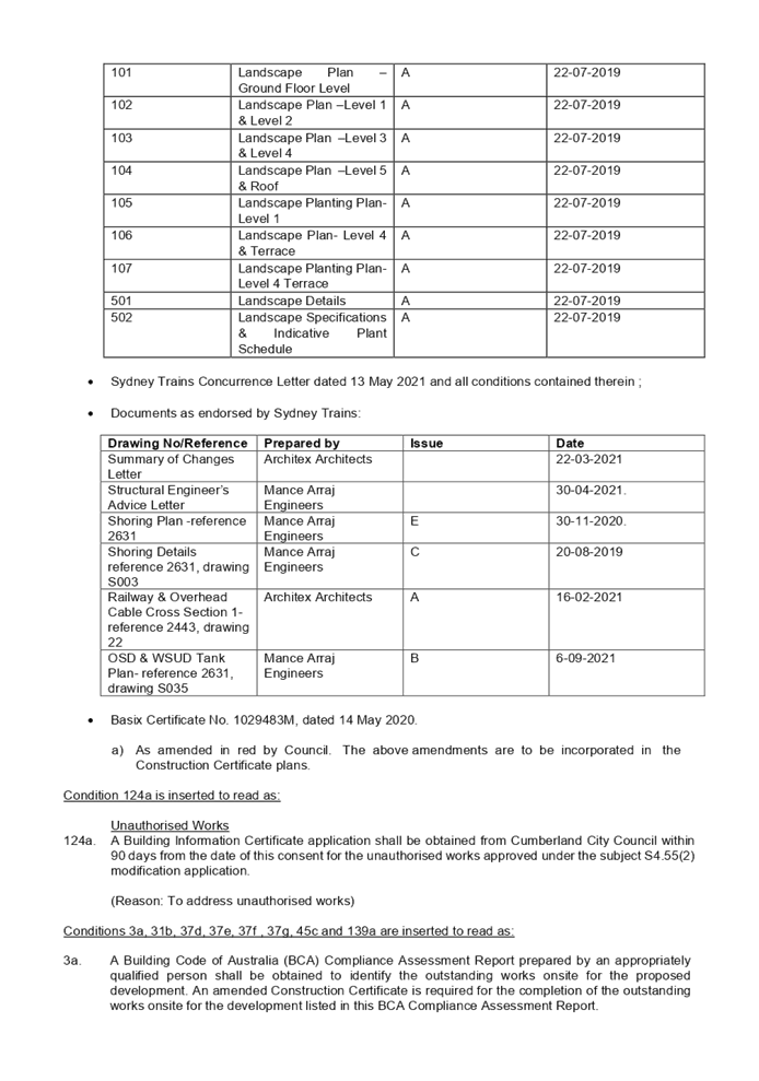
DOCUMENTS
ASSOCIATED WITH
REPORT LPP024/21
Attachment 2
Architectural Plans
Cumberland Local Planning Panel Meeting
9 June 2021
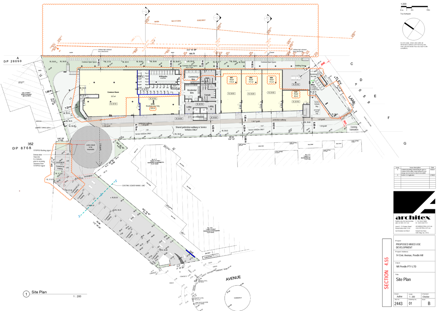
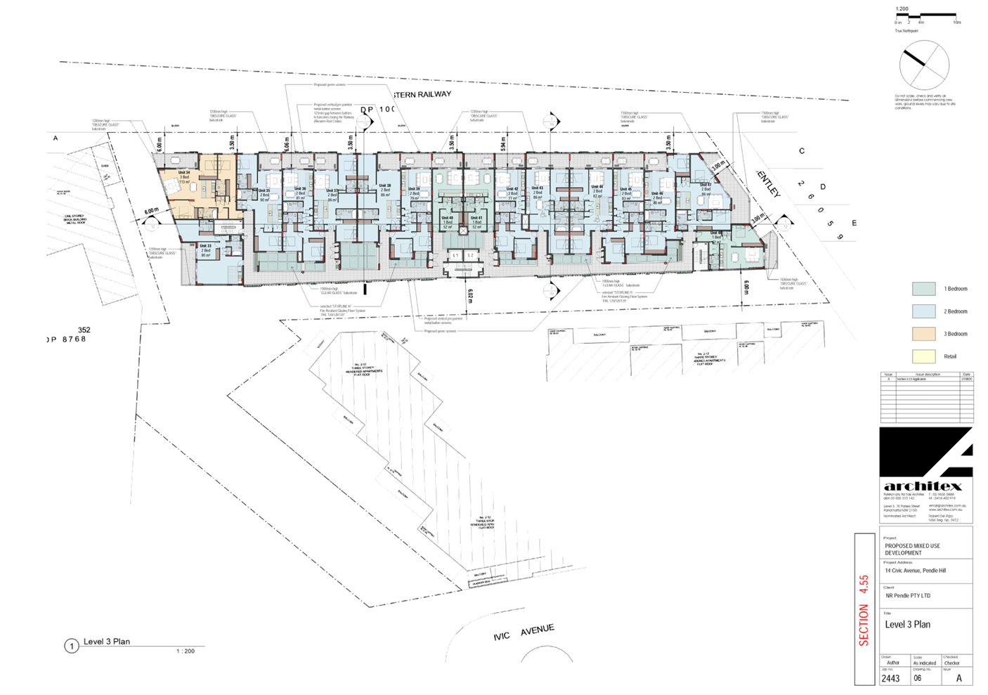
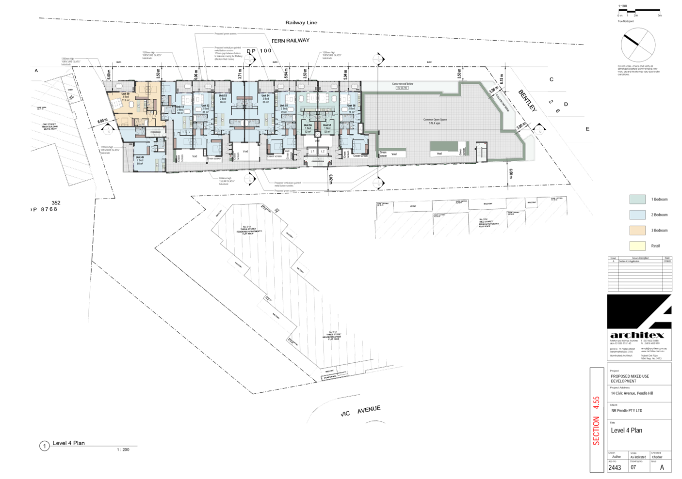
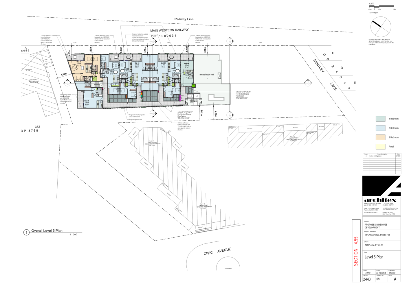
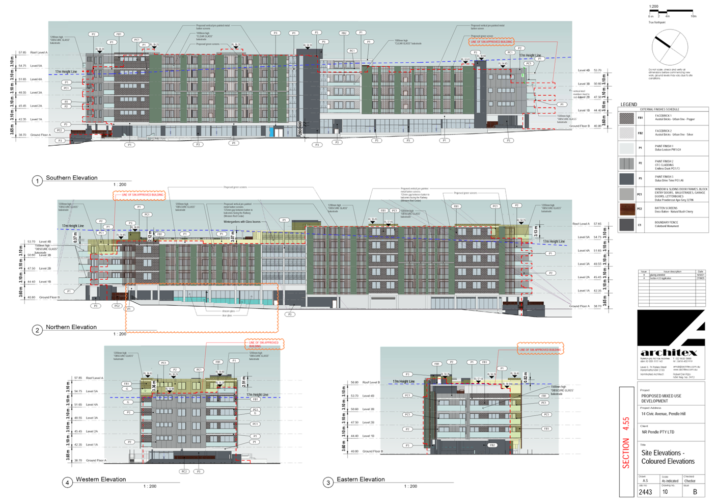
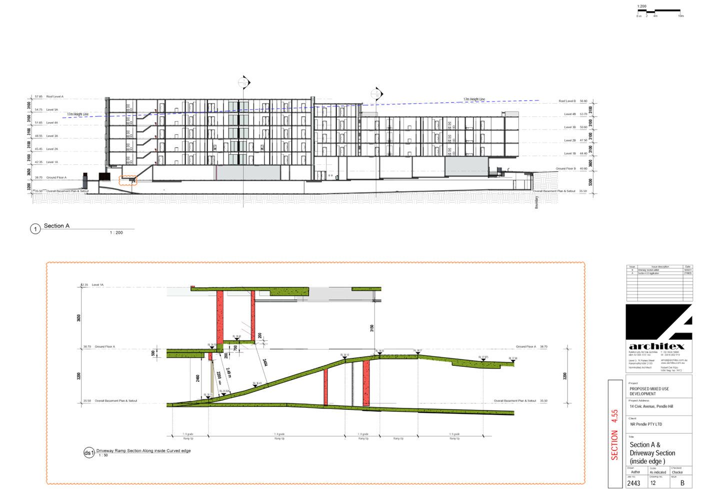
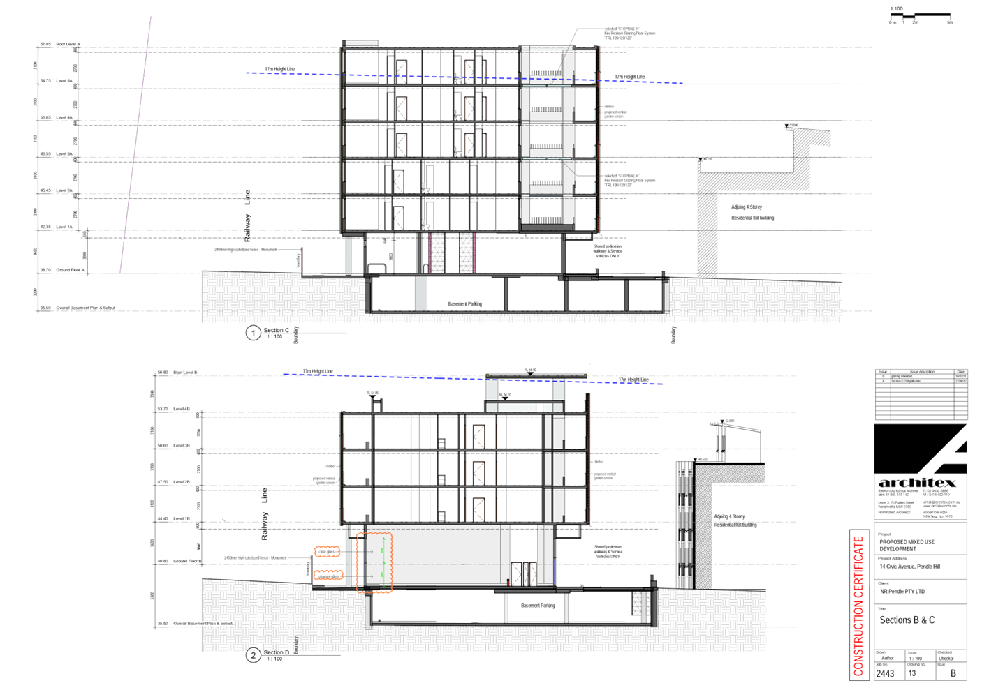
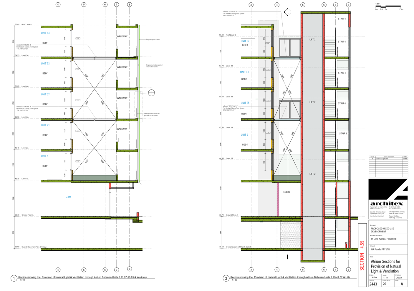
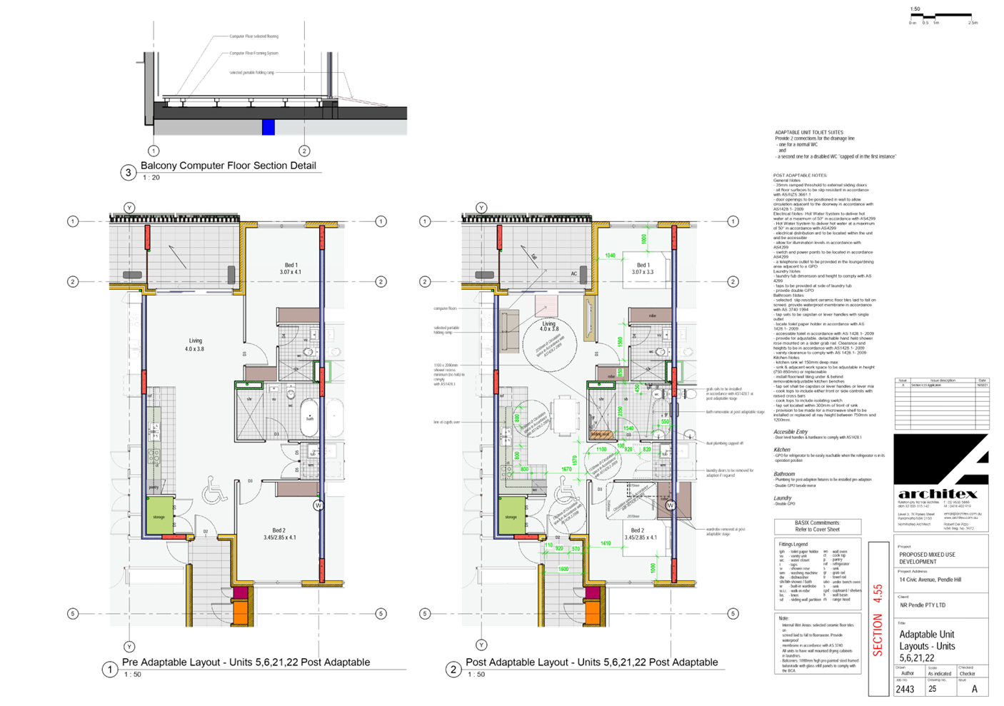
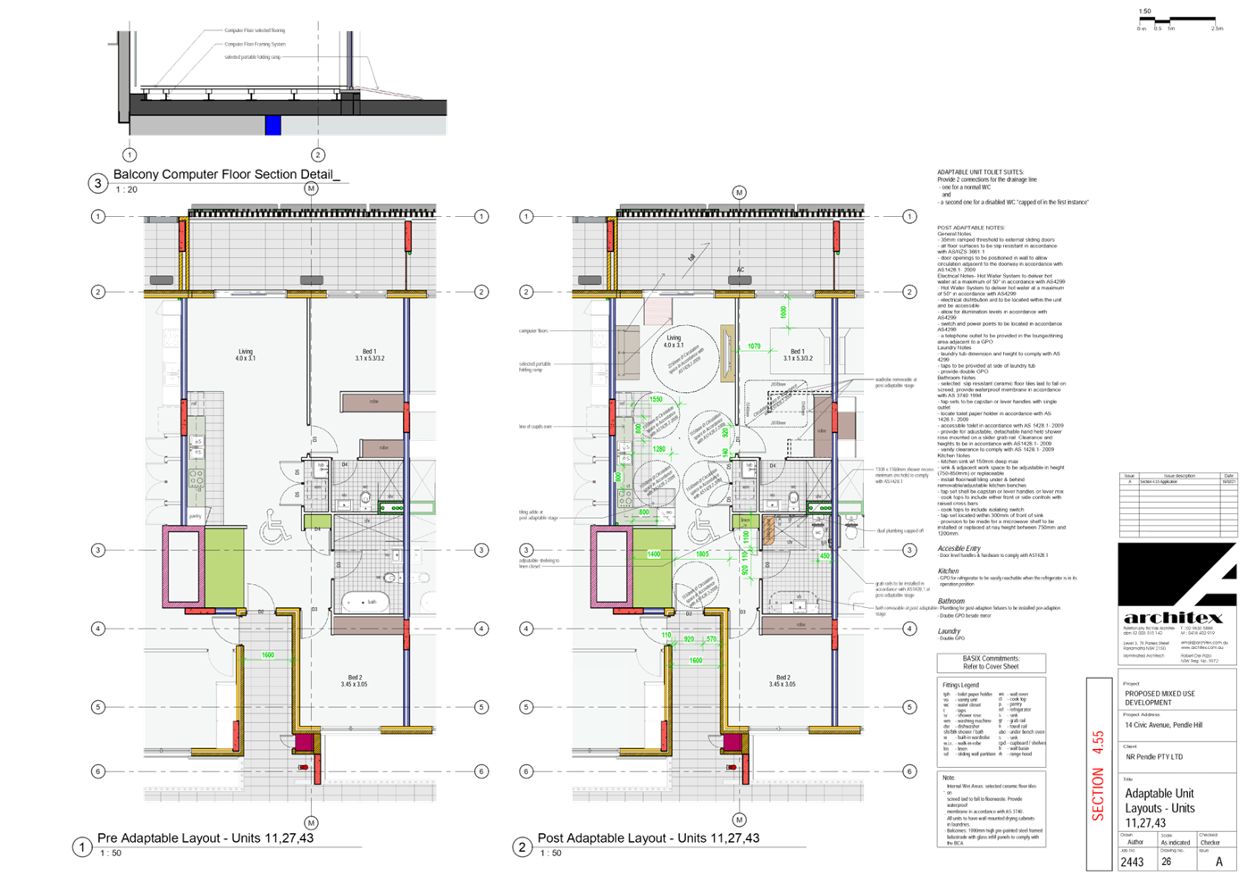
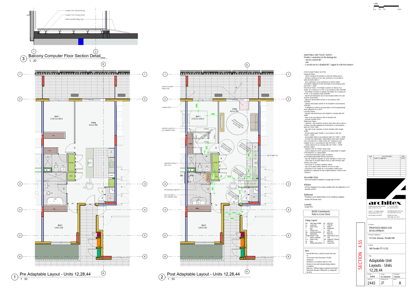
DOCUMENTS
ASSOCIATED WITH
REPORT LPP024/21
Attachment 3
Statement of Environmental Effects and accompanied
Clause 4.6 Variation
Cumberland Local Planning Panel Meeting
9 June 2021
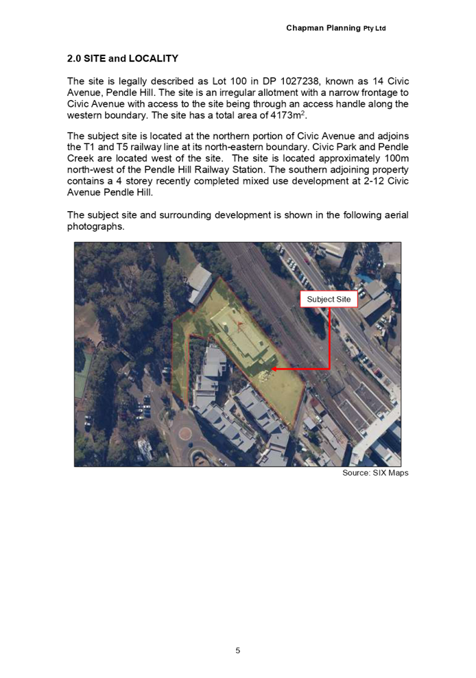
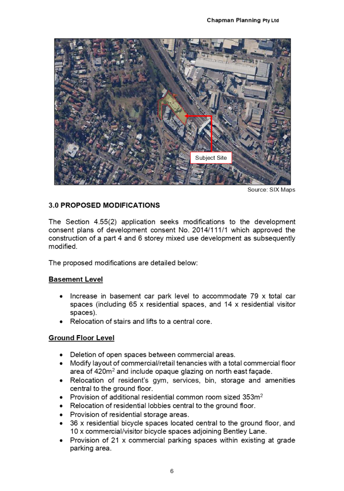
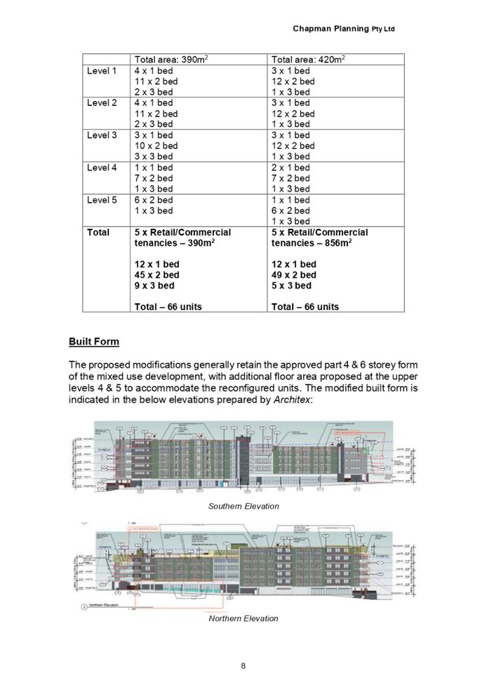
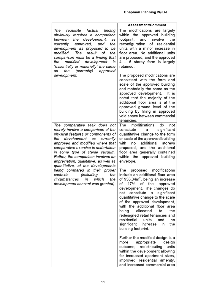
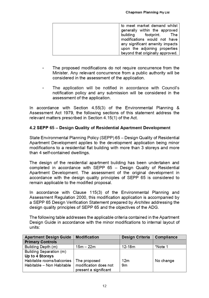
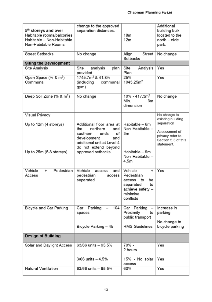
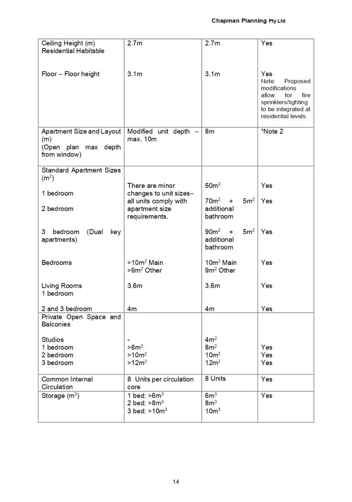
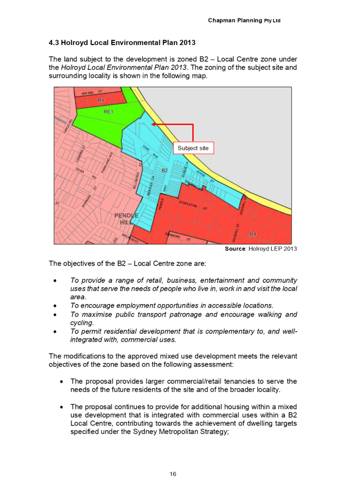
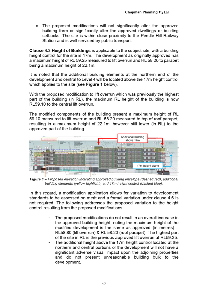
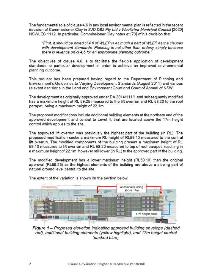

DOCUMENTS
ASSOCIATED WITH
REPORT LPP024/21
Attachment 4
Previous Approved Stamped Plans
Cumberland Local Planning Panel Meeting
9 June 2021
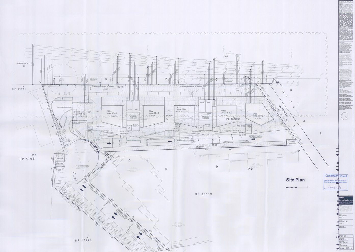
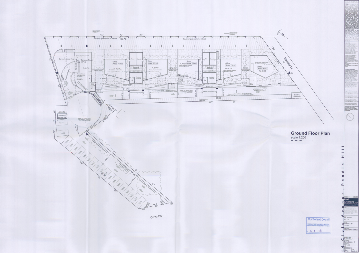
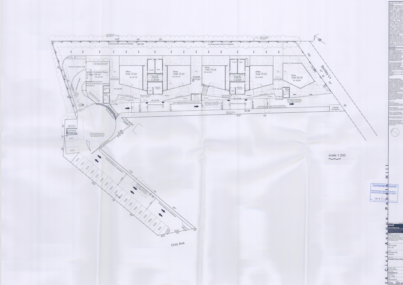
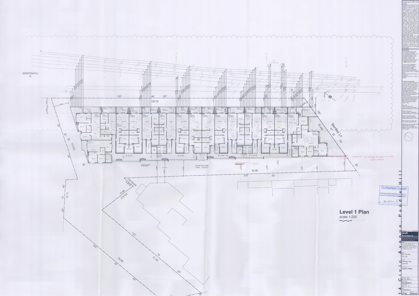
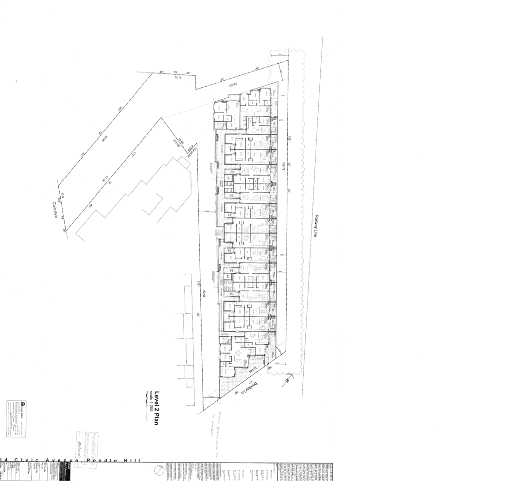
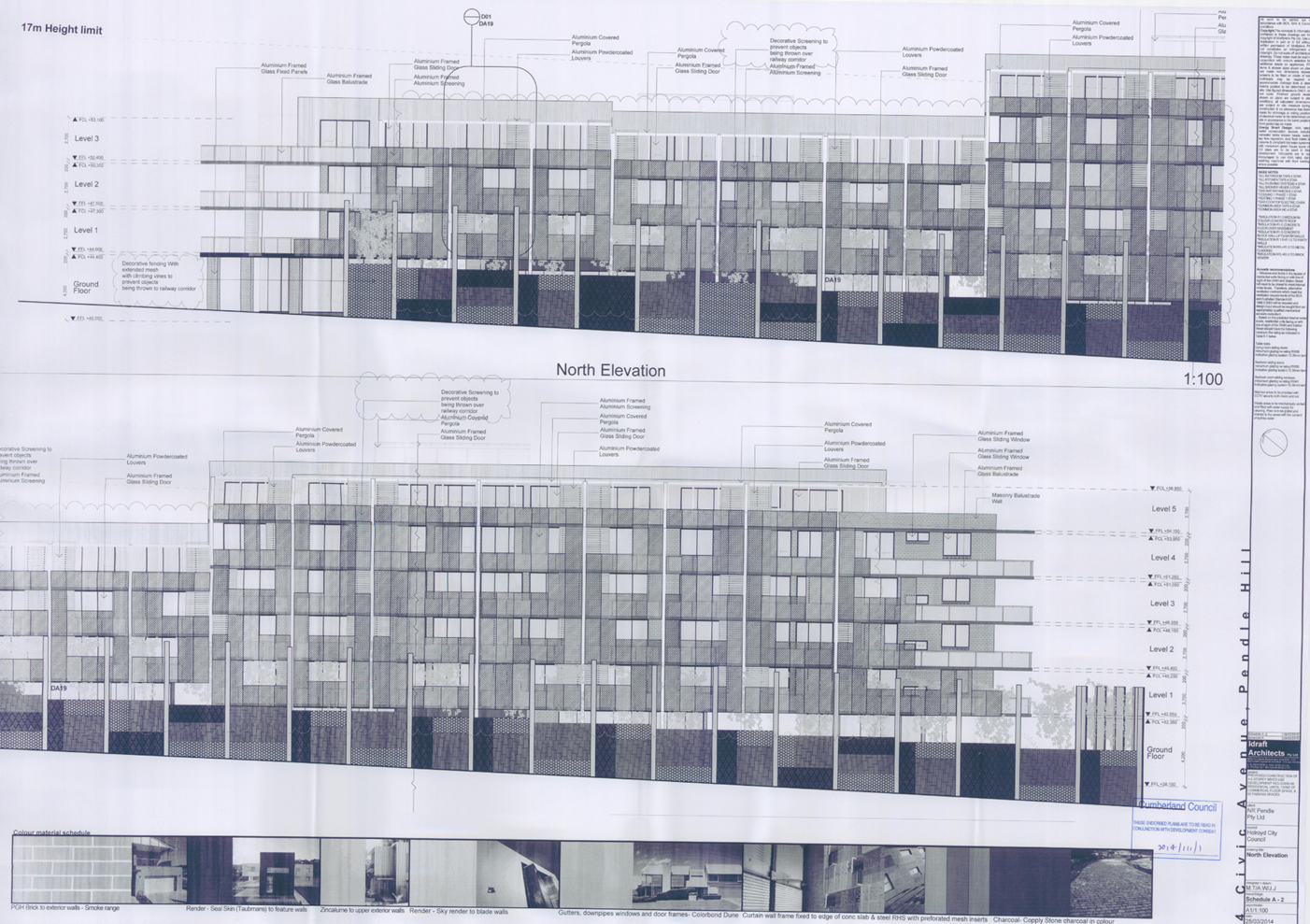
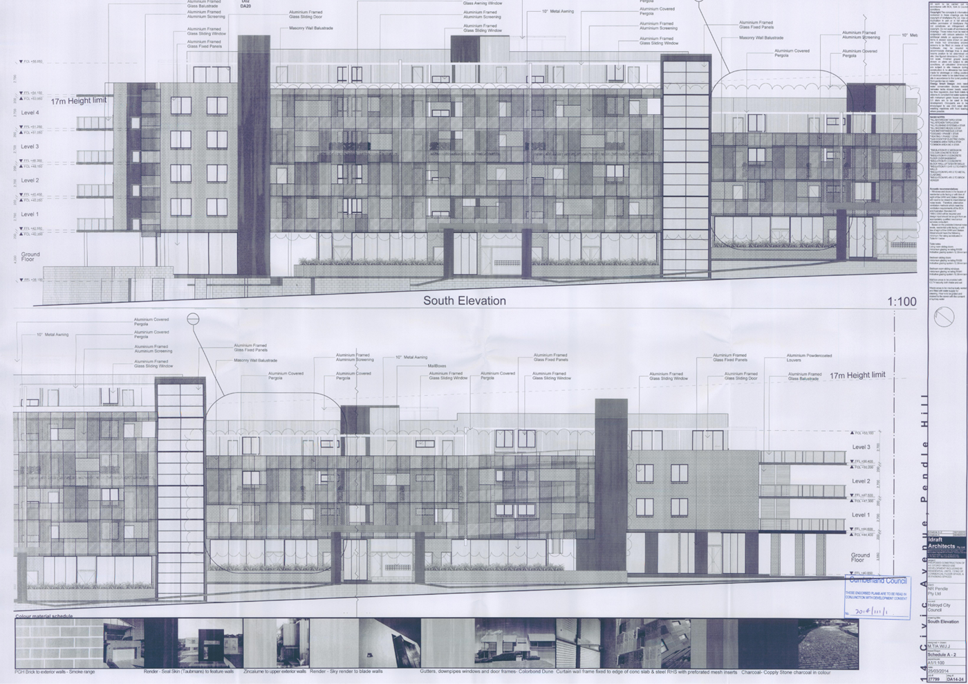
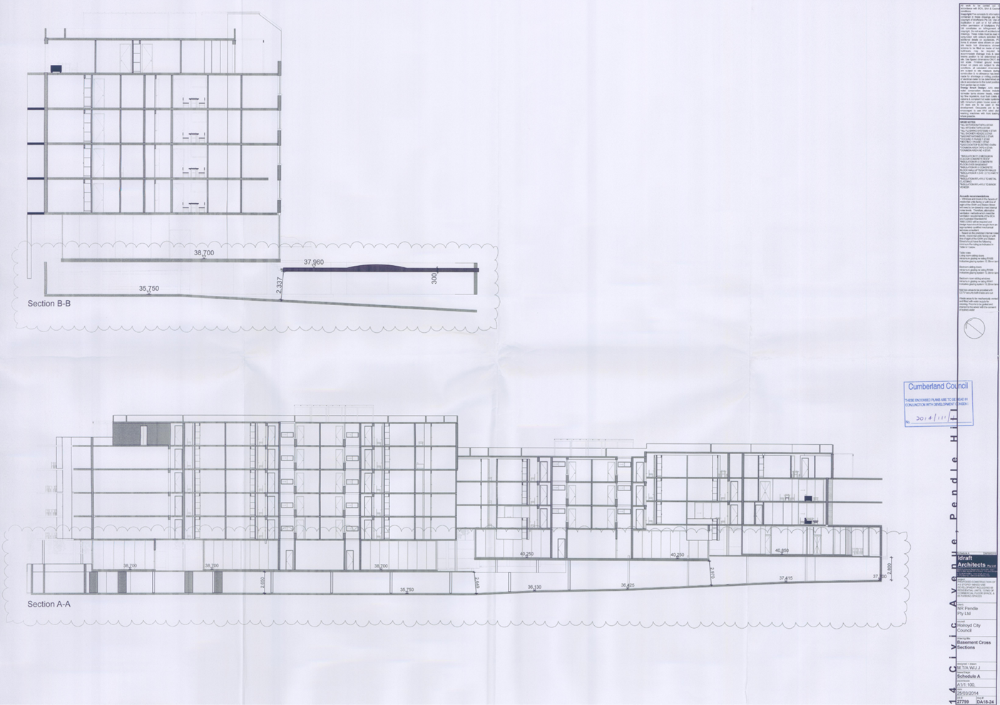
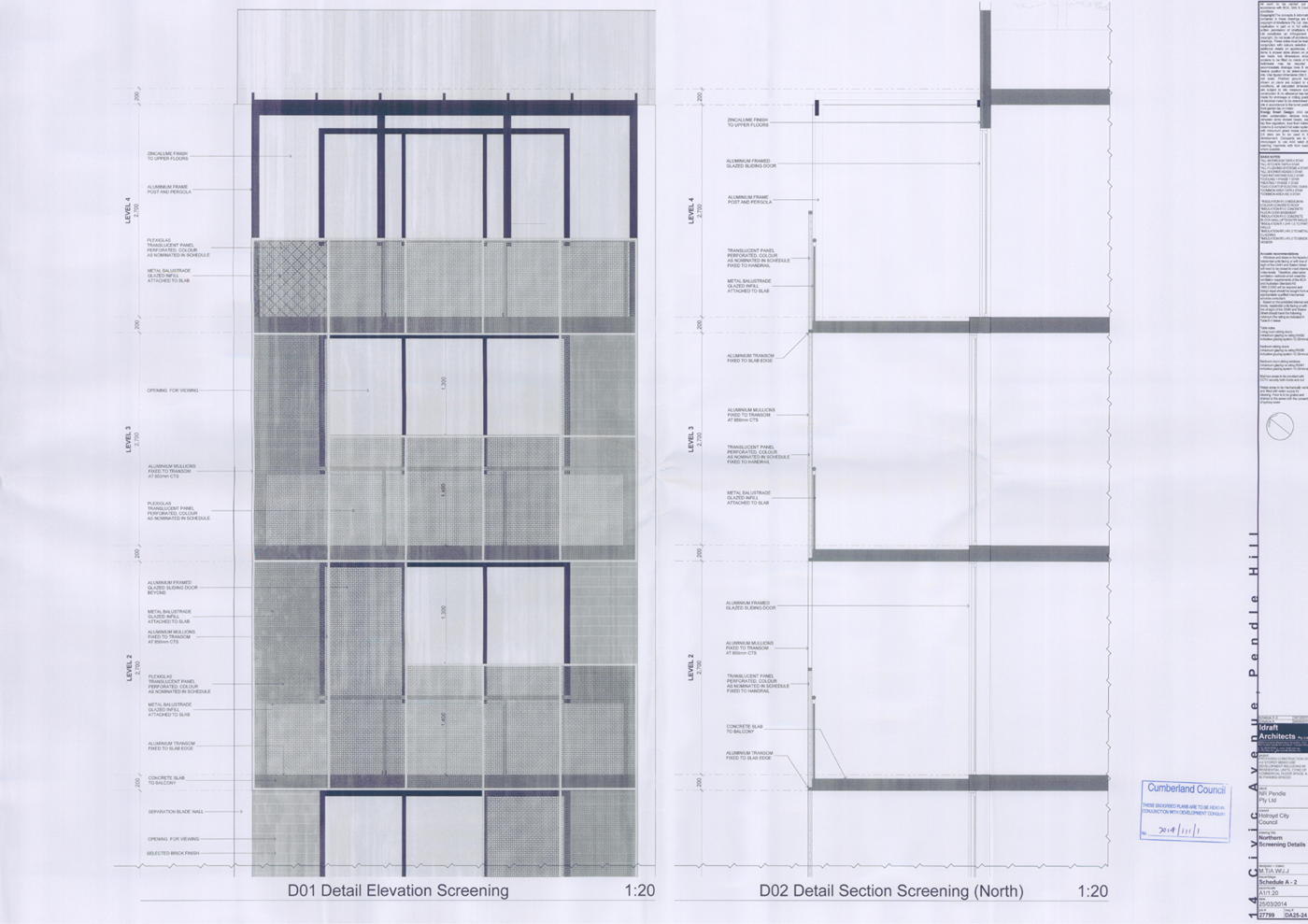
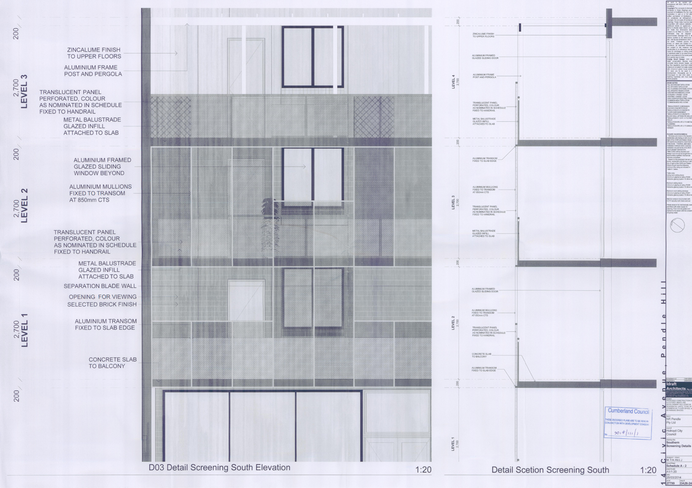
DOCUMENTS
ASSOCIATED WITH
REPORT LPP024/21
Attachment 5
Apartment Design Guide Compliance Table
Cumberland Local Planning Panel Meeting
9 June 2021
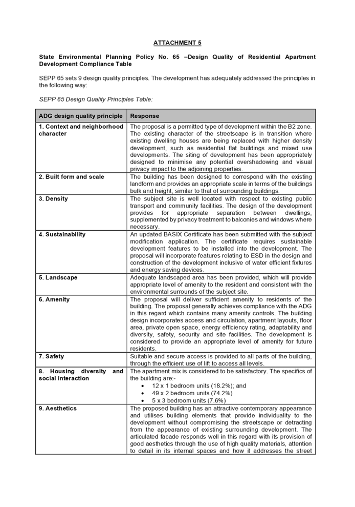
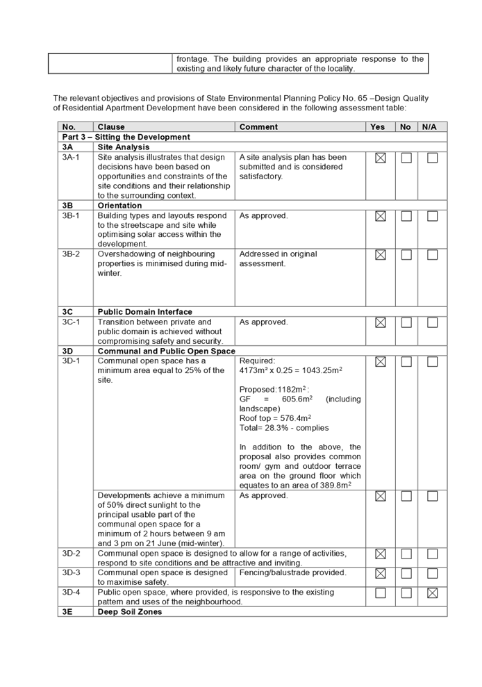
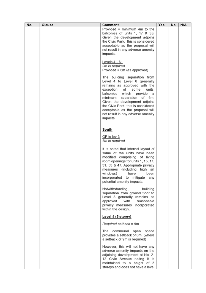
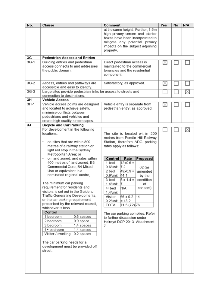
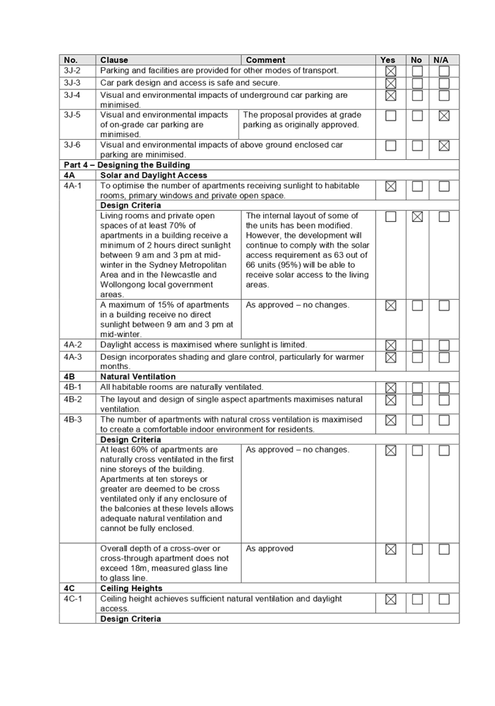
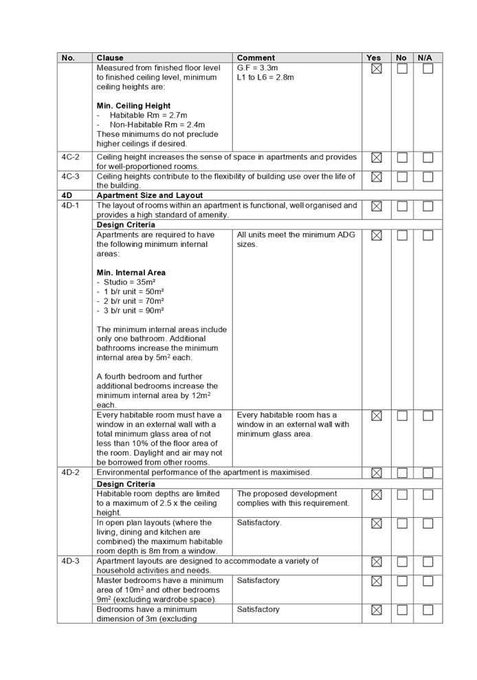
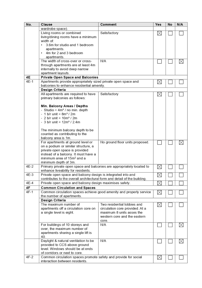
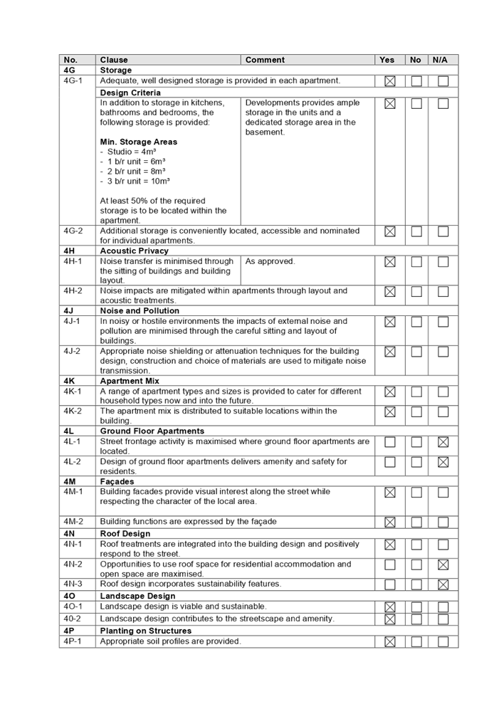
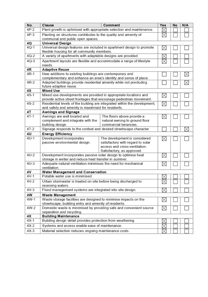
DOCUMENTS
ASSOCIATED WITH
REPORT LPP024/21
Attachment 6
Holroyd Local Environmental Plan 2013
Cumberland Local Planning Panel Meeting
9 June 2021
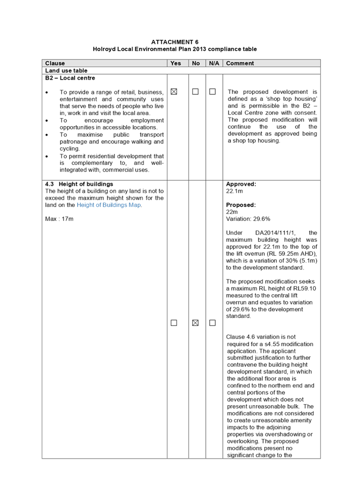
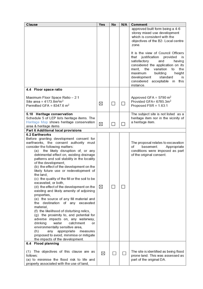
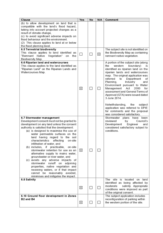

DOCUMENTS
ASSOCIATED WITH
REPORT LPP024/21
Attachment 7
Holroyd Development Control Plan 2013
Cumberland Local Planning Panel Meeting
9 June 2021
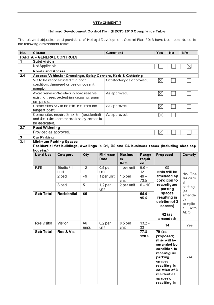
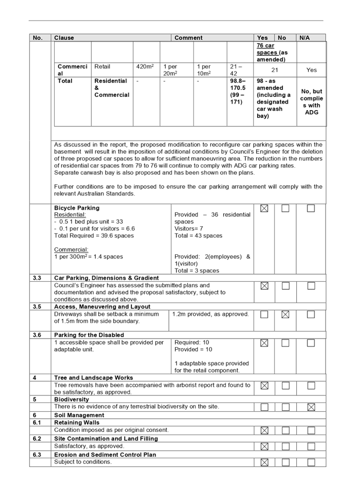
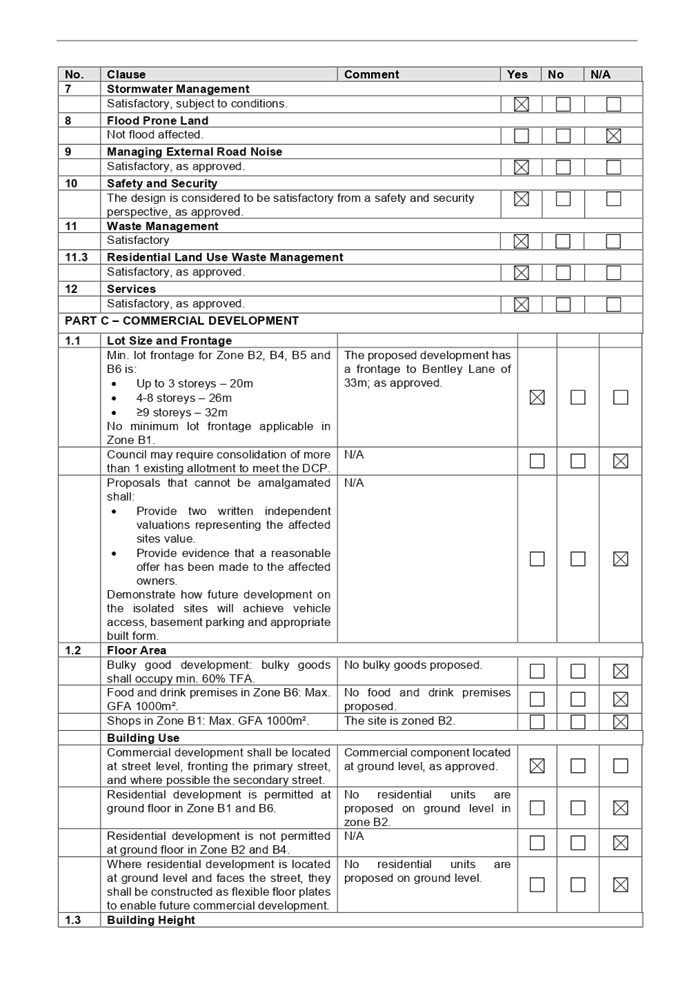
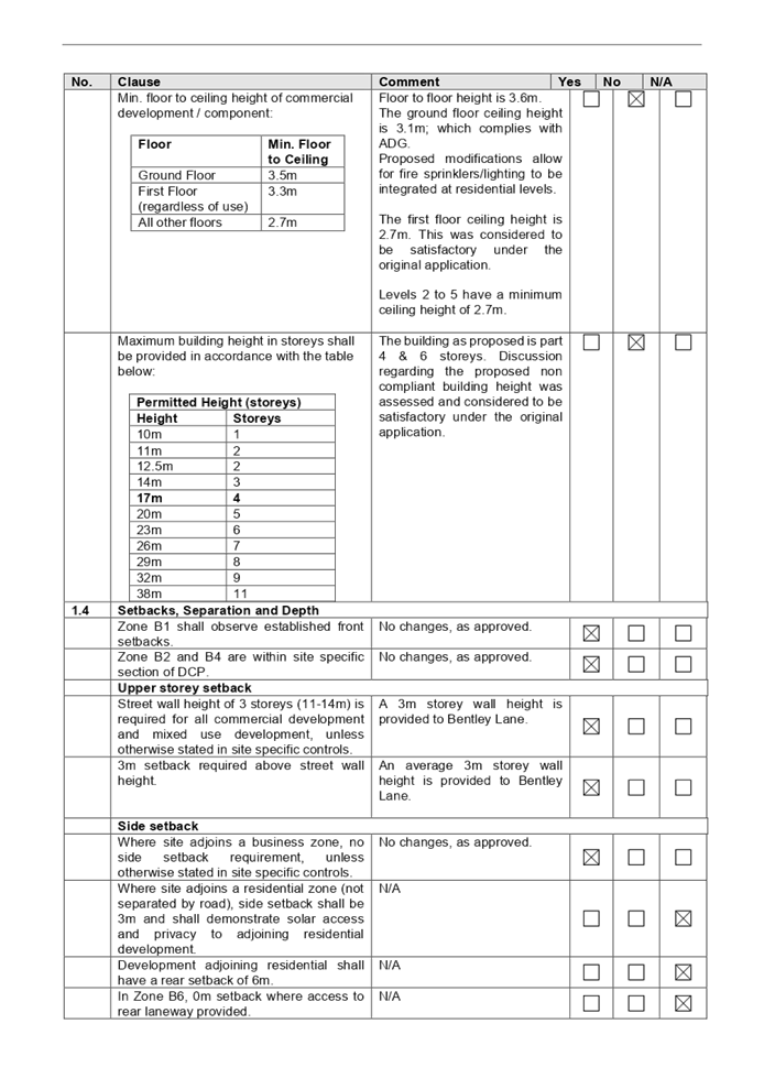
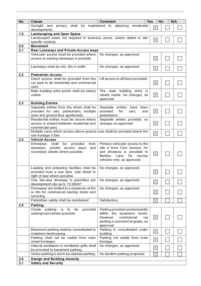
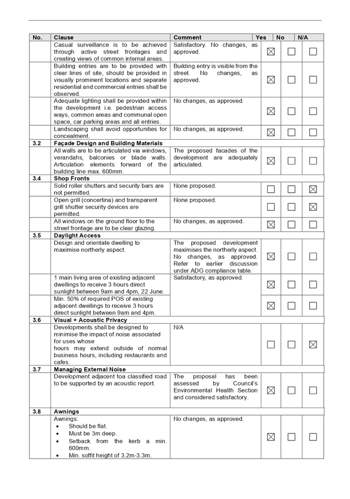
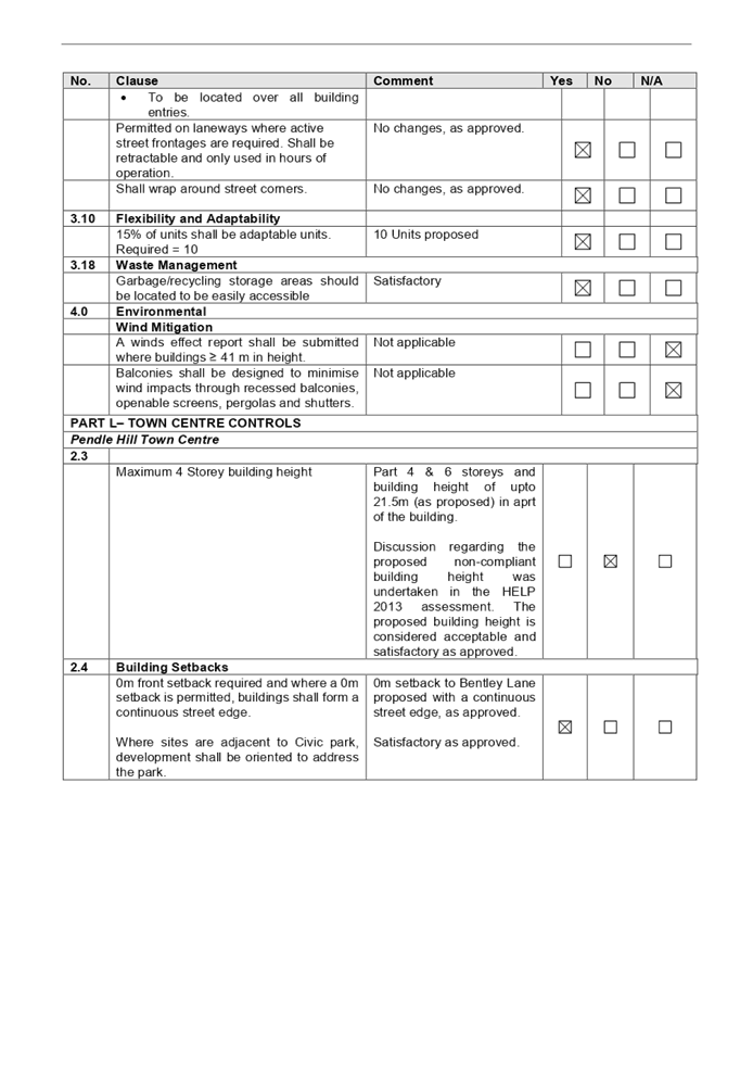
DOCUMENTS
ASSOCIATED WITH
REPORT LPP024/21
Attachment 8
Submission
Cumberland Local Planning Panel Meeting
9 June 2021

Cumberland
Local Planning Panel Meeting
9 June 2021
Item
No: LPP025/21
Development
Application for 33 Montague Street, Greystanes
Responsible
Division: Environment
& Planning
Officer: Executive
Manager Development and Building
File
Number: DA2021/0144
|
Application
lodged
|
24 March 2021
|
|
Applicant
|
Mr J Tannous
|
|
Owner
|
Mrs R H Sarkis & Mr E A F
Sarkis
|
|
Application
No.
|
DA2021/0144
|
|
Description
of Land
|
33 Montague Street, GREYSTANES
NSW 2145, Lot 3 DP 223196
|
|
Proposed
Development
|
Demolition of existing garage
and construction of a carport and awning
|
|
Site
Area
|
560.6 m2
|
|
Zoning
|
R2 – Low Density
Residential
|
|
Disclosure
of political donations and gifts
|
Nil disclosure
|
|
Heritage
|
No
|
|
Principal
Development Standards
|
N/A
|
|
Issues
|
No issues have been
identified
|
1. Development
Application No. DA2021/0144 was received on 24 March 2021 for the demolition of
existing garage and construction of a carport and awning.
2. The
application was publicly notified to occupants and owners of the adjoining
properties for a period of 14 days between 9 April 2021 and 23 April 2021. In
response, no submissions were received.
3. The
application is referred to the Panel as there is a declared conflict of
interest, whereby a Councillor is the owner of the subject site for the
Development Application.
4. The
application is recommended for conditional approval to the conditions as
provided in the attached schedule.
Subject Site and Surrounding
Area
The site forms Lot 3 DP 223196,
and is known as 33 Montague Street, Greystanes. The site comprises an area of
560.6m2 and the following dimensions are provided:
· Northern (side)
boundary: 33.8m
· Eastern (rear)
boundary: 17.75m
· Southern (side)
boundary: 37.2m
· Western (front)
boundary: 14m
The existing improvements on site
includes a double storey dwelling, with an inground swimming pool, timber deck
with awning and a shed. The site is also a corner allotment bounded by Montague
street as the primary street and Daniel Street as the secondary street.
A site inspection was carried out
on the 7 May 2021 and confirmed that the site is currently occupied by a double
storey dwelling with an inground swimming pool, timber desk with awning and a
shed. The site adjoins a single storey dwelling to the south and double storey
dwelling to the north and east.
Figure
1 – Locality Plan of subject site
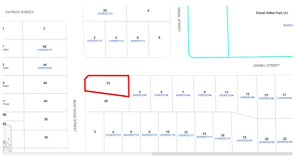
Figure
2 – Aerial view of subject site Nearmaps, 15 April 2021
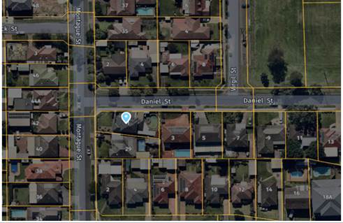
Figure
3 – Street view of subject site Figure 4 –
Proposed demolition of the garage
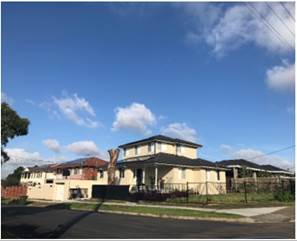
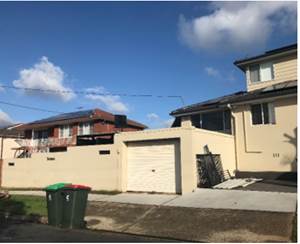
Description of the Proposed
Development
Council has received a development
application for a demolition of structures of the existing garage to create a
carport and awning
Structures to be demolished
· Single garage,
facing the secondary street (Daniel Street)
Construction
· A carport
· An attached awning
· A boundary fence
History
A tree application (TA2020/0121)
was approved on the 23 April 2021 for removal a tree (eucalyptus maculate)
spotted gum.
Applicants Supporting
Statement
The applicant has provided a
Statement of Environmental Effects prepared by Dvyne Design dated January 2021
and was received by Council on 24 March 2021 in support of the application.
Contact with Relevant
Parties
The assessing officer has undertaken a site inspection of
the subject site and surrounding properties and has been in regular contact
with the applicant throughout the assessment process.
Internal Referrals
Building Surveyor
The development application was
referred to Council’s Building Surveyor for comment who has advised that
the development proposal is satisfactory and therefore can be supported subject
to recommended conditions of consent.
External Referrals
The application was not required
to be referred to any external government authorities for comment.
PLANNING COMMENTS
The provisions of any
Environmental Planning Instruments (EP&A Act s4.15 (1)(a)(i))
(a) State
Environmental Planning Policy No. 55 – Remediation of Land (SEPP 55)
Clause 7 of SEPP 55 requires
Council to be satisfied that the site is suitable or can be made suitable to
accommodate the proposed development. The matters listed within Clause 7 have
been considered in the assessment of the development application.
|
Matter for
Consideration
|
Yes/No
|
|
Does the application involve re-development of the site or
a change of land use?
|
Yes
No
|
|
i)
Does the application involve
re-development of the site or a change of land use?
|
Yes
No
|
|
In the development going to be used for a sensitive land
use (e.g.: residential, educational, recreational, childcare or hospital)?
|
Yes
No
|
|
Does information available to you indicate that an
activity listed below has ever been approved, or occurred at the site?
acid/alkali plant and
formulation, agricultural/horticultural activities, airports, asbestos
production and disposal, chemicals manufacture and formulation, defence
works, drum re-conditioning works, dry cleaning establishments, electrical
manufacturing (transformers), electroplating and heat treatment premises,
engine works, explosive industry, gas works, iron and steel works, landfill
sites, metal treatment, mining and extractive industries, oil production and
storage, paint formulation and manufacture, pesticide manufacture and
formulation, power stations, railway yards, scrap yards, service stations,
sheep and cattle dips, smelting and refining, tanning and associated trades,
waste storage and treatment, wood preservation
|
Yes
No
|
|
Is the site listed on
Council’s Contaminated Land database?
|
Yes
No
|
|
Is the site subject to EPA
clean-up order or other EPA restrictions?
|
Yes
No
|
|
Has the site been the subject of
known pollution incidents or illegal dumping?
|
Yes
No
|
|
Does the site adjoin any
contaminated land/previously contaminated land?
|
Yes
No
|
|
Has the appropriate level of
investigation been carried out in respect of contamination matters for
Council to be satisfied that the site is suitable to accommodate the proposed
development or can be made suitable to accommodate the proposed development?
|
Yes
No
|
|
ii)
The site is not identified in
Council’s records as being contaminated. A site inspection reveals the
site does not have any obvious history of a previous land use that may have
caused contamination and there is no specific evidence that indicates the
site is contaminated. The subject site is currently used for residential
purposes and contamination is not expected.
|
Regional Environmental Plans
The proposed development is
affected by the following Regional Environmental Plans:
(a) Sydney
Regional Environmental Plan (Sydney Harbour Catchment) 2005
The subject site is identified as
being located within the area affected by the Sydney Regional Environmental
Plan (Sydney Harbour Catchment) 2005. The proposed development raises no issues
as no impact on the catchment is envisaged.
(b) Greater
Metropolitan Regional Environmental Plan No. 2 – Georges River
The subject site is not affected
by acid sulphate soils, does not disturb the bank or foreshore along the Georges
Rives tributaries, and the proposed development will not increase flooding or
stormwater runoff, will not discharge industrial waste and will not cause land
degradation by way of erosion, sedimentation, pollution, salinity or acidity.
The proposed development will not cause adverse impacts to the sensitive
natural environments within the catchment area and sewer is proposed to be
connected directly into the Sydney Water sewerage system.
Local Environmental Plans
Holroyd Environmental Plan 2013
The provision of the Holroyd Local
Environmental Plan 2013 is applicable to the development proposal. It is noted
that the development achieves compliance with the key statutory requirements of
the Holroyd Environmental Plan 2013 and the objectives of the R2 – Low
Density Residential zone.
(a) Permissibility:-
The subject site is zone R2
– Low Density Residential zone and the proposed works are ancillary
structures to facilitate the requirements of a car parking space for the
residential site and an attached awning. The main use of the development
remains as residential use. In this regard, the proposed development is
permissible and is consistent with the zone objectives.
The relevant matters to be
considered under Holroyd Environmental Plan 2013 and the applicable clauses for
the proposed development are summarised below.
Figure
5 – Holroyd LEP 2013 Compliance Table
|
DEVELOPMENT STANDARD
|
COMPLIANCE
|
DISCUSSION
|
|
4.3 Height of Buildings
max. 9m
|
Yes
|
Yes, complies. The carport and the awning are a maximum height of
2.5m.
|
|
4.4 Floor Space Ratio
max. 5:1
|
N/A
|
N/A the site area is 560.6m2
The proposed works is not additional floor space and the
floor area remains the same.
|
|
6.4 Flood Planning
|
N/A
|
N/A Not within a flood prone area
|
|
6.8 Salinity
|
Yes
|
Moderate salinity
|
The provisions of any proposed
instrument that is or has been the subject (EP&A Act s4.15 (1)(a)(ii))
(a) Draft
Cumberland Local Environmental Plan (Draft CLEP)
The Draft Cumberland Local
Environmental Plan (Draft CLEP) has been prepared by Cumberland Council to
provide a single planning framework for the future planning of Cumberland City.
The changes proposed seek to harmonise and repeal the three existing LEPs
currently applicable to the Cumberland local government area, those being:
· Holroyd Local
Environmental Plan 2013,
· Parramatta Local
Environmental Plan 2011, and
· Auburn Local
Environmental Plan 2010.
The current planning controls for
the subject site, as contained within the Holroyd Local Environmental Plan 2013
are not proposed to change under the Draft CLEP.
The provisions of any
Development Control Plans (EP&A Act s4.15 (1)(a)(iii))
The Holroyd Development Control
Plan 2013 provides guidance for the design and operation of development to
achieve the aims and objectives of the Holroyd Local Environmental Plan 2013.
A comprehensive assessment and compliance
table is contained in Appendix A.
The following table highlights
non-compliances with the DCP, which relate primarily to setback, and the
variations sought are considered satisfactory on merit in this instance:
Figure
6 – Holroyd DCP 2013 Compliance Table
|
Clause
|
Control
|
Proposed
|
Complies
|
|
1.11 Car Parking and roads
|
C7. Garages and carports at grade are to be located a
minimum of 1000mm behind the front wall of the building or 5.5 metres from
the street boundary, whichever is greater
|
The carport proposed along
secondary street frontage and is behind the building line.
|
Yes, complies as the current parking arrangement is
existing and no changes to the parking is being proposed.
|
|
2.6 Outbuilding Controls
|
The setback of the awning is to the boundary.
|
The setback of the awning is to the boundary
|
No. the proposal does not comply with the control.
However, a condition is to be imposed for the setback of
the awning to be 900mm from the boundary
|
|
C21.
Corner lot and Secondary Street Fences
|
Sheet metal fencing (i.e. colorbond) is not permitted for
corner lot and secondary street fencing.
|
A 1.8m colorbond fence is proposed
|
No, the proposal does not comply with the control.
However, the proposed colorbond fence forms part of the
proposed awning, which will create additional private open space.
Therefore, the proposal is considered acceptable based on merit, as the fence
will also maintain privacy measures. Additionally, the fence height is 1.8m which
complies with the boundary fence height.
|
The
proposed development mostly complies with the provisions of Council’s
Holroyd DCP 2013 and is considered acceptable from an environmental planning
view point.
The provisions of any planning
agreement that has been entered into under section 7.4, or any draft planning
agreement that a developer has offered to enter into under section 7.4
(EP&A Act s4.15(1)(a)(iiia))
There is no draft planning
agreement associated with the subject Development Application.
The provisions of the
Regulations (EP&A Act s4.15 (1)(a)(iv))
The proposed development raises no
concerns as to the relevant matters arising from the Environmental Planning and
Assessment Regulations 2000 (EP&A Reg).
The Likely Environmental,
Social or Economic Impacts (EP&A Act s4.15 (1)(b))
It is considered that the proposed
development will have no significant adverse environmental, social or economic
impacts in the locality.
The suitability of the site for
the development (EP&A Act s4.15 (1)(c))
The subject site and locality is
not known to be affected by any natural hazards or other site constraints
likely to have a significant adverse impact on the proposed development.
Accordingly, it is considered that the development is suitable in the context of
the site and surrounding locality.
Submissions made in accordance
with the Act or Regulation (EP&A Act s4.15 (1)(d))
|
Advertised (Council Website)
|
Mail
|
Sign
|
Not Required
|
In
accordance with Council’s notification requirements contained within the
Holroyd DCP 2013, the proposal was publicly notified for a period of 14 days
between 9 April 2021 and 23 April 2021. No submissions were received in
respect of the proposed development.
The public interest (EP&A
Act s4.15(1)(e))
In view of the foregoing analysis
it is considered that the development, if carried out subject to the conditions
set out in the recommendation below, will have no significant adverse impacts
on the public interest.
Cumberland Local
Infrastructure Contributions Plan 2020
The development would not require the payment of
contributions in accordance with Cumberland Local Infrastructure Contributions
Plan 2020.
Disclosure of Political
Donations and Gifts
The applicant and notification
process did not result in any disclosure of Political Donations and Gifts.
The development application has
been assessed in accordance with the relevant requirements of the Environmental
Planning and Assessment Act 1979, Holroyd LEP 2013 and Holroyd DCP 2013 and is
considered to be satisfactory for approval subject to conditions.
The proposed development is
appropriately located within the R2 – Low Density Residential under the
relevant provisions of the Holroyd Local Environmental Plan 2013. The proposal
is consistent with all statutory and non-statutory controls applying to the
development. The development is considered to perform adequately in terms of
its relationship to its surrounding built and natural environment, particularly
having regard to impacts on adjoining properties.
For these reasons, it is
considered that the proposal is satisfactory having regard to the matters of
consideration under Section 4.15 of the Environmental Planning and Assessment
Act 1979, and the development may be approved subject to conditions.
|
That Development Application
No. DA2021/0144 for the demolition of existing garage and construction of a
carport and awning on land at 33 Montague Street GREYSTANES NSW 2145 be
approved subject to attached conditions
|
1. Draft Notice
of Determination
2. Architectural
Plans
3. Holroyd
Local Environmental Plan 2013 Compliance Table
4. Holroyd
Development Control Plan 2013
DOCUMENTS
ASSOCIATED WITH
REPORT LPP025/21
Attachment 1
Draft Notice of Determination
Cumberland Local Planning Panel Meeting
9 June 2021

DOCUMENTS
ASSOCIATED WITH
REPORT LPP025/21
Attachment 2
Architectural Plans
Cumberland Local Planning Panel Meeting
9 June 2021
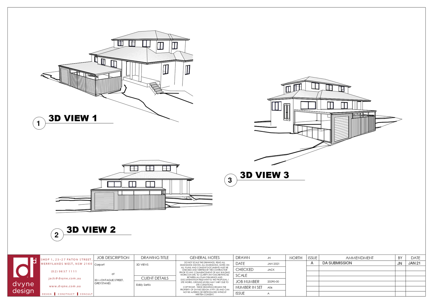
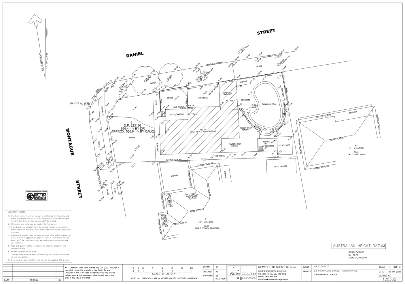
DOCUMENTS
ASSOCIATED WITH
REPORT LPP025/21
Attachment 3
Holroyd Local Environmental Plan 2013 Compliance Table
Cumberland Local Planning Panel Meeting
9 June 2021

DOCUMENTS
ASSOCIATED WITH
REPORT LPP025/21
Attachment 4
Holroyd Development Control Plan 2013
Cumberland Local Planning Panel Meeting
9 June 2021
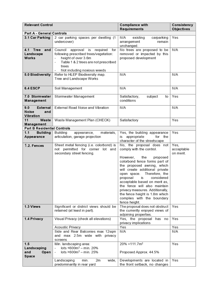
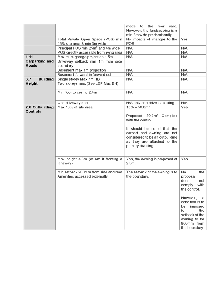
Cumberland
Local Planning Panel Meeting
9 June 2021
Item
No: LPP026/21
Devlopment
Application for 27 Allison Road, Guildford
Responsible
Division: Environment
& Planning
Officer: Executive
Manager Development and Building
File
Number: DA2020/0802
|
Application
lodged
|
22 December 2020
|
|
Applicant
|
Baini Design
|
|
Owner
|
27Arg Pty Ltd
|
|
Application
No.
|
DA2020/0802
|
|
Description
of Land
|
27 Allison Road Guildford NSW
2161
Lot 1 DP 999279
|
|
Proposed
Development
|
Demolition of existing
structures and construction of a two storey Boarding House containing 10
boarding rooms including an attached garage and rear at grade parking
|
|
Site
Area
|
484.4m2
|
|
Zoning
|
R2 Low Density Residential
|
|
Disclosure
of political donations and gifts
|
Nil disclosure
|
|
Heritage
|
No – The site is not a
heritage listed item and not located within the vicinity of a heritage item
or a heritage conservation area
|
|
Principal
Development Standards
|
FSR
Permissible: 0.5:1
Proposed: 0.5:1
Height of Building
Permissible: 9m
Proposed: 7.27m
|
|
Issues
|
· Solar
Access - Communal Room (ARH SEPP 2009)
· Submissions
|
1. Development
Application No. DA2020/0802 was received on 22 December 2020 for the demolition
of existing structures and construction of a two storey Boarding House
containing 10 boarding rooms including an attached garage and rear at grade
parking.
2. The
application was publicly notified to occupants and owners of the adjoining
properties for a period of 14 days between 10 February 2021 and 24 February
2021. In response, Council received a total of twenty-two (22) submissions including
20 unique submissions.
3. Council
also held a public information session with the submitters on 23 March 2021 to
provide further information in relation to resident concerns with the proposed
development.
4. The
numerical variation is as follows:
|
State Environmental Planning Policy (Affordable Rental
Housing) 2009
|
|
Control
|
Required
|
Provided
|
% variation
|
|
Solar access to communal room
|
3 hours between 9am and 3pm in mid-winter
|
Less than 2 hours
|
66.7%
|
5. The application is
referred to the Panel as the proposal is considered to be contentious
development due to the number of submissions received.
6. The
application is recommended for approval subject to the conditions as provided
in the draft notice of determination in Attachment 1.
Subject Site and Surrounding
Area
The site forms Lot 1 in DP 999279
and is known as 27 Allison Road Guildford. The site has a total area of 484.4m2
with two street frontages to Allison Road of 12.19m and to Brooks Street of
12.23m. The site has a minor fall to Allison Road of approximately 900mm and a
cross fall from the northern side boundary to southern side boundary of
approximately 430mm and is located within the R2 Low Density Residential zone.
Existing improvements on the site
comprise of a single storey fibro dwelling with a tile roof, two palm trees
within the front setback, a vehicular crossing accessed from Allison Road, and
two outbuildings and an awning within the rear yard area.
Existing developments adjoining
and surrounding the site include a mix of low to medium density residential
development, with the area being in the process of transitioning to newer
housing stock predominantly from single storey dwellings to two storey dwelling
and dual occupancy developments including semi-detached dwellings on small
allotments to the west within the R3 Medium Density zoning. A multi-dwelling
development and place of public worship are located to the north west of the
site on Allison Road and a Council reserve known as Allison Road Park adjoins
the subject site to the south. Further to the south of the subject site is an
industrial area zoned IN2 – Light Industrial.
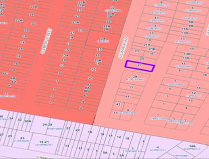
Figure
1 – Locality Plan of subject site
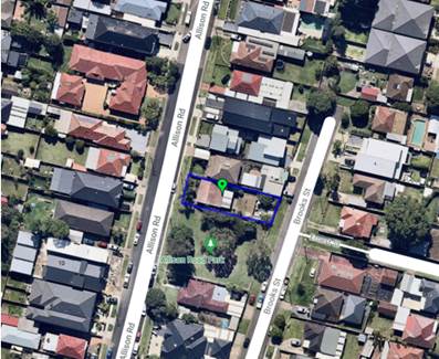
Figure
2 – Aerial view of subject site
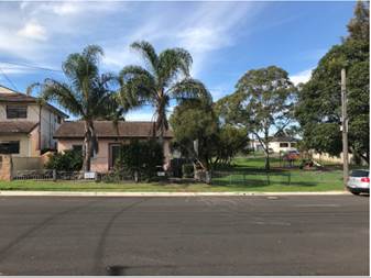
Figure
3 – Street view of subject site
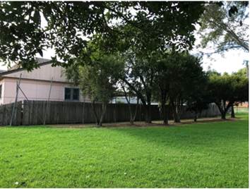
Figure
4 – View of southern elevation of subject site from Allison Road Park
Description of the Proposed
Development
Council is in receipt of a
development application on 22 December 2020 seeking approval for the demolition
of existing structures and construction of a two storey Boarding House
containing 10 boarding rooms including an attached garage accessed from Allison
Road and at grade parking accessed from Brooks Street. The detailed breakdown
of the proposal is shown below:
Demolition:
· Single
storey fibro dwelling;
· Two
palm trees within the front setback;
· Two
outbuildings within the rear yard; and
· An
awning within the rear yard area
Construction:
· Ground
Floor:
o Vehicular access from Allison
road for access to double width garage for the parking of one accessible
vehicle and two stacked motorbike spaces.
o Street facing Porch (Allison
Road) with pedestrian entrance and exit from the building.
o An at grade parking area
accessed from Brooks Street for 4 vehicles.
o Bicycle parking on the
northern side elevation.
o 2 self-contained double lodger
rooms (Including one adaptable room).
o Enclosed waste area on the
southern side elevation.
o External communal area on
northern side elevation.
o Internal communal living area
on the southern side elevation.
o Internal staircase to first
floor.
· First
floor:
o Breezeway located on southern
elevation for access to all first-floor lodger rooms.
o 8 self-contained single lodger
rooms.
o Garden planter beds to the
east and west of the development.
A total of five car parking spaces
(including one accessible space), two motorbike spaces and two bicycle spaces
are proposed. The proposal also includes a total of 10 boarding rooms being a
mix of 8 single and 2 double lodger rooms with one adaptable lodger room and
the maximum number of lodgers proposed is 12.
History
A public information session was
held on 23 March 2021 to discuss the development application and assessment
process with the adjoining residents and submitters.
Applicants Supporting
Statement
The applicant has provided a
Statement of Environmental Effects prepared by Think planners dated 14 December
2020 and was received by Council on 22 December 2020 in support of the
application.
Contact with Relevant
Parties
The assessing officer has undertaken a site inspection of
the subject site and surrounding properties and has been in regular contact
with the applicant throughout the assessment process.
Internal Referrals
Development Engineer
The development application was
referred to Council’s Development Engineer for comment who has advised
that the development proposal is satisfactory and therefore can be supported
subject to the recommended conditions.
Environment and Health
The development application was
referred to Council’s Environment and Health Officer for comment who has
advised that the development proposal is satisfactory in regard to the acoustic
impact assessment carried out on site and therefore can be supported subject to
the recommended conditions.
Tree Management Officer
The development application was
referred to Council’s Tree Management Officer for comment who has advised
that the development proposal is satisfactory and therefore can be supported
subject to the recommended conditions.
Waste Management
The development application was
referred to Council’s Waste Management Officer for comment who has
advised that the development proposal is satisfactory in regard to the
provision of waste management room and therefore can be supported subject to the
recommended conditions.
Parks
The development application was
referred to Council’s Parks section who raised no objections subject to
conditions.
External Referrals
NSW Police
The development application was
referred to NSW Police for comment and the NSW Police provided Council with a
response on 30 March 2021 raising no objections subject to standard conditions
addressing Crime Prevention Through Environmental Design (CPTED) principles
which have been imposed as conditions accordingly.
Transgrid
The development application was
referred to Transgrid who responded on 8 February 2021 stating that the
proposal does not affect TransGrid’s infrastructure.
Endeavour Energy
The development application was
referred to Endeavour Energy who provided a response on 17 February 2021 which
advised that the development proposal is satisfactory and therefore can be
supported subject to the recommended conditions.
PLANNING COMMENTS
The provisions of any
Environmental Planning Instruments (EP&A Act s4.15 (1)(a)(i))
(a) State
Environmental Planning Policy No. 55 – Remediation of Land (SEPP 55)
Clause 7 of SEPP 55 requires
Council to be satisfied that the site is suitable or can be made suitable to
accommodate the proposed development. The matters listed within Clause 7 have been
considered in the assessment of the development application.
|
Matter for Consideration
|
Yes/No
|
|
Does the application involve re-development of the site or
a change of land use?
|
Yes
No
|
|
Is the development going to be used for a sensitive land
use (e.g.: residential, educational, recreational, childcare or hospital)?
|
Yes
No
|
|
Does information available to you indicate that an
activity listed below has ever been approved, or occurred at the site?
acid/alkali plant and
formulation, agricultural/horticultural activities, airports, asbestos
production and disposal, chemicals manufacture and formulation, defence
works, drum re-conditioning works, dry cleaning establishments, electrical
manufacturing (transformers), electroplating and heat treatment premises,
engine works, explosive industry, gas works, iron and steel works, landfill
sites, metal treatment, mining and extractive industries, oil production and
storage, paint formulation and manufacture, pesticide manufacture and
formulation, power stations, railway yards, scrap yards, service stations,
sheep and cattle dips, smelting and refining, tanning and associated trades,
waste storage and treatment, wood preservation
|
Yes
No
|
|
Is the site listed on
Council’s Contaminated Land database?
|
Yes
No
|
|
Is the site subject to EPA
clean-up order or other EPA restrictions?
|
Yes
No
|
|
Has the site been the subject of
known pollution incidents or illegal dumping?
|
Yes
No
|
|
Does the site adjoin any
contaminated land/previously contaminated land?
|
Yes
No
|
|
Has the appropriate level of
investigation been carried out in respect of contamination matters for
Council to be satisfied that the site is suitable to accommodate the proposed
development or can be made suitable to accommodate the proposed development?
|
Yes
No
|
|
Details of contamination investigations carried out at the
site:
A review of Council’s
files has revealed that the site has been historically used for residential
purposes and there is no evidence to suggest that the site is contaminated or
used for potentially contaminating activities. Council’s Environmental
Health section has also reviewed the development application and determined
that the site is suitable to support such a development subject to
recommended conditions.
|
(b) State
Environmental Planning Policy (Infrastructure) 2007 (ISEPP)
The provisions of the ISEPP 2007
do not apply to the development application as the proposal does not result in
a traffic generating development and the site is not located within the
proximity of a railway corridor or a busy/classified road.
(c) State
Environmental Planning Policy (Affordable Rental Housing) 2009 (ARH SEPP)
The proposal is subject to the
provisions of Part 1 Preliminary and Part 2 (New affordable rental housing)
Division 3 (Boarding houses) of the ARH SEPP.
The following is discussion of the
relevant Clauses, a detailed assessment is provided at attachment eight.
|
Development Standards
|
Comment/ Compliance with Requirements
|
Consistency Objectives
|
|
Part 1 Preliminary
|
|
Part 2 New affordable rental housing – Division 3
Boarding houses
|
|
26 Land to which this division applies
This Division applies to land within any of the following
land use zones or within a land use zone that is equivalent to any of those
zones—
(a) Zone R1 General Residential,
(b) Zone R2 Low Density
Residential,
(c) Zone R3 Medium Density
Residential,
(d) Zone R4 High Density
Residential,
(e) Zone B1 Neighbourhood Centre,
(f) Zone B2 Local Centre,
(g) Zone B4 Mixed Use.
|
Yes, the site is zoned R2 Low Density Residential as per
the HLEP 2013. Development for the purpose of a boarding house is permissible
in accordance with this Plan.
|
Yes
|
|
27 Development to which Division applies
(1)
This Division applies to development, on land to which this Division applies,
for the purposes of boarding houses.
(2)
Despite subclause (1), clauses 29, 30 and 30A do not apply to development on
land within Zone R2 Low Density Residential or within a land use zone that is
equivalent to that zone in the Sydney region unless the land is within an
accessible area.
|
The subject site is zoned R2 – Low Density
Residential under Holroyd Local Environmental Plan 2013 and the site is
located within the area identified as the Greater Sydney Region in accordance
with the map of schedule 1 of the Greater Sydney Commission Act 2015.
The subject site contains dual access by both vehicles and
occupants of the boarding house via Allison Road and Brooks Street. The
subject site is located approximately 750m walking distance from Guildford
railway station from boundary of Brooks Street and in this regard the subject
site is located within the meaning of an accessible area and clauses 29,30
and 30A apply to the development application.
|
Yes
|
|
29 Standards that cannot be used to refuse consent
(1) A consent authority must not refuse
consent to development to which this Division applies on the grounds of
density or scale if the density and scale of the buildings when expressed as
a floor space ratio are not more than:
x)
(a) the existing maximum floor space ratio for
any form of residential accommodation permitted on the land, or
(b) if the development is on land within a zone
in which no residential accommodation is permitted—the existing maximum
floor space ratio for any form of development permitted on the land, or
(2) A consent
authority must not refuse consent to development to which this Division
applies on any of the following grounds—
(a) building height
if the building height of all proposed
buildings is not more than the maximum building height permitted under another
environmental planning instrument for any building on the land,
(b) Landscaped area - if the landscape treatment of the front setback
area is compatible with the streetscape in which the building is located.
(c) Solar access - where the development provides for one or more
communal living rooms, if at least one of those rooms receives a minimum of 3
hours direct sunlight between 9am and 3pm in mid-winter.
|
The proposed development complies with the prescribed FSR
for the zone being 0.5:1. The FSR proposed is 0.5:1
Residential accommodation is permitted in the zone.
The maximum building height for the site permitted under
HLEP 2013 is 9m. The proposed development is approximately 7.27m in height.
The proposed landscaping of the front setback is
considered to be consistent to that of the surrounding streetscape being hard
surfaced for the purposes of pathways and a driveway and landscaped along
both side boundaries with trees and shrubs within the front setback. Refer to
assessment report for clause 30A – Character of Local area assessment)
for further detail.
The internal ground floor communal living area will not
receive a minimum of 3 hours of direct sunlight between 9am and 3pm in
mid-winter due to its southern and eastern orientation and the first floor
level extending over the ground floor communal area to the rear (east). A
skylight is proposed within the roof space located above the communal area
for additional sunlight access. This is deemed satisfactory as the location
of the internal communal living area is designed to be adjacent to the park
to reduce the impact to adjacent and neighbouring residential properties.
In addition, the proposal includes an external ground
floor level communal area towards the rear of the development (Brooks Street)
with north and east orientation which will receive compliant solar access.
|
Yes
|
|
30AA Boarding houses in Zone
R2 Low Density Residential
A consent authority must not grant development consent to a
boarding house on land within Zone R2 Low Density Residential or within a
land use zone that is equivalent to that zone unless it is satisfied that the
boarding house has no more than 12 boarding rooms.
|
The boarding house is proposed on land zoned R2 –
Low Density Residential in accordance with Holroyd Local Environmental Plan
2013. The development application proposes 10 boarding rooms for a maximum of
12 lodgers being a mix of 2 double lodger rooms on the ground floor and 8
single lodger rooms on the first floor.
The development complies with the requirement in this
regard.
|
Yes
|
30A Character of local area
Division 3 of the SEPP contains
provisions and development standards that apply to the development for the
purpose of a boarding house. The development as proposed is considered to be
consistent with the relevant provisions and development standards of the
instrument at clause ‘30A Character of the local area’. This clause
specifies that ‘a consent authority must not consent to development to
which this Division applies unless it has taken into consideration whether the
design of the development is compatible with the character of the local
area’.
In order to determine the
compatibility of the proposal, an assessment of the character of the area and
application of the ‘character test’ for development derived from
the planning principle 11209 of 2005 Project Venture Development’s Pty
Ltd v Pittwater Council has been undertaken.
Step 1 – Identify the
local area.
This assessment identifies the
local area as primarily the visual catchment of the site as viewed from within
the site and directly adjacent to the site on the street which is defined by
the blue outline in Figure 5.
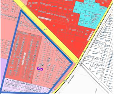
Figure
5 – Local area catchment
The site is located on the eastern
side of Allison Road and is situated within an established low and medium
density residential area that is bounded by an R2 and R3 zoning interface. The
immediate locality is predominantly characterized by detached residential
dwellings interspersed with medium density housing including semi-detached
dwellings and multi dwelling townhouses to the western side of Allison Road.
Step 2 – Determine the
character (present and future) of the local area.
The zoning of the broader locality
and immediate area comprises R2 Low Density Residential, R3 Medium Density
Residential and IN1 – General Industrial under Holroyd Local
Environmental Plan 2013 (HLEP 2013).
Present character of the area
The character of the local area
comprises the visual catchment of predominantly regular shaped allotments
viewed from and surrounding the subject site, which includes:
1. Existing
low to medium density built forms, including dwellings and dual occupancy
developments on the eastern side of Allison Road and multi-dwelling
developments and semi-detached small lot developments opposite the subject site
on the western side of Allison Road and further to the west on Clement Street
and Byron Road.
2. A
public park to the immediate adjoining south of the subject site being 29
Allison Road.
3. Industrial
sites to the south on Carrington Road.
|

Figure 6 – View of subject site and adjoining
public park – Allison Road Park
|
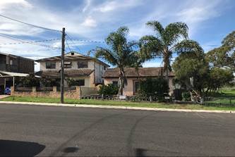
Figure 7 - View of adjoining northern property 25 Allison
Road
|
|
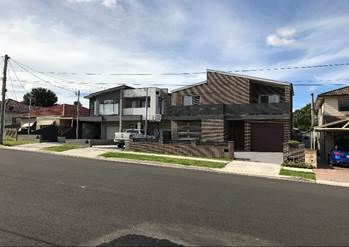
Figure
8 – View of newly constructed dual occupancy developments at 21 and 23
Allison Road
|
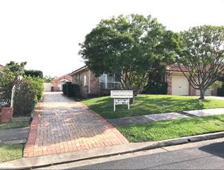
Figure
9 – Multi dwelling development at 24 Allison Road
|
|
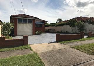
Figure
10 – Dwelling with concrete front setback – 20 Allison Road
|
Figure
11 – Newly constructed small lot semi detached dwellings (3 dwellings)
– 8. 8A and 8B Allison Road
|
Future character of the area
Given the proximity of the subject
site to newly constructed two storey dual occupancy/semi detached dwellings and
medium density multi dwelling developments, it is considered that the height,
bulk and scale of the proposed development is not out of character with the
intended future character of the area. The proposed scale and design of the
development is considered to be consistent with the desired future character of
the locality, having regard to the R2 land use zoning.
The R3 Medium Density Residential
zoned area adjacent to the west of the site presents a transition from the
medium density built forms envisaged to the west through to the R2 Low Density
Residential land.
Step 3 - Determine if the development is compatible with
the character of the local area.
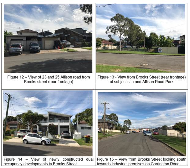
In order to determine the compatibility of the development
with the established character of a local area, the ‘character
test’ derived from the Land and Environment Court’s Planning
Principle and case law – Project Venture Development’s Pty Ltd v
Pittwater Council can be applied. The character test determines the
compatibility of the development by asking whether the physical impacts of the
proposal on surrounding development is in harmony with the buildings around it
and the character of the area. These questions are discussed in detail below.
Are the proposal’s
physical impacts on surrounding development acceptable? The physical impacts
include constraints on the development potential of surrounding sites.
The physical impacts of the proposal are assessed having
regard to the impact of the development on the amenity of surrounding
properties. Amenity in this instance generally include privacy, solar access,
visual bulk and compatibility in the streetscape.
With regard to solar access, it is noted that the
development will shadow some of Allison Road Park which adjoins the site.
However, the scale of the impact is considered reasonable based on the
orientation of the block (i.e. Allison Road Park is located to the south of the
subject site) and therefore some level of overshadowing is unavoidable.
Therefore, despite the overshadowing of a portion of Allison Road Park, the
proposed development does not adversely impact on the use of the public open
space and, further to this, it is noted that the adjoining residential dwelling
to the immediate north of the subject site, is unaffected by the proposed
development.
In terms of privacy, reasonable building separation (through
setbacks) and the type, location and size of windows proposed will mitigate
direct views and overlooking into the adjoining property on the northern
elevation and adjoining Allison Road Park on the south elevation. Further to
this, there are pre-existing trees located within Allison Road Park on the
adjoining boundary to further mitigate overlooking from the proposed development
into Allison Road Park.
In this regard, the visual bulk and scale of the development
is considered to be compatible and not dissimilar to other two storey
residential developments established in the area and will not have any adverse
impacts on the amenity of adjoining residential development or Allison Road
Park.
Based on the above discussion, the physical impact of the
proposal on surrounding developments and open space areas is considered
reasonable and therefore acceptable in this instance.
Step 4 - Is the proposal’s appearance in harmony
with the buildings around it and the character of the street?
The main building types established in the local area are
one and two storey residential developments comprising of single storey
detached dwellings, two storey attached dual occupancies, two storey
semi-detached dwellings and a single storey multi dwelling development. Given
that the predominant future character of the immediate area is to remain low
and medium density residential use in terms of use and building type, it is
likely that there will be upgrades to the residential housing stock via
alterations and additions, knock down rebuilds and new multi dwelling
developments.
As such, the proposed two storey building form, materials
and finishes are considered to be consistent with the emerging development in
the area and the proposal is therefore considered to be compatible with the
existing and future desired character of the locality with minimal impacts on
the neighbouring developments.
(c) State
Environmental Planning Policy (Vegetation in Non-Rural Areas) 2017
The proposal does not exceed the
biodiversity offsets scheme threshold. Therefore, the proposed vegetation
removal is considered acceptable.
(d) State
Environmental Planning Policy (Building Sustainability Index: BASIX) 2004
BASIX Certificate 1156424M issued
on 11 December 2020 prepared by Outsource Ideas Pty Ltd has been submitted with
Council and is considered to be satisfactory.
Regional Environmental Plans
The proposed development is affected by the following
Regional Environmental Plans:
(a) Sydney
Regional Environmental Plan (Sydney Harbour Catchment) 2005
The subject site is identified as being located within the
area affected by the Sydney Regional Environmental Plan (Sydney Harbour
Catchment) 2005. The proposed development raises no issues as no impact on the
catchment is envisaged.
(Note: - the subject site is not identified in the relevant
map as ‘land within the ‘Foreshores and Waterways Area’ or
‘Wetland Protection zone’, is not a ‘Strategic Foreshore
Site’ and does not contain any heritage items. Hence the majority of the
SREP is not directly relevant to the proposed development).
Local Environmental Plans
Holroyd Local Environmental Plan (HLEP) 2013
The provision of the Holroyd Local Environmental Plan 2013
is applicable to the development proposal. It is noted that the development
achieves compliance with the key statutory requirements of the Holroyd Local
Environmental Plan 2013 and the objectives of the R2 Low Density Residential
zone.
(a) Permissibility:-
The proposed development is defined as a ‘boarding
house’ and is permissible in the R2 low Density Residential zone with
consent.
boarding house means a building that—
(a) is
wholly or partly let in lodgings, and
(b) provides
lodgers with a principal place of residence for 3 months or more, and
(c) may
have shared facilities, such as a communal living room, bathroom, kitchen or
laundry, and
(d) has
rooms, some or all of which may have private kitchen and bathroom facilities,
that accommodate one or more lodgers, but does not include backpackers’
accommodation, a group home, hotel or motel accommodation, seniors housing or a
serviced apartment.
The relevant matters to be considered under Holroyd Local
Environmental Plan 2013 and the applicable clauses for the proposed development
are summarised below. A comprehensive LEP assessment is contained in attachment
9.
Figure 16 –
Holroyd LEP 2013 Compliance Table
|
DEVELOPMENT STANDARD
|
COMPLIANCE
|
DISCUSSION
|
|
4.3 Height of Buildings
Maximum 9 metres
|
Yes
|
The development proposes a maximum building height of
7.27m.
|
|
4.4 Floor Space Ratio
(FSR)
Maximum 0.5:1
|
Yes
|
The development complies with the prescribed FSR for the
zone being 0.5:1.
The FSR proposed is 0.50:1 (GFA of 242.2m²)
|
The provisions of any proposed instrument that is or has
been the subject (EP&A Act s4.15 (1)(a)(ii))
(a) Draft
State Environmental Planning Policy (Environment)
The draft SEPP relates to the protection and management of
our natural environment with the aim of simplifying the planning rules for a
number of water catchments, waterways, urban bushland, and Willandra Lakes
World Heritage Property. The changes proposed include consolidating the
following seven existing SEPPs:
· State
Environmental Planning Policy No. 19 – Bushland in Urban Areas
· State
Environmental Planning Policy (Sydney Drinking Water Catchment) 2011
· State
Environmental Planning Policy No. 50 – Canal Estate Development
· Greater
Metropolitan Regional Environmental Plan No. 2 – Georges River Catchment
· Sydney
Regional Environmental Plan No. 20 – Hawkesbury-Nepean River (No.2-1997)
· Sydney
Regional Environmental Plan (Sydney Harbour Catchment) 2005
· Willandra
Lakes Regional Environmental Plan No. 1 – World Heritage Property.
The draft policy will repeal the above existing SEPPs and
certain provisions will be transferred directly to the new SEPP, amended and
transferred, or repealed due to overlaps with other areas of the NSW planning
system.
Changes are also proposed to the Standard Instrument –
Principal Local Environmental Plan. Some provisions of the existing policies
will be transferred to new Section 117 Local Planning Directions where
appropriate.
(b) Draft
Cumberland Local Environmental Plan (Draft CLEP)
The Draft Cumberland Local Environmental Plan (Draft CLEP)
has been prepared by Cumberland Council to provide a single planning framework
for the future planning of Cumberland City. The changes proposed seek to
harmonise and repeal the three existing LEPs currently applicable to the
Cumberland local government area, those being:
· Holroyd
Local Environmental Plan 2013,
· Parramatta
Local Environmental Plan 2011, and
· Auburn
Local Environmental Plan 2010.
The current planning controls for the subject site, as
contained within Holroyd Local Environmental Plan 2013 are not proposed to
change under the Draft CLEP.
The provisions of any Development Control Plans (EP&A
Act s4.15 (1)(a)(iii))
The Holroyd Development Control Plan 2013 provides guidance
for the design and operation of development to achieve the aims and objectives
of the Holroyd Development Control Plan 2013. These controls however relate
primarily to dwellings, secondary dwellings, dual occupancies and semi-detached
development being the typology of development within R2 Low Density Residential
zone and not specifically for boarding houses. The development controls within
Part A and Part B of Holroyd Development Control Plan 2013 should be used as a
guide, given that the assessment against the character of the local area
carried out under State Environmental Planning Policy (Affordable Rental
Housing) 2009 has considered the built form compatibility. A comprehensive
assessment and compliance table is contained in attachment 10.
The following compliance table highlights non-compliances
with the DCP controls, which relate primarily to landscaped width and garage clear
width. The variations sought are considered satisfactory on merit, in this
instance, as discussed in the following table.
Figure 17
–Holroyd Development Control Plan 2013 Compliance Table
|
Control
|
Required
|
Provided
|
Compliance
|
|
Landscaped areas shall be a minimum of 2 metres wide and
is to be, where possible, at ground level.
|
Minimum of 96.88m2 (20% of site area) of
landscaped area to be minimum 2 metre dimensions
|
22.2m2 provided with minimum 2m dimensions
|
No – however deemed acceptable based on merit.
Overall, 22.54% (99.5m2) of the site is landscaped, including
areas less than 2m in dimension which complies with the required minimum area
of landscaping required. The proposed landscaping of the front setback is
considered to be consistent to that of the surrounding streetscape being
landscaped, with the exception of a hard surfaced area for the purposes of a
pathway and driveway.
|
|
Garages are to be a maximum of 6 metres clear width or 50%
of the width of the buildings street elevation whichever is the lesser
|
Maximum 5.18m
|
5.8m
|
No – however deemed acceptable based on merit. The
garage width proposed will not have adverse negative impacts from the
streetscape and is setback sufficiently from the street boundary.
|
Irrespective of these departures, for the reasons discussed
above, it is considered that the proposal performs adequately from an
environmental planning viewpoint and may be supported.
The provisions of any planning agreement that has been
entered into under section 7.4, or any draft planning agreement that a
developer has offered to enter into under section 7.4 (EP&A Act
s4.15(1)(a)(iiia))
There is no draft planning agreement associated with the
subject Development Application.
The provisions of the Regulations (EP&A Act s4.15
(1)(a)(iv))
The proposed development raises no concerns as to the
relevant matters arising from the Environmental Planning and Assessment
Regulations 2000 (EP&A Reg).
The Likely Environmental, Social or Economic Impacts
(EP&A Act s4.15 (1)(b))
It is considered that the proposed development will have no
significant adverse environmental, social or economic impacts in the locality.
The suitability of the site for the development (EP&A
Act s4.15 (1)(c))
The subject site and locality are not known to be affected
by any natural hazards or other site constraints likely to have a significant
adverse impact on the proposed development. Accordingly, it is considered that
the development is suitable in the context of the site and surrounding
locality.
Submissions made in accordance with the Act or Regulation
(EP&A Act s4.15 (1)(d))
|
Advertised (council website)
|
Mail
|
Sign
|
Not Required
|
In
accordance with Council’s Notification requirements contained within
Holroyd Development Control Plan 2013, the proposal was publicly notified for a
period of 14 days between 10 February 2021 and 24 February 2021. The
notification generated twenty-two (22) submissions, including 20 unique
submissions, with none disclosing a political donation or gift.
In addition to the above, Council
also held a public information session with concerned residents/submitters on
23 March 2021 of which eight persons attended, to provide further information
in relation to resident concerns with the proposed development.
The issues raised in the public submissions and public
meeting held are summarised and commented on below.
Figure 18 –
Submissions summary table
|
Issue
|
Planner’s comment
|
|
A boarding house is not suitable for the
locality that is a quiet family friendly residential street and is adjoining
a children’s playground and is in the vicinity of schools and a
swimming centre.
Residents are short term with high
turnover with no regard/responsibility for the area
|
Boarding houses are a type of development
that is permitted within the R2 Low Density Residential zone under both
HLEP2013 as per the land use table and ARH SEPP 2009 subject to containing no
more than 12 boarding rooms as per clause 30AA of the ARH SEPP 2009.
The purpose of the boarding house is to
assist with affordable rental within the locality and the occupants will be
subject to house rules contained in the Plan of Management.
The development application was reviewed
by the NSW Police who did not raise any concerns subject to conditions regarding
Crime Prevention through Environmental Design.
|
|
Safety concerns. Proposing CCTV in common
areas raises concerns of who will be residing at the boarding house? I.e.:
singles, disabled, young adults, ex criminals, people on bail, ex drug users
etc
|
The boarding house will be privately run
and there is no evidence provided to suggest that it will be targeted to
cater for people with criminal background.
The proposed use of CCTV, house rules and
Plan of Management are intended to address safety and anti social behaviours
by intended occupants of the Boarding House.
|
|
Who to contact in case of conflict?
|
An off-site manager is not required for
the development, however, will be provided for the boarding house. The
offsite manager contact details are to be made clearly visible to both
residents and the community.
A Plan of Management was submitted with
the development application for the boarding house and contains house rules,
which will be enforced as part of conditions of the consent.
The NSW Police (Cumberland Police Area
Command) should also be contacted in case any conflict arises.
|
|
Rubbish/waste from lodgers
|
The development application was referred
to Council’s Waste Section who stated that the development is required
to contain 3x 240L residential garbage bins and 2x 240L residential recycling
bins within an enclosed area.
The architectural plans demonstrate
compliance with the above requirement.
|
|
1.
Noise from development
|
The development application contains a
Plan of Management and a Noise Impact Assessment.
The development application was reviewed
by Council’s Environmental Health Section and the NSW Police who both
raised no objections.
The Plan of Management submitted with the
development application includes proposed management of noise from the
premises including limitation of external areas to be used between 7am and
10pm only and contains detailed ‘house rules relating to:
o the emission of noise (from within the boarding house and the
external spaces);
o prohibition of large gatherings and parties on the premises;
o interference with the peace and quiet of other residents and
neighbours;
o volume of television and music players;
o control of alcohol intake and prohibition of illegal substances;
and
o anti-social behaviour.
o parking of vehicles.
The development also proposes an offsite
manager for the development should concerns arise regarding the boarding
house.
|
|
Boarding houses more suited to the CBD or
Industrial area and not a residential area
|
Boarding houses are a type of development
that is permitted within the R2 Low Density Residential zone under both HLEP
2013 as per the land use table and ARH SEPP 2009, subject to containing no
more than 12 boarding rooms as per clause 30AA of the ARH SEPP 2009.
|
|
Overshadowing of adjoining park
|
HDCP 2013 and ARH SEPP 2009 do not
outline controls for developments overshadowing a park; however, a two storey
development with a maximum height limit of 9 metres is permissible on the
subject site with a minimum side setback of 0.9m. The development complies with
the above and has been designed to reduce overshadowing on the adjoining park
through a contemporary roof design. Multiple trees are also located along the
boundary adjoining Allison Road Park and the subject site and in this regard
the impact on overshadowing of the adjoining park is minimised.
|
|
The economic value of the neighbouring
houses will be negatively affected.
|
This is not a matter for consideration
pursuant to Section 4.15 of the Act.
|
|
Development is not compatible with the
existing characteristic of the street.
|
Clause 30A of ARH SEPP requires a consent
authority to consider whether the design of the development is compatible
with the character of the local area.
An assessment of the development against
the character of the local area has been undertaken and is within the main
body of the report and the development is found to be generally compatible
with the existing and future character of the local area.
|
|
Effect of development on water
pressure/Infrastructure.
|
The proposal is subject to a section 73
compliance certificate from Sydney Water which confirms that new developments
satisfy Sydney Water requirements for new developments to have an adequate
service level of water, wastewater and stormwater services.
The development was reviewed externally
by Endeavour Energy and internally by Council’s waste and engineering
sections regarding impacts on infrastructure including electricity, waste and
parking and was deemed as satisfactory compliant with the parking requirements
of ARH SEPP 2009. In this regard, the development is expected to have minimal
impact upon existing infrastructure.
|
|
Land size is only 484.4m2 and
size of rooms do not provide a good quality of living for future occupants
|
There is no minimum lot size for a
boarding house under HLEP 2013, HDCP 2013 and ARH SEPP 2009.
ARH SEPP 2009 requires the following room
sizes for a boarding house (excluding any area used for the purposes of a
private kitchen or bathroom facility):
Single lodger rooms: 12m2
Double lodger rooms: 16m2
Further to the above, ARH SEPP 2009
states that a boarding house may have private kitchen or bathroom facilities
in each boarding room but is not required to have those facilities in any
boarding room.
The development proposes 8 single lodger
boarding rooms with a room size of 12m2 and two double lodger
rooms with a room size of 16m2 (excluding any area used for the
purposes of a private kitchen or bathroom facility).
|
|
Overdevelopment by Council within the
area with recent dual occupancy and attached/semi-detached developments
replacing single dwellings.
|
The immediate area is zoned R2 Low
Density and R3 Medium Density. It is noted that the area is undergoing
transition and various applications for permissible developments within the
R2 and R3 zones will be occurring in the immediate and near future.
|
|
Parking/Traffic and on street congestion
from proposed development and recently built semi-detached dwellings and dual
occupancies
|
The development application includes 10 boarding
rooms and proposes 5 car parking spaces (including one accessible space), two
motorcycle spaces and two bicycle spaces and therefore complies with the
parking requirement under ARH SEPP 2009.
|
The public interest (EP&A
Act s4.15(1)(e))
In view of the foregoing analysis it is considered that the
development, if carried out subject to the conditions set out in the draft
notice of determination, will have no significant adverse impacts on the public
interest.
Cumberland Local Infrastructure Contributions Plan
2020
The development would require the
payment of contributions in accordance with Cumberland Local Infrastructure
Contributions Plan 2020.
In accordance with the Contribution Plan a contribution is
payable, pursuant to Section 7.11 of the EP&A Act, calculated per
person/per bedroom and includes a credit given for the existing dwelling on
site. A total contribution of $41,812.00 + CPI would be payable prior to the
issue of a Construction Certificate. A condition is imposed accordingly.
Disclosure of Political Donations and Gifts
The applicant and notification process did not result in any
disclosure of Political Donations and Gifts.
The development application has
been assessed in accordance with the relevant requirements of the Environmental
Planning and Assessment Act 1979, State Environmental Planning Policy 55
– Remediation of land, State Environmental Planning Policy (Affordable
Rental Housing) 2009, State Environmental Planning Policy (Building
Sustainability Index: BASIX) 2004, Sydney Regional Environmental Plan (Sydney
Harbour Catchment) 2005, Draft Cumberland Local Environmental Plan, Holroyd
Local Environmental Plan 2013 and Holroyd Development Control Plan 2013.
Having regard to the assessment of
the proposal from a merit perspective, Council may be satisfied that the
development has been responsibly designed and provides for acceptable levels of
amenity for future residents. It is considered that the proposal successfully
minimises adverse impacts on the amenity of neighbouring properties being both
public open spaces and residential sites. Hence the development, irrespective
of the departures from the Holroyd Development Control Plan 2013, is generally
consistent with the intentions of Council’s planning controls and
represents a form of development contemplated by the relevant statutory and
non-statutory controls applying to the land.
For these reasons, it is
considered that the proposal is satisfactory having regard to the matters of
consideration under Section 4.15 of the Environmental Planning and Assessment
Act 1979, and the development may be approved subject to conditions of consent.
|
1. That
Development Application No. DA2020/0802 for demolition of existing structures
and construction of a two storey Boarding House containing 10 boarding rooms
including an attached garage and rear at grade parking on land at 27 Allison
Road Guildford NSW 2161 be approved subject to attached draft notice of
determination at attachment one.
2. Persons
whom have lodged a submission in respect to the application be notified of
the determination of the application.
|
1. Draft Notice
of Determination
2. Architectural
Plans
3. Solar
Access Plans
4. Landscape
Plan
5. Stormwater
Plans
6. Plan
of Management
7. Redacted
Submissions
8. ARH
SEPP Compliance Table
9. Holroyd
Local Environmental Plan 2013 Assessment Table
10. Holroyd
Development Control Plan 2013 Assessment Table
DOCUMENTS
ASSOCIATED WITH
REPORT LPP026/21
Attachment 1
Draft Notice of Determination
Cumberland Local Planning Panel Meeting
9 June 2021
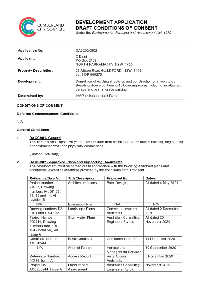
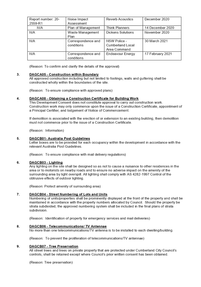
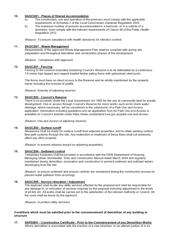
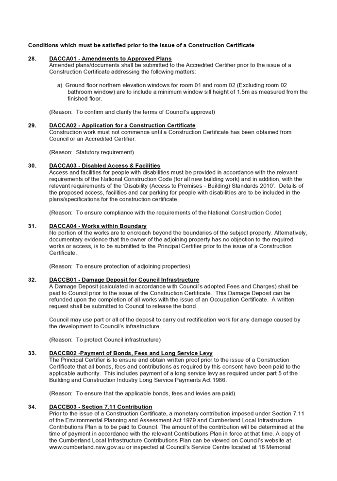
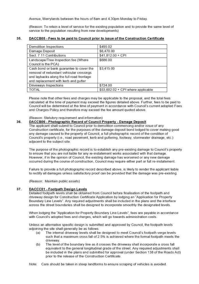

DOCUMENTS
ASSOCIATED WITH
REPORT LPP026/21
Attachment 2
Architectural Plans
Cumberland Local Planning Panel Meeting
9 June 2021
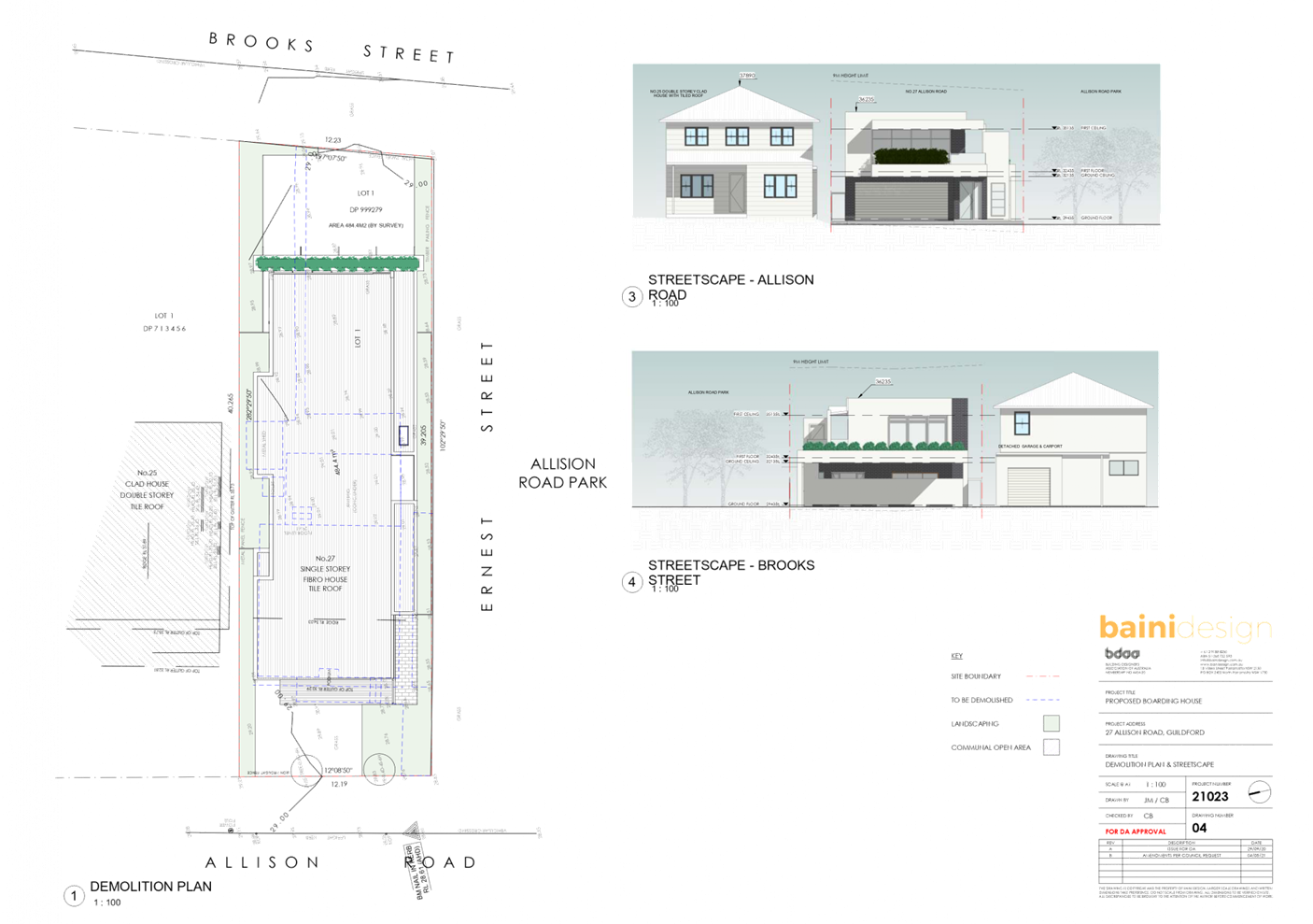
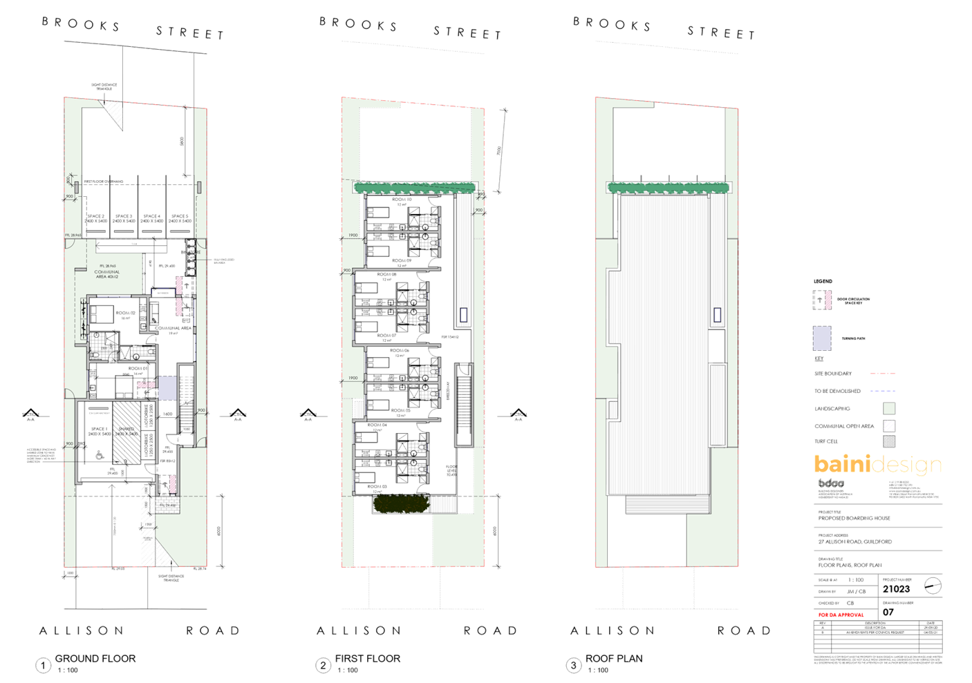
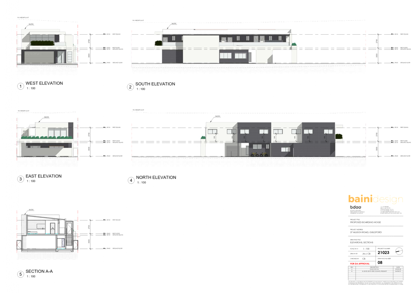
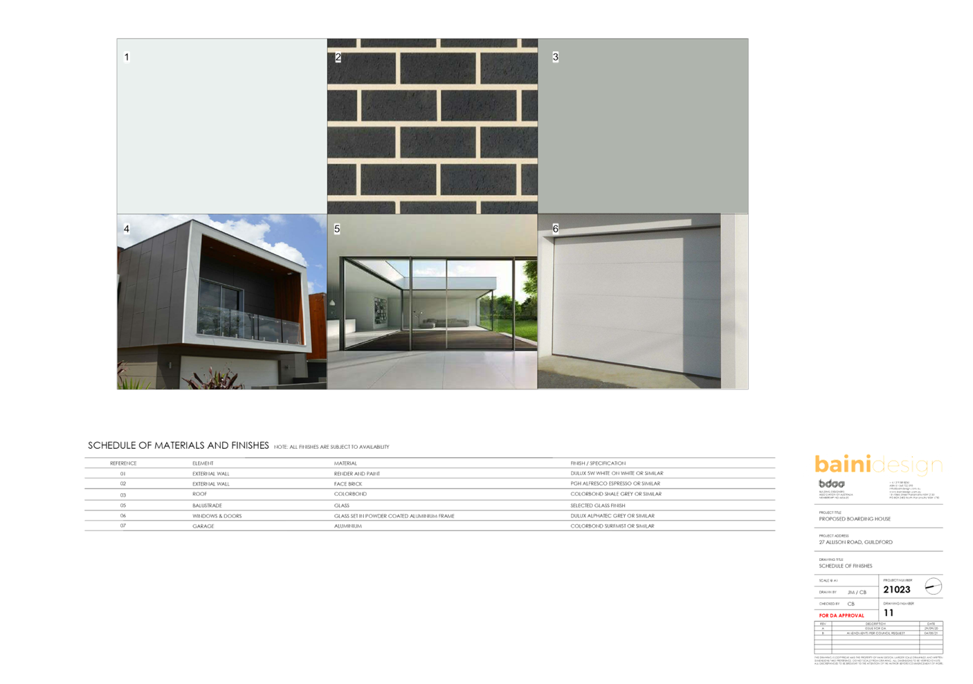
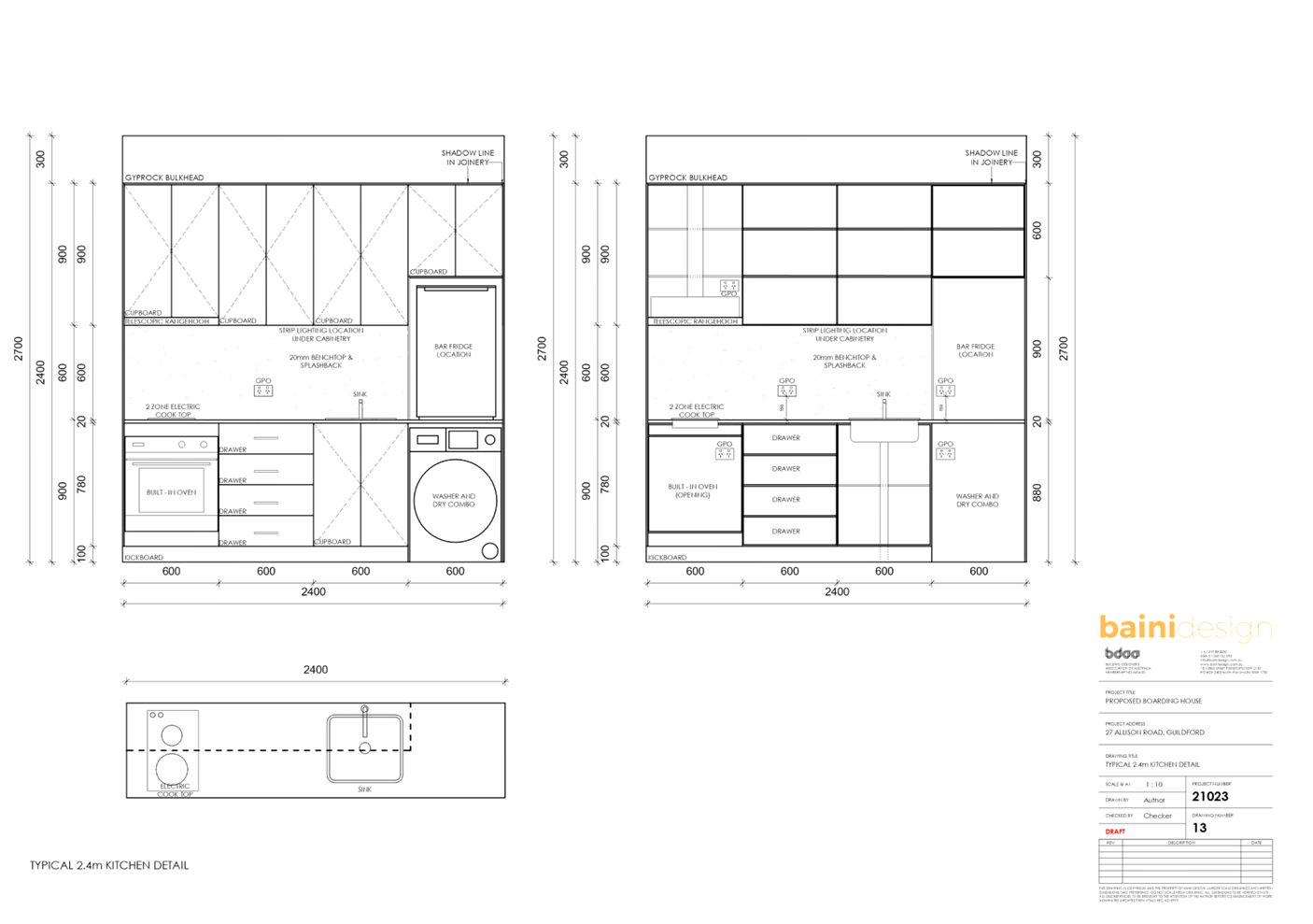
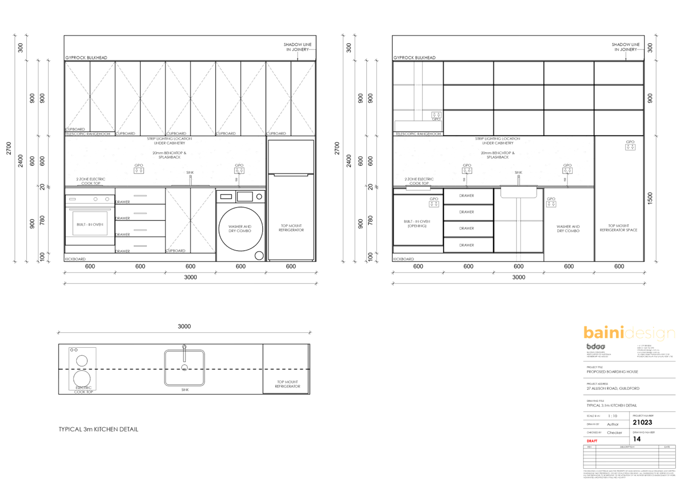
DOCUMENTS
ASSOCIATED WITH
REPORT LPP026/21
Attachment 3
Solar Access Plans
Cumberland Local Planning Panel Meeting
9 June 2021
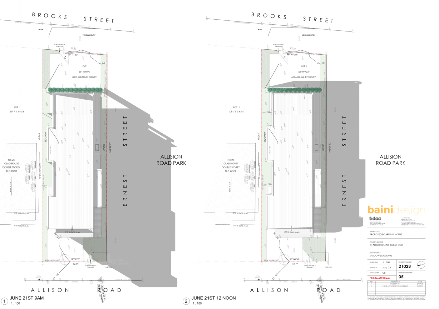
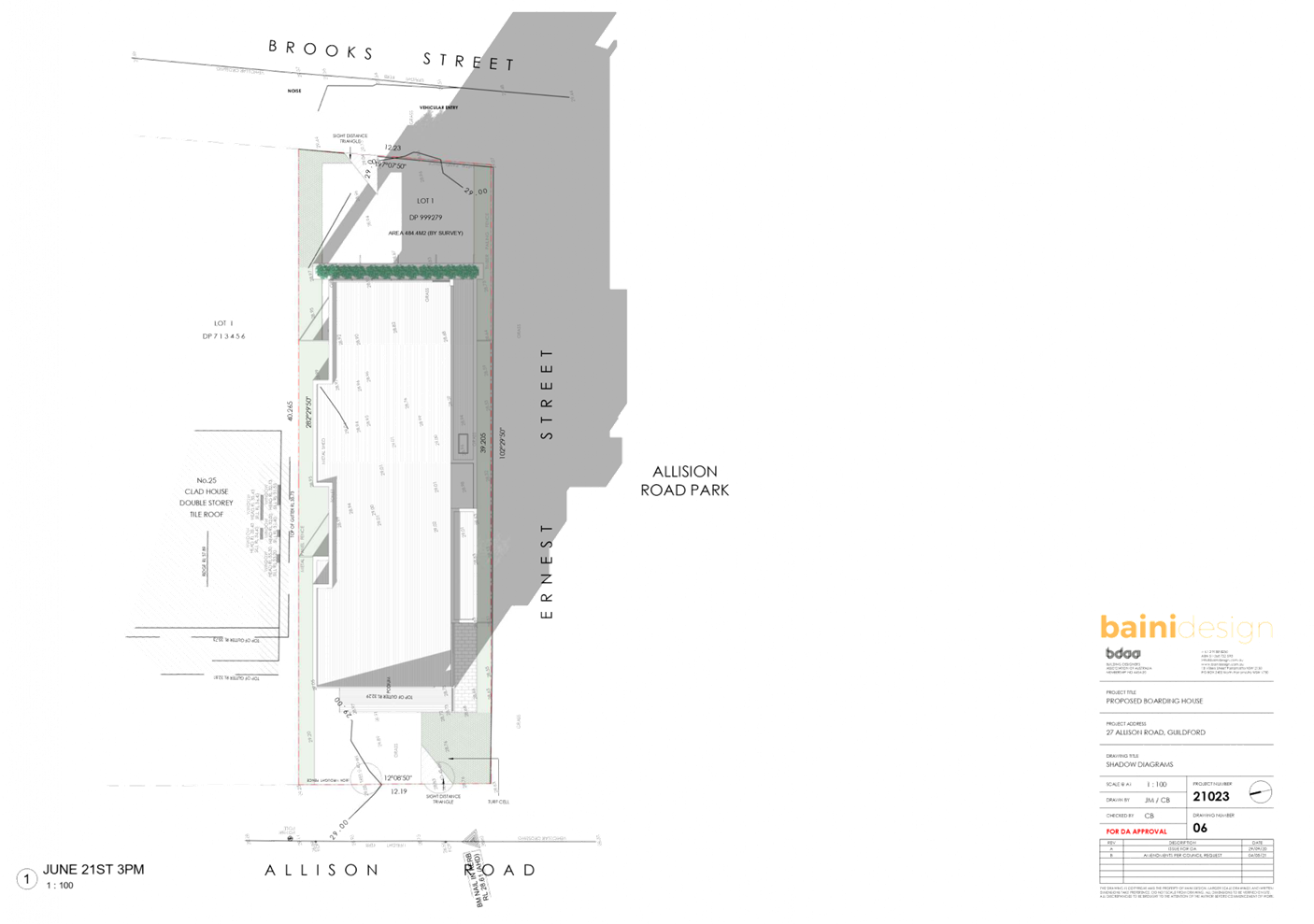
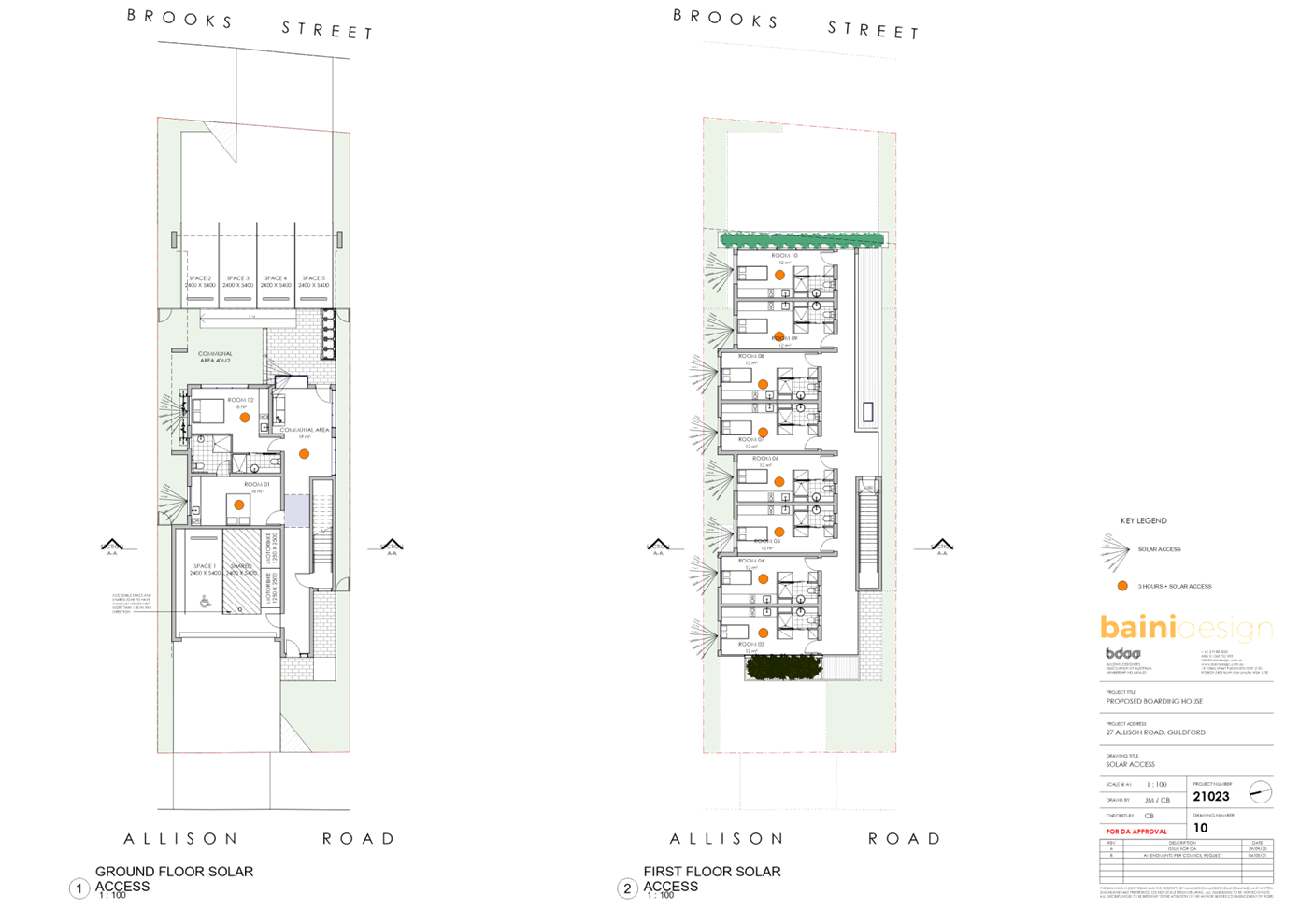
DOCUMENTS
ASSOCIATED WITH
REPORT LPP026/21
Attachment 4
Landscape Plan
Cumberland Local Planning Panel Meeting
9 June 2021
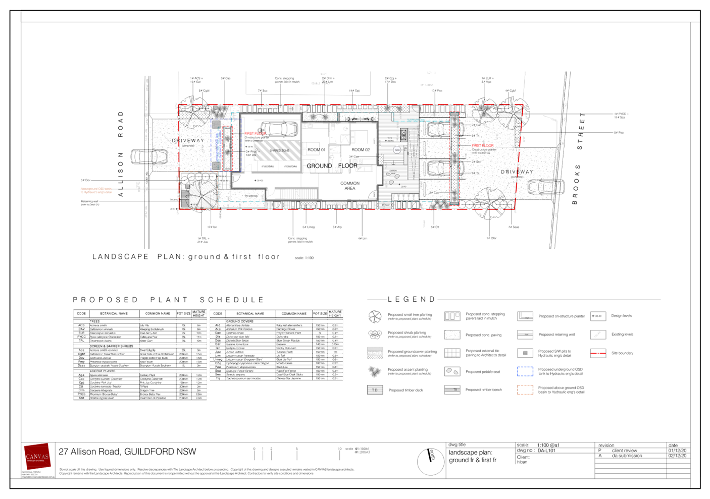
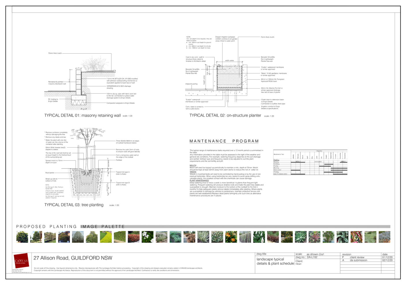
DOCUMENTS
ASSOCIATED WITH
REPORT LPP026/21
Attachment 5
Stormwater Plans
Cumberland Local Planning Panel Meeting
9 June 2021
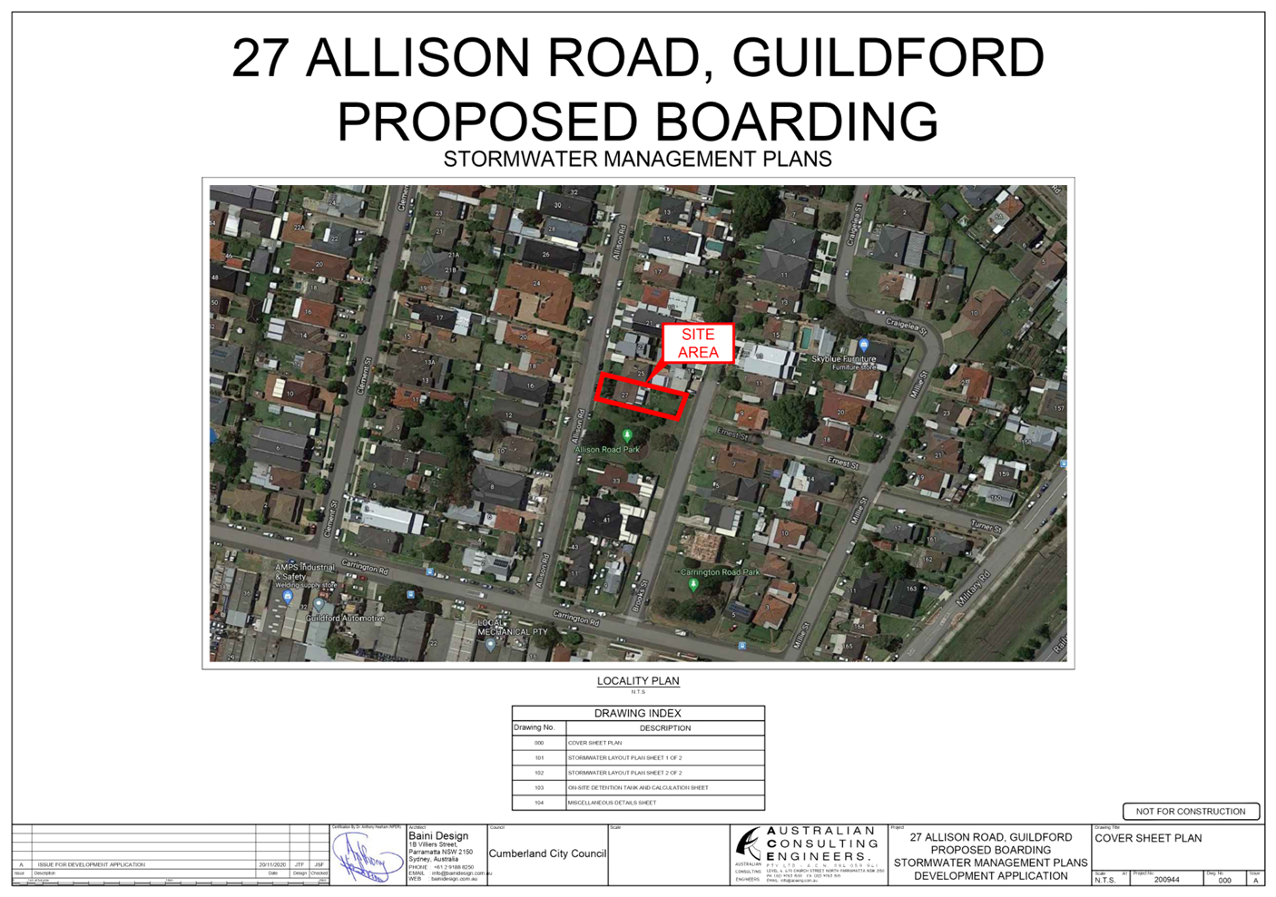
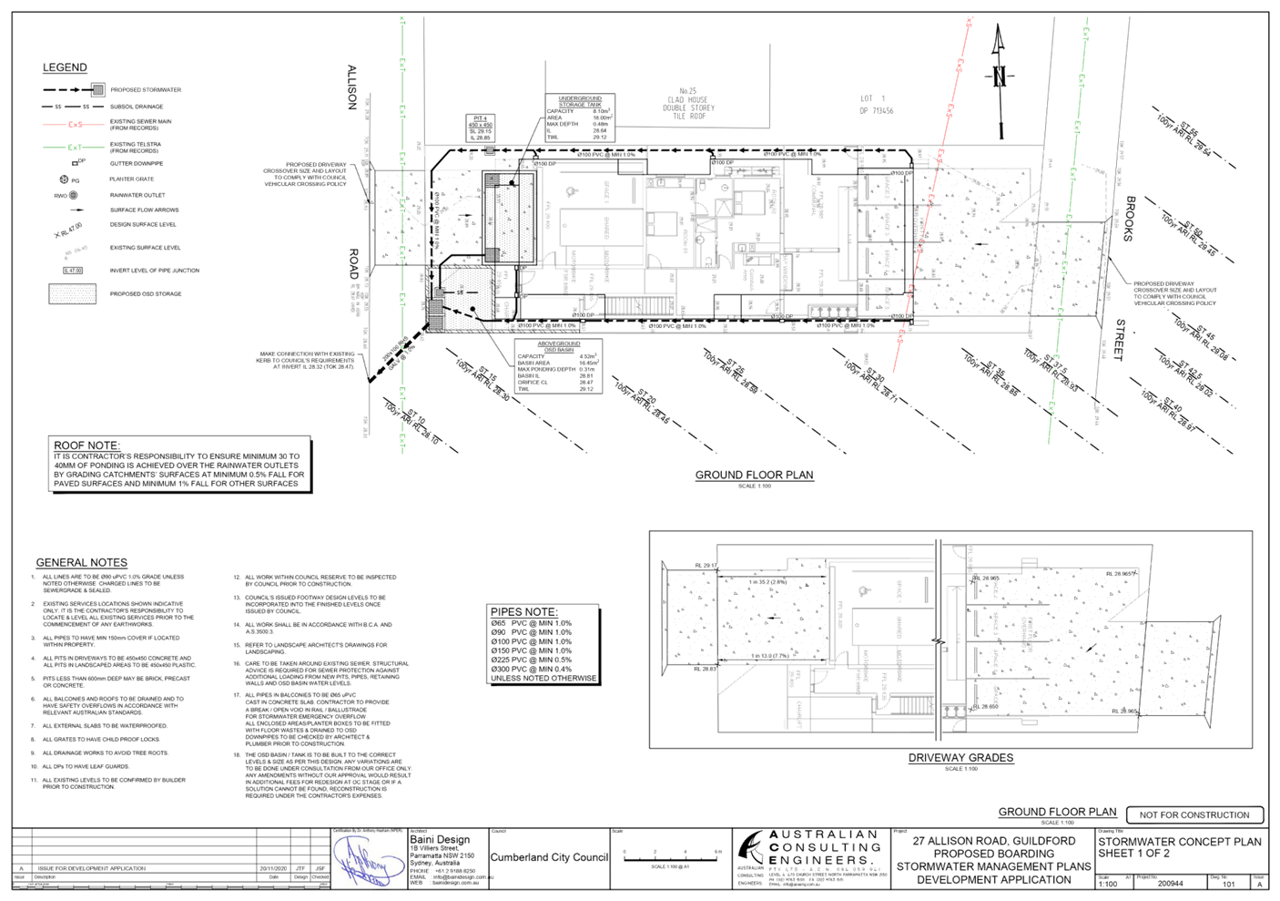
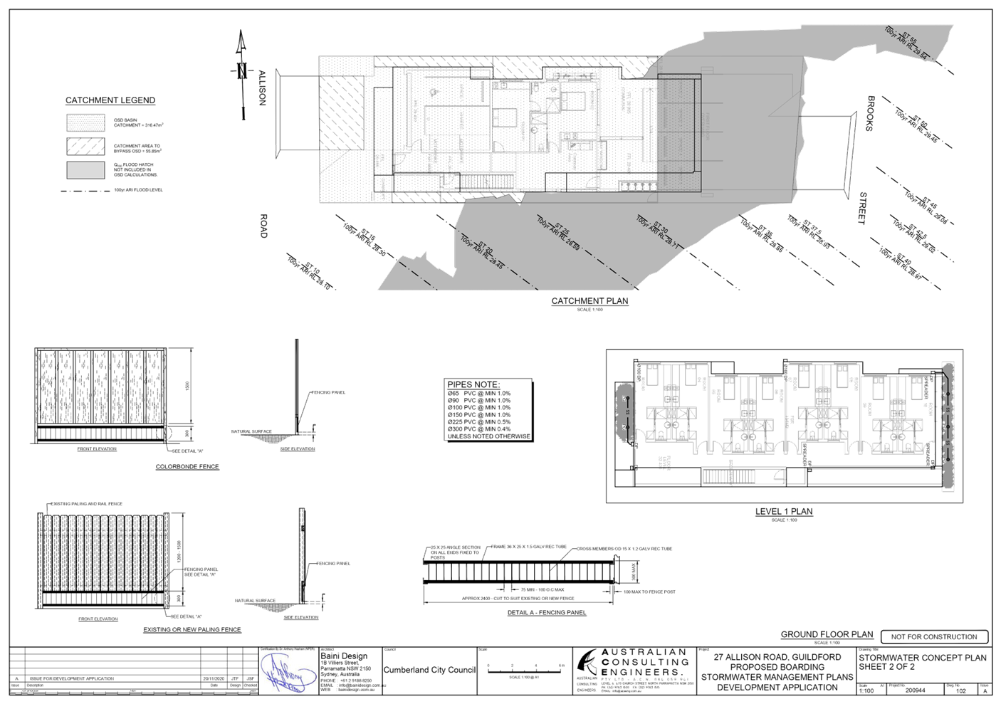
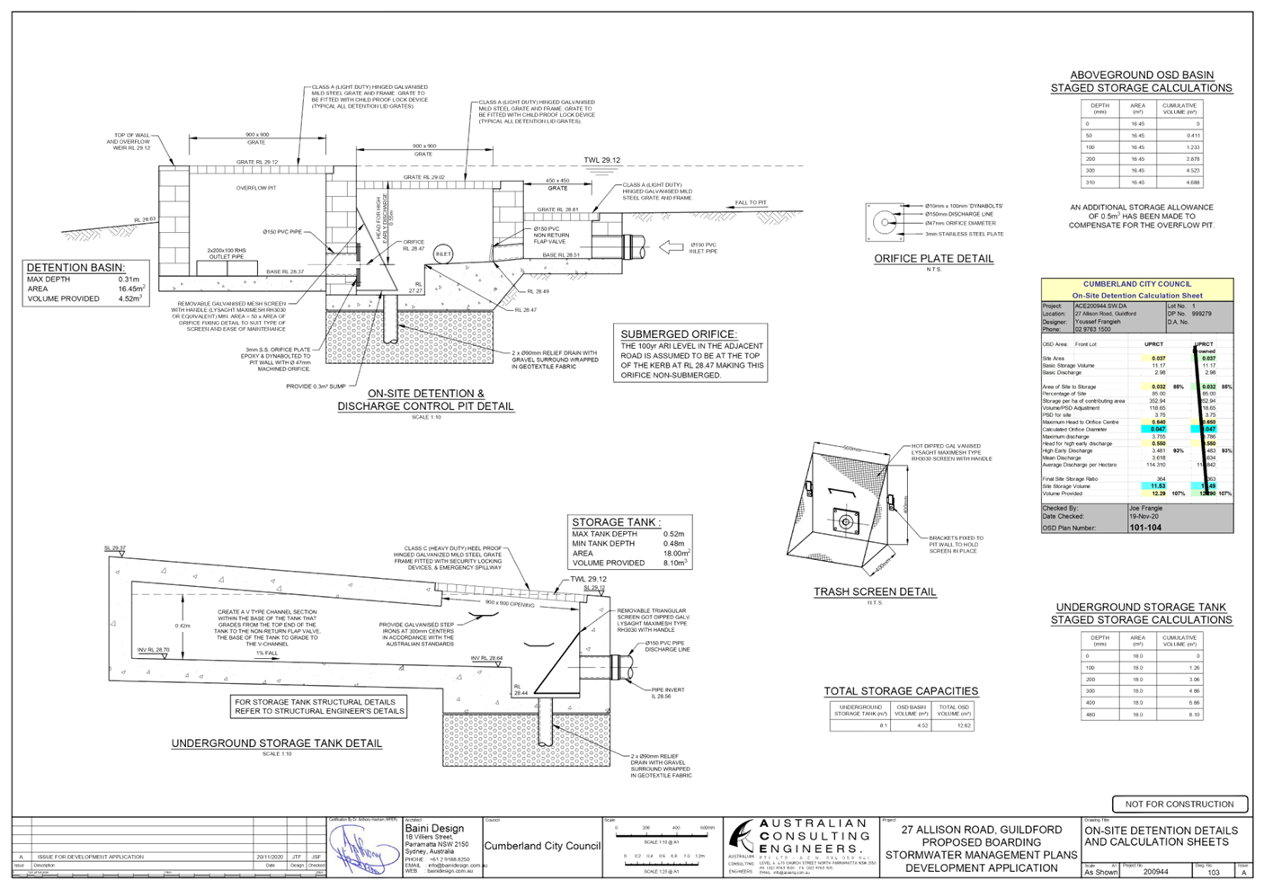
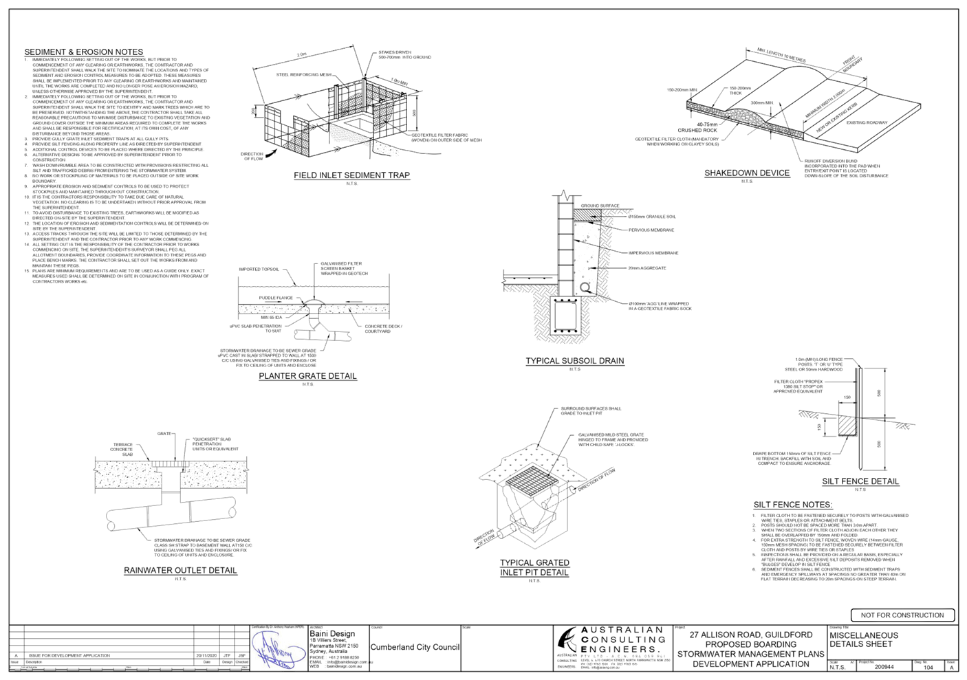
DOCUMENTS
ASSOCIATED WITH
REPORT LPP026/21
Attachment 6
Plan of Management
Cumberland Local Planning Panel Meeting
9 June 2021


DOCUMENTS
ASSOCIATED WITH
REPORT LPP026/21
Attachment 7
Redacted Submissions
Cumberland Local Planning Panel Meeting
9 June 2021


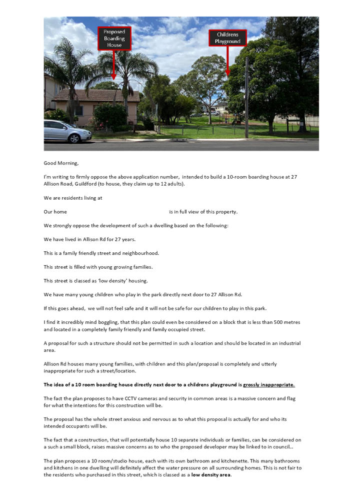

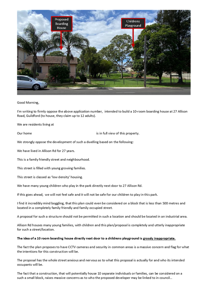


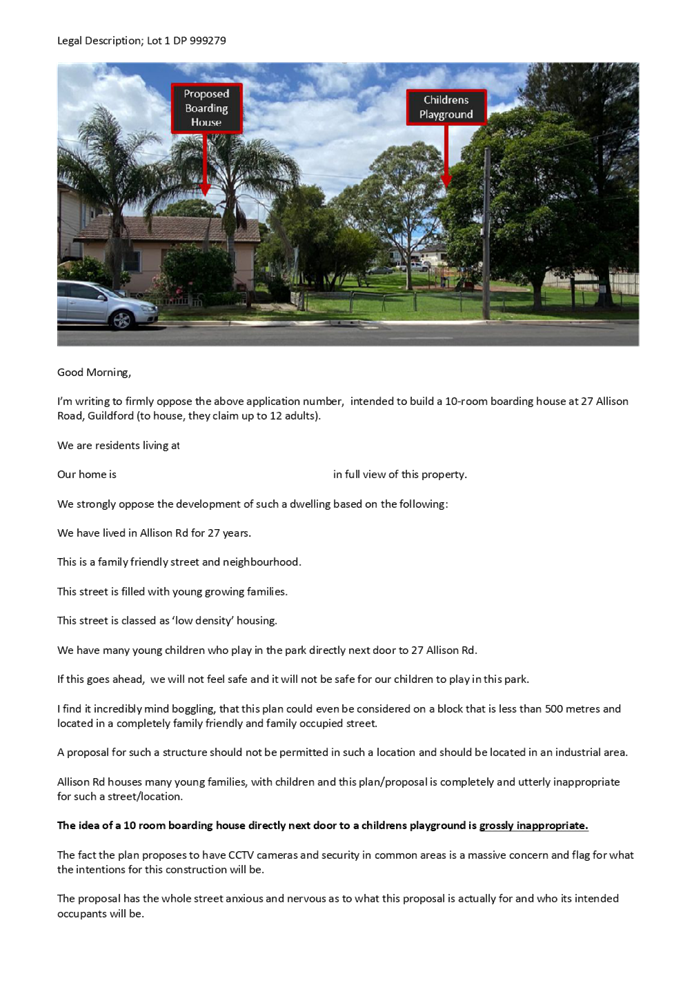


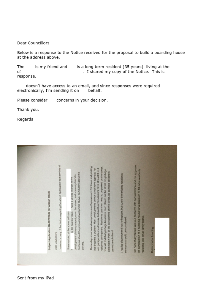


DOCUMENTS
ASSOCIATED WITH
REPORT LPP026/21
Attachment 8
ARH SEPP Compliance Table
Cumberland Local Planning Panel Meeting
9 June 2021
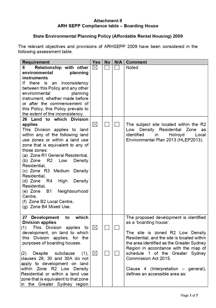
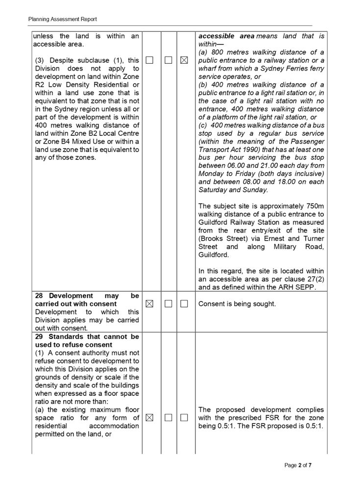
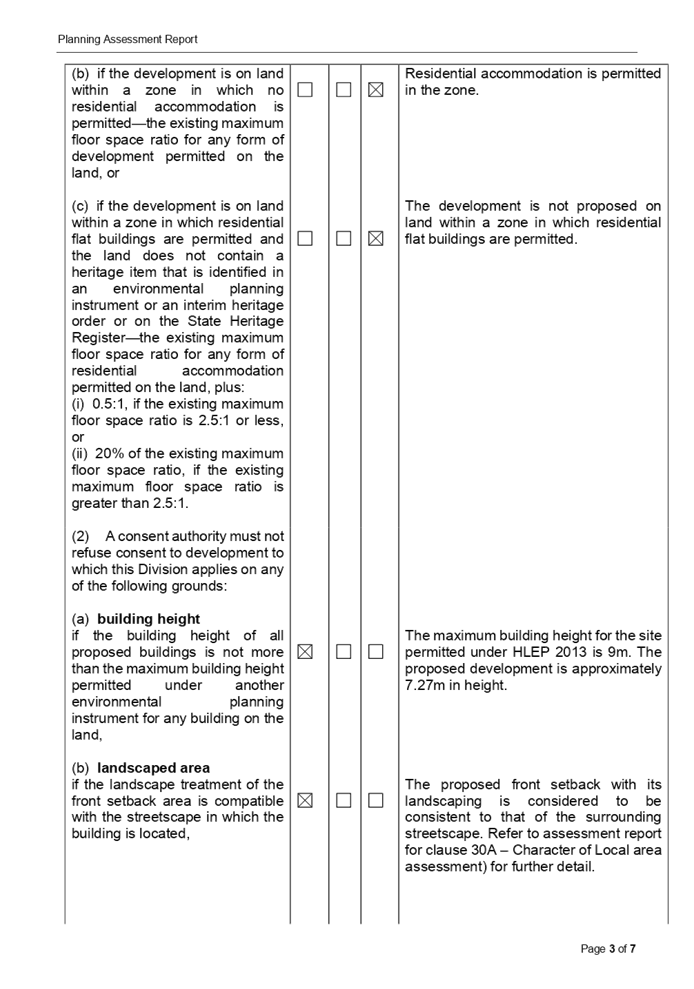

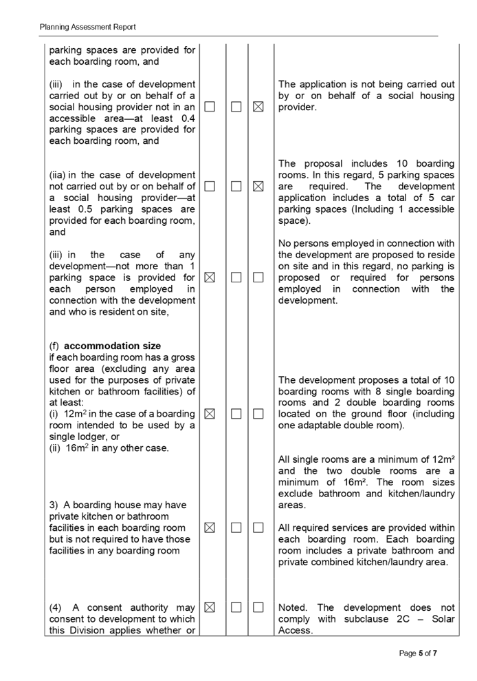
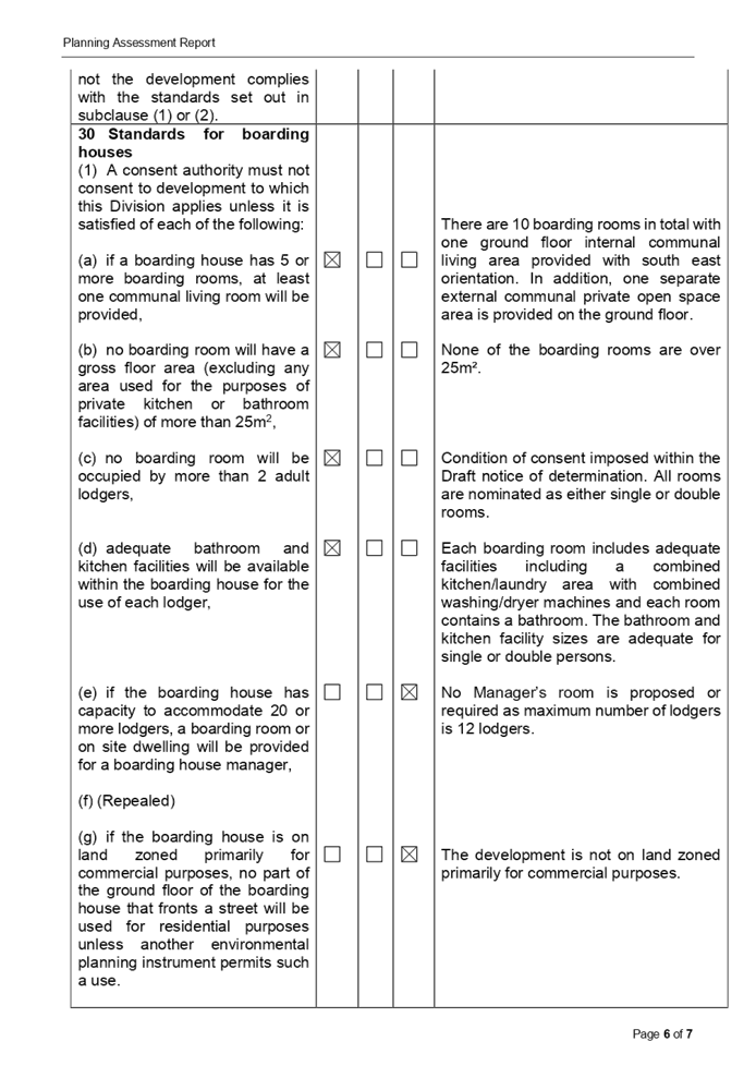
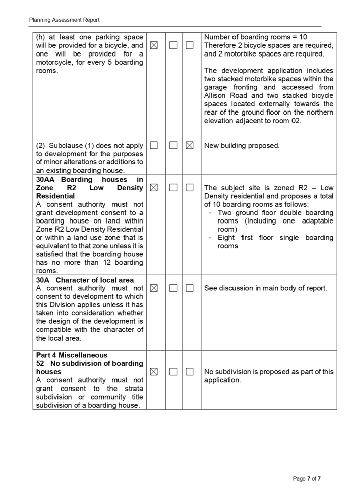
DOCUMENTS
ASSOCIATED WITH
REPORT LPP026/21
Attachment 9
Holroyd Local Enviornmental Plan 2013 Assessment Table
Cumberland Local Planning Panel Meeting
9 June 2021
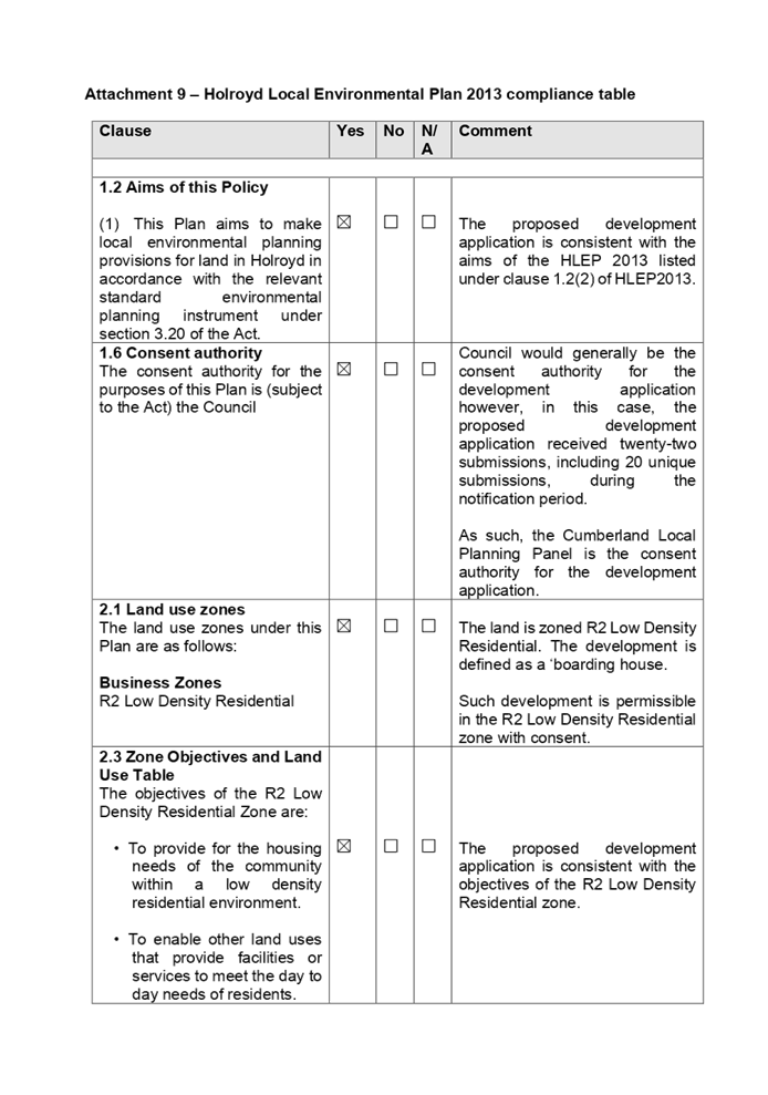
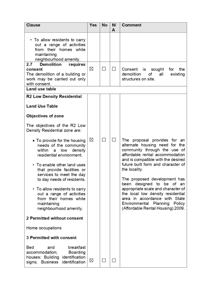
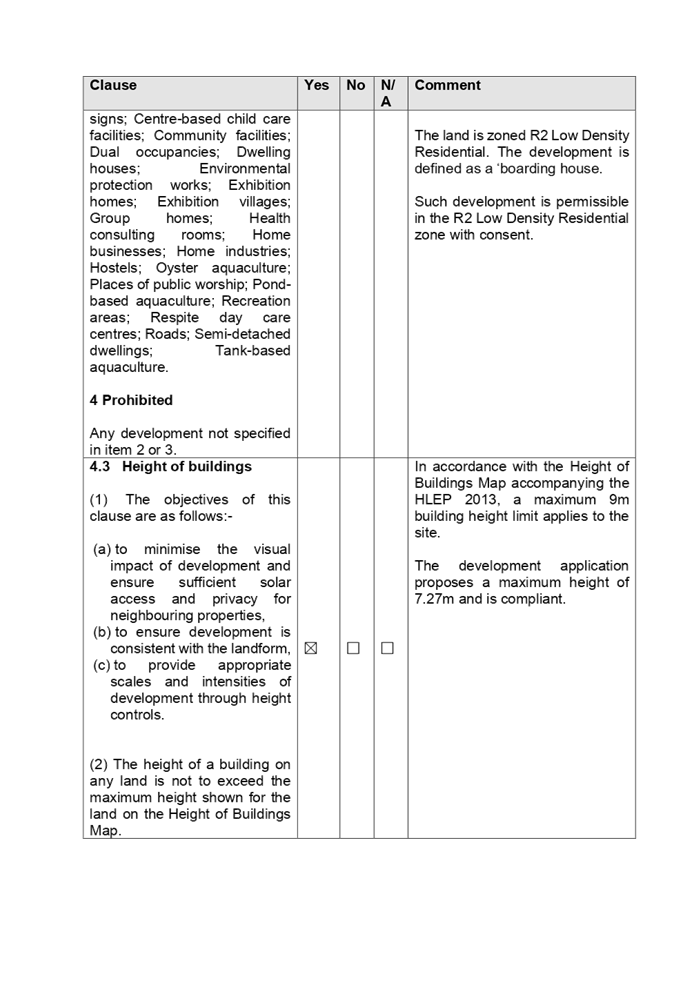
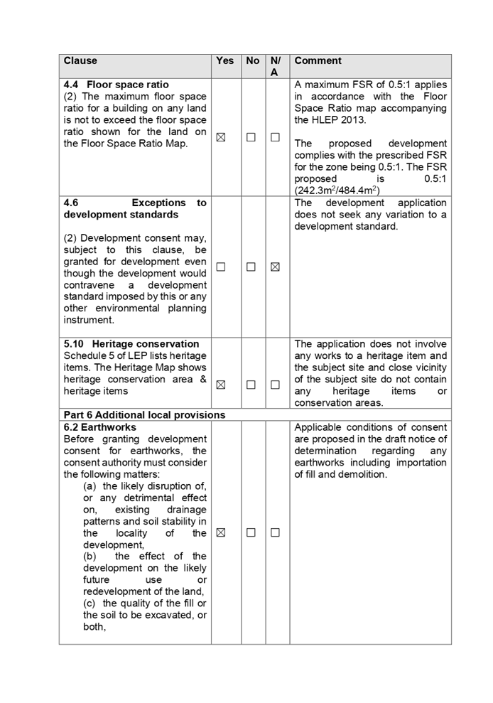
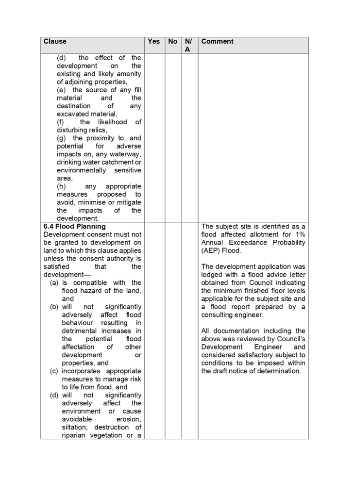
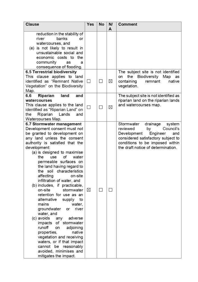
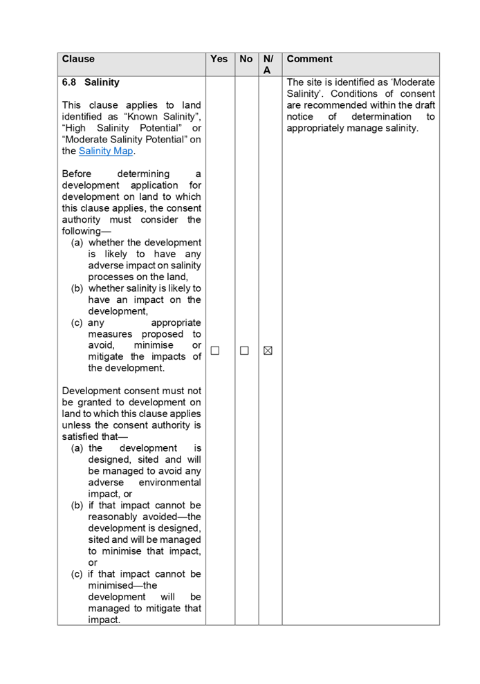

DOCUMENTS
ASSOCIATED WITH
REPORT LPP026/21
Attachment 10
Holroyd Development Control Plan 2013 Assessment Table
Cumberland Local Planning Panel Meeting
9 June 2021
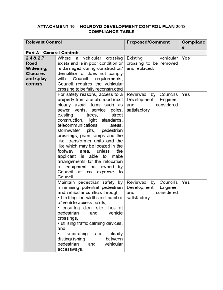
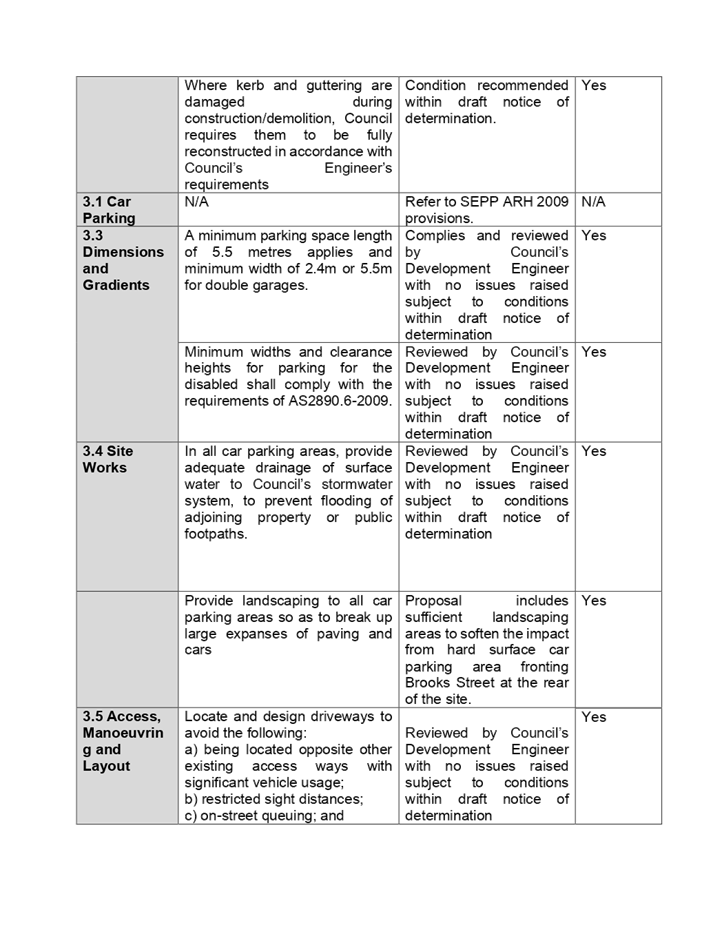
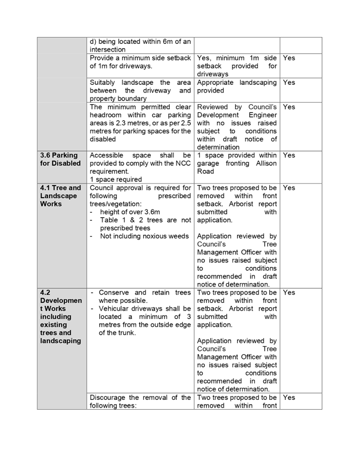
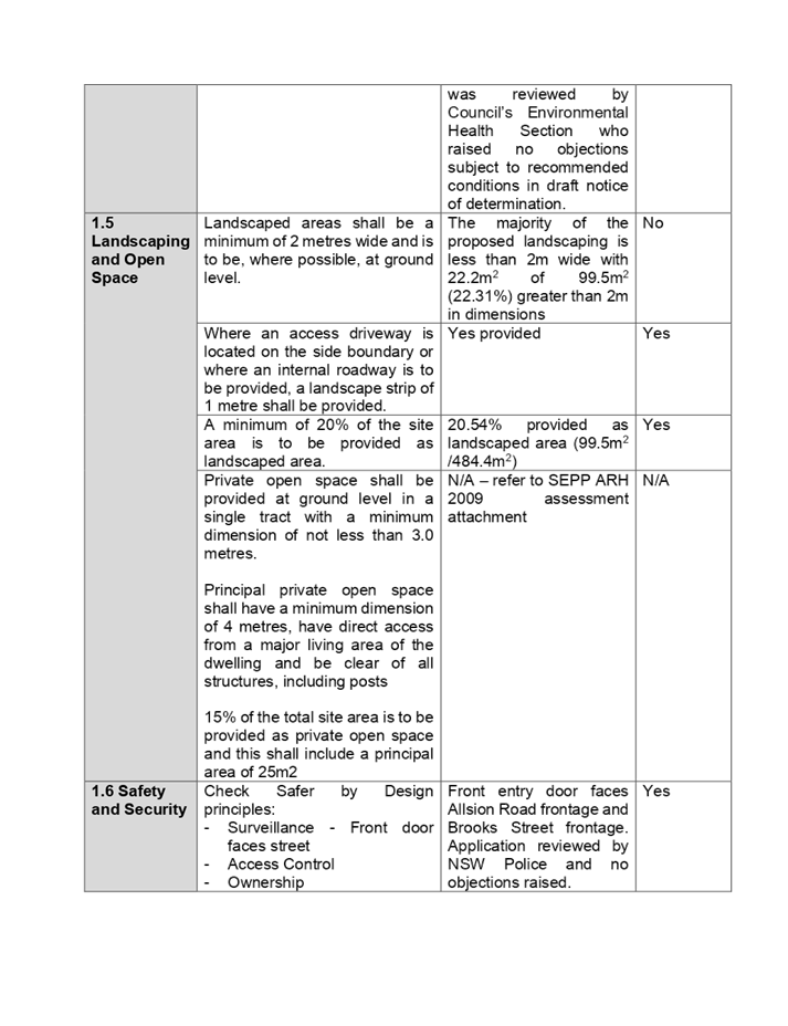
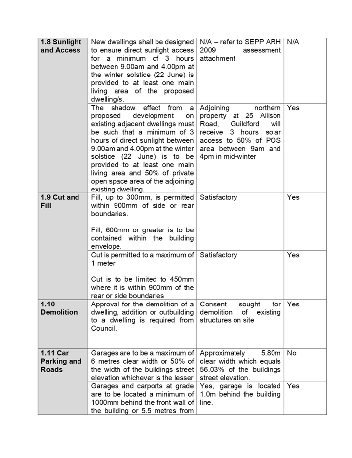
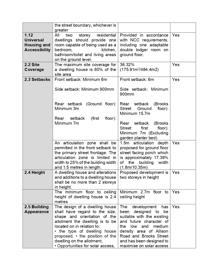
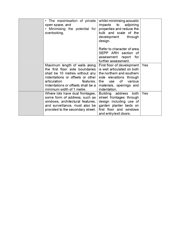
Cumberland
Local Planning Panel Meeting
9 June 2021
Item
No: LPP027/21
Planning
Proposal for Coronation site, 233-259 Merrylands Road and 54-59 McFarlane
Street, Merrylands
Responsible
Division: Environment
& Planning
Officer: Director
Environment & Planning
File
Number: PP2021/0001
|
Lodged
|
15
April 2021
|
|
Proponent
|
Merrylands Investment Co Pty Ltd
(Landowner and Developer)
|
|
Description of Land
|
233, 249-259 Merrylands Road and
52-54 McFarlane Street, Merrylands. The Planning Proposal Request primarily
relates to Buildings D and E (Lot 5 DP 17401, Lot 10 DP 814298, and Lots 22,
25-27, DP 7916). It also seeks a minor housekeeping amendment for Building A.
|
|
Site Area
|
The site comprises 15 lots with a
total area of approximately 12,418m2 (or 11,365m2 after
land dedication to facilitate future laneways).
|
|
Site Description and Existing Use
|
The site is located in the
Merrylands Town Centre, 350m west of Merrylands Train Station, opposite the
Stocklands Shopping Centre. The site is a large L shaped corner land parcel
that, once consolidated, will have frontages to Merrylands Road (to the south),
Treves Street (to the west) and McFarlane Street (to the north). Demolition
works are complete and the site is undergoing site remediation work and
construction.
|
|
Existing Planning Controls
|
Zoning
|
B4 Mixed Use
SP2 Infrastructure (Local Road)
|
|
Height of Buildings
|
55 metres (Building A &
D)
77 metres (Building E)
|
|
Floor Space Ratio
|
5.5:1 (Buildings D & E)
|
|
Requested Planning Controls
|
Zoning
|
No change
|
|
Height of Buildings
|
71 metres (Building D)
93 metres (Building E)
77 metres (Building A)
|
|
Floor Space Ratio
|
7.5:1 (Buildings D & E)
|
|
Recommended Planning Controls
|
Zoning
|
No change
|
|
Height of Buildings
|
64 metres
(Building D)
84 metres
(Building E)
77 metres
(Building A)
|
|
Floor Space Ratio
|
7.5:1 (Buildings D and E)
|
It is noted that the recommended Height of Buildings
controls are 10 per cent lower than those requested by the Proponent. This is
to account for the additional heights achievable under design excellence
provisions.
|
Residential/
commercial
FSR split
|
The Planning Proposal Request seeks
to remove the application of clause 4.4(2B) of Holroyd LEP 2013 from the
site. The building is shown on FSR mapping as being part of ‘Area
B’ which means that the maximum FSR for residential accommodation or
tourist and visitor accommodation, or a combination of such uses, is to be
reduced by 1.7:1. It is recommended that this be supported.
|
|
Heritage
|
The site is not a heritage item and
is not located within a heritage conservation area. Nearby local heritage
items listed in Schedule 5 of Holroyd LEP 2013 include: Electrical
Substation, 285 Merrylands Road, Merrylands (I68); Merrylands School of Arts Building,
2989 Merrylands Road, Merrylands (I69). The above heritage listed items
located in the area are visually and physically separated from the site by
intervening development and roadways.
|
|
Design
excellence provisions
|
Yes, the site is subject to design
excellence provisions contained in clause 6.11 of Holroyd LEP 2013.
|
|
Disclosure of political
donations and gifts
|
Nil.
|
|
Previous
Considerations
|
Nil.
|
Background
This report provides an overview
of a Planning Proposal Request submitted to Council on 15 April 2021 for the
Coronation site at 233, 249-259 Merrylands Road and 52-54 McFarlane Street,
Merrylands.
In September 2020, the Sydney
Central Planning Panel granted development consent for the construction of five
mixed-use buildings on the site. The Planning Proposal Request seeks to allow
an additional five storeys on approved Buildings D and E; to remove current
restrictions on residential FSRs for Buildings D and E; and to regularise
building height controls for Building A.
To achieve the intended outcome,
the Planning Proposal Request seeks to amend the Holroyd Local Environmental
Plan (LEP) 2013 as follows:
· Increase the
Height of Buildings control for Building D from 55m (16 storeys) to 71m (21
storeys)
· Increase the
Height of Buildings control for Building E from 77m (23 storeys) to 93m (28
storeys)
· Increase the
Height of Buildings control for Building A from 55m (16 storeys) to 77m (23
storeys) to regularise the height approved under DA2020/0220
· Increase the Floor
Space Ratio control for Buildings D and E from 5.5:1 to 7.5:1 noting that this
does not include potential FSR bonus for design excellence
· Remove the
provision and application of Clause 4.4(2B) from Building D and E which reduces
the maximum FSR for residential accommodation or tourist and visitor
accommodation, or a combination of such uses, by 1.7:1.
The status of the planning
proposal is outlined in Figure 1.
Figure 1: Status of the Planning Proposal Request
The site and its context
The broader development site, shown in Figure 2, is a
large (12,418m2) L shaped site comprising 15 lots, including:
· 233
Merrylands Road, Merrylands (Lots 22, 25 and 26 Section A of DP 7916 and Lot 10
DP 814298, Lot 5 DP 17401)
· 249-259 Merrylands
Road, Merrylands (Lot 27, 28 and 29 Section A DP 7916, Lots 5, 6, 7, 8, 9 and
10 DP 244047)
· 52-54 McFarlane
Street, Merrylands (Lot 1 DP 1178575).
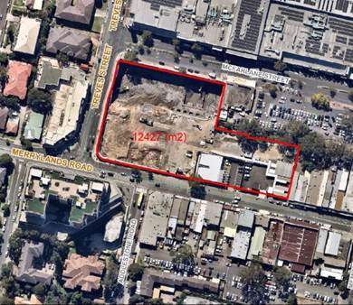
Figure 2: The broader development site (outlined in red)
The Planning Proposal Request relates primarily to Buildings D and E. It
also seeks a minor housekeeping amendment to Building A. Figure 3 shows the
location of these buildings within the broader development site.
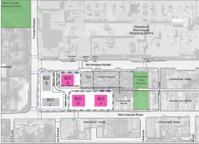
Figure 3: Location of Buildings A, D and E (shown in pink)
Regional context
The site is located in the
Merrylands Town Centre, approximately 3.5 kilometres south of Parramatta CBD
and 25 kilometres west of the Sydney CBD.
Merrylands Town Centre is
Cumberland City’s proposed strategic centre, with good access to a
diverse range of higher order services and facilities, retail/commercial and
residential opportunities.
The site is also well-served by
transportation and infrastructure, with Merrylands Train Station within 400
metres of the site (to the east) and public bus services along both Merrylands
Road and McFarlane Street. Major arterial roads servicing the region include
Woodville Road, M4 Motorway, and the Cumberland Highway.
Local context
The site is located in the
Merrylands Station and McFarlane Precinct. Council introduced new planning
controls for the Precinct in 2019 and has planned for the delivery of 4,200
additional dwellings in the McFarlane and Neil Street Precincts combined.
Currently the Precinct is
characterised by a mix of retail uses, including Stocklands Shopping Centre (to
the north), a small-scale strip retail (along Pitt Street, Merrylands Road,
Treves Street and McFarlane Street), near new mixed-use high-density
residential developments, coupled with older style (circa 1970s to 1990s),
three level walk-up apartment complexes. The site itself has undergone
demolition works and is undergoing site remediation work and construction.
The local area is well-served by a
range of active and passive recreational facilities of various scales,
including Central Gardens, Memorial and King Parks, Ted Burge Reserve,
Merrylands Park, Merrylands Swimming Centre, and Granville Park. Figure 3 shows
the location of a proposed new Town Square to the east of the site.
Approved
Development Scheme
In September 2020, the Central
Sydney Planning Panel issued development consent for construction of five
mixed-use buildings to be constructed on the site, including approximately 790
residential apartments, retail and commercial tenancies, childcare facility,
basement parking, and associated stormwater, public domain and landscaping
works (DA 2020/0220).
As part of the DA approval, the
Proponent must also construct and dedicate to Council an access road linking
Main Lane, McFarlane Street and Merrylands Road, and extend Main Lane to
provide access to the site.
In March 2021, following a review
of the approved scheme by Project Architect, Woods Bagot, the Proponent lodged
a modification to alter the proposed apartment mix, the retail /commercial mix
and configuration, associated pedestrian access and communal area, and overall
design changes (MOD2021/0123).
In August 2020, Cumberland’s
Design Excellence Panel issued a conditional Design Excellence Certificate for
the development with further changes required prior to the issue of a
construction certificate.
Table 1
provides a summary of the approved scheme.
|
Building
|
No of storeys
|
Description
|
|
A
|
25
|
229 residential apartments with six ground floor and six
first floor commercial tenancies.
|
|
B
|
17
|
120 residential apartments with four ground floor retail
tenancies, one ground floor co-share commercial tenancy and first floor
childcare centre with outdoor play area.
|
|
C
|
13
|
80 residential apartments with four ground floor retail
premises, one ground floor and four first floor commercial tenancies.
|
|
D
|
17
|
140 residential apartments with eight ground floor retail
tenancies including a supermarket.
|
|
E
|
25
|
221 residential units with single ground floor retail
tenancy.
|
Table 1:
Approved development scheme
Current Planning Controls
The site is subject to planning controls contained in Holroyd
LEP 2013. The following key controls apply to the site:
· Land
Zone: B4 Mixed Use and SP2 Local Road
· Height
of Buildings: 55m (Z), 77m (AA3)
· Floor
Space Ratio: 5.5:1 (Z2).
The site is also identified on Land Reservation Acquisition
and Design Excellence mapping. Figure 4 to Figure 8 contain LEP mapping extracts
for the above controls.
|
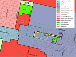
|
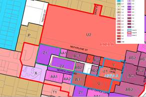
|
|
Figure 4: Land Zoning
|
Figure 5: Floor Space Ratio
|
|
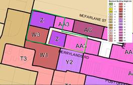
|
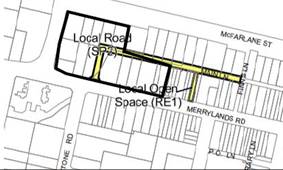
|
|
Figure 6: Height of Buildings
|
Figure 7: Land Reservation Acquisition
|
|
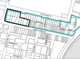
|
|
|
Figure 8: Design Excellence
|
|
Planning Proposal
Request
The Planning Proposal Request
seeks to allow an additional five storeys on approved Buildings D and E; remove
current restrictions on residential FSRs for Buildings D and E; and regularise
building height controls for Building A.
To
achieve the intended outcome, the Planning Proposal Request seeks to amend the Holroyd
Local Environmental Plan (LEP) 2013 as follows:
· Increase the
Height of Buildings control for Building D from 55m (16 storeys) to 71m (21
storeys)
· Increase the
Height of Buildings control for Building E from 77m (23 storeys) to 93m (28
storeys)
· Increase the
Height of Buildings control for Building A from 55m (16 storeys) to 77m (23
storeys) to regularise the height already approved as part of the DA consent
for the broader development
· Increase the Floor
Space Ratio control for Buildings D and E from 5.5:1 to 7.5:1 noting that this
does not include potential FSR bonus for design excellence
· Remove the
provision and application of Clause 4.4(2B) from Building D and E which reduces
the maximum Floor Space Ratio for residential accommodation or tourist and
visitor accommodation, or a combination of such uses, by 1.7:1.
Figures 9 and 10 below contain
extracts from the Woods Baggot Urban Design Report, showing the proposed Height
of Buildings and Floor Space Ratio controls.
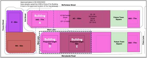
Figure 9: Proposed
Height of Building controls
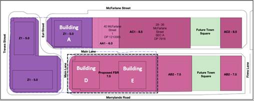
Figure 10: Proposed
Floor Space Ratio control
Justification
The Planning Proposal Request
states that the proposal is likely to:
· Result in an
improved urban design outcome, consistent with surrounding built form and
density, the McFarlane Precinct Masterplan, and the approved DA for the site
· Create a suitable
‘step down’ in building height relative to the landmark building
approved to the north east of the subject site and responding to the surrounds
· Provide a gradual
transition in building heights within the town centre (from the higher scale
mixed use development in the core of the Centre to the lower-medium scale
residential development to the west of Treves Street and south of Merrylands
Road) and within the development site itself
· Create a strong
urban edge to Treves Street (east), identifying and reinforcing the gateway to
the Merrylands Town Centre when approaching from Merrylands West
· Contribute to
local economic growth without threatening the commercial viability of the
existing Merrylands Town Centre
· Deliver increased
housing within proximity to public transport, contributing to the NSW
Government’s 30-minute city policy objective.
Public Benefit Offer
As part of their Planning Proposal
Request, the Proponent submitted a Public Benefit Offer indicating that they
may enter into a Voluntary Planning Agreement with Council to deliver the
following public benefits:
· Construction
of the east/west Main Lane, including both physical works and embellishments
(Note: Council considers this as a service lane and the scope of works and
embellishments needs to confirmed between the parties).
· Provision
of storage space and/or community facilities within the development site, to be
leased to Council at a nominal rate.
It is noted that a condition of DA
consent is for the Proponent to dedicate land to Council free of charge for the
purpose of a laneway and the SP2 portion of the site is identified on the
Holroyd LEP 2013 Land Reservation Acquisition map
Following the Panel’s
consideration, should Council endorse that the proposal proceed to a Gateway
Determination, Council officers will negotiate a Voluntary Planning Agreement
with the proponent to ensure that any public offer for the site maximises
outcomes for the wider community and is consistent with the Cumberland Planning
Agreements Policy.
Strategic Merit Assessment
There is merit
in progressing the proposal to the next phase of assessment, subject to the
proposed Height of Buildings controls being reduced by 10 per cent. This is to
account for the additional heights achievable under design excellence
provisions and to reduce the impact of the development on surrounding
sites. This impact is based on maximum heights that could occur should
the design excellence bonus also be applied on the proposed controls under the Planning
Proposal Request. Further information is outlined below.
Built form
The
Planning Proposal Request is supported by an Urban Design Analysis by Woods
Bagot Architects which, through the analysis of street block modelling,
indicates that the requested increases in height and FSR limits for Buildings D
and E would result in a more desirable urban design outcome and would not
result in an unacceptable level of overshadowing or other impacts on
surrounding sites.
It is noted that the Woods Bagot
analysis did not take into consideration the additional height and FSR
increases achievable by the Proponent as part of a future DA for the uplift.
The site is affected by clause 6.11 ‘Area 2’ design excellence
provisions of the Holroyd LEP 2013. This enables the Proponent to apply
for design excellence provisions to seek an additional 0.5:1 Floor Space Ratio
and 10 per cent maximum building height bonus on top of the proposed principal
development controls.
To better determine the
potential impacts of the proposal, including the potential additional FSR and
height limits achievable under design excellence provisions, Council officers
undertook further analysis of the requested built form controls (see
attachments 5 to 7). Based on this analysis, it is recommended that the height
controls for Buildings D and E are reduced by at least 10 per cent. The
approved buildings are likely to cast significant shadows, particularly for
properties to the south along Merrylands Road during mid-winter, and the uplift
will further reduce solar access to these properties to the extent that they
may not receive the minimum of 2 hours of sunlight. In terms of urban design
outcomes, a better height transition is likely to be achieved with the
recommended decrease in heights, particularly when viewed from the east (see
Building Height Transition Diagrams contained in attachment 5, page 3).
The requested height control for
Building A is supported as it will regularise the height limit that is already
approved, with no further impacts on surrounding properties.
Traffic and
parking
The Planning
Proposal Request is supported by a traffic analysis (GTA, March 2021) which
concludes that traffic and parking impacts associated with the additional 90
dwellings are likely to be only minor in nature.
It is noted that
the broader traffic and transport impacts and mitigation measures were addressed
as part of Council’s Planning Proposal for the McFarlane Street, and Council further considered
these issues as part of its assessment of the approved DA for the
subject site. If Council prepares a Planning Proposal for the site, the matter
will be referred to relevant public agencies for their consideration and
comments. The matter will also be considered as part of any future DA for the
proposal. The proposal also acknowledges that no additional basement parking is
required for the proposed increase in dwellings but does not indicate how that
additional parking would be provided.
Flooding and
stormwater
Flooding and
stormwater issues were identified and
addressed as part of Council’s McFarlane Street Planning Proposal and are being implemented through approved DAs for the
site.
Economic and social benefits
The proposal
involves increases to Height of Buildings and Floor Space Ratio controls and
the removal of clause 4.4(2B) of Holroyd LEP 2013 (residential/commercial FSR
split) from Building D and E site.
The proposal
will deliver additional residential apartments in Merrylands Station and
McFarlane Precinct, which is identified in Council’s strategic plans as a
key area for future growth and renewal. The site is already approved for a mix
of retail/commercial and residential uses and it is considered economically and
socially beneficial to deliver additional housing in this location as it is
well served by a wide range of existing a wide range of higher order services
and facilities, including public transport, recreational areas, employment and
educational opportunities. Increased residential densities on the site will
also help to ensure the ongoing viability of local businesses and the
additional uplift will provide a temporary increase in construction jobs.
In relation to the proposed removal of clause 4.4(2B), the
Planning Proposal Request notes that Building D and E contains the supermarket
and associated speciality retail at the ground floor and a non-residential FSR
of 0.5:1. It is also noted that the site is situated adjacent to the Stocklands
shopping centre at Merrylands. It is considered that making clause 4.4(2B) not
applicable to the site and allowing the site to provide additional residential
accommodation would result in a better outcome for this site and this location.
The proposed amendments will also bring the LEP controls closer in terms of
consistency to the approved DA2020/0220.
Heritage
Based on the
Heritage Impact Assessment submitted by the Proponent in support of their DA
for the broader development and the built form analysis discussed in previous
sections of this report, the Proposal is unlikely to impact on nearby heritage
items.
Consistency
with A Metropolis of Three Cities
- Greater Sydney
Region Plan
The proposal
is broadly consistent with Greater Sydney Region Plan, particularly the
following Planning Directions:
· City
supported by infrastructure – the site is well connected to public
transport infrastructure. The site
and surrounds have been identified for increased density of commercial and residential development with the Merrylands
Station and McFarlane Street Precinct Planning
Proposal which is notified.
· City for its people – the future development will facilitate active uses and opportunities
for social interaction. The landmark building will assist people to navigate through the town centre and proposed strategic centre.
· Housing in the City
– the proposal
will provide new housing adjacent
to Merrylands railway
station and set within a network of new roads and pathways.
· An efficient
City – the proposal has potential to reduce transport costs and emissions by increasing the resident
population with access to public transport and
within walking distance of an established town centre and proposed strategic centre.
Consistency with the Central
City District Plan
The proposal
is broadly consistent with Central City District Plan, particularly the
following Planning Priorities:
· Planning
Priority C2 Planning for a city supported by infrastructure – the
proposal seeks to increase principal development controls close to key public
open space, existing infrastructure such as the Merrylands Transport
Interchange.
· Planning
Priority C5 Providing housing supply, choice, and affordability with access
to jobs, services, and public transport - the planning proposal request seeks
to deliver additional jobs and housing in Merrylands Town Centre,
Cumberland’s key Commercial Centre. The site is accessible to all the
jobs, service, and public transport of the Parramatta CBD.
Consistency
with Cumberland 2030: Our Local Strategic Planning Statement
The proposal is broadly
consistent with the Cumberland 2030: Our Local Strategic Planning Statement,
particularly the following Local Planning Priorities:
· Local
Planning Priority 5 – Delivering housing diversity to suit changing
needs, as the proposal will supply increase housing options for an ageing
population.
· Local
Planning Priority 6 – Deliver affordable housing suitable for the needs
of all people at various stages of their lives, as the future redevelopment
will incorporate a number of accommodation options to enable people form a
variety of backgrounds and socio-economic status to age in place.
The
Planning Proposal Request for the Coronation site in Merrylands is reported to
the Panel for advice prior to Council’s consideration. Based on a
preliminary review of the proposal and consideration of preliminary feedback
received from the community, this report recommends that the proposal be
reported to Council with a recommendation to proceed with the proposal, subject
to a reduction in proposed building heights for Buildings D and E to mitigate
potential amenity impacts and improve urban design outcomes.
Should
the proposal proceed to a Gateway Determination, negotiations regarding the
public benefit offer will be progressed and captured through a Voluntary
Planning Agreement in accordance with Council’s Planning Agreements
Policy.
The Planning Proposal Request
placed on preliminary exhibition for a period of 29 days from 21 April 2021 to 20 May 2021 as required by
Cumberland Council’s Planning Proposal Notification Policy. All owners and occupiers were also notified within 200
metre distance of the site. The exhibition material was made available online
on Council’s website and in hardcopy form in Council’s
administration buildings and selected libraries.
Council received
five community submissions, including one submission in support and four
objections. Key concerns raised in submissions are summarised below and tabled
in Attachment 8.
· Objections
to proposed building height and FSR for Buildings D and E
· Lack
of strategic merit for the proposal where there appears to be an oversupply of
units in the local area, demonstrated by high vacancy rates and not including
additional retail and commercial uses
· No
acknowledgment in planning proposal request to overshadowing impacts
anticipated south of Merrylands Road and the analysis does not show the
building heights proposed along the south of Merrylands Road
· Traffic
and overflow car parking effects to the surrounds
· Objections
to the proposed apartment mix
· Objections
to deletion of clause 4.4(2B) from proposed Buildings D and E
· Amenity
impacts such as increased traffic and parking, and overshadowing on nearby
residential properties to the south of Merrylands Road
· Concerns
about the draft Voluntary Planning Agreement, how the money would be used for
public benefit.
The Proponent made a Public
Benefit Offer as part of their Planning Proposal Request which will be further
negotiated and progressed if the proposal progresses beyond the Gateway
Determination stage.
This report recommends that this matter be reported
to Council for further consideration. Should Council resolves
to forward this planning proposal
to the Department of Planning and Industry for a Gateway Determination, there will be policy
implications associated with the subsequent stages of the planning proposal process. These will be outlined in subsequent Council reports.
Communication /
Publications:
There are no
communication/publication implications for Council associated with this report.
|
1. That
the Cumberland Local Planning Panel (CLPP) consider the recommended controls
for the site, being:
A. Increase
the Floor Space Ratio control for Buildings D and E from 5.5:1 to 7.5:1, as
requested by the Proponent
B. For
Building D, increase the Height of Buildings control from 55m to 64m (instead
of the requested 71m), noting that the maximum height control does not
include the design excellence bonus
C. For
Building E, increase the Height of Buildings control from 77m to 84m building
height (instead of the requested 93m), noting that the maximum height control
does not include the design excellence bonus
D. For
Building A, increase the Height of Buildings control from 55m to 77m, as
already approved under DA2020/0220
E. Remove
the application of clause 4.4(2B) of the Holroyd LEP 2013 from the site
2. That Cumberland Local Planning Panel (CLPP)
recommend that the Planning Proposal Request with the above recommended
changes be reported to Council, seeking a resolution to forward a Planning Proposal
to the Department of Planning and Industry for a Gateway Determination.
|
|
|
1. Planning
Proposal Request
2. Traffic
Analysis
3. Letter
of Offer
4. Urban
Design Report
5. Builiding
Height Transition Diagrams
6. Overview
of Shadow Models
7. Detailed
Shadow Analysis (all year)
8. Community
Submissions (summarised)
DOCUMENTS
ASSOCIATED WITH
REPORT LPP027/21
Attachment 1
Planning Proposal Request
Cumberland Local Planning Panel Meeting
9 June 2021

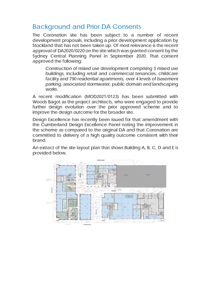


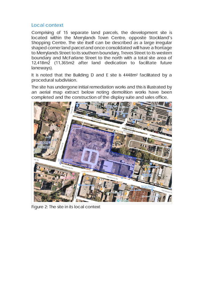
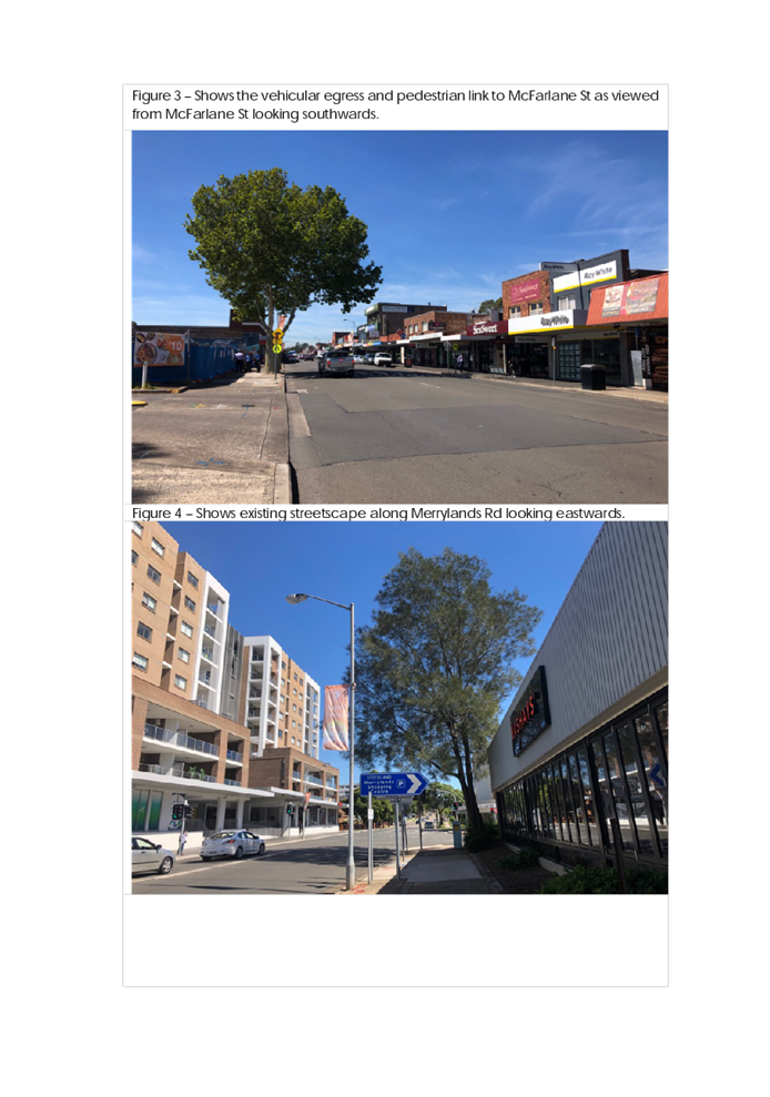
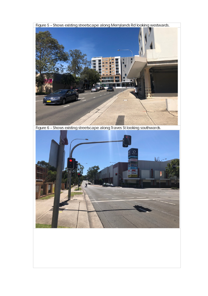
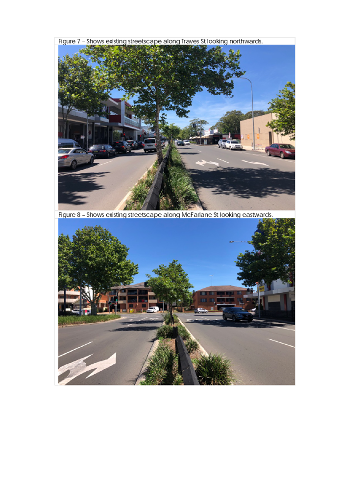
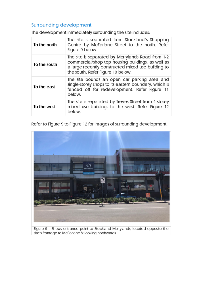
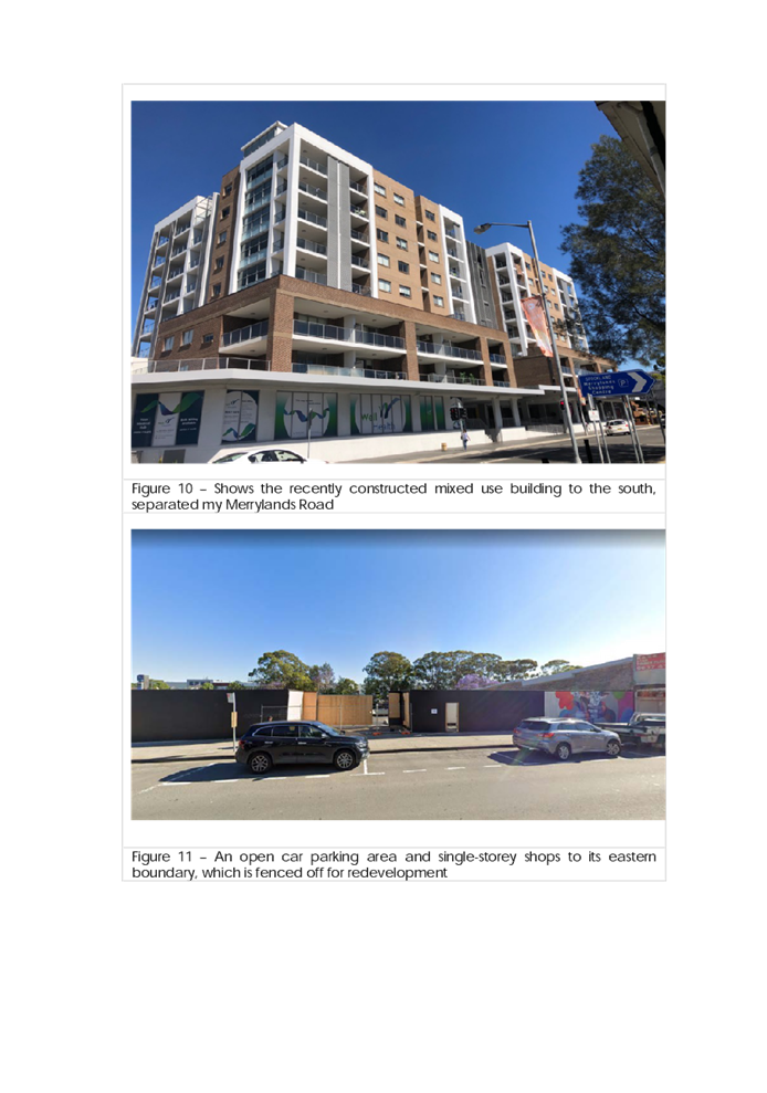
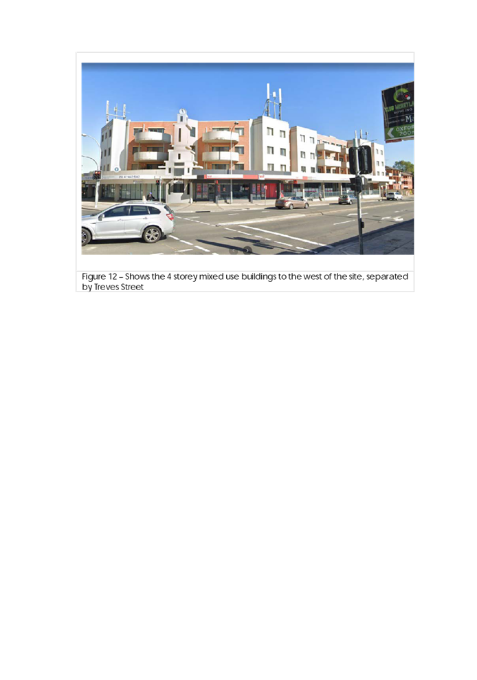
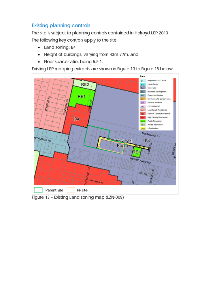
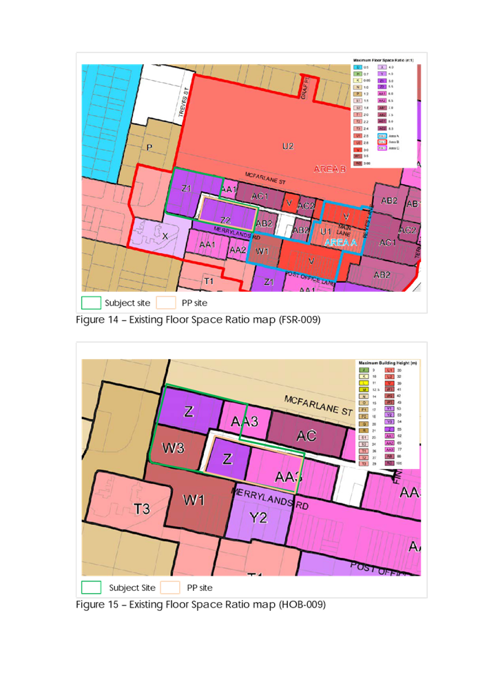

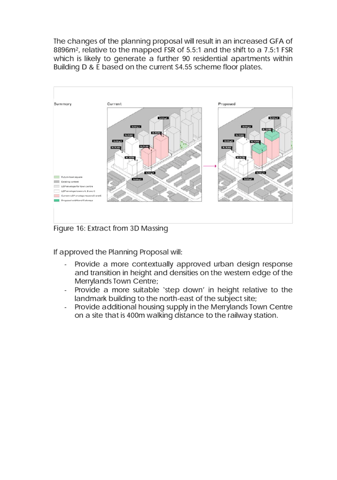
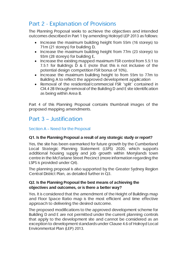

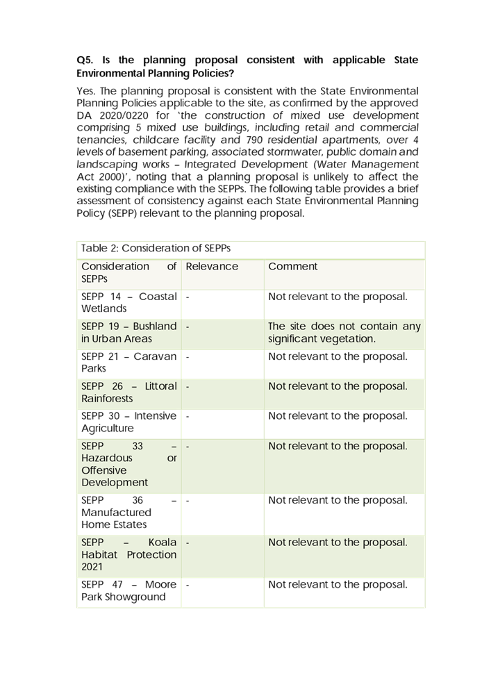
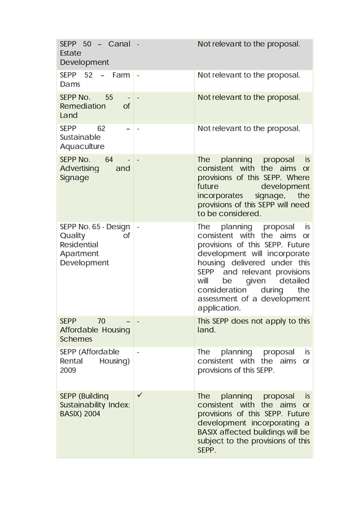
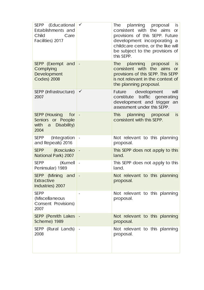
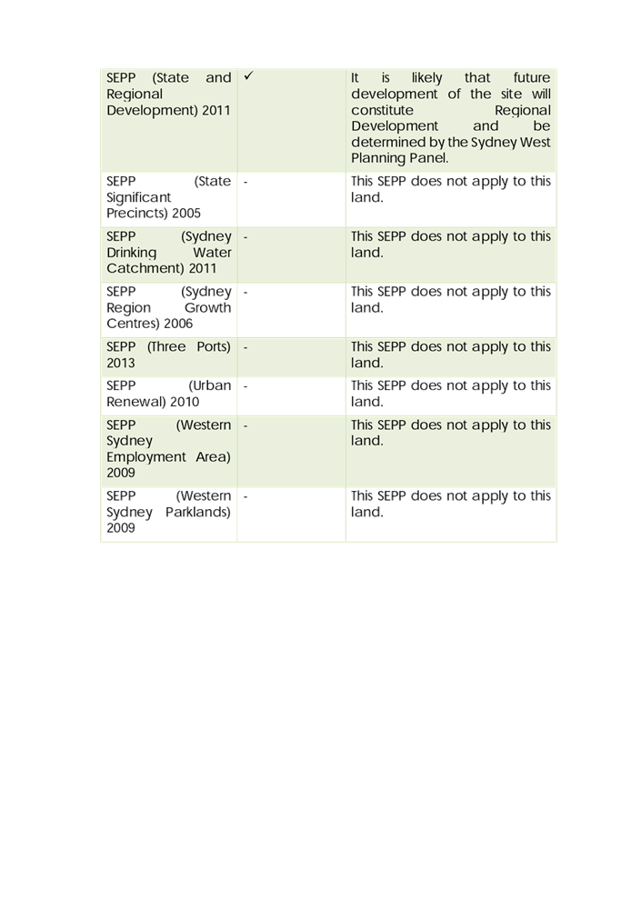
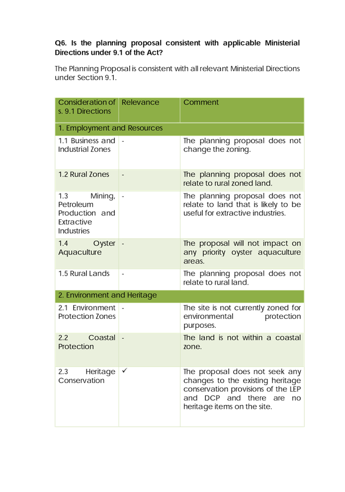
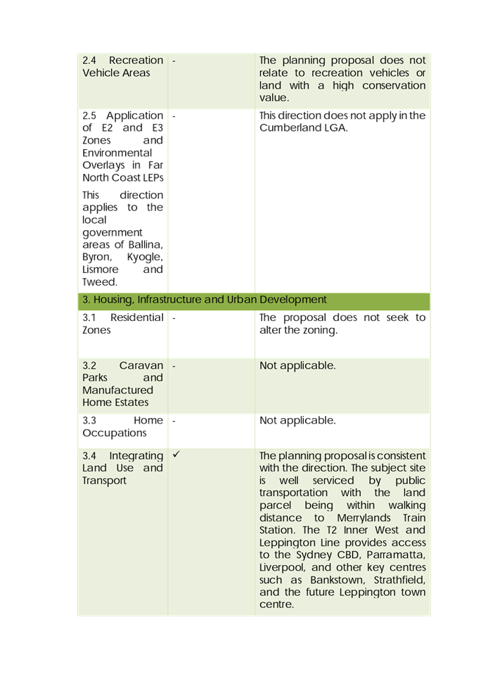
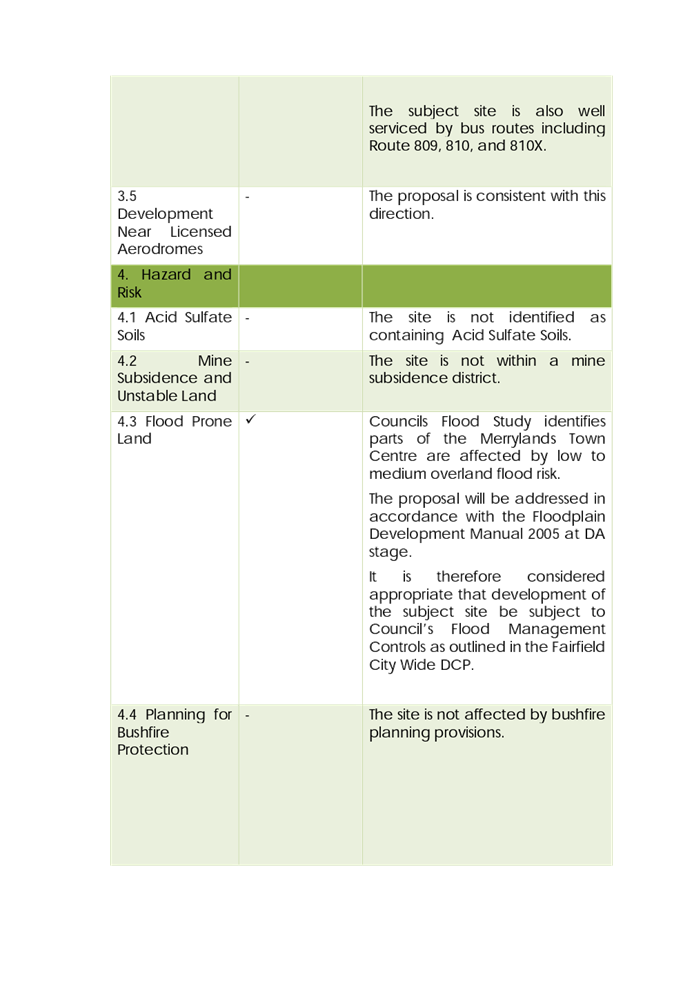
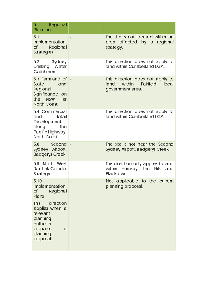
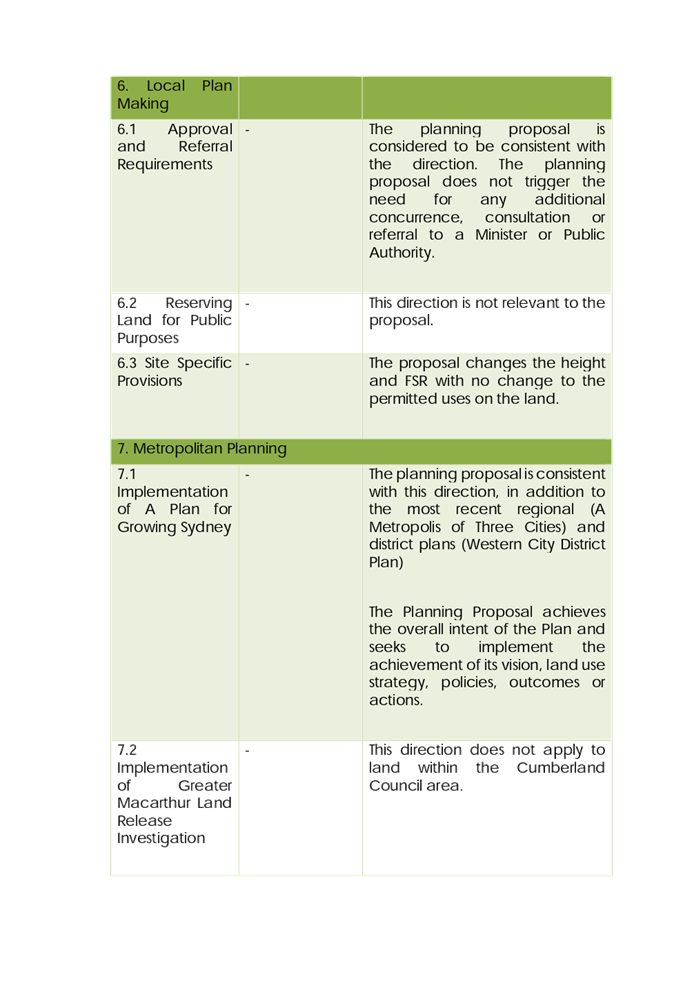
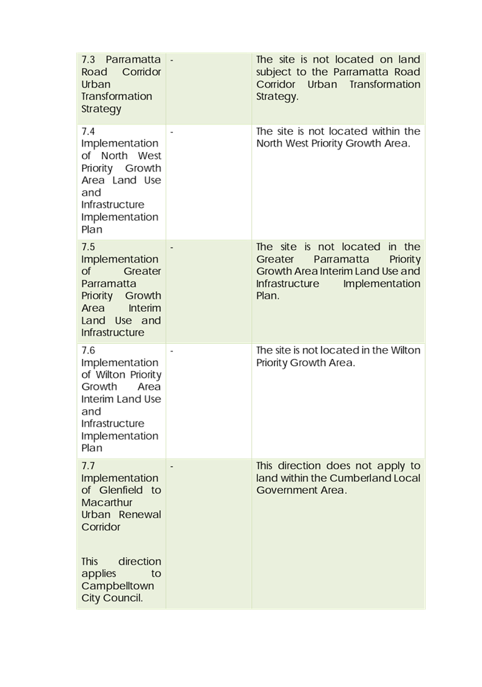
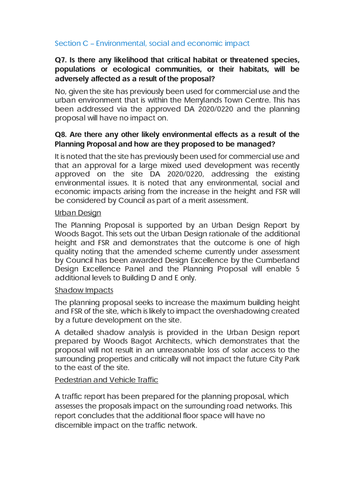
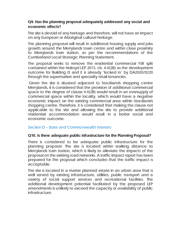

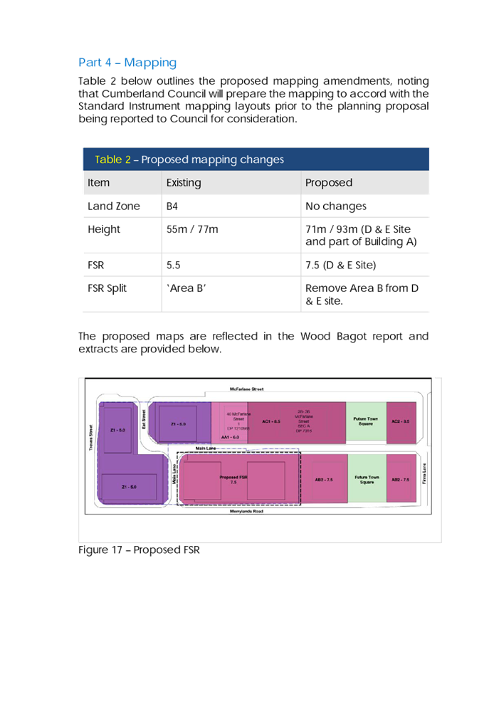
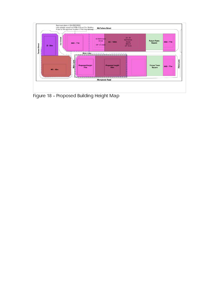
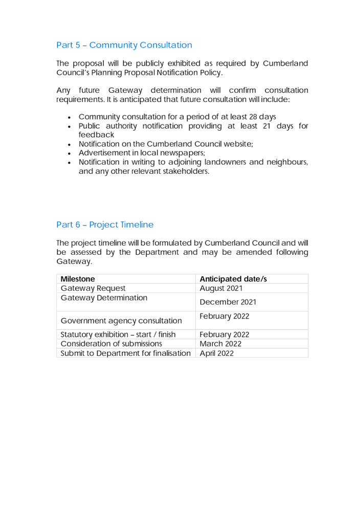
DOCUMENTS
ASSOCIATED WITH
REPORT LPP027/21
Attachment 2
Traffic Analysis
Cumberland Local Planning Panel Meeting
9 June 2021
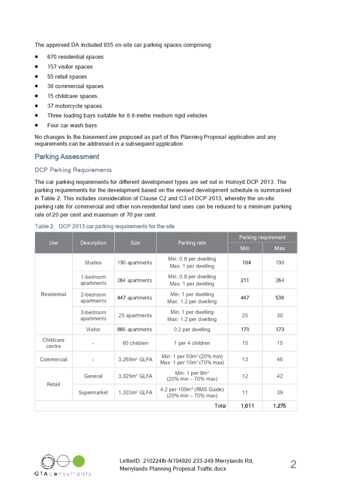
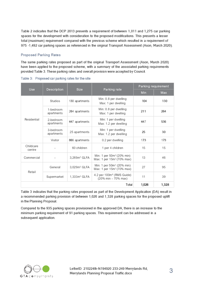
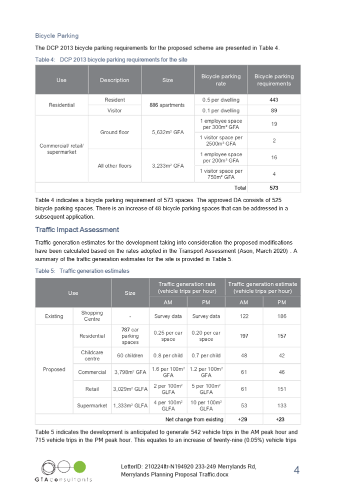
DOCUMENTS
ASSOCIATED WITH
REPORT LPP027/21
Attachment 3
Letter of Offer
Cumberland Local Planning Panel Meeting
9 June 2021
DOCUMENTS
ASSOCIATED WITH
REPORT LPP027/21
Attachment 4
Urban Design Report
Cumberland Local Planning Panel Meeting
9 June 2021
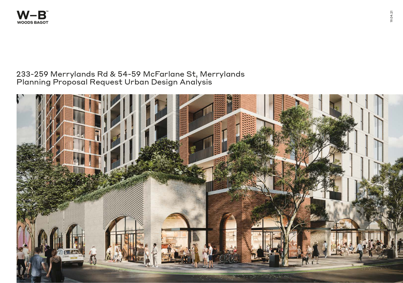
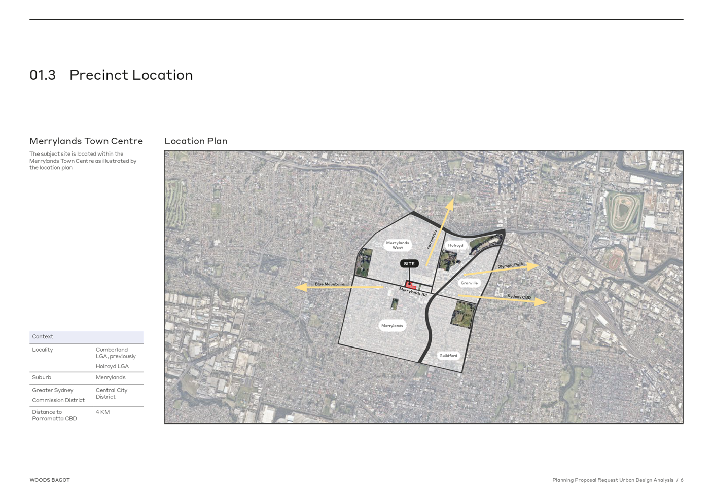
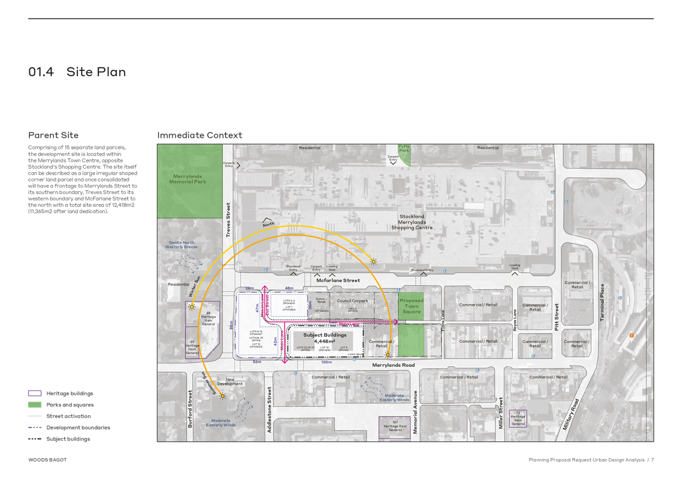
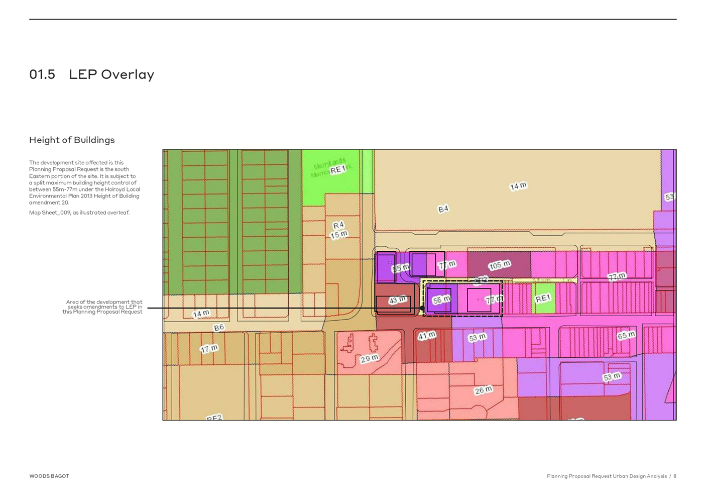
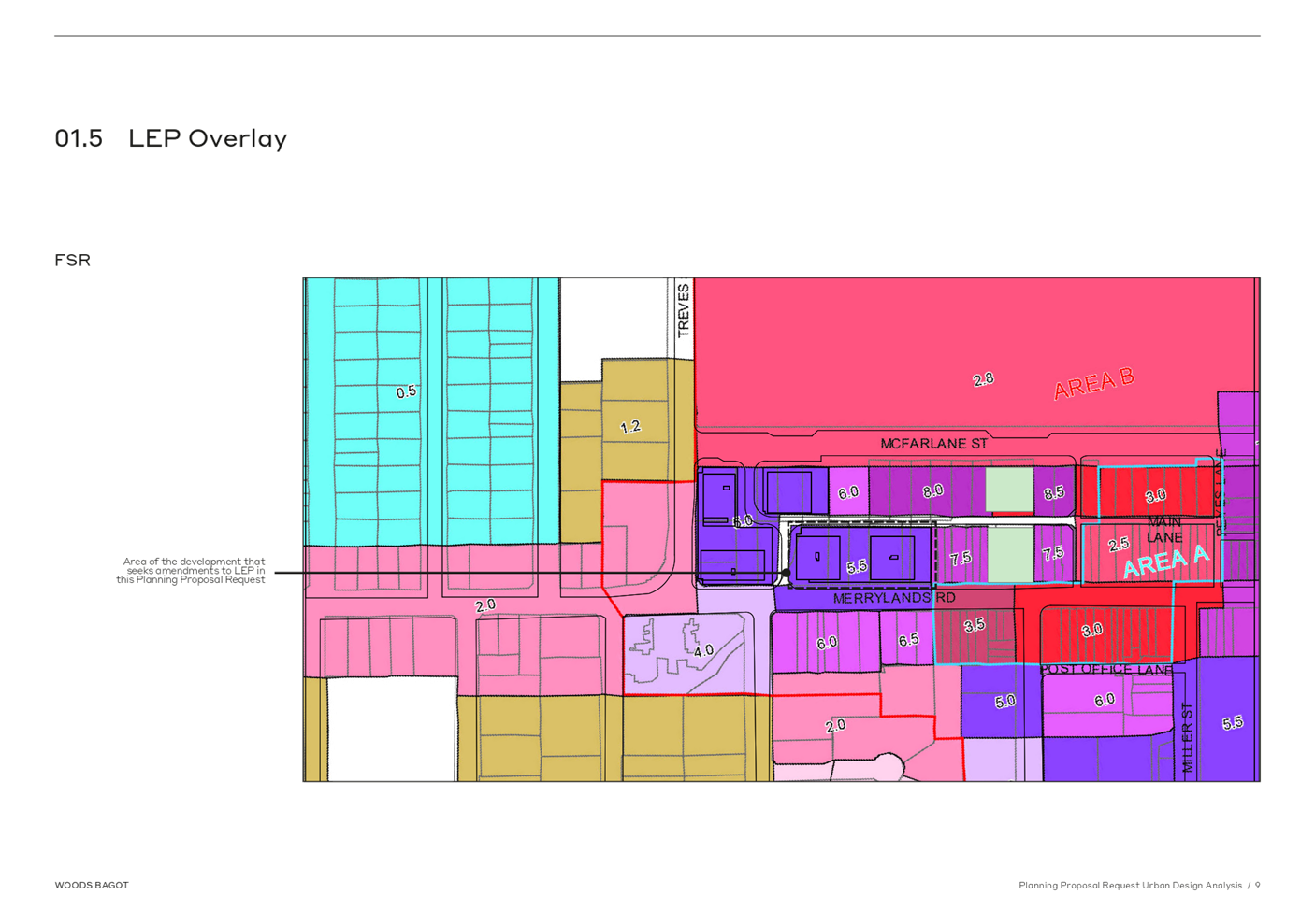
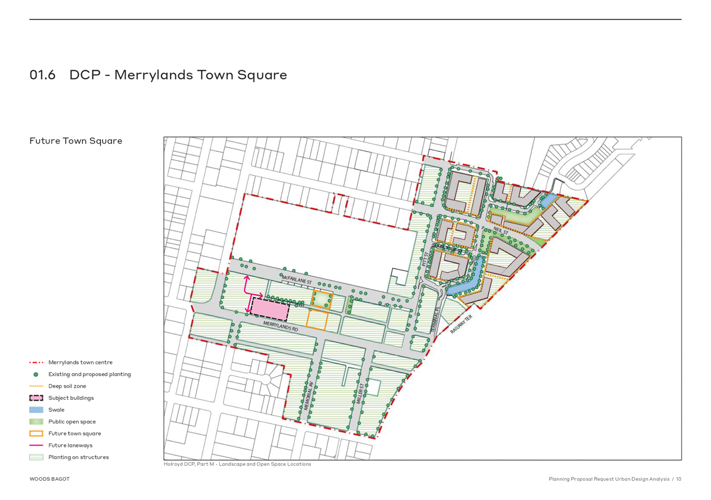
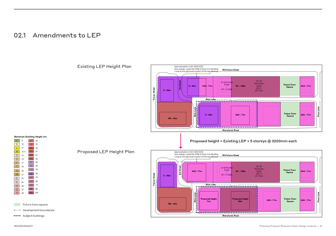
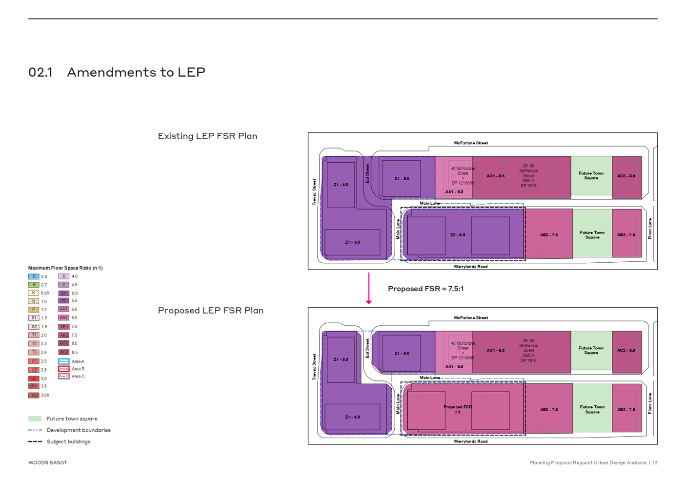
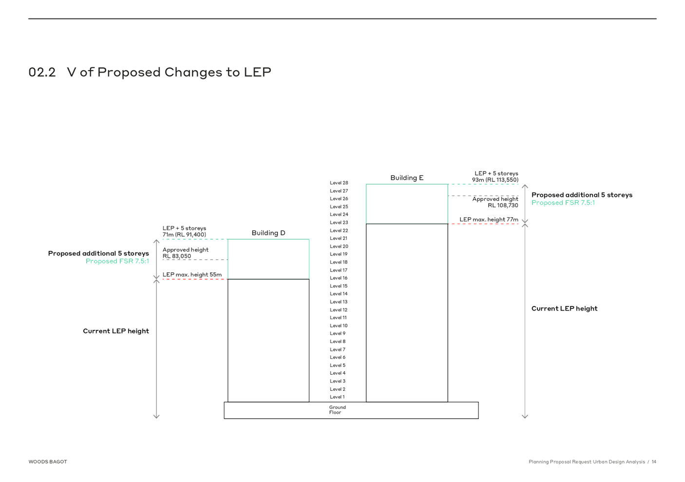
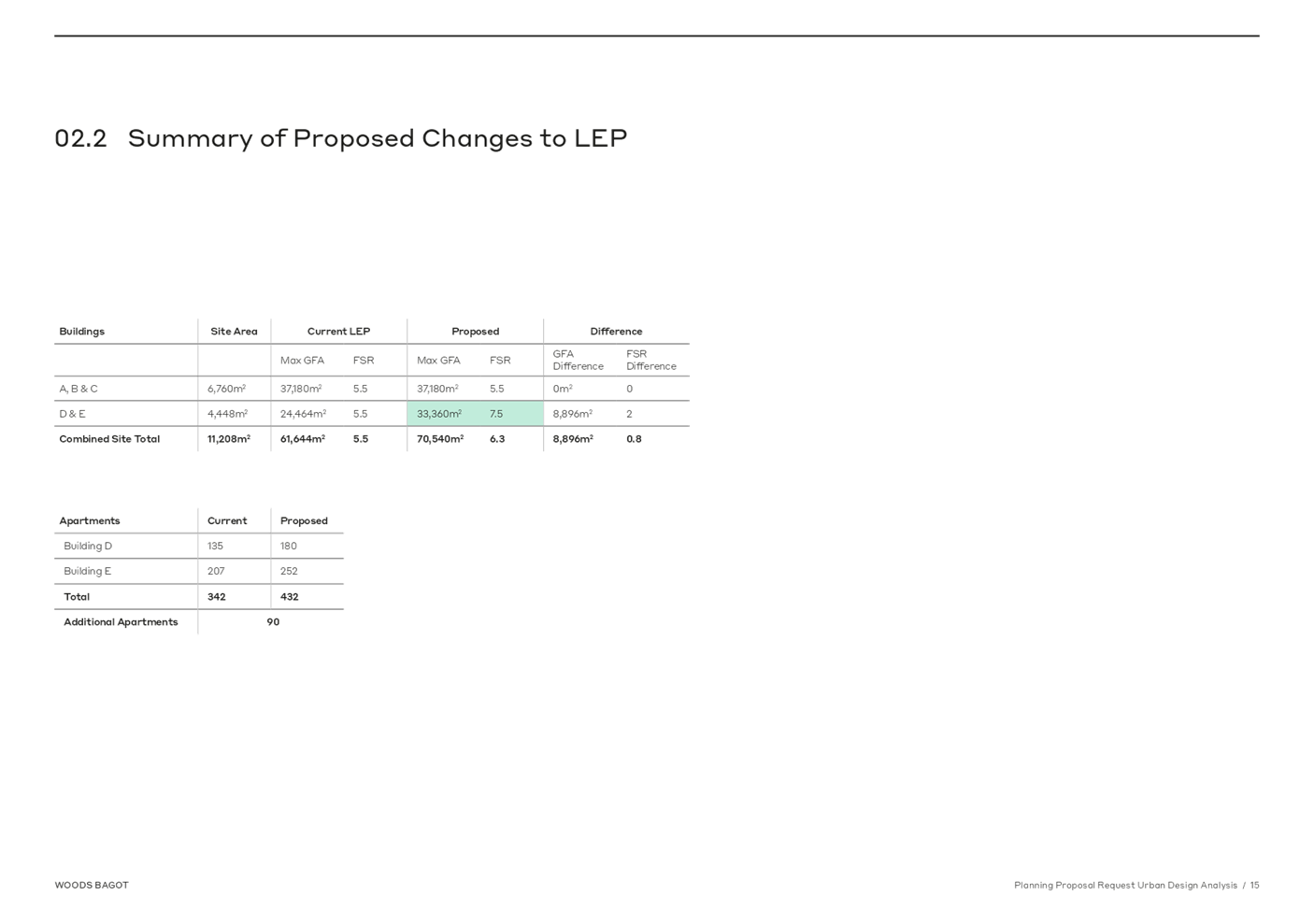
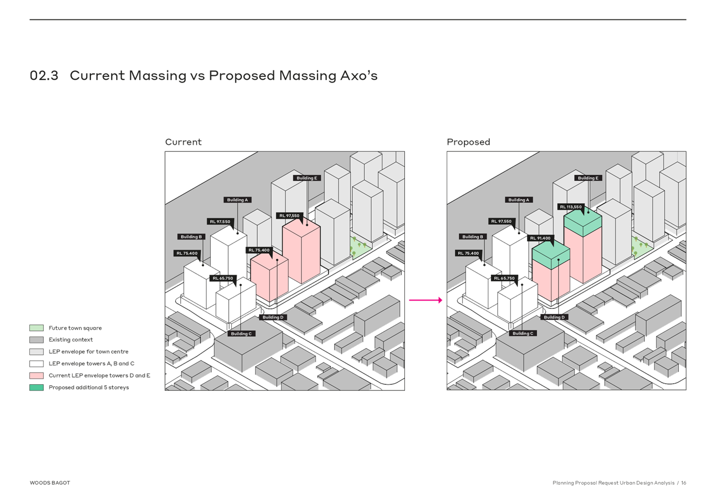
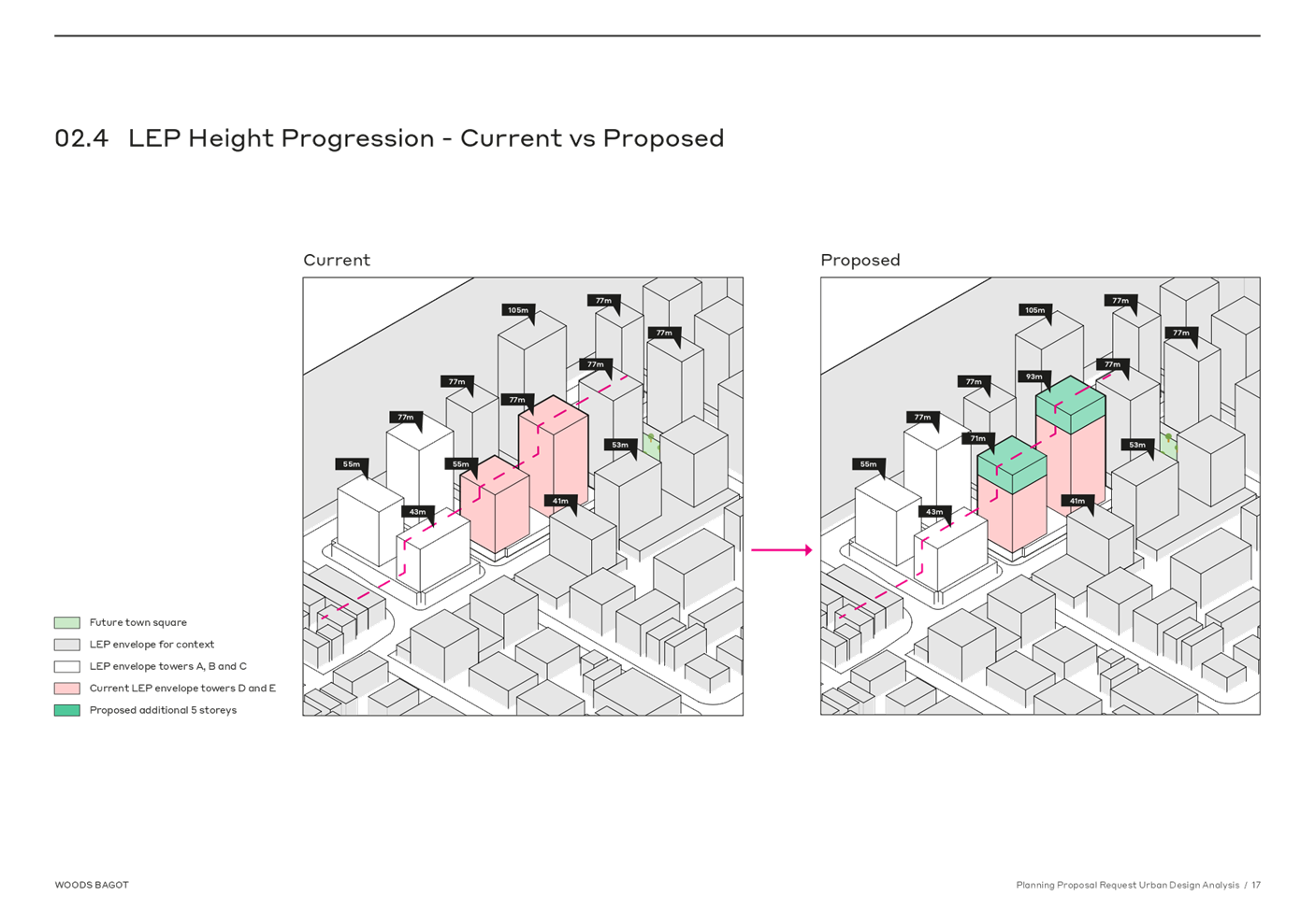
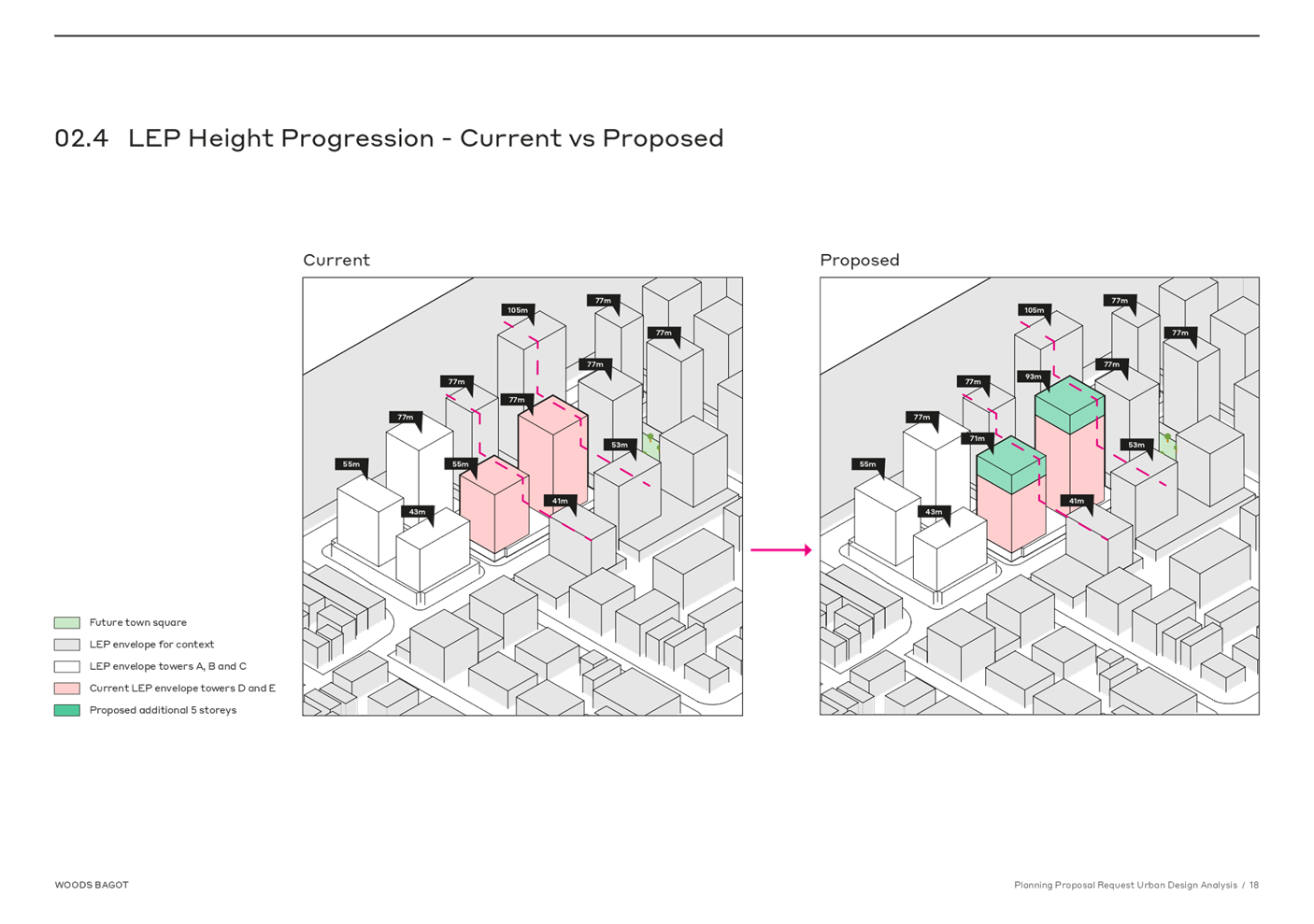
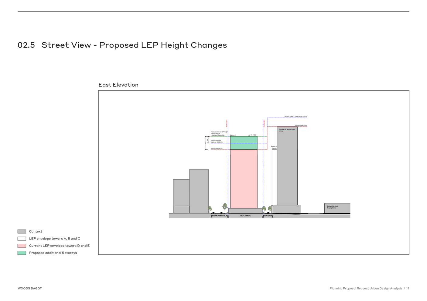
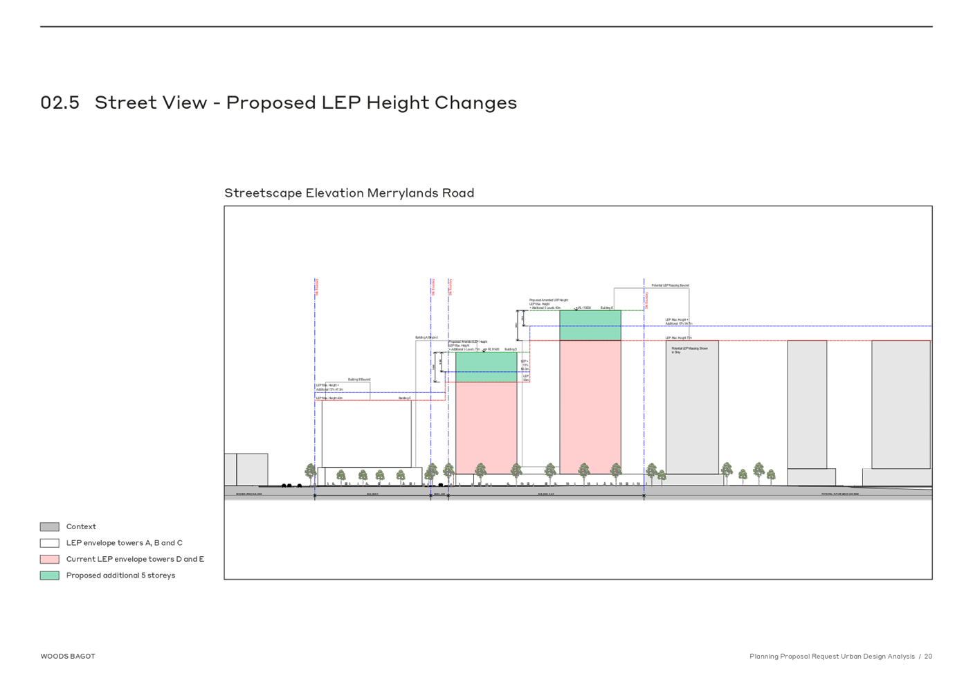
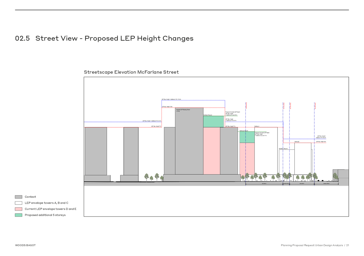
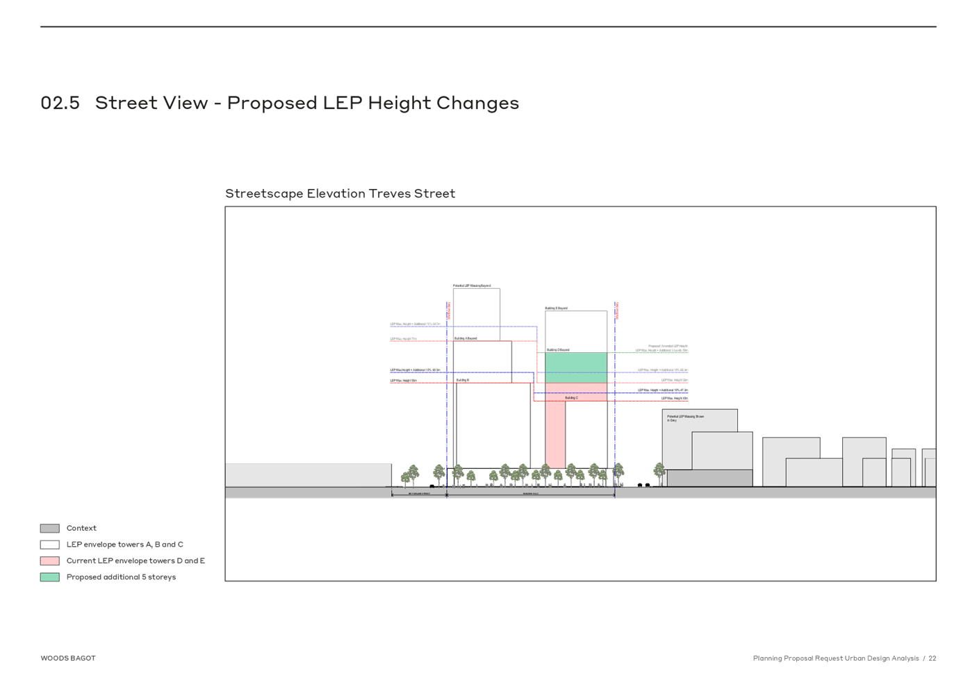
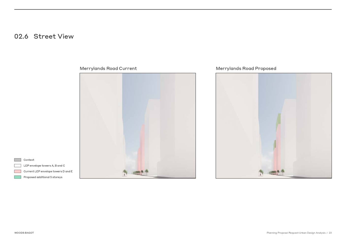
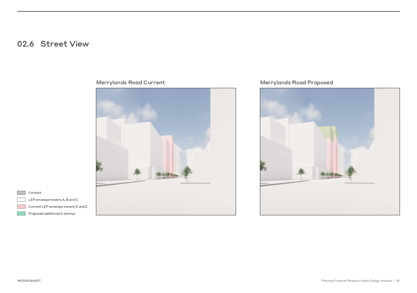
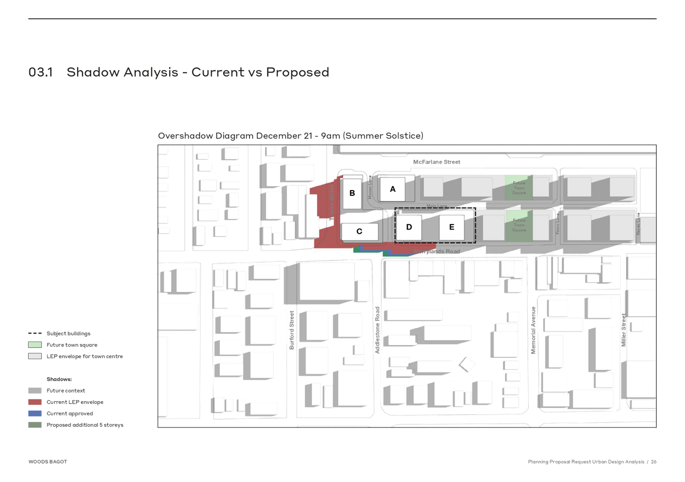
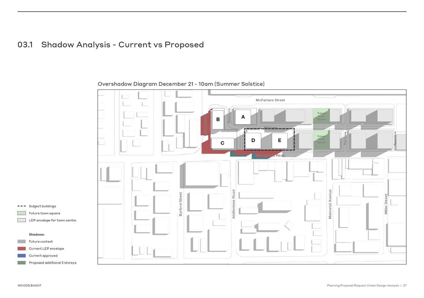
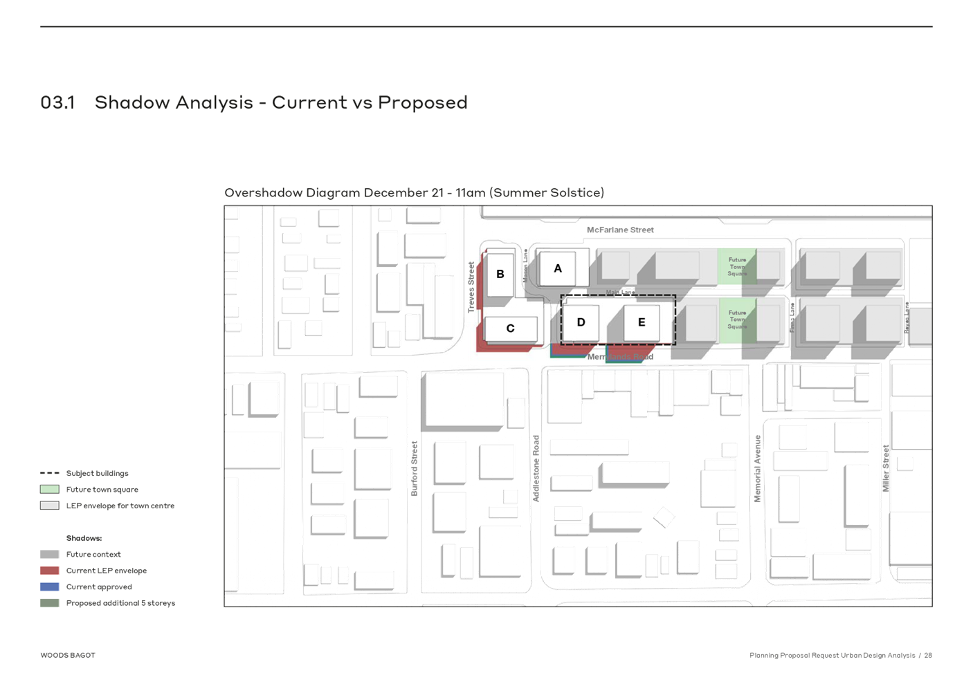
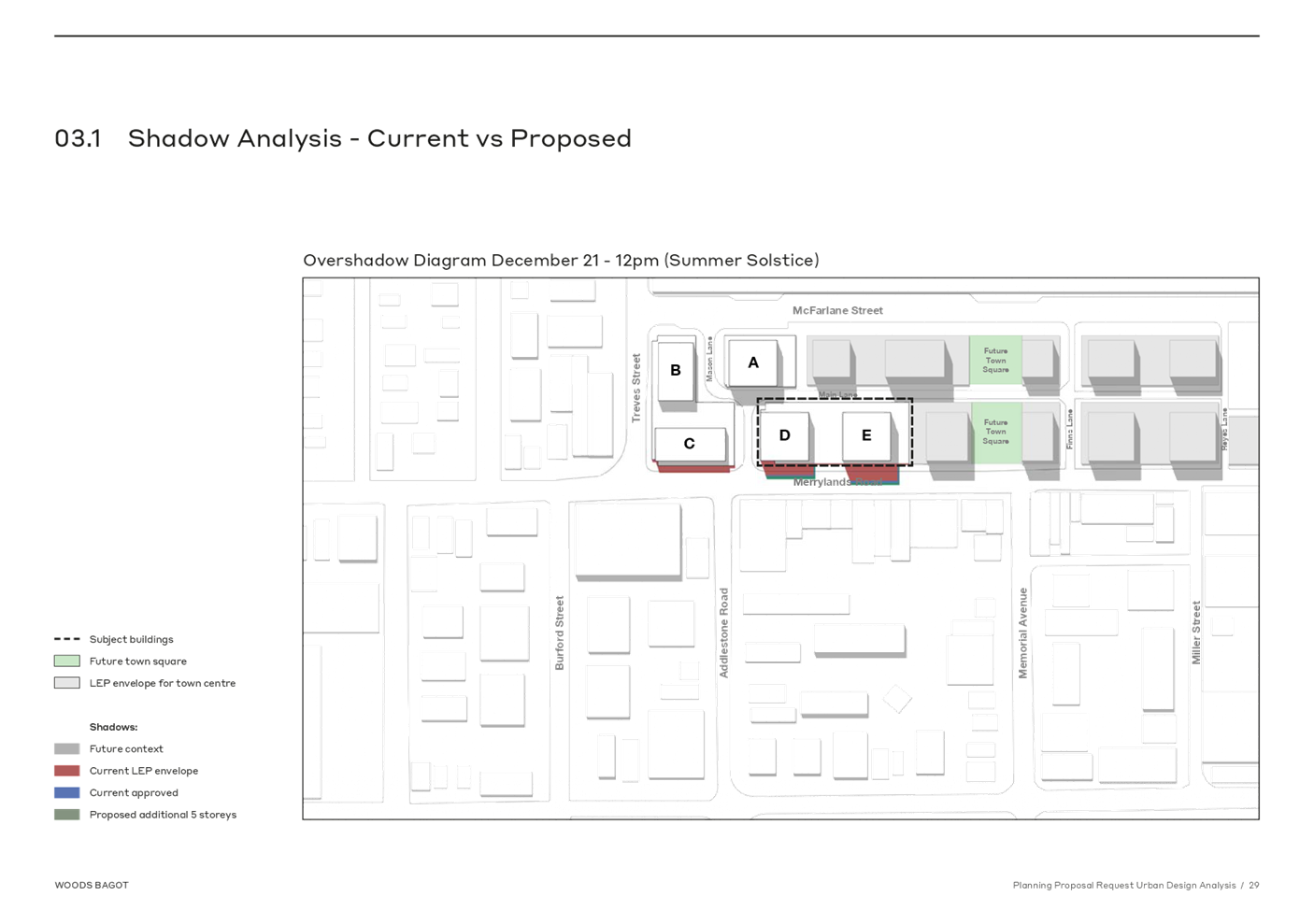
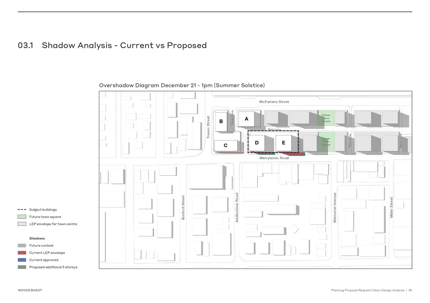
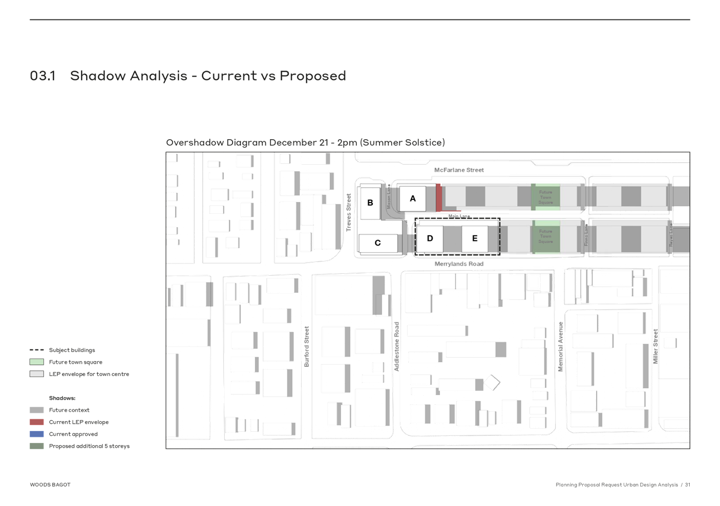
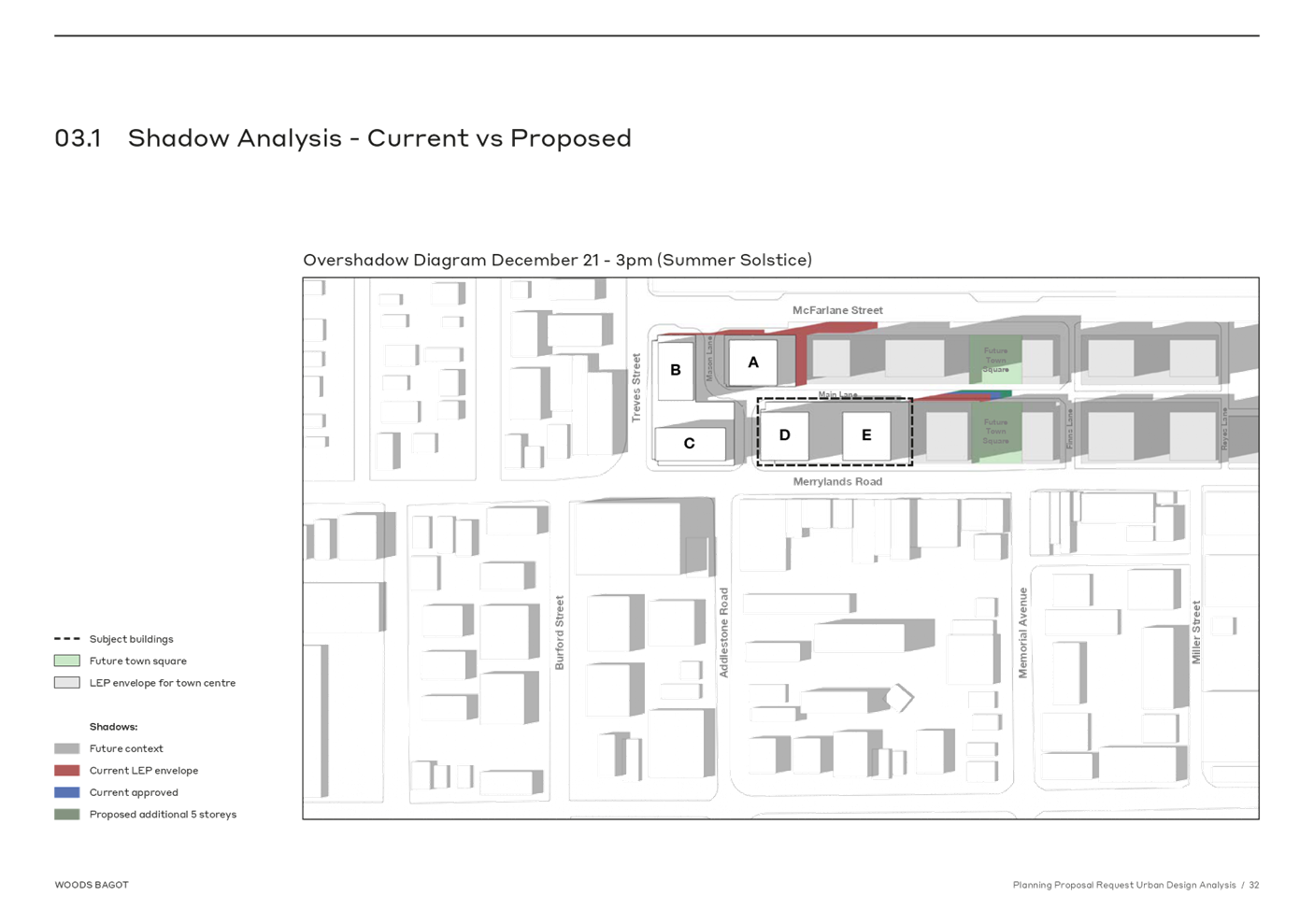
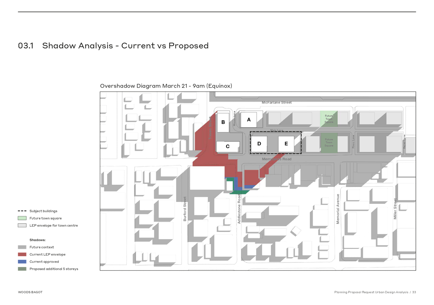
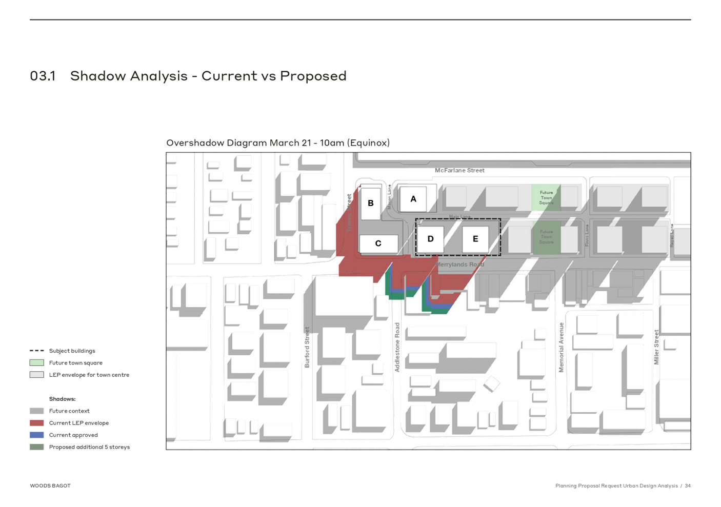
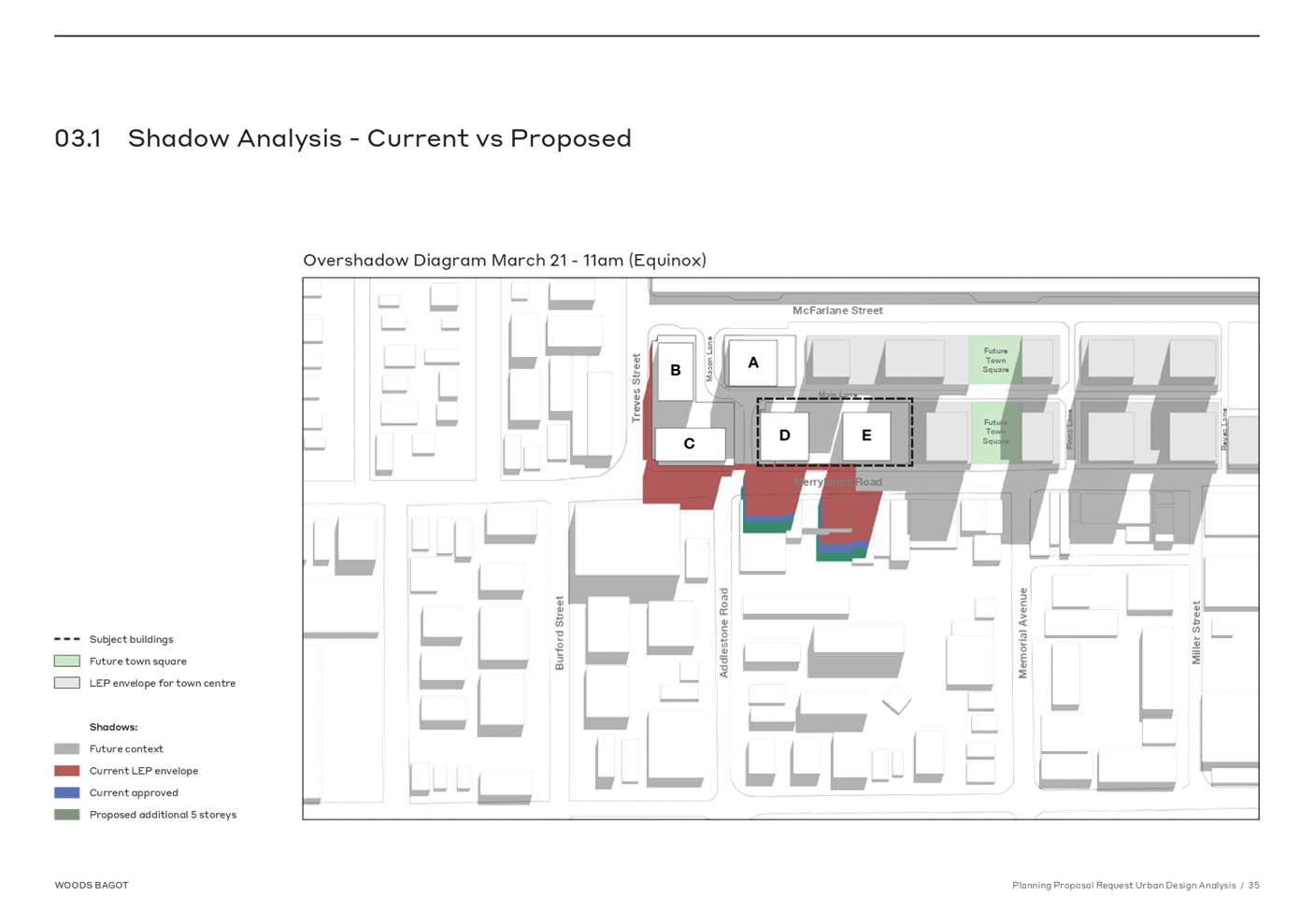
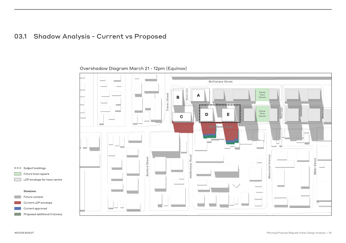
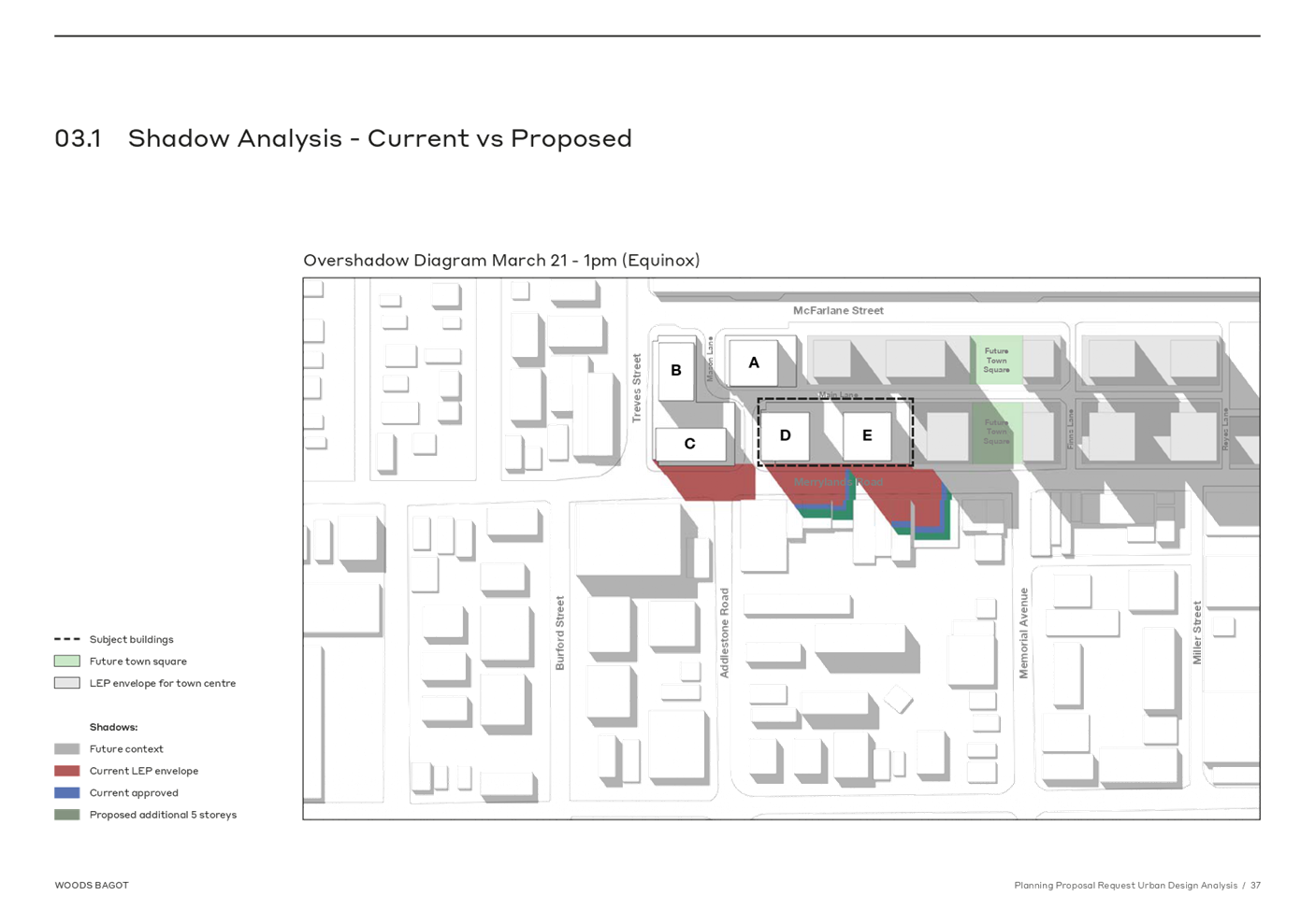
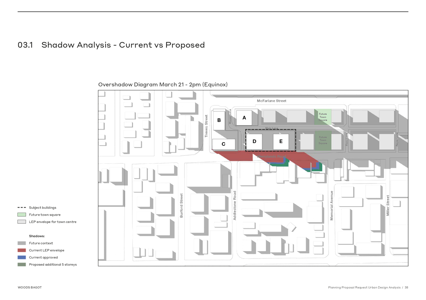
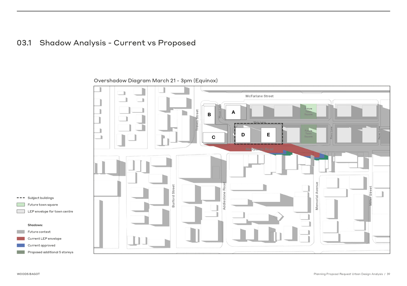
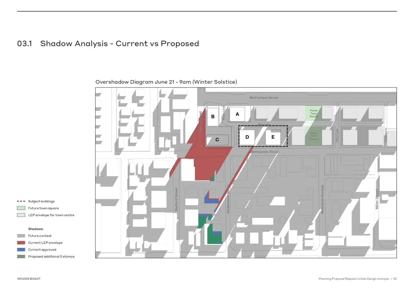
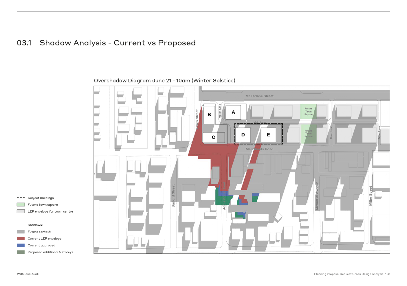
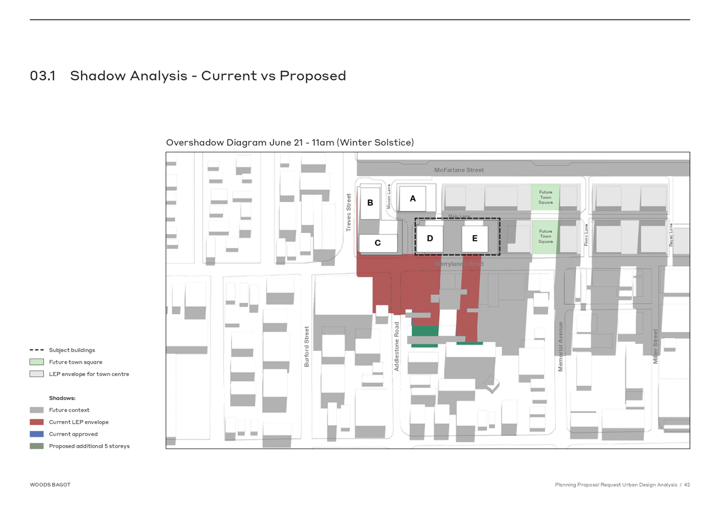
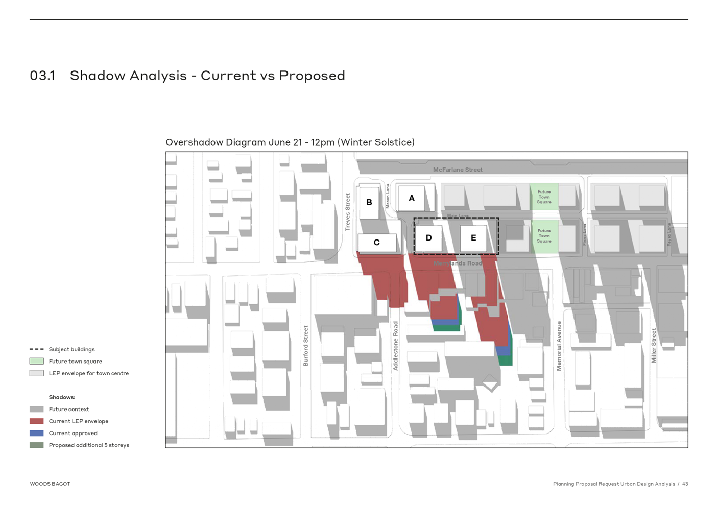
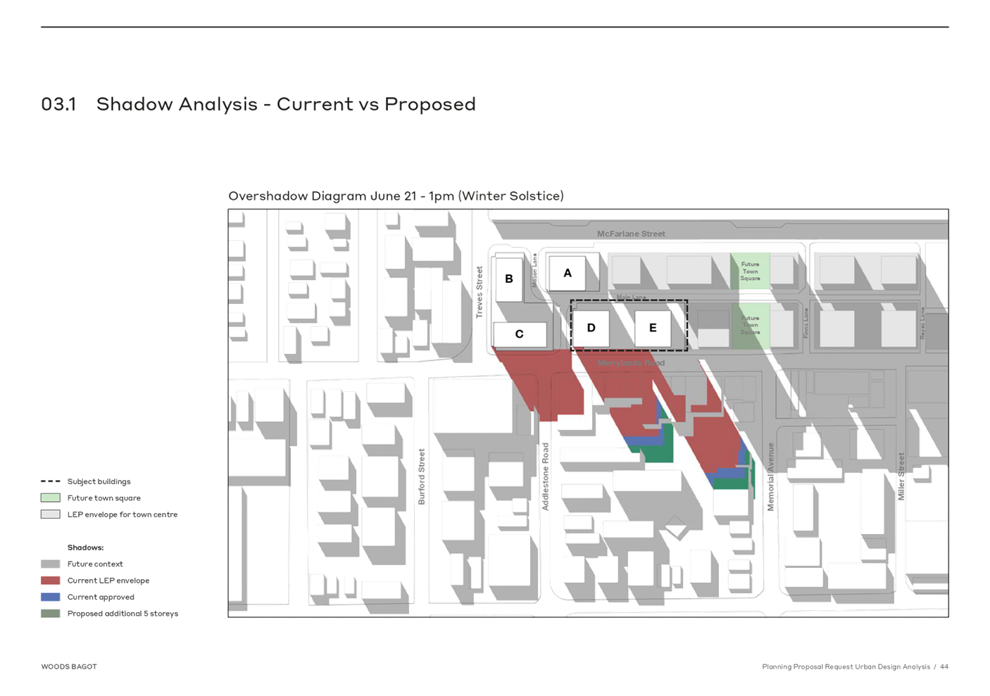
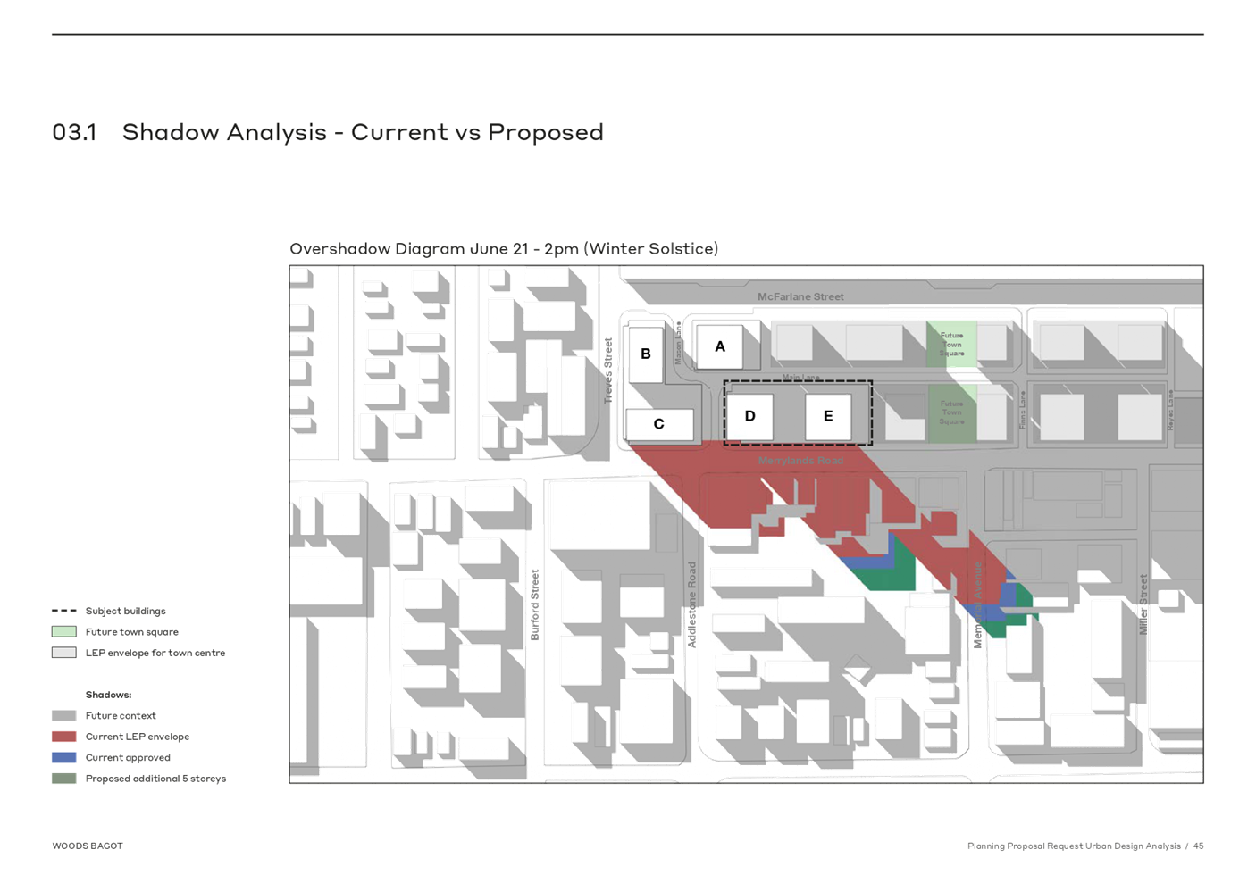
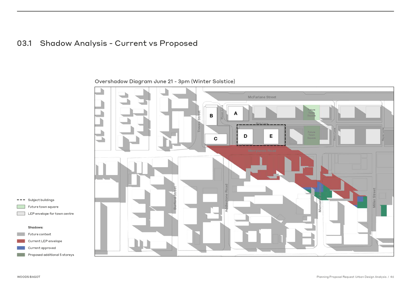
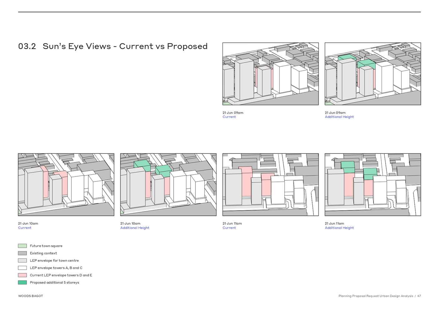
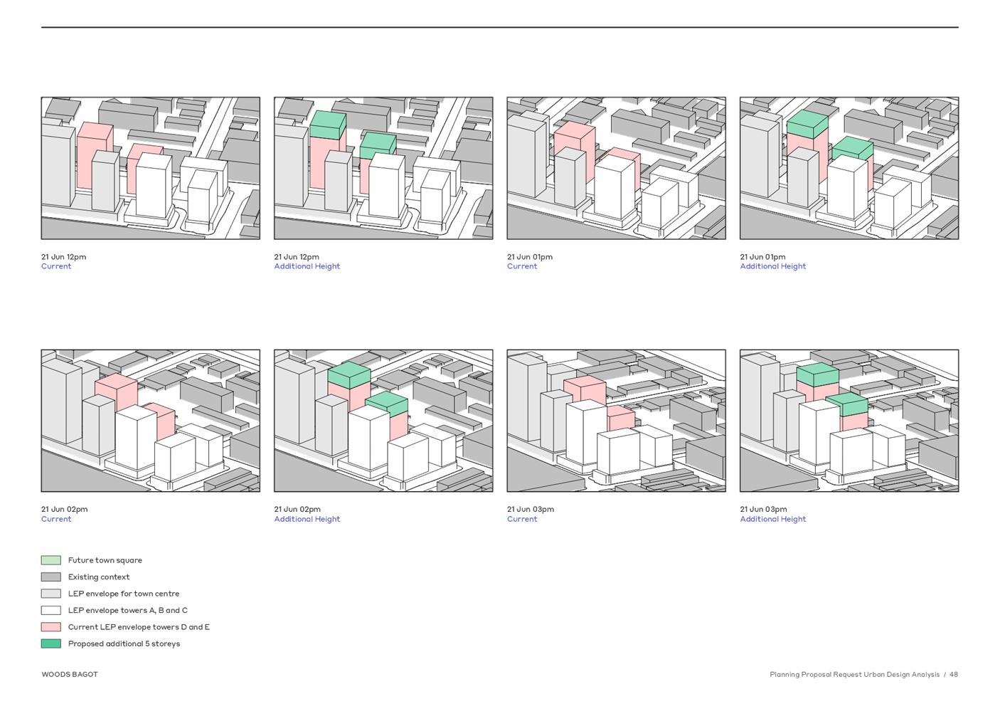
DOCUMENTS
ASSOCIATED WITH
REPORT LPP027/21
Attachment 5
Builiding Height Transition Diagrams
Cumberland Local Planning Panel Meeting
9 June 2021
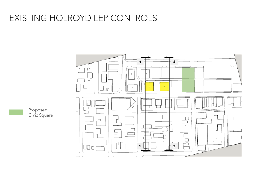
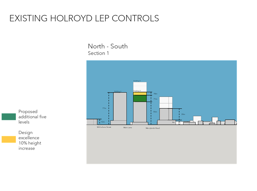
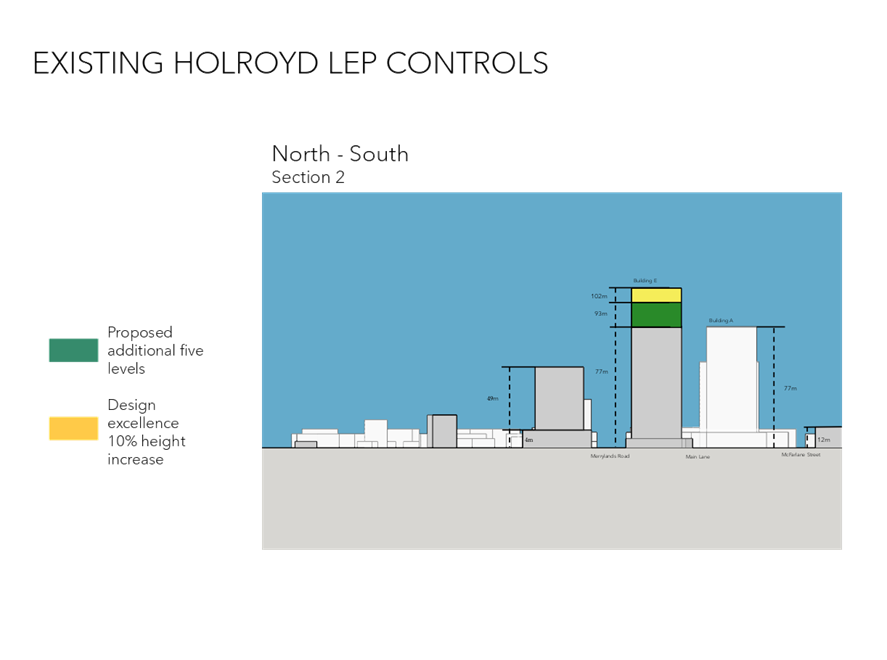
DOCUMENTS
ASSOCIATED WITH
REPORT LPP027/21
Attachment 6
Overview of Shadow Models
Cumberland Local Planning Panel Meeting
9 June 2021
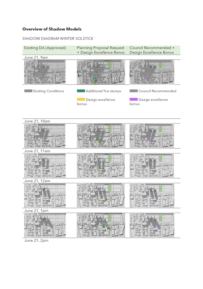
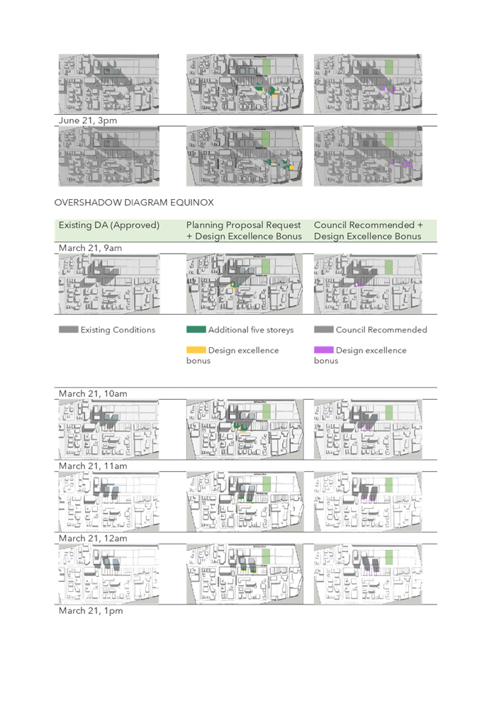
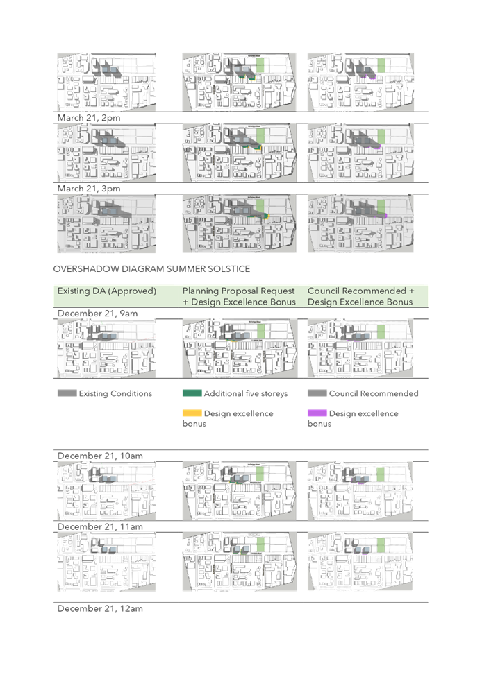
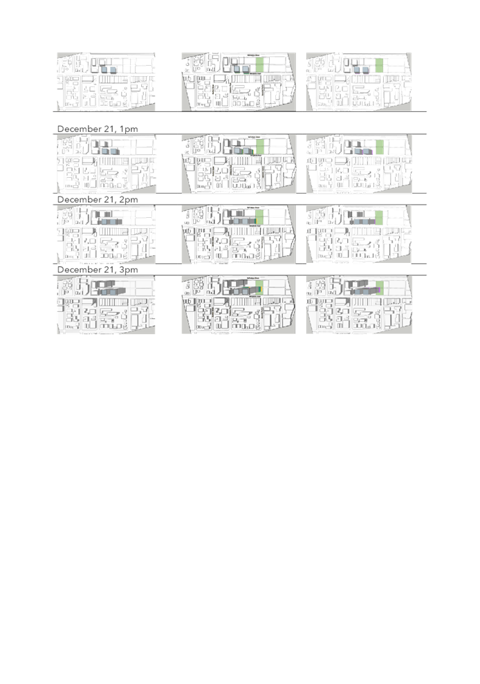
DOCUMENTS
ASSOCIATED WITH
REPORT LPP027/21
Attachment 7
Detailed Shadow Analysis (all year)
Cumberland Local Planning Panel Meeting
9 June 2021
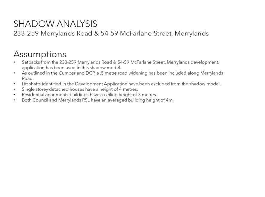
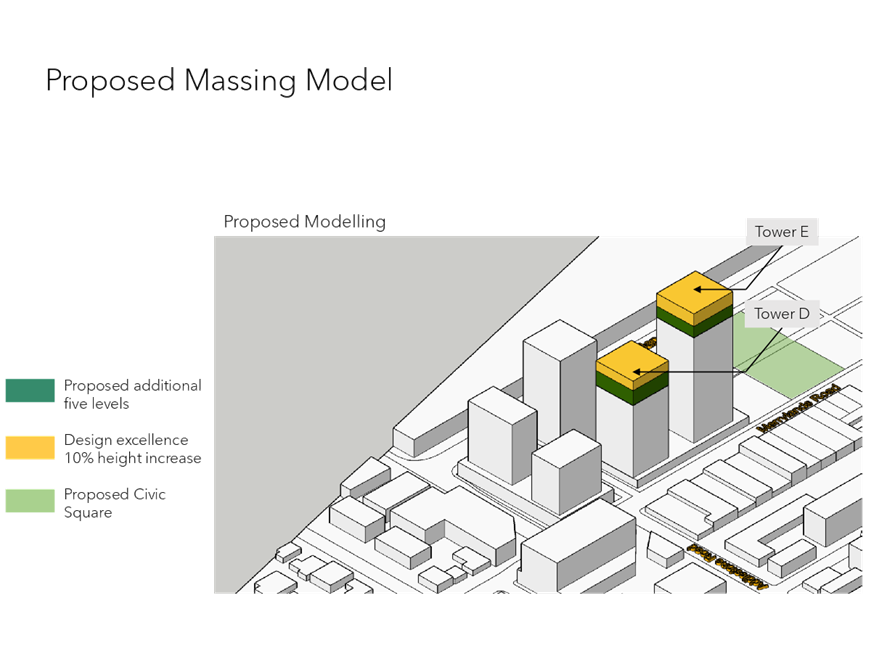
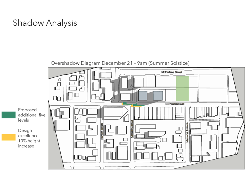
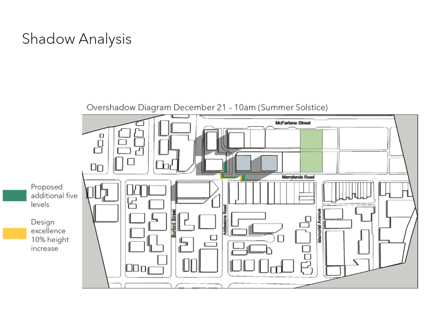
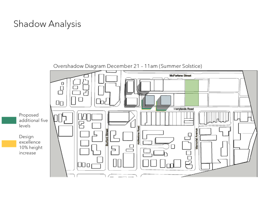
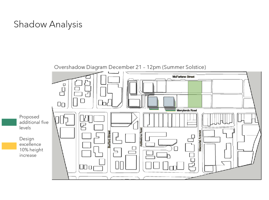
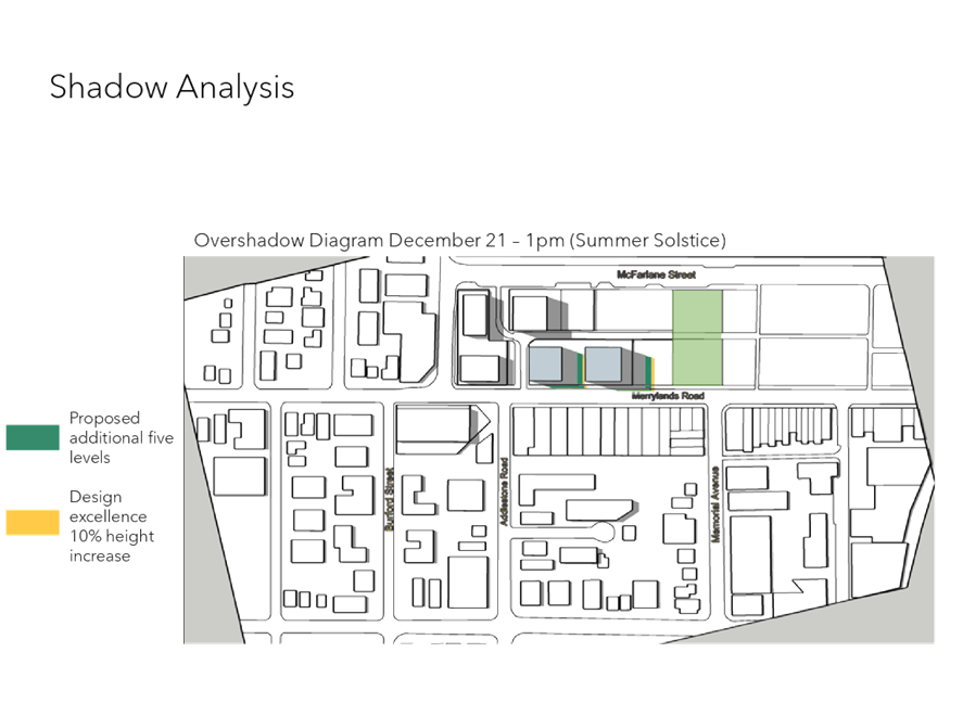
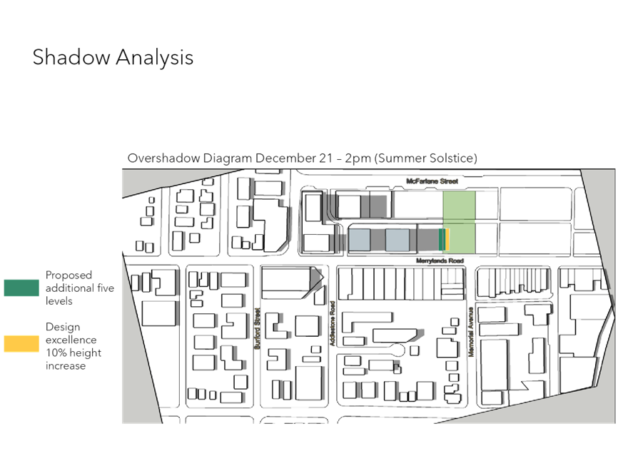
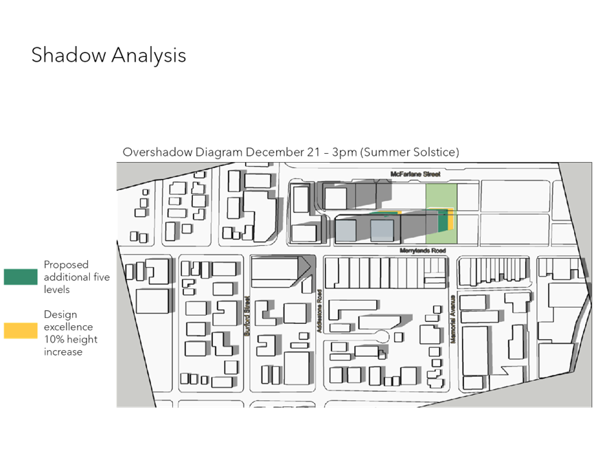
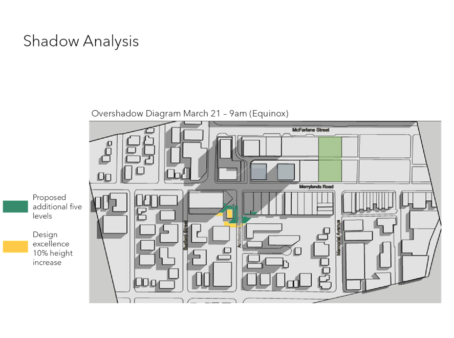
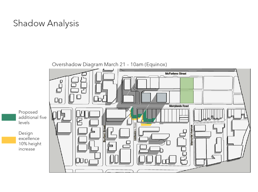
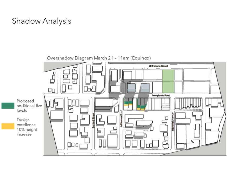
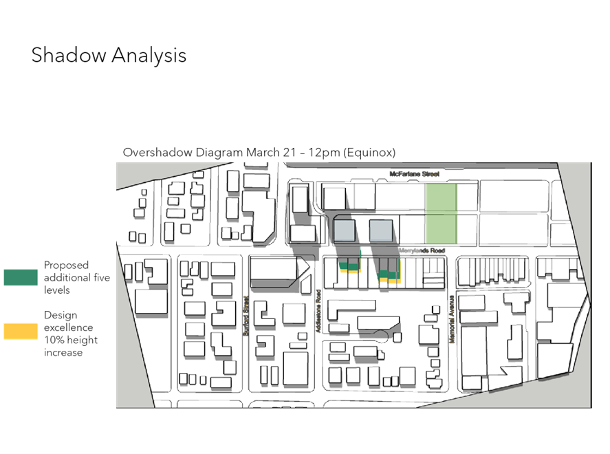
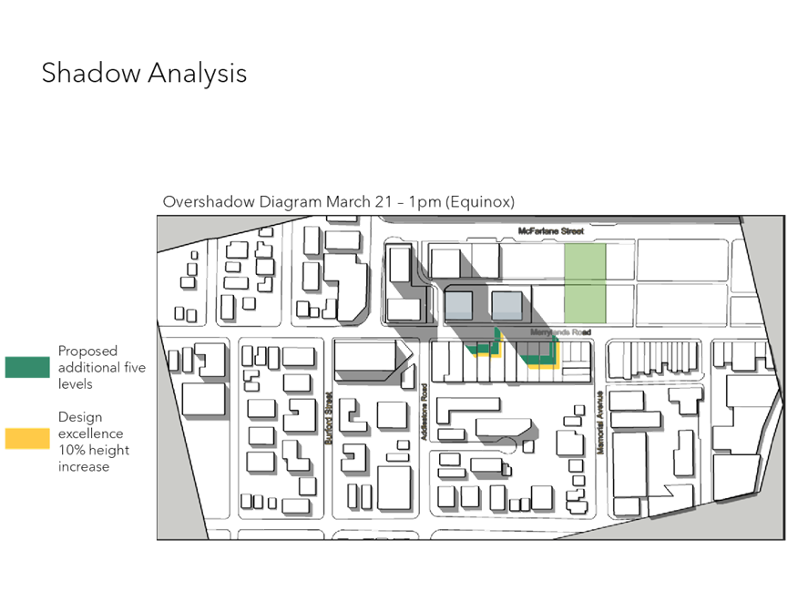
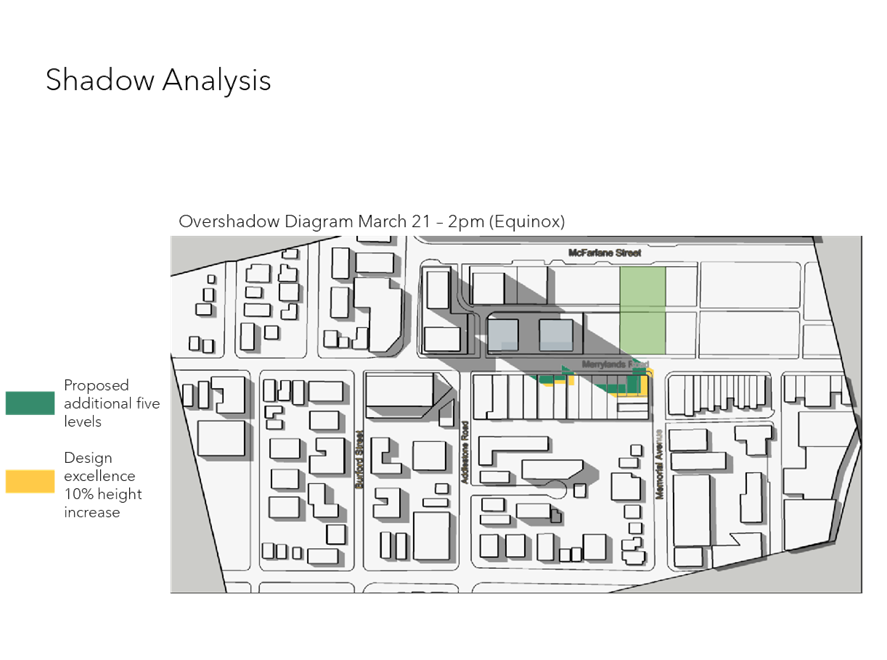
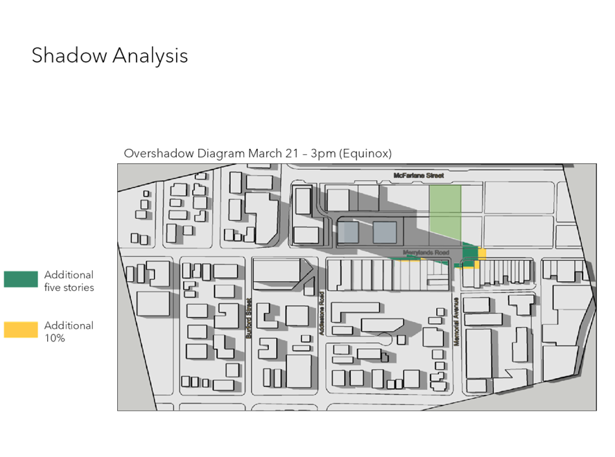
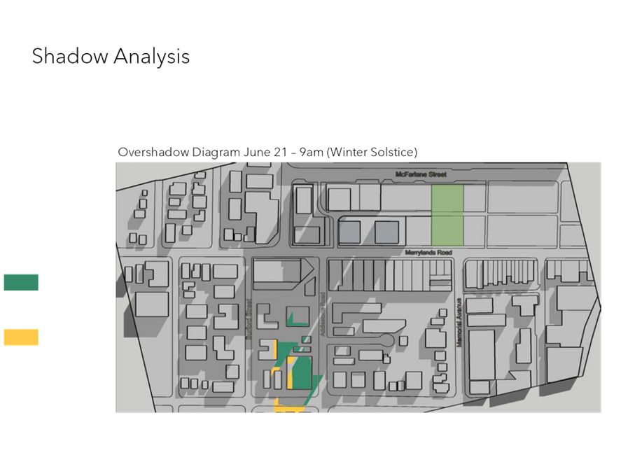
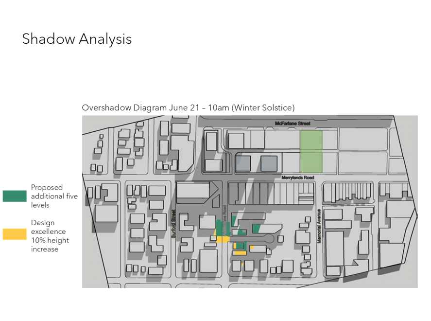
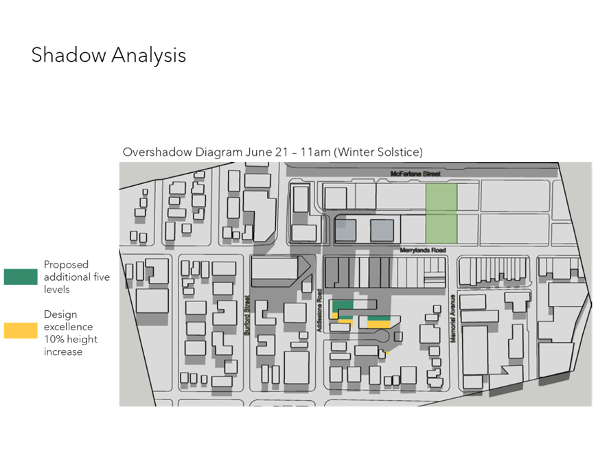
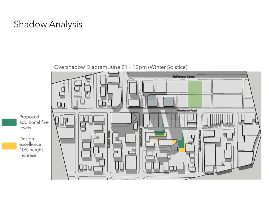
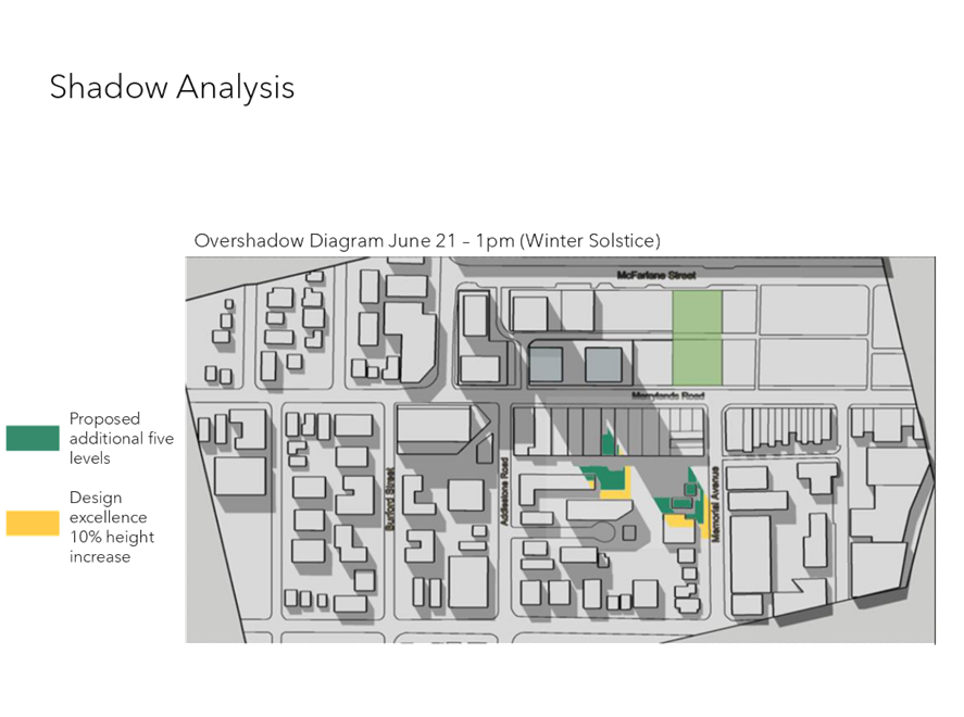
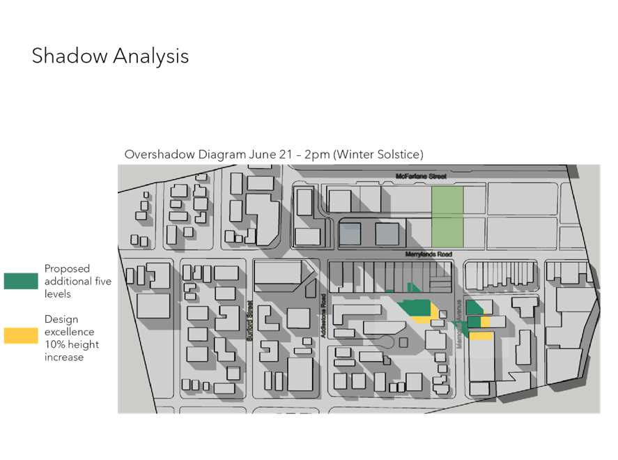
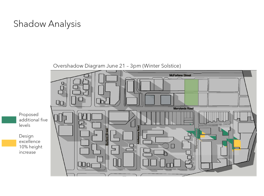
DOCUMENTS
ASSOCIATED WITH
REPORT LPP027/21
Attachment 8
Community Submissions (summarised)
Cumberland Local Planning Panel Meeting
9 June 2021