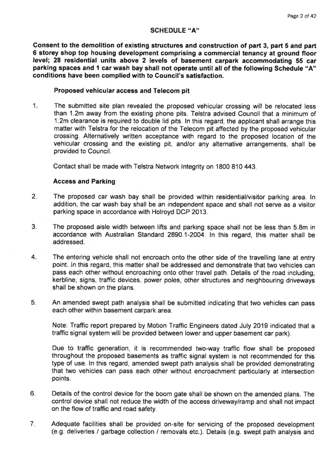
12 August 2020
An
Electronic meeting of the Cumberland Local Planning Panel will be held
at 11:30a.m. via Zoom on Wednesday, 12 August 2020.
Business as below:
Yours faithfully
Hamish McNulty
General
Manager
ORDER OF BUSINESS
1. Receipt of Apologies
2. Confirmation of Minutes
3. Declarations of Interest
4. Address by invited
speakers
5. Reports:
- Development
Applications
- Planning
Proposals
6. Closed Session Reports
Cumberland Local Planning Panel Meeting
12 August 2020
CONTENTS
Report No. Name of Report Page
No.
Development Applications
LPP040/20... Electronic Determination -
Modification Application for 12-14 Pritchard Street East, Wentworthville.................................................................................................... 17
LPP041/20... Electronic Determination -
Modification Application for 1 Robilliard Street, Mays Hill............................................................................................................................ 145
LPP042/20... Development Application
for 1 Ostend Street, Lidcombe......................... 213
LPP043/20... Development Appliaction
for 3 Ostend Street, Lidcombe......................... 441
LPP044/20... Planning Proposal for a Senior
Housing Development, Corner Dunmore Street and Pendle Way, Pendle Hill................................................................................ 713
Cumberland Local Planning Panel Meeting
12 August 2020
Minutes of the Electronic
Cumberland Local Planning Panel Meeting held via Zoom on Wednesday 8 July 2020.
Present:
Stuart McDonald (Chairperson), John Brunton, Marjorie
Ferguson and Irene Simms.
In Attendance:
Jai Shankar, Nighat Aamir, William Attard, Elif Haliloglu,
Stephen Peterson, Michael Lawani, Fay Ong, Elma Sukurma, Ali Hammoud, Esra
Calim, Olivia Shields and Rashika Rani.
Notice of Live Streaming of CUMBERLAND LOCAL PLANNING PANEL
meeting
The Chairperson advised that the Cumberland Local Planning
meeting was being streamed live on Council's website and members of the public
must ensure their speech to the Panel is respectful and use appropriate
language.
The meeting here opened at 11:30a.m.
Declarations Of Interest:
There were no declarations of interest.
ADDRESS BY INVITED SPEAKERS:
The following persons had made
application to address the Cumberland Local Planning Panel meeting:
Speakers Subject
Mairead Hawes Development
Application for 4-18 Mark Street, Lidcombe
Jeremy Swan Development
Application for 4-18 Mark Street, Lidcombe
Andre Mulder Development
Application for 4-18 Mark Street, Lidcombe
Hugh
Halliwell
Development
Application for 25A Crescent Street, Holroyd
Brad Delapierre Development
Application for 58 & 60 Berwick Street, Guildford
Joe El-Sabbagh Modification
Application for 81-83 Mountford Avenue, Guilford
The Chairperson enquired to those
present in the Zoom call as to whether there were any further persons who would
like to address the Panel and no further persons presented themselves.
The open session of the meeting
here closed at 12:43p.m.
The closed session of the meeting here opened at 1:20p.m.
|
ITEM LPP033/20 - Development Application for 4-18
Mark Street, Lidcombe
|
|
1. That
the Clause 4.6 written request to vary the height of buildings development
standard pursuant to Clause 4.3 of the Auburn Local Environmental Plan 2010
be supported.
2. That
development application DA2019/229 seeking alterations and additions to an
approved 10 storey mixed use building at 4-14 Mark Street, Lidcombe
(DA2017/363); and demolition of existing structures at 16-18 Mark Street,
Lidcombe, and construction of an additional 8 to 11 storey mixed use building
component, accommodating a combined total of 15 commercial suites and 213
residential units over 5 levels of basement parking for 627, be approved,
subject to the conditions contained in the draft notice of determination
contained in Attachment 3 of the assessment report.
3. Condition
3 be amended to read as follows:
Auburn DCP 2007: Section 7.11
Development Contributions
Development Contributions
are payable in accordance with Auburn Council Section 7.11 Development
Contribution Plan 2007, which has been prepared under Section 7.11 of the
Environmental Planning and Assessment Act 1979 (as amended).
The amounts payable will be
adjusted in accordance with the section titled Review of Contribution rates
and are generally indexed on a quarterly basis by the Consumer Price Index
CPI (all Groups Sydney) unless otherwise stated in the plan.
Contributions will be
adjusted at the payment date in accordance with the plan. and payment is to be made prior to the issue of any
Construction Certificate.
A sum of $889048.58
$1,294,176.93 is to be paid to Council for the purpose of LGA Wide plans
being the provision of open space and recreation facilities, community
facilities, accessibility and traffic works, town centre upgrades, car
parking and Council's administration of the development contributions
framework.
The above sum is broken down
to the following items:
|
Item
|
Amount
|
|
Community Facilities
|
$218,026.65 $317,037.84
|
|
Public Domain
|
$482,207.66 $701,176.49
|
|
Accessibility and Traffic
|
$132,904.76 $192,905.19
|
|
Administration
|
$50,980.77 $73,807.04
|
|
Employment Generating
Development
|
$4,928.74 $9,250.37
|
|
TOTAL
|
$889,048.58 $1,294,176.93
|
Council’s Development
Contribution Plan 2007 is available for inspection at Council’s
Customer Services Centre, Civic Place, 16 Memorial Avenue, Merrylands or
online at: www.cumberland.nsw.gov.au
(Reason: To ensure that the
development complies with the Auburn DCP 2007: Section 7.11 Development
Contributions)
4. Condition
37 be amended to read as follows:
37. DACCB03 - Section
7.11 Contribution
A monetary contribution
imposed under Section 7.11 of the Environmental Planning and Assessment
Act 1979 and the Auburn Development Contributions Plan 2007 (Amendment
No. 2), is to be paid to Council. The amount of the contribution will be
determined at the time of payment in accordance with the relevant
Contributions Plan in force at that time. A copy of the Auburn Development
Contributions Plan 2007 (Amendment No. 2) can be viewed on Council’s
website at www.cumberland.nsw.gov.au,
or inspected at Council’s Service Centre located at 16 Memorial Avenue,
Merrylands between the hours of 8am and 4.30pm Monday to Friday.
(Reason:
To retain a level of service for the existing population and to provide the
same level of service to the population resulting from new developments).
5. Condition
37A is inserted to read as follows:
37A.DACCZ12
– COVID-19 Response Measures: Infrastructure Contributions –
Timing of Payment
A monetary
contribution that is required to be paid under the conditions of this consent
must be paid before the issue of the first occupation certificate in respect
of any building to which this consent relates, except as provided below.
If no construction
certificate in respect of the erection of any building to which the consent
relates has been issued before or on 25 September 2022, the monetary
contribution must be paid before the issue of the first construction
certificate after that date for any such building.
The above does not
prevent the entry into an arrangement with the Council for deferred payment
of the monetary contribution in accordance with the policy for deferred
payments set out in the Auburn Development Contributions Plan 2007 (Amendment
No. 2).
(Reason:
Information).
6. Amend
Condition 50 as follows:
A sign
shall be erected in a suitable location on the external face of the building
near the driveway entrance indicating where visitor and commercial parking is
available on the site. The appropriate signage be provided on site to
indicate customer parking for commercial tenancies. Details shall be
submitted to the satisfaction of the Principal Certifier prior to the issue
of the Construction Certificate.
For: Stuart McDonald (Chairperson) and Marjorie
Ferguson.
Against: John
Brunton and Irene Simms.
The application was approved by
the casting vote of the Chairperson.
Reasons
for Approval:
1.
The Panel has determined that, pursuant to Clause 4.6 of Auburn
Local Environmental Plan 2010, the applicant’s written request has
adequately demonstrated that compliance with the
height of building development standard under Clause 4.3 of Auburn Local
Environmental Plan 2010 is unnecessary in the
circumstances of the case, and that there are sufficient environmental
planning grounds to justify contravening the development standard.
2. The proposal
is consistent with the objectives of the height of buildings development
standard under Clause 4.3 of the Auburn Local Environmental Plan 2010.
3. The proposal
is consistent with the objectives of the B4 Mixed Use zone and in particular
will provide high density residential development as well as commercial
development that will contribute to economic growth and employment in the
Lidcombe Town Centre.
4. The proposal is
consistent with State Environmental Planning Policy No
65 - Design Quality of Residential Apartment Development
and the Apartment Design Guide and has been determined by the Cumberland
Design Excellence Panel to exhibit design excellence in accordance with the
Cumberland Design Excellence Policy.
5. The Panel has
considered the matters raised in written submissions
and has determined that these matters have either been adequately addressed
in the design of the development or where not specifically addressed in the
development are not of such weight as to warrant refusal of the application.
6. Subject to the
recommended conditions of development consent as amended, the proposal will not have any unreasonable impacts on the amenity of neighbouring
properties or the locality.
7. Taking into
account reasons 1-6 above, approval of the application will be in the public
interest.
Reasons for Non Support (John Brunton)
The Clause 4.6 variation request is not supported because
the applicant’s written statement:
·
Does not justify why compliance with the building height
development standard is unreasonable or unnecessary;
·
Does not show that the objectives of the building height
development standard are achieved in relation to compatibility with the
character of the locality; and
·
Does not establish that there are sufficient environmental
planning grounds to justify contravening the development standard.
The proposed development fails to satisfy the objectives
and design criteria of the Apartment Design Guide in relation to building
separation, visual privacy, acoustic privacy, solar access, natural cross
ventilation and common circulation.
Reasons for Non Support (Irene Simms)
While I accept that the relocation of units to the
northern section of the development is in response to the Design Excellence
Panel recommendations, I do not believe that the proposal is consistent with
the objectives of the height of buildings development standard under Clause
4.3 of under Auburn Local Environmental Plan 2010.
|
|
ITEM LPP034/20 – modification Application for
185-187 Great Western Highway, Mays Hill
|
|
That modification application
MOD2020/0040 seeking alterations to an approved mixed use development at
185-187 Great Western Highway, Mays Hill, be approved, subject to the
conditions contained in the draft notice of determination contained in
Attachment 2 of the assessment report.
For: Stuart McDonald (Chairperson), John Brunton,
Marjorie Ferguson and Irene Simms.
Against: Nil.
Reasons
for Decision:
1.
The Panel is satisfied that the
development, as modified, is substantially the same development for which
consent was originally granted.
2. The Panel is satisfied that the contravention of the
building height development standard is minor, that compliance with the
standard is unnecessary in
the circumstances of the case and that there are sufficient environmental
planning grounds to justify contravening the development standard.
3. The development, as modified, is consistent with the
objectives of the height of building development standard under Clause 4.3 of
the Holroyd Local Environmental Plan 2013.
4. The development, as modified, is consistent with the
objectives of the B6 Enterprise Corridor zone of the Holroyd Local
Environmental Plan 2013 and also consistent with State Environmental Planning
Policy No 65 - Design Quality of Residential
Apartment Development and the Apartment Design Guide.
5. The Panel is satisfied that the development as
modified will not have any unreasonable impacts on the amenity of
neighbouring properties or the locality, also noting that there were no
written submissions in response to the public notification and advertising of
the application.
6. Taking into account reasons 1-5 above, approval of
the application will be in the public interest.
|
|
ITEM LPP035/20 - modification Application for 1-3
Bransgrove Street, Wentworthville
|
|
That modification application
No. MOD2019/5282 to modify floor levels, hydrant booster location, external
finishes and stormwater disposal to approved residential flat building on
land at 1-3 Bransgrove Street, Wentworthville NSW 2145 be approved, subject
to conditions in Attachment 1 to the assessment report.
For: Stuart McDonald (Chairperson), John Brunton,
Marjorie Ferguson and Irene Simms.
Against: Nil.
Reasons
for Decision:
1.
The Panel is satisfied that the
development, as modified, is substantially the same development for which
consent was originally granted.
2. The Panel is satisfied that the contravention of the
building height development standard is minor, that compliance with the
standard is unnecessary in
the circumstances of the case and that there are sufficient environmental
planning grounds to justify contravening the development standard.
3. The development, as modified, is consistent with the
objectives of the height of buildings development standard of the Holroyd
Local Environmental Plan 2013
4. The development, as modified, is consistent with the
objectives of the R4 High Density Residential zone of the Holroyd Local
Environmental Plan 2013 and also consistent with State Environmental Planning
Policy No 65 - Design Quality of Residential
Apartment Development and the Apartment Design Guide.
5. The Panel is satisfied that the development as
modified will not have any unreasonable impacts on the amenity of
neighbouring properties or the locality, also noting that there were no
written submissions in response to the public notification and advertising of
the application.
6.
Taking into account reasons 1-5
above, approval of the application will be in the public interest.
|
|
ITEM LPP036/20 - Development Application for 122
Robertson Street, Guildford
|
|
That development application No. DA2020/0280 for the
erection of a pergola at the rear on land at 122 Robertson Street Guildford
NSW 2161 be approved subject to conditions attached to the assessment report.
For: Stuart McDonald (Chairperson), John Brunton,
Marjorie Ferguson and Irene Simms.
Against: Nil.
Reasons
for Decision:
1. The
application is minor in nature and will have no unacceptable impacts on
neighbouring properties or the locality.
2. The
application is consistent with the Parramatta Local Environmental Plan 2011
and is generally consistent with the Parramatta Development Control Plan
2011.
3. Approval of
the application is in the public interest.
|
|
ITEM LPP037/20 - Development Application for 25A Crescent
Street, Holroyd
|
|
1. That
development application No. DA2020/0113 for replacement of an existing twin
sided static advertising sign with a twin sided LED sign on land at 25A
Crescent Street HOLROYD NSW 2142 be deferred pending the
preparation and consideration by the Panel of a further report
addressing the existing use rights as they apply to the application.
2. The
further report is to be circulated to the Panel within 15 business days.
3. In the
event that the Panel is satisfied regarding the establishment and exercise of
existing use rights then the application will be determined by electronic
means within 5 business days of receipt of the further report.
For: Stuart McDonald (Chairperson), John Brunton,
Marjorie Ferguson and Irene Simms.
Against: Nil.
Reason
for Decision:
In order that the Panel may be
satisfied regarding the history of approval on the site and the ability to
grant consent.
|
|
ITEM LPP038/20 - Development Application for 58 & 60
Berwick Street, Guildford
|
|
1. That
the Clause 4.6 written request to vary the development standard relating to
building height as contained within Clause 4.3 of the Holroyd Local
Environmental Plan 2013 be supported.
2. That
development application No. DA2019/0501 for demolition of existing
structures, construction of a 4 storey residential flat building over
basement parking accommodating 25 units and 22 car parking spaces under the
Affordable Rental Housing SEPP 2009 on land at 58 & 60 Berwick Street
GUILDFORD NSW 2161 be approved as a deferred commencement consent subject to
conditions attached to the assessment report.
3. The “reason”
given to Condition 130 be amended as follows:
“To ensure that the structure as built does not exceed the approved
building height”.
For: Stuart McDonald (Chairperson), John Brunton,
Marjorie Ferguson and Irene Simms.
Against: Nil.
Reasons
for Decision:
1.
The Panel has determined that, pursuant to Clause 4.6 of
Holroyd Local Environmental Plan 2013, the applicant’s written request
has adequately demonstrated that compliance
with the height of building development standard under Clause 4.3 of Holroyd
Local Environmental Plan 2013 is unnecessary in the circumstances of the
case, and that there are sufficient environmental planning grounds to justify
contravening the development standard.
2. The proposal
is consistent with the objectives of the height of buildings development
standard of Clause 4.3 of under the Holroyd Local Environmental Plan 2013.
3. The proposal
is consistent with the objectives of the R4 High Density Residential zone of
the Holroyd Local Environmental Plan 2013.
4. The proposal
is consistent with State Environmental Planning Policy No 65 - Design Quality of Residential Apartment Development
and the Apartment Design Guide as well as State
Environmental Planning Policy (Affordable Rental Housing) 2009.
5. The Panel has
considered the matters raised in written submissions and has determined that
these matters have either been adequately addressed in the design of the
development or where not specifically addressed in the development are not of
such weight as to warrant refusal of the application.
6. Subject to the
recommended conditions of development consent as amended, the proposal will
not have any unreasonable impacts on the amenity of neighbouring properties
or the locality.
7. Taking into
account reasons 1-6 above, approval of the application will be in the public
interest.
|
|
ITEM LPP039/20 – modification Application for 81-83
Mountford Avenue, Guildford
|
|
1.
That modification application No. MOD2019/5251 for alterations
to an approved residential flat building and townhouse units including
reconfiguration of the basement, changes to floor levels, modified roof
design and alteration to fencing and screening heights on land at 81-83
Mountford Avenue GUILDFORD NSW 2161 be approved subject to additional
conditions listed in the schedule attached to the assessment report.
2.
Amend of condition 123 (b) as follows:
In order to
provide for a turning area for parking spaces 34 and 35 by way of use of the
shared area of parking space 33, the location of the bollard in disabled
space 33 is to be relocated centrally within that shared space closer to the
eastern wall.
For: Stuart McDonald (Chairperson), John Brunton,
Marjorie Ferguson and Irene Simms.
Against: Nil.
Reasons
for Decision:
1. The Panel is
satisfied that the development, as modified, is substantially the same
development for which consent was originally granted.
2. The Panel is
satisfied that the contravention of the building height development standard
is minor, that compliance with the standard is unnecessary
in the circumstances of the case and that there are sufficient environmental
planning grounds to justify contravening the development standard.
3. The
development, as modified, is consistent with the objectives of the height of
buildings development standard of the Parramatta Local Environmental Plan
2011
4. The
development, as modified, is consistent with the objectives of the R4 High
Density Residential zone of the Parramatta Local Environmental Plan 2011, is
consistent with State Environmental Planning Policy No 65 - Design Quality of Residential Apartment Development
and the Apartment Design Guide and is consistent with State Environmental
Planning Policy (Affordable Rental Housing) 2009.
5. The Panel is
satisfied that the development as modified will not have any unreasonable
impacts on the amenity of neighbouring properties or the locality, noting
that the matters raised in written submissions have either been adequately
addressed in the design of the development or where not specifically
addressed in the development are not of such weight as to warrant refusal of
the application.
6.
Taking into account reasons 1-5 above, approval of the application
will be in the public interest.
|
The closed session of the
meeting here closed at 3:37p.m.
The meeting terminated at 4:07p.m.
Signed:

Stuart McDonald
Chairperson
Cumberland Local Planning Panel Meeting
12 August 2020
Minutes of the Electronic
Determination Cumberland Local Planning Panel Meeting held Monday 20 July 2020.
Present:
Stuart McDonald (Chairperson), John Brunton, Marjorie
Ferguson and Irene Simms.
Declarations
Of Interest:
There were no declarations of
interest.
2.
3.
ITEM LPP037/20 - DEVELOPMENT
APPLICATION FOR 25A CRESCENT STREET, HOLROYD
4.
5.
BACKGROUND:
The matter was deferred for electronic determination in order that the Panel may be satisfied
regarding the history of approval on the site and the ability to grant consent.
6.
7.
Panel Decision
8.
The Panel is satisfied that adequate evidence and advice has
been provided confirming the existence of existing use rights under the EPA Act
and EPA Regulation and that the application is able to be determined. The Panel
decision is approval of the application as recommended by the Council officers,
including the recommended conditions and the amended condition circulated to
the Panel as part of the Addendum Report on 17 July 2020.
9.
For: Stuart McDonald (Chairperson), John Brunton,
Marjorie Ferguson and Irene Simms.
10.
11.
Against: Nil.
12.
13.
Reasons for Decision:
14.
1. The
Panel acknowledges that the existing twin sided static advertising sign
adjacent to the M4 Motorway has development consent and based on the
information provided by the Council, including legal advice, is an
“existing use” for the purposes of the Environmental Planning and
Assessment Act and Regulation.
15. As
the proposal is for the replacement of the static advertising signage with LED
signage and noting no objections have been raised by RMS, the Panel is
satisfied that the application is consistent with State
Environmental Planning Policy No 64 – Advertising and Signage,
Holroyd Local Environmental Plan 2013, Holroyd Development Control Plan 2013
and Cumberland Council Large Display Advertising Policy.
3.
Subject to the recommended conditions of consent, including the amended
condition provided to the Panel on 17 July 2020, approval of the application
will be in the public interest.
16.
Signed:

Stuart McDonald
Chairperson
Cumberland Local Planning Panel Meeting
12 August 2020
Item
No: LPP040/20
Electronic
Determination - Modification Application for 12-14 Pritchard Street East,
Wentworthville
Responsible
Division: Environment
& Planning
Officer: Executive
Manager Development and Building
File
Number: MOD2020/0216
|
Application lodged
|
4
May 2020
|
|
Applicant
|
Antoine
Saouma
|
|
Owner
|
ACHI
Constructions Pty Ltd
|
|
Application No.
|
MOD2020/0126
|
|
Description of Land
|
12
- 14 Pritchard Street East, Wentworthville
|
|
Proposed Development
|
Section 4.55 (1A) application to modify setbacks and unit
mix of approved shop top housing development
|
|
Site Area
|
1,379.6m2
|
|
Zoning
|
B2
– Local Centre
|
|
Disclosure of political donations and gifts
|
Nil
disclosure
|
|
Heritage
|
The
subject site is not a heritage item but is located within the vicinity of a
local heritage item.
|
|
Principal Development Standards
|
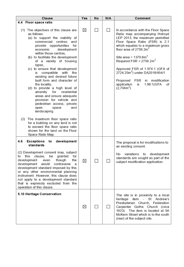
Floor
Space Ratio (FSR)
Maximum
2:1 (HLEP 2013)
FSR
proposed – 1.96:1
Height
of Building:
Maximum
17m (HLEP 2013)
· Maximum
Height Proposed: -19.4m (maximum variation of 14% approved to the lift
overrun under DA2018/454/1).
· 18.8m
to the parapet of upper floor habitable spaces (10.5% variation approved under
DA2018/454/1)
No
changes to the approved building height are sought as part of subject
modification application.
|
|
Issues
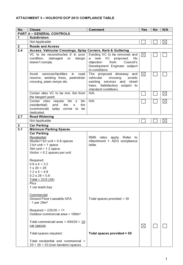
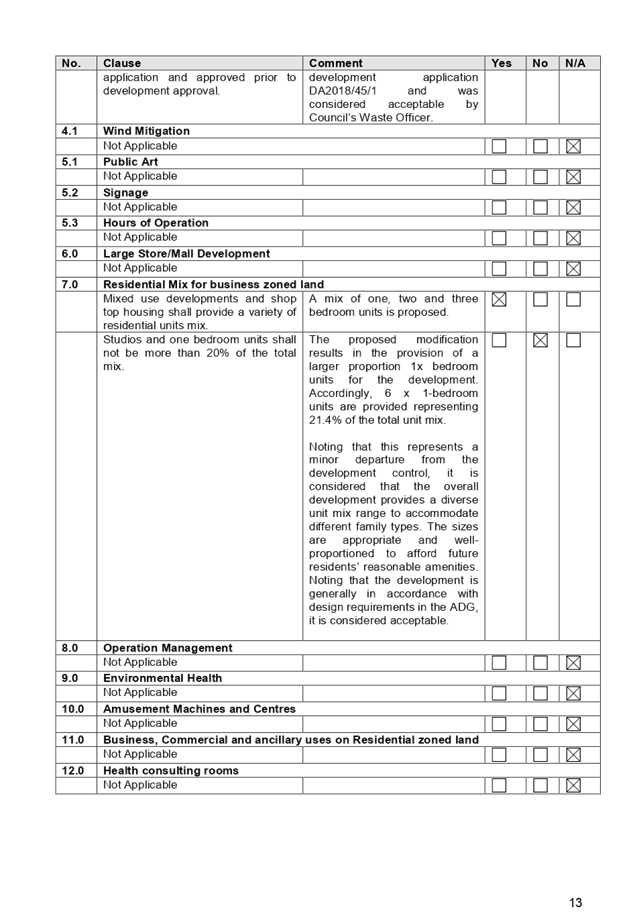
|
· Departure
from minimum 6m setback required for Unit 15 under Schedule A of DA2018/454/1
· Departure
from minimum 6m setback required for Unit 18 under Schedule A of DA2018/454/1
|
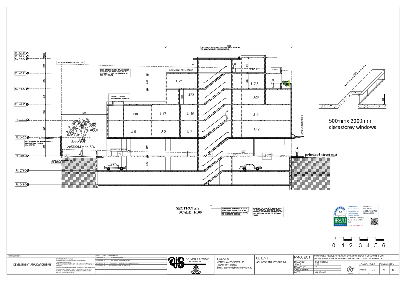
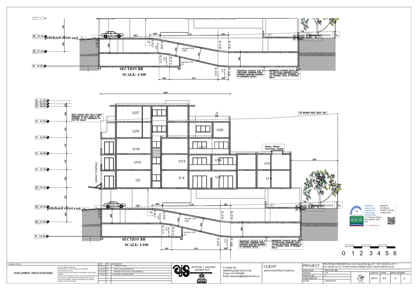
1. On
12 December 2019 Cumberland Local Planning Panel granted deferred commencement
approval for DA2018/454/1 which sought consent for demolition of existing
structures and construction of part 3, part 5 and part 6 storey shop top
housing development comprising a commercial tenancy at ground floor level, 28
residential units above and 2 levels of basement carpark accommodating 55 car
parking spaces and 1 car wash bay on land at 12-14 Pritchard Street East,
Wentworthville. The Cumberland Local Planning Panel (CLPP) imposed 10 deferred
commencement conditions, one of which was Condition no. 9b, requiring that
Units 18 and 15 of the development provide a minimum side boundary setbacks of
6m.
2. Subsequently,
the subject Modification Application No. MOD2020/0126 was lodged on 4 May 2020
seeking Section 4.55(1A) application to modify the deferred commencement
condition no.9b relating to setbacks and change the unit mix of the approved
shop top housing development. The modification application proposes 4.5m side
setbacks for Units 18 and 15 and redesigns Units 18 and 15 into 1-bedroom
units.
3. The
application is being reported to the Cumberland Local Planning Panel (CLPP) for
determination as the proposal seeks to modify a deferred commencement condition
imposed by the Panel for a development involving more than 4 storeys to which
the State Environmental Planning Policy No 65 – Design Quality of
Residential Apartment Developments applies.
4. The
application is recommended for approval subject to the conditions in the draft
notice of determination.
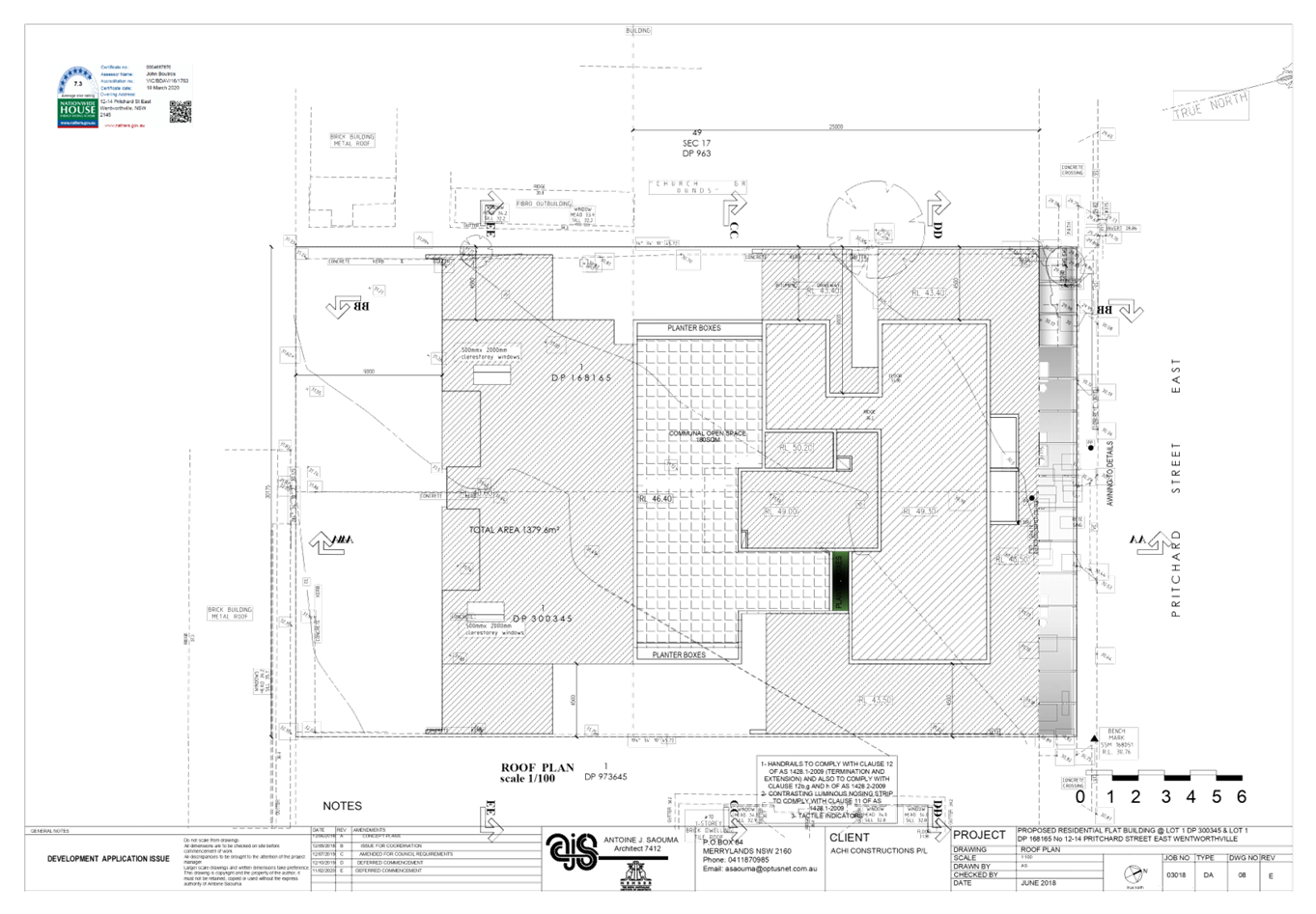
Subject Site and Surrounding
Area
The subject site is known as 12
& 14 Pritchard Street, East Wentworthville, and is legally described as Lot
1, Deposited Plan (DP) 300345 and Lot 1, DP 168165. The site is located on the
southern side of Pritchard Street within the B2 Local Centre zone. The site
forms a regular midblock with a total area of 1379.6m2 and a combined frontage
of 30m to Pritchard Street. The site has a fall of approximately 1.5m from the
rear to front. The site is currently occupied by a Pathology Centre and a
single storey dwelling. There is no significant vegetation on site.
The subject site is located within
Wentworthville Town Centre and adjoins R2 Low Density Residential to the south.
The site is bounded by B2 zoned land to the north, east and west. There is a
transition occurring currently with higher density zoned sites being developed
into residential flat buildings further to the south. The wider locality
contains a mix of commercial and residential land uses.
The site is identified in a
Planning Proposal for the Wentworthville Centre Revitalisation Project to amend
planning controls, including increases to building height and floor space
ratios (FSRs) and the introduction of new provisions within the Centre.
Figure
1 – Locality plan of subject site
Figure
2 – Aerial view of subject site
Description of the Proposed
Development
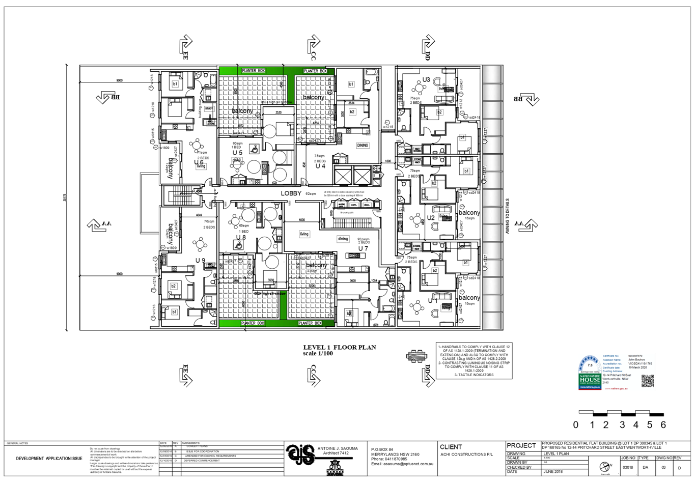
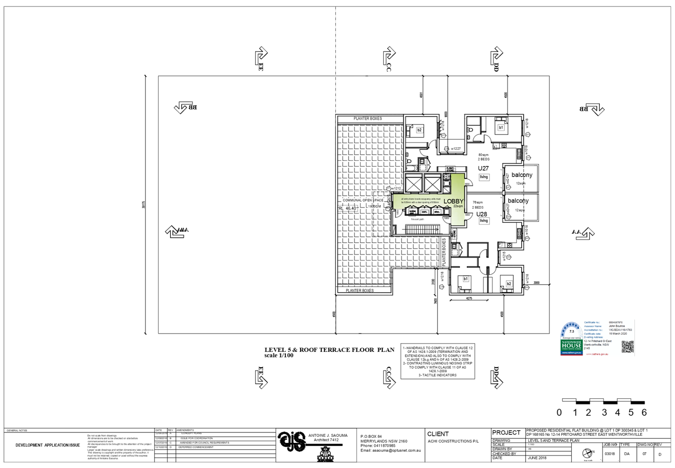
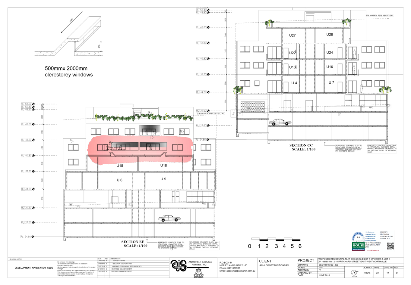
Condition no. 9b of Schedule A
(deferred commencement conditions) was imposed by Cumberland Local Planning
Panel (CLPP) on 12 December 2019 under Development Consent No. DA2018/454/1.
The condition required that 6m side setbacks be provided for Units 18 and 15.
Noting that Units 18 and 15 are both located on level 2 of the shop top housing
development, the premise of the condition is to afford reasonable amenity to
the private open space and living areas of Units 13, 14, 16 and 17 of the
development.
The subject modification
application however proposes side setbacks of 4.5m for the units. Given that
the setbacks represent a departure from the condition, the subject Section
4.55(1A) modification application is lodged. As such the proposed
modification involves the following works:
· Provision
of 4.5m setback from the eastern site boundary to the eastern side elevation of
Unit 18;
· Provision
of 4.5m setback from the western site boundary to the western side elevation of
Unit 15;
· Alteration
of the development’s unit mix by redesigning Units18 and 15 from
2-bedroom units into 1-bedroom units;
· Installation
of two celestial skylights above the living rooms of units 18 and 15 to improve
sunlight access;
It is noted that the proposal
results in a marginal reduction of FSR from 1.974:1 (2724.25m2) to 1.96:1
(2,704m2)
The subject modification results
in the following key changes within the overall development:
|
Level
|
DA2018/454/1
Approval
|
Proposed
Modifications
|
|
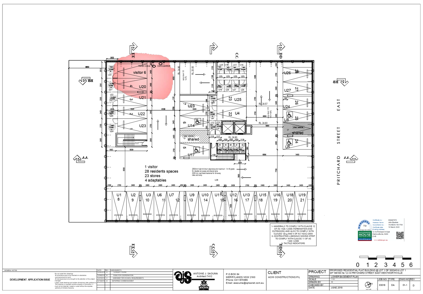
Lower basement
|
- 29 residential car spaces
including 4 accessible parking spaces
- Storage, lift and fire stairs
|
No changes proposed
|
|
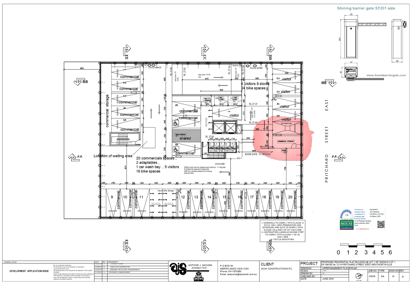
Upper Basement
|
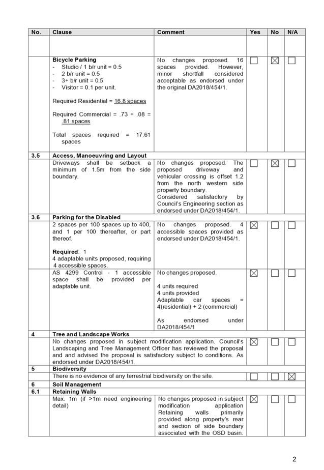
- 20 commercial spaces
(including 2 accessible parking spaces)
- 6 visitor car spaces
- 16 bicycle spaces
- Storage, lift and fire stairs
- 1 car wash bay
|
No changes proposed
|
|
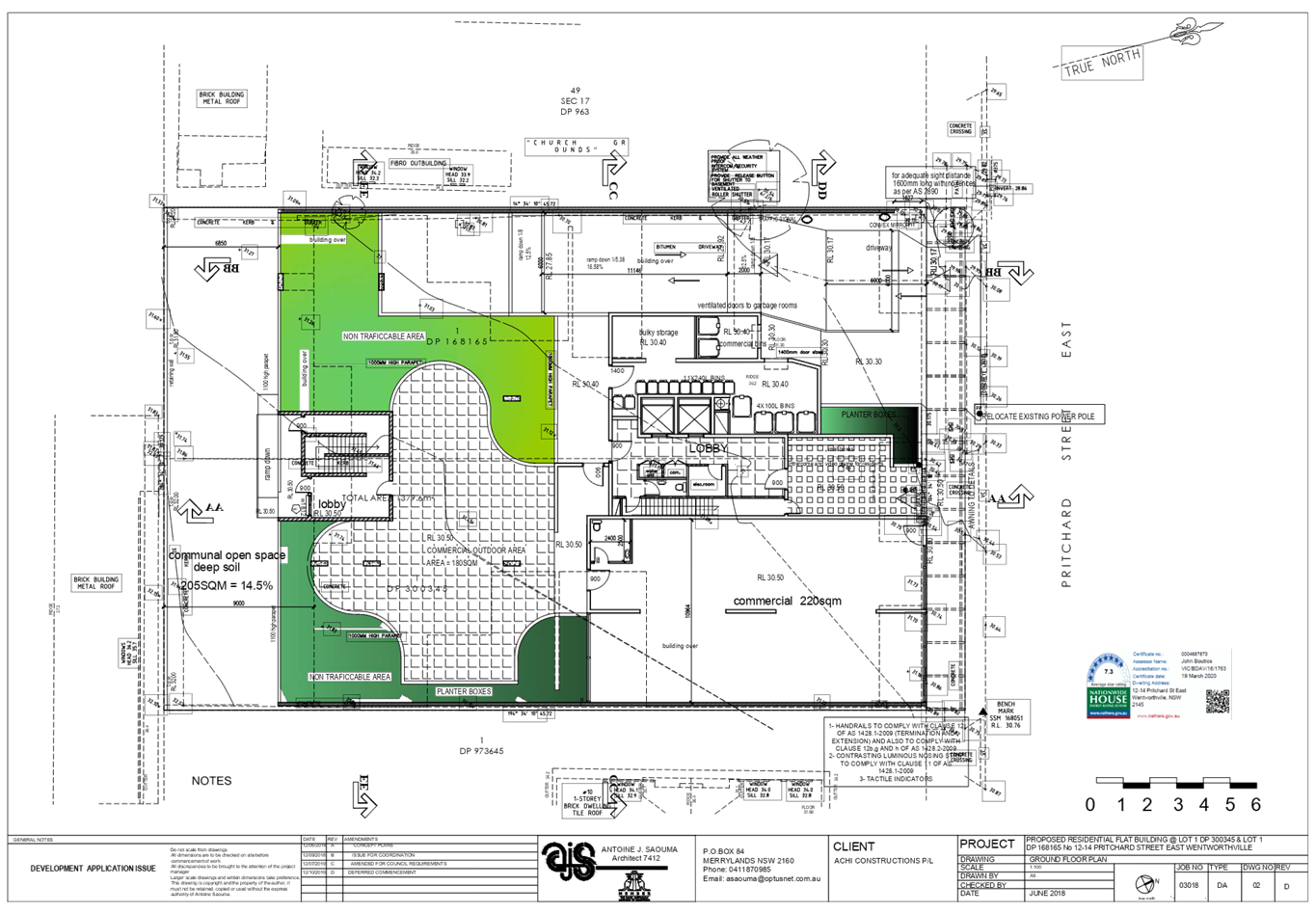
Ground floor
|
- Commercial tenancy with an
area of 220m2,
- Commercial outdoor area (180m2)
- lobby area with lift and
stairwell core;
- Communal open space;
- Bin storage area
|
No changes proposed
|
|
Level 1
|
- 9 residential units
|
No changes proposed
|
|
Level 2
|
- 9
residential units
|
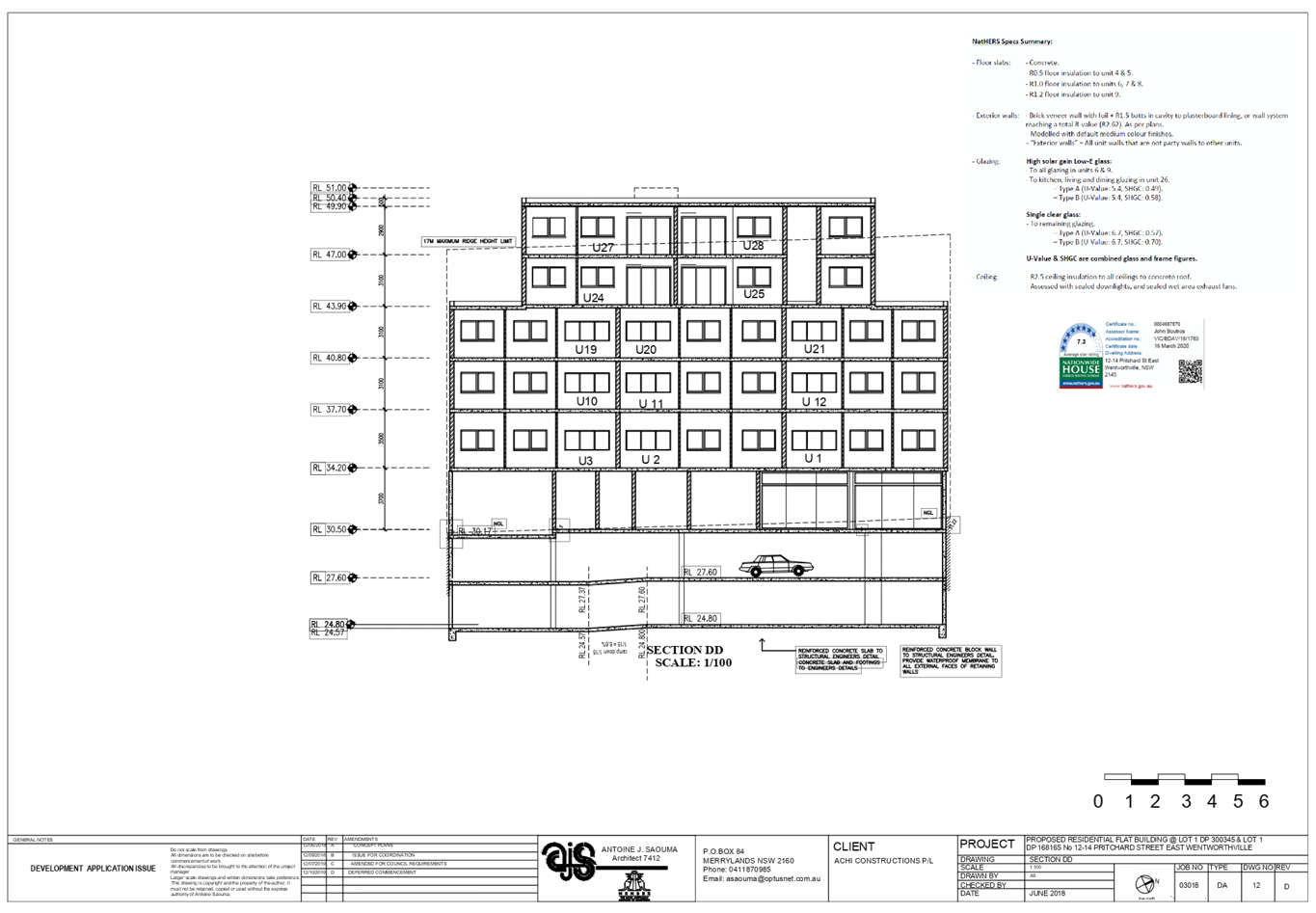
The development will maintain 9 residential units, however
Units 18 and 15 will be redesigned from 2-bedroom units to 1-bedroom units.
|
|
Level 3
|
- 5 residential units
|
No changes proposed
|
|
Level 4
|
- 3 residential units
|
No changes proposed
|
|
Level 5
|
- 2 residential units
- roof top communal open space
|
No changes proposed
|
History
Deferred Commencement Approval
DA2018/454/1 was issued by Cumberland Local Planning Panel on 12 December 2019
for the demolition of existing structures and construction of part 3, part 5
and part 6 storey shop top housing development comprising a commercial tenancy
at ground floor level, 28 residential units above 2 levels of basement carpark
accommodating 55 car parking spaces and 1 car wash bay at the subject site.
Modification Application No.
MOD2020/0126 was lodged on 4 May 2020 seeking Section 4.55(1A) application to
modify the deferred commencement condition no.9b relating to setbacks and
change the unit mix of the approved shop top housing development. In the
deferred commencement approval of the original development application, DA
2018/454/1.
Applicants Supporting
Statement
The applicant has provided a
Statement of Environmental Effects prepared by Think Planners Pty Ltd dated 20
April 2020 in support of the application.
A signed revised Design
Verification Statement prepared by Antoine J. Saouma (Registration No. 7412)
was submitted with the subject modification application.
Contact with Relevant
Parties
The assessing officer has
undertaken a site inspection of the subject site and surrounding properties and
has been in regular contact with the applicant throughout the assessment
process.
Internal/External Referrals
No internal or external referrals
were required for the modification application.
PLANNING COMMENTS
Section 4.55(1A):
|
Requirement
|
Comments
|
|
Proposed modification
is of minimal environmental impact
|
Proposed modification
is of minimal environmental impact.
|
|
Council is satisfied that the development to which the
consent as modified relates is substantially the same development as the
development for which the consent was originally granted and before that
consent as originally granted was modified (if at all), and
|
The development as proposed to be modified is
substantially the same as the original consent, as it relates to modification
of setbacks and change the unit mix of the approved shop top housing
development.
|
|
Council has notified the application in accordance with:
(i) the regulations, if the
regulations so require, or
(ii) a development control plan,
if the consent authority is a council that has made a development control plan
that requires the notification or advertising of applications for
modification of a development consent, and
|
See discussion on “Public Notification” in
this report.
|
|
Council has considered any submissions made concerning the
proposed modification within any period prescribed by the regulations or
provided by the development control plan, as the case may be.
|
See discussion on “Public Notification” in
this report.
|
The provisions of any
Environmental Planning Instruments (EP&A Act s4.15 (1)(a)(i))
(a) State
Environmental Planning Policy No. 55 – Remediation of Land (SEPP 55)
The requirement at Clause 7 of
SEPP No. 55 for Council to be satisfied that the site is suitable or can be
made suitable to accommodate the proposed development has been considered in
the following table:
|
Matters for consideration
|
Yes
|
No
|
N/A
|
|
Does the application involve
re-development of the site or a change of land use?
|
|
|
|
|
Is the development going to be
used for a sensitive land use (e.g.: residential, educational, recreational,
childcare or hospital)?
|
|
|
|
|
Does information available to
you indicate that an activity listed below has ever been approved, or
occurred at the site?
acid/alkali plant and
formulation, agricultural/horticultural activities, airports, asbestos
production and disposal, chemicals manufacture and formulation, defence
works, drum re-conditioning works, dry cleaning establishments, electrical
manufacturing (transformers), electroplating and heat treatment premises,
engine works, explosive industry, gas works, iron and steel works, landfill
sites, metal treatment, mining and extractive industries, oil
production and storage, paint formulation and manufacture, pesticide
manufacture and formulation, power stations, railway yards, scrap yards,
service stations, sheep and cattle dips, smelting and refining, tanning and
associated trades, waste storage and treatment, wood preservation.
|
|
|
|
|
Is the site listed on Council's
Contaminated Land Database?
|
|
|
|
|
Is the site subject to EPA
clean-up order or other EPA restrictions?
|
|
|
|
|
Has the site been the subject of
known pollution incidents or illegal dumping?
|
|
|
|
|
Does the site adjoin any
contaminated land/previously contaminated land?
|
|
|
|
|
Has the appropriate level of
investigation been carried out in respect of contamination matters for
Council to be satisfied that the site is suitable to accommodate the proposed
development or can be made suitable to accommodate the proposed development?
|
|
|
|
|
Details of contamination
investigations carried out at the site:
The site
is not identified in Council’s records as being contaminated. A site
inspection reveals the site does not have any obvious history of a previous
land use that may have caused contamination and there is no specific evidence
that indicates the site is contaminated. Council’s
Environmental Health Unit has assessed the application and considers the
proposal to be satisfactory subject to conditions.
|
(a) State
Environmental Planning Policy (Vegetation in Non-Rural Areas) 2017
The site and neighbouring land
parcels have recently been cleared of all vegetation to facilitate future
residential development. As such, the SEPP does not apply.
(b) State
Environmental Planning Policy (Coastal Management) 2018
The subject site is not identified
as a coastal wetland and is not or land identified as “proximity area for
coastal wetlands”.
(c) State
Environmental Planning Policy (Building Sustainability Index: BASIX) 2004
An amended BASIX
Certificate 975895M_06 dated 19 March 2020 with regard to the revised dwelling
mix has been submitted. The submitted BASIX certificate achieves target scores
and is considered satisfactory. Conditions of Consent have been applied
requiring adherence to the BASIX Certificate requirements.
(d) Statement
Environmental Planning Policy No. 65 - Design Quality of Residential Apartment
Development (SEPP 65)
SEPP 65 applies to the development
as the building is 3 storeys or more, and contains more than 4 dwellings. A
design statement addressing the design quality principles prescribed by SEPP 65
was prepared by the project architect. Integral to SEPP 65 is the Apartment
Design Guide (ADG), which sets benchmarks for the appearance, acceptable
impacts and residential amenity of the development. A revised design
verification statement signed by registered architect Antoine J. Saouma
(Registration No. 7412) was submitted with the s4.55(1A) application. Following
a detailed assessment of the proposal against the provisions of SEPP 65 and the
ADG, it is considered the proposal is generally compliant.
In the absence of 6m side setbacks
for Units 18 and 15 as imposed under DA2018/454/1, the proposed modification
which encapsulates 4.5m side boundary setbacks for Units 18 and 15, alteration
of the unit mix and provision of skylights for Units 18 and 15 is considered
acceptable in this instance. It is considered that the 4.5m setbacks will
appropriately articulate and modulate the built form along the side elevations
as strict compliance of 6m imposed would. Further, it will afford visual relief
for Units 13, 14, 16, and 17 by providing southerly outlook from their private
open spaces and living areas. Noting that the gross floor area for the proposal
is marginally reduced from the approved under DA2018/454/1, it is also
considered that 4.5m setbacks will provide balance of equitable gross
floor area for the development in accordance with Holroyd LEP provisions and
reasonable amenity for other units in the development and adjoining
developments.
The 4.5m setback will provide the
development with adequate building separation distances between neighbouring
sites to achieve acceptable levels of external and internal visual privacy.
Also, the reduced building bulk and proposed skylights proposal will afford the
Units 18 and 15 optimised opportunities to receiving sunlight in living areas
and improve amenities into the private open spaces and living areas of other
units on level 2.
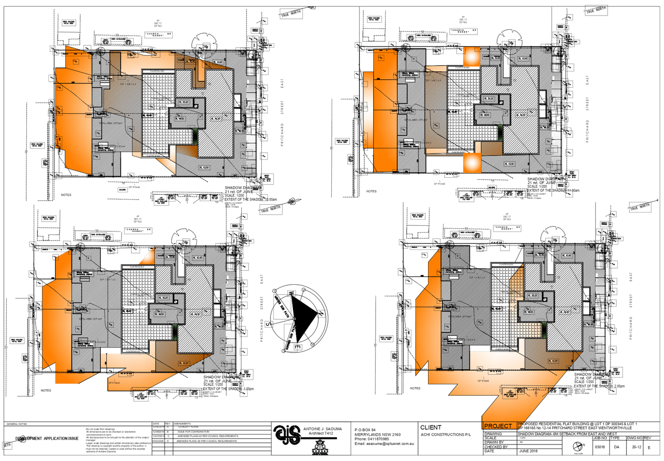
The shadow diagrams submitted by
the applicant shows that the proposed development will maintain 20 out of 28
units (70%) achieving 2 hours of direct sunlight between 9am and 3pm. Also, in
accordance with Apartment Design Guide less than 15% of the residential units
will not receive adequate sunlight in mid-winter. Noting the southern
orientation of Units 18 and 15, it is unlikely that strict compliance
with the 6m side setbacks condition as imposed by the Panel under
DA2018/454/1 will afford significant sunlight opportunities into the private
open spaces and living areas of Units, 13, 14, 16 and 17. It is however noted
that the provision of the 4.5m setbacks minimises visual intrusion impacts for
Units, 13, 14, 16 & 17 and neighbouring developments. Also, recognising
that there is no net loss in parking spaces despite the unit mix alterations
(higher 1-bedroom proportion), it is considered that overall amenity of the
development is improved.
Further recognising that the
Holroyd Development Control Plan 2013 requires nil side setbacks for
residential flat building developments in the B2 Local Centre zone, it is
considered that the 4.5m side setbacks proposed for the units is reasonable.
Noting the above, it is satisfied that the proposed modification and overall
development is designed in accordance with the Apartment Design Guide.
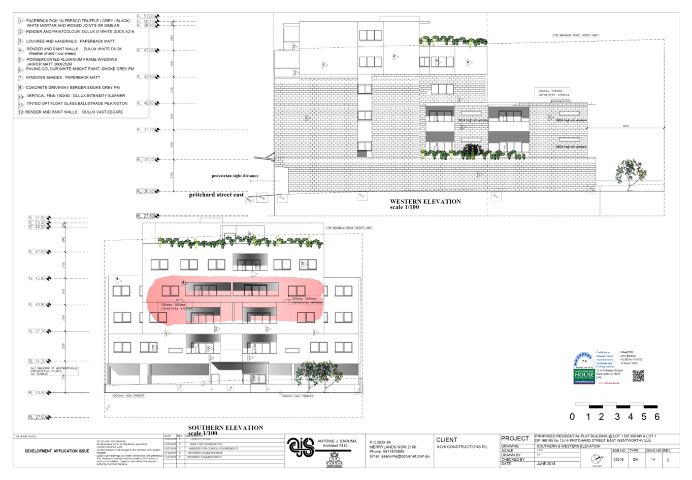
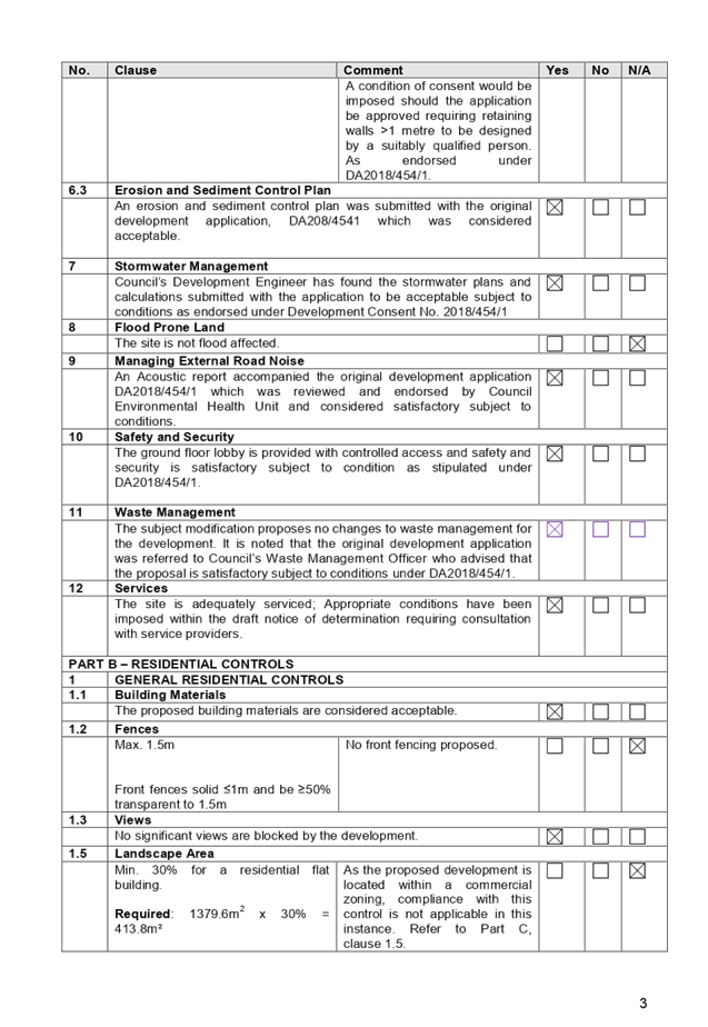
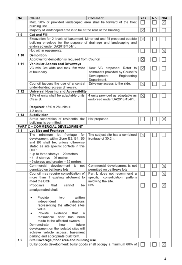
Figure
4 – Proposed floor plan of Units 18 and 15
Figure
5 – South elevation showing Units 18 and 15
A comprehensive assessment against
SEPP 65 and the ADG is contained in Appendix A.
(a) State
Environmental Planning Policy (Infrastructure) 2007 (ISEPP)
The provisions of the ISEPP 2007
have been considered in the assessment of the development application.
Clause 45 – Development
likely to affect an electricity transmission or distribution network
The original development
application, DA2018/454/1 was referred to Endeavour Energy and TransGrid for
comment, who raised no objections, subject to conditions. The proposed
modifications are unlikely to result in any changes in this regard, therefore
is considered acceptable.
Regional Environmental Plans
The proposed development is
affected by the following Regional Environmental Plans:
(a) Sydney
Regional Environmental Plan (Sydney Harbour Catchment) 2005
Note: Will be superseded once
Draft SEPP Environment comes into effect.
The subject site is identified as
being located within the area affected by the Sydney Regional Environmental
Plan (Sydney Harbour Catchment) 2005. The proposed development raises no issues
as no impact on the catchment is envisaged.
(Note: - the subject site is not
identified in the relevant map as ‘land within the ‘Foreshores and
Waterways Area’ or ‘Wetland Protection zone’, is not a
‘Strategic Foreshore Site’ and does not contain any heritage items.
Hence the majority of the SREP is not directly relevant to the proposed
development).
Local Environmental Plans
Holroyd Local Environmental
Plan (HLEP) 2013
The provision of the Holroyd LEP
2013 is applicable to the development proposal. It is noted that the
development achieves compliance with the key statutory requirements of the
Holroyd LEP 2013 and the objectives of the B2 – Local Centre zone.
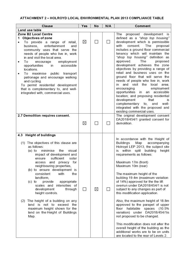
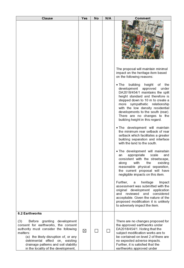
(a) Permissibility:-
The proposed development is
defined as a ‘shop top housing’ and is permissible in the B2–
Local Centre zone with consent. The proposed modification will continue the use
of the development as approved being a shop top housing.
The relevant matters to be
considered under Holroyd LEP 2013 and the applicable clauses for the proposed
development are summarised below. A comprehensive LEP assessment is contained
in Appendix B.
The provisions of any proposed
instrument that is or has been the subject (EP&A Act s4.15 (1)(a)(ii))
(a) Draft
State Environmental Planning Policy (Environment)
The draft SEPP relates to the
protection and management of our natural environment with the aim of simplifying
the planning rules for a number of water catchments, waterways, urban bushland,
and Willandra Lakes World Heritage Property. The changes proposed include
consolidating the following seven existing SEPPs:
· State
Environmental Planning Policy No. 19 – Bushland in Urban Areas
· State
Environmental Planning Policy (Sydney Drinking Water Catchment) 2011
· State
Environmental Planning Policy No. 50 – Canal Estate Development
· Greater
Metropolitan Regional Environmental Plan No. 2 – Georges River Catchment
· Sydney
Regional Environmental Plan No. 20 – Hawkesbury-Nepean River (No.2-1997)
· Sydney
Regional Environmental Plan (Sydney Harbour Catchment) 2005
· Willandra
Lakes Regional Environmental Plan No. 1 – World Heritage Property.
The draft policy will repeal the
above existing SEPPs and certain provisions will be transferred directly to the
new SEPP, amended and transferred, or repealed due to overlaps with other areas
of the NSW planning system.
Changes are also proposed to the
Standard Instrument – Principal Local Environmental Plan. Some provisions
of the existing policies will be transferred to new Section 117 Local Planning
Directions where appropriate.
(b) Draft
Cumberland Local Environmental Plan 2020 (Draft CLEP)
The Draft Cumberland Local Environmental
Plan 2020 (Draft CLEP) has been prepared by Cumberland Council to provide a
single planning framework for the future planning of Cumberland City. The
changes proposed seek to harmonise and repeal the three existing LEPs currently
applicable to the Cumberland local government area, those being:
· Holroyd
Local Environmental Plan 2013,
· Parramatta
Local Environmental Plan 2011, and
· Auburn
Local Environmental Plan 2010.
The relevant planning controls for
the subject site, as contained within the Holroyd Local Environment Plan, are
not proposed to change under the Draft CLEP.
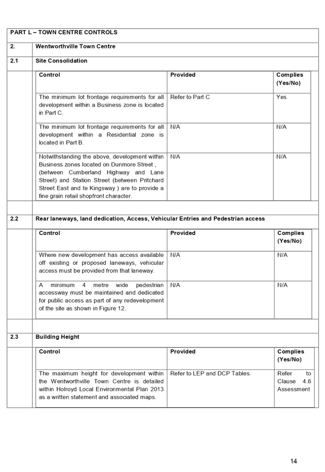
(c) Wentworthville
Town Centre Planning Proposal
The planning proposal for the
revitalisation of the Wentworthville Town Centre has been endorsed by Council
for finalisation and gazettal by the Department of Planning, Industry and
Environment.
The subject site is not proposed
to change in regard to zoning and FSR as part of the planning proposal;
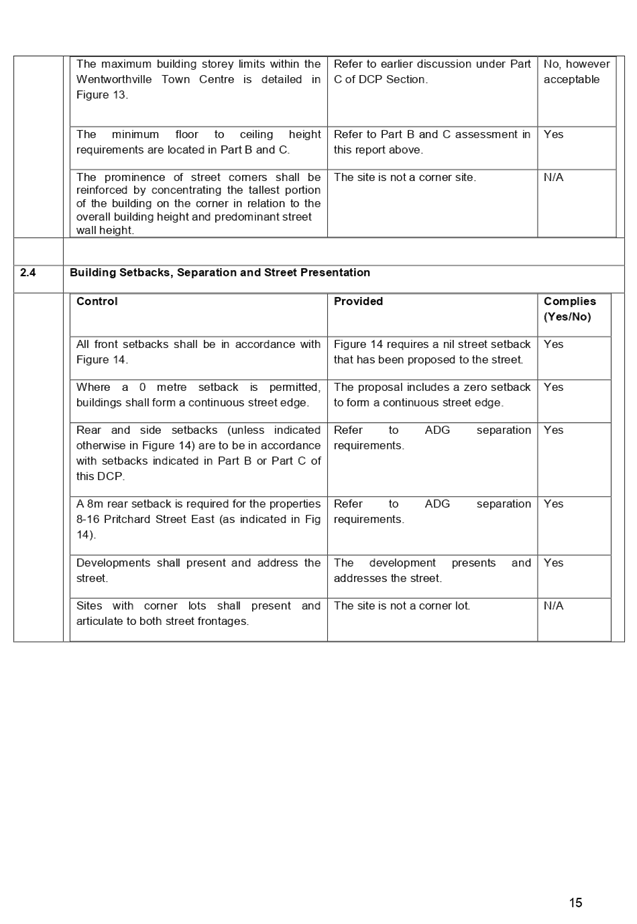
however, the building height has been increased from 17m to 23m for the front
portion of the property whilst the rear remains at a maximum of 17m.
The provisions of any
Development Control Plans (EP&A Act s4.15 (1)(a)(iii))
The Holroyd DCP 2013 provides
guidance for the design and operation of development to achieve the aims and objectives
of the DCP. A comprehensive assessment and compliance table is contained in
Appendix C. The proposed development complies with the provisions of Holroyd
DCP 2013 and is considered acceptable from an environmental planning view
point.
The provisions of any planning
agreement that has been entered into under section 7.4, or any draft planning
agreement that a developer has offered to enter into under section 7.4
(EP&A Act s4.15(1)(a)(iiia))
There is no draft planning
agreement associated with the subject Development Application.
The provisions of the
Regulations (EP&A Act s4.15 (1)(a)(iv))
The proposed development raises no
concerns as to the relevant matters arising from the Environmental Planning and
Assessment Regulations 2000 (EP&A Reg).
The Likely Environmental,
Social or Economic Impacts (EP&A Act s4.15 (1)(b))
It is considered that the proposed
development will have no significant adverse environmental, social or economic
impacts in the locality.
The suitability of the site for
the development (EP&A Act s4.15 (1)(c))
The subject site and locality is
not known to be affected by any natural hazards or other site constraints
likely to have a significant adverse impact on the proposed development.
Accordingly, it is considered that the development is suitable in the context
of the site and surrounding locality.
Submissions made in accordance
with the Act or Regulation (EP&A Act s4.15 (1)(d))
Advertised (newspaper) Mail
Sign
Not
Required
In accordance with the Holroyd Development Control Plan
2013, the proposed modification was notified for 14 days between 18 May 2020 to
1 June 2020.
The public interest (EP&A
Act s4.15(1)(e))
In view of the foregoing analysis
it is considered that the development, if carried out subject to the conditions
set out in the recommendation below, will have no significant adverse impacts
on the public interest.
Section 7.11 (Formerly S94)
Contribution towards Provision or Improvement of Amenities or Services
The monetary contribution for the
development is amended as a result of proposed the alteration to the unit mix
in accordance with provisions in Holroyd Section 94 Development Contributions.
The subject development requires
the payment of contributions in accordance with Holroyd Section 94 Development
Contributions Plan 2013. A condition is imposed requiring the payment of
contributions.
In accordance with the currently
indexed rates for the Wentworthville Centre contribution area, the following
contributions apply:
It is noted that the Section 7.11
contribution payable for the approved development under Development Consent No.
DA2018/454/1 which encapsulated 4 x 1-bedroom dwellings, 20 x 2-bedroom
dwellings, 4 x 3 bedroom dwellings and 220 m2 of non-residential
development totals $378,320.00.
Recognising that the modification
proposes a decrease in proportion of 2-bedroom units and increase in proportion
of 1-bedroom units, it results in a decreased Section 7.11 development
contributions payable. Given that the modification application proposes 6 x
1-bedroom units, 18 x 2-bedroom units, 4 x 3-bedroom units 220 m2 of
non-residential, the currently indexed development contribution payable is
$370,334.70.
Note: This includes credit for the
existing 2 x 3-bedroom dwellings on the site.
Disclosure of Political
Donations and Gifts
The applicant and notification
process did not result in any disclosure of Political Donations and Gifts.
The development as modified is
appropriately located within the B2 – Local Centre zone under the
relevant provisions of the Holroyd LEP 2013. Having regard to the assessment of
the proposal from a merit perspective, Council is satisfied that the development
has been responsibly designed and provides for acceptable levels of amenity for
future residents and neighbouring developments. It is considered that the
proposal minimises adverse impacts on the amenity of neighbouring properties.
For these reasons, it is considered that the proposal is satisfactory having
regard to the matters of consideration under Section 4.15 and 4.55 of the
Environmental Planning and Assessment Act 1979, and the modified development
may be approved subject to conditions.
|
1. That
Modification Application No. MOD2020/0126 for Section 4.55(1A) application to
modify setbacks and unit mix of approved shop top housing development on land
at 12 & 14 Pritchard Street East, Wentworthville be approved subject to
attached conditions.
|
1. Draft
Notice of Determination
2. Architectural
Plans
3. Previous
Development Consents
4. Appendix
A - Apartment Design Guide Compliance Table
5. Appendix
B – Holroyd Local Environmental Plan 2013 Compliance Table
6. Appendix
C – Holroyd DCP 2013 Compliance Table
7. Shadow
Diagram- 6M Setback from East and West
8. Shadow
Diagram- 6M Setback from East and West
DOCUMENTS
ASSOCIATED WITH
REPORT LPP040/20
Attachment 1
Draft Notice of Determination
Cumberland Local Planning Panel Meeting
12 August 2020

DOCUMENTS
ASSOCIATED WITH
REPORT LPP040/20
Attachment 2
Architectural Plans
Cumberland Local Planning Panel Meeting
12 August 2020

DOCUMENTS
ASSOCIATED WITH
REPORT LPP040/20
Attachment 3
Previous Development Consents
Cumberland Local Planning Panel Meeting
12 August 2020


DOCUMENTS
ASSOCIATED WITH
REPORT LPP040/20
Attachment 4
Appendix A - Apartment Design Guide Compliance Table
Cumberland Local Planning Panel Meeting
12 August 2020
DOCUMENTS
ASSOCIATED WITH
REPORT LPP040/20
Attachment 5
Appendix B – Holroyd Local Environmental Plan
2013 Compliance Table
Cumberland Local Planning Panel Meeting
12 August 2020
DOCUMENTS
ASSOCIATED WITH
REPORT LPP040/20
Attachment 6
Appendix C – Holroyd DCP 2013 Compliance Table
Cumberland Local Planning Panel Meeting
12 August 2020
DOCUMENTS
ASSOCIATED WITH
REPORT LPP040/20
Attachment 7
Shadow Diagram- 6M Setback from East and West
Cumberland Local Planning Panel Meeting
12 August 2020
DOCUMENTS
ASSOCIATED WITH
REPORT LPP040/20
Attachment 8
Shadow Diagram- 6M Setback from East and West
Cumberland Local Planning Panel Meeting
12 August 2020
Cumberland
Local Planning Panel Meeting
12 August 2020
Item
No: LPP041/20
Electronic Determination
- Modification Application for 1 Robilliard Street, Mays Hill
Responsible
Division: Environment
& Planning
Officer: Executive
Manager Development and Building
File
Number: MOD2020/0200
|
Application
lodged
|
24 June 2020
|
|
Applicant
|
Mr E Moujalli, Eastern Pacific
Pty Ltd
|
|
Owner
|
Great Western Highway
Developments Pty Ltd
|
|
Application
No.
|
MOD2020/0200
|
|
Description
of Land
|
1 Robilliard Street MAYS
HILL NSW 2145, Lot 100 in DP 1256634
|
|
Proposed
Development
|
Section 4.55(1A) application
to delete condition 194 relating to substation location and internal
reconfiguration of car parking spaces
|
|
Site
Area
|
3,687m2
|
|
Zoning
|
B6 – Enterprise Corridor
Zone
|
|
Disclosure
of political donations and gifts
|
Nil disclosure
|
|
Heritage
|
Not listed as heritage item
and not located in heritage conservation area
|
|
Principal
Development Standards
|
FSR proposed – 2:1
Permissible: 2:1
Height of Building – as
approved
Permissible: 23m –
fronting Great Western Highway (Building A)
17m – middle section (part Building B)
15m – facing Robilliard Street (part Building B)
|
|
Issues
|
Substation
location
|
1. Modification
Application No. MOD2020/0085 was received on 24 June 2020 for section 4.55(1A)
application to delete condition 194 relating to the substation location, which
is to be retained internally within commercial tenancy 4 as indicated on the
original approval (DA2019/499/1) dated 13 September 2017. Condition 194 was
imposed by Cumberland Local Planning Panel (CLPP) on 10 June 2020 under
MOD2020/0085 approval. The applicant indicated that the substation has since
been constructed and completed in June 2020 without consent on the location
proposed under MOD2020/0085, which is located externally facing Robilliard
Street. The relocation of substation results in the internal reconfiguration of
car parking layout on the basement levels.
2. The
application is being reported to the CLPP for determination as it exceeds
Council delegation in relation to the modification of condition that was
specifically required to be provided by the Cumberland Local Planning Panel
3. The
application is recommended for approval subject to the conditions in the draft
notice of determination held at Attachment 1.
Subject Site and Surrounding
Area
The subject site forms Lot 100 in DP 1256634, which
previously comprised of 5 separate allotments (Lot 109 in DP 13239, Lot B in DP
367709, Lot 12 in DP 1052755, Lot 10 in DP 1052755, and Lot 11 in DP 1052755).
The site is a corner lot that is known as 1 Robilliard Street, Mays Hill. The
site has an area of 3,687m2, a frontage to Robilliard Street of 50.67m to the
west, and a frontage to Great Western Highway of approximately 53.1m to the
north. The site is located within B6 Enterprise Corridor zone. The approved
mixed use development on site is currently under construction. The existing
developments adjoining the site include an existing petrol station to the west,
and a mixture of single dwellings and residential flat buildings to the south
and east.
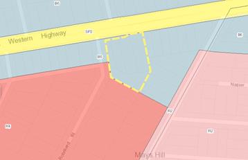
Figure
1 – Locality plan of subject site
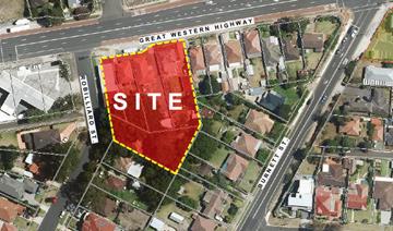
Figure
2 – Aerial view of subject site
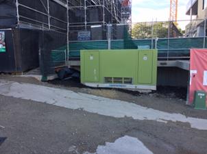
Figure
3 – Street view of substation as built
Description of the Proposed
Development
Condition 194 was imposed by
Cumberland Local Planning Panel (CLPP) on 10 June 2020 under MOD2020/0085
approval. The applicant has indicated that the substation has since been
constructed and completed in June 2020 without consent on the location proposed
under MOD2020/0085, which is situated externally facing Robilliard Street. The
relocation of substation results in the internal reconfiguration of car parking
layout on the basement levels.
Therefore, the proposed
modification application involves the following works:
Basement levels
- Internal
reconfiguration of car parking spaces;
- Relocation
of substation;
Ground floor level
- Relocation
of substation on Robilliard Street; and
- Internal
changes to commercial tenancy 4 by increasing total gross leasable area by
9m².
History
Development consent DA2016/499/1
was issued by Council under delegated authority on 13 September 2017 for the
demolition of existing structures; consolidation of 5 lots into 1 lot;
construction of part 3 (Building B); part 7 storey (Building A) mixed use development
comprising 84 residential units; ground floor commercial space above 2 levels
of basement parking accommodating 125 carparking spaces at the subject site.
Construction Certificate for
DA2016/499/1 was issued on 8 August 2019 by NW Building Certification (CC No.
NW17/2389).
S4.55(1A) application
(DA2016/499/3) was approved by Council on 4 November 2019 to modify floor to
floor heights of the ground and first floor levels.
S4.55(1A) application
(M2016/499/2) was approved by Council on 6 March 2020 to modify location of
on-site detention tank and stormwater drainage.
S4.55(2) application
(MOD2020/0085) was approved by CLPP on 10 June 2020 for various modifications
to approved mixed use development including changes to external finishes and
increase in height of lift overrun. The proposed substation relocation was not
supported by CLPP and the car parking layout on the basement levels therefore
did not require to be reconfigured.
Applicants Supporting
Statement
The applicant has provided a
Statement of Environmental Effects prepared by Think Planners Pty Ltd dated 12
March 2020 in support of the application.
Contact with Relevant
Parties
The assessing officer has
undertaken a site inspection of the subject site and surrounding properties and
has been in regular contact with the applicant throughout the assessment
process.
Internal Referrals
Development Engineer
The development application as
previously referred to Council’s Development Engineer for comment is
considered satisfactory for the changes proposed to the basement layout, and
therefore can be supported subject to recommended conditions of consent. The relocation
of substation resulted in reconfiguration of car parking layout on 2 basement
levels, however this will not change the numbers of car parking spaces approved
on the site previously determined under MOD2020/0085. Conditions imposed to
ensure that sufficient aisle width will be maintained.
Endeavour Energy
The applicant has submitted
documentary evidence to demonstrate that the proposal has satisfied the
requirements of the energy provider. The proposal therefore can be supported
subject to recommended conditions of consent.
Planning Comments
Section 4.55(1A):
|
Requirement
|
Comments
|
|
Proposed modification is of minimal environmental impact
|
Proposed modification is of minimal environmental impact.
|
|
Council is satisfied that the development to which the
consent as modified relates is substantially the same development as the
development for which the consent was originally granted and before that
consent as originally granted was modified (if at all), and
|
The development as proposed to be modified is substantially
the same as the original consent, as it relates to the substation location
and car parking layout on the basement levels, in which does not deviate from
the approved mixed use development on the subject site.
|
|
Council has notified the application in accordance with:
(i) the
regulations, if the regulations so require, or
(ii) a
development control plan, if the consent authority is a council that has made
a development control plan that requires the notification or advertising of
applications for modification of a development consent, and
|
See discussion on “Public Notification” in
this report.
|
|
Council has considered any submissions made concerning the
proposed modification within any period prescribed by the regulations or
provided by the development control plan, as the case may be.
|
See discussion on “Public Notification” in
this report.
|
The provisions of any
Environmental Planning Instruments (EP&A Act s4.15 (1)(a)(i))
(a) State
Environmental Planning Policy No. 55 – Remediation of Land (SEPP 55)
Clause 7 of SEPP 55 requires
Council to be satisfied that the site is suitable or can be made suitable to
accommodate the proposed development. The matters listed within Clause 7 have
been considered in the assessment of the development application.
|
Matter for
Consideration
|
Yes/No
|
|
Does the application
involve re-development of the site or a change of land use?
|
Yes
No
|
|
i)
Does the application involve
re-development of the site or a change of land use?
|
Yes
No
|
|
In the development
going to be used for a sensitive land use (e.g.: residential, educational,
recreational, childcare or hospital)?
|
Yes
No
|
|
Does information available to you indicate that an
activity listed below has ever been approved, or occurred at the site?
acid/alkali plant and
formulation, agricultural/horticultural activities, airports, asbestos
production and disposal, chemicals manufacture and formulation, defence
works, drum re-conditioning works, dry cleaning establishments, electrical
manufacturing (transformers), electroplating and heat treatment premises,
engine works, explosive industry, gas works, iron and steel works, landfill
sites, metal treatment, mining and extractive industries, oil production and
storage, paint formulation and manufacture, pesticide manufacture and
formulation, power stations, railway yards, scrap yards, service stations,
sheep and cattle dips, smelting and refining, tanning and associated trades,
waste storage and treatment, wood preservation
|
Yes
No
|
|
Is the site listed on
Council’s Contaminated Land database?
|
Yes
No
|
|
Is the site subject to EPA
clean-up order or other EPA restrictions?
|
Yes
No
|
|
Has the site been the subject of
known pollution incidents or illegal dumping?
|
Yes
No
|
|
Does the site adjoin any
contaminated land/previously contaminated land?
|
Yes
No
|
|
Has the appropriate level of
investigation been carried out in respect of contamination matters for
Council to be satisfied that the site is suitable to accommodate the proposed
development or can be made suitable to accommodate the proposed development?
|
Yes
No
|
|
1.
The requirements under the original application are
unchanged by this modification application. Council is satisfied that the
site is suitable to be used for residential purpose.
|
(b) Statement
Environmental Planning Policy No. 65 - Design Quality of Residential Apartment
Development (SEPP 65)
SEPP 65 applies to the development
as the building is 3 storeys or more, and contains more than 4 dwellings. A
design statement addressing the design quality principles prescribed by SEPP 65
was prepared by the project architect. Integral to SEPP 65 is the Apartment
Design Guide (ADG), which sets benchmarks for the appearance, acceptable
impacts and residential amenity of the development. A revised design
verification statement signed by registered architect Ziad Boumelhem
(Registration No. 8008) was submitted with the s4.55(1A) application. Following
a detailed assessment of the proposal against the provisions of SEPP 65 and the
ADG, it is considered the proposal is generally compliant.
Condition 194 was imposed by
Cumberland Local Planning Panel (CLPP) on 10 June 2020 under MOD2020/0085
approval. The applicant has indicated that the substation has since been
constructed and completed in June 2020 without consent on the location proposed
under MOD2020/0085, which is situated externally facing Robilliard Street
(refer to Figure 3). The substation has been constructed to closely match the
existing footpath level and will be treated with black coloured slat screening
with lockable key accessible only by the energy provider (refer to Figure 4).
The proposed substation treatment
is considered acceptable in this instance, as there are existing substations
which have been approved and built within the front setbacks of residential
flat buildings on Robilliard Street (refer to Figure 5). The location of
substation will replace the approved planter boxes adjoining to the Robilliard
Street residential entry, which was previously included in the calculation of
communal open space (COS). The replacement of planter boxes will reduce the
area previously approved as COS. However, under the subject modification
application, the reduction of COS by 21m² will still result in a compliant
area required by clause 3D-1 of the ADG. Where 25% of the site area is required
for COS, the proposed modification will provide an area of 25.86%. The proposal
will continue to satisfy ADG requirement for COS.
Figure
4 – Elevation plan of substation
Figure
5 – Existing substations on Robilliard Street streetscape
A comprehensive assessment against
SEPP 65 and the ADG is contained in Appendix A.
(c) State
Environmental Planning Policy (Infrastructure) 2007 (ISEPP)
The provisions of the ISEPP 2007
have been considered in the assessment of the development application.
Clause 45 - Development likely
to affect an electricity transmission or distribution network
The original application was
referred to Endeavour Energy and was considered satisfactory subject to the
conditions imposed. The current modification for relocation of substation on
the site has been also been approved by the electricity provider.
Clause 101 – Frontage to
classified road
The application is subject to
clause 101 of the ISEPP as the site has frontage to a classified road. The
original application was assessed under the provision of this clause and was
considered satisfactory subject to conditions imposed. The proposed
modification does not alter the outcome of the original assessment.
Clause 102 – Impact of
road noise or vibration on non-road development
The application is subject to
clause 102 of the ISEPP as the annual average daily traffic volume is greater
than 40,000 vehicles. The original application was assessed under the provision
of this clause and was considered satisfactory subject to conditions imposed.
The proposed modification does not alter the outcome of the original
assessment.
Clause 104 – Traffic
generation developments
The application is subject to
clause 104 as the proposal triggers the requirements for traffic generating
developments listed in Schedule 3 of the ISEPP. The original application was
assessed under the provision of this clause and was considered satisfactory
subject to conditions imposed. The proposed modification does not alter the
outcome of the original assessment.
(d) State
Environmental Planning Policy (Vegetation in Non-Rural Areas) 2017
Tree removal on site has been
approved in the original assessment. The proposal does not exceed the
biodiversity offsets scheme threshold. Therefore, the proposed vegetation
removal is considered acceptable.
(e) State
Environmental Planning Policy (Building Sustainability Index: BASIX) 2004
N/A
Regional Environmental Plans
The proposed development is
affected by the following Regional Environmental Plans:
(a) Sydney
Regional Environmental Plan (Sydney Harbour Catchment) 2005
Note: Will be superseded once
Draft SEPP Environment comes into effect.
The subject site is identified as
being located within the area affected by the Sydney Regional Environmental
Plan (Sydney Harbour Catchment) 2005. The proposed development raises no issues
as no impact on the catchment is envisaged.
(Note: - the subject site is not
identified in the relevant map as ‘land within the ‘Foreshores and
Waterways Area’ or ‘Wetland Protection zone’, is not a
‘Strategic Foreshore Site’ and does not contain any heritage items.
Hence the majority of the SREP is not directly relevant to the proposed
development).
Local Environmental Plans
Holroyd Local Environmental
Plan (HLEP) 2013
The provision of the Holroyd LEP
2013 is applicable to the development proposal. It is noted that the
development achieves compliance with the key statutory requirements of the
Holroyd LEP 2013 and the objectives of the B6 – Enterprise Corridor zone.
(a) Permissibility:-
The proposed development is
defined as a ‘shop top housing’ and is permissible in the B6
– Enterprise Corridor zone with consent. The proposed modification will
continue the use of the development as approved being a shop top housing.
The relevant matters to be
considered under Holroyd LEP 2013 and the applicable clauses for the proposed
development are summarised below. A comprehensive LEP assessment is contained
in Appendix B.
The provisions of any proposed
instrument that is or has been the subject (EP&A Act s4.15 (1)(a)(ii))
(a) Draft
State Environmental Planning Policy (Environment)
The draft SEPP relates to the
protection and management of our natural environment with the aim of
simplifying the planning rules for a number of water catchments, waterways,
urban bushland, and Willandra Lakes World Heritage Property. The changes
proposed include consolidating the following seven existing SEPPs:
· State
Environmental Planning Policy No. 19 – Bushland in Urban Areas
· State
Environmental Planning Policy (Sydney Drinking Water Catchment) 2011
· State
Environmental Planning Policy No. 50 – Canal Estate Development
· Greater
Metropolitan Regional Environmental Plan No. 2 – Georges River Catchment
· Sydney
Regional Environmental Plan No. 20 – Hawkesbury-Nepean River (No.2-1997)
· Sydney
Regional Environmental Plan (Sydney Harbour Catchment) 2005
· Willandra
Lakes Regional Environmental Plan No. 1 – World Heritage Property.
The draft policy will repeal the
above existing SEPPs and certain provisions will be transferred directly to the
new SEPP, amended and transferred, or repealed due to overlaps with other areas
of the NSW planning system.
Changes are also proposed to the
Standard Instrument – Principal Local Environmental Plan. Some provisions
of the existing policies will be transferred to new Section 117 Local Planning
Directions where appropriate.
(b) Draft
Cumberland Local Environmental Plan 2020 (Draft CLEP)
The Draft Cumberland Local
Environmental Plan 2020 (Draft CLEP) has been prepared by Cumberland Council to
provide a single planning framework for the future planning of Cumberland City.
The changes proposed seek to harmonise and repeal the three existing LEPs
currently applicable to the Cumberland local government area, those being:
· Holroyd
Local Environmental Plan 2013,
· Parramatta
Local Environmental Plan 2011, and
· Auburn
Local Environmental Plan 2010.
The relevant planning controls for
the subject site, as contained within the Holroyd Local Environment Plan, are
not proposed to change under the Draft CLEP.
The provisions of any
Development Control Plans (EP&A Act s4.15 (1)(a)(iii))
The Holroyd DCP 2013 provides
guidance for the design and operation of development to achieve the aims and
objectives of the DCP. A comprehensive assessment and compliance table is
contained in Appendix C. The proposed development complies with the provisions
of Holroyd DCP 2013 and is considered acceptable from an environmental planning
view point.
The provisions of any planning
agreement that has been entered into under section 7.4, or any draft planning
agreement that a developer has offered to enter into under section 7.4
(EP&A Act s4.15(1)(a)(iiia))
There is no draft planning
agreement associated with the subject Development Application.
The provisions of the Regulations
(EP&A Act s4.15 (1)(a)(iv))
The proposed development raises no
concerns as to the relevant matters arising from the Environmental Planning and
Assessment Regulations 2000 (EP&A Reg).
The Likely Environmental,
Social or Economic Impacts (EP&A Act s4.15 (1)(b))
It is considered that the proposed
development will have no significant adverse environmental, social or economic
impacts in the locality.
The suitability of the site for
the development (EP&A Act s4.15 (1)(c))
The subject site and locality is
not known to be affected by any natural hazards or other site constraints
likely to have a significant adverse impact on the proposed development.
Accordingly, it is considered that the development is suitable in the context
of the site and surrounding locality.
Submissions made in accordance
with the Act or Regulation (EP&A Act s4.15 (1)(d))
|
Advertised (newspaper)
|
Mail
|
Sign
|
Not Required
|
In accordance with Council’s
Notification requirements contained within the Holroyd DCP 2013, the proposal
was not required to be publicly notified.
The public interest (EP&A
Act s4.15(1)(e))
In view of the foregoing analysis
it is considered that the development, if carried out subject to the conditions
set out in the recommendation below, will have no significant adverse impacts
on the public interest.
Section 7.11 (Formerly S94)
Contribution Towards Provision or Improvement of Amenities or Services
Additional monetary contribution for the additional
commercial floor area has been imposed as a condition of consent under
MOD2020/0085 approval.
Disclosure of Political
Donations and Gifts
The applicant and notification
process did not result in any disclosure of Political Donations and Gifts.
The development as modified is
appropriately located within the B6 – Enterprise Corridor zone under the
relevant provisions of the Holroyd LEP 2013. Having regard to the assessment of
the proposal from a merit perspective, Council is satisfied that the
development has been responsibly designed and provides for acceptable levels of
amenity for future residents. It is considered that the proposal minimises
adverse impacts on the amenity of neighbouring properties. For these reasons,
it is considered that the proposal is satisfactory having regard to the matters
of consideration under Section 4.15 and 4.55 of the Environmental Planning and
Assessment Act 1979, and the modified development may be approved subject to
conditions.
|
That Modification Application No. MOD2020/0200 for
Section 4.55(1A) application to delete condition 194 relating to the
substation location and internal reconfiguration of car parking spaces on
land at 1 Robilliard Street, Mays Hill NSW 2145 be approved subject to
attached conditions.
|
1. Draft Notice
of Determination
2. Architectural
Plans
3. Endeavour
Energy Letter of Approval Substation
4. Previous
Development Consents
5. Appendix
A - State Environmental Planning Policy No. 65 –Design Quality of
Residential Apartment Development
6. Appendix
B - Holroyd LEP 2013
7. Appendix
C - Holroyd Development Control Plan 2013
DOCUMENTS
ASSOCIATED WITH
REPORT LPP041/20
Attachment 1
Draft Notice of Determination
Cumberland Local Planning Panel Meeting
12 August 2020
DOCUMENTS
ASSOCIATED WITH
REPORT LPP041/20
Attachment 2
Architectural Plans
Cumberland Local Planning Panel Meeting
12 August 2020
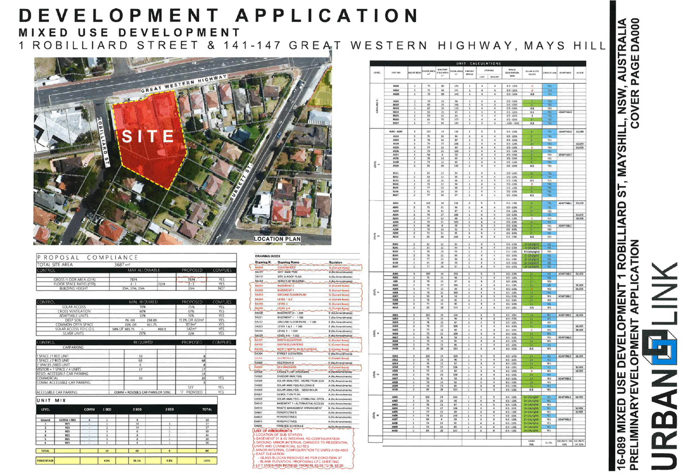
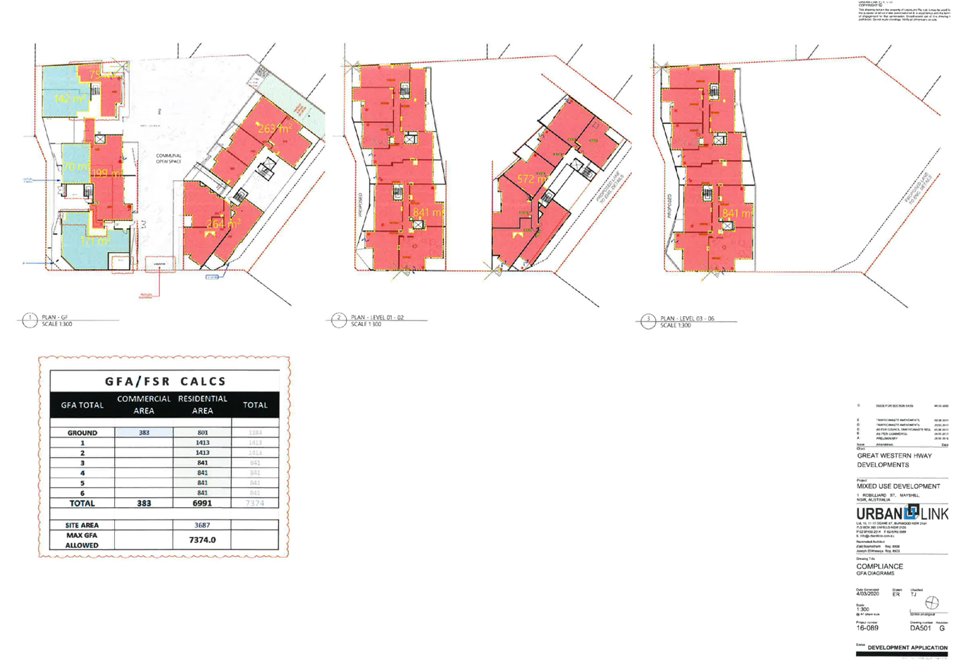
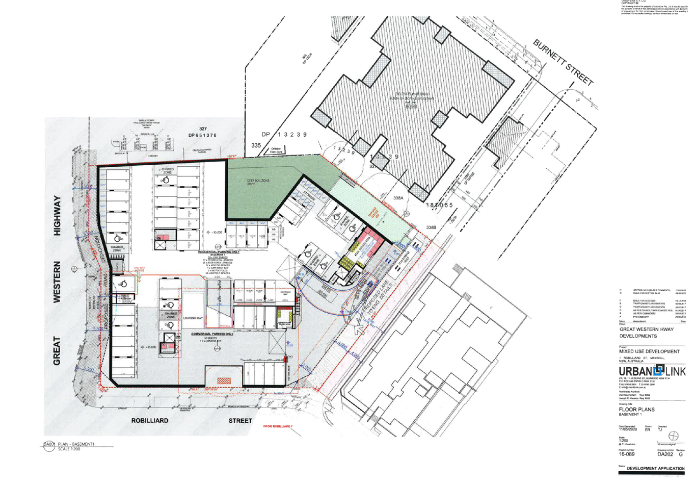
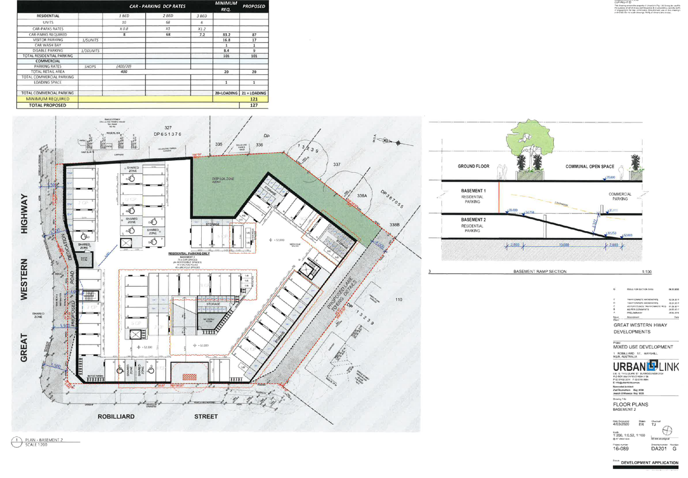
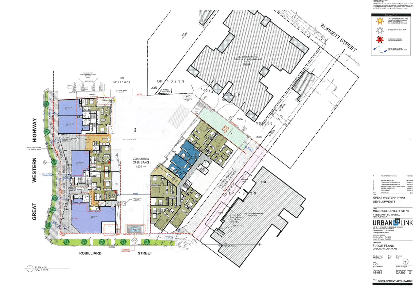
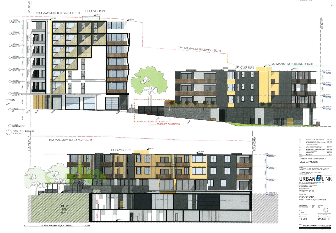
DOCUMENTS
ASSOCIATED WITH
REPORT LPP041/20
Attachment 3
Endeavour Energy Letter of Approval Substation
Cumberland Local Planning Panel Meeting
12 August 2020
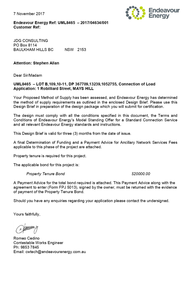

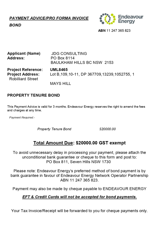
DOCUMENTS
ASSOCIATED WITH
REPORT LPP041/20
Attachment 4
Previous Development Consents
Cumberland Local Planning Panel Meeting
12 August 2020

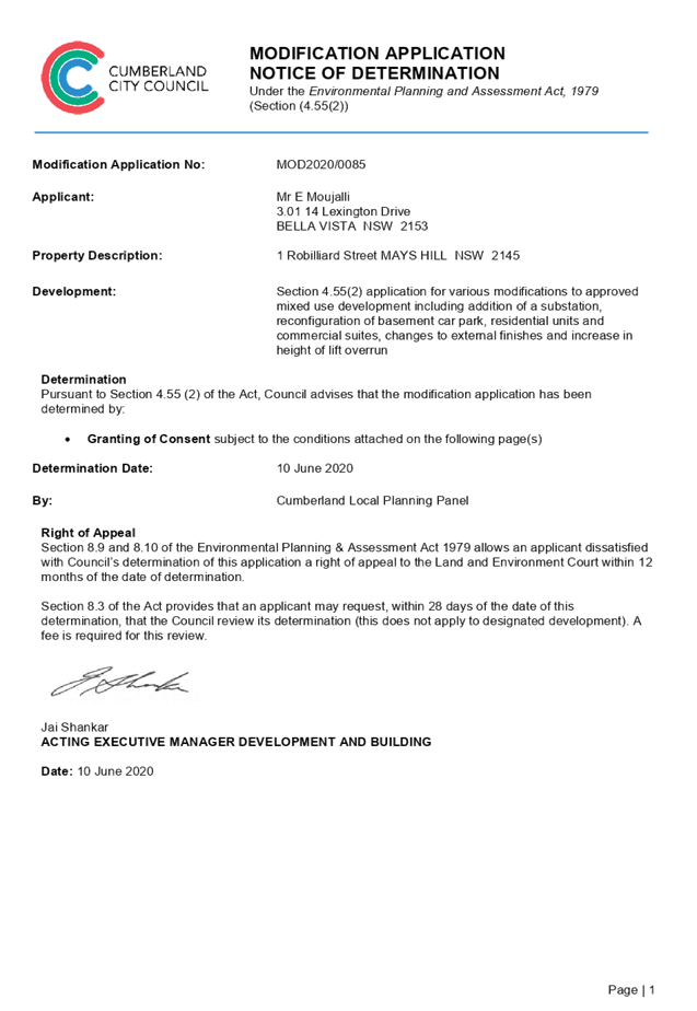
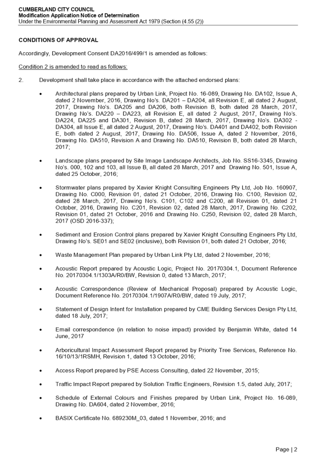
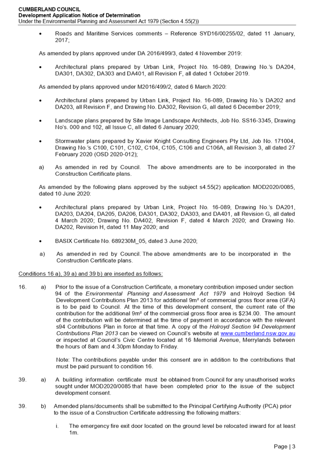
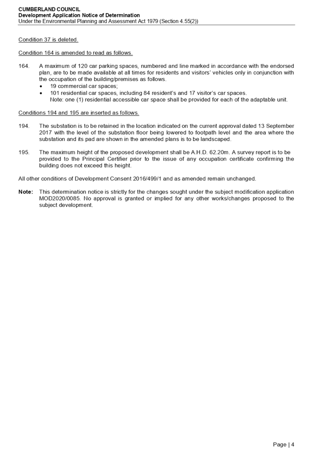
DOCUMENTS
ASSOCIATED WITH
REPORT LPP041/20
Attachment 5
Appendix A - State Environmental Planning Policy No.
65 –Design Quality of Residential Apartment Development
Cumberland Local Planning Panel Meeting
12 August 2020
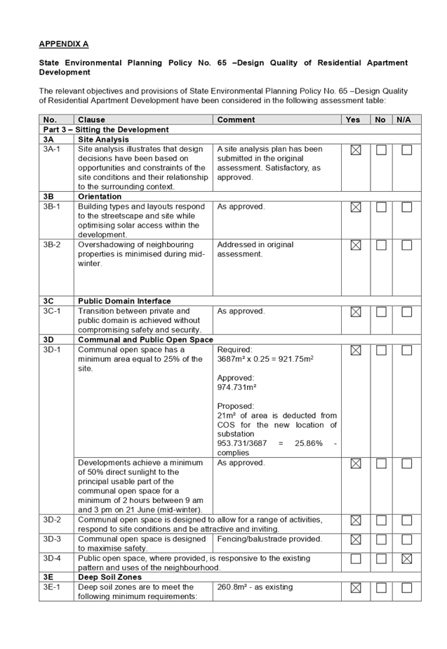
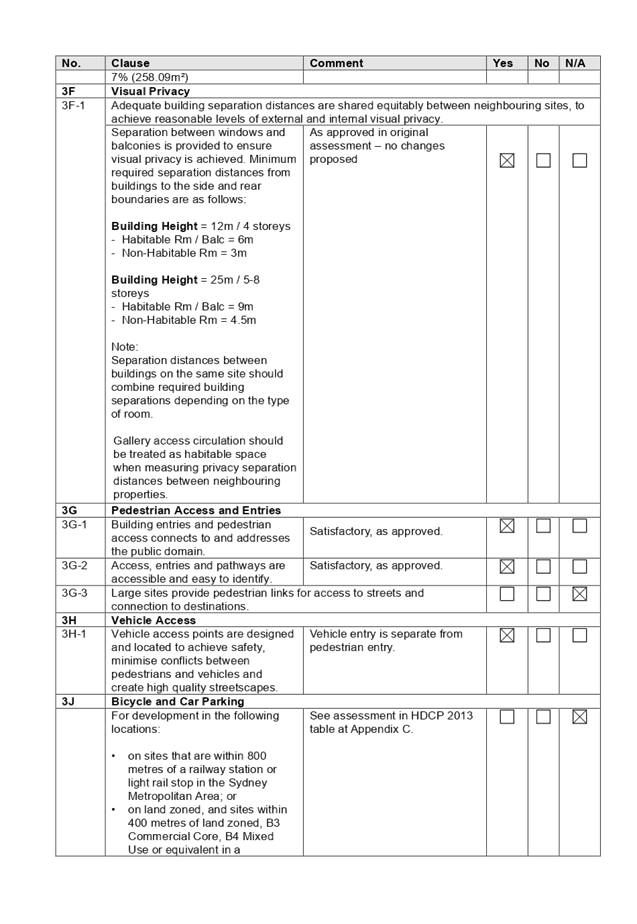
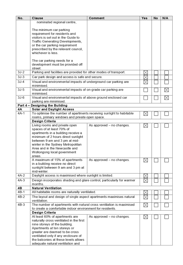
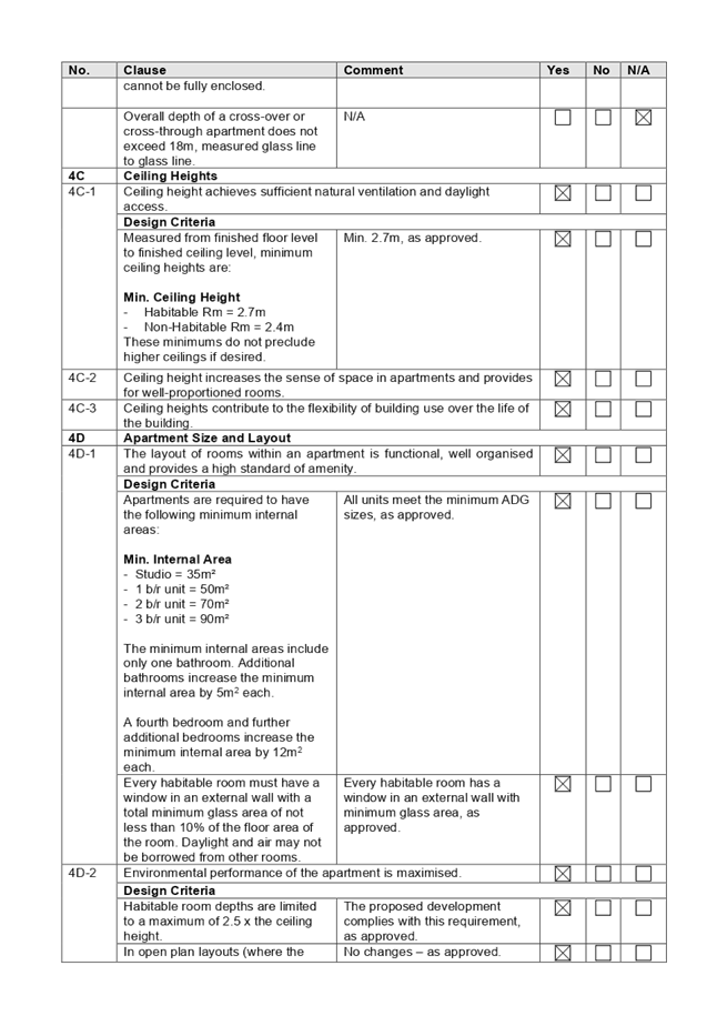
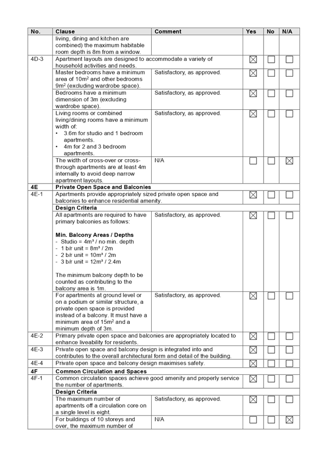
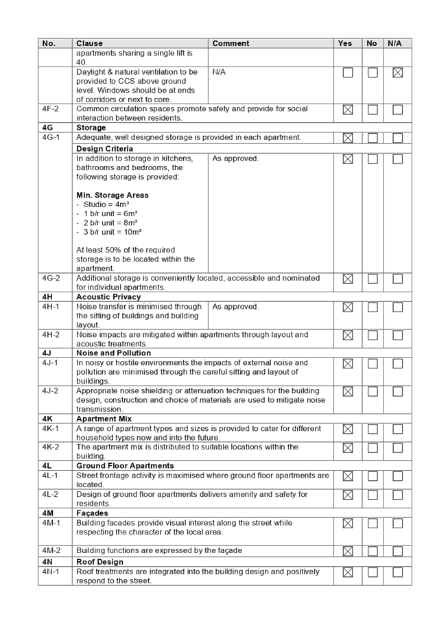
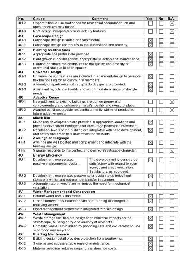
DOCUMENTS
ASSOCIATED WITH
REPORT LPP041/20
Attachment 6
Appendix B - Holroyd LEP 2013
Cumberland Local Planning Panel Meeting
12 August 2020
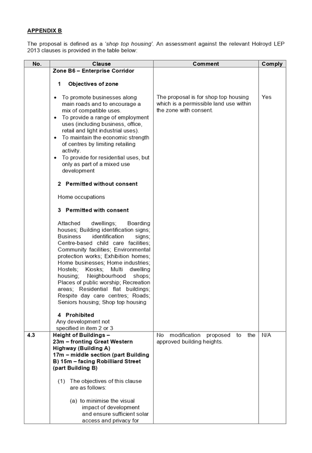
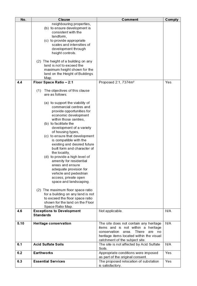

DOCUMENTS
ASSOCIATED WITH
REPORT LPP041/20
Attachment 7
Appendix C - Holroyd Development Control Plan 2013
Cumberland Local Planning Panel Meeting
12 August 2020
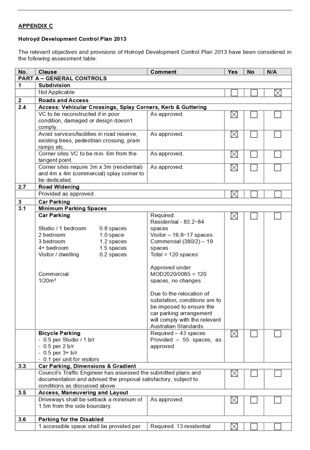
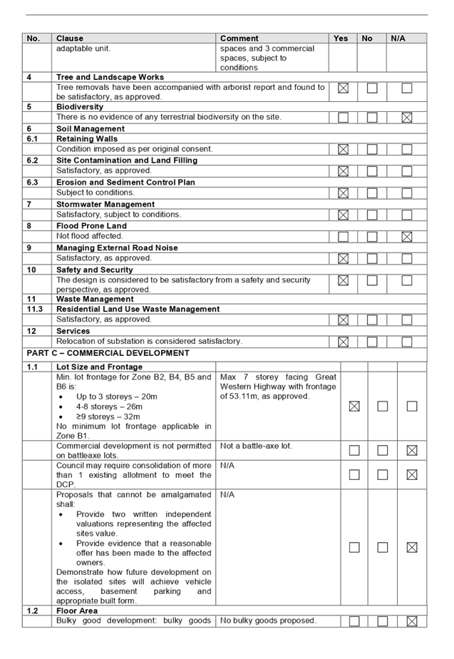
Cumberland
Local Planning Panel Meeting
12 August 2020
Item
No: LPP042/20
Development
Application for 1 Ostend Street, Lidcombe
Responsible
Division: Environment
& Planning
Officer: Executive
Manager Development and Building
File
Number: DA2019/0504
|
Application
lodged
|
19 December 2019
|
|
Applicant
|
Baini Design.
|
|
Owner
|
E & M Family Investments
Pty Ltd.
|
|
Application
No.
|
DA2019/0504.
|
|
Description
of Land
|
1 Ostend Street being Lot 161
in DP 8683.
|
|
Proposed
Development
|
Demolition of existing
structures and construction of a two storey boarding house comprising 12
rooms and at-grade car parking.
|
|
Site
Area
|
613.18 Square metres.
|
|
Zoning
|
Zone R2 Low Density
Residential.
|
|
Disclosure
of political donations and gifts
|
Nil disclosure.
|
|
Heritage
|
Site is not listed as a
heritage item with the Auburn Local Environmental Plan 2010.
|
|
Principal
Development Standards
|
Floor Space Ratio
Permissible: - No floor space
ratio specified.
Proposed: - 0.595:1.
Height of Building
Permissible: - 9 Metres.
Proposed: - 8.2 Metres.
|
|
Issues
|
Submissions
|
1. Development
Application No. DA2019/0504 was received on the 19 December 2019 for the
demolition of existing structures and construction of a two storey boarding
house comprising of 12 rooms and at-grade car parking.
2. The
development application was notified between Tuesday 10 March and Tuesday 7
April 2020. In response, there were 44 submissions to the development including
two petitions containing 18 and 78 signatures respectively.
3. The
variations to the development are:-
|
Part
|
Control
|
Proposed
|
Variation
|
|
Part 2.2
Detached Dwellings and
Dual Occupancy Chapter (ADCP 2010)
|
Site Coverage
D1 Site coverage.
For lots 450m2
or above, the maximum site coverage shall be 65%.
|
466 sq m or 76%.
|
11.1% being 68.6 square
metres.
|
|
Part 3.2
Detached Dwellings and
Dual Occupancy Chapter (ADCP 2010)
|
Landscape setting and
deep soil zone.
D1 Minimum of 30% of the site area
to be a deep soil zone.
D2 Deep soil zone to be a
consolidated area at the rear and extend across at least 50% of the rear
boundary.
|
Deep soil area = 145.6
square metres.
Percentage of site =
23.7%.
No deep soil zone at
rear due to car parking area.
|
38.3 square metres or
26%.
|
4. The
development application is recommended for conditional approval subject to the
conditions as provided in the attached schedule.
5. The
development application is referred to the Panel for determination as the development
is considered to be contentious.
Subject Site and Surrounding
Area
The site is legally described as
Lot 161 in DP 8683 and is known as 1 Ostend Street Lidcombe. The site has two
street frontages with Nicholas Street to the south and Ostend Street to the
east. The area of the site is calculated at approximately 613.18 square metres.
The levels of the land are:
· North
east corner - 17.06 metres AHD.
· North
west corner - 16.2 metres AHD.
· South
east corner - 16.21 metres AHD.
· South
west corner - 15.11 metres AHD.
This provides a fall to the rear
of between 860 mm and 1,100 mm with the lowest level being at the rear south
west corner.
A single storey dwelling house
with an attached awning and an outbuilding is situated on the site. There is a
large liquid amber tree situated at the rear of the site which will require
removal to facilitate the development.
The site is not affected by
flooding or overland flow and there are no heritage listed items situated close
to the site.
The site is within a residential
area of Lidcombe with single storey and two storey dwelling houses
predominating.
A public park and playing fields
is situated on land on the southern side of Nicholas Street which is land zoned
as RE1 (Public Recreation). The land is known as Phillips Park which is managed
by Council.
The location of the site is shown
below.
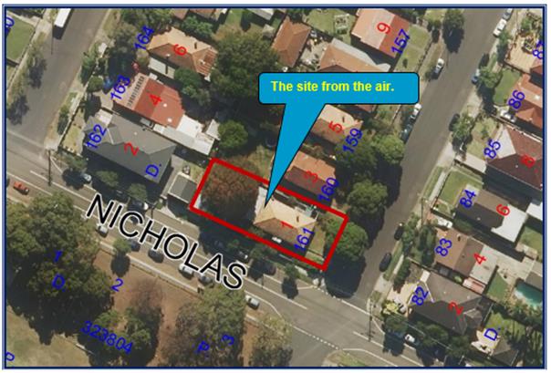
Photos of the site are provided
below.
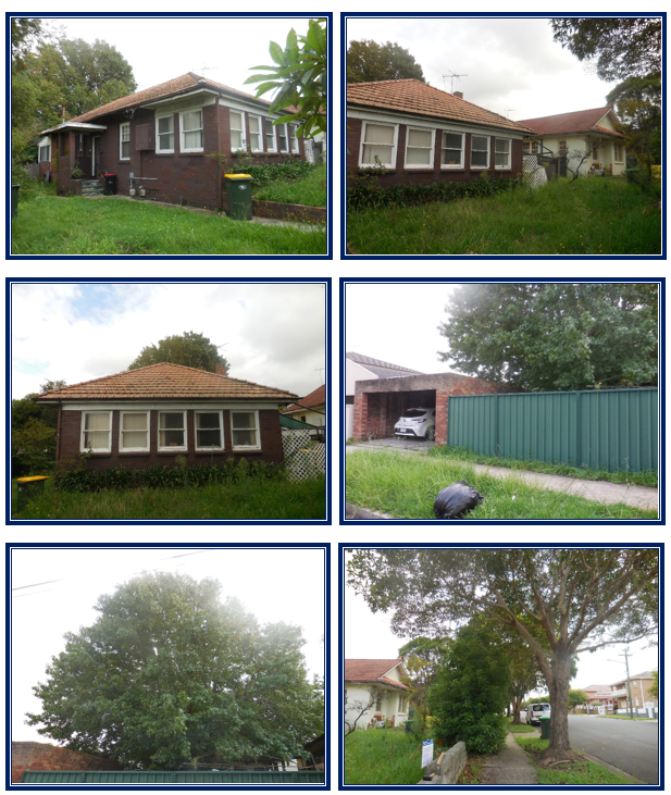
Description of the Proposed
Development
Development Application Number
2019/0504 is proposing the demolition of the existing dwelling house and
construction of a two storey boarding house comprising of twelve rooms with at
grade car parking for six (6) vehicles, on site landscaping and storm water
engineering works. The development has the following components.
Demolition work
The existing dwelling house,
awning and outbuilding will be demolished. In addition, a large liquid amber
tree within the rear yard of the property will also be removed to facilitate
the development.
Ground Floor
The ground floor of the building
is provided with the following features:-
· Five
(5) boarding rooms, a common room and a corridor.
· A
car park for six (6) vehicles with vehicle access from Nicholas Street.
First floor
The first floor comprises of seven
(7) boarding rooms including an internal corridor.
Total number of rooms
There are twelve (12) rooms in
total with six (6) of the rooms being provided for single people and six (6) of
the rooms being provided for couples. As such, this would provide short term
accommodation for eighteen (18) boarders.
History
Following a pre lodgement meeting
on November 7 2019 and the issue of pre lodgement notes on November 14 2019,
the applicant lodged the development application for the demolition of existing
structures and construction of a two storey boarding house comprising of 12
rooms and at-grade car parking on December 19 2019 for determination.
The development application was
notified for a period of twenty eight (28) days between Tuesday 10 March and
Tuesday 7 April 2020. In response, there were 44 submissions to the development
including two petitions containing 18 and 78 signatures respectively.
Applicants Supporting
Statement
The applicant has provided a
Statement of Environmental Effects prepared by Think Planners and dated 16
December 2019.
Contact with Relevant
Parties
The assessing officer has
undertaken a site inspection of the subject site and surrounding properties and
has been in regular contact with the applicant throughout the assessment
process.
Internal Referrals
Development Engineer
The development application was
referred to Council’s Development Engineer for comment who has advised
that the development proposal is generally satisfactory subject to conditions.
Matters raised concerning the vehicle manoeuvring area for car space Number 6,
stormwater drainage and driveway access shall be satisfied to subject to
submission of amended plans to the Principal Certifying Authority.
Environment and Health
The development application was
referred to Council’s Environmental Health Officer for comment who has
advised that the development proposal is satisfactory subject to conditions.
Landscape
Council’s Tree Management
Officer gave initial advice at the pre lodgement stage raising no objection to
the removal of the tree being a Liquid Amber species. As such, no formal
referral was required as part of the development application assessment
process.
External Referrals
Auburn Area Police Command
The development application was
referred to the Crime Prevention Officer for assessment. As per the comments of
Thursday 25 June 2020, there are no objections to the development subject to
conditions. Comments and conditions relevant to the development include the
following:
· Lighting.
· Use
of closed circuit television cameras on site.
· Signage.
· Landscaping.
· Fire
and safety measures.
· House
rules.
· Site
management.
Appropriate conditions addressing
the relevant matters are to be incorporated into any consent that may be
issued.
Energy Australia and Endeavour
Energy
The development application was
referred to both Energy Australia and Endeavour Energy because there will be
works within proximity to an overhead power line. Council officers did not
receive any response from either energy provider since the referral was made on
18 February 2020. Given that more than 21 days have lapsed since the referral
was made as per the requirements of Clause 45(1)(b)(iii) of State Environmental
Planning Policy “Infrastructure” 2007, it is concluded that there
are no objections to the development that is sought.
Planning Comments
The provisions of any
Environmental Planning Instruments (EP&A Act s4.15 (1)(a)(i))
State Environmental Planning
Policies
The proposed development is
affected by the following State Environmental Planning Policies:
(a) State
Environmental Planning Policy No. 55 - Remediation of Land
The requirement at clause 7 of
SEPP No. 55 for Council to be satisfied that the site is suitable or can be
made suitable to accommodate the proposed development has been considered in the
following table:
|
Matter for Consideration
|
Yes/No
|
|
Does the application involve re-development of the site or
a change of land use?
|
Yes
No
|
|
Is the development going to be used for a sensitive land
use (eg: residential, educational, recreational, childcare or
hospital)?
|
Yes
No
|
|
Does information available to you indicate that an
activity listed below has ever been approved, or occurred at the site?
acid/alkali plant and
formulation, agricultural/horticultural activities, airports, asbestos
production and disposal, chemicals manufacture and formulation, defence
works, drum re-conditioning works, dry cleaning establishments, electrical
manufacturing (transformers), electroplating and heat treatment premises,
engine works, explosive industry, gas works, iron and steel works, landfill
sites, metal treatment, mining and extractive industries, oil production and
storage, paint formulation and manufacture, pesticide manufacture and
formulation, power stations, railway yards, scrap yards, service stations,
sheep and cattle dips, smelting and refining, tanning and associated trades,
waste storage and treatment, wood preservation
|
Yes
No
|
|
Is the site listed on
Council’s Contaminated Land database?
|
Yes
No
|
|
Is the site subject to EPA
clean-up order or other EPA restrictions?
|
Yes
No
|
|
Has the site been the subject of
known pollution incidents or illegal dumping?
|
Yes
No
|
|
Does the site adjoin any
contaminated land/previously contaminated land?
|
Yes
No
|
|
Details of contamination investigations carried out at the
site:
A preliminary site investigation report prepared by GCA
Australia and dated 12 December 2019 (Reference E19106-1) has identified that
the potential for significant contamination is not high. The site is suitable
for the proposed development.
Council’s Environmental officers have advised that a
hazardous materials survey report should be undertaken by a suitably
qualified person and submitted to the satisfaction of the certifier with a
copy provided to Council. The report is required to identify and record the
type, location and extent of any hazardous materials on the site and make
recommendations as to the safe management and or removal to ensure the site
is safe for demolition, construction and future use / occupation.
An appropriate condition is provided addressing
environment and health matters.
|
|
Has the appropriate level of
investigation been carried out in respect of contamination matters for
Council to be satisfied that the site is suitable to accommodate the proposed
development or can be made suitable to accommodate the proposed development?
|
Yes
No
|
(b) State
Environmental Planning Policy (Infrastructure) 2007 (ISEPP)
As specified above, the development
application was referred to the relevant energy provider because there will be
works within proximity to an overhead power line and as such, Clause
45(1)(b)(iii) of the State Policy will apply. Council officers did not receive
any response from either energy provider since the referral was made on
February 18 2020. Given that more than 21 days have lapsed since the referral
was made as per the requirements of the clause, it is considered that there are
no objections to the development that is sought.
(c) State
Environmental Planning Policy (Vegetation in Non-Rural Areas) 2017
The proposal does not exceed the
biodiversity offsets scheme threshold. Therefore, the proposed vegetation
removal is considered acceptable.
The development application includes
the removal of a liquid amber tree within the rear yard of the property. The
removal of the tree is acceptable as it is not a native species and not a tree
worthy of retention.
(d) State
Environmental Planning Policy (Building Sustainability Index: BASIX) 2004
The BASIX Certificate shows that
the development achieves a score of 40 and 50 for water and energy which is a
pass mark for both components. Generally, the BASIX Certificate is satisfactory
for approval. The assessment of the certificate is at Appendix (A) attached to
the report.
(e) State
Environmental Planning Policy “Affordable Rental Housing” 2009
The relevant objectives and
provisions of the ARHSEPP 2009 has been considered in the assessment of the
development application and the proposal is considered to be generally
consistent with the boarding house provisions under Division 3 of the plan. It
is identified that the development site is not within an accessible area as
defined by the State Environmental Policy. In this regard, the site is located
1.05 km from the Lidcombe Railway Station (Direct) or 1.36 km by road taking
the shortest distance and the site is within zone R2 Low Density Residential.
Under Clause 27 of the State
Policy, Clause 29, 30 and 30A do not apply to developments on land within Zone
R2 Low Density Residential or within a land use zone that is equivalent to that
zone in the Sydney region unless the land is within an accessible area. As
such, Council’s local planning controls will apply. A comprehensive
assessment has been undertaken and is provided in the compliance table below.
|
Requirement
|
Yes
|
No
|
N/A
|
Comment
|
|
Division 3 Boarding houses
25 Definition
In this Division:
communal living room means a room within a
boarding house or on site that is available to all lodgers for recreational
purposes, such as a lounge room, dining room, recreation room or games room.
|
|
|
|
A communal room is provided on
the ground level adjacent to Room Number 02 and 03.
|
|
26 Land to which Division applies
This Division applies to land within any of the following
land use zones or within a land use zone that is equivalent to any of those
zones:
(a) Zone R1 General Residential,
(b) Zone R2 Low Density Residential,
(c) Zone R3 Medium Density Residential,
(d) Zone R4 High Density Residential,
(e) Zone B1 Neighbourhood Centre,
(f) Zone B2 Local Centre,
(g) Zone B4 Mixed Use.
|
|
|
|
The site is within zone R2 Low
Density Residential which permits boarding houses.
|
|
27 Development
to which Division applies
(1) This Division applies
to development, on land to which this Division applies, for the purposes of
boarding houses.
(2) Despite subclause
(1), clauses 29, 30 and 30A do not apply to development on land within Zone
R2 Low Density Residential or within a land use zone that is equivalent to
that zone in the Sydney region unless the land is within an accessible area.
(3) Despite subclause (1), clauses 29, 30
and 30A do not apply to development on land within Zone R2 Low Density
Residential or within a land use zone that is equivalent to that zone that is
not in the Sydney region unless all or part of the development is within 400
metres walking distance of land within Zone B2 Local Centre or Zone B4 Mixed
Use or within a land use zone that is equivalent to any of those zones..
|
|
|
|
The development is proposed on
land zoned R2 Low Density Residential. It is identified that the site is not
located within an accessible area. As such, the Division cannot apply to the
development and Council’s local planning controls will need to apply.
In this regard, the site is
located 1.05 km from the Lidcombe Railway Station (Direct) or 1.36 km by road
taking the shortest distance).
|
|
28 Development
may be carried out with consent
Development to which this
Division applies may be carried out with consent.
|
|
|
|
Development consent is sought
for the boarding house.
|
|
29 Standards
that cannot be used to refuse consent
(1) A consent authority must
not refuse consent to development to which this Division applies on the
grounds of density or scale if the density and scale of the buildings when
expressed as a floor space ratio are not more than:
(a) the
existing maximum floor space ratio for any form of residential accommodation
permitted on the land, or
(b) if
the development is on land within a zone in which no residential
accommodation is permitted—the existing maximum floor space ratio for
any form of development permitted on the land, or
(c) if
the development is on land within a zone in which residential flat buildings
are permitted and the land does not contain a heritage item that is
identified in an environmental planning instrument or an interim heritage
order or on the State Heritage Register—the existing maximum floor
space ratio for any form of residential accommodation permitted on the land,
plus:
(i) 0.5:1,
if the existing maximum floor space ratio is 2.5:1 or less, or
(ii) 20%
of the existing maximum floor space ratio, if the existing maximum floor
space ratio is greater than 2.5:1.
|
|
|
|
Note: The site is not within an
accessible area and as such, Clause 29 does not apply to the development.
A detailed assessment under
Clause 29 is not required although it can be used to guide the development.
The applicant has used the Clause to prepare the plans.
There is no floor space ratio
requirement for the site. The floor space ratio of the development is
calculated at 365.2 square metres or 0.595:1 which is acceptable.
|
|
(2) A consent authority
must not refuse consent to development to which this Division applies on any
of the following grounds:
(a) building
height
if the building height of all proposed buildings is not more than the
maximum building height permitted under another environmental planning
instrument for any building on the land,
(b) landscaped
area
if the landscape treatment of the front setback area is compatible with the
streetscape in which the building is located,
(c) solar
access
where the development provides for one or more communal living rooms, if at
least one of those rooms receives a minimum of 3 hours direct sunlight
between 9am and 3pm in mid-winter,
(d) private
open space
if at least the following private open space areas are provided (other
than the front setback area):
(i) one
area of at least 20 square metres with a minimum dimension of 3 metres is
provided for the use of the lodgers,
(ii) if
accommodation is provided on site for a boarding house manager—one area
of at least 8 square metres with a minimum dimension of 2.5 metres is
provided adjacent to that accommodation,
(e) parking
if:
(i) in the case of development carried out by or on behalf of
a social housing provider in an accessible area—at least 0.2 parking
spaces are provided for each boarding room, and
(ii) in the
case of development carried out by or on behalf of a social housing provider
not in an accessible area, at least 0.4 parking spaces are provided for each
boarding room, and
(iia) in
the case of development not carried out by or on behalf of a social housing
provider—at least 0.5 parking spaces are provided for each boarding
room, and
(iii) in
the case of any development—not more than 1 parking space is provided
for each person employed in connection with the development and who is
resident on site,
(f) accommodation
size
if each boarding room has a gross floor area (excluding any area used for the
purposes of private kitchen or bathroom facilities) of at least:
(i) 12
square metres in the case of a boarding room intended to be used by a single
lodger, or
(ii) 16
square metres in any other case.
|
|
|
|
The building has a height of
8.2 metres which is satisfactory.
Landscaping at the front is
compatible with the streetscape.
The common room is placed
within the rear south west portion of the building and is provided with a
rear glazed door to allow sunlight penetration into the floor area.
Additionally, the allotment of land is angled at a north west / south east
angle and as a result, sunlight penetration would occur for much of the year
from the window. The common room is oriented towards the common open
space area and given the outlook offered, the room would be receiving
adequate light and sunlight penetration.
A private open space area
occupying 21.5 square metres is located along the Nicholas Street frontage
which will require fencing to a height of 1.8 metres. This is addressed as a
condition for the Panel consideration.
A boarding house manager is not
required as the total number of occupants is not expected to exceed eighteen
(18).
Car parking.
The
development is not within an accessible area. The number of parking spaces
required for the proposed development is 12 x 0.5 spaces. A boarding house
manager is not required as the number of occupants is less than 20. As such,
the total number of car parking spaces required is six (6).
The
plans show 6 car parking spaces being provided.
The gross floor area for each
boarding room (excluding any area used for the purposes of private kitchen or
bathroom facilities) exceed 16 square metres for the double rooms and 12
metres for the single rooms.
Generally, the rooms have
satisfactory sizes.
|
|
(3) A boarding house may
have private kitchen or bathroom facilities in each boarding room but is not
required to have those facilities in any boarding room.
(4) A consent authority
may consent to development to which this Division applies whether or not the
development complies with the standards set out in subclause (1) or (2).
|
|
|
|
All boarding rooms are proposed
to contain open plan kitchenette arrangement and private bathroom facilities.
The proposed development
complies with the standards.
|
|
30 Standards
for boarding houses
(1) A consent authority must not consent to
development to which this Division applies unless it is satisfied of each of
the following:
(a) if a boarding house has 5 or more boarding
rooms, at least one communal living room will be provided,
(b) no boarding room will have a gross floor
area (excluding any area used for the purposes of private kitchen or bathroom
facilities) of more than 25 square metres,
(c) no boarding room will be occupied by more
than 2 adult lodgers,
(d) adequate bathroom and kitchen facilities
will be available within the boarding house for the use of each lodger,
(e) if the boarding house has capacity to
accommodate 20 or more lodgers, a boarding room or on site dwelling will be
provided for a boarding house manager,
(f) (Repealed)
(g) if the boarding house is on land zoned
primarily for commercial purposes, no part of the ground floor of the
boarding house that fronts a street will be used for residential purposes
unless another environmental planning instrument permits such a use,
(h) at least one parking space will be provided
for a bicycle, and one will be provided for a motorcycle, for every 5
boarding rooms.
(2) Subclause (1) does
not apply to development for the purposes of minor alterations or additions
to an existing boarding house.
|
|
|
|
Note: The site is not within an
accessible area and as such, Clause 30 cannot apply to the development.
A detailed assessment under
Clause 30 is not required although can be used to guide the development. The
applicant has used the Clause to prepare the plans. The following is
provided.
There are 12 boarding rooms
proposed. Accordingly, a minimum of one communal room is provided.
All the rooms have areas of
less than 25 square metres.
No more than 2 lodgers per
boarding room is proposed.
Each boarding room contains a
kitchenette and bathroom.
The boarding house has the
capacity to accommodate a maximum of 18 lodgers. Accordingly, a boarding room
for a boarding house manager is not required.
The number of parking spaces
required for a bicycle = 3 and number of parking spaces required for a
motorcycle = 3.
The plans show 3 motor bike
spaces and 3 spaces suitable for bikes.
|
|
30AA Boarding Houses in
zone R2 Low Density Residential
A
consent authority must not grant development consent to a boarding house on
land within Zone R2 Low Density Residential or within a land use zone that is
equivalent to that zone unless it is satisfied that the boarding house has no
more than 12 boarding rooms.
|
|
|
|
The Boarding house has a maximum
of twelve (12) rooms.
|
|
30A Character
of local area
A consent authority must not
consent to development to which this Division applies unless it has taken
into consideration whether the design of the development is compatible with
the character of the local area.
|
|
|
|
The site is not within an
accessible area and as such, Clause 30A cannot apply to the development.
Notwithstanding this, the applicant has considered Clause 30A which is
addressed below.
Applicants comments
(Existing character)
The built form character within
the immediate locality comprises of older style single storey dwellings
interspersed with larger more modern two storey dwellings of mixed ages and
architectural style.
There are larger two storey
modern dwelling houses along Ostend Street such as 13 Ostend Street and 16
Ostend Street.
The boarding house is designed
to appear as a large two storey dwelling house in order to be compatible with
the existing built character and pattern of the locality.
The development adopts the same
built form, scale and appearance as surrounding developments.
The development complies with
the height provisions and complies with the setback control for dwelling
houses. There is minimal over shadowing to adjoining properties with most
shadows falling onto the roadway. The adjoining properties retain adequate
solar access at midwinter. Privacy is satisfactory and noise impacts are
reduced by siting the internal common area and external open space away from
neighbouring properties.
The development achieves
adequate separation between other developments and the landscaping softens
the built form of the development.
The development does not constrain
adjoining allotments of land.
The development is compliant
with the setback controls for dwelling houses under the Auburn Development
Control Plan 2010.
Planners Comments
The development:-
· Has a height
that is no greater than 8.2 metres being consistent with a two storey
dwelling house. The height is consistent with the Auburn Development Control
Plan 2010 “Detached Dwellings and Dual Occupancy” chapter.
· The development
takes the form of a dwelling house and thus will fit the streetscape. In this
regard, an entrance feature, hipped roof form and position of front windows
is consistent with that found on a dwelling house.
· The street and
side setbacks are consistent with the Auburn Development Control Plan 2010
“Detached Dwellings and Dual Occupancy” chapter.
· There are no
shadowing issues that requires further review.
· Privacy is
satisfactory and there are no first storey balconies within the development.
· The size of the
building with a floor space ratio of (0.595:1) is consistent with the size of
a large dwelling house.
· The character of
the development fits the current and expected future built form of the
locality.
Overall, it is considered that
the development is compliant with Clause 30A notwithstanding the fact that
Clause 30A does not apply.
|
|
Part 4 Miscellaneous
52 No
subdivision of boarding houses
A consent authority must not
grant consent to the strata subdivision or community title subdivision of a
boarding house.
|
|
|
|
No subdivision is proposed as
part of this application. This will be reinforced as a condition on any
consent issued.
|
Regional Environmental Plans
(a) Sydney
Regional Environmental Plan (Sydney Harbour Catchment) 2005
The site is located within the
area within the Sydney Harbour Catchment and SREP (Sydney Harbour Catchment)
2005 is applicable to the development application. The development application
raises no issues as to consistency with the requirements and objectives of the
policy or the associated Development Control Plan.
Local Environmental Plans
The Auburn Local Environmental
Plan 2010 is applicable to the development site. It is identified that the
development achieves compliance with the key statutory requirements of the
Auburn Local Environmental Plan 2010 and the objectives of the R2 Low Density
Residential zone.
(a) Permissibility:-
The proposed development is defined
as a boarding house which is permitted with consent within the R2 Low Density
Residential zone.
The relevant matters to be
considered under the Auburn Local Environmental Plan 2010 are summarised below.
A comprehensive assessment is attached at Appendix C.
|
DEVELOPMENT
STANDARD
|
COMPLIANCE
|
DISCUSSION
|
|
4.3 Height of Buildings
9 metres.
|
Yes
|
The boarding house has a height that does not exceed 8.2
metres.
|
|
4.4 Floor
Space Ratio
Not specified for the site.
|
N/A
|
The floor space ratio of the development is calculated at
365.2 square metres or 0.595:1.
|
(b) Clause
4.6 Variation to a development standard
A Clause 4.6 variation is not
required for the development that is proposed.
The provisions of any proposed
instrument that is or has been the subject (EP&A Act s4.15 (1)(a)(ii))
(a) Draft
Cumberland Local Environmental Plan 2020
The Draft Cumberland Local
Environmental Plan 2020 (Draft CLEP) has been prepared by Cumberland City
Council to provide a single planning framework for the future planning of
Cumberland City. The changes proposed seek to harmonise and repeal the three
existing LEPs currently applicable to the Cumberland local government area,
those being:
· Holroyd
Local Environmental Plan 2013;
· Parramatta
Local Environmental Plan 2011; and
· Auburn
Local Environmental Plan 2010.
The current planning controls for
the subject site, as contained within the ALEP 2010, are not proposed to change
under the Draft CLEP.
The provisions of any
Development Control Plans (EP&A Act s4.15 (1)(a)(iii))
Auburn Development Control Plan
2010
The Auburn Development Control
Plan 2010 (Detached Dwellings and Dual Occupancy Chapter) is relevant to the
development application. However, there are no specific provisions addressing
boarding houses. The relevant provisions can be used to guide the assessment of
the development but generally, a merit assessment will need to be made where
appropriate. A comprehensive assessment is provided at Appendix C attached to
the report.
The following table highlights the
variations identified which relates primarily to site coverage and deep soil
zones.
|
Part
|
Control
|
Proposed
|
Complies
|
|
Part 2.2
|
Site Coverage
D1 Site
coverage
· For
lots 450m2 or above, the maximum site coverage shall be 65%.
D2 The
non-built upon area shall be landscaped and used for open space.
|
Site Coverage = 466 square metres or 76%. There is a
variation of 11.1 percentage points being 68.6 square metres.
|
No
|
|
Part 3.2
|
Landscape setting and deep soil zone
D1 A
minimum of 30% of the site area shall be a deep soil zone.
D2 The
majority of the deep soil zone shall be provided as a consolidated area at
the rear of the building and shall extend across at least 50% of the rear
boundary.
|
Deep soil area = 145.6 square metres.
Percentage of site = 23.7%.
There is a variation of 6.4 percentage points being 38.3
square metres or 26%.
There is no deep soil zone at the rear due to the presence
of a car park.
|
No
No
|
As indicated in the compliance
table above, the proposed development departs from Part 2.2 (Subpart D1) and
Part 3.2 (Subpart D1 and D2) relating to site coverage and deep soil zone. The
three are connected and the cause of the variations are related to the need to
provide a car park on site to service a boarding house.
Should there be no car park, the
applicant would be able to comply with all three provisions. In terms of the
variations, the following is relevant to the application:-
· An
onsite car park is required to support the development which forms part of the
servicing of the site. This essential requirement along with manoeuvring areas
will consume crucial land area. As such, it is not feasible to meet the 65%
site coverage requirement or the provisions under Part 3.2.
· The
development takes the form of a two storey dwelling house with the building
being consistent with the streetscape setting.
· The
front setback and much of the southern site setback comprises landscaping and
deep soil zone which is consistent with the streetscape.
· A
basement car park could be constructed on site however vehicle access to such a
structure would be limited to the rear western portion of the property. This
would isolate a portion of the site and would not be an efficient use of the
land. As such, this has not been pursued.
Notwithstanding the above, it is
identified that it is possible to reduce two of the variations to more
acceptable levels. In this regard, a small area 1.4 metres wide along the northern
side of the property between the building and fence line is identified as being
unused space. It would be possible to provide a pebble type finish along this
area which would reduce site coverage by 23.5 square metres and result in the
following:-
· Reducing
the site coverage variation under Part 2.2 (Subpart D1) to 442 square metres or
72% (Down from 466 square metres or 76%).
· Increasing
the amount of deep soil zone on site (Must be 900 mm wide) under Part 3.2
(Subpart D1) from 23.7% to 27.5% being an increase to 169 square metres.
An appropriate condition is
included in the condition set for amended plans to be provided to Principal
Certifying Authority for final approval.
Parking and Loading
It is identified by
Council’s Development Engineers that a change to car space Number 6 will
be required to improve the manoeuvring area for that space. Council’s
Development Engineers are of the opinion that this is capable of being
addressed by amending the gradient of the driveway so that the gradient of the
driveway is consistent with the gradient of the car space.
Council Development Engineers have
provided appropriate conditions addressing the car park layout and manoeuvring
areas.
The provisions of any planning
agreement that has been entered into under section 7.4, or any draft planning
agreement that a developer has offered to enter into under section 7.4
(EP&A Act s4.15(1)(a)(iiia))
There is no draft planning
agreement associated with the subject Development Application.
The provisions of the Regulations
(EP&A Act s4.15 (1)(a)(iv))
The proposed development raises no
concerns as to the relevant matters arising from the Environmental Planning and
Assessment Regulations 2000 (EP&A Reg).
The Likely Environmental,
Social or Economic Impacts (EP&A Act s4.15 (1)(b))
It is considered that the proposed
development will have no significant adverse environmental, social or economic
impacts in the locality other than what has been discussed within the locality.
The suitability of the site for
the development (EP&A Act s4.15 (1)(c))
The subject site and locality is
not known to be affected by any natural hazards or other site constraints
likely to have a significant adverse impact on the proposed development.
Accordingly, it is considered that the development is suitable in the context
of the site and surrounding locality.
Submissions made in accordance
with the Act or Regulation (EP&A Act s4.15 (1)(d))
Advertised (newspaper) Mail Sign Not
Required
In accordance with Council’s
Notification requirements contained within the Auburn Development Control Plan
2010, the development application was notified for a continuous period of
twenty eight (28) days between Tuesday 10 March and Tuesday 7 April 2020. In
response, there were 44 unique submissions to the development including two
petitions containing 18 and 78 signatures respectively. The submissions and
objections are addressed below.
A - Permissibility and
relationship to the locality
|
Issues
|
Planners comment
|
|
1.
A boarding house is a commercial development which is prohibited within the
low density residential area (The R2 zone).
|
A boarding house is not a commercial development. Such a
development is permitted with consent under the Auburn Local Environmental
Plan 2010. Additionally, such developments are permitted by virtue of Clause
26 of State Environmental Planning Policy “Affordable Rental
Housing” 2009.
|
|
2. The
development does not comply with State Environmental Planning Policy
Affordable Rental Housing 2009 and the development is not within an
accessible area. The boarding house must be refused
|
The comments are noted and while
the site is not within an accessible area, the development is still permitted
with consent. The development has been assessed using the relevant planning
controls that apply to the site and determined as being satisfactory.
|
|
3. The
developer is justifying the development because the Auburn Development
Control Plan does not contain specific provisions for boarding houses. This
is an abuse of process. A boarding house must be assessed under the Auburn
Development Control Plan as a “dwelling” and must comply with the
stated provisions.
|
The development is assessed as a
boarding house which is defined by the Auburn Local Environmental Plan 2010.
The relevant provisions of State
Environmental Planning Policy “Affordable Rental Housing” 2009
has been used and the Auburn Development Control Plan “Detached
Dwellings and Dual Occupancy” provisions have been used where possible.
It is not possible to apply all the provisions because a dwelling house is
not proposed.
|
|
4. The
development is not appropriate and is incompatible with the local character
of the area. All houses in the street are single storey thus building a 12
room boarding house is inappropriate.
|
It is considered that the
development is compatible with the locality. The development takes the form
of a two storey dwelling house which is consistent with other two storey
dwelling houses within the locality.
|
|
5. The
proposal is designed as a high density development which is not permitted.
Furthermore, this is an overdevelopment of the site and Lidcombe has become
one of the densest areas in Sydney to live.
Any boarding house with double
digit occupants is not considered small. The average family has 2.6 people.
The boarding house is the equivalent of 6.9 families living within one
building. This leads to the assumption that this is a large boarding house
which will result in overcrowding.
|
A boarding house with a maximum
of twelve (12) rooms is a permitted form of development on site. The
development is compliant with Clause 30AA of State Environmental Planning
Policy Affordable Rental Housing specific to size. The development is
considered to fit the streetscape, density controls and site conditions.
|
|
6. There
are too many bedrooms for the proposed building house and there is no house
in the street with so many bedrooms. The maximum number of bedrooms permitted
is four within the R2 zone. Additionally, the development is twice the size
of an average of any two free standing dwellings or duplexes existing within
the street.
|
The development has a maximum of
twelve (12) rooms which is permitted under Clause 30AA of State Environmental
Planning Policy Affordable Rental Housing. Generally, the proposed intensity
of use subject to conditions is determined as being acceptable for the site.
|
|
7. There
have been a number of boarding houses approved within the local area and we
have had our fair share of such developments. There is no need for such a
development because there are no universities or colleges within the area.
Residents are furious because the local streets are being thrown into
jeopardy due to greed.
|
Boarding houses are a
permissible development in various land use zones within the local government
area. The number and separation distances between boarding houses is not a
matter for consideration under S79c of the Environmental Planning and
Assessment Act 1979.
An assessment of the development
application identifies that the development may be supported subject to
submission and approval of amended plans to the Principal Certifying
Authority.
|
B - Traffic and Parking issues
|
Issues
|
Planners Comment
|
|
1. There
have been multiple accidents on corner of Ostend Street and Nicholas Street including
one where a pedestrian was hit by a vehicle.
|
There is no evidence available to suggest that the
development will contribute to an increase in vehicle accidents at the street
corner.
|
|
2. The
streets are congested with vehicles and there is nowhere to park a car. Further,
the site is too close to Parramatta Road, the M4 Motorway which intensifies
traffic congestion.
There
will be too many cars coming in and out of the development making it
dangerous for residents. The street will become congested and there is
inadequate car parking provided for the development.
|
The site provides for the
required number of car parking spaces to service the development.
Further, the site is situated at
least 600 metres from Parramatta Road and the M4 Motorway and thus traffic
congestion and or noise from Parramatta Road or the M4 is not an issue for
this development.
|
|
3. The
motorcycle parking area is too close to the fence that will cause noise
pollution. Further, the three bike parking bays within the front yard are not
suitably located. The bikes could be stolen.
|
There are two motorcycle parking
bays at the south west corner of the site adjacent to the vehicle entry
point. The dwelling house at 2 Mons Street is provided with a freestanding
garage adjacent to its eastern boundary which will buffer any noise being
generated from a motor bike to the dwelling house on that site.
Further, there is a third space
situated along the northern boundary of the site. The location of the space
is considered to be satisfactory.
Given the location of the
motorcycle parking bays, noise pollution from any occasional use of a
motorcycle within the site would not be an issue and would be no different
from that used from a typical residential dwelling house.
The bikes bays are considered to
be satisfactory. There is no evidence to suggest that theft will be an issue
for the site.
|
|
4. Cars
will need to reverse out of the site onto the road which would be dangerous
and the car space closest to the southern fence is difficult to get into.
The car park does not comply
with the Australian Standards including, any disability car space and the
position of car space Number 1.
|
Councils Development Engineer
has reviewed the car park layout plans and has determined that vehicles can
be turned around on and within the site and then leave in forward motion.
Notwithstanding this, Car space
Number 6 (closest to the fence) is required to be modified to address a
manoeuvring issue. It is determined that the car space is capable of being
modified without significant changes to the site configuration. There is a
requirement to address the levels of the driveway to ensure the levels are
consistent with the car space. Generally, car parking is satisfactory for the
site.
As the outcome is known, this
may be achieved as condition of consent.
The remaining car parking spaces
have been assessed by Council Development Engineers as being satisfactory.
Council Development Engineers
have provided appropriate advice and conditions concerning the car park
layout and the changes that are required.
|
|
5. The
irregular bus service is not suitable for the lodgers of the boarding house.
The site does not meet the day to day needs as required by the State
Government for affordable rental housing for public transport services.
|
The location of the site
relative to the Lidcombe Railway Station and town centre is noted. As stated
earlier within the report, Clause 29, 30 and 30A of State Environmental
Planning Policy Affordable Rental Housing will not apply to the development
due to how Clause 27 of the same State Policy is written. As such, Council
controls will apply to the development.
As assessment of the development
application using the relevant controls identifies that the development is
suitable for the site and an adequate provision of services is provided or
capable of being provided for the site.
|
|
6. Police
have been called out to the area on multiple occasions due to people drag
racing cars
|
This is not related to the
development and not a reason to refuse the development application.
|
C - Social issues
|
Issues
|
Planners Comment
|
|
1. The
number of people staying within the boarding house will increase and there
will be increases in anti-social behaviour such as noise issues. This will
disrupt the residents.
|
A plan of management is
incorporated into the development application that addresses anti-social
behaviour. The Plan of Management has been reviewed by Auburn Police Area
Command. As per the comments of Thursday 25 June 2020, no objections are
raised. A number of conditions are recommended where relevant addressing
crime and safety matters. Additionally, the plan of management would need to
be incorporated into any consent issued.
|
|
2. The
development will cause hygiene and disease issues because people will be
preparing food together. It will be difficult to stop diseases. Additionally,
the threat of COVID 19 spreading must not be overlooked. It is unwise to
construct a boarding house because the Government has instilled
self-isolation rules. Residents will add to bio hazards and spread the virus.
|
This is not relevant to the
assessment of the development application and there is no evidence available
to suggest that the boarding house will contribute to diseases.
|
|
3. The
nearby park must be protected from boarding house developments. There must be
no boarding houses close to Phillips Park.
|
The development is permitted
within consent within the R2 low density residential zone. It is identified
that the development is consistent with the locality and may be supported
subject to conditions.
|
|
4. It
is not safe for the living room to be at the rear of the development. The
common room should be at the front for surveillance to the street.
|
The development is considered to
be acceptable with respect to crime and safety. There are four rooms facing
Ostend Street and the development is presented towards Ostend Street. There
are no safety issues arising from the location of the common room.
|
|
5. There
is no boarding house manager to resolve disputes and to manage the building
at night. As such, there are no checks on the development including
cleanliness, numbers in each room, rubbish and noise.
There will be fights and I will
not be able to sleep at night due to the fights. Occupants may threaten local
residents.
Boarding house resident’s
act irrationally and many use drugs and illegal substances. Further, the
development will house those released from jail.
|
Given the size of the
development, a boarding house manager is not required. A plan of management
will be in place to ensure disputes are addressed and daily matters of
cleanliness, numbers, rubbish control and noise are controlled. The plan of
management will include afterhour’s contacts and procedures for
addressing any urgent issues.
There is no evidence available
to suggest that fights will occur between residents and occupants.
There is no evidence to show the
type of people being referred to will be living within the boarding house.
Furthermore, a management plan is to be in place that will address any
anti-social behaviour.
|
|
6. The
development will result in 48 boarders in both boarding houses at any given
time which will be disruptive to the residents.
|
There is no evidence to show
that the development will be housing 48 boarders. The development will have
eighteen (18) boarders with the development at 3 Ostend Street having a
maximum of eighteen (18) boarders for a total of thirty six (36) boarders.
|
|
7. The
development will reduce property values within the street.
|
This is not a relevant matter to
consider as part of the assessment process and there is no evidence to
support the claim.
|
|
8. The
kitchenette and bathrooms do not have windows to allow for natural light and
ventilation. This will create issues of depression, lack of appetite and
claustrophobia.
|
The applicant will be required
to comply with the National Construction Codes 2019 (Building Code of
Australia) in relation to light and ventilation of the bathrooms and
kitchens. This may be addressed as a condition attached to any consent
issued.
|
|
9. There
will be significant impacts onto the demographics of the area because the
lodgers are transitional people who do not assimilate easily. The residents
do not have families with children and will not integrate into society.
The development will have a
significant impact to the population density and stability of the street. The
development is inappropriate within area where families reside and where
neighbours know and care for one another. People have a sense of belonging to
the area having been born within the area.
|
It is considered that the
development will not adversely impact onto the stability of the local street.
The development is permissible within the area and while certain alterations
are required to the plans, it is considered that the development is capable
of coexisting within the street without significant adverse impact.
|
|
10. The
outdoor clothes drying area is in shadow.
|
As the property has a north west
to south east axis, the clothesline will be receiving sunlight during the
afternoons for most of the year. Due to its position and the angle of the
allotment, the clothes line is not in complete shadow year round.
|
|
11. A
boarding house would be counterproductive to the cultural heritage of the
Lidcombe area.
|
There are no impediments to the
approval of a boarding house within the Lidcombe area based on existing local
cultural heritage provisions. There are no local heritage issues to address.
Furthermore, the local planning instruments that apply to the site do not
identify any cultural heritage feature within the locality to address.
|
|
12. The
threat of illegal dumping will be too great for the area including Nicholas
Street and Phillips Park.
|
Each room will be furnished
implying that illegal dumping will not be occurring.
|
|
13. Fire
safety, health regulations have not been addressed and there is no mention of
a community kitchen, laundry.
|
The applicant has submitted
documents addressing the National Construction Codes 2019 (Building Code of
Australia) requirements, fire safety and a Boarding House Management Plan. Furthermore:
· Each room has
its own kitchenette and toilet facility.
· A laundry is
provided at the rear of the building facing the car park.
|
|
14. Long
term residents have an expectation of the streets to be low density and
oriented to families. Migrants have settled into this area during the 1950s,
who have enjoyed a peaceful existence. A boarding house in this area is not
conducive to this family oriented area
|
This is noted but not a means
for refusal of the development application. The development is assessed as
being satisfactory for the locality.
|
D - Landscaping Issues
|
Issues
|
Planners Comment
|
|
1. There
is significant use of concrete and hard surfaces and very little landscaping
left.
|
Council does not have any
specific controls addressing boarding houses.
Notwithstanding this, it is
identified that when applying certain controls of the Detached Dwellings and
Dual Occupancy Development Control Plan such as site coverage and deep soil
zones being Parts 2.2 and 3.2, variations are identified. As specified within
the assessment report two of the variations are capable of being reduced. The
reduction may be addressed as a by condition of consent.
|
|
2. The
outdoor open space is too small for a dwelling house. The private open space
should have a minimum area of 50 square metres.
|
Clause 29(2)(d)(i) of State
Environmental Planning Policy “Affordable Rental Housing” 2009
requires the private open space area to be at least 20 square metres in size.
While the clause cannot be applied, it is identified that if the provision
was used to assess the private open space area, it would comply with the
stated provision. In this regard, the private open space has an area of 21.5
square metres and considered to be adequate in terms of dimensions and
useability.
|
|
3. The
tree in the rear yard should be retained to comply with the Auburn
Development Control Plan Detached Dwellings and Dual Occupancy provisions -
3.0 and 3.5 (Protection of Existing Trees).
|
This is a Liquid Amber tree
which is a deciduous species. It is not a native species to the area and
while mature, Councils Tree Management Officer has previously advised as part
of the pre lodgement application that the tree may be removed given its age.
There are no objections to the removal of the tree.
|
E – Privacy
|
Issues
|
Planners Comment
|
|
1. Removing
the 70 year old tree at the rear of 1 Ostend Street would have an impact on
privacy for 2 Mons Street.
The windows on the top floor are
looking into the neighbour’s property including the dwelling house at 2
Mons Street.
|
There are no significant privacy
issues to address as suggested within the submission. There is one first
storey window and room facing west that is setback 12 metres from the western
boundary fence.
There are two windows facing
north with both windows incorporating screening devices. The number of
windows is no different to that of a two storey dwelling house and the
development takes the form of a two storey dwelling house to be consistent
with the streetscape.
The applicant is proposing a
boarding house to the north at 3 Ostend Street. While there are windows of
that development facing south, it is identified that opposing windows are
setback 4.8 metres from one another and windows are to be fitted with
screening devices. It is considered that a privacy issue as identified within
the submission is not supported.
|
|
2. I
need to use the spa bath in my rear yard. The removal of the tree will impact
on my privacy to use my spa bath.
|
A boarding house at 1 Ostend
Street will have no impact onto nearby residents in terms of overlooking. The
degree of privacy between residents is assessed as being satisfactory.
|
F - Stormwater Drainage
|
Issue
|
Planners Comment
|
|
The development will create plumbing issues including
blocked drains.
|
Council’s Development
Engineer has assessed the stormwater drainage plan as being satisfactory
subject to conditions.
|
G - Standard of application
|
Issue
|
Planners comment
|
|
Council must undertake an
independent survey of the site in terms of traffic and crime as many of the
applicant’s result are disputed. Council must request the RMS be sought
to undertake a traffic survey and Police records must be sought on crime in
the area.
|
The quality of the information
provided in the development application is satisfactory and appropriate for
suitable assessment.
There is no requirement to refer
the matter to Roads and Maritime Services and the application has been
referred to Police for comment and no objections are raised.
|
The public interest (EP&A
Act s4.15 (1)(e))
In view of the foregoing analysis
it is considered that the development, if carried out subject to the conditions
set out in the recommendation below, will have no significant adverse impacts
on the public interest notwithstanding the submissions that are made.
Section 7.11 (Formerly S94)
Contribution towards Provision or Improvement of Amenities or Services
The development requires the
payment of contributions in accordance with Council’s Section 7.11
Contributions Plans. A figure of $31,231.70 is calculated for the twelve
boarding rooms to be constructed. The figure is subject to indexation as per
the relevant plan. The draft determination attached includes a condition
requiring payment of the contribution prior to issue of a Construction
Certificate.
Disclosure of Political
Donations and Gifts
The applicant and notification
process did not result in any disclosure of Political Donations and Gifts.
The development application has
been assessed in accordance with the relevant requirements of the Environmental
Planning and Assessment Act 1979 and the following planning instruments:-
· State
Environmental Planning Policy 55 “Remediation of Land”.
· State
Environmental Planning Policy “Infrastructure” 2007.
· State
Environmental Planning Policy “Building Sustainability Index BASIX”
2004.
· State
Environmental Planning Policy “Affordable Rental Housing” 2009.
· Auburn
Local Environmental Plan 2010.
· Auburn
Development Control Plan 2010 “Detached Dwellings and Dual
Occupancy” 2010.
The proposed development is
appropriately located within the R2 Low Density Residential zone under the
provisions of the Auburn Local Environmental Plan 2010. The proposal is
generally consistent with all the statutory controls and most of the non statutory
controls applying to the land. The development is considered to perform
adequately in terms of its relationship to its surrounding built and natural
environment, particularly having regard to impacts on adjoining properties.
For these reasons, it is considered
that the proposal is satisfactory having regard to the matters of consideration
under Section 4.15 of the Environmental Planning and Assessment Act 1979, and
the development may be approved subject to conditions.
|
1. That
Development Application Number 2019/0504 for the demolition of existing
structures and construction of a two storey boarding house comprising 12
rooms and at-grade car parking on land at 1 Ostend Street Lidcombe be
approved subject to attached conditions.
2. Persons
who have lodged a submission in respect to the application be notified of the
determination of the application.
|
1. Draft Notice
of Determination
2. Appendix
A (BASIX Assessment)
3. Appendix
B (Auburn Local Environment Plan 2010)
4. Appendix
C (Detached Dwellings and Dual Occupancy)
5. Architectural
Plans and Shadow Diagrams
6. Stormwater
Plans
7. Landscape
Plan
8. Submissions
Received
9. Petitions
Received
10. Plan
of Management
DOCUMENTS
ASSOCIATED WITH
REPORT LPP042/20
Attachment 1
Draft Notice of Determination
Cumberland Local Planning Panel Meeting
12 August 2020
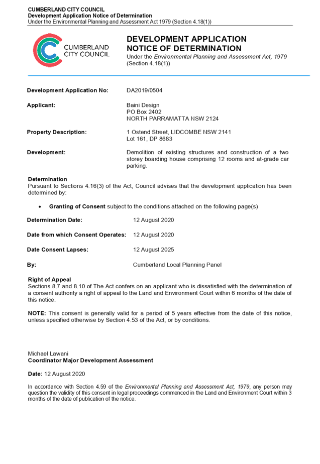


DOCUMENTS
ASSOCIATED WITH
REPORT LPP042/20
Attachment 2
Appendix A (BASIX Assessment)
Cumberland Local Planning Panel Meeting
12 August 2020
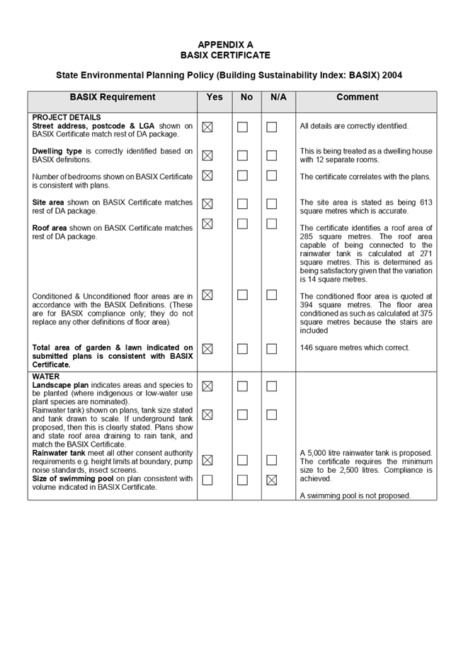
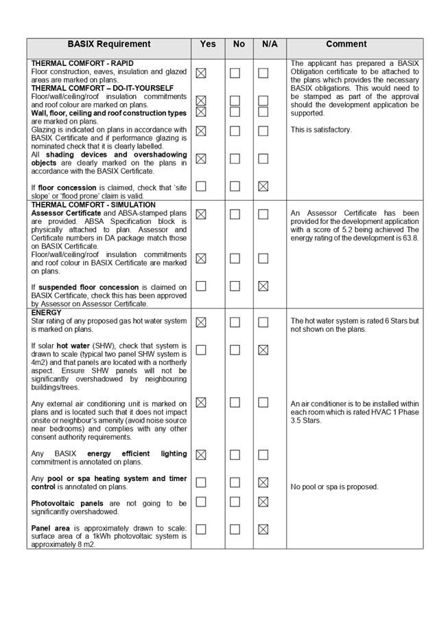
DOCUMENTS
ASSOCIATED WITH
REPORT LPP042/20
Attachment 3
Appendix B (Auburn Local Environment Plan 2010)
Cumberland Local Planning Panel Meeting
12 August 2020
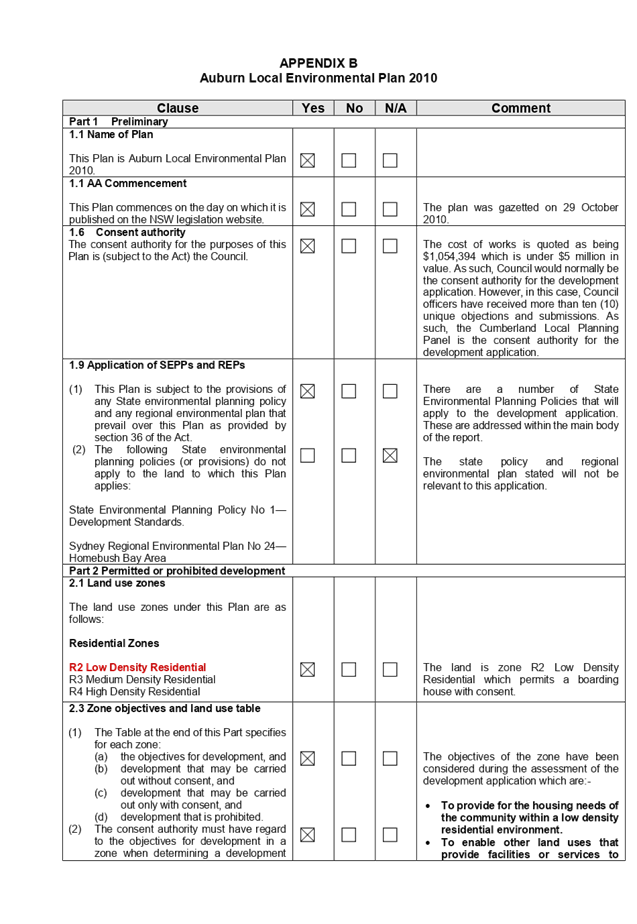
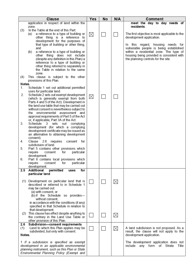
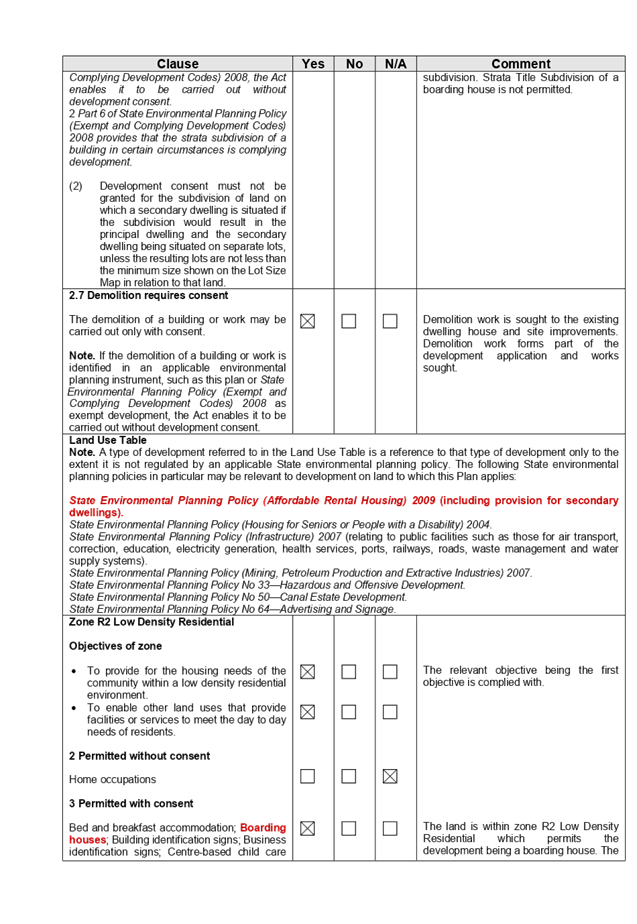
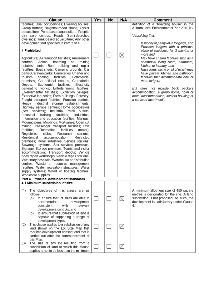
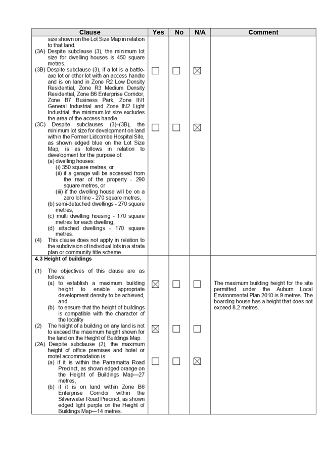
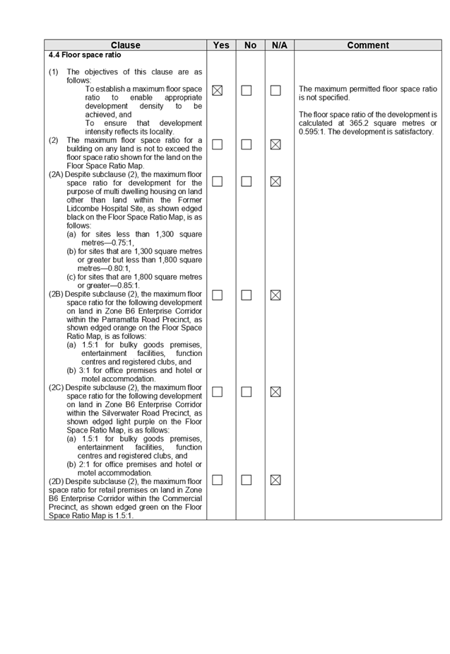
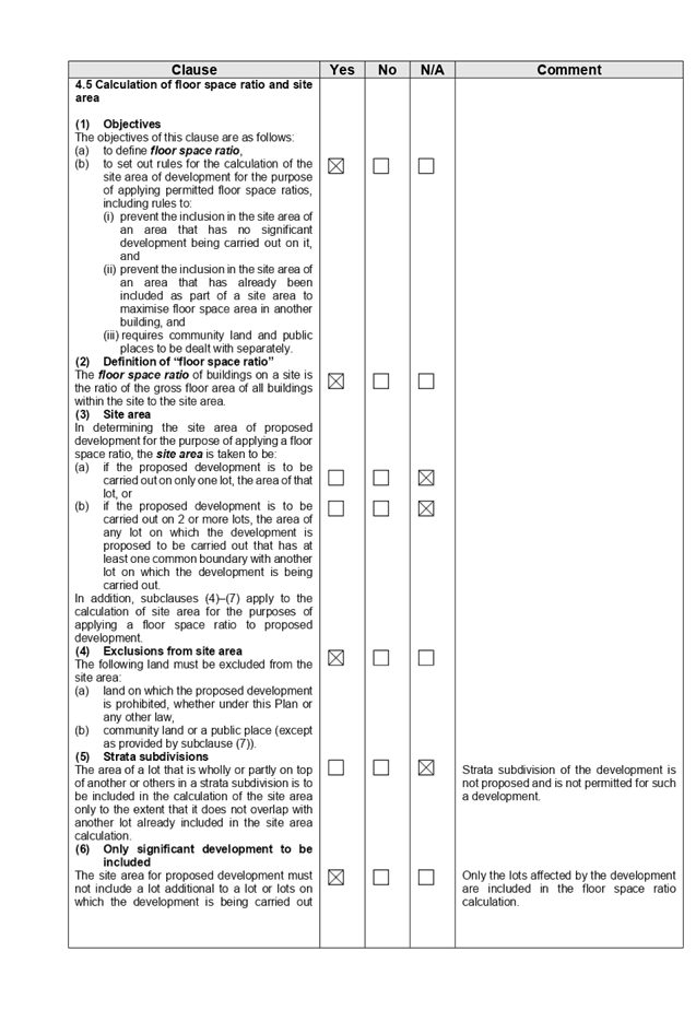
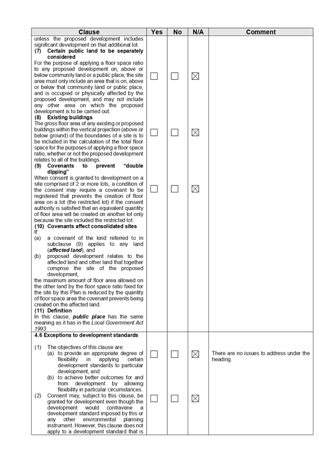

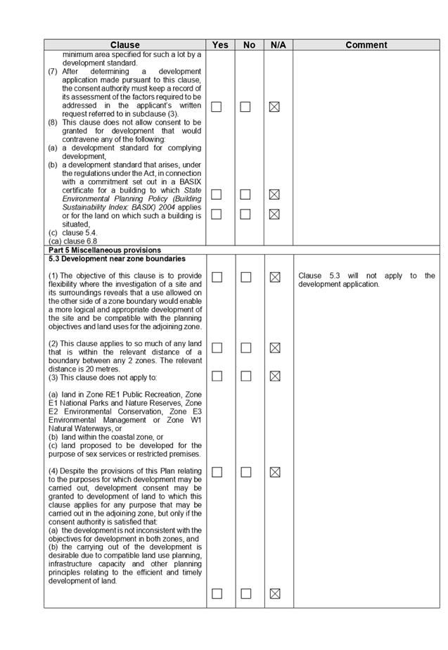
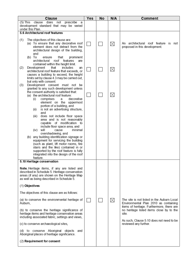
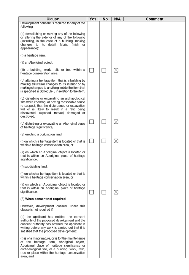
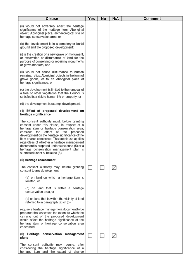
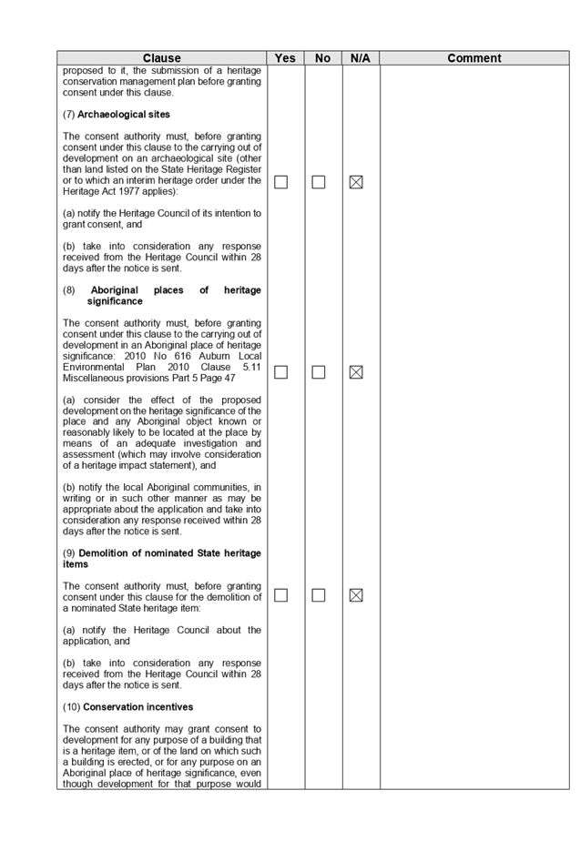
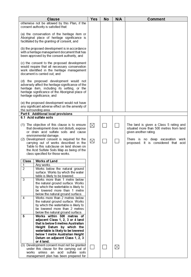
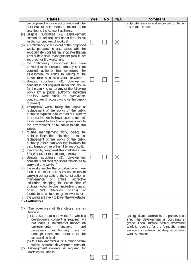
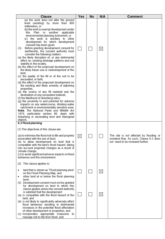
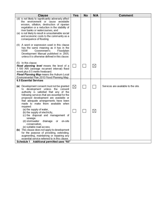
DOCUMENTS
ASSOCIATED WITH
REPORT LPP042/20
Attachment 4
Appendix C (Detached Dwellings and Dual Occupancy)
Cumberland Local Planning Panel Meeting
12 August 2020
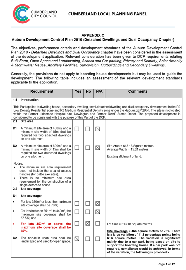
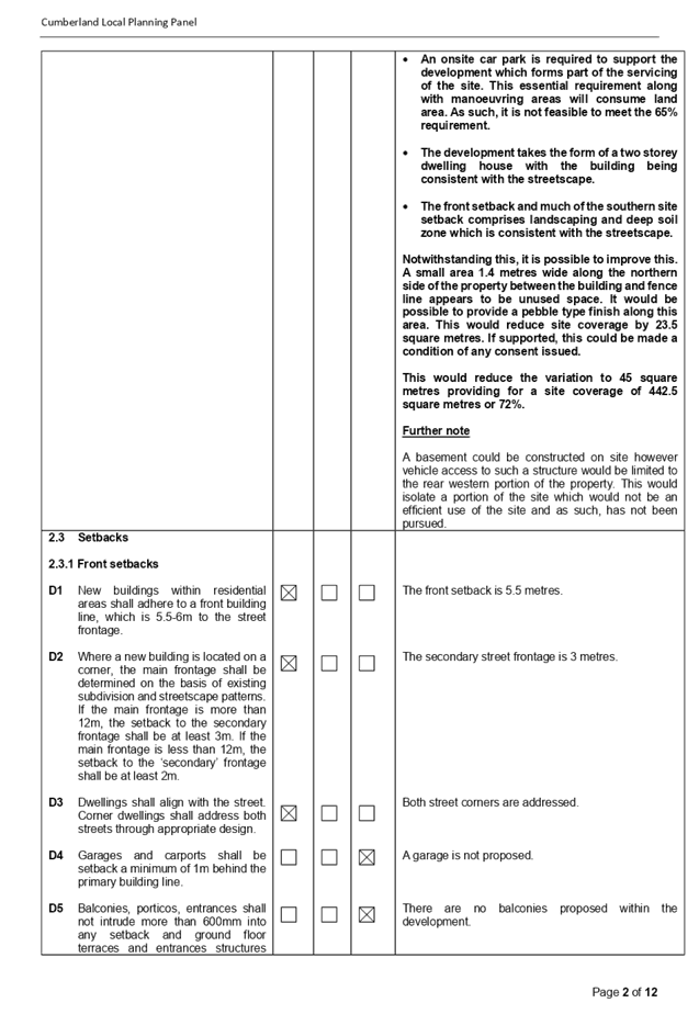
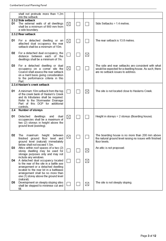
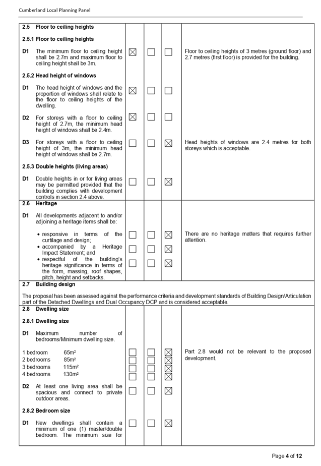
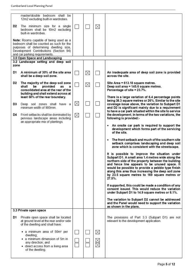
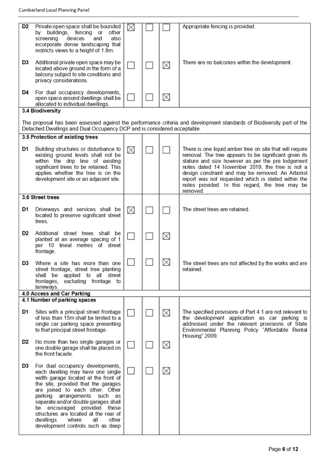
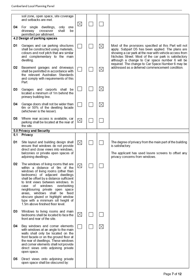
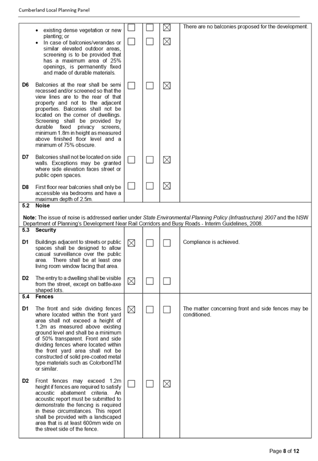
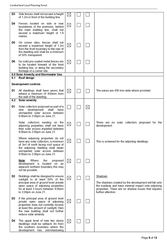
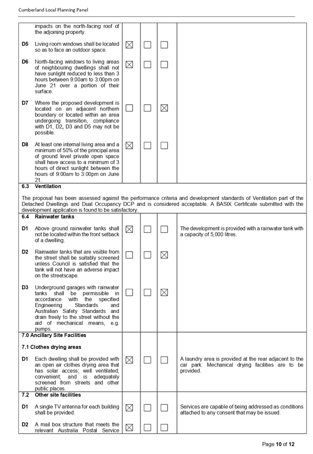
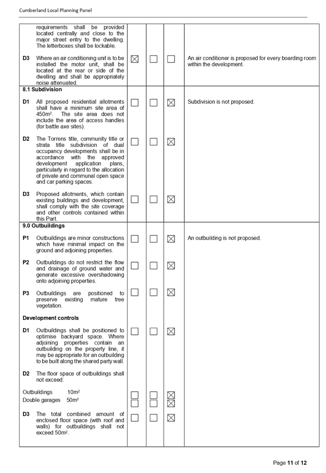

DOCUMENTS
ASSOCIATED WITH
REPORT LPP042/20
Attachment 5
Architectural Plans and Shadow Diagrams
Cumberland Local Planning Panel Meeting
12 August 2020
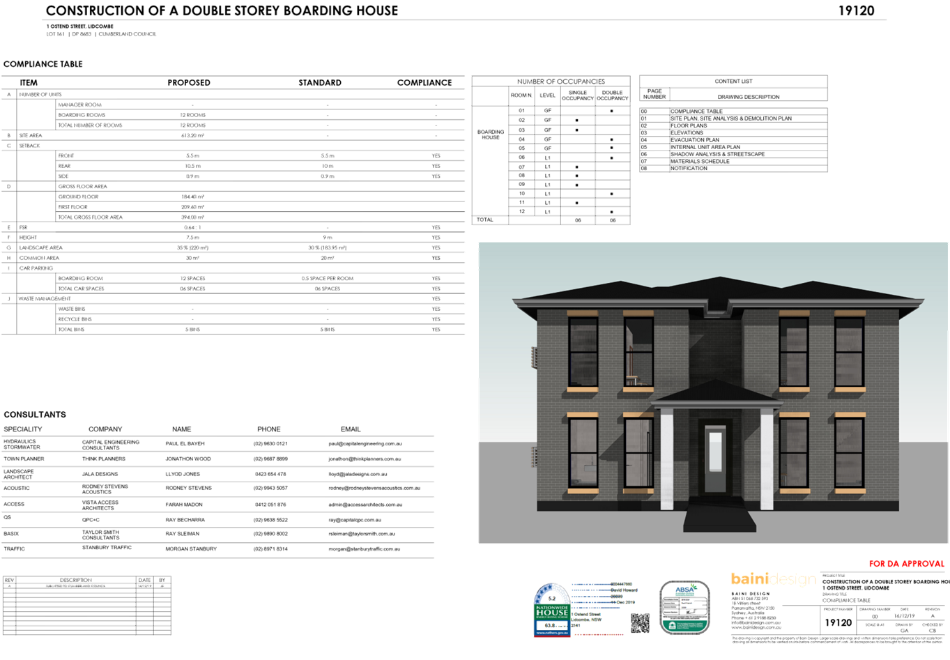
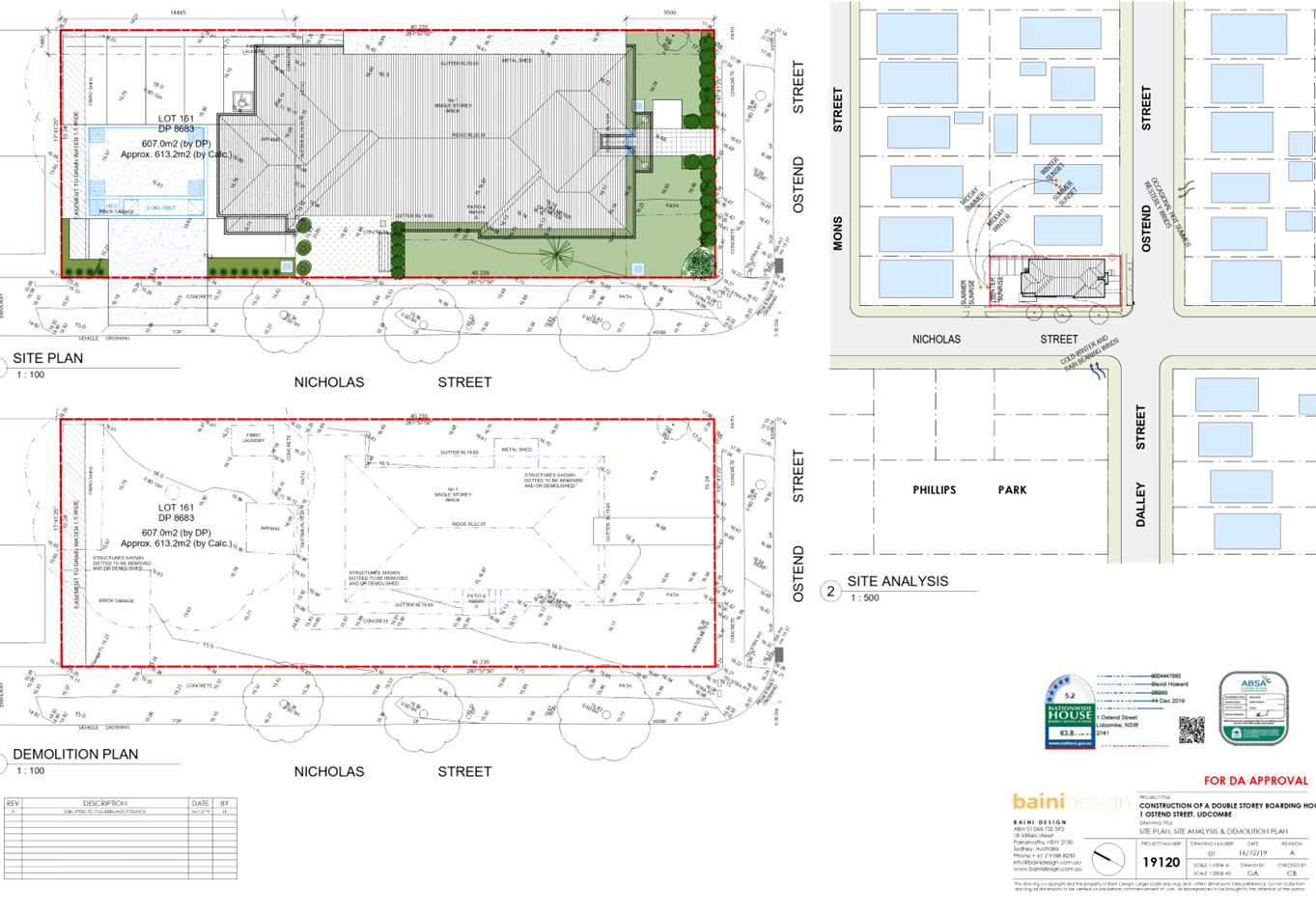
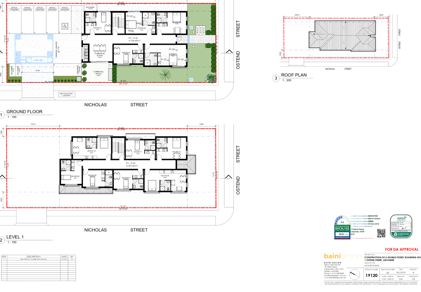
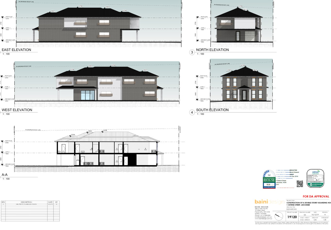
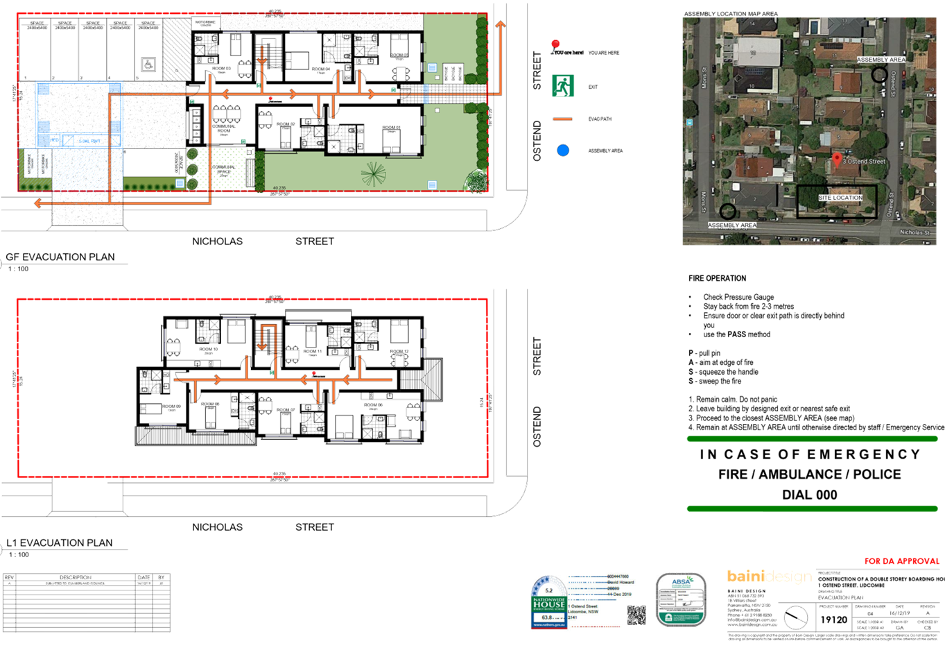
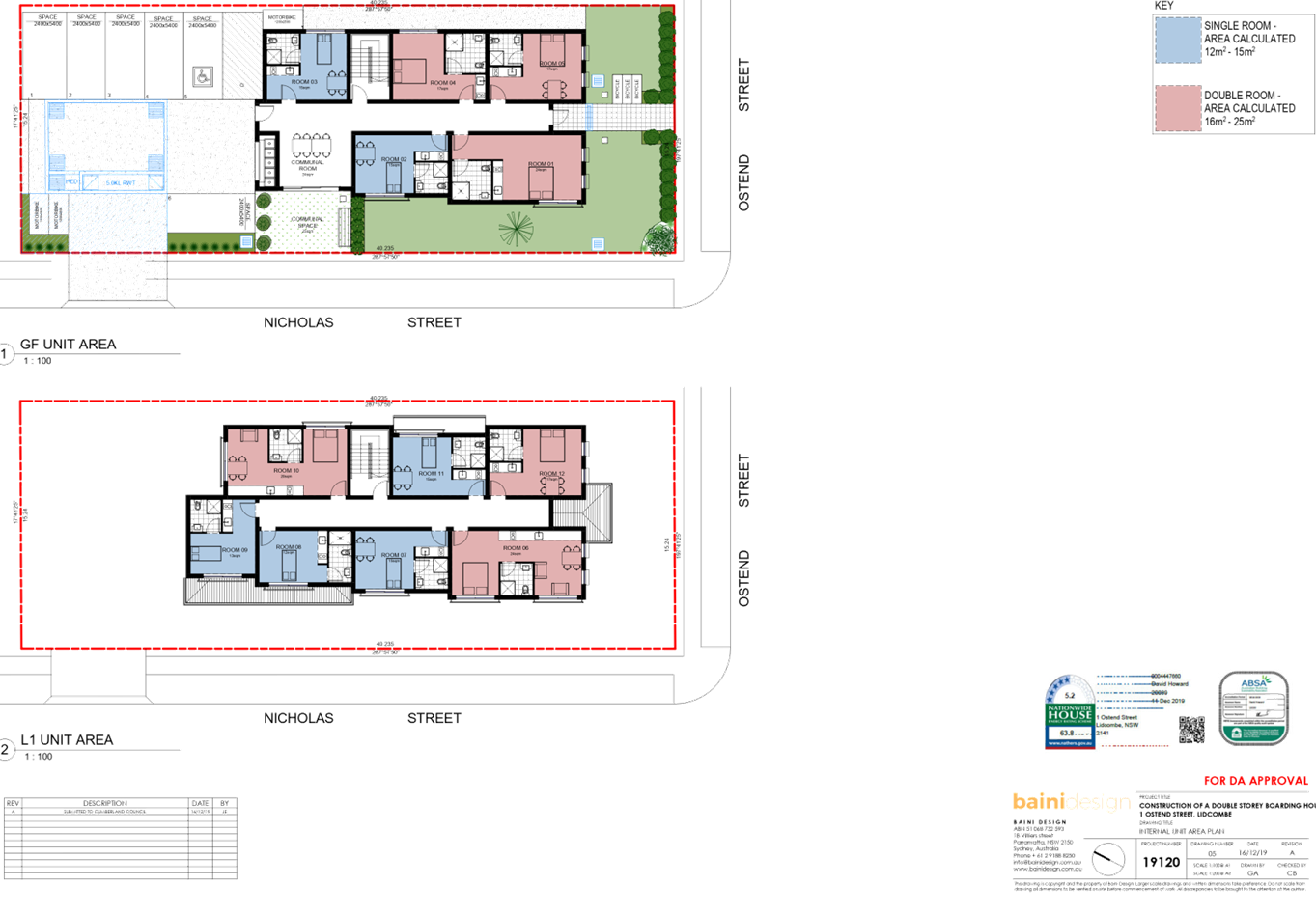
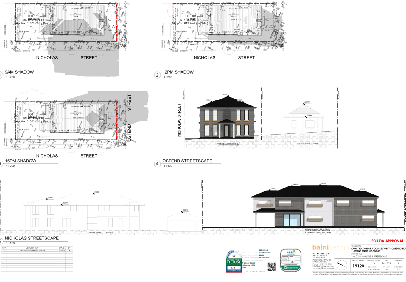
DOCUMENTS
ASSOCIATED WITH
REPORT LPP042/20
Attachment 6
Stormwater Plans
Cumberland Local Planning Panel Meeting
12 August 2020
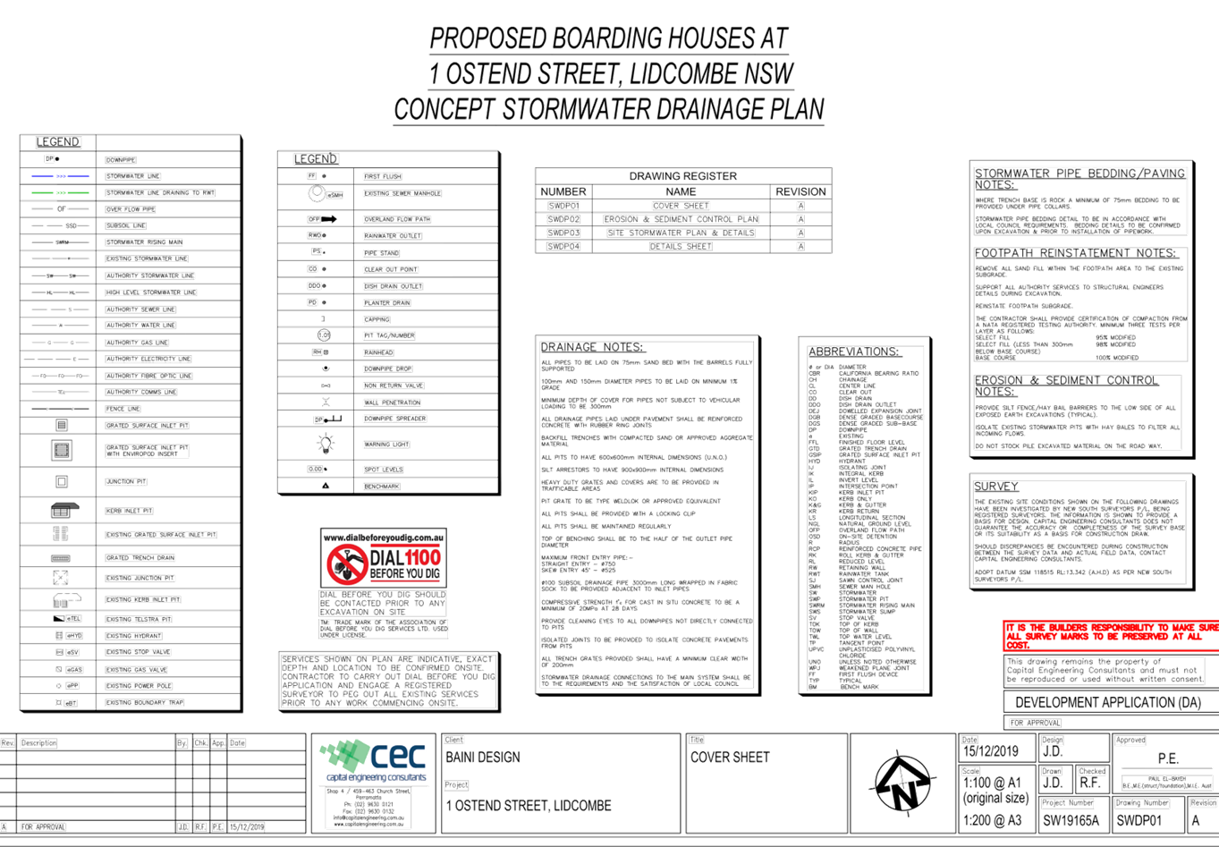
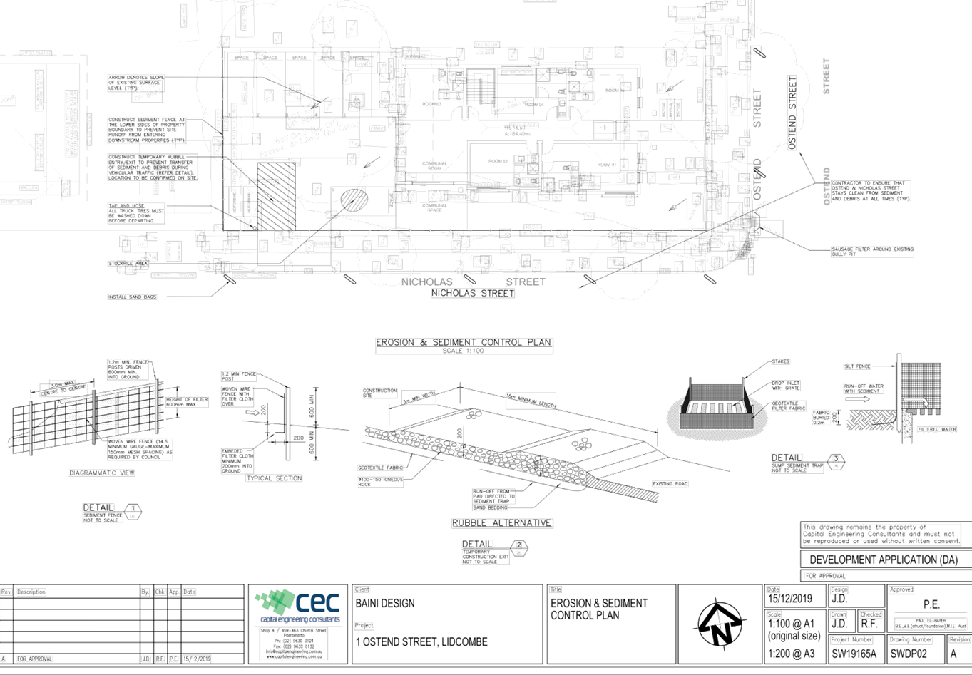
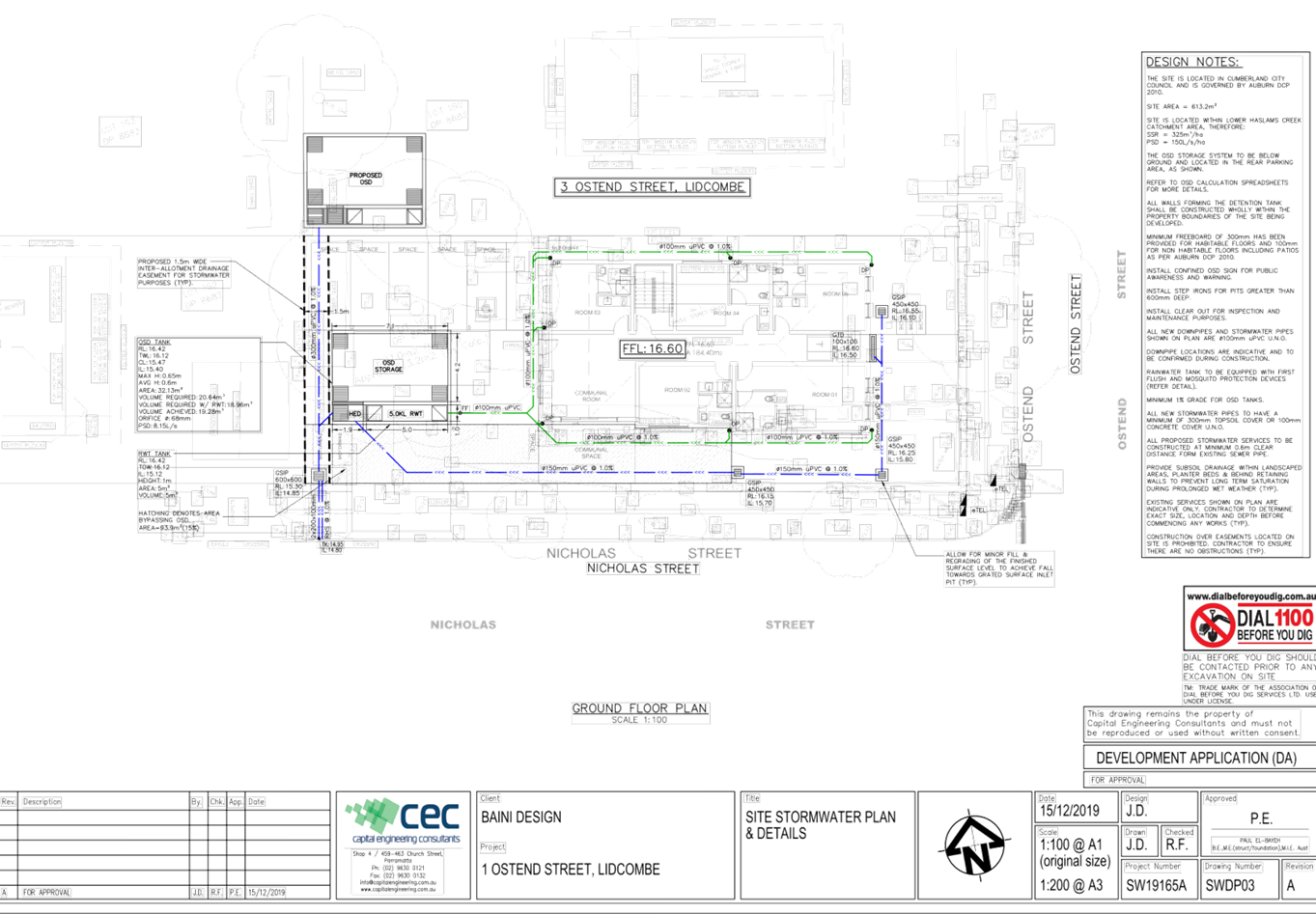
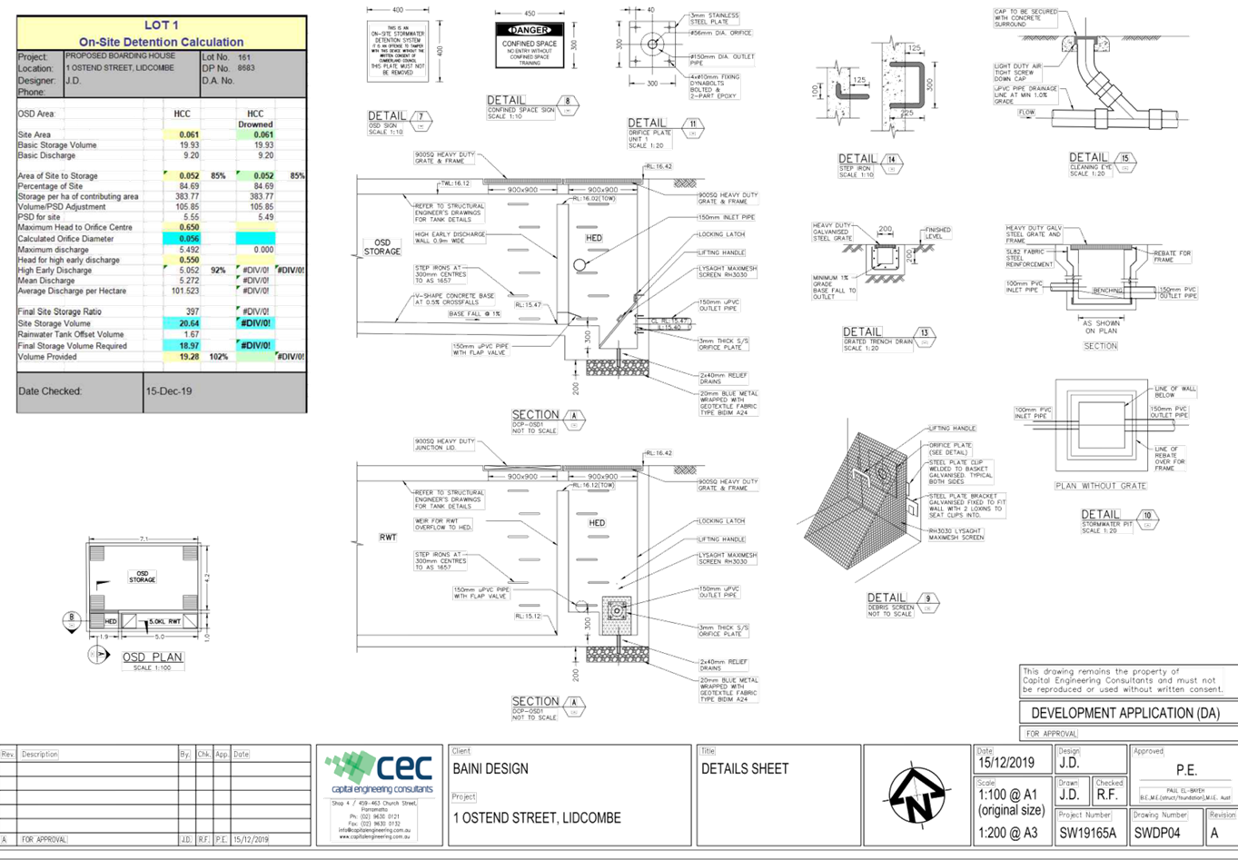
DOCUMENTS
ASSOCIATED WITH
REPORT LPP042/20
Attachment 7
Landscape Plan
Cumberland Local Planning Panel Meeting
12 August 2020
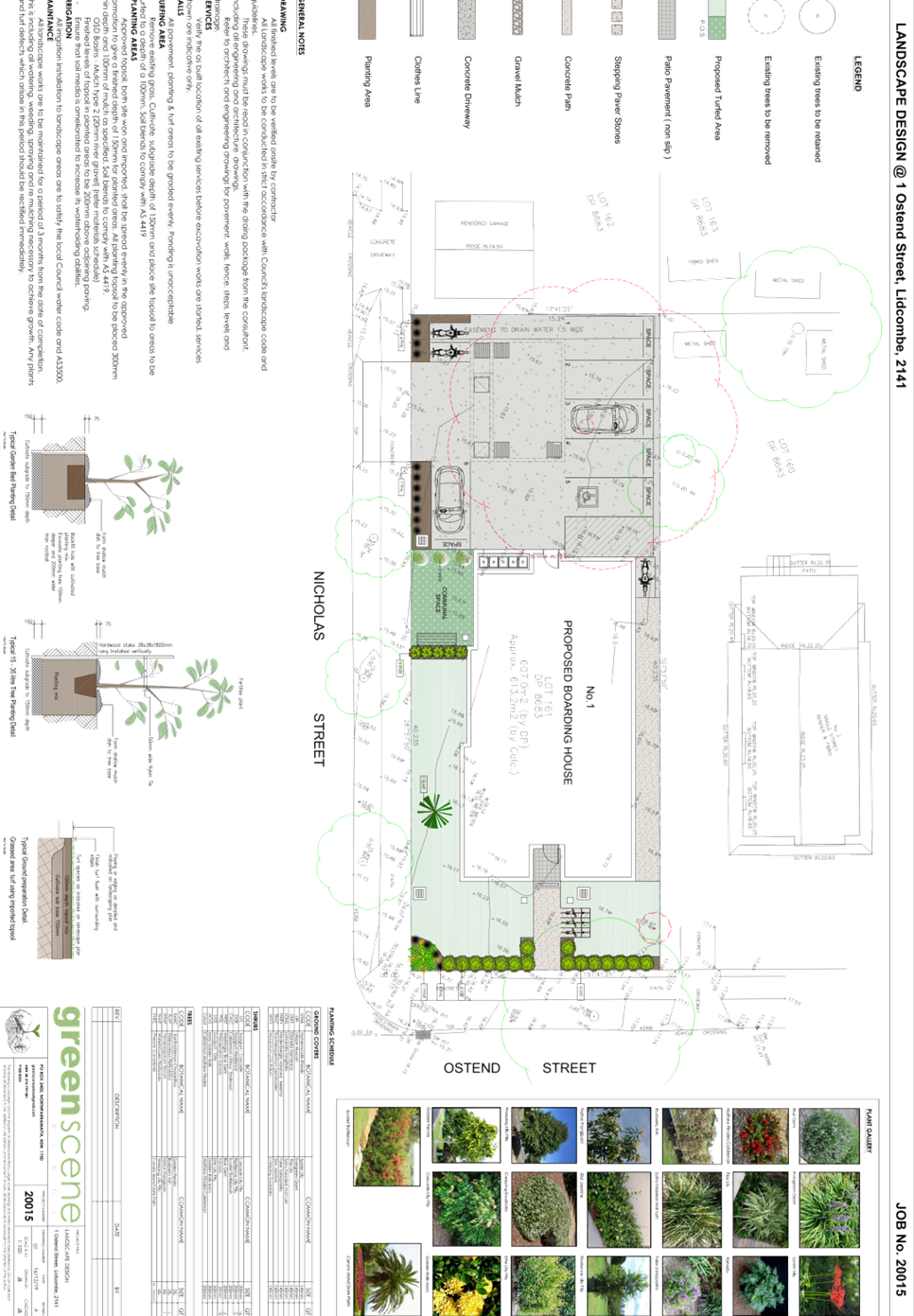
DOCUMENTS
ASSOCIATED WITH
REPORT LPP042/20
Attachment 8
Submissions Received
Cumberland Local Planning Panel Meeting
12 August 2020
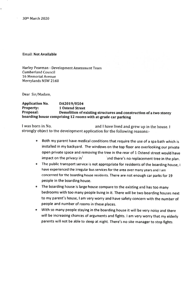

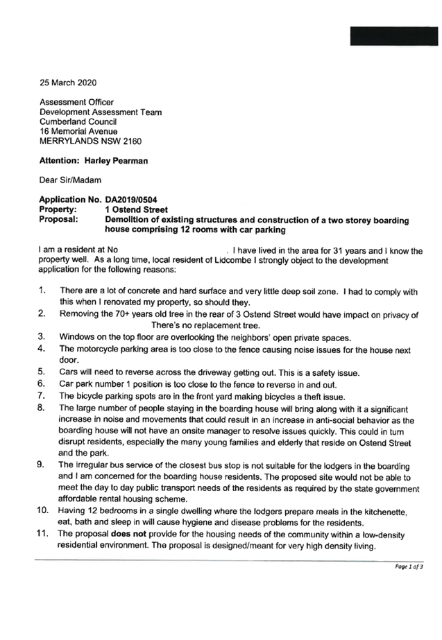


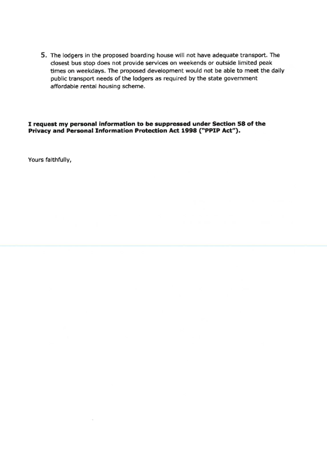


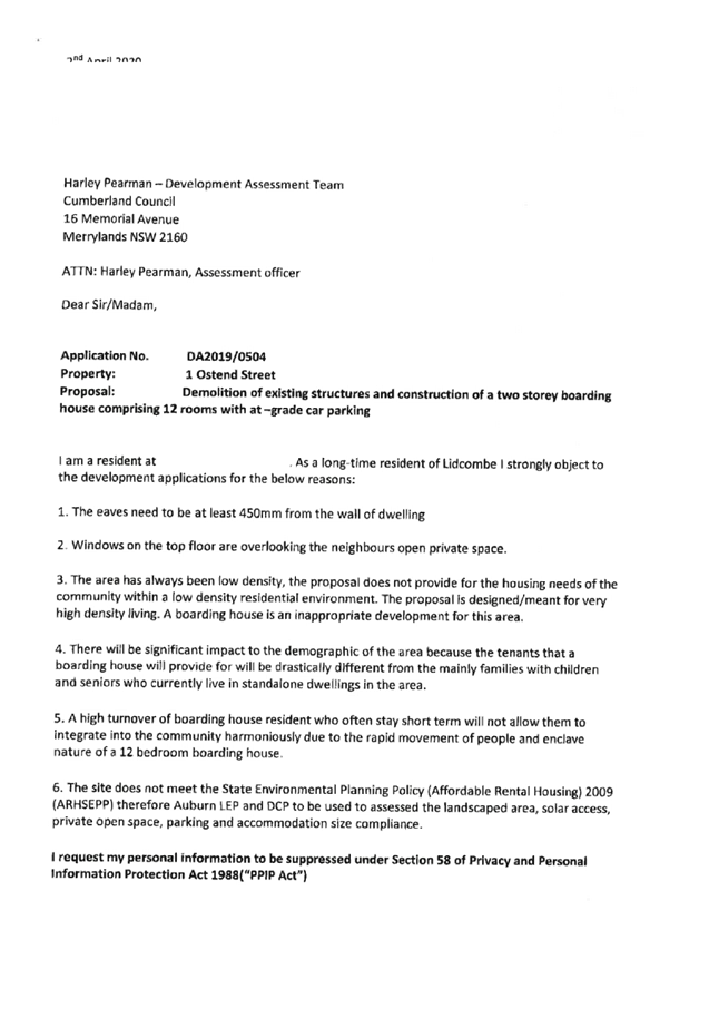
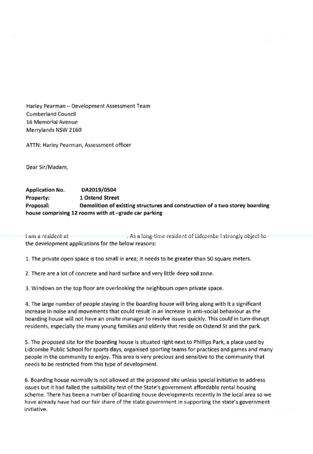
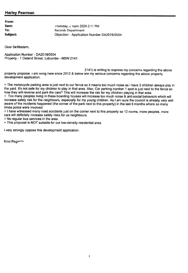
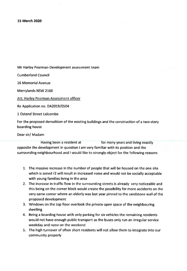

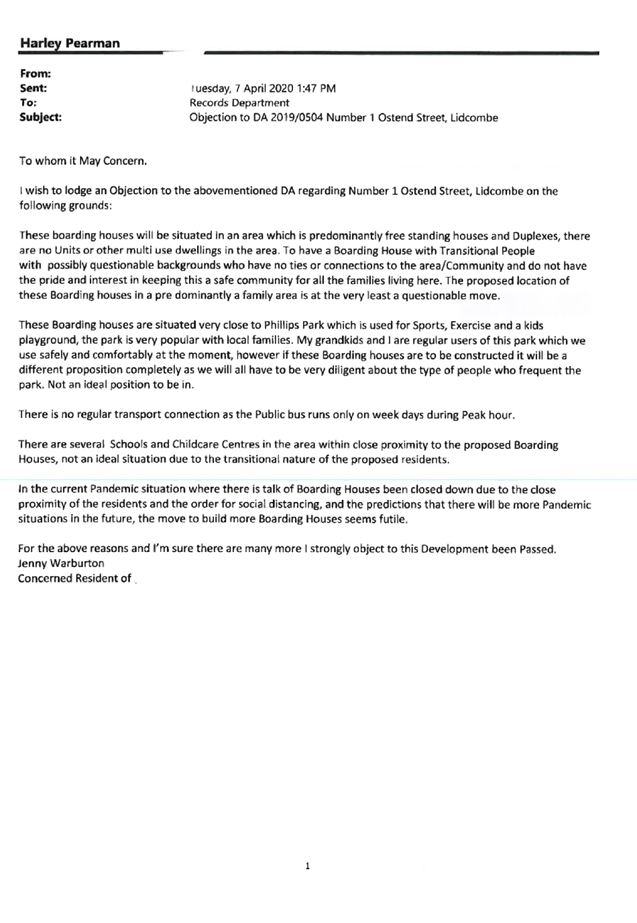
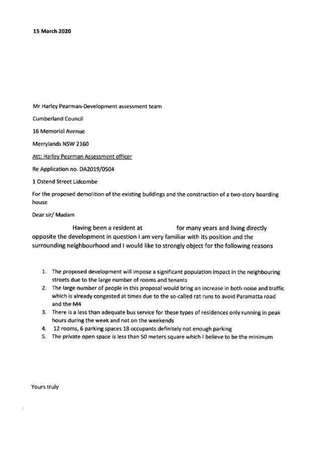
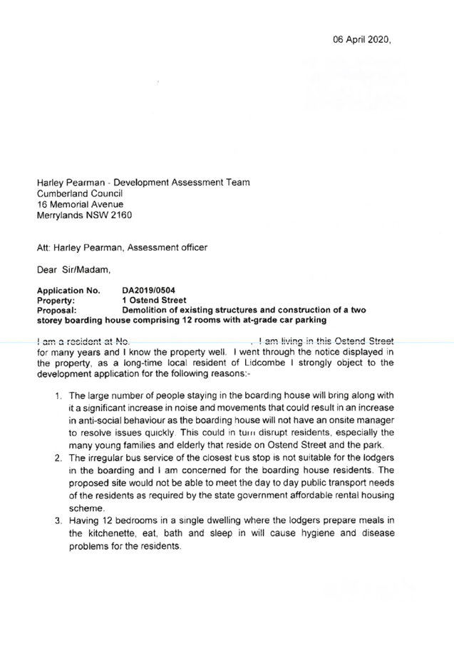
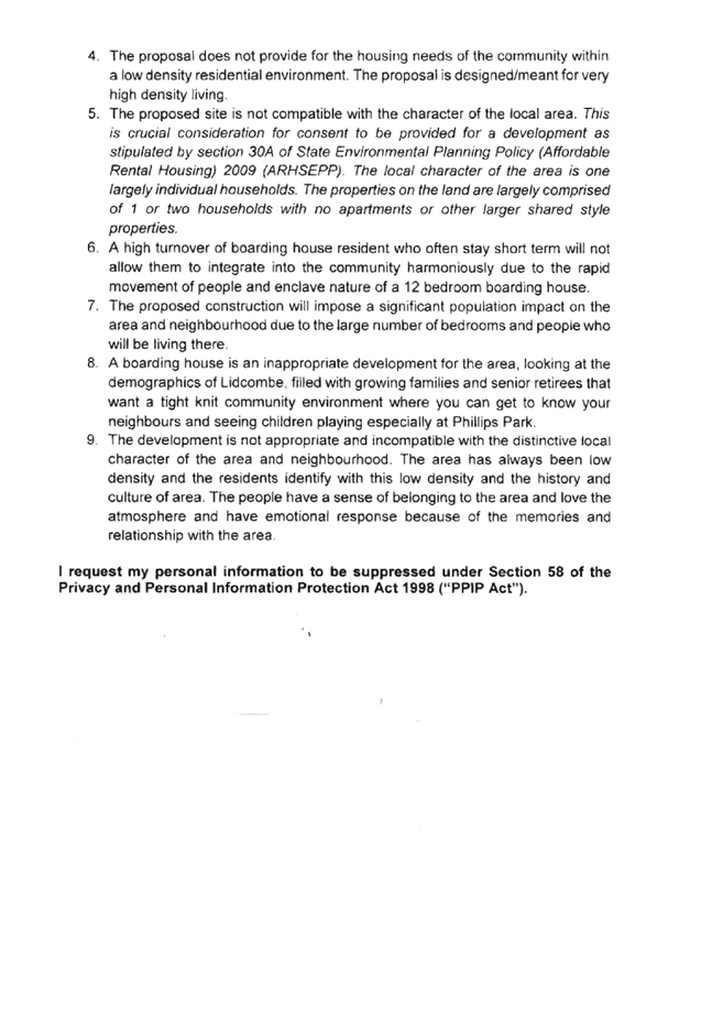
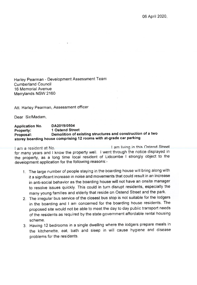
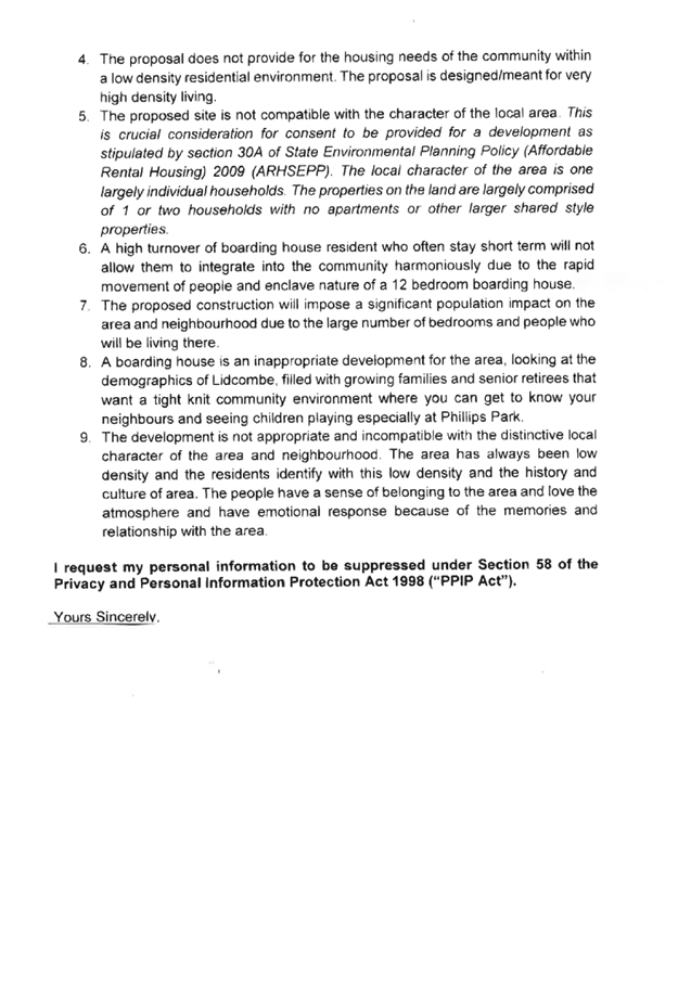

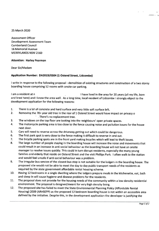

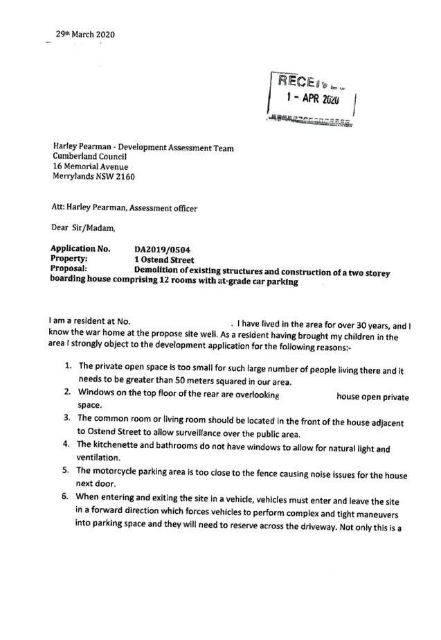


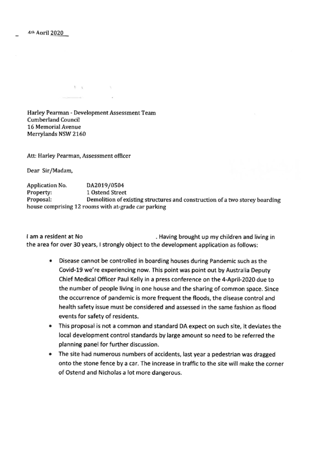

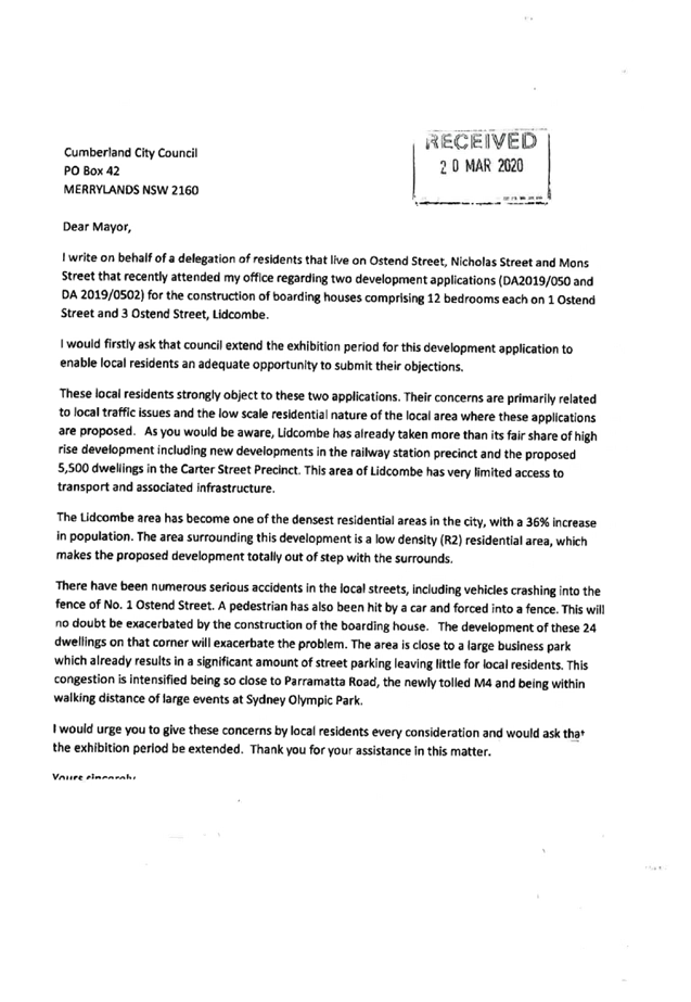
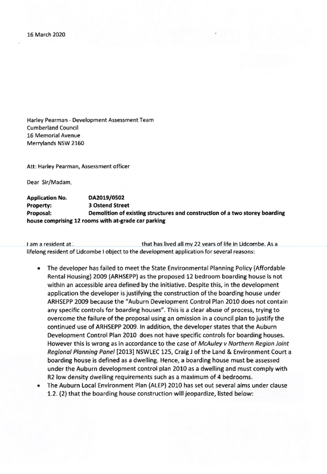
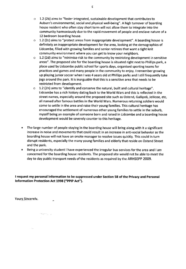


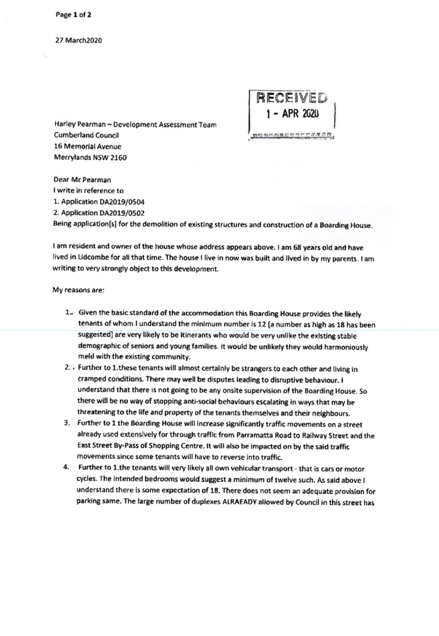
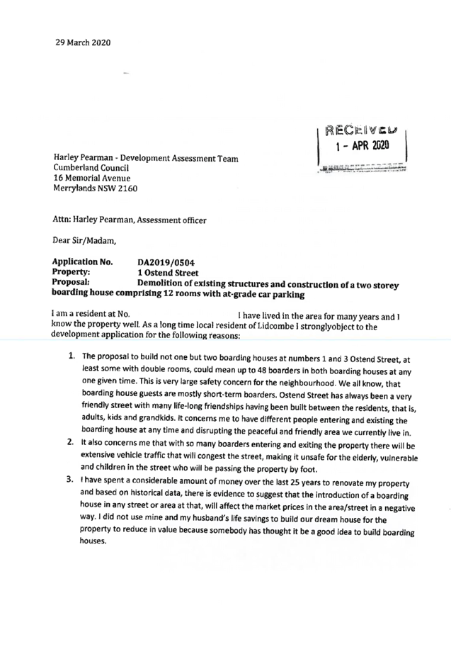


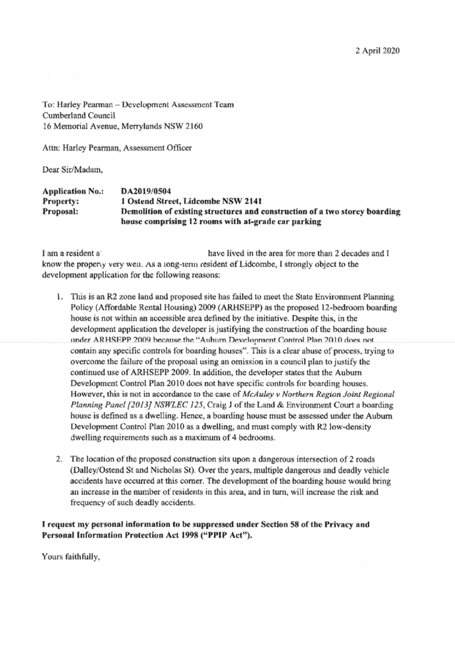
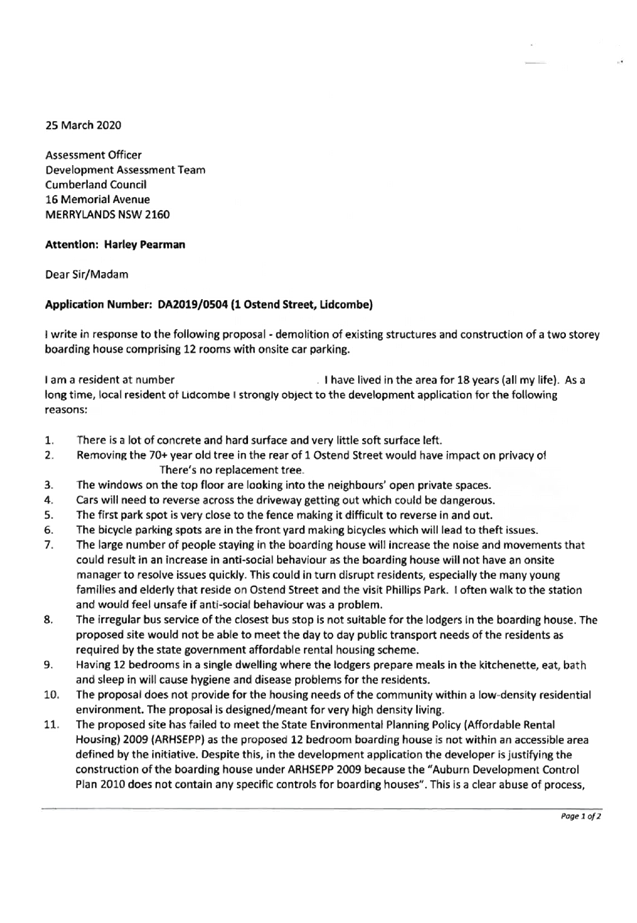

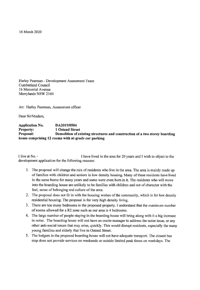

DOCUMENTS
ASSOCIATED WITH
REPORT LPP042/20
Attachment 9
Petitions Received
Cumberland Local Planning Panel Meeting
12 August 2020
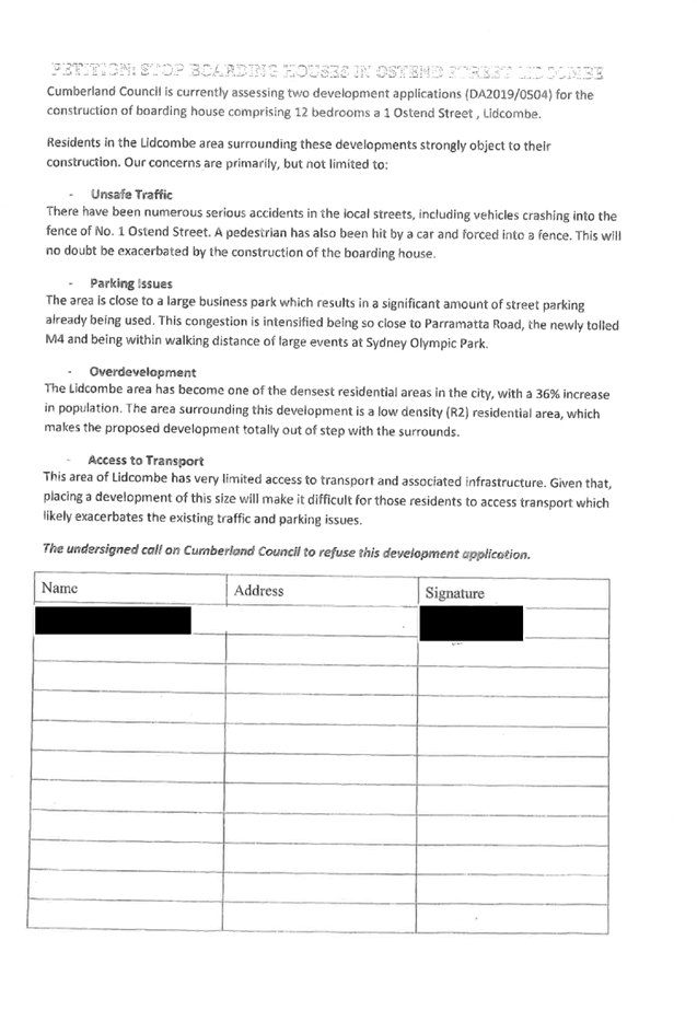
DOCUMENTS
ASSOCIATED WITH
REPORT LPP042/20
Attachment 10
Plan of Management
Cumberland Local Planning Panel Meeting
12 August 2020


Cumberland
Local Planning Panel Meeting
12 August 2020
Item
No: LPP043/20
Development
Appliaction for 3 Ostend Street, Lidcombe
Responsible
Division: Environment
& Planning
Officer: Executive
Manager Development and Building
File
Number: DA2019/0502
|
Application
lodged
|
19 December 2019
|
|
Applicant
|
Baini Design.
|
|
Owner
|
Ms J Ishak & Mr E M Elias
|
|
Application
No.
|
DA2019/0502.
|
|
Description
of Land
|
3 Ostend Street Lidcombe being
Lot 160 in DP 8683.
|
|
Proposed
Development
|
Demolition of existing
structures and construction of a two storey boarding house comprising 10
rooms and at-grade car parking.
|
|
Site
Area
|
613.18 Square metres.
|
|
Zoning
|
Zone R2 Low Density Residential.
|
|
Disclosure
of political donations and gifts
|
Nil disclosure.
|
|
Heritage
|
Site is not listed as a
heritage item with the Auburn Local Environmental Plan 2010.
|
|
Principal
Development Standards
|
Floor Space Ratio
Permissible: - No floor space
ratio specified.
Proposed: - 0.535:1.
Height of Building
Permissible: - 9 Metres.
Proposed: - 6.9 Metres.
|
|
Issues
|
Submissions.
|
1. Development
Application No. DA2019/0502 was received on the 19 December 2019 for the
demolition of existing structures and construction of a two storey boarding
house comprising of 12 rooms and at-grade car parking.
2. The
development application was notified between Tuesday 10 March and Tuesday 7
April 2020. In response, there were 54 submissions to the development including
one petition containing 19 signatures.
3. The
applicant modified the development on June 4 2020 to address certain issues
concerning the car park raised by Council’s engineers.
4. The
variations to the development are:
|
Part
|
Control
|
Proposed
|
Variation
|
|
Part 2.2
Detached Dwellings and Dual Occupancy Chapter (ADCP 2010)
|
Site Coverage
D1 Site
coverage.
For lots 450m2 or above, the maximum site
coverage shall be 65%.
|
534.8 sq. m or 87.2%.
|
22.2% being 136.3 square metres.
|
|
Part 3.2
Detached Dwellings and Dual Occupancy Chapter (ADCP 2010)
|
Landscape setting and deep soil zone.
D1 Minimum
of 30% of the site area to be a deep soil zone.
D2 Deep
soil zone to be a consolidated area at the rear and extend across at least
50% of the rear boundary.
|
Deep soil area = 83.24 square metres.
Percentage of site = 13.5%.
No deep soil zone at rear due to car park.
|
100.7 square metres or 45.26%.
|
5. The
development application is recommended for deferred commencement consent
subject to the conditions as provided in the attached schedule.
6. The
development application is referred to the Panel for determination as the
development is considered to be contentious.
Subject Site and Surrounding
Area
The site is legally described as
Lot 160 in DP 8683 and is known as 3 Ostend Street Lidcombe. The site has a
frontage of 15.24 metres to Ostend Street, is 40.235 metres deep and occupies
an area of 613.4 square metres.
The site is situated one allotment
north of the intersection of Ostend Street with Nicholas Street.
The levels of the land are:-
• North
east corner - 17.95 metres AHD.
• North
west corner - 16.87 metres AHD.
• South
east corner - 17.06 metres AHD.
• South
west corner - 16.2 metres AHD.
This provides a fall to the rear
of between 860 mm and 1,080 mm with the lowest level being at the rear south
west corner.
A single storey dwelling house and
a small tree is situated on the site.
The site is not affected by
flooding or overland flow and there are no heritage listed items close to the
site.
The site is within a residential
area of Lidcombe where single storey and two storey dwelling houses
predominating.
A public park and playing fields
is situated close by on land situated on the southern side of Nicholas Street
which is land zoned as RE1 (Public Recreation). The land is known as Phillips
Park which is managed by Council.
The location of the site is shown
below.
Photos of the site are provided
below.
Description of the Proposed
Development
Development Application Number
2019/0502 is proposing the demolition of the existing dwelling house and
construction of a two storey boarding house comprising of eleven rooms with at
grade car parking for five (5) vehicles, on site landscaping and storm water
engineering works. The development has the following components.
Demolition work
The existing dwelling house on
site will be demolished. The plans are showing a tree at the rear and two palm
trees at the front being removed to facilitate the development.
Ground Floor
The ground floor of the building
is provided with the following features:-
· A
ground floor comprising of three (3) boarding rooms, a common room and a
corridor.
· A
car park for five (5) vehicles with vehicle access from Ostend Street and a
turning bay to allow for vehicles to be turned around and leave in forward
motion.
First floor
The first floor comprises of seven
(7) boarding rooms including an internal corridor.
A cantilevered section is provided
at the rear which requires two columns for support.
Room numbered 04 facing the front
is provided with a balcony overlooking the street.
Total number of rooms
There are ten (10) rooms in total
with two (2) of the rooms being provided for single people and eight (8) of the
rooms being provided for couples. As such, this would provide short term
accommodation for eighteen (18) boarders.
History
Following a pre lodgement meeting
on 7 November 2019 and the issue of pre lodgement notes on 14 November 2019,
the applicant lodged the development application for the demolition of existing
structures and construction of a two storey boarding house comprising of 12
rooms and at-grade car parking on 19 December 2019 for determination.
The development application was
notified for a period of twenty eight (28) days between 10 March and 7 April
2020. In response, there were 54 unique submissions to the development
including one petition containing 19 signatures.
The applicant modified the development
on 4 June 2020 to improve the functionality of the car park and to address
certain car park and manoeuvring issues raised by Council engineers.
Applicants Supporting
Statement
The applicant has provided a
Statement of Environmental Effects prepared by Think Planners and dated 16
December 2019.
Contact with Relevant
Parties
The assessing officer has
undertaken a site inspection of the subject site and surrounding properties and
has been in regular contact with the applicant throughout the assessment process.
Internal Referrals
Development Engineer
The development application was
referred to Council’s Development Engineer for comment who has advised
that the development proposal is generally satisfactory subject to conditions.
Deferred commencement consent is recommended as matters concerning a rear
easement is required to be addressed.
Environment and Health
The development application was
referred to Council’s Environmental Health Officer for comment who has
advised that the development proposal is satisfactory subject to conditions.
Landscape
As part of the pre lodgement
application, Councils Tree Management Officer provided advice concerning the
removal of any tree on site. No objections are raised to the removal of trees
being a Camphor Laurel and three palm trees. The development application did
not require referral to Council’s Tree Management.
External Referrals
Auburn Area Police Command
The development application was
referred to the Crime Prevention Officer for assessment. In this regard, the
Auburn Area Police Command provided comments on March 20 2020 that addresses
the following matters.
· Lighting.
· Use of Closed
circuit television cameras on site.
· Signage.
· Landscaping.
· Fire and safety
measures.
· House rules.
· Site management.
Appropriate conditions addressing
the relevant matters are to be incorporated into any consent that may be
issued.
Planning Comments
The provisions of any
Environmental Planning Instruments (EP&A Act s4.15 (1)(a)(i))
State Environmental Planning
Policies
The proposed development is
affected by the following State Environmental Planning Policies:
(a) State
Environmental Planning Policy No. 55 - Remediation of Land
The requirement at clause 7 of
SEPP No. 55 for Council to be satisfied that the site is suitable or can be
made suitable to accommodate the proposed development has been considered in
the following table:
|
Matter for Consideration
|
Yes/No
|
|
Does the application involve re-development of the site or
a change of land use?
|
Yes
No
|
|
Is the development going to be used for a sensitive land
use (eg: residential, educational, recreational, childcare or hospital)?
|
Yes
No
|
|
Does information available to you indicate that an
activity listed below has ever been approved, or occurred at the site?
acid/alkali plant and
formulation, agricultural/horticultural activities, airports, asbestos
production and disposal, chemicals manufacture and formulation, defence
works, drum re-conditioning works, dry cleaning establishments, electrical
manufacturing (transformers), electroplating and heat treatment premises,
engine works, explosive industry, gas works, iron and steel works, landfill
sites, metal treatment, mining and extractive industries, oil production and
storage, paint formulation and manufacture, pesticide manufacture and
formulation, power stations, railway yards, scrap yards, service stations,
sheep and cattle dips, smelting and refining, tanning and associated trades,
waste storage and treatment, wood preservation
|
Yes
No
|
|
Is the site listed on
Council’s Contaminated Land database?
|
Yes
No
|
|
Is the site subject to EPA
clean-up order or other EPA restrictions?
|
Yes
No
|
|
Has the site been the subject of
known pollution incidents or illegal dumping?
|
Yes
No
|
|
Does the site adjoin any
contaminated land/previously contaminated land?
|
Yes
No
|
|
Details of contamination investigations carried out at the
site:
A preliminary site investigation report prepared by GCA
Australia and dated 12 December 2019 (Reference E19106-1) has identified that
the potential for significant contamination is not high. The site is suitable
for the proposed development.
Council’s Environmental officers have advised that a
hazardous materials survey report should be undertaken by a suitably
qualified person and submitted to the satisfaction of the certifier with a
copy provided to Council. The report is required to identify and record the
type, location and extent of any hazardous materials on the site and make
recommendations as to the safe management and or removal to ensure the site
is safe for demolition, construction and future use / occupation.
An appropriate condition is provided addressing
environment and health matters.
|
|
Has the appropriate level of
investigation been carried out in respect of contamination matters for
Council to be satisfied that the site is suitable to accommodate the proposed
development or can be made suitable to accommodate the proposed development?
|
Yes
No
|
(b) State
Environmental Planning Policy (Infrastructure) 2007 (ISEPP)
The provisions of the ISEPP 2007
have been considered in the assessment of the development application however,
it is determined that there are no provisions that will need to apply to the
development.
(c) State
Environmental Planning Policy (Vegetation in Non-Rural Areas) 2017
The proposal does not exceed the
biodiversity offsets scheme threshold. Therefore, the proposed vegetation
removal is considered acceptable.
The development application
includes the removal of a Camphor Laurel tree within the rear yard plus another
small tree / shrub and two palm trees at the front of the site. The removal of
the stated trees are acceptable and no detailed Arborist assessment is
required.
(d) State
Environmental Planning Policy (Building Sustainability Index: BASIX) 2004
The BASIX Certificate shows that
the development achieves a score of 40 and 51 for water and energy which is a
pass mark for both components. Generally, the BASIX Certificate is satisfactory
for approval as part of any development consent that is issued.
The assessment of the certificate
is at Appendix (A) attached to the report.
(e) State
Environmental Planning Policy “Affordable Rental Housing”
The relevant objectives and
provisions of the ARHSEPP 2009 have been considered in the assessment of the
development application and the proposal is considered as being consistent with
the boarding house provisions under Division 3 of the plan. It is identified
that the development site is not within an accessible area as defined by the
State Environmental Policy. In this regard, the site is located 1.06 km from
the Lidcombe Railway Station (Direct) or 1.37 km by road taking the shortest
distance and the site is within zone R2 Low Density Residential.
Under Clause 27 of the State
Policy, Clause 29, 30 and 30A do not apply to developments on land within Zone
R2 Low Density Residential or within a land use zone that is equivalent to that
zone in the Sydney region unless the land is within an accessible area. As
such, Council’s local planning controls will apply. A comprehensive
assessment has been undertaken and is provided in the compliance table below.
|
Requirement
|
Yes
|
No
|
N/A
|
Comment
|
|
Division 3 Boarding houses
25 Definition
In this Division:
Communal living room means a room within a
boarding house or on site that is available to all lodgers for recreational
purposes, such as a lounge room, dining room, recreation room or games room.
|
|
|
|
A communal room is provided on
the ground level adjacent to Room Number 02.
|
|
26 Land to which Division applies
This Division applies to land within any of the following
land use zones or within a land use zone that is equivalent to any of those
zones:
(a) Zone R1 General Residential,
(b) Zone R2 Low Density Residential,
(c) Zone R3 Medium Density Residential,
(d) Zone R4 High Density Residential,
(e) Zone B1 Neighbourhood Centre,
(f) Zone B2 Local Centre,
(g) Zone B4 Mixed Use.
|
|
|
|
The site is within zone R2 Low
Density Residential and boarding houses are permitted with consent within the
zone.
|
|
27 Development
to which Division applies
(1) This Division applies
to development, on land to which this Division applies, for the purposes of
boarding houses.
(2) Despite subclause
(1), clauses 29, 30 and 30A do not apply to development on land within Zone
R2 Low Density Residential or within a land use zone that is equivalent to
that zone in the Sydney region unless the land is within an accessible area.
(3) Despite subclause (1), clauses 29, 30
and 30A do not apply to development on land within Zone R2 Low Density
Residential or within a land use zone that is equivalent to that zone that is
not in the Sydney region unless all or part of the development is within 400
metres walking distance of land within Zone B2 Local Centre or Zone B4 Mixed
Use or within a land use zone that is equivalent to any of those zones..
|
|
|
|
The development is proposed on
land zoned R2 Low Density Residential. It is identified that the site is not
located within an accessible area. As such, the Division cannot apply to the
development. Council’s local planning controls will need to apply.
In this regard, the site is
located 1.06 km from the Lidcombe Railway Station (Direct) or 1.370 km by
road taking the shortest distance).
|
|
28 Development
may be carried out with consent
Development to which this
Division applies may be carried out with consent.
|
|
|
|
Development consent is sought
for the boarding house.
|
|
29 Standards
that cannot be used to refuse consent
(1) A consent authority must
not refuse consent to development to which this Division applies on the
grounds of density or scale if the density and scale of the buildings when
expressed as a floor space ratio are not more than:
(a) the
existing maximum floor space ratio for any form of residential accommodation
permitted on the land, or
(b) if
the development is on land within a zone in which no residential
accommodation is permitted—the existing maximum floor space ratio for
any form of development permitted on the land, or
(c) if
the development is on land within a zone in which residential flat buildings
are permitted and the land does not contain a heritage item that is
identified in an environmental planning instrument or an interim heritage
order or on the State Heritage Register—the existing maximum floor
space ratio for any form of residential accommodation permitted on the land,
plus:
(i) 0.5:1,
if the existing maximum floor space ratio is 2.5:1 or less, or
(ii) 20%
of the existing maximum floor space ratio, if the existing maximum floor
space ratio is greater than 2.5:1.
|
|
|
|
Note: The site is not within an
accessible area and as such, Clause 29 cannot apply to the development.
A detailed assessment under
Clause 29 is not required although it may be used to guide the development.
The applicant has used the Clause to prepare the plans. The following is
provided.
There is no floor space ratio
requirement for the site. The floor space ratio of the development is
calculated at 328.58 square metres or 0.535:1 which is acceptable.
|
|
(2) A consent authority
must not refuse consent to development to which this Division applies on any
of the following grounds:
(a) building
height
if the building height of all proposed buildings is not more than the
maximum building height permitted under another environmental planning
instrument for any building on the land,
(b) landscaped
area
if the landscape treatment of the front setback area is compatible with the
streetscape in which the building is located,
(c) solar
access
where the development provides for one or more communal living rooms, if at
least one of those rooms receives a minimum of 3 hours direct sunlight
between 9am and 3pm in mid-winter,
(d) private
open space
if at least the following private open space areas are provided (other
than the front setback area):
(i) one
area of at least 20 square metres with a minimum dimension of 3 metres is
provided for the use of the lodgers,
(ii) if
accommodation is provided on site for a boarding house manager—one area
of at least 8 square metres with a minimum dimension of 2.5 metres is
provided adjacent to that accommodation,
(e) parking
if:
(i) in the case of development carried out by or on behalf of
a social housing provider in an accessible area—at least 0.2 parking
spaces are provided for each boarding room, and
(ii) in the
case of development carried out by or on behalf of a social housing provider
not in an accessible area, at least 0.4 parking spaces are provided for
each boarding room, and
(iia) in
the case of development not carried out by or on behalf of a social housing
provider—at least 0.5 parking spaces are provided for each boarding
room, and
(iii) in
the case of any development—not more than 1 parking space is provided
for each person employed in connection with the development and who is
resident on site,
(f) accommodation
size
if each boarding room has a gross floor area (excluding any area used for the
purposes of private kitchen or bathroom facilities) of at least:
(i) 12
square metres in the case of a boarding room intended to be used by a single
lodger, or
(ii) 16
square metres in any other case.
|
|
|
|
The building has a height of
6.9 metres which is satisfactory.
Landscaping at the front is
compatible with the streetscape.
The common room will receive
the afternoon sunlight through the northern / western window.
A private open space area
occupying 37 square metres is located along the northern boundary of the
site.
A boarding house manager
is not required as the total number of occupants is not expected to exceed
eighteen (18).
Car parking.
The
development is not within an accessible area. The number of parking spaces
required for the proposed development is 10 x 0.5 spaces. A boarding house
manager is not required as the number of occupants is less than 20. As such,
the total number of car parking spaces required is five (5).
The
plans show 5 car parking spaces being provided.
The gross floor area for each
boarding room (excluding any area used for the purposes of private kitchen or
bathroom facilities) exceed 16 square metres for the double rooms and 12
metres for the single rooms.
Generally, the rooms have
satisfactory sizes.
|
|
(3) A boarding house may
have private kitchen or bathroom facilities in each boarding room but is not
required to have those facilities in any boarding room.
(4) A consent authority
may consent to development to which this Division applies whether or not the
development complies with the standards set out in subclause (1) or (2).
|
|
|
|
All boarding rooms are proposed
to contain open plan kitchenette arrangement and private bathroom facilities.
The proposed development
complies with the standards.
|
|
30 Standards
for boarding houses
(1) A consent authority must not consent to
development to which this Division applies unless it is satisfied of each of
the following:
(a) if a boarding house has 5 or more boarding
rooms, at least one communal living room will be provided,
(b) no boarding room will have a gross floor
area (excluding any area used for the purposes of private kitchen or bathroom
facilities) of more than 25 square metres,
(c) no boarding room will be occupied by more
than 2 adult lodgers,
(d) adequate bathroom and kitchen facilities
will be available within the boarding house for the use of each lodger,
(e) if the boarding house has capacity to
accommodate 20 or more lodgers, a boarding room or on site dwelling will be
provided for a boarding house manager,
(f) (Repealed)
(g) if the boarding house is on land zoned
primarily for commercial purposes, no part of the ground floor of the
boarding house that fronts a street will be used for residential purposes
unless another environmental planning instrument permits such a use,
(h) at least one parking space will be provided
for a bicycle, and one will be provided for a motorcycle, for every 5
boarding rooms.
(2) Subclause (1) does
not apply to development for the purposes of minor alterations or additions
to an existing boarding house.
|
|
|
|
Note: The site is not within an
accessible area and as such, Clause 30 cannot apply to the development.
A detailed assessment under
Clause 30 is not required although can be used to guide the development. The
applicant has used the Clause to prepare the plans. The following is
provided.
There are 10 boarding rooms
proposed. Accordingly, a minimum of one communal room is provided.
All the rooms have areas of
less than 25 square metres.
No more than 2 lodgers per
boarding room is proposed.
Each boarding room contains a
kitchenette and bathroom.
The boarding house has the
capacity to accommodate a maximum of 18 lodgers.
The number of parking spaces
required for a bicycle = 2 and number of parking spaces required for a
motorcycle = 2.
The plans show 3 motor bike
spaces and 3 spaces suitable for bikes being provided.
|
|
30AA Boarding Houses in
zone R2 Low Density Residential
A
consent authority must not grant development consent to a boarding house on
land within Zone R2 Low Density Residential or within a land use zone that is
equivalent to that zone unless it is satisfied that the boarding house has no
more than 12 boarding rooms.
|
|
|
|
The Boarding house has a
maximum of ten (10) rooms.
|
|
30A Character
of local area
A consent authority must not
consent to development to which this Division applies unless it has taken
into consideration whether the design of the development is compatible with
the character of the local area.
|
|
|
|
The site is not within an
accessible area and as such, Clause 30A cannot apply to the development.
Notwithstanding this, the applicant has considered Clause 30A which is
addressed below.
Applicants comments
(Existing character)
The built form character within
the immediate locality comprises of older style single storey dwellings
interspersed with larger more modern two storey dwellings of mixed ages and
architectural style.
There are larger two storey
modern dwelling houses along Ostend Street such as 13 Ostend Street and 16
Ostend Street.
The boarding house is designed
to appear as a large two storey dwelling house to be compatible with the
existing built character and pattern within the locality.
The development adopts the same
built form, scale and appearance as surrounding developments.
The development complies with
the height and setback controls for dwelling houses.
The adjoining properties retain
adequate solar access at midwinter. Privacy is satisfactory and noise impacts
are reduced by siting the internal common area and external open space towards
the rear of the site.
The development does not
constrain adjoining allotments of land.
The development is compliant
with the height provision of the Auburn Local Environmental Plan 2010.
The development achieves
adequate separation between other developments and landscaping softens the
building.
Planners Comments
The development:-
· Has
a height that is no greater than 6.9 metres being consistent with a two
storey dwelling house. The height is consistent with the Auburn Development
Control Plan 2010 “Detached Dwellings and Dual Occupancy”
chapter.
· The
development takes the form of a dwelling house and thus will fit the
streetscape. In this regard, an entrance feature, the balcony and position of
front windows is consistent with that found on a dwelling house.
· The
street and side setbacks are consistent with the Auburn Development Control
Plan 2010 “Detached Dwellings and Dual Occupancy”.
· The
shadows created by the development will fall across the northern wall of the
proposed boarding house at Number 1 Ostend Street which in turn will impact
upon two north facing rooms. It is considered that the shadow impacts are
within acceptable limits.
· There
are no first storey balconies within the development overlooking adjoining
properties.
· The
size of the building with a floor space ratio of 328.58 square metres
(0.535:1) is consistent with the size of a large dwelling house.
· The
character of the development fits the current and expected future built form
of the locality.
Overall, it is considered that
the development is compliant with Clause 30A notwithstanding the fact that
Clause 30A does not apply.
|
|
Part 4 Miscellaneous
52 No
subdivision of boarding houses
A consent authority must not
grant consent to the strata subdivision or community title subdivision of a
boarding house.
|
|
|
|
No subdivision is proposed as
part of this application. This will be reinforced as a condition on any
consent issued.
|
Regional Environmental Plans
(a) Sydney
Regional Environmental Plan (Sydney Harbour Catchment) 2005
The site is located within the
area within the Sydney Harbour Catchment and SREP (Sydney Harbour Catchment)
2005 is applicable to the development application. The development application
raises no issues as to consistency with the requirements and objectives of the
policy or the associated Development Control Plan.
Local Environmental Plans
The Auburn Local Environmental
Plan 2010 is applicable to the development site. It is identified that the
development achieves compliance with the key statutory requirements of the
Auburn Local Environmental Plan 2010 and the objectives of the R2 Low Density
Residential zone.
(a) Permissibility:-
The proposed development is defined
as a boarding house which is permitted with consent within the R2 Low Density
Residential zone.
The relevant matters to be
considered under the Auburn Local Environmental Plan 2010 are summarised below.
A comprehensive assessment is attached at Appendix C.
|
DEVELOPMENT
STANDARD
|
COMPLIANCE
|
DISCUSSION
|
|
4.3 Height of Buildings
9 metres.
|
Yes
|
The boarding house has a height that does not exceed 6.9
metres.
|
|
4.4
Floor Space Ratio
Not specified for the site.
|
N/A
|
The floor space ratio of the development is calculated at
328.58 square metres or 0.535:1. The development is satisfactory.
|
(b) Clause
4.6 Variation to a development standard
A Clause 4.6 variation is not
required for the development that is proposed.
The provisions of any proposed
instrument that is or has been the subject (EP&A Act s4.15 (1)(a)(ii))
(a) Draft
Cumberland Local Environmental Plan 2020
The Draft Cumberland Local
Environmental Plan 2020 (Draft CLEP) has been prepared by Cumberland City
Council to provide a single planning framework for the future planning of
Cumberland City. The changes proposed seek to harmonise and repeal the three existing
LEPs currently applicable to the Cumberland local government area, those being:
· Holroyd
Local Environmental Plan 2013;
· Parramatta
Local Environmental Plan 2011; and
· Auburn
Local Environmental Plan 2010.
The current planning controls for
the subject site, as contained within the ALEP 2010, are not proposed to change
under the Draft CLEP.
The provisions of any
Development Control Plans (EP&A Act s4.15 (1)(a)(iii))
Auburn Development Control Plan
2010
The Auburn Development Control
Plan 2010 (Detached Dwellings and Dual Occupancy Chapter) is relevant to the
development application. However, there are no specific provisions addressing
boarding houses. The relevant provisions can be used to guide the assessment of
the development but generally, a merit assessment will need to be made where
appropriate. A comprehensive assessment is provided at Appendix D attached to
the report.
The following table highlights the
variations identified which relates primarily to site coverage and deep soil
zones.
|
Part
|
Control
|
Proposed
|
Complies
|
|
Part 2.2
|
Site Coverage
D1 Site
coverage
· For
lots 450m2 or above, the maximum site coverage shall be 65%.
D2 The
non-built upon area shall be landscaped and used for open space.
|
Site Coverage = 534.8 square metres or 87.2%. There is a
large variation of 22.2 percentage points being 136.3 square metres.
|
No
|
|
Part 3.2
|
Landscape setting and deep soil zone
D1 A
minimum of 30% of the site area shall be a deep soil zone.
D2 The
majority of the deep soil zone shall be provided as a consolidated area at
the rear of the building and shall extend across at least 50% of the rear
boundary.
|
Deep soil area = 83.24 square metres.
Percentage of site = 13.5%.
There is a large variation of 16.5 percentage points being
100.7 square metres or 54.74%.
There is no deep soil zone at the rear due to the presence
of a car park.
|
No
No
|
As indicated in the compliance
table above, the proposed development departs from Part 2.2 (Subpart D1) and
Part 3.2 (Subpart D1 and D2) relating to site coverage and deep soil zone. The
three are connected and the cause of the variations are related to the need to
provide a car park on site to service a boarding house.
Should there be no car park, the
applicant would be able to comply with all three provisions. In terms of the
variations, the following is relevant to the application:-
· An
onsite car park is required to support the development which forms part of the
servicing of the site. This essential requirement along with manoeuvring areas
will consume crucial land area. As such, it is not feasible to meet the 65%
site coverage requirement or the provisions under Part 3.2.
· The
development takes the form of a two storey dwelling house with the building
being consistent with the streetscape setting.
· The
front setback area comprises landscaping and deep soil zone which is consistent
with the streetscape.
Notwithstanding the above, it is
identified that it is possible to reduce two of the variations to more
acceptable levels. In this regard, a small area 1 metre wide along the northern
side of the property between the building and fence line is identified as being
unused space. It would be possible to provide a pebble type finish along this
area which would reduce site coverage by 12 square metres and result in the
following:
· Reducing
the site coverage variation under Part 2.2 (Subpart D1) to 523 square metres or
85.2% (Down from 534.8 square metres or 87.2%).
· Increasing
the amount of deep soil zone on site (Must be 900 mm wide) under Part 3.2
(Subpart D1) from 13.5% to 15.4% being an increase of 12 square metres.
An appropriate condition is
included in the condition set for amended plans to be provided to the Principal
Certifying Authority for final approval.
The provisions of any planning
agreement that has been entered into under section 7.4, or any draft planning
agreement that a developer has offered to enter into under section 7.4
(EP&A Act s4.15(1)(a)(iiia))
There is no draft planning
agreement associated with the subject Development Application.
The provisions of the
Regulations (EP&A Act s4.15 (1)(a)(iv))
The proposed development raises no
concerns as to the relevant matters arising from the Environmental Planning and
Assessment Regulations 2000 (EP&A Reg).
The Likely Environmental,
Social or Economic Impacts (EP&A Act s4.15 (1)(b))
It is considered that the proposed
development will have no significant adverse environmental, social or economic
impacts in the locality other than what has been discussed within the locality.
The suitability of the site for
the development (EP&A Act s4.15 (1)(c))
The subject site and locality is
not known to be affected by any natural hazards or other site constraints
likely to have a significant adverse impact on the proposed development. Accordingly,
it is considered that the development is suitable in the context of the site
and surrounding locality.
Submissions made in accordance
with the Act or Regulation (EP&A Act s4.15 (1)(d))
|
Advertised (newspaper)
|
Mail
|
Sign
|
Not Required
|
In accordance with Council’s
Notification requirements contained within the Auburn Development Control Plan,
the development application was notified for a continuous period of twenty
eight (28) days between 10 March and 7 April 2020. In response, there were 54
unique submissions to the development including one petition containing 19
signatures respectively. The submissions and objections are addressed below.
Further to the above, the
applicant modified the development on 4 June 2020 to address a rear car park
issue related to vehicle manoeuvrability. To address this, two rooms on the
ground floor were removed. As such, the intensity of use was reduced which in
turn has a reduced impact to the adjoining area.
A - Permissibility and
relationship to the locality
|
Issues
|
Planners Comment
|
|
1. The development does not
comply with State Environmental Planning Policy Affordable Rental Housing
2009 and the development is not within an accessible area. The boarding house
must comply with the Auburn Local Environmental Plan 2010 for the R2 zoning.
|
The comments are noted and while the site is not within an
accessible area, the development is still permitted with consent. The
development has been assessed using the relevant planning controls that apply
to the site and determined as being satisfactory.
|
|
2. The developer is justifying
the development because the Auburn Development Control Plan does not contain
specific provisions for boarding houses. This is an abuse of process. A boarding
house must be assessed under the Auburn Development Control Plan as a
“dwelling” and must comply with the stated provisions.
|
The development is assessed as a
boarding house which is defined by the Auburn Local Environmental Plan 2010.
The relevant provisions of State
Environmental Planning Policy “Affordable Rental Housing” 2009
has been used and the Auburn Development Control Plan “Detached
Dwellings and Dual Occupancy” provisions have been used where possible.
It is not possible to apply all the provisions because a dwelling house is
not proposed.
|
|
3. The development is not
appropriate and is incompatible with the local character of the area. All
houses in the street are single storey thus building a 12 room boarding house
is inappropriate.
|
It is considered that the
development is compatible with the locality and the number of rooms within
the building has been reduced from twelve (12) to ten (10) to address a rear
car park issue. The development takes the form of a two storey dwelling house
which is consistent with other two storey dwelling houses within the
locality.
|
|
4. The proposal is designed as a
high density development which is not permitted. Furthermore, this is an
overdevelopment of the site and Lidcombe has become one of the densest areas
in Sydney to live.
Any boarding house with double
digit occupants is not considered small. The average family has 2.6 people.
The boarding house is the equivalent of 7.3 families living within one
building. This leads to the assumption that this is a large boarding house
which will result in overcrowding.
|
A boarding house with a maximum
of ten (10) rooms is a permitted form of development on site. The development
is compliant with Clause 30AA of State Environmental Planning Policy
Affordable Rental Housing specific to size. The development is considered to
fit the streetscape, density controls and site conditions.
|
|
5. There are too many bedrooms
for the proposed building house and there is no house in the street with so
many bedrooms. The maximum number of bedrooms permitted is four within the R2
zone. Additionally, the development is twice the size of an average of any
two free standing dwellings or duplexes existing within the street.
|
The development application has
a maximum of ten (10) rooms which is permitted under Clause 30AA of State
Environmental Planning Policy Affordable Rental Housing 2009. Generally, the
proposed intensity of use subject to conditions is determined as being
acceptable for the site.
|
|
6. There have been a number of
boarding houses approved within the local area and we have had our fair share
of such developments. There is no need for such a development because there
are no universities or colleges within the area. Residents are furious
because the local streets are being thrown into jeopardy due to greed
|
Boarding houses are a
permissible development in various land use zones within the local government
area. The number and separation distances between boarding houses is not a
matter for consideration under S79c of the Environmental Planning and
Assessment Act 1979.
|
|
7.A small boarding house should have 5 to 12 boarders, not
18 boarders.
|
The maximum size of a boarding
house on site would be 12 rooms with a corresponding maximum number of
boarders being 23 including one on site manager. The applicant is not seeking
a boarding house with this number of occupants (18 is proposed). The
development is assessed as being satisfactory for the site in terms of its
relationship to the site and expected number of occupants.
|
B - Traffic and Parking issues
|
Issues
|
Planners Comment
|
|
1.There have been multiple
accidents on corner of Ostend Street and Nicholas Street including one where
a pedestrian was hit by a vehicle.
|
There is no evidence available to suggest that the
development will contribute to an increase in vehicle accidents at the street
corner.
|
|
2. The streets are congested
with vehicles and there is nowhere to park a car. Further, the site is too
close to Parramatta Road, the M4 Motorway which intensifies traffic
congestion.
There will be too many cars
coming in and out of the development making it dangerous for residents. The
street will become congested and there is inadequate car parking provided for
the development.
|
The site provides for the
required number of car parking spaces to service the development. Further,
the site is situated at least 600 metres from Parramatta Road and the M4
Motorway and thus traffic congestion and or noise from Parramatta Road or the
M4 is not an issue for this development.
|
|
3. The motorcycle parking area is
too close to the fence that will cause noise pollution.
|
There is a motorbike parking bay
situated at the north west corner of the site which is within an area
furthest from dwelling houses. Given the location of the motorcycle parking
bays, noise pollution from any occasional use of a motorcycle within the site
would not present as a significant issues and would be no different from that
used from a typical residential dwelling house.
|
|
4. The waiting bay at the front
of the site is problematic and there are issues with vehicle turning within
the site. Vehicles cannot enter and leave in forward direction.
Vehicles entering car space
Number 1 will clip the corner of the building causing the building to rock
off its foundation.
|
The applicant has modified the
ground floor which improves vehicle manoeuvrability within the site. Given a
reduction in the initial intensity of use, the issues raised by the objector
are valid, however, the matters have been addressed. The car park layout is
satisfactory by Council’s Development Engineers.
|
|
5. There is no traffic and
parking impact assessment report for the proposed development.
|
A detailed traffic assessment
has been prepared by Stanbury Traffic Planning (Ref-19-194-2) and dated
December 2019 and submitted with the development application. The report
addresses traffic issues for the site and surrounds in a satisfactory manner.
|
|
6. There is inadequate car
parking for the development for 19 residents living on site. People will need
to park their cars on the street which will limit car parking for other
residents. This will create traffic congestion which in turn will lead to
another serious accident.
|
The development provides for
adequate car parking to service the development and the car park layout is
satisfactory. The development is provided with an adequate level of servicing
for the boarders.
Even with two boarding houses
side by side, there is no evidence to suggest that traffic conditions at the
corner will deteriorate to such a level that will result in the traffic
congestion and parking congestion envisaged by the writer. The locality is
not afflicted with high level of traffic congestion.
|
|
7. The location of the bike
parking rack is unsuitable and bikes will be stolen.
|
The proposed bikes bays are to
be situated within the rear yard of the site close to the north west corner.
There is no evidence to suggest that theft will be an issue for the site.
|
|
8. The irregular bus service is
not suitable for the lodgers of the boarding house and the site is not within
an accessible area for public transport. The site does not meet the day to
day needs as required by the State Government for affordable rental housing
for public transport services.
|
The location of the site
relative to the Lidcombe Railway Station and town centre is noted. As stated
earlier within the report, Clause 29, 30 and 30A of State Environmental
Planning Policy Affordable Rental Housing will not apply to the development
due to how Clause 27 of the same State Policy is written. As such, Council
controls will apply to the development.
As assessment of the development
application using the relevant controls identifies that the development is
suitable for the site and an adequate provision of services is provided or
capable of being provided for the site.
|
|
9. Motorbikes will need to be
driven across a car spot for disabled people which will be dangerous.
|
As part of the modification
undertaken to the car park, access to the motor bike parking area is
improved. The position of the motor bike parking bay and means of access is
satisfactory.
|
C - Social issues
|
Issues
|
Planners comment
|
|
1.The number of people staying
within the boarding house will increase and there will be increases in
anti-social behaviour such as noise. The noise from people and vehicles will
disrupt the residents.
The development will result in
an increase in noise from the community gathering area which is located
against our fence.
|
A Plan of Management is
incorporated into the development application that addresses anti-social
behaviour. A plan of management would need to be incorporated into any
consent issued.
An acoustic report has been
prepared by Rodney Stevens Acoustics (Dated 16/12/2019) and submitted with
the development application. The report addresses noise emissions in a
satisfactory manner and makes suitable recommendations for reducing noise
impacts within the development site.
A community gathering area is
not proposed. The development features an internal common room and a common
outdoor area along the northern side of the site. There is no evidence to
suggest that the areas will be subjected to gatherings which in turn will
generate noise for local residents.
|
|
2. The development will cause
hygiene and disease issues because people will be preparing food together. It
will be difficult to stop diseases. Additionally, the threat of COVID 19
spreading must not be overlooked. It is unwise to construct a boarding house
because the Government has instilled self-isolation rules. Residents will add
to bio hazards and spread the virus.
There is talk circulating that
boarding houses will be closed due to COVID 19 and approval of another
boarding house is futile.
|
This is not relevant to the
assessment of the development application and there is no evidence available
to suggest that the boarding house will contribute to diseases.
Council officers have not
received any instruction that suggests that boarding houses will be closed
and or approval of boarding houses must discontinue.
|
|
3. The nearby park must be protected from boarding house
developments. There must be no boarding houses close to Phillips Park because
the park is precious and sensitive to the community and local schools.
|
The development is permitted
within consent within the R2 low density residential zone. It is identified
that the development is consistent with the locality and may be supported
subject to conditions.
|
|
4. - It is not safe for
the living room to be at the rear of the development. The common room should
be at the front for surveillance to the street.
|
The development is considered to
be acceptable with respect to crime and safety. There are four rooms facing
Ostend Street and the development is presented towards Ostend Street. The
balcony of Room Number 04 is presented towards Ostend Street to promote a sense
of address. There are no safety issues arising from the location of the
common room.
|
|
5. There is no boarding house
manager to resolve disputes and to manage the building at night. As such,
there are no checks on the development including cleanliness, numbers in each
room, rubbish and noise.
There will be fights and I will
not be able to sleep at night due to the fights. Occupants may threaten local
residents.
Boarding house resident’s
act irrationally and many use drugs and illegal substances. Further, the
development will house those released from jail.
|
Given the size of the
development, a boarding house manager is not required. A Plan of Management
will be in place to ensure disputes are addressed and daily matters of
cleanliness, numbers, rubbish control and noise are controlled. The Plan of
Management will include afterhours contacts and procedures for addressing any
urgent issues (Page 11).
There is no evidence available
to suggest that fights will occur between residents and occupants.
There is no evidence to show the
type of people being referred to will be living within the boarding house.
Furthermore, a management plan is to be in place that will address any
anti-social behaviour.
|
|
6. There is a high chance that
residence living within the boarding house will sublet non-residents to share
with them the rooms to reduce their own costs. This will increase crime
around the neighbourhood.
|
A Plan of Management is to be approved to prevent such
activities from occurring.
|
|
7. The development will result
in 48 boarders in both boarding houses at any given time which will be
disruptive to the residents.
|
There is no evidence to show
that the development will be housing 48 boarders. The development is proposed
to have a maximum of eighteen (18) boarders with the proposed development at
1 Ostend Street to have a maximum of eighteen (18) boarders for a total of
thirty six (36) boarders.
|
|
8. The development will reduce
property values within the street.
|
This is not a relevant matter to
consider as part of the assessment process and there is no evidence to
support the claim.
|
|
9. The kitchenette and bathrooms
do not have windows to allow for natural light and ventilation. This will
create issues of depression, lack of appetite and claustrophobia.
|
The applicant will be required
to comply with the National Construction Codes 2019 (Building Code of
Australia) in relation to light and ventilation of the bathrooms and
kitchens. This may be addressed as a condition attached to any consent
issued.
|
|
10. There will be significant
impacts onto the demographics of the area because the lodgers are
transitional people who do not assimilate easily. The residents do not have
families with children and will not integrate into society.
The development will have a
significant impact to the population density and stability of the street. The
development is inappropriate within area where families reside and where
neighbours know and care for one another. People have a sense of belonging to
the area having been born within the area.
|
It is considered that the
development will not adversely impact onto the stability of the local street.
The development is permissible within the area and while certain alterations
are required to the plans, it is considered that the development is capable
of coexisting within the street without significant adverse impact.
|
|
11. The outdoor clothes drying
area is in shadow.
|
The clothesline is shown
adjacent to the northern fence boundary of the site. Given its height above
the ground level, it will along with clothes drying on the rack will receive
sunlight for much of the year.
|
|
12. A boarding house would be counter productive to the
cultural heritage of the Lidcombe area and the people who settled the suburb
after World War 2..
|
There are no impediments to the approval of a boarding
house within the Lidcombe area based on existing local cultural heritage
provisions. There are no local heritage issues to address. Furthermore, the
local planning instruments that apply to the site do not identify any cultural
heritage feature within the locality to address.
|
|
13. The threat of illegal
dumping will be too great for the area including Nicholas Street and Phillips
Park.
|
Each room will be furnished
implying that illegal dumping will not be occurring.
|
|
14. Fire safety, health
regulations have not been addressed and there is no mention of a community
kitchen, laundry.
|
The applicant has submitted
documents addressing the National Construction Codes 2019 (Building Code of
Australia) requirements, fire safety and a Boarding House Management Plan.
Furthermore:-
• Each
room has its own kitchenette and toilet facility.
• A
laundry is provided at the rear of the building.
|
|
15. The garbage bin store is too
close to the fence and its location will cause odours to Number 5 Ostend
Street.
|
The garbage bins will be
enclosed within a storeroom. Further, its location is considered to be
satisfactory given its position furthest from dwelling houses within the
locality.
|
|
16. Senior residents cannot live
in the boarding house so there is no need for such a development.
I am too old to live next to a
boarding house and there is no need for one next to me or within the area.
|
A boarding house is being
established for occupants who require short term accommodation as a place to
live. There are no impediments to the establishment of a boarding house on
site based upon the objection.
The age of the adjoining
residents is noted but is not a means for refusal of such an application.
|
|
17. Long term residents have an
expectation of the streets to be low density and oriented to families.
Migrants have settled into this area during the 1950s, who have enjoyed a
peaceful existence. A boarding house in this area is not conducive to this
family oriented area.
|
This is noted but not a means
for refusal of the development application. The development is assessed as
being satisfactory for the locality.
|
D - Landscaping Issues
|
Issues
|
Planners Comment
|
|
1. There is significant use of
concrete and hard surfaces and very little landscaping left.
|
Council does not have any
specific controls addressing boarding houses.
Notwithstanding this, it is
identified that when applying certain controls of the Detached Dwellings and
Dual Occupancy Development Control Plan such as site coverage and deep soil
zones being Parts 2.2 and 3.2, variations are identified. As specified within
the assessment report two of the variations are capable of being reduced. The
reduction may be addressed by condition of consent.
|
|
2. The outdoor open space is too
small for a dwelling house. The private open space should have a minimum area
of 50 square metres.
|
Clause 29(2)(d)(i) of State
Environmental Planning Policy “Affordable Rental Housing” 2009
requires the private open space area to be at least 20 square metres in size.
While the clause cannot be applied, it is identified that if the provision
was used to assess the private open space area, it would comply with the
stated provision. In this regard, the private open space has an area of 37
square metres.
|
E – Privacy
|
Issues
|
Planners Comment
|
|
1. Removing the 70 year old tree
at the rear of 3 Ostend Street would have an impact on privacy for 4 Mons
Street.
The windows on the top floor are
looking into the neighbours property including the dwelling house at 2 Mons
Street.
There will be a loss of privacy
due to upper floor windows facing onto bedroom, bathroom and dining room
windows.
|
The tree being a Camphor Laurel
is not considered to be a tree of any intrinsic value and such a tree is not
native to the locality. There are no impediments to its removal. Further,
there are no significant privacy issues to address as suggested following the
removal of the tree to Number 2 Mons Street.
There is one window facing north
situated on the first storey and this window features louvred privacy screens
to reduce the effect of overlooking onto Number 5 Ostend Street to the
immediate north.
Privacy levels to the west are
also satisfactory. In this regard the two first storey windows facing west
are situated 11 and 13.4 metres from the western boundary fence and the
windows also feature privacy screens for additional privacy towards the west.
There are two first storey
windows facing south towards the proposed boarding house at Number 1 Ostend
Street. The opposing north facing windows of that development (2 in total)
are provided with privacy screens. Given the distance separation of 4.8
metres between the two developments, the use of privacy screens where
appropriate and with windows of 1 and 3 Ostend Street being offset from one
another where required, the degree of privacy towards the south is considered
to be satisfactory.
|
|
2. I need to use the spa
bath in my rear yard. The removal of the tree will impact on my privacy to
use my spa bath.
|
A boarding house at 3 Ostend
Street will have no privacy impact onto adjoining residents in terms of the
use of a spa bath within their rear yard. The degree of privacy between
residents is assessed as being satisfactory.
|
F - Stormwater Drainage
|
Issues
|
Planners Comment
|
|
1. The development will create
plumbing issues including blocked drains.
|
Council’s Development
Engineer has assessed the stormwater drainage plan as being satisfactory
subject to conditions.
|
G - Construction issues
|
Issues
|
Planners Comment
|
|
1.Demolition and construction
work will result in dust and construction hazards especially for those with
respiratory issues and heart problems.
|
Matters concerning demolition
and construction are to be addressed as conditions attached to any consent
issued.
|
H - Standard of application
|
Issues
|
Planners Comment
|
|
1.Council must undertake an
independent survey of the site in terms of traffic and crime as many of the
applicant’s result are disputed. Council must request the RMS be sought
to undertake a traffic survey and Police records must be sought on crime in
the area.
|
The quality of the information
provided in the development application is satisfactory and appropriate for
suitable assessment.
There is no requirement to refer
the matter to Roads and Maritime Services and the application has been
referred to Police for comment and no objections are raised.
|
The public interest (EP&A
Act s4.15(1)(e))
In view of the foregoing analysis
it is considered that the development, if carried out subject to the conditions
set out in the recommendation below, will have no significant adverse impacts
on the public interest notwithstanding the submissions that are made.
Section 7.11 (Formerly S94)
Contribution Towards Provision or Improvement of Amenities or Services
This part of the Act relates to
the collection of monetary contributions from applicants for use in developing
key local infrastructure. The development requires the payment of contributions
in accordance with Council’s Section 7.11 Contributions Plans. A figure
of $24,624.50 is calculated for ten boarding rooms to be constructed. The
figure is subject to indexation as per the relevant plan. The draft
determination attached includes a condition requiring payment of the
contribution prior to issue of a Construction Certificate.
Disclosure of Political
Donations and Gifts
The applicant and notification
process did not result in any disclosure of Political Donations and Gifts.
The development application has
been assessed in accordance with the relevant requirements of the Environmental
Planning and Assessment Act 1979 and the following planning instruments:-
· State
Environmental Planning Policy 55 “Remediation of Land”.
· State
Environmental Planning Policy “Infrastructure” 2007.
· State
Environmental Planning Policy “Building Sustainability Index BASIX”
2004.
· State
Environmental Planning Policy “Affordable Rental Housing” 2009.
· Auburn Local
Environmental Plan 2010.
· Auburn Development
Control Plan 2010 “Detached Dwellings and Dual Occupancy” 2010.
The proposed development is
appropriately located within the R2 Low Density Residential zone under the
provisions of the Auburn Local Environmental Plan 2010. The proposal is
generally consistent with all the statutory controls and most of the non
statutory controls applying to the land. The development is considered to
perform adequately in terms of its relationship to its surrounding built and
natural environment, particularly having regard to impacts on adjoining
properties.
For these reasons, it is
considered that the proposal is satisfactory having regard to the matters of
consideration under Section 4.15 of the Environmental Planning and Assessment
Act 1979, and the development may be approved as a deferred commencement
consent subject to conditions.
|
1. That
Development Application Number 2019/0502 for the demolition of existing
structures and construction of a two storey boarding house comprising 10
rooms and at-grade car parking on land at 3 Ostend Street Lidcombe be
approved as a deferred commencement consent subject to conditions as listed
in the attached schedule.
2. Persons
who have lodged a submission in respect to the application be notified of the
determination of the application.
|
1. Draft Notice
of Determination
2. Appendix
A (BASIX Assessment)
3. Appendix
B (Auburn Local Environment Plan 2010)
4. Appendix
C (Detached Dwellings and Dual Occupancy)
5. Architectural
Plans and Shadow Diagrams
6. Stormwater
Plans
7. Landscape
Plan
8. Plan
of Management
9. Submissions
Received
10. Petition
Received
DOCUMENTS
ASSOCIATED WITH
REPORT LPP043/20
Attachment 1
Draft Notice of Determination
Cumberland Local Planning Panel Meeting
12 August 2020
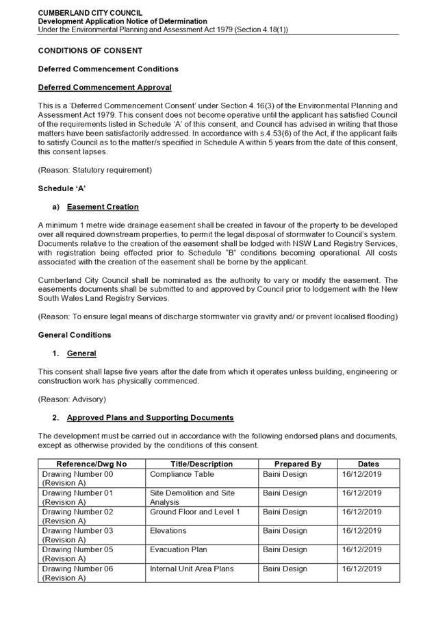
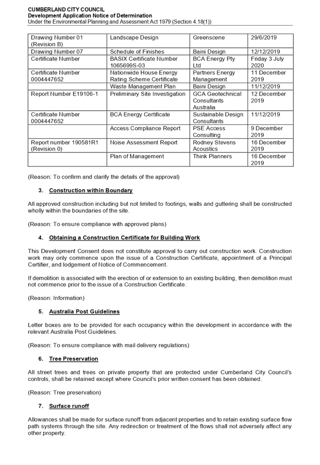
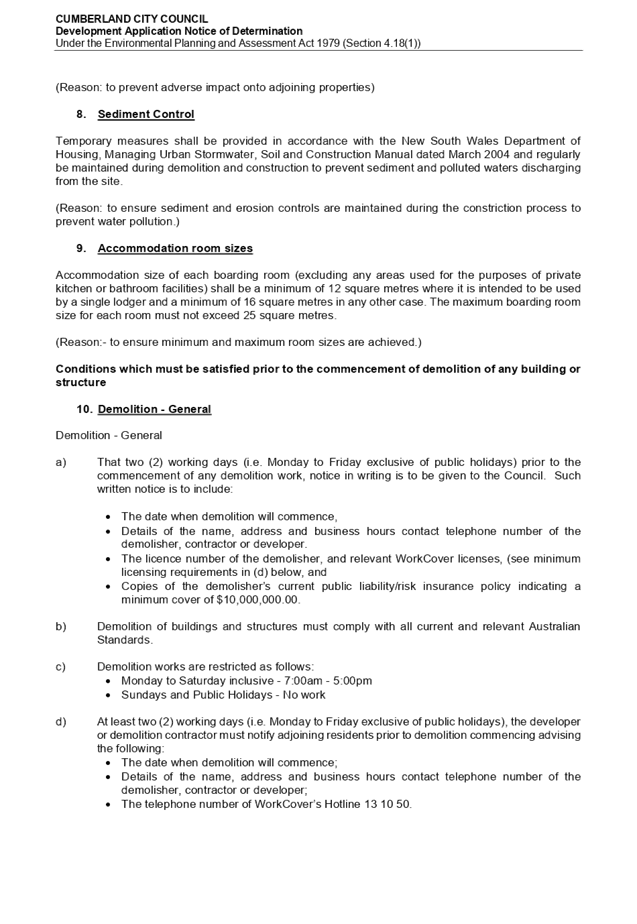
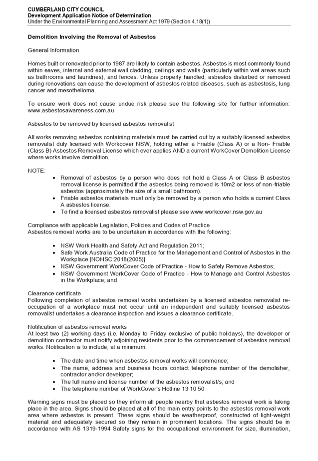
DOCUMENTS
ASSOCIATED WITH
REPORT LPP043/20
Attachment 2
Appendix A (BASIX Assessment)
Cumberland Local Planning Panel Meeting
12 August 2020

DOCUMENTS
ASSOCIATED WITH
REPORT LPP043/20
Attachment 3
Appendix B (Auburn Local Environment Plan 2010)
Cumberland Local Planning Panel Meeting
12 August 2020
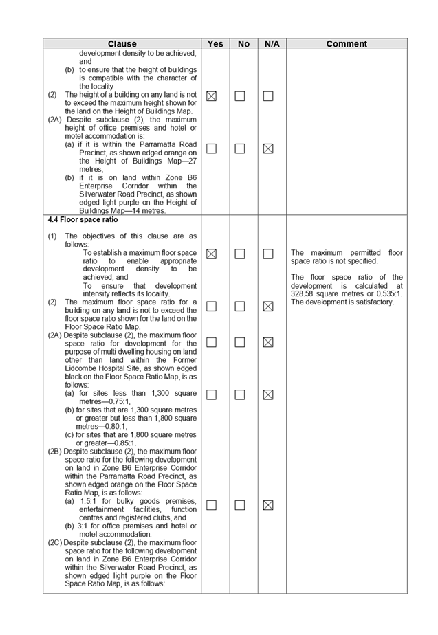
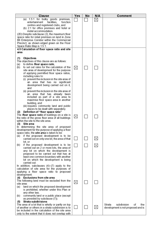
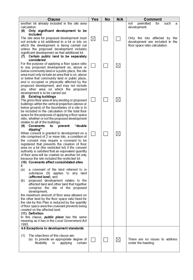

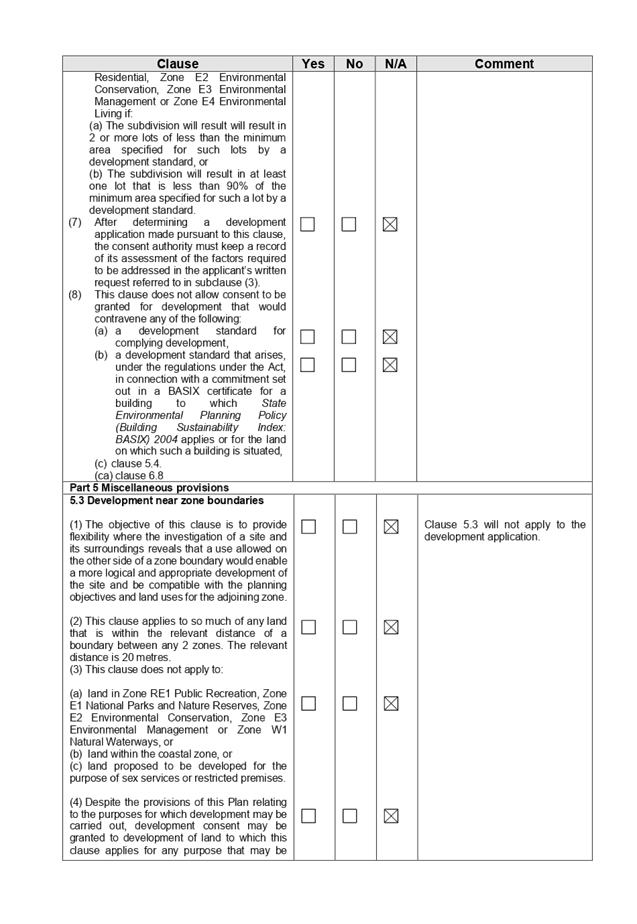
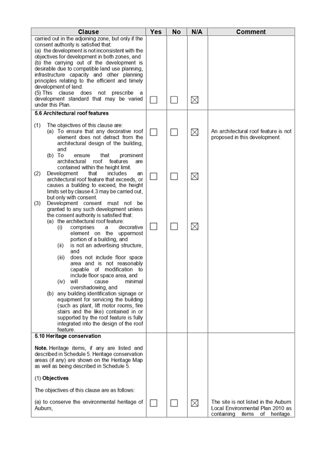
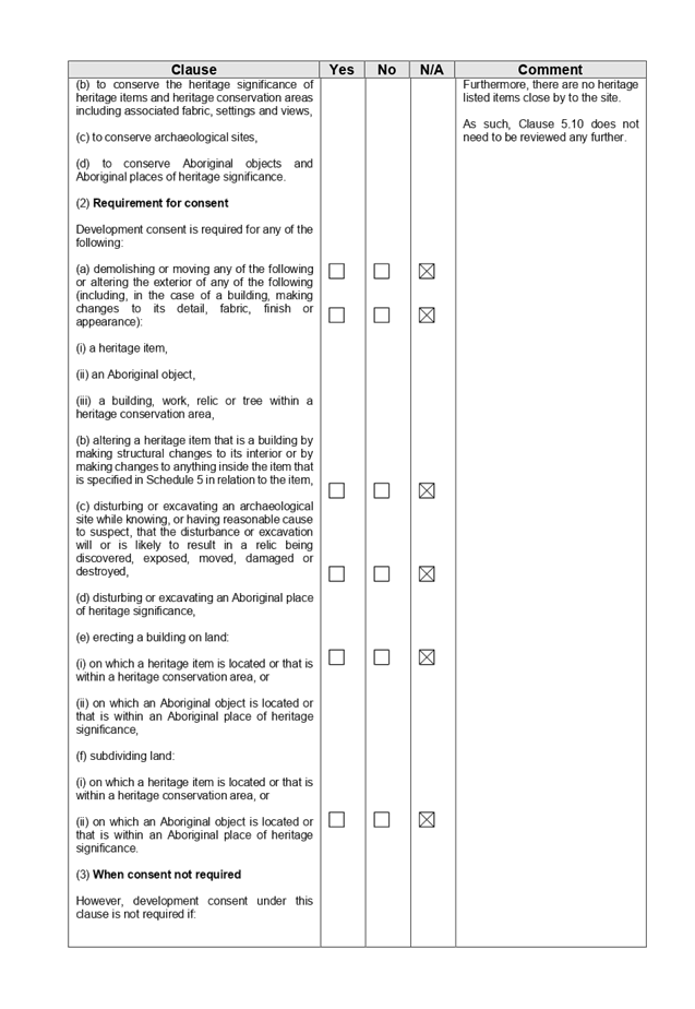
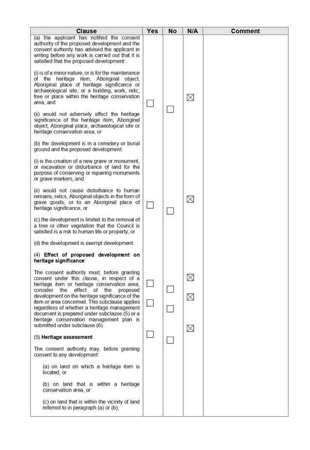
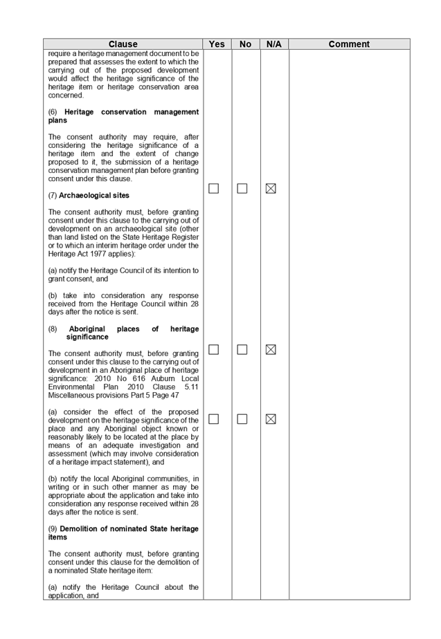
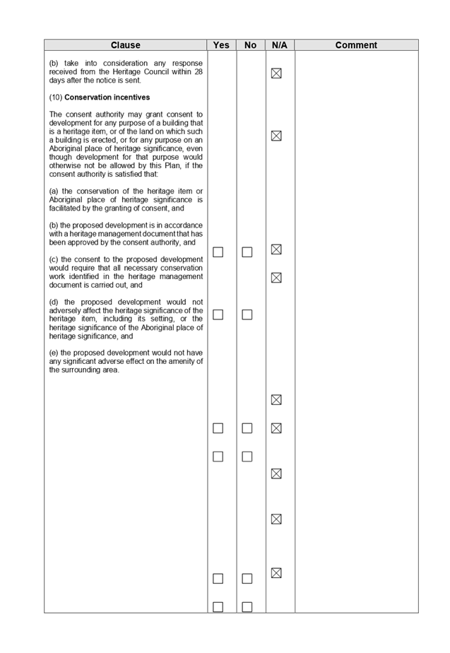
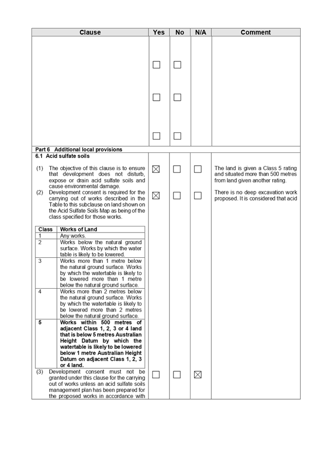
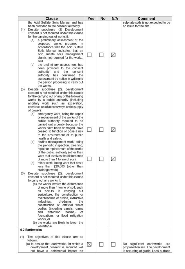

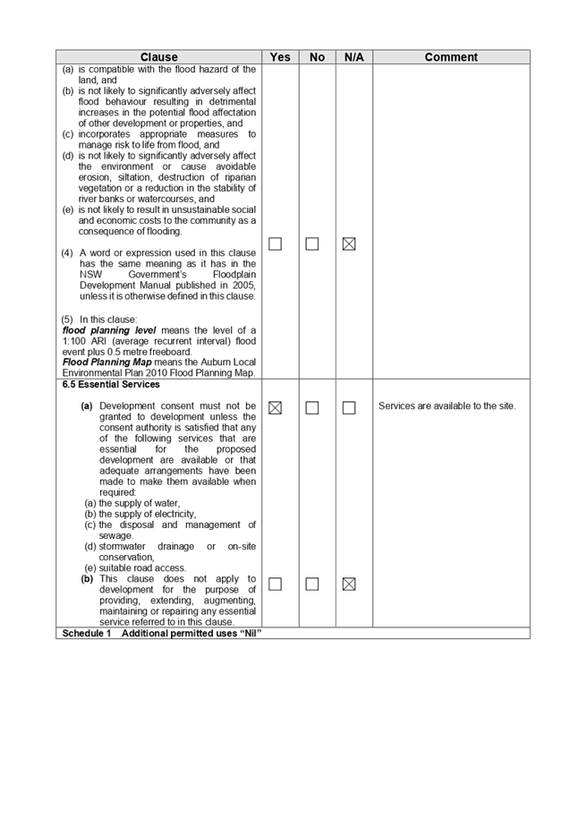
DOCUMENTS
ASSOCIATED WITH
REPORT LPP043/20
Attachment 4
Appendix C (Detached Dwellings and Dual Occupancy)
Cumberland Local Planning Panel Meeting
12 August 2020
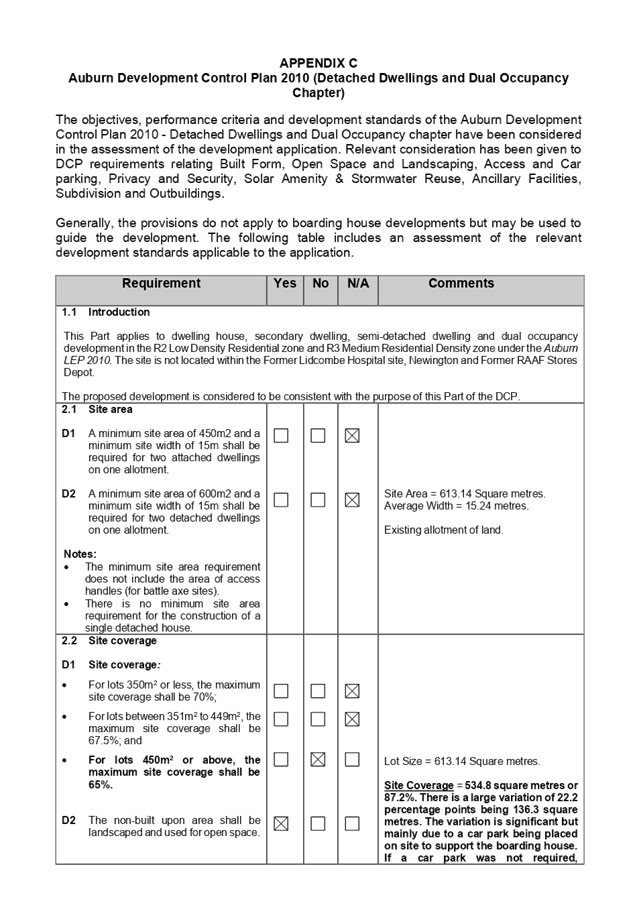
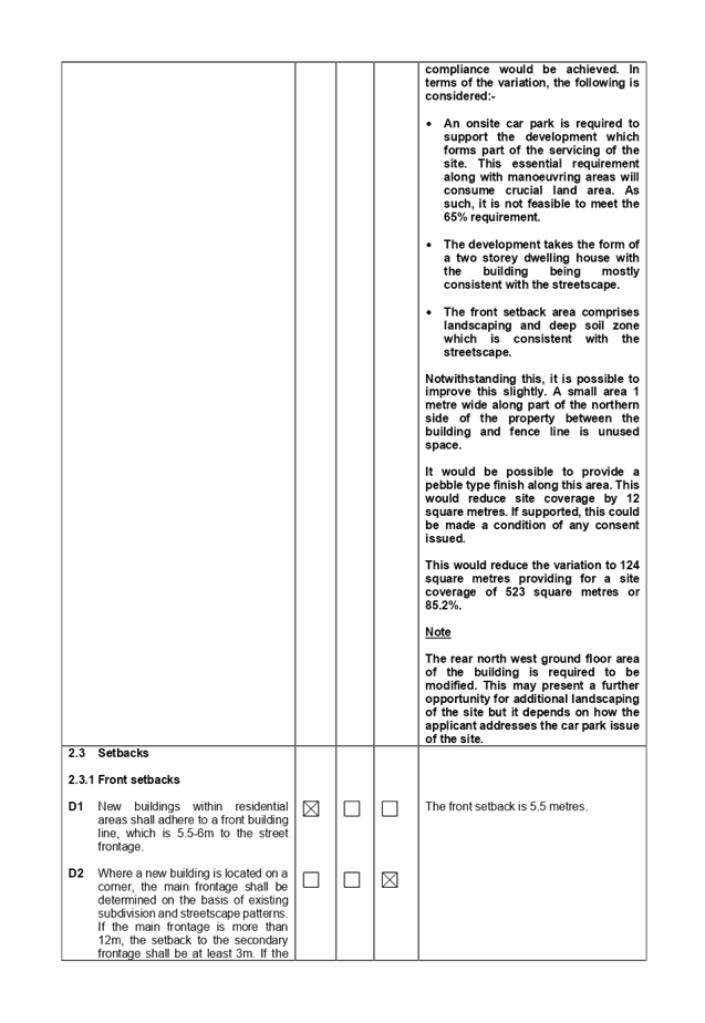
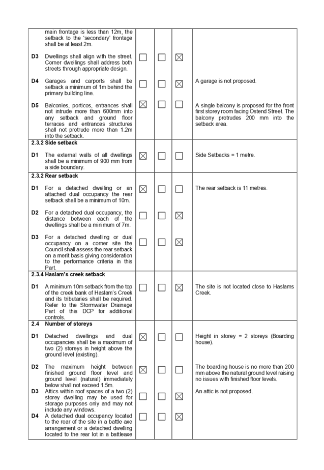
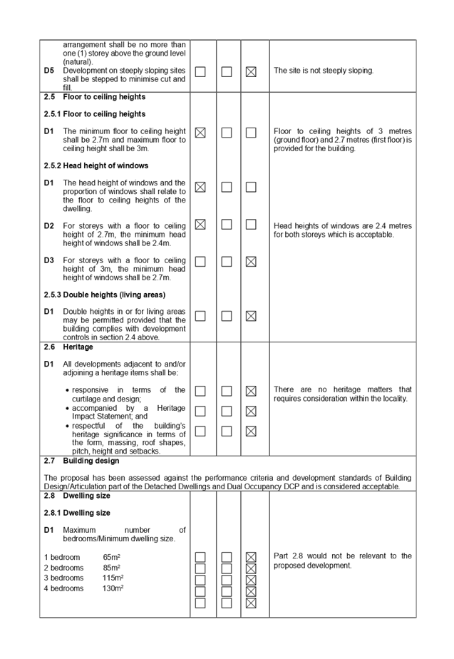
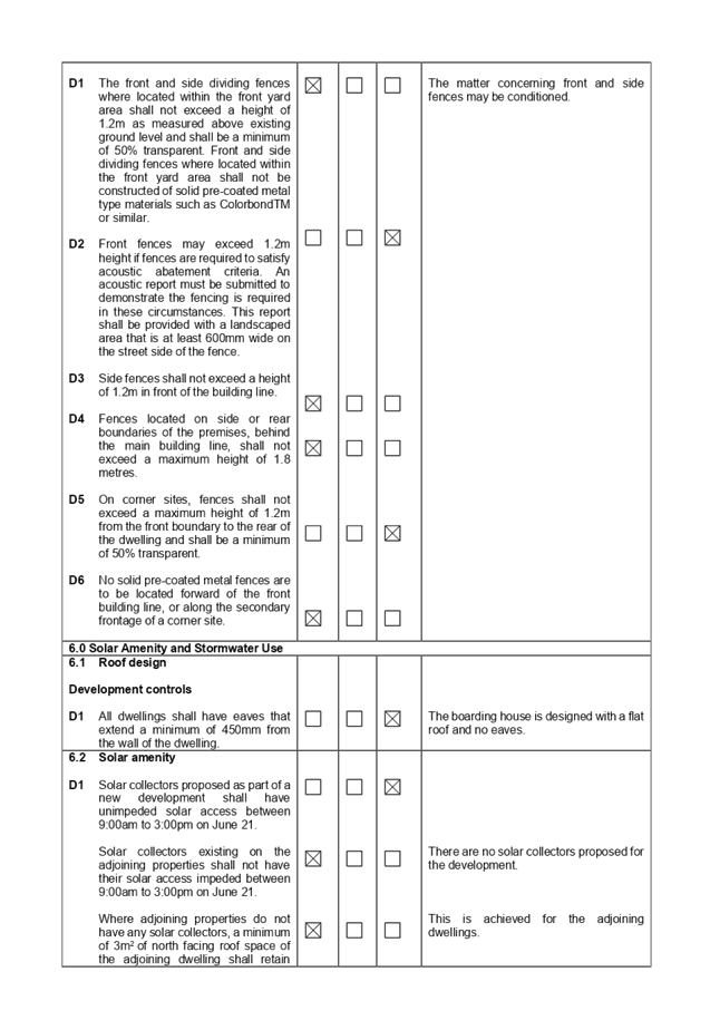
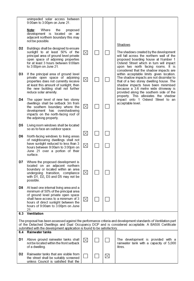
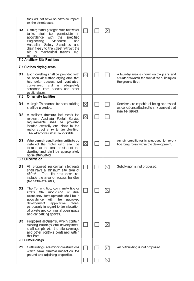
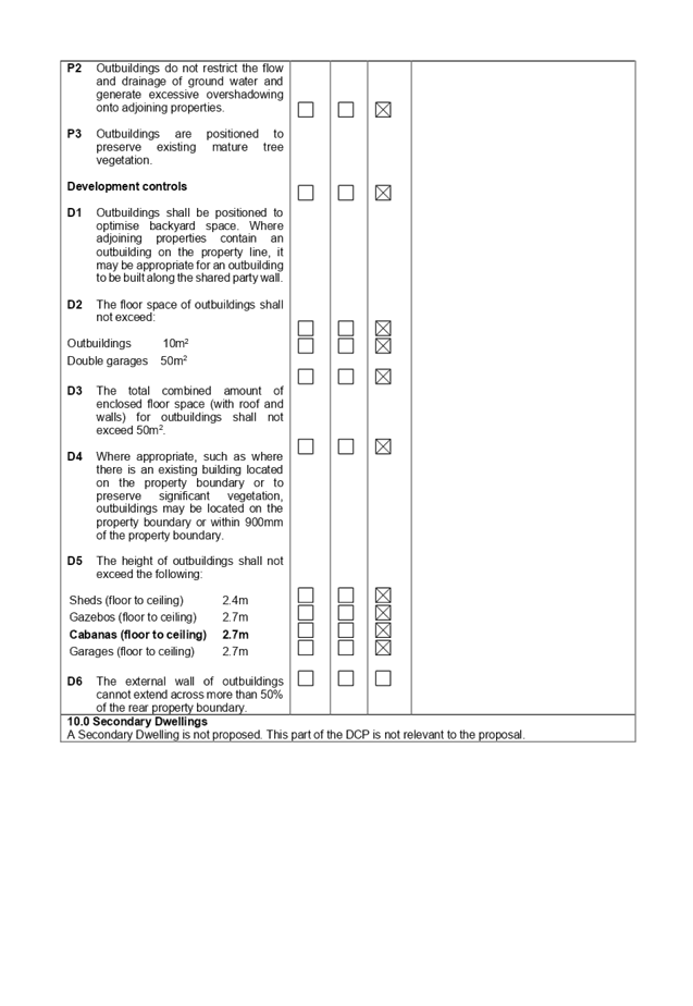
DOCUMENTS
ASSOCIATED WITH
REPORT LPP043/20
Attachment 5
Architectural Plans and Shadow Diagrams
Cumberland Local Planning Panel Meeting
12 August 2020
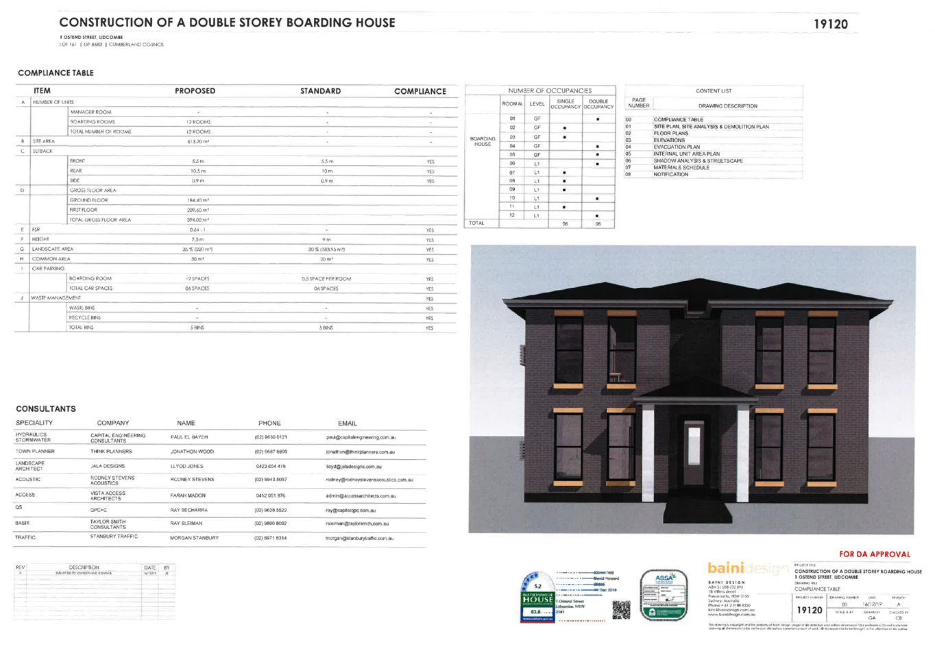
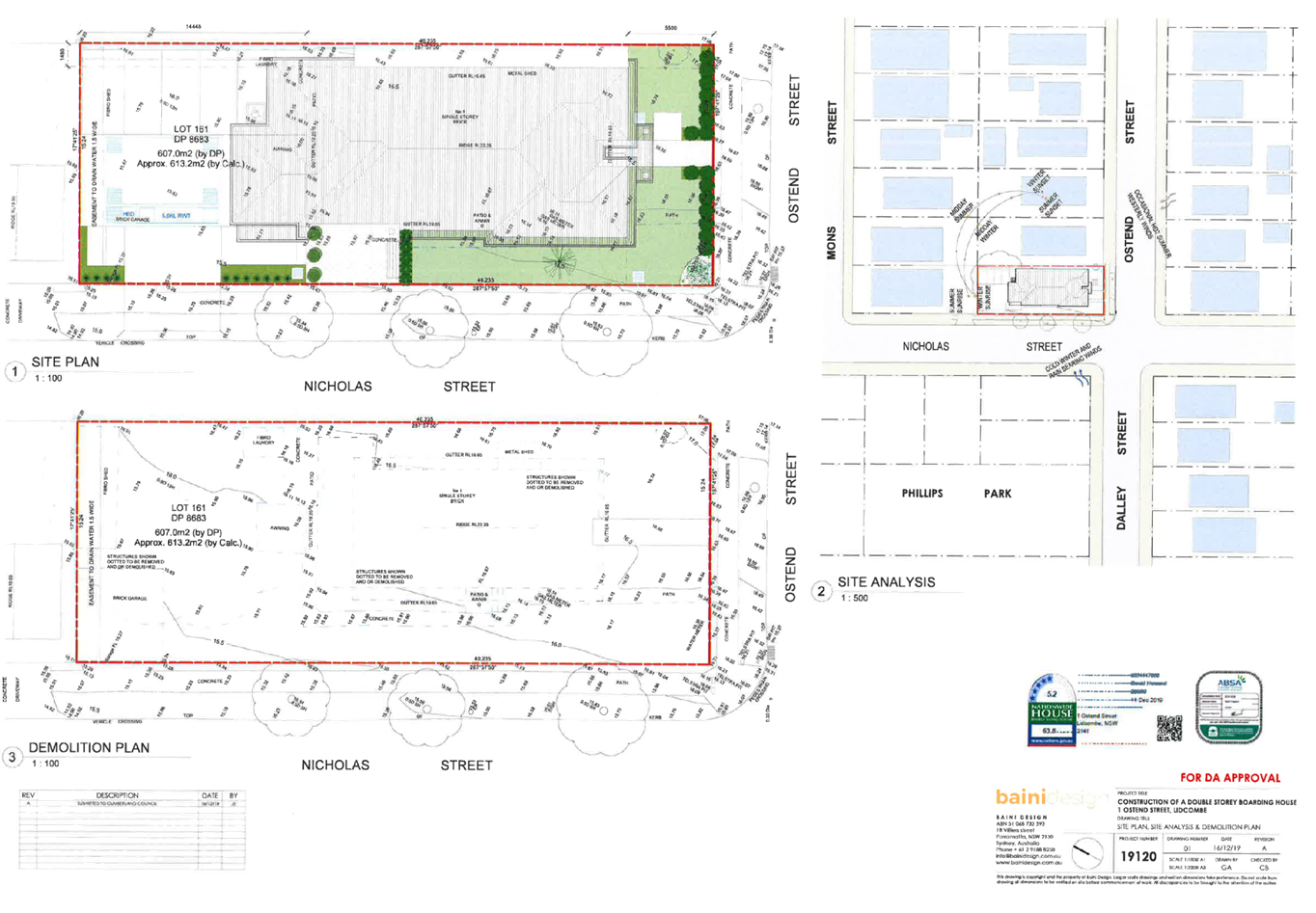
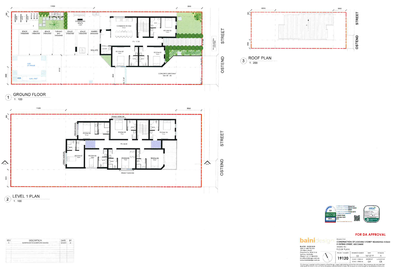
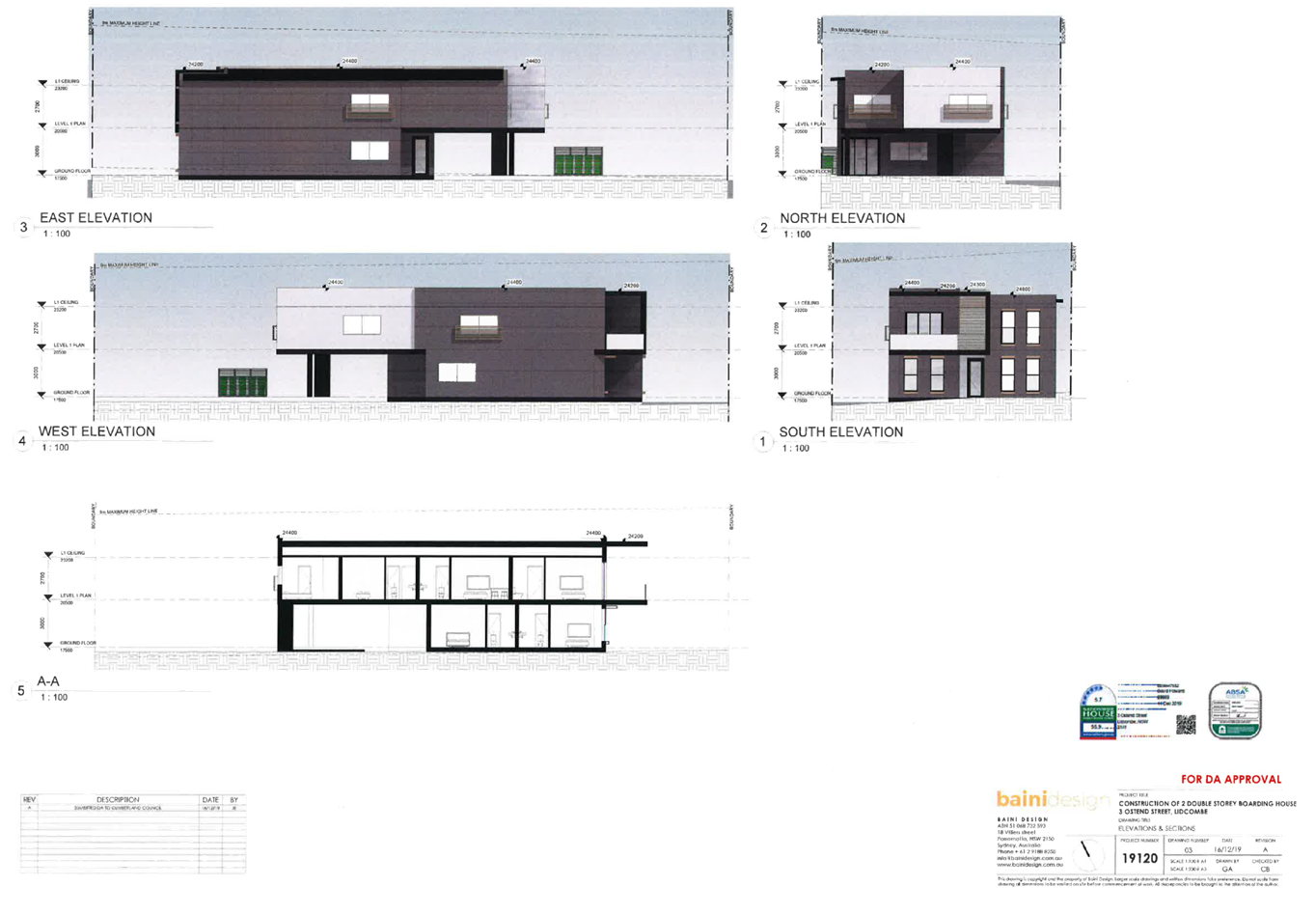
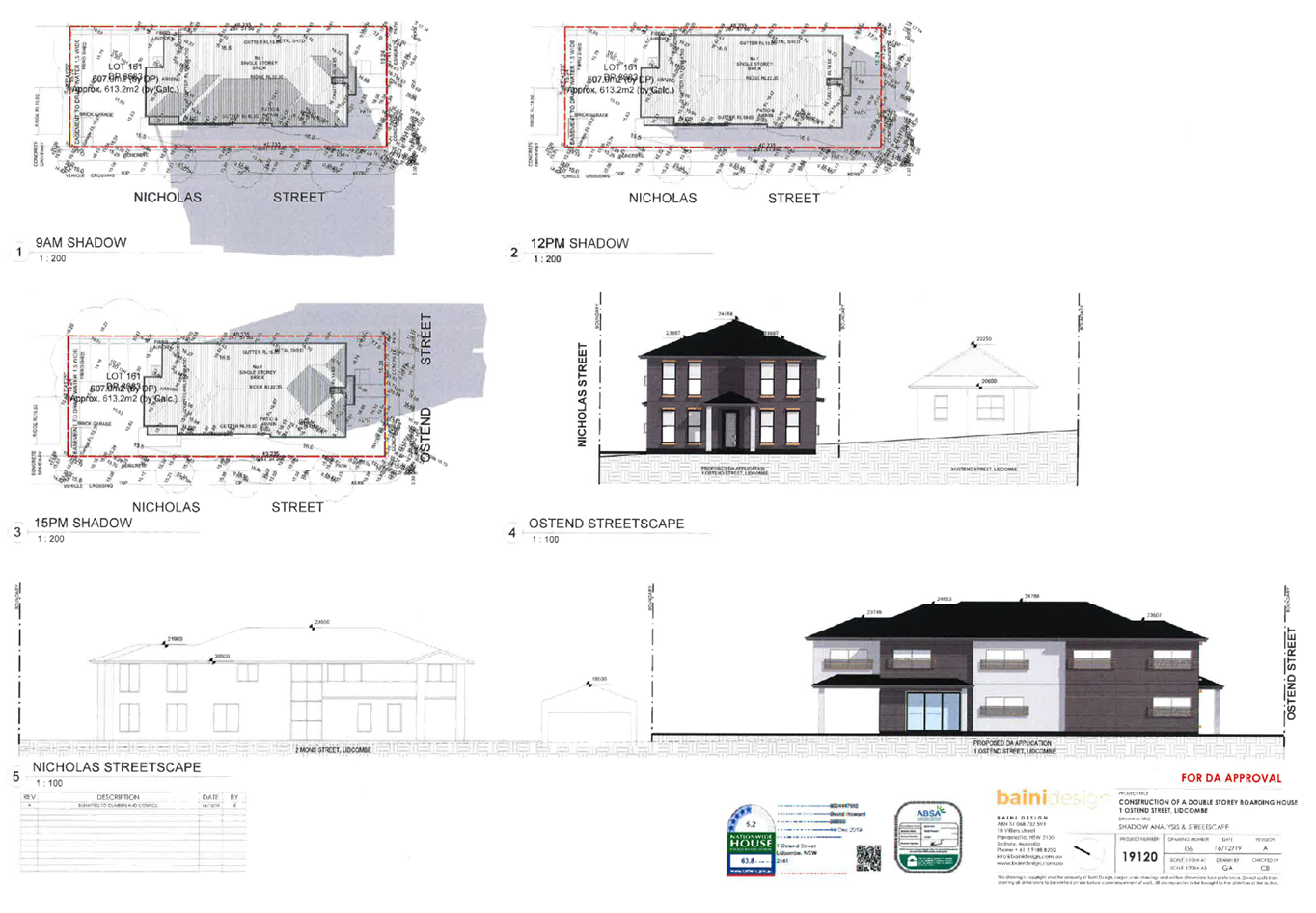
DOCUMENTS
ASSOCIATED WITH
REPORT LPP043/20
Attachment 6
Stormwater Plans
Cumberland Local Planning Panel Meeting
12 August 2020
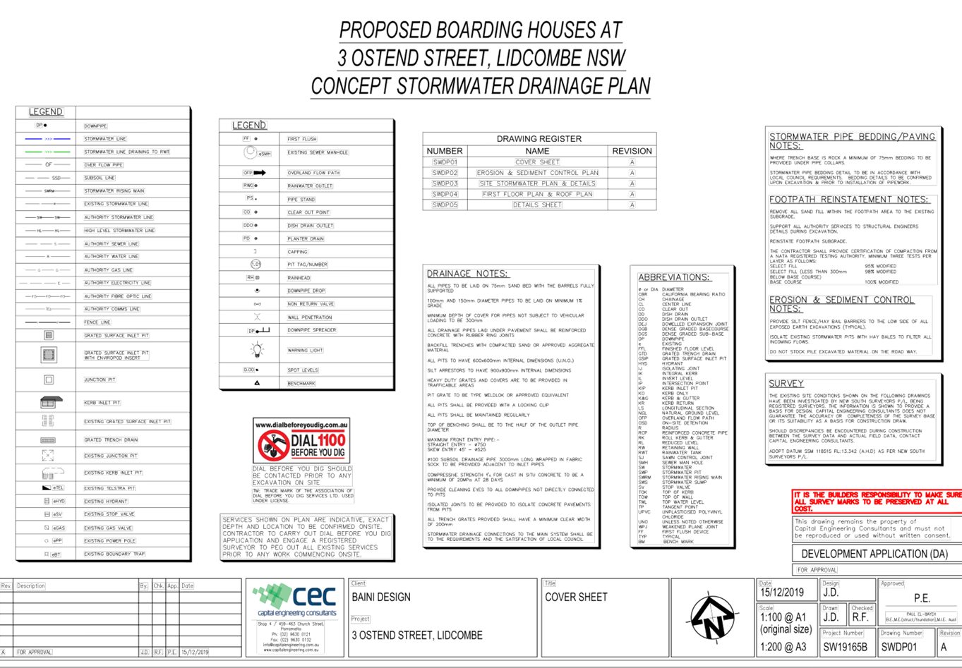
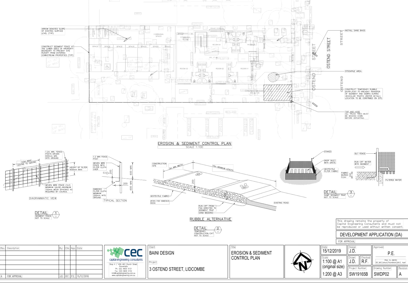
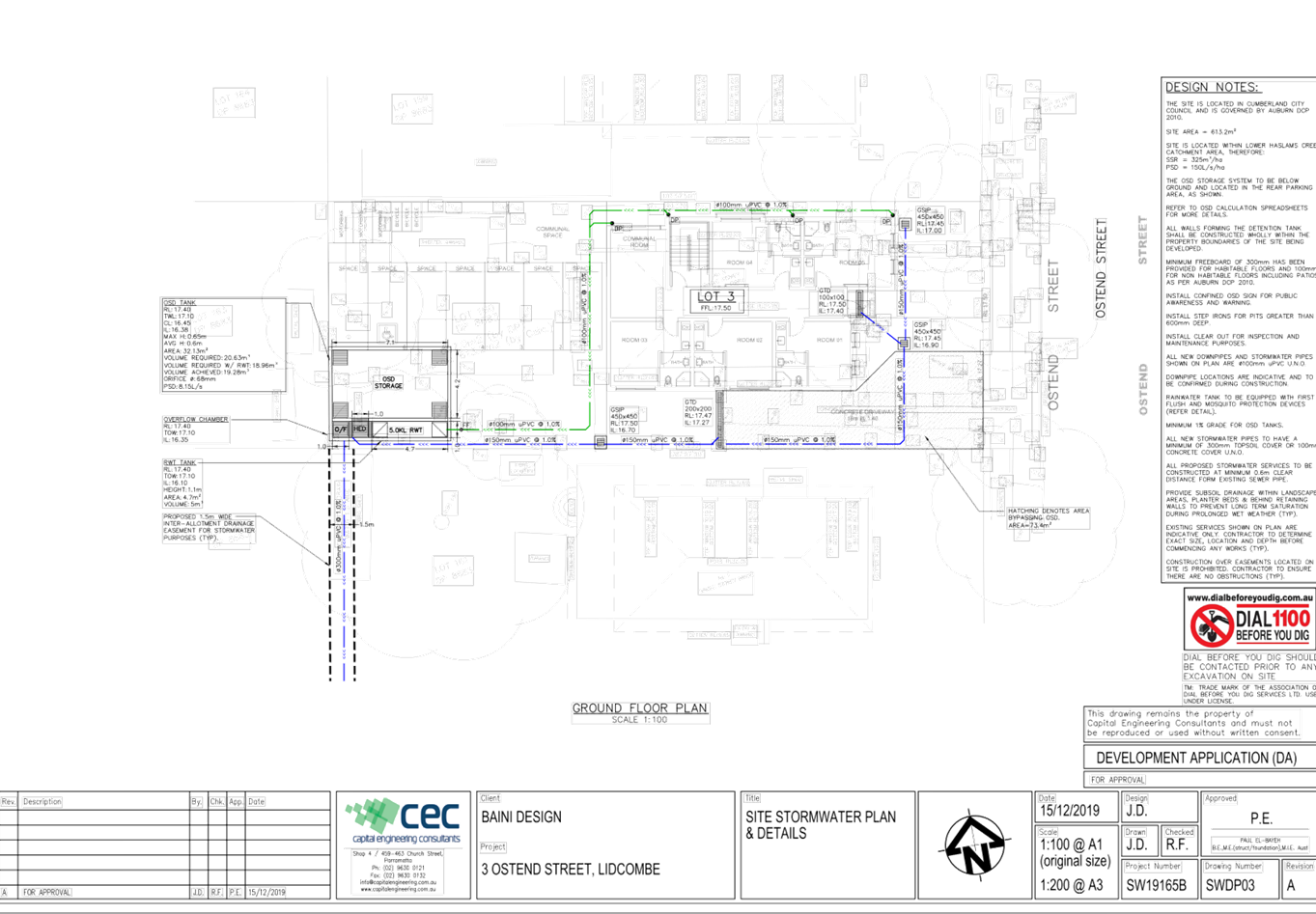
DOCUMENTS
ASSOCIATED WITH
REPORT LPP043/20
Attachment 7
Landscape Plan
Cumberland Local Planning Panel Meeting
12 August 2020
DOCUMENTS
ASSOCIATED WITH
REPORT LPP043/20
Attachment 8
Plan of Management
Cumberland Local Planning Panel Meeting
12 August 2020


DOCUMENTS
ASSOCIATED WITH
REPORT LPP043/20
Attachment 9
Submissions Received
Cumberland Local Planning Panel Meeting
12 August 2020

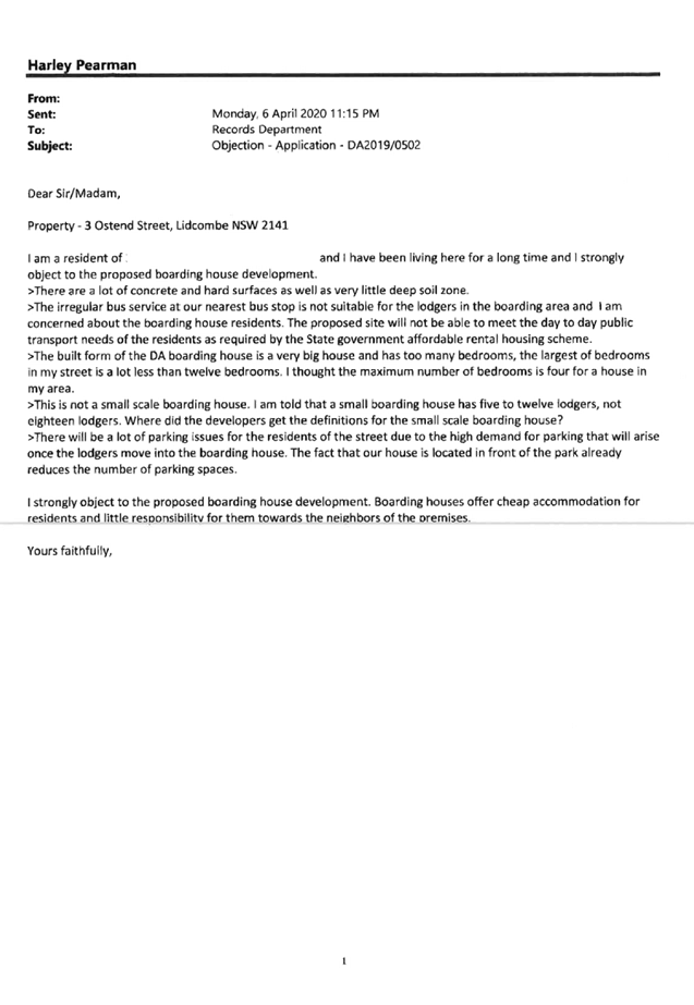
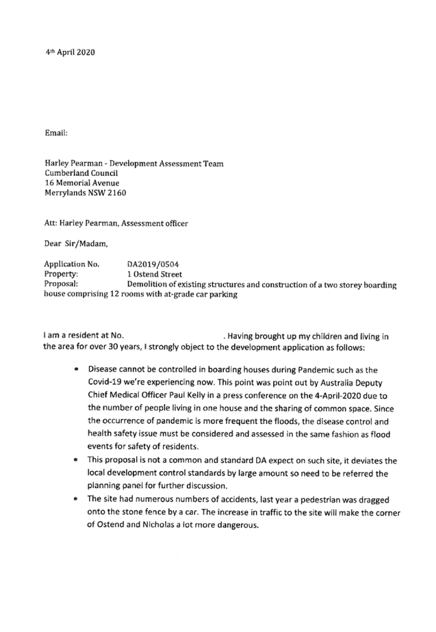

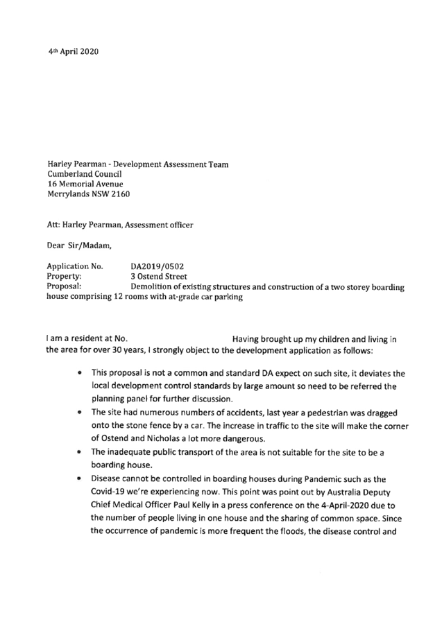

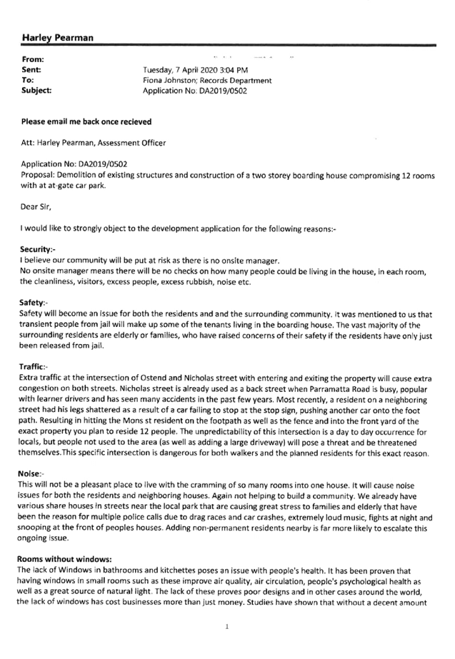
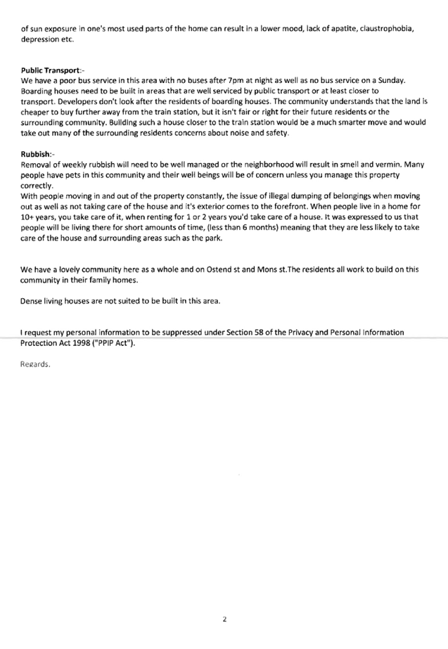
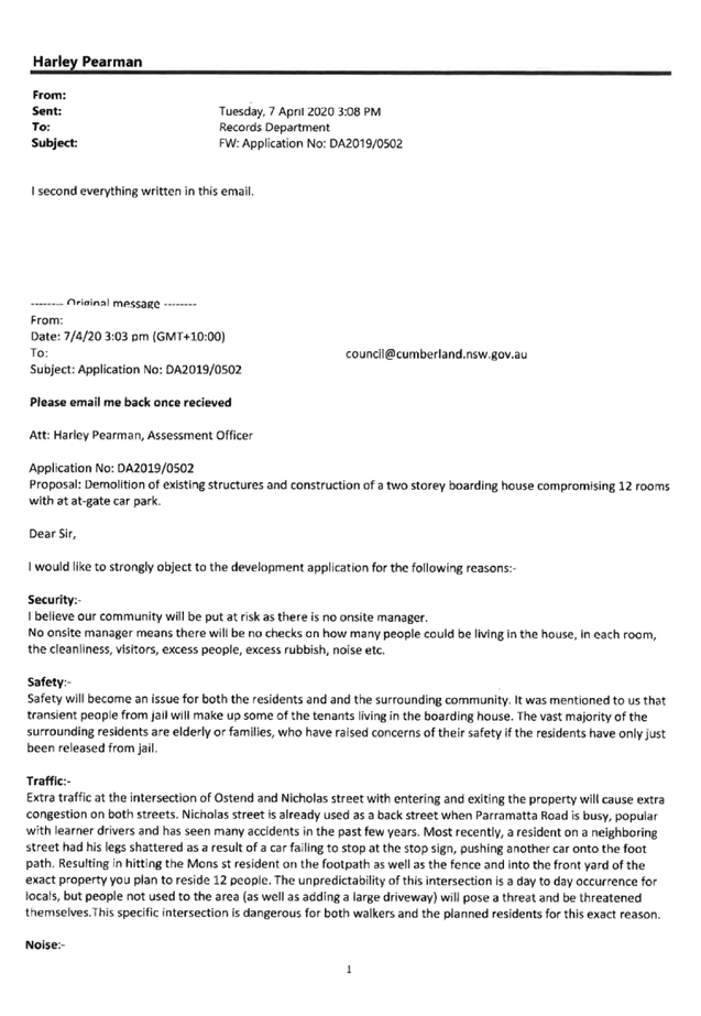

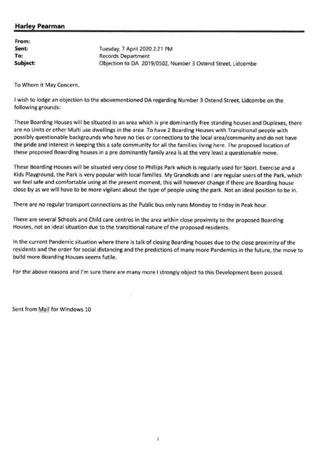
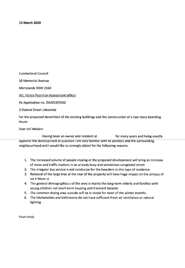
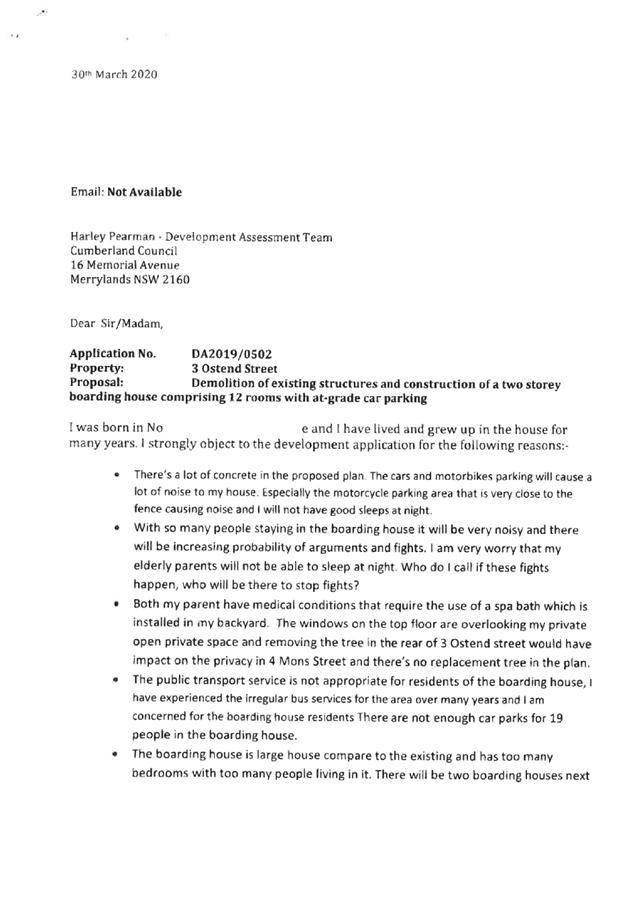

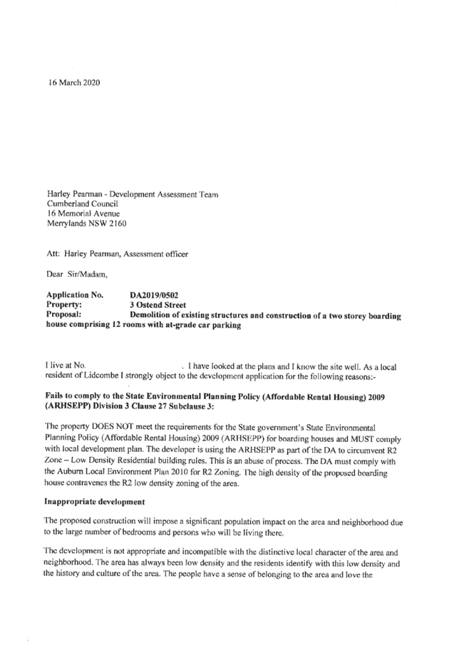

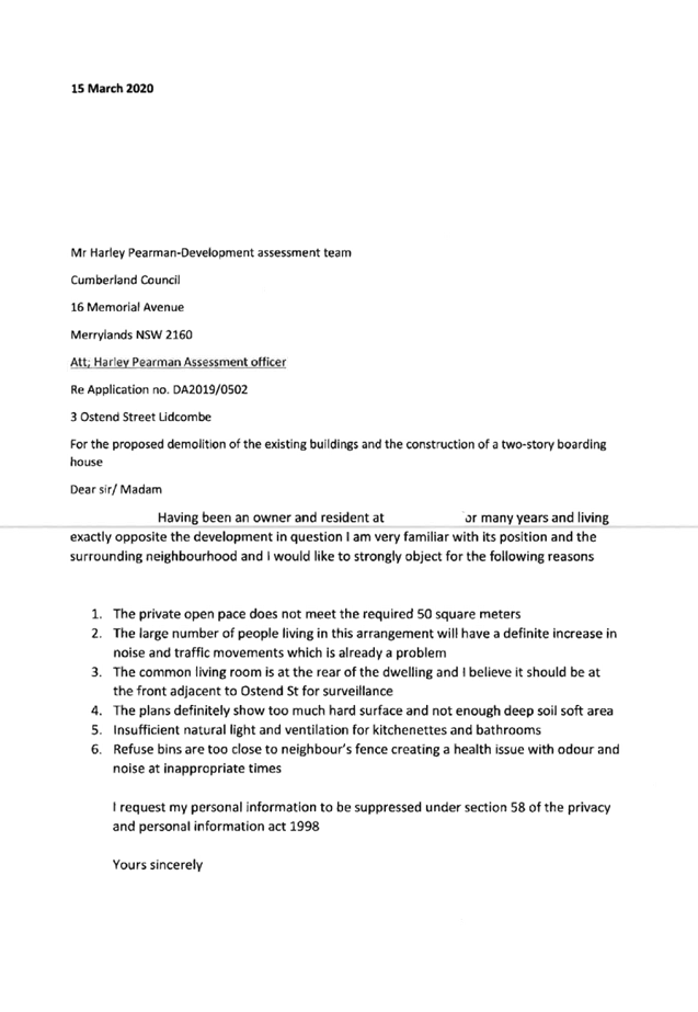
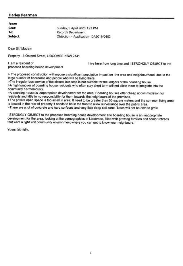
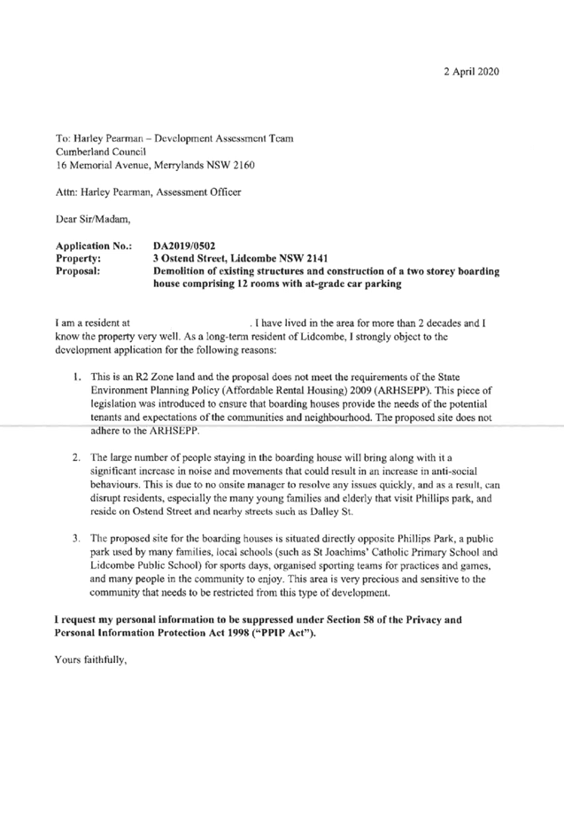
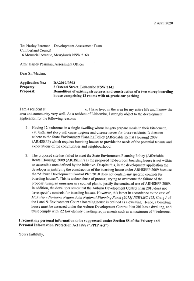

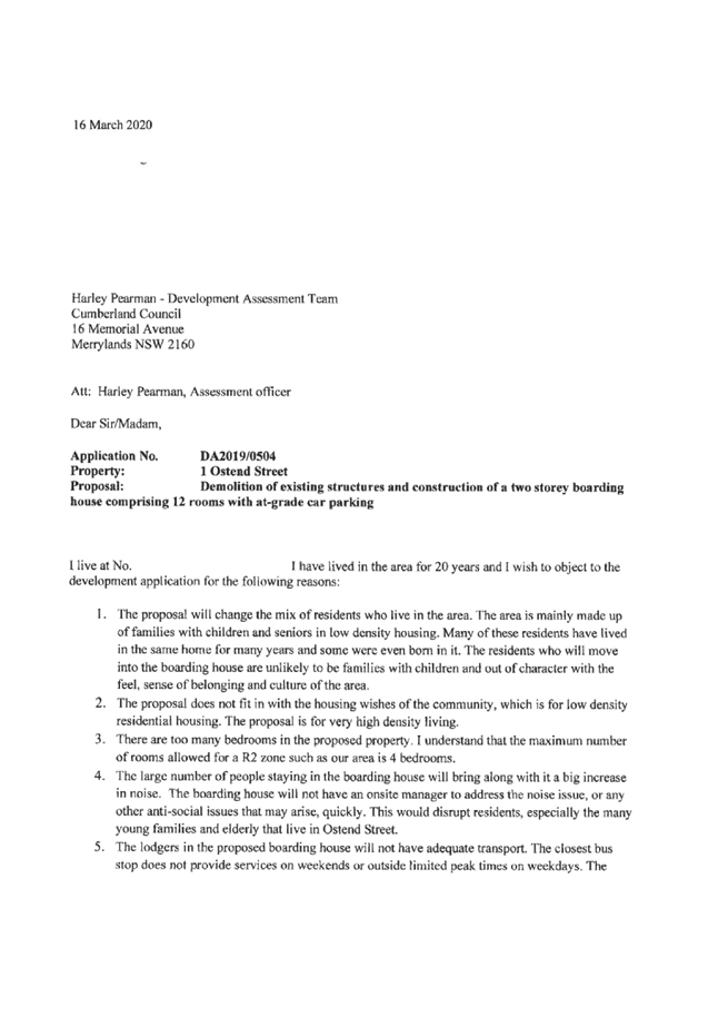

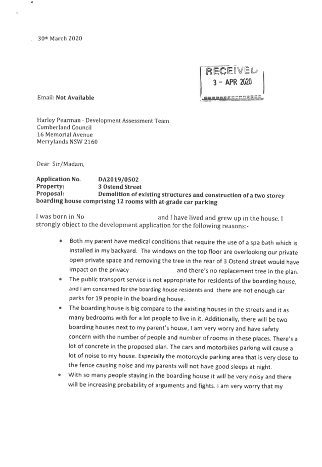
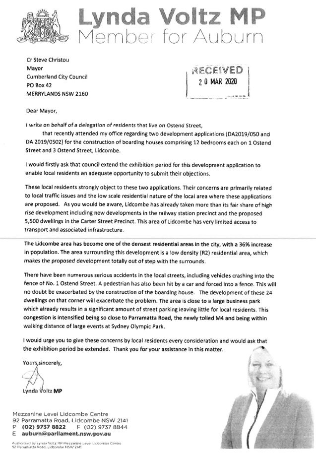
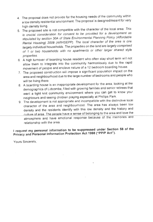
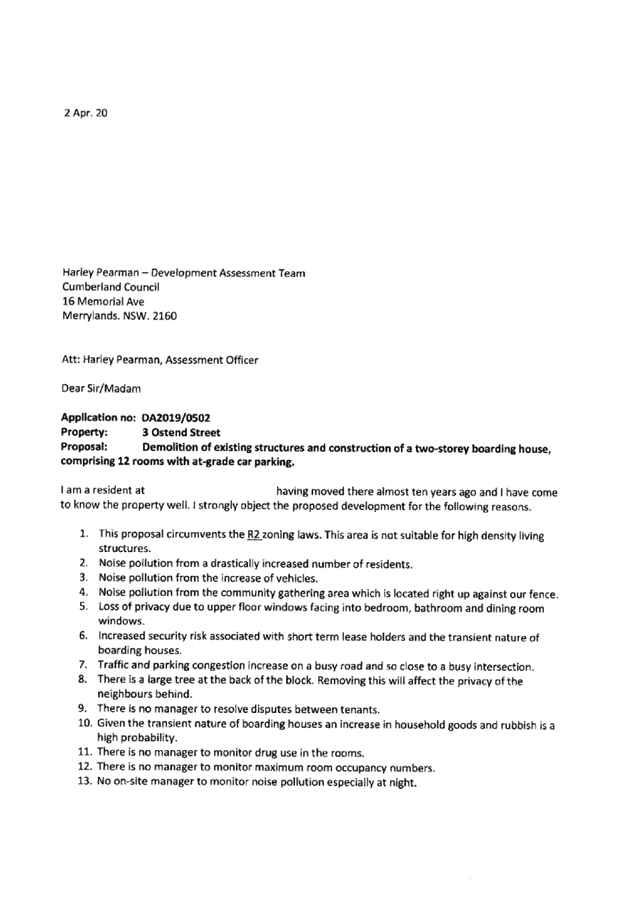

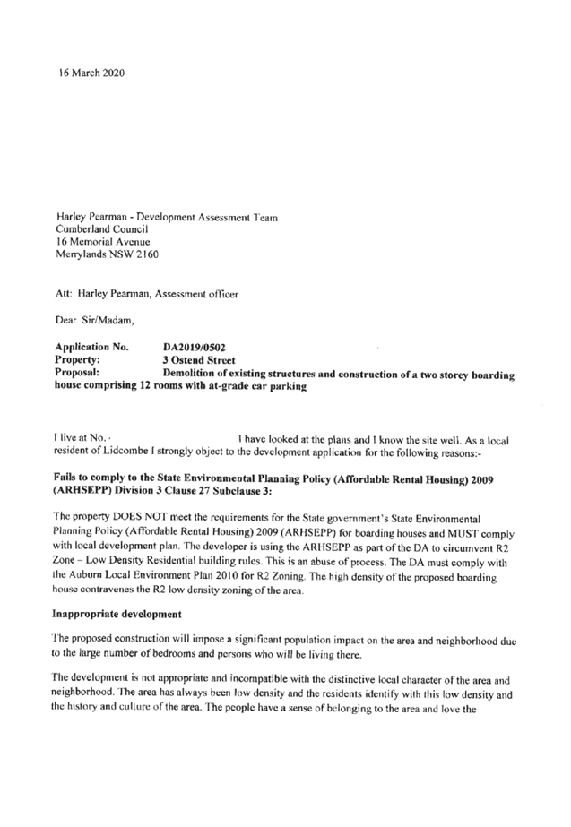

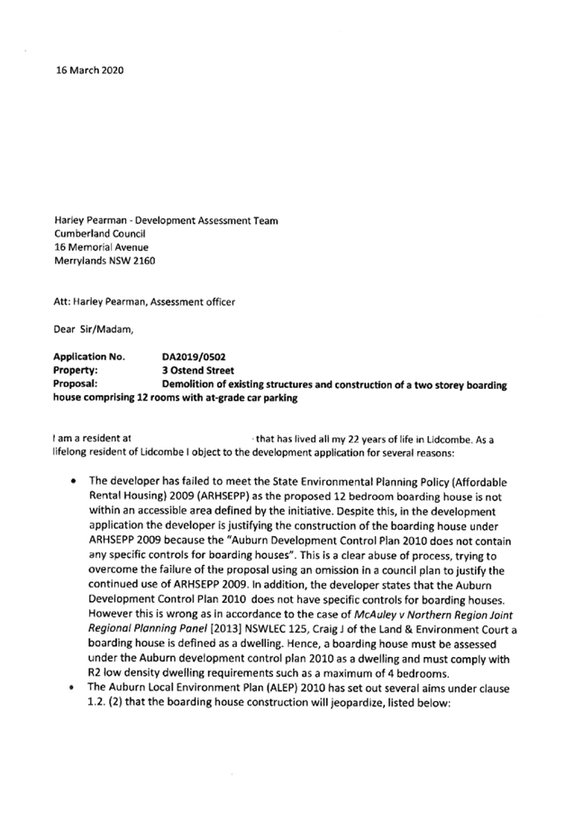

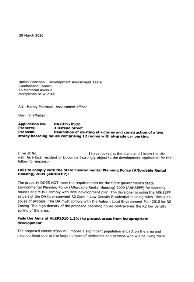

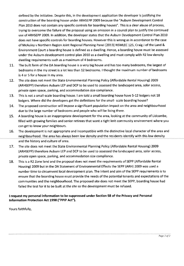


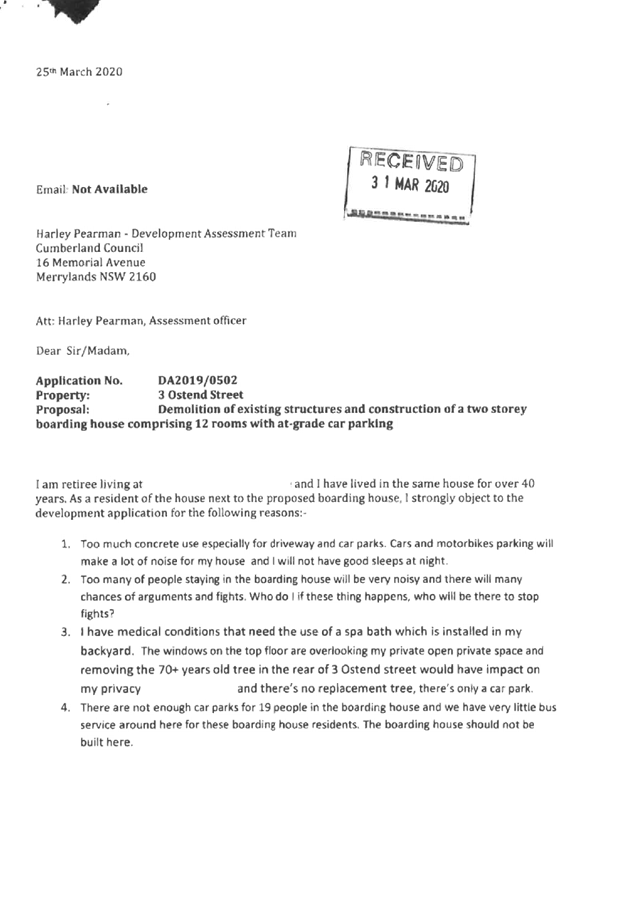


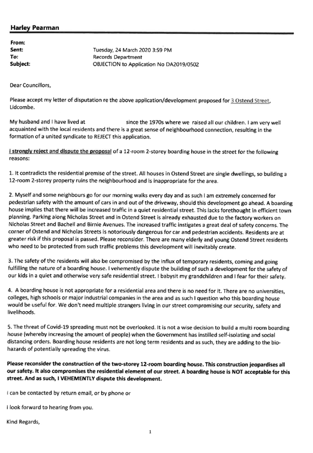

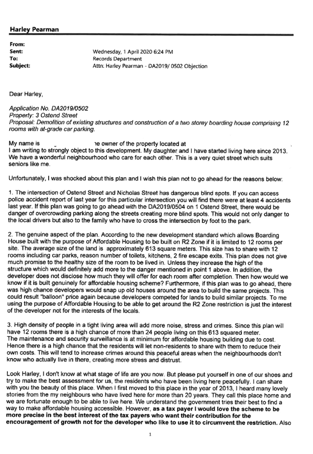


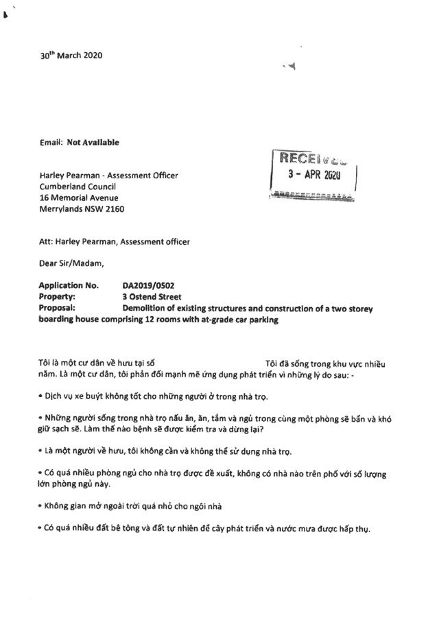


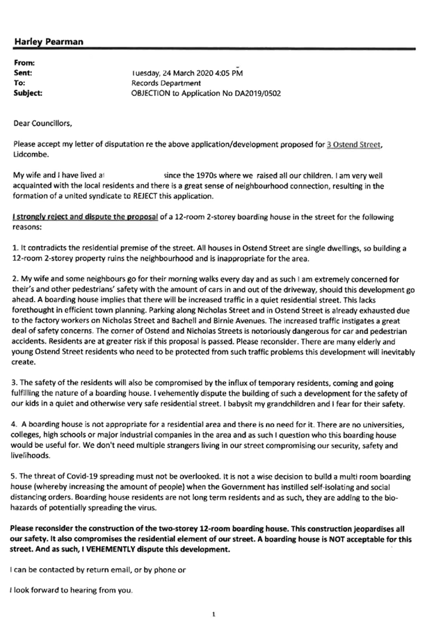

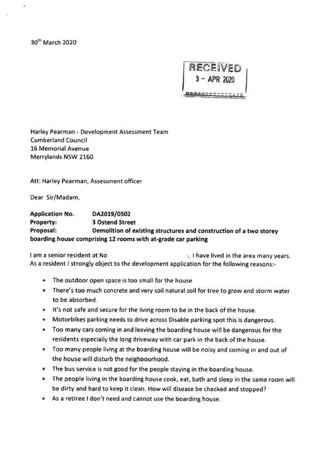


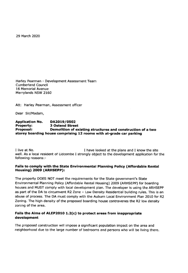


DOCUMENTS
ASSOCIATED WITH
REPORT LPP043/20
Attachment 10
Petition Received
Cumberland Local Planning Panel Meeting
12 August 2020
Cumberland
Local Planning Panel Meeting
12 August 2020
Item No:
LPP044/20
Planning
Proposal for a Senior Housing Development, Corner Dunmore Street and Pendle
Way, Pendle Hill
Responsible
Division: Environment
& Planning
Officer: Executive
Manager Development and Building
File
Number: PP2020/0012
|
Lodged
|
24 April 2020
|
|
Proponent
|
Keylan Consulting Pty Ltd
on behalf of Fresh Hope Care
|
|
Description
of Land
|
Lots 1,2,8-12 DP 24728, Lot
2 and 3 DP 5545208, Lot A DP 335578, Lot 472 DP 1204429, Dunmore Street and
Pendle Way, Pendle Hill
|
|
Site
Area
|
7.3 hectares
|
|
Site
Description and Existing use
|
Seniors housing development
with a 190-bed Residential Aged Care Facility (RACF), 86 Independent Living
Units (ILUs) a place of public worship (Pathways Community Church) and six
single-storey residential dwellings.
|
|
Proposal
|
Amendments to Holroyd
Local Environmental Plan 2013 to facilitate redevelopment of the site for
a new and expanded seniors housing development with a 240-bed RACF facility,
650 residential ILUs and affordable key worker housing units, community
facilities, allied health services and publicly accessible open space.
|
|
Existing
planning controls
|
Land
zone
|
R2 Low Density Residential
R3 Medium Density
Residential
R4 High Density Residential
|
|
Height
of building
|
9 metres
11 metres
|
|
Floor
space ratio
|
0.5:1
0.7:1
0.85:1
|
|
Schedule
1 additional permitted uses
|
Nil
|
|
Requested planning controls
|
Land zone
|
R4 High Density Residential
RE2 Private Recreation
|
|
Height of building
|
12.5 metres
32 metres
|
|
Floor space ratio
|
0.85:1
1.5:1
|
|
Schedule 1 additional
permitted uses
|
Additional permitted uses under Schedule 1 of ‘food
and drink premises’ and ‘medical centre’
|
|
Recommended planning controls
|
Land
zone
|
R4 High Density Residential
RE2 Private Recreation
|
|
|
Height
of building
|
12.5 metres
32 metres
|
|
|
Floor
space ratio
|
0.85:1
1.5:1
|
|
|
Schedule
1 additional permitted uses
|
Additional permitted uses
under Schedule 1 to allow development for including ‘food and drink
premises’ and ‘medical centre’ uses on R4 zoned land
|
|
Heritage
|
The site contains two local
heritage items, Dunmore House and Ashwood House, both of which
are proposed to be retained.
|
|
Disclosure
of political donations and gifts
|
Nil
|
|
Previous
considerations
|
Nil
|
|
|
|
|
This report provides an overview
of a Planning Proposal Request submitted to Council on 24 April 2020 for a
7.3Ha site on the corner of Dunmore Street and Pendle Way, Pendle Hill.
The proposal seeks to facilitate
redevelopment of the site for a new and expanded seniors housing development
with a greater mix of land uses including a residential aged care facility,
independent living units, affordable key worker housing, community facilities,
allied health services and publicly accessible open space. This will be
achieved by amending the Holroyd LEP 2013 to:
· Rezone
part of the site from R2 Low Density Residential and R3 Medium Density
Residential to part R4 High Density Residential and part RE2 Private Recreation
· Amend
the maximum height of buildings that apply to the site from 9 metres and 11
metres to 12.5 metres to 32 metres
· Amend
the FSR controls that apply to the site from 0.5:1, 0:7:1 and 0.85:1 to 0.85:1
and 1.5:1
· Introduce
a Schedule 1 amendment to permit ‘food and drink premises’ and
‘medical centre’.
The status of the Planning
Proposal is shown in Figure 1.
Figure
1: Status of the Planning Proposal
Site Location and Context
The site is located on the corner
of Dunmore Street and Pendle Way, Pendle Hill. The site is rectangular in shape
and comprises of ten lots, being Lots 1 and 2, 8-12 DP 24728, Lot 2 and 3 DP
5545208, Lot A DP 335578, Lot 472 DP 1204429, with a total area of 7.3Ha.
The site is currently occupied by
an existing seniors housing development that is operated by Fresh Hope Care and
comprises a Residential Aged Care facility with capacity for 190 residents, 86
Independent Living Units and a place of public worship (Pathways Community
Church). There are six single-storey residential dwellings along Pendle Way
that also form part of the site.
The site has a street frontage to
Dunmore Street of approximately 330 metres and street frontage to Pendle Way of
220 metres. There are a number vehicular access points from Dunmore Street and
Pendle Way into the site. A footpath provides pedestrian access from the bus
stop on Pendle Way into the centre of the site.
The site has a fall of
approximately 11.5m to the east along the north south axis, with the highest
topographical point being at Dunmore House and the lowest point being at the
corner of Dunmore Street and Pendle Way. There is also a fall to the Bonds
Spinning Mills site.
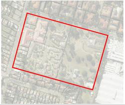
Figure
2: The Site
Local Context
The site is located approximately
300 metres from the Pendle Hill local centre and train station.
Surrounding development includes:
· A
mix of low density residential dwellings and low rise 3 storey residential flat
buildings on Pendle Way.
· Low
rise 3 storey residential flat buildings on Dunmore Street.
· Low
density residential dwellings on Collins Street and Rowley Street.
· The
Bonds Spinning Mill site that adjoins the eastern boundary and comprises of
industrial warehouse buildings; however, this will evolve into a high density
residential living environment when redeveloped.
Regional Context
The site is located in the suburb
of Pendle Hill which is 4.5 kilometres west of Parramatta CBD and 25 kilometres
west of the Sydney CBD.
Wentworthville local centre and
Wentworthville train station are located approximately 1.5 kilometres to the
east. The Westmead Health and Education Precinct is located approximately 3
kilometres to the east.
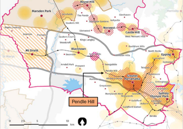
Figure
3: Regional Context
Current Planning Controls
(Holroyd LEP 2013)
The site is zoned R2 Low Density
Residential, R3 Medium Density Residential and R4 High Density Residential,
with maximum Height of Building controls of 9m and 11m and Floor Space Ratio
controls of 0.5:1, 0.7:1 and 0.85:1 applying across the site. The site contains
two local heritage items of Dunmore House (I94) and Ashwood House (I95). The
adjoining Bonds Spinning Mills is identified as an archaeological site and
includes a heritage item. These controls are shown graphically in Figures 4 to
7.
Figure
4: Current Land Use Zoning
Figure
5: Current Height of Buildings
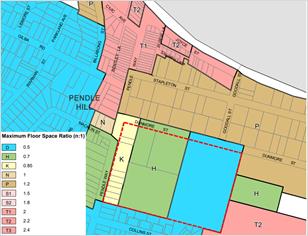
Figure
6: Current Floor Space Ratio
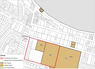
Figure
7: Current Heritage Items
Planning Proposal Request
The Planning Proposal seeks to
amend the Holroyd LEP 2013 to:
· Rezone
the site to R4 High Density Residential and RE2 Private Recreation
i)
· Amend
the maximum height of buildings to 12.5 metres and 32 metres
ii)
· Amend
the FSR controls to 0.85:1 and 1.5:1
iii)
· Introduce
a Schedule 1 amendment to permit ‘food and drink premises’ and
‘medical centre’
The changes to planning controls
identified in the Planning Proposal Request is outlined in Figures 8 to 11.
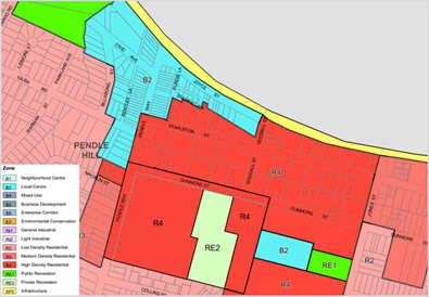
Figure
8: Proposed Land Use Zones in Planning Proposal Request
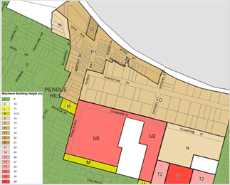
Figure
9: Proposed Height of Buildings in Planning Proposal Request
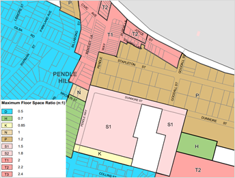
Figure
10: Proposed Floor Space Ratio in Planning Proposal Request

Figure
11: Proposed Additional Permitted Use in Planning Proposal Request
The intended outcome of the
Planning Proposal is to facilitate redevelopment of the site for the purpose of
a seniors living development including:
· Buildings
of up to 8 storeys in height, comprising an indicative total of 650 independent
living units (ILUs) and affordable housing units and a 240-bed residential aged
care facility (RACF).
· Approximately
755 m2 of community facilities floor space in the heritage listed
Dunmore House and approximately 1,120 m2 of non-residential floor
space in the heritage listed Ashwood House.
· Basement
level car parking to meet the required car parking demand.
· Approximately
51,709 m2 (70% of the total site area) of open space (including
publicly accessible communal and private open space), with the retention of
significant vegetation on the site.
· New
publicly accessible spaces throughout the site featuring new or upgraded
vehicle and pedestrian through-site links.
The proponent has prepared a
site-specific development control plan which sets out a detailed planning and
design framework to guide the redevelopment of the site. This is
consistent with the indicative masterplan as shown in Figure 12.
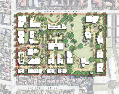
Figure
12: Indicative Masterplan
Public Benefit Offer
The proponent has proposed a
public benefit offer that may include:
· The
provision of affordable housing for low or very low-income households; and/or
· The
provision and ongoing maintenance of landscaping, public footpath linkages and
public furniture within the publicly accessible open space, including the open
space curtilage, and/or
iv)
· The
refurbishment, ongoing maintenance and provision of community related uses at
Dunmore House, and/or
v)
· A
substantial area of publicly accessible open space to be zoned RE2 Private
Recreation and comprising Dunmore House and its curtilage.
Should Council endorse that the
proposal proceed to a Gateway Determination, Council will negotiate a Voluntary
Planning Agreement with the proponent to ensure that any public offer for the
site maximises outcomes for the wider community and is consistent with the
Cumberland Planning Agreements Policy.
Strategic Merit Assessment
There is strategic merit in
progressing the proposal to the next phase of assessment based on the following
grounds.
Economic and Social Benefits
· There
are significant opportunities for aged care and retirement living in the
Cumberland area, with unmet demand for 4,320 aged care beds and 2,110
retirement living dwellings by 2036. The proposed redevelopment’s net
addition of 50 aged care beds and approximately 564 dwellings contributes in
meeting this forecast demand.
· The
proposed café is likely to complement rather than compete with similar
nearby businesses. Economic analysis submitted to support the proposal predicts
that 80% of all sales at the proposed café would be from within the
proposed development. This indicates that the proposed development would not
have an impact on the viability of nearby centres including Pendle Hill, the
Bonds site and Wentworthville.
· The
proposed medical centre is likely to complement rather than compete with nearby
businesses. The medical suites (or consulting rooms) at the proposed
redevelopment will host visiting GPs and allied health professionals by
appointment (usually organised by the facility’s management on a set
schedule) and as such will not be utilised by non-residents. This indicates a
low level of impact on medical facilities in Pendle Hill and Wentworthville.
· The
retirement living and aged care facility would generate approximately 320
direct ongoing jobs, plus a further 290 indirect jobs located in the wider
economy.
· The
proposal will involve the investment of hundreds of millions of dollars on site
and support an estimated 140 full time equivalent direct construction-related
jobs per year, and a further 430 full time equivalent indirect jobs elsewhere
in the economy.
· The
proposal is likely to add approximately 930 new permanent residents to the area
(excluding aged care residents) and 320 workers who can contribute to the local
economy through spending in nearby centres including Pendle Hill,
Wentworthville and the adjoining Bonds site.
Built Form
· The
increase in the scale and density of development on the site is balanced
through the design and siting of the proposed buildings and the provision of
appropriate setbacks and gradual height transitions.
· The
proposed site-specific development control plan provides certainty that the key
elements of the masterplan will be implemented even if the site is sold to
another owner, which is considered unlikely.
Heritage
· The
established heritage curtilage around both Dunmore House and Ashwood House
provides adequate separation between the indicative built forms to negate the
impact of the change to the LEP controls (see Figure 13).
· The
proposed incorporation of a through-site link to the former Bonds Spinning
Mills site reinforces the historic relationship between the two sites.
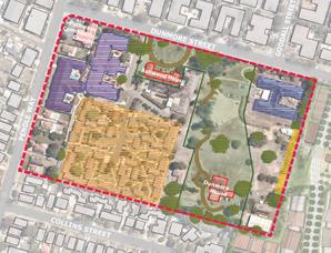
Figure
13: Existing Heritage Items and Curtilage
Traffic
· The
proposal is not expected to compromise the safety or function of the
surrounding road network. On any weekday or Saturday peak hour, the site is
expected to generate between 135 and 145 vehicle trips (90 to 100 more vehicle
trips than the existing facility).
Greater Sydney Region Plan
The proposal is consistent with
the following objectives of the Greater Sydney Region Plan:
· Objective
10 – Greater housing supply as the proposal will increase the supply of
housing for aged care and people with a disability.
· Objective
11 – Housing is more diverse and affordable as the proposal will deliver
accessible housing to a broad spectrum of seniors housing to cater for an
ageing population.
Central City District Plan
The proposal is consistent with
the following Planning Priorities of the Central City District Plan:
· Planning
Priority C4 – Fostering healthy, creative, culturally rich and socially
connected communities, as the site is well connected to a number of strategic
and local centres by public transport.
· Planning
Priority C5 – Providing housing supply, choice and affordability with
access to jobs, service and public transport, as the proposal will contribute
towards providing purpose built seniors housing to cater for an ageing
population. The proposal will also increase the housing supply in the
Cumberland area, assisting Council to meet its dwelling targets.
· Planning
Priority C20 – Adapting to the impacts urban and natural hazards and
climate change, as the master plan assists to mitigate the urban heat island
effect by increasing tree canopy cover on the site.
Cumberland 2030: Our Local
Strategic Planning Statement
The proposal is consistent with
the following key Local Planning Priorities:
· Local
Planning Priority 5 – Delivering hosing diversity to suit changing needs,
as the proposal will supply increase housing options for an ageing population.
· Local
Planning Priority 6 – Deliver affordable housing suitable for the needs
of all people at various stages of their lives, as the future redevelopment will
incorporate a number of accommodation options to enable people form a variety
of backgrounds and socio-economic status to age in place.
It is recommended that the
Planning Proposal Request be reported to Council seeking a resolution that the
Proposal be forwarded to the Department of Planning, Industry and Environment
for a Gateway Determination. This recommendation is made as:
· The
proposal will increase the supply of seniors housing, residential aged care
facilities and affordable key worker housing to meet forecast demand in the
Cumberland area.
· The
proposal will lead to the creation of a vibrant on-site community with the
inclusion of an additional 930 new permanent residents within the independent
living units, affordable key worker housing units and the residential aged care
facility.
· The
proposal has the potential for approximately 320 ongoing aged care and
retirement living jobs on the subject site, with additional jobs generated
throughout the wider local economy.
· The
proposal will support the provision of new allied health services to support
the on-site population.
· The
proposal supports the retention and adaptive reuse of existing heritage
buildings on the site, including the potential for Dunmore House to be provided
for community related uses.
The Planning Proposal Request and
supporting documents were exhibited for a period of 28 days, from 1 June 2020
to 29 June 2020 as required by Cumberland’s Planning Proposal
Notification Policy. Council received a total of 23 submissions, including one
submission in support from a Member of Parliament, Dr. Hugh McDermott MP, 17 in
support and 5 objecting. Key issues are summarised below:
In Support
· The
proposal will significantly benefit the local community by increasing the
supply of diverse housing options, facilitating intergenerational living.
· The
site will be a genuine community hub for onsite residents and the surrounding
community to come together, minimising social isolation.
· The
sites close proximity to the train station will allow for increased mobility
and access for the community.
· The
proposal will deliver 320 direct jobs in aged care and retirement living and
290 indirect jobs. The future construction will involve the investment of
hundreds of millions of dollars and will provide direct construction-related
jobs and indirect jobs in the community.
Opposed
· Pathways
Community Church expressed strong opposition to any development that would
remove the property and ministry without the due process of discussion and
permission.
· Proposed
building heights and density, especially in relation to privacy, overshadowing,
traffic, parking and noise.
· Urban
design consideration where a corridor created by the 2 storey high wall near
Collins Street will create blind spot and lead to crime.
· Traffic
impacts for roundabouts at Pendle Way/Magowar Road/Collins Street and Dunmore
Street/Jones Street.
· Asbestos
management during the redevelopment.
· Concerns
about the safety and security of residents by opening the site up to the
public.
General
· Suggestion
to relocate the entry/exit to Pendle Way.
· Request
for RE1 Public Recreation instead of RE2 Private Recreation to ensure public
access, better integration and connectivity between the site and adjoining
Bonds site.
· Need
for the protection and enhancement of views to and from Dunmore House.
· Voluntary
Planning Agreement needs to provide better public outcomes and should be
similar to the Agreement for the Bonds site.
No significant issues were raised
that would require Council not to consider requesting a Gateway Determination
for the Planning Proposal. The concerns regarding landowner permission
associated with the Planning Proposal have been responded to separately by
Council.
The planning proposal relates to
changes in planning controls and does not involve a detailed assessment of any
buildings or structures on the site. Issues raised in submissions such as
vehicular access, overshadowing, privacy and safety will be considered and
addressed as part of a future development application for the site.
Should Council endorse that the
proposal proceed to a Gateway Determination, Council will negotiate a Voluntary
Planning Agreement with the proponent to ensure that any public offer for the
site maximises outcomes for the wider community and is consistent with the
Cumberland Planning Agreements Policy.
There are no financial
implications for Council associated with this report.
This report recommends that this
matter be reported to Council for further consideration. Should Council resolve
to forward this planning proposal to the Department of Planning, Industry and
Environment for a Gateway Determination, there will be a number of policy
implications associated with the subsequent stages of the planning proposal
process. These will be outlined in subsequent Council reports.
Communication /
Publications:
There are no
communication/publication implications for Council associated with this report.
|
That the Cumberland Local
Planning Panel recommend that the Planning Proposal Request be reported to
Council, seeking a resolution to forward a Planning Proposal to the
Department of Planning, Industry and Environment for a Gateway Determination.
|
1. Planning
Proposal Request
2. Economic
Assessment
3. Urban
Design Report
4. Urban
Design Peer Review
5. Transport
Impact Assessment
6. Aboriginal
Heritage Due Diligence
7. Historic
Archaeology Assessment
8. Heritage
Impact Statement
9. Preliminary
Contamination Assessment
10. Social
Impact Assessment and Management Plan
11. Summary
of Submissions
DOCUMENTS
ASSOCIATED WITH
REPORT LPP044/20
Attachment 1
Planning Proposal Request
Cumberland Local Planning Panel Meeting
12 August 2020
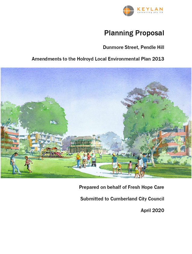


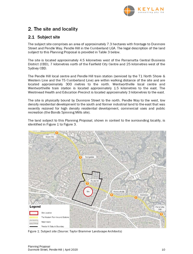
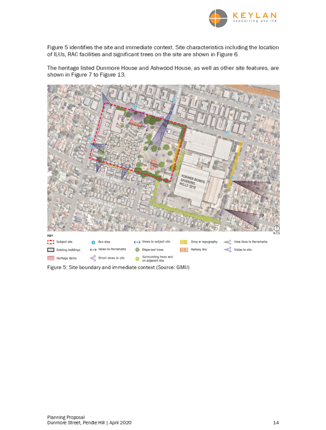
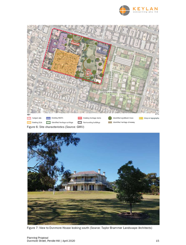
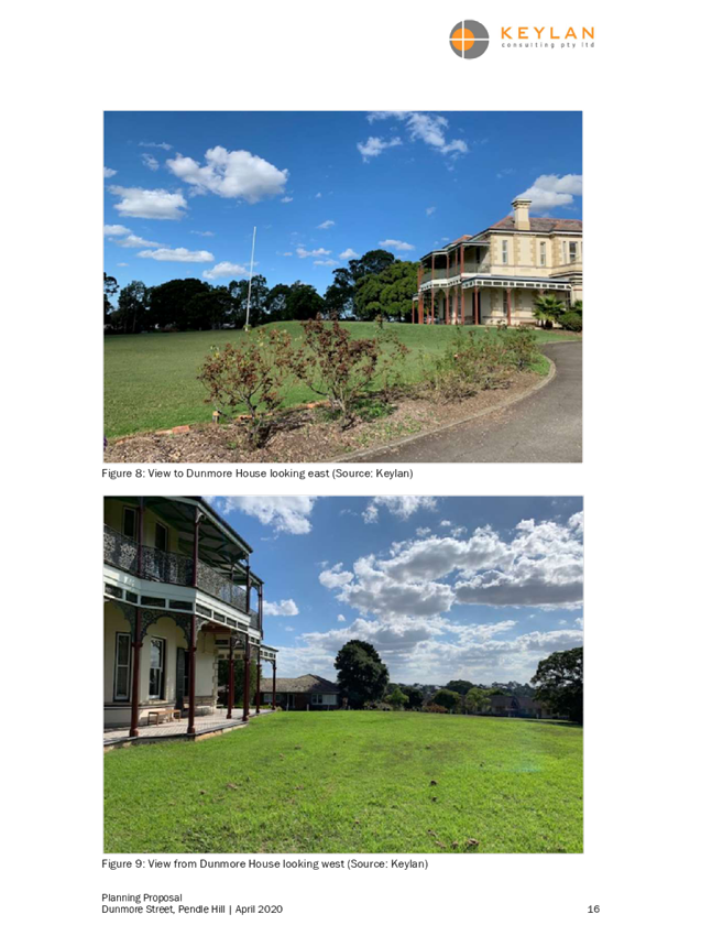
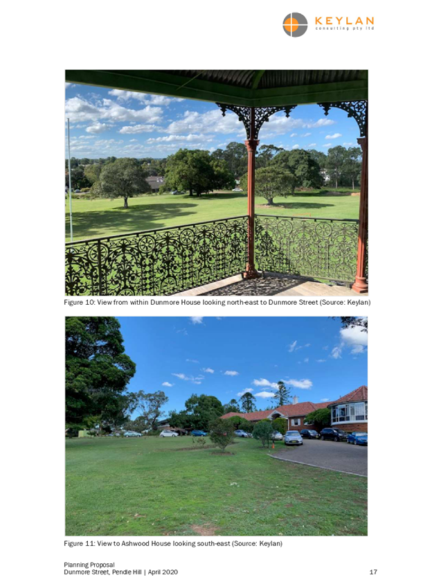
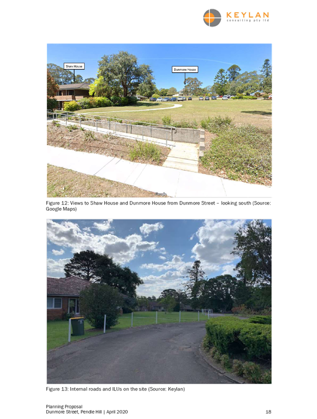
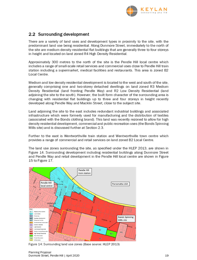
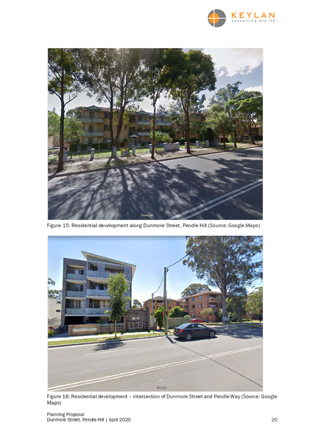
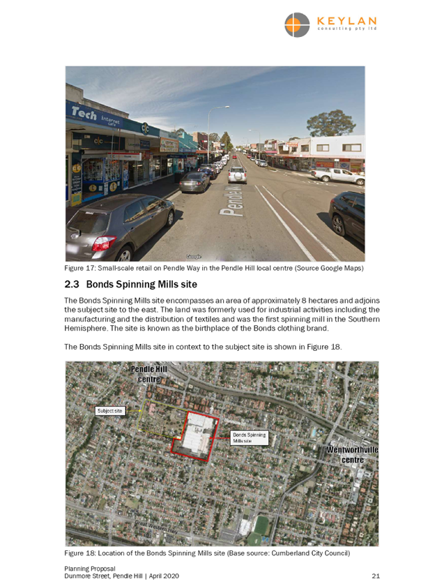
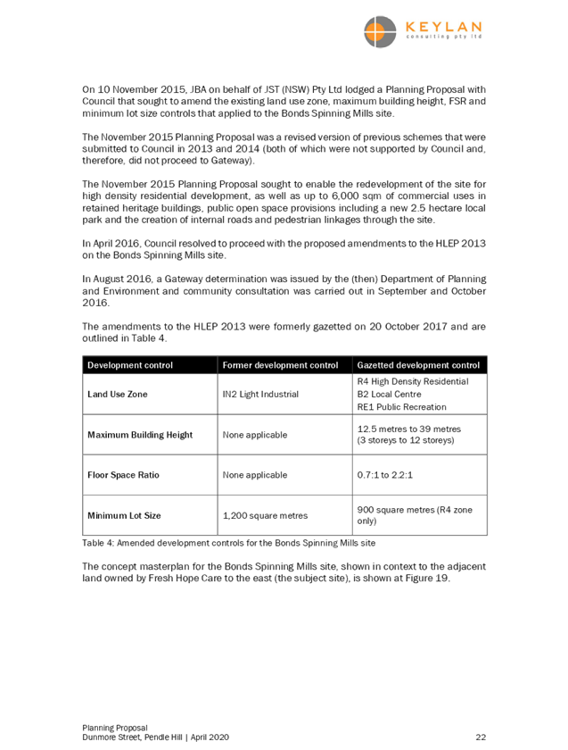
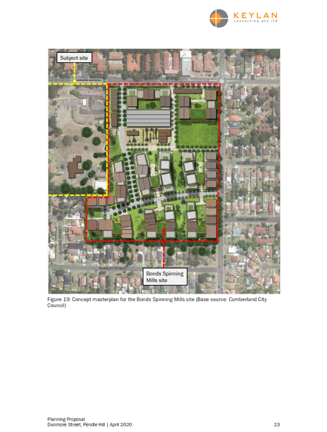
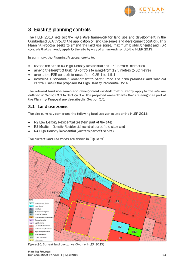
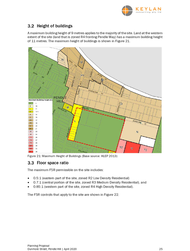
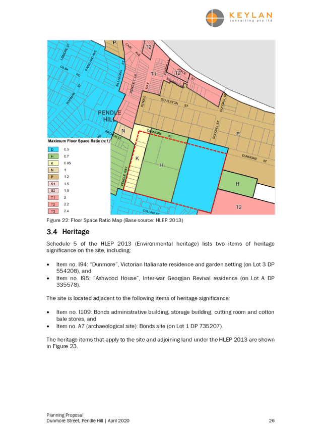
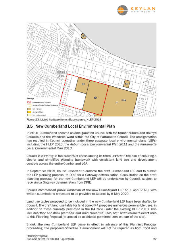

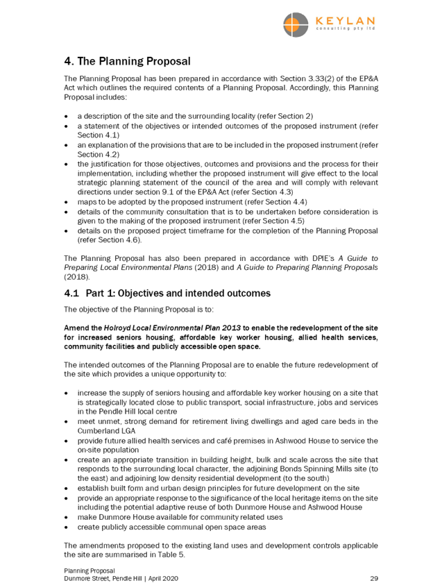
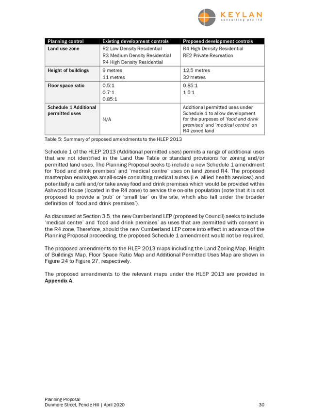
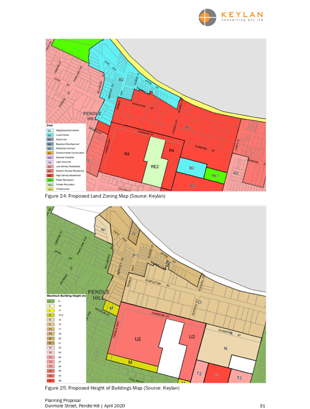
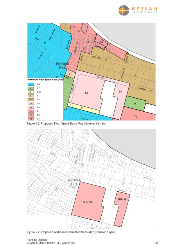
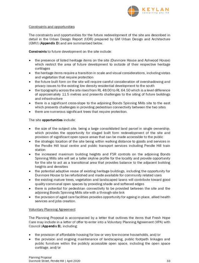
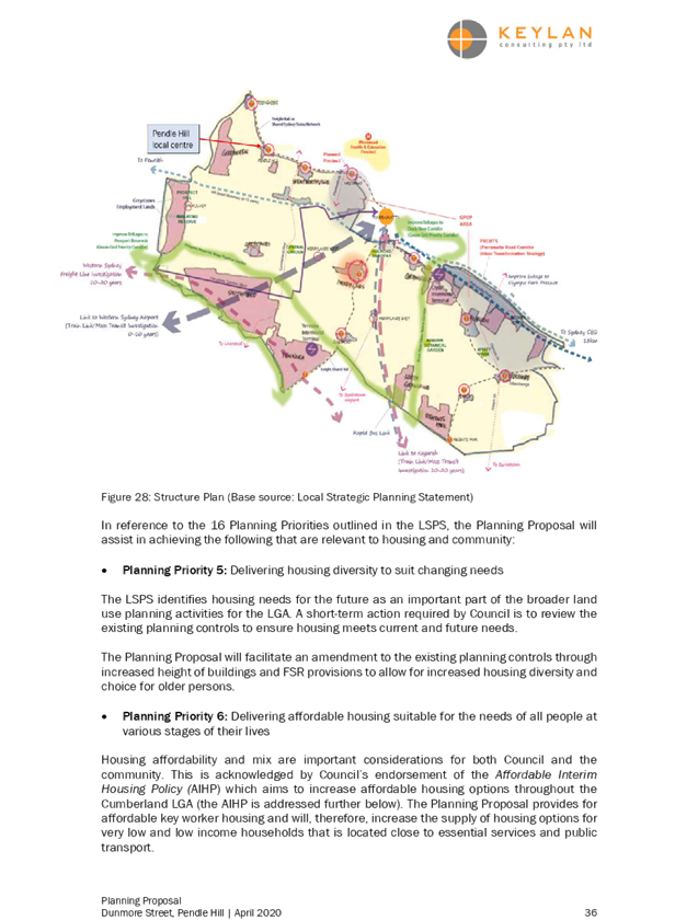
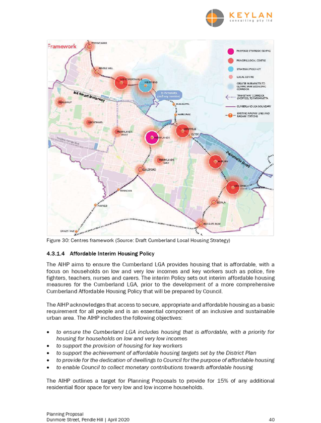
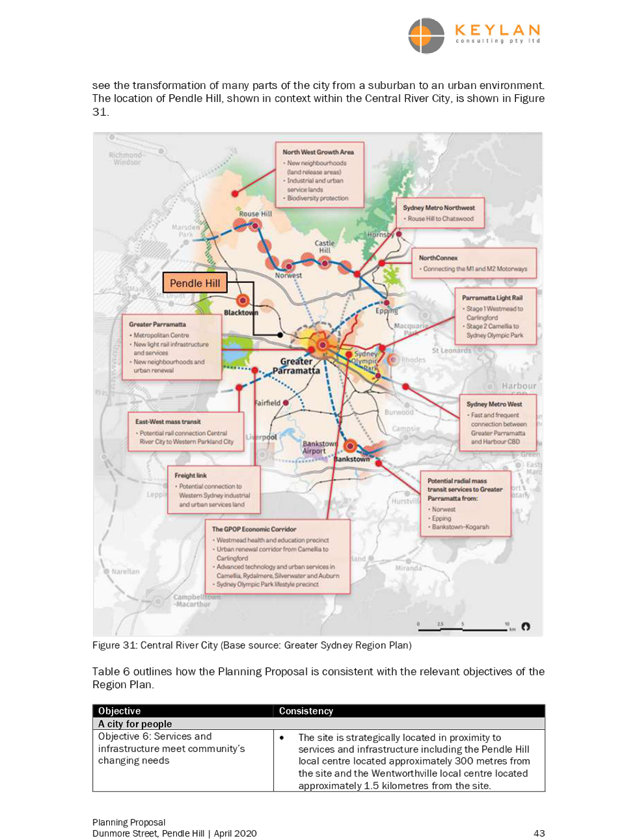
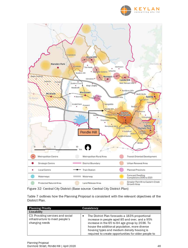
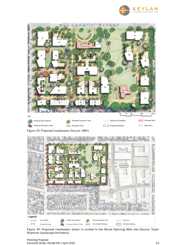
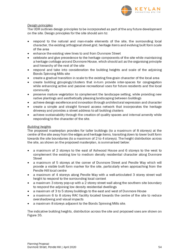
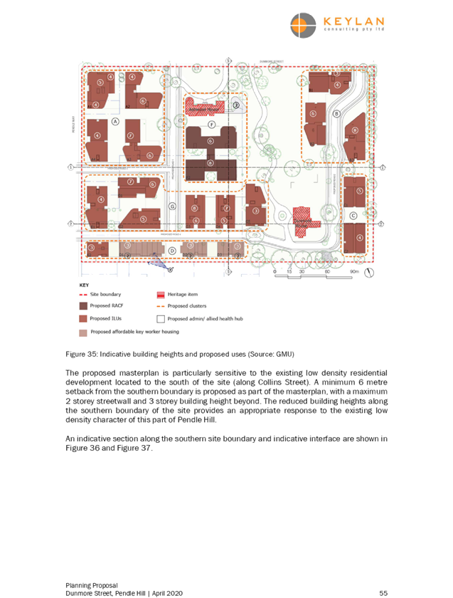
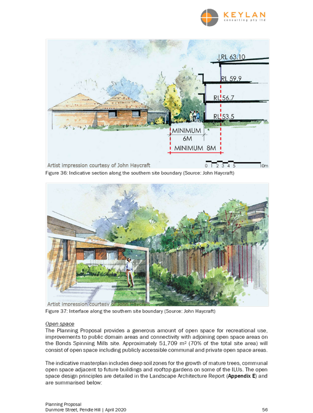
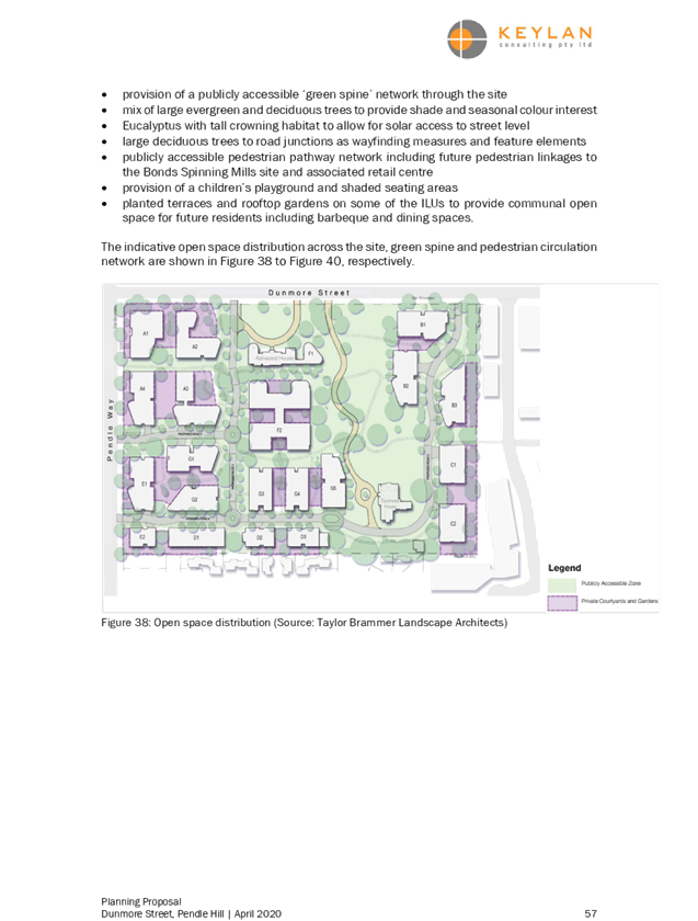
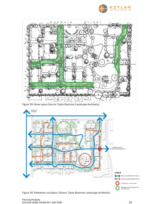
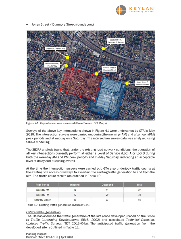
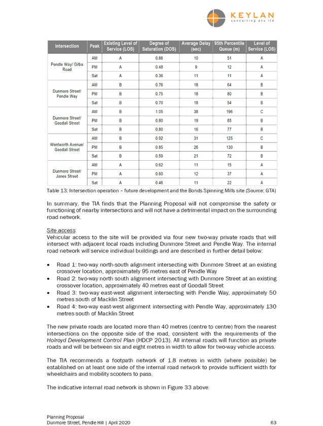
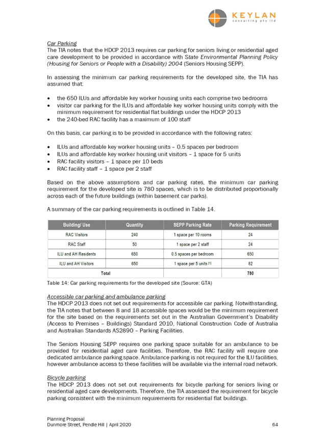
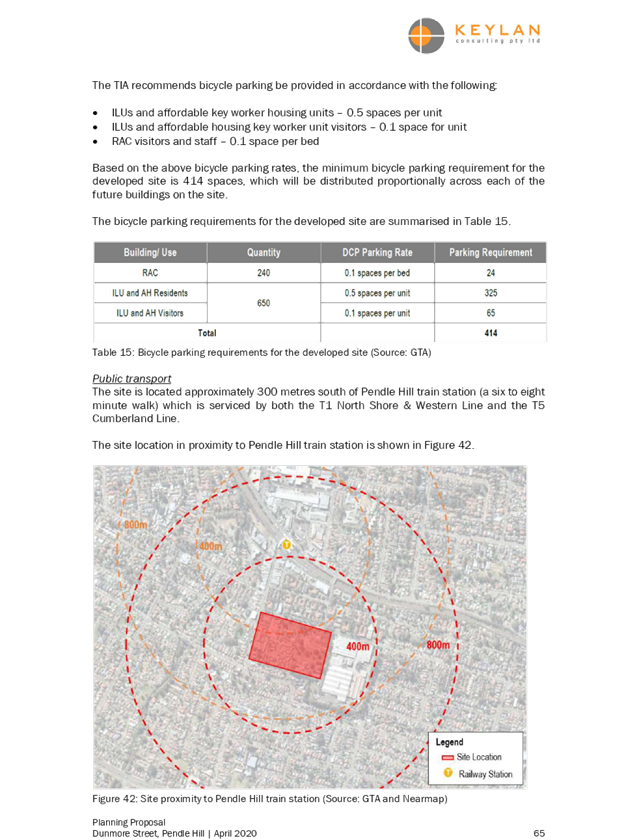
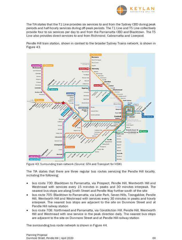
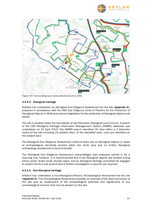
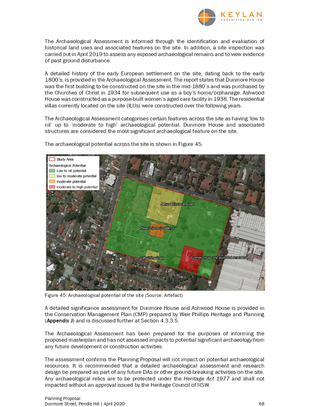
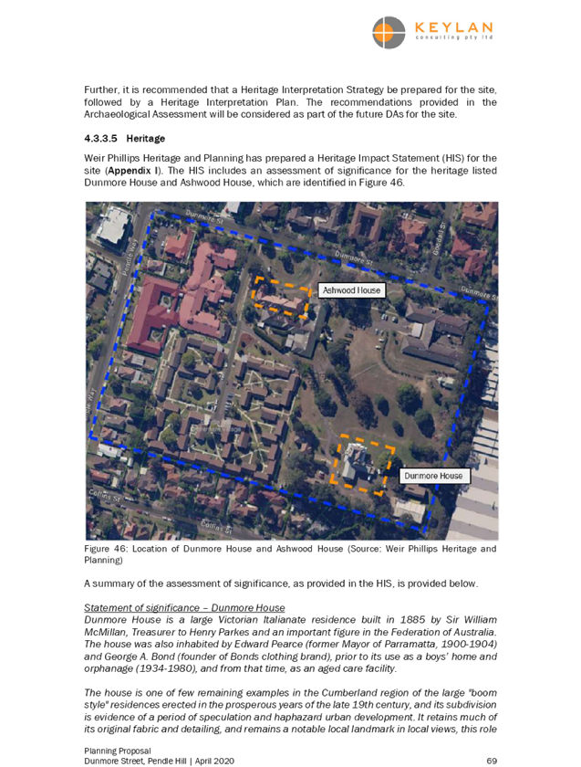
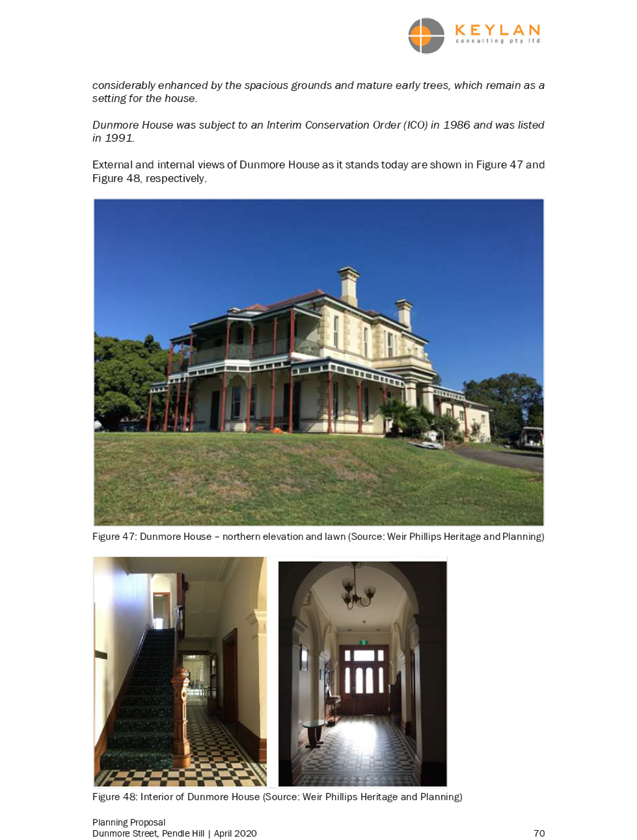
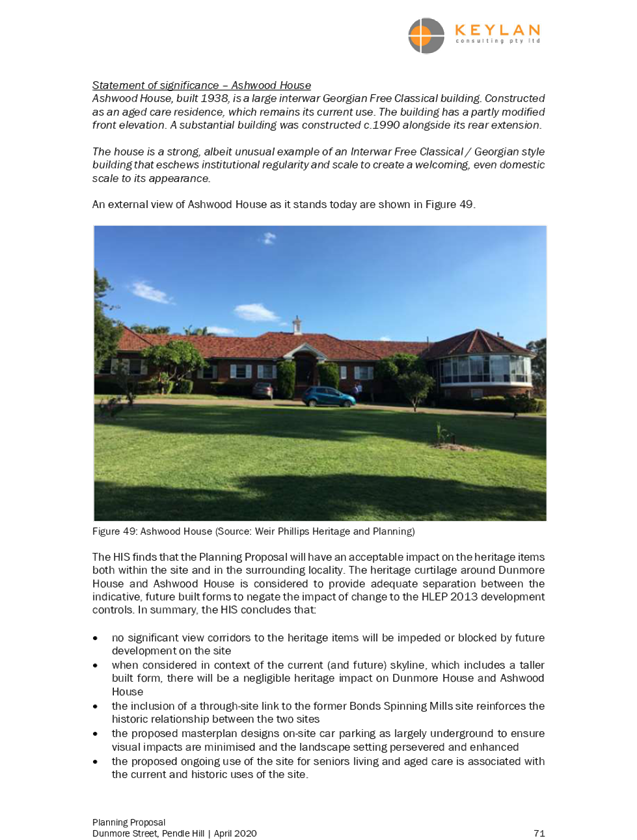
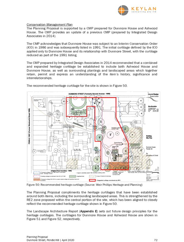
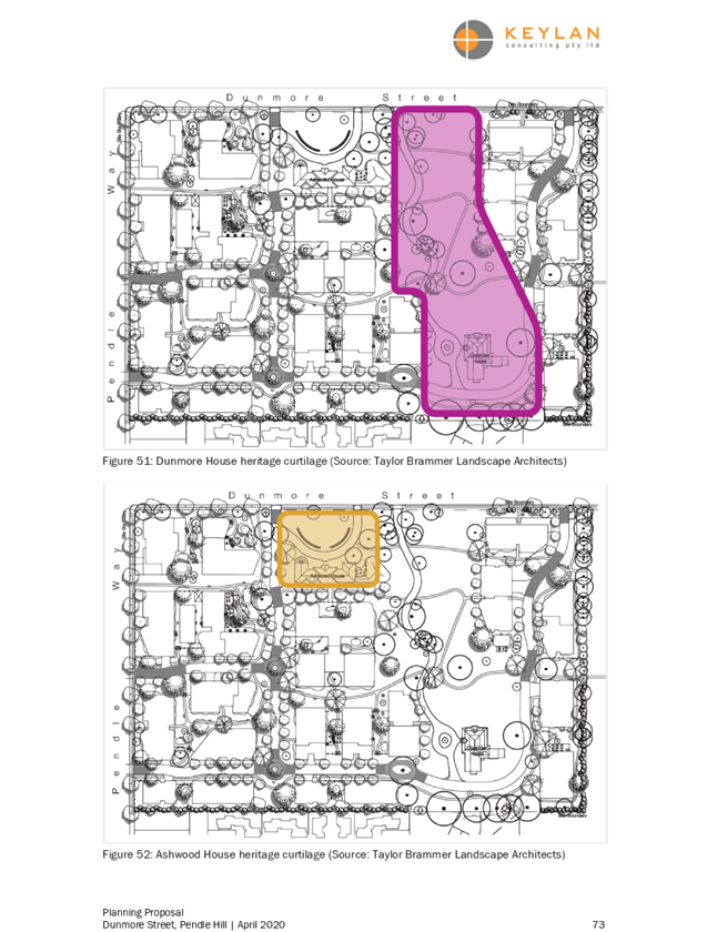


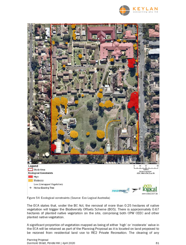

DOCUMENTS
ASSOCIATED WITH
REPORT LPP044/20
Attachment 2
Economic Assessment
Cumberland Local Planning Panel Meeting
12 August 2020

Cumberland Local Planning Panel Meeting
12 August 2020
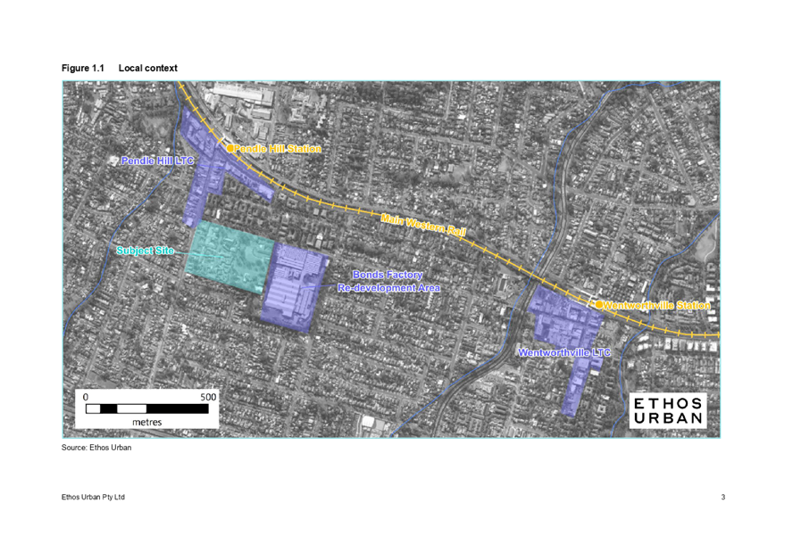
Cumberland Local Planning Panel Meeting
12 August 2020
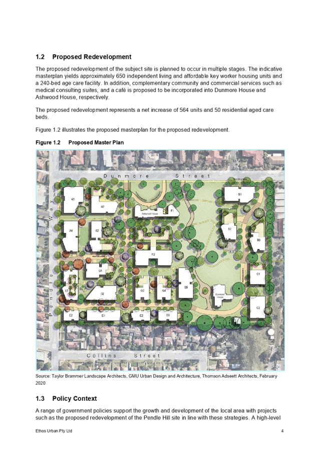
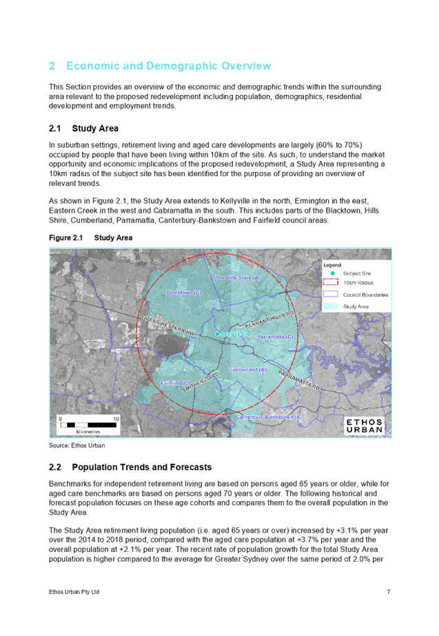
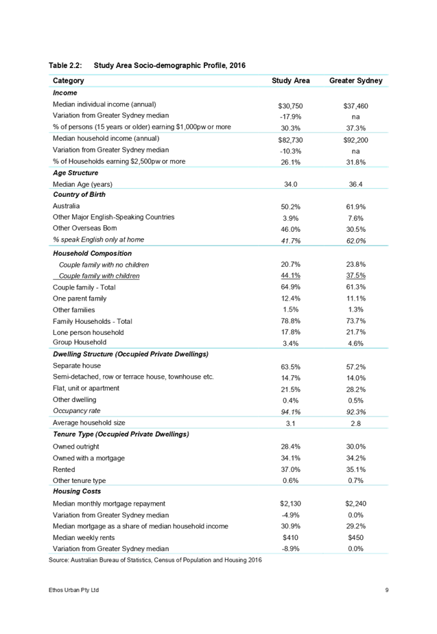
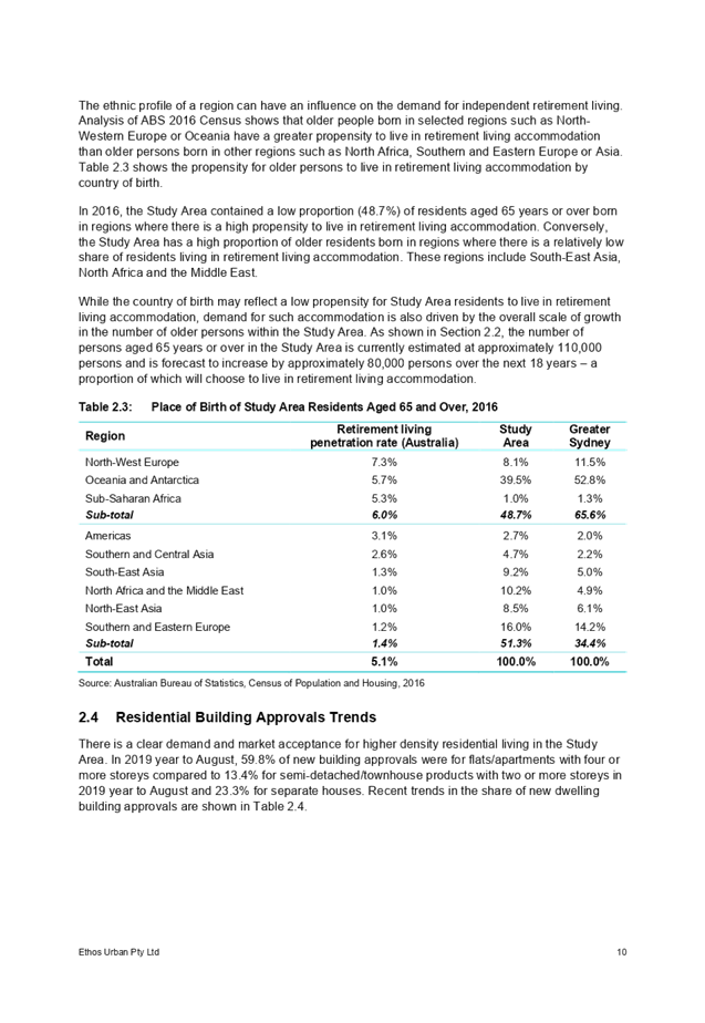
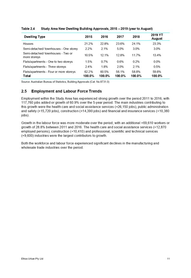
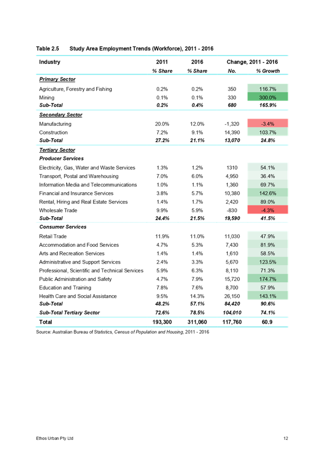
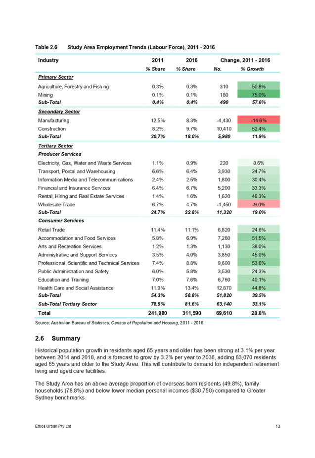

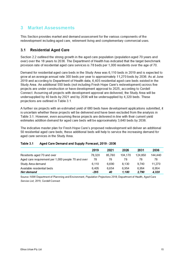
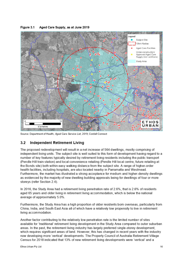
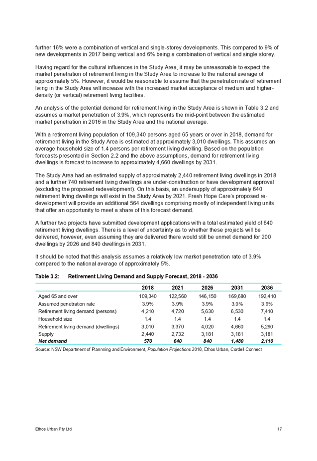
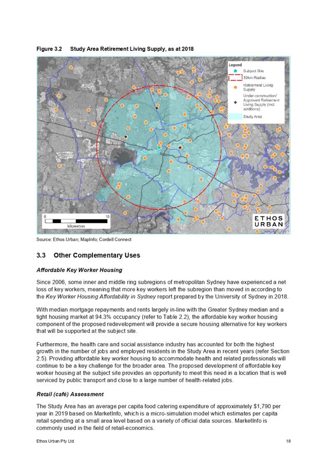

Cumberland Local Planning Panel Meeting
12 August 2020
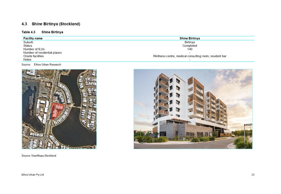
Cumberland Local Planning Panel Meeting
12 August 2020
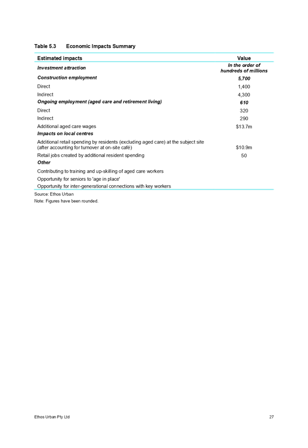
DOCUMENTS
ASSOCIATED WITH
REPORT LPP044/20
Attachment 3
Urban Design Report
Cumberland Local Planning Panel Meeting
12 August 2020
Cumberland Local Planning Panel Meeting
12 August 2020
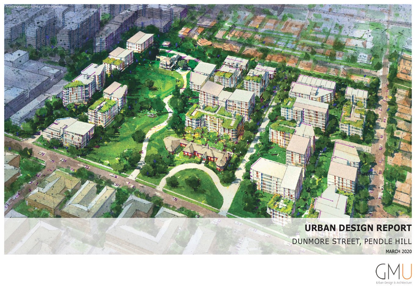

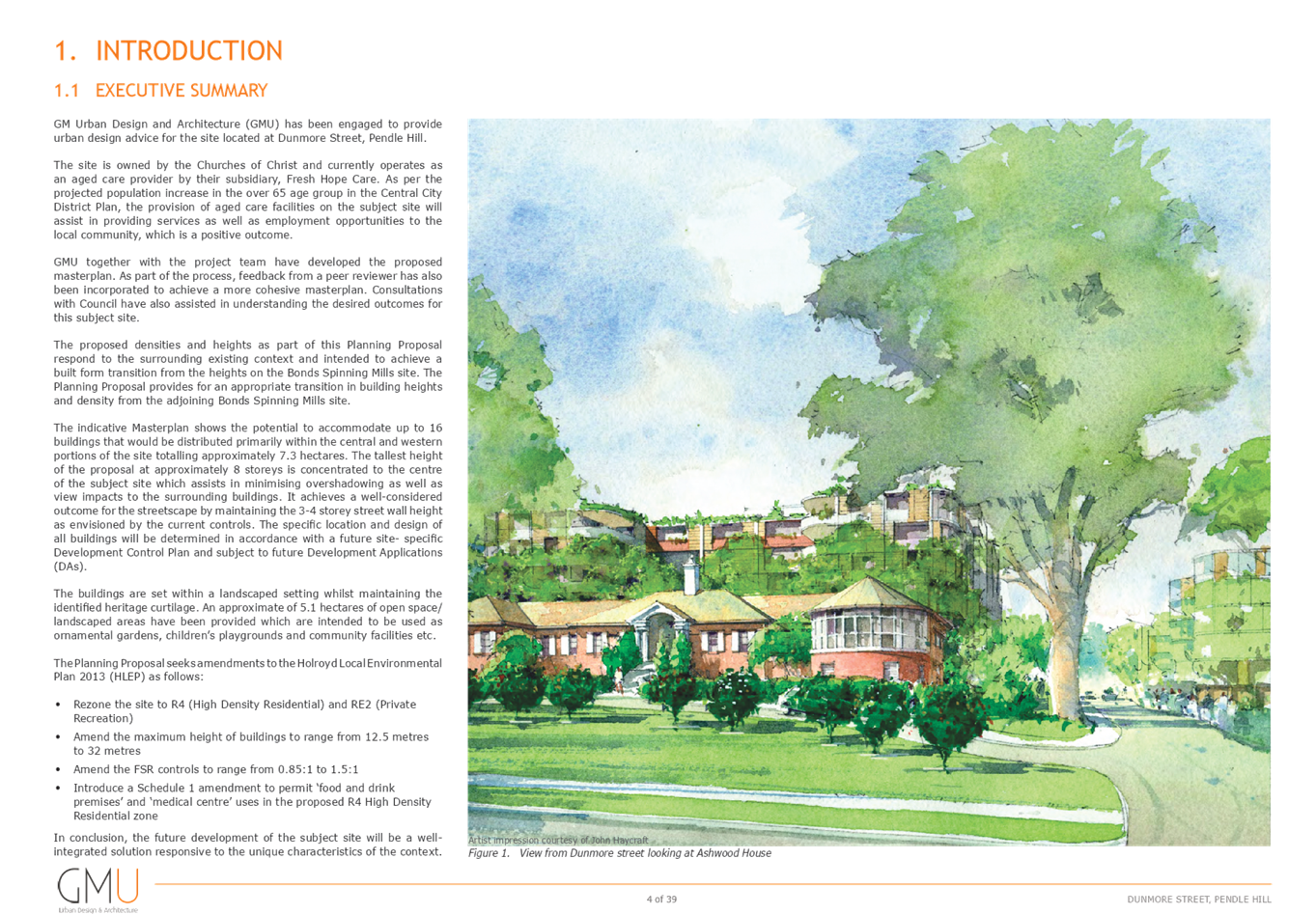
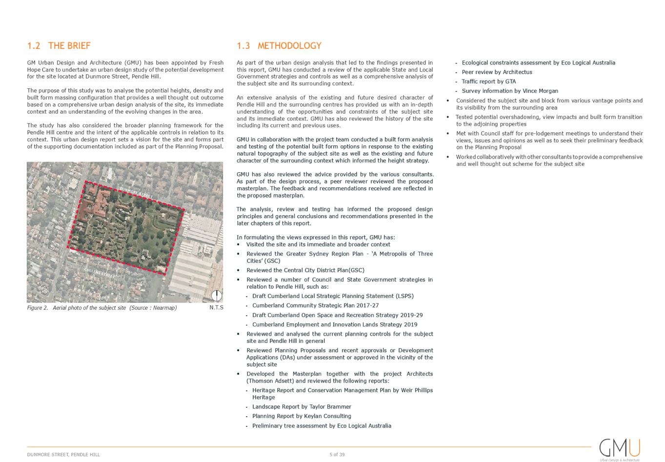
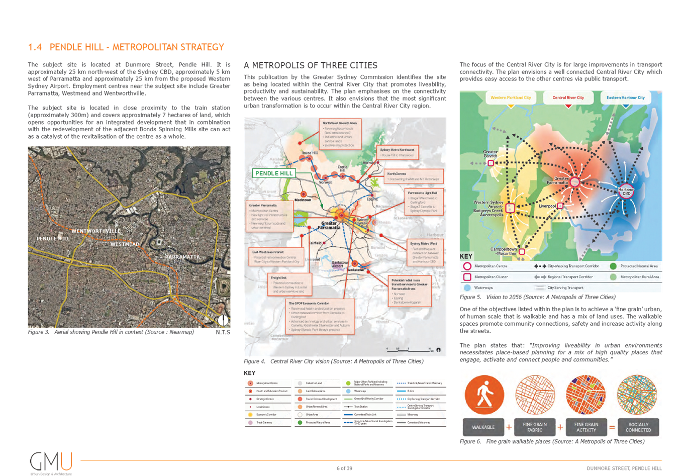
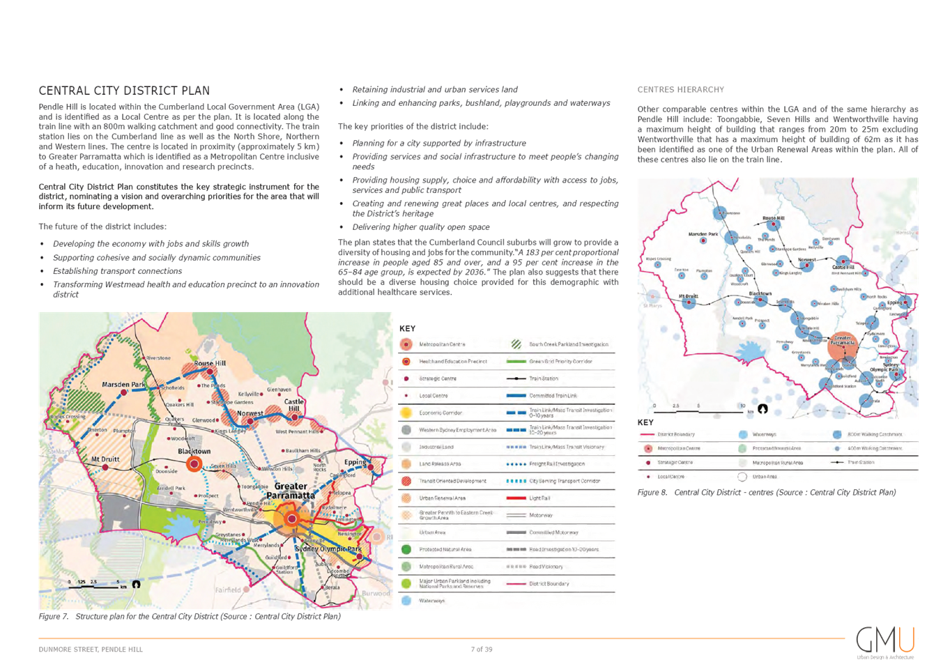
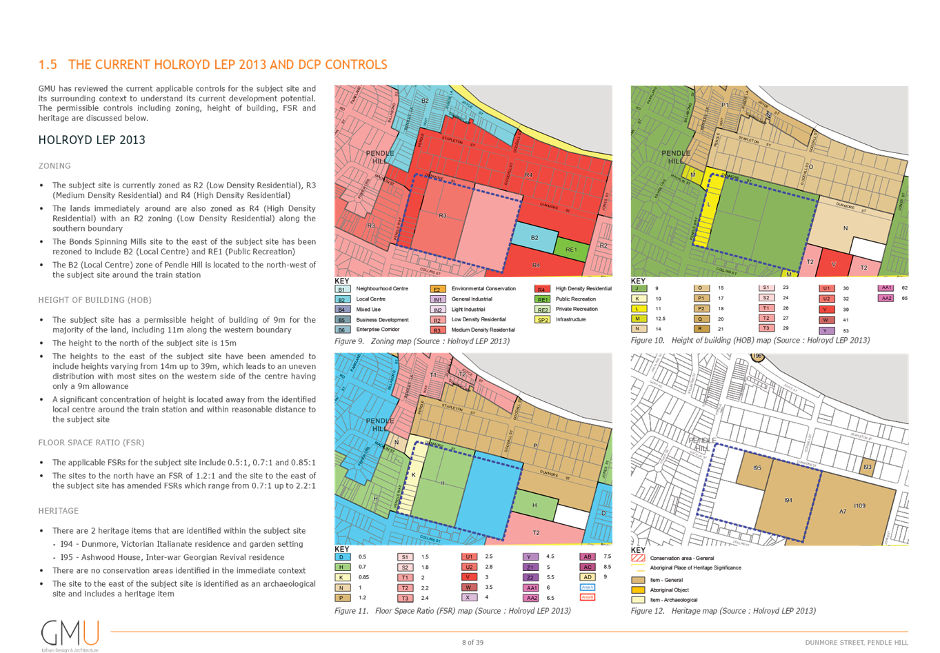
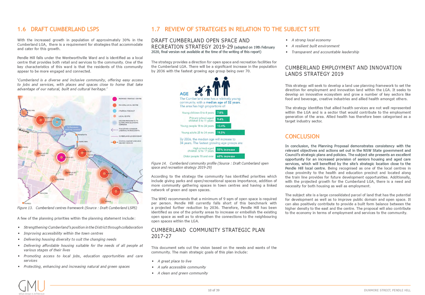
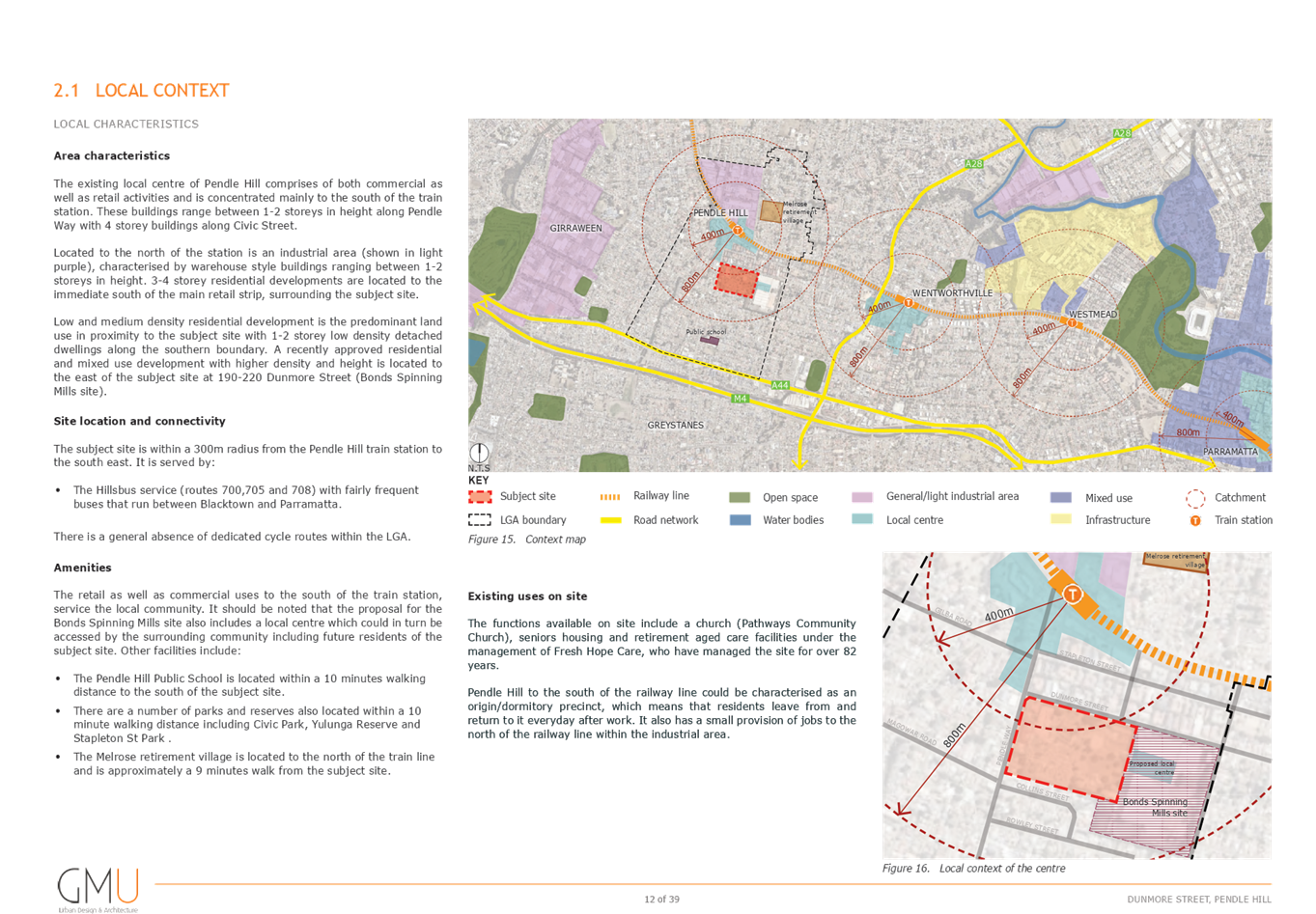
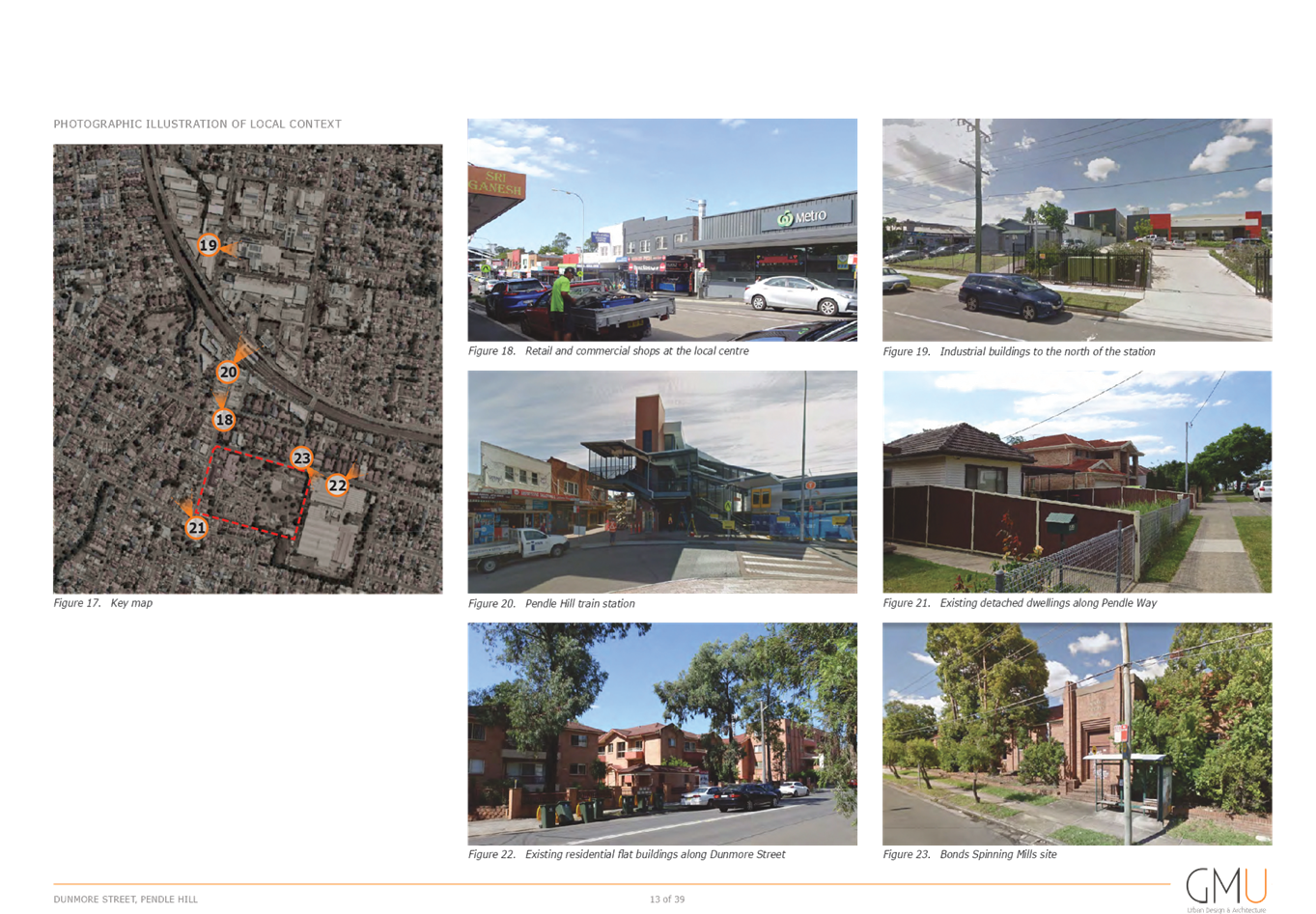
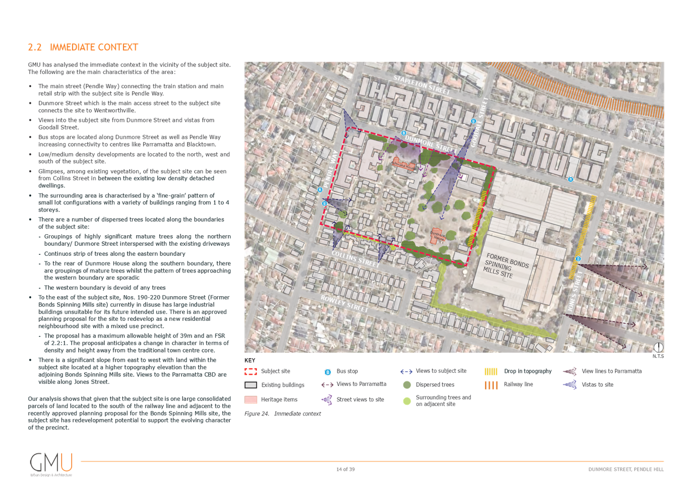
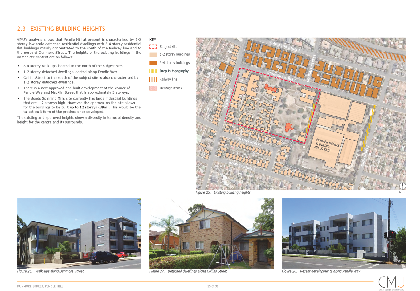
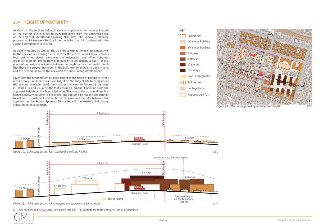
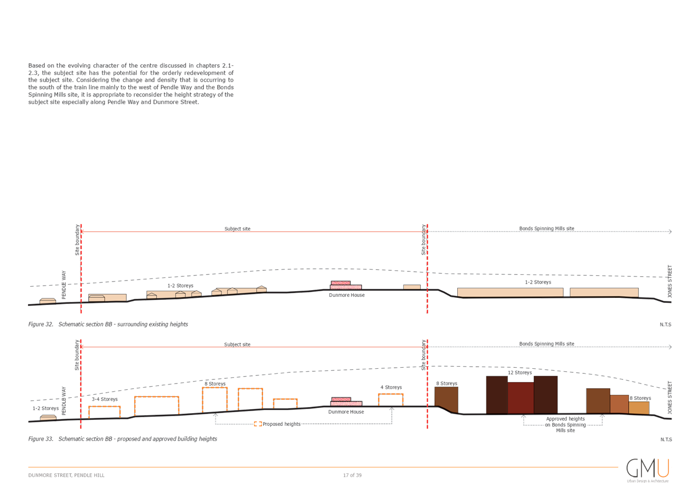
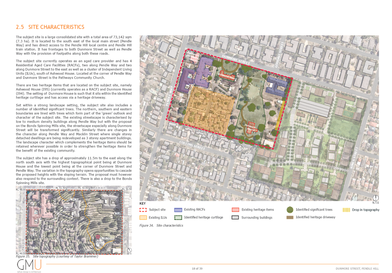
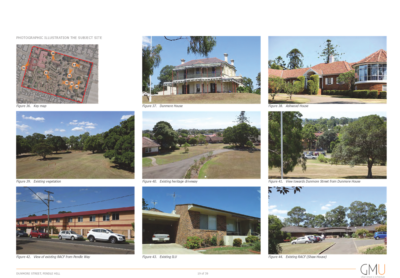
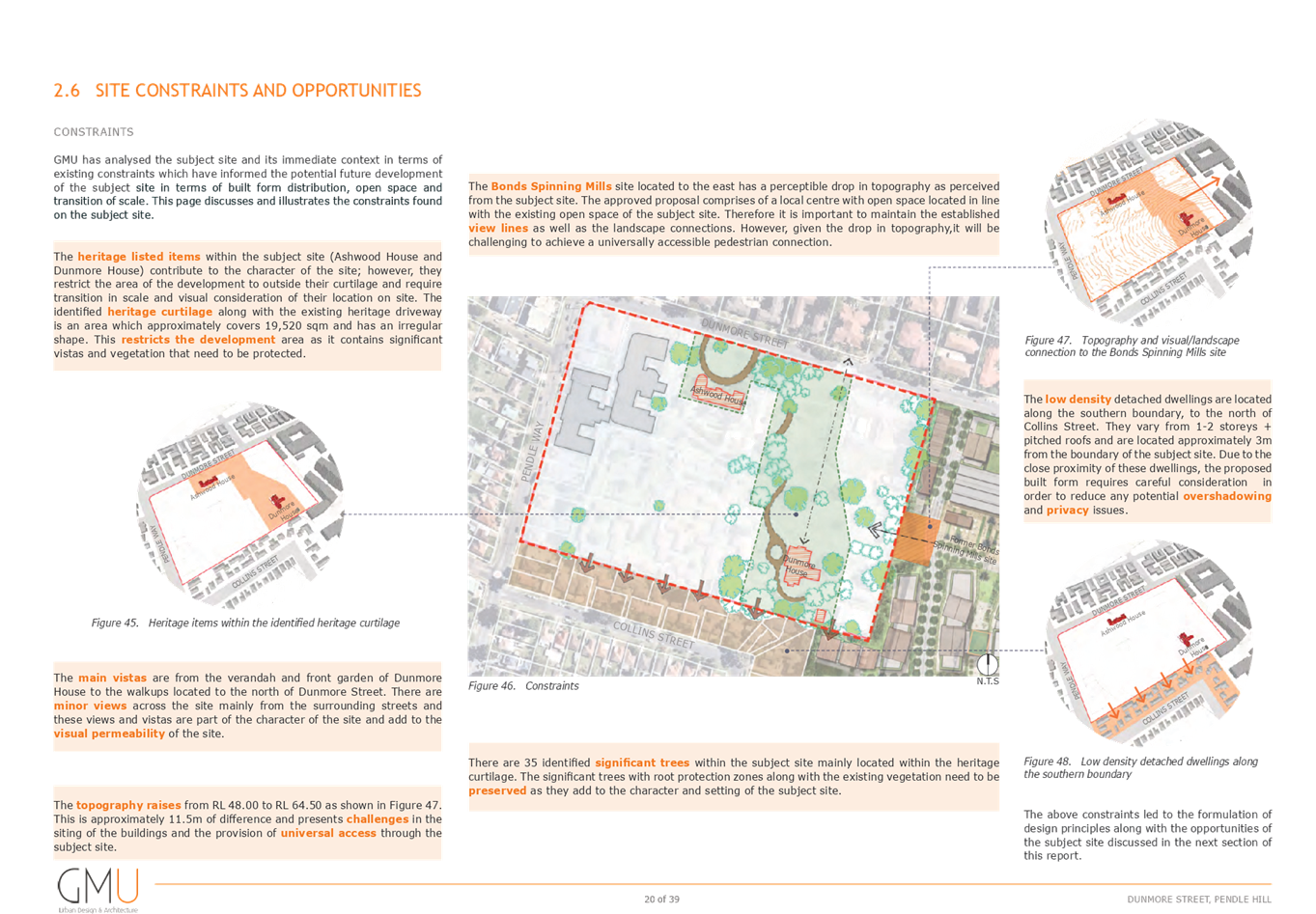
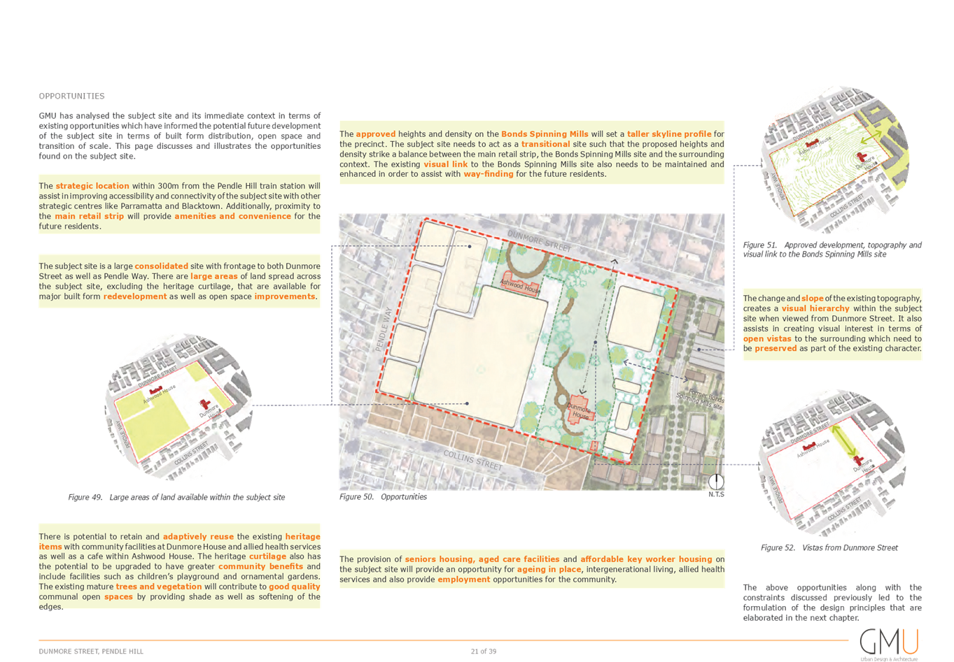

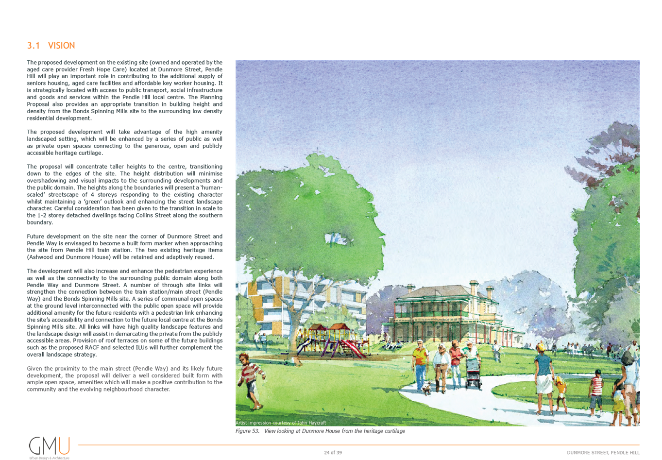
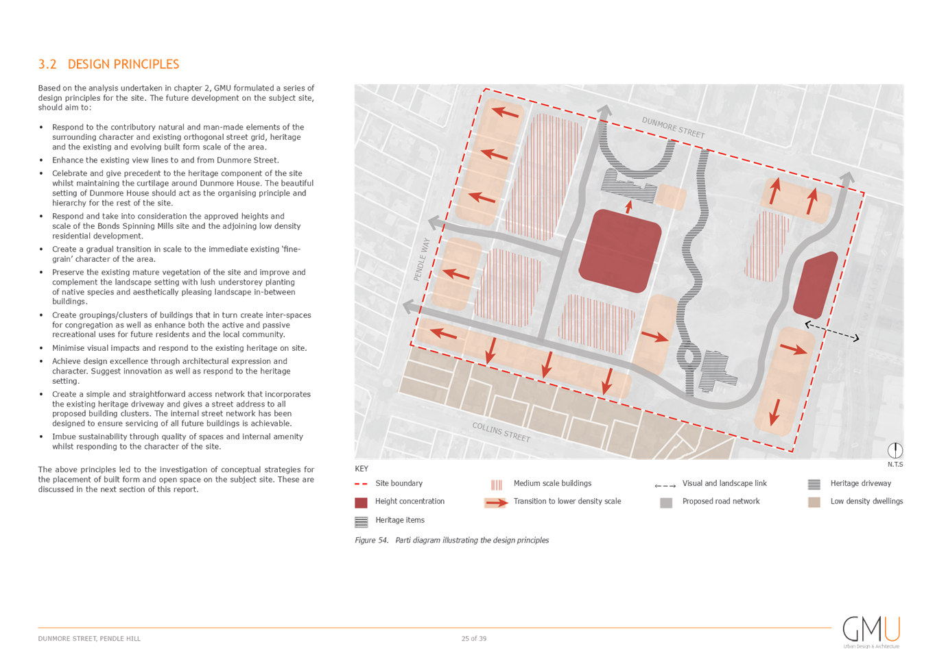
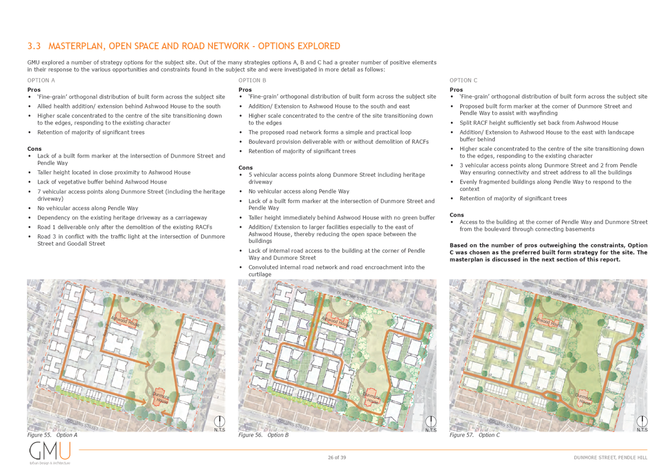
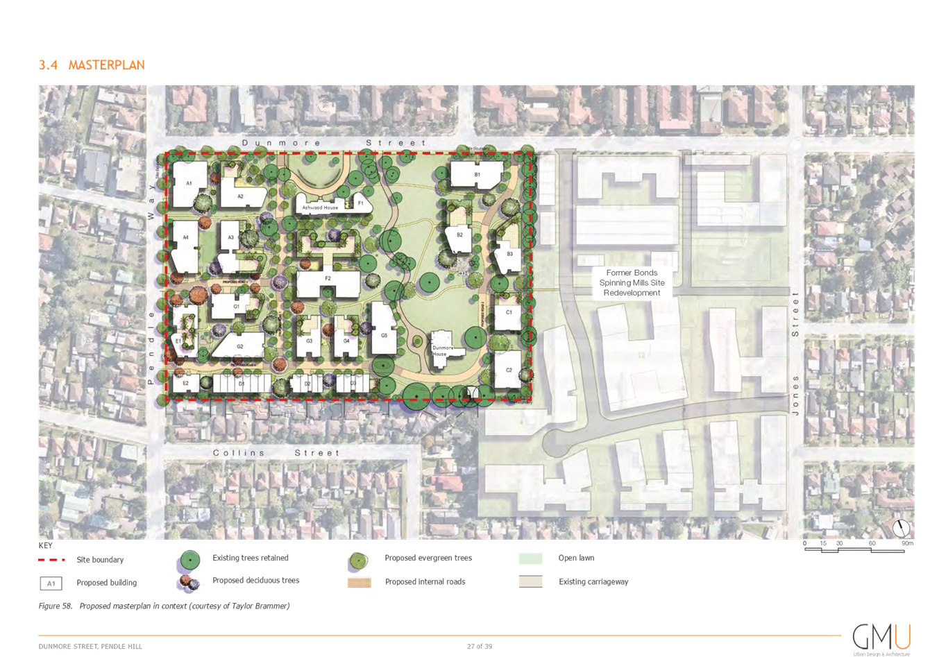
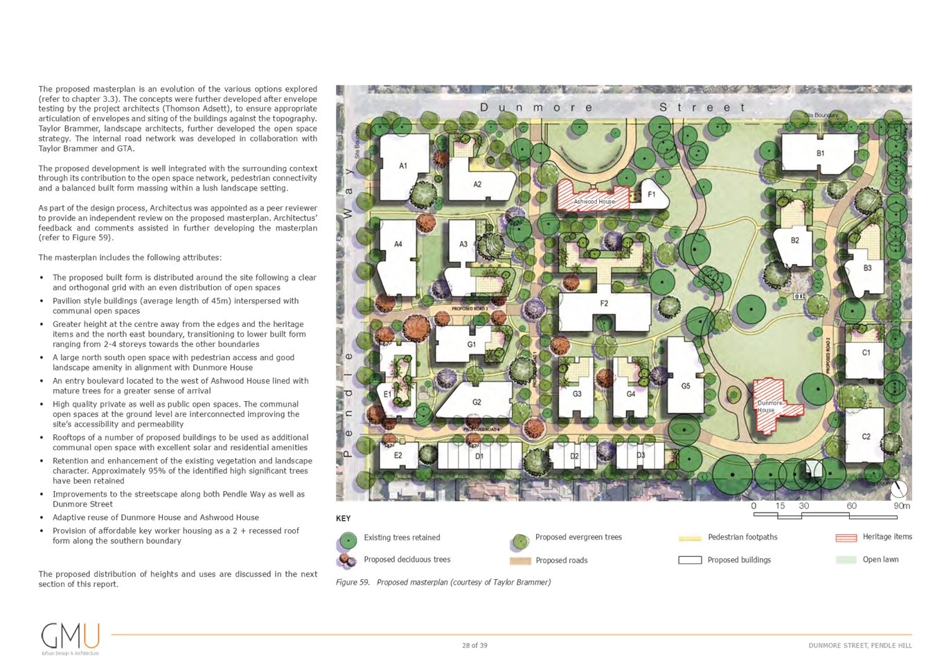
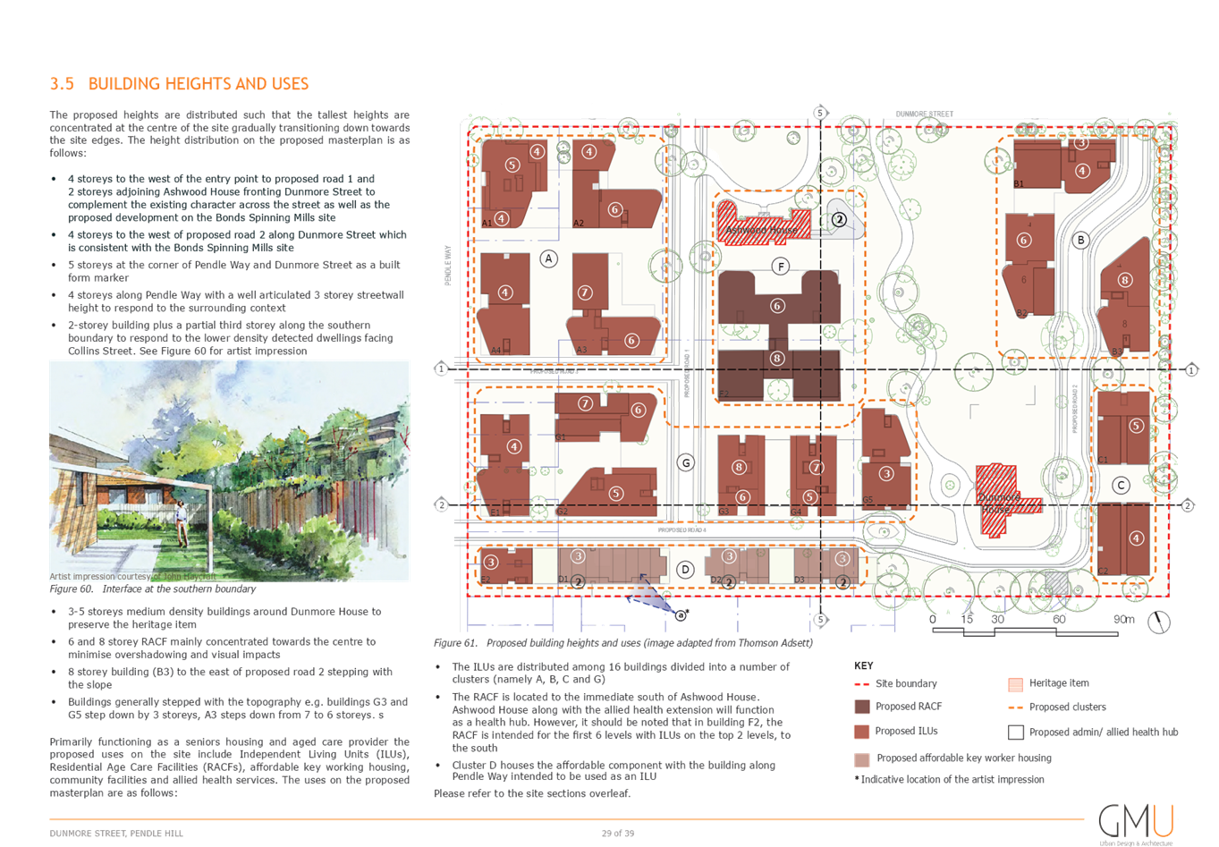
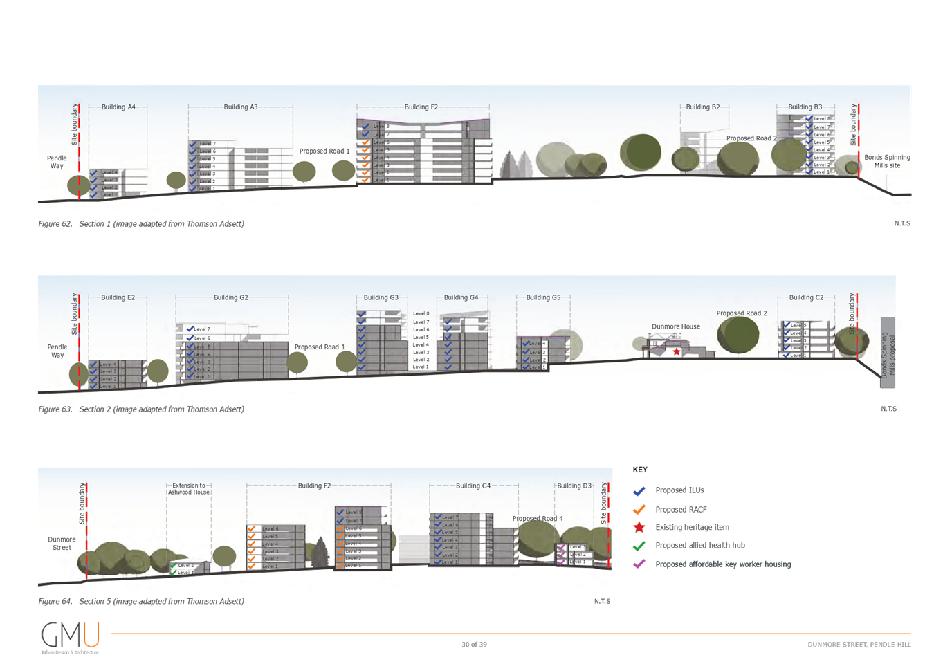
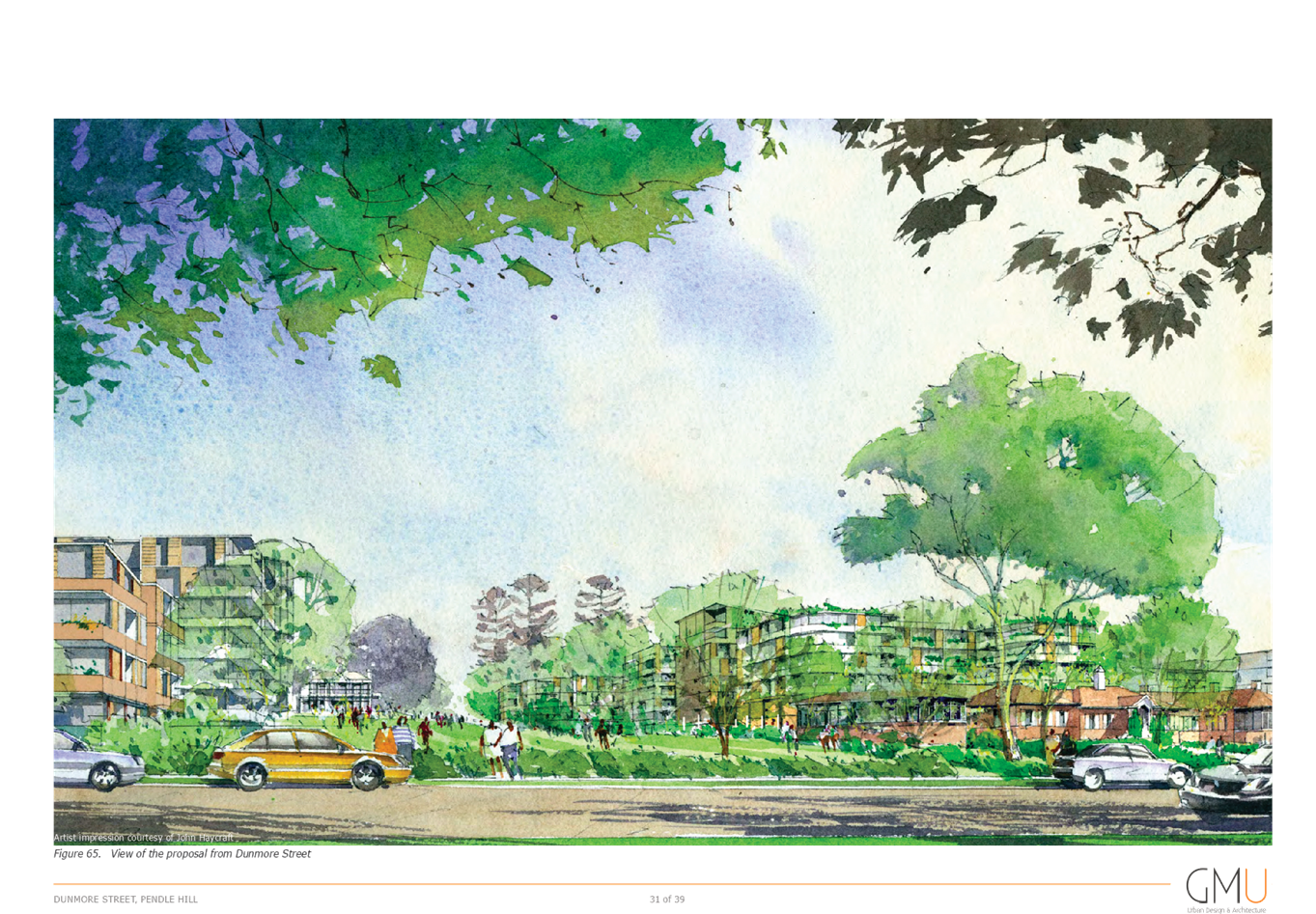
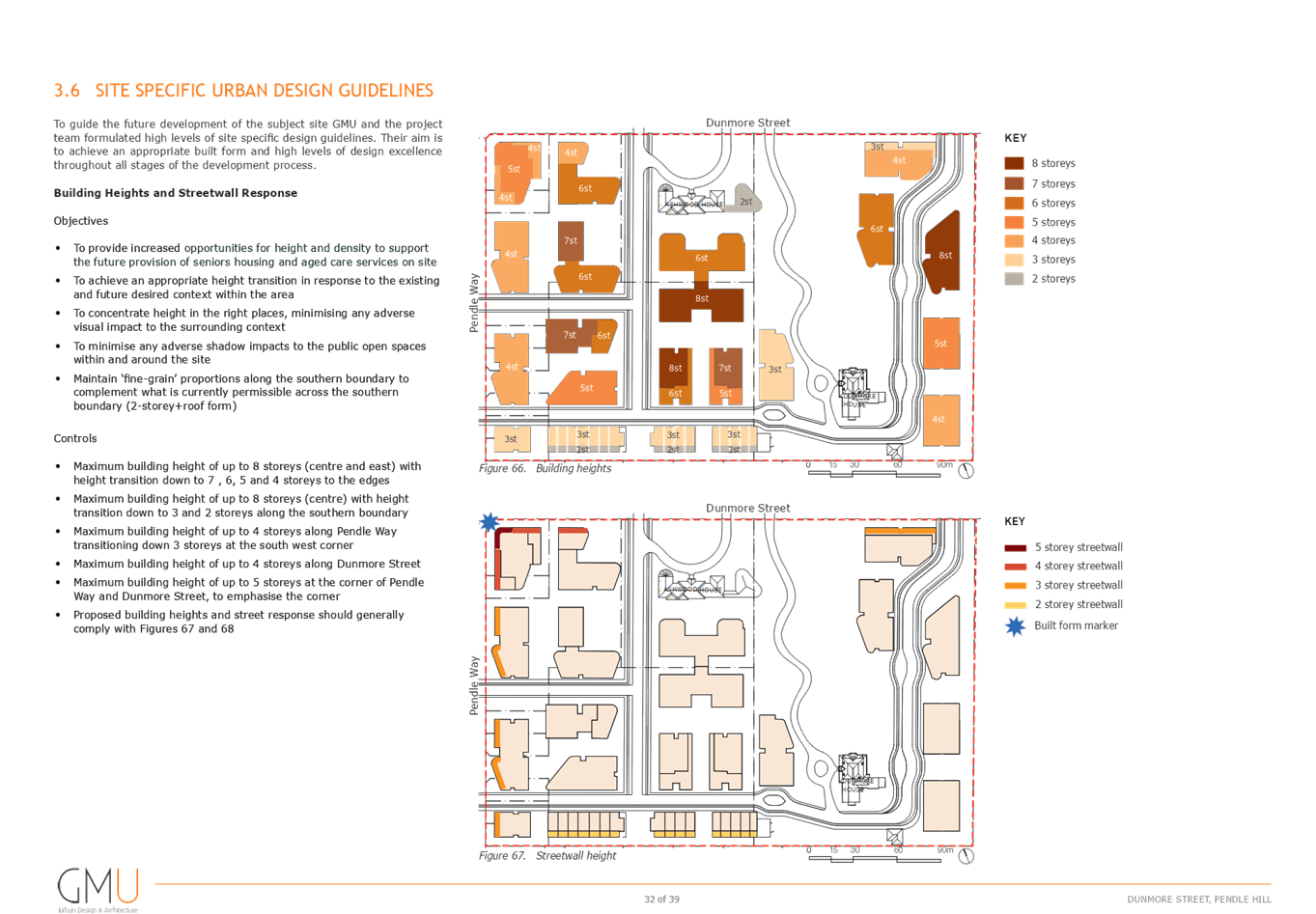
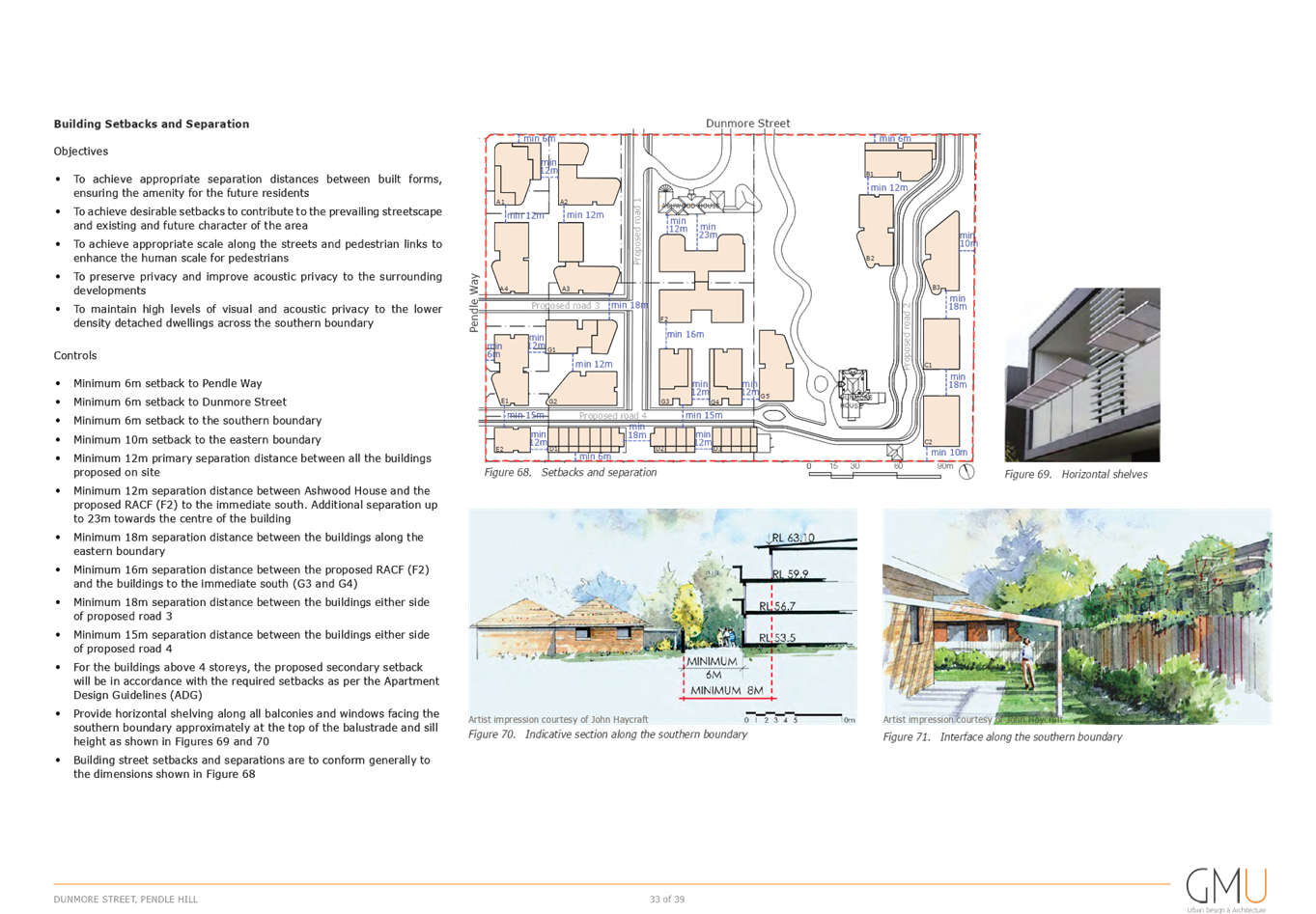
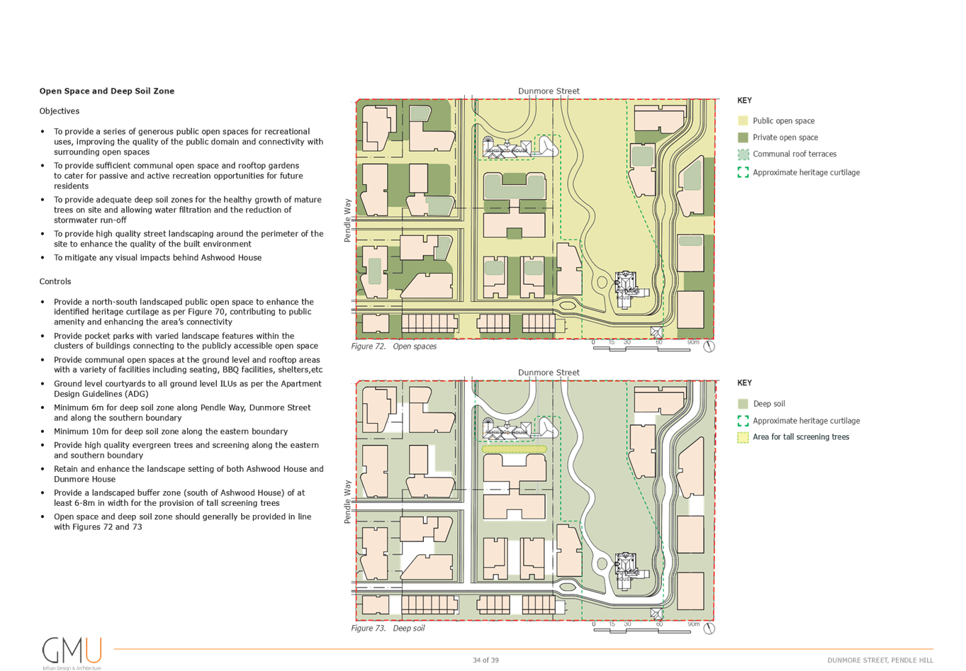
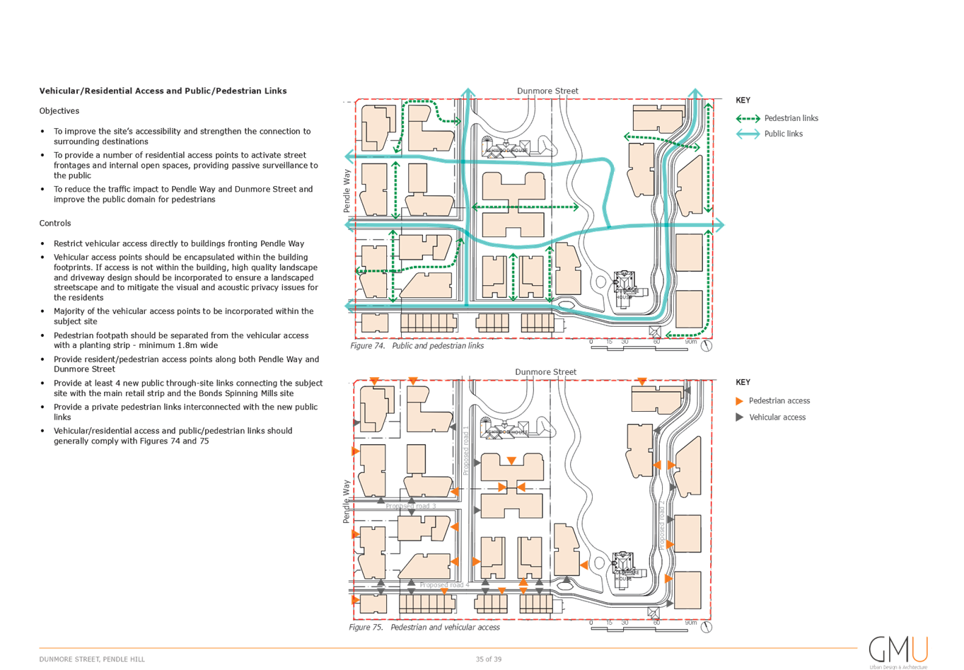
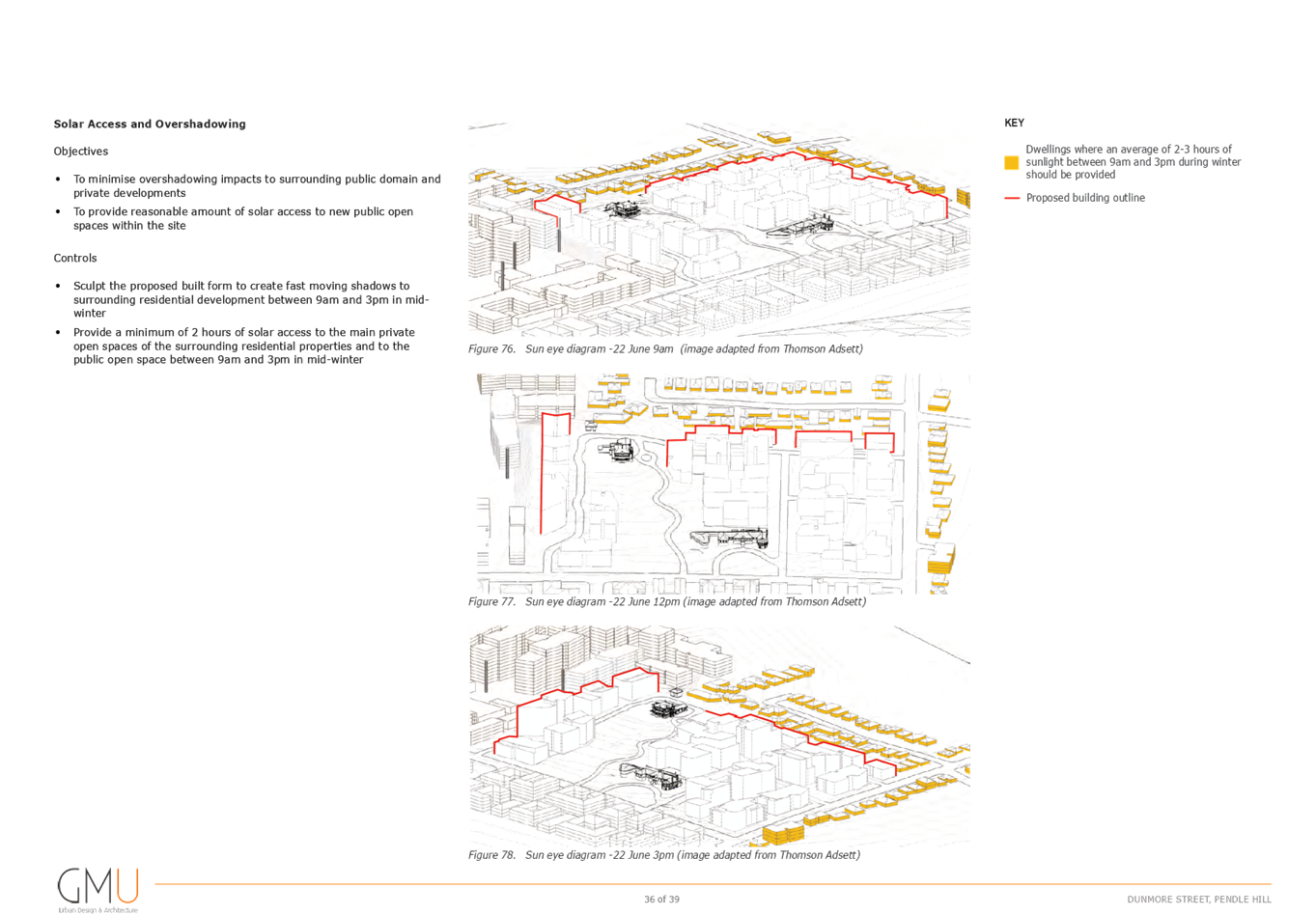
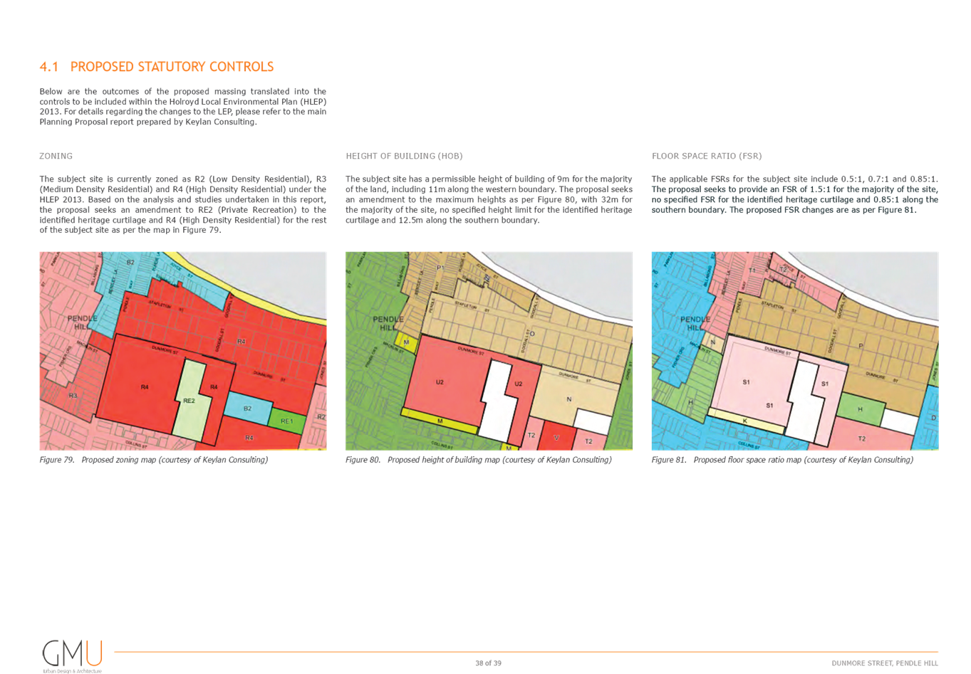
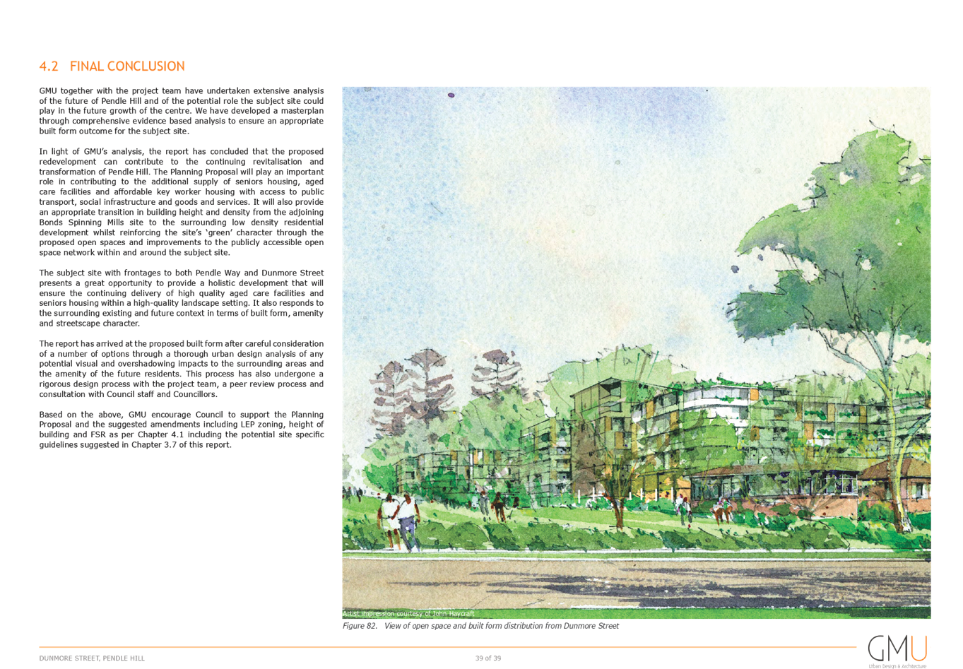

DOCUMENTS
ASSOCIATED WITH
REPORT LPP044/20
Attachment 4
Urban Design Peer Review
Cumberland Local Planning Panel Meeting
12 August 2020

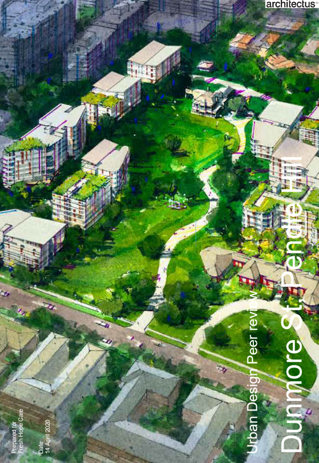

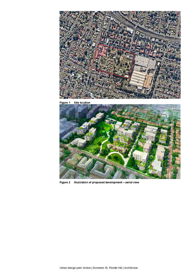
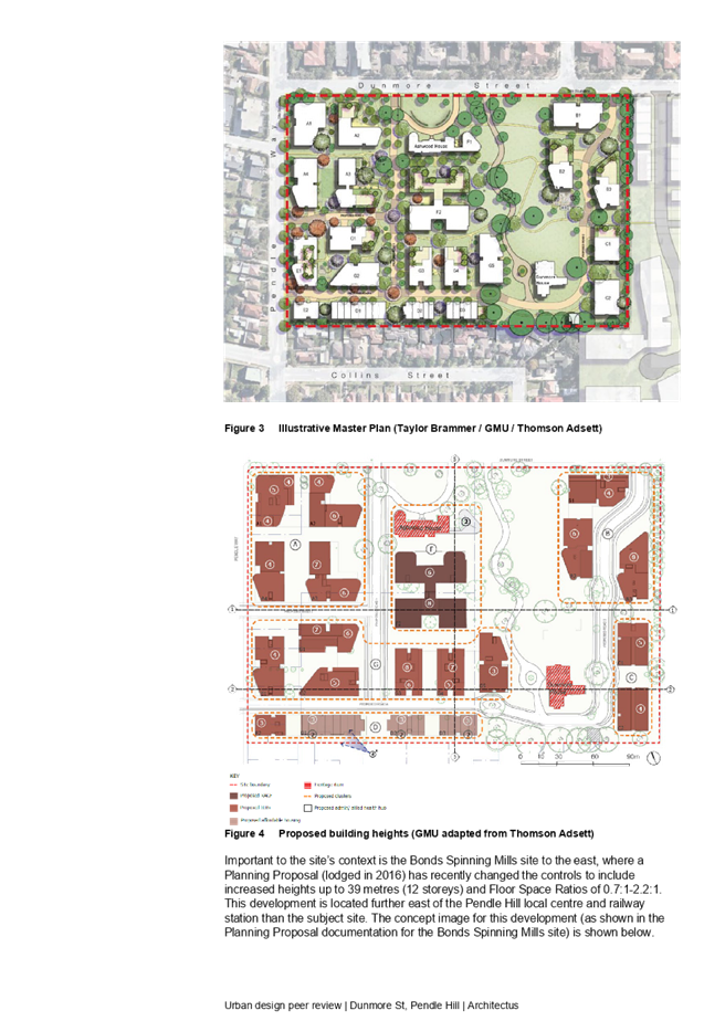
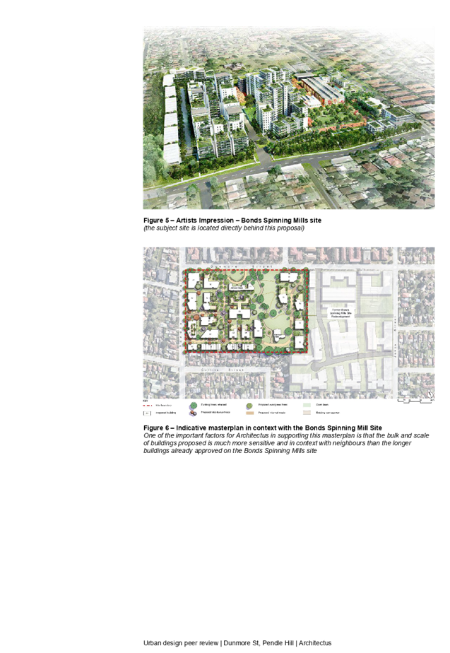
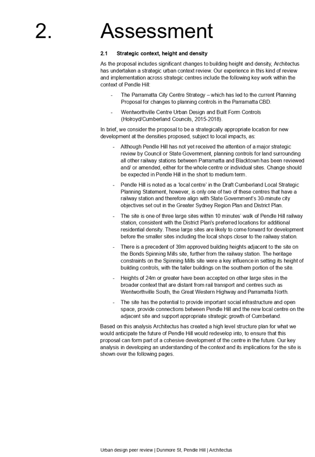
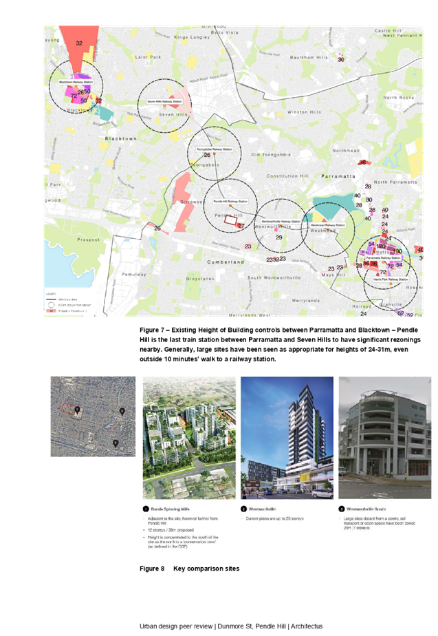
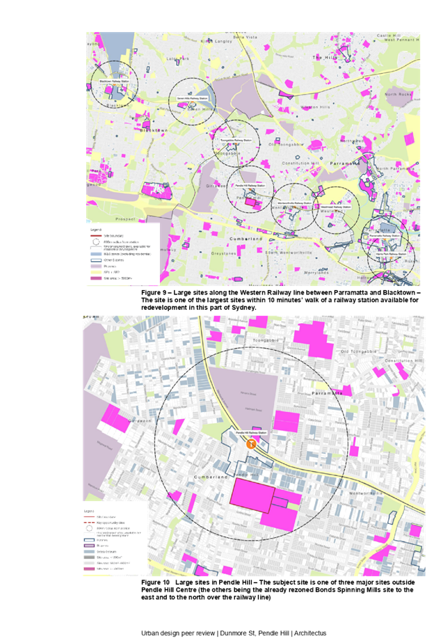
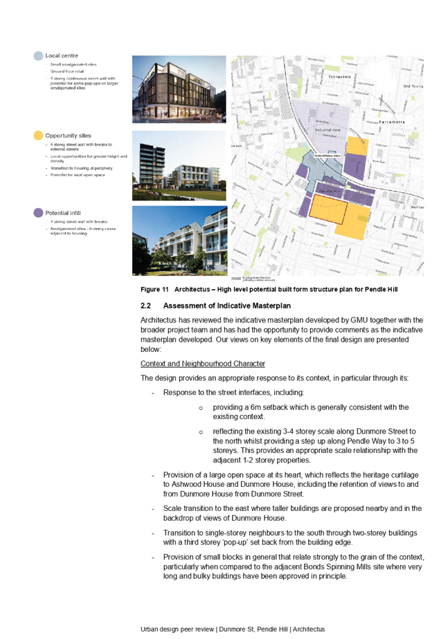
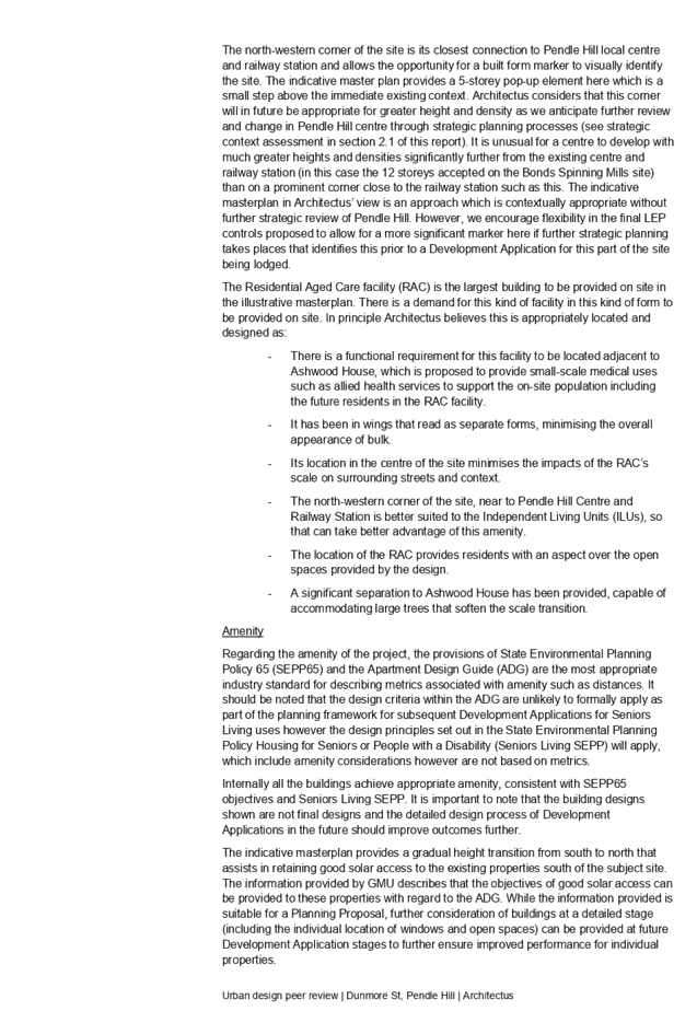
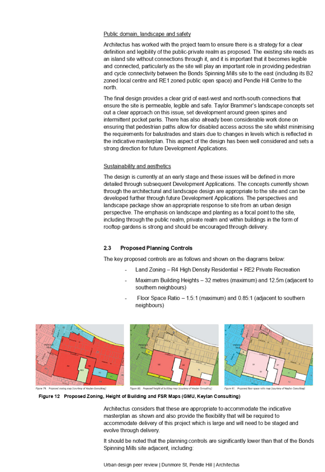
DOCUMENTS
ASSOCIATED WITH
REPORT LPP044/20
Attachment 5
Transport Impact Assessment
Cumberland Local Planning Panel Meeting
12 August 2020


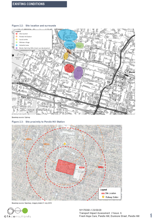

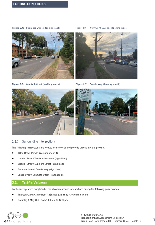
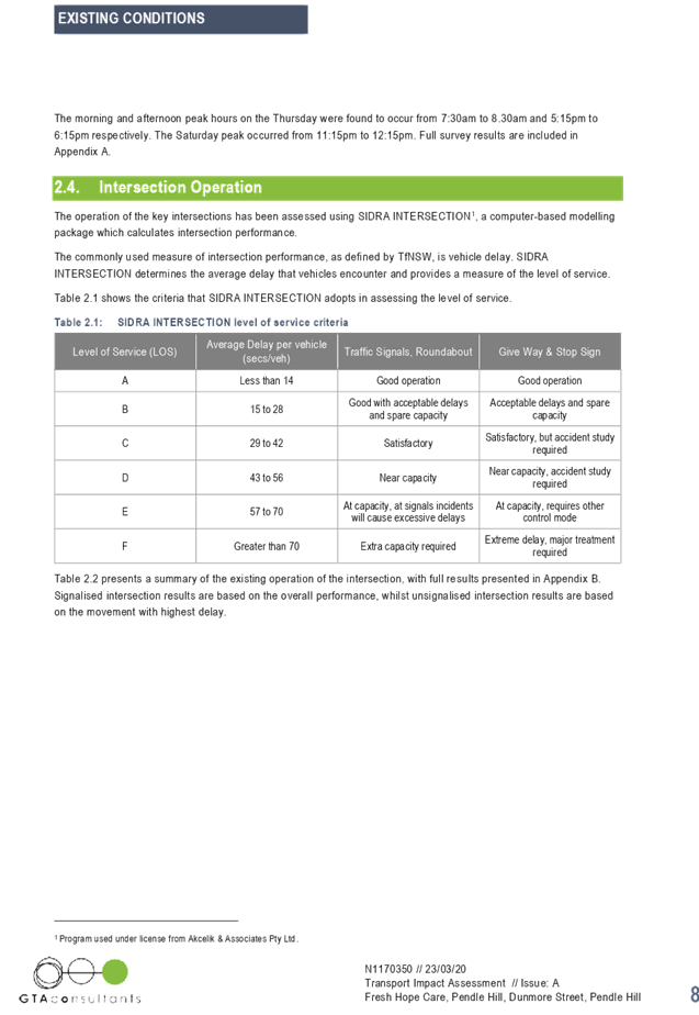
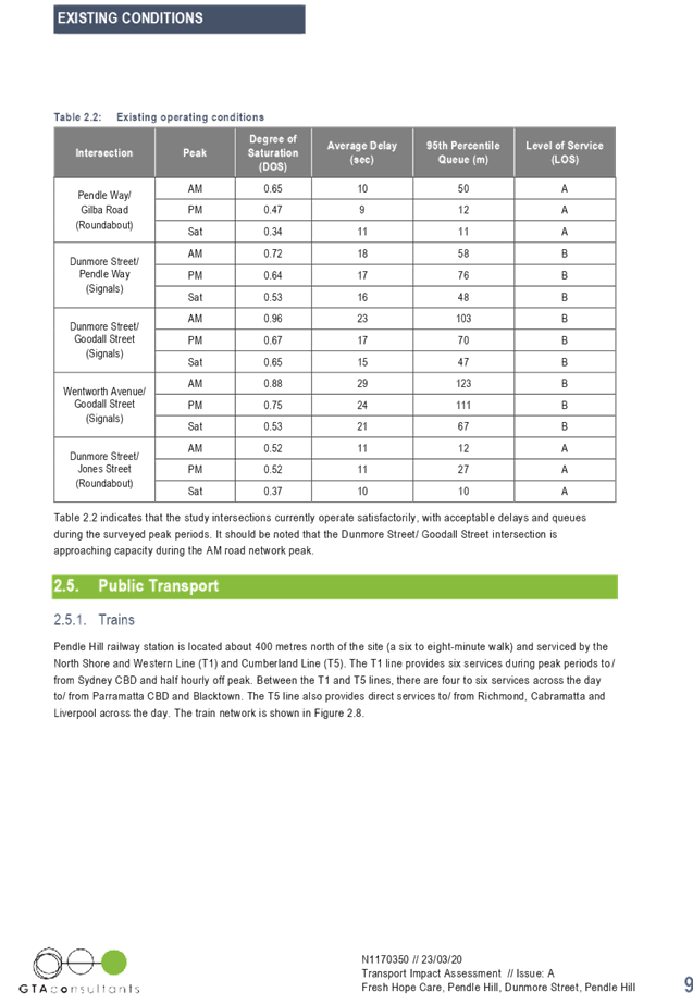
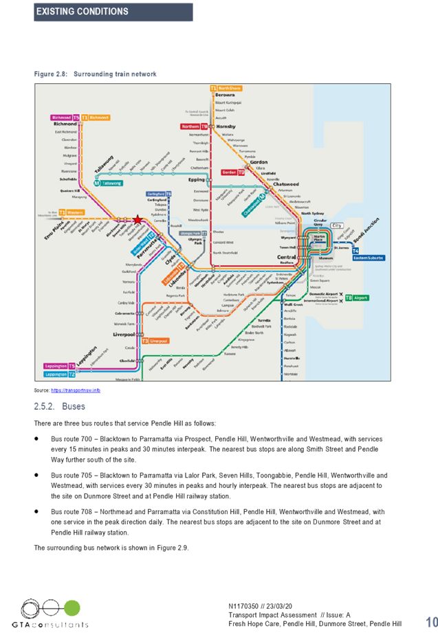
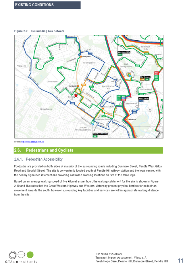
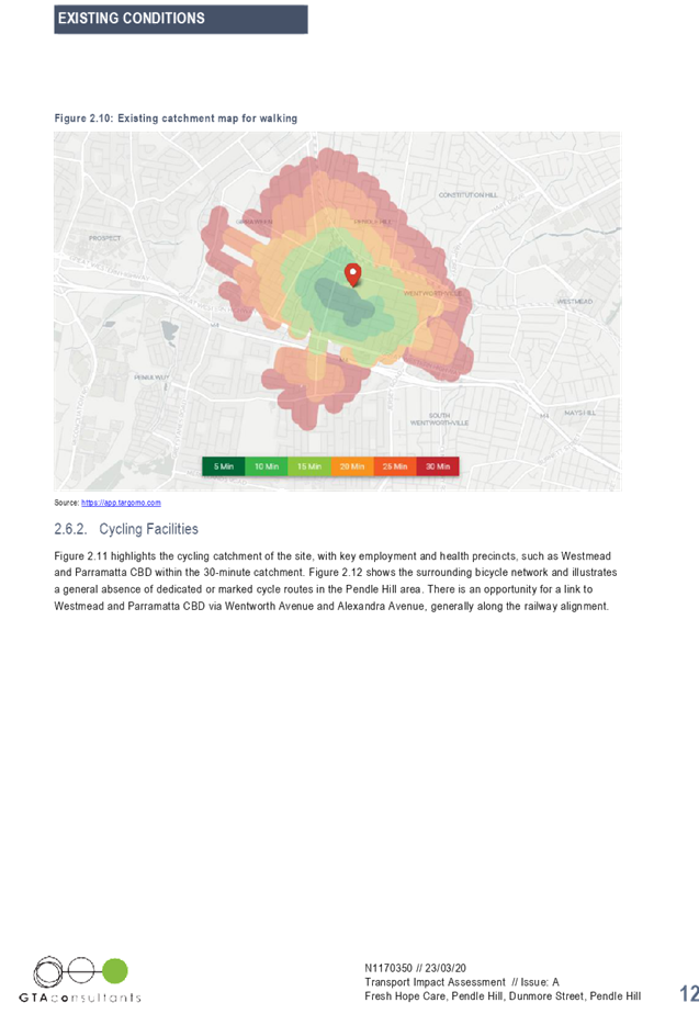
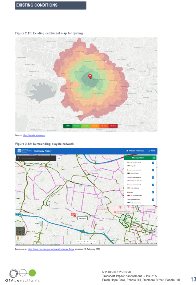

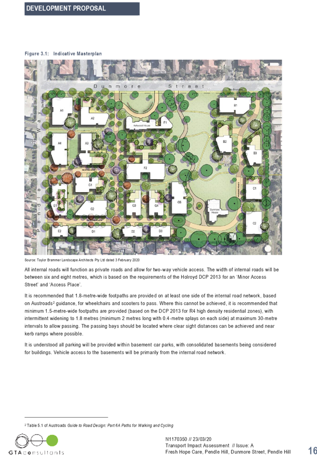


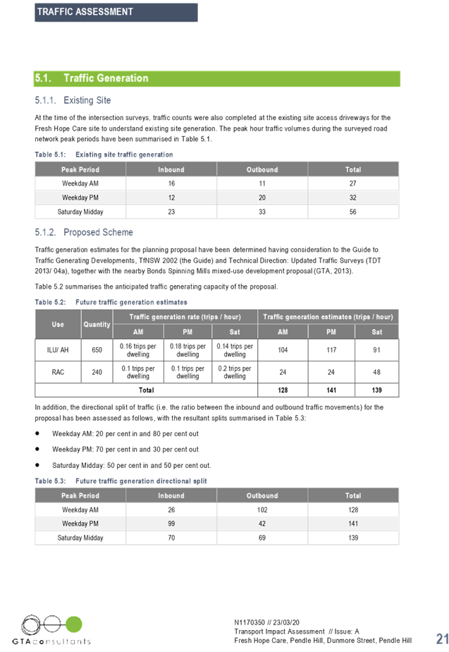
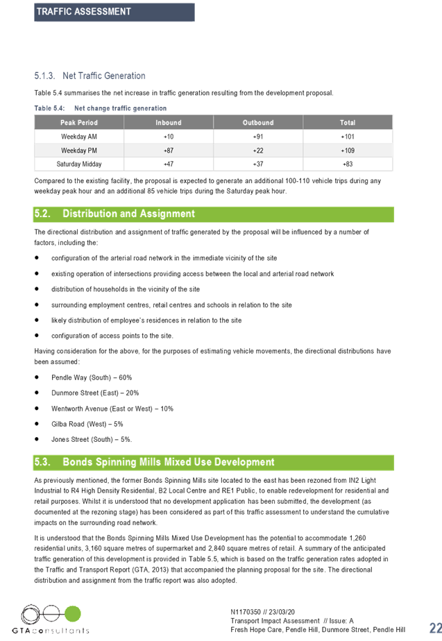
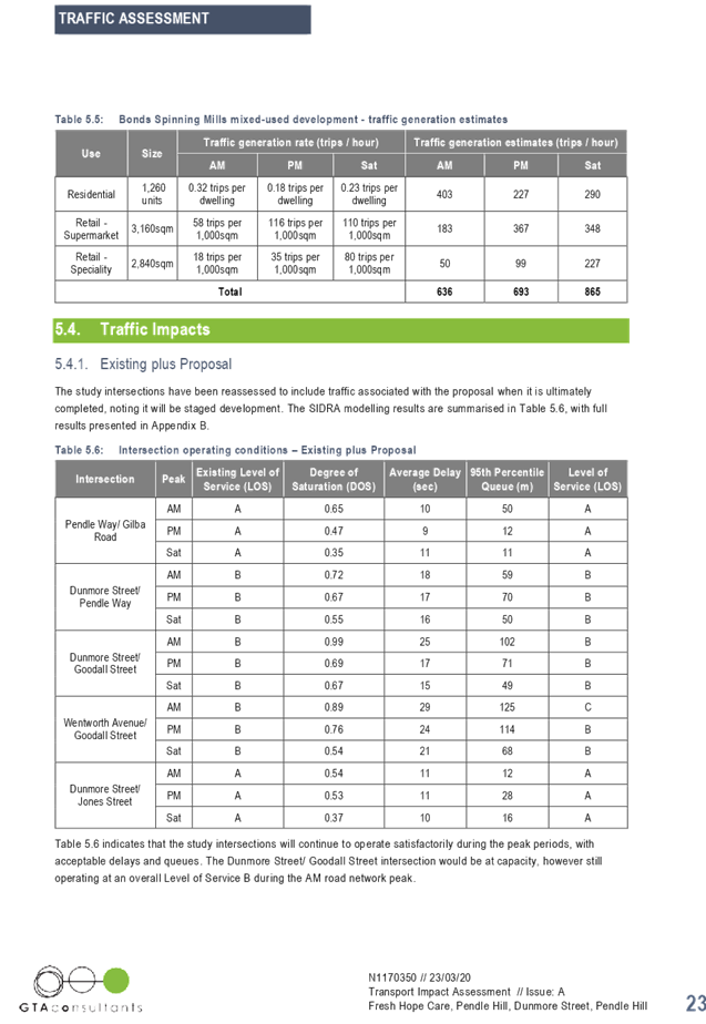
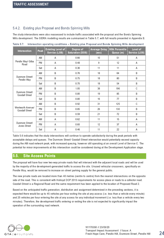


Cumberland Local Planning Panel Meeting
12 August 2020
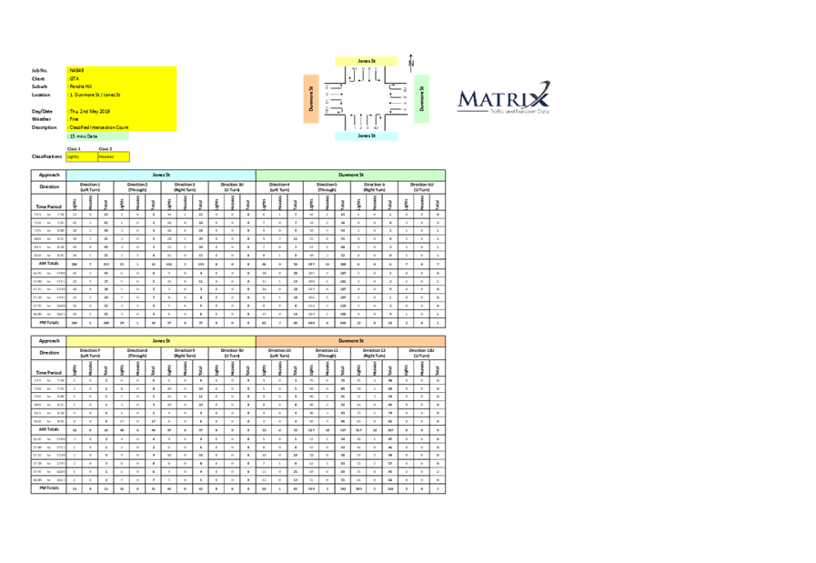
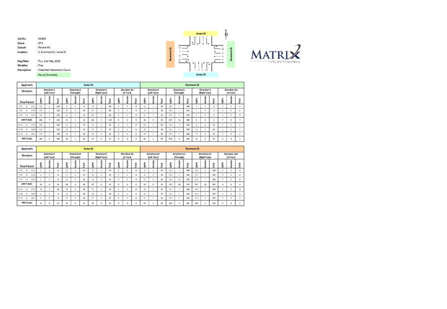
Cumberland Local Planning Panel Meeting
12 August 2020
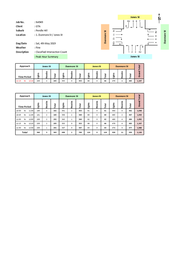
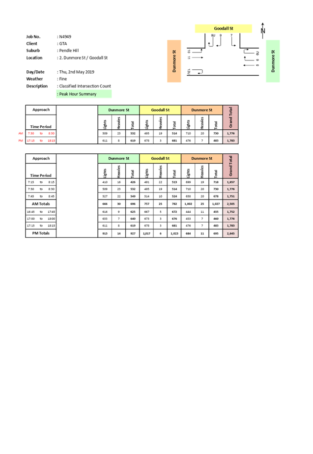
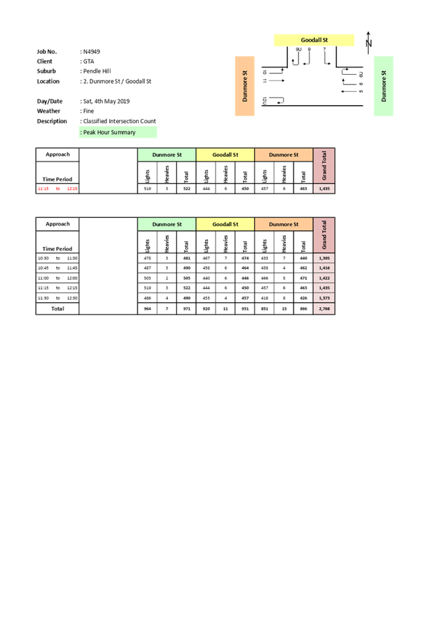
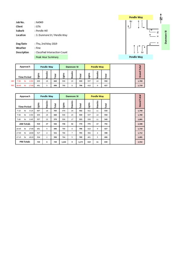
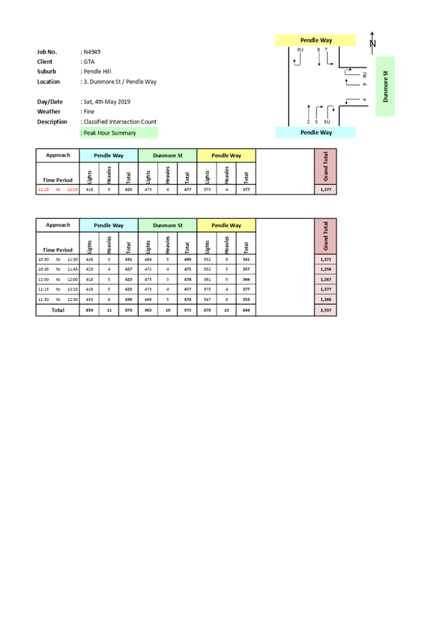
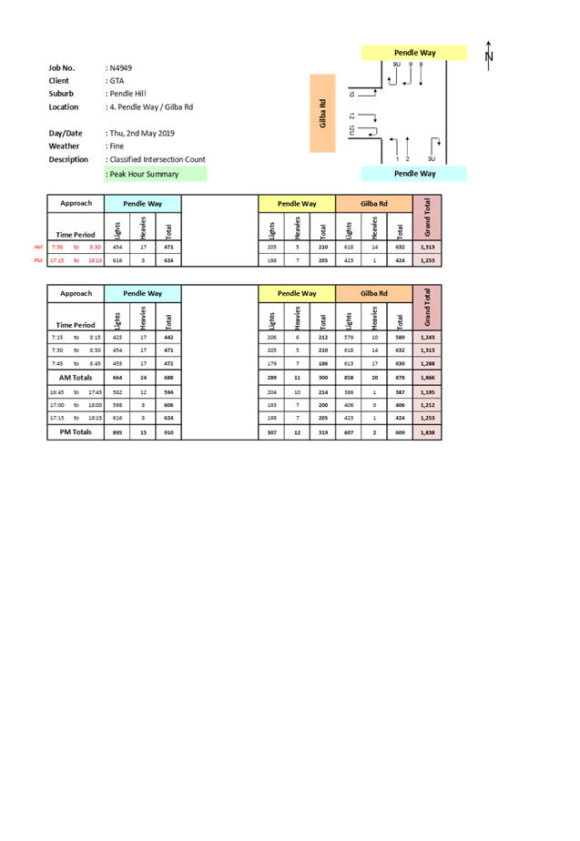
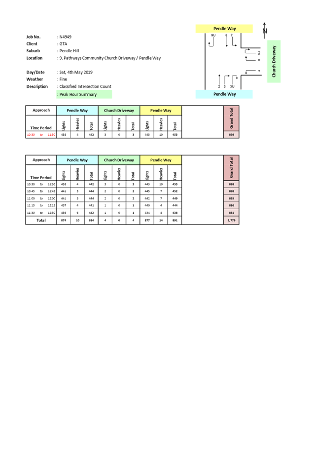
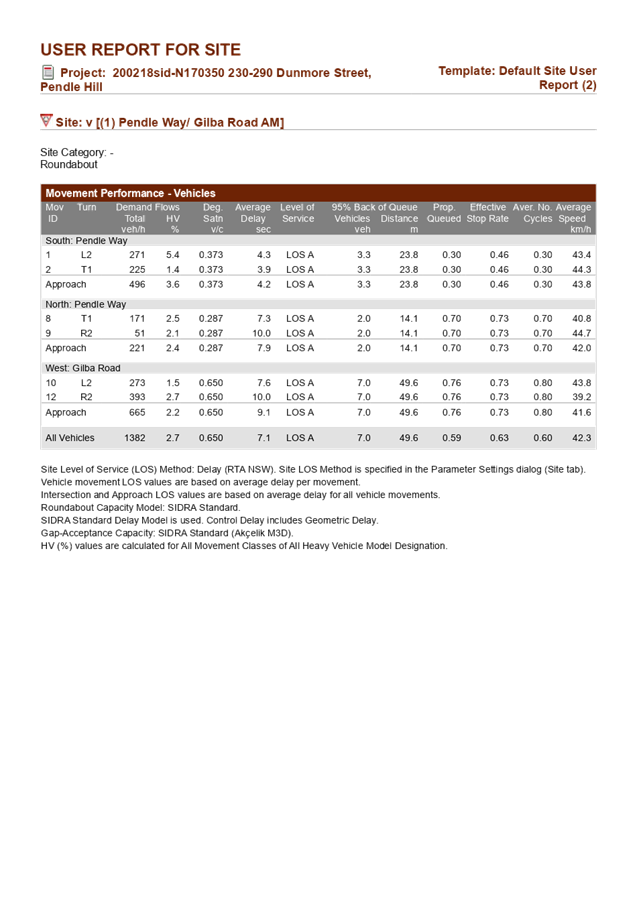
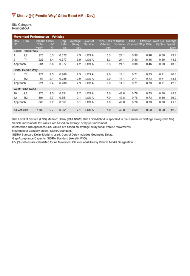
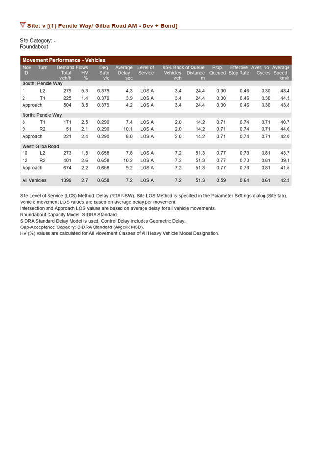
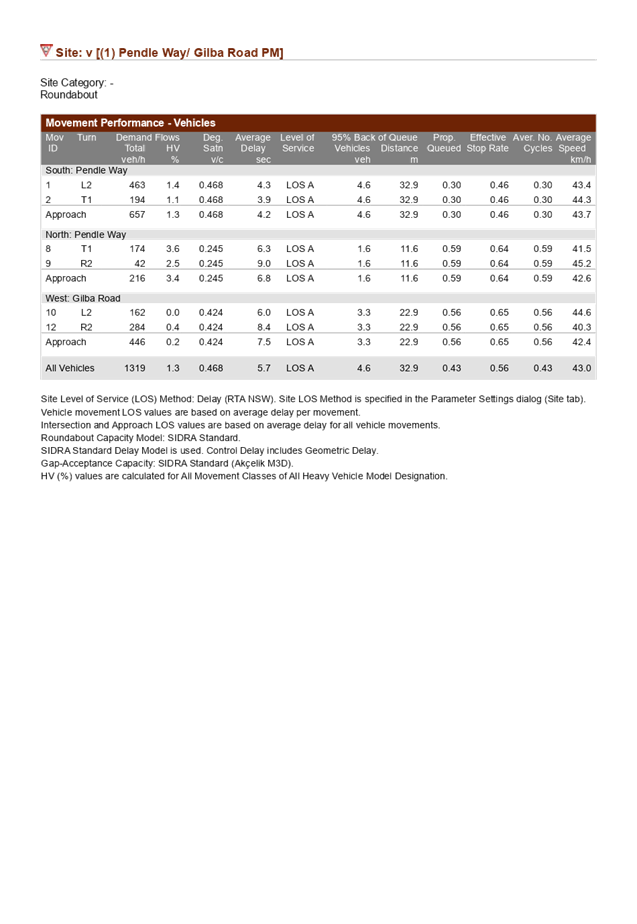
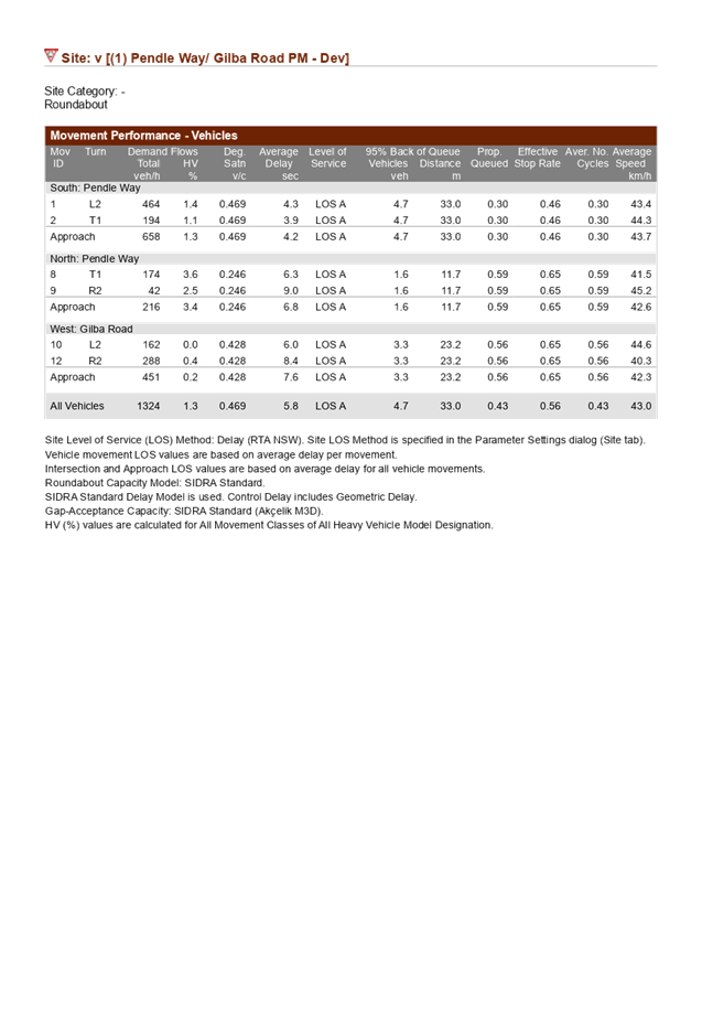
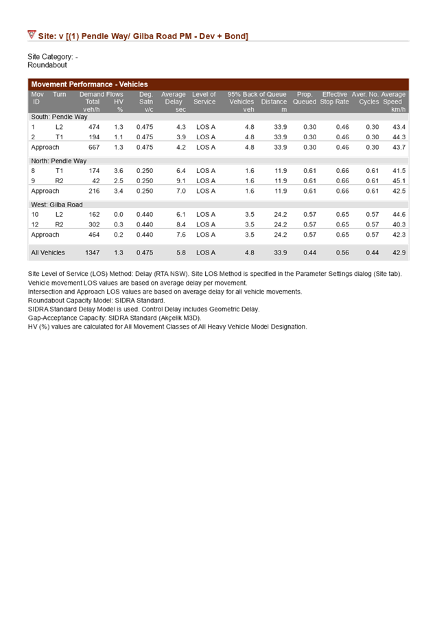
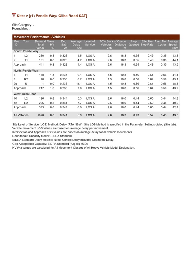
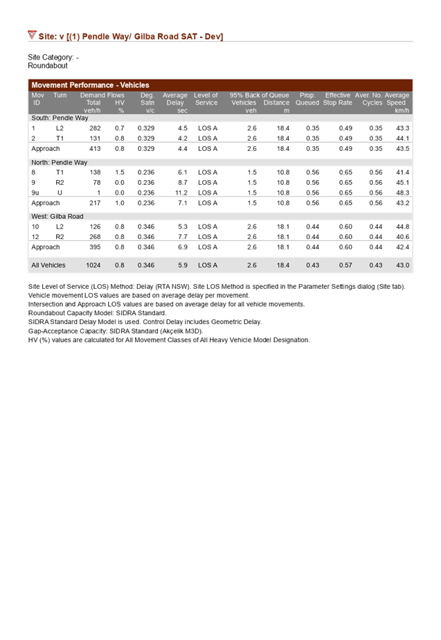
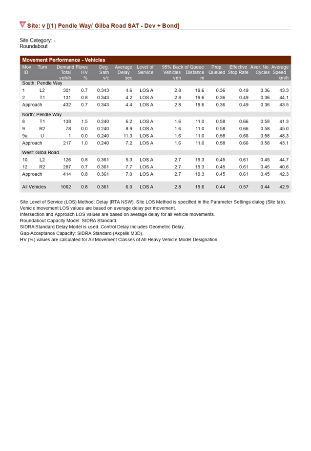
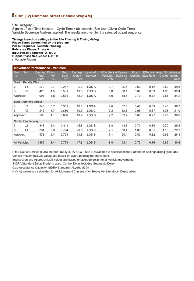
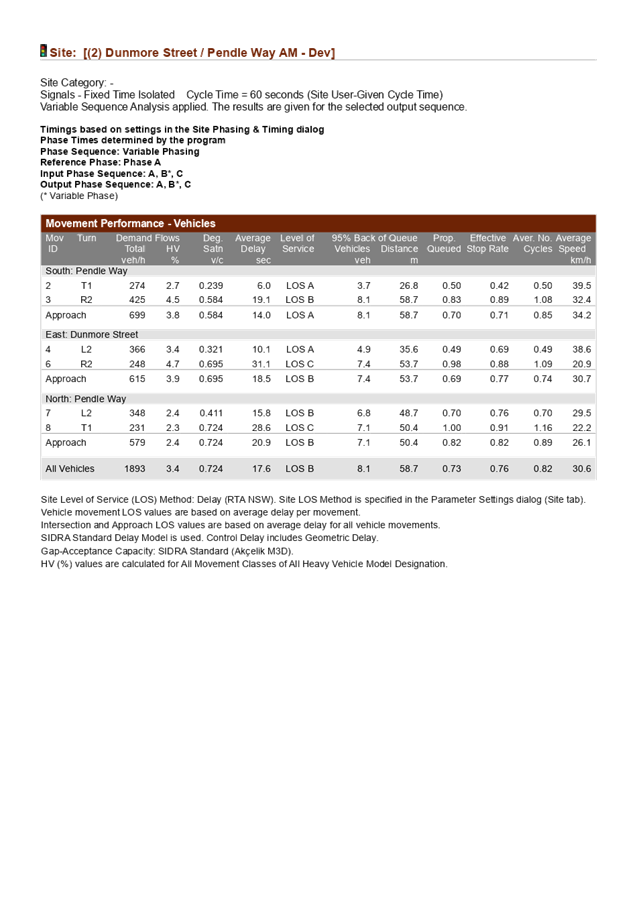
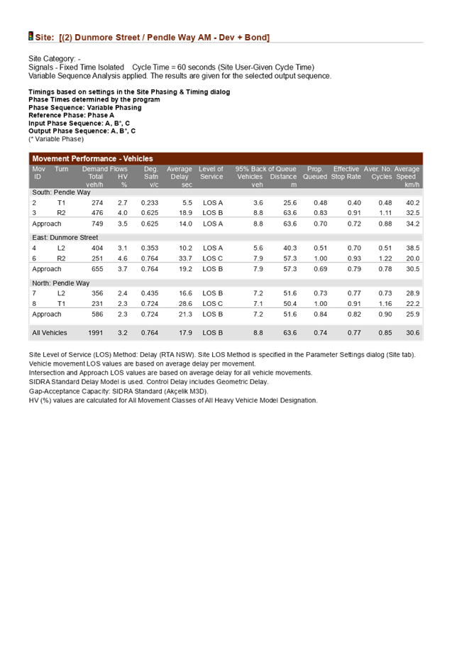
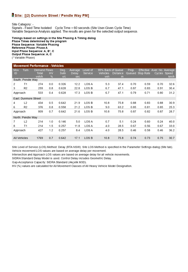
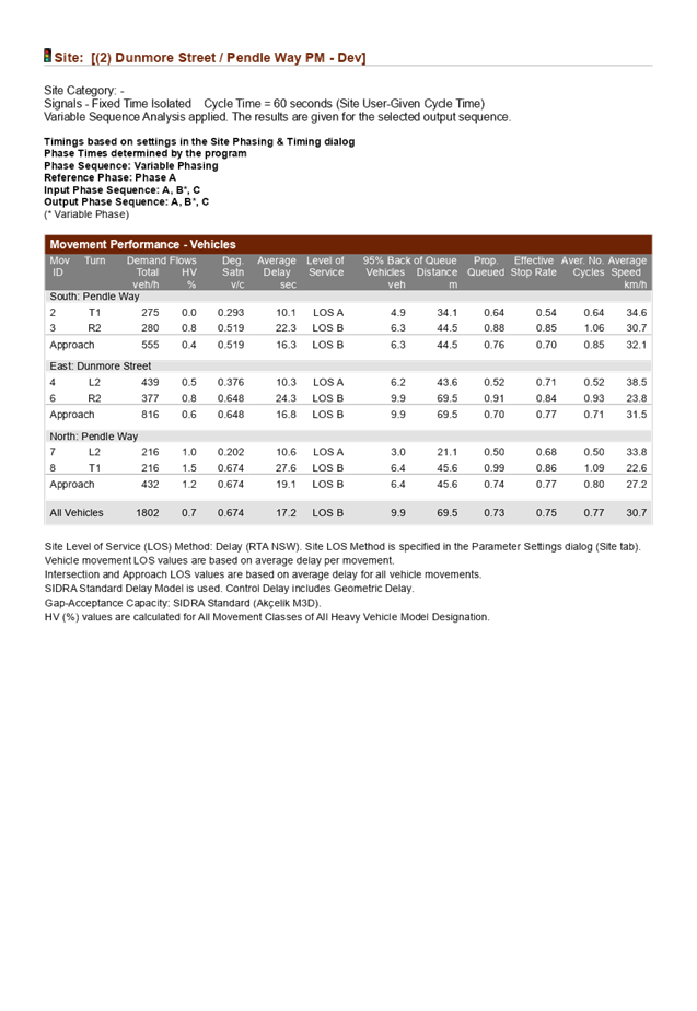
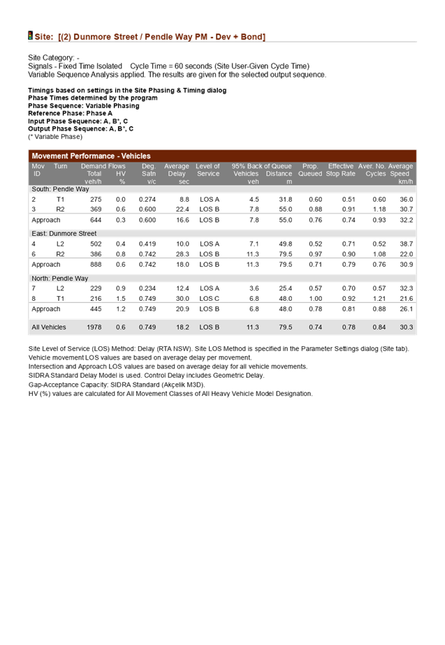
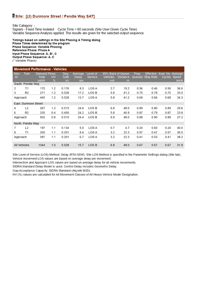
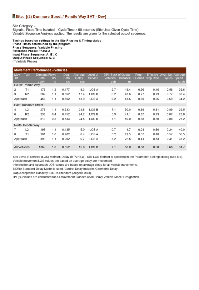
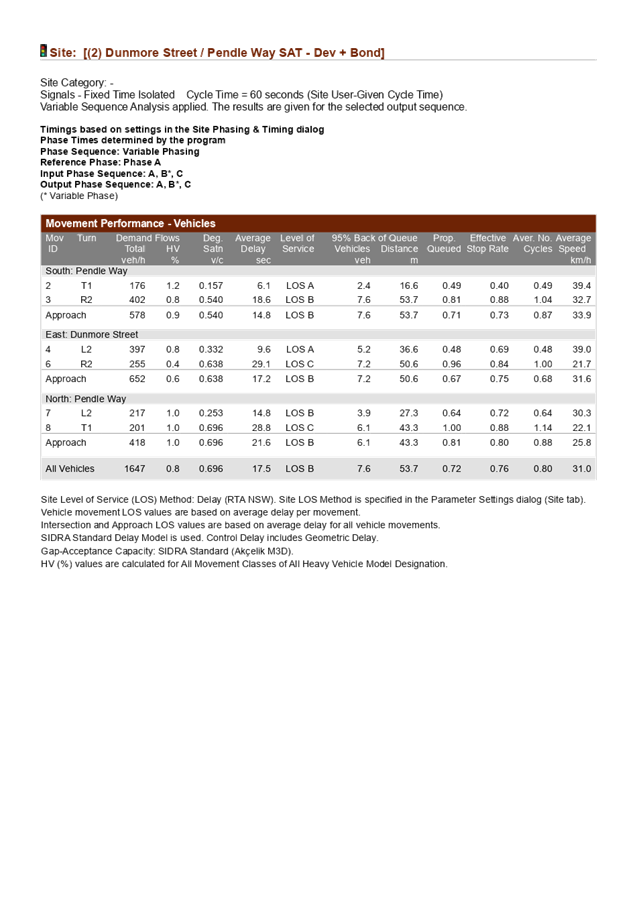

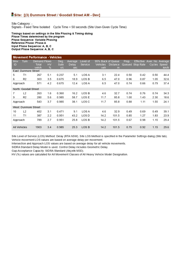

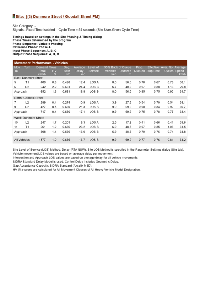


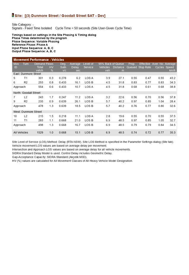
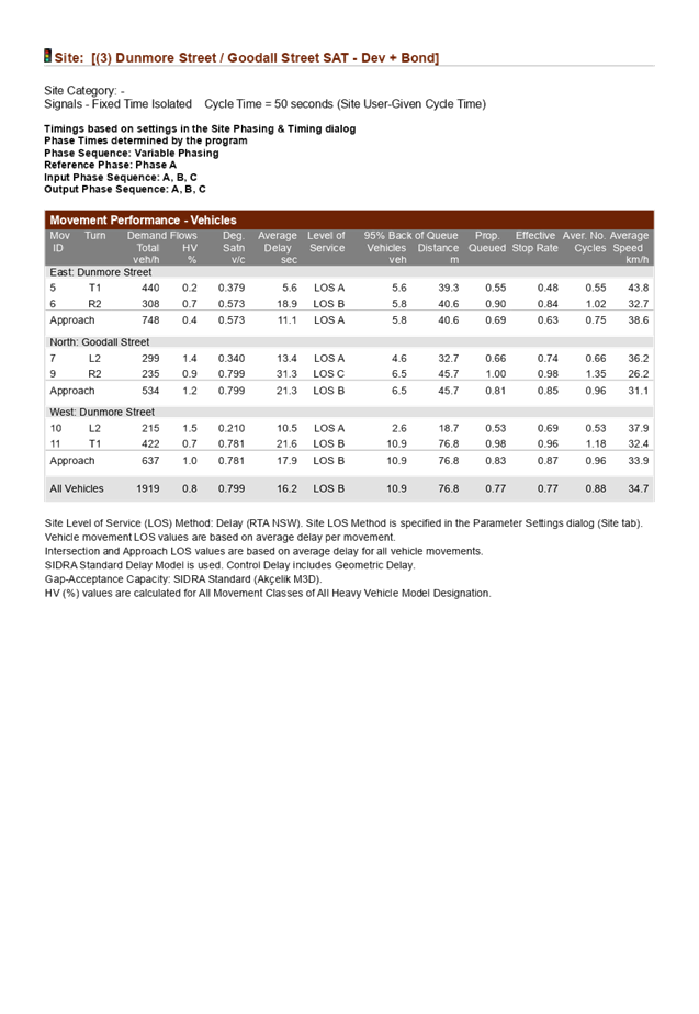


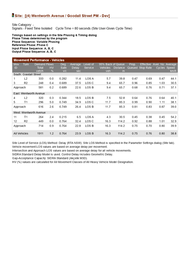
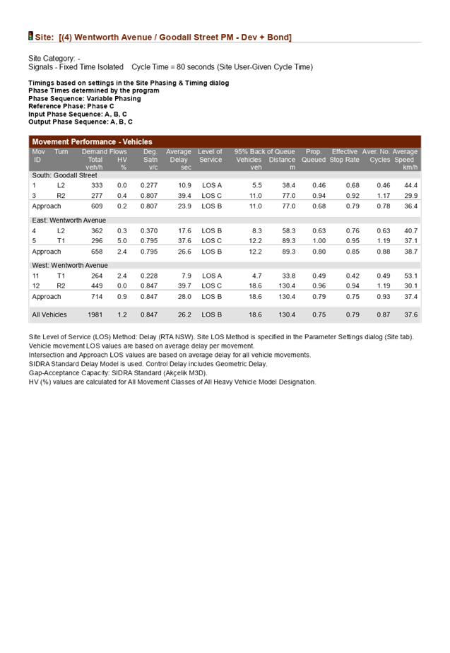
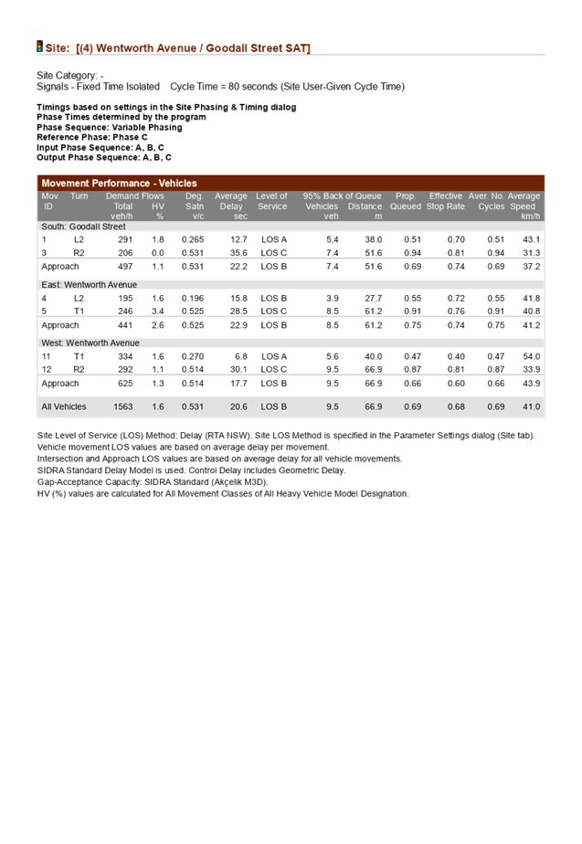


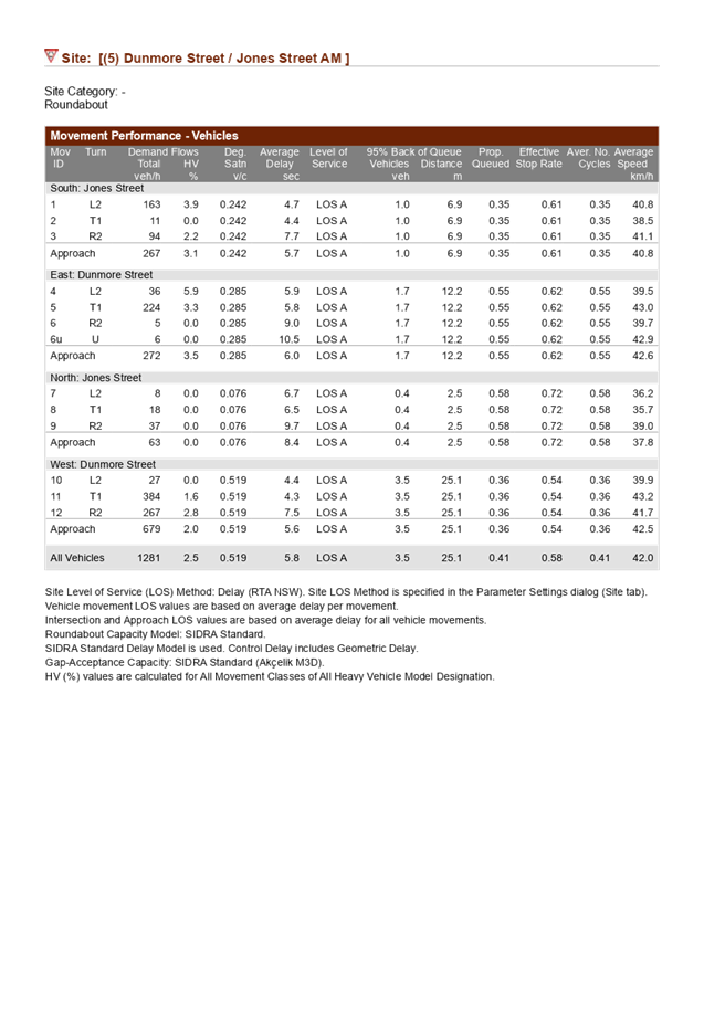
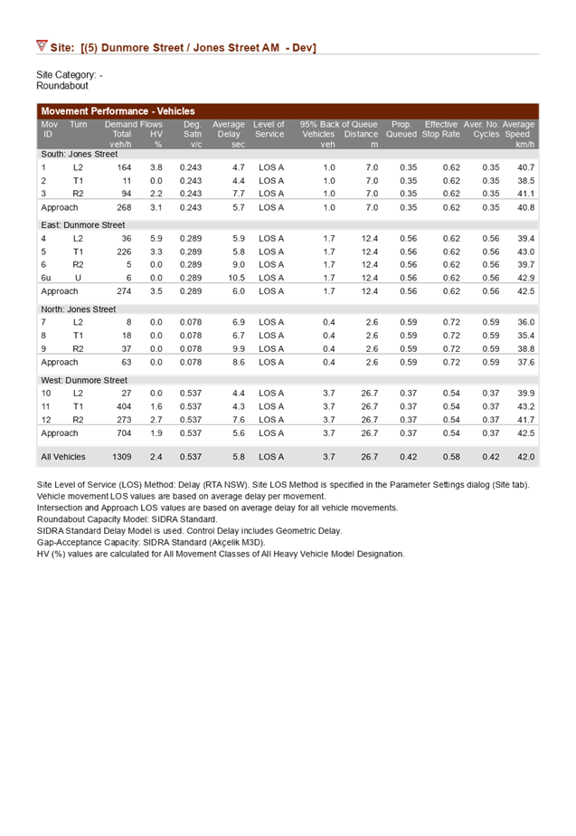
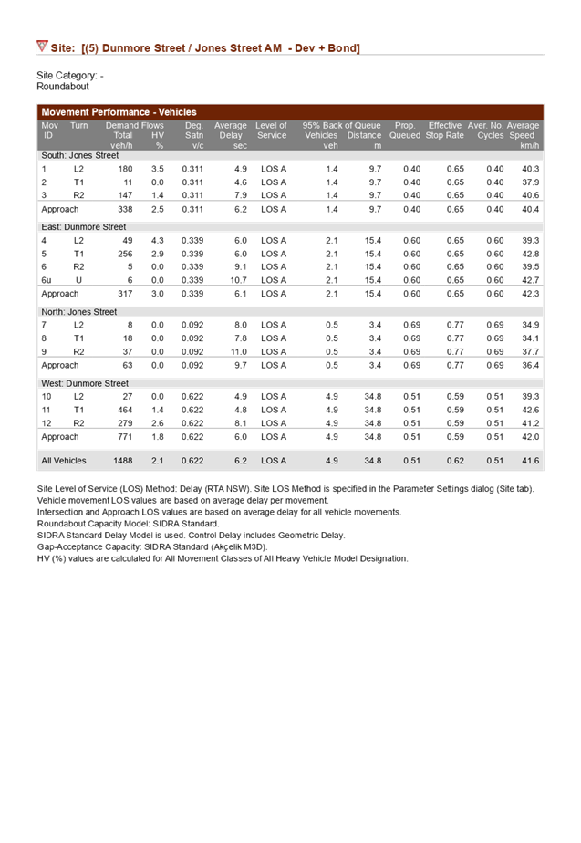

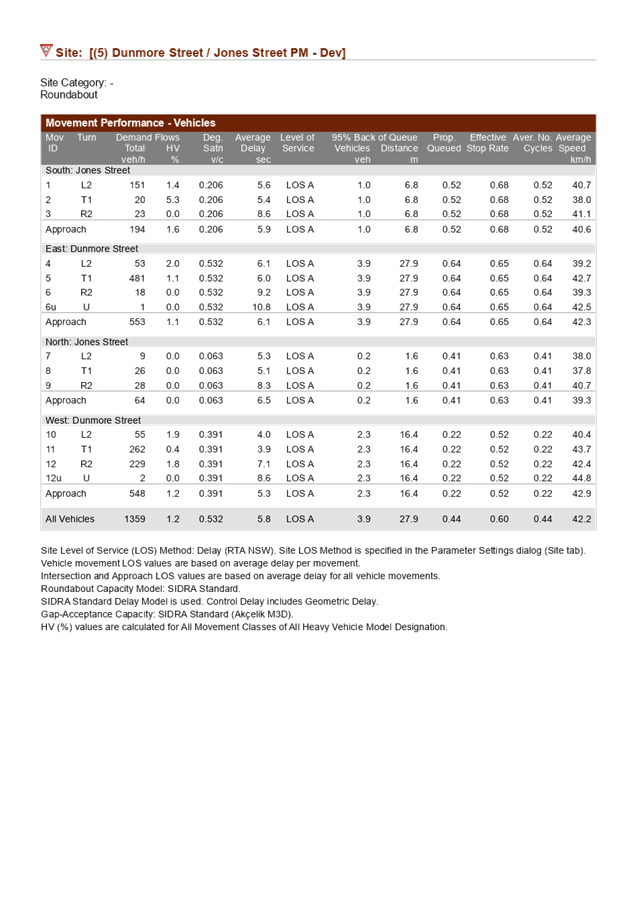
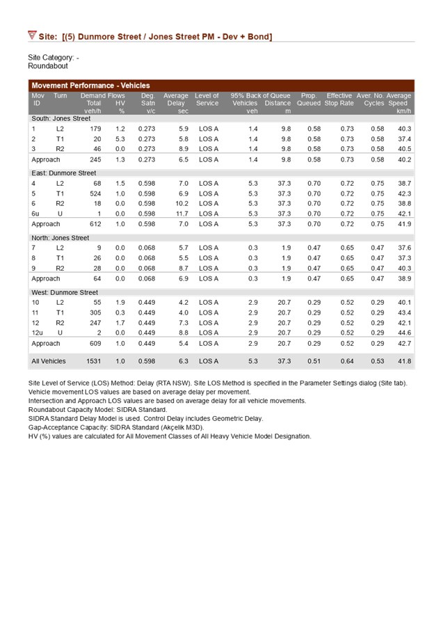
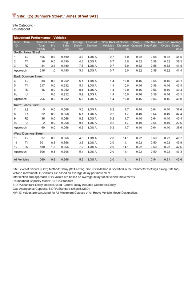
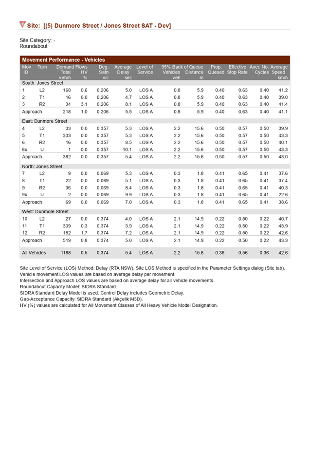
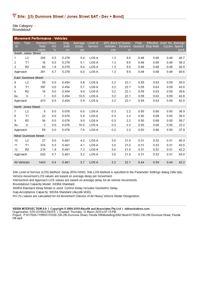

DOCUMENTS
ASSOCIATED WITH
REPORT LPP044/20
Attachment 6
Aboriginal Heritage Due Diligence
Cumberland Local Planning Panel Meeting
12 August 2020

Cumberland Local Planning Panel Meeting
12 August 2020
Cumberland Local Planning Panel Meeting
12 August 2020
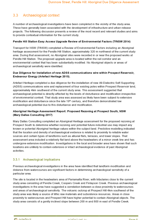
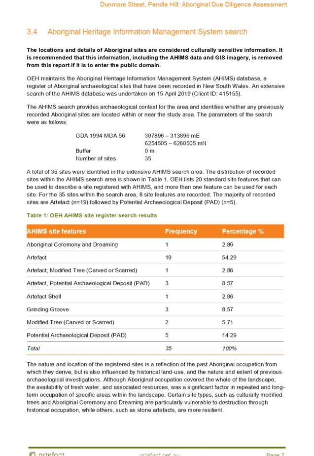

Cumberland Local Planning Panel Meeting
12 August 2020
Cumberland Local Planning Panel Meeting
12 August 2020
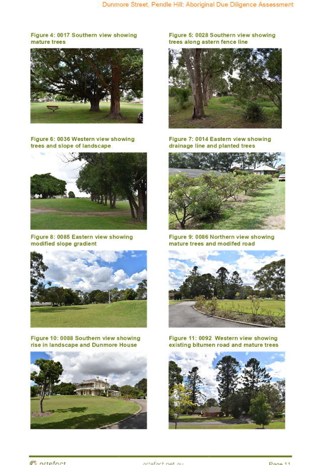
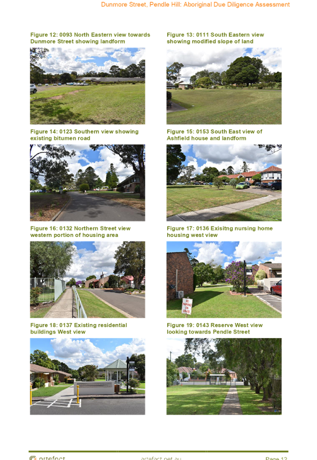
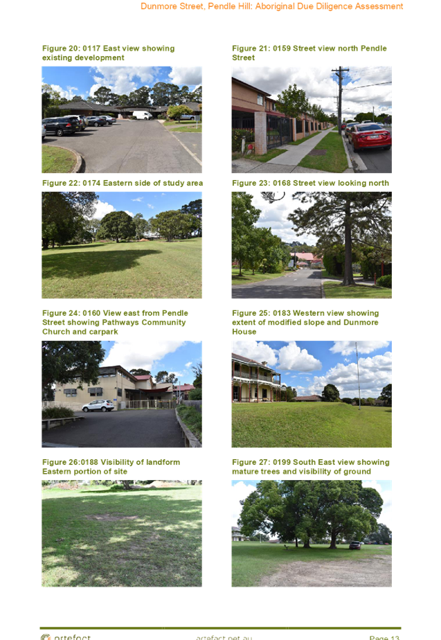
Cumberland Local Planning Panel Meeting
12 August 2020
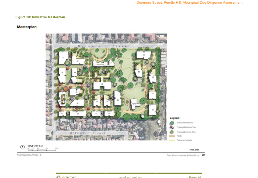
Cumberland Local Planning Panel Meeting
12 August 2020
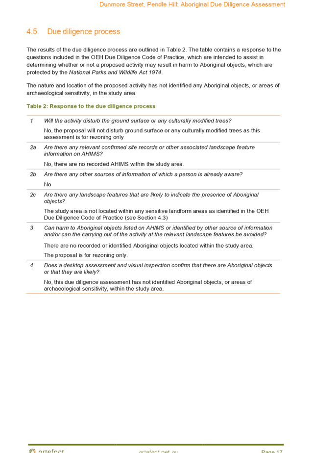

DOCUMENTS
ASSOCIATED WITH
REPORT LPP044/20
Attachment 7
Historic Archaeology Assessment
Cumberland Local Planning Panel Meeting
12 August 2020


Cumberland Local Planning Panel Meeting
12 August 2020
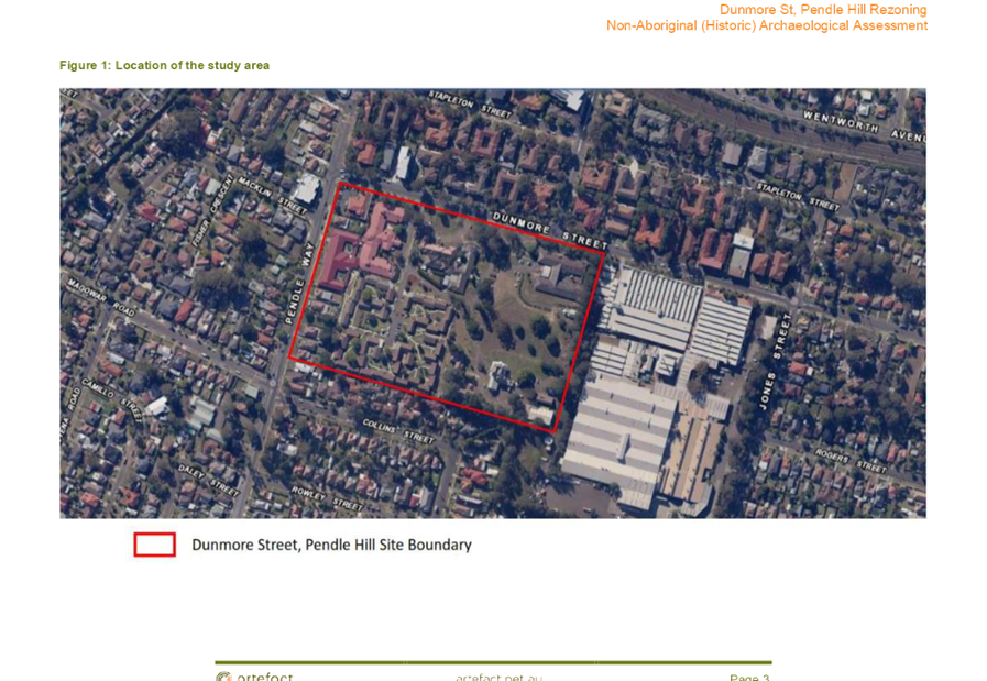
Cumberland Local Planning Panel Meeting
12 August 2020


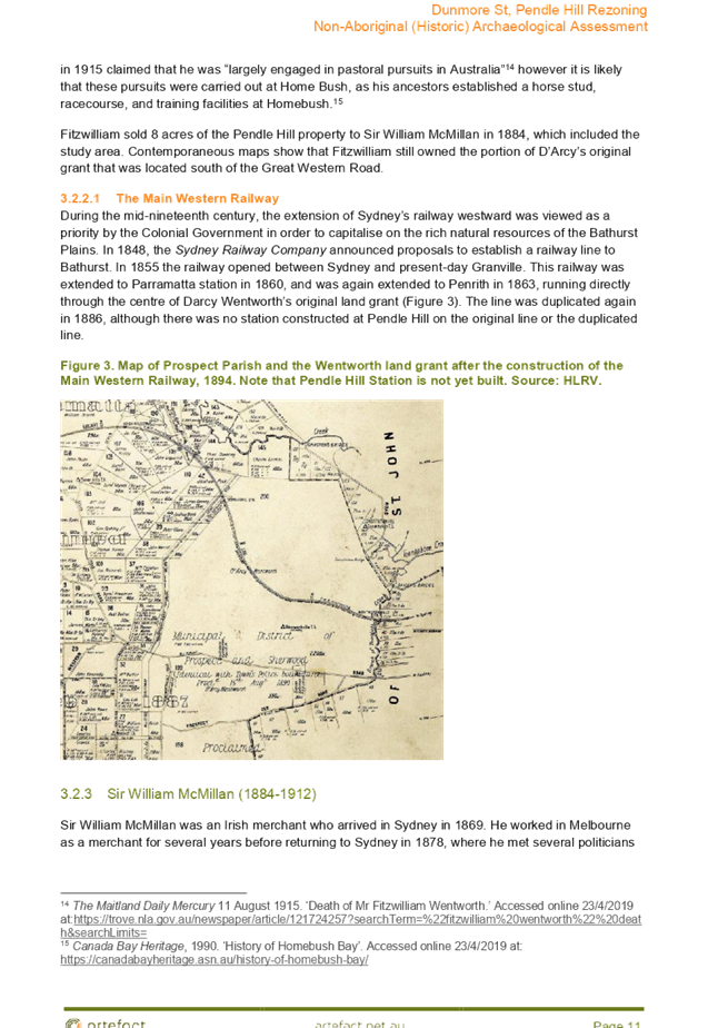
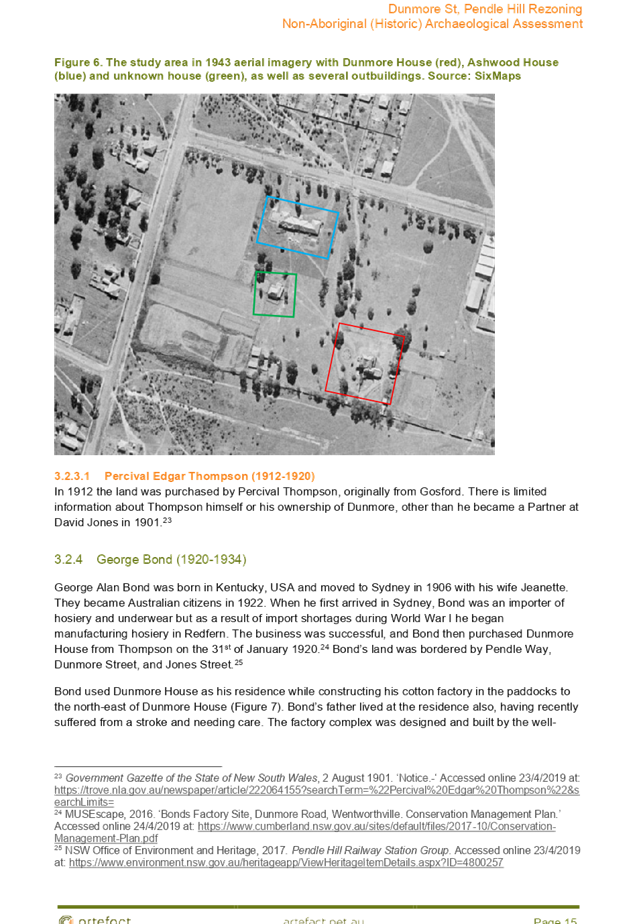
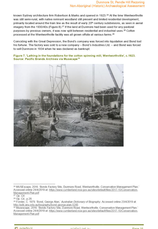
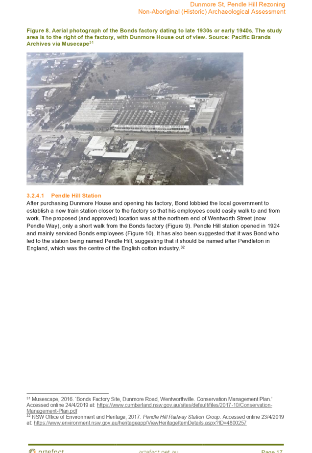
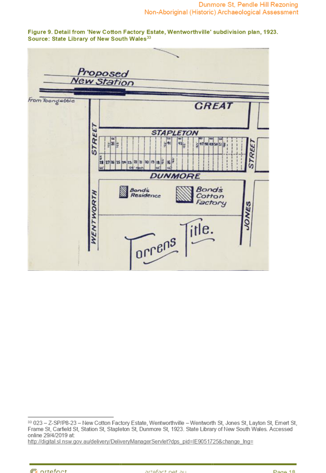
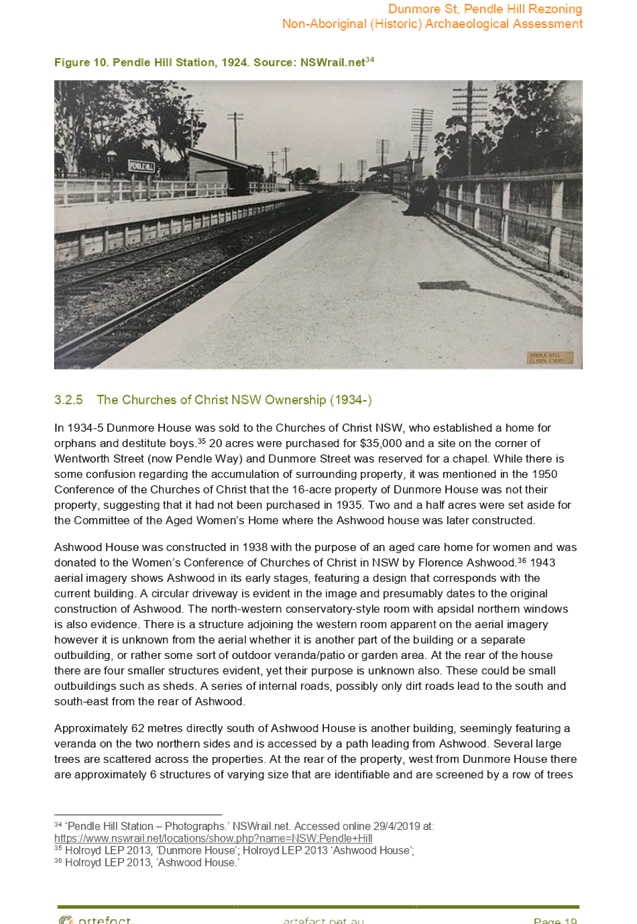

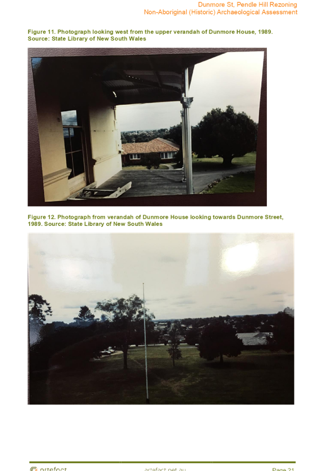
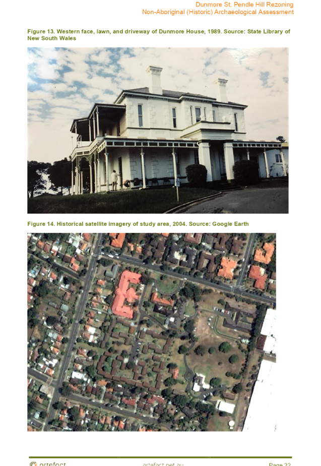
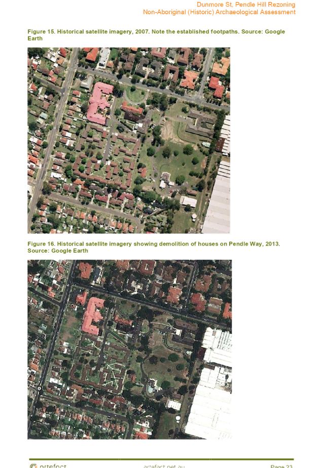
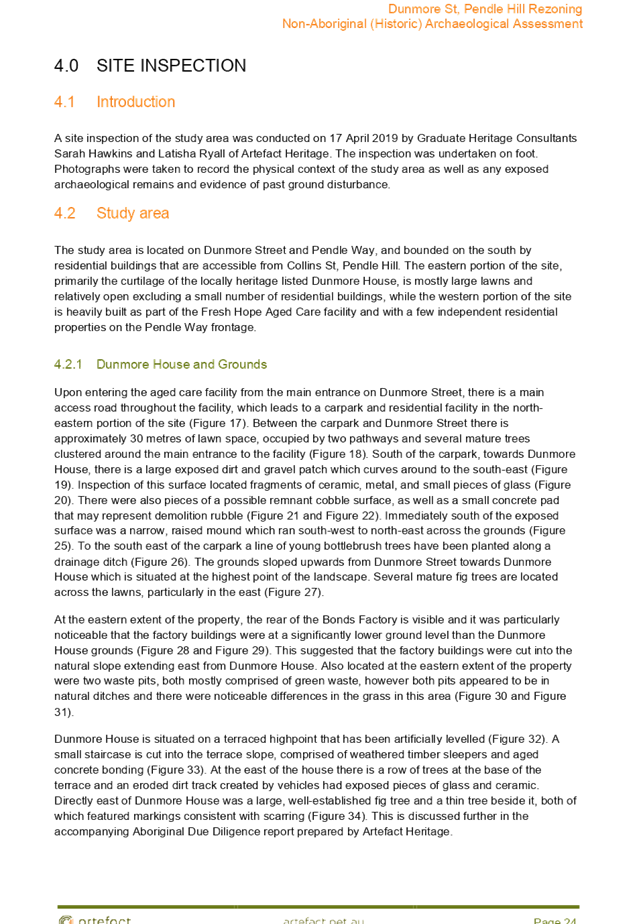
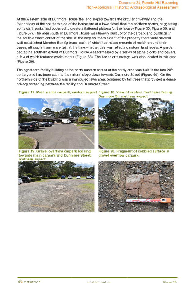
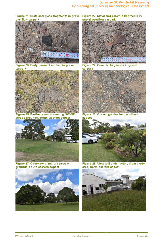
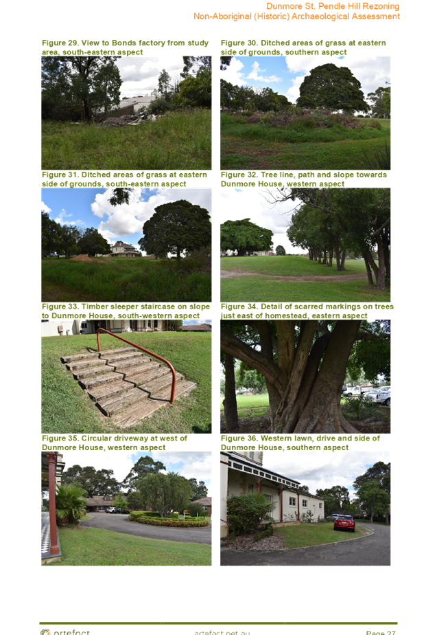
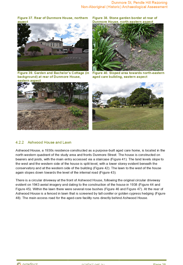
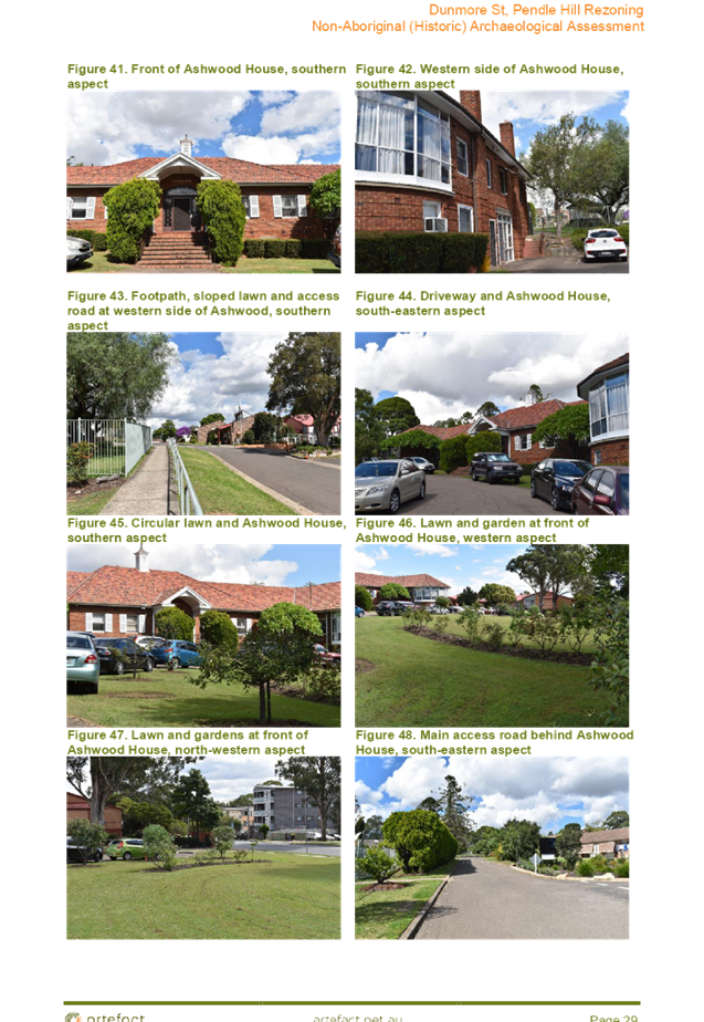
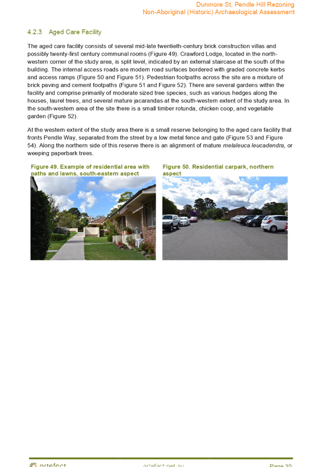
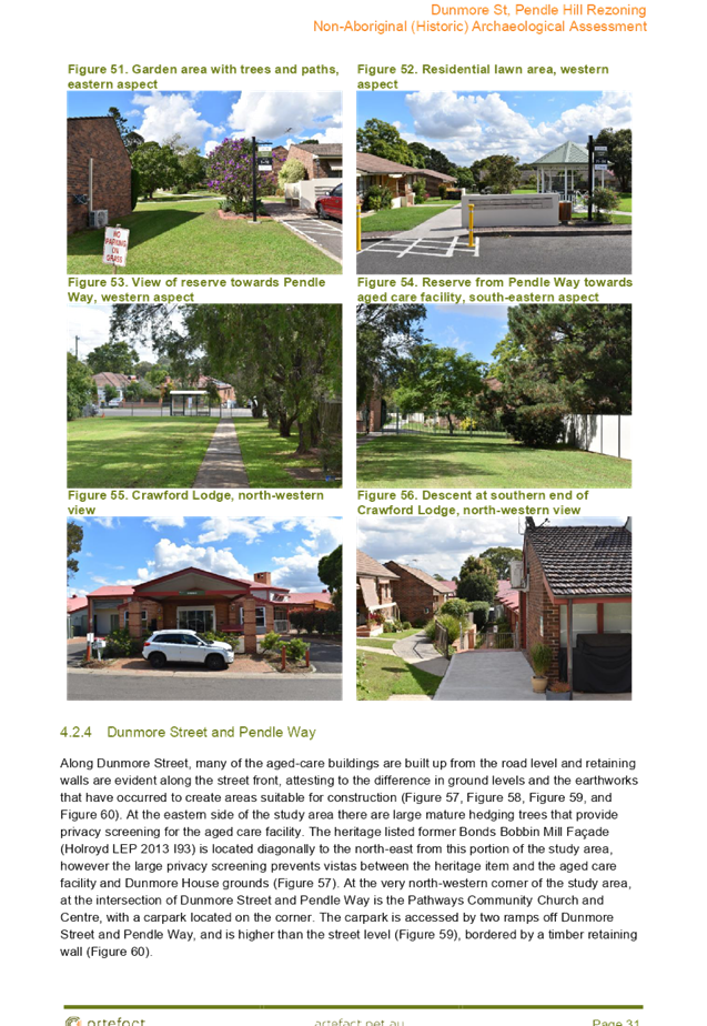
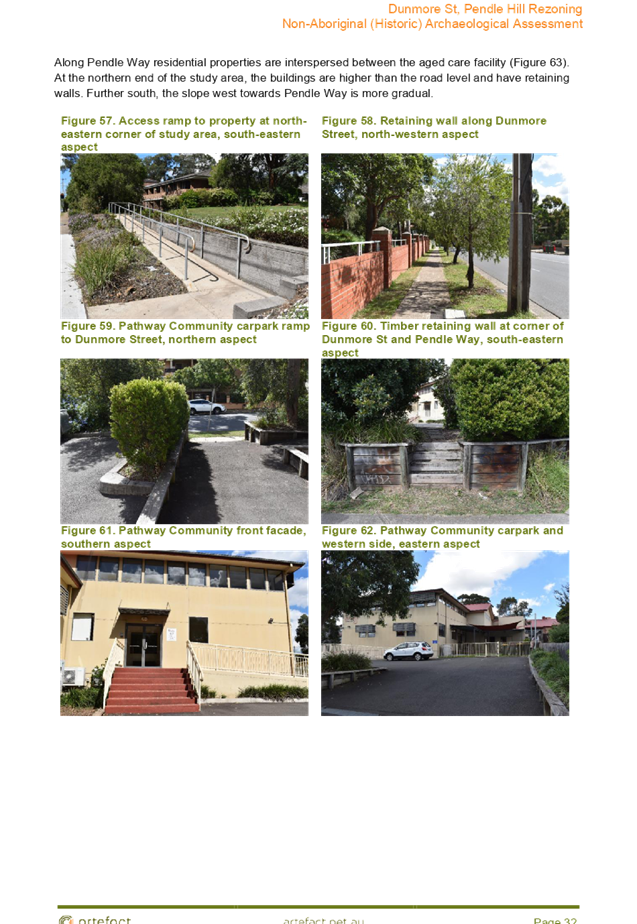
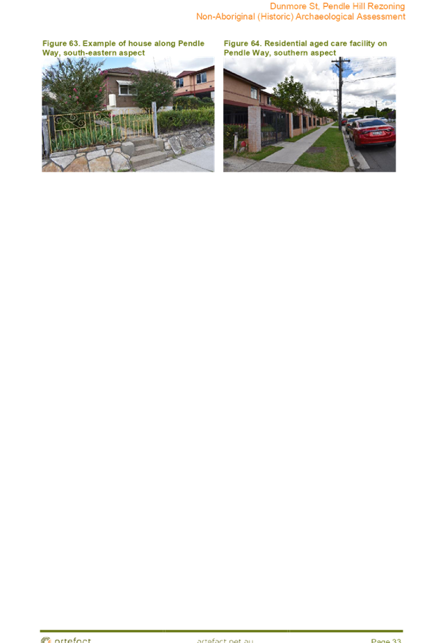
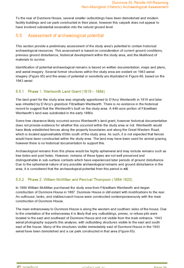
Cumberland Local Planning Panel Meeting
12 August 2020
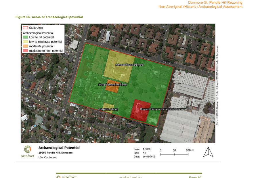
Cumberland Local Planning Panel Meeting
12 August 2020

Cumberland Local Planning Panel Meeting
12 August 2020
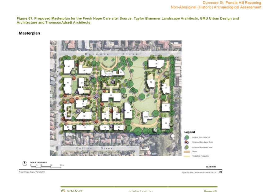
Cumberland Local Planning Panel Meeting
12 August 2020

DOCUMENTS
ASSOCIATED WITH
REPORT LPP044/20
Attachment 8
Heritage Impact Statement
Cumberland Local Planning Panel Meeting
12 August 2020
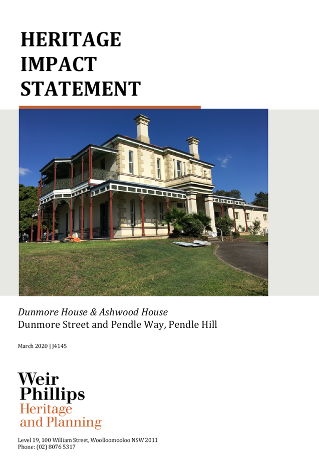

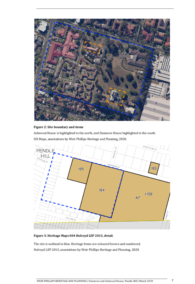
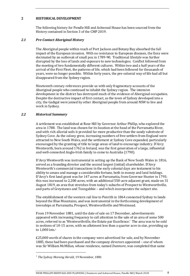
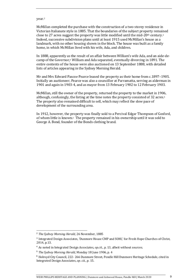
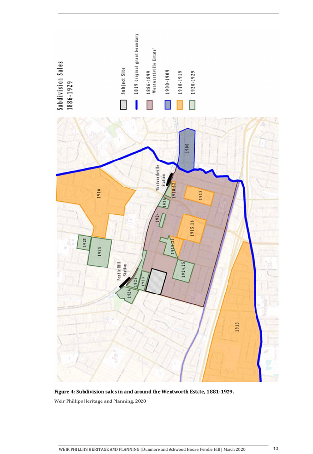
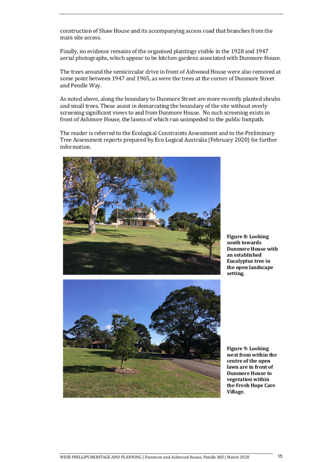
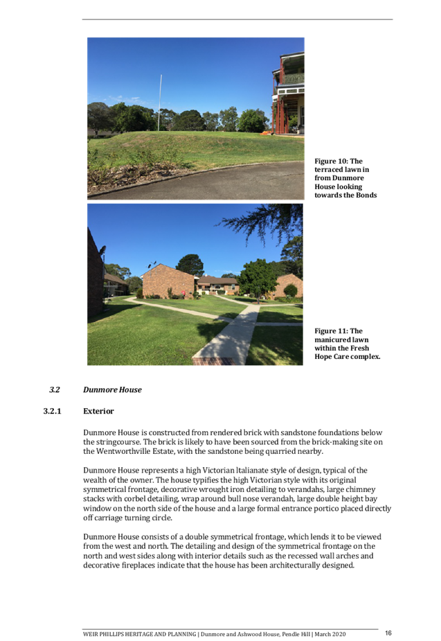
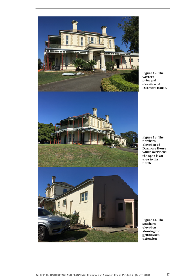
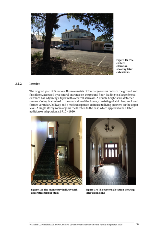
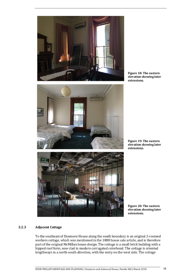
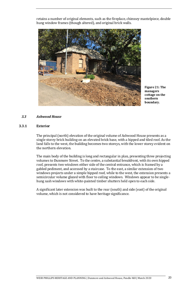
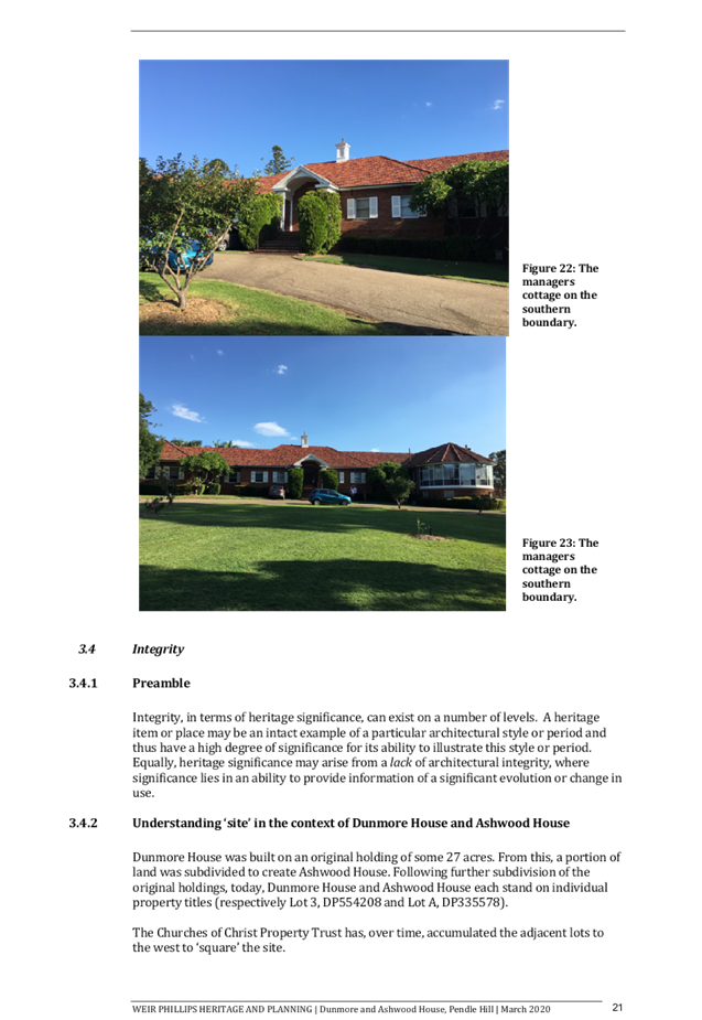
Cumberland Local Planning Panel Meeting
12 August 2020
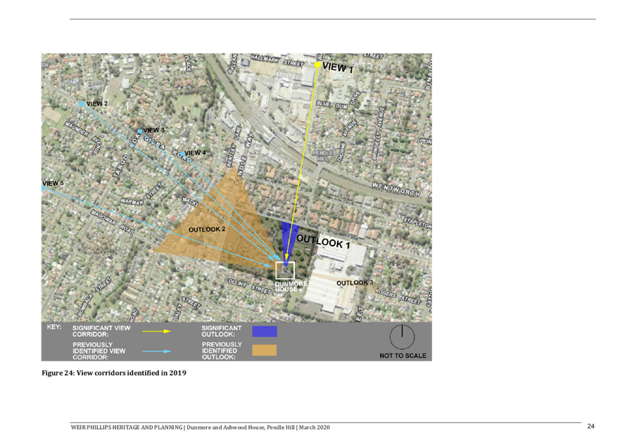
Cumberland Local Planning Panel Meeting
12 August 2020
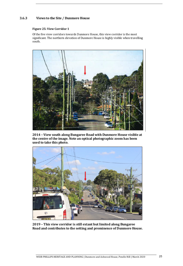
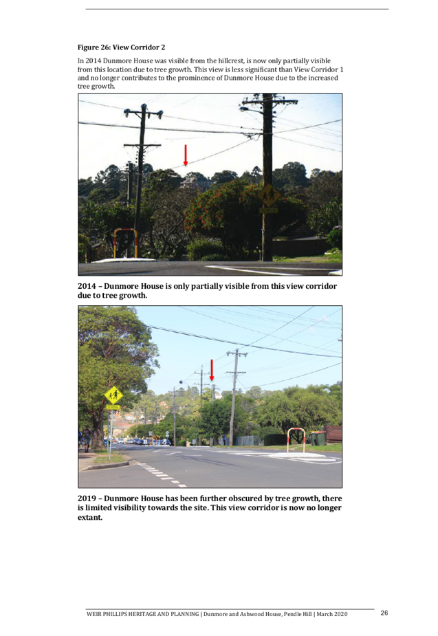
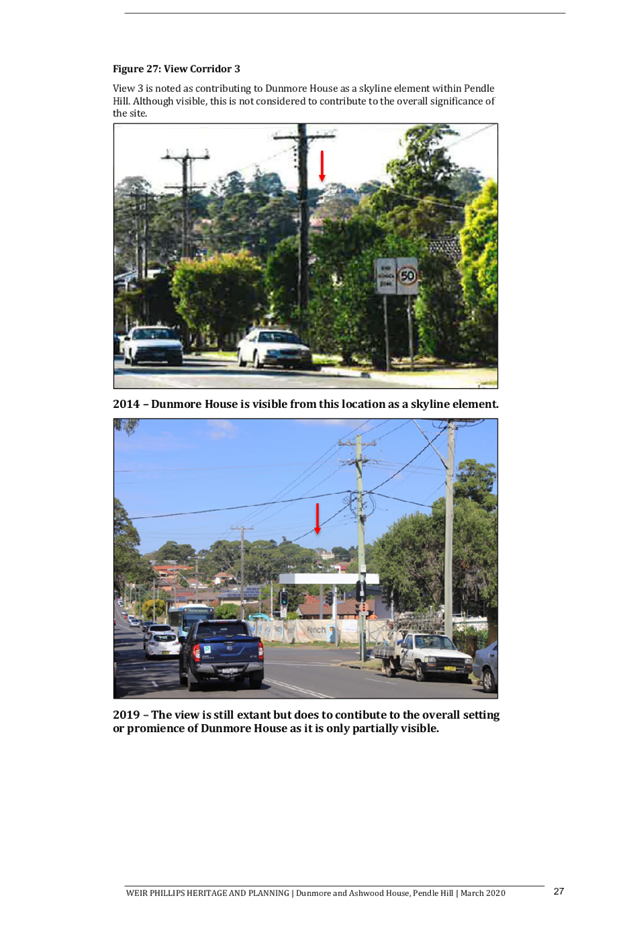
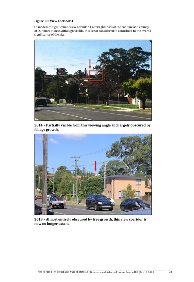
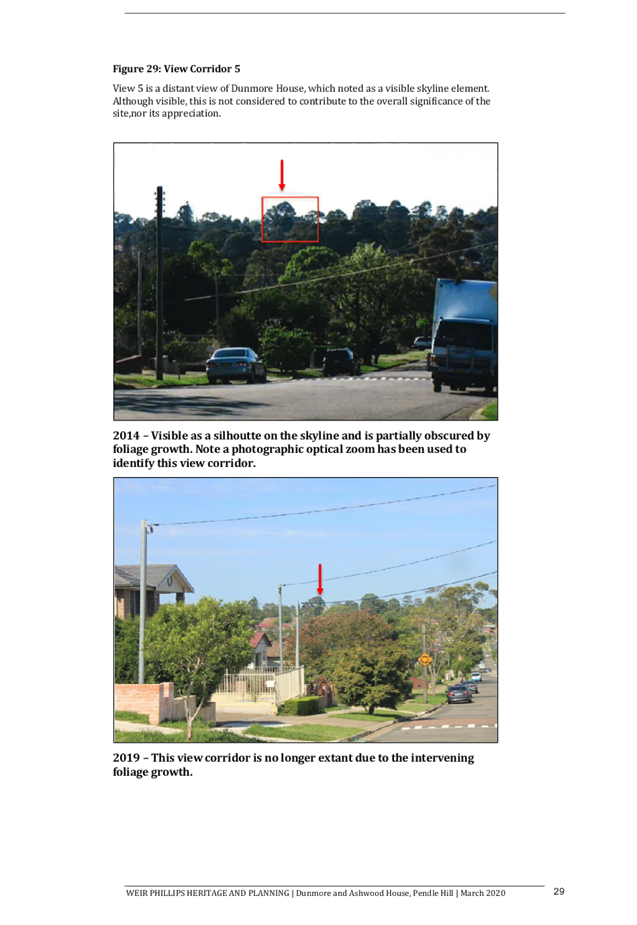
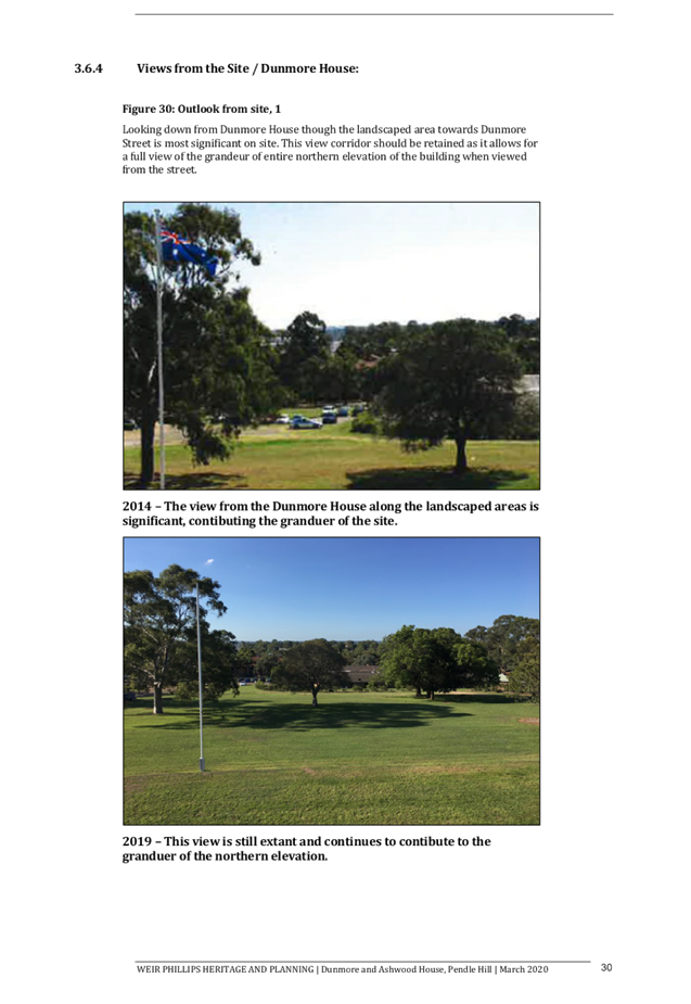
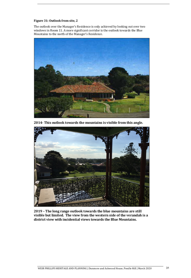
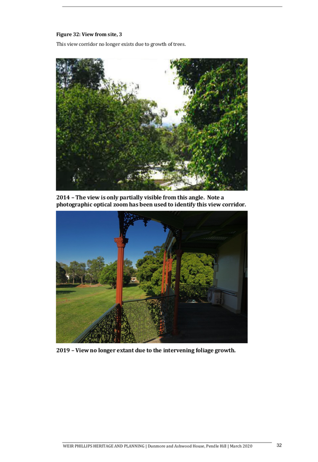
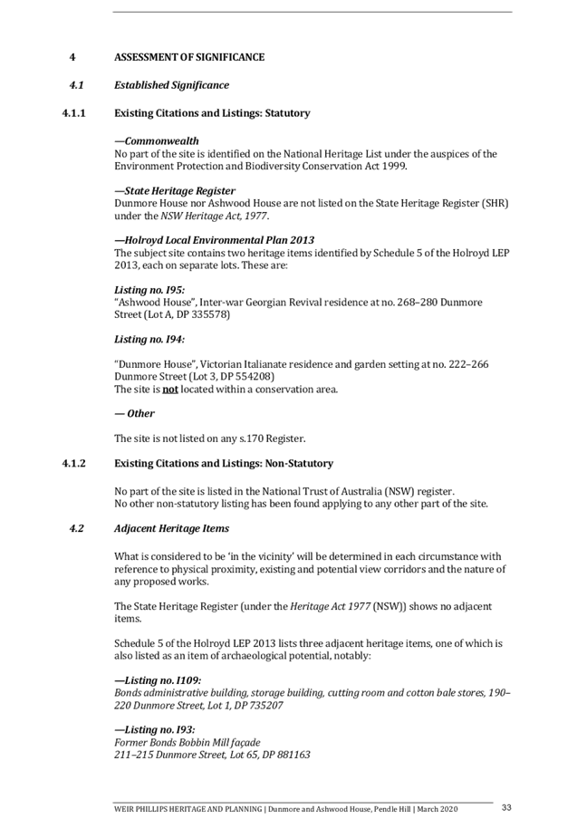
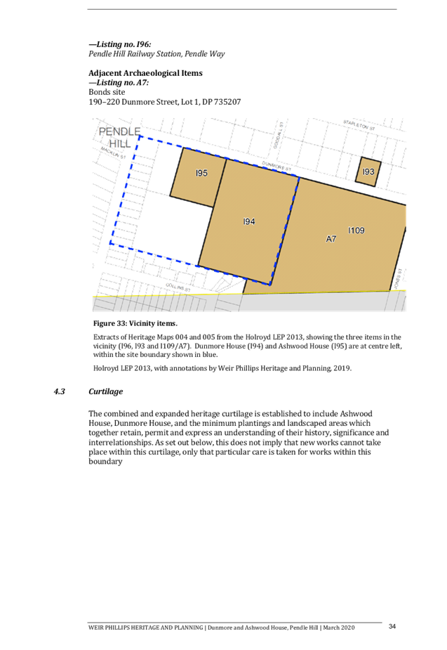
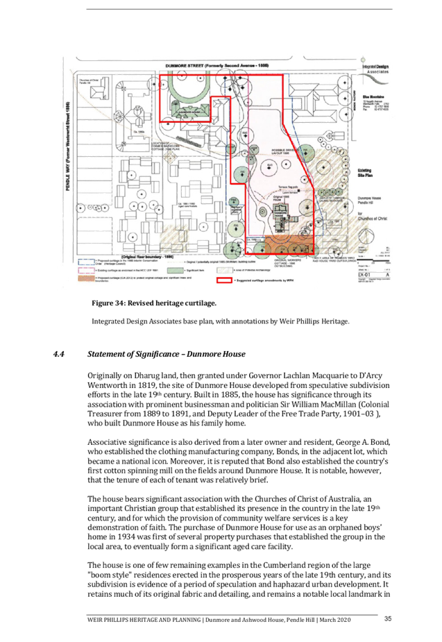
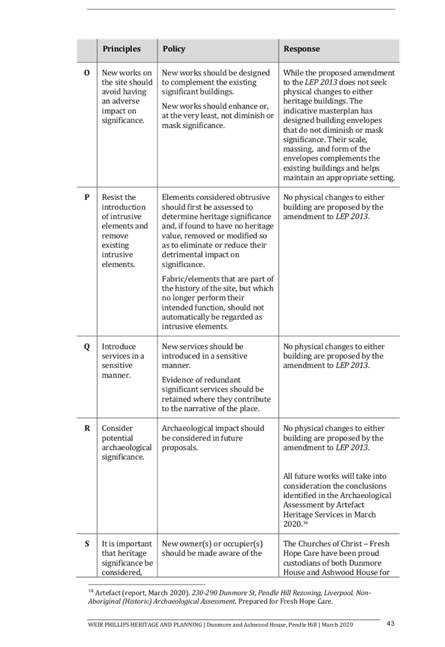

DOCUMENTS
ASSOCIATED WITH
REPORT LPP044/20
Attachment 9
Preliminary Contamination Assessment
Cumberland Local Planning Panel Meeting
12 August 2020

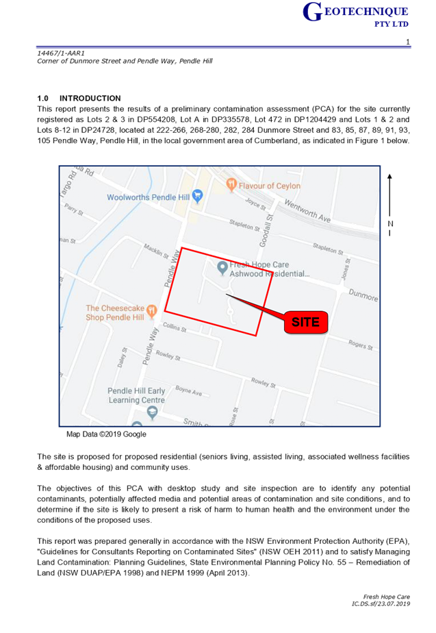
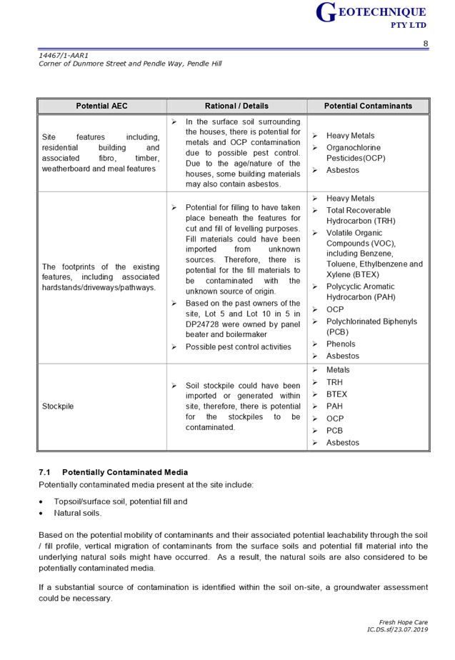


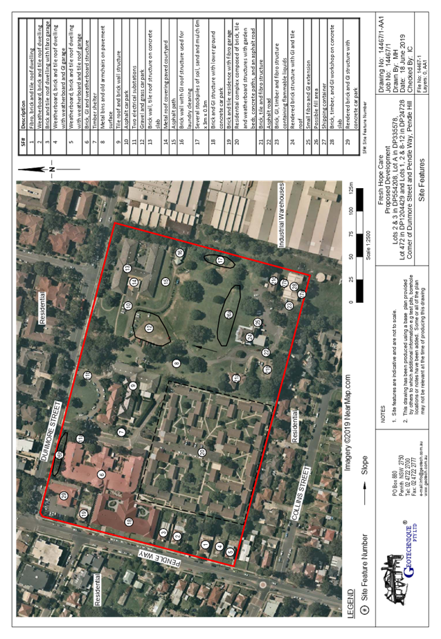
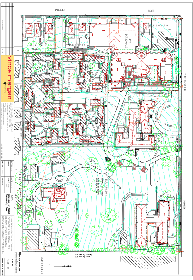
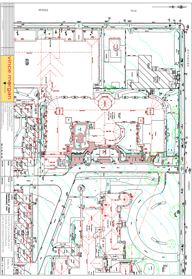
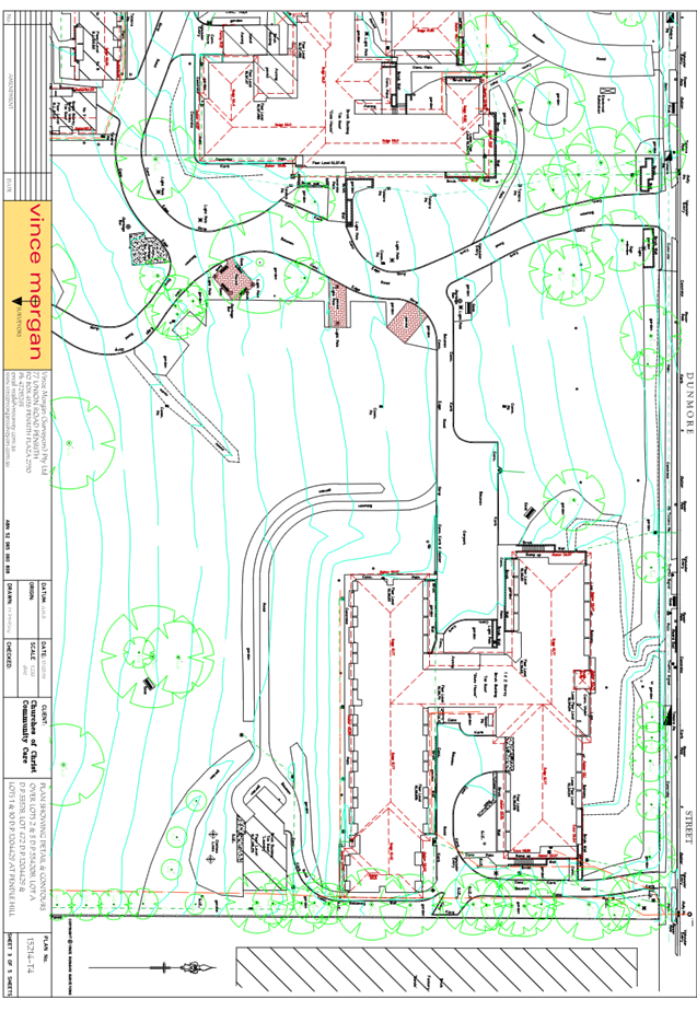
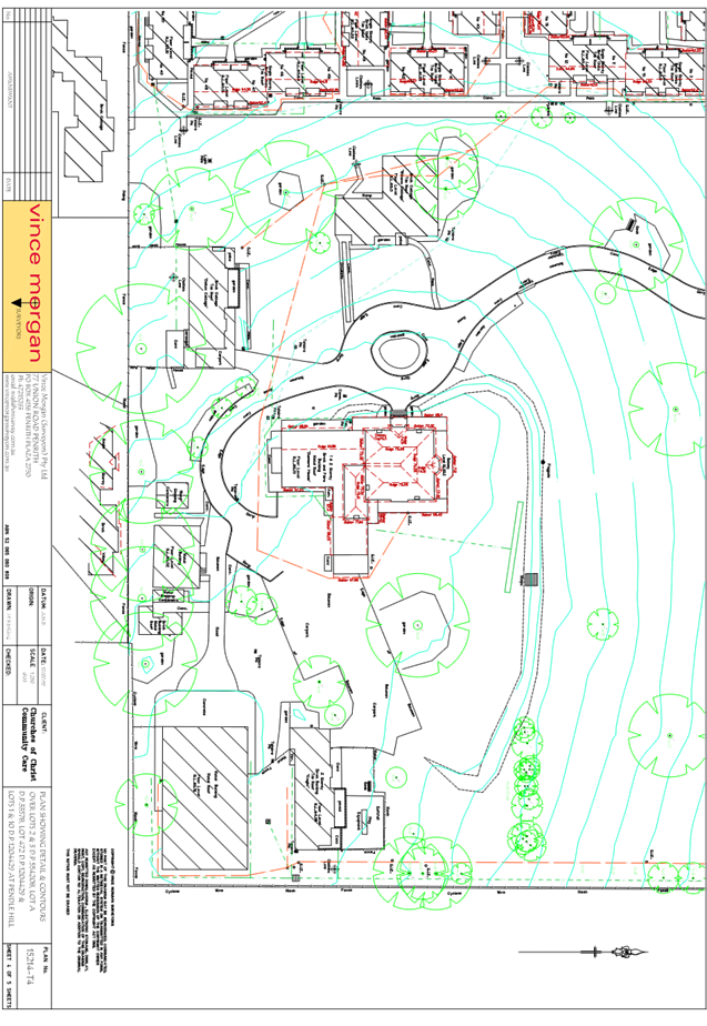
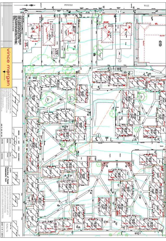

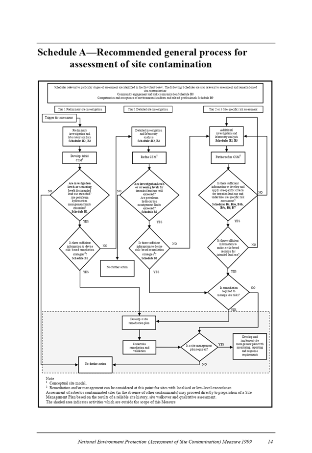


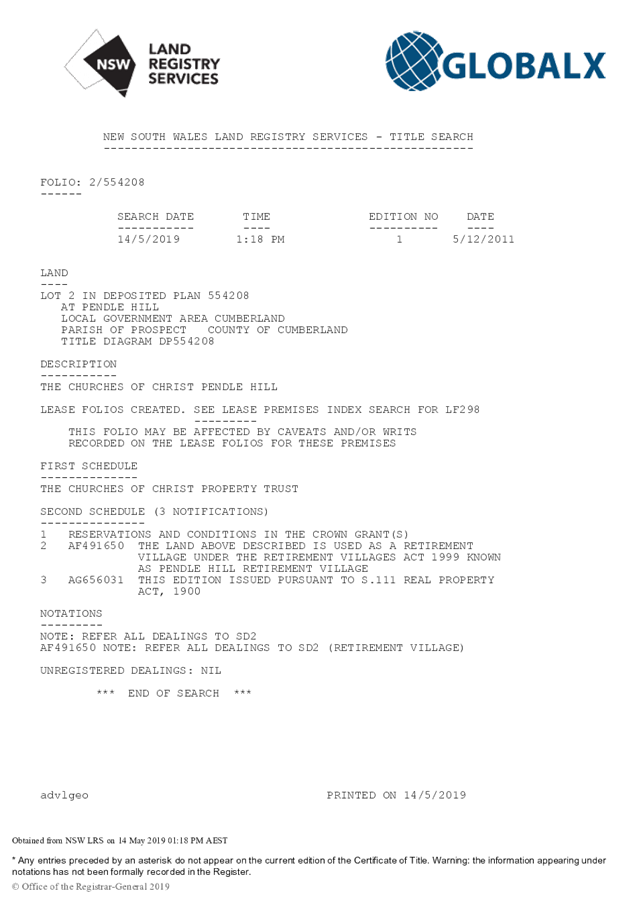
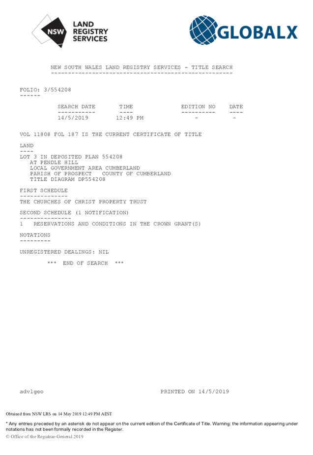
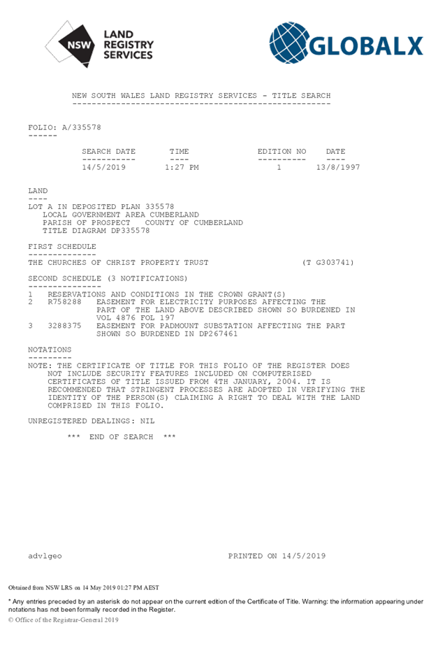
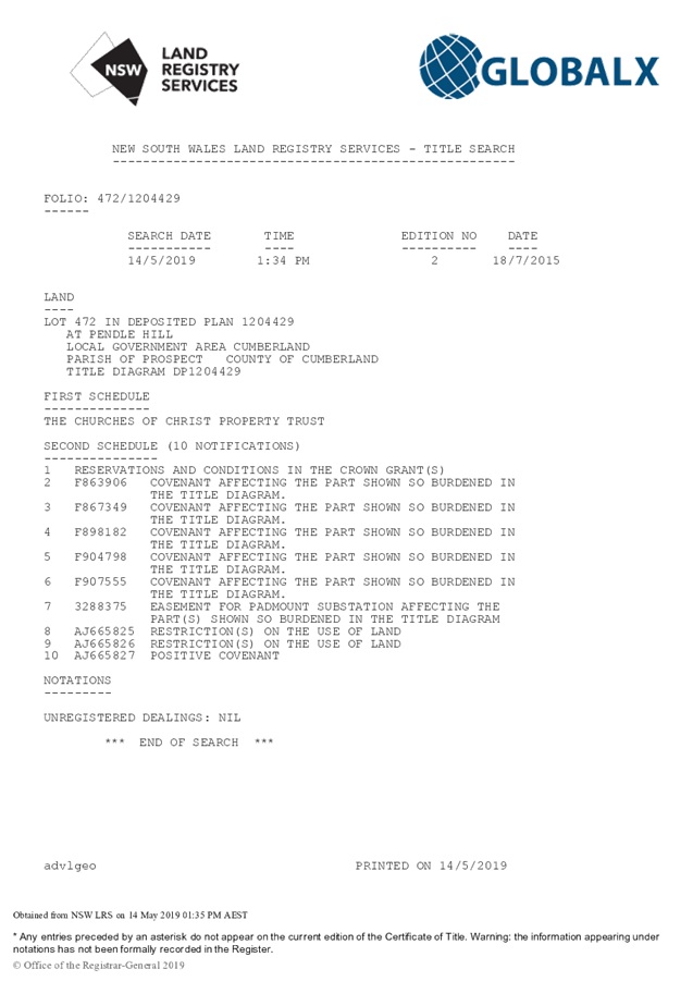


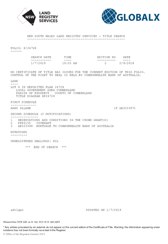
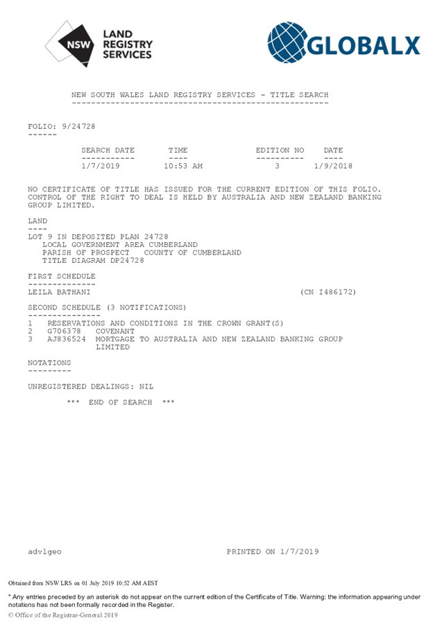
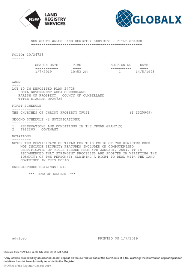


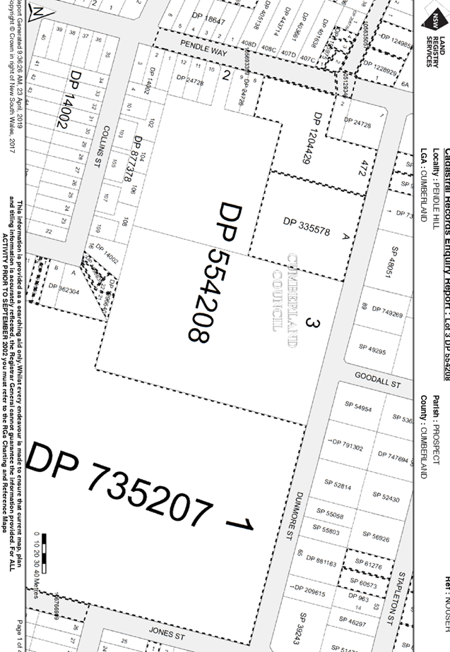


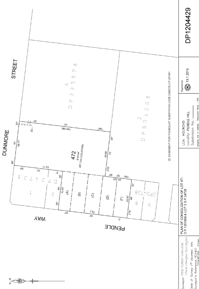
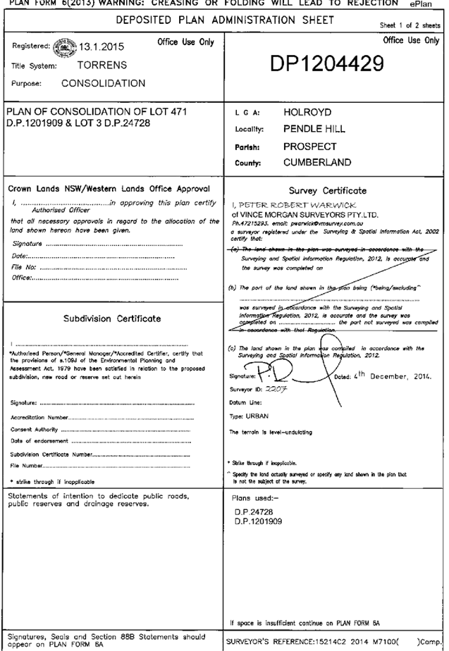
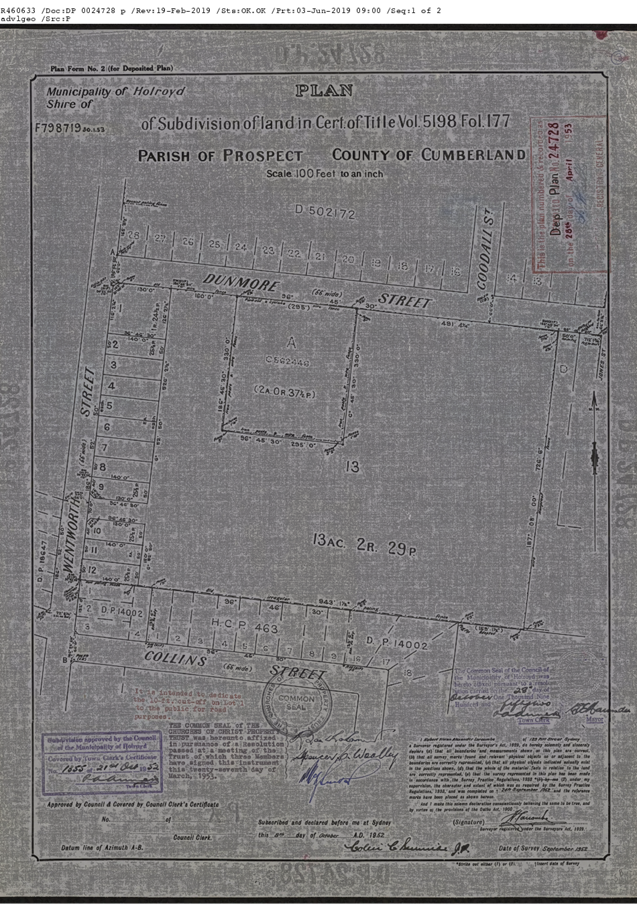

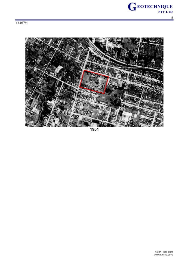


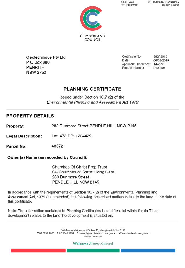
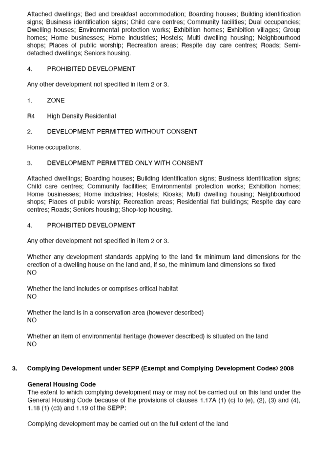
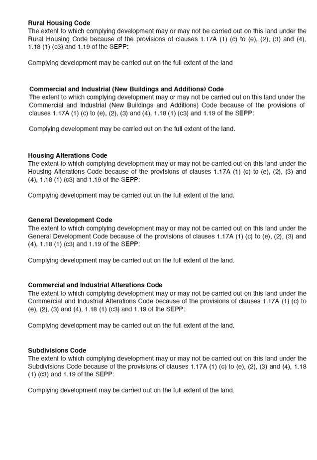
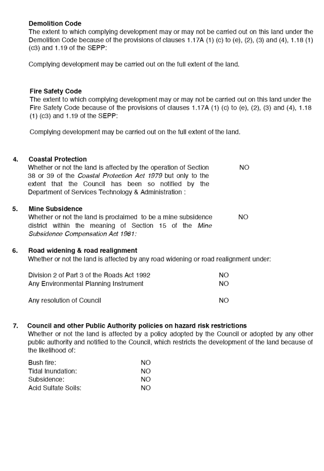

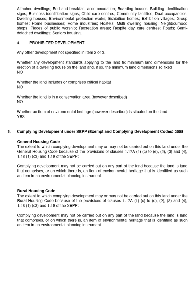


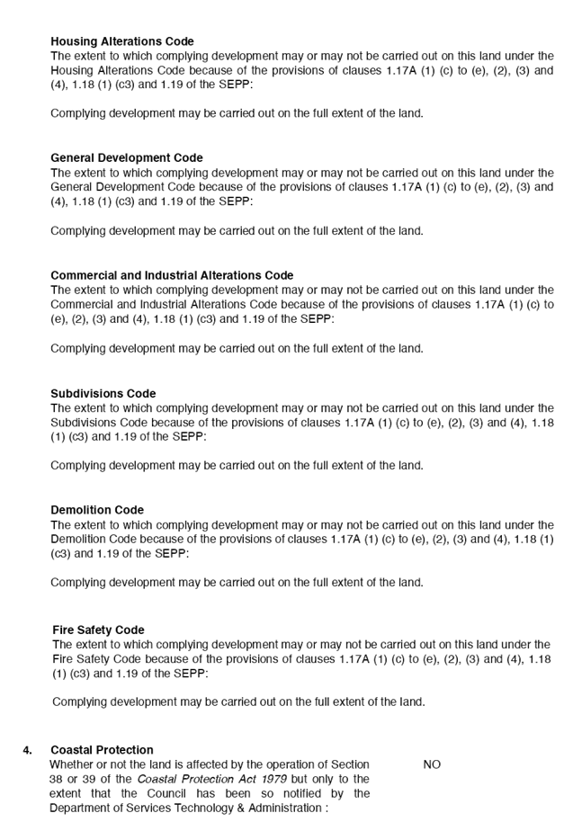
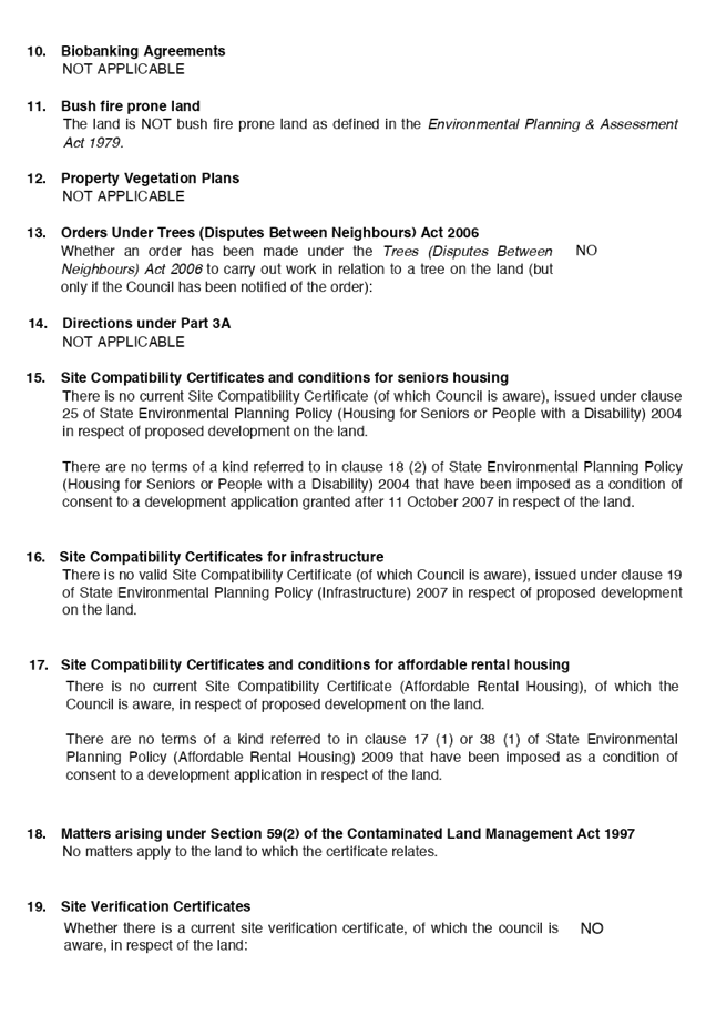
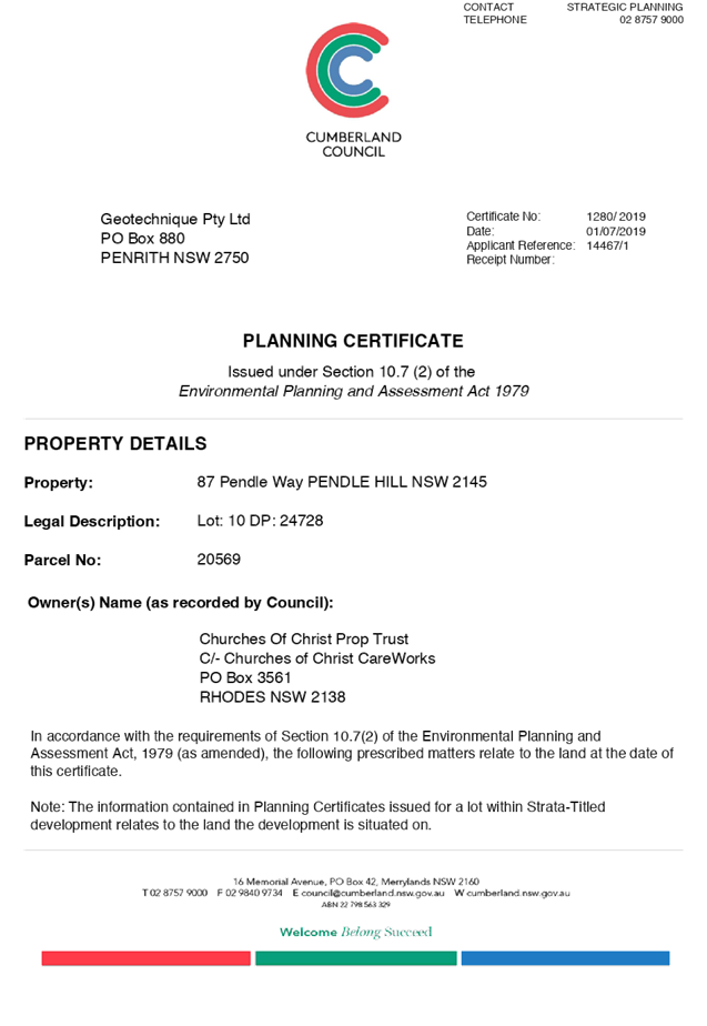
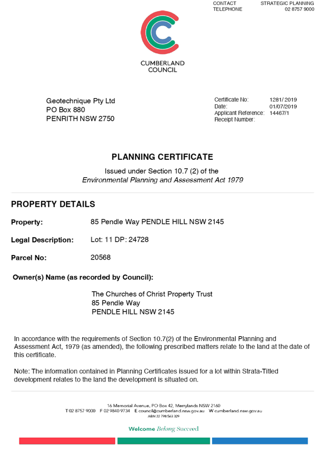
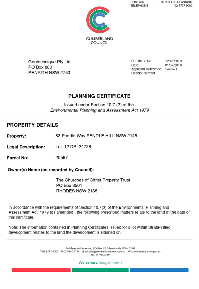


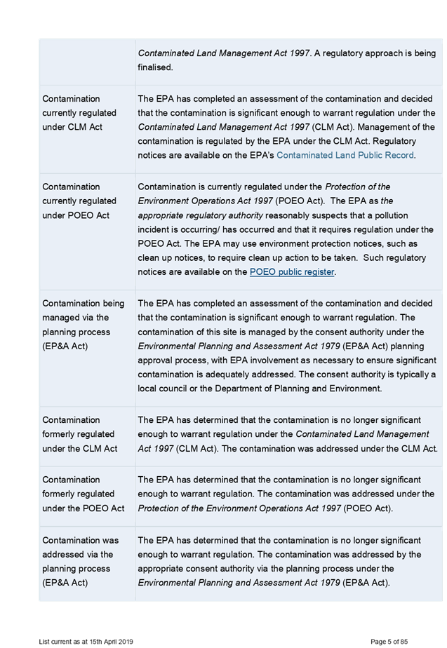
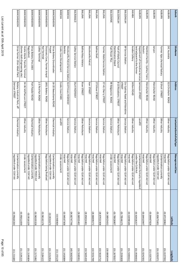
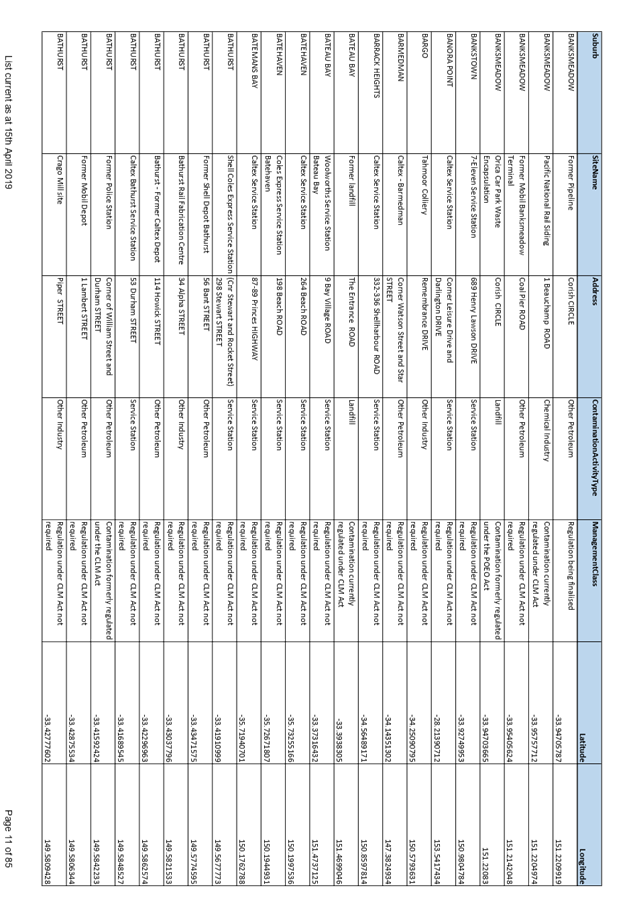
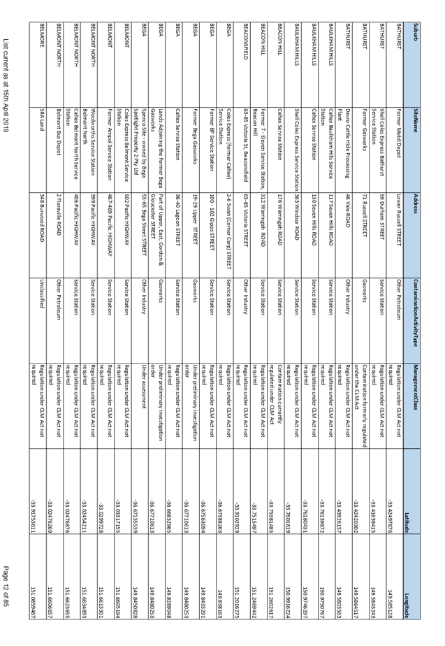
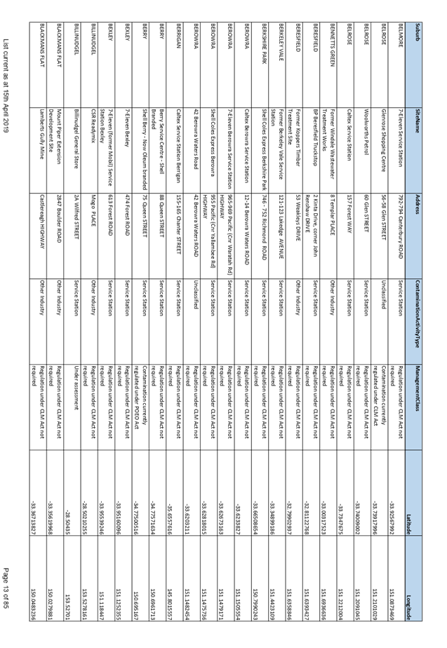
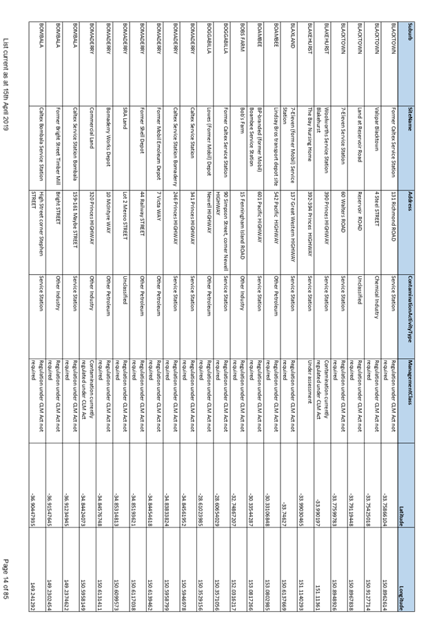
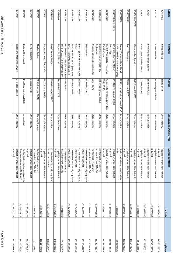
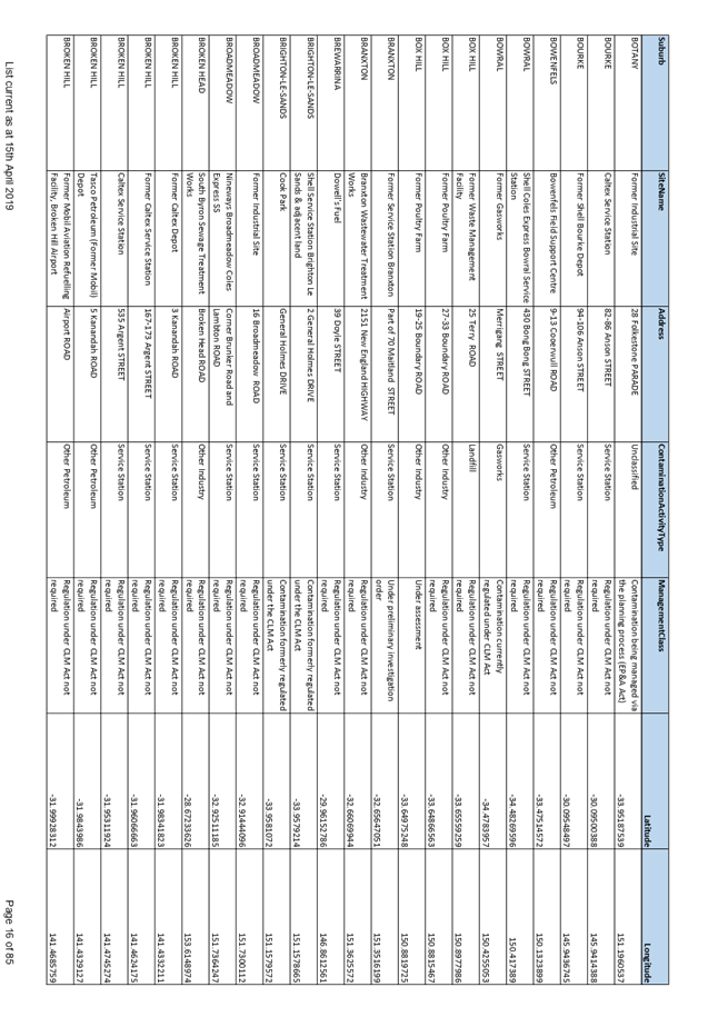
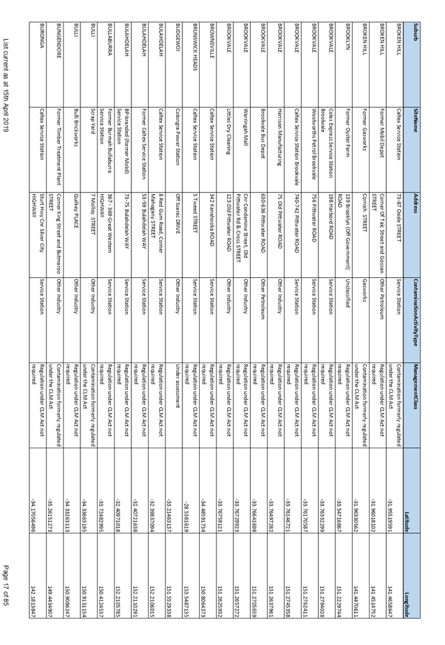
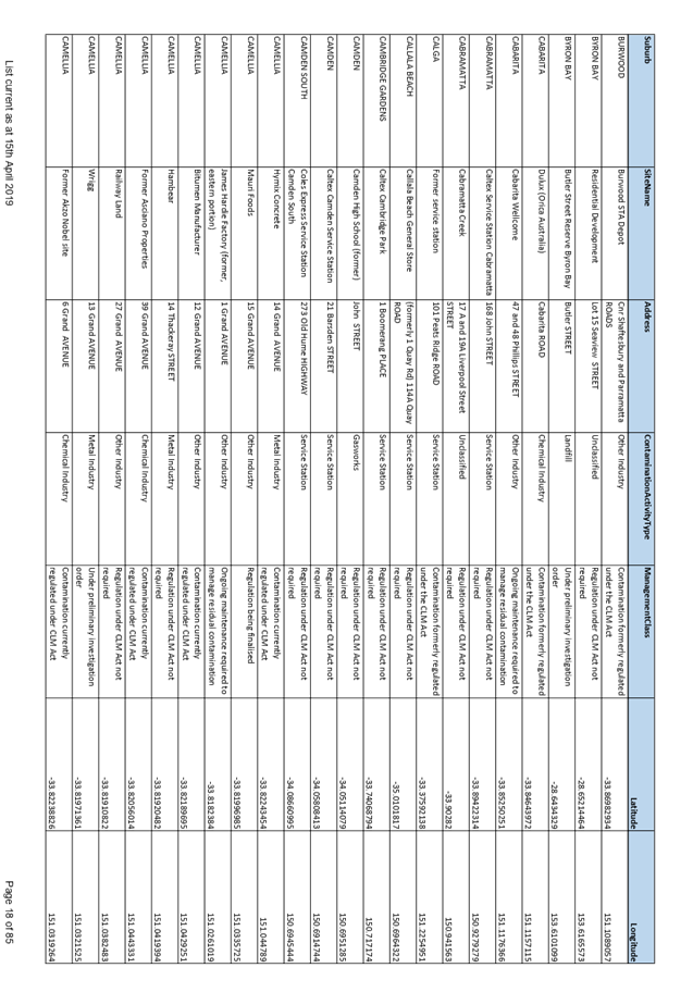
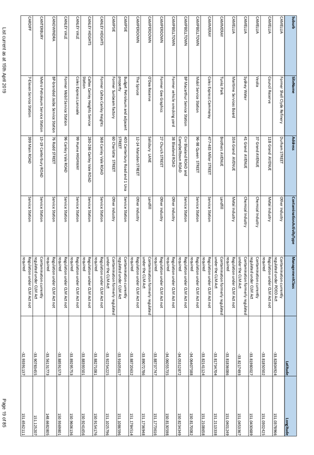
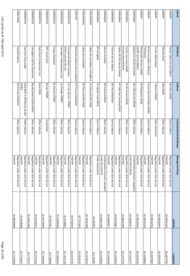
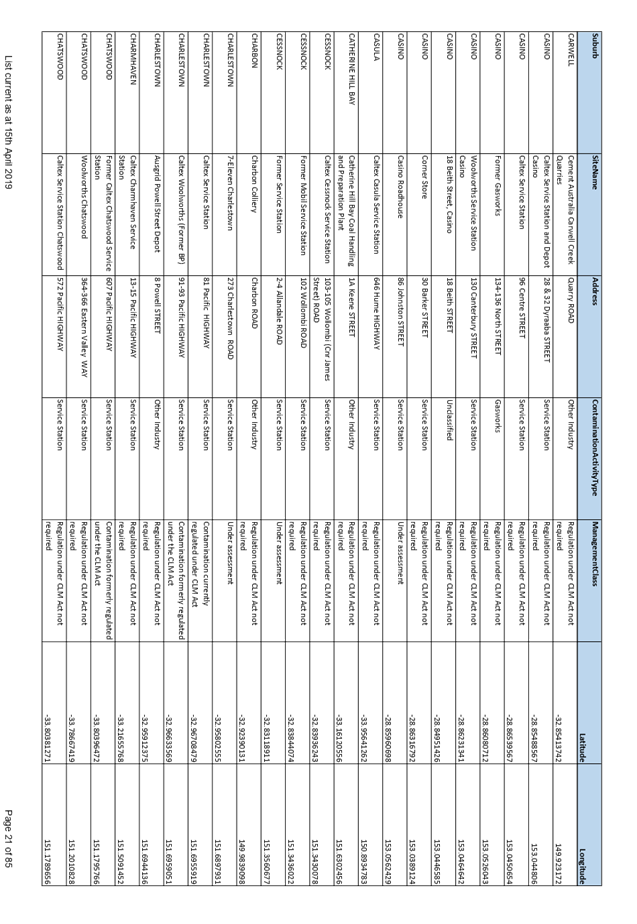
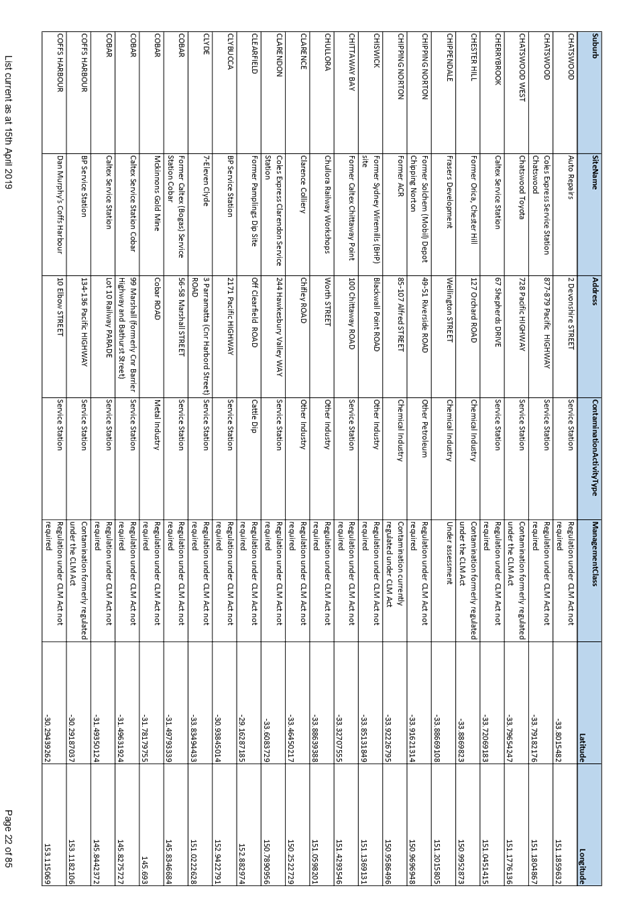
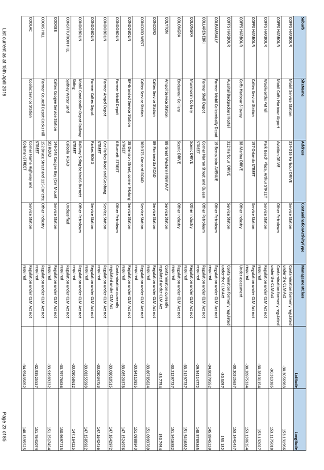
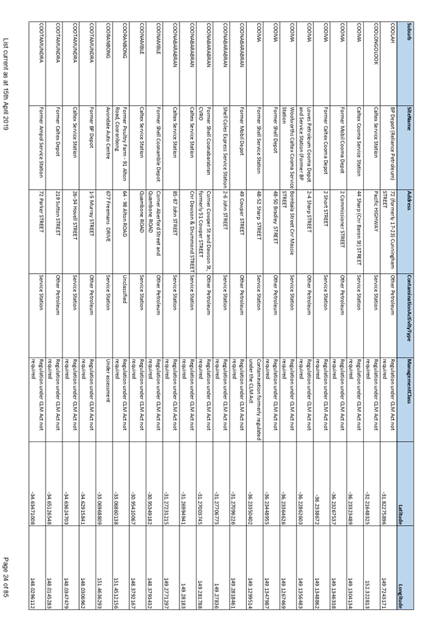
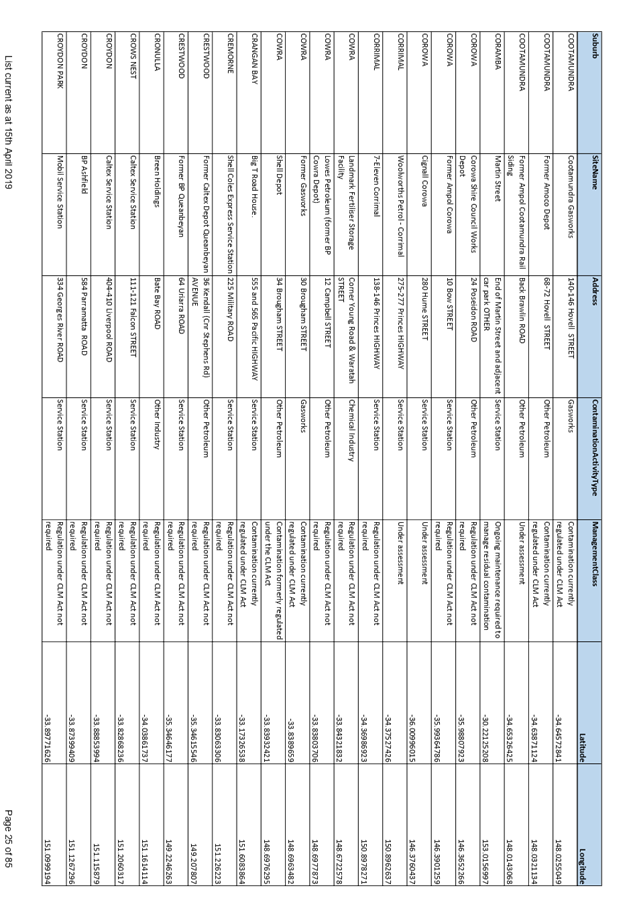
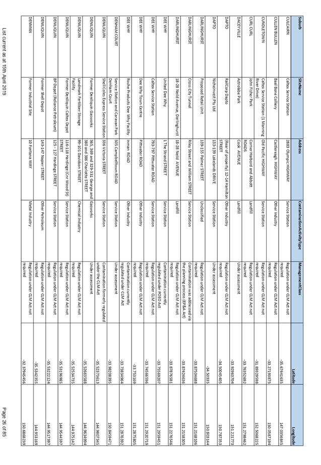
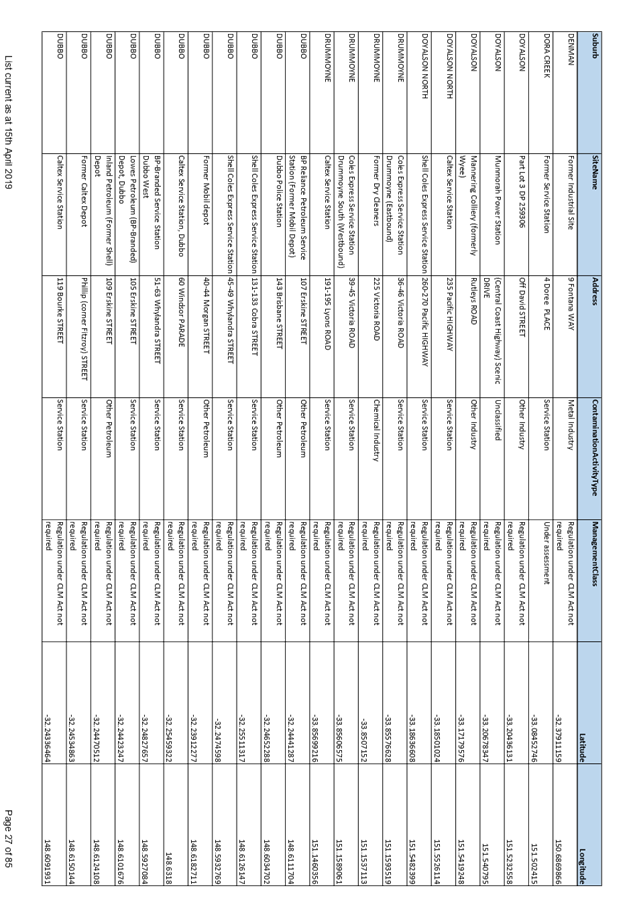
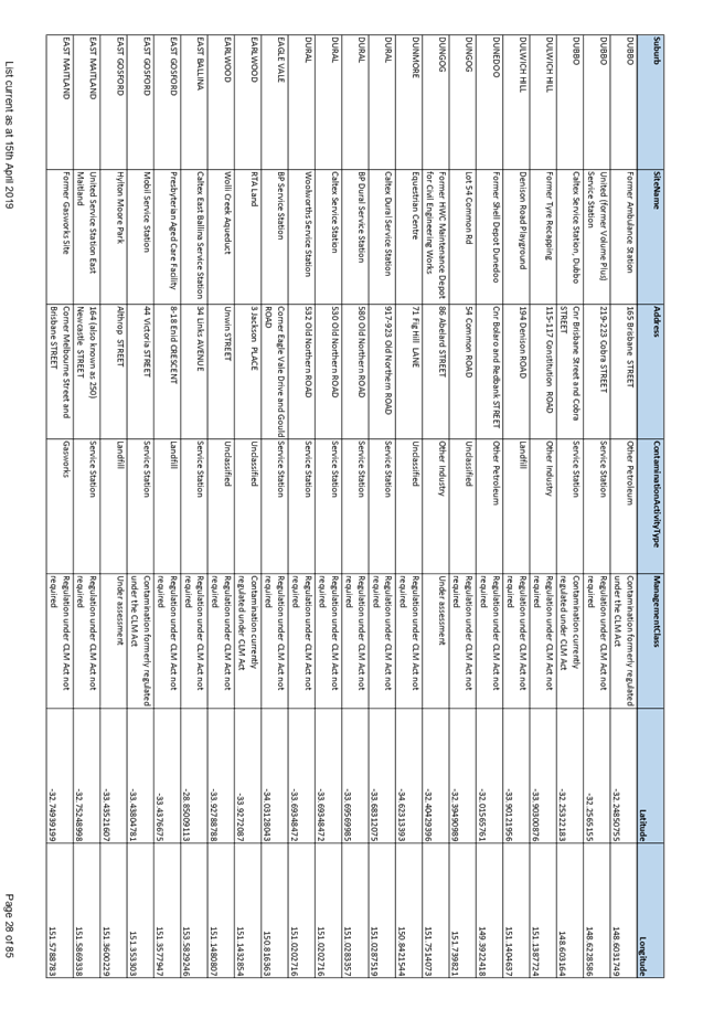
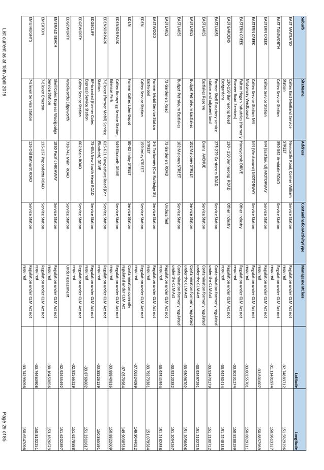
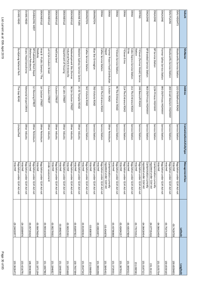
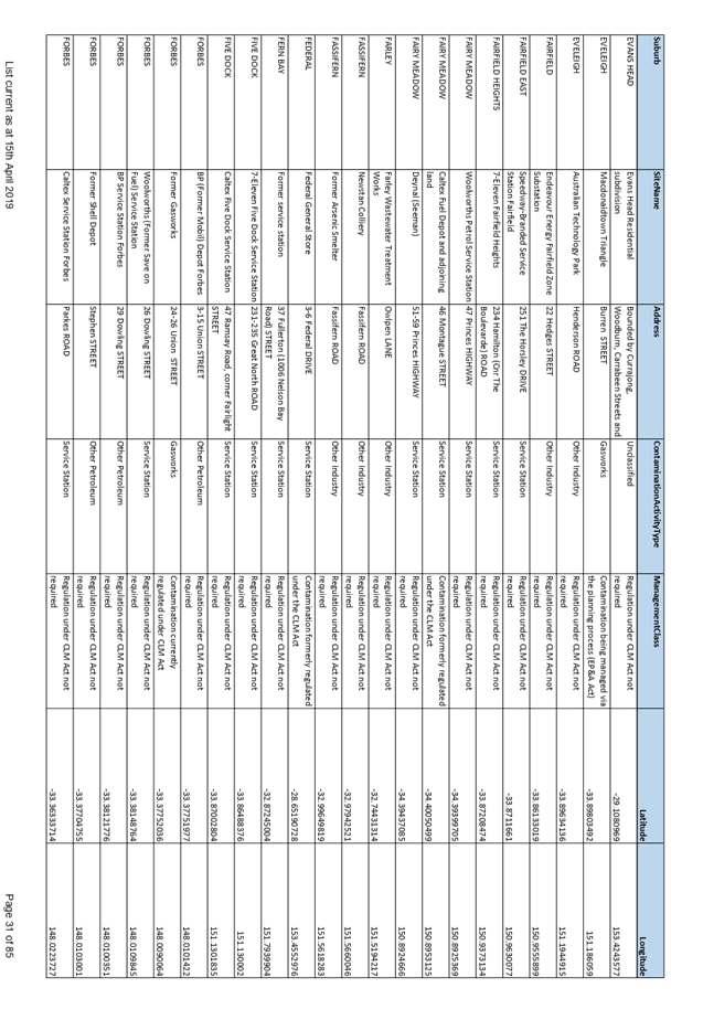
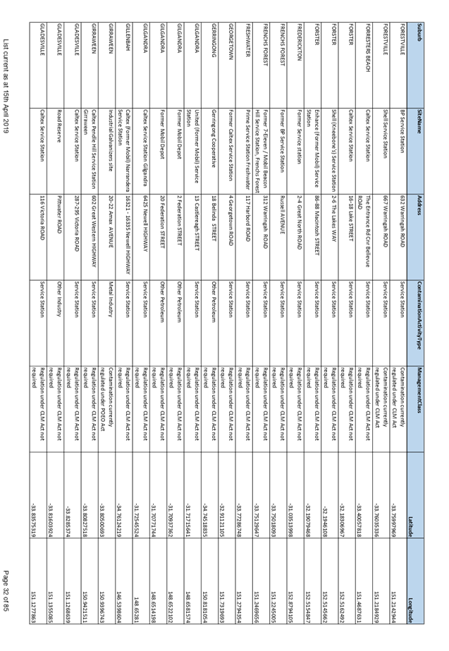
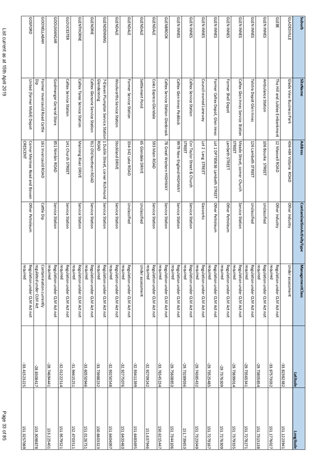
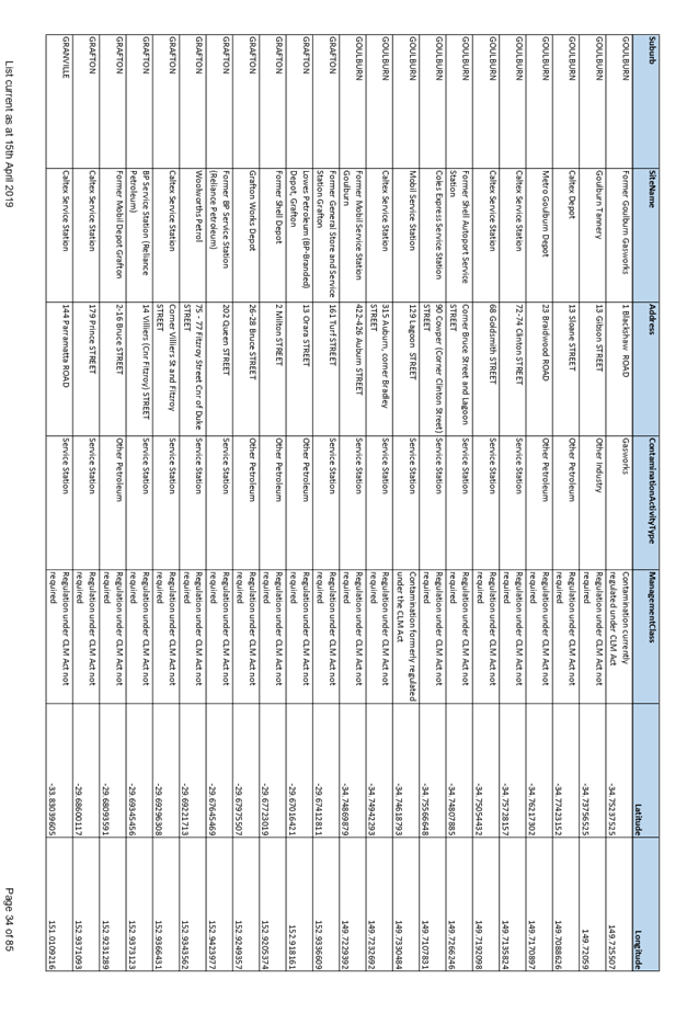
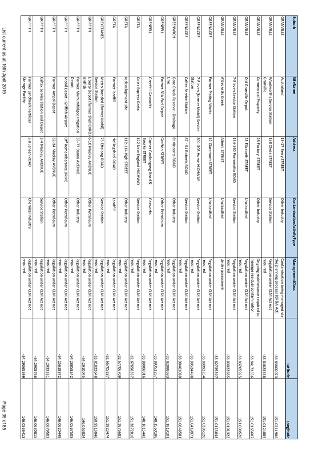
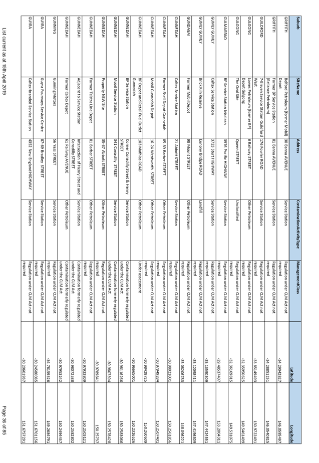
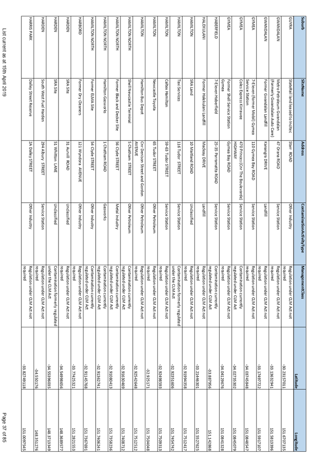
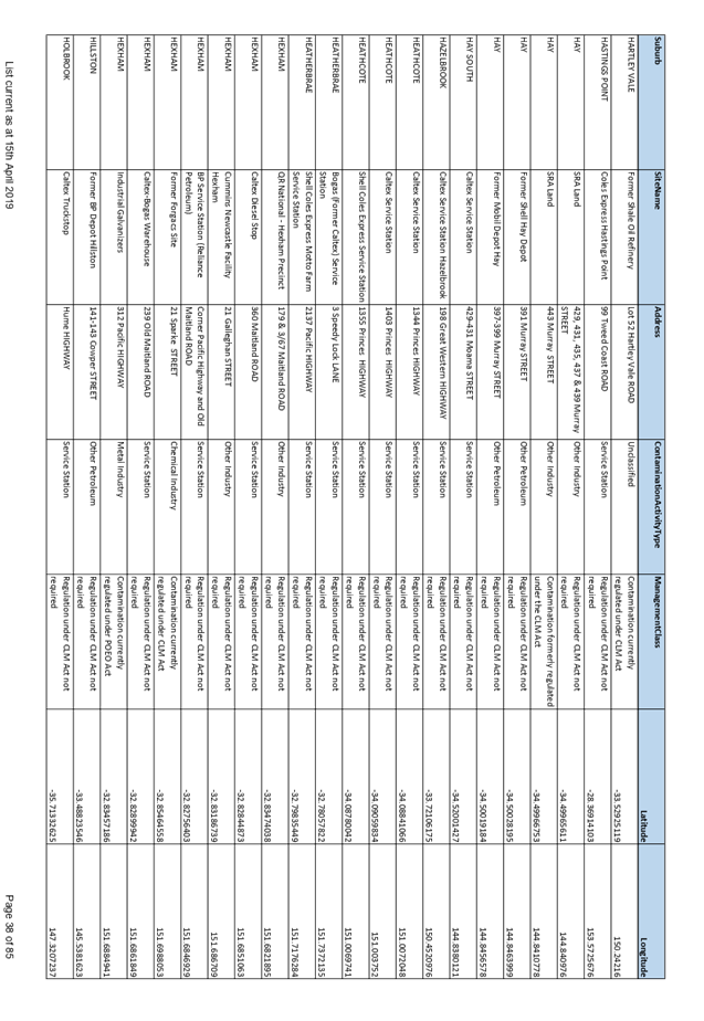
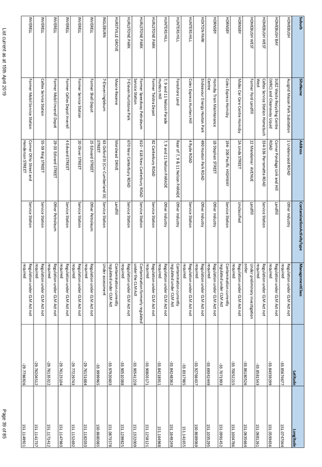
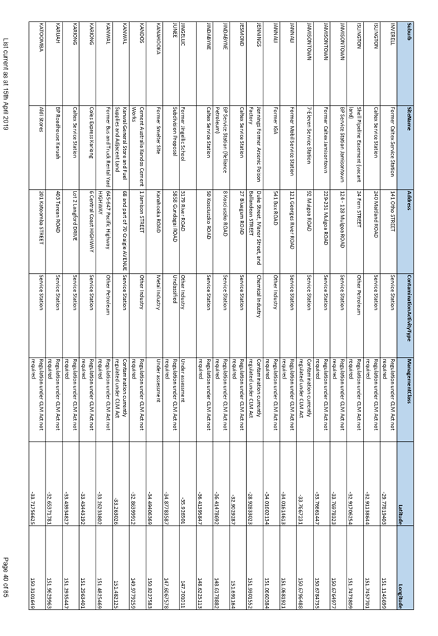
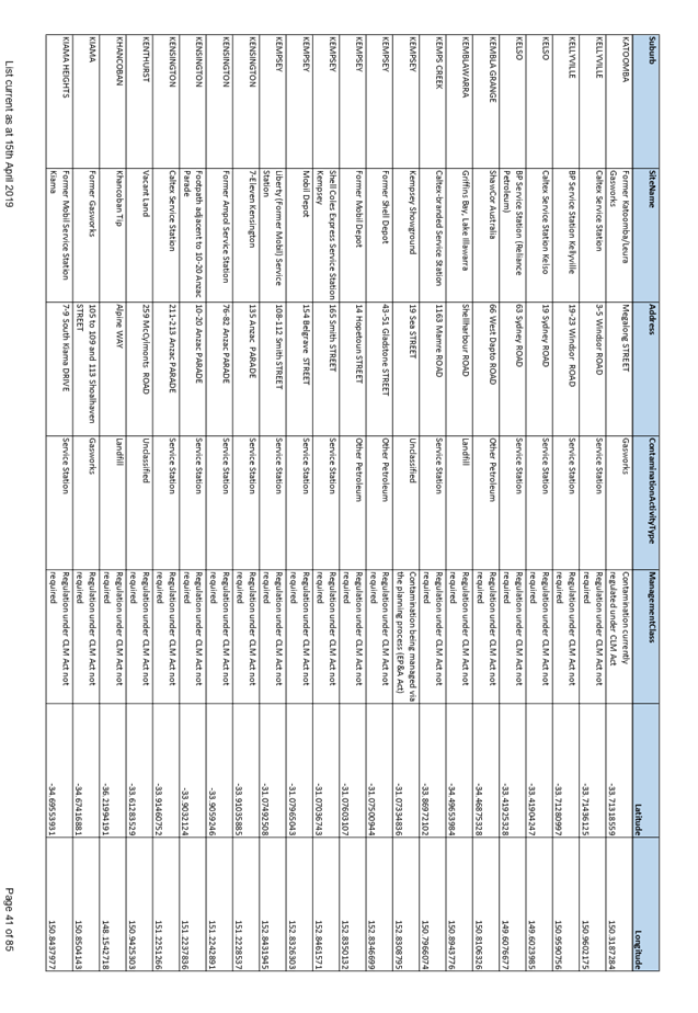
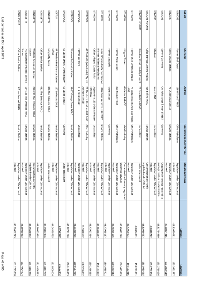
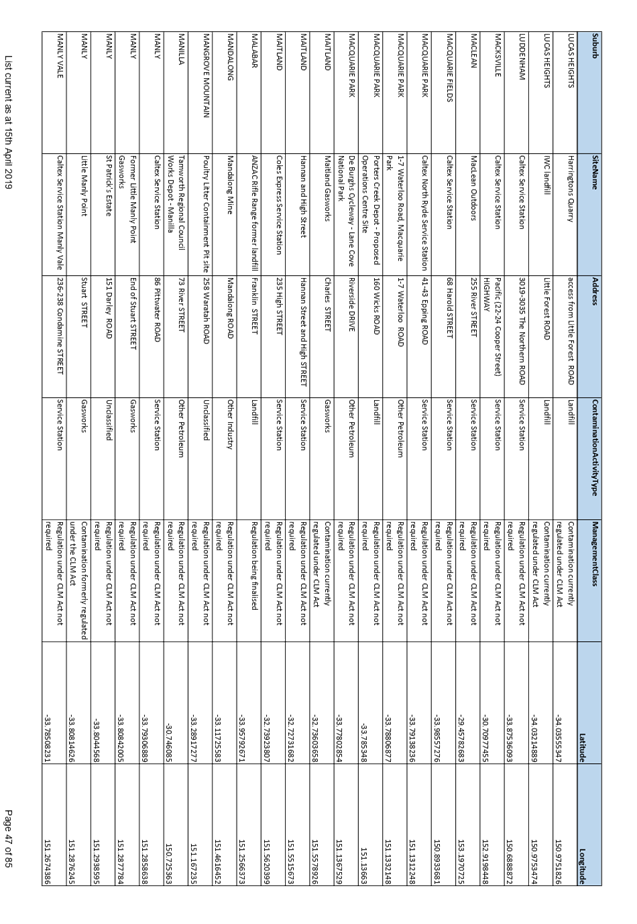
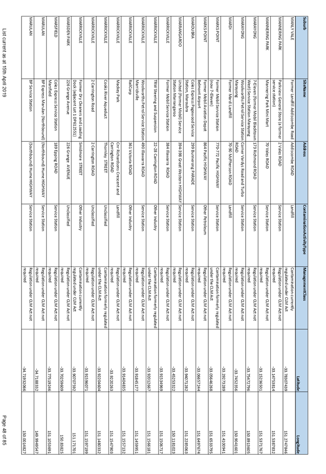
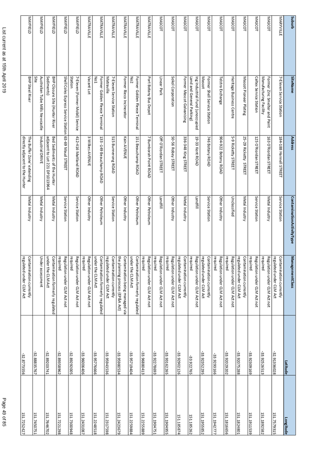
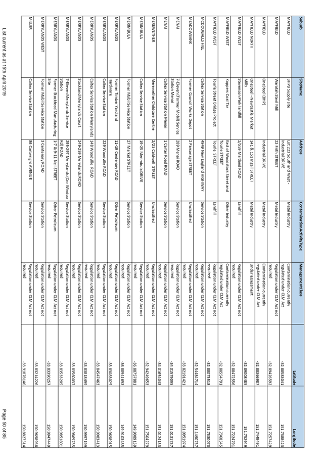
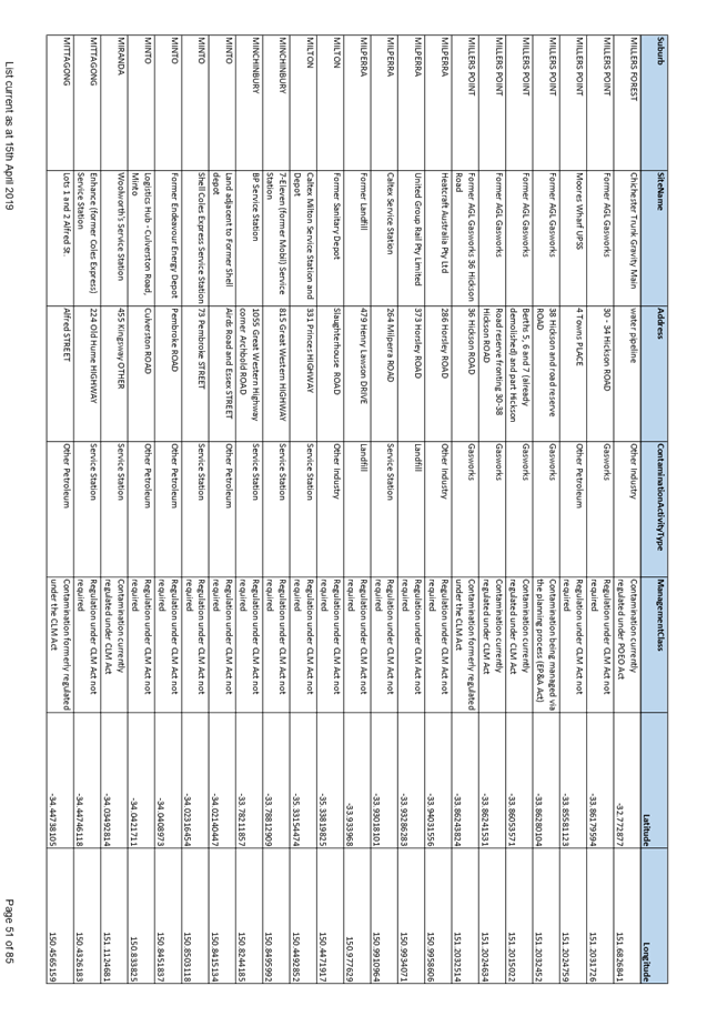
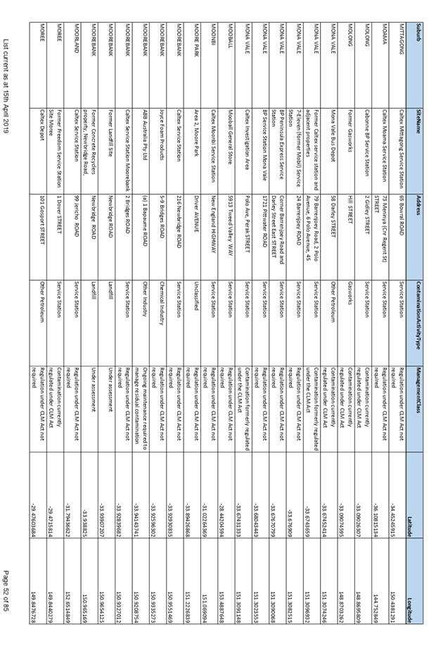
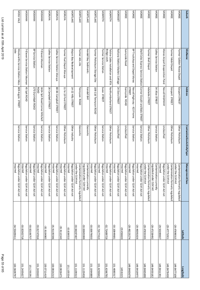
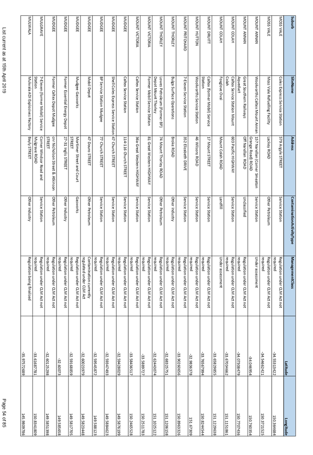
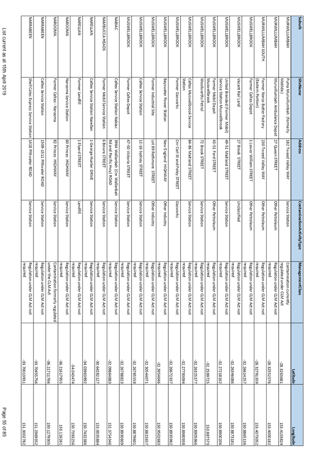
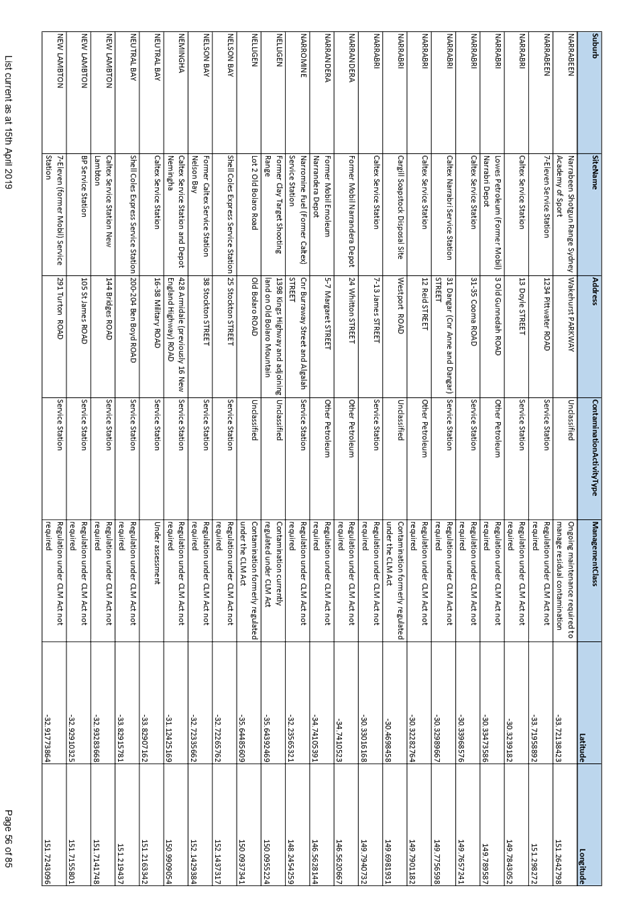
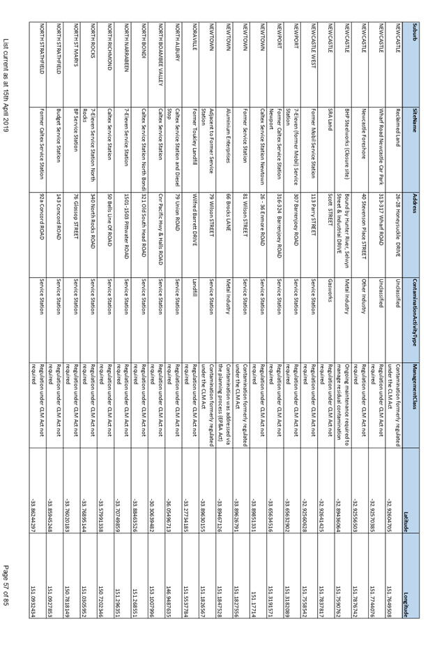
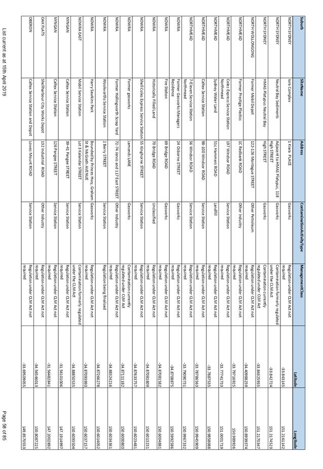
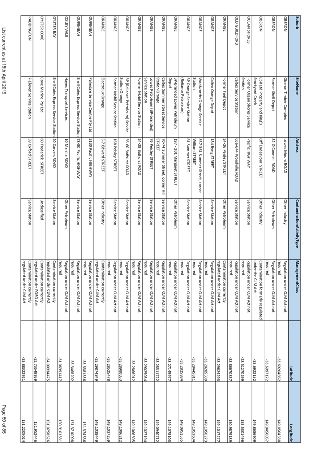
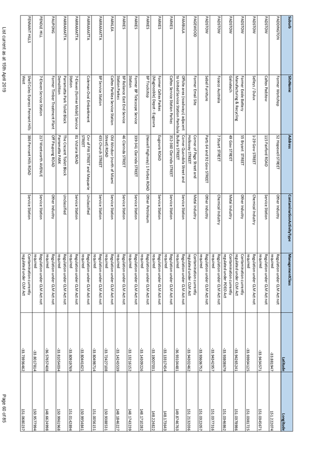
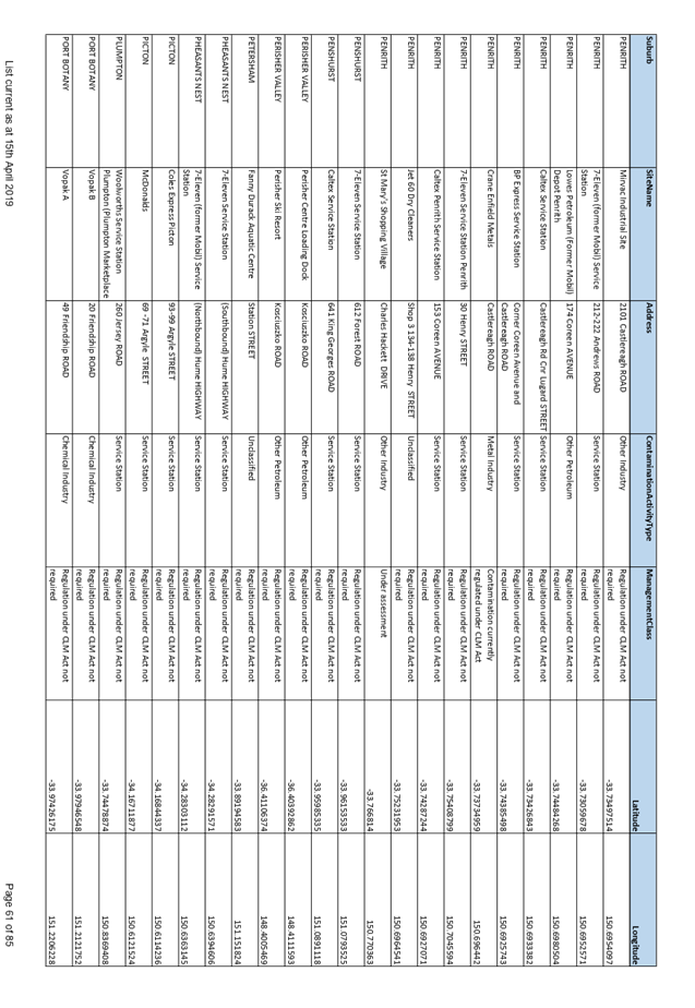
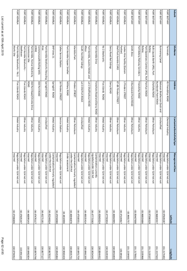
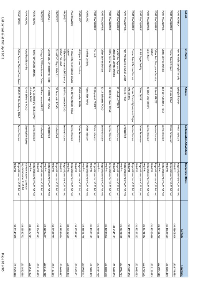
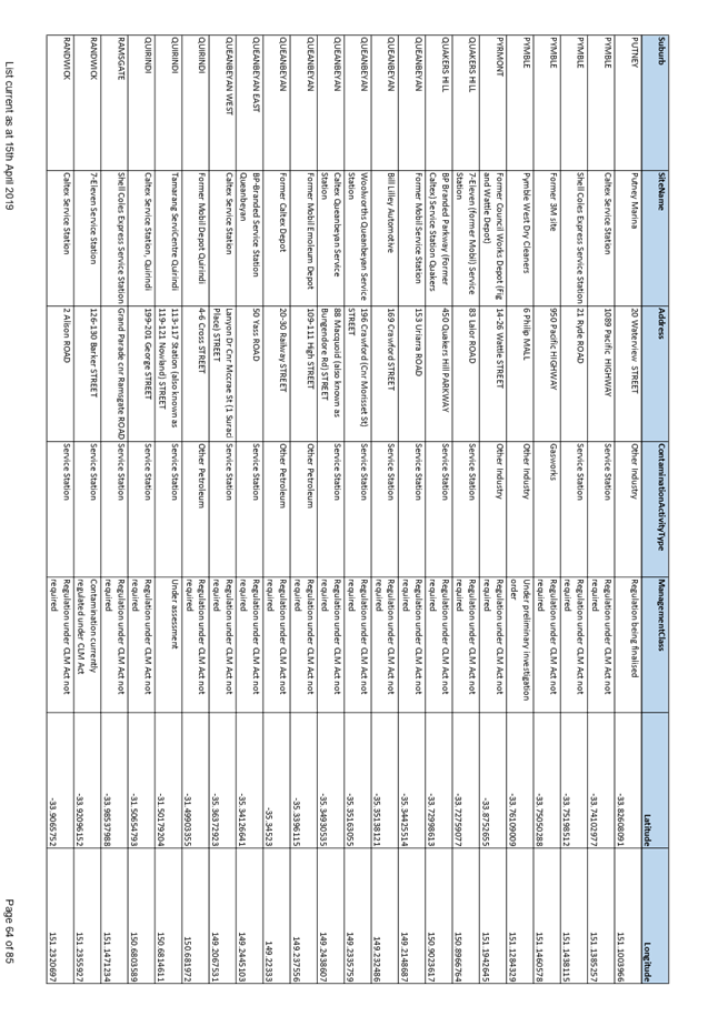
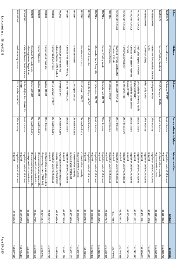
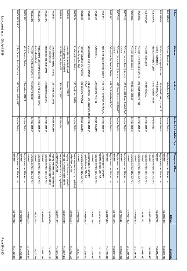
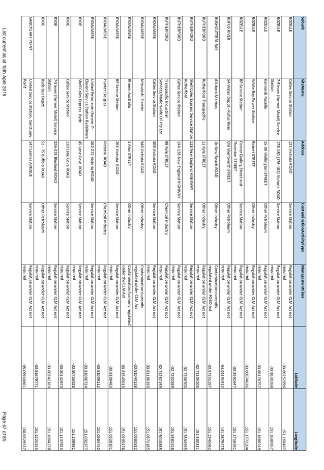
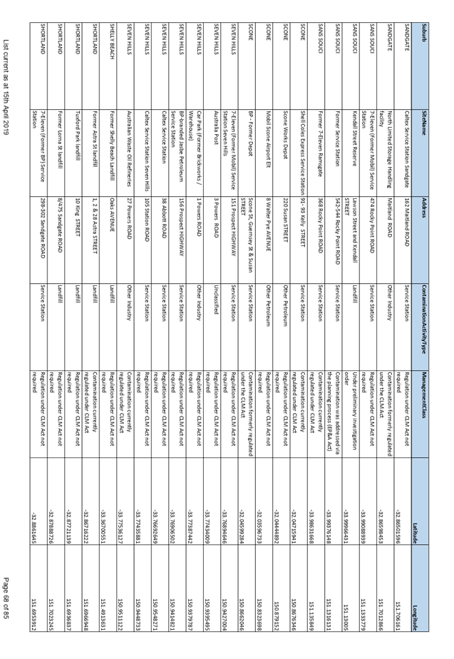
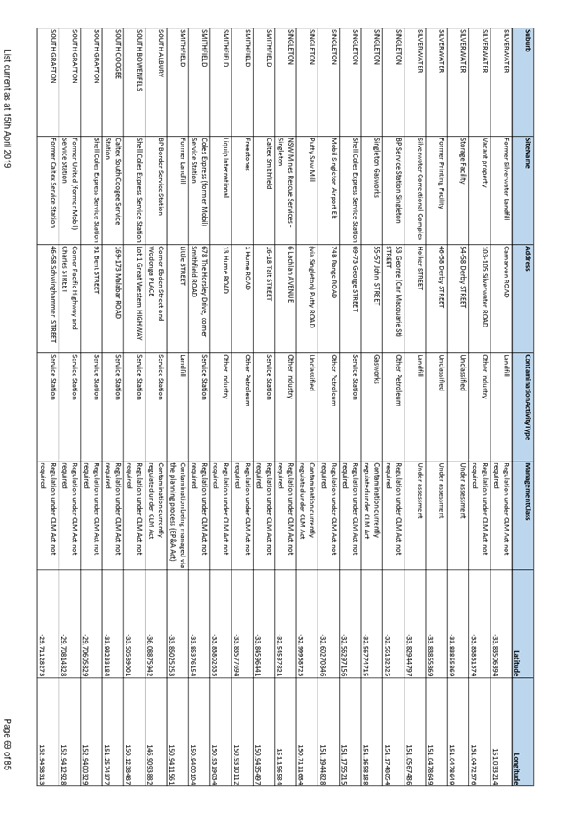
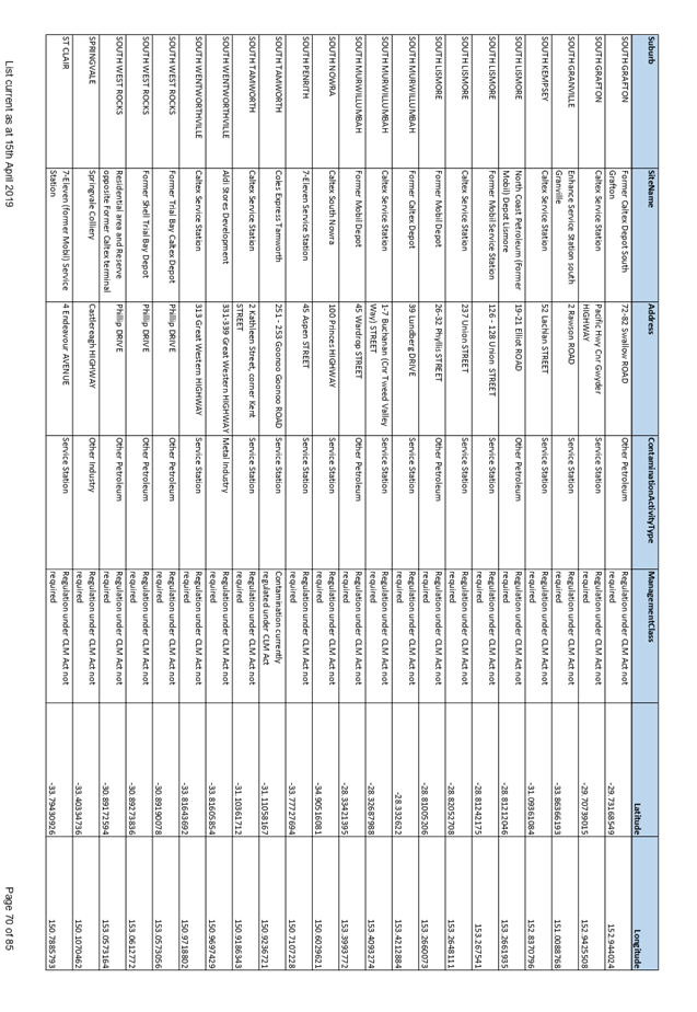
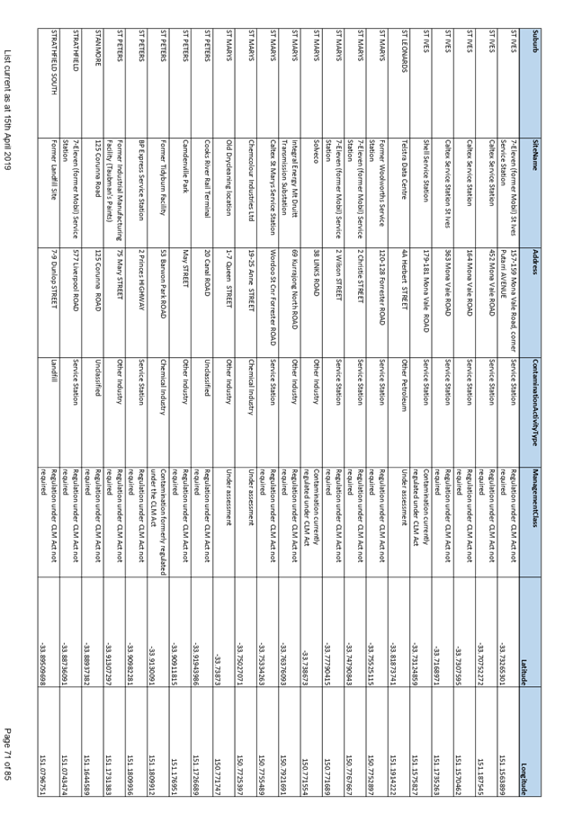
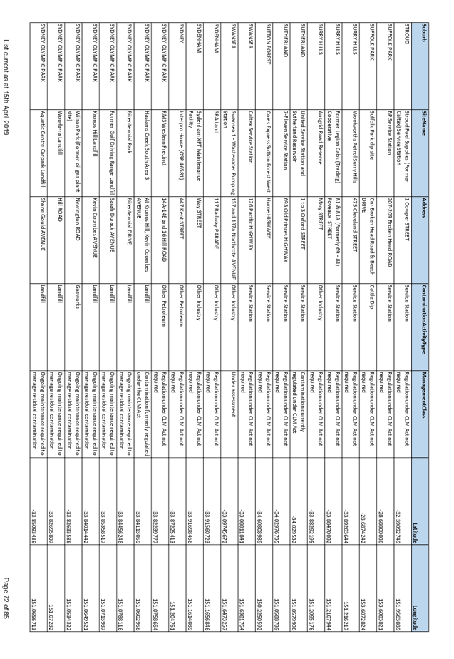
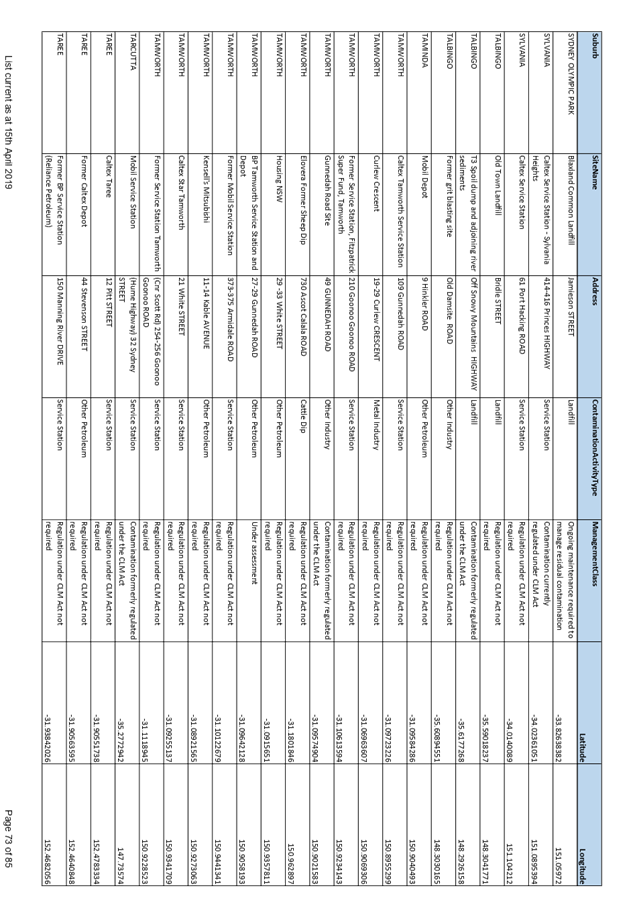
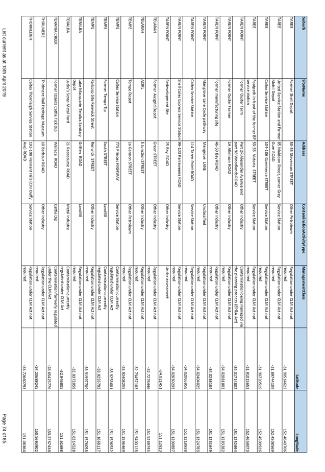
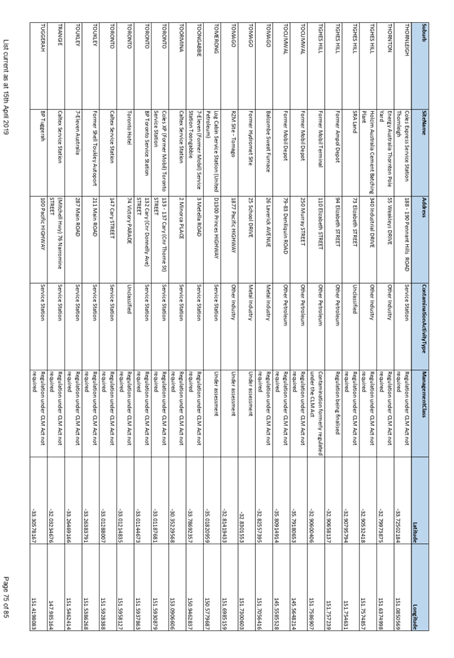
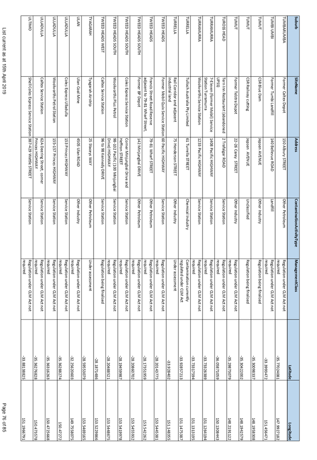
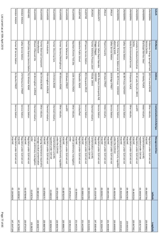
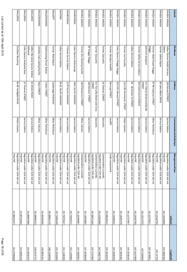
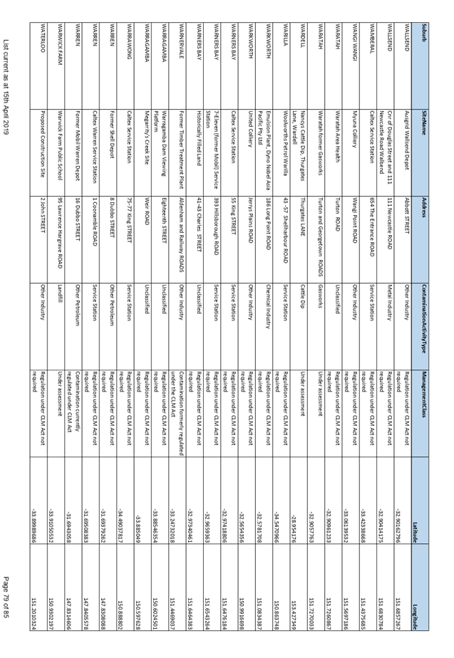
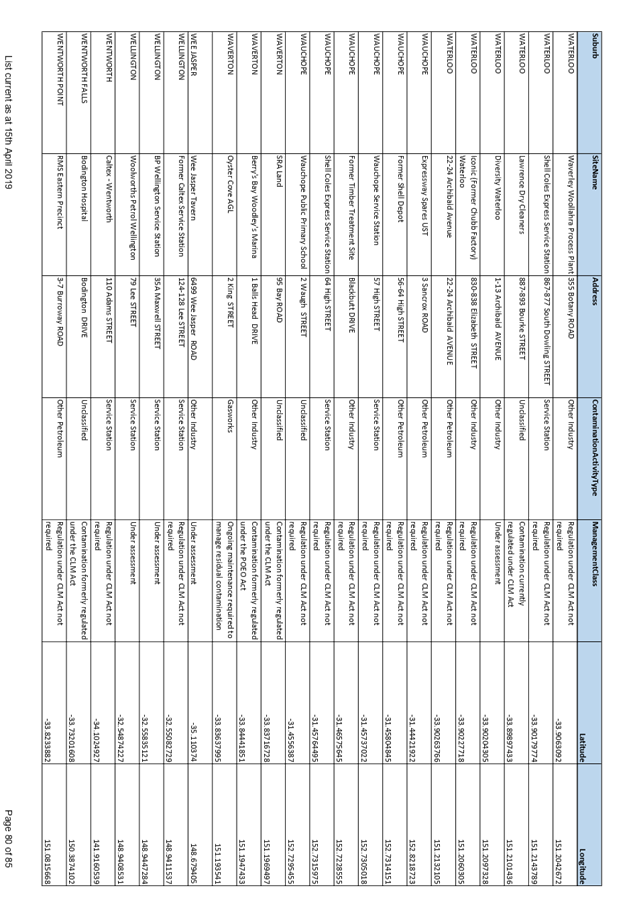
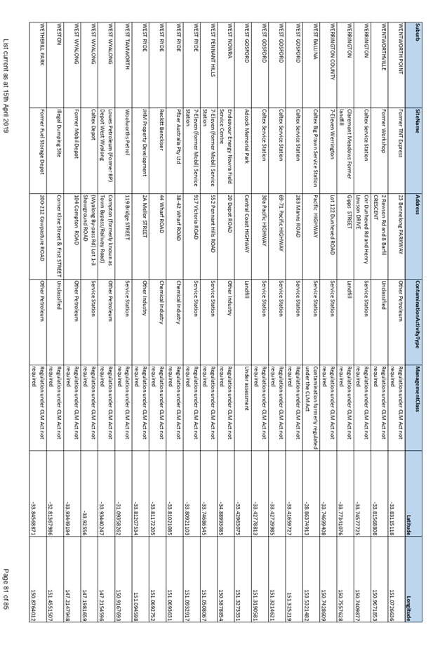
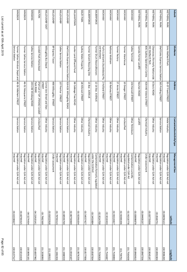
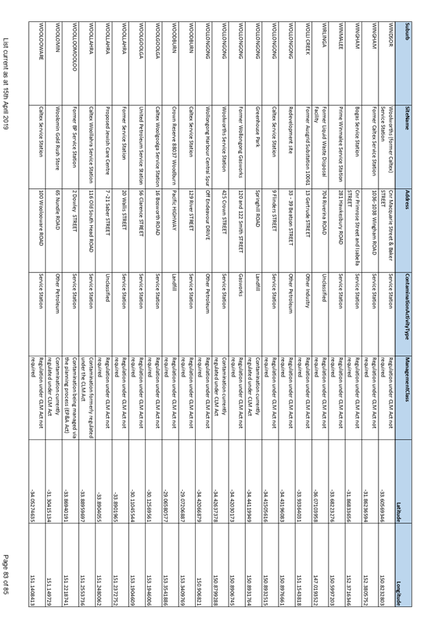
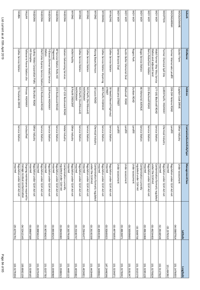
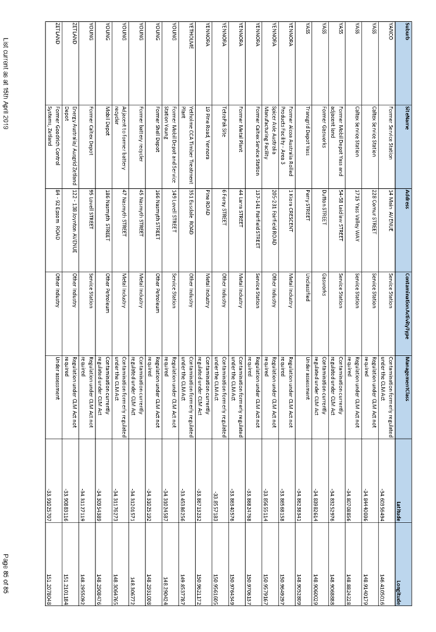

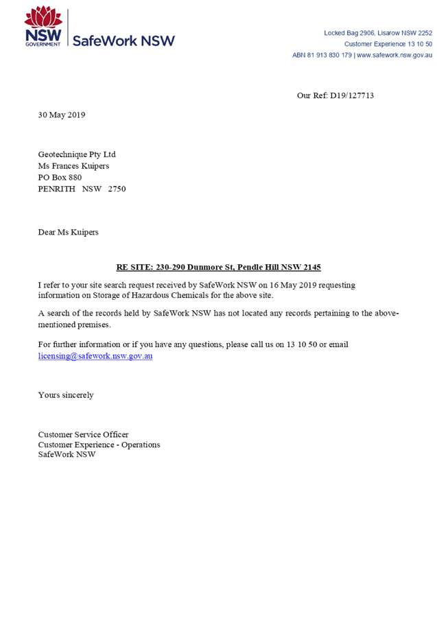
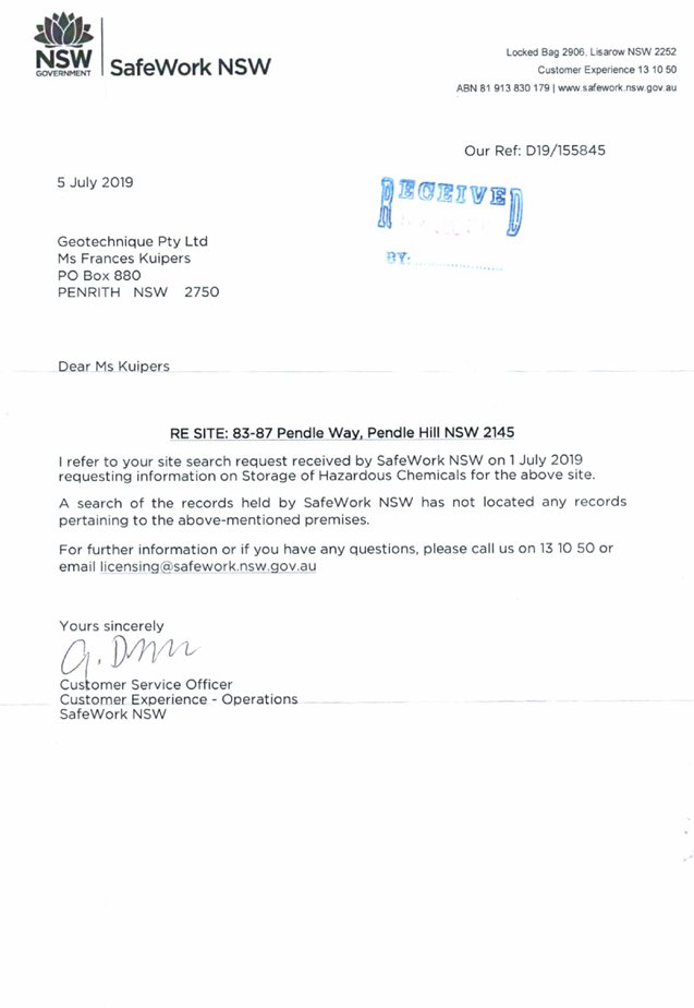


DOCUMENTS
ASSOCIATED WITH
REPORT LPP044/20
Attachment 10
Social Impact Assessment and Management Plan
Cumberland Local Planning Panel Meeting
12 August 2020
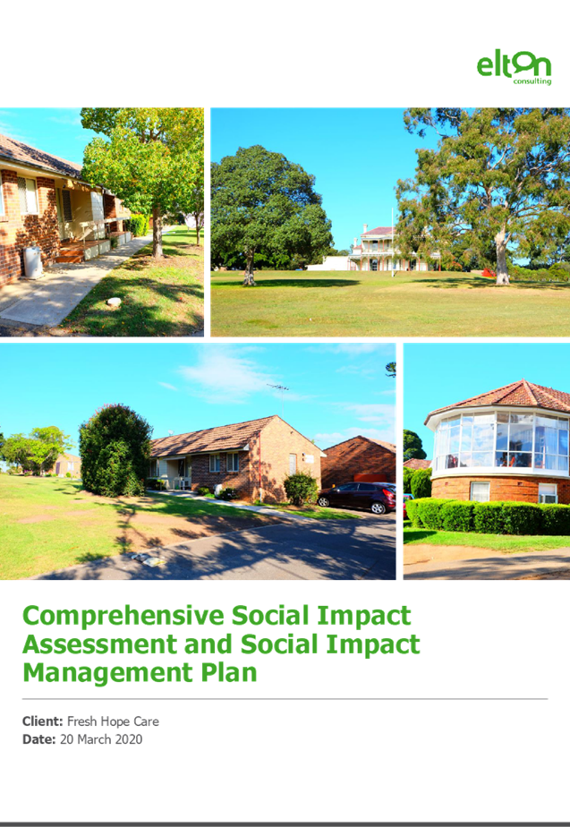

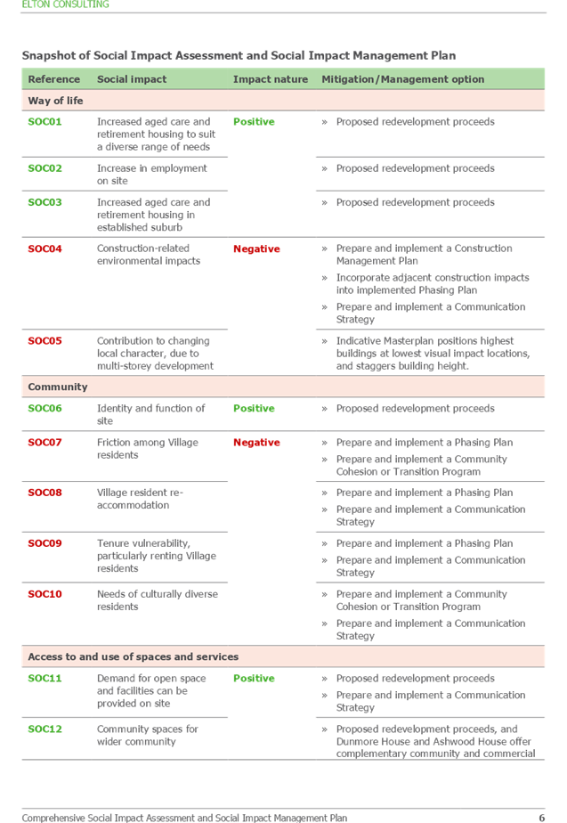
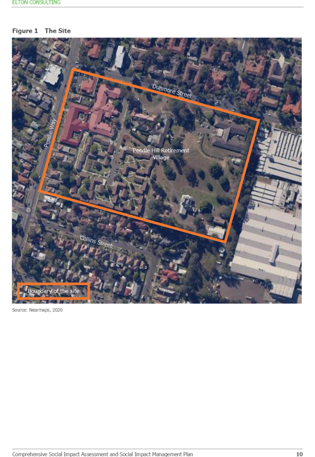
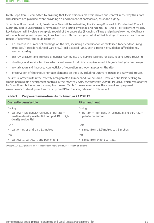
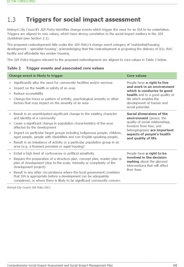
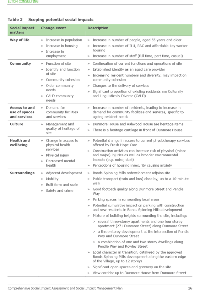
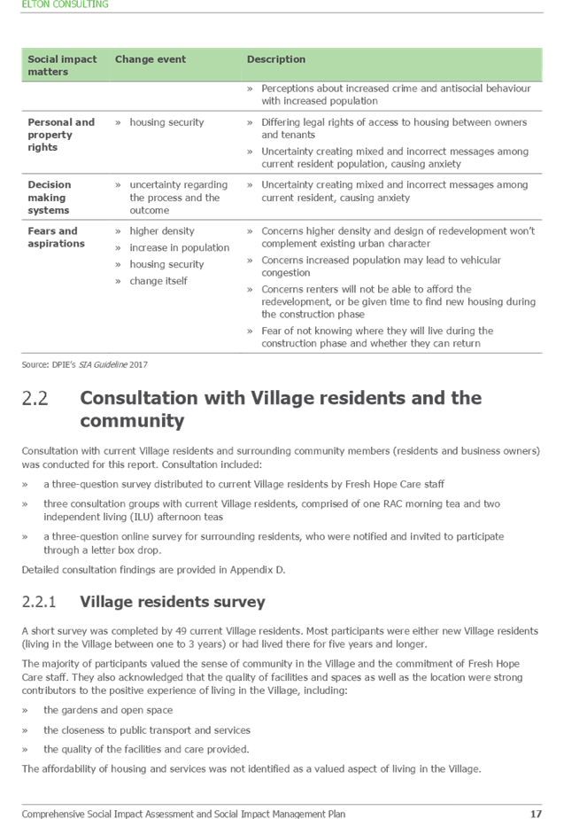
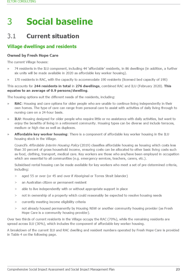
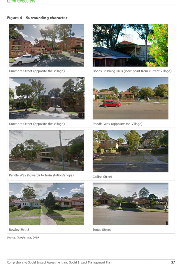
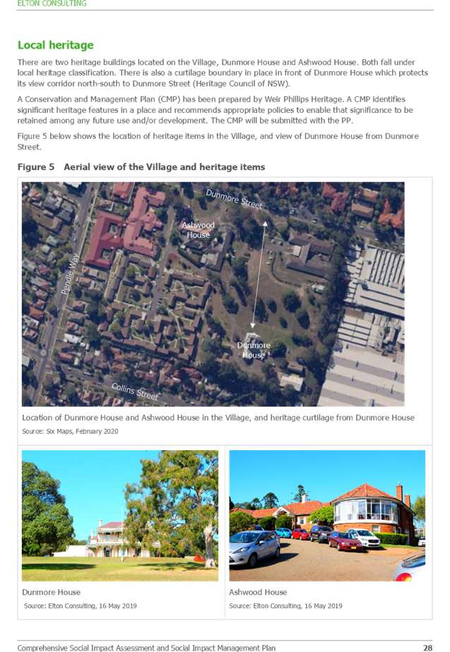
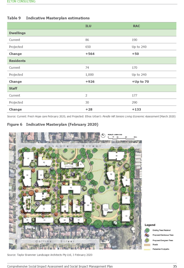
Cumberland Local Planning Panel Meeting
12 August 2020
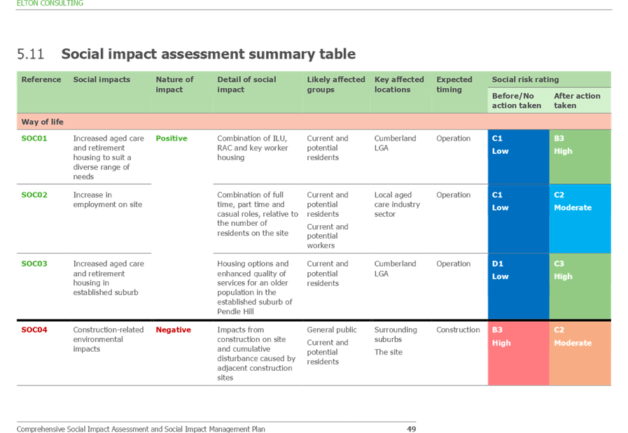
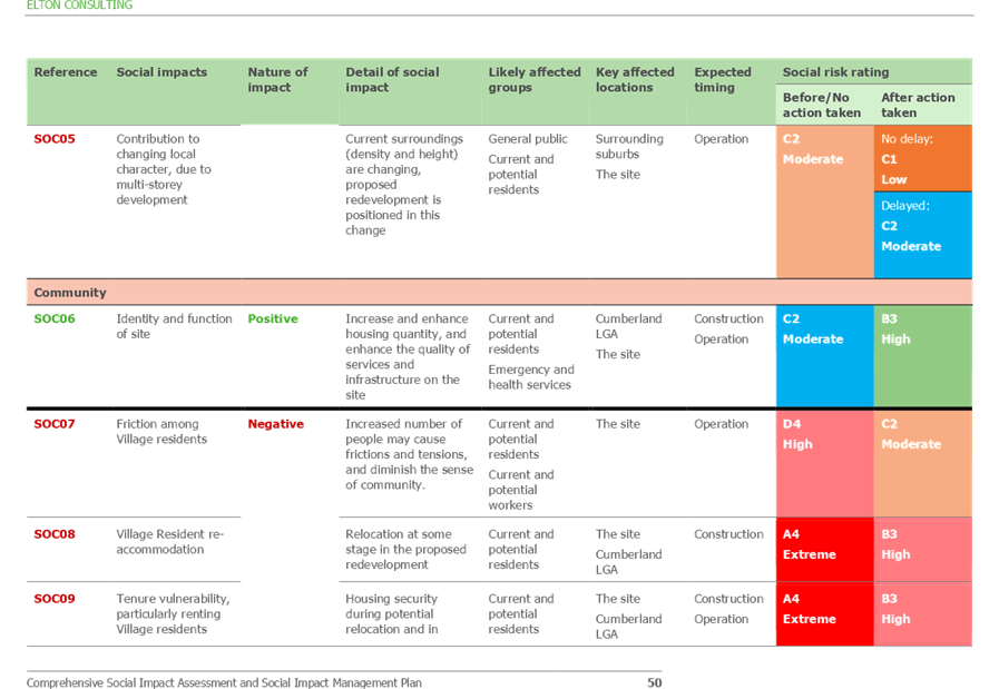
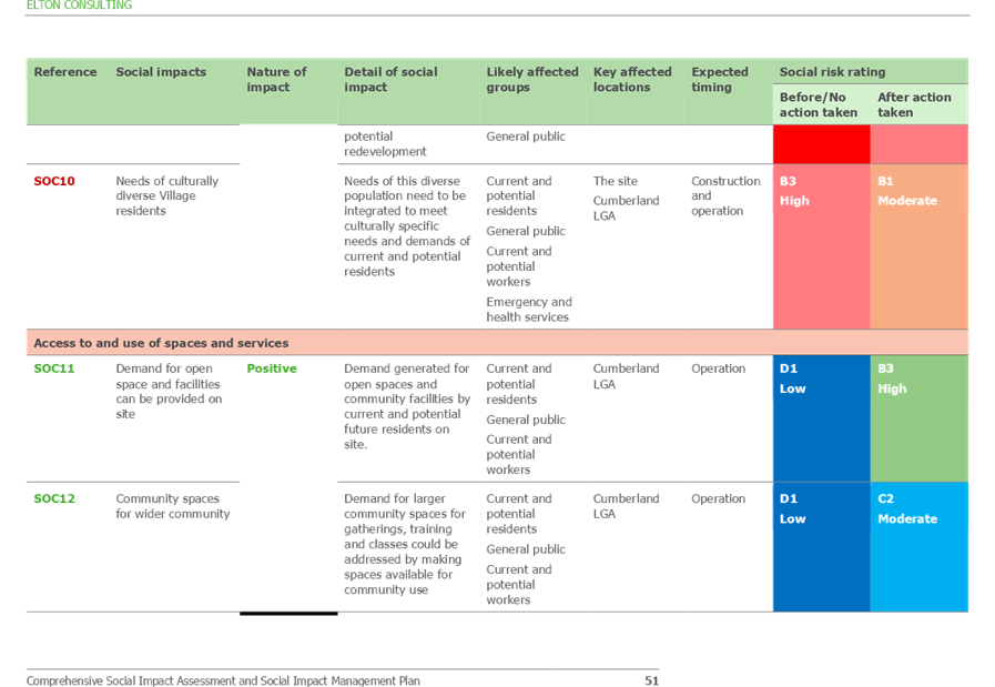
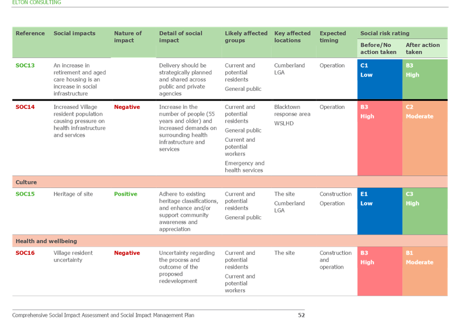
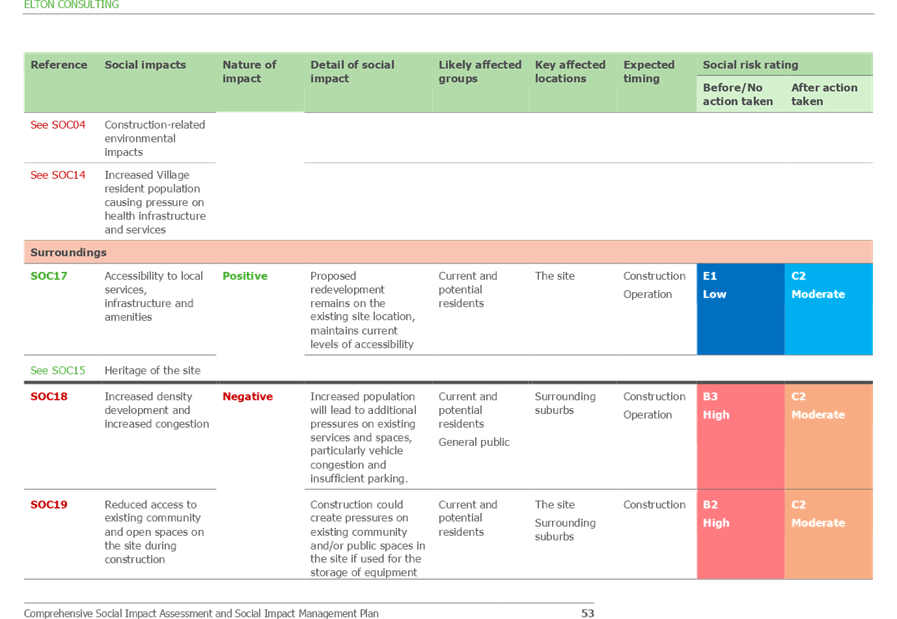
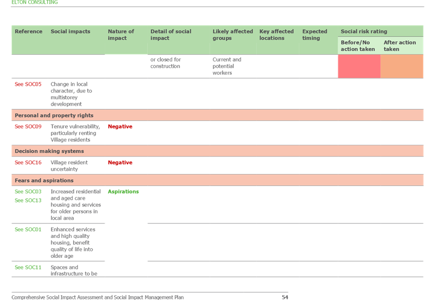
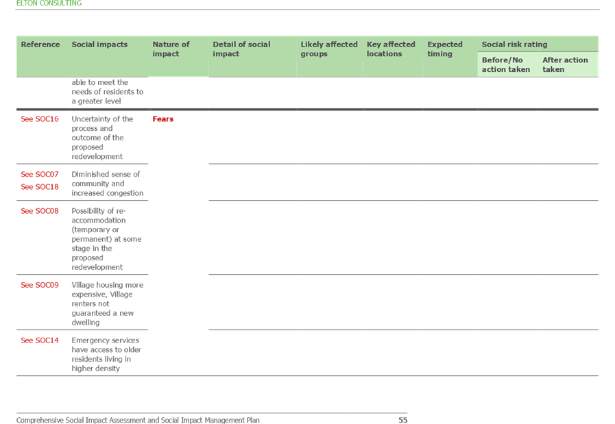
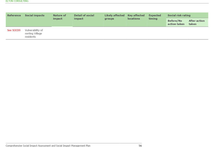
Cumberland Local Planning Panel Meeting
12 August 2020
Cumberland Local Planning Panel Meeting
12 August 2020
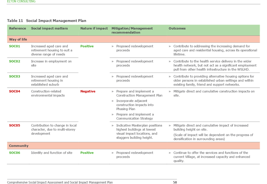
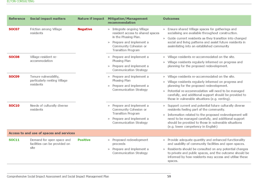
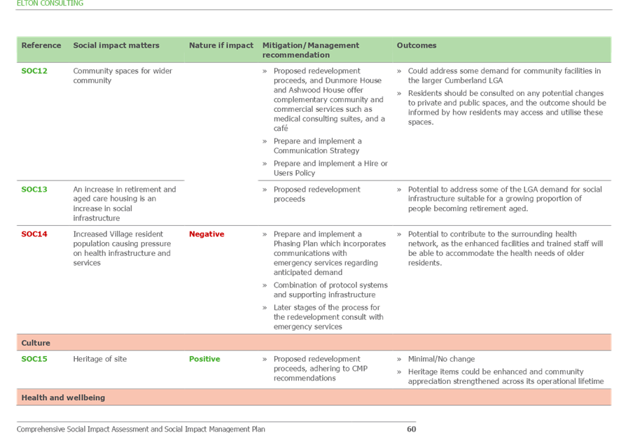
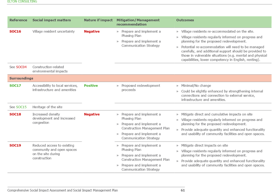
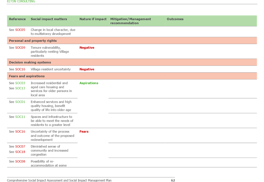
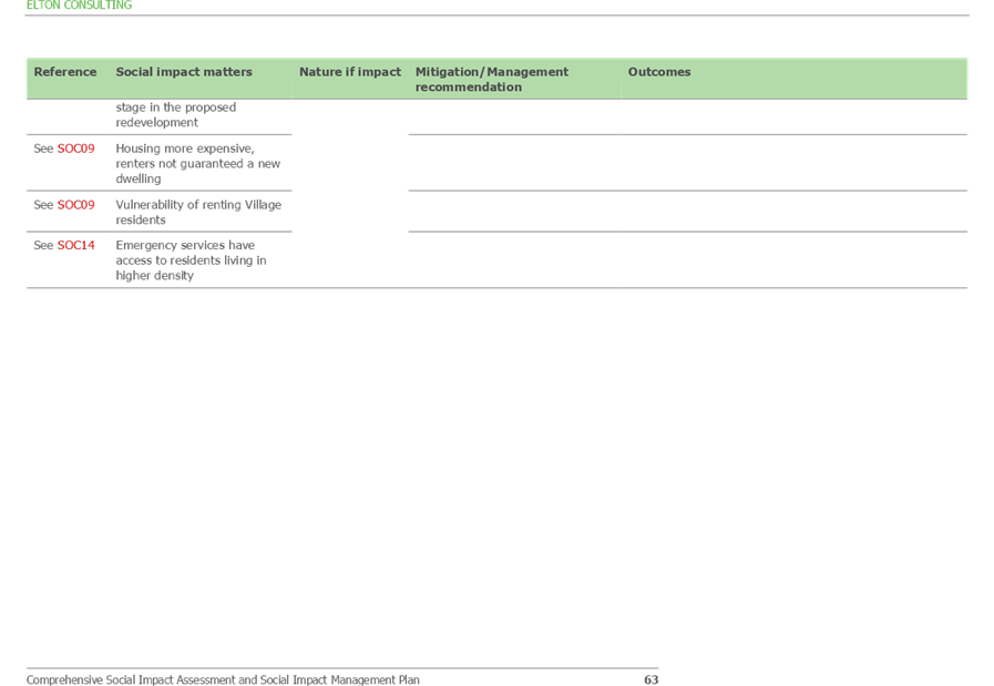
Cumberland Local Planning Panel Meeting
12 August 2020
Cumberland Local Planning Panel Meeting
12 August 2020
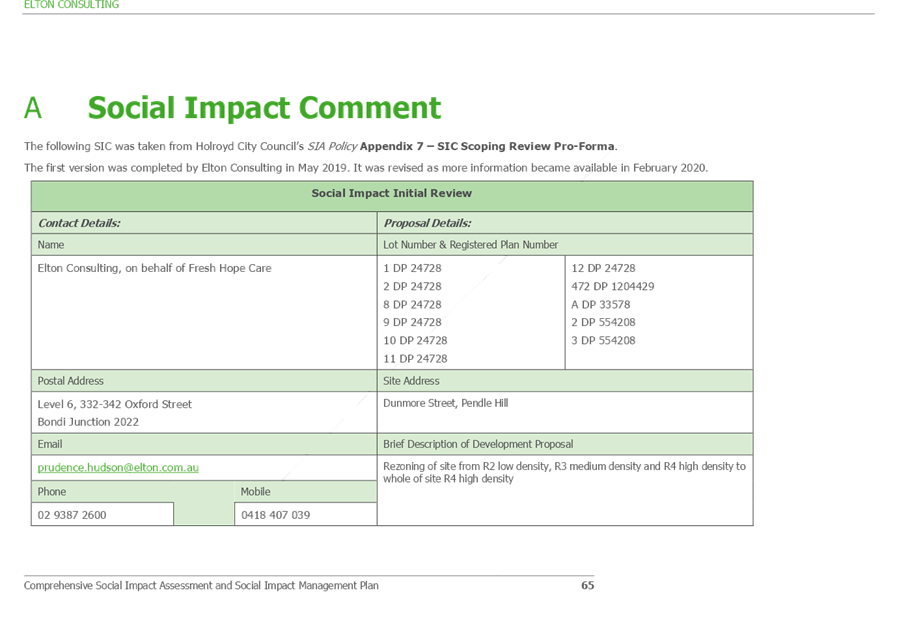
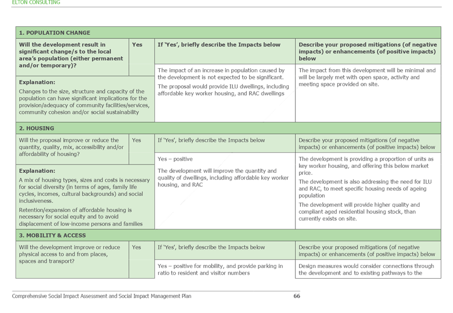
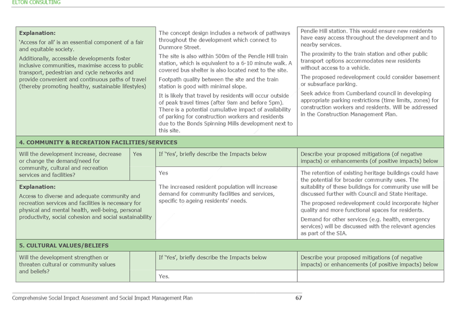
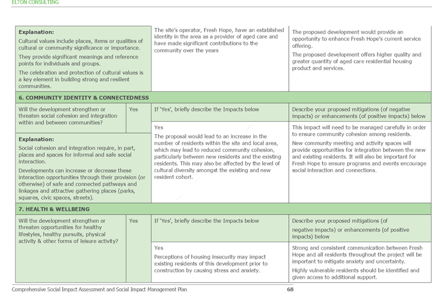
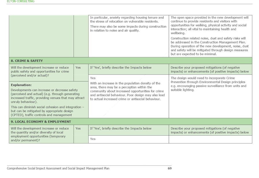
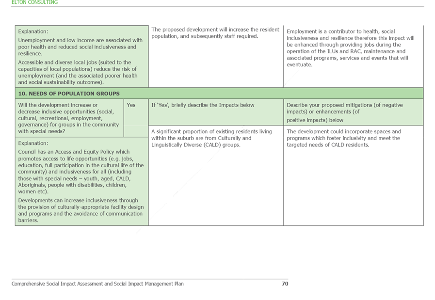
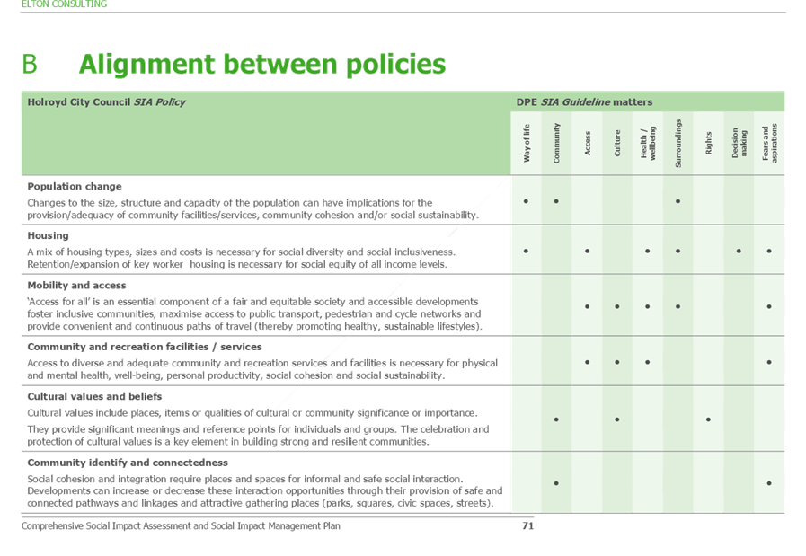
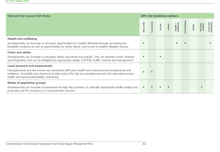
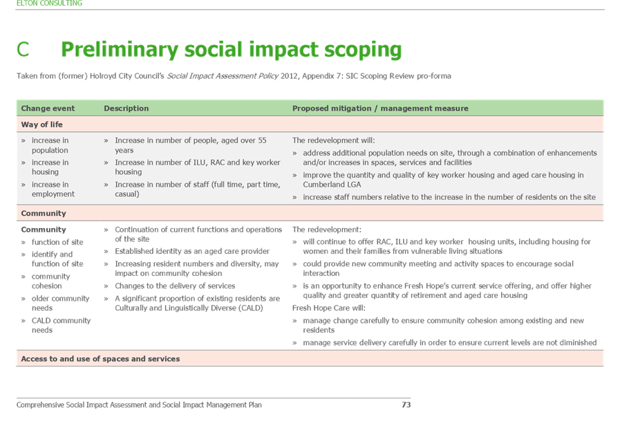
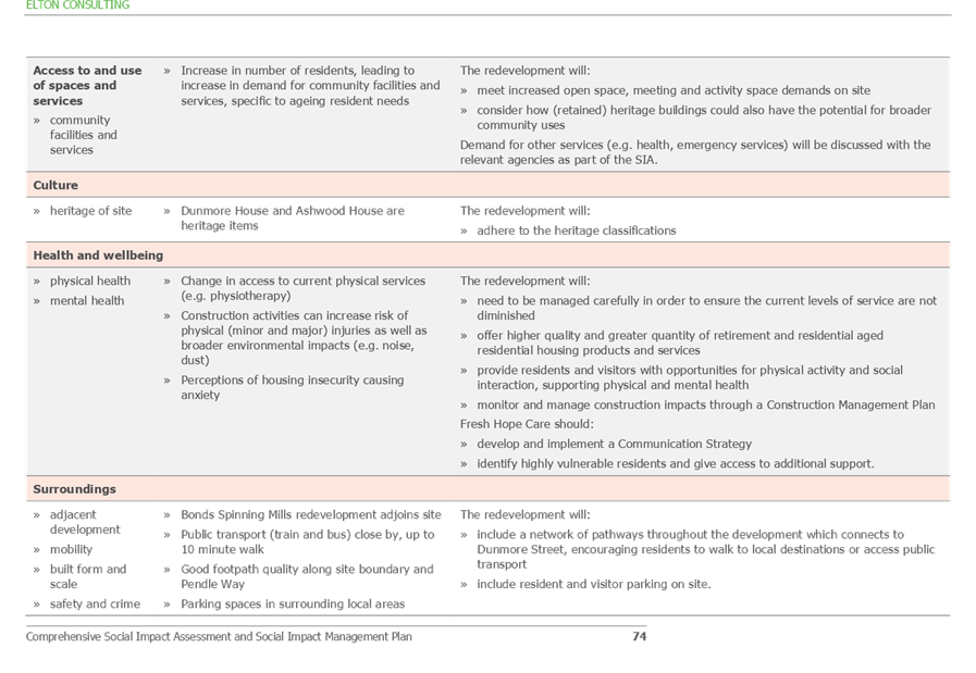
Cumberland Local Planning Panel Meeting
12 August 2020
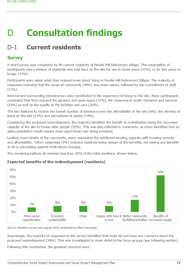
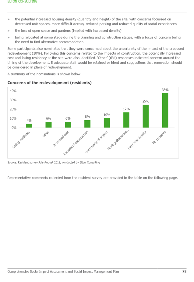
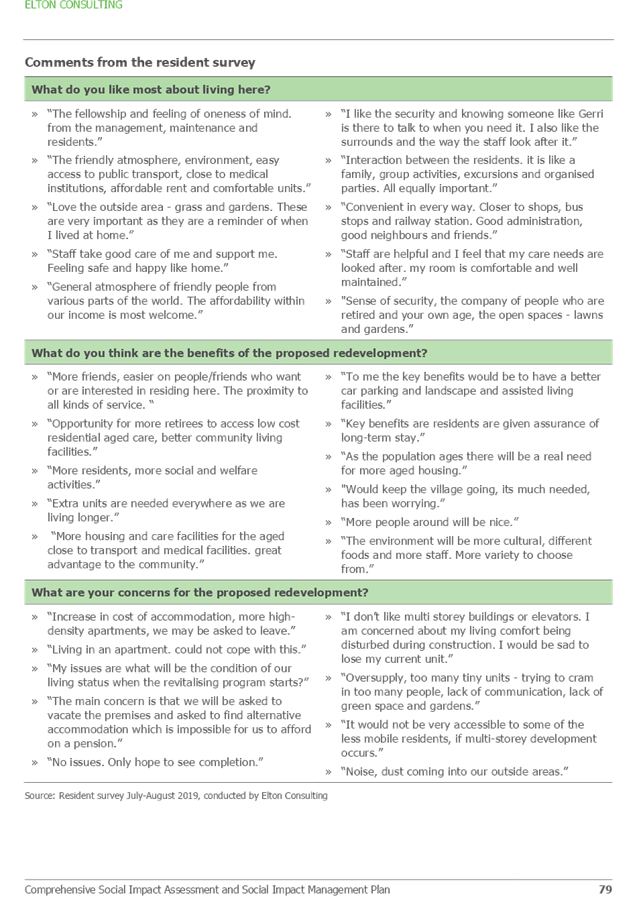
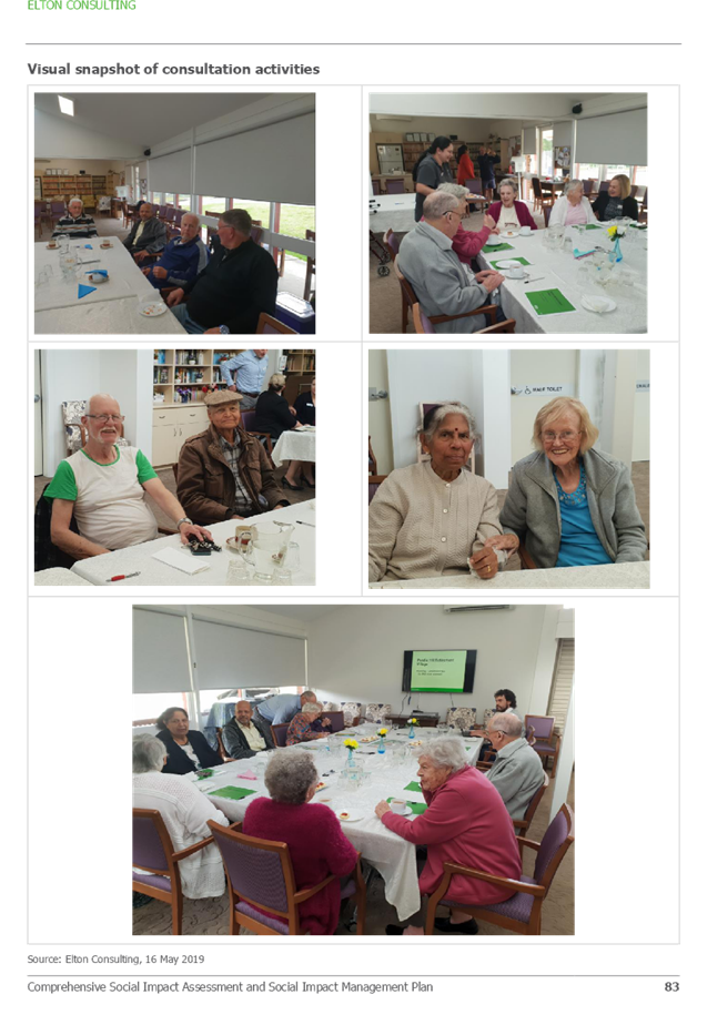
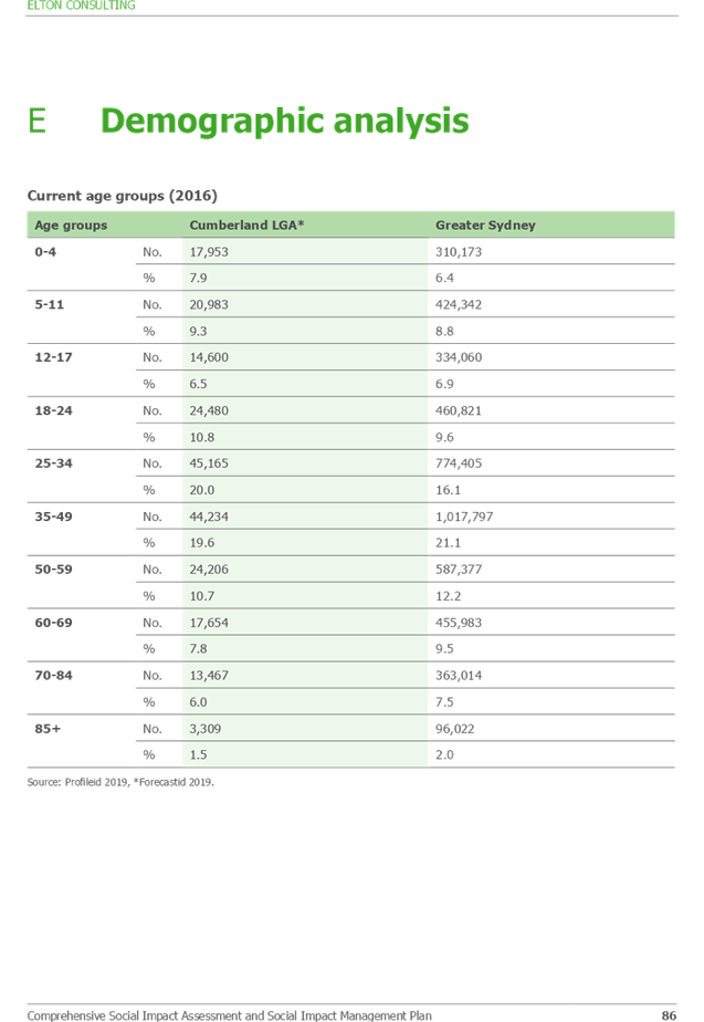
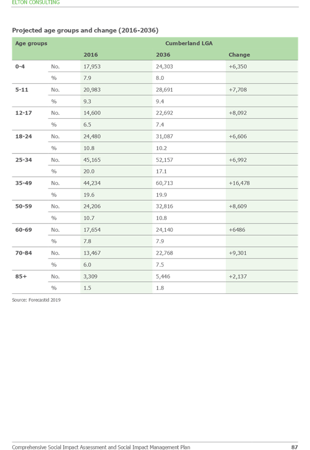
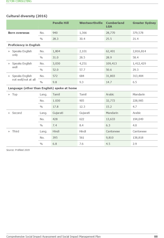
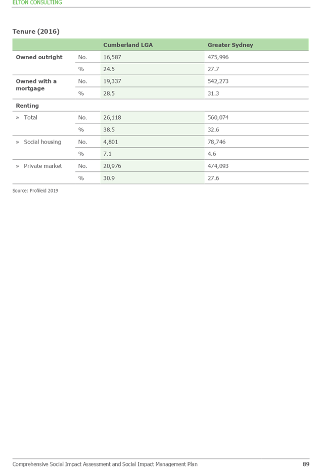
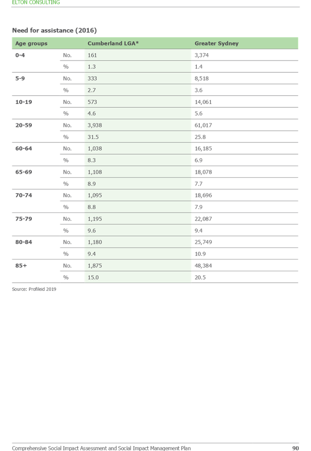

DOCUMENTS
ASSOCIATED WITH
REPORT LPP044/20
Attachment 11
Summary of Submissions
Cumberland Local Planning Panel Meeting
12 August 2020