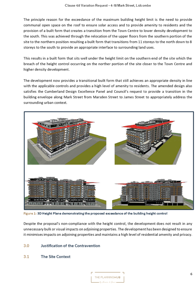
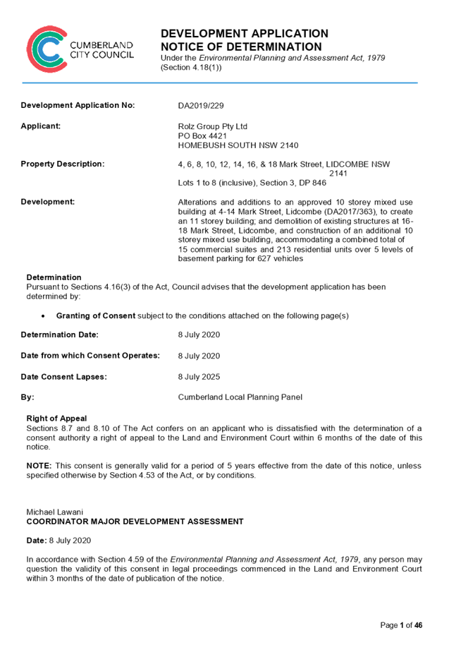
8 July 2020
An
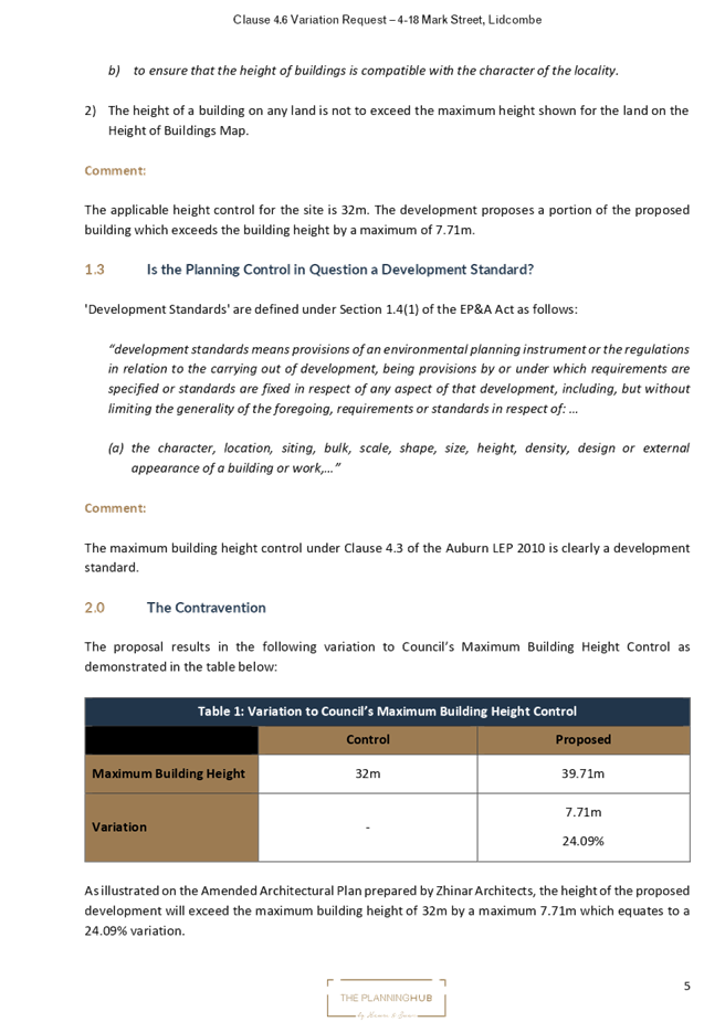
Electronic meeting of the Cumberland Local Planning Panel will be held
at 11:30a.m. via Zoom on Wednesday, 8 July 2020.
Business as below:
Yours faithfully
Hamish McNulty
General
Manager
ORDER OF BUSINESS
1. Receipt of Apologies
2. Confirmation of Minutes
3. Declarations of Interest
4. Address by invited
speakers
5. Reports:
- Development
Applications
- Planning
Proposals
6. Closed Session Reports
Cumberland Local Planning Panel Meeting
8 July 2020
CONTENTS
Report No. Name of Report Page
No.
Development Applications
LPP033/20... Development Application
for 4-18 Mark Street, Lidcombe............................ 5
LPP034/20... Development Application
for 185-187 Great Western Highway, Mays Hill 195
LPP035/20... Development Application
for 1-3 Bransgrove Street, Wentworthville..... 263
LPP036/20... Development Application
for 122 Robertson Street, Guildford................ 363
LPP037/20... Development Application
for 25A Crescent Street, Holroyd.................... 421
LPP038/20... Development Application
for 58 & 60 Berwick Street, Guildford............. 479
LPP039/20... Development Application
for 81-83 Mountford Avenue, Guildford......... 639
Cumberland Local Planning Panel Meeting
8 July 2020
Cumberland Local Planning Panel Meeting
8 July 2020
Item
No: LPP033/20
Development
Application for 4-18 Mark Street, Lidcombe
Responsible
Division: Environment
& Planning
Officer: Executive
Manager Development and Building
File
Number: DA2019/229
|
Application lodged
|
25/07/2019
|
|
Applicant
|
Rolz
Group Pty Ltd
|
|
Owner
|
Apartments on Mark Pty Ltd
|
|
Application No.
|
DA2019/229
|
|
Description of Land
|
4-18
Mark Street, LIDCOMBE (Lots 1 to 8, Section 3, DP 846)
|
|
Proposed Development
|
Alterations
and additions to an approved 10 storey mixed use building at 4-14 Mark
Street, Lidcombe (DA2017/363); and demolition of existing structures at 16-18
Mark Street, Lidcombe, and construction of an additional 8 to 11 storey mixed
use building component, accommodating a combined total of 15 commercial
suites and 213 residential units over 5 levels of basement parking for 627
vehicles.
|
|
Site Area
|
4,176m2
|
|
Zoning
|
Zone
B4 - Mixed Use under Auburn Local Environmental Plan 2010
|
|
Disclosure of political donations and gifts
|
Nil
disclosure
|
|
Heritage
|
The subject site is not listed as a heritage item, is not located
within the heritage conservation area. The site is located within proximity
to the following 4 heritage items:
1. Corner Joseph and James Street, Lidcombe,
approximately 100m to the west containing Lidcombe War Memorial Statue;
2. 35-49 Joseph Street Lidcombe, approximately
140m to the south-west containing Fenton House;
3. 24 James Street Lidcombe, approximately 50 metres
to the south-east containing a heritage listed dwelling; and
4. Rookwood Cemetery, approximately 185m to the
east of the site.
|
|
Principal Development Standards
|
FSR: Permissible:
5:1
Proposed:
4.84:1
Height
of Building: Permissible: 32 metres
Proposed:
39.71 metres
|
|
Issues
|
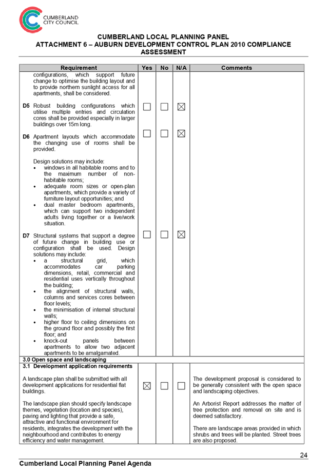
1. Height of buildings
2. Awnings
3. Site coverage
4. Building envelope
5. Head height of windows
6. Deep soil zones
7. Setbacks
|
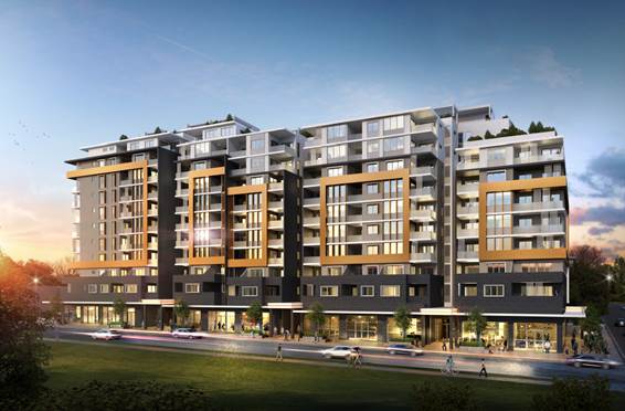
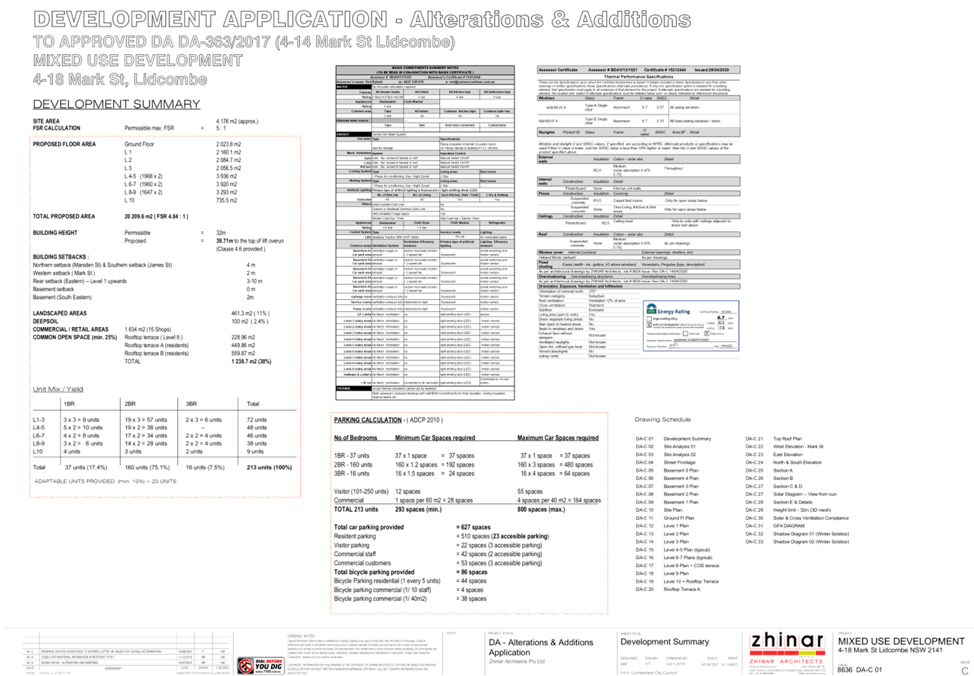
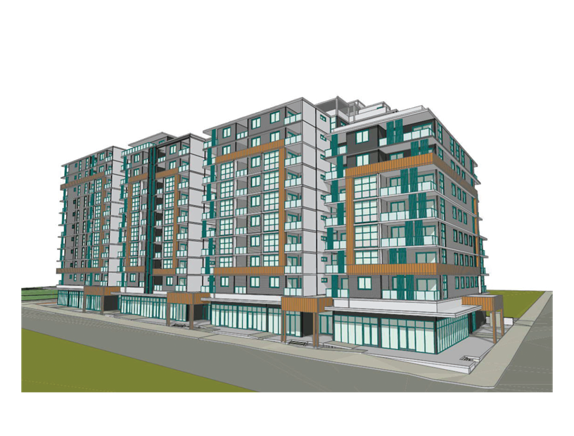
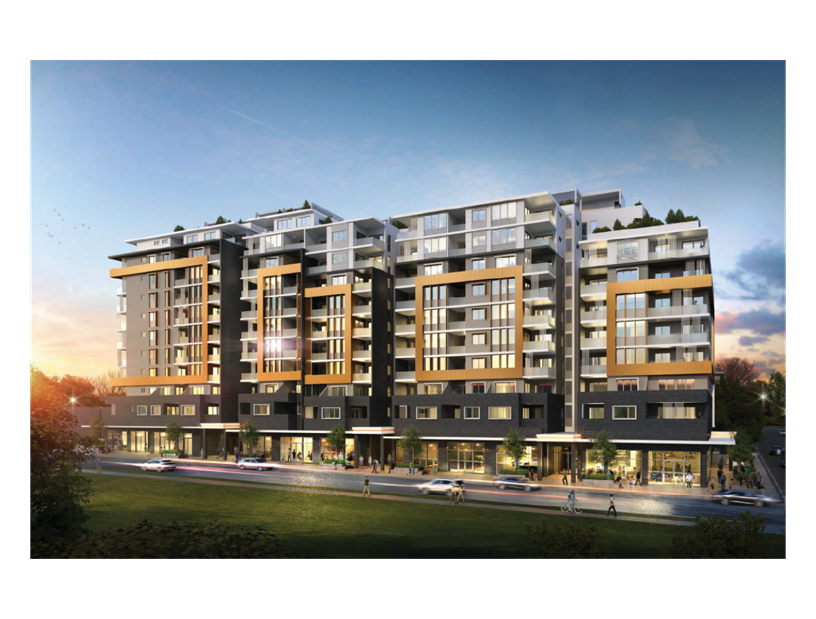
Figure 1 – Photomontage
of Proposed Development (Source: Zhinar Architects, 2020)
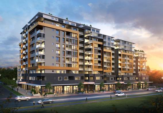
Figure 2 – Photomontage
of Proposed Development (Source: Zhinar Architects, 2020)
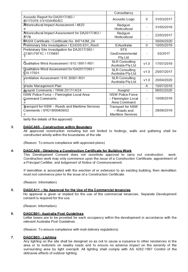
Summary:
Development Application No.
DA-229/2019 was originally received on 25/07/2019 seeking consent for
alterations and additions to approved 10 storey mixed use building at 4-14 Mark
Street, Lidcombe (DA2017/363); and demolition of existing structures at 16-18
Mark Street, Lidcombe, and construction of an additional 10 storey mixed use
building component, accommodating a combined total of 15 commercial suites and
217 residential units over 5 levels of basement parking for 643 vehicles.
The application was amended with
the submission of amended plans and documents received by Council on
05/05/2020, seeking consent for alterations and additions to approved 10 storey
mixed use building at 4-14 Mark Street, Lidcombe (DA2017/363); and demolition
of existing structures at 16-18 Mark Street, Lidcombe and construction of an
additional 8 to 11 storey mixed use building component, accommodating a
combined total of 15 commercial suites and 213 residential units over 5 levels
of basement parking for 627 vehicles.
The application essentially seeks
to retain the approved built form under DA2017/363, amend the internal layouts
and expand the development to the southern half of the site to include 16-18
Mark Street, Lidcombe.
In accordance with Council’s
notification requirements contained within the Auburn Development Control Plan
2010 (ADCP), the original development proposal was publicly notified for a
period of 14 days between 13 August 2019 and 27 August 2019. No submissions
were received in respect of the proposed development. The amended application
was publicly notified for a period of 14 days between 20 May 2020 and 3 June
2020. One (1) submission was received in respect of the amended proposal which
has been addressed within the main body of this report.
The development application was
referred for comments internally to Council’s Development Engineer,
Environmental Health Officer, Tree Management Officer and Resource Recovery
Officer, and externally to the NSW Police Force – Flemington Local Area
Command, Roads and Maritime Services and Ausgrid, to which the application is
supported, subject to conditions.
The application was referred to
the Design Excellence Panel (DEP) in accordance with the Cumberland Design
Excellence Panel Policy, as the proposal seeks a building height of more than
25 metres. The design has been found to be worthy of support, subject to
conditions.
The proposed development has been
assessed by an independent planning consultant against the relevant matters for
consideration pursuant to Section 4.15 of the Environmental Planning and
Assessment Act, 1979, including likely impacts, the suitability of the site for
the development, and the public interest, and the proposed development is
considered appropriate.
|
Control
|
Required / Permitted
|
Proposed
|
Variation
|
|
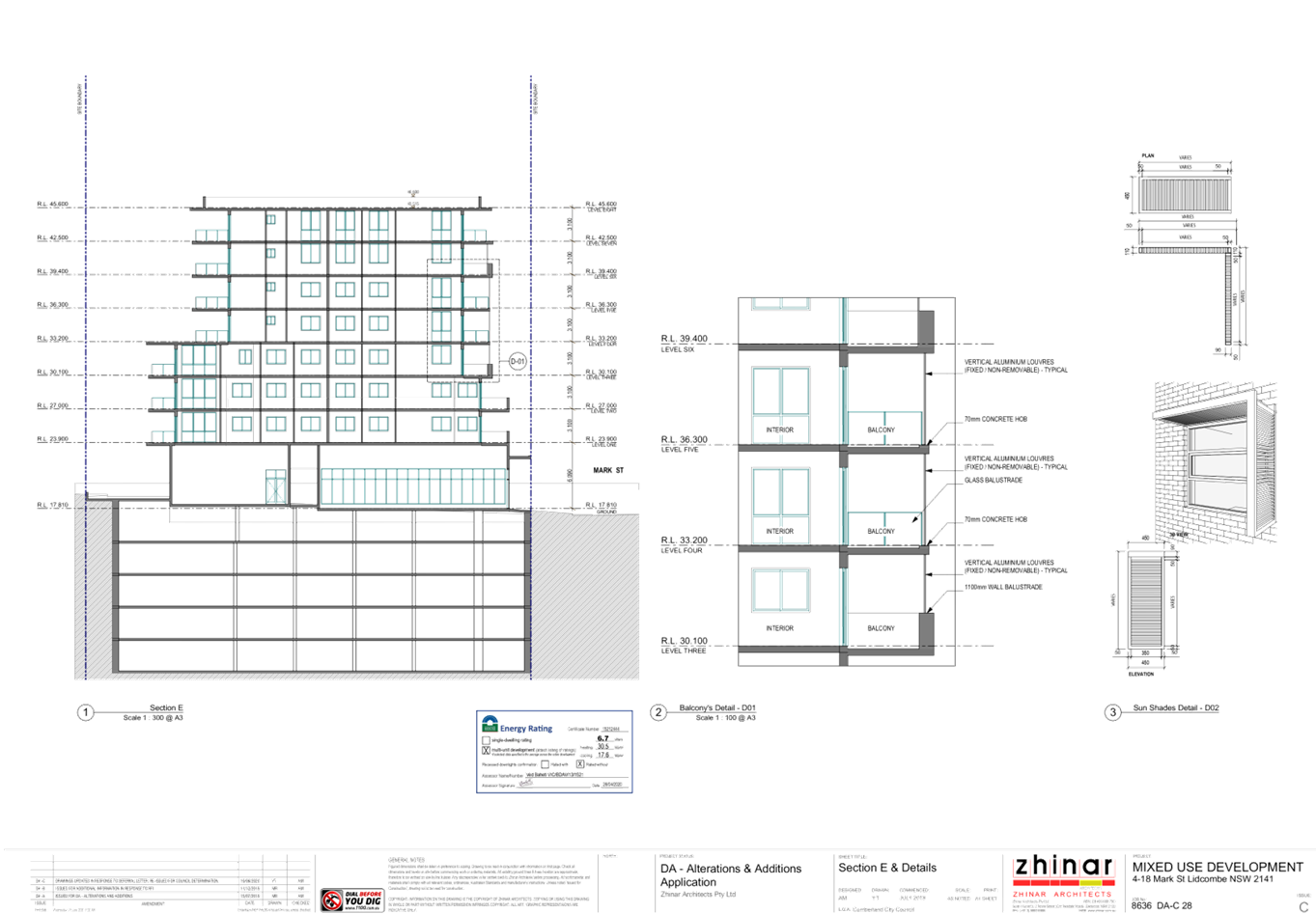
Height of Building
|
32 metres
|
39.71 metres
|
7.71 metres / 24%
|
|
Awnings
|
4m Soffit Height
|
4 to 5 metres
|
1 metre / 25%
|
|
1.
Site Coverage
|
2.
50%
|
3.
65%
|
4.
30%
|
|
Building Envelope
|
850m²
|
1,647m² to 2,160m²
|
797 to 1,310 metres / 94% to 154%
|
|
Head Height of Windows
|
2.4 metres
|
2.3 metres
|
4.16%
|
|
Deep Soil Zones
|
30%
|
2.4%
|
92%
|
|
Setbacks
|
4 to 6 metres
|
2 metres
|
50% to 66.6%
|
The application is being reported
to the Cumberland Local Planning Panel (CLPP) for determination, as pursuant to
the Local Planning Panels Direction – Development Applications issued by
the Minister for Planning on 23 February 2018, the application constitutes
‘sensitive development’, as it is development to which State
Environmental Planning Policy No. 65 – Design Quality of Residential
Apartment Development applies.
In light of the above, it is
recommended that the Cumberland Local Planning Panel (CLPP) approve the
development application, subject to the draft notice of determination contained
in Attachment 2 to this report.
Subject Site and Surrounding
Area
The proposed redevelopment of the
subject site comprises of 8 allotments and is legally described as Lots 1 to 8,
Section 3, DP 846, and is known as 4-18 Mark Street, Lidcombe.
The site is zoned B4 Mixed Use and
is situated on the eastern side of Mark Street, south of Marsden Street. The
subject site is located within the ‘Lidcombe Town Centre’ in one of
the key sites being Precinct 7 - Marsden Street as identified in section 15.0
of the Local Centres chapter of the Auburn Development Control Plan (ADCP)
2010.
The land is regular in shape and
has a frontage to Mark Street along the western boundary, Marsden Street along
the northern boundary and James Street along the southern boundary. The site
has a combined frontage width of 101.65m to Mark Street, 41.205m to Marsden
Street and 41.08m to James Street, creating a total combined land area of
4,176m2. The land has a moderate slope with a fall across the site
of approximately 4m from the north-eastern corner to the south-western corner
of the site.
All 8 allotments are currently
occupied by single storey dwelling houses, with the exception of 18 Mark
Street, Lidcombe, which currently contains a 3 storey, 3 unit building. A
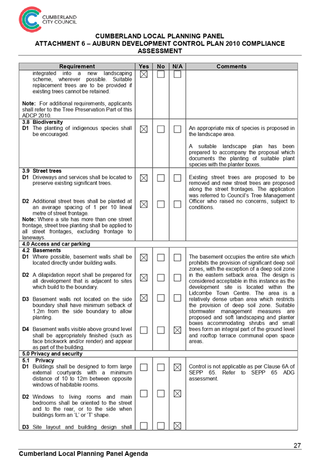
number of trees exist across the 8 lots. The application relies on the Arborist
Report submitted and approved for the previous Development Application as well
as a new Arborist Report for the additional 2 lots (16-18 Mark Street) that identifies
2 trees, 1 requiring removal and 1 retention. The tree proposed to be removed
is located on the common boundary of 14 and 16 Mark Street, Lidcombe, and is
stated as having a fair condition. The design of the development and subsequent
landscape plan incorporates retention of the tree in question, and Council has
prepared appropriate conditions to ensure appropriate protection of those to be
retained and replacement for any to be removed.
Surrounding developments in the
immediate vicinity are currently characterised by a mix commercial/retail land
uses and high density residential and mixed use developments of various size
and scale. It is evident that once the area completes transition, the area will
be characterised predominantly by commercial and mixed use developments given
the context and current zoning of the locality.
Adjoining developments consist of
a 2 storey factory building on the opposite side of Marsden Street to the north
of the subject site (DA approved for ten storey mixed use development), 3 to 7
storey Residential Flat Buildings to the west and south-west, and single storey
dwelling houses to the south. Locality plan of the subject site:
|
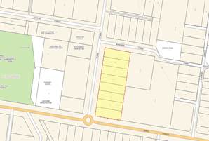
Figure
3 – Locality Plan of subject site
|
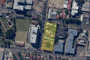
Figure
4 – Aerial View of Subject Site
|
|
Figure
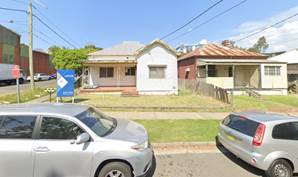
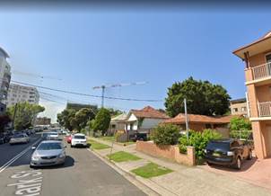
5 – Street View of the subject site comprising 4 and 6 Mark Street,
Lidcombe
(Source:
Google Street View)
|
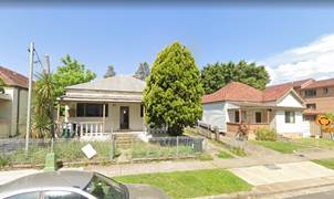
Figure
6 – Street View of the subject site comprising 8, 10 and 12 Mark
Street, Lidcombe
(Source:
Google Street View)
|
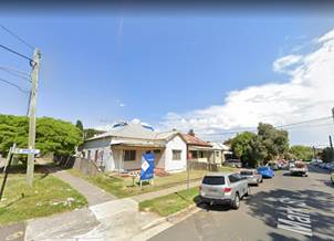
|
Figure
7 – Street View of the subject site comprising 12 and 14 Mark Street,
Lidcombe
(Source:
Google Street View)
|
Figure
8 – Street View of the subject site comprising 16 and 18 Mark Street,
Lidcombe
(Source:
Google Street View)
|
|
Figure
9 – Street View of the subject site looking north-east from the
intersection of James Street and Mark Street, Lidcombe
(Source:
Google Street View)
|
Figure
10 – Street View of the subject site looking south-east from the
intersection of Marsden Street and Mark Street, Lidcombe
(Source:
Google Street View)
|
Table
1 - Photographs of the Site and Surrounds
Description of the Proposed
Development
The amended application seeks
consent for alterations and additions to approved 10 storey mixed use building
at 4-14 Mark Street, Lidcombe (DA2017/363); and demolition of existing
structures at 16-18 Mark Street, Lidcombe, and construction of an additional 8
to 11 storey mixed use building component, accommodating a combined total of 15
commercial suites and 213 residential units over 5 levels of basement parking
for 627 vehicles.
The application essentially seeks
to retain the approved built form under DA2017/363, amend the internal layouts
and expand the development to the southern half of the site to include 16-18
Mark Street.
A summary of the proposed
development data is provided below:
|
Height/Storeys:
|
39.71 metres, 8 to 11 storeys
|
|
GFA/FSR:
|
20,209.6m2
GFA = 4.84:1 FSR
|
|
Commercial GFA:
|
15 tenancies totalling 1,634m2
|
|
Unit Mix:
|
213 units:
· 37 x 1 bedroom units or 17.4%
· 160 x 2 bedroom units or 75.1%
· 16 x 3 bedroom units or 7.5%
|
|
Orientation:
|
North, east, south and west
|
|
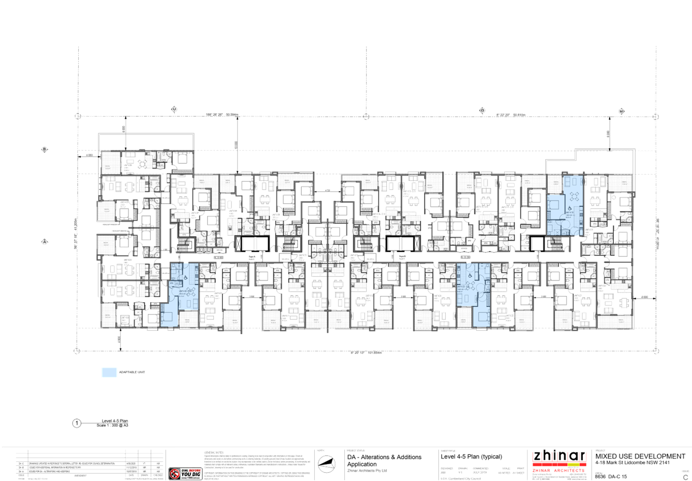
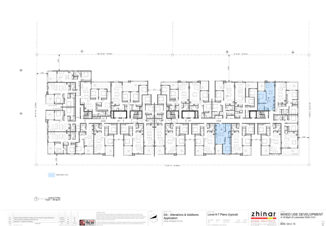
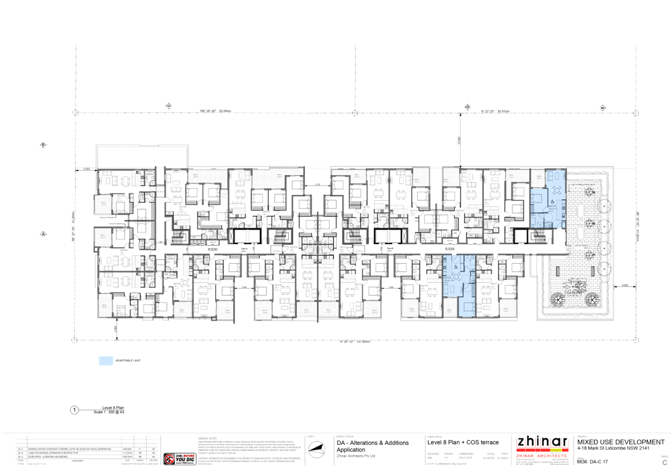
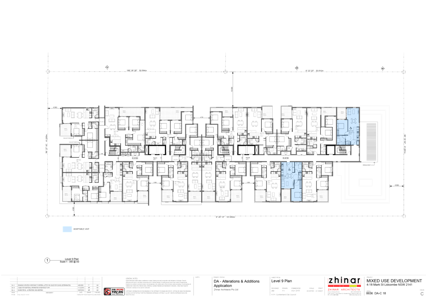
Adaptable:
|
23 units (10.8%)
|
|
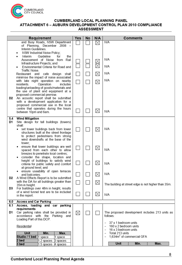
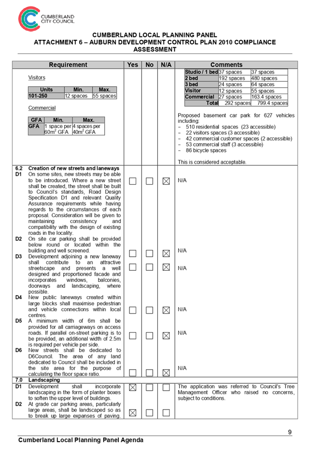
Car Parking:
|
A total of 627 spaces are proposed within 5 basement
levels including:
· 510 resident spaces
· 22 visitor spaces
· 95 commercial spaces
|
|
Bicycle Parking:
|
86 spaces
|
|
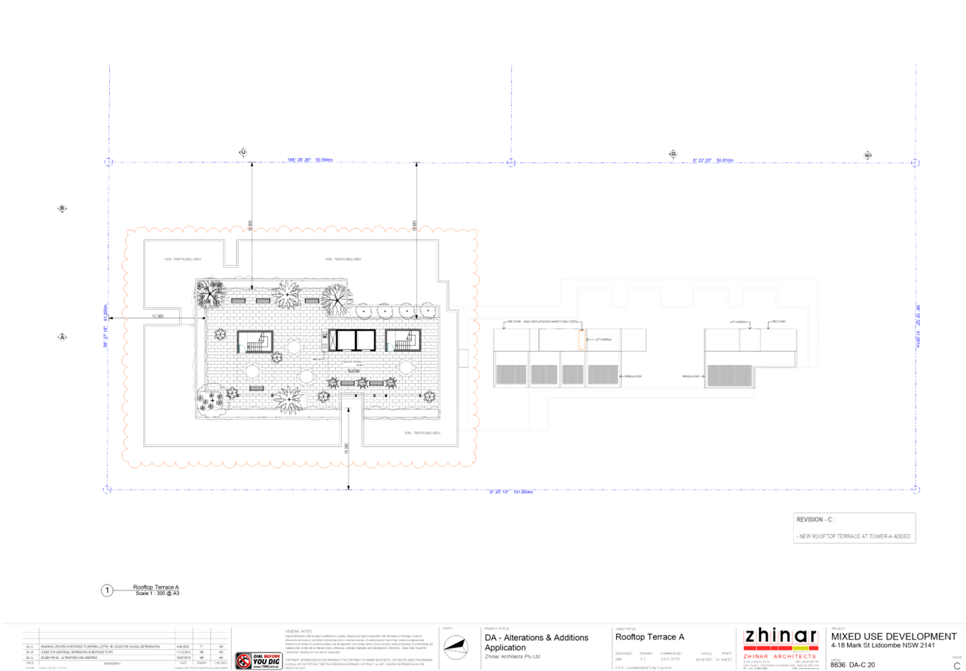
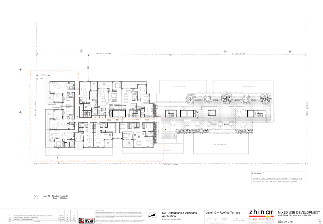
Communal Open Space:
|
1,238.7m2 (30%) on rooftops (residential)
and ground floor (commercial)
|
Table
2 - Summary of Proposed Development Data
History
|
Date
|
Comment
|
|
15/06/2017
|
A Pre-Lodgement Application meeting (PL2017/24) was held
between the Applicant and Council Officers to discuss a development proposal
for a 10 storey mixed use development on the site known as 4-14 Mark Street,
Lidcombe.
In summary, the development proposal raised a number of
issues and matters that required significant amendments and alternate design
options explored. Issues included:
· Site isolation
for the two remaining lots in the block to the south of the subject site.
· Building over
height.
· SEPP 65 non
compliances in the presented scheme.
· Shared access
for commercial and residential foyer.
· Lack of waste
facilities at each level.
· Further
articulation of the building was required.
· In addition, the
Applicant was also advised of various documents required for lodgement.
|
|
28/08/2017
|
Development Application DA2017/363 was lodged with Council
seeking consent for demolition of existing dwellings & associated
structures and construction of a ten storey mixed-use development consisting
of 6 commercial tenancies and 165 residential units over five level basement
parking at 4-14 Mark Street, Lidcombe.
|
|
10/05/2018
|
DA2017/363 was determined by way of a Deferred
Commencement consent being issued requiring satisfaction of the following
matters:
1. Amended
architectural plans to address stormwater and traffic/parking matters
2. Amended
BASIX Certificate
|
|
14/08/2018
|
Additional Information comprising the material required to
satisfy the Deferred Commencement conditions was received and assessed by
Council to be satisfactory to enable the issue of an Operative Development
Consent.
|
|
15/08/2018
|
Notice of Deferred Commencement Compliance was issued and
Development Consent DA2017/363 became operative.
|
|
08/05/2019
|
A Pre-Lodgement Application meeting (PL2019/24) was held
between the Applicant and Council Officers to discuss a development proposal
for a 10 storey mixed use development on 4-18 Mark Street, Lidcombe.
In summary, the development proposal raised a number of
issues and matters that required further information or refinement. Issues
included:
· SEPP 65 ADG
Communal Open Space further details for rooftop COS.
· SEPP 65 ADG
Building Separation non-compliances for levels 4 to 7.
· SEPP 65 ADG
Ceiling Heights to be confirmed.
· ALEP 2010
Building Height exceeding Clause 4.3 Development Standard.
· ADCP 2010 Rear
Setback non-compliance.
· ADCP 2010
Building Depths exceeding 24 metres.
· ADCP 2010
Section and Elevations required to assess visual privacy.
· ADCP 2010 Solar
Access and Shadow Diagram details not provided and required.
· ADCP 2010 Adaptable
Housing to comply with minimum requirements of AS4299 (minimum 22 units
advised).
· Urban Design:
· Building
Envelope exceeds ADCP 2010.
· Transition for
Lidcombe Town Centre fringe.
· Security for
Communal Courtyards and Communal Open Space.
· Building
Façade length
· Stormwater
Engineering design details and comments requested.
· Traffic and
Parking Engineering design details and comments requested.
· Waste/Loading
design details and comments requested.
· Environmental
Health design details and comments requested.
· Tree Management
design details and comments requested.
· Landscape design
details and comments requested.
In addition, the applicant was also advised of various
documents required for lodgement.
|
|
25/07/2019
|
The subject Development Application DA2019/229 was lodged
seeking consent for alterations and additions to approved 10 storey mixed use
building at 4-14 Mark Street, Lidcombe (DA2017/363); and demolition of
existing structures at 16-18 Mark Street, Lidcombe, and construction of an additional
10 storey mixed use building component, accommodating a combined total of 15
commercial suites and 217 residential units over 5 levels of basement parking
for 643 vehicles.
|
|
13/08/2019
|
In accordance with Council’s Notification
requirements contained within the ADCP, the application was publicly notified
for a period of 14 days between 13 August 2019 and 27 August 2019. No
submissions were received in respect of the proposed development.
|
|
02/09/2019
|
The application was referred to the Design Excellence
Panel on 2 September 2019 in accordance with the Cumberland Design Excellence
Panel Policy as the proposal seeks a building height of more than 25 metres.
The panel considered the design excellence of the proposed
development and recommended the following: “The Panel considers that
the DA has some merit, however, it will require design development with
regard to issues of massing and built form articulation, variety in building
height, building height transition in the southern part of the building,
ground level street frontage design and parking provision. It is expected
that the application will need to be re-referred to the Panel after the
specific recommendations relating to the changes requested have been made to
address the concerns raised.”
|
|
04/10/2019
|
A letter deferring the
determination of the application was sent to the Applicant outlining a number
of concerns and deficiencies with the application including the following:
a. DEP Comments;
b. Structure of Application;
c. SEPP 65 Apartment Design Guide matters including:
i. Public
domain;
ii. Communal Open Space;
iii. Deep Soil Zones;
iv. Visual Privacy;
v. Car Parking;
vi. Solar Access;
vii. Natural Ventilation;
viii. Ceiling Heights;
ix. Façades;
x. Adaptable Units/Accessible Car Parking;
d. Auburn Local Environmental Plan 2010 matters including building height;
e. Auburn Development Control Plan 2010 matters including balcony soffit
treatment;
f. Concerns raised by Council’s Development
Engineer; and
g. Concerns raised by Council’s Resource Recovery Officer.
|
|
11/12/2019
|
Amended plans received including substantially amended
development including a break-up of the development into 4 distinguishable
façade blocks with a subsequent reduction in building height on the
southern end of the development towards James Street from 10 storeys to 8
storeys, and a consequent increase in building height on the northern end of
the development towards Marsden Street from 10 storeys to 11 storeys.
|
|
22/01/2020
|
The amended application was referred to the DEP in
accordance with the Cumberland Design Excellence Panel Policy. The panel
considered the design excellence of the amended proposed development, and
recommended additional changes to the development scheme to better address
some of the comments made in relation to the original proposal and also in
relation to the amended proposal.
|
|
09/03/2020
|
A letter deferring the
determination of the application was sent to the applicant outlining a number
of concerns and deficiencies with the application including the following:
a. DEP Comments;
b. SEPP 65 Apartment Design Guide matters including:
i. Communal
Open Space;
ii. Natural
Ventilation; and
iii. Adaptable Units/Accessible Car Parking;
c. Auburn Local Environmental Plan 2010 matters including building height;
and
d. A request for updated BASIX Certificates.
|
|
05/05/2020
|
Amended plans and reports received including substantially
amended development including a break-up of the development into 4
distinguishable façade blocks with a subsequent reduction in building
height on the southern end of the development towards James Street from 10
storeys to 8 storeys, and a consequent increase in building height on the
northern end of the development towards Marsden Street from 10 storeys to 11
storeys.
|
|
20/05/2020
|
In accordance with Council’s Notification
requirements contained within the ADCP, the amended application was publicly
notified for a period of 14 days between 20 May 2020 and 3 June 2020. One (1)
submission was received in respect of the amended proposal which has been
addressed within the main body of this report.
|
|
22/05/2020
|
The amended application was referred to the DEP in
accordance with the Cumberland Design Excellence Panel Policy. The panel
considered the design excellence of the amended proposed development, and
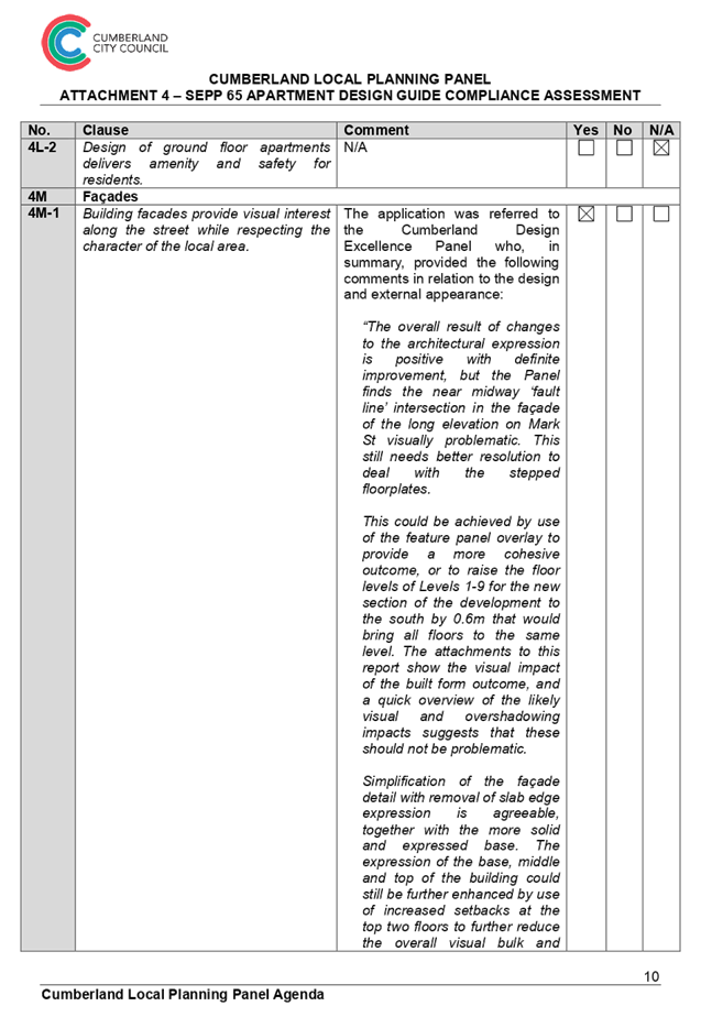
found the application worthy of support, subject to a condition resolving the ‘fault line’
intersection in the façade to Mark Street.
|
|
09/06/2020
|
A letter deferring the
determination of the application was sent to the applicant outlining a number
of inconsistencies between plans and reports for the application including
the following:
a. Height of building details and extent of variation sought under Clause
4.6 of ALEP; and
b. Amended elevation and section plans requested to nominate proposed RL
levels.
|
|
10/06/2020
|
Amended plans and reports were received from the applicant
in response to the deferral letter issued on 9 June 2020. The amendments
within the plans and reports submitted are limited to nomination of RL levels
on elevation and section plans and consistencies between the height of
building measurement indicated on the plans and report.
|
|
08/07/2020
|
The application is referred to the Cumberland Local
Planning Panel Meeting for determination.
|
Table
3 -– Site and Development History
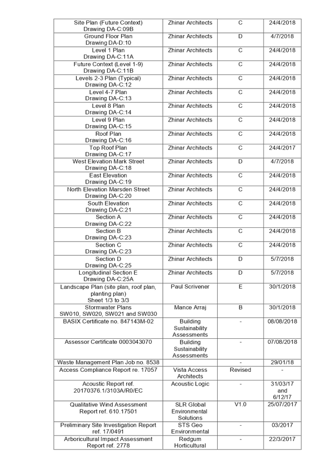
Note: The design evolution of the
development has been documented within Attachment 8 to this report.
Applicants Supporting
Statement
The applicant has provided a Statement of Environmental
Effects prepared by Blondie Consulting dated June 2019 and was received by
Council on 25/07/2019 in support of the application.
Contact with Relevant
Parties
The assessing officer has
undertaken a site inspection of the subject site and surrounding properties and
has been in regular contact with the applicant throughout the assessment
process.
Internal Referrals
|
Department
|
Comment
|
|
Development Engineer
|
Supported,
subject to conditions.
|
|
Environmental
Health Officer
|
Supported,
subject to conditions.
|
|
Tree
Management Officer
|
Supported,
subject to conditions.
|
|
Resource
Recovery officer
|
Supported,
subject to conditions.
|
External Referrals
|
Authority
|
Comment
|
|
Design
Excellence Panel
|
Supported,
subject to conditions.
|
|
NSW Police
Force – Flemington Local Area Command
|
No
concerns raised, conditions provided.
|
|
Roads and
Maritime Services
|
No
concerns raised, conditions provided.
|
|
Ausgrid
|
No
concerns raised, conditions provided.
|
PLANNING COMMENTS
The provisions of any
Environmental Planning Instruments (EP&A Act s4.15 (1)(a)(i))
State Environmental Planning
Policies
The proposed development is
affected by the following State Environmental Planning Policies:
(a) State
Environmental Planning Policy No. 55 – Remediation of Land;
(b) State
Environmental Planning Policy No. 65 – Design Quality of Residential
Apartment Development:
5. Apartment
Design Guide (The Guide);
(c) State
Environmental Planning Policy (Building Sustainability Index: BASIX) 2004;
(d) State
Environmental Planning Policy (Infrastructure) 2007;
(e) State
Environmental Planning Policy (State and Regional Development) 2011; and
(f) State
Environmental Planning Policy (Vegetation in Non-Rural Areas) 2017.
6.
(a) State
Environmental Planning Policy No. 55 – Remediation of Land (SEPP 55)
The State Environmental Planning
Policy No. 55 – Remediation of Land (SEPP 55), Clause 7, requires Council
to be satisfied that the site is suitable or can be made suitable to
accommodate the proposed development. The matters listed within Clause 7 have
been considered in the assessment of the development application.
|
Matter for Consideration
|
Yes/No
|
|
Does the application involve re-development of the site or
a change of land use?
|
Yes No
|
|
Does
the application involve re-development of the site or a change of land use?
|
Yes No
|
|
In the development going to be used for a sensitive land
use (e.g.: residential, educational, recreational, childcare or hospital)?
|
Yes No
|
|
Does information
available to you indicate that an activity listed below has ever been
approved, or occurred at the site?
acid/alkali plant and
formulation, agricultural/horticultural activities, airports, asbestos
production and disposal, chemicals manufacture and formulation, defence
works, drum re-conditioning works, dry cleaning establishments, electrical
manufacturing (transformers), electroplating and heat treatment premises,
engine works, explosive industry, gas works, iron and steel works, landfill
sites, metal treatment, mining and extractive industries, oil production and
storage, paint formulation and manufacture, pesticide manufacture and
formulation, power stations, railway yards, scrap yards, service stations,
sheep and cattle dips, smelting and refining, tanning and associated trades,
waste storage and treatment, wood preservation
|
Yes No
|
|
Is
the site listed on Council’s Contaminated Land database?
|
Yes No
|
|
Is
the site subject to EPA clean-up order or other EPA restrictions?
|
Yes No
|
|
Has
the site been the subject of known pollution incidents or illegal dumping?
|
Yes No
|
|
Does
the site adjoin any contaminated land/previously contaminated land?
|
Yes No
|
|
Has
the appropriate level of investigation been carried out in respect of
contamination matters for Council to be satisfied that the site is suitable
to accommodate the proposed development or can be made suitable to
accommodate the proposed development?
|
Yes No
|
|
Details of
contamination investigations carried out at the site:
A Detailed Site Investigation
report prepared by eiAustralia was submitted with the application. The
report did not reveal any potential matters of concern with regard to
contamination and concludes the following:
“Taking into account
the above considerations and subject to EI’s statement of limitations
(Section 8), EI concluded there was low potential for contamination to be
present on-site. The site was regarded as suitable for the proposed use,
subject to the implementation of recommendations detailed in Section
7.”
Council’s Environmental
Health Officer has reviewed the report, and determined that the site is
suitable to support such a development, given that the report provides that
the site is suitable for the proposed use, subject to conditions that have
been recommended.
|
(b) Statement
Environmental Planning Policy No. 65 - Design Quality of Residential Apartment
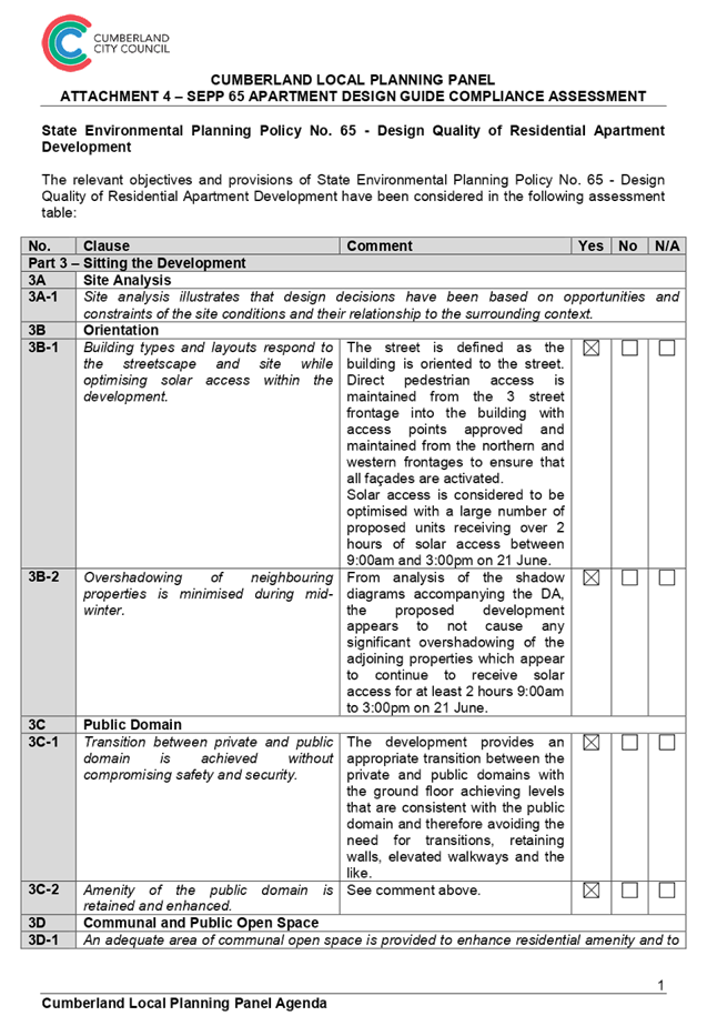
Development (SEPP 65)
The State
Environmental Planning Policy No. 65 – Design Quality of Residential
Apartment Development (SEPP 65) applies to the development as the building is 3
storeys or more, and contains more than 4 dwellings. A design statement
addressing the design quality principles prescribed by SEPP 65 was prepared by
the project architect. Integral to SEPP 65 is the Apartment Design Guide (ADG),
which sets benchmarks for the appearance, acceptable impacts and residential
amenity of the development.
Following a
detailed assessment of the proposal against the provisions of SEPP 65 and the
ADG, it is considered the proposal is generally compliant.
A comprehensive
assessment against SEPP 65 and the ADG is contained in Attachment 4.
(c) State
Environmental Planning Policy (Building Sustainability Index: BASIX) 2004
Amended BASIX and
ABSA Certificates were submitted for the amended development and will be
included in any conditions of consent.
(d) State
Environmental Planning Policy (Infrastructure) 2007 (ISEPP)
The provisions of State
Environmental Planning Policy (Infrastructure) 2007 (ISEPP) have been
considered in the assessment of the development application.
Clause 45 - Development likely
to affect an electricity transmission or distribution network
The original development occurs
within 5 metres of an overhead electricity power line and as such, Council gave
written notice of the application to Ausgrid. This subject application does not
change any of the requirements previously imposed and included as conditions of
consent. However it is noted that comments have been received from Ausgrid
raising no concerns with the proposed development.
Clause 85 – Development
adjacent to railway corridors
The application is not subject to
clause 85 of the ISEPP, as the subject site is not in or adjacent to a railway
corridor.
Clause 86 – Excavation
in, above, below or adjacent to rail corridors
The application is not subject to
clause 86 of the ISEPP, as the proposed redevelopment of the site does not
involve excavation to a depth of at least 2m below ground level (existing), on
land within, below or above a rail corridor, or within 25m (measured
horizontally) of a rail corridor.
Clause 87 – Impact of
rail noise or vibration on non-rail development
The application is not subject to
clause 87 of the ISEPP, as the site is not in or adjacent to a rail corridor
and the development is not likely to be adversely affected by rail noise or
vibration.
Clause 101 – Frontage to
classified road
The application is not subject to
clause 101 of the ISEPP, as the site does not have a frontage to a classified
road.
Clause 102 – Impact of
road noise or vibration on non-road development
The application is not subject to
clause 102 of the ISEPP as the annual average daily traffic volume is less than
20,000 vehicles.
Clause 104 – Traffic
generation developments
The application is not subject to
clause 104 as the proposal does not trigger the requirements for traffic
generating developments listed in Schedule 3 of the ISEPP.
(e) State
Environmental Planning Policy (State and Regional Development) 2011
Development of a type that is
listed under Schedule 7 of SEPP (State and Regional Development) 2011, is
defined as ‘Regionally Significant Development’, which requires a
referral to a Sydney Central City Regional Panel for determination, as constituted
by Part 3 of Schedule 2 under the Environmental Planning and Assessment Act,
1979.
The proposed development does not
constitute ‘Regionally Significant Development’, as it has a
Capital Investment Value (CIV) of $16,482,077, which does not exceed the $30
million threshold for ‘General Development’. Therefore, in
accordance with the Local Planning Panels Direction – Development
Applications issued by the Minister for Planning on 23 February 2018, the
application is referred to the Cumberland Local Planning Panel for
determination.
State Environmental Planning
Policy (Vegetation in Non-Rural Areas) 2017
The proposal does not exceed the
biodiversity offsets scheme threshold. Therefore, the proposed vegetation
removal is considered acceptable. Please refer to the ADCP compliance table for
further discussion.
Regional Environmental Plans
The proposed development is
affected by the following Regional Environmental Plans:
(a) Sydney
Regional Environmental Plan (Sydney Harbour Catchment) 2005
The subject site is identified as
being located within the area affected by the Sydney Regional Environmental
Plan (Sydney Harbour Catchment) 2005. The proposed development raises no issues
as no impact on the catchment is envisaged.
Note: The subject site is not identified
in the relevant map as ‘land within the ‘Foreshores and Waterways
Area’ or ‘Wetland Protection zone’, is not a ‘Strategic
Foreshore Site’ and does not contain any heritage items. Hence the
majority of the SREP is not directly relevant to the proposed development.
Local Environmental Plans
The proposed development is
affected by the following Local Environmental Plans:
(a) Auburn
Local Environmental Plan 2010 (ALEP)
The Auburn Local Environmental
Plan 2010 (ALEP) is applicable to the development proposal. It is noted that
the development achieves the objectives of the B4 Mixed Use zone under the
ALEP. However, the application proposes a variation to the Height of Buildings
development standard prescribed under the ALEP. The variation is summarised are
as follows:
|
Control
|
Required
|
Proposed
|
% variation
|
|
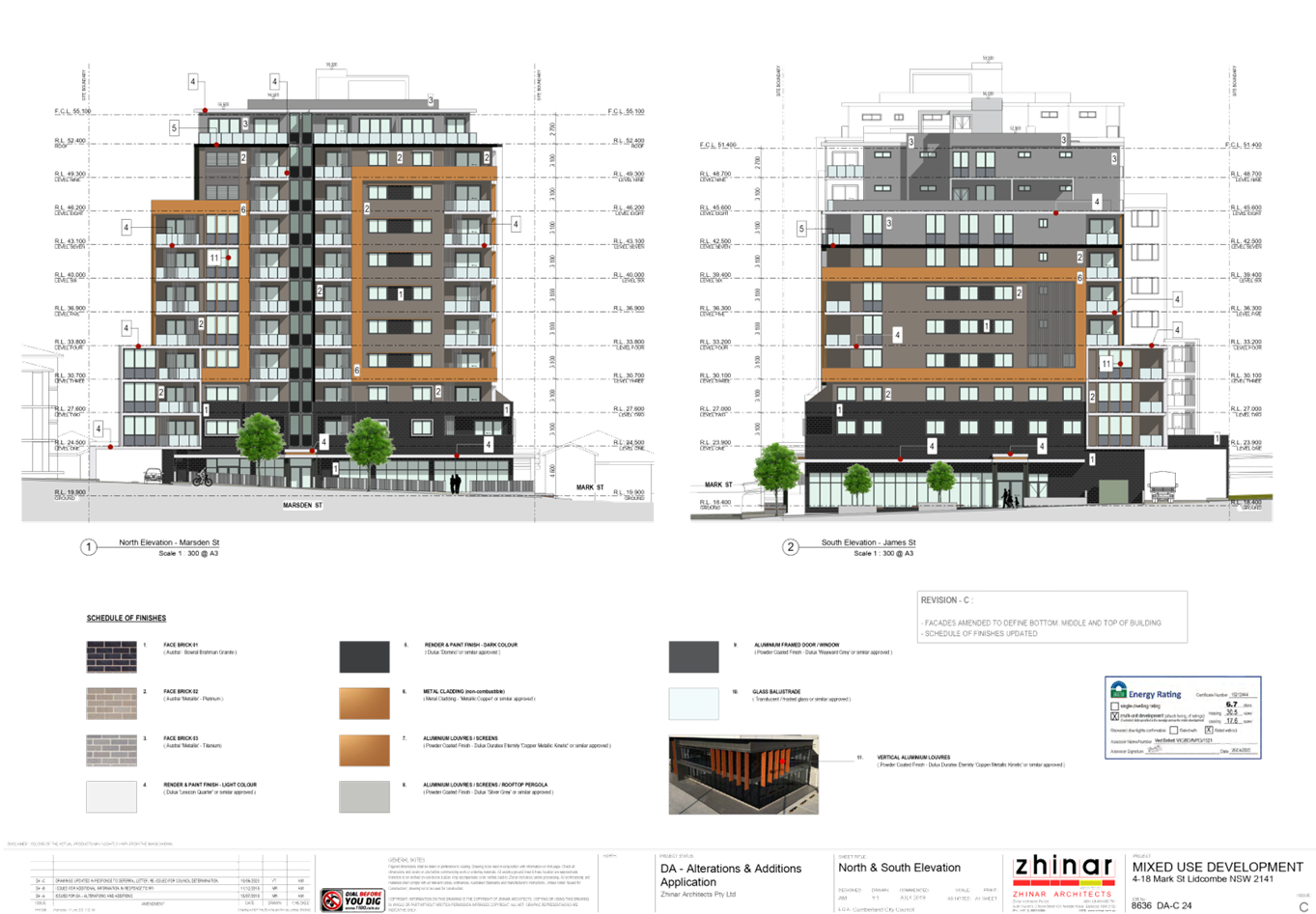
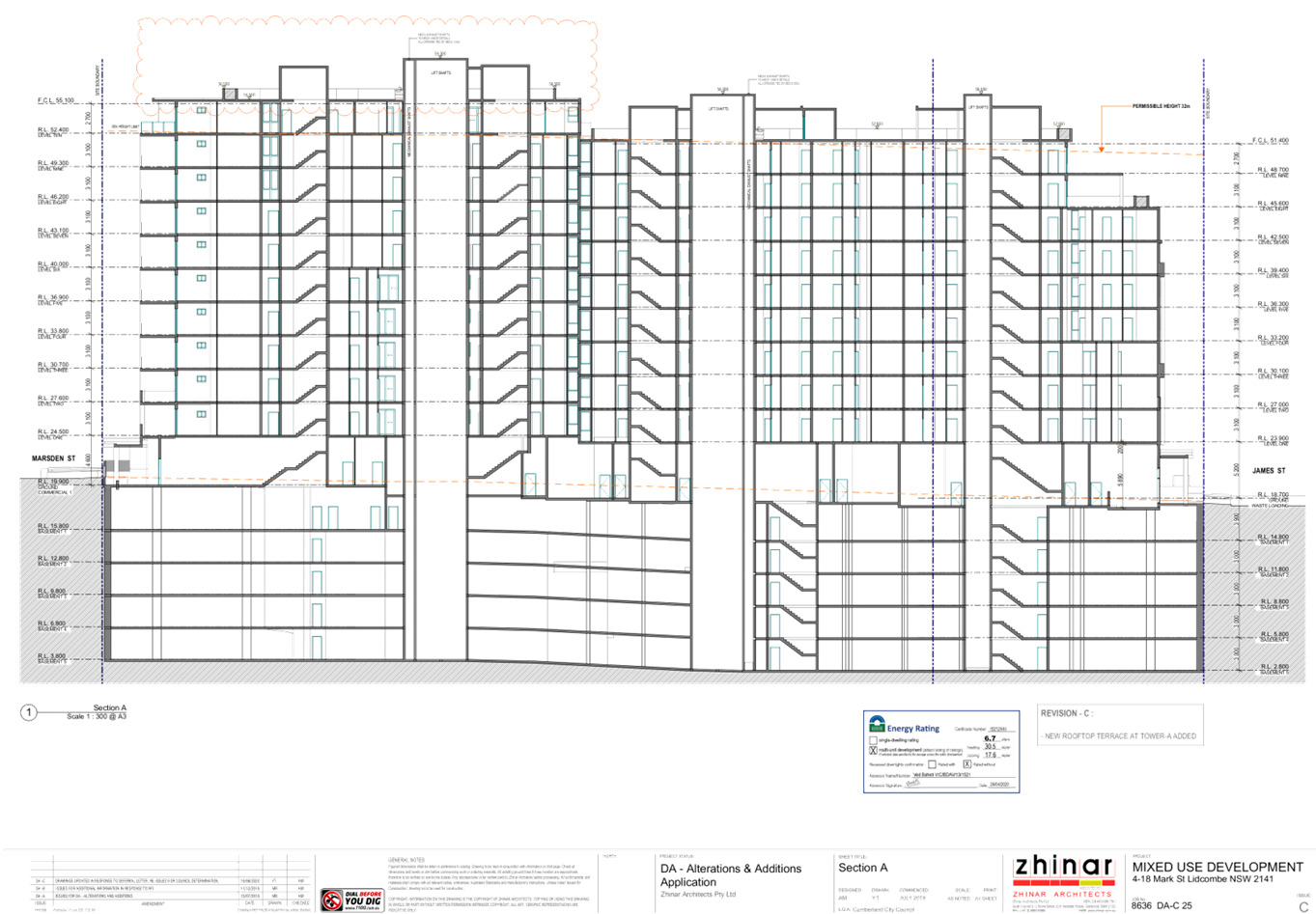
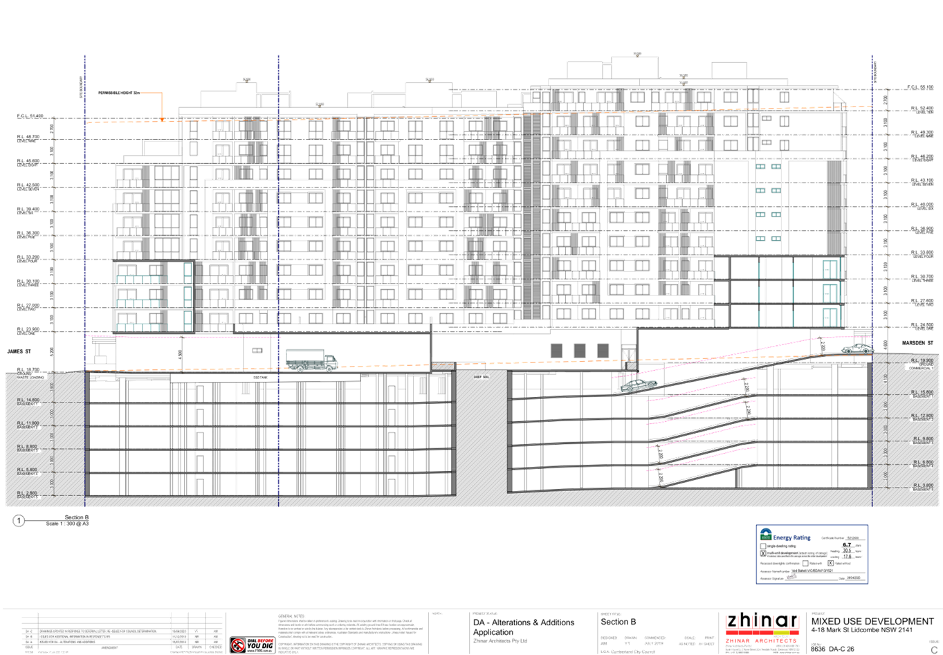
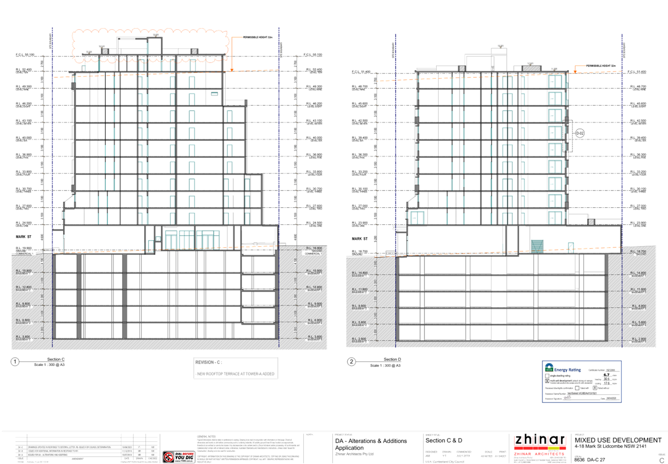
Height of Building
|
32 metres
|
39.71 metres
|
7.71 metres / 24%
|
The variation is discussed in
further detail later in this report.
Permissibility:-
The proposed development is
defined as a “shop top housing” development and is permissible in
the B4 Mixed Use zone with consent.
“shop top housing means
one or more dwellings located above ground floor retail premises or business
premises.”
The relevant matters to be
considered under ALEP and the applicable clauses for the proposed development
are summarised below. A comprehensive LEP assessment is contained in Attachment
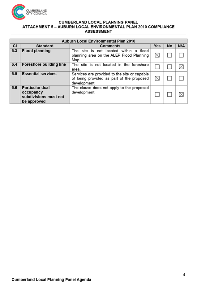
5.
Development
Standards:-
|
Development
Standard
|
Proposal
|
Compliance
|
|
Clause 2.3
Land Use Table
- B4 Mixed Use
|
Shop top housing
|
Yes. Shop top housing is permissible in the
zone with consent. The development includes ground floor retail or business
premises and dwellings above.
|
|
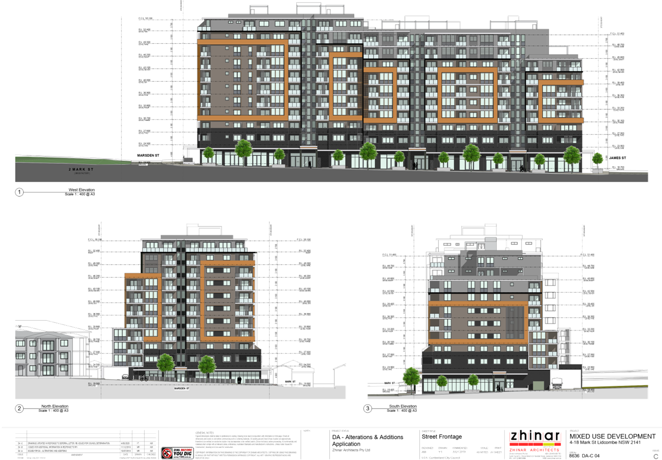
Clause 4.3
Height of Buildings
- 32 metres
|
39.71 metres
|
No. The development exceeds the building height
under the respective building height standards.
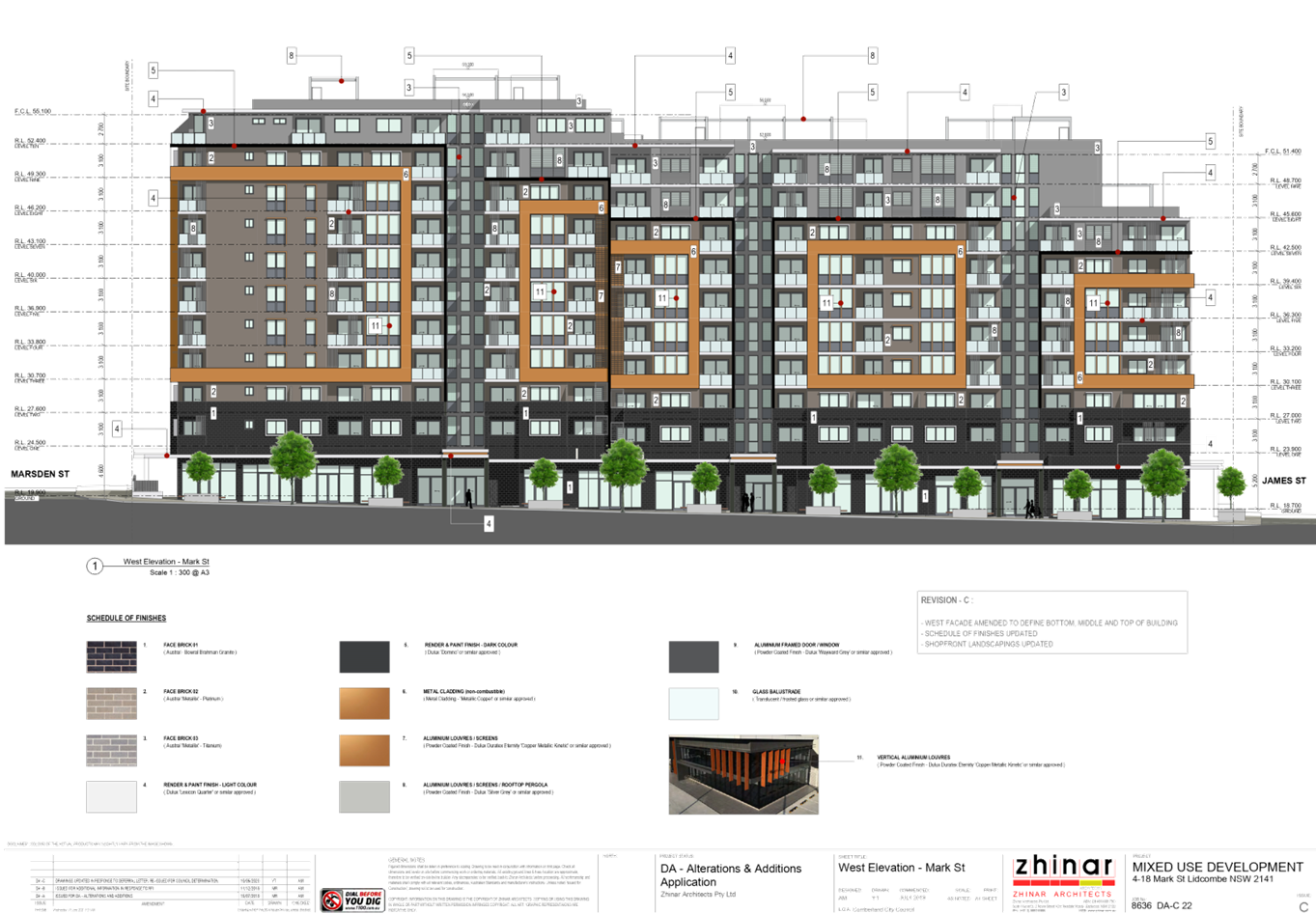
Refer to Drawing No. DA-C 22 to DA-C 27 (inclusive),
Issue DA-C dated 10/06/2020.
|
|
Clause 4.4
Floor Space Ratio
- 5:1
|
4.84:1
|
Yes
|
7.
Table 6 - Auburn LEP 2010 Compliance Table
(iii) Clause 4.6 –
Variation to Building Height
8. Clause 4.6
allows the consent authority to vary development standards in certain
circumstances and provides an appropriate degree of flexibility to achieve
better design outcomes. The consent authority may grant the exception as the
Secretary’s concurrence can be assumed where clause 4.6 is adopted as per
the Department of Planning Circular PS 18-003, dated 21 February 2018.
9.
10. The Applicant has submitted
a written request to vary the Height of Buildings development standards. Based
on various case law established by the Land and Environment Court of NSW such
as Four2five P/L v Ashfield Council [2015] NSWLEC 9, Randwick City Council v
Micaul Holdings P/L [2016] NSW LEC7 and Zhang and anor v Council of the City of
Ryde [2016] NSWLEC 1179, a 3 part assessment framework for a variation request
proposed under clause 4.6 has been considered and an assessment of the proposed
variance, following the 3 part test is discussed in detail below.
11.
The 3 preconditions which must be
satisfied before the application can proceed are as follows:
1. Is
the proposed development consistent with the objectives of the zone?
Applicant’s
justification:
The consistency of the proposal
against the objectives of the B4 Mixed Use zone is outlined below.
· To
provide a mixture of compatible land uses.
12. The
proposed development provides a compatible land use that is consistent with the
future character of the Lidcombe Town Centre. It proposes a mix of residential
units and commercial space designed to contribute to a compatible built form.
13.
· Integrate
suitable business, office, residential, retail and other development in
accessible locations so as to maximise public transport patronage and encourage
walking and cycling.
14. The
proposed development provides high-density mixed-use development in an
accessible location that maximises public transport patronage and encourages
non-vehicular transport.
15.
· To
encourage high density residential development.
16. The
proposal consists of a high-density residential development that is consistent
with the future character of the area.
17.
· To
encourage appropriate businesses that contribute to economic growth.
18. The
proposed development will generate demand and opportunities for businesses to
service the area and contribute to the economic growth of the area. The
commercial tenancies will provide floor space for businesses in the growing
Lidcombe Town Centre.
19.
· To
achieve an accessible, attractive and safe public domain.
20. The
proposed development contributes to creating an accessible, attractive and safe
public domain. The development will provide opportunities for passive
surveillance and create a vibrant street frontage that will contribute to the
vitality of the Town Centre.
Planner’s comment:
It is considered that the proposed
development, even with the non-compliant building height, achieves the
objectives of the land use zone. Primarily, the development promotes high
density development within an accessible location and within the Lidcombe Town
Centre, as outlined by the Applicant, and also provides elements that protrude
beyond the height plane that offer amenity to residents of the development. The
added amenity is in the form of communal rooftop terraces and lift overruns
whilst amenity for residents of development opposite to the south along James
Street will be improved with a reduced built form interface to the south and
displacement of floor space to the north of the site resulting in the height
breach. The proposed communal open spaces would not impact upon the amenity of
surrounding residential properties with regard to overlooking and solar access,
given their position and height relative to adjoining properties.
2. Is
the proposed development consistent with the objectives of the development
standard which is not met?
Applicant’s
justification:
· To
establish a maximum height of buildings to enable appropriate development
density to be achieved.
21. The
proposal consists of a high-density mixed-use development that meets the
desired future character of the area. The height exceedance is due to the
provision of high amenity communal open space areas that allows the development
to provide a high-density development whilst providing appropriate amenity to
residents and the provision of a built form that transitions form the Town Centre
to lower density residential development to the south.
22.
· To
ensure that the height of buildings is compatible with the character of the
locality.
23. The
height of the proposed development is consistent with the changing character
and desired future character of the Lidcombe Town Centre. As detailed above the
proposed development is consistent with a number of recent approvals that are
currently under construction in close proximity to the site. In addition, the
top floor of the proposed development is provided with an increased setback of
6m to reduce the overall bulk of the development when viewed form the street
and ensure it is compatible with the character of the locality.
Planner’s comment:
The development achieves the
objectives of the development standard by proposing a height that is compatible
with and more responsive to adjoining development to the north and south of the
site. To the south, the reduced 8 storey building height would better relate to
the low density 1 to 2 storey built forms along James Street whilst to the
north, the increased 11 storey displaced height relates to and corresponds to
the 10 storey built form approved at 2 Mark Street.
The proposed building height will
ensure that appropriate development density is achieved with the development
satisfying the Floor Space Ratio (FSR) development standard and achieving
significant compliance with the built form controls of the SEPP 65 ADG and the
ADCP.
3. a)
Is compliance with the development standard unreasonable or unnecessary in the
circumstances of the case? And;
Applicant’s
justification:
As detailed in the section above,
the proposal maintains the future higher density built form that is at a scale
comparative to the site’s location within the Lidcombe Town Centre. The
numeric increase in building height for the proposed development is
approximately 7.4m, which is a result of providing communal open space on the
roof to increase the amenity of the development for residents and a
transitional building height that still achieves an appropriate density in line
with the applicable controls. This increase is considered reasonable in the
context of the site and its ability to result in no adverse impacts on
adjoining properties.
The proposed development,
including the proposed building elements that exceed the height limits, will
continue to achieve the objectives of the standard. It is therefore considered
that the objectives of the development standard are met notwithstanding the
breach of the height of buildings standard and compliance is unnecessary in the
circumstances of the case.
Planner’s comment:
As detailed in applicant’s
submission, the proposal is primarily a result of providing communal open space
on the rooftop level to increase the amenity of the development for residents
and a transitional building height to the south that with the development being
consistent with the high density built form expected for the Lidcombe Town
Centre.
The proposed development will
continue to achieve the objectives of the land use zone and the development
standard and will result in no significant impacts on adjoining properties.
As discussed later within this
report, Council has exhibited Draft Cumberland Local Environmental Plan 2020
(Draft CLEP), which proposes to increase the height of buildings development
standard applying to the site from 32 metres to 38 metres. The development
would remain non-compliant with the height of buildings development standard in
the Draft CLEP, however, this would be limited to the lift overruns of the
development as opposed to any habitable floor space. Given that the lift
overruns provide access to the rooftop communal open spaces and does not
propose any habitable floor space above the 38 metre height, the Draft CLEP
further justifies the variation sought by the Applicant.
Given the above, strict compliance
with the development standard is considered unnecessary and unreasonable in the
circumstances of the case.
b) Are
there sufficient environmental planning grounds to justify contravening the
development standard and therefore is the applicant’s written
justification well founded?
Applicant’s
justification:
It is our opinion that there are
sufficient environmental planning grounds to justify contravening the building
height standard in this instance. These are as follows:
· The
proposed development is consistent with the objectives of the zone and the
objectives of the building height control.
· The
proposal does not result in any adverse impacts on adjoining properties.
· The
height variation equates to a maximum 7.4m for a minor portion of the
development and does not result in undesirable visual bulk of the building.
· It
reflects the scale of other approvals in the area.
It is considered the objectives of
the ALEP Height of Buildings development standard are achieved in this instance
where the proposal produces a high quality built form that ensures a high level
of amenity for residents. In addition, the proposed materials and finishes and
landscaping strategy further reinforces how the development harmonizes with
surrounding area.
Whilst the built form exceeds the
building height control applicable to the site, it is considered the proposed
design does not unreasonably detract from the amenity of adjacent residents or
the existing quality of the environment as demonstrated in the Amended
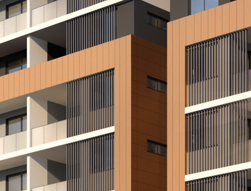
Architectural Plans prepared by Zhinar Architects.
Strict compliance with the
building height development standard would require the deletion of the communal
open space on the roof which would significantly reduce the site’s
potential to facilitate higher density residential development whilst ensuring
an appropriate level of amenity.
Planner’s comment:
Having regard to the
Applicant’s justification, and given that the application achieves the
objectives of the land use zone and development standard, there are sufficient
environmental planning grounds to justify contravening the Height of Buildings
development standard, and therefore the Applicant’s written justification
is deemed to be well founded and worthy of support.
Conclusion:
Council is satisfied that the
Applicant’s written request has adequately addressed the matters required
to be demonstrated by Clause 4.6, Subclause (3). Council is further satisfied
that the proposed development will be in the public interest, as it is
consistent with the objectives of the Height of Buildings development standard
and the objectives for development within the zone in which the development is
proposed to be carried out.
It is the view of Council Officers
that justification provided is satisfactory and having considered the
application on its merit, the exception to the Height of Buildings development
standard is considered acceptable in this instance.
The provisions of any proposed
instrument that is or has been the subject (EP&A Act s4.15 (1)(a)(ii))
(a) Draft
State Environmental Planning Policy (Environment)
The Draft State Environmental
Planning Policy (Environment) (Draft ESEPP) relates to the protection and
management of our natural environment with the aim of simplifying the planning
rules for a number of water catchments, waterways, urban bushland, and
Willandra Lakes World Heritage Property. The changes proposed include
consolidating the following seven existing SEPPs:
· State
Environmental Planning Policy No. 19 – Bushland in Urban Areas.
· State
Environmental Planning Policy (Sydney Drinking Water Catchment) 2011.
· State
Environmental Planning Policy No. 50 – Canal Estate Development.
· Greater
Metropolitan Regional Environmental Plan No. 2 – Georges River Catchment.
· Sydney
Regional Environmental Plan No. 20 – Hawkesbury-Nepean River (No.2-1997).
· Sydney
Regional Environmental Plan (Sydney Harbour Catchment) 2005.
· Willandra
Lakes Regional Environmental Plan No. 1 – World Heritage Property.
The draft policy will repeal the
above existing SEPPs and certain provisions will be transferred directly to the
new SEPP, amended and transferred, or repealed due to overlaps with other areas
of the NSW planning system.
Changes are also proposed to the
Standard Instrument – Principal Local Environmental Plan. Some provisions
of the existing policies will be transferred to new Section 117 Local Planning
Directions where appropriate.
As discussed under the existing
SEPP’s earlier within this Report, the development is considered acceptable
having regard to those SEPP’s.
(b) (Draft
State Environmental Planning Policy (Remediation of Land)
The Draft State Environmental
Planning Policy (Remediation of Land) (Draft RSEPP), relates to the remediation
of land and seeks to repeal and replace the current SEPP 55. Generally, the
Draft RSEPP maintains similar provisions to the current SEPP 55 and will
contain provisions to the following effect:
· Making
remediation work permissible, despite anything to the contrary in another
environmental planning instrument.
· Specifying
when development consent is, and is not required, for remediation work.
· Specifying
considerations that are relevant in determining development applications.
· Requiring
remediation work meet certain standards and notification requirements.
24. As
discussed under the existing SEPP 55 earlier within this report, the
development is considered acceptable having regard to the provisions of SEPP 55
and the site has been identified as being suitable for the proposed development
without the need for any remediation that would require separate Development
Consent.
(c) Draft
Cumberland Local Environmental Plan 2020
The Draft Cumberland Local
Environmental Plan 2020 (Draft CLEP) has been prepared by Cumberland City
Council to provide a single planning framework for the future planning of
Cumberland City. The changes proposed seek to harmonise and repeal the three
existing LEPs applicable to the Cumberland City local government area, those
being:
· Holroyd
Local Environmental Plan 2013;
· Parramatta
Local Environmental Plan 2011; and
· Auburn
Local Environmental Plan 2010.
In addition, the Draft CLEP
proposes revised planning controls for the Lidcombe Town Centre by implementing
the Lidcombe Town Centre Planning Controls Strategy and proposes changes to the
development standards applying to the site as summarised below:
|
Development
Standard
|
Proposal
|
Compliance
|
|
Clause 2.3
Land Use Table
- B4 Mixed Use
|
Shop top housing
|
Yes. Shop top housing is permissible in the
zone with consent. The development includes ground floor retail or business
premises and dwellings above.
|
|
Clause 4.3
Height of Buildings
- 38 metres (increase from 32
metres)
|
39.71 metres
|
No. The development exceeds the building height
under the respective building height standard by 1.71 metres / 4.5%.
|
|
Clause 4.4
Floor Space Ratio
- 5:1
|
4.84:1
|
Yes
|
Table
7 - Draft Cumberland LEP 2020 Compliance Table
As detailed above, the amended
proposal would remain non-compliant with the Height of Buildings development
standard in the Draft CLEP. However, this would be limited to the lift overruns
of the development as opposed to any habitable floor space, and given that the
lift overruns provide access to the rooftop communal open spaces, would further
justify the variation sought by the Applicant.
The Draft CLEP has been publicly
exhibited and is considered to be certain and imminent in relation to the
proposed changes to the development standards applicable to the site. It is
therefore considered appropriate to give suitable weight to the Draft CLEP
development standards for the subject application as discussed earlier.
Overall, the development is
considered acceptable having regard to the provisions of the Draft CLEP.
The provisions of any
Development Control Plans (EP&A Act s4.15 (1)(a)(iii))
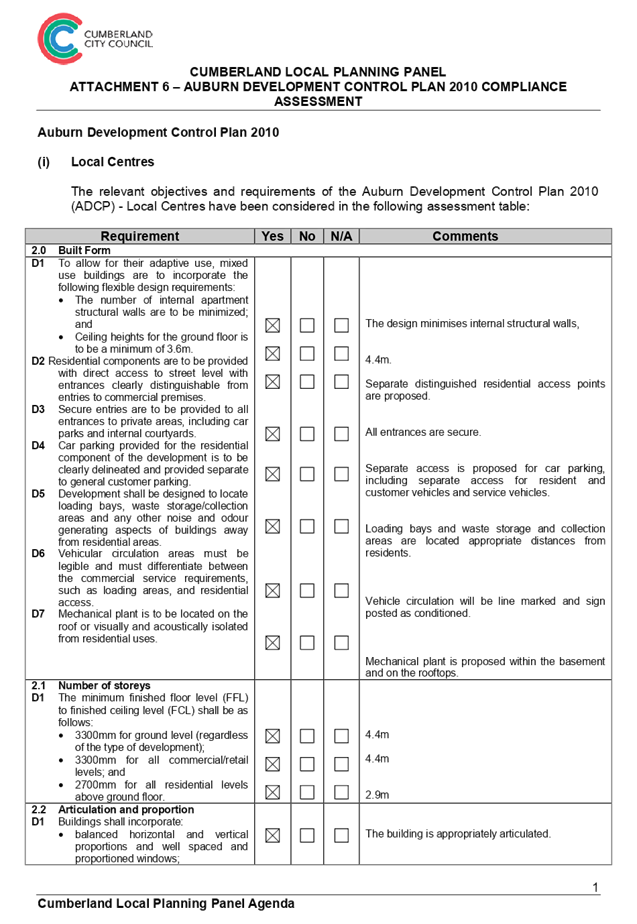
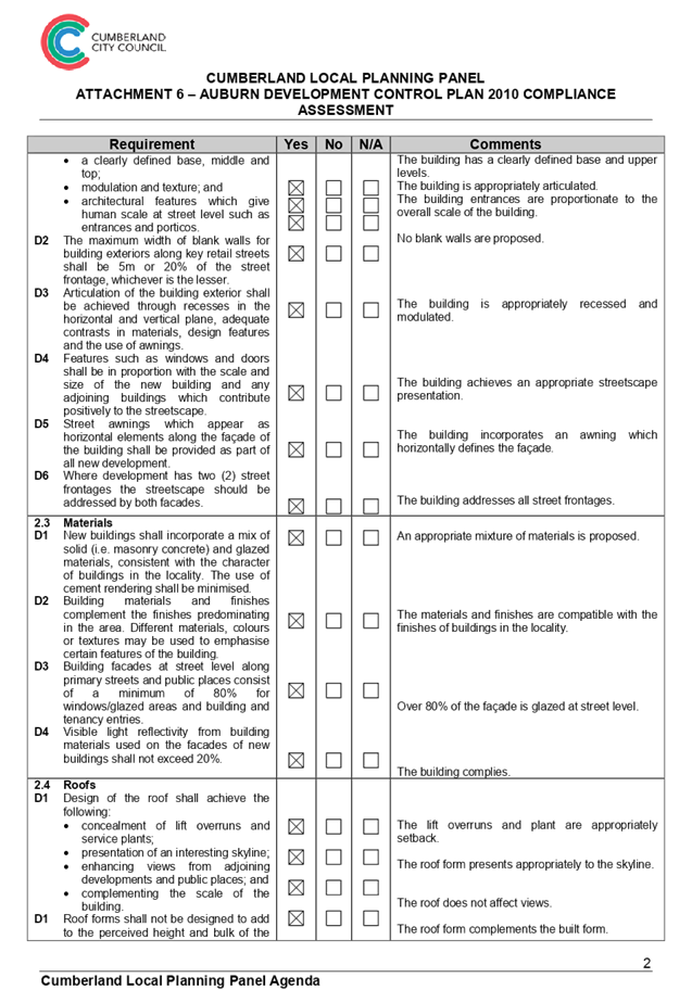
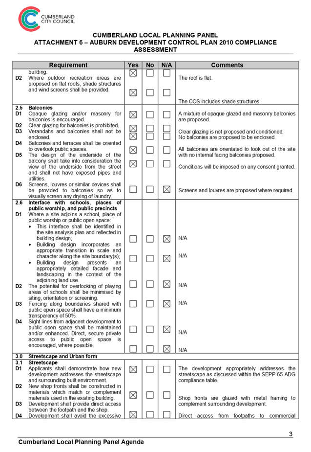
(a) Auburn
Development Control Plan 2010 (ADCP)
The Auburn Development Control
Plan 2010 (ADCP) provides guidance for the design and operation of development
to achieve the aims and objectives of the ADCP.
A comprehensive assessment and
compliance table is contained in Attachment 6, providing a detailed assessment
of the proposal against the provisions of the ADCP. It is considered that the
proposal is generally compliant with the ADCP, with the exception of the
following matters:
i. Local
Centres
|
Requirement
|
Y
|
N
|
N/A
|
Comments
|
|
4.0 Mixed
Use Developments
|
|
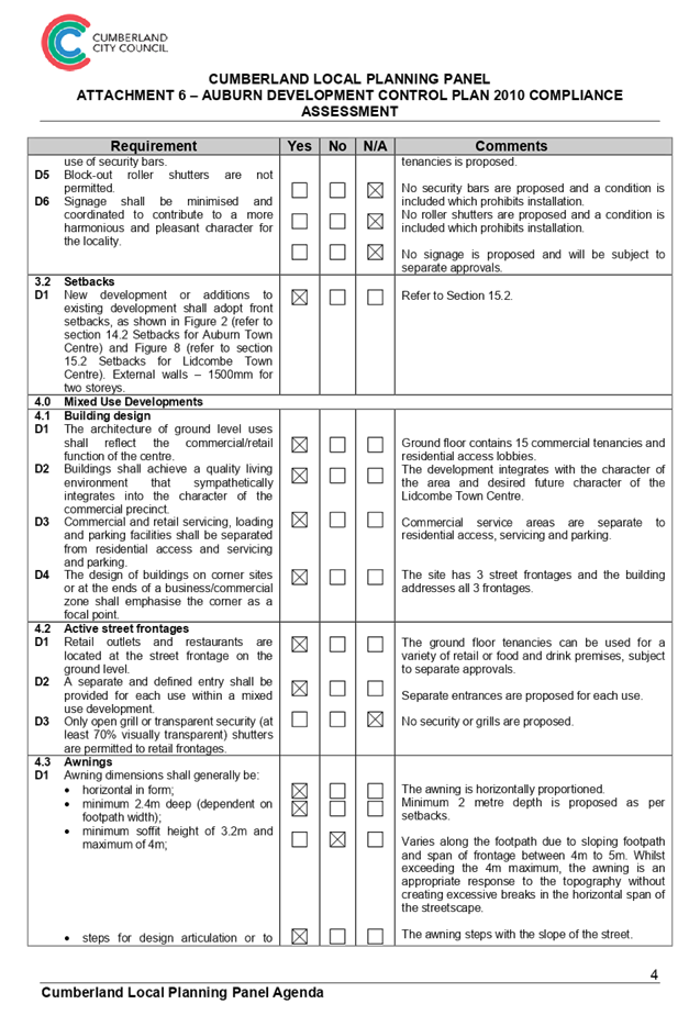
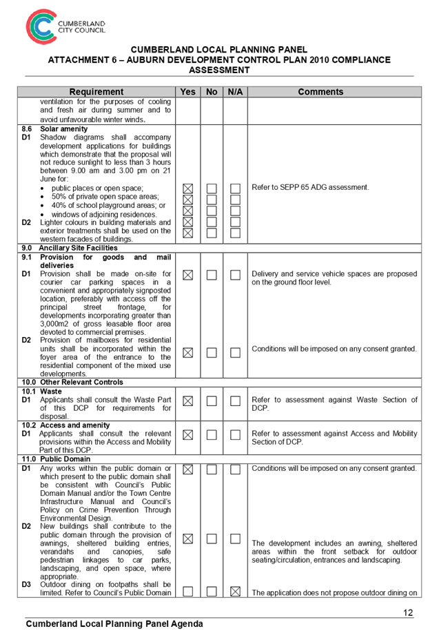
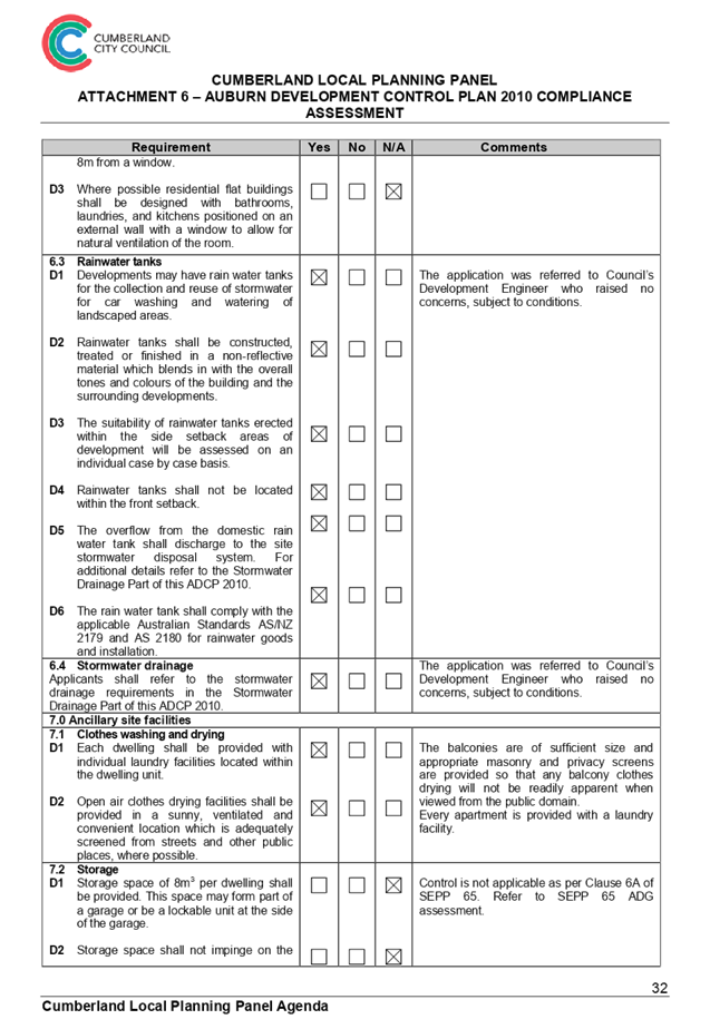
4.3 Awnings
D1 Awning
dimensions shall generally be:
· minimum soffit height of 3.2m and maximum of 4m;
|
|
|
|
Varies along the footpath due to sloping footpath and span
of frontage between 4m to 5m. Whilst exceeding the 4m maximum, the awning is
an appropriate response to the topography without creating excessive breaks
in the horizontal span of the streetscape.
|
|
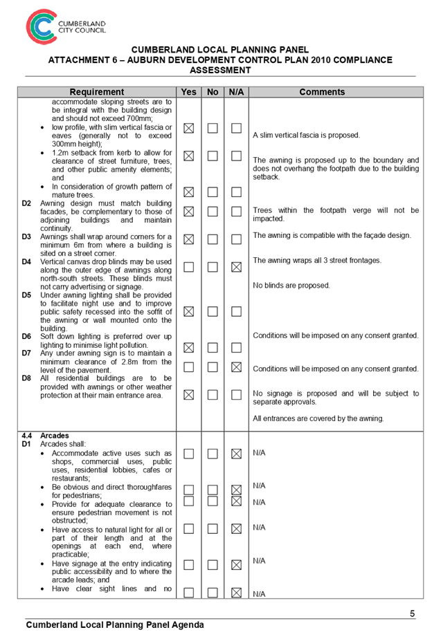
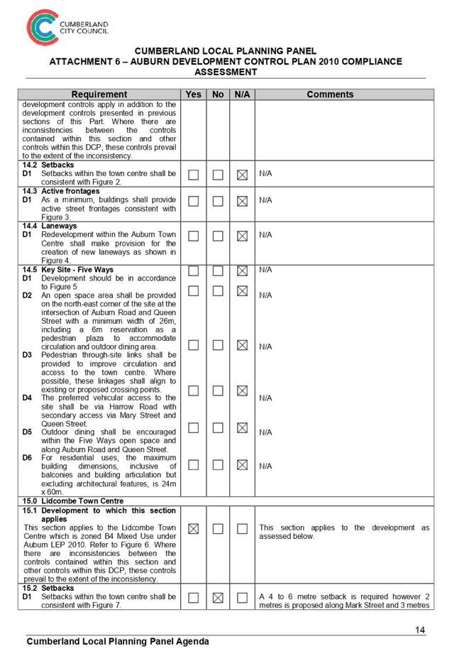
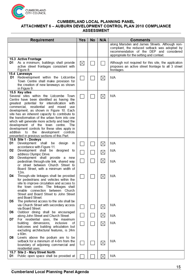
15.0 Lidcombe
Town Centre
|
|
15.2 Setbacks
D1 Setbacks
within the town centre shall be consistent with Figure 7.
|
|
|
|
A 4 to 6 metre setback is required however 2 metres is
proposed along Mark Street and 3 metres along Marsden and James Streets.
Although non-compliant, the reduced setback was adopted by recommendation of
the DEP and considered appropriate for the setting and context.
|
Table
8 - Auburn DCP 2010 - Local Centres Non-Compliances
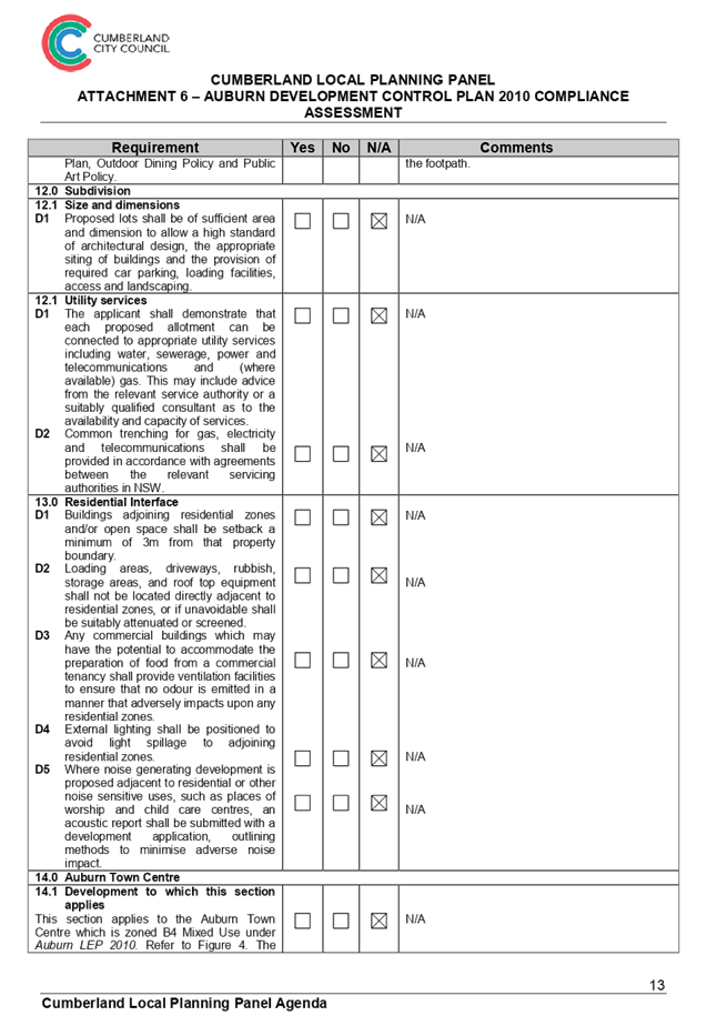
ii. Residential
Flat Buildings
|
Requirement
|
Y
|
N
|
N/A
|
Comments
|
|
2.0
Built Form
|
|
2.2 Site coverage
D1 The
built upon area shall not exceed 50% of the total site area.
|
|
|
|
The built upon area exceeds 50% of
the total site area, designed to be (65%). It is not feasible to achieve
compliance with the stated provision due to the zoning, location of the site
within the Lidcombe Town Centre, and the applicable planning controls that
allows a high floor space ratio. It is considered appropriate to permit a
variation to the stated provision in this instance.
|
|
2.3 Building envelope
D3 The tower component of any building above the podium or
street wall height is to have a maximum floor plate of 850m2.
|
|
|
|
The upper levels include floorplate areas of between
1,647m2 to 2,160.1m2 exceeding the control, however,
the development proposes a site specific building envelope which is
considered acceptable given the location within the Lidcombe centre.
|
|
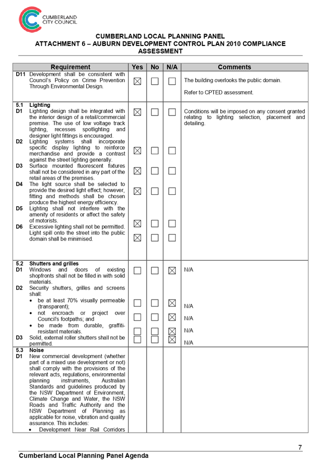
2.7 Head Height of Windows
D2 For
storeys with a floor to ceiling height of 2.7m, the minimum head height of
windows shall be 2.4m.
|
|
|
|
The head height of some windows within the development are
less than 2.4m, designed to be 2.3m, however the proposal achieves the
performance criteria by allowing for light
penetration into
rooms and well-proportioned elevations.
|
|
3.0 Open Space and Landscaping
|
|
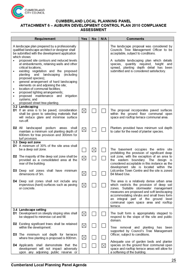
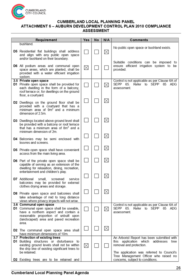
3.1 Deep soil zone
D1 A
minimum of 30% of the site area shall be a deep soil zone.
|
|
|
|
The basement occupies the entire
site prohibiting the provision of significant deep soil zone, with the
exception of an area to the eastern boundary. The proposal maintains a deep
soil zone of 2.4%.The design is considered acceptable in this instance as the
development site is located within the Lidcombe Town Centre and the site is
zoned B4 Mixed Use.
The area is a relatively dense
urban area which restricts the provision of deep soil zones. Suitable
stormwater management measures are proposed and soft landscaping
accommodating shrubs and small trees form an integral part of the ground
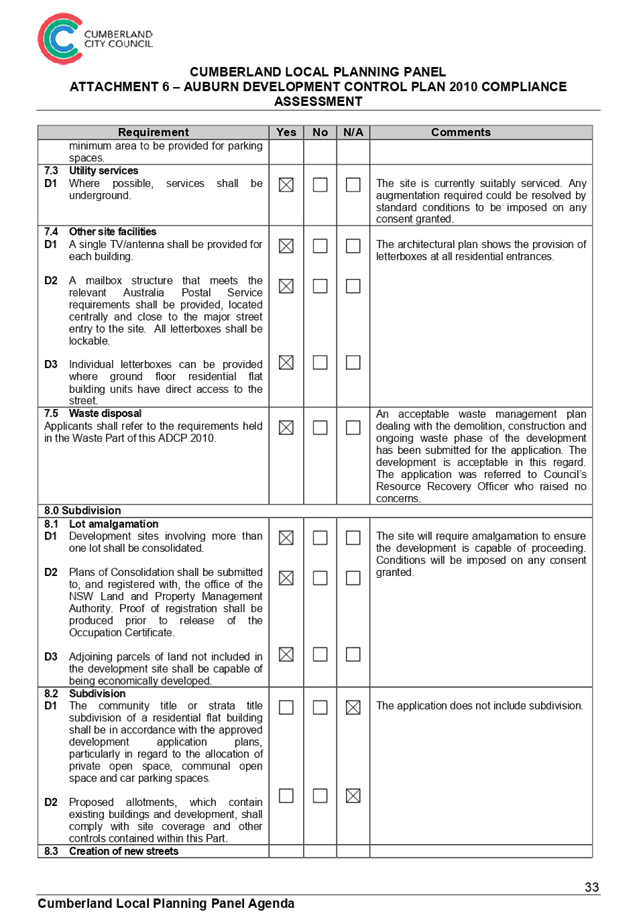
level communal open space area and rooftop terrace.
|
Table
9 - Auburn DCP 2010 - Residential Flat Buildings Non-Compliances
The provisions of any planning
agreement that has been entered into under section 7.4, or any draft planning
agreement that a developer has offered to enter into under section 7.4
(EP&A Act s4.15(1)(a)(iiia))
There is no draft planning
agreement associated with the subject Development Application.
The provisions of the
Regulations (EP&A Act s4.15 (1)(a)(iv))
The proposed development raises no
concerns as to the relevant matters arising from the Environmental Planning and
Assessment Regulations 2000 (EP&A Reg).
The Likely Environmental,
Social or Economic Impacts (EP&A Act s4.15 (1)(b))
It is considered that the proposed
development will have no significant adverse environmental, social or economic
impacts in the locality.
The suitability of the site for
the development (EP&A Act s4.15 (1)(c))
The subject site and locality is
not known to be affected by any natural hazards or other site constraints
likely to have a significant adverse impact on the proposed development.
Accordingly, it is considered that the development is suitable in the context
of the site and surrounding locality.
Submissions made in accordance
with the Act or Regulation (EP&A Act s4.15 (1)(d))
|
i.
Advertised (newspaper)
|
ii.
Mail
|
iii.
Sign
|
iv.
Not Required
|
In accordance with Council’s Notification requirements
contained within the ADCP, the original development proposal was publicly
notified for a period of 14 days between 13 August 2019 and 27 August 2019. No
submissions were received in respect of the proposed development. The amended
application was publicly notified for a period of 14 days between 20 May 2020
and 3 June 2020. One (1) submission was received in respect of the amended
proposal which is discussed below.
|
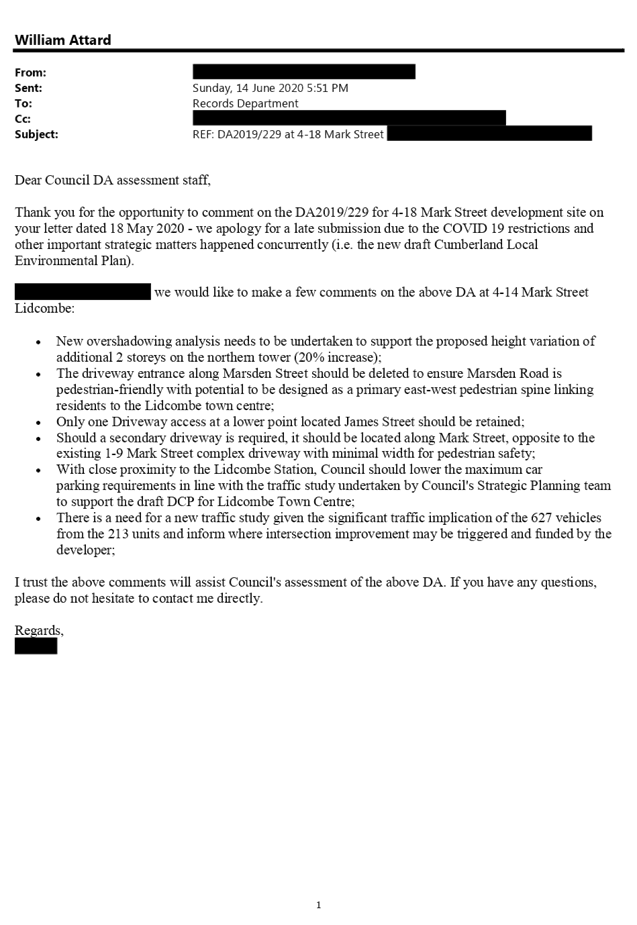
Concern
|
Comment
|
|
New overshadowing analysis needs to be undertaken to
support the proposed height variation of additional 2 storeys on the northern
tower (20% increase).
|
As detailed within this report and attachments, the
proposed development appears to not cause any significant overshadowing of
the adjoining properties which appear to continue to receive solar access for
at least 2 hours 9:00am to 3:00pm on 21 June as detailed on the shadow
diagrams accompanying the DA.
|
|
The driveway entrance along Marsden Street should be
deleted to ensure Marsden Road is pedestrian-friendly with potential to be
designed as a primary east-west pedestrian spine linking residents to the
Lidcombe town centre.
|
It is noted that the original approved development
included vehicular access from Marsden Street and the location of the
vehicular access remains unchanged. The site has 3 street frontages and
separates vehicular access for residents and staff (Marsden Street) from
vehicular access for delivery and service vehicles (James Street). No
vehicular access is proposed on Mark Street to preserve the streetscape and
appearance of the development. Accordingly, it is considered inappropriate to
relocate delivery and service vehicle access to Marsden Street or to combine
all vehicular access to James Street.
Having regard to the characteristics of the streets
surrounding the site, the vehicular access points are considered appropriate
and ideal as proposed. Furthermore, the application was referred to
Council’s Development Engineer and RMS, neither of whom raised
objections to the vehicular access points.
|
|
Only one Driveway access at a lower point located James
Street should be retained.
|
As discussed above, the vehicular access points are
considered appropriate and ideal as proposed.
|
|
Should a secondary driveway is required, it should be
located along Mark Street, opposite to the existing 1-9 Mark Street complex
driveway with minimal width for pedestrian safety.
|
As discussed above, no driveway access is proposed on Mark
Street to preserve the streetscape and appearance of the development which is
considered to be severely compromised if vehicular access was to be proposed
from the Mark Street frontage of the site.
|
|
With close proximity to the Lidcombe Station, Council
should lower the maximum car parking requirements in line with the traffic
study undertaken by Council's Strategic Planning team to support the draft
DCP for Lidcombe Town Centre.
|
As detailed within the attachments, the application
proposes an appropriate number of car parking spaces within the minimum and
maximum ranges permitted under the ADCP.
|
|
There is a need for a new traffic study given the
significant traffic implication of the 627 vehicles
from the 213 units and inform where intersection
improvement may be triggered and funded by the developer.
|
The application was accompanied by a Traffic and Parking
Assessment Report that was considered by Council’s Development Engineer
and RMS, neither of whom raised objections to the proposed development.
|
The public interest (EP&A Act s4.15(1)(e))
In view of the foregoing analysis it is considered that the
development as proposed would not be consistent with the public interest.
Section 7.11 and Section 7.12 Contribution towards
Provision or Improvement of Amenities or Services
The development requires the payment of contributions in
accordance with the Auburn Development Contributions Plan 2007. In accordance with
the currently indexed rate, the required contribution is $1,294,176.93. The
draft notice of determination at Attachment 3 includes a recommendation to
reflect the above contributions.
Note: The contributions listed within Development Consent
2017/363 have not been paid to date.
Disclosure of Political Donations and Gifts
The NSW Government has introduced disclosure requirements
for individuals or entities with a relevant financial interest as part of the
lodgement of various types of development proposals and requests to initiate
environmental planning instruments or development control plans.
The applicant and notification process did not result in any
disclosure of Political Donations and Gifts.
Having regard to the relevant
matters of consideration under Section 4.15 of the Environmental Planning and
Assessment Act 1979, and is considered to be satisfactory. Any likely impacts
of the development have been satisfactorily addressed and the proposal is
considered to be in the public interest.
The proposed development is
appropriate located within the B4 Mixed Use zone under the provisions of the
ALEP, and is consistent with the zone. The development however proposes a
variation to the Height of Buildings development standard under the ALEP, and
awnings, site coverage, building envelope, head height of buildings, and deep
soil zone requirements under the ADCP. The development is considered to be
acceptable in terms of the relationship to its surrounding built environment,
particularly having regard to the impacts on adjoining properties.
|
1. That
the Clause 4.6 variation request to vary the Height of Buildings development
standard pursuant to the ALEP be supported.
25.
2. That
development application DA2019/229 seeking alterations and additions to an
approved 10 storey mixed use building at 4-14 Mark Street, Lidcombe
(DA2017/363); and demolition of existing structures at 16-18 Mark Street,
Lidcombe, and construction of an additional 8 to 11 storey mixed use building
component, accommodating a combined total of 15 commercial suites and 213
residential units over 5 levels of basement parking for 627, be Approved,
subject to the conditions contained in the draft notice of determination
contained in Attachment 3 of this report.
|
1. Attachment
1 - Architectural Plans
2. Attachment
2 - Clause 4.6 Variation Request
3. Attachment
3 - Draft Notice of Determination
4. Attachment
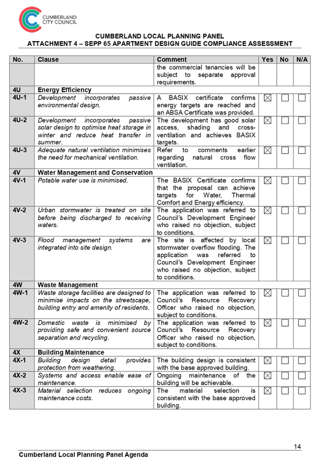
4 - SEPP 65 Apartment Design Guide Compliance Assessment
5. Attachment
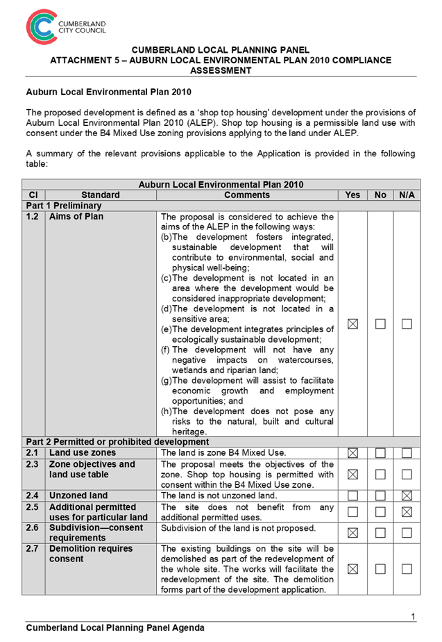
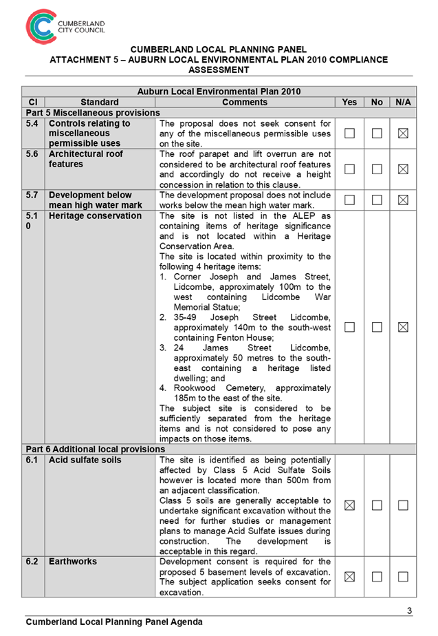
5 - Auburn Local Environmental Plan 2010 Compliance Assessment
6. Attachment
6 - Auburn Development Control Plan 2010 Compliance Assessment
7. Attachment
7 - Submission x1
8. Design
Evolution
DOCUMENTS
ASSOCIATED WITH
REPORT LPP033/20
Attachment 1
Attachment 1 - Architectural Plans
Cumberland Local Planning Panel Meeting
8 July 2020


DOCUMENTS
ASSOCIATED WITH
REPORT LPP033/20
Attachment 2
Attachment 2 - Clause 4.6 Variation Request
Cumberland Local Planning Panel Meeting
8 July 2020


DOCUMENTS
ASSOCIATED WITH
REPORT LPP033/20
Attachment 3
Attachment 3 - Draft Notice of Determination
Cumberland Local Planning Panel Meeting
8 July 2020
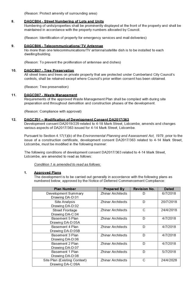
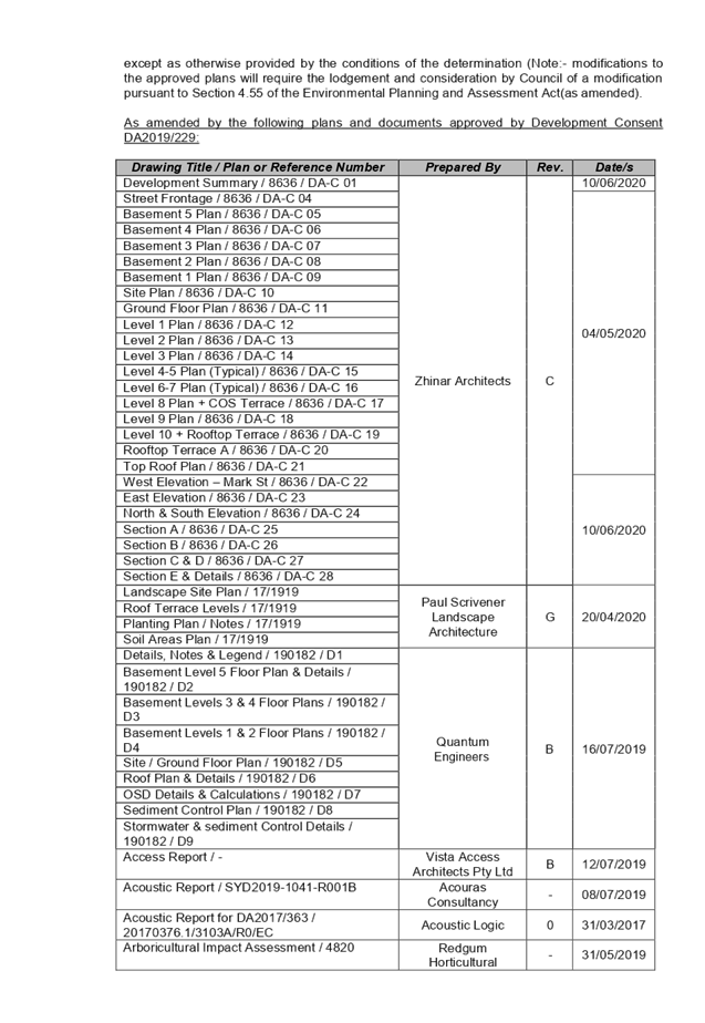

DOCUMENTS
ASSOCIATED WITH
REPORT LPP033/20
Attachment 4
Attachment 4 - SEPP 65 Apartment Design Guide
Compliance Assessment
Cumberland Local Planning Panel Meeting
8 July 2020
DOCUMENTS
ASSOCIATED WITH
REPORT LPP033/20
Attachment 5
Attachment 5 - Auburn Local Environmental Plan 2010
Compliance Assessment
Cumberland Local Planning Panel Meeting
8 July 2020
DOCUMENTS
ASSOCIATED WITH
REPORT LPP033/20
Attachment 6
Attachment 6 - Auburn Development Control Plan 2010
Compliance Assessment
Cumberland Local Planning Panel Meeting
8 July 2020
DOCUMENTS
ASSOCIATED WITH
REPORT LPP033/20
Attachment 7
Attachment 7 - Submission x1
Cumberland Local Planning Panel Meeting
8 July 2020
DOCUMENTS
ASSOCIATED WITH
REPORT LPP033/20
Attachment 8
Design Evolution
Cumberland Local Planning Panel Meeting
8 July 2020
Cumberland
Local Planning Panel Meeting
8 July 2020
Item
No: LPP034/20
Development
Application for 185-187 Great Western Highway, Mays Hill
Responsible
Division: Environment
& Planning
Officer: Executive
Manager Development and Building
File
Number: MOD2020/0040
|
Application Lodged:
|
11
February 2020
|
|
Application Number:
|
MOD2020/0040
|
|
Responsible Officer:
|
William Attard
|
|
Description of Land:
|
185-187
Great Western Highway, MAYS HILL NSW 2145
Lot
2, DP 854705 and Lot 27, DP13239
|
|
Proposed
Development:
|
Section
4.55(2) modification application seeking alterations to an approved mixed use
development
|
|
Site Area:
|
1,243.4m²
|
|
Zoning:
|
B6 Enterprise Corridor
|
|
Permissibility:
|
Permissible – Residential
Flat Buildings and Business Premises
|
|
Applicant:
|
ESR
Constructions Pty Ltd
|
|
Owner:
|
Mr
Tony and Mrs Rola Sahyoun
|
|
Notification /
Advertising:
|
01 April 2020 to 22
April 2020
|
|
Disclosure of
Political Donations / Gifts
|
None disclosed on the
application form
|
|
Submissions:
|
Nil submissions
|
|
Principal
Development Standards:
|
Floor Space Ratio
(FSR)
|
Height of Buildings
(HOB)
|
|
Permissible: 2.2:1
Approved: 2:1
Proposed: No change
|
Permissible: 23m
Approved: 22.87m /
14.66m
Proposed: 24.28m /
15.19m
|
|
Heritage:
|
The subject site is not heritage listed, is not
located within a heritage conservation area, and is not located within the
vicinity of a heritage item.
|
|
Variations:
|
- Exceedance to HOB Standard
|
|
Recommendation:
|
Approval, subject to
conditions
|
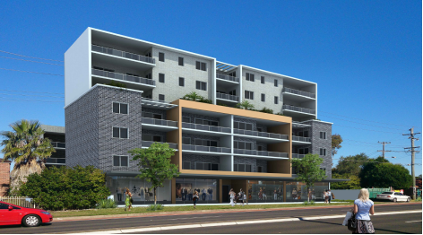
Figure 1 – Perspective
of Development Looking South-West (Source: Design Cubicle, 2020)
Summary:
Council is in receipt of a Section
4.55(2) Modification Application MOD2020/0040 from ESR Constructions Pty Ltd
seeking alterations to an approved mixed use development at 185-187 Great
Western Highway, Mays Hill. The Architectural Plans accompanying the
application are provided as Attachment 1 to this report.
The site is zoned B6 Enterprise
Corridor, pursuant to the Holroyd Local Environmental Plan 2013 (HLEP). A
Residential Flat Building and Business Premises are permissible with
development consent.
The application was publicly
notified for a period of 21 days from 1 April 2020 to 22 April 2020. In
response, nil submissions were received.
The proposal has been assessed
against State Environmental Planning Policy No 19 – Bushland in Urban
Areas, State Environmental Planning Policy No. 55 (Remediation of Land), State
Environmental Planning Policy No. 65 (Design Quality of Residential Apartment
Development), State Environmental Planning Policy (Building Sustainability
Index: BASIX) 2004, State Environmental Planning Policy (Coastal Management)
2018, State Environmental Planning Policy (Infrastructure) 2007, Sydney
Environmental Plan (Sydney Harbour Catchment) 2005, State Environmental
Planning Policy (Vegetation in Non-Rural Areas) 2017, Holroyd Local
Environmental Plan 2013 (HLEP), Draft State Environmental Planning Policy
(Environment), Draft State Environmental Planning Policy (Remediation of Land),
Draft Cumberland Local Environmental Plan 2020, and Holroyd Development Control
Plan 2013 (HDCP).
The modification application was
referred for comments externally to Transport for NSW – Roads and
Maritime Services, to which the application is supported.
The proposed development has been
assessed against the relevant matters for consideration pursuant to Section
4.15 of the Environmental Planning and Assessment Act, 1979, including likely
impacts, the suitability of the site for the development, and the public
interest, and the proposed development is considered appropriate.
The variations sought via the
subject modification application are as follows:
|
Control
|
Required /
Permitted
|
Building
|
Approved
|
Proposed
|
% Variation
|
|
Height of Buildings
(HOB)
|
23m
|
Tower A
|
22.87m
|
24.28m
|
5.6%
|
The application is being reported
to the Cumberland Local Planning Panel (CLPP) for determination, as pursuant to
the Local Planning Panels Direction – Development Applications issued by
the Minister for Planning on 23 February 2018, the application constitutes
‘sensitive development’ as it is development to which State
Environmental Planning Policy No. 65 – Design Quality of Residential
Apartment Development applies.
In light of the above, it is
recommended that the Cumberland Local Planning Panel (CLPP) Approve the Section
4.55(2) Application, subject to the draft notice of determination contained in
Attachment 2 to this report.
Subject Site and Surrounding
Area
The subject site is known as 185-187 Great Western Highway,
Mays Hill, and is legally described as Lot 2, DP 854705 and Lot 27, DP13239.
The site is a midblock site, with a slight irregularity along its northern
boundary. The site has a frontage of 30.785 metres to Great Western Highway, a
frontage of 30.715 metres to Peggy Lane, an eastern boundary length of 39.6
metres, and western boundary length of 41.715 metres. The total site area is
1,243.4m², and is illustrated in Figure 2 below:
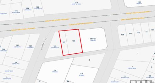
Figure 2 - Location
Map (Source: Cumberland City Council, 2020)
The subject site is currently vacant, with no vegetation on
the subject site.
The surrounding locality is characterised as follows:
· North
- Great Western Highway, with six storey residential flat buildings beyond.
· East
- Seven storey mixed use development.
i)
· South
- Peggy Lane, with a two storey dwelling with detached single storey
secondary dwelling, and four storey residential flat building beyond
ii)
· West
- Single storey dwelling, with approval for a part four, part seven storey
mixed use development.
The topography of the site is maintained to a 3.3% gradient,
with a 1.39 metre fall to the north-eastern corner of the site. The site is
zoned B6 Enterprise Corridor, pursuant to the Holroyd Local Environmental Plan
2013 (HLEP), as shown in Figure 3 below:
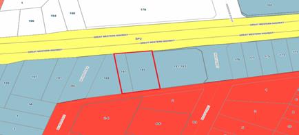
Figure
3 – Zoning Map (Source: Cumberland City Council, 2020)
The subject site is situated to
the south of Great Western Highway. Figure 4 below illustrates an aerial
perspective of the site and the general surroundings.
Note: The aerial imagery has not
been updated to this point in time, to reflect the recent demolition of the
existing structures on-site.
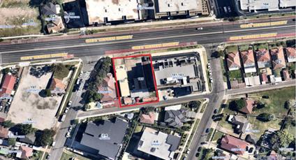
Figure
4 – Aerial Photo (Source: Cumberland City Council, 2020)
The subject site is not heritage
listed, is not located within a heritage conservation area, and is not located
within the vicinity of a heritage item.
Description of the Proposed
Development
The proposal seeks to modify
Development Consent DA2015/155 via a Section 4.55(2) Application, and includes
alterations to an approved mixed use development.
In detail, the following
description has been provided by the Applicant within the Cover Letter prepared
by Design Cubicle, dated 29 May 2020:
Details of Modifications
sought:
- The
floor levels and roof level have been raised to comply with the ADG.
- The
introduction of a lift overrun to Tower A to comply with lift manufacturer
specifications.
- The
commercial level awning has been revised to be a cantilevered concrete awning.
Following from the above, a
numerical overview of the key components of the development is provided below:
Numerical Overview of Key
Components
|
Component
|
Required /
Permissible
|
Proposed
|
Complies
|
|
Site Area
|
N/A
|
1,243.4m² (No
change)
|
N/A
|
|
Site Frontage
|
26m
|
30.785m (No change)
|
N/A
|
|
Floor Space
Ratio
(FSR)
|
2.2:1
|
2:1 (No change)
|
N/A
|
|
Height of
Buildings
(HOB)
|
Tower A
|
23m
|
24.28m
|
No, but
Acceptable on Merit
|
|
Tower B
|
15.19m
|
Yes
|
|
Boundary
Setbacks
|
North
|
3m
|
3m (No change)
|
N/A
|
|
South
|
3m
|
3m (No change)
|
|
East
|
0m
|
0m (No change)
|
|
West
|
0m
|
0m (No change)
|
|
Building
Separation
|
North
|
12m - 24m
|
>24m (No change)
|
N/A
|
|
South
|
6m
|
9.095m (No change)
|
|
East
|
0m
|
0m (No change)
|
|
West
|
0m
|
0m (No change)
|
|
Between Towers A &
B
|
12m
|
12m (No change)
|
|
Apartment
Numbers
|
Tower A
|
21 units (No
change)
|
N/A
|
|
Tower B
|
11 units (No
change)
|
|
Total
|
32 units (No
change)
|
|
Apartment Mix
|
1 bedroom
|
4 units (12.5%)
(No change)
|
N/A
|
|
2 bedroom
|
28 units (87.5%)
(No change)
|
|
3 bedroom
|
0 units (0%)
(No change)
|
|
Commercial Mix
|
Commercial 1
|
95m² (No
change)
|
N/A
|
|
Commercial 2
|
75m² (No
change)
|
|
Car Parking
|
Residential
|
38 spaces
|
39 spaces (No
change)
|
N/A
|
|
Commercial
|
9 spaces
|
9 spaces (No
change)
|
|
Bicycle Parking
|
Residential
|
20 spaces
|
21 spaces (No
change)
|
N/A
|
|
Commercial
|
1 space
|
|
Communal Open
Space (COS)
|
310.85m²
|
500m² (No
change)
|
N/A
|
|
Deep Soil Zone
|
87.04m²
|
0m² (No
change)
|
N/A
|
|
Solar Access
(2hr)
|
23 units
|
21 units (No
change)
|
N/A
|
|
Natural
Ventilation
|
19 units
|
19 units (No
change)
|
N/A
|
SITE HISTORY
- XT2015/155/1
Section 4.54
Extension of Lapsing Period of 1 Year – Approved by Cumberland City
Council on 13 March 2019, changing the date of expiry of Development Consent
DA2015/155 to 6 May 2020.
The development was physically
commenced between 10 February 2020 and 18 March 2020, via demolition works
undertaken on-site in accordance with Development Consent DA2015/155.
- DA2015/155
Development
Application for demolition of existing structures, consolidation of 2 lots into
1 lot, construction of a part 4, part 7 storey mixed use development comprising
32 residential units over 2 levels of basement parking accommodating 48 car
parking spaces – Approved by Holroyd City Council on 6 May 2016 for period
of 3 years, with the date of expiry being 6 May 2019.
- DA2014/277
Development
Application for demolition of existing structures, consolidation of 2 lots into
1 lot, construction of a 7 storey mixed use development comprising 32
residential units and 2 commercial units over 2 levels of basement parking
accommodating 48 car parking spaces – Withdrawn by the Applicant on 24
October 2014.
Applicant’s Supporting
Statement
The applicant has provided a Cover
Letter prepared by Design Cubicle, dated 31 January 2020, and was received by
Council on 11 February 2020 in support of the application.
Additional correspondence was
received by Design Cubicle, dated 29 May 2020 and 10 June 2020, in response to
Council’s request for amended plans and additional information.
Contact with Relevant
Parties
The assessing officer has been in
regular contact with the Applicant throughout the assessment process.
Internal Referrals
The application was not required
to be referred to internal referral departments.
External Referrals
Transport for NSW – Roads
and Maritime Services
The modification application was
referred to Transport for NSW – Roads and Maritime Services for comments,
who advised that the existing conditions of consent stand, and that proposed
development is supported.
PLANNING COMMENTS
SECTION 4.55(2) OF THE
ENVIRONMENTAL PLANNING AND ASSESSMENT ACT 1979 (EP & A ACT)
A consent authority may, on
application being made by the Applicant or any other person entitled to act on
a consent granted by the Court and subject to and in accordance with the
regulations, modify the consent if:
|
Requirement
|
Comment
|
|
(a) it is satisfied that the development to
which the consent as modified relates is substantially the same development
as the development for which consent was originally granted and before that
consent as originally granted was modified (if at all), and
|
The development as proposed to
be modified is substantially the same as the development for which consent
was originally granted.
|
|
(b) it has consulted with the relevant Minister, public authority or
approval body (within the meaning of Division 4.8) in respect of a condition
imposed as a requirement of a concurrence to the consent or in accordance
with the general terms of an approval proposed to be granted by the approval
body and that Minister, authority or body has not, within 21 days after being
consulted, objected to the modification of that consent, and
|
The application was referred to Transport for NSW
– Roads and Maritime Services for comments, with respect to conditions
imposed under DA2015/155. Transport for NSW – Roads and Maritime
Services advised that the existing conditions of consent stand, and that
proposed development is supported.
|
|
(c) it
has notified the application in accordance with:
(i) The
regulations, if the regulations so require, or
(ii) A development control plan, if the
consent authority is a council that has made a development control plan that
requires the notification or advertising of applications for modification of
a development consent, and
|
The application was publicly notified for a period of 21
days between 1 April 2020 and 22 April 2020, in accordance with the Holroyd
Development Control Plan 2013 (HDCP). In response, nil submissions were
received.
|
|
(d) it has considered any submissions made concerning the proposed
modification within the period prescribed by the regulations or provided by
the development control plan, as the case may be.
|
Nil submissions were received in response to the
notification of the subject application.
|
|
(3) In determining an application for
modification of a consent under this section, the consent authority must take
into consideration such of the matters referred to in section 4.15(1) as are
of relevance to the development the subject of the application. The consent
authority must also take into consideration the reasons given by the consent
authority for the grant of the consent that is sought to be modified.
|
The
provisions of the applicable EPIs are discussed elsewhere in this report.
The
provisions of the applicable DCP are discussed elsewhere in this report.
There are no planning agreements or draft planning
agreements related to this application.
There are no relevant matters referred to in the
regulations.
The likely impacts of the development as proposed to be
modified are considered satisfactory.
The site is considered to be suitable for the development
as proposed to be modified.
Nil submissions
were received in response to the notification period, as noted above.
Approval of the
subject application is not contrary to the public interest.
|
|
(4) The modification of a development consent in
accordance with this section is taken not to be the granting of development
consent under this Part, but a reference in this or any other Act to a
development consent includes a reference to a development consent as so
modified.
|
Noted.
|
SECTION 4.15 OF THE
ENVIRONMENTAL PLANNING AND ASSESSMENT ACT 1979 (EP & A ACT)
The provisions of any
Environmental Planning Instruments (EP&A Act s4.15 (1)(a)(i))
The following Environmental
Planning Instruments are relevant to the assessment of the subject application:
(a) State
Environmental Planning Policy No 19 – Bushland in Urban Areas
The proposal does not propose to
disturb bushland zoned or reserved for public open space.
(b) State
Environmental Planning Policy No. 55 – Remediation of Land (SEPP 55)
The requirement at Clause 7 of
SEPP 55 for the consent authority to be satisfied that the site is suitable or
can be made suitable to accommodate the proposed development, was considered
under the original application. The proposed modifications do not raise any new
concerns regarding site contamination.
(c) State
Environmental Planning Policy No 65 – Design Quality of Residential
Apartment Development (SEPP 65)
State Environmental Planning
Policy No 65 – Design Quality of Residential Apartment Development (SEPP
65) applies to the assessment of the subject application, as it includes a
residential flat building that is 3 storeys or more in height, and contains
more than 4 dwellings. The modification application has been accompanied by a
Design Verification Statement from a Registered Architect.
SEPP 65 outlines 9 Design Quality
Principles, which are addressed as follows:
|
Design Quality
Principle
|
Comment
|
Yes
|
No
|
N/A
|
|
1. Context and
Neighbourhood Character
|
The site is zoned B6 Enterprise Corridor, pursuant to the
Holroyd Local Environmental Plan 2013 (HLEP), with the subject development
maintained to a Residential Flat Building and Business Premises
development, which is permitted with consent. The development continues to be
in harmony with nearby buildings.
|
|
|
|
|
2. Built Form and
Scale
|
The building continues
to respond with the existing landform, providing for an appropriate building
scale when viewed from the public domain.
|
|
|
|
|
3. Density
|
The subject site is well
located with respect to existing public transport and community
facilities. The design of the development does not alter the perceived
density of the approved development.
|
|
|
|
|
4. Sustainability
|
The requirements of
State Environmental Planning Policy (Building Sustainability Index: BASIX)
2004 were considered under the original application. The endorsed BASIX
Certificate requires the installation of sustainable development features,
including Environmentally Sustainable Design (ESD) features that are
inclusive of water efficient features and energy saving devices. The proposed
modifications do not require an updated BASIX Certificate.
|
|
|
|
|
5. Landscape
|
No changes are proposed to the approved landscape design
of the development.
|
|
|
|
|
6. Amenity
|
The proposal will continue to deliver sufficient amenity
to residents of the building, with the proposed changes achieving compliance
with the Apartment Design Guide (ADG).
|
|
|
|
|
7. Safety
|
Suitable and secure access continues to be provided to all
parts of the building.
|
|
|
|
|
8. Housing Diversity
and Social Interaction
|
No changes are proposed to the approved apartment mix and
number of adaptable units.
|
|
|
|
|
9. Aesthetics
|
The proposed development has an attractive contemporary
appearance, utilising building elements that provide individuality to the
development, without compromising the streetscape or detracting from the
appearance of existing surrounding development.
|
|
|
|
Pursuant to clause 28(2)(c) of
SEPP 65, a consent authority must consider the provisions of the Apartment
Design Guide (ADG) in the assessment of a residential apartment development.
The proposed modifications have been assessed to comply with the requirements
of the ADG. A comprehensive assessment against the ADG is contained in
Attachment 3 to this report.
(d) State
Environmental Planning Policy (Building Sustainability Index: BASIX) 2004 (SEPP
BASIX)
The requirements of State
Environmental Planning Policy (Building Sustainability Index: BASIX) 2004 were
considered under the original application. The endorsed BASIX Certificate
requires the installation of sustainable development features, including
Environmentally Sustainable Design (ESD) features that are inclusive of water
efficient features and energy saving devices. The proposed modifications do not
require an updated BASIX Certificate.
(e) State
Environmental Planning Policy (Coastal Management) 2018
The subject site is not identified
as a coastal wetland and is not or land identified as “proximity area for
coastal wetlands”.
(f) State
Environmental Planning Policy (Infrastructure) 2007 (ISEPP)
The provisions of State
Environmental Planning Policy (Infrastructure) 2007 (ISEPP) have been
considered in the assessment of the modification application.
Clause 45 - Development likely
to affect an electricity transmission or distribution network
The application is not subject to
Clause 45 of the ISEPP, as the development is not within 5m of exposed overhead
electricity power lines, or within proximity to underground electricity power
lines.
Clause 85 – Development
adjacent to railway corridors
The application is not subject to
Clause 85 of the ISEPP, as the site is not in or adjacent to a railway
corridor.
Clause 86 – Excavation
in, above, below or adjacent to rail corridors
The application is not subject to
Clause 86 of the ISEPP, as the proposed redevelopment of the site does not
involve excavation to a depth of at least 2m below ground level (existing), on
land within, below or above a rail corridor, or within 25m (measured
horizontally) of a rail corridor.
Clause 87 – Impact of
rail noise or vibration on non-rail development
The application is not subject to
clause 87 of the ISEPP, as the site is not in or adjacent to a rail corridor
and the development is not likely to be adversely affected by rail noise or
vibration.
Clause 101 – Frontage to
classified road
The application is subject to
Clause 101 of the ISEPP, as the site has a frontage to a classified road, being
Great Western Highway. As such, the modification application was referred to
Transport for NSW – Roads and Maritime Services, who advised that the
existing conditions of consent stand, and that proposed development is
supported.
Clause 102 – Impact of
road noise or vibration on non-road development
The application is subject to
Clause 102 of the ISEPP, as the site has a frontage to Great Western Highway,
which has an annual average daily traffic volume of more than 20,000 vehicles.
No changes are proposed to the development which would trigger a re-assessment
against Clause 102 of the ISEPP.
Clause 104 – Traffic
generation developments
The application is not subject to
Clause 104 of the ISEPP, as the development is not classed as a
‘Traffic-Generating Development’.
(g) State
Environmental Plan (Sydney Harbour Catchment) 2005
The subject site is identified as
being located within the area affected by the Sydney Environmental Plan (Sydney
Harbour Catchment) 2005. The proposed development raises no issues, as no
impact on the catchment is envisaged.
Note: The subject site is not
identified in the relevant map as land within the ‘Foreshores and
Waterways Area’ or ‘Wetland Protection Zone’, is not a
‘Strategic Foreshore Site’ and does not contain any heritage items.
Hence the majority of the State Environmental Plan is not directly relevant to
the proposed development.
(h) State
Environmental Planning Policy (Vegetation in Non-Rural Areas) 2017 (Vegetation
SEPP)
State Environmental Planning
Policy (Vegetation in Non-Rural Areas) 2017 (Vegetation SEPP) applies to the
subject site. An assessment of the proposal has revealed the proposed development
complies with the requirements of the Vegetation SEPP, noting:
· The
site is not located in a declared area of outstanding biodiversity value as
outlined within the Biodiversity Values Map;
iii)
· The
proposed modifications do not include tree removal, and therefore the area
clearing threshold for native vegetation pursuant to the Biodiversity
Conservation Act 2016 is not applicable; and
iv)
· The
proposal does not include tree removal, and therefore the test of significance
pursuant to Section 7.3 of the Biodiversity Conservation Act 2016 is not
applicable.
i. Holroyd
Local Environmental Plan 2013 (HLEP)
The Holroyd Local Environmental
Plan 2013 (HLEP) applies to the subject site. The proposed development has been
assessed to comply with the requirements of HLEP, with the exception of the
Height of Buildings (HOB) development standard, which is discussed below. The
relevant matters to be considered under HLEP, and the applicable clauses for
the proposed development, are summarised below. A comprehensive assessment
against the HLEP is contained in Attachment 4 to this report.
Permissibility
The proposed development is
defined as a Residential Flat Building and Business Premises, and is
permissible in the B6 Enterprise Corridor zone with consent.
Residential flat building means a
building containing 3 or more dwellings, but does not include an attached
dwelling or multi dwelling housing.
Note. Residential flat buildings
is a type of residential accommodation.
Business premises means a building
or place at or on which-
(a) an
occupation, profession or trade (other than an industry) is carried on for the
provision of services directly to members of the public on a regular basis, or
(b) a
service is provided directly to members of the public on a regular basis, and
includes a funeral home and, without limitation, premises such as banks, post
offices, hairdressers, dry cleaners, travel agencies, internet access
facilities, betting agencies and the like, but does not include an
entertainment facility, home business, home occupation, home occupation (sex
services), medical centre, restricted premises, sex services premises or
veterinary hospital.
Note. Business premises are a type
of commercial premises.
Key Development Standards
The following key development
standards are applicable:
|
Development
Standard
|
Permitted
|
Approved /
Proposed
|
Compliance
|
|
Floor Space
Ratio
(FSR)
|
2.2:1
|
2:1 (No change)
|
N/A
|
|
Height of
Buildings
(HOB)
|
23m
|
Building
|
Approved
|
Proposed
|
No,
but Acceptable on Merit
|
|
Tower A
|
22.87m
(Building)
|
24.28m
(Lift Overrun)
23.82m
(Building)
|
|
Tower B
|
14.66m
(Building)
|
15.19m
(Building)
|
Yes
|
Variations Sought
Height of Buildings (HOB)
The subject modification
application proposes a variation to the Height of Buildings (HOB) development
standard of 1.28m, as measured to the lift overrun, and 0.82m, as measured to
the built form, representing a variation of 5.6%.
A Clause 4.6 request is not
required as the application is made under Section 4.55(2) of the Environmental
Planning and Assessment Act, 1979, however, Council has considered the proposed
variation based on the various case laws established by the Land and
Environment Court of NSW such as Four2five P/L v Ashfield Council [2015] NSWLEC
9, Randwick City Council v Micaul Holdings P/L [2016] NSW LEC7 and Zhang and
anor v Council of the City of Ryde [2016] NSWLEC 1179. The above case laws set
out a 3 part assessment framework for a variation request, which is discussed
in detail below.
The 3 preconditions which must be
satisfied before the application can proceed are as follows:
1. Is
the proposed development consistent with the objectives of the zone?
The modified development is
considered to be consistent with the B6 Enterprise Corridor objectives, as it
continues to promote businesses along main roads, encourages a mix of
compatible uses, and provides for residential uses, but only as part of a mixed
use development.
2. Is
the proposed development consistent with the objectives of the development
standard which is not met?
The modified development is
considered to be consistent with the Height of Buildings (HOB) objectives as
outlined within Clause 4.3 of the HLEP, as it minimises the visual impact of
the development, ensures sufficient solar access and privacy for neighbouring
properties is maintained, and provides an appropriate scale of development.
3. a)Is
compliance with the development standard unreasonable or unnecessary in the
circumstances of the case? and;
Strict compliance with the
development standard in this instance is considered to be unreasonable and
unnecessary in this instance as:
· The
site continues to be consistent with the character envisaged by the B6
Enterprise Corridor zone, and the sites’ proximity to public transport.
· The
additional height is sought to achieve compliance with Apartment Design Guides
(ADG) design criteria related to ceiling heights, when factoring in thicknesses
of materials, and the provision of services. Furthermore, the additional height
is sought so as to introduce a lift overrun, which is designed to adhere to the
specifications set by the lift manufacturer.
· The
additional height will not result in noticeable bulk, as viewed from the public
domain.
· The
additional height does not change how the building will be read in the context
of the overall development.
· The
additional height does not result in additional overshadowing, view loss or a
reduction in privacy.
b)Are there sufficient
environmental planning grounds to justify contravening the development standard
and therefore is the applicant’s written justification well founded?
The circumstances of the case are
considered to warrant support of the departure. The development continues to
respond to the site, and does so without unduly compromising relationships with
adjoining development, and the development does not unduly compromise other
relevant controls. The proposal is considered to be consistent with the
objectives of the Height of Buildings (HOB) development standard, and
development within the B6 Enterprise Corridor zone. In this regard, the
exception is well founded and can be supported.
Council is satisfied that the
proposed development will be in the public interest, as it is consistent with
the objectives of the particular standard ,and the objectives for development
within the zone in which the development is proposed to be carried out.
It is the view of Council Officers
that the variation to the maximum Height of Buildings (HOB) development
standard is worthy of support on merit, in this instance.
The provisions of any Proposed
Instruments (EP & A Act s4.15 (1)(a)(ii))
The following draft Environmental
Planning Instruments are relevant to the assessment of the subject application:
(a) Draft
State Environmental Planning Policy (Environment) (Draft ESEPP)
The Draft State Environmental
Planning Policy (Environment) (Draft ESEPP) relates to the protection and
management of our natural environment with the aim of simplifying the planning
rules for a number of water catchments, waterways, urban bushland, and
Willandra Lakes World Heritage Property. The changes proposed include
consolidating the following seven existing SEPPs:
· State
Environmental Planning Policy No. 19 – Bushland in Urban Areas.
· State
Environmental Planning Policy (Sydney Drinking Water Catchment) 2011.
· State
Environmental Planning Policy No. 50 – Canal Estate Development.
· Greater
Metropolitan Regional Environmental Plan No. 2 – Georges River Catchment.
· Sydney
Regional Environmental Plan No. 20 – Hawkesbury-Nepean River (No.2-1997).
· Sydney
Regional Environmental Plan (Sydney Harbour Catchment) 2005.
· Willandra
Lakes Regional Environmental Plan No. 1 – World Heritage Property.
The Draft ESEPP will repeal the
above existing SEPPs and certain provisions will be transferred directly to the
new SEPP, amended and transferred, or repealed due to overlaps with other areas
of the NSW planning system.
Changes are also proposed to the
Standard Instrument – Principal Local Environmental Plan. Some provisions
of the existing policies will be transferred to new Section 117 Local Planning
Directions where appropriate.
Refer to assessment above under
the heading ‘State Environmental Plan (Sydney Harbour Catchment)
2005’.
(b) Draft
State Environmental Planning Policy (Remediation of Land)
The Draft State Environmental
Planning Policy (Remediation of Land) (Draft RSEPP), relates to the remediation
of land and seeks to repeal and replace the current SEPP 55. Generally, the
Draft RSEPP maintains similar provisions to the current SEPP 55 and will
contain provisions to the following effect:
· Making
remediation work permissible, despite anything to the contrary in another
environmental planning instrument.
· Specifying
when development consent is, and is not required, for remediation work.
· Specifying
considerations that are relevant in determining development applications.
· Requiring
remediation work meet certain standards and notification requirements.
As discussed under the existing
SEPP 55 earlier within this report, the proposed modifications do not raise any
new concerns regarding site contamination.
(c) Draft
Cumberland Local Environmental Plan 2020 (Draft CLEP)
The Draft Cumberland Local
Environmental Plan 2020 (Draft CLEP) has been prepared by Cumberland City
Council to provide a single planning framework for the future planning of
Cumberland City. The changes proposed seek to harmonise and repeal the three
existing LEPs currently applicable to the Cumberland City local government
area, those being:
· Holroyd
Local Environmental Plan 2013
· Parramatta
Local Environmental Plan 2011.
· Auburn
Local Environmental Plan 2010.
The current planning controls for
the subject site, as contained within the HLEP, are not proposed to change
under the Draft CLEP.
The provisions of any
Development Control Plans (EP & A Act s4.15 (1)(a)(iii))
The following Development Control
Plans are relevant to the assessment of the subject modification application:
(a) Holroyd
Development Control Plan 2013 (HDCP)
The Holroyd Development Control
Plan 2013 (HDCP) provides guidance for the design and operation of development
to achieve the aims and objectives of the HLEP. The proposed development
complies with the relevant provisions of the HDCP. A detailed assessment
against the provisions of the HDCP is contained in Attachment 5 to this report.
The provisions of any planning
agreement that has been entered into under section 7.4, or any draft planning
agreement that a developer has offered to enter into under section 7.4 (EP
& A Act s4.15(1)(a)(iiia))
There is no planning agreements or
draft planning agreements associated with the subject modification application.
The provisions of the
Regulations (EP & A Act s4.15 (1)(a)(iv))
The proposed development raises no
concerns as to the relevant matters arising from the Environmental Planning and
Assessment Regulations 2000 (EP & A Regs).
The Likely Environmental,
Social or Economic Impacts (EP & A Act s4.15 (1)(b))
It is considered that the proposed
development will have no significant adverse environmental, social or economic impacts
in the locality.
The suitability of the site for
the development (EP & A Act s4.15 (1)(c))
The subject site and locality is
not known to be affected by any natural hazards or other site constraints
likely to have a significant adverse impact on the proposed development. The
modifications are minor in nature, and will not create adverse impacts on the
surrounding development. Accordingly, it is considered that the development is
suitable in the context of the site and surrounding locality.
Submissions made in accordance
with the Act or Regulation (EP & A Act s4.15 (1)(d))
|
Advertised (newspaper)
|
Mail
|
Sign
|
Not Required
|
In accordance with Council’s
Notification requirements contained within the HDCP, the proposal was publicly
notified for a period of 21 days between 1 April 2020 and 22 April 2020. In
response, nil submissions were received.
The public interest (EP & A
Act s4.15(1)(e))
The public interest is served by
permitting the orderly and economic use of land, in a manner that is sensitive
to the surrounding environment, and has regard to the reasonable amenity
expectations of surrounding land users. In view of the foregoing analysis, it
is considered that approval of the modification application would not be
contrary to the public interest.
Section 7.11 (Formerly S94
Contributions)
This part of the Act relates to
the collection of monetary contributions from Applicants for use in developing
key local infrastructure. The subject development requires the payment of
contributions in accordance with Holroyd Section 94 Development Contributions
Plan 2013.
A condition was imposed on the
original consent requiring the payment of contributions. The residential and
commercial yield, and unit mix, is not proposed to change, and therefore, the
value of the contributions do not change as a result of the proposed
modifications.
Disclosure of Political
Donations and Gifts
The NSW Government has introduced
disclosure requirements for individuals or entities with a relevant financial
interest as part of the lodgement of various types of applications, development
proposals, and requests to initiate environmental planning instruments or
development control plans.
The application and notification
process did not result in any disclosure of Political Donations or Gifts.
The proposed development has been
assessed against the matters for consideration listed in Section 4.15 of the EP
& A Act, 1979, and is considered to be satisfactory. Any likely impacts of
the development have been satisfactorily addressed, and the proposal is
considered to be in the public interest. Further, the subject site continues to
be suitable for the development.
The proposed development is
appropriately located within the B6 Enterprise Corridor zone pursuant to the
HLEP, and is consistent with the zone objectives. The development however
proposes a variation to the Height of Buildings (HOB) development standard
under the HLEP. The development is considered to perform in terms of its
relationship to its surrounding built and natural environment, particularly
having regard to impacts on adjoining properties.
The development, as proposed to be
modified, is considered to be substantially the same development as approved
and modified and therefore satisfactory for approval subject to conditions.
|
That modification application
MOD2020/0040 seeking alterations to an approved mixed use development at
185-187 Great Western Highway, Mays Hill, be Approved, subject to the
conditions contained in the draft notice of determination contained in
Attachment 2 of this report.
|
1. Attachment 1
- Architectural Plans
2. Attachment
2 - Draft Notice of Determination
3. Attachment
3 - SEPP 65 Apartment Design Guide Compliance Assessment
4. Attachment
4 - Holroyd Local Environmental Plan 2013 Compliance Assessment
5. Attachment
5 - Holroyd Development Control Plan 2013 Compliance Assessment
DOCUMENTS
ASSOCIATED WITH
REPORT LPP034/20
Attachment 1
Attachment 1 - Architectural Plans
Cumberland Local Planning Panel Meeting
8 July 2020
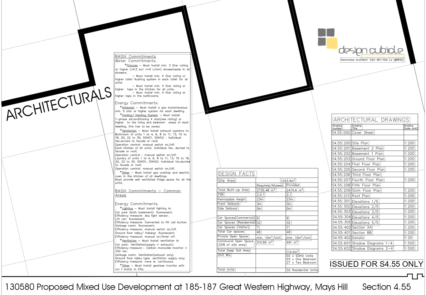
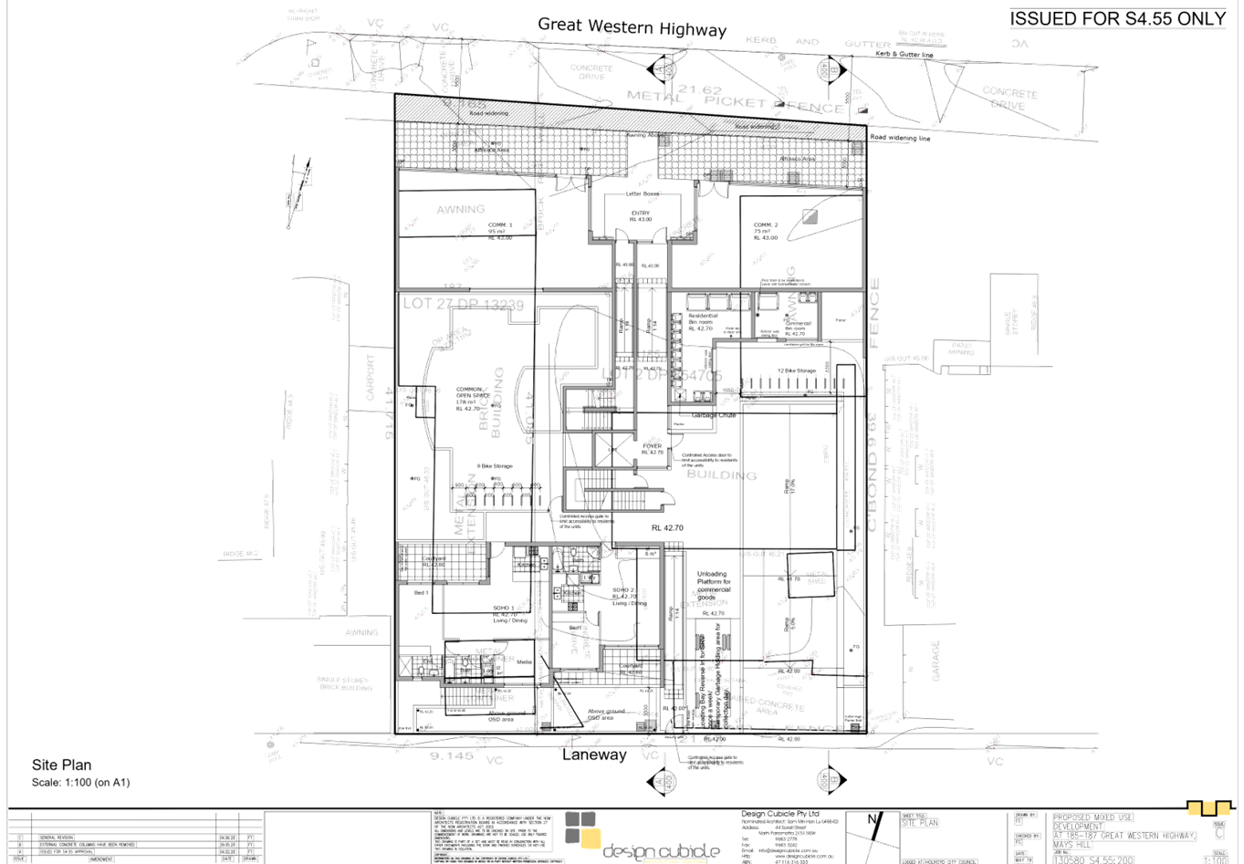
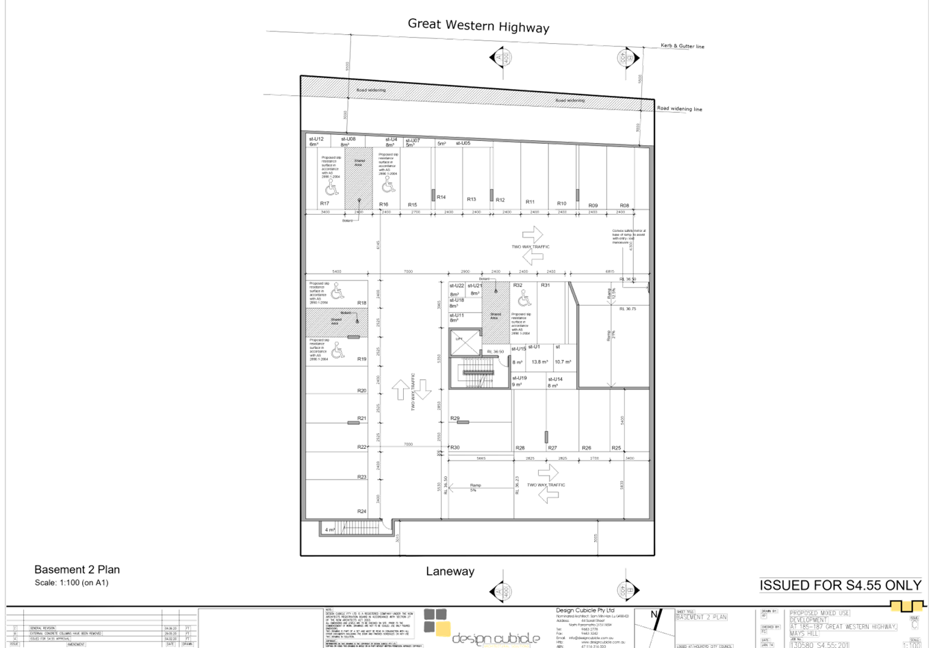
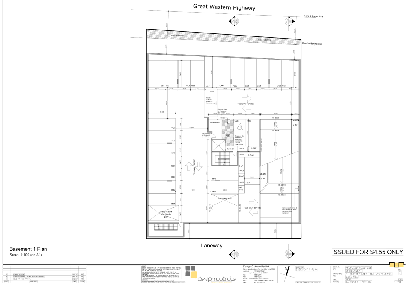
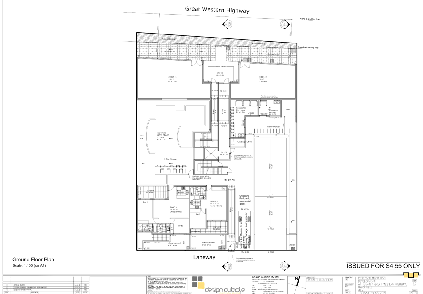
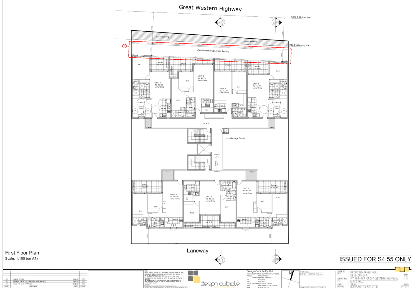
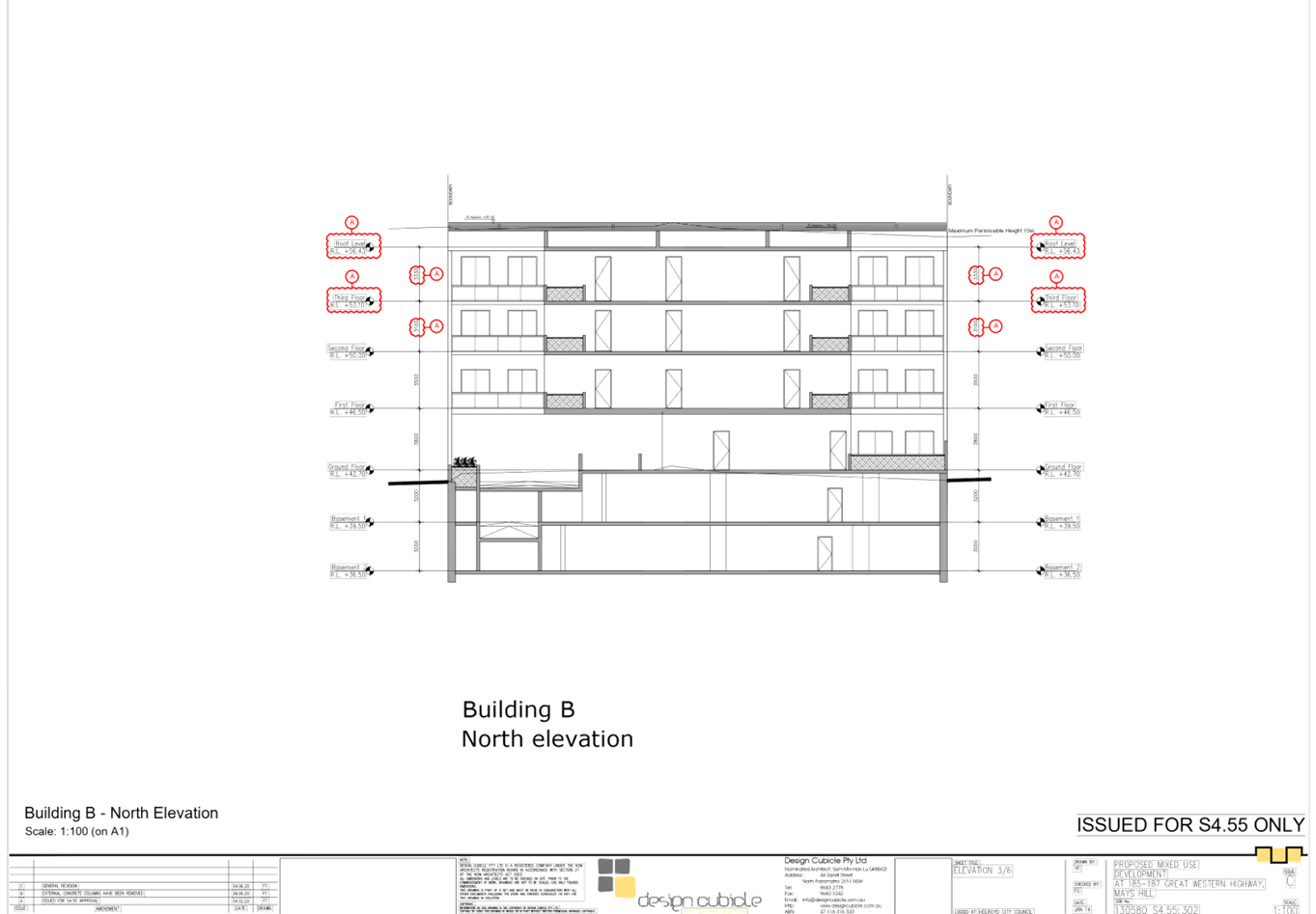
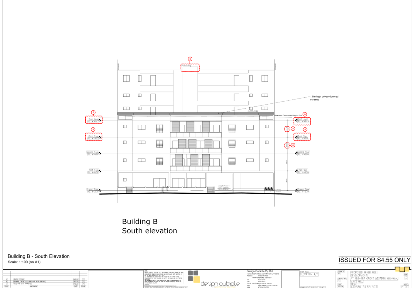
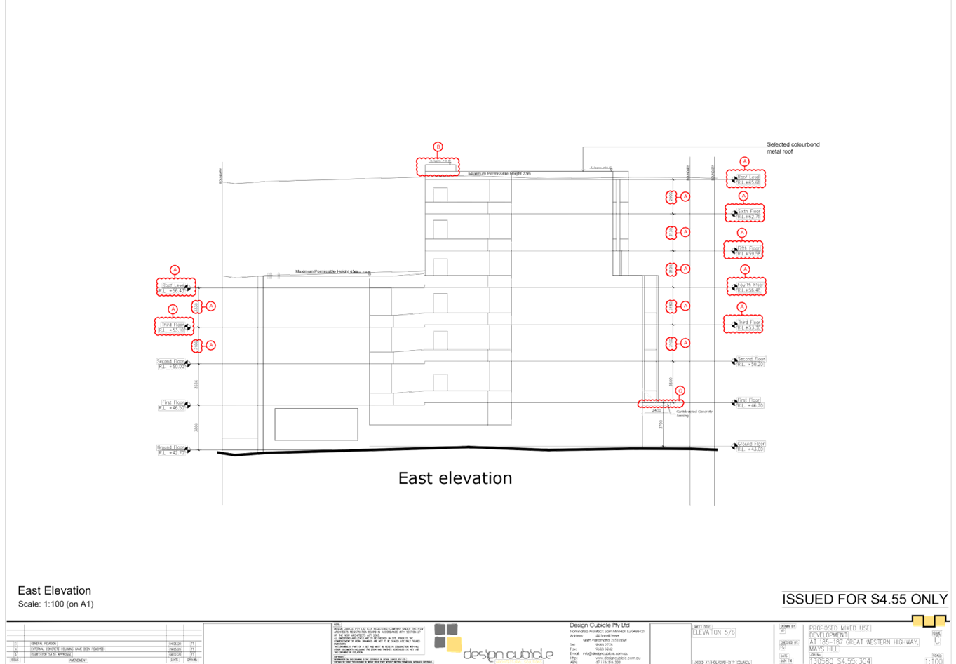
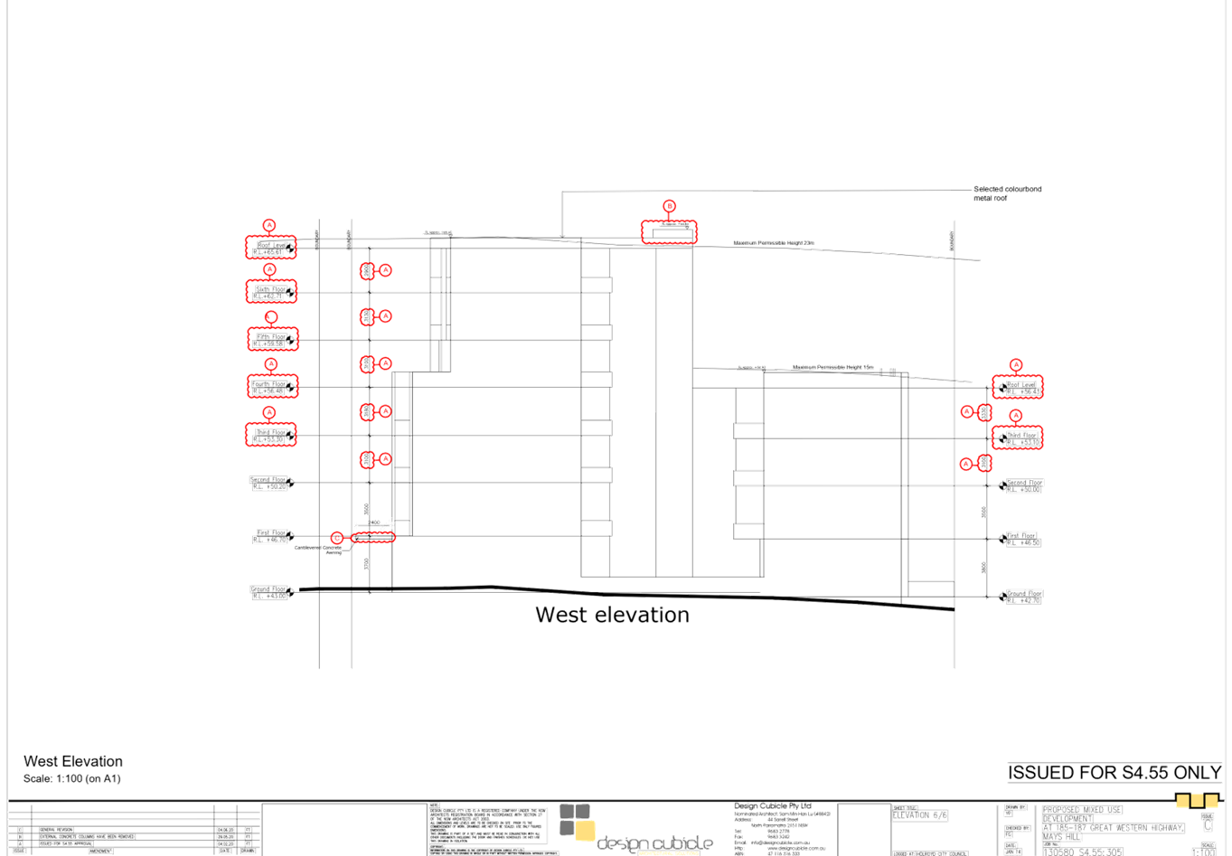
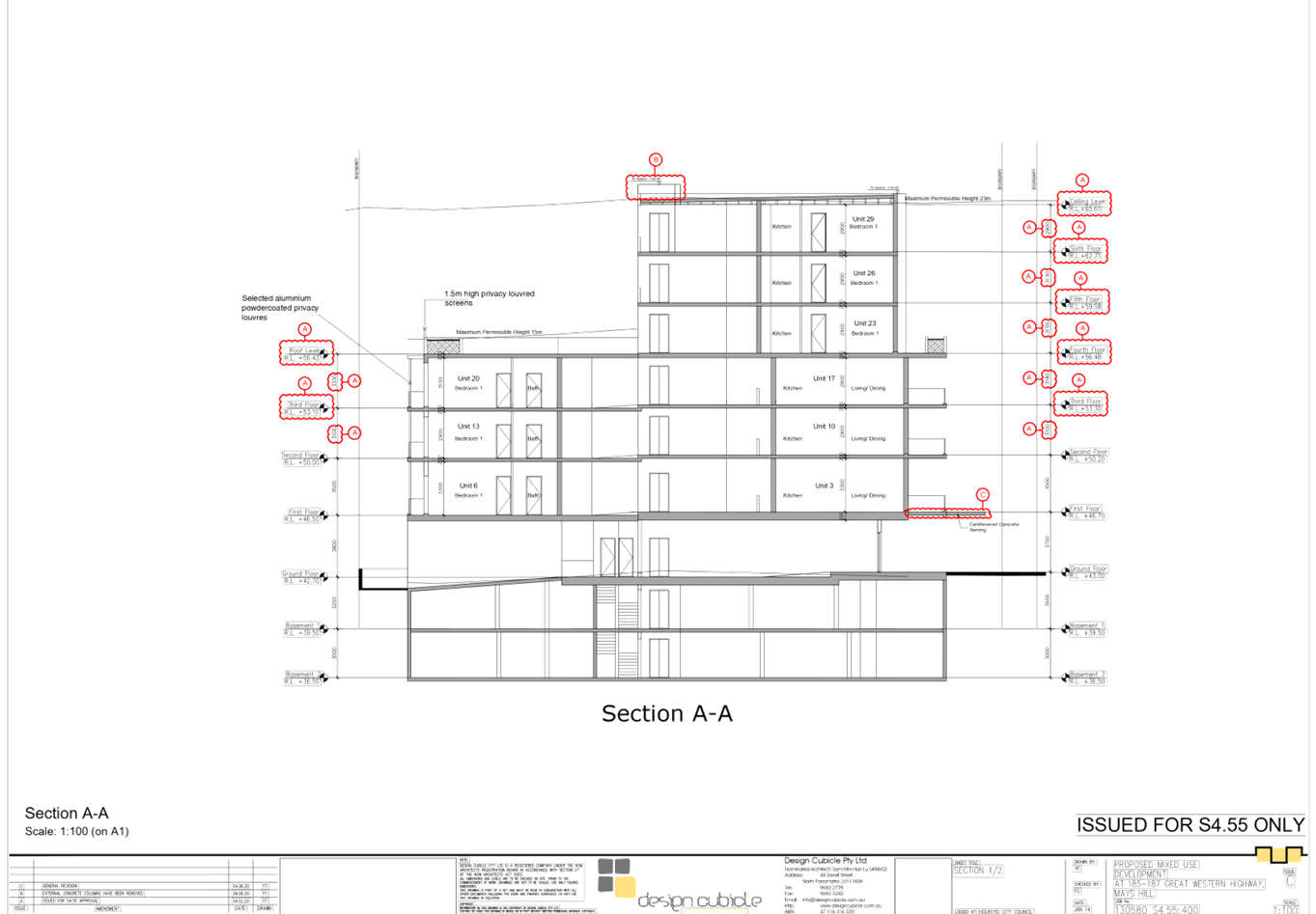
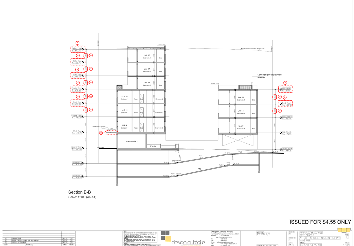
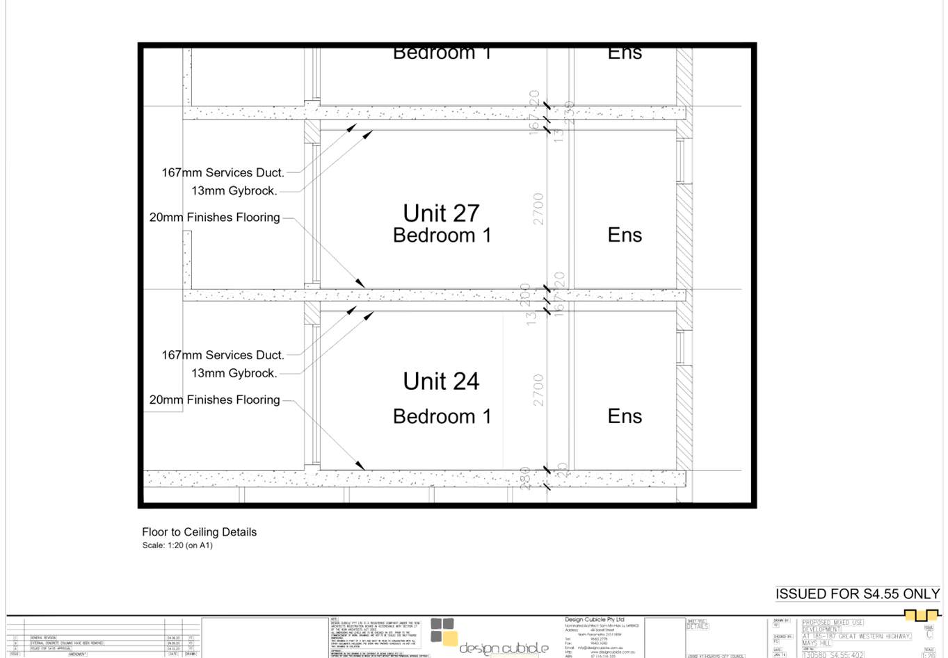
DOCUMENTS
ASSOCIATED WITH
REPORT LPP034/20
Attachment 2
Attachment 2 - Draft Notice of Determination
Cumberland Local Planning Panel Meeting
8 July 2020
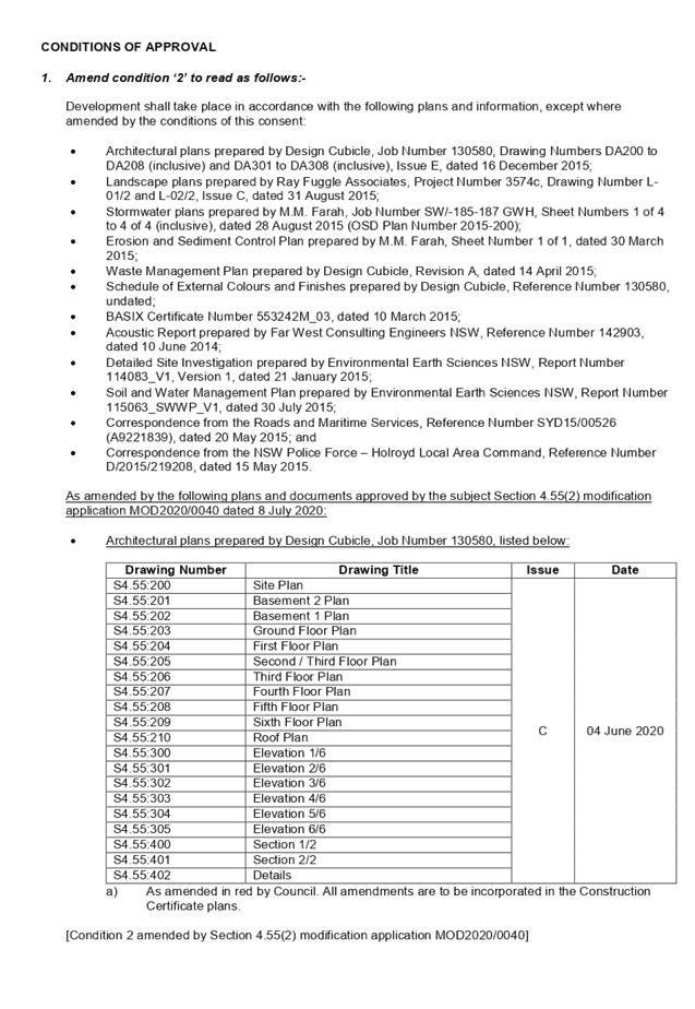
DOCUMENTS
ASSOCIATED WITH
REPORT LPP034/20
Attachment 3
Attachment 3 - SEPP 65 Apartment Design Guide
Compliance Assessment
Cumberland Local Planning Panel Meeting
8 July 2020
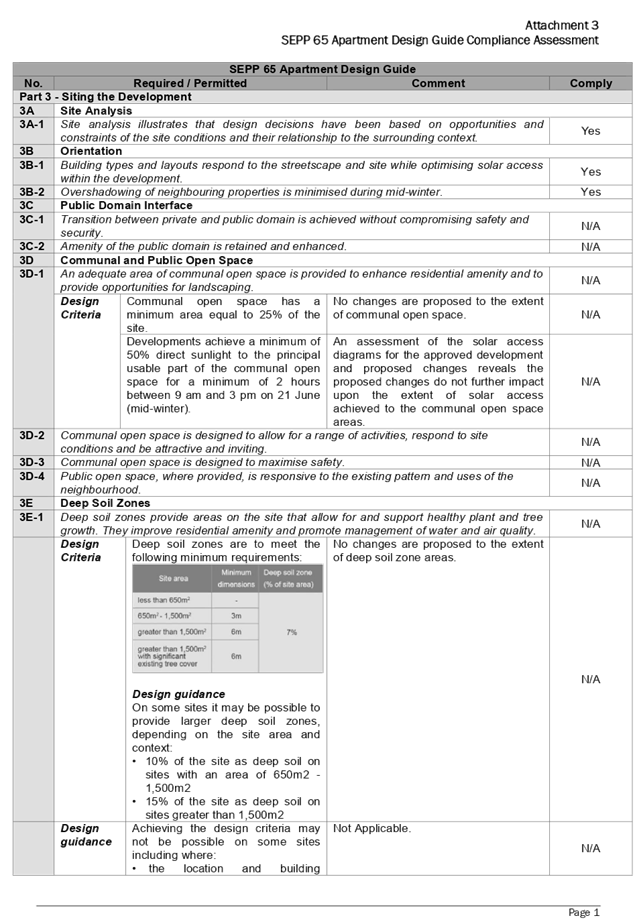
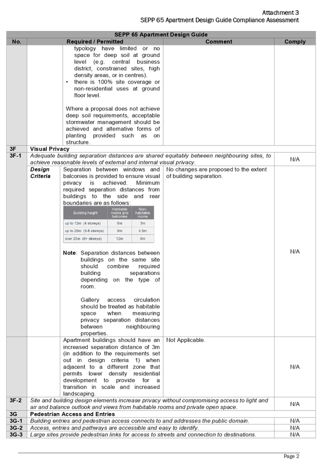
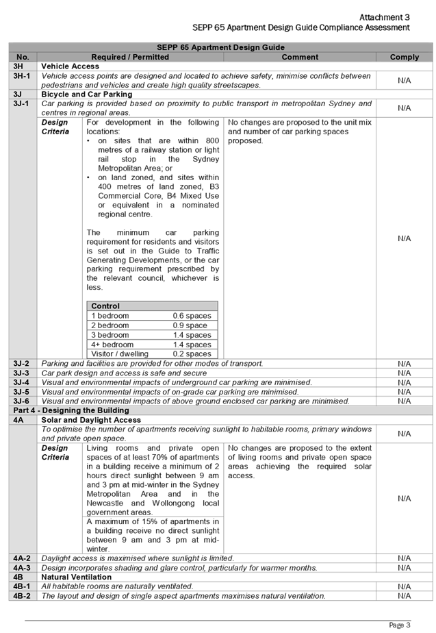
DOCUMENTS
ASSOCIATED WITH
REPORT LPP034/20
Attachment 4
Attachment 4 - Holroyd Local Environmental Plan 2013
Compliance Assessment
Cumberland Local Planning Panel Meeting
8 July 2020
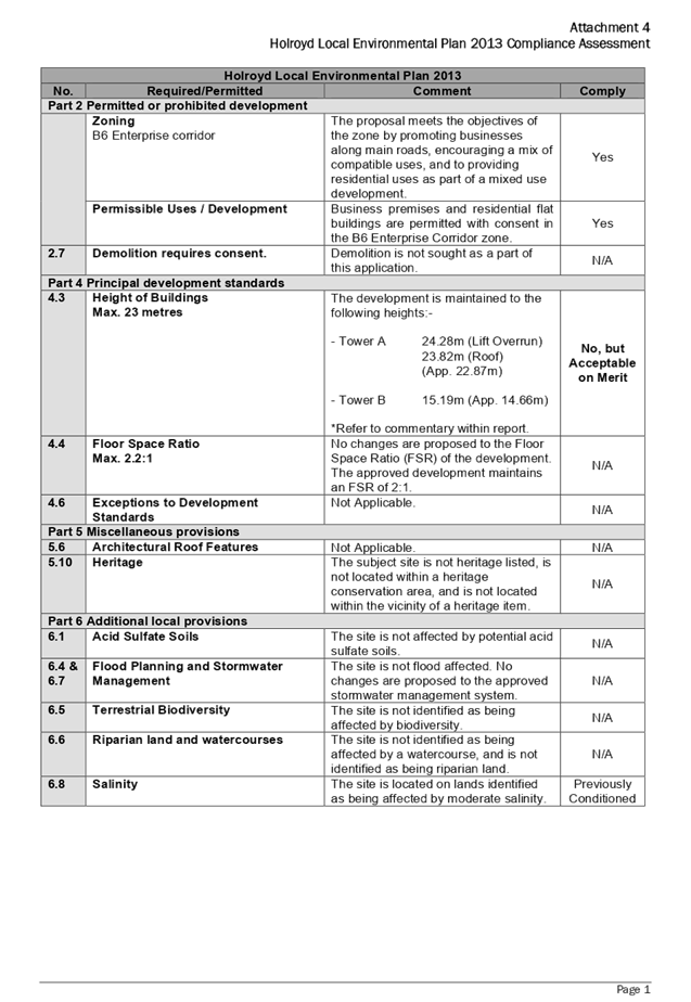
DOCUMENTS
ASSOCIATED WITH
REPORT LPP034/20
Attachment 5
Attachment 5 - Holroyd Development Control Plan 2013
Compliance Assessment
Cumberland Local Planning Panel Meeting
8 July 2020
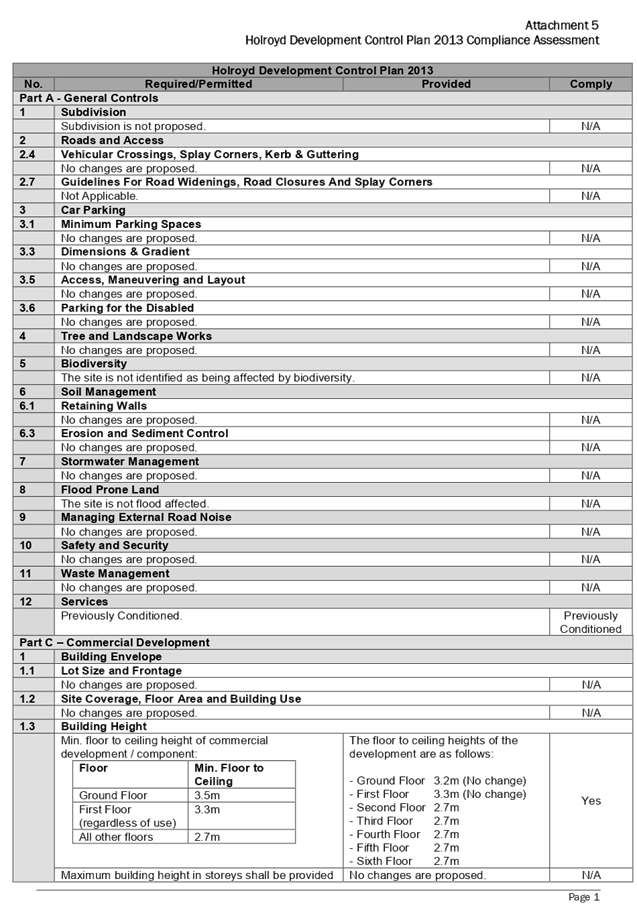
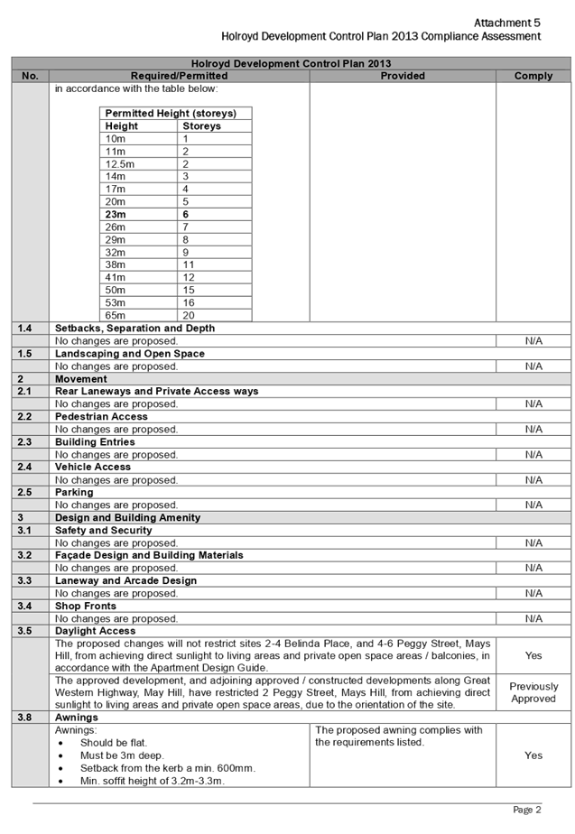
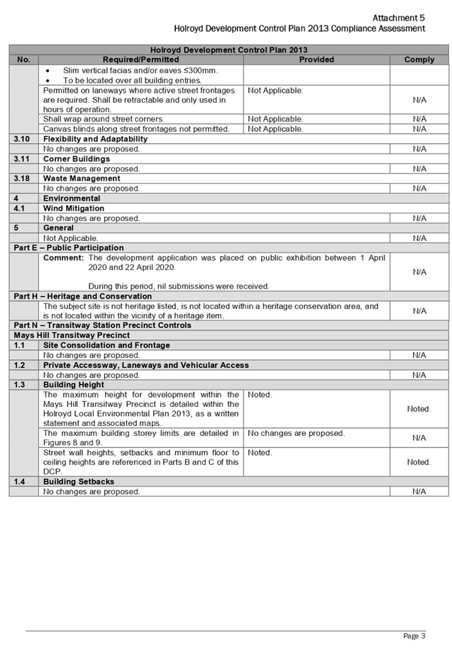
Cumberland
Local Planning Panel Meeting
8 July 2020
Item
No: LPP035/20
Development
Application for 1-3 Bransgrove Street, Wentworthville
Responsible
Division: Environment
& Planning
Officer: Executive
Manager Development and Building
File
Number: MOD2019/5282
|
Application
lodged
|
20 December 2019
|
|
Applicant
|
Archi-Build International
|
|
Owner
|
Premier United Group Pty Ltd,
Maroun Bros Group Pty Ltd,
Pmpy Pty Ltd
|
|
Application
No.
|
MOD2019/5282
|
|
Description
of Land
|
1-3 Bransgrove Street,
Wentworthville NSW 2145, Lot 1 DP 14951, Lot 2 DP 14951
|
|
Proposed
Development
|
Section 4.55(2) application to
modify floor levels, hydrant booster location, external finishes and
stormwater disposal of an approved residential flat building
|
|
Site
Area
|
1,211m2
|
|
Zoning
|
R4 – High Density
Residential Zone
|
|
Disclosure
of political donations and gifts
|
Nil disclosure
|
|
Heritage
|
The subject site does not contain a heritage item, located
within the vicinity of the heritage item or heritage conservation area.
|
|
Principal
Development Standards
|
FSR
Permissible: 1.2:1
Proposed: No changes sought
under the subject modification application
Height of Building
Permissible: 15m
· Proposed:
Max. 16.4m (9.3% variation sought)
· Clause
4.6 Written Variation Request is not required for a modification application;
however the applicant has submitted a planning justification for height
variation on similar grounds.
|
|
Issues
|
Variation to maximum 15m building height (HLEP 2013)
|
1. Development
Application No. DA2016/79 was approved on 20 January 2017 for the demolition of
existing structures, construction of a 4-storey residential flat building
containing 17 units, rooftop terrace over basement parking accommodating 22 car
parking spaces and associated strata subdivision into 17 lots.
2. Modification
Application No. M2016/79/2 was approved on 8 June 2018 for a Section 4.55(1A)
modification approving removal of an existing tree at the front of the subject
site.
3. Current
Modification Application was received on 20 December 2019 for the Section
4.55(2) application to modify floor levels, hydrant booster location, external
finishes and stormwater disposal.
4. The
application was publicly notified to occupants and owners of the adjoining
properties for a period of 21 days between 18 March 2020 and 8 April 2020. In
response, no submissions were received.
5. The
application is being reported to the Cumberland Local Planning Panel (CLPP) for
determination as it is a development with 4 or more storeys to which the State
Environmental Planning Policy No 65 – Design Quality of Residential
Apartment Developments applies and is seeking a variation to principal
development standard (maximum building height).
6. The
subject application has been assessed against the relevant provisions of the
Environmental Planning and Assessment Act 1979, State Environmental Planning
Policy No 65 – Design Quality of Residential Apartment Development,
Holroyd Local Environmental Plan (HLEP) 2013 and Holroyd Development Control
Plan (HDCP 2013) and the Draft Cumberland LEP and DCP 2020.
7. The
variations are as follows:
|
Control
|
Required
|
Provided
|
% Variation
|
|
Building Height
|
Permissible: Max. 15m (HLEP 2013)
Approved: 15.24m (DA2016/79)
|
Max. 16.4m (RL 37.4 - RL 21) = 16.4m to lift overrun.
Max. 15.4m (RL 36.34 – RL 21.2) to access stairs
|
1% - 9.3%
|
8. The
application is recommended for approval, subject to the conditions as provided
in the attached schedule.
Subject Site and Surrounding
Area
The subject site is known as 1
& 3 Bransgrove Street, Wentworthville and is legally described as Lots 1
and 2 in DP 14951. The sites have a combined area of 1,211m2 and combined
frontage of 28.955m to the western side of Bransgrove Street with a 2.155m
splay corner and a secondary street frontage of 40.325m to Fullagar Road. There
is currently a single storey dwelling and associated outbuildings located on
each of the existing sites. The site falls approximately 1.2m from the front to
the rear of the site.
The subject site, and all
adjoining sites are zoned R4 – High Density Residential and sites
opposite to the north are zoned R2 – Low Density Residential. The rear
boundary of the subject site adjoins a Council reserve (Irwin Place Park) and
Finlaysons Creek.
The subject site does not contain
any heritage items and is not within a heritage conservation area. There are no
heritage items within the vicinity of the subject site.
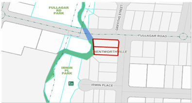
Figure
1 – Locality Plan of subject site. Source: Cumberland City Council
Intramaps
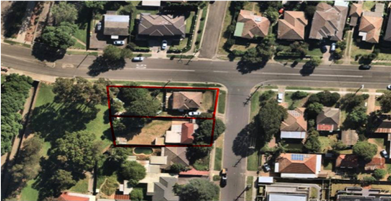
Figure
2 – Aerial view of subject site. Source: Cumberland City Council
Intramaps
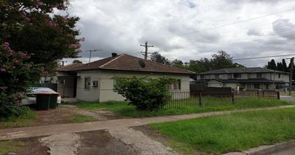
Figure
3 – Street view of subject site (No. 1 Bransgrove Street,
Wentworthville). Source: Cumberland City Council 2020.
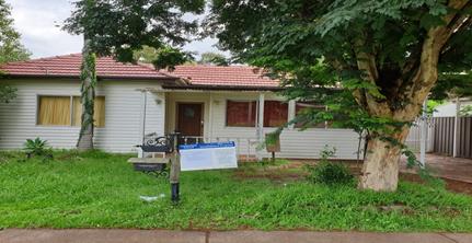
Figure
4 – Street view of subject site (No. 3 Bransgrove Street,
Wentworthville). Source: Cumberland City Council 2020.
Description of the Proposed
Development
Council has received a
modification application to modify floor levels, hydrant booster location,
external finishes and stormwater disposal to approved residential flat
building. The proposed changes include the following:
|
Level
|
Proposed Modifications
|
|
Basement
|
· Aisle width approved
as 5.894m; modified to be 5.8m.
· Deletion of fire
stairs.
|
|
Ground floor
|
· Deletion of fire stair
exit adjacent to main entry.
· Floor to ceiling
height approved as 2.7m, modified to be 2.8m.
|
|
First floor
|
· FFL approved as 24.94;
modified to be 25.04.
· Floor to ceiling
height approved as 2.7m, modified to be 2.8m.
|
|
Second floor
|
· FFL approved as 27.84;
modified to be 28.04.
· Floor to ceiling
height approved as 2.7m, modified to be 2.8m.
|
|
Third floor
|
· FFL approved as 30.74;
modified to be 31.04.
· Floor to ceiling
height approved as 2.7m, modified to be 2.8m.
|
|
Roof terrace
|
· FFL approved as 33.74;
modified to be 34.04.
· Deletion of roof over
terrace area.
· Ridge level approved
as 36.04, lift overrun RL modified to be 37.4 and access stairs to be 36.34.
|
|
|
· Amended schedule of
colours and finishes.
· Changes to stormwater
design.
· Addition of a fire
hydrant booster along the Bransgrove Street frontage.
|
The applicant is also seeking to
satisfy the Schedule ‘A’ conditions under the subject modification
application.
History
|
Date
|
Action
|
|
20
December 2019
|
The subject modification application was lodged with
Council.
|
|
23 January
2020
|
The application was referred to Council’s internal
development engineering department for review.
|
|
18 March
2020 to 8 April 2020
|
The application was placed on public notification. In
response, no submissions were received.
|
|
8 July
2020
|
The application has been referred to CLPP for
determination.
|
Applicants Supporting
Statement
The applicant has provided a
Statement of Environmental Effects prepared by Maximum Developments Australia
dated 17 December 2019 and was received by Council on 20 December 2019 in
support of the application.
Contact With Relevant
Parties
The assessing officer has
undertaken a site inspection of the subject site and surrounding properties and
has been in regular contact with the applicant throughout the assessment process.
Internal Referrals
Development Engineer
The development application was
referred to Council’s Development Engineer for comment who has advised
that the development proposal is satisfactory and therefore can be supported
subject to recommended conditions of consent.
External Referrals
The application was not required
to be referred to any external government authorities for comment.
PLANNING COMMENTS
The relevant matters for
consideration under the EP&A Act 1979 are:
Section 4.55(2):
|
Requirement
|
Comments
|
|
Council is satisfied that the development to which the
consent as modified relates is substantially the same development as the
development for which the consent was originally granted and before that
consent as originally granted was modified (if at all), and
|
The development as proposed to be modified is
substantially the same as the original consent. That is, the demolition of existing structures, construction
of a 4-storey residential flat building containing 17 units, rooftop terrace
over basement parking accommodating 22 car parking spaces and associated
strata subdivision into 17 lots.
The subject modification application seeks minor
alterations, including the increase of the floor to ceiling height from 2.7m
to 2.8m, minor changes to the basement level, changes to the schedule of
colours and finishes, the installation of a fire hydrant booster and changes
to the stormwater design, which are considered minor and substantially the
same development as approved under DA2016/79/1.
|
|
Council has consulted with the relevant Minister, public
authority or approval body (within the meaning of Division 5) in respect of a
condition imposed as a requirement of a concurrence to the consent or in
accordance with the general terms of an approval proposed to be granted by
the approval body and that Minister, authority or body has not, within 21
days after being consulted, objected to the modification of that consent, and
|
No Minister, public authority or other approval body was
required to be consulted regarding the proposed modification.
|
|
Council has notified the application in accordance with:
(i) the regulations, if the
regulations so require, or
(ii) a development control plan,
if the consent authority is a council that has made a development control
plan that requires the notification or advertising of applications for
modification of a development consent, and
|
See discussion on “Public Notification” in
this report.
|
|
Council has considered any submissions made concerning the
proposed modification within any period prescribed by the regulations or
provided by the development control plan, as the case may be.
|
See discussion on “Public Notification” in
this report.
|
|
Relevant matters referred to in Section 4.15(1) of the act
have been taken into consideration
|
Proposed modification is not contrary to the public
interest and the likely environmental impacts of the development as modified
are considered acceptable.
|
The provisions of any
Environmental Planning Instruments (EP&A Act s4.15 (1)(a)(i))
State Environmental Planning
Policies
The proposed development is
affected by the following State Environmental Planning Policies:
(a) State
Environmental Planning Policy No. 55 – Remediation of Land (SEPP 55)
Clause 7 of SEPP 55 requires
Council to be satisfied that the site is suitable or can be made suitable to
accommodate the proposed development. The matters listed within Clause 7 have
been considered in the assessment of the original development application.
(b) Statement
Environmental Planning Policy No. 65 - Design Quality of Residential Apartment
Development (SEPP 65)
SEPP 65 applies to the development
as the building is 3 storeys or more, and contains more than 4 dwellings. A
design statement addressing the design quality principles prescribed by SEPP 65
was prepared by the project architect under the original application.
An amended design statement was
not submitted as part of the subject modification application, however, the
modifications sought are consistent with the deign statement under the original
application signed by registered architect Ziad Boumelem (8008).
Following a detailed assessment of
the proposal against the provisions of SEPP 65 and the ADG, the proposal is
generally considered compliant and therefore performs satisfactorily with
respect to building amenity. A comprehensive assessment against SEPP 65 and the
ADG is contained in Attachment 2.
(c) State
Environmental Planning Policy (Infrastructure) 2007 (ISEPP)
The provisions of the ISEPP 2007
have been considered in the assessment of the original development application.
(d) State
Environmental Planning Policy (Vegetation in Non-Rural Areas) 2017
No additional trees or vegetation
is proposed to be removed as part of the subject modification application.
(e) State
Environmental Planning Policy (Building Sustainability Index: BASIX) 2004
The proposed modifications do not
require a revised BASIX Certificate.
Local Environmental Plans
Holroyd Local Environmental
Plan (HLEP) 2013
The provision of the HLEP 2013 is
applicable to the development proposal. It is noted that the development
achieves compliance with the key statutory requirements of the HLEP 2013 and
the objectives of the R4 – High Density Residential zone.
(a) Permissibility:-
The proposed development is
defined as a ‘Residential flat building’ and is permissible in the
R4 – High Density Residential zone with consent.
The relevant matters to be
considered under HLEP 2013 and the applicable clauses for the proposed
development are summarised below. A comprehensive LEP assessment is contained
in Attachment 3.
Figure
4 – Holroyd LEP 2013 Compliance Table
|
DEVELOPMENT STANDARD
|
COMPLIANCE
|
DISCUSSION
|
|
4.3 Height of Buildings
Max. 15m
|
No – Max 16.4m (9.3%
variation sought)
|
No – The Applicant
has submitted a written request to justify the variation – Refer to
Attachment 5.
Refer to discussion below.
|
(b) Variation
to Height of Buildings Development Standard
Height variation sought
The proposal seeks a variation to
Clause 4.3 – Height of Buildings that stipulates that the height of a
building at the subject site is not to exceed 15m.
The proposal breaches the height
standard by a maximum of 1.4m, which represents a variation of 9.3%. The height
breach of the proposal is limited to the lift overrun and access stair which
are located at the centre of the building.
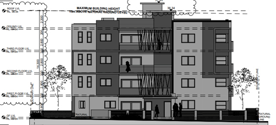
Figure
5 – Eastern elevation along Bransgrove Street frontage showing extent of
height variation sought. Source: Archi-Build International
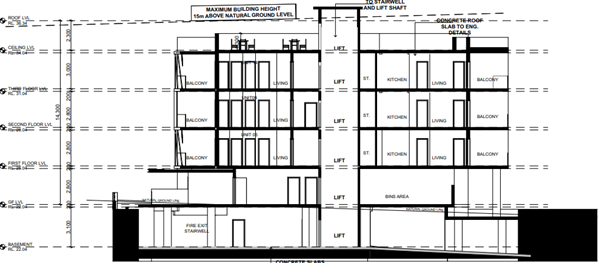
Figure
6 – Section plan showing extent of height variation sought. Source:
Archi-Build International
Clause 4.6 assessment of
variation sought
Clause 4.6 allows the consent
authority to vary development standards in certain circumstances and provides
an appropriate degree of flexibility to achieve better design outcomes. A
formal submission of Clause 4.6 is not warranted for a modification
application; however the applicant has submitted this statement, which offers
reasonable planning assessment and justification. This is discussed in the
following sections.
The applicant has submitted a
written request to vary the development standards for the maximum building
height. Based on various case laws established by the Land and Environment
Court of NSW such as Four2five P/L v Ashfield Council [2015] NSWLEC 9, Randwick
City Council v Micaul Holdings P/L [2016] NSW LEC7 and Zhang and anor v Council
of the City of Ryde [2016] NSWLEC 1179, a 3 part assessment framework for a
variation request proposed under clause 4.6 has been considered and an
assessment of the proposed variance, following the 3 part test is discussed in
detail below.
The 3 preconditions which must be
satisfied before the application can proceed are as follows:
1. Is
the proposed development consistent with the objectives of the zone?
Zone R4 High
Density Residential
1 Objectives of
zone
· To provide for the
housing needs of the community within a high density residential environment.
· To provide a
variety of housing types within a high density residential environment.
· To enable other
land uses that provide facilities or services to meet the day to day needs of
residents.
Applicant’s
justification:
The proposed variation is
considered to improve the amenity of approved housing stock. The additional
height positively contributes to the streetscape with the use of modulation and
articulation whereby the approved residential flat building presents to the
street as a modulated built form. The extent of the variation to height of
building is unlikely to result in any limitations or constraints to adjoining
properties in relation to impacts or limitation of development potential. This
will not result in a substantial change in approved built form. The proposed
minor variation sought is not inconsistent with the intent of this objective.
The proposed additional which is
considered to be of a low environmental impact given the will improve the
amenity of the residential occupants and is not inconsistent with the intended
building typology which will remain at four (4) storeys and rooftop level. The
proposed variation sought is not inconsistent with the intent of this
objective.
The approved built form comprises
of a residential flat building which is a permissible use within the R4 High
Density Residential Zone. The proposed additional height sought within this
modification does not offend this objective of the zone.
Planner’s comment:
The proposal is for a four storey
residential flat building containing 17 units at the subject site which
provides for the housing needs of the local area. The variation sought will not
restrict the surrounding land uses from providing the facilities or services to
meet the day to day needs of the local residents. The variation to the
development standard will not result in any adverse impacts on the surrounding
land uses. Having regard to this, the proposed development is considered to be
consistent with the objectives of the R4 High Density Residential zone.
2. Is
the proposed development consistent with the objectives of the development
standard which is not met?
v)
4.3 Height of
buildings
1. The
objectives of this clause are as follows—
(a) to
minimise the visual impact of development and ensure sufficient solar access
and privacy for neighbouring properties,
(b) to
ensure development is consistent with the landform,
(c) to
provide appropriate scales and intensities of development through height
controls.
Applicant’s
justification:
(a) to
minimise the visual impact of development and sure sufficient solar access and
privacy for neighbouring properties.
The proposed height and built form
is considered to be consistent with other approved residential flat buildings
within the locality which breach the height limit of 15m. The proposed height
of building of results in a built form is appropriately articulated, setback
and modulated given the immediate context.
The proposed variation to height
does not result in any solar access unreasonable impacts to the amenity of adjoining
dwellings given the site; orientation, slope and context. Given this,
reasonable levels of solar access are achieved and therefore this objective has
been satisfied. The additional height sought exceeding the development standard
is considered to result in negligible overshadowing impacts due to the
topography of the site and orientation. In this regard, despite the numerical
variation sought, the underlying objective of this clause has been satisfied.
The extent of the variation sought
is not considered to detract from the amenity of adjoining residential uses.
The extent of the height variation is unlikely to result in unreasonable impact
in relation to amenity including; privacy, bulk and scale or view loss.
Given the design of the bulk form
and minor extent of the height breach, the proposed variation is considered not
to offend the underlying intent of this clause. In this regard, despite the
numerical variation, the objective of this clause has been met.
(b) to
ensure that development is consistent with the landform
The site is affected by flooding
whereby the minimum habitable finished floor level this is turn has resulted in
the building being lifted to achieve suitable floor levels. Given the slope for
the site which slopes from west (low) to high (east) the proposal has been
designed to step into the landscape. By strictly complying with the
prescriptive height of 15m would result in the inability to provide adequate
function.
The proposed height exceedance in
wall height is considered to be negligible in relation to bulk and scale. Given
the immediate context of the existing built form, the proposed variation
reasonably satisfies the underlying intent of this clause given that the
proposal reasonably responds to the topography of the site.
(c) to
provide appropriate scales and intensities of development thorough height
controls
The proposals seeks to adopt
reasonable floor to ceiling heights being 2,800mm for the ground floor to
fourth floors which are considered to be modest and not excessive. Given this,
the proposal provides reasonable amount of residential amenity for future
occupants.
The subject site which is zoned R4
Low Density Residential, the immediate surrounding area also shares this zoning
and height controls. Despite the variation in height, the proposed built form
is considered to result in an appropriate height transition on the site.
It is further noted that the
breach in height is unlikely to be easily read as (a height breach) from the
public domain from a casual observer given the sitting and modulation of the
variation and context of the surrounding area.
Planner’s comment:
The objectives of the building
height standard are to enable appropriate development density to be achieved
and to ensure that the height of the building is compatible with the character
of the locality as outlined above. The proposal is compliant with the maximum
floor space ratio applicable to the subject site. The height breach of the
proposal is limited to the lift overrun, which is located within the centre of
the building, and does not achieve any additional levels or gross floor area
for the development.
The site is subject to mainstream
flooding and the finished floor levels of the development is required to be in accordance
with the flood planning level. Furthermore, by increasing the floor to ceiling
heights of each level, the proposal is able to achieve the required services
for each unit. Having regard to this, and the gradual slope of the site from
the front to the rear of the site, the proposal is considered to be designed to
respond to the topography of the site.
It is further noted that the
departure sought is considered to be modest and does not unreasonably impact on
the amenity of the adjoining properties, with respect to solar access, or
visual and acoustic privacy.
The additional height is located
within the centre of the building and does not result in the appearance of bulk
when viewed from the existing streetscape or neighbouring properties, and would
not impinge on the changing streetscape that is anticipated for the immediate
area. Given that the proposed development responds to the site and does so
without compromising relationships with adjoining development, the proposal is
considered to be consistent with the objectives of the height standard and
development within the R4 zone.
3. a)
Is compliance with the development standard unreasonable or unnecessary in the
circumstances of the case? And;
Applicant’s
justification:
It is considered that numerical
compliance with the development standard is unreasonable or unnecessary as the
objectives of the development standard have been achieved despite the numerical
departure, as previously addressed within this report. In this instance the
proposal is considered to result in a neutral outcome in comparison to strict
numerical compliance.
The proposed variation is
considered to be inconsequential given the numerical departure based on the
immediate visual context and slope and flooding constraints of the site. The
proposed variation does not offend the underlying intent of the Clause 4.3
Objectives which are intended to reduce bulk and scale, overshadowing impacts
and minimise impacts to the natural environment of which despite the numerical
departure has been satisfied.
Whilst the proposal seeks a
variation height of building for built forms centrally located on site, the
extent of the variations are visible along all external elevations however are
of negligible to minor impact. It is considered that given the sloping
topography of the site, appropriate floor levels to be achieved, immediate
residential character within the visual catchment would result in unreasonable
strict numerical compliance with the 15m height of building control.
Council’s Clause 4.6 Register,
assessment report recommendations have demonstrated that strict numerical
compliance in relation the Clause 4.3 Height of Building have been varied for
similar planning reasons for lift overruns and access stairs as to that sought
within this justification. In this regard, strict numerical compliance is
considered unnecessary and unreasonable given the topography of desired
character of the zone. Furthermore, as previously mentioned the proposal is
likely to result in negligible impacts in relation to solar access and visual
bulk and scale in comparison to strict numerical compliance. This is considered
to result in a neutral impact.
The zoning for the subject site is
R4 Low Density Residential, in this instance this is considered to be
reasonable. It is noted that the remainder of the proposal (i.e. communal
rooftop) complies with the 15m Height of Building Limit.
Strict numerical compliance in
relation to the application of this clause is not considered to result in any
significant material planning benefit. No unreasonable material amenity impacts
arise from this variation for minor increase in height to the residential flat
building. Sufficient environmental planning grounds for the breach in height of
building have been provided for Council’s consideration which is detailed
within this report, of which is considered to be valid, reasonable and sound
given the topography of the site, flood impacts of the site and immediate
surrounding context.
In this instance, given the above,
whilst is it acknowledged that the proposed variation will indeed result in a
lesser outcome than strict numerical compliance. However notwithstanding it is
considered that contravention of the Development Standard will result in a
proposal which is still consistent with the underlying objectives of the
control despite the numerical departure (Clause 4.3 Height of Building),
furthermore, the proposed exceedance to the Development Standard results is
considered to be of a minimal environmental impact in relation to solar access,
overshadowing, privacy and visual impact.
Planner’s comment:
Council Officers are satisfied
that the proposed variation has been appropriately justified and can be
supported in this instance. The height breach is limited to an overall building
height of 16.4m for a small portion of the building being the lift overrun and
stairs. The additional height of the building will not be highly notable or
visible from the adjacent properties or the street.
The proposed variation to the
development standard is necessary in order for the building to achieve the
required FFL, which correspond with the flood planning level, and to provide
adequate floor to ceiling heights to facilitate the services within each unit.
The overall proposal is consistent
with the scale of the existing and future development within the R4 zone
located in the immediate vicinity of the site. The departure sought is
considered to be modest and does not unreasonably impact on the adjoining
properties. The additional height does not result in the appearance of bulk
when viewed from the existing streetscape and would not impinge on the changing
streetscape that is anticipated for the immediate area. It is considered,
therefore, that strict compliance with the Development Standard is unreasonable
or unnecessary in the circumstances of the case.
b) Are there sufficient
environmental planning grounds to justify contravening the development standard
and therefore is the applicant’s written justification well founded?
Applicant’s
justification:
As previously discussed, this
extent of the variation is inconsequential and does not result in any
unreasonable impacts given the slope of the site and immediate visual context.
More importantly, the proposed variation satisfies the objectives of the
underlying intent of Clause 4.3, and therefore the merits of the works sought
are considered to be worthy of approval. It has been demonstrated within
Council and the Courts to apply a reasonable approach in supporting variations
to development standards. The proposal is not considered to result in any
adverse material amenity impact.
· Strict
numerical compliance would unlikely result in a materially better urban design
outcome given the extent of the variation. The variation sought will not result
in a dominant built form. Strict numerical compliance would result in
negligible reduction of impacts in relation to bulk and scale, solar access and
overshadowing however the benefits would appear to be minimal. Strict numerical
compliance would thwart the underlying objectives of the controls and would
result in a built form much lesser than that of other recently approved
residential flat buildings within the area in particular the visual catchment.
· Council
development assessment records indicate that the Council have approved and have
recommended support for similar variations for lift overruns and access stairs
to Clause 4.3 Height of Building within the locality therefore abandoning
strict numerical compliance with the Holroyd Local Environmental Plan 2013 and
have supported such variations on planning merit.
· The
extent of the variation for height is unlikely to be visually apparent to be
out of character when viewed by a casual observer from the public domain given
that the variation sought. The proposal will read as a four (4) storey
residential flat building with communal open space on the rooftop. Given the
extent of the variation, the additional height is unlikely to be significantly
perceivable from ground level or the public domain whereby as such the lift
core and access stairs are described as generally being centrally located on
the rooftop level.
· The
resultant-built form from the variation is considered to be compatible with
other residential flat buildings within the locality is unlikely to result in
an undesirable impact or outcome. The proposal is not considered to result in
any adverse amenity impacts to adjoining properties and is unlikely to set an
undesirable precedent.
· By
supporting this variation to the height of building in its current form, it is
considered that appropriate flexibility be applied on planning merit which
results in a reasonable built form which is commensurate of other residential
flat buildings within the locality.
· The
extent of the variation is considered to be in the public interest as the
proposal does not result in any adverse material impact to adjoining properties
or beyond or detrimentally affect amenity on site. Strict numerical compliance
is considered to result in a negligible benefit.
· As
previously discussed, the proposed extent of the variation adequately satisfies
the underlying objectives of the controls of which do not result in any
unacceptable impacts to the; built, natural, social or economic impacts for
consideration under the Act.
· The
extent of the variation is not considered to be inconsistent with the Objects
of the Act are considered to be satisfied regarding the merits of the
additional height sought.
· The
extent of the variation is considered to be moderate-minor in nature and
results in a negligible environmental planning impact in accordance with the
considerations of the Act.
Planner’s comment:
The unique circumstances of the
case are considered to warrant support of the departure. Given that the
proposed development responds to the site and does so without unduly
compromising relationships with adjoining development, or results in
non-compliances with other relevant controls; the proposal is considered to be
consistent with the objectives of building height, and development within the
R4 zone. In this regard, the exception is well founded and can be supported, in
this instance.
Conclusion:
Council is satisfied that the
applicant’s written request has adequately addressed the matters required
to be demonstrated by clause 4.6 subclause (3). Council is further satisfied
that the proposed development will be in the public interest because it is
consistent with the objectives of the particular standard and the objectives
for development within the zone in which the development is proposed to be
carried out.
It is the view of Council Officers
that justification provided is satisfactory and having considered the
application on its merit, the exception to the maximum building height
development standard is considered acceptable in this instance.
The provisions of any proposed
instrument that is or has been the subject (EP&A Act s4.15 (1)(a)(ii))
(a) Draft
State Environmental Planning Policy (Environment)
The draft SEPP relates to the
protection and management of our natural environment with the aim of
simplifying the planning rules for a number of water catchments, waterways,
urban bushland, and Willandra Lakes World Heritage Property. The changes
proposed include consolidating the following seven existing SEPPs:
· State
Environmental Planning Policy No. 19 – Bushland in Urban Areas
· State
Environmental Planning Policy (Sydney Drinking Water Catchment) 2011
· State
Environmental Planning Policy No. 50 – Canal Estate Development
· Greater
Metropolitan Regional Environmental Plan No. 2 – Georges River Catchment
· Sydney
Regional Environmental Plan No. 20 – Hawkesbury-Nepean River (No.2-1997)
· Sydney
Regional Environmental Plan (Sydney Harbour Catchment) 2005
· Willandra
Lakes Regional Environmental Plan No. 1 – World Heritage Property.
The draft policy will repeal the
above existing SEPPs and certain provisions will be transferred directly to the
new SEPP, amended and transferred, or repealed due to overlaps with other areas
of the NSW planning system.
Changes are also proposed to the
Standard Instrument – Principal Local Environmental Plan. Some provisions
of the existing policies will be transferred to new Section 117 Local Planning
Directions where appropriate.
(b) Draft
Cumberland Local Environmental Plan 2020 (Draft CLEP)
The Draft Cumberland Local
Environmental Plan 2020 (Draft CLEP) has been prepared by Cumberland Council to
provide a single planning framework for the future planning of Cumberland City.
The changes proposed seek to harmonise and repeal the three existing LEPs
currently applicable to the Cumberland local government area, those being:
· Holroyd
Local Environmental Plan 2013
· Parramatta
Local Environmental Plan 2011.
· Auburn
Local Environmental Plan 2010.
The current planning controls for
the subject site, as contained within the HLEP, are not proposed to change
under the Draft CLEP.
The provisions of any
Development Control Plans (EP&A Act s4.15 (1)(a)(iii))
The Holroyd DCP 2013 provides
guidance for the design and operation of development to achieve the aims and
objectives of the HLEP 2013.
A comprehensive assessment and
compliance table is contained in Attachment 4.
The proposed fire hydrant booster
assembly is located within the front setback area. The HDCP 2013 does not
provide specific setback controls for hydrant boosters. The location of the
structures is dictated by the access and safety requirements of the relevant
service authority. No changes are proposed to the built form of the development
and the streetscape impacts are considered satisfactory.
The proposed development complies
with the provisions of the Holroyd DCP 2013 and is considered acceptable from
an environmental planning view point.
The provisions of any planning
agreement that has been entered into under section 7.4, or any draft planning
agreement that a developer has offered to enter into under section 7.4
(EP&A Act s4.15(1)(a)(iiia))
There is no draft planning
agreement associated with the subject Development Application.
The provisions of the
Regulations (EP&A Act s4.15 (1)(a)(iv))
The proposed development raises no
concerns as to the relevant matters arising from the Environmental Planning and
Assessment Regulations 2000 (EP&A Reg).
The Likely Environmental,
Social or Economic Impacts (EP&A Act s4.15 (1)(b))
It is considered that the proposed
development will have no significant adverse environmental, social or economic
impacts in the locality.
The suitability of the site for
the development (EP&A Act s4.15 (1)(c))
The subject site and locality is
not known to be affected by any natural hazards or other site constraints
likely to have a significant adverse impact on the proposed development.
Accordingly, it is considered that the development is suitable in the context of
the site and surrounding locality.
Submissions made in accordance
with the Act or Regulation (EP&A Act s4.15 (1)(d))
|
Advertised (newspaper)
|
Mail
|
Sign
|
Not Required
|
In accordance with Council’s
Notification requirements contained within the Holroyd DCP 2013, the proposal
was publicly notified for a period of 21 days between 18 March 2020 and 8 April
2020. No submissions were received in respect of the proposed development.
The public interest (EP&A
Act s4.15(1)(e))
In view of the foregoing analysis
it is considered that the development, if carried out subject to the conditions
set out in the recommendation below, will have no significant adverse impacts
on the public interest.
Section 7.11 (Formerly S94)
Contribution Towards Provision or Improvement of Amenities or Services
Council has imposed a Section 7.11
Contribution to be paid under the original application for DA2016/79/1. No
amendment to contributions is required as a result of the subject modification
application.
Disclosure of Political
Donations and Gifts
The applicant and notification
process did not result in any disclosure of Political Donations and Gifts.
The modification application has
been assessed in accordance with the relevant requirements of the Environmental
Planning and Assessment Act 1979, Statement Environmental Planning Policy No.
65 - Design Quality of Residential Apartment Development (SEPP 65), Holroyd LEP
2013 and Holroyd DCP 2013 and is considered to be satisfactory for approval subject
to conditions.
The development as modified is
appropriately located within the R4 High Density Residential Zone under the
relevant provisions of the Holroyd LEP 2013, however a variation in relation to
the Height of Buildings development standard under the Holroyd LEP 2012 is
sought.
Having regard to the assessment of
the proposal from a merit perspective, Council may be satisfied that the
development has been responsibly designed and provides for acceptable levels of
amenity for future residents. It is considered that the proposal successfully
minimises adverse impacts on the amenity of neighbouring properties. Hence the
development, irrespective of the departure noted above, is consistent with the
intentions of Council’s planning controls and represents a form of
development contemplated by the relevant statutory and non-statutory controls
applying to the land.
For these reasons, it is
considered that the proposal is satisfactory having regard to the matters of
consideration under Section 4.15 and 4.55 of the Environmental Planning and
Assessment Act 1979, and the modified development may be approved subject to
conditions.
|
That Modification
Application No. MOD2019/5282 for a Section 4.55(2) application to modify
floor levels, hydrant booster location, external finishes and stormwater
disposal to approved residential flat building on land at 1-3 Bransgrove
Street, Wentworthville NSW 2145 be approved, subject to attached conditions
in Attachment 1.
|
1. Attachment 1
- Draft Notice of Determination
2. Attachment
2 - Apartment Design Guide Compliance Table
3. Attachment
3 – Holroyd Local Environmental Plan 2013 Compliance Table
4. Attachment
4 - Holroyd Development Control Plan 2013 Compliance Table
5. Attachment
5 - Clause 4.6 Written Request
6. Attachment
6 - Architectural Plans
7. Attachment
7 - Stormwater Engineering Plans
8. Attachment
8 -Landscape Plan
9. Attachment
9 - Locality Map
DOCUMENTS
ASSOCIATED WITH
REPORT LPP035/20
Attachment 1
Attachment 1 - Draft Notice of Determination
Cumberland Local Planning Panel Meeting
8 July 2020
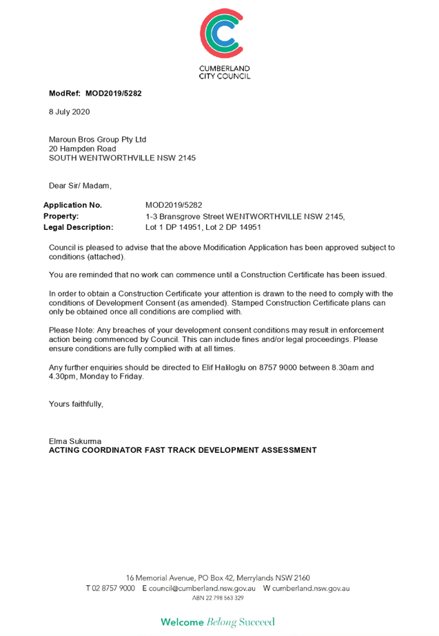
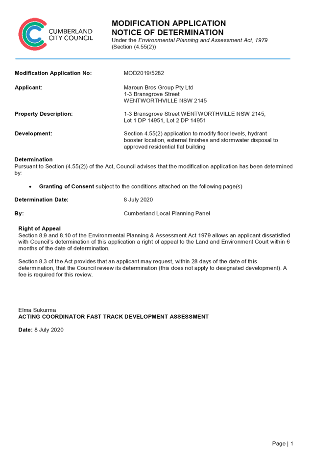
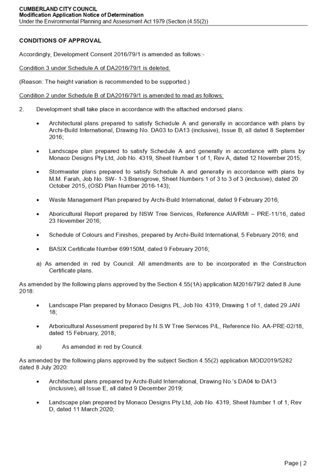
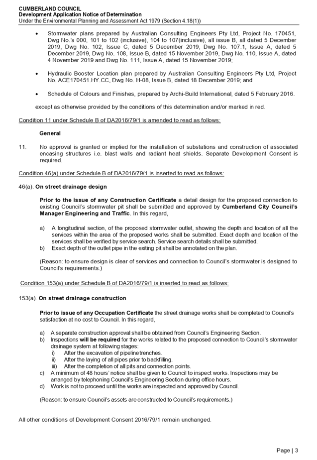
DOCUMENTS
ASSOCIATED WITH
REPORT LPP035/20
Attachment 2
Attachment 2 - Apartment Design Guide Compliance Table
Cumberland Local Planning Panel Meeting
8 July 2020
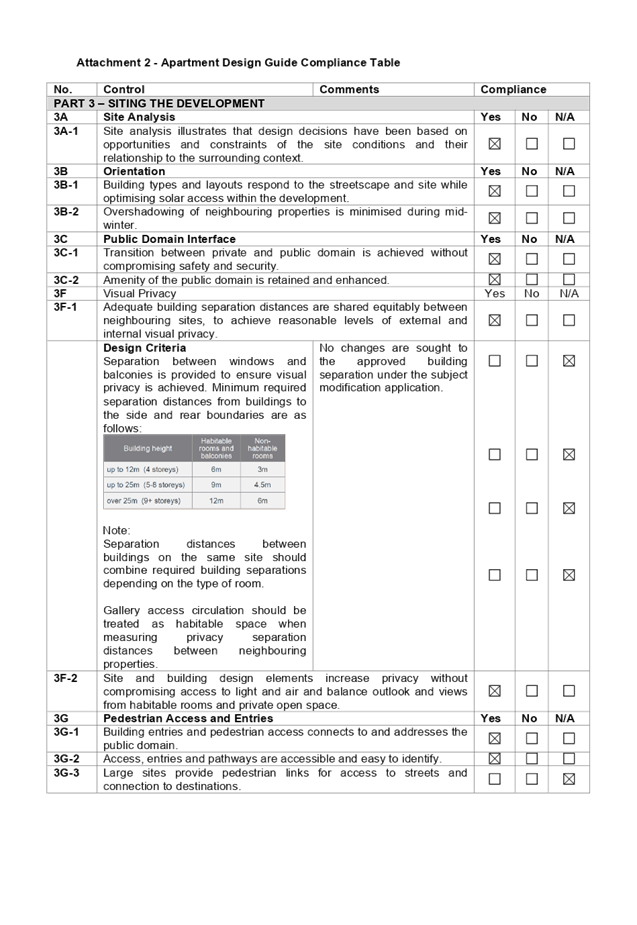
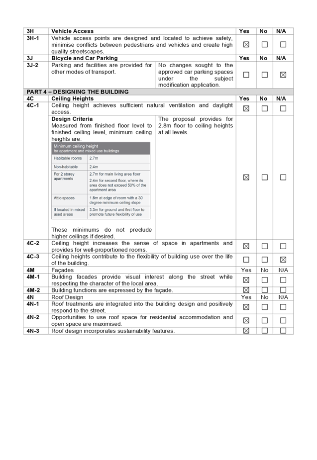
DOCUMENTS
ASSOCIATED WITH
REPORT LPP035/20
Attachment 3
Attachment 3 – Holroyd Local Environmental Plan
2013 Compliance Table
Cumberland Local Planning Panel Meeting
8 July 2020
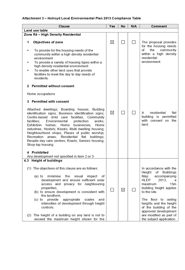
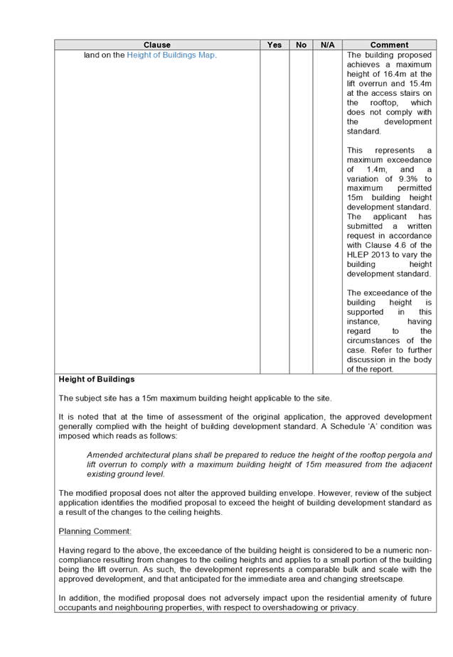
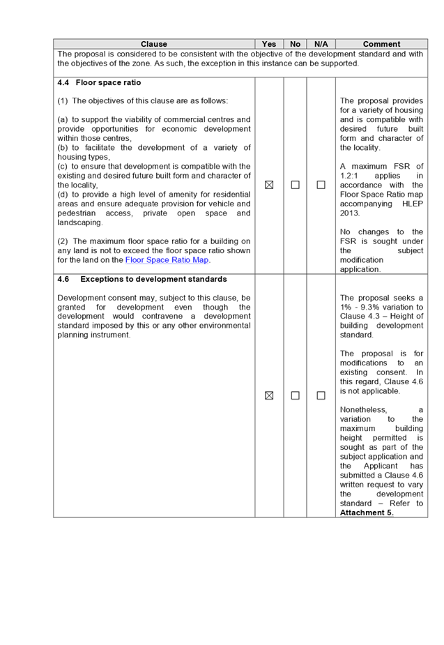
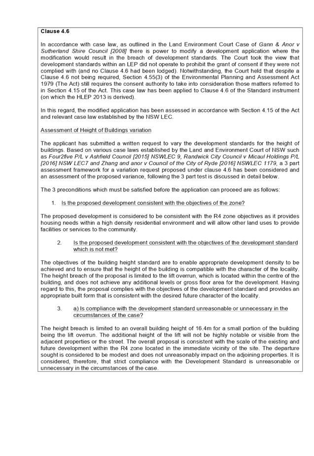
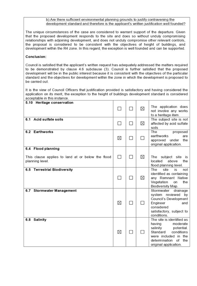
DOCUMENTS
ASSOCIATED WITH
REPORT LPP035/20
Attachment 4
Attachment 4 - Holroyd Development Control Plan 2013
Compliance Table
Cumberland Local Planning Panel Meeting
8 July 2020
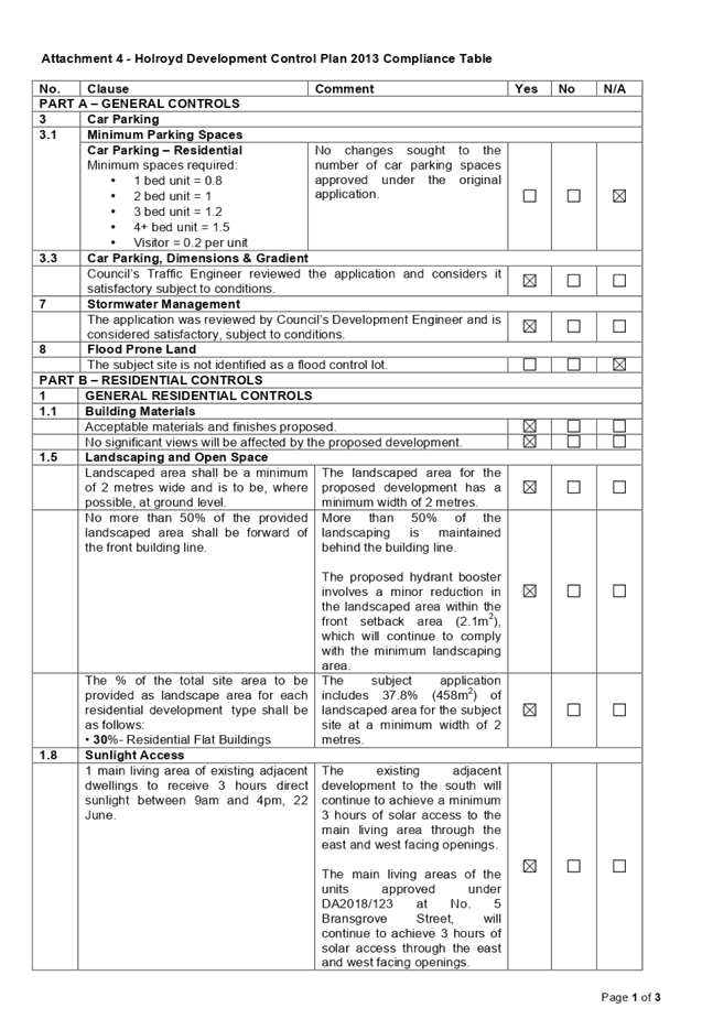
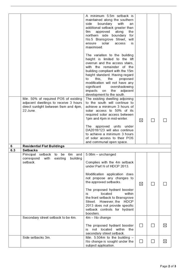
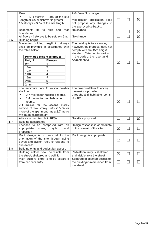
DOCUMENTS
ASSOCIATED WITH
REPORT LPP035/20
Attachment 5
Attachment 5 - Clause 4.6 Written Request
Cumberland Local Planning Panel Meeting
8 July 2020
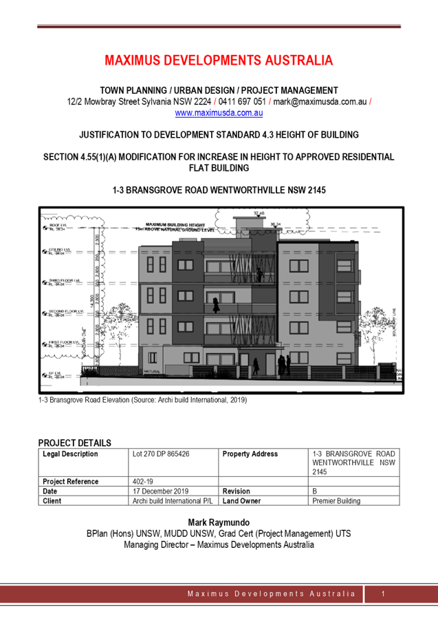
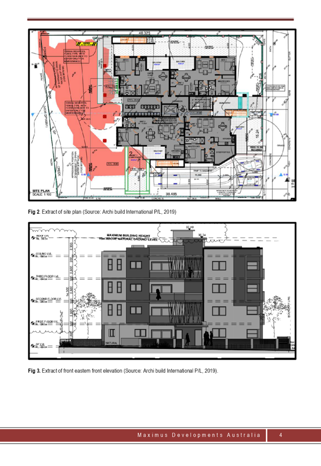
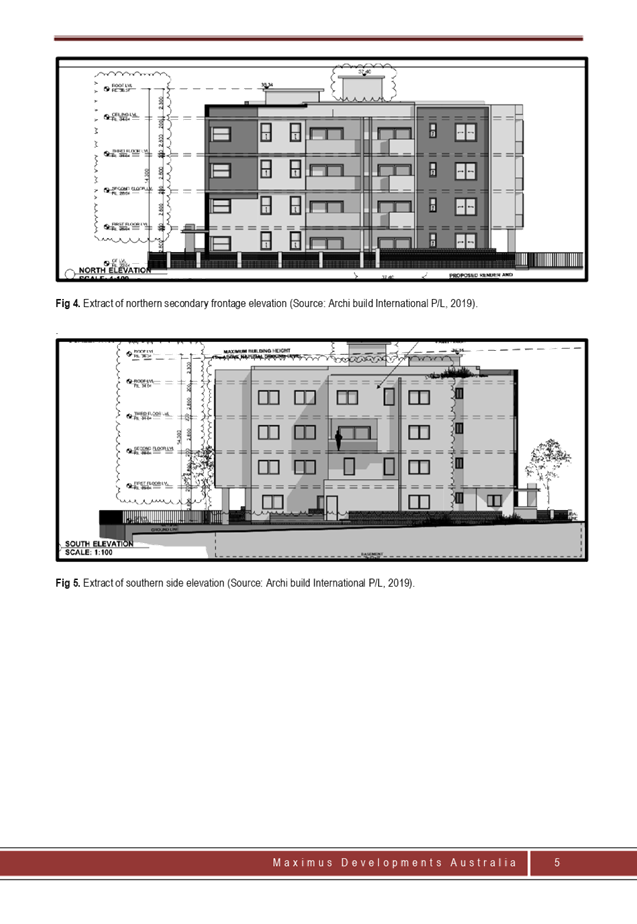
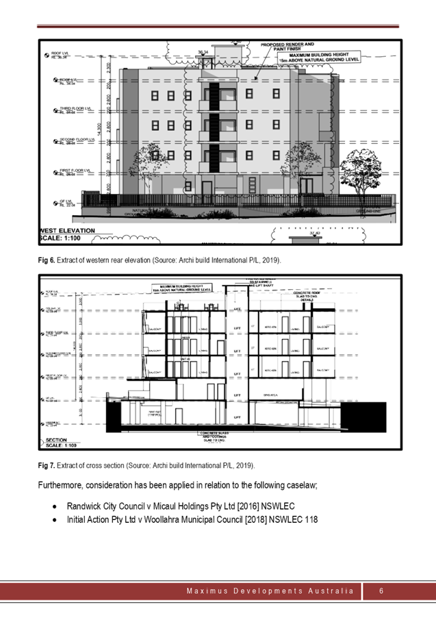
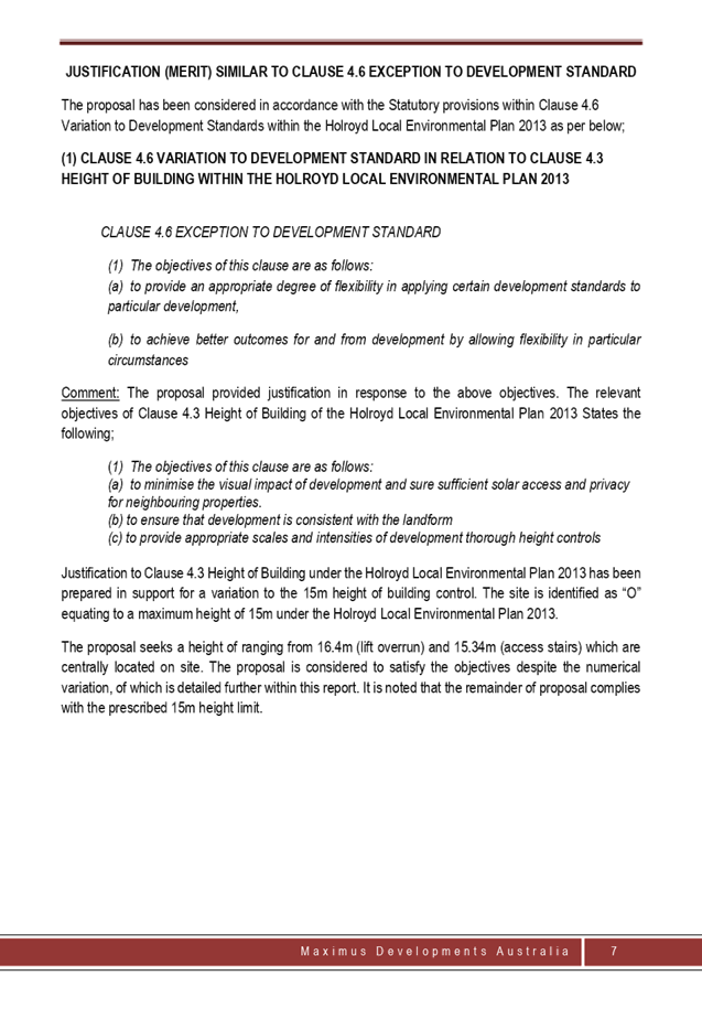
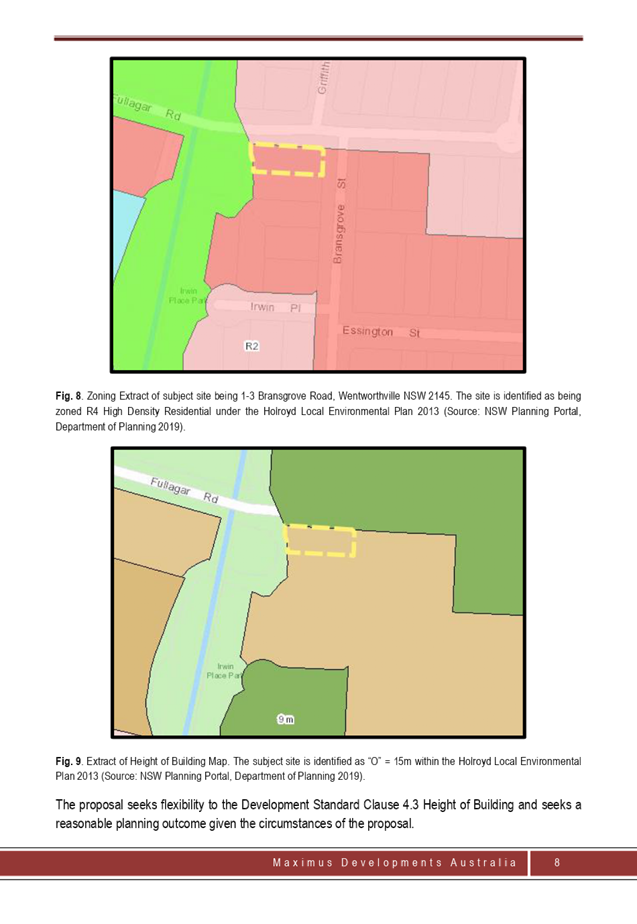
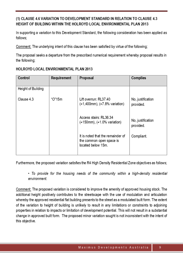
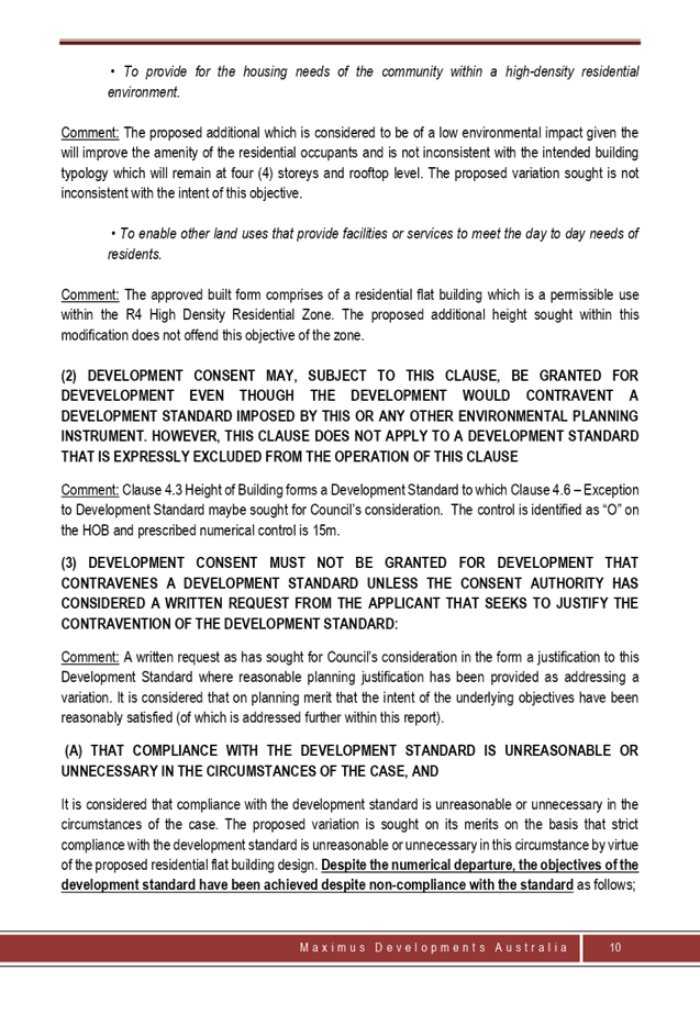
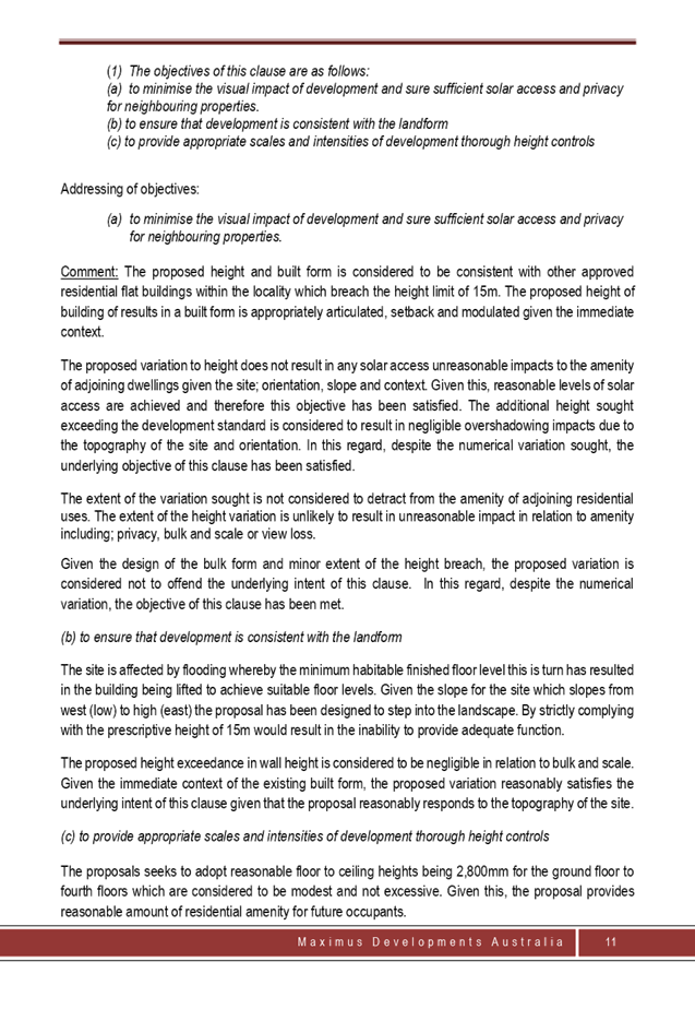
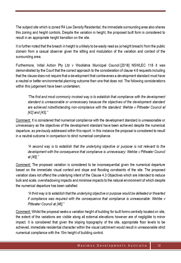
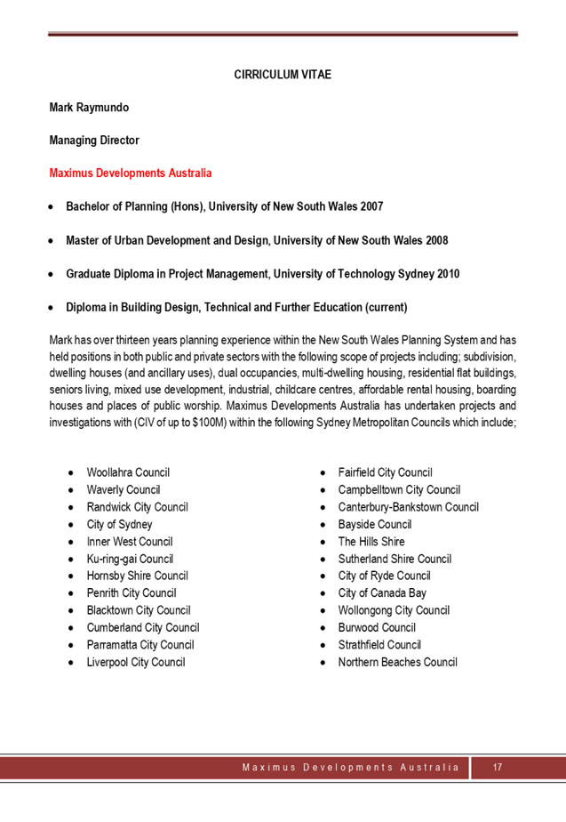

DOCUMENTS
ASSOCIATED WITH
REPORT LPP035/20
Attachment 6
Attachment 6 - Architectural Plans
Cumberland Local Planning Panel Meeting
8 July 2020
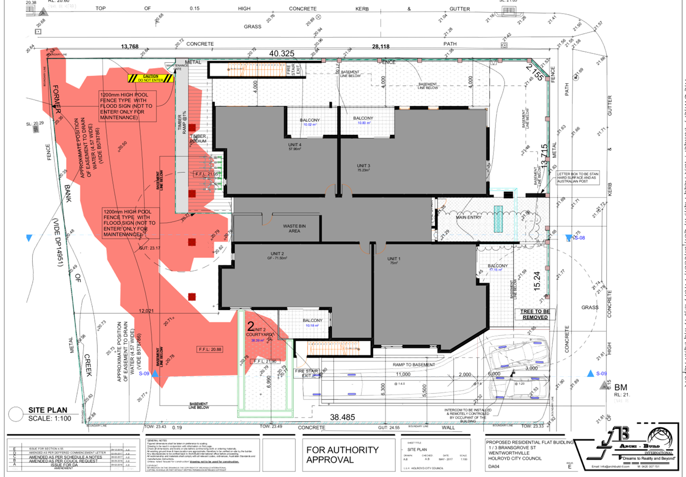
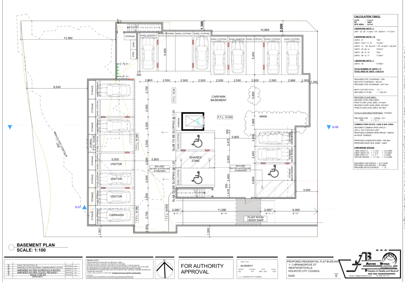
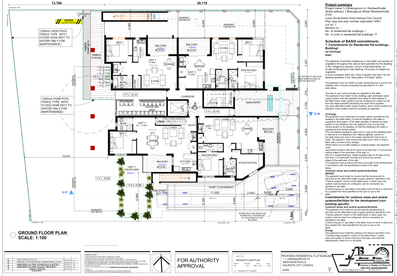
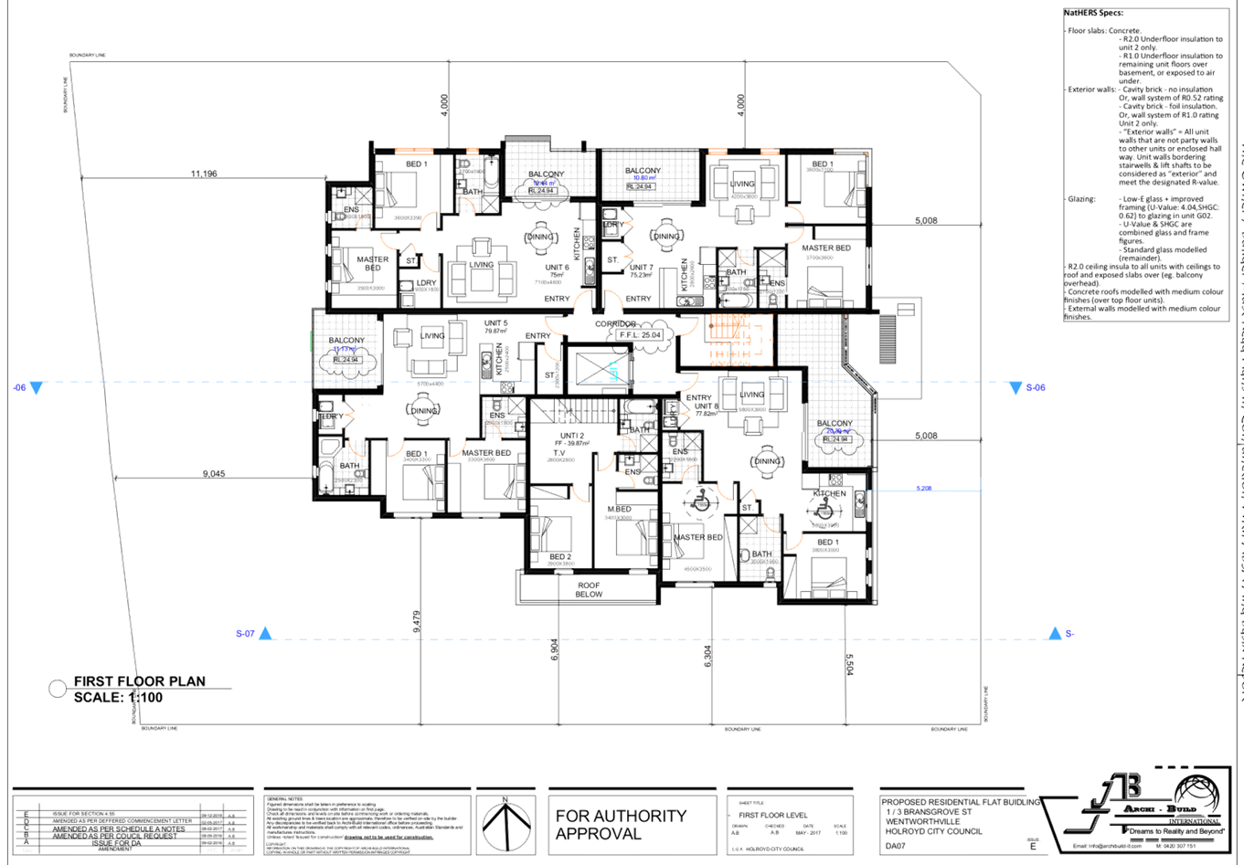
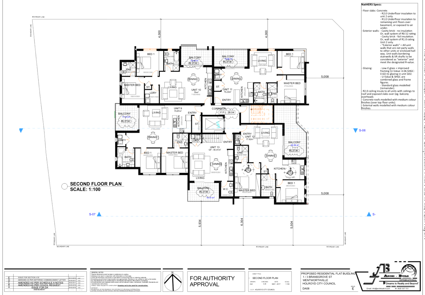
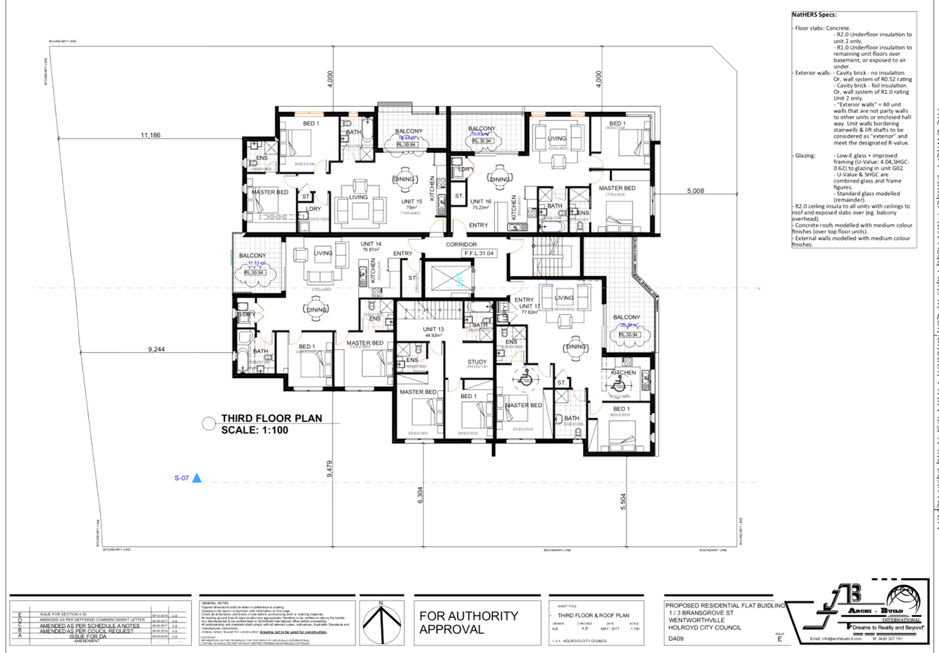
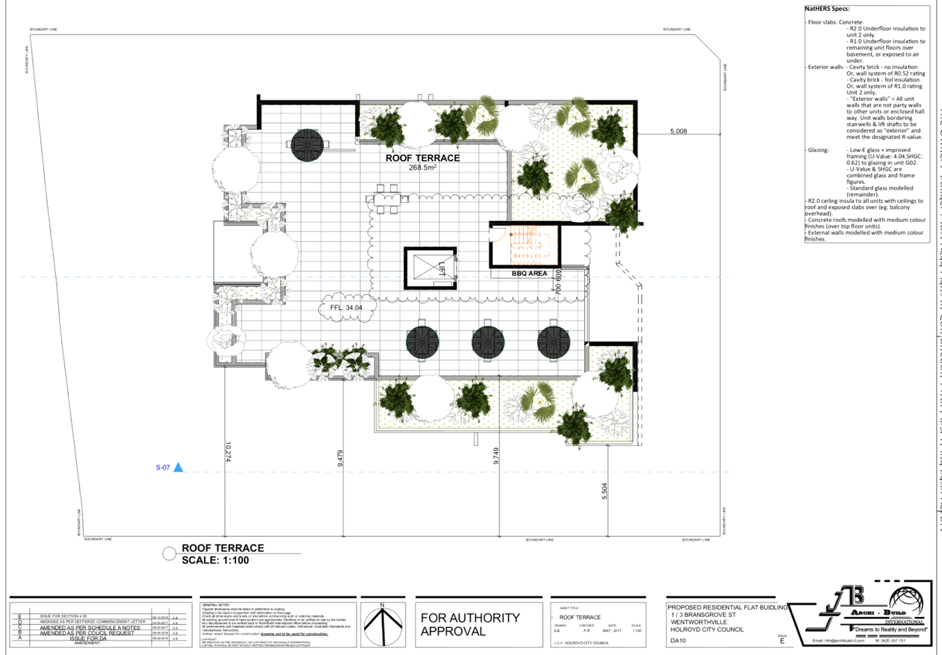
DOCUMENTS
ASSOCIATED WITH
REPORT LPP035/20
Attachment 7
Attachment 7 - Stormwater Engineering Plans
Cumberland Local Planning Panel Meeting
8 July 2020
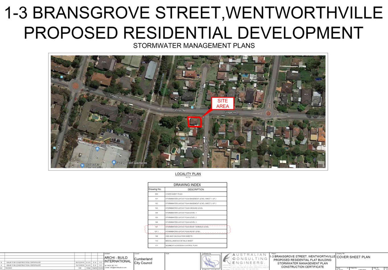
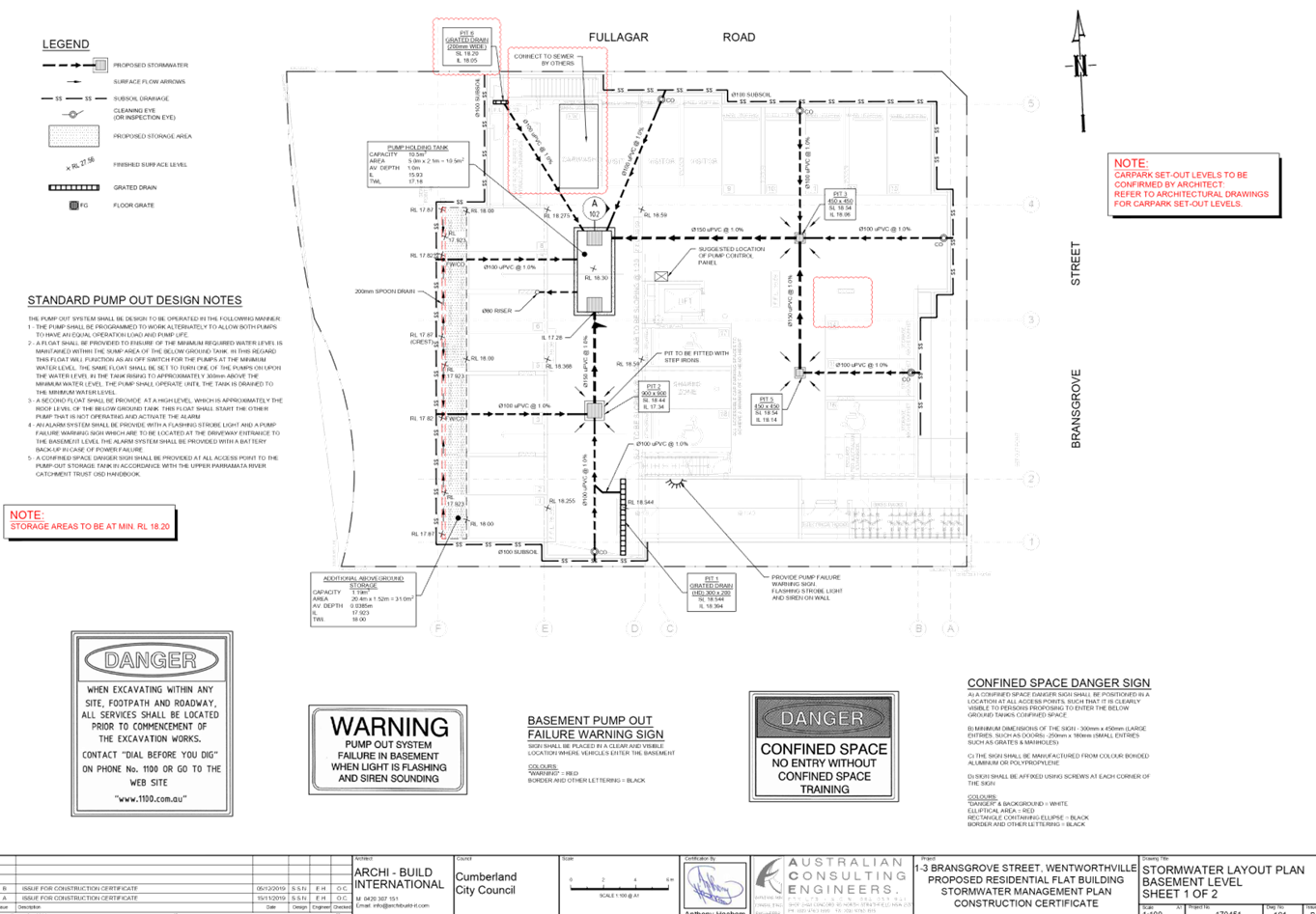
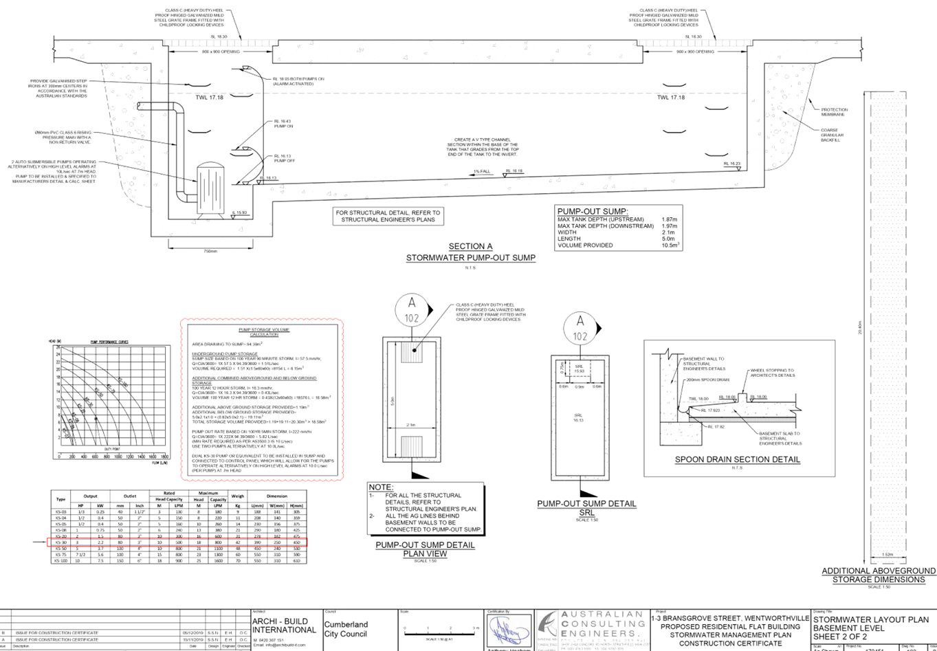
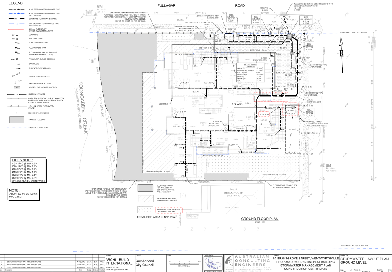
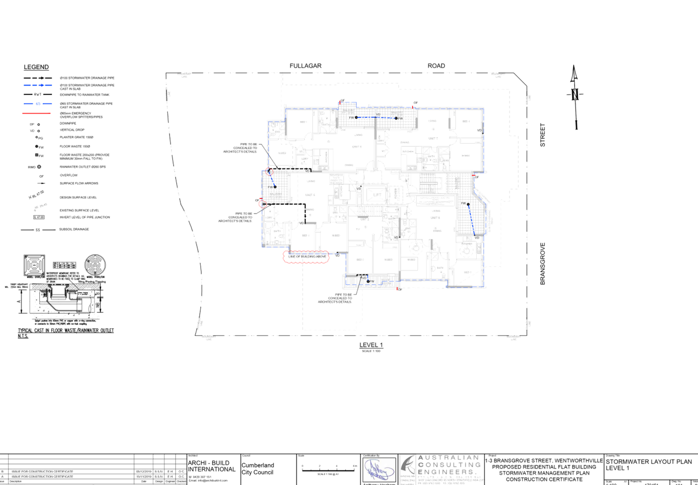
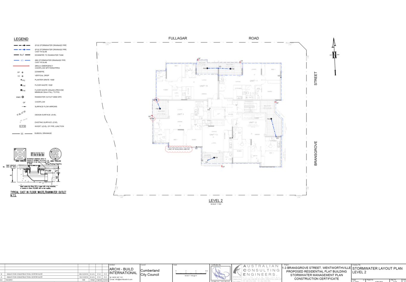
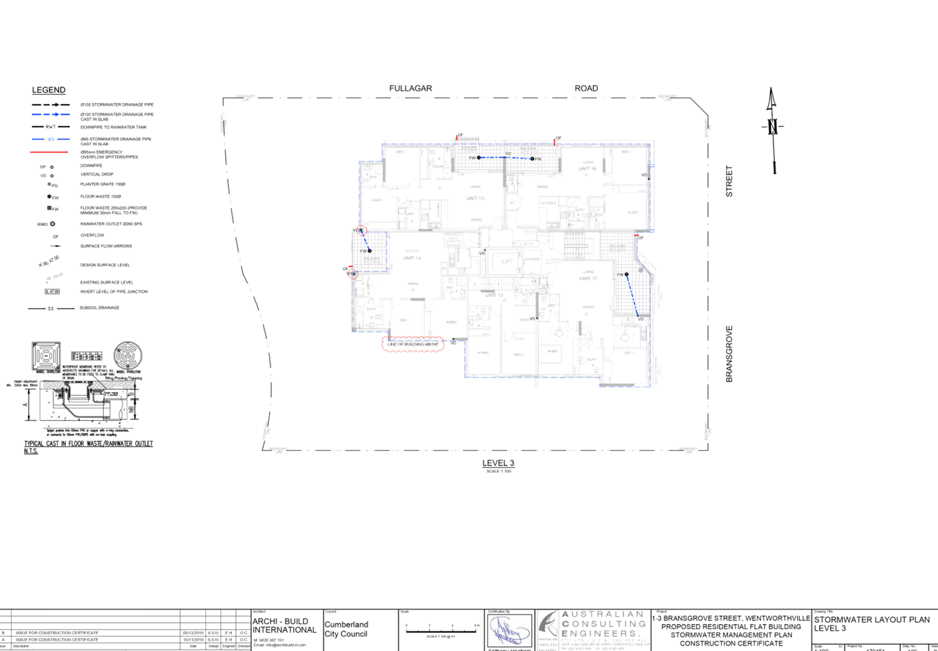
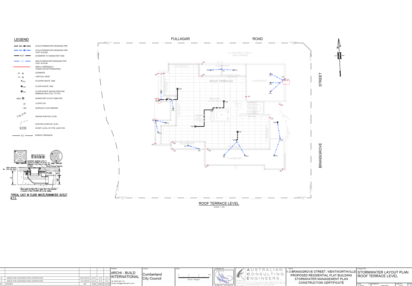
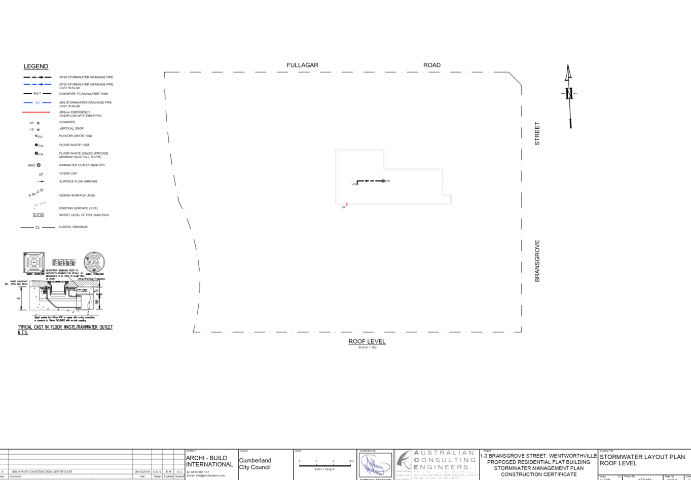
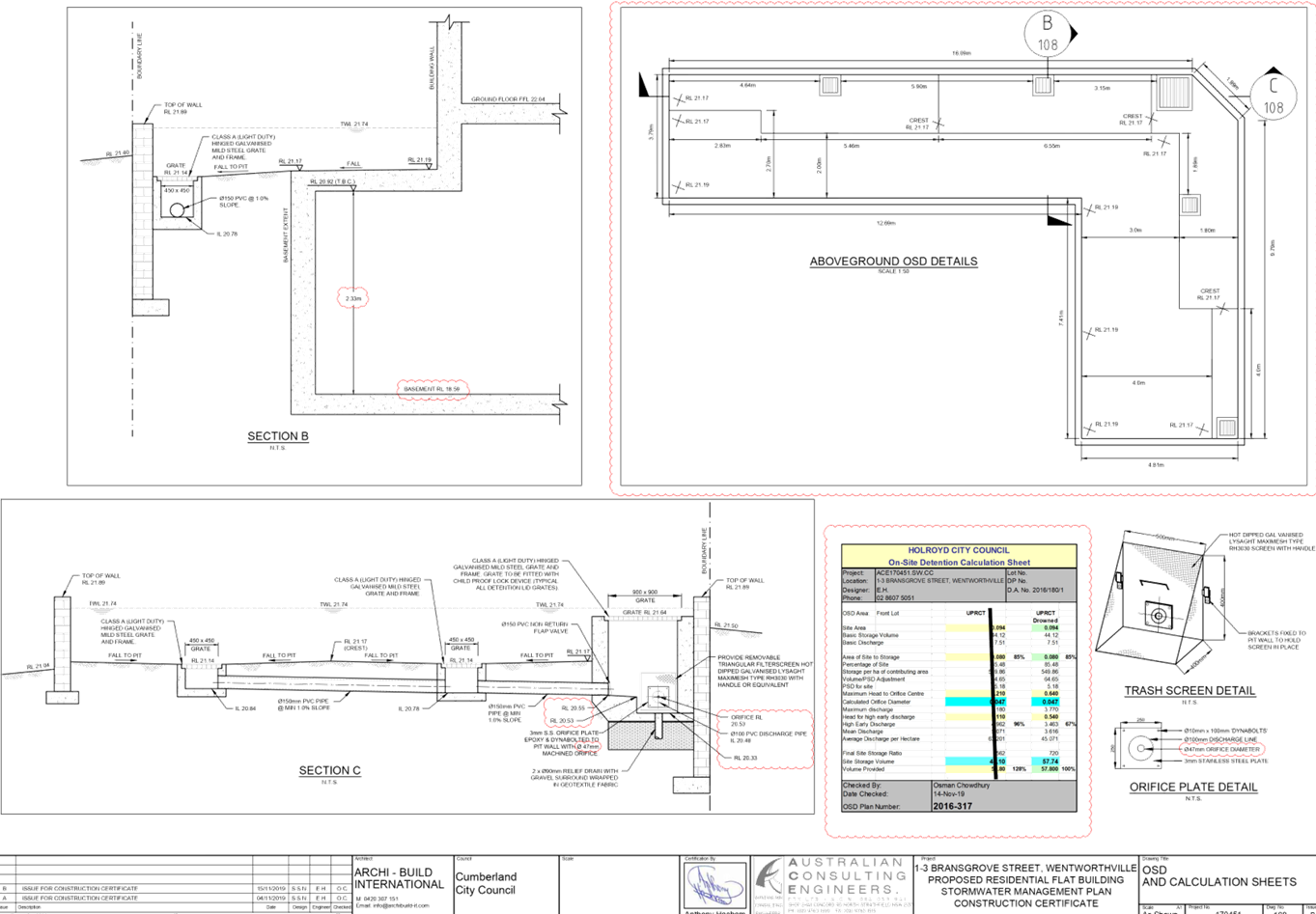
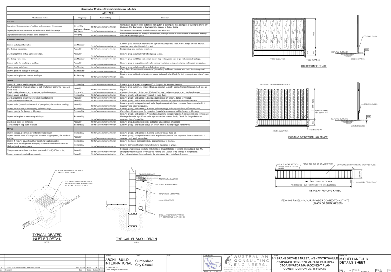
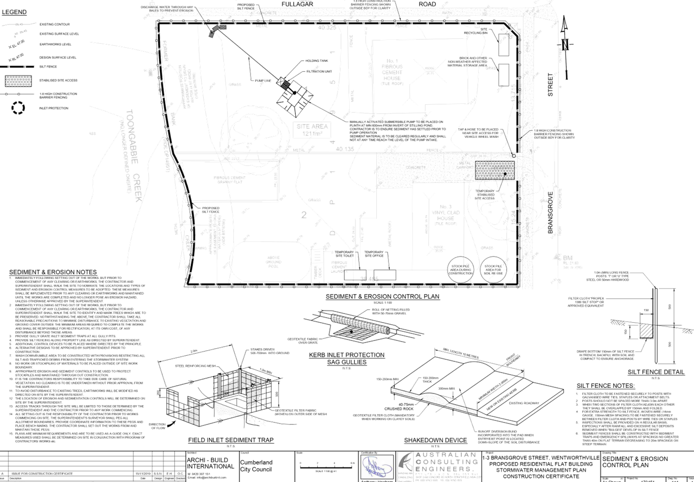
DOCUMENTS
ASSOCIATED WITH
REPORT LPP035/20
Attachment 8
Attachment 8 -Landscape Plan
Cumberland Local Planning Panel Meeting
8 July 2020
DOCUMENTS
ASSOCIATED WITH
REPORT LPP035/20
Attachment 9
Attachment 9 - Locality Map
Cumberland Local Planning Panel Meeting
8 July 2020
Cumberland
Local Planning Panel Meeting
8 July 2020
Item No: LPP036/20
Development
Application for 122 Robertson Street, Guildford
Responsible
Division: Environment
& Planning
Officer: Executive
Manager Development and Building
File
Number: DA2020/0280
|
Application lodged
|
12
May 2020
|
|
Applicant
|
Mr
S Christou
|
|
Owner
|
Mr
S Christou & Mrs G I Christou
|
|
Application No.
|
DA2020/0280
|
|
Description of Land
|
122
Robertson Street Guildford NSW 2161
Lot
111 DP 1114778
|
|
Proposed Development
|
Erection
of a pergola at the rear
|
|
Site Area
|
348.39sqm
|
|
Zoning
|
R2
– Low Density Residential
|
|
Disclosure of political donations and gifts
|
Nil
disclosure
|
|
Heritage
|
No
|
|
Principal Development Standards
|
N/A
- No Change to FSR or Height of Building
Proposed
Pergola Height: 2.75m maximum
|
|
Issues
|
Nil
|
1. Development
Application No. DA2020/0280 was received on 12 May 2020 for the erection of a
pergola at the rear.
2. The
application was publicly notified to occupants and owners of the adjoining
properties for a period of 14 days between 15 May 2020 and 29 May 2020. In
response, no submissions were received.
3. There
are no variations proposed to Parramatta Local Environmental Plan 2011 and
Parramatta Development Control Plan 2011.
4. The
application is recommended for approval subject to the conditions as provided
in the attached schedule.
5. The
application is referred to the Panel as part owner of site is a sitting
Councillor of Cumberland City Council.
Subject Site And Surrounding
Area
The site forms Lot 111 of
DP1114778 and is known as 122 Robertson Street, Guildford. The site has an area
of 348.39sqm and a frontage to Robertson Street, Guildford of 7.62m.
A site inspection of the premises
carried out on 1 June 2020 confirmed that the site is currently occupied by a
two storey dual occupancy development with concrete area to the rear of the
dual occupancy unit and landscaping.
The existing development
immediately adjoining the site includes the adjoining dual occupancy unit known
as 122A Robertson Street, Guildford, to the immediate south which contains a
pergola of similar materials, size and location as the current proposal.
Adjoining the site to the further south is a two storey dual occupancy
development and a single storey dwelling which contains a large tree within the
rear yard adjoins the site to the immediate north.
Figure
1 – Locality map of 122 Robertson Street Guildford
Figure
2 – Aerial view of subject site
Figure
3 – Street view of subject site
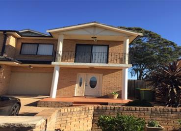
Figure
4 – Photo of concreate area of proposed pergola location facing towards
Robertson Street, Guildford
Figure
5 – Photo of north side elevation of concrete area of proposed pergola
location
Figure
6 – Photo of south side elevation of concrete area of proposed pergola location
Figure
7 – Photo of pergola attached to adjoining southern dual occupancy unit
known as 122A Robertson Street Guildford
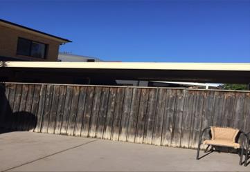
Figure
8 – Photo of landscaping within the rear yard looking towards the rear
boundary
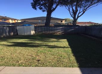
Description of the Proposed Development
Council has received a development
application on 12 May 2020 seeking approval for the erection of a pergola at
the rear.
Key features of the development
proposal are as follows:-
· Construction
of a pergola attached to the rear of a dual occupancy unit known as 122
Robertson Street, Guildford which contains the following details:
o Colourbond roof of grey colour with
metal support posts; and
o Constructed on an existing concrete
slab, measuring 7.62m in width and 7m in depth, located at the rear of the
dwelling with a total area of 53.34sqm.
The existing concrete slab at the
rear of the dwelling is located against the southern and northern side
boundaries of the subject site. The pergola is proposed to cover the whole area
of the existing concrete slab and as such is proposed to measure 7.62m in width
and 7m in depth for a total area of 53.34sqm and is to be attached to the rear
of the dwelling. The pergola is proposed to contain a maximum height of 2.75m.
History of Site
1. Development
Application (Cumberland City Council Reference: DA99/1639-01) lodged with
Parramatta City Council to demolish existing dwelling and erect a single storey
dwelling;
2. On
13 August 2002, Development Application JD/00145/02 was approved by Parramatta
City Council for construction of an attached dual occupancy and subdivide into
two (2) lots - Cumberland City Council Reference: DA/145/2002;
3. On
17 June 2003, Section 96(1A) Modification Application JD/145/02 was approved by
Parramatta City Council to modify the development consent for 122 Robertson
Street Guildford by relocating the on-site detention system from under the
driveway area to the landscaped planted area adjacent to the driveway -
(Cumberland City Council Reference: DA02/145-01)
4. Subdivision
Application (Parramatta City Council Reference: SC/122/2006) approved by
Parramatta City Council on 16 March 2007.
5. Construction
Certificate (Cumberland City Council’s Reference: CC2020/0158) has been
lodged with Council in conjunction with the current development application for
the erection of a pergola at the rear.
It is noted that the existing
concrete area of which the Pergola is proposed to be constructed upon, was
approved in accordance with Development Application JD/00145/02 for
construction of an attached dual occupancy and subdivide into two (2) lots.
History of Development
Application
|
Date
|
Action
|
|
12 May 2020
|
The Development Application was lodged for the
erection of a pergola at the rear.
|
|
13 May 2020
|
The Development Application was referred to
Council’s Building Surveyor for comment.
|
|
15 May 2020 to 29 May 2020
|
Application was placed on public notification
for 14 days. No submissions were received.
|
|
1 June 2020
|
Site Inspection conducted.
|
|
1 June 2020
|
Comments were received from Council’s Building
Surveyor.
|
|
8 July 2020
|
Application referred to Cumberland Local
Planning Panel for determination.
|
Applicants Supporting
Statement
The applicant has provided a
Statement of Environmental Effects which was received by Council on 12 May 2020
in support of the application.
Contact with Relevant
Parties
Council has undertaken a site
inspection of the subject site and surrounding properties and has been in
regular contact with the applicant throughout the assessment process.
Internal Referrals
Building Surveyor
The development application was
referred to Council’s Building Surveyor for comment who has advised that
the development proposal is satisfactory and can be supported subject to
conditions of consent.
A further comment was provided
being as follows, however this comment is in relation to the Construction
Certificate lodged with Council (Cumberland City Council’s Reference:
CC2020/0158) and is not required at the DA stage:
1. Construction
details (Structural engineer's details of the proposed pergola are required to
be provided which includes connections to the external walls, bearers details,
engineering details of the roof rafters, roof cladding, post and post
anchoring) and residential construction specification shall be provided to the
Certifier prior to the issue of the Construction Certificate;
External Referrals
The application was not required
to be referred to any external government authorities for comment.
PLANNING COMMENTS
The provisions of any Environmental
Planning Instruments (EP&A Act s4.15 (1)(a)(i))
State Environmental Planning
Policies
The proposed development is
affected by the following State Environmental Planning Policies:
(a) State
Environmental Planning Policy No. 55 – Remediation of Land (SEPP 55)
Clause 7 of SEPP 55 requires
Council to be satisfied that the site is suitable or can be made suitable to
accommodate the proposed development. The matters listed within Clause 7 have
been considered in the assessment of the development application.
|
Matter for
Consideration
|
Yes/No
|
|
Does the application
involve re-development of the site or a change of land use?
|
Yes No
|
|
In the development
going to be used for a sensitive land use (e.g.: residential, educational,
recreational, childcare or hospital)?
|
Yes No
|
|
Does information
available to you indicate that an activity listed below has ever been
approved, or occurred at the site?
acid/alkali plant and formulation, agricultural/horticultural
activities, airports, asbestos production and disposal, chemicals manufacture
and formulation, defence works, drum re-conditioning works, dry cleaning
establishments, electrical manufacturing (transformers), electroplating and
heat treatment premises, engine works, explosive industry, gas works, iron
and steel works, landfill sites, metal treatment, mining and extractive
industries, oil production and storage, paint formulation and manufacture, pesticide
manufacture and formulation, power stations, railway yards, scrap yards,
service stations, sheep and cattle dips, smelting and refining, tanning and
associated trades, waste storage and treatment, wood preservation
|
Yes No
|
|
Is
the site listed on Council’s Contaminated Land database?
|
Yes No
|
|
Is
the site subject to EPA clean-up order or other EPA restrictions?
|
Yes No
|
|
Has
the site been the subject of known pollution incidents or illegal dumping?
|
Yes No
|
|
Does
the site adjoin any contaminated land/previously contaminated land?
|
Yes No
|
|
Has
the appropriate level of investigation been carried out in respect of
contamination matters for Council to be satisfied that the site is suitable
to accommodate the proposed development or can be made suitable to
accommodate the proposed development?
|
Yes No
|
|
Details of
contamination investigations carried out at the site:
The site is not identified in Council’s records as
being contaminated. A site inspection revealed the site does not have any
obvious history of a previous land use that may have caused contamination and
there is no specific evidence that indicates the site is contaminated. The
subject site is currently used for residential purposes and contamination is
not expected
|
(b) State
Environmental Planning Policy (Infrastructure) 2007 (ISEPP)
The provisions of the ISEPP 2007
have been considered in the assessment of the development application.
Clause 45 - Development likely
to affect an electricity transmission or distribution network
The subject development does not
incorporate basement excavation in proximity (within 2 metres) to an
electricity distribution pole nor does the development occur within 5 metres of
an overhead electricity power line. As such, the Consent Authority is not
required to give written notice to an electricity supply authority.
Clause 85 – Development
adjacent to railway corridors
The application is not subject to
clause 85 of the ISEPP as the site is not in or adjacent to a rail corridor.
Clause 86 – Excavation
in, above, below or adjacent to rail corridors
The application is not subject to
clause 86 of the ISEPP as the proposed redevelopment of the site does not
involve excavation to a depth of at least 2m below ground level (existing), on
land within, below or above a rail corridor, or within 25m (measured horizontally)
of a rail corridor.
Clause 87 – Impact of
rail noise or vibration on non-rail development
The application is not subject to
clause 87 of the ISEPP as the site is not in or adjacent to a rail corridor nor
is likely to be adversely affected by rail noise or vibration:
Clause 101 – Frontage to
classified road
The application is not subject to
clause 101 of the ISEPP as the site does not have frontage to a classified
road.
Clause 102 – Impact of
road noise or vibration on non-road development
The application is not subject to
clause 102 of the ISEPP as the average daily traffic volume is less than 40,000
vehicles on Robertson Street, Guildford.
Clause 104 – Traffic
generation developments
The application is not subject to
clause 104 as the proposal does not trigger the requirements for traffic
generating developments listed in Schedule 3 of the ISEPP.
(c) Statement
Environmental Planning Policy No 19 - Bushland in Urban Areas (SEPP 19)
The subject site does not adjoin
land zoned or reserved for public open space.
(d) State
Environmental Planning Policy (Vegetation in Non-Rural Areas) 2017
Yes – The proposal does not
involve the removal of any vegetation.
(e) State
Environmental Planning Policy (Coastal Management) 2018
The subject site is not identified
as a coastal wetland or land identified as “proximity area for coastal
wetlands” or land identified as such by the Coastal Vulnerability Area
Map.
(f) State
Environmental Planning Policy (Building Sustainability Index: BASIX) 2004
The cost of works is valued at
less than $50,000 therefore a BASIX Certificate was not required to be
submitted as part of the development application.
Regional Environmental Plans
The proposed development is
affected by the following Regional Environmental Plans:
(a) Sydney
Regional Environmental Plan (Sydney Harbour Catchment) 2005
The subject site is identified as
being located within the area affected by the Sydney Regional Environmental
Plan (Sydney Harbour Catchment) 2005. The proposed development raises no issues
as no impact on the catchment is envisaged.
Local Environmental Plans
The provision of the Parramatta
Local Environmental Plan 2011 is applicable to the development proposal. It is
noted that the development achieves compliance with the key statutory requirements
of the Parramatta Local Environmental Plan 2011 and the objectives of the R2
– Low Density Residential Zoning.
(a) Permissibility:-
The proposed development being for
the erection of a pergola at the rear is an ancillary structure to the existing
approved dual occupancy unit. A ‘dual occupancy’ is permissible in
the R2 – Low Density Residential zone with consent.
The relevant matters to be
considered under Parramatta Local Environmental Plan 2011 and the applicable
clauses for the proposed development are summarised below.
Figure
4 – Parramatta LEP 2011 Compliance Table
|
DEVELOPMENT STANDARD
|
COMPLIANCE
|
DISCUSSION
|
|
4.3 Height of Buildings
Maximum permissible: 10m
|
Yes
|
The pergola proposes a maximum height of 2.75m.
|
|
4.4 Floor
Space Ratio
Maximum permissible: 0.7:1
|
Yes
|
The development application is for the erection of a
pergola at the rear of an existing dual occupancy development only and as
such no change to the existing floor space ratio is proposed.
|
|
5.10 Heritage conservation
|
N/A
|
The subject
site does not contain a heritage item, and is
not located within the vicinity of the heritage item or heritage conservation
area.
|
|
6.1 Acid sulfate soils
|
N/A
|
The site is not affected by Acid Sulfate Soils.
|
|
6.2 Earthworks
|
N/A
|
The development application is for the erection of a
pergola at the rear of an existing dual occupancy development only, which is
proposed to be constructed upon an existing concrete slab area previously
approved.
|
|
6.3 Flood planning
|
N/A
|
The site is not identified as being flood prone.
|
|
6.4 Biodiversity Protection
|
N/A
|
The site is not identified as Biodiversity on the Natural
Resources - Biodiversity Map.
|
|
6.5 Water Protection
|
N/A
|
The site is not identified as “Riparian Land and
Waterways”.
|
|
6.11 Dual occupancies on land in Zones R2, R3 and R4
|
N/A
|
The development application is for the erection of a
pergola at the rear of an existing dual occupancy development only.
|
The provisions of any proposed
instrument that is or has been the subject (EP&A Act s4.15 (1)(a)(ii))
(a) Draft
State Environmental Planning Policy (Environment)
The draft SEPP relates to the
protection and management of our natural environment with the aim of
simplifying the planning rules for a number of water catchments, waterways,
urban bushland, and Willandra Lakes World Heritage Property. The changes
proposed include consolidating the following seven existing SEPPs:
· State
Environmental Planning Policy No. 19 – Bushland in Urban Areas
· State
Environmental Planning Policy (Sydney Drinking Water Catchment) 2011
· State
Environmental Planning Policy No. 50 – Canal Estate Development
· Greater
Metropolitan Regional Environmental Plan No. 2 – Georges River Catchment
· Sydney
Regional Environmental Plan No. 20 – Hawkesbury-Nepean River (No.2-1997)
· Sydney
Regional Environmental Plan (Sydney Harbour Catchment) 2005
· Willandra
Lakes Regional Environmental Plan No. 1 – World Heritage Property.
The draft policy will repeal the
above existing SEPPs and certain provisions will be transferred directly to the
new SEPP, amended and transferred, or repealed due to overlaps with other areas
of the NSW planning system.
Changes are also proposed to the
Standard Instrument – Principal Local Environmental Plan. Some provisions
of the existing policies will be transferred to new Section 117 Local Planning
Directions where appropriate.
(b) Draft
Cumberland Local Environmental Plan 2020 (Draft CLEP) and draft Cumberland
Development Control Plan 2020 (Draft CDCP)
The Draft Cumberland Local
Environmental Plan 2020 (Draft CLEP) and Draft Cumberland Development Control
Plan 2020 (Draft CDCP) have been prepared by Cumberland City Council to provide
a single planning framework for the future planning of Cumberland City. The
changes proposed seek to harmonise and repeal the three existing LEPs and three
existing DCPs currently applicable to the Cumberland local government area,
those being:
· Holroyd
Local Environmental Plan 2013 and Holroyd Development Control Plan 2013,
· Parramatta
Local Environmental Plan 2011 and Parramatta Development Control Plan 2011, and
· Auburn
Local Environmental Plan 2010 and Auburn Development Control Plan 2010.
The planning controls proposed
within the draft CLEP and draft CDCP for the subject site, are not proposed to
affect the proposed development.
The provisions of any
Development Control Plans (EP&A Act s4.15 (1)(a)(iii))
The Parramatta Development Control
Plan 2011 provides guidance for the design and operation of development to
achieve the aims and objectives of the Parramatta Local Environmental Plan
2011.
A comprehensive assessment and
compliance table is contained in Appendix B.
It is noted that Parramatta
Development Control Plan 2013 does not contain any specific development
controls for a pergola. As such the development has been assessed under
‘Dual Occupancy’ development controls provided within Parramatta
Development Control Plan 2011 as the pergola is proposed to be attached to the
rear of the existing dual occupancy unit.
It is also noted that the dual
occupancy development was approved prior to the current Parramatta Development
Control Plan 2011 becoming operational.
The following table highlights
non-compliances with Parramatta Development Control Plan 2011, which relate to
side setbacks and rear setback, however as stated above, the side setback and
rear setback development controls within Parramatta Development Control Plan
2011 are for dual occupancy development as there is no specific development
controls relating for pergolas. The variations sought are considered
satisfactory on merit in this instance.
Figure 9: PDCP 2011 Variation
Table
|
Part 3 – Clause 3.1 – Table 3.1.3.3 –
Dual Occupancies
|
Control
|
Proposed
|
Variation
|
|
Side Setbacks
|
Minimum 1.5m
|
0mm to southern and northern side setbacks
|
100%
|
|
Rear setback
|
Minimum 30% of site length
|
13.12% (6m/45.72m)
|
16.88%
|
As indicated in Figure 7 above,
the adjoining southern dual occupancy unit known as 122A Robertson Street
Guildford, currently contains a pergola (Council Reference: DA2008/8729) which
is of similar materials, size and location as the current proposal in terms of
it is also located on the northern and southern side boundaries and is built
upon an existing concrete slab previously approved and is of a similar size to
the current proposal.
The northern and southern side
setbacks proposed for the pergola being 0mm and proposed rear setback of the
pergola being 13.12% of the site length (6m), are considered acceptable on
merit as the pergola is proposed to be constructed upon an existing approved
concrete slab and as such will not reduce deep soil and landscaping for the
site.
The pergola, including gutters, is
proposed to be contained wholly within the subject site and is not proposed to
overhang adjoining properties.
The subject allotment currently
does not contain any covered private open space area for occupants and as such
the proposed pergola will increase outdoor amenity for the occupants of the
dwelling in terms of protection from weather elements such as heat, rain and
wind by providing shelter and it is considered that the proposal performs
adequately from an environmental planning viewpoint and may be supported.
The development application was
also referred to Council’s Building Surveyor who raised no concerns
subject to recommended conditions being imposed in the development consent, due
to the proposed 0mm northern and southern side setbacks, for the external walls
of the pergola to achieve a Fire Resistance Level of 60/60/60 to comply with
the Building Code of Australia Deemed To Satisfy provisions with details of the
materials used to satisfy this requirement required to be submitted to the
Principal Certifying Authority prior to issuing of any Construction Certificate
and for the stormwater to be connected to the existing stormwater system
onsite.
The proposed side and rear
setbacks for the pergola are considered acceptable subject to conditions
imposed in development consent as per Council’s Building Surveyor’s
comments provided above as the proposal will not impact on the streetscape,
will protect the amenity of adjoining sites, will increase outdoor amenity for
occupants of the subject site and will provide for the provision of a
functional private open space area for the existing development.
The provisions of any planning
agreement that has been entered into under section 7.4, or any draft planning
agreement that a developer has offered to enter into under section 7.4 (EP&A
Act s4.15(1)(a)(iiia))
There is no draft planning
agreement associated with the subject Development Application.
The provisions of the
Regulations (EP&A Act s4.15 (1)(a)(iv))
The proposed development raises no
concerns as to the relevant matters arising from the Environmental Planning and
Assessment Regulations 2000 (EP&A Reg).
The Likely Environmental,
Social or Economic Impacts (EP&A Act s4.15 (1)(b))
It is considered that the proposed
development will have no significant adverse environmental, social or economic
impacts in the locality.
The suitability of the site for
the development (EP&A Act s4.15 (1)(c))
The subject site and locality is
not known to be affected by any natural hazards or other site constraints
likely to have a significant adverse impact on the proposed development.
Accordingly, it is considered that the development is suitable in the context
of the site and surrounding locality.
Submissions made in accordance
with the Act or Regulation (EP&A Act s4.15 (1)(d))
|
Advertised (newspaper)
|
Mail
|
Sign
|
Not Required
|
In accordance with Council’s
notification requirements contained within the Parramatta Development Control
Plan 2011, the proposal was publicly notified for a period of 14 days between
15 May 2020 and 29 May 2020. No submissions were received in respect of the
proposed development.
The public interest (EP&A
Act s4.15(1)(e))
In view of the foregoing analysis
it is considered that the development, if carried out subject to the draft
conditions set out in Attachment 1, will have no significant adverse impacts on
the public interest.
Section 7.12 (Formerly S94A)
Fixed Development Consent Levies
This part of the Act relates to
the collection of monetary contributions from applicants for use in developing
key local infrastructure.
Comments:
The development does not require
the payment of contributions in accordance with Cumberland Local Infrastructure
Contributions Plan 2020.
Disclosure of Political
Donations and Gifts
The applicant and notification
process did not result in any disclosure of Political Donations and Gifts.
The development application has
been assessed in accordance with the relevant requirements of the Environmental
Planning and Assessment Act 1979, Parramatta Local Environmental Plan 2011 and
Parramatta Development Control Plan 2011 and is considered to be satisfactory
for approval subject to conditions.
The proposed development is
appropriately located within the R2 - Low Density Residential zone under the
relevant provisions of Parramatta Local Environmental Plan 2011. The proposal
is consistent with all statutory and non-statutory controls applying to the
development. The development is considered to perform adequately in terms of
its relationship to its surrounding built and natural environment.
For these reasons, it is
considered that the proposal is satisfactory having regard to the matters of
consideration under Section 4.15 of the Environmental Planning and Assessment
Act 1979, and the development may be approved subject to conditions.
|
That Development Application No. DA2020/0280 for the
erection of a pergola at the rear on land at 122 Robertson Street Guildford
NSW 2161 be approved subject to attached conditions.
|
1. Draft Notice
of Determination
2. Parramatta
Development Control Plan 2011 Compliance Table
3. Architectural
Plan
4. Waste
Management Plan
DOCUMENTS
ASSOCIATED WITH
REPORT LPP036/20
Attachment 1
Draft Notice of Determination
Cumberland Local Planning Panel Meeting
8 July 2020


DOCUMENTS
ASSOCIATED WITH
REPORT LPP036/20
Attachment 2
Parramatta Development Control Plan 2011 Compliance
Table
Cumberland Local Planning Panel Meeting
8 July 2020
DOCUMENTS
ASSOCIATED WITH
REPORT LPP036/20
Attachment 3
Architectural Plan
Cumberland Local Planning Panel Meeting
8 July 2020
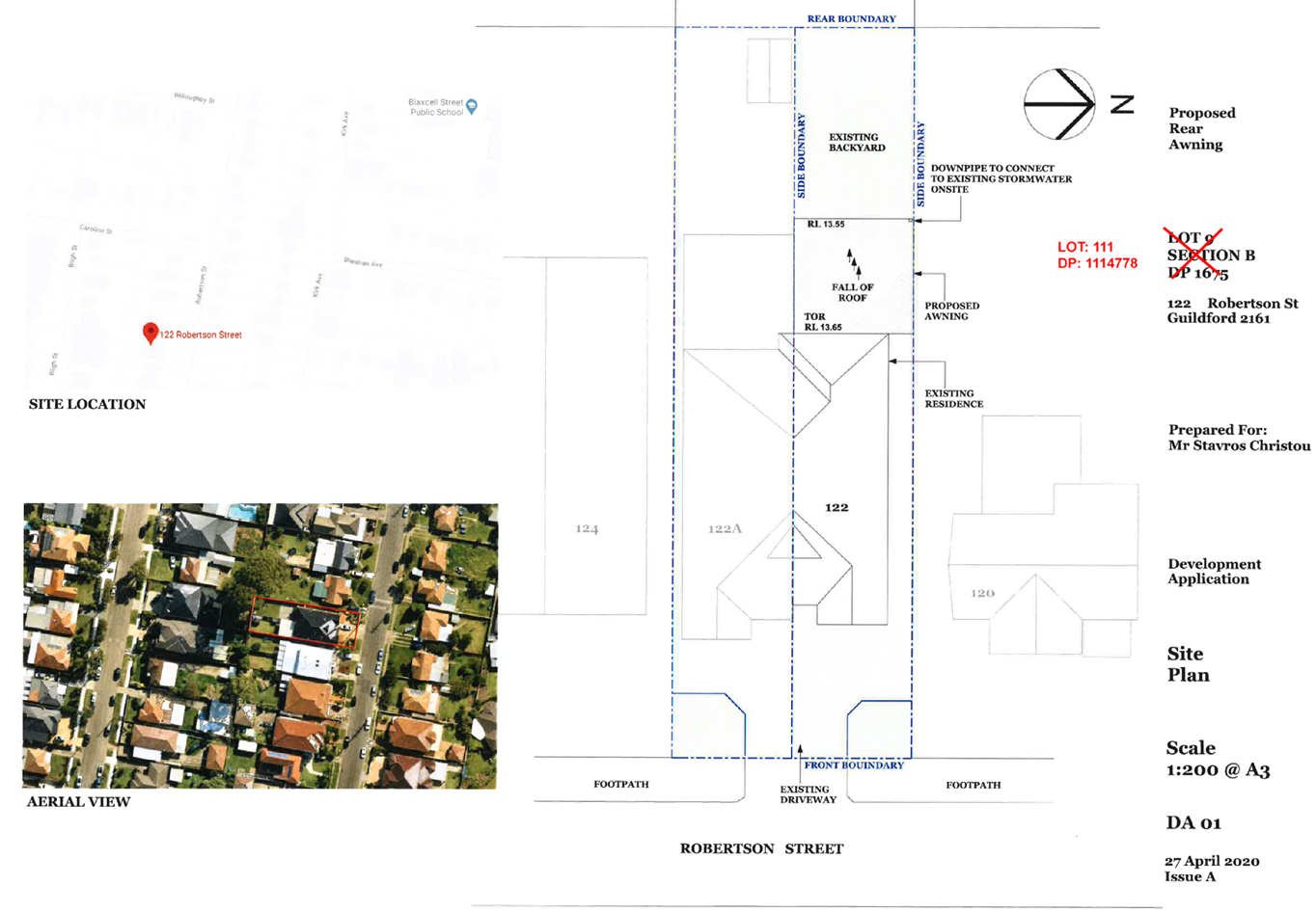
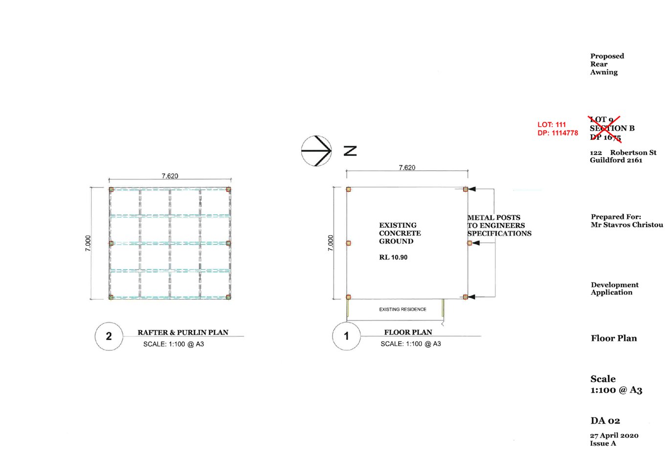
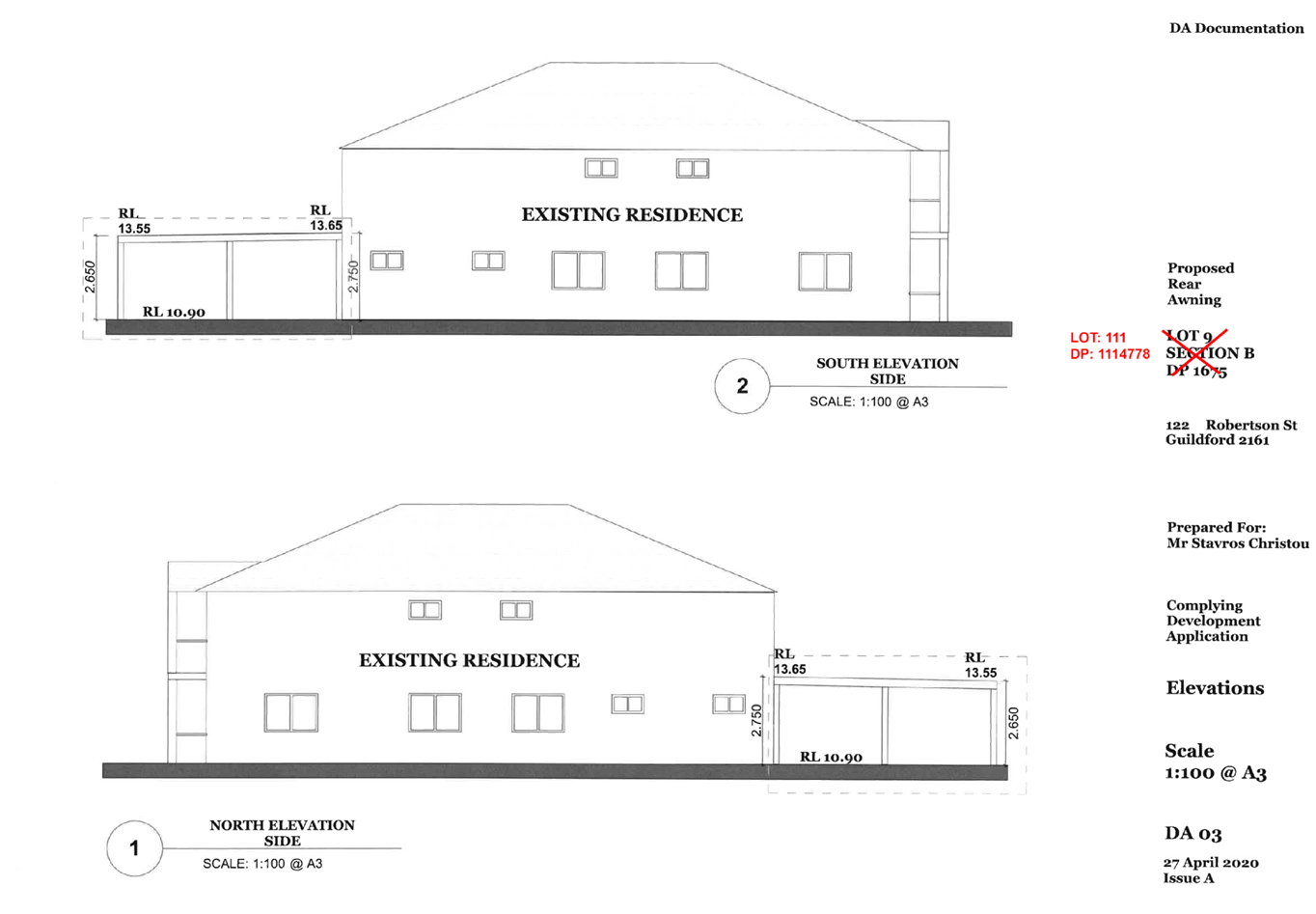
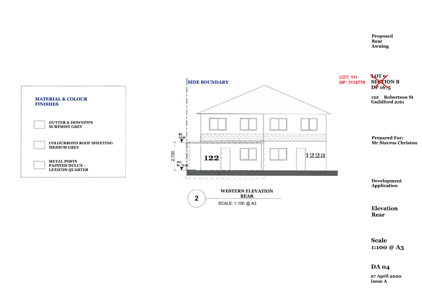
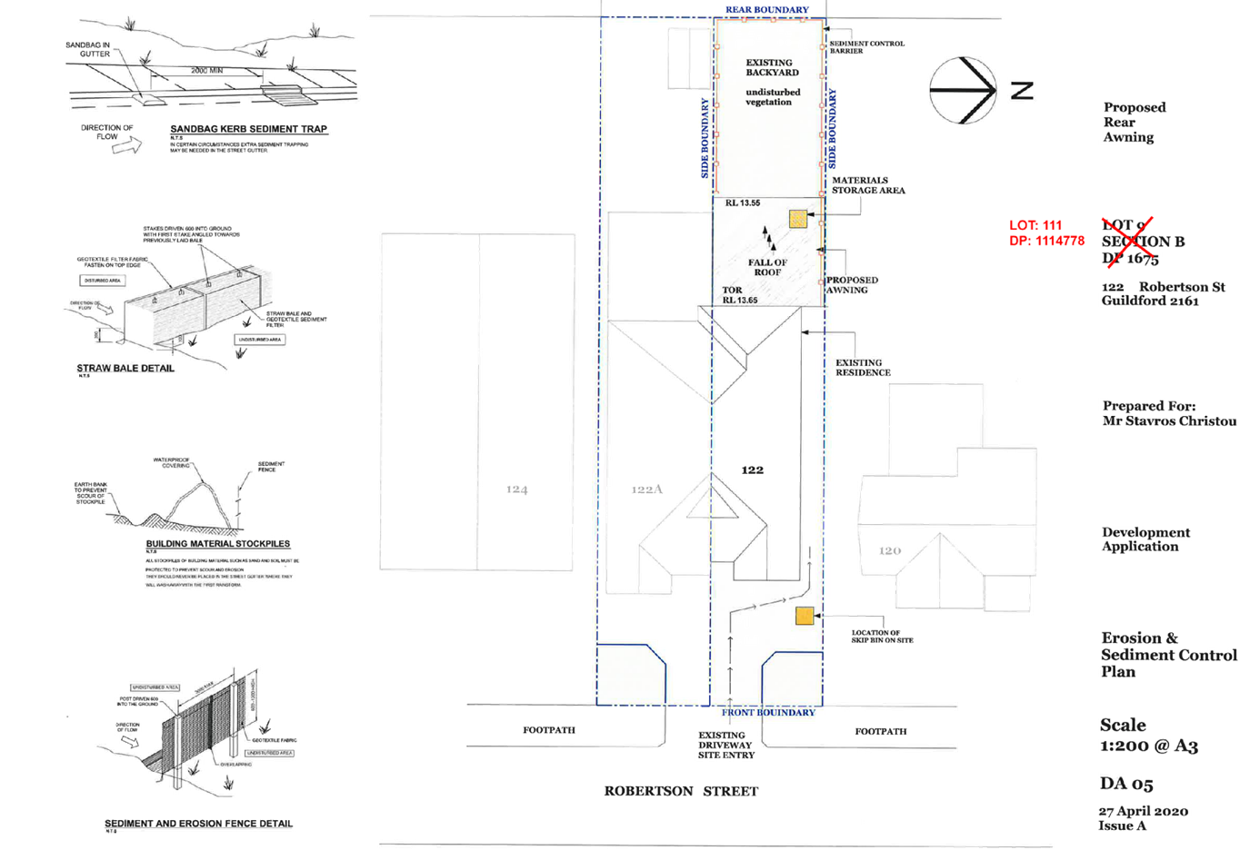
DOCUMENTS
ASSOCIATED WITH
REPORT LPP036/20
Attachment 4
Waste Management Plan
Cumberland Local Planning Panel Meeting
8 July 2020
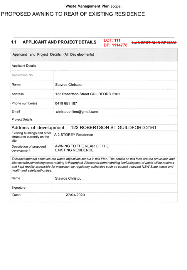

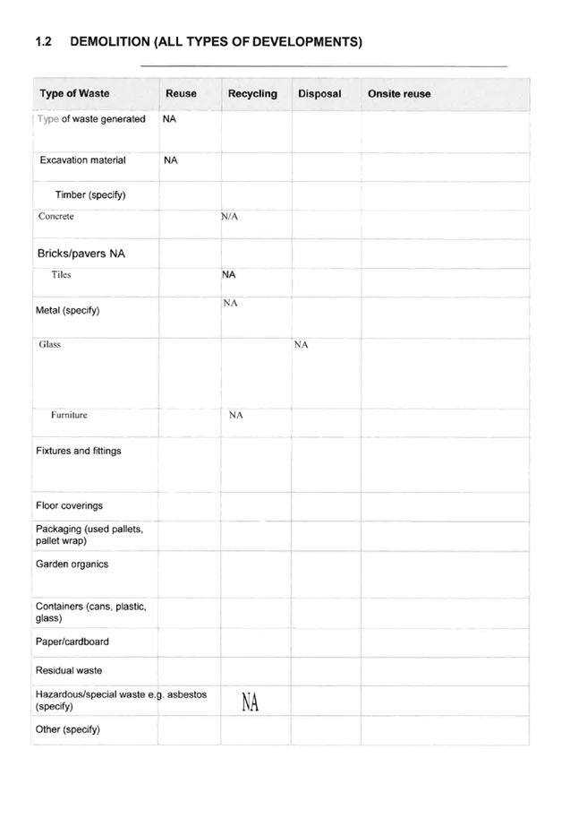


Cumberland
Local Planning Panel Meeting
8 July 2020
Item No: LPP037/20
Development
Application for 25A Crescent Street, Holroyd
Responsible
Division: Environment
& Planning
Officer: Executive
Manager Development and Building
File
Number: DA2020/0113
|
Application
lodged
|
28 February 2020
|
|
Applicant
|
Qms Media C/- Mecone
|
|
Owner
|
Cumberland City Council
|
|
Application
No.
|
DA2020/0113
|
|
Description
of Land
|
25A Crescent Street
HOLROYD NSW 2142, Lot 12 DP 773184
|
|
Proposed
Development
|
Replacement of an existing
twin sided static advertising sign with a twin sided LED sign.
|
|
Site
Area
|
Total site area (Holroyd
Gardens):18,600m2
Area for the proposed sign: 64m2
|
|
Zoning
|
RE-1 Public Recreation
|
|
Disclosure
of political donations and gifts
|
Nil disclosure
|
|
Heritage
|
The subject site is located
within the vicinity of a heritage item of local significance being “Goodlet & Smith (brickmaking plant and chimney and
Hoffman kiln and chimney) at No. 23-25 Brickworks Drive, Holroyd (I53)
|
|
Principal
Development Standards
|
N/A
|
|
Issues
|
The proposal does not seek any
new non compliances.
|
1. Development
Application No. DA2020/0113 was received on 28 February 2020 for the
Replacement of an existing twin sided static advertising sign with a twin sided
LED sign.
2. The
application was publicly notified to occupants and owners of the adjoining
properties for a period 14 days between 1 April 2020 and 15 April 2020. In
response, no submissions were received.
3. The
subject application has been assessed against the relevant provisions of the
Environmental Planning and Assessment Act 1979, Holroyd Local Environmental
Plan 2013 (HLEP 2013), State Environmental Planning Policy (Infrastructure)
2007, State Environmental Planning Policy No 64 – Advertising and
Signage, and Holroyd Development Control Plan 2013 (HDCP 2013).
4. The
application involves the following non-compliance* (as existing) which is
considered supportable as discussed in detail elsewhere in the report:
|
Item
|
Required
|
Proposed
|
% Variation
|
|
Height of the sign
(HDCP 2013)
|
15 m
|
16.35m (as existing)
|
9%
|
*Note: The proposal does not seek
any new non compliances.
5. The
owner of the subject property is identified as Cumberland City Council. In this
regard, in accordance with Schedule 2 of the Local Planning Panel Direction
– Development Applications, the application is referred to the Cumberland
Local Planning Panel (CLPP) for determination.
6. The
application is recommended for approval subject to the conditions as provided
in the attached schedule.
Subject Site and Surrounding
Area
The site comprises of Holroyd
Sportsground which is located adjacent to the M4 Motorway. The site is bound by
the M4 Motorway to the north, whilst also located adjacent to Holroyd
industrial and business areas to the south and west. The site is not developed
with any significant structures other than a sportsground and clubhouse. The
site is also bounded by vegetation to the north and south. The total site area
is approximately 1.86ha and irregular in shape. The signage is located over
approximately 64m2.
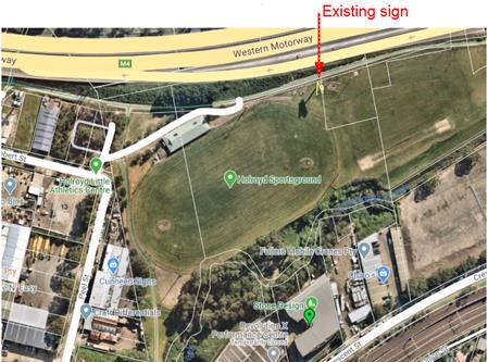
Figure 1 –
Aerial view of subject site
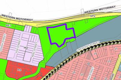
Figure
2 – Locality Plan of subject site
Figure
3- view of the subject site
Figure
4 & 5 – Existing advertising structure as viewed from M4 Motorway
(westbound) and Holroyd Sportsground
Description of the Proposed
Development
Council has received a development
application for the conversion of an existing twin sided static advertising
sign with a twin sided LED sign incorporating:
· Removal
of the two existing static signs;
· Removal
of six (6) flood lights attached the signage structure; and
· Installation
of two (2) LED advertising display boards facing eastbound and westbound along
the M4 Western Motorway.
· The
proposed digital advertising signs will display a series of static images, with
a dwell time of 25 seconds with a transition time of 0.1 seconds or less; and
· The
total area of each digital sign to be 42.41 m2.
The specifics of the advertising
structure include:
· An
existing height of 16.35m above ground level (existing);
· Existing
dimensions of 3.35m x 12.66m (42.41m2); and
· Constructed
from a perforated metal profile.
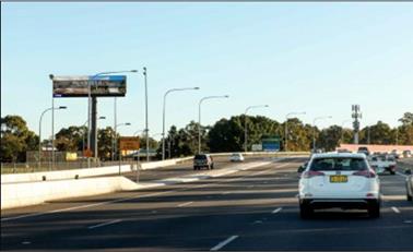
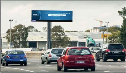
Figure
6 & 7 – Proposed advertising structure as viewed from M4 Motorway
(westbound) and (eastbound)
Application History
|
Date
|
Action
|
|
28 February 2020
|
DA
2020/0113 was lodged with Council
|
|
17
March 2020
|
Application
referred to Council’s internal departments and RMS for review.
|
|
1 April
to 14 April 2020
|
Application
notified to surrounding properties, a sign was erected on the site, and an
advertisement was placed in the local newspaper. No public submissions were
received as a result of the notification.
|
|
14
April 2020
|
RMS
provided concurrence subject to conditions.
|
|
8 July
2020
|
Application referred to CLPP
for determination.
|
Applicants Supporting
Statement
The applicant has provided a
Statement of Environmental Effects prepared by Mecone dated February 2020 in
support of the application.
Contact with Relevant
Parties
The assessing officer has
undertaken a site inspection of the subject site and surrounding properties and
has been in regular contact with the applicant throughout the assessment
process.
Internal Referrals
Parks and Recreation
The development application was
referred to Council’s Parks and Recreation Officer for comment who has
advised that the development proposal is satisfactory subject to recommended
conditions of consent.
External Referrals
NSW Roads and Maritime Services
The application was referred to
NSW Roads and Maritime Services (RMS) for concurrence, pursuant to clause 18 of
the State Environmental Planning Policy No.64. The response received 14 April
2020 indicates that the proposal is satisfactory subject to conditions.
Planning Comments
The provisions of any
Environmental Planning Instruments (EP&A Act s4.15 (1)(a)(i))
State Environmental Planning
Policies
The proposed development is
affected by the following State Environmental Planning Policies:
(a) State
Environmental Planning Policy No 64 – Advertising and Signage
The proposal is for the conversion
of an existing twin sided static advertising sign with a twin sided LED sign.
with an overall height of approximately 16.35m (existing) and display area of
42.41 m2. The structure is twin sided and would be visible to both eastbound
and westbound traffic on the M4.
Following a detailed assessment of
the proposal against the provisions of SEPP 64, it is considered that the
proposal satisfactorily addresses relevant matters such as design quality, road
safety, lighting, views and vistas and as such satisfies the objectives of the
Policy and the assessment criteria specified in Schedule 1.
The relevant provisions of the
SEPP are addressed below:
Clause 8 – Granting of consent
to signage
Pursuant to clause 8, consent must
not be granted to an application to display signage unless the consent
authority is satisfied that the signage is consistent with the objectives of
the Policy and that the signage satisfies the assessment criteria specified in
Schedule 1.
The objectives of the policy are
as follows:
a) to
ensure that signage (including advertising):
i. is
compatible with the desired amenity and visual character of an area, and
ii. provides
effective communication in suitable locations, and
iii. is
of high quality design and finish, and
b) to
regulate signage (but not content) under Part 4 of the Act, and
c) to
provide time-limited consents for the display of certain advertisements, and
d) to
regulate the display of advertisements in transport corridors, and
e) to
ensure that public benefits may be derived from advertising in and adjacent to
transport corridors.
The proposal is
considered to be consistent with the objectives of the policy.
Clause 13
– Matters for consideration
Pursuant to
clause 13, Council cannot grant consent to the proposal unless:
|
Requirement
|
Comment
|
|
the proposal is consistent with the objectives of the SEPP
as set out in clause 3 (1) (a), and
|
The
proposal is consistent with the objectives of the policy as detailed under
clause 8 above.
|
|
If clause 18 or 24 applies
to the case;
the proposal has been assessed by the consent authority in
accordance with the assessment criteria in Schedule 1 and
the consent authority is satisfied that the proposal is acceptable in terms
of its impacts, and
|
Council is
satisfied that the proposal is acceptable in terms of its impacts, having
regard to the schedule 1 assessment criteria.
|
|
If clause 18 or 24 applies
to the case;
the proposal has been assessed by
the consent authority in accordance with the assessment criteria in Schedule
1 and in the Guidelines and the consent authority is satisfied that the
proposal is acceptable in terms of:
(i) design, and
(ii) road safety, and
(iii) the public benefits to be provided in connection with
the display of the advertisement,
|
A detailed
assessment against the schedule 1 criteria is provided at attachment 1 as
required.
The DA was
accompanied by a Road Safety Assessment prepared by McLaren and a Lighting
Impact Report prepared by Electrolight Australia Pty Ltd. Based on the
information submitted, it is considered that the proposal is acceptable in
terms of road safety and design. With regard to the public benefits (iii),
this is not applicable for this application as Council owns the subject land.
However, Council’s Large Advertising Signage Policy requires execution of a lease or licence agreement for
the duration of the advertisement on signs located on land that is owned or
Managed by Council. In this regard, the client QMS Media and
Council already have an executed license agreement.
The details of this agreement have
committed to providing Council with a minimum of 8% screen time for the
digital assets of Cumberland Council to run advertising for local events,
services and selected charity partners.
|
|
if clause 18 or 24 applies to the case,
arrangements that are consistent with the Guidelines have
been entered into for the provision of the public benefits to be provided in
connection with the display of the advertisement.
|
As above
|
Clause 14
– Duration of consents
Clause 14 limits the lifespan of
any advertising structure to 15 years from the date of operation of the consent
or a lesser period if in the opinion of the consent authority. A condition has
been imposed limiting the operation of the consent to a maximum of 15 years.
Clause 17 –
Advertisements with a display area greater than 20 square metres or higher than
8 metres above ground
Clause 17 applies as the sign is
greater than 20 m² and higher than 8 m above ground. Clause 17 acts to:
· identify
the proposal as ‘advertised development’,
· require
that a schedule 1 assessment be provided by the applicant,
· require
that the consent authority is satisfied the proposal is acceptable in terms of
its impacts, and require concurrence is obtained from RMS.
The DA has been advertised in
accordance with the Act and a schedule 1 assessment was provided by the
applicant. RMS have provided concurrence, as discussed under ‘external
referrals’ above and Council is satisfied that the proposal is acceptable
in terms of its visual impacts.
Clause 18 –
Advertisements greater than 20 square metres and within 250 metres of, and
visible from, a classified road
Clause 18 also applies to the
development as the signage is greater than 20m² and within 250 m of and
visible from the M4 Motorway which is a classified road. Clause 18 also states
that a consent authority must not consent to any signage to which this clause
applies without concurrence from RMS. The application was referred to the
RMS for concurrence, and the response received 14 April 2020 indicates that the
proposal is satisfactory subject to conditions.
Clause 19
– Advertising display area greater than 45 square metres
Clause 19 does not apply to the
amended proposal, as the display area of the advertisements is less than 45 m2.
Clause 23
– Freestanding advertisements
Clause 23 operates to prevent the
grant of consent in situations where the proposal protrudes above the dominant
skyline, including any buildings, structures or tree canopies, when viewed from
ground level within a visual catchment of 1 kilometre.
The applicant provided a statement
addressing the Schedule 1 assessment criteria. The proposal maintains the
existing height, scale and overall proportion and is not considered to obscure
or compromise any important views or skyline. Council is satisfied that
the proposal is acceptable in terms of its impacts as discussed earlier.
(b) Statement
Environmental Planning Policy No 19 - Bushland in Urban Areas (SEPP 19)
The proposal does not propose to
disturb bushland zoned or reserved for public open space.
(c) State
Environmental Planning Policy (Vegetation in Non-Rural Areas) 2017
The proposal does not propose any
vegetation removal.
(d) State
Environmental Planning Policy (Coastal Management) 2018
The subject site is not identified
as a coastal wetland nor is it ‘land identified as “proximity area
for coastal wetlands” as per Part 2, Division 1 of the SEPP Coastal
Management 2018.
Regional Environmental Plans
The proposed development is
affected by the following Regional Environmental Plans:
(e) Sydney
Regional Environmental Plan (Sydney Harbour Catchment) 2005
The subject site is identified as
being located within the area affected by the Sydney Regional Environmental
Plan (Sydney Harbour Catchment) 2005. The proposed development raises no issues
as no impact on the catchment is envisaged.
(Note: - the subject site is not
identified in the relevant map as ‘land within the ‘Foreshores and
Waterways Area’ or ‘Wetland Protection zone’, is not a
‘Strategic Foreshore Site’ and does not contain any heritage items.
Hence the majority of the SREP is not directly relevant to the proposed
development).
Local Environmental Plans
(f) Holroyd
Local Environmental Plan 2013 (HLEP 2013)
The provision of the HELP 2013 is
applicable to the development proposal. The proposed development is defined as
a ‘signage’ and is permissible in the RE1 – Public Recreation
zone with consent.
It is noted that the development
achieves compliance with the key statutory requirements of the Holroyd LEP and
the objectives of the RE1- Public Recreation zone. A comprehensive HLEP
compliance table is provided at attachment 3.
The provisions of any proposed
instrument that is or has been the subject (EP&A Act s4.15 (1)(a)(ii))
(a) Draft
State Environmental Planning Policy (Environment)
The draft SEPP relates to the
protection and management of our natural environment with the aim of
simplifying the planning rules for a number of water catchments, waterways,
urban bushland, and Willandra Lakes World Heritage Property. The changes
proposed include consolidating the following seven existing SEPPs:
· State
Environmental Planning Policy No. 19 – Bushland in Urban Areas
· State
Environmental Planning Policy (Sydney Drinking Water Catchment) 2011
· State
Environmental Planning Policy No. 50 – Canal Estate Development
· Greater
Metropolitan Regional Environmental Plan No. 2 – Georges River Catchment
· Sydney
Regional Environmental Plan No. 20 – Hawkesbury-Nepean River (No.2-1997)
· Sydney
Regional Environmental Plan (Sydney Harbour Catchment) 2005
· Willandra
Lakes Regional Environmental Plan No. 1 – World Heritage Property.
The draft policy will repeal the
above existing SEPPs and certain provisions will be transferred directly to the
new SEPP, amended and transferred, or repealed due to overlaps with other areas
of the NSW planning system.
Changes are also proposed to the
Standard Instrument – Principal Local Environmental Plan. Some provisions
of the existing policies will be transferred to new Section 117 Local Planning
Directions where appropriate.
(b) Draft
Cumberland Local Environmental Plan (CLEP)
The Draft Cumberland Local
Environmental Plan 2020 (Draft CLEP) has been prepared by Cumberland City
Council to provide a single planning framework for the future planning of
Cumberland City. The changes proposed seek to harmonise and repeal the three
existing LEPs currently applicable to the Cumberland City local government
area, those being:
· Holroyd
Local Environmental Plan 2013
· Parramatta
Local Environmental Plan 2011.
· Auburn
Local Environmental Plan 2010.
vi)
The current planning controls for
the subject site, as contained within the HLEP, are not proposed to change
under the Draft CLEP.
The provisions of any
Development Control Plans (EP&A Act s4.15 (1)(a)(iii))
Holroyd Development Control Plan
(HDCP) 2013 contains general controls which relate to all developments under
Part A, and signage controls under Part F.
A comprehensive HDCP compliance
table is attached to this report at Attachment 5. It shall be noted that the
proposal does not seek any new non-compliances. A summary of the DCP
non-compliances is provided in the following table.
|
7.
|
Sign specifications
|
|
|
|
|
|
Pole and Pylon Signs, and Flag Poles
A pole or pylon sign must:
g) not exceed 15 metres in height to the highest point of
the sign;
|
The proposed sign
will be a maximum of 16.35 metres, resulting in a 1.35 metre variation.
Notwithstanding, the height of the sign is existing, and the proposal does
not seek to alter this height. As such, the proposal is considered acceptable
in the context of the site.
|
|
|
|
|
|
|
|
|
|
The provisions of any planning
agreement that has been entered into under section 7.4, or any draft planning
agreement that a developer has offered to enter into under section 7.4
(EP&A Act s4.15(1)(a)(iiia))
There is no draft planning
agreement associated with the subject Development Application.
The provisions of the
Regulations (EP&A Act s4.15 (1)(a)(iv))
The proposed development raises no
concerns as to the relevant matters arising from the Environmental Planning and
Assessment Regulations 2000 (EP&A Reg).
The Likely Environmental,
Social or Economic Impacts (EP&A Act s4.15 (1)(b))
It is considered that the proposed
development will have no significant adverse environmental, social or economic
impacts in the locality. The proposal is considered satisfactory with regard to
relevant matters such as design quality, landscaping, road safety, lighting and
views and vistas subject to the imposition of suitable conditions of consent to
satisfactorily control the development.
The suitability of the site for
the development (EP&A Act s4.15 (1)(c)
It is considered that the
development is suitable in the context of the site and surrounding locality.
Submissions made in accordance
with the Act or Regulation (EP&A Act s4.15 (1)(d))
|
Advertised (newspaper)
|
Mail
|
Sign
|
Not Required
|
In accordance with Council’s
Notification requirements contained within the Holroyd DCP 2013, the proposal
was publicly notified for a period of 14 days between 1 April 2020 and 15 April
2020. No submissions were received as a result of the notification.
The public interest (EP&A
Act s4.15(1)(e))
In view of the foregoing analysis
it is considered that the development, if carried out subject to the conditions
set out in the recommendation below, will have no significant adverse impacts
on the public interest.
Cumberland Council Large
Display Advertising Policy
Cumberland Council adopted a large
display advertising policy at its meeting held 4 September 2019. It is in the
public interest that the Policy be considered in the assessment and
determination of the DA.
The policy applies to all signs to
which consideration must be given under clause 13(3) of SEPP 64. The policy
applies to the proposed development.
For Signs Located on Land that is
Owned or Managed by Council, Council’s Large Advertising Signage Policy
requires execution of a lease or licence for the duration of the advertisement
on signs located on land that is owned or Managed by Council. In this
regard, the client QMS Media and Council have an executed license agreement.
The details of this agreement have
committed to providing Council with a minimum of 8% screen time across each of
the digital assets of Cumberland Council to run advertising for local events,
services and selected charity partners.
Section 7.11 (Formerly S94)
Contribution Towards Provision or Improvement Of Amenities or Services
The proposed development does not
attract the payment of any development contributions.
Disclosure of Political
Donations and Gifts
The applicant and notification
process did not result in any disclosure of Political Donations and Gifts.
The application has been assessed in accordance with the
relevant requirements of the Environmental Planning and Assessment Act 1979,
State Environmental Planning Policy No 64 – Advertising and Signage,
Transport Corridor Outdoor Advertising and Signage Guidelines, Council’s
Large Display Advertising Policy, Holroyd Local Environmental Plan 2013 and the
Holroyd Development Control Plan 2013 and Draft Cumberland Local Environmental
Plan 2020 and is considered to be satisfactory.
|
That Development Application
No. DA2020/0113 for replacement of an existing twin sided static advertising
sign with a twin sided LED sign on land at 25A Crescent Street HOLROYD
NSW 2142 be approved subject to conditions within the draft notice of
determination provided at Attachment 1.
|
1. Draft Notice
of Determination
2. SEPP
64 - Schedule 1 Assessment
3. Transport
Corridor Outdoor Advertising and Signage Guidelines
4. HLEP
2013 Compliance Table
5. HDCP
2013 Compliance Table
6. Council's
Large Display Advertising Policy
7. Architectural
Plans
8. Locality
Map
DOCUMENTS
ASSOCIATED WITH
REPORT LPP037/20
Attachment 1
Draft Notice of Determination
Cumberland Local Planning Panel Meeting
8 July 2020
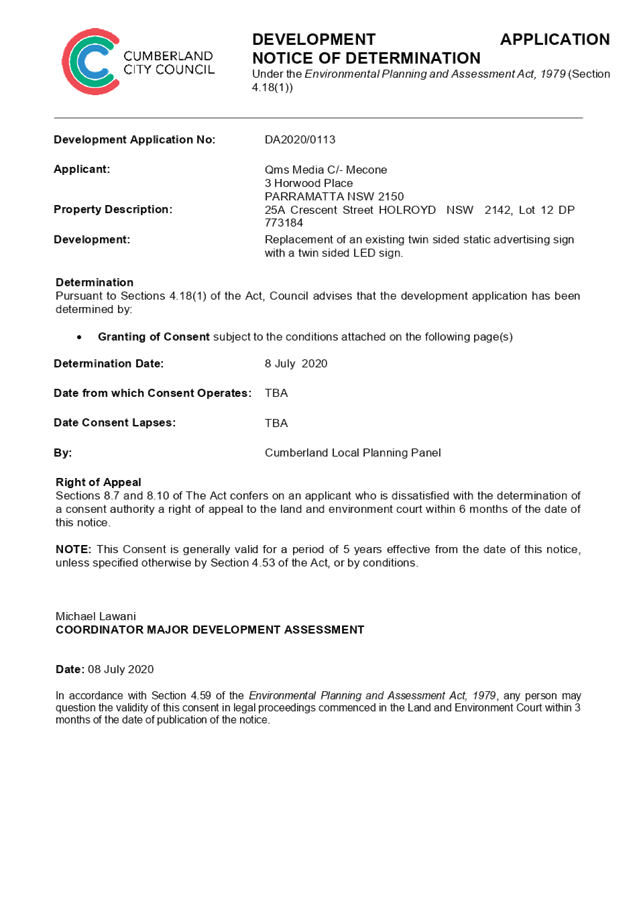
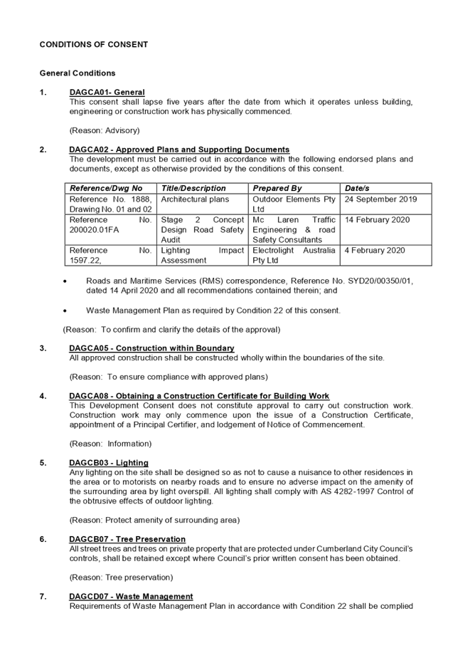

DOCUMENTS
ASSOCIATED WITH
REPORT LPP037/20
Attachment 2
SEPP 64 - Schedule 1 Assessment
Cumberland Local Planning Panel Meeting
8 July 2020
DOCUMENTS
ASSOCIATED WITH
REPORT LPP037/20
Attachment 3
Transport Corridor Outdoor Advertising and Signage
Guidelines
Cumberland Local Planning Panel Meeting
8 July 2020
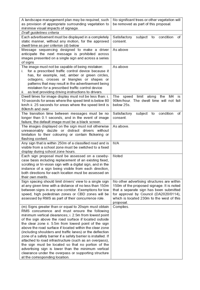
DOCUMENTS
ASSOCIATED WITH
REPORT LPP037/20
Attachment 4
HLEP 2013 Compliance Table
Cumberland Local Planning Panel Meeting
8 July 2020
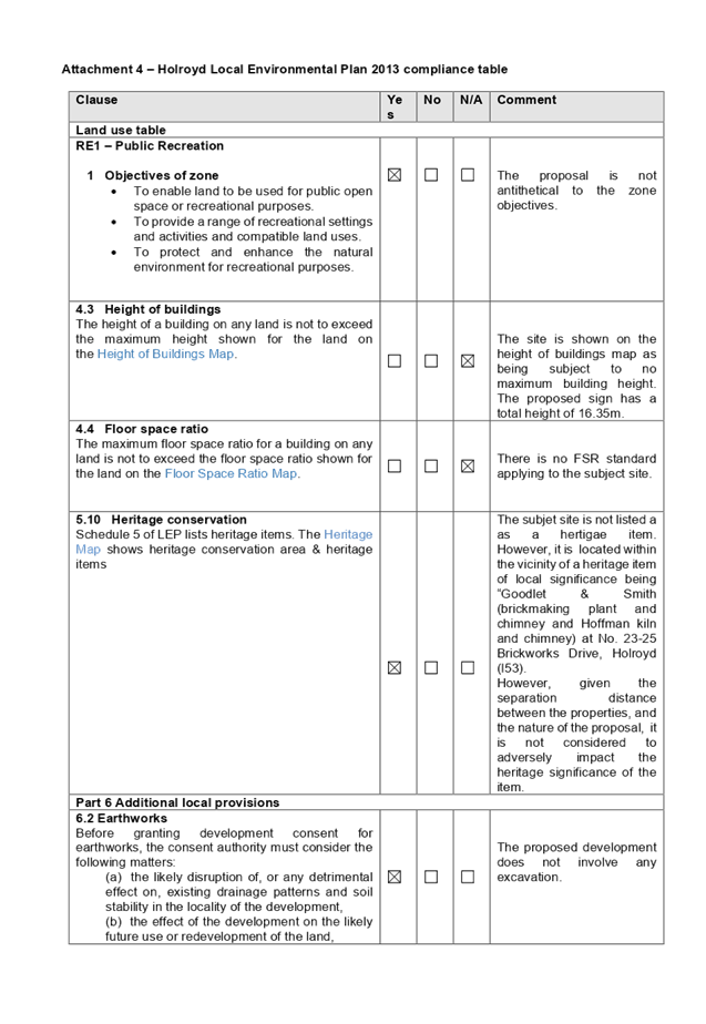
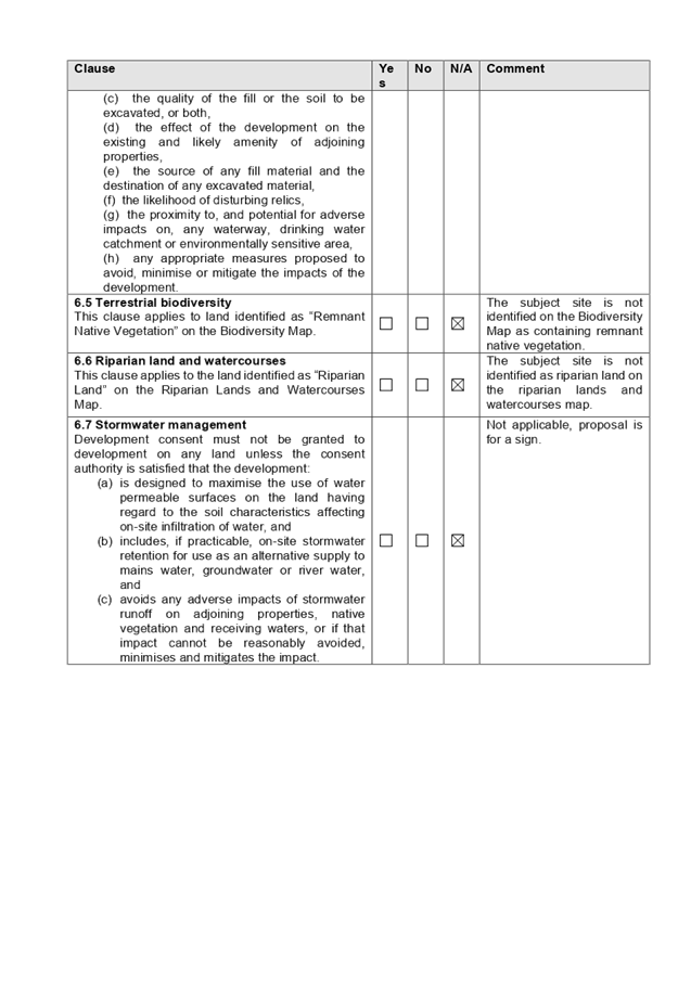
DOCUMENTS
ASSOCIATED WITH
REPORT LPP037/20
Attachment 5
HDCP 2013 Compliance Table
Cumberland Local Planning Panel Meeting
8 July 2020
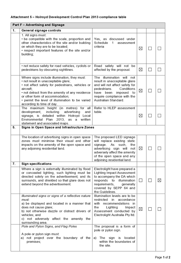
DOCUMENTS
ASSOCIATED WITH
REPORT LPP037/20
Attachment 6
Council's Large Display Advertising Policy
Cumberland Local Planning Panel Meeting
8 July 2020
DOCUMENTS
ASSOCIATED WITH
REPORT LPP037/20
Attachment 7
Architectural Plans
Cumberland Local Planning Panel Meeting
8 July 2020
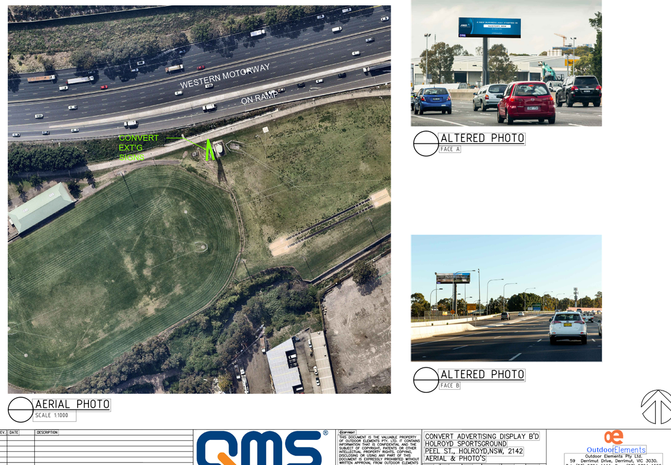
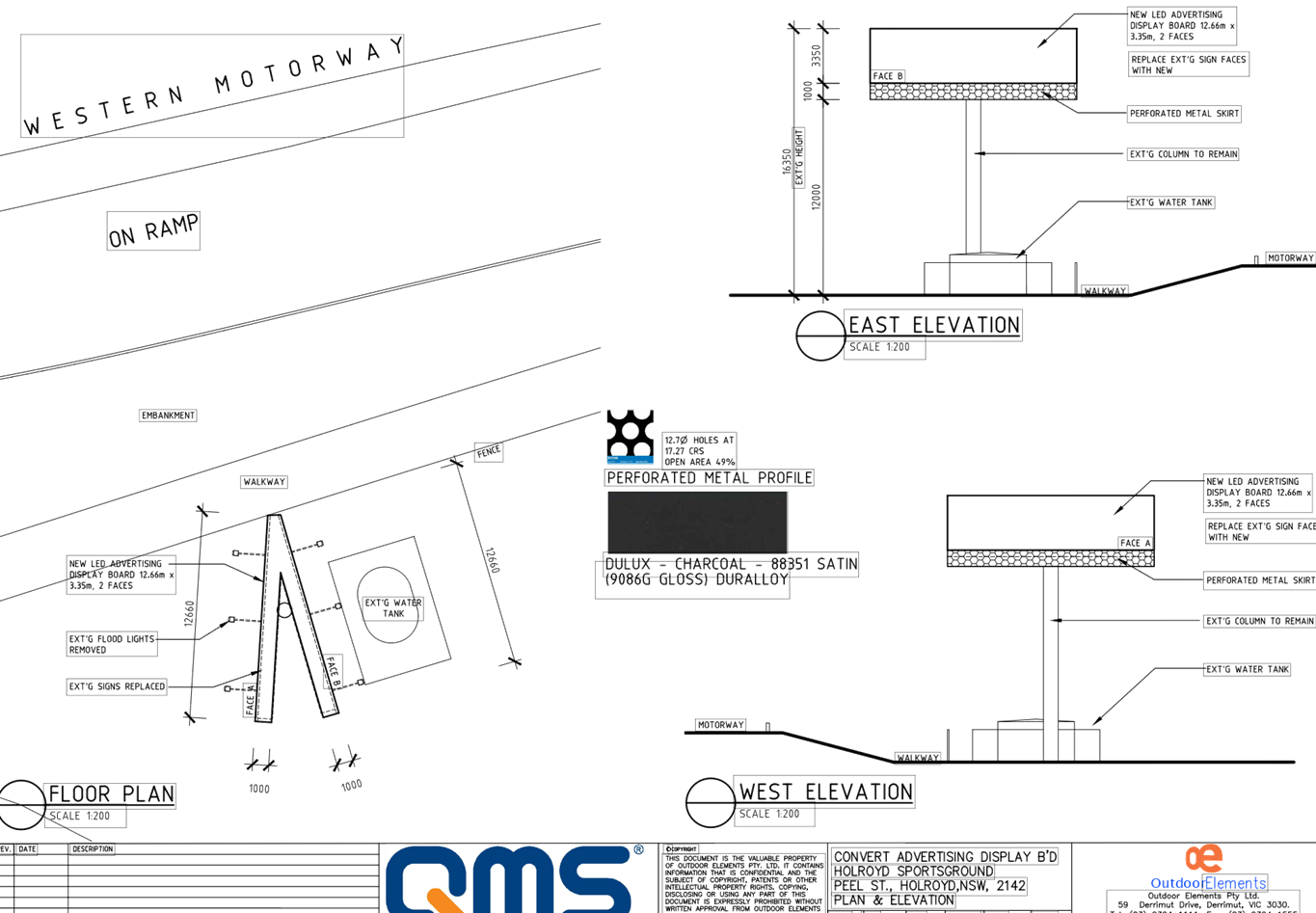
DOCUMENTS
ASSOCIATED WITH
REPORT LPP037/20
Attachment 8
Locality Map
Cumberland Local Planning Panel Meeting
8 July 2020
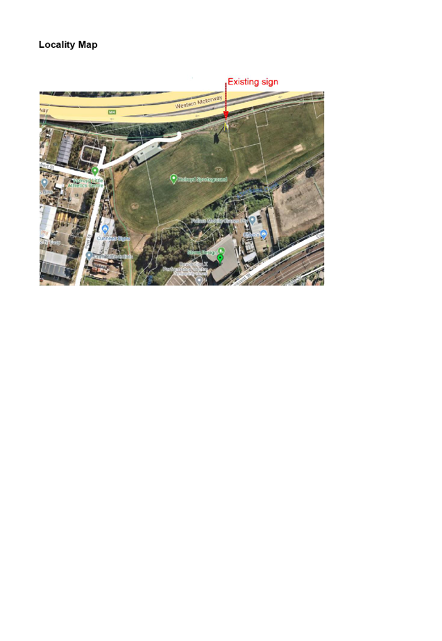
Cumberland
Local Planning Panel Meeting
8 July 2020
Item No: LPP038/20
Development
Application for 58 & 60 Berwick Street, Guildford
Responsible
Division: Environment
& Planning
Officer: Executive
Manager Development and Building
File
Number: DA2019/0501
|
Application lodged
|
19 December 2019
|
|
Applicant
|
Baini Design
|
|
Owner
|
Manmark Holdings Pty Ltd,
Anrite Holdings Pty Ltd,
Chrisyl Holdings Pty Ltd
|
|
Application No.
|
DA2019/0501
|
|
Description of Land
|
58 & 60 Berwick Street
GUILDFORD NSW 2161, Lot 29, 30, 31, 32, 33 & 34, Sec 9 DP 734
|
|
Proposed Development
|
Demolition of existing structures,
construction of a 4 storey residential flat building over basement parking
accommodating 25 units and 22 car parking spaces under the Affordable Rental
Housing SEPP 2009
|
|
Site Area
|
1,349.08m²
(1,236.18m² post road widening dedication)
|
|
Zoning
|
R4 High Density Residential
|
|
Disclosure of political
donations and gifts
|
Nil disclosure
|
|
Heritage
|
The subject site is located
within the vicinity of a heritage item of local significance being
“Kelvin”, Federation/Queen Anne bungalow at No. 67 Berwick Street,
Guildford (I33)
|
|
Principal Development
Standards
|
Floor Space Ratio:
Max. 1.2:1 permitted (HLEP) + ARH 36% Bonus
· Proposed FSR = 1.56:1 (this includes a
bonus ARH FSR of 36%)
Height of Buildings:
Max. 15m permitted
· Proposed Max. 15.8m (5.3% variation
sought)
Clause 4.6 Written Variation
Request submitted for the departure sought to building height
|
|
Issues
|
· Variation to
maximum 15m building height (HLEP 2013)
· Building
separation (ADG)
· Solar Access
(ARH SEPP and HDCP 2013)
· Site coverage (HDCP
2013)
· Submissions
|
1. Development
Application No. DA2019/0501 was received on 19 December 2019 for the demolition
of existing structures, construction of a 5 storey residential flat building
over basement parking accommodating 27 units and 25 car parking spaces under
the Affordable Rental Housing SEPP 2009.
2. The
application was publicly notified to occupants and owners of the adjoining
properties for a period of 21 days between 5 February 2020 and 26 February
2020. In response, 1 submission (3 x form letters) was received.
3. The
assessment of the application identified issues including overall building
height, scale, amenity impacts to the adjoining southern development and as
such the application was deferred seeking amended plans. Amended plans and
information were provided to Council on 18 May 2020. The design refinements
resulted in the deletion of the units on the top floor, reduction of the
overall gross floor area of the development and compliant building separation
along the southern boundary. The amended plans did not warrant re-notification.
4. The
application as amended proposes demolition of existing structures, construction
of a 4 storey residential flat building over basement parking accommodating 25
units and 22 car parking spaces under the Affordable Rental Housing SEPP 2009.
5. The
subject application has been assessed against the relevant provisions of the
Environmental Planning and Assessment Act 1979, State Environmental Planning
Policy (Affordable Rental Housing) 2009, State Environmental Planning Policy No
65 – Design Quality of Residential Apartment Development (SEPP 65),
Apartment Design Guide, Holroyd Local Environmental Plan 2013 (HLEP) and
Holroyd Development Control Plan 2013 (HDCP).
6. The
proposal seeks the following non-compliances which are considered supportable
as discussed in detail elsewhere in the report:
|
Control
|
Required
|
Proposed
|
% Variation
|
|
Building separation (ADG)
|
Min. 6m up to 4
storeys
|
Levels 1-3:
Eastern Boundary
Balconies = 5.4m
|
10%
|
|
Building Height
(HLEP 2013)
|
Max. 15m
|
Max. 15.8m (RL 45.30) to the roof of lift core and stairwell
|
5.3%
|
|
Driveway Setback (HDCP 2013)
|
Min. 1.5m
|
1.26m
|
16.3%
|
|
Site coverage (DCP)
|
Max 30% (370.85m2)
|
43% (531.2m2)
|
43.2%
|
|
Basement setback (DCP)
|
3 m
|
1.25m to eastern side boundary
|
63.3%
|
|
Sunlight access (DCP)
|
1 main living area of existing adjacent dwellings to
receive 3 hours direct sunlight between 9am and 4pm, 22 June.
|
The proposal results in
overshadowing of the northern windows of 6 out of 17 units on the adjacent
development to the south.
|
-
|
7. The
application is being reported to the Cumberland Local Planning Panel (CLPP) for
determination as it is a development with more than 4 storeys to which the
State Environmental Planning Policy No 65 – Design Quality of Residential
Apartment Developments applies.
8. The
application is recommended for deferred commencement approval subject to the
conditions as provided in Attachment 1.
Background / History
DA2019/11/1 for demolition of
existing structures, and construction of a 4 storey building comprising of a 76
place child care centre on the ground floor with 18 residential units above
with two basement car parking levels for 36 vehicles made pursuant to
Affordable Rental Housing SEPP 2009 was refused by Cumberland Local Planning
Panel on 14 August 2019,
On 28 February 2018, DA2017/81
granted development consent for the construction of a 4 storey residential flat
building comprising 21 units above basement parking accommodating 26 car
parking spaces. This is an active consent which applies to the land. The date
of expiry of DA2017/81 is 28 February 2023.
Subject Site and Surrounding
Area
INTRODUCTION
The subject site is known as 58-60
Berwick Street, Guildford; and is legally described as Lots 29-34, Sec 9 in
DP734. The site has an area of 1,349.08m² and frontage of 40.235m and
33.53m to Berwick Street and Beaufort Street respectively. The site is regular
in shape and has a depth of 40.235m to the eastern boundary and depth of 33.53m
to the southern boundary.
The property is subject to 1.5m
road widening to both Beaufort Street and Berwick Street, with 3m x 3m splay at
the corner of both streets; as identified within Map 1 – Appendix K
– Locations Subject to Road Widenings and Splay Corners in Part A of HDCP
2013. The site area will be reduced to 1,236.18m² post dedication of land
along Beaufort Street and Berwick Street for road widening.
The property is occupied by two
dwelling houses, ancillary structures, outbuildings and mature trees.
The site is located approximately
800m from Guildford Railway Station.
The subject site and neighbouring
allotments directly to the east and south are zoned R4 – High Density
Residential. Properties located on the northern side of Beaufort Street and
western side of Berwick Street are zoned R3 – Medium Density Residential.
Opposite the subject site at the corner of Beaufort Street and Berwick Street
are Beaufort Street Park and Berwick Street Reserve.
The existing developments
surrounding the subject site are residential flat building directly to the
south and south-east, and primarily dwelling houses and low to medium density
housing to the east. However, there is a transition occurring currently with
higher density zoned sites being developed into residential flat buildings.
Figure
1 - Aerial view of the locality with subject site shown highlighted in red.
Source: NearMap
Figure
2 – Zoning map with subject site shown hatched. Source: Cumberland
Council
Figure
3 – No. 60 Berwick Street (subject site) and adjoining residential flat
building south of the site at No. 62-66 Berwick Street. Source: Cumberland
Council
Figure
4 – No. 58 Berwick Street (subject site). Source: Cumberland Council
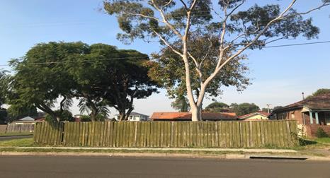
Figure
5 – View of No. 58 Berwick Street (subject site) from Berwick Street.
Source: Cumberland Council
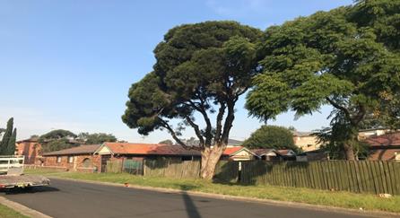
Figure
6 – View of No. 58 Berwick Street (subject site) from Beaufort Street and
adjoining property No. 63A Bangor Street. Source: Cumberland Council
Description of the Proposed
Development (as amended)
DA 2019/0501 seeks consent for
demolition of existing structures, consolidation of two lots into one lot,
construction of a 4 storey residential flat building comprising of 25
residential units with basement car parking pursuant to Affordable Rental
Housing SEPP 2009
Key features of the development
proposal (as amended) are as follows:-
|
Level
|
Details
|
|
Basement level
|
22 residential car spaces (including 4 accessible parking
spaces)
5 bicycle spaces
Storage areas
Bin and service rooms
Lift core and stairwell
|
|
Ground level
|
Pedestrian access to the building from Berwick Street
7 residential units
Lift, fire stairs and landscaping
|
|
Level 1
|
6 residential units
|
|
Level 2
|
6 residential units
|
|
Level 3
|
5 residential units
|
|
Level 4
|
Roof and communal open space
|
Access to the basement car park is
provided from a new vehicular crossing proposed on the eastern section of the
subject site from Beaufort Street.
The dwelling mix of the proposal
(as amended) is as follows:
· 7
x 1-bedroom units (28%)
· 17
x 2-bedroom units (68%)
· 1
x 3-bedroom units (4%)
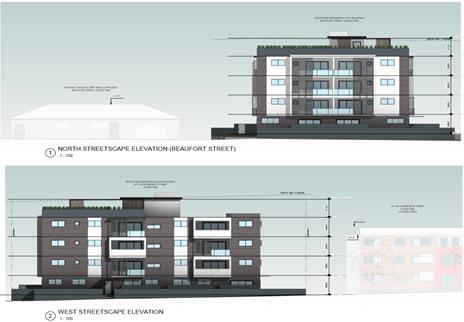
Figure
7 – Streetscape of proposed development – Beaufort St & Berwick
St frontage
Application History
|
Date
|
Action
|
|
19 December 2019
|
The subject development application was lodged with
Council.
|
|
31 January 2020
|
The application was referred to the following internal and
external sections:
· Development
Engineering
· Traffic
Engineering
· Environmental
Health
· Landscaping/Tree
Management
· Waste Management
· Endeavour Energy
· Transgrid
· Cumberland
Police Area Command
· Sydney Water
|
|
5 February 2020 to 26 February 2020
|
Application placed on public notification. In response, 3
proforma submissions were received.
|
|
7 May 2020
|
Application deferred seeking additional information and
amended plans
|
|
18 May 2020
|
Amended plans and additional information received by
Council
|
|
8 July 2020
|
Application referred to CLPP for determination.
|
Applicant’s Supporting
Statement
A Statement of Environmental
Effects prepared by Think Planners dated 9 December 2019 was submitted with the
application.
A written request to vary the
building height standard, prepared in accordance with Clause 4.6 of HLEP 2013
by Think Planners, dated 9 December 2019 was submitted in support of the
application.
An addendum to the Statement of
Environmental Effects was submitted to Council as part of the amended plans
dated 20 February 2020.
Contact with Relevant
Parties
The assessing officer has undertaken
an inspection of the subject site and has been in contact with the applicant
throughout the assessment process.
Internal Referrals
Development Engineer
The development application was
referred to Council’s Development Engineer for comment who has advised
that the development is supportable with regards to the proposed new vehicular
crossing and stormwater management, subject to deferred commencement
conditions.
Traffic Engineer
The development application was
referred to Council’s Traffic Engineer for comment who has advised that
the development is supportable in regard to parking, traffic management and
on-site parking provision in the basement level, subject to conditions.
Landscaping/Tree Management
The application was referred to
Council’s Landscape and Tree Management Officer for comment. Response
received indicates that the proposed tree removal and landscape works are
satisfactory subject to conditions. The conditions recommended by the Landscape
Officer are included in the draft determination.
Waste Management Officer
The development application was
referred to Council’s Waste Management Officer for comment and issues
were raised with regard to the ongoing management which have been imposed within
the draft conditions of consent.
Environmental Health Unit
The development application was
referred to Council’s Environmental Health Unit for comment who has
advised that the proposal is satisfactory subject to conditions of consent
which have been imposed within the draft conditions of consent.
External Referrals
Transgrid
The development application was
referred to Transgrid for comment pursuant to Clause 45 of State Environmental
Planning Policy (Infrastructure) 2007 for comment, who advised that the
development is supportable, and no conditions are recommended to be imposed.
Endeavour Energy
The development application was
referred to Endeavour Energy for comment pursuant to Clause 45 of State
Environmental Planning Policy (Infrastructure) 2007 for comment, who has
advised that the development is required to provide adequate safety clearances
to existing electricity lines, which have imposed within the draft conditions
of consent.
NSW Police
The application was referred to
NSW Police for comment regarding CPTED. Response dated 12 June 2019 indicates
that the proposal is satisfactory subject to conditions.
Sydney Water
The application was referred to
Sydney Water for comment regarding Sydney water assets. Response dated 26
February 2020 indicates that the proposal is satisfactory subject to
recommendations which have imposed within the draft conditions of consent.
PLANNING COMMENTS
The provisions of any
Environmental Planning Instruments (EP&A Act s4.15 (1)(a)(i))
State Environmental Planning
Policies
The proposed development is
affected by the following State Environmental Planning Policies:
(a) State
Environmental Planning Policy (Affordable Rental Housing) 2009 (ARH SEPP)
The application has been submitted
under Part 2 New affordable rental housing – Division 1 In-fill
affordable housing of the ARH SEPP. It should be noted that the proposal fully
complies with the key planning controls contained within the ARH SEPP including
site area, landscaped area, parking, accommodation size and prescribed standards
for in-fill affordable housing. A comprehensive assessment against ARH SEPP is
attached to this report at Attachment 2.
16A Character of local area
A consent authority must not
consent to development to which this Division applies unless it has taken into
consideration whether the design of the development is compatible with the
character of the local area. The SEPP (ARH) does not contain any guidance for
assessing whether a proposal is compatible with the character of the local
area. However, a planning principle for assessing compatibility in the urban
environment was established by Senior Commissioner Roseth of the Land and
Environment Court in the judgement for Project Venture Developments Pty Ltd v
Pittwater Council [2005] NSWLEC 191. This involves asking the following two
questions:
· Are
the proposal’s physical impacts on surrounding development acceptable?
The physical impacts include constraints on the development potential of
surrounding sites.
· Is
the proposal’s appearance in harmony with the buildings around it and the
character of the street?
A merit assessment of the
character of the local area should consider the following 3 steps:
· Step
1 – Identify the ‘local area’.
· Step
2 – Determine the character of the ‘local area’.
· Step
3 – Determine whether the design of the proposed development is
compatible with the character of the ‘local area’.
An assessment against each step is
provided below:
Step 1 – Identify the
local area.
This assessment identifies the
local area as primarily the visual catchment of the site (hatched in red) as
viewed from within the site and directly adjacent to the site on the street
which is defined by the yellow line in Figure 8, and white line in Figure 9
below:
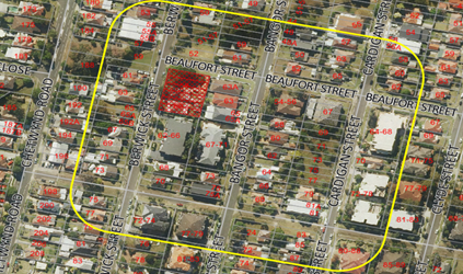
Figure
8 – Local Area catchment as identified on Aerial
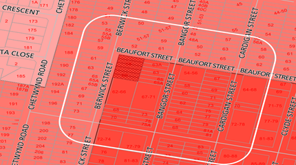
Figure
9 – Local Area catchment as identified on Zoning Map
Step 2 – Determine the
character (present and future) of the local area.
The zoning of the broader locality
and immediate area comprises R4 High Density Residential adjoining the site directly
to the south and east, and R3 Medium Density Residential for properties located
on the western side of Berwick Street and northern side of Beaufort Street;
under the Holroyd Local Environmental Plan (HLEP) 2013.
Present Character of the area
The character of the local area
comprises the visual catchment of allotments viewed from and surrounding the
subject site, which includes:-
Berwick Street
1. Three
(3) storey residential flat building (62-66 Berwick Street).
2. Detached
dwelling houses and attached dual occupancies located on the western side of
Berwick Street.
3. Opposite
the subject site at the corner of Beaufort Street and Berwick Street are
Beaufort Street Park and Berwick Street Reserve.
Bangor Street
4. Detached
dwellings houses and attached dual occupancies located on both sides of Bangor
Street; and both sides of Berwick Street north of the site.
5. Three
(3) storey residential flat buildings at the corner of Berwick Street and
Bangor Street with Stimson Street – 72-74 Berwick Street & 77-79
Bangor Street respectively.
6. Three
(3) storey walk up residential flat building at the corner of Bangor Street and
Beaufort Street (54-56 Bangor St).
7. Three
(3) storey residential flat building (67-71 Bangor Street).
Cardigan Street
8. Two
(2) storey walk up residential flat building at the corner of Beaufort Street
and Cardigan Street (67 Cardigan Street).
9. Part
2 and part 3 storey residential flat building at the corner of Beaufort Street
and Cardigan Street (64-68 Cardigan Street).
10. Three
(3) storey residential flat buildings at the corner of Cardigan Street and
Stimson Street (72-78 Cardigan Street).
11. A
part 2 and part 3 storey residential flat building has been approved at 69-77
Cardigan Street (DA2006/226). The DA is operative but construction has not yet
commenced.
12. The
remaining sites on Cardigan Street comprise of detached dwellings and dual
occupancies.
Future character of the area
Whilst there are a number of one
and two storey dwellings within the locality, the area is transitioning to
higher density developments in accordance with the planning controls that
currently apply. The area zoned R4 High Density Residential is subject to a
maximum height limit of 15m and maximum floor space ratio (FSR) of 1.2:1. The
emerging character of the area is generally that of small, 3 to 4 storey
residential flat buildings. The locality is in transition particularly to
support the increasing demand of affordable housing within the close proximity
of public transport hub and major commercial centre. The transition issue is
clear with regard to FSR and height limits applicable to sites within the local
area.
Step 3 - Determine if the
development is compatible with the character of the local area.
In accordance with the Land and
Environment Court’s ‘Planning Principle’ and case law
compatibility is best defined as ‘capable of existing together in
harmony’. In order to test compatibility two questions are to be
considered. These questions, as well as a response to each, are provided below:
· Are
the proposal’s physical impacts on surrounding development acceptable?
The physical impacts include constraints on the development potential of
surrounding sites.
The height, FSR and landscaping of
the proposed development are designed to maintain the harmony within the
streetscape, whilst contributing to the site context and constraint. The height
of building breaches the 15m height limit requirement for part of the roof and
the lift core as discussed later in the report. However, the development
does not pose any unreasonable overshadowing impacts on adjoining
properties. The proposal being a permissible land use, meets the FSR
requirement (in accordance with ARH SEPP, subject to the imposition of
conditions) and contributes to the provision of affordable housing within the
close proximity of public transport hub. Appropriate setbacks and privacy
treatments are provided to minimise any adverse impacts to the adjoining
properties. The building is appropriately articulated to complement the
existing and changing streetscape within the local area. Whilst the development
will result in overshadowing to the existing development on the southern side
(62-66 Berwick Street), the impacts are not considered unreasonable given this
is a function of the allotment orientation and R4 context. The overall design
represents the form of development that is envisaged under the planning
controls. Refer to further discussion under DCP section of the report.
· Is
the proposal’s appearance in harmony with the buildings around it and the
character of the street?
To be compatible, a development
should contain, or at least respond to the key aesthetic elements that make up
the character of the surrounding area. The size of the basement maximises
landscaping and deep soil zones on site. The front setbacks are compliant and
consistent with the higher density zones. The proposal is considered to
maintain an appropriate residential character which is consistent with the
evolving higher density streetscape in the locality. As indicated, the proposed
development is not considered to be inconsistent with the existing streetscape
character of the immediate area surrounding the subject site.
In conclusion, the proposal will
maintain the harmony within the general streetscape, and suitably fits in the
local character of the locality.
(b) State
Environmental Planning Policy No 65 – Design Quality of Residential
Apartment Development (SEPP 65)
The proposal is classified as a
residential apartment development and SEPP 65 applies. A design verification
statement signed by registered architect Ben Vitale was submitted with the
application.
SEPP 65 sets 9 design quality
principles. The development has adequately addressed the principles in the
following way:
Figure10
– SEPP 65 Design Quality Principles Table
|
ADG design quality principle
|
Response
|
|
1. Context and neighbourhood character
|
The area is zoned to accommodate new development,
including residential flat building that is a permitted type of development
within the R4 zone. The existing character of the streetscape is in
transition where existing dwelling houses are being replaced with higher
density development, such as residential flat buildings. The proposed
development satisfies Holroyd LEP 2013 objectives in that it will provide a
variety of housing type within a high density environment. The siting of
development has been appropriately designed to minimise any potential
overshadowing and visual privacy impact to the adjoining properties by
maintaining a buffer area at the rear and side boundaries for communal open
space.
|
|
2. Built form and scale
|
The development application is seeking consent for a 4
storey residential flat building over one level of basement car parking. The
building has been designed to correspond with the existing landform. At grade
communal open space will assist in softening the built form and minimise any potential
overshadowing and visual privacy impact to the adjoining properties.
|
|
3. Density
|
The subject site is well
located with respect to existing public transport and community facilities.
The proposal includes an affordable housing component that allows for a
maximum bonus FSR of 0.5:1 over the LEP standard for the site. The
design of the development provides for appropriate separation between
dwellings, supplemented by privacy treatment to balconies and windows where
necessary.
|
|
4. Sustainability
|
A BASIX Certificate and relevant reports have been
submitted with the development application. The certificates require
sustainable development features to be installed into the development. The
proposal will incorporate features relating to ESD in the design and
construction of the development inclusive of water efficient fixtures and
energy saving devices.
|
|
5. Landscape
|
Compliant landscape area has been provided, which will
provide appropriate level of amenity to the resident and consistent with the
environmental surrounds of the subject site.
|
|
6. Amenity
|
The proposal will deliver sufficient amenity to residents
of the building. The proposal achieves compliance with the ADG in this regard
which contains many amenity controls. The building design incorporates access
and circulation, apartment layouts, floor area, ceiling height, private open
space, common open space, energy efficiency rating, adaptability and
diversity, safety, security and site facilities. The proposal is considered
to generally comply with the ADG and HDCP 2013 which contains numerous
amenity controls. Suitable access is provided to all parts of the building,
through the efficient use of lift to access all levels. The development is
considered to provide an appropriate level of amenity for future residents.
|
|
7. Safety
|
Suitable and secure access is provided to all parts of the
building, through the efficient use of lift to access all levels.
|
|
8. Housing diversity and social interaction
|
The apartment mix is considered to be satisfactory. The specifics
of the building are:-
· 7 x 1-bedroom units (28%)
· 17 x 2-bedroom units (68%)
· 1 x 3-bedroom units (4%)
The number of adaptable units proposed is considered
satisfactory with the provision of associated accessible car spaces.
|
|
9. Aesthetics
|
The residential flat building has an attractive
contemporary appearance and utilises building elements that provide
individuality to the development without compromising the streetscape or
detracting from the appearance of existing surrounding development. The
building responds well in this regard with its provision of good aesthetics
through the use of high quality materials. The development provides an
appropriate response to the existing and likely future character of the
locality.
|
Pursuant to clause 28(2)(c) of
SEPP 65, a consent authority must consider the provisions of the Apartment
Design Guide (ADG) in the assessment of a residential flat development. A
comprehensive assessment against the Apartment Design Guide (ADG) controls is
provided at Attachment 2.
The proposal involves the
following non-compliances with the ADG controls.
|
No.
|
Control
|
Comments
|
Compliance
|
|
|
|
|
|
|
3F
|
Visual Privacy
|
Yes
|
No
|
N/A
|
|
3F-1
|
Design Criteria
Separation
between windows and balconies is provided to ensure visual privacy is achieved.
Minimum required separation distances from buildings to the side and rear
boundaries are as follows:

Note:
Separation distances between
buildings on the same site should combine required building separations
depending on the type of room.
Gallery access circulation
should be treated as habitable space when measuring privacy separation
distances between neighbouring properties.
|
The proposal generally complies with the building
separation requirements.
Building is 4 storey in height, with roof top terrace.
West: Berwick Street
North: Beaufort Street
East :
Up to level 3
Requires a min. 6m setback to boundary.
Bedrooms and bathrooms setback 6m to boundary. Balconies
setback 5.4m to boundary (measured from outer face of balcony). However,
privacy screens are provided to majority of these balconies which is
considered acceptable in this instance.
Further, condition of consent has been imposed to provide
1.5m high privacy features to the remaining balconies along the eastern
boundary.
|
|
|
|
(a) State
Environmental Planning Policy No. 55 – Remediation of Land (SEPP 55)
Clause 7 of SEPP 55 requires
Council to be satisfied that the site is suitable or can be made suitable to
accommodate the proposed development. The matters listed within Clause 7 have
been considered in the assessment of the development application.
|
Matter for
Consideration
|
Yes
|
No
|
|
Does the application
involve re-development of the site or a change of land use?
|
|
|
|
Does
the application involve re-development of the site or a change of land use?
|
|
|
|
In the development going to
be used for a sensitive land use (e.g.: residential, educational,
recreational, childcare or hospital)?
|
|
|
|
Does information available
to you indicate that an activity listed below has ever been approved, or
occurred at the site?
acid/alkali
plant and formulation, agricultural/horticultural activities, airports,
asbestos production and disposal, chemicals manufacture and formulation,
defence works, drum re-conditioning works, dry cleaning establishments,
electrical manufacturing (transformers), electroplating and heat treatment
premises, engine works, explosive industry, gas works, iron and steel works,
landfill sites, metal treatment, mining and extractive industries, oil
production and storage, paint formulation and manufacture, pesticide
manufacture and formulation, power stations, railway yards, scrap yards,
service stations, sheep and cattle dips, smelting and refining, tanning and
associated trades, waste storage and treatment, wood preservation
|
|
|
|
Is
the site listed on Council’s Contaminated Land database?
|
|
|
|
Is
the site subject to EPA clean-up order or other EPA restrictions?
|
|
|
|
Has
the site been the subject of known pollution incidents or illegal dumping?
|
|
|
|
Does
the site adjoin any contaminated land/previously contaminated land?
|
|
|
|
Has
the appropriate level of investigation been carried out in respect of
contamination matters for Council to be satisfied that the site is suitable
to accommodate the proposed development or can be made suitable to
accommodate the proposed development?
|
|
|
|
Details of contamination
investigations carried out at the site:
The site is not identified in Council’s records
as being contaminated. Council’s Environmental Health Officer has
advised that following review of the submitted Preliminary Site
Investigation, the site is considered suitable for the proposed childcare and
residential development, subject to the imposition of conditions.
|
(b) State
Environmental Planning Policy (Infrastructure) 2007 (ISEPP)
The provisions of the ISEPP 2007
have been considered in the assessment of the development application.
Clause 45 – Development
likely to affect an electricity transmission or distribution network
The development application was
referred to Endeavour Energy for comment, who raised concerns relating to
adequate safety clearances to existing electricity power lines, which have
included as part of the reasons for refusal contained within the draft notice
of determination.
(c) Statement
Environmental Planning Policy No 19 - Bushland in Urban Areas
The proposal does not propose to
disturb bushland zoned or reserved for public open space.
(d) State
Environmental Planning Policy (Vegetation in Non-Rural Areas) 2017
The proposal includes removal of
some existing trees within the subject site. However, this does not exceed the
biodiversity offsets scheme threshold. Therefore, the proposed vegetation
removal is considered acceptable. Please refer to the HDCP 2013 compliance
table at Attachment 5 for further comment regarding the proposed tree removal.
(e) State
Environmental Planning Policy (Coastal Management) 2018
The subject site is not identified
as a coastal wetland nor is it ‘land identified as “proximity area
for coastal wetlands” as per Part 2, Division 1 of the SEPP Coastal Management
2018.
(f) State
Environmental Planning Policy (Building Sustainability Index: BASIX) 2004
BASIX certificate 987245M_02 dated
26 November 2019 was submitted with the application. The certificate achieves
target scores and is consistent with the architectural plans.
Regional Environmental Plans
The proposed development is
affected by the following Regional Environmental Plans:
(a) Sydney
Regional Environmental Plan (Sydney Harbour Catchment) 2005
The subject site is identified as
being located within the area affected by the Sydney Regional Environmental
Plan (Sydney Harbour Catchment) 2005. The proposed development raises no issues
as no impact on the catchment is envisaged.
(Note: - the subject site is not
identified in the relevant map as ‘land within the ‘Foreshores and
Waterways Area’ or ‘Wetland Protection zone’, is not a
‘Strategic Foreshore Site’ and does not contain any heritage items.
Hence the majority of the SREP is not directly relevant to the proposed
development).
Local Environmental Plans
(a) Holroyd
Local Environmental Plan 2013 (HLEP 2013)
The proposed development is
defined as a ‘residential flat building’ under the provisions of
HLEP 2013. Residential flat buildings are permitted with consent in the R4
– High Density Residential zone which applies to the land.
The proposal seeks the following
variations to HLEP 2013:
|
DEVELOPMENT STANDARD
|
COMPLIANCE
|
DISCUSSION
|
|
4.3 Height of Buildings
15m
|
No
|
Proposed: 15.8m (RL 45.30)
Variation: 5.3%
Refer to the discussion below.
|
Height of Buildings
The proposal seeks a variation to
Clause 4.3 – Height of Buildings that stipulates that the height of
building is not to exceed 15m on the subject site.
The proposed building has an
overall height of 15.8m (RL 45.30) to the roof of the lift core and RL 44.30 to
the top of the structures associated with the roof top communal open space. The
proposal breaches the height by 800mm to the roof of the lift core,
representing a maximum variation of 5.3%.
(a) Clause
4.6 – Variation to Building Height
Clause 4.6 allows the consent
authority to vary development standards in certain circumstances and provides
an appropriate degree of flexibility to achieve better design outcomes. The
consent authority may grant the exception as the Secretary’s concurrence
can be assumed where clause 4.6 is adopted as per the Department of Planning
Circular PS 18-003, dated 21 February 2018.
The applicant has submitted a
written request to vary the development standards for building height. Based on
various case laws established by the Land and Environment Court of NSW such as
Four2five P/L v Ashfield Council [2015] NSWLEC 9, Randwick City Council v
Micaul Holdings P/L [2016] NSW LEC7 and Zhang and anor v Council of the City of
Ryde [2016] NSWLEC 1179, a 3 part assessment framework for a variation request
proposed under clause 4.6 has been considered and an assessment of the proposed
variance, following the 3 part test is discussed in detail below.
The 3 preconditions which must be
satisfied before the application can proceed are as follows:
1. Is
the proposed development consistent with the objectives of the zone?
Applicant’s
justification:
· The
development will provide for the housing needs of the community within a high
density environment;
· The
development contributes to a variety of housing types in a high density
environment;
· The
development will maximise public transport patronage by providing residential
accommodation in an accessible location;
· The
development is designed to respond to the context and setting of the locality
and the development is consistent with the desired future character of the
locality;
· The
development is designed to minimise impact on the amenity of the area and
adjoining properties.
Planner’s Comment:
Residential flat buildings are a
permitted land use and the locality is undergoing a transition particularly to
support the increasing demand of affordable housing within the close proximity
of public transport hub and major commercial centre. The proposed development
is considered to be consistent with the objectives of the R4 High Density
Residential zone.
2. Is
the proposed development consistent with the objectives of the development
standard which is not met?
Applicant’s
justification:
· The
proposal will provide a high quality urban form that relates well to the
context of the site in terms of the natural topography and adjoining
developments;
· The
area of non-compliance to the building height is limited to a small portion of
the upper level roof form and lift over-run- and this element is recessed back
from the perimeter of the building below such that the visual impact from the
public domain and adjoining properties is minimised;
· The
non-compliance also stems from the provision of affordable dwellings that
allows the development to exceed the FSR of 1.2:1 for the site contained in LEP
2013. Council’s Building envelope controls of height, FSR and setbacks
are designed to accommodate a residential flat building with an FSR of 1.2:1.
This development has a greater allowable FSR under the ARHSEPP and the
additional floor space can only be appropriately accommodated by breaching the
building envelope controls- namely the minor departure to the height
standard.
· The
overall height of the development presents as a compatible form of development
with the 5th storey recessed to downplay visual dominance as viewed from the
public domain and adjoining properties.
· The
proposal has been designed to comply with the maximum permitted FSR on the site
and also complies with key controls pertaining to, open space, and car parking
which indicates an appropriate scale of development on the site;
· The
extent of overshadowing is satisfactory as shown on the shadow diagrams and the
privacy impacts arising from the additional height control are negligible when
having regard to the design of the built form which focuses the 5th storey
living rooms and balconies over the street frontages.
· The
height breach is at the upper most level where the building is recessed such
that the visual impact of the development is minimised as viewed from adjoining
properties and the public domain.
· The
overshadowing impact arising from the building height departure is limited
given that the shadow is cast from the level below as it relates to the
adjoining apartment building which is reflected in the ‘views from the
sun’. Therefore there is no additional overshadowing impact to adjoining
properties as a result of the height departure.
· The
height breach is a function of raising the ground floor to accommodate the
required flood freeboard level that means that the overall height is increased
to achieve this which is a preferred planning outcome to mitigate flooding
impacts.
· The
development is designed to respond appropriately to the landform.
Planner’s comment:
The objectives of the building
height standard are to enable appropriate development density to be achieved
and to ensure that the height of the building is compatible with the character
of the locality as outlined above. The proposal is compliant with the maximum
FSR inclusive of the bonus provision under the ARH SEPP. The increased height
does not result in an additional level for residential use, as it comprises
portion of the roof structures and the top of the lift core.
The departure sought is considered
to be modest and does not unreasonably impact on adjoining properties. The
additional height does not result in the appearance of bulk when viewed from
the existing streetscape and would not impinge on the changing streetscape that
is anticipated for the immediate area. Given that the proposed development
responds to the site and does so without compromising relationships with
adjoining development, the proposal is considered to be consistent with the
objectives of height requirements and development within the R4 zone.
3. a)
Is compliance with the development standard unreasonable or unnecessary in the
circumstances of the case?
Applicant’s
justification:
In accordance with the provisions
of this clause, it is considered that compliance with the development standard
is unreasonable and unnecessary in the circumstances of the case as the
underlying objectives of the control are achieved.
Planner’s comment:
Council Officers are satisfied
that the proposed variation has been appropriately justified and can be
supported in this instance. The height breach is limited to an overall building
height of 15.8m (RL 45.30) for the top of the lift core. The additional height
of the lift core will not be visible from the adjacent streets and properties.
The proposed variation to the development standard is necessary for the
structure containing the lift core and the site being subject to flooding which
requires an elevated ground floor plate. The departure sought is considered to
be modest and does not unreasonably impact on adjoining properties. The
additional height does not result in the appearance of bulk when viewed from
the existing streetscape, would not impinge on the changing streetscape that is
anticipated for the immediate area and does not result in additional
overshadowing to the adjoining properties. It is considered, therefore, that
the non-compliance with the Development Standard is not unreasonable or
unnecessary in the circumstances of the case.
b) Are there sufficient
environmental planning grounds to justify contravening the development standard
and therefore is the applicant’s written justification well founded?
The unique circumstances of the
case are considered to warrant support of the departure. Given that the
proposed development responds to the site and does so without unduly
compromising relationships with adjoining development, and does not unduly
compromise other relevant controls, the proposal is considered to be consistent
with the objectives of building height, and development within the R4 zone. In
this regard, the exception is well founded and can be supported.
Conclusion:
Council is satisfied that the
applicant’s written request has adequately addressed the matters required
to be demonstrated by clause 4.6 subclause (3). Council is further satisfied
that the proposed development will be in the public interest because it is consistent
with the objectives of the particular standard and the objectives for
development within the zone in which the development is proposed to be carried
out.
It is the view of Council Officers
that justification provided is satisfactory and having considered the
application on its merit, the exception to the maximum building height
development standard is considered acceptable in this instance.
An assessment against all the
relevant LEP provisions is provided at Attachment 3.
The provisions of any proposed
instrument that is or has been the subject (EP&A Act s4.15 (1)(a)(ii))
(a) Draft
State Environmental Planning Policy (Environment)
The draft SEPP relates to the
protection and management of our natural environment with the aim of
simplifying the planning rules for a number of water catchments, waterways,
urban bushland, and Willandra Lakes World Heritage Property. The changes
proposed include consolidating the following seven existing SEPPs:
· State
Environmental Planning Policy No. 19 – Bushland in Urban Areas
· State
Environmental Planning Policy (Sydney Drinking Water Catchment) 2011
· State
Environmental Planning Policy No. 50 – Canal Estate Development
· Greater
Metropolitan Regional Environmental Plan No. 2 – Georges River Catchment
· Sydney
Regional Environmental Plan No. 20 – Hawkesbury-Nepean River (No.2-1997)
· Sydney
Regional Environmental Plan (Sydney Harbour Catchment) 2005
· Willandra
Lakes Regional Environmental Plan No. 1 – World Heritage Property.
The draft policy will repeal the above
existing SEPPs and certain provisions will be transferred directly to the new
SEPP, amended and transferred, or repealed due to overlaps with other areas of
the NSW planning system.
Changes are also proposed to the
Standard Instrument – Principal Local Environmental Plan. Some provisions
of the existing policies will be transferred to new Section 117 Local Planning
Directions where appropriate.
(b) Draft
Cumberland Local Environmental Plan (CLEP)
The Draft Cumberland Local
Environmental Plan 2020 (Draft CLEP) has been prepared by Cumberland City
Council to provide a single planning framework for the future planning of
Cumberland City. The changes proposed seek to harmonise and repeal the three
existing LEPs currently applicable to the Cumberland City local government
area, those being:
· Holroyd Local
Environmental Plan 2013
· Parramatta Local
Environmental Plan 2011.
· Auburn Local
Environmental Plan 2010.
The current planning controls for
the subject site, as contained within the HLEP, are not proposed to change
under the Draft CLEP.
The provisions of any Development
Control Plans (EP&A Act s4.15 (1)(a)(iii))
(a) Holroyd
Development Control Plan 2013
HDCP 2013 contains general
controls which relate to all developments under Part A, and Residential
Controls under Part B.
A comprehensive HDCP compliance
table is attached to this report at Attachment 4. A summary of the DCP
non-compliances is provided in the following table.
|
PART A – GENERAL
CONTROLS
|
|
Clause
|
Control
|
Proposed
|
Complies
|
|
3.5
|
Access, Manoeuvring and Layout
|
|
|
Driveways shall be setback aa minimum of 1.5m from the
side boundary
|
Driveway is setback 1.26m from eastern boundary.
The proposed driveway location is considered to provide a
safe vehicular access to the basement car park. Further, this area has been
appropriately landscaped to mitigate any negative impacts associated with the
vehicular access adjacent to the common boundary.
|
No – Acceptable in this instance.
|
|
PART B – RESIDENTIAL
CONTROLS
|
|
Clause
|
Control
|
Proposed
|
Complies
|
|
1.8
|
Sunlight Access
|
|
|
1 main living area of existing
adjacent dwellings to receive 3 hours direct sunlight between 9am and 4pm, 22
June.
Min. 50% of required POS of
existing adjacent dwellings to receive 3 hours direct sunlight between 9am
and 4pm, 22 June.
|
Detailed shadow diagrams are provided for 9am, 12pm, 1pm
and 3pm and identify the north facing private open space and living areas of
6 out of 17 units, of the adjoining RFB at 62-66 Berwick St as not receiving
the minimum 3 hours sunlight, mid-winter, as required.
However, this is
considered to be reasonable based on the following merits:
· The non-compliance is
a function of the allotment orientation as No.62-66 Berwick Street is located
immediately to the south of the site which means that avoiding overshadowing
impacts, whilst enabling development for a residential flat building proposal
is not possible without delivering a significant underdevelopment on the
subject site;
· The
setbacks exceed the 3m control in Holroyd DCP 2013 and provide ADG compliant
setback of 6m to maximise separation to the adjoining
developments. Therefore it is not possible to achieve the
required levels of solar access, even when fully complying with the building
separation and building height requirements;
· The impact of the
proposal on the existing development would be limited to a few units and
would not preclude compliance with the ADG requirement of 70% of units to
achieve 2 hours solar access i.e. 13 out of 17 units (76%) of units will
still be able to achieve 2 hours of solar access;
· It
is considered that the additional overshadowing is acceptable when having
regard to the lot orientation, design of the development proposal that meets
the building envelope controls. Therefore the variation has merit on planning
grounds, and is considered supportable.
|
No – Acceptable in this instance.
|
|
6.2
|
Site Coverage
|
|
|
|
|
Maximum site coverage of any residential flat development shall
not exceed 30% (Max. 370.85m²)
|
43% (531.2m²) non-compliance is considered
acceptable, given that the site is subject to road widening dedication.
Notwithstanding, it still achieves adequate provision of deep soil planting,
landscaping, driveways, communal open space and OSD system.
|
No – Acceptable in this instance.
|
|
6.2
|
Setbacks and separation
|
|
|
|
|
|
|
|
|
The provisions of any planning
agreement that has been entered into under section 7.4, or any draft planning
agreement that a developer has offered to enter into under section 7.4
(EP&A Act s4.15(1)(a)(iiia))
There is no draft planning
agreement associated with the subject Development Application.
The provisions of the
Regulations (EP&A Act s4.15 (1)(a)(iv))
The proposed development raises no
concerns as to the relevant matters arising from the Environmental Planning and
Assessment Regulations 2000 (EP&A Reg).
The Likely Environmental,
Social or Economic Impacts (EP&A Act s4.15 (1)(b))
It is considered that the proposed
development will have no significant adverse environmental, social or economic
impacts in the locality.
The suitability of the site for
the development (EP&A Act s4.15 (1)(c))
The subject site and locality is
not known to be affected by any natural hazards or other site constraints
likely to have a significant adverse impact on the proposed development.
Accordingly, it is considered that the development is suitable in the context
of the site and surrounding locality.
Submissions made in accordance
with the Act or Regulation (EP&A Act s4.15 (1)(d))

In accordance with Part E - Public
Participation of HDCP 2013, the proposal was publicly notified from 20 February
2019 to 13 March 2019. As a result of the notification, 1 (3 x form letter)
submission was received.
The submissions are included at
Attachment 10 to this report. The issues raised in the submissions are as
follows:
Concern:
Location of basement car park
entry/exit in close proximity to the boundary and noise impacts associated with
the basement car park.
|
The proposal compromises visual privacy with inadequate
building separation to the eastern boundary.
|
The proposed development is considered to provide
appropriate separation to the adjoining properties that will in turn achieve
reasonable levels of external and internal visual privacy for future
residents and residents of adjoining properties. The proposal achieves
complaint building separation from the bedrooms and living areas. However,
the balconies of the units proposes a minor noncompliance. Notwithstanding,
visual privacy screens are incorporated which are considered to mitigate any
privacy impacts to the adjoining properties along the eastern boundary.
|
|
Concerns raised that the development has an excessive
height that exceeds the maximum LEP height of 15m.
|
This matter has been discussed in the main body of this
report where it has been determined that the proposed height is appropriate
and the height exceedance relates to the lift and stair overruns only. Given
that the proposal provides a reasonable level of amenity in terms of privacy
and solar access to the adjoining properties, the minor non-compliance to
height is considered acceptable.
|
|
Concern raised with respect to the location of the
basement driveway along the eastern boundary and its acoustic impacts. It is
recommended that the basement entry be moved to another location.
|
The basement driveway location is considered to be
appropriate with regard to the site context (being a corner lot) and the
overall design ensures safe vehicular movement. Further a landscapes
setback of 1.26m has been provided to mitigate any negative impacts
associated with the vehicular access adjacent to the common boundary.
In addition, the application is accompanied by an acoustic report which has
assessed the noise generated from the proposed development. Council’s
Environmental Health Officer has reviewed the report which accounted for
noise impacts from the proposed development and found it to be acceptable,
subject to compliance with the recommendations of the Acoustic Report and
imposition of appropriate conditions.
|
|
Concerns raised that there is insufficient car parking
proposed and the development will affect the availability of on-street car
parking.
|
The application is
lodged pursuant to Affordable Rental Housing SEPP 2009 (ARH SEPP) and the
proposal complies with the car parking requirements of the SEPP. Further,
Council’s traffic engineers have assessed this application and have
raised no objections with regard to traffic and parking impact of the
proposal as it is satisfied that sufficient off street parking is provided
within the proposed development. It is therefore considered that the proposal
will not cause undue stress on traffic movement within the locality.
|
|
Impacts of excavation on the adjoining property
|
Whilst the construction details
of any development are assessed during the application for a Construction
Certificate, the subject development would comprise of excavation to the
required depth and construction of the basement using reinforced concrete.
The construction details of the basement will be assessed either by Council
or a private certifier.
Notwithstanding, a standard
condition is recommended to be imposed which requires the developer to
undertake a dilapidation report of adjoining properties prior to the
commencement of any work. This will then determine whether damage to
adjoining properties is the result of any excavation or construction
associated with the proposed development.
|
The public interest (EP&A
Act s4.15(1)(e))
In view of the foregoing analysis
it is considered that the development, if carried out subject to the conditions
set out in the recommendation below, will have no significant adverse impacts
on the public interest.
Section 7.11 (Formerly S94)
Contribution Towards Provision or Improvement of Amenities or Services
This part of the Act relates to
the collection of monetary contributions from applicants for use in developing
key local infrastructure.
Comments:
The development requires the
payment of contributions in accordance with Council’s Section 94
Contributions Plans.
The calculation is based on:
· 7
x 1-bedroom dwellings – $8,860 x 7 = $62,020.00
· 17
x 2-bedroom dwellings – $14,984.49 x 17 = $254,736.00
· 1
x 3-bedroom dwellings – $20,000 x 1 = $20,000
· credit
for the existing 2 x 3-bedroom dwellings = $40,000
As at 8 July 2020, the fee payable
is $296,756.33. This figure is subject to indexation as per the relevant plan.
The draft determination attached includes a condition requiring payment of the
contribution prior to issue of a Construction Certificate.
Disclosure of Political
Donations and Gifts
The applicant and notification
process did not result in any disclosure of Political Donations and Gifts.
The proposed development has been
assessed in accordance with the relevant requirements of the Environmental
Planning and Assessment Act 1979, State Environmental Planning Policy
(Affordable Rental Housing) 2009, State Environmental Planning Policy No 65
– Design Quality of Residential Apartment Development, Holroyd Local
Environmental Plan 2013 and the Holroyd Development Control Plan 2013 and Draft
Cumberland Local Environmental Plan 2020 and is considered to be satisfactory.
|
1. That
the Local Planning Panel approve the variation to the Development Standard
relating to building height as contained within Clause 4.3 of the Holroyd
Local Environmental Plan 2013 as the applicant’s Clause 4.6 objection
has adequately addressed the matters required to be demonstrated by Clause
4.6 (3) and the development will be in the public interest because it is
consistent with the objectives of the Height Standard and the objectives of
the R4 – High Density Residential zone.
2. That
Development Application No. DA2019/0501 for demolition of existing
structures, construction of a 4 storey residential flat building over
basement parking accommodating 25 units and 22 car parking spaces under the
Affordable Rental Housing SEPP 2009 on land at 58 & 60 Berwick Street
GUILDFORD NSW 2161 be approved under deferred commencement
subject to attached conditions.
3. Persons
whom have lodged a submission in respect to the application be notified of
the determination of the application.
|
1. Draft Notice
of Determination
2. SEPP
ARH 2009 Compliance Table
3. ADG
Compliance Table
4. HLEP
2013 Compliance Table
5. HDCP
2013 Compliance Table
6. Architectural
Plans
7. Shadow
Diagrams
8. Accompanying
Clause 4.6 Variation Request to Building Height
9. Locality
Map
10. Submission
(3 x form letters)
DOCUMENTS
ASSOCIATED WITH
REPORT LPP038/20
Attachment 1
Draft Notice of Determination
Cumberland Local Planning Panel Meeting
8 July 2020
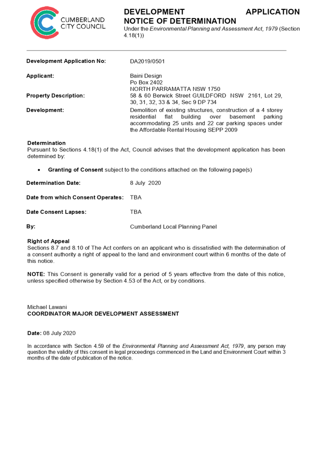
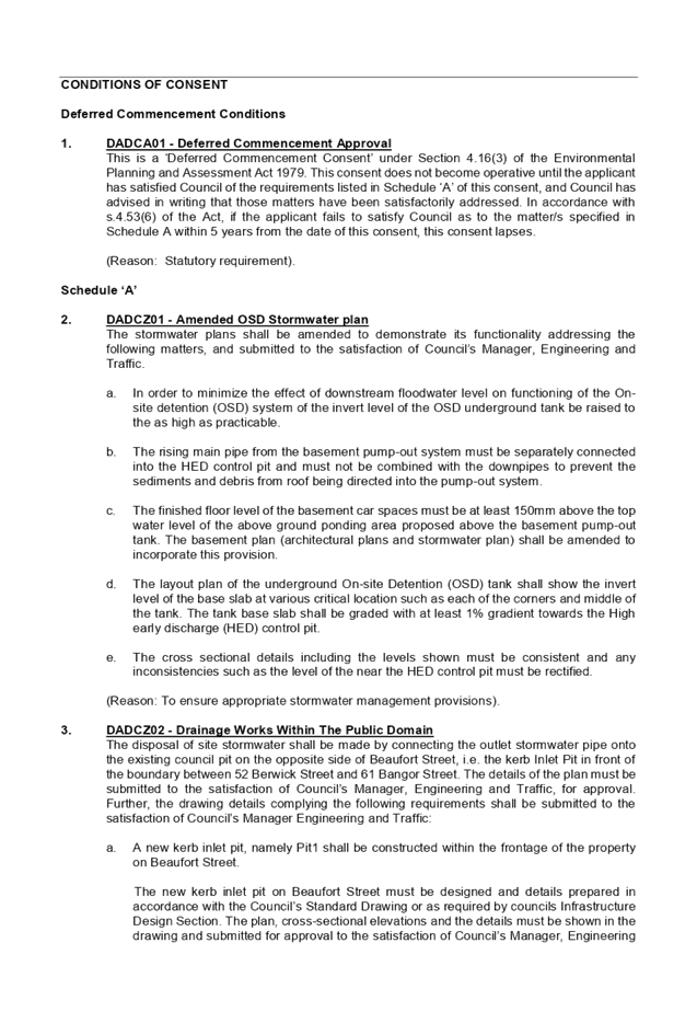
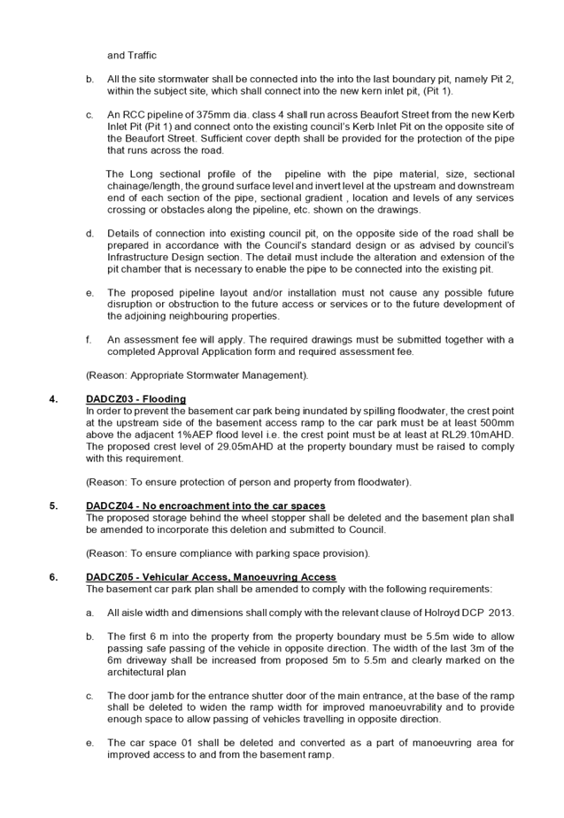

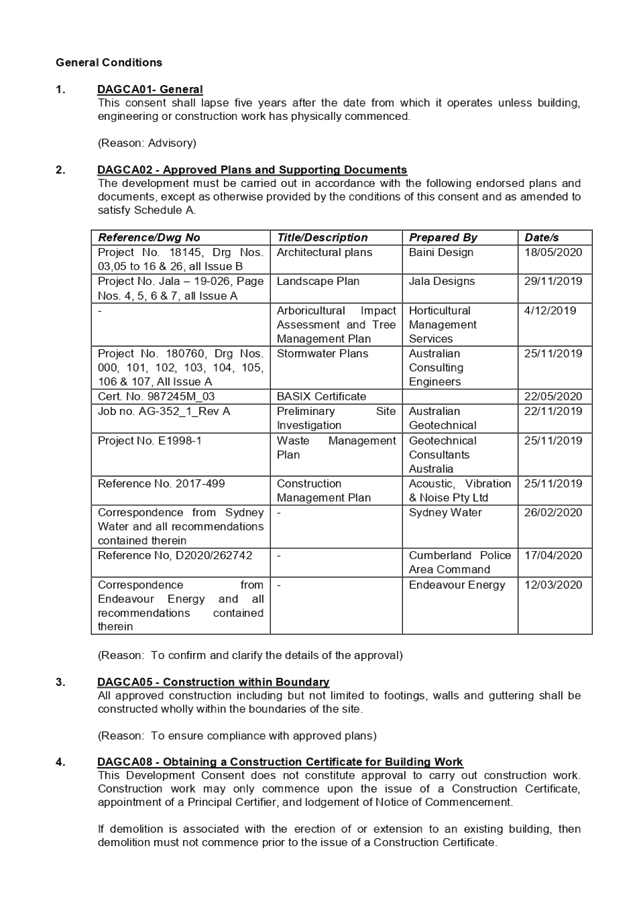

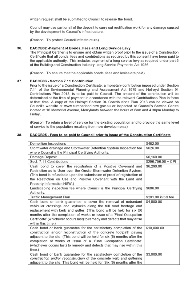
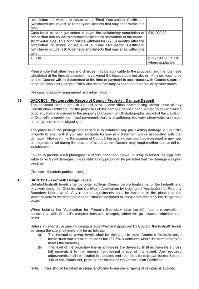

DOCUMENTS
ASSOCIATED WITH
REPORT LPP038/20
Attachment 2
SEPP ARH 2009 Compliance Table
Cumberland Local Planning Panel Meeting
8 July 2020
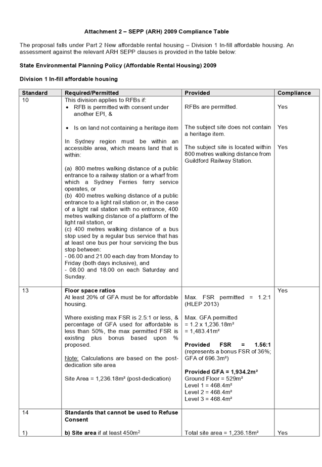
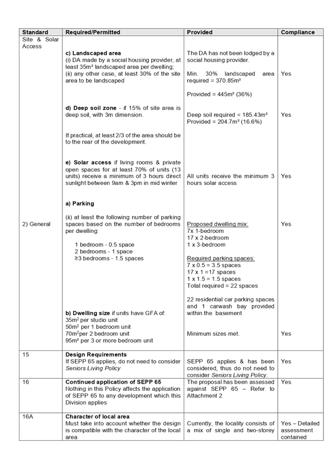
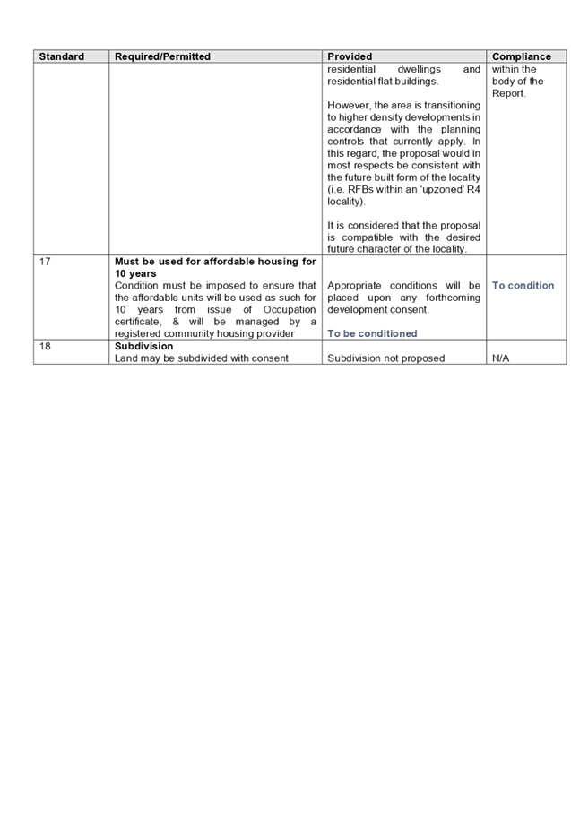
DOCUMENTS
ASSOCIATED WITH
REPORT LPP038/20
Attachment 3
ADG Compliance Table
Cumberland Local Planning Panel Meeting
8 July 2020
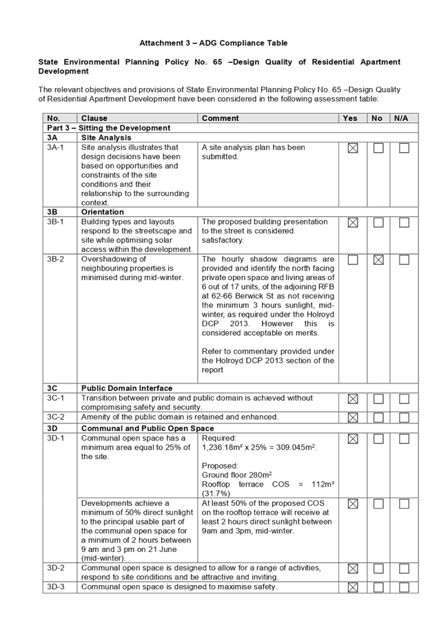
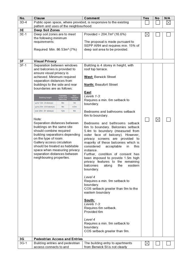
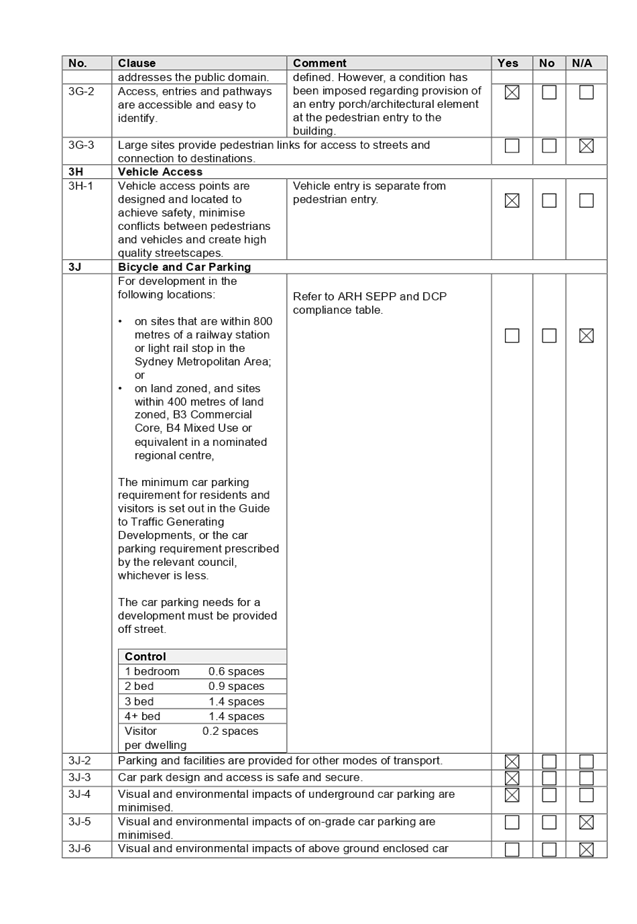
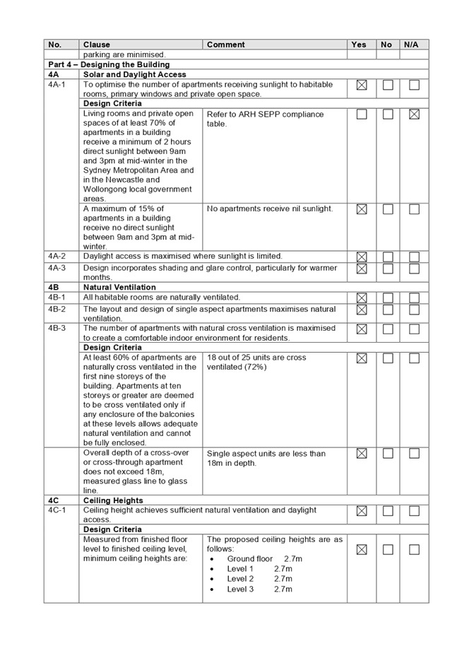

DOCUMENTS
ASSOCIATED WITH
REPORT LPP038/20
Attachment 4
HLEP 2013 Compliance Table
Cumberland Local Planning Panel Meeting
8 July 2020
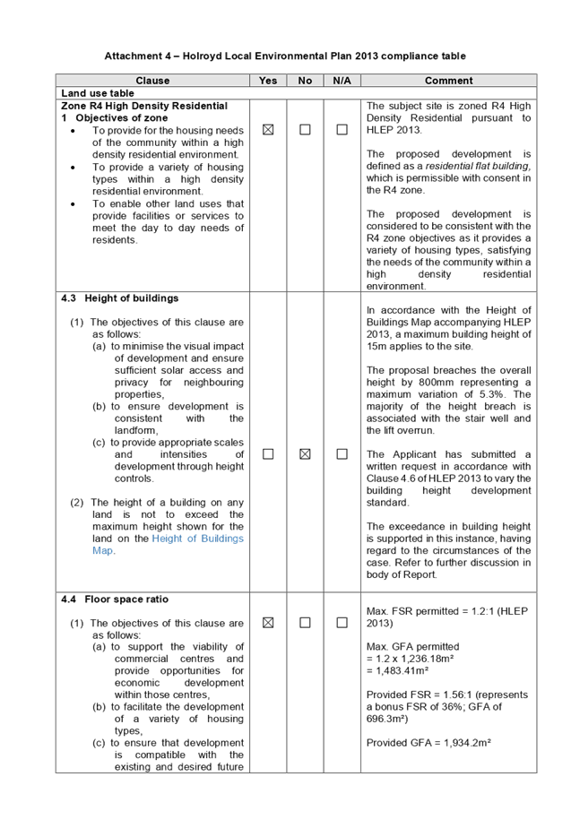
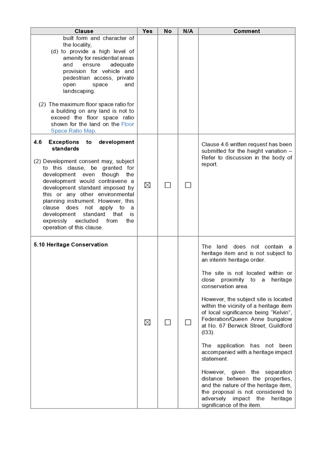
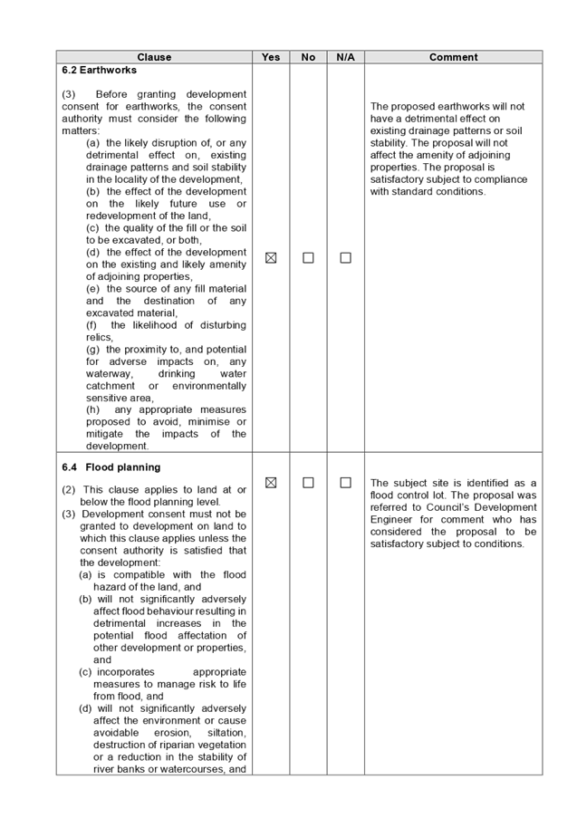
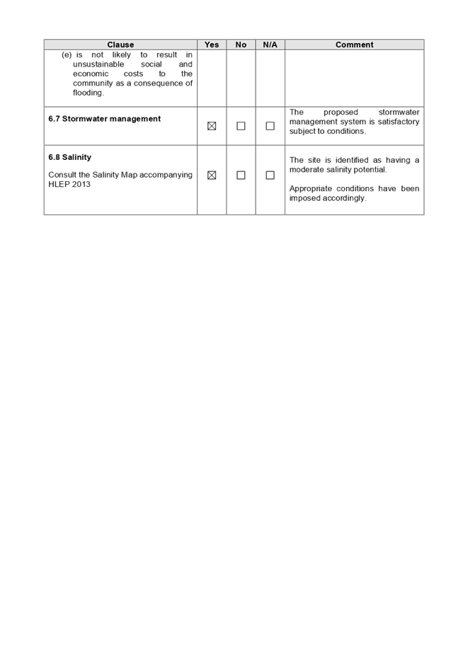
DOCUMENTS
ASSOCIATED WITH
REPORT LPP038/20
Attachment 5
HDCP 2013 Compliance Table
Cumberland Local Planning Panel Meeting
8 July 2020
DOCUMENTS
ASSOCIATED WITH
REPORT LPP038/20
Attachment 6
Architectural Plans
Cumberland Local Planning Panel Meeting
8 July 2020

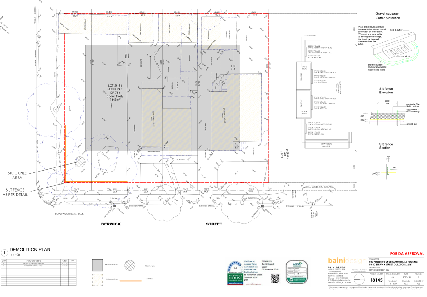
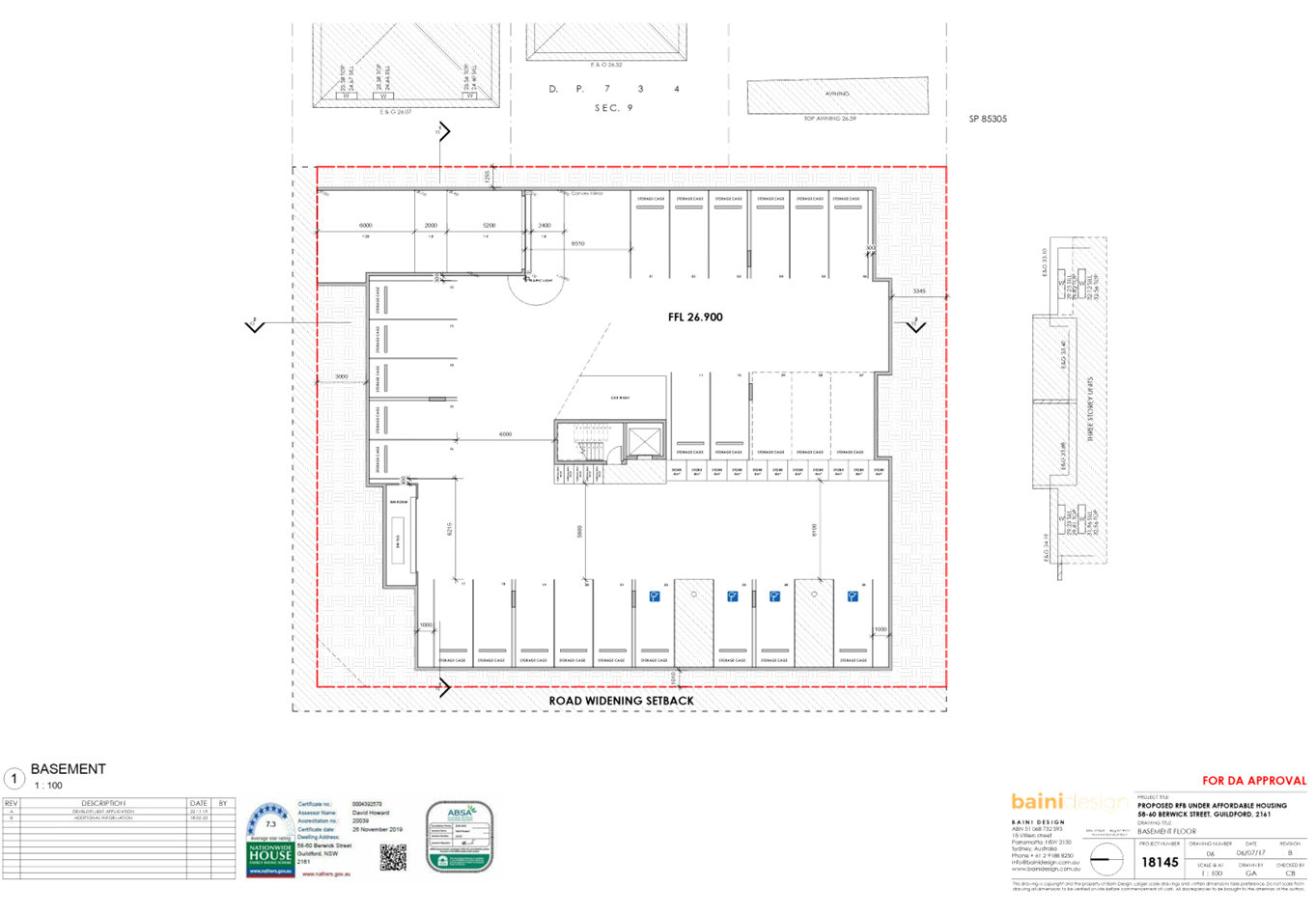
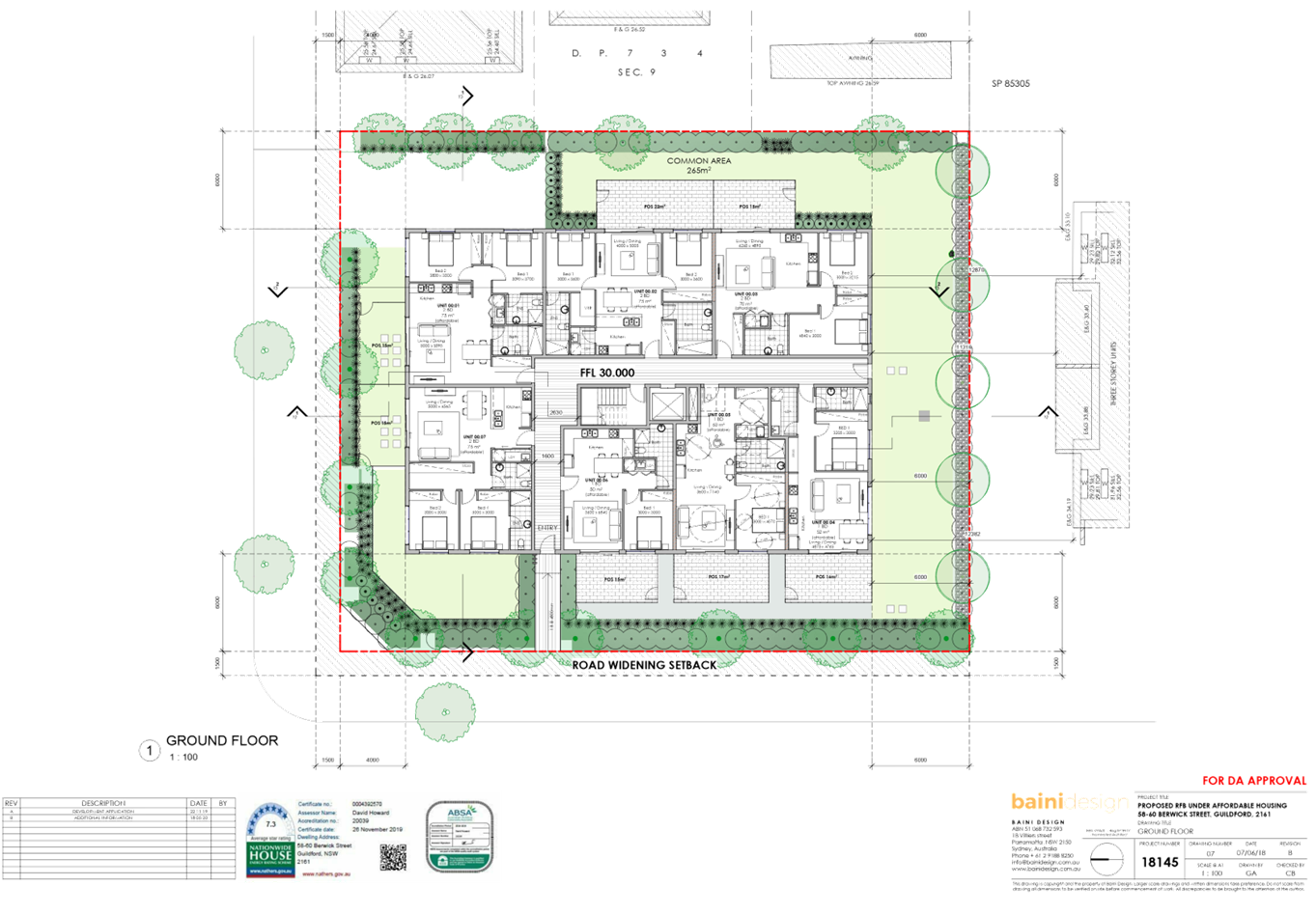
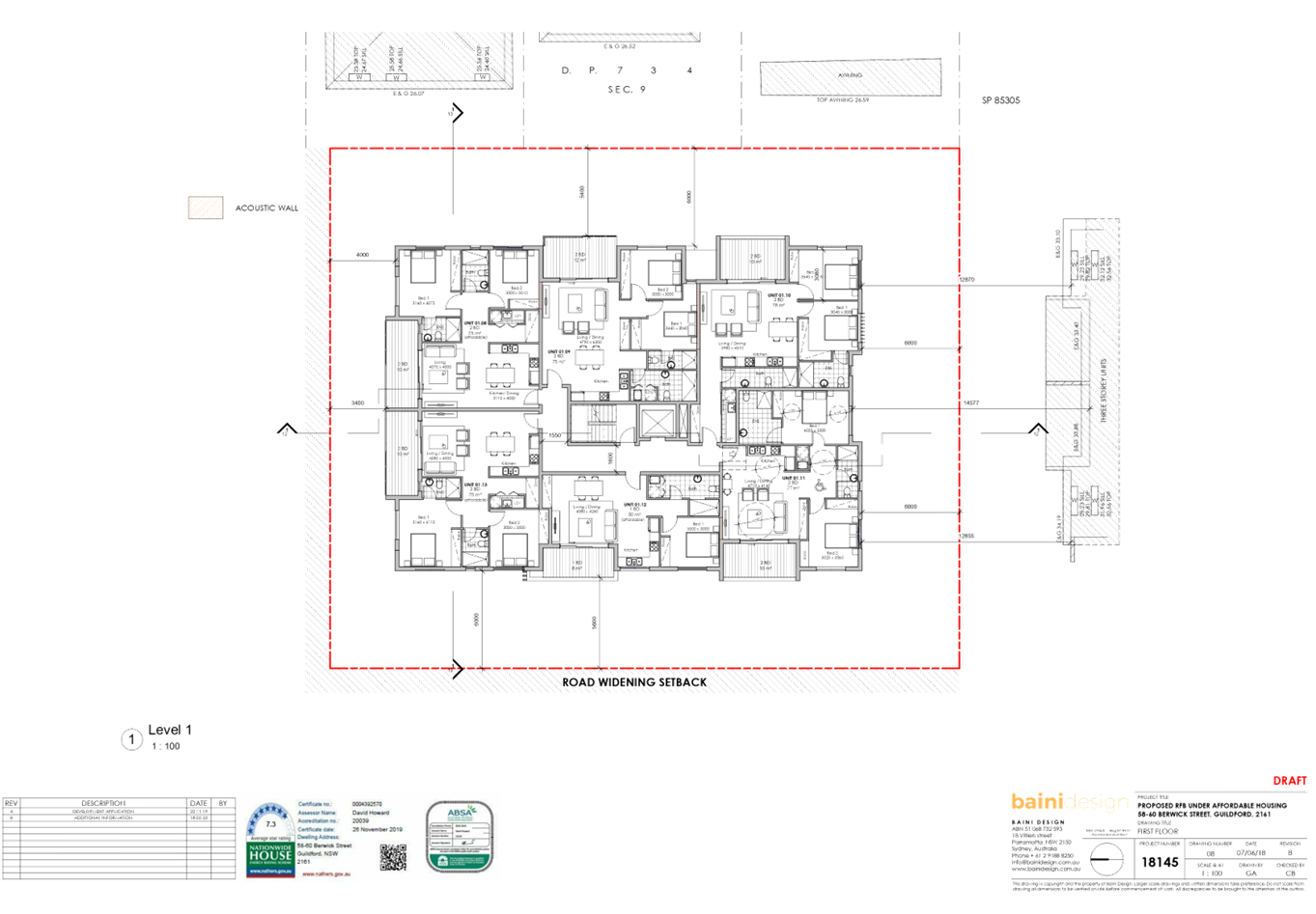
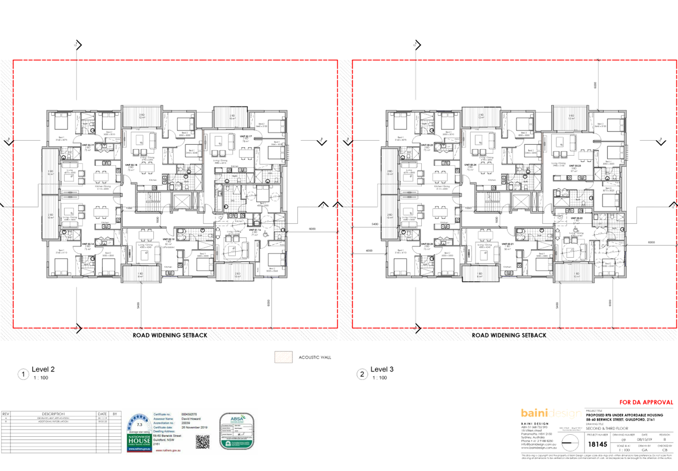
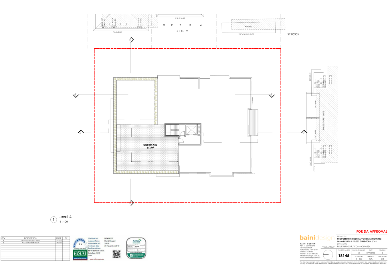
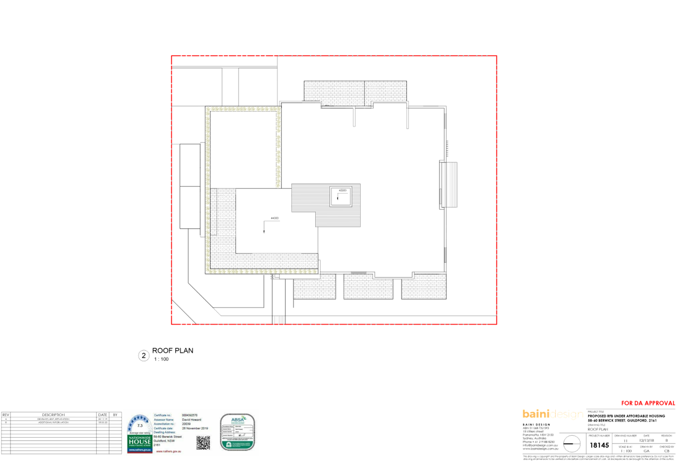
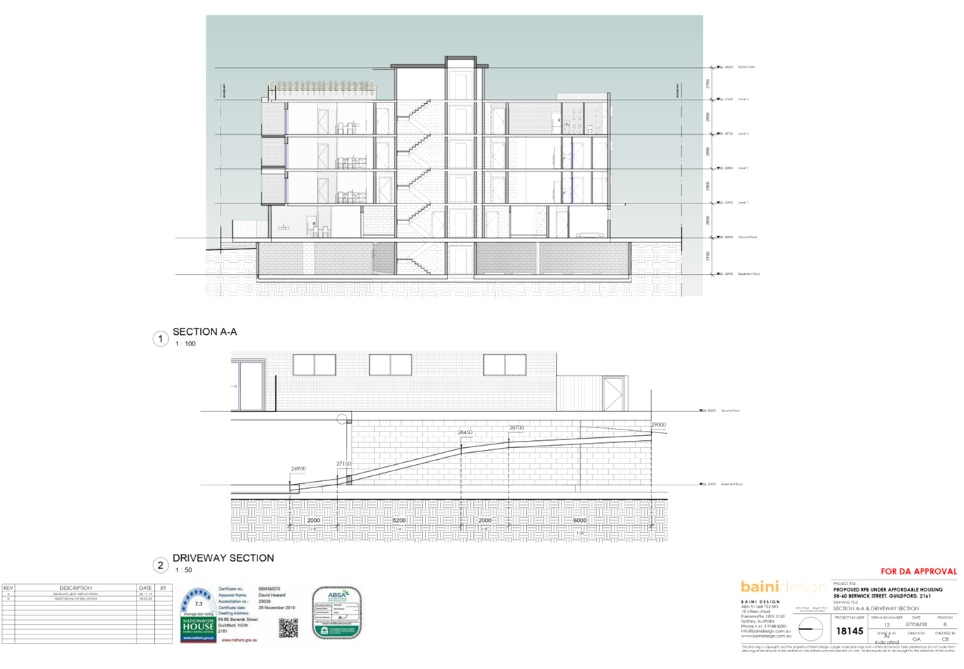
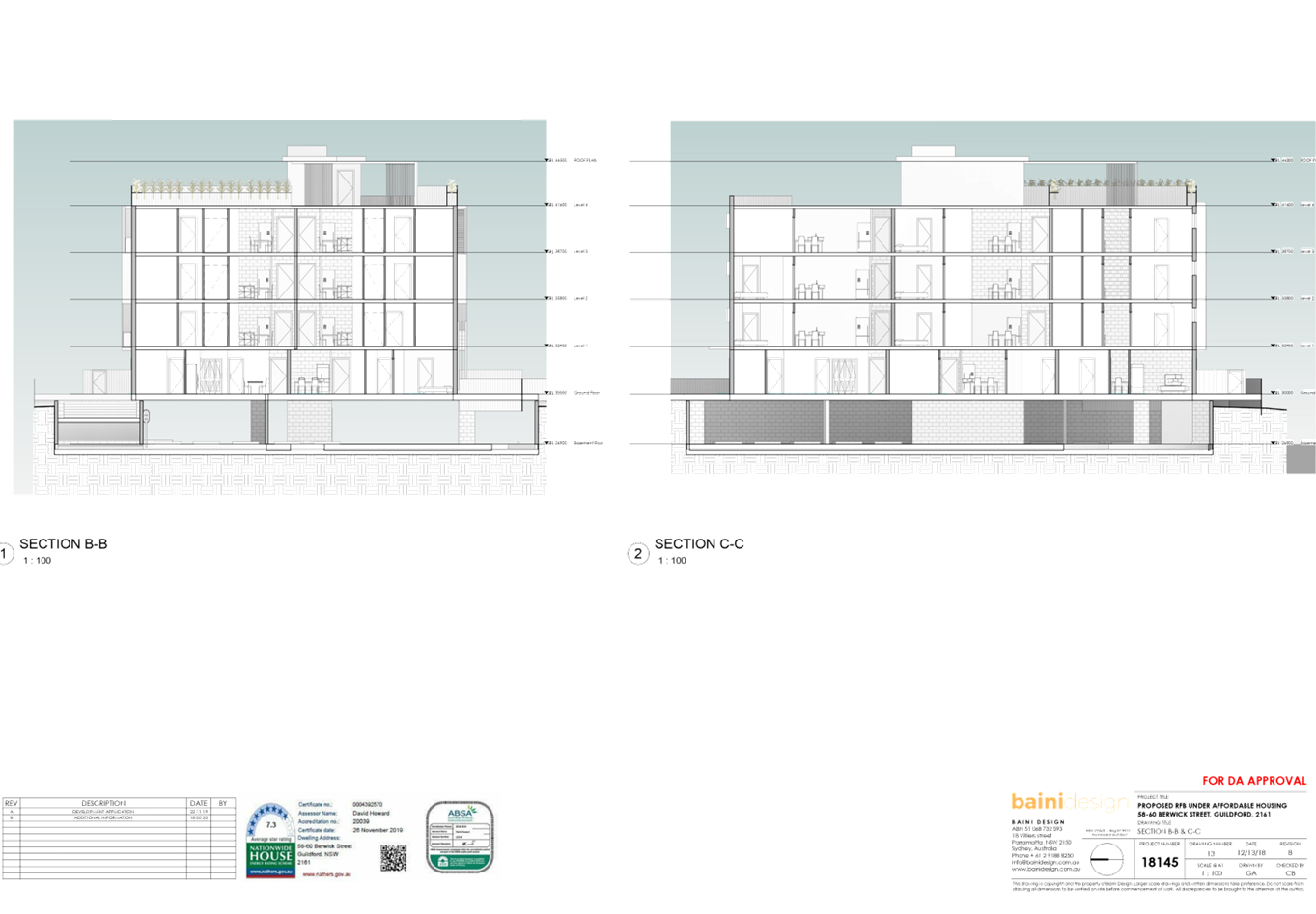
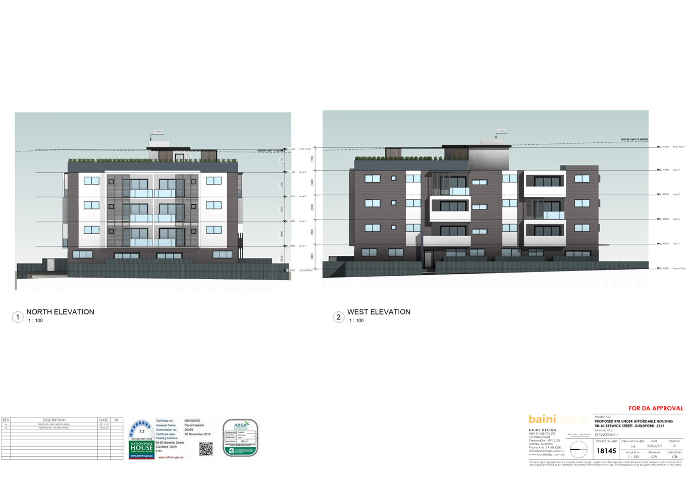
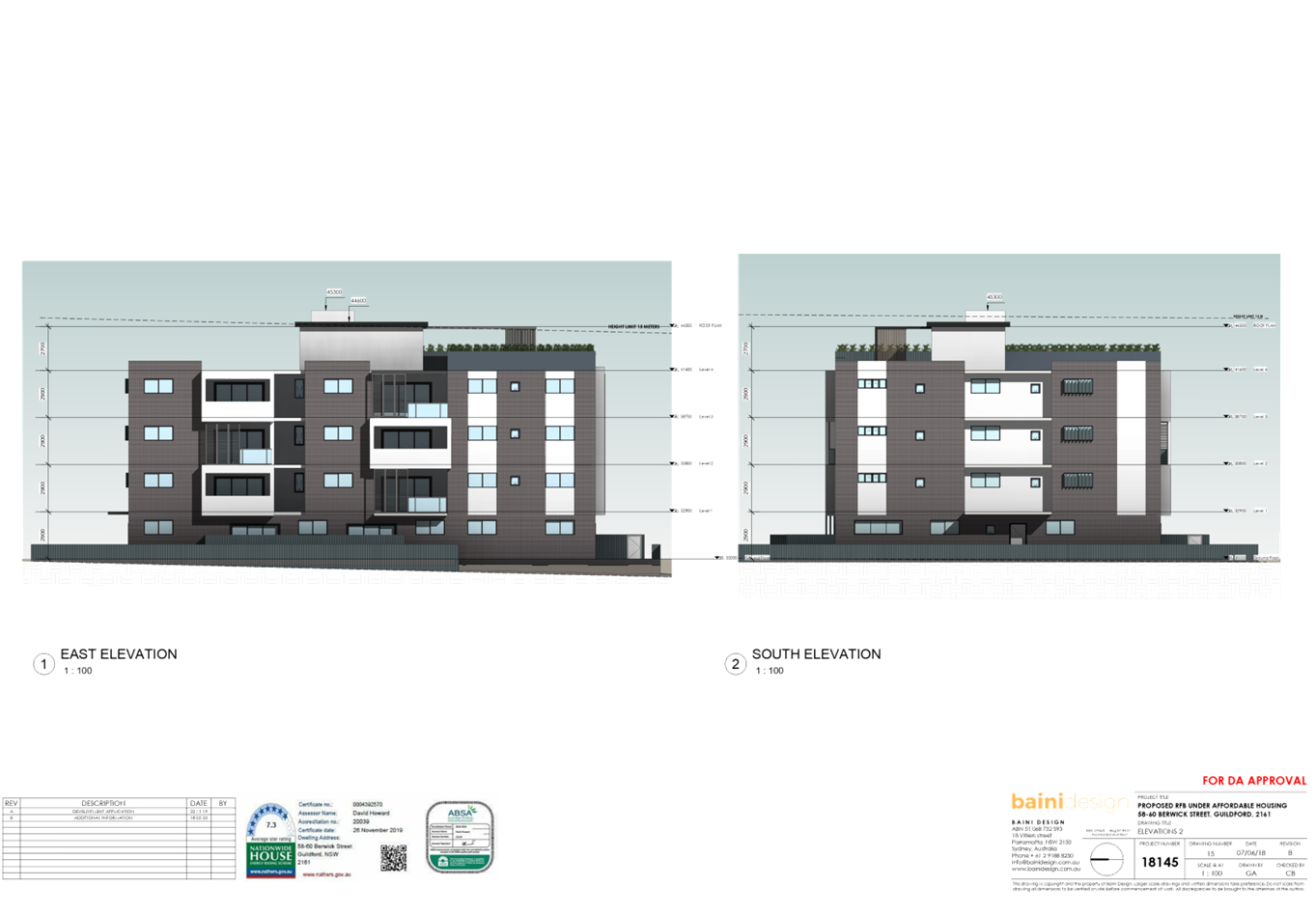
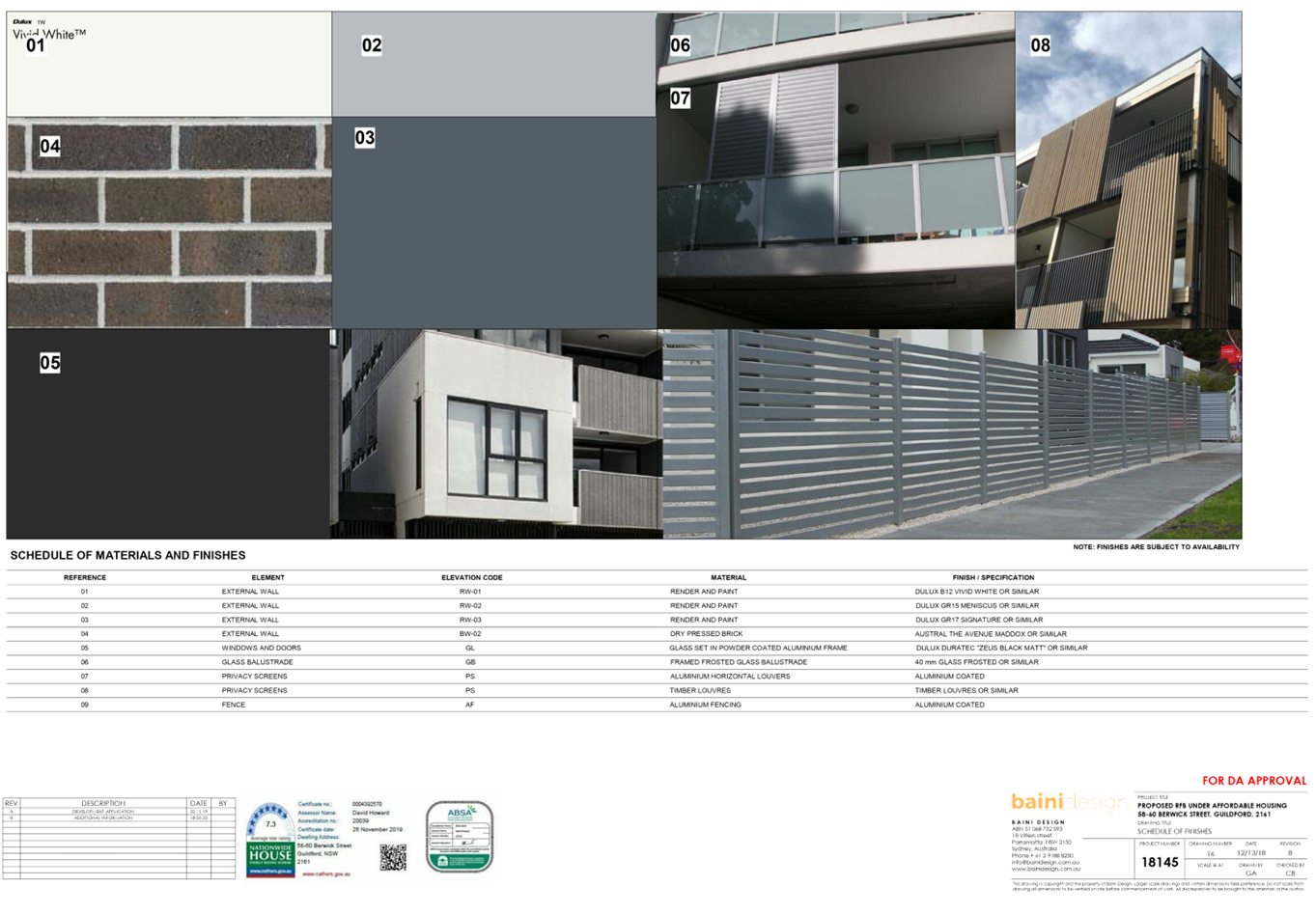
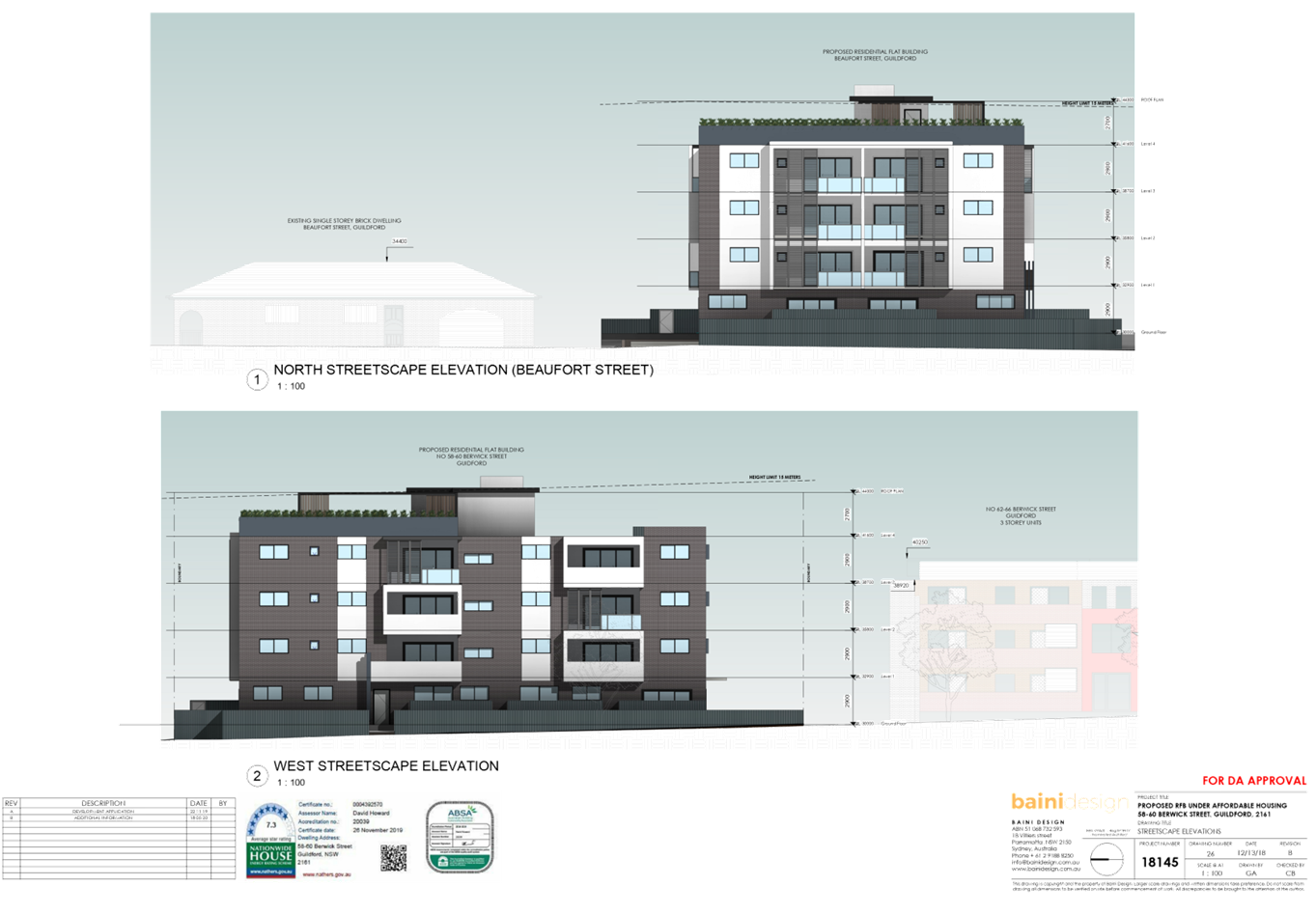
DOCUMENTS
ASSOCIATED WITH
REPORT LPP038/20
Attachment 7
Shadow Diagrams
Cumberland Local Planning Panel Meeting
8 July 2020

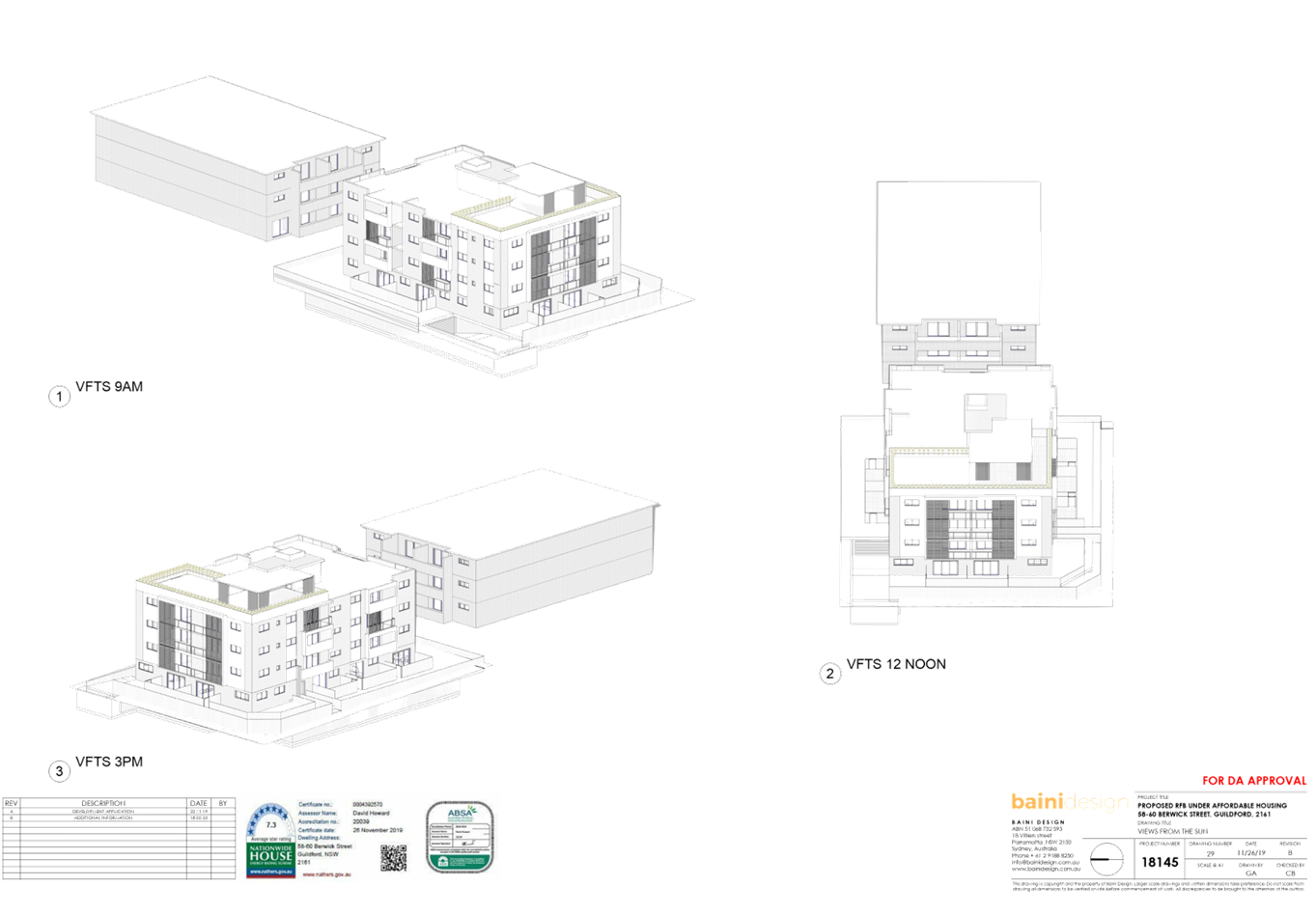
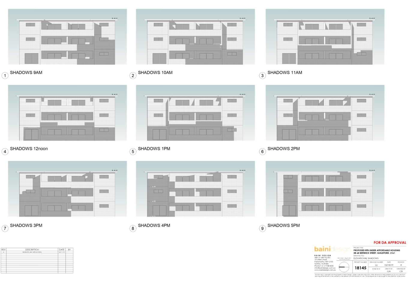
DOCUMENTS
ASSOCIATED WITH
REPORT LPP038/20
Attachment 8
Accompanying Clause 4.6 Variation Request to Building
Height
Cumberland Local Planning Panel Meeting
8 July 2020

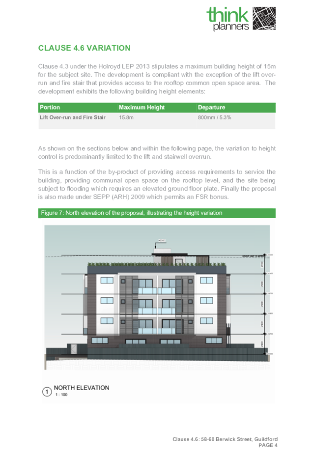
DOCUMENTS
ASSOCIATED WITH
REPORT LPP038/20
Attachment 9
Locality Map
Cumberland Local Planning Panel Meeting
8 July 2020
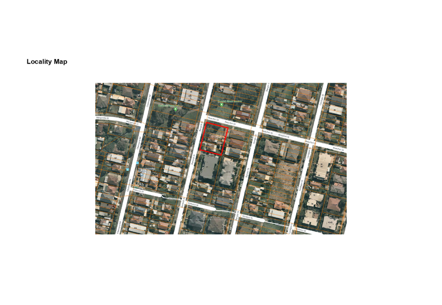
DOCUMENTS
ASSOCIATED WITH
REPORT LPP038/20
Attachment 10
Submission (3 x form letters)
Cumberland Local Planning Panel Meeting
8 July 2020
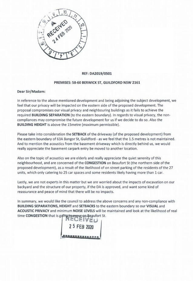
Cumberland
Local Planning Panel Meeting
8 July 2020
Item No: LPP039/20
Development
Application for 81-83 Mountford Avenue, Guildford
Responsible
Division: Environment
& Planning
Officer: Executive
Manager Development and Building
File
Number: MOD2019/5251
|
Application lodged
|
14 January 2020
|
|
Applicant
|
Designcorp Architects
|
|
Owner
|
H & M Develop Construct
Pty Ltd
|
|
Application No.
|
MOD2019/5251
|
|
Description of Land
|
81-83 Mountford Avenue
GUILDFORD NSW 2161, Lot B DP 334110, Lot 4 DP 231471
|
|
Description of original proposed development
|
Demolition of existing
structures, tree removal and construction of a 3 storey residential flat
building and townhouses over basement carparking pursuant to State
Environmental Planning Policy (Affordable Rental Housing) 2009
|
|
Description of proposed modification to development
|
Section 4.55(2) modification
for alterations to an approved residential flat building and townhouse units,
including reconfiguration of the basement, changes to floor levels, modified
roof design and alteration to fencing and screening heights and
|
|
Site Area
|
2695.8m2
|
|
Zoning
|
Zone R4 High Density
Residential (PLEP 2011)
|
|
Disclosure of political donations and gifts
|
Nil disclosure
|
|
Heritage
|
No
|
|
Principal Development Standards
|
FSR
Permissible: PLEP 2011 = 0.8:1
and 1.1:1
ARHSEPP 2009 = 1.023:1 for the main part of the
site
(including bonus of 0.223) relating to Blocks A and B
Approved: 0.99:1 (Blocks A and
B) and 0.68:1 (Block C)
Proposed: 0.96:1 (Blocks A and
B) and no change to Block C
Height of Building
Permissible: 11m applies to
Blocks A and B and 14m for Block C
Approved: Block A –
12.8m on northern part to 13m on southern part. 10m for Blocks B and C
Proposed: Block A –
13.3m on northern part to 13m on southern part. No height adjustments
proposed to Blocks B and C.
|
|
Issues
|
LEP height variation
Submission
|
1. Modification
Application No. MOD2019/5251 was received on 14 January 2020 for Section
4.55(2) modification for alterations to an approved residential flat building,
including reconfiguration of the basement, changes to floor levels, modified
roof design and alterations to fencing and screening heights.
2. The
application was publicly notified to occupants and owners of the adjoining
properties for a period of 14 days between 11 March 2020 and 25 March 2020. In
response, Council received one (1) submission.
3. The
notable variation/s are as follows:
|
Development
Standard
|
Required
|
Provided
|
% variation
|
|
Height of building
|
11m
|
Approved: 13m
Proposed: 13.3m
applies to only the northern part of building A.
|
2.3% variation from 13m
height approved.
21% variation from
maximum 11m height permitted.
|
4. The
application is recommended for approval subject to amendments to the relevant
conditions affected by the proposed modification and the inclusion of
additional conditions as recommended by Council’s development engineers
provided in the attached schedule.
Subject Site and Surrounding
Area
The site is identified as Lot B in
DP 334110, Lot 4 in DP 231471 and known as 81 - 83 Mountford Avenue, Guildford.
The subject site is located on the northern side of Mountford Avenue between
Talbot Road to the east and Railway Terrace to the west. The site is irregular
in shape and has a cumulative southern front boundary measuring 29.26m. The
site has a total area of 2695.8sqm and has a fall from the south-eastern corner
towards the western wing of the site of approximately 2.79m.
Currently at 81 Mountford Ave, is
a single storey fibro dwelling with a detached fibro garage and two free
standing awnings and four trees within the rear open space. At 83 Mountford Ave
is also a single storey dwelling with an attached fibro laundry and shed and a
clad shed with attached awning, detached freestanding awning, three trees and
metal shed outbuilding within the rear open space.
The subject site is adjoined by
three storey residential flat buildings on either side. The locality is
undergoing transition and is characterised by a variety of three and four
storey residential flat buildings and detached dwellings.
Figure
1 – Locality Plan of subject site
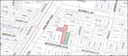
Figure
2 – Aerial view of subject site
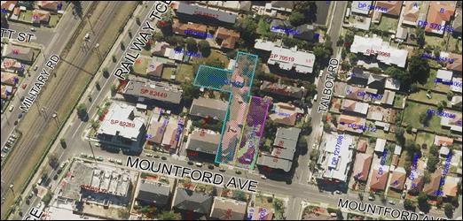
Figure
3 – Street view of subject site
Description of the Proposed
Development
Council has received a
modification application for alterations to an approved residential flat
building and townhouse development, including reconfiguration of the basement,
changes to floor levels and part of building height of block A, reconfiguration
of units 4, 9 and 10 of block A, provision of stair access from basement in
townhouse units and alteration to fencing and screening heights.
The detailed breakdown of the
proposed modifications are listed below:
· To
satisfy deferred commencement condition DC7, amend levels of the communal area
on the ground floor and basement level to provide minimum headroom clearance of
4500mm for manoeuvring of trucks entering and exiting the site (in accordance
with AS2890). Therefore, basement levels 1 and 2 have been amalgamated into one
level resulting in a relocation of car spaces and access to the ground level
via additional fire stairs.
· Building
form is modified on southern elevation to allow the driveway ramp and basement
height to provide the required 4.5m clearance for the waste truck.
· To
satisfy DC6, the basement door has been amended to increase air flow by
proposing an open style door and the removal of the planter boxes above this
area to increase opportunity for ventilation into the basement.
· Raise
height level of the northern portion of building A by a maximum of 500mm to the
same height level as the southern part of the building (to address
Council’s request to accommodate waste truck movements on basement level
which has resulted in changes to the basement).
· Due
to single basement design, landscaped and deep soil area have been reduced.
· All
fencing and screening height have been increased to 1.6m for all ground floor
terraces to provide privacy to all private open spaces.
· Communal
open space on rooftop is reduced and surrounded by non-trafficable areas to
maintain privacy to neighbouring properties.
· Unit
mix have been modified to comprise of 2 studios, 9x 1br, 16x 2br, 5x 3br and 1x
4br units.
· Increase
one additional affordable rental housing unit from 7 to 8 affordable units
(i.e. units 10-17 within the RFB of block A and none within the townhouses of
blocks B and C).
· Number
of carparking spaces will decrease from 47 spaces to 41 spaces to comply with
minimum requirements under SEPP 65 (ADG and RMS rates) and ARHSEPP rates.
· Townhouse
units are provided with internal stairs linking to basement carpark below and
stair access to attic is removed and a ladder and hatch is proposed instead.
· Modify
internal layout to units 4, 9 and 10 as follows:
o The bedroom of unit 4 is required to
be relocated from the western to the eastern side to make room for the required
headroom clearance for truck access into the basement.
o Similarly, the private open space
area for unit 9 is also required to be relocated from the western side to the
eastern side to satisfy minimum headroom clearance.
o Unit 10 has been reconfigured from a
2 bedroom into a 1 bedroom unit which has resulted in the deletion of the
western portion of the unit causing a recess in the western elevation.
· Modify
external finishes and materials as shown in elevations and schedule of
materials and finishes.
History
On 22/08/2018, the Cumberland
Local Planning Panel resolved to approved DA2017/500 as a deferred consent, for
the demolition of existing structures, tree removal and construction of a 3
storey residential flat building and townhouses over basement carparking
pursuant to State Environmental Planning Policy (Affordable Rental Housing)
2009.
Specifically, the approval
included a total of 33 units comprising of:
· 27
units within the RFB (Block A) with unit mix as follows: 2x studios, 8x 1br,
17x 2br
· 6
multi dwelling units (Blocks B and C) with unit mix as follows: 5x 3br, 1x 4br
· 4
adaptable units
· 7
affordable housing units (i.e. Units 10 - 15 in block A and Unit 31 in Block B)
· 47
car spaces located within 2 basement levels
It should be noted that the
deferred consent has not yet been made operational as the terms of the deferred
consent has yet to be satisfied.
Applicants Supporting
Statement
The applicant has provided a
Statement of Environmental Effects prepared by Design Corp P/L dated December
2019 and was received by Council on 11 December 2019 in support of the
application. A subsequent Statement of Environmental Effects was submitted to
confirm and clarify detailed modifications proposed under this application.
Contact with Relevant
Parties
The assessing officer has
undertaken a site inspection of the subject site and surrounding properties and
has been in regular contact with the applicant throughout the assessment
process.
Internal Referrals
Development Engineer
The development application was
referred to Council’s Development Engineer for comment who has advised
that the development proposal is satisfactory and therefore can be supported
subject to the inclusion of additional conditions to ensure compliance with
relevant Australian Standards in relation to parking layout.
External Referrals
The application was not required to be referred to any
external government authorities for comment.
PLANNING COMMENTS
Section 4.55(2):
|
Requirement
|
Comments
|
|
Council is satisfied that the development to which the
consent as modified relates is substantially the same development as the
development for which the consent was originally granted and before that
consent as originally granted was modified (if at all), and
|
The development as proposed to be modified is
substantially the same as the original approved development in that, the
residential nature of the use and the bulk and scale of the development
remains substantially the same.
The proposal results in minor alterations to the
façade treatment, changes to site conditions in relation to
landscaping, deep soil areas and communal open space, minor height and FSR
adjustments to the building and internal reconfiguration of the parking
layout in the basement level, some unit layouts and overall number of unit
mix. These changes are considered to be satisfactory and remains consistent
with the relevant planning controls. The changes are also largely in response
to satisfying the deferred commencement conditions for the provision of truck
access into the basement requiring minimum headroom clearance.
Further detailed discussions are provided in the
compliance tables listed under attachment 5.
|
|
Council has consulted with the relevant Minister, public
authority or approval body (within the meaning of Division 5) in respect of a
condition imposed as a requirement of a concurrence to the consent or in
accordance with the general terms of an approval proposed to be granted by
the approval body and that Minister, authority or body has not, within 21
days after being consulted, objected to the modification of that consent, and
|
No Minister, public authority or other approval body was
required to be consulted regarding the proposed modification.
|
|
Council has notified the application in accordance with:
(i) the regulations, if the
regulations so require, or
(ii) a development control plan,
if the consent authority is a council that has made a development control
plan that requires the notification or advertising of applications for
modification of a development consent, and
|
See discussion on “Public Notification” in
this report.
|
|
Council has considered any submissions made concerning the
proposed modification within any period prescribed by the regulations or
provided by the development control plan, as the case may be.
|
See discussion on “Public Notification” in
this report.
|
|
Relevant matters referred to in Section 4.15(1) of the act
have been taken into consideration
|
Proposed modification is not contrary to the public
interest and the likely environmental impacts of the development as modified
are considered acceptable.
|
The provisions of any
Environmental Planning Instruments (EP&A Act s4.15 (1)(a)(i))
State Environmental Planning
Policies
The proposed development is
affected by the following State Environmental Planning Policies and Sydney
Regional Environmental Plans:
(a) State
Environmental Planning Policy No. 55 – Remediation of Land (SEPP 55)
Clause 7 of SEPP 55 requires
Council to be satisfied that the site is suitable or can be made suitable to
accommodate the proposed development. The matters listed within Clause 7 have
been considered and addressed under the original consent and the site was
considered satisfactory to proceed. As such the modifications proposed under
this application will not alter the previous conclusions regarding the
condition of the site.
(b) State
Environmental Planning Policy (Coastal Management) 2018
The subject site is not identified
as a coastal wetland or land identified as proximity area for coastal wetlands
or coastal management area.
(c) State
Environmental Planning Policy (Infrastructure) 2007
The original consent was referred
to Endeavour Energy in accordance with clause 45 of the Infrastructure SEPP
(ISEPP) 2007. There are no significant changes proposed under this modification
application and as such a re-referral to the relevant external government
agency is not required.
(d) State
Environmental Planning Policy (Building Sustainability Index: BASIX) 2004
A revised BASIX Certificate
879644M_05 issued on 25 November 2019 has been submitted to support the
application. The revised BASIX Certificate which incorporates the proposed
design changes is considered satisfactory.
(e) State
Environmental Planning Policy (Affordable Rental Housing) 2009
The relevant matters to be
considered under Parramatta Local Environmental Plan 2010 for the proposed
modification are outlined below and a full assessment is provided in attachment
5.
|
Requirement
|
Y/N
|
Comment
|
|
13 Floor space ratios
(1)
This clause applies to development to which this Division applies if the
percentage of the gross floor area of the development that is to be used for
the purposes of affordable housing is at least 20 per cent.
(2)
The maximum floor space ratio for the development to which this clause
applies is the existing maximum floor space ratio for any form of residential
accommodation permitted on the land on which the development is to occur,
plus:
(a) if the existing maximum floor space ratio
is 2.5:1 or less:
(i) 0.5:1—if the percentage of the gross
floor area of the development that is used for affordable housing is 50 per
cent or higher, or
(ii) Y:1—if the percentage of the gross
floor area of the development that is used for affordable housing is less
than 50 per cent,
where:
AH is the
percentage of the gross floor area of the development that is used for affordable
housing.
Y = AH
÷ 100
(3)
In this clause, gross floor area does not include any
car parking (including any area used for car parking).
Note. Other areas are also excluded from the gross floor
area, see the definition of gross floor area contained
in the standard instrument under the Standard Instrument (Local Environmental Plans) Order
2006.
|
Y
Y
N/A
|
As noted in the previous consent, the affordable housing
units are situated wholly on the part of the site to which there is a maximum
allowable FSR of 0.8:1. In applying clause (2)(a)(ii), 22.3% of the GFA of
the development is used for affordable housing. Therefore, the GFA bonus of
0.223:1 will be applied to that portion of the site bringing the maximum
allowable FSR of the main part of the site to 1.023:1. The development
situated on that part of the site, comprising the residential flat building
and the western multi dwelling block B is calculated to have an FSR of 0.99:1
(2234.7sqm).
The result of the proposed modification which
affects the unit configuration and layout does not cause an increase in FSR
approved for the site. Rather, the overall FSR has decreased for the site
with a revised FSR of 0.96:1 (2182.61sqm) where minor changes are noticeable
in units 4, 9 and 10 of the RFB (in block A). Consequently, it is noted that
the overall percentage of the GFA bonus has also slightly reduced from 22.8%
(516.09sqm) to 22.5% (508.24sqm) which is negligible. Moreover, the
additional affordable unit nominated within the development does not generate
additional FSR for the site as the number of units remain the same.
The development remains compliant as the proposed
modifications do not exceed the maximum FSR permitted for the site nor does
it exceed the approved FSR for the site.
|
|
14 Standards that cannot be used to
refuse consent
(1) Site
and solar access requirements A consent authority must not refuse consent
to development to which this Division applies on any of the following
grounds:
(a) (Repealed)
(b) site area if the site area on which
it is proposed to carry out the development is at least 450 square metres,
(c) landscaped area if:
(i) in the case of a development application
made by a social housing provider—at least 35 square metres of
landscaped area per dwelling is provided, or
(ii) in any other case—at least 30 per
cent of the site area is to be landscaped,
(d) deep soil zones if, in relation to
that part of the site area (being the site, not only of that particular
development, but also of any other associated development to which this
Policy applies) that is not built on, paved or otherwise sealed:
(i) there is soil of a sufficient depth to
support the growth of trees and shrubs on an area of not less than 15 per
cent of the site area (the deep soil zone), and
(ii) each area forming part of the deep soil
zone has a minimum dimension of 3 metres, and
(iii) if practicable, at least two-thirds of
the deep soil zone is located at the rear of the site area,
(e) solar access if living rooms and
private open spaces for a minimum of 70 per cent of the dwellings of the
development receive a minimum of 3 hours direct sunlight between 9am and 3pm
in mid-winter.
(2) General
A consent authority must not refuse consent to development to which this
Division applies on any of the following grounds:
(a) parking if:
(i) in the case of a development application
made by a social housing provider for development on land in an accessible
area—at least 0.4 parking spaces are provided for each dwelling
containing 1 bedroom, at least 0.5 parking spaces are provided for each
dwelling containing 2 bedrooms and at least 1 parking space is provided for
each dwelling containing 3 or more bedrooms, or
(ii) in any other case—at least 0.5
parking spaces are provided for each dwelling containing 1 bedroom, at least
1 parking space is provided for each dwelling containing 2 bedrooms and at
least 1.5 parking spaces are provided for each dwelling containing 3 or more
bedrooms,
(b) dwelling size if each dwelling has
a gross floor area of at least:
(i) 35 square metres in the case of a
bedsitter or studio, or
(ii) 50 square metres in the case of a dwelling
having 1 bedroom, or
(iii) 70 square metres in the case of a
dwelling having 2 bedrooms, or
(iv) 95 square metres in the case of a
dwelling having 3 or more bedrooms.
(3)
A consent authority may consent to development to which this Division applies
whether or not the development complies with the standards set out in
subclause (1) or (2).
|
Y
N/A
Y
Y
Y
Y
Y
N/A
Y
Y
Y
Y
|
The cumulative site area is 2695.8sqm
The amount of landscaping provided has been reduced on
site and is calculated to be 30% (809.25sqm including planting on roof) which
complies.
A reduction in deep soil area is noted however remains
compliant as 16.6% (449.68sqm) is being provided for the site.
Deep soil zones have a minimum dimension of 3m.
71.8% (353.3sqm) of the deep soil zone is located at the
rear of the site.
The proposed modification will
not alter the amount of solar amenity provided to the units as the number of
units remain unchanged.
As for the entire RFB
development 70.4% (19 of 27) of units receive at least 2 hours mid winter.
7.4% (2 of 27 units) receive no direct sunlight in midwinter due to their
south facing aspect and overhang to west side facing windows from the built
form above.
The remainder of the units
will either receive at least an hour of sunlight to their living areas or
some direct sunlight to other parts of the apartment.
As a result of modification to consolidate the two
basement levels and reconfigure the parking layout, adequate number of car
spaces are still being provided for the whole development being 41 car spaces
which complies. A breakdown of the parking is provided as follows:
Affordable housing units based on clause (2(a)(ii)
|
Rate
|
Units
|
Total
|
|
0.5/1B
|
9
x 1B and
2 x ST = 11
|
5.5
|
|
1.0/2B
|
16
|
16
|
|
Total
|
27
|
21.5 rounded up =
22
|
The above table demonstrates that a minimum of 22 parking
spaces are required for the RFB component of the development.
In relation to visitor spaces, the RFB attracts a parking
rate of 1 car space per 5 units under the RMS guideline, therefore 27 units/5
= 5.4 spaces for visitors being required.
Multi dwelling units based on PDCP 2011:
|
Rate
|
Units
|
Total
|
|
1.5/3B
|
5
|
7.5
|
|
2/4B
|
1
|
2
|
|
Total
|
6
|
9.5
(rounded up = 10)
|
|
0.25 Visitor
|
6
|
1.5
|
Having regard to the above parking rates applying to each
component of the development, a cumulative total of 39 spaces are required as
follows:
32 (22+10) resident spaces and 7 (5.4+1.5) visitor spaces.
Amendments to the relevant conditions imposed under the
previous consent will be made to reflect this change.
All bedroom units meet the minimum dwelling size
requirements.
|
Clause 16A – Character of
local area:
As a result of minor changes being
proposed to the front façade of the southern elevation, Clause 16A has
been considered in terms of whether the design of the development will still be
compatible with the character of the local area.
The proposed amendments primarily
include changes to parts of the materials and finishes of the southern
elevation from render and paint finish to brick and aluminium clad finish.
Units 10 and 19 have also been modified to incorporate a more defined architectural
façade treatment and further articulation has been provided to unit 10
with the provision of a new balcony and the replacement of windows to sliding
doors for access to the balcony.
These changes proposed to the
Mountford Avenue streetscape are considered minor and remains substantially the
same as the original façade treatment proposed to the development under
the previous consent. In this regard, Council is satisfied that the proposed
changes are considered to be compatible and do not diminish the streetscape and
character of the local area.
(f) Statement
Environmental Planning Policy No. 65 - Design Quality of Residential Apartment
Development (SEPP 65)
SEPP 65 applies to the development
as the building is 3 storeys or more, and contains more than 4 dwellings.
Following a detailed assessment of the proposal against the provisions of SEPP
65 and the ADG, the proposal as modified remains compliant and therefore
performs satisfactorily with respect the building amenity. The clauses
applicable to the proposed modification are discussed below and a comprehensive
assessment against the ADG is contained in Appendix A.
|
Design Criteria
|
Compliance
|
Comment
|
|
Part 2
|
|
2F Building Separation
|
|
Separation - Building
separation is measured from the outer face of building envelopes which
includes balconies
Note: Where
applying separation to buildings on adjoining sites, apply half the minimum
separation distance measured to the boundary. This distributes the building
separation equally between sites.
|
|
Up to 4 storeys
(approximately 12m):
· 12m
between habitable rooms/balconies;
· 9m
between habitable and nonhabitable rooms; and
· 6m
between nonhabitable rooms
|
Yes
|
No noticeable changes to
approved setbacks from the north and east side.
From the west, approval was
granted for 3m to boundary for the front section of the building which is
supportable as it relates to either a blank wall or non-habitable rooms and
6m for the remainder of the flat building which features habitable rooms and
balconies. The modifications which affects unit 10 on level 1 has been
further offset by an additional 2.7m from the boundary as a result of the
deletion of the western portion of the unit. Therefore, a setback of 8.7m is
being provided from the western boundary for unit 10 instead of 6m previously
provided.
|
|
Part 3
|
|
3D Communal and public open
space
|
|
COS should have a minimum
dimension of 3m.
Where COS cannot be
provided at ground level, it should be provided on a podium or roof.
|
|
Design criteria
· Communal
open space has a minimum area equal to 25% of the site (see figure 3D.3)
· Developments
achieve a minimum of 50% direct sunlight to the principal usable part of the
communal open space for a minimum of 2 hours between 9 am and 3 pm on 21 June
(mid winter)
|
Yes
Yes
|
Common open space has
decreased from 769m2 (28.5%) to 683.59m2 (25.3%). This includes areas to the
east and west of the flat building and communal open space on the roof which
complies.
Compliance with min 2h of
solar access to COS is achieved as 170m2 of rooftop COS receives unlimited
solar access and approx. 200m2 of ground level COS within eastern side
setback receives 2h of sun in the morning (refer to basement 1 plan for
approx. areas within eastern side setback COS and solar access diagrams for
compliance with solar access). ADG min COS requirement is 674m2 and 50% of
that area is 337m2. Proposed rooftop (170m2) and ground level eastern setback
(approx. 200m2) results approx. 370m2 of COS area that receives min. 50%
required solar access during mid-winter.
|
|
3E Deep soil zones
|
|
Design criteria
1. Deep soil zones are to meet
the following minimum requirements:
|
Yes
|
A reduction in deep soil area
is noted however remains compliant as 16.6% (449.68sqm) is being provided for
the site.
|
|
3J Car parking
|
|
Design criteria
1. For development in the
following locations:
· on
sites that are within 800 metres of a railway station or light rail stop in
the Sydney Metropolitan Area; or
· on
land zoned, and sites within 400 metres of land zoned, B3 Commercial Core, B4
Mixed Use or equivalent in a nominated regional centre
the minimum car parking
requirement for residents and visitors is set out in the Guide to Traffic
Generating Developments, or the car parking requirement prescribed by the
relevant council, whichever is less
The car parking needs for a
development must be provided off street
|
Yes
|
Based on the ADG, as the site
is within 800m of a railway station, the parking rates in the Guide to
Traffic Generating Developments will apply.
Metro Sub-regional centres
for RFB:
|
Rate
|
Units
|
Total
|
|
0.6/1B and Studio
|
9 x 1B and
2 x ST = 11
|
6.6
|
|
0.9/2B
|
16
|
14.4
|
|
1/5 V
|
27
|
5.4
|
Required: 21 resident spaces
and 6 visitor spaces = 27 car spaces for RFB component of the development.
There is adequate space within
the basement to accommodate the minimum parking requirements for the whole
development. This is discussed in detail in the DCP section.
|
|
4D Apartment size and
layout
|
|
Design criteria
1. Apartments are required to
have the following minimum internal areas:
The minimum internal areas
include only one bathroom. Additional bathrooms increase the minimum internal
area by 5m2 each
A fourth bedroom and further
additional bedrooms increase the minimum internal area by 12m2 each
2. Every habitable room must
have a window in an external wall with a total minimum glass area of not less
than 10% of the floor area of the room. Daylight and air may not be borrowed
from other rooms.
|
Yes
Yes
|
The affected units 4, 9 and 10
are compliant with the minimum apartment sizes for 1 and 2 bedrooms being
72.49sqm, 77.15sqm and 50.25sqm respectively.
|
|
4E Private open space and
balconies
|
|
Design criteria
1. All apartments are required
to have primary balconies as follows:
The minimum balcony depth to
be counted as contributing to the balcony area is 1m
2. For apartments at ground
level or on a podium or similar structure, a private open space is provided
instead of a balcony. It must have a minimum area of 15m2 and a minimum depth
of 3m
|
Yes
Yes
|
Complies. Reconfiguration of
the following affected units provides:
Unit 4 (2BR) = 11.04sqm with
minimum dimensions of 2m
Unit 9 (2BR) = 17.62sqm with
minimum dimensions of 2m
Unit 10 (1 BR) = 8.01sqm with
minimum dimension of 2m.
|
|
Design criteria
1. In addition to storage in
kitchens, bathrooms and bedrooms, the following storage is provided:
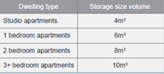
At least 50% of the required
storage is to be located within the apartment
|
Yes
|
The proposal provides adequate
internal storage within each apartment and a separate storage for each unit
within the basement. The storage provided meets the requirements and
objectives of the ADG.
|
Regional Environmental Plans
The proposed development is
affected by the following Regional Environmental Plans:
(a) Sydney
Regional Environmental Plan (Sydney Harbour Catchment) 2005
The subject site is identified as
being located within the area affected by the Sydney Regional Environmental
Plan (Sydney Harbour Catchment) 2005. The proposed development raises no issues
as no impact on the catchment is envisaged.
(Note: - the subject site is not
identified in the relevant map as ‘land within the ‘Foreshores and
Waterways Area’ or ‘Wetland Protection zone’, is not a
‘Strategic Foreshore Site’ and does not contain any heritage items.
Hence the majority of the SREP is not directly relevant to the proposed
development).
Local Environmental Plans
Parramatta Local Environmental
Plan 2011 (PLEP 2011)
The provision of the PLEP 2011 is
applicable to the development proposal and permissibility of the development
has been established under the previous consent for a residential flat building
and multi dwellings proposed as “infill affordable housing” under
the SEPP (Affordable Rental Housing) 2009. It is noted that the development
achieves compliance with the objectives of the R4 High Density Residential
zone.
The relevant matters to be
considered under Parramatta Local Environmental Plan 2010 and the applicable
clauses of relevance to the proposed modification are reviewed below.
Figure
4 –Parramatta LEP 2011 Compliance Table
|
DEVELOPMENT STANDARD
|
COMPLIANCE
|
DISCUSSION
|
|
4.3 Height of Buildings
· 11(L) and 14m
(N2)
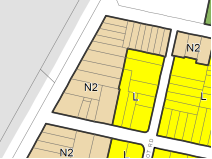
|
No
|
No changes are noted with
respect to the building height for the multi dwelling blocks B and C.
For RFB block A, where an 11m
height limit applies, a 13m building height was approved under previous
consent for the southern part of the site (where the lift is located) and
12.8m on the northern part of the site.
To address Council’s
request to accommodate waste truck movements on basement level, a
height change of 0.5m is required whereby the northern portion of building A
(approved at 12.8m) is raised to the same level as the southern part of the
building. This results in a total building height of 13.3m for the northern
part of the site which exceeds the maximum approved building height of 13m by
0.3m representing 2.3% variation.
Approved variation under
previous consent = 2m (18%)
Overall proposed variation to
the building height = 2.2m (20%)
|
|
4.4 Floor Space Ratio
· LEP = 0.8(J)and
1.1(O):1
· SEPP(ARH)2009 =
1.023:1 for the main part of the site (including SEPP ARH bonus of 0.223)
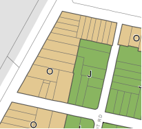
|
Yes
|
The site areas of the two
parts of the site are as follows:
Western wing: 439.75sqm and
Main site: 2256.26sqm
The approved FSR for the main site, comprising the
residential flat building block A and the western multi dwelling block B is
calculated to be 0.99:1 (2234.7sqm). For the western wing containing multi
dwelling block C, an approved FSR of 0.68:1 (298.8sqm) is provided.
The result of the proposed modification which
affects the unit configuration and layout does not cause an increase in FSR
approved for the site. Rather, the overall FSR has decreased for the site
with a revised FSR of 0.96:1 (2182.61sqm) where minor changes are noticeable
in units 4, 9 and 10 of the RFB (in block A). Consequently, it is noted that
the overall percentage of the GFA bonus has also slightly reduced from 22.8%
(516.09sqm) to 22.5% (508.24sqm) which is negligible. Moreover, the additional
affordable unit nominated within the development does not generate additional
FSR for the site as the number of units remain the same.
Therefore, development remains compliant as the proposed
modifications do not exceed the maximum FSR permitted for the site nor does
it exceed the approved FSR for the site.
|
The provisions of any proposed
instrument that is or has been the subject (EP&A Act s4.15 (1)(a)(ii))
(a) Draft
State Environmental Planning Policy (Environment)
The draft SEPP relates to the
protection and management of our natural environment with the aim of
simplifying the planning rules for a number of water catchments, waterways,
urban bushland, and Willandra Lakes World Heritage Property. The changes
proposed include consolidating the following seven existing SEPPs:
· State
Environmental Planning Policy No. 19 – Bushland in Urban Areas
· State
Environmental Planning Policy (Sydney Drinking Water Catchment) 2011
· State
Environmental Planning Policy No. 50 – Canal Estate Development
· Greater
Metropolitan Regional Environmental Plan No. 2 – Georges River Catchment
· Sydney
Regional Environmental Plan No. 20 – Hawkesbury-Nepean River (No.2-1997)
· Sydney
Regional Environmental Plan (Sydney Harbour Catchment) 2005
· Willandra
Lakes Regional Environmental Plan No. 1 – World Heritage Property.
The draft policy will repeal the
above existing SEPPs and certain provisions will be transferred directly to the
new SEPP, amended and transferred, or repealed due to overlaps with other areas
of the NSW planning system.
Changes are also proposed to the
Standard Instrument – Principal Local Environmental Plan. Some provisions
of the existing policies will be transferred to new Section 117 Local Planning
Directions where appropriate.
(b) Draft
Cumberland Local Environmental Plan 2020 (Draft CLEP)
The Draft Cumberland Local
Environmental Plan 2020 (Draft CLEP) has been prepared by Cumberland Council to
provide a single planning framework for the future planning of Cumberland City.
The changes proposed seek to harmonise and repeal the three existing LEPs
currently applicable to the Cumberland local government area, those being:
· Holroyd Local
Environmental Plan 2013,
· Parramatta Local
Environmental Plan 2011, and
· Auburn Local
Environmental Plan 2010.
The current planning controls for
the subject site, as contained within the Parramatta Local Environmental Plan
2011 are not proposed to change under the Draft CLEP.
The provisions of any
Development Control Plans (EP&A Act s4.15 (1)(a)(iii))
a) Parramatta
Development Control Plan 2011
The Parramatta Development Control
Plan 2011 provides guidance for the design and operation of development to
achieve the aims and objectives of the Parramatta Local Environmental Plan
2011.
Relevant sections noted in the
PDCP 2011 with regard to residential flat building requirements also do not
apply in so far as clause 6A of SEPP 65 requires that DCPs cannot be
inconsistent with the ADG. If a development control plan contains provisions
that specify requirements, standards or controls in relation to a matter to
which this clause applies, those provisions are of no effect. Where the
applicable DCP contains provisions in relation to the above criteria and as
such, these provisions of the DCP no longer have effect.
In relation to the multi dwellings
section of the PDCP 2011, only minor changes are sought to provide additional
stair access from the basement level into the townhouse units which has no
effect on the site design and building amenity requirements and has previously
been addressed under the original consent. However, an assessment of the
parking rates for multi dwellings has been reviewed below as a result of the
proposed changes to consolidate and reconfigure the basement carpark.
|
Control
|
Compliance
|
Comment
|
|
3.6 Movement and Circulation
|
|
3.6.2 Parking and Vehicular Access - Multi-dwelling:
0.6 spaces per studio apartment
1 space per 1 bedroom unit
1.25 spaces per 2 bedroom unit
1.5 spaces per 3 bedroom unit
2 spaces per 4 bedroom unit
Plus 0.25 space per dwelling for visitor
parking
A car wash bay which may also be a visitor space
|
Yes
|
Parking required:
Multi dwelling units based on PDCP 2011:
|
1.
Rate
|
2.
Units
|
3.
Total
|
|
4.
1.5/3B
|
5.
5
|
6.
7.5
|
|
7.
2/4B
|
8.
1
|
9.
2
|
|
10. Total
|
11. 6
|
12. 9.5
13. (rounded
up = 10)
|
|
14.
0.25 Visitor
|
15.
6
|
16.
1.5
|
Having regard to the above table where a minimum of 10
resident spaces are required for the townhouse units and the minimum 22
resident parking spaces required for the RFB component, a cumulative total of
39 spaces are required as follows:
32 (22+10) residential parking spaces are required for the
development and a minimum of 7 (5.4+1.5 = 6.9) spaces are required for
visitors.
The development provides a revised number of 41 parking
spaces which complies. Amendments to the relevant conditions imposed under
the previous consent will be made to reflect this change.
|
Having regard to the above, the
proposed modification remains consistent with the relevant sections of the PDCP
2011 and no further review is required.
The provisions of any planning
agreement that has been entered into under section 7.4, or any draft planning
agreement that a developer has offered to enter into under section 7.4
(EP&A Act s4.15(1)(a)(iiia))
There is no draft planning
agreement associated with the subject Development Application.
The provisions of the Regulations
(EP&A Act s4.15 (1)(a)(iv))
The proposed development raises no
concerns as to the relevant matters arising from the Environmental Planning and
Assessment Regulations 2000 (EP&A Reg).
The Likely Environmental,
Social or Economic Impacts (EP&A Act s4.15 (1)(b))
It is considered that the proposed
development will have no significant adverse environmental, social or economic
impacts in the locality.
The suitability of the site for
the development (EP&A Act s4.15 (1)(c))
The subject site and locality is
not known to be affected by any natural hazards or other site constraints
likely to have a significant adverse impact on the proposed development.
Accordingly, it is considered that the development is suitable in the context
of the site and surrounding locality.
Submissions made in accordance
with the Act or Regulation (EP&A Act s4.15 (1)(d))

In accordance with Council’s
Notification requirements contained within Part A5.5.3 of the Parramatta DCP
2011, the modified application has been notified in the same manner as the
original application for a period 14 days between 11 March 2020 and 25 March
2020. The notification generated one (1) submissions in respect of the proposal
and none of which disclosed a political donation or gift. The issues raised in the
public submissions are summarised and commented on as follows:
Issue: Lack of parking provided on
site resulting in overflow of parking on the street and illegal street parking.
Comment: Parking has been provided
at the required rate in accordance with RMS guidelines, ARHSEPP 2009 and
Parramatta DCP for multi dwellings. Therefore, compliance has been achieved.
Illegal parking is a matter for NSW Police and Council’s compliance
officers to attend to within the Cumberland area.
The public interest (EP&A Act
s4.15(1)(e))
In view of the foregoing analysis
it is considered that the development, if carried out subject to the conditions
set out in the recommendation below, will have no significant adverse impacts
on the public interest.
Section 7.12 (Formerly S94a)
Fixed Development Consent Levies
Comments:
A revised quantity surveyor report
prepared by Construction Consultants P/L dated 4 December 2019 has been
submitted to accompany the subject application. The revised figures for the
cost of works for the development provided in the report have been considered
and reviewed by Council’s s7.11 planner and as such condition 5 of the
original deferred consent relating to development contributions will be
required to be amended accordingly.
Disclosure of Political
Donations and Gifts
The applicant and notification
process did not result in any disclosure of Political Donations and Gifts.
The modification application has
been assessed in accordance with the relevant requirements of the Environmental
Planning and Assessment Act 1979, ARHSEPP and SEPP 65, Parramatta LEP and DCP
and is considered to be Satisfactory for approval subject to additional
conditions.
The development as modified is
appropriately located within the R4 under the relevant provisions of the
Parramatta LEP, however variations in relation to building height under the LEP
is sought. Minor non-compliances with Council’s controls have been
discussed in the body of this report.
Having regard to the assessment of
the proposal from a merit perspective, Council may be satisfied that the
development has been responsibly designed and provides for acceptable levels of
amenity for future residents. It is considered that the proposal successfully
minimises adverse impacts on the amenity of neighbouring properties. Hence the
development, irrespective of the departures noted above, is consistent with the
intentions of Council’s planning controls and represents a form of
development contemplated by the relevant statutory and non-statutory controls
applying to the land.
For these reasons, it is
considered that the proposal is satisfactory having regard to the matters of
consideration under Section 4.15 and 4.55 of the Environmental Planning and
Assessment Act 1979, and the modified development may be approved subject to
conditions.
|
1. That
Modification Application No. MOD2019/5251 for Section 4.55(2) modification
for alterations to an approved residential flat building and townhouse units
including reconfiguration of the basement, changes to floor levels, modified
roof design and alteration to fencing and screening heights on land at 81-83
Mountford Avenue GUILDFORD NSW 2161 be approved subject to
additional conditions listed in the attached schedule.
2. Persons
whom have lodged a submission in respect to the application be notified of
the determination of the application.
|
1. Draft Notice
of Determination
2. Architectural
Plans
3. Stormwater
and Engineering Plans
4. Submissions
Recieved
5. Compliance
Tables (ARHSEPP and ADG)
6. Approved
Plans under DA2017/500
7. Landscape
Plan
DOCUMENTS
ASSOCIATED WITH
REPORT LPP039/20
Attachment 1
Draft Notice of Determination
Cumberland Local Planning Panel Meeting
8 July 2020
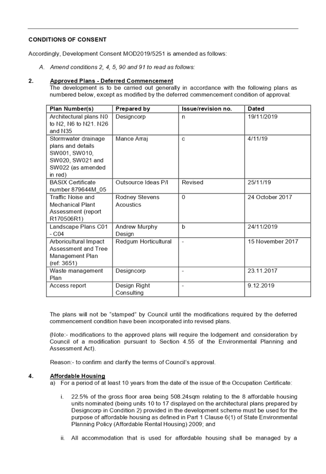
DOCUMENTS
ASSOCIATED WITH
REPORT LPP039/20
Attachment 2
Architectural Plans
Cumberland Local Planning Panel Meeting
8 July 2020
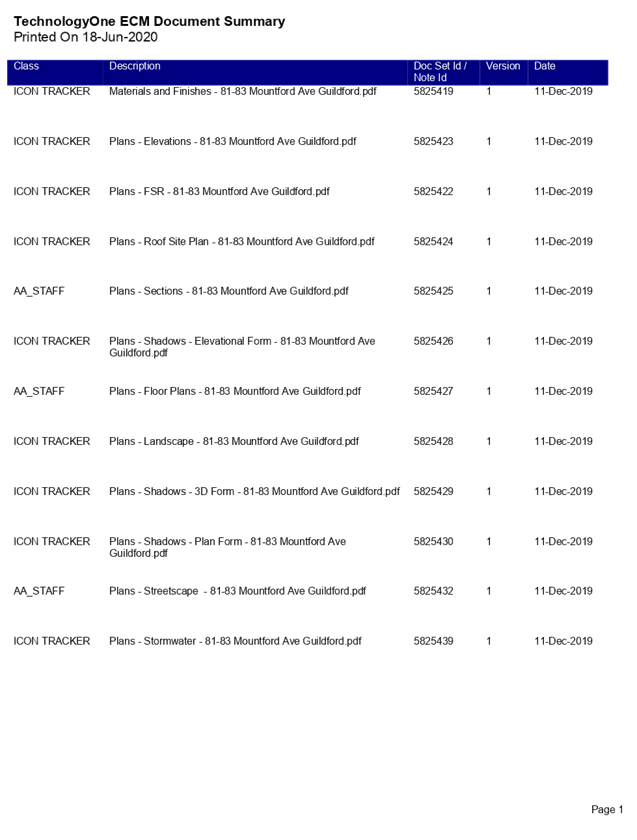
Cumberland Local Planning Panel Meeting
8 July 2020
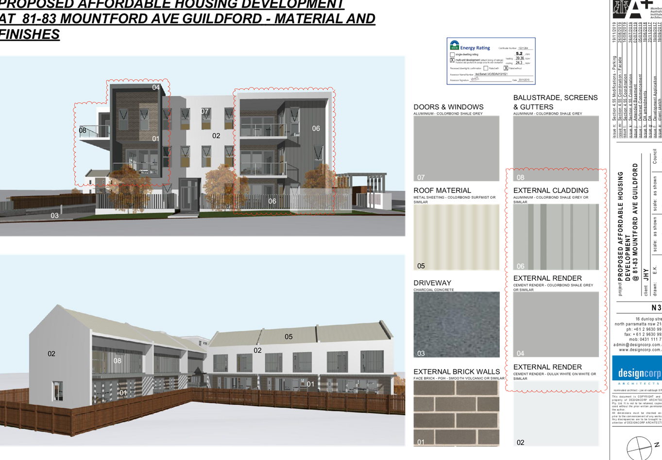
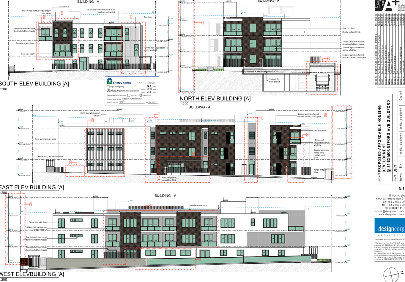
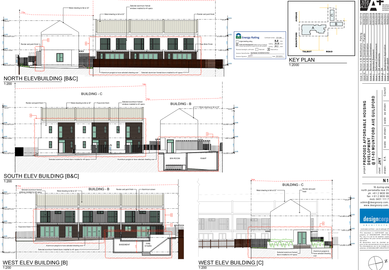
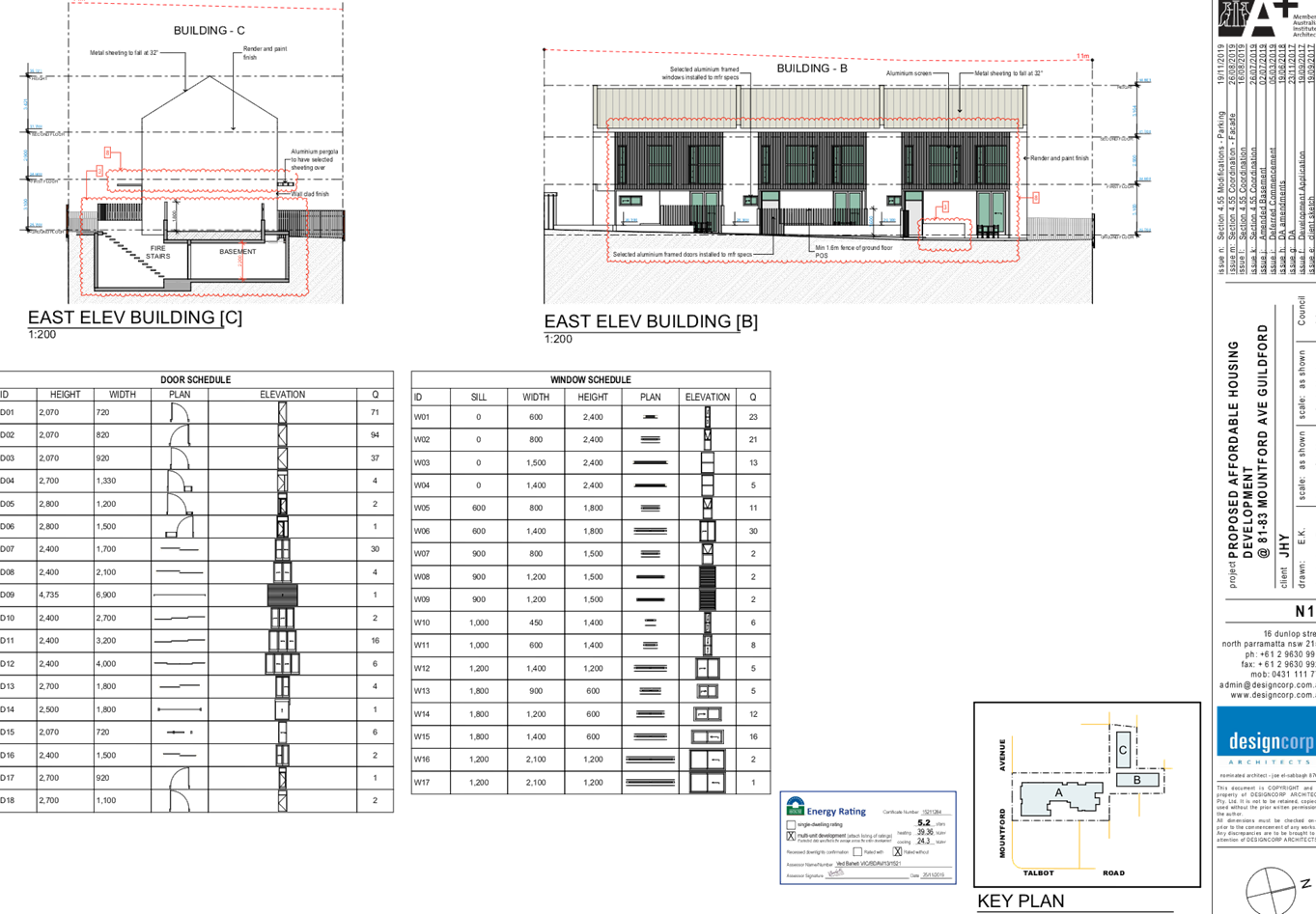
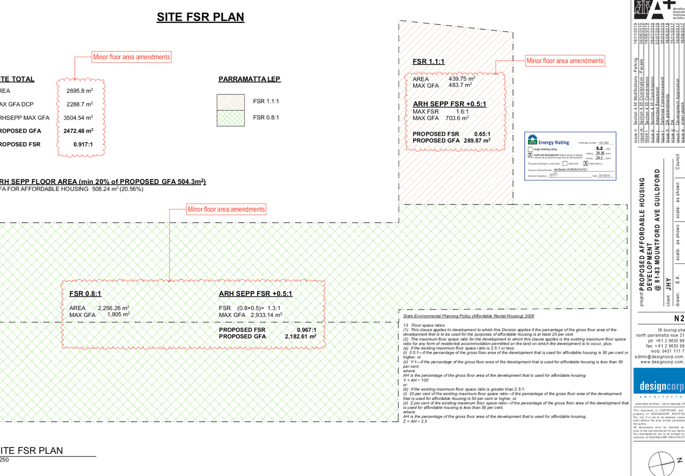
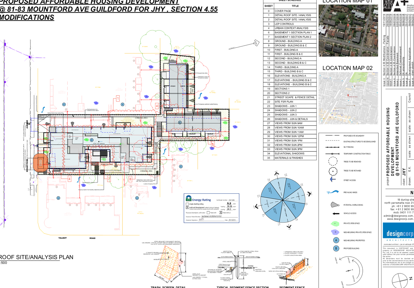
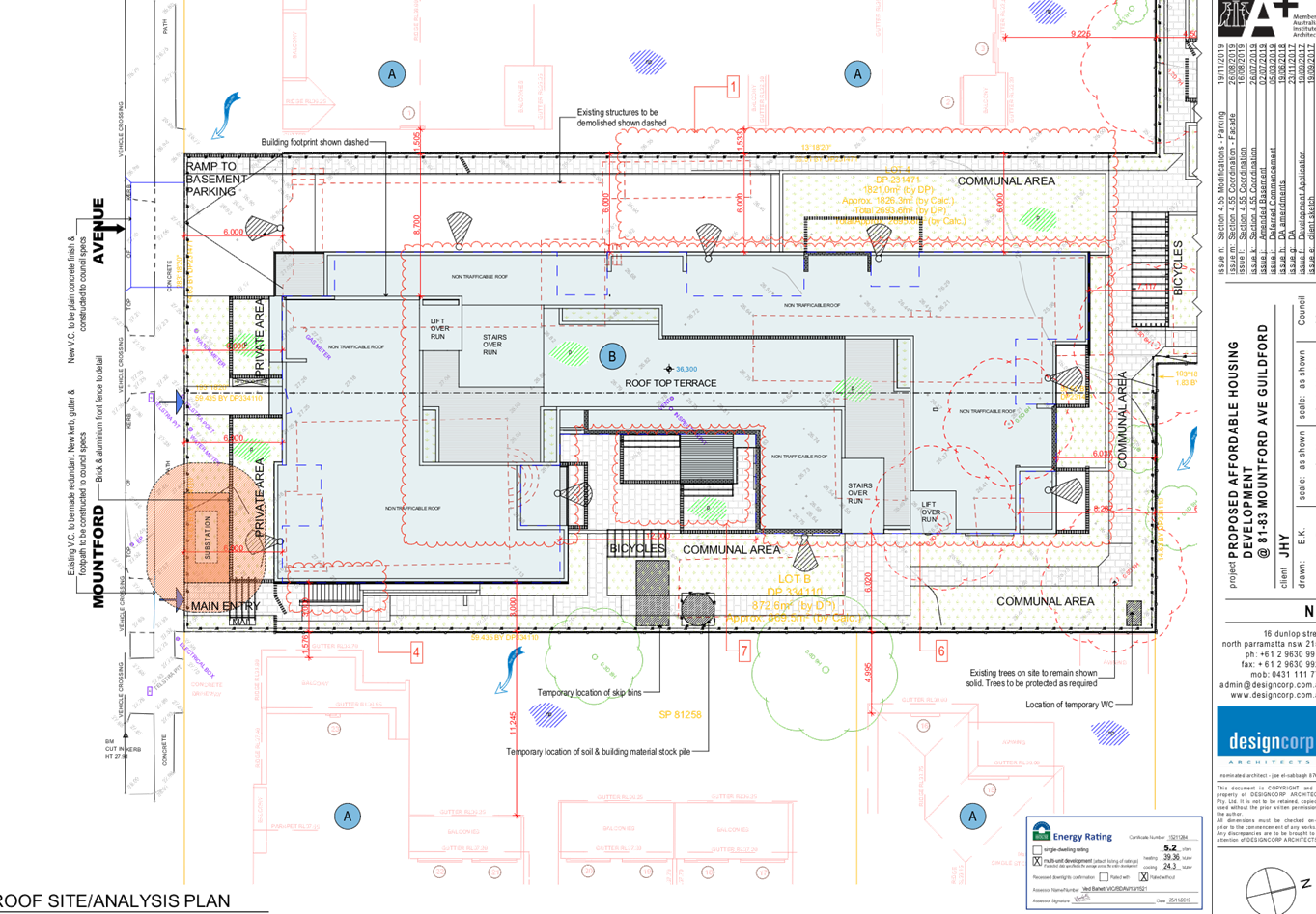
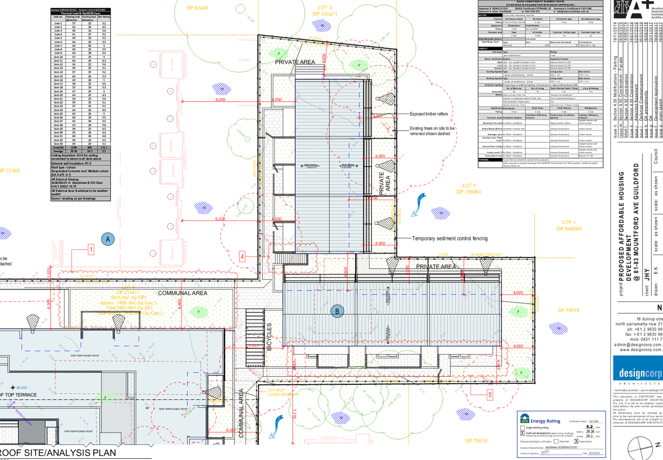
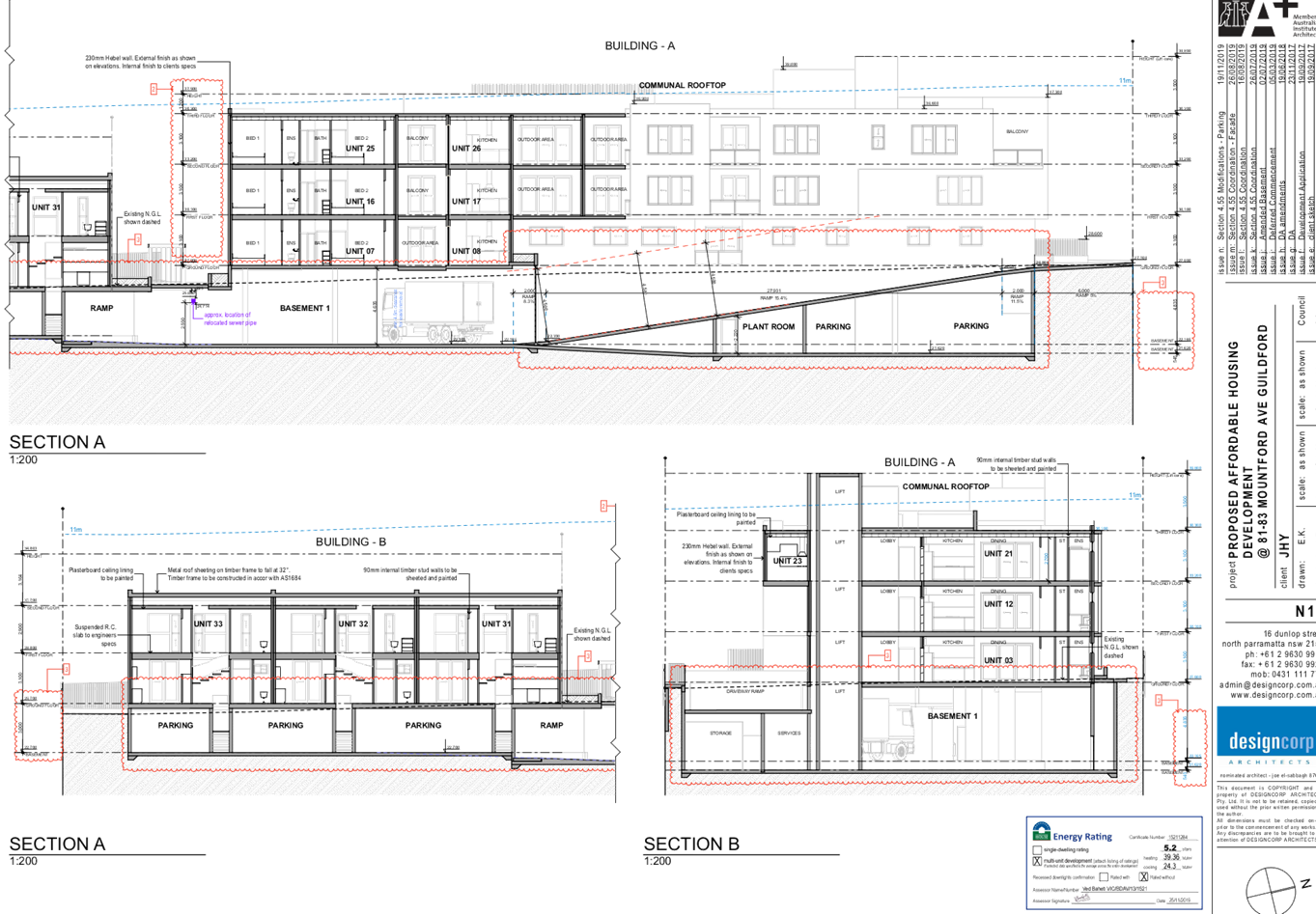
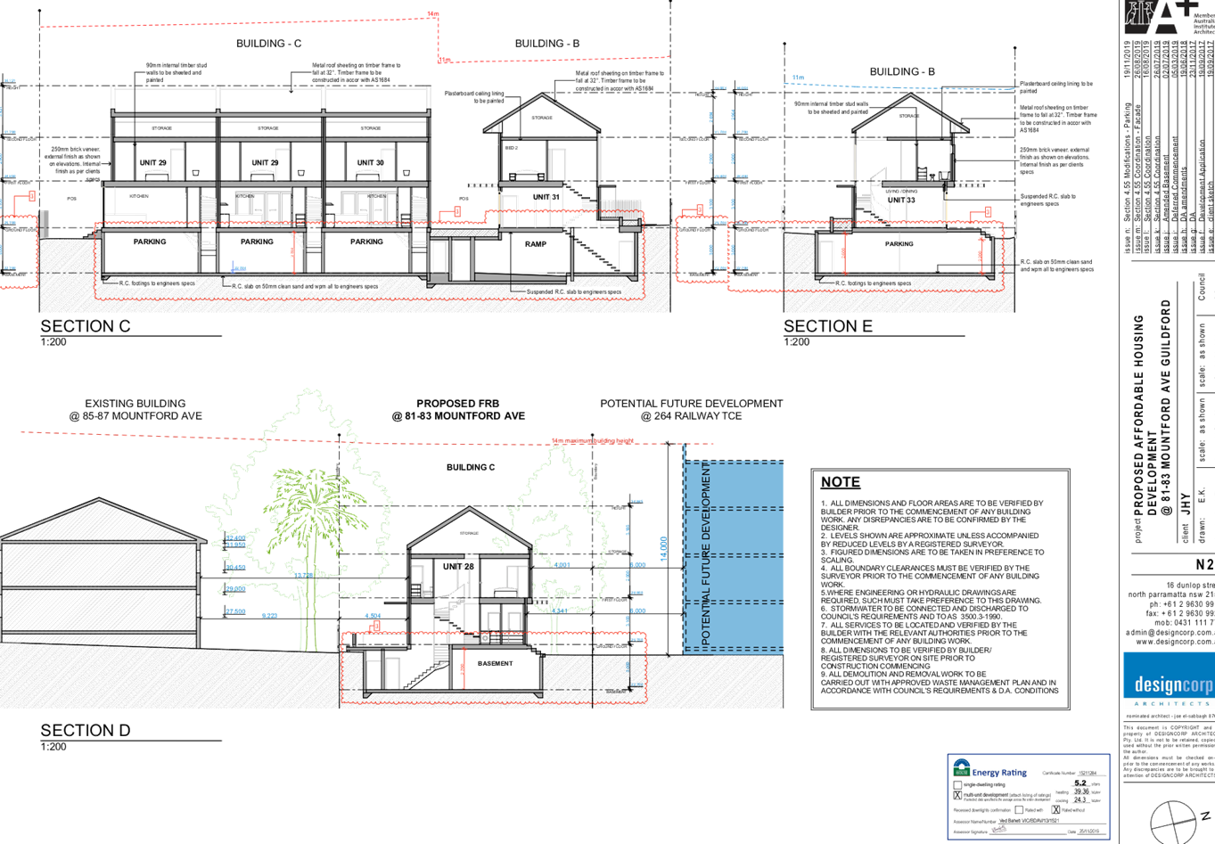
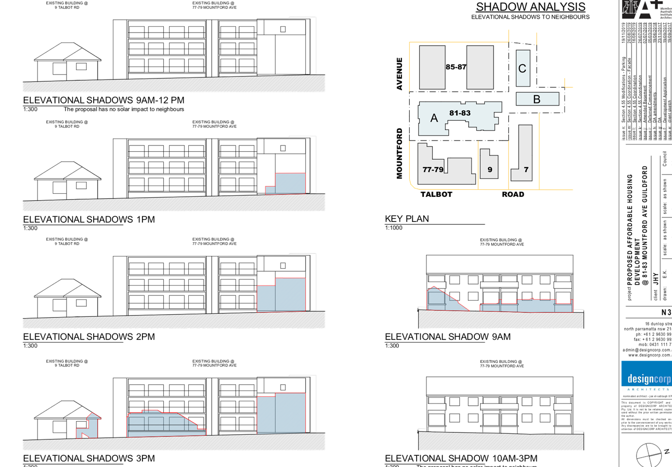
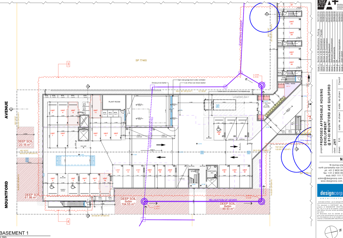
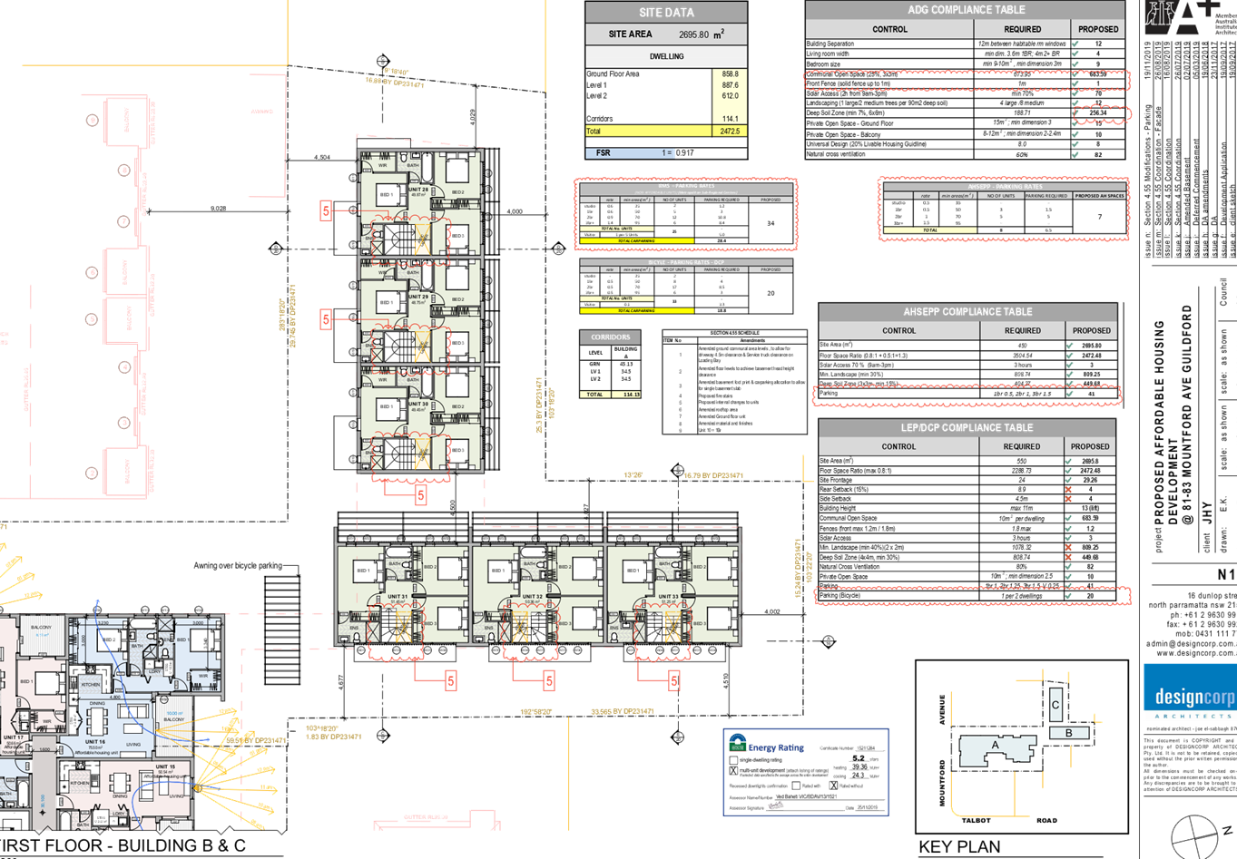
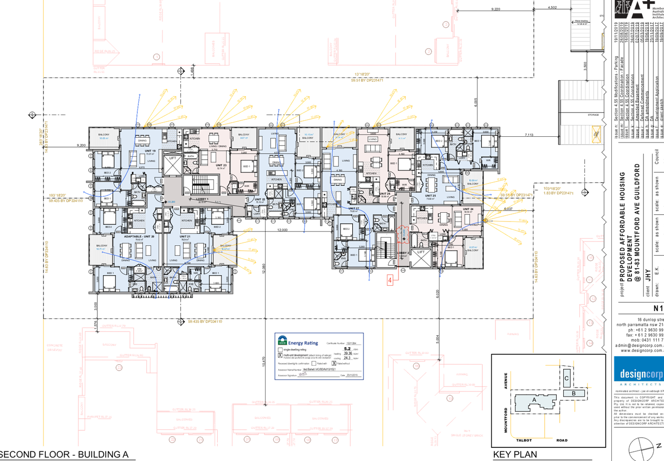
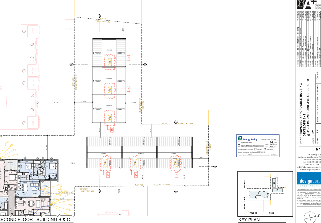
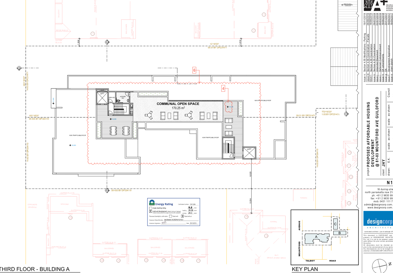
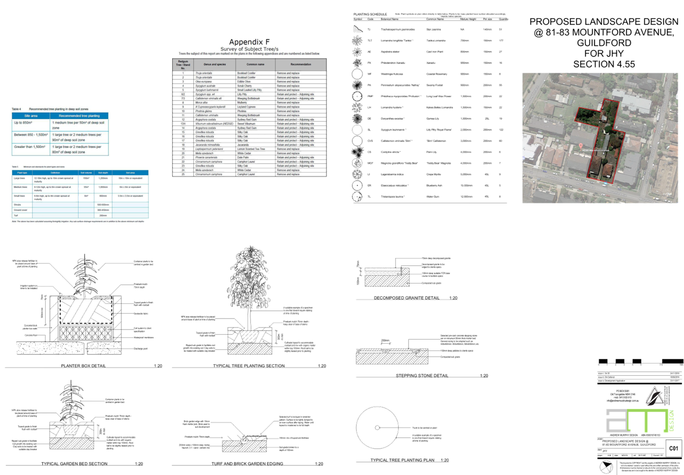
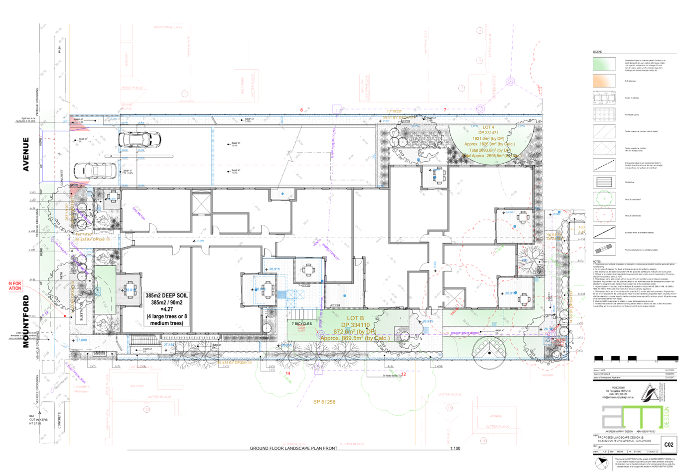
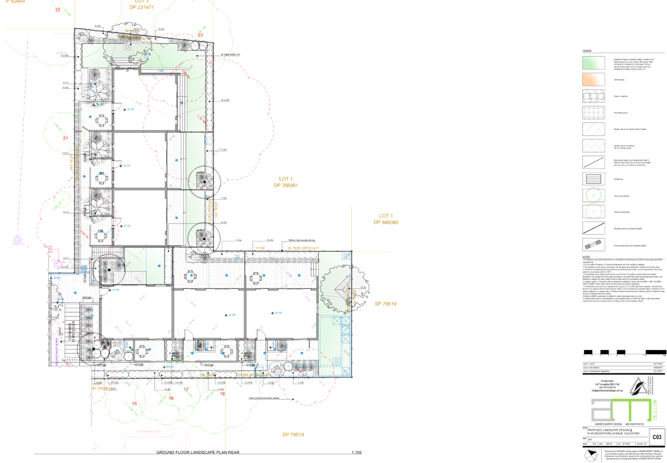
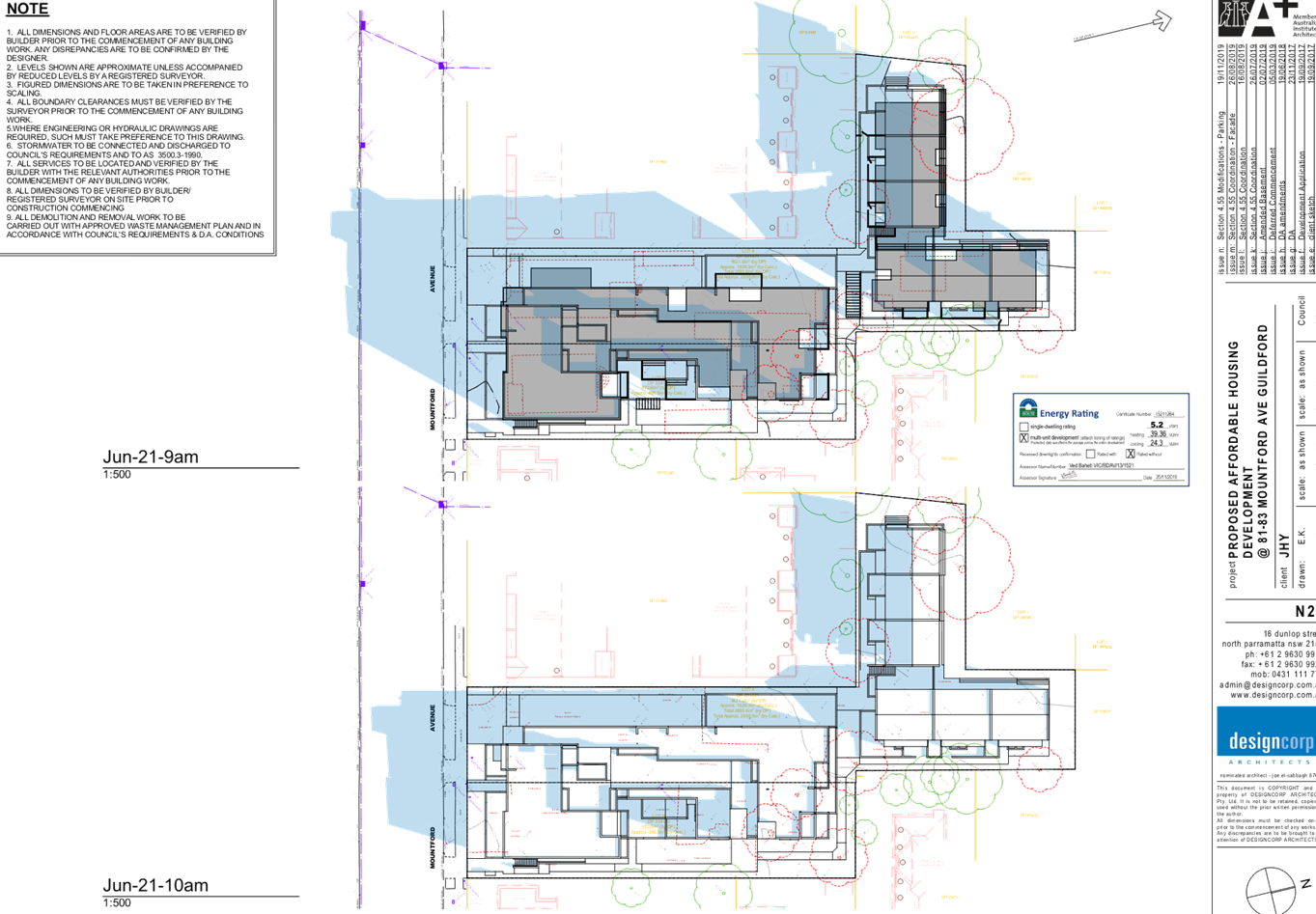
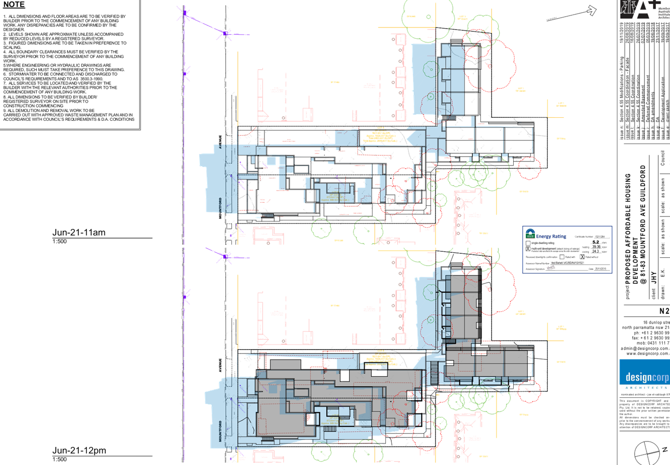
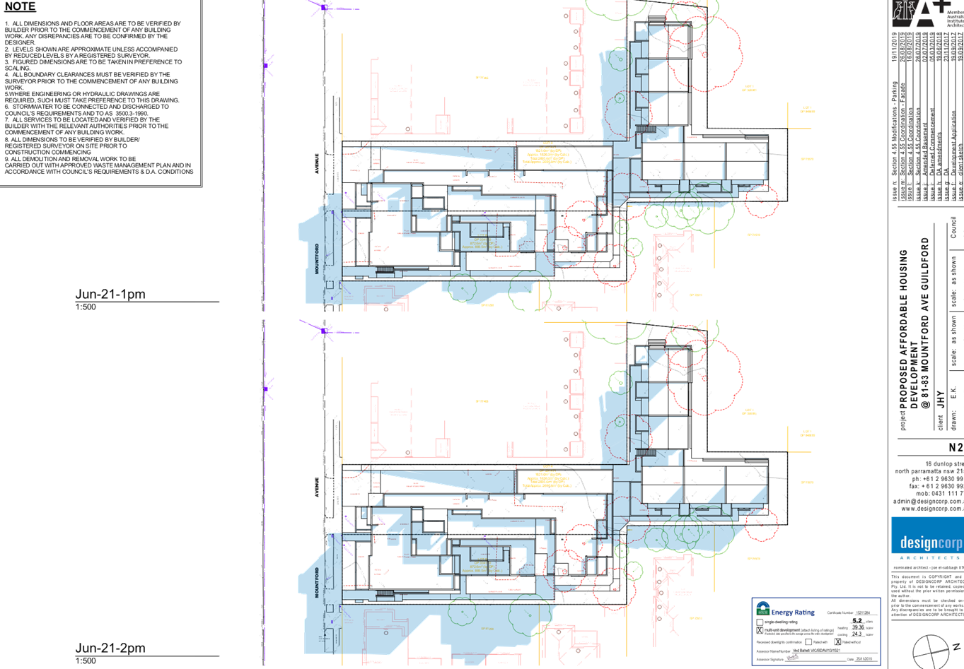
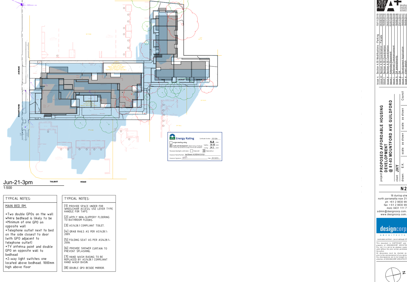
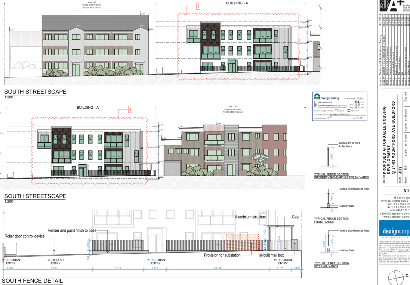
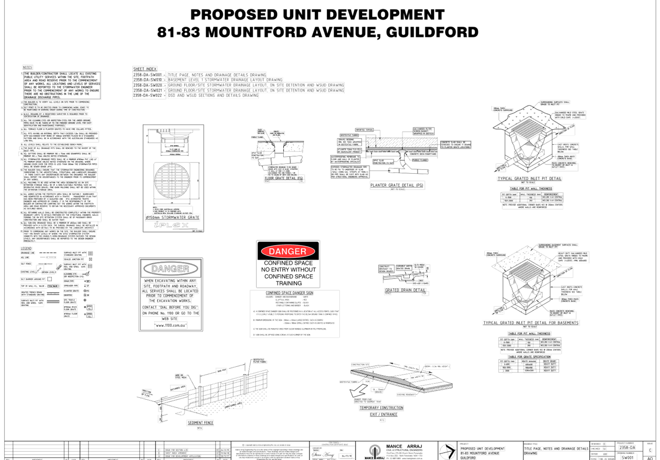
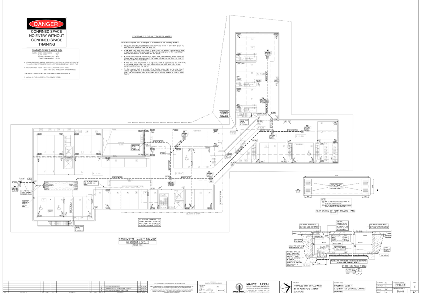
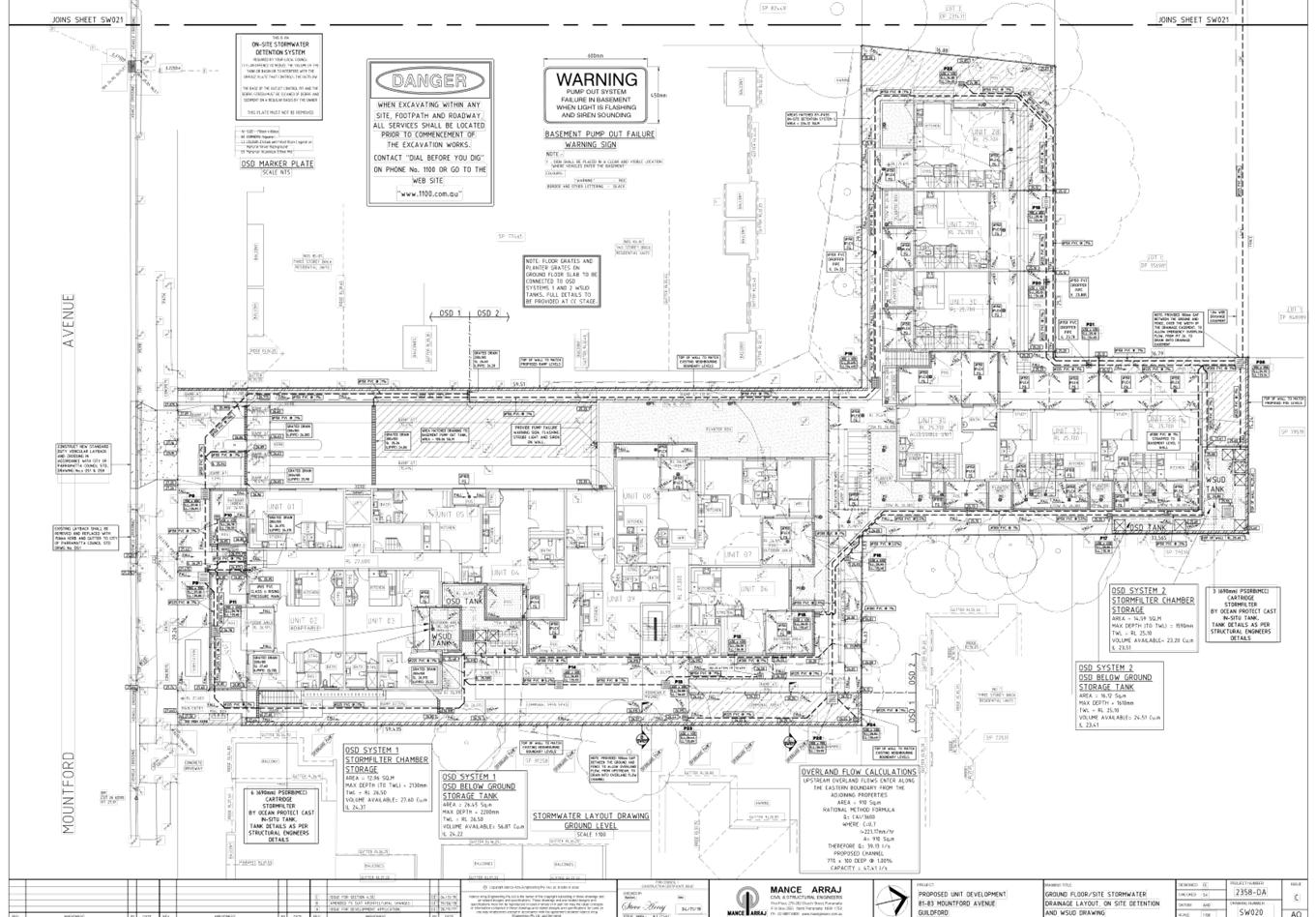
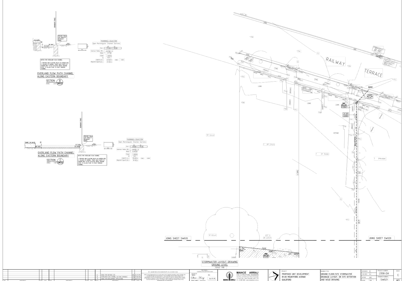
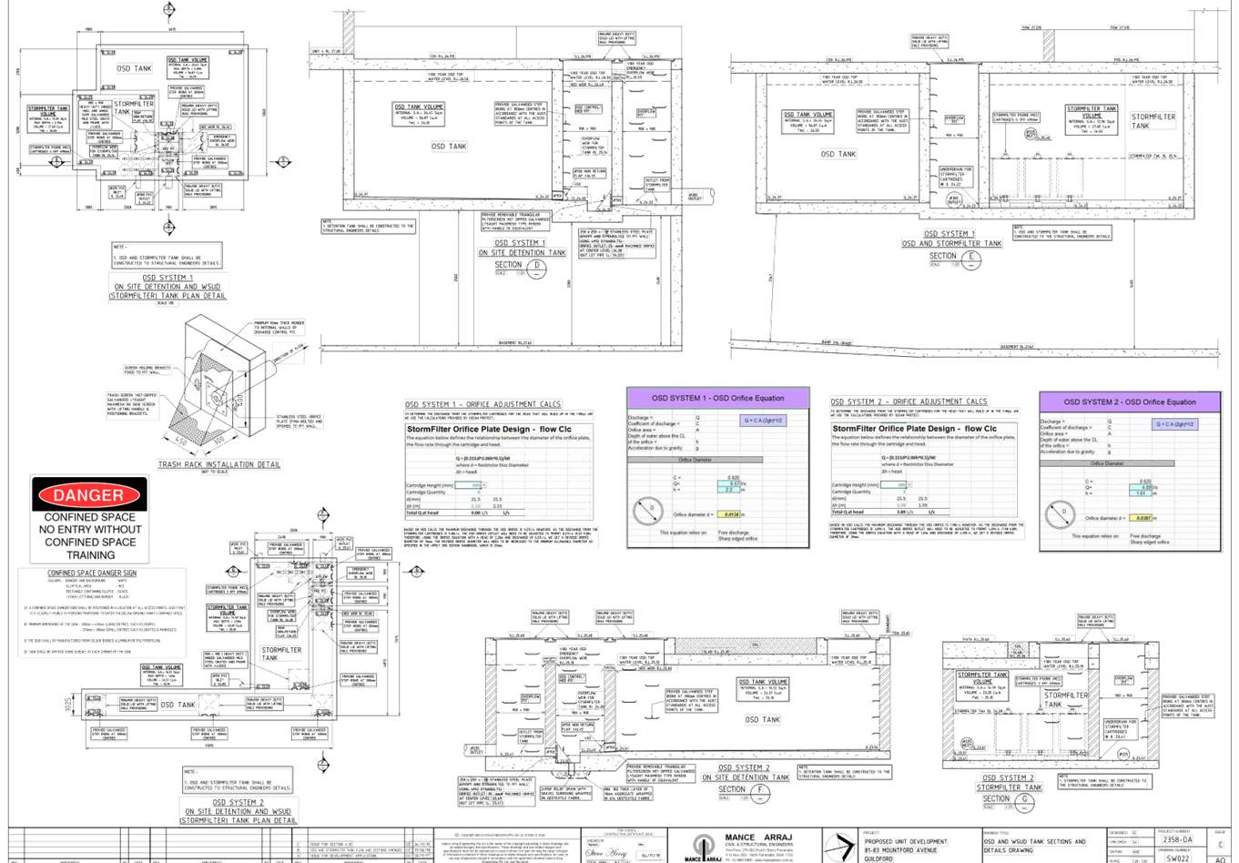
DOCUMENTS
ASSOCIATED WITH
REPORT LPP039/20
Attachment 3
Stormwater and Engineering Plans
Cumberland Local Planning Panel Meeting
8 July 2020
DOCUMENTS
ASSOCIATED WITH
REPORT LPP039/20
Attachment 4
Submissions Recieved
Cumberland Local Planning Panel Meeting
8 July 2020
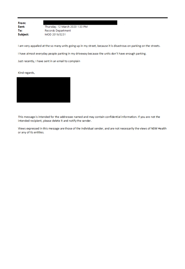
DOCUMENTS
ASSOCIATED WITH
REPORT LPP039/20
Attachment 5
Compliance Tables (ARHSEPP and ADG)
Cumberland Local Planning Panel Meeting
8 July 2020
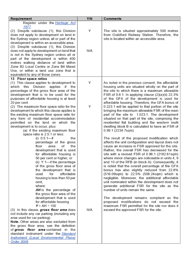
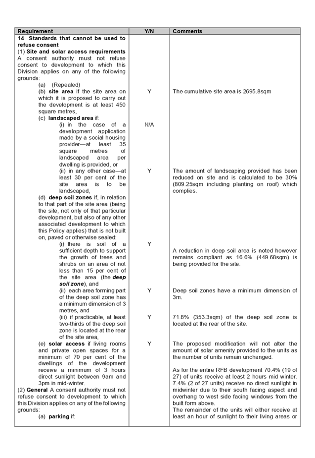
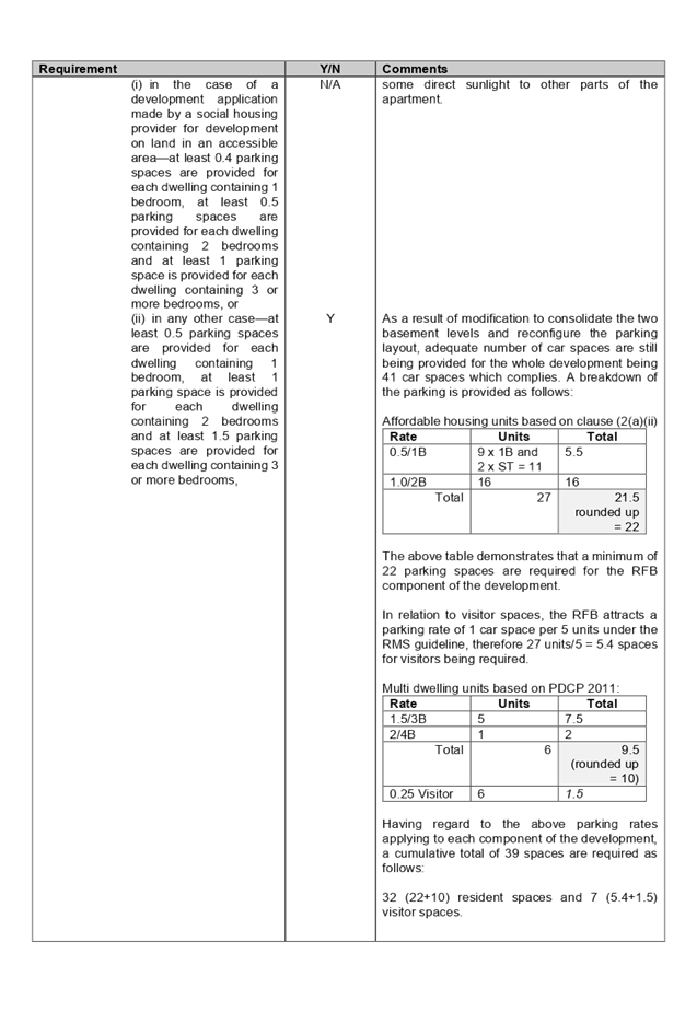
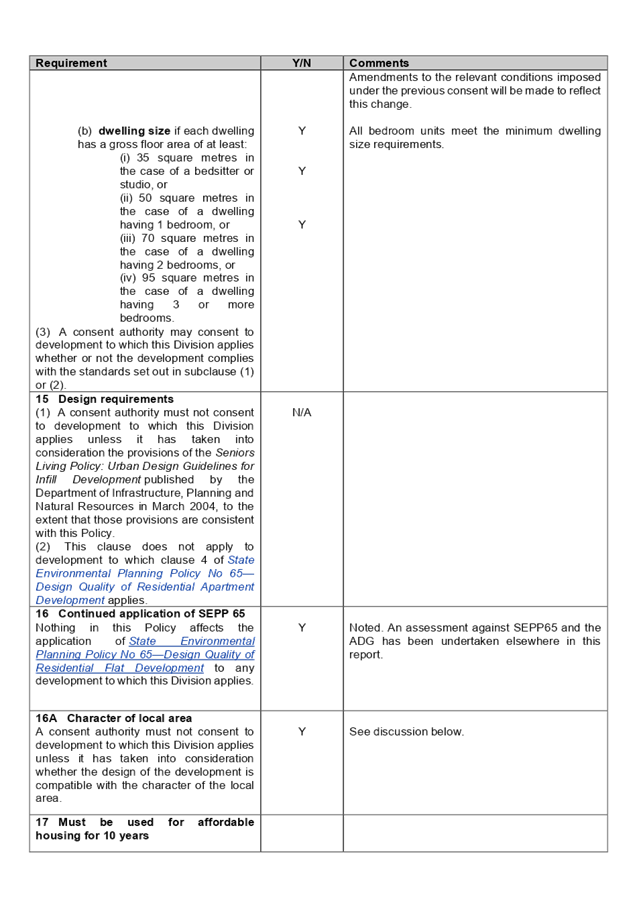
DOCUMENTS
ASSOCIATED WITH
REPORT LPP039/20
Attachment 6
Approved Plans under DA2017/500
Cumberland Local Planning Panel Meeting
8 July 2020
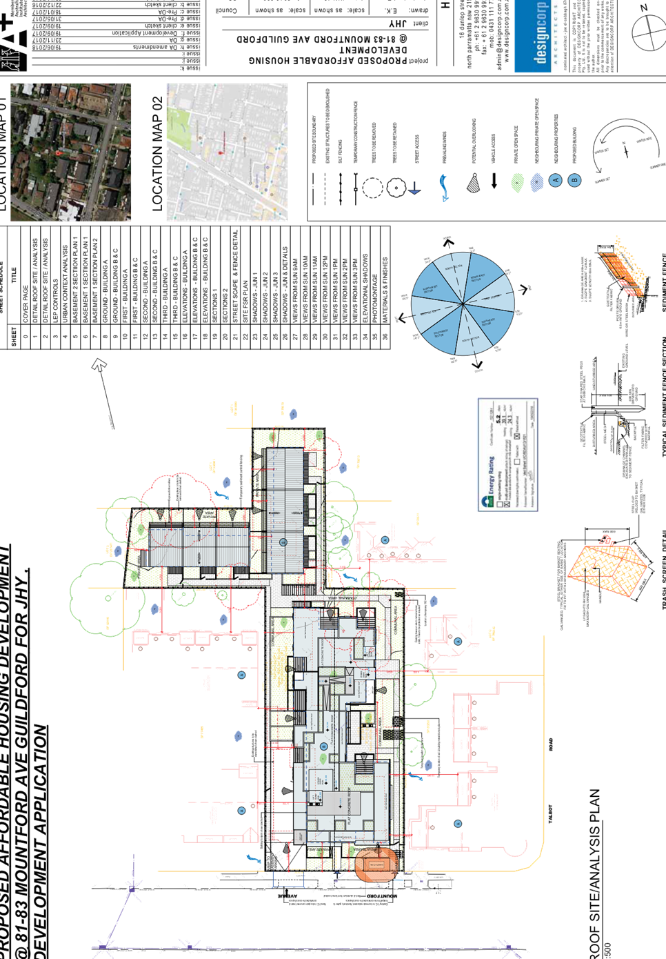
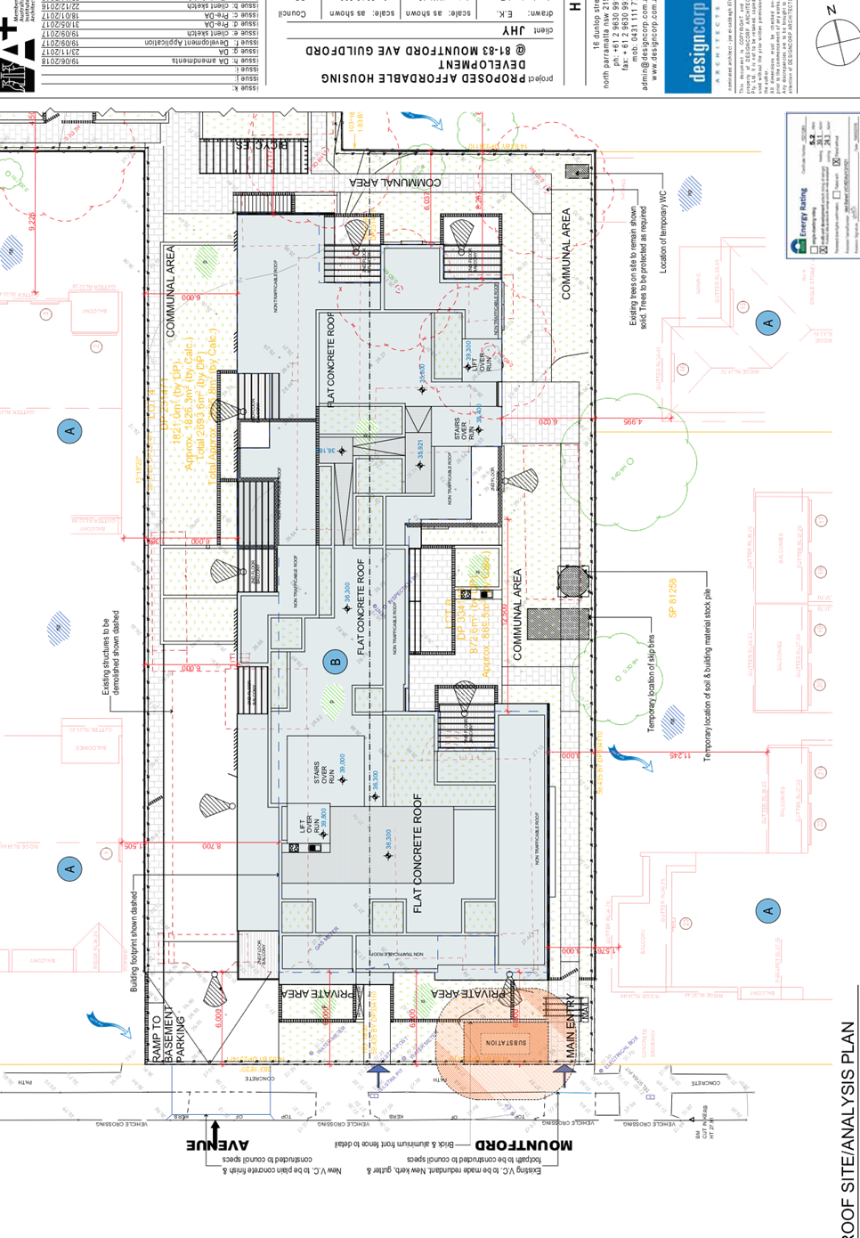
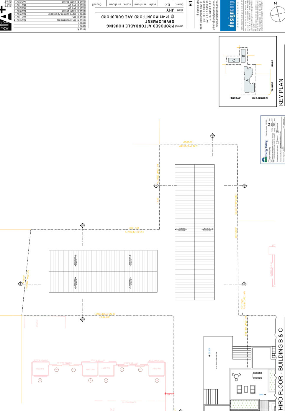
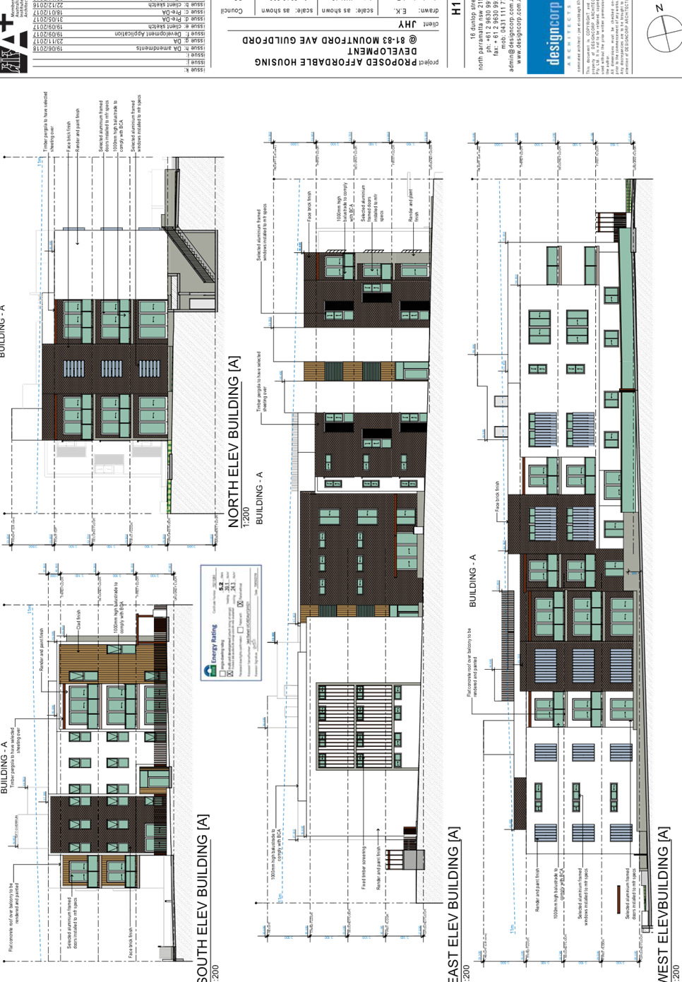
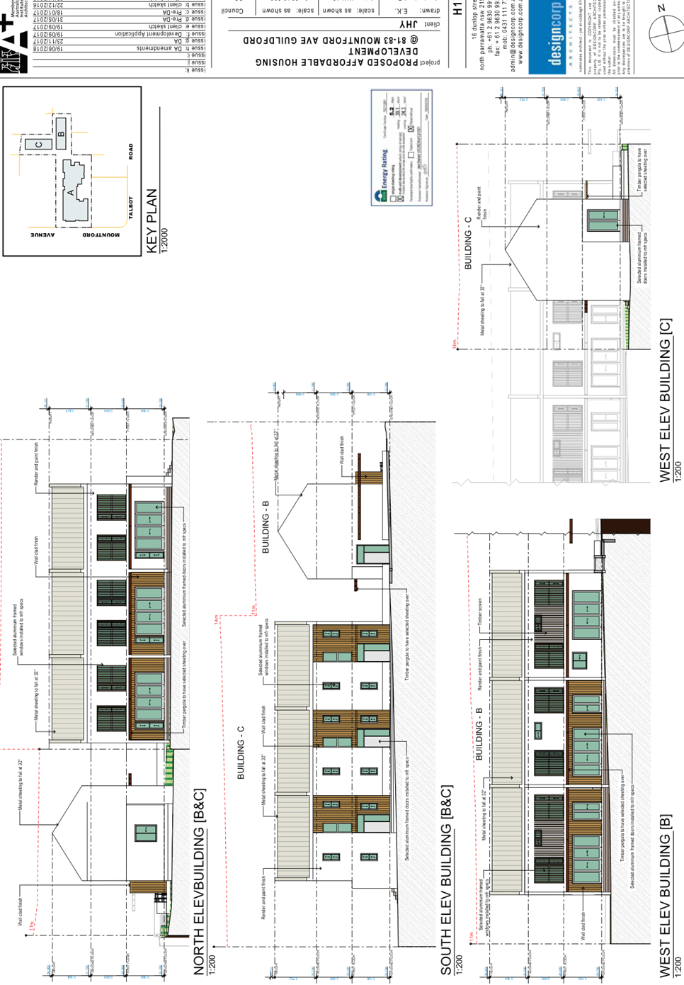
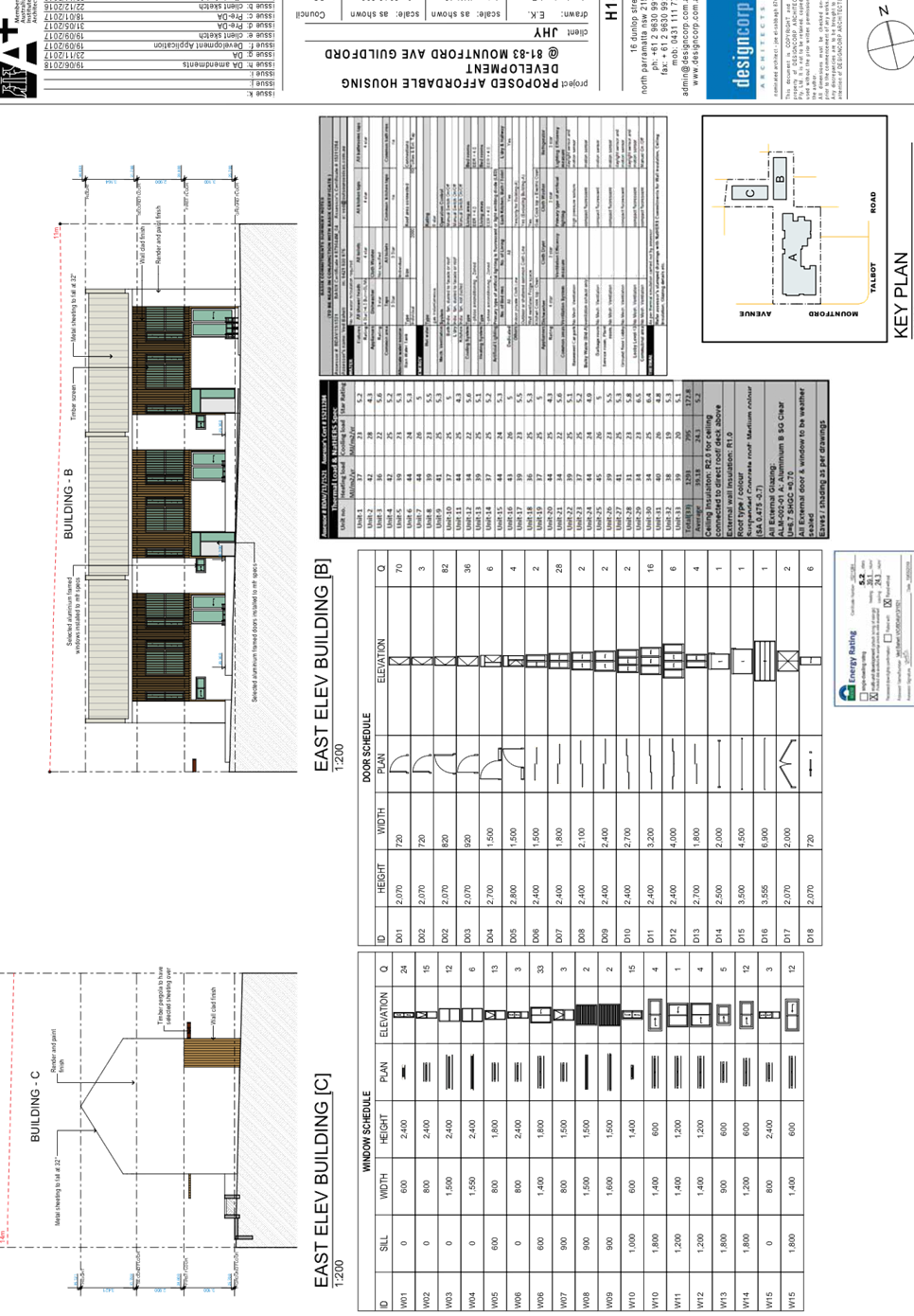
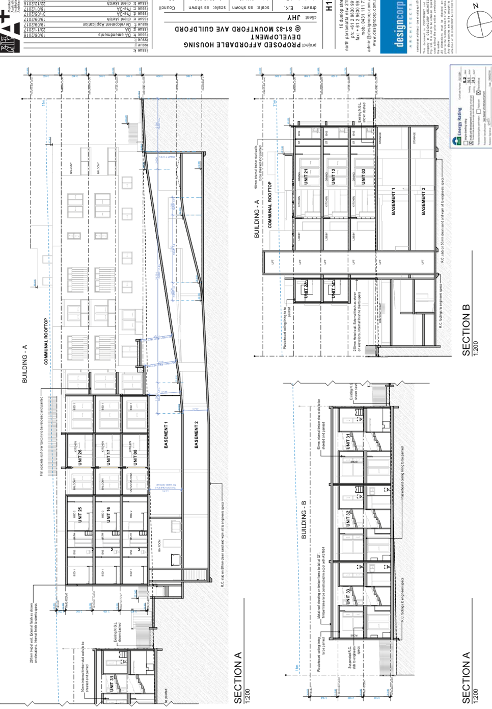
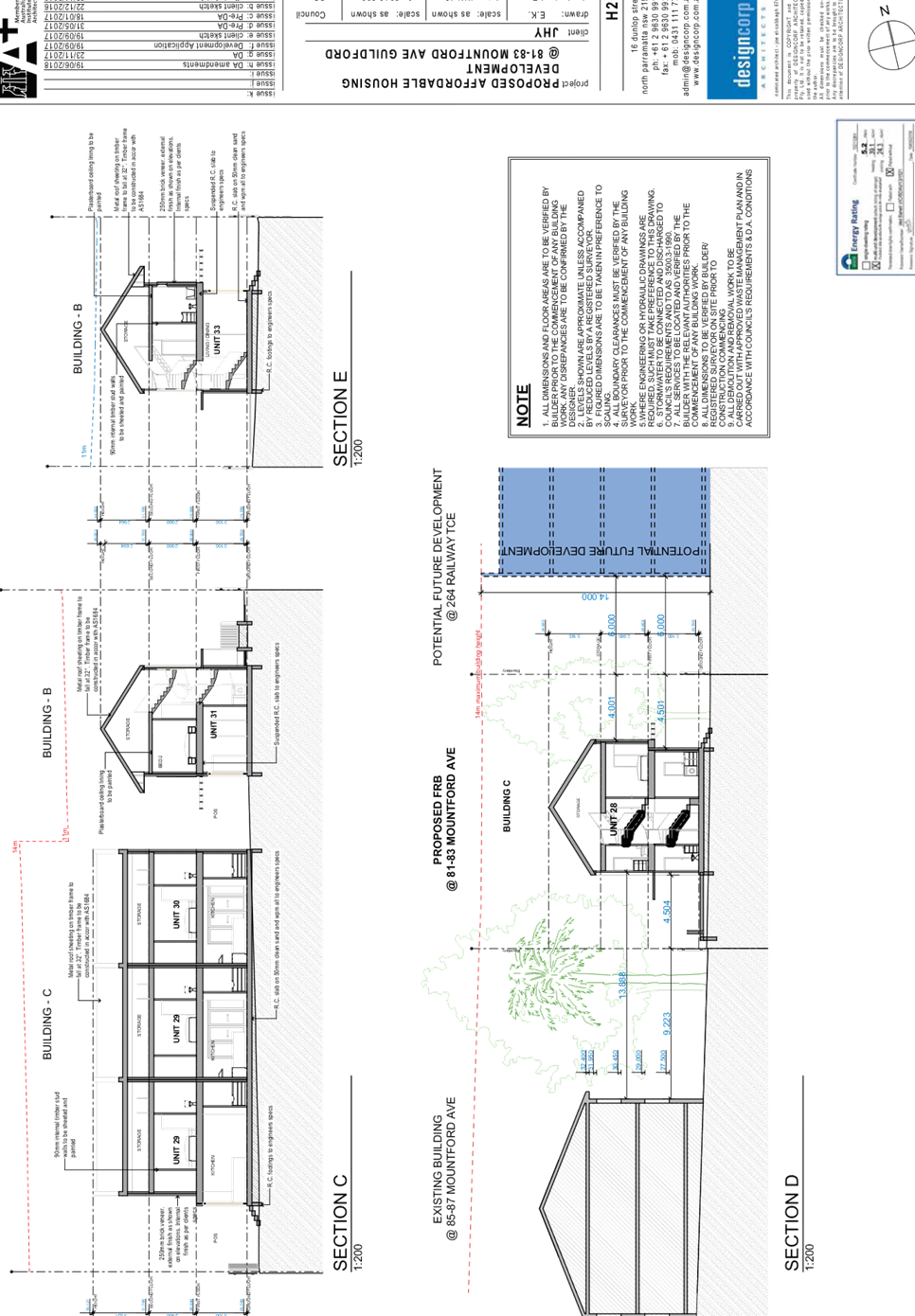
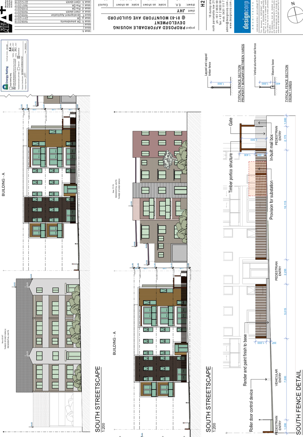
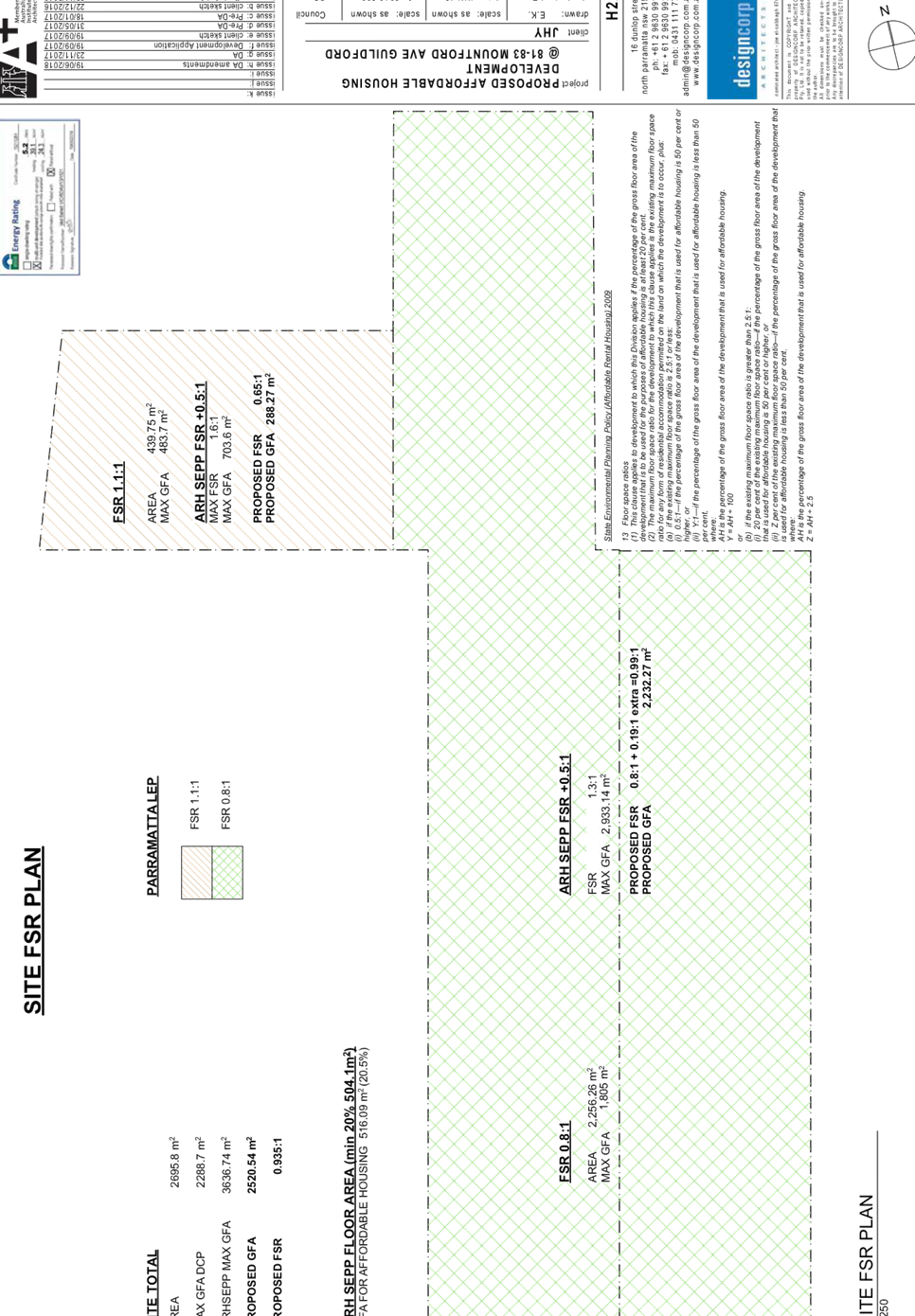
Cumberland Local Planning Panel Meeting
8 July 2020
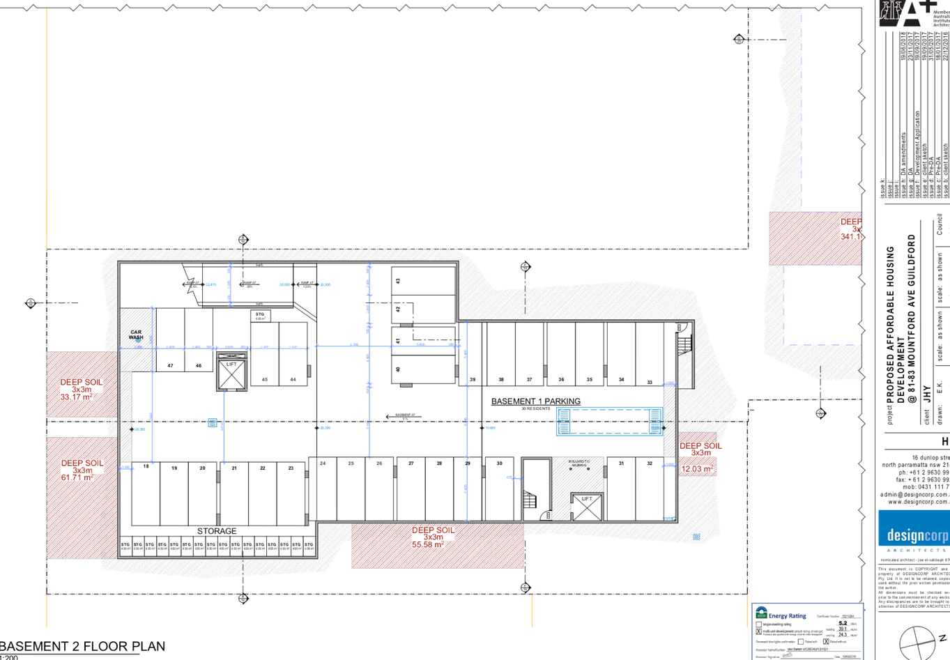
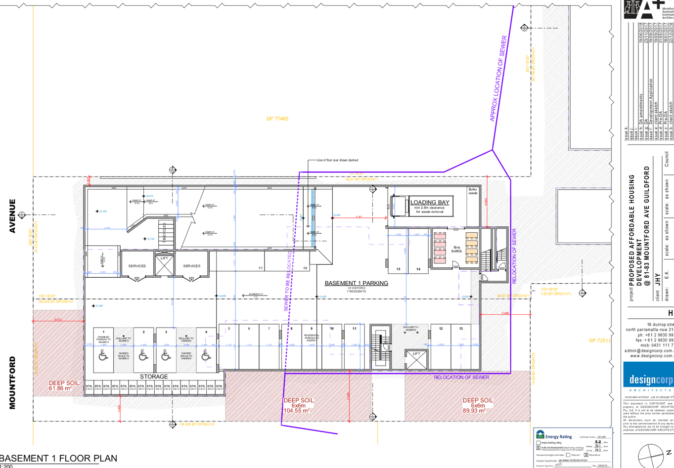

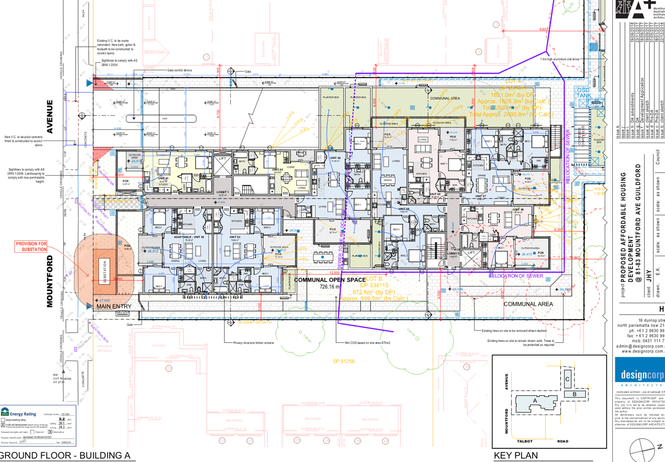
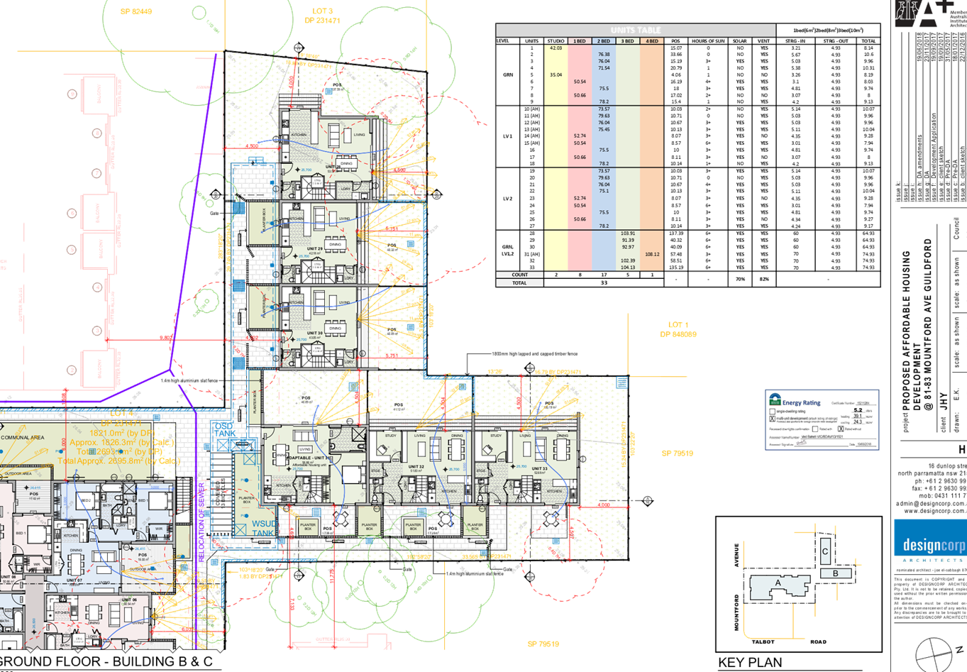
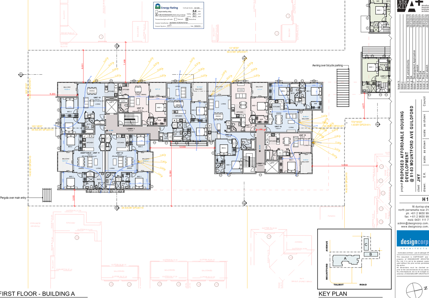
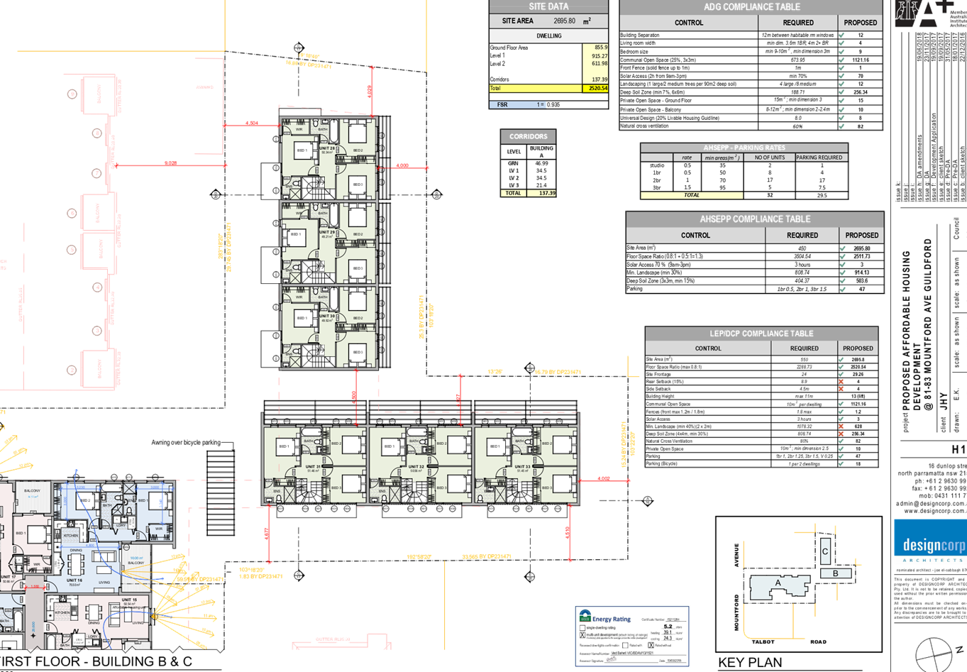
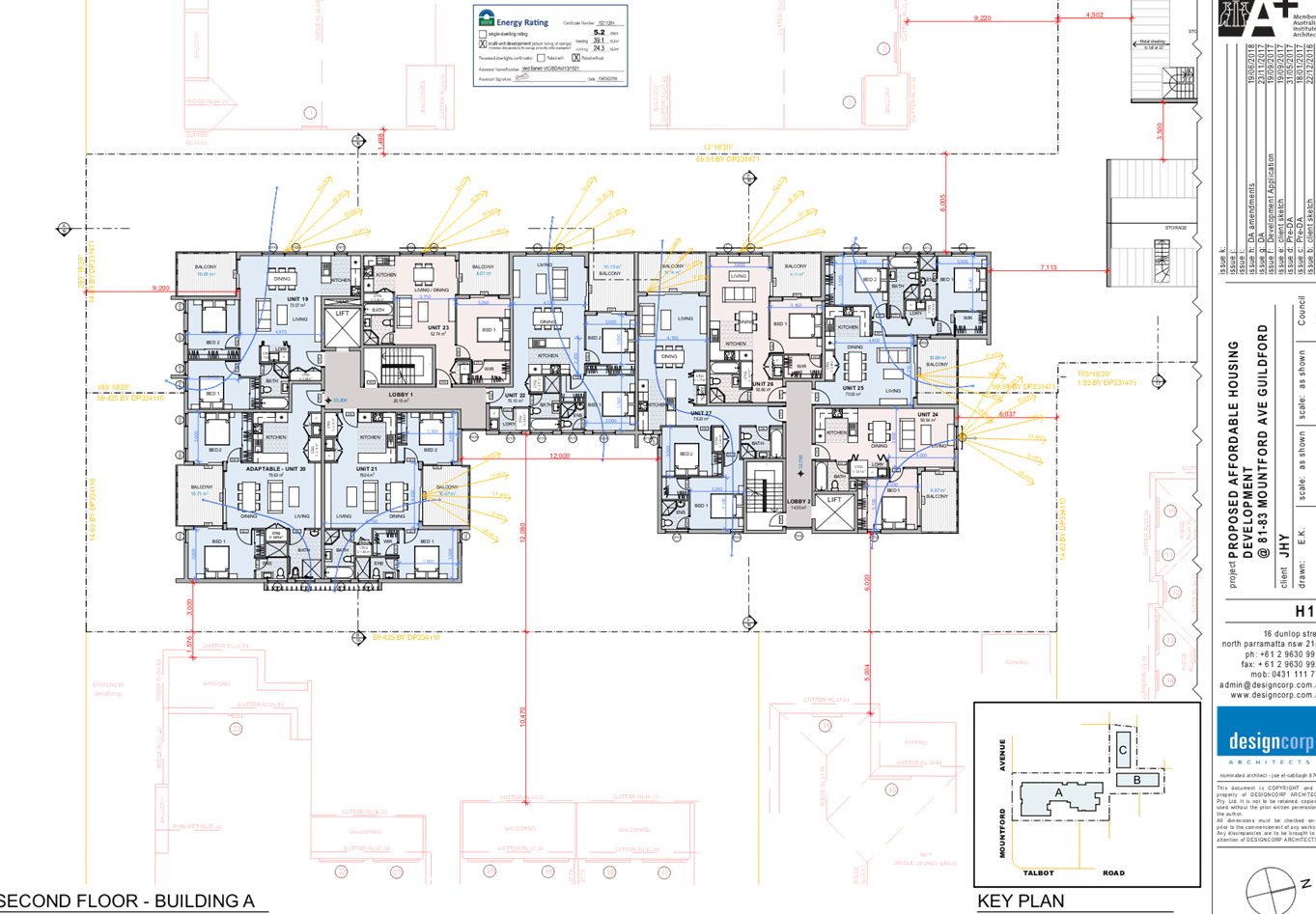
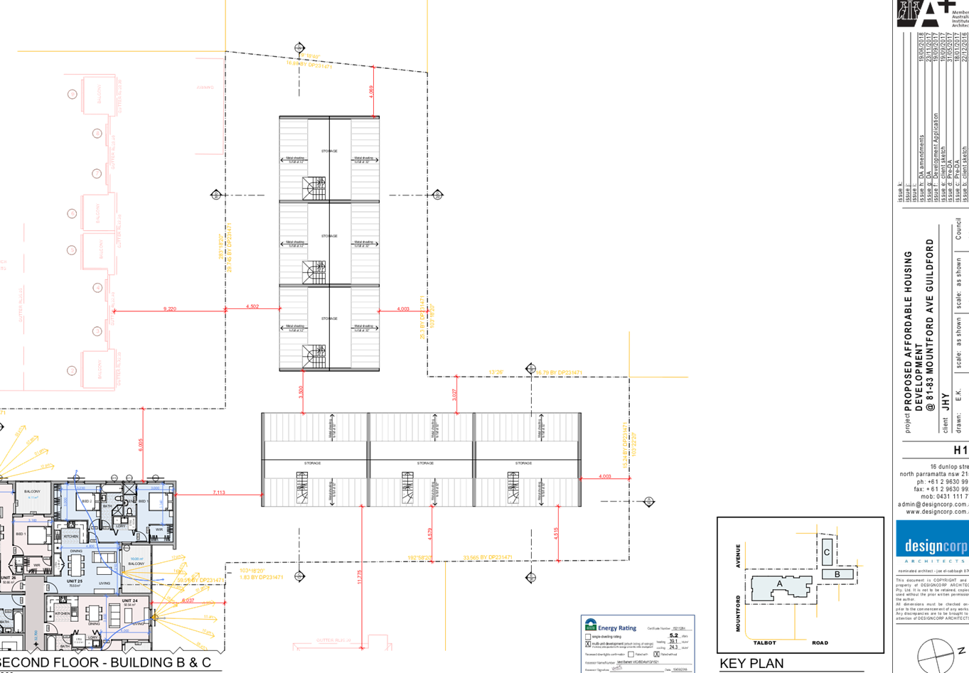
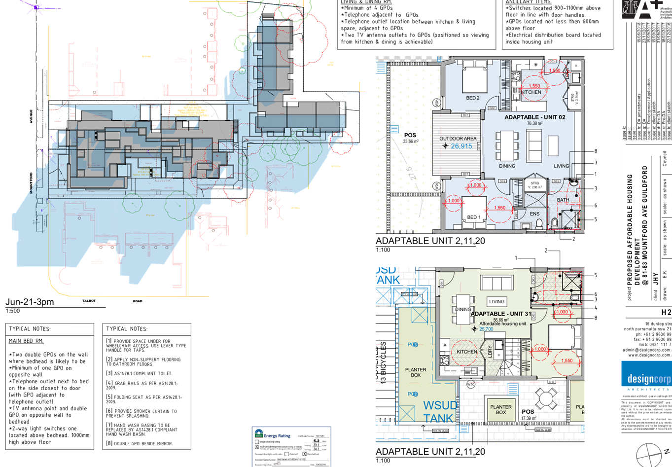
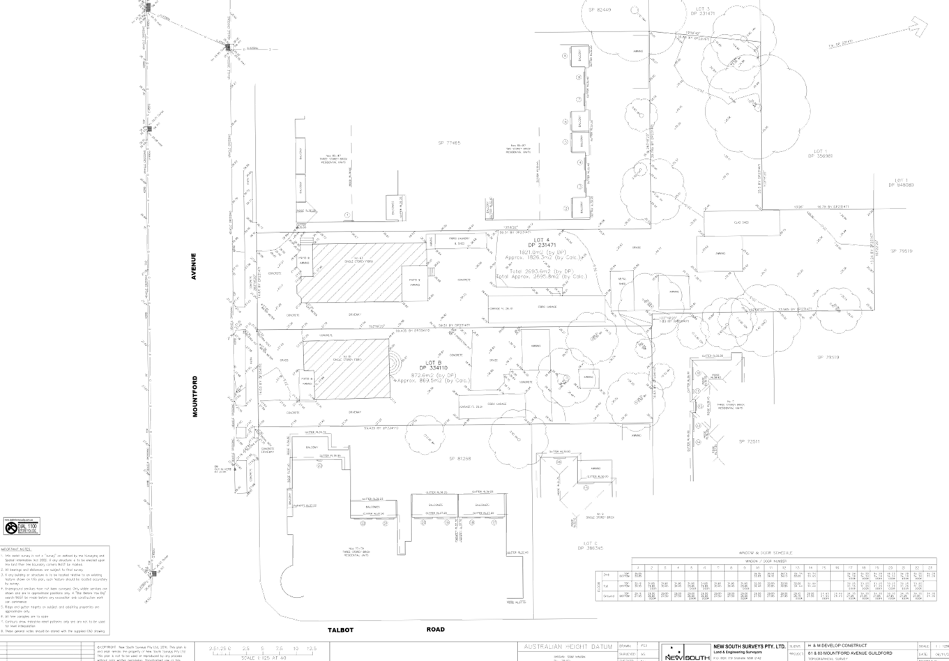
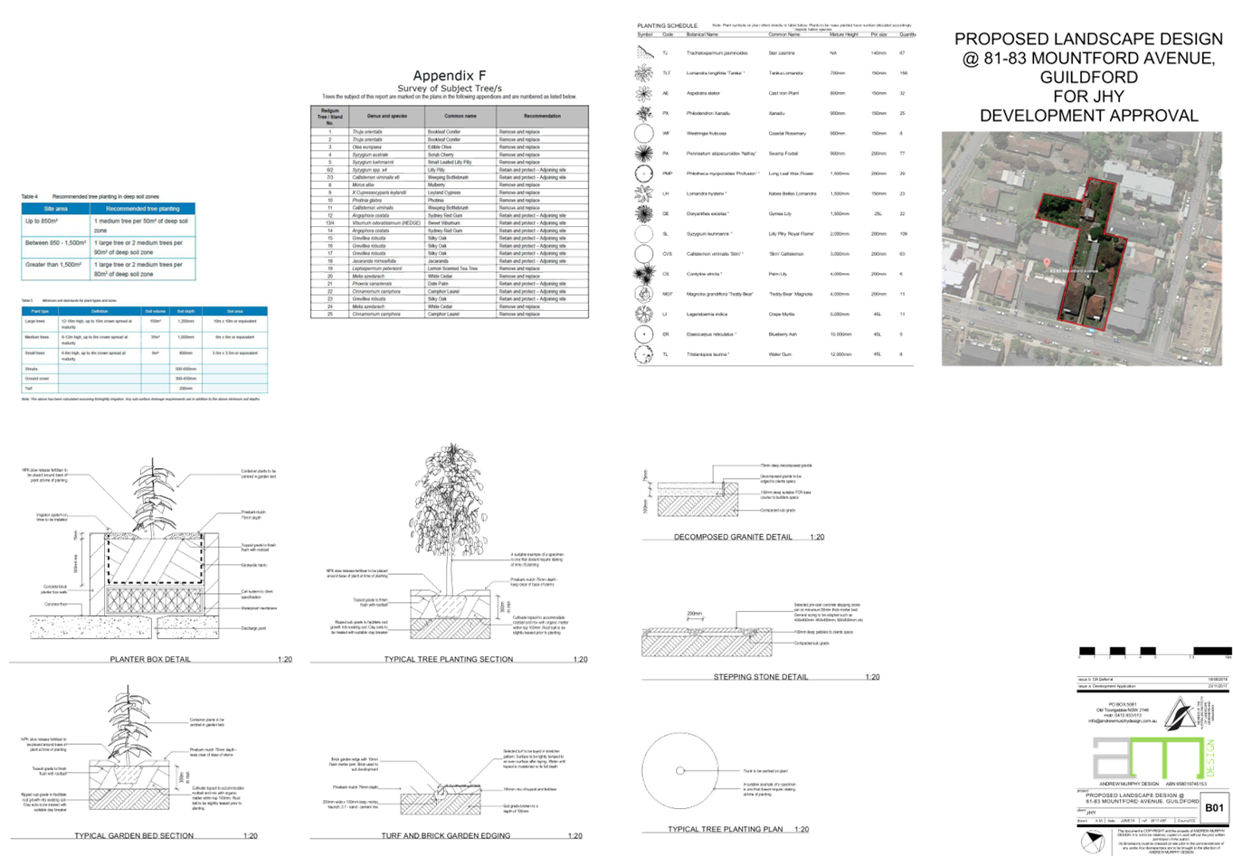
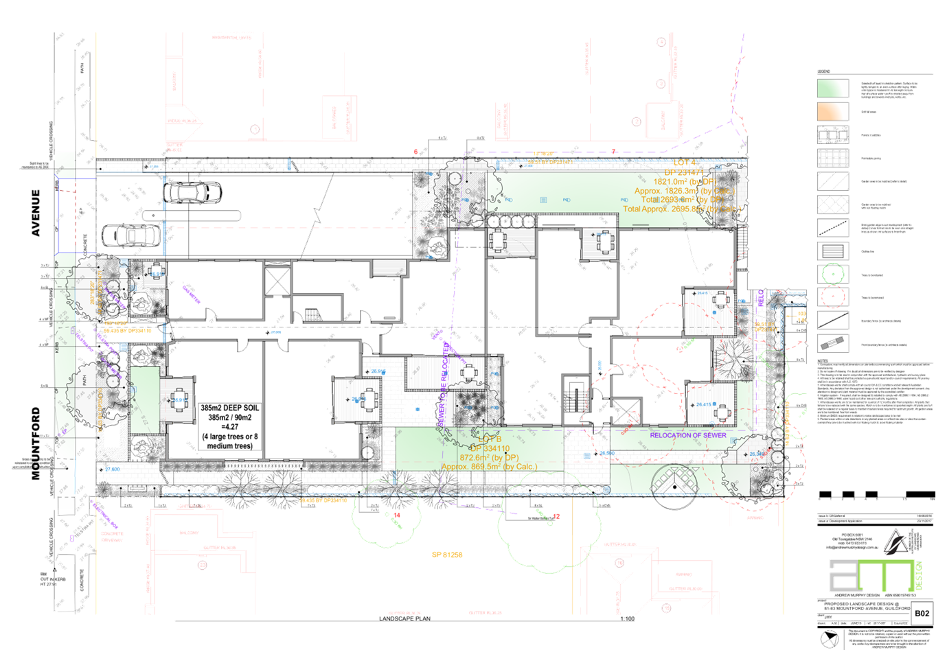
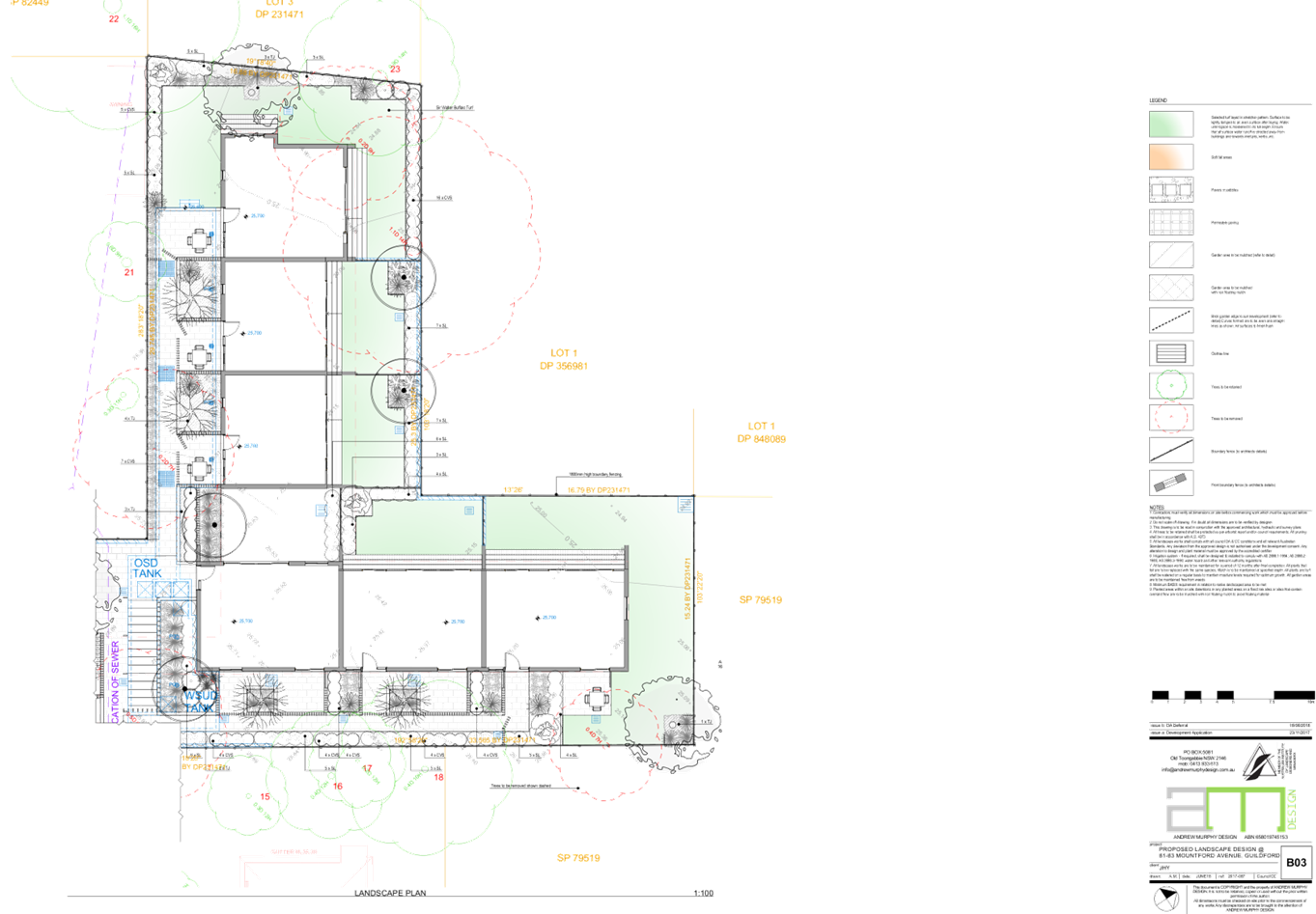
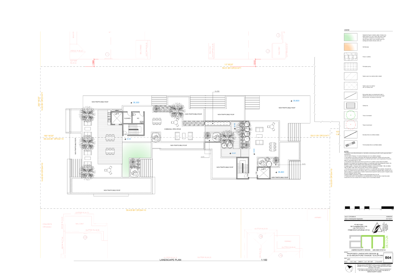
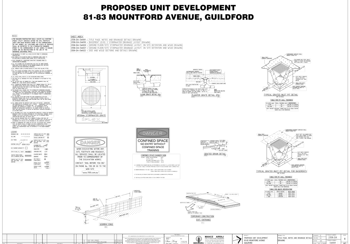
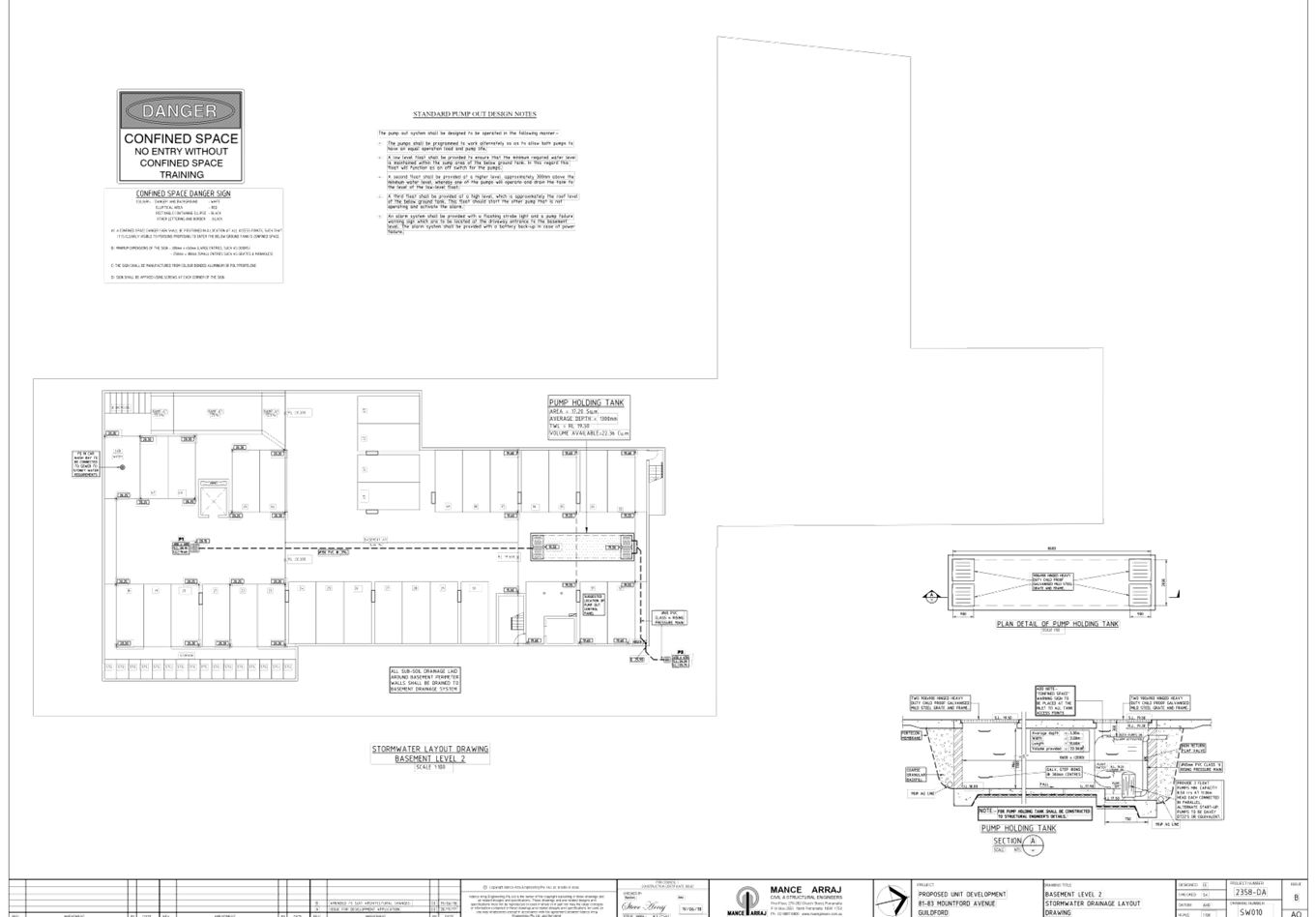
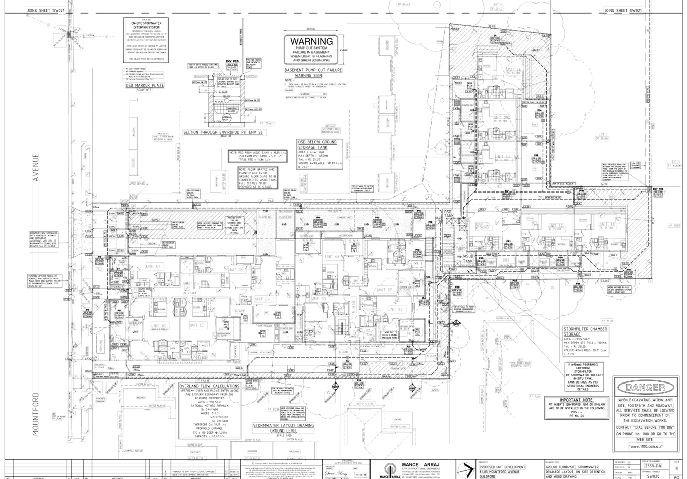
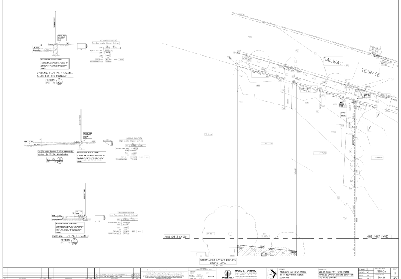
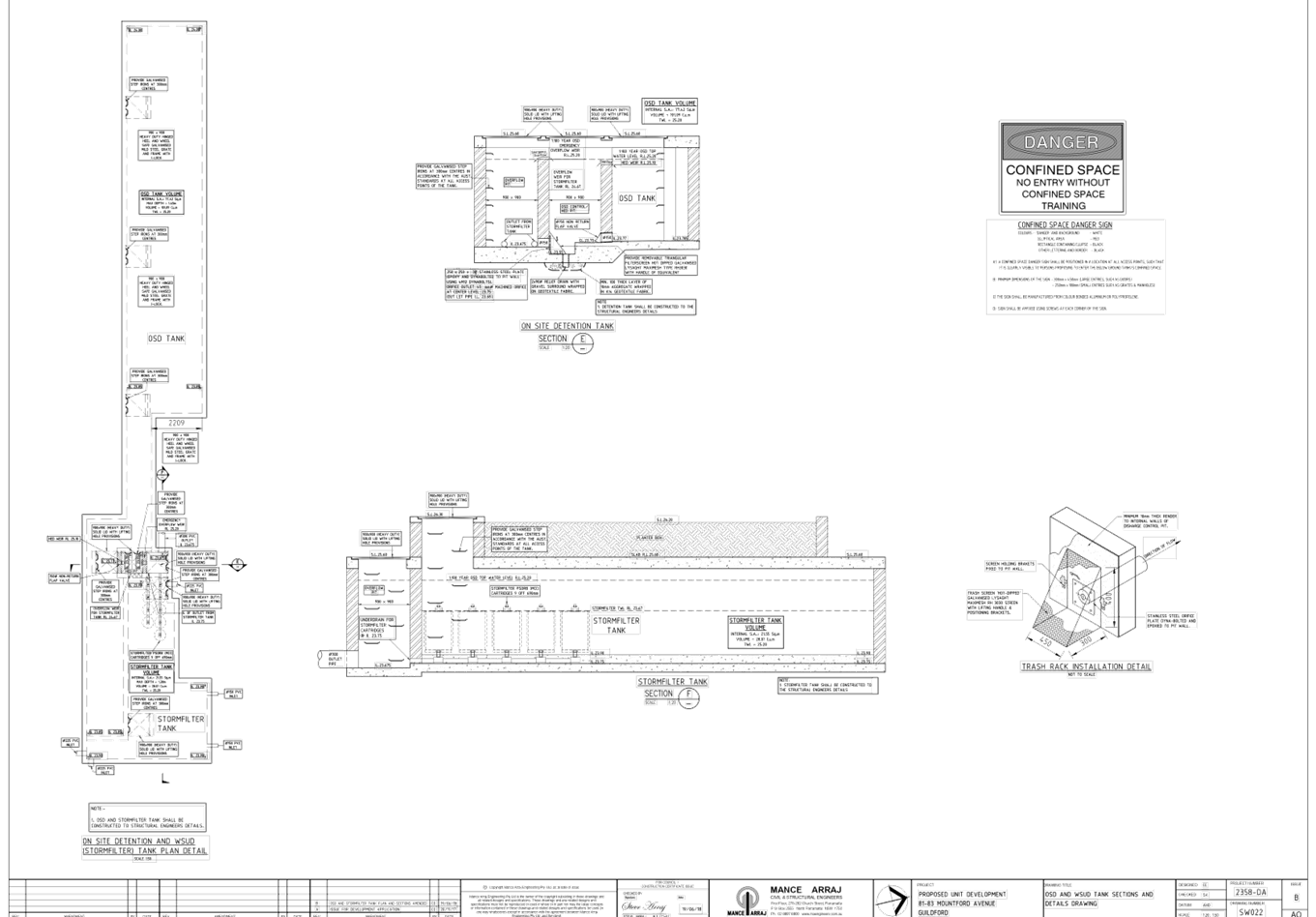
DOCUMENTS
ASSOCIATED WITH
REPORT LPP039/20
Attachment 7
Landscape Plan
Cumberland Local Planning Panel Meeting
8 July 2020