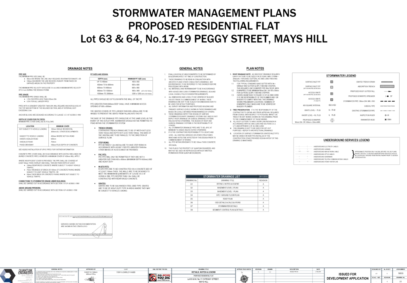
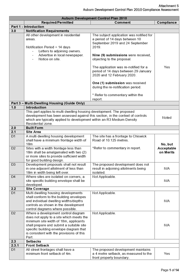
13 May 2020
An electronic
meeting of the Cumberland Local Planning Panel
will be held at 11:30a.mvia Zoom on Wednesday, 13 May 2020.
Business as below:
Yours faithfully
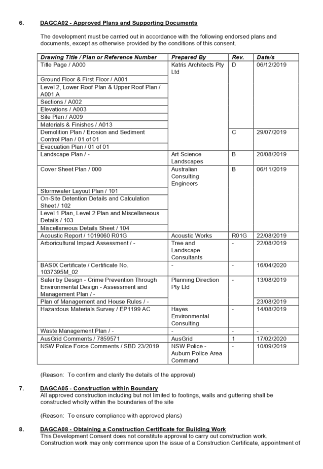
Hamish McNulty
General
Manager
ORDER OF BUSINESS
1. Receipt of Apologies
2. Confirmation of Minutes
3. Declarations of Interest
4. Address by invited
speakers
5. Reports:
- Development
Applications
- Planning
Proposals
6. Closed Session Reports
Cumberland Local Planning Panel Meeting
13 May 2020
CONTENTS
Report No. Name of Report Page
No.
Development Applications
LPP016/20... Development Application
for 1 Chiswick Road, Auburn............................... 5
LPP017/20... Development Application
for 399 Guildford Road, Guildford.................. 127
LPP018/20... Development Application
for 78 Frances Street, Lidcombe..................... 205
LPP019/20... Development Application
for 6-8 Factory Street, Granville....................... 353
LPP020/20... Development Application
for 17-19 Peggy Street, Mays Hill.................... 521
Cumberland Local Planning Panel Meeting
13 May 2020
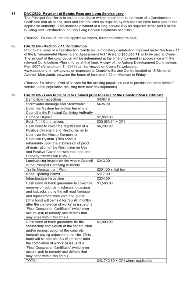
Cumberland Local Planning Panel Meeting
13 May 2020
Item
No: LPP016/20
Development
Application for 1 Chiswick Road, Auburn
Responsible
Division: Environment
& Planning
Officer: Executive
Manager Development and Building
File
Number: DA2019/262
|
Application
Lodged:
|
26
August 2019
|
|
Application
Number:
|
DA2019/262
|
|
Responsible
Officer:
|
William Attard
|
|
Description
of Land:
|
1 Chiswick Road,
AUBURN NSW 2144 / Lot B, DP 85392
|
|
Proposed
Development:
|
Demolition of existing
structures and construction of a boarding house development comprising 3 x
two storey buildings consisting of a total of 16 rooms inclusive of a
manager's room with at-grade car parking
|
|
Site
Area:
|
1,411.9m²
|
|
Zoning:
|
R3
Medium Density Residential
|
|
Permissibility:
|
Permissible
– Boarding House
|
|
Applicant:
|
Mr M S Ahmed
|
|
Owner:
|
Mr M S Ahmed
|
|
Notification/Advertising:
|
10
September 2019 to 24 September 2019; and
29
January 2020 to 12 February 2020
|
|
Disclosure
of political donations / gifts
|
None
disclosed on the application form
|
|
Submissions:
|
Ten
(10) submissions
|
|
Principal
Development Standards:
|
Floor
Space Ratio
|
Height
of Buildings
|
|
Maximum:
0.75:1
Proposed:
0.414:1
|
Maximum:
9m
Proposed:
8.84m
|
|
Heritage:
|
The
subject site does not contain a heritage item, however, the site is located
within the vicinity of a heritage item, being:
- Horse trough (Item 13) - Cnr of Auburn
Rd and Water St
|
|
Variations:
|
- Site Area
- Landscape Area
|
- Design of Parking Spaces
|
|
Recommendation:
|
Approval, subject to
deferred commencement and standard conditions
|
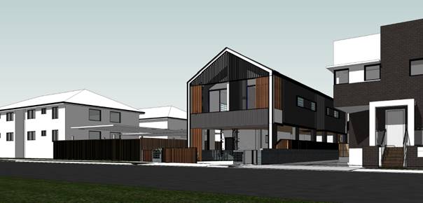
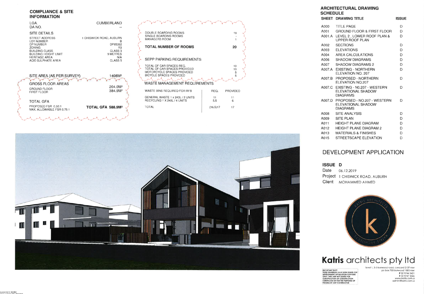
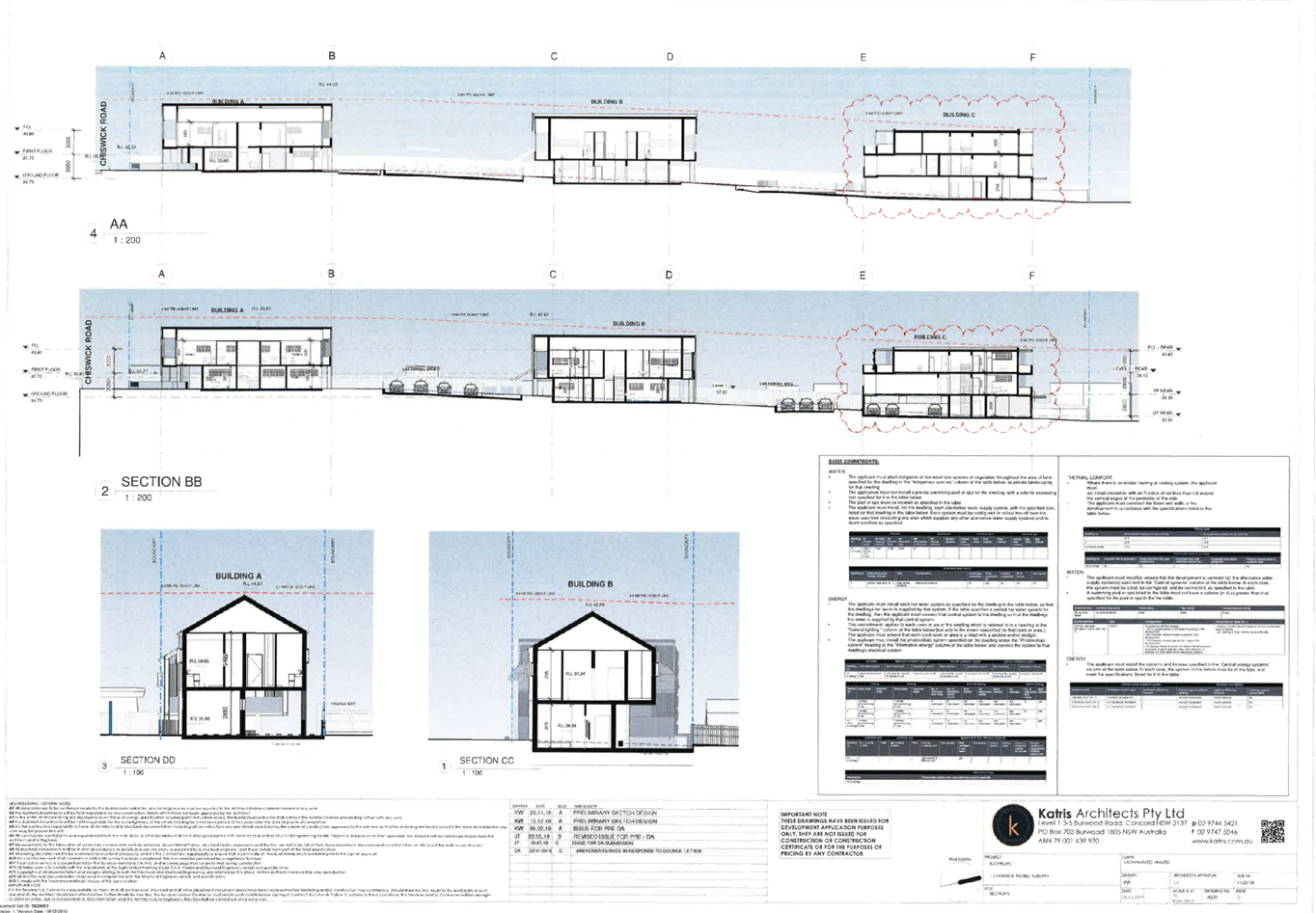
Figure 1 – Perspective of
development looking north-west (source: Katris Architects pty ltd, 2019)
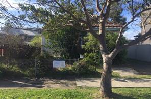
Figure 2 – photos of the
site to which development is proposed (source: cumberland city council, 2019)
Council is in receipt of a
development application from Mr M S Ahmed seeking approval for demolition of
existing structures and construction of a boarding house development comprising
3 x two storey buildings consisting of a total of 16 rooms inclusive of a
manager's room with at-grade car parking at 1 Chiswick Road, Auburn. The
development application architectural plans are provided as Attachment 1 to
this report.
The development application was
publicly notified for a period of 14 days from 10 September 2019 to 24
September 2019. In response, nine (9) submissions were received, objecting to
the proposal. The application was re-notified following the submission of
amended plans and documents, for a period of 14 days between 29 January 2020
and 12 February 2020. In response, one (1) submission was received. As a result
of the two (2) public exhibition periods, Council received a total of ten (10)
submissions.
The site is zoned R3 Medium
Density Residential, pursuant to the Auburn Local Environmental Plan 2010
(ALEP). A Boarding house development is permissible with development
consent in the R3 Medium Density Residential zone.
The proposal has been assessed
against State Environmental Planning Policy No 19 – Bushland in Urban
Areas, State Environmental Planning Policy No. 55 (Remediation of Land), State
Environmental Planning Policy (Affordable Rental Housing) 2009, State
Environmental Planning Policy (Building Sustainability Index: BASIX) 2004,
State Environmental Planning Policy (Coastal Management) 2018, State
Environmental Planning Policy (Infrastructure) 2007, Sydney Environmental Plan
(Sydney Harbour Catchment) 2005, State Environmental Planning Policy
(Vegetation in Non-Rural Areas) 2017, Auburn Local Environmental Plan 2010
(ALEP), Draft State Environmental Planning Policy (Environment), Draft
Cumberland Local Environmental Plan 2020, and Auburn Development Control Plan
2010 (ADCP).
The development application was
referred for comments externally to NSW Police, and AusGrid, and internally to
Council’s Development Engineer, Tree Management Officer, Environmental
Health Officer, and Resource Recovery Officer, to which the application is
supported.
The proposed development has been
assessed against the relevant matters for consideration pursuant to Section
4.15 of the Environmental Planning and Assessment Act, 1979, including likely
impacts, the suitability of the site for the development, and the public
interest, and the proposed development is considered appropriate.
The variations sought via the
subject application are as follows:
|
Control
|
Required
|
Provided
|
%
Variation
|
|
Site Area (Lot Frontage)
|
18m
|
10.125m
|
43.75%
|
|
Landscape Area
|
30%
(423.6m²)
|
28.26%
(399m²)
|
5.8%
|
|
Design of Parking Spaces
|
Basement
parking
|
At-grade
parking
|
-
|
The application is being reported
to the Cumberland Local Planning Panel (CLPP) for determination, as pursuant to
the Local Planning Panels Direction – Development Applications issued by
the Minister for Planning on 23 February 2018, the application constitutes
‘contentious development’ as it is development to which is the
subject of 10 or more unique submissions by way of objection.
In light of the above, it is
recommended that the Cumberland Local Planning Panel approve the development
application, subject to the draft notice of determination provided at Attachment
2 to this report.
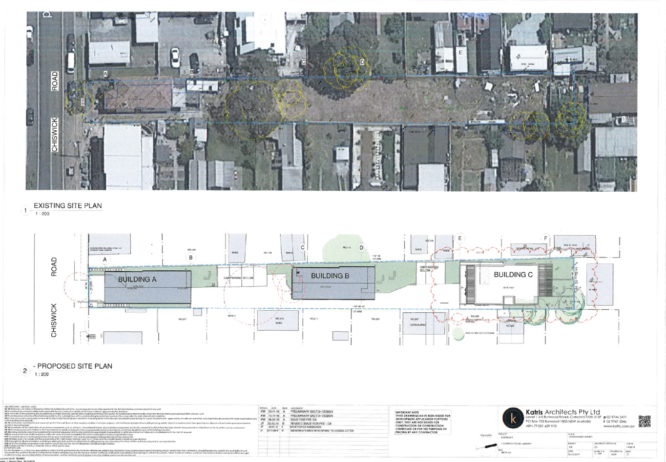
Subject Site and Surrounding
Area
The subject site is known as 1
Chiswick Road, Auburn, and is legally described as Lot B, Deposited Plan 85392.
The land is an irregular midblock and has a frontage of 10.125m to Chiswick
Road, northern boundary length of 12.99m, and eastern and western boundary
length of 121.92m. The total site has an area of 1,411.9m², and is
illustrated in Figure 3 below:
Figure
3 - Location Map (Source: Cumberland City Council, 2020)
The subject site presently
maintains a single storey dwelling with 3 existing trees on site, being 1 x
Forest Red Gum, and 2 x Camphor Laurels, a street tree, being a Brush Box /
Brisbane Box, and 5 trees within 5 metres of the boundary of the site, located
within adjacent properties.
The surrounding locality is
characterised by high, medium and low density residential structures,
comprising single and double storey dwellings, multi dwelling housing and
traditional residential flat building strata developments.
The topography of the site is
maintained to a 3.2% gradient, with a 3.91 metre fall to the south western
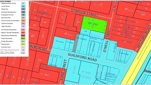
corner to the north eastern corner of the site. The site is zoned R3 Medium
Density Residential, pursuant to the Auburn Local Environmental Plan 2010 (ALEP),
as shown in Figure 4 below:
Figure 4 –
Zoning Map (Source: Cumberland City Council, 2020)
The subject site is situated to
the north of Chiswick. Figure 5 below illustrates an aerial perspective of the
site and the general surroundings.
Figure
5 – Aerial Photo and NearMap Insert (Source: Cumberland City Council and
NearMap, 2020)
The subject site does not contain
a heritage item, and is not located within a heritage conservation area. The
site is located within the vicinity of a heritage item, being:
· Item
13 ‘Horse trough’ – Cnr of Auburn Road and Water Street,
Auburn
The heritage items listed above
are illustrated in Figure 6 below.
Figure
6 – Heritage Map (Source: Cumberland City Council, 2020)
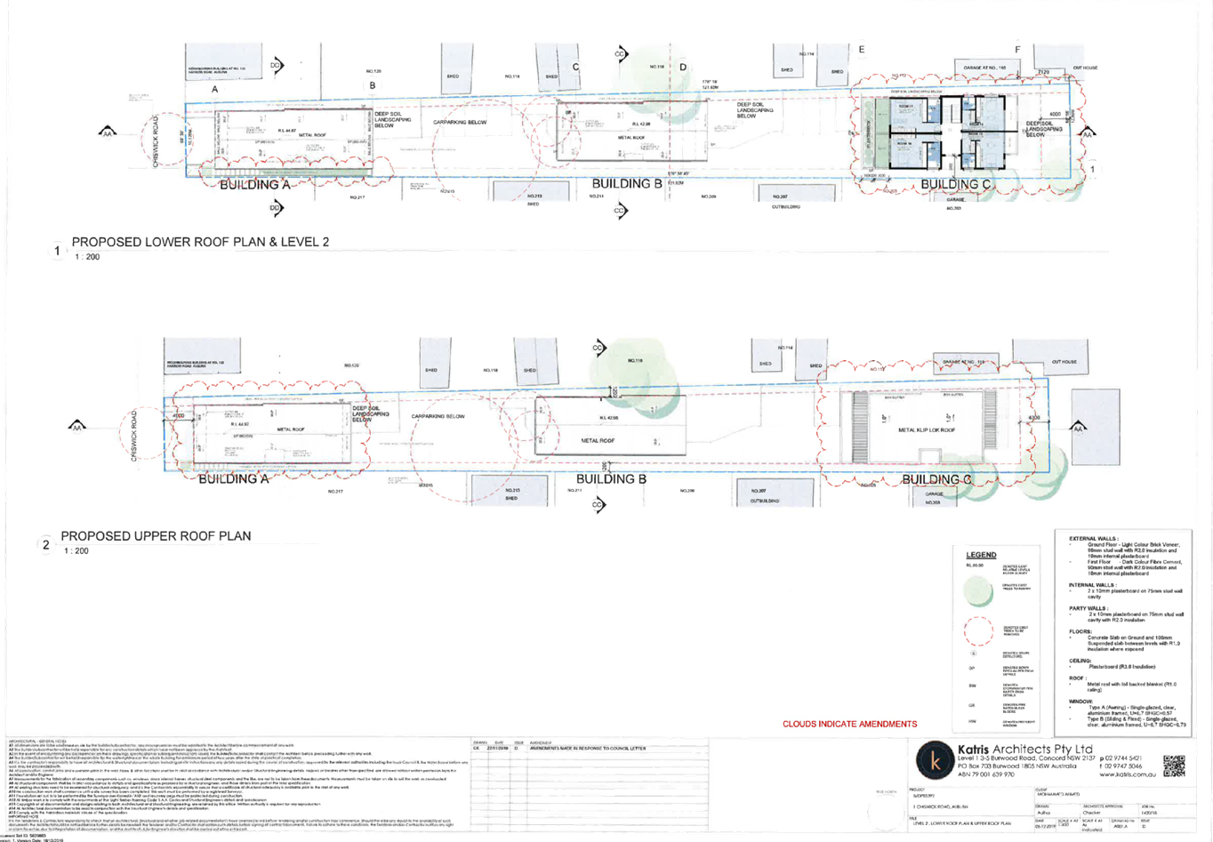
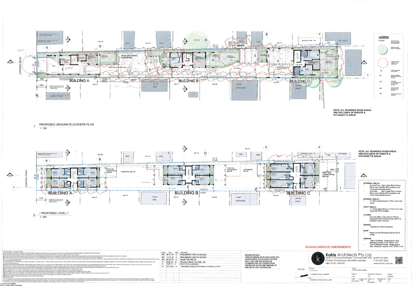
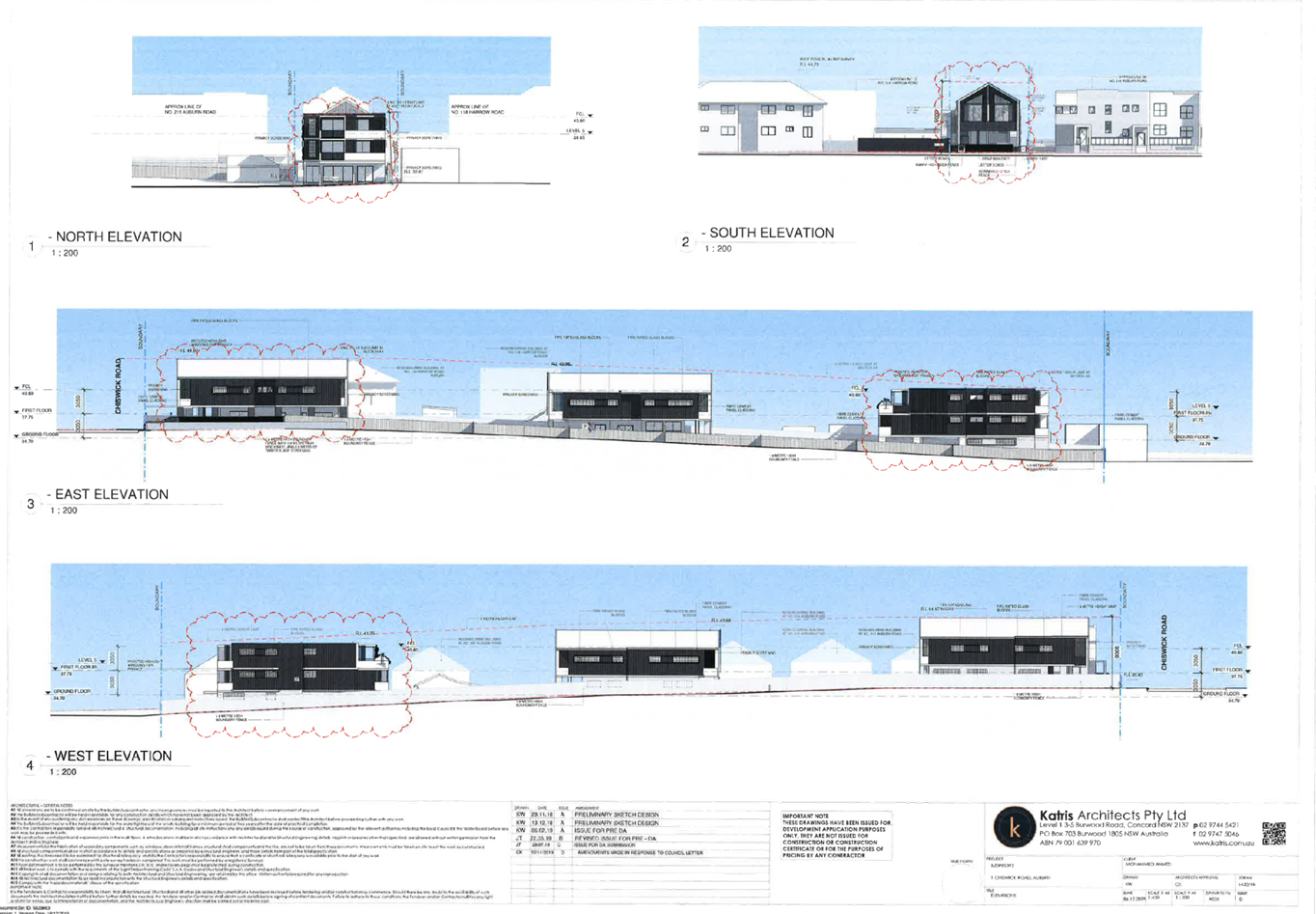
Description of the Proposed
Development
The proposal is for construction
of a four (4) storey mixed use development comprising two (2) commercial
tenancies and nine (9) residential apartments over basement level car parking.
In detail, the following
description has been provided by the Applicant within the Statement of
Environmental Effects prepared by Planning Direction Pty Ltd, dated 22 August
2019:
Description of Proposal
The application seeks consent to:
- Demolish
the existing dwelling on the site and remove a number of trees; and
- Construct
a new generation boarding house.
The proposed boarding house will
provide 20 boarding rooms (one of which will be occupied by the on site
manager) and will have the capacity to accommodate a maximum of 42 persons.
Following Council’s
assessment, Building C was found to be incompatible with the existing and
desired future character of the area, noting the building was designed to 3
storeys. In this regard, the development, as agreed by the Applicant, is
modified as follows:
- Buildings
A, B and C are maintained to 2 storeys in height.
- The
number of boarding rooms has been reduced to 16 boarding rooms (inclusive of 1
manager’s room).
- The
development has a capacity to accommodate a maximum 32 persons on site.
The above will be conditioned
accordingly. (Condition)
Following from the above, a
numerical overview of the key components of the development is provided below:
Numerical Overview of Key
Components
|
Component
|
Required /
Permissible
|
Proposed
|
Complies
|
|
Site Area
|
N/A
|
1,411.9m²
|
N/A
|
|
Site Frontage
|
18m
|
10.125m
|
No, but Acceptable
on Merit
|
|
Gross Floor Area
(GFA)
|
1,058.925m²
|
584.6m²
|
Yes
|
|
Floor Space Ratio
(FSR)
|
0.75:1
|
0.414
|
Yes
|
|
Height of Buildings
(HOB)
|
Building
A
|
9m
|
7.96m
|
Yes
|
|
Building
B
|
8.26m
|
|
Building
C
|
8.84m
|
|
Boundary Setbacks
|
North
|
4m
|
7.12m
|
Yes
|
|
South
|
4m
|
4m
|
|
East
|
1.2m
|
1.2m
|
|
West
|
1.2m
|
1.2m
|
|
Boarding Room
Numbers
|
Building
A
|
4 rooms
|
N/A
|
|
Building
B
|
5 rooms (inclusive
of Managers Room)
|
|
Building
C
|
7 rooms
|
|
Total
|
16 rooms
|
|
Boarding Room Mix
|
1 person occupancy
|
0 rooms (0%)
|
N/A
|
|
2 person occupancy
|
16 rooms (100%)
|
|
Car Parking
|
10 spaces
|
10 spaces
|
Yes
|
|
Communal Living
Area
|
1 communal room
|
3 communal rooms
|
Yes
|
|
Private Open Space
|
Lodgers
|
One area w. Min.
20m²
|
Three areas, all
>20m²
|
Yes
|
|
Manager
|
One area w. 8m²
|
One area
>8m²
|
|
Deep Soil Zone
|
10%
(141.19m²)
|
16.37%
(230.6m²)
|
Yes
|
|
Landscape Area
|
30%
(423.6m²)
|
28.26%
(399m²)
|
Yes
|
|
Solar Access (3hr)
|
Communal room (x1)
+
Adjoining
properties
|
Communal room (x1)
+
Adjoining
properties
|
Yes
|
|
|
|
|
|
|
Site History
The following site history is
noted as under:
- PL2019/32 Pre-lodgement
Application for a proposed boarding house with 22 rooms (including
manager’s room) with at-grade parking – Meeting minutes issued on
12 July 2019. The subject application has addressed the matters raised within
the pre-lodgement meeting minutes.
- PL2019/7 Pre-lodgement
Application for a proposed boarding house for 36 rooms with basement parking
– Meeting minutes issued on 24 April 2019. The subject application has
addressed the matters raised within the pre-lodgement meeting minutes.
- M2015/17/A Section
4.55(1A) Application to amend the stormwater connection point - Approved on 14
October 2019 via Delegated Authority.
- DA2015/17 Development
Application for demolition of existing dwelling house and construction of 5
townhouses, each having three bedrooms – Approved via Deferred
Commencement on 11 May 2015 via Delegated Authority.
Deferred Commencement matters
resolved on 26 August 2015.
- DA2014/188 Development
Application for demolition of existing dwelling and construction of 5 x two
storey townhouses and 1 x single storey townhouse - Refused on 15 October 2014
via an Ordinary Meeting of Council.
- PL2013/38 Pre-lodgement
Application for a proposed 5 x two storey townhouse development – Meeting
minutes issued on 6 January 2014.
Applicant’s Supporting Statement
The applicant has provided a Statement of Environmental
Effects prepared by Planning Direction Pty Ltd, dated 22 August 2019, and was
received by Council on 26 August 2019 in support of the application.
Additional correspondence was received by Planning Direction
Pty Ltd, dated 11 December 2019 in response to Council’s request for
amended plans and additional information.
Contact with Relevant Parties
The assessing officer has undertaken an inspection of the
subject site and has been in contact with the applicant throughout the
assessment process.
Internal Referrals
Development Engineer
The development application was referred to Council’s
Development Engineer for comments, who has advised that the proposed
development is supportable on the grounds of traffic, parking, loading, and
stormwater, subject to standard conditions, which have been imposed within the
draft notice of determination provided as Attachment 2 to this report.
Tree Management Officer
The development application was referred to Council’s
Tree Management Officer for comments, who has advised that the proposed
development is supportable on the grounds of tree removal, tree retention,
proposed planting and landscape design, subject to standard conditions, which
have been imposed within the draft notice of determination provided as
Attachment 2 to this report.
Environmental Health Officer
The development application was referred to Council’s
Environmental Health Officer for comments, who has reviewed the submitted
Acoustic Report, Hazardous Materials Survey, and advised that the proposed
development is supportable, subject to standard conditions of consent, which
have been imposed within the draft notice of determination provided as Attachment
2 to this report.
Resource Recovery Officer
The development application was referred to Council’s
Resource Recovery Officer for comments, who has reviewed the submitted Waste
Management Plan and waste arrangements proposed, and advised that the proposed
development is supportable, subject to standard conditions of consent, which
have been imposed within the draft notice of determination provided as
Attachment 2 to this report.
External Referrals / Concurrence Authorities
NSW Police
The development application was referred to the NSW Police
Force for comments, who has advised that the proposed development is supported,
subject to standard recommendations and comments.
AusGrid
The development application was referred to AusGrid for
comments, who has advised that the proposed development is supported, subject
to standard recommendations and comments.
Planning Comments
Section 4.15 of the Environmental Planning and Assessment
Act 1979 (EP & A Act)
The provisions of any Environmental Planning Instruments
(EP & A Act s4.15 (1)(a)(i))
The following Environmental Planning Instruments are
relevant to the assessment of the subject application:
a) State
Environmental Planning Policy No 19 – Bushland in Urban Areas
i)
The proposal does not propose to disturb bushland zoned or
reserved for public open space.
b) State
Environmental Planning Policy No. 55 – Remediation of Land (SEPP 55)
Clause 7 of State Environmental Planning Policy No 55
– Remediation of Land (SEPP 55) requires Council to be satisfied that the
site is suitable, or can be made suitable, to accommodate the proposed
development. The following table has been provided in consideration of the
above.
|
Matters for
consideration
|
Yes
|
No
|
N/A
|
|
Does the application
involve re-development of the site or a change of land use?
|
|
|
|
|
Is the development going to be used for a sensitive land
use (e.g.: residential, educational, recreational, childcare or hospital)?
|
|
|
|
|
Does information available to you indicate that an
activity listed below has ever been approved, or occurred at the site?
acid/alkali plant and formulation,
agricultural/horticultural activities, airports, asbestos production and
disposal, chemicals manufacture and formulation, defence works, drum
re-conditioning works, dry cleaning establishments, electrical manufacturing
(transformers), electroplating and heat treatment premises, engine works,
explosive industry, gas works, iron and steel works, landfill sites,
metal treatment, mining and extractive industries, oil production and
storage, paint formulation and manufacture, pesticide manufacture and
formulation, power stations, railway yards, scrap yards, service stations,
sheep and cattle dips, smelting and refining, tanning and associated trades,
waste storage and treatment, wood preservation.
|
|
|
|
|
Is the site listed on
Council's Contaminated Land Database?
|
|
|
|
|
Is the site subject to
EPA clean-up order or other EPA restrictions?
|
|
|
|
|
Has the site been the
subject of known pollution incidents or illegal dumping?
|
|
|
|
|
Does the site adjoin
any contaminated land/previously contaminated land?
|
|
|
|
|
Has the appropriate level of investigation been carried
out in respect of contamination matters for Council to be satisfied that the
site is suitable to accommodate the proposed development or can be made
suitable to accommodate the proposed development?
*Refer to comments below.
|
|
|
|
Details of contamination investigations carried out at
the site:
A Hazardous Material Survey (HMS) has been prepared by Hayes
Environmental Consulting, which has been submitted with the development
application. The investigation identified:
· The
property has been residential single the 1960s, and contains a fibro cottage
and metal sheds.
· An
inspection of the property, fibro cottage and metal sheds, confirms lead based
paints, and asbestos-containing materials are present on-site.
Noting the above, management procedures have been identified
within the report, which are required to be implemented in the demolition of
the existing structures.
Council’s Environmental Health Officer has reviewed
the HMS, and is satisfied with the recommendations made. In addition,
Council’s Environmental Health Officer has reviewed Council’s
records, and confirmed the site is not identified as being contaminated.
Furthermore, a site inspection reveals the site does not
have any obvious history of a previous land use that may have caused
contamination and there is no specific evidence that indicates the site is
contaminated. Therefore, Council is satisfied that the site is suitable for its
intended use.
c) State
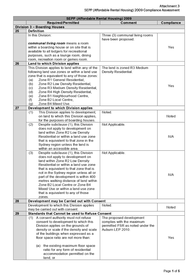
Environmental Planning Policy (Affordable Rental Housing) 2009 (SEPP ARH)
The development application has been lodged under Part 2
– New Affordable Rental Housing – Division 3 – Boarding
Houses pursuant to State Environmental Planning Policy (Affordable Rental
Housing) 2009 (SEPP ARH). The proposed development has been assessed to comply
with the requirements of SEPP ARH, with the character assessment discussed below.
A comprehensive assessment against the SEPP ARH is contained in Attachment 3 to
this report.
Assessment of Character of the Local Area Pursuant to
Clause 30A of SEPP ARH
A consent authority must not consent to development to which
this Division applies unless it has taken into consideration whether the design
of the development is compatible with the character of the local area. SEPP ARH
does not contain any guidance for assessing whether a proposal is compatible
with the character of the local area. However, a planning principle for
assessing compatibility in the urban environment was established by the Land
and Environment Court in the judgement for Project Venture Developments Pty Ltd
v Pittwater Council [2005] NSWLEC 191. This involves consideration of the
following two questions:
· Are
the proposal’s physical impacts on surrounding development acceptable?
The physical impacts include constraints on the development potential of
surrounding sites.
· Is
the proposal’s appearance in harmony with the buildings around it and the
character of the street?
A merit assessment of the character of the local area should
therefore consider the following 3 steps:
· Step
1 – Identify the ‘local area’.
· Step
2 – Determine the character of the ‘local area’.
· Step
3 – Determine whether the design of the proposed development is
compatible with the character of the ‘local area’.
An assessment against each step is provided below:
Step 1 – Identify the local area.
This assessment identifies the local area as primarily the
visual catchment of the site (outlined in red) as viewed from directly within
the site and adjacent to the site on the street. Figure 7 below illustrates an
aerial perspective of the site and the general surroundings, and the visual
catchment, as denoted by a red outline.
Figure 7 –
Aerial Photo (Source: Cumberland City Council, 2020)
Step 2 – Determine the character (present and
future) of the local area.
The zoning of the immediate locality comprises R3 Medium
Density Residential to the north, east, and west of the site and R2 Low Density
Residential to the south of the site, pursuant to the ALEP, as shown in Figure
5 below:
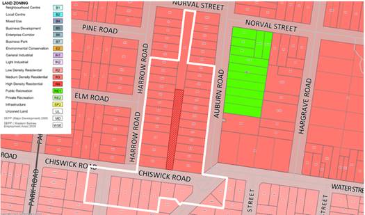
Figure 8 –
Zoning Map (Source: Cumberland City Council, 2020)
Present Character of the Area
The existing character of the local area is as follows:
· North
Single storey villa development.
· East Single
and two storey low and medium density
residential
developments.
· South Single
and two storey low density residential developments.
· West Single,
two storey, and two storey with attic low, medium and high density residential
developments.
Future Character of
the Area
The future character of
the local area is as follows:
· North
The maximum Height of Buildings (HOB) and Floor
Space Ratio (FSR) of the R3 Medium Density Residential zone is maintained to 9
metres / 0.75:1 FSR, and permits medium density residential developments.
· East The
maximum HOB and FSR of the R3 Medium Density Residential zone is maintained to
9 metres / 0.75:1 FSR, and permits medium density residential developments.
· South The
maximum HOB of the R2 Low Density Residential zone is maintained to 9 metres,
and permits low density residential developments. No FSR standard is
applicable.
· West The
maximum HOB and FSR of the R3 Medium Density Residential zone is maintained to
9 metres / 0.75:1 FSR, and permits medium density residential developments.
Step 3 - Determine if the development is compatible with
the character of the local area.
In accordance with the Land and Environment Court’s
planning principle, and relevant case law, compatibility is best defined as
‘capable of existing together in harmony’. In order to test
compatibility, two questions are required to be considered. These questions, as
well as a response to each, are provided below:
· Are
the proposal’s physical impacts on surrounding development acceptable?
The physical impacts include constraints on the development potential of
surrounding sites.
Physical impacts general include privacy, overshadowing, and
visual bulk. In terms of the physical impacts of the development:
o Privacy within the
development and to adjoining sites has been maintained to an acceptable level,
through the incorporation of sufficient building setbacks, and appropriate
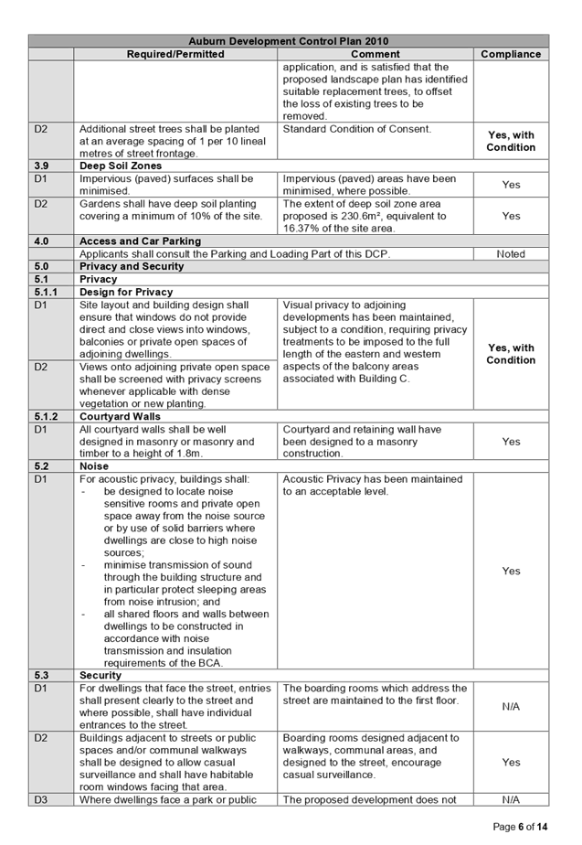
privacy treatments, where necessary. Furthermore, a condition will be imposed,
requiring privacy treatments to be imposed to the full length of the eastern
and western aspects of the balcony areas associated with Building C.
(Condition)
o Overshadowing to
adjoining developments is limited, with the proposed development maintaining
solar access to adjoining properties living rooms and private open space areas
in accordance with the ADCP.
o The setback of the
proposed development from Chiswick Road is consistent with the desired future
character of medium density residential developments in the area, as defined
within the ADCP.
o The height of the
development and proposed floor space ratio is consistent with the relevant
standards pursuant to the ALEP.
o The proposal will not
result in the isolation of adjoining sites, nor does it unduly constrain
adjoining sites.
· Is
the proposal’s appearance in harmony with the buildings around it and the
character of the street?
The proposed boarding house development is considered to be
in harmony with nearby buildings, in particular those located to the north,
east, and west of the subject site.
d) State
Environmental Planning Policy (Building Sustainability Index: BASIX) 2004
A BASIX Certificate has been lodged as a part of the
development application. The BASIX certificate indicates that the development
has been designed to achieve the required water, thermal comfort and energy
scores.
e) State
Environmental Planning Policy (Coastal Management) 2018
The subject site is not identified as a coastal wetland and
is not or land identified as “proximity area for coastal wetlands”.
f) State
Environmental Planning Policy (Infrastructure) 2007 (ISEPP)
The provisions of State Environmental Planning Policy
(Infrastructure) 2007 (ISEPP) have been considered in the assessment of the
development application.
Clause 45 - Development likely to affect an electricity
transmission or distribution network
The subject development occurs within 5 metres of an
overhead electricity power. As such, the Consent Authority is required to give
written notice to an electricity supply authority. The development application
was referred to AusGrid, who advised that the development proposal is
supported, subject to standard recommendations and comments.
g) State
Environmental Plan (Sydney Harbour Catchment) 2005
The subject site is identified as being located within the
area affected by the Sydney Environmental Plan (Sydney Harbour Catchment) 2005.
The proposed development raises no issues, as no impact on the catchment is
envisaged.
Note: The subject site is not identified in the
relevant map as land within the ‘Foreshores and Waterways Area’ or
‘Wetland Protection Zone’, is not a ‘Strategic Foreshore
Site’ and does not contain any heritage items. Hence the majority of the
State Environmental Plan is not directly relevant to the proposed development.
h) State
Environmental Planning Policy (Vegetation in Non-Rural Areas) 2017
(Vegetation SEPP)
State Environmental Planning Policy (Vegetation in Non-Rural
Areas) 2017 (Vegetation SEPP) applies to the subject site. An assessment of the
proposal has revealed the proposed development complies with the requirements
of the Vegetation SEPP, noting:
· The
site is not located in a declared area of outstanding biodiversity value as
outlined within the Biodiversity Values Map;
· The
proposal does not exceed the area clearing threshold for native vegetation
pursuant to the Biodiversity Conservation Act 2016; and
· The
tree species identified to be removed do not satisfy the test of significance
pursuant to Section 7.3 of the Biodiversity Conservation Act 2016.
i) Auburn
Local Environmental Plan 2010 (ALEP)
The Auburn Local Environmental Plan 2010 (ALEP) applies to
the subject site. The proposed development has been assessed to comply with the
requirements of ALEP. The relevant matters to be considered under ALEP, and the
applicable clauses for the proposed development, are summarised below. A
comprehensive assessment against the ALEP is contained in Attachment 4 to this
report.
Permissibility
The proposed development is defined as a boarding house, and
is permissible in the R3 Medium Density Residential zone with consent.
Boarding house means a building that
a) is
wholly or partly let in lodgings, and
b) provides
lodgers with a principal place of residence for 3 months or more, and
c) may
have shared facilities, such as a communal living room, bathroom, kitchen or
laundry, and
d) has
rooms, some or all of which may have private kitchen and bathroom facilities,
that accommodate one or more lodgers,
but does not include backpackers’ accommodation, a
group home, hotel or motel accommodation, seniors housing or a serviced
apartment.
Note. Boarding houses are a type of residential
accommodation
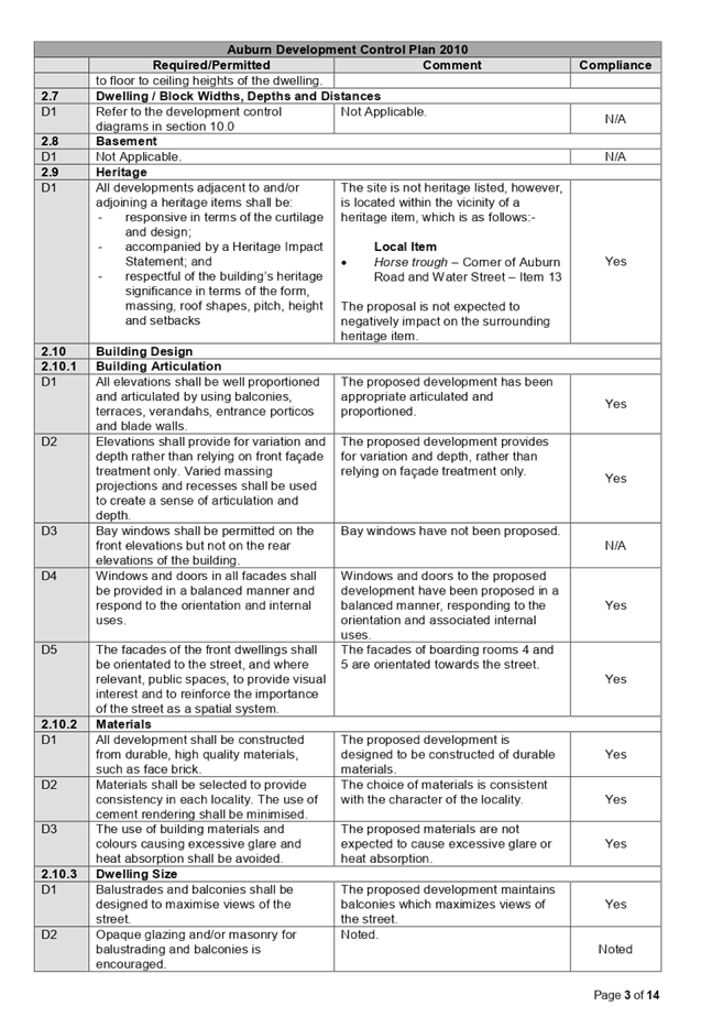
Heritage
The subject site does not contain a heritage item, nor is it
located within a heritage conservation area. The subject site is located within
the vicinity of a heritage item, being:
· Item
13 ‘Horse trough’ – Cnr of Auburn Road and Water Street,
Auburn
Given the distance of the development from the heritage
item, the proposal is not expected to negatively impact upon on the surrounding
heritage item.
Key Development Standards
The following key development standards are applicable:
|
Development
Standard
|
Maximum
|
Proposed
|
Compliance
|
|
Floor Space Ratio
(FSR)
|
0.75:1
|
0.414:1
|
Yes
|
|
Height of Buildings
(HOB)
|
9m
|
8.84m
|
Yes
|
The provisions of any Proposed Instruments (EP & A
Act s4.15 (1)(a)(ii))
The following draft Environmental Planning Instruments are
relevant to the assessment of the subject application:
(a) Draft
State Environmental Planning Policy (Environment) (Draft ESEPP)
The Draft State Environmental
Planning Policy (Environment) (Draft ESEPP) relates to the protection and
management of our natural environment with the aim of simplifying the planning
rules for a number of water catchments, waterways, urban bushland, and
Willandra Lakes World Heritage Property. The changes proposed include
consolidating the following seven existing SEPPs:
· State
Environmental Planning Policy No. 19 – Bushland in Urban Areas.
· State
Environmental Planning Policy (Sydney Drinking Water Catchment) 2011.
· State
Environmental Planning Policy No. 50 – Canal Estate Development.
· Greater
Metropolitan Regional Environmental Plan No. 2 – Georges River Catchment.
· Sydney
Regional Environmental Plan No. 20 – Hawkesbury-Nepean River (No.2-1997).
· Sydney
Regional Environmental Plan (Sydney Harbour Catchment) 2005.
· Willandra
Lakes Regional Environmental Plan No. 1 – World Heritage Property.
The Draft ESEPP will repeal the above existing SEPPs and
certain provisions will be transferred directly to the new SEPP, amended and
transferred, or repealed due to overlaps with other areas of the NSW planning
system.
Refer to assessment above under the heading ‘State
Environmental Plan (Sydney Harbour Catchment) 2005’.
(b) Draft
Cumberland Local Environmental Plan 2020 (Draft CLEP)
The Draft Cumberland Local Environmental Plan 2020 (Draft
CLEP) has been prepared by Cumberland Council to provide a single planning
framework for the future planning of Cumberland City. The changes proposed seek
to harmonise and repeal the three existing LEPs currently applicable to the
Cumberland City local government area, those being:
• Holroyd
Local Environmental Plan 2013
• Parramatta
Local Environmental Plan 2011.
• Auburn
Local Environmental Plan 2010.
The current planning controls for the subject site, as
contained within the ALEP, are not proposed to change under the Draft CLEP.
The provisions of any Development Control Plans (EP &
A Act s4.15 (1)(a)(iii))
The following Development Control Plans are relevant to the
assessment of the subject modification application:
(a) Auburn
Development Control Plan 2010 (ADCP)
The Auburn Development Control Plan 2010 (ADCP) applies to
the subject site. The proposed development has been assessed to comply with the
requirements of ADCP, with the exception of site area, landscape area, and
design of parking spaces, which is discussed below. A comprehensive assessment
against the ADCP is contained in Attachment 5 to this report.
The below variations are maintained to controls applicable
to multi dwelling housing development. While the proposal does not seek the
construction of a multi dwelling housing development, the proposed development
has been assessed against this section, in the context of controls which are
typically applied to development within an R3 Medium Density Residential zone.
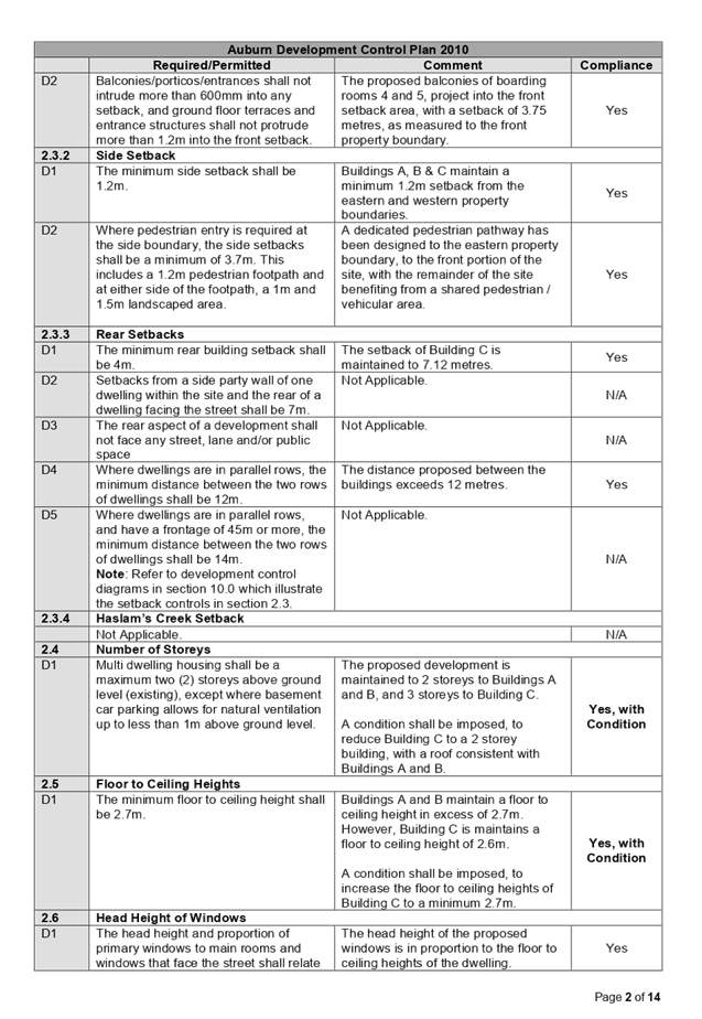
Clause 2.1 - Site Area
The ADCP requires multi dwelling housing developments to
have a minimum frontage width of 18 metres. In this regard, the proposal is
maintained to a site with a frontage to Chiswick Road of 10.125 metres. The
proposed variation achieves the aims and objectives of the requirement for site
area, and is considered supportable on merits, noting:
o The proposed development
is maintained to a site of sufficient size to accommodate a boarding house
development, while maintaining appropriate setbacks, and maintaining amenity to
adjoining properties, with particular reference to visual privacy and solar
access.
o The control notes that
sites with a width frontage less than 18m shall be amalgamated with two (2) or
more sites to provide sufficient width for good building design. Due to the
a-typical layout of the subdivision, that being, adjoining sites to the east
and west of the allotment maintain a perpendicular layout to the subject site,
having an associated frontage to Harrow Road and Auburn Road, the site is
limited in its ability to amalgamate with adjoining sites to increase the width
of the allotment. Furthermore, the proposal will not result in the isolation of
adjoining sites, nor does it unduly constrain adjoining sites.
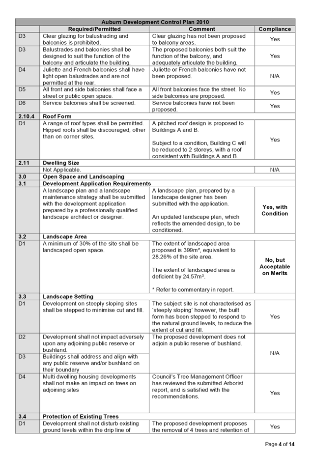
Clause 3.2 - Landscape Area
The ADCP requires multi-dwelling housing developments to
have a minimum of 30% of the site to be landscaped open space. In this regard,
the subject site requires a minimum landscape area of 423.6m², however,
the proposal maintains a landscape area of 399m², equivalent to 28.26% of
the site area. The proposed variation achieves the aims and objectives of the
requirement for landscape area, and is considered supportable on merits,
noting:
o The landscape areas are
of sufficient dimension to contribute to the amenity of the site, enabling
planting, and permitting stormwater infiltration. To this end, the proposed
development includes an On-site Stormwater Detention (OSD) system, and
introduces additional vegetation on site, that being, groundcovers, shrubs and
trees, to improve the landscape character of the site and general surrounds.
The proposed trees include Water Gums, a Native Frangipani, and a Blueberry
Ash.
o The landscape areas
proposed create a buffer zone for privacy, views, and noise, between the
subject development and adjacent / adjoining properties.
Clause 4.3.2 - Design of Parking Spaces
The ADCP requires all multi dwelling housing developments to
have underground parking. In this regard, the proposed development is
maintained to at-grade parking. The proposed variation achieves the aims and
objectives of the requirement for design of parking spaces, and is considered
supportable on merits, noting:
o The proposed development
is generally consistent with the parking arrangement approved via Development
Consent 2015/17 which gained approval for demolition of existing dwelling
housing and construction of five townhouses with each townhouse having three
bedrooms on the subject site. The proposal maintained 9 at-grade parking
spaces, in comparable locations to that proposed within the subject
development.
o The design of the
parking areas reflects a functional requirement, and enables the adequate
provision of soft-soil landscape area on site.
o The proposed parking is
not visible from the public domain, noting the parking spaces are designed
behind Buildings A and B, and beneath Building C, and therefore maintains a
satisfactory streetscape presentation.
The provisions of any planning agreement that has been entered
into under section 7.4, or any draft planning agreement that a developer has
offered to enter into under section 7.4 (EP & A Act s4.15(1)(a)(iiia))
There is no planning agreement or draft planning agreement
associated with the subject development application.
The provisions of the Regulations (EP & A Act s4.15
(1)(a)(iv))
The proposed development raises no concerns as to the relevant
matters arising from the Environmental Planning and Assessment Regulations 2000
(EP & A Regs).
The Likely Environmental, Social or Economic Impacts (EP &
A Act s4.15 (1)(b))
It is considered that the proposed development will have no
significant adverse environmental, social or economic impacts in the locality.
The suitability of the site for the development (EP & A Act
s4.15 (1)(c))
The subject site and locality is not known to be affected by any
natural hazards or other site constraints likely to have a significant adverse
impact on the proposed development. Accordingly, it is considered that the
development is suitable in the context of the site and surrounding locality.
Submissions made in accordance with the Act or Regulation (EP
& A Act s4.15 (1)(d))
Advertised (newspaper) Mail Sign Not Required
In accordance with Council’s notification requirements
contained within the ADCP, the proposal was publicly notified for a period of
14 days between 10 September 2019 and 24 September 2019. In response, nine (9)
submissions were received. The application was re-notified following the
submission of amended plans and documents, for a period of 14 days between 29
January 2020 and 12 February 2020. In response, one (1) submission was received.
As a result of the two (2) public exhibition periods, Council
received a total of ten (10) submissions, which is contained within Attachment
6 to this report.
|
Issue
|
Planners Comment
|
|
Parking
Concern is raised that the parking within the area is
saturated, and the extent of parking provided onsite is not adequate to
service the development, with particular reference to the number of persons
permitted on site.
|
In accordance with SEPP ARH, the required number of
off-street parking spaces is 10 car spaces. The proposed development is
serviced by 10 car spaces, in compliance with SEPP ARH.
|
|
Visual Privacy
Concern is raised that visual privacy of adjoining
properties will be compromised by the proposed development.
Furthermore, a request has been made to reduce windows to
half windows, to maintain privacy.
|
Visual privacy to adjoining properties has been maintained
through the incorporation of highlight windows to the first floor of the
development, privacy treatments in the form of louvered screens, the design
of setbacks to the development in accordance with the ADCP, and the planting
of trees along the northern boundary.
Furthermore, a condition will be imposed, requiring privacy treatments to be imposed to the full length of
the eastern and western aspects of the balcony areas associated with Building
C. (Condition)
Note: The
request to maintain half windows, is facilitated by the incorporation of
highlight windows to the first floor of the development. The
request to maintain half windows is facilitated by the incorporation of
highlight windows to the first floor of the development.
|
|
Acoustic Privacy
Concern is raised that the proposed development will
increase the extent of noise within the surrounding locality.
|
An Acoustic Report prepared by an appropriately qualified
acoustic consultant has been submitted with the development application.
Unattended noise monitoring was conducted to determine the background noise
level for the area.
The Acoustic Report has detailed the proposed development meets
the relevant acoustic requirements and criteria, subject to compliance with
acoustic and operational recommendations, as detailed within the report.
Council’s Environmental Health Officer has assessed the provided
Acoustic Report in conjunction with the proposal to be satisfactory in
maintaining acoustic privacy, and conditions of consent have been imposed
accordingly.
|
|
Solar Access
Concern is raised that the proposed development will
overshadow adjoining properties.
|
In accordance with the ADCP, developments shall be
designed to allow sunlight to at least 50% of ground level private open space
areas, and north-facing living room windows of adjoining properties, for a
minimum of 3 hours between 9am and 3pm, midwinter.
In this regard, detailed solar access diagrams, in plan
and elevation, have been submitted, which demonstrate compliance with the
above.
|
|
Traffic Generation
Concern is raised that the proposed development will
increase traffic within the surrounding locality.
|
A Traffic Impact Assessment (TIA) has been submitted with
the development application, which considered traffic generation.
Council’s Engineer has assessed the provided TIA in conjunction with
the proposal to be satisfactory in maintaining an acceptable level of traffic
generation, when considering the prevailing traffic conditions, and the
capacity of the street network. In this regard, the traffic generated by this
development is not expected to adversely affect the performance of the road
network or key intersections in the locality.
|
|
Air Pollution
Concern is raised that the proposed development will
increase air pollution from car movements’ onsite.
|
Council’s Environmental Health Officer has assessed
the proposal and does not consider the extent of exhaust fumes generated from
car movements’ onsite will pose a significant risk to public health.
|
|
Extent of Hard Surface
Concern is raised regarding the extent of hard surface
proposed, and the increase rainfall in heavy rain events to adjoining
properties.
|
The extent of landscape area proposed is maintained to
399m², equivalent to 28.26% of the site area, which is considered
acceptable in achieving the aims and objectives of the
requirement for landscape area.
In addition, the proposed development
includes an OSD system, which enables the discharge of water from the
development to be controlled by means of a flow control device, and a storage
system to hold the excess water until capacity becomes available.
|
|
Density, Commercial Nature & Precedent
A comment has been made that Auburn is becoming a high
density area, is commercial in nature, and will set a precedent for similar
developments in the area.
A request has been made to maintain the development to a 2
storey dwelling or reduce the number of storeys to a single storey development,
and consequently the number of units.
|
In accordance with the ALEP, the site is zoned R3 Medium
Density Residential, and boarding houses are permissible with consent.
Note: In
accordance with the ALEP and ADCP, the maximum height of development is limited
to 9 metres / 2 storeys. The proposed development is designed to 8.84m, and a
condition will be imposed, should the application be approved, requiring
Building C to be reduced to a 2 storey development. (Condition)
|
|
Compatibility / Character
Concern is raised that the proposed development is not in
keeping with existing surrounding developments.
|
The proposed development has been found to be in character
with the local area, subject to the imposition of a condition, requiring
Building C to be reduced a 2 storey development, with a roof form consistent
with Buildings A and B. (Condition)
|
|
Number of Persons Onsite – Size of Site
Concern is raised that there could be up to 40 residents
on site at any one time, which is excessive noting the size of the site.
|
The development has a capacity to
accommodate a maximum 32 persons on site at any one time. The proposed
development has been assessed to generally comply the built form and density
controls of SEPP ARH, the ALEP and the ADCP.
|
|
Population Growth – Infrastructure Demands
Concern is raised the rising population in Auburn, and
along with the proposed development, will make it unsustainable for
Cumberland City Council to keep up with local infrastructure demands.
|
In accordance with Section 7.11 of the Environmental
Planning and Assessment Act, 1979, Council has the ability to levy developers
for contributions, which contributes to local infrastructure projects and
improvements.
In this regard, the development requires the payment of
contributions in accordance with the Auburn Development Contributions Plan
2007 (Amendment 1 – 2016).
|
|
Property Prices and Insurance Premiums
Concern is raised that the proposed development will
affect property prices and insurance premiums.
|
No evidence has been submitted which suggest that the
proposed development will affect property prices and insurance premiums.
|
|
Criminal / Anti-Social Behaviour
Concern is raised that the development will attract
alcohol / substance abusers, which will result in increased violence, theft, and
unsocial behaviour.
|
No evidence has been submitted which suggest that new
generation boarding houses will cause risks to public safety or are
associated with criminal or anti-social behaviour.
|
|
Safety – Deterring Fence Jumping
A question has been asked as to what measures can be
employed to deter fence jumping.
|
A 1.8 metre high boundary fence is proposed to be erected
to northern, eastern, and western boundaries. If however fence jumping
occurs, it would be appropriate to contact the on-site manager and NSW
Police.
|
|
Safety – Damage to / Breaching Fence
Concern is raised that noting the limited lot width, there
is potential for cars to damage the fence when manoeuvring on site, and for
cars to breach the fence.
|
The driveway and parking arrangement and manoeuvrability
of vehicles on site has been reviewed by Council’s Engineer to be
acceptable, when considered against the relevant standards.
Note: A
raised concrete edge has been designed to the edge of the parking spaces. A
condition will be imposed, should the application be approved, requiring
wheel stops to be installed. (Condition)
If however the fence is breached, it would be appropriate
to contact the on-site manager.
|
|
Chaos / Disorder – Future Residents
Concern is raised that the future residents will create
chaos during different periods of the day / week.
|
A Plan of Management (POM) has been submitted with the
development application, which outlines ongoing management practices to be
employed, to manage its impact upon the surrounding locality. The POM has
been assessed to comply with Council’s guidelines and will be endorsed
with the development application.
|
|
Odour – Stormwater and Sewerage Line
Concern is raised that the stormwater and sewerage line
will create an odour.
|
The Applicant has not sought to alter the existing
sewerage line. Furthermore, a stormwater easement is designed to drain
stormwater through a downstream property, to drain to Auburn Road. The
existing sewerage line and proposed stormwater connection are underground,
and in this regard, it is not anticipated that odour will be created.
|
|
Odour – Waste
Concern is raised that due to the increase in persons on
site, waste odour will be present.
|
The proposed design includes an enclosed waste storage
area, designed to the front of the site, integrated with Building A. The
enclosure of this facility, and the implementation of recommended conditions
of consent, will ensure that odour will be mitigated.
|
|
Fire Safety
Concern is raised that Fire and Rescue would not be able
to access the entire development.
|
In the event Fire and Rescue require access to the site,
access is provided via the proposed driveway and shared pedestrian pathway,
designed along the eastern boundary of the site.
|
The public interest (EP & A Act s4.15(1)(e))
The public interest is served by permitting the orderly and
economic use of land, in a manner that is sensitive to the surrounding
environment and has regard to the reasonable amenity expectations of
surrounding land users. In view of the foregoing analysis, it is considered
that approval of the proposed development would not be contrary to the public
interest.
Section 7.11 (Formerly S94 Contributions)
The subject development requires the payment of contributions in
accordance with Auburn Development Contributions Plan 2007. In accordance with
the currently indexed rates, the current rate of the required contribution is
$30,083.71. The draft notice of determination at Attachment 2 includes a
recommendation to reflect the above contributions.
Disclosure of Political Donations and Gifts
The NSW Government has introduced disclosure requirements for
individuals or entities with a relevant financial interest as part of the
lodgement of various types of development proposals and requests to initiate
environmental planning instruments or development control plans.
The application and notification process did not result in any
disclosure of Political Donations or Gifts.
Conclusion:
The proposed development has been
assessed against the matters for consideration listed in Section 4.15 of the EP
& A Act, 1979, and is considered to be satisfactory. Any likely impacts of
the development have been satisfactorily addressed and the proposal is
considered to be in the public interest.
The proposed development is
appropriate located within the R3 Medium Density Residential zone under the
provisions of the ALEP, and is consistent with the zone. The development
however proposes a variation to the site area, landscape area, and design of
parking spaces requirements under the ADCP. The development is considered to be
acceptable in terms of the relationship to its surrounding built environment,
particularly having regard to the impacts on adjoining properties.
|
1. That
development application DA2019/262 seeking demolition of existing structures
and construction of a boarding house development comprising 3 x two storey
buildings consisting of a total of 16 rooms inclusive of a manager's room
with at-grade car parking at 1 Chiswick Road, Auburn, be approved, subject to
the conditions contained in the draft notice of determination contained in
Attachment 2 of this report.
2. Persons
whom have lodged a submission in respect to the application be notified of
the determination of the application.
|
1. Architectural
Plans
2. Draft
Notice of Determination
3. SEPP
(Affordable Rental Housing) 2009 Compliance Assessment
4. Auburn
Local Environmental Plan 2010 Compliance Assessment
5. Auburn
Development Control Plan 2010 Compliance Assessment
6. Submissions
x 10
DOCUMENTS
ASSOCIATED WITH
REPORT LPP016/20
Attachment 1
Architectural Plans
Cumberland Local Planning Panel Meeting
13 May 2020
DOCUMENTS
ASSOCIATED WITH
REPORT LPP016/20
Attachment 2
Draft Notice of Determination
Cumberland Local Planning Panel Meeting
13 May 2020
DOCUMENTS
ASSOCIATED WITH
REPORT LPP016/20
Attachment 3
SEPP (Affordable Rental Housing) 2009 Compliance
Assessment
Cumberland Local Planning Panel Meeting
13 May 2020

DOCUMENTS
ASSOCIATED WITH
REPORT LPP016/20
Attachment 4
Auburn Local Environmental Plan 2010 Compliance
Assessment
Cumberland Local Planning Panel Meeting
13 May 2020
DOCUMENTS
ASSOCIATED WITH
REPORT LPP016/20
Attachment 5
Auburn Development Control Plan 2010 Compliance
Assessment
Cumberland Local Planning Panel Meeting
13 May 2020
DOCUMENTS
ASSOCIATED WITH
REPORT LPP016/20
Attachment 6
Submissions x 10
Cumberland Local Planning Panel Meeting
13 May 2020


Cumberland
Local Planning Panel Meeting
13 May 2020
Item No: LPP017/20
Development
Application for 399 Guildford Road, Guildford
Responsible
Division: Environment
& Planning
Officer: Executive
Manager Development and Building
File
Number: DA2019/395
|
Application lodged:
|
22
October 2019
|
|
Application Number:
|
DA2019/395
|
|
Responsible Officer:
|
William
Attard
|
|
Description of Land:
|
399
Guildford Road, GUILDFORD NSW 2161 / Lot A, DP 102447
|
|
Proposed Development:
|
Construction
of a four (4) storey mixed use development comprising two (2) commercial
tenancies and nine (9) residential apartments over basement level car parking
|
|
Site Area:
|
490.4m2
|
|
Zoning:
|
B2
Local Centre
|
|
Permissibility:
|
Permissible
– Shop Top Housing
|
|
Applicant:
|
Eco
Factor Pty Ltd
|
|
Owner:
|
Albert
Street Group Pty Ltd
|
|
Disclosure of political donations / gifts
|
Nil
disclosed
|
|
Notification / Advertising:
|
27
November 2019 to 18 December 2019
|
|
Submissions:
|
One
(1) submission
|
|
Principal
Development Standards:
|
Floor Space Ratio
Maximum: 2:1
Proposed: 1.76:1
|
Height of Buildings
Maximum: 17m
Proposed: 16.5m
|
|
Heritage:
|
The subject site does
not contain a heritage item, however, the site is located within the vicinity
of a heritage item, being:
- Item
39 - Hazeldene – Late Victorian / Federation / Queen Anne Cottage
– 379 Guildford Road, Guildford
|
|
Non Compliances:
|
- Visual privacy
(Building Separation) & in general
- Apartment size
and layout
- Acoustic privacy
- Minimum parking spaces
|
- Lot size and
frontage
- Setbacks,
separation and depth
- Flexibility and
adaptability
- Engineering
Matters
- Environmental
Health Matters
|
|
Recommendation:
|
Refusal
|
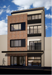
Figure 1 – Perspective of
building from Guildford road, looking north (source: eco factor architects, 2019)
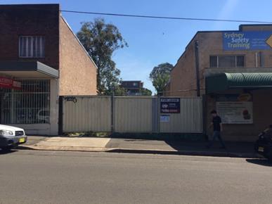
Figure 2 – Site photo,
looking north (source: Cumberland city council, 2019)
Summary:
Council is in receipt of a
development application from Eco Factory Pty Ltd seeking approval for
construction of a four (4) storey mixed use development comprising two (2)
commercial tenancies and nine (9) residential apartments over basement level
car parking at 399 Guildford Road, Guildford. The development application
architectural plans are provided as Attachment 1 to this report.
The development application was
publicly notified for a period of 21 days from 27 November 2019 to 18 December
2019. In response, one (1) submission was received, objecting to the proposal,
which has been considered in the assessment of the application.
The site is zoned B2 Local Centre,
pursuant to the Holroyd Local Environmental Plan 2013 (HLEP). A Shop Top
Housing development is permissible with development consent in the B2 Local
Centre zone.
The proposal has been assessed
against State Environmental Planning Policy No 19 – Bushland in Urban
Areas, State Environmental Planning Policy No. 55 (Remediation of Land), State
Environmental Planning Policy No. 65 – Design Quality of Residential
Apartment Development, State Environmental Planning Policy (Building Sustainability
Index: BASIX) 2004, State Environmental Planning Policy (Coastal Management)
2018, State Environmental Planning Policy (Infrastructure) 2007, Sydney
Environmental Plan (Sydney Harbour Catchment) 2005, State Environmental
Planning Policy (Vegetation in Non-Rural Areas) 2017, Holroyd Local
Environmental Plan 2013 (HLEP), Draft State Environmental Planning Policy
(Environment), Draft Cumberland Local Environmental Plan 2020, and Holroyd
Development Control Plan 2013 (HDCP).
The development application was
referred for comments externally to Endeavour Energy, and internally to
Council’s Development Engineer, Tree Management Officer, Environmental
Health Officer, and Resource Recovery Officer, to which concerns have been
raised by Council’s Development Engineer and Environmental Health
Officer.
The proposed development has been
assessed against the relevant matters for consideration pursuant to Section
4.15 of the Environmental Planning and Assessment Act, 1979, including likely
impacts, the suitability of the site for the development, and the public
interest. The proposed development is not considered appropriate for the site.
The non-compliances of the subject
application are as follows:
|
Control
|
Required
|
Provided
|
% Variation
|
|
Visual Privacy
(Building Separation)
|
North - 6m
|
2.612m / 3.93m
|
34.5% / 56.5%
|
|
East – 6m
|
4.68m
|
22%
|
|
West – 6m
|
3.65m
|
39.2%
|
|
Between Tower A
& B – 12m
|
10.7m
|
10.8%
|
|
Visual Privacy
(General)
|
Overlooking between
Units 1 & 2, 4 & 5, and 7 & 8
|
-
|
|
Apartment Size and
Layout
|
8m (max. room
depth)
|
8.2m / 8.9m
|
2.5% / 11.25%
|
|
Acoustic Privacy
|
Noise transference
between
Units 1 & 2, 4
& 5, and 7 & 8
|
-
|
|
Minimum Parking Spaces
|
Residential –
9 car spaces
|
9 spaces
|
25%
|
|
Commercial –
3 car spaces
|
|
Residential –
6 bike spaces
|
5 spaces
|
28.5%
|
|
Commercial –
1 bike space
|
|
Lot size and Frontage
|
4-8 storeys –
26m
|
8.71m
|
66.5%
|
|
Setbacks, Separation
and Depth
|
West (Side) Setback
– 3m
|
0m
|
100%
|
|
North (Rear)
Setback – 6m
|
3.93m
|
34.5%
|
|
Flexibility and
Adaptability
|
2 adaptable units
|
1 adaptable unit
|
50%
|
|
Engineering Matters
|
Discussed in detail
below under the heading
Internal
Referrals – Development Engineer
|
-
|
|
Environmental Health
Matters
|
Discussed in detail
below under the heading
Internal
Referrals – Environmental Health Officer
|
-
|
The application is being reported
to the Cumberland Local Planning Panel (CLPP) for determination, as pursuant to
the Local Planning Panels Direction – Development Applications issued by
the Minister for Planning on 23 February 2018, the application constitutes ‘sensitive
development’ as it is development to which State Environmental Planning
Policy No. 65 – Design Quality of Residential Apartment Development
applies.
In light of the above, it is
recommended that the Cumberland Local Planning Panel refuse the development application,
subject to the draft notice of determination provided at Attachment 2 to this
report.
Subject Site and Surrounding
Area
The subject site is known as 399
Guildford Road, Guildford, and is legally described as Lot A, Deposited Plan
102447. The site is a regularly shaped midblock site, and has a frontage of
8.71 metres to Guildford Road, a rear boundary of 8.71 metres, and eastern
boundary and western boundary of 56.31 metres. The total site area is 490.4sqm,
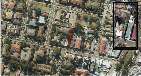
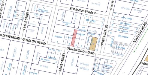
and is illustrated in Figure 3 below:

Figure
3 - Location Map (Source: Cumberland City Council, 2020)
The subject site is currently
vacant with no significant vegetation on the subject site.
The surrounding locality is
characterised as follows:
· North Five
(5) storey residential flat building.
· East Two
(2) storey commercial premises.
· South Four
(4) storey mixed use (commercial and residential) development.
· West Two
(2) storey commercial premises.
The topography of the site is
maintained to a 0.9% gradient, with a 0.56 metre fall to the north eastern
corner of the site. The site is zoned B2 Local Centre, pursuant to the Holroyd
Local Environmental Plan 2013 (HLEP), as shown in Figure 4 below:
Figure
4 – Zoning Map (Source: Cumberland City Council, 2020)
The subject site is situated to
the north of Guildford Road. Figure 5 below illustrates an aerial perspective
of the site and the general surroundings.
Figure
5 – Aerial Photo and NearMap Insert (Source: Cumberland City Council and
NearMap, 2020)
The subject site does not contain
a heritage item, nor is it located within a heritage conservation area. The
subject site is located within the vicinity of a heritage item, being:
o Item 39
‘Hazeldene’ – Late Victorian / Federation / Queen Anne
Cottage – 379 Guildford Road, Guildford
The heritage items listed above
are illustrated in Figure 6 below.
Figure
6 – Heritage Map (Source: Cumberland City Council, 2020)
Description of the Proposed
Development
The proposal is for construction
of a four (4) storey mixed use development comprising two (2) commercial
tenancies and nine (9) residential apartments over basement level car parking.
In detail, the following
description has been provided by the Applicant within the Statement of
Environmental Effects prepared by Willana Urban, dated 21 October 2019:
Description of Proposal
The application proposes the
construction of a four-storey, mixed-use development comprising of nine units
with basement parking, landscaping and communal open space. The below table
provides a breakdown of the proposed development by level.
|
Level
|
Details
|
|
Basement
|
- 9 x Residential car
spaces (including one accessible space)
- 5 x Bicycle spaces
- 2 x Stairway and lift
access to upper levels
- Storage area for units
- OSD tank
- Car lift access to
ground level
- Turntable
|
|
Ground Level
|
- 2 x Commercial premises
- Residential garbage room
- Bulk storage room
- Commercial garbage room
- Landscaped areas and
communal open space areas
- Accessible toilet for
the commercial tenancies
- Car lift access to
basement
- 2 x Stairway and lift
access to basement and upper levels
- Communal open space
|
|
First Floor
|
- 1 x 1 bedroom units
(accessible)
- 2 x 2 bedroom units
- 2 x Stairway and lift
access to lower and upper levels
|
|
Second Floor
|
- 1 x 1 bedroom units
- 2 x 2 bedroom units
- 2 x Stairway and lift
access to lower and upper levels
|
|
Third Floor
|
- 1 x 1 bedroom units
- 2 x 2 bedroom units
- Lift and stair access to
lower levels
|
Access
Vehicle access and egress is
provided via a single driveway to Guildford Road. Separate pedestrian access is
provided to the commercial premises and residential lobby.
Landscaping
A landscape plan prepared by TGS
Architects has been prepared for the site. It provides detail on the nature of
the landscape design, including planter soil depths and plant selection.
Following from the above, a
numerical overview of the key components of the development is provided below:
Numerical Overview of Key
Components
|
Component
|
Required /
Permissible
|
Proposed
|
Complies
|
|
Site Area
|
N/A
|
490.4m²
|
N/A
|
|
Site Frontage
|
26m
|
8.71m
|
No
|
|
Gross Floor Area
(GFA)
|
980.8m²
|
863.8m²
|
Yes
|
|
Floor Space Ratio
(FSR)
|
2:1
|
1.76:1
|
Yes
|
|
Height of Buildings
(HOB)
|
17m
|
16.5m
|
Yes
|
|
Boundary Setbacks
|
North
|
6m
|
3.93m
|
No
|
|
South
|
0m
|
0m
|
Yes
|
|
East
|
0m
|
0m
|
Yes
|
|
West
|
3m
|
0m
|
No
|
|
Building Separation
|
North
|
6m
|
2.612m / 3.93m
|
No
|
|
South
|
12m
|
>12m
|
Yes
|
|
East
|
0m / 6m
|
0m / 4.68m
|
No
|
|
West
|
0m / 6m
|
0m / 3.6m
|
No
|
|
Between Tower A & B
|
12m
|
10.7m
|
No
|
|
Apartment Numbers
|
Tower A
|
6 units
|
N/A
|
|
Tower B
|
3 units
|
|
Total
|
9 units
|
|
Apartment Mix
|
1 bedroom
|
3 units (33.3~ %)
|
N/A
|
|
2 bedroom
|
6 units (66.6~ %)
|
|
3 bedroom
|
0 units (0%)
|
|
Commercial Mix
|
Commercial 1
|
16.871m²
|
N/A
|
|
Commercial 2
|
40.002m²
|
|
Car Parking
|
Residential
|
9 spaces
|
9 spaces
|
No
|
|
Commercial
|
3 spaces
|
|
Bicycle Parking
|
Residential
|
6 spaces
|
5 spaces
|
No
|
|
Commercial
|
1 space
|
|
Communal Open Space (COS)
|
122.6m²
|
234m²
|
Yes
|
|
Deep Soil Zone
|
34.3m²
|
34.84m²
|
Yes
|
|
Solar Access (2hr)
|
7 units
|
7 units
|
Yes
|
|
Natural Ventilation
|
6 units
|
9 units
|
Yes
|
Applicants Supporting
Statement
The applicant has provided a
Statement of Environmental Effects prepared by Willana Urban, Reference Number
10571A_SEE, dated 21 October 2019, and was received by Council on 22 October
2019 in support of the application.
Contact with Relevant
Parties
The assessing officer has undertaken a site inspection of
the subject site and surrounding properties and has been in regular contact
with the applicant throughout the assessment process.
Internal Referrals
Development Engineer
The development application was referred
to Council’s Development Engineer for comments, who has advised that the
proposed development is not supported, with concerns related to the proposed
stormwater and On-site Stormwater Detention (OSD) system, access and
manoeuvring, and sewer line, which have been detailed below and within the
draft notice of determination provided as Attachment 2 to this report.
Stormwater & On-site
Stormwater Detention (OSD) system
- The
proposed On-site Stormwater Detention (OSD) design does not account for the overland
flood adjacent to the subject site. The overland flood level at the associated
point of disposal is approximately 33.6mAHD. The proposed OSD system and the
outflow disposal arrangement will not function efficiently, as the hydraulic
head available is only 150mm (33.75-33.60mAHD) above the associated flood
level.
- In
light of the effect of overland flood, as outlined above, the OSD storage
requirement would be severely affected, and would need to provide approximately
35m3 of detention storage. The proposed arrangement of 24.6m3 falls short of
the required storage, being only 70% of the required storage.
- The
site slopes towards the north-eastern corner of the site. In this regard, the
proposed point of disposal of site stormwater to Guildford Road is not
hydraulically appropriate. Therefore, a drainage easement is required through
the rear adjoining properties, draining either to Stimson Street or
O’Neill Street.
- The
proposed OSD tank is too narrow resulting in difficulty of access and
maintenance.
- The
proposed OSD tank is long and narrow, requiring an appropriate
cross-ventilation arrangement, with sufficient grated cover openings at
critical locations. Sealed covers are not supported.
Access and Manoeuvring
- The
driveway access width is required to be 5.5m for first 6m, as measured from the
front property boundary, in accordance with AS2890.1-2004.
- A
clearance of 2m across and 2.5m along the driveway, within the property, on
either side of the driveway, has not been provided in accordance with the
Section 3.2.4(b) of AS2890.1-2004. This clearance is required for sightlines
and pedestrian safety.
- In
accordance with Figure 3.3 of AS2890.1-2004, the driveway has not been designed
to be 2m clear, as measured from side boundaries, required for sightlines and
pedestrian safety.
- The
shared zone for the proposed accessible car space has been designed within the
aisle, which is not supported on the grounds of safety.
- Access
and manoeuvring must not be aided by mechanical or electrical means. In this
regard, the proposed car lift for access, and turntable for manoeuvring, are
not supported, noting there potential to fail, and consequential concern that
vehicles would be left isolated within the basement.
- A
vehicle manoeuvring swept path, within the basement car park, has not been
provided.
- In
accordance with the HDCP, the minimum aisle width shall be 6.1m. In this
regard, the proposed aisle width of 3.51m is not supported, with the dimension
not accommodating two-way traffic.
- The
driveway access width is required to be 5.5m for first 6m, as measured from the
front property boundary, in accordance with AS2890.1-2004.
- A
clearance of 2m across and 2.5m along the driveway, within the property, on
either side of the driveway, has not been provided in accordance with the
Section 3.2.4(b) of AS2890.1-2004. This clearance is required for sightlines
and pedestrian safety.
- In
accordance with Figure 3.3 of AS2890.1-2004, the driveway has not been designed
to be 2m clear, as measured from side boundaries, required for sightlines and
pedestrian safety.
- The
shared zone for the proposed accessible car space has been designed within the
aisle, which is not supported on the grounds of safety.
- Access
and manoeuvring must not be aided by mechanical or electrical means. In this
regard, the proposed car lift for access, and turntable for manoeuvring, are
not supported, noting there potential to fail, and consequential concern that
vehicles would be left isolated within the basement.
- A
vehicle manoeuvring swept path, within the basement car park, has not been
provided.
- In
accordance with the HDCP, the minimum aisle width shall be 6.1m. In this
regard, the proposed aisle width of 3.51m is not supported, with the dimension
not accommodating two-way traffic.
Services (Sewer Line)
- A
sewer line runs across the rear of the subject site, which is in conflict with
the basement car park. No information has been submitted to address this
conflict.
Tree Management Officer
The development application was
referred to Council’s Tree Management Officer for comments, who has
advised that the proposed development is supported, subject to standard
conditions.
Environmental Health Officer
The development application was
referred to Council’s Environmental Health Officer for comments, who has
advised that the proposed development is not supported, with concerns related
to noise and acoustics, which have been detailed below and within the draft
notice of determination provided as Attachment 2 to this report.
Acoustic Report
An acoustic report has not been
submitted, which considers the noise impact from all mechanical plant
(including air conditioners /ventilation), and the car lift and turntable, to
all sensitive receivers.
Resource Recovery
The development application was
referred to Council’s Resource Recovery Officer for comments, who has
reviewed the submitted Waste Management Plan and waste arrangements proposed,
and advised the proposed development is supportable, subject to standard
conditions of consent.
External Referrals
Endeavour Energy
The development application was
referred to Endeavour Energy for comments, who have advised that the proposed
development is supported, subject to standard recommendations and comments.
Planning Comments
Section 4.15 Of The Environmental
Planning And Assessment Act 1979 (Ep & A Act)
The provisions of any
Environmental Planning Instruments (EP&A Act s4.15 (1)(a)(i))
The following Environmental
Planning Instruments are relevant to the assessment of the subject application:
(a) State
Environmental Planning Policy No 19 – Bushland in Urban Areas
The proposal does not propose to
disturb bushland zoned or reserved for public open space.
(b) State
Environmental Planning Policy No. 55 – Remediation of Land (SEPP 55)
Clause 7 of State Environmental
Planning Policy No 55 – Remediation of Land (SEPP 55) requires Council to
be satisfied that the site is suitable, or can be made suitable, to accommodate
the proposed development. The following table has been provided in
consideration of the above.
|
Matters for
consideration
|
Yes
|
No
|
N/A
|
|
Does the application involve re-development of the site or
a change of land use?
|
|
|
|
|
Is the development going to be used for a sensitive land
use (e.g.: residential, educational, recreational, childcare or hospital)?
|
|
|
|
|
Does information available to you indicate that an
activity listed below has ever been approved, or occurred at the site?
acid/alkali plant and formulation,
agricultural/horticultural activities, airports, asbestos production and
disposal, chemicals manufacture and formulation, defence works, drum
re-conditioning works, dry cleaning establishments, electrical manufacturing
(transformers), electroplating and heat treatment premises, engine works,
explosive industry, gas works, iron and steel works, landfill sites,
metal treatment, mining and extractive industries, oil production and
storage, paint formulation and manufacture, pesticide manufacture and
formulation, power stations, railway yards, scrap yards, service stations,
sheep and cattle dips, smelting and refining, tanning and associated trades,
waste storage and treatment, wood preservation.
|
|
|
|
|
Is the site listed on Council's Contaminated Land
Database?
|
|
|
|
|
Is the site subject to EPA clean-up order or other EPA
restrictions?
|
|
|
|
|
Has the site been the subject of known pollution incidents
or illegal dumping?
|
|
|
|
|
Does the site adjoin any contaminated land/previously
contaminated land?
|
|
|
|
|
Has the appropriate level of investigation been carried
out in respect of contamination matters for Council to be satisfied that the
site is suitable to accommodate the proposed development or can be made
suitable to accommodate the proposed development?
*Refer to comments below.
|
|
|
|
The Applicant has advised the
following within the submitted Statement of Environmental Effects:
The land is unlikely to be
contaminated, and no preliminary investigation is triggered in this case given:
· The
site is not within an investigation area or identified under the HLEP as
constituting contaminated land, or land that must be subject to a site audit
statement.
· The
subject site and adjoining properties are not subject to a legal notice for a
matter listed under Section 59(2) of the Contaminated Land Management Act 1997.
· The
site is not within an investigation area or contaminated land use referred in
Table 1 of the contaminated land planning guidelines.
Council’s Environmental
Health Officer has reviewed the proposal and Council’s records, and
confirmed the site is not identified as being contaminated. A site inspection
reveals the site does not have any obvious history of a previous land use that
may have caused contamination and there is no specific evidence that indicates
the site is contaminated. Therefore, Council is satisfied that the site is
suitable for its intended use.
(c) Statement
Environmental Planning Policy No. 65 - Design Quality of Residential Apartment
Development (SEPP 65)
State Environmental Planning
Policy No 65 – Design Quality of Residential Apartment Development (SEPP
65) applies to the assessment of the subject application, as it includes residential
flat buildings that are 3 storeys or more in height and contain more than 4
dwellings. The development application has been accompanied by a Design
Verification Statement from a Registered Architect.
SEPP 65 outlines 9 Design Quality
Principles, which are addressed as follows:
|
Design Quality
Principle
|
Comment
|
Yes
|
No
|
N/A
|
|
1. Context and
Neighbourhood Character
|
The subject site is zoned B2 Local Centre pursuant to the
Holroyd Local Environmental Plan 2013 (HLEP), with the proposed development
maintained to a shop top housing development, which is permitted with
consent. The proposed development has been designed to a site of limited
frontage, contrary to the desired future character as nominated by the HDCP.
|
|
|
|
|
2. Built Form and
Scale
|
The building has been
designed to a site of limited frontage, with non-compliances sought with regards
to the setbacks and separation.
|
|
|
|
|
3. Density
|
The subject site is well
located with respect to existing public transport and community
facilities. The density of the development complies with the FSR
development standard of the HLEP.
|
|
|
|
|
4. Sustainability
|
A BASIX Certificate and relevant reports have been
submitted with the development application. The certificates require
sustainable development features to be installed into the development. The
proposal has been designed to incorporate features relating to
Environmentally Sustainable Design (ESD), inclusive of water efficient
fixtures and energy saving devices.
|
|
|
|
|
5. Landscape
|
Landscaping of the site has been provided, which will
provide an appropriate level of amenity for future residents, while also
being consistent with the landscape character of the local area.
|
|
|
|
|
6. Amenity
|
The proposal does not maintain amenity within the
development, and to surrounding development, noting building separation,
apartment design, and acoustic privacy has not been maintained in accordance
with the ADG.
|
|
|
|
|
7. Safety
|
Suitable and secure access is provided to all parts of the
building.
|
|
|
|
|
8. Housing Diversity
and Social Interaction
|
The apartment mix is as follows:-
· 3 x 1 bedroom units (33.3~%);
· 6 x 2 bedroom units (66.6~%); and
· 0 x 3 bedroom units (0%)
The number of adaptable units proposed is not in
accordance with the HDCP.
|
|
|
|
|
9. Aesthetics
|
The visual appearance of the development does not respond
to the desired future local context of the Guildford centre.
|
|
|
|
Pursuant to Clause 28(2)(c) of
SEPP 65, a consent authority must consider the provisions of the Apartment
Design Guide (ADG) in the assessment of a residential flat development. The
proposed development does not comply with the requirements of the ADG related
to visual privacy, apartment size and layout, and acoustic privacy, which are
discussed below. A comprehensive assessment against the ADG is contained in
Attachment 3 to this report.
Visual Privacy (Building
Separation)
In accordance with Design Criteria
3F-1 of the ADG, separation between windows and balconies shall be provided to
ensure visual privacy is achieved. In this regard, the following
non-compliances are noted:
- Measured
from the northern boundary, for levels 1 to 3 (inclusive). The required
separation is 6m, and the proposed separation is 2.612m / 3.93m to habitable
rooms and balcony areas.
- Measured
from the eastern boundary, for levels 1 to 3 (inclusive). The required
separation is 6m, and the proposed separation is 4.68m to balcony areas.
- Measured
from the western boundary, for levels 1 to 3 (inclusive). The required
separation is 6m, and the proposed separation is 3.95m to balcony areas.
- Measured
between Tower A and B, for levels 1 to 3 (inclusive). The required separation
is 12m, and the proposed separation is 10.7 m between habitable rooms and
balconies.
In this regard, the proposed
development is contrary to the visual privacy objectives under the ADG, in
particular, Objective 3F-1 being adequate building separation distances are
shared equitably between neighbouring sites, to achieve reasonable levels of
external and internal visual privacy.
Visual Privacy (General)
In accordance with Objective 3F-2
of the ADG, site and building design elements shall increase privacy without
compromising access to light and air and balance outlook and views from
habitable rooms and private open space. In this regard, the following
non-compliances are noted:
- Due
to the layout and arrangement of units, and design of openings, visual privacy
has not been maintained between Units 1 and 2, 4 and 5, and 7 and 8, across the
void areas.
In this regard, the proposed
development is contrary to the visual privacy objectives under the ADG.
Apartment Size and Layout
In accordance with Design Criteria
4D-2 of the ADG, in open plan layout (where the living, dining and kitchen are
combined) the maximum habitable room depth is 8m from a window. In this regard,
the following non-compliances are noted:
- Units
2, 5 and 8 maintain a maximum depth from a window of 8.9m.
- Units
3, 6 and 9 maintain a maximum depth from a window of 8.2m.
In this regard, the proposed
development is contrary to the apartment size and layout objectives under the
ADG, in particular, Objective 4D-2 being environmental performance of the
apartment is maximised.
Acoustic Privacy
- In
accordance with Objective 4H-1 of the ADG, noise transfer is minimised through
the siting of buildings and building layout. In this regard, the following
non-compliances are noted:
- Due
to the layout and arrangement of units, and location of openings, acoustic privacy
has not been maintained between Units 1 and 2, 4 and 5, and 7 and 8, within the
void areas.
- Matters
related to an acoustic report, which is discussed under the heading Internal
Referrals – Environmental Health Officer, above.
In this regard, the proposed
development is contrary to the acoustic privacy objectives under the ADG.
(d) State
Environmental Planning Policy (Building Sustainability Index: BASIX) 2004
A BASIX Certificate has been
lodged as a part of the development application. The BASIX certificate
indicates that the development has been designed to achieve the required water,
thermal comfort and energy scores.
(e) State
Environmental Planning Policy (Coastal Management) 2018
The subject site is not identified
as a coastal wetland and is not or land identified as “proximity area for
coastal wetlands”.
(f) State
Environmental Planning Policy (Infrastructure) 2007 (ISEPP)
The provisions of State
Environmental Planning Policy (Infrastructure) 2007 (ISEPP) have been
considered in the assessment of the development application.
Clause 45 - Development likely
to affect an electricity transmission or distribution network
The subject development occurs
within 5 metres of an overhead electricity power. As such, the Consent
Authority is required to give written notice to an electricity supply
authority. The development application was referred to Endeavour Energy, who
advised that the development proposal is supported, subject to standard
recommendations and comments.
(g) State
Environmental Plan (Sydney Harbour Catchment) 2005
The subject site is identified as
being located within the area affected by the Sydney Environmental Plan (Sydney
Harbour Catchment) 2005. The proposed development raises no issues, as no
impact on the catchment is envisaged.
Note: The subject site is
not identified in the relevant map as land within the ‘Foreshores and
Waterways Area’ or ‘Wetland Protection Zone’, is not a
‘Strategic Foreshore Site’ and does not contain any heritage items.
Hence the majority of the State Environmental Plan is not directly relevant to
the proposed development.
(h) State
Environmental Planning Policy (Vegetation in Non-Rural Areas) 2017 (Vegetation
SEPP)
State Environmental Planning
Policy (Vegetation in Non-Rural Areas) 2017 (Vegetation SEPP) applies to the
subject site. An assessment of the proposal has revealed the proposed
development complies with the requirements of the Vegetation SEPP, noting:
- The
site is not located in a declared area of outstanding biodiversity value as
outlined within the Biodiversity Values Map;
- The
proposal does not include tree removal, and therefore the area clearing
threshold for native vegetation pursuant to the Biodiversity Conservation Act
2016 is not applicable; and
- The
proposal does not include tree removal, and therefore the test of significance
pursuant to Section 7.3 of the Biodiversity Conservation Act 2016 is not
applicable.
(i) Holroyd
Local Environmental Plan 2013 (HLEP)
The Holroyd Local Environmental
Plan 2013 (HLEP) applies to the subject site. The proposed development does not
comply with the requirements of the HLEP related to stormwater management,
which is discussed under the heading Internal Referrals – Development
Engineer, above.
The relevant matters to be
considered under HLEP, and the applicable clauses for the proposed development,
are summarised below. A comprehensive assessment against the HLEP is contained
in Attachment 4 to this report.
Permissibility
The proposed development is
defined as shop top housing, and is permissible in the B2 Local Centre zone
with consent.
Shop top housing means one
or more dwellings located above ground floor retail premises or business
premises.
Note. Shop top
housing is a type of residential accommodation
Heritage
The subject site does not contain
a heritage item, nor is it located within a heritage conservation area. The
subject site is located within the vicinity of a heritage item, being:
o Item 39
‘Hazeldene’ – Late Victorian / Federation / Queen Anne
Cottage – 379 Guildford Road, Guildford
Given the distance of the
development from the heritage item, the proposal is not expected to negatively
impact upon on the surrounding heritage item.
Key Development Standards
The following key development
standards are applicable:
|
Development
Standard
|
Maximum
|
Proposed
|
Compliance
|
|
Floor Space Ratio
(FSR)
|
2:1
|
1.76:1
|
Yes
|
|
Height of Buildings
(HOB)
|
17m
|
16.5m
|
Yes
|
The provisions of any Proposed
Instruments (EP & A Act s4.15 (1)(a)(ii))
The following draft Environmental
Planning Instruments are relevant to the assessment of the subject application:
(a) Draft
State Environmental Planning Policy (Environment) (Draft ESEPP)
The Draft State Environmental
Planning Policy (Environment) (Draft ESEPP) relates to the protection and
management of our natural environment with the aim of simplifying the planning
rules for a number of water catchments, waterways, urban bushland, and
Willandra Lakes World Heritage Property. The changes proposed include
consolidating the following seven existing SEPPs:
· State
Environmental Planning Policy No. 19 – Bushland in Urban Areas.
· State
Environmental Planning Policy (Sydney Drinking Water Catchment) 2011.
· State
Environmental Planning Policy No. 50 – Canal Estate Development.
· Greater
Metropolitan Regional Environmental Plan No. 2 – Georges River Catchment.
· Sydney
Regional Environmental Plan No. 20 – Hawkesbury-Nepean River (No.2-1997).
· Sydney
Regional Environmental Plan (Sydney Harbour Catchment) 2005.
· Willandra
Lakes Regional Environmental Plan No. 1 – World Heritage Property.
The Draft ESEPP will repeal the
above existing SEPPs and certain provisions will be transferred directly to the
new SEPP, amended and transferred, or repealed due to overlaps with other areas
of the NSW planning system.
Refer to assessment above under
the heading ‘State Environmental Plan (Sydney Harbour Catchment)
2005’.
(b) Draft
Cumberland Local Environmental Plan 2020 (Draft CLEP)
The Draft Cumberland Local
Environmental Plan 2020 (Draft CLEP) has been prepared by Cumberland Council to
provide a single planning framework for the future planning of Cumberland City.
The changes proposed seek to harmonise and repeal the three existing LEPs
currently applicable to the Cumberland City local government area, those being:
· Holroyd
Local Environmental Plan 2013
· Parramatta
Local Environmental Plan 2011.
· Auburn
Local Environmental Plan 2010.
The current planning controls for
the subject site, as contained within the HLEP, are not proposed to change
under the Draft CLEP.
The provisions of any
Development Control Plans (EP & A Act s4.15 (1)(a)(iii))
The following Development Control
Plans are relevant to the assessment of the subject application:
(a) Holroyd
Development Control Plan 2013 (HDCP)
The Holroyd Development Control
Plan 2013 (HDCP) applies to the subject site. The proposed development does not
comply with the requirements of the HDCP related to minimum parking spaces,
services, access, manoeuvring and layout, lot size and frontage, setbacks,
separation and depth, and flexibility and adaptability, which are discussed
below. A comprehensive assessment against the HDCP is contained in Attachment 5
to this report.
Minimum Parking Spaces
- In
accordance with Part A, Section 3.1 of the HDCP, 1 car parking space shall be
provided per 20m² of commercial gross floor leasable area. In this regard,
the commercial gross floor leasable area proposed is equivalent to 56.9m²,
and therefore the development shall be serviced by 3 commercial car parking
spaces.
Furthermore to the above, the
Roads and Maritime Services Guide to Traffic Generating Development, requires 9
residential car parking spaces, based on the unit mix proposed, and the HDCP
requires 11 car parking spaces, based on the unit mix proposed. Noting that
SEPP 65 applies to this development, and the ADG under Design Criteria 3J-1
prescribes the lesser of the two standards should be applied, the development
shall be serviced by 9 residential car parking spaces and 3 commercial car
parking spaces.
Noting the above, the proposed
development is serviced by 9 car parking spaces overall, deficient by 3 spaces.
In this regard, the proposed development is contrary to the minimum parking
spaces objectives under the HDCP, in particular, Objective O1 being to ensure
that adequate and convenient off-street parking facilities are provided for all
vehicles generated by the various types of development.
- In
accordance with Part A, Section 3.1 of the HDCP, 1 bicycle space per employee
shall be provided per 300m² of ground floor gross leasable floor area, and
1 bicycle space per visitor shall be provided per 2,500m² of ground floor
gross leasable floor area. Furthermore, 0.5 bicycle spaces shall be provided
per residential unit for residents, and 0.1 bicycle spaces shall be provided
per residential unit for visitors. In this regard, the commercial gross floor
leasable area proposed is equivalent to 56.9m², and 9 residential units
are proposed, and therefore, the development shall be serviced by 7 bicycle
parking spaces.
Noting the above,
the proposed development is serviced by 5 bicycle spaces, deficient 2 spaces.
In this regard, the proposed development is contrary to the minimum parking
spaces objectives under the HDCP, in particular, Objective O1 being to ensure
that adequate and convenient off-street parking facilities are provided for all
vehicles generated by the various types of development.
Access, Manoeuvring and Layout
- The
proposed development does not comply with the requirements of the HDCP related
to access, manoeuvring and layout, which is discussed under the heading
Internal Referrals – Development Engineer, above.
Services
- The
proposed development does not comply with the requirements of the HDCP related
to services, which is discussed under the heading Internal Referrals –
Development Engineer, above.
Lot Size and Frontage
- In
accordance with Part C, Clause 1.1 of the HDCP, the minimum lot frontage for
development between 4 and 8 storeys shall be 26 metres. Furthermore, Council
may require the consolidation of more than one existing land holding to be
undertaken, to achieve the requirements of the HDCP.
To this end, the
proposed development is maintained to a site with a frontage of 8.71m, and
therefore, efforts to consolidate with adjoining properties are required to be
undertaken, and evidence of such efforts shall be provided to Council. It is
also noted that concerns have also been raised by Council’s Development
Engineer regarding vehicular access and basement parking, noting the limited
lot width afforded.
In this regard, two
valuations have been prepared, and an associated offer extended to the property
owner of 395-397 Guildford Road, Guildford. Correspondence was received in
response from 395-397 Guildford Road, Guildford, noting the offer has been
declined, as they have no intention of selling. Regarding 401 & 403
Guildford Road, Guildford, valuation reports have not been submitted, nor has
correspondence been received regarding an offer.
Noting the above,
the proposed development is contrary to the lot size and frontage objectives
under the HDCP, in particular, Objective O1 being to ensure that commercial
development is carried out on sites that are sufficient in frontage in order to
provide adequate vehicular access and basement car parking, and Objective O3
being to ensure sufficient lot dimensions for vehicular access and parking.
Setbacks, Separation and Depth
- In
accordance with Part C, Clause 1.4 of the HDCP, where a site adjoins a
residential zone, the side setback shall be 3m, and shall demonstrate solar
access and privacy to adjoining residential development. In this regard, the
site adjoins 84-86 The Esplanade, Guildford, along the western boundary, which
is zoned R4 High Density Residential. The proposed development is designed to the
western boundary, and as noted earlier, does not maintain the required building
separation in accordance with the ADG.
As such, the
proposed development is contrary to the setbacks, separation and depth
objectives under the HDCP, in particular, Objective O2 being to protect the
amenity of adjoining sites and reduce the impact of buildings on the public
domain, and Objection O10 being to provide adequate separation between proposed
and existing buildings.
- In
accordance with Part C, Clause 1.4 of the HDCP, development adjoining
residential shall have a rear setback of 6m. In this regard, the site adjoins
84-86 The Esplanade, Guildford, along the northern boundary, which maintains an
existing residential flat building, and the proposed development is setback
3.93 metres.
As such, the
proposed development is contrary to the setbacks, separation and depth
objectives under the HDCP, in particular, Objective O2 being to protect the
amenity of adjoining sites and reduce the impact of buildings on the public
domain, and Objection O10 being to provide adequate separation between proposed
and existing buildings.
Flexibility and Adaptability
- In
accordance with Part C, Clause 3.10 of the HDCP, adaptable housing shall be
provided in accordance with Part B of the HDCP. In accordance with Part
B, Clause 1.12 of the HDCP, for multi dwelling development and residential flat
buildings, 15% of units shall comply with AS4299-1995 – Adaptable Housing
Class B. In this regard, based on the proposed 9 residential units, 2 adaptable
units are required, however, only a single adaptable unit is proposed, being
Unit 1.
As such, the
proposed development is contrary to the universal housing and accessibility
objectives under the HDCP, in particular, Objective O3 being to encourage accessibility
housing design for people with limited mobility.
The provisions of any planning
agreement that has been entered into under section 7.4, or any draft planning
agreement that a developer has offered to enter into under section 7.4 (EP
& A Act s4.15(1)(a)(iiia))
There is no planning agreement or
draft planning agreement associated with the subject development application.
The provisions of the
Regulations (EP & A Act s4.15 (1)(a)(iv))
The proposed development raises no
concerns as to the relevant matters arising from the Environmental Planning and
Assessment Regulations 2000 (EP & A Regs).
The Likely Environmental,
Social or Economic Impacts (EP & A Act s4.15 (1)(b))
The likely impacts of the
development have been considered in the assessment of the application and are
not considered acceptable, namely due to the concerns related to visual privacy
(building separation), visual privacy (general), acoustic privacy, limited
building separation, minimum parking spaces, lot size and frontage and
setbacks, separation and depth.
The suitability of the site for
the development (EP & A Act s4.15 (1)(c))
The site is not considered to be
suitable for the development as proposed, namely due to the concerns related to
visual privacy (building separation), visual privacy (general), acoustic
privacy, limited building separation, minimum parking spaces, lot size and
frontage and setbacks, separation and depth.
Submissions made in accordance
with the Act or Regulation (EP & A Act s4.15 (1)(d))
Advertised (newspaper) Mail Sign
Not Required
In accordance with Council’s
notification requirements contained within the HDCP, the proposal was publicly
notified for a period of 21 days from 27 November 2019 to 18 December 2019. In
response, one (1) submission was received, which is contained within Attachment
6 to this report.
The issues raised in the public
submission are summarised and commented on as follows:
|
Lot Frontage
Concern is raised that the proposed development does not
comply with the minimum site frontage controls.
|
As noted within the assessment, Council raises concerns
regarding the limited site frontage, which forms a reason for refusal within
the draft notice of determination contained within Attachment 2 to this
report.
|
|
On-Site Basement Parking
Concern is raised that the proposed development does not
adhere to the required number of parking spaces required to service the
development.
|
As noted within the assessment, Council raises concerns
regarding the number of parking spaces provided to service the development,
which forms a reason for refusal within the draft notice of determination
contained within Attachment 2 to this report.
|
|
Basement Parking Access
Concern is raised regarding the proposed lift system,
which will, if it fails, leave vehicles isolated within the car park.
|
As noted within the assessment, Council raises concerns
regarding the lift and turntable systems proposed, which forms a reason for
refusal within the draft notice of determination contained within Attachment
2 to this report.
|
|
Dimensions and Gradients
Concern is raised that the proposed development does not
adhere to the required aisle width to allow vehicles to manoeuvre within the
basement car park.
|
As noted within the assessment, Council raises concerns
raised regarding manoeuvrability within the basement car park, which forms a
reason for refusal within the draft notice of determination contained within
Attachment 2 to this report.
|
|
Construction Concerns
Concern is raised regarding the proposed level of
excavation associated with the basement car park, requesting confirmation as
to the steps Council puts in place to ensure neighbouring properties are
protected.
|
Should the application be approved, standard conditions of
consent will be imposed, requiring the person causing the excavation to
preserve and protect neighbouring buildings from damage and if necessary,
underpin and support the adjoining buildings. Furthermore, standard
conditions will be imposed, requesting dilapidation reports be prepared, to
adjoining and neighbouring buildings that may be subject to potential damage
as a result of any works being undertaken.
|
The Public Interest (EP & A
Act S4.15(1)(E))
The public interest is served by
permitting the orderly and economic use of land, in a manner that is sensitive
to the surrounding environment and has regard to the reasonable amenity
expectations of surrounding land users. In view of the foregoing analysis, it
is considered that approval of the proposed development would not be in the
public interest.
Section 7.11 (Formerly S94)
Contributions
This part of the Act relates to
the collection of monetary contributions from applicants for use in developing
key local infrastructure.
The subject development requires
the payment of contributions in accordance with the Holroyd Section 94
Contributions Plan 2013. In accordance with the currently indexed rates, the
current rate of the required contribution is $118,233. Should the application
be approved, a condition to reflect the above contributions shall be imposed.
Disclosure of Political
Donations and Gifts
The NSW Government has introduced
disclosure requirements for individuals or entities with a relevant financial
interest as part of the lodgement of various types of development proposals and
requests to initiate environmental planning instruments or development control
plans.
The application and notification
process did not result in any disclosure of Political Donations or Gifts.
Having regard to the relevant matters of consideration under
Section 4.15 of the Environmental Planning and Assessment Act 1979, it is
considered that the proposed development is unacceptable for the reasons
outlined in this report. It is therefore recommended that the development
application be refused.
|
1. That
Development Application DA2019/395/1 seeking construction of a four (4)
storey mixed use development comprising two (2) commercial tenancies and nine
(9) residential apartments over basement level car parking on land at 399
Guildford Road, Guildford, be refused for the reasons contained in the draft
notice of determination contacted in Attachment 2 to this report.
2. Persons
whom have lodged a submission in respect to the application be notified of
the determination of the application.
|
1. Attachment 1
- Architectural Plans
2. Attachment
2 - Draft Notice of Determination
3. Attachment
3 - SEPP 65 ADG Compliance Assessment
4. Attachment
4 - Holroyd LEP 2013 Compliance Assessment
5. Attachment
5 - Holroyd DCP 2013 Compliance Assessment
6. Attachment
6 - Submissions (1x)
DOCUMENTS
ASSOCIATED WITH
REPORT LPP017/20
Attachment 1
Attachment 1 - Architectural Plans
Cumberland Local Planning Panel Meeting
13 May 2020
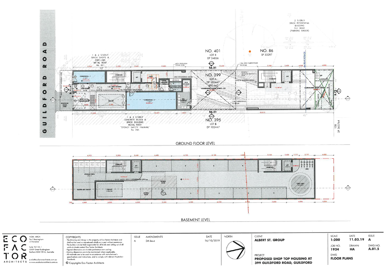
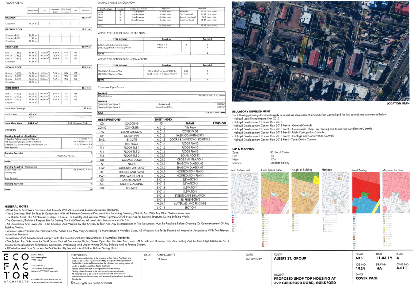
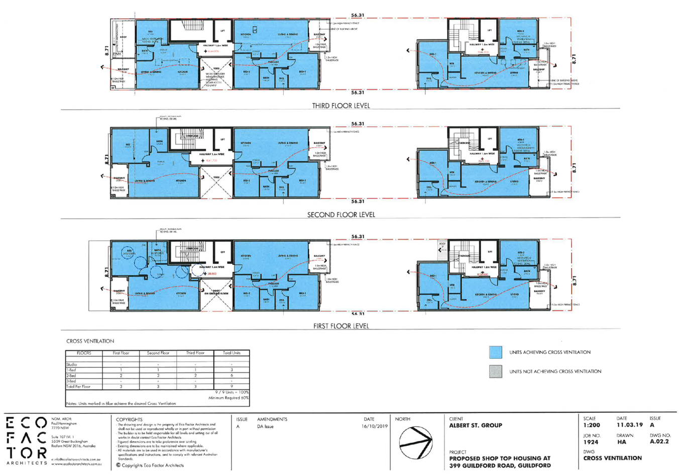
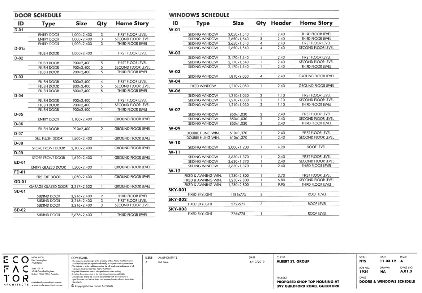
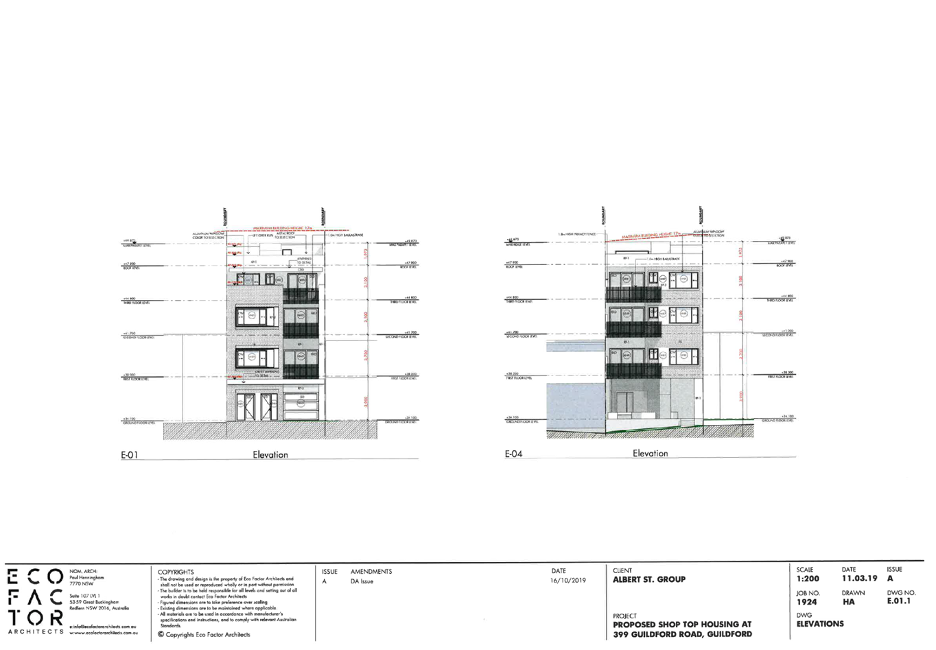
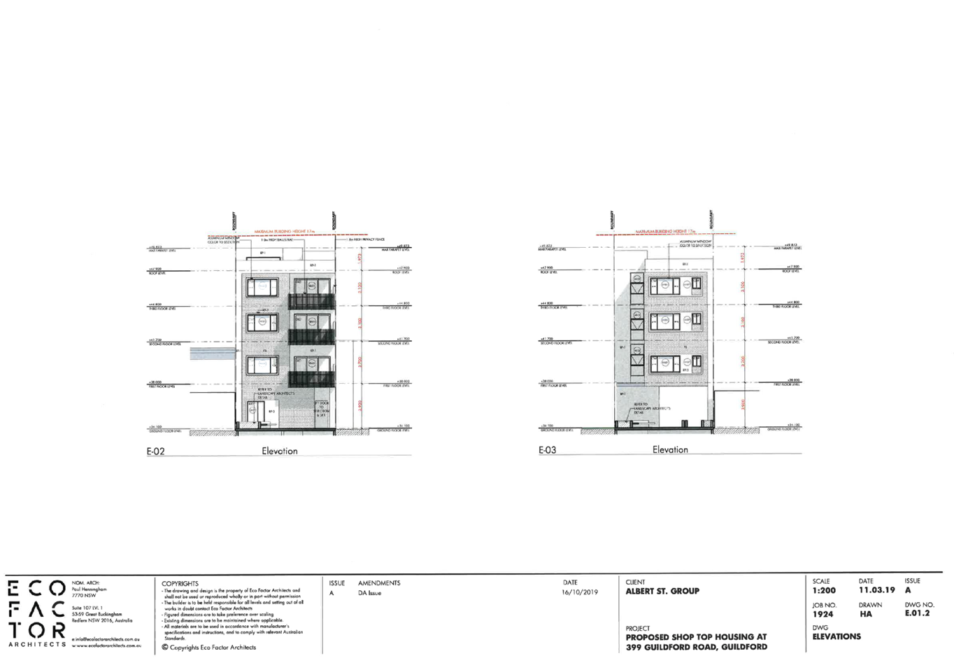
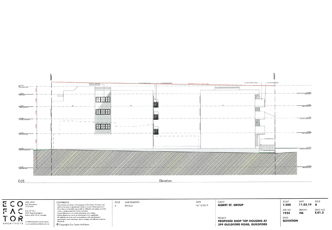
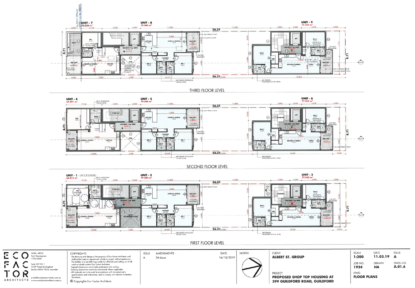
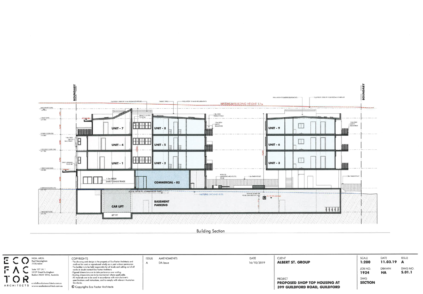
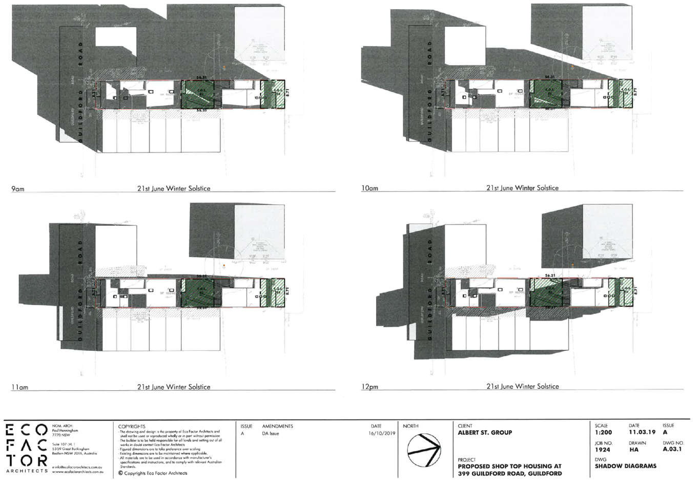
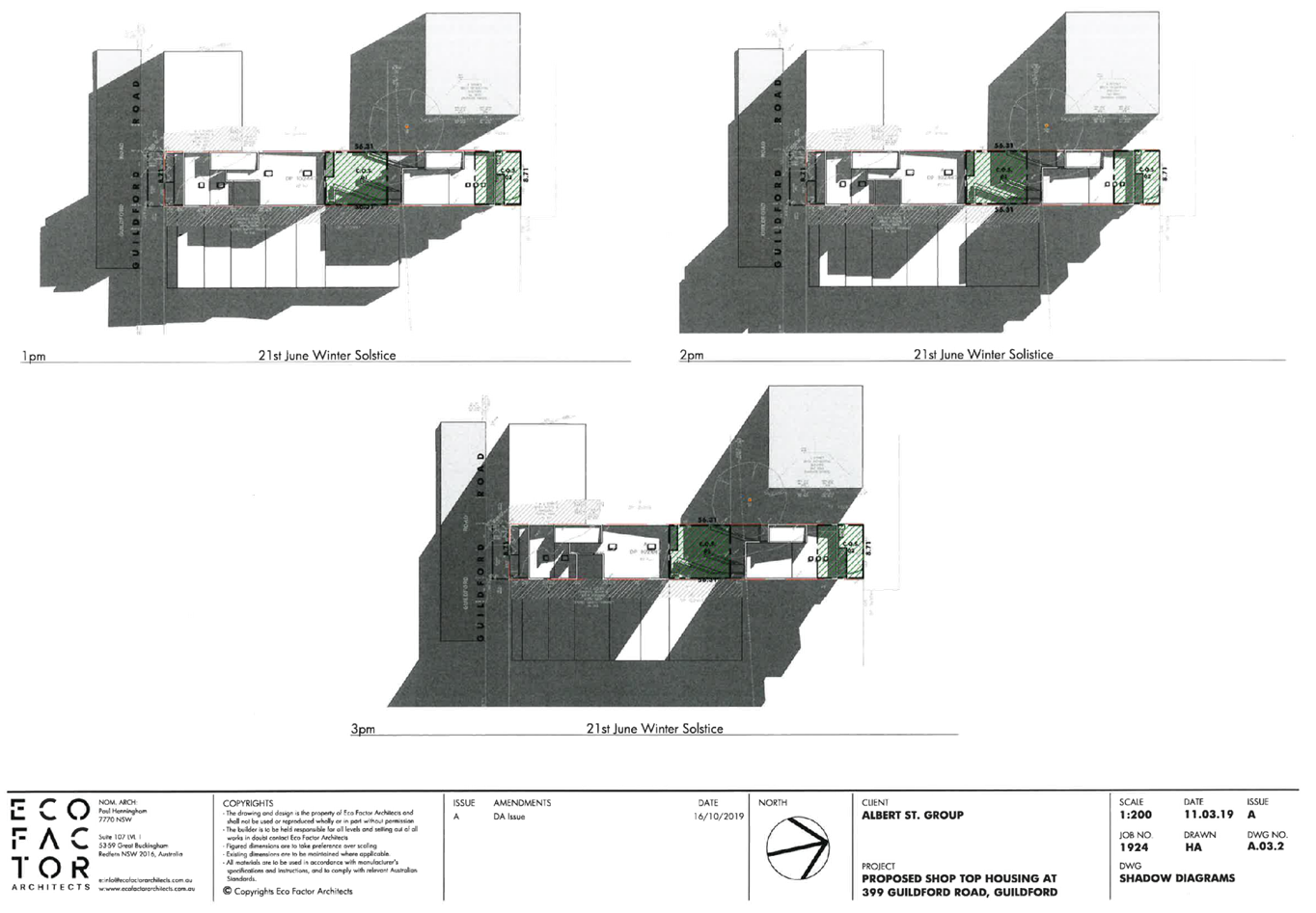
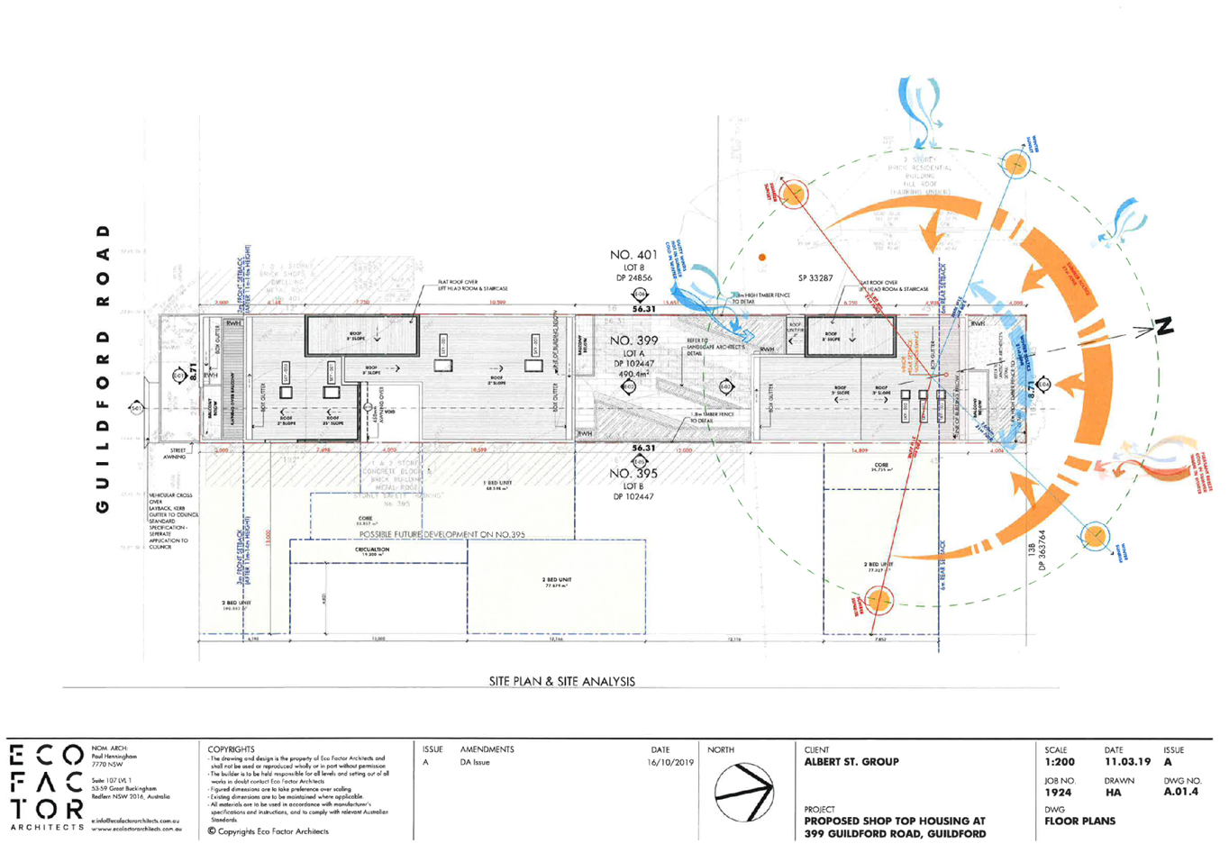
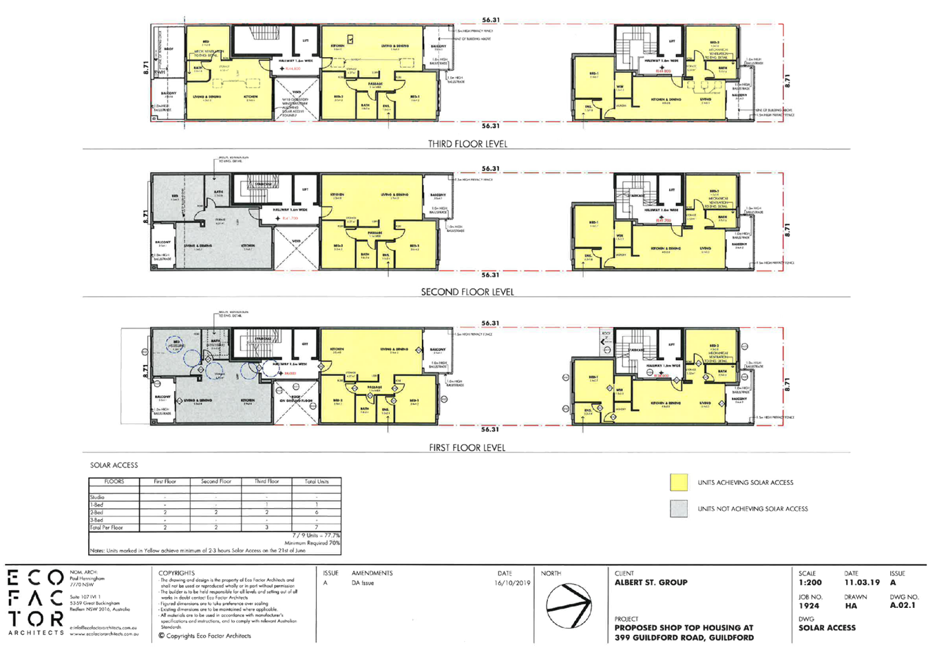
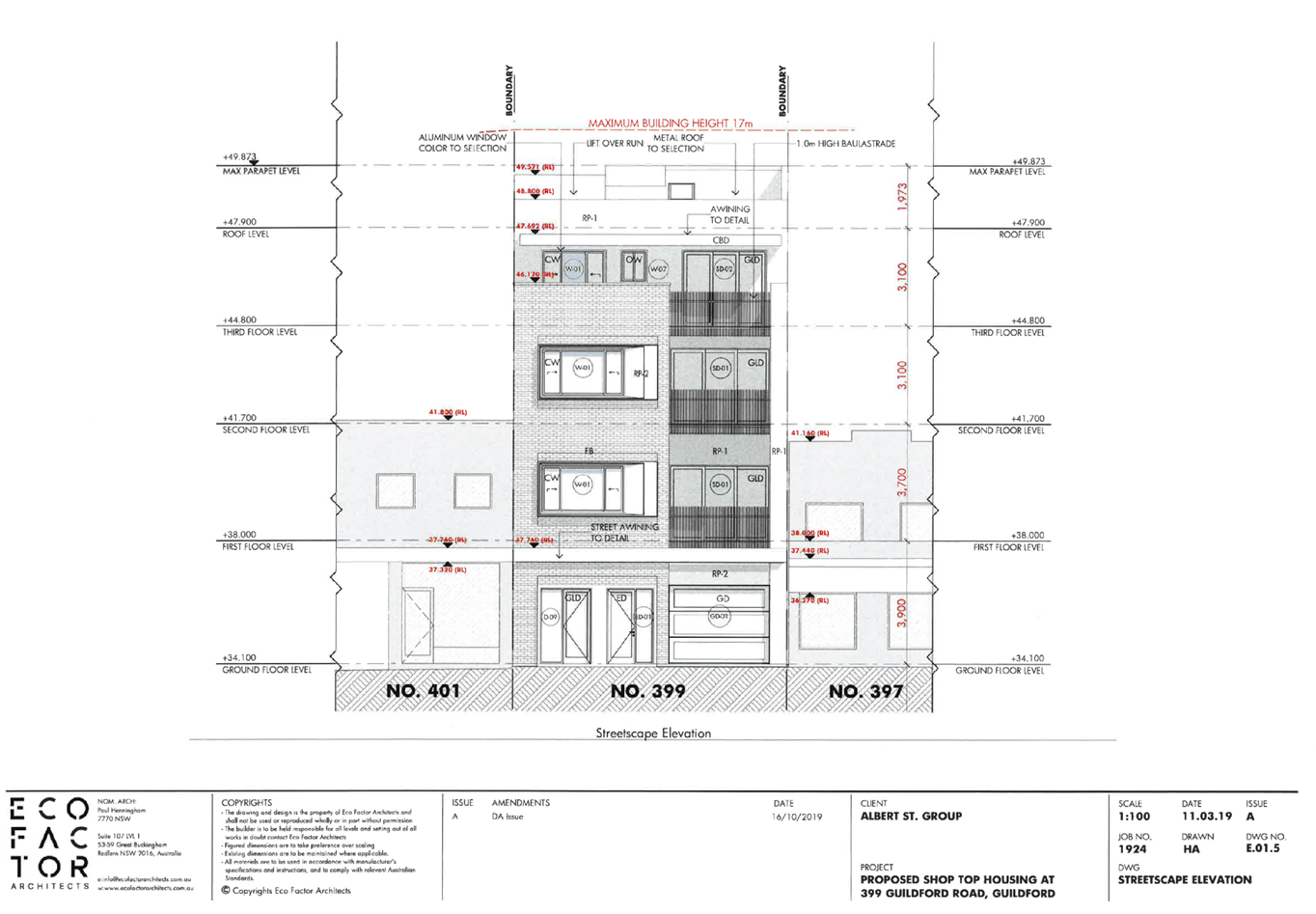
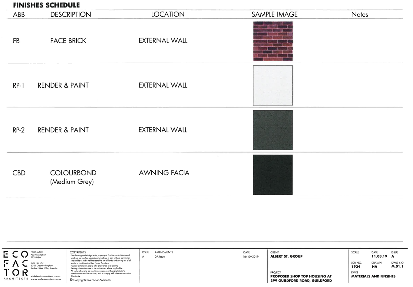
DOCUMENTS
ASSOCIATED WITH
REPORT LPP017/20
Attachment 2
Attachment 2 - Draft Notice of Determination
Cumberland Local Planning Panel Meeting
13 May 2020
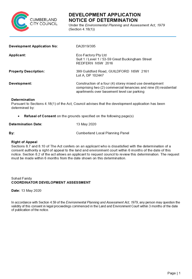
DOCUMENTS
ASSOCIATED WITH
REPORT LPP017/20
Attachment 3
Attachment 3 - SEPP 65 ADG Compliance Assessment
Cumberland Local Planning Panel Meeting
13 May 2020
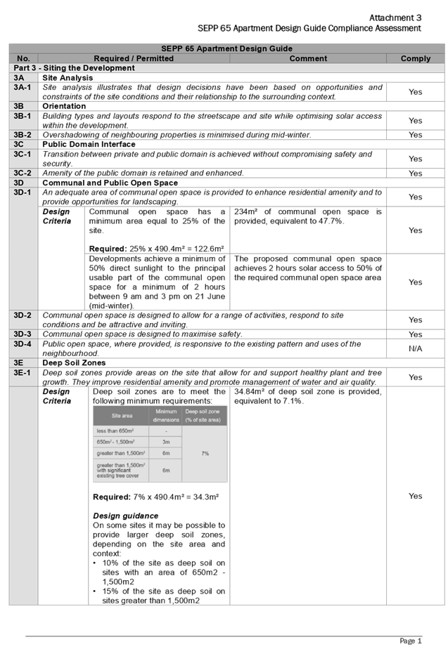
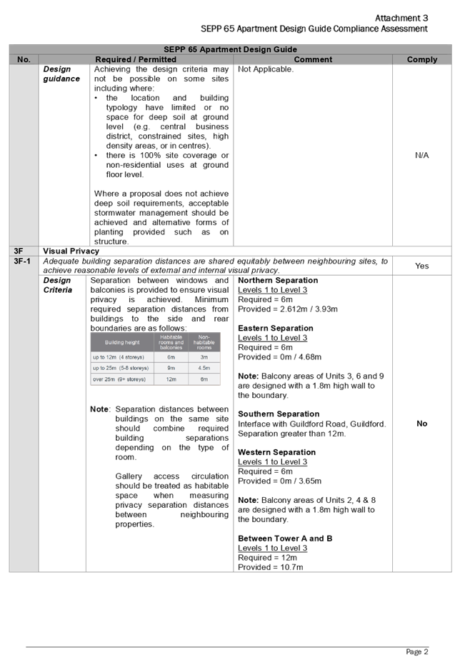
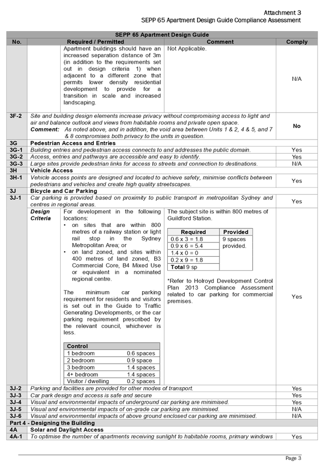
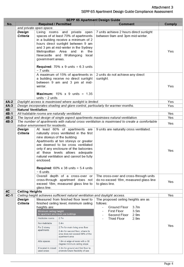
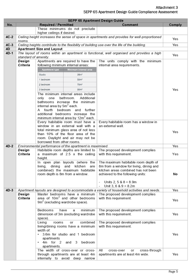
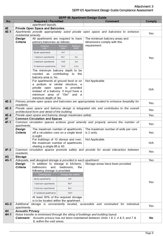
DOCUMENTS
ASSOCIATED WITH
REPORT LPP017/20
Attachment 4
Attachment 4 - Holroyd LEP 2013 Compliance Assessment
Cumberland Local Planning Panel Meeting
13 May 2020
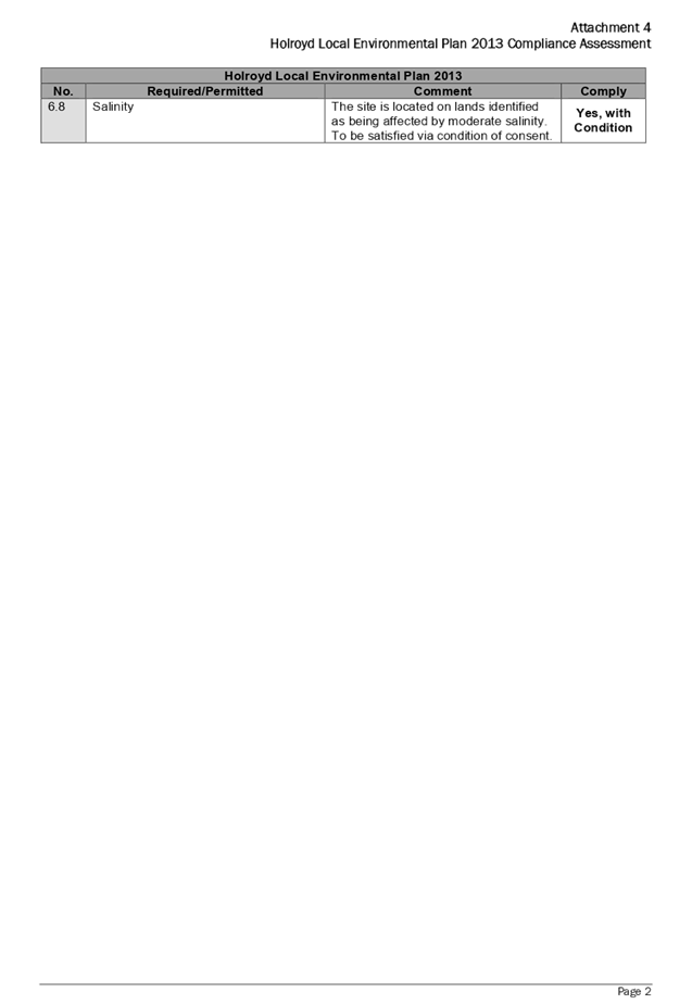
DOCUMENTS
ASSOCIATED WITH
REPORT LPP017/20
Attachment 5
Attachment 5 - Holroyd DCP 2013 Compliance Assessment
Cumberland Local Planning Panel Meeting
13 May 2020
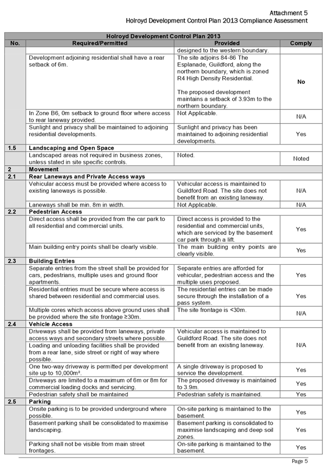
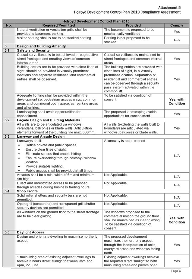
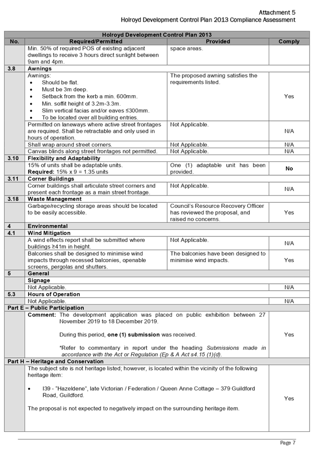
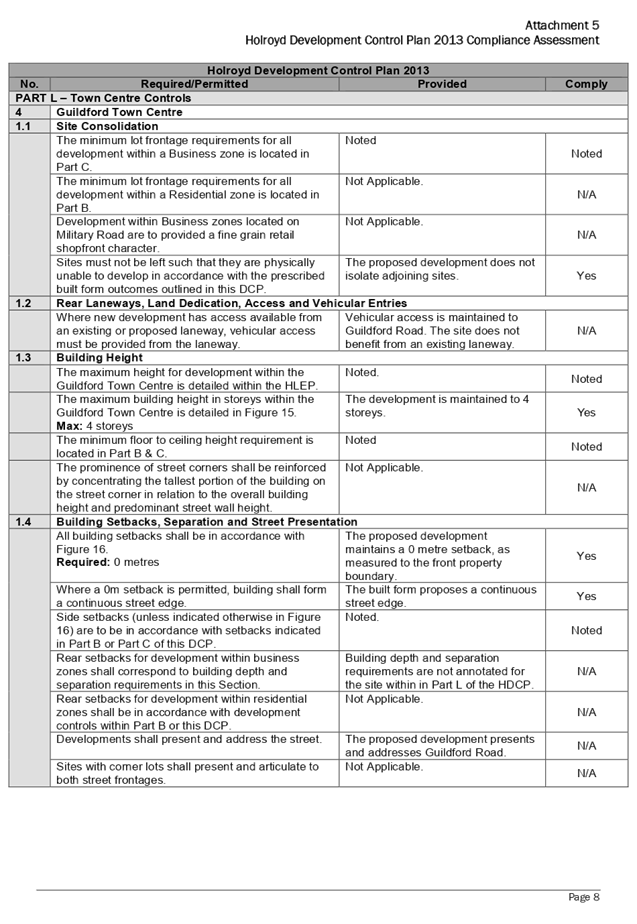
DOCUMENTS
ASSOCIATED WITH
REPORT LPP017/20
Attachment 6
Attachment 6 - Submissions (1x)
Cumberland Local Planning Panel Meeting
13 May 2020
Cumberland
Local Planning Panel Meeting
13 May 2020
Item No: LPP018/20
Development
Application for 78 Frances Street, Lidcombe
Responsible
Division: Environment
& Planning
Officer: Executive
Manager Development and Building
File
Number: DA2019/286
|
Application
lodged
|
6 September 2019
|
|
Applicant
|
Moma Architects
|
|
Owner
|
Ms N M Bosco
|
|
Application
No.
|
DA2019/286
|
|
Description
of Land
|
78 Frances Street LIDCOMBE
NSW 2141, Lot 1 DP 170277
|
|
Proposed
Development
|
Demolition of existing
structures and construction of a two-storey boarding house development
comprising two separate buildings and a total of 25 rooms over basement car
parking
|
|
Site
Area
|
966.8m2
|
|
Zoning
|
R3 Medium Density Zone (ALEP
2010)
|
|
Disclosure
of political donations and gifts
|
Nil disclosure
|
|
Heritage
|
No
|
|
Principal
Development Standards
|
FSR
Permissible: 0.75:1
Proposed: 0.75:1
Height of Building
Permissible: 9m
Proposed: 7.6m
|
|
Issues
|
17 Submissions including 10
unique submissions
Communal living room
|
1. Development
Application No. DA2019/286 was received on 6 September 2019 for the Demolition
of existing structures and construction of a two-storey boarding house
development comprising two separate buildings and a total of 25 rooms over
basement car parking. It should be noted that a total of 26 rooms were
initially proposed however, due to the concerns that the size of the communal
living room is considered to be inadequate to accommodate 32 occupants, minor
design changes to the internal configuration of the buildings have been
recommended as part of a deferred commencement condition to create a larger
common room, which has resulted in one less boarding room.
2. The
application was publicly notified to occupants and owners of the adjoining
properties for a period of 14 days between 1/10/2019 and 15/10/2019. In
response, 17 submissions were received, of which 10 were considered to be
‘unique’ submissions.
3. The
application is recommended for deferred commencement approval subject to the
conditions as provided in the attached schedule.
4. The
application is referred to the Panel as the proposal is considered to be
contentious development.
Subject Site And Surrounding
Area
The subject site is legally
described as Lot 1 DP 170277 and is known as 78 Frances Street LIDCOMBE NSW
2141. The land is regular in shape with a frontage width of 15.24m and an
average depth of 63.49m, resulting in a total site area covering 966.8m2. The
site is located on the south eastern side of Frances Street. The site has a
moderate slope towards the rear with a fall of approximately 1.8m.
A site inspection of the premises
carried out on 1/10/19 confirmed that the site is currently occupied by an
existing single storey brick and fibro cottage with tile roof and associated
outbuilding including 2 detached carports and 2 detached metal sheds located on
the southern side of the site.
The character of the residential
development in the locality is undergoing transition from modest single storey
residential dwellings to larger two storey multi dwelling residential
developments. The existing developments adjoining the site include a multi
dwelling development directly to the south and a single storey dwelling house
directly to the north. Further north of the site is another multi dwelling
development at 84 Frances Street and several multi dwelling developments also
exist on the opposite side of Frances Street.
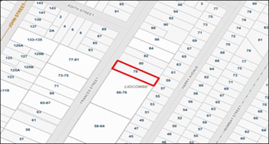
Figure
1 – Locality Plan of subject site
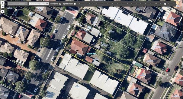
Figure
2 – Aerial view of subject site

Figure
3 – Street view of subject site
Description of The Proposed
Development
Council is in receipt of a
development application on 6 September 2019 seeking approval for the demolition
of existing structures and construction of a two storey boarding house
development comprising two separate buildings and a total of 25 rooms over
basement car parking.
· Demolish
existing single storey dwelling and ancillary structures including a detached
fibro shed and carports along the southern side boundary.
· Removal
of five (5) trees including Council’s street tree.
· Construct
a 2x2 storey boarding house development containing 25 rooms (comprising of 17
single rooms, 7 double rooms and a manager’s room) accommodating a total
of 32 lodgers including the manager. Each room is self-contained being equipped
with a kitchen, bathroom and laundry facility that is integrated into the
kitchen. The development also provides a communal room, a manager’s room
with separate courtyard attached and 3 boarding rooms which are nominated as
accessible rooms (G11, 113 and 115). A lift is also proposed to allow access
from the basement levels and to the ground & first floor levels.
· Construct
a basement level car park to accommodate 14 car spaces including 3 accessible
spaces with a turning bay, 6 motorcycle spaces and a new driveway via Frances
Street.
· Site
drainage and landscaping works which include a communal open area located in
the central courtyard with direct access from the communal room and 6 bicycle
spaces.
History
A pre-DA meeting (PL-29/2019) was
held on the 5 June 2019 for a development proposal of a 2 storey boarding house
containing 22 rooms and 12 at grade car parking spaces. The key issues
discussed at the meeting included concerns with regard to the communal living
room, landscaped area, solar access, private open space, parking, access and
mobility, character of the local area and drainage. Due to the number of
inconsistencies, the applicant was advised the proposal could not be supported by
Council.
The current application proposes a
new design scheme comprising of 2x2 storey boarding house development which
initially contained 26 rooms with basement level parking. However, as there are
concerns with the size of the communal living room proposed, a deferred
commencement condition is recommended to be imposed to reduce the number of
boarding rooms to 25. In this instance, internal design changes are recommended
to remove one boarding room, by combining rooms G02 and G03 into a larger
communal living room and converting the existing communal living room into a
double boarding room.
Further, it is noted that whilst
the existing communal living room is compliant, it is considered that an
enlarged communal living room is appropriate given that the development will
accommodate a maximum of 32 occupants on site.
On 17 April 2020, Council received
a submission of additional information containing amendments to the basement
layout accommodating 14 parking spaces. Whilst the revised basement plan is satisfactory,
the size of the communal living room remained unchanged and therefore remains a
concern to Council.
Applicants Supporting
Statement
The applicant has provided a
Statement of Environmental Effects prepared by MOMA Architects dated August
2019 and was received by Council on 10 September 2019 in support of the
application.
Contact With Relevant
Parties
The assessing officer has
undertaken a site inspection of the subject site and surrounding properties and
has been in regular contact with the applicant throughout the assessment
process.
Internal Referrals
Development Engineer
The development application was
referred to Council’s Development Engineer for comment who has advised
that the development proposal is satisfactory and therefore can be supported
subject to recommended deferred commencement conditions of consent.
Environment and Health
The development application was
referred to Council’s Environment and Health Officer for comment who has
advised that the development proposal is satisfactory and therefore can be
supported subject to recommended conditions of consent.
Landscape Architect/Officer
The development application was
referred to Council’s Landscape Architect/Officer for comment who has
advised that the development proposal is satisfactory and therefore can be
supported subject to recommended conditions of consent.
Waste Management
The development application was
referred to Council’s Waste Management Officer for comment who has
advised that the development proposal is satisfactory and therefore can be
supported subject to recommended conditions of consent.
External Referrals
NSW Police
The application was required to be
referred to NSW Police for comment. Council received formal correspondence on
25/09/19 raising no objections to the proposed development subject to advisory
conditions being recommended to be imposed should consent be granted.
Planning Comments
The provisions of any
Environmental Planning Instruments (EP&A Act s4.15 (1)(a)(i))
State Environmental Planning
Policies
The proposed development is
affected by the following State Environmental Planning Policies:
(a) State
Environmental Planning Policy No. 55 – Remediation of Land (SEPP 55)
Clause 7 of SEPP 55 requires
Council to be satisfied that the site is suitable or can be made suitable to
accommodate the proposed development. The matters listed within Clause 7 have
been considered in the assessment of the development application.
|
Matter for
Consideration
|
Yes/No
|
|
Does the application
involve re-development of the site or a change of land use?
|
Yes
No
|
|
i)
Does the application involve
re-development of the site or a change of land use?
|
Yes
No
|
|
In the development
going to be used for a sensitive land use (e.g.: residential, educational,
recreational, childcare or hospital)?
|
Yes
No
|
|
Does information available to you indicate that an
activity listed below has ever been approved, or occurred at the site?
acid/alkali plant and
formulation, agricultural/horticultural activities, airports, asbestos
production and disposal, chemicals manufacture and formulation, defence
works, drum re-conditioning works, dry cleaning establishments, electrical
manufacturing (transformers), electroplating and heat treatment premises,
engine works, explosive industry, gas works, iron and steel works, landfill
sites, metal treatment, mining and extractive industries, oil production and
storage, paint formulation and manufacture, pesticide manufacture and
formulation, power stations, railway yards, scrap yards, service stations,
sheep and cattle dips, smelting and refining, tanning and associated trades,
waste storage and treatment, wood preservation
|
Yes
No
|
|
Is the site listed on
Council’s Contaminated Land database?
|
Yes
No
|
|
Is the site subject to EPA
clean-up order or other EPA restrictions?
|
Yes
No
|
|
Has the site been the subject of
known pollution incidents or illegal dumping?
|
Yes
No
|
|
Does the site adjoin any
contaminated land/previously contaminated land?
|
Yes
No
|
|
Has the appropriate level of
investigation been carried out in respect of contamination matters for
Council to be satisfied that the site is suitable to accommodate the proposed
development or can be made suitable to accommodate the proposed development?
|
Yes
No
|
|
Details of contamination investigations carried out at the
site:
1.
2.
A Preliminary Site Investigation report prepared by
Integral Environmental Solutions P/L, report no. 1403-19, dated 5/09/19 has
been submitted to accompany the application. The report did not reveal any
potential matters of concern with regard to contamination and concludes that
the site is suitable for its intended use. Further, the report has been
reviewed by Council’s Environmental Health Team and the advice provided
that the proposal was satisfactory to proceed subject to recommended
conditions to be imposed on the consent.
|
(b) State
Environmental Planning Policy (Vegetation in Non-Rural Areas) 2017
The proposal does not exceed the
biodiversity offsets scheme threshold. Therefore, the proposed vegetation
removal is considered acceptable. Please refer to the DCP compliance table for
further discussion.
(c) State
Environmental Planning Policy (Building Sustainability Index: BASIX) 2004
BASIX Certificate 1036129M dated
issued on 27 August 2019 prepared by Outsource Ideas P/L has been submitted
with Council. As a result of the design changes required to reduce the number
of boarding rooms, a revised BASIX Certificate is required and has been
included as part of the deferred commencement condition.
(d) State
Environmental Planning Policy (Affordable Rental Housing) 2009
The relevant objectives and
provisions of the ARHSEPP 2009 has been considered in the assessment of the
application and the proposal is considered to be generally consistent with the
boarding house provisions under Division 3 of the plan. A comprehensive
assessment has been carried out and is provided in the compliance table below
including a detailed discussion in relation to the design of the development
being compatible with the local area is also considered.
|
Development Standards
|
Compliance with Requirements
|
Consistency Objectives
|
|
Division 3 – Boarding Houses
|
|
26 Land to which this division applies
This Division applies to land within any of the following
land use zones or within a land use zone that is equivalent to any of those
zones—
(a) Zone R1 General Residential,
(b) Zone R2 Low Density Residential,
(c) Zone R3 Medium Density Residential,
(d) Zone R4 High Density Residential,
(e) Zone B1 Neighbourhood Centre,
(f) Zone B2 Local Centre,
(g) Zone B4 Mixed Use.
|
Yes, the site is zoned R3 Medium Density Residential as
per the ALEP 2010. Development for the purpose of a boarding house is
permissible in accordance with this Plan
|
Yes
|
|
27 Development to which Division applies
(1) This Division applies to development, on land to which this
Division applies, for the purposes of boarding houses.
(2) Despite subclause (1), clauses 29, 30 and 30A do not apply
to development on land within Zone R2 Low Density Residential or within a
land use zone that is equivalent to that zone in the Sydney region unless the
land is within an accessible area.
(3) Despite subclause (1), clauses 29, 30 and 30A do not apply
to development on land within Zone R2 Low Density Residential or within a
land use zone that is equivalent to that zone that is not in the Sydney
region unless all or part of the development is within 400 metres walking
distance of land within Zone B2 Local Centre or Zone B4 Mixed Use or within a
land use zone that is equivalent to any of those zones.
|
Subclause 1 is noted.
Subclause 2 and 3 are not relevant as the site is zoned
R3.
|
Yes
|
|
28 Development may be carried out with consent
Development to which this Division
applies may be carried out with consent.
|
N/A. Consent is sought for the development of a boarding
house.
|
N/A
|
|
29 Standards that cannot be used to refuse consent
(1) A consent authority must not refuse consent to development
to which this Division applies on the grounds of density or scale if the
density and scale of the buildings when expressed as a floor space ratio are
not more than—
(a) the existing maximum floor space ratio for any form of
residential accommodation permitted on the land, or
(b) if the development is on land within a zone in which no
residential accommodation is permitted—the existing maximum floor space
ratio for any form of development permitted on the land, or
(c) if the development is on land within a zone in which
residential flat buildings are permitted and the land does not contain a
heritage item that is identified in an environmental planning instrument or
an interim heritage order or on the State Heritage Register—the
existing maximum floor space ratio for any form of residential accommodation
permitted on the land, plus—
(i) 0.5:1, if the existing maximum floor space ratio is
2.5:1 or less, or
(ii) 20% of the existing maximum floor space ratio, if the
existing maximum floor space ratio is greater than 2.5:1.
(2) A consent authority must not refuse consent to development
to which this Division applies on any of the following grounds—
(a) building height
if the building height of all proposed buildings is not
more than the maximum building height permitted under another environmental
planning instrument for any building on the land,
(b) landscaped area
if the landscape treatment of the front setback area is
compatible with the streetscape in which the building is located,
(c) solar access
where the development provides for one or more communal
living rooms, if at least one of those rooms receives a minimum of 3 hours
direct sunlight between 9am and 3pm in mid-winter,
(d) private open space
if at least the following private open space areas are
provided (other than the front setback area)—
(i) one area of at least 20 square metres with a minimum
dimension of 3 metres is provided for the use of the lodgers,
(ii) if accommodation is provided
on site for a boarding house manager—one area of at least 8 square
metres with a minimum dimension of 2.5 metres
is provided adjacent to that accommodation,
(e) parking
if—
(i) in the case of development
carried out by or on behalf of a social housing provider in an accessible
area—at least 0.2 parking spaces are provided for each boarding room,
and
(ii) in the case of development
carried out by or on behalf of a social housing provider not in an accessible
area—at least 0.4 parking spaces are provided for each boarding room,
and
(iia) in the case of development
not carried out by or on behalf of a social housing provider—at least
0.5 parking spaces are provided for each boarding room, and
(iii) in the case of any
development—not more than 1 parking space is provided for each person
employed in connection with the development and who is resident on site,
(f) accommodation size
if each boarding room has a gross floor area (excluding
any area used for the purposes of private kitchen or bathroom facilities) of
at least—
(i) 12 square metres in the case
of a boarding room intended to be used by a single lodger, or
(ii) 16 square metres in any
other case.
(3) A boarding house may have private
kitchen or bathroom facilities in each boarding room but is not required to
have those facilities in any boarding room.
(4) A consent authority may consent to
development to which this Division applies whether or not the development
complies with the standards set out in subclause (1) or (2).
(5) In this clause—
social
housing provider does not
include a registered community housing provider unless the registered
community housing provider is a registered entity within the meaning of
the Australian Charities and Not-for-profits Commission Act
2012 of the Commonwealth.
|
The maximum FSR prescribed for the zone is 0.75:1 which is
equivalent to 725.1m2. The proposed GFA calculated for the
buildings are 725m2 representing an FSR of 0.75:1. This requirement
has been achieved.
N/A
Maximum building height across the site is limited to 9m
as per ALEP 2010. Proposed development is compliant with a maximum building
height of 7.6m.
Proposed landscape area within the front setback is
consistent and compatible with the surrounding developments and landscape
setting.
A deferred commencement condition is to be included for
the consolidation of rooms GU02 and GU03 to create a larger common room for
the lodgers and for the previous common room to be converted into a double
boarding room for a max of 2 occupants.
The communal living area is located at ground level with
north facing windows for optimal daylight and will receive the required 3
hours unimpeded sunlight between 9am and 3pm in midwinter. The communal
living room will also have direct access via a west facing sliding door which
opens directly to the large central courtyard. The proposal achieves
this requirement.
Complies. Large communal open space is provided in the
central courtyard with minimum dimensions of 9m measuring 156.7m2 .
Complies. Separate private open space area of 8.4m2 with
minimum dimensions of 2.5m is provided adjacent to the boarding house
manager’s unit.
Application not carried out by or on behalf of a social
housing provider in relation to (i) and (ii)
Complies. 0.5 x 24 rooms = 12 spaces.
1 manager room = 1 space. Total required = 13 spaces
(inclusive of disabled car spaces). Number of parking space proposed = 14.
Not more than 1 car space will be allocated to the on-site
manager.
All single rooms are a minimum of 12m2 and double rooms
are a minimum of 16m2.
All required services are provided within the boarding
room.
Noted.
N/A.
|
Yes
|
|
Standards for boarding houses
(1) A consent authority must not
consent to development to which this Division applies unless it is satisfied
of each of the following—
(a) if a boarding house has 5 or
more boarding rooms, at least one communal living room will be provided,
(b) no boarding room will have a
gross floor area (excluding any area used for the purposes of private kitchen
or bathroom facilities) of more than 25 square metres,
(c) no boarding room will be
occupied by more than 2 adult lodgers,
(d) adequate bathroom and kitchen
facilities will be available within the boarding house for the use of each
lodger,
(e) if the boarding house has
capacity to accommodate 20 or more lodgers, a boarding room or on site dwelling
will be provided for a boarding house manager,
(f) (Repealed)
(g) if the boarding house is on
land zoned primarily for commercial purposes, no part of the ground floor of
the boarding house that fronts a street will be used for residential purposes
unless another environmental planning instrument permits such a use,
(h) at least one parking space
will be provided for a bicycle, and one will be provided for a motorcycle,
for every 5 boarding rooms.
(2) Subclause (1) does not apply to
development for the purposes of minor alterations or additions to an existing
boarding house.
|
Yes. The development is to contain a maximum of 25
boarding rooms which can accommodate a maximum of 32 occupants. Whilst it is
noted that the existing communal living room provided is compliant, it is
however considered to be insufficient in size to accommodate 32 occupants.
Therefore, a deferred commencement condition has been included in the consent
for the consolidation of rooms G02 and G03 to create a larger communal living
room which results in one less single boarding room, whilst the existing
communal living room is to be converted into with a double boarding room.
No boarding room exceeds 25m2.
This can form part of a condition of consent. All rooms
are nominated as either single or double rooms.
Yes. Each room is equipped with a bathroom and kitchen
facilities.
Yes. On site manager’s boarding room is provided for
the boarding house.
N/A. Land is not zoned for commercial.
Yes. 25 boarding rooms generate a minimum of 5 bicycle
spaces and the same applies to motorbikes. The development is compliant
providing a total of 6 bicycle and 6 motorbike spaces.
N/A. Proposal is for a purpose-built boarding house.
|
Yes
|
|
30AA Boarding houses in Zone
R2 Low Density Residential
A consent authority must not
grant development consent to a boarding house on land within Zone R2 Low
Density Residential or within a land use zone that is equivalent to that zone
unless it is satisfied that the boarding house has no more than 12 boarding
rooms.
|
N/A. Site is zoned R3.
|
N/A
|
|
30A Character of local area
A
consent authority must not consent to development to which this Division
applies unless it has taken into consideration whether the design of the
development is compatible with the character of the local area.
|
Discussed in further detail below.
|
Yes
|
|
Part 4 Miscellaneous
|
|
52 No subdivision of boarding houses
A
consent authority must not grant consent to the strata subdivision or
community title subdivision of a boarding house.
|
Complies. No subdivision proposed as part of this application.
This will be reinforced as a condition on any consent issued.
|
Yes
|
Clause 30A Character of Local
Area
Division 3 of the SEPP contains
provisions and development standards that apply to the development for the
purpose of a boarding house. The development as proposed is considered to be
consistent with the relevant provisions and development standards of the
instrument at clause ‘30A Character of the local area’. This clause
specifies that ‘a consent authority must not consent to development to which
this Division applies unless it has taken into consideration whether the design
of the development is compatible with the character of the local area’.
In order to determine the
compatibility of the proposal, an assessment of the character of the area and
application of the ‘character test’ for development derived from
the planning principle 11209 of 2005 Project Venture Development’s Pty
Ltd v Pittwater Council has been undertaken.
Step 1 – Identify the
local area
The assessment identifies the
local area as primarily the visual catchment of the site (as viewed from within
the site and directly adjacent to the site on the street) which is shown in the
aerial view provided earlier in the report.
Zoning
map of locality
The site is located on the south eastern
side of Frances Street and is situated within an established medium density
residential area that is bounded by an R2 zoning interface. The immediate
locality is predominantly characterized by detached residential dwellings
interspersed with medium density housing and the existing building form
consists primarily of 1 and 2 storey single dwelling houses and multi dwelling
townhouses.
Step
2 – Determine the character (future and present) of the local area
Subject
Site
Adjoining
development to the south
Adjoining
development to the north
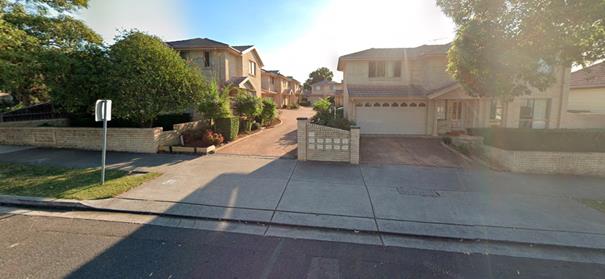
Development
located directly opposite subject site
The subject site is zoned R3
Medium Density Residential and is located on the southern side of Frances
Street and north of the Lidcombe train station. The locality is characterised
by a mix of one and two storey detached single dwellings and multi dwelling
developments. The site is located within walking distance to Lidcombe town
centre – located less than 800m south of the site and contains a variety
of commercial and retail uses and services.
Immediately adjacent to the south
side comprises of a two storey multi dwelling housing development and to the
north is a single storey dwelling. Further north of the site contains another
two storey multi dwelling development and several multi dwelling developments
also exists on the opposite side of Frances Street. To the rear eastern side of
the site are single storey dwellings.
The character of the residential
development in the immediate locality is undergoing transition from modest
single storey dwellings to large two storey dwellings and multi dwelling
developments that is consistent with the R3 Medium Density Residential zone.
Step 3 – Determine if the
development is compatible with the character of the local area
In order to determine the
compatibility of the development with the established character of a local
area, the ‘character test’ derived from the Land and Environment
Court’s Planning Principle and case law – Project Venture Development’s
Pty Ltd v Pittwater Council can be applied. The character test determines the
compatibility of the development by asking whether the physical impacts of the
proposal on surrounding development is in harmony with the buildings around it
and the character of the area. These questions are discussed in detail below.
· Are the
proposal’s physical impacts on surrounding development acceptable?
The physical impacts include
constraints on the development potential of surrounding sites.
The physical impacts of the
proposal are assessed having regard to the impact of the development on the
amenity of surrounding properties. Amenity in this instance generally include
privacy, solar access, visual bulk and compatibility in the streetscape.
With regard to solar access, it is
acknowledged that the development will shadow the adjoining townhouses
respective private open space immediately to the south. However, the scale of
the impact is considered reasonable based on the orientation of the block (i.e.
the townhouse development possesses a northern side boundary) and therefore
overshadowing is unavoidable. As a result, the townhouse units private open
space will be largely overshadowed and receives little to no solar access
during mid-winter however, sufficient solar amenity will be provided throughout
the rest of the year.
Despite this, the development is
considered acceptable as the building has been designed to minimise the extent
of overshadowing through the use of a flat roof rather than a pitched roof form
which further reduces the building height and shadow impacts to the
neighbouring property’s private open space. The overall height of the
proposed building is a maximum of 7.6m which is well less than the permitted 9m
height as shown in the elevation plan. Moreover, it is considered that the
adjoining development to south would have similar overshadowing impacts to that
of any two storey townhouse development, if it were to be developed on the site
instead.
Additionally, the design of the
proposal comprises of two separate buildings with a large central courtyard
located between the two buildings coupled with the proposed 1.5m side setback
to the southern side assists to also break-up the bulk and mass of the
development and alleviates overshadowing impact on adjoining site.
In terms of privacy, reasonable
building separation (through setbacks), side windows placements/sizes and
appropriate fencing is proposed to be provided to mitigate direct views and
overlooking. Further, a condition is to be imposed requiring enhanced privacy measures
to the external stairs adjacent to the lift to be incorporated into the design
so as to minimise overlooking into adjoining buildings.
To improve street presentation and
visual aesthetic of the buildings, a condition is also recommended to be imposed
for extra glazing elements to be provided on the western street elevation which
will involve the replacement of the small windows on the western street facing
façade of the building with full floor to ceiling height windows and two
hi-light windows to be provided on the northern wall of the building corridor
adjacent to the driveway access to the basement carpark.
The site shares a rear common
boundary to 57 and 59 Harry Avenue zoned R2 which are currently occupied by one
storey detached dwellings. The development provides a complying setback of 4
metres from the rear boundary and the bulk and scale of the development is
considered to be compatible and not dissimilar to other two storey residential
developments established in the area.
The northern neighbouring
properties at 80 and 82 Frances Street (detached single dwelling houses) are
located between the subject site and a multi dwelling housing complex at 84
Frances Street. The redevelopment of the site will not result in site isolation
of the northern neighboring properties as the two properties can be amalgamated
and full development potential can still be achieved in the R3 Medium Density
Residential zone.
Based on the above discussion, the
physical impact of the proposal on surrounding developments is considered
reasonable and therefore acceptable in this instance.
Step 4 - Is the
proposal’s appearance in harmony with the buildings around it and the
character of the street?
The main building types
established in the local area are one and two storey residential detached
single dwelling houses and multi dwelling developments. Given that the
predominant future character of the immediate area is to maintain the medium
density residential use in terms of use and building type, it is likely that
there will be upgrades to the residential housing stock via alterations and
additions, knock down rebuilds and new multi dwelling developments. As such,
the proposed two storey building form, materials and finishes are considered to
be in harmony with the emerging development in the area. The building has an
appearance from the street of a new multi dwelling house. In this context, it
is considered that the proposal is considered to be compatible with the
existing and future desired character of the locality and the proposal will
have acceptable impacts on the neighbouring developments.
Regional Environmental Plans
The proposed development is
affected by the following Regional Environmental Plans:
(a) Sydney
Regional Environmental Plan (Sydney Harbour Catchment) 2005
The subject site is identified as
being located within the area affected by the Sydney Regional Environmental
Plan (Sydney Harbour Catchment) 2005. The proposed development raises no issues
as no impact on the catchment is envisaged.
(Note:
- the subject site is not identified in the relevant map as ‘land within
the ‘Foreshores and Waterways Area’ or ‘Wetland Protection
zone’, is not a ‘Strategic Foreshore Site’ and does not
contain any heritage items. Hence the majority of the SREP is not directly
relevant to the proposed development).
Local Environmental Plans
Auburn Local Environmental Plan
2010
The provision of the ALEP 2010 is
applicable to the development proposal. It is noted that the development
achieves compliance with the key statutory requirements of the ALEP 2010 and
the objectives of the R3 Medium Residential Density Zone.
(a) Permissibility:
-
The proposed development is
defined as a ‘boarding house’ and is permissible in the R3 Medium
Density Residential zone with consent.
A Boarding house means a building
that:
a) is
wholly or partly let in lodgings, and
b) provides
lodgers with a principal place of residence for 3 months or more, and
c) may
have shared facilities, such as a communal living room, bathroom, kitchen or
laundry, and
d) has
rooms, some or all of which may have private kitchen and bathroom facilities,
that accommodate one or more lodgers, but does not include backpackers’
accommodation, a group home, hotel or motel accommodation, seniors housing or a
serviced apartment.
The relevant matters to be
considered under ALEP 2010 and the applicable clauses for the proposed
development are summarised below.
Figure
4 – Auburn Local Environmental Plan 2010 Compliance Table
|
Auburn Local Environmental
Plan 2010 (ALEP)
|
|
Is the development consistent
with the aims of the LEP?
|
Yes, the
development remains consistent with the aims of the LEP.
|
|
Is the development consistent
with the Zone objectives?
|
Yes, the
development remains consistent with the objectives of the zone.
|
|
Maximum height of building
– 9m
|
Complies
– overall building height is 7.6m measured to the highest point of the
roof.
|
|
Floor space ratio (FSR) 0.75:1
|
GFA for the
proposed buildings are 725m2 representing an FSR of 0.75:1. Complies.
|
|
Heritage Conservation
|
N/A – the subject site
is not listed as an item or group of heritage significance or within a
conservation area listed as containing heritage item or group. The site is
not located in vicinity to any heritage items, groups or conservation area.
|
|
Acid Sulphate Soils
|
Yes – Class 5. (Nil
impact). The development is unlikely to lower the water table. A Geotechnical
report prepared by Grey Wacke Group P/L has also been submitted to accompany
the application and the findings of the report concluded that ‘groundwater
seepage was not encountered’ during testing.
|
|
Earthworks
|
Yes –
earthworks required to facilitate development will not result in any adverse
impacts on the existing drainage patterns and soil stability of the locality.
|
|
Flood Planning
|
No, the subject site is not
identified as being flood prone land.
|
The provisions of any proposed
instrument that is or has been the subject (EP&A Act s4.15 (1)(a)(ii))
(a) Draft
State Environmental Planning Policy (Environment)
The draft SEPP relates to the
protection and management of our natural environment with the aim of
simplifying the planning rules for a number of water catchments, waterways,
urban bushland, and Willandra Lakes World Heritage Property. The changes
proposed include consolidating the following seven existing SEPPs:
· State
Environmental Planning Policy No. 19 – Bushland in Urban Areas
· State
Environmental Planning Policy (Sydney Drinking Water Catchment) 2011
· State
Environmental Planning Policy No. 50 – Canal Estate Development
· Greater
Metropolitan Regional Environmental Plan No. 2 – Georges River Catchment
· Sydney
Regional Environmental Plan No. 20 – Hawkesbury-Nepean River (No.2-1997)
· Sydney
Regional Environmental Plan (Sydney Harbour Catchment) 2005
· Willandra
Lakes Regional Environmental Plan No. 1 – World Heritage Property.
The draft policy will repeal the
above existing SEPPs and certain provisions will be transferred directly to the
new SEPP, amended and transferred, or repealed due to overlaps with other areas
of the NSW planning system.
Changes are also proposed to the
Standard Instrument – Principal Local Environmental Plan. Some provisions
of the existing policies will be transferred to new Section 117 Local Planning
Directions where appropriate.
(b) Draft
Cumberland Local Environmental Plan 2020 (Draft CLEP)
The Draft Cumberland Local
Environmental Plan 2020 (Draft CLEP) has been prepared by Cumberland Council to
provide a single planning framework for the future planning of Cumberland City.
The changes proposed seek to harmonise and repeal the three existing LEPs
currently applicable to the Cumberland City local government area, those being:
• Holroyd
Local Environmental Plan 2013
• Parramatta
Local Environmental Plan 2011.
• Auburn
Local Environmental Plan 2010.
The current planning controls for
the subject site, as contained within the ALEP, are not proposed to change
under the Draft CLEP.
The provisions of any
Development Control Plans (EP&A Act s4.15 (1)(a)(iii))
Auburn Development Control Plan
2010
The Auburn DCP 2010 provides guidance
for the design and operation of developments to achieve the aims and objectives
of the ALEP 2010.
Whilst there are no specific
controls under the ADCP 2010 that are directly relevant to a boarding house
development, the following sections of the ADCP 2010 have been considered in
the assessment:
· Parking
and Loading
· Access
and Mobility
· Stormwater
Drainage
· Waste
· Multi
Dwellings
The proposal generally complies
with the requirements of the ADCP 2010, with the exception of the following
clauses of 2.1 and 2.8 of the Multi Dwellings section; relating to minimum
frontage width and setback requirements for below ground structures, which are
considered acceptable on merit as discussed in further detail below. Moreover,
it should be noted that the Multi Dwellings section whilst relevant, is of
limited application in so far as the development relates to a boarding house
and not a multi dwelling development and therefore is used only to assist in
guiding the development. A full ADCP 2010 analysis is attached as Attachment A
to this report.
Multi dwellings:
2.1 – D1 Minimum frontage
width for Multi dwelling housing is 18m.
The proposal is for a
purpose-built boarding house development and as such is not considered to be
directly relevant to the type of land use proposed. The site has a minimum
frontage of 15.34m and the development is consistent with built form objectives
in relation to the form, scale and height and therefore responds appropriately
to the site characteristics, locality and also relates well to the surrounding
developments.
2.8 - D1 Below ground
structures shall comply with a side setback of 1.2m to provide for deep soil
planting and an adequate area for construction.
The development proposes a nil
boundary setback in the basement level. Despite the non-compliance noted, the
development still meets the objectives of this requirement for the purposes of
providing deep soil planting which has been proposed at the front and northern
portion of the site. A deep soil area of approximately 97sqm has been provided
on site and is considered adequate.
The provisions of any planning agreement that has been
entered into under section 7.4, or any draft planning agreement that a
developer has offered to enter into under section 7.4 (EP&A Act
s4.15(1)(a)(iiia))
There is no draft planning
agreement associated with the subject Development Application.
The provisions of the
Regulations (EP&A Act s4.15 (1)(a)(iv))
The proposed development raises no
concerns as to the relevant matters arising from the Environmental Planning and
Assessment Regulations 2000 (EP&A Reg).
The Likely Environmental,
Social or Economic Impacts (EP&A Act s4.15 (1)(b))
It is considered that the proposed
development will have no significant adverse environmental, social or economic
impacts in the locality.
The suitability of the site for
the development (EP&A Act s4.15 (1)(c))
The subject site and locality is
not known to be affected by any natural hazards or other site constraints
likely to have a significant adverse impact on the proposed development.
Accordingly, it is considered that the development is suitable in the context
of the site and surrounding locality.
Submissions made in accordance
with the Act or Regulation (EP&A Act s4.15 (1)(d))
Advertised
(newspaper) Mail
Sign
Not
Required
In accordance with Council’s
Notification requirements contained within the Auburn DCP 2010, the proposal
was publicly notified for a period of 14 days between 1/10/2019 and 15/10/2019.
The notification generated a total of 17 submissions in respect of the proposal
with Nil disclosing a political donation or gift.
Of these seventeen (17)
submissions, a total of ten (10) constitute a ‘unique submission’
being a submission which is unique in substance, distinctive or unlike any
other submission. A unique submission precludes form letters and petitions from
being counted more than once toward the total number of unique submissions.
These definitions are in accordance with directions from the Department of
Planning, Industry and Environment.
Having regard to Council’s
delegations, on 20 November 2019, a Council Resolution was made to amend
Council’s internal policy and subsequent delegation to refer DA’s
to the Cumberland Local Planning Panel (CLPP) when ten (10) or more objections
are received in accordance with the Local Planning Panels Direction – Schedule
1, Clause 2(b) as provided in the Ministerial Direction dated 23 February 2016.
Given that there are 10 unique
submissions that have been received by Council, the application is therefore
required to be referred to the Cumberland Local Planning Panel for
determination.
The issues raised in the public
submissions are summarised and commented on as follows:
|
Issue:
|
Planner’s Comment:
|
|
1. The development represents extreme overdevelopment, lack of open
space and limited landscaping.
|
The development proposes a boarding house which is a
permissible form of development in the R3 medium density residential zone as
prescribed under ALEP 2010.
The size of the development is considered to be
acceptable. The proposed development is consistent with the applicable
planning controls in the R3 zone with regard
to FSR, height, setbacks, open space and landscaping requirements which
guides the size of the development. The development meets the objectives of
the land use zone by providing for additional housing in the area and is considered
suitable and compatible with the local character and surrounding developments
in the area.
|
|
2. Concern
is raised with regard to the overflow of parking impacting on residents in
Frances Street as only 13 parking spaces have been proposed to be provided
for a 26 room boarding house with a potential to house 32 lodgers. Frances
Street is already overcrowded with an excessive number of vehicles trying to
find parking when there is a limited amount of space.
|
The proposal is considered satisfactory and provides
adequate parking onsite in accordance with the SEPP ARH 2009 parking
requirements. The application has also been accompanied by a Traffic Impact
Assessment Report which has been reviewed by Council’s
Development Engineer with regard to the parking implications of the
development and has raised no issues. On this basis, the impact of the
development on traffic and the availability of on-street parking is not
considered to be unreasonable in this instance.
|
|
3. Concerns
are raised with regard to increased bike traffic on the footpath affecting
residents as a result of allowing more bicycles.
|
The proposal meets the
relevant development standards for bicycle parking under the SEPP Affordable
Rental Housing 2009 and this is considered to be satisfactory to assist in
reducing road traffic congestion.
|
|
4. There
are concerns about the lack of privacy to the neighbouring properties as a
result of the proposed development.
|
The proposal
provides reasonable building separation (through setbacks) and appropriate
fencing to mitigate direct views and overlooking. Further, there are no
balconies or large windows proposed on the side elevations which help to
further minimise privacy impacts. A condition is also
to be imposed for privacy screens to be incorporated into the design of the
external stairs providing access from the ground level common open space to
the first-floor level of the front building located adjacent to the lifts.
The development is therefore considered satisfactory with regard to privacy.
|
|
5. The
development is in high contrast to this area’s neighbourhood character
as it proposes to house dwellers in 26 rooms for short periods of time. The
proposed development is commercial in nature and is lacking any sympathy with
its surrounds.
|
The matter
regarding the developments compatibility with the local character has been
discussed extensively throughout the report and is considered satisfactory.
As evident in Frances Street, several large multi dwelling developments have
been established in the mix of older one and two storey single detached
dwelling houses. Given that the predominant future character of the immediate
area is to maintain the medium density residential use, it is likely that
there will be upgrades to the residential housing stock via alterations and
additions, knock down rebuilds and new multi dwelling developments. As such,
the proposed two storey building form, materials and finishes are considered
to be in harmony with the emerging development in the area. The development
exhibits a modern building appearance from the street that is not dissimilar
to that of a new multi dwelling house. In this context, it is considered that
the proposal is compatible with the existing and future desired character of
the locality.
|
|
6. The
development will result in a disturbance to the peace of residents in
relation to the excessive construction noise from the months long building
process.
|
Standard
conditions of consent will include measures to ensure that construction are
within the hours of 7am to 6pm Mondays to Fridays and 8am to 4pm on
Saturdays, with no construction works to be carried out on Sundays and Public
Holidays; to minimise noise impacts to surrounding properties.
|
|
7. There
are concerns regarding the nature of the individuals living in the boarding
house and the threat this development could pose on the safety of young
children that walk by this property from nearby schools and childcare
centres. Boarding houses are also renowned for delivering social problems.
|
A boarding house is
permissible in the R3 zone and there are no restrictions in regard to
boarding houses and its proximity to schools or childcare centres. The
boarding house will be managed by an in-house manager who shall implement the
Plan of Management (House Rules) endorsed by Council. Furthermore, the
development application was referred to the NSW Police Crime Prevention
Officer for comment who raised no issues with the proposal and have provided
conditions which will be included in the consent notice.
|
|
8. Overshadowing
and loss of views
|
It is acknowledged that some
overshadowing is unavoidable due to the east/west
orientation of the block (i.e. the impacted property possesses a northern
side boundary). The applicant has attempted to reduce the overshadowing
impacts through various architectural design treatments including the use of
a flat roof rather than a pitched roof form to further reduce the building
height and shadow impacts. The overall height of the proposed building is
7.6m which is well less than the permitted 9m height as shown in the
elevation plan. The design of the proposal which comprises of two separate
buildings with a large central courtyard located between the two buildings
coupled with the proposed 1.5m side setback to the southern side assists to
reduce the overall bulk and mass of the development and alleviates
overshadowing impact on adjoining sites.
In relation
to view loss, the development is not considered to generate any significant
view loss as the built form proposed is consistent with the controls.
Further, the development complies with the maximum building height of 9m with
a proposed maximum height of 7.6m.
|
|
9. Proposed
boarding house will devalue the property in the area.
|
Depreciation in property values is not
considered to be a matter for consideration under the relevant section 4.15
of the EP&A Act.
|
|
10. Increased
waste generation.
|
The
application has been assessed by Council’s Waste Management Team and
the advice provided indicated that the method of waste disposal is
satisfactory. The boarding house includes an enclosed waste storage area
which will house all the required bins.
|
|
11. Non-compliance
with relevant requirements of multi dwelling sections including lot frontage,
streetscape, basement wall, landscaping and deep soil requirements and the
number of parking spaces.
|
The development relates to a purpose-built
boarding house and not a multi dwelling development. As such, this section of
the ADCP 2010 is not technically applicable. The development proposal has
been assessed against the relevant provisions under the SEPP ARH 2009 and the
proposal complies in full. In this regard, the proposal is considered
satisfactory to proceed.
|
|
12. Concern
is raised with regard to the basement excavation affecting the structural
integrity of the immediate adjoining developments. Also, there is no
dilapidation report submitted with the application on the existing structure
on neighbouring properties to ensure that there is no future damage during
construction.
|
Standard conditions for
underpinning works and a dilapidation report will be imposed to ensure that
basement excavation will not negatively impact on the structural integrity of
the immediate adjoining developments.
|
|
13. Acoustic
report does not address the noise impacts generated by the common room and
common outdoor area of the development.
|
The submitted
acoustic report has been reviewed by Council’s Environment and Health
Team and the advice provided raised no objections to the proposed development
subject to conditions including compliance with the acoustic report. It is
noted that the acoustic report recommends the use outdoor communal area cease
use after 10:00 pm on a daily basis. Further, the Plan of Management which
includes ‘House Rules’ details restrictions on the use of the
communal area and outdoor open space requiring prior approval from the
boarding house manager for social gatherings. Communal areas will be further
passively controlled by signage and actively managed by the manager of the
boarding house who will monitor and ensure that residents are made aware of
the house rules and behave in a reasonable and considerate manner. The
proposal is therefore considered to be satisfactory.
|
The public interest (EP&A
Act s4.15(1)(e))
In view of the foregoing analysis
it is considered that the development, if carried out subject to the conditions
set out in the recommendation below, will have no significant adverse impacts
on the public interest.
Section 7.11 (Formerly S94)
Contribution Towards Provision or Improvement of Amenities or Services
This part of the Act relates to
the collection of monetary contributions from applicants for use in developing
key local infrastructure.
Comments:
The development requires the
payment of contributions in accordance with the Council’s Section 94
Contributions Plans (Auburn Development Contributions Plan 2007).
The calculation is based on:
· 25
x 1 bedroom, less credit for 3 bedroom = $73,948.66
As at 14/04/2019, the fee payable
is $73,948.66. This figure is subject to indexation as per the relevant plan.
The draft determination attached includes a condition requiring payment of the
contribution prior to issue of a Construction Certificate.
Disclosure of Political
Donations And Gifts
The applicant and notification
process did not result in any disclosure of Political Donations and Gifts.
The development application has
been assessed in accordance with the relevant requirements of the Environmental
Planning and Assessment Act 1979, State Environmental Planning Policy
(Affordable Rental Housing) 2009, Auburn LEP and Auburn DCP and is considered
to be satisfactory for deferred commencement approval subject to conditions.
The proposed development is
appropriately located within the R3 Medium Density Zone under the relevant
provisions of the Auburn LEP 2010. The proposal is generally consistent with
all statutory and non-statutory controls applying to the development. The
development is considered to perform adequately in terms of its relationship to
its surrounding built and natural environment, particularly having regard to
impacts on adjoining properties.
For these reasons, it is
considered that the proposal is satisfactory having regard to the matters of
consideration under Section 4.15 of the Environmental Planning and Assessment
Act 1979, and the development may be approved subject to deferred commencement
conditions.
There are no consultation
processes for Council associated with this report.
There are no financial
implications for Council associated with this report.
There are no policy implications
for Council associated with this report.
Communication /
Publications:
The final outcome of this matter
will be notified in the newspaper. The objectors will also be notified in
writing of the outcome.
|
1. That
Development Application No. DA2019/286 for Demolition of existing structures
and construction of a two storey boarding house development comprising two
separate buildings and a total of 25 rooms over basement car parking on land
at 78 Frances Street LIDCOMBE NSW 2141 be approved as deferred
commencement consent subject to conditions listed in the attached schedule.
2. Persons
whom have lodged a submission in respect to the application be notified of
the determination of the application.
|
1. Draft Notice
of Determination
2. Architectural
Plans
3. Submissions
Received (10 unique submissions)
4. Plan
of Management
5. Landscape
Plans
6. Survey
Plan
7. Stormwater
Plans
8. Appendix
A - DCP Compliance Table
DOCUMENTS
ASSOCIATED WITH
REPORT LPP018/20
Attachment 1
Draft Notice of Determination
Cumberland Local Planning Panel Meeting
13 May 2020
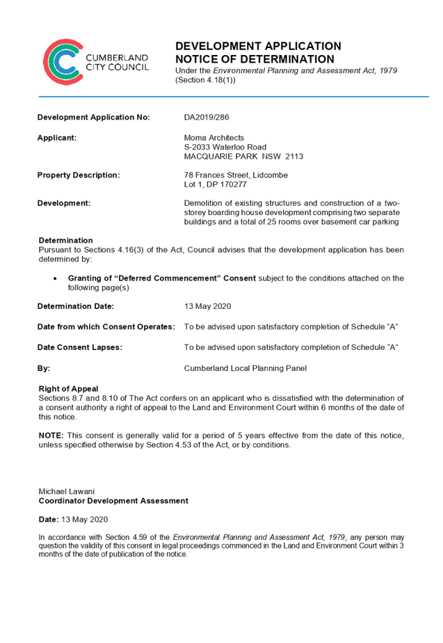
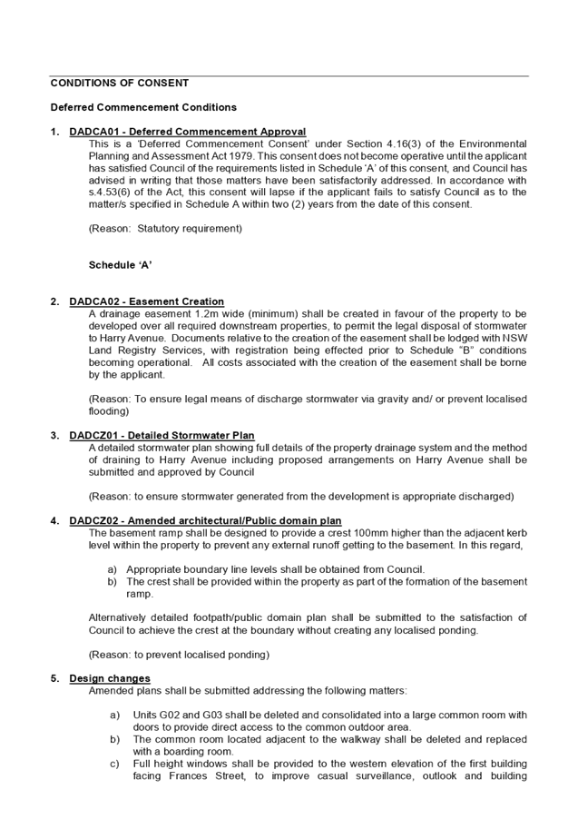
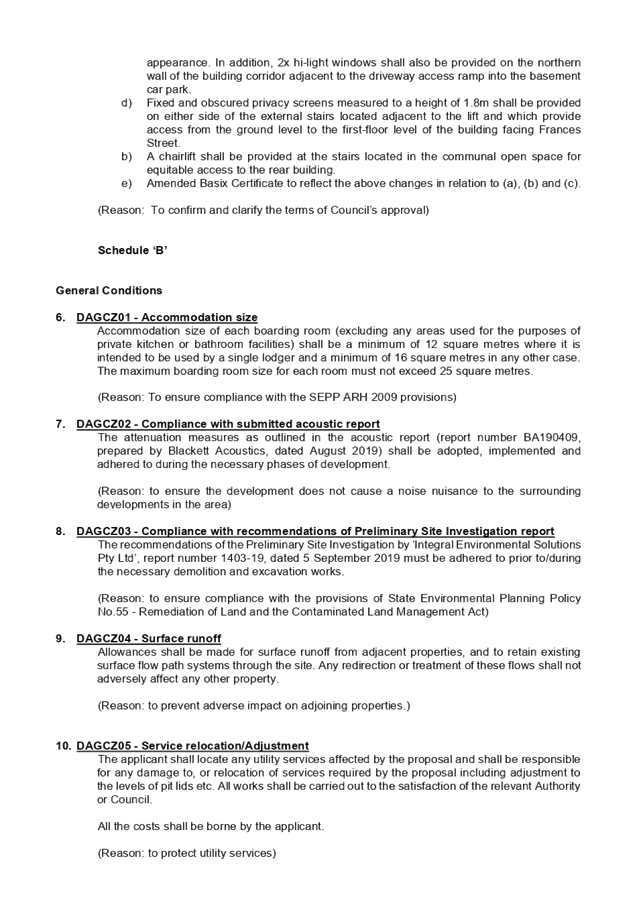
DOCUMENTS
ASSOCIATED WITH
REPORT LPP018/20
Attachment 2
Architectural Plans
Cumberland Local Planning Panel Meeting
13 May 2020
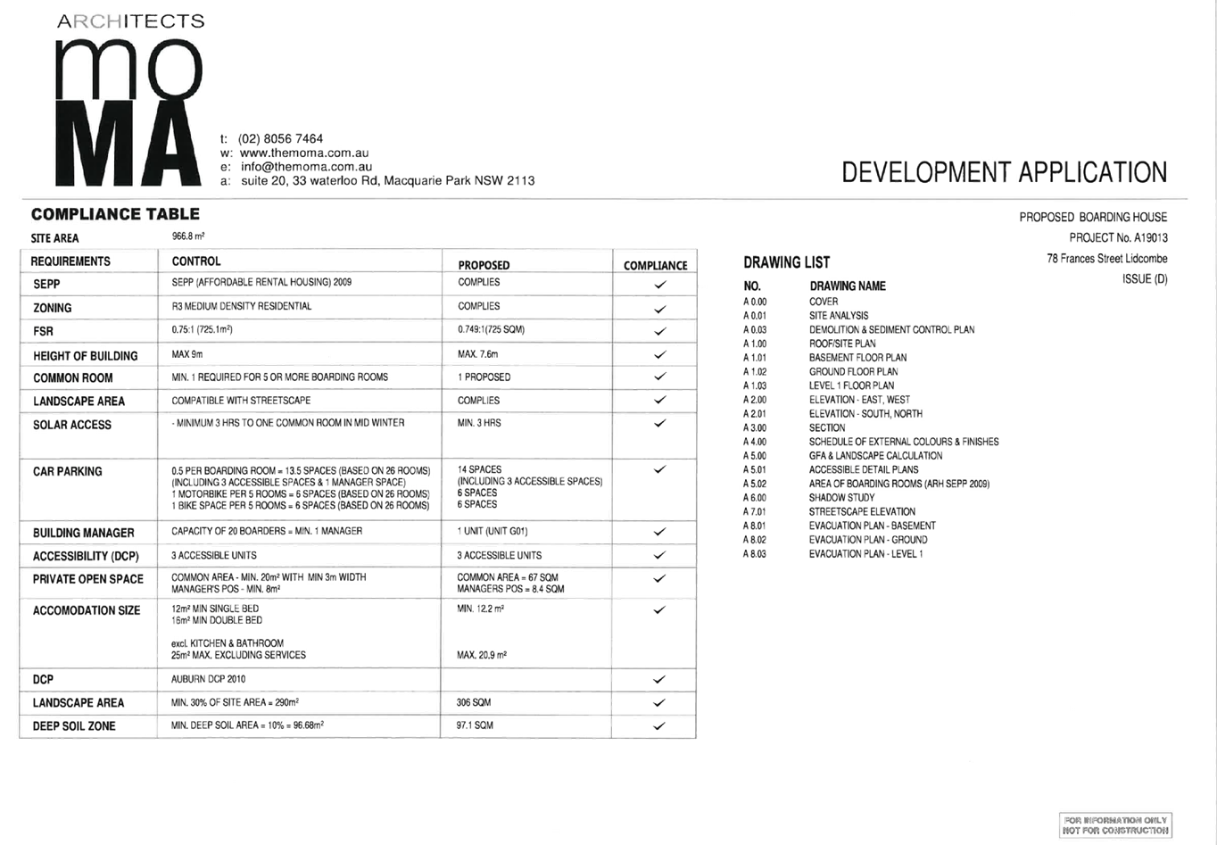
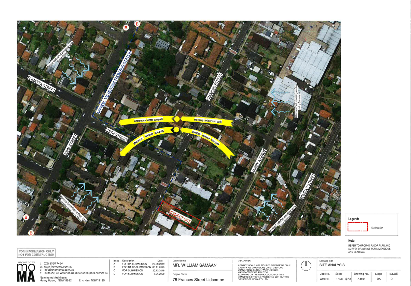
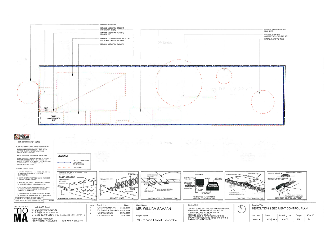
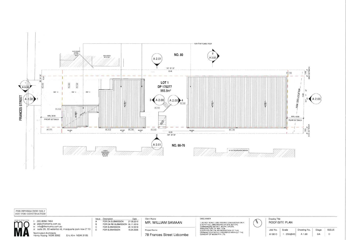
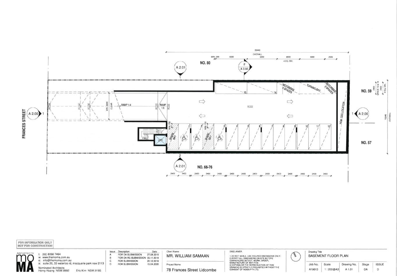
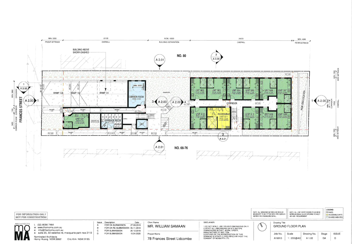
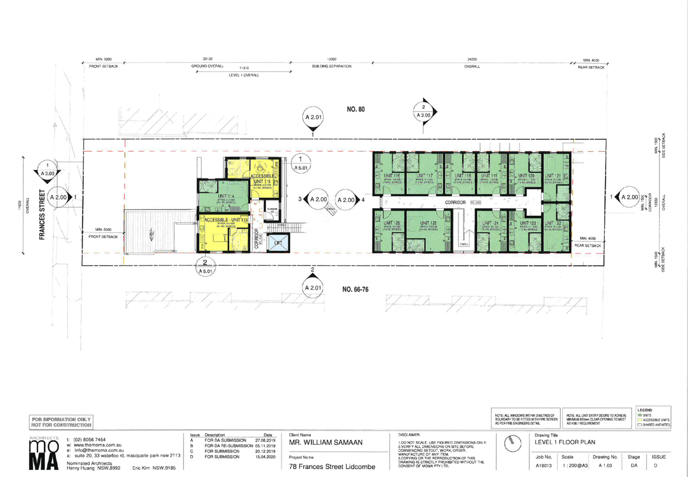
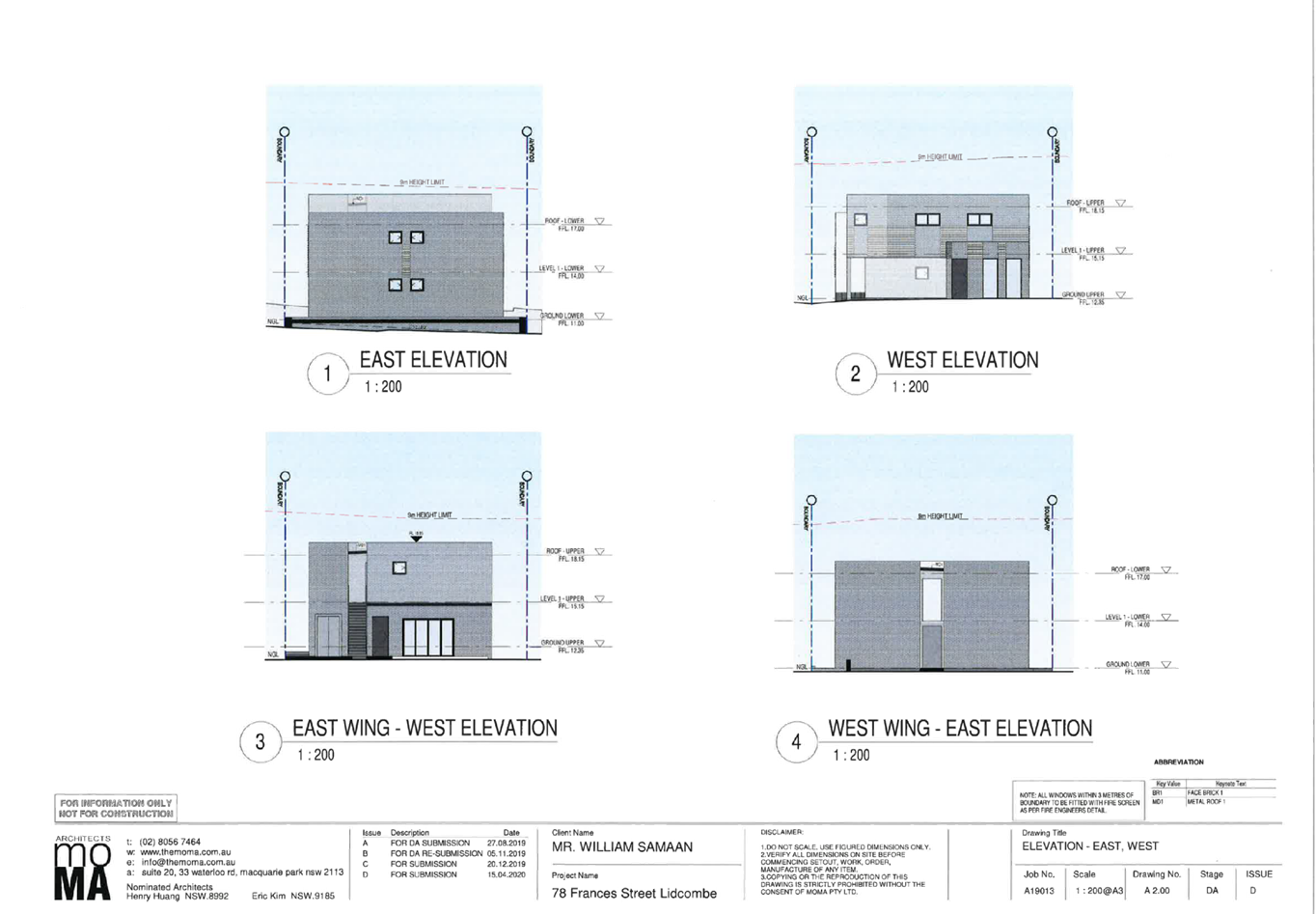
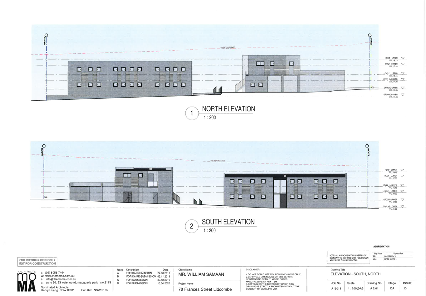
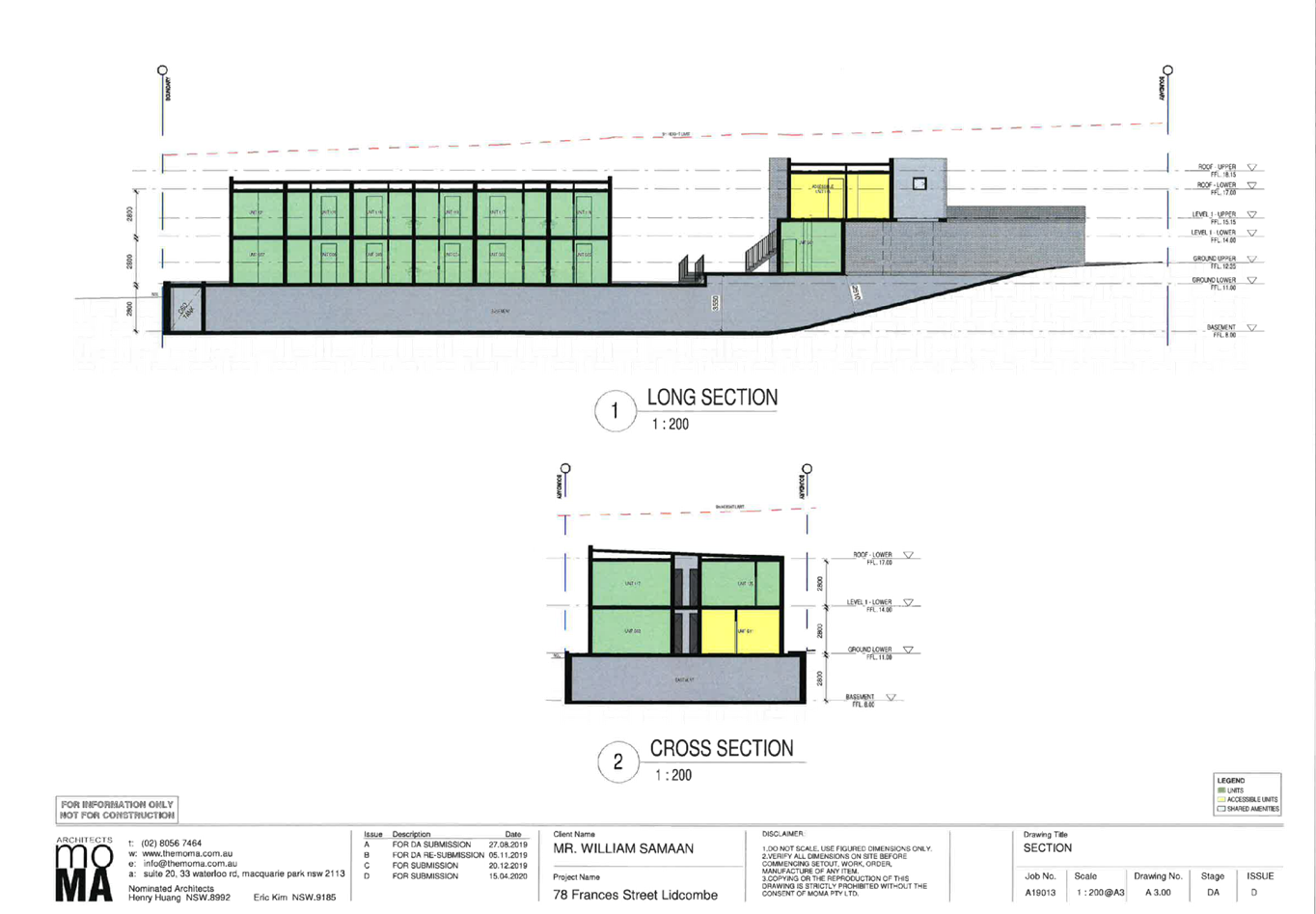
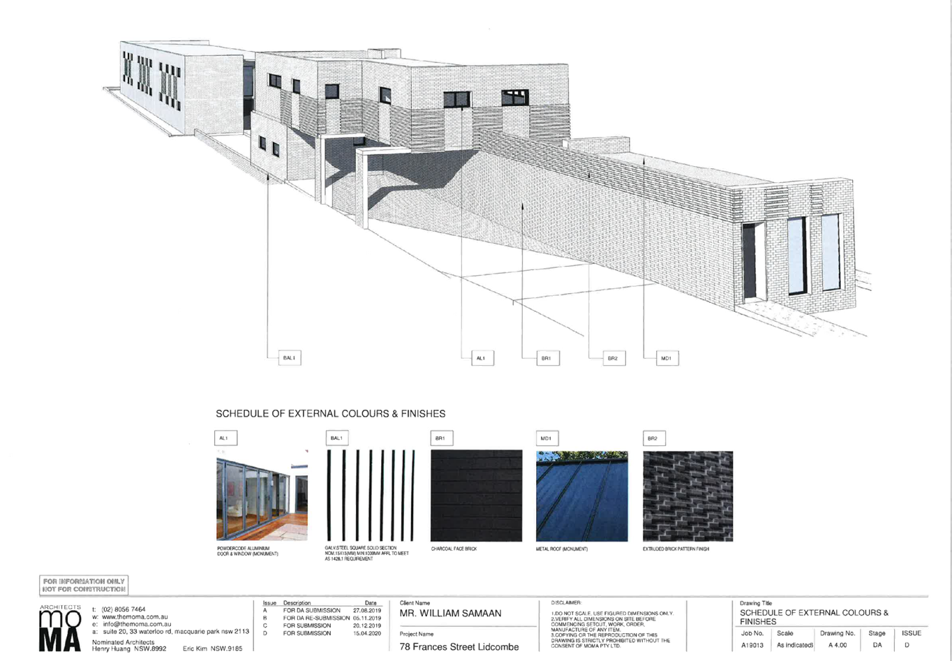
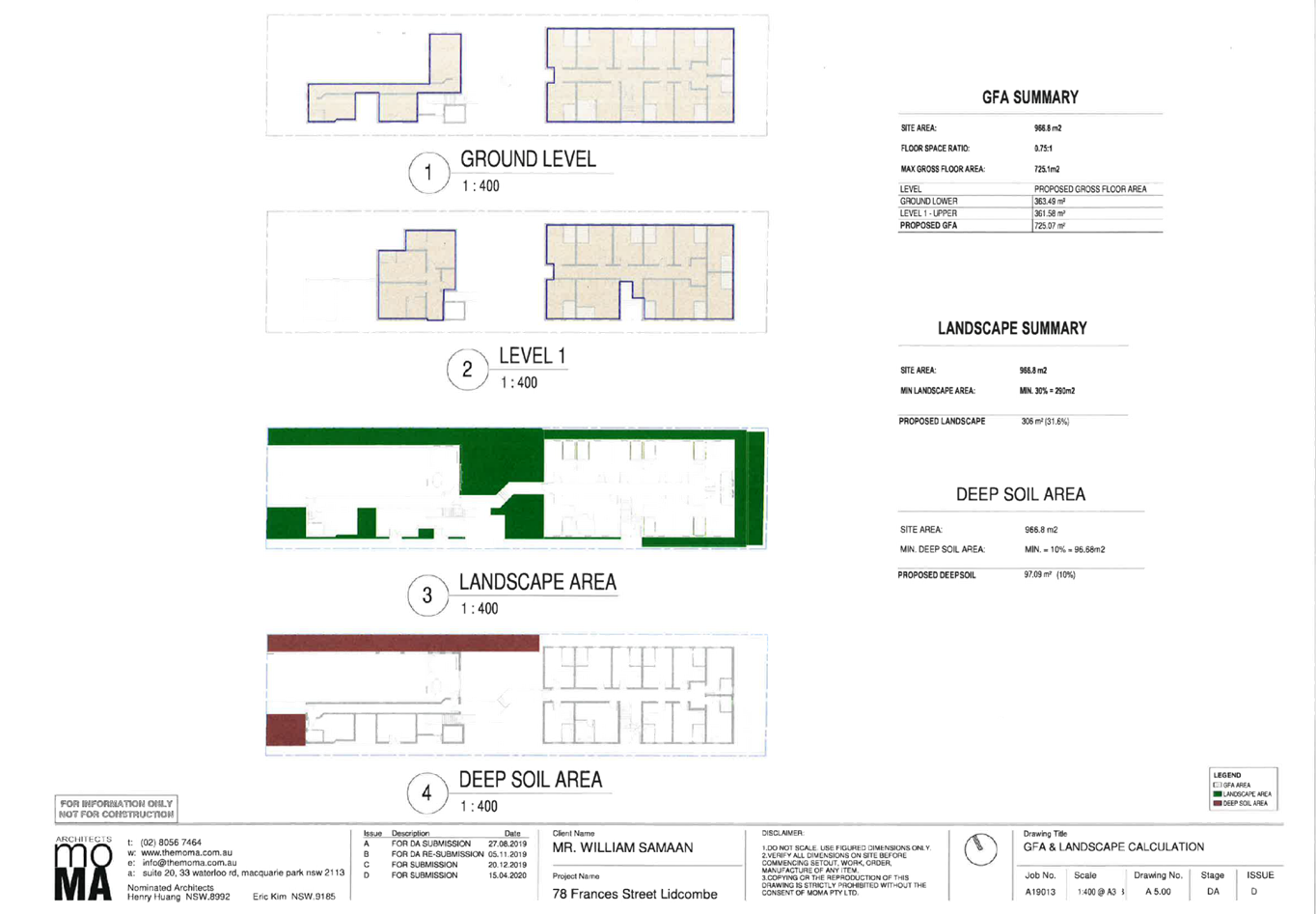
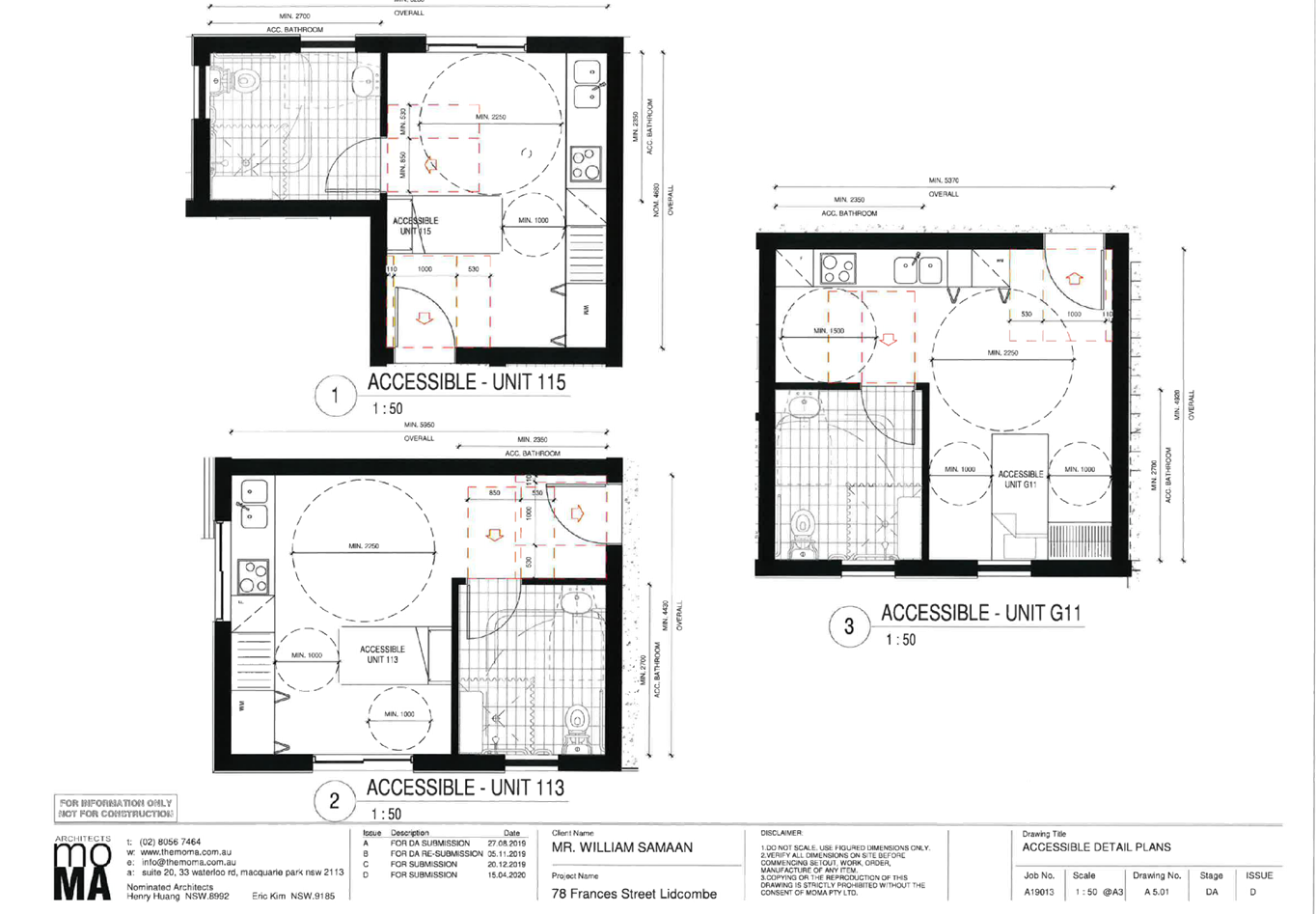
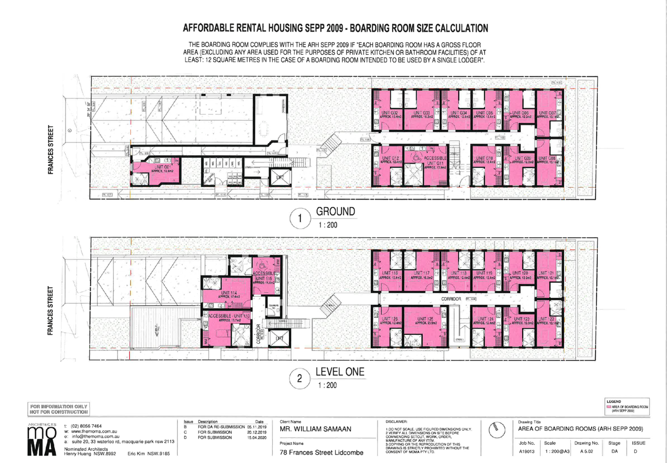
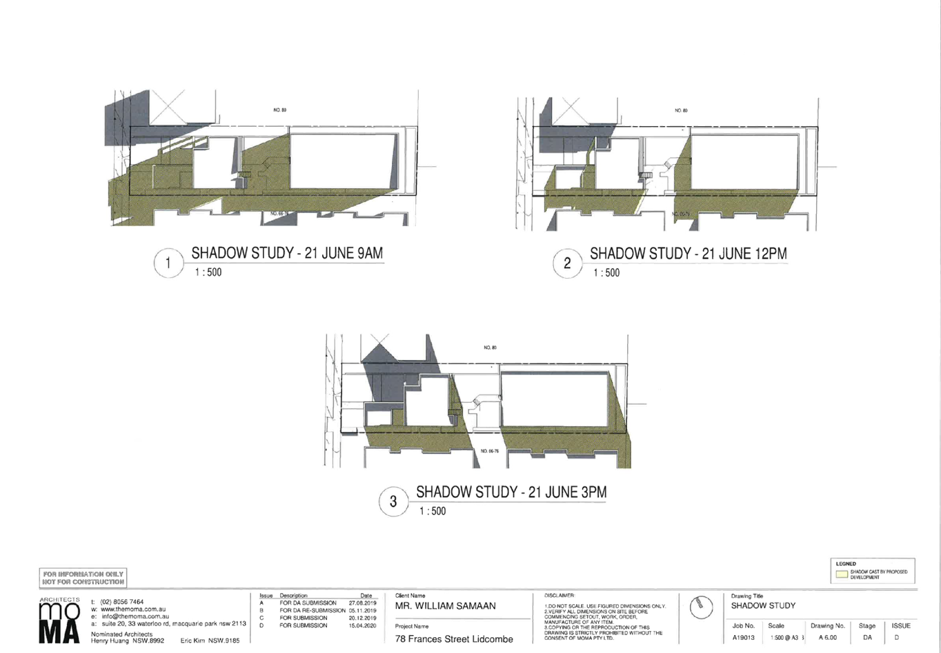
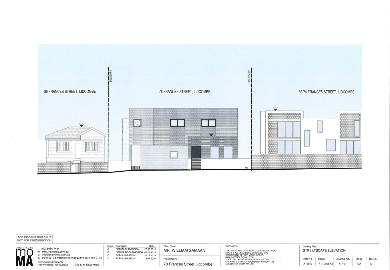
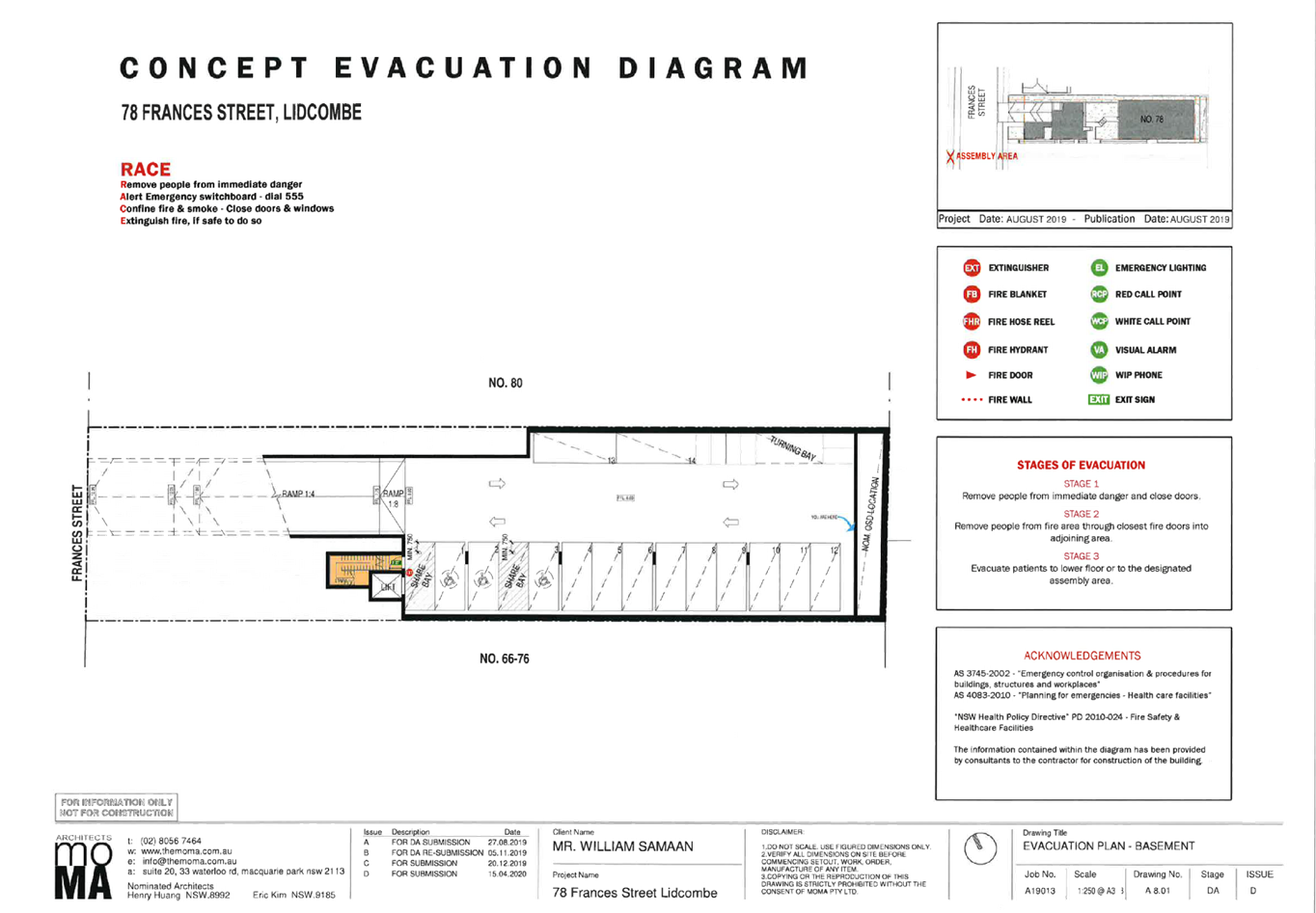
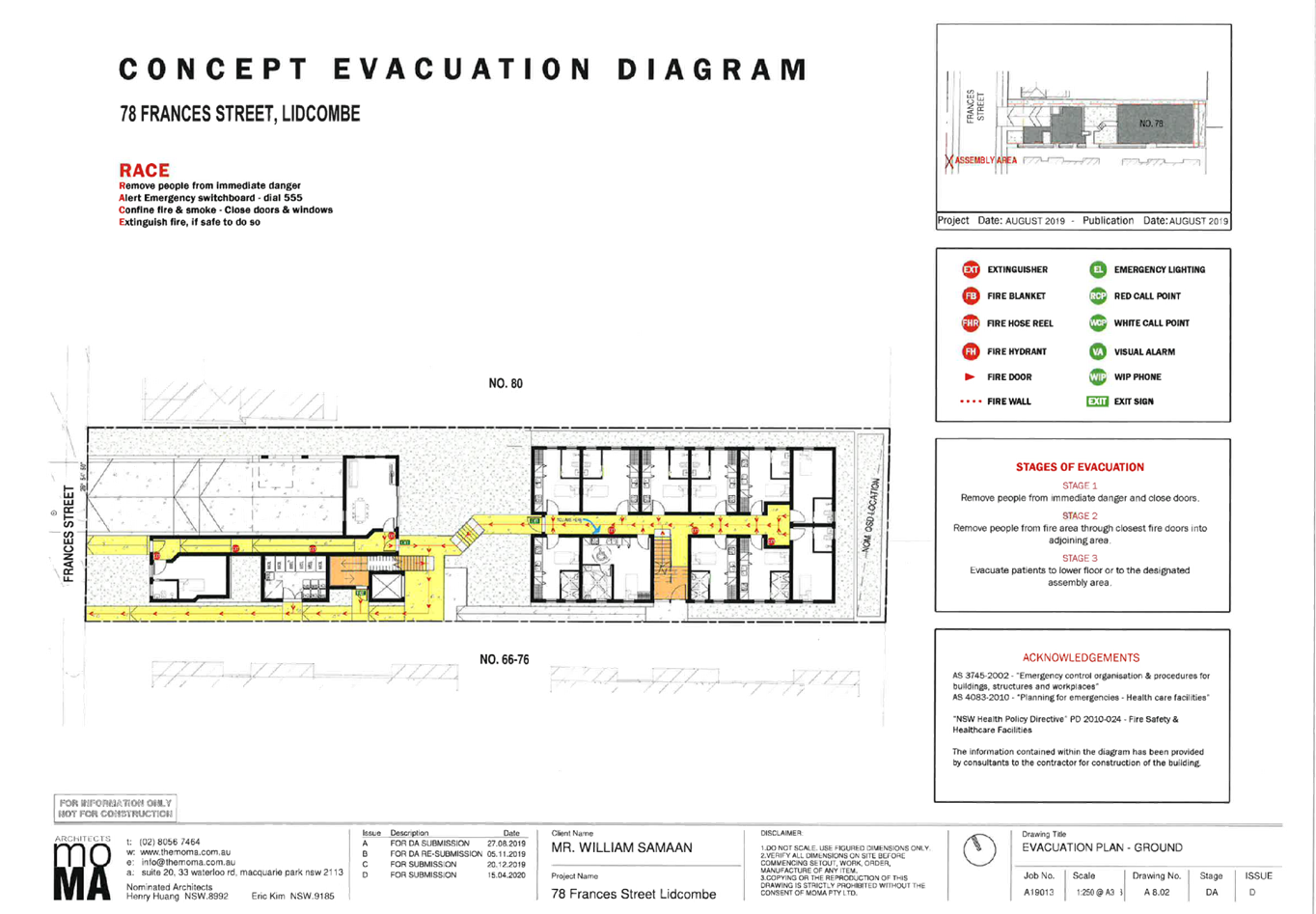
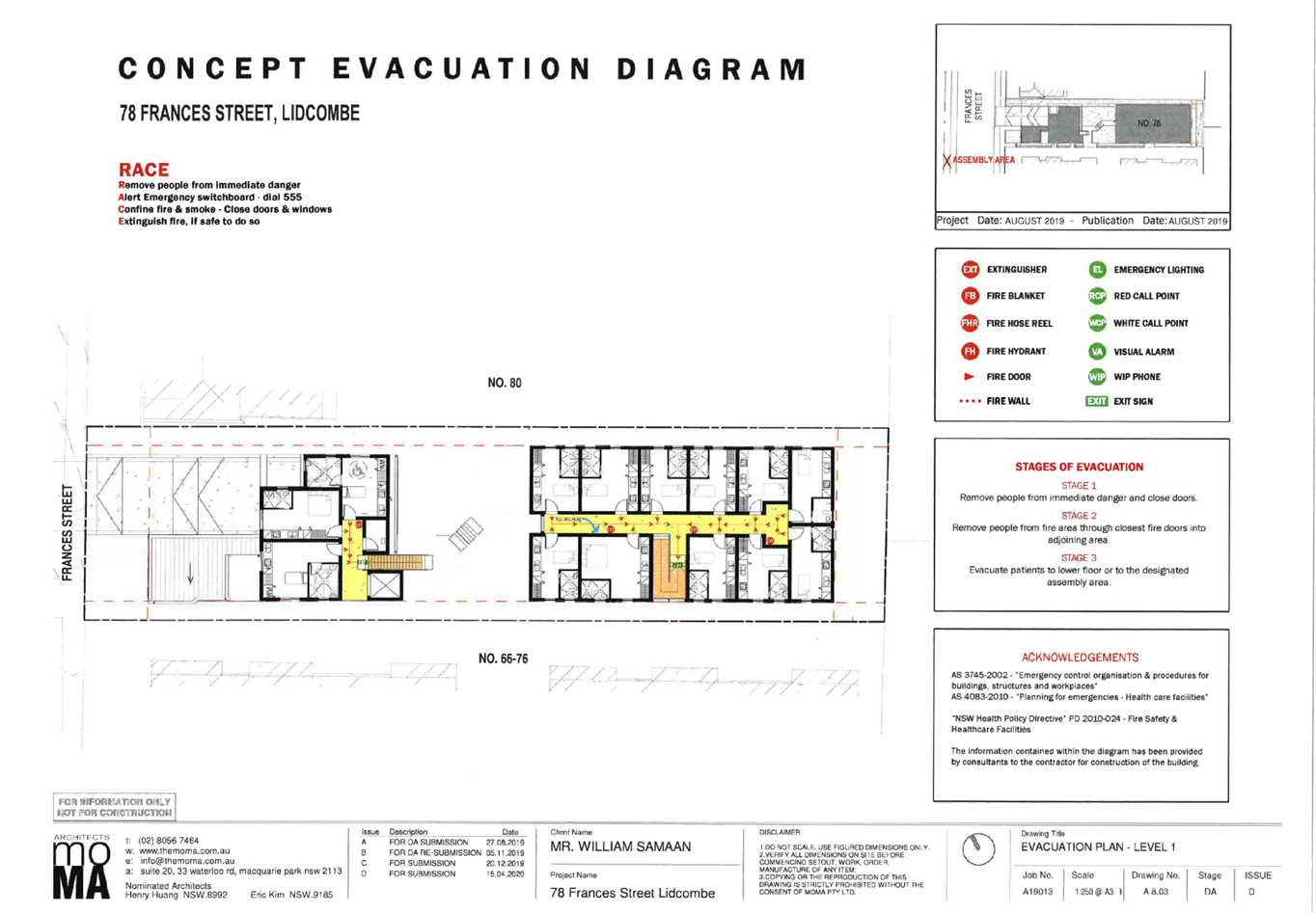
DOCUMENTS
ASSOCIATED WITH
REPORT LPP018/20
Attachment 3
Submissions Received (10 unique submissions)
Cumberland Local Planning Panel Meeting
13 May 2020
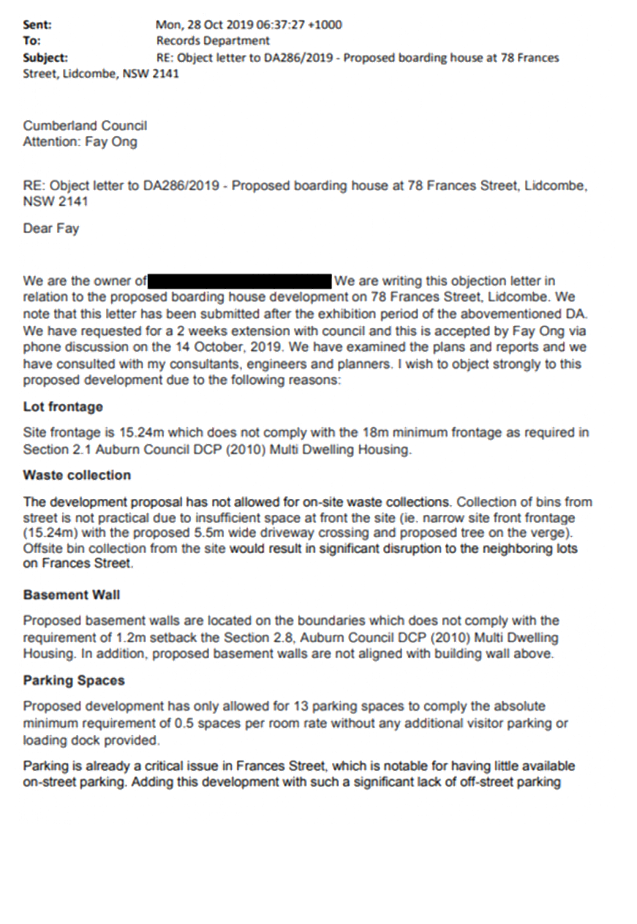


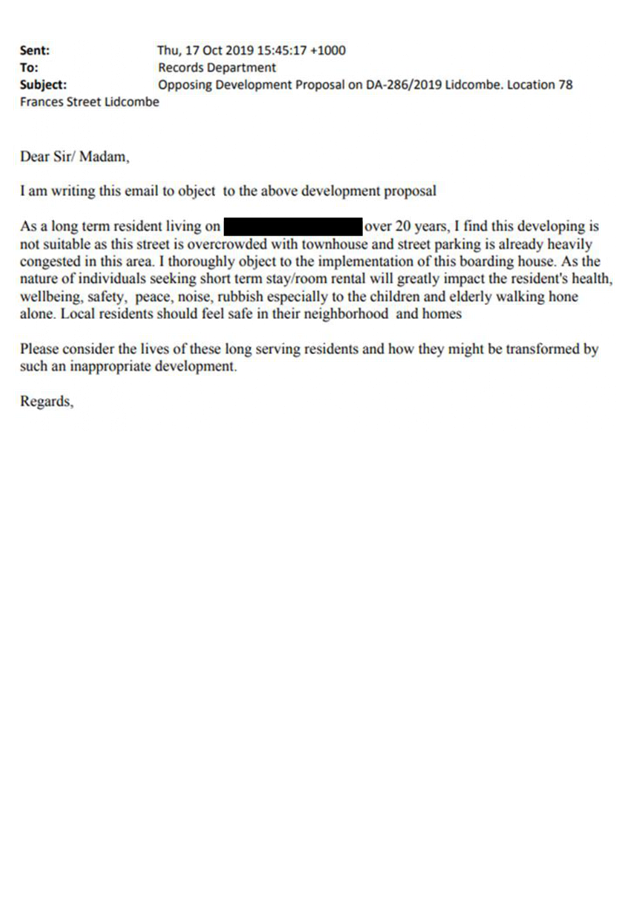
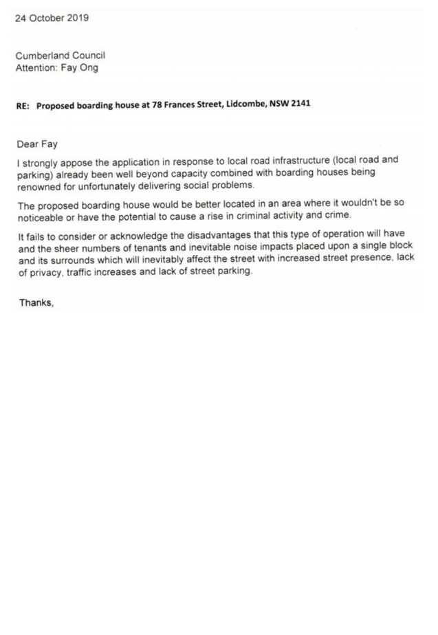
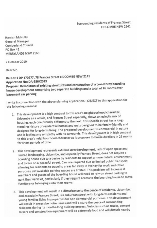


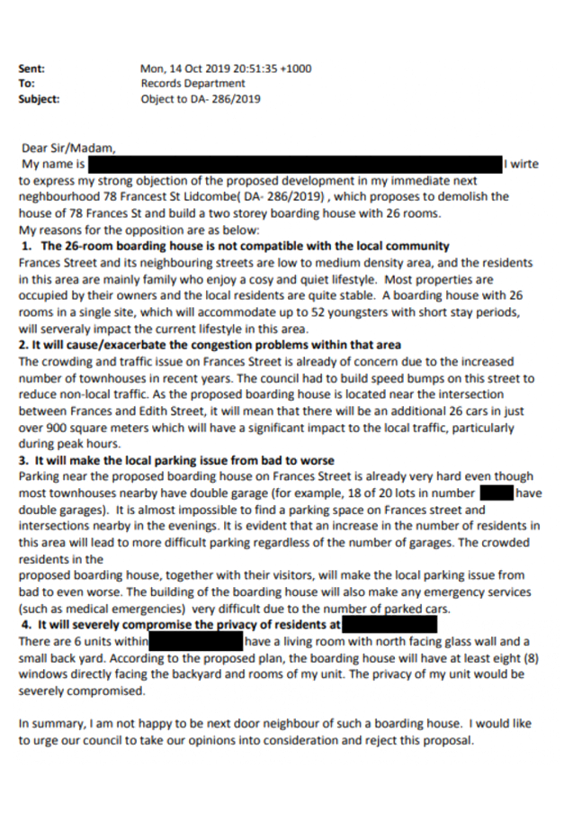


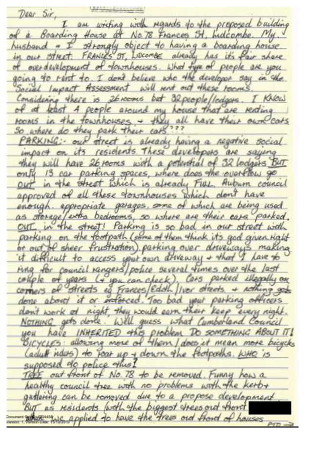
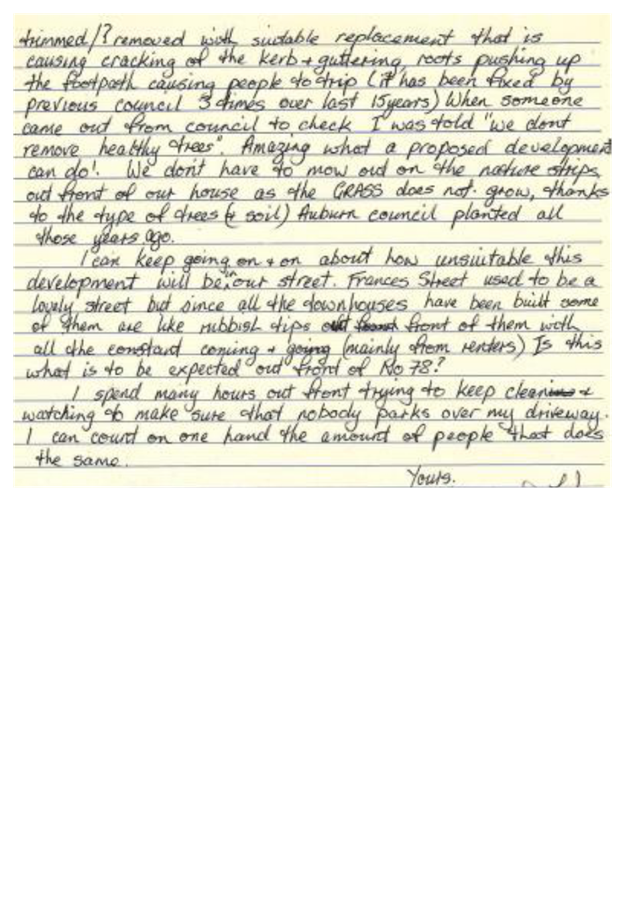

DOCUMENTS
ASSOCIATED WITH
REPORT LPP018/20
Attachment 4
Plan of Management
Cumberland Local Planning Panel Meeting
13 May 2020
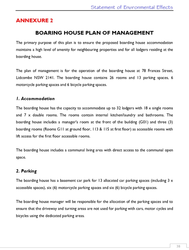
DOCUMENTS
ASSOCIATED WITH
REPORT LPP018/20
Attachment 5
Landscape Plans
Cumberland Local Planning Panel Meeting
13 May 2020
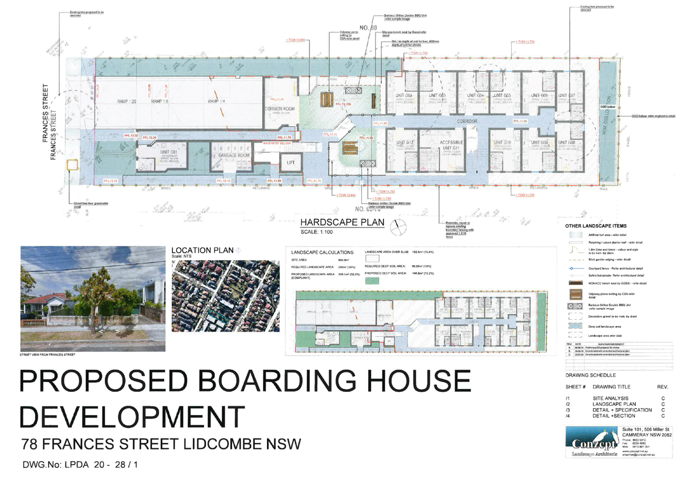
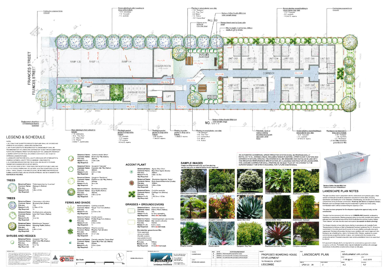
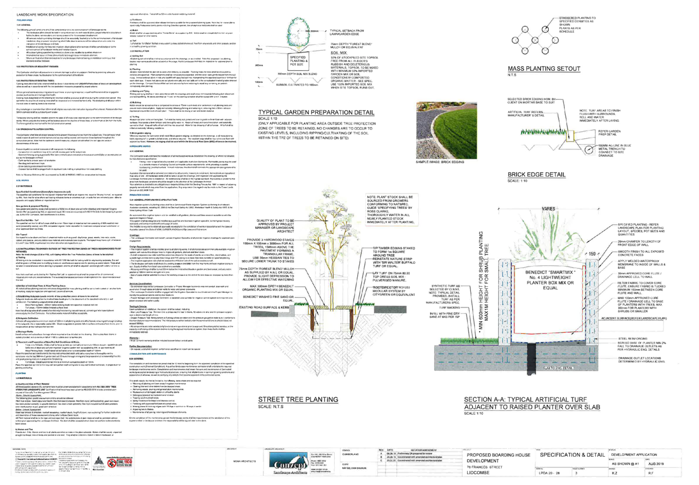
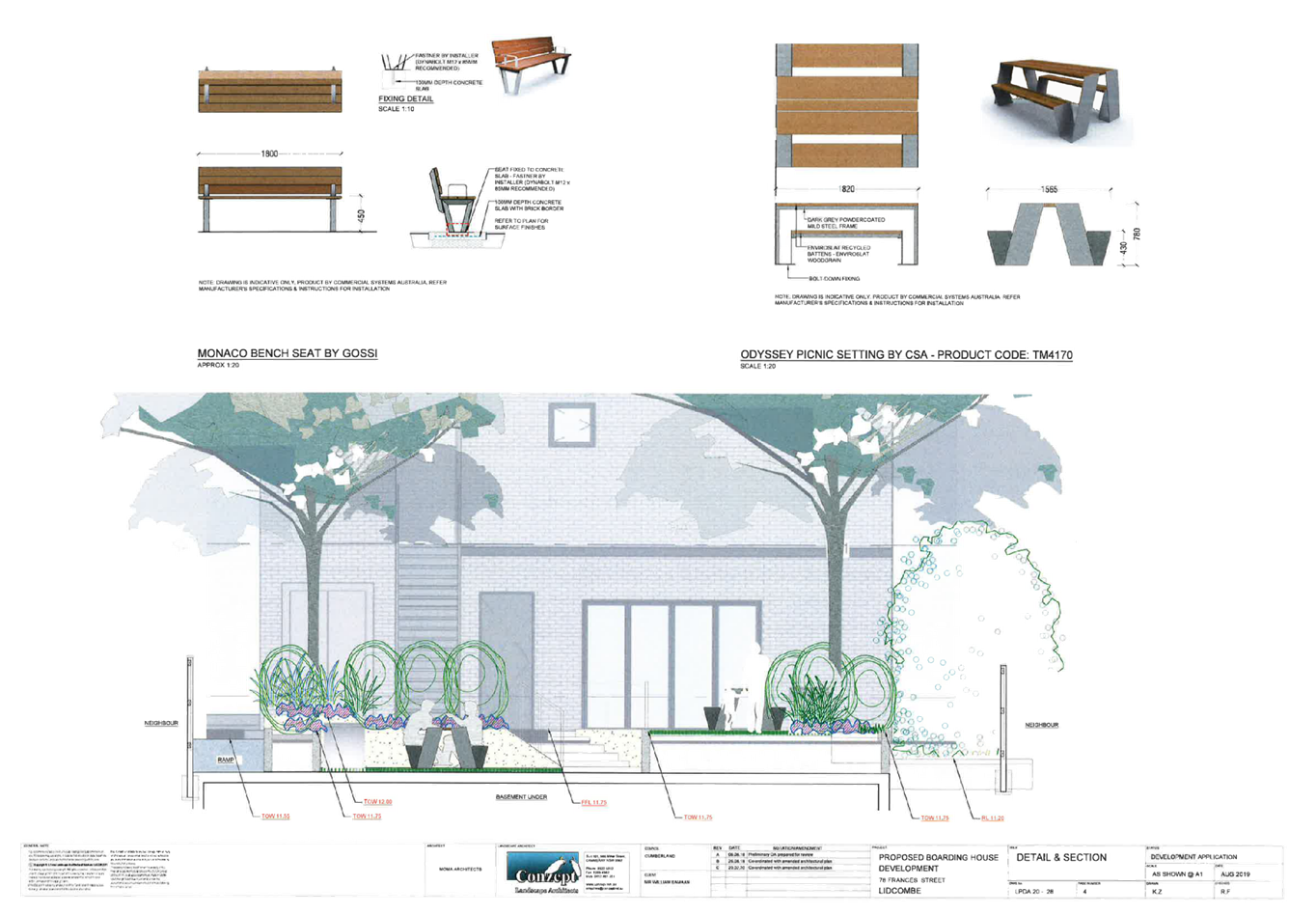
DOCUMENTS
ASSOCIATED WITH
REPORT LPP018/20
Attachment 6
Survey Plan
Cumberland Local Planning Panel Meeting
13 May 2020
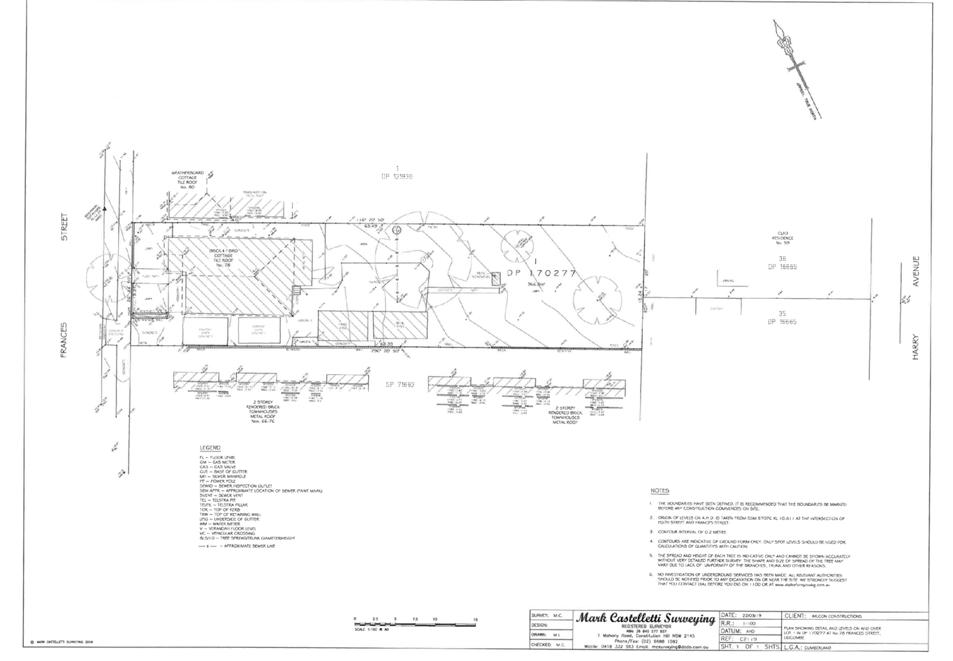
DOCUMENTS
ASSOCIATED WITH
REPORT LPP018/20
Attachment 7
Stormwater Plans
Cumberland Local Planning Panel Meeting
13 May 2020
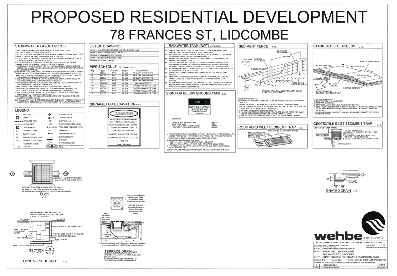
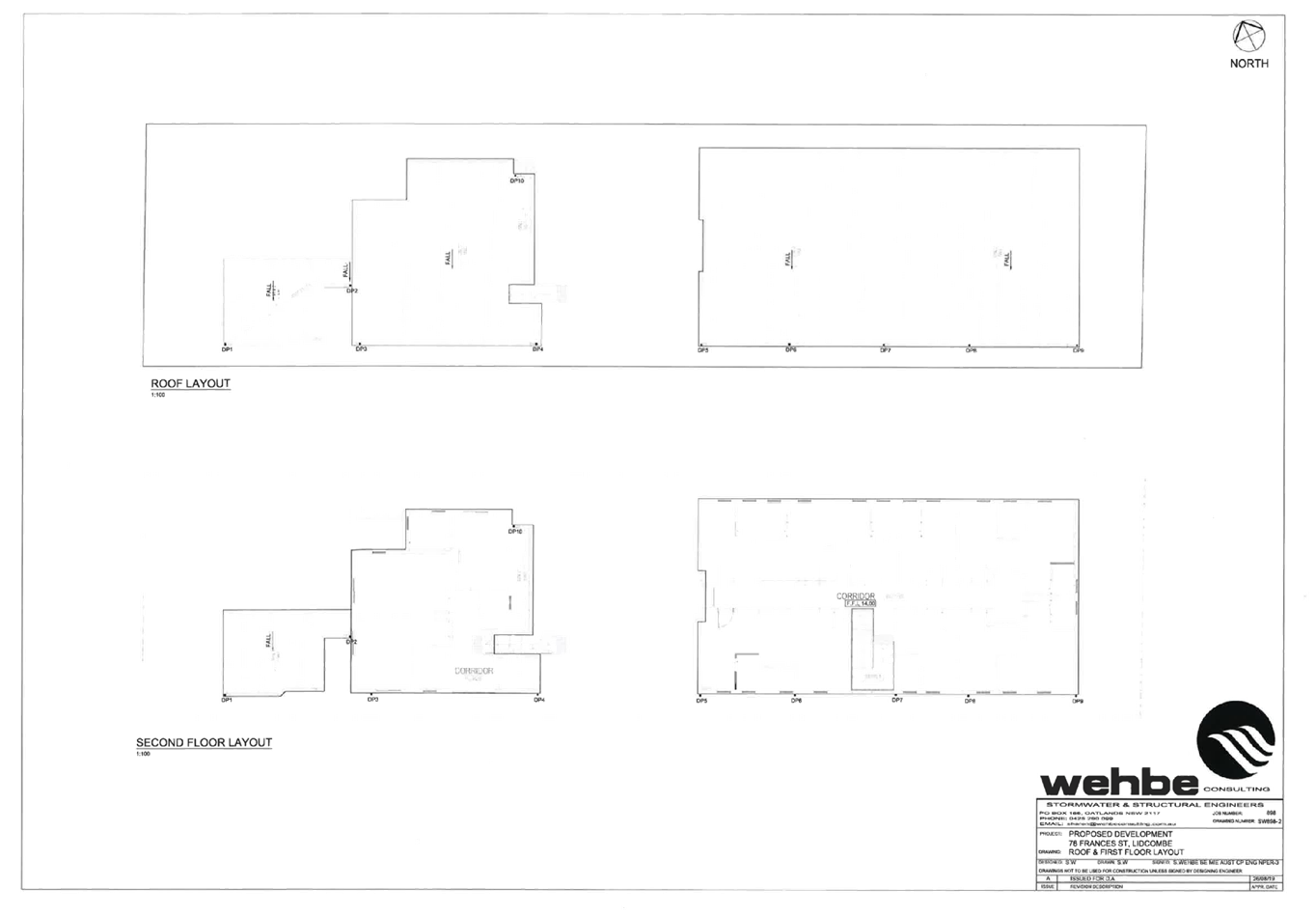
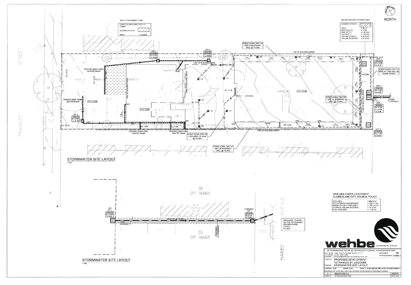
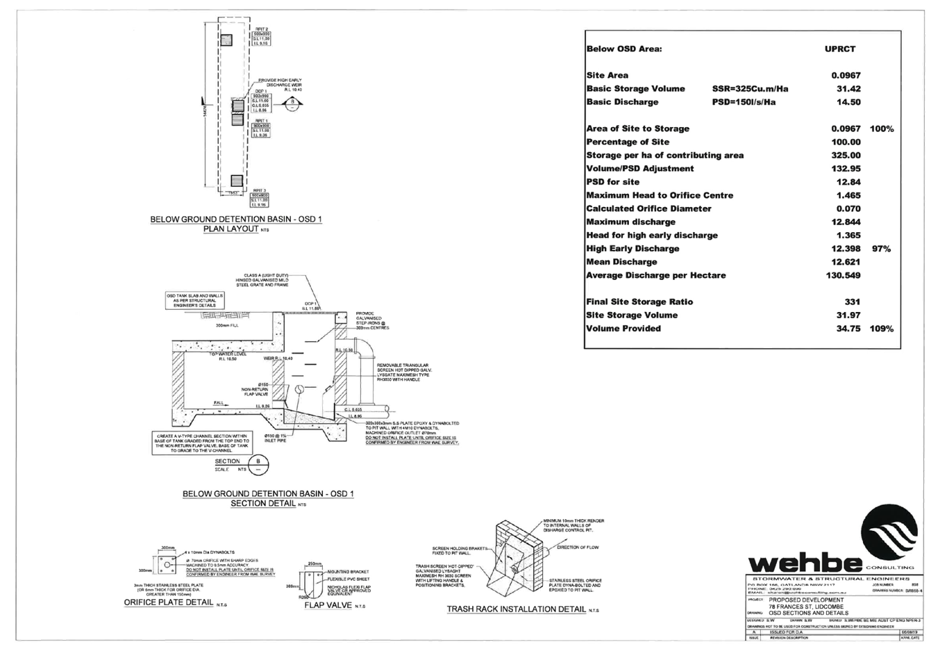
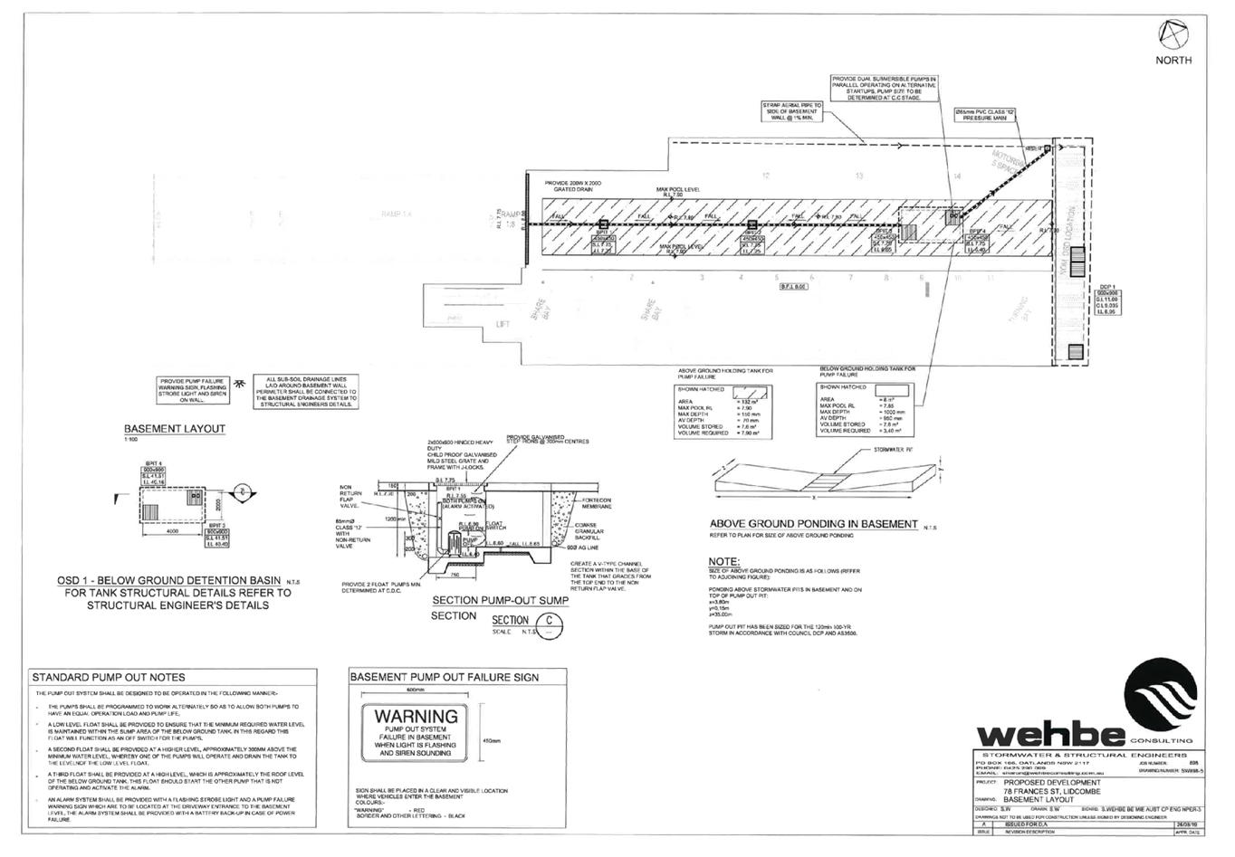
DOCUMENTS
ASSOCIATED WITH
REPORT LPP018/20
Attachment 8
Appendix A - DCP Compliance Table
Cumberland Local Planning Panel Meeting
13 May 2020
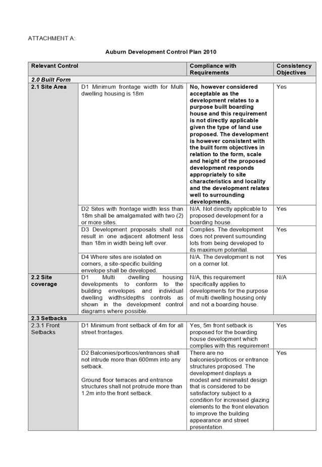
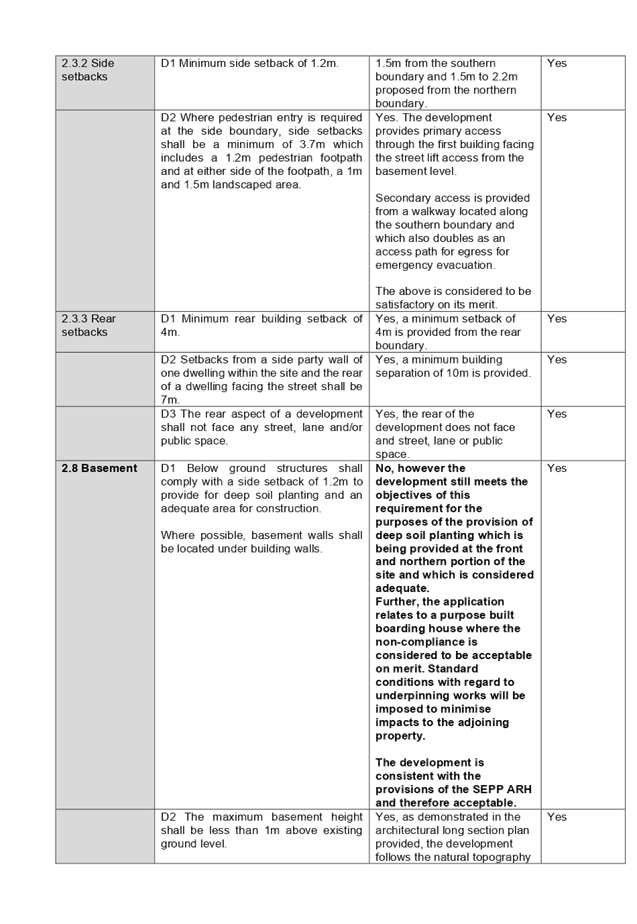
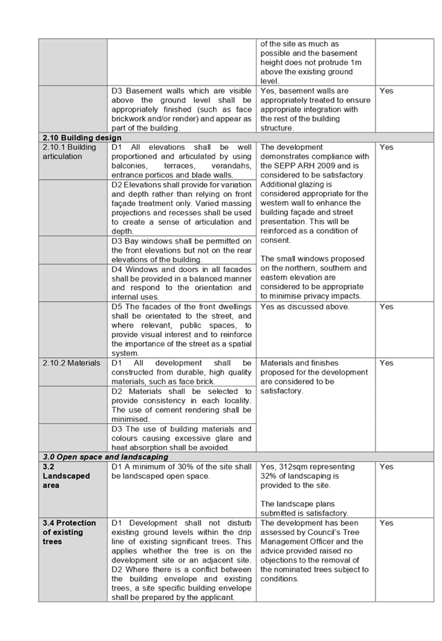
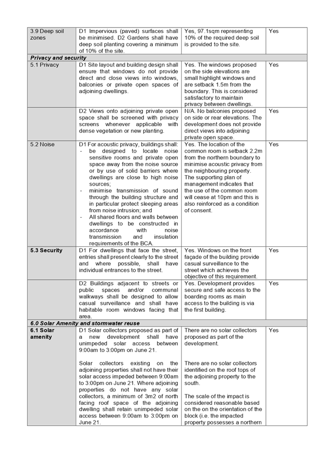
Cumberland
Local Planning Panel Meeting
13 May 2020
Item No: LPP019/20
Development
Application for 6-8 Factory Street, Granville
Responsible
Division: Environment
& Planning
Officer: Executive
Manager Development and Building
File
Number: DA2020/0036
|
Application
lodged
|
24 January 2020.
|
|
Applicant
|
Mr L Wehbe, Mr J S Wehbe.
|
|
Owner
|
Mr L Wehbe & Mr J S Wehbe.
|
|
Application
No.
|
DA2020/0036
|
|
Description
of Land
|
Lot 1 in DP 844490 being 6 to 8 Factory Street
Granville.
|
|
Proposed
Development
|
Demolition of an existing
local heritage listed building.
|
|
Site
Area
|
870 Square metres.
|
|
Zoning
|
R2 Low density residential.
|
|
Disclosure
of political donations and gifts
|
Nil disclosure.
|
|
Heritage
|
Yes, being Item Number I109 within the Parramatta Local
Environmental Plan 2011 being a former shop.
|
|
Principal
Development Standards
|
Not applicable for a
demolition application.
|
|
Issues
|
Demolition of a heritage
listed item.
|
1. Development
Application 2020/0036 was received on 24 January 2020 for the Demolition of an
existing local heritage listed building and former child care centre building
on site.
2. The
application was publicly notified to occupants and owners of the adjoining
properties for a period of twenty-one (21) days between Wednesday 4 March 2020
and Wednesday 25 March 2020. There were no submissions to the development
application.
3. The
subject site is listed as a heritage item in the Parramatta Local Environmental
Plan 2011 as Heritage Item I109.
4. The
application is recommended for conditional approval subject to the conditions
as provided in the attached schedule.
5. The
application is referred to the Panel as the demolition of a heritage listed
item is identified as being a sensitive development.
Subject Site and Surrounding
Area
The site is situated on the corner
of Factory Street with First Street Granville and is provided with the
following dimensions: -
· First
Street and rear boundary - 24.385 metres.
· Factory
Street and western side boundary - 35.7 metres.
This provides for a site area of
870 square metres.
The rear of the site faces a
sealed laneway and hence the site has three road frontages.
The levels of the land are: -
· North
West corner: - 10.98 metres AHD.
· North
east corner: - 10.78 metres AHD.
· South
west corner: - 11.53 metres AHD.
· South
east corner: - 11.63 metres AHD.
This provides a fall towards the
rear of between 550 mm and 850 mm with the lowest level being at the north east
corner.
A heritage listed two storey
building is situated at the southern side of the site facing First Street which
is numbered I109 within the Parramatta Local Environmental Plan being a former
shop. Hence, this is a site that contains a local heritage item.
In November 1993, Parramatta City
Council approved Development Consent 560/1993 for use of the site as a
multi-cultural centre, a dwelling house and pre-school subject to conditions.
Following approval, it is identified that the dwelling house was never constructed.
There are two buildings on site
being a pre-school, a heritage listed building and an associated playground.
There is open space across the north eastern part of the site which may have
been used for car parking in the past. That part of the site comprises an area
of bitumen pavement and grass surroundings. While the whole site is listed as a
heritage item the building at the south east corner of the site forms the
actual heritage item being the former shop.
Land to the west is residential in
nature.
There is another heritage listed
site at nearby 10 William Street which is item number 205 being the William
Street Cottages. The site is located approximately 20 metres to the North West
but situated on the northern side of the laneway.
There is also an industrial
building situated at 12 William Street.
Land on the eastern side of
Factory Street is industrial in nature with industrial or warehouse land use
predominating.
The site has been fenced off from
the public as there are significant concerns that the heritage listed building
will fail. Hoarding has been erected along the southern part of the building to
stabilize the building following site inspections by Council officers and
structural engineers.
The location of the site is shown
below.
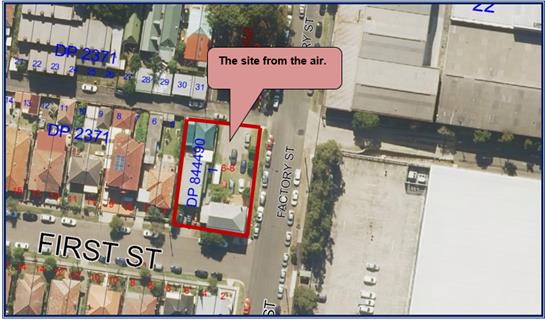
Photos
of the site prior to the erection of the hoarding to protect the building.
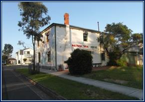
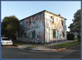
Photos
of the building following the erection of the site hoarding and fencing.
Description of the Proposed
Development
Development application 2020/0036
is lodged to the Council for determination to demolish the local heritage
listed building and the attached former child care centre building. In this
regard, all the buildings and structures on site are to be demolished. The
development application does not include any other work to the site.
History
14 December 2018
Development consent 98/2018 for
the partial demolition, alterations and additions to existing buildings (listed
as Heritage Items in Parramatta Local Environmental Plan 2011) for use as a
child care centre for 56 children with hours of operation from 7:00am to 6:00pm
Monday to Friday was approved under delegated authority subject to conditions.
27 February 2019
A Private Certifier issued the
construction certificate for the project to permit construction of the child
care centre as approved.
1 April 2019
A Section 4.55(1A) modification
application Number 98/2018/A was approved under delegated authority to modify
the stormwater drainage system.
13 September 2019
Council officers received
information from Cam Consulting Structural and Civil Engineers concerning the
structural integrity of the existing building (heritage item). In particular,
the southern boundary wall on the first floor was discovered to be at risk of
failure. An Emergency Order was issued by Council that required the following:
-
· Stabilization
of the southern wall.
· Take
preventative action to avoid a collapse of the wall.
· Submit
to Council a structural engineer’s certificate that addresses
rectification work.
The structural report that Council
received concludes on page 23 that the building is in poor condition and
requires immediate attention to ensure public safety.
However, the report does suggest
that if the building were to be retained, it would need to be underpinned with
extensive repairs including construction of a new internal frame. Such works
could cost in excess of $350,000 but there are no guarantees of success.
20 September 2019
The builders erected hoarding
around the building to stabilize the building.
30 September 2019
Council officers attended the site
to discuss available options for the building. Council officers gave advice to
the effect that the building should be repaired.
24 January 2020
Development application 2020/0036
is lodged requesting that the heritage listed item and the former child care
centre building be demolished. As part of this application, the applicant has
provided a detailed structural engineers report from Mance Arraj concerning the
structural components of the heritage listed building. The report forms part of
the development application which is addressed below.
Applicants Supporting
Statement
The applicant has provided a
structural engineers report prepared by Mance Arraj and dated 18 December 2019
which forms part of the development application. The report identifies a number
of structural issues that have been identified following the issue of the
development consent 98/2018 for the child care centre, especially for the
heritage listed building as follows.
Observations - Timber roof
structure and floor structure
The floor and roof timber
structural elements have been subjected to extensive white ant attack and in
several first floor locations, the floor structural is sagging. Some areas have
had supplementary joists placed in the past. Ceilings and floor coverings are
deteriorated due to possible water ingress.
There is an external concrete
stair leading to the upper level which is severely dilapidated with noticeable
concrete spalling and corrosion of the reinforcement.
There is a steel tie rod running
above the first floor level which is secured by exposed and corroded end plates
on the stern and western elevations.
Observations - External and
internal brick walls
· Severe
step wise cracking is evident in masonry walls.
· All
external elevations display severe cracking with some cracks being 10 to 15 mm
in width at some locations.
· Rendered
finishes have also deteriorated to a large extent.
· Steel
lintels exhibit corrosion which has distressed brickwork at door and window
corners.
· The
external western elevation which appears to be a later addition exhibits severe
deterioration and separation from the main building which is evident in the
vertical cracks.
· The
external northern and eastern elevations exhibits severe deterioration with
vertical cracks.
· The
external wall on the First Street elevation has evidence of significant bowing
at the eaves level towards the street.
· The
central spine wall appears to have been supplemented with an additional half skin
of masonry which passes to roof level. It appears the wall has been constructed
off the existing foundation.
The building is in a severely
deteriorated condition which is attributed to the building age and standards of
construction that existed at the time. The cause is attributed to the gradual
settlement and rotation of brick and foundations which are inadequate for the
site. Strategies such as underpinning repair procedures of the walls or
reconstruction in segments is not practical due to the extent of the damage.
The western, northern and eastern walls are considered to be beyond repair and
should be demolished.
The bowing of the First Street
wall elevation is in the order of 100 to 150 mm over the height of the wall.
The rotation is considered to be excessive and cannot be retrieved. This is
contributing to the first floor sagging with demolition being the only
advisable course of action.
The central spine dividing wall
addition is poorly constructed and the ceiling structure does not provide adequate
restraint to the wall. Its current condition is considered to be unstable due
to the high slenderness ratio and would not provide adequate fire rating.
Timber floor and roof structural
elements display extensive termite attack. All white ant affected structural
elements are required to be replaced. The deflection of the first floor along
the First Street elevation is attributable to the rotation or bowing outwards
of the wall. It appears the joists are undersized for the current codified
loading requirements.
The corrosion of the end plates
severely compromises the building and cannot be relied upon for any future
work.
Report Conclusion
The majority of the walls are not
structurally adequate and considered to be irreparably deteriorated. Based on the
extent of the observed internal and external deterioration of walls, roof and
floor structures, extensive remedial repair works would not be practically
achievable to satisfy current building code requirements.
It is advised that full demolition
and reconstruction of the building is the only practical course of action to
achieve compliance with the current building codes.
The report is included in the
attachments for the consideration of the Panel.
Former childcare centre
There are no technical issues associated
with the demolition of the former childcare centre building adjacent to the
heritage listed building. It is noted that this building is not heritage
listed.
Contact with Relevant
Parties
The assessing officer has
undertaken a site inspection of the subject site and surrounding properties and
has been in regular contact with the applicant throughout the assessment
process.
Internal Referrals
The development application was referred to Councils
Accredited Building Surveyor who provided advice on the matter. It is concluded
that the building should be demolished as being the most practical course of
action.
External Referrals
The application was not required
to be referred to any external government authorities for comment.
Planning Comments
The provisions of any
Environmental Planning Instruments (EP&A Act s4.15 (1)(a)(i))
The proposed development is
affected by the following State Environmental Planning Policies:
(a) State
Environmental Planning Policy No. 55 - Remediation of Land (SEPP 55)
As part of the assessment of
Development Application 98/2018, the State Policy was reviewed in significant
detail. As part of that application, the applicant submitted a preliminary
contamination assessment report which concluded that the risk of land
contamination was low because the site had not been used for any activities
that would have contributed to land contamination.
The report recommended that care
should be taken during demolition and construction to ensure that any asbestos
material if encountered is removed by licensed contractors and disposed to a
NSW EPA approved landfill site as special waste “Asbestos”. An
unexpected finds protocol should also be initiated.
It is considered that no change to
site conditions would have occurred since the granting of the development
consent because the site has not been in use. The site is now barricaded from
the public due to concerns governing the structural stability of the heritage
listed building.
It is considered that the
development application is satisfactory having regard to the relevant matters
for consideration under SEPP 55.
(b) State
Environmental Planning Policy (Vegetation in Non-Rural Areas) 2017
A wattle tree growing almost
against the rear of the heritage listed building will require removal and has
been approved to be removed. The tree is also showing partial decay along its
fringes which is evident by the number of branches without leaves. There are no
objections to the removal of the tree. Generally, there are no issues that need
to be addressed under the State Policy.
Regional Environmental Plans
Sydney Regional Environmental
Plan (Sydney Harbour Catchment) 2005
The site is located within the
Sydney Harbour Catchment area and SREP (Sydney Harbour Catchment) 2005 is
applicable to the development application. The development application raises
no issues as to consistency with the requirements and objectives of the
planning instrument and associated development control plan.
Local Environmental Plans
The provision of the Parramatta
Local Environmental Plan 2011 is applicable to the development proposal. It is
noted that the development achieves compliance with the key statutory
requirements and objectives of the Parramatta Local Environmental Plan 2011.
(a) Permissibility:
-
The proposed development is
defined as demolition work which is permitted with consent within the R2 Low
Density Residential zone. Matters concerning: -
· Floor
space ratio (Max allowed 0.5:1).
· Height
of buildings (Max allowed 9 metres).
Do not need to be addressed
because no building work is proposed. The development application is purely for
demolition of buildings.
Parramatta
LEP Compliance Table
|
Development
Control Standard
|
Compliance
|
Discussion
|
|
4.3 Height of Buildings
9 metres.
|
N/A
|
Not relevant for demolition work.
|
|
4.4 Floor
Space Ratio
0.5:1
|
N/A
|
Not relevant for demolition work.
|
|
5.10 Heritage Conservation
|
Yes
|
This is described below.
|
Clause 5.10 Heritage conservation
Clause 5.10 is applicable to the
development application. A heritage impact assessment report prepared by Graham
Hall and dated December 2019 has been submitted with the development
application to address the heritage listed item.
The report outlines the history of
the site from 1884. It appears the building (excluding the former child care
centre building) was constructed sometime around 1899 and was used as a
boarding house and later as a dining room from 1910. By 1925, the building was
used as a fruit shop. The building was altered and converted to two flats after
World War 2 and after 1993, it was used as the Granville Multicultural Centre.
In 1993, a child care centre was
approved on site which operated from 1994 to 2016.
The original envelope and position
of the building has been retained although it has been significantly altered
over the years. The changes to the building include: -
· A
corrugated colourbond roof.
· The
cladding on the gable end which was most likely weatherboard material has been
replaced with battened fibro or fibre cement sheeting.
· The
brick walls have been painted with murals.
· Windows
being replaced with anodised aluminium windows.
· The
entry door having been replaced with a modern flush door. The ground floor has
modular ceilings which may conceal original ceilings.
· All
outbuildings have been demolished.
· Extensions
occurring after 1943 along the western side of the building.
· Construction
of a single storey skillion roofed building for use as a child care centre in
1994.
The building is built to its
boundaries like a shop; however, there is no evidence of former awnings,
verandas or display windows.
At the time Development Application
98/2018 was lodged with Council, the building appeared to be in fair condition,
although there were some structural cracks observed and the interior painted
finishes were found to be in poor condition.
As work commenced to the building
under the development consent and construction certificate, it was observed
that the southern wall was bowing outwards by between 100 mm and 150 mm. With
Council’s agreement and on the advice of Mance Arraj structural
engineers, temporary strutting was installed to prevent the wall from
collapsing onto the footpath and more detailed investigations were carried out.
It was found that following the removal of the non - original ceilings, wall
linings and partitions, extensive previously hidden alterations and structural
defects have been discovered. The defects include: -
· The
southern wall bowing out by between 100 mm and 150 mm at the eaves level.
· Vertical
and stepped cracking present in all four walls and longitudinal interior walls.
· Inadequate
construction used for an internal longitudinal wall.
· Inadequate
internal walls to support building loads.
· A
steel rod running the length of the building in disrepair.
· The
extension at the western end of the building separating from the main structure.
· Rising
damp along the southern wall as well as salt attack which has begun to corrode
the motor joints.
· Unsafe
internal stair due to the concrete cover spalling leaving reinforcement exposed
and rusting.
· Inadequate
joists used for the first floor.
· The
floor and roof frames under attack and now weakened by termites.
Almost all of the walls would need
to be dismantled and rebuilt on new concrete footings given that the foundation
supporting the building is identified as being in decay. Underpinning work is
not feasible in this instance. Footings can be satisfactorily underpinned,
although to ensure an even bearing pressure, it may be necessary to remove
floors and underpin the internal walls as well as the external walls. Any wide
cracking in the walls still needs to be dealt with by brick stitching or
partial dismantling and rebuilding. Underpinning of the building in its present
form would be a dangerous operation.
Remedies
Almost all of the walls would have
to be dismantled and rebuilt on new concrete footings which would raise a
number of issues as follows: -
· Some
of the bricks could be cleaned and reused together with similar recycled bricks
but it is logistically impossible to number them and reuse them in their
present positions.
· Unlike
cavity walls, solid brick walls like those that are existing would not comply
with the Building Code of Australia.
· If
cavity walls were used, the question of the brick bond arises in respect of
those walls which were not stuccoed. The outer skin of cavity walls is normally
laid in stretcher bond. This could be done or snap headers could be used to
replicate the existing weak colonial bond.
· A
decision on whether to use lime mortar or white cement motor would have to be
made.
· The
need for control joints would need to be checked.
· The
thickness of the internal and external walls would need to be checked and
probably altered allowing for the low compressive strength of any reused bricks
as well as height and length of the walls.
· The
rising damp would need to be addressed. This would require an injected
dampcourse material. Any reconstructed walls would incorporate a dampcourse.
· It
would be necessary to remove the flooring, the roofing and the damaged floor
ceiling and roof framing to enable the rebuilding of the brick walls to
proceed. The termite damaged members would need to be discarded. It might be
possible to reuse some of the undamaged material but the resultant structure
would not comply entirely with the Building Code of Australia.
· It
might be possible to reuse the roofing and the modern metal windows but the
modern sheet flooring would need to be replaced.
The report on page 26 concludes
that the historical significance of the building at 8 Factory Street has been
diminished by a series of irreversible alterations. The building is listed as a
heritage item within the Parramatta Local Environmental Plan however it will be
lost.
There are numerous structural
defects which have emerged which are such that the building can neither be
safely stabilised or repaired regardless of cost. Demolition will regrettably
result in the loss of the item but it is the only feasible option.
Comments
A site inspection of 2 March 2020
has identified that the building appears to be unsafe as follows: -
· Cracks
within the brickwork.
· The
bowing of the southern wall is visible.
Hoarding is being used to
temporary secure the southern wall.
In this regard, some of the issues
identified are observed across the external fabric of the building.
An internal site inspection has
also been undertaken and it is identified that many of the issues raised within
the reports submitted by the applicant are clearly visible within individual
rooms.
Council officers engaged an
independent consultant Nimbus Architecture and Heritage to review the reports
submitted by the applicant and to prepare an independent report addressing the
matter.
The report recommends the
following on page 30 and 31: -
· That
Stanhope House (The heritage listed building) be retained and that remedial
works be undertaken so long as it is structurally feasible to complete such
remedial works and make the building safe for use.
· Further
research be conducted into the history of the site including construction
dates.
· A
secondary examination be undertaken to determine if it is feasible to complete
remedial works that will make the building safe whilst not meeting all
requirements of the Building Code of Australia.
Remedial works could include: -
· Application
of sacrificial renders to the exterior walls to remedy existing and mitigate
future salt attack.
· Lower
the grading of the footpaths and paving around the building particularly to the
northern façade where the base of the brick vents is level with the
paving.
· Reinstate
the original fenestration and alignment of windows and doors particularly to
the Factory Street façade.
· Remove
the intrusive external concrete stairway.
· Reinstate
internal joinery based on the remaining timber cornices.
Demolition work is not recommended
by Nimbus Architecture and Heritage. However, if demolition is approved, the
following activities should be undertaken:
· An
archival photographic recording should be undertaken for Council and the local
library.
· A
heritage interpretation plan be prepared to highlight the history of the site.
· An
archaeological assessment be undertaken to determine the archaeological
potential of the site. It is possible that excavations may uncover
archaeological remains and a possible well associated with the existing
structure.
As demolition is being recommended
by this report, the above requirements have been appropriately included in the
draft set of conditions.
Council’s Building
Assessment
An independent assessment by
Council’s Accredited Building Surveyor dated 22 April 2020 has identified
that the reports prepared by CAM Consulting and Mance Arraj indicate similar
defects within the two storey structure. The external walls do not show
excessive damage with only cracks within the brickwork. The photos of the
internal walls, the dilapidated timber first floor and western wall distinctly
shows the settlement of the foundation. The building is not habitable and
extensive repair can salvage the building for some time; however, the building
will need constant expensive maintenance and would be a liability.
Council’s Accredited
Building Surveyor is recommending that the building be demolished as the most
practical course of action.
Impact of the proposal
Demolition will result in the
permanent loss of the item. It is determined that: -
· The
building is unsafe in its current form and cannot be used.
· The
building cannot be safely stabilised in the long term.
· It
is impractical to retain the present structure without significant cost
implications.
· There
are no options available for conserving the building.
Conclusion
Although the building is listed as
a heritage item in the Parramatta Local Environmental Plan 2011, the historical
significance of the former Victorian boarding house at 6 to 8 Factory Street
has been diminished by a series of irreversible alterations, as well as a
deterioration of the building over the years which is still continuing.
Numerous structural defects have been identified in the building, and these
defects can neither be safely stabilised nor repaired without significant cost
implications.
Whilst demolition work will result
in the loss of the heritage item, opportunities to recognise the historical contribution
of the site have been identified. Should the Panel support the development
application, the applicant would be required to prepare the following:
· An
archival photographic recording should be undertaken for Council and the local
library.
· A
heritage interpretation plan be prepared to highlight the history of the site
and that future development is sympathetic to the existing structure and its
context.
· An
archaeological assessment be undertaken to determine the archaeological
potential of the site. It is possible that excavations may uncover
archaeological remains and a possible well associated with the existing
structure.
The above requirements have been
included in the draft set of conditions.
The provisions of any proposed
instrument that is or has been the subject (EP&A Act s4.15 (1)(a)(ii))
(a) Draft Cumberland Local
Environmental Plan 2020 (Draft CLEP)
The Draft Cumberland Local
Environmental Plan 2020 (Draft CLEP) has been prepared by Cumberland Council to
provide a single planning framework for the future of Cumberland City. The
changes proposed seek to harmonise and repeal the three existing LEPs currently
applicable to the Cumberland local government area those being: -
· Holroyd
Local Environmental Plan 2013.
· Parramatta
Local Environmental Plan 2011.
· Auburn
Local Environmental Plan 2010.
The current planning controls for
the subject site, as contained within the Parramatta Local Environmental Plan
2011 (PLEP) are not proposed to change under the Draft CLEP.
It is identified that the building
is being listed as a heritage item under the draft Cumberland Local
Environmental Plan 2020 despite the issues that are being identified.
Notwithstanding this, it is considered that the building is structurally
unstable and that the recommendations made in the structural reports available
and in this assessment report should be followed.
The provisions of any
Development Control Plans (EP&A Act s4.15 (1)(a)(iii))
The Parramatta Development Control
Plan is applicable to the development application
Part 3.5 “Heritage”
chapter addresses heritage concerns for developments occurring on or adjacent
to heritage listed sites and Section 4.4 of Part 4 “Special Precincts”
“Heritage Areas” chapter addresses developments specific to
heritage conservation areas.
Both parts / chapters would not
apply to the development application as neither provision addresses the full
demolition of a heritage item. As such, Council officers are required to rely
upon Clause 5.10 of the Parramatta Local Environmental Plan 2011 for assessment
purposes.
The provisions of any planning
agreement that has been entered into under section 7.4, or any draft planning
agreement that a developer has offered to enter into under section 7.4
(EP&A Act s4.15(1)(a)(iiia))
There is no draft planning
agreement associated with the subject Development Application.
The provisions of the
Regulations (EP&A Act s4.15 (1)(a)(iv))
The proposed development raises no
concerns as to the relevant matters arising from the Environmental Planning and
Assessment Regulations 2000 (EP&A Reg).
The Likely Environmental,
Social or Economic Impacts (EP&A Act s4.15 (1)(b))
It is considered that the proposed
development will have no significant adverse environmental, social or economic
impacts in the locality.
The suitability of the site for
the development (EP&A Act s4.15 (1)(c))
The subject site and locality is
not known to be affected by any natural hazards or other site constraints
likely to have a significant adverse impact on the proposed development.
Accordingly, it is considered that the development is suitable in the context
of the site and surrounding locality.
Submissions made in accordance
with the Act or Regulation (EP&A Act s4.15 (1)(d))
Advertised
(newspaper) Mail
Sign
Not Required
In accordance with Council’s
Notification requirements contained within the Parramatta Development Control
Plan, the development application was notified for a period of twenty one (21)
days between Wednesday 4 March and Wednesday 25 March 2020. There were no submissions
to the development application and works sought.
The public interest (EP&A
Act s4.15(1)(e))
In view of the foregoing analysis
it is considered that the development, if carried out subject to the conditions
set out in the recommendation below, will have no significant adverse impacts
on the public interest.
Section 7.12 (Formerly S94)
Contribution Towards Provision or Improvement of Amenities or Services
This part of the Act relates to
the collection of monetary contributions from applicants for use in developing
key local infrastructure.
The works sought do not contribute
to employment activities. As such, a contribution is not required to be levied
for the works sought.
Disclosure of Political
Donations and Gifts
The applicant and notification
process did not result in any disclosure of Political Donations and Gifts.
The development application has
been assessed in accordance with the relevant requirements of the Environmental
Planning and Assessment Act 1979, the Parramatta Local Environmental Plan 2011
and the Parramatta Development Control Plan 2011 and is considered to be
satisfactory for approval.
The proposed development is
appropriately located within the R2 zone under the relevant provisions of the
Parramatta Local Environmental Plan 2011. The proposal is consistent with all
statutory and non-statutory controls applying to the development. The
development is considered to perform adequately in terms of its relationship to
its surrounding built and natural environment, particularly having regard to
impacts on adjoining properties.
For these reasons, it is
considered that the proposal is satisfactory having regard to the matters of
consideration under Section 4.15 of the Environmental Planning and Assessment
Act 1979, and the development may be approved subject to conditions.
|
1. That
Development Application No. DA2020/0036 for the demolition of an existing
local heritage listed building on land at 6-8 Factory Street Granville be
approved subject to attached conditions as listed in the attached schedule.
|
1. Draft Notice
of Determination
2. Demolition
and Elevation Plans
3. Demolition
and Site Plan
4. Appendix
A - Structural Engineers Report ( Mance Arraj)
5. Appendix
B - Structural Engineers Report (Cam Consulting)
6. Appendix
C - Heritage Report
7. Appendix
D - Notice of Emergency Order Served
8. Appendix
E - Independent Heritage Assessment Report
DOCUMENTS
ASSOCIATED WITH
REPORT LPP019/20
Attachment 1
Draft Notice of Determination
Cumberland Local Planning Panel Meeting
13 May 2020
DOCUMENTS
ASSOCIATED WITH
REPORT LPP019/20
Attachment 2
Demolition and Elevation Plans
Cumberland Local Planning Panel Meeting
13 May 2020
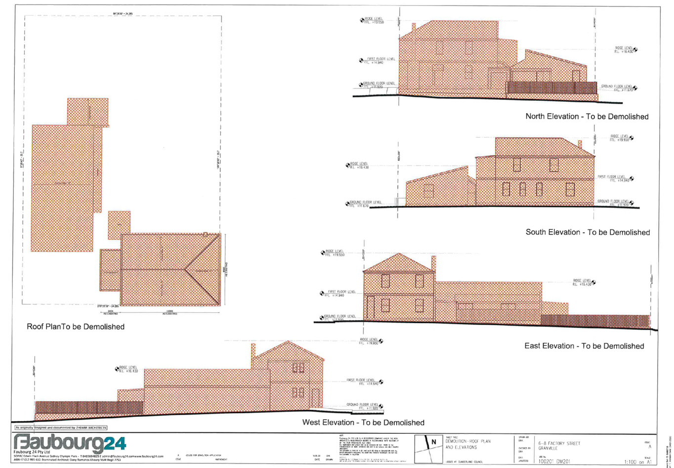
DOCUMENTS
ASSOCIATED WITH
REPORT LPP019/20
Attachment 3
Demolition and Site Plan
Cumberland Local Planning Panel Meeting
13 May 2020
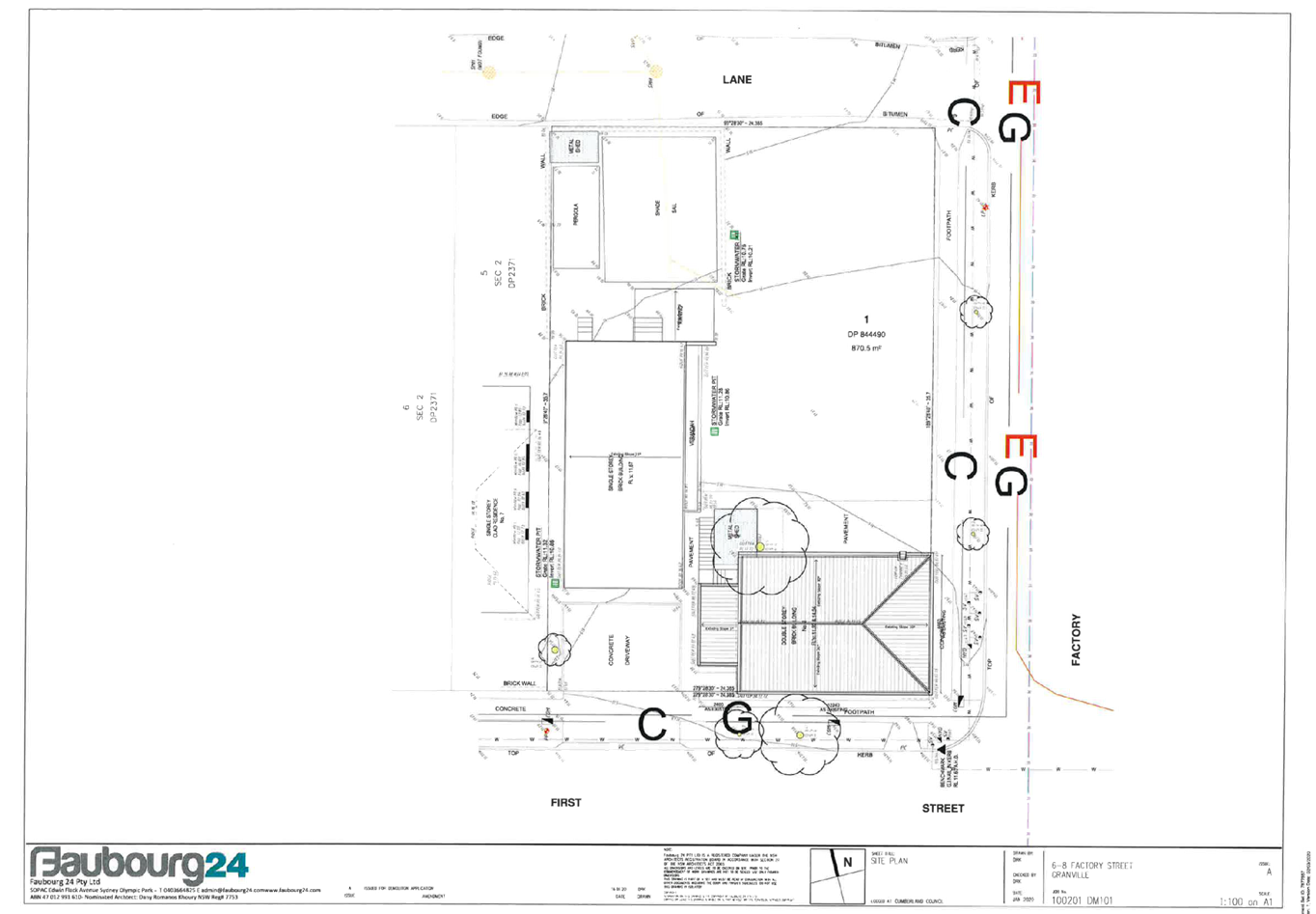
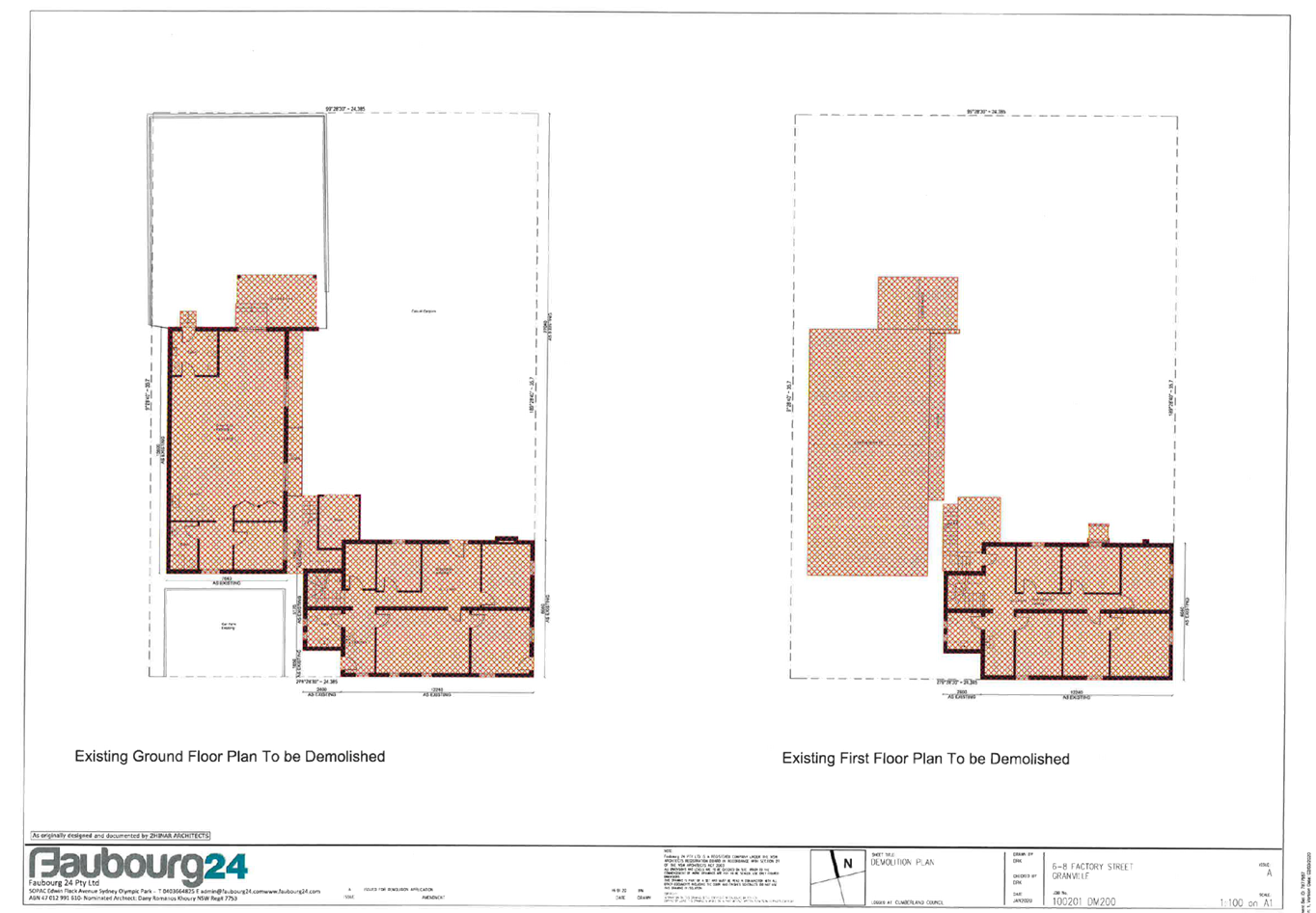
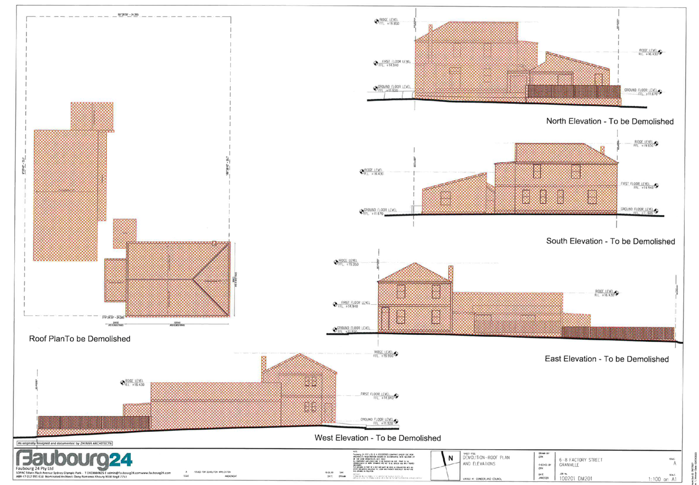
DOCUMENTS
ASSOCIATED WITH
REPORT LPP019/20
Attachment 4
Appendix A - Structural Engineers Report ( Mance
Arraj)
Cumberland Local Planning Panel Meeting
13 May 2020


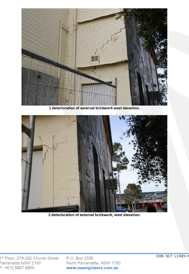
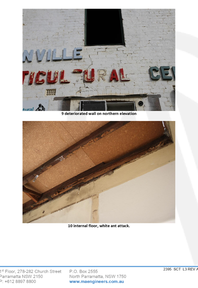
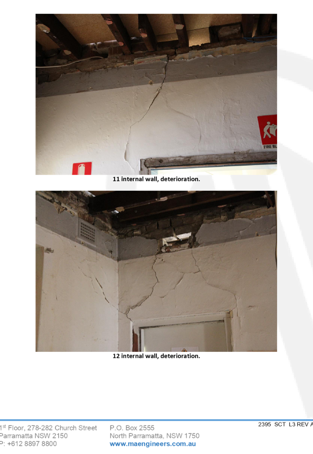
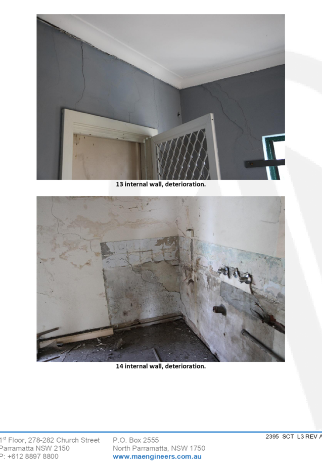
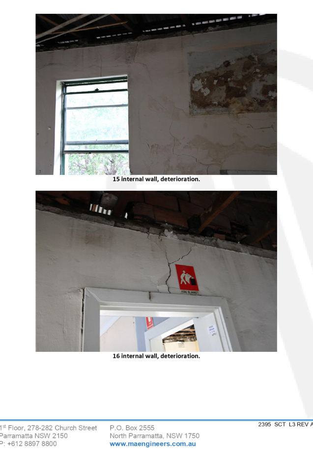
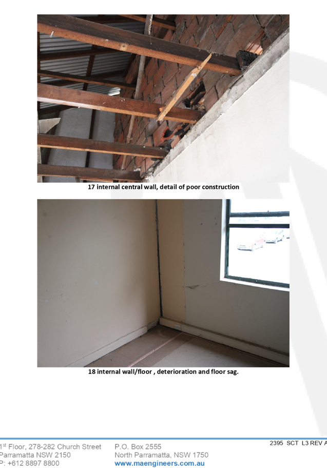
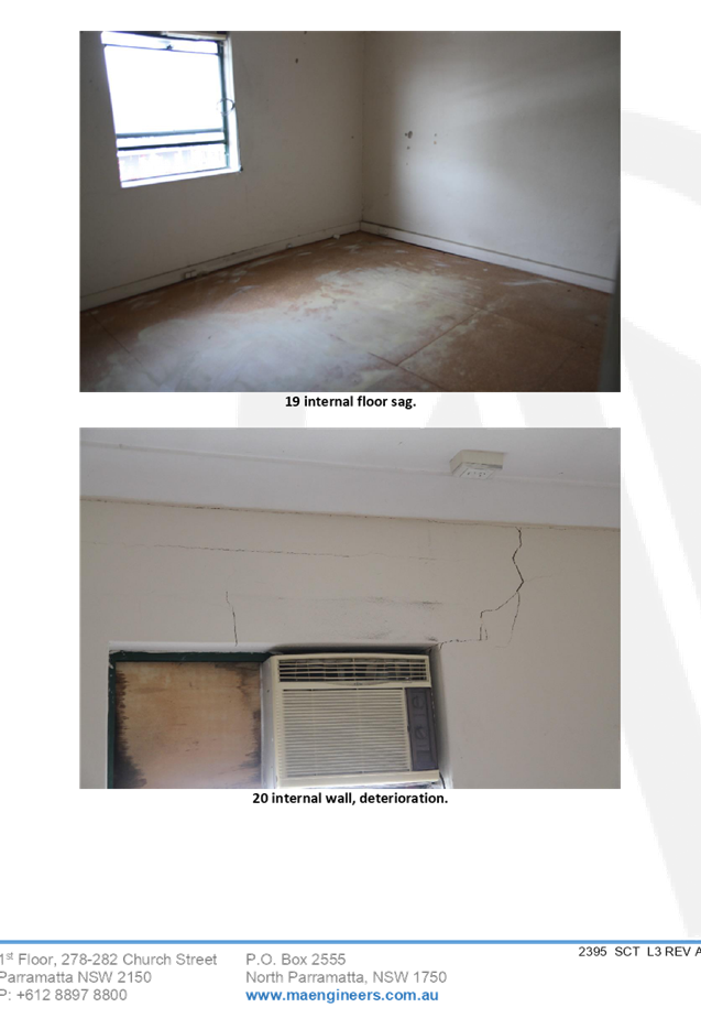
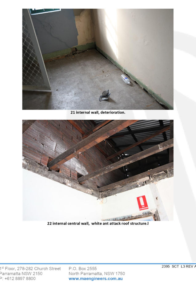
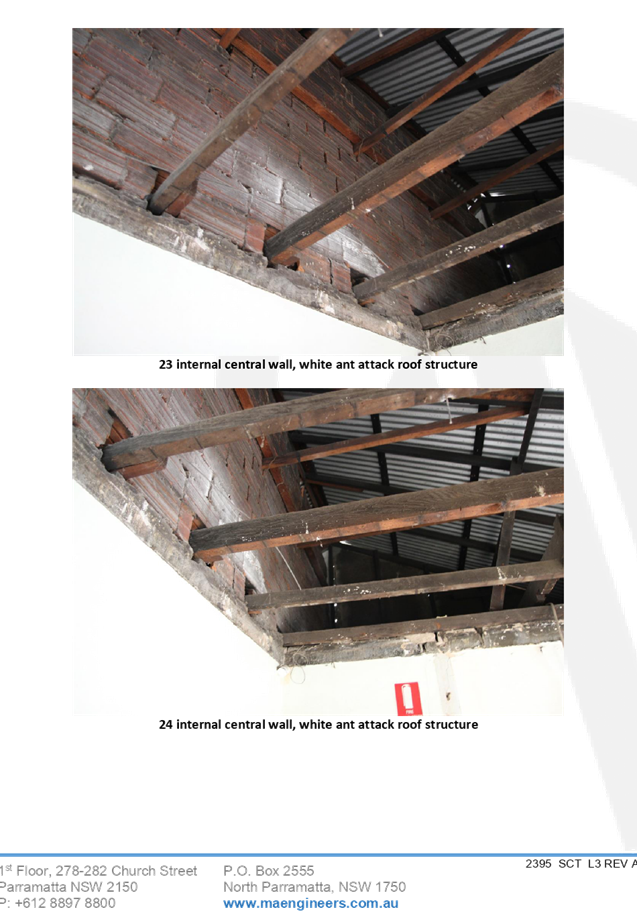
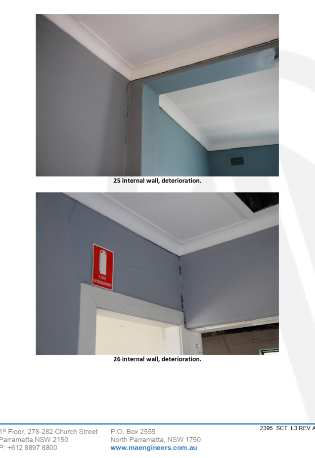
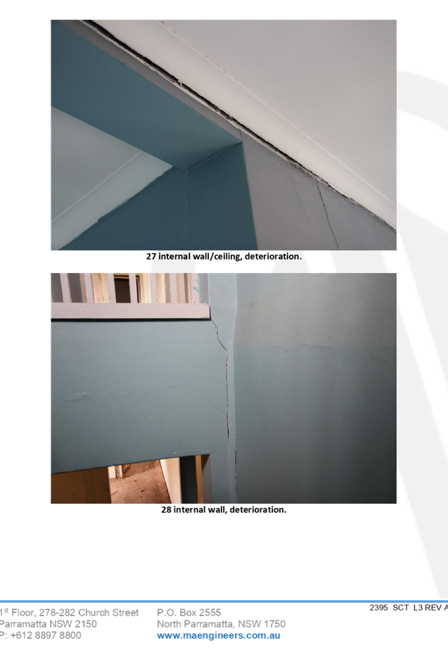
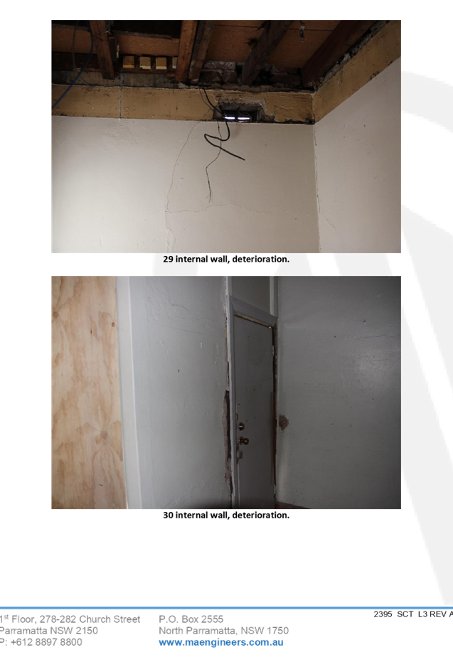
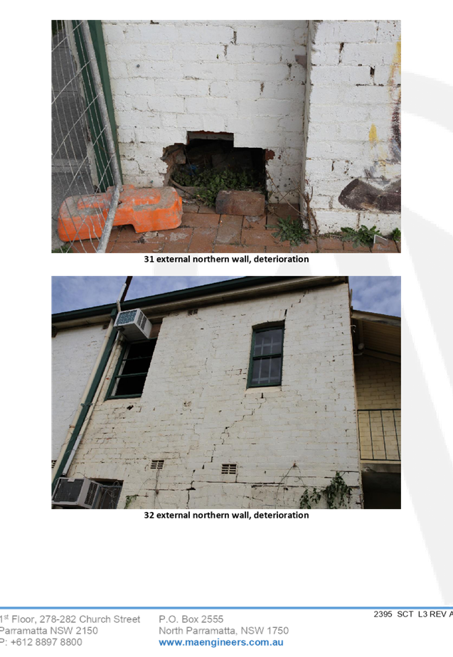
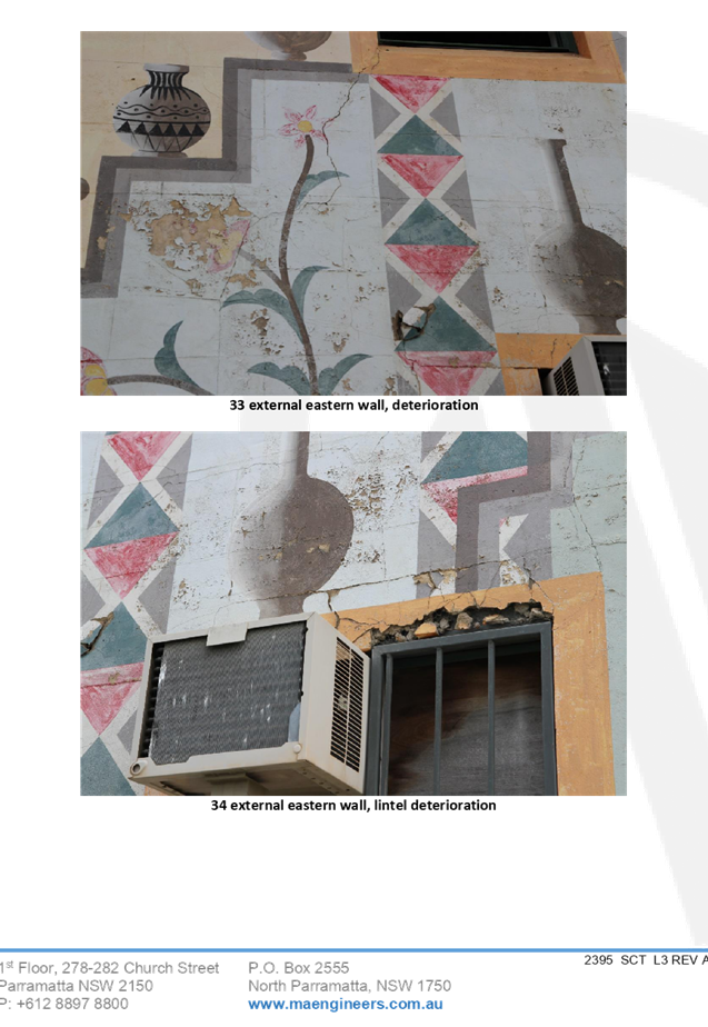
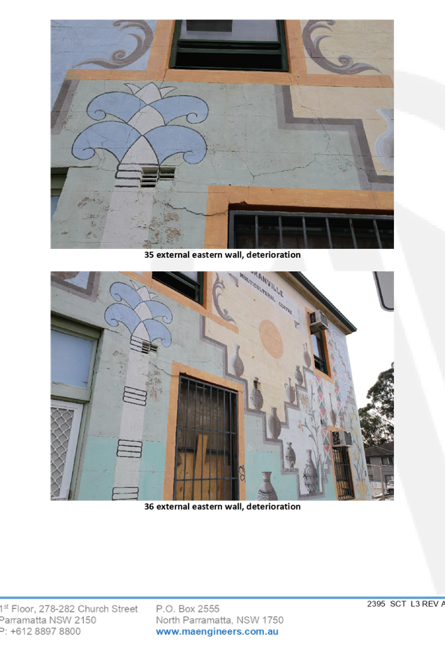
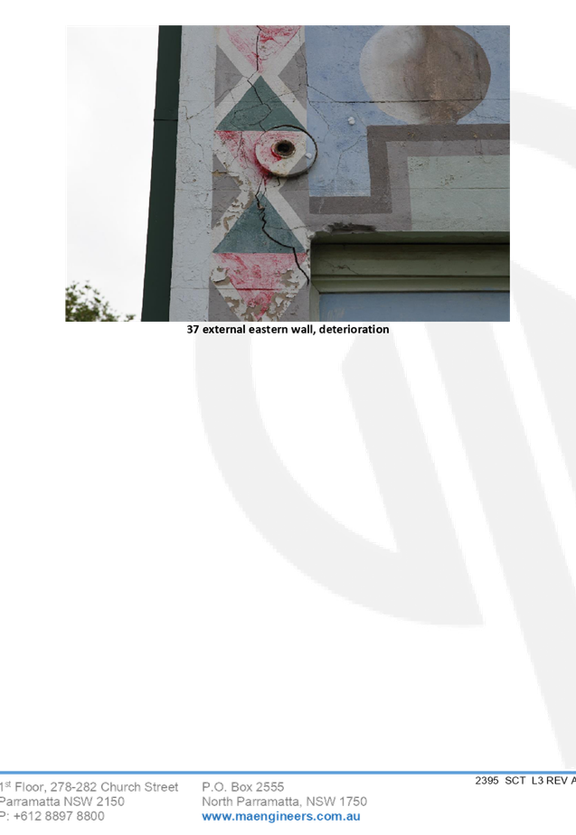
DOCUMENTS
ASSOCIATED WITH
REPORT LPP019/20
Attachment 5
Appendix B - Structural Engineers Report (Cam
Consulting)
Cumberland Local Planning Panel Meeting
13 May 2020
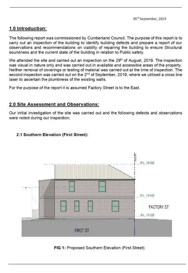
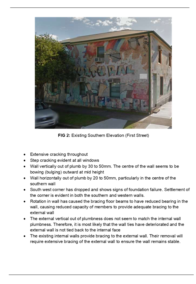
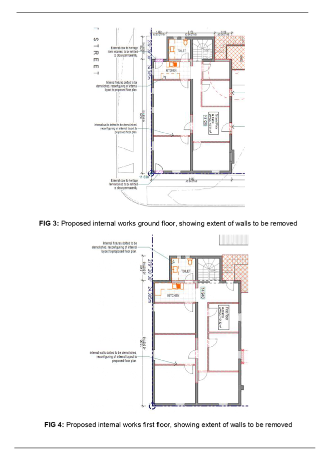
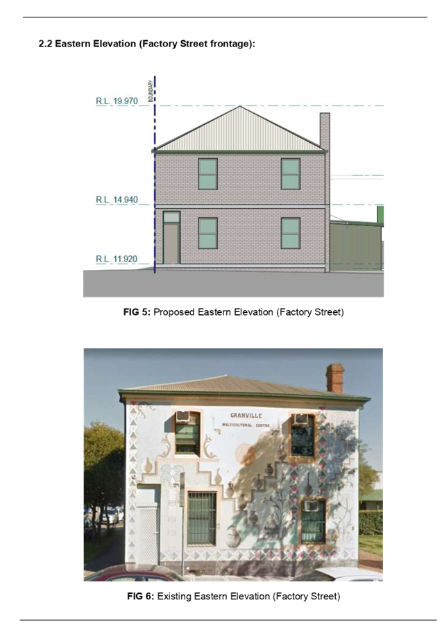
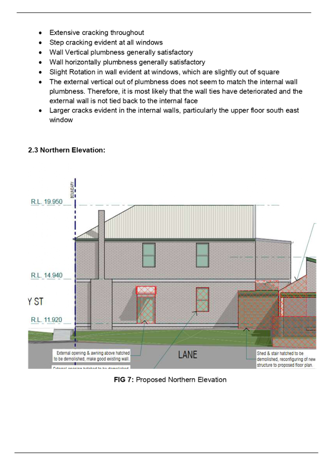
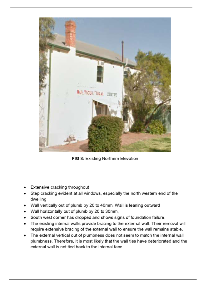
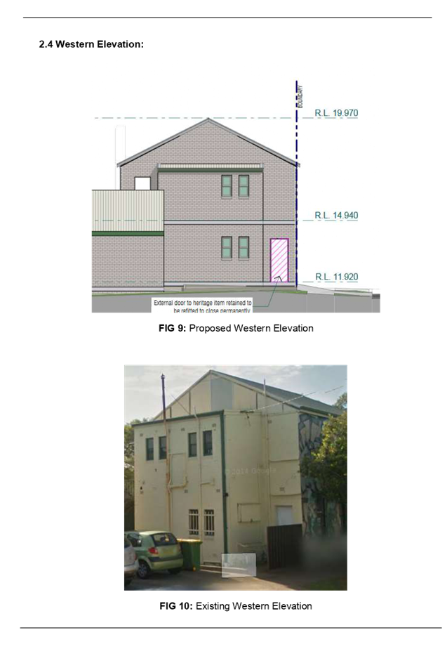
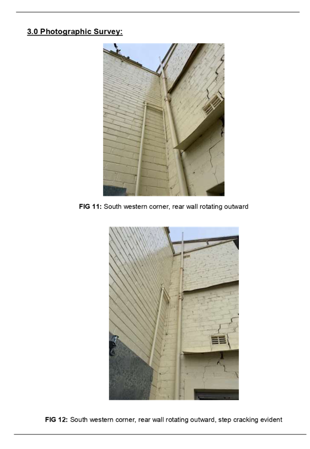
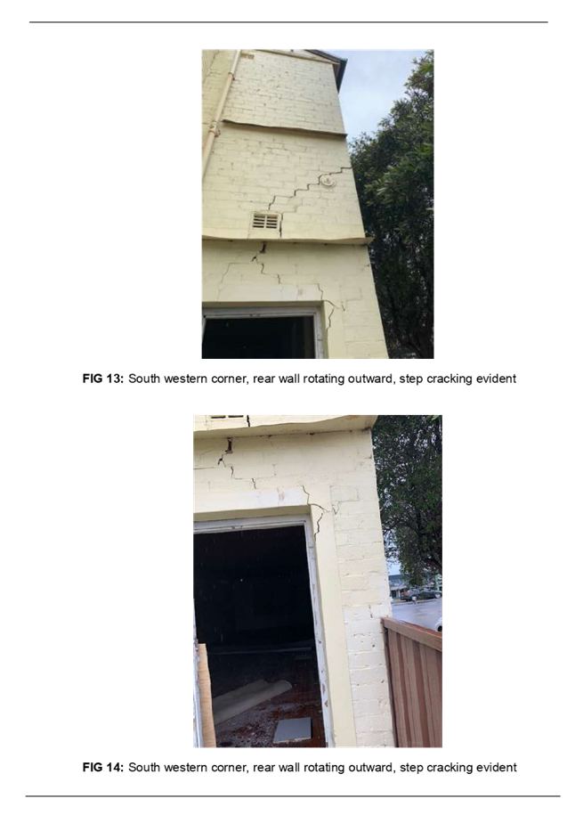
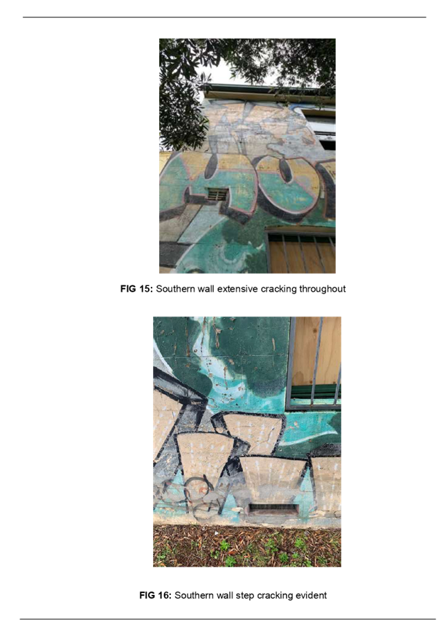
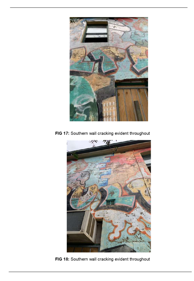
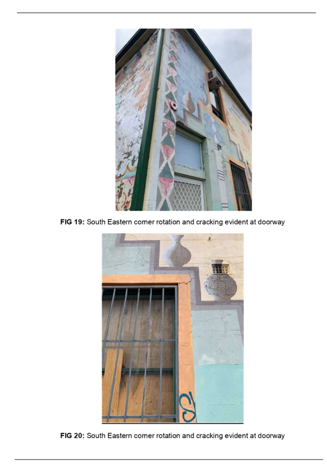
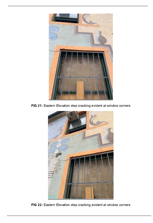
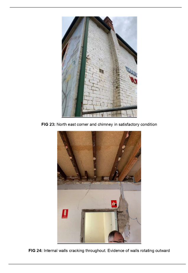
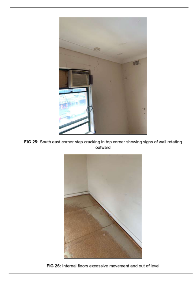
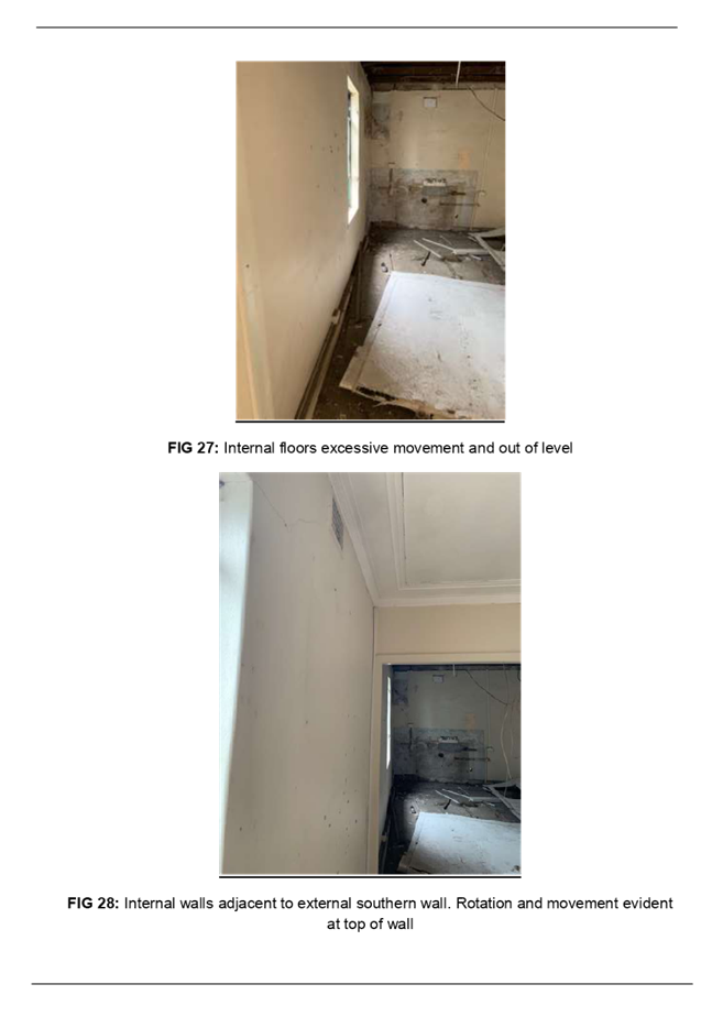
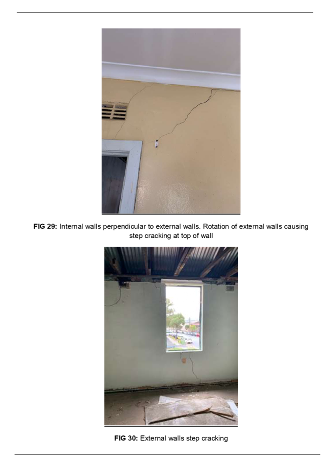
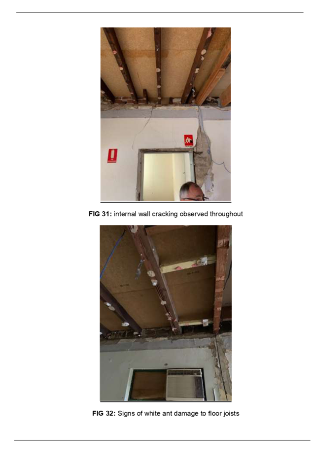
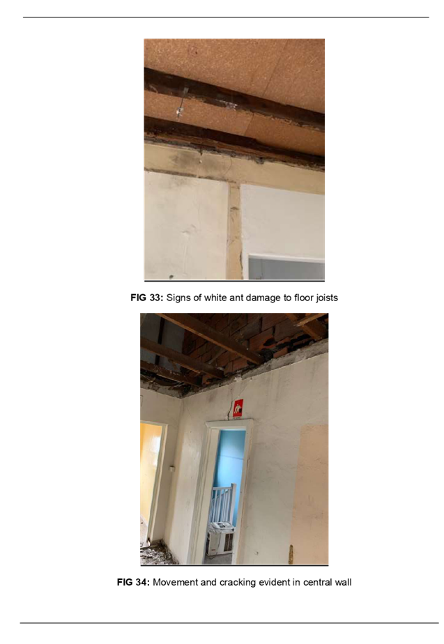
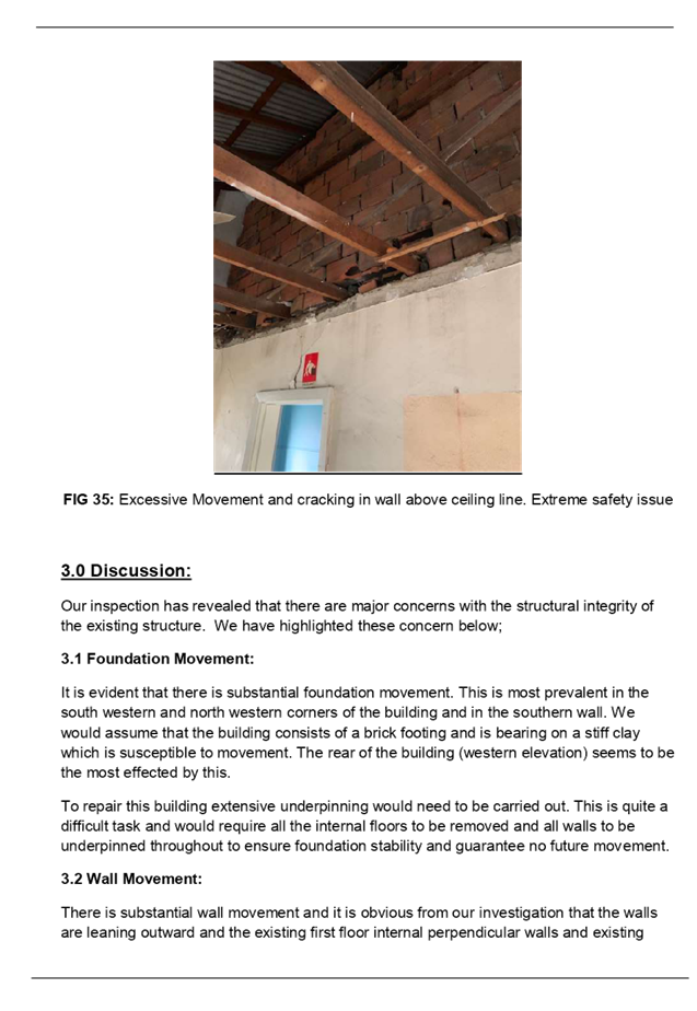

DOCUMENTS
ASSOCIATED WITH
REPORT LPP019/20
Attachment 6
Appendix C - Heritage Report
Cumberland Local Planning Panel Meeting
13 May 2020
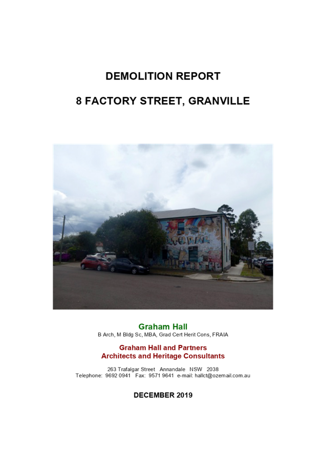
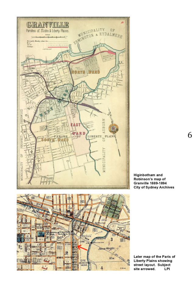
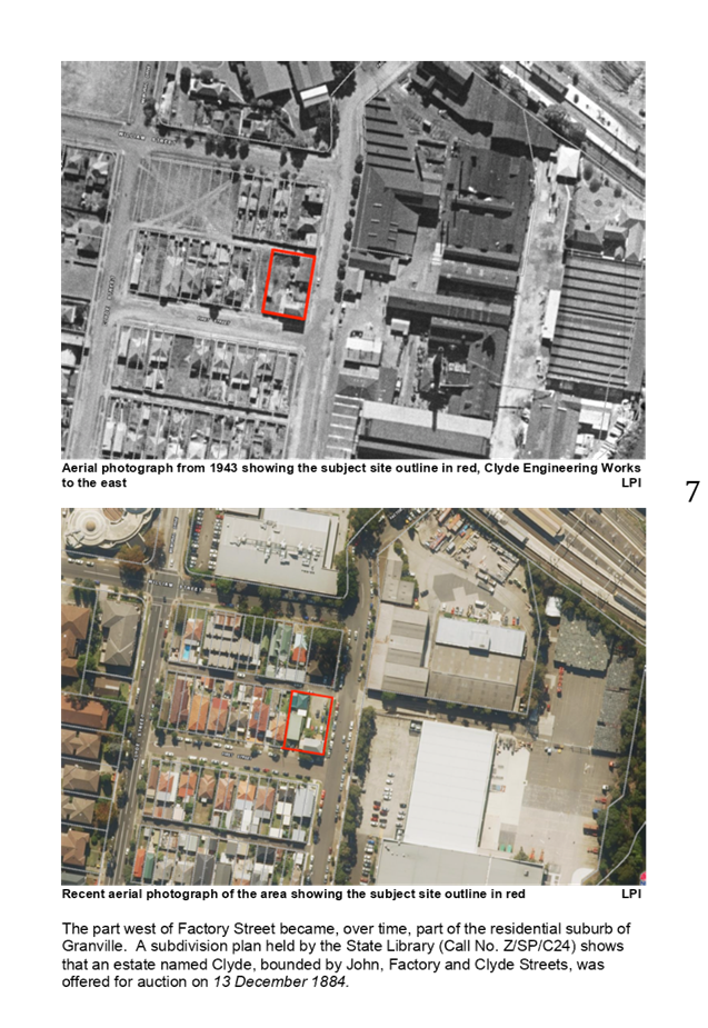
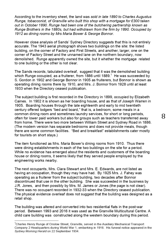
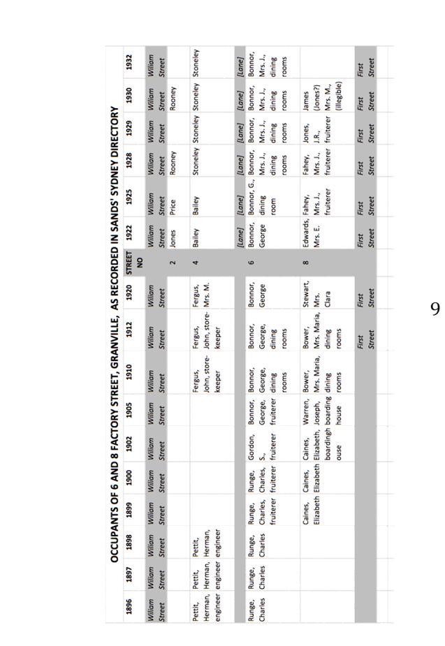
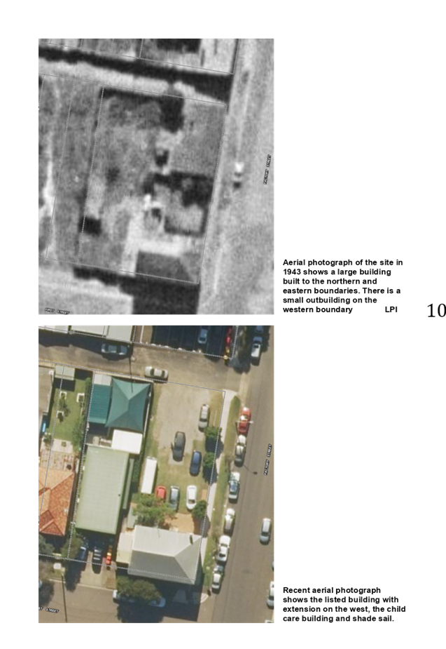
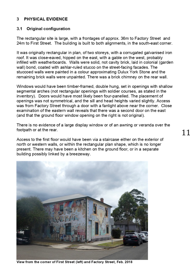
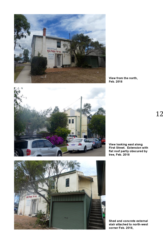
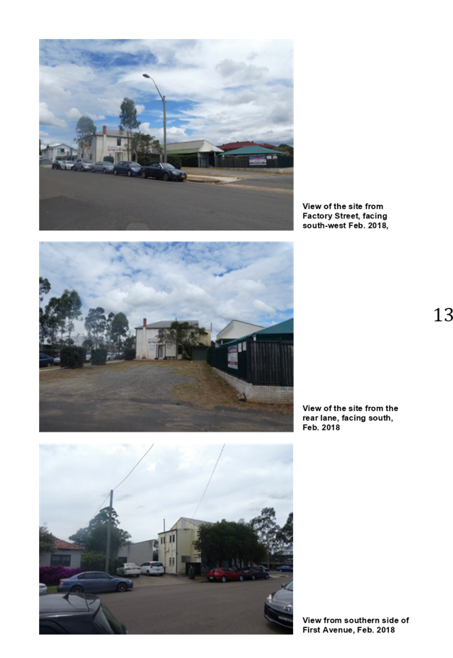

DOCUMENTS
ASSOCIATED WITH
REPORT LPP019/20
Attachment 7
Appendix D - Notice of Emergency Order Served
Cumberland Local Planning Panel Meeting
13 May 2020

DOCUMENTS
ASSOCIATED WITH
REPORT LPP019/20
Attachment 8
Appendix E - Independent Heritage Assessment Report
Cumberland Local Planning Panel Meeting
13 May 2020
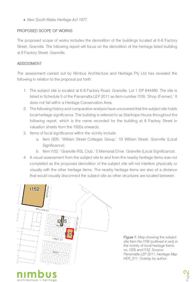
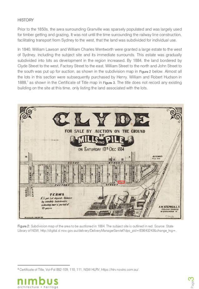
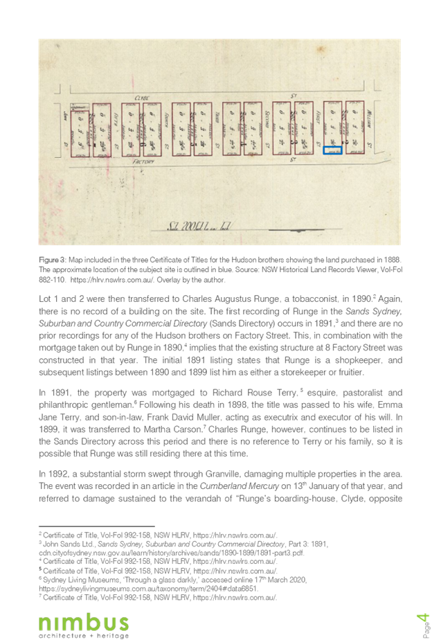
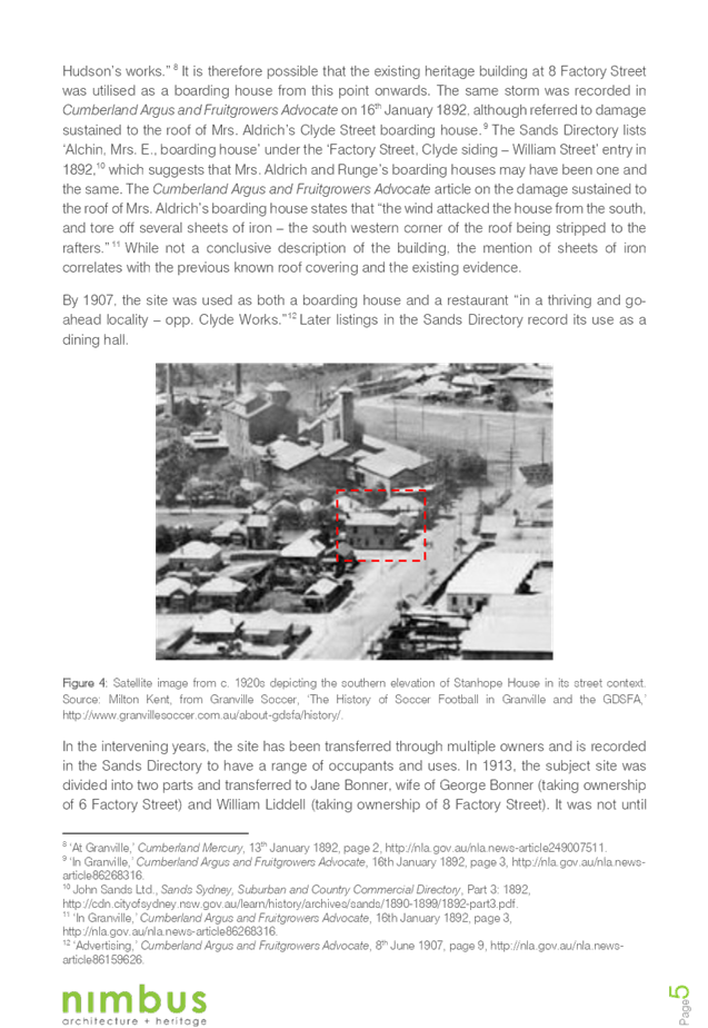
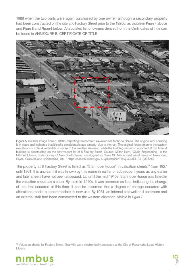
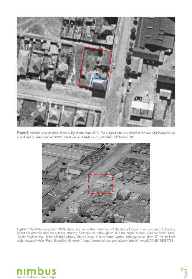
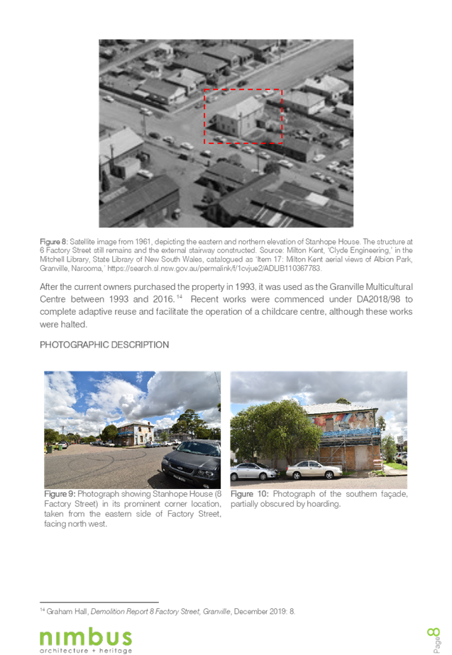
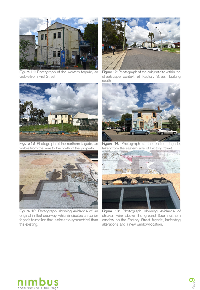
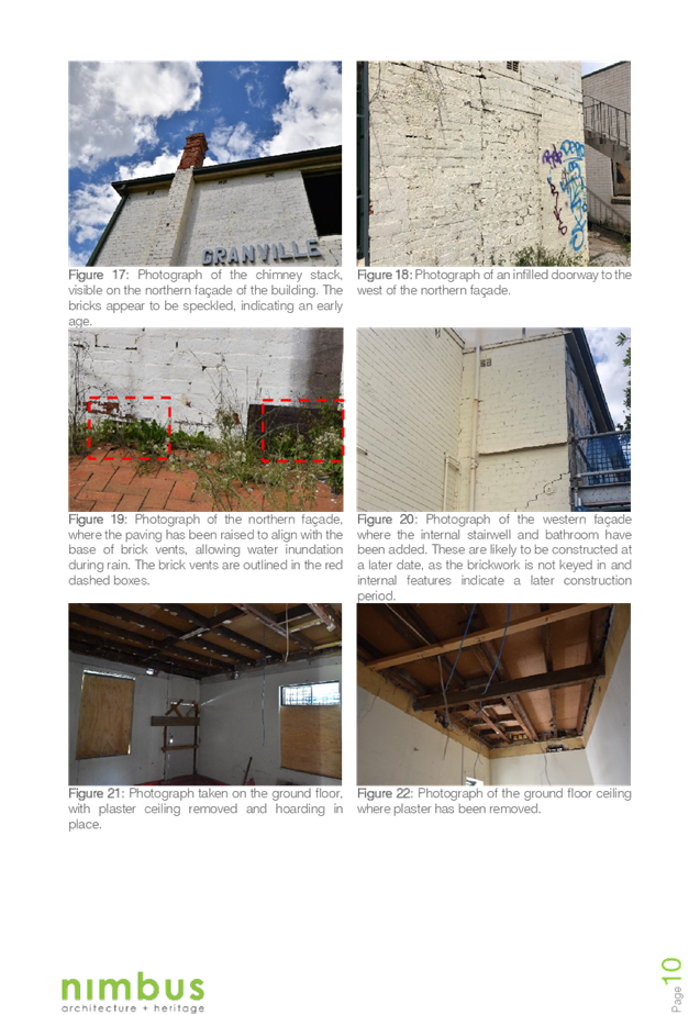
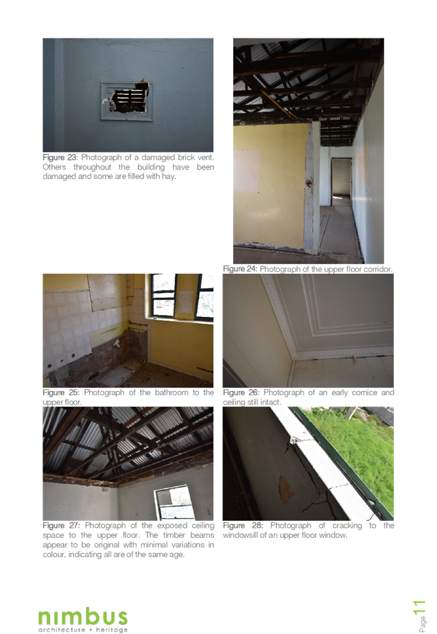
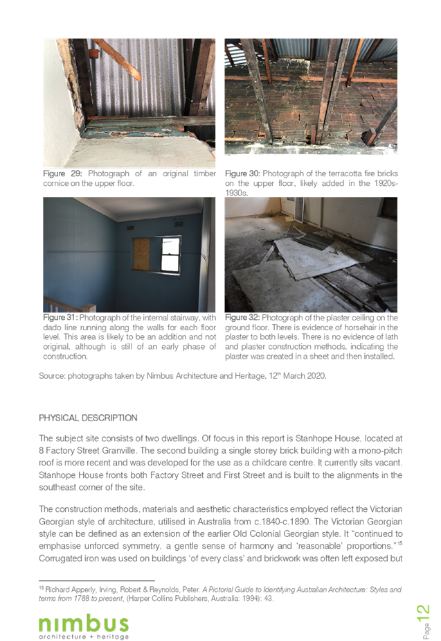
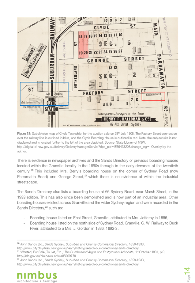
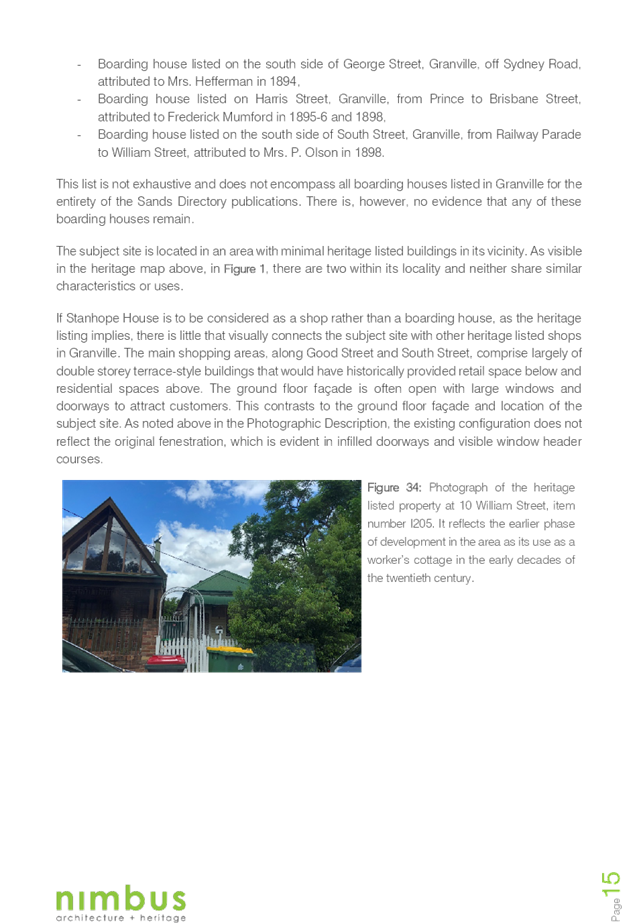
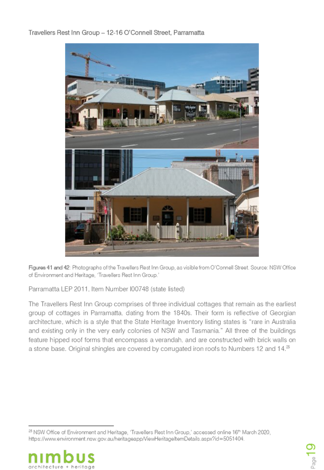
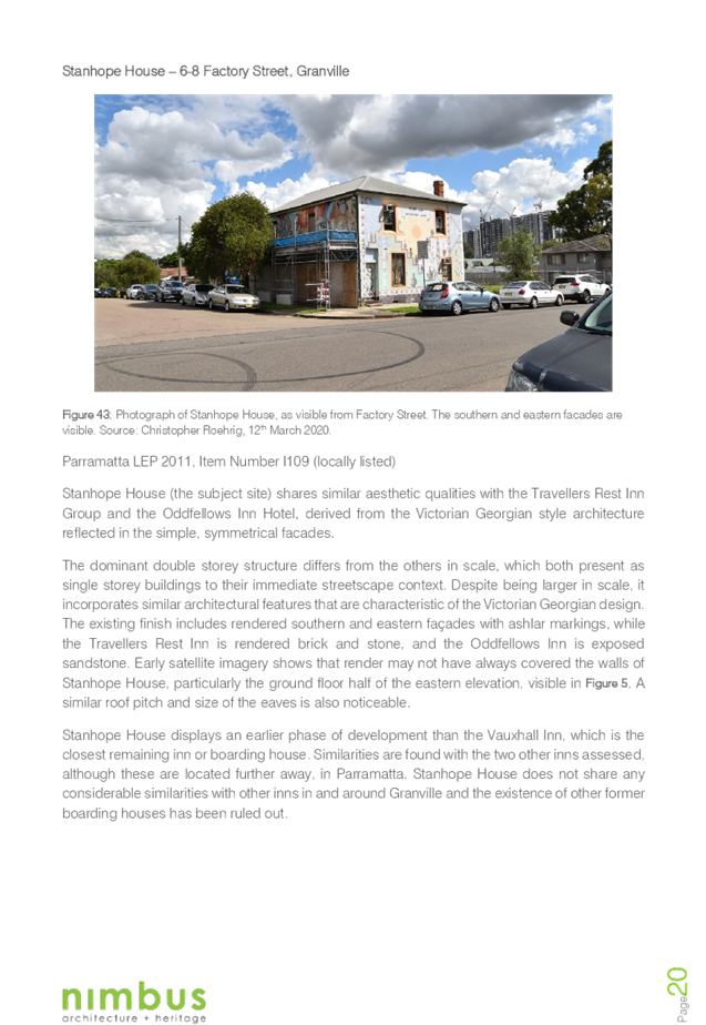
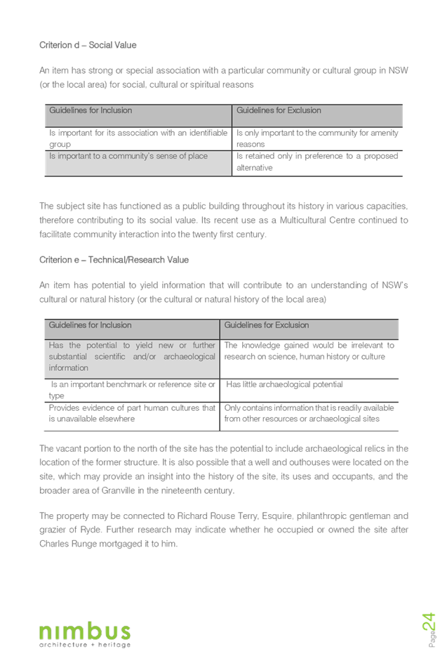
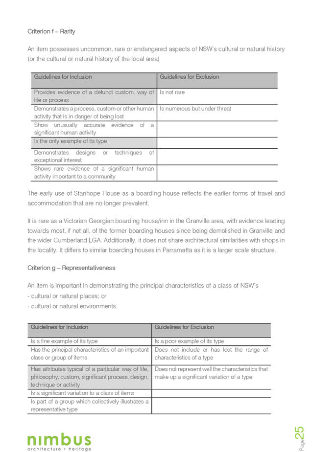
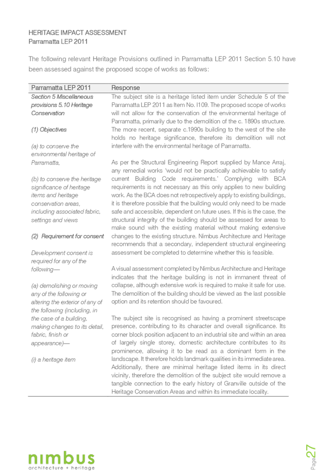


Cumberland
Local Planning Panel Meeting
13 May 2020
Item No: LPP020/20
Development
Application for 17-19 Peggy Street, Mays Hill
Responsible
Division: Environment
& Planning
Officer: Executive
Manager Development and Building
File
Number: DA2019/450/1
|
Application lodged
|
20
November 2019
|
|
Applicant
|
Mrs
S B Habib
|
|
Owner
|
Mr
A J Habib & Mrs S B Habib
|
|
Application No.
|
DA2019/450/1
|
|
Description of Land
|
17-19
Peggy Street, Mays Hill NSW 2145, Lots 63 & 64 DP 13239
|
|
Proposed Development
|
Demolition
of existing structures and construction of a part four (4), part five (5)
storey residential flat building comprising 16 units over a basement level of
car parking
|
|
Site Area
|
1365.8
m2
|
|
Zoning
|
R4
– High Density Residential
|
|
Disclosure of political donations and gifts
|
Nil
disclosure
|
|
Heritage
|
The
site is not a heritage item and is not located within a heritage conservation
area
|
|
Principal Development Standards
|
Height
of Buildings – 15 m
Floor
Space Ratio – 1.2:1
|
|
Issues
|
· Building
separation
· Overshadowing
· Site
coverage
· Basement
side setback
· Building
height – Number of storeys
· Lot
consolidation
|
1. The
subject application was lodged on 20 November 2019 and notified to surrounding
properties from 4 December 2019 to 8 January 2020. No submissions were received
as a result of the notification.
2. The
application was deferred on 17 January 2020 due to non-compliances with the ADG
and DCP controls, and inconsistency of information.
3. Additional
information and amended plans to address the deferral items were submitted on
21 February 2020. The amended plans addressed the majority of the concerns
regarding ADG non-compliances. The amended plans were renotified to surrounding
properties from 26 February 2020 to 26 March 2020. No submissions were
received.
4. The
application is being reported to the Cumberland Local Planning Panel (CLPP) for
determination as it is a development with 4 or more storeys to which the State
Environmental Planning Policy No 65 – Design Quality of Residential
Apartment Developments applies.
5. The
subject application has been assessed against the relevant provisions of the
Environmental Planning and Assessment Act 1979, State Environmental Planning
Policy No 65 – Design Quality of Residential Apartment Development,
Holroyd Local Environmental Plan (HLEP) 2013 and Holroyd Development Control
Plan (HDCP 2013) and the Draft Cumberland LEP and DCP 2020.
6. The
application involves the following numerical non-compliances which are
considered supportable as discussed in detail elsewhere in the report:
|
Control
|
Required
|
Proposed
|
% Variation
|
|
Building separation (ADG)
|
6 m
|
4.5 m
|
25%
|
|
Site coverage (DCP)
|
Max 30% (409.74m2)
|
35.3% (482m2)
|
5.3%
|
|
Basement setback (DCP)
|
3 m
|
1.1m to garden shed along northern side boundary; 1.3m to
southern side boundary
|
63.3%
|
|
Number of storeys
|
4
|
5 (technical non-compliance due to basement protrusion
being 2.2m)
|
25%
|
|
Sunlight access
|
1 main living area of existing adjacent dwellings to
receive 3 hours direct sunlight between 9am and 4pm, 22 June.
|
The proposal results in overshadowing of the northern
windows on the adjacent development to the south.
|
100%
|
|
Lot consolidation
|
Amalgamation of lots in accordance with Figure 4 (a) and
(b) is required.
No. 19 Peggy Street to be amalgamated with the adjacent
allotments to the south at No. 21 and 23 Peggy Street and No. 22 Rees Street.
|
No. 19 Peggy Street proposed to be amalgamated with No. 17
Peggy Street, Mays Hill.
|
N/A
|
7. The
application is recommended for approval subject to the conditions in the draft
determination at Attachment 4.
REPORT:
Subject Site and Surrounding
Area
The subject site is known as 17
& 19 Peggy Street, Mays Hill and is legally described as Lots 63 and 64 in
DP 13239. The site has an area of 1365.8 m2 and frontage of 30.48 m to the
eastern side of Peggy Street. There is currently a single storey dwelling and
associated fibro outbuildings located on each of the existing sites. There are
a number of established trees on the subject site and within the adjacent road
reserve. The site falls approximately 4 m towards the south eastern corner.
The subject site, and all
surrounding sites are zoned R4 – High Density Residential, as shown on
the zoning map below.
The subject site does not contain
any heritage items and is not within a heritage conservation area. There are no
heritage items within the vicinity of the subject site.
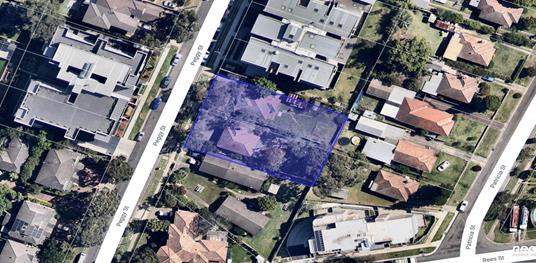
Aerial
view of the locality with subject site highlighted in blue. Source: Nearmap
2020
Zoning
map with subject site shown hatched. Source: Cumberland Council 2020
Subject
site – View from Peggy Street. Source: Cumberland Council 2019
Description of the Proposed
Development
DA 2019/450 proposes demolition of
existing structures and construction of a part 4, part 5 storey residential
flat building accommodating 16 units, over basement parking for 21 cars.
Key features of the development
proposal are as follows: -
|
Level
|
Details
|
|
Basement
|
21 car spaces (including 3 accessible spaces), 10 bicycle
spaces, 2 motorcycle spaces and waste storage room
|
|
Ground floor
|
4 x 2 bedroom units
|
|
First floor
|
2 x 2 bedroom units, 1 x 1 bedroom unit and 1 x 3 bedroom
unit
|
|
Second floor
|
2 x 2 bedroom units, 1
x 1 bedroom unit and 1 x 3 bedroom unit
|
|
Third floor
|
2 x 2 bedroom units, 1
x 1 bedroom unit and 1 x 3 bedroom unit
|
The proposed apartment mix is as
follows:
· 3 x 1 bedroom
(18.75%)
· 10 x 2 bedroom
(62.5%)
· 3 x 3 bedroom (18.75%)
Application History
The applicant attended a
pre-lodgement meeting in August 2017 to discuss the proposed redevelopment of
the site for a 4 storey residential flat building. There is no other site
history relevant to the subject application. Key actions relating to DA2019/450
are detailed in the following table.
|
Date
|
Action
|
|
20 November 2019
|
DA 2019/450 lodged with Council
|
|
27 November 2019
|
Subject application referred to the following internal
sections for comment:
· Development
Engineering
· Landscaping
· Waste Management
· Environmental
Health
|
|
27 November 2019
|
Subject application referred to the following external
agencies:
· Endeavour Energy
· Transgrid
|
|
4 December 2019 to 8 January 2020
|
Subject application placed on public notification for 35
days (the extra days were to accommodate the public holiday periods). No
submissions were received.
|
|
17 January 2020
|
Application deferred seeking additional information and
amended plans
|
|
21 February 2020
|
Amended plans and additional information received by
Council
|
|
26 February to 18 March 2020
|
Amended plans placed on public notification for 21 days.
No submissions were received.
|
|
13 May 2020
|
Application referred to CLPP for determination
|
Applicant’s Supporting
Statement
A Statement of Environmental
Effects prepared by Weir Phillips dated 2 August 2019 was submitted with the
application. An addendum to the Statement of Environmental Effects was
submitted to council as part of the amended plans dated 20 February 2020.
Contact with Relevant
Parties
The assessing officer has undertaken an inspection of the
subject site and has been in contact with the applicant throughout the
assessment process.
Internal Referrals
Development Engineering
The application was referred to Council’s Development
Engineer for comment. Response received indicates that the proposal is
satisfactory, subject to conditions, including a deferred commencement
condition requiring the registration of a drainage easement in favour of the
subject site and amendments to the stormwater plans. The conditions recommended
by the Development Engineer are included in the draft determination.
Landscape and Tree Management
The application was referred to Council’s Tree
Management Officer for comment. Response received indicates that the proposed
tree removal and landscape works are satisfactory, subject to conditions. The
conditions recommended by the Tree Management Officer are included in the draft
determination.
Environmental Health
The application was referred to Council’s
Environmental Health Unit for comment. The response received indicates that the
proposal is satisfactory, subject to conditions.
Waste Management
The application was referred to Council’s Waste
Management Unit for comment. The response received recommends that the
application be deferred. Amended plans address waste issues. A condition
recommended for a bin tug is included in the draft determination.
External Referrals
Endeavour Energy
The application was referred to
Endeavour Energy for comment pursuant to clause 45 of the SEPP Infrastructure.
The response received 23 December 2019 indicates that Endeavour Energy does not
object to the proposal.
Transgrid
The application was referred to
Transgrid for comment. The response received 4 December 2019 indicates that
Transgrid does not object to the proposal.
Planning Assessment
The provisions of any
Environmental Planning Instruments (EP&A Act s4.15 (1)(a)(i))
The following Environmental
Planning Instruments are relevant to the assessment of the subject application:
(a) State
Environmental Planning Policy No 55 – Remediation of Land (SEPP 55)
The requirement at clause 7 of
SEPP 55 for Council to be satisfied that the site is suitable or can be made
suitable to accommodate the proposed development has been considered in the
following table:
|
Matter
for consideration
|
Yes
|
No
|
|
Does the application involve re-development of the site or
a change of land use?
|
|
|
|
Is the development going to be used for a sensitive land
use (e.g. residential, educational, recreational, childcare or hospital)?
|
|
|
|
Does information available to you indicate that an
activity listed below has ever been approved, or occurred at the
site?
acid/alkali plant and formulation,
agricultural/horticultural activities, airports, asbestos production and
disposal, chemicals manufacture and formulation, defence works, drum
re-conditioning works, dry cleaning establishments, electrical manufacturing
(transformers), electroplating and heat treatment premises, engine works,
explosive industry, gas works, iron and steel works, landfill sites,
metal treatment, mining and extractive industries, oil production and
storage, paint formulation and manufacture, pesticide manufacture and
formulation, power stations, railway yards, scrap yards, service stations,
sheep and cattle dips, smelting and refining, tanning and associated trades,
waste storage and treatment, wood preservation
|
|
|
|
Is the site listed on Council's contaminated land
database?
|
|
|
|
Is the site subject to EPA clean-up order or other EPA
restrictions?
|
|
|
|
Has the site been the subject of known pollution incidents
or illegal dumping?
|
|
|
|
Does the site adjoin any contaminated land/previously
contaminated land?
|
|
|
|
Has the appropriate level of investigation been carried
out in respect of contamination matters for Council to be satisfied that the
site is suitable to accommodate the proposed development or can be made
suitable to accommodate the proposed development?
|
|
|
|
Details of
contamination investigations carried out at the site:
A Preliminary Site Investigation prepared by EI Australia
was submitted with the application. The report identified that the site was
vacant land prior to being used for residential purposes since the 1960s and
the likelihood of contamination is low. However, the consultant has provided
recommendations, including the completion of a Hazardous Materials Survey,
which can be addressed by condition.
|
(b) State
Environmental Planning Policy (Building Sustainability Index: BASIX) 2004
BASIX certificate 1011269M_02
dated 6 September 2019 was submitted with the application. The proposal
achieves the target scores for energy, water and thermal comfort and relevant
commitments are shown on the architectural plans. The amended plans did not
require a revised BASIX Certificate.
(c) State
Environmental Planning Policy No 65 – Design Quality of Residential
Apartment Development (SEPP 65)
The proposal is classified as a
residential apartment development and SEPP 65 applies. A design verification
statement signed by registered architect Tony Sukkar (6779) was submitted with
the application.
The design quality principles from
Schedule 1 of the SEPP are considered in the following table:
|
Design quality
principle
|
Response
|
|
1. Context and
neighbourhood character
|
The design of
the proposal is considered appropriate within the context of the site.
The proposed
development will provide a positive addition to the streetscape and is
compatible with the developments that are existing within the local area and
currently under construction on surrounding sites.
The communal
open space and landscaping within the setbacks will provide good amenity for
the residents of the proposed development, as well as softening the
appearance of the proposal from adjacent sites.
|
|
2. Built form and
scale
|
The scale, bulk
and height of the proposal is appropriate for the site and are consistent
with the desired future character of the area; as evidenced by compliance
with the height and FSR standards for the site.
The alignment
and proportions of the building help to define the public domain and
contribute to streetscape character, internal amenity and outlook.
|
|
|
It should be
noted, the proposal does not comply with the building separation along the
northern side boundary, however, is considered acceptable on merit as the
privacy impacts have been assessed as satisfactory. The combined building
separation of the proposed development and the existing development on the
property adjoining to the north is sufficient to maintain the amenity impacts
of the existing and future residents.
|
|
3. Density
|
The subject
site is well located with respect to existing public transport and community
facilities. The proposal complies with the FSR standard for the site and the
design of the development provides for appropriate separation between
dwellings.
|
|
4. Sustainability
|
A BASIX
certificate was submitted with the application, demonstrating that the
building meets the applicable thermal comfort, energy efficiency and water
efficiency targets.
The proposal
provides for adequate deep soil zones, which will allow for groundwater
recharge and establishment of vegetation.
|
|
5. Landscape
|
A landscape
plan was submitted with the proposal. The landscaping options are considered
to be adequate. The proposed landscaping will provide suitable visual amenity
for the future occupants of the development and a suitable landscape setting
for the building within the streetscape is also proposed.
|
|
6. Amenity
|
The proposed
development optimises internal amenity through appropriate room dimensions,
layout of the units, access to sunlight, and natural ventilation. Visual and
acoustic privacy concerns are managed without compromising the outlook and
amenity of the proposed units. Consideration has also been given to service
areas and storage to ensure the functionality of the development as a whole.
|
|
7. Safety
|
The proposal is
considered to be satisfactory in terms of providing casual surveillance to
the public domain and communal areas whilst maintaining privacy for the
proposed units.
Public areas
are well defined and access within the development is appropriately
restricted to ensure safety of residents.
|
|
8. Housing diversity
and social interaction
|
The proposal
provides for a mix of apartment sizes and layouts. The variety of communal
open spaces and the design of the common circulation spaces will encourage
social interaction among residents.
|
|
9. Aesthetics
|
The proposal
provides for a balanced composition of building elements with a variety of
colours and textures. The external presentation of the building reflects the
internal layout and structure, and the visual bulk is broken up with
indentations and offsets on each façade.
|
Pursuant to clause 28(2)(c) of
SEPP 65, a consent authority must consider the provisions of the Apartment
Design Guide (ADG) in the assessment of a residential flat development.
The proposal involves the
following non-compliances with the ADG controls.
|
Clause
|
Control
|
Proposed
|
Complies
|
|
3F-1 – Visual
Privacy
|
Design Criteria
Separation
between windows and balconies is provided to ensure visual privacy is
achieved. Minimum required separation distances from buildings to the side
and rear boundaries are as follows:
Note:
Separation distances between
buildings on the same site should combine required building separations
depending on the type of room.
Gallery access circulation should be treated as habitable
space when measuring privacy separation distances between neighbouring
properties.
|
North
6m required at levels ground
to third floor
4.5 m proposed to kitchen
windows and 3m provided to bedroom.
|
No – See
discussion below.
|
As indicated in the compliance
table above, the proposed development departs from the building separation
provision of the ADG.
Irrespective of this departure, it
is considered that the proposal performs adequately from an environmental
planning viewpoint and may be supported for the reasons discussed below:
Building Separation
Under Part 3F of the ADG, a
minimum 6m building separation is required from habitable rooms and 3m to
non-habitable rooms. The proposal achieves a 4.5m building separation to the
kitchen windows along the northern elevation for Units G.1, 1.1, 2.1 and 3.1 and
a 3m building separation to the bedrooms for Units G.1, G.2, 1.1, 1.2, 2.1,
2.2, 3.1 and 3.2. The northern adjoining property is setback a minimum 6m from
the southern boundary and combined with a 4.5m building separation proposed,
this equates to a total building separation of 10.5m. Additionally, the 1.8m
side boundary fence will obscure views from the kitchen window for Unit G.1 and
the hi-light windows proposed for Units 1.1, 2.1 and 3.1 will limit
overlooking. The location of the kitchen windows will not affect the solar
access achieved to these units as the living areas are orientated to the west,
which is compliant with the minimum 2 hour solar access requirement.
Furthermore, the openings for the
bedrooms along the northern elevation are to the west for Units G.1, 1.1, 2.1
and 3.1 and to the east of Units G.2, 1.2, 2.2 and 3.2 with no openings along
the northern elevation of the building. This will not have any privacy or
overshadowing impacts on the existing development at No. 11-15 Peggy Street and
is therefore considered acceptable.
Having regard to this, and the
increased building separation proposed along the southern side boundary to
maximise the solar access to the property adjoining to the south, the variation
will not have any significant amenity impacts on the adjoining properties and
is considered acceptable.
A comprehensive ADG assessment is
provided at Attachment 2.
(d) State
Environmental Planning Policy (Infrastructure) 2007
The provisions of the
Infrastructure SEPP (ISEPP) 2007 have been considered in the assessment of the
development application.
Clause 45 - Development likely
to affect an electricity transmission or distribution network
The proposed development involves
works within proximity to the existing overhead power lines. As such, the
application was referred to Endeavour Energy for comment as the relevant
electricity supply authority.
See discussion regarding the
Endeavour Energy response under ‘external referrals’ above.
(e) Statement
Environmental Planning Policy No 19 - Bushland in Urban Areas
The proposal does not propose to
disturb bushland zoned or reserved for public open space.
(f) State
Environmental Planning Policy (Vegetation in Non-Rural Areas) 2017
The proposal includes removal of
all existing trees within the subject site. However, this does not exceed the
biodiversity offsets scheme threshold and the majority of the trees on site are
exempt species. Therefore, the proposed vegetation removal is considered
acceptable. Please refer to the HDCP 2013 compliance table at Attachment 3 for
further comment regarding the proposed tree removal.
(g) State
Environmental Planning Policy (Coastal Management) 2018
The subject site is not identified
as a coastal wetland nor is it ‘land identified as “proximity area
for coastal wetlands” as per Part 2, Division 1 of the SEPP Coastal
Management 2018.
(h) Holroyd
Local Environmental Plan 2013 (HLEP 2013)
The proposed development is
defined as a ‘residential flat building’ under the provisions of
HLEP 2013. Residential flat buildings are permitted with consent in the R4
– High Density Residential zone which applies to the land.
The proposal complies with all
applicable development standards under HLEP 2013. A comprehensive LEP
compliance table is provided at Attachment 1.
The provisions of any proposed
instrument that is or has been the subject of public consultation (EP&A Act
s4.15 (1)(a)(ii))
The Draft Cumberland Local
Environmental Plan 2020 (Draft CLEP) has been prepared by Cumberland Council to
provide a single planning framework for the future planning of Cumberland City.
The changes proposed seek to harmonise and repeal the three existing LEPs
currently applicable to the Cumberland local government area, those being:
· Holroyd
Local Environmental Plan 2013
· Parramatta
Local Environmental Plan 2011.
· Auburn
Local Environmental Plan 2010.
The current planning controls for
the subject site, as contained within the HLEP 2013, are not proposed to change
under the Draft CLEP.
The provisions of any
Development Control Plans (EP&A Act s4.15 (1)(a)(iii))
(a) Holroyd
Development Control Plan 2013
HDCP 2013 contains general
controls which relate to all developments under Part A, and Residential
Controls under Part B.
A comprehensive HDCP compliance
table is attached to this report at Attachment 3. A summary of the DCP
non-compliances is provided in the following table.
|
Clause
|
Control
|
Proposed
|
Complies
|
|
1.8 Sunlight Access
|
1 main living area of existing adjacent dwellings to
receive 3 hours direct sunlight between 9am and 4pm, 22 June.
|
The proposal results in
overshadowing of the northern windows on the adjacent development to the
south.
|
No – Refer to justification below.
|
|
6.2 Site Coverage
|
Maximum site coverage
of any residential flat development shall not exceed 30%
1365.8 x 0.3 = 409.74 m2
|
482 m2 (35.3%)
|
No – Refer to justification below.
|
|
6.3 Setbacks and separation
|
Basement setback to side and rear boundaries minimum 3m
|
Northern side boundary: 1.1m from the garden shed; and
Southern side boundary: 1.3m
|
No – Refer to justification below.
|
|
6.4 Height
|
Maximum number of storeys
shall be provided in accordance with the table below:
|
Permitted
Height (storeys)
|
|
Height
|
Storeys
|
|
9m
|
1
|
|
11m
|
2
|
|
12.5m
|
3
|
|
15m
|
4
|
|
18m
|
5
|
|
21m
|
6
|
|
24
m
|
7
|
|
Basement projection is more than 1m at the south-eastern
corner resulting in a five storey component.
|
No. The overall height is compliant and this minor
variation is considered acceptable on merits.
|
|
1.1 Site Consolidation and Frontage
|
Amalgamation of lots in
accordance with Figure 4 (a) and (b) is required
|
No. 19 Peggy Street is required to be amalgamated with
lots adjoining to the south.
No amalgamation is proposed with these lots.
|
No – Refer to justification below.
|
As indicated in the compliance table
above, the proposed development departs from the sunlight access, site
coverage, side setback and building height provisions of the Holroyd DCP 2013.
Irrespective of these departures,
it is considered that the proposal performs adequately from an environmental
planning viewpoint and can be supported for the reasons discussed below:
Sunlight Access
Under Section 1.8, Part B of the
HDCP 2013, dwellings on adjoining properties shall achieve a minimum 3 hours of
solar access to the main living areas between 9am and 4pm in mid-winter. The
proposed development results in the overshadowing of the northern windows on
the adjacent development to the south. The proposal provides additional setback
to the southern boundary. The side setback is required to be 3m under the HDCP
2013 and the ADG calls for their share of building separation to be 6m. A 7m is
proposed along this boundary to maximise solar access to the southern adjoining
property.
Furthermore, the southern
adjoining property can achieve solar access to the main living areas from the
eastern and western orientated windows. In view of this and in view of the
desired future built character of the area, the proposal is considered
acceptable from a solar access point of view.
Site Coverage
Under Section 6.2, Part B of the
HDCP 2013, the site coverage of a residential flat building shall not exceed
30% of the site area. The proposal achieves a site coverage of 482m2, which
equates to a site coverage of 35.3%. Minor numerical variation is sought to the
site coverage (5.3%) under the proposal. The proposal is compliant with the
FSR, landscaping, communal open space and deep soil requirements and will not
have any significant amenity impacts on the adjoining properties and,
therefore, is considered acceptable.
Setbacks
Section 6.3, Part B of the HDCP
2013 requires the basement to be setback a minimum 3m from side boundaries. The
proposed basement has a 1.1m setback to the northern side boundary from the
garden shed and a 1.3 m setback to the southern side boundary. This is
considered satisfactory, as the proposal complies with the minimum deep soil
requirements, side setbacks and landscaping requirements and will not result in
any impacts on trees on adjacent sites.
Lot Consolidation
Under Section 1.1, Part N of the HDCP,
amalgamation of one of the lots (No. 19 Peggy Street) with the adjacent
allotments to the south at No. 21 and 23 Peggy Street and No. 22 Rees Street is
required. Given that the remaining lots (No. 21 and 23 Peggy Street and No. 22
Rees Street) can be redeveloped without the amalgamation of No. 19 Peggy
Street, and the amalgamation in accordance with this provision results in the
isolation of No. 17 Peggy Street, the proposed amalgamation pattern offers a
better planning outcome and is considered acceptable.
Any planning agreement that has
been entered into under section 7.4, or any draft planning agreement that a
developer has offered to enter into under section 7.4 (EP&A Act s
4.15(1)(a)(iiia))
There is no planning agreement or
draft planning agreement associated with the subject application.
The provisions of the
Regulations (EP&A Act s4.15 (1)(a)(iv))
Pursuant to clause 92 of the
Regulation, the provisions of AS 2601 must be considered in the case of a
development application for the demolition of a building. Standard conditions
are included in the draft determination to require the proposed demolition
works to be carried out in accordance with AS 2601.
The Likely Environmental,
Social or Economic Impacts (EP&A Act s4.15 (1)(b))
The likely environmental, social
and economic impacts of the development have been assessed and are considered
satisfactory.
The suitability of the site for
the development (EP&A Act s4.15 (1)(c))
The site is considered suitable
for the proposed development.
Submissions made in accordance
with the Act or Regulation (EP&A Act s4.15 (1)(d))

In accordance with Part E - Public
Participation of HDCP 2013, the proposal was publicly notified from
4 December 2019 to 8 January 2020,
and renotified from 26 February 2020 to 18 March 2020. As a result of the
notifications, no submissions were received.
The public interest (EP&A
Act s4.15(1)(e))
The public interest is served by
permitting the orderly and economic use of land, in a manner that is sensitive
to the surrounding environment and has regard to the reasonable amenity
expectations of surrounding land users. In view of the foregoing analysis, it
is considered that approval of the proposed development would not be contrary
to the public interest.
Section 7.11 (Formerly S94)
Contribution Towards Provision or Improvement of Amenities or Services
The subject development requires
the payment of contributions in accordance with Holroyd Section 94 Development
Contributions Plan 2013.
In accordance with the currently
indexed rates for the Mays Hill centre contribution area, the following
contributions apply:
· 3
x 1 bedroom dwellings – 8,494 x 3 = $25,482
· 10
x 2 bedroom dwellings –14,366 x 10 = $143,660
· 3
x 3 bedroom dwellings – 20,000 x 3 = $60,000
· minus
credit for the existing 2 x 2 bedroom dwellings – $28,732
At the time of this development
consent, the current rate of the contribution is $200,410. The draft
determination at Attachment 4 includes a condition to require payment of
contributions prior to the issue of a construction certificate.
Disclosure of Political
Donations and Gifts
The application and notification process did not result in
the disclosure of any political donations or gifts.
The development application has been assessed in accordance
with the relevant requirements of the Environmental Planning and Assessment Act
1979, Holroyd Local Environmental Plan 2013, the Holroyd Development Control
Plan 2013 and the Draft Cumberland Local Environmental Plan 2020 and is
considered to be satisfactory.
|
That DA2019/450 for the
demolition of existing structures and construction of a part four (4), part
five (5) storey residential flat building comprising 16 units over a basement
level of car parking on land at 17-19 Peggy Street Mays Hill be approved
subject to the conditions within the draft notice of determination provided
at Attachment 4.
|
1. Holroyd Local
Environmental Plan 2013 Compliance Table
2. ADG
Compliance Table
3. Holroyd
Development Control Plan 2013 Complaince Table
4. Draft
Notice of Determination
5. Architectural
Plans
6. Stormwater
Plans
DOCUMENTS
ASSOCIATED WITH
REPORT LPP020/20
Attachment 1
Holroyd Local Environmental Plan 2013 Compliance Table
Cumberland Local Planning Panel Meeting
13 May 2020
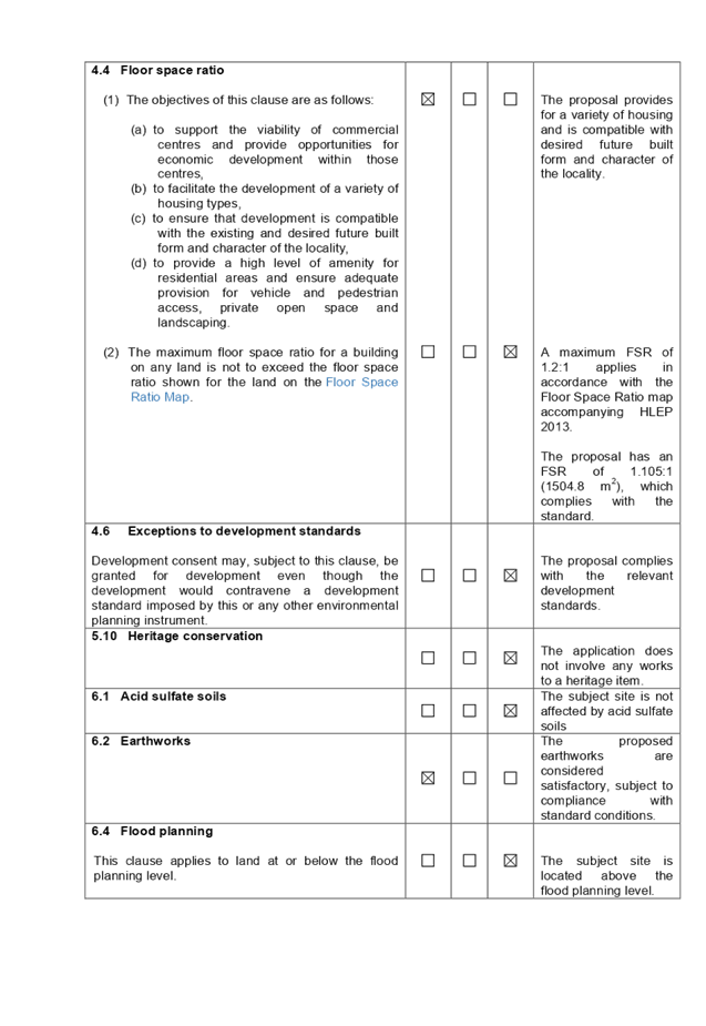
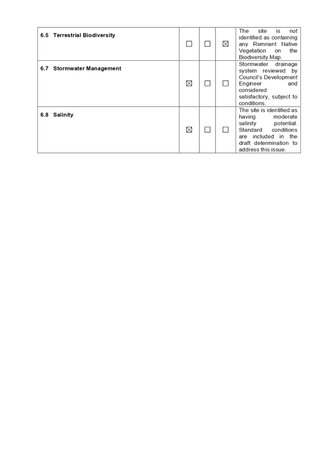
DOCUMENTS
ASSOCIATED WITH
REPORT LPP020/20
Attachment 2
ADG Compliance Table
Cumberland Local Planning Panel Meeting
13 May 2020
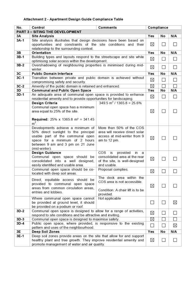
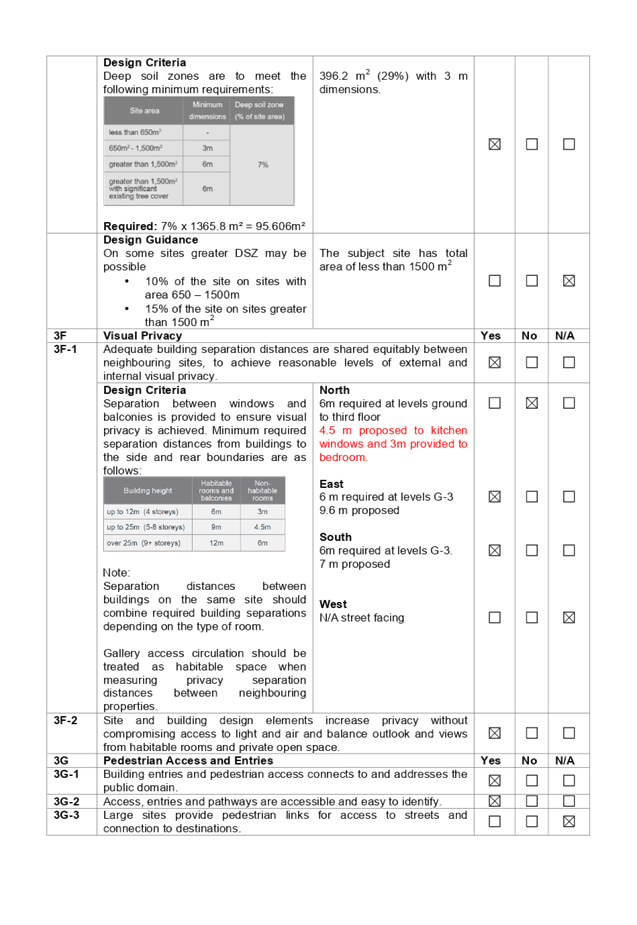
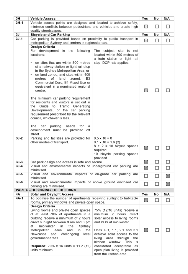
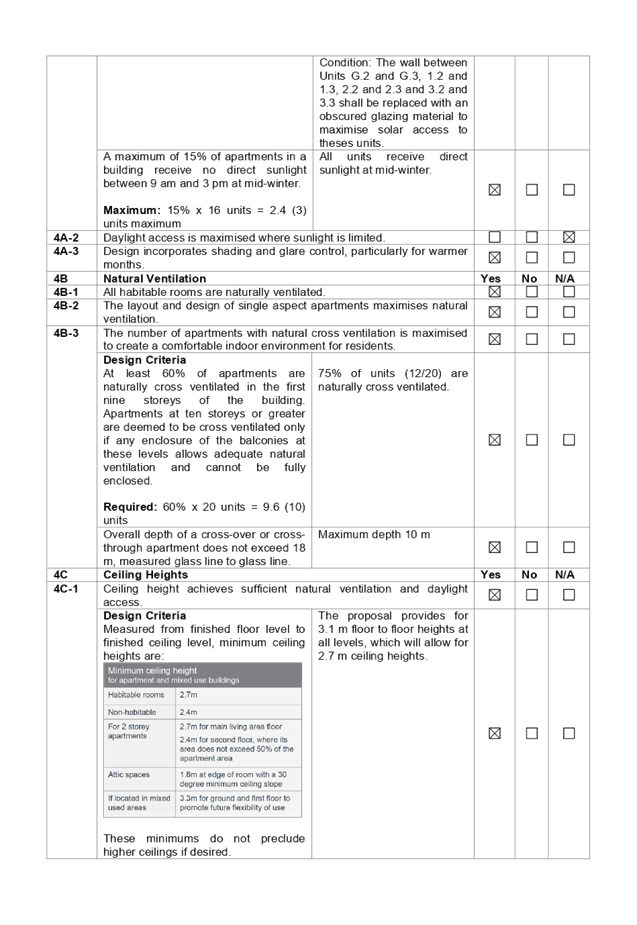
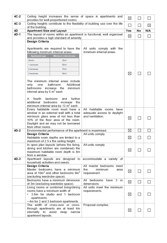
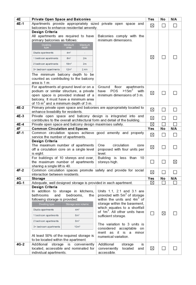
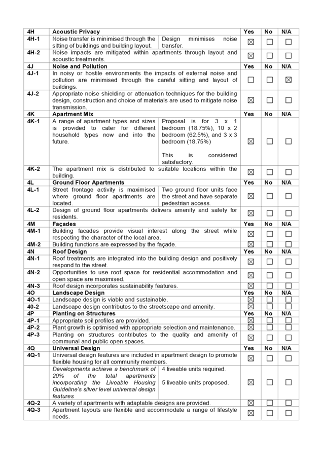
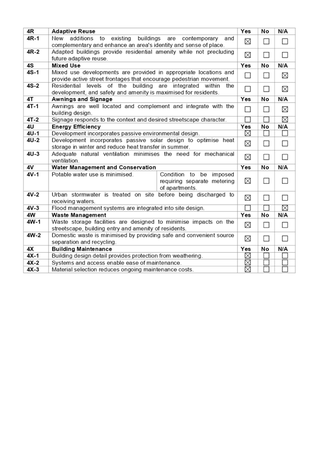
DOCUMENTS
ASSOCIATED WITH
REPORT LPP020/20
Attachment 3
Holroyd Development Control Plan 2013 Complaince Table
Cumberland Local Planning Panel Meeting
13 May 2020
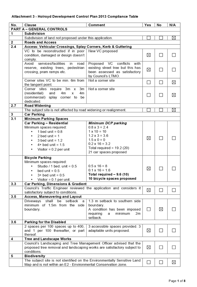
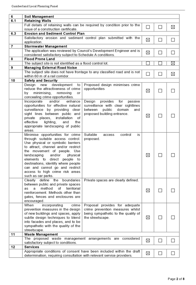
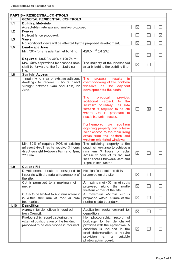
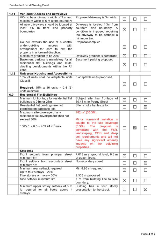
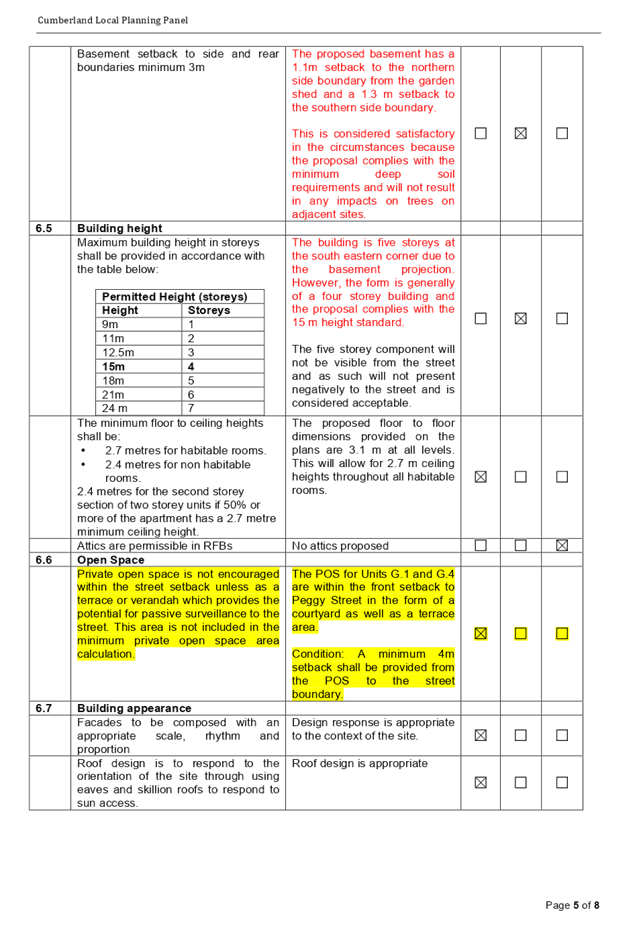
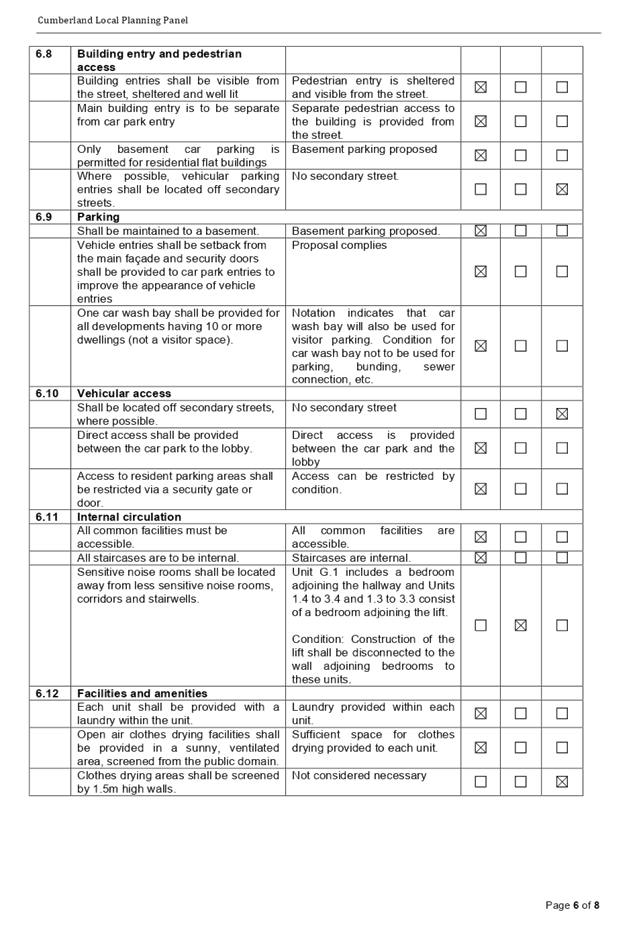
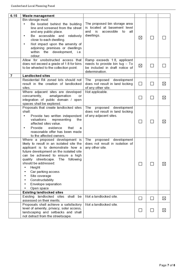
DOCUMENTS
ASSOCIATED WITH
REPORT LPP020/20
Attachment 4
Draft Notice of Determination
Cumberland Local Planning Panel Meeting
13 May 2020


DOCUMENTS
ASSOCIATED WITH
REPORT LPP020/20
Attachment 5
Architectural Plans
Cumberland Local Planning Panel Meeting
13 May 2020
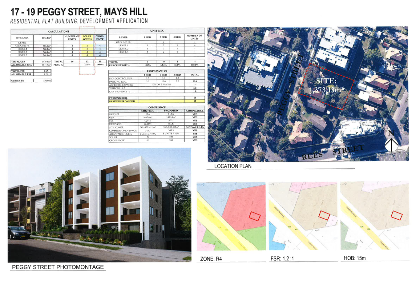
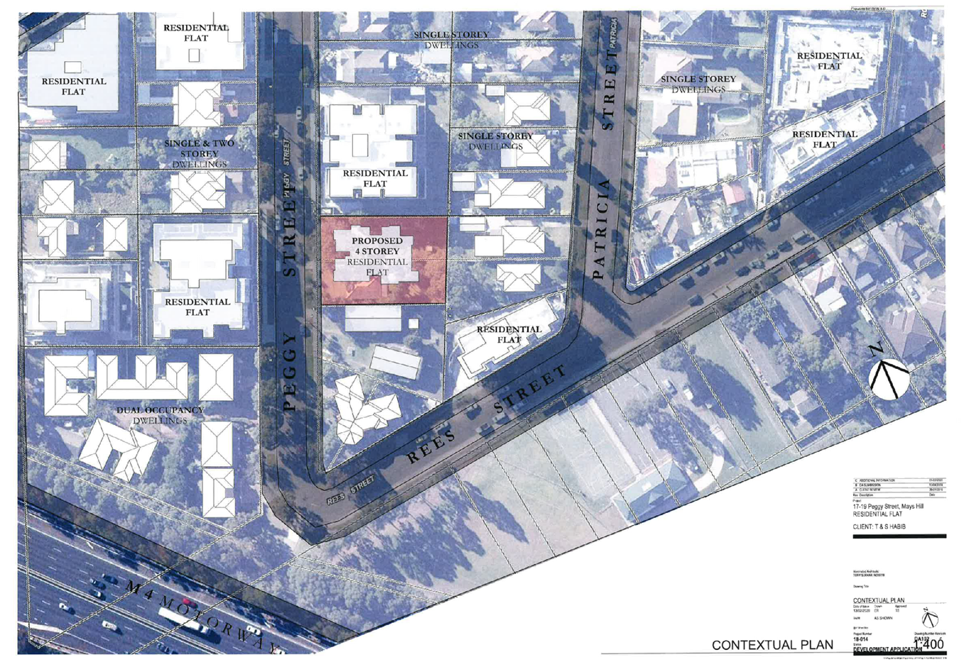
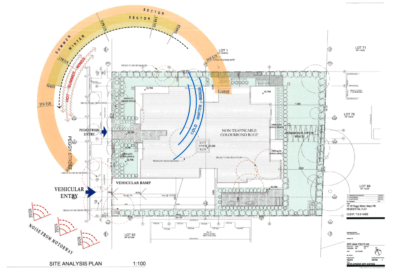
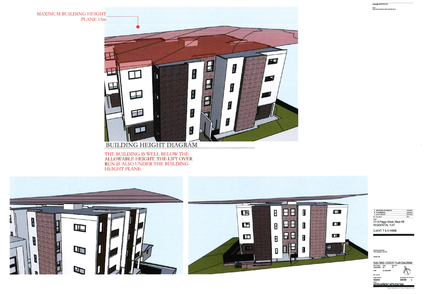
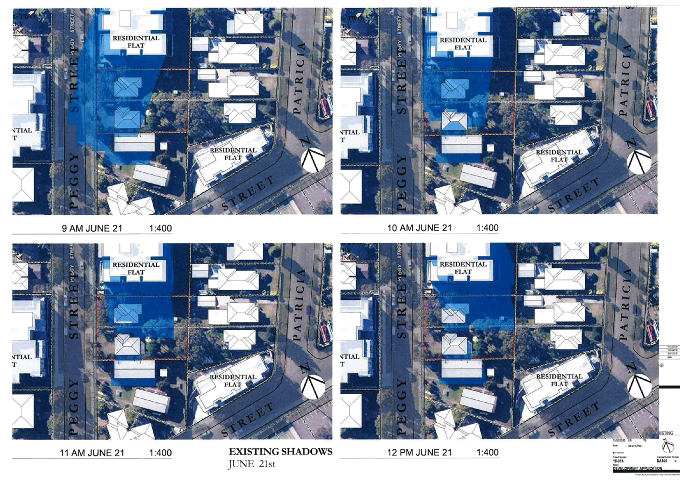
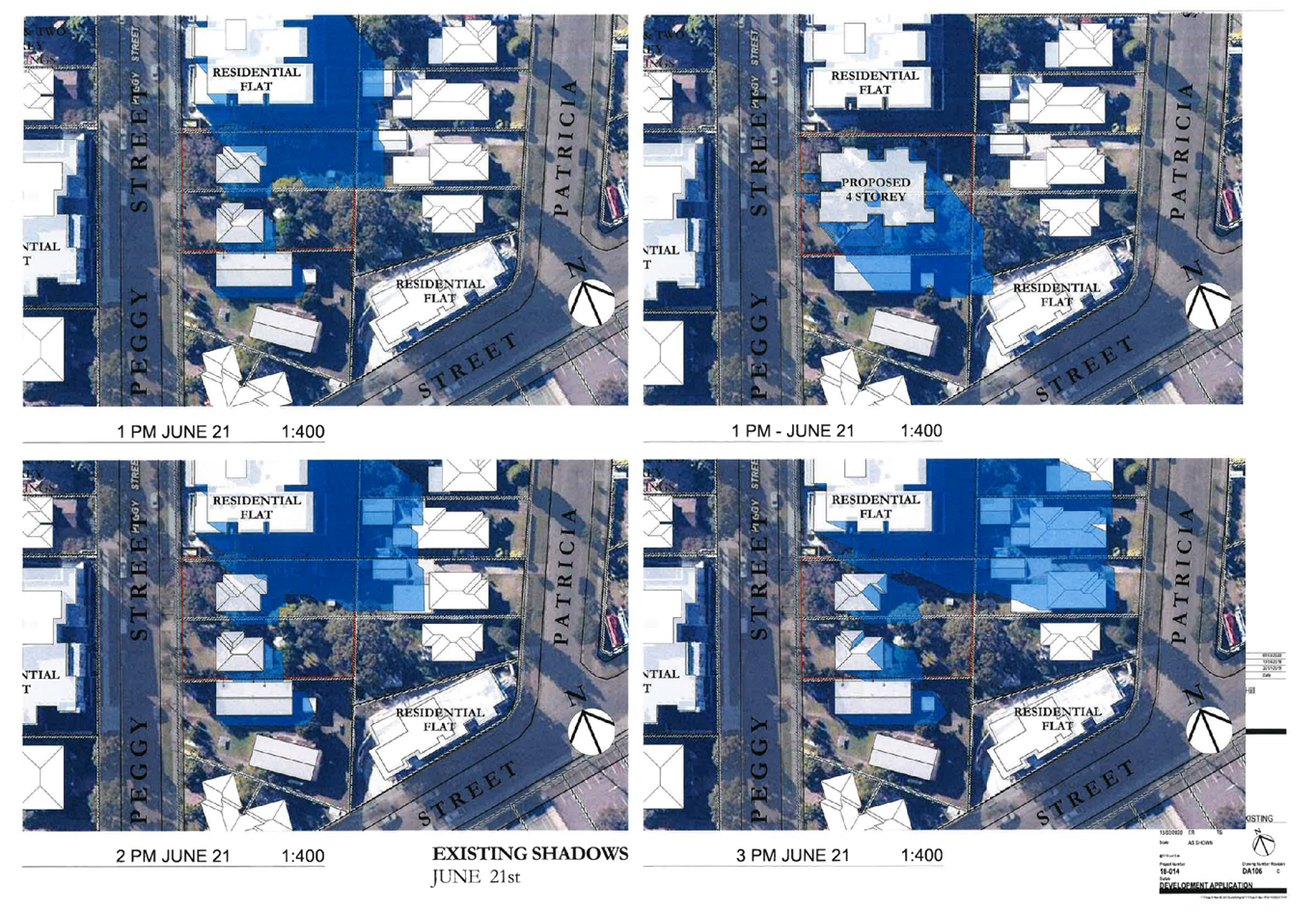
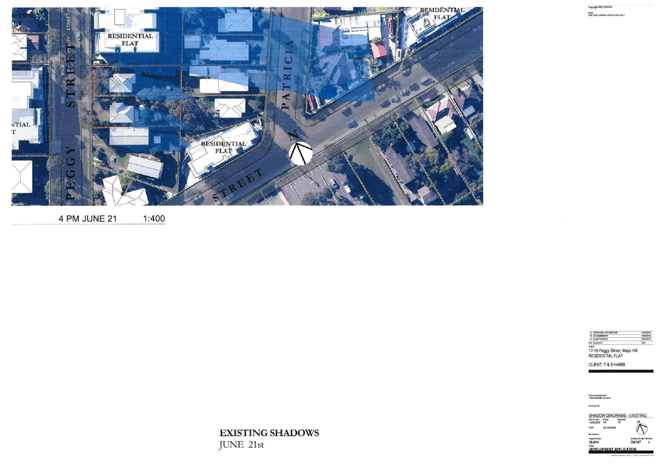
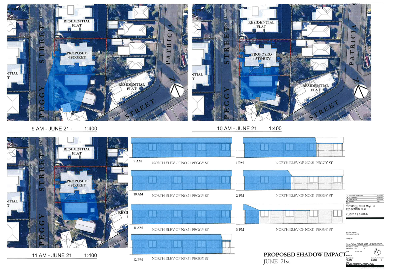
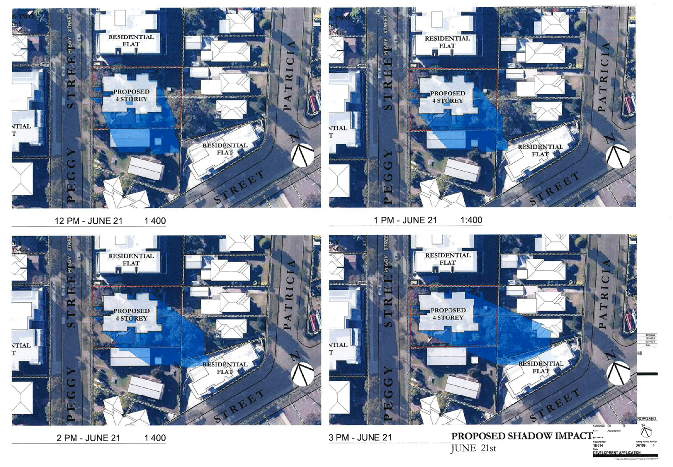
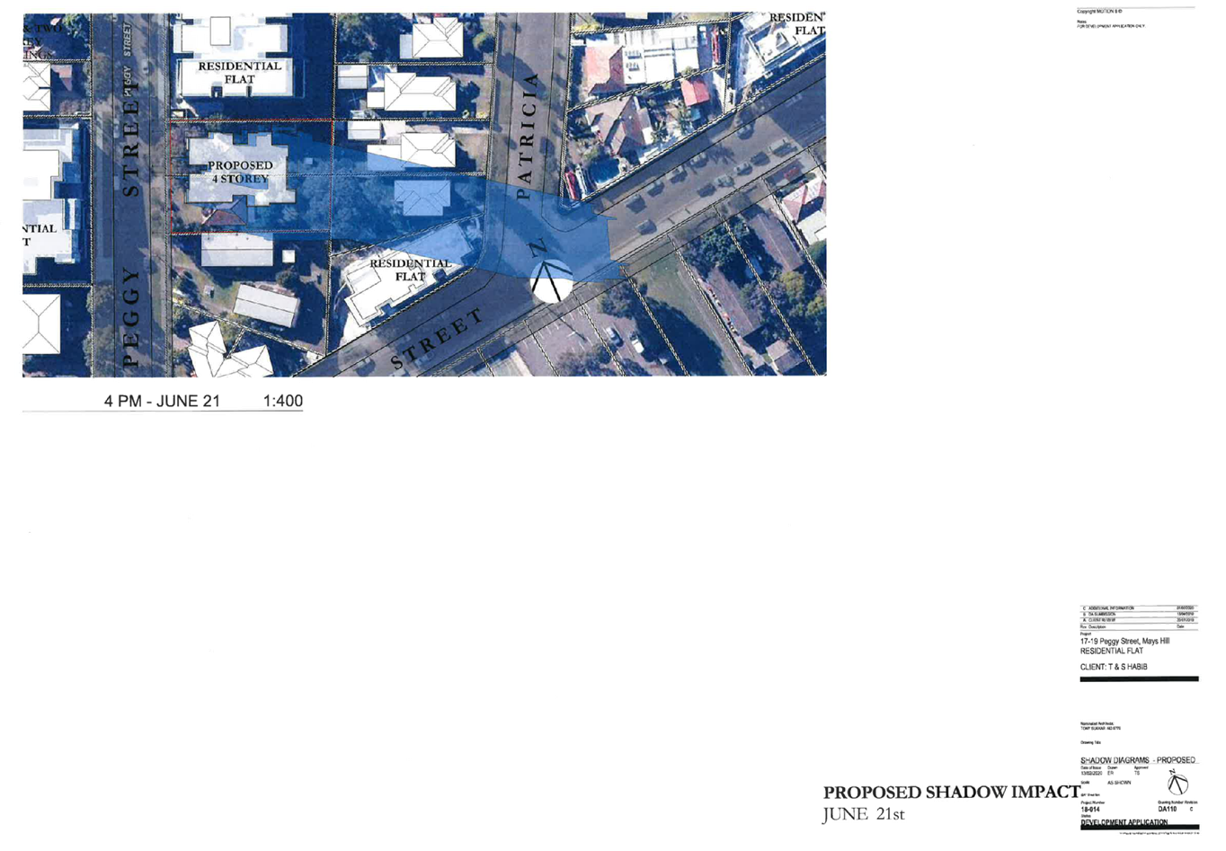
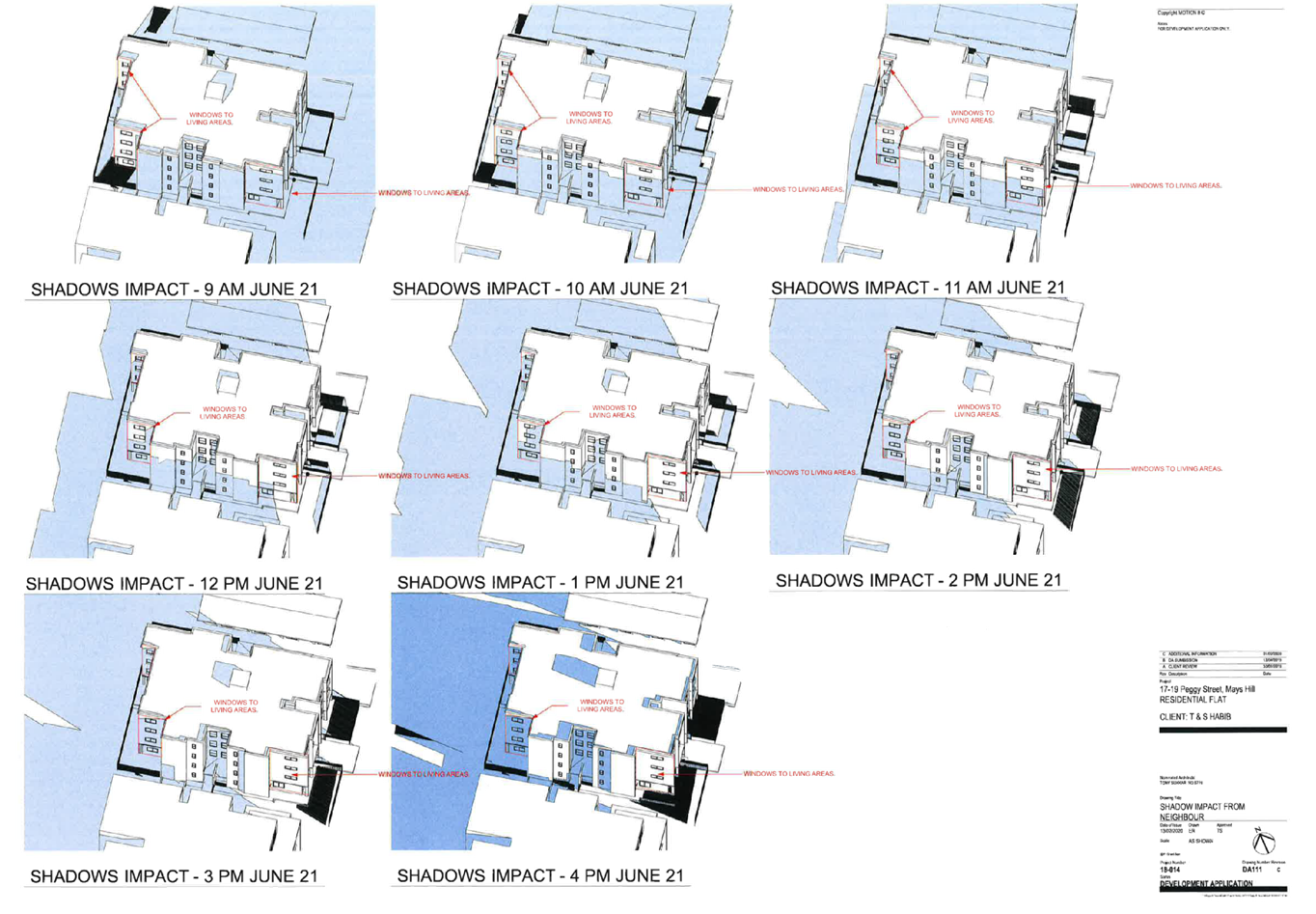
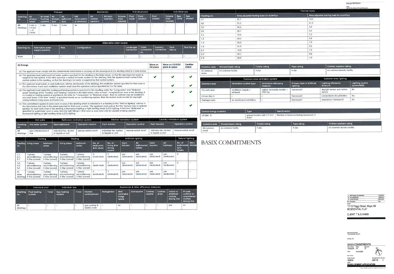
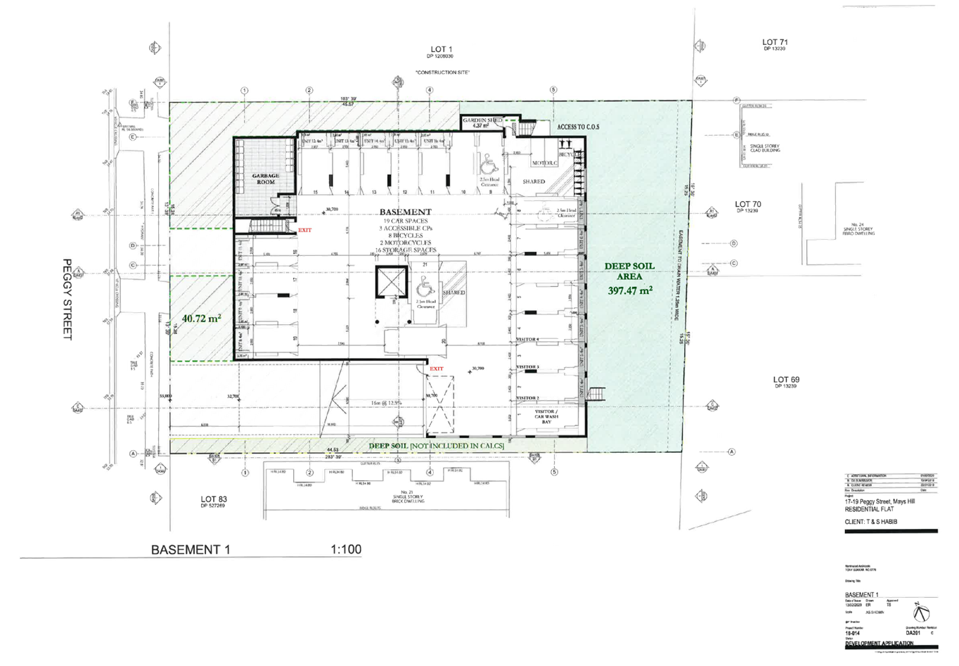
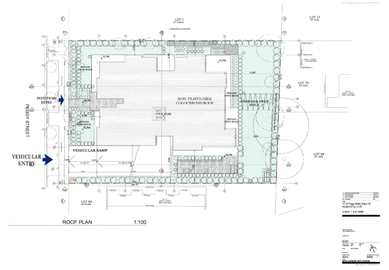
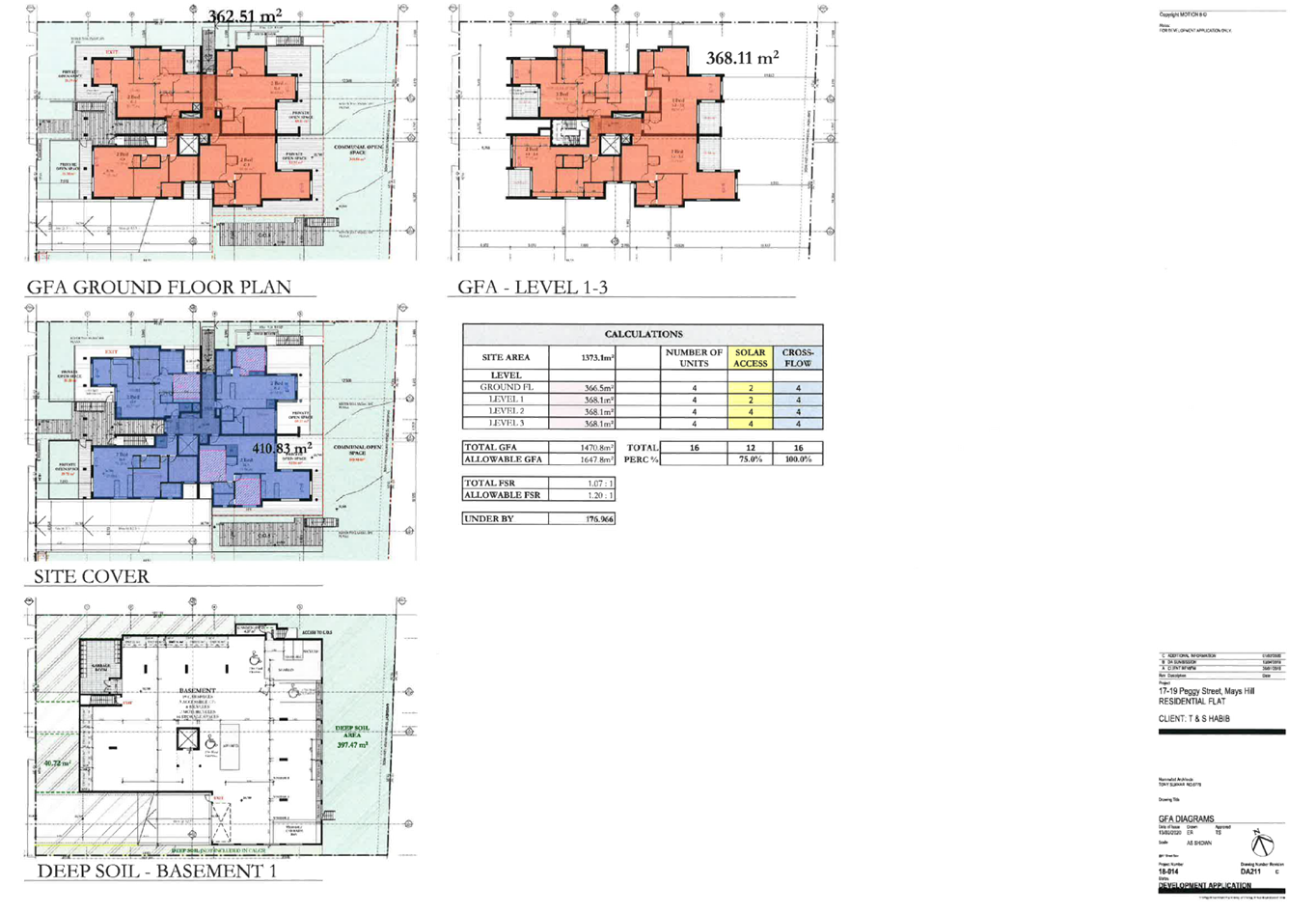
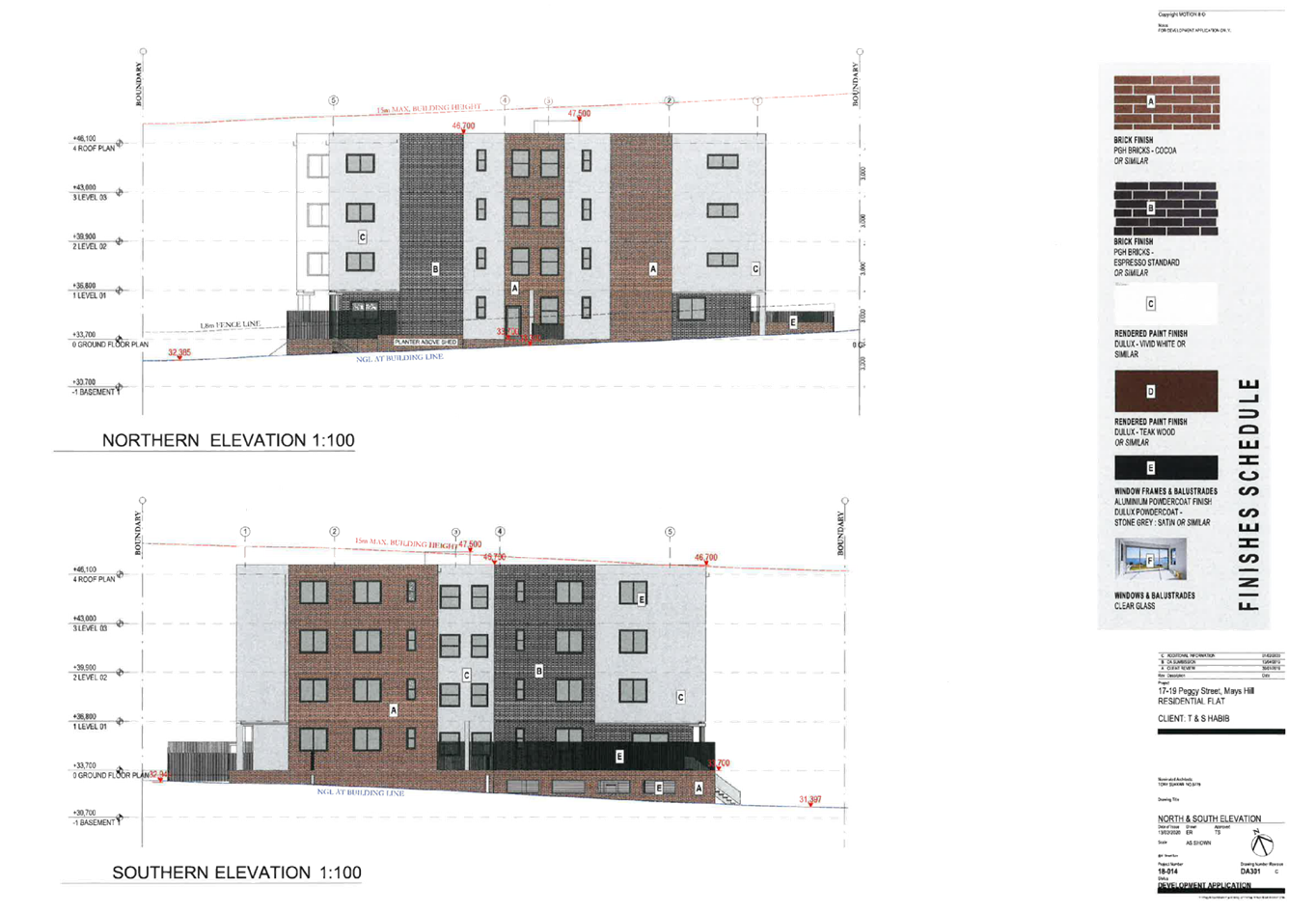
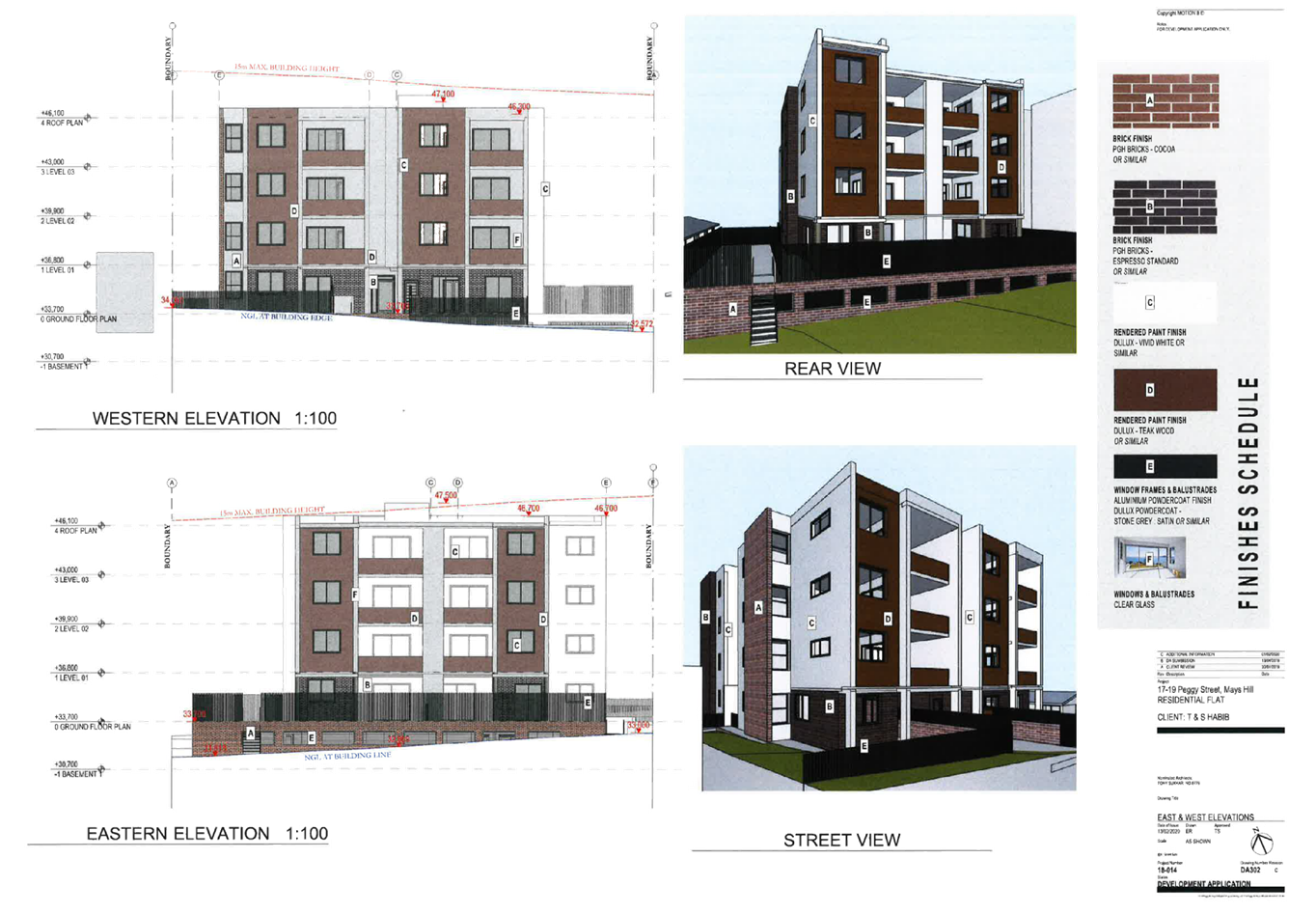
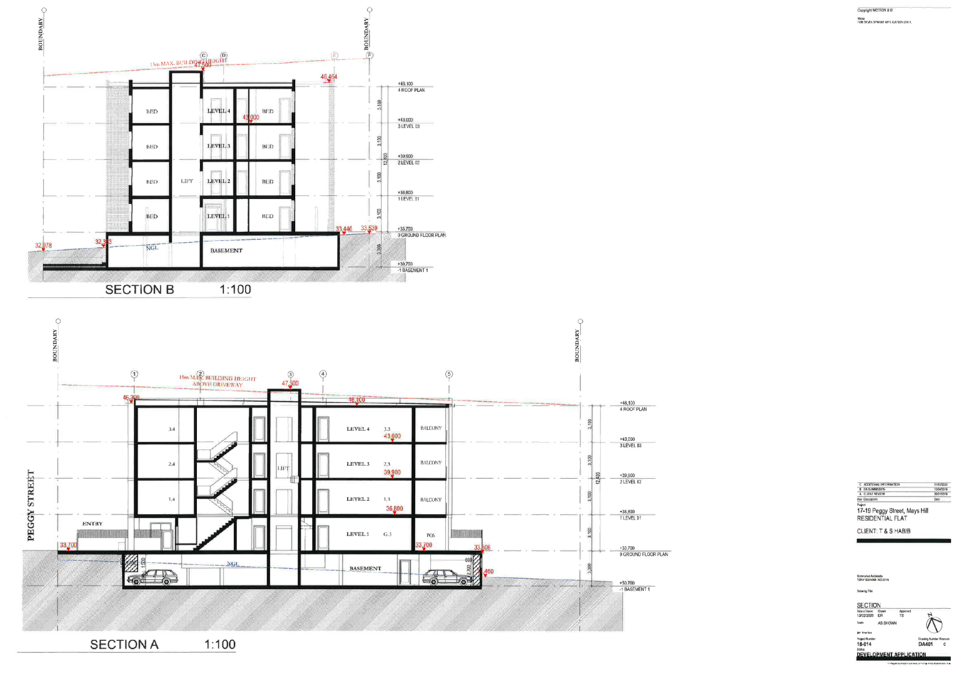
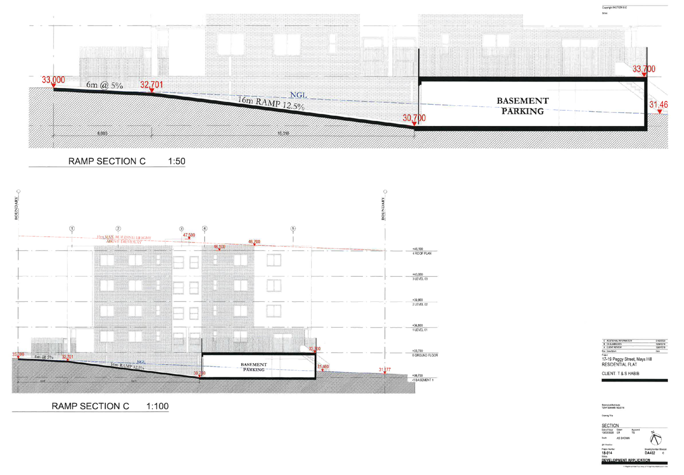
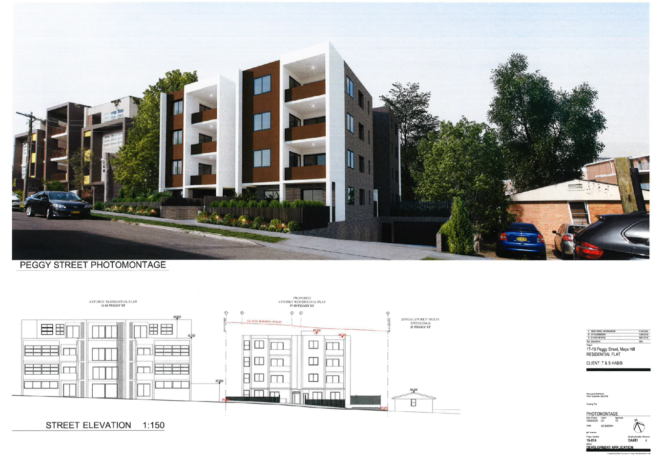
DOCUMENTS
ASSOCIATED WITH
REPORT LPP020/20
Attachment 6
Stormwater Plans
Cumberland Local Planning Panel Meeting
13 May 2020