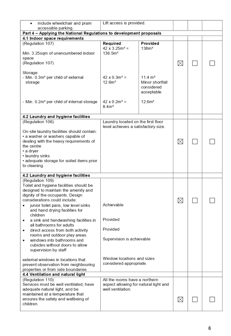
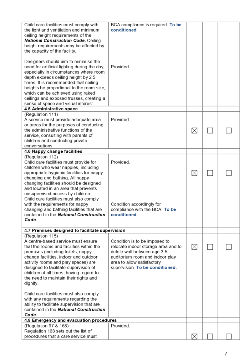
8 April 2020
A meeting of the Cumberland Local Planning Panel will be
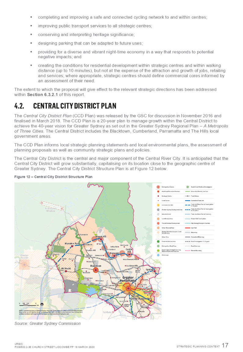
conducted electronically at 11.30am via telephone conference on Wednesday,
8 April 2020.
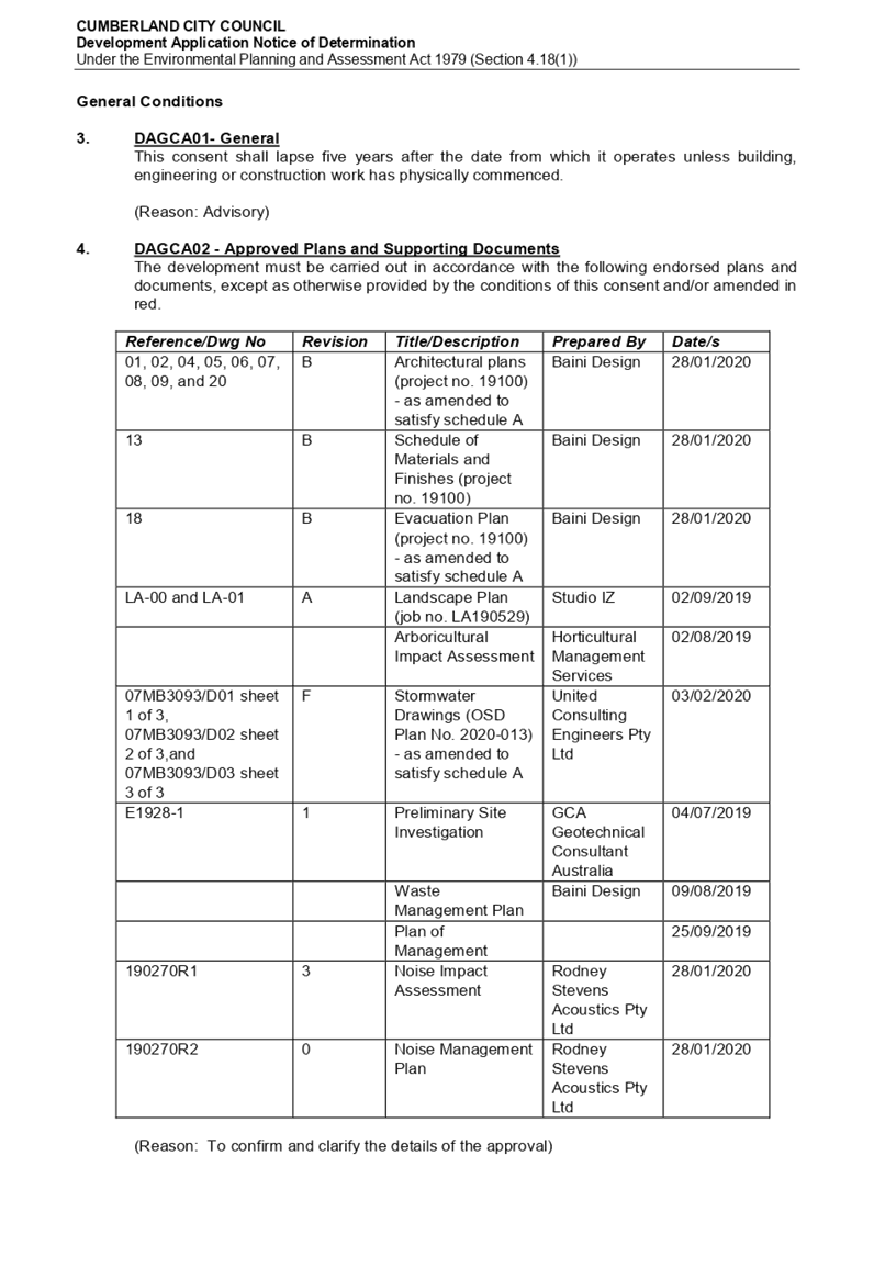
Business as below:
Yours faithfully
Hamish McNulty
General
Manager
ORDER OF BUSINESS
1. Receipt of Apologies
2. Confirmation of Minutes
3. Declarations of Interest
4. Address by invited speakers
5. Reports:
- Development
Applications
- Planning
Proposals
6. Closed Session Reports
Cumberland Local Planning Panel Meeting
8 April 2020
CONTENTS
Report No. Name of Report Page
No.
Development Applications
LPP013/20.. Development Application for
9 Verlie Street, Wentworthville........ 5
LPP014/20.. Development Application for
20 Cumberland Road, Greystanes........................................................................... 221
LPP015/20.. Planning Proposal - 2-36 Church
Street, Lidcombe................. 287
Cumberland Local Planning Panel Meeting
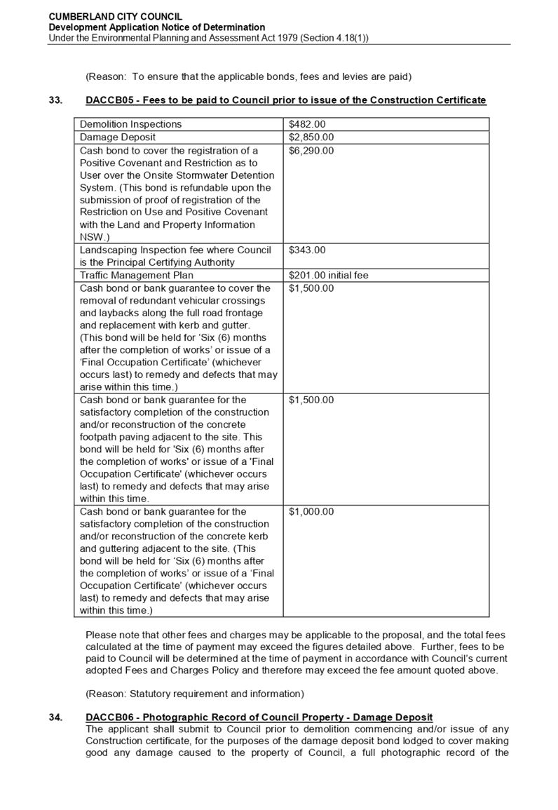
8 April 2020
Item
No: LPP013/20
Development
Application for 9 Verlie Street, Wentworthville
Responsible
Division: Environment
& Planning
Officer: Executive
Manager Development and Building
File
Number: DA2019/368/1
|
Application
lodged
|
27 September 2019
|
|
Applicant
|
Baini Design
|
|
Owner
|
Aarg Group Pty Ltd
|
|
Application
No.
|
DA2019/368/1
|
|
Description
of Land
|
9 Verlie Street, South
Wentworthville NSW 2145, Lot 15 DP 16442
|
|
Proposed
Development
|
Demolition of existing
structures and construction of a two storey 42 place child care centre over
basement car parking
|
|
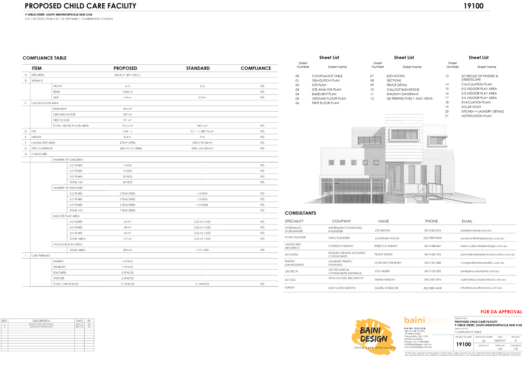
Site
Area
|
696.8m2
|
|
Zoning
|
R3 – Medium Density
Residential Zone
|
|
Disclosure
of political donations and gifts
|
Nil disclosure
|
|
Heritage
|
The subject site does not
contain a heritage item, is not located within the vicinity of the heritage
item or heritage conservation area.
|
|
Principal
Development Standards
|
FSR
Permissible: 0.7:1
Proposed: 0.49:1
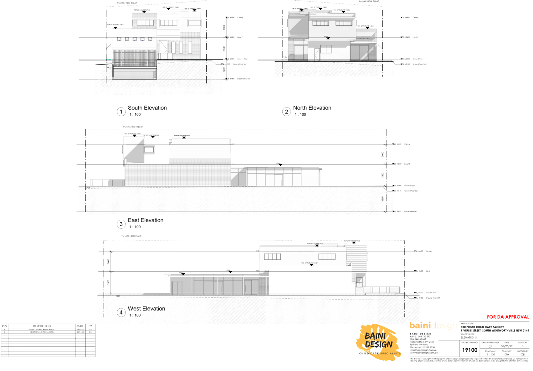
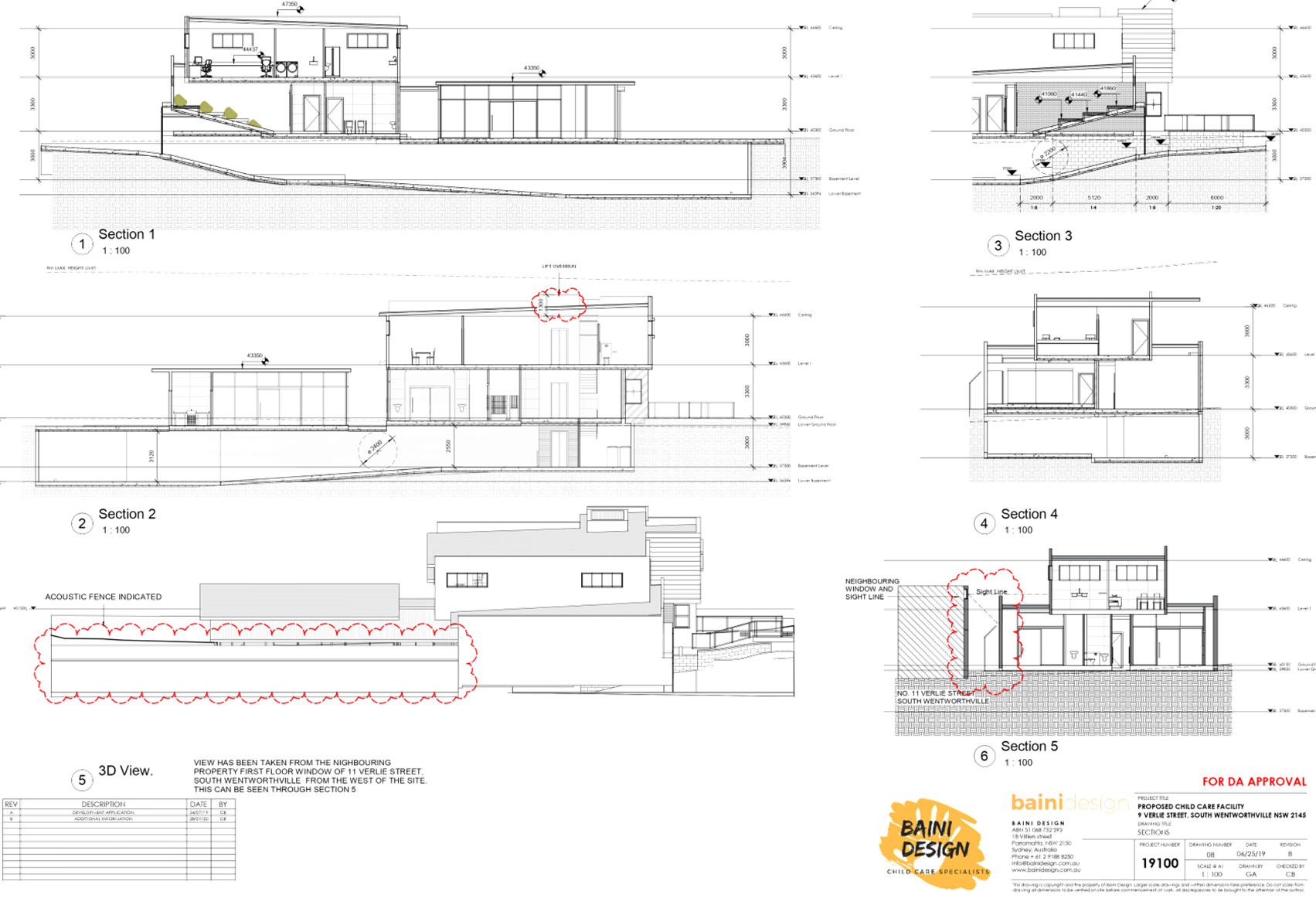
Height of Building
Permissible: 9m
Proposed: 8m (top of lift over
run)
|
|
Issues
|
- Number of children and
outdoor unencumbered space
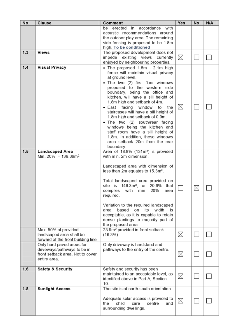
- Landscaped area
- Driveway and upper storey
setbacks
- Site frontage
|
1. Development
Application No. DA2019/368/1 was received on 27 September 2019 for demolition
of existing structures and construction of a two storey 42 place child care
centre over basement car parking.
2. The
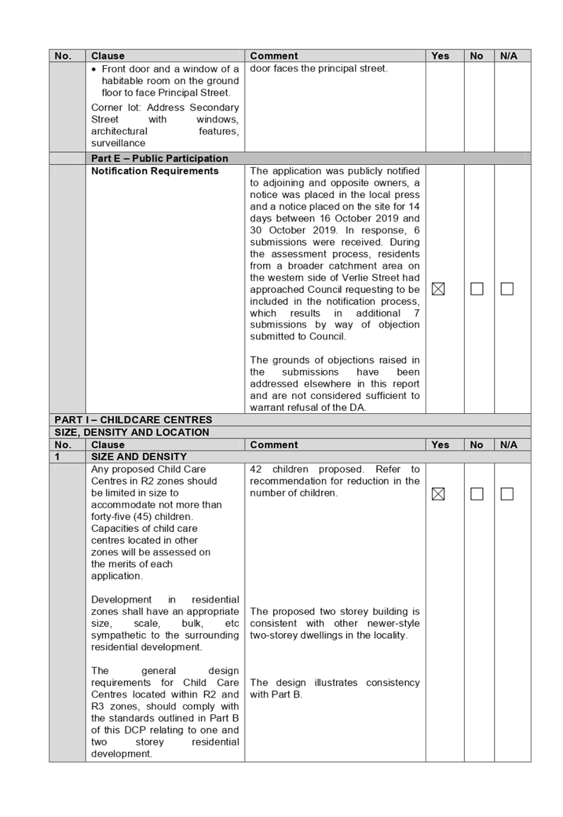
application was publicly notified to occupants and owners of the adjoining
properties for a period of 14 days between 16 October 2019 and 30 October 2019.
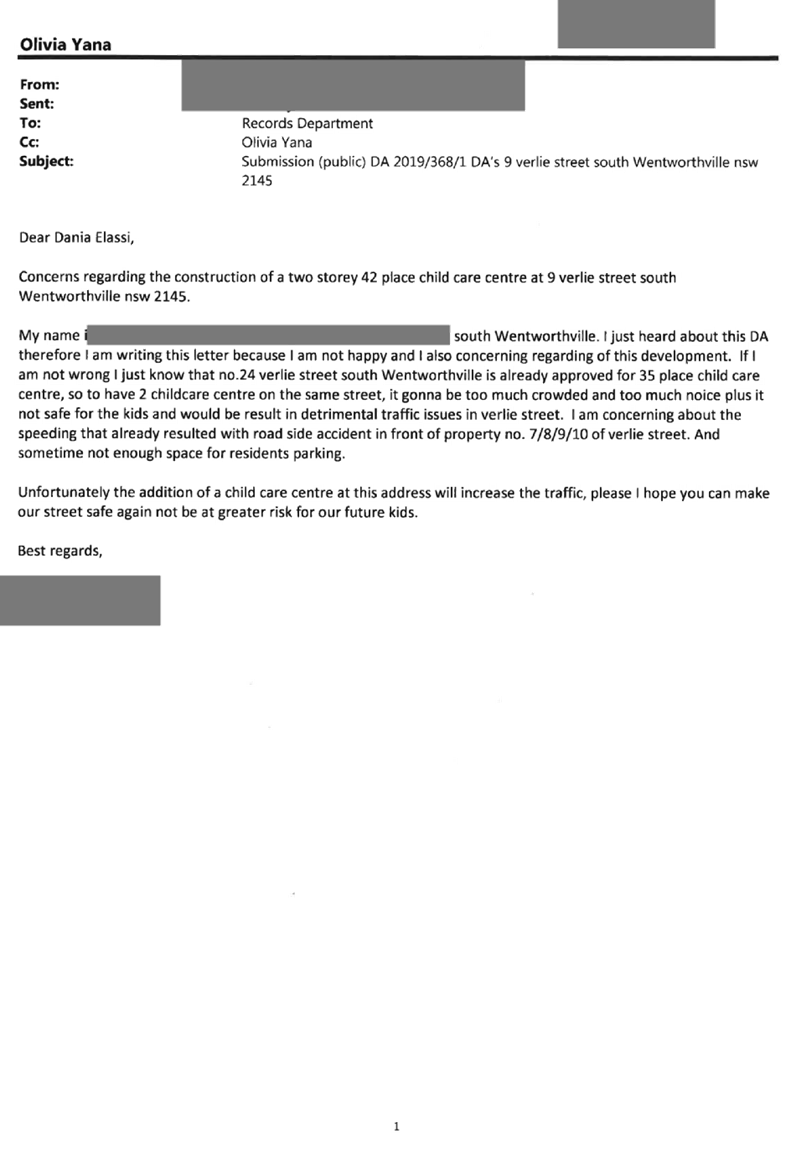
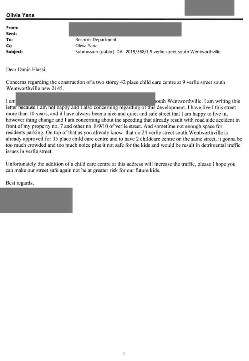
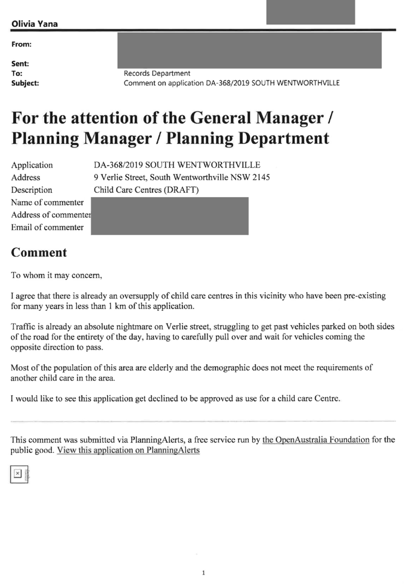
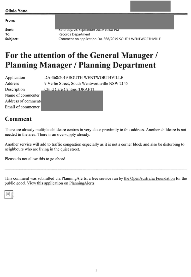
In response, 6 submissions were received. During the assessment process, the
residents from a broader catchment area on the western side of Verlie Street
had approached Council requesting to be included in the notification process,
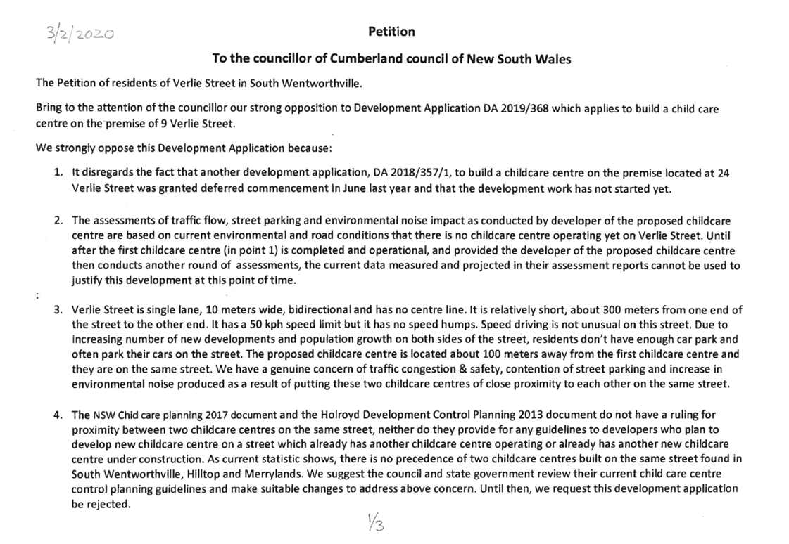
which resulted in additional 7 submissions by way of objection and 1 petition
submitted to Council.
3. Council
through its assessment identified a number of concerns with the proposal, and
requested amended plans and additional information on 15 January 2020.
4. Amended
plans received on 10 February 2020 do not warrant re-notification of the
proposal.
5. There
are non-compliances with the proposed development having considered the
provisions of State Environmental Planning Policy (Educational Establishments
and Child Care Facilities) 2017, Child Care Planning Guideline (the Guideline)
2017, and Holroyd Development Control Plan 2013 (HDCP).
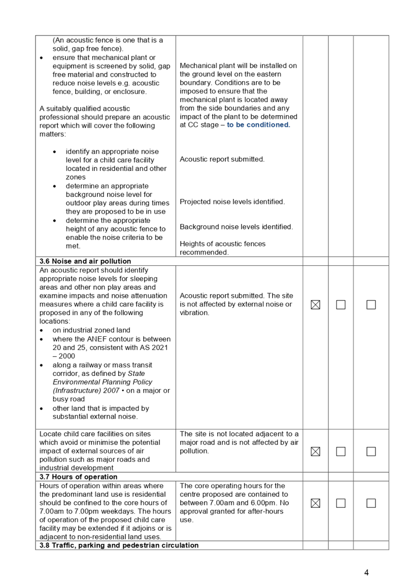
6. The
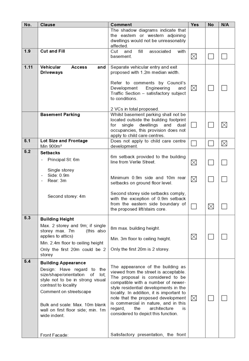
proposed development seeks following notable variations:
|
Control
|
Required
|
Provided
|
% variation
|
|
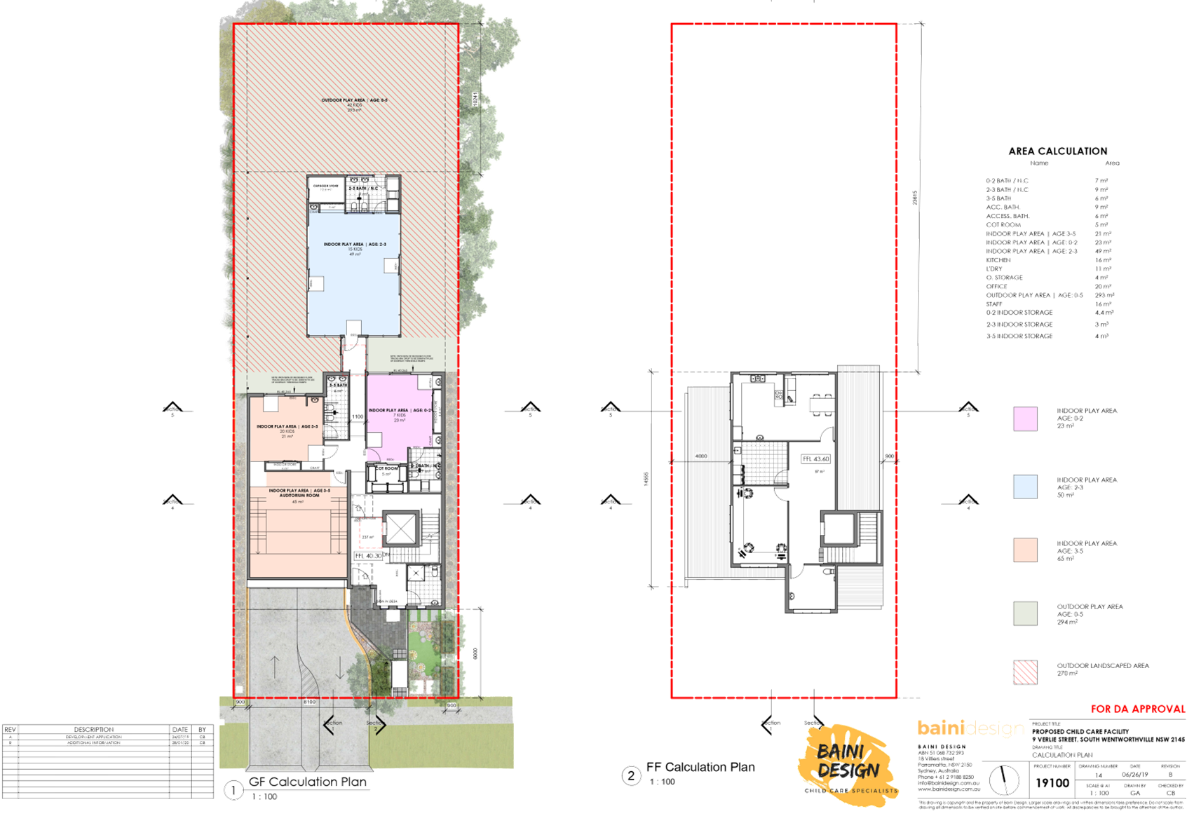
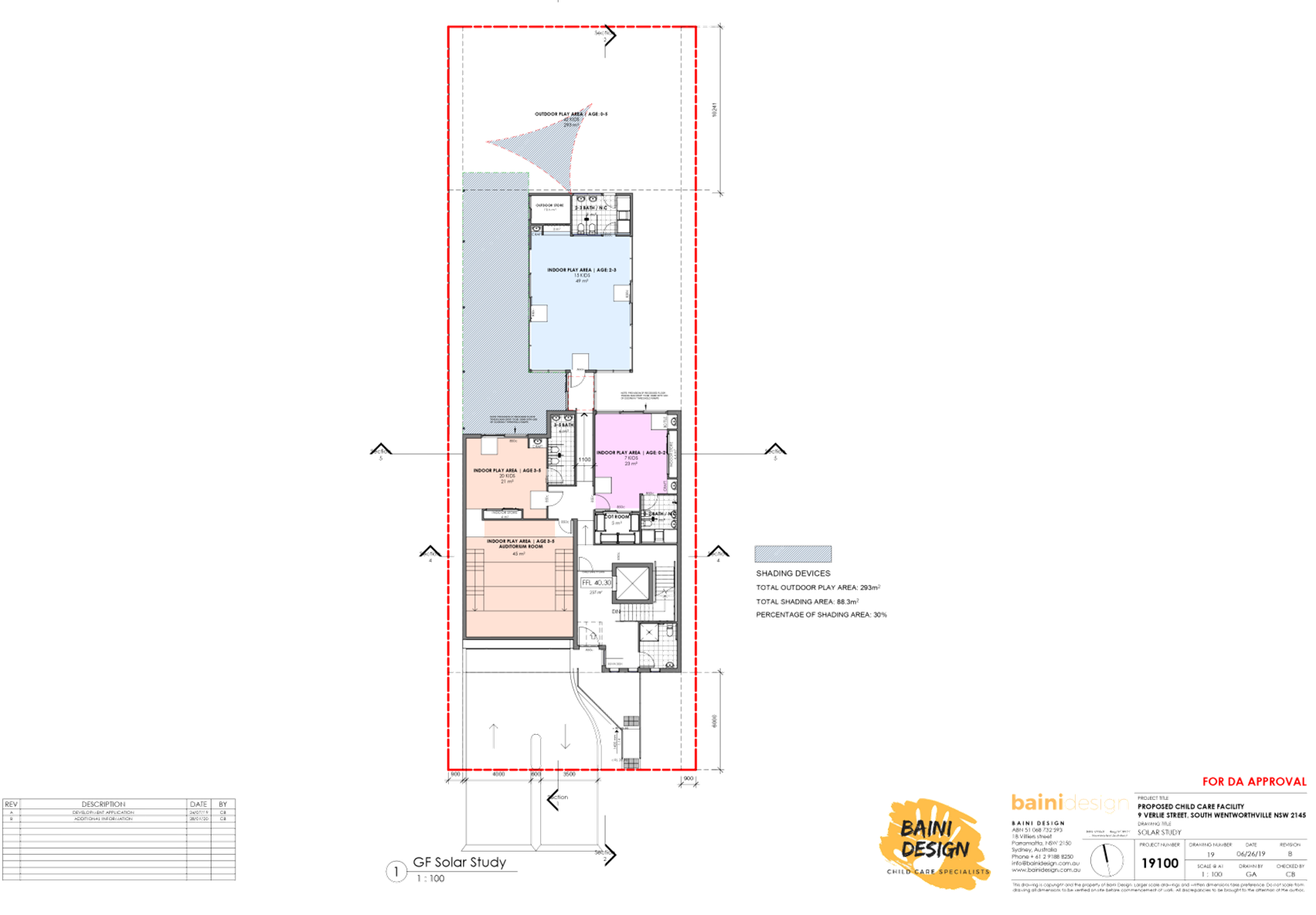
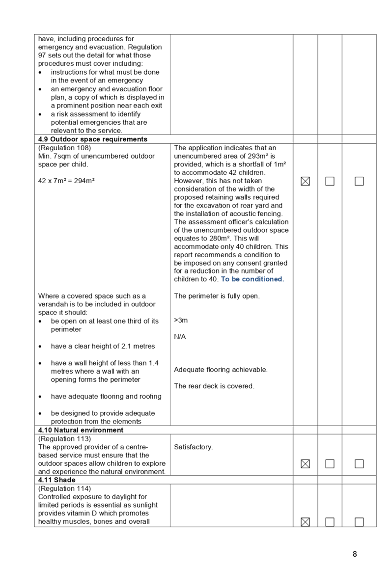
Number of children and outdoor unencumbered
space
(regulation 108 and part 4.9 the Guideline)
|
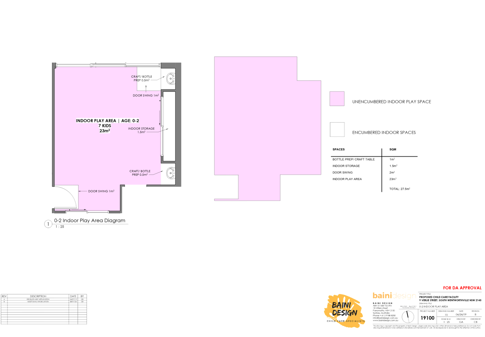
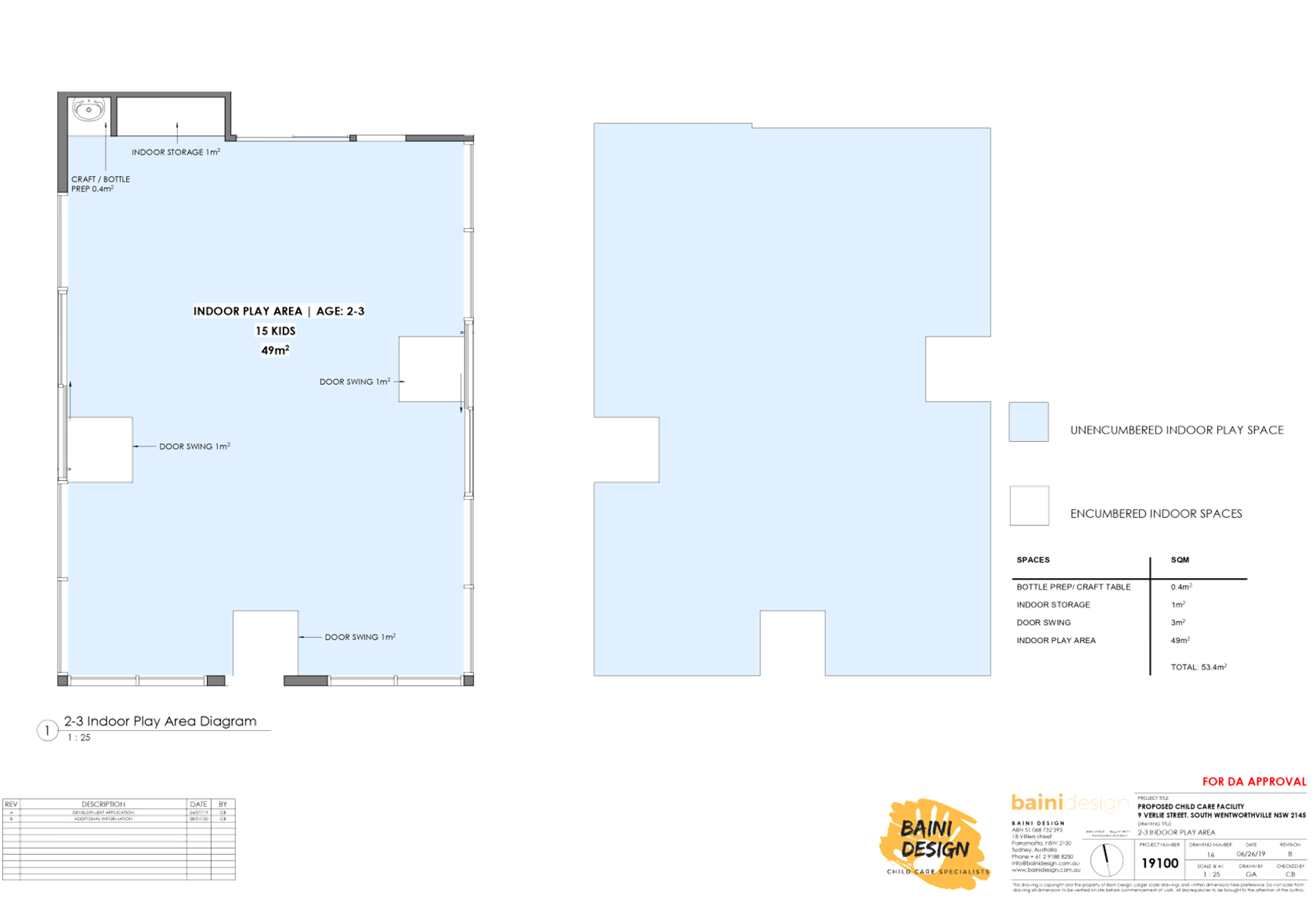
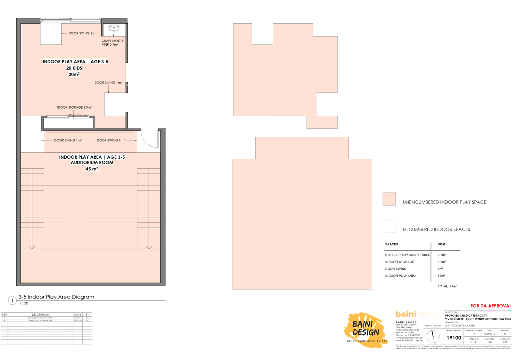
7m² x 42 = 294m²
|
Proposed development = 293m²
Assessing officer’s calculation =
280m²
(excluding retaining walls)
280m² / 7 = 40 children
Recommendation = reduce number
of children from 42 to 40
|
11.8%
|
|
Landscaped area
(DCP)
|
Min. 20%, width of 2m = 139.36m2
|
131m² (18.8%)
|
5.9%
|
|
Setbacks from side boundary (DCP)
|
Driveway – 1.5m
Upper storey – 4m
|
Driveway – 1.1m
Lift/stairs core on eastern side – 0.9m
|
26.6%
77.5%
|
|
Min. site frontage (DCP)
|
20m
|
15.24m
|
23.8%
|
7. The
application has been referred to the Cumberland Local Planning Panel (CLPP) for
determination due to the number of submissions received during the notification
period.
8. It
is recommended that the application be approved for a maximum of 40 children
(due to the available unencumbered outdoor space/play area), subject to
conditions provided in the Draft Notice of Determination held at Attachment 1.
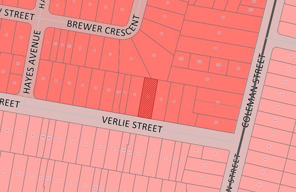
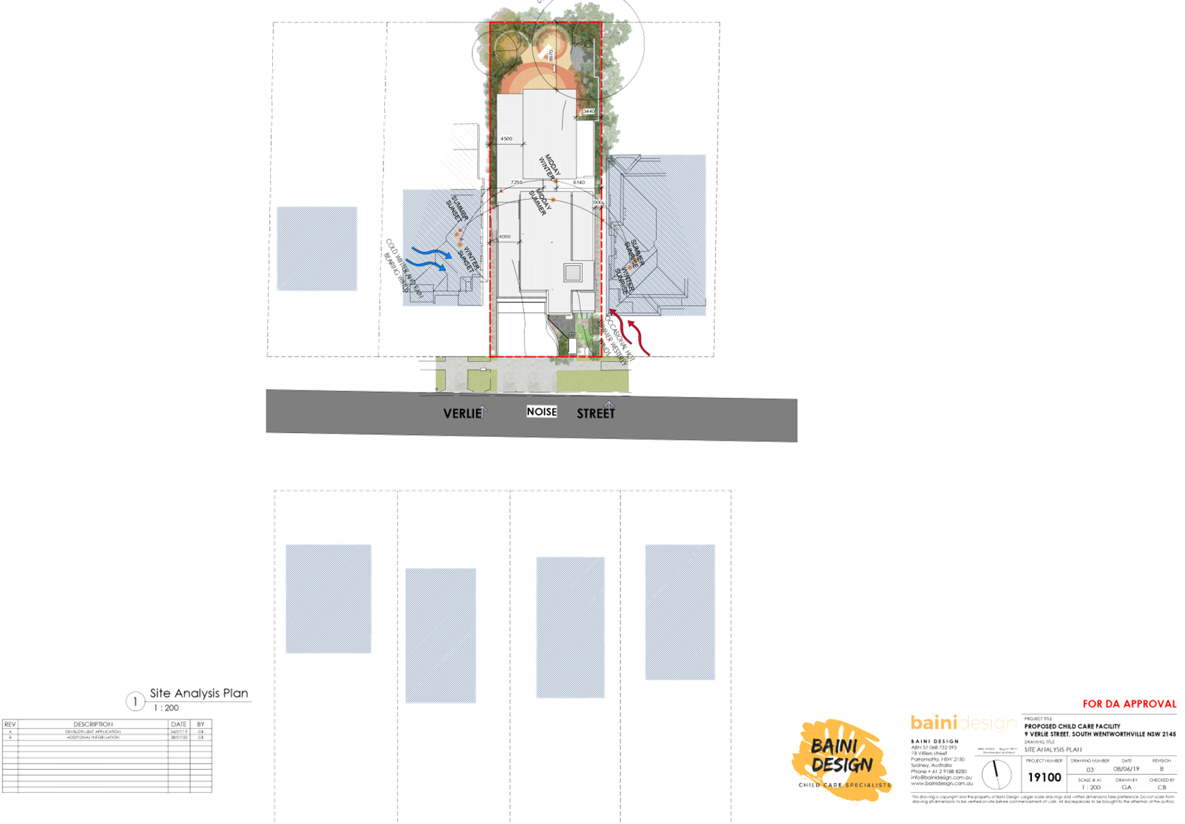
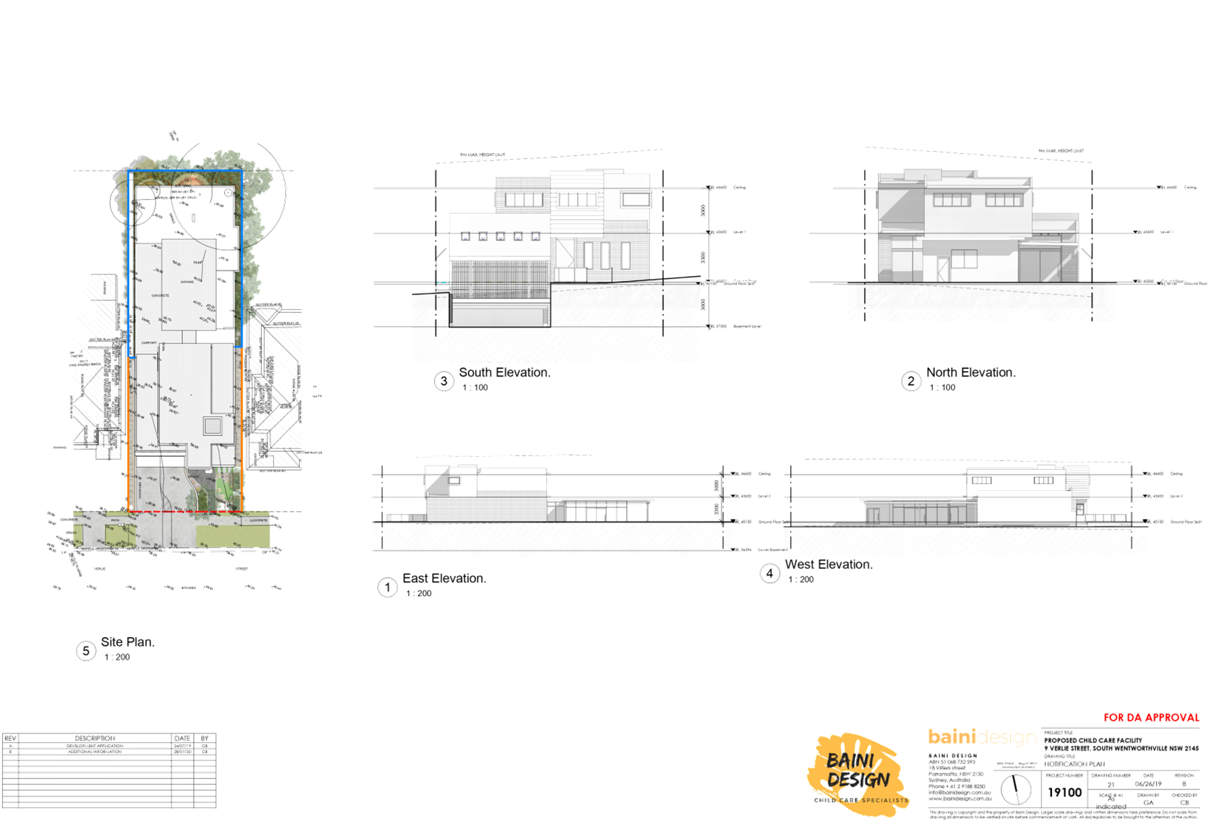
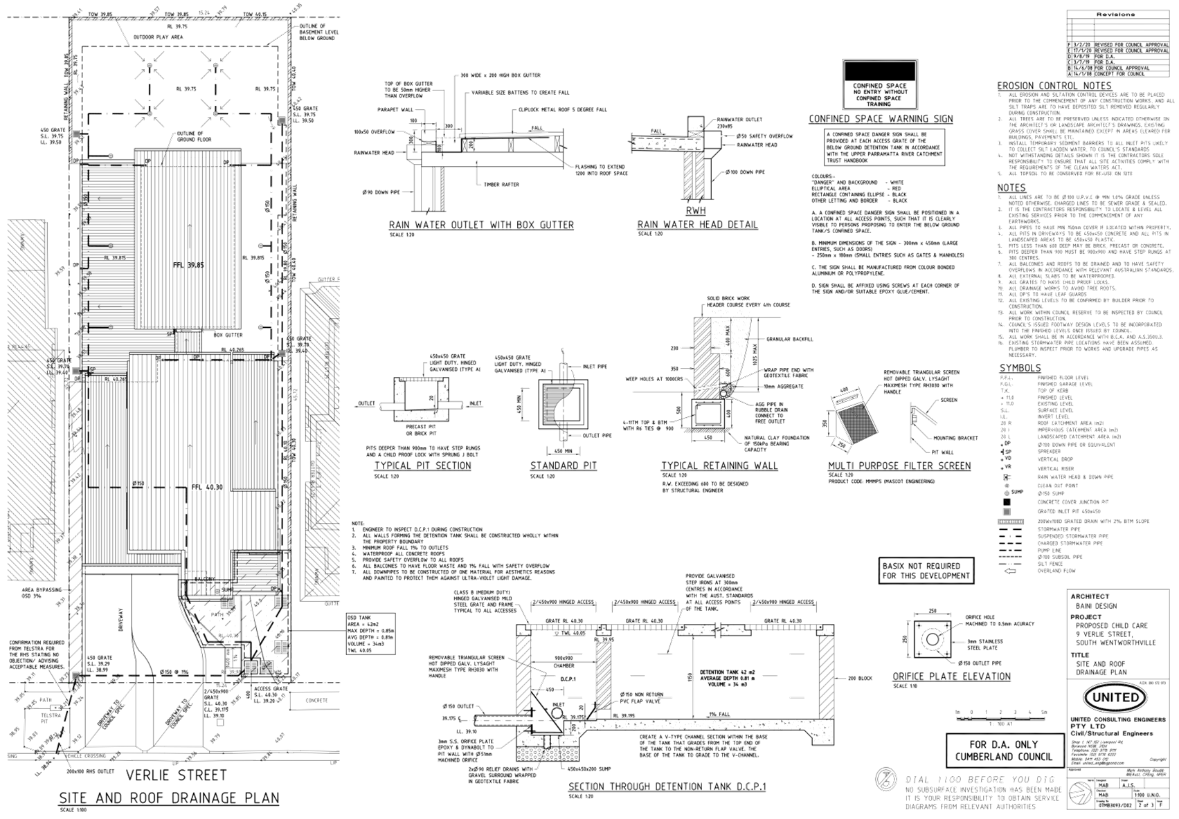
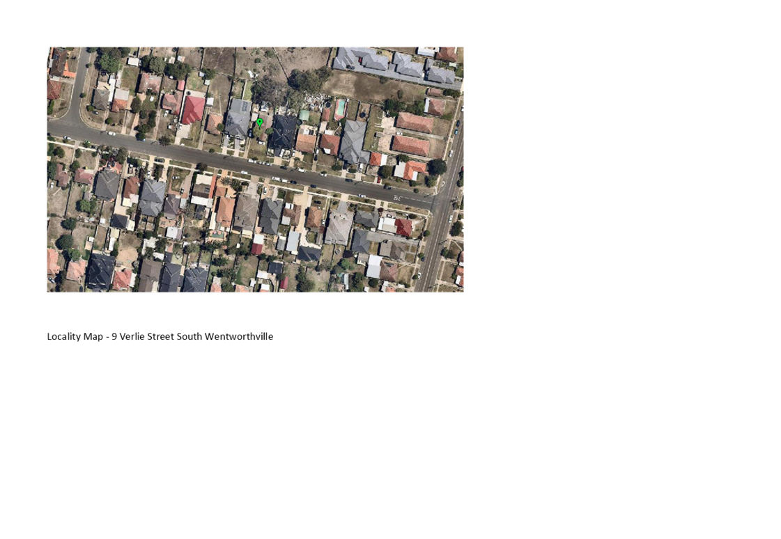
Subject Site and Surrounding
Area
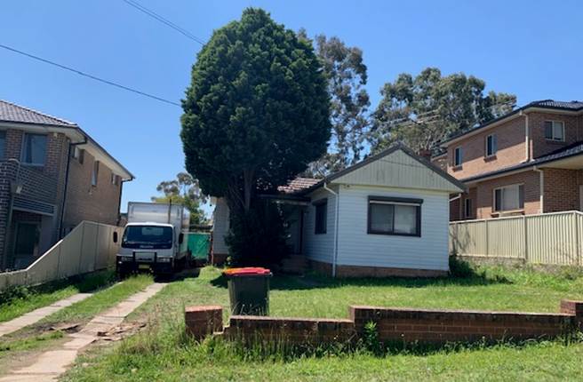
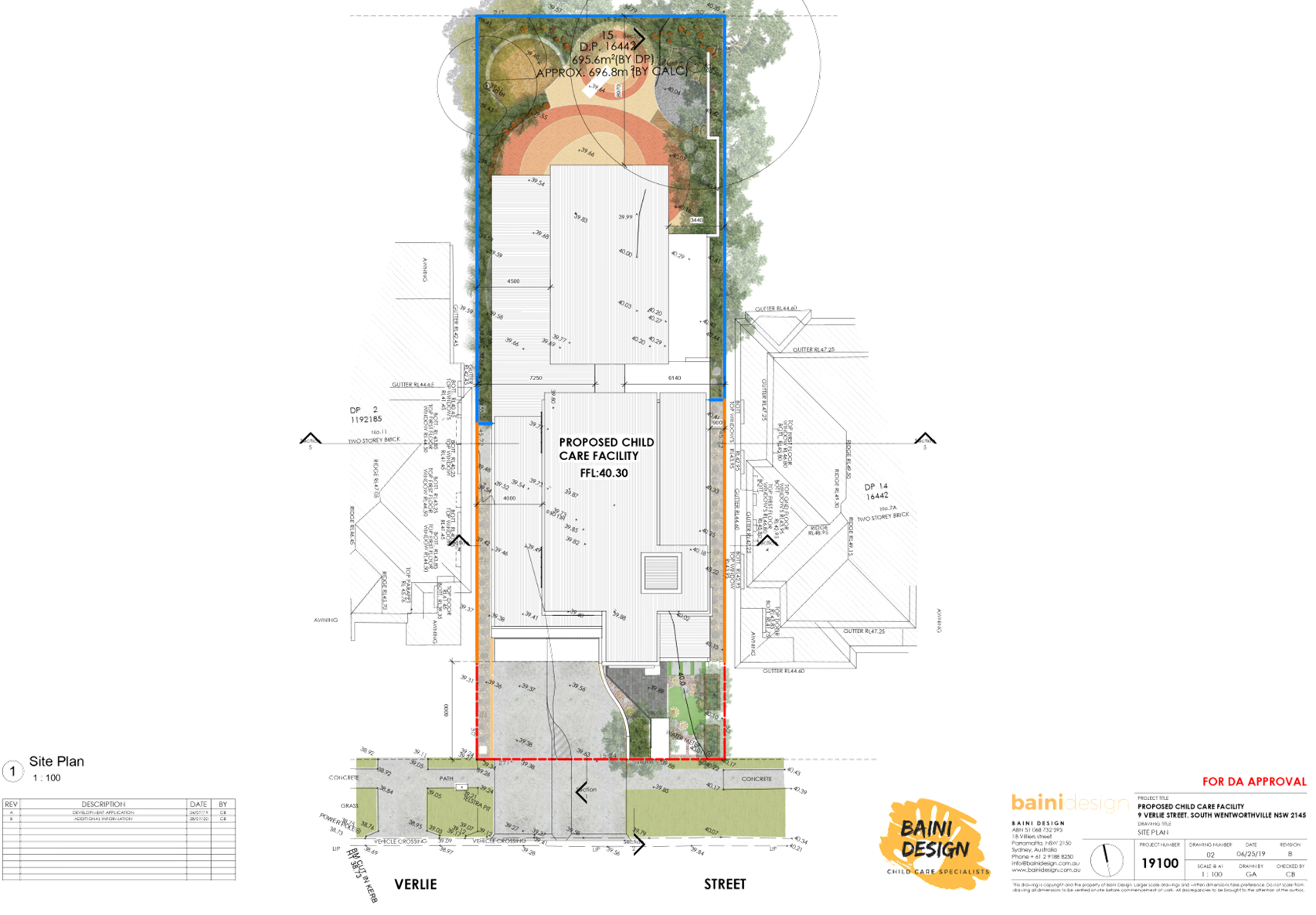
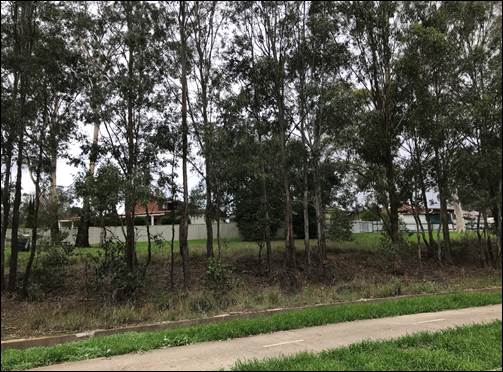
The subject site is known as 9
Verlie Street, South Wentworthville, and is legally described as Lot 15 in DP
16442. The site is located on the northern side of Verlie Street. The site is a
rectangular block with a frontage of 15.24m, depth of 45.72m and a total site
area of 696.8m². The site is currently occupied by a detached single
storey clad dwelling house and attached carport. Adjoining the subject site
directly to the east and west are a two storey brick dwelling house and an
attached two storey dual occupancy respectively. The immediate area is
characterised by low density housing. The subject site and all adjoining
properties are zoned R3 Medium Density Residential. Properties located on the
southern side of Verlie Street are zoned R2 Low Density Residential.
Figure
1 – Locality Plan of subject site
Figure
2 – Aerial view of subject site
Figure
3 – Street view of subject site
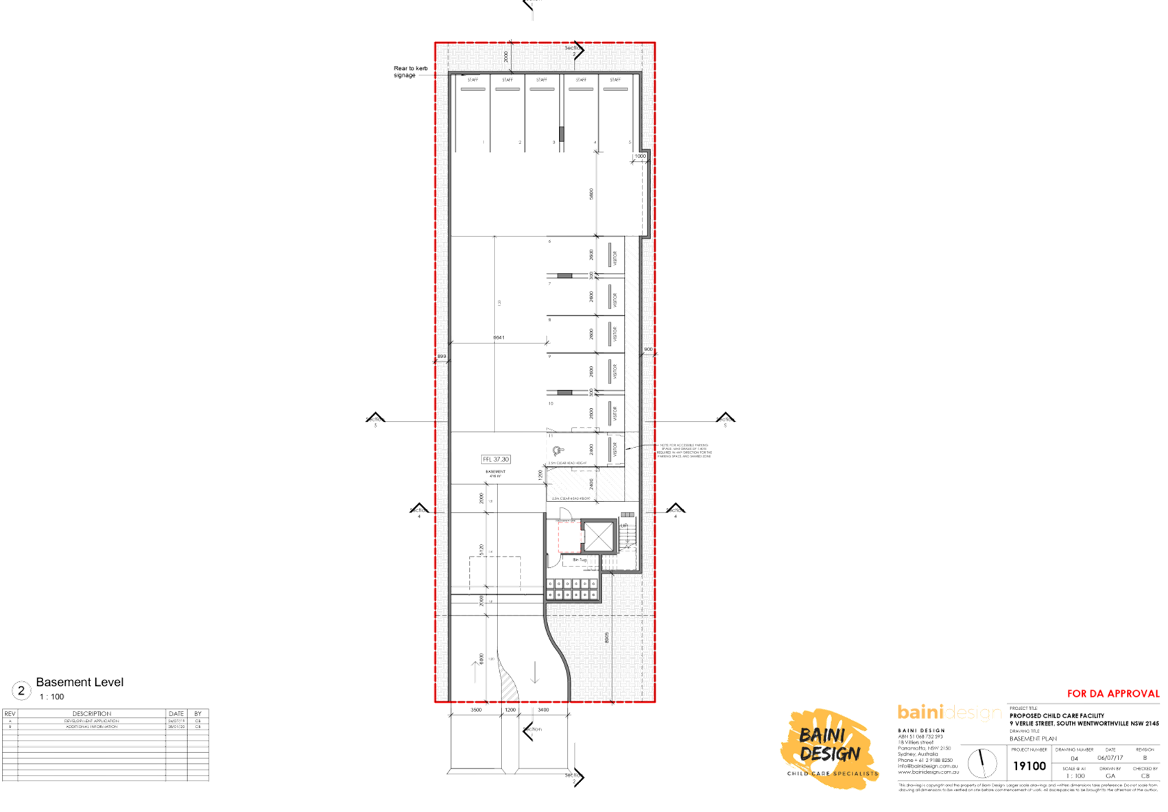
Description of the Proposed
Development
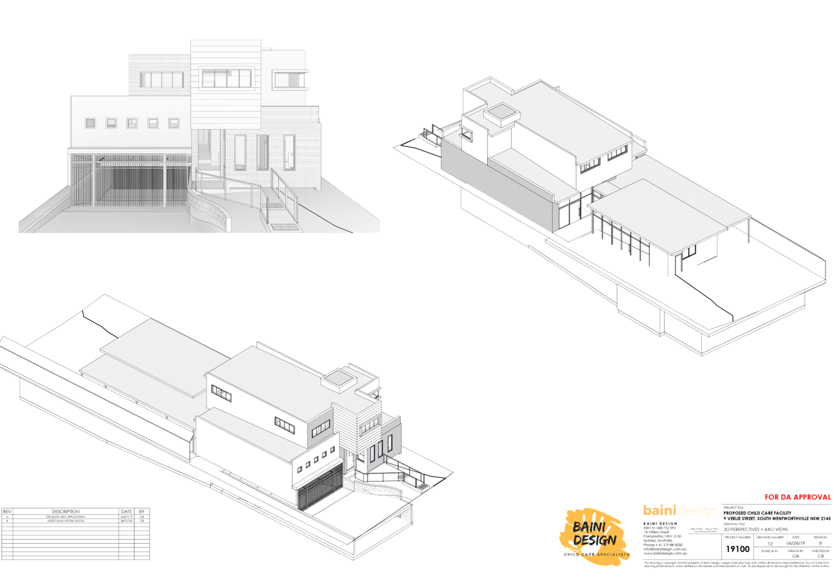
The proposed development, as
amended, involves the demolition of existing structures and construction of a
two storey, 42 place child care centre over basement parking accommodating 11
parking spaces.
Key features of the development
proposal are as follows:-
· Demolition
of the existing dwelling and carport.
· Construction
of a two-storey child care facility accommodating 42 children.
· Construction
of a basement level car parking area accommodating 11 car parking spaces, for
staff and visitors (including 1 accessible space), bin room, and lift/stairs.
· The
facility proposes to accommodate 42 children, as follows:
o 7 children – 0-2
yrs
o 15 children – 2-3
yrs
o 20 children – 3-5
yrs
· The
proposed centre will operate from 7.00am to 6.00pm Monday to Friday, and will
employ 7 staff.
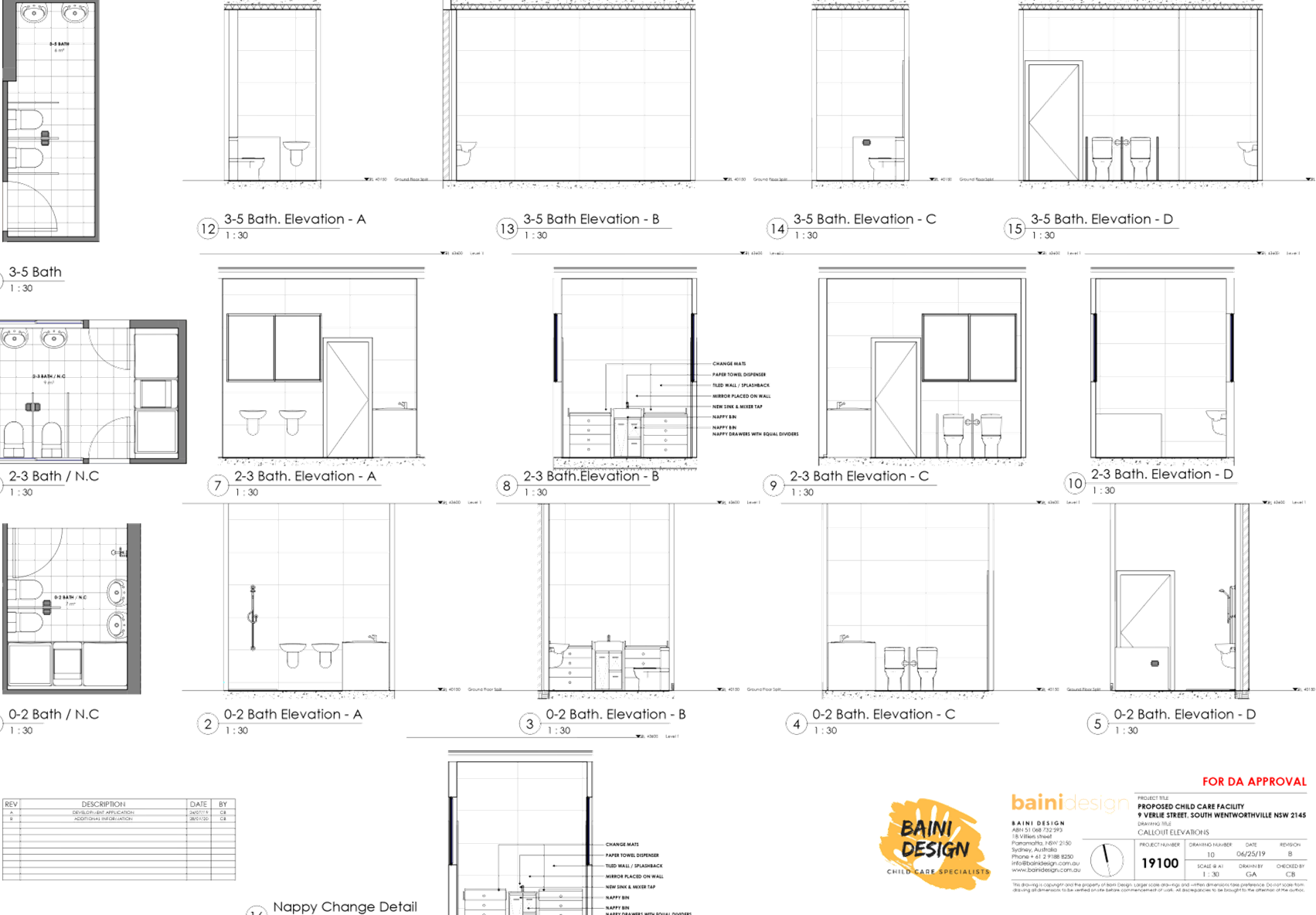
· The
ground floor level contains toilets, storage, indoor and outdoor play areas,
and lift/stairs.
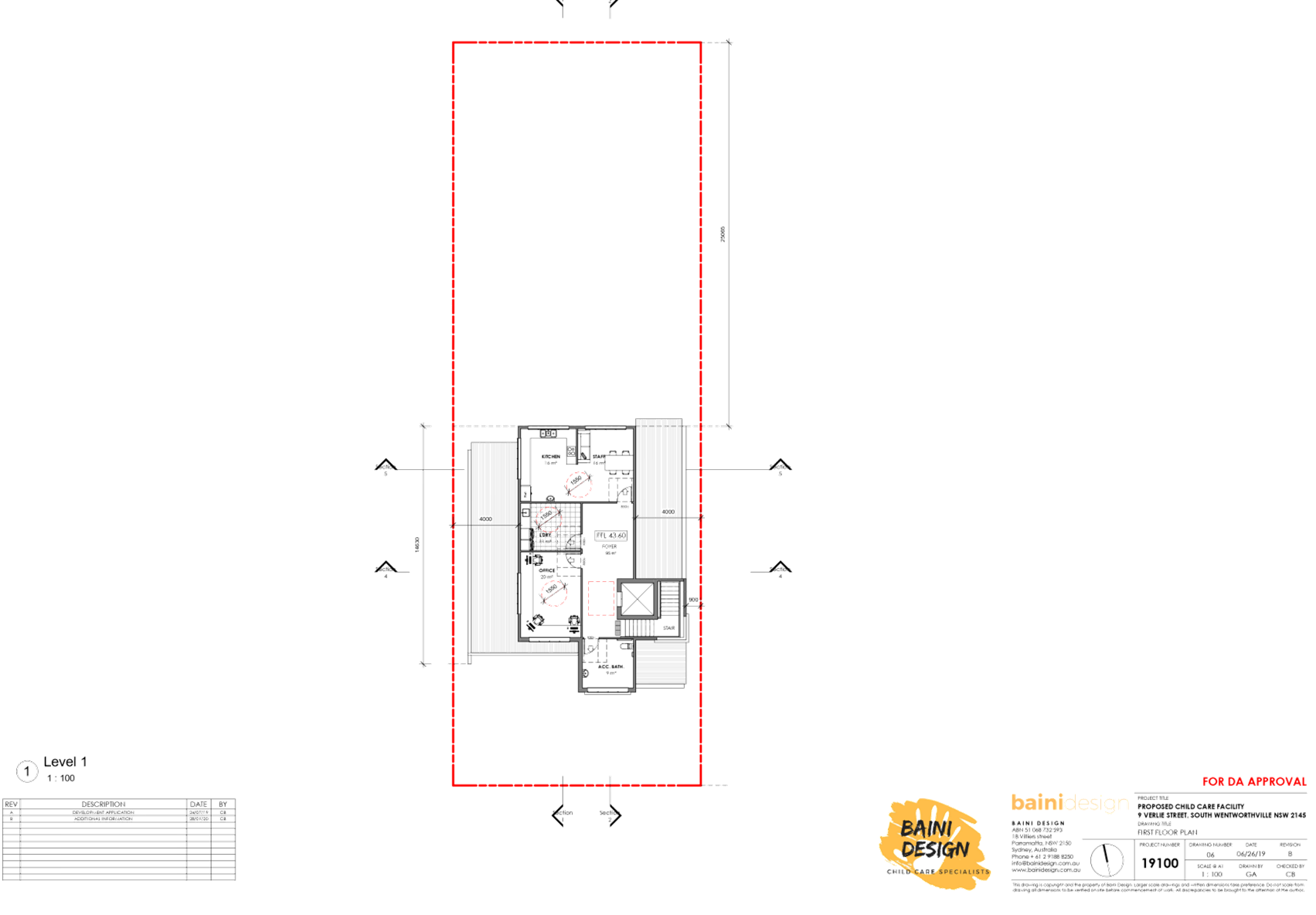
· The
first floor level contains office, toilet, staff room, kitchen, laundry, and
lift/stairs.
· There
is no signage proposed as part of the application.
History
|
Date
|
Action
|
|
27/9/2019
|
Development Application 2019/368 was lodged.
|
|
8/10/2018
|
The application was referred to Council’s internal
departments for review.
|
|
16/10/2019 to 30/10/2018
|
The application was publicly notified to adjoining and
opposite owners, a notice was placed in the local press and a notice placed
on the site for 14 days. In response, 6 submissions were received. During the
assessment process, the residents from a broader catchment area on the
western side of Verlie Street had approached Council requesting to be included
in the notification process, which resulted in additional 7 submissions by
way of objection and 1 petition submitted
to Council. Total submissions by way of objections equate to
14.
|
|
15/01/2020
|
Application was deferred due to non-compliances with SEPP
(Educational Establishments and Child Care Facilities) 2017, Child Care
Planning Guideline 2017, Holroyd Development Control Plan 2013, as well as
on-site detention, traffic, waste management and environmental health
matters.
|
|
10/02/2020
|
Amended plans were received by Council, which do not
warrant re-notification of the proposal.
|
|
8/04/2020
|
Application referred to CLPP for determination.
|
Applicants Supporting
Statement
The applicant has provided a Statement of Environmental
Effects prepared by Think Planners dated 9 September 2019 and was received by
Council on 27 September 2019 in support of the application.
Contact with Relevant Parties
The assessing officer has undertaken a site inspection of
the subject site and surrounding properties and has been in regular contact
with the applicant throughout the assessment process.
Internal Referrals
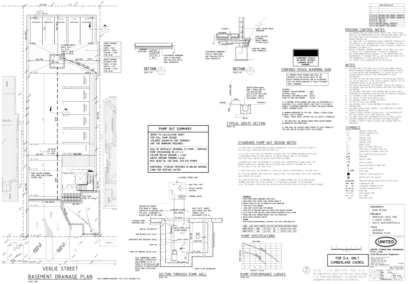
Development Engineer
The development application was
referred to Council’s Development Engineer for comment who has advised
that the development is supportable in regards to the provision of on-site
detention, subject to conditions.
Traffic Engineer
The development application was
referred to Council’s Traffic Engineer for comment who has advised that
the development is supportable in regards to traffic management, and on-site
parking provision in the basement level, subject to conditions.
Tree Management Officer
The development application was
referred to Council’s Tree Management Officer for comment who has advised
that the development is supportable, subject to conditions.
Waste Management Officer
The development application was
referred to Council’s Waste Management Officer for comment who has
advised that the development is supportable in regards to provision of bin tug,
bin storage room, and waste collection and management plan, subject to
conditions.
Environmental Health Officer
The development application was
referred to Council’s Environmental Health Officer for comment who has
advised that the development is supportable in regards to fit-out for food preparation
area, acoustic assessment, noise management plan, noise attenuation measure,
soil assessment and site contamination, subject to conditions.
Children’s Services
The development application was
referred to Council’s Children’s Services section for comment who
has advised that the development is supportable in regards to compliance with
the provisions of Education and Care Services National Regulations and Law,
subject to conditions.
External Referrals
The application was not required
to be referred to any external government authorities for comment.
Planning Comments
The provisions of any
Environmental Planning Instruments (EP&A Act s4.15 (1)(a)(i))
(a) State
Environmental Planning Policy No. 55 – Remediation of Land (SEPP 55)
Clause 7 of SEPP 55 requires
Council to be satisfied that the site is suitable or can be made suitable to
accommodate the proposed development. The matters listed within Clause 7 have
been considered in the assessment of the development application.
|
Matter for
Consideration
|
Yes/No
|
|
Does the application
involve re-development of the site or a change of land use?
|
Yes
No
|
|
In the development
going to be used for a sensitive land use (e.g.: residential, educational,
recreational, childcare or hospital)?
|
Yes
No
|
|
Does information available to you indicate that an
activity listed below has ever been approved, or occurred at the site?
acid/alkali plant and
formulation, agricultural/horticultural activities, airports, asbestos
production and disposal, chemicals manufacture and formulation, defence
works, drum re-conditioning works, dry cleaning establishments, electrical
manufacturing (transformers), electroplating and heat treatment premises,
engine works, explosive industry, gas works, iron and steel works, landfill
sites, metal treatment, mining and extractive industries, oil production and
storage, paint formulation and manufacture, pesticide manufacture and
formulation, power stations, railway yards, scrap yards, service stations,
sheep and cattle dips, smelting and refining, tanning and associated trades,
waste storage and treatment, wood preservation
|
Yes
No
|
|
Is the site listed on
Council’s Contaminated Land database?
|
Yes
No
|
|
Is the site subject to EPA
clean-up order or other EPA restrictions?
|
Yes
No
|
|
Has the site been the subject of
known pollution incidents or illegal dumping?
|
Yes
No
|
|
Does the site adjoin any
contaminated land/previously contaminated land?
|
Yes
No
|
|
Has the appropriate level of
investigation been carried out in respect of contamination matters for
Council to be satisfied that the site is suitable to accommodate the proposed
development or can be made suitable to accommodate the proposed development?
|
Yes
No
|
|
1.
A Preliminary Site Investigation report prepared by
Geotechnical Consultant Australia, which includes a soil assessment, was
submitted with the application. The report did not reveal any potential matters
of concern with regard to contamination and concludes that the site is
suitable for its intended use, subject to recommendations to be imposed as
conditions of consent. Council’s Environmental Health Officer has
reviewed the reports and determined that the site is suitable for such a
development given that the report provides that the site is suitable for the
proposed use.
|
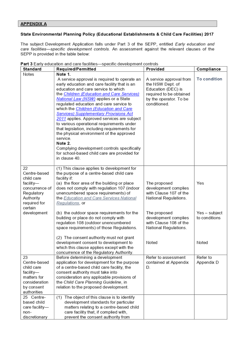
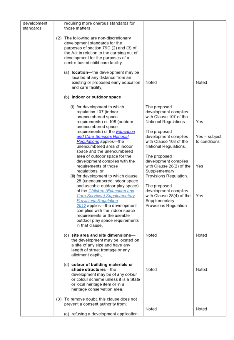
(b) State
Environmental Planning Policy (Educational Establishments and Child Care
Facilities) 2017
The relevant provisions of the
SEPP have been considered in the assessment of the Application.
It is noted that State
Environmental Planning Policy (Educational Establishments And Child Care
Facilities) 2017 commenced on 1 September 2017. The SEPP applies to any
proposals for new schools or child care centres or proposed alterations and
additions to existing centres. The relevant provisions of the SEPP have been
considered in the assessment of the Application.
A comprehensive assessment and
compliance table is attached to this report in Appendix A, which indicates that
there are non-compliances with the SEPP 2017 with regard to number of children
proposed and outdoor unencumbered space as under:
|
Control
|
Required
|
Provided
|
|
Number of children and outdoor unencumbered
space (regulation 108 SEPP 2017 and part 4.9 the Guideline)
|
7m² x 42 = 294m²
|
The application indicates that
an unencumbered area of 293m² is provided, which is equal to a shortfall
of 1m² to accommodate 42 children. However, this calculation does not
include the width of the proposed retaining walls required for the excavation
of rear yard and the installation of acoustic fencing, which must be carried
out wholly within the site. The assessment officer’s calculation of the
unencumbered outdoor space equates to 280m². This will accommodate only
40 children. This report recommends a condition to be imposed on any consent
granted for a reduction in the number of children to 40. The applicant has
been advised regarding the condition to reduce the number of children.
|
(a) Statement
Environmental Planning Policy No 19 - Bushland in Urban Areas
The subject site does not adjoin
land zoned or reserved for public open space. The proposal does not propose to
disturb bushland zoned or reserved for public open space.
(b) State
Environmental Planning Policy (Vegetation in Non-Rural Areas) 2017
Removal of one (1) existing street
tree and four (4) trees on site is proposed as part of this application.
Council’s Tree Management Officer has reviewed the proposal and raised no
objections to tree removal, subject to the impositions of conditions. In addition,
the proposal does not exceed the biodiversity offsets scheme threshold.
Therefore, the proposed vegetation removal is considered acceptable.
Regional Environmental Plans
(Deemed State Environmental Planning Policies)
(c) Sydney
Regional Environmental Plan (Sydney Harbour Catchment) 2005
The subject site is identified as
being located within the area affected by the Sydney Regional Environmental
Plan (Sydney Harbour Catchment) 2005. The proposed development raises no issues
as no impact on the catchment is envisaged.
Note: The subject site is
not identified in the relevant map as land within the ‘Foreshores and
Waterways Area’ or ‘Wetland Protection Zone’, is not a
‘Strategic Foreshore Site’ and does not contain any heritage items.
Hence the majority of the SREP is not directly relevant to the proposed
development.
Local Environmental Plans
(a) Holroyd
Local Environmental Plan (LEP) 2013
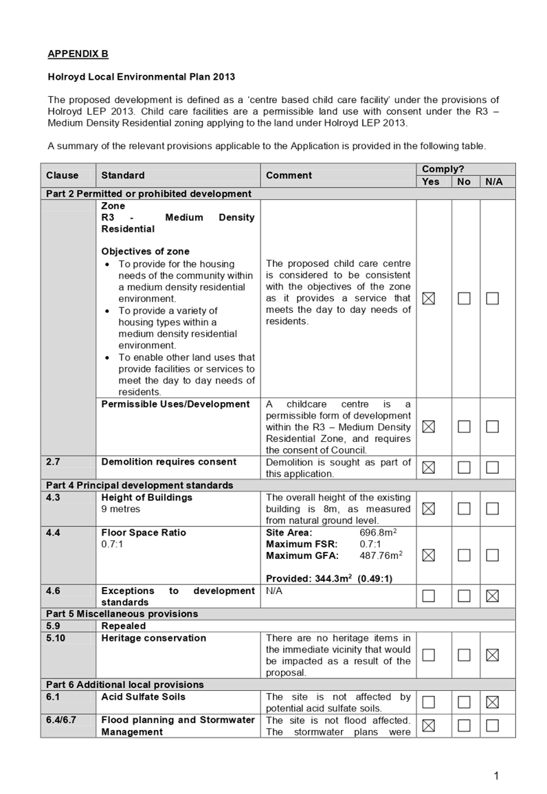
The proposed development is
defined as a ‘centre based child care facility’ under the
provisions of Holroyd Local Environmental Plan (LEP) 2013. Centre based child
care facilities are a permissible land use with consent under the R3 –
Medium Density Residential zoning applying to the land under Holroyd LEP 2013.
A comprehensive assessment and
compliance table is attached to this report in Appendix B which demonstrates
the development proposal’s compliance with the relevant planning controls
that are applicable to the site under the Holroyd LEP 2013.
The provisions of any draft
Environmental Planning Instruments (EP & A Act Section 4.15(1)(a)(ii))
The proposed development is not
affected by any relevant Draft Environmental Planning Instruments.
The provisions of any
Development Control Plans (Environmental Planning & Assessment Act Section
4.15(1)(a)(iii))
(b) Holroyd
Development Control Plan (HDCP) 2013
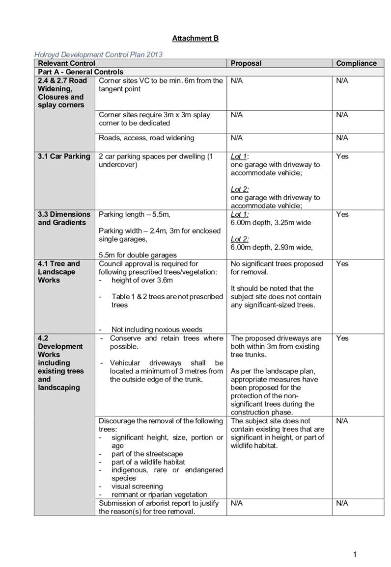
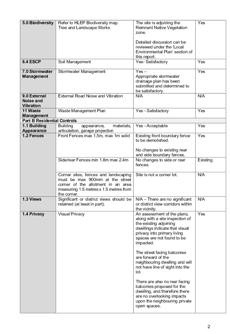
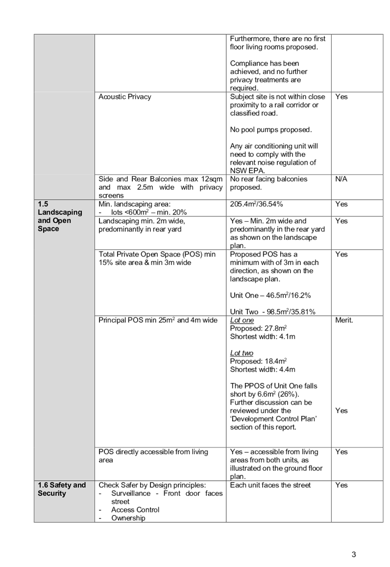
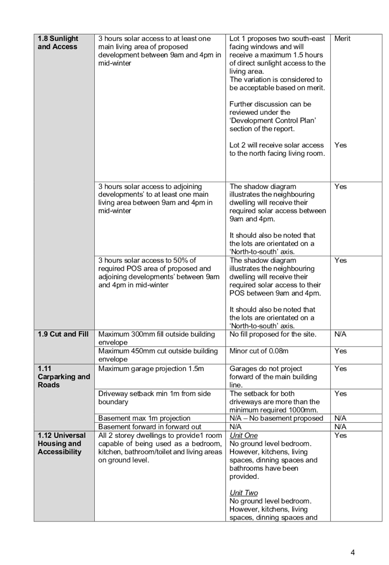
The Holroyd DCP 2013 provides
guidance for the design and operation of development within Holroyd to achieve
the aims and objectives of Holroyd LEP 2013.
The proposed development is
generally compliant with the relevant provisions. Parts A, B & I apply to
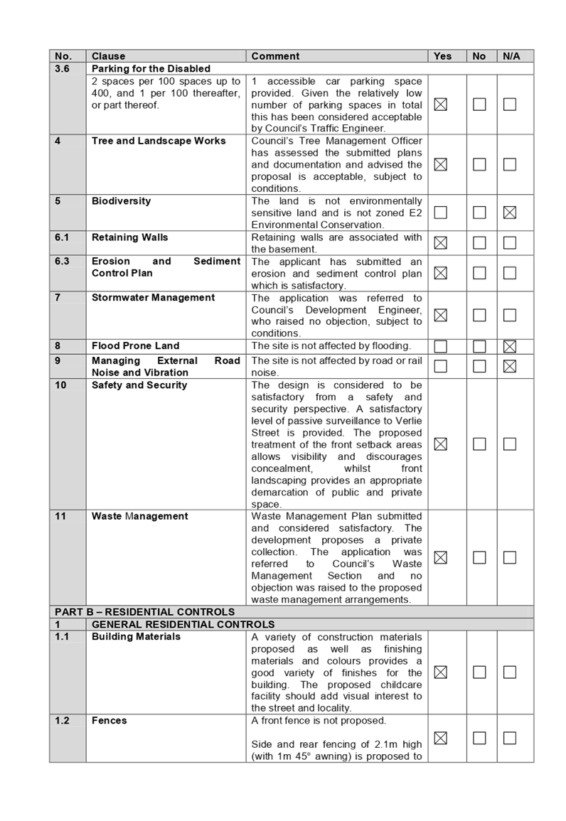
the proposal. A comprehensive assessment and compliance table is attached to
this report at Appendix C which demonstrates the development proposal’s
compliance with the relevant planning controls that are applicable to the site.
The assessment provided in
Appendix C indicates that there are some minor non-compliances with the HDCP
2013 with regard to landscaped area, upper level and driveway setbacks, and
site frontage, which are discussed in the following section:
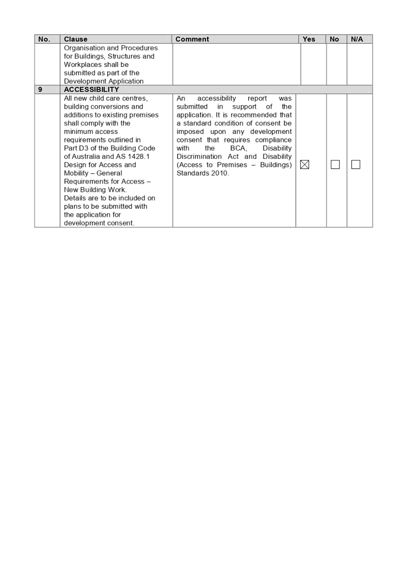
|
No.
|
Clause
|
Comment
|
Yes
|
No
|
N/A
|
|
PART A – GENERAL
CONTROLS
|
|
3.5
|
Access, Maneuvering and Layout
|
|
Driveways shall be setback a minimum of 1.5m from the side
boundary.
|
The proposed driveway is setback 1.1m
from the eastern side boundary which is less than what is required. Setback
shortfall of 0.4m is considered acceptable, given the provision of separate
driveways which will ensure safe vehicular movement while entering and
exiting the site.
|
|
|
|
|
PART B – RESIDENTIAL
CONTROLS
|
|
1
|
GENERAL RESIDENTIAL CONTROLS
|
|
1.5
|
Landscaped
Area
Min. 20% = 139.36m2
|
Area of 18.8%
(131m²) is provided with min. 2m dimension.
Landscaped area with dimension
of less than 2m equates to 15.3m².
Total landscaped area provided
on site is 146.3m², or 20.9% that complies with min 20% area required.
Variation to the required landscaped area based on its
width is acceptable, as it is capable to retain dense plantings to the
majority part of the proposed area.
|
|
|
|
|
5
|
MULTI DWELLING HOUSING
|
|
5.2
|
Upper
storey setback
4m
|
Building envelope standards,
which apply to the proposed child care, generally are satisfied with the exception
to the lift/stairs core setbacks to the eastern side boundary. This variation
is considered acceptable, given the proposed location of the lift/stairs core
will not result in adverse overshadowing, privacy and amenity impacts to the
adjoining properties. Articulation to the building appearance is also
maintained by protrusion of the lift/stairs core forming part of the building
façade.
|
|
|
|
|
PART I – CHILDCARE
CENTRES
|
|
1
|
SIZE, DENSITY AND LOCATION
|
|
|
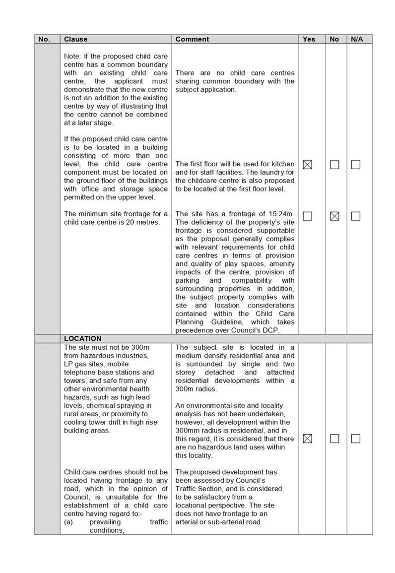
Site Frontage
The minimum site frontage for a
child care centre is 20 metres.
|
The site has a frontage of
15.24m. The deficiency of the property’s site frontage is considered
supportable as the proposal generally complies with relevant requirements for
child care centres in terms of provision and quality of play spaces, amenity
impacts of the centre, provision of parking and compatibility with
surrounding properties. In addition, the subject property complies with site
and location considerations contained within the Child Care Planning
Guideline, which takes precedence over Council’s DCP.
|
|
|
|
The provisions of any planning
agreement that has been entered into under section 7.4, or any draft planning
agreement that a developer has offered to enter into under section 7.4
(EP&A Act s4.15(1)(a)(iiia))
There is no draft planning
agreement associated with the subject Development Application.
The provisions of the
Regulations (EP&A Act s4.15 (1)(a)(iv))
The proposed development raises no
concerns as to the relevant matters arising from the Environmental Planning and
Assessment Regulations 2000 (EP&A Reg).
The Likely Environmental,
Social or Economic Impacts (EP&A Act s4.15 (1)(b))
It is considered that the proposed
development will have no significant adverse environmental, social or economic
impacts in the locality.
The suitability of the site for
the development (EP&A Act s4.15 (1)(c))
The subject site and locality is
not known to be affected by any natural hazards or other site constraints
likely to have a significant adverse impact on the proposed development.
Accordingly, it is considered that the development is suitable in the context
of the site and surrounding locality.
Submissions made in accordance
with the Act or Regulation (EP&A Act s4.15 (1)(d)
Advertised (newspaper)
Mail Sign Not Required
In accordance with Council’s
Notification requirements contained within Holroyd DCP 2013, the proposal was
publicly notified for a period of 14 days between 16 October 2019 and 30
October 2019. The notification generated total of 14 submissions in respect of
the proposal, with nil submission disclosing a political donation or gift. The
issues raised in the public submissions are summarised and commented on as
follows:
Figure
4 – Submissions summary table
|
Concern
|
Comment
|
|
1.
Traffic and parking
Verlie
Street does not allow a two-way traffic when both sides are occupied by on
street parking.
High
congestion and 10m wide street with no speed humps resulted in speeding on
Verlie Street and frequent accidents. Traffic flow on Verlie Street will be increased
being the bypass from Great Western highway and M4 for commuters travelling
from South Wentworthville towards the west. Traffic peak times within AM/PM,
particularly during garbage collection times, are to be considered as safety
hazard and will affect children and pedestrian safety.
The
proposed development will reduce availability of on street parking in Verlie
Street for residents.
The
proposed development will not provide sufficient parking for the child care
centre operation.
The
data used in traffic assessment cannot be used to justify the proposed
development as no other child care centre is operational on Verlie Street
yet.
|
The submitted traffic report
relies on surveys during peak times AM and PM between 7.00am – 9.00am
and 4.00pm – 6.00pm on 25 July 2019. The data used has taken
consideration of traffic generation projected from approved development at 24
Verlie Street. Council noted the additional traffic to be generated by the
proposal and the findings from the Traffic and Parking Impact Assessment
Report. Revised traffic report submitted with the application prepared by
Stanbury Traffic Planning reference no. 19-113-2 dated March 2020
demonstrated that Verlie Street could accommodate vehicles movement from both
child care centres at 9 and 24 Verlie Streets. The proposed development is a
low trip generator projecting an additional/one (1) vehicle movement every
two minutes during peak hour. Additional vehicles movement can be
accommodated in the locality without affecting performance of Verlie Street,
or on the existing road network with respect to delays or queues of nearby
intersections.
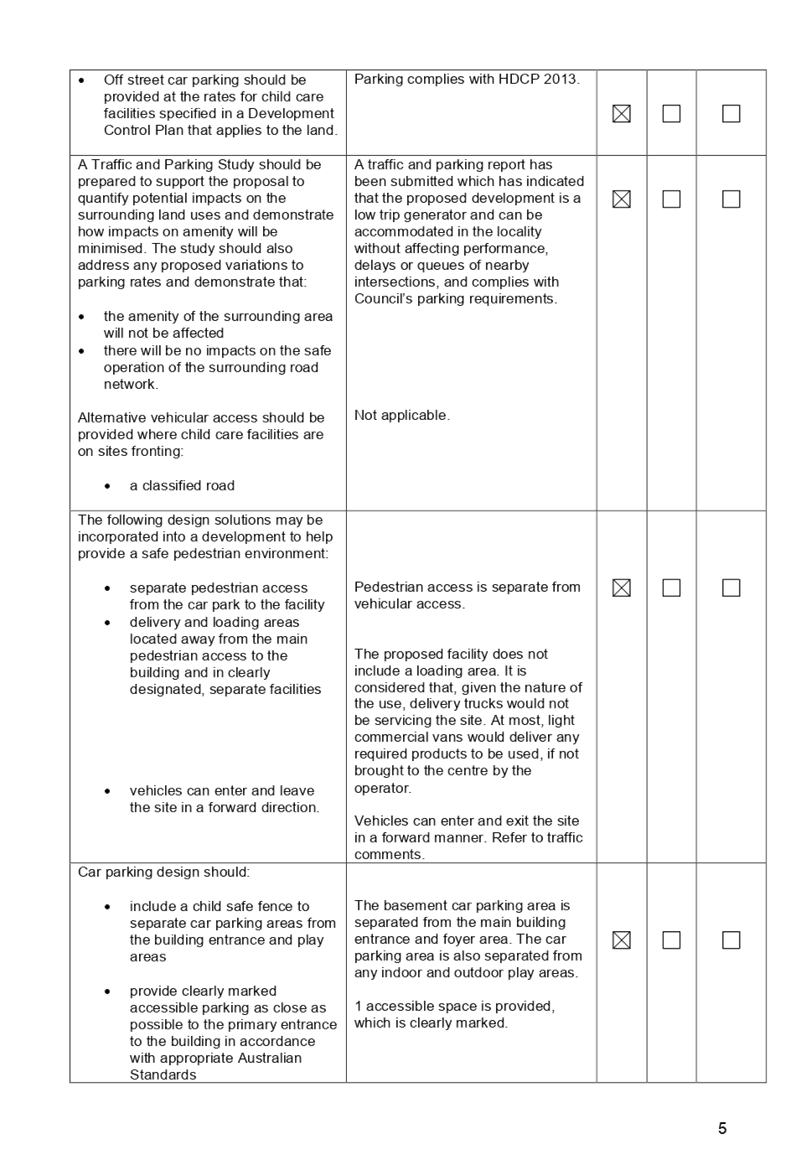
Under the Holroyd
Development Control Plan 2013, the required parking rate for child care
centres located in R3 Medium Density Residential zone is 1 space per 4
children, which equates to total of 10 spaces required if the recommended
reduction in the number of children from 42 to 40 is implemented. The
proposed basement could accommodate the required car spaces, which will
assist with providing additional parking off Verlie Street.
It
is noted that Council’s rate of 1 car space per 4 children is
consistent with the recently introduced NSW State Government document
entitled Child Care Planning Guideline, in which the rate of 1 space per 4
children encompasses the whole centre including all staff.
A
condition is to be imposed to ensure that all car parking spaces to be
allocated to visitors. The proposed parking arrangement and swept path have
been reviewed by Council’s Traffic Engineer and considered
satisfactory, subject to conditions.
The provision of separate
driveways for entry and exit allow all vehicles to enter and leave in a
forward direction and provide adequate sight distance. It is envisaged that
motorists will be capable of entering and exiting the site in a safe and efficient
manner. In addition, there is a 1.2m separation distance between the two
driveways which also provide pedestrians a safe refuge area to wait to cross
when vehicles enter and exit the basement.
An additional condition is
included to ensure any front fencing will allow clear sightlines for
vehicular access. The number of parking spaces provided is considered
acceptable and appropriate to meet the parking demand of the proposed centre,
without placing unacceptable demands on the availability of parking within
the locality or on the local street network.
The entry/exit driveway is at
an obvious location that will not be missed by parents and caregivers. The
parents and caregivers will be regular visitors to the centre knowing in
advance the location of car parking. An Operational Management Plan (OMP)
shall be enforced by way of conditions to encourage the use of the basement
parking facility. All pickup and drop-off is expected to take place within
the basement and it is not considered to create any adverse impact on the
public space.
The proposed car parking in
the basement level has been provided with the number of spaces that complies
with the DCP requirement, which will be able to absorb the demand from the
development and mitigate any potential traffic impact on Verlie Street.
Council’s Waste
Management Section has reviewed the proposal and considered the waste
arrangement satisfactory. Commercial waste arrangement may also be carried
out independently from Council’s service. Conflict with Council’s
garbage truck movements therefore is not anticipated given the operation of
the child care centre will be wholly contained in the subject site.
|
|
2.
Noise
The
proposed child care centre will be source of environmental noise nuisance to
surrounding properties and disturbance to a quiet street.
|
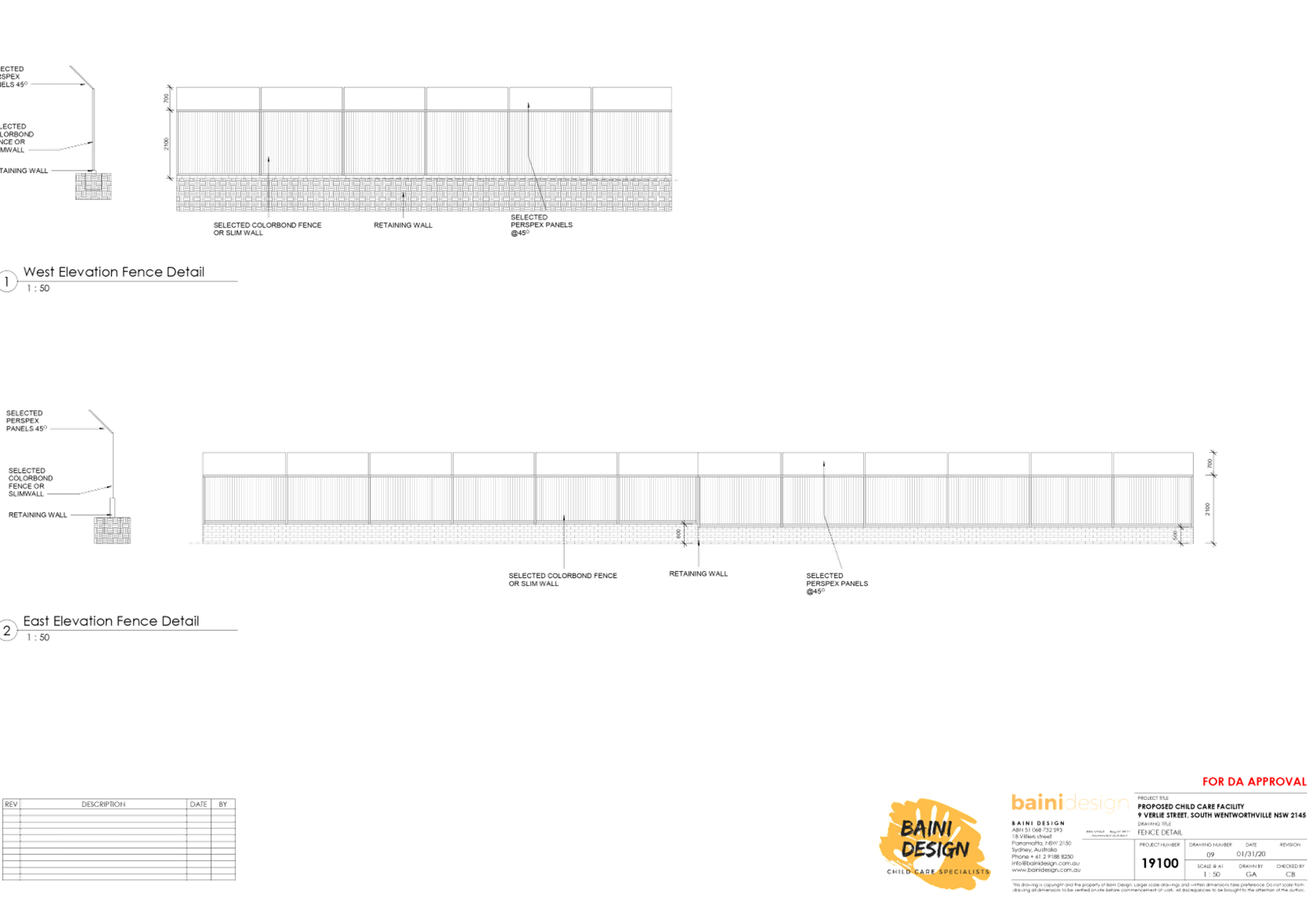
The proposed
development has been accompanied with noise impact assessment/acoustic report
and Noise Management Plan, which recommended the construction of acoustic
fencing to minimise noise impact from the child care centre.
The design of acoustic
fencing location, height and effectiveness have been reviewed by
Council’s Environmental Health Officer and are considered satisfactory
to comply with the relevant noise control provisions.
The acoustic report
demonstrates that the proposed centre can be accommodated on the site without
noise nuisance to adjoining and surrounding properties. The noise generated
from both indoor and outdoor play activities can comply with the relevant
environmental noise guidelines with the imposition of a noise management plan
submitted with the application and the installation of relevant noise
mitigation measures such as acoustic fencing.
The acoustic consultant
recommendation has been captured in the Noise
Management Plan submitted with the application.
The centre is proposed
to operate from 7.00am to 6.00pm Monday to Friday. The
acoustic assessment also has had regard to noise generated from mechanical
plant, car park emissions and indoor activities, which only occur during the
operation of child care centre.
Conditions are to be imposed in the consent to avoid any breaches to
the required noise threshold, including noise management to be incorporated
in the OMP.
|
|
4.
The proposed child care centre is not suitable for the street located where
demographic of the population consists of elderly. Oversupply of child care
centres will result in business saturation and quality. No precedence of two
child care centres built on the same street.
|
The site permits the construction
of the child care centre, and proposed development generally satisfies the
requirements contained within Holroyd DCP 2013, the criteria under the Child
Care Planning Guideline and relevant regulations stipulated under the
Educational Establishments and Child Care Facilities SEPP 2017, with the
exceptions above.
Council may consider limiting the
size of child care centres if they share a property boundary as pertained in
Holroyd DCP 2013. In this instance, the proposed child care centre is not
sharing any property boundary to the approved child care centre at 24 Verlie
Street and it is located 100m away from each other. The site and location considerations contained within the
Child Care Planning Guideline takes precedence over Council’s DCP,
where more than one child care centre may be permitted on the same street.
The approved child care centre at
24 Verlie Street has addressed the required criteria applying specifically to
the site. The subject application has also been submitted with supporting
documentation and was found to be satisfactory, as discussed within the body
of this report. Cumulative traffic generation has been addressed in the
revised traffic report submitted with the application prepared by Stanbury
Traffic Planning reference no. 19-113-2 dated March 2020, demonstrating that
Verlie Street could accommodate vehicles movement from both child care
centres at 9 and 24 Verlie Streets.
The existing demography of the
area is not a matter of consideration under the Child Care Planning Guideline
and relevant regulations stipulated under the Educational Establishments and
Child Care Facilities SEPP 2017.
In relation to the child care
centre quality, it is the operator’s responsibility to satisfy the
relevant child care provider requirements and comply with the regulations to
maintain its licence and business operation.
|
|
5.
Impact of development on adjoining property to the west, such as,
unauthorised parking on driveway, damage and waste management during
construction, waste management, trespassing, window height, and construction
hours.
|
Suitable conditions will be
imposed in relation to any potential damage and waste management during
construction, waste management, potential trespassing and construction hours
to minimise impact of the proposed development on the adjoining property.
Unauthorised parking on driveway can be reported to Council’s
compliance section for action, if it occurs. Condition regarding parking
during construction period will be imposed. The upper level setback on the
western side has been increased to 4m to reduce any potential overlooking
into the adjoining property from the proposed office and kitchen windows.
|
The public interest (EP&A
Act s4.15(1)(e))
In view of the foregoing analysis,
it is considered that the development, if carried out subject to the conditions
set out in the recommendation below, will have no significant adverse impacts
on the public interest.
Section 7.11 (Formerly S94)
Contribution Towards Provision or Improvement of Amenities or Services
This part of the Act relates to
the collection of monetary contributions from applicants for use in developing
key local infrastructure. The development was lodged prior to 15 January 2020.
Therefore, the Cumberland Local Infrastructure Contributions Plan does not
apply. The payment of contributions in accordance with Holroyd Section 94
Contributions Plan 2013 does not apply to the proposed child care centre on the
subject site.
Disclosure of Political
Donations and Gifts
The applicant and notification
process did not result in any disclosure of Political Donations and Gifts.
The application has been assessed
in accordance with the relevant requirements of the Environmental Planning and
Assessment Act 1979, State Environmental Planning Policy No. 55 –
Remediation of Land, State Environmental Planning Policy (Educational
Establishments and Child Care Facilities) 2017, Education and Care Services
National Regulations, Holroyd Local Environmental Plan 2013 and the Holroyd
Development Control Plan 2013 and is considered to be satisfactory for
approval, subject to reduction in number of children to 40 (to comply with the
outdoor unencumbered space) and the draft conditions.
|
1. That
Development Application No. DA2019/368/1 for demolition of existing
structures and construction of a two storey 40 place child care centre over
basement car parking on land at 9 Verlie Street South Wentworthville be
deferred commenced, subject to attached conditions.
2. Persons
whom have lodged a submission in respect to the application be notified of
the determination of the application.
|
1. Revised
Full Set of Architecturals
2. Revised
Stormwater Plans
3. Traffic
and Parking Impact Assessment
4. Submissions
5. Locality
Map
6. Appendix
A - SEPP (Education & Child Care Facilities) 2017
7. Appendix
B - Holroyd Local Environmental Plan 2013
8. Appendix
C - Holroyd Development Control Plan 2013
9. Appendix
D - Child Care Guideline 2017
10. Draft
Notice of Determination
DOCUMENTS
ASSOCIATED WITH
REPORT LPP013/20
Attachment 1
Revised Full Set of Architecturals
Cumberland Local Planning Panel Meeting
8 April 2020
DOCUMENTS
ASSOCIATED WITH
REPORT LPP013/20
Attachment 2
Revised Stormwater Plans
Cumberland Local Planning Panel Meeting
8 April 2020
DOCUMENTS
ASSOCIATED WITH
REPORT LPP013/20
Attachment 3
Traffic and Parking Impact Assessment
Cumberland Local Planning Panel Meeting
8 April 2020


DOCUMENTS
ASSOCIATED WITH
REPORT LPP013/20
Attachment 4
Submissions
Cumberland Local Planning Panel Meeting
8 April 2020
Cumberland Local Planning Panel Meeting
8 April 2020
DOCUMENTS
ASSOCIATED WITH
REPORT LPP013/20
Attachment 5
Locality Map
Cumberland Local Planning Panel Meeting
8 April 2020
DOCUMENTS
ASSOCIATED WITH
REPORT LPP013/20
Attachment 6
Appendix A - SEPP (Education & Child Care
Facilities) 2017
Cumberland Local Planning Panel Meeting
8 April 2020
DOCUMENTS
ASSOCIATED WITH
REPORT LPP013/20
Attachment 7
Appendix B - Holroyd Local Environmental Plan 2013
Cumberland Local Planning Panel Meeting
8 April 2020

DOCUMENTS
ASSOCIATED WITH
REPORT LPP013/20
Attachment 8
Appendix C - Holroyd Development Control Plan 2013
Cumberland Local Planning Panel Meeting
8 April 2020
DOCUMENTS
ASSOCIATED WITH
REPORT LPP013/20
Attachment 9
Appendix D - Child Care Guideline 2017
Cumberland Local Planning Panel Meeting
8 April 2020
DOCUMENTS
ASSOCIATED WITH
REPORT LPP013/20
Attachment 10
Draft Notice of Determination
Cumberland Local Planning Panel Meeting
8 April 2020


8 April 2020
Item
No: LPP014/20
Development
Application for 20 Cumberland Road, Greystanes
Responsible
Division: Environment
& Planning
Officer: Executive
Manager Development and Building
File
Number: DA2019/417/1
|
Application
lodged
|
30 October 2019
|
|
Applicant
|
Baini Design
|
|
Owner
|
Mrs J Kayrouz & Mr J
Kayrouz
|
|
Application
No.
|
DA2019/417/1
|
|
Description
of Land
|
20 Cumberland Road
GREYSTANES NSW 2145, Lot 1 DP 239389
|
|
Proposed
Development
|
Demolition of existing structures
and construction of a two-storey attached dual occupancy with Torrens Title
subdivision into 2 lots
|
|
Site
Area
|
562m2
|
|
Zoning
|
R2 Low-Density Residential
(Holroyd Local Environmental Plan 2013)
|
|
Disclosure
of political donations and gifts
|
Nil disclosure
|
|
Heritage
|
The subject site is not a
heritage-listed item and is not within a heritage conservation area.
|
|
Principal
Development Standards
|
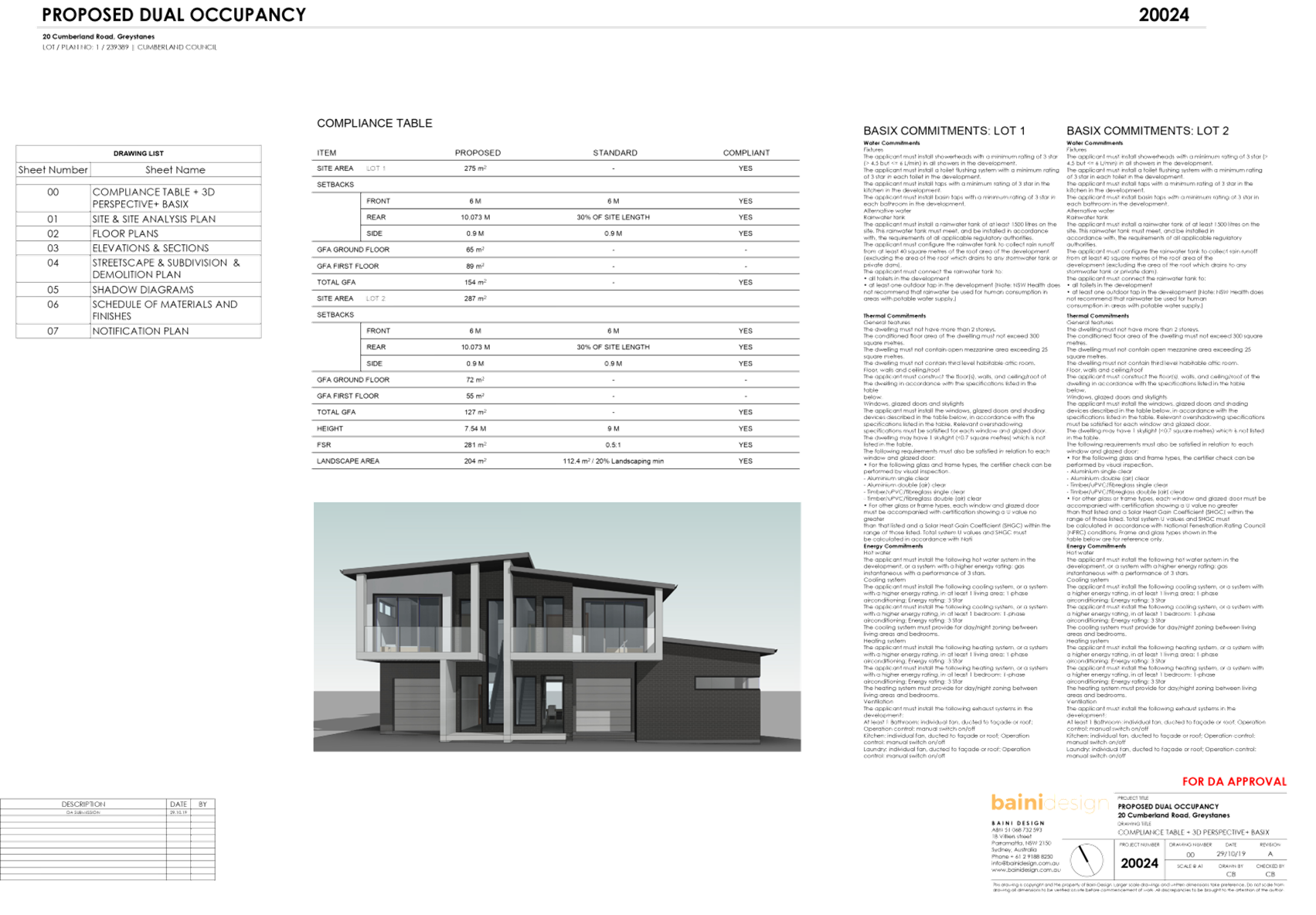
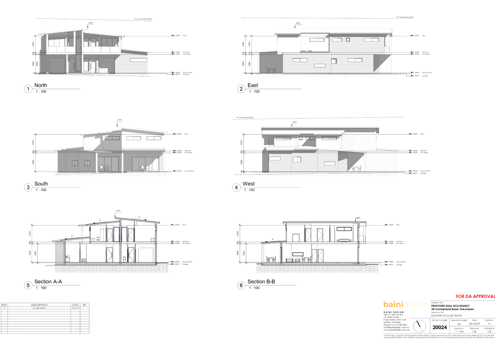
Floor Space Ratio
Permissible: 0.5:1
Proposed: 0.48:1
Height of Building
Permissible: 9m
Proposed: 7.31m
|
|
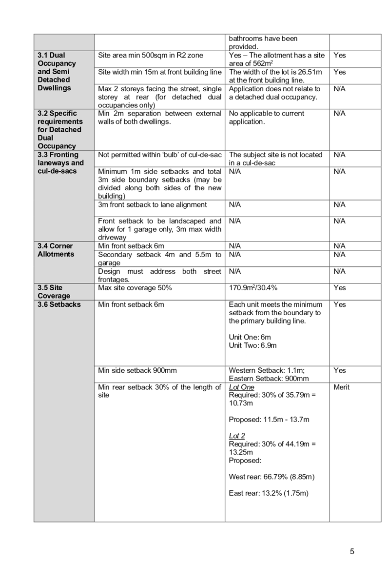
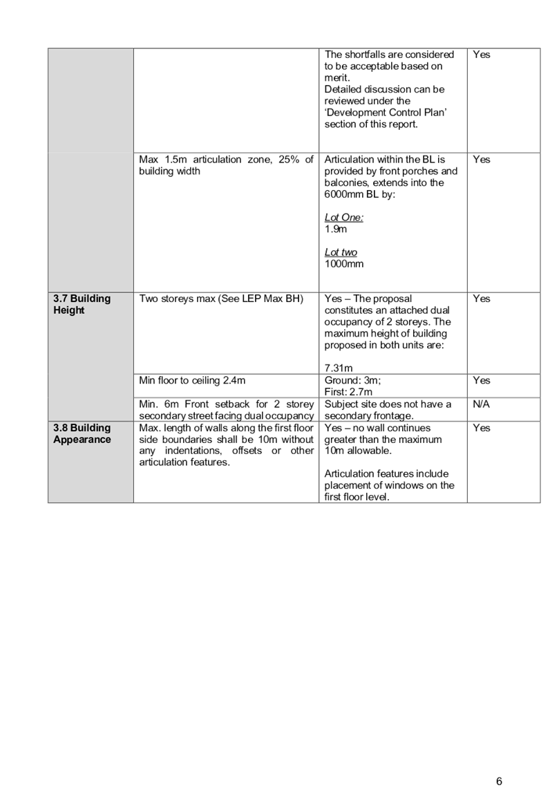
Issues
|
Rear setback, principal
private open space.
|
1. Development
Application No. DA2019/417/1 was received on 30 October 2019 seeking consent
for the demolition of existing structures and construction of a two-storey
attached dual occupancy with Torrens Title subdivision into 2 lots.
2. The
application was publicly notified to occupants and owners of the adjoining
properties for a period of 14 days between 25 November 2019 and 10 December
2019. In response, nil submissions were received.
3. The
subject site is not a heritage-listed item and is not situated within a
heritage conservation area pursuant to the provisions of the Holroyd Local
Environmental Plan 2013.
4. The
subject site is located 40m north-east of a State Heritage Item ‘Lower
Prospect Canal Reserve’ (I01945).
5. The
variations from the controls in the Holroyd Development Control Plan 2013 are
as follows:
|
Control
|
Required
|
Provided
|
% variation
|
|
Principal Private Open Space
|
Minimum area - 25m2
|
18.4m2
|
26.4%
|
|
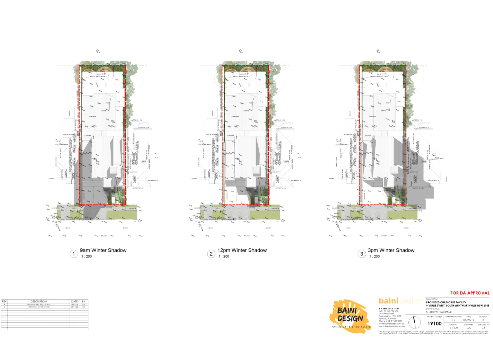
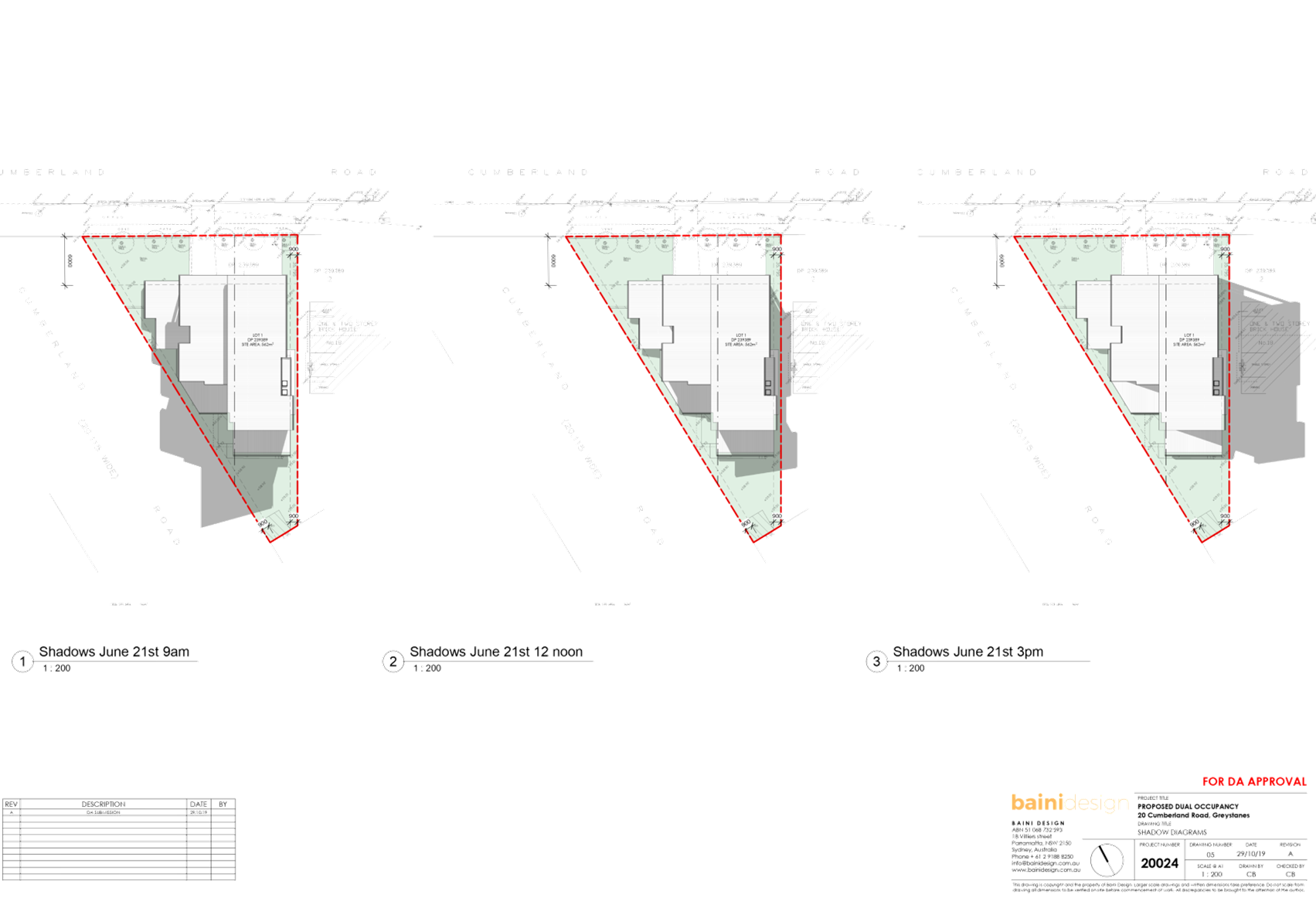
Sunlight Access
|
C.5
Direct sunlight access for a minimum of 3 hours
between 9am – 4pm at winter solstice to at least one main living area
|
Lot 1
Approximately 1.5 hours of direct sunlight
access to the living room.
|
50%
|
|
Rear setback
|
30% of site depth (13.25m)
|
4.4m (rear west)
11.5m (rear east)
|
West rear: 66.79%
East rear: 13.2%
|
6. The
application is recommended for conditional approval subject to the conditions
as provided in the attached schedule.
7. The
application is referred to the Panel as there is a declared conflict of
interest.
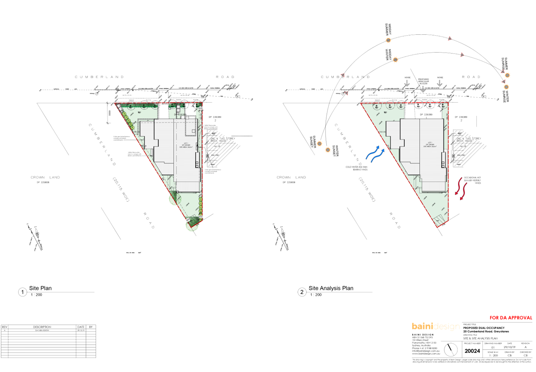
Subject Site and Surrounding
Area
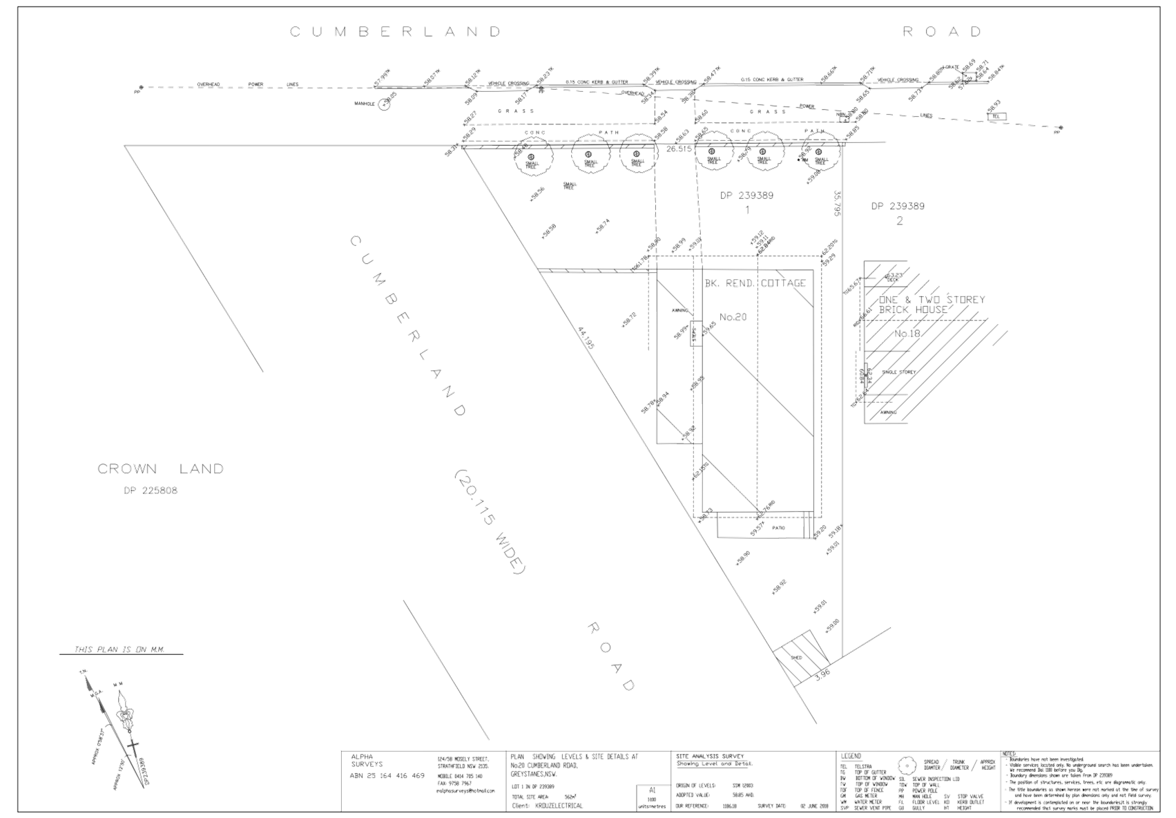
The subject site is located on the
southern side of Cumberland Road, Greystanes and comprises an area of 562m2.
The subject site currently has a single-storey dwelling with attached garage,
front boundary fencing, and detached shed at the rear of the site.
The site slopes to the front with
the following dimensions:
- Southern
corner – north west: 0.69m;
- Southern
corner – north east: 0.15m
The site adjoins a
two-storey dwelling to the east, a public park to the west and an educational
establishment to the north.
The site is located 40m north-east
of a State heritage listed item ‘Lower Prospect Canal Reserve’,
(SHR: I01945). The Lower Canal was incorporated into a public reserve in 1998.
The reserve is just over 6.6 km in length, measured from Reconciliation Road,
Pemulwuy to Pipehead, Guildford. It varies from 40m to 100m in width and covers
approximately 54.6 hectares. The Lower Canal, and its associated
infrastructure, is state significant as it comprises a key component of the
Upper Nepean Scheme. This scheme was the outcome of the first major engineering
investigation in NSW into the provision of an adequate and reliable water
supply to meet the needs of a rapidly growing Sydney. The portion of the canal
to which the site is in proximity to includes a pedestrian/cycle way.
Figure
1 – Locality Plan of the subject site
Figure
2 – Street view of the subject site
Figure
3 – Rear view of the subject site taken from the heritage item
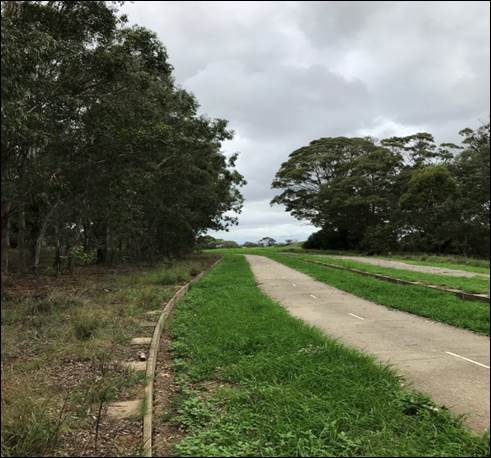
Figure
4 - The heritage item (facing east)
Description of the Proposed
Development
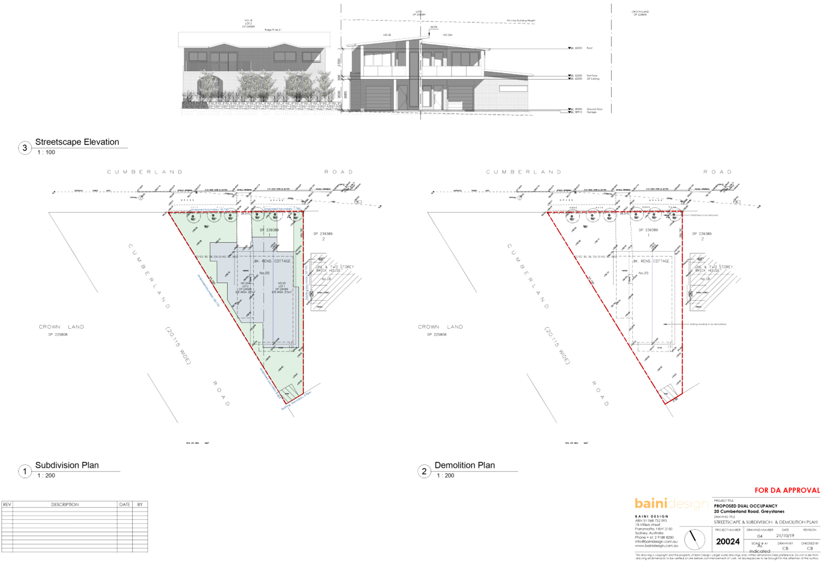
Council has received a development
application for the demolition of existing structures and construction of a
two-storey attached dual-occupancy with Torrens-title subdivision to create two
(2) lots. A detailed description of the development is below.
Demolition
- Existing
driveway and crossover;
- Single-storey
dwelling;
- Associated
outbuildings.
Construction
Two-storey dual occupancy;
- One
attached garage per unit;
- Four
bedrooms for Unit 1, and three bedrooms for Unit 2;
- Street
facing balconies accessible by master bedrooms;
- Two
driveways with crossovers to their respective garages;
- Alfresco
spaces to the rear, accessed from the main living area;
- Associated
landscaping.
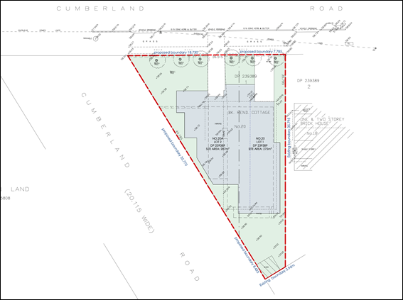
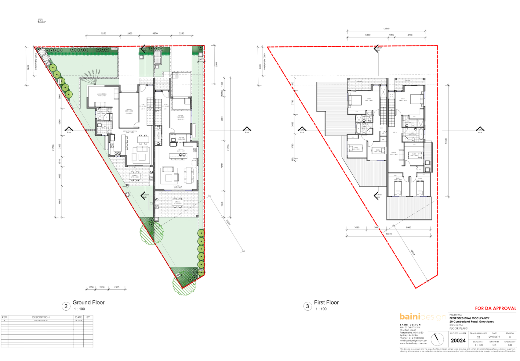
Figure 5 – Proposed dual-occupancy development
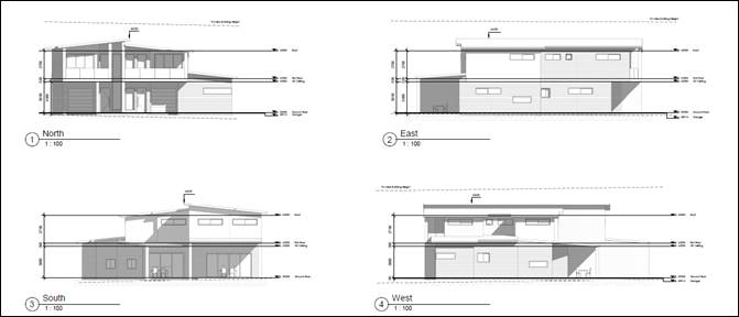
Figure 6 – Proposed dual occupancy development
Applicants
Supporting Statement
The applicant has
provided a Statement of Environmental Effects prepared by Baini Design dated 21
October 2019, in support of the application.
Contact with
Relevant Parties
The assessing officer
has undertaken a site inspection of the subject site and surrounding properties
and has been in regular contact with the applicant throughout the assessment
process.
Internal Referrals
Internal referrals were
not required for this application.
External Referrals
External referrals were
not required for this application.
Planning Comments
The provisions of any
Environmental Planning Instruments (EP&A Act s4.15 (1)(a)(i))
State Environmental
Planning Policies
The proposed development
is affected by the following State Environmental Planning Policies:
(a) State
Environmental Planning Policy No. 55 – Remediation of Land (SEPP 55)
Clause 7 of SEPP 55
requires Council to be satisfied that the site is suitable or can be made
suitable to accommodate the proposed development. The matters listed within
Clause 7 have been considered in the assessment of the development application.
|
Matter for Consideration
|
Yes/No
|
|
Does the application involve re-development of the site or
a change of land use?
|
Yes
No
|
|
In the development going to be used for a sensitive land
use (e.g.: residential, educational, recreational, childcare or hospital)?
|
Yes
No
|
|
Does information available to you indicate that an
activity listed below has ever been approved, or occurred at the site?
acid/alkali plant and
formulation, agricultural/horticultural activities, airports, asbestos
production and disposal, chemicals manufacture and formulation, defence
works, drum re-conditioning works, dry cleaning establishments, electrical
manufacturing (transformers), electroplating and heat treatment premises,
engine works, explosive industry, gas works, iron and steel works, landfill
sites, metal treatment, mining and extractive industries, oil production and
storage, paint formulation and manufacture, pesticide manufacture and
formulation, power stations, railway yards, scrap yards, service stations,
sheep and cattle dips, smelting and refining, tanning and associated trades,
waste storage and treatment, wood preservation
|
Yes
No
|
|
Is the site listed on
Council’s Contaminated Land database?
|
Yes
No
|
|
Is the site subject to EPA
clean-up order or other EPA restrictions?
|
Yes
No
|
|
Has the site been the subject of
known pollution incidents or illegal dumping?
|
Yes
No
|
|
Does the site adjoin any
contaminated land/previously contaminated land?
|
Yes
No
|
|
Has the appropriate level of
investigation been carried out in respect of contamination matters for
Council to be satisfied that the site is suitable to accommodate the proposed
development or can be made suitable to accommodate the proposed development?
|
Yes
No
|
|
2.
The site is not identified in
Council’s records as being contaminated and the site has historically
been used for residential purposes. The subject site continues to be used for
residential purposes and contamination is not expected.
|
(b) State
Environmental Planning Policy (Vegetation in Non-Rural Areas) 2017
The proposal does not
involve vegetation removal. Therefore the provisions of this SEPP are not
applicable.
(c) State
Environmental Planning Policy (Coastal Management) 2018
The subject site is no
identified as a coastal wetland or land identified as “proximity area for
coastal wetlands” or land identified as such by the Coastal Vulnerability
Area Map.
(d) State
Environmental Planning Policy (Building Sustainability Index: BASIX) 2004
BASIX Certificate nos.
1053051s & 1053206s issued on 28 October 2019, prepared by Baini Design
have been submitted with the application and are considered to be satisfactory.
Regional
Environmental Plans
The proposed development
is affected by the following Regional Environmental Plans:
(a) Greater
Metropolitan Regional Environmental Plan No. 2 – Georges River Catchment
The subject site is
within the Georges River Catchment. The proposal does not have the potential to
adversely impact the groundwater or the water quality within the Georges River
or its tributaries. Conditions of consent have been recommended to address the
installation of erosion and sediment control measures during the demolition and
construction phases of the development.
Local Environmental
Plans
Holroyd Local
Environmental Plan 2013
The provisions of the
HLEP2013 are applicable to the development proposal. It is noted that the
development achieves compliance with the key statutory requirements of the
HLEP2013 and the objectives of the R2 Low-Density, Residential Zone.
(a) Permissibility:-
The proposed development
is defined as a ‘Dual Occupancy’ and is permissible in the R2
Low-Density Residential Zone with consent.
Dual Occupancy means a
dual occupancy (attached) or a dual occupancy (detached), and are a type of
residential accommodation.
The relevant matters to
be considered under HLEP2013 and the applicable clauses for the proposed
development are summarised below.
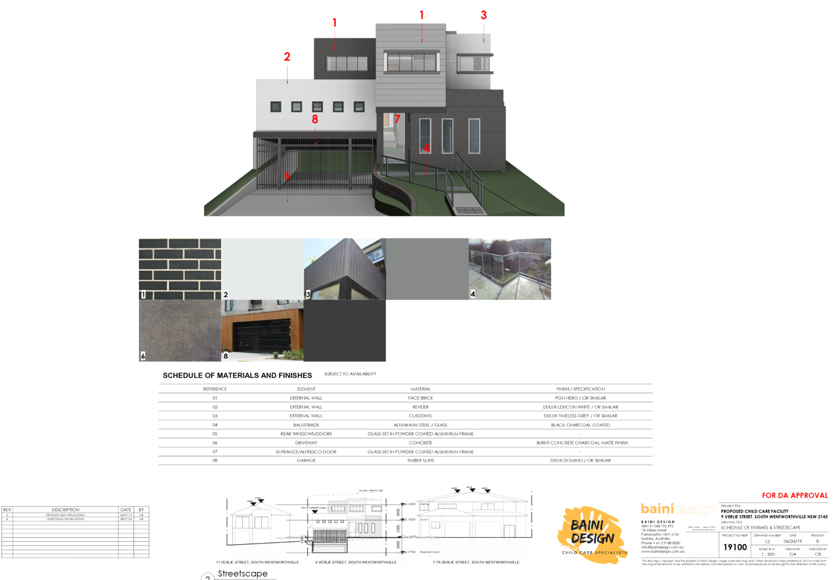
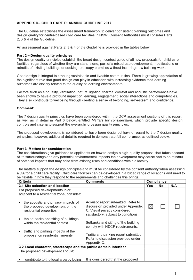
Figure 7 – Holroyd LEP 2013 Compliance Table
|
DEVELOPMENT STANDARD
|
COMPLIANCE
|
DISCUSSION
|
|
4.3
Height of Buildings – max. 9m
|
Yes
|
Proposed height: 7.31m
|
|
4.4
Floor
Space Ratio – max. 0.5:1
|
Yes
|
Proposed FSR: 0.48:1
|
|
4.1
Minimum subdivision lot size
450m2
|
N/A
|
See below discussion
|
|
4.1A
Exceptions to minimum lot sizes for certain residential
development
|
Yes
|
Pursuant to the provisions of Cl. 4.1A consent for
subdivision below the minimum subdivision lot size at Cl.4.1, can be granted
if the proposed development subdivision is for a dual-occupancy.
Proposed:
Unit One Lot: 275m2
Unit two lot: 287m2.
In this regard, the proposed subdivision is deemed
acceptable.
|
|
5.10
Heritage Conservation
|
Yes
|
The subject site is located
approximately 40m north-east of a State Heritage-listed item (Lower Prospect
Canal).
Given the distance of the site
from the item, the site is considered to be sufficiently removed, so as not
to have an impact on the item.
In this regard, a Heritage
Impact Assessment is not required.
|
|
6.1
Acid Sulphate Soils
|
N/A
|
The subject site is not
identified as having acid sulphate soil affectation.
|
|
6.2
Earthworks
|
Yes
|
Minimal earthworks proposed for
the site.
|
|
6.4
Flood Planning
|
N/A
|
The subject site is not flood
affected.
|
|
6.5
Terrestrial Biodiversity
|
Yes
|
The subject adjoins a
‘Remnant Native Vegetation’ zone.
The development is not
considered to have adverse impacts on the adjoining vegetation or habitat of
native fauna, as the works are contained within the boundaries of the lot.
The works that take place on the
site do not have the potential to fragment, disturb or diminish the
biodiversity structure, function and composition of the land, as there are no
plans for access during construction into the affected area.
Appropriate demolition and
construction measures shall be implemented through recommended conditions of
consent.
The development is not
anticipated to cause adverse impacts on the existing condition of the fauna
and flora on the adjoining land.
|
|
6.6
Riparian Land and Watercourse
|
N/A
|
The subject site is not
identified as Riparian Land or Watercourse land.
|
|
6.7
Stormwater Management
|
Yes
|
The submitted stormwater plan is
determined to be appropriate for the development and the site.
|
|
6.8
Salinity
|
Yes
|
The site is affected by moderate
salinity and the proposed works are unlikely to have any impact on the
salinity processes on the land.
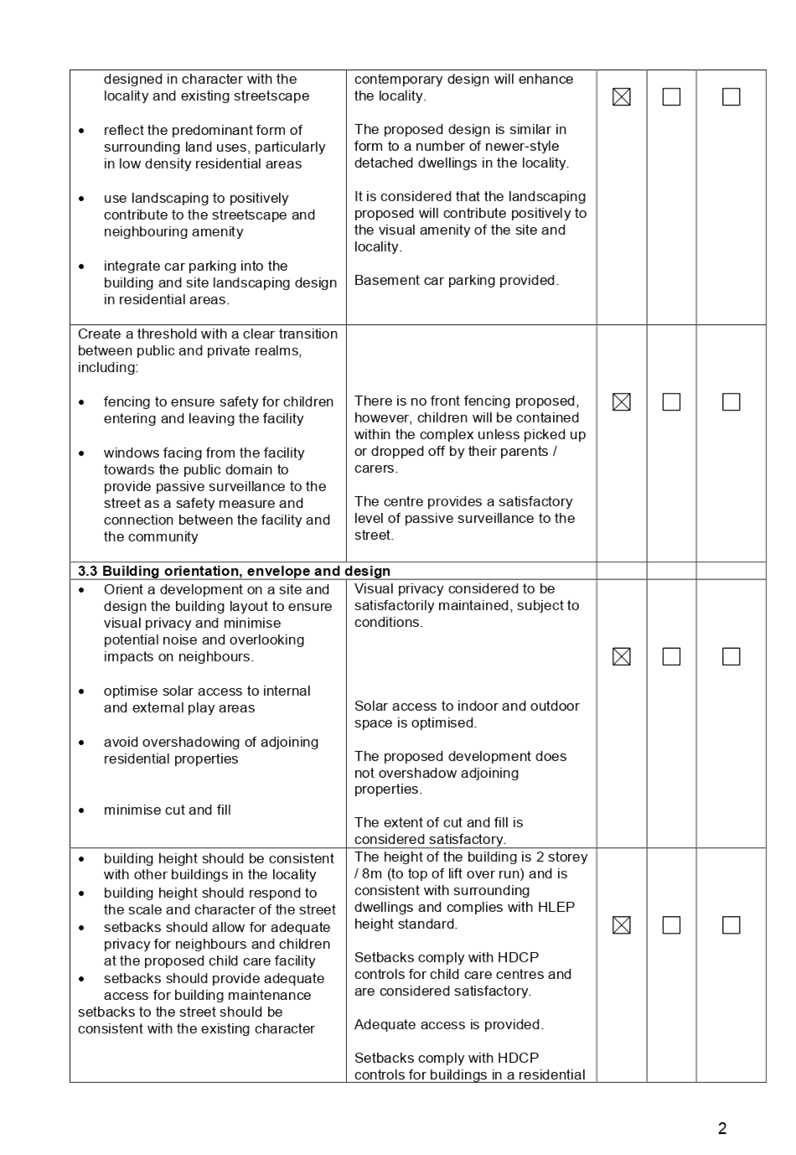
|
The provisions of any
proposed instrument that is or has been the subject (EP&A Act s4.15
(1)(a)(ii))
(a) Draft
State Environmental Planning Policy (Environment)
The proposed development
is not affected by any relevant Draft Environmental Planning Instruments.
The provisions of any
Development Control Plans (EP&A Act s4.15 (1)(a)(iii))
The HDCP 2013 provides
guidance for the design and operation of development to achieve the aims and
objectives of the HDCP 2013.
A comprehensive
assessment and compliance table is contained in Attachment B.
The following table
highlights non-compliances with the DCP, which relate primarily to principal
private open space and setbacks. The variations sought are considered
satisfactory on merit in this instance.
Figure 8: HDCP 2013 Variation Table
|
Clause
|
Control
|
Proposed
|
Variation
|
|
1.5
Landscaping and Open Space
|
C.14
Principal Private Open Space
Minimum area of 25m2
|
18.4m2
|
26.4%
|
|
1.8
Sunlight Access
|
C.5
Direct sunlight access for a minimum of 3 hours between
9am – 4pm at winter solstice to at least one main living area
|
Lot 1
Approximately 1.5 hours of direct sunlight
access to the living room.
|
50%
|
|
3.6
Setbacks
|
C.4
Rear Setback for dual occupancies
Minimum 30% of the length of the site
The requirement of Lot 2:
30% of 44.19m = 13.25m.
|
4.4m (rear west)
11.5m (rear east)
|
West rear: 66.79%
East rear: 3.2%
|
As indicated in the
compliance table above, the proposed development departs from the principal
private open space and setback provisions of Council’s HDCP 2013.
The variations are
considered acceptable on merit considered that the proposal performs adequately
from an environmental planning viewpoint and may be supported for the reasons
discussed below:
Rear Setback
shortfall (Lot two)
In accordance with the
HDCP 2013, dual occupancies require a rear setback of 30% of the lot depth.
Lot two’s lot is
therefore required a minimum rear setback of:
- 13.25m
(30% of 44.19m)
Lot two proposes a rear
setback which varies between 4.4m – 11.5m. The variation is considered
acceptable as the subject lot comprises an irregular allotment configuration
and there is no distinct delineation between the rear and side lot boundaries.
Furthermore, the subject site adjoins a public park to the west and there is no
opportunity for overlooking where the reduced rear setback is applied as the
site does not adjoin residential lots to the west. The dwelling is consistent
with the existing streetscape character and the minimum deep soil and
landscaping area has been achieved.
In this regard, the
variation is considered acceptable.
Direct Sunlight
Access shortfall (Lot one)
In accordance with the
HDCP2013, new dwellings are to ensure direct sunlight access for a minimum of 3
hours between 9am – 4pm at the winter solstice (22 June) to be provided
to at least one main living area of the dwelling.
Lot One’s main
living area is orientated south-east and will reach a maximum 1.5 hours of
direct sunlight access. The variation is considered acceptable as the site is
an irregular allotment configuration. It should be noted that the layout of lot
two, where the living room is situated at the north next to the garage cannot
be reciprocated on Lot One. It is therefore unfeasible as the current location
of the garage and available width cannot accommodate relocating the living
room. The proposed layout in its current form provides adequate residential
amenity to the internal living area and there is a reasonable amount of
sunlight access. Additionally, the private open space to the rear of lot one is
afforded solar access for a minimum 3 hours between 9am to 4pm and it is
considered to provide adequate residential amenity.
Principal Private
Open Space area shortfall (Lot two)
In accordance with the
HDCP2013, each lot shall have a minimum principal private open space area of
25m2 with a minimum width of 4m. Lot two proposes an area of 18.4m2.
The shortfall of 6.6m2
(26%) is considered to be acceptable as the overall minimum private open space
has been achieved. Furthermore, the proposed area of principal private open
space is deemed useable and meets solar access requirements. It is also noted
that the minimum width for principal private open space has been achieved.
In this regard, the
variation is considered acceptable.
These non-compliances
are considered acceptable as the proposal will protect the amenity of adjoining
sites, permit adequate solar access and will provide for a landscaped
residential setting including the provision of a functional private open space
area for the development.
The provisions of any
planning agreement that has been entered into under section 7.4, or any draft
planning agreement that a developer has offered to enter into under section 7.4
(EP&A Act s4.15(1)(a)(iiia))
There is no draft
planning agreement associated with the subject application.
The provisions of the
Regulations (EP&A Act s4.15 (1)(a)(iv))
The proposed development
raises no concerns as to the relevant matters arising from the Environmental
Planning and Assessment Regulations 2000 (EP&A Reg).
The Likely
Environmental, Social or Economic Impacts (EP&A Act s4.15 (1)(b))
It is considered that
the proposed development will have no significant adverse environmental, social
or economic impacts in the locality.
The proposed development
is contributing to the provision of housing in the Cumberland LGA to meet the
needs of the local population.
The suitability of
the site for the development (EP&A Act s4.15 (1)(c))
The subject site and
locality is not known to be affected by any natural hazards or other site
constraints likely to have a significant adverse impact on the proposed
development. Accordingly, it is considered that the development is suitable in
the context of the site and surrounding locality.
Submissions made in
accordance with the Act or Regulation (EP&A Act s4.15 (1)(d))
|
Advertised (newspaper)
|
Mail
|
Sign
|
Not Required
|
In accordance with
Council’s Notification requirements contained within the HDCP2013, the
proposal was publicly notified for a period of 14 days between 25 November 2019
and 10 December 2019. No submissions were received in respect of the proposal.
The public interest
(EP&A Act s4.15(1)(e))
In view of the foregoing
analysis it is considered that the development, if carried out subject to the
recommended conditions will have no significant adverse impacts on the public
interest.
Section 7.11
(Formerly S94) Contribution Towards Provision or Improvement of Amenities or
Services
Section 7.11 of the
Environmental Planning & Assessment Act 1979 relates to the collection of
monetary contributions from applicants for use in developing key local
infrastructure.
The development requires
the payment of contributions in accordance with Council’s (Holroyd)
Section 94 Development Contributions Plans.
The calculation is based
on:
· The number of
bedrooms
As at 18 March 2020, the
fee payable is $12,381. This figure is subject to indexation as per the
relevant plan. The draft determination attached includes a condition requiring payment
of the contribution prior to issue of a Construction Certificate.
Disclosure of
Political Donations and Gifts
The applicant and
notification process did not result in any disclosure of Political Donations
and Gifts.
The development application has
been assessed in accordance with the relevant requirements of the Environmental
Planning and Assessment Act 1979, Environmental Planning and Assessment
Regulation 2000, Holroyd Local Environmental Plan 2013 and Holroyd Development
Control Plan 2013 and is considered to be satisfactory for approval subject to
conditions.
The proposed development is
appropriately located within the R2 Low-Density Residential Zone under the
relevant provisions of the Holroyd Local Environmental Plan 2013. The proposal
is consistent with the relevant statutory controls applying to the development.
Minor non-compliances with Council’s controls have been discussed in the
body of this report. The development is considered to perform adequately in
terms of its relationship to its surrounding built and natural environment,
particularly having regard to impacts on adjoining properties.
For these reasons, it is
considered that the proposal is satisfactory having regard to the matters of
consideration under Section 4.15 of the Environmental Planning and Assessment
Act 1979, and the development may be approved subject to conditions.
|
That Development Application No. DA2019/417/1 for
demolition of existing structures and construction of a two-storey attached
dual occupancy with Torrens Title subdivision into 2 lots on land at 20
Cumberland Road GREYSTANES NSW 2145 be approved, subject to attached
conditions.
|
1. Draft Notice of
Determination
2. Holroyd
Development Control Plan 2013
3. Survey
Plan
4. Architectural
Plans - External
5. Architectural
Plans - Internal
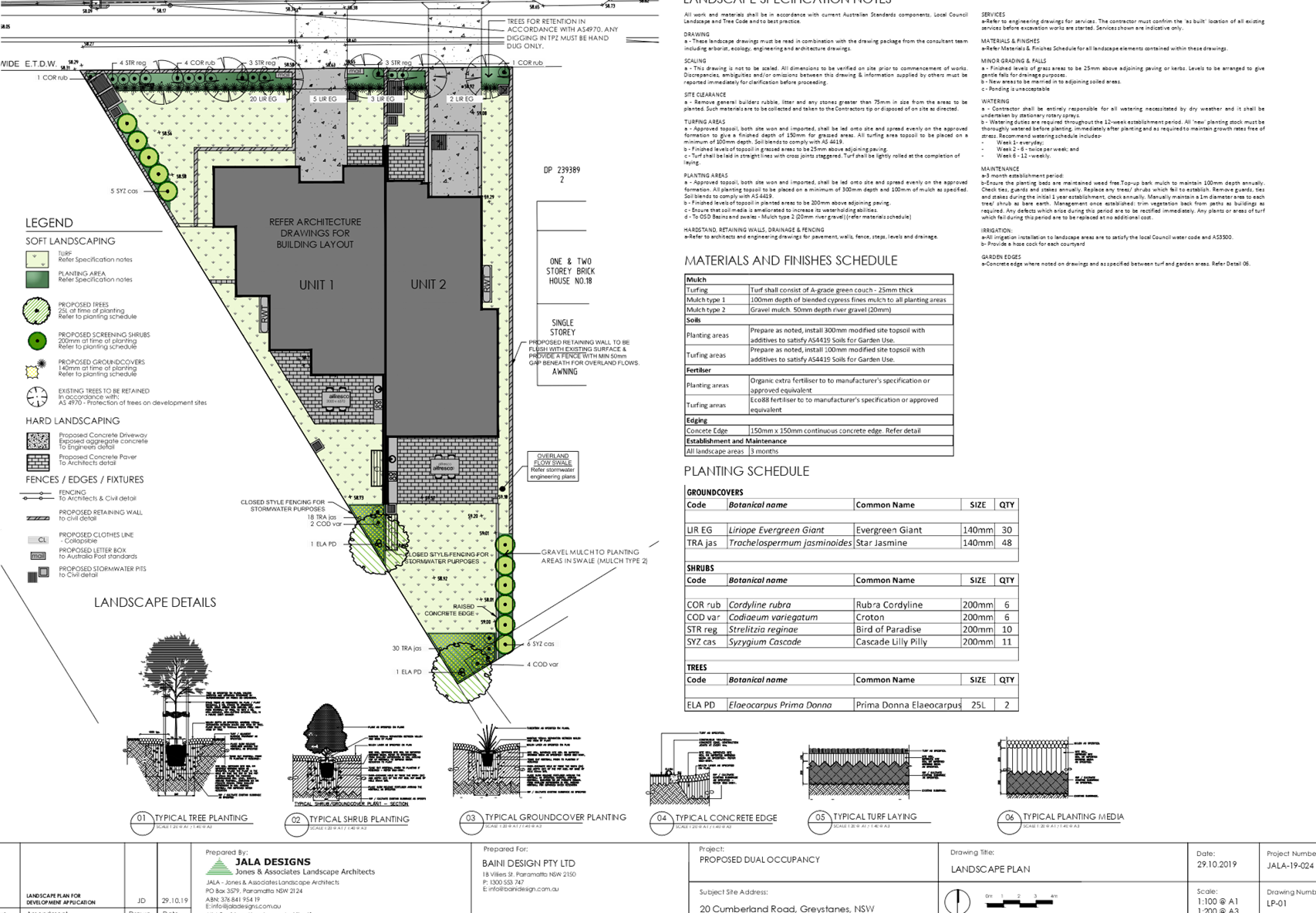
6. Landscape
Plan
DOCUMENTS
ASSOCIATED WITH
REPORT LPP014/20
Attachment 1
Draft Notice of Determination
Cumberland Local Planning Panel Meeting
8 April 2020
DOCUMENTS
ASSOCIATED WITH
REPORT LPP014/20
Attachment 2
Holroyd Development Control Plan 2013
Cumberland Local Planning Panel Meeting
8 April 2020
DOCUMENTS
ASSOCIATED WITH
REPORT LPP014/20
Attachment 3
Survey Plan
Cumberland Local Planning Panel Meeting
8 April 2020
DOCUMENTS
ASSOCIATED WITH
REPORT LPP014/20
Attachment 4
Architectural Plans - External
Cumberland Local Planning Panel Meeting
8 April 2020
DOCUMENTS
ASSOCIATED WITH
REPORT LPP014/20
Attachment 5
Architectural Plans - Internal
Cumberland Local Planning Panel Meeting
8 April 2020
DOCUMENTS
ASSOCIATED WITH
REPORT LPP014/20
Attachment 6
Landscape Plan
Cumberland Local Planning Panel Meeting
8 April 2020
Cumberland
Local Planning Panel Meeting
8 April 2020
Item
No: LPP015/20
Planning
Proposal - 2-36 Church Street, Lidcombe
Responsible
Division: Environment
& Planning
Officer: Executive
Manager Environment and Precincts
File
Number: PP-1/2019
|
Lodged
|
14 November 2019
|
|
Proponent
|
Urbis on behalf of Billbergia
|
|
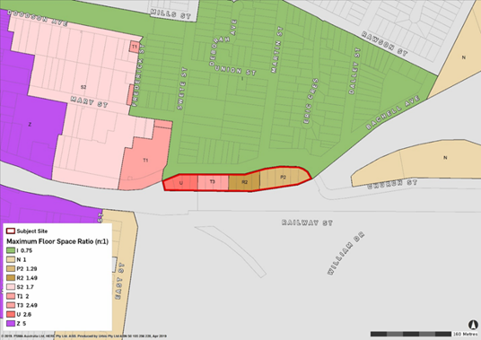
Description of Land
|
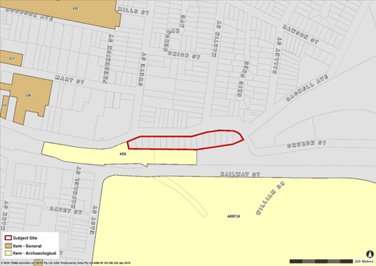
Lots 1-18 DP 217589, 2-36 Church Street Lidcombe
|
|
Site Area
|
Approximately 10,132m2
|
|
Site Description and Existing Use
|
The site is vacant residential land made up of 18
individual lots that total approximately 10,132m2 in land area.
The site has street frontage along Church Street that measures approximately
273 metres.
|
|
|
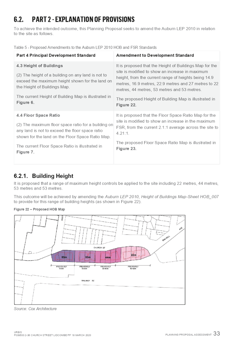
The proposal seeks to increase the Height of Building
controls across the site from:
· 14.9 metres to
22 metres
· 16.9 metres to
44 metres
· 22.9 metres to 53
metres
· 27 metres to 53
metres
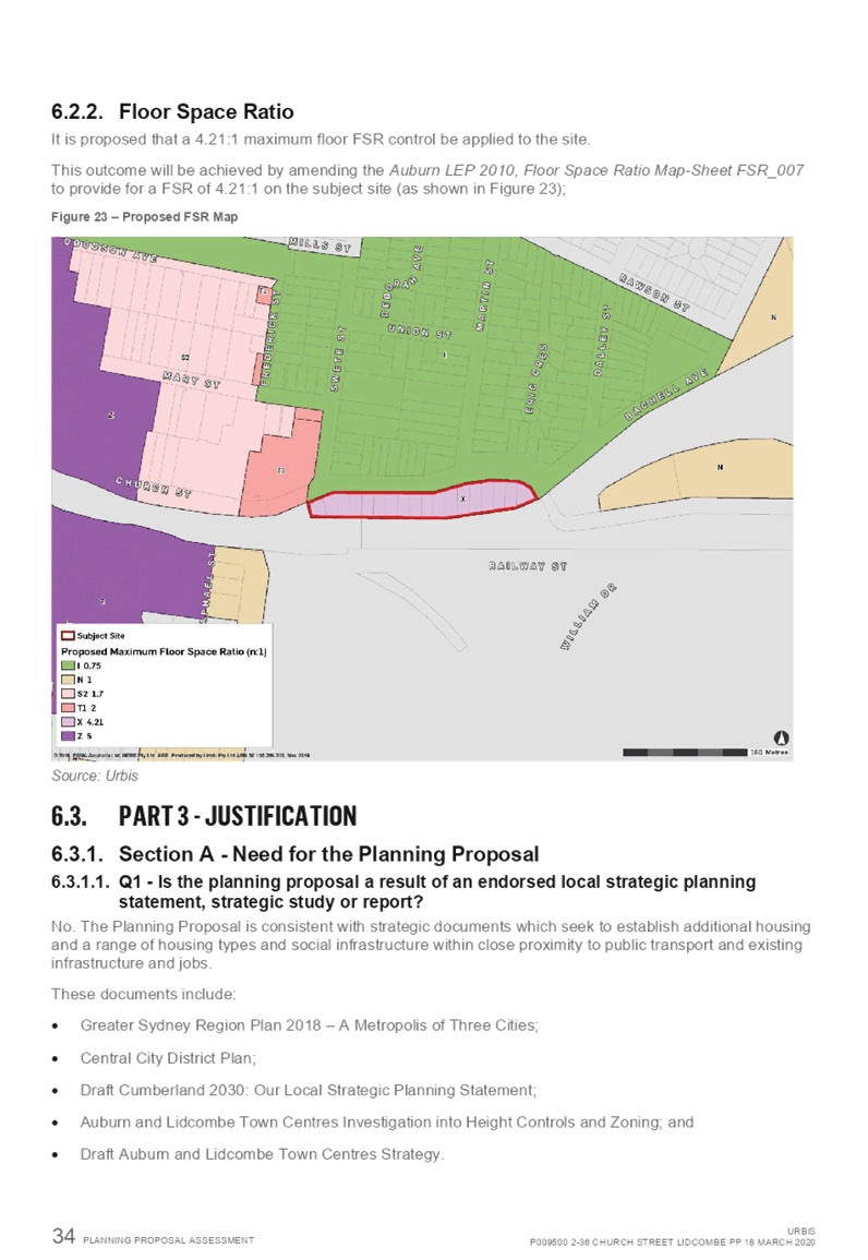
The proposal also seeks to increase the Floor Space Ratio
from 1.29:1, 1.49:1 and 2.49:1 to 4.21:1.
|
|
Existing Planning Controls
|
Zoning
|
R4 High Density
Residential
|
|
Height of Building
(HoB)
|
14.9 metres
16.9 metres
22.9 metres
27 metres
|
|
Floor Space Ratio (FSR)
|
1.29:1
1.49:1
2.49:1
|
|
Requested Planning Controls
|
Zoning
|
No Change
|
|
|
Height of Building
(HoB)
|
22 metres
44 metres
53 metres
|
|
|
Floor Space Ratio (FSR)
|
4.21:1
|
|
Recommended Planning Controls
|
Zoning
|
No Change
|
|
|
|
|
|
|
Height of Building
(HoB)
|
22 metres
32 metres
40 metres
|
|
|
Floor Space Ratio (FSR)
|
3.2:1
|
|
Heritage
|
|
Nil.
|
|
Disclosure of
political donations and gifts
|
|
Nil.
|
|
Previous consierations
|
|
Nil.
|
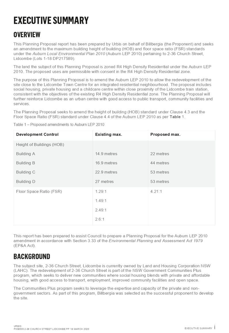
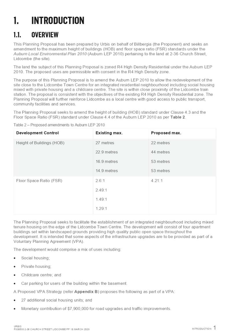
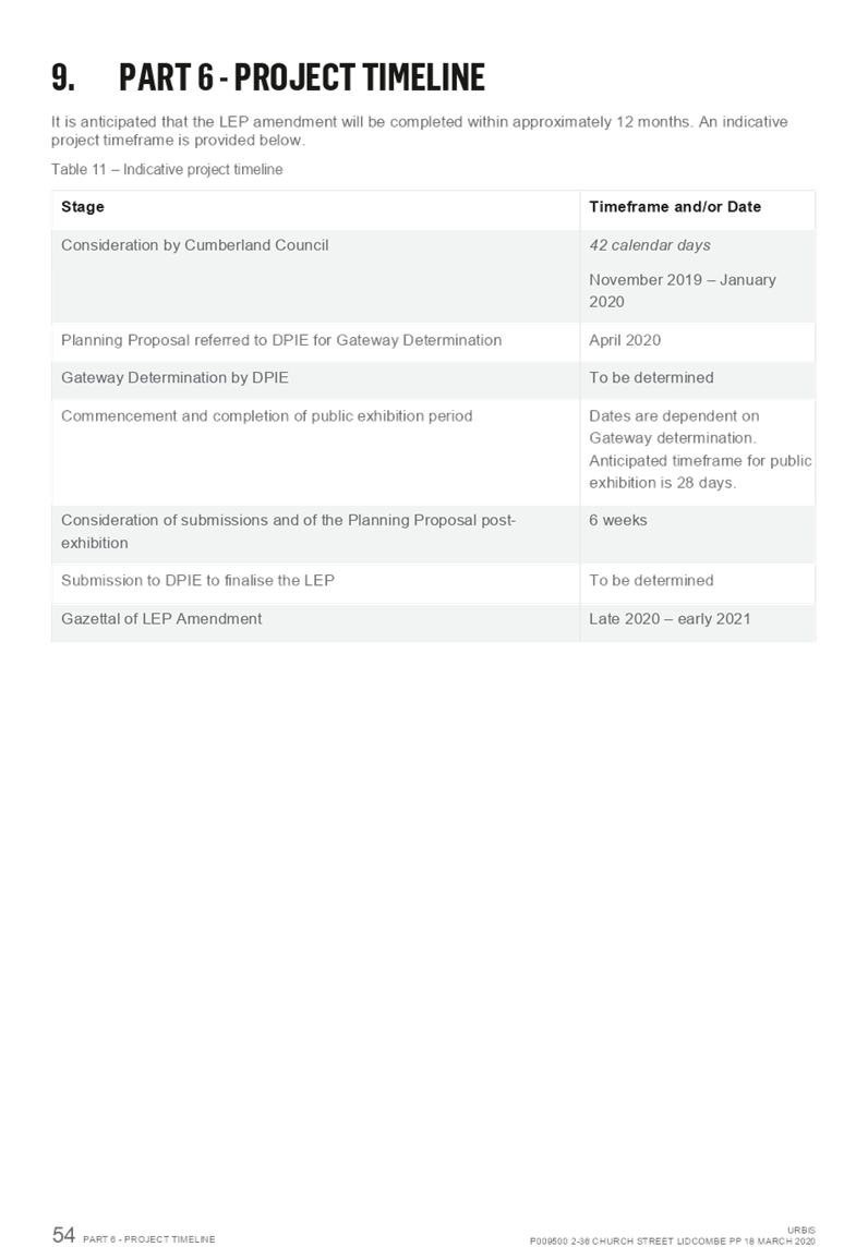
This report seeks to provide an
overview of a Planning Proposal Request submitted to Council on 14 November
2019 for 2-36 Church Street, Lidcombe. The Planning Proposal seeks to amend the
Auburn Local Environmental Plan 2010 (ALEP 2010) to allow the redevelopment of
the site for an integrated residential neighbourhood, including social housing
mixed with private housing and a child care centre, by:
· Increasing
the height of building controls from:
o 14.9 metres to 22 metres
o o 16.9 metres to 44 metres
o o 22.9 metres to 53 metres
o o 27 metres to 53 metres
· Increasing
the floor space ratio from, 1:29:1, 1.49:1, 2.49:1 and 2.6:1 to 4.21:1
The status of the Planning
Proposal is outlined in Figure 1.
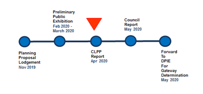
Figure
1: Status of the Planning Proposal
1. The
Site And Its Context
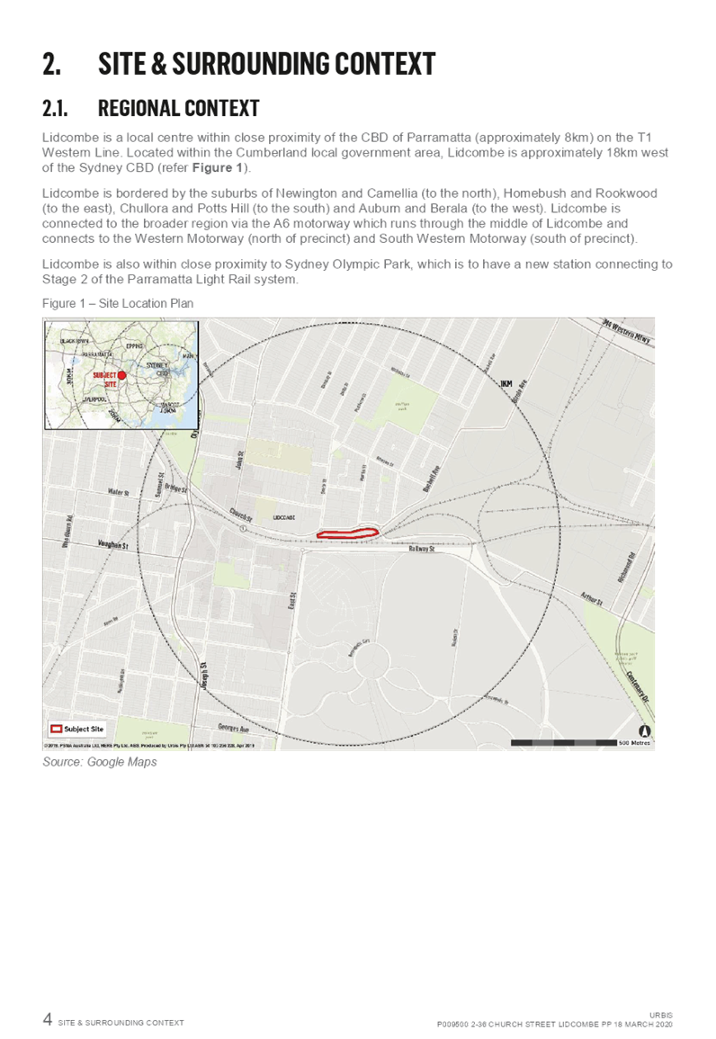
The site, located at 2-36 Church
Street, Lidcombe, is owned by Land and Housing Corporation NSW (LAHC). The site
is close to Lidcombe railway station and within 400m of the hub of the Lidcombe
Town Centre. The project, entailing a mixed tenure residential development of
four stand-alone buildings with basement parking and a child care centre, will
facilitate redevelopment of the site as part of the NSW Government’s
Communities Plus Program. This program seeks to deliver new communities
where social housing blends with private housing, with good access to
transport, employment, improved community facilities and open space.
The Communities Plus Program seeks
to leverage the expertise and capacity of the private and non-government
sectors. As part of this program, Billbergia was selected as the successful
proponent to develop the site.
A development application on this
site was approved by the Sydney Central City Planning Panel in December 2019 to
support a redevelopment of the site in accordance with the outcomes of the
Communities Plus Program. This approval was based on the current controls
of the site, and provides 262 apartments. The planning proposal is
seeking to achieve greater social, affordable and private housing outcomes on
the site through changes in the height and floor space ratio controls.
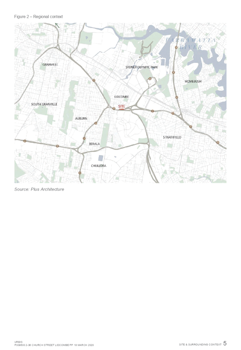
Figure
2: The Site
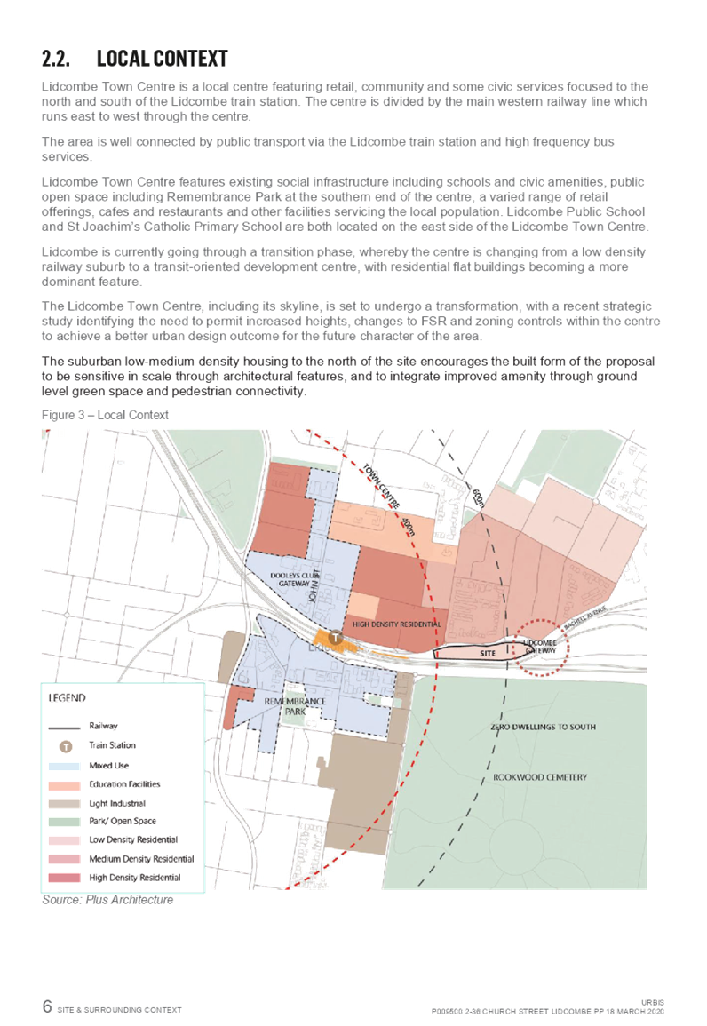
Local
Context
The
boundaries of the site to the north, east and west are defined by Church
Street. The site is approximately 350m east of Lidcombe Station. The site is
bounded directly to the south by the Lidcombe-Olympic Park railway corridor.
The
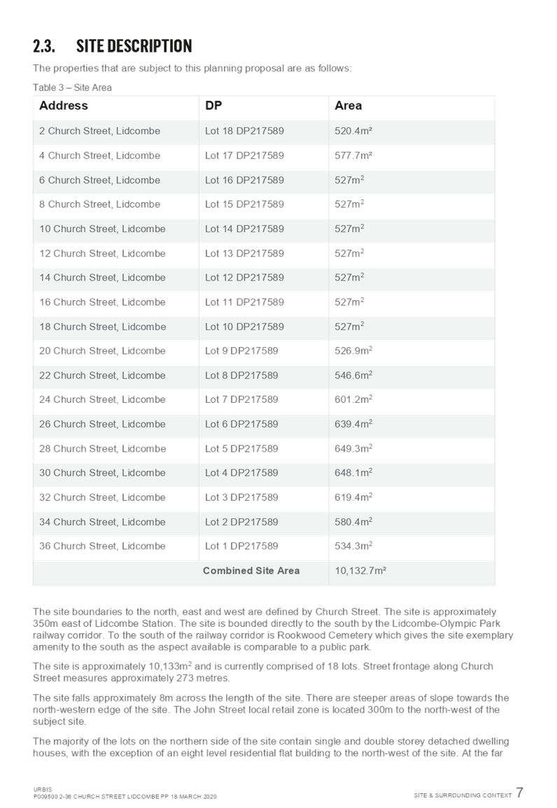
site is approximately 10,132m2 and is currently comprised of 18 lots. Street
frontage along Church Street measures approximately 273 metres.
The
site falls approximately 8m across the length of the site. There are steeper
areas of slope towards the north-western edge of the site.
The
majority of the lots on the northern side of Church Street contain single and
double storey detached dwelling houses, with the exception of an eight level
residential flat building to the north-west of the site. At the far eastern end
of the site is a raised bridge that crosses over the railway corridor and leads
through to a light industrial area.
There
is a large landscaped median strip in the north-east of the site which will be
used to provide additional open space amenity for the proposal.
Regional
Context
Lidcombe
is a principal local centre within the Cumberland local government area.
Lidcombe is approximately 18km west of the Sydney CBD and 8km to the east of
the Parramatta CBD. Lidcombe Railway Station is serviced by the T1 Western
Line, the T2 Inner West & Leppington Line, the T3 Bankstown Line and the T7
Olympic Park line. There are also four bus stops located within five minutes
walking distance of the site, providing access to a range of local and
cross-regional bus services.
Figure
3: Regional Context
2. Planning
Controls (Auburn LEP 2010)
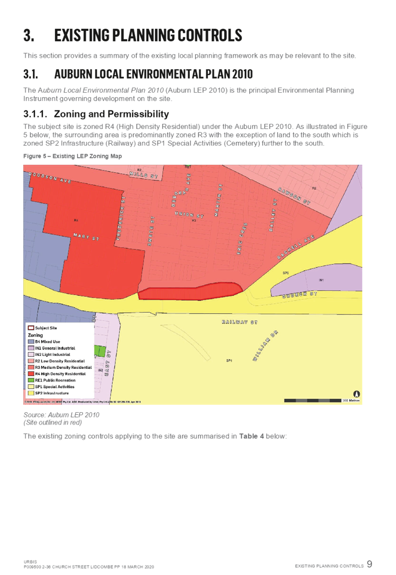
Current
Planning Controls
The
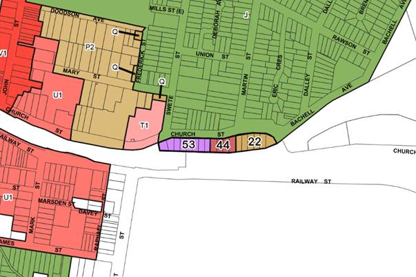
site is currently zoned R4 High Density Residential, with Maximum Height of
Building controls of 14.9m, 16.9m, 22.9m and 29m and Floor Space Ratio controls
of 1:29:1, 1.49:1, 2.49:1 and 2.6:1 applying across the site. Lidcombe
Railway Station, which is adjacent to the site, is listed as a heritage
item. These controls are shown graphically in Figures 4 to 7.
Figure
4: Current Land Use Zoning
Figure
5: Current Height of Building
Figure
6 Current Floor Space Ratio
Figure
7: Current Heritage Items
Lidcombe
Town Centre Planning Controls Strategy
The
Lidcombe Town Centre Planning Controls Strategy has been developed by Council
and is included as part of the planning proposal for the new Cumberland Local
Environmental Plan. The Strategy supports the provision of an increased
range of heights in Lidcombe Town Centre to facilitate improved urban design
and the economic growth of the town centre, including public domain
improvements in the future.
The
building heights of the strategy range from 18 metres to 60 metres within the
Lidcombe Town Centre. Building heights on the northern side of the railway line
will graduate east to west from 29 metres, 36 metres, 38 metre, 55 metres to 60
metres. On the southern side of the railway line, the building heights
will graduate east to west from 45 metres, 55 metres to 60 metres.
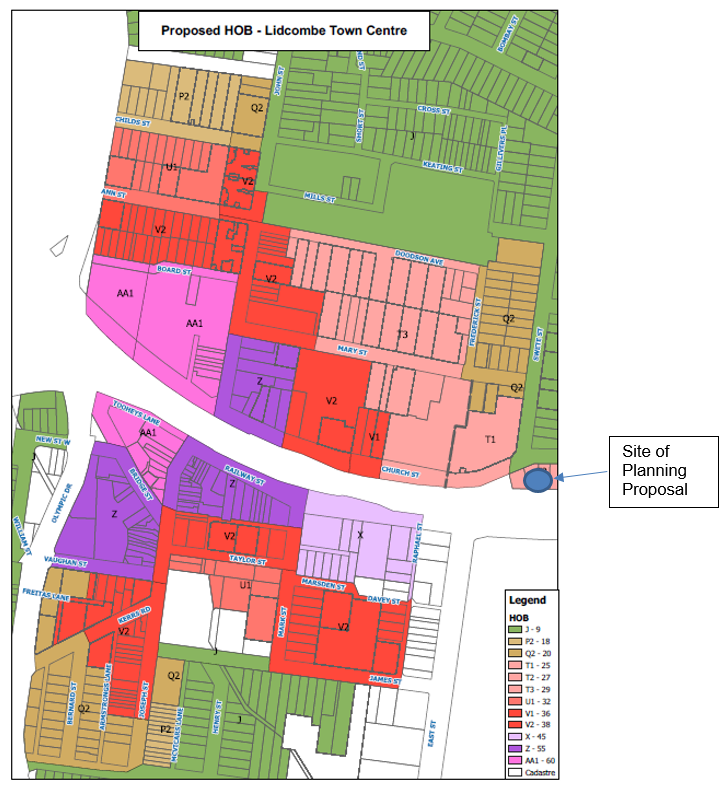
Figure
8: Proposed Building Heights in Lidcombe Town Centre Planning Controls Strategy
The
site for this planning proposal is not located within the area investigated for
the Lidcombe Town Centre Planning Controls Strategy, but is adjacent to the
study area. The low density development to the north will maintain its existing
9 metre maximum building height, and the residential apartment complex on the
corner of Church Street and Swete Street will remain at 25 metres.
3. The Planning Proposal
Request
The
Planning Proposal Request seeks to amend the Auburn Local Environmental Plan
2010 (ALEP 2010) to allow the redevelopment of the site for an integrated
residential neighbourhood, including social housing mixed with private housing
and a child care centre, by:
· Increasing
the height of building controls from:
o 14.9 metres to 22 metres
o 16.9 metres to 44 metres
o 22.9 metres to 53 metres
o 27 metres to 53 metres
· Increasing
the floor space ratio from, 1:29:1, 1.49:1, 2.49:1 and 2.6:1 to 4.2:1
The
changes to planning controls identified in the Planning Proposal Request is
outlined in Figures 9 and 10.
Figure
9: Proposed Height of Building Controls in Planning Proposal Request
Figure
10: Proposed Floor Space Ratio Controls in Planning Proposal Request
The
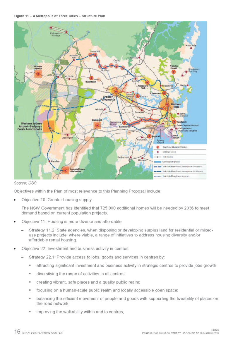
intended outcomes of the Planning Proposal are to:
· Deliver
approximately 42,000m² of additional gross floor area (GFA) to the
Lidcombe Town Centre. The floor space will be predominantly for residential
accommodation, with a high proportion being dedicated to social housing
· Deliver
residential development providing varying unit sizes and affordability options
within walking distance of existing local facilities and public transport
connectivity
· Achieve
consistency with State Government policy to encourage growth within existing
centres
· Promote
sound planning practice and transport focused development
· Manage
redevelopment of the site resulting from the amalgamation of 18 existing lots,
in a timely and comprehensive manner.
A
concept plan of the Planning Proposal Request is provided in Figure 11.
Figure
11 Concept Plan of the Planning Proposal Request
The
proponent is also proposing a public benefit offer of:
· Social
housing units to be retained by Land and Housing Corporation (LAHC) and
operated under lease by an appointed Community Housing Provider
· Monetary
contribution towards local road upgrades and traffic management improvements.
The
offer will be considered by Council should a Gateway Determination be issued,
with reference to Council’s Planning Agreements Policy and Interim
Affordable Housing Policy.
Based
on the Planning Proposal Request, a total of 480 apartments are provided.
This is an increase of 218 apartments when compared to the approved development
under the current controls.
4. Amended Planning Proposal for
Site
Council
has reviewed the Planning Proposal Request in relation to the built form
components of floor space ratio and height. This review has considered
the interface with the adjoining residential areas and Lidcombe Town Centre,
and overshadowing impacts of the proposal in relation to adjoining residential
areas and the heritage listed Rookwood Cemetery and Necropolis. Based on
this review, an amended planning proposal is identified for the site.
Interface
with Town Centre and Adjoining Residential
The
current planning controls encourage a stepped form from west to east away from
the Lidcombe Town Centre. This approach is maintained with the
proponent’s Planning Proposal Request and is also consistent with the
approach used for the Lidcombe Town Centre Planning Controls Strategy.
The
proponent’s proposed building heights of 53 metres are higher than the
building heights of 25 metres adjoining the site and the building heights of 45
metres within the north east part of the town centre, as identified in the
Lidcombe Town Centre Planning Controls Strategy.
In
relation to the interface between the low density residential along Church
Street and the concept plan included in the Planning Proposal Request, a
building separation of over 20 metres will be provided between existing low
density dwellings on the northern side of Church Street and the proposed
buildings.
Overshadowing
Impacts
A
review of overshadowing indicates that the buildings identified in the planning
proposal do not impact on adjoining residential areas. The location and
siting of the buildings casts a shadow across the train corridor.
The
proponent’s proposed building heights of 53 metres and 44 metres
overshadow the northwest corner of Rookwood Cemetery and Necropolis. This
provides an unacceptable impact on the heritage listed site. The review
by Council indicates that a maximum building height of 40 metres will avoid
overshadowing impacts on the cemetery.
Amended
Planning Proposal
Based
on the review, an amended planning proposal is identified for the site with the
following planning controls:
· A
graduated maximum building height on the site, consistent with the current
planning approach, based on 40m for the two buildings closest to Lidcombe Train
Station (western end), 32m for the third building and 22m for the fourth
building (eastern end)
· A
floor space ratio of 3.2:1 for the site, aligned with the proposed maximum
building heights in the amended planning proposal.
The
proposed planning controls for the amended planning proposal are provided in
Figures 12 and 13.
Figure
12: Proposed Height of Building Controls with Amended Planning Proposal
Figure
13: Proposed Floor Space Ratio Controls with Amended Planning Proposal
Based
on the amended planning proposal, a total of 384 apartments are estimated to be
provided. This is an increase of 122 apartments when compared to the
approved development under the current controls.
5. Strategic Merit Assessment
Built
Form
There
is strategic merit in progressing the proposal to the next phase of assessment
following consideration of built form, as:
· The
range in building heights encourage a stepped form from west to east away from
the Lidcombe Town Centre, consistent with the approach to current planning
controls on the site and the Lidcombe Town Centre Planning Controls Strategy
· The
amended planning proposal with reduced building heights and floor space ratio
controls will result in a built form that minimises interface impacts on
adjoining residential properties.
Traffic
and Transport
There
is strategic merit in progressing the proposal to the next phase of assessment
following consideration of traffic and transport, as:
· The
surrounding road network operates with a reasonable level of service during
peak periods
· The
adjoining road network is capable of accommodating traffic volumes estimated to
be generated by the proposal
· The
proposed site access arrangements are projected to result in motorists being
capable of entering and exiting the subject site in a safe and efficient manner
· The
proposal is within walking distance to public transport services at Lidcombe
Town Centre, providing local and regional access to key centres.
Heritage
There
is strategic merit in progressing the proposal to the next phase of assessment
following consideration of heritage, as:
· The
site is outside of the curtilage of Heritage Item No. A56 ‘Lidcombe
Signal Box’ (south side of railway lines)
· The
reduced building heights outlined in the amended planning proposal will avoid
overshadowing impacts on the State Heritage Listed Rookwood Cemetery and Necropolis.
Economic
and Social Benefits
There
is strategic merit in progressing the proposal to the next phase of assessment
as:
· The
proposal will provide a mixed tenure residential development consisting of
private, affordable and social housing, contributing to an increase in housing
supply for different market segments
· There
will be a temporary increase in employment opportunities as a result of
construction jobs associated with the proposal.
Consistency
with Cumberland 2030: Our Local Strategic Planning Statement
There
is strategic merit in progressing the proposal to the next phase of assessment,
as it is consistent with the following key Local Planning Priorities of
Cumberland 2030: Our Local Strategic Planning Statement:
· Planning
Priority 5: Delivering housing diversity to suit changing needs: as the
proposal will deliver variety of apartment types including social and
affordable housing apartments
· Planning
Priority 6: Delivering affordable housing suitable for the needs of all people
at various stages of their lives: as the proposal will deliver affordable and
social housing
· Planning
Priority 11: Promoting access to local jobs, education opportunities and care
services: as the proposal will deliver additional housing opportunities close
to the employment and education facilities that are located in close proximity
to the Lidcombe Town Centre and adjoining employment areas.
Consistency
with Greater Sydney Region Plan - A Metropolis of Three Cities
There
is strategic merit in progressing the proposal to the next phase of assessment
as it is generally consistent with the following planning directions of the
Greater Sydney Region Plan:
· Objective
10. Greater housing supply: the proposal provides a greater amount of housing
supply than would be possible if there were no change to the height and floor
space ratio control
· Objective
11. Housing is more diverse and affordable: the proposal aims to deliver a
range of housing types, sizes and tenures increase housing diversity and
affordability
· Objective
14 A metropolis of three cities – integrated land use and transport
creates a walkable and 30 minute cities: the proposal provide additional
housing within walking distance of Lidcombe station. The level of service
offered by Lidcombe Station is greater than other centres, and provide a
greater level of opportunity for the future residents to access jobs and
services.
Consistency
with the Central City District Plan
There
is strategic merit in forwarding this proposal for a Gateway Determination, as
the amended proposal is generally consistent with the following Planning
Priorities of the Central City District Plan:
· Planning
Priority C5 Providing housing supply, choice and affordability with access to
jobs, services and public transport: the proposal seeks to deliver additional
housing in close proximity to established residential neighbourhoods, services
and public transport
· Planning
Priority C6 Creating and renewing great places and local centres, and
respecting the District’s heritage: the proposal for a new residential
apartment development within 400m of Lidcombe train station and the town centre
will encourage users of the site to utilise public transport and to walk
· Planning
Priority C9 Delivering integrated land use and transport planning and a 30
minute city: the proposal will facilitate the provision of additional housing
in close proximity to the Lidcombe train station and associated railway lines.
These railway lines access strategic centres, giving more people access to
services via public transport within 30 minutes.
It is recommended that the amended
planning proposal, with revised building height controls of 40 metres, 32
metres and 22 metres, and revised floor space ratio control of 3.2:1, be
reported to Council seeking a Gateway Determination. This recommendation is
being made as:
· The
proposal will provide a mixed tenure residential development consisting of
private, affordable and social housing
· The
amended proposal will minimise interface impacts with adjoining residential
properties, and avoid overshadowing of the heritage listed Rookwood Cemetery
and Necropolis
· The
proposal is in close proximity to public transport services and the adjoining
road network is capable of accommodating the traffic projected to be generated
by the proposal
· Is
consistent with strategic directions outlined in Cumberland 2030: Our Local
Strategic Planning Statement, Greater Sydney Region Plan and Central City
District Plan.
The proposal and supporting
documentation were exhibited for a period of 28 days, from 8 February
2020 to 9 March 2020, as required by Cumberland’s Planning Proposal
Notification Policy. A total of 15 submissions were received during the
exhibition period. The submission raised concerns about the following issues:
· Increase
in traffic and traffic congestion as a result of the development
· Parking
issues created by the development
· Street
parking on Church Street and Swete Street are currently heavily used
bycommuters
· Overshadowing
impacts
· Loss
of privacy and overlooking due to number of units proposed
· Inconsistency
with Auburn and Lidcombe Town Centre Planning Controls Strategy..
There are no financial
implications for Council associated with this report.
This report recommends that this
matter be reported to Council for further consideration. Should Council resolve
to forward this planning proposal to the Department of Planning, Industry and
Environment for a Gateway Determination, there will be policy implications
associated with the subsequent stages of the planning proposal process. These
will be outlined in subsequent Council reports.
Communication /
Publications:
There are no
communication/publication implications for Council associated with this report.
|
That Cumberland Local
Planning Panel (CLPP) recommend that:
1. The
amended planning proposal, with building height controls of 40 metres, 32
metres and 22 metres, and floor space ratio control of 3.2:1, proceed to the
next stage of assessment and be reported to Council seeking a resolution to
forward the planning proposal to the Department of Planning, Industry and
Environment for a Gateway Determination.
|
1. Attachment 1 -
Planning Proposal Request
2. Attachment
2 - Design Report
3. Attachment
3 - Traffic Impact Assessment
4. Attachment
4 - Social Impact Assessment
5. Attachment
5 - Heritage Impact Statement
6. Attachment
6 - Summary of Submissions
DOCUMENTS
ASSOCIATED WITH
REPORT LPP015/20
Attachment 1
Attachment 1 - Planning Proposal Request
Cumberland Local Planning Panel Meeting
8 April 2020

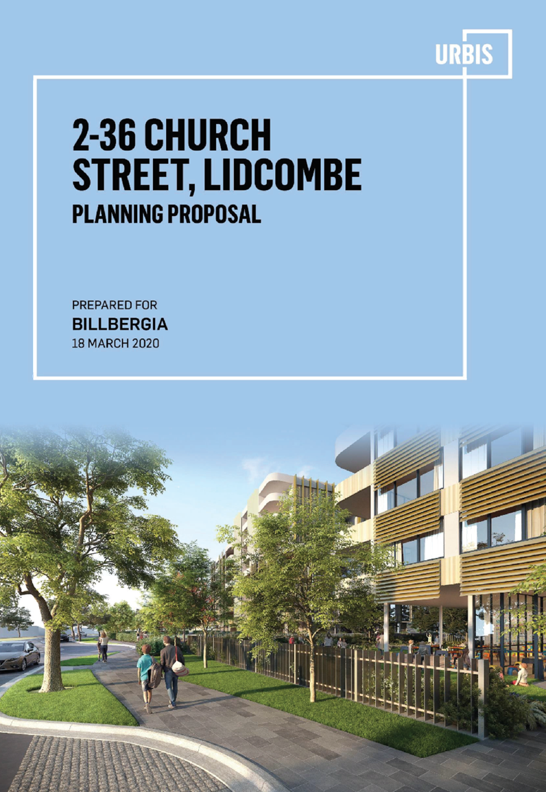

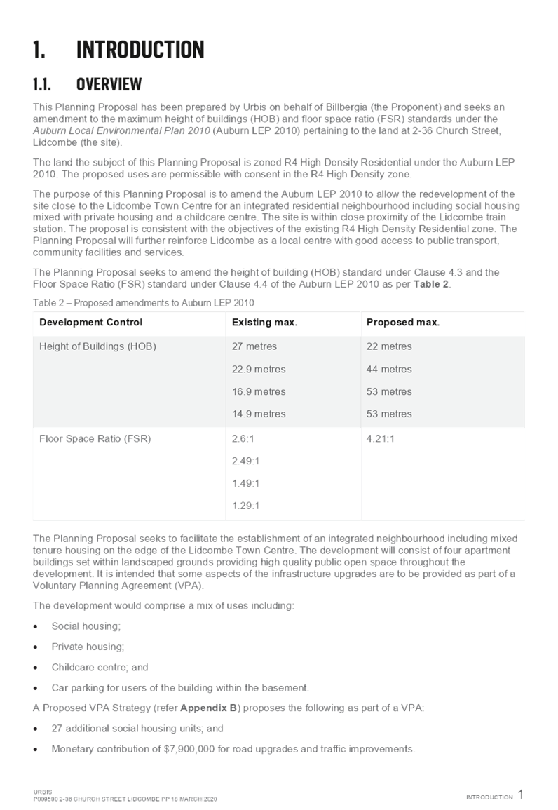


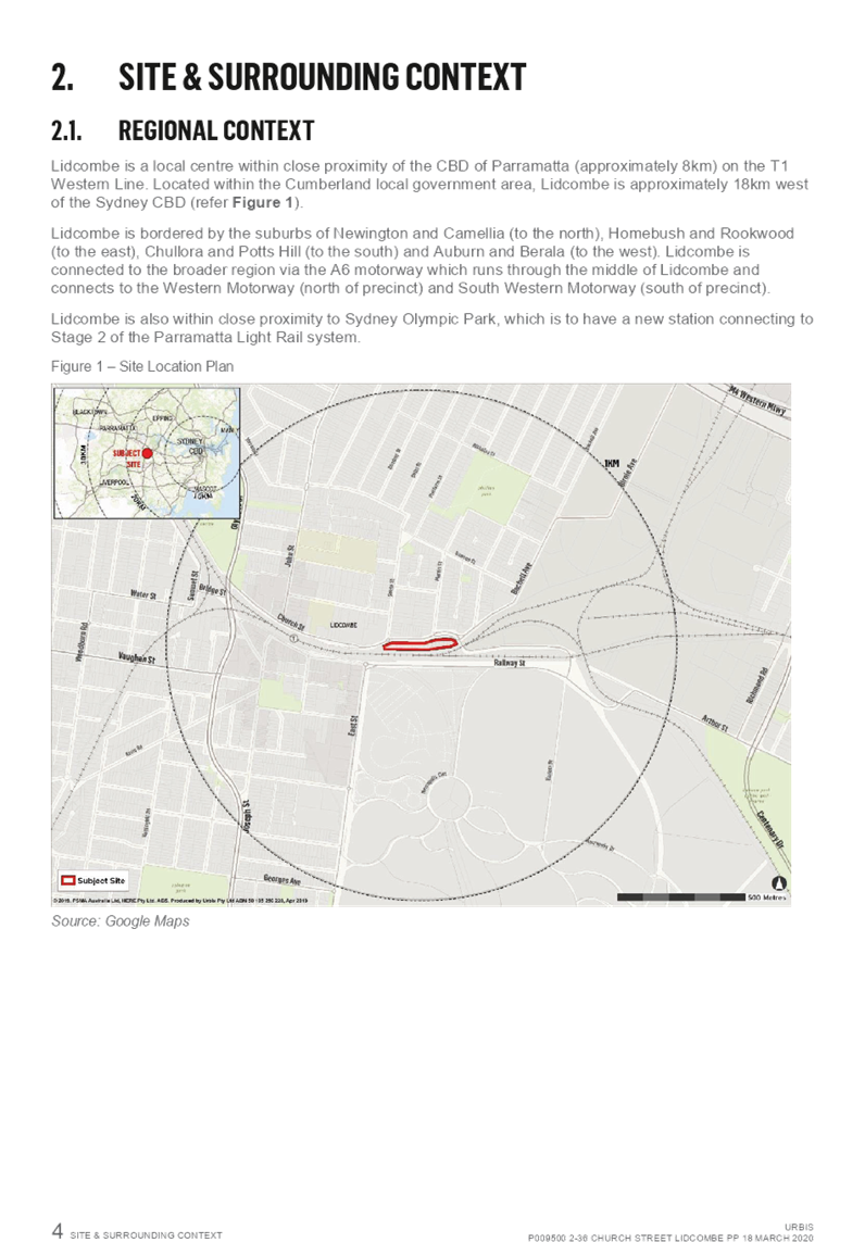

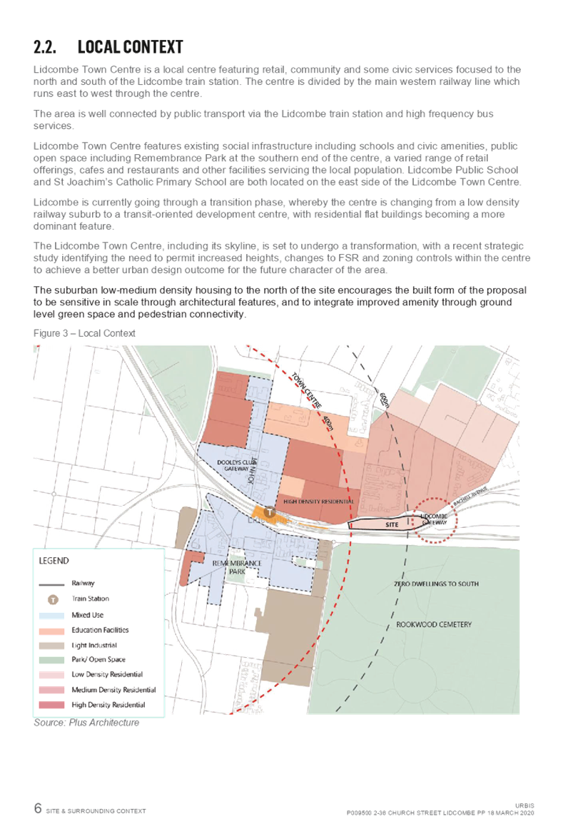
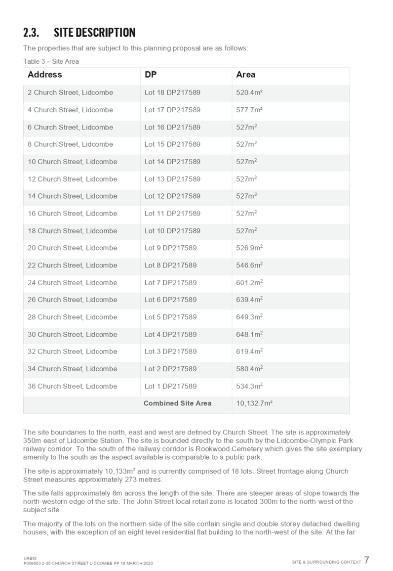

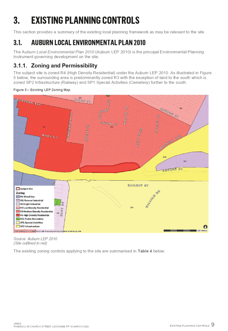
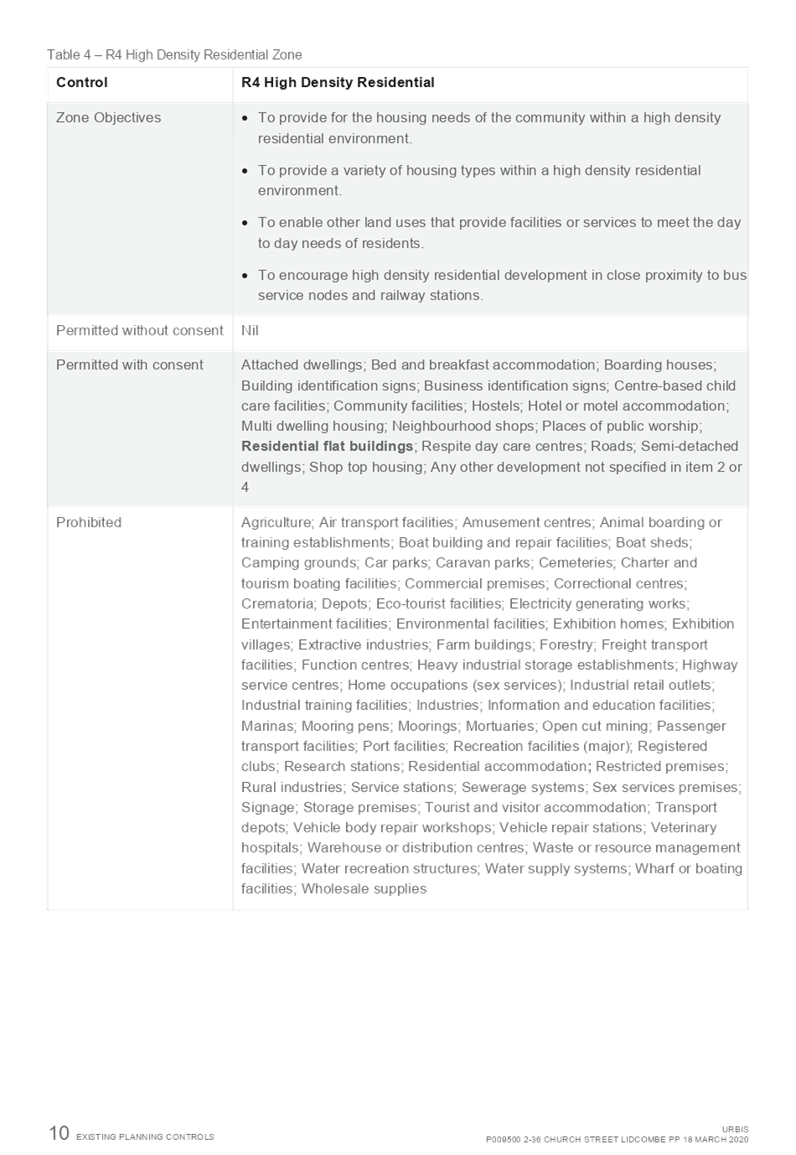


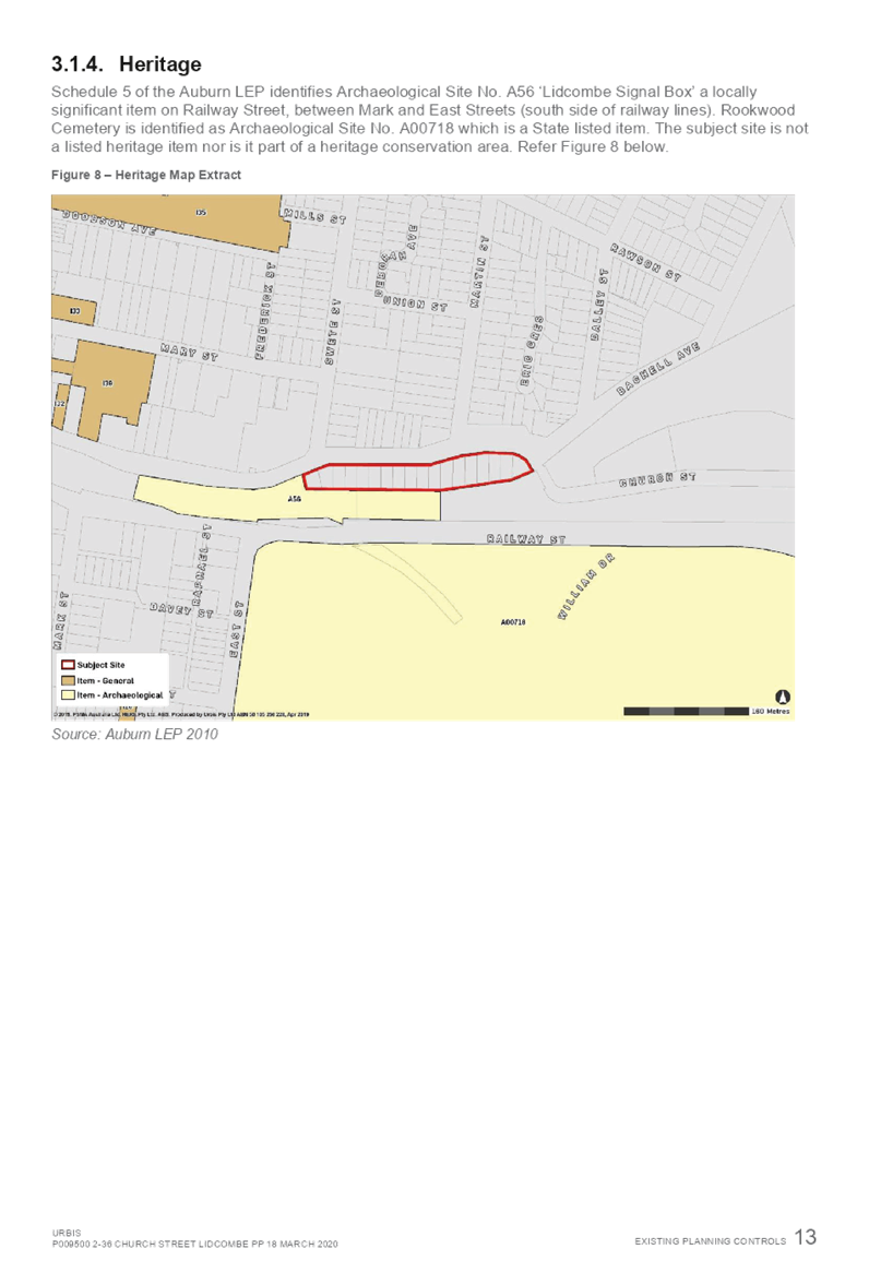
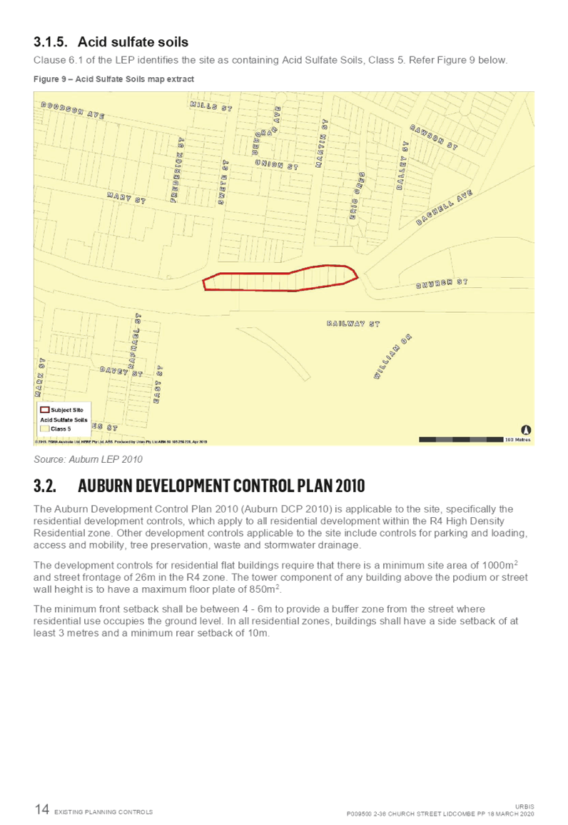
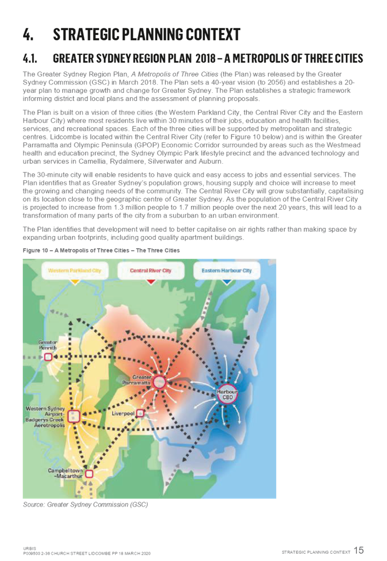

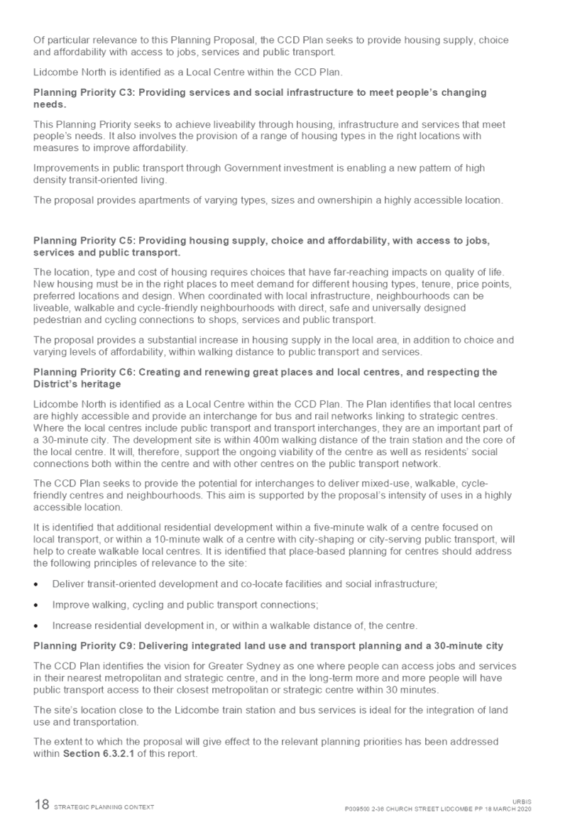

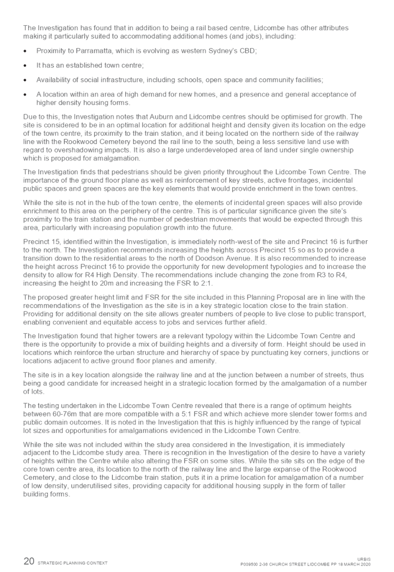
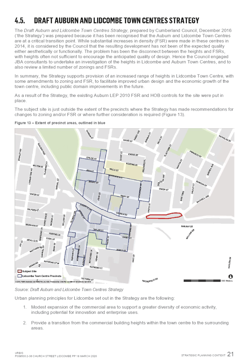

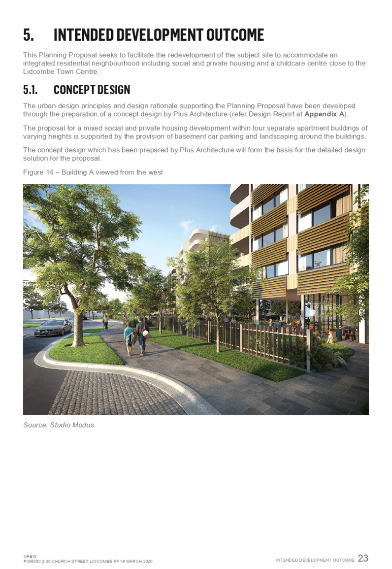
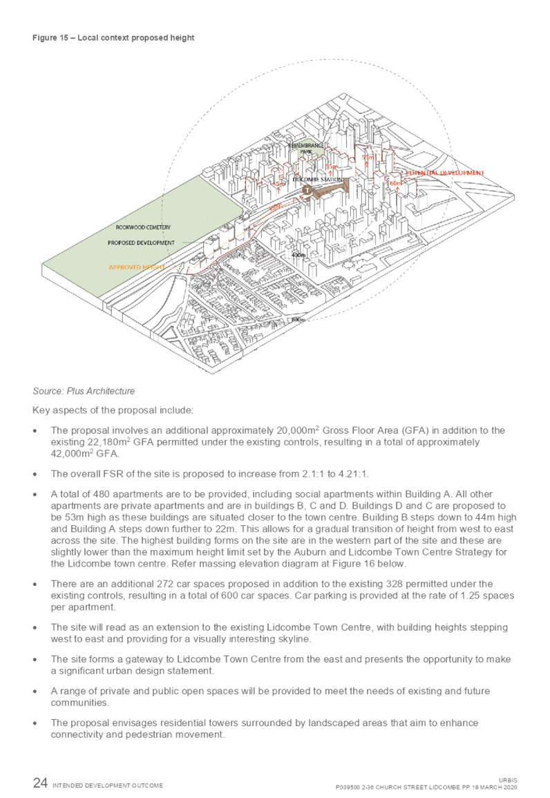

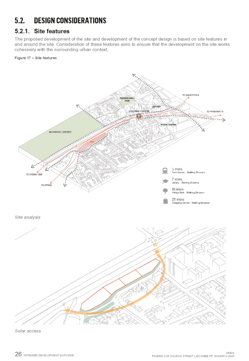

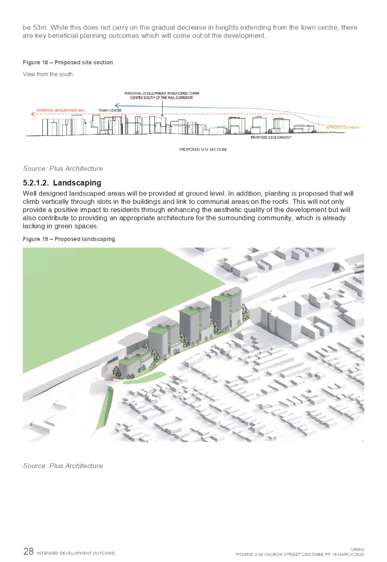
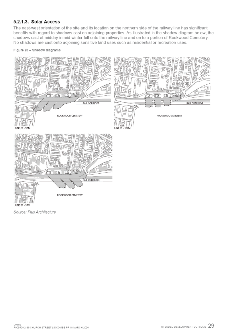
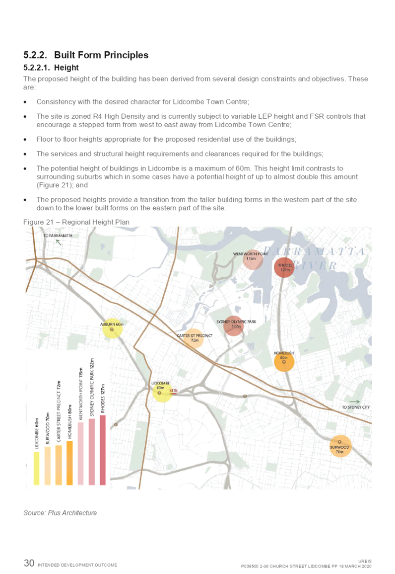
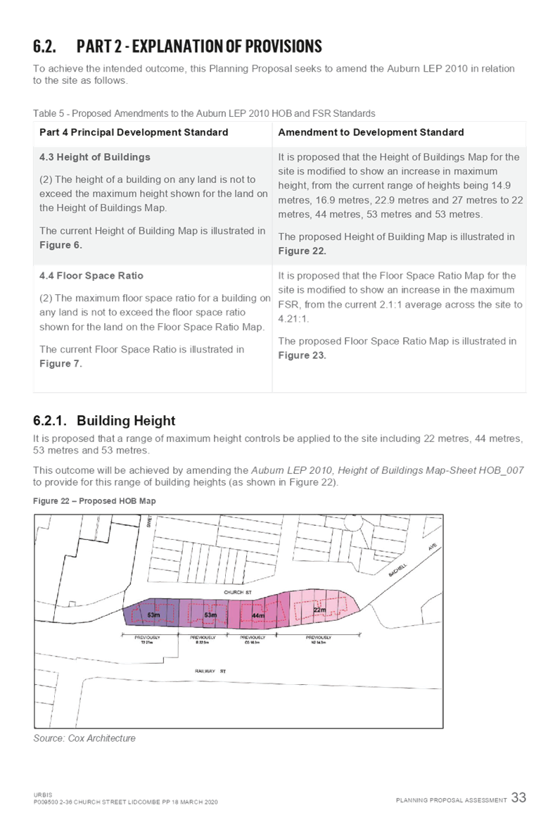

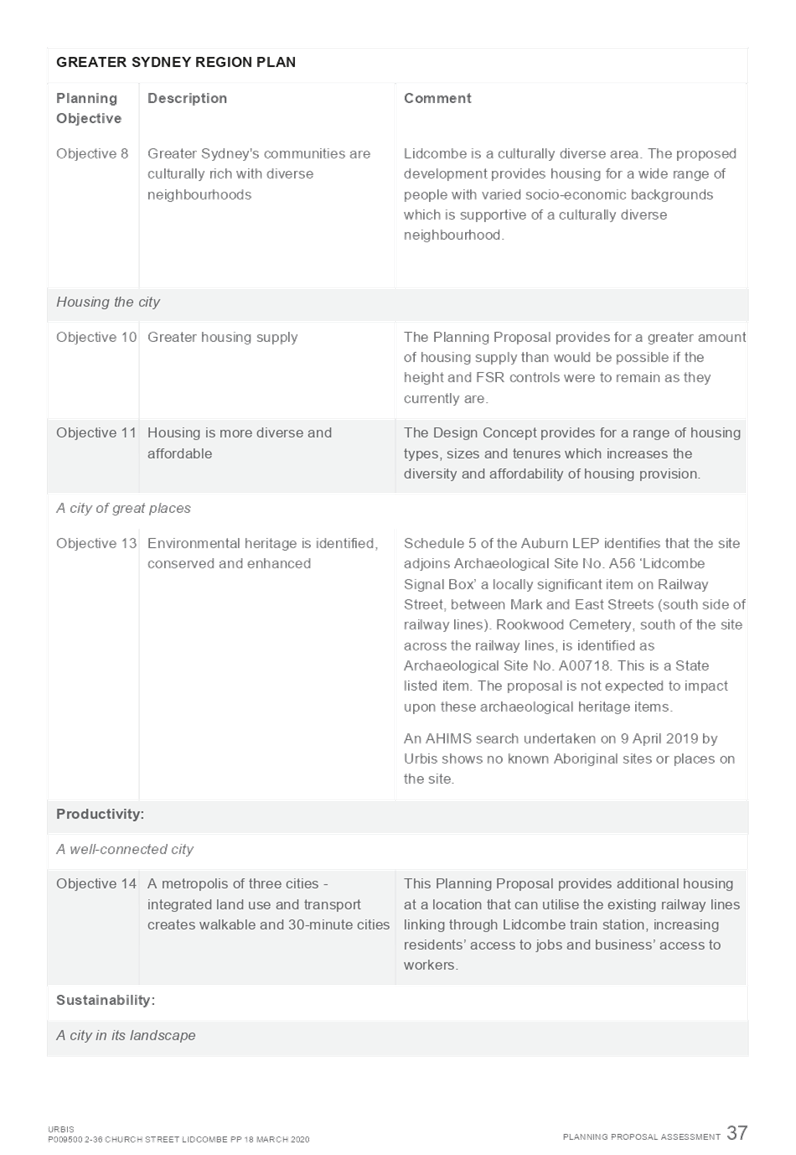
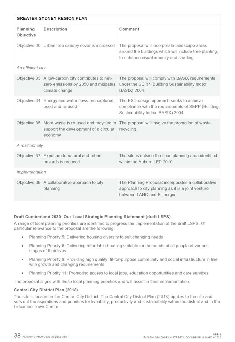
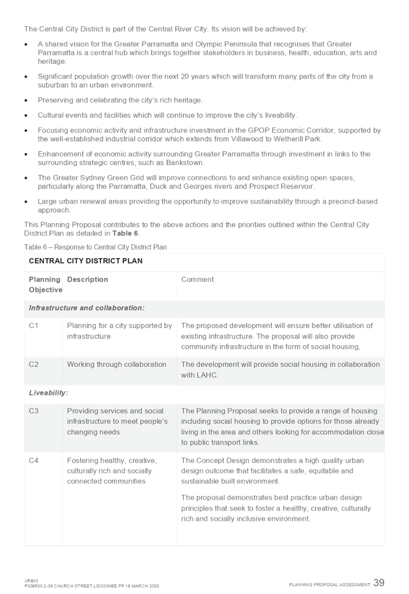
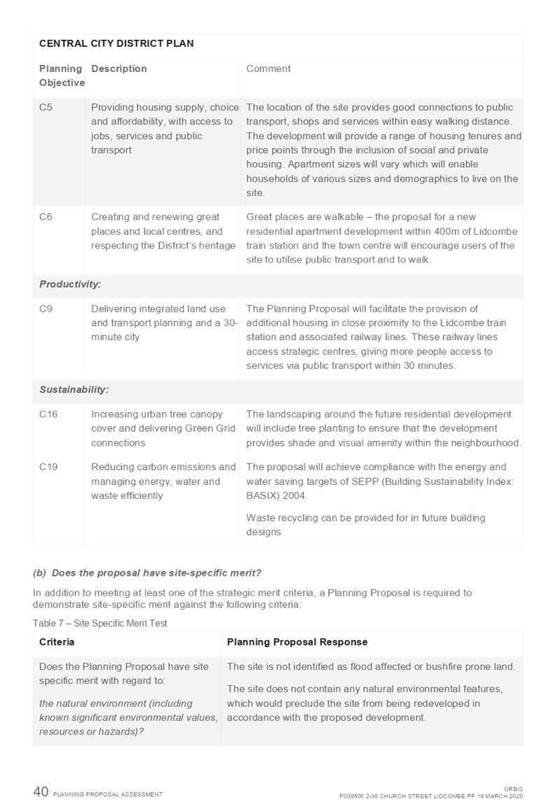
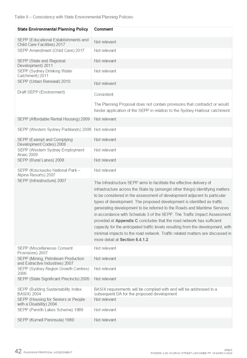
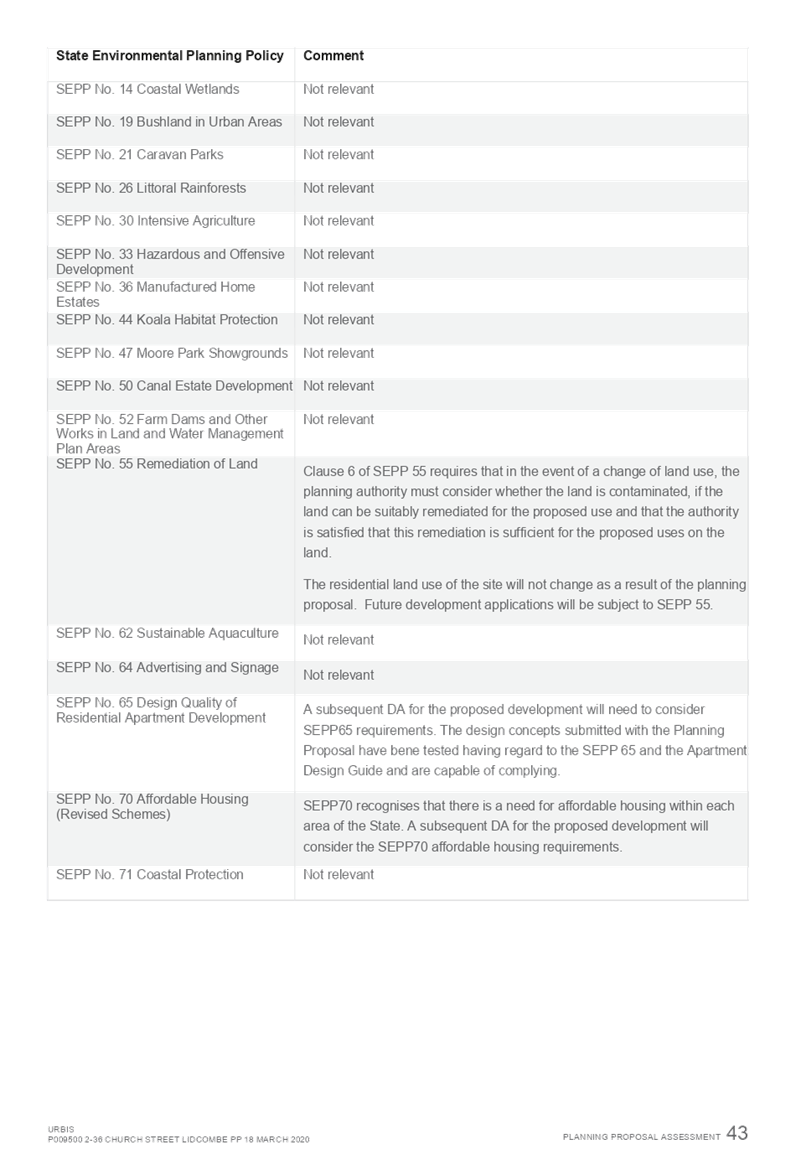
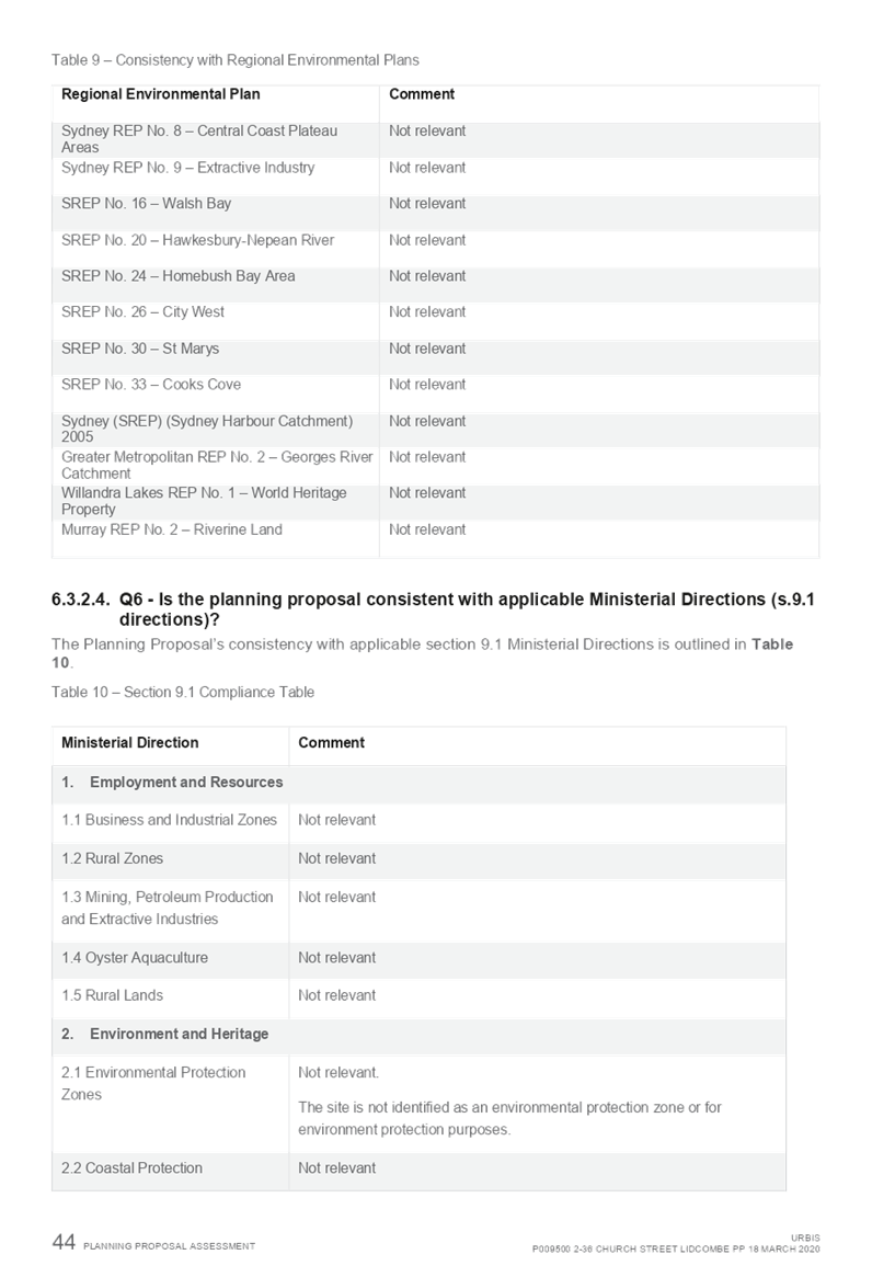
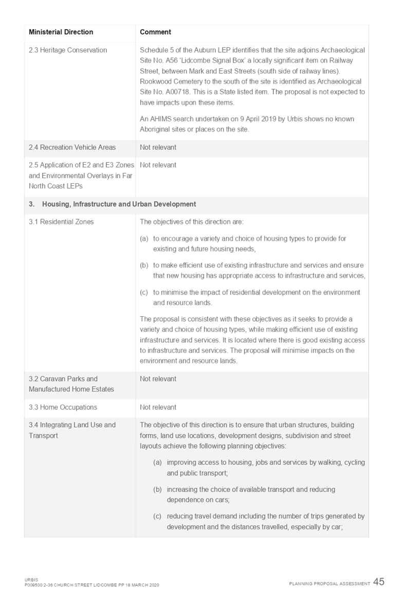
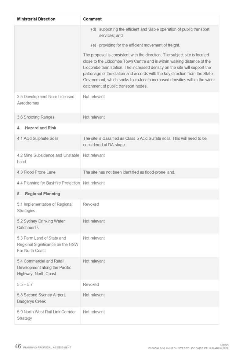
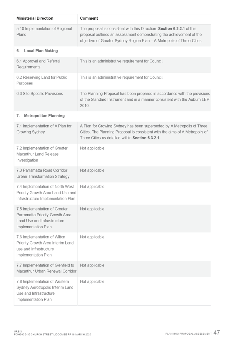
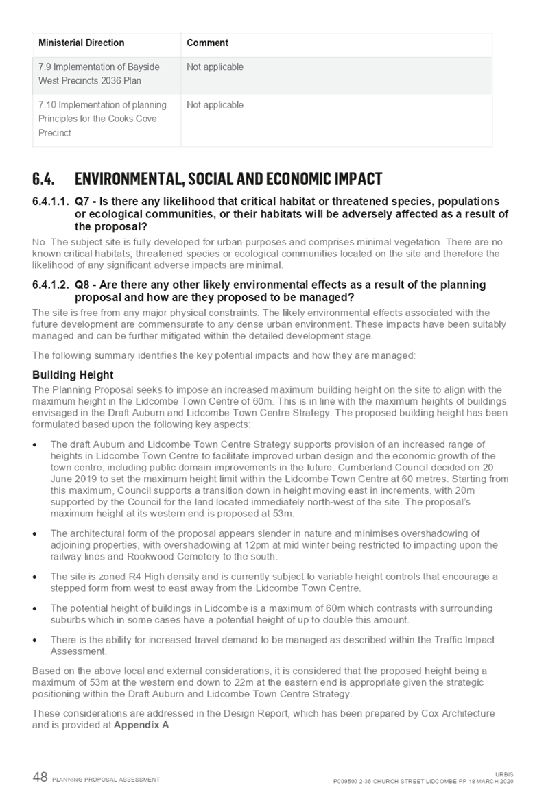


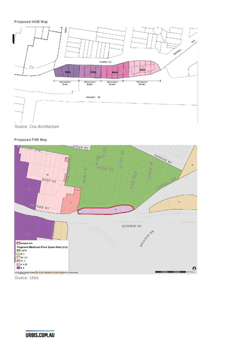
DOCUMENTS
ASSOCIATED WITH
REPORT LPP015/20
Attachment 2
Attachment 2 - Design Report
Cumberland Local Planning Panel Meeting
8 April 2020
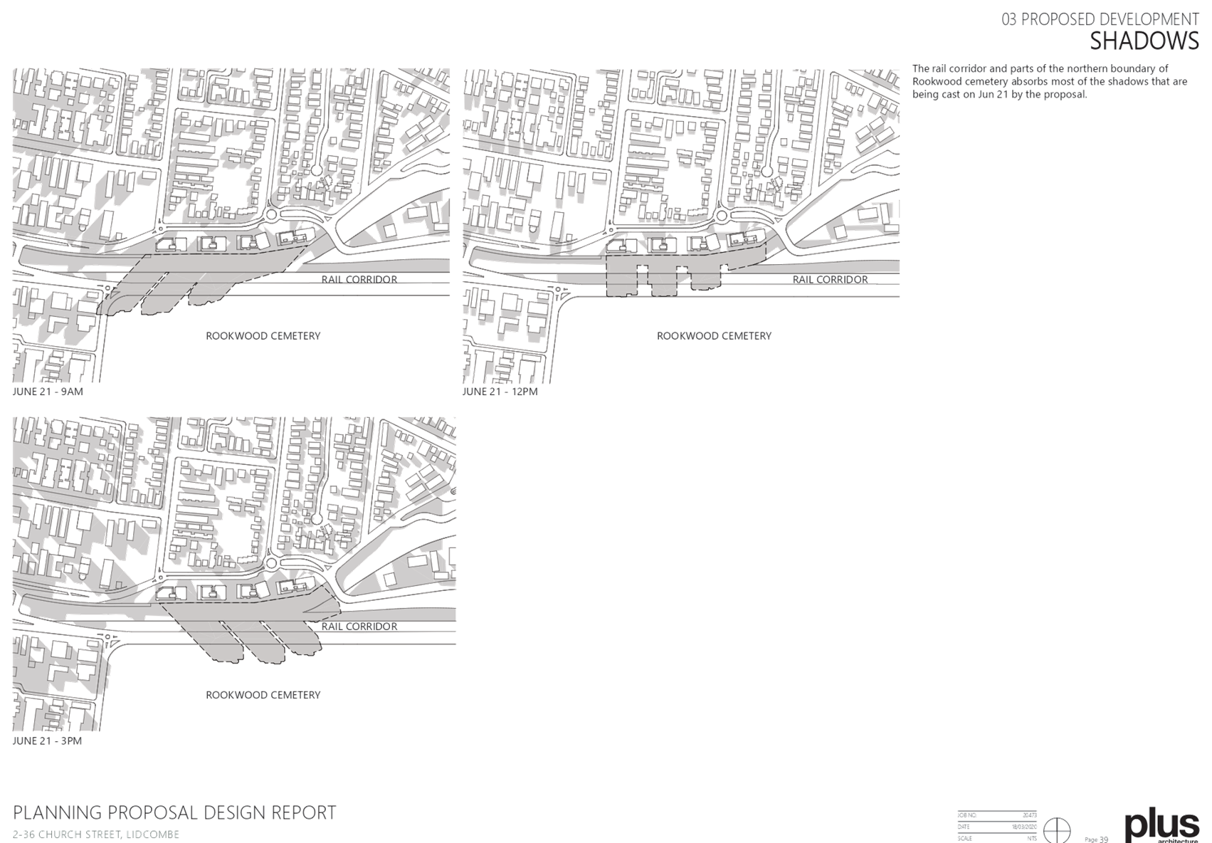
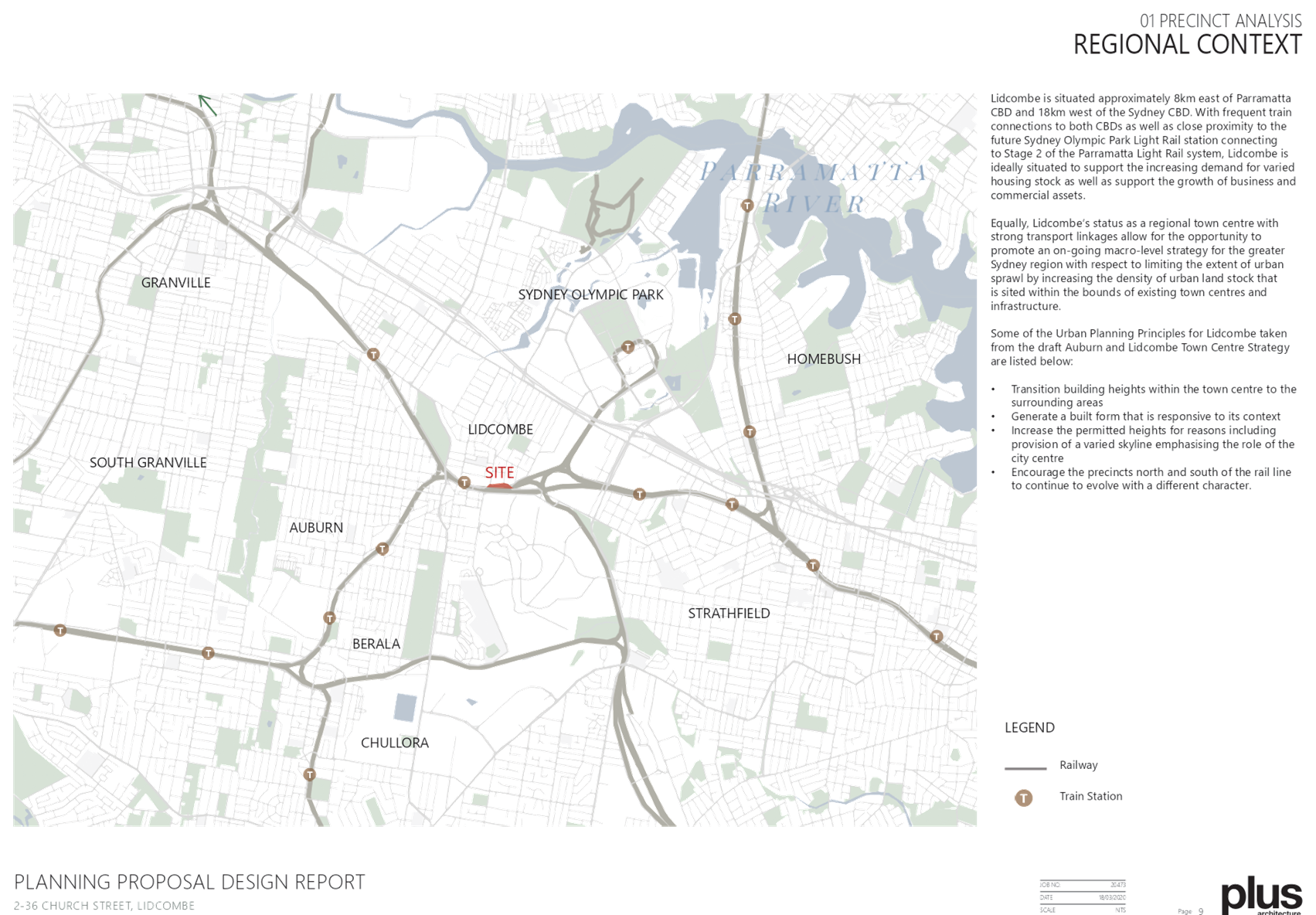


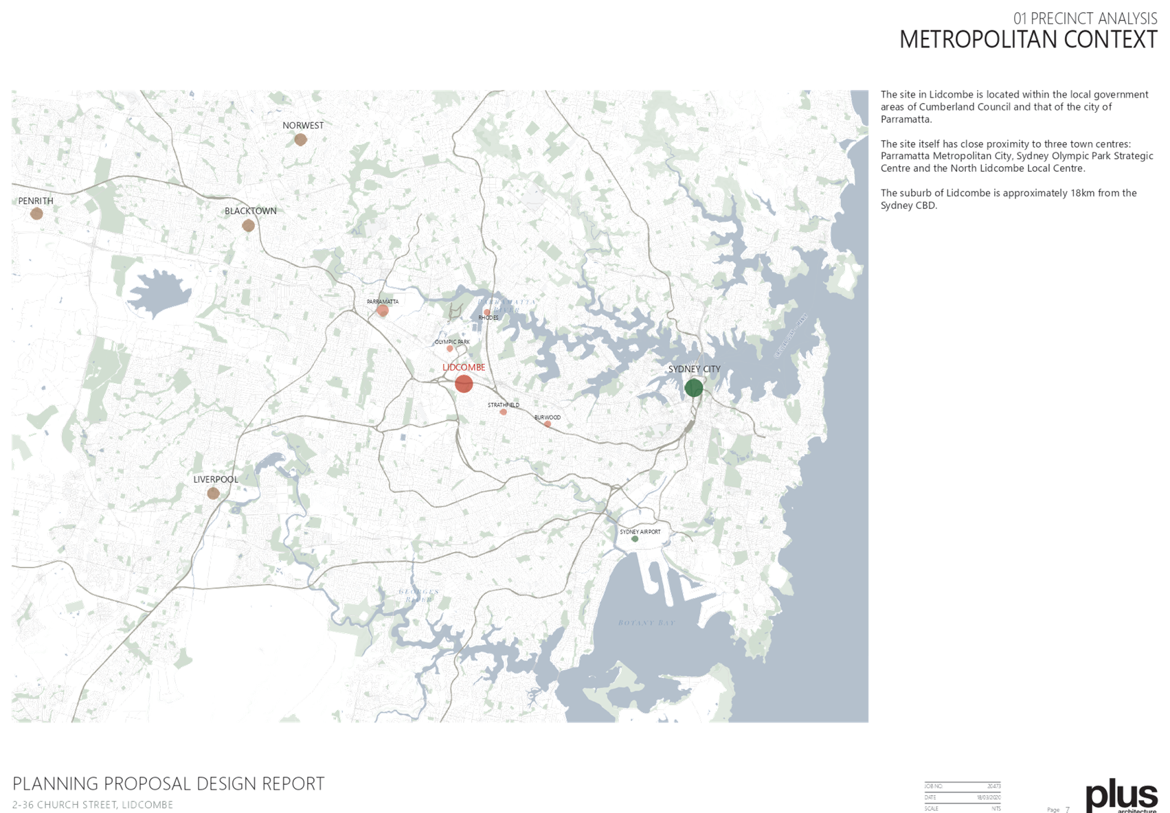
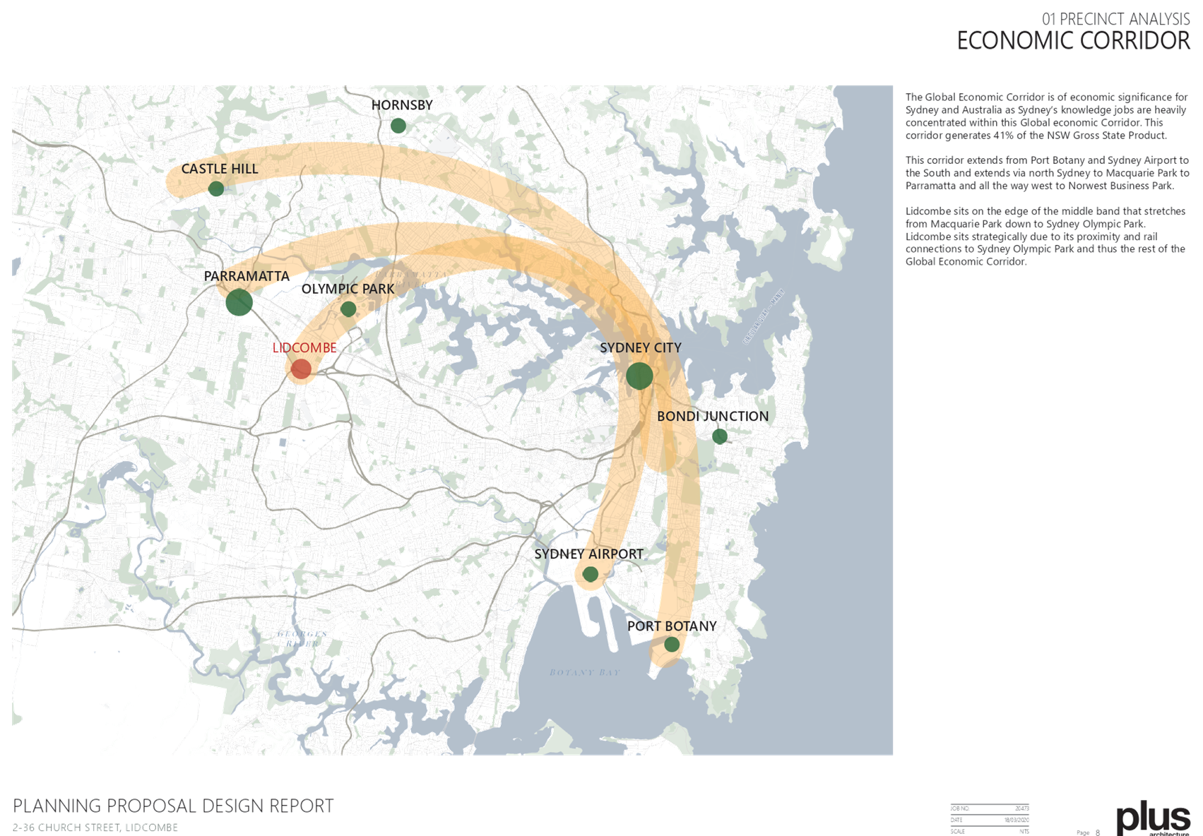

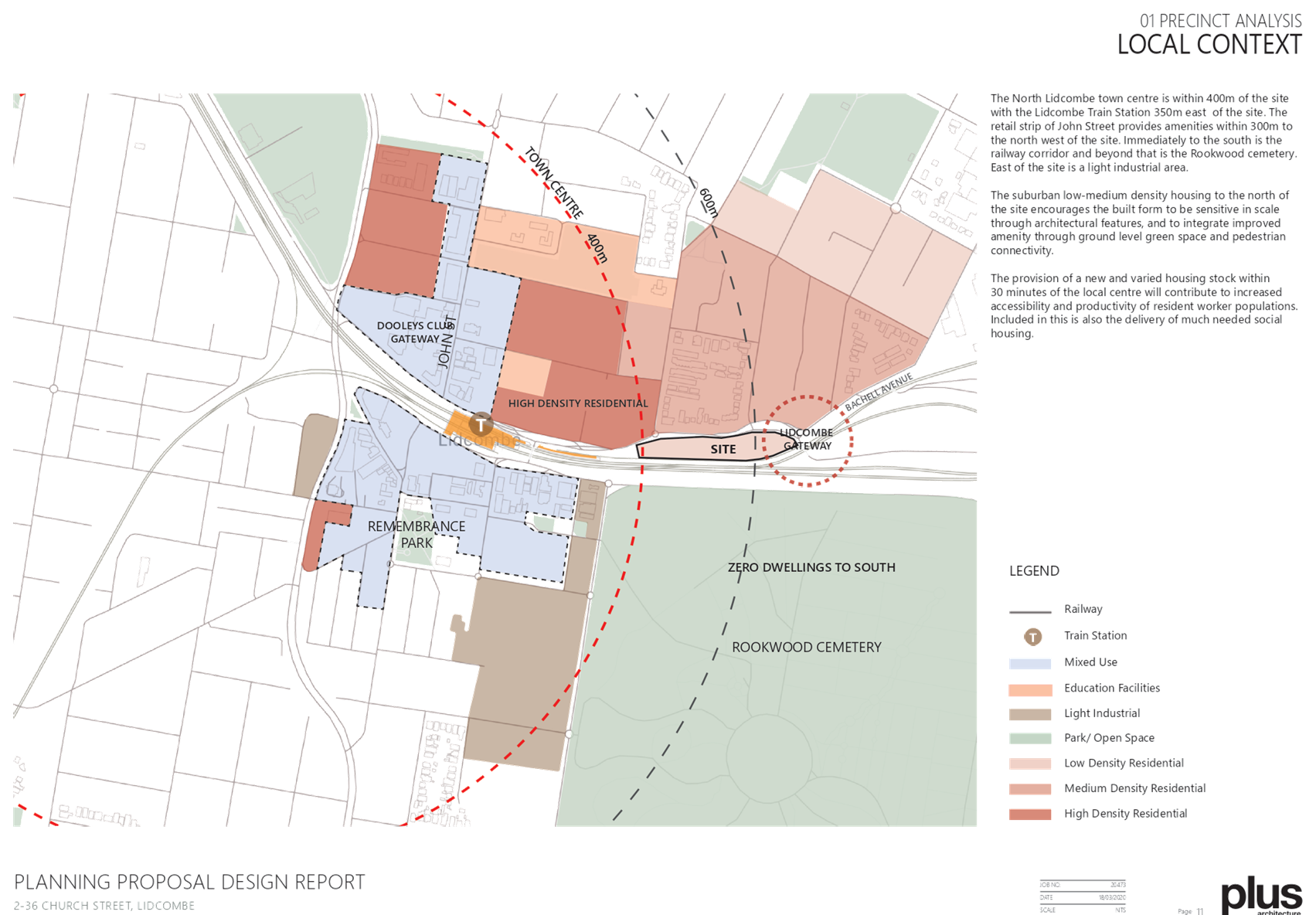
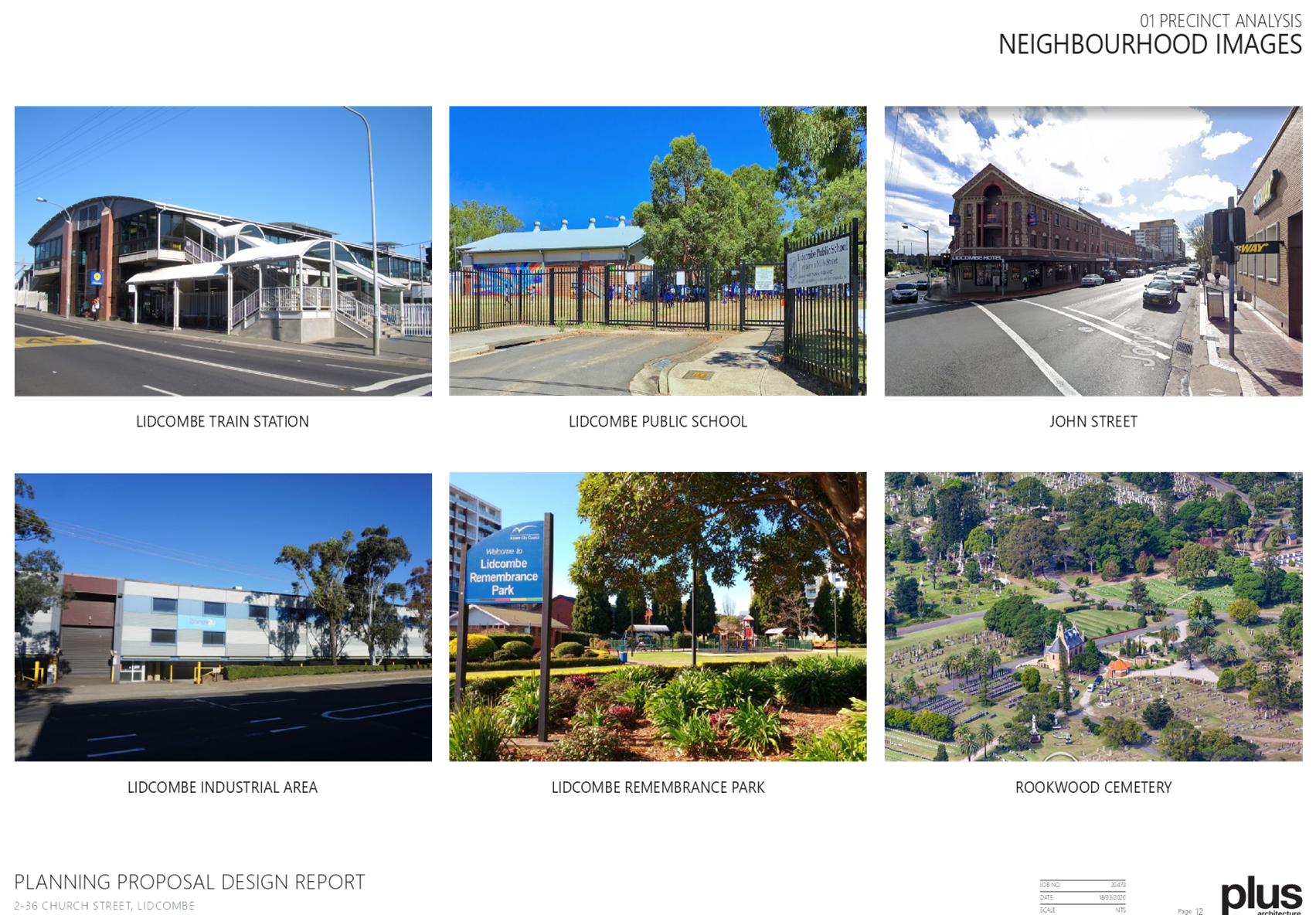

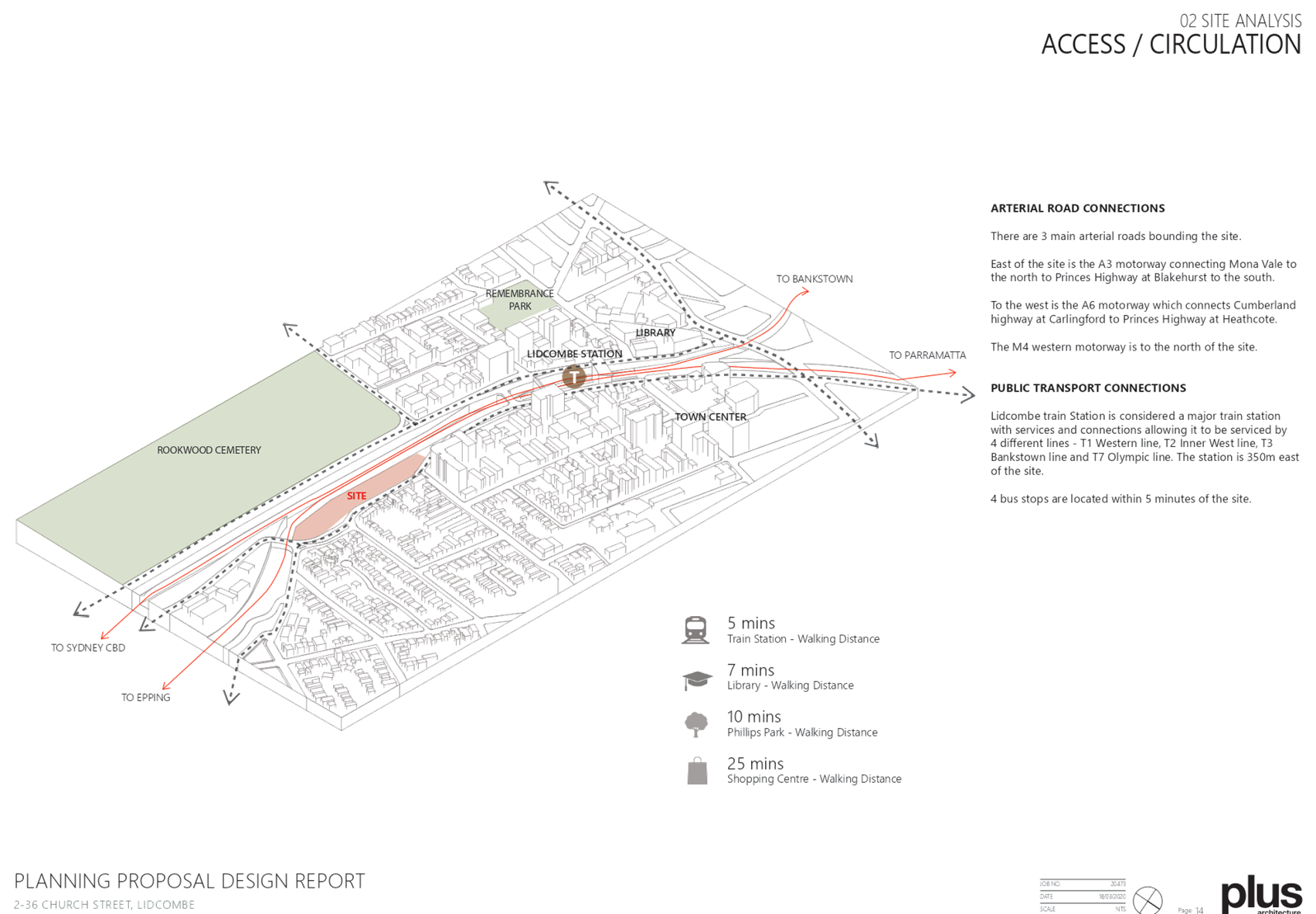
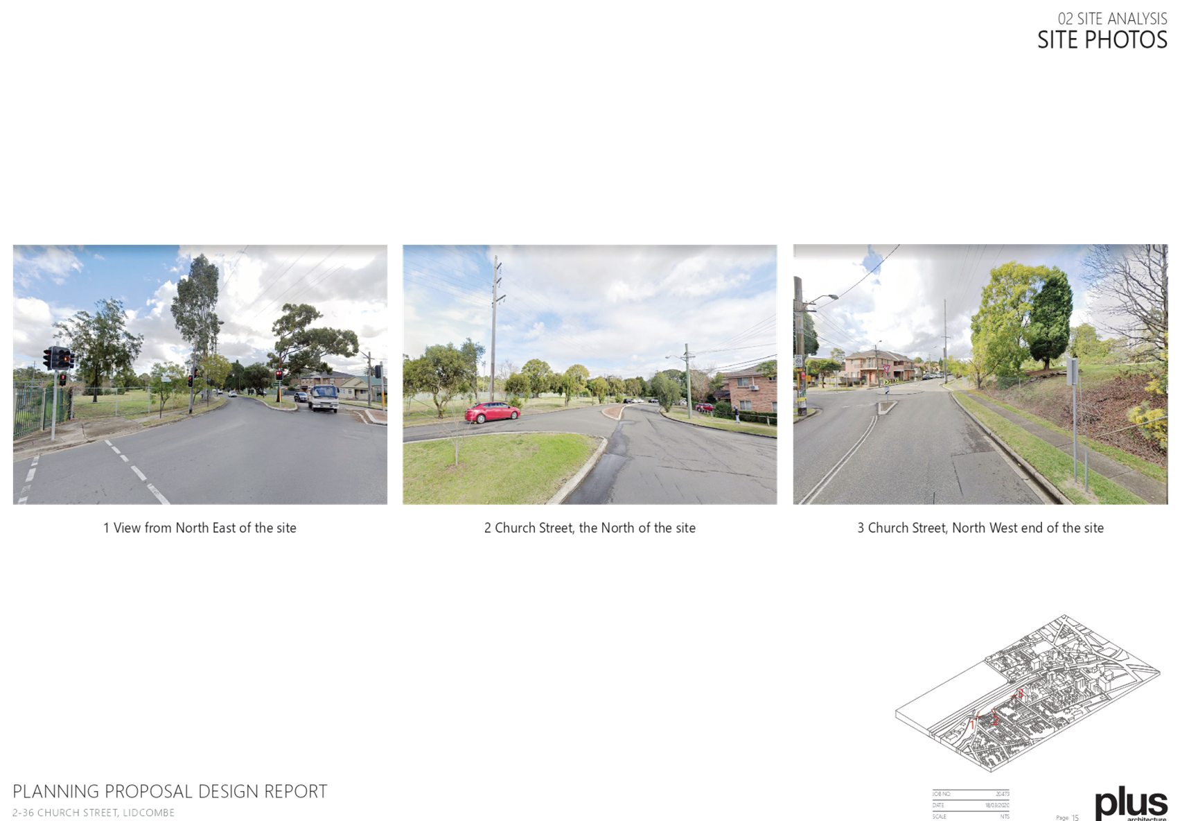
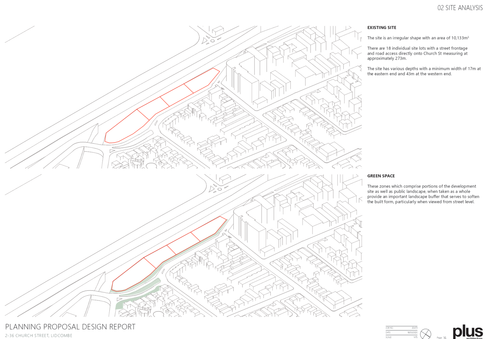
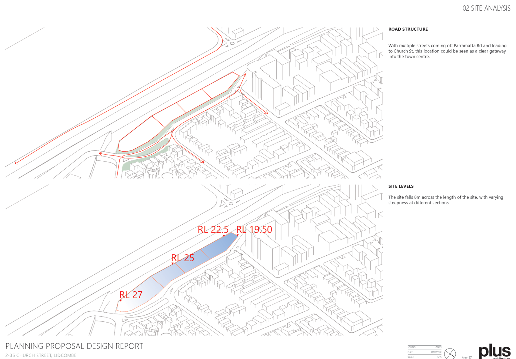
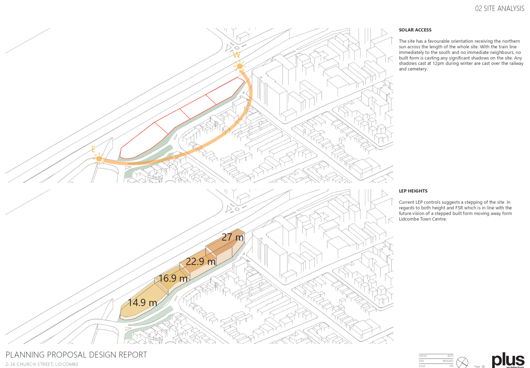
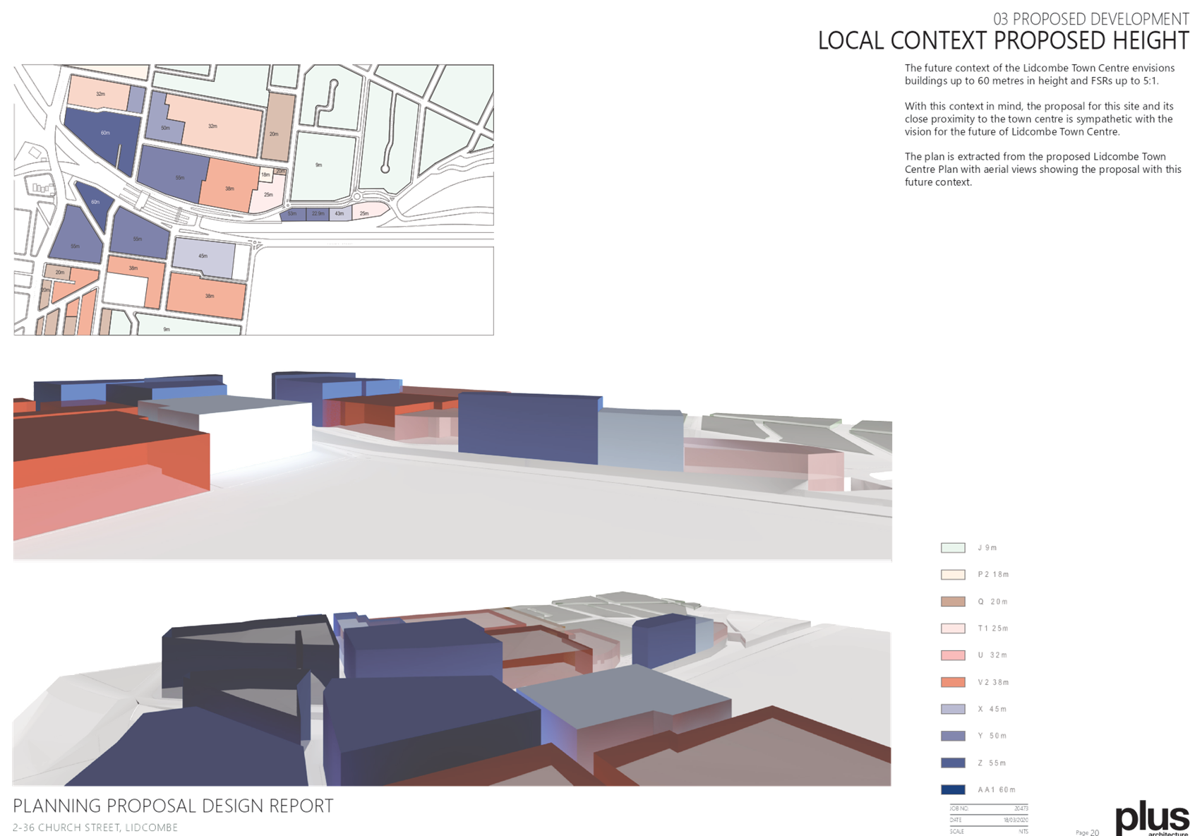
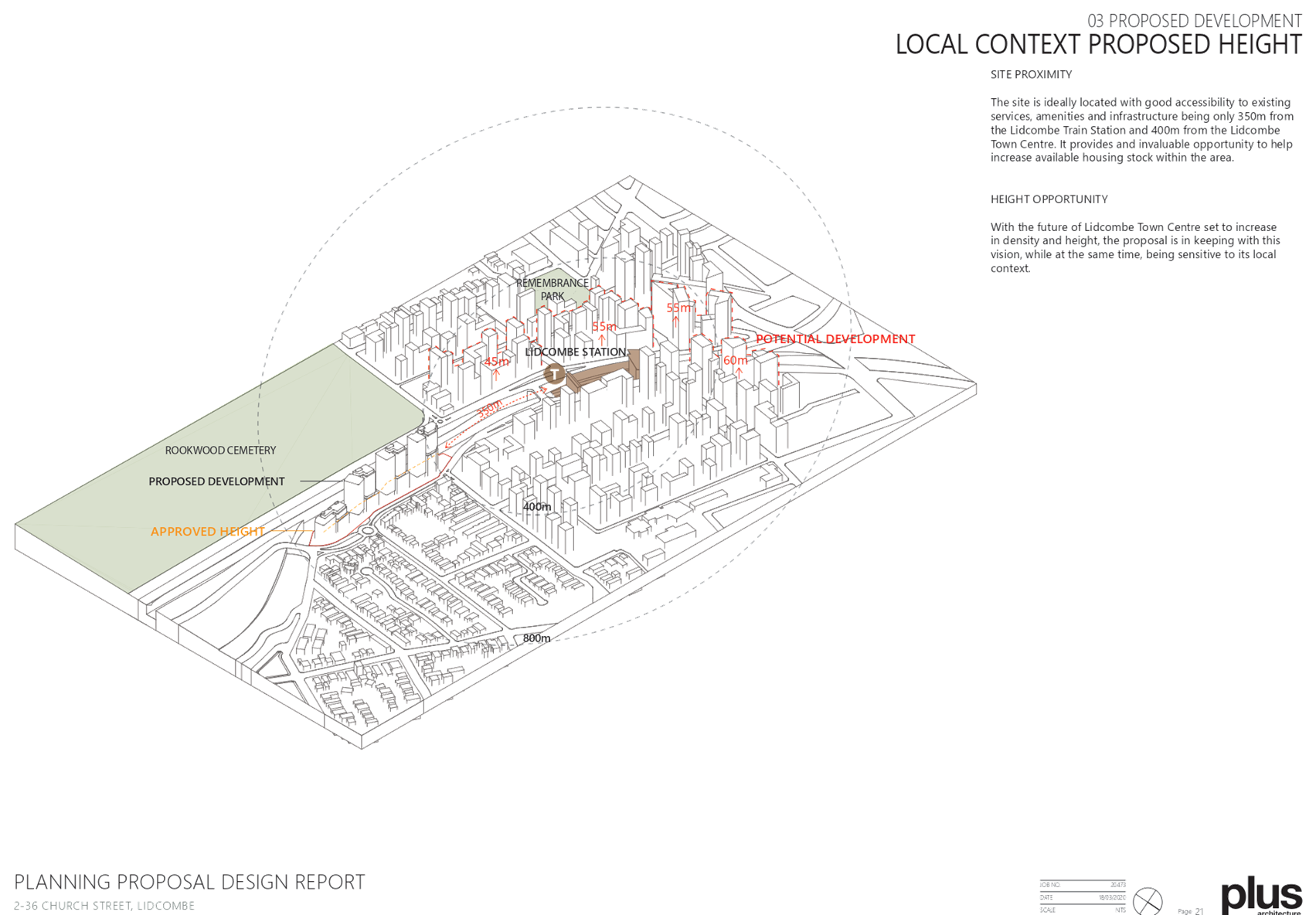
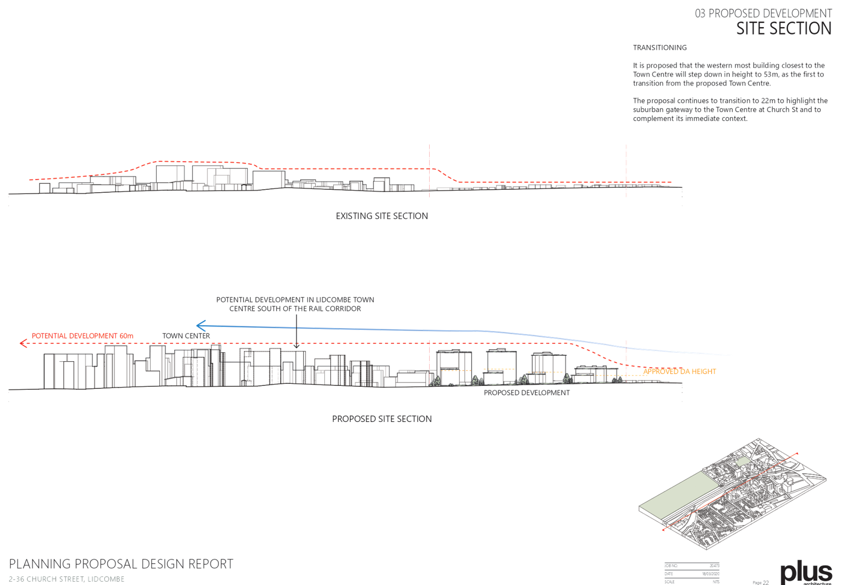
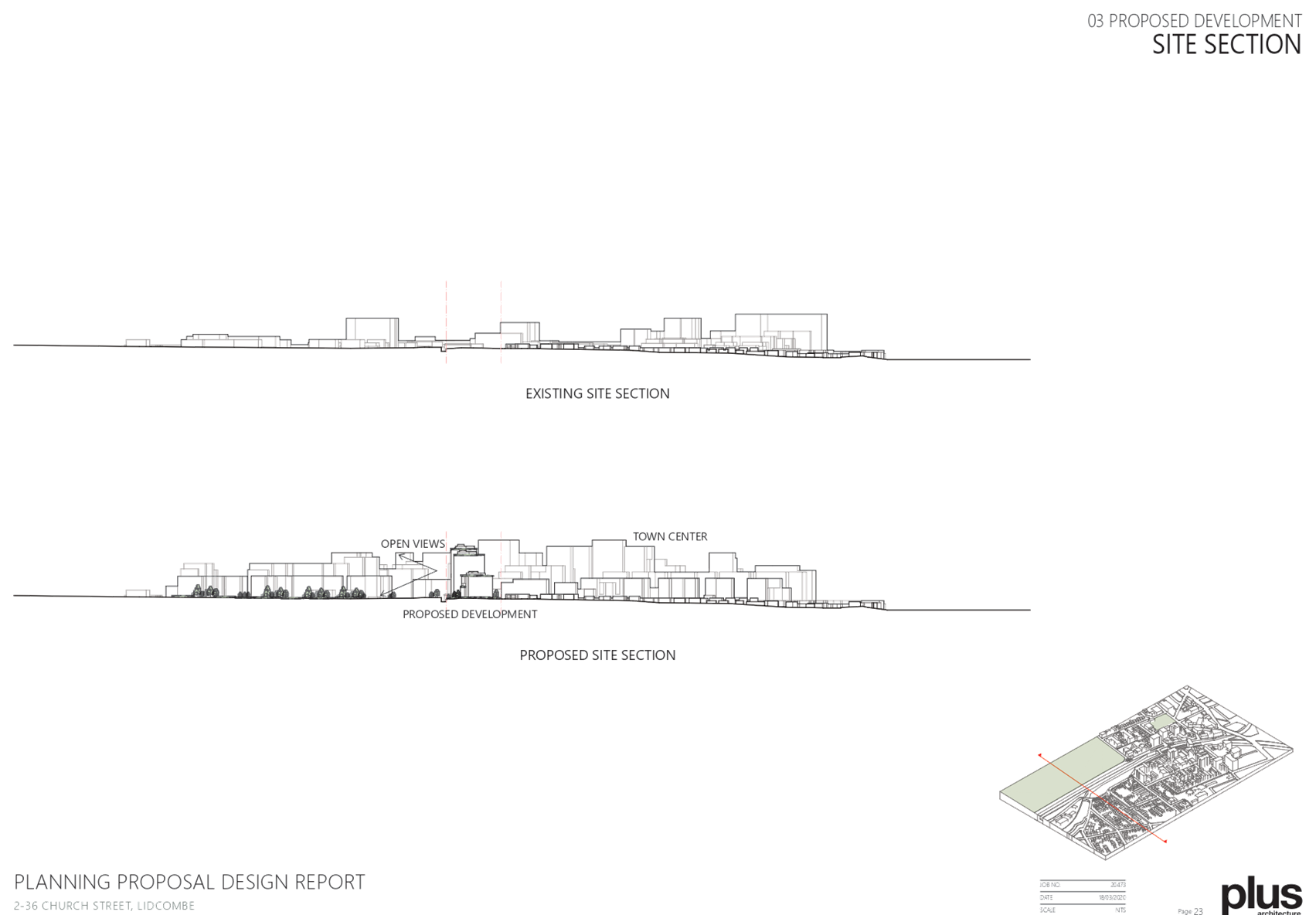
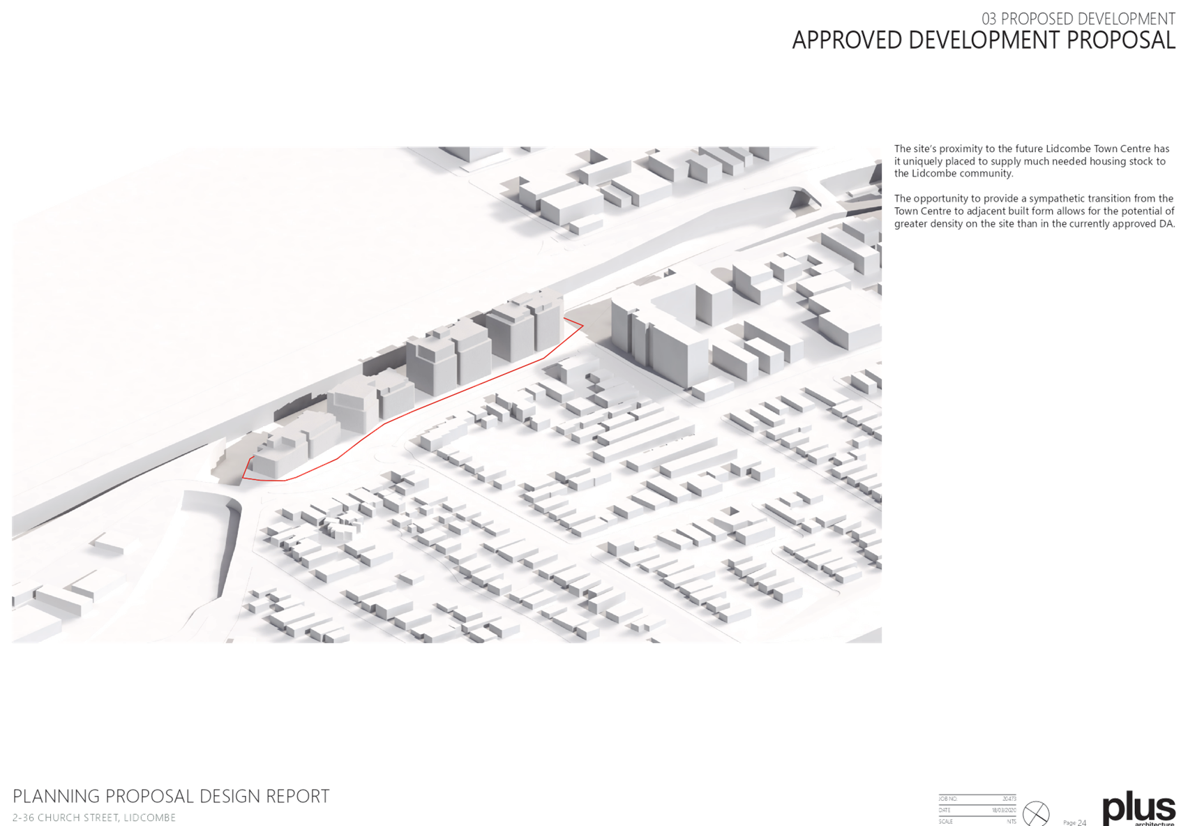
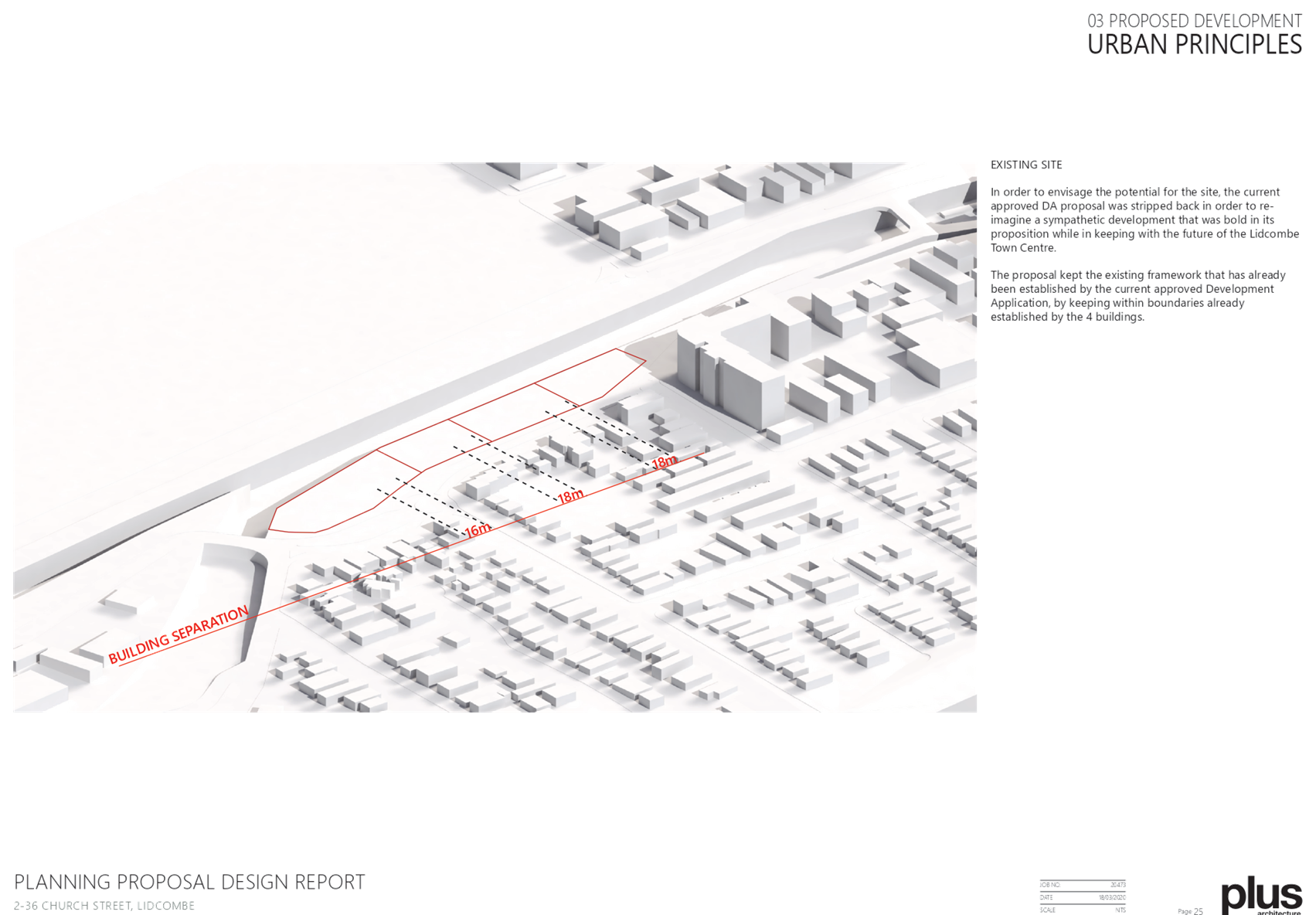
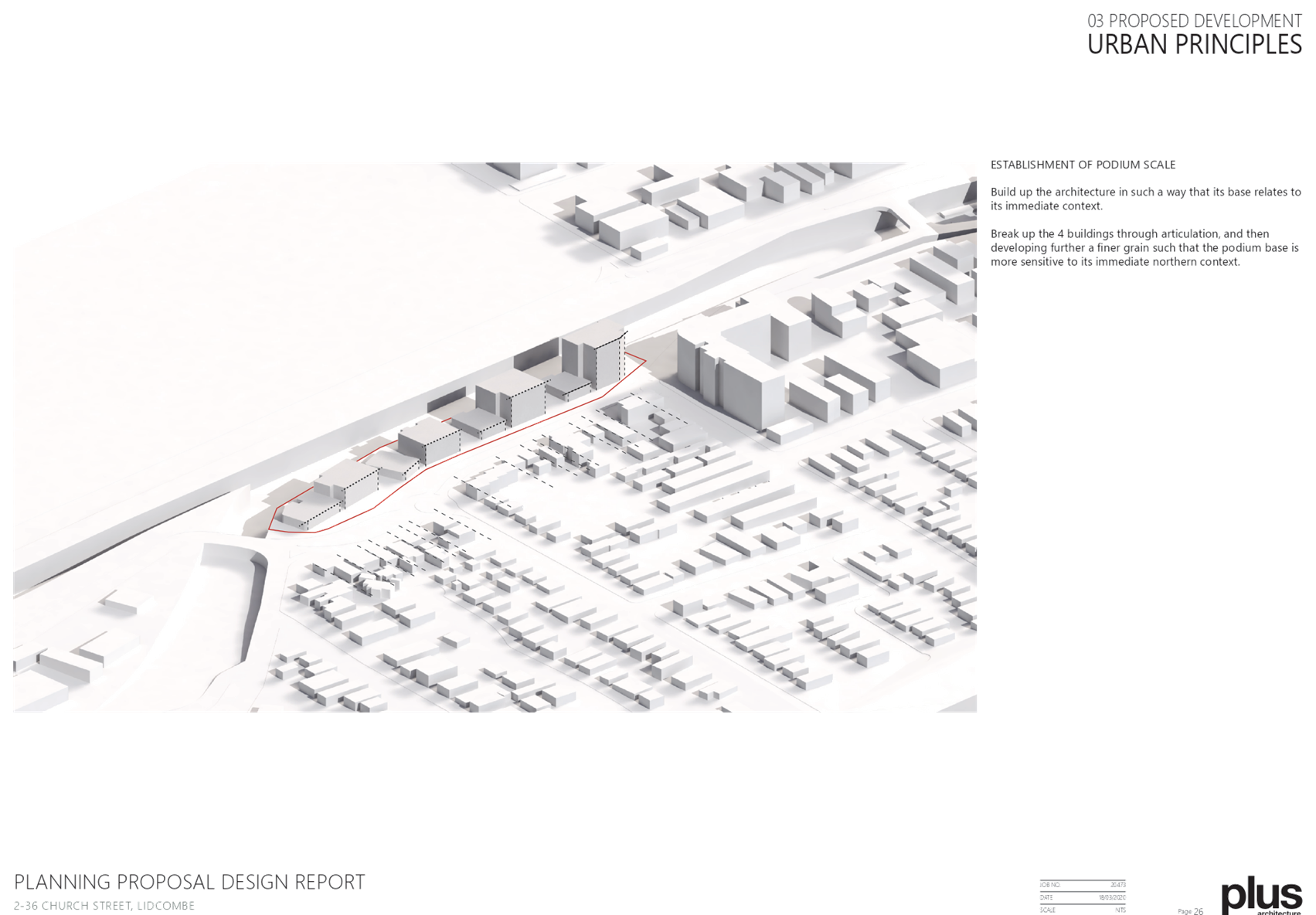
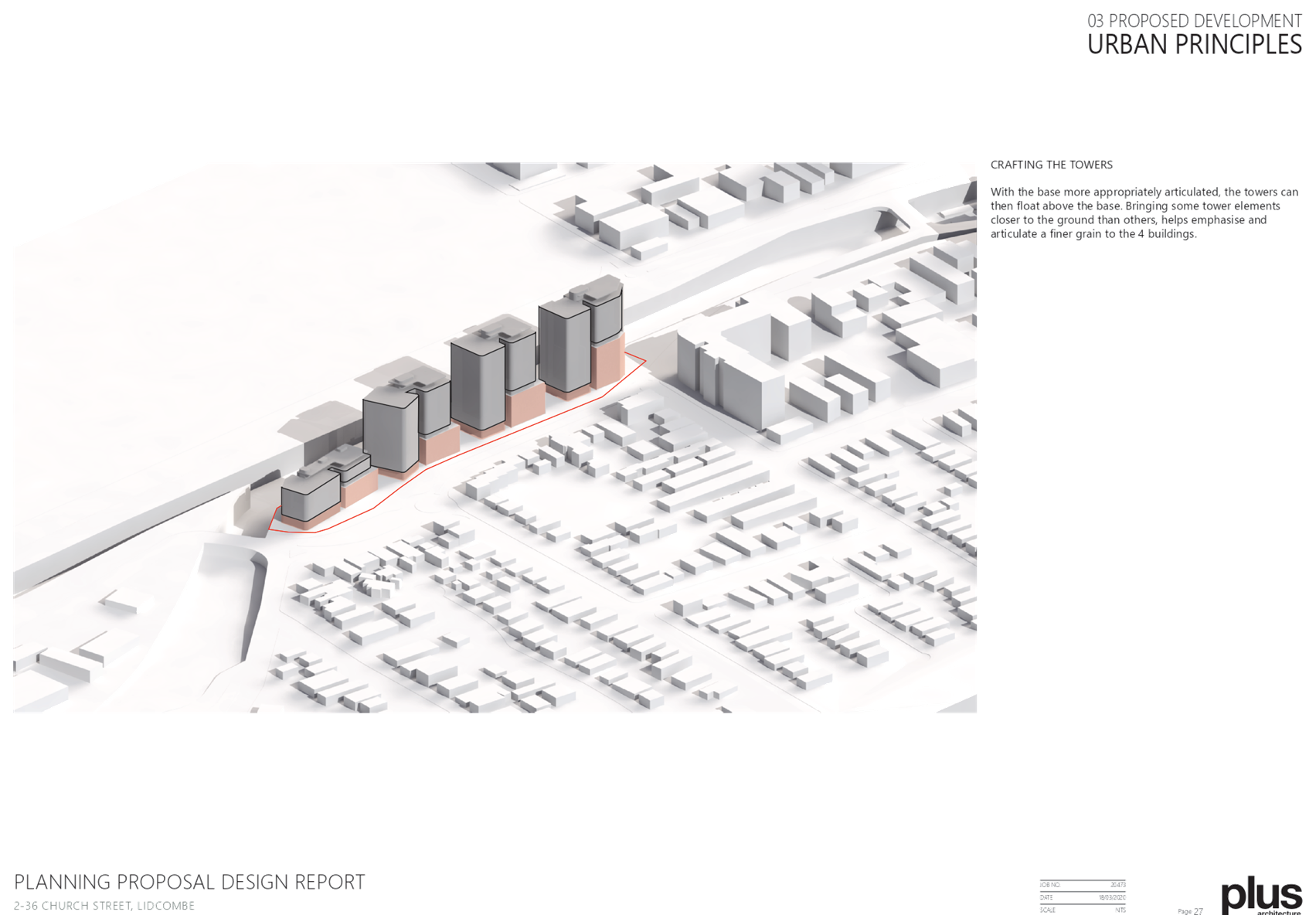
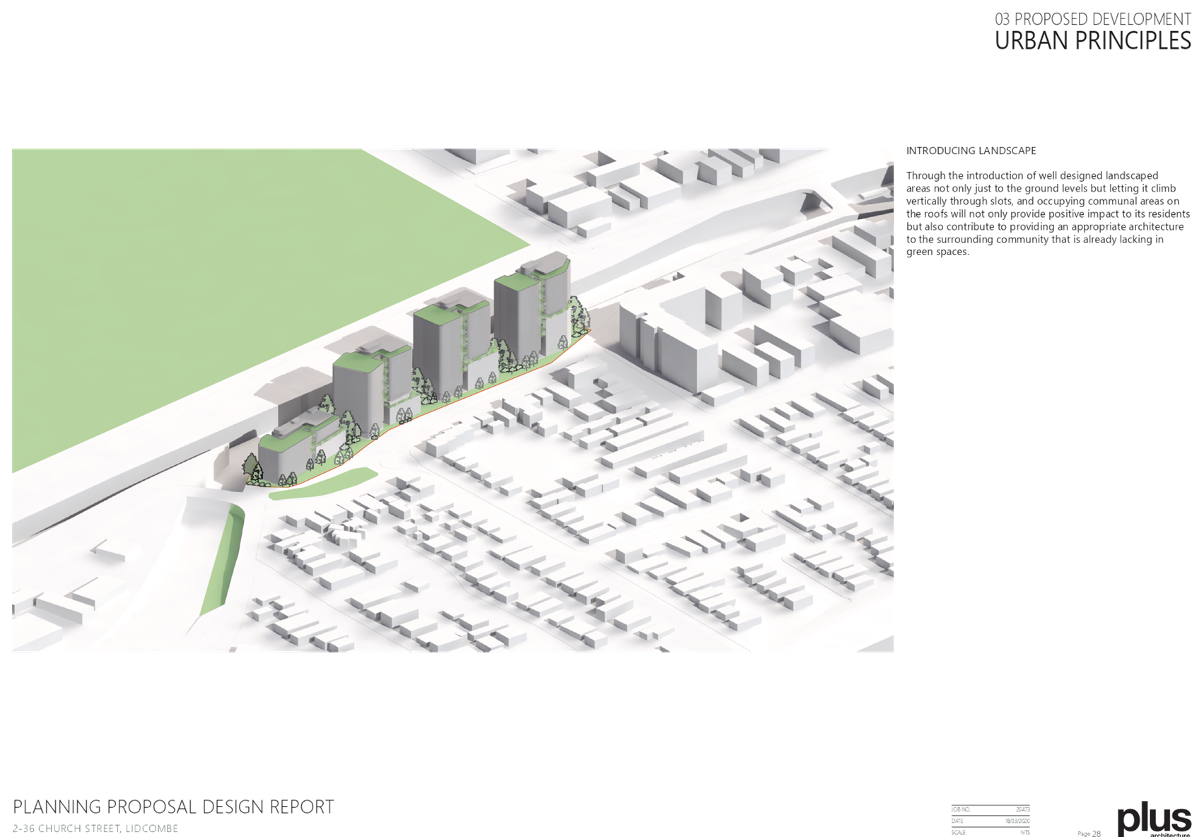
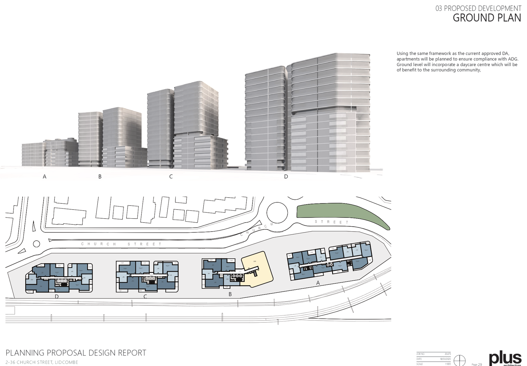
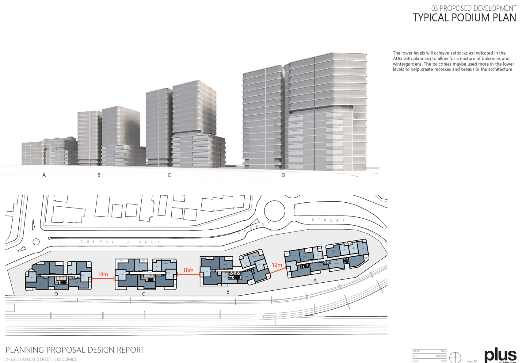
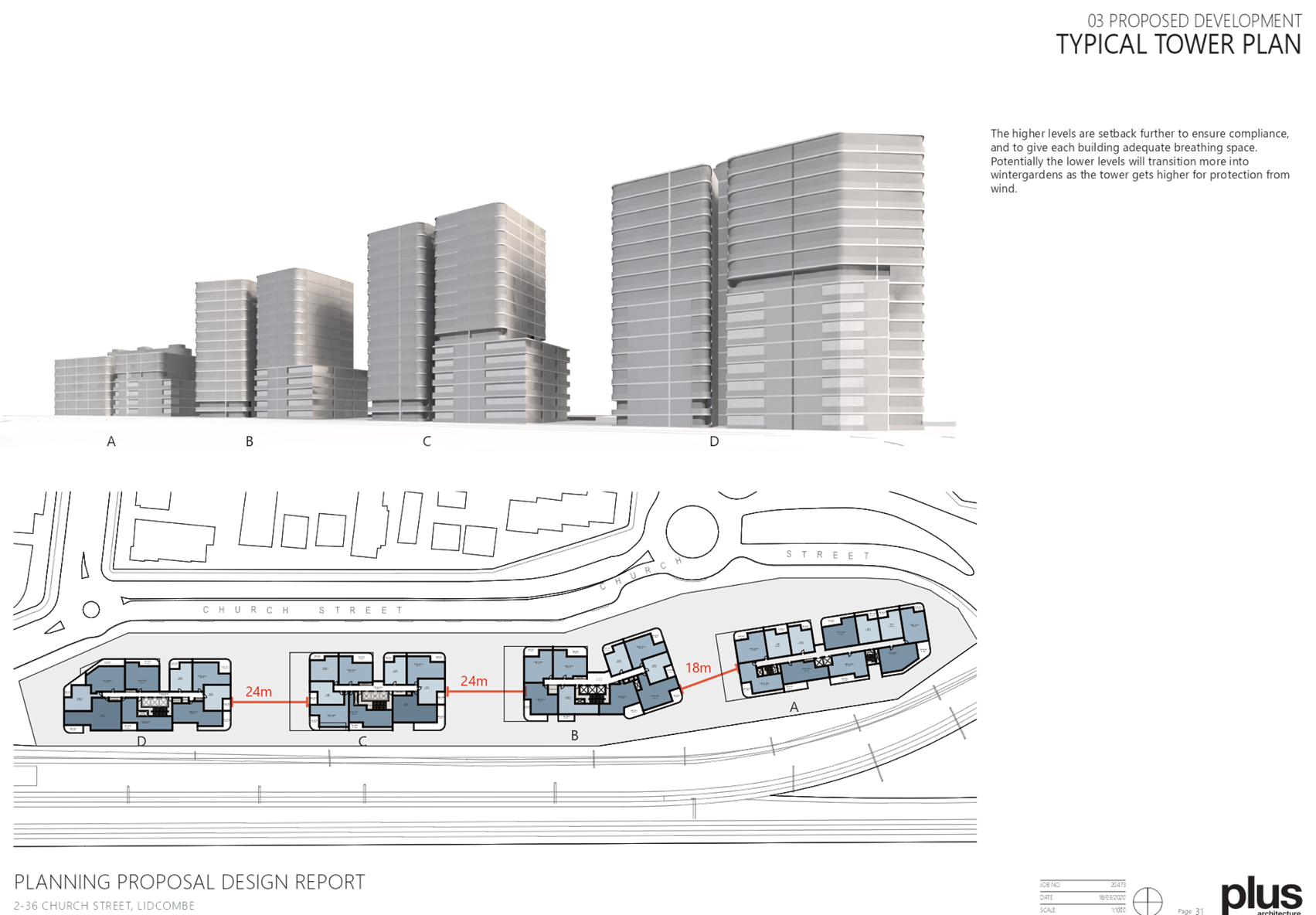
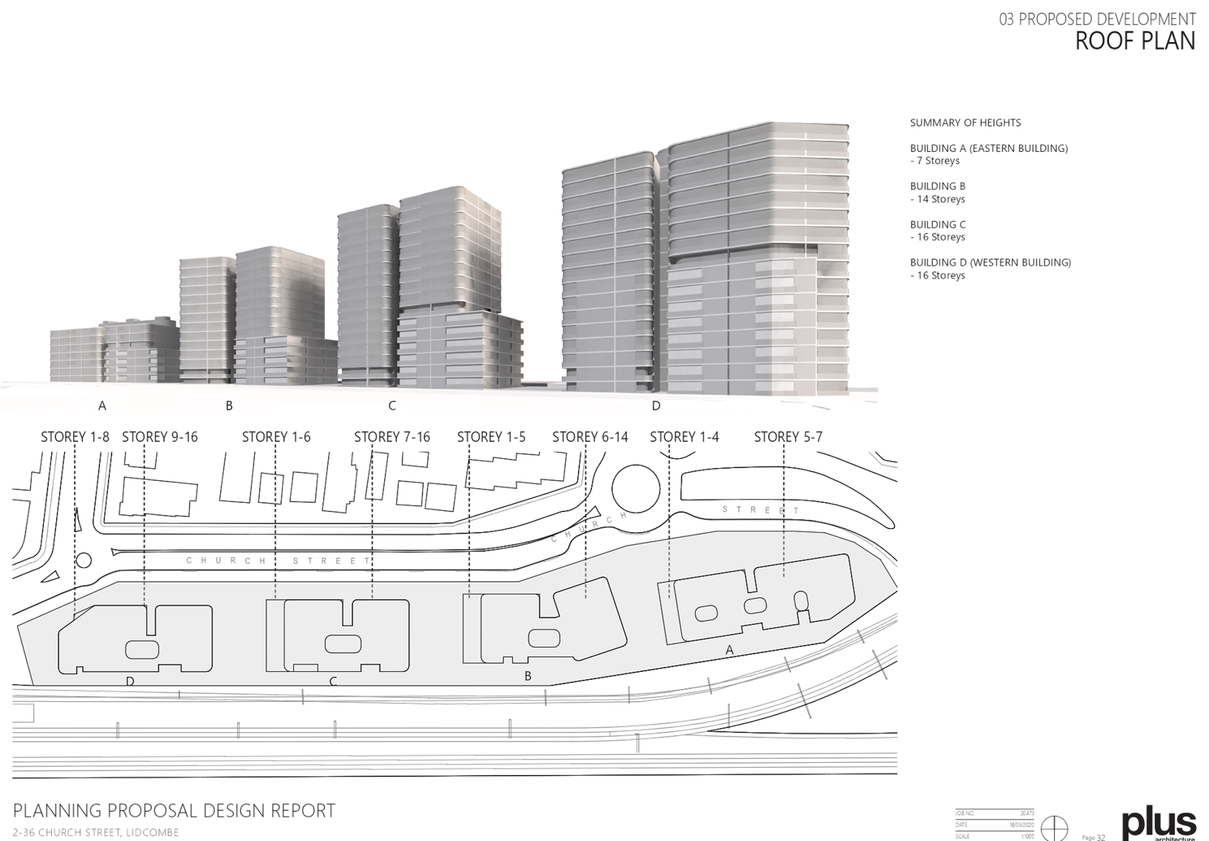
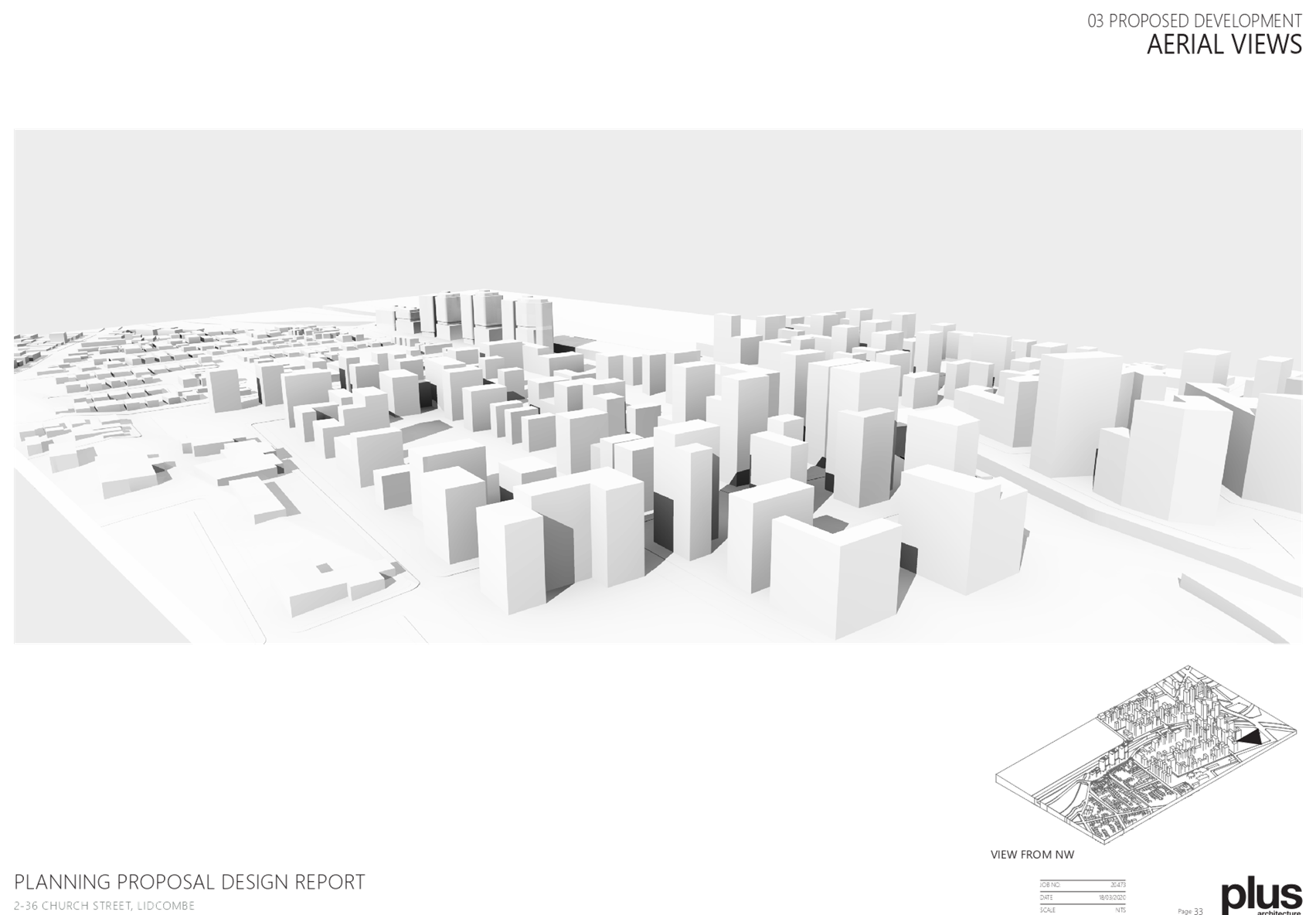
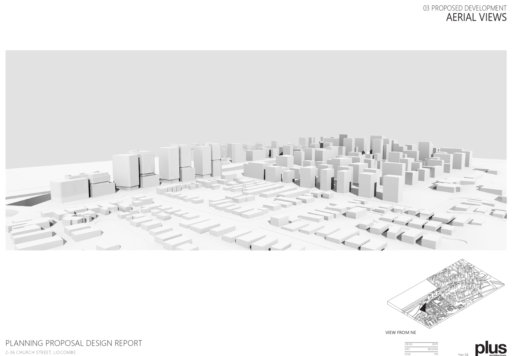
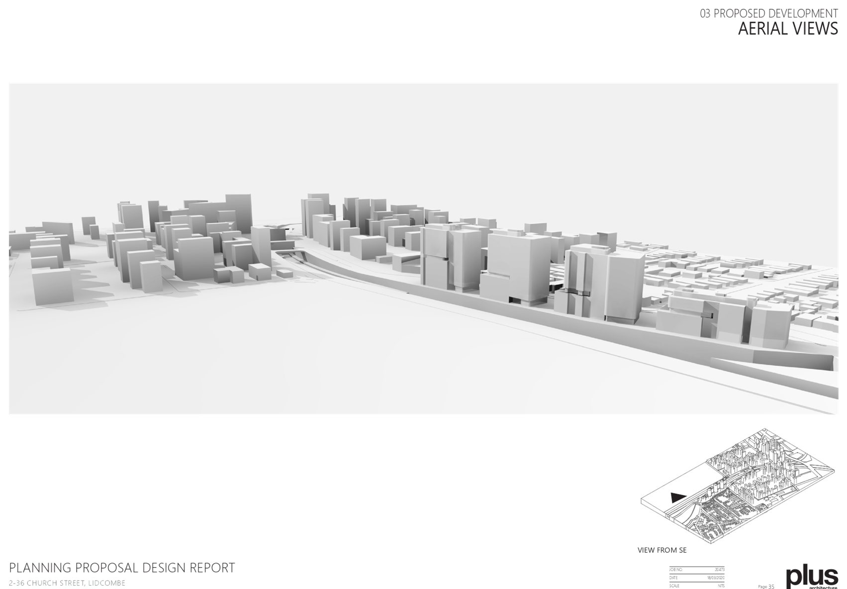
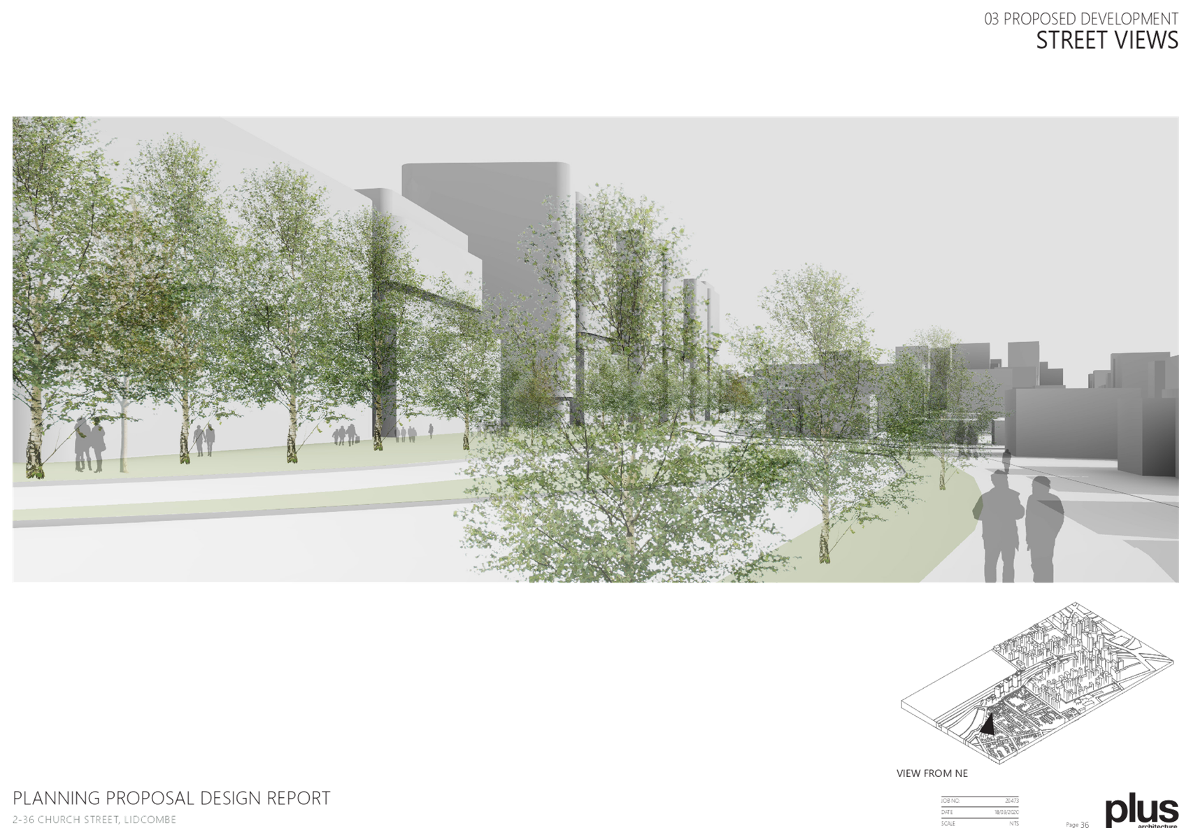
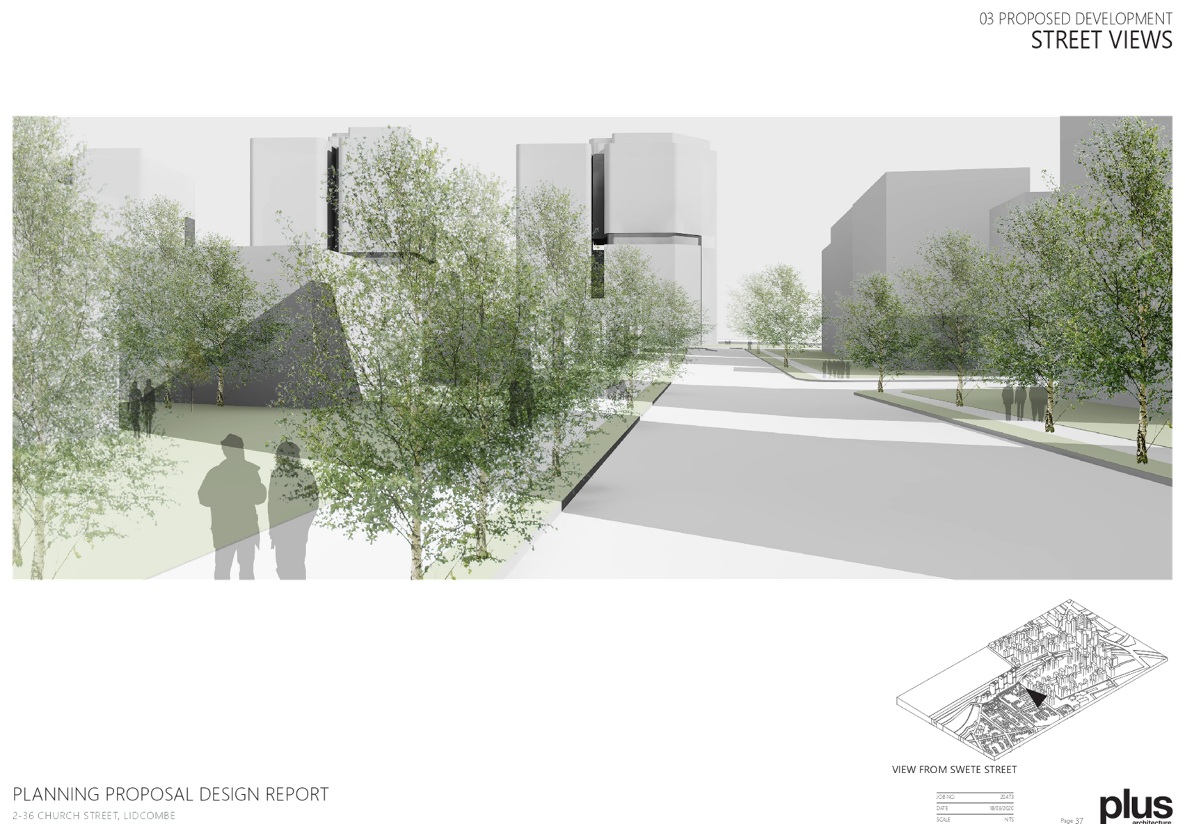
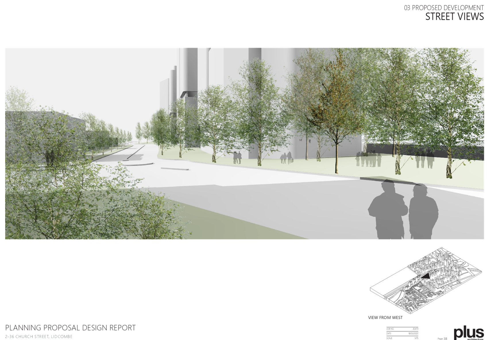
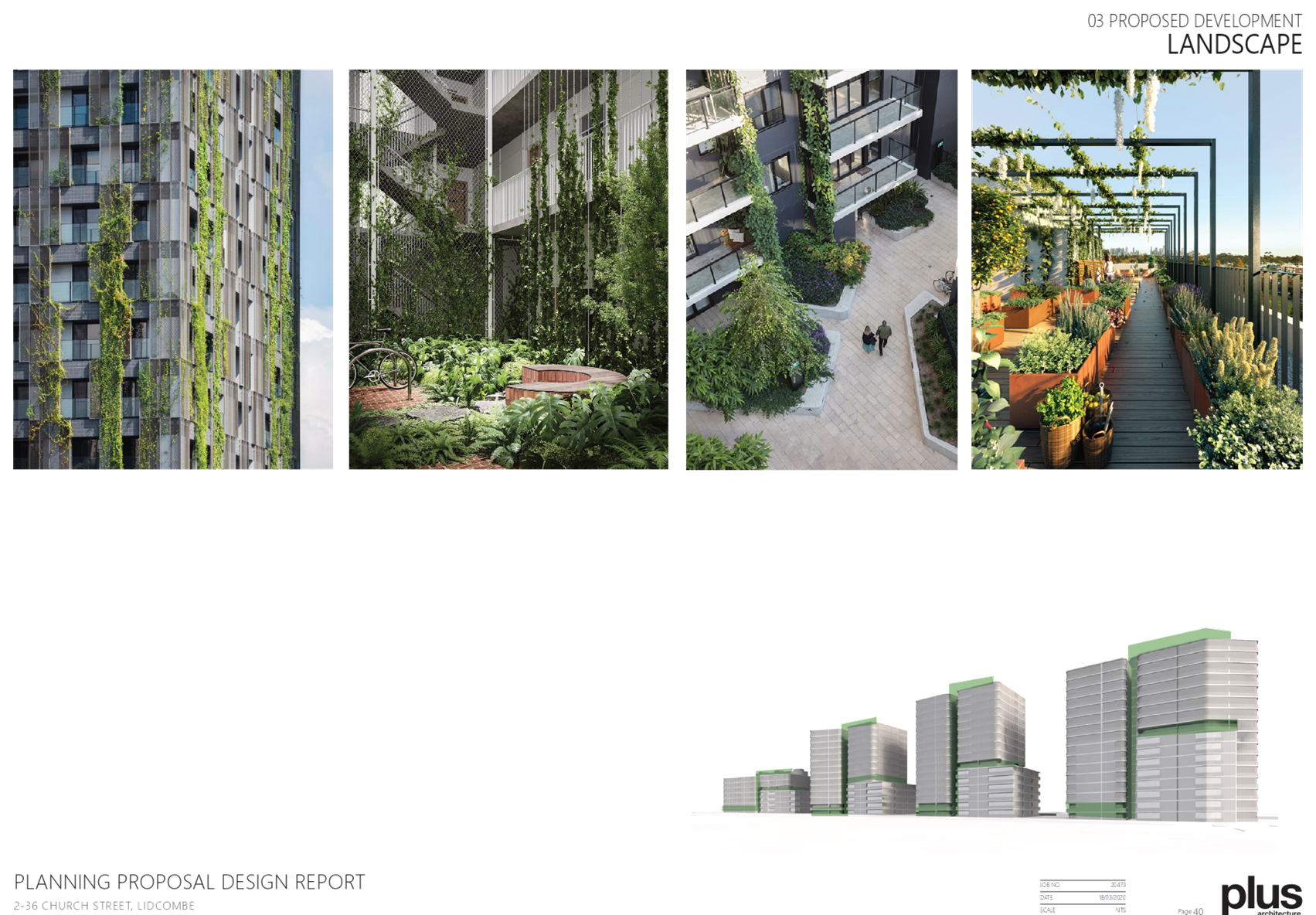

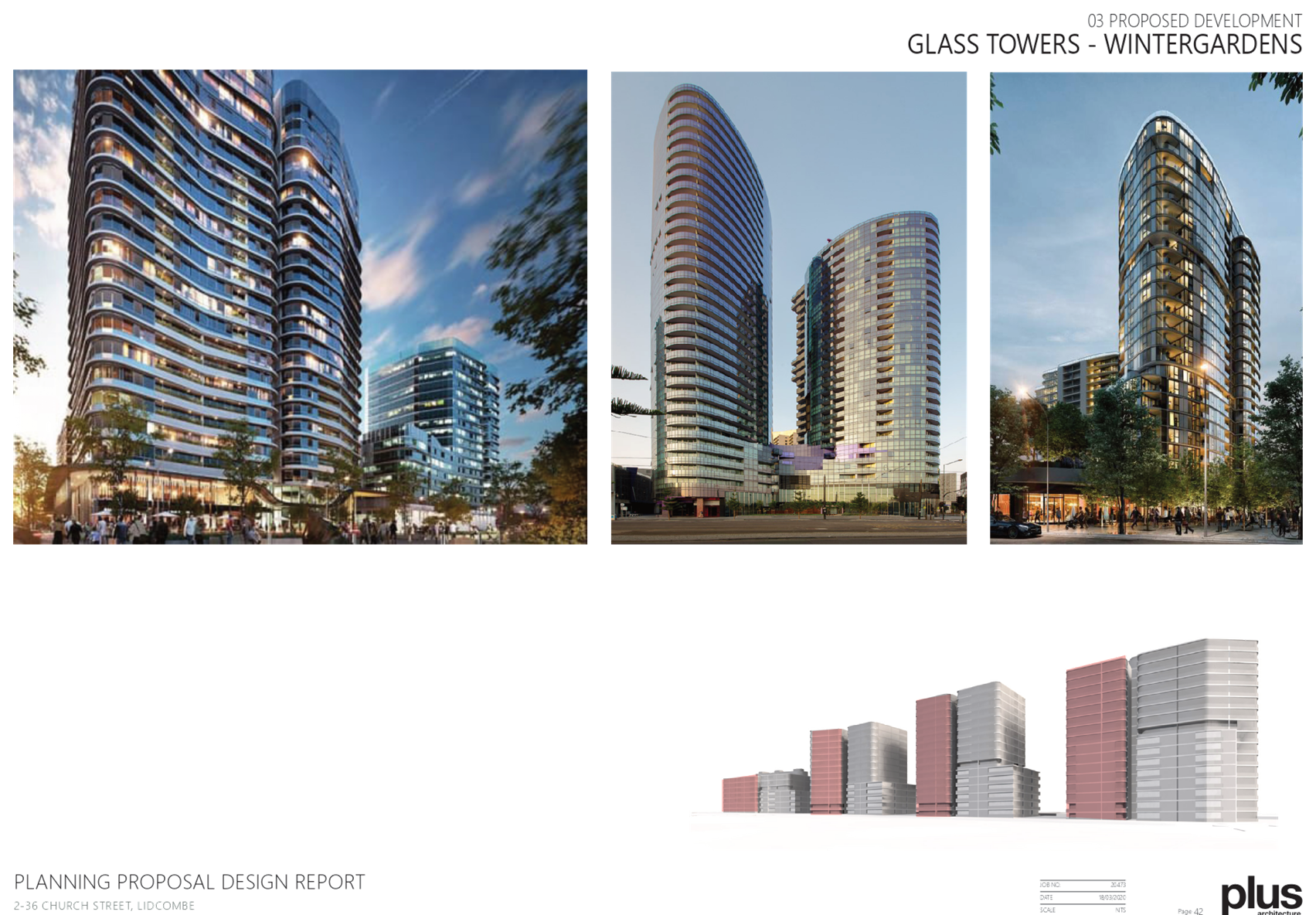
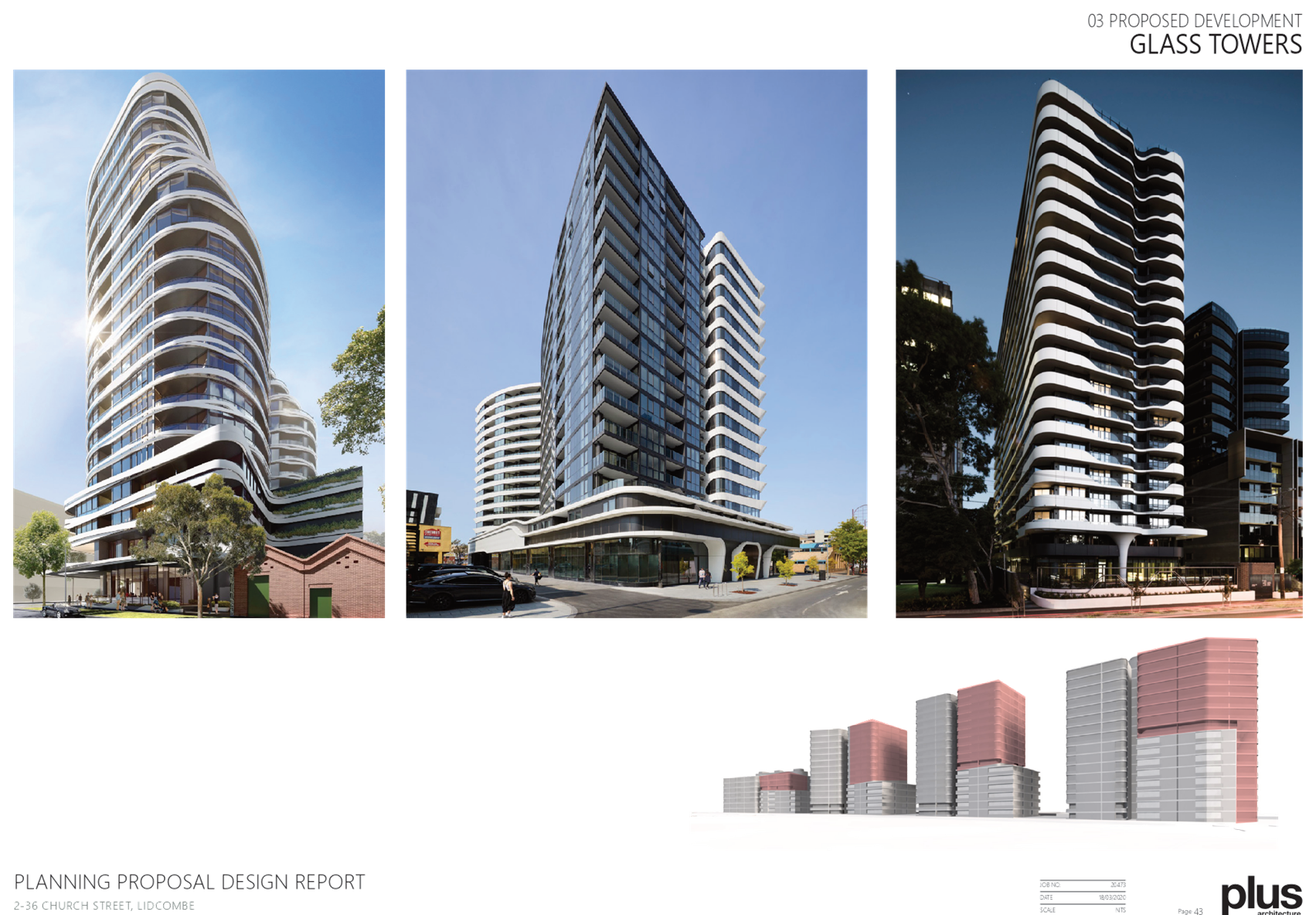
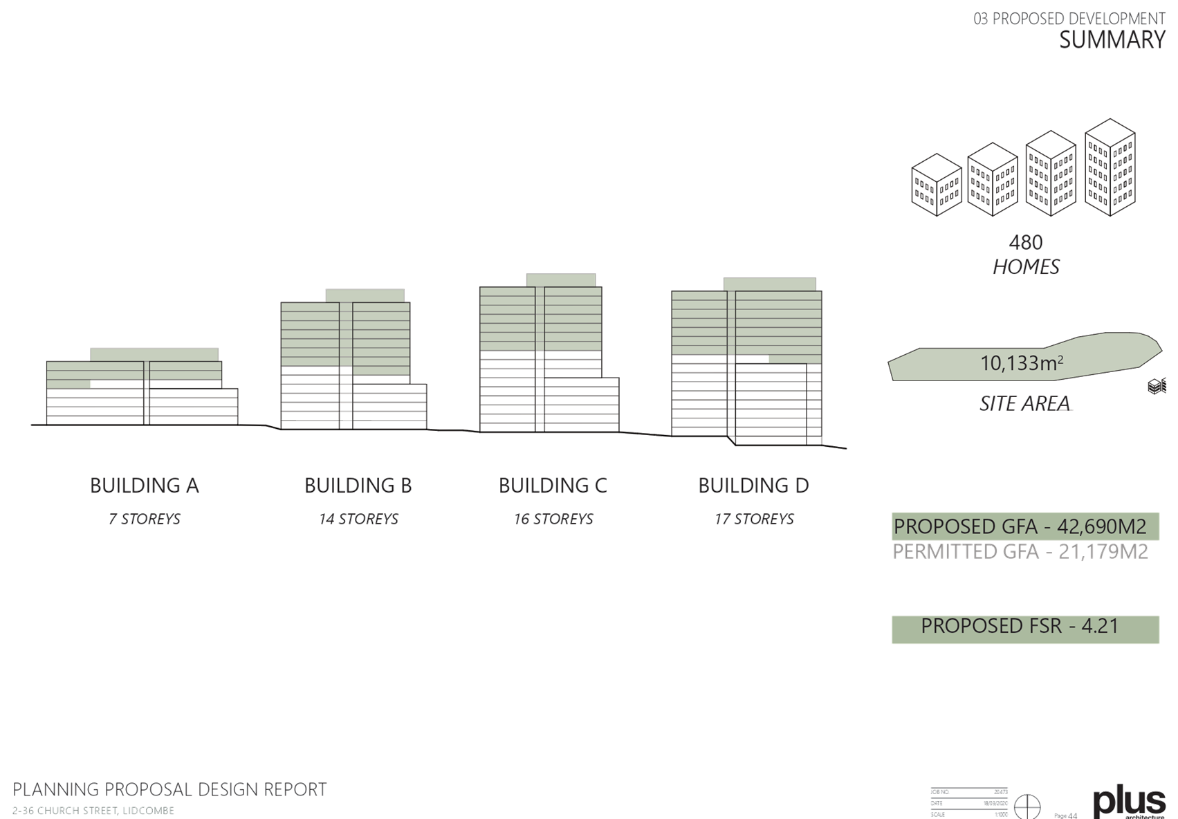
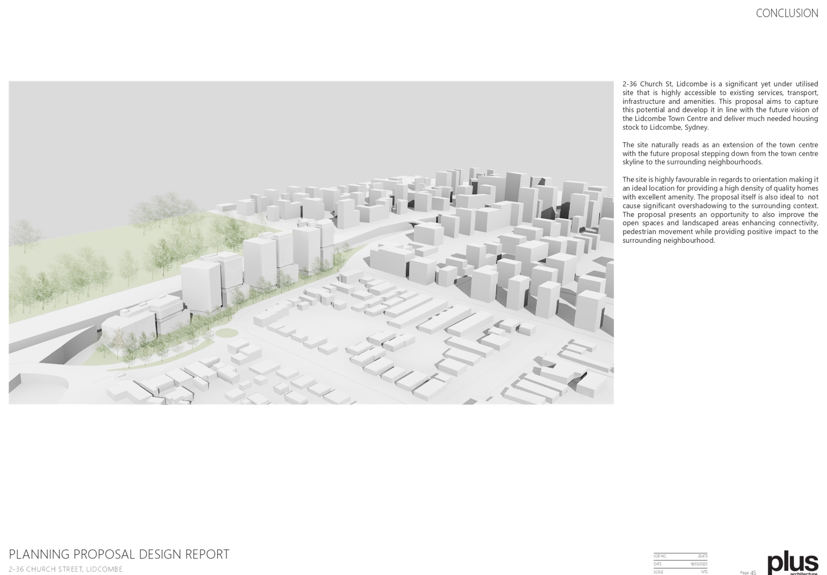
DOCUMENTS
ASSOCIATED WITH
REPORT LPP015/20
Attachment 3
Attachment 3 - Traffic Impact Assessment
Cumberland Local Planning Panel Meeting
8 April 2020
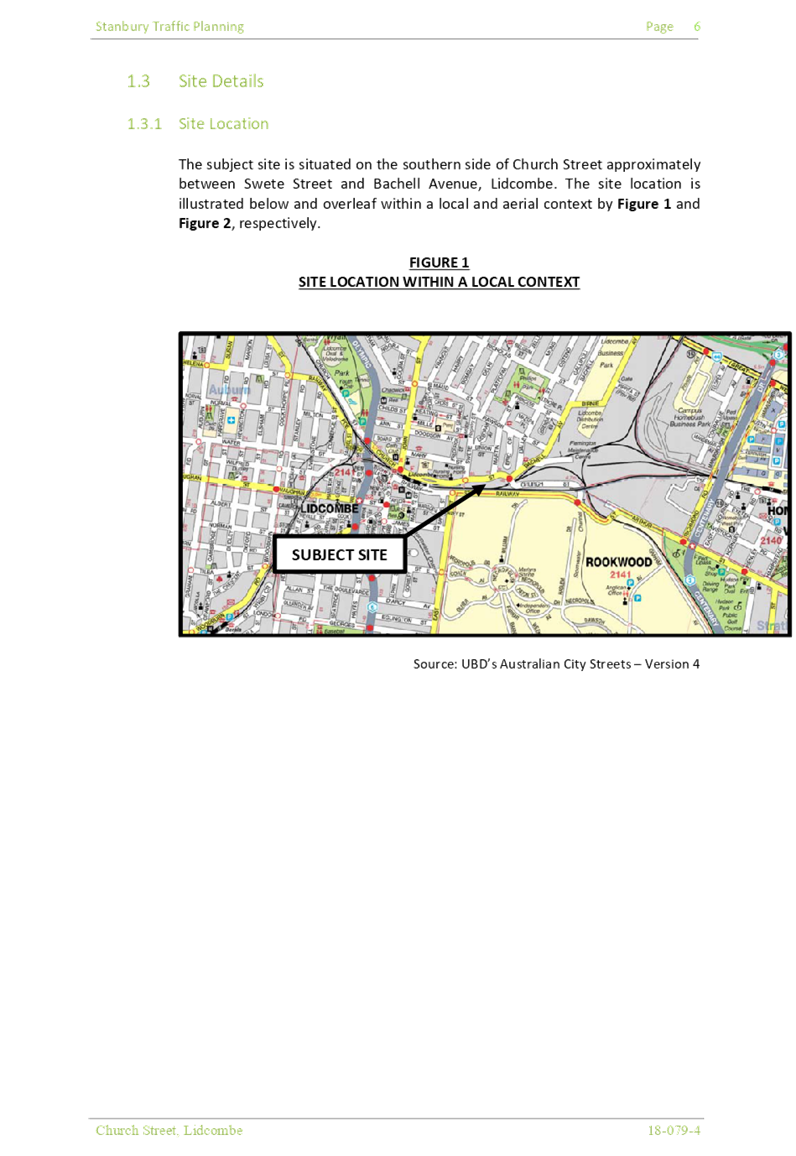
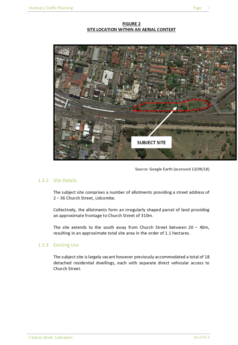
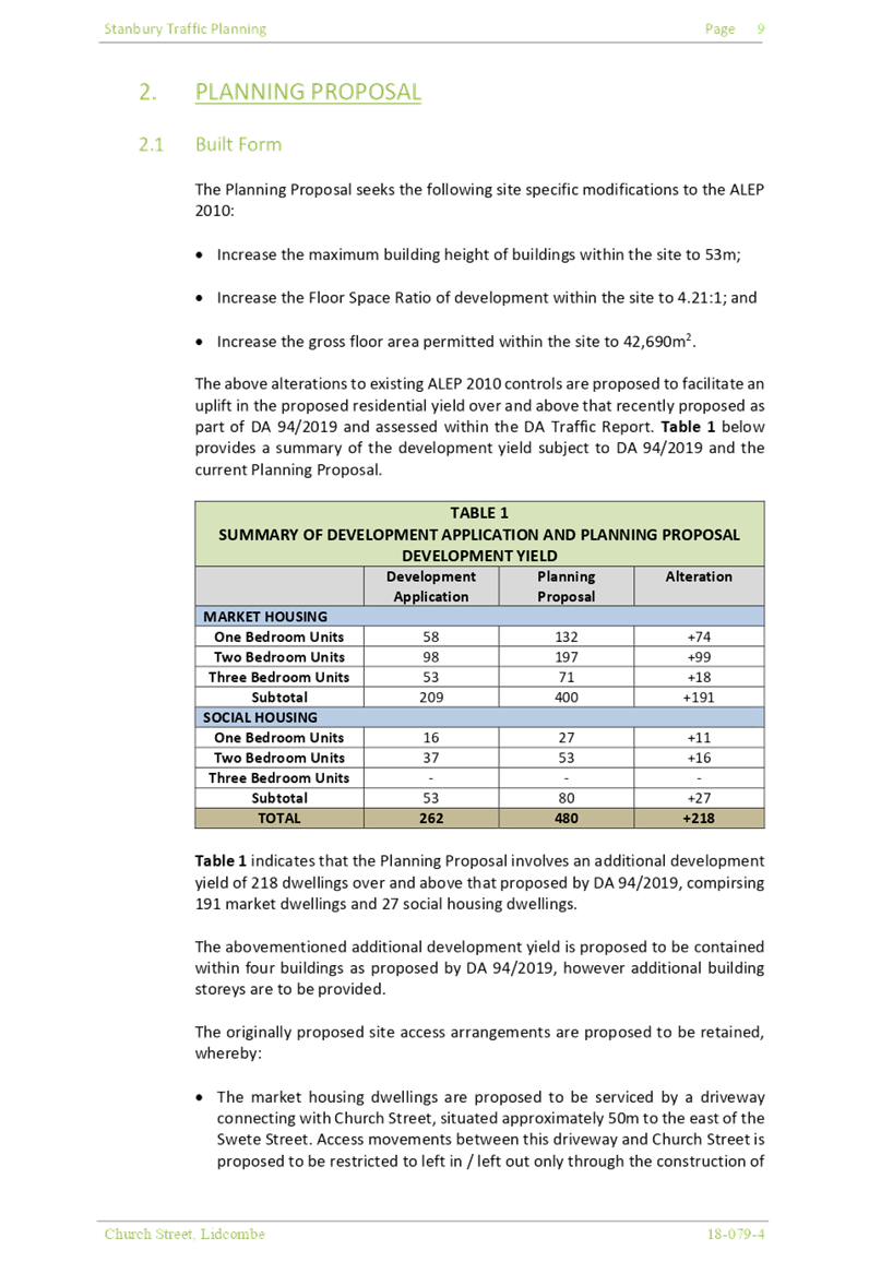

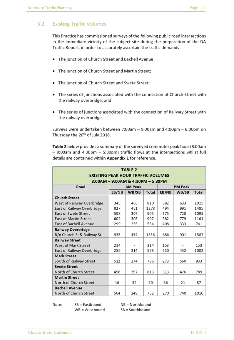
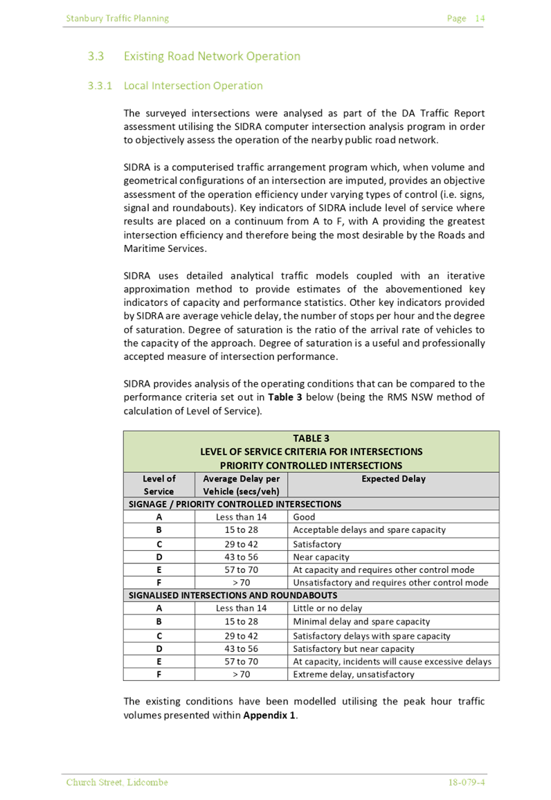
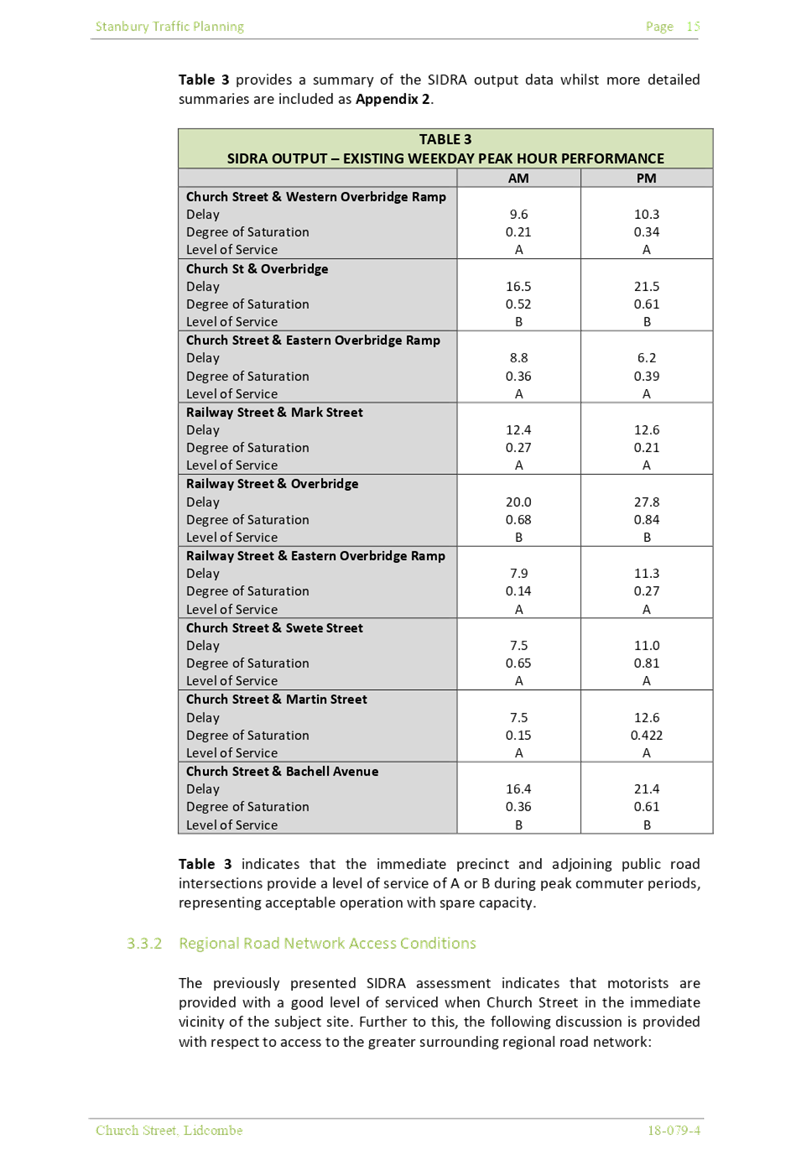
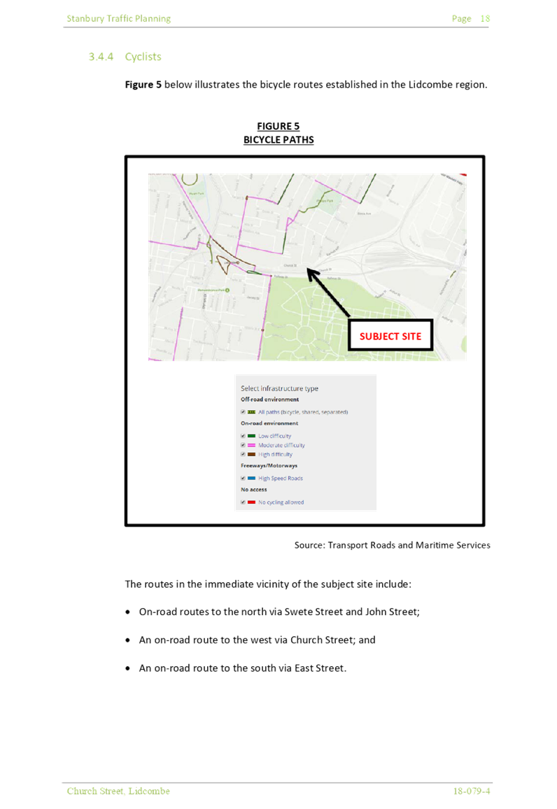
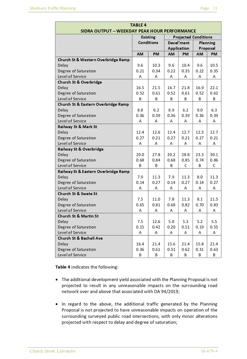

Cumberland Local Planning Panel Meeting
8 April 2020
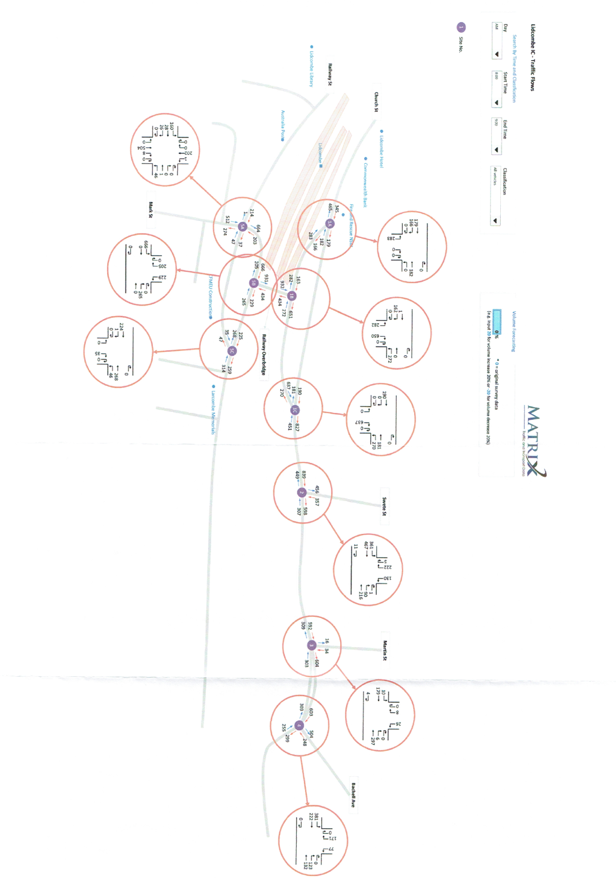
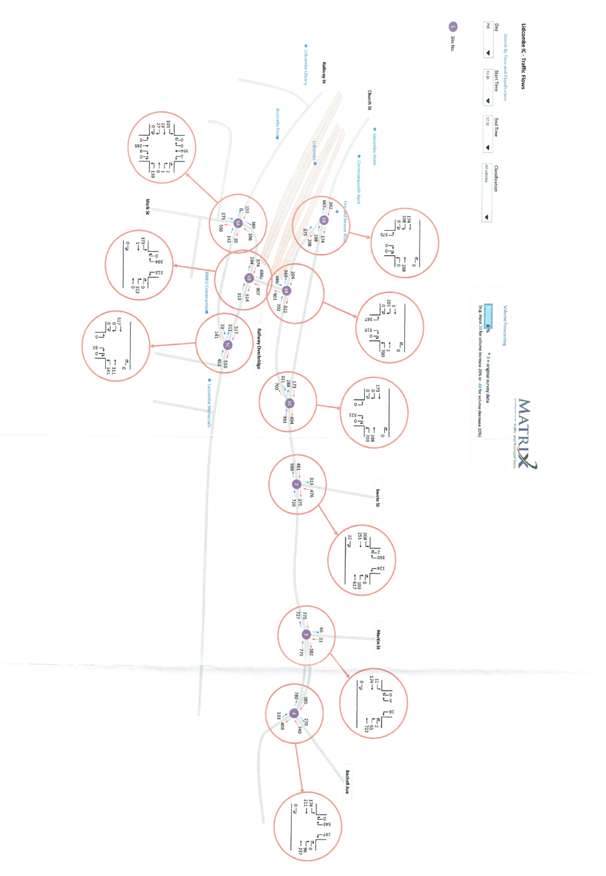
Cumberland Local Planning Panel Meeting
8 April 2020

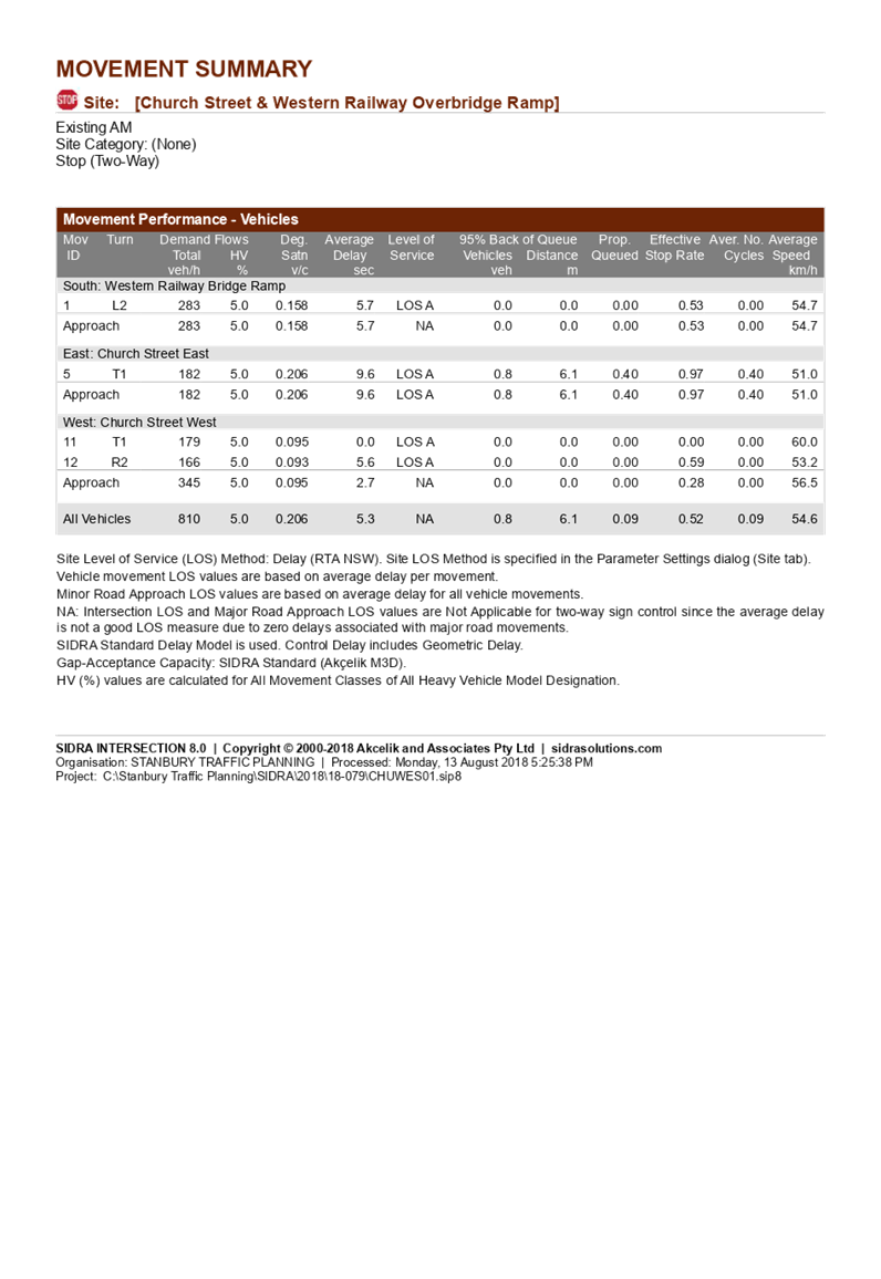
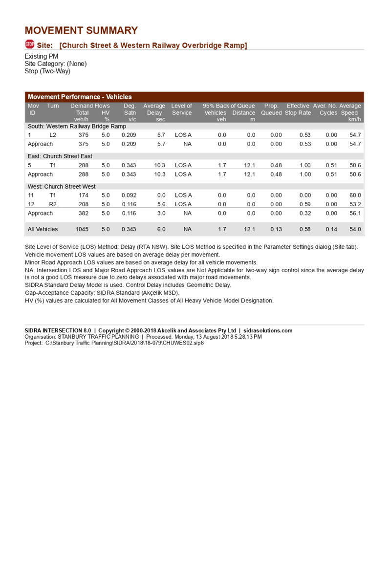
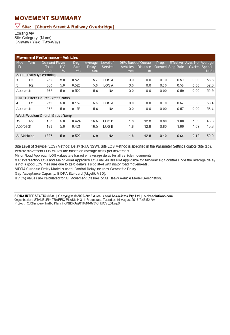
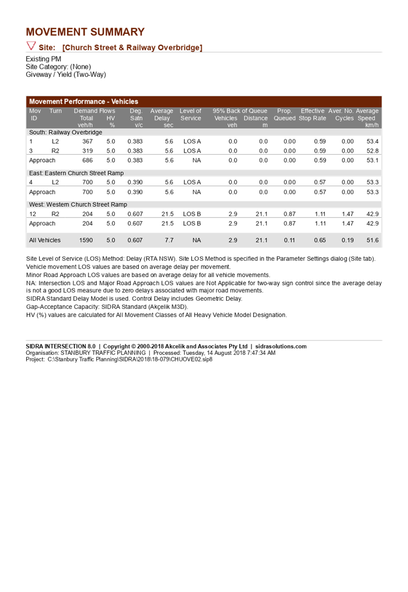


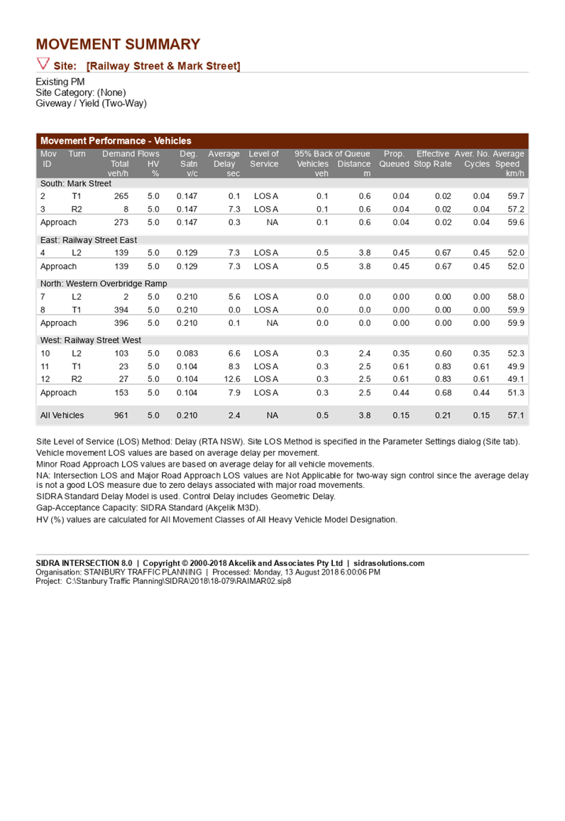

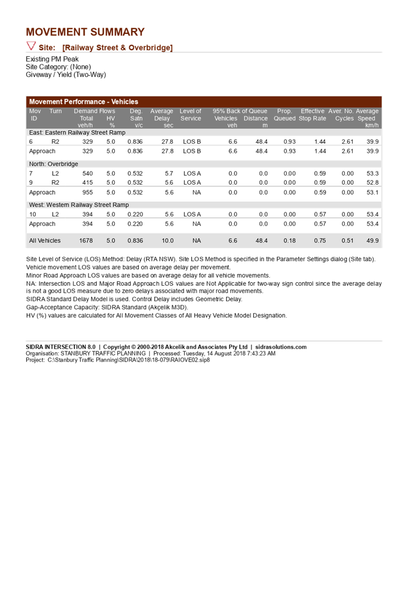


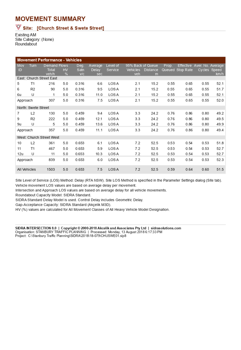
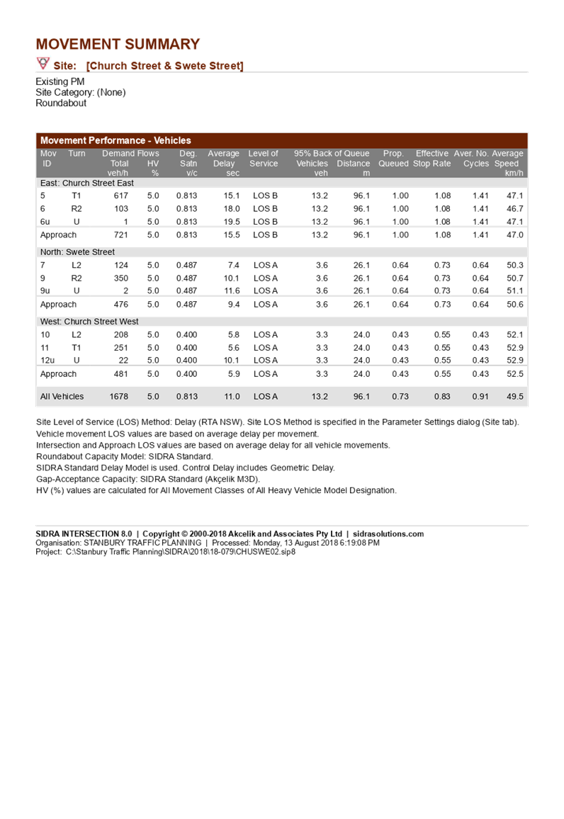
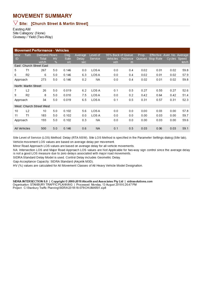


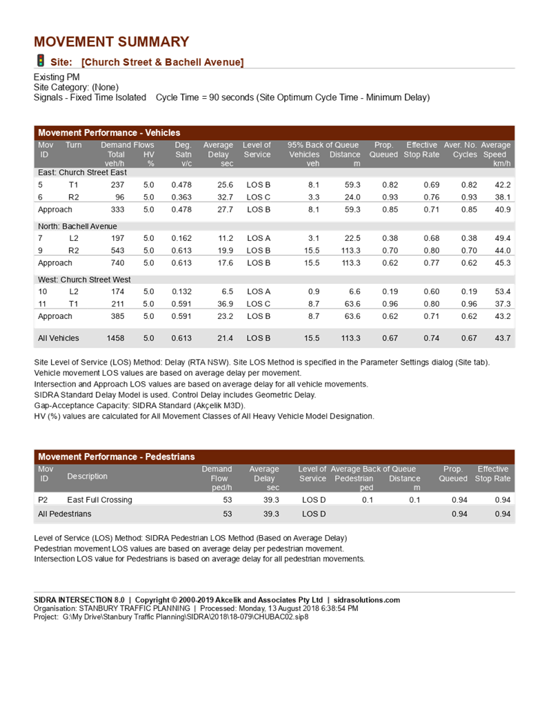

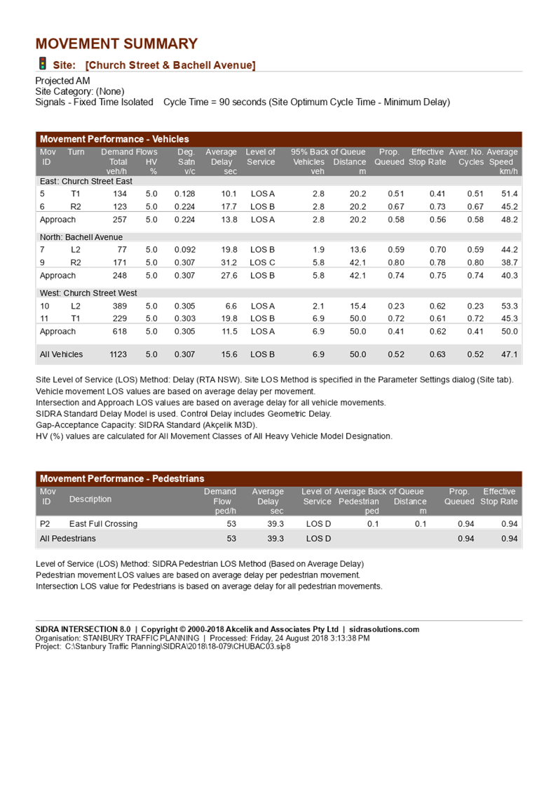
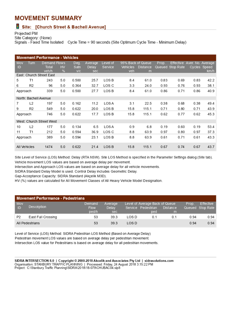
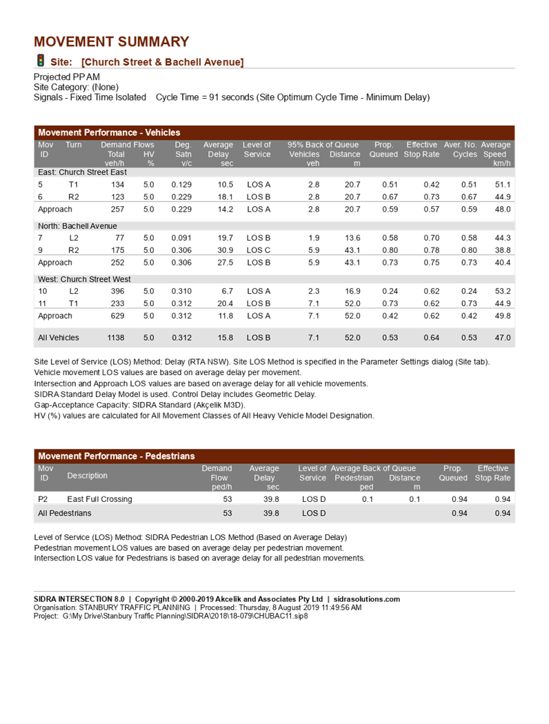


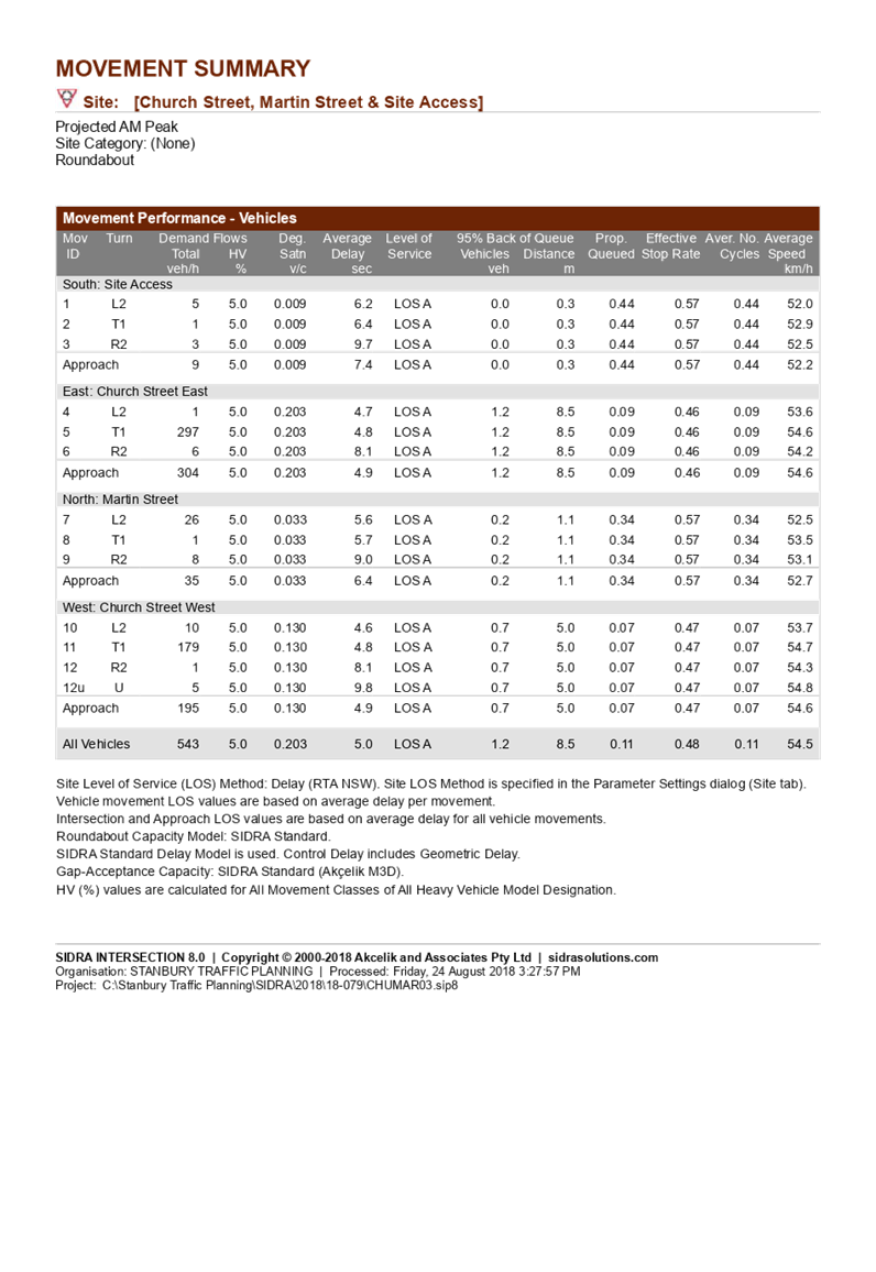
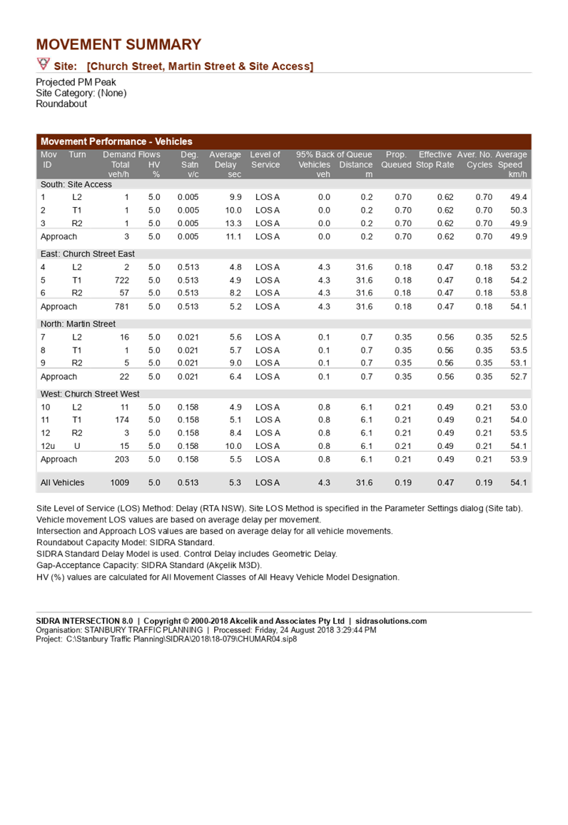
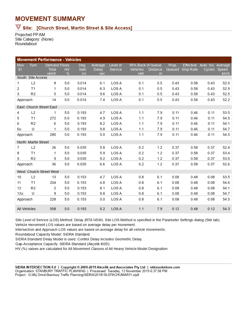
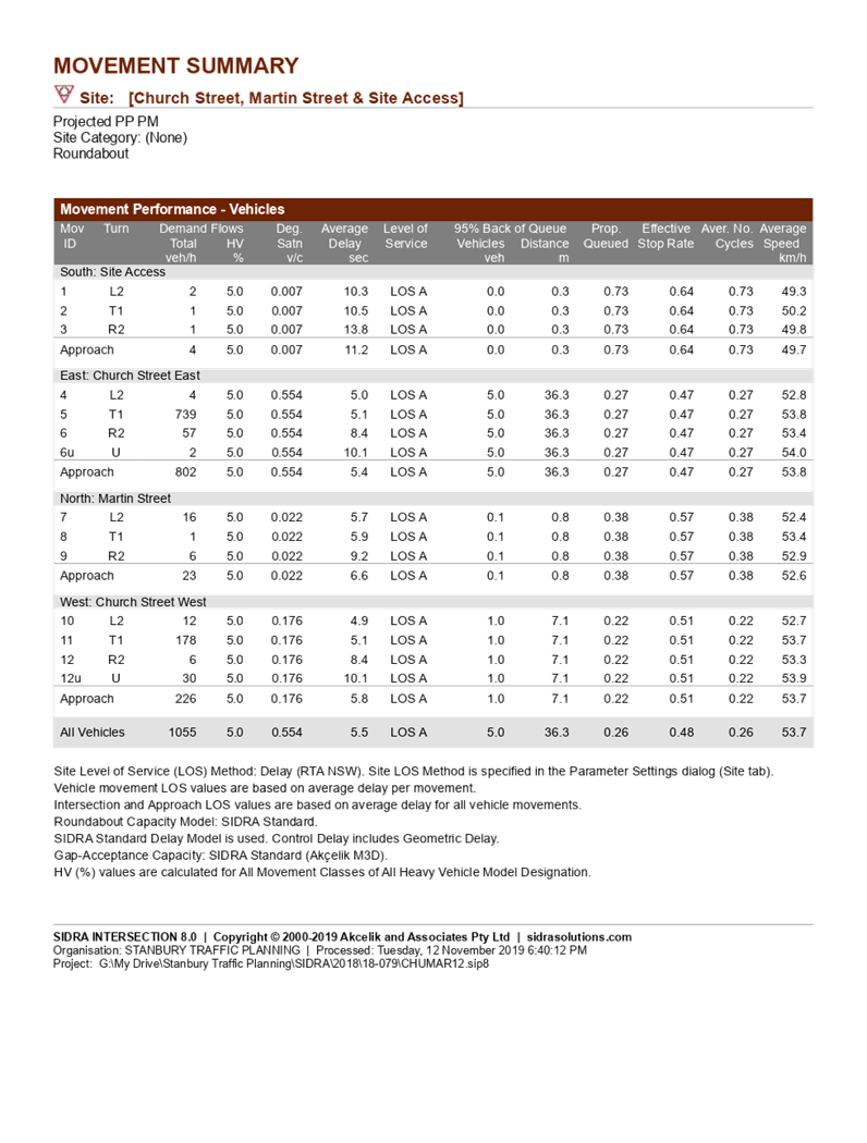
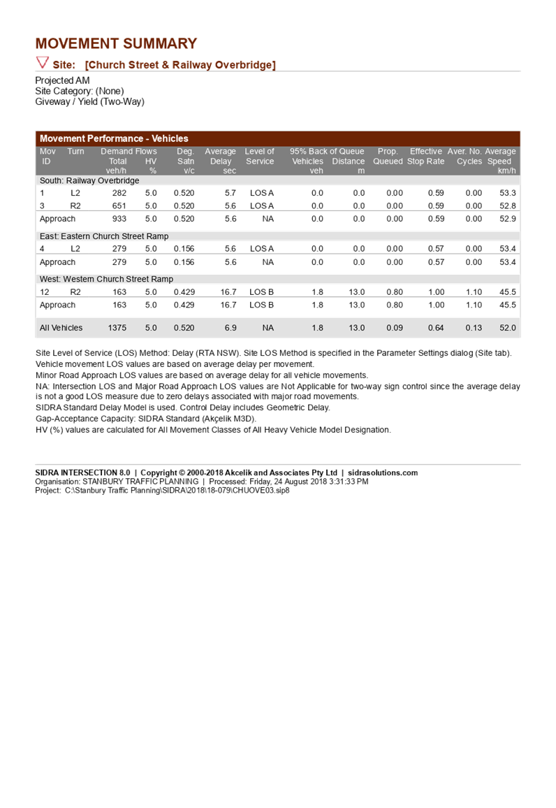
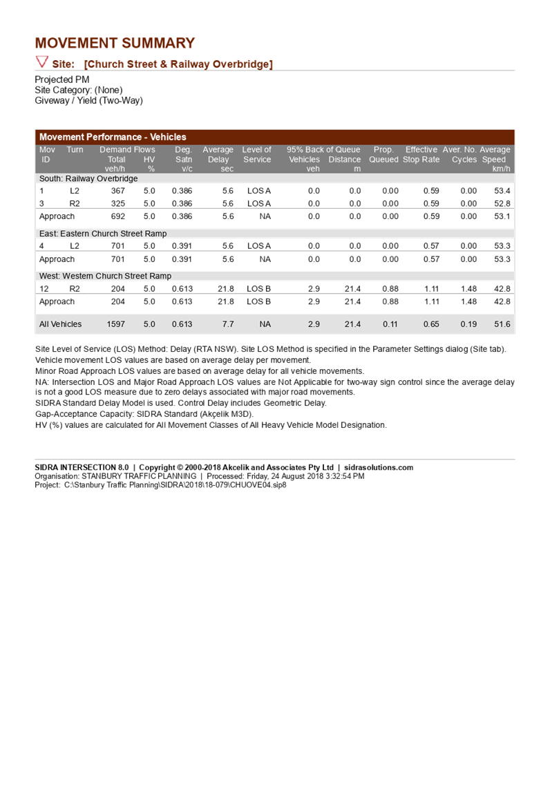

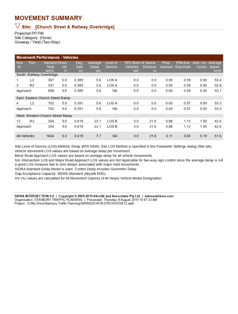
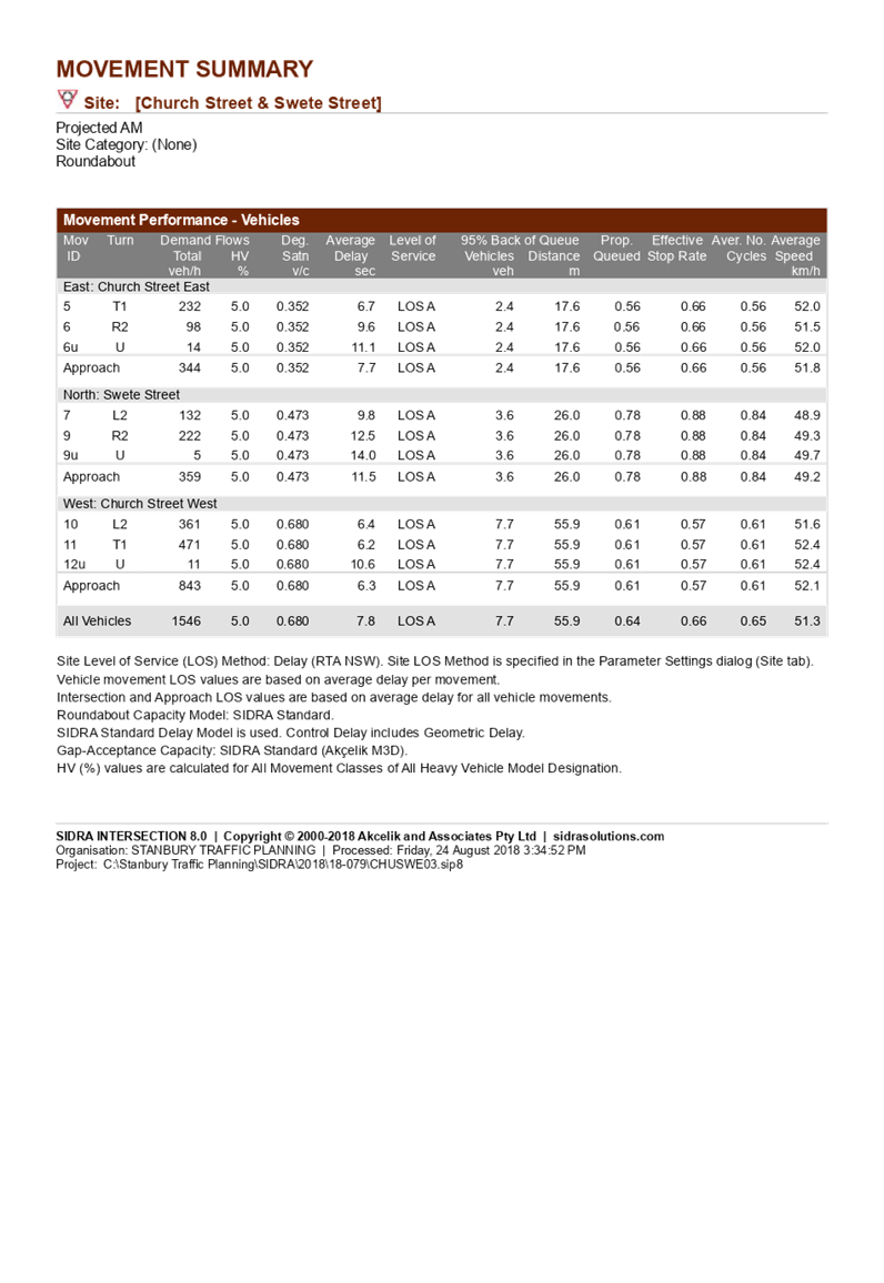
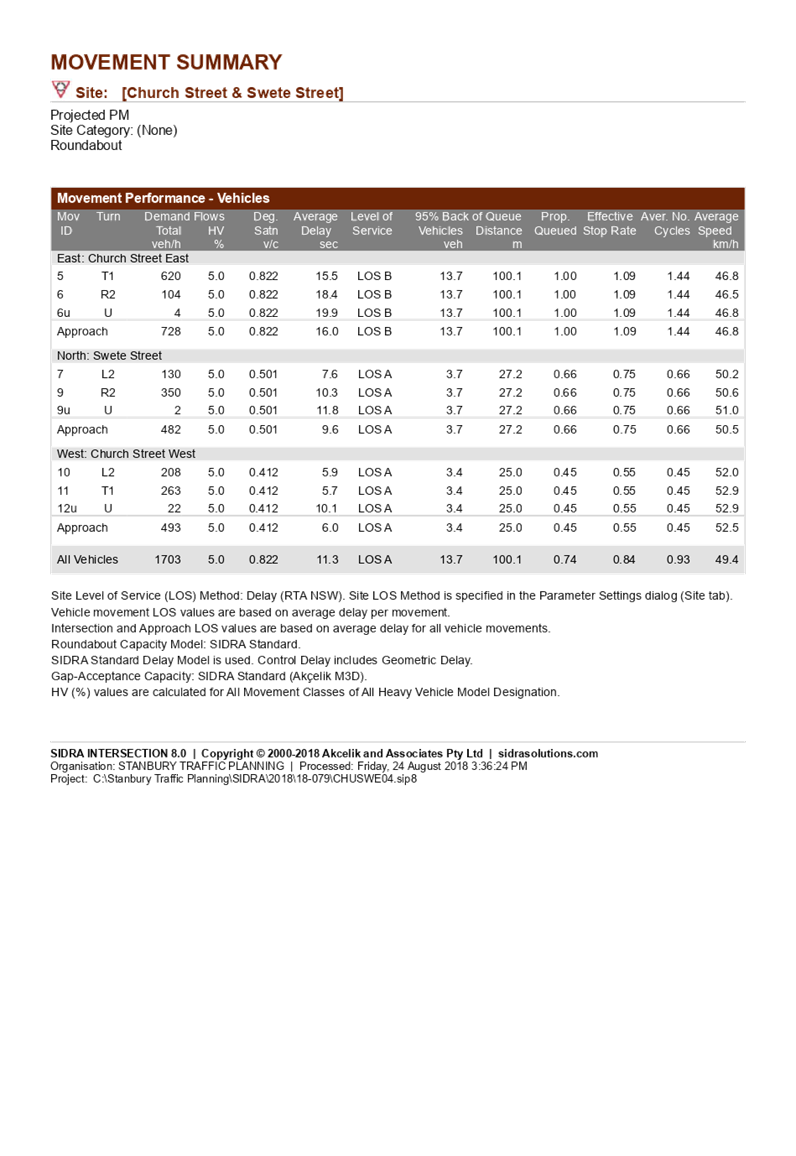
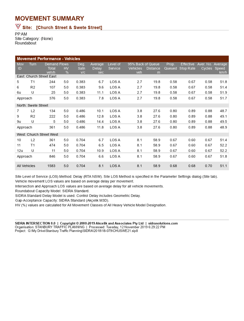

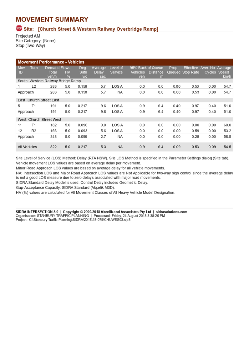


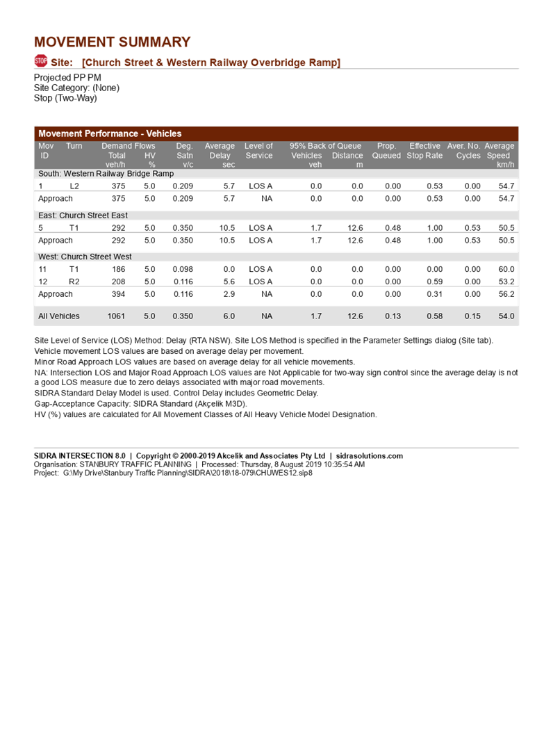
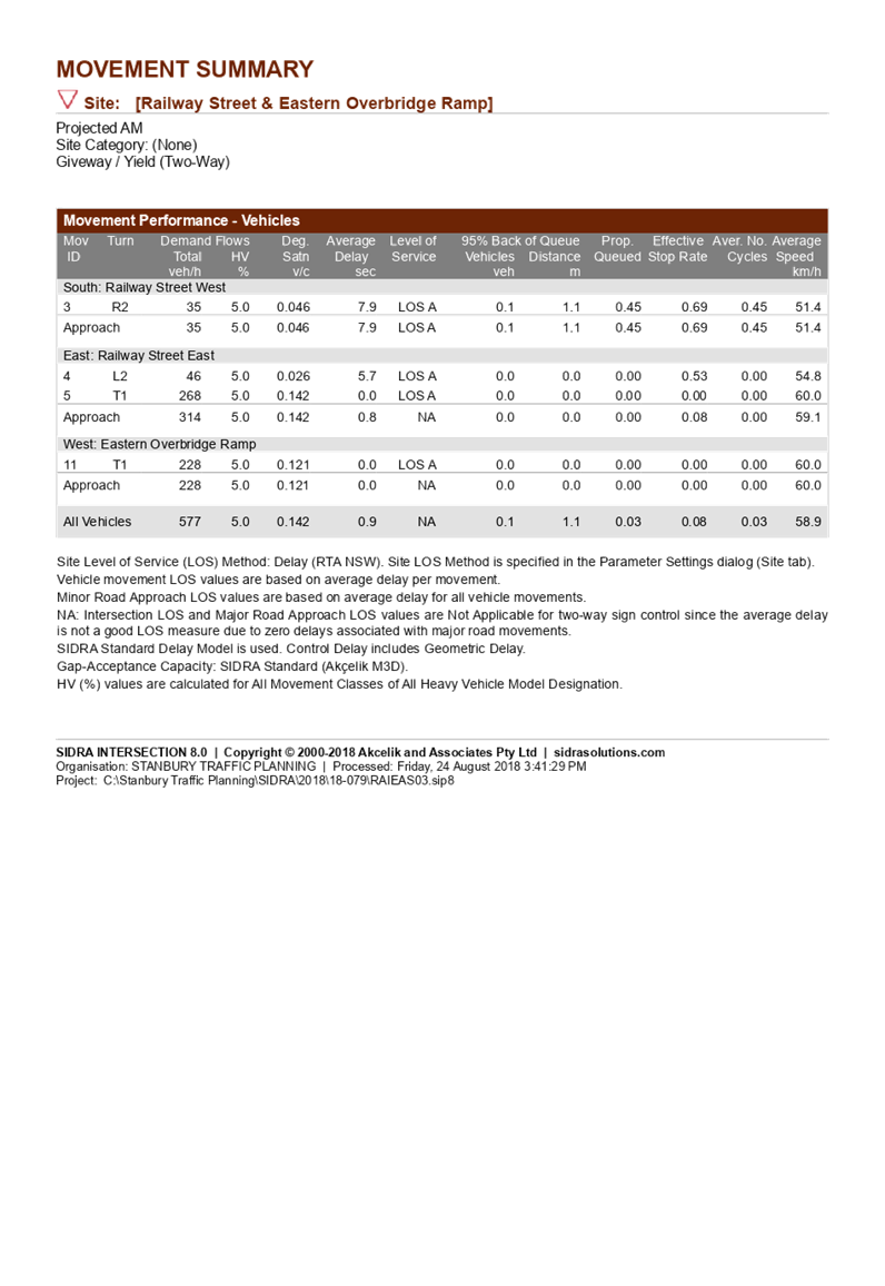

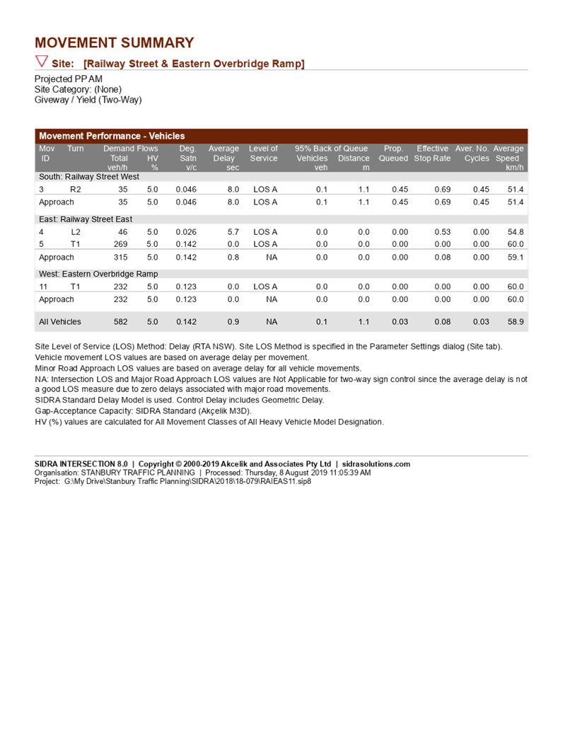

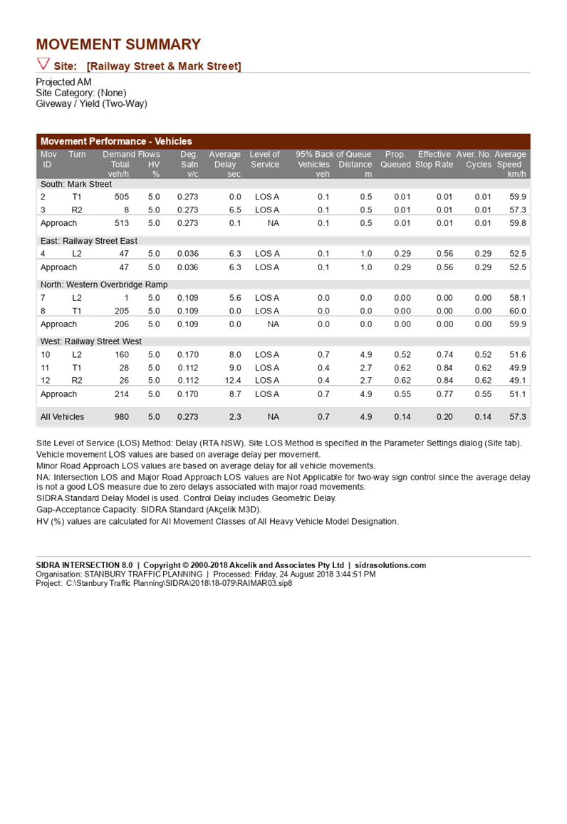
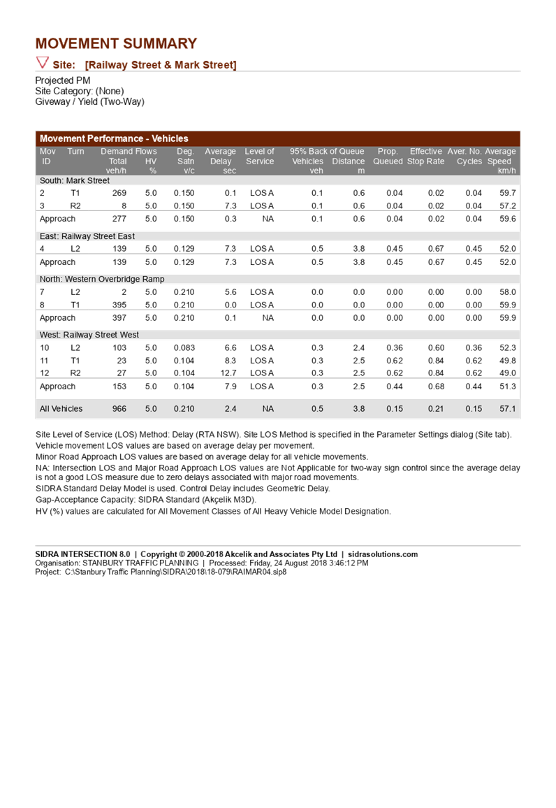
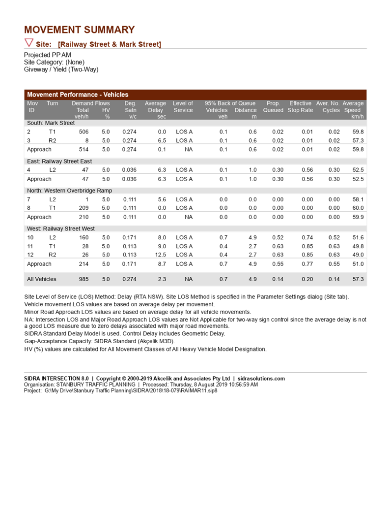
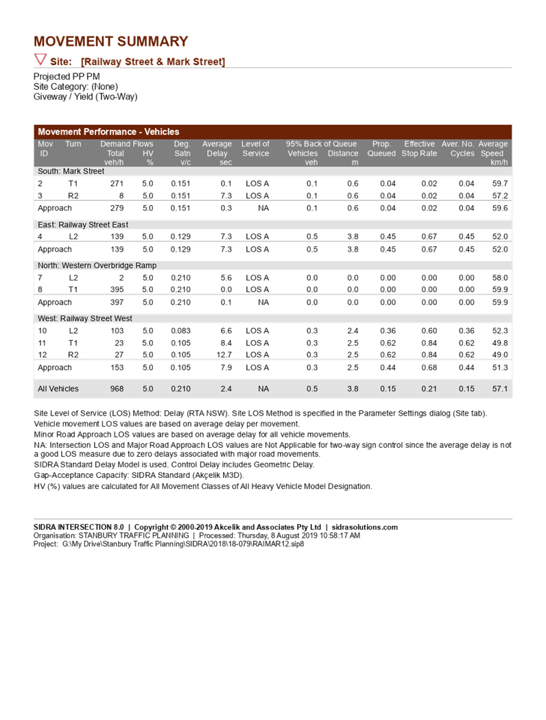


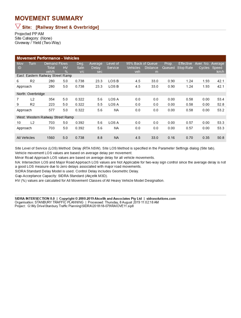
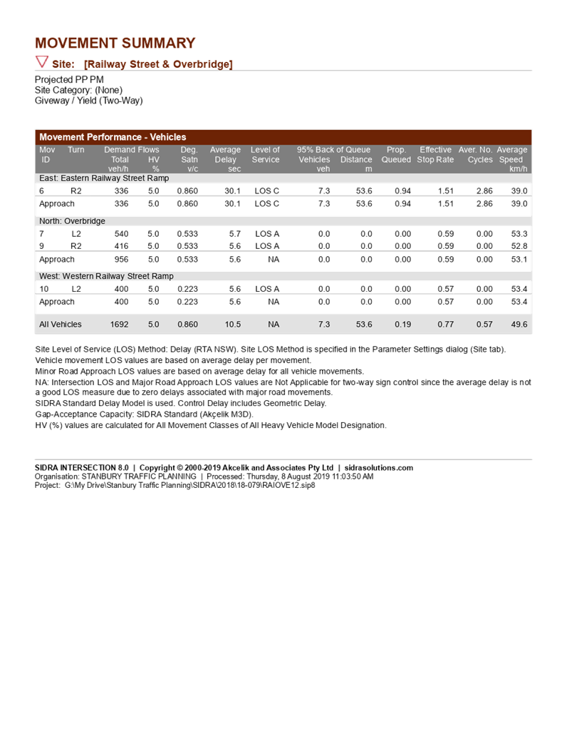
DOCUMENTS
ASSOCIATED WITH
REPORT LPP015/20
Attachment 4
Attachment 4 - Social Impact Assessment
Cumberland Local Planning Panel Meeting
8 April 2020
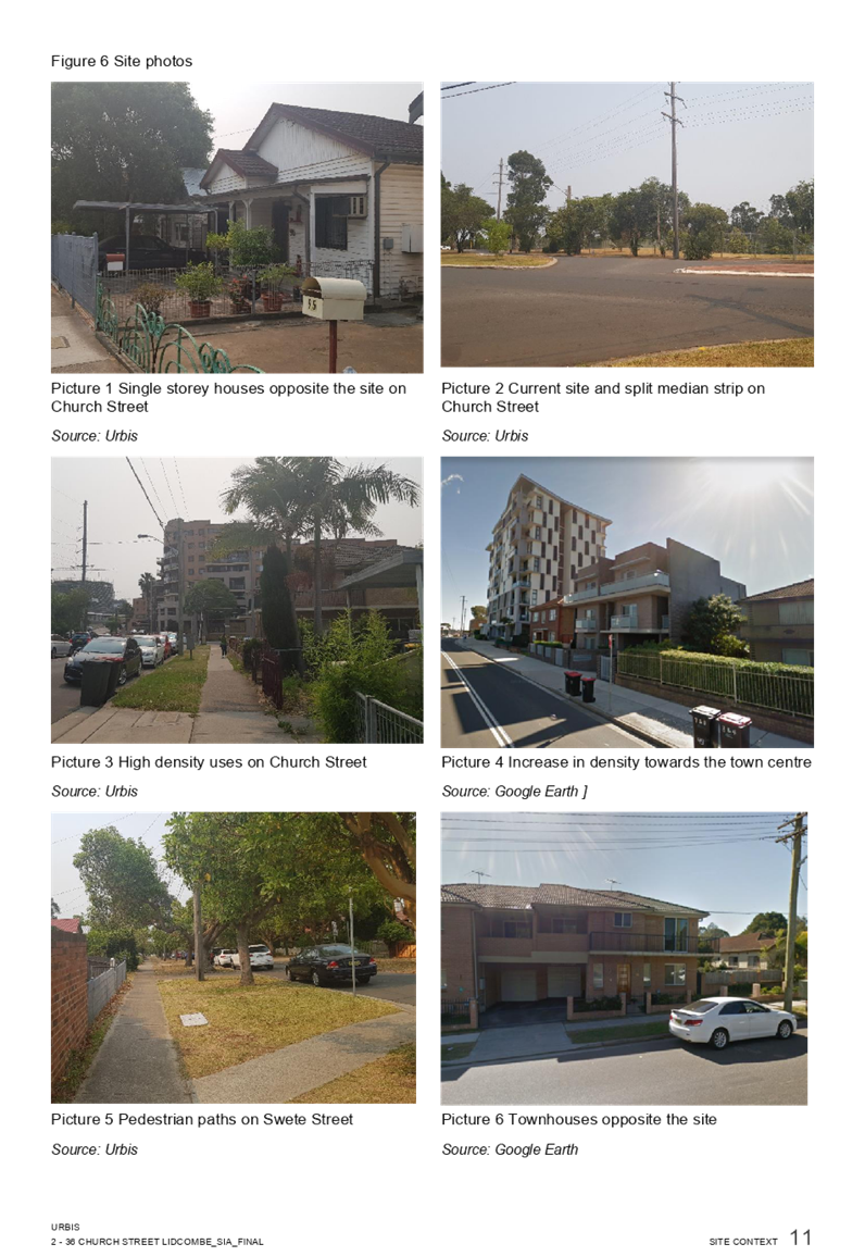


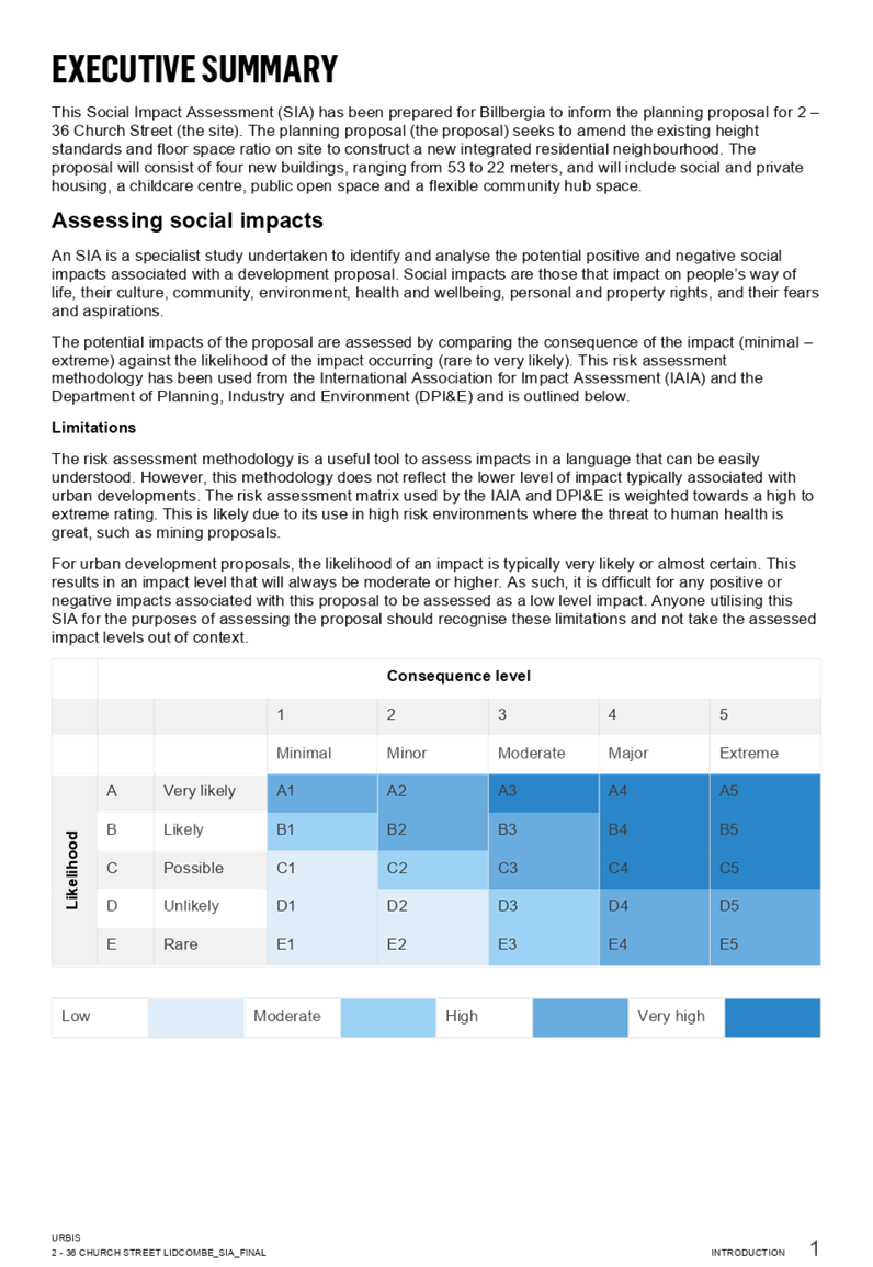
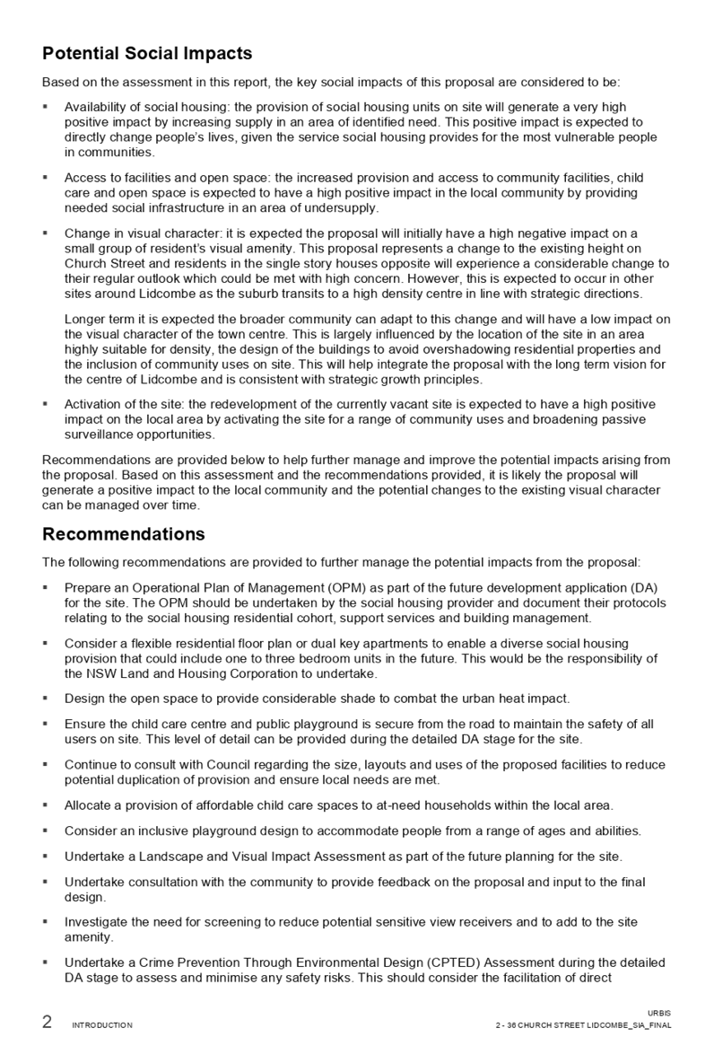

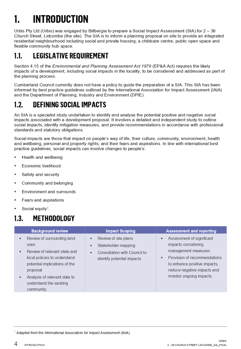
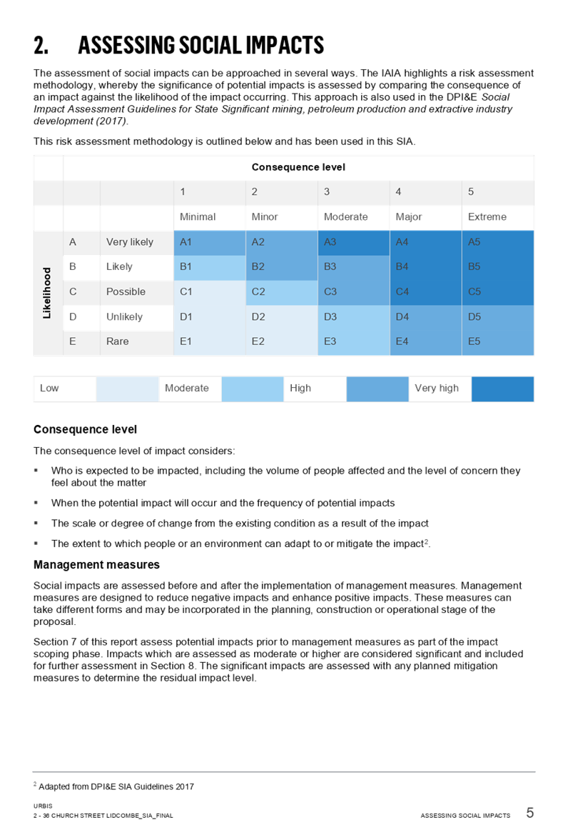

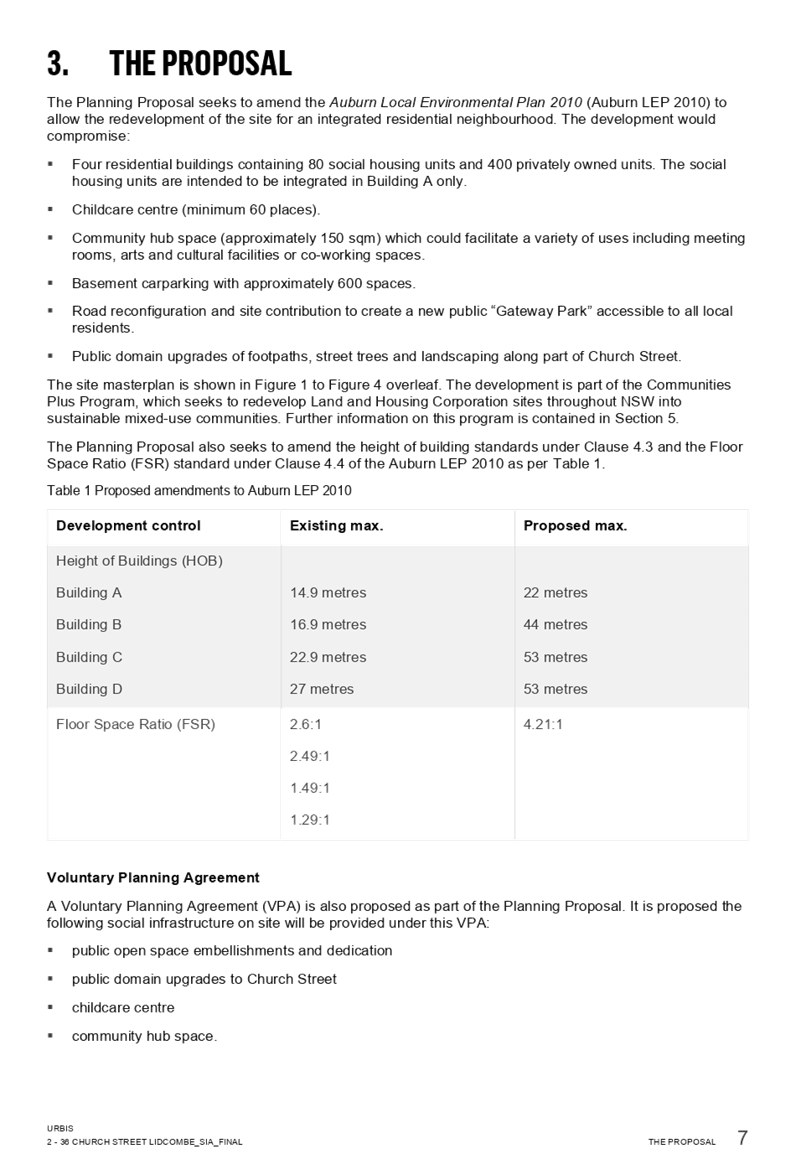
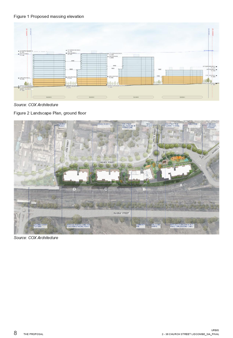
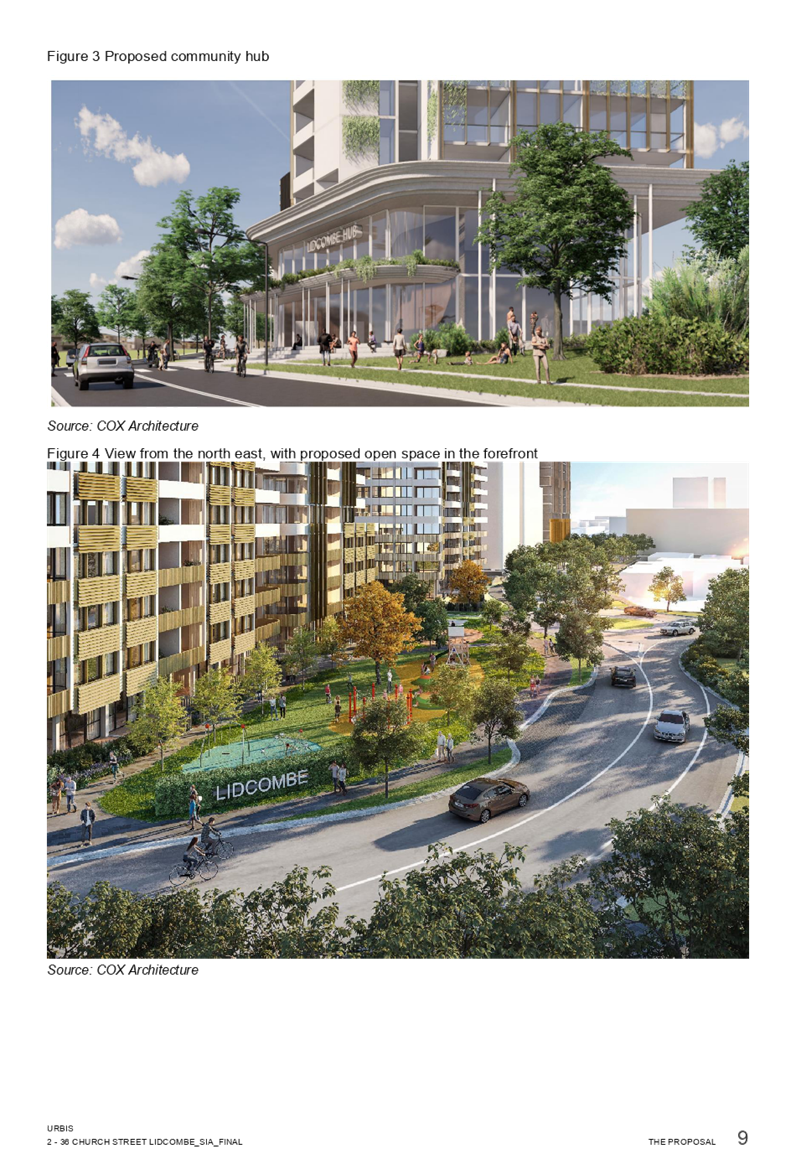
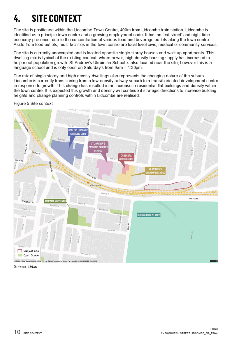
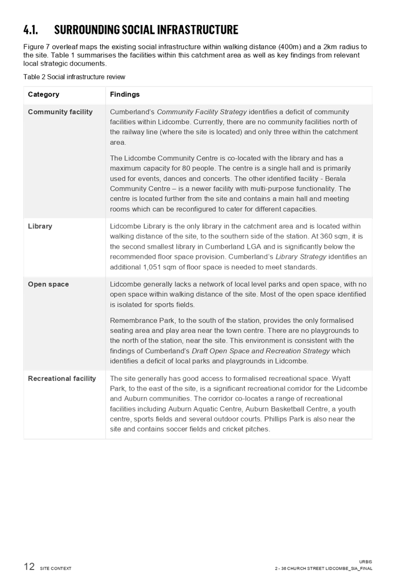
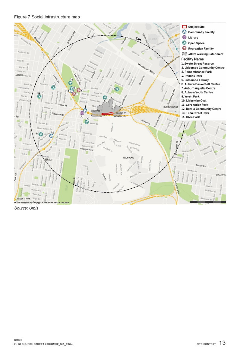

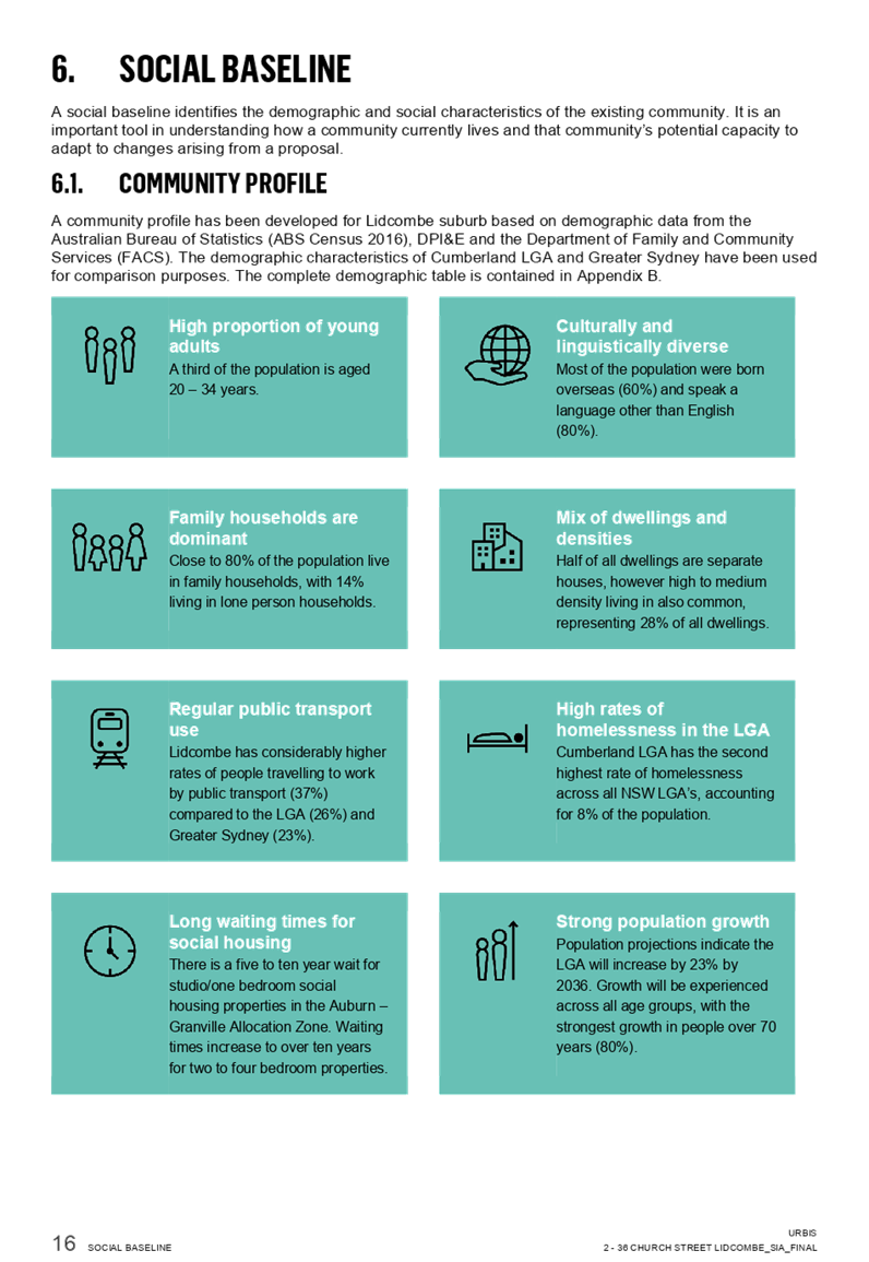

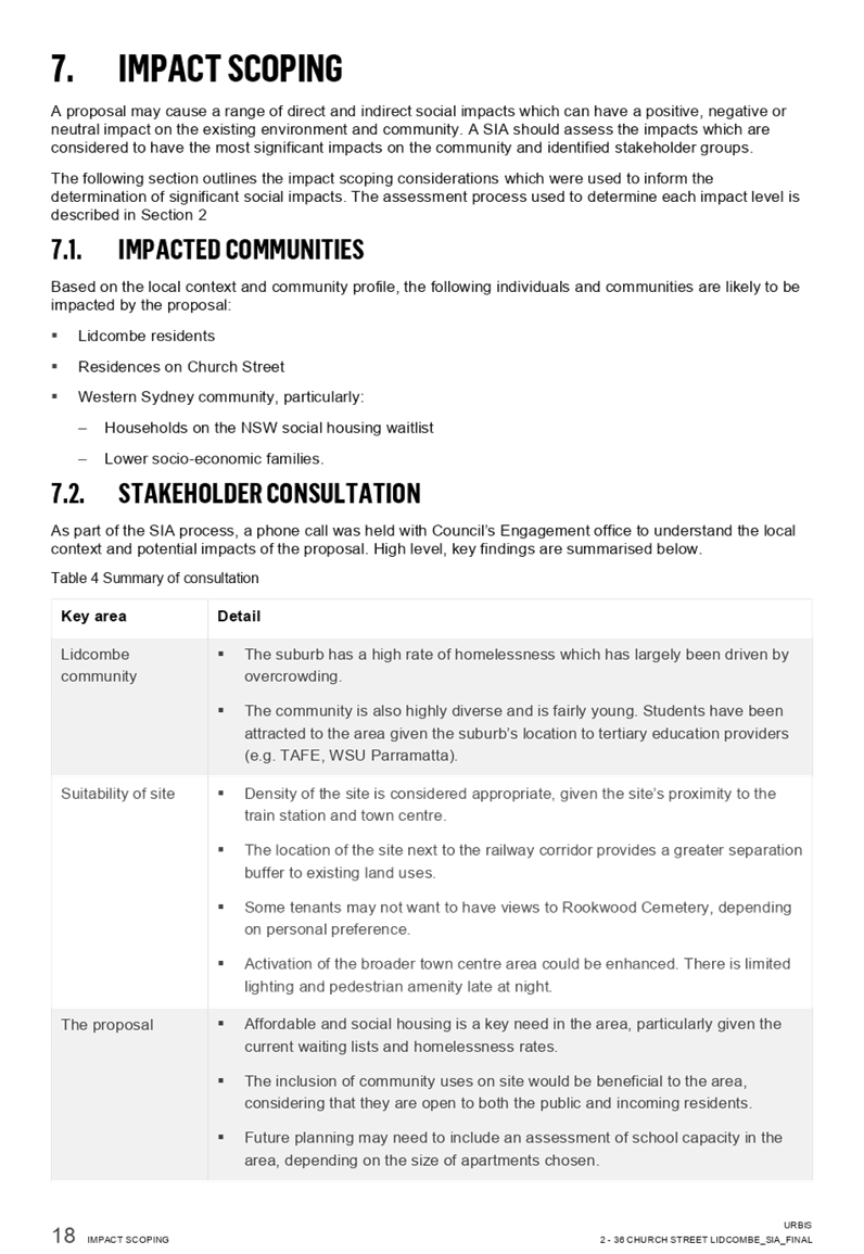
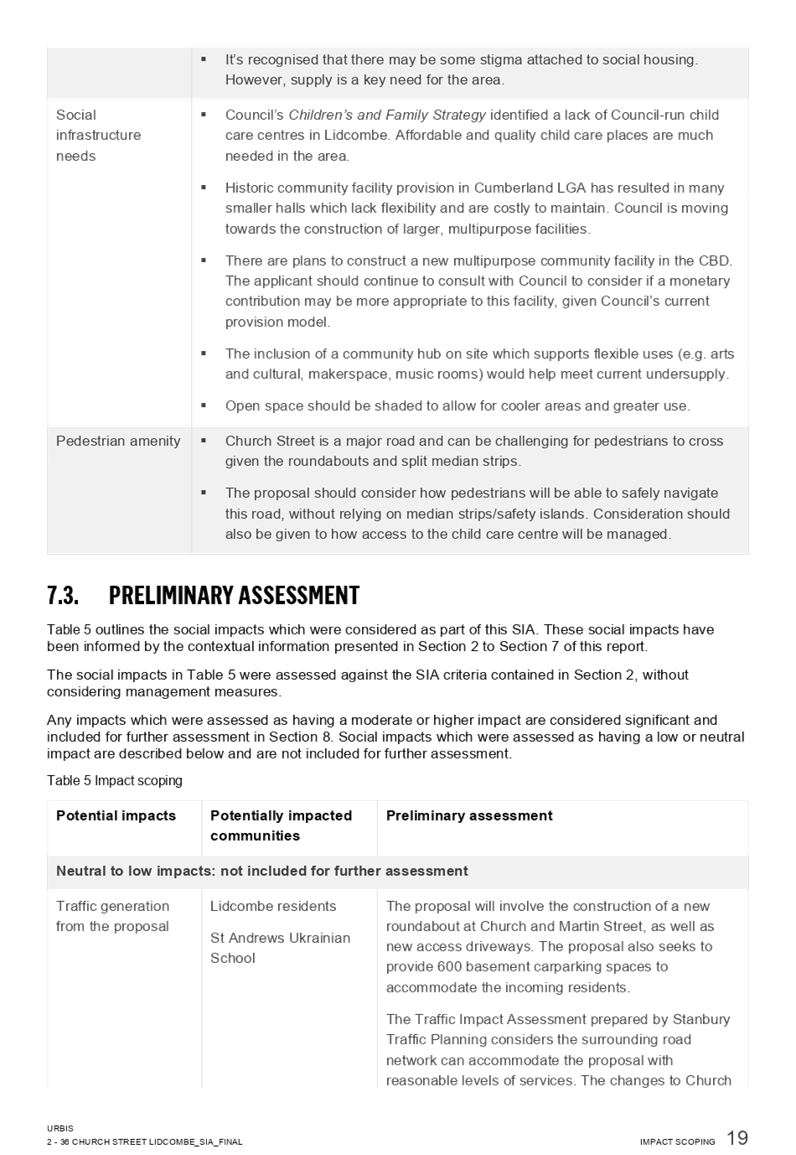
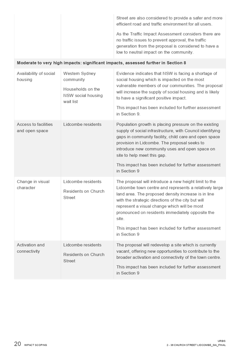
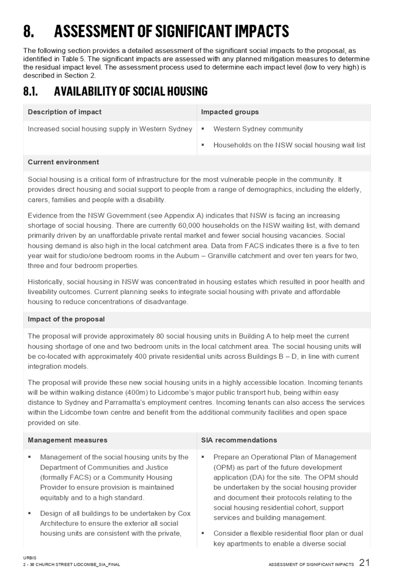
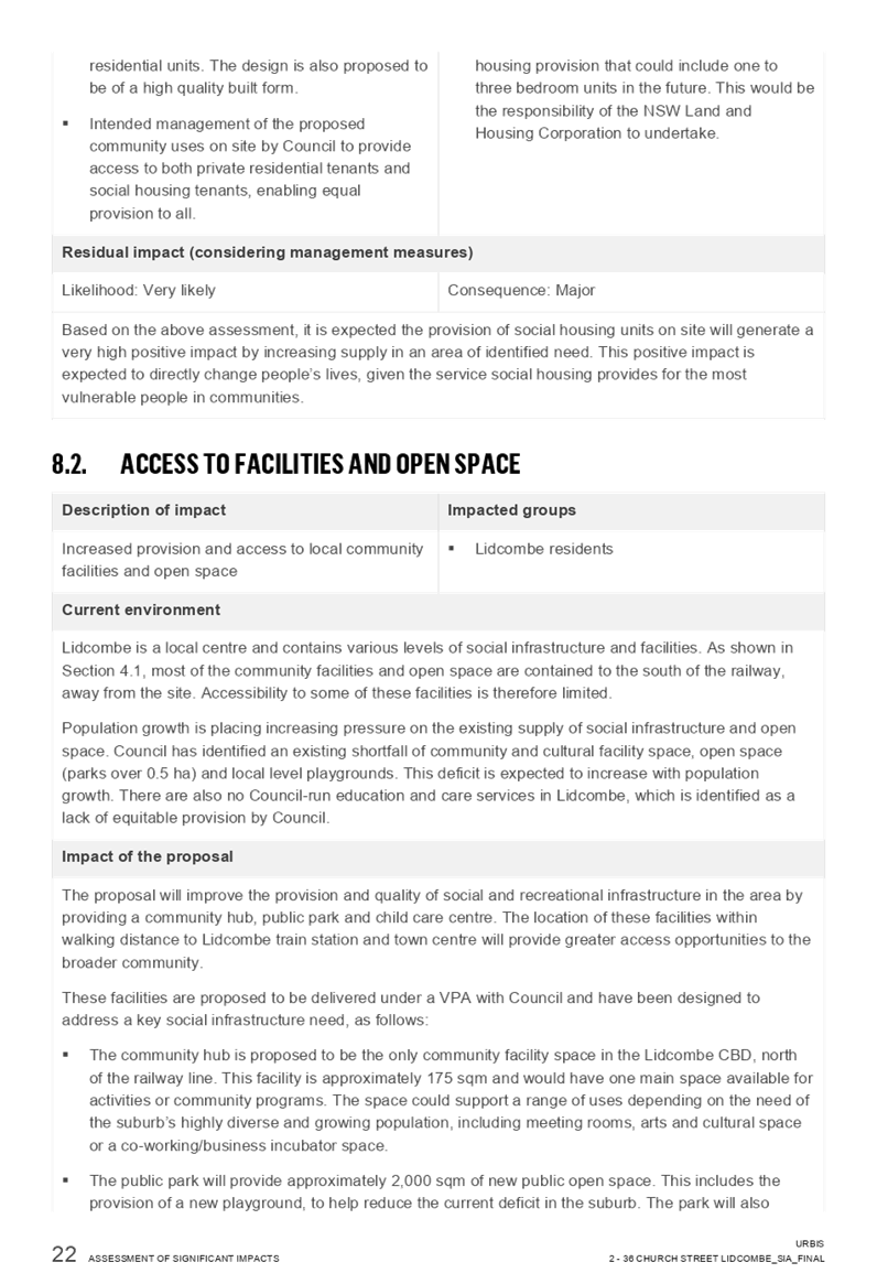
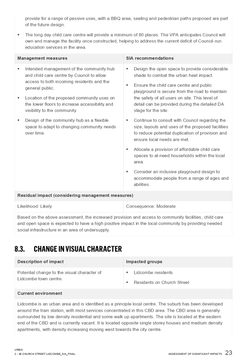
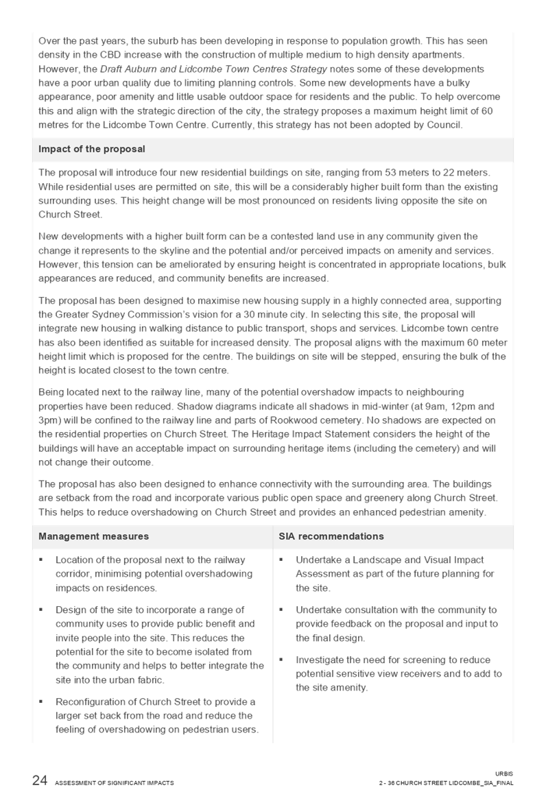
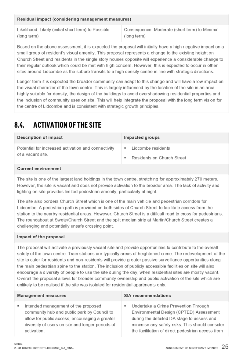


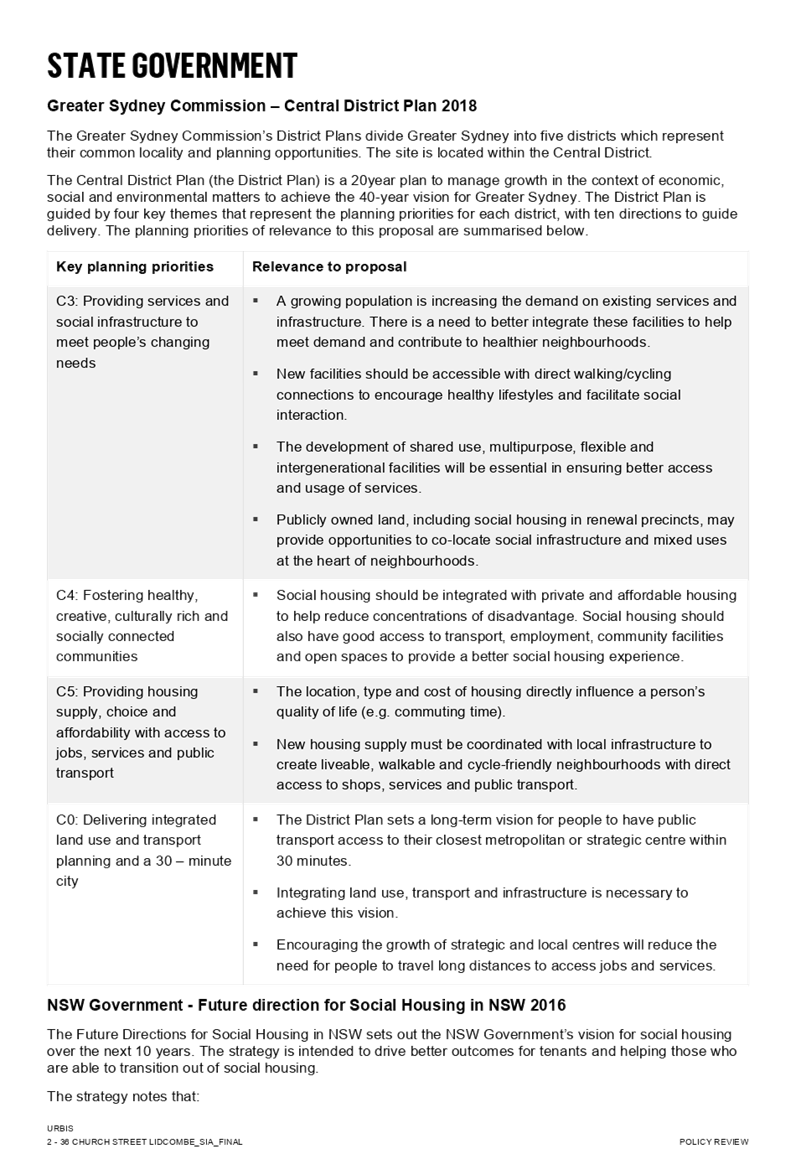

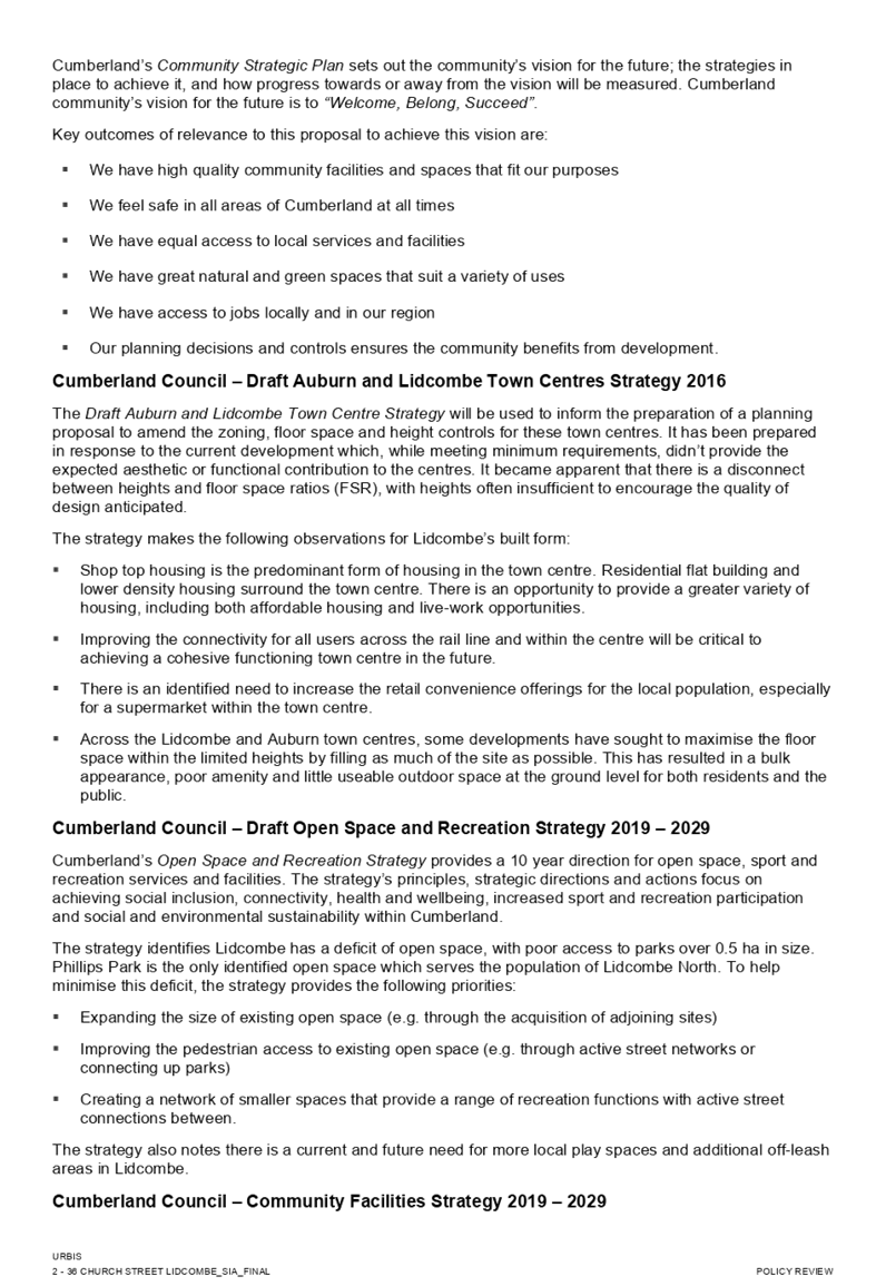


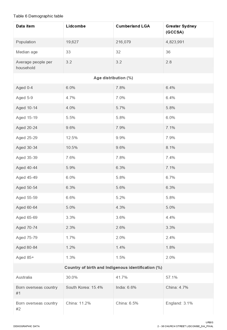
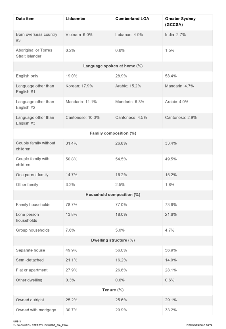
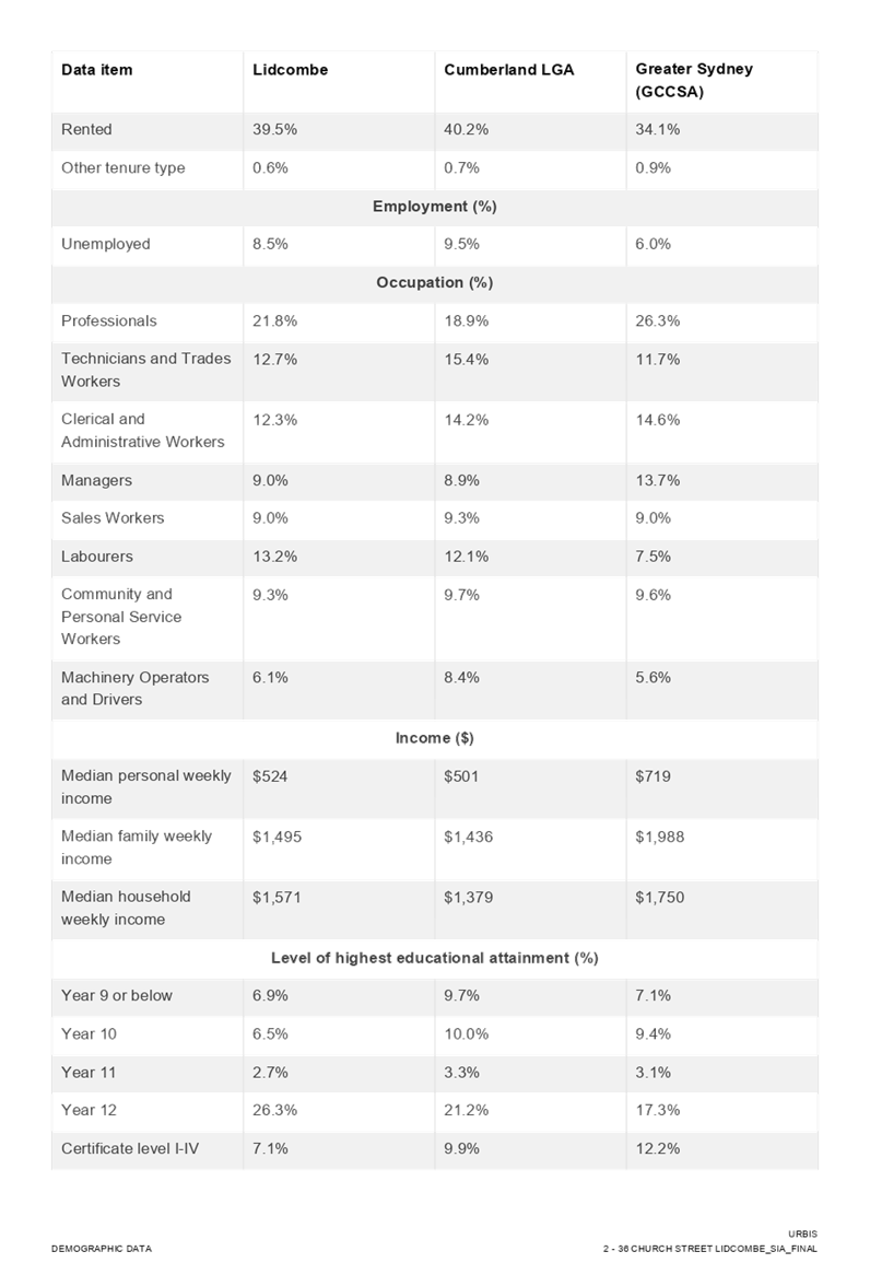
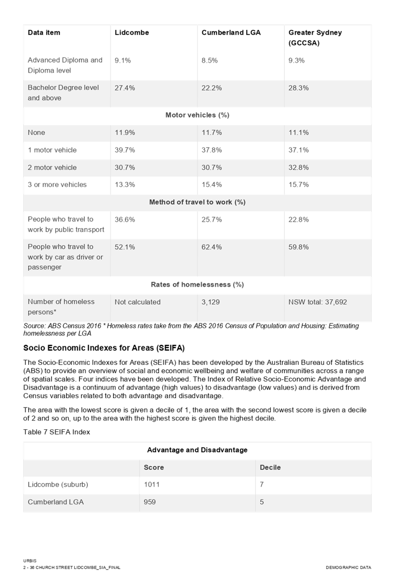

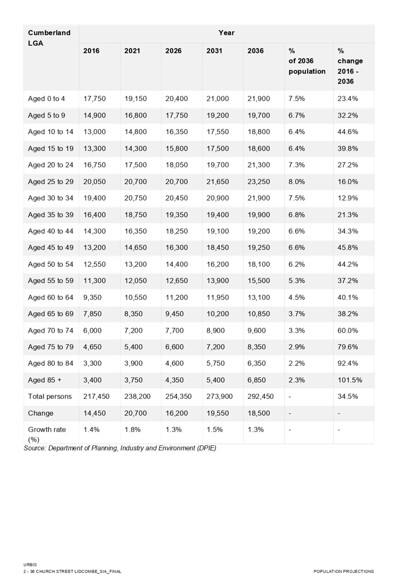

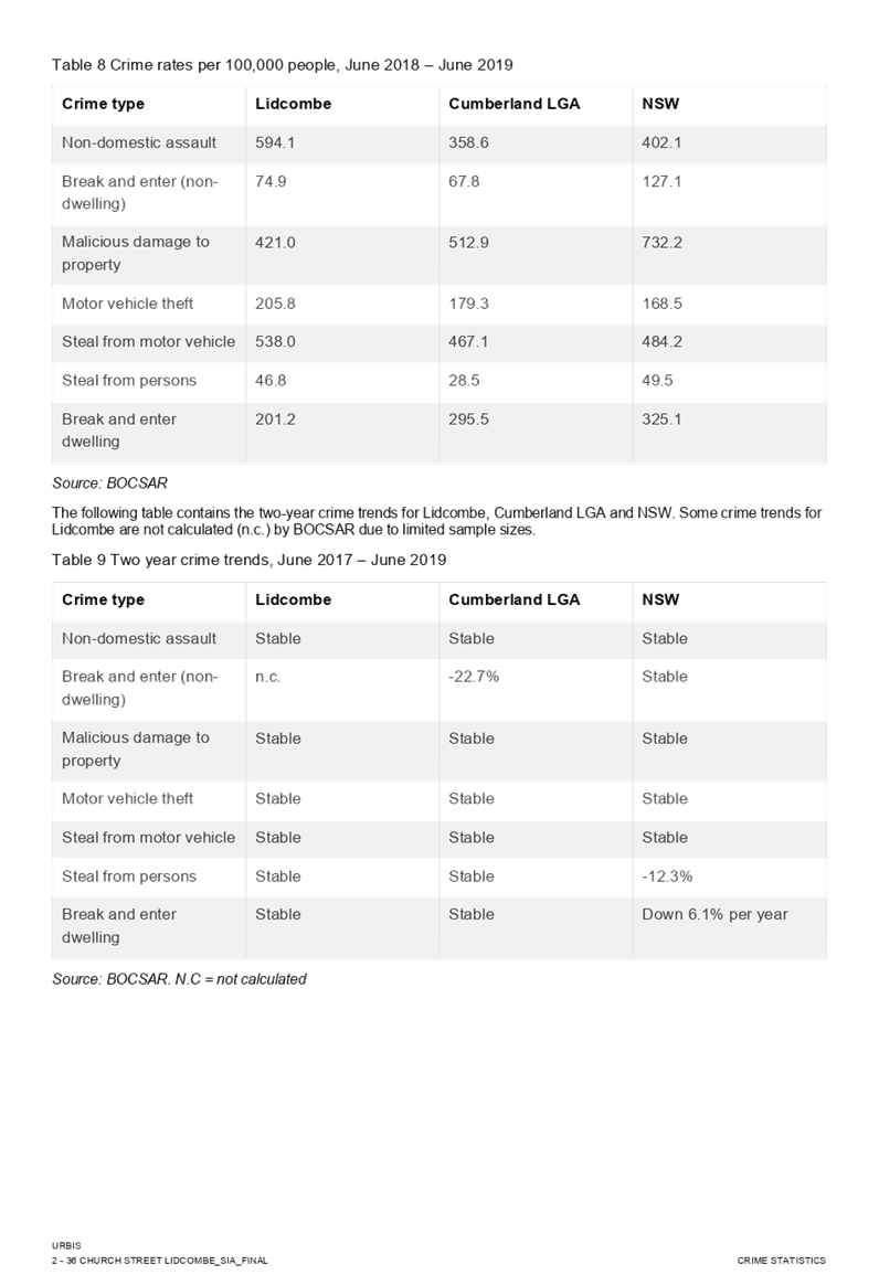

DOCUMENTS
ASSOCIATED WITH
REPORT LPP015/20
Attachment 5
Attachment 5 - Heritage Impact Statement
Cumberland Local Planning Panel Meeting
8 April 2020
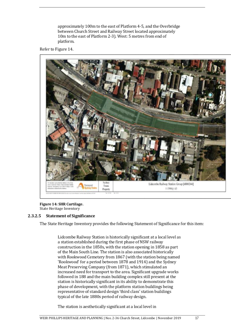
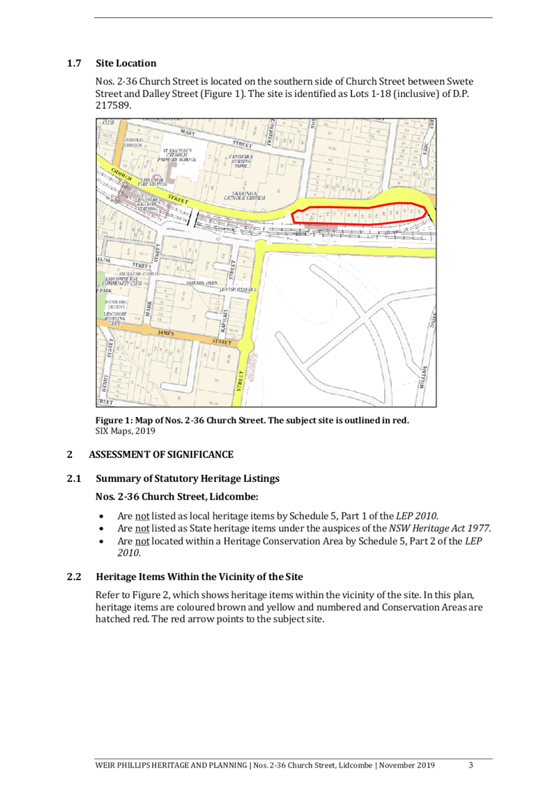
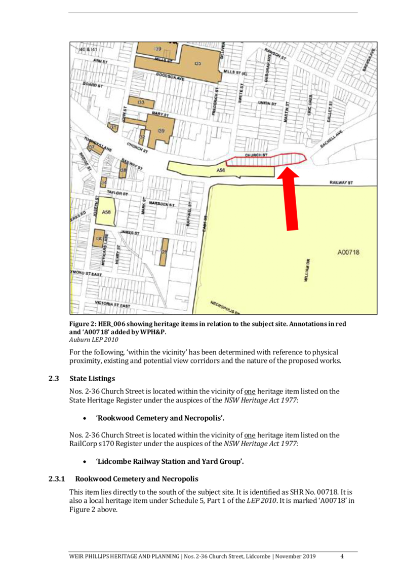
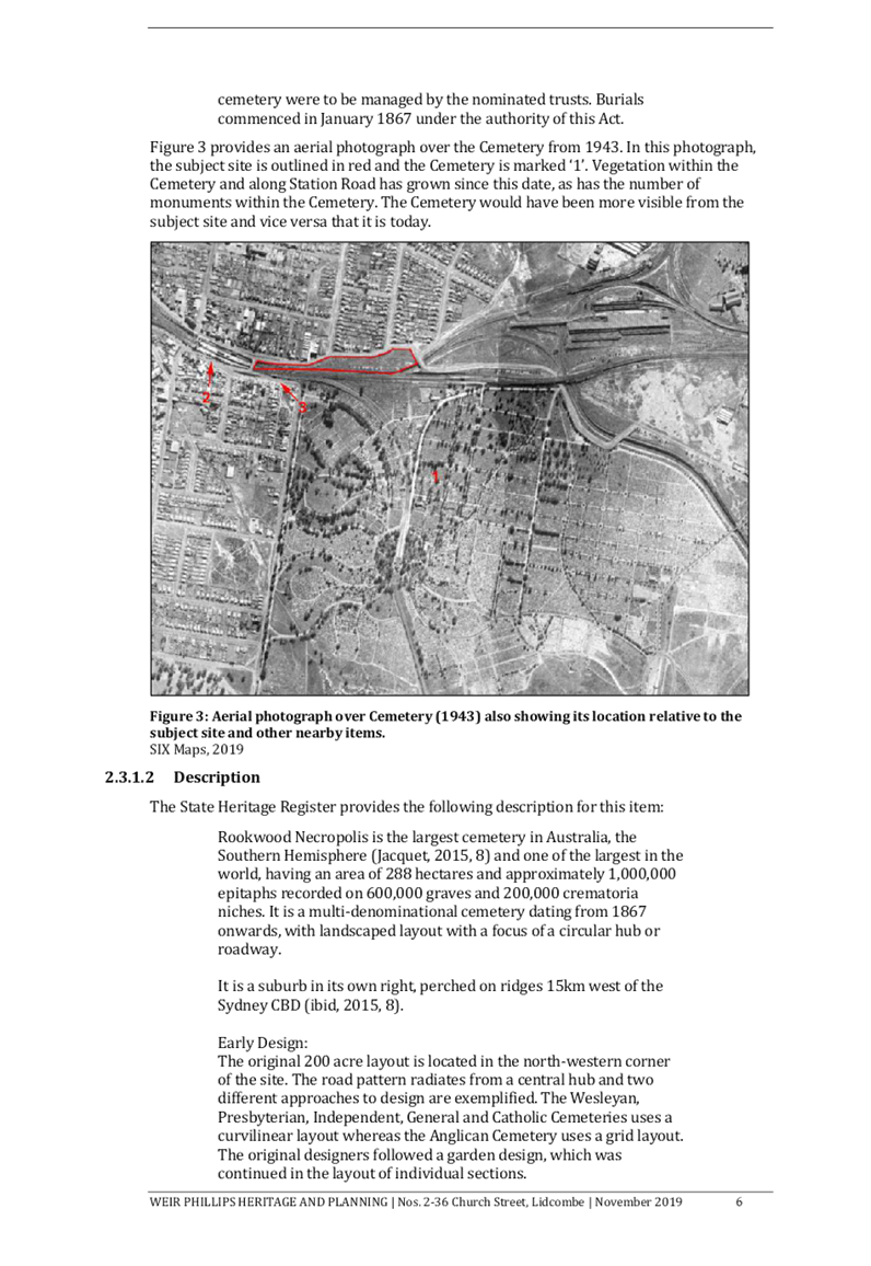
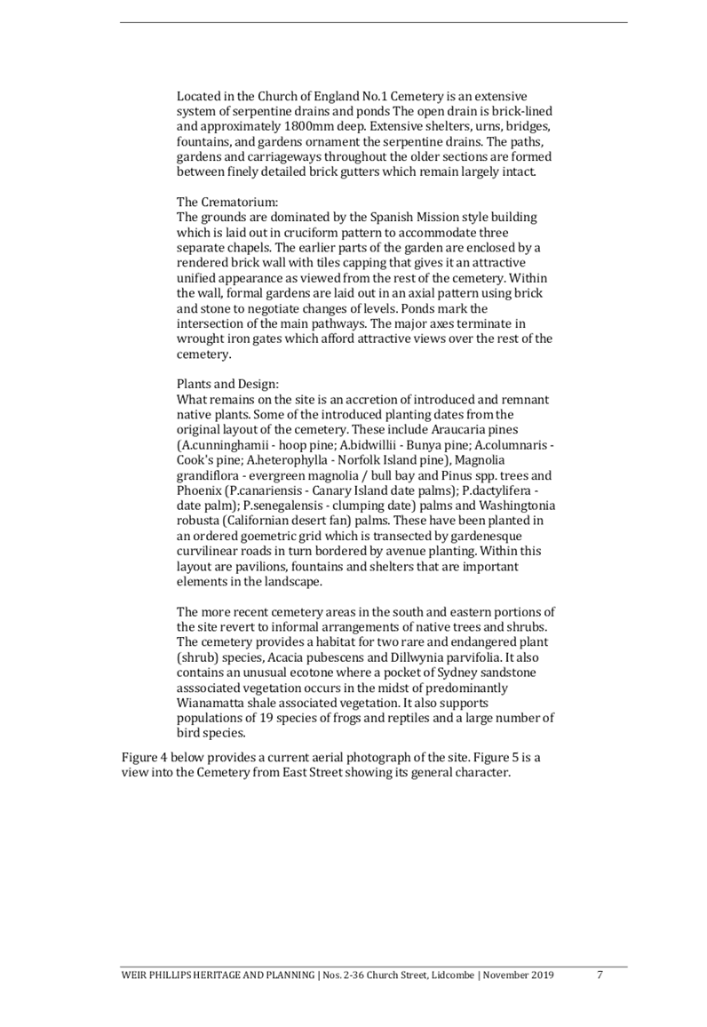

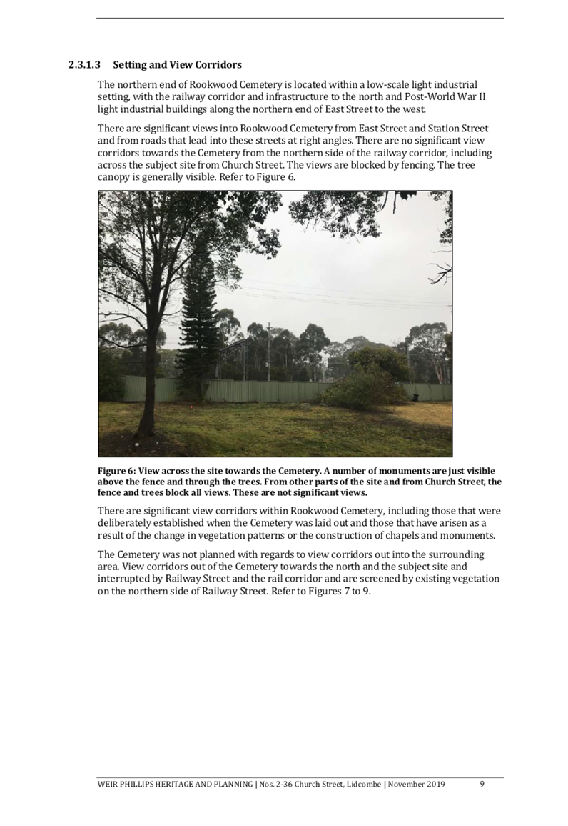
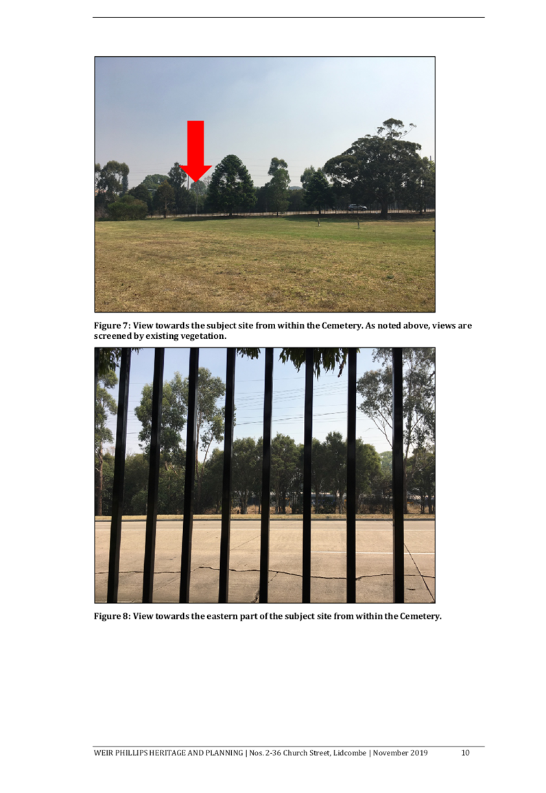
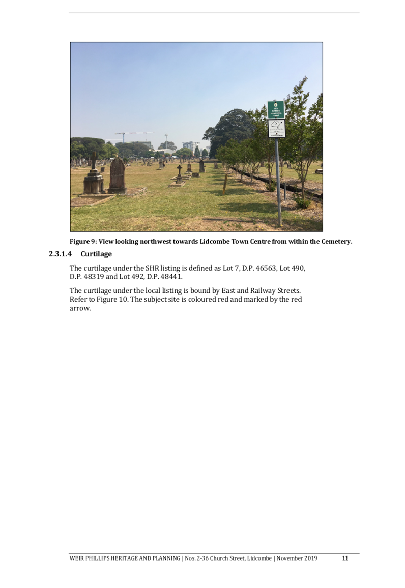
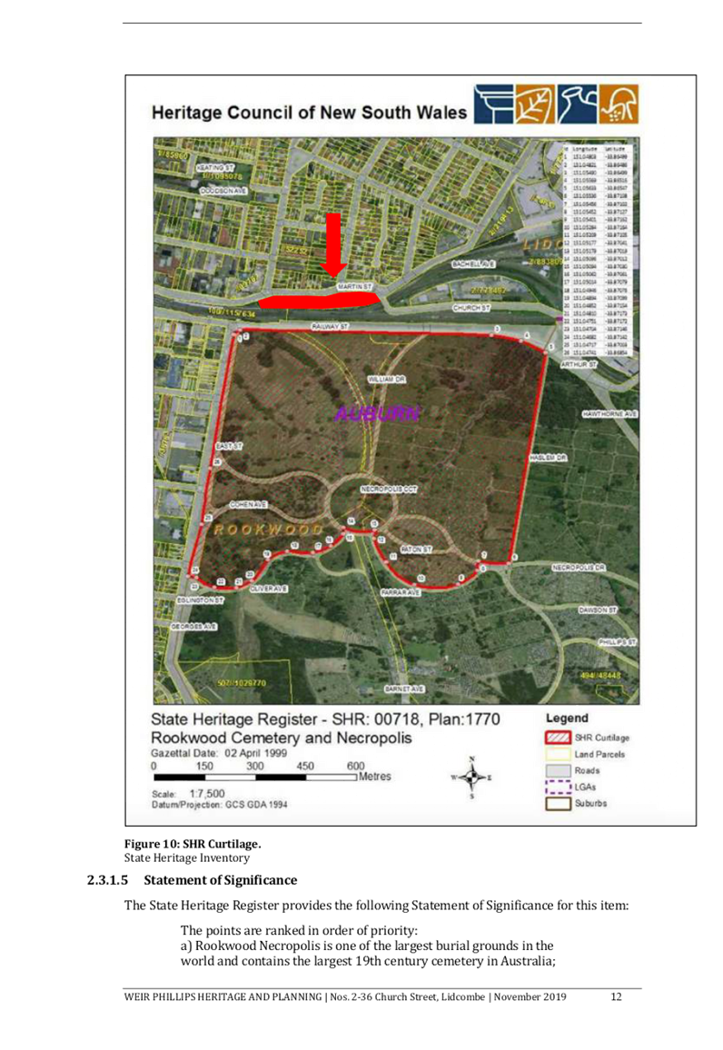
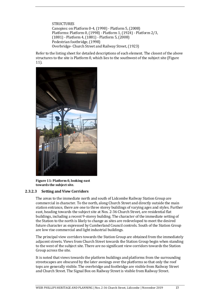
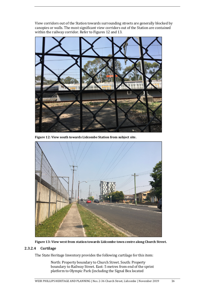
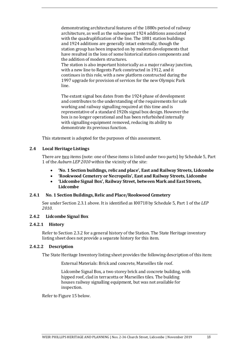
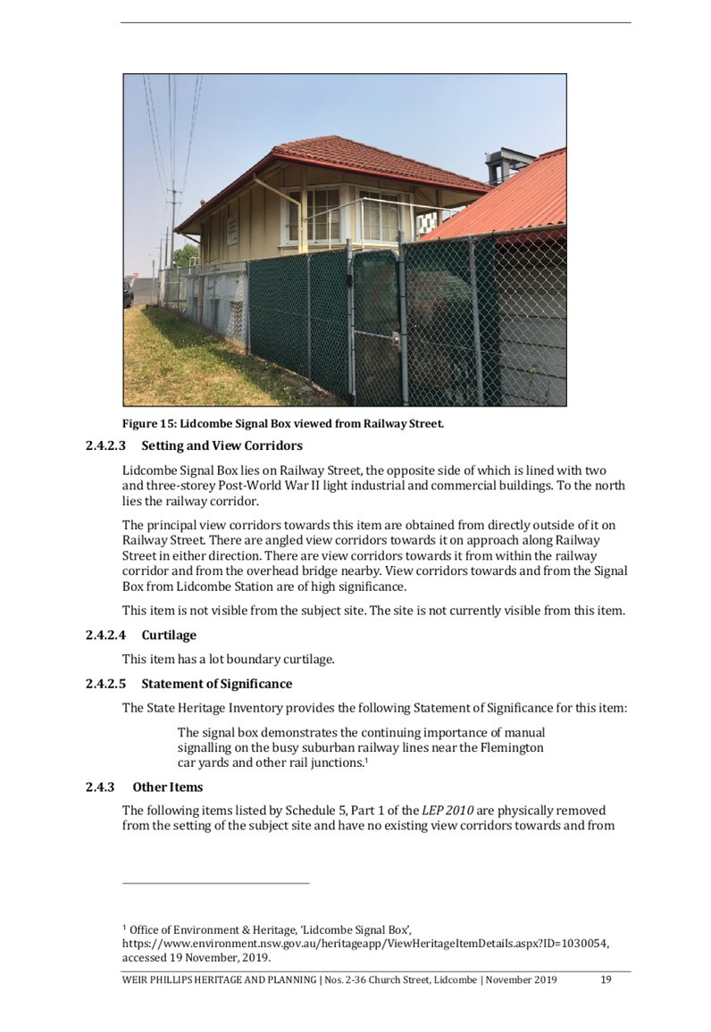
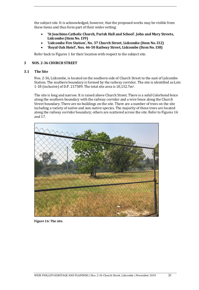
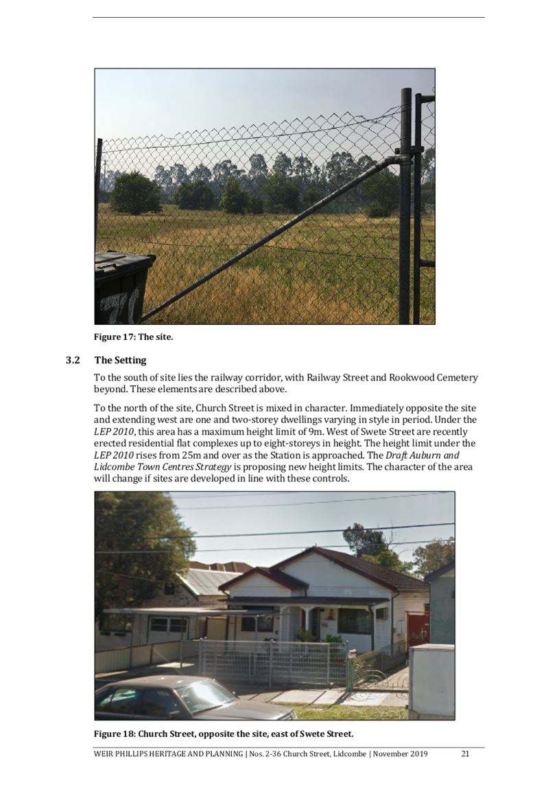

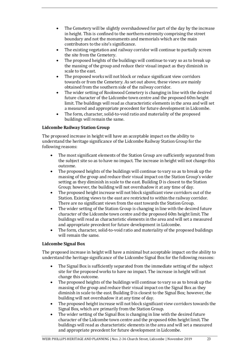
DOCUMENTS
ASSOCIATED WITH
REPORT LPP015/20
Attachment 6
Attachment 6 - Summary of Submissions
Cumberland Local Planning Panel Meeting
8 April 2020