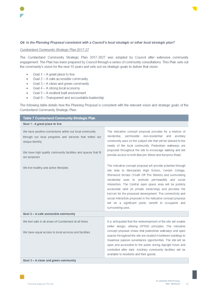
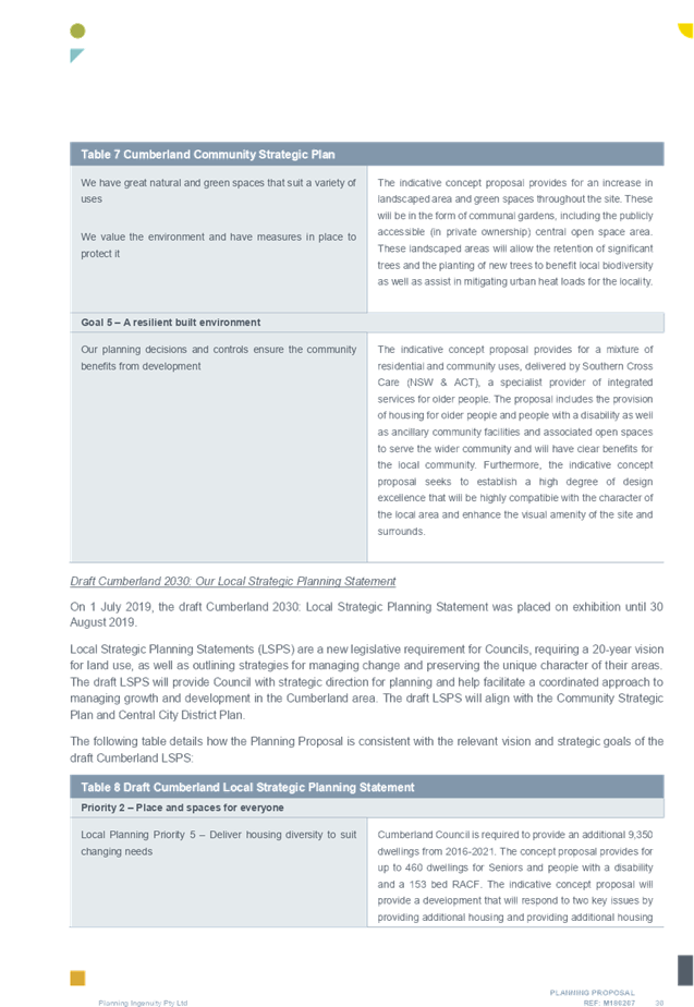
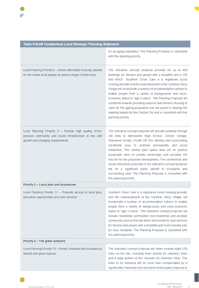
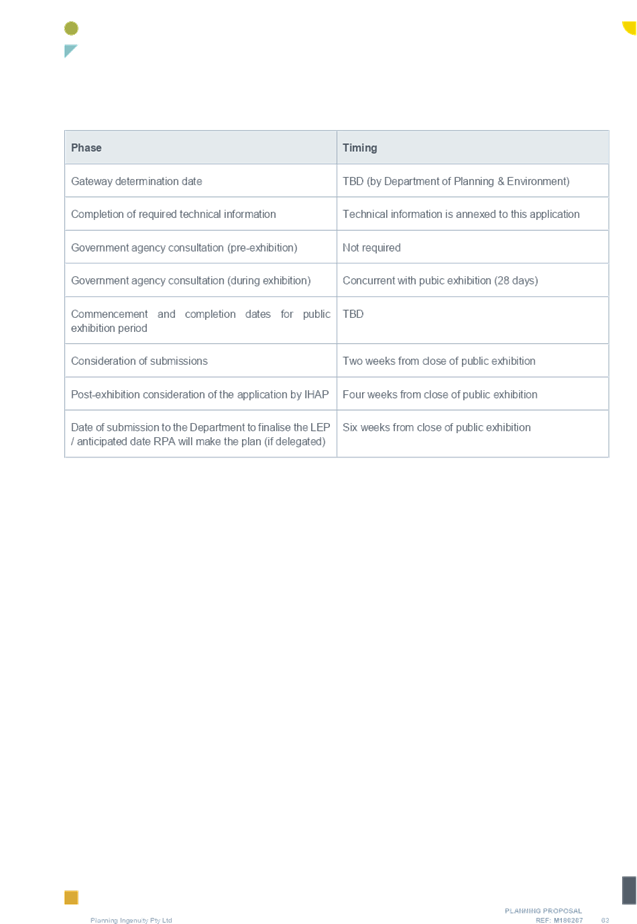
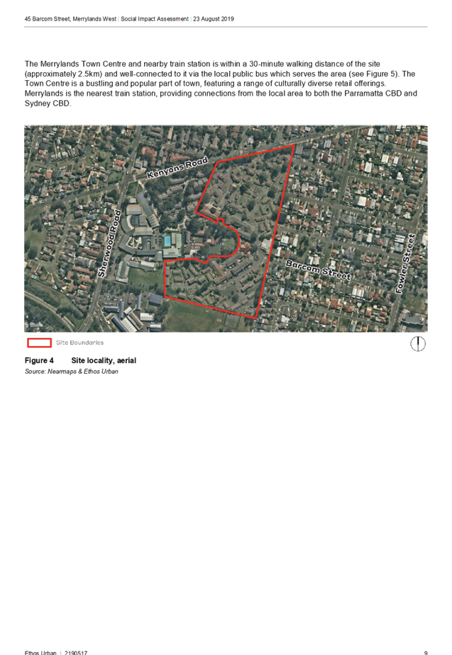
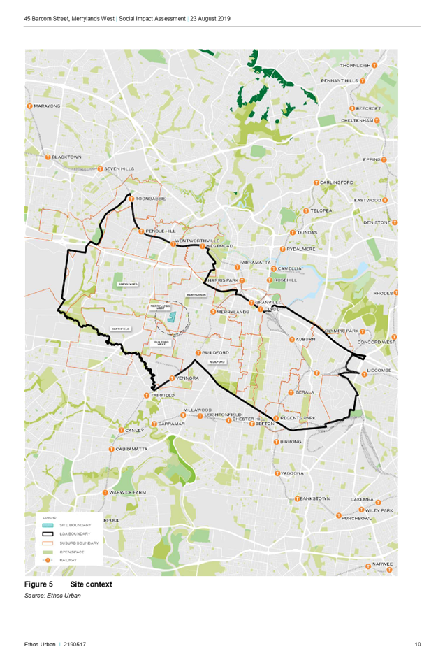
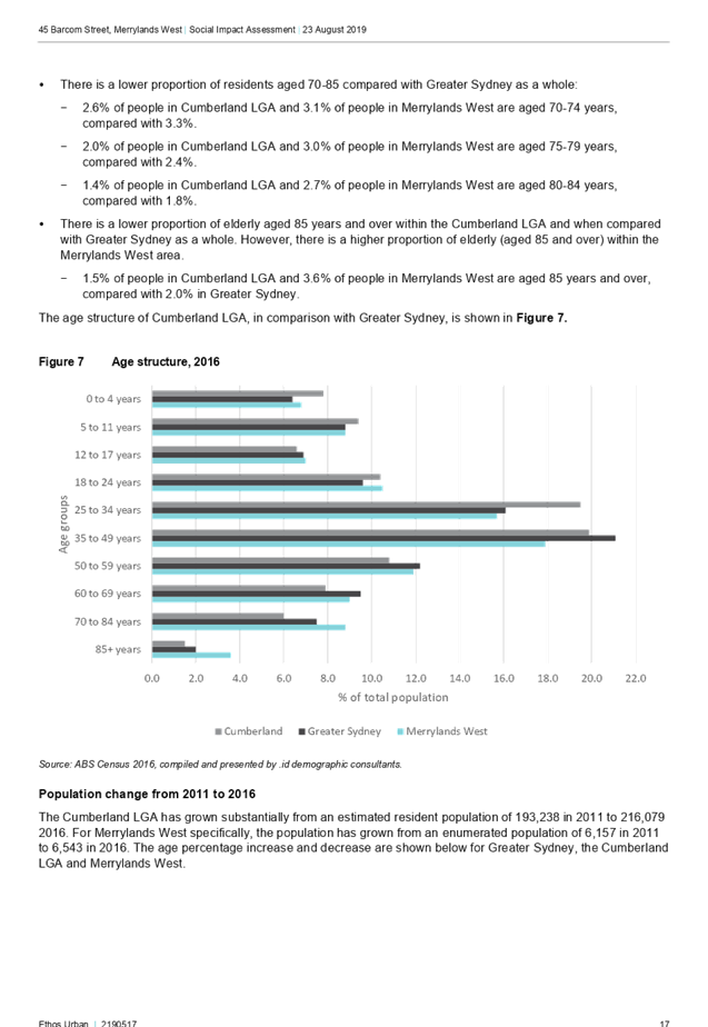
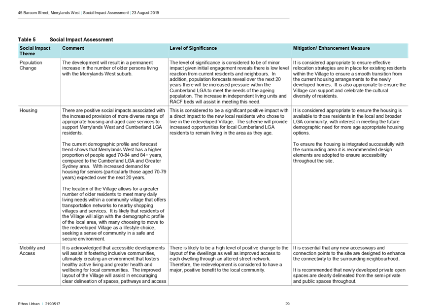
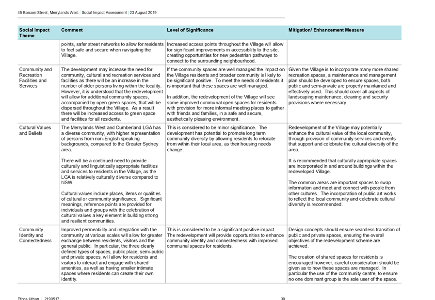
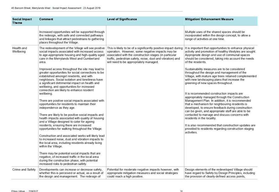
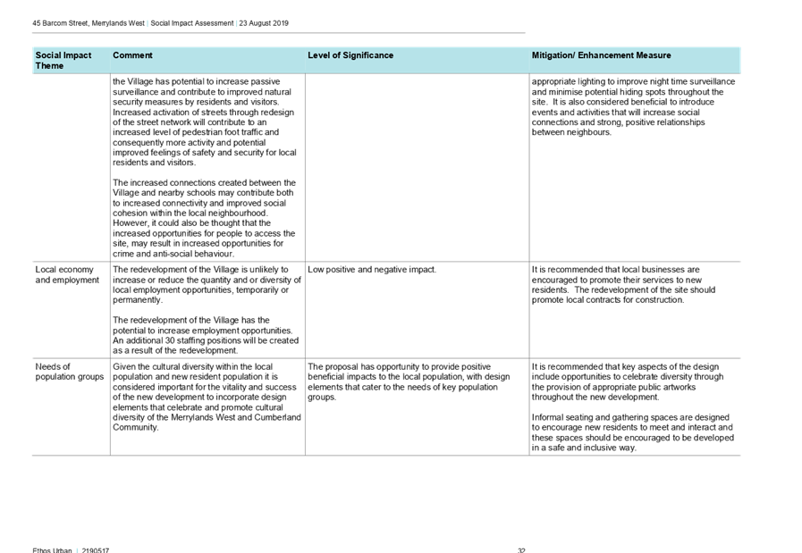
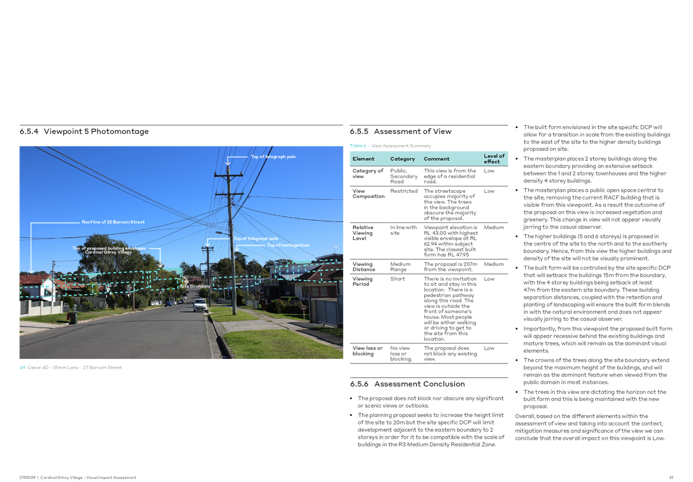
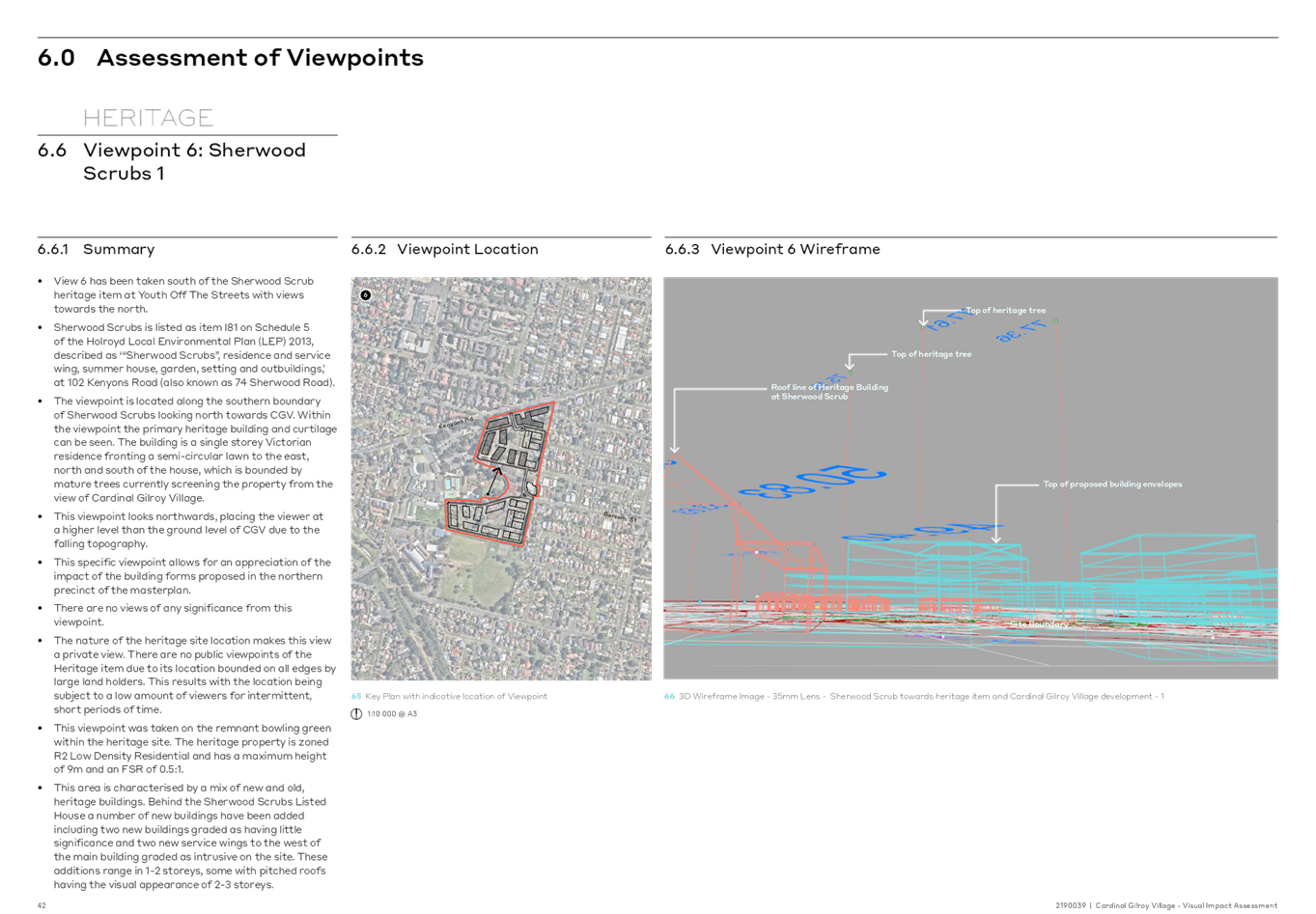
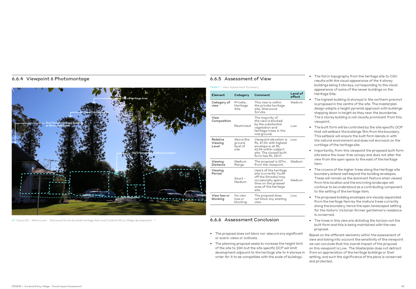
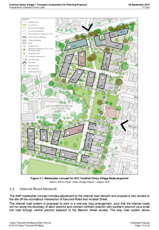
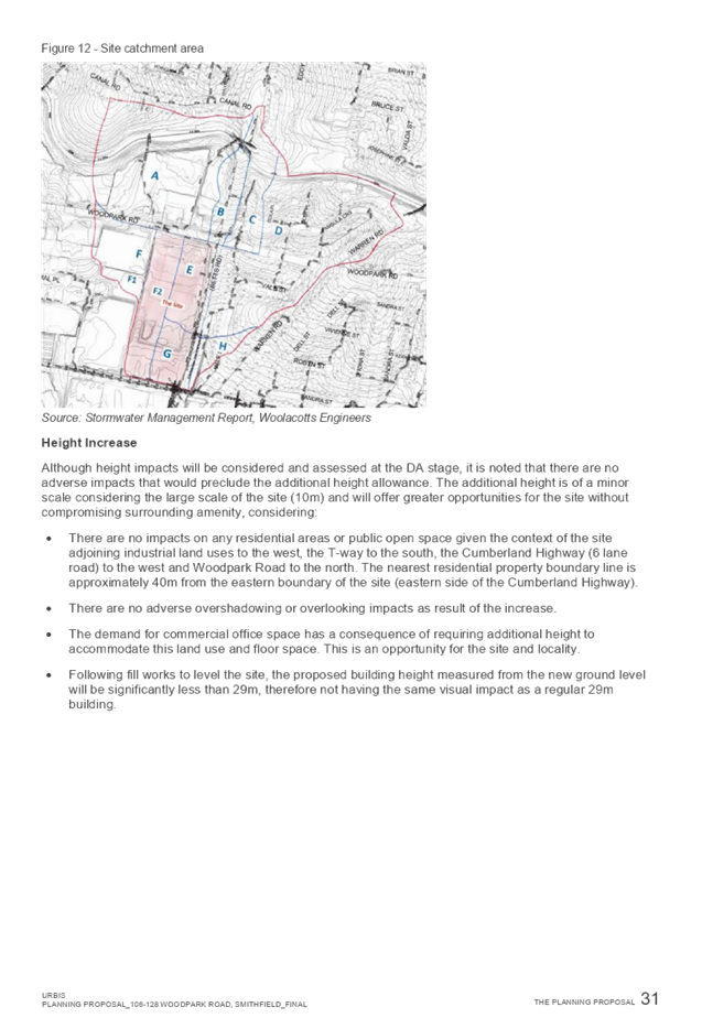
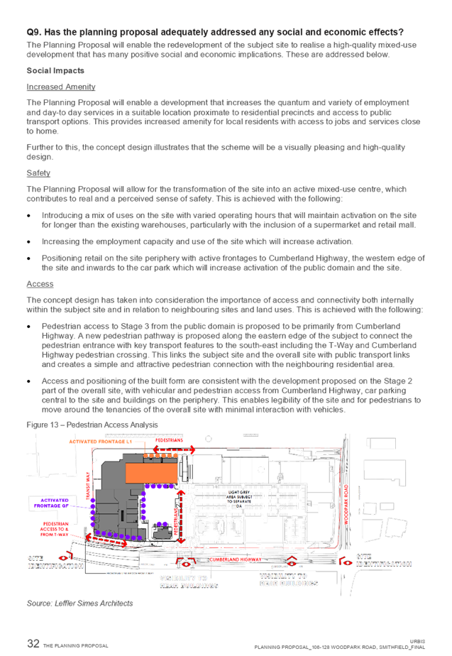
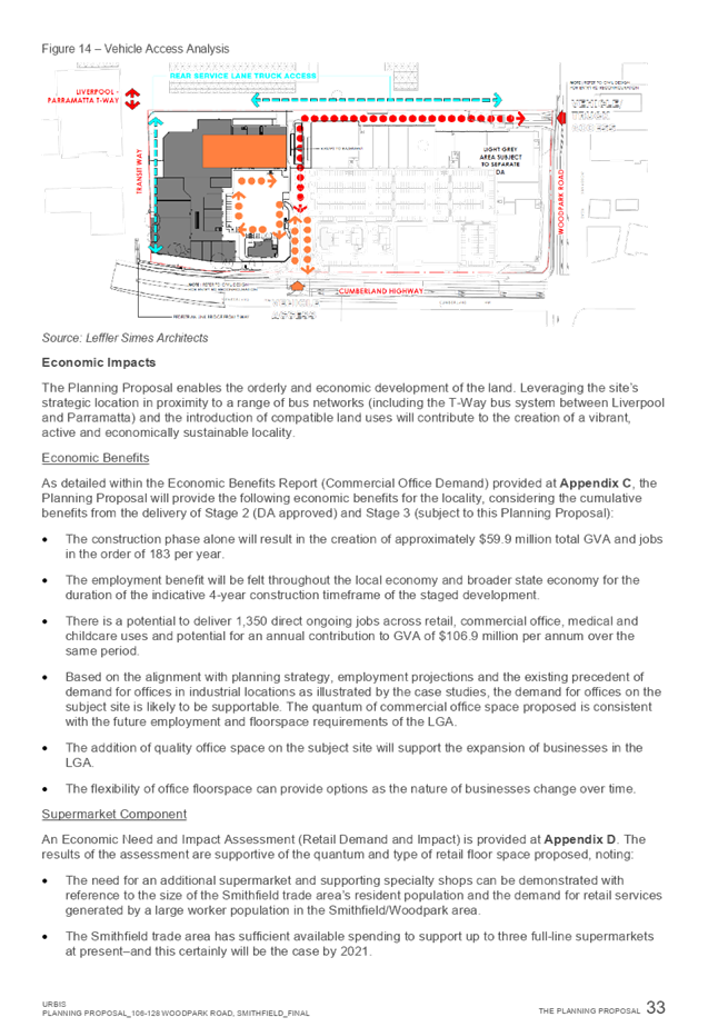
11 March 2020
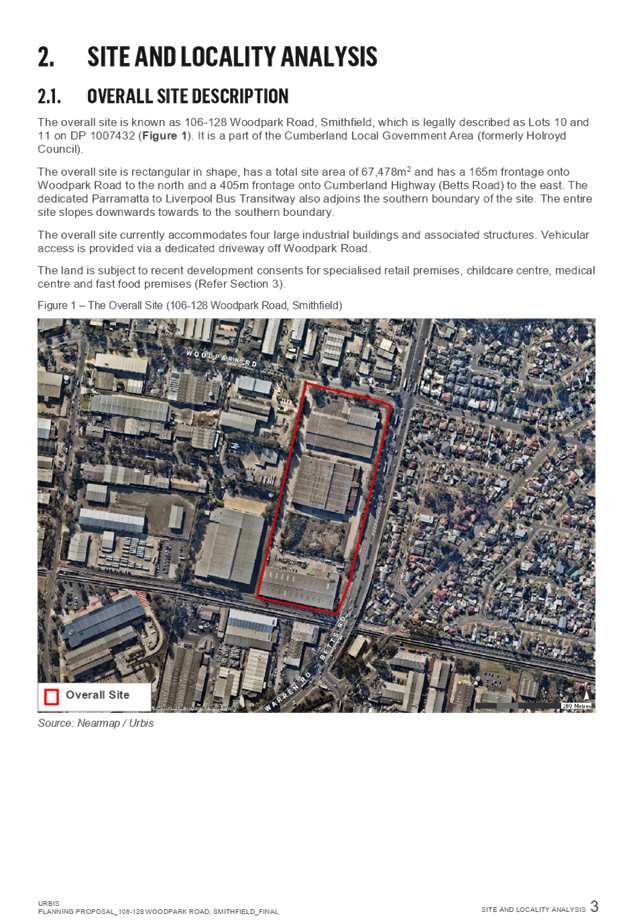
Item No: LPP010/20
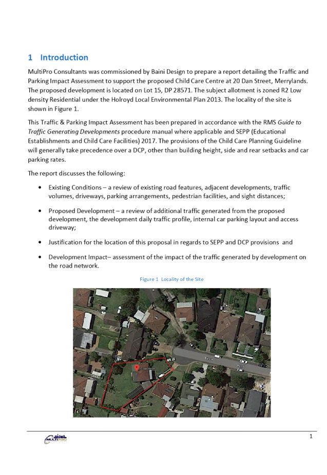
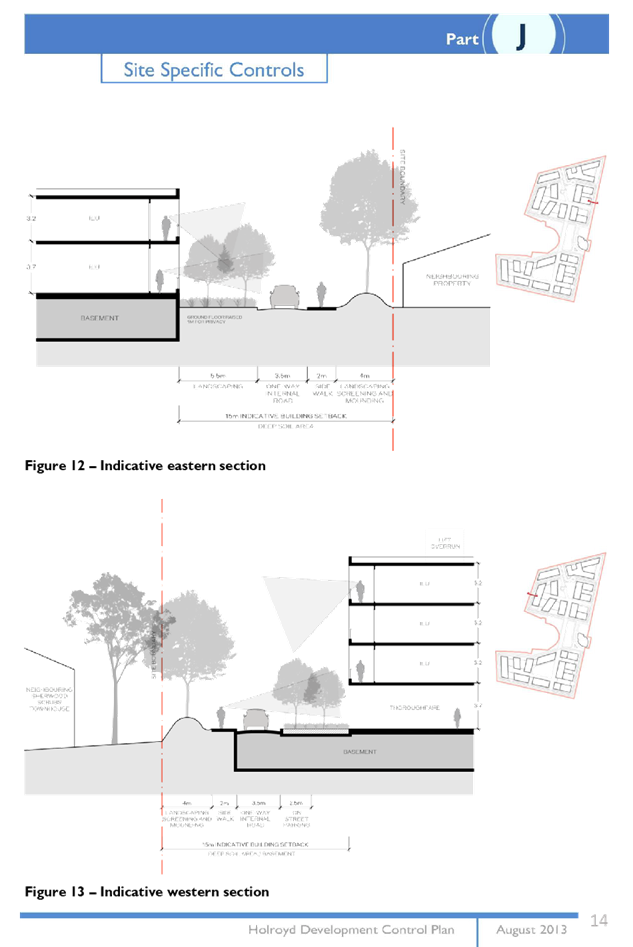
Development Application for 20 Dan Street, Merrylands
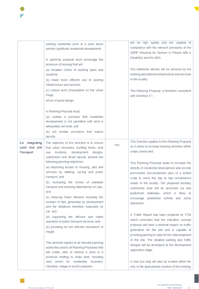
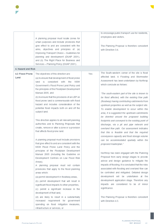
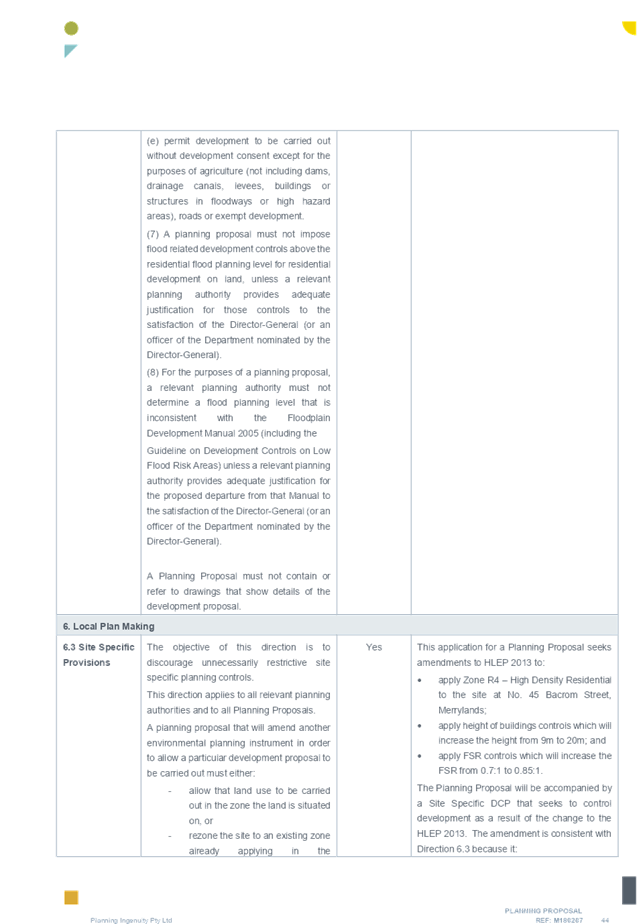
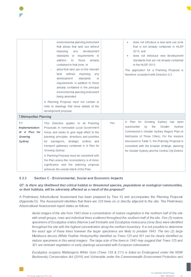
Responsible Division: Environment & Planning
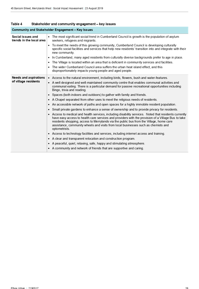
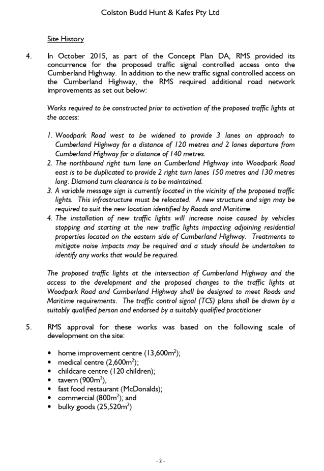
Officer: Executive Manager Development and Building
File Number: DA2019/432/1
|
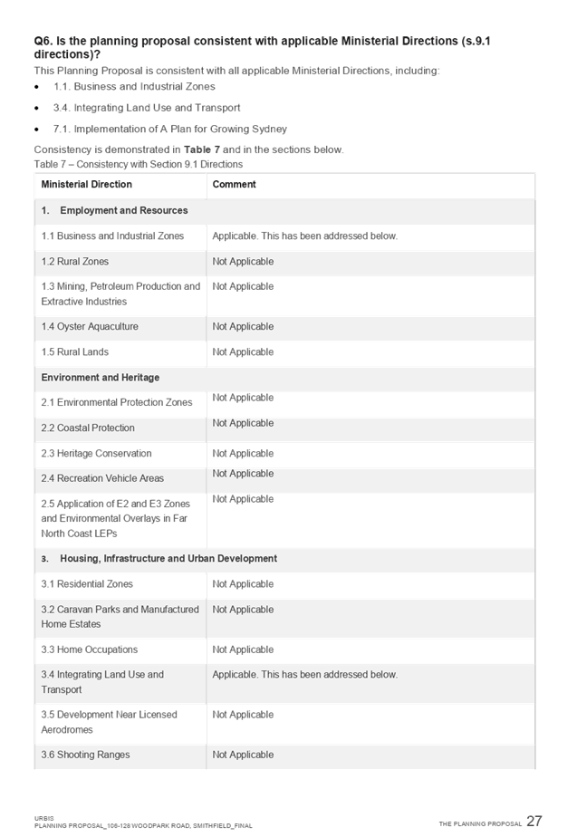
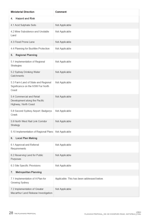
Application lodged |
12 November 2019 |
|
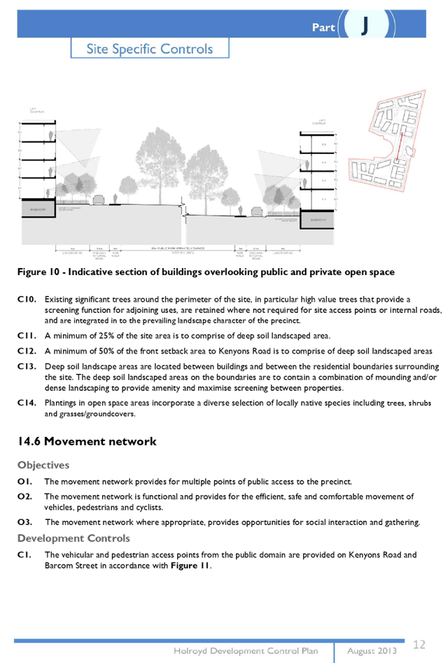
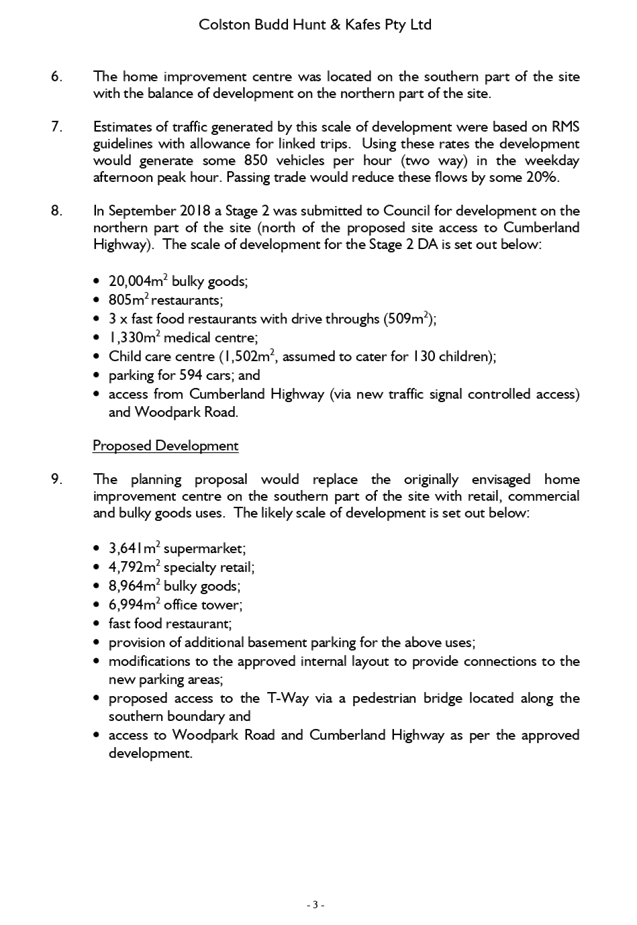
Applicant |
Baini Design |
|
Owner |
Mr J Habkouk |
|
Application No. |
DA2019/432/1 |
|
Description of Land |
20 Dan Street Merrylands NSW 2160 (Lot 15 DP 28571) |
|
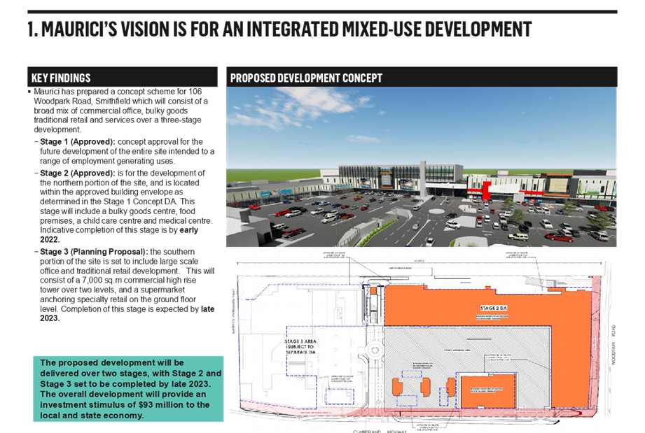
Proposed Development |
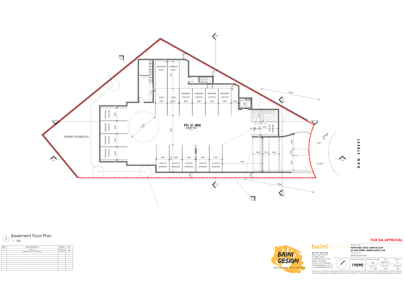
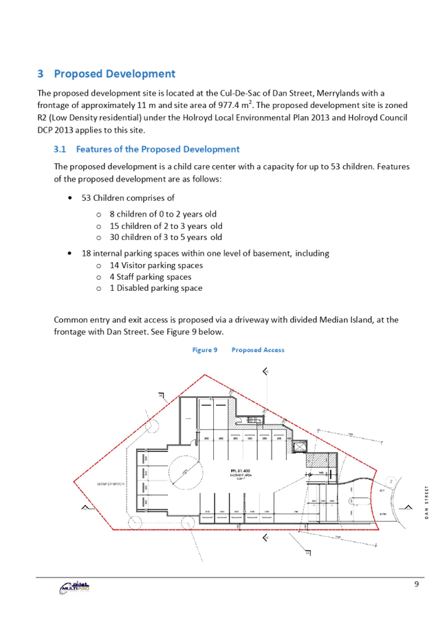
Demolition of existing structures and construction of a two (2) storey 53 place child care facility over basement level car parking |
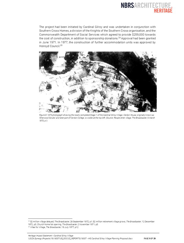
|
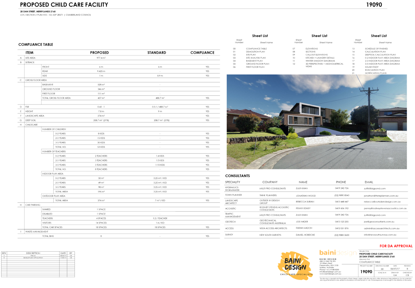
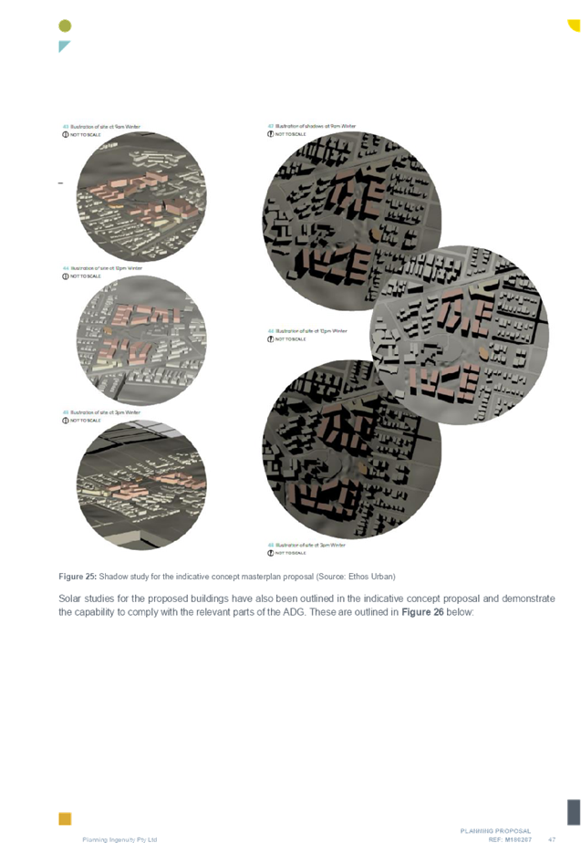
Site Area |
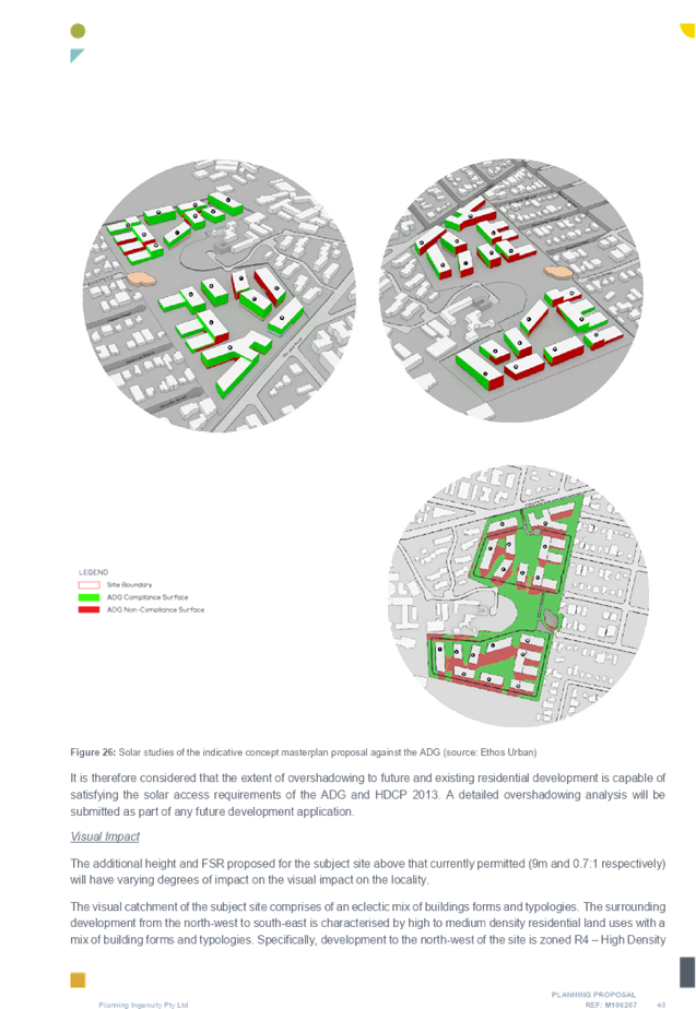
977.40m2 |
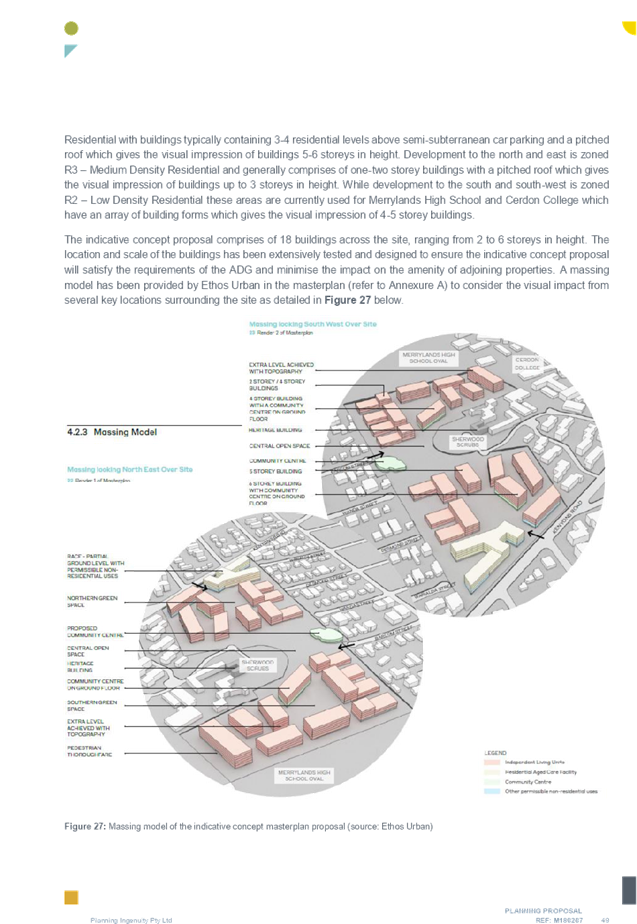
|
Zoning |
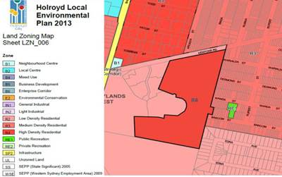
R2 Low Density Residential Zone |
|
Disclosure of political donations and gifts |
Nil disclosure |
|
Heritage |
N/A |
|
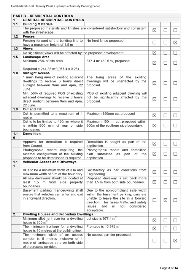
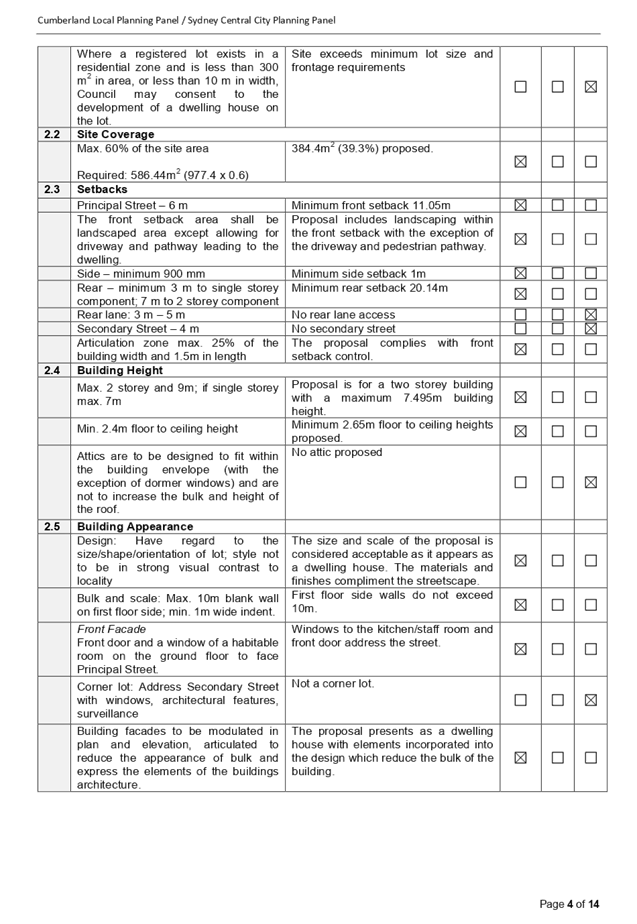
Principal Development Standards |
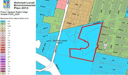
FSR Permissible: 0.5:1 Proposed: 0.43:1
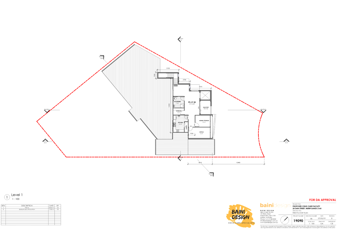
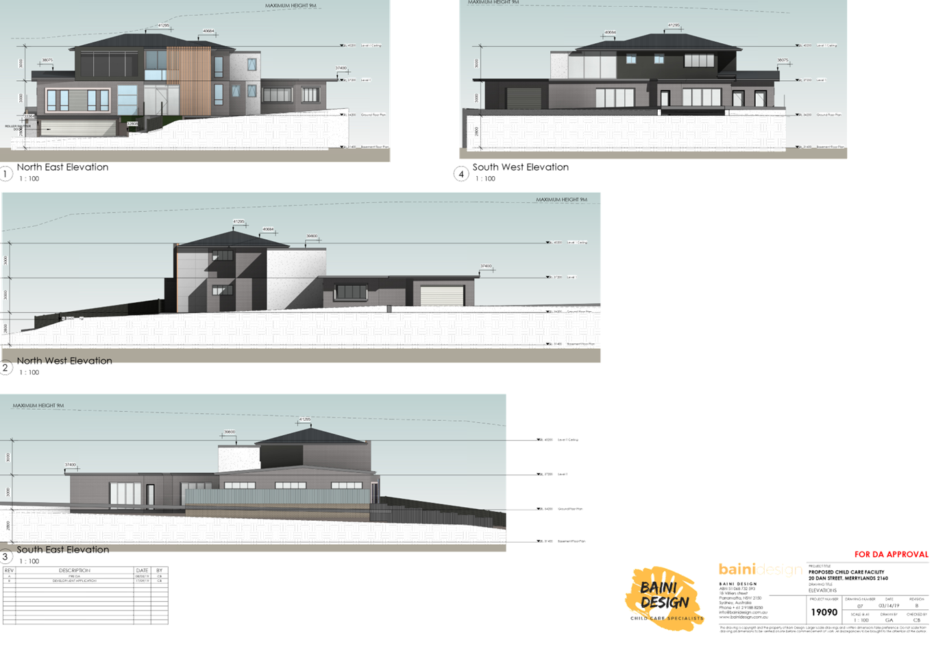
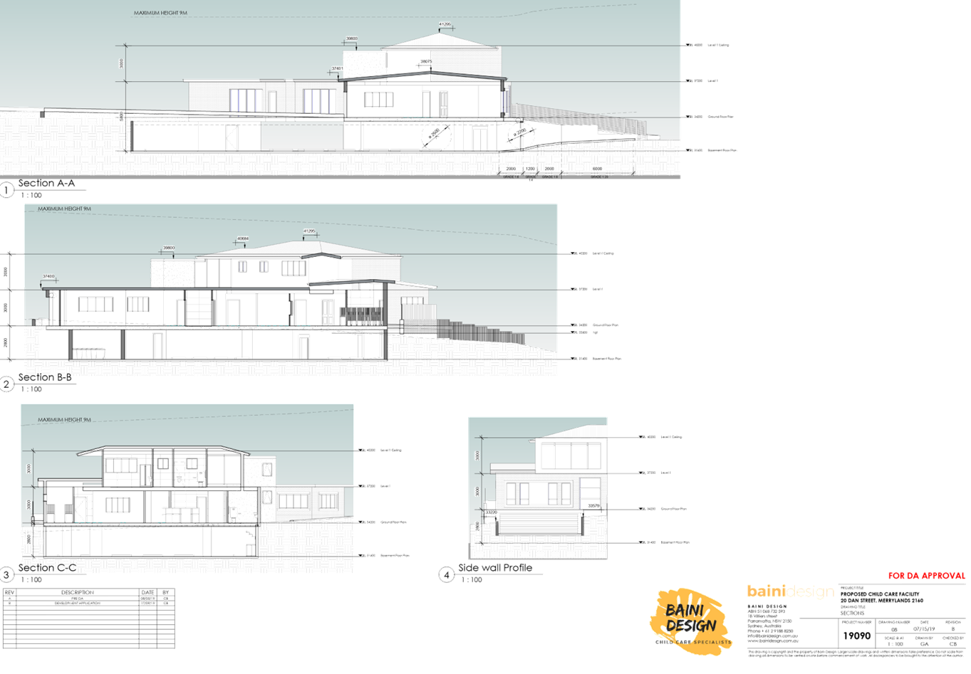
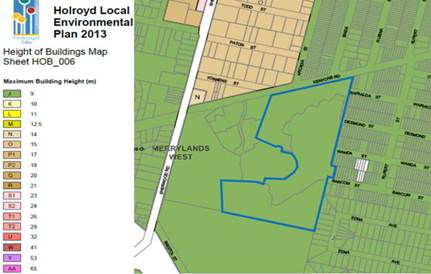
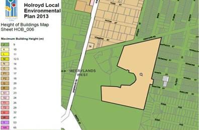
Height of Building Permissible: 9m Proposed: 7.495m |
|
Issues |
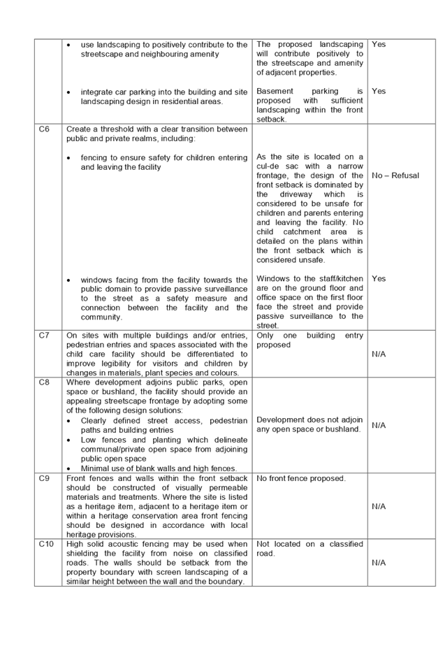
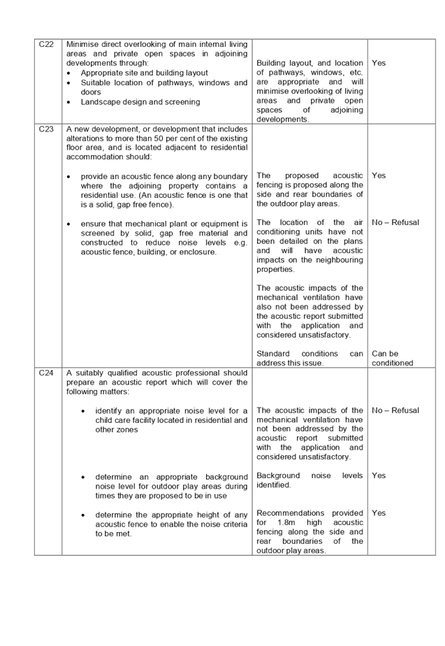
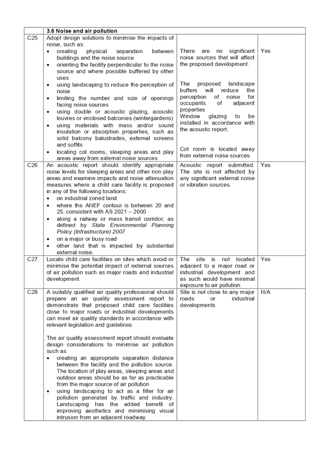
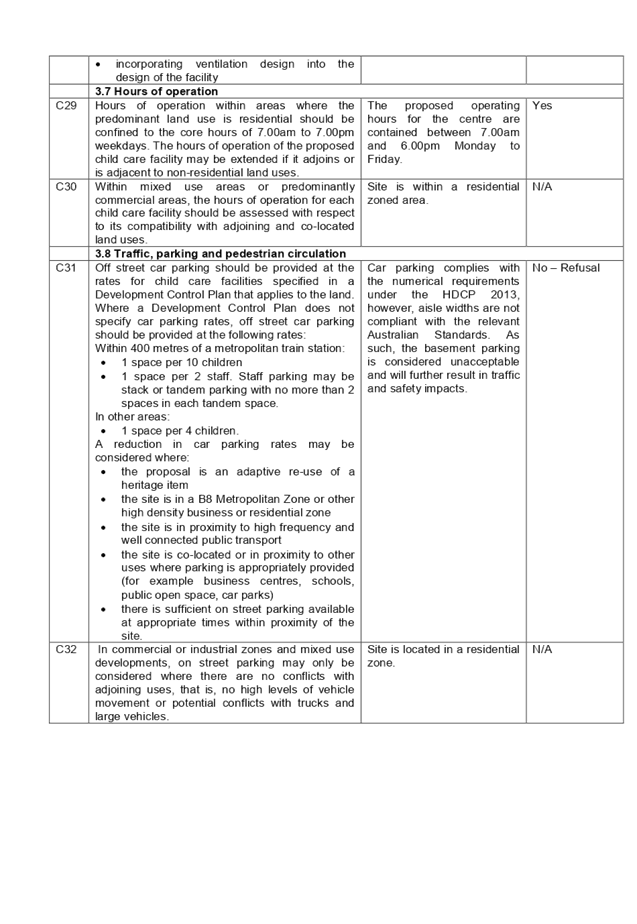
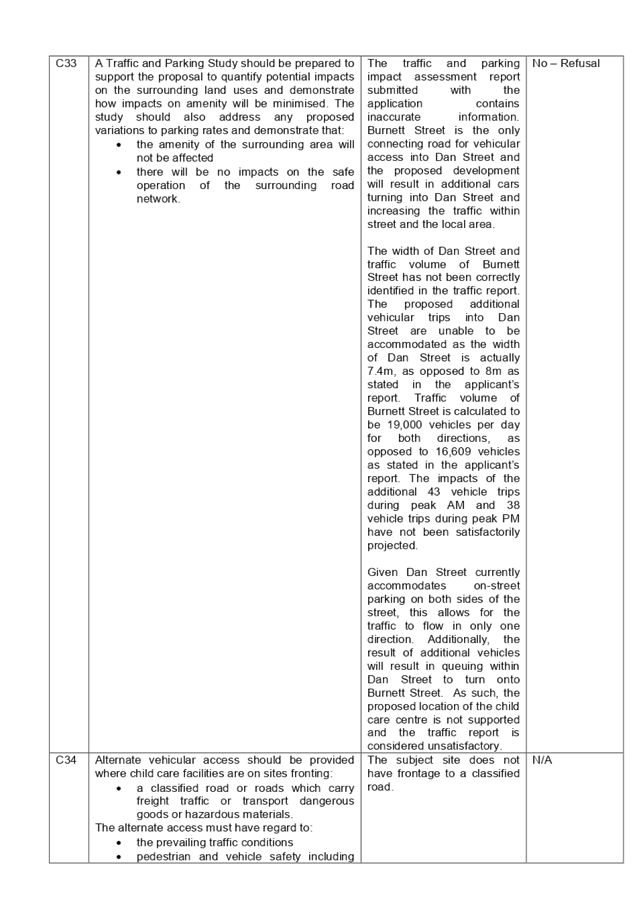
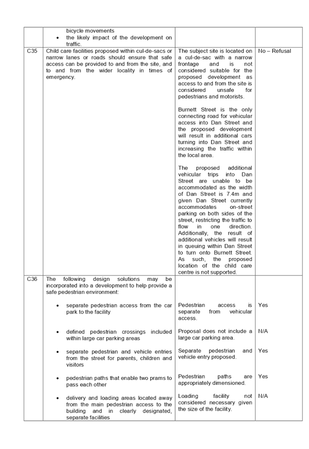
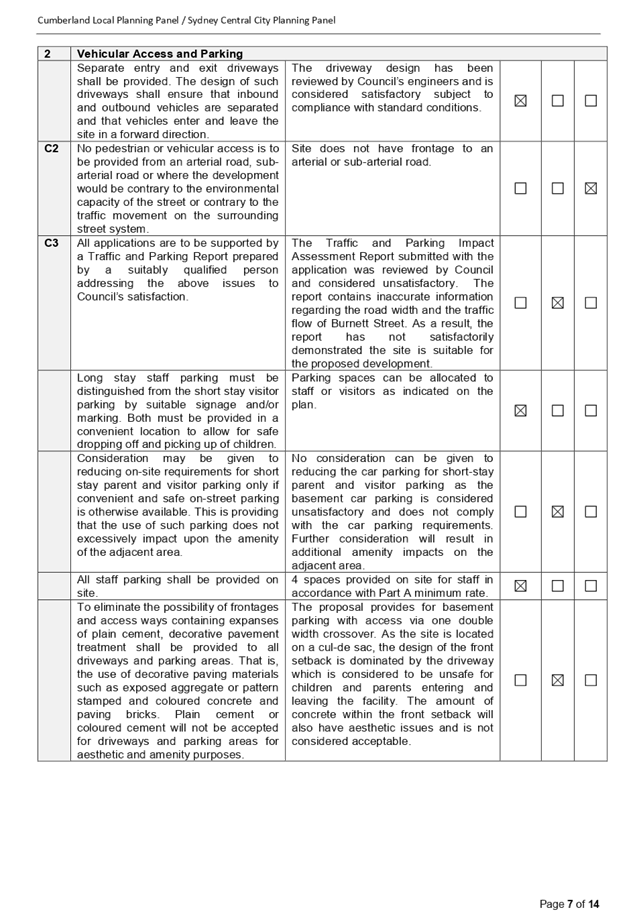
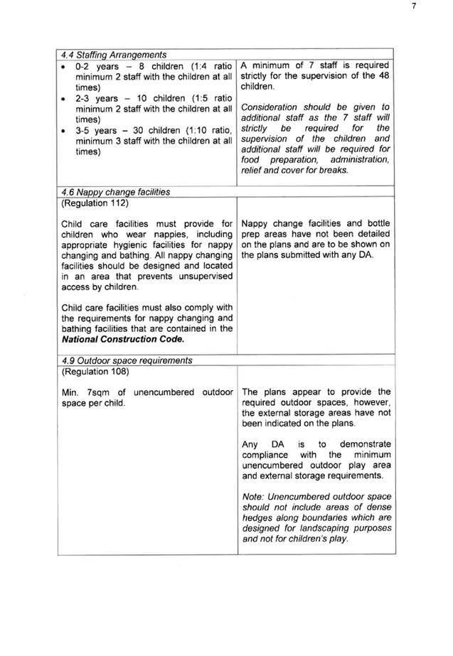
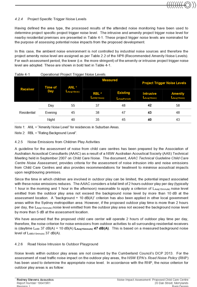
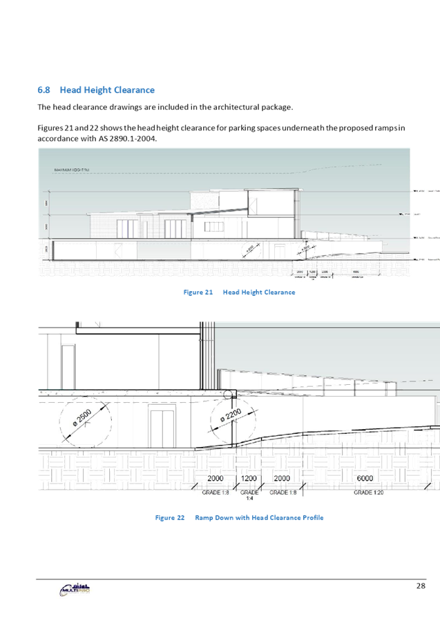
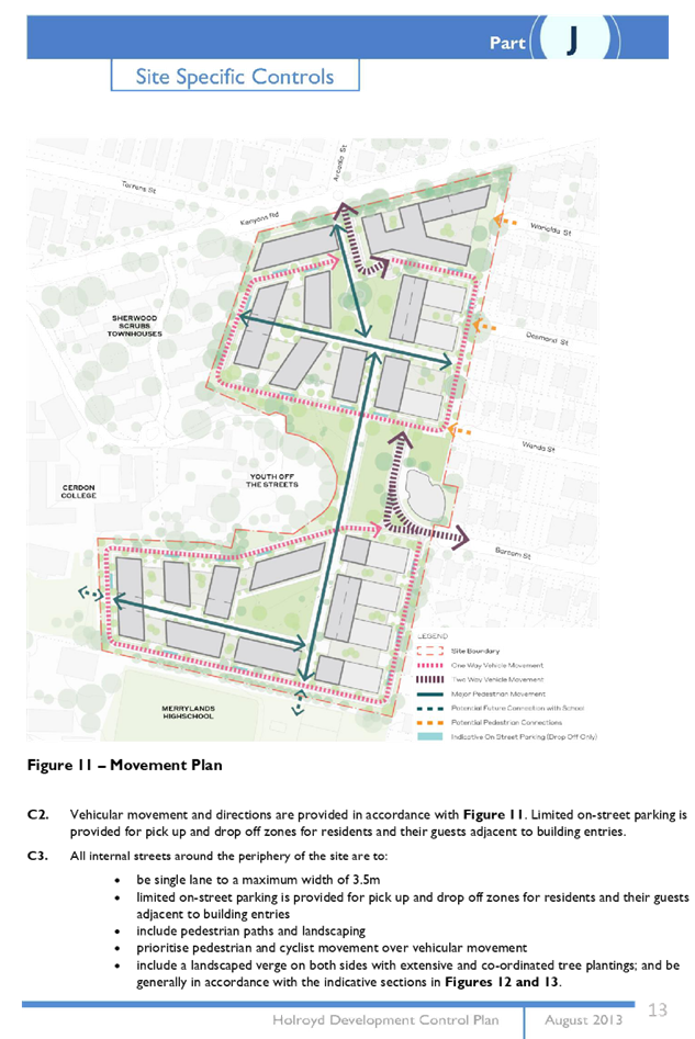
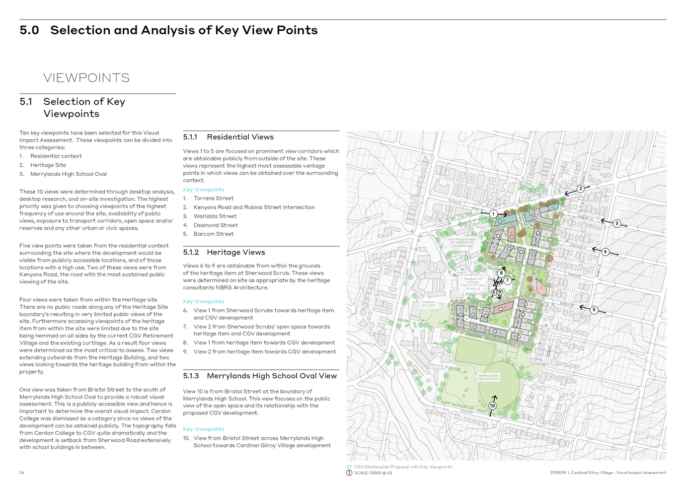
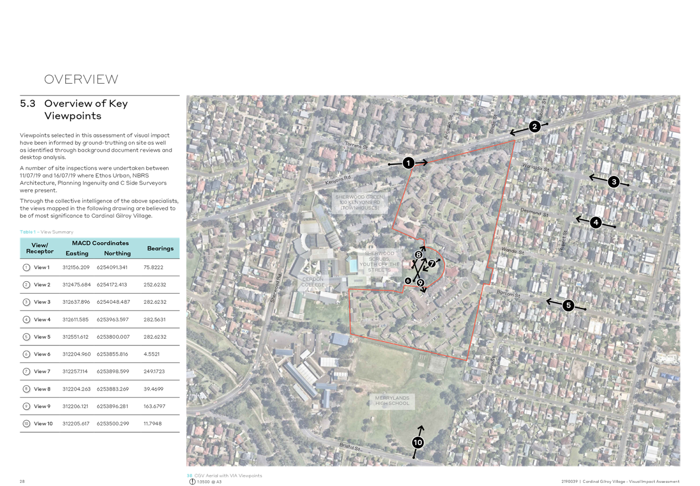
1. Site suitability 2. Traffic, parking and safety impact 3. Acoustic impact 4. Outdoor unencumbered space size, layout and shade structure 5. Solar access to indoor play area 6. Public interest 7. Inadequate information |
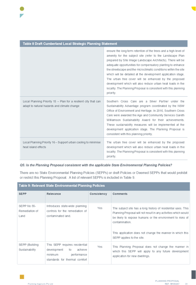
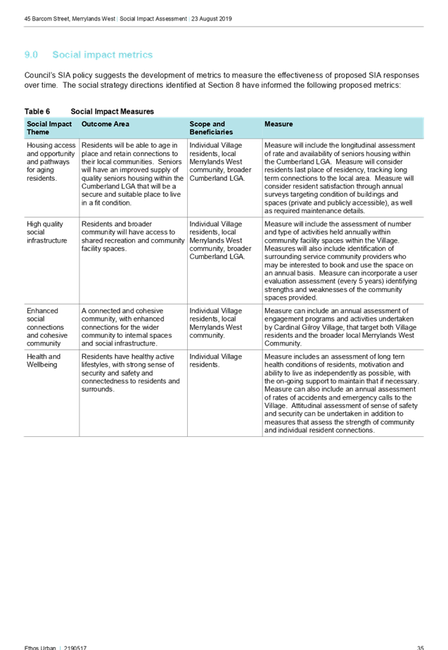
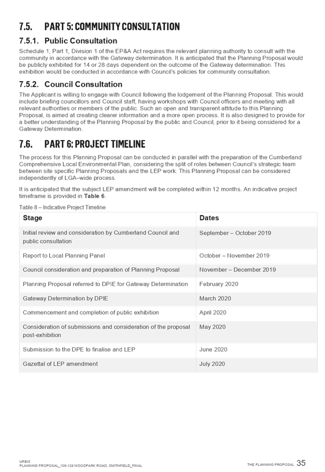
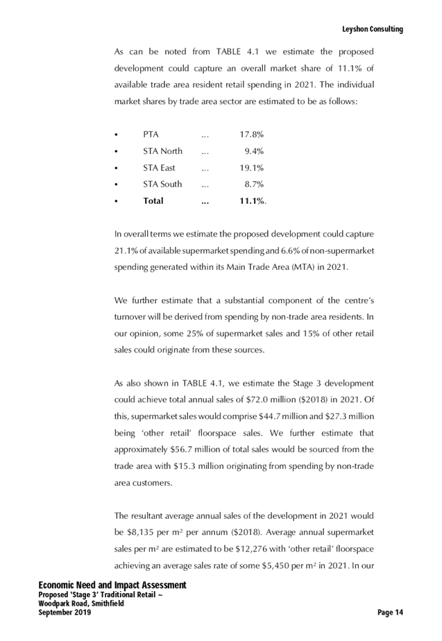
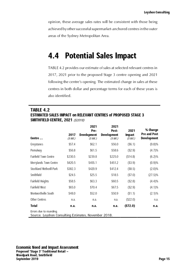
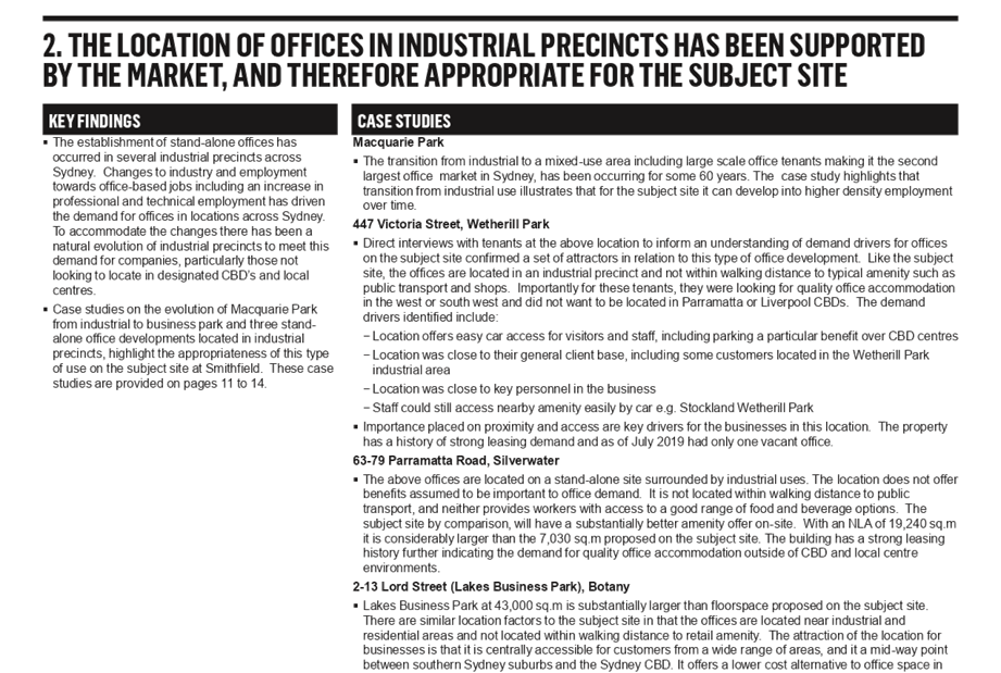
Summary:
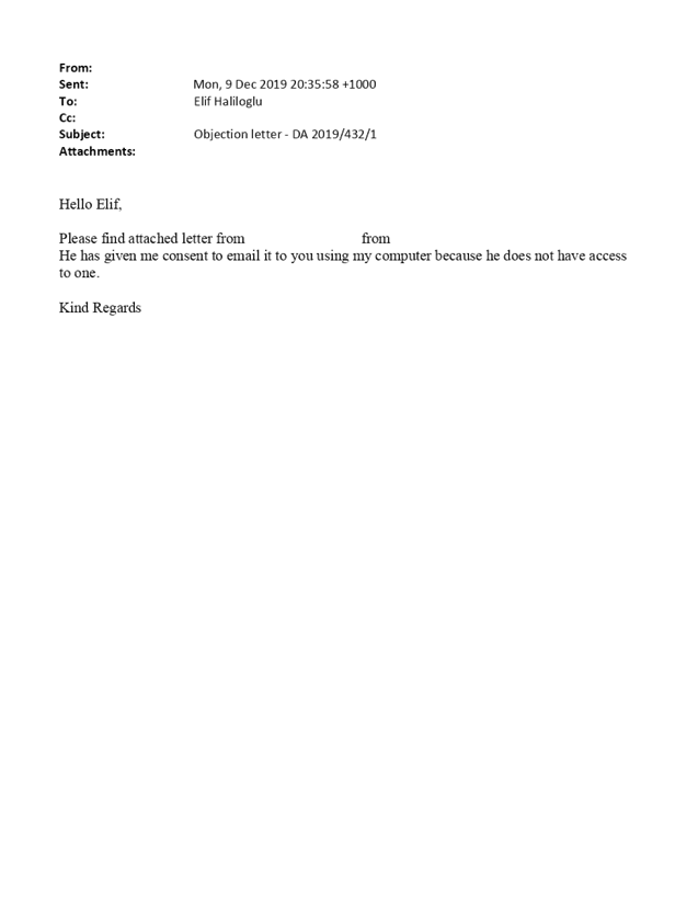
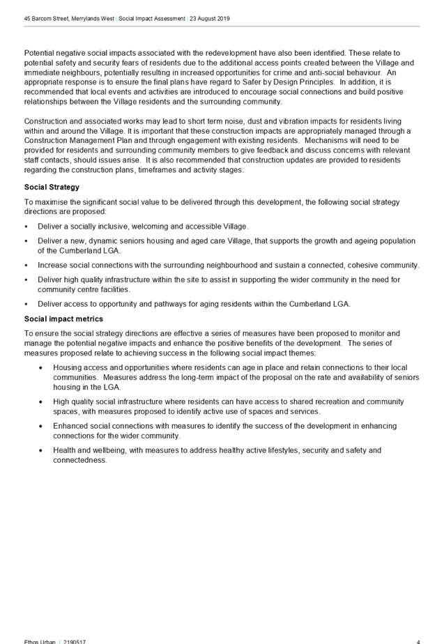
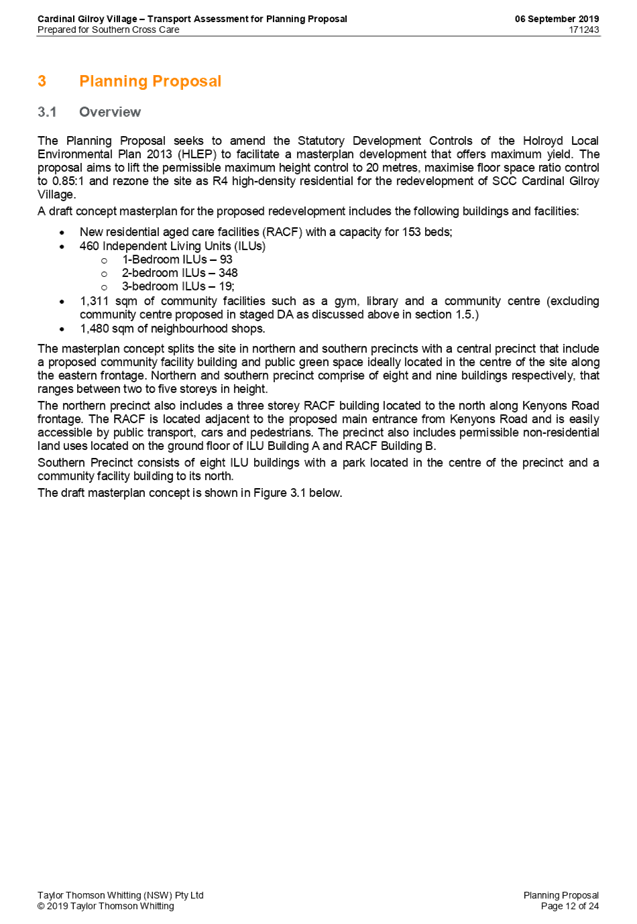
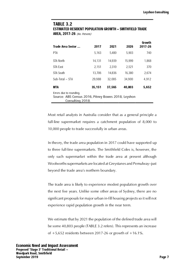
1. Development Application No. DA2019/432/1 was received on 12 November 2019 for the Demolition of existing structures and construction of a two (2) storey 53 place child care facility over basement level car parking.
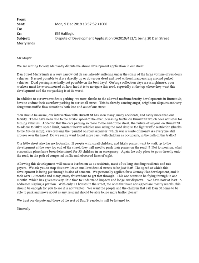
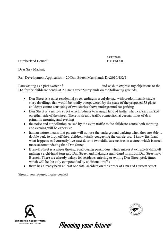
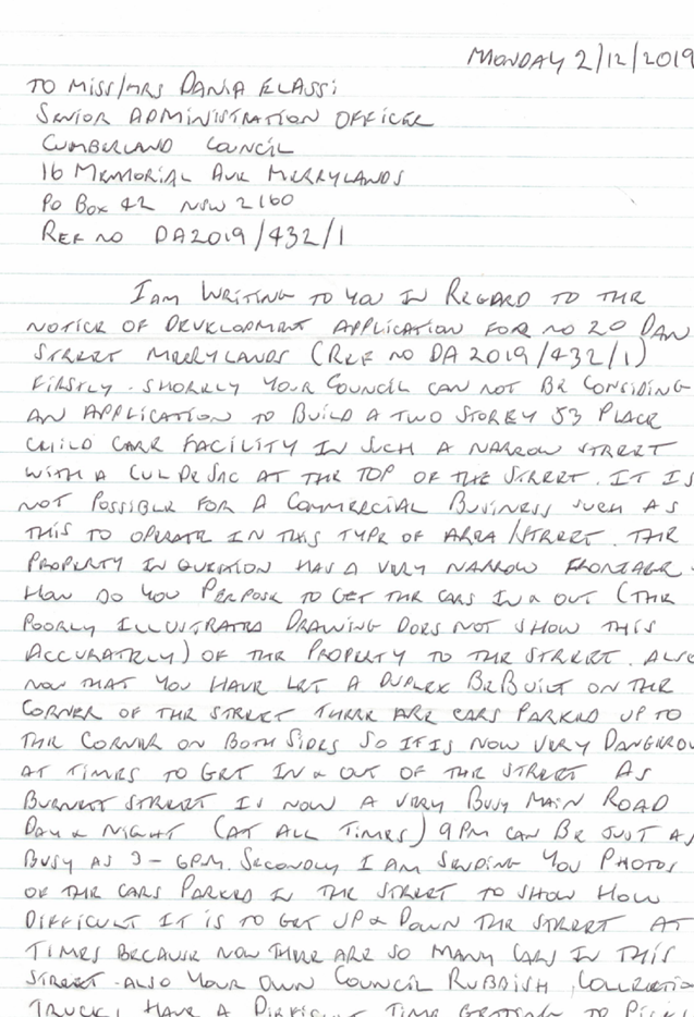
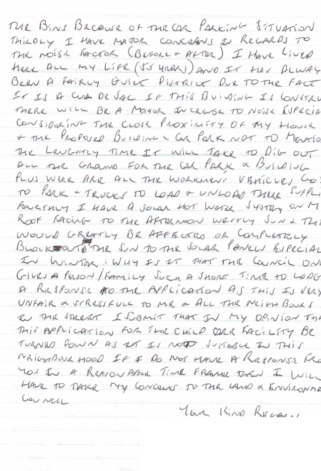
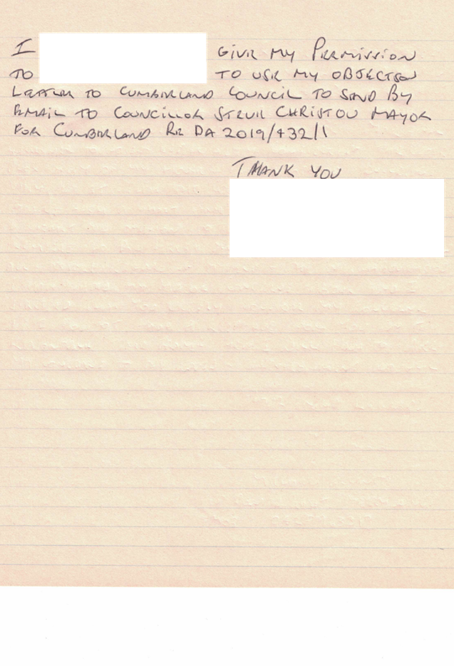
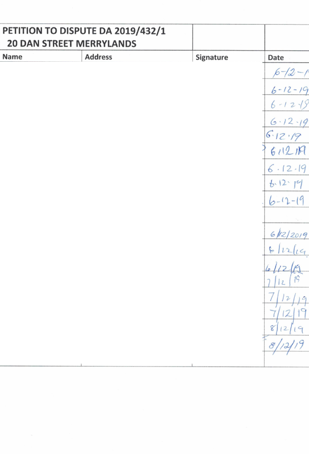
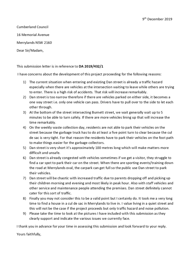
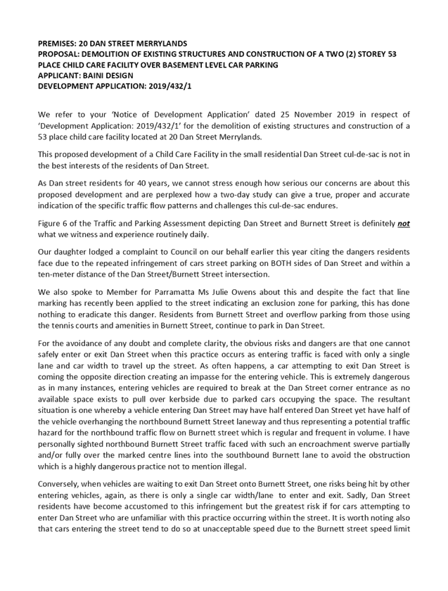
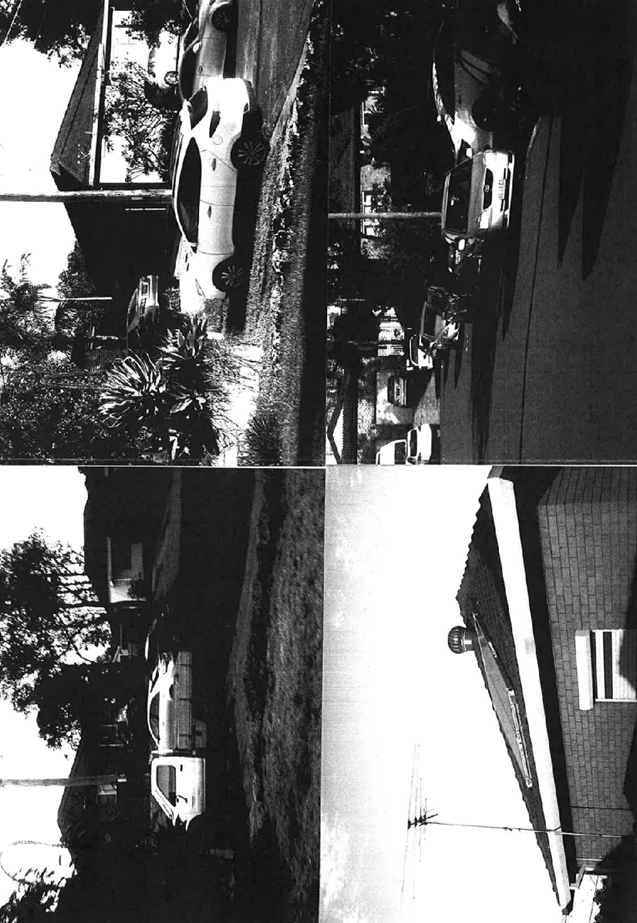
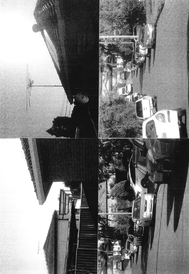
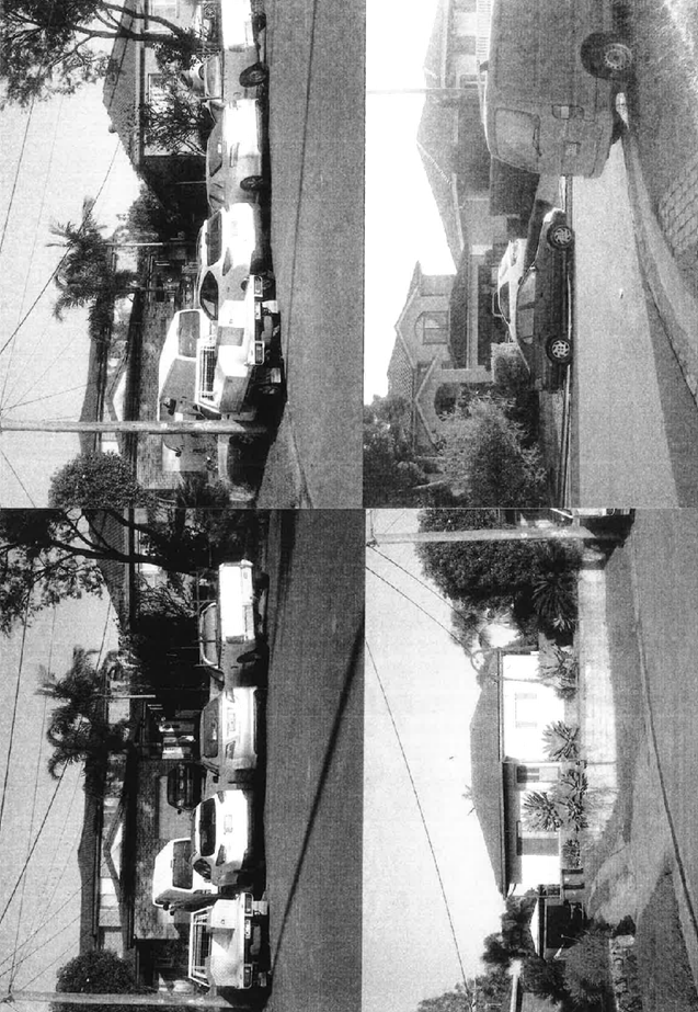
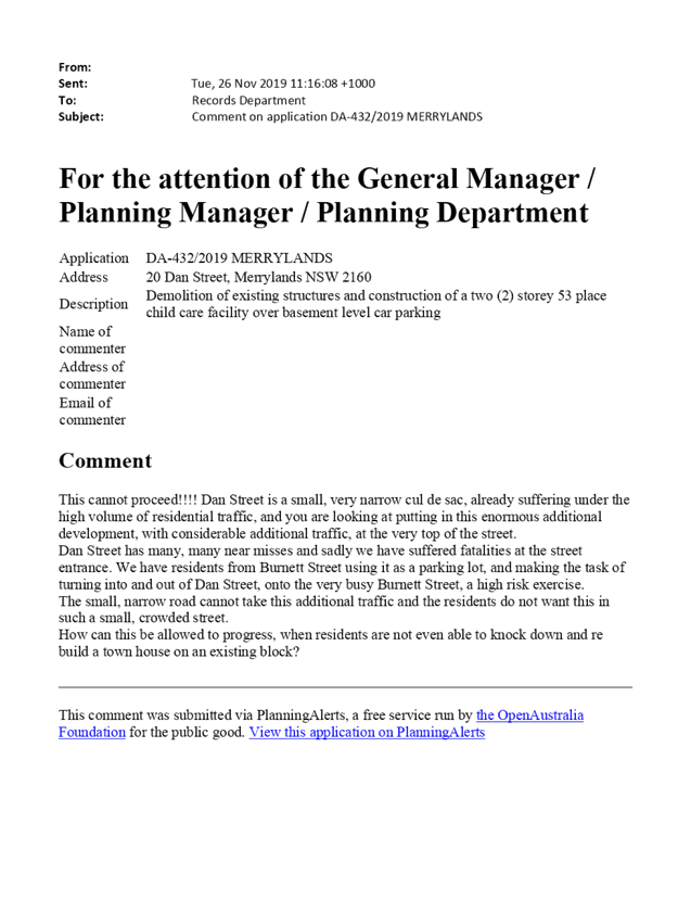
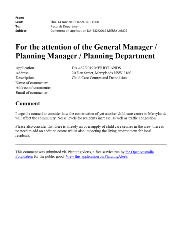
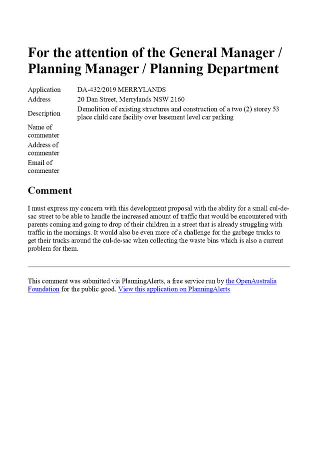
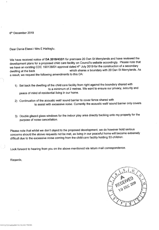
2. The application was publicly notified to occupants and owners of the adjoining properties for a period of 14 days between 27 November 2019 and 11 December 2019. In response, 20 submissions were received (including a petition with 17 signatures).
3. The development application was privy to a pre-development application lodgement advice (PDA/843) issued by Council on 8 May 2019, which stated that the site is not suitable for a child care centre having regard to the location within the bulb of a cul-de-sac that will result in adverse traffic, parking and safety impacts. The subject application subsequently was lodged and Council through its assessment identified those issues relating to site suitability, adverse traffic, parking and safety impact, outdoor unencumbered space size, layout and shade structure, and solar access to indoor play area that have not been satisfactorily addressed. Revised documentation would have been requested to the applicant, if the proposal was to be supported.
4. The application seeks the following variations:
|
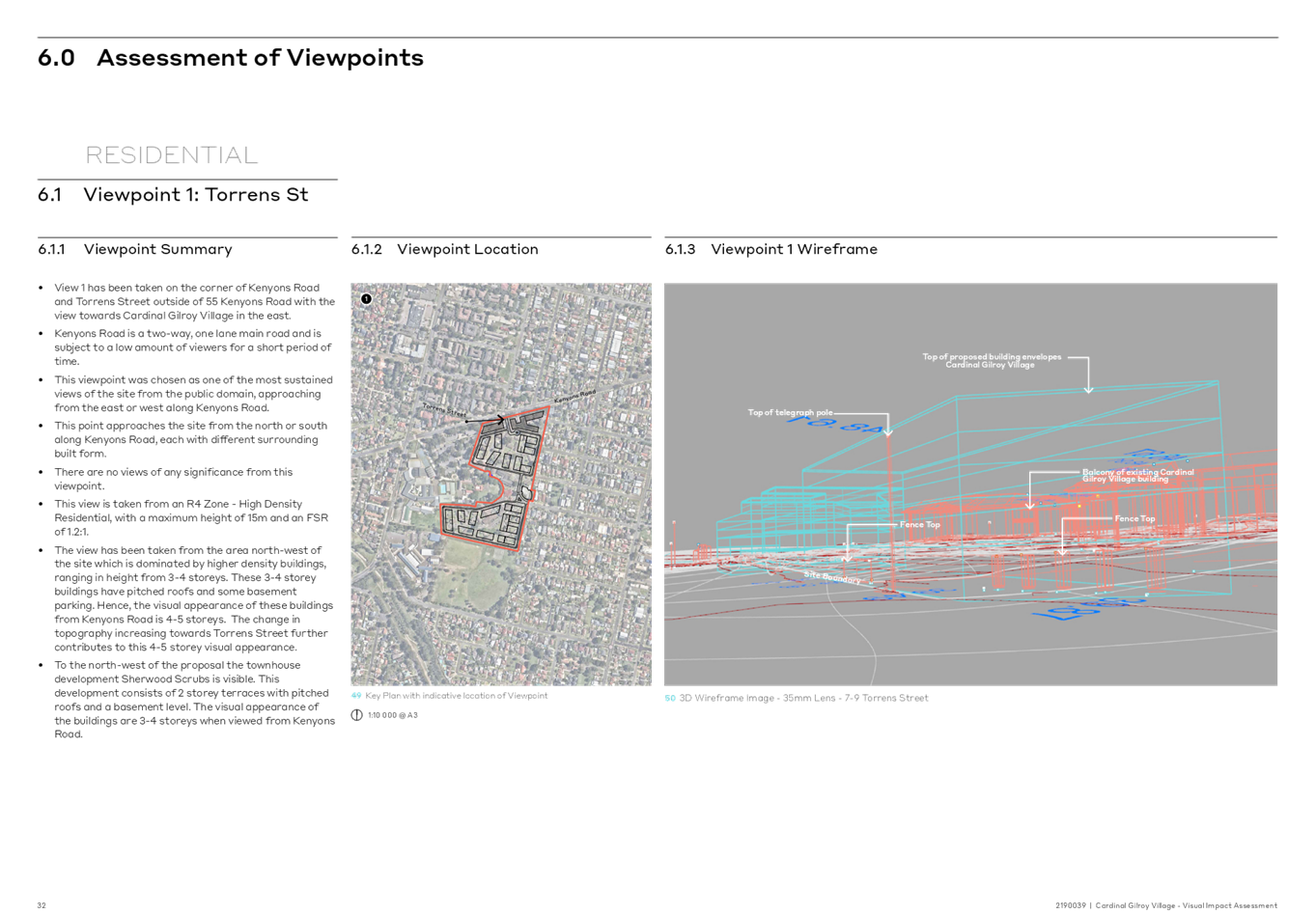
Control |
Required |
Provided |
% Variation |
|
Unencumbered outdoor play area (Child Care Planning Guideline 2017 – Clause 4.9) |
Min 7m2 per child: 30 x 7m2 = 210m2 |
186.4m2 |
11.24% (23.6m2) |
|
Size & Density (HDCP 2013 – Section 1, Part I) |
Child care centres shall not be located on an allotment within an entire residential cul-de-sac. |
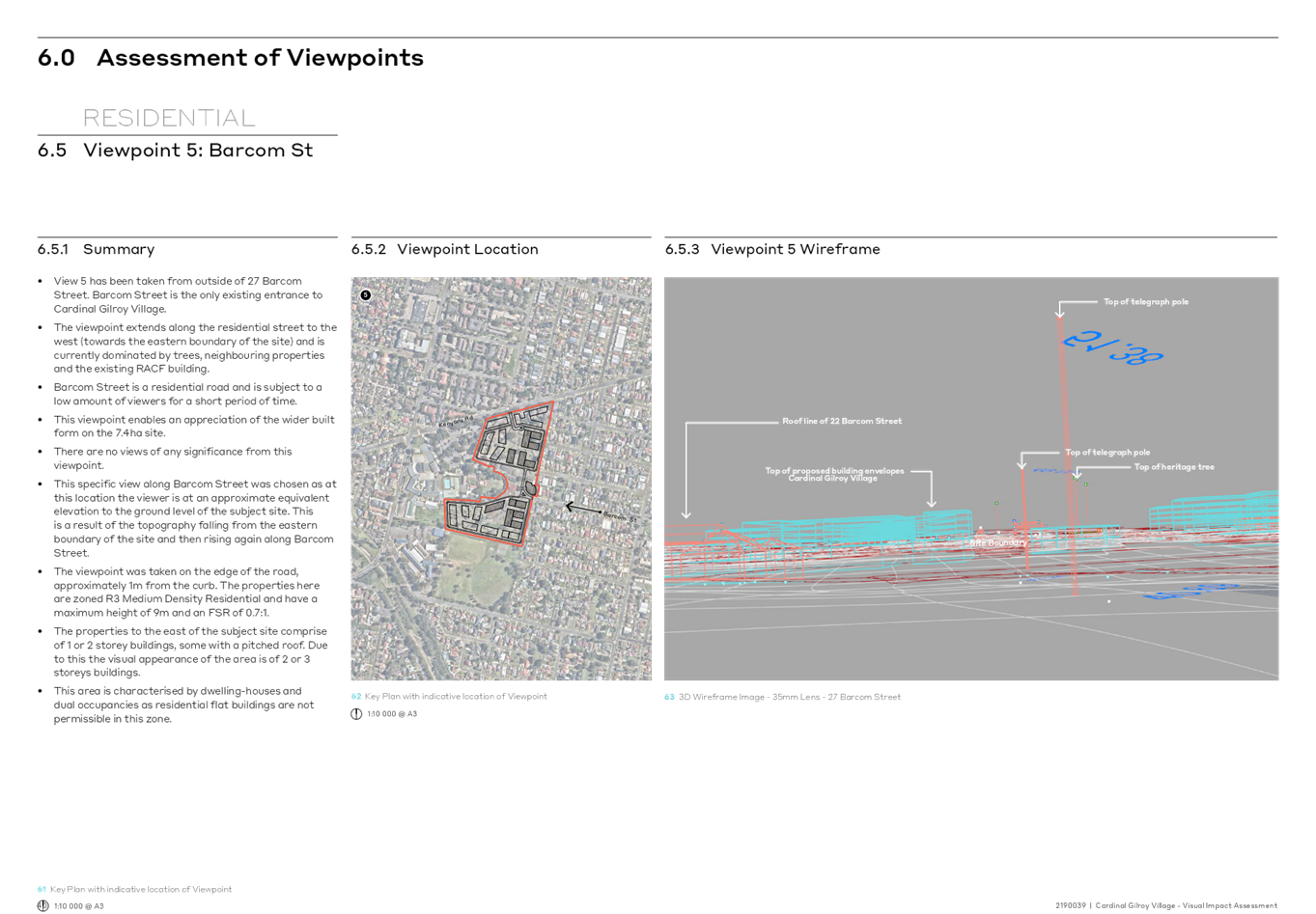
Subject site is located on the bulb of the cul-de-sac within Dan Street. |
|
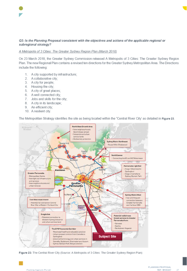
5. The application is referred to the Cumberland Local Planning Panel as it is subject of 10 or more unique submissions by way of objection.
6. The application is recommended for refusal for the reasons provided in the Draft Notice of Determination held at Attachment 4.
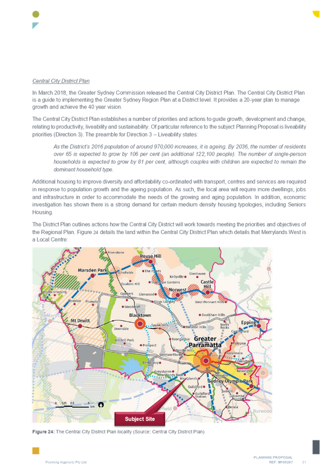
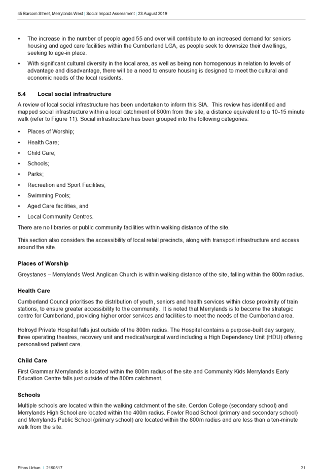
Report:
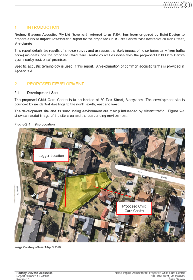
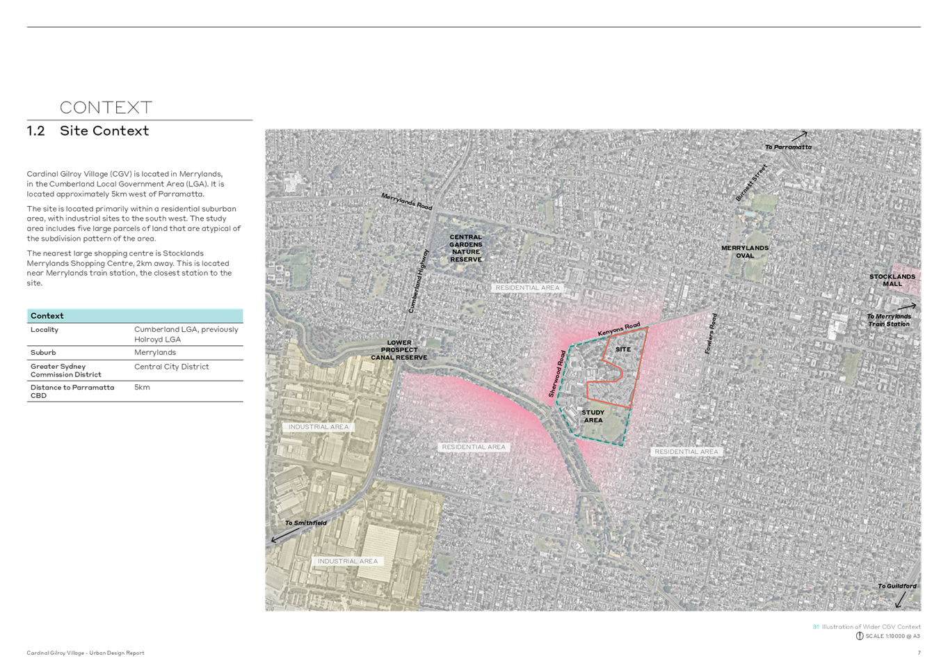
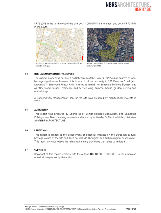
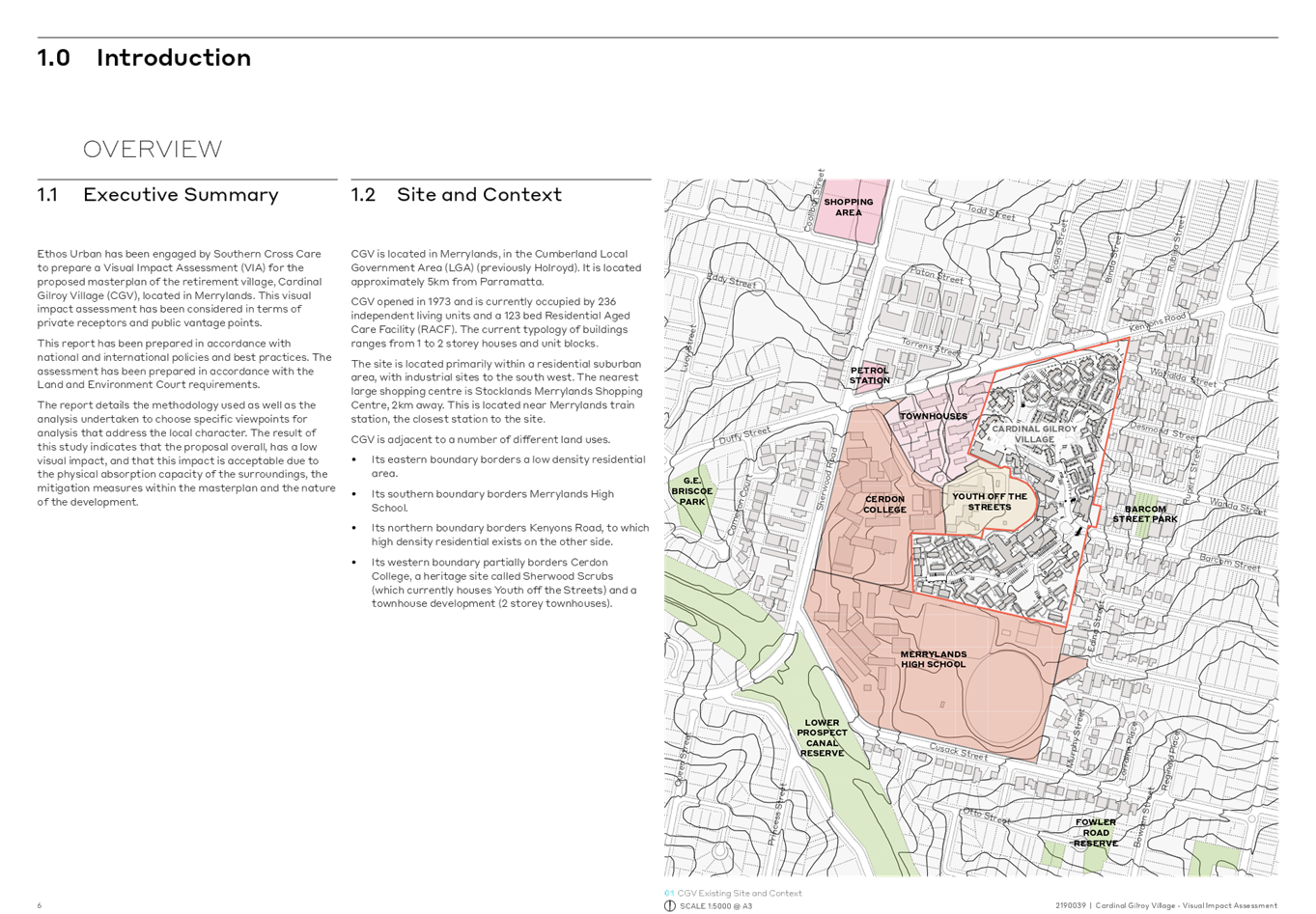
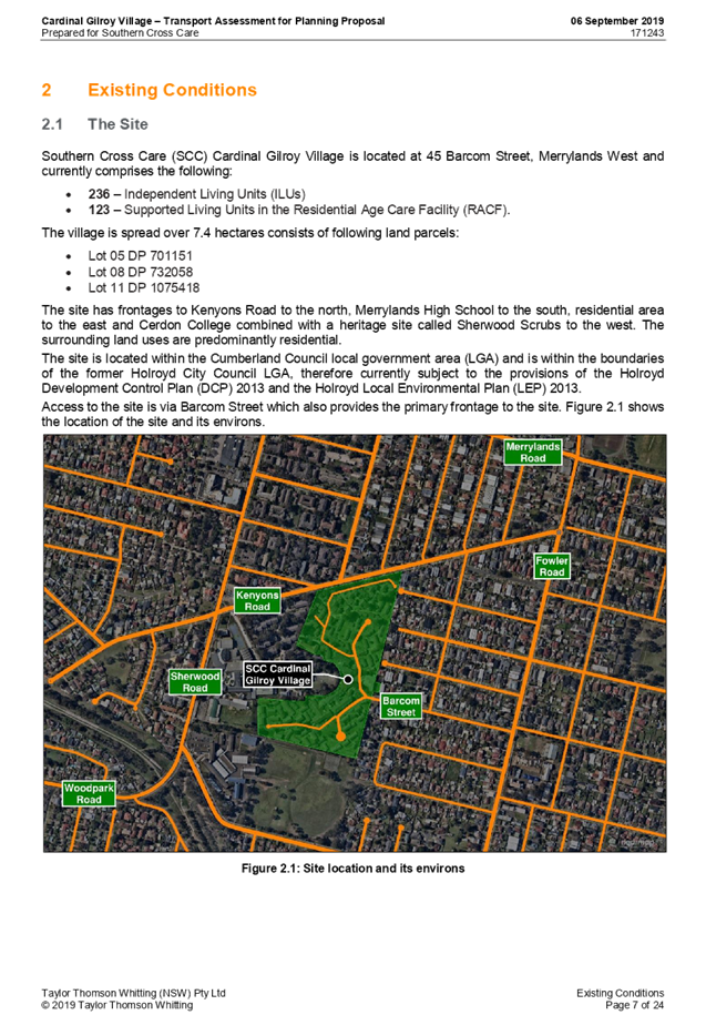
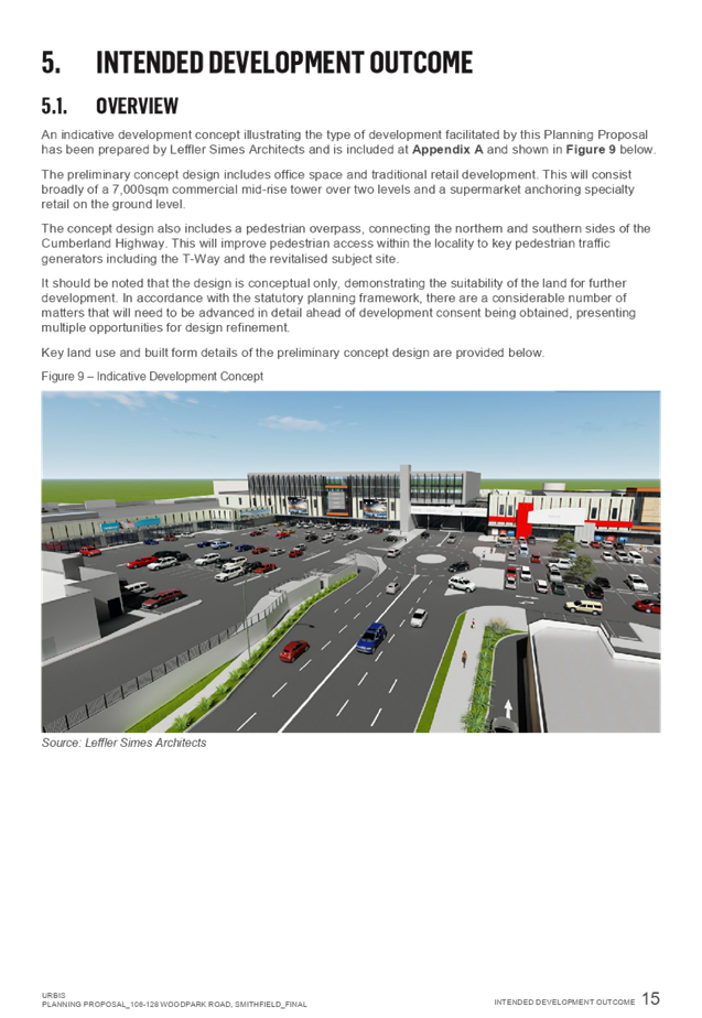
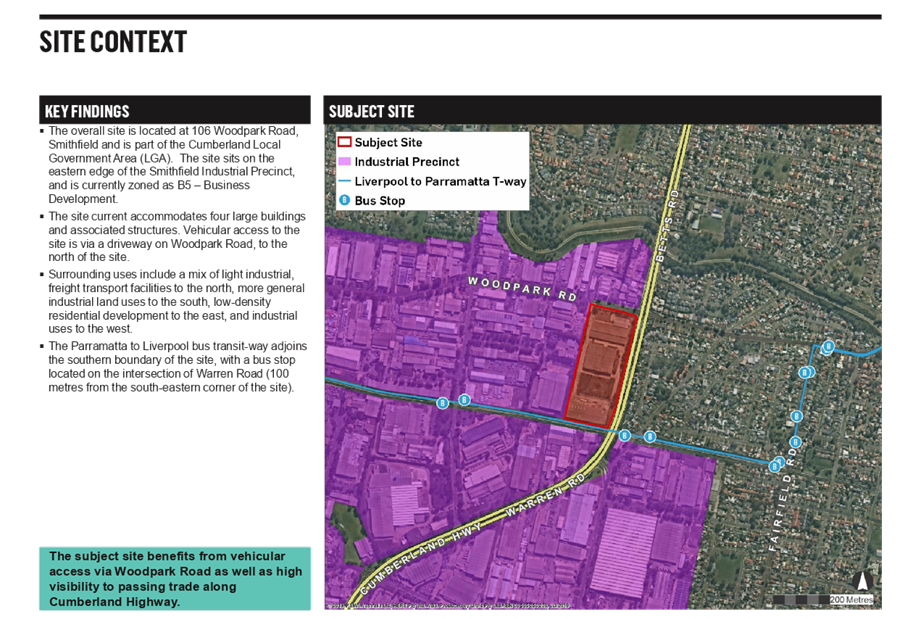
Subject Site and Surrounding Area
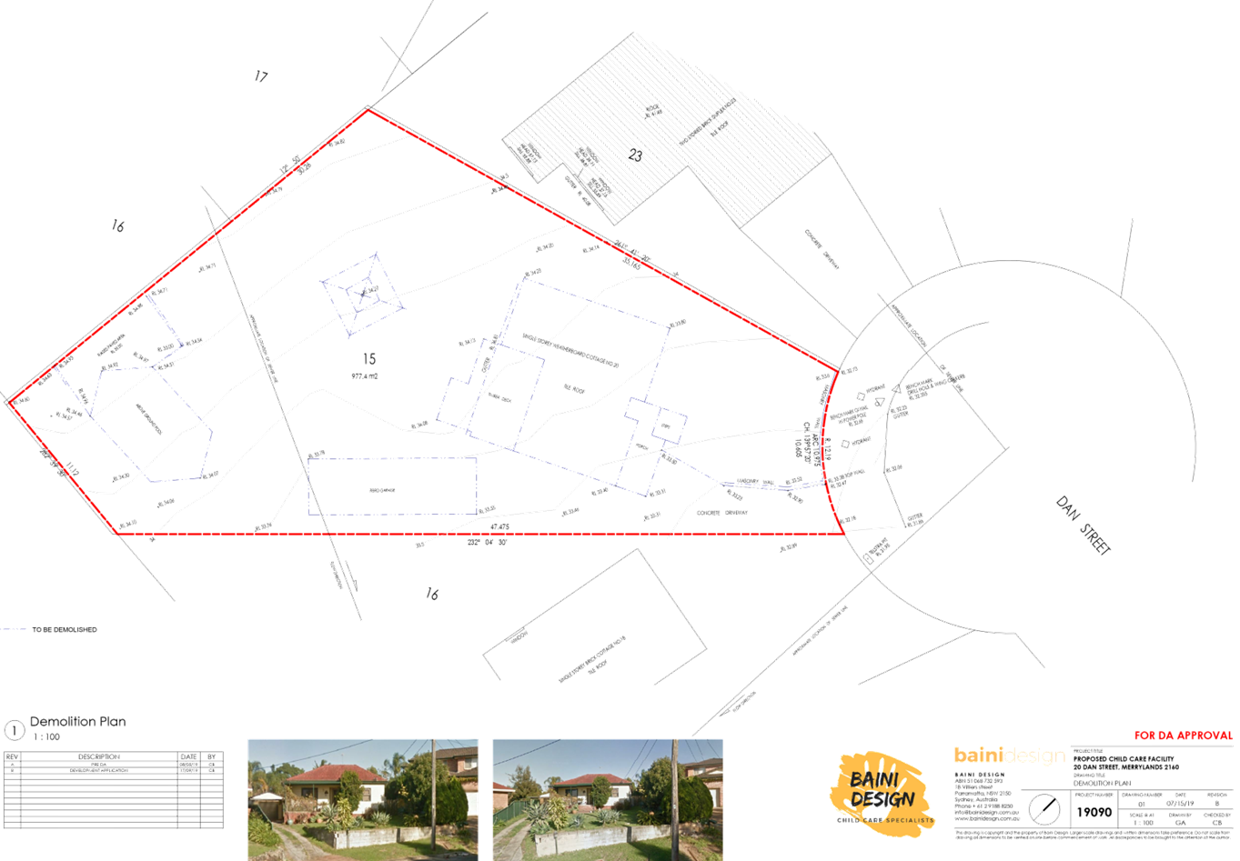
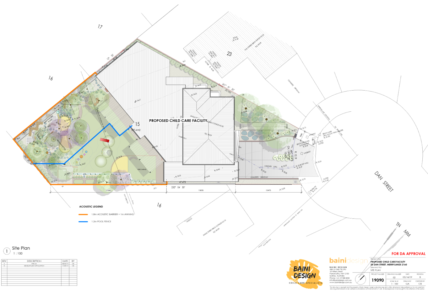
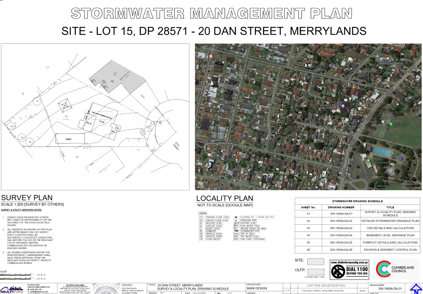
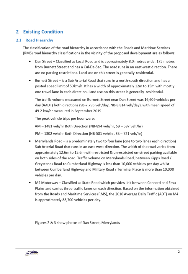
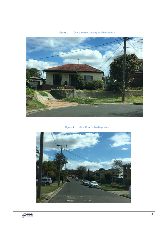
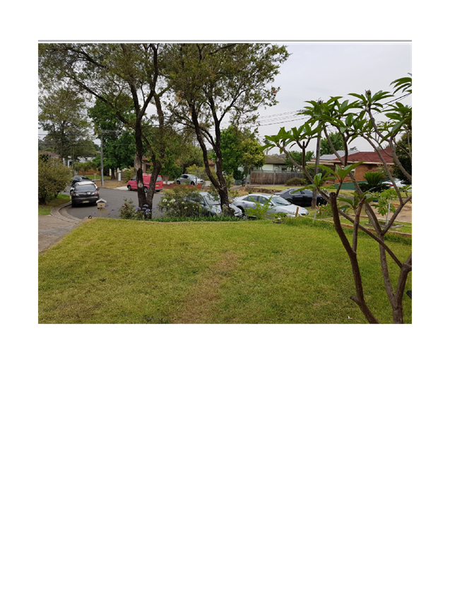
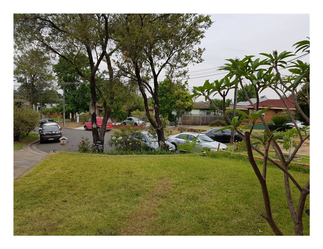
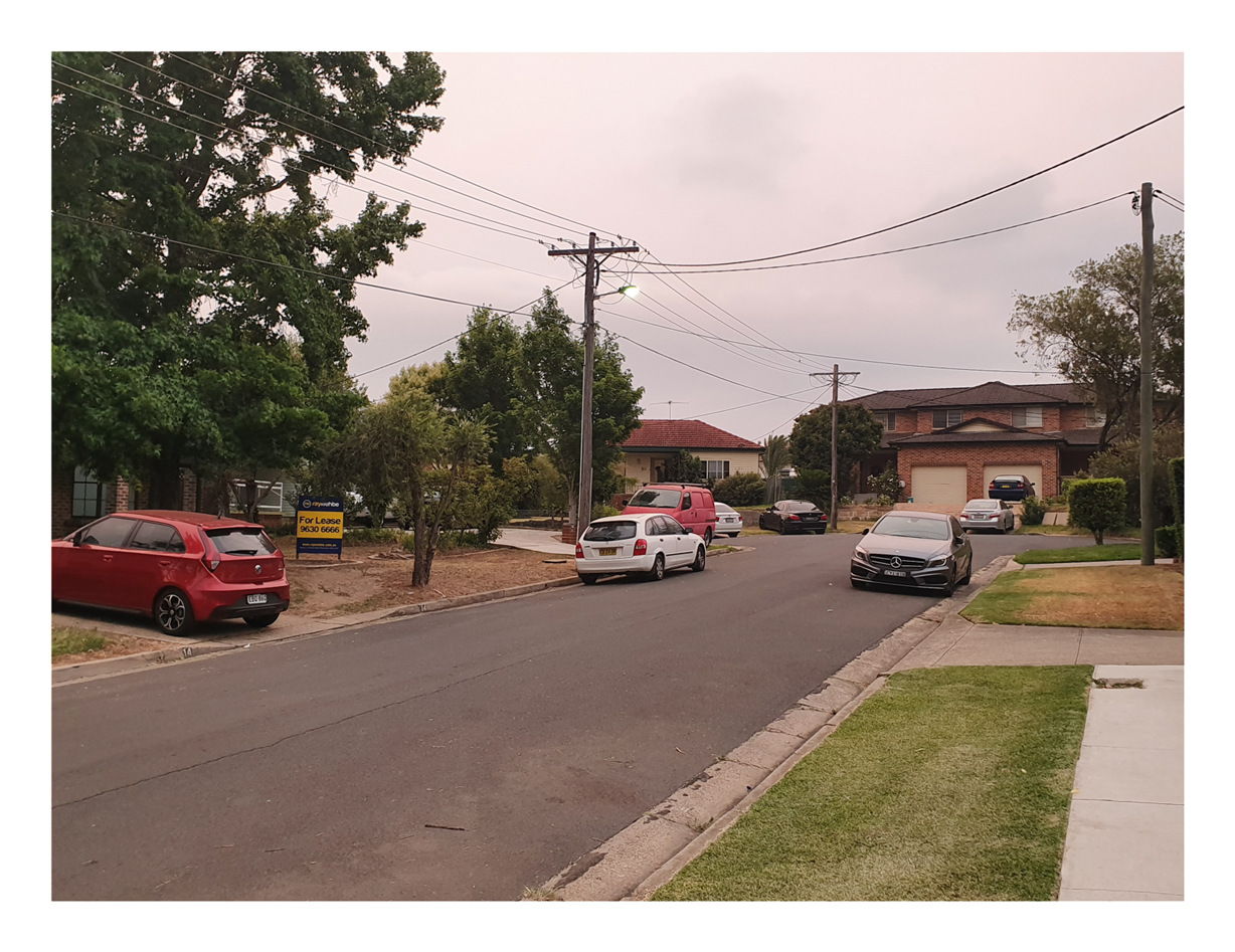
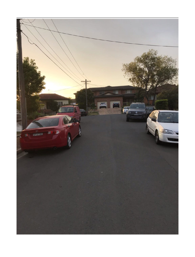
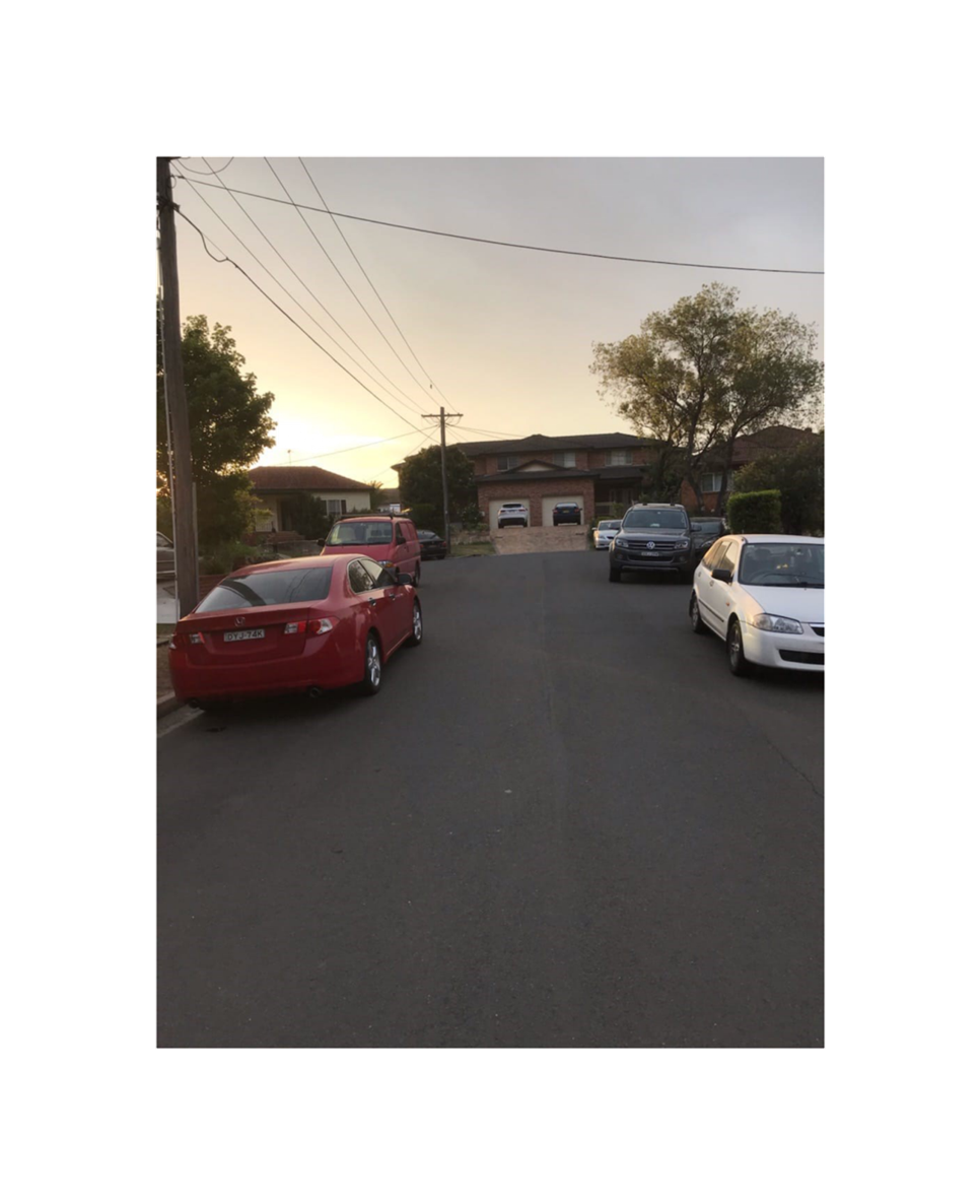
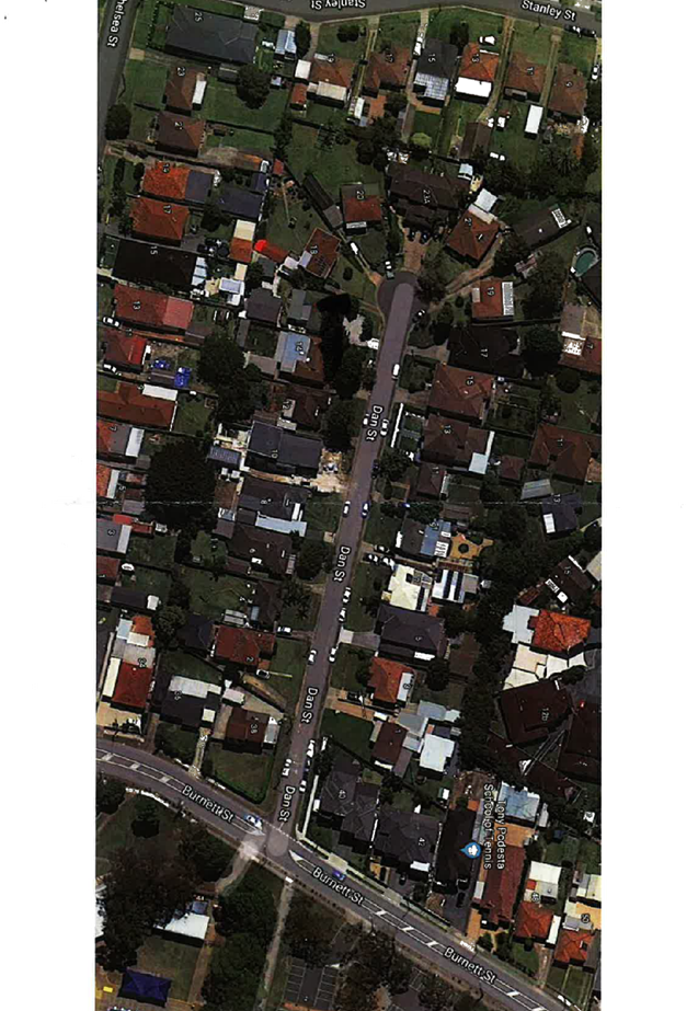
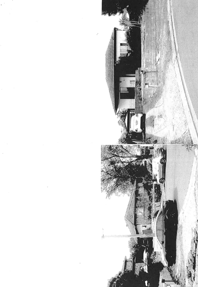
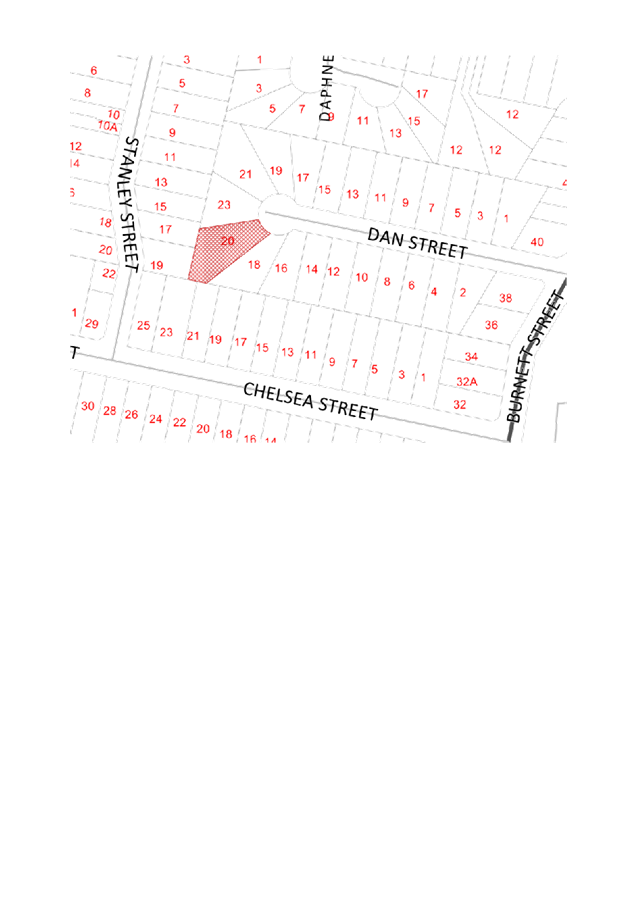
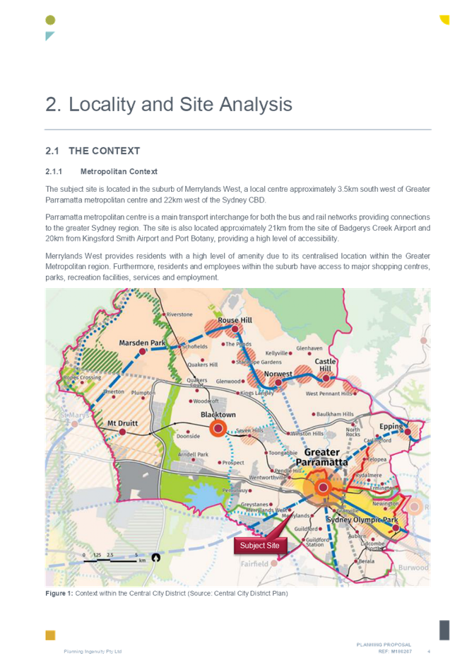
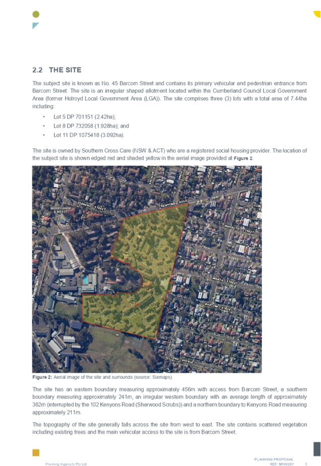
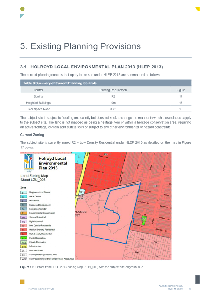
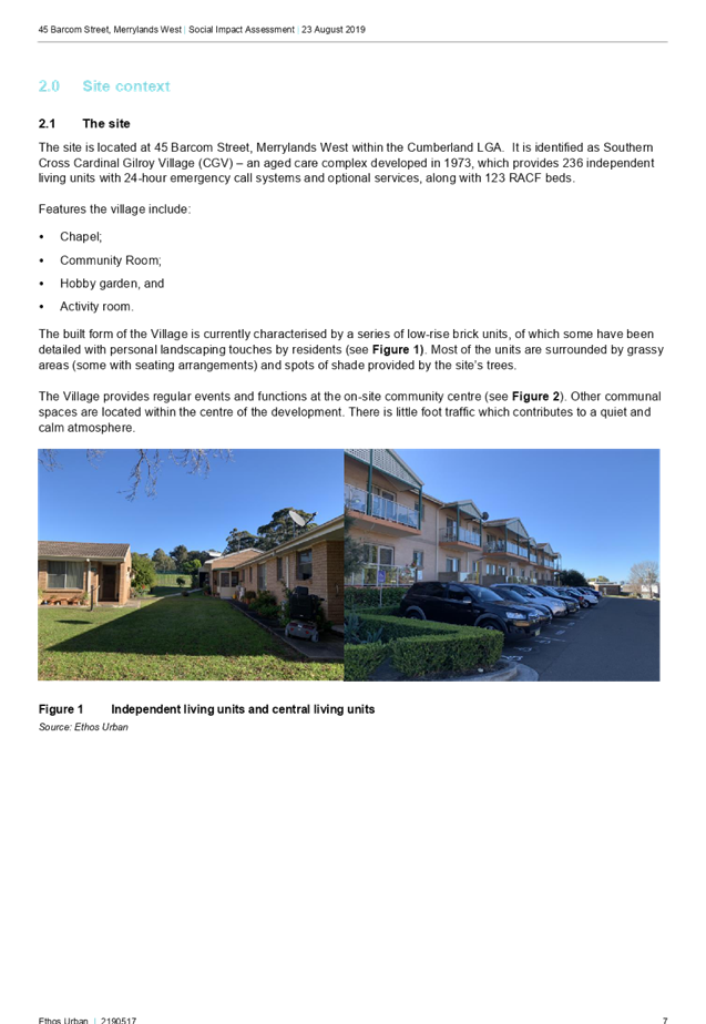
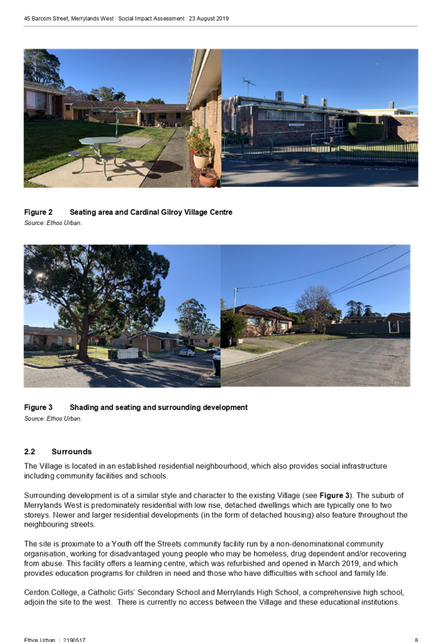
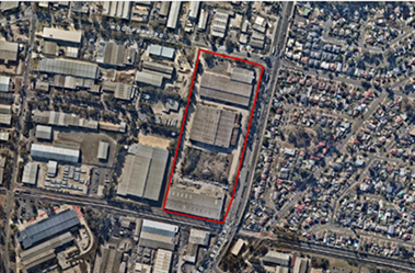
The subject site is known as 20 Dan Street, Merrylands. The legal description of the site is Lot 15 in DP 28571. The subject site and all adjacent sites are zoned R2 – Low Density Residential.
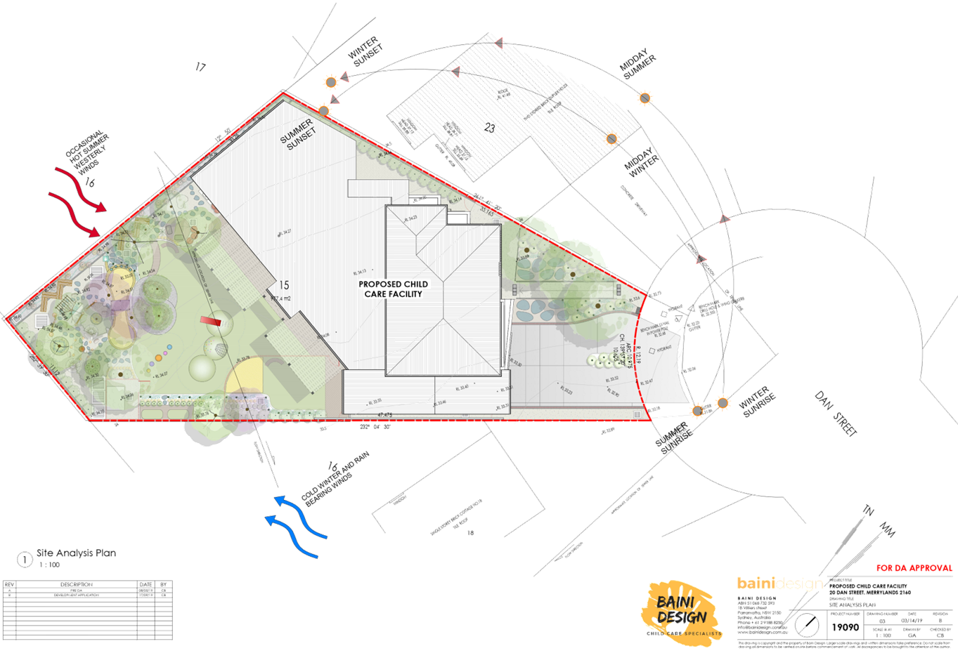
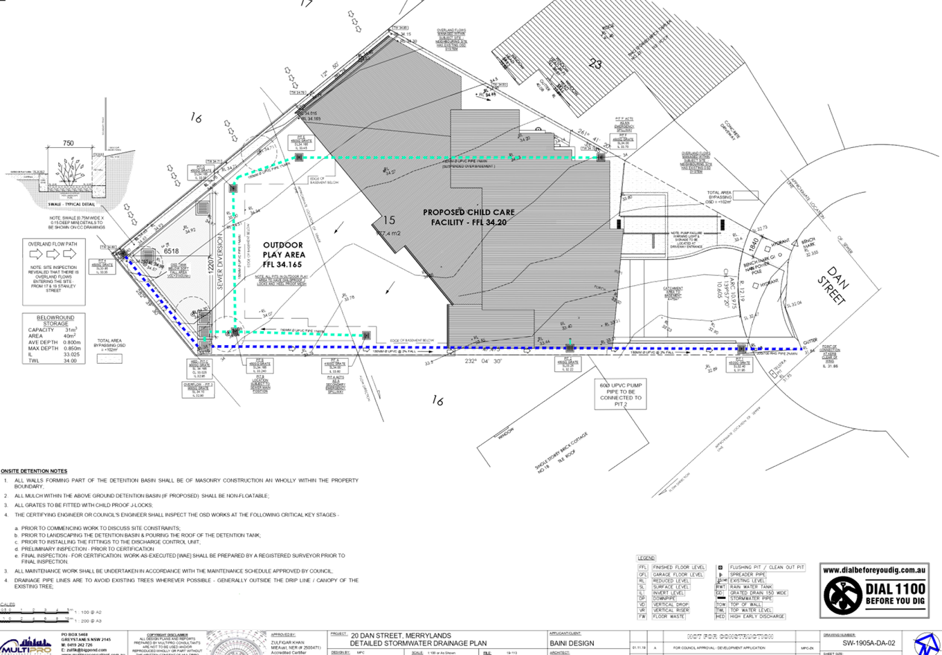
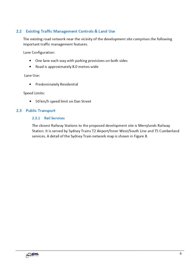
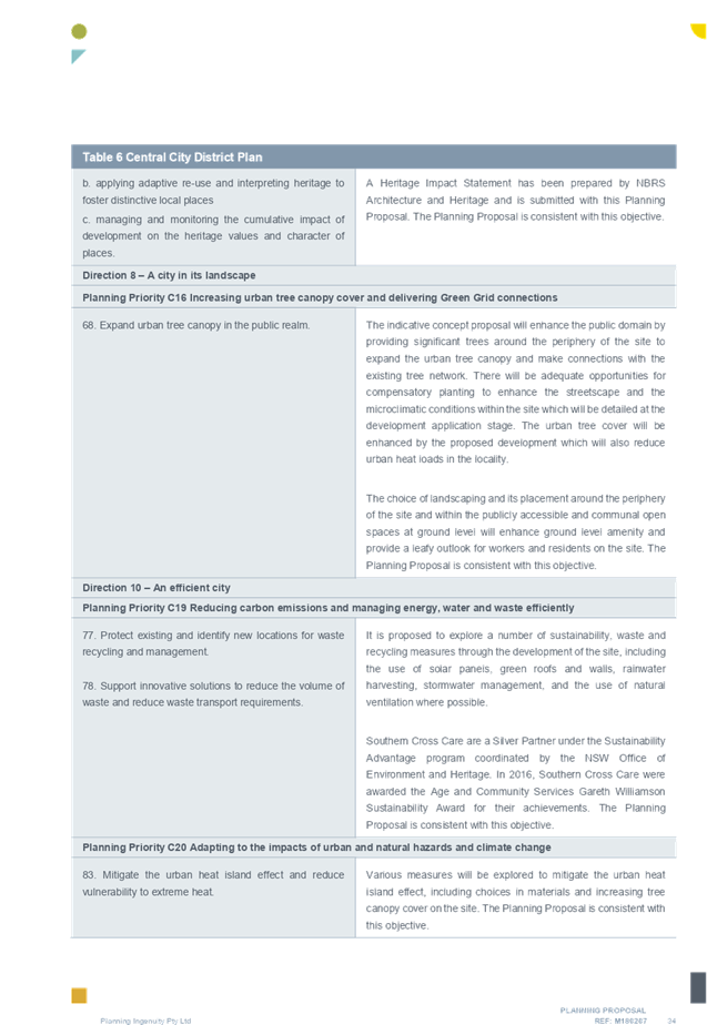
The site is irregular in shape and located in a bulb of the cul-de-sac. It has an arc frontage of 10.975m to Dan Street, and a total area of 977.4m2. The site has a cross fall of approximately 2.64m from the western corner to the eastern corner of the site, and currently contains a single storey dwelling house with a detached garage.
The existing developments adjoining the site include single storey dwelling houses and an attached two storey dual occupancy to the north of the site, and single and two storey dwelling houses on Dan Street.
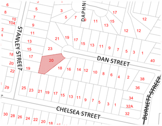
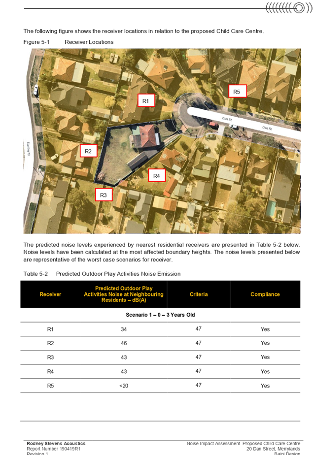
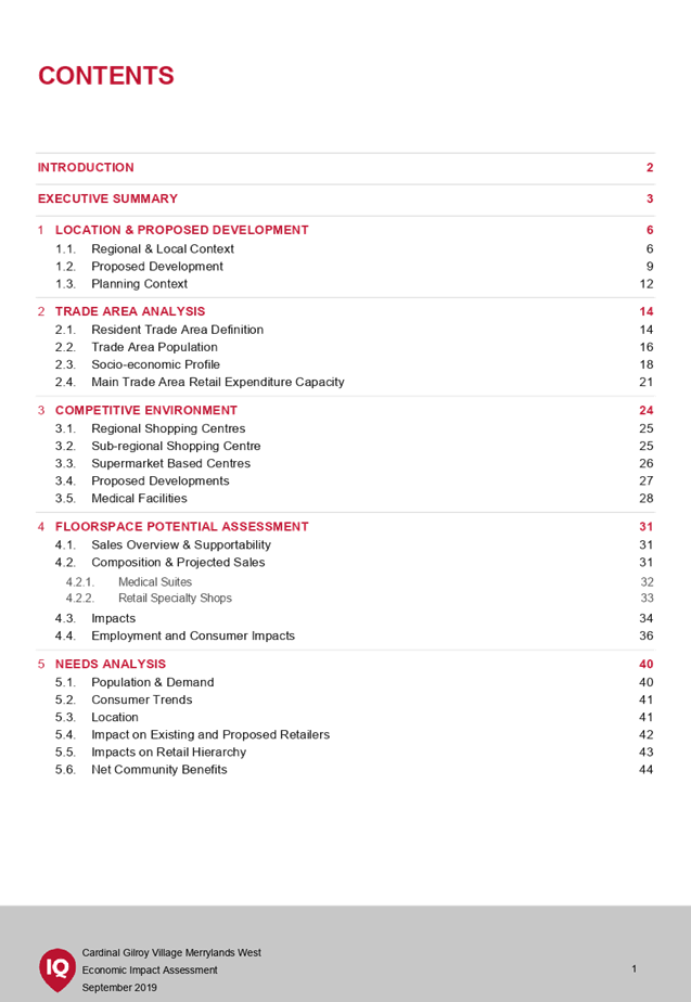
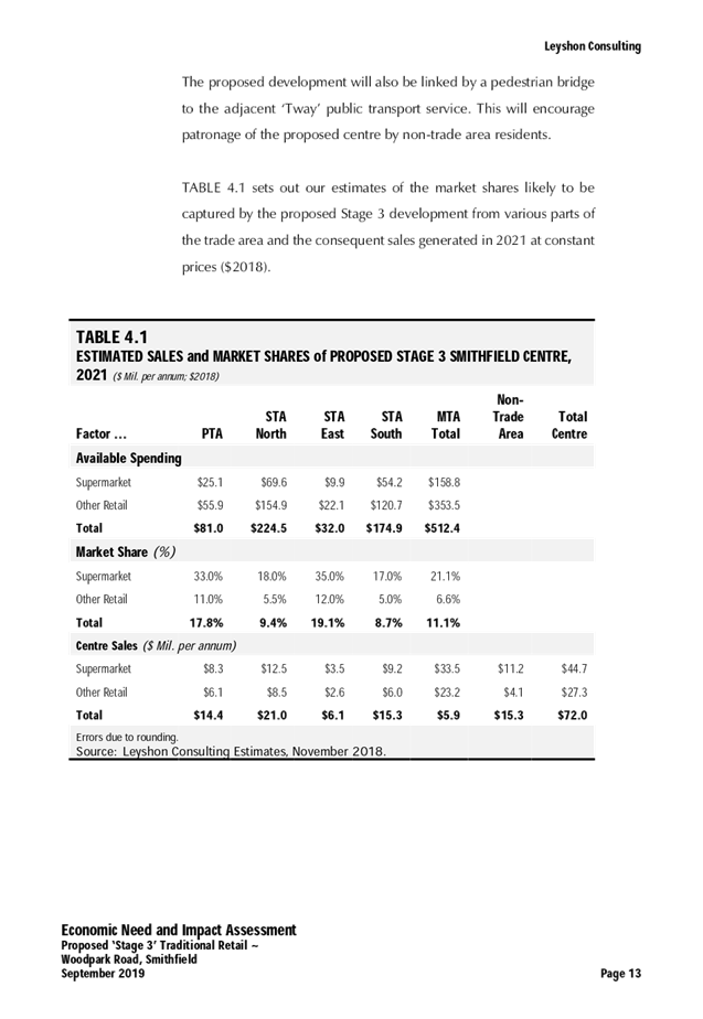
Figure 1 – Locality Plan of subject site
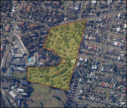
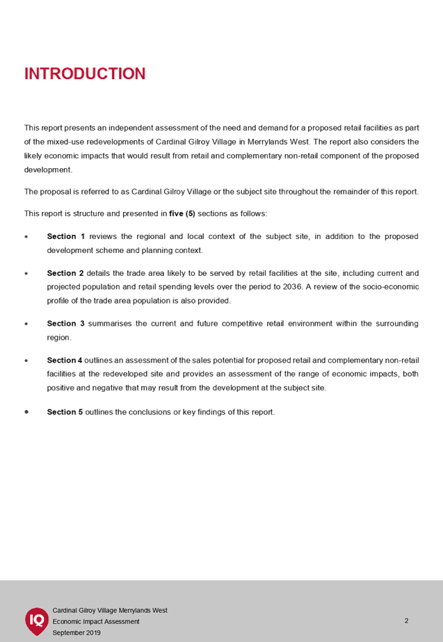
Figure 2 – Aerial view of subject site
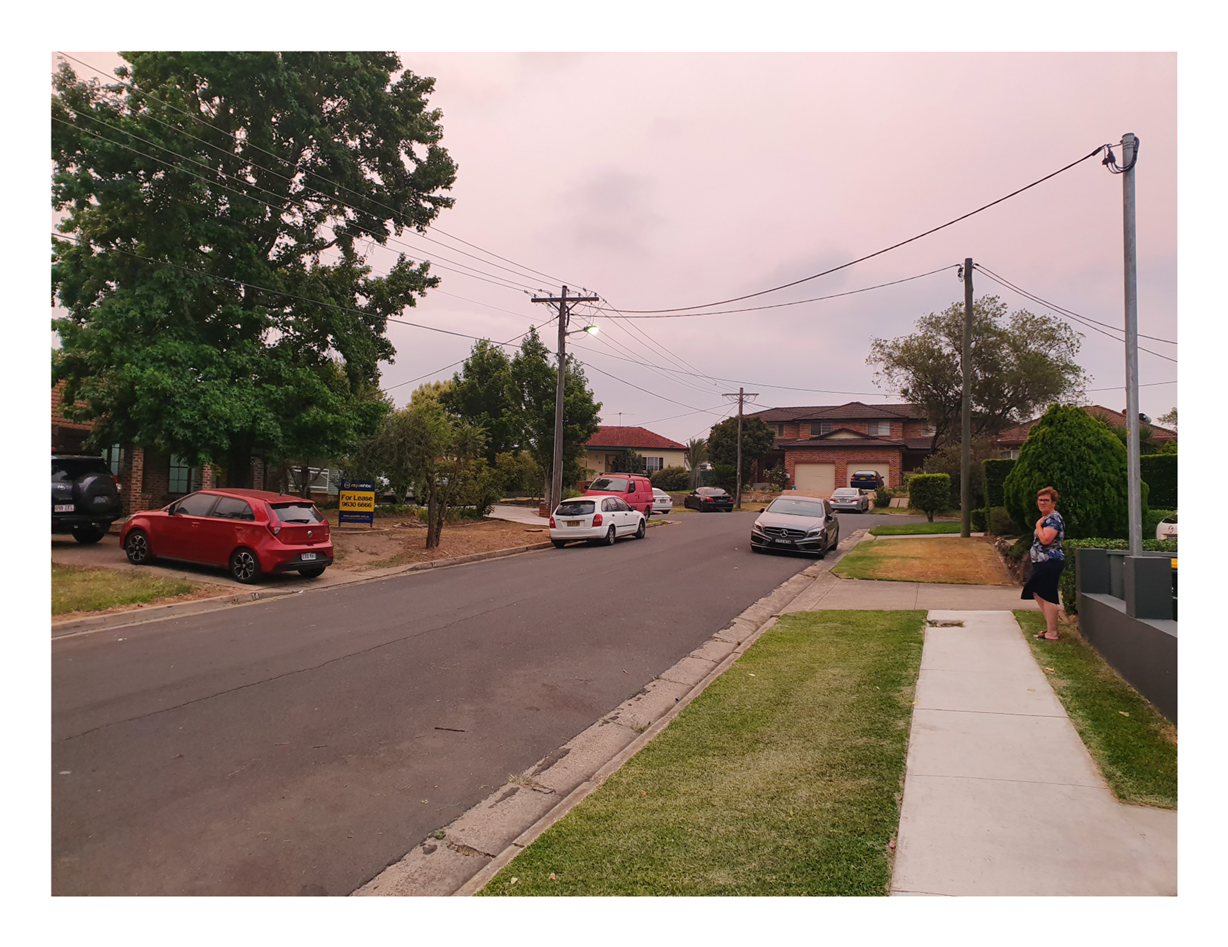
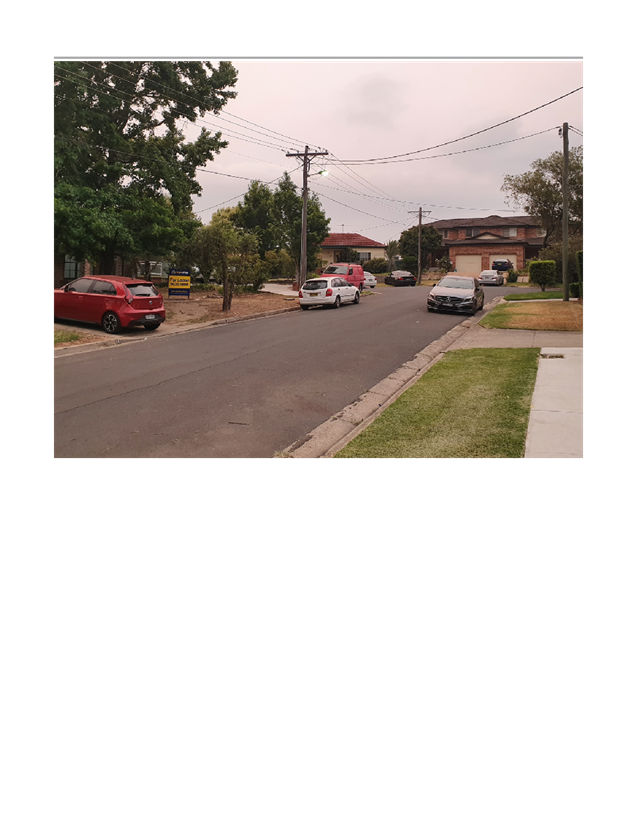
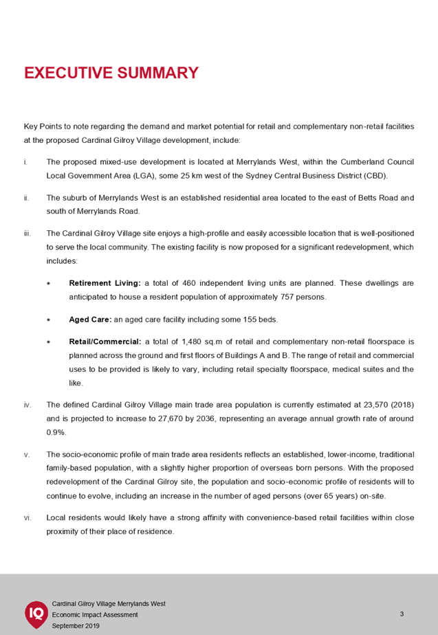
Figure 3 – Street view of subject site
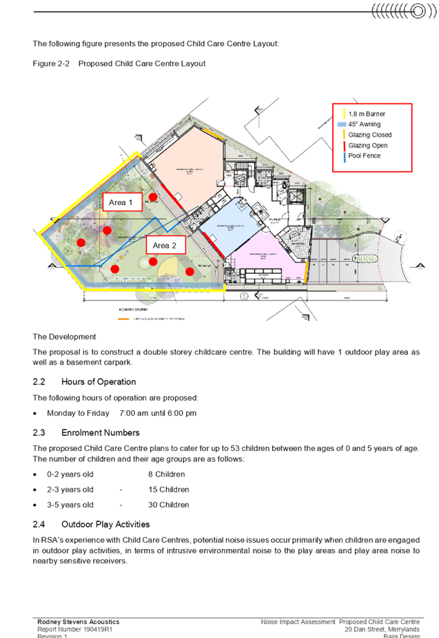
Description of the Proposed Development
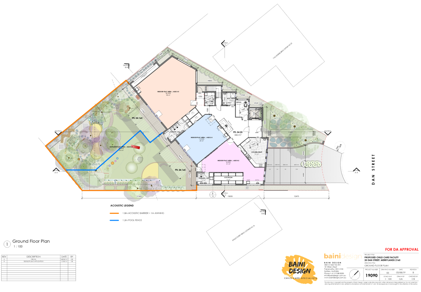
Council has received a development application for the demolition of existing structures and construction of a two storey 53 place child care facility as follows:
· 0-2 years: 8 places;
· 2-3 years: 15 places; and
· 3-5 years: 30 places.
Basement level parking is provided for 18 car spaces.
The proposed centre will operate from 7.00am to 6:00pm Monday to Friday and will employ eight (8) staff.
No signage is proposed as part of the application.
History
|
Date |
Action |
|
10 April 2019 |
Pre-development application lodgement meeting was held (PDA/843) |
|
12 November 2019 |
DA 2019/432 lodged with Council |
|
20 November 2019 |
DA referred to internal sections of Council for comment |
|
27 November 2019 to 11 December 2019 |
DA notified to owners and occupants of surrounding properties. |
|
10 February 2020 |
Advised applicant that Council will not be supporting application and to withdraw |
|
11 March 2020 |
The application reported to CLPP for determination. |
Applicants Supporting Statement
The applicant has provided a Statement of Environmental Effects prepared by Think Planners dated 5 November 2019 and was received by Council on 12 November 2019 in support of the application.
Contact with Relevant Parties
The assessing officer has undertaken a site inspection of the subject site and surrounding properties and has been in regular contact with the applicant throughout the assessment process.
Internal Referrals
Development Engineer
The development application was referred to Council’s Development Engineer for comment who has advised that the development proposal can be supported, subject to recommended conditions of consent.
Traffic Engineer
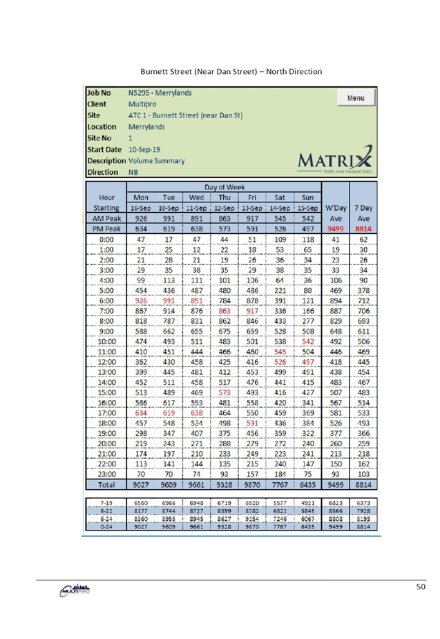
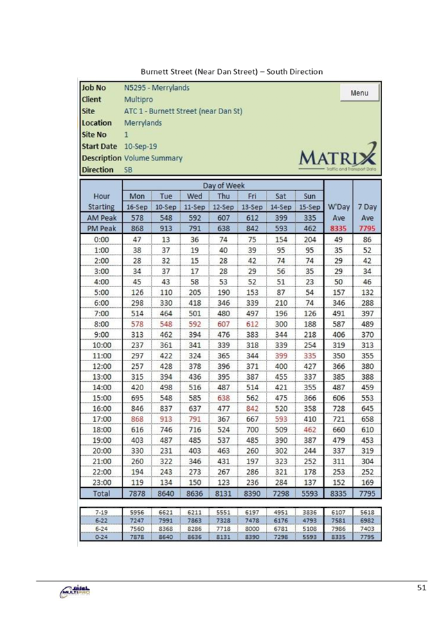
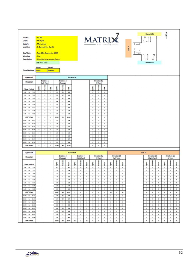
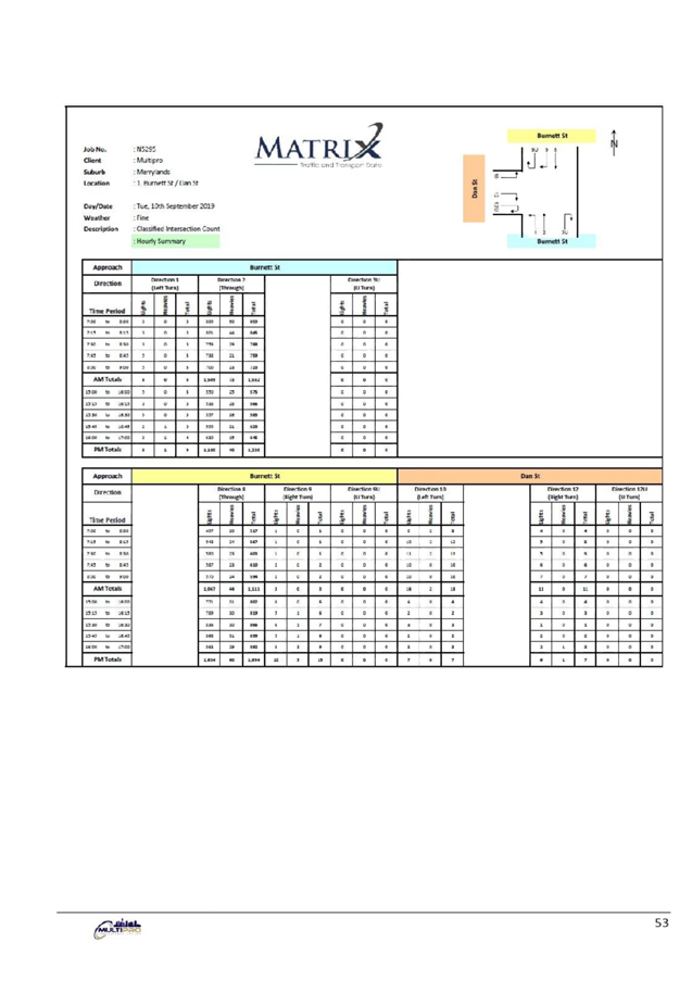
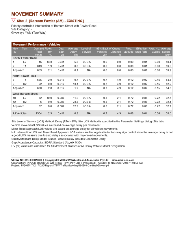
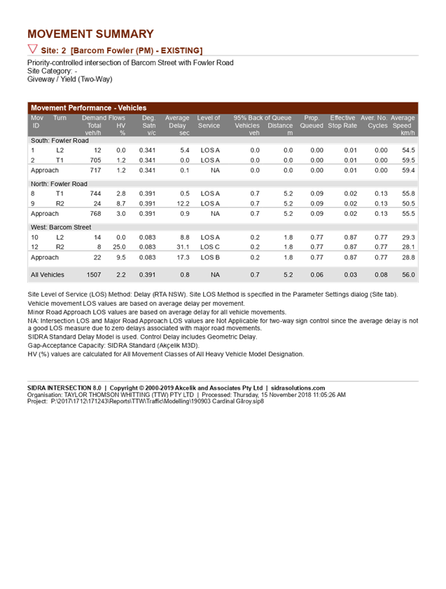
The development application was referred to Council’s Traffic Engineer for comment who has advised the application is unsatisfactory for the following reasons:
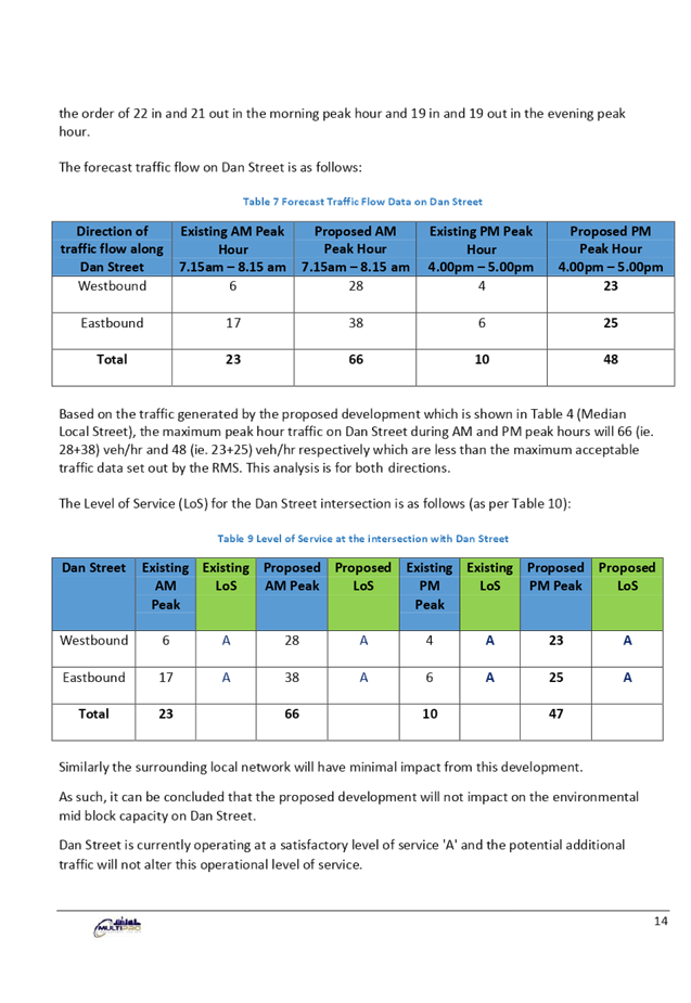
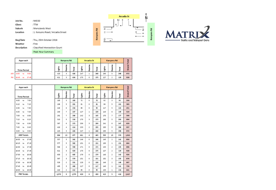
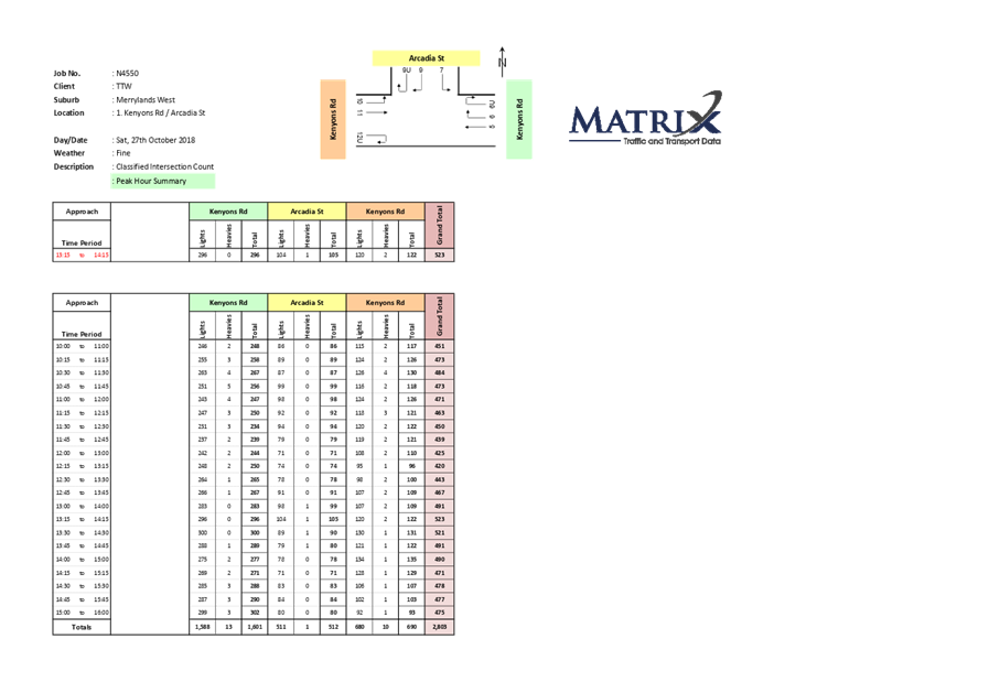
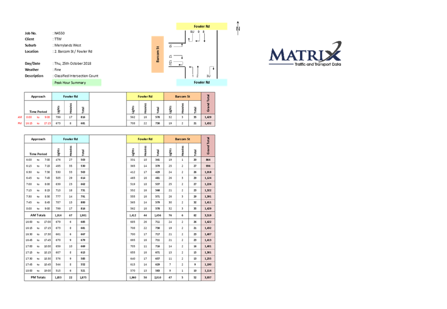
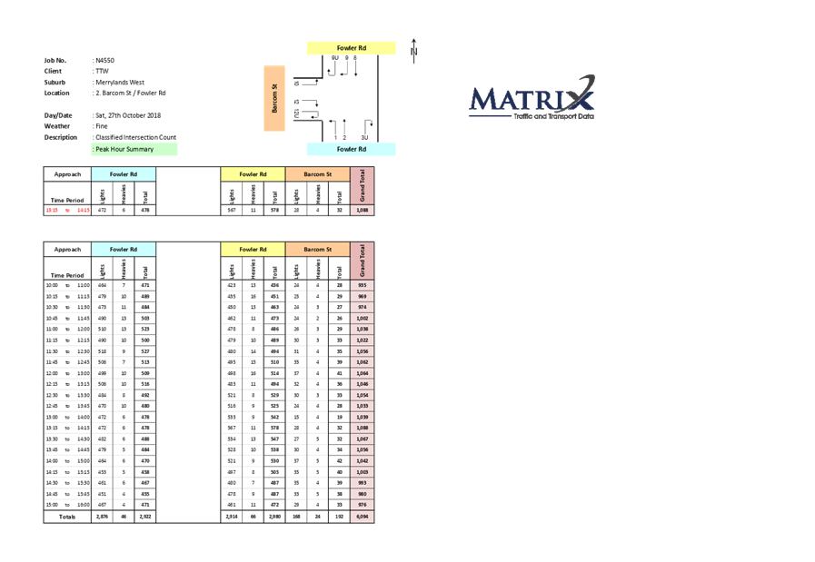
The proposed development will increase the number of peak period traffic moments on Dan Street significantly. The submitted traffic report identified the current peak hour turning moments at the intersection and future prediction. The intersection performance based on the report will be reduced from B to C.
The proposed development is not supported for the following reasons.
1. Childcare centres in a cul-de-sac are not supported under the Holroyd DCP 2013.
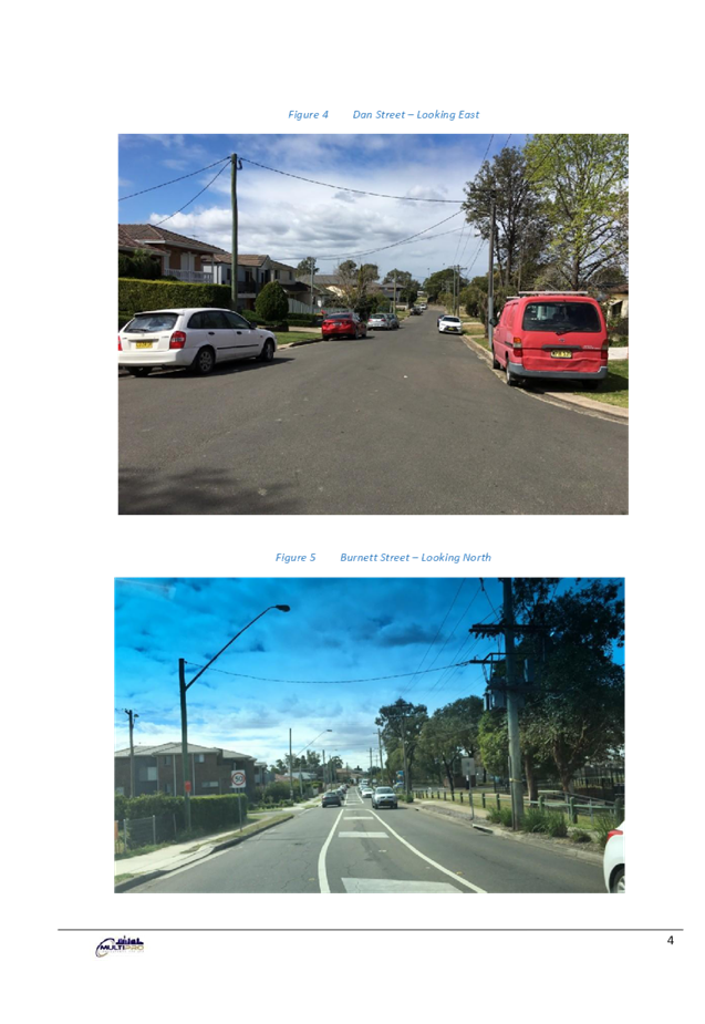
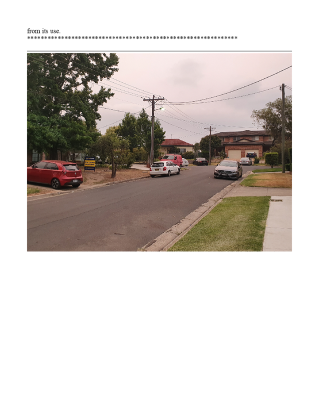
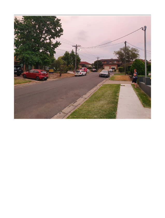
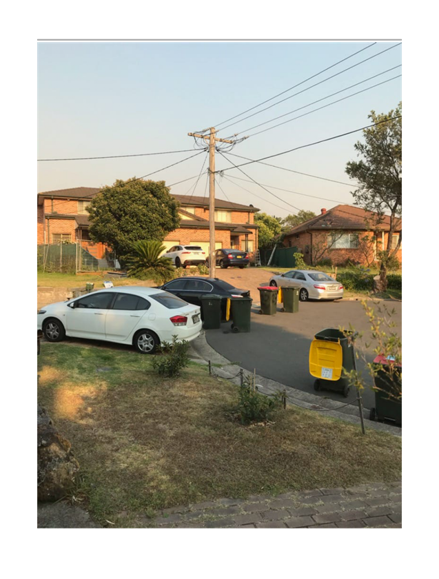
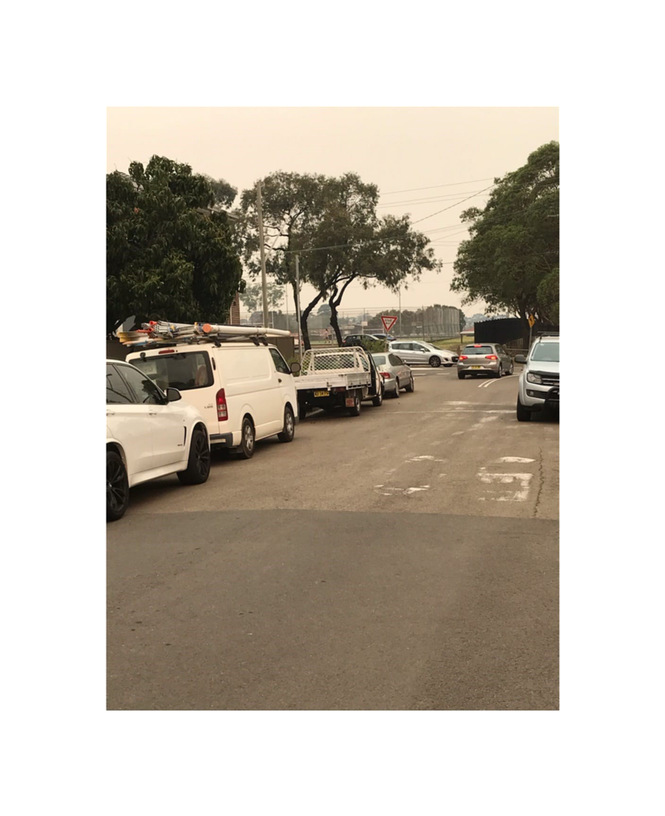
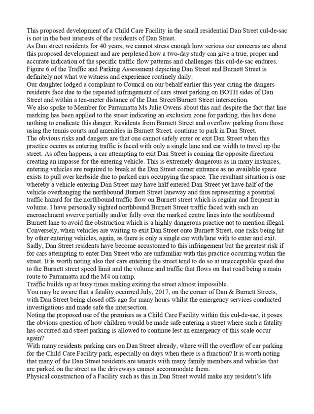
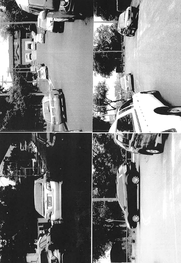
2. Dan Street is a narrow street (7.4m wide) and it is difficult for continuous two way movements between parked cars on the street.
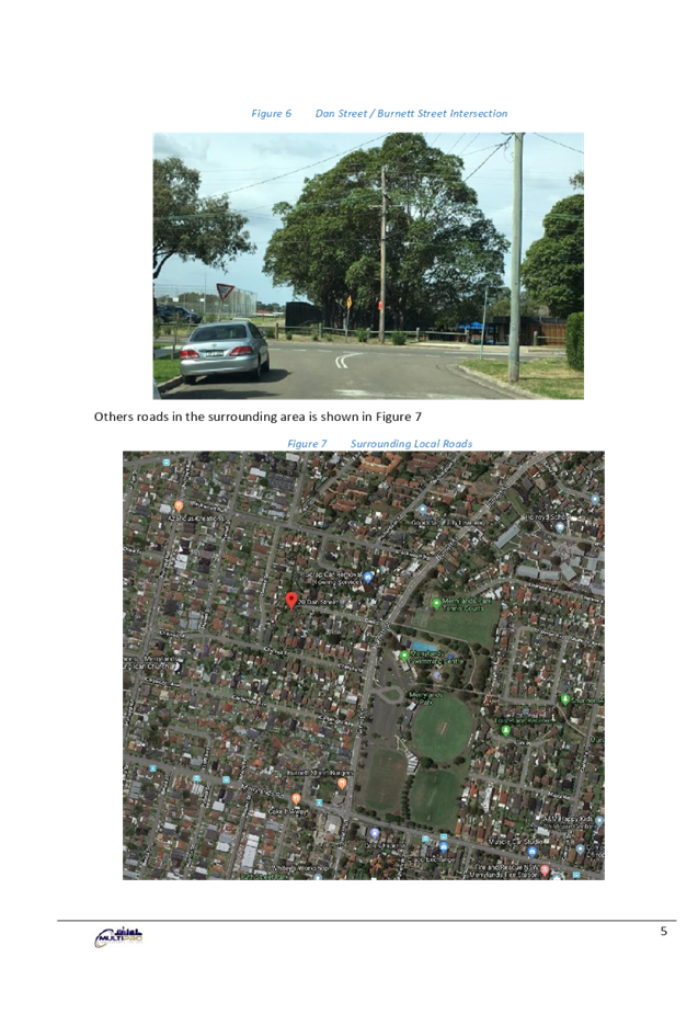
3. The additional right turn moments from Burnett Street to Dan Street generated by the proposed development will delay the north bound traffic significantly on Burnett Street, as it is single lane in each direction with an Average Daily Traffic (ADT) approximately 19,000.
4. There will be an increased delay for exiting Dan Street households to enter and exit Burnett Street, especially right movements, which will affect the amenity of the residents of Dan Street.
Environment and Health
The development application was referred to Council’s Environment and Health Officer for comment who has advised that the development proposal can be supported, subject to conditions.
Landscape Officer
The development application was referred to Council’s Landscape Officer for comment who has advised that the development proposal can be supported, subject to conditions.
Waste Management
The development application was referred to Council’s Waste Management Officer for comment who has advised that the development proposal can be supported, subject to conditions.
Children Services
The development application was referred to Council’s Children Services team for comment who has advised that the development proposal can be supported, subject to conditions.
External Referral
Endeavour Energy
The development application was referred to Endeavour Energy for comment who has advised that the development proposal can be supported, subject to conditions.
Tran’s grid
The development application was referred to Council’s Environment and Health Officer for comment who has advised that the development proposal can be supported, subject to conditions.
Planning Comments
The provisions of any Environmental Planning Instruments (EP&A Act s4.15 (1)(a)(i))
State Environmental Planning Policies
The proposed development is affected by the following State Environmental Planning Policies:
(a) State Environmental Planning Policy (Educational Establishments and Child Care Facilities) 2017
The relevant provisions of the SEPP have been considered in the assessment of the Application.
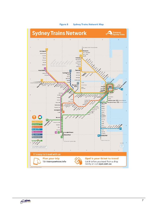
It is noted that State Environmental Planning Policy (Educational Establishments and Child Care Facilities) 2017 commenced on 1 September 2017. The SEPP applies to any proposals for new schools or child care centres or proposed alterations and additions to existing centres. The relevant provisions of the SEPP have been considered in the assessment of the Application.
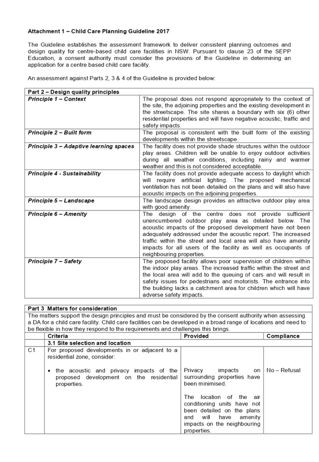
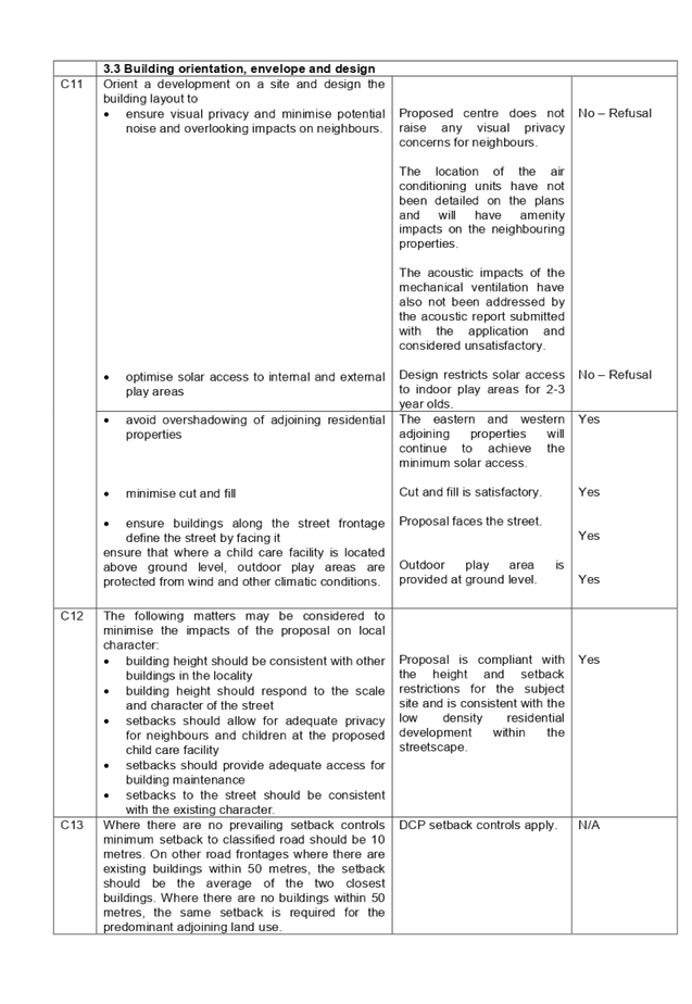
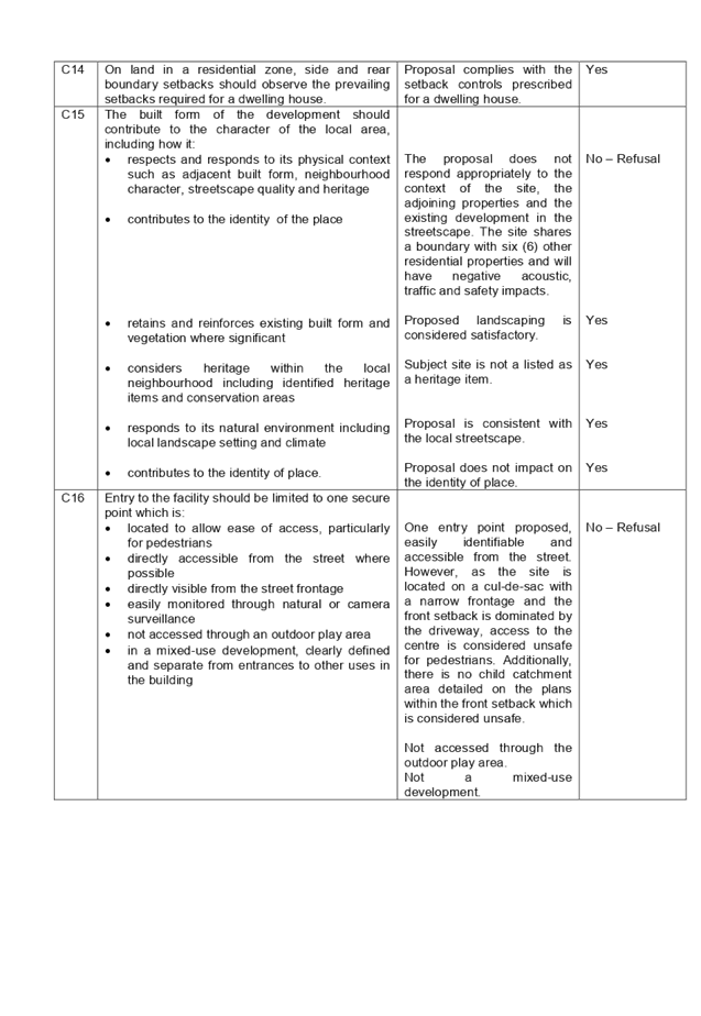
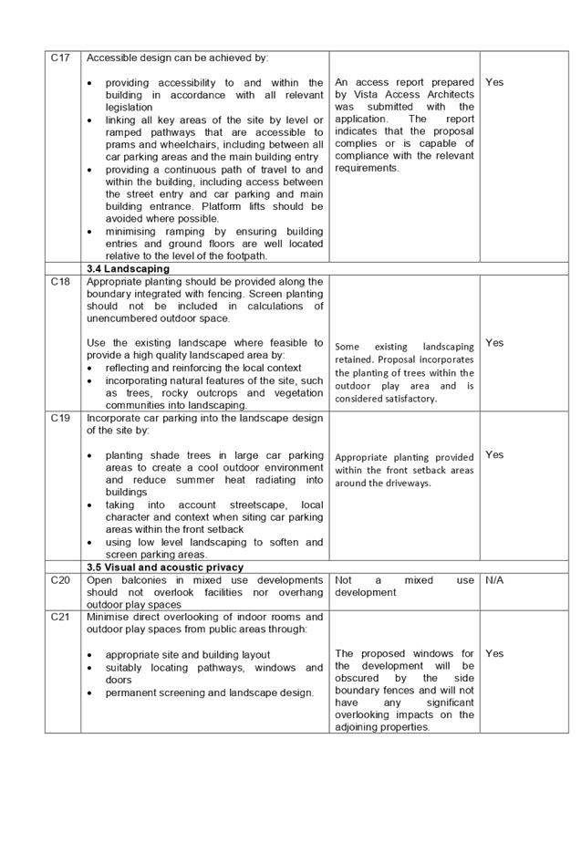
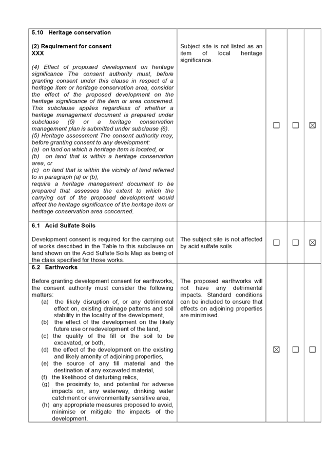
A comprehensive assessment and compliance table is attached to this report in Attachment 1, which indicates that there are non-compliances with the SEPP 2017 with regard to traffic, solar access, supervision, outdoor play area requirements, and safety and amenity impacts. Planning assessment of this application identifies concerns with the following design quality principles:
|
Part 2 – Design quality principles |
|
|
Principle 1 – Context |
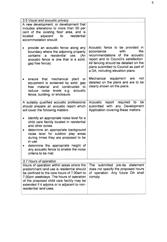
The proposal does not respond appropriately to the context of the site, adjoining properties and the existing development in the vicinity. The site shares its boundaries with six (6) other residential properties and will have negative acoustic, traffic and safety impacts. |
|
Principle 3 – Adaptive learning spaces |
The facility does not provide shade structures within the outdoor play areas. Children will be unable to enjoy outdoor activities during all weather conditions, including rainy and warmer weather and this is not considered acceptable. |
|
Principle 4 - Sustainability |
The facility does not provide adequate access to daylight which will require artificial lighting. The proposed mechanical ventilation has not been detailed on the plans and that may also have acoustic impacts on the adjoining properties. |
|
Principle 6 – Amenity |
The design of the centre does not provide sufficient unencumbered outdoor play area as detailed below. The acoustic impacts of the proposed development have not been adequately addressed under the acoustic report as the location of the mechanical ventilation has not provided. The increased traffic within the street and local area will also have amenity impacts for all users of the facility, as well as occupants of neighbouring properties. |
|
Principle 7 – Safety |
The proposed facility allows poor supervision of children within the indoor play areas. The increased traffic within the street and the local area will add to the queuing of cars and will result in safety issues for pedestrians and motorists. The entrance into the building lacks a catchment area for children which will have adverse safety impacts. |
In this regard, the above non-compliances are considered unacceptable and included as reasons for refusal in the draft Notice of Determination.
|
Part 3 – Matters for consideration |
||
|
Control |
Required |
Provided |
|
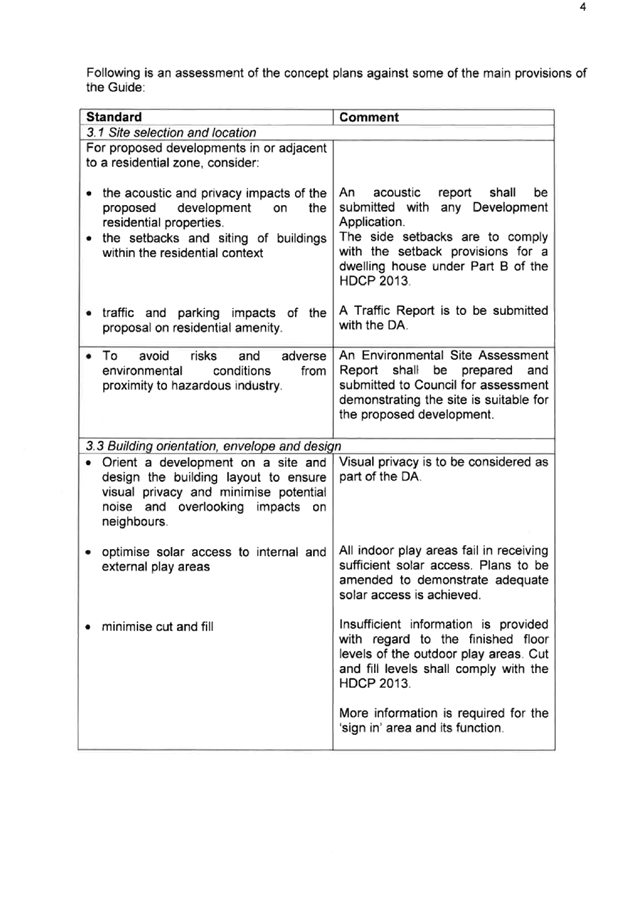
3.1 Site selection and location |
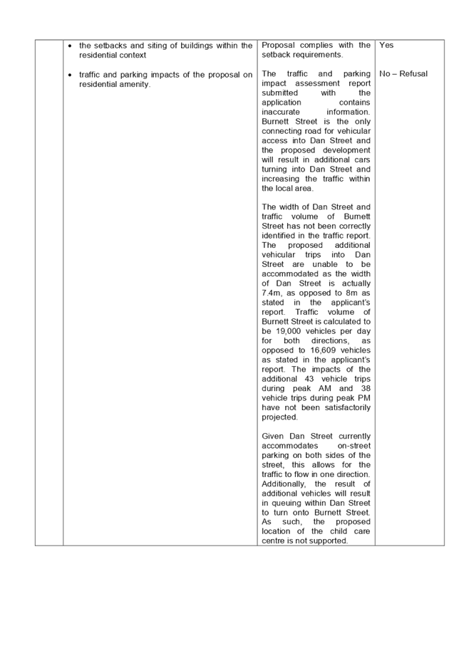
For proposed developments in or adjacent to a residential zone, consider traffic and parking impacts of the proposal on residential amenity.
|
The subject site is located on a residential cul-de-sac which will result in additional traffic and safety impacts. The traffic report submitted with the application provides inaccurate information and does not demonstrate the suitability of the site for the proposed development. In this regard, the above non-compliance is considered unacceptable and included as a reason for refusal in the draft determination. |
|
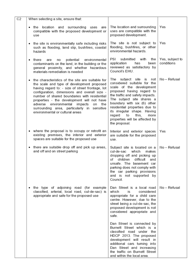
When selecting a site, ensure that the characteristics of the site are suitable for the scale and type of development proposed having regard to the number of shared boundaries with residential properties. |
The subject site shares its boundaries with six (6) other residential properties due to its irregular shape. Having regard to this, more properties will be affected by the proposal. In this regard, the above non-compliance is considered unacceptable and included as a reason for refusal in the draft determination. |
|
|
3.3 Building, orientation, envelope and design |
Orient a development on a site and design the building layout to optimise solar access to internal and external play areas. |
Design of the centre restricts solar access to indoor play areas for 2-3 year olds. In this regard, the above non-compliance is considered unacceptable and included as a reason for refusal in the draft determination. |
|
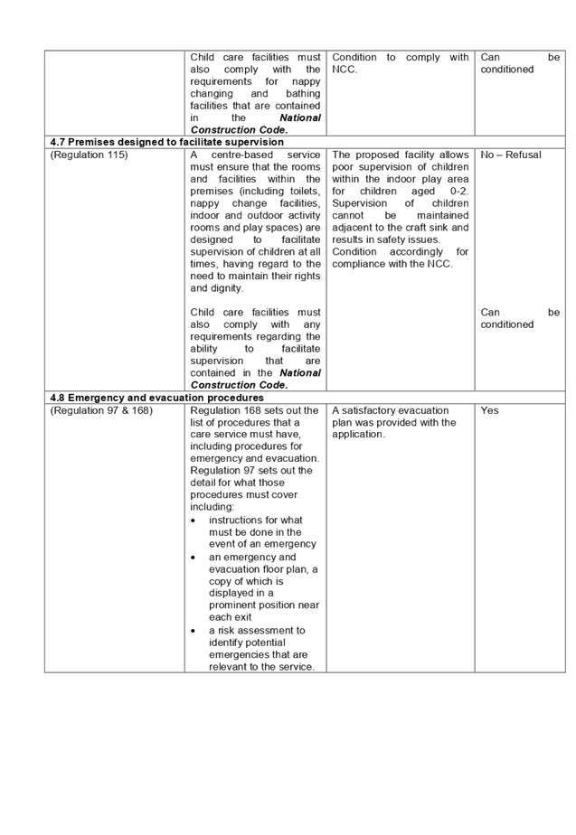
4.7 Premises designed to facilitate supervision |
A centre-based service must ensure that the rooms and facilities within the premises (including toilets, nappy change facilities, indoor and outdoor activity rooms and play spaces) are designed to facilitate supervision of children at all times, having regard to the need to maintain their rights and dignity. |
Inadequate supervision of children is provided in the indoor play area for children aged 0-2. In this regard, the above non-compliance is considered unacceptable and included as a reason for refusal in the draft determination. |
|
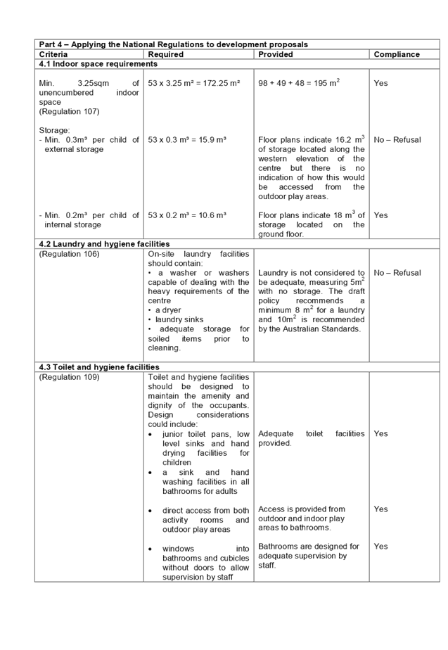
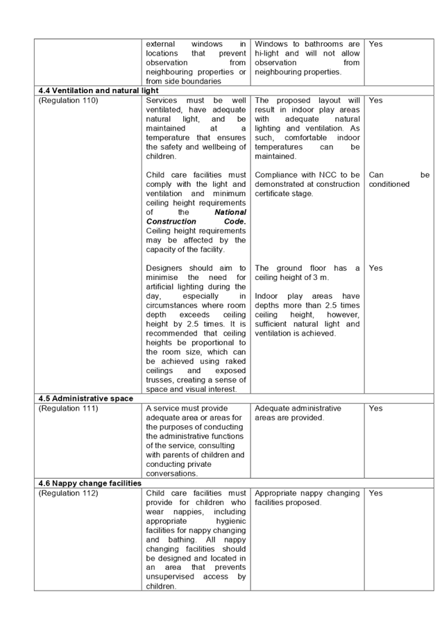
Part 4 – Applying the National Regulations to development proposals |
||
|
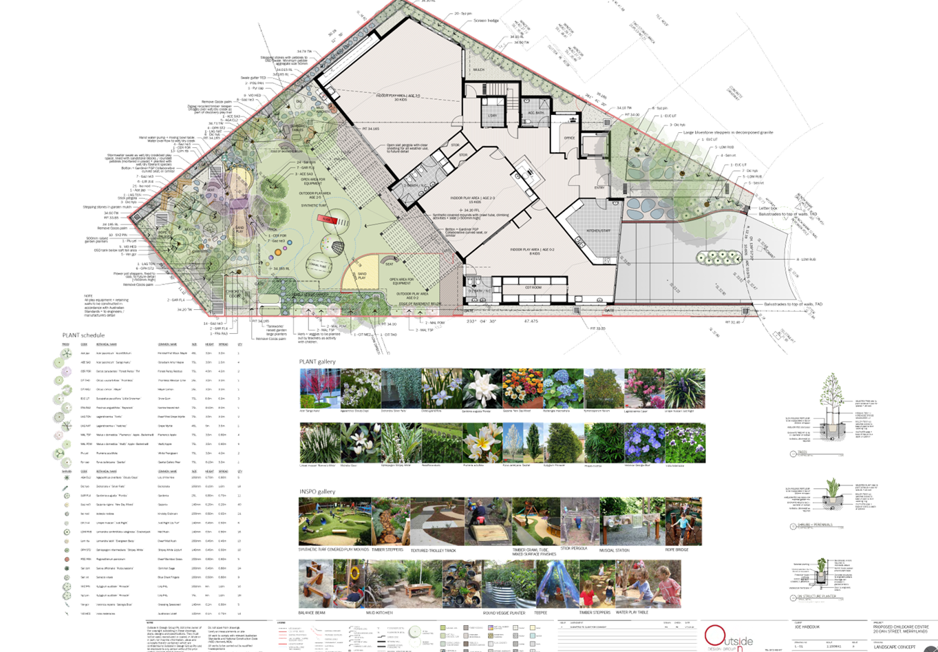
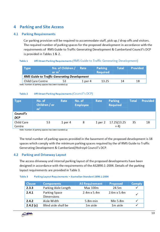
4.9 Outdoor space requirements |
Min. 7m² of unencumbered outdoor space per child.
30 x 7m2 = 210m2 23 x 7m2 = 161m2 |
Outdoor play area for children aged 3-5 has a total area of 186.4m2, which does not comply with the minimum unencumbered outdoor space requirements. A maximum of 26 children can be accommodated. In this regard, the above non-compliance is considered unacceptable and included as a reason for refusal in the draft determination. |
|
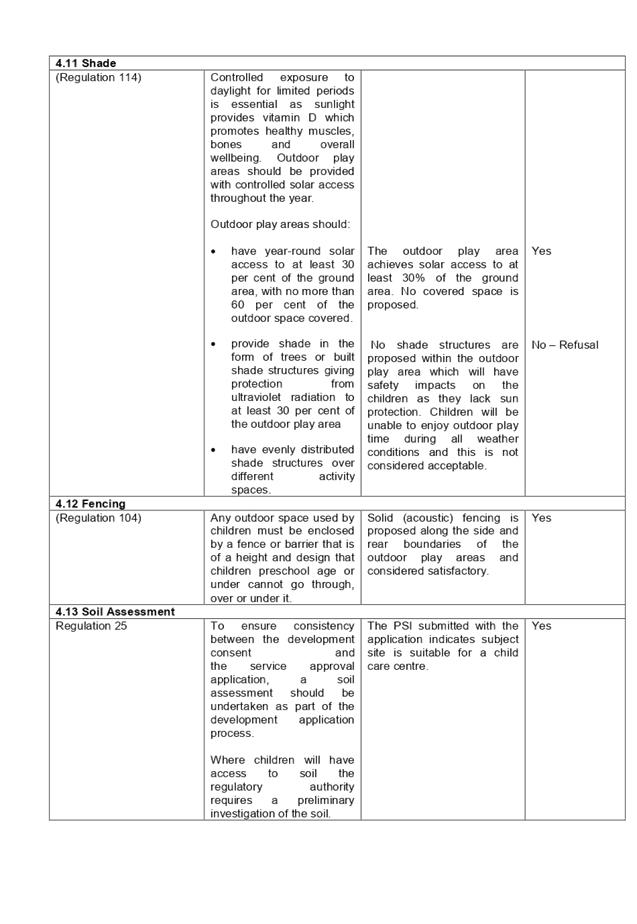
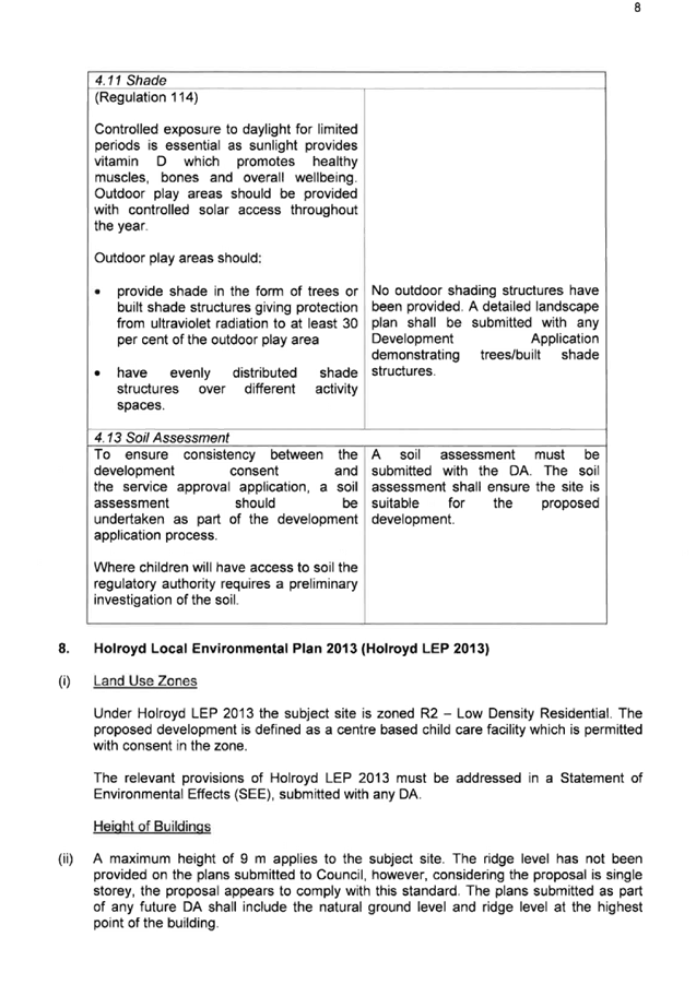
4.11 Shade |
Outdoor play areas should:
· Have year-round solar access to at least 30 per cent of the ground area, with no more than 60 per cent of the outdoor space covered.
· provide shade in the form of trees or built shade structures giving protection from ultraviolet radiation to at least 30 per cent of the outdoor play area
· Have evenly distributed shade structures over different activity spaces. |
The proposed outdoor play area does not include any shade structures. In this regard, the above non-compliance is considered unacceptable and included as a reason for refusal in the draft determination. |
(b) State Environmental Planning Policy (Vegetation in Non-Rural Areas) 2017
N/A – No vegetation removal is proposed.
(c) State Environmental Planning Policy No. 55 – Remediation of Land (SEPP 55)
Clause 7 of SEPP 55 requires Council to be satisfied that the site is suitable or can be made suitable to accommodate the proposed development. The matters listed within Clause 7 have been considered in the assessment of the development application.
|
Matter for Consideration |
Yes/No |
|
|
Does the application involve re-development of the site or a change of land use? |
Yes No |
|
|
Is the development going to be used for a sensitive land use (e.g.: residential, educational, recreational, childcare or hospital)? |
Yes No |
|
|
Does information available to you indicate that an activity listed below has ever been approved, or occurred at the site? acid/alkali plant and formulation, agricultural/horticultural activities, airports, asbestos production and disposal, chemicals manufacture and formulation, defence works, drum re-conditioning works, dry cleaning establishments, electrical manufacturing (transformers), electroplating and heat treatment premises, engine works, explosive industry, gas works, iron and steel works, landfill sites, metal treatment, mining and extractive industries, oil production and storage, paint formulation and manufacture, pesticide manufacture and formulation, power stations, railway yards, scrap yards, service stations, sheep and cattle dips, smelting and refining, tanning and associated trades, waste storage and treatment, wood preservation |
Yes No |
|
|
Is the site listed on Council’s Contaminated Land database? |
Yes No |
|
|
Is the site subject to EPA clean-up order or other EPA restrictions? |
Yes No |
|
|
Has the site been the subject of known pollution incidents or illegal dumping? |
Yes No |
|
|
Does the site adjoin any contaminated land/previously contaminated land? |
Yes No |
|
|
Has the appropriate level of investigation been carried out in respect of contamination matters for Council to be satisfied that the site is suitable to accommodate the proposed development or can be made suitable to accommodate the proposed development? |
Yes No |
|
|
Details of contamination investigations carried out at the site: Preliminary site investigation (PSI) and detailed site investigation (DSI) reports prepared by Geotechnical Consultants Australia were submitted with the application and the following recommendations have been made to be carried out during the Construction Certificate stage: · Hazardous Materials Survey (HMS) with sampling should be taken to ensure no ACM is present within the onsite structures. This survey is strongly recommended if demolition is required; · Any soils requiring excavation, on-site reuse and/or removal must be classified in accordance with “Waste Classification Guidelines Part 1: Classifying Waste” NSW EPA (2014); · The demolition of any structures and excavation activity on site be undertaken in accordance with relevant Australian Standards, Safe Work NSW codes of practice and any other applicable requirements; · Any areas of the site suspected of containing ACM including soil and/or fill material are to be handled in accordance with relevant Australian Standards, Safe Work NSW codes of practice and any other applicable requirements; and · A site specific ‘Unexpected Finds Protocol’ is to be made available for reference for all occupants and/or site workers in the event unanticipated contamination is discovered, including asbestos. Conditions would have been included in the draft determination to require compliance with the recommendations of the PSI, if consent were to be granted. |
|
|
(a) Sydney Regional Environmental Plan (Sydney Harbour Catchment) 2005
Note: Will be superseded once Draft SEPP Environment comes into effect.
The subject site is identified as being located within the area affected by the Sydney Regional Environmental Plan (Sydney Harbour Catchment) 2005. The proposed development raises no issues as no impact on the catchment is envisaged.
(Note: - the subject site is not identified in the relevant map as ‘land within the ‘Foreshores and Waterways Area’ or ‘Wetland Protection zone’, is not a ‘Strategic Foreshore Site’ and does not contain any heritage items. Hence the majority of the SREP is not directly relevant to the proposed development).
Local Environmental Plans
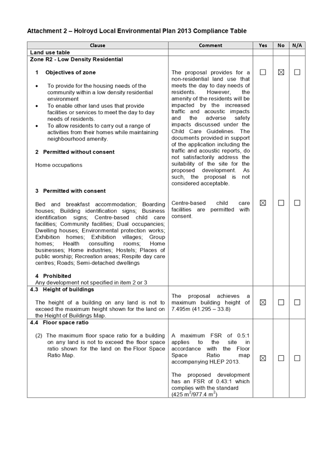
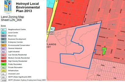
Holroyd Local Environmental Plan 2013
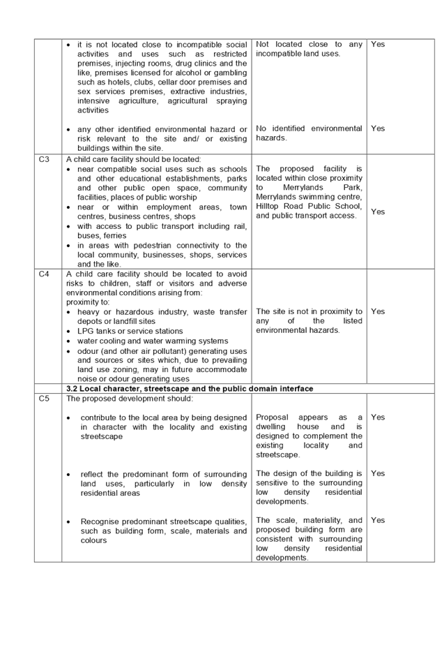
The provision of the Holroyd Local Environmental Plan (HLEP) 2013 is applicable to the development proposal. It is noted that the development achieves compliance with the key statutory requirements of the HLEP 2013 and the objectives of the R2 zone. The proposed development is defined as a ‘centre-based child care facility’ and is permissible in the R2 Low Density Residential Zone with consent.
The relevant matters to be considered under HLEP 2013 and the applicable clauses for the proposed development are summarised below. A comprehensive LEP assessment is contained in Attachment 2.
Figure 4 – Holroyd LEP 2013 Compliance Table
|
DEVELOPMENT STANDARD |
COMPLIANCE |
DISCUSSION |
|
2.3 Zone objectives and land use table
Zone R2 – Low Density Residential |
No |
The proposed development will have adverse traffic, safety and amenity impacts the neighbouring properties. The subject site is not considered suitable for the proposed use. |
The provisions of any proposed instrument that is or has been the subject (EP&A Act s4.15 (1)(a)(ii))
(a) Draft State Environmental Planning Policy (Environment)
The draft SEPP relates to the protection and management of our natural environment with the aim of simplifying the planning rules for a number of water catchments, waterways, urban bushland, and Willandra Lakes World Heritage Property. The changes proposed include consolidating the following seven existing SEPPs:
· State Environmental Planning Policy No. 19 – Bushland in Urban Areas
· State Environmental Planning Policy (Sydney Drinking Water Catchment) 2011
· State Environmental Planning Policy No. 50 – Canal Estate Development
· Greater Metropolitan Regional Environmental Plan No. 2 – Georges River Catchment
· Sydney Regional Environmental Plan No. 20 – Hawkesbury-Nepean River (No.2-1997)
· Sydney Regional Environmental Plan (Sydney Harbour Catchment) 2005
· Willandra Lakes Regional Environmental Plan No. 1 – World Heritage Property.
The draft policy will repeal the above existing SEPPs and certain provisions will be transferred directly to the new SEPP, amended and transferred, or repealed due to overlaps with other areas of the NSW planning system.
Changes are also proposed to the Standard Instrument – Principal Local Environmental Plan. Some provisions of the existing policies will be transferred to new Section 117 Local Planning Directions where appropriate.
The provisions of any Development Control Plans (EP&A Act s4.15 (1)(a)(iii))
The Holroyd Development Control Plan (HDCP) 2013 provides guidance for the design and operation of development to achieve the aims and objectives of the HLEP 2013.
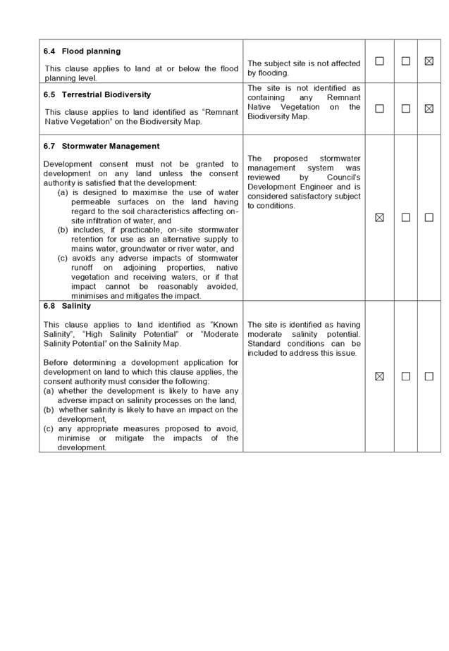
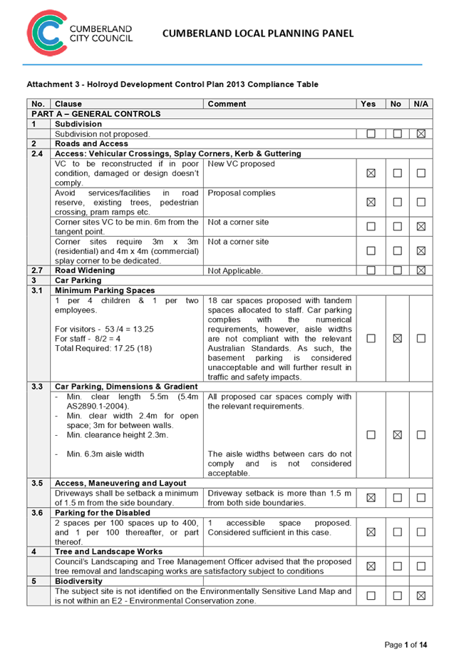
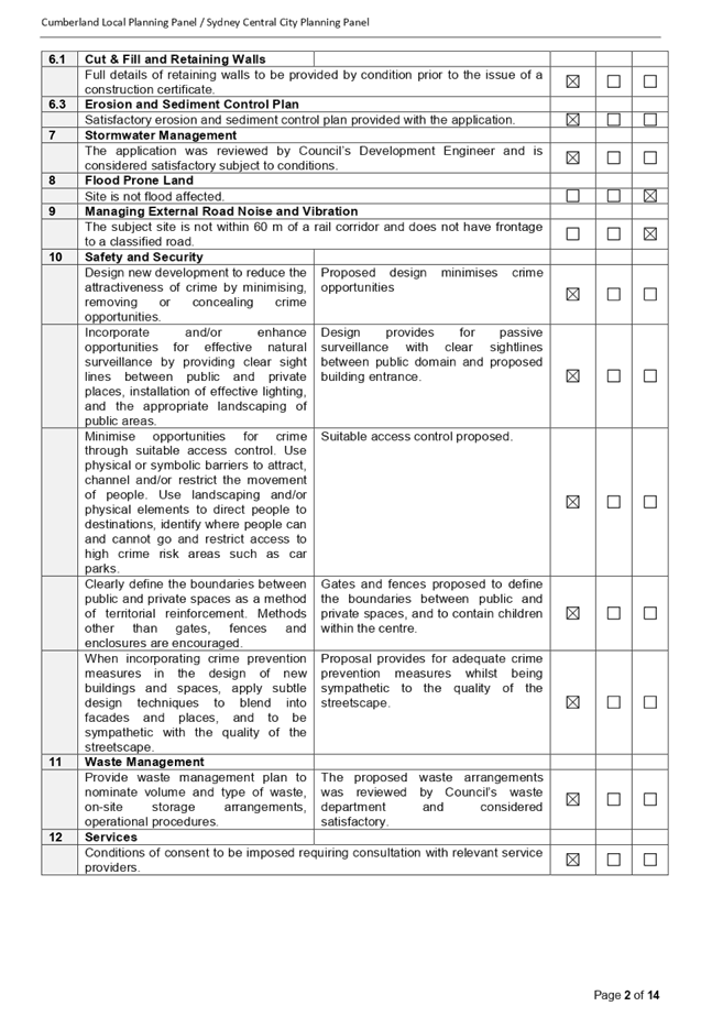
A comprehensive assessment and compliance table is contained in Attachment 3.
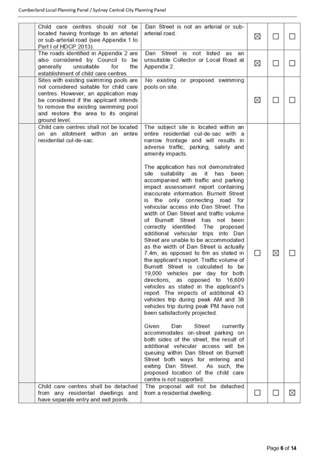
The following table highlights non-compliances with the DCP, which relate primarily to the proposed childcare centre location on a bulb of the cul-de-sac, and the variations sought are considered unsatisfactory.
Figure 6 – Holroyd DCP 2013 Compliance Table
|
Clause |
Control |
Proposed |
Complies |
|
1 – Size and density |
Child care centres shall not be located on an allotment within an entire residential cul-de-sac. |
Subject site is located within an entire residential cul-de-sac and will results in adverse traffic, parking, and safety and amenity impacts.
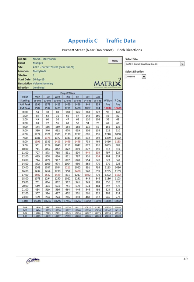
The application has not demonstrated site suitability as it has been accompanied with traffic and parking impact assessment report containing inaccurate information. Burnett Street is the only connecting road for vehicular access into Dan Street. The width of Dan Street and traffic volume of Burnett Street has not been correctly identified. The proposed additional vehicular trips into Dan Street are unable to be accommodated as the width of Dan Street is actually 7.4m, as opposed to 8m as stated in the applicant’s report. Traffic volume of Burnett Street is calculated to be 19,000 vehicles per day for both directions, as opposed to of 16,609 vehicles as stated in the applicant’s report. The impacts of additional 43 vehicles trip during peak AM and 38 vehicles trip during peak PM have not been satisfactorily projected.
Given Dan Street currently accommodates on-street parking on both sides of the street, the additional vehicles associated with the childcare will result in queuing on both Burnett Street and Dan Street. As such, the proposed location of the child care centre is not supported. |
No |
|
5 – Outdoor spaces |
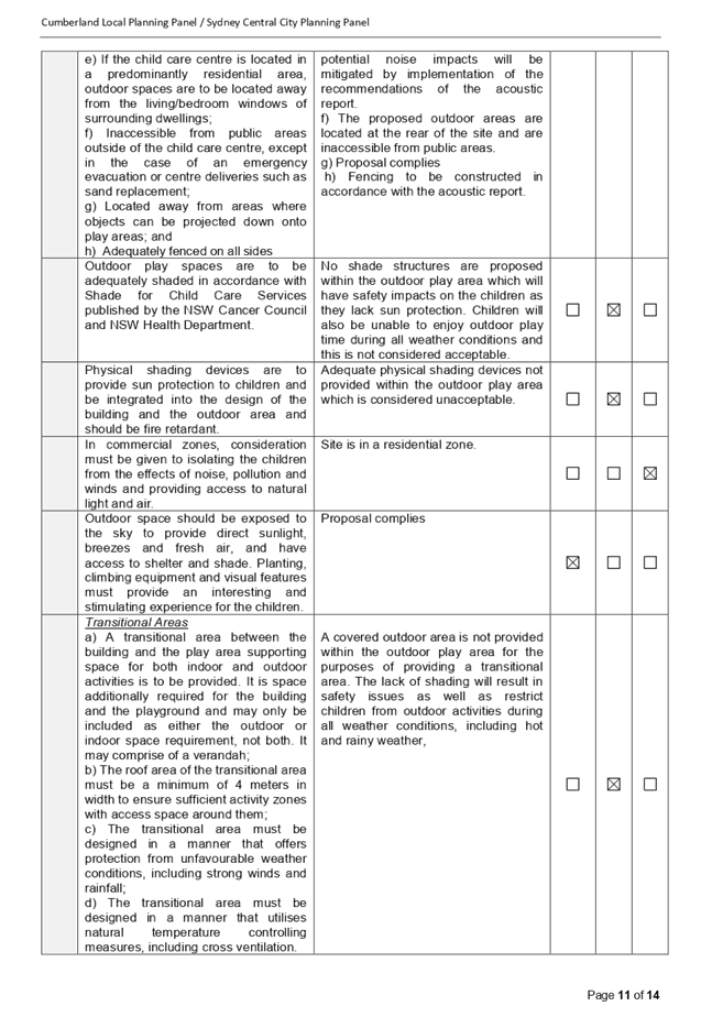
Outdoor spaces are to be: a) Located away from the main entrance of the child care centre, car parking areas or vehicle circulation areas; b) Integrated with indoor space and provide direct and easy access between those two areas; c) Of a design and layout to enable clear lines of sight to all areas of the outdoor space to allow direct staff supervision from other areas of the child care centre; d) Located away from existing and potential noise and environmental health sources; e) If the child care centre is located in a predominantly residential area, outdoor spaces are to be located away from the living/bedroom windows of surrounding dwellings; f) Inaccessible from public areas outside of the child care centre, except in the case of an emergency evacuation or centre deliveries such as sand replacement; g) Located away from areas where objects can be projected down onto play areas; and h) Adequately fenced on all sides |
c) The design of the centre allows for clear sightlines for staff to directly supervise children in the outdoor area, however, supervision is obscured in the indoor play room for children aged 0-2 In this regard, the above non-compliance is considered unacceptable and included as a reason for refusal in the draft determination. |
No |
|
Outdoor play spaces are to be adequately shaded in accordance with Shade for Child Care Services published by the NSW Cancer Council and NSW Health Department. |
Shade structures are not provided to the outdoor play area. This issue was raised in the pre-lodgement meeting held on 10 April 2019. In this regard, the above non-compliance is considered unacceptable and included as a reason for refusal in the draft determination. |
No |
As indicated in the compliance table above, the proposed development does not comply with Part I provisions of the HDCP 2013. Having regard to these departures, the proposed development is not supported.
The provisions of any planning agreement that has been entered into under section 7.4, or any draft planning agreement that a developer has offered to enter into under section 7.4 (EP&A Act s4.15(1)(a)(iiia))
There is no draft planning agreement associated with the subject Development Application.
The provisions of the Regulations (EP&A Act s4.15 (1)(a)(iv))
The proposed development fails to address the relevant matters arising from the Environmental Planning and Assessment Regulations 2000 (EP&A Reg), including submission of plans and documentation demonstrating exact property boundaries on a survey plan.
The Likely Environmental, Social or Economic Impacts (EP&A Act s4.15 (1)(b))
The environmental and cumulative impacts of the proposed development on the natural and built environment are addressed under the Holroyd Development Control Plan section of this report and are considered unsatisfactory. The proposed development will have adverse access and traffic impacts in the locality considering the nature of the proposal. The proposed development will have adverse safety and amenity impacts on the locality considering the nature of the existing and proposed land use.
The suitability of the site for the development (EP&A Act s4.15 (1)(c))
The subject site is considered not suitable for the proposed development. As it is located on a residential cul-de-sac, the proposed development will result in adverse traffic, parking, safety and amenity impacts to the existing low density residential locality. Having regard to the impacts on the street and local area, the proposed development therefore is not supported.
Submissions made in accordance with the Act or Regulation (EP&A Act s4.15 (1)(d))
Advertised (newspaper) Mail Sign Not Required
Figure 5 – Submissions summary table
|
Issue |
Planner’s comment |
|
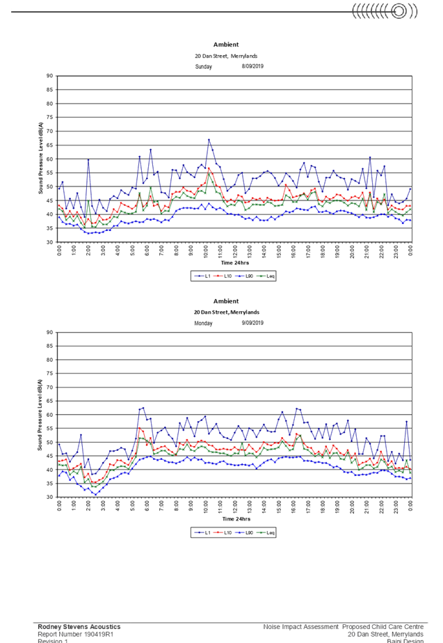
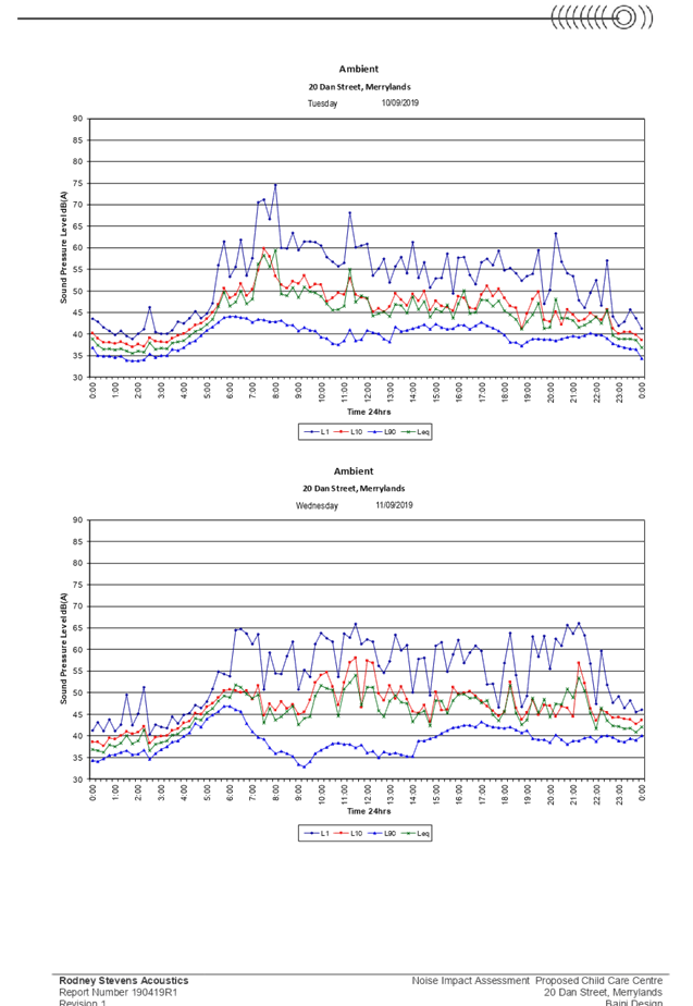
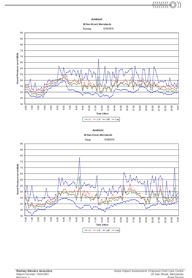
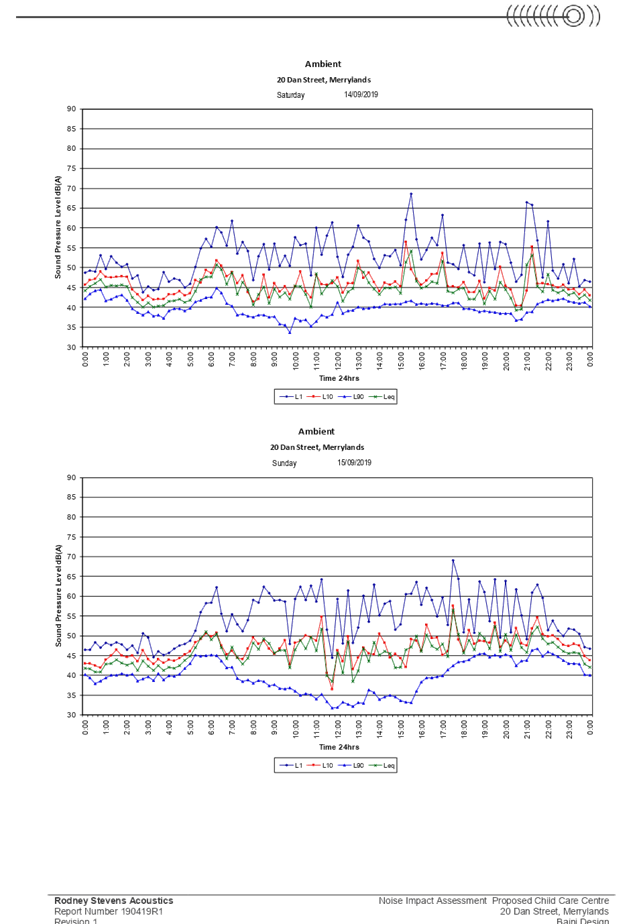
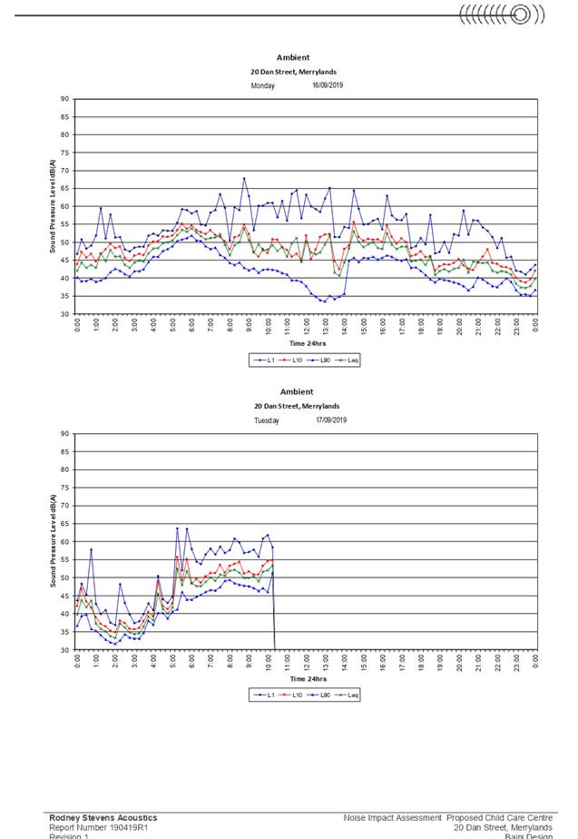
1. Acoustic Impacts |
The plans submitted as part of the application do not detail the location of the mechanical ventilation proposed. The acoustic report prepared by Rodney Stevens Acoustics also does not consider the noise impacts from the air conditioning units on the adjoining properties and as a result is not supported by Council and is included as part of the reasons for refusal. |
|
2. Traffic Impacts |
The application has been referred to Council’s traffic department for review and is considered unsatisfactory. The proposal is considered to have significant traffic and safety impacts on the local area and is not supported by Council. |
|
3. Car parking |
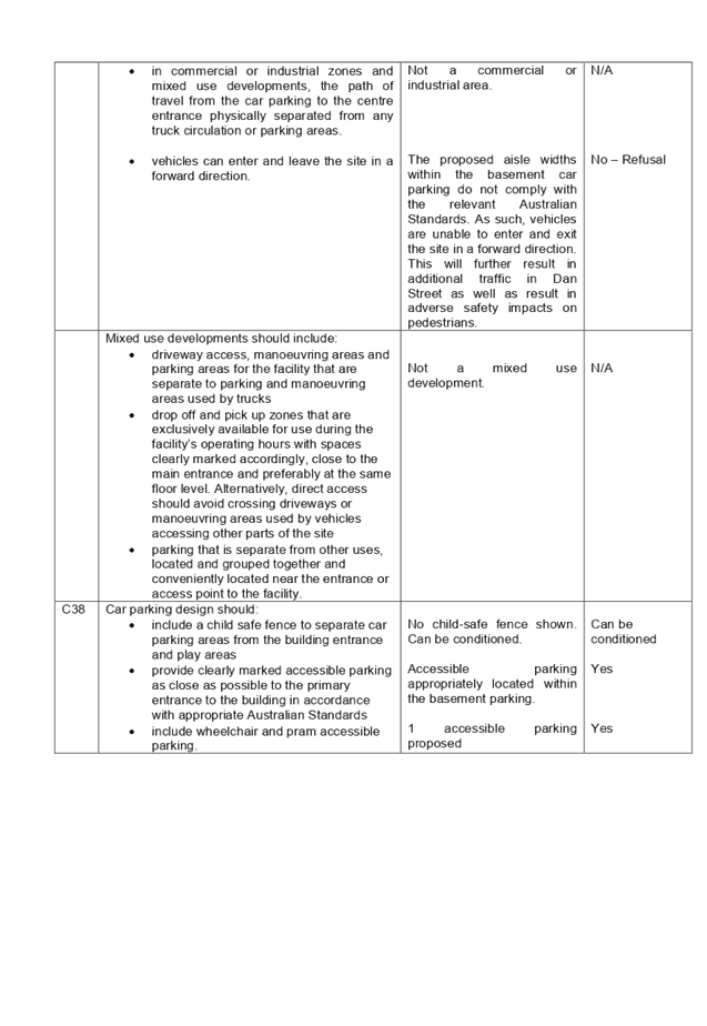
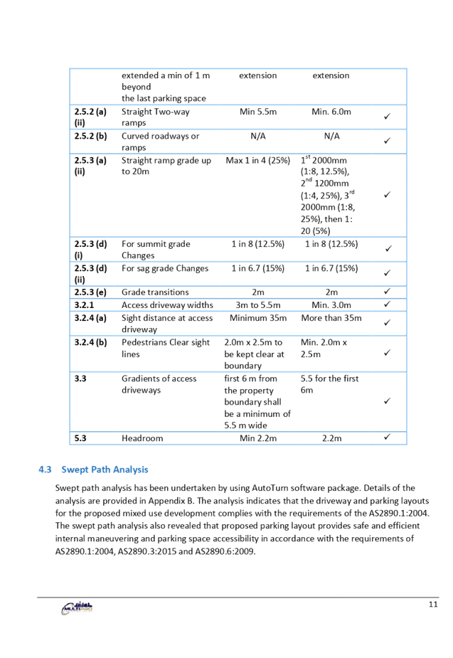
The proposal complies with the numerical car parking requirements for child care centres under Section 3, Part A of the Holroyd Development Control Plan (HDCP) 2013. However, the aisle widths proposed between the car parking spaces do not comply. As such, the proposed basement parking does not comply with the relevant Australian Standards and is not supported by Council, therefore is included as part of the reasons for refusal. |
|
4. Narrow street |
The application has been referred to Council’s traffic department for review and is considered unsatisfactory. The width of the Dan Street has been considered as part of the assessment and is included in the reasons for refusal. |
|
5. Over supply of child care centres |
Child care centres are permissible with consent within the R2 Low Density Residential zone Under the Holroyd Local Environmental Plan (HLEP) 2013. The subject site is zoned R2 and the proposal for a 53 place child care centre is permissible with consent. The Child Care Planning Guideline does not have provisions to assess existing child care centres within the local area. |
|
6. Turning circles |
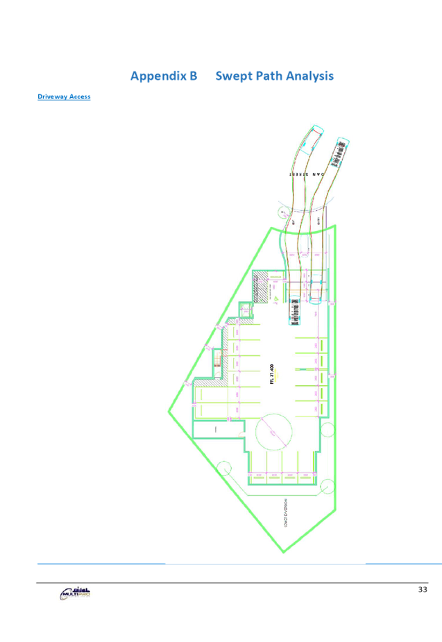
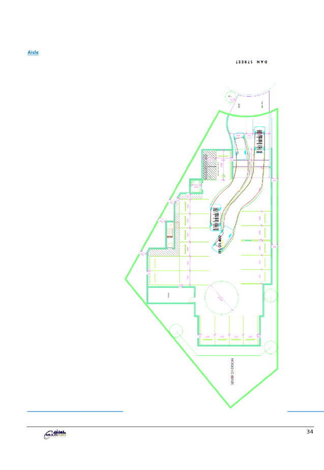
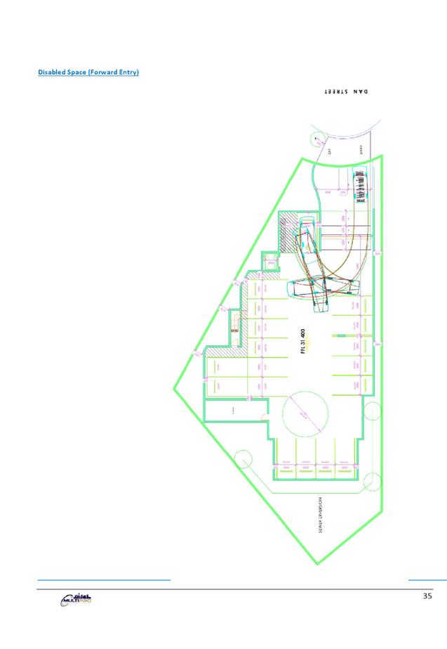
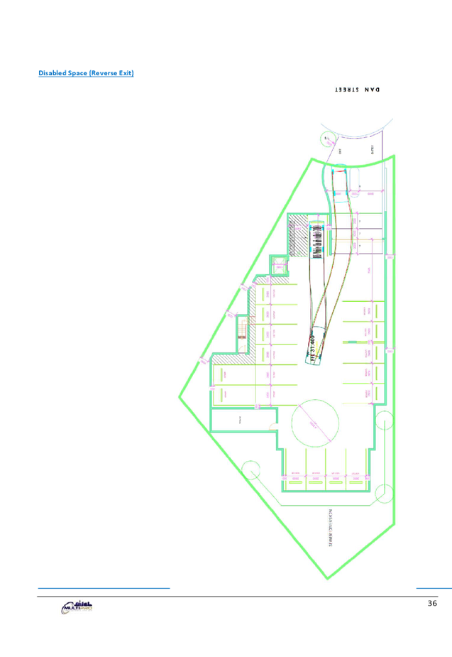
The application has been reviewed by Council and considered unsatisfactory in regards to the turn circles. As such, the application is not supported by Council. |
|
7. Safety of children and motorists |
The safety of the children and motorists has been taken into consideration as part of the assessment. As the subject site is located on a cul-de-sac and will generate additional traffic, the safety of the children and motorists is a significant concern and as such, the application is not supported by Council. |
|
8. Waste collection |
The waste arrangements have been reviewed by Council’s waste department and considered satisfactory. |
|
9. Emergency evacuation plan
|
An evacuation plan has been submitted as part of the application and considered satisfactory. |
|
10. Town house development |
This matter does not relate to the proposed development being a child care centre. |
|
11. Notification period |
The application was notified to adjoining properties for a period of fourteen (14) days 2020 in accordance with the Environmental Planning and Assessment Act 1979, Environmental Planning and Assessment Regulation 2000 and Holroyd Development Control Plan 2013. The application is being processed in the same manner as other applications, except that it will be determined by the Cumberland Local Planning Panel (CLPP) as there have been more than ten (10) unique submissions received during the notification period. |
|
12. Traffic and Parking Impact Assessment Report |
The traffic report has been reviewed by Council and considered unsatisfactory as it does not adequately demonstrate the site is suitable for the proposed development. Therefore, it is included as part of the reasons for refusal. |
|
13. Commercial development in residential area |
The subject site is zoned R2 Low Density Residential. Child care centres are permissible with consent within the R2 zone under the HLEP 2013. |
|
14. Site frontage |
The subject site has a street frontage of 10.975m arc to Dan Street which is 16.85m at the building line. The site frontage does not accommodate safe access to and from the site for pedestrians and as a result is not supported and included as a reason for refusal. |
|
15. Construction related impacts |
Council imposes suitable conditions of consent requiring any development to be constructed to have minimal impacts on adjoining properties. In any case where construction is not in accordance with the conditions of consent or the approved plans, concerns shall be raised with Council’s Compliance Department for further investigation and action. |
|
16. Pedestrian footpath |
Council has noted the concerns regarding the lack of a pedestrian footpath along Dan Street and the safety impacts, as such is not supported and included as a reason for refusal. |
|
17. Solar access |
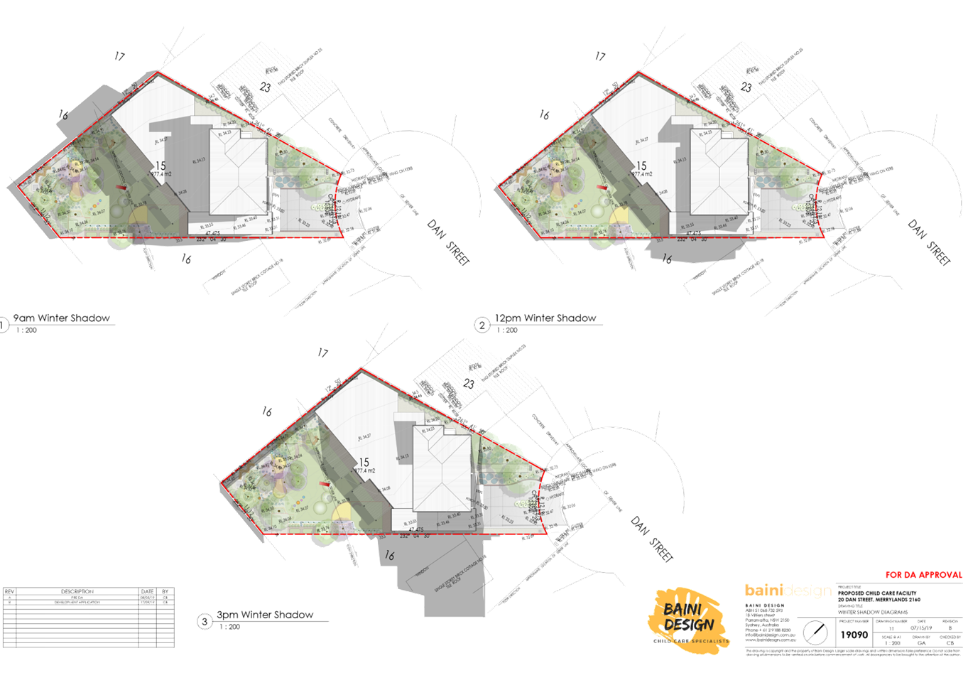
The solar panels on the roof of the southern adjoining property will continue to achieve a minimum of 3 hours of solar access between 9am and 12pm in mid-winter in accordance with Section 1.8, Part B of the HDCP 2013. |
|
18. Over development of the site |
The subject site is zoned R2 Low Density Residential. Child care centres are permissible with consent within the R2 zone under the HLEP 2013. Additionally, a 9m height limit is prescribed for the subject site under the HLEP 2013. The maximum building height of the proposal is 7.495m which is compliant and considered as a two storey development with basement parking. The design of the proposal is considered to be similar to the existing developments within the streetscape as it appears as a dwelling house. |
|
19. Air pollution |
The vehicles associated with the proposed child care centre are not likely to generate significant air pollution in the local area, which are generally standard passenger cars. The frequency of vehicle movement would be intermittent throughout the day. |
|
20. Child care centre located on a cul-de-sac
|
Council has assessed the proposed child care centre within the cul-de-sac on its merits. Having regard to the traffic and safety impacts, this variation is not acceptable and as a result, is not supported by Council. |
|
21. Statement of Environmental Effects |
The Statement of Environmental Effects as well as all other documents or plans submitted with the application can be viewed at Council offices. |
|
22. Quality of life |
This matter does not relate to the proposed development being a child care centre. |
|
23. Inability of emergency vehicles to access the street |
Council has noted the proposed development will result in increased traffic within the street; however, the proposal will not restrict emergency vehicles from accessing the street. |
|
24. Property devaluation |
Council has not received any documentation to review that there is likely to be a devaluation of the property value of the adjoining properties as a result of the proposed development. Moreover, there is no clear evidence to suggest that new development has negative impacts on property values of adjoining sites. |
|
25. Damage to street |
Council imposes standard conditions requiring the developer/applicant to pay Council damage bonds. This condition ensures any damages to the street during the construction of the development will result in the loss of the relevant bond. Council will then repair any damages to the street. |
|
26. Privacy impacts |
The proposed development has been assessed to comply with the privacy requirements under the HDCP 2013.
Sufficient separation is proposed between the north-western adjoining property at No. 17 Stanley Street, Merrylands which is more than 20 metres and will not have any significant privacy impacts. |
|
27. Acoustic fencing |
The proposed acoustic fencing will be erected along all boundaries of the outdoor play area including the boundary between No. 17 Stanley Street, Merrylands. |
|
28. Double glazed glass windows |
The western façade windows for the proposed development will be provided with a minimum glazing of Rw 35 in accordance with the acoustic report prepared by Rodney Stevens Acoustics. This will ensure the indoor play areas will have minimal acoustic impacts on the neighbouring properties |
The public interest (EP&A Act s4.15 (1) (e))
In view of the foregoing analysis it is considered that the development as proposed would not be consistent with the public interest.
The proposed development will result in unacceptable traffic, parking, and safety and amenity issues on the local area. Given the deficiencies detailed within this report, the proposed development is considered to be contrary to the public interest.
Disclosure of Political Donations and Gifts
The applicant and notification process did not result in any disclosure of Political Donations and Gifts.
Conclusion:
The development application has been assessed in accordance with the relevant requirements of the Environmental Planning and Assessment Act 1979, Environmental Planning and Assessment Regulations 2000, SEPP 55, SEPP 65, ISEPP 2007, SEPP Vegetation in Non-Rural Areas 2017, SEPP BASIX 2004, Holroyd LEP 2013 and Holroyd DCP 2013 and is considered to be unsatisfactory for approval, subject to reasons for refusal.
Having regard to the relevant matters of consideration under Section 4.15 of the Environmental Planning and Assessment Act 1979, it is considered that the proposed development is unacceptable for the reasons outlined in this report. It is recommended that the development application be refused.
|
1. That Development Application No. DA2019/432/1 for the Demolition of existing structures and construction of a two (2) storey 53 place child care facility over basement level car parking on land at 20 Dan Street MERRYLANDS NSW 2160 be refused for the reasons listed in the attached schedule. 2. Persons whom have lodged a submission in respect to the application be notified of the determination of the application.
|
Attachments
1. Child Care Planning Guideline 2017 Compliance Table
2. Holroyd Local Environmental Plan 2013 Compliance Table
3. Holroyd Development Control Plan 2013 Compliance Table
4. Draft Notice of Determination
5. Pre-lodgement Meeting Notes - 20 Dan Street, Merrylands