12 February 2020
A meeting
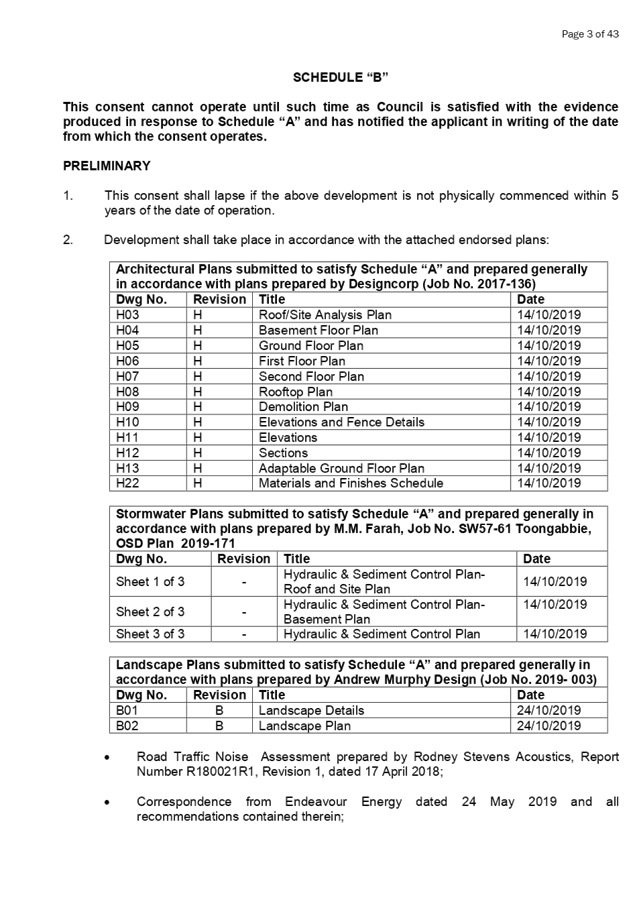
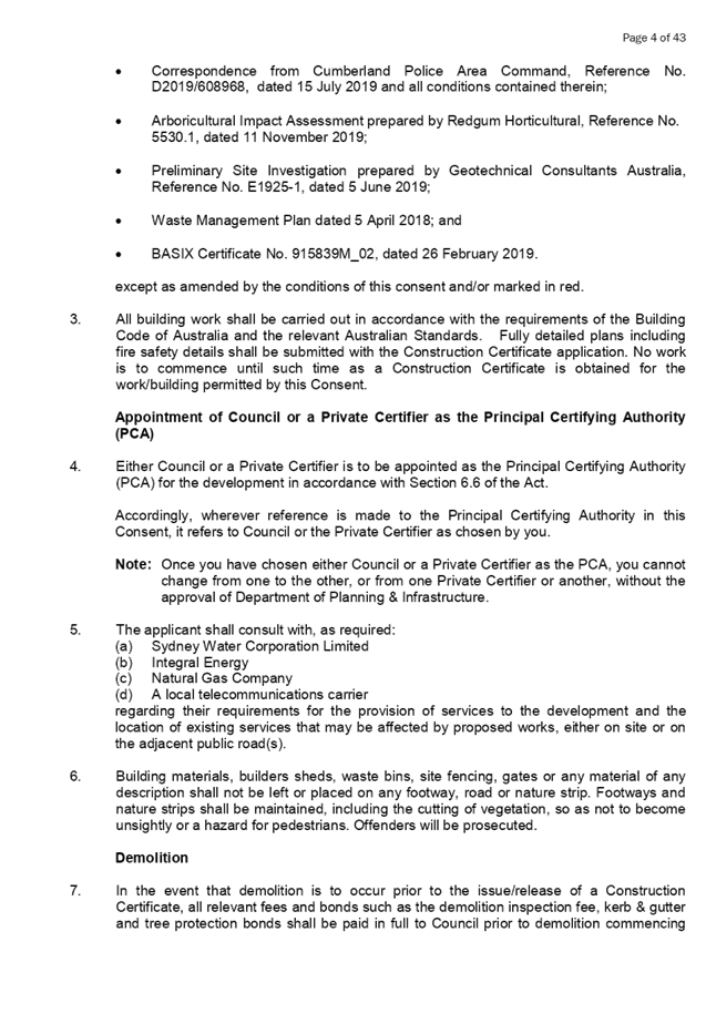
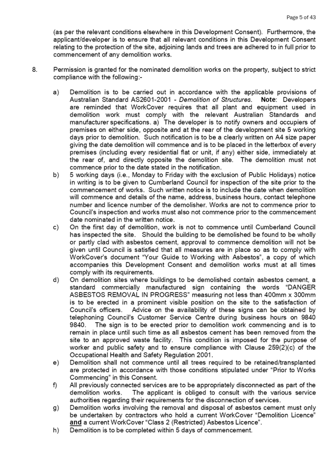
of the Cumberland Local Planning Panel
will be held at 11:30a.m at the Merrylands Administration Building, 16
Memorial Avenue, Merrylands on Wednesday, 12 February 2020.
Business as below:
Yours faithfully
Hamish McNulty
General
Manager
ORDER OF BUSINESS
1. Receipt of Apologies
2. Confirmation of Minutes
3. Declarations of Interest
4. Address by invited
speakers
5. Reports:
- Development
Applications
- Planning
Proposals
6. Closed Session Reports
12 February 2020
CONTENTS
Report No. Name of Report Page
No.
Development Applications
LPP001/20... Development Application
for 149 Auburn Road, Auburn............................ 7
LPP002/20... Development Application for
57 - 61 Toongabbie Road, Toongabbie...... 83
LPP003/20... Modification Application
for 5 - 7A Octavia Street, Toongabbie.............. 221
LPP004/20... Modification Application
for 9-19 Mary Street, Auburn............................. 339
LPP005/20... Development Application
for 49 Martin Street, Lidcombe......................... 517
LPP006/20... Development Application
for 327 Merrylands Road, Merrylands............ 727
Cumberland Local
Planning Panel Meeting
12 February 2020
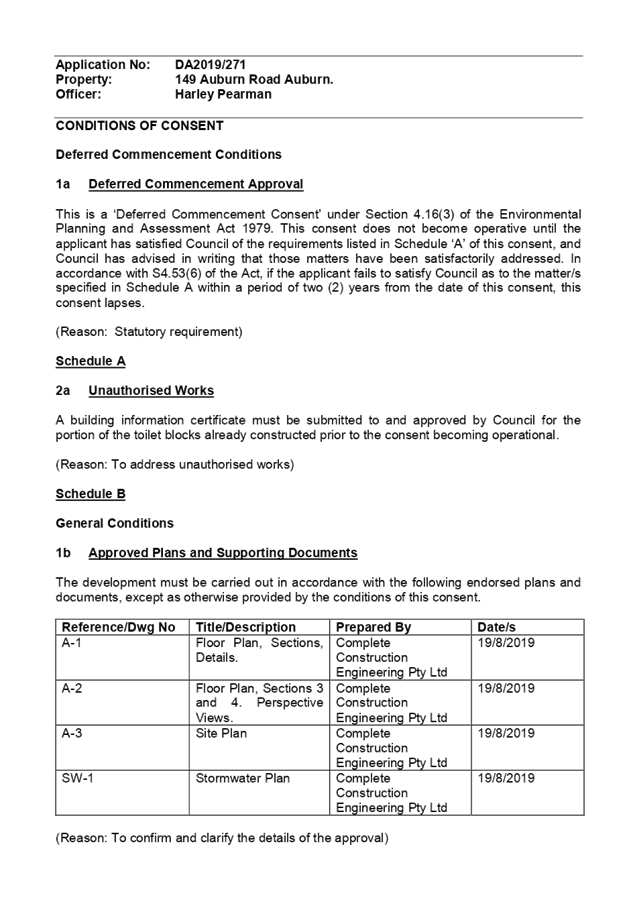
Item No:
LPP001/20
Development
Application for 149 Auburn Road, Auburn
Responsible
Division: Environment
& Planning
Officer: Executive
Manager Development and Building
File
Number: DA2019/271
|
Application
lodged
|
29 August 2019.
|
|
Applicant
|
Mr S Khan.
|
|
Owner
|
Australian Islamic Cultural
Centre Incorporated.
|
|
Application
No.
|
DA2019/271.
|
|
Description
of Land
|
149 Auburn Road Auburn being
Lot 15 in DP 1199248.
|
|
Proposed
Development
|
Construction of toilet
cubicles within the existing college.
|
|
Site
Area
|
6,830 Square metres.
|
|
Zoning
|
Zone R3 Medium Density
Residential.
|
|
Disclosure
of political donations and gifts
|
Nil disclosure
|
|
Heritage
|
Not Heritage Listed or located
in a Heritage Conservation Area.
|
|
Principal
Development Standards
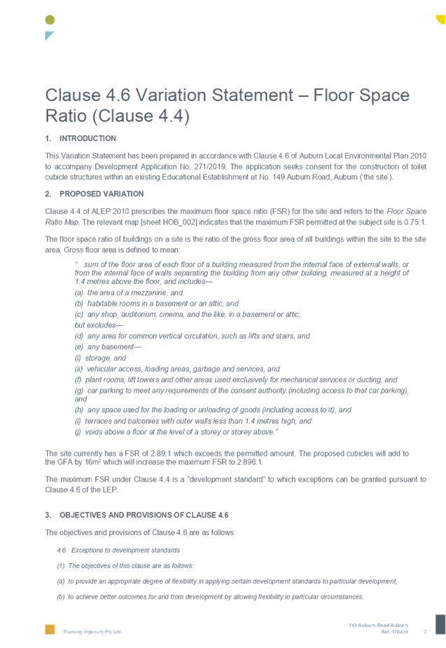
|
Floor Space Ratio
Permissible: - 0.75:1.
Propose:- 2.892.1
Height of Building
Permissible: - 9 metres.
Proposed: - No change to the
maximum approved height of the College.
|
|
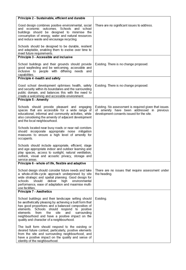
Issues
|
Floor space ratio.
|
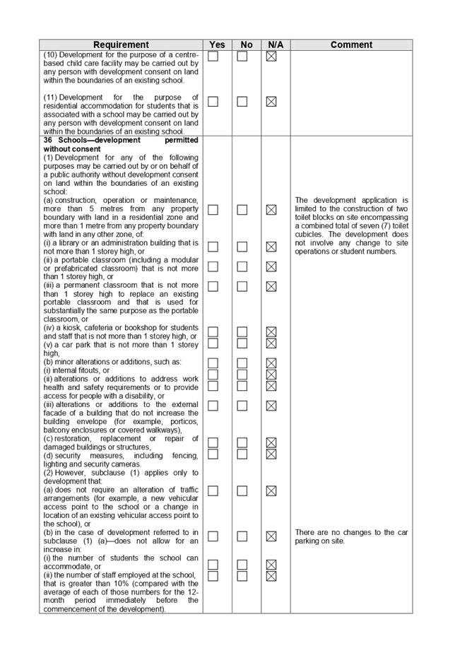
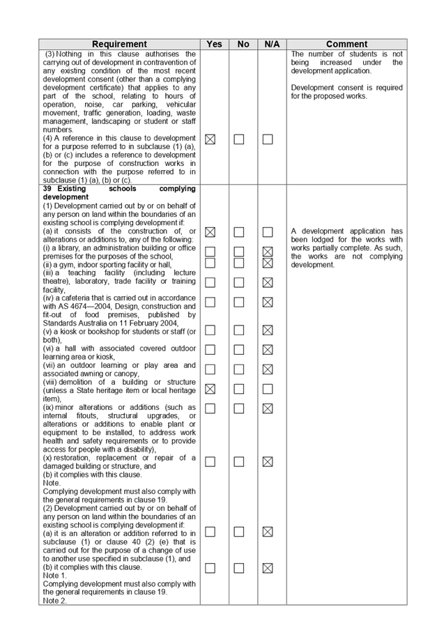
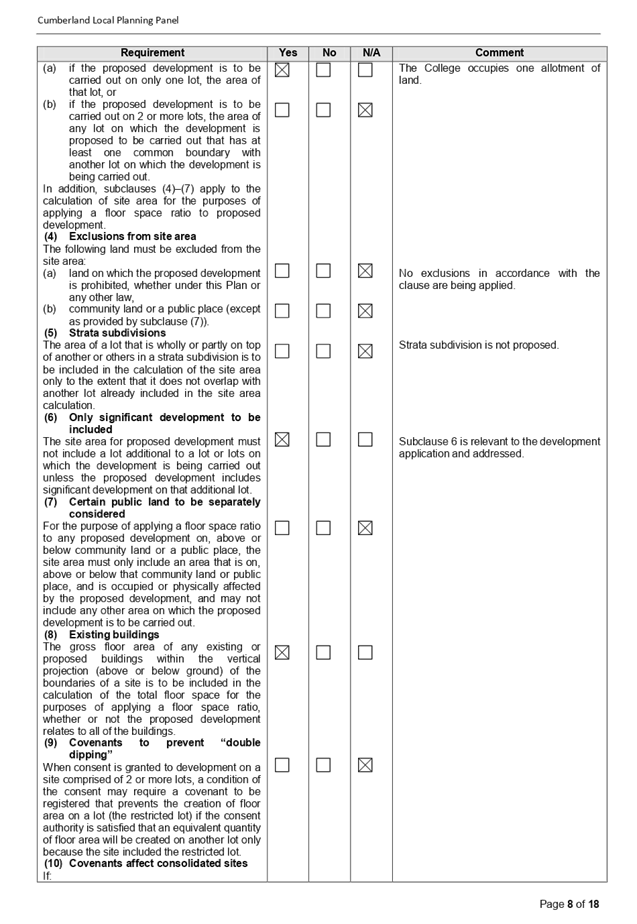
1. Development
Application 2019/271 was received on the 29 August 2019 for the construction of
toilet cubicles within the existing college.
2. The
application was publicly notified to occupants and owners of the adjoining
properties for a period of fourteen (14) days between Tuesday 17 October 2019
and Tuesday 1 October 2019. There were no submissions to the works that are
sought.
3. The
variations are as follows:
|
Control
|
Required
|
Provided
|
% variation
|
|
Floor space ratio
|
0.75:1
|
Presently approved: - 2.89:1.
i)
Proposed: - 2.892:1 which is an increase of 15.6 square metres
or 0.2%.
|
The variation is 385% of the maximum permitted
for the site.
|
4. The
application is recommended for deferred commencement consent subject to the
conditions as provided in the attached schedule.
5. The
application is referred to the Panel because the development application
contravenes a development standard by more than 10%.
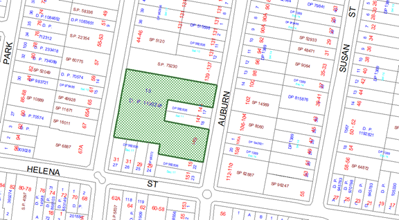
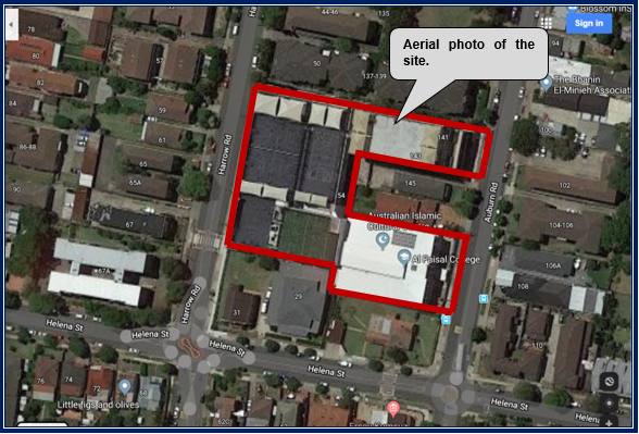
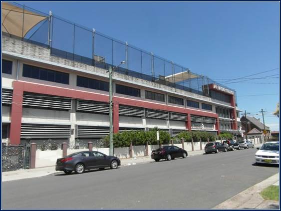
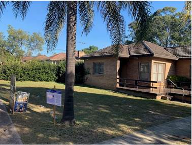
Subject Site and Surrounding
Area
The site is identified as Lot 15
in DP 1199248 being 149 Auburn Road Auburn. The site is located to the east of
Harrow Road and to the west of Auburn Road. It lies in the vicinity of Beatrice
Street to the north and Helena Street to the south. The site is irregularly
shaped and occupies an area of 6,830 square metres with frontages to Harrow
Road and Auburn Road.
There is a college situated across
the site known as Al Faisal College which consists of 4 to 5 storey buildings
(Building A, B, C, D and E) with building B, C and D having roof top play
areas.
There is a three storey
residential flat building complex situated to the north with frontages to both
Harrow Road and Auburn Road.
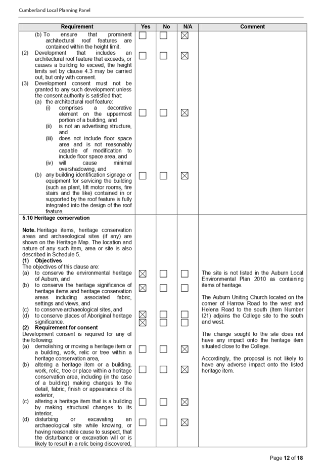
The Auburn Uniting Church and
associated hall is situated to the immediate south at 31 Helena Street with the
church situated on the street corner. The church building and adjacent hall is
identified as an item of local heritage significance under the Auburn Local
Environmental Plan 2010. (Item No I21 in Schedule 5).
There are residential flat
buildings and dwelling houses on land to the west and situated on the western
side of Harrow Road.
There are residential flat
buildings and dwelling houses on land to the east on the eastern side of Auburn
Road.
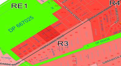
The college site is located
generally within an established low to medium density residential precinct
currently zoned for Medium-Density residential land use.
The
location of the site is shown below.
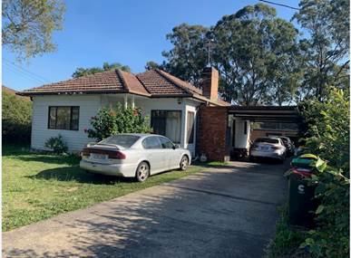
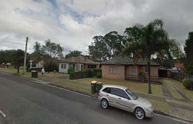
The
aerial photo of the site.
A
photograph of the College from Auburn Road
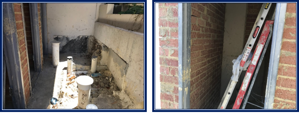
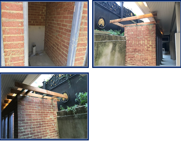
Photos
of the works the subject of the development application
Description of the Proposed
Development
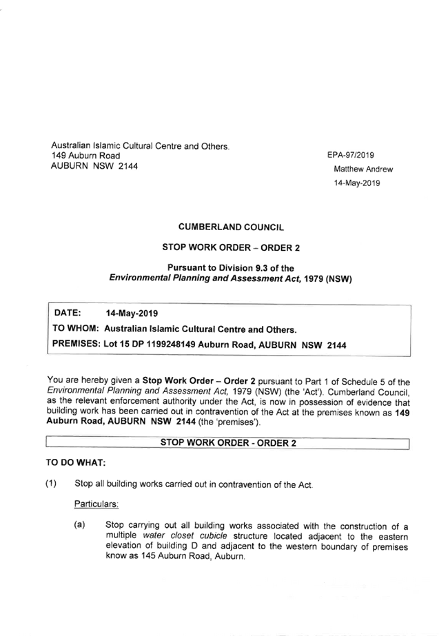
Following a complaint on 8 April
2019 concerning unauthorised building works, Council officers inspected the
site on May 15 2019 and identified that two toilet blocks were under
construction without a valid consent being in place. A Stop Work Order 2 was
issued on May 15 2019 that required the builders and owners to undertake the
following:-
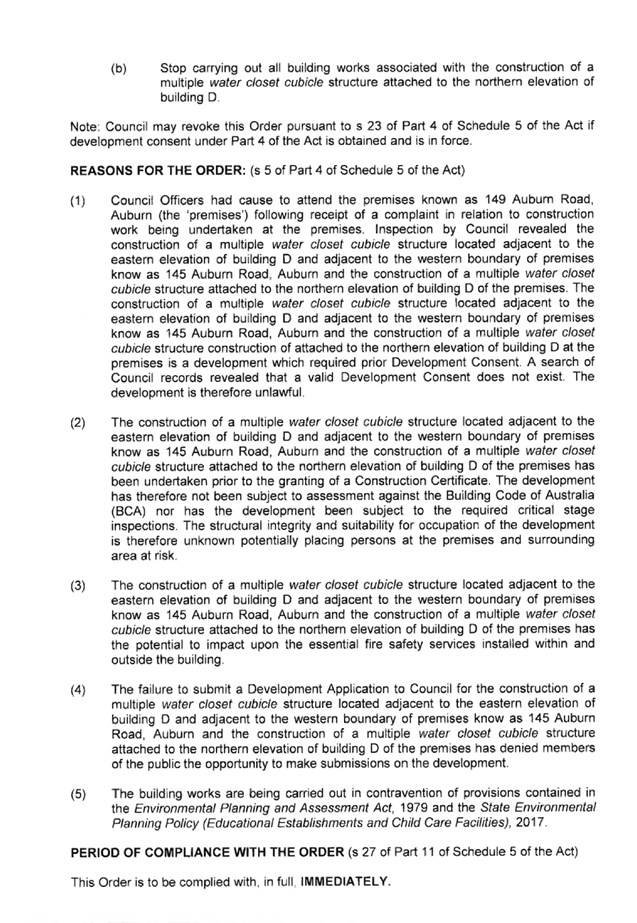
a) Stop
carrying out all building works associated with the construction of a multiple
water closet cubicle structure located adjacent to the eastern elevation of
building D and adjacent to the western boundary of premises known as 145 Auburn
Road, Auburn.
b) Stop
carrying out all building works associated with the construction of a multiple
water closet cubicle structure attached to the northern elevation of building
D.
A copy of the Stop Work Order is
attached at Appendix C.
The development application is in
response to the “Stop Work Order” issued and seeks to legitimize
the unauthorised works and to complete the works not undertaken.
The plans are showing two toilet
blocks with one block situated adjacent to the eastern elevation of building
Block D and one block situated adjacent to the western boundary of 145 Auburn
Road. The toilet block adjacent to the eastern elevation of block D is provided
with four toilet cubicles while the toilet block adjacent to the western
boundary of 145 Auburn Road is provided with three toilet cubicles.
The toilet blocks are located on
the ground floor and both enclosed within roofs and as such they add to floor
space ratio for the site. In this regard, the toilet blocks as one entity add
15.6 square metres to the existing floor space ratio of the site (8.89 square
metres and 6.72 square metres respectively). This results in the floor space
ratio of the college increasing from 2.89:1 to 2.892:1 which is an increase of
0.002:1.
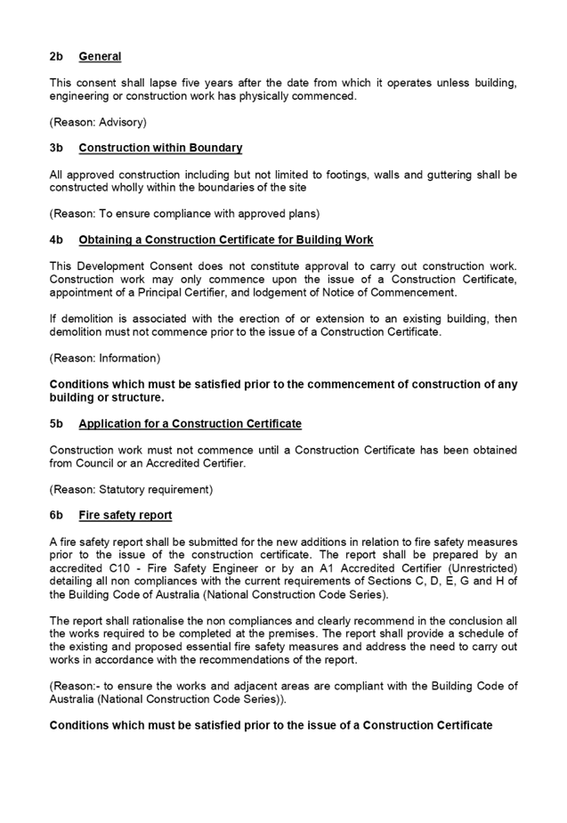
Should the Panel support the
development application, a Building Certificate will be required in lieu of a
Construction Certificate for the works already undertaken. Deferred commencement
consent is required to address the matter and to ensure that a Building
Certificate is lodged for the unauthorised works.
Applicants Supporting
Statement
The applicant has provided a
Statement of Environmental Effects prepared by Planning Ingenuity and dated 28
August 2019. This was modified on December 16 2019 as part of a submission
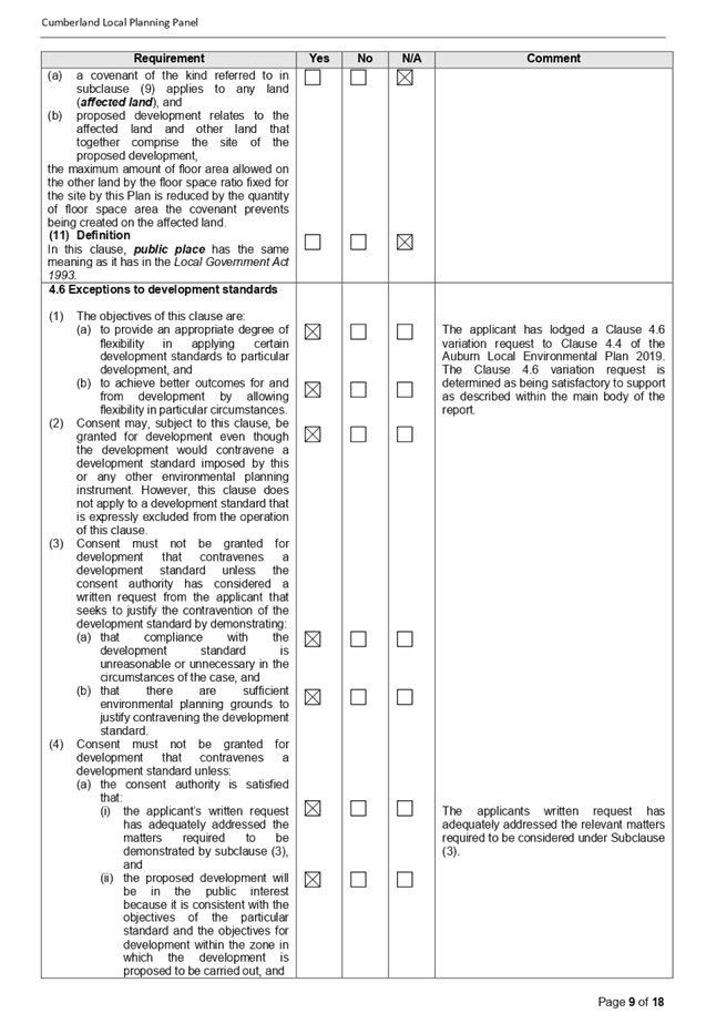
addressing Clause 4.6 of the Auburn Local Environmental Plan 2010.
Contact with Relevant
Parties
The assessing officer has
undertaken a site inspection of the subject site and surrounding properties and
has been in regular contact with the applicant throughout the assessment
process.
Internal Referrals
Development Engineer
The development application was
referred to Council’s Development Engineer for comment who has advised
that the development proposal is satisfactory subject to a condition addressing
the connection of stormwater from the works to the existing system. This is
incorporated into the conditions of consent if supported.
Building Surveyor
The development application was
referred to Council’s Building Surveyor for comment who has advised that
the development proposal is satisfactory subject to conditions including the
submission of a fire safety report. Any conditions are included into the
recommended condition set at Appendix D at the end of this report.
Environment and Health
As per an Email memorandum dated
12 September 2019, no objections are raised to the development and no health
conditions are required.
External Referrals
The development application was not
required to be referred to any external government authority for comment.
Planning Comments
The provisions of any
Environmental Planning Instruments (EP&A Act s4.15 (1)(a)(i))
State Environmental Planning
Policies
The proposed development is
affected by the following State Environmental Planning Policies.
(a) State
Environmental Planning Policy No. 55 - Remediation of Land
State Environmental Planning
Policy (SEPP) 55 requires Council to consider whether land, the subject of a
development application is contaminated and if so, whether the land is suitable
in its contaminated state (or will be suitable, after remediation) for the
purpose for which development is proposed to be carried out.
The issue of land contamination
has been addressed under earlier development consents such as Development
Application 399/2004 and it is found that the history of the site is
predominantly residential and later for educational use. The development
application is for the construction of toilets which does not require any excavation
work on site.
In view of the above, Council can
be satisfied that the appropriate level of investigation has been carried out
and that the proposed development is considered satisfactory with regard to
Clause 7 of SEPP 55. The site is considered suitable (or capable of being made
suitable) to accommodate the development.
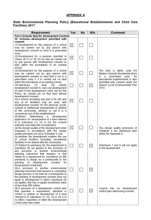
(b) State
Environmental Planning Policy (Educational Establishments and Child Care
Facilities) 2017
The development application has
been assessed under the relevant provisions of State Environmental Planning
Policy (Educational Establishments and Child Care Facilities) 2017. A detailed
assessment where relevant is at Appendix A. It is concluded that the proposed
development is fully compliant with the relevant provisions of the State
Policy.
Design Guide for Schools
Clause 35(6)(a) of State
Environmental Planning Policy (Educational Establishments and Child Care
Facilities) 2017 requires Council to consider the Design Guide for Schools
prepared by the Office of the Government Architect NSW for any development
application for a school or works within a school ground. The works have been
assessed using the Design Guide and it is determined that the works are
satisfactory with the relevant provisions. A detailed assessment is at Appendix
A.
Regional Environmental Plans
The proposed development is
affected by the following Regional Environmental Plans:
(a) Sydney
Regional Environmental Plan (Sydney Harbour Catchment) 2005
The subject site is identified as
being located within the area covered by the Sydney Regional Environmental Plan
(Sydney Harbour Catchment) 2005. The proposed development raises no issues as
no impact on the catchment is envisaged.
(Note: - the subject site is not
identified in the relevant map as ‘land within the ‘Foreshores and
Waterways Area’ or ‘Wetland Protection zone’, is not a
‘Strategic Foreshore Site’ and does not contain any heritage items.
Hence the majority of the SREP is not directly relevant to the proposed
development).
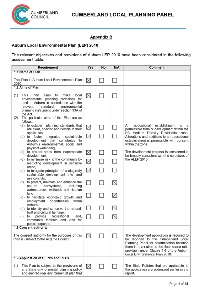
Local Environmental Plans
The provisions of the Auburn Local
Environmental Plan 2010 are applicable to the development application. An
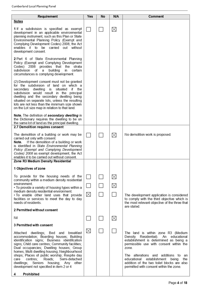
educational establishment or college (school) is a permitted land use within
the R3 Medium Density Residential zone subject to consent.
Alterations and additions to the
college is also permitted with consent within the zone.
The development application raises
no issues in relation to height as previously mentioned however the matter
concerning floor space ratio requires further review given that an increase is
proposed.
Clause 4.3 - Height of
buildings
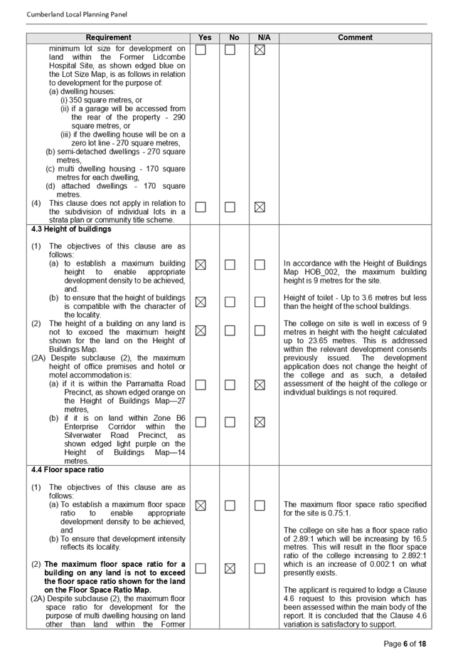
A maximum building height of 9
metres is specified for the site. The approved buildings reach a height of up
to 23.6 metres from the natural ground level. The development application does
not change the height of the college and no detailed discussion is required.
The proposed toilet blocks have a height not exceeding 3.6 metres and given
that they are located on the ground floor and within the building envelope,
they do not raise any issues with respect to building height.
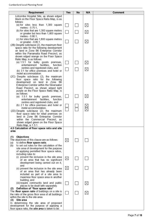
Clause 4.4 - Floor space ratio
The maximum permitted floor space
ratio is 0.75:1.
The floor space ratio of the
college is calculated at 2.89:1 which will increase by 15.6 square metres to
2.892:1. The increase of 0.002:1 in floor space ratio results in a floor space
ratio being 385% of the maximum permitted for the site. The applicant has
submitted a Clause 4.6 variation to the Auburn Local Environmental Plan 2010
which is discussed below to address the matter.
Clause 5.10 - Heritage Conservation
The site is not listed as a
heritage item within the Auburn Local Environmental Plan. However, there is a
heritage listed item situated at 31 Helena Street to the south west of the
subject site being a church and an adjacent hall building which is listed as
Item Number I21 in Schedule 5 of the Auburn Local Environmental Plan 2010.
There is a significant buffer between the proposed works and the heritage
listed item and as such, it is envisaged that the proposed works will have no
adverse impact onto the heritage listed item.
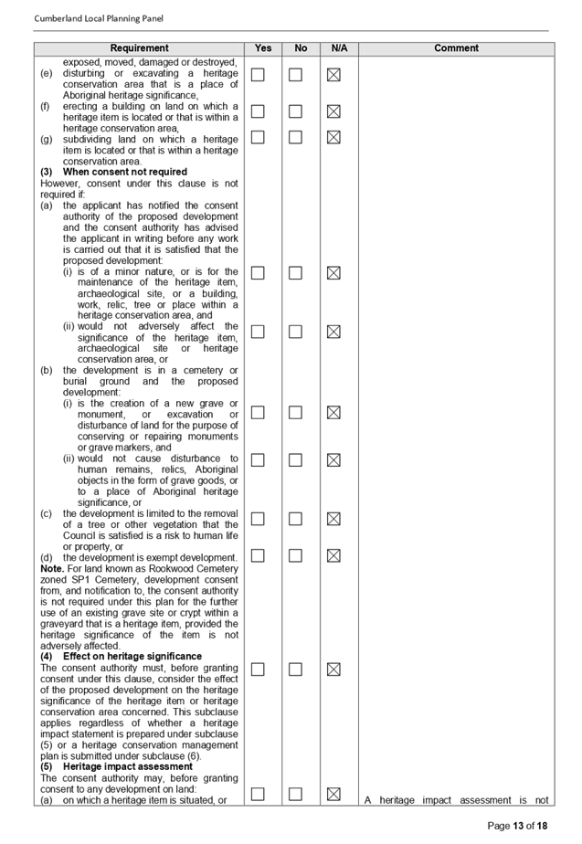
A detailed assessment of the
development application using the Auburn Local Environmental Plan 2010 is
provided at Appendix B.
(a) Clause
4.6 - Variation to Floor Space Ratio (Clause 4.4)
Clause 4.6 allows the consent
authority to vary development standards in certain circumstances and provides
an appropriate degree of flexibility to achieve better design outcomes. The
consent authority may grant the exception as the Secretary’s concurrence
can be assumed where clause 4.6 is adopted as per the Department of Planning
Circular PS 18-003, dated 21 February 2018.
The applicant has submitted a
written request to vary the development standards for the floor space ratio
(Clause 4.4).
Based on various case laws
established by the Land and Environment Court of NSW such as Four2five P/L v
Ashfield Council [2015] NSWLEC 9, Randwick City Council v Micaul Holdings P/L
[2016] NSW LEC7 and Zhang and anor v Council of the City of Ryde [2016] NSWLEC
1179, a 3 part assessment framework for a variation request proposed under
clause 4.6 has been considered and an assessment of the proposed variance,
following the 3 part test is discussed in detail below.
The 3 preconditions which must be
satisfied before the application can proceed are as follows:
1. Is
the proposed development consistent with the objectives of the zone?
Applicant’s
justification:
Clause 4.6(4) (a) (ii) requires
the consent authority to be satisfied that the development is in the public
interest because it is consistent with the relevant zone objectives. The
objectives of the R3 zone are:-
“To provide for the housing
needs of the community within a medium density residential environment”.
Comment: - The approved use
of the site is an educational facility and as such, the objective does not
apply to the subject site.
“To provide a variety of
housing types within a medium density residential environment”.
Comment: - The approved use
of the site is an educational facility and as such, the objective does not
apply to the subject site.
“To enable other land uses
that provide facilities or services to meet the day to day needs of
residents”.
Comment: - The proposed
development will improve the amenity of the student population, the majority of
whom are local residents. The proposed toilets blocks will not cause any
adverse impacts to the locality.
Planner’s comment:
Objective (c) is the only relevant
objective to consider given that the site is being used as an educational
facility. The proposed development is considered to provide additional services
to the college site in the form of additional toilets at a location appropriate
to the student population. The proposed toilets blocks will not cause any
adverse impacts to the locality and will not be seen from a public space close
to the site. The development application is considered as being compliant with
the relevant objective stated.
2. Is
the proposed development consistent with the objectives of the development
standard which is not met?
Applicant’s
justification:
The Objectives of Clause 4.4
(Floor space ratio) are as follows:-
a) To
establish a maximum floor space ratio to enable appropriate development density
to be achieved, and
b) To
ensure that development intensity reflects its locality.
The existing site provides for a
floor space ratio of 2.89:1 which far exceeds the 0.75:1 permitted under the
Auburn Local Environmental Plan 2010. The current floor space ratio was
approved under DA 295/2014 (along with modifications A and B). The existing and
proposed minor increase is consistent with the use of the site as an
educational establishment. The proposed toilet blocks will not adversely impact
onto the amenity of the neighbouring properties.
The proposed addition of two
toilet blocks will not adversely add to the intensity of the site as the
addition is minor and is not easily viewed from the public domain. The rest of
the development will remain as approved under previous applications.
The proposed development minimises
adverse environmental effects on neighbouring properties.
Planner’s comment:
As stated above, the current floor
space ratio of the site has been established under previous developments
consents issued for the site as well as various modifications granted
thereafter.
The proposed increase in floor
space ratio is considered to be minor but consistent with the use of the site
as an educational establishment. The proposed addition of two toilet blocks
will not adversely add to the intensity of use of the site, will not increase
the student population and will not have an adverse impact to the site or to
adjoining sites. The toilet blocks are located on the ground floor and screened
from public spaces by existing buildings. Other than the addition of the two
toilet blocks, the remainder of the college remains the same as per previous
consents issued for the site.
3.
Is compliance with the development standard unreasonable or unnecessary in the
circumstances of the case? And;
Applicant’s
justification:
Compliance with the maximum floor
space ratio development standard is considered to be unreasonable and
unnecessary as the objectives of the standard are achieved as follows:-
a) It
is considered that there is an absence of any material impacts of the proposed
non-compliance on the amenity of the environmental values of the locality, the
amenity of future building occupants and on area character.
b) The
proposed development meets the objectives of the development standard and meets
the objectives of the R3 Medium Density Residential zone.
c) The
spaces in which the two toilet blocks are located are underutilised hardstand
areas that are screened from the public domain and neighbouring properties.
d) The
toilet blocks are needed for the student population. The toilet will be located
outside building E which is used to conduct examinations. The toilet blocks
will allow students to use the facilities and promptly return to their
examinations without wasting excessive amounts of time finding nearby toilets.
e) The
additional floor area proposed does not adversely change the character of the
development in terms of streetscape and character. The scale and form of the
development viewed from each street frontage reflects the desired planning
controls and is consistent with the surrounding development. The additional
floor space ratio is internalised on the site and will not be readily
perceptible from the public domain or surrounding properties.
f) The
increase is minor in extent and the development allows for additional
facilities for the student population.
Planner’s comment:
The applicant’s
justification can be supported as follows:-
a) The
toilets do not create adverse internal and external amenity issues.
b) The
works are not seen from public spaces. In this regard, the works are internal
to the site and not identified from an external public space.
c) The
increase is relatively minor in extent.
d) The
additional toilets provides for additional facilities on site in an appropriate
location.
4. Are
there sufficient environmental planning grounds to justify contravening the
development standard and therefore is the applicant’s written
justification well founded?
Applicant’s
justification:
There are sufficient planning
grounds to justify the contravention of the development standard as follows:-
· The
two toilet blocks are minor works that will not add to the intensity of the
site.
· The
works are consistent with the use of the site as an educational establishment.
· The
amenity of the student population is improved by the addition of new toilets.
· The
toilet blocks will not cause any adverse impacts to the locality.
· The
contravention of the maximum floor space ratio standard does not raise any
matter of significance for State and Regional environmental planning.
· The
works are not seen from the public domain.
Planner’s comment:
The statements provided within the
Clause 4.6 variation are generally supported given that the toilets are minor
additions to the college that are not readily visible from the public space. As
such, the Panel may be satisfied that the applicant’s assessment is
satisfactory.
Conclusion:
Council is satisfied that the
applicant’s written request has adequately addressed the matters required
to be demonstrated by clause 4.6 subclause (3). Council is further satisfied
that the proposed development will be in the public interest because it is
consistent with the objectives of the particular standard and the objectives
for development within the zone in which the development is proposed to be
carried out.
The applicants justification provided
is satisfactory and having considered the application on its merit, the
exception to the maximum floor space ratio standard is considered acceptable in
this instance.
The provisions of any proposed
instrument that is or has been the subject (EP&A Act s4.15 (1)(a)(ii))
There are no draft planning
instruments that apply to the site.
The provisions of any
Development Control Plans (EP&A Act s4.15 (1)(a)(iii))
Auburn Development Control Plan
2010 - Multi Dwelling Housing
Due to the subject sites being
located within a Zone R3 - Medium Density Residential, the relevant objectives
and requirements of the Multi Dwelling Housing chapter have been considered in
the assessment of the development application. Whilst a number of the
objectives, such as Built Form, Energy Efficient Design and Conservation,
Privacy and Security and Access and Car Parking can be applied to the proposal,
the detailed development control requirements of the Plan refer specifically to
multiple dwelling developments only. This is outlined in Part 1.1 of the Plan.
The proposed development does not incorporate any residential element and
therefore, the specific controls are not applicable. As such, a detailed
assessment is not warranted.
Auburn Development Control Plan
2010 - Parking & Loading
The relevant requirements and
objectives of the Parking and Loading part of the Auburn Development Control
Plan 2010 have been considered in the assessment of the development
application. The parking rates prescribed by the DCP for educational establishments
are based on student and staff numbers.
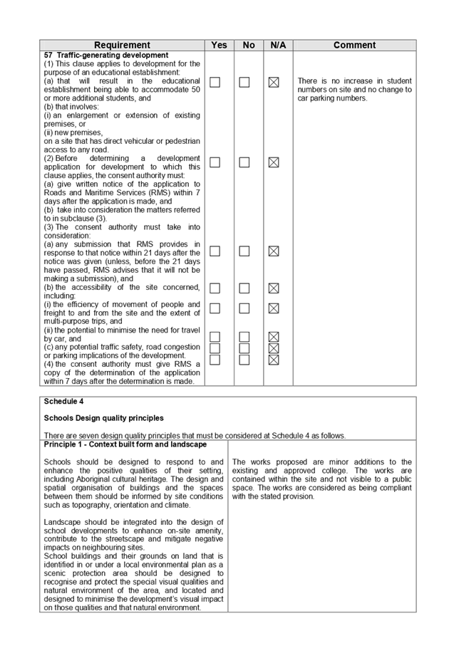
There are no proposed changes to
student’s numbers on site and as such, no increase in car parking is
proposed or required for the site.
The provisions of any planning
agreement that has been entered into under section 7.4, or any draft planning
agreement that a developer has offered to enter into under section 7.4
(EP&A Act s4.15(1)(a)(iiia))
There is no draft planning
agreement associated with the subject Development Application.
The provisions of the
Regulations (EP&A Act s4.15 (1)(a)(iv))
The proposed development raises no
concerns as to the relevant matters arising from the Environmental Planning and
Assessment Regulations 2000 (EP&A Reg).
The Likely Environmental,
Social or Economic Impacts (EP&A Act s4.15 (1)(b))
It is considered that the proposed
development will have no significant adverse environmental, social or economic
impacts in the locality.
The suitability of the site for
the development (EP&A Act s4.15 (1)(c))
The subject site and locality is
not known to be affected by any natural hazards or other site constraints
likely to have a significant adverse impact on the proposed development.
Accordingly, it is considered that the development is suitable in the context
of the site and surrounding locality.
Submissions made in accordance
with the Act or Regulation (EP&A Act s4.15 (1)(d))
|
Advertised (newspaper)
|
Mail
|
Sign
|
Not Required
|
In accordance with Council’s
Notification requirements contained within the Auburn Development Control Plan
2010, the development application was notified for a period of fourteen (14)
days between Tuesday 17 September and Tuesday 1 October 2019. There were no
submissions to the development application or works sought.
The public interest (EP&A
Act s4.15 (1) (e))
In view of the foregoing analysis
it is considered that the development, if carried out subject to the conditions
set out in the recommendation below, will have no significant adverse impacts
on the public interest.
Section 7.11 (Formerly S94)
Contribution towards Provision or Improvement of Amenities or Services
This part of the Act relates to
the collection of monetary contributions from applicants for use in developing
key local infrastructure.
Comments:
The development does not require
the payment of contributions in accordance with Council’s Section 94
Contributions Plans because the cost of works is quoted at approximately
$20,000 in value.
Disclosure of Political
Donations and Gifts
The applicant and notification
process did not result in any disclosure of Political Donations and Gifts.
The development application has
been assessed in accordance with the relevant requirements of the Environmental
Planning and Assessment Act 1979, State Environmental Planning Policies, the
Auburn Local Environmental Plan 2010 and the Auburn Development Control Plan
2010. The development is considered to be satisfactory.
The proposed development is
permissible within the R3 zone (Medium Density Residential) under the
provisions of the Auburn Local Environmental Plan 2010. A variation to the
floor space ratio under Clause 4.4 of the Auburn Local Environmental Plan 2010
is sought and it is considered that the increase is reasonable given the scale
of works that are proposed.
Having regard to the assessment of
the proposal from a merit perspective, Council may be satisfied that the
development has been responsibly designed and provides for acceptable levels of
amenity for the college. It is considered that the proposal successfully
minimises adverse impacts on the amenity of neighbouring properties. Hence the
development, irrespective of the departure noted above, is consistent with the
intentions of Council’s planning controls and represents a form of
development contemplated by the relevant statutory and non-statutory controls
applying to the land.
For these reasons, it is
considered that the proposal is satisfactory having regard to the matters of
consideration under Section 4.15 of the Environmental Planning and Assessment
Act 1979, and the development may be approved as a deferred commencement
consent subject to conditions.
|
1. That
Development Application No. DA2019/271 for construction of toilet cubicles
within the existing college on land at 149 Auburn Road Auburn be given
deferred commencement consent subject to attached conditions as listed in the
attached schedule.
|
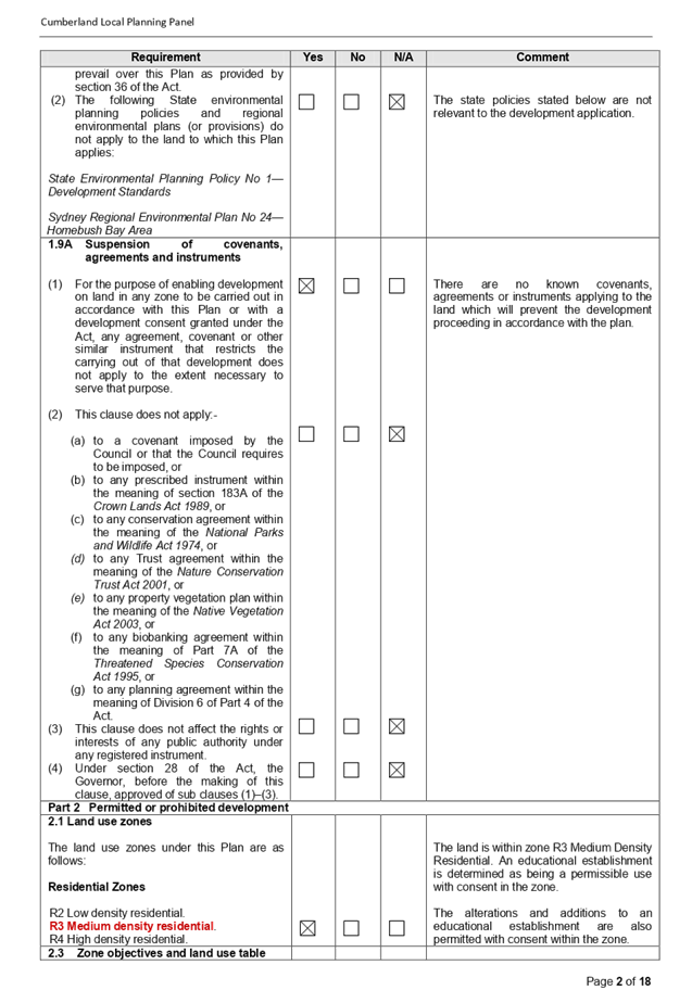
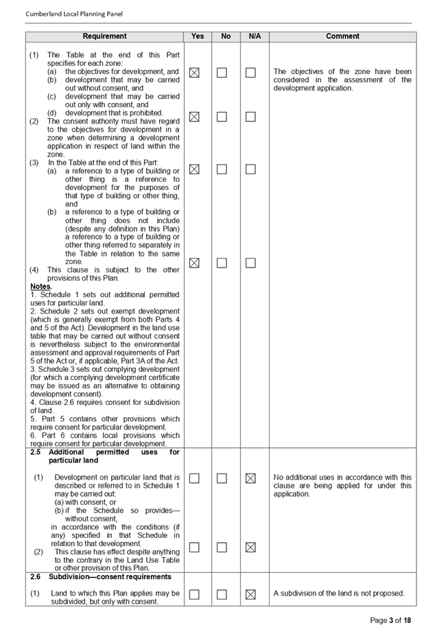
1. Appendix
A - State Environmental Planning Policy
2. Appendix
B - Auburn Local Environmental Plan (LEP) 2010
3. Appendix
C - Copy of the Stop Work Order
4. Appendix
D - List of Conditions of Consent
5. Architectural
Plans
6. Clause
4.6 Variation Request
DOCUMENTS
ASSOCIATED WITH
REPORT LPP001/20
Attachment 1
Appendix A - State Environmental Planning Policy
Cumberland Local Planning Panel Meeting
12 February 2020
DOCUMENTS
ASSOCIATED WITH
REPORT LPP001/20
Attachment 2
Appendix B - Auburn Local Environmental Plan
(LEP) 2010
Cumberland Local Planning Panel Meeting
12 February 2020
DOCUMENTS
ASSOCIATED WITH
REPORT LPP001/20
Attachment 3
Appendix C - Copy of the Stop Work Order
Cumberland Local Planning Panel Meeting
12 February 2020

DOCUMENTS
ASSOCIATED WITH
REPORT LPP001/20
Attachment 4
Appendix D - List of Conditions of Consent
Cumberland Local Planning Panel Meeting
12 February 2020
DOCUMENTS
ASSOCIATED WITH
REPORT LPP001/20
Attachment 5
Architectural Plans
Cumberland Local Planning Panel Meeting
12 February 2020

DOCUMENTS
ASSOCIATED WITH
REPORT LPP001/20
Attachment 6
Clause 4.6 Variation Request
Cumberland Local Planning Panel Meeting
12 February 2020
Cumberland
Local Planning Panel Meeting
12 February 2020
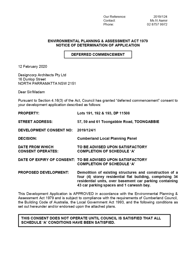
Item No: LPP002/20
Development
Application for 57 - 61 Toongabbie Road, Toongabbie
Responsible
Division: Environment
& Planning
Officer: Executive
Manager Development and Building
File
Number: DA
2019/124
|
Application lodged
|
10 April 2019
|
|
Applicant
|
Designcorp Architects Pty Ltd
|
|
Owner
|
Shalom Home Builders Pty Ltd
|
|
Application No.
|
2019/124
|
|
Description of Land
|
57, 59 and 61 Toongabbie Road, Toongabbie
|
|
Proposed Development
|
Demolition of existing structures and construction of a
three (3) storey residential flat building, comprising 34 residential units,
over basement car parking containing 43 car parking
spaces and 1 carwash bay.
|
|
Site Area
|
2,759.1m2
|
|
Zoning
|
R4 – High Density Residential
|
|
Principal Development Standards
|
Floor Space Ratio:
Max. 1.00:1
Proposed 0.99:1
Height of Buildings:
Max. 11m
· Proposed: 11.5m
(4.5% variation sought)
· Clause 4.6
Written Variation Request submitted for the departure sought to building height
|
|
Disclosure of political donations and gifts
|
Nil disclosure
|
|
Heritage
|
The subject site is not a heritage item
|
|
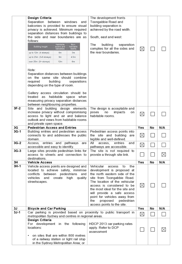
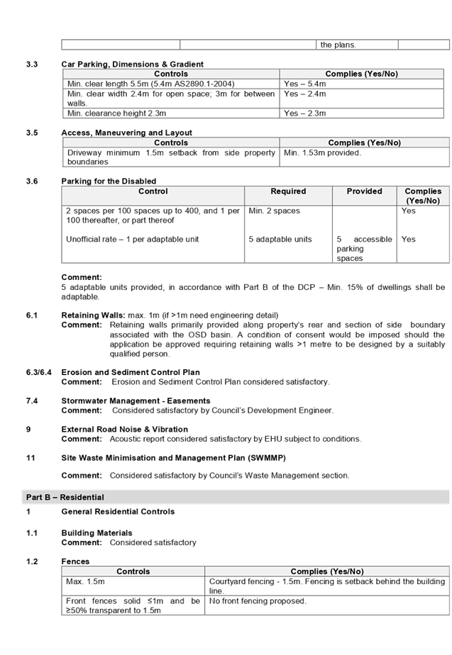
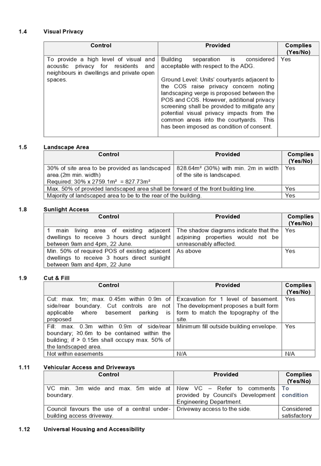
Issues
|
· Variation to
maximum 11m building height (HLEP 2013)
· Apartment sizes
(ADG)
· Ground floor POS
depth (ADG)
· Site coverage (HDCP
2013)
· Number of
storeys (HDCP 2013)
|
1. On
10 April 2019, development application (DA 2019/124) for the demolition of
existing structures and construction of a three (3) storey residential flat
building, comprising 34 residential units, over basement car parking containing
43 car parking spaces and 1 carwash bay was lodged with Council.
Note: The development presents as
a 3 storey built form with 3 residential levels. However, is technically
defined as a four storey development as the basement protrudes more than 1.2m
above NGL at certain sections and therefore, is constituted as a
’storey’. This report therefore refers the development as a 4
storey building and all the assessment is done against the criteria for a 4
storey residential flat building.
2. The
application was publicly notified to adjoining and opposite owners, a notice
was placed in the local press and a notice placed on the site for 21 days from
22 May 2019 to 12 June 2019. In response, the application received one submission.
3. The
subject application has been assessed against the relevant provisions of the
Environmental Planning and Assessment Act 1979, State Environmental Planning
Policy No 65 – Design Quality of Residential Apartment Development (SEPP
65), Apartment Design Guide, Holroyd Local Environmental Plan 2013 (HLEP) and
Holroyd Development Control Plan 2013 (HDCP).
4. The
proposal seeks the following variations which are considered supportable as
discussed in detail elsewhere in the report:
|
Control
|
Required
|
Proposed
|
% Variation
|
|
Building Height
|
Max. 11m
(HLEP 2013)
|
11.5 m to top of lift
core
|
4.5%
|
|
Apartment size and layout
|
75m2 for 2 bedroom units (ADG)
|
74m2 for 15 units
|
1.33%
|
|
Private Open Space and Balconies
|
minimum area of 15m2 and a minimum
depth of 3 m for ground floor units (ADG)
|
Varying width of 1.2m
to 2.4m for units 01 and 02
|
40%
|
|
Site coverage
|
30% (827.73m²)
(HDCP 2013)
|
37.3% (1029.1m²)
|
24.3%
|
|
Number of storeys
|
2 storeys
|
4 storeys (including the basement)
|
100%
|
5. The
application is being reported to the Cumberland Local Planning Panel (CLPP) for
determination as it is a development with 4 storeys to which the State
Environmental Planning Policy No 65 – Design Quality of Residential
Apartment Developments applies.
6. The
application is recommended for Deferred Commencement approval subject to the
conditions in the draft determination at Attachment 4.
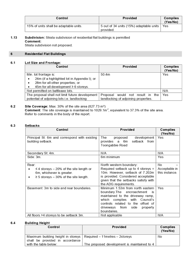
The subject site is known as 57,
59 and 61 Toongabbie Road, Toongabbie and is legally described as Lot 191,192
and 193 in Deposited Plan 11508. The site is located on the northern side of
Toongabbie Road within the R4 High Density Residential zone. The site forms a
regular midblock with a total area of 2759.10m2 and a combined frontage of
50.40m to Toongabbie Road. The site has a fall of approximately 1.4m from the
front to rear. The site is currently occupied by detached dwelling houses,
ancillary structures and vegetation.
The site is bounded by Council
Park at the rear to its northern boundary, a multi-unit housing development to
its eastern boundary and a single storey detached dwelling to the west.
The southern side of Toongabbie Road is zoned R3-Medium Density Housing and
bounded by low density housing development. The site is located within the southern
edge of Toongabbie Town Centre. There is a transition occurring currently with
older low density housing stock being developed into residential flat
buildings.
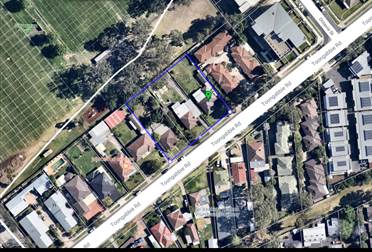
Figure 1 Aerial view
of the locality with subject site (57-61 Toongabbie Road, Toongabbie)
Figure
2 - Zoning map with subject site shown hatched. Source: Cumberland Council 2019
Figures 3, 4 & 5: subject site
(57-61 Toongabbie Road, Toongabbie)
Description of the
Proposed Development
DA 2019/124 proposes for the
demolition of existing structures and construction of a four (4) storey
residential flat building, comprising 34 residential units, over basement car
parking containing 43 car parking spaces and 1 carwash bay.
Key features of the
development proposal are as follows:-
|
Level
|
Details
|
|
Basement
|
44 residential car spaces with the following breakdown:
· 36
residential car parking space including 5 accessible
Car parking spaces.
· 7
visitor car parking spaces
· 1 x
dedicated carwash bay
· 10 bicycle
spaces
· Storage, garbage
room, services, lift and fire stairs
|
|
Ground floor level
|
12 residential units
Communal Open Space
|
|
Level 1
|
11 residential units
|
|
Level 2
|
11 residential units
|
Access to the basement car park is provided from a new vehicular crossing
proposed on the eastern section of the subject site.
The dwelling mix of the proposal is as follows:
· 6 x 1 bedroom units (17.6%);
· 24 x 2 bedroom units (70.6%); and
· 4 x 3 bedroom units (11.8%).
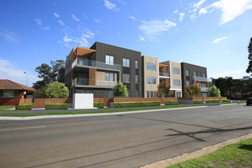
Figure 6 – Perspective of proposed
development –Toongabbie Road frontage
Application
History
|
Date
|
Action
|
|
10 April 2019
|
The subject development application (DA 2019/124) was
lodged with Council.
|
|
14 May 2019
|
The application was referred to the following internal and
external sections:
· Development
Engineering
· Traffic
Engineering
· Landscape and
Tree Management
· Parks &
Recreation
· Environmental
Health Unit
· Waste Management
· Transgrid
· Endeavour Energy
· Cumberland Police
Local Area Command
|
|
22 May 2019 to 12 June 2019
|
Application placed on public notification. In response,
one submission was received.
|
|
27 September 2019
|
The application was deferred for the following reasons:
· Building height
and solar access
· Apartment size
and layout
· Roof top
Communal open space
· Visual and
acoustic privacy
· Traffic
engineering
· Landscape
· Waste
· Stormwater
|
|
25 October 2019
|
Amended plans and additional information submitted to
Council, addressing the deferral letter dated 27 September 2019. The
application did not warrant re-notification as the amendments did not result
in a greater environmental impact.
|
|
12 February 2020
|
Application referred to CLPP for determination.
|
Applicant’s
Supporting Statement
Statement of Environmental
Effects prepared by Think Planners Pty Ltd, dated March 2019 and 29 October
2019 were submitted in support of the application.
Contact with
Relevant Parties
The assessing officer
has undertaken an inspection of the subject site and has been in contact with
the applicant throughout the assessment process.
Internal Referrals
Development Engineer
Council’s
Development Engineer advised that the development is supportable with regards
to the proposed new vehicular crossing and stormwater management, subject to
deferred commencement conditions.
Traffic Engineer
Council’s Traffic
Engineer has advised that the development is supportable in regards to parking,
traffic management and on-site parking provision in the basement level, subject
to conditions.
Tree Management
Officer
Council’s Tree
Management Officer has advised that the development is supportable subject to
the imposition of conditions.
Waste Management
Officer
Council’s Waste
Management Officer has advised that the proposed waste management plan is
supportable.
Environmental Health
Unit
Council’s
Environmental Health Officer has advised that the proposal is satisfactory
subject to imposition of conditions of consent.
Parks &
Recreation
Council’s Parks
& Recreation Officer who has advised that the development is supportable
subject to the imposition of conditions.
External Referrals
Transgrid
The development
application was referred to Transgrid for comment who has advised that the
development is supportable in regards to not affecting Transgrid’s asset.
Endeavour Energy
The development
application was referred to Endeavour Energy for comment who has advised that
the development is supportable in regards to electricity connection and
sufficient clearance to existing electricity asset, subject to conditions.
NSW Police
The application was
referred to NSW Police for comment regarding CPTED. Response dated 9 July 2019
indicates that the proposal is satisfactory subject to conditions.
Planning
Assessment
The provisions of any
Environmental Planning Instruments (EP&A Act s4.15 (1)(a)(i))
The following
Environmental Planning Instruments are relevant to the assessment of the
subject application:
(a) State Environmental
Planning Policy No 65 – Design Quality of Residential Apartment
Development (SEPP 65)
The proposal is
classified as a residential apartment development and SEPP 65 applies. A design
verification statement signed by registered architect Joe El- Sabbagh was
submitted with the application.
SEPP 65 sets 9 design
quality principles. The development has adequately addressed the principles in
the following way:
Figure 6 – SEPP 65 Design Quality
Principles Table
|
ADG design
quality principle
|
Response
|
|
1. Context and neighbourhood character
|
The area is zoned to accommodate new development,
including residential flat building that is a permitted type of development
within the R4 zone. The existing character of the streetscape is in
transition where existing dwelling houses are being replaced with higher
densities development, such as residential flat buildings. The proposed
development satisfies Holroyd LEP 2013 objectives in that it will provide a
variety of housing type within a high density environment. The siting of
development has been appropriately designed to minimise any potential
overshadowing and visual privacy impact to the adjoining properties by
maintaining a buffer area at the rear and side boundaries for communal open
space.
|
|
2. Built form and scale
|
The development application is seeking consent for a 4
storey residential flat buildings over 1 level of basement car parking. The
building has been designed to correspond with the existing landform. At grade
communal open space will assist in softening the built form and minimise any potential
overshadowing and visual privacy impact to the adjoining properties.
|
|
3. Density
|
The subject site is well
located with respect to existing public transport and community facilities.
The design of the development provides for appropriate separation between
dwellings, supplemented by privacy treatment to balconies and windows where
necessary.
|
|
4. Sustainability
|
A BASIX Certificate and relevant reports have been
submitted with the development application. The certificates require
sustainable development features to be installed into the development. The
proposal will incorporate features relating to ESD in the design and
construction of the development inclusive of water efficient fixtures and energy
saving devices.
|
|
5. Landscape
|
Adequate landscaped area has been provided, which will
provide appropriate level of amenity to the resident and consistent with the
environmental surrounds of the subject site.
|
|
6. Amenity
|
The proposal will deliver sufficient amenity to residents
of the building. The proposal achieves compliance with the ADG in this regard
which contains many amenity controls. The building design incorporates access
and circulation, apartment layouts, floor area, ceiling height, private open
space, common open space, energy efficiency rating, adaptability and
diversity, safety, security and site facilities. The proposal is considered
to generally comply with the ADG and HDCP 2013 which contains numerous
amenity controls. Suitable access is provided to all parts of the building,
through the efficient use of lift to access all levels. The development is
considered to provide an appropriate level of amenity for future residents.
|
|
7. Safety
|
Suitable and secure access is provided to all parts of the
building, through the efficient use of lift to access all levels.
|
|
8. Housing diversity and social interaction
|
The apartment mix is considered to be satisfactory. The
specifics of the building are:-
· 6 x 1 bedroom units (17.6%);
· 24 x 2 bedroom units (70.6%); and
· 4 x 3 bedroom units (11.8%).
The number of adaptable units proposed is considered
satisfactory with the provision of associated accessible car spaces.
|
|
9. Aesthetics
|
The residential flat building has an attractive
contemporary appearance and utilises building elements that provide
individuality to the development without compromising the streetscape or
detracting from the appearance of existing surrounding development. The
building responds well in this regard with its provision of good aesthetics
through the use of high quality materials, attention to detail in its
internal spaces and how it addresses the street frontage. The building
provides an appropriate response to the existing and likely future character
of the locality.
|
Pursuant to clause
28(2)(c) of SEPP 65, a consent authority must consider the provisions of the
Apartment Design Guide (ADG) in the assessment of a residential flat
development. A comprehensive assessment against the Apartment Design Guide
(ADG) controls is provided at Attachment 1.
The proposal involves
the following non-compliances with the ADG controls.
|
No.
|
Control
|
Comments
|
Compliance
|
|
4D
|
Apartment Size and Layout
|
|
|
|
|
|
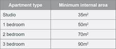
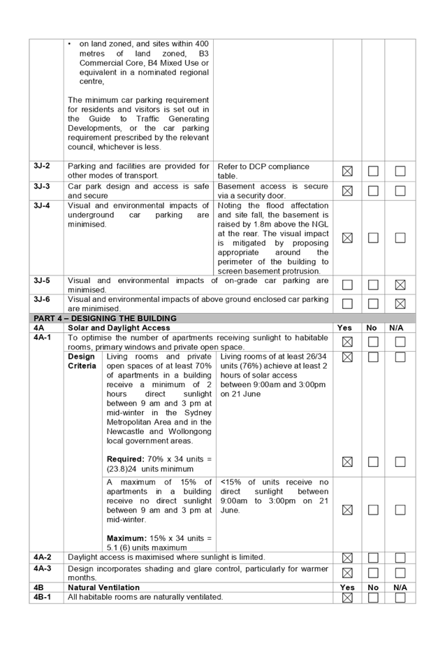
4D-1
|
Design Criteria
Apartments are
required to have the following minimum internal areas:
The minimum
internal areas include only one bathroom. Additional bathrooms increase the
minimum internal area by 5m2 each.
A fourth bedroom and further
additional bedrooms increase the minimum internal area by 12m2
each.
|
All units generally comply
with the minimum internal areas except for 15 x 2 bedroom units. The
departure is minor (74m2) and is considered acceptable as the
overall design is functional and useable and provides a reasonable internal
amenity for the residents.
|
|
|
|
|
4E
|
Private
Open Space and Balconies
|
|
|
|
|
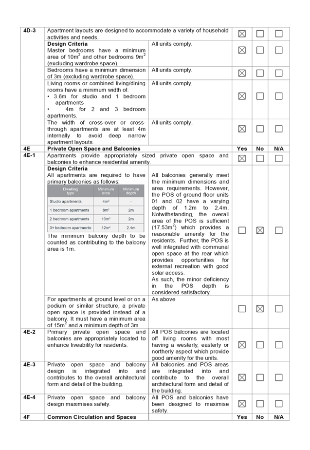
4E-1
|
For
apartments at ground level or on a podium or similar structure, a private
open space is provided instead of a balcony. It must have a minimum area of
15 m2 and a minimum depth of 3 m.
|
The POS
of ground floor units 01 and 02 have a varying depth of 1.2m to 2.4m.
However, the overall area of the POS is sufficient (17.53m2) which
provides a reasonable amenity for the residents. Further, the POS is
well integrated with communal open space at the rear which provides
opportunities for external recreation with good solar access.
As
such, the minor deficiency in the POS depth is considered satisfactory.
|
|
|
|
|
|
|
|
|
|
|
(b) State Environmental
Planning Policy (Infrastructure) 2007
Clause 45 – Development likely to affect an electricity
transmission or distribution network
The development application was referred to Endeavour Energy and
TransGrid for comment, who raised no objections, subject to conditions.
(c) State Environmental
Planning Policy No 55 – Remediation of Land (SEPP 55)
The requirement at clause 7 of SEPP 55 for Council to be satisfied that
the site is suitable or can be made suitable to accommodate the proposed
development has been considered in the following table:
|
Matter
for consideration
|
Yes
|
No
|
|
Does the application involve re-development of the site or
a change of land use?
|
|
|
|
Is the development going to be used for a sensitive land
use (e.g. residential, educational, recreational, childcare or hospital)?
|
|
|
|
Does information available to you indicate that an
activity listed below has ever been approved, or occurred at the
site?
acid/alkali plant and formulation,
agricultural/horticultural activities, airports, asbestos production and
disposal, chemicals manufacture and formulation, defence works, drum
re-conditioning works, dry cleaning establishments, electrical manufacturing
(transformers), electroplating and heat treatment premises, engine works,
explosive industry, gas works, iron and steel works, landfill sites,
metal treatment, mining and extractive industries, oil production and
storage, paint formulation and manufacture, pesticide manufacture and
formulation, power stations, railway yards, scrap yards, service stations,
sheep and cattle dips, smelting and refining, tanning and associated trades,
waste storage and treatment, wood preservation
|
|
|
|
Is the site listed on Council's Contaminated land
database?
|
|
|
|
Is the site subject to EPA clean-up order or other EPA
restrictions?
|
|
|
|
Has the site been the subject of known pollution incidents
or illegal dumping?
|
|
|
|
Does the site adjoin any contaminated land/previously
contaminated land?
|
|
|
|
Has the appropriate level of investigation been carried
out in respect of contamination matters for Council to be satisfied that the
site is suitable to accommodate the proposed development or can be made
suitable to accommodate the proposed development?
|
|
|
|
Details of contamination investigations carried out at
the site:
The site is not identified in Council’s records as
being subject to contamination. There is no evidence available to suggest
that the site has ever been used for a potentially contaminating activity. No
further investigation is considered necessary in the circumstances. Council’s Environmental Health Unit has assessed
the application and considers the proposal to be satisfactory subject to
conditions.
|
(d) State Environmental
Planning Policy (Building Sustainability Index: BASIX) 2004
BASIX certificate 915839M_02 dated 26 February 2019 was submitted with
the original plans. The submitted BASIX certificate achieves target scores and
is consistent with the architectural plans. Conditions of Consent have been
applied requiring adherence to the BASIX Certificate requirements.
Regional Environmental Plans (Deemed State Environmental Planning
Policies)
(e) Statement
Environmental Planning Policy No 19 - Bushland in Urban Areas
The proposal does not propose to disturb bushland zoned or reserved for
public open space.
(f) State
Environmental Planning Policy (Vegetation in Non-Rural Areas) 2017
The proposal includes removal of existing trees within the subject site.
However, this does not exceed the biodiversity offsets scheme threshold and the
majority of the trees on site are exempt species. Therefore, the proposed
vegetation removal is considered acceptable. Refer to the HDCP 2013 compliance
table at attachment 3 for further comment regarding the proposed tree removal.
(g) State Environmental
Planning Policy (Coastal Management) 2018
The subject site is not identified as a coastal wetland nor is it
‘land identified as “proximity area for coastal wetlands” as
per Part 2, Division 1 of the SEPP Coastal Management 2018.
(h) Holroyd Local
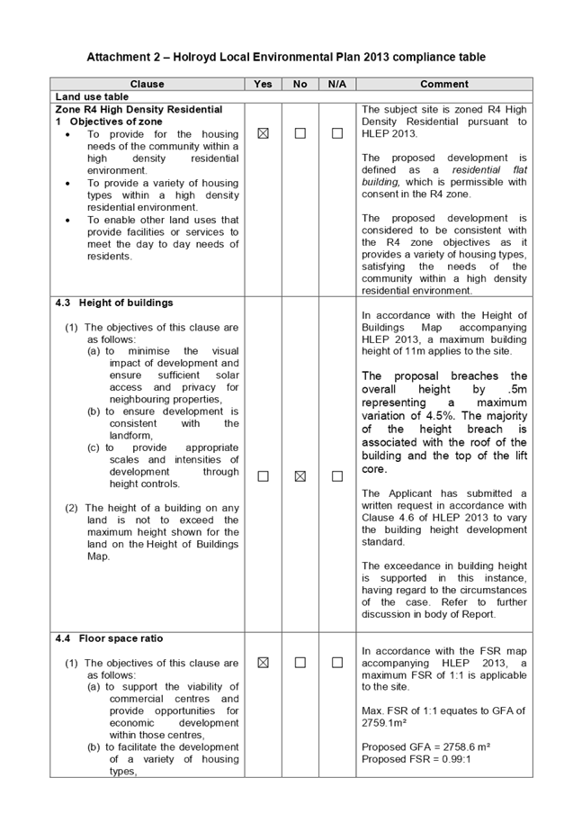
Environmental Plan 2013 (HLEP 2013)
The proposed development is defined as a ‘residential flat
building’ under the provisions of HLEP 2013. Residential flat buildings
are permitted with consent in the R4 – High Density Residential zone
which applies to the land.
The proposal seeks a variation to Clause 4.3 – Height of Buildings
that stipulates that the height of building is not to exceed 11m on the subject
site.
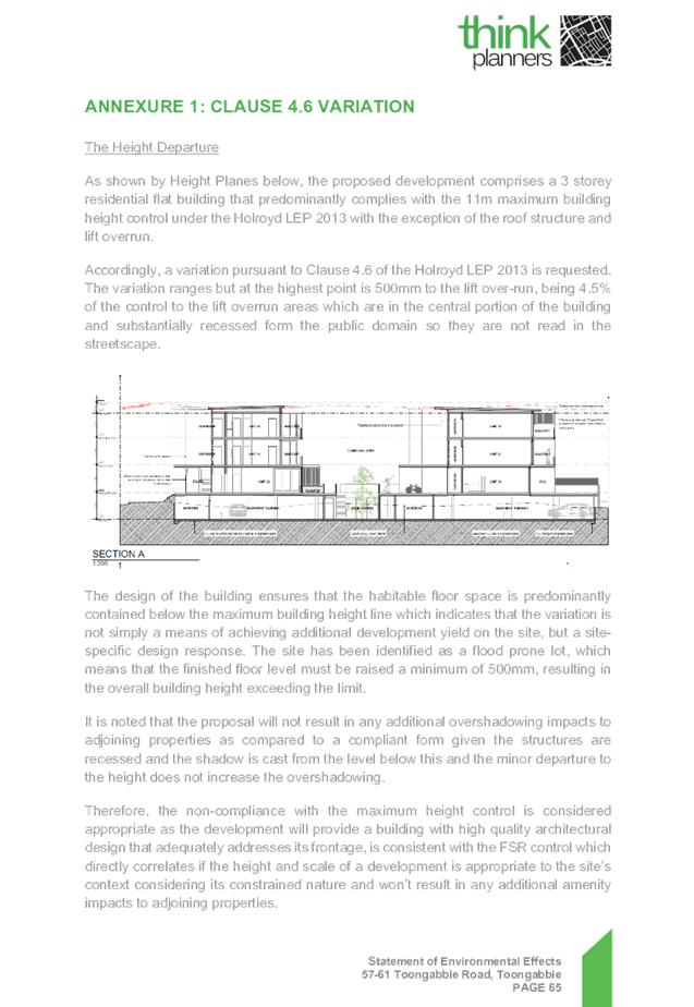
The proposed building has an overall height of 11.5m (RL 44.98.) to the
top of the lift core. The proposal breaches the overall height by 0.5m
representing a maximum variation of 4.5%. The majority of the height breach is
associated with the minor section of the roof structure and lift over-run.
 Figure 7& 8 – 3D Height Plane and section showing extent of
height variation sought
Figure 7& 8 – 3D Height Plane and section showing extent of
height variation sought
Clause 4.6 – Variation to Building Height
Clause 4.6 allows the consent authority to vary development standards in
certain circumstances and provides an appropriate degree of flexibility to
achieve better design outcomes. The consent authority may grant the exception
as the Secretary’s concurrence can be assumed where clause 4.6 is adopted
as per the Department of Planning Circular PS 18-003, dated 21 February 2018.
The applicant has submitted a written request to vary the development
standard for building height. Based on various case laws established by the
Land and Environment Court of NSW such as Four2five P/L v Ashfield Council
[2015] NSWLEC 9, Randwick City Council v Micaul Holdings P/L [2016] NSW LEC7
and Zhang and anor v Council of the City of Ryde [2016] NSWLEC 1179 and recent
case law in RebelMH Neutral Bay Pty Limited v North Sydney Council [2019] NSWCA
130, a 3 part assessment framework for a variation request proposed under
clause 4.6 has been considered and an assessment of the proposed variance,
following the 3 part test is discussed in detail below.
The 3 preconditions which must be satisfied before the application can
proceed are as follows:
1. Is the proposed
development consistent with the objectives of the zone?
Applicant’s justification:
The development is consistent with the zone objectives noting that:
· The development will provide for the housing
needs of the community within a high density environment;
· The development contributes to a variety of
housing types in a high density environment;
· The development will maximise public transport
patronage by providing residential accommodation in an accessible location;
· The development is designed to respond to the
context and setting of the locality and the development is consistent with the
desired future character of the locality;
· The development is designed to minimise impact on
the amenity of the area and adjoining properties.
Planner’s Comment:
Residential flat buildings are a permitted land use and the locality is
undergoing a transition particularly to support the increasing demand of
housing within the close proximity of public transport hub and major commercial
centre. The proposed development is considered to be consistent with the
objectives of the R4 High Density Residential zone.
2. Is the proposed
development consistent with the objectives of the development standard which is
not met?
Applicant’s justification:
The current development proposal is predominantly consistent with the
building height with the exception of the roof structure and the lift over-run,
the proposal remains consistent with the objectives based on the following:
· The development proposal is consistent with the
intent of the maximum height control with the proposed flat building contained
below the maximum building height with the non-compliance contained to the roof
structure (no habitable floor space) and lift overrun that is not discernibly
different to a compliant form as viewed from the street or park given the
location of the variation is located centrally to the building and the building
presents a 3 storey form as viewed from the public domain.
· The variation is primarily as result of
appropriately responding to the flooding constraints of the site and the
proposal adopts 3 residential levels consistent with the intended height of
buildings in the area.
· Due to the minor nature of the variation it will
not have any adverse amenity impacts.
· The proposed development will permit the site to
develop to its full zoning potential whilst complementing the future vision
envisioned for the site by providing an attractive mixed use building that
provides good address to the street frontage and complying with other key
planning controls applying to the proposal;
· The scale of the proposed development will be
appropriate and will be visually consistent with the permitted building height
with the upper level recessed and designed using a lighter design style to ensure
a positive streetscape presentation.
· The proposal is not located within a low-density
area and the proposal represents an appropriate built form on the site; and
· The scale and intensity of the development is
appropriate noting that the proposal complies with the maximum FSR control that
demonstrates an appropriate density.
As outlined above the proposal remains consistent with the underlying
objectives of the control and as such compliance is considered unnecessary or
unreasonable in the circumstances. The above discussion demonstrates that there
are sufficient environmental planning grounds to justify the departure from the
control.
Planner’s comment:
The objectives of the building height standard are to enable appropriate
development density to be achieved and to ensure that the height of the
building is compatible with the existing and desired future character of the
locality. The increased height does not result in an additional level for
residential use, as it comprises portion of the roof structures and the top of
the lift core.
The departure sought is considered to be modest and does not unreasonably
impact on adjoining properties. The additional height does not result in the
appearance of bulk when viewed from the existing streetscape and would not
impinge on the changing streetscape that is anticipated for the immediate area.
Given that the proposed development responds to the site constraints and does
so without compromising relationships with adjoining development, the proposal
is considered to be consistent with the objectives of height requirements and
development within the R4 zone.
3. a) Is compliance
with the development standard unreasonable or unnecessary in the circumstances
of the case?
Applicant’s justification:
In accordance with the provisions of this clause it is considered that
compliance with the development standard is unreasonable and unnecessary in the
circumstances of the case as the underlying objectives of the control are
achieved.
Planner’s comment:
Council Officers are satisfied that the proposed variation has been
appropriately justified and can be supported in this instance. The height
breach is limited to an overall building height of RL 44.98 for the top of the
lift core. The additional height of the lift core will not be visible from the
adjacent streets and properties. The proposed variation to the development
standard is necessary for the structure containing the lift core and in order
to achieve required FFLs, and is consistent with the scale of the development
within the R4 zone located in the immediate vicinity of the site. The departure
sought is considered to be modest and does not unreasonably impact on adjoining
properties. The additional height does not result in the appearance of bulk when
viewed from the existing streetscape, would not impinge on the changing
streetscape that is anticipated for the immediate area and does not result in
additional overshadowing to the adjoining properties. It is considered,
therefore, that the non-compliance with the Development Standard is not
unreasonable or unnecessary in the circumstances of the case.
b) Are there sufficient environmental
planning grounds to justify contravening the development standard and therefore
is the applicant’s written justification well founded?
The unique circumstances of the case are considered to warrant support of
the departure. Given that the proposed development responds to the flooding
constraints and does so without unduly compromising relationships with
adjoining development, and does not unduly compromise other relevant controls,
the proposal is considered to be consistent with the objectives of building
height, and development within the R4 zone. In this regard, the exception is
well founded and can be supported.
Conclusion:
Council is satisfied that the applicant’s written request has
adequately addressed the matters required to be demonstrated by clause 4.6
subclause (3). Council is further satisfied that the proposed development will
be in the public interest because it is consistent with the objectives of the
particular standard and the objectives for development within the zone in which
the development is proposed to be carried out.
It is the view of Council Officers that justification provided is
satisfactory and having considered the application on its merit, the exception
to the maximum building height development standard is considered acceptable in
this instance.
An assessment against all the relevant LEP provisions is provided at
Attachment 2.
The provisions of any proposed instrument that is or has been the subject
of public consultation (EP&A Act s4.15 (1)(a)(ii))
There are no draft SEPPs applicable to the proposed development.
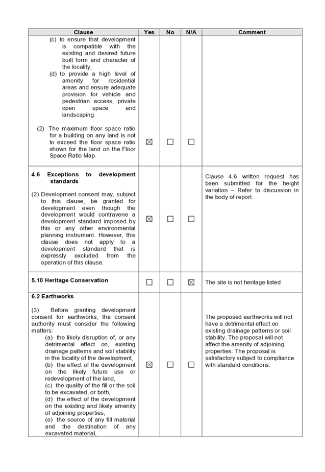
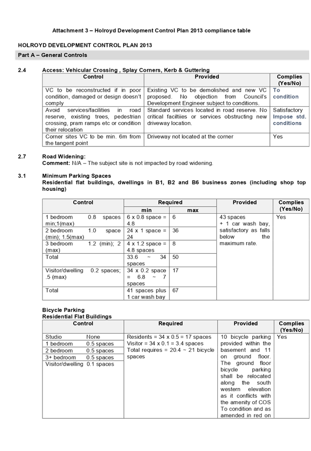
The provisions of any Development Control Plans (EP&A Act s4.15 (1)(a)(iii))
(a) Holroyd Development
Control Plan 2013
HDCP 2013 contains general controls which relate to all developments
under Part A, and Residential Controls under Part B.
A comprehensive HDCP compliance table is attached to this report at Attachment
3. A summary of the DCP non-compliances is provided in the following table.
|
Part
B, Section 6 – Residential Flat Buildings
|
|
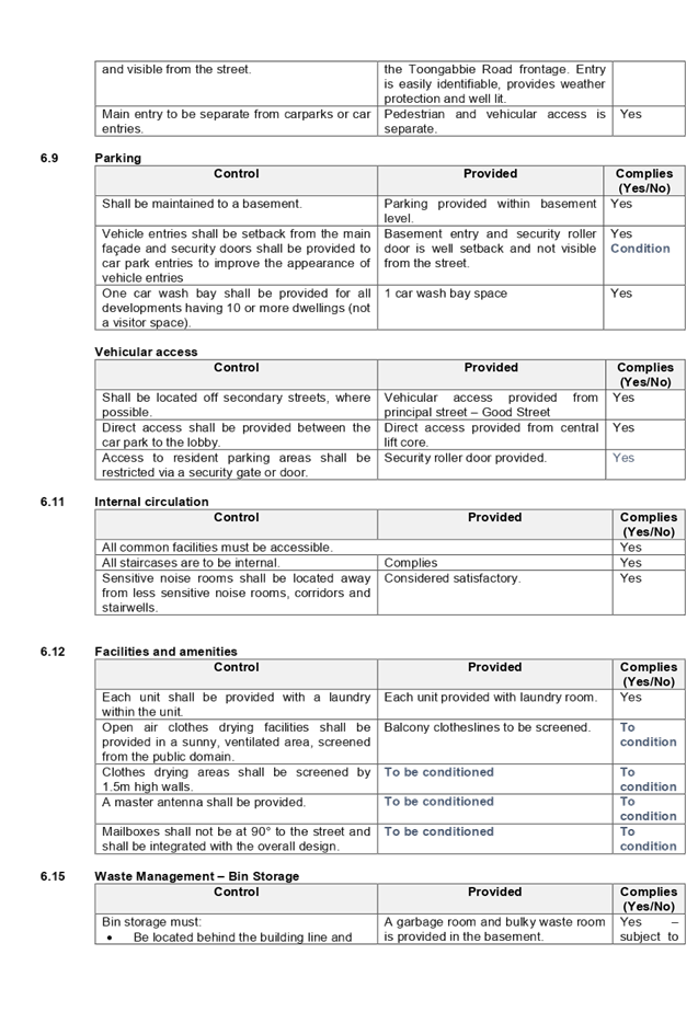
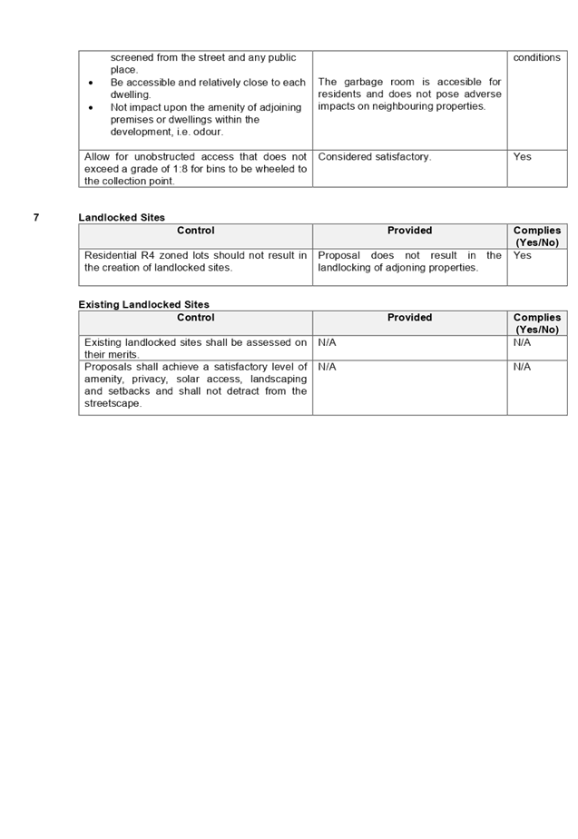
6.4
- Height
|
Provided
|
Complies
(Yes/No)
|
|
Max site coverage 30%, or
827.73m²
|
37.3% (1029.1m²) non-compliance is considered
acceptable given that the proposal still achieves adequate provision of deep
soil planting, landscaping, driveways, communal open space and OSD system.
|
No –
Acceptable in this instance.
|
|
Maximum building height in
storeys shall be provided in accordance with the table below:
|
Permitted
Height (storeys)
|
|
Height
|
Storeys
|
|
9m
|
1
|
|
11m
|
2
|
|
12.5m
|
3
|
|
15m
|
4
|
|
18m
|
5
|
|
21m
|
6
|
|
24 m
|
7
|
|
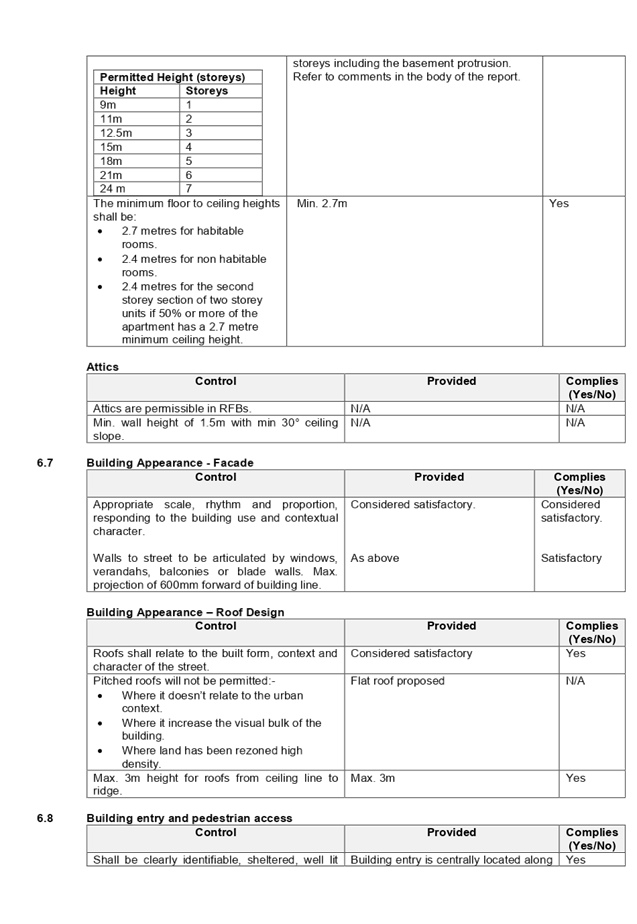
The overall height of the building complies with the
maximum 11m building height as per the LEP standards (except for a minor
variation of 4.5% as discussed earlier under Clause 4.6). Further the
proposal is acceptable on merit as follows:
· The
development presents as a 3 storey built form with 3 residential levels.
However, is technically defined as a four storey development as the
basement protrudes more than 1.2m above NGL at certain sections and
therefore, is constituted as a ’storey’.
· The departure is a result of
responding to the flooding constraints on the site.
· The number of storeys is therefore
acceptable, as there are no adverse impacts associated with the additional
storey.
|
No –
Acceptable in this instance.
|
Any planning agreement that has been entered into under section 7.4, or
any draft planning agreement that a developer has offered to enter into under section
7.4 (EP&A Act s 4.15(1)(a)(iiia))
There is no planning agreement or draft planning agreement associated
with the subject Development Application.
The provisions of the Regulations (EP&A Act s4.15 (1)(a)(iv))
Pursuant to clause 92 of the Regulation, the provisions of AS 2601 must
be considered in the case of a development application for the demolition of a
building. Standard conditions are included in the draft determination to
require the proposed demolition works to be carried out in accordance with AS
2601.
The Likely Environmental, Social or Economic Impacts (EP&A Act s4.15
(1)(b))
The likely environmental, social and economic impacts of the development
have been assessed and are considered satisfactory.
The suitability of the site for the development (EP&A Act s4.15
(1)(c))
The site is considered suitable for the proposed development.
Submissions made in accordance with the Act or Regulation (EP&A Act
s4.15 (1)(d))
Advertised (newspaper) Mail
Sign
Not
Required
In accordance with Part E - Public Participation of HDCP 2013, the
proposal was publicly notified for a period of 21 days from 22 May 2019 to 12
June 2019. As a result of the notification, one submission was received.
Amended plans submitted did not warrant re-notification of the proposal.
The issues raised in the public submission are summarised and commented
on as follows:
i) The
current rezoning of 57-61 Toongabbie Road is inequitable to the low density
zoning of 46-48 Toongabbie Road.
Comment: The
aforementioned concern regarding upzoning of the surrounding properties is
considered to be a separate matter and not related to the subject application.
The land was rezoned to current R4 High Density Residential following the due
consultation process.
ii) The development
in this locality will devalue surrounding properties.
Comment: Whilst property
values are not a consideration under Section 4.15 of the EP&A Act, no
evidence is provided to suggest that the proposed development will have any
negative impact on surrounding property prices.
Section 7.11 of The Environmental Planning & Assessment Act 1979
The subject development requires the payment of contributions in
accordance with Holroyd Section 94 Development Contributions Plan 2013. A
condition is imposed requiring the payment of contributions.
In accordance with the currently indexed rates for the Toongabbie
contribution area, the following contributions apply:
· 6 x 1-bedroom dwellings = $54,636
· 24 x 2-bedroom dwellings = $369,576
· 4 x 3 bedroom dwellings = $80,000
The required Section 7.11 contribution payable for the proposal is
$444,212.
Note: This includes Credit for the existing 3 x 3-bedroom dwellings.
The Public Interest
The public interest is served by permitting the orderly and economic use
of land, in a manner that is sensitive to the surrounding environment and has
regard to the reasonable amenity expectations of surrounding land users. In
view of the foregoing analysis, it is considered that approval of the proposed
development would not be contrary to the public interest.
Disclosure of Political Donations And Gifts
The NSW Government introduced The Local Government and Planning
Legislation Amendment (Political Donations) Act 2008 (NSW). This disclosure
requirement is for all members of the public relating to political donations
and gifts. The law introduces disclosure requirements for individuals or
entities with a relevant financial interest as part of the lodgement of various
types of development proposals and requests to initiate environmental planning
instruments or development control plans.
The application and notification process did not result in any disclosure
of Political Donations or Gifts.
The proposed development has been
assessed in accordance with the relevant requirements of the Environmental
Planning and Assessment Act 1979, State Environmental Planning Policy No 65
– Design Quality of Residential Apartment Development, Holroyd Local Environmental
Plan 2013 and the Holroyd Development Control Plan 2013 and is considered to be
satisfactory.
There are no consultation
processes for Council associated with this report.
There are no financial implications
for Council associated with this report.
There are no policy implications
for Council associated with this report.
Communication /
Publications:
The final outcome of this matter
will be notified in the newspaper. The objectors will also be notified in
writing of the outcome.
|
1. That
the Local Planning Panel approve the variation to the Development Standard
relating to building height as contained within Clause 4.3 of the Holroyd
Local Environmental Plan 2013 as the applicant’s Clause 4.6 objection
has adequately addressed the matters required to be demonstrated by Clause
4.6 (3) and the development will be in the public interest because it is
consistent with the objectives of the Height Standard and the objectives of
the R4 – High Density Residential zone.
2. That
Development Application 2019/124/1 for the demolition of existing structures
and construction of a four (4) storey residential flat building, comprising
34 residential units, over basement car parking containing 43 car parking
spaces and 1 carwash bay, be Approved via Deferred Commencement, subject to
the attached conditions, provided at Attachment 4.
3. That
the applicant and those persons who lodged a submission in respect to the
application be notified of the determination of the application.
|
1. ADG
Compliance Table
2. HLEP
2013 Compliance Table
3. HDCP
2013 Compliance Table
4. Draft
Notice of Determination
5. Architectural
Plans
6. Shadow
Diagrams
7. Accompanying
Clause 4.6 Variation Request to Building Height
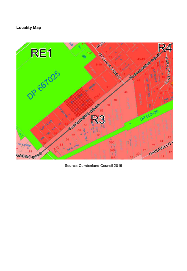
8. Locality
Map
9. Submission
(x1)
DOCUMENTS
ASSOCIATED WITH
REPORT LPP002/20
Attachment 1
ADG Compliance Table
Cumberland Local Planning Panel Meeting
12 February 2020
DOCUMENTS
ASSOCIATED WITH
REPORT LPP002/20
Attachment 2
HLEP 2013 Compliance Table
Cumberland Local Planning Panel Meeting
12 February 2020
DOCUMENTS
ASSOCIATED WITH
REPORT LPP002/20
Attachment 3
HDCP 2013 Compliance Table
Cumberland Local Planning Panel Meeting
12 February 2020

DOCUMENTS
ASSOCIATED WITH
REPORT LPP002/20
Attachment 4
Draft Notice of Determination
Cumberland Local Planning Panel Meeting
12 February 2020

DOCUMENTS
ASSOCIATED WITH
REPORT LPP002/20
Attachment 5
Architectural Plans
Cumberland Local Planning Panel Meeting
12 February 2020

DOCUMENTS
ASSOCIATED WITH
REPORT LPP002/20
Attachment 6
Shadow Diagrams
Cumberland Local Planning Panel Meeting
12 February 2020
DOCUMENTS
ASSOCIATED WITH
REPORT LPP002/20
Attachment 7
Accompanying Clause 4.6 Variation Request to Building
Height
Cumberland Local Planning Panel Meeting
12 February 2020
DOCUMENTS
ASSOCIATED WITH
REPORT LPP002/20
Attachment 8
Locality Map
Cumberland Local Planning Panel Meeting
12 February 2020
DOCUMENTS
ASSOCIATED WITH
REPORT LPP002/20
Attachment 9
Submission (x1)
Cumberland Local Planning Panel Meeting
12 February 2020

Cumberland
Local Planning Panel Meeting
12 February 2020
Item No: LPP003/20
Modification
Application for 5 - 7A Octavia Street, Toongabbie
Responsible
Division: Environment
& Planning
Officer: Executive
Manager Development and Building
File
Number: DA
2014/163/3
|
Application lodged
|
4 October 2019
|
|
Applicant
|
Mr S Elias
|
|
Owner
|
SSE Corp Pty Ltd
|
|
Application No.
|
2014/163/3
|
|
Description of Land
|
5-7A Octavia Street, Toongabbie
|
|
Proposed Development
|
S4.55(2) modification seeking alterations and additions to
an approved residential flat building development including amendment to
basement layout, internal configuration of units and addition of two
residential units; totalling 26 units
|
|
Site Area
|
1,532.9m2
|
|
Zoning
|
R4- High Density Residential
|
|
Principal Development Standards
|
Floor Space Ratio (FSR):
Max. 1.2:1
Proposed : 1.2:1
Height of Buildings:
Max. 15m
Proposed: 16.1m
· Approved
building height under the original application: 16.28m
· The subject modification proposes a minor
reduction (180mm) to the approved building height.
|
|
Disclosure of political donations and gifts
|
Nil disclosure
|
|
Heritage
|
The subject site is not a heritage item, and not
located within a heritage conservation area.
|
|
Issues
|
· Height non- compliance (HLEP 2013)
· Number of storeys (HDCP 2013)
|
1. Development
application (DA 2014/163/1) for demolition of existing structures;
consolidation of 2 lots into 1; construction of a 4 storey residential flat
building accommodating 24 residential units over basement parking accommodating
29 car parking spaces was approved under delegated authority on 16 February
2015.
2. Section
4.55(2) modification application 2014/163/2 was lodged on 29 October 2018 and
withdrawn on 8 May 2019.
3. The
subject 4.55(2) modification application was lodged on 4 October 2019 seeking
alterations and additions to an approved residential flat building development
including amendment to basement layout, internal configuration of units and
addition of two residential units; totalling 26 units.
4. The
application was publicly notified to adjoining and opposite owners, a notice
was placed in the local press and a notice placed on the site for 21 days from
30 October 2019 to 20 November 2019. In response, the application received no
submissions.
5. The
application has been assessed against the relevant provisions of the
Environmental Planning and Assessment Act 1979, State Environmental Planning
Policy No 65 – Design Quality of Residential Apartment Development (SEPP
65), Holroyd Local Environmental Plan 2013 (HLEP), Apartment Design Guide
and Holroyd Development Control Plan 2013 (HDCP)
6. The
application involves the following non-compliances which are considered
supportable as discussed in detail elsewhere in the report:
|
Item
|
Required
|
Proposed
|
% Variation
|
|
Building Height
(HLEP 2013)
|
15 m
|
16.1m
|
7.3%
|
|
Building height (number of storeys)
HDCP 2013)
|
4 storeys
|
5 storeys
|
25%
|
Note: Only new non-compliances
have been discussed within the body of the report which are proposed under the
subject modification application. The original consent with the approved
architectural plans is attached at Attachments 6 & 7.
7. The
application is being reported to the Cumberland Local Planning Panel (CLPP) for
determination as it is a modification to a development with more than 4 storeys
to which the State Environmental Planning Policy No 65 – Design Quality
of Residential Apartment Developments applies and exceeds Council delegation in
relation to the determination of modification.
8. The
application is recommended for approval subject to the conditions in the draft
determination at Attachment 4.
The subject site is known as 5
& 7 Octavia Street, Toongabbie and is legally described as Lots A & B
in DP 416471. The site forms a regular midblock and has a combined area of
1,532.9m2 and frontage of 38.1m to Octavia Street. The property is currently
vacant and comprises of some vegetation.
The subject site and neighbouring
allotments are zoned R4 – High Density Residential. The site is
bounded by older style detached dwellings along the northern, southern and
eastern boundaries. The western side of Octavia Street comprises of recently
constructed residential flat building developments. The site is located
within the southern edge of Toongabbie Town Centre and is surrounded by other
residential flat buildings of comparable scale.
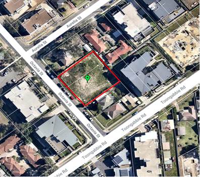
Figure
1: Aerial view of the locality with subject site. (5-7A Octavia Road,
Toongabbie)
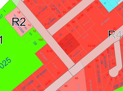
Figure
2: Zoning map with subject site shown hatched. Source: Cumberland Council 2019
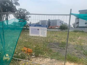
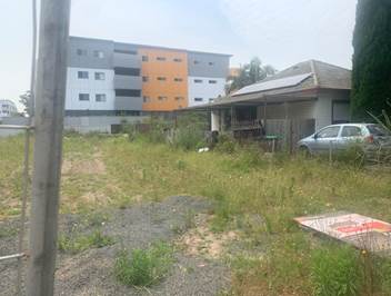
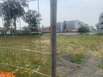
Figures
3, 4 & 5: subject site (5-7A Octavia Street, Toongabbie)
Description of The Proposed
Development
Council has received a Section
4.55(2) modification application to an approved residential flat building
development seeking internal and external alterations and additions.
Key features of the modification
proposal as provided in the applicant’s Statement of Environmental
Effects are as follows:-
· reconfiguration
of basement with 2 additional parking spaces including an additional accessible
parking space;
· modified
internal layout for units 6, 12, 18, and 24 (change in position of kitchen);
· modified
internal layout for units 3, 9, 15, and 21(change in position of kitchen and
change in position of bedrooms);
· amendment
to level 5 common open space and the addition of 2 units;
· provision
of gas, electrical, water and service shafts;
· the
colour scheme of the building has changed;
· substation.
The proposed Unit Mix is:
· 5
x 1 bedroom unit; and
· 21x
2 bedroom units.
The approved unit mix is as under:
· 4
x 1 bedroom unit; and
· 20x
2 bedroom units.
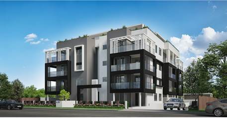
Figure
6: Photomontage of the proposed development
History
|
Date
|
Action
|
|
04/10/2019
|
The subject modification was
lodged.
|
|
21/10/2019
|
The Development Application was
referred to the following internal and external departments for review:
· Development
Engineering
· Traffic
Engineering
· Waste Management
· Trans grid
· Endeavour Energy
|
|
30/10/2019 to 20/11/2019
|
Application placed on public
notification for 21 days. In response, no submissions was received.
|
|
01/11/2019
|
The application was deferred for the following reasons:
· Design
Verification Statement
· Statement of
Environmental Effects
· Non-compliant
floor space ratio
|
|
12/12/2019
|
Amended plans and additional information were submitted to
Council, addressing the deferral letter dated 01/11/2019. The application did
not warrant re-notification as the amendments did not result in a greater
environmental impact.
|
|
12/02/2020
|
Application referred to CLPP for
determination.
|
Applicant’s Supporting
Statement
Statement of Environmental Effects
prepared by Andrew Martin Planning Pty Ltd, dated December 2019 was submitted
in support of the application.
Contact with relevant
parties
The assessing officer has
undertaken an inspection of the subject site and has been in contact with the
applicant throughout the assessment process.
Internal referrals
Development Engineer
Council’s Development
Engineer advised that the development is supportable with regards to the
proposed modifications.
Traffic Engineer
Council’s Traffic Engineer
has advised that the development is supportable in regards to parking, traffic
management and on-site parking provision in the basement level.
Waste Management Officer
Council’s Waste Management
Officer has advised that the proposed waste management plan is supportable.
External Referrals
Tran’s grid
The development application was
referred to Tran’s grid for comment who has advised that the development
is supportable in regards to not affecting Tran’s grid’s asset.
Endeavour Energy
The development application was
referred to Endeavour Energy for comment who has advised that the provision of
substation is supportable, subject to conditions.
Planning Assessment
Section 4.55(2) of the
Environmental Planning and Assessment Act 1979 (EP & A Act)
Pursuant to Section 4.55(2), a
consent authority may, on application being made by the applicant or any other
person entitled to act on a consent granted by the consent authority and
subject to and in accordance with the regulations, modify the consent if:
|
Requirement
|
Comment
|
|
It is
satisfied that the development to which the consent as modified relates is
substantially the same development as the development for which the consent
was originally granted and before that consent as originally granted was
modified (if at all), and
|
The development as proposed to be modified is
substantially the same as the original consent.
|
|
It has
consulted with the relevant Minister, public authority or approval body
(within the meaning of Division 5) in respect of a condition imposed as a
requirement of a concurrence to the consent or in accordance with the general
terms of an approval proposed to be granted by the approval body and that
Minister, authority or body has not, within 21 days after being consulted,
objected to the modification of that consent,
|
No
Minister or public authority is required to be consulted.
|
|
It has
notified the application in accordance with:
(i) the regulations, if the regulations so require,
or
(ii) a development control plan, if the consent
authority is a council that has made a development control plan that requires
the notification or advertising of applications for modification of a
development consent, and
|
The
application was notified in accordance with Holroyd Development Control Plan
2013.
|
|
It has
considered any submissions made concerning the proposed modification within
any period prescribed by the regulations or provided by the development
control plan, as the case may be.
|
No
submissions were received as a result of the notification.
|
|
In determining an application for modification of a consent
under this section, the consent authority must take into consideration such
of the matters referred to in section 4.15 as are of relevance to the
development the subject of the application.
|
(a) The
provisions of the applicable EPIs are discussed elsewhere in this report
The
provisions of the applicable DCP are discussed elsewhere in this report.
There
are no planning agreements or draft planning agreements related to this
application.
There
are no relevant matters referred to in the regulations.
There
is no coastal zone management plan applying to the land.
The
likely impacts of the proposal are considered satisfactory.
The
site is considered to be suitable for the development as proposed to be
modified.
No submission was received as a
result of the notification.
Approval
of the subject application is not contrary to the public interest.
|
|
The consent
authority must also take into consideration the reasons given by the consent
authority for the grant of the consent that is sought to be modified.
|
(b) Not applicable in this
instance.
|
Section 4.15 of the
Environmental Planning and Assessment Act 1979
Environmental Planning
Instruments
The following Environmental
Planning Instruments are relevant to the assessment of the subject application:
(a) State
Environmental Planning Policy No 55 – Remediation of Land (SEPP 55)
The requirement at clause 7 of
SEPP 55 for Council to be satisfied that the site is suitable or can be made
suitable to accommodate the proposed development was considered under the
original application. The proposed modifications do not raise any new concerns
about potential contamination.
(b) State
Environmental Planning Policy (Vegetation in Non-Rural Areas) 2017
The site and neighbouring land
parcels have recently been cleared of all vegetation to facilitate future
residential development. As such, the SEPP does not apply.
(c) State
Environmental Planning Policy (Coastal Management) 2018
The subject site is not identified
as a coastal wetland and is not on land identified as “proximity area for
coastal wetlands”.
(d) State
Environmental Planning Policy (Building Sustainability Index: BASIX) 2004
A BASIX certificate no.
1047783M_02 dated 02 December 2019 was submitted by the applicant. The
certificate achieves target scores and is consistent with the architectural
plans.
(e) State
Environmental Planning Policy No. 65 – Design Quality of Residential
Apartment Development
The proposal is classified as a
residential apartment development and SEPP 65 applies. A design verification
statement signed by registered architect Joseph Panetta was submitted by the
applicant.
SEPP 65 sets 9 design quality
principles. The development has adequately addressed the principles in the
following way:
Figure
6 – SEPP 65 Design Quality Principles Table
|
ADG design
quality principle
|
Response
|
|
1. Context and neighbourhood character
|
The proposal is a permitted type of development within the
R4 zone. The existing character of the streetscape is in transition where
existing dwelling houses are being replaced with higher densities
development, such as residential flat buildings. The approved development
with the proposed modifications satisfies Holroyd LEP 2013 objectives in that
it will provide a variety of housing type within a high density environment.
The siting of development has been appropriately designed to minimise any
potential overshadowing and visual privacy impact to the adjoining
properties.
|
|
2. Built form and scale
|
The building has been designed to correspond with the
existing landform and provides an appropriate scale in terms of the buildings
bulk and height, similar to that of surrounding buildings.
|
|
3. Density
|
The subject site is well
located with respect to existing public transport and community facilities.
The design of the development provides for appropriate separation between
dwellings, supplemented by privacy treatment to balconies and windows where
necessary.
|
|
4. Sustainability
|
An updated BASIX Certificate has been submitted with the
subject modification application. The certificate requires sustainable
development features to be installed into the development. The proposal will
incorporate features relating to ESD in the design and construction of the
development inclusive of water efficient fixtures and energy saving devices.
|
|
5. Landscape
|
Adequate landscaped area has been provided, which will
provide appropriate level of amenity to the resident and consistent with the
environmental surrounds of the subject site.
|
|
6. Amenity
|
The proposal will deliver sufficient amenity to residents
of the building. The proposal generally achieves compliance with the ADG in
this regard which contains many amenity controls. The building design
incorporates access and circulation, apartment layouts, floor area, private
open space, energy efficiency rating, adaptability and diversity, safety,
security and site facilities. Suitable access is provided to all parts of the
building, through the efficient use of lift to access all levels. The
development is considered to provide an appropriate level of amenity for
future residents.
|
|
7. Safety
|
Suitable and secure access is provided to all parts of the
building, through the efficient use of lift to access all levels.
|
|
8. Housing diversity and social interaction
|
The apartment mix is considered to be satisfactory. The
specifics of the building are:-
· 5 x 1 bedroom units (19.2%); and
· 21 x 2 bedroom units (80.8%)
The number of adaptable units proposed is considered
satisfactory with the provision of associated accessible car spaces.
|
|
9. Aesthetics
|
The residential flat building has an attractive
contemporary appearance and utilises building elements that provide
individuality to the development without compromising the streetscape or
detracting from the appearance of existing surrounding development. The
building responds well in this regard with its provision of good aesthetics
through the use of high quality materials, attention to detail in its
internal spaces and how it addresses the street frontage. The building
provides an appropriate response to the existing and likely future character
of the locality.
|
A comprehensive assessment and
compliance table is provided at Attachment 1 which demonstrates the
proposal’s compliance with the relevant planning standards that are
applicable to the site.
(f) Holroyd
Local Environmental Plan 2013 (HLEP 2013)
The proposed development is
defined as a ‘residential flat building’ under the provisions of
HLEP 2013. Residential flat buildings are permitted with consent in the R4
– High Density Residential zone which applies to the land.
A comprehensive assessment and
compliance table is attached to this report in Attachment 2 which demonstrates
the development proposal’s compliance with the relevant planning
standards that are applicable to the site under the Holroyd LEP 2013.
The following table summarises and
discusses the non-compliances with the Holroyd LEP 2013.
|
No.
|
Clause
|
Comment
|
Yes
|
No
|
N/A
|
|
4.3
|
Height
of Buildings
(1) The objectives of this
clause are as follows:
(a) to minimise the visual impact
of development and ensure sufficient solar access and privacy for
neighbouring properties,
(b) to ensure development is
consistent with the landform,
(c) to provide appropriate scales
and intensities of development through height controls.
(2) The height of a
building on any land is not to exceed the maximum height shown for the land
on the Height of Buildings Map.
|
In accordance with the Height of Buildings Map
accompanying HLEP 2013, a maximum 15m building height applies to the site.
The proposed development at its highest point is 16.1m
which is 1.1 m above the maximum permitted height, or a 7.3% variation to the
standard.
Although not strictly required as this is a section 4.55
modification, a variation pursuant to Clause 4.6 of the Holroyd LEP 2013 is
provided with the application to assess the additional portion of the
building that exceeds the 15m height control.
The subject
modification application does not seek any further increase to the height of
the building as it proposes to reduce the overall height (as approved) by
180mm. However, the height non-compliance was supported in the original
application because the variation was limited to a small portion of the roof
and lift overrun.
The plans for
the subject modification application provide two additional units to the
fifth floor resulting an additional area exceeding this standard to what was
originally supported.
Notwithstanding, the design of the building
ensures that the habitable floor space is contained below the maximum
building height line. The variation is
considered minor in nature and is not considered to create unreasonable
amenity impacts to the adjoining properties via overshadowing or overlooking.
The presentation of the building is also not considered to be compromised by
the variation to the height control.
As such, the non-compliance can be supported in this
instance.
|
|
|
|
The provisions of any draft
Environmental Planning Instruments (EP & A Act s4.15(1)(a)(ii)
The proposed development is not affected
by any relevant Draft Environmental Planning Instruments.
The provisions of any
Development Control Plans (EP & A Act s4.15(1)(a)(iii)
(a) Holroyd
Development Control Plan (DCP) 2013
HDCP 2013 contains general
controls which relate to all developments under Part A, and Residential
Controls under Part B.
A comprehensive HDCP compliance
table is attached to this report at Attachment 3. A summary of the DCP
non-compliances is provided in the following table.
|
Part B – Section 6
– Residential Flat Buildings
|
|
|
|
6.4
|
Building Height
|
|
|
Maximum building height in
storeys shall be provided in accordance with the table below:
|
Permitted
Height (storeys)
|
|
Height
|
Storeys
|
|
9m
|
1
|
|
11m
|
2
|
|
12.5m
|
3
|
|
15m
|
4
|
|
18m
|
5
|
|
21m
|
6
|
|
24 m
|
7
|
|
The original application was approved as a 5 storey
development (with the roof top terrace) with a maximum building height of
16.28m.
The proposed modification lowers the overall height of the
building but extends the building envelope. However, this is considered satisfactory as the building
presents a terraced built form and does not impact adversely on surrounding
properties with regard to privacy and overshadowing.
|
|
|
|
4.15(1)(a)(iiia) - any planning
agreement that has been entered into under section 7.4, or any draft planning
agreement that a developer has offered to enter into under section 7.4, and
There is no draft planning
agreement associated with the subject Application.
The provisions of the
Regulations (EP & A Act s4.15(1)(a)(iv)
The proposed development raises no
concerns as to the relevant matters arising from the EP & A Regulations,
2000.
4.15(1)(a)(v) - any coastal
zone management plan (within the meaning of the Coastal Protection Act 1979)
There is no Coastal Zone
Management Plan applicable for the site.
The Likely Environmental,
Social or Economic Impacts (EP & A Act s4.15(1)(b))
The likely environmental, social
and economic impacts of the development have been assessed and are considered
satisfactory.
The suitability of the site for
the development (EP & A Act s4.15(1)(c))
The site is considered to be
suitable for the proposed development.
Submissions made in accordance
with the Act or Regulation (EP & A Act s4.15(1)(d))
Advertised
(newspaper) Mail
Sign
Not Required
In accordance with Part E - Public
Participation of Holroyd DCP 2013, the proposal was publicly exhibited for 21
days from 30 October 2019 to 20 November 2019. In response, the application
received no submissions.
Section 7.11 of The
Environmental Planning & Assessment Act 1979
The subject development requires
the payment of contributions in accordance with Holroyd Section 94 Development
Contributions Plan 2013. A condition was imposed on the original consent
requiring the payment of contributions. However, the value of the contributions
will increase as a result of the proposed modifications.
In accordance with the currently
indexed rates for the Toongabbie Centre contribution area, the following
contributions apply for the additional 2 units:
· 1
x 1 bedroom dwelling = $9,106
· 1
x 2 bedroom dwelling =$15,399
· Total
= $24,505.00
The draft determination at
Attachment 4 reflects the updated contributions.
The public interest (EP & A
Act s4.15(1)(e)
The public interest is served by
permitting the orderly and economic use of land, in a manner that is sensitive
to the surrounding environment and has regard to the reasonable amenity
expectations of surrounding land users. In view of the foregoing analysis, it
is considered that approval of the proposed development would not be contrary
to the public interest.
Disclosure of Political
Donations and Gifts
The NSW Government introduced The
Local Government and Planning Legislation Amendment (Political Donations) Act
2008 (NSW). This disclosure requirement is for all members of the public
relating to political donations and gifts. The law introduces disclosure
requirements for individuals or entities with a relevant financial interest as
part of the lodgement of various types of development proposals and requests to
initiate environmental planning instruments or development control plans.
The applicant and notification
process did not result in any disclosure of Political Donations and Gifts.
The proposed development has been assessed in accordance
with the relevant requirements of the Environmental Planning and Assessment Act
1979, State Environmental Planning Policy No 65 – Design Quality of
Residential Apartment Development, Holroyd Local Environmental Plan 2013 and
the Holroyd Development Control Plan 2013 and is considered to be satisfactory.
There are no consultation
processes for Council associated with this report.
There are no financial
implications for Council associated with this report.
There are no policy implications
for Council associated with this report.
Communication /
Publications:
The final outcome of this matter
will be notified in the newspaper. The objectors will also be notified in
writing of the outcome.
|
That modification application
No. 2014/163/3 which seeks alterations and additions to an approved
residential flat building development including amendment to basement layout,
internal configuration of units and addition of two residential units;
totalling 26 units be approved subject to the conditions within the draft
Notice of Determination provided at Attachment 4.
|
1. ADG
Compliance Table
2. HLEP
2013 Compliance Table
3. HDCP
2013 Compliance Table
4. S4.55
Draft Notice of Determination
5. Architectural
Plans
6. Original
Consent- DA 2014/163/1
7. Approved
Architectural Floor Plans-DA 2014/163/1
8. Locality
Map
DOCUMENTS
ASSOCIATED WITH
REPORT LPP003/20
Attachment 1
ADG Compliance Table
Cumberland Local Planning Panel Meeting
12 February 2020
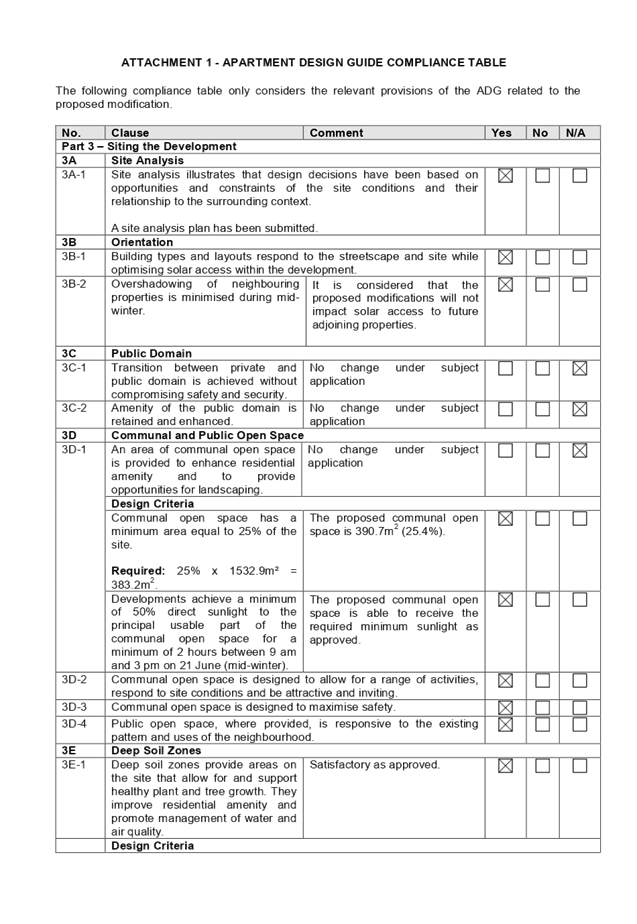
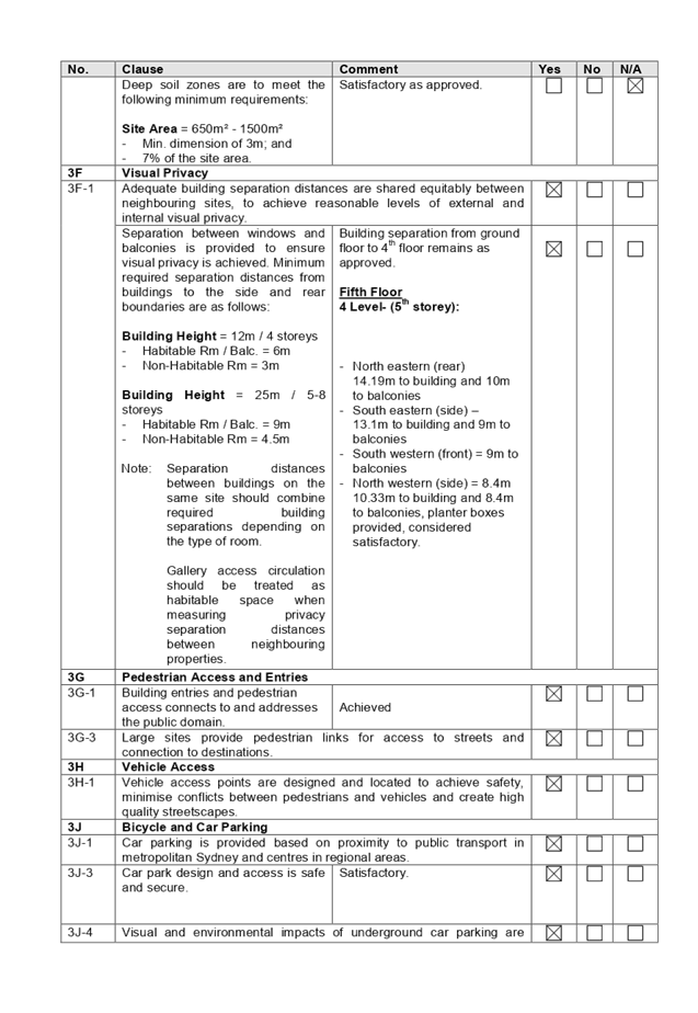
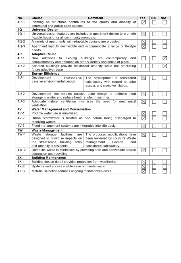
DOCUMENTS
ASSOCIATED WITH
REPORT LPP003/20
Attachment 2
HLEP 2013 Compliance Table
Cumberland Local Planning Panel Meeting
12 February 2020
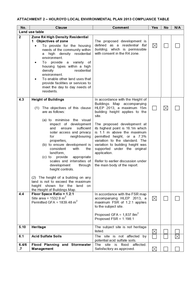
DOCUMENTS
ASSOCIATED WITH
REPORT LPP003/20
Attachment 3
HDCP 2013 Compliance Table
Cumberland Local Planning Panel Meeting
12 February 2020
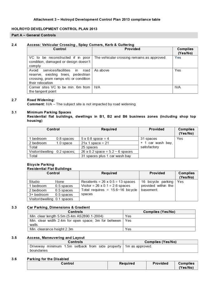

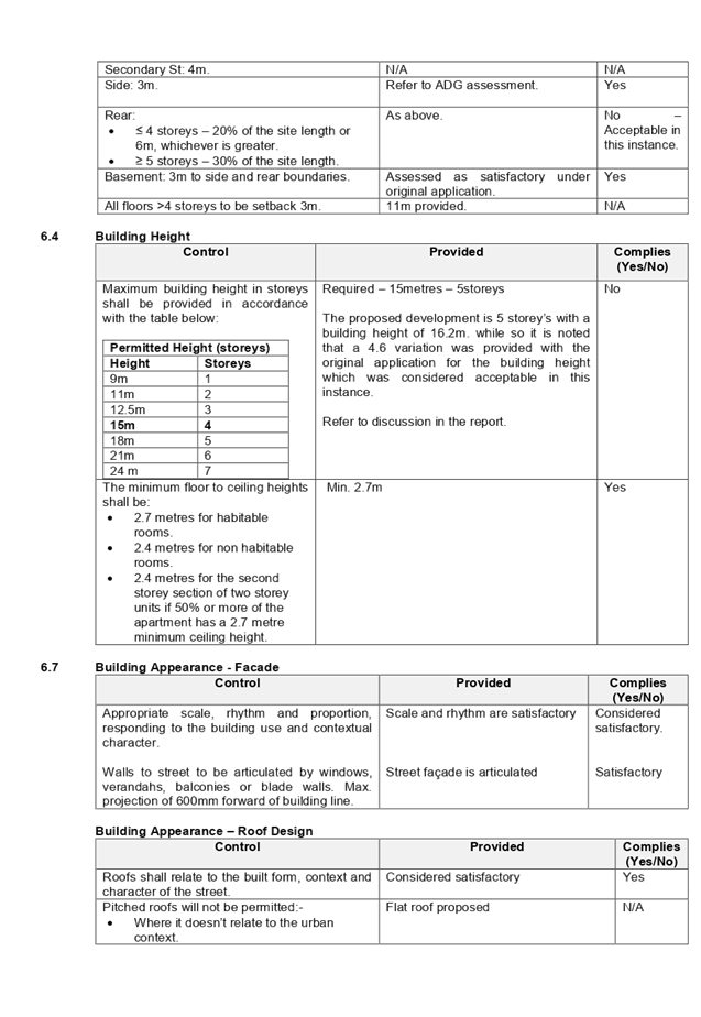
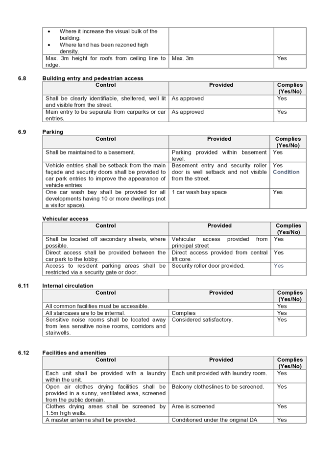
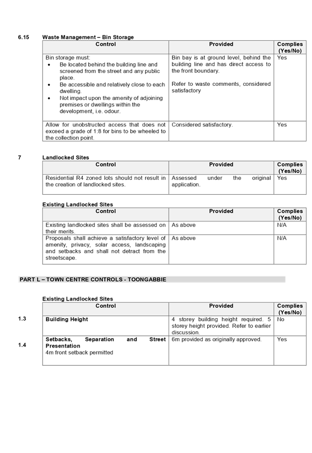
DOCUMENTS
ASSOCIATED WITH
REPORT LPP003/20
Attachment 4
S4.55 Draft Notice of Determination
Cumberland Local Planning Panel Meeting
12 February 2020
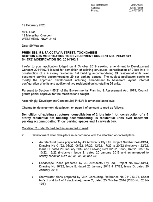
DOCUMENTS
ASSOCIATED WITH
REPORT LPP003/20
Attachment 5
Architectural Plans
Cumberland Local Planning Panel Meeting
12 February 2020

DOCUMENTS
ASSOCIATED WITH
REPORT LPP003/20
Attachment 6
Original Consent- DA 2014/163/1
Cumberland Local Planning Panel Meeting
12 February 2020


DOCUMENTS
ASSOCIATED WITH
REPORT LPP003/20
Attachment 7
Approved Architectural Floor Plans-DA 2014/163/1
Cumberland Local Planning Panel Meeting
12 February 2020
DOCUMENTS
ASSOCIATED WITH
REPORT LPP003/20
Attachment 8
Locality Map
Cumberland Local Planning Panel Meeting
12 February 2020
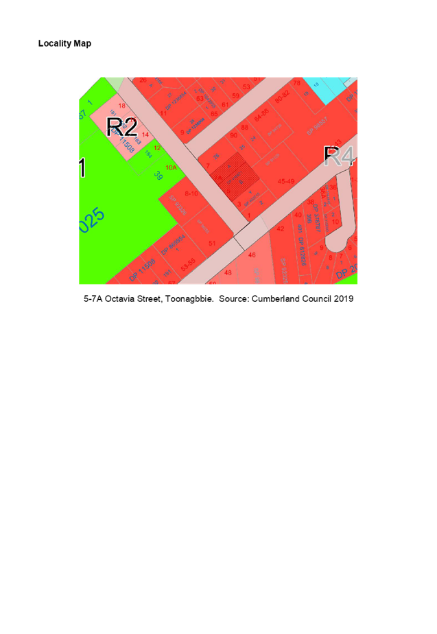
Cumberland
Local Planning Panel Meeting
12 February 2020
Item No: LPP004/20
Modification
Application for 9-19 Mary Street, Auburn
Responsible
Division: Environment
& Planning
Officer: Executive
Manager Development and Building
File
Number: MOD2019/5286
|
Application
lodged
|
20
December 2019
|
|
Applicant
|
Rolz
Group Pty Ltd
|
|
Owner
|
Group
As Pty Ltd
|
|
Application
No.
|
MOD2019/5286
|
|
Description
of Land
|
9-19
Mary Street, AUBURN NSW 2144, Lot 100, DP 1259069
|
|
Proposed
Development
|
Modification
to an approved 12 storey mixed use building (DA-92/2019) at 9-19 Mary Street,
Auburn to include a 5 bedroom penthouse apartment, relocate a rooftop common
open space area by introducing a secondary communal open space on the podium,
modify the existing communal open space and convert a 1 bedroom unit on the
ground floor to a communal room.
|
|
Site
Area
|
2,727.86m2
|
|
Zoning
|
B4
– Mixed Use under the Auburn LEP 2010
|
|
Disclosure
of political donations and gifts
|
Nil
disclosure
|
|
Heritage
|
Yes
– Land is located in the vicinity of a heritage item.
|
|
Principal
Development Standards
|
FSR
Permissible:
5:1
Proposed:
5.12:1
Height
of Building
Permissible:
38m
Proposed:
42.8m (as previously approved)
|
|
Issues
|
Building
height (LEP)
Floor
space ratio (FSR)
|
|
Independent
Planning Assessment
|
Independent
planning assessment undertaken by Glenn Apps of Cohesive Planning
|
1. Modification
Application MOD2019/5286 was received on 20 December 2019 to add a penthouse
apartment to an approved 12 storey mixed use development at 9-19 Mary Street,
Auburn. The application also proposes the relocation of rooftop common
open space to the podium level above the fifth storey and the conversion of a 1
bedroom apartment on the ground floor to an internal common room.
2. As
a result of the modification, the development will provide 157 residential
units (40 x 1 bedroom, 90 x 2 bedroom, 26 x 3 bedroom units and 1 x 5 bedroom
penthouse. The development maintains the 5 x commercial suites and 1 x
office suite over a part 4 and part 5 level basement for 288 vehicles.
3. Notification
of the application did not result in the receipt of public submissions.
4. The
proposed development involves a number of variations to relevant planning
controls as follows:
|
Control
|
Required
|
Provided
|
% variation
|
|
Floor space ratio (LEP)
|
5:1
|
5.12:1
|
2.4%
|
|
Building height (LEP)
|
38m
|
42.8m
|
12.6%
|
5. The
application is recommended for approval subject to the conditions as provided
in the attached schedule.
6. The
application is referred to the Panel as the modification is made under Section
4.55(2) of the Environmental Planning and Assessment Act, 1979 (“the
Act”). Further, State Environmental Planning Policy No.65 - Design
Quality of Residential Apartment Development applies to the development.
The building is more than 4 storeys in height.
Subject Site and Surrounding
Area
The subject site is known as Lot
100, DP1259069, No. 9-19 Mary Street Auburn. The subject site is located
on the northwest corner of Mary Street and Harrow Road.
The location of the site is shown
at Figure 1. An aerial image of the site and surrounding area is at
Figure 2.
The site is situated within a
mixed use zone within the Auburn town centre and is approximately 400m walking
distance to Auburn railway station.
The site has a frontage to Mary
Street of 74.63m to the south and a frontage to Harrow Road of 36.56m to the
east. The site is generally rectangular in shape and has a total area of
2,727.86m2.
The site is adjoined by a single
dwelling and a townhouse building to the north. Land to the west is
developed with single storey cottages. A place of worship and commercial
buildings exist across Harrow Road to the east. Land across Mary Street
to the south is comprised of professional consulting rooms.
Figure
1 – Locality Plan of subject site
Figure
2 – Aerial view of subject site
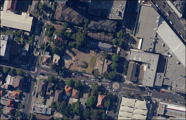
Figure
3 – Street view of subject site showing current construction works
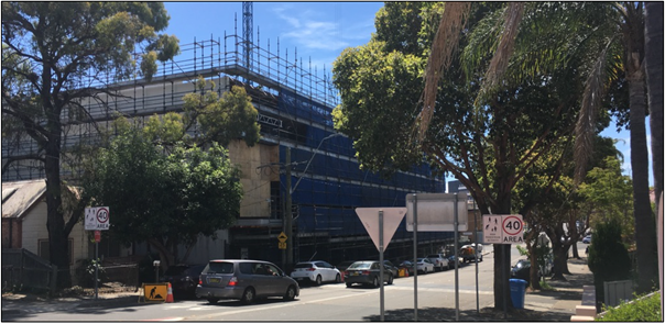
Description of the Proposed
Development
Council has received an
application to modify an approved 12 storey mixed use building at 9-19 Mary
Street, Auburn.
The approved development comprises
2 separate towers over a 5 storey podium and provides 5 commercial tenancies, 1
office and 157 residential apartments as follows:
|
1 bedroom
|
2 bedroom
|
3 bedroom
|
TOTAL
|
|
41
|
90
|
26
|
157
|
The proposed modification seeks to
add a 5 bedroom penthouse apartment of 414.45m2 which would replace the rooftop
open space on the western tower.
Figure
4 – Comparison of approved rooftop open space and proposed penthouse
(shaded green)
The modification will increase the
total GFA of the development from 13,562.18m2 and an FSR of 4.97:1 to 13,
76.63m2 and an FSR of 5.12:1.
The modification application also
seeks to relocate the rooftop open space that has been replaced by the
penthouse to the podium between the towers. This provides a rooftop open
space which equitably shared and accessible between the 2 towers as shown in
Figure 5.
Extensions to the private balcony
areas of the adjoining apartments are also proposed.
The provision of open space at the
podium level is considered an aesthetic improvement in that it offers some
landscape softening to the podium as opposed to a bare parapet.
Figure
5 – Comparison of approved podium rooftop and proposed podium open space
(shaded green)
Finally, the modification
application proposes the conversion of a 1 bedroom apartment on the ground
floor to an indoor common room. That common room also has access to the
ground level common open space area linked by a balcony area as shown in Figure
6.
Figure
6 – Comparison of ground floor level showing new common room (shaded
green)
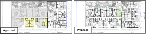
History
DA-52/2017 was lodged with Council
on 10 February 2017 for the demolition of existing dwelling houses and the
construction of a 12 storey mixed use development comprising 105 residential
units and 2 commercial tenancies over 4 levels of basement parking at 13-19
Mary Street, Auburn.
DA-52/2017 was granted deferred
commencement consent on 21 December 2017.
The deferred commencement matters
were completed and the consent became operative on 13 April 2018.
DA-92/2019 was lodged on 25 March
2019 for the construction of an additional 12 storey mixed use building
component at 9-11 Mary Street, Auburn. That DA also proposed a number of
alterations and additions to the 12 storey mixed use building which was
approved by DA-52/2017 at 13-19 Mary Street, Auburn.
DA-92/2017 was granted consent on
3 September 2019.
The lots comprising the site have
now been amalgamated and are now known as Lot 100, DP 1259069.
Modification application
DA-52/2017/C was lodged on 3 October 2019 to modify DA-52/2017 to add a
penthouse apartment on top of the western tower in place of the rooftop common
open space.
An initial assessment identified a
number of matters that required amended plans and additional information,
particularly:
· Whether
the breach in height should be supported for residential floor space when that
floorspace removes amenity provided by the rooftop common open space;
· Whether
the breach in FSR should be supported; and
· Whether
the proposed modification resulted in equitable access to common open space
between the 2 towers.
Those matters were communicated to
the Applicant on 2 December 2019.
The Applicant met with Council and
its consulting town planner on 5 December 2019 to discuss the above matters.
As a result of that meeting, it
became apparent that in order to properly address the issues at hand, the modification
should relate to DA-92/2019 which related to both 9-11 Mary Street and 13-19
Mary Street, as opposed to DA-52/2017 which only related to 13-19 Mary
Street. Subsequently DA-52/2017/C was withdrawn.
Modification application
MOD2019/5286 was lodged on 20 December 2019 to modify DA-92/2019 and respond to
the matters raised above.
Applicants Supporting
Statement
The applicant has provided a Statement of Environmental
Effects and an accompanying justification to the FSR variation prepared by The
Planning Hub dated 17 December 2019 and was received by Council on 20 December
2019 in support of the application.
Contact with Relevant
Parties
The consulting planner carrying
out the assessment has undertaken a site inspection of the subject site and
surrounding properties. Council’s officer with carriage of the DA
has been in regular contact with the applicant throughout the assessment
process.
Consideration of Section
4.55(2) of the EP&A Act
Section 4.55(2) of the EP&A
Act enables a consent authority to, on application, modify the consent if the
preconditions in paragraphs (a) – (d) are satisfied. The following
assessment is provided to the tests outlined in those paragraphs.
(a) it
is satisfied that the development to which the consent as modified relates is
substantially the same development as the development for which consent was
originally granted and before that consent as originally granted was modified
(if at all)
Comment: Guidance on this
question is found in Moto Projects (No. 2) Pty Limited v North Sydney Council
[1999] NSWLEC 280 where Bignold J noted that consideration of a proposed
modification must involve both a qualitative and a quantitative assessment.
In qualitative terms, the overall
character, building envelope and appearance of the development is not
substantially affected by the modifications, other than providing the penthouse
and the podium level open space.
The quantitative characteristics
of the development are not substantially modified, being limited to a change in
the unit composition and an increase in the GFA and FSR. Numerical
compliance with the ADG and DCP provisions is unaltered by the proposed
modifications.
It is therefore considered that
the modified development is substantially the same as that for which consent
was granted.
(b) it
has consulted with the relevant Minister, public authority or approval body
(within the meaning of Division 4.8) in respect of a condition imposed as a
requirement of a concurrence to the consent or in accordance with the general
terms of an approval proposed to be granted by the approval body and that
Minister, authority or body has not, within 21 days after being consulted,
objected to the modification of that consent
Comment: Not applicable
(c) it
has notified the application in accordance with—
i. the
regulations, if the regulations so require, or
ii. a
development control plan, if the consent authority is a council that has made a
development control plan that requires the notification or advertising of
applications for modification of a development consent
Comment: The application
was publicly notified to occupants and owners of the adjoining properties for a
period of 14 days between 21 October 2019 and 4 November 2019.
(d) It
has considered any submissions made concerning the proposed modification within
any period prescribed by the regulations or provided by the development control
plan, as the case may be.
Comment: No submissions
were received to the notification of the modifications.
The modification application
satisfies the tests in Section 4.55(2) of the EP&A Act.
Planning Comments
The provisions of any Environmental Planning Instruments
(EP&A Act s4.15 (1)(a)(i))
State Environmental Planning Policies
The modification application is affected by the following
State Environmental Planning Policies:
(a) State
Environmental Planning Policy No. 65 - Design Quality of Residential Apartment
Development (SEPP 65)
SEPP 65 applies to the development as the building is 3
storeys or more and contains more than 4 dwellings.
The modifications do not result in any variations to the
provisions of the ADG beyond those that were given consideration in the
assessment of the DA.
Relevantly, common open space remains compliant with 3D-1 of
the ADG which calls for a common open space area equal to a minimum of 25% of
the site area.
Common open space is provided as follows:
|
AREA
|
SIZE (m2)
|
% OF SITE AREA
|
|
Ground floor open space
|
588.75
|
21.6
|
|
Podium
|
287.81
|
10.1
|
|
Rooftop (eastern tower)
|
423.81
|
15.5
|
|
TOTAL
|
1,303.37
|
47.8
|
The above figure does not include the ground floor common
room which has an internal size of 50m2 and a balcony of 22m2. Excluding
the ground floor common room and balcony, the total common open space provision
equates to a total of 47.8% of the site area.
The penthouse is compliant with the minimum room sizes,
ceiling heights and balcony requirements of the ADG.
A comprehensive assessment against SEPP 65 and the ADG is
contained in Appendix A.
(b) State
Environmental Planning Policy (Building Sustainability Index: BASIX) 2004
BASIX Certificate 1041440M dated issued on 24 September 2019
prepared by Gradwell Consulting has been submitted with Council and is
considered to be satisfactory.
Local Environmental Plans
Auburn LEP 2010
The provision of the Auburn LEP 2010 is applicable to the
development proposal.
The modified development involves exceedances to the
prescribed maximum height of buildings in Clause 4.3 of the Auburn LEP 2010 and
the prescribed maximum FSR under Clause 4.4 of the Auburn LEP 2010. Those
matters are discussed below. Otherwise the modified development achieves
compliance with the key statutory requirements of the Auburn LEP 2010 and the
objectives of the B4 Mixed Use zone.
(a) Permissibility:-
The development is defined as
“shop top housing” and is permissible in the B4 Mixed Use zone with
consent. The modification does not change the nature of the development
and as such the proposal in its modified form remains permissible.
The relevant matters to be
considered under Auburn LEP 2010 and the applicable clauses for the proposed
development are summarised below. A comprehensive LEP assessment is
contained in Appendix B.
Figure
4 – Auburn 2010 Compliance Table
|
DEVELOPMENT STANDARD
|
COMPLIANCE
|
DISCUSSION
|
|
4.3 Height of Buildings
Maximum 38m
|
No
|
The proposed development
provides a maximum height of 42.8m. A justification has been provided
with the application and is discussed in this report.
|
|
4.4 Floor Space Ratio
Maximum 5:1
|
No
|
The FSR proposed by the
modification is 5.12:1 which is a 2.4% increase. A justification has
been provided with the application and is discussed in this report.
It is noted that the
Applicant’s calculations delete the common room from the GFS
calculations. It is considered appropriate to include that area as it
contributes to the floor space notwithstanding its communal use.
|
Concerns were raised with the Applicant
that the penthouse apartment could not be supported on the following grounds:
i. The
approved height breach had merit in that if offered the benefit of rooftop
common open space which gave additional amenity to the residents;
ii. The
additional GFA of the penthouse resulted in an exceedance of the maximum FSR;
and
iii. The
penthouse results in the loss of the rooftop open space and the amenity it
affords the residents (notwithstanding that the rooftop was not required to
meet the minimum requirement under the ADG).
The exceedance in height and FSR
could only supported where:
i. the
Applicant demonstrated sufficient justification to do so; and
ii. Alternative
common open space was proposed to make up for the amenity lost by the deletion
of the roof top area and afforded equitable access to all residents of the
development.
The current scheme has responded
to those matters by providing a common open space area on the roof of the 5th
storey between the 2 residential towers. That open space area comprises a
terrace of 287m2 with landscaping, pergola and seating areas and is accessible
via both towers.
The provision of communal open
space has been improved by the introduction of the common room on the ground
floor which is linked to the outdoor space via a balcony. The common room
provides an indoor seating area, kitchen facilities and a WC which add to the
amenity and usability of the ground floor outdoor open space.
The modification is also supported
by written justification of the height and FSR exceedances, which are discussed
below.
(b) Variation
to the Building Height
The applicant has submitted a
justification for varying the development standard for building height under
Clause 4.3. Those justifications are listed below with comments thereon.
|
JUSTIFICATION
|
COMMENT
|
|
The proposed modification does
not result in an increase in the height of the development as approved under
the original DA.
|
The exceedance of the height control was approved for
rooftop structures and lift overruns in conjunction with the rooftop open
space area.
The components of the development that were approved in
breach of the height plane did not comprise habitable floor space.
|
|
The proposed modification will
result in habitable floorspace within the height breach approved under the
original DA. The proposed inclusion of the habitable floor space on the
roof is deemed to be reasonable given the lack of impacts and the provision
of additional communal open space elsewhere in the development.
|
It is agreed that the “conversion” of the roof
top structures to habitable space does not result in any greater
overshadowing or privacy impacts over what was approved under the original
DA.
|
|
The proposed habitable floor
space is wholly located within the approved roof line and the apartment has
been designed to ensure the amenity of adjoining properties is maintained.
|
It is agreed that the penthouse apartment is wholly
contained with the curtilage of the approved roof top structures and that the
amenity of adjoining properties is not compromised by the addition of the
penthouse apartment.
|
|
In
addition, the applicable height control for this site is proposed to increase
from 32m to 38m and as detailed by Council, the increase in height control is
anticipated to occur in the first half of 2020.
|
It is confirmed that the maximum building height under the
ALEP 2010 for this site is 38m.
The maximum height to the top of the lift overrun
structures is 42.8m, which is a variation of 4.8m or 12.6%.
|
The variation is not considered to offend the objectives of
the B4 Mixed Use zone, as follows.
|
OBJECTIVE
|
PLANNER’S
COMMENT
|
|
To provide a mixture of compatible land uses
|
The proposal is compatible with the emerging character of
the Auburn town centre.
|
|
To integrate suitable business, office, residential,
retail and other development in accessible locations so as to maximise public
transport patronage and encourage walking and cycling
|
The proposed development is located within an accessible
location and in proximity to the range of services available in the Auburn
town centre.
|
|
To encourage high density residential development
|
The proposed development is for higher density residential
development.
|
|
To encourage appropriate businesses that contribute to economic
growth
|
The proposal maintains commercial floorspace.
|
|
To achieve an accessible, attractive and safe public
domain
|
The development will help to activate the south western
part of the Auburn town centre.
|
The variation is considered to be consistent
with the objectives of the development standard for building height, as
follows.
|
OBJECTIVE
|
PLANNER’S
COMMENT
|
|
To establish a maximum height of buildings to enable
appropriate development density to be achieved
|
While the modified development involves an exceedance of
the FSR, the 2 breaches are not related as the height exceedance is due to
the built form response to the flood planning levels on the site.
|
|
To ensure that the height of buildings is compatible with
the character of the locality
|
The height remains unchanged from that approved under
DA-52/2017 and DA-92/2019.
|
Compliance with the development
standard is unreasonable or unnecessary in the circumstances of the case as
objectives of the height control are met notwithstanding the breach.
The proposal does not result in
any adverse impact to adjoining properties. The exceedance in height has
already been considered and approved, albeit for common open space purposes and
not habitable floor space.
The common open space has been maintained
elsewhere within the development to ensure a range of open space options are
available and made accessible to all residents of the development.
(c) Variation
to the Floor Space Ratio
The applicant has submitted a
justification for varying the development standard for the FSR under Clause
4.4. While Clause 4.6 does not apply to a Section 4.55 modification, that
justification follows the format of a Clause 4.6 request.
1. Is
the proposed development consistent with the objectives of the zone?
|
Objective
|
Applicant’s justification
|
Planner’s comment
|
|
To provide a mixture of compatible land uses
|
The proposed development provides a compatible land use
that is consistent with the future character of the Auburn Town Centre.
It proposes a high density mixed use development designed to contribute to
the mix of compatible uses in an accessible location.
|
Agreed.
The proposal is compatible with the emerging character of
the Auburn town centre.
|
|
To integrate suitable business, office, residential,
retail and other development in accessible locations so as to maximise public
transport patronage and encourage walking and cycling
|
The proposed development provides high density mixed-use
development in an accessible location that maximises public transport patronage
and encourages non-vehicular transport.
|
Agreed.
The proposed development is located within an accessible
location and in proximity to the range of services available in the Auburn
town centre.
|
|
To encourage high density residential development
|
The proposed development provides a mixed use development
that contains commercial tenancies and high density residential apartments
that is consistent with the future character of the area
|
This is a higher order objective of the zone itself.
The proposed development is not antipathetic to that
objective.
|
|
To encourage appropriate businesses that contribute to
economic growth
|
The proposed development will generate demand and
opportunities for businesses to service the area and contribute to the
economic growth of the area.
|
Agreed.
|
|
To achieve an accessible, attractive and safe public
domain
|
The proposed development contributes to creating an
accessible, attractive and safe public domain. The development will provide
opportunities for passive surveillance and create a vibrant street through
the activation created by the ground floor commercial tenancies which
highlight the sites prominent corner location within the Auburn Town Centre.
|
Agreed. The development will help to activate the
south western part of the Auburn town centre.
|
2. Is
the proposed development consistent with the objectives of the development
standard which is not met?
|
Objective
|
Applicant’s justification
|
Planner’s comment
|
|
To establish a maximum floor space ratio to enable
appropriate development density to be achieved
|
The proposal consists of a high-density mixed-use
development that meets the desired future character of the area and is
consistent with recent approvals in the Auburn and Lidcombe Town Centres. The
floor space ratio exceedance is due to the provision of a penthouse apartment
on the roof of Building B located within the roof line approved under DA-92/2019.
The proposed modification will not be readily apparent from the streetscape
or adjoining properties.
|
The applicant has not provided examples where the FSR has
been exceeded in the Auburn Town Centre.
Notwithstanding, it is agreed that the additional GFA is
generated by the penthouse apartment which is proposed within the space
previously approved in the common open space area as roof top structures.
|
|
To ensure that development density reflects its locality
|
The proposed development as modified is consistent with
the future desired character of the Auburn Town Centre and is reflective of
the intent of the relevant planning controls. Despite the minor variation to
the floor space ratio the development is reflective of the intensity of
recent approvals in the area and will positively contribute to the Auburn
Town Centre.
|
The applicant has provided examples where the FSR has been
exceeded however none of those examples are within the Auburn Town Centre.
Notwithstanding, it is agreed that the percentage of the
variation is minor and reflects the intent of the planning controls to
encourage higher densities.
|
3. a)
Is compliance with the development standard unreasonable or unnecessary in the
circumstances of the case?
|
Applicant’s justification
|
Planner’s comment
|
|
The proposal maintains the future higher density-built
form that is at a scale comparative to the site’s location within the
Auburn Town Centre. The 2.08% variation to the floor space ratio control for
the proposed development is a result of providing a luxury penthouse
apartment with a high level of amenity. This minor variation is considered
reasonable in the context of the site and its ability to result in no adverse
impacts on adjoining properties or the streetscape.
The proposed development as modified will continue to
achieve the objectives of the standard and the zone. It is therefore
considered that the objectives of the development standard are met
notwithstanding the breach of the floor space ratio control.
|
The variation rationale has met the first of the
“Wehbe methods” to demonstrate that compliance with a development
standard is unreasonable or unnecessary in the circumstances of the case by
demonstrating that the objective of the controls are met notwithstanding the
breach.
|
b)Are there sufficient
environmental planning grounds to justify contravening the development standard
and therefore is the applicant’s written justification well founded?
|
Applicant’s justification
|
Planner’s comment
|
|
The proposed development is consistent with the objectives
of the zone and the objectives of the FSR control.
|
While agreed, this is one of the tests of Clause 4.6
rather than an environmental planning ground.
|
|
The proposal does not result in any adverse or increased
impacts on adjoining properties or the streetscape from the development
approved under DA-92/2019.
|
Agreed. A lack of additional impact is considered to
be an environmental planning ground.
|
|
The height variation [sic] equates to a maximum 2.08% and
does not result in any unnecessary bulk and is not visually prominent.
|
It is agreed that the FSR variation is not visually
prominent and would not read as markedly different to the approved
development.
|
|
It is considered the objectives of the LEP floor space
ratio standard are achieved in this instance where the proposal produces a
high quality-built form that ensures a high level of amenity for
residents.
|
It is agreed that the additional floorspace and FSR does
not impact on the amenity of the residents of the development, noting the
usability and amenity of the common open space areas has been maintained by
relocating the rooftop space to the podium.
|
|
The proposed materials and finishes and landscaping
strategy further reinforces how the development harmonizes with surrounding
area.
|
The standard of landscaping and finishes can be achieved
without exceeding the maximum FSR. This ground is not considered
relevant.
|
|
Whilst the development exceeds the floor space ratio
applicable to the site, it is considered the proposed design does not
unreasonably detract from the amenity of adjacent residents or the existing
quality of the environment as demonstrated in the Architectural Plans
|
It is accepted that there is a lack of impact resulting
from the increased FSR.
|
|
Despite the non-compliance with the FSR control, the
proposed modification is deemed reasonable given the bulk of the development
remains largely unchanged as the apartment will be located within the
approved roof line. The development as modified also provides a consolidated
building that provides additional communal open space for residents and
increased residential amenity.
|
It is agreed that the overall silhouette of the building
remains the same notwithstanding that the approved rooftop structures will be
“filled in” by the penthouse apartment and as such, the bulk
remains unchanged.
Although the modified proposal has reduced the overall
amount of common open space from that as approved, it remains almost double
the minimum required common open space required under the ADG and maintains a
high level of amenity to those common open space areas.
|
The environmental planning grounds
are considered to be sufficient to justify the breach, noting the minor nature
of the breach.
Conclusion:
It is the author’s opinion
that the applicant’s written requests adequately justify the numerical
exceedance in height and FSR.
The modified development remains
in the public interest because it is consistent with the objectives of the
particular standard and the objectives for development within the zone in which
the development is proposed to be carried out.
It is the author’s view that
the justification provided is satisfactory and having considered the
application on its merit, the exceptions to the maximum building height and FSR
development standards are considered acceptable in this instance.
The provisions of any proposed
instrument that is or has been the subject (EP&A Act s4.15 (1)(a)(ii))
(a) Draft
State Environmental Planning Policy (Environment)
The modified development does not
raise issues relating to the draft SEPP(Environment).
The provisions of any
Development Control Plans (EP&A Act s4.15 (1)(a)(iii))
The Auburn DCP 2010 provides
guidance for the design and operation of development to achieve the aims and
objectives of the Auburn LEP 2010
A comprehensive assessment and
compliance table is contained in Appendix C.
The proposed modifications have
been assessed against the Residential Flat Buildings provisions and the Local
Centres provisions of the Auburn DCP.
The proposed modified development
complies with the provisions of those parts of the Auburn DCP 2010 and is
considered acceptable from an environmental planning point of view.
The provisions of any planning
agreement that has been entered into under section 7.4, or any draft planning
agreement that a developer has offered to enter into under section 7.4 (EP&A
Act s4.15(1)(a)(iiia))
There is no draft planning
agreement associated with the subject Development Application.
The provisions of the
Regulations (EP&A Act s4.15 (1)(a)(iv))
The proposed development raises no
concerns as to the relevant matters arising from the Environmental Planning and
Assessment Regulations 2000 (EP&A Reg).
The Likely Environmental,
Social or Economic Impacts (EP&A Act s4.15 (1)(b))
It is considered that the proposed
modifications will have no significant adverse environmental, social or
economic impacts in the locality.
The suitability of the site for
the development (EP&A Act s4.15 (1)(c))
The subject site and locality are
not known to be affected by any natural hazards or other site constraints
likely to have a significant adverse impact on the modified development.
Accordingly, it is considered that the modified development is suitable in the
context of the site and surrounding locality.
Submissions made in accordance
with the Act or Regulation (EP&A Act s4.15 (1)(d))
|
Advertised (newspaper)
|
Mail
|
Sign
|
Not Required
|
In accordance with Council’s
Notification requirements contained within the Auburn DCP 2010, the
modification application as lodged under the previous modification
(DA52/2017/C) was publicly notified for a period of 14 days between 21 October
2019 and 4 November 2019.
No submissions were received as a
result of that notification.
The subject application
(MOD2019/5286) was not separately notified.
Paragraph 3.6.6 of the ADCP 2010
– Introduction deals with circumstances where notification of an
application may be dispensed with and states:
3.6.6 Circumstances
where notification of an application may be dispensed with
a. If
a development application is amended, substituted, or withdrawn and
resubmitted;
b. Council
has notified/advertised the original application in accordance with this
section;
c. Council
is of the opinion that the amended, substituted, or resubmitted application
differs only in minor respects from the original application, and does not
result in a greater environmental impact or reduced levels of amenity to
adjoining or nearby residents; and
d. Council
may decide to dispense with further notification/advertising in relation to the
amended, substituted or resubmitted application at the discretion of the
council for the management of assessment of the application.
MOD2019/5286 is a resubmission of
DA-52/2017/C. DA-52/2017/C was withdrawn to enable minor amendments to
improve amenity and functionality of open space within the development.
These circumstances satisfy the provisions of paragraph 3.6.6 of the ADCP
above.
As DA-52/2017/C was notified and
no submissions were received, that notification is considered satisfactory as a
notification of MOD2019/5286.
The public interest (EP&A
Act s4.15(1)(e))
In view of the foregoing analysis
it is considered that the development, if carried out subject to the conditions
set out in the recommendation below, will have no significant adverse impacts
on the public interest.
Section 7.11 (Formerly S94)
Contribution Towards Provision or Improvement of Amenities or Services
This part of the Act relates to
the collection of monetary contributions from applicants for use in developing
key local infrastructure.
Comments:
The modified development requires
an adjustment in the contributions in accordance with Council’s Section
94 Contributions Plans.
The total amount levied under
DA-52/2017 for the western tower was $299,855.39.
The modified development requires
contributions to be paid as follows:
Drainage:
Community
Facilities:
$85,969.29
Public
Domain:
$190,094.25
Accessibility
and Traffic:
$52,306.41
Administration:
$20,107.13
TOTAL:
$349,477.08
This figure is subject to
indexation as per the relevant plan.
Disclosure of Political
Donations And Gifts
The applicant and notification
process did not result in any disclosure of Political Donations and Gifts.
The modification application has
been assessed in accordance with the relevant requirements of the Environmental
Planning and Assessment Act 1979, SEPP 65 – Design Quality of Residential
Apartment Development, Auburn LEP 2010 and Auburn DCP 2010 and is considered to
be satisfactory for approval subject to conditions.
The modified development seeks
variations in relation to the maximum height of buildings and the maximum floor
space ratio under the Auburn LEP 2010.
Having regard to the assessment of
the proposal from a merit perspective, the Panel may be satisfied that the
modified development has been responsibly designed and provides for acceptable
levels of amenity for future residents. It is considered that the
proposal successfully minimises adverse impacts on the amenity of neighbouring
properties. The development, irrespective of the departures noted above, is
consistent with the intentions of Council’s planning controls and
represents a form of development contemplated by the relevant statutory and
non-statutory controls applying to the land.
For these reasons, it is
considered that the proposal is satisfactory having regard to the matters of
consideration under Section 4.15 of the Environmental Planning and Assessment
Act 1979, and the development may be approved subject to conditions.
|
That Modification Application No. MOD2019/5286 for
alterations and additions to an approved 12 storey mixed use building
(DA-92/2019) at 9-19 Mary Street, Auburn to include a 5 bedroom penthouse
apartment, relocate a rooftop common open space area by introducing a
secondary communal open space on the podium, modify the existing communal
open space and convert a 1 bedroom unit on the ground floor to a communal
room at 9-11 Mary Street, AUBURN NSW 2144 be approved subject to attached
conditions.
|
1. Draft Notice
of Determination
2. Modified
Architectural Plans
3. Landscape
Plan
4. Appendix
A - State Environmental Planning Policy No.65
5. Appendix
B - Auburn Local Environmental Plan
6. Appendix
C - Auburn Development Control Plan
7. Appendix
D - ADCP 2010 - Residential Flat Buildings
DOCUMENTS
ASSOCIATED WITH
REPORT LPP004/20
Attachment 1
Draft Notice of Determination
Cumberland Local Planning Panel Meeting
12 February 2020
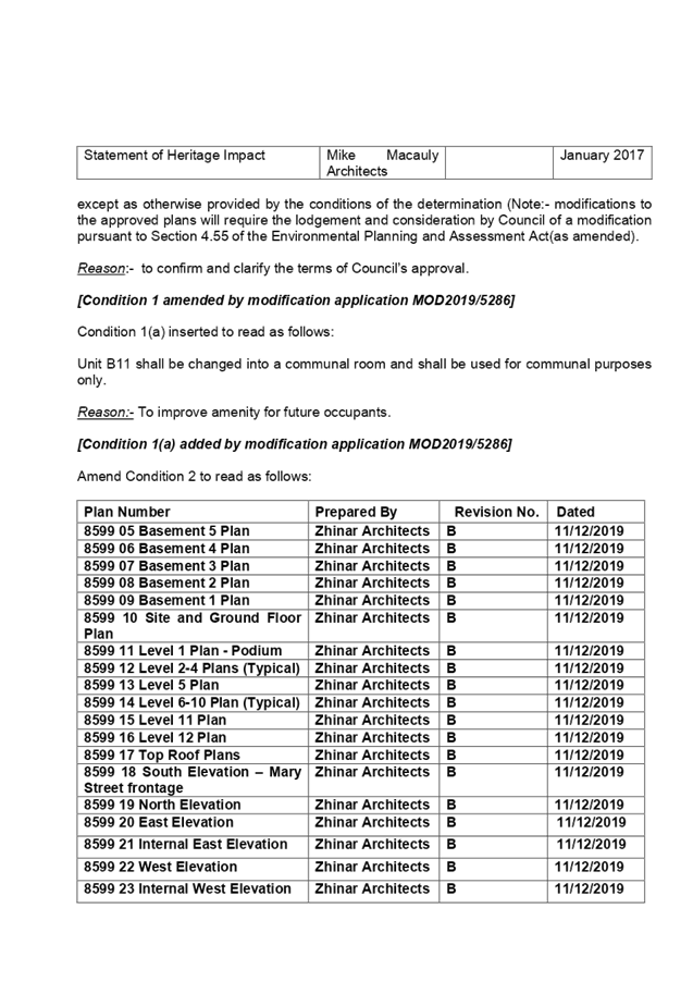
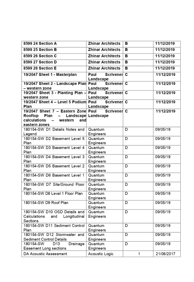
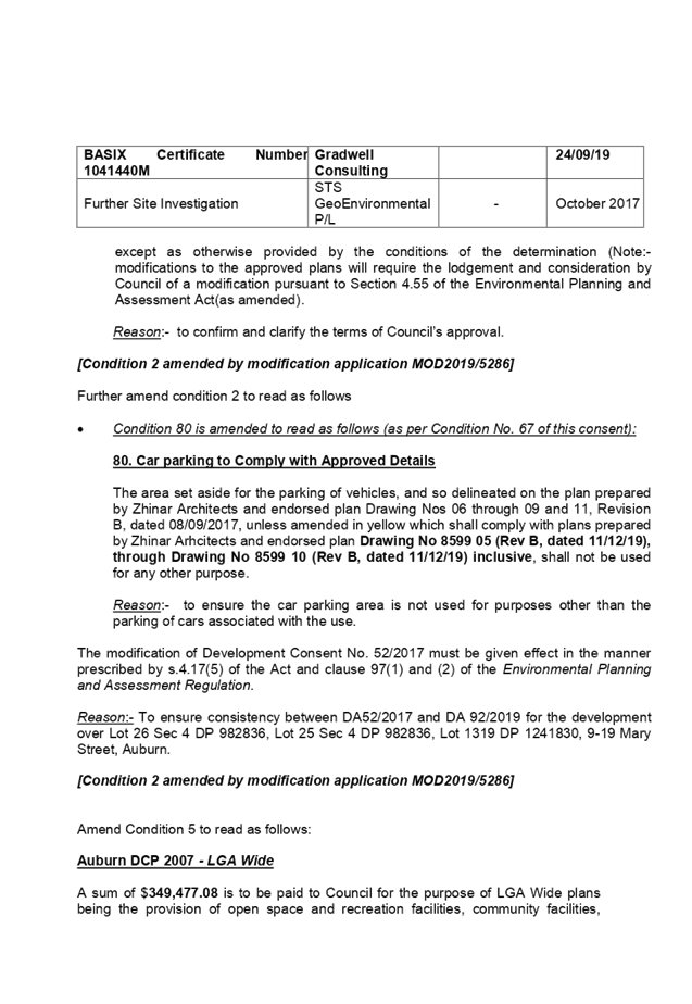
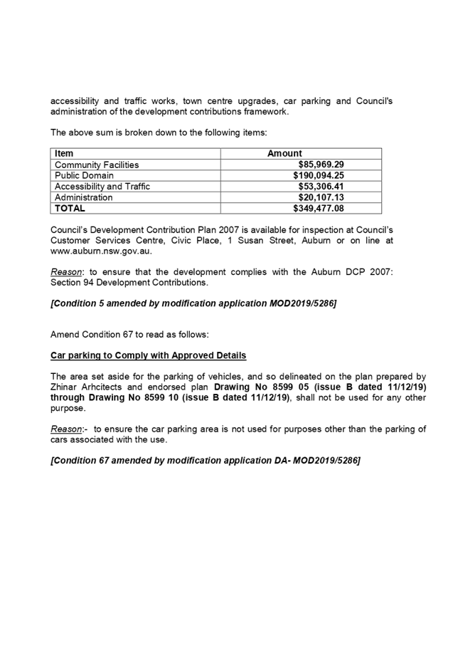
DOCUMENTS
ASSOCIATED WITH
REPORT LPP004/20
Attachment 2
Modified Architectural Plans
Cumberland Local Planning Panel Meeting
12 February 2020
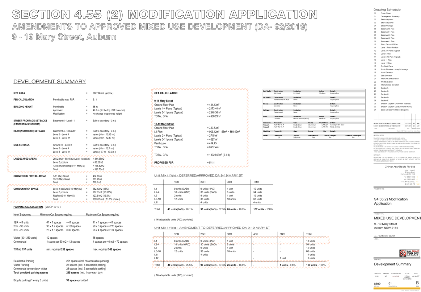
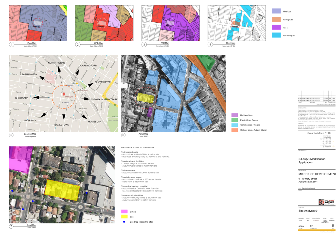
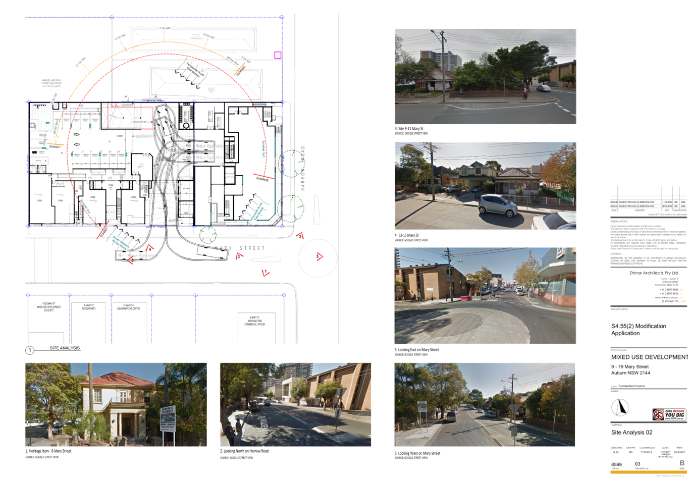
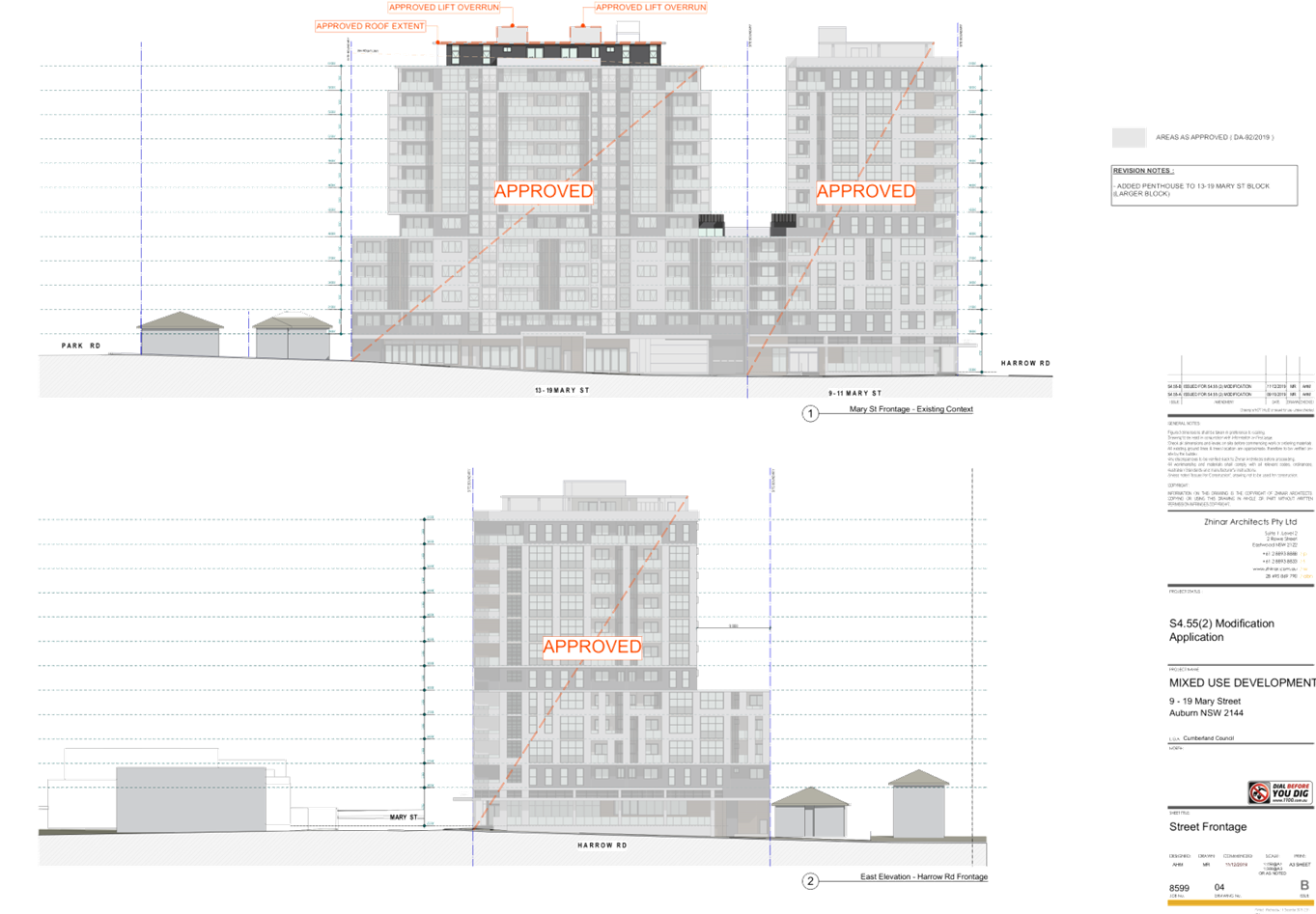
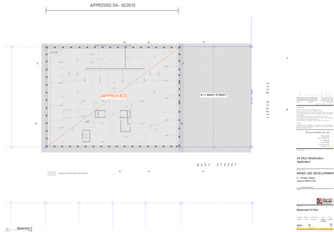


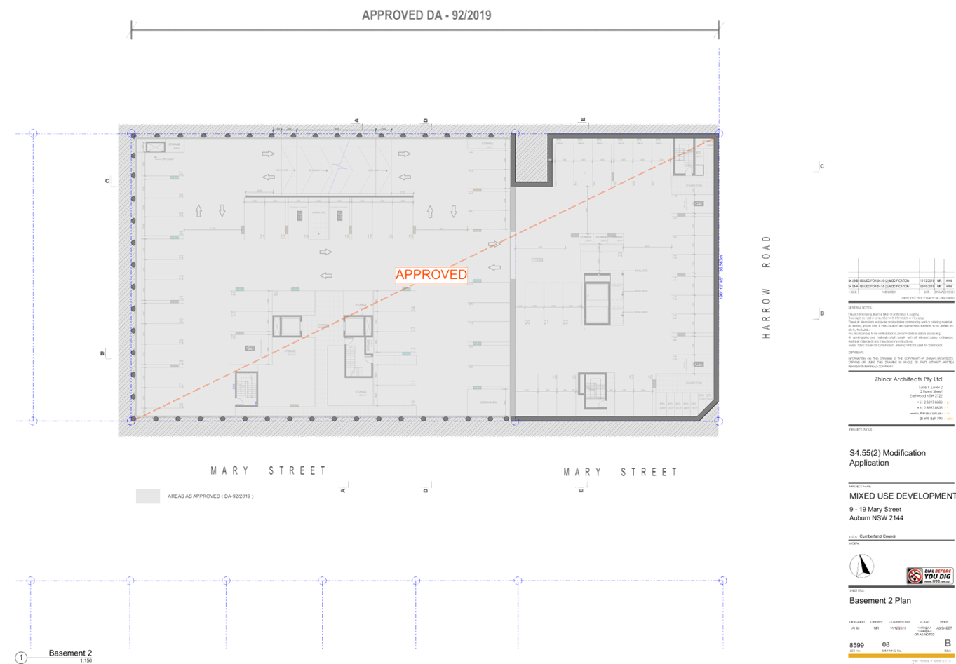
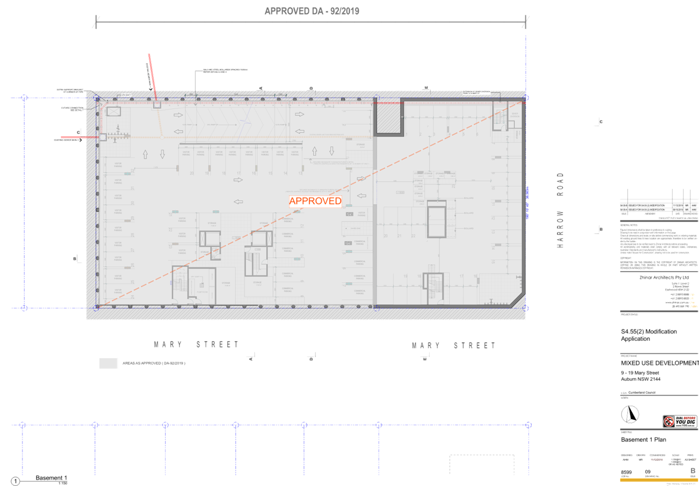
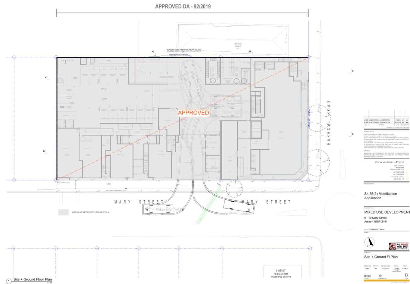

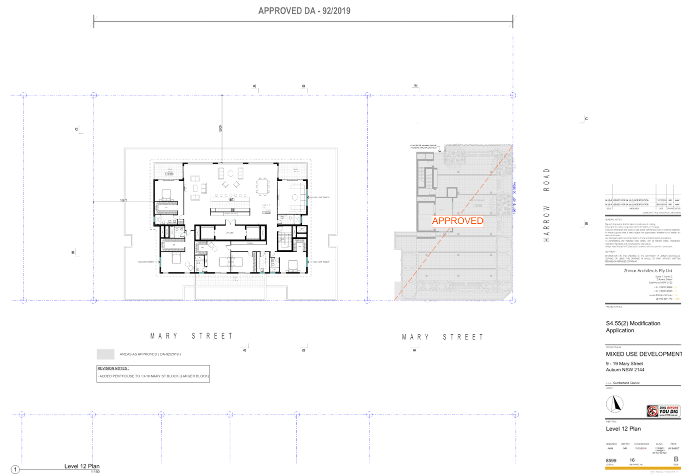
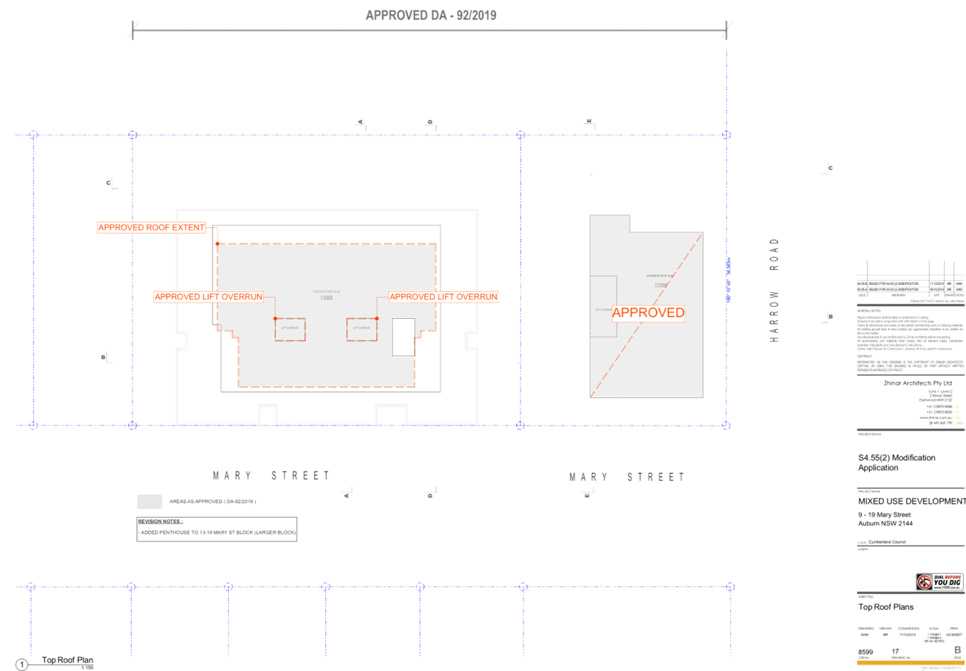
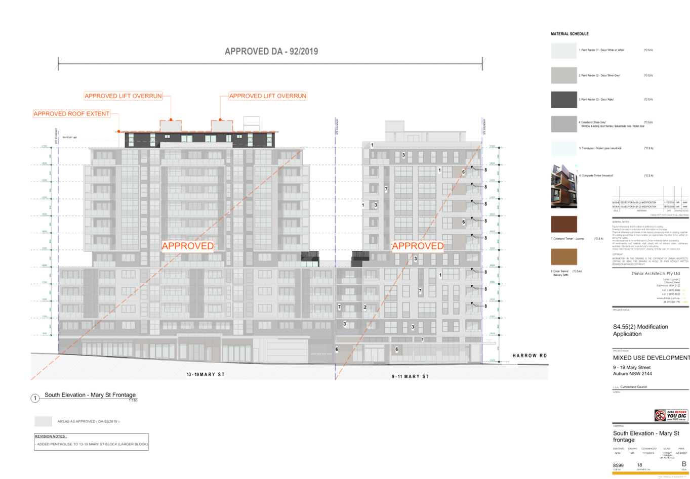
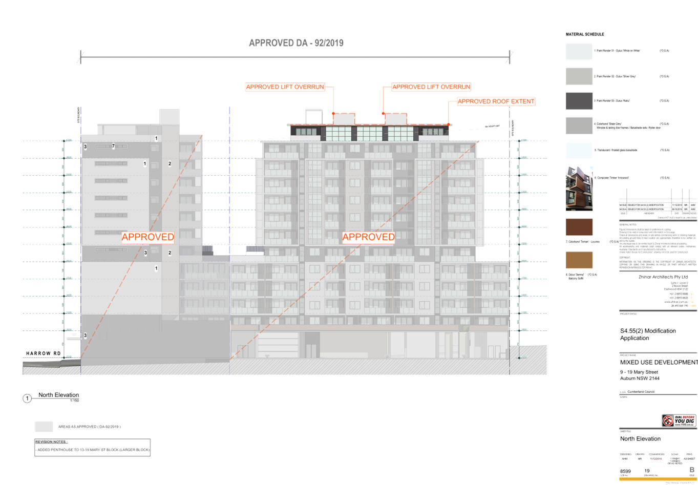
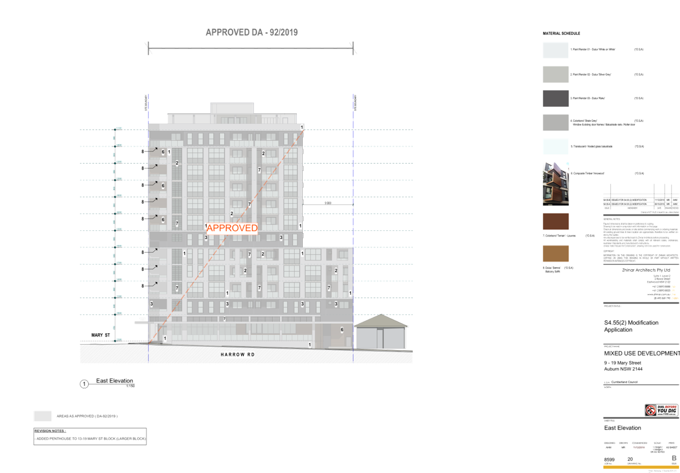
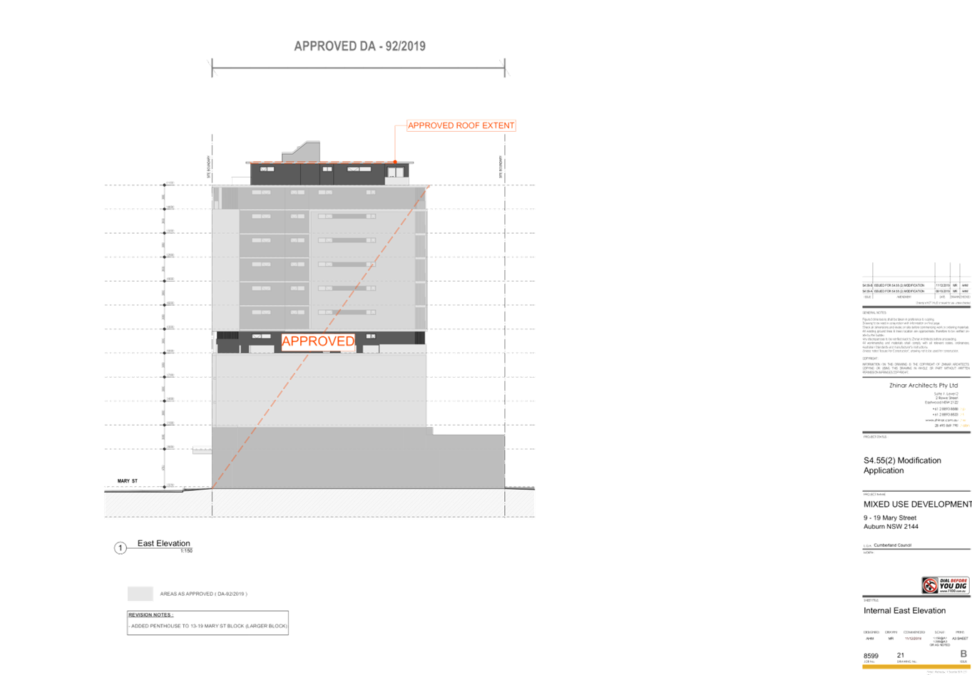
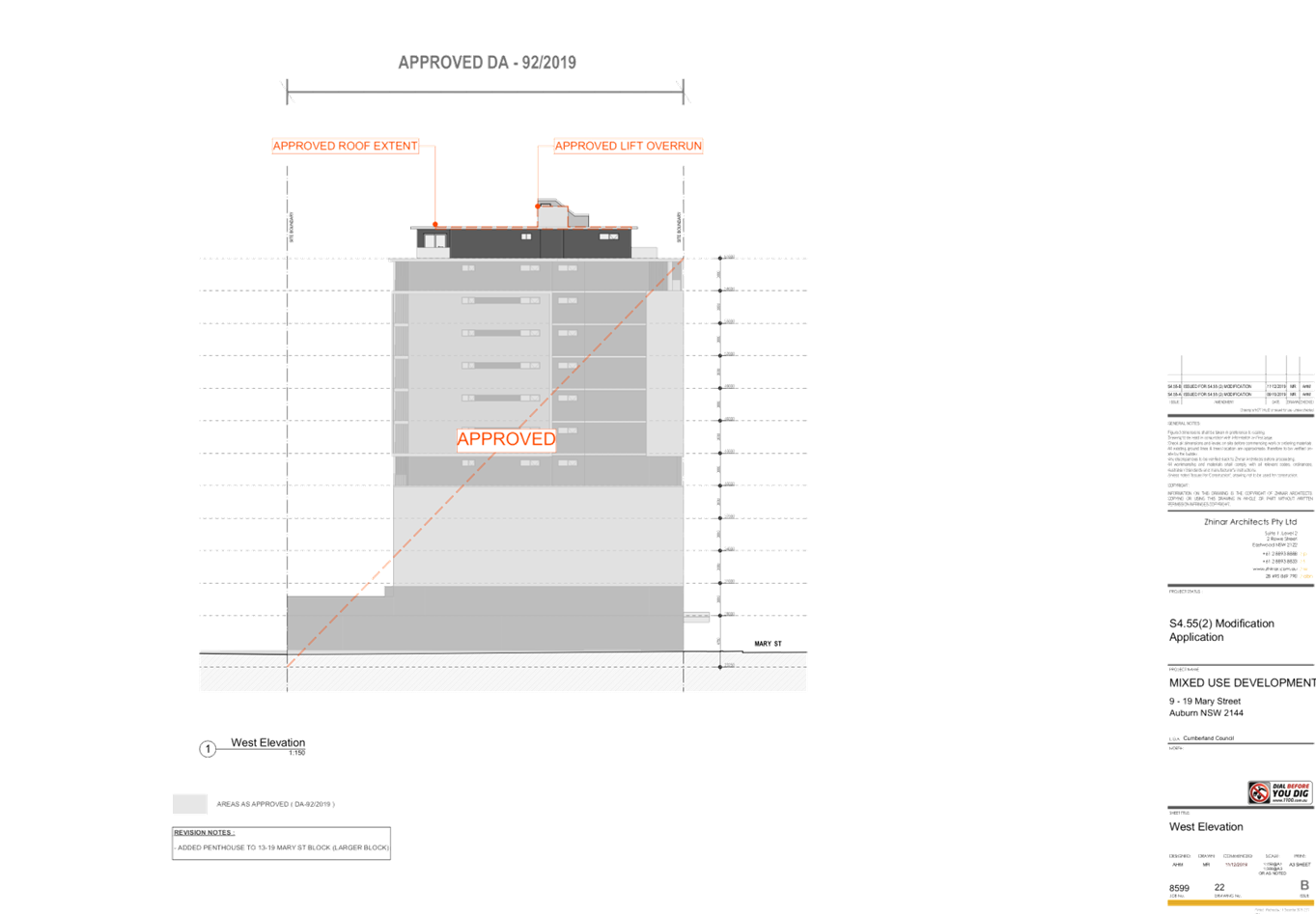
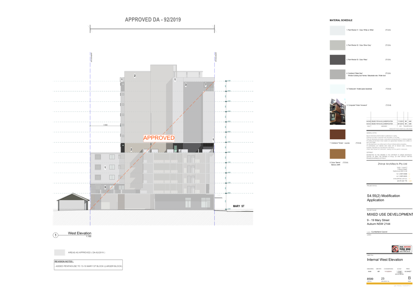
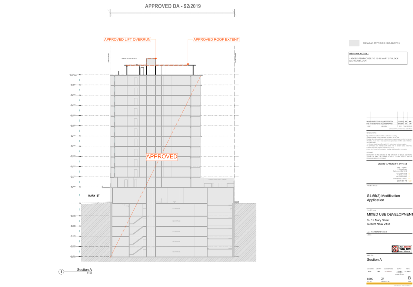
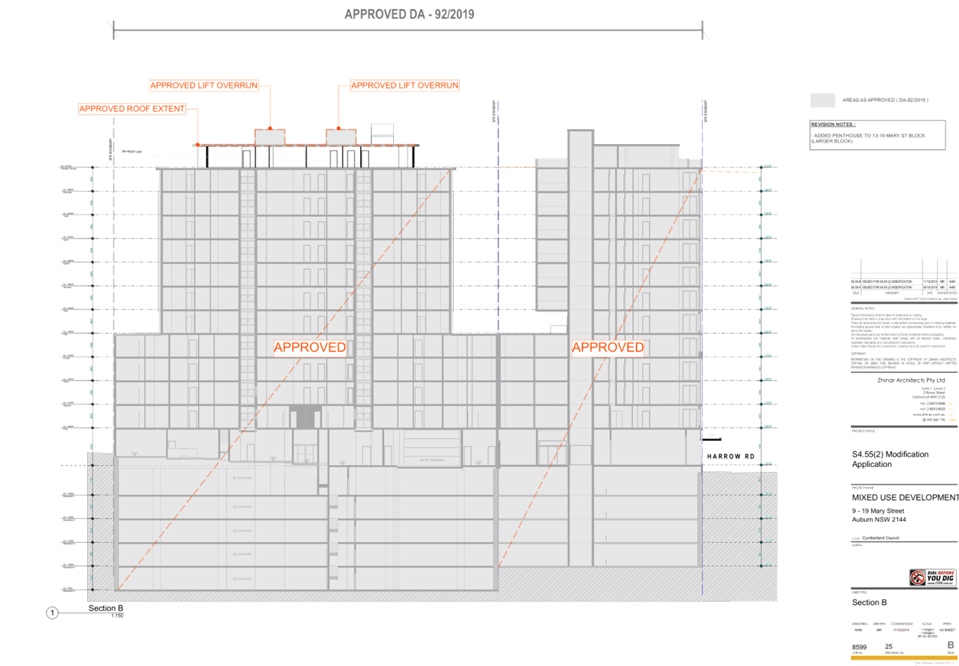
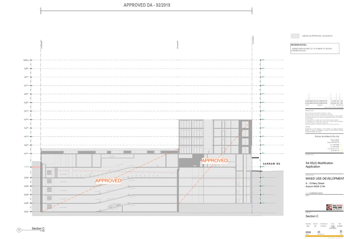
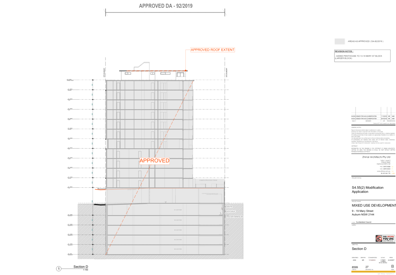
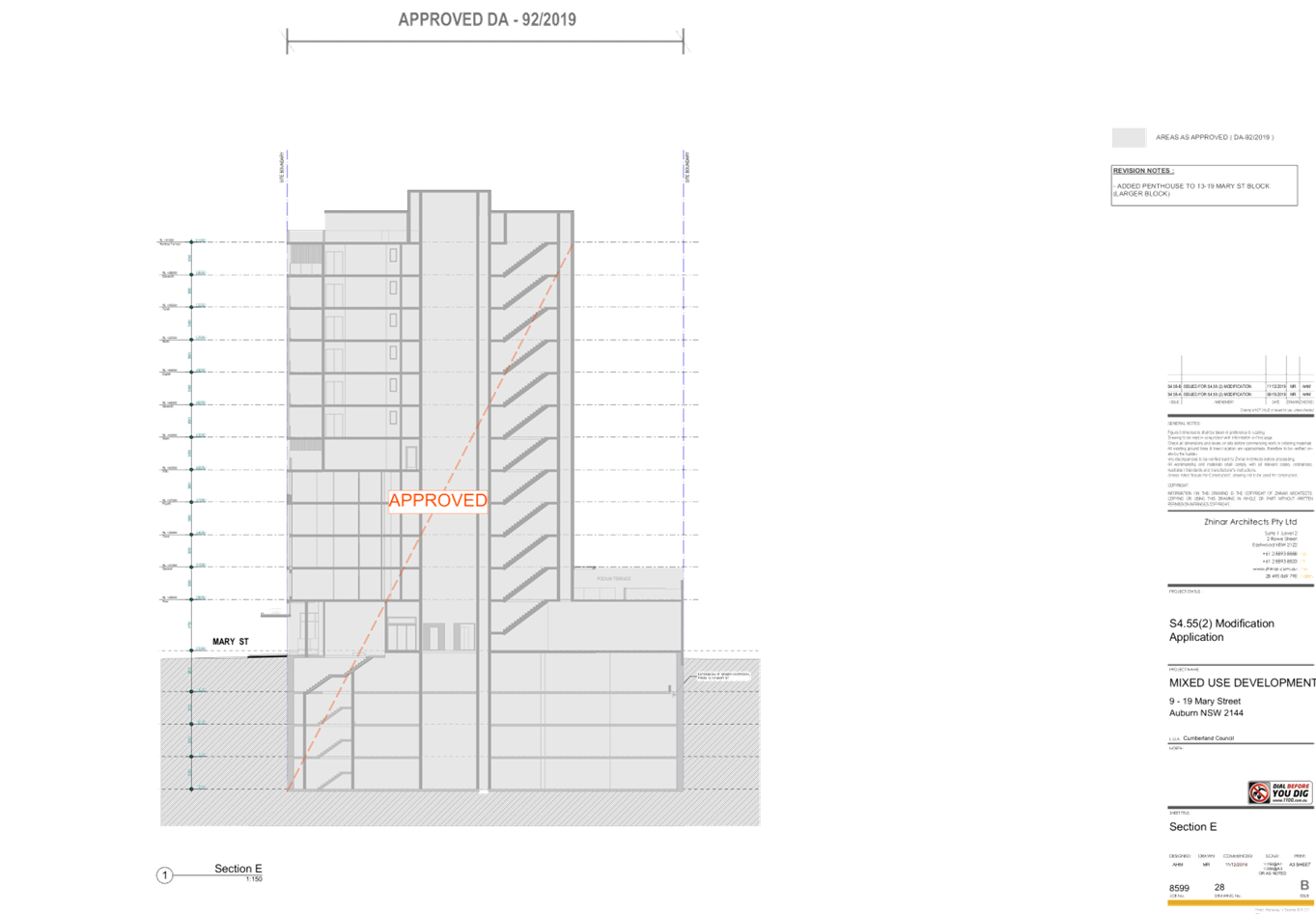
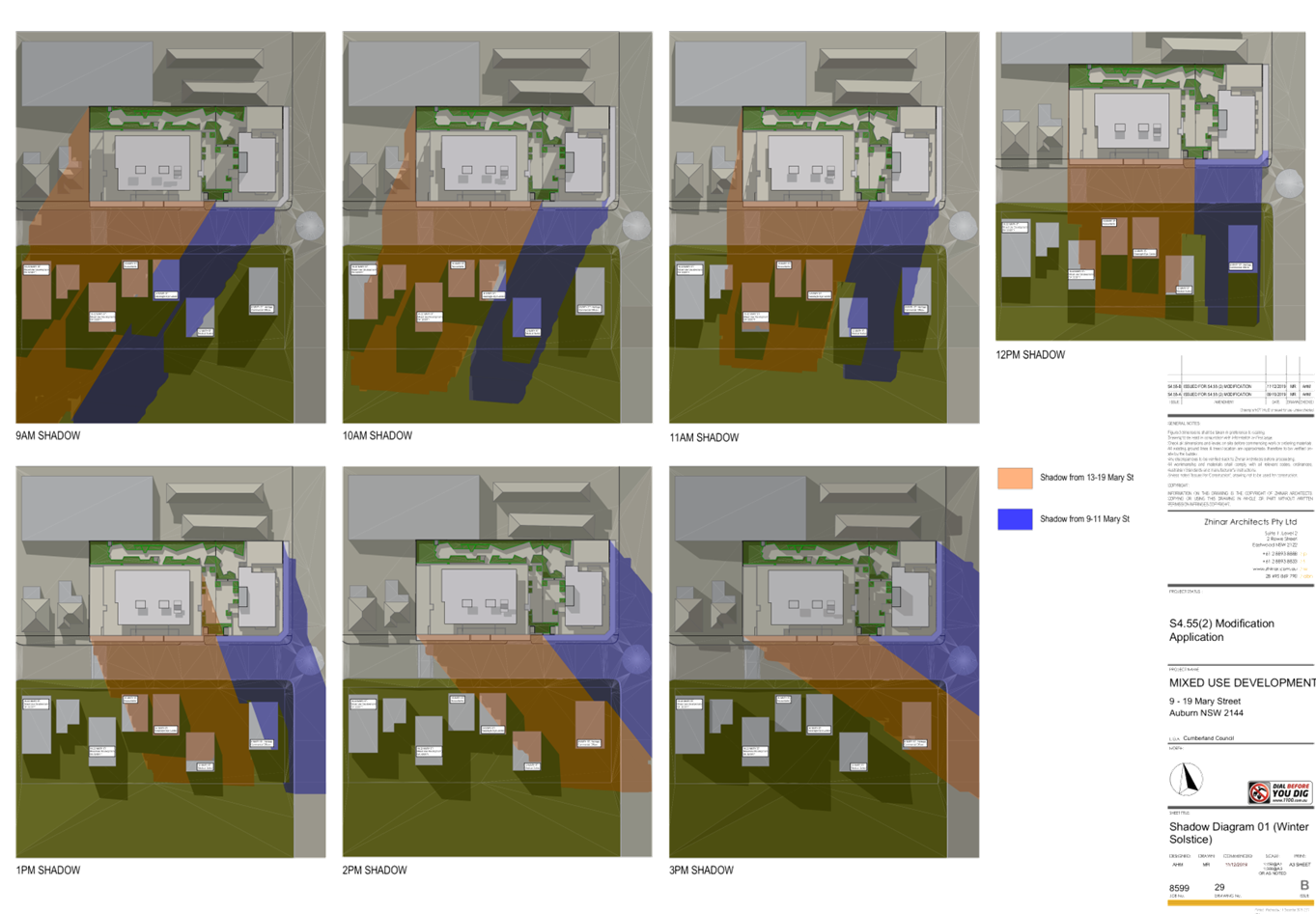
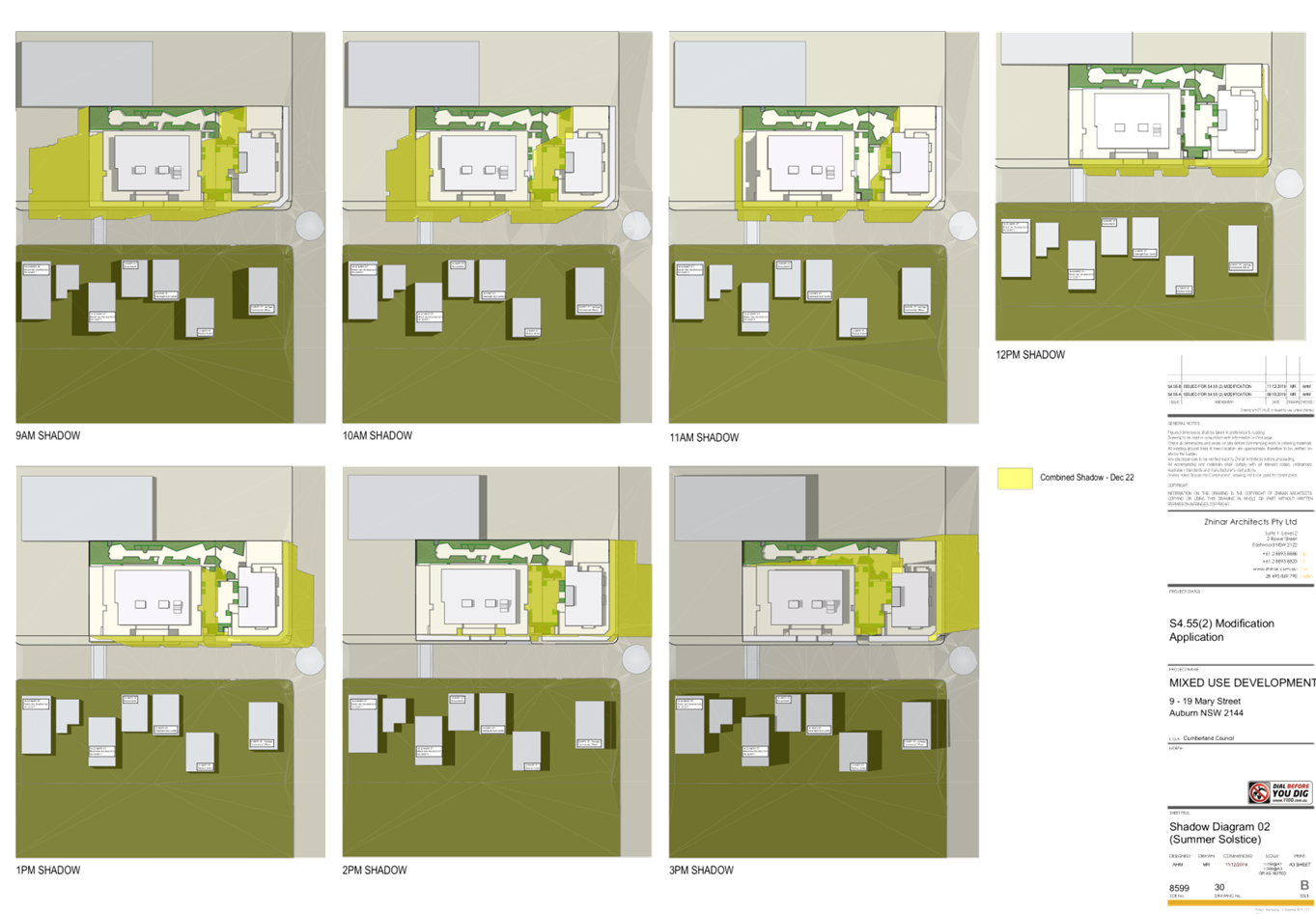
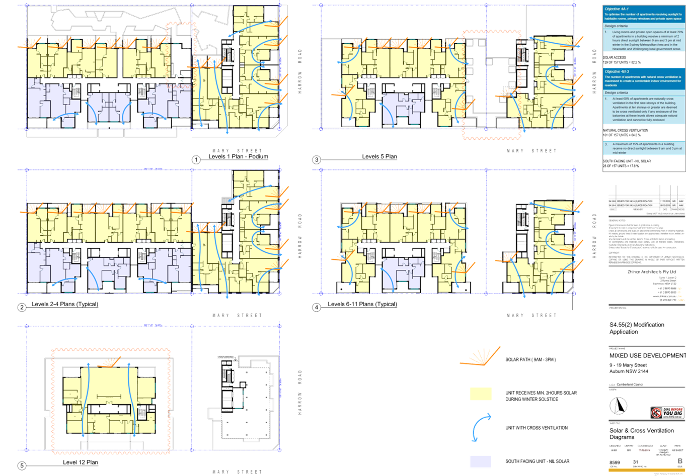
DOCUMENTS
ASSOCIATED WITH
REPORT LPP004/20
Attachment 3
Landscape Plan
Cumberland Local Planning Panel Meeting
12 February 2020
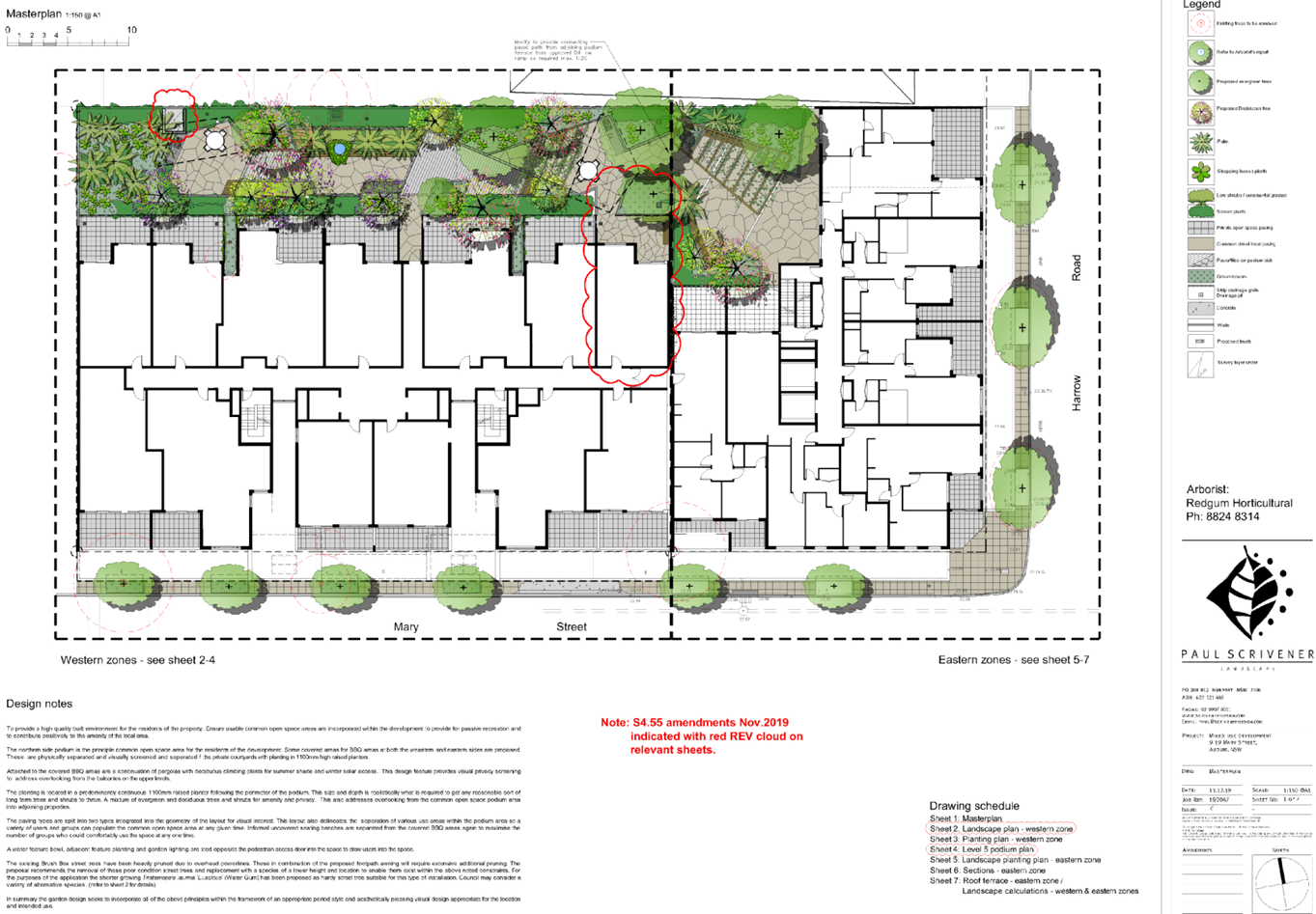
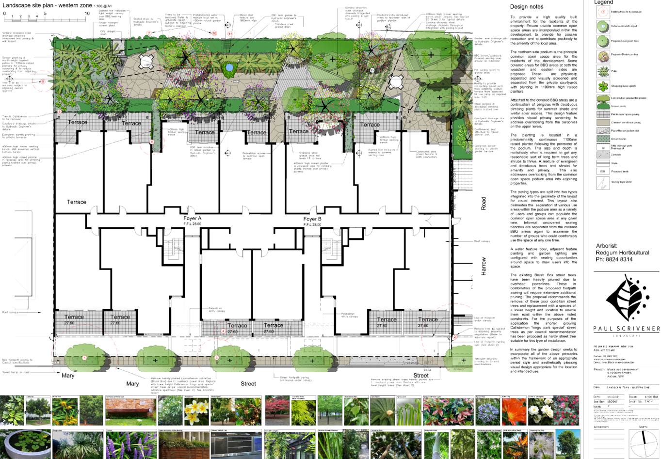
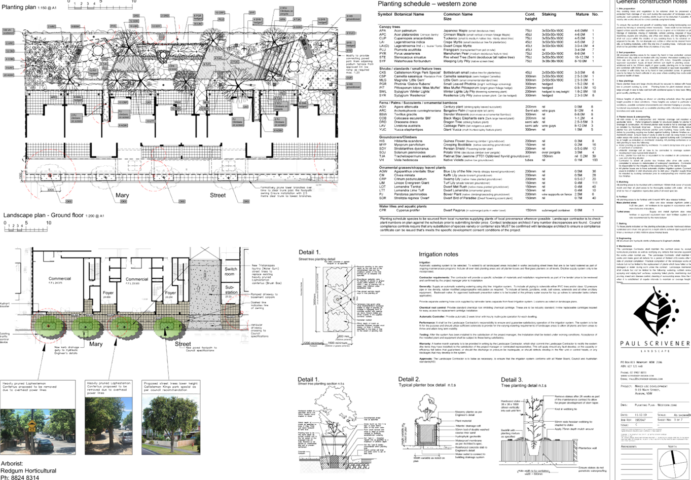
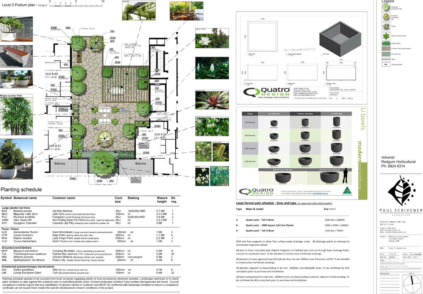
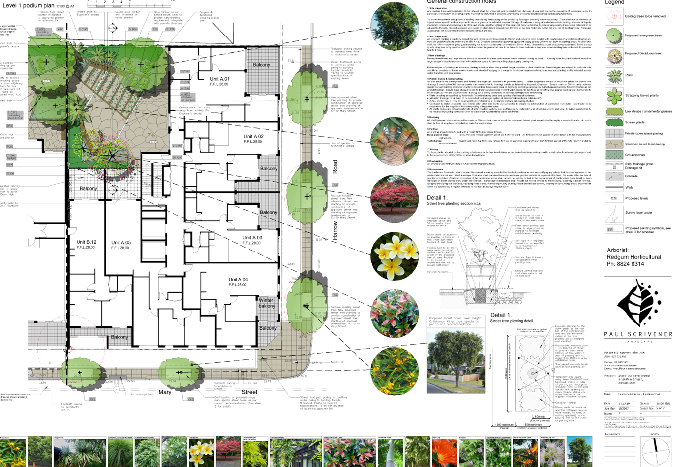
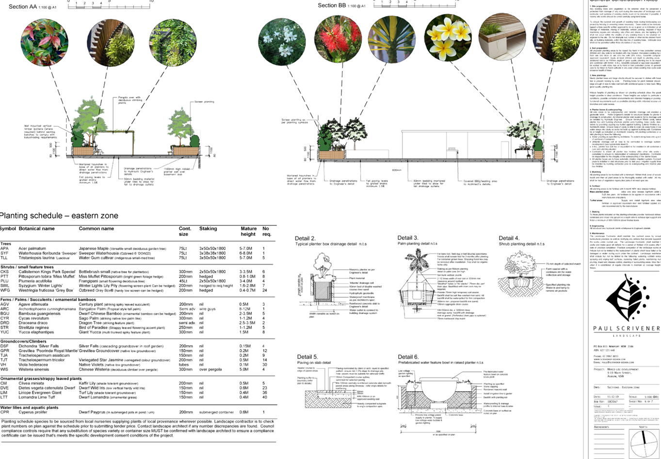
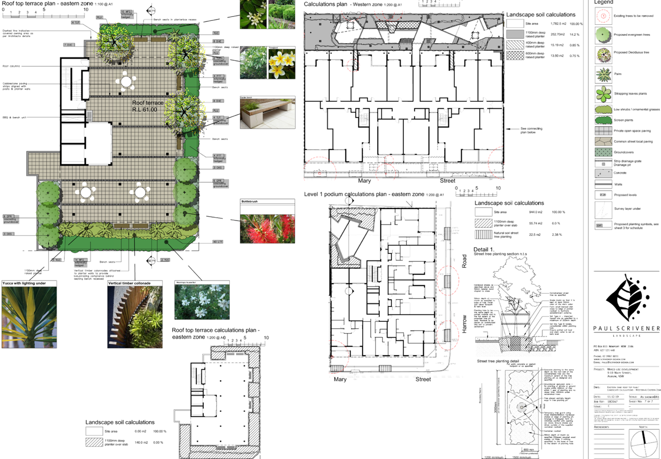
DOCUMENTS
ASSOCIATED WITH
REPORT LPP004/20
Attachment 4
Appendix A - State Environmental Planning Policy No.65
Cumberland Local Planning Panel Meeting
12 February 2020
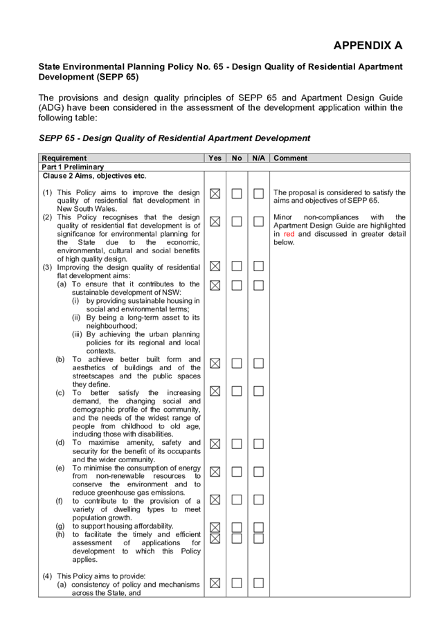
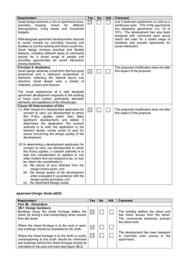
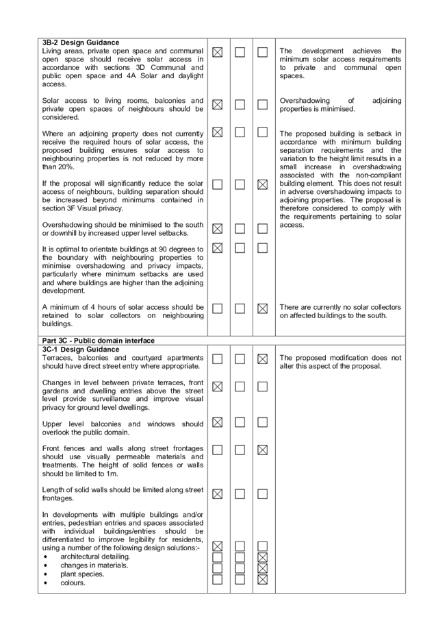
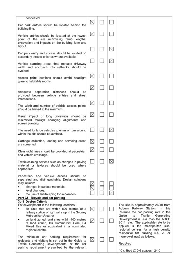
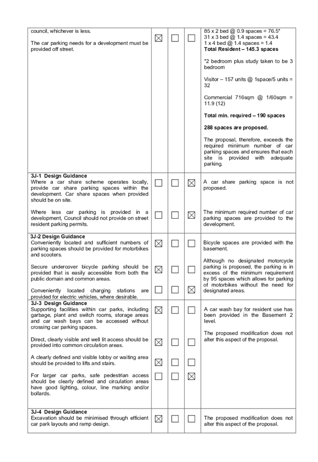
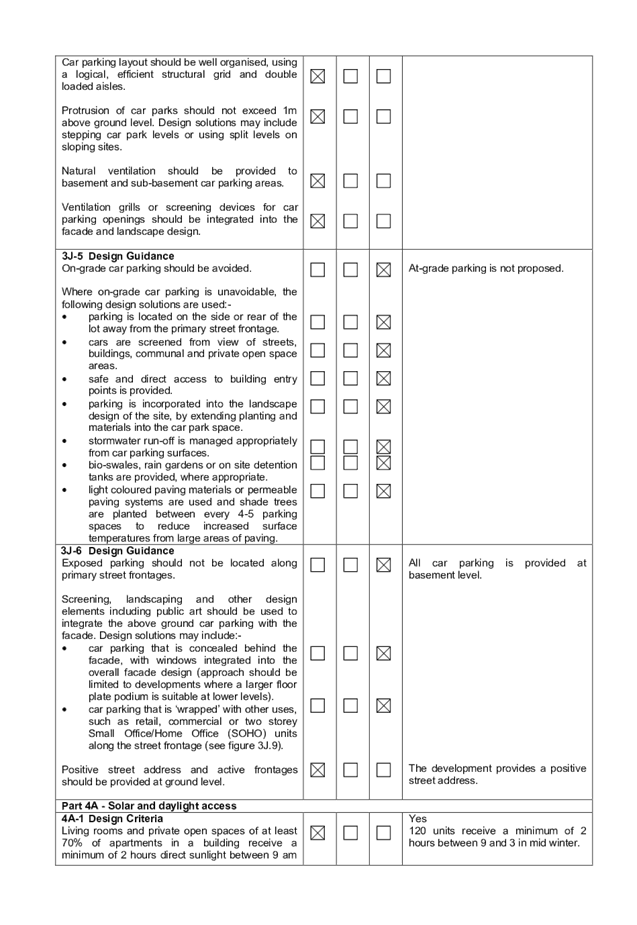
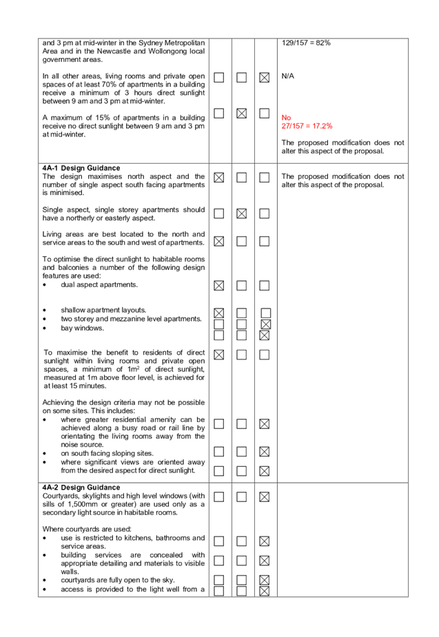
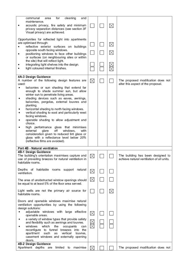
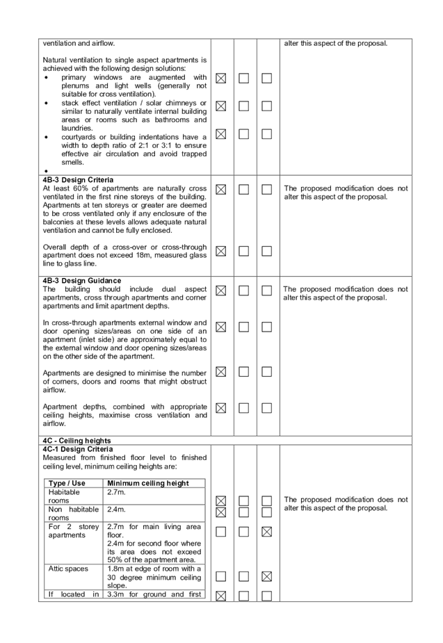
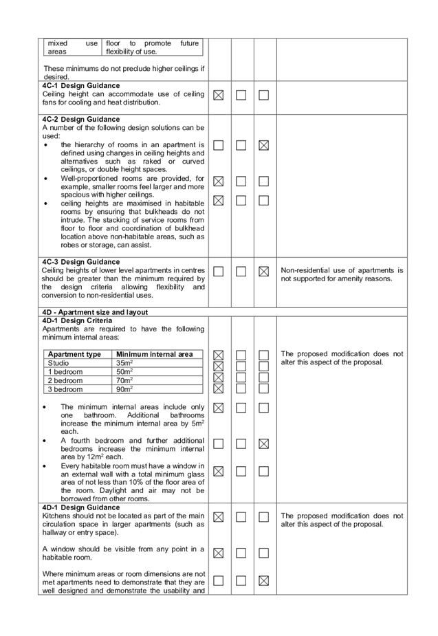
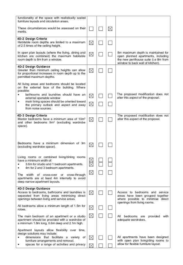
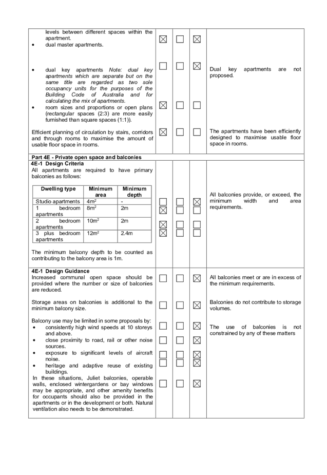
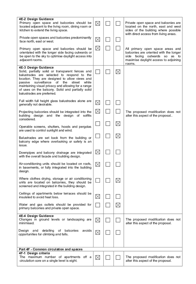
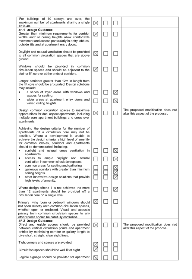
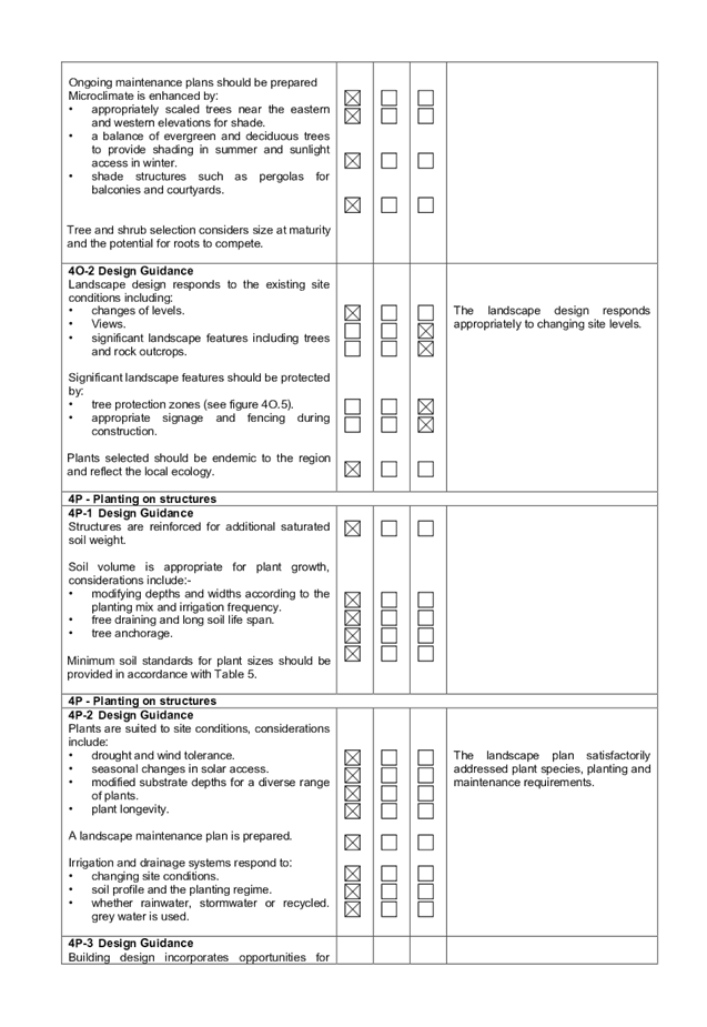
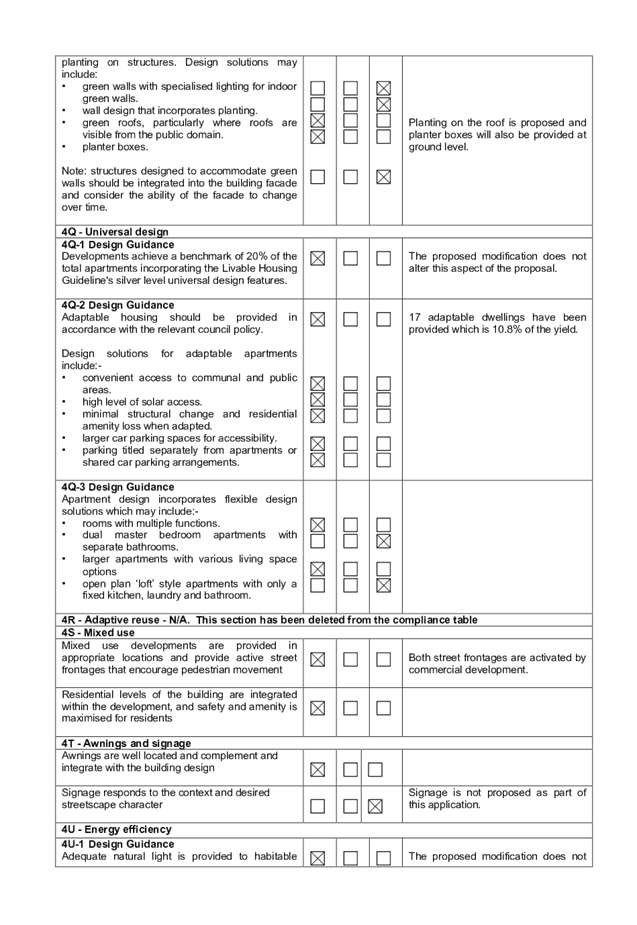

DOCUMENTS
ASSOCIATED WITH
REPORT LPP004/20
Attachment 5
Appendix B - Auburn Local Environmental Plan
Cumberland Local Planning Panel Meeting
12 February 2020
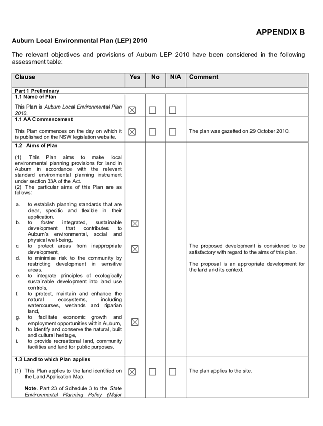
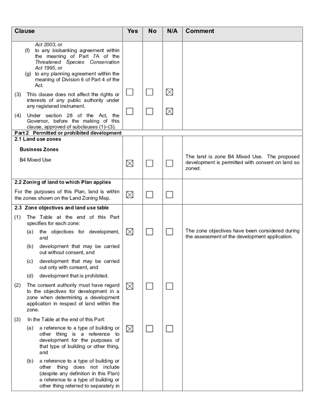
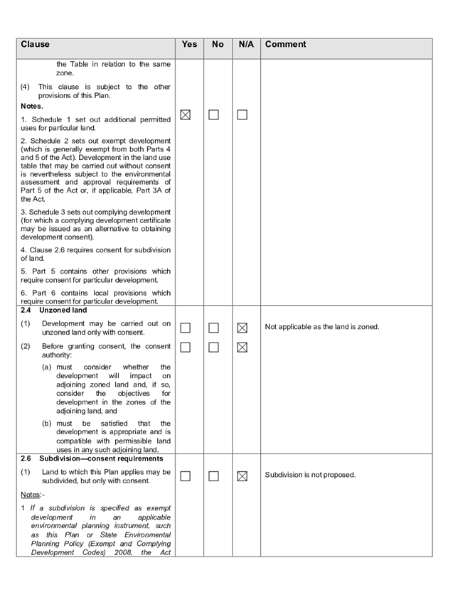
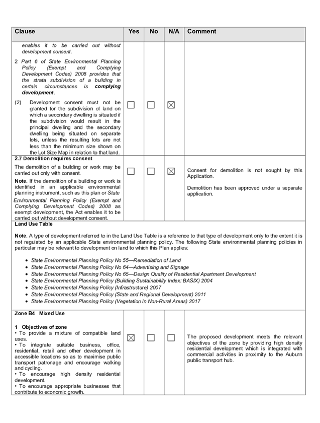
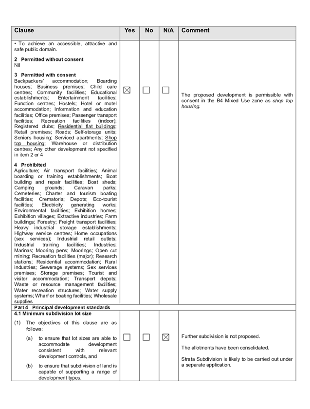
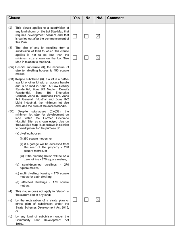
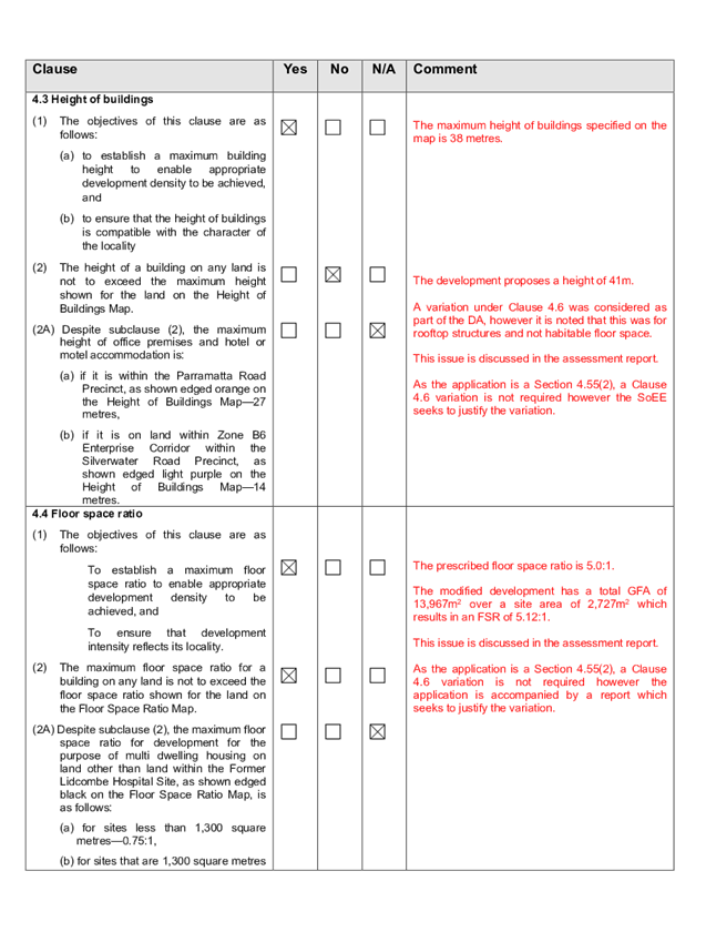
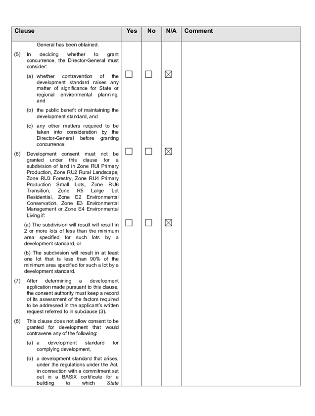
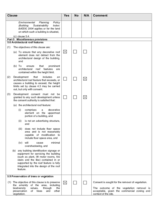
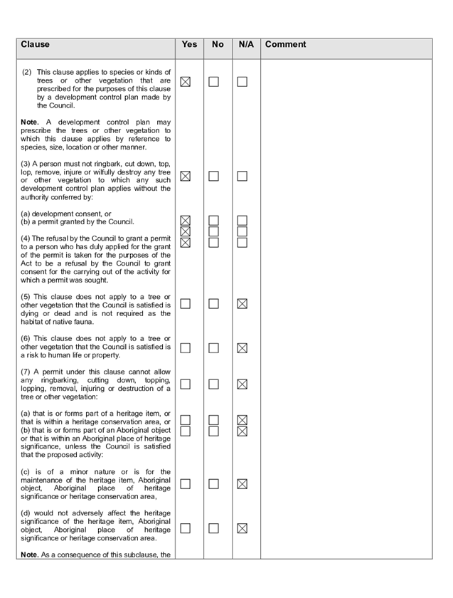
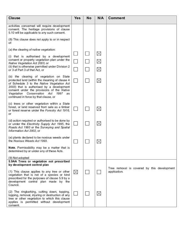
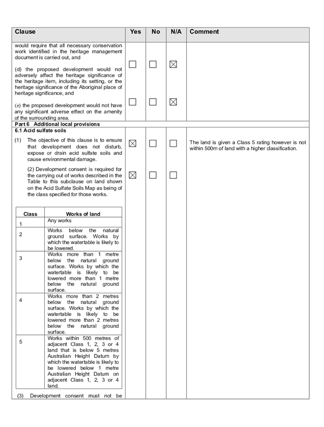
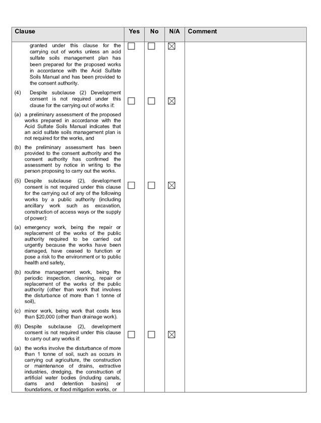
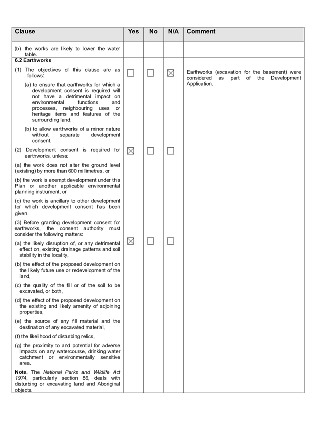
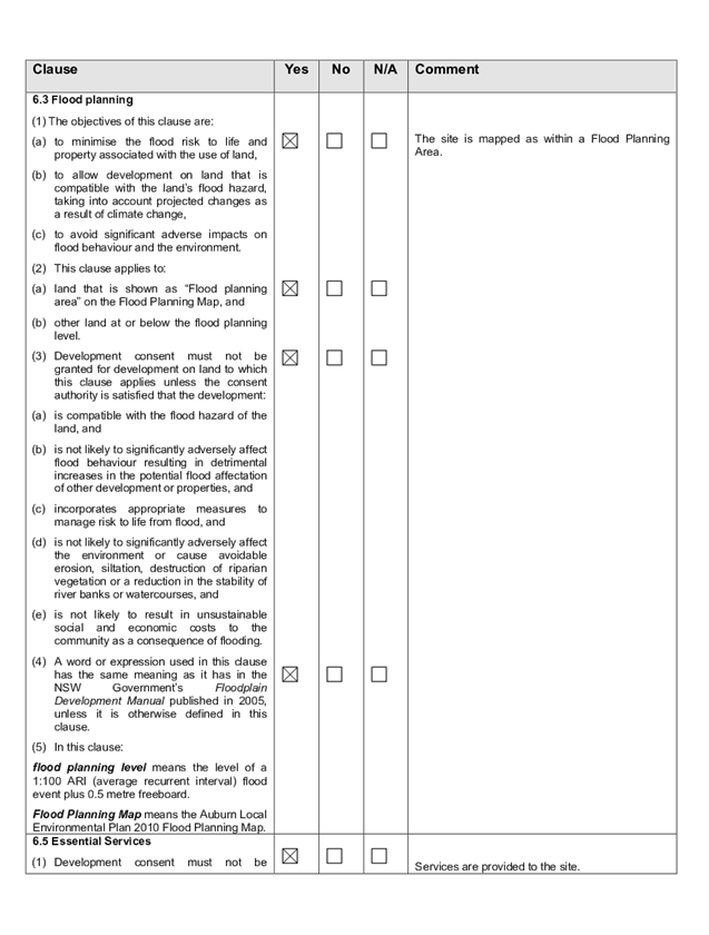
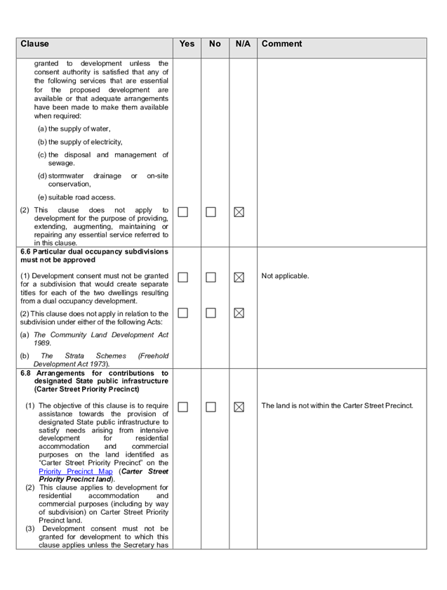
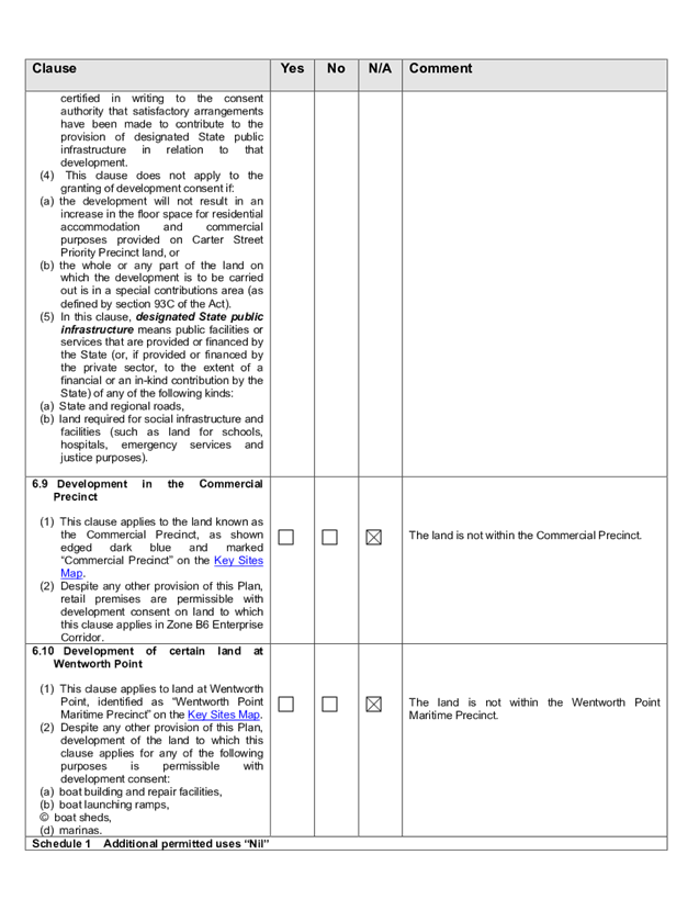
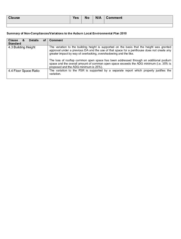
DOCUMENTS
ASSOCIATED WITH
REPORT LPP004/20
Attachment 6
Appendix C - Auburn Development Control Plan
Cumberland Local Planning Panel Meeting
12 February 2020
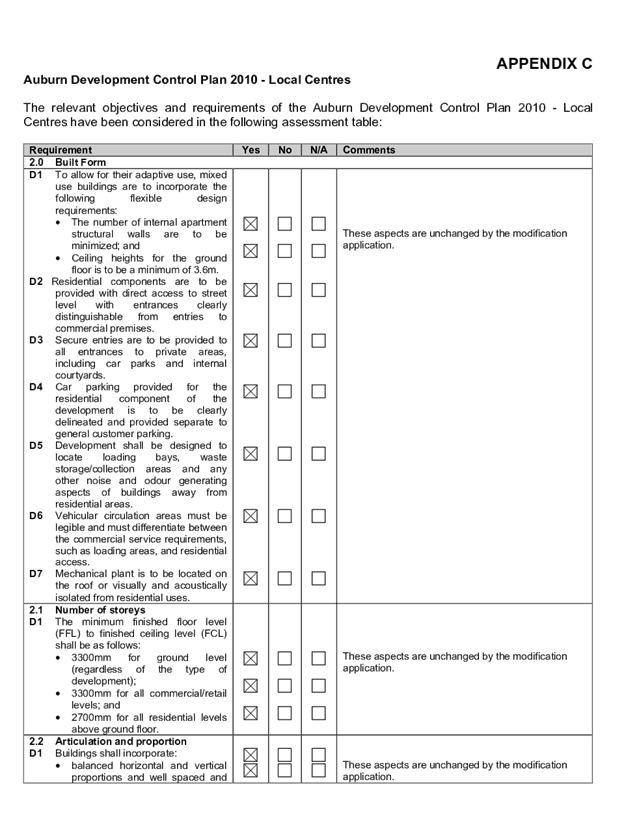
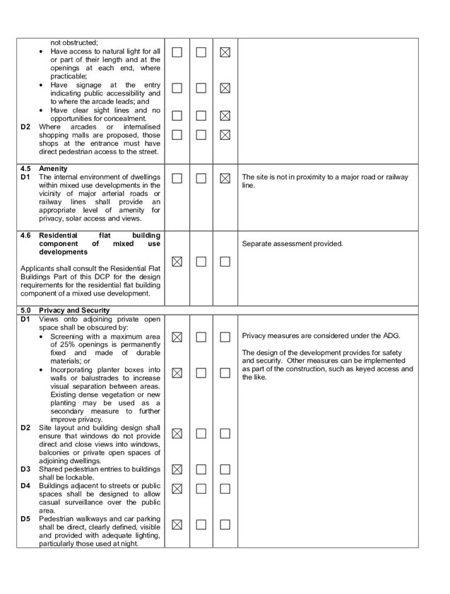
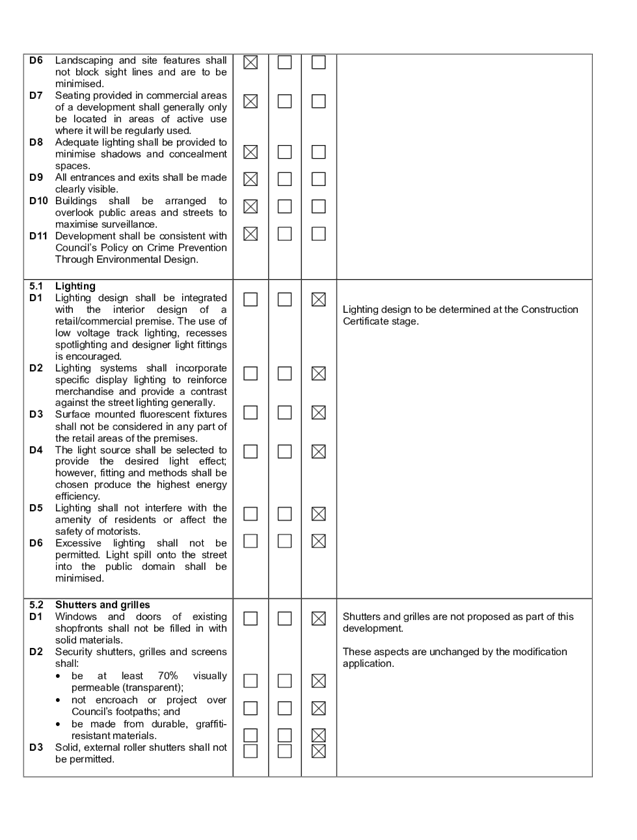
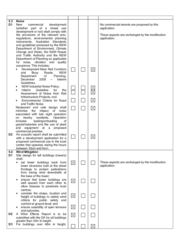
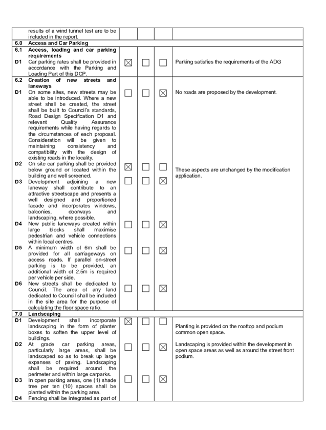
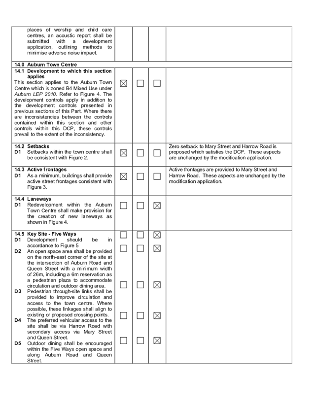
DOCUMENTS
ASSOCIATED WITH
REPORT LPP004/20
Attachment 7
Appendix D - ADCP 2010 - Residential Flat Buildings
Cumberland Local Planning Panel Meeting
12 February 2020
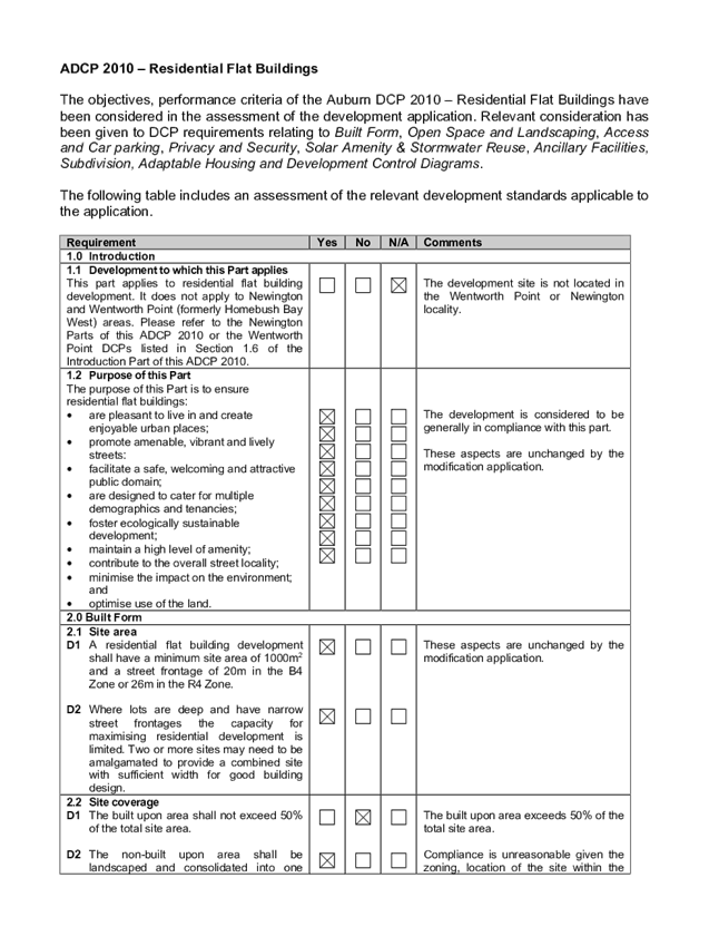
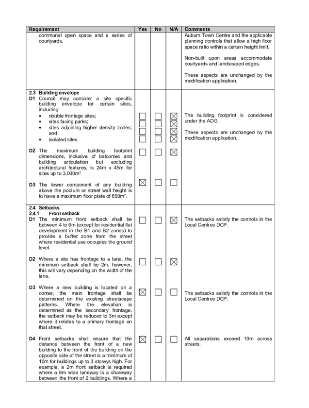
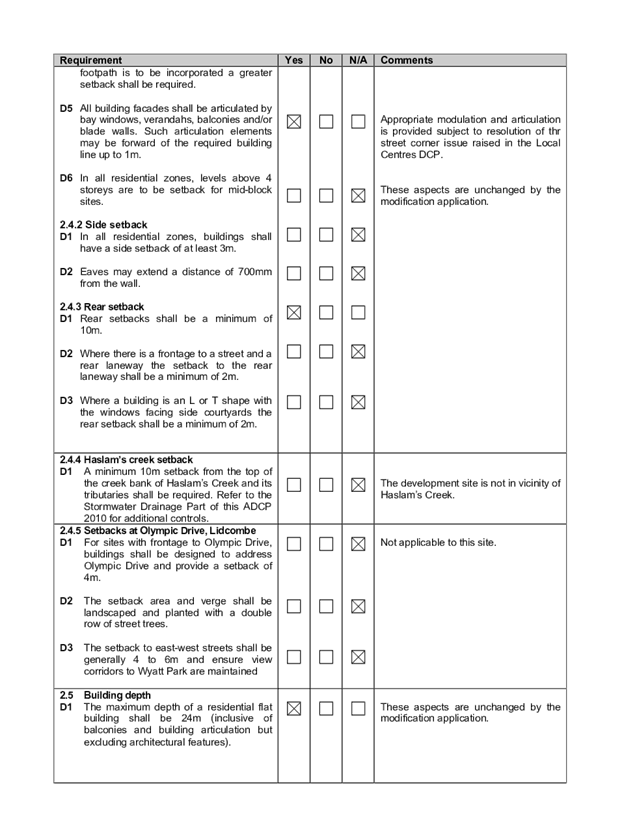
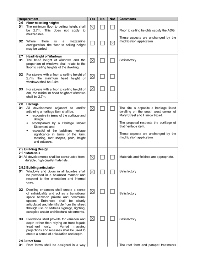
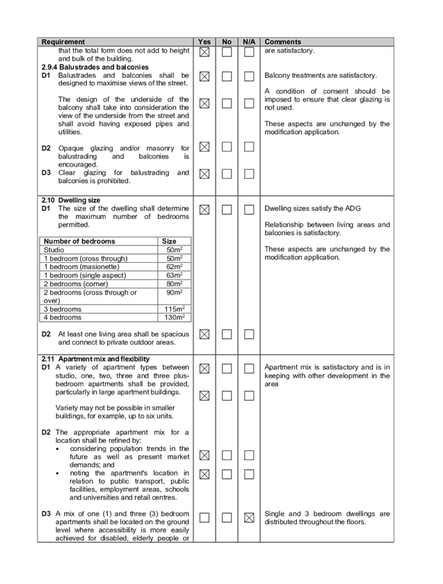
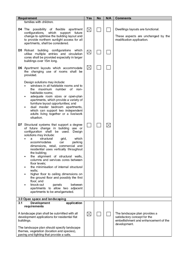
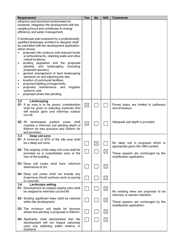
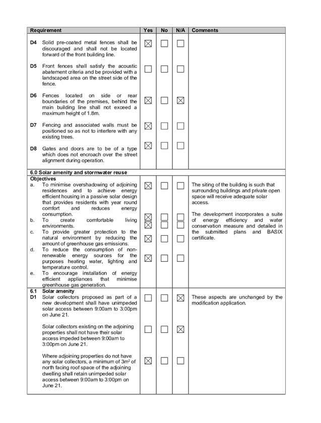
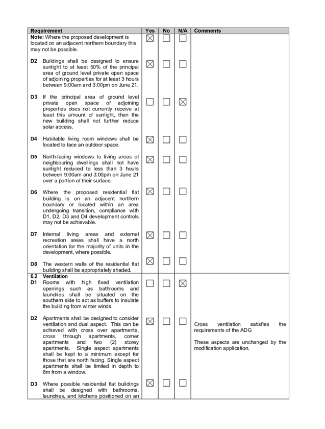
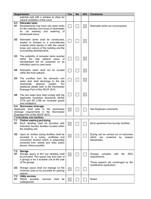
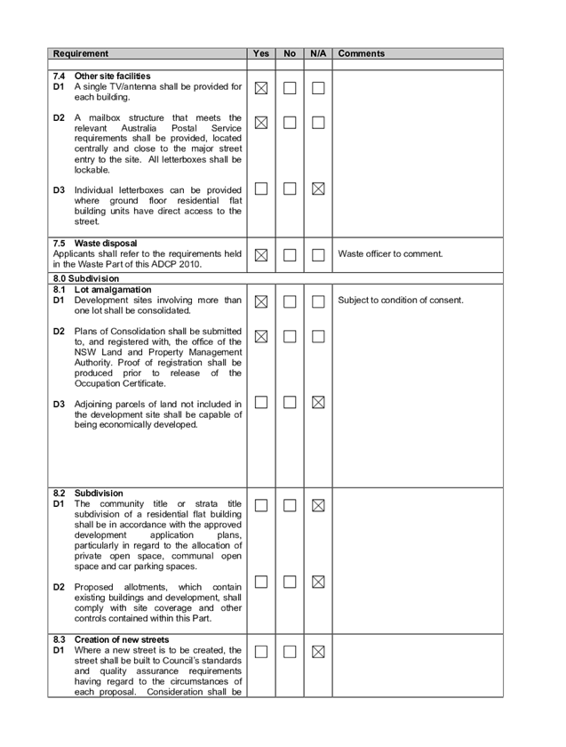

Cumberland
Local Planning Panel Meeting
12 February 2020
Item No: LPP005/20
Development Application
for 49 Martin Street, Lidcombe
Responsible
Division: Environment
& Planning
Officer: Executive
Manager Development and Building
File
Number: DA-274/2019
|
Application
lodged
|
19-Nov-2019
|
|
Applicant
|
Mr A T V Tran
|
|
Owner
|
Mr A T V Tran
|
|
Application
No.
|
DA-274/2019
|
|
Description
of Land
|
49 Martin Street,
LIDCOMBE NSW 2141, Lot A DP 178518
|
|
Proposed
Development
|
Demolition of existing
structures and construction of a two storey 56 place centre-based child care
facility with signage and at-grade car parking
|
|
Site
Area
|
1062 m2
|
|
Zoning
|
R2 Low Density Residential
Zone
|
|
Disclosure
of political donations and gifts
|
Nil disclosure
|
|
Heritage
|
No
|
|
Principal
Development Standards
|
FSR – N/A, none
specified for sites zoned R2 under ALEP 2010
Height of Building
Permissible: 9m
Proposed: 7.568m
|
|
Issues
|
27 Submissions including 2
petitions with each petition containing 30 and 98 signatures.
|
1. A
pre-lodgement application was made under PL-61/2017 where a meeting was held
with Council Officers to discuss the proposal in detail. The written advice
concluded that the proposal was generally satisfactory to proceed subject to
amendments.
2. Development
application No. DA-274/2019 was received on 2nd September 2019 for the
Demolition of existing structures and construction of a two storey, 60 place
centre-based child care facility with signage and at-grade car parking for 15
car spaces. However, as a result of recent amendments to the design scheme, the
number of children for the centre has since been revised to 56 places with 14
car spaces.
3. The
application was publicly notified to occupants and owners of the adjoining
properties for a period of fourteen days between 17 September 2019 and 1
October 2019. In response, twenty-seven (27) submissions including 2 petitions
with each petition containing 30 and 98 signatures were received which raised
concerns regarding permissibility, building height, traffic and parking
impacts, noise and amenity impacts, excessive bulk and scale, streetscape and
character and loss of privacy.
4. Between
8 October 2019 and 14 January 2020, Council received various amended plans and
documentation addressing issues raised in Council’s letter relating to
insufficiencies with the proposed outdoor play area, waste management requirements
and engineering matters being the primary issues.
5. The
application is referred to the Panel as the proposal is considered to be a
contentious development due to the number of submissions received. The
application is considered to be generally satisfactory and complies with the
relevant statutory and non-statutory planning controls. The application is
therefore suitable for support and recommended for approval subject to
conditions as nominated within the attached schedule.
Subject Site and Surrounding
Area
The subject site is legally
described as Lot A in DP 178518 and is known as 49 Martin Street, LIDCOMBE. The
site is located on the western side of Martin Street between Nicholas Street to
the north and Rawson Street to the south. Phillips Park is situated
approximately 80 metres to the north of the subject site and the Lidcombe town
centre and train station is located approximately 800 metres to the south west.
The land is regular in shape with
frontage width of 14.02 metres to Martin Street and depth of 75.85 metres,
creating a total site area of 1062 m2. The site is currently occupied by an
existing two storey brick house with a pitched tile roof. Ancillary structures
in the rear yard include 2 storage sheds located adjacent to the site’s
northern boundary and remnant trees and vegetation which are identified as
being of low significance. The site has a moderate slope with a rise from the
front to the rear boundary with a fall of approximately 2.5m across the site.
There is one street tree and a
power pole that has been identified at the front of the site.
The land adjoining the site is
also zoned R2 Low density residential and contains either one or two storey
dwelling houses of varying size and scale.
A locality plan of the subject
site is provided below.
Figure
1 – Locality Plan of subject site
Figure
2 – Aerial view of subject site
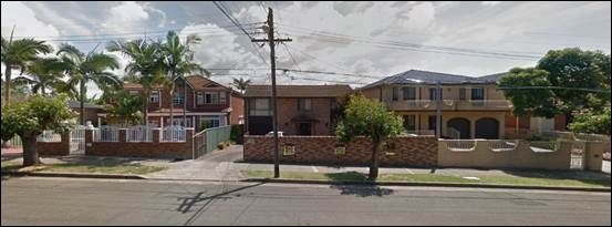
Figure
3 – Street view of subject site
Description of the Proposed
Development
Council has received a development
application for demolition of existing structures and construction of a two
storey centre-based child care facility for 56 places with signage and at-grade
car parking.
The development comprises of the
following components:
· Demolition
of the existing built form and its associated structures;
· Removal
of street tree to accommodate new driveway;
· Construction
of a two storey childcare centre with a capacity of 56 children comprising of:
- 10
x 0 to 2 years (babies)
- 20
x 2 to 3 years (Toddlers)
- 26
x 3 to 5 years
· Landscaping
(including external play areas) and required site works (including acoustic
screening and fencing);
· 1500x640mm
flush wall parapet business identification signage.
· On
site under croft car park for the provision of 14 spaces including an
accessible space;
· Vehicular
access to the car parking facilities via a new driveway located on the northern
half of the Martin Street frontage.
History
A
pre-lodgement meeting was held with Council on 14 November 2017 for the
proposed childcare centre development for 60 places. The written advice
concluded that the proposal was considered to be generally satisfactory,
however required amendments primarily in relation to access and parking to
adequately address the matters raised in the pre-lodgement meeting.
The
subject development application DA-274/2019 was lodged on 2nd September 2019.
Following a detailed assessment of the proposal, a number of issues were
identified regarding insufficient outdoor play area to comply with the relevant
requirements, waste and engineering matters.
Following
various discussions between the applicant and Council Officers, the proposal
has been amended from 60 children with 15 parking spaces down to 56 children
with 14 parking spaces, to demonstrate compliance with the matters raised
above.
Applicants
Supporting Statement
The applicant has provided a Statement of Environmental
Effects prepared by Mariedent Australia Solutions and was received by Council
on 2nd September 2019 in support of the application.
Contact
with Relevant Parties
The
assessing officer has undertaken a site inspection of the subject site and
surrounding properties and has been in regular contact with the applicant
throughout the assessment process.
Internal
Referrals
Development
Engineer
The
development application was referred to Council’s Development Engineer
for comment who has advised that the development proposal is satisfactory in
relation to stormwater drainage, access and parking subject to conditions for
an amended parking layout.
Children
Services
The
development application was referred to Council’s Children Services
section for comment who has advised that the development proposal is
satisfactory and therefore can be supported subject to recommended conditions
of consent.
Environment
and Health
The
development application was referred to Council’s Environment and Health
Officer for comment who has advised that the development proposal is
satisfactory and therefore can be supported subject to recommended conditions
of consent.
Tree
Management Officer
The
development application was referred to Council’s Tree Management Officer
for comment who has advised that the development proposal is satisfactory to
proceed and no objections raised with respect to the removal of the nominated
trees.
Waste
Management
The
development application was referred to Council’s Waste Management
Officer for comment who has advised that the development proposal is now
satisfactory as adequate provision of an enclosed bin storage room has been provided
and shown on the amended plan.
External
Referrals
The
application was not required to be referred to any external government
authorities for comment.
Planning
Comments
The
provisions of any Environmental Planning Instruments (EP&A Act s4.15 (1)(a)(i))
The
proposed development is affected by the following State Environmental Planning
Policies:
State
Environmental Planning Policy (Educational Establishments and Child Care
Facilities) 2017 – Part 3
The
above SEPP sets out a new reform process for certain types of education and
child care facilities to be determined under exempt and complying development
that will make it easier for child-care providers, schools, TAFEs and
universities to build new facilities and improve existing ones by streamlining
the planning process to save time and money and deliver greater consistency
across NSW.
Having
regard to the above, the application is identified as a ‘centre based
child care and Part 3 of the provisions of this SEPP is therefore applicable to
the application. In this regard, the relevant provisions of Part 3 are
discussed below:
|
Requirement
|
Yes/No
|
Comments
|
|
Part 3 Early education and care
facilities—specific development controls
|
|
22 Centre-based child care
facility—concurrence of Regulatory Authority required for certain
development
(1) This clause applies to development for the
purpose of a centre-based child care facility if:
(a) the floor area of the
building or place does not comply with regulation
107 (indoor unencumbered space requirements) of the Education and Care Services National Regulations, or
(b) the
outdoor space requirements for the building or place do not comply
with regulation 108 (outdoor unencumbered space requirements) of those
Regulations.
|
N/A
|
The proposal complies with regulation 107 and 108 of the
Education and Care Services National Regulations and therefore does not
require concurrence from the Regulatory Authority.
Complies. The proposal
is consistent with this requirement as follows:
Indoor
|
|
Required 3.25m2
per child
|
Proposed
|
|
0-2yrs
|
10 x 3.25 = 32.5m2
|
34.5m2
|
|
2-3yrs
|
20 x 3.25 = 65m2
|
76m2
|
|
3-5yrs
|
26 x 3.25 = 84.5m2
|
99.5m2
|
Outdoor
|
|
Required 7m2
per child
|
Proposed
|
|
0-2yrs
|
10 x 7 = 70m2
|
70m2
|
|
2-3yrs
|
20 x 7 = 140m2
|
76m2
|
|
3-5yrs
|
26 x 7 = 182m2
|
211m2
|
Indoor and outdoor
space has been calculated in accordance with this requirement. Submitted
architectural plans include area diagrams to assist in demonstrating
compliance. Council has also verified the calculations of the space
requirements and is satisfied that the proposal meets the legislative space
requirements under the Education and Care Services National Regulations.
|
|
23 Centre-based
child care facility—matters for consideration by consent authorities
Before determining a development application for
development for the purpose of a centre-based child care facility, the
consent authority must take into consideration any applicable provisions of
the Child Care Planning Guideline, in
relation to the proposed development.
|
Noted
|
See discussion and assessment against Childcare Planning
Guidelines in Appendix A.
|
|
24 Centre-based child care facility in Zone
IN1 or IN2—additional matters for consideration by consent authorities
|
N/A
|
Subject site is not located in these zones.
|
|
25
Centre-based child care facility—non-discretionary development
standards
(1)
The object of this clause is to identify development standards for particular
matters relating to a centre-based child care facility that, if complied
with, prevent the consent authority from requiring more onerous standards for
those matters.
(2)
The following are non-discretionary development standards for the purposes of
section 4.15 (2) and (3) of the Act in relation to the carrying out of
development for the purposes of a centre-based child care facility:
(a)
location—the development may be located at any distance from an
existing or proposed early education and care facility,
(b)
indoor or outdoor space
(i) for development to which regulation 107 (indoor
unencumbered space requirements) or 108 (outdoor unencumbered space
requirements) of the Education and Care Services National Regulations
applies—the unencumbered area of indoor space and the unencumbered area
of outdoor space for the development complies with the requirements of those
regulations, or
(ii) for development to which clause 28 (unencumbered
indoor space and useable outdoor play space) of the Children (Education and
Care Services) Supplementary Provisions Regulation 2012 applies—the
development complies with the indoor space requirements or the useable
outdoor play space requirements in that clause,
(c)
site area and site dimensions—the development may be located on a site
of any size and have any length of street frontage or any allotment depth,
(d)
colour of building materials or shade structures—the development may be
of any colour or colour scheme unless it is a State or local heritage item or
in a heritage conservation area.
(3)
To remove doubt, this clause does not prevent a consent authority from:
(a)
refusing a development application in relation to a matter not specified in
subclause (2), or
(b)
Granting development consent even though any standard specified in subclause
(2) is not complied with.
|
Noted
Noted
Y
N/A
Noted
Noted
Noted
|
Complies as discussed above.
N/A
|
|
26
Centre-based child care facility—development control plans
(1)
A provision of a development control plan that specifies a requirement,
standard or control in relation to any of the following matters (including by
reference to ages, age ratios, groupings, numbers or the like, of children)
does not apply to development for the purpose of a centre-based child care
facility:
(a)
operational or management plans or arrangements (including hours of
operation),
(b)
demonstrated need or demand for child care services,
(c)
proximity of facility to other early education and care facilities,
(d)
any matter relating to development for the purpose of a centre-based child
care facility contained in:
(i) the design principles set out in Part 2 of the
Child Care Planning Guideline, or
(ii) the matters for consideration set out in Part
3 or the regulatory requirements set out in Part 4 of that Guideline (other
than those concerning building height, side and rear setbacks or car parking
rates).
(2)
This clause applies regardless of when the development control plan was made.
|
Noted
|
|
The
Child Care Planning Guidelines also list matters for consideration for this
development application. This development application is considered to
satisfactorily address those matters listed. A full assessment table is
attached in Appendix A.
State
Environmental Planning Policy No. 55 – Remediation of Land
The
requirement at clause 7 of SEPP No. 55 for Council to be satisfied that the
site is suitable or can be made suitable to accommodate the proposed
development has been considered in the following table:
|
Matter for Consideration
|
Yes/No
|
|
Does the application involve re-development of
the site or a change of land use?
|
Yes
No
|
|
In the development going to be used for a
sensitive land use (e.g.: residential, educational, recreational, childcare
or hospital)?
|
Yes
No
|
|
Does information available to you indicate that
an activity listed below has ever been approved, or occurred at the site?
acid/alkali
plant and formulation, agricultural/horticultural activities, airports,
asbestos production and disposal, chemicals manufacture and formulation,
defence works, drum re-conditioning works, dry cleaning establishments,
electrical manufacturing (transformers), electroplating and heat treatment
premises, engine works, explosive industry, gas works, iron and steel works,
landfill sites, metal treatment, mining and extractive industries, oil
production and storage, paint formulation and manufacture, pesticide
manufacture and formulation, power stations, railway yards, scrap yards,
service stations, sheep and cattle dips, smelting and refining, tanning and
associated trades, waste storage and treatment, wood preservation
|
Yes
No
|
|
Is the site listed on
Council’s Contaminated Land database?
|
Yes
No
|
|
Is the site subject to
EPA clean-up order or other EPA restrictions?
|
Yes
No
|
|
Has the site been the
subject of known pollution incidents or illegal dumping?
|
Yes
No
|
|
Does the site adjoin
any contaminated land/previously contaminated land?
|
Yes
No
|
|
Details of contamination investigations carried
out at the site:
The development has been supported by a
preliminary environmental site investigation report prepared by Land &
Groundwater Consulting P/L, dated 20 December 2017, which concluded that:
“The site condition and the past and
current site activities described in the PESI indicate low potential for
significant or gross contamination; and based on the above findings, the site
subject to this PESI is suitable for the proposed childcare facility and/or
low-density residential land use, consistent with a R2 Low Density
Residential Zoning.”
The application was referred to Councils
Environmental and Health Unit for comment and the advice provided indicated
that the proposal was satisfactory from an environmental viewpoint and
standard conditions have been recommended to be imposed on the consent. In
this regard, Council officers can be satisfied that the development as
proposed is suitable for the purpose for which the development is proposed.
|
|
Has the appropriate level of investigation been
carried out in respect of contamination matters for Council to be satisfied
that the site is suitable to accommodate the proposed development or can be
made suitable to accommodate the proposed development?
|
Yes
No
|
State Environmental Planning Policy 64 (Advertising
and Signage)
One business identification sign is proposed for the
centre. The signage proposed is consistent with the schedule 1 assessment
criteria requirements of the above SEPP and is therefore satisfactory. A
comprehensive assessment and compliance table is provided in Appendix B.
Regional Environmental Plans
The proposed development is affected by the following
Regional Environmental Plans:
Sydney Regional Environmental Plan (Sydney Harbour
Catchment) 2005
The subject site is identified as being located within
the area affected by the Sydney Regional Environmental Plan (Sydney Harbour
Catchment) 2005. The proposed development raises no issues as no impact on the
catchment is envisaged.
(Note: - the subject site is not identified in the
relevant map as ‘land within the ‘Foreshores and Waterways
Area’ or ‘Wetland Protection zone’, is not a ‘Strategic
Foreshore Site’ and does not contain any heritage items. Hence the
majority of the SREP is not directly relevant to the proposed development).
Local Environmental Plans
Auburn Local Environmental Plan 2010
The provision of the Auburn Local Environmental Plan
(ALEP 2010) is applicable to the development proposal. It is noted that the
development achieves compliance with the key statutory requirements of the ALEP
2010 and the objectives of the R2 Low density residential zone.
Permissibility:
The proposed development is defined as a
“Centre-based childcare facility” and is permissible in the R2 zone
with consent.
A centre-based child care facility means:
a) a
building or place used for the education and care of children that provides any
one or more of the following:
(i) long day care,
(ii) occasional child care,
(iii) out-of-school-hours care
(including vacation care),
(iv) preschool care, or
b) an
approved family day care venue (within the meaning of the Children (Education
and Care Services) National Law (NSW)),
Note. An approved family day care venue is a place,
other than a residence, where an approved family day care service (within the
meaning of the Children (Education and Care Services) National Law (NSW)) is
provided.
But does not include:
c) a
building or place used for home-based child care or school-based child care, or
d) an
office of a family day care service (within the meanings of the Children
(Education and Care Services) National Law (NSW)), or
e) a
babysitting, playgroup or child-minding service that is organised informally by
the parents of the children concerned, or
f) a
child-minding service that is provided in connection with a recreational or
commercial facility (such as a gymnasium) to care for children while the
children’s parents are using the facility, or
g) a
service that is concerned primarily with providing lessons or coaching in, or
providing for participation in, a cultural, recreational, religious or sporting
activity, or providing private tutoring, or
h) a
child-minding service that is provided by or in a health services facility, but
only if the service is established, registered or licensed as part of the
institution operating in the facility.
The relevant matters to be considered under Auburn Local
Environmental Plan 2010 for the proposed development are summarised below.
|
DEVELOPMENT STANDARD
|
COMPLIANCE
|
DISCUSSION
|
|
4.3 Height of
Buildings
Max 9 metres.
|
Y
|
The maximum building
height proposed is 7.568 metres.
|
|
4.4 Floor Space Ratio
|
N/A
|
There is no FSR
prescribed for the site.
|
|
4.6 Exceptions to
development standards
|
N/A
|
No variations sought.
|
|
5.10 Heritage Conservation
|
N/A
|
The subject site is
not identified as a heritage item or within a heritage conservation area.
|
|
6.1 Acid sulphate soils
|
Y
|
Class 5 – Nil
Impact. An Acid Sulphate Soils Management plan is not required to be prepared
as the works proposed are not likely to lower the water table. Further, the
site is not located in proximity to coastal (tidal) and inland or upland
(freshwater) environments where acid sulphate soils are usually present and
where the disturbance of soil would result in environmental impacts requiring
acid soil management to prevent contamination.
|
|
6.2 Earthworks
|
Y
|
Minimal earthworks
proposed to facilitate construction of development and this is not
anticipated to result in adverse environmental impacts.
|
|
6.3 Flood planning
|
N/A
|
The site is not
affected by flooding.
|
|
6.4 Foreshore Building Line
|
N/A
|
Not relevant to the
site.
|
|
6.5 Essential services
|
Y
|
Appropriate conditions can be imposed to ensure
compliance.
|
ii)
iii) The
provisions of any proposed instrument that is or has been the subject (EP&A
Act s4.15 (1)(a)(ii))
iv)
(a) Draft
State Environmental Planning Policy (Environment)
v)
vi)
The draft SEPP relates to the protection and management of our
natural environment with the aim of simplifying the planning rules for a number
of water catchments, waterways, urban bushland, and Willandra Lakes World
Heritage Property. The changes proposed include consolidating the following
seven existing SEPPs:
vii)
· State
Environmental Planning Policy No. 19 – Bushland in Urban Areas
· State
Environmental Planning Policy (Sydney Drinking Water Catchment) 2011
· State
Environmental Planning Policy No. 50 – Canal Estate Development
· Greater
Metropolitan Regional Environmental Plan No. 2 – Georges River Catchment
· Sydney
Regional Environmental Plan No. 20 – Hawkesbury-Nepean River (No.2-1997)
· Sydney
Regional Environmental Plan (Sydney Harbour Catchment) 2005
· Willandra
Lakes Regional Environmental Plan No. 1 – World Heritage Property.
viii)
ix)
The draft policy will repeal the above existing SEPPs and certain
provisions will be transferred directly to the new SEPP, amended and
transferred, or repealed due to overlaps with other areas of the NSW planning
system.
x)
xi)
Changes are also proposed to the Standard Instrument –
Principal Local Environmental Plan. Some provisions of the existing policies
will be transferred to new Section 117 Local Planning Directions where
appropriate.
The provisions of any Development Control Plans
(EP&A Act s4.15 (1)(a)(iii))
The Auburn DCP 2010 provides guidance for the design
and operation of development to achieve the aims and objectives of the ALEP
2010. The relevant parts of the ADCP 2010 are discussed below.
a) Childcare
centres
The proposed development is considered to perform
satisfactorily with regard to the Childcare Centres part of the ADCP 2010. A
comprehensive assessment and compliance table is contained in Appendix B.
Minor non-compliances are noted with regard to the childcare
centres section of the DCP in relation to fencing for the elevated outdoor
areas, landscaping of the front yard and internal design layout for visibility
and security.
In relation to fencing around the elevated outdoor
spaces where a minimum 3m high fence is required, a variation to this control
is considered acceptable as a 1.5m high barrier wall is provided. This is
considered satisfactory with respect to the Childcare Planning Guidelines which
prevails over Council’s controls. Additionally, a condition will be
imposed for the height of the wall surrounding the elevated outdoor areas to be
a minimum of 1.6m above finished floor level to make certain that concerns of
privacy and overlooking are minimised.
It is noted that the proposal does not incorporate a
front reception in the design to allow for direct visibility of all people
entering and leaving the premises. However, the Plan of Management prepared by
Gowrie, accompanying the application details a system in place for arrivals and
departures to be recorded for all children, staff and visitors entering and
leaving the premises. Due to the design layout incorporating an under croft car
park which does not provide direct surveillance, it is considered appropriate
to include a condition for an intercom monitor system which allows for
controlled and secure access as well as CCTV recording for safety and security
to further ensure staff are aware of all children and visitors entering and
leaving the premises.
The non-compliance relating to landscaping of the
front yard is considered to be acceptable given that some landscaping elements
will be provided to differentiate between private and public interface that is
compatible with the streetscape and character of the residential area. Further,
the proposal is considered to be an improvement to the existing situation in
that the site currently provides a 1.5 to 1.8m high solid masonry front brick
fence and an impervious front yard composed of concrete. In this instance, a
variation to this control is considered to be acceptable given the
circumstances and merit of the application.
b) Parking
and Loading
The parking rate for a child care centre is based on 1
car space per 4 children. A maximum of 56 places are proposed for the centre.
The development provides for 14 parking spaces in the under-croft car park
which is adequate and complies with the parking requirement. The proposed car
park includes provision of visitor parking and one space for people with
disability and a turning bay for access and manoeuvring of the site. The plan
has been reviewed by Council’s Engineer and the proposal considered
satisfactory subject to conditions for a blind aisle extension to ensure the
parking layout complies with AS2890.1.
c) Detached
Dwellings and Dual Occupancy
The Detached Dwellings and Dual Occupancy part of the
ADCP 2010 have been reviewed. The objectives and requirements are considered to
be of limited application for a purpose-built childcare centre.
Notwithstanding, the required building setbacks and height have been observed
and adhered to in the design of the proposed childcare centre to ensure that
the development responds to the streetscape, character and built form so as to
be sympathetic to the low scale residential nature and scale of the surrounding
developments. The development provides a complying side setback of 900mm on
either side and a rear setback of 17.4m which is considered acceptable given
the proposed land use. It is noted that a front setback of 10.124m is provided
for the development when a setback of 5.5 to 6m is usually required. Given that
the proposal relates to childcare centre and that the prevailing front setback
established for the adjoining dwellings and the street is greater than 6
metres, the non-compliance is considered satisfactory on its merit.
The development is therefore considered to blend in
with the established residential built environment and is compatible in the
locality.
d) Waste
The proposed waste requirements of the ADCP 2010 is
considered to be satisfactory. An enclosed bin room for storage of waste is
provided to service the development. Council’s Waste Management Officer
has also reviewed the plans submitted and is satisfied with the proposed waste
rooms provided on site.
e) Accessibility
The proposed accessibility requirements of the ADCP
2010 is considered to be satisfactory. The under croft car park and separate
pedestrian access to the building is at grade, lifts have been provided for
first floor level access and disabled toilet facilities have also been
incorporated into the design. The application has also been supported with an
access report prepared by Ergon Consulting, revision B, dated 29 August 2019
which is satisfactory.
f) Stormwater
drainage
The proposed stormwater drainage requirements of the
ADCP 2010 is considered to be satisfactory. Council’s engineer has
reviewed the concept stormwater plans submitted and recommended appropriate
conditions to be imposed on the consent.
Having regard to the above, the proposed development
is considered to be acceptable from an environmental planning view point.
The provisions of any planning agreement that has
been entered into under section 7.4, or any draft planning agreement that a
developer has offered to enter into under section 7.4 (EP&A Act s4.15(1)(a)(iiia))
There is no draft planning agreement associated with
the subject Development Application.
The provisions of the Regulations (EP&A Act
s4.15 (1)(a)(iv))
The proposed development raises no concerns as to the
relevant matters arising from the Environmental Planning and Assessment
Regulations 2000 (EP&A Reg).
The Likely Environmental, Social or Economic
Impacts (EP&A Act s4.15 (1)(b))
It is considered that the proposed development will
have no significant adverse environmental, social or economic impacts in the
locality.
The suitability of the site for the development
(EP&A Act s4.15 (1)(c))
The subject site and locality are not known to be
affected by any natural hazards or other site constraints likely to have a
significant adverse impact on the proposed development. Accordingly, it is
considered that the development is suitable in the context of the site and
surrounding locality.
Submissions made in accordance with the Act or
Regulation (EP&A Act s4.15 (1)(d))
|
Advertised (newspaper)
|
Mail
|
Sign
|
Not Required
|
In accordance with Council’s Notification
requirements contained within the Auburn DCP 2010, the proposal was publicly
notified for a period of 14 days between 17/09/19 and 01/10/19. The
notification generated 27 submissions and a petition containing 98 signatures
in respect of the proposal. Of these 27 submissions received, a total of
sixteen (16) constitute a ‘unique submission’; being a submission
which is unique in substance, distinctive or unlike any other submission. A
unique submission precludes form letters and petitions from being counted more
than once toward the total number of unique submissions. These definitions are
in accordance with directions from the Department of Planning, Industry and
Environment. Further, it is noted that nil submissions disclosed a political
donation or gift.
Having regard to Council delegations, on 20 November
2019, a Council Resolution was made to amend Council’s internal policy
and subsequent delegation to refer DAs to the Cumberland Local Planning Panel
(CLPP) when ten (10) or more objections are received in accordance with the
Local Planning Panels Direction – Schedule 1, Clause 2(b) as provided in
the Ministerial Direction dated 23 February 2018. In this instance, the
application is required to be referred to the CLPP for consideration.
The issues raised in the public submissions are
summarised and commented on as follows:
|
ISSUE
|
PLANNER’S COMMENT
|
|
1. Increased traffic
generation, lack of parking and the overflow of parking on to the surrounding
street.
|
The proposal is considered to be satisfactory and
provides adequate parking onsite in accordance with Council’s parking
requirements. The application has also been accompanied by a Traffic Impact
assessment report which has been reviewed by Council’s Engineering
section and considered satisfactory based on merit.
|
|
2. Permissibility of
childcare centre in residential area, overdevelopment, incompatible with
streetscape and character and visual impact.
|
The proposed development for a childcare facility is
permissible with consent in the R2 low density residential zone under the
relevant plan (ALEP 2010) subject to an approval. The number of childcare
centres proposed in an area, regardless of proximity and competition; is
based on market demand and not a matter for consideration under section 4.15
of the Environmental Planning and Assessment Act 1979 (as amended). Further,
as specified in clause 25(2)(a) of the SEPP Educational Establishments and
Childcare Facilities 2017, the development of a childcare facility is
permitted to be located at any distance from an existing or proposed early
education and care facility.
|
|
3. Noise and hours of
operation excessive
|
An acoustic report has been submitted to accompany
the development application and reviewed by Council’s Environment and
Health section. The advice provided raised no objections to the proposal
subject to recommended conditions of consent to mitigate noise impacts
generated by the development. It is further noted that the plans provided
detail specific design acoustic sound barrier fences that are to be
constructed of an impervious material such as masonry, lapped-and-capped
timber, clear polycarbonate, toughened glass, a proprietary modular system or
a combination, free from holes or gaps to assist in mitigating noise impacts
and noise transmission.
The
hours of operation proposed for the childcare centre being 7am to 6pm is
typical for the business activity of this nature and considered satisfactory.
|
|
4. Excessive fence height
of 3m
|
The development requires a 3m high fence around the
site in accordance with Council’s controls to mitigate noise intrusion.
The 3m high fence proposed is to comprise of a standard height fence of 1.8m
high (non-Colour bond material or similar) and a 1.2m high clear Perspex
sound barrier wall constructed on top of the fence. This is considered to be
satisfactory.
|
|
5. Compliance with GFA,
FSR, landscaping and site coverage
|
The proposal relates to a purpose-built childcare
facility and has been comprehensively assessed in accordance with the
relevant regulations, controls and guidelines and considered satisfactory.
Due to the R2 zoning, specific GFA and FSR requirements are not applicable to
the site. The landscaping and site coverage proposed for the site for a
childcare facility is considered satisfactory on merit.
|
|
6. Privacy
|
The northern and southern side elevations of the
building all predominantly contain glass block windows to minimise visual and
acoustic privacy. There are only two windows located on the south side which
relate to the bathroom and staff room, however given that these windows are
offset 4 to 5 metres from the boundary, sufficient separation distance is
provided to maintain the privacy between the developments. The proposal is
considered to be satisfactory in this regard
|
|
7. Proposed childcare centre
will devalue the property in the area
|
Depreciation in property values is not considered to be a
matter for consideration under the relevant section 4.15 of the EP&A Act.
|
|
8. Residents on Martin
Street have not been notified of DA, only through word of mouth through
neighbours
|
Council’s record shows that the immediate
neighbours were notified via letter of the development proposal in accordance
with Council’s notification policy. The application was also advertised
in the local newspaper and a site notice of the development proposal was also
erected on the site.
|
|
9. There are already two
established childcare centres in the immediate area – Swete Street and
Platform Street. Is there a need for another child care centre this close
given the residential context of the area?
|
As previously discussed, the number of childcare
centres proposed in an area, regardless of proximity and competition; is
based on market demand and not a matter for consideration under section 4.15
of the Environmental Planning and Assessment Act 1979 (as amended). Further,
clause 25(2)(a) of the SEPP (Education and Childcare Facilities) 2017 allows
the development of a childcare facility to be located at any distance from an
existing or proposed early education and care facility.
|
|
10. Is there a
bathroom at ground level?
|
A disabled toilet has been proposed at ground level
for staff use.
|
|
11. Play area
on 2nd level is open – risk of children falling
|
1.5m high masonry walls are proposed for the outdoor play
areas on the first-floor level which is considered to be satisfactory and
complies with the National Construction Code. Moreover, these outdoor play
areas are for children aged between 0-2 and 2-3 years. However, due to
concerns of privacy and overlooking, a condition will be imposed for the
height of the wall to be a minimum of 1.6m high above finish floor level.
|
|
12. Is the
width of car park entry sufficient
|
Council’s engineering section have reviewed
the proposed under croft car park including the entry of the car park and
have raised no concerns in relation to its proposed width. The proposal is
considered to be satisfactory in this instance.
|
|
13. Colour
bond roof material proposed is reflective
|
Appropriate conditions can be imposed to ensure that
the roofing material proposed is to be of a non-reflective material
|
|
14. Poor
layout of under croft parking area
|
Council’s engineering section have reviewed
the proposed under croft car park including the layout and have recommended
conditions to ensure compliance with the AS2890. The proposal is considered
to be satisfactory for support in this instance
|
The public interest (EP&A Act s4.15 (1) (e))
The public interest is served by permitting the
orderly and economic development of land, in a manner that is sensitive to the
surrounding environment and has regard to the reasonable amenity expectations
of surrounding land users. In view of the foregoing analysis it is
considered that the development, if carried out subject to the conditions set
out in the recommendation below, will have no significant adverse impacts on
the public interest.
Section 7.11 (Formerly S94) Contribution towards
Provision or Improvement of Amenities or Services
This part of the Act relates to the collection of
monetary contributions from applicants for use in developing key local
infrastructure.
Comments:
The development requires the payment of contributions
in accordance with Council’s Section 94 Contributions Plans.
The calculation is based on the use being employment
generating development.
The fee payable is $15,503.74. This figure is subject
to indexation as per the relevant plan. The draft determination attached
includes a condition requiring payment of the contribution prior to issue of a
Construction Certificate.
Disclosure of Political Donations and Gifts
The applicant and notification process did not result in any
disclosure of Political Donations and Gifts.
The development application has
been assessed in accordance with the relevant requirements of the Environmental
Planning and Assessment Act 1979, relevant SEPPs and SREPs. Auburn LEP 2010 and
Auburn DCP 2010 is considered to be satisfactory for approval subject to
conditions.
|
1. That
Development Application No. DA-274/2019 for demolition of existing structures
and construction of a two storey 56 place centre-based child care facility
with signage and at-grade car parking on land at 49 Martin Street, LIDCOMBE NSW
2141 be approved subject to attached conditions listed in the attached
schedule.
2. Persons
whom have lodged a submission in respect to the application be notified of
the determination of the application.
|
1. Draft Notice
of Determination
2. Architectural
Plans
3. Stormwater/Engineering
Plans
4. Submissions
Received
5. Plan
of Management
6. Noise
Impact Assessment Report
7. Appendix
A - Childcare Planning Guidelines Assessment and Educational and Care Services
National Regulations
8. Appendix
B -ADCP 2010 Assessment and Schedule 1 Assessment Criteria (SEPP 64)
DOCUMENTS
ASSOCIATED WITH
REPORT LPP005/20
Attachment 1
Draft Notice of Determination
Cumberland Local Planning Panel Meeting
12 February 2020
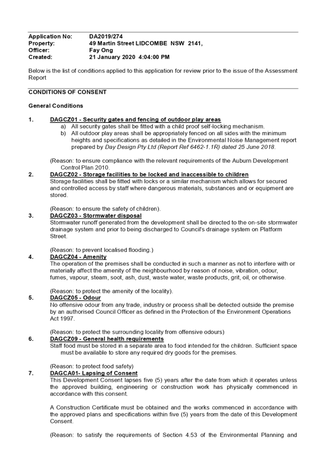
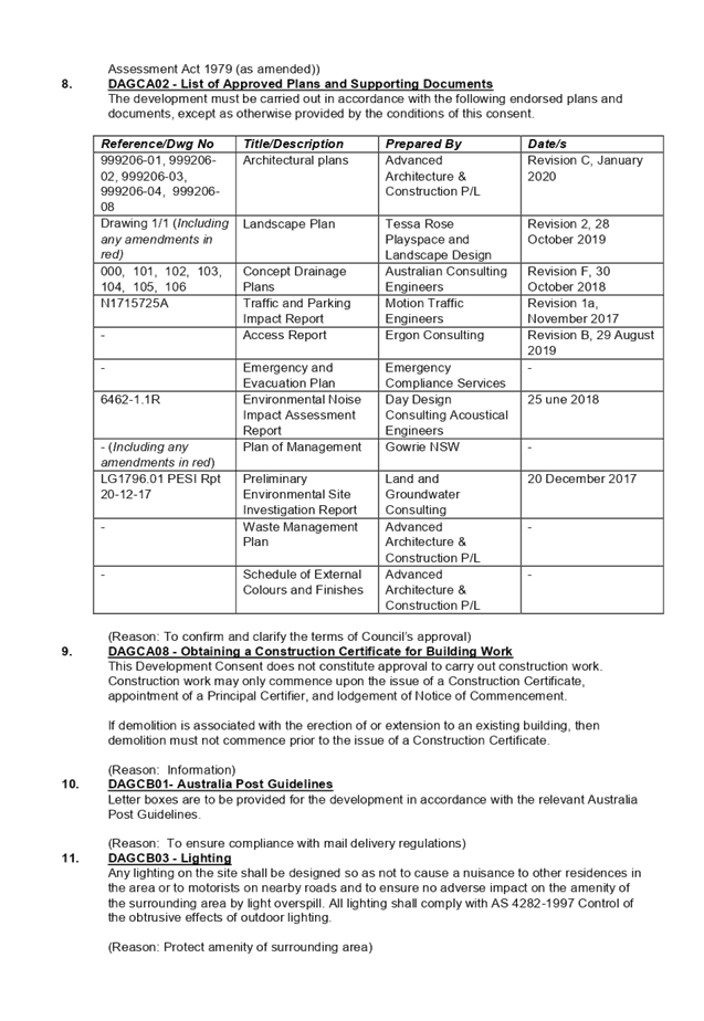
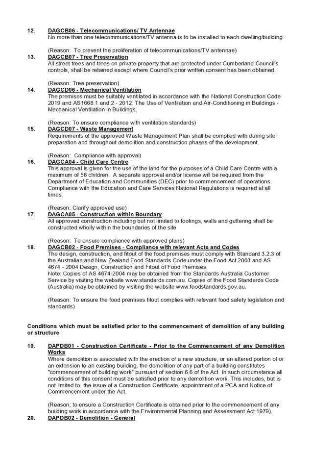
DOCUMENTS
ASSOCIATED WITH
REPORT LPP005/20
Attachment 2
Architectural Plans
Cumberland Local Planning Panel Meeting
12 February 2020
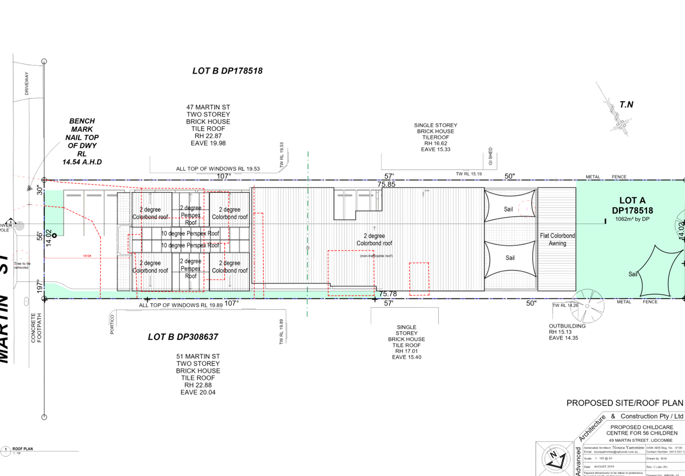
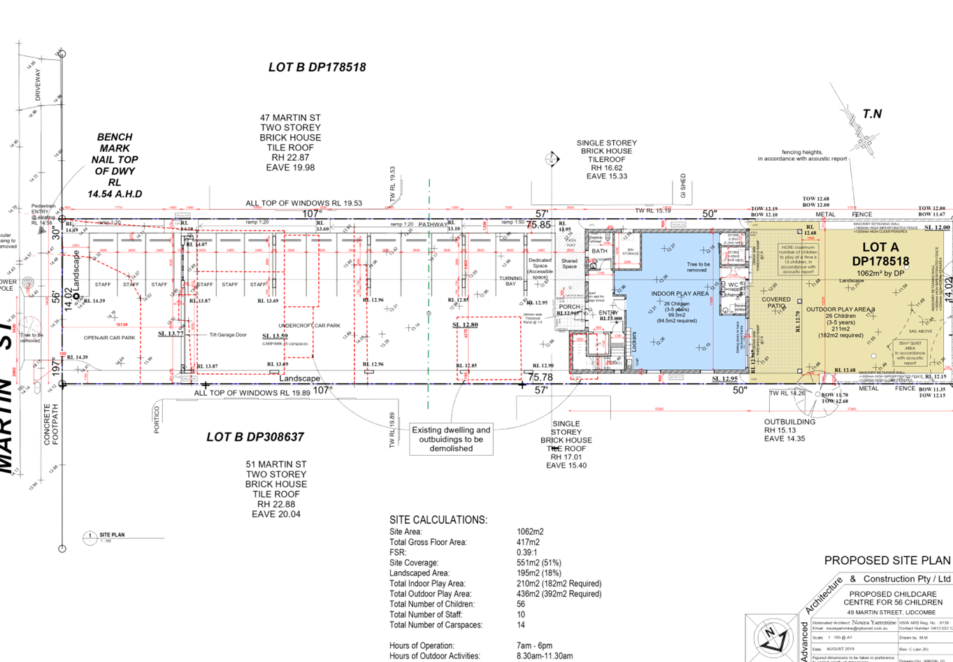
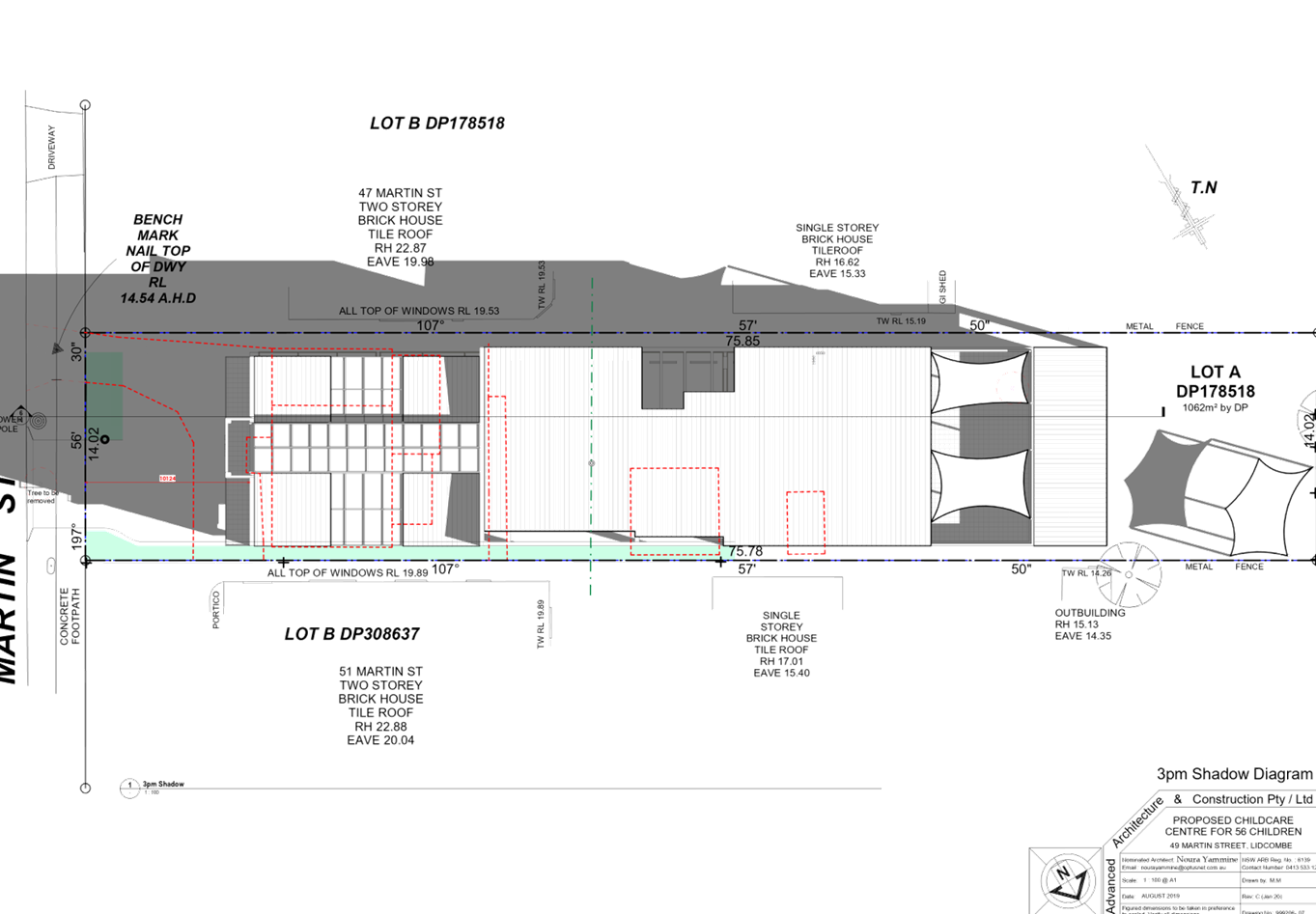
DOCUMENTS
ASSOCIATED WITH
REPORT LPP005/20
Attachment 3
Stormwater/Engineering Plans
Cumberland Local Planning Panel Meeting
12 February 2020
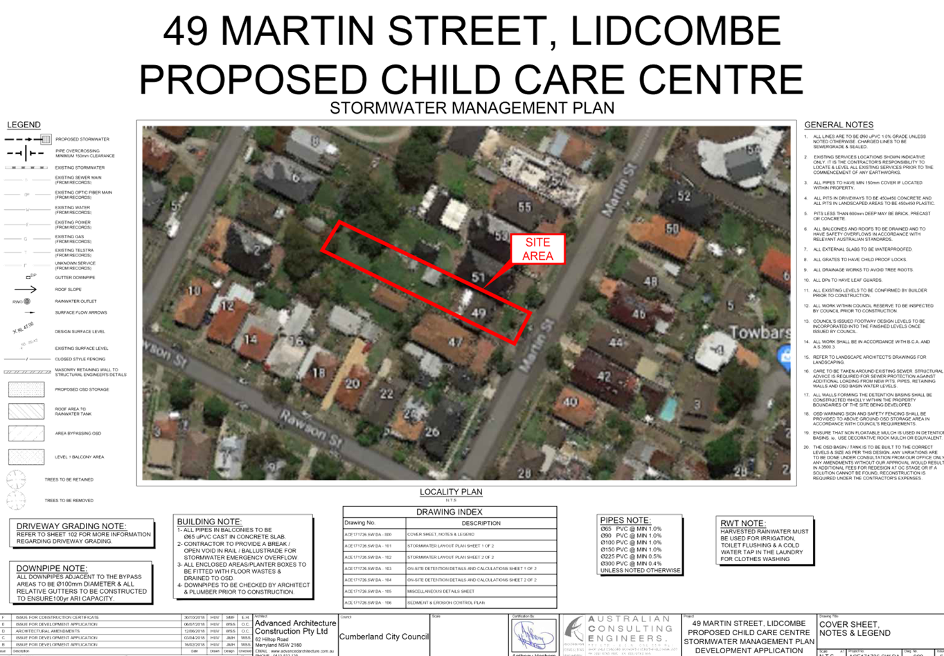
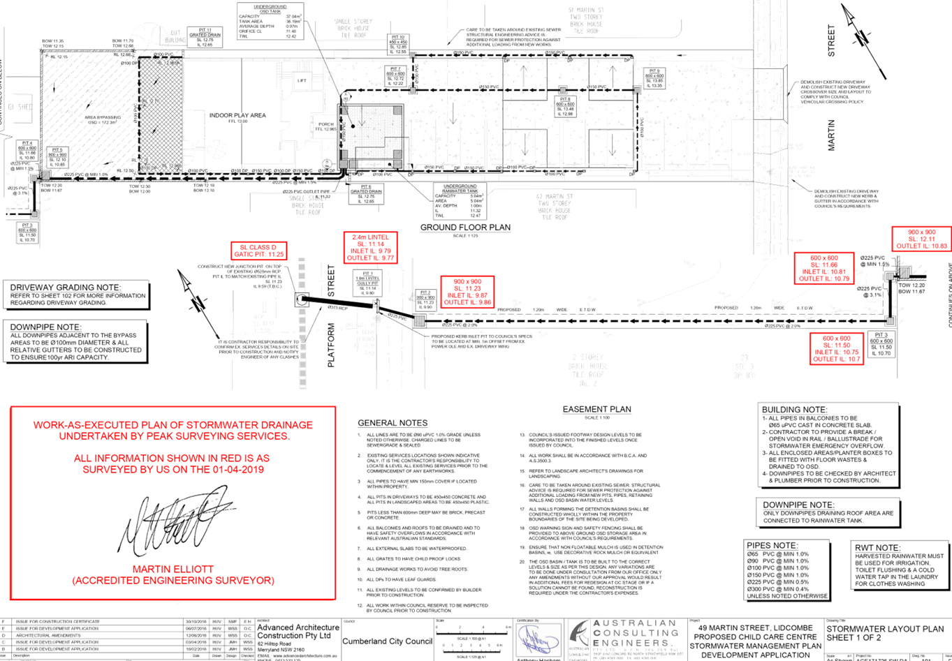
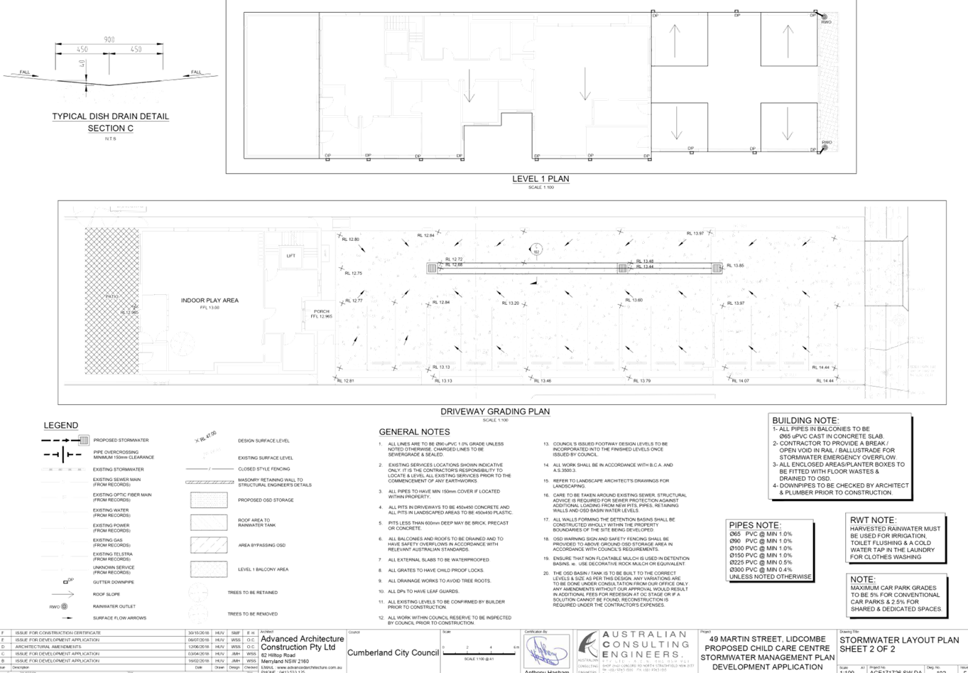
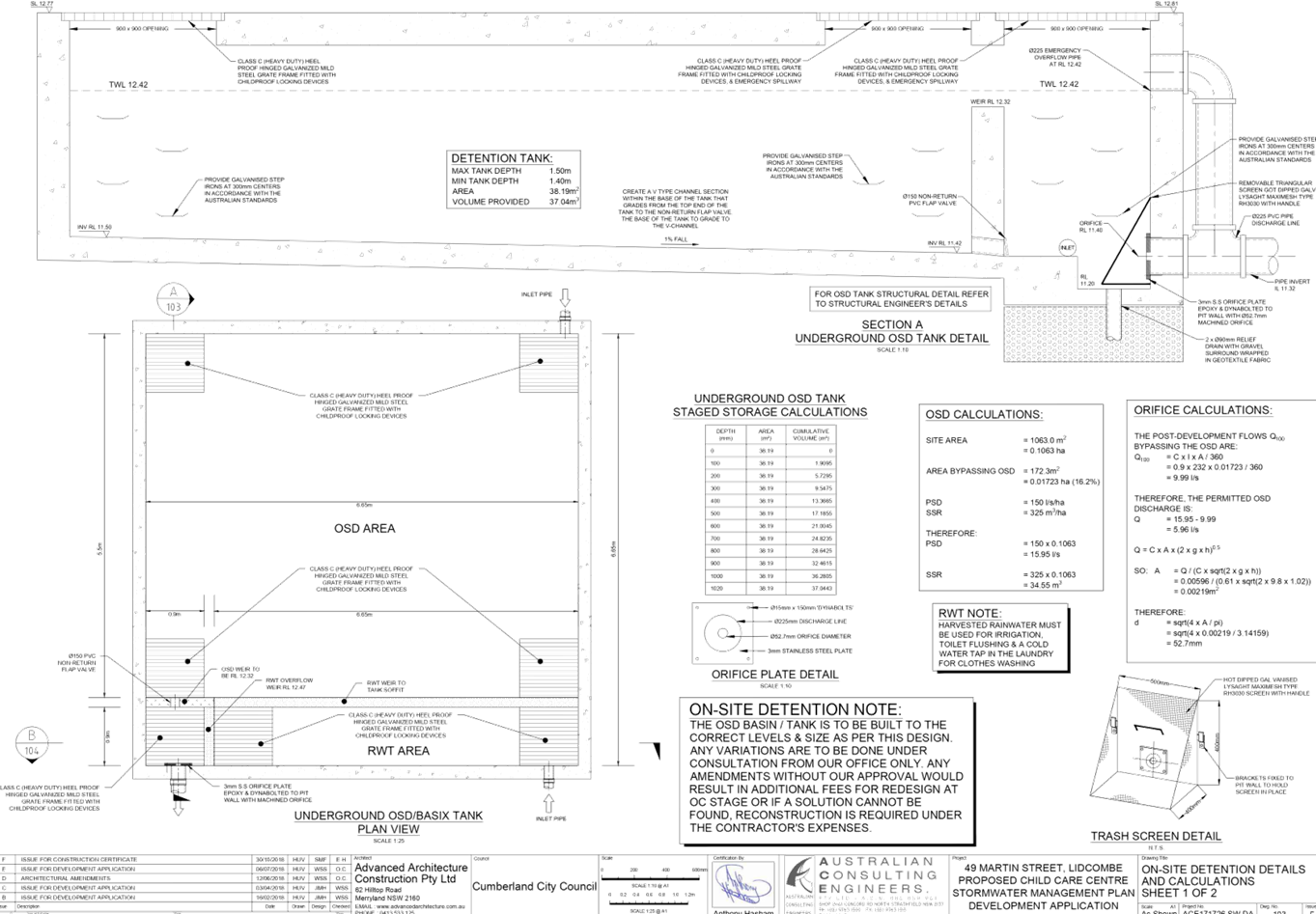
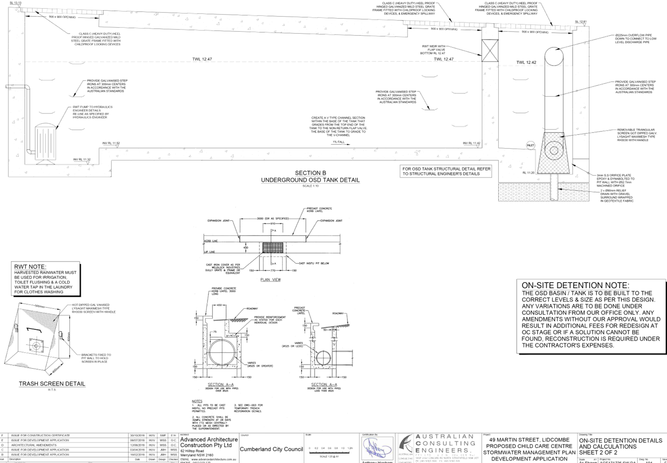
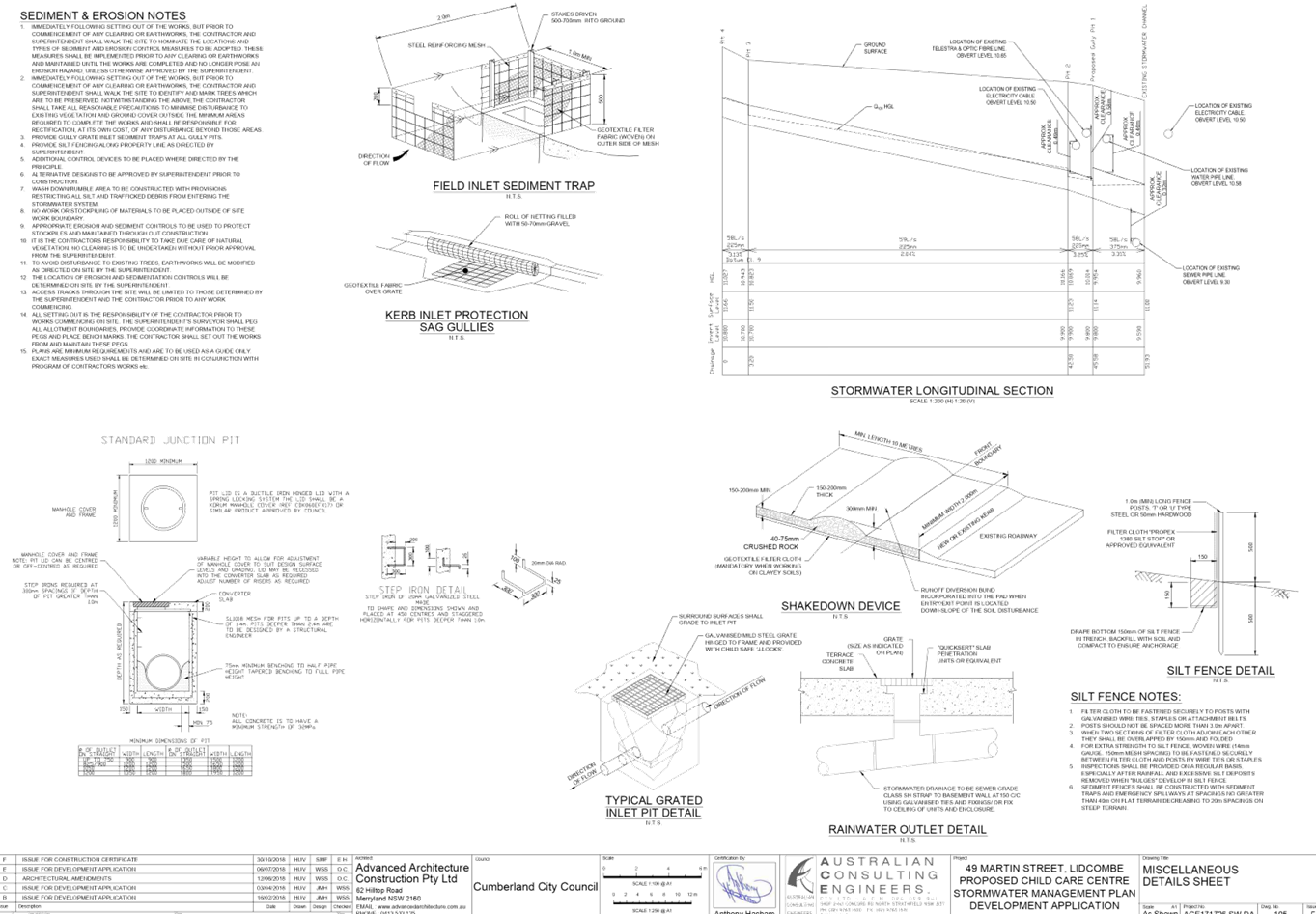
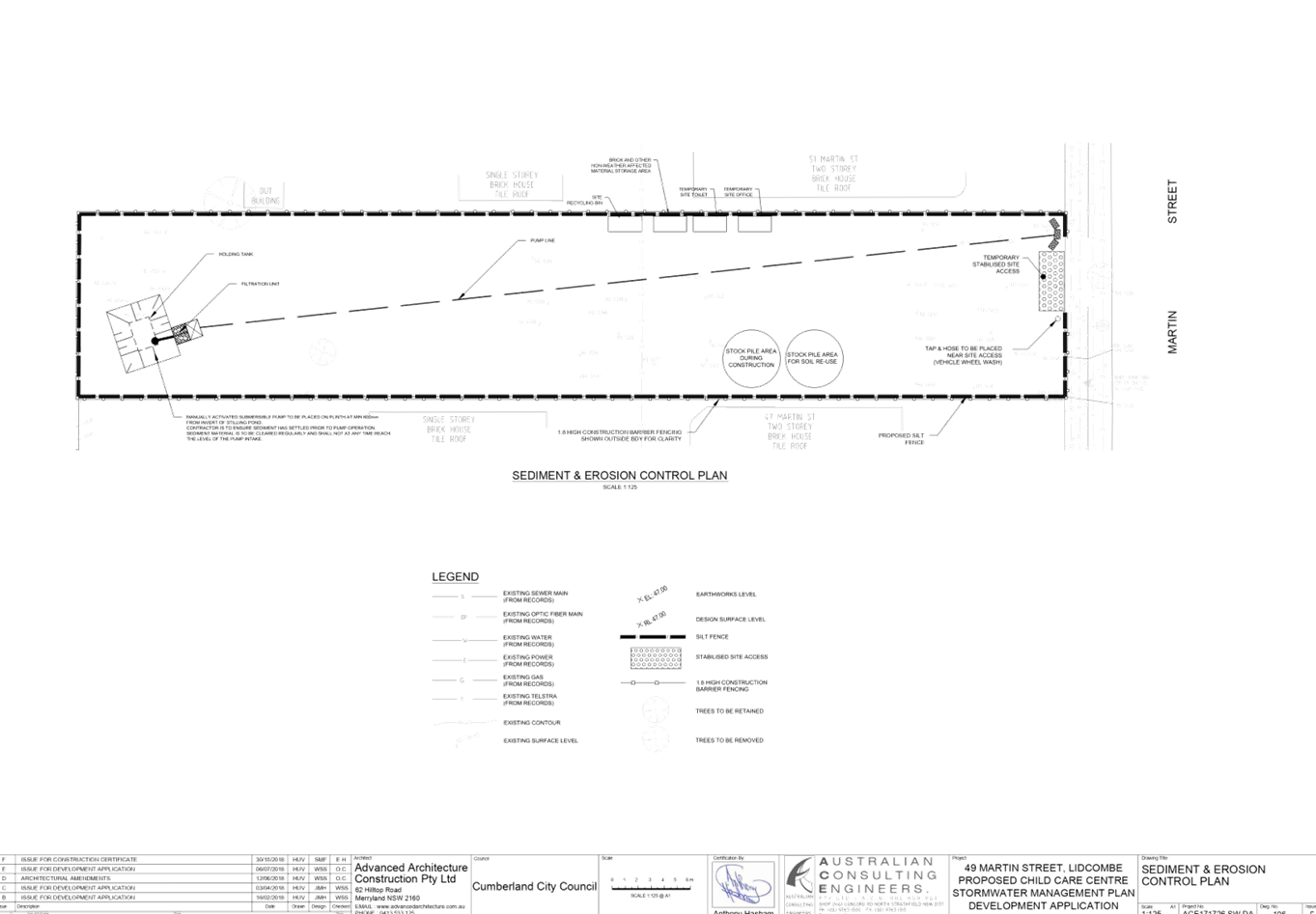
DOCUMENTS
ASSOCIATED WITH
REPORT LPP005/20
Attachment 4
Submissions Recieved
Cumberland Local Planning Panel Meeting
12 February 2020
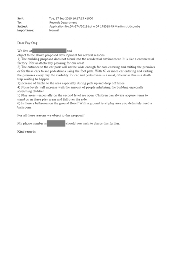
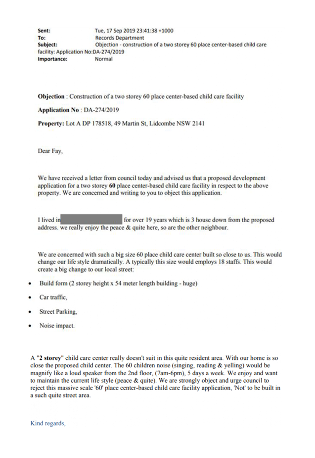

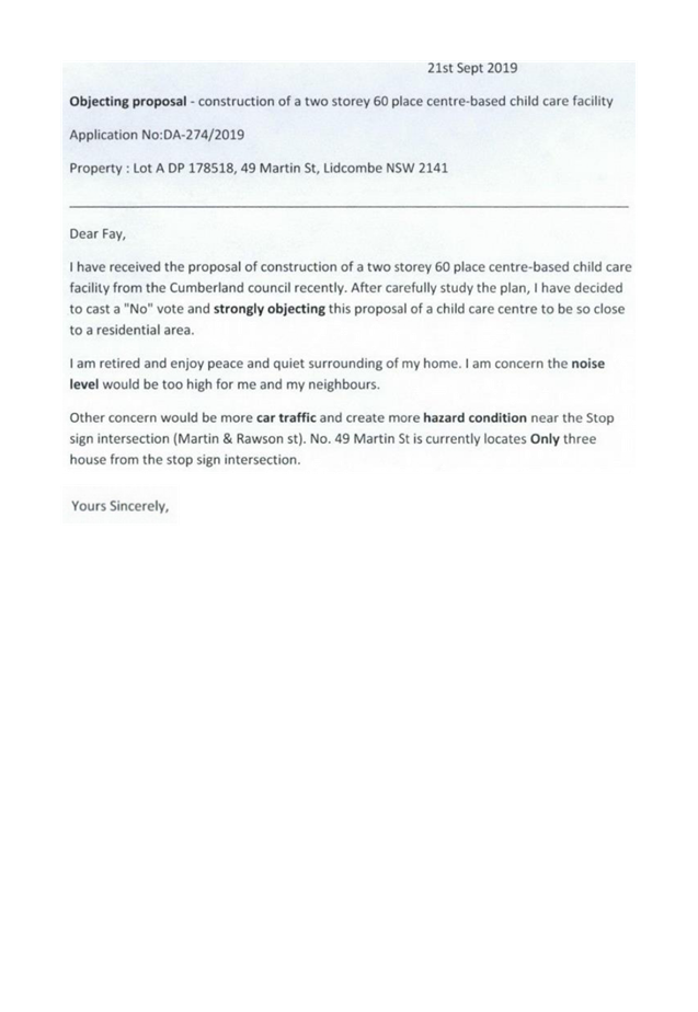
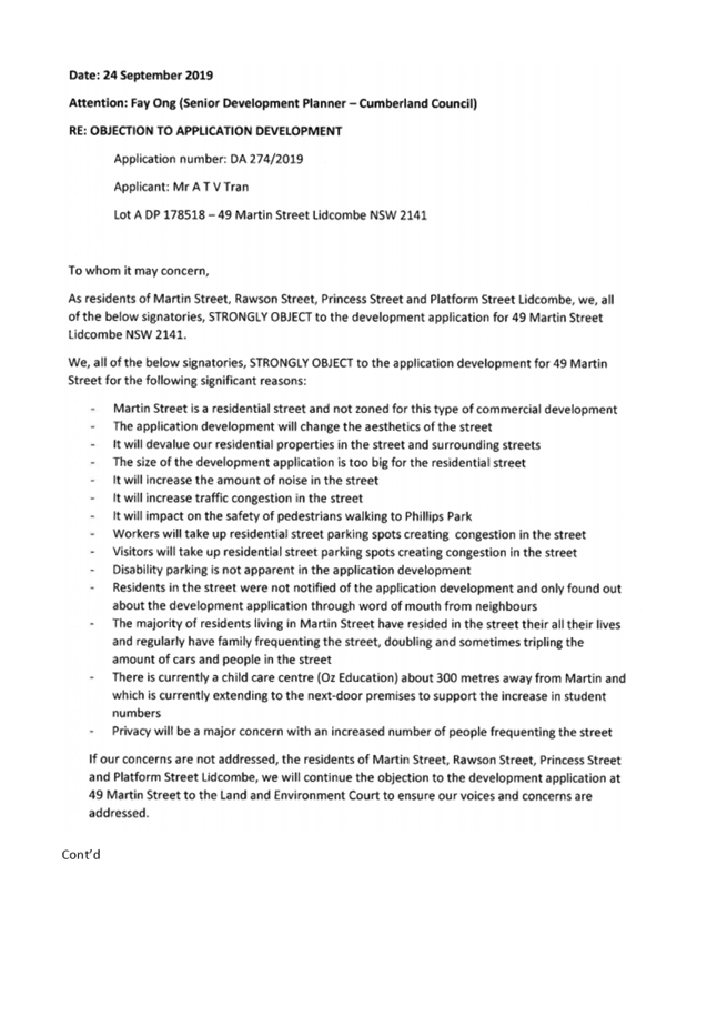
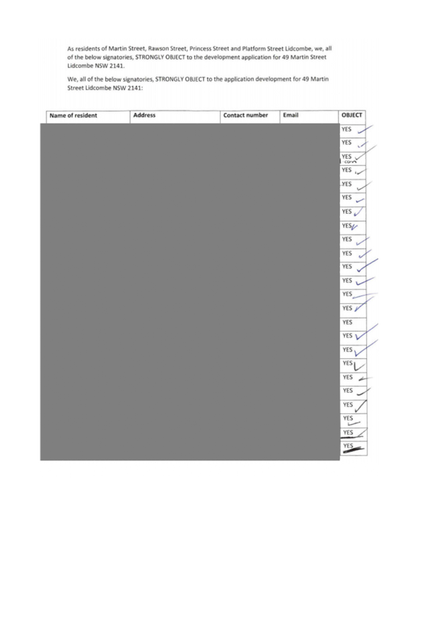
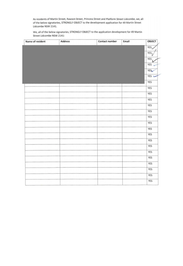

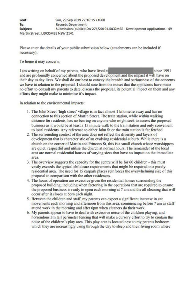

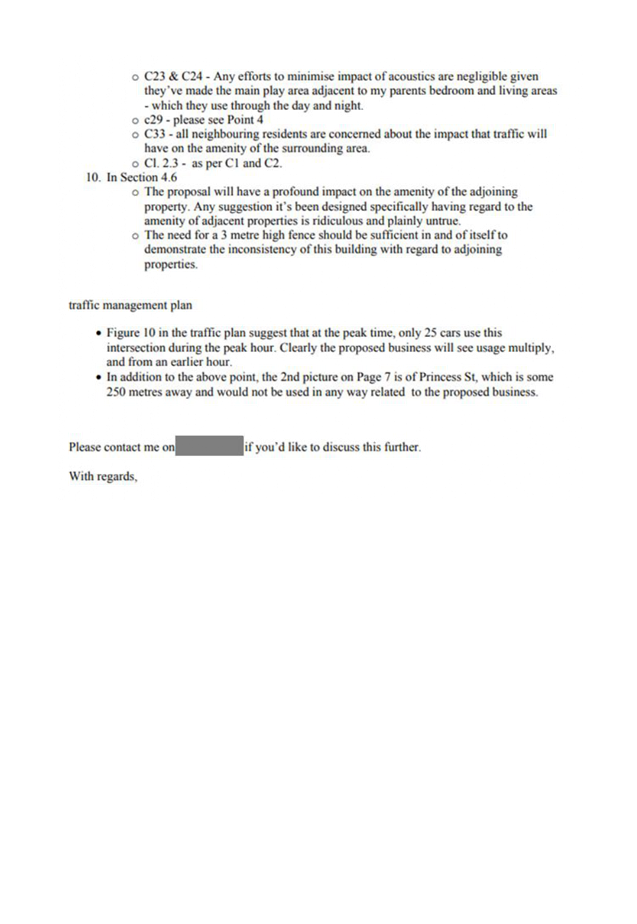
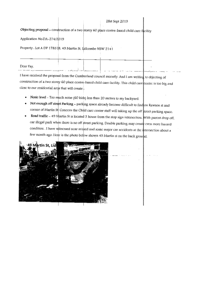


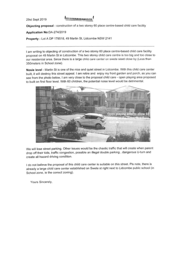

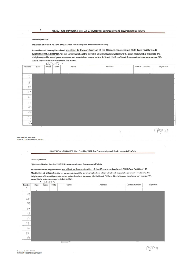
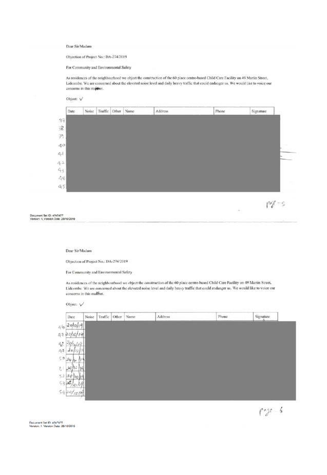
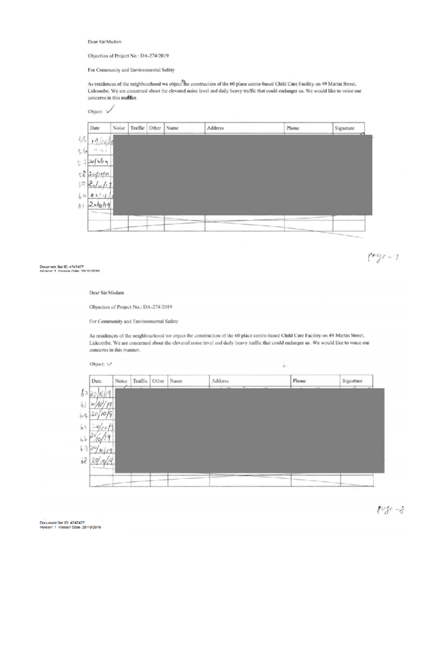
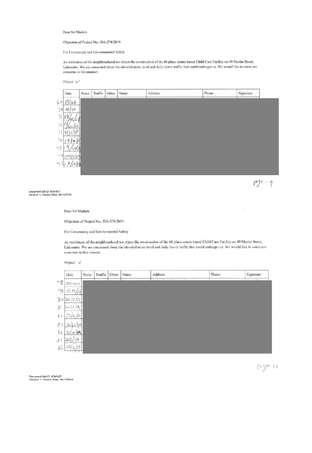
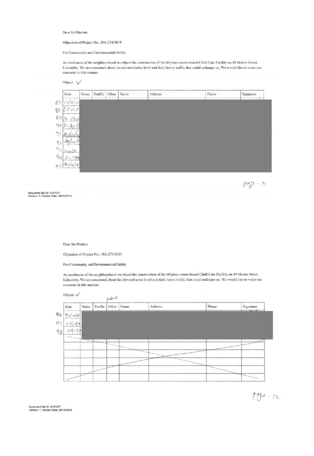
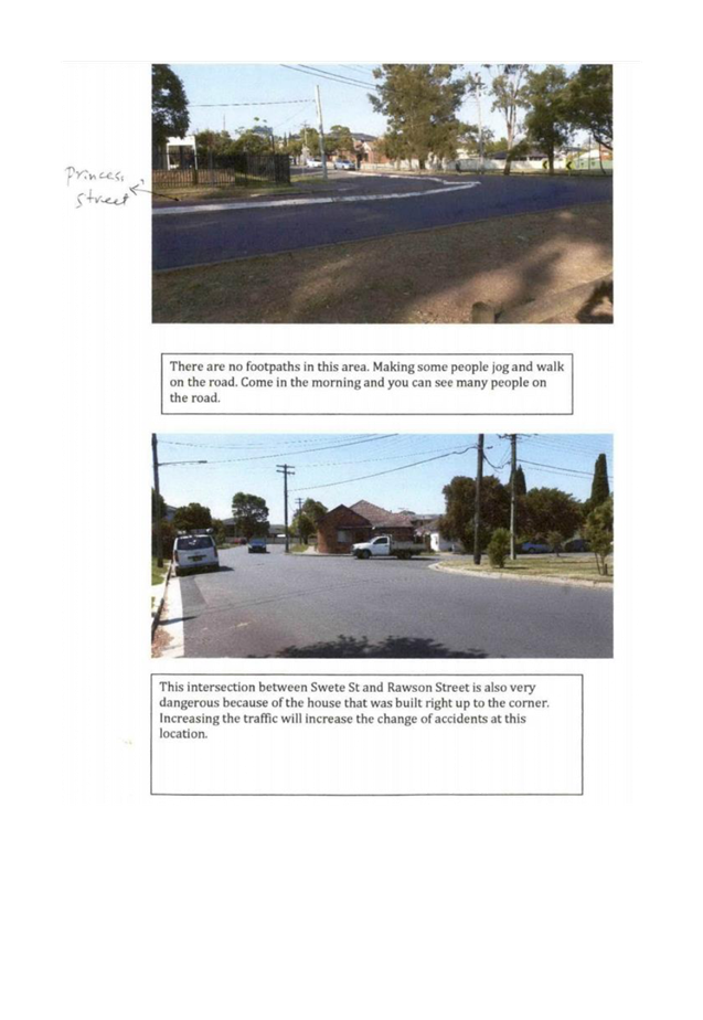
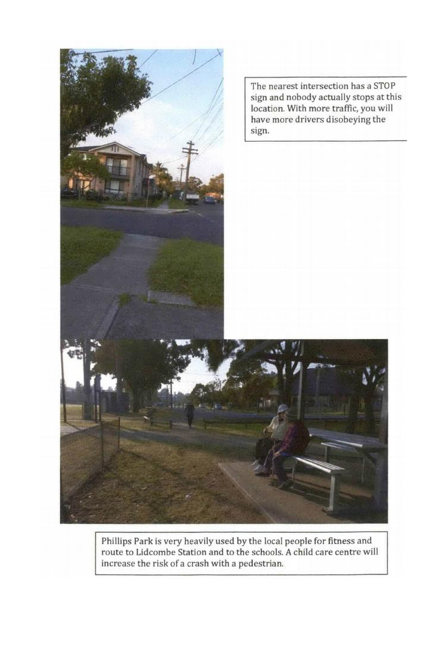
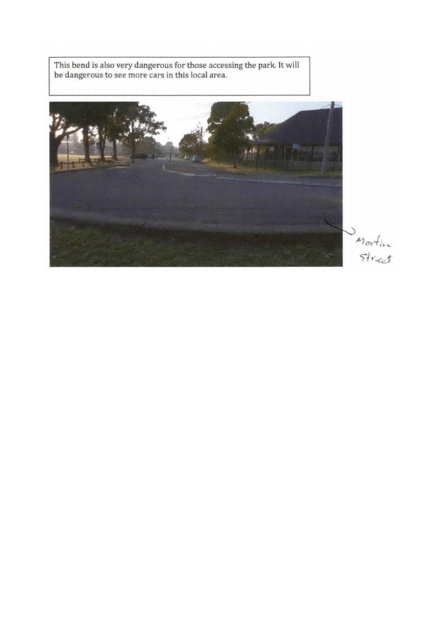
DOCUMENTS
ASSOCIATED WITH
REPORT LPP005/20
Attachment 5
Plan of Management
Cumberland Local Planning Panel Meeting
12 February 2020
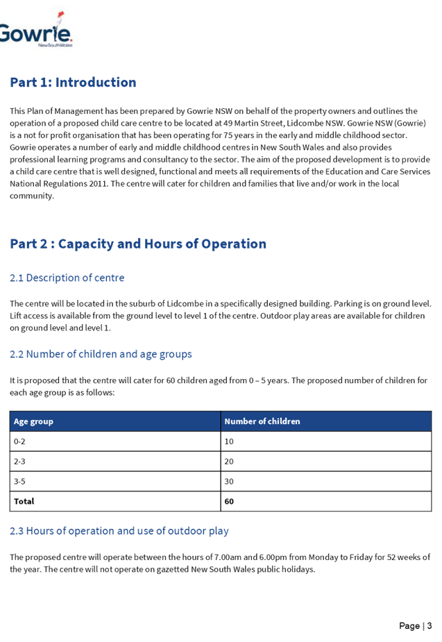
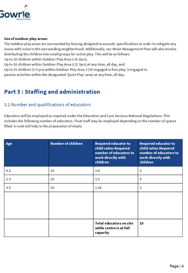
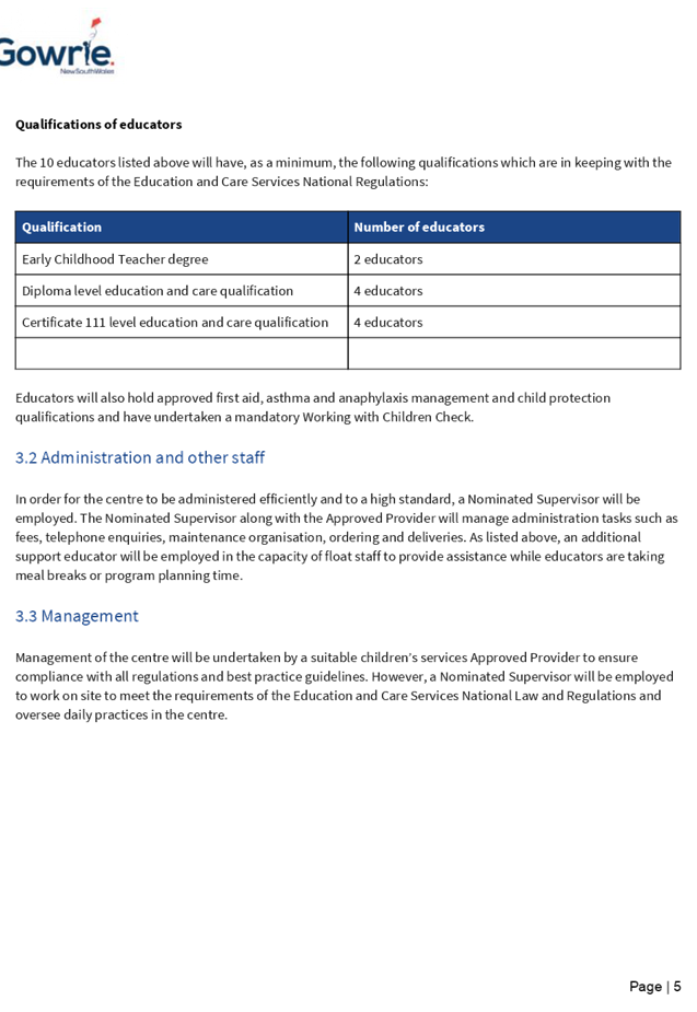
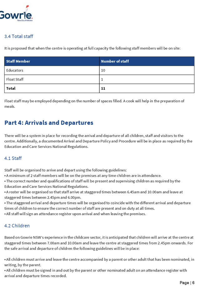
DOCUMENTS
ASSOCIATED WITH
REPORT LPP005/20
Attachment 6
Noise Impact Assesment Report
Cumberland Local Planning Panel Meeting
12 February 2020
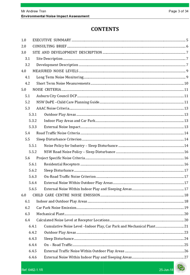
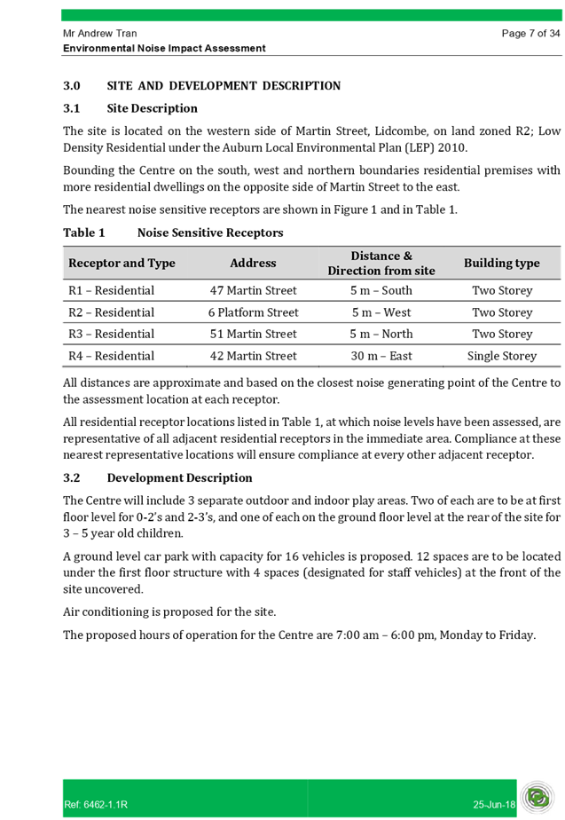
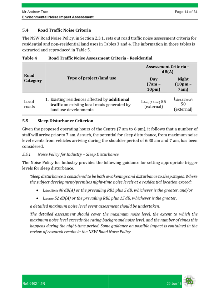
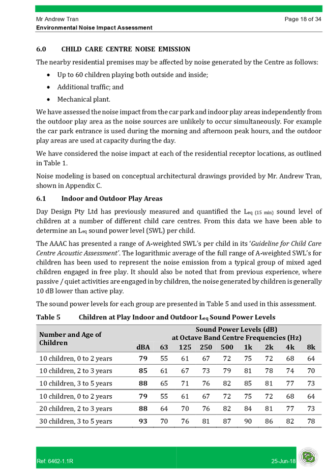
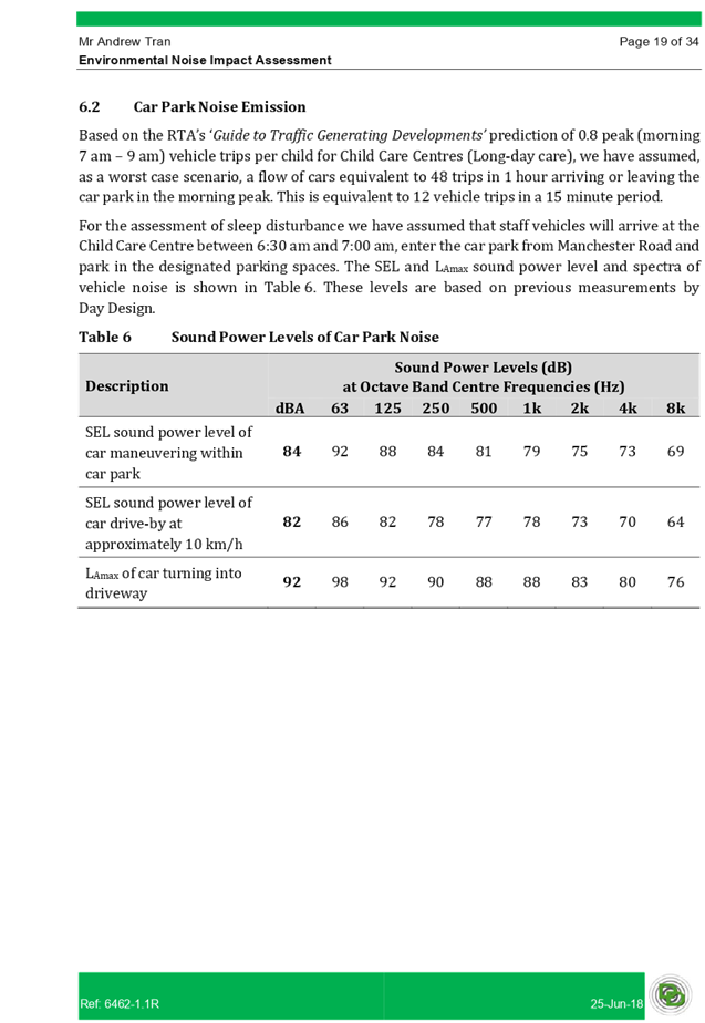
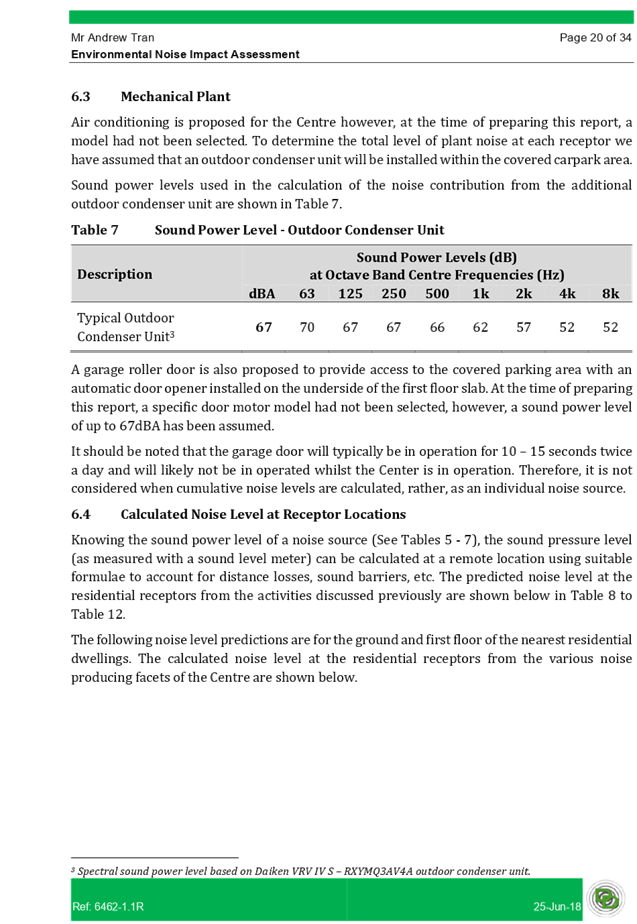
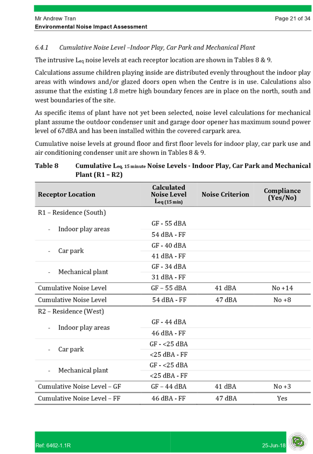
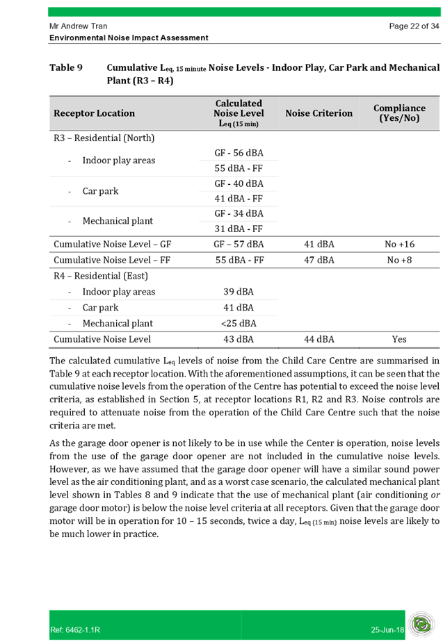
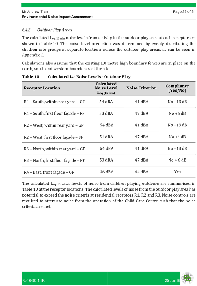
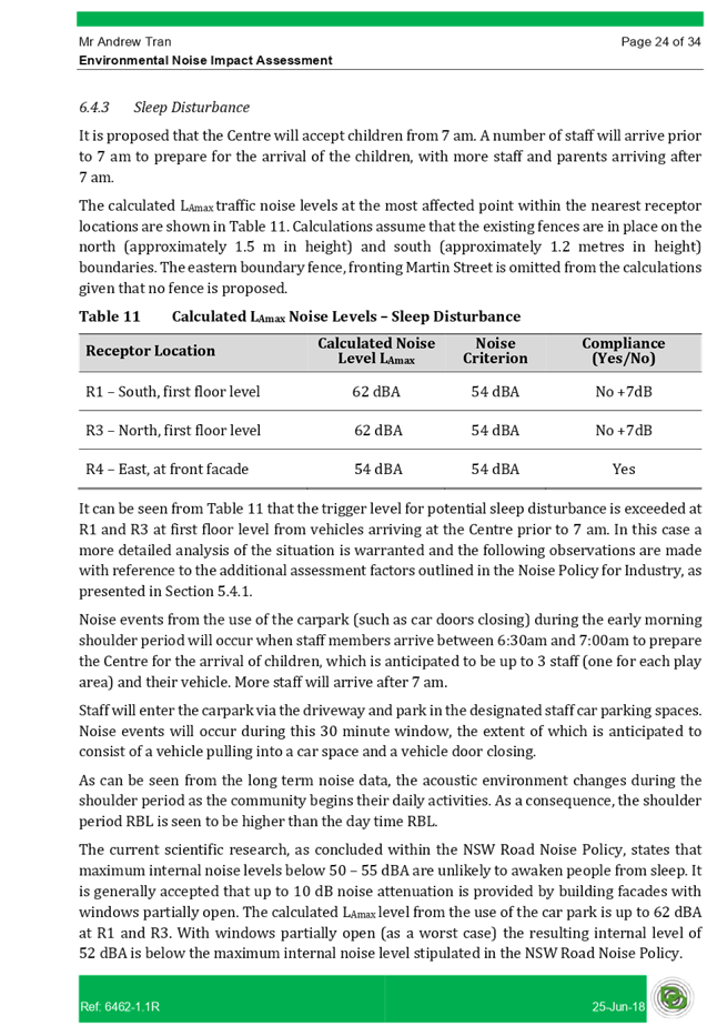
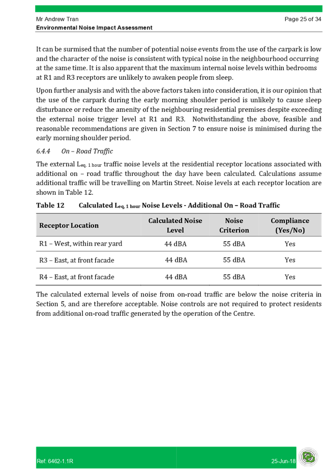
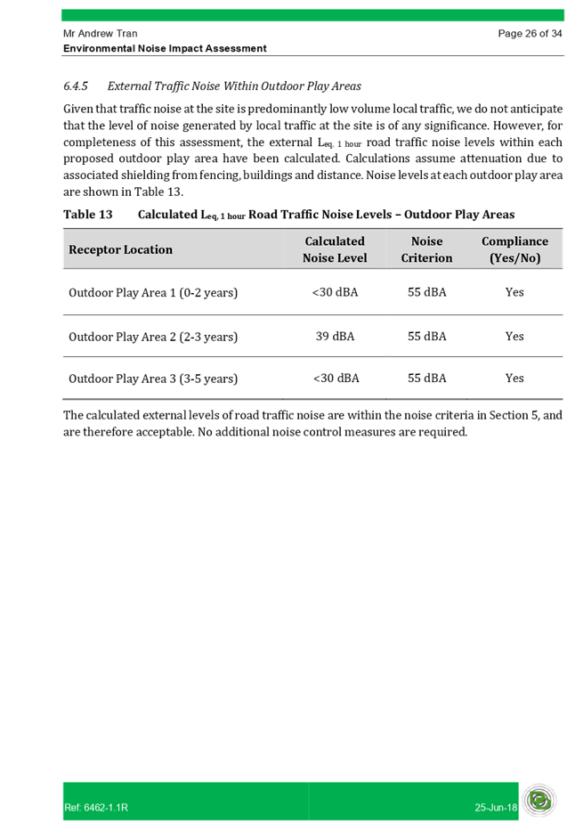
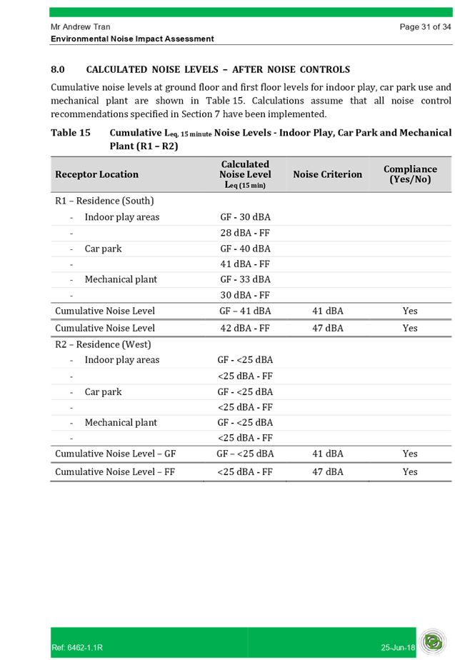
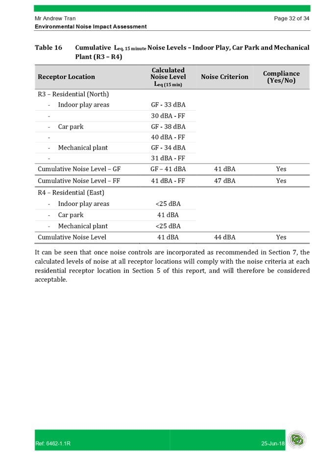
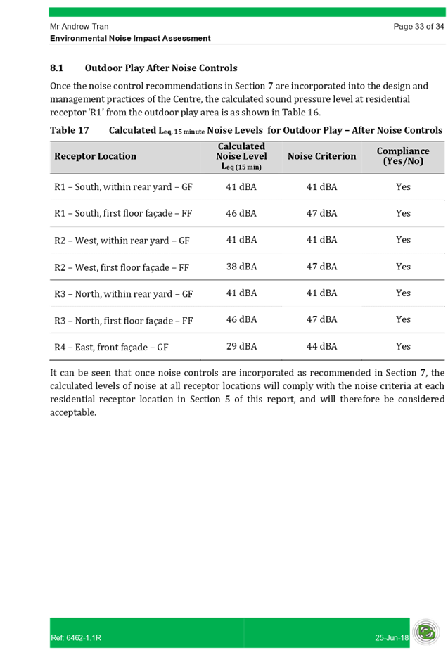
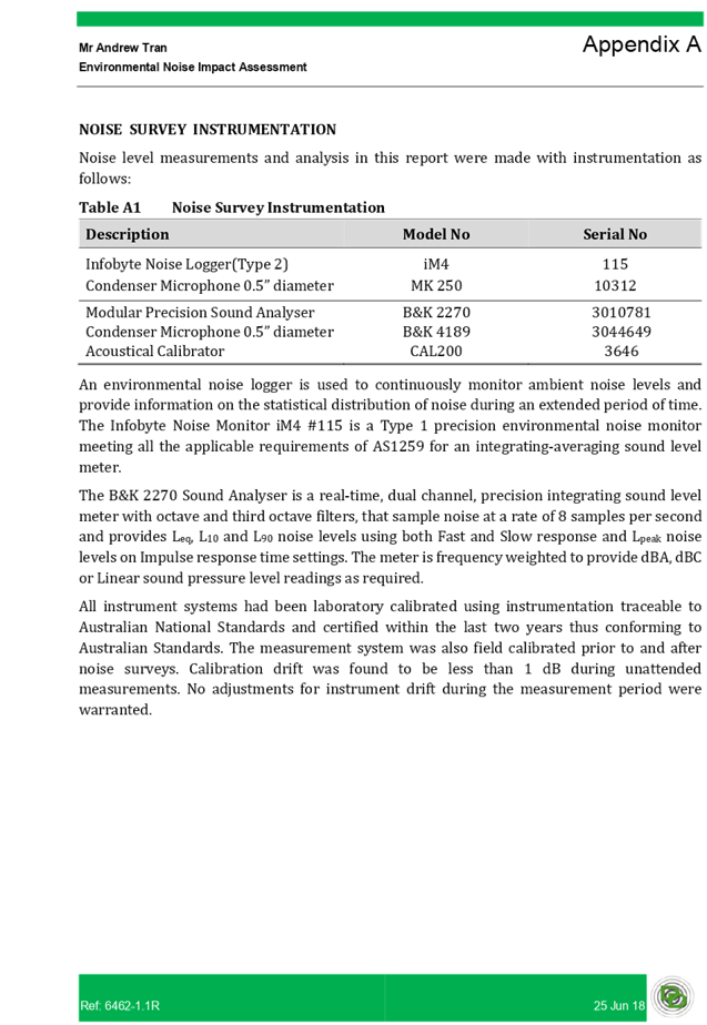
Cumberland Local Planning Panel Meeting
12 February 2020
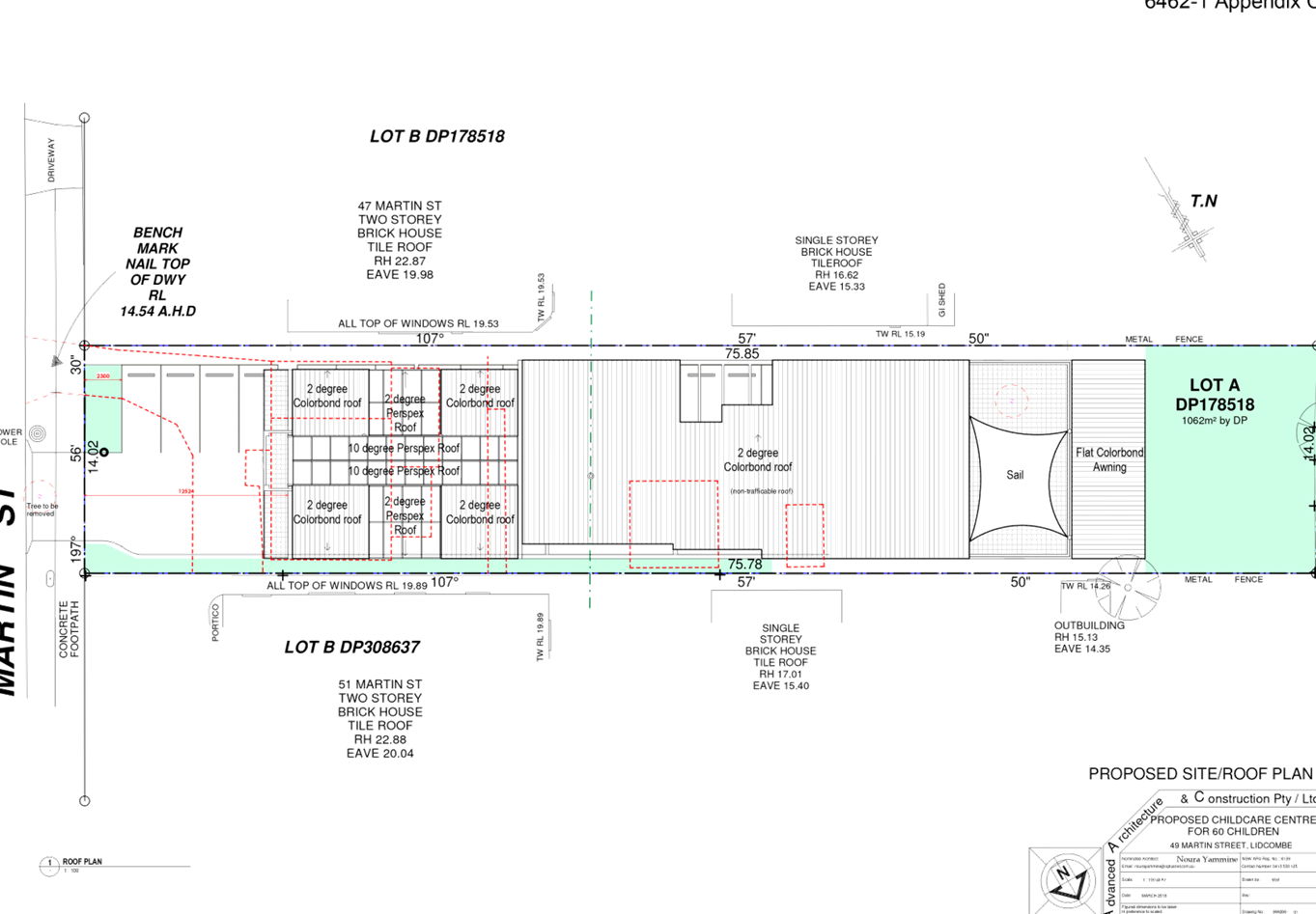
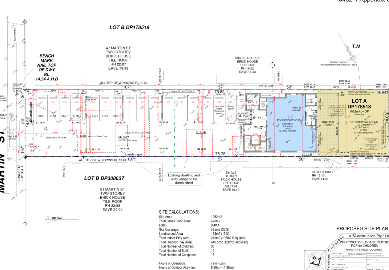
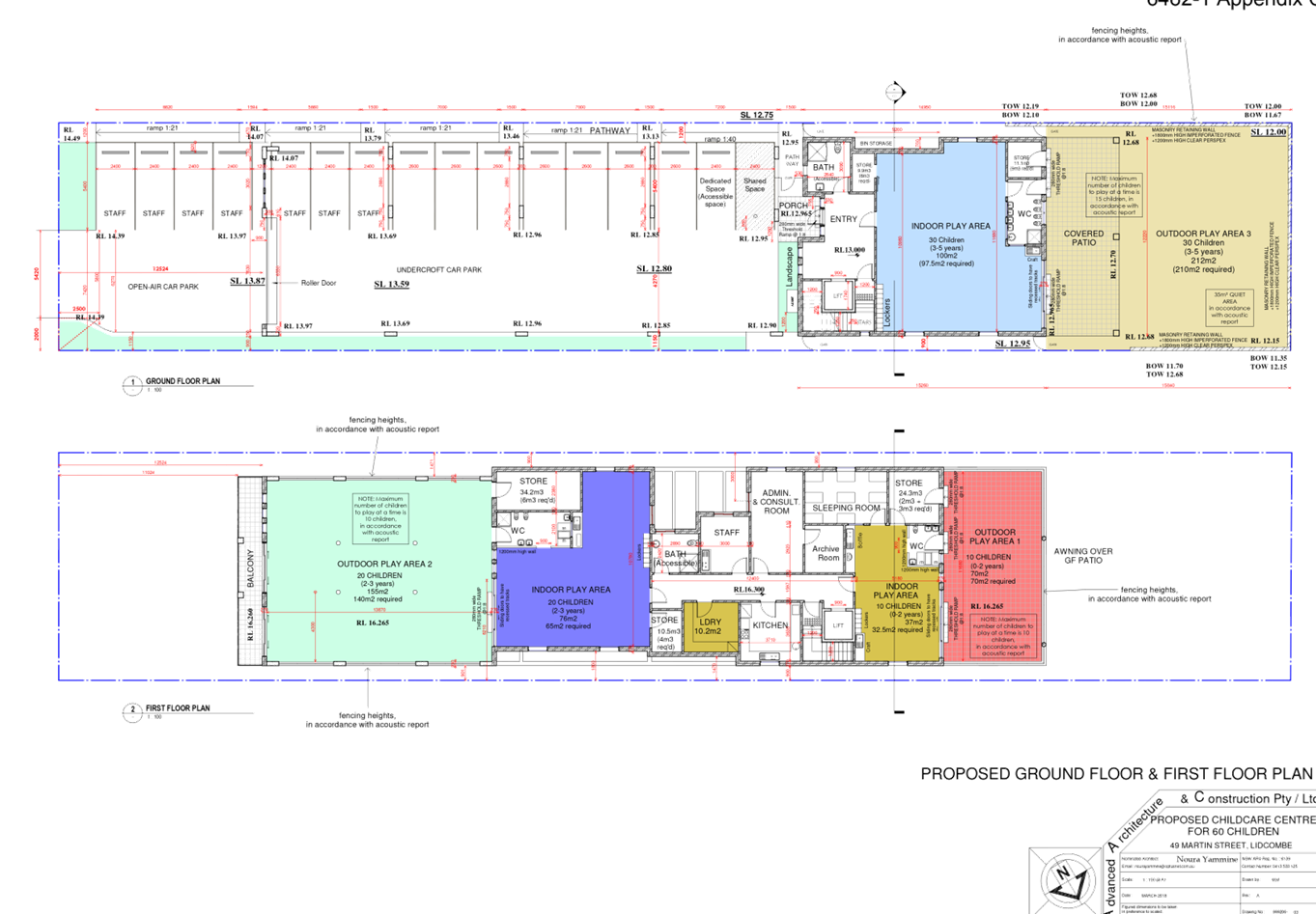
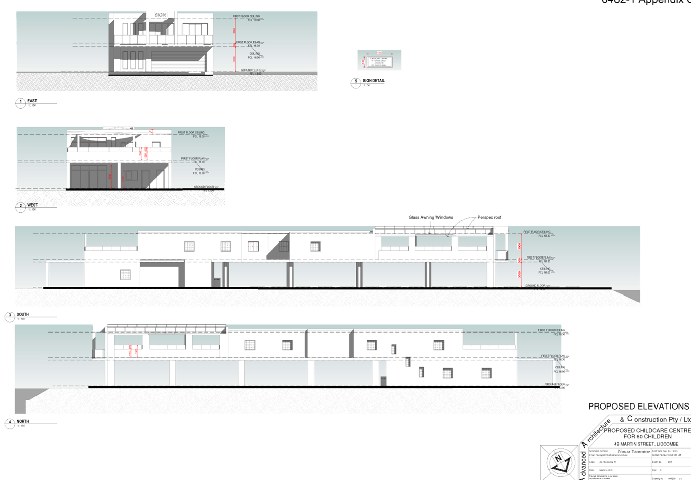
Cumberland Local Planning Panel Meeting
12 February 2020
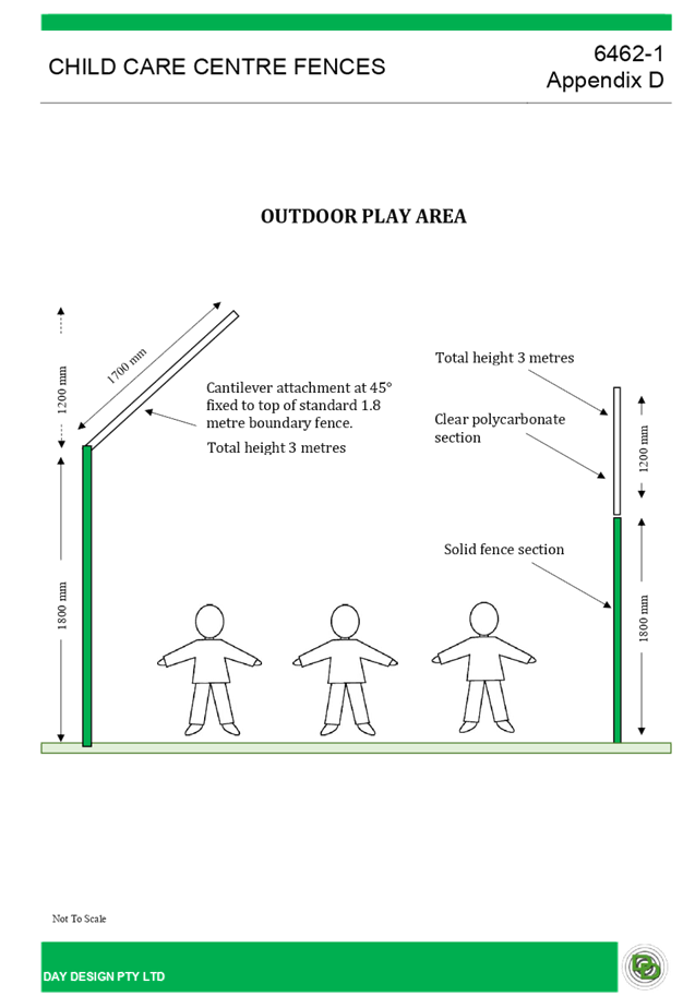
DOCUMENTS
ASSOCIATED WITH
REPORT LPP005/20
Attachment 7
Appendix A - Childcare Planning Guidelines Assessment
and Educational and Care Services National Regulations
Cumberland Local Planning Panel Meeting
12 February 2020
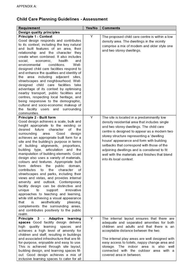
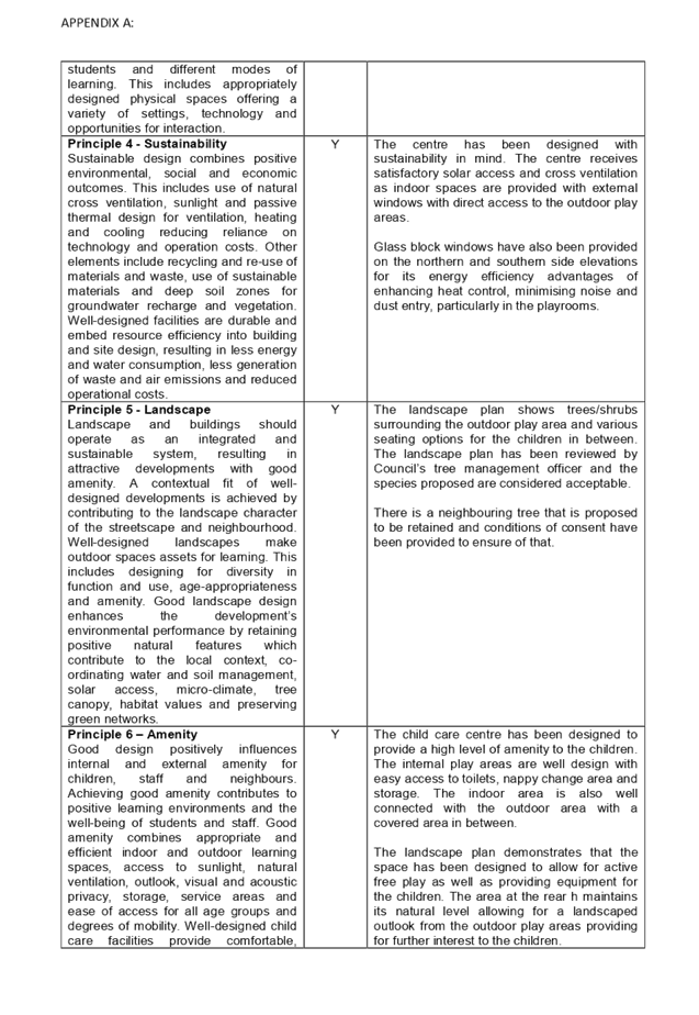
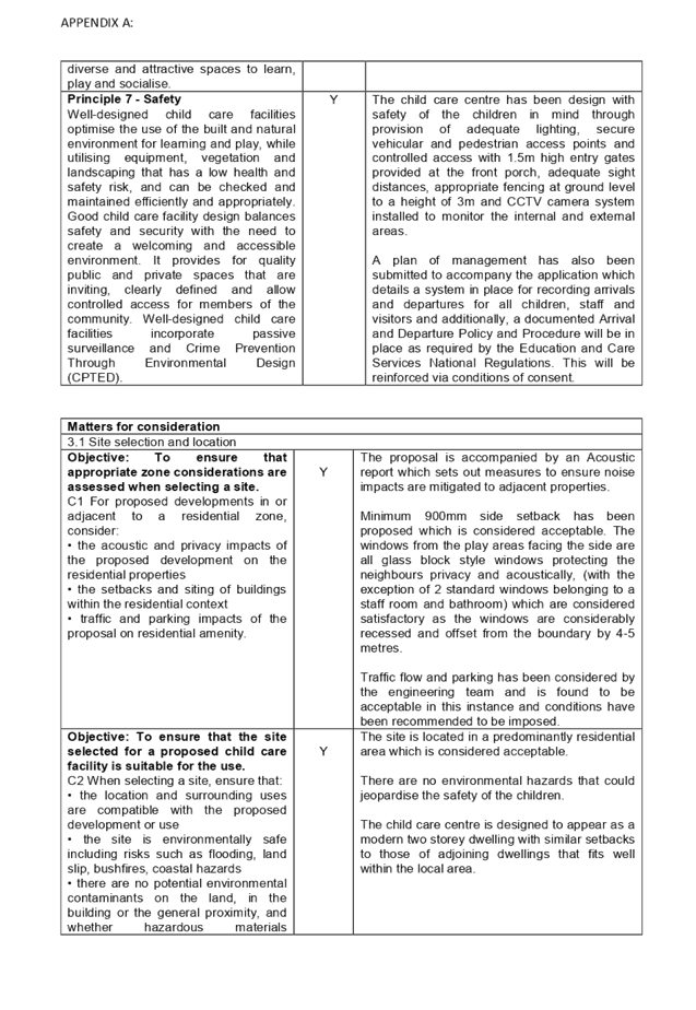
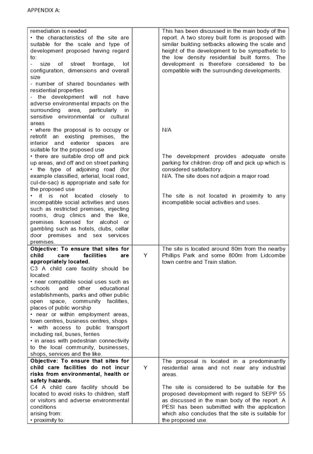
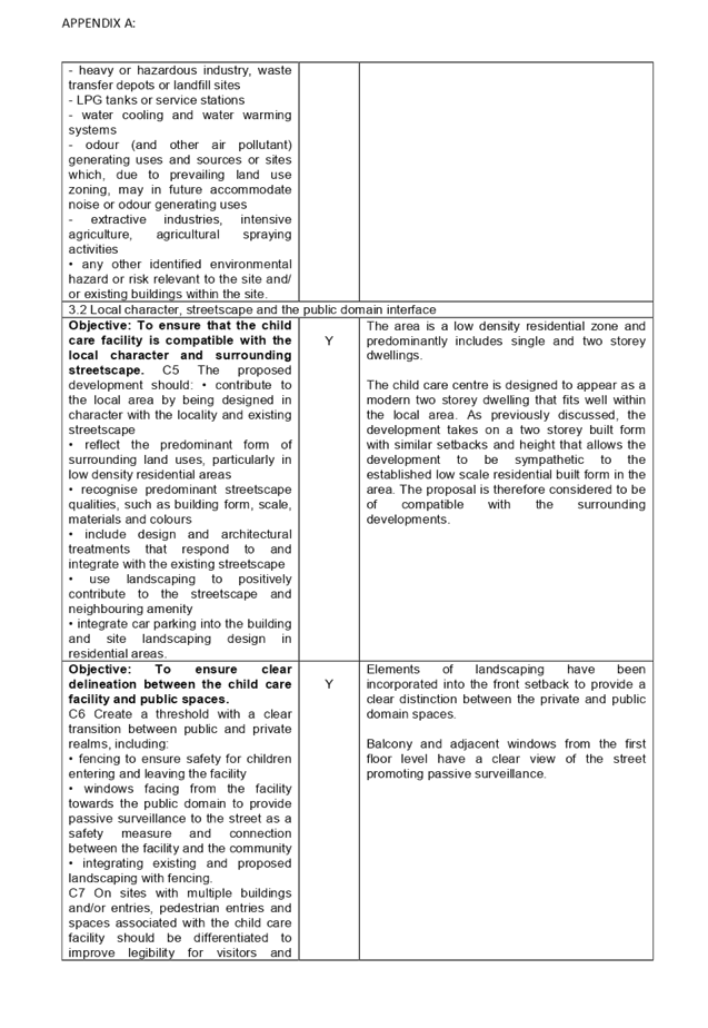
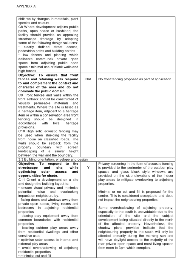
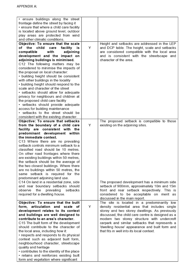
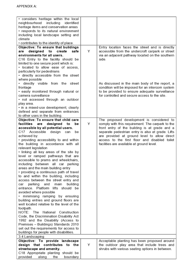
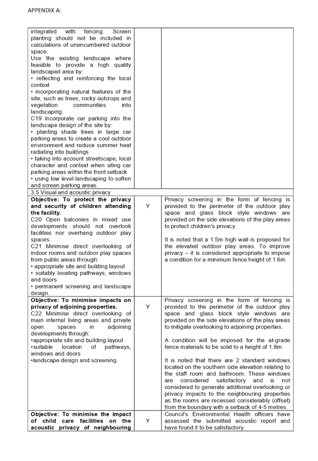
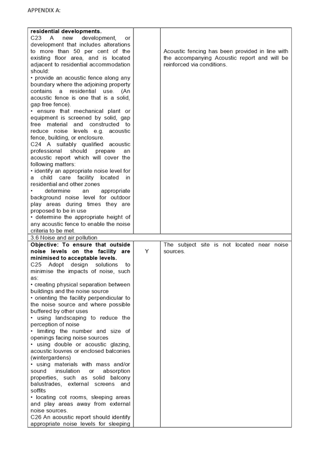
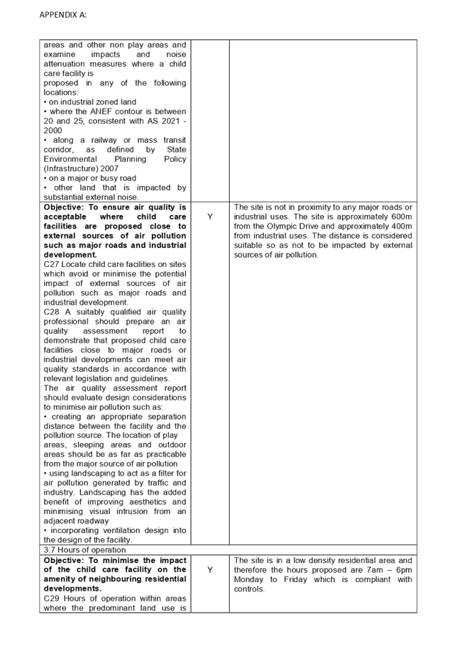
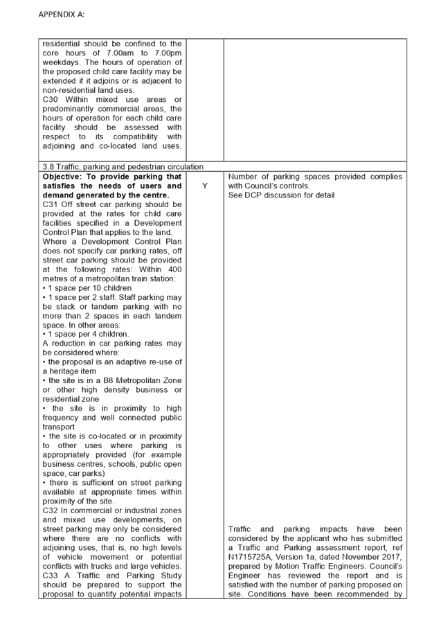
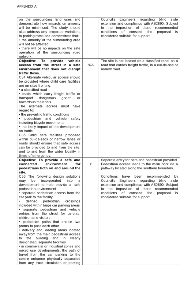
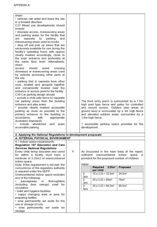
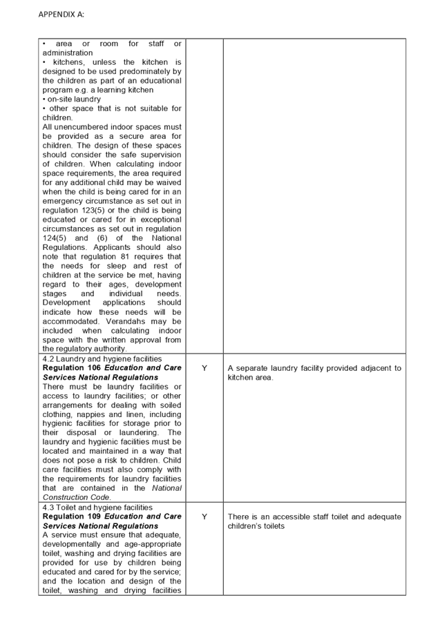
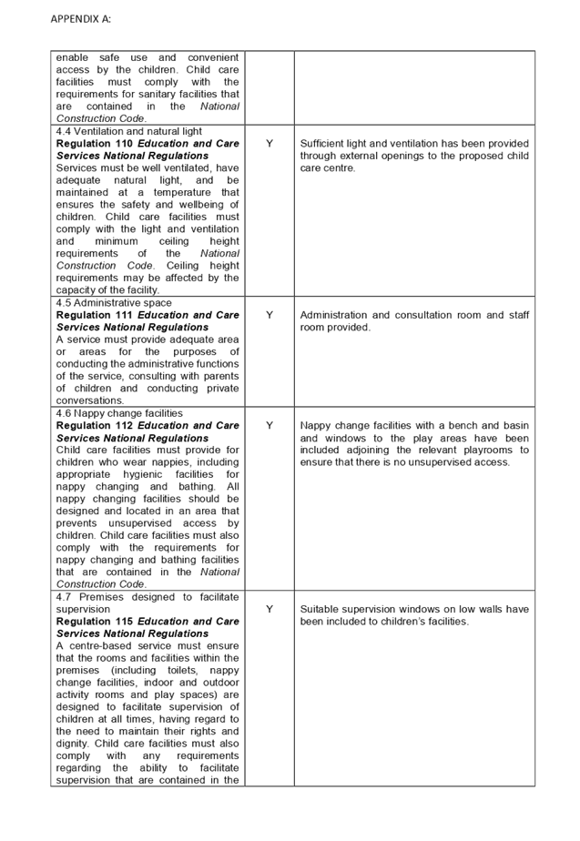
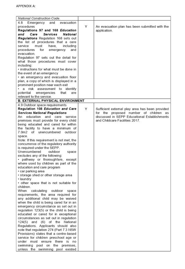
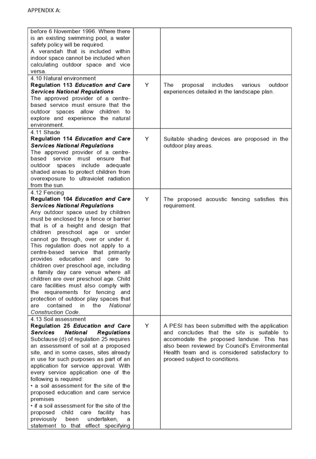
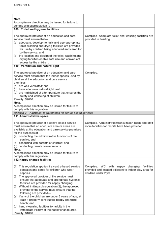
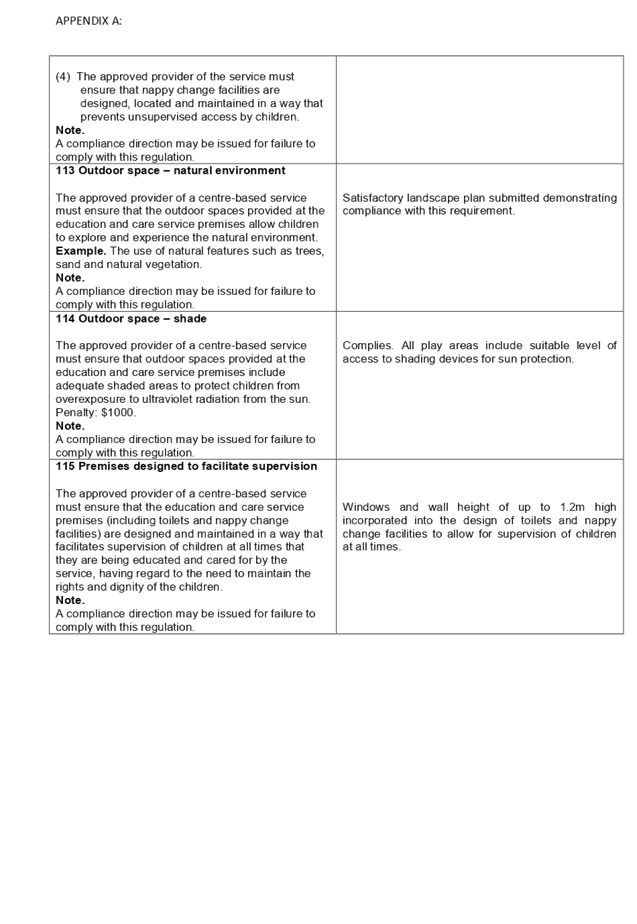
DOCUMENTS
ASSOCIATED WITH
REPORT LPP005/20
Attachment 8
Appendix B -ADCP 2010 Assesment and Schedule 1
Assesment Criteria (SEPP 64)
Cumberland Local Planning Panel Meeting
12 February 2020
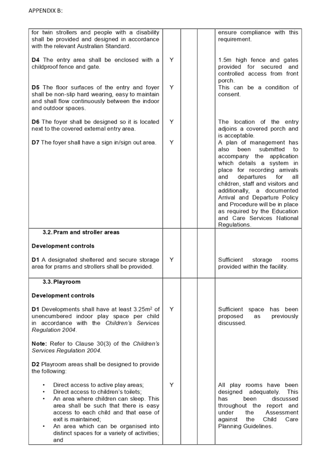
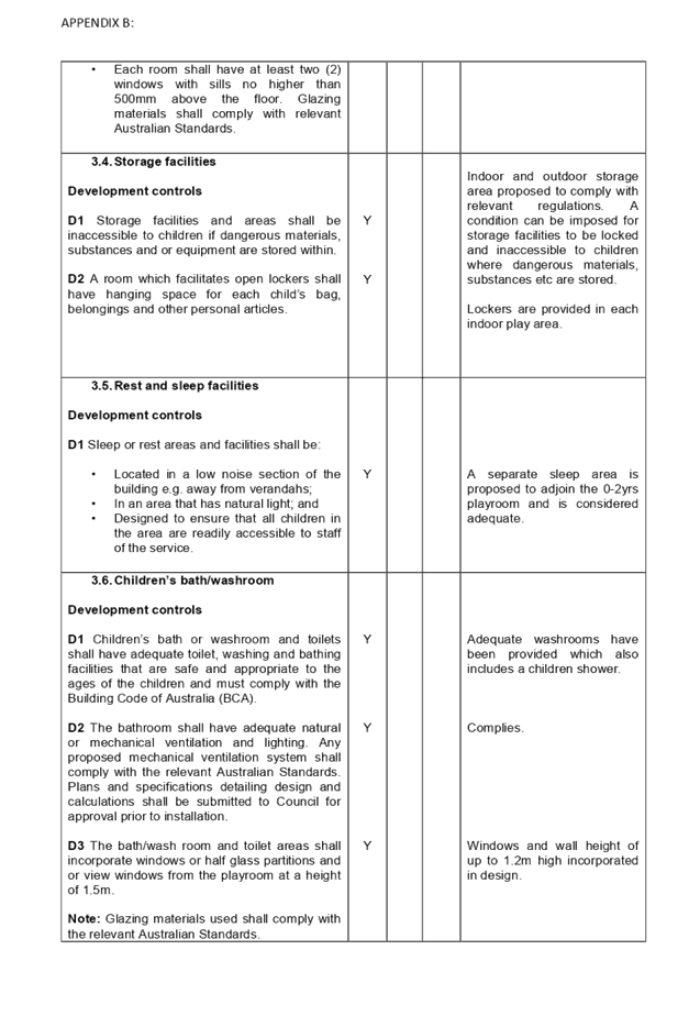
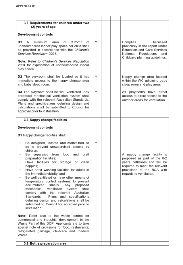
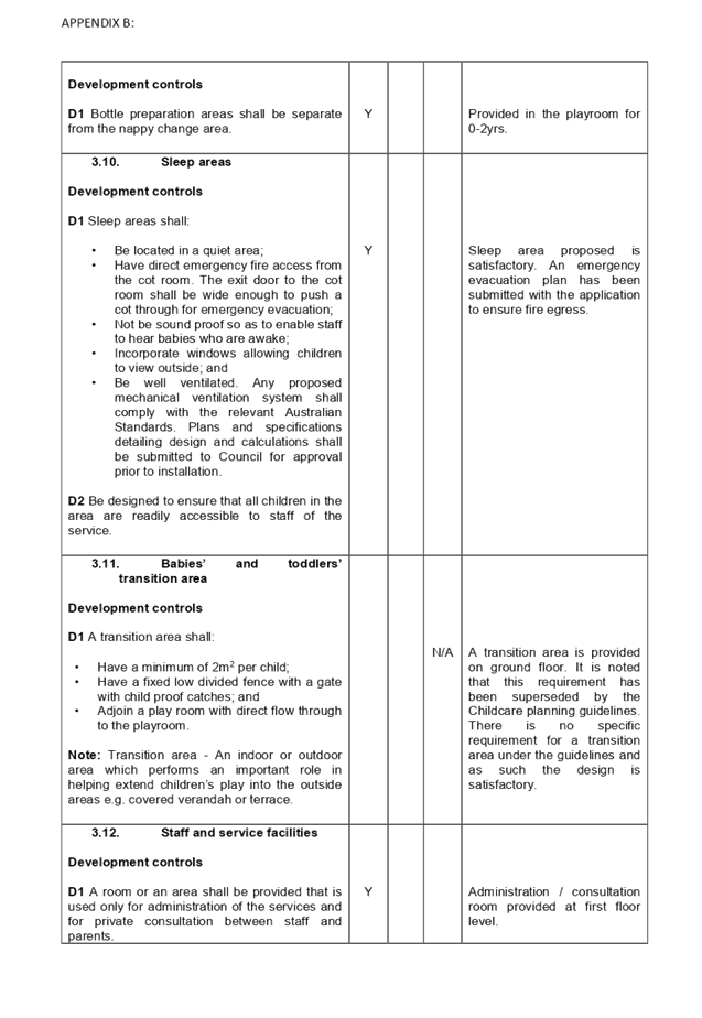
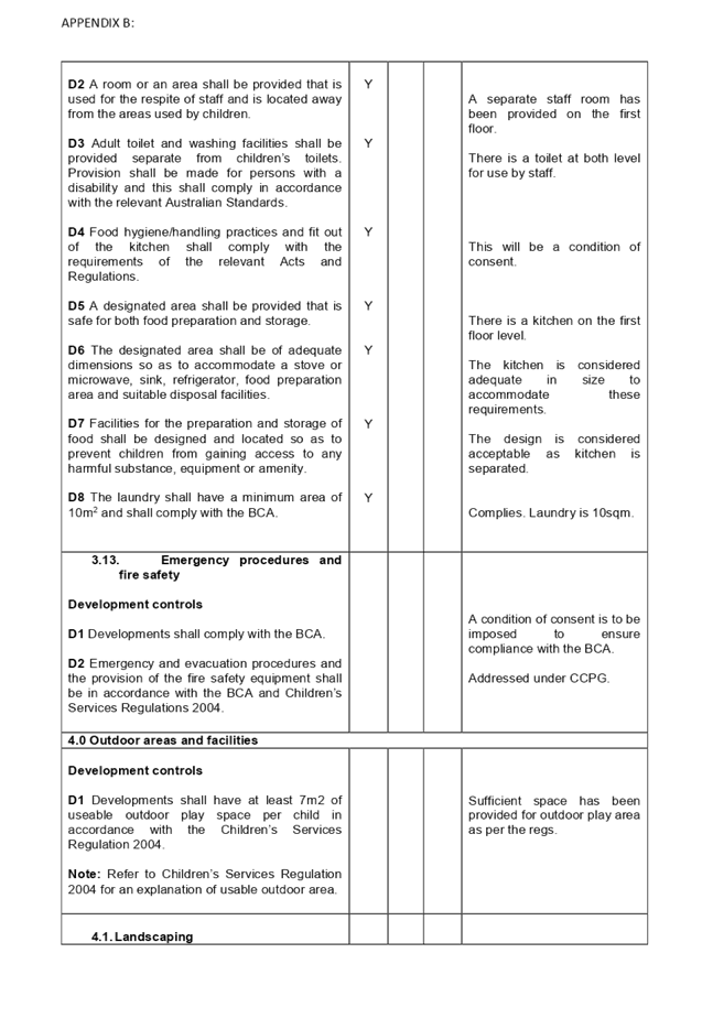
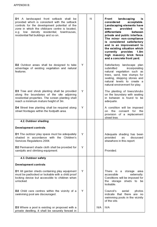
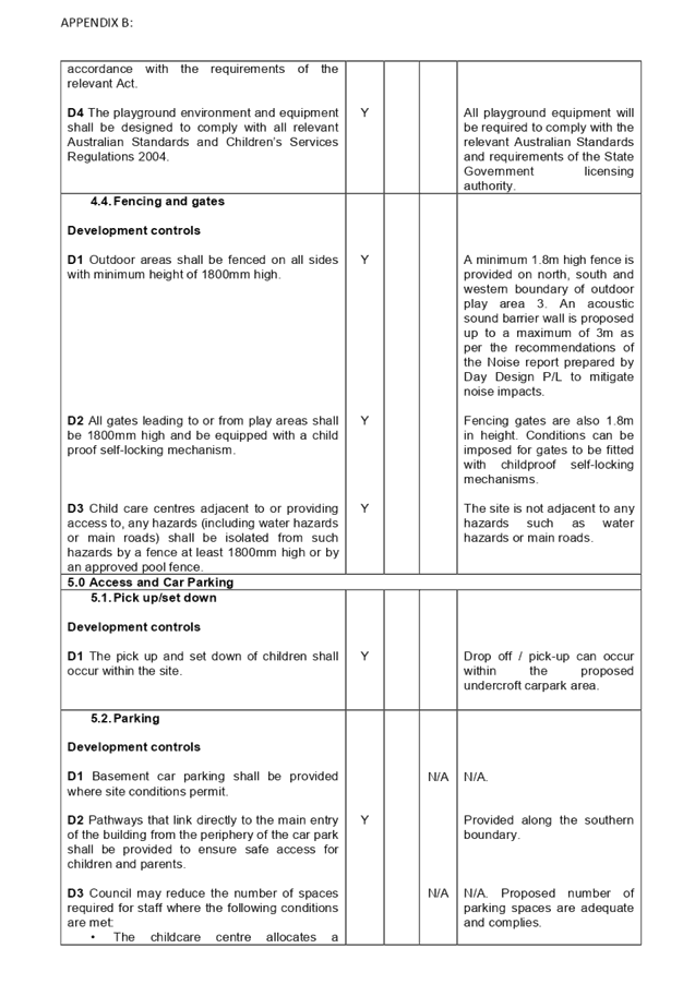
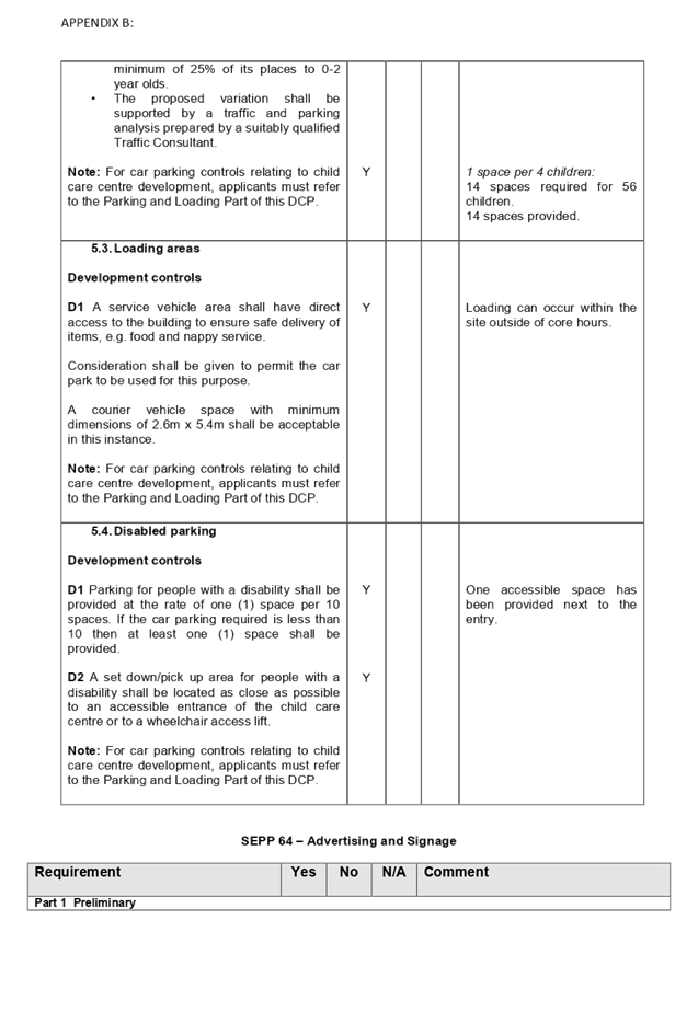
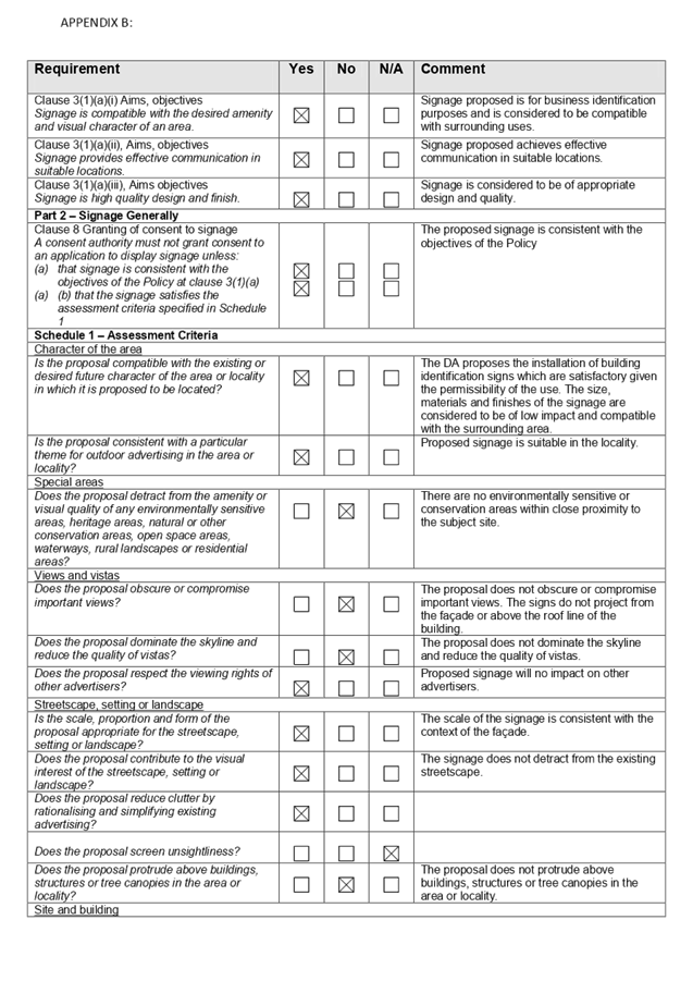
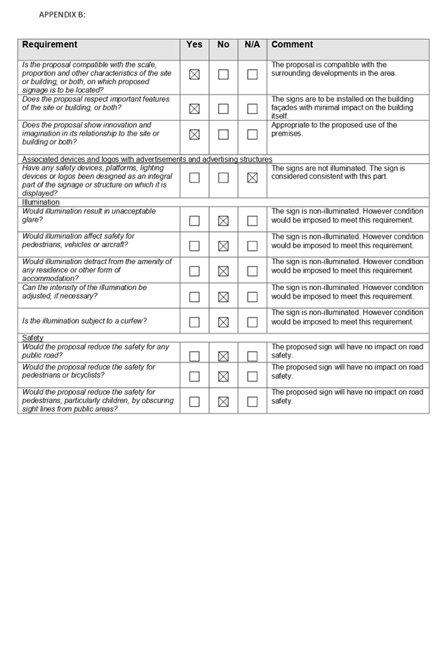
Cumberland
Local Planning Panel Meeting
12 February 2020
Item No: LPP006/20
Development
Application for 327 Merrylands Road, Merrylands
Responsible
Division: Environment
& Planning
Officer: Executive
Manager Development and Building
File
Number: DA
2019/121/1
|
Application lodged
|
10 April 2019
|
|
Applicant
|
Baini Design
|
|
Owner
|
Mr E and Mrs M Kaltoum
|
|
Application No.
|
2019/121/1
|
|
Description of Land
|
327 Merrylands Road, Merrylands (Lot 103, DP 976423)
|
|
Proposed Development
|
Proposal as amended seeks
approval for demolition of existing structures and construction of a 4 storey
mixed use development comprising 8 residential units and 1 ground floor
commercial tenancy over two levels of basement parking accommodating 15 car
parking spaces and 1 car wash bay.
|
|
Site Area
|
541.8m2
|
|
Zoning
|
B6 – Enterprise Corridor
|
|
Principal Development Standards
|
Floor Space Ratio:
Max. 2:1
Proposed: 1.28:1
Height of Buildings:
Max. 14m
Proposed : 14m
|
|
|
Disclosure of political donations and gifts
|
Nil disclosure
|
|
Heritage
|
No
|
|
Issues
|
· Communal open space (ADG)
· Non-compliant ceiling height- first
floor (ADG)
· Insufficient lot width (HDCP 2013)
· Non-compliant number of storeys
(HDCP 2013)
· Upper storey setback (HDCP 2013)
· Insufficient lot width (HDCP 2013)
· Public Interest (2 submissions)
|
1. Development
Application 2019/121/1 was received on 10 April 2019 for the demolition of
existing structures and construction of a 4 storey mixed use development
comprising 10 residential units and 1 ground floor commercial tenancy over two
levels of basement parking accommodating 17 car parking spaces.
2. The
application was publicly notified to adjoining and opposite owners, a notice
was placed in the local press and a notice placed on the site for a period of
21 days from 8 May 2019 to 29 May 2019. In response, the application received 2
submissions.
3. Council
through its assessment noted a number of concerns with the proposal including
building height, building separation, privacy, parking and internal amenity and
as such the application was deferred seeking amended plans. Final set of
amended plans and information were provided to Council on 15 January 2020. The
design refinements resulted in the reduction of units from 10 to 8 units and
overall building height. The amended plans did not warrant re-notification.
4. The
application as amended proposes demolition of existing structures and
construction of a 4 storey mixed use development comprising 8 residential units
and 1 ground floor commercial tenancy over two levels of basement parking
accommodating 15 car parking spaces and 1 car wash bay.
5. The
subject application has been assessed against the relevant provisions of the
Environmental Planning and Assessment Act 1979, State Environmental Planning
Policy No 65 – Design Quality of Residential Apartment Development (SEPP
65), Apartment Design Guide, Holroyd Local Environmental Plan 2013 (HLEP) and
Holroyd Development Control Plan 2013 (HDCP).
6. The
proposal seeks the following non-compliances which are considered supportable
as discussed in detail elsewhere in the report:
|
Item
|
Required
|
Proposed
|
%age variation
|
|
Communal Open Space (COS)
|
25%-135.45m2
|
20% -108m2
|
20%
|
|
Ceiling Height (ADG)
|
3.3m ceiling height for the first floor.
|
2.7m
|
18.2%
|
|
Building Height (DCP)
|
3 storeys
|
4 storeys
|
33.3%
|
|
Street wall height requiring an upper storey setback >
3 storeys
|
3m upper storey front setback
|
Nil setback provided to the 4th storey
|
100%
|
|
Lot Frontage (DCP)
|
26 metres
|
16.46 metres
|
36.7%
|
7. The
application is being reported to the Cumberland Local Planning Panel (CLPP) for
determination as it is a development with more than 4 storeys to which the
State Environmental Planning Policy No 65 – Design Quality of Residential
Apartment Development applies.
8. The
application is recommended for Deferred Commencement approval subject to the
conditions in the draft determination at Attachment 4.
Introduction
The subject site is legally
described as Lot 103 DP 976423, with a street address of 327 Merrylands Road,
Merrylands within the B6 Enterprise Corridor zone. The site is located on the
north-western corner of the intersection between Merrylands Road and Lockwood
Street. The site forms the tail end of the commercial centre penetrating into
R2 – Low Density Residential zone. Land to the north and south are zoned
R2 – Low Density Residential zone.
The site is a rectangular shaped
block with a frontage of 16.46m to Merrylands Road and 32.92m to Lockwood
Street, with a total site area of 541.8m2. The site currently contains a
single-storey weatherboard dwelling and associated structures.
The site is adjoined to the north
and west by single-storey dwellings. To the south-east on the opposite side of
Merrylands Road are 3 storey walk-up apartment buildings, and to the south-west
is a school.
Locality Plan
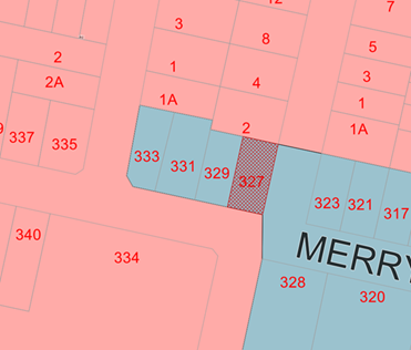
Figure
1: 327 Merrylands Road, Merrylands (Source: Cumberland Council, 2019)
Aerial Plan
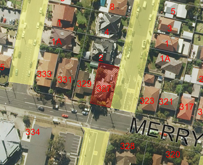
Figure
2: 327 Merrylands Road, Merrylands (Source: Cumberland Council, 2019)
Street View
Figures
3, 4 & 5: 327 Merrylands Road, Merrylands
Description of the Proposed
Development
DA 2019/121 as amended proposes
demolition of existing structures and construction of a 4 storey mixed use
development comprising 8 residential units and 1 ground floor commercial
tenancy over two levels of basement parking accommodating 15 car parking spaces
and 1 car wash bay. Key features of the development proposal are as follows:-
· Demolition
of existing structures on site.
· Construction
of a 4 storey mixed use development over basement parking incorporating:-
Basement level 01
· 4
x commercial car parking space including an accessible car parking space
· 1
x delivery bay
· 1
x car wash bay
· Residential
bin storage area
· Vertical
bicycle spaces for 11 bikes
Basement level 02
· 8
x residential car parking space including 2 x accessible car parking space
· 2
x residential visitor car parking space
· Residential
bin storage area
Ground Floor
· 1
x commercial tenancy with a total floor area of 80m2 with
pedestrian
access from Merrylands Road and from the central lift lobby;
· 1
x 2 b/r residential unit;
· A
centralised lift and stairwell core that provides pedestrian access to the
basement, to the commercial tenancy and to the residential unit;
· Commercial
bin store and amenities;
· Service
area.
Level 1, 2 & 3
· A
total of 7 units
The dwelling mix of the
proposal is as follows:
· 2
x studio units (25%);
· 5
x 2 bedroom units (62.5%); and
· 1
x 3 bedroom unit (12.5%)
Background
On 26 September 2018,
Cumberland Local Planning Panel refused DA 2017/561/1 for the demolition of
existing structures and construction of a 4 storey mixed use development
comprising 10 residential units and 1 ground floor commercial tenancy over two
levels of basement parking accommodating 17 car parking spaces.
The primary reasons of
refusal included building height, building separation, apartment size and
layout, internal amenity, site amalgamation and traffic and vehicular access
arrangements.
Application
History
|
Date
|
Action
|
|
10/04/2019
|
The Development Application was lodged.
|
|
26/04/2019
|
The Development Application was referred to
Council’s internal and external departments for review.
|
|
08/05/2019 to 29/05/2019
|
Application placed on public notification for 21 days and
2 submissions were received.
|
|
01/05/2019 to 14/06/2019
|
External and internal referrals received.
|
|
17/09/2019
|
Following a detailed assessment, correspondence was
forwarded to the applicant giving an option to withdraw the application based
on the nature and extent of non-compliances. The
application was not withdrawn.
|
|
15/01/2020
|
Amended plans and additional information submitted to
Council, addressing the issues dated 29/10/2019. The application did not
warrant re-notification as the amendments made did not result in a greater
environmental impact.
|
|
12/02/2020
|
Application referred to CLPP for determination.
|
Applicant’s Supporting
Statement
Statement of Environmental Effects
prepared by Think Planners Pty Ltd, dated 15 January 2020 was submitted in
support of the application.
Contact with relevant
parties
The assessing officer has
undertaken a site inspection of the subject site and surrounding properties and
has been in contact with the applicant throughout the assessment process.
Internal Referrals
Development Engineer
Council’s Development
Engineer has raised no objections to the proposed development, subject to
conditions.
Traffic Engineer
Council’s Traffic Engineer
has advised that the development is generally supportable in regards to on-site
parking numbers; however they raised concerns with the ingress and egress
arrangements and manoeuvrability of vehicles within the basement levels. It is
considered that such maters can be resolved through the recommended deferred
commencement consent conditions.
Tree Management Officer
Council’s Landscape and Tree
Officer has raised no objections to the proposed development, subject to
conditions of consent.
Environmental Health
Council’s Environmental
Health Officer has raised no objections to the proposed development subject to
conditions of consent.
Waste Management Officer
Council’s Waste Management
Officer for comment who has advised that the proposed waste management is
supportable subject to conditions.
External Referrals
Transgrid
The development application was
referred to Transgrid for comment who has advised that the development is
supportable in regards to not affecting Transgrid’s asset.
Endeavour Energy
The development application was
referred to Endeavour Energy for comment who has advised that the development
is supportable in regards to electricity connection and sufficient clearance to
existing electricity asset, subject to conditions.
Roads and Maritime Services
(RMS)
The previous Development
Application (DA2017/561) was referred to RMS for comment who advised that
noting the proposed driveway was more than 20m from a signalised intersection,
and there was no driveway on Merrylands Road, therefore no referral was
required to RMS in this instance. Given that the current application proposes
no changes to the design/location of the driveway, the application was not
required to be referred to RMS. It should be noted that Lockwood Road is not
managed by RMS.
Planning Assessment
The provisions of any
Environmental Planning Instruments (EP&A Act s4.15 (1)(a)(i))
The following Environmental
Planning Instruments are relevant to the assessment of the subject application:
(a) State
Environmental Planning Policy No. 55 – Remediation of Land
The provision of Clause 7 of SEPP
No. 55 requires Council to be satisfied that the site is suitable or can be
made suitable to accommodate the proposed development has been considered in
the following table:
|
Matters for consideration
|
Yes
|
No
|
N/A
|
|
Does the application involve re-development of the site or
a change of land use?
|
|
|
|
|
Is the development going to be used for a sensitive land
use (e.g.: residential, educational, recreational, childcare or hospital)?
|
|
|
|
|
Does information available to you indicate that an
activity listed below has ever been approved, or occurred at the
site?
acid/alkali plant and formulation,
agricultural/horticultural activities, airports, asbestos production and
disposal, chemicals manufacture and formulation, defence works, drum
re-conditioning works, dry cleaning establishments, electrical manufacturing
(transformers), electroplating and heat treatment premises, engine works,
explosive industry, gas works, iron and steel works, landfill sites,
metal treatment, mining and extractive industries, oil production and
storage, paint formulation and manufacture, pesticide manufacture and
formulation, power stations, railway yards, scrap yards, service stations,
sheep and cattle dips, smelting and refining, tanning and associated trades,
waste storage and treatment, wood preservation.
|
|
|
|
|
Is the site listed on Council's Contaminated Land
Database?
|
|
|
|
|
Is the site subject to EPA clean-up order or other EPA
restrictions?
|
|
|
|
|
Has the site been the subject of known pollution incidents
or illegal dumping?
|
|
|
|
|
Does the site adjoin any contaminated land/previously
contaminated land?
|
|
|
|
|
Has the appropriate level of investigation been carried
out in respect of contamination matters for Council to be satisfied that the
site is suitable to accommodate the proposed development or can be made
suitable to accommodate the proposed development?
|
|
|
|
|
Details of contamination investigations carried out at
the site:
The site is not
identified in Council’s records as being contaminated. A site
inspection reveals the site does not have any obvious history of a previous
land use that may have caused contamination and there is no specific evidence
that indicates the site is contaminated. The subject site is currently used
for residential purposes and contamination is not expected. Council’s
Environmental Health Unit has assessed the application and considers the
proposal to be satisfactory subject to conditions.
|
(b) State
Environmental Planning Policy (Vegetation in Non-Rural Areas) 2017
The proposal includes removal of
existing trees within the subject site. However, this does not exceed the
biodiversity offsets scheme threshold and the majority of the trees on site are
exempt species. Therefore, the proposed vegetation removal is considered
acceptable. Refer to the HDCP 2013 compliance table at attachment 3 for further
comment regarding the proposed tree removal.
(c) State
Environmental Planning Policy (Coastal Management) 2018
The subject site is not identified
as a coastal wetland and is not or land identified as “proximity area for
coastal wetlands”.
(d) State
Environmental Planning Policy (Building Sustainability Index: BASIX) 2004
A BASIX Certificate 1071236M dated
21 January 2020 has been submitted with the application and demonstrates that
the proposed development meets the required water, thermal comfort and energy
targets.
(e) State
Environmental Planning Policy No. 65 – Design Quality of Residential
Apartment Development
The proposal is classified as a
shop top housing development and SEPP 65 applies. A design verification
statement signed by registered architect Ben Vitale was submitted with the
application.
SEPP 65 sets 9 design quality
principles. The development has adequately addressed the principles in the
following way:
Table
2 – SEPP 65 Design Quality Principles
|
ADG Design
Quality Principle
|
Response
|
|
1. Context and neighbourhood character
|
The area is zoned to accommodate new development,
including shop top housing that is a permitted type of development within the
B6 zone. The site forms the tail end of the commercial centre penetrating
into R2 – Low Density Residential zone. Land to the north and south are
zoned R2 – Low Density Residential zone.
The existing built character in the immediate vicinity
is still low density residential. Across Lockwood Street a newer shop
top housing development is currently under construction. The proposed design
is generally consistent with the desired future character of the
area. The proposed development satisfies Holroyd LEP
2013 objectives in that it will provide residential development well
integrated with the commercial uses. The siting of development has been
appropriately designed to minimise any potential overshadowing and visual
privacy impact to the adjoining properties by maintaining adequate
separation.
|
|
2. Built form and scale
|
The building has been designed to correspond with the
existing landform and provides an appropriate scale in terms of the buildings
bulk and height.
|
|
3. Density
|
The proposed density is satisfactory having regard to the
future desired character of the area, in terms of floor space yield, number
of units and potential number of new residents.
|
|
4. Sustainability
|
A BASIX Certificate has been submitted and the building
meets the required energy and water efficiency targets.
|
|
5. Landscape
|
A landscape plan was submitted with the proposal. The
proposed landscaping is considered to be satisfactory. The proposed
landscaping at ground level podium will provide suitable visual amenity for
the future building’s occupants and suitable landscape setting for the
streetscape is also proposed.
|
|
6. Amenity
|
The proposal will deliver sufficient amenity to residents
of the building. The proposal generally achieves compliance with the ADG in
this regard which contains many amenity controls. The building design
incorporates access and circulation, apartment layouts, floor area, private
open space, energy efficiency rating, adaptability and diversity, safety,
security and site facilities. Suitable access is provided to all parts of the
building, through the efficient use of lift to access all levels. The
development is considered to provide an appropriate level of amenity for
future residents.
|
|
7. Safety
|
Suitable and secure access is provided to all parts of the
building, through the efficient use of lift to access all levels. Concerns
regarding segregation of commercial and residential uses can be achieved
through proper plan of management.
|
|
8. Housing diversity and social interaction
|
The apartment mix is considered to be satisfactory. The
specifics of the building are:-
· 2 x studio units (25%);
· 5 x 2 bedroom units (62.5%); and
· 1 x 3 bedroom unit (12.5%)
The number of adaptable units proposed is considered
satisfactory with the provision of associated accessible car spaces.
|
|
9. Aesthetics
|
The proposed development is
considered to be appropriate in terms of the composition of building
elements, textures, materials and colours.
|
Pursuant to clause 28(2)(c) of
SEPP 65, a consent authority must consider the provisions of the Apartment
Design Guide (ADG) in the assessment of a residential flat development. A
comprehensive assessment against the Apartment Design Guide (ADG) controls is
provided at Attachment 1.
The proposal involves the
following non-compliances with the ADG controls.
|
3D
|
Communal and Public Open Space
|
|
3D-1
|
An adequate area of communal open space is provided to
enhance residential amenity and to provide opportunities for landscaping.
|
|
|
|
|
|
Design Criteria
Communal open space has a
minimum area equal to 25% of the site.
Required: 25% x 541.8m² = 135.45m2
|
The proposed communal open space is 108m2
(20%).
The provision of communal open space is considered
acceptable in this instance based on the following merits:
xii)
The proposal is a small scaled mixed use development
(comprising of only 8 units) and is in close proximity to Merrylands Oval.
This public open space is easily accessible and contributes positively
in providing additional outdoor recreation opportunities for residents.
Further, the development provides reasonable private open
spaces for units which enhances residential amenity and optimise daylight
access.
Having regard to the above and given the small scale of
development, this variation to communal open space is considered acceptable
on merits.
|
|
|
|
|
4C-1
|
Ceiling height achieves sufficient natural ventilation and
daylight access.
|
|
|
|
|
|
Design Criteria
Measured from
finished floor level to finished ceiling level, minimum ceiling heights are:
These minimums do not preclude higher ceilings if desired.
|
The proposed ceiling heights
are as follows:
· Ground floor 3.3m
· First floor 2.7m
· Second floor 2.7m
· Third floor 2.7m
The proposal has a non-compliant ceiling height for the
first floor. Given that subject site is located on the fringe of B6
Enterprise Corridor, it is considered unlikely that demand for first floor
commercial would exist now or in the future. The
proposed ceiling height will result in an overall reduction of building height,
therefore minimising impacts in terms of building bulk and achieving a better
design outcome sympathetic to the adjoining low density residential
developments.
In
this regard, the minor variation is acceptable on merits
|
|
|
|
|
4H
|
Acoustic Privacy
|
|
4H-1
|
Noise transfer is minimised through the sitting of
buildings and building layout.
|
The ground floor unit’s bedroom 1 window overlooks
the driveway ramp which raises concern with regard to the acoustic
privacy.
However, louvers are incorporated to the bedroom window to
mitigate the impacts. Further, a condition is recommended to be imposed for
the provision of planter boxes (as marked in red on the plans) to alleviate
any acoustic privacy concerns.
|
|
|
|
|
|
|
|
|
|
|
|
(f) State
Environmental Planning Policy (Infrastructure) 2007
Clause 45 – Development
likely to affect an electricity transmission or distribution network
The development application was
referred to Endeavour Energy and TransGrid for comment, who raised no
objections, subject to conditions.
(g) Statement
Environmental Planning Policy No 19 - Bushland in Urban Areas
The proposal does not propose to
disturb bushland zoned or reserved for public open space.
Regional Environmental Plans
(h) Sydney
Regional Environmental Plan (Sydney Harbour Catchment) 2005
The subject site is identified as
being located within the area affected by the Sydney Regional Environmental
Plan (Sydney Harbour Catchment) 2005. The proposed development raises no issues
as no impact on the catchment is envisaged.
Note: The subject site is not
identified in the relevant map as land within the ‘Foreshores and
Waterways Area’ or ‘Wetland Protection Zone’, is not a
‘Strategic Foreshore Site’ and does not contain any heritage items.
Hence the majority of the SREP is not directly relevant to the proposed
development.
(i) Holroyd
Local Environmental Plan 2013 (HLEP 2013)
The proposed development is
defined as a ‘mixed use development’ under the provisions of
Holroyd Local Environmental Plan (LEP) 2013. The development meets the
objectives of the B6 Enterprise Corridor zone and achieves compliance with the
key statutory requirements of the Holroyd LEP 2013.
A comprehensive assessment and
compliance table is provided at Attachment 2 which demonstrates the
proposal’s compliance (as amended) with the relevant planning standards
that are applicable to the site.
The provisions of any proposed
instrument that is or has been the subject of public consultation (EP&A Act
s4.15 (1)(a)(ii))
There are no draft SEPPs
applicable to the proposed development.
The provisions of any
Development Control Plans (EP&A Act s4.15 (1)(a)(iii))
(a) Holroyd
Development Control Plan 2013
HDCP 2013 contains general
controls which relate to all developments under Part A, and Commercial Controls
under Part C.
A comprehensive HDCP compliance
table is attached to this report at Attachment 3. A summary of the DCP
non-compliances is provided in the following table.
|
PART C – COMMERCIAL DEVELOPMENT
|
|
1.1
|
Lot Size and Frontage
|
|
|
The minimum lot frontage for
development within Zone B2, B4, B5 and B6 shall be, unless otherwise stated
as site specific controls in this DCP:
• Up to three storeys
– 20 metres.
• 4 - 8 storeys –
26 metres.
• 9 storeys and greater
– 32 metres.
|
The subject site has a frontage of 16.46m to Merrylands
Road and is therefore non-compliant.
Refer to the discussion below:
|
|
|
|
|
|
Council may require the consolidation of more than one
existing land holding to be undertaken in order to meet all the requirements
of this development control plan.
In instances where lot amalgamation in order to meet the
requirements of this DCP cannot be achieved, the following information must
be submitted with any development application:
· Provide two
written independent valuations representing the affected sites value.
· Provide evidence
that a reasonable offer has been made to the affected owners.
Where amalgamation (as required) is not achieved, the
applicants must show that the remaining sites, which are not included in the
consolidation, and the proposed development site, will still be able to
achieve the development outcome prescribed in this DCP, including achieving
the required vehicular access, basement parking and built form.
Sites must not be left such that they are physically
unable to reasonably develop a three storey building in accordance with the
controls in this part.
|
Given that the subject site has a limited site width, it
is considered ideal to amalgamate with the adjoining site at No. 329
Merrylands Road. A consolidated development would yield a better urban design
outcome.
The developer has attempted to amalgamate with the
adjoining site, and in this regard, 2 valuations dated 4 January 2019 and
30January 2019 and a letter of offer dated 25 February 2019 accompanied by a
documentary evidence (i.e. via registered post) was provided to Council. This
demonstrates that a reasonable offer was forwarded to the land owner of 329
Merrylands Road, Merrylands. However, the applicant received no response to
the offer and on that basis it was considered to be rejected.
With regard to the above, it is considered that the
applicant has satisfied the relevant requirements of the DCP and the subject
site could be deemed isolated as the developer is unable to acquire more land
to develop in accordance with the DCP.
Given that there is the potential for the adjoining
properties to the west to amalgamate, they are not considered to be affected
/ landlocked as a result of the proposal.
Further, conceptual plans have been prepared showing a
potential built form on the subject site and the adjoining site, as well as a
montage of what both developments would look like together.
|
|
|
|
|
1.3
|
Building Height
|
|
|
Maximum building height in storeys shall be provided in
accordance with the table below:
|
Permitted Height (storeys)
|
|
Height
|
Storeys
|
|
10m
|
1
|
|
11m
|
2
|
|
12.5m
|
2
|
|
14m
|
3
|
|
17m
|
4
|
|
20m
|
5
|
|
23m
|
6
|
|
26m
|
7
|
|
29m
|
8
|
|
32m
|
9
|
|
38m
|
11
|
|
41m
|
12
|
|
50m
|
15
|
|
53m
|
16
|
|
65m
|
20
|
|
Required = 14m and 3 storey
Provided – 14m and 4 storeys.
The proposal does not provide for the required 3m setback
above the 3 storey street wall height as the proposal seeks to provide for a
consistent 4m setback to both frontages for the entire height of the
building. Given the corner location, the small built form with a compliant
LEP building height, setting back the 4th floor would adversely
affect the appearance of the building. Further, the 4th storey has
a smaller portion of physical structure and the remaining portion is
dedicated to the communal open space which provides an appropriate transition
to the low density residential zone along the northern boundary. In this
regard, a 4 storey building is considered appropriate on this site when
considering the constrained allotment size and configuration.
|
|
|
|
Any planning agreement that has
been entered into under section 7.4, or any draft planning agreement that a
developer has offered to enter into under section 7.4 (EP&A Act s
4.15(1)(a)(iiia))
There is no planning agreement or
draft planning agreement associated with the subject Development Application.
The provisions of the
Regulations (EP&A Act s4.15 (1)(a)(iv))
Pursuant to clause 92 of the
Regulation, the provisions of AS 2601 must be considered in the case of a
development application for the demolition of a building. Standard conditions
are included in the draft determination to require the proposed demolition
works to be carried out in accordance with AS 2601.
The Likely Environmental,
Social or Economic Impacts (EP&A Act s4.15 (1)(b))
The likely environmental, social
and economic impacts of the development have been assessed and are considered
satisfactory.
The suitability of the site for
the development (EP&A Act s4.15 (1)(c))
The site is considered suitable
for the proposed development.
Submissions made in accordance
with the Act or Regulation (EP&A Act s4.15 (1)(d))
Advertised
(newspaper) Mail
Sign Not Required
In accordance with Part E - Public
Participation of HDCP 2013, the proposal was publicly notified for a period of
21 days from 8 May 2019 to 29 May 2019. As a result of the notification, two
submissions were received.
The issues raised in the public
submission are summarised and commented on as follows:
|
Issue
|
Planners comment
|
|
1. The
size of the site is not large enough to sustain a block of units. The width
of the site does not comply with the DCP. The development will landlock the
immediate neighbour.
|
The proposal does not comply
with the minimum lot frontage requirements in accordance with Holroyd DCP
2013. However, this matter has been discussed in the main body of this report
where Council considers that the DCP process for amalgamation has been
followed by the applicant.
On this basis, Council is able
to consider varying the lot frontage requirement as the preconditions for
site amalgamation have been satisfied.
|
|
2. The
signalised intersection is very busy and the proposed driveway is located
very close to the traffic lights.
|
Council’s Traffic
Engineers have assessed the proposed development having regard to the
location of the proposed driveway to the signalised intersection and have
raised no objection to the proposed location of the driveway.
|
|
3. There
is not adequate frontage for garbage bins
|
Council’s Waste Management Section has assessed the
proposal and raises no objection with regard to the placement of the
appropriate number of bins along the Lockwood Street frontage for pick up.
|
|
4. Inadequate
parking and impact on existing traffic.
|
The proposal is defined as a “Mixed
use development” which is a permissible land use under the subject B6-
Enterprise Corridor zoning. The proposed development complies with the
provisions of Clause 3.1 – Parking Requirements of the Holroyd
Development Control Plan 2013 – Part A by providing a total of 16 car
spaces (including 4 commercial car spaces) within the basement carpark.
Further, given that the vehicular access is provided along the secondary
street (Lockwood Street, Merrylands), it is considered that traffic generated
by this development will not adversely affect the existing traffic in the
street.
Further, Council’s traffic
engineers have assessed this application and considered satisfactory with
regard to traffic and parking impact of the proposal as it is satisfied that
sufficient off street parking and adequate access is provided within the
proposed development.
|
|
5. The
proposed development shall be flagged as a 5 storey development.
|
The proposed development as
amended is considered to be a 4 storey development as the top floor
constituting the roof top communal open space has been deleted.
|
|
6. Mixed
use development comprising of one commercial unit and 10 residential units.
|
The proposed development is
defined as a ‘mixed use development’ under the provisions of
Holroyd Local Environmental Plan (LEP) 2013. Mixed use development means a
building or place comprising 2 or more different land uses. The proposal as
amended comprises of 8 residential units that encompasses a residential flat
building (RFB) and a commercial tenancy at ground level which are permitted
within the B6 – Enterprise Corridor zone.
The proposal (albeit being on a
smaller scale) will contribute towards providing opportunities for business
and housing stock within proximity to local services and public
transport.
|
Section 7.11 of the
Environmental Planning & Assessment Act 1979
The subject development requires
the payment of contributions in accordance with Holroyd Section 94 Development
Contributions Plan 2013. A condition is imposed requiring the payment of
contributions.
In accordance with the currently
indexed rates for the Merrylands Centre contribution area, the following
contributions apply:
· 2 x studio
units = $9,236 x 2 = $18,472
· 5 x 2 bedroom
units = $15,619 x 5 = $78,095
· 1 x 3 bedroom
unit = 20,000
· 80m2 of commercial
tenancy = $212 x 80 = $16,960
The required Section 7.11
contribution payable for the proposal is $133,527.00
Note: This includes Credit for the
existing 1 x 3-bedroom dwelling.
The Public Interest
The public interest is served by
permitting the orderly and economic use of land, in a manner that is sensitive
to the surrounding environment and has regard to the reasonable amenity
expectations of surrounding land users. In view of the foregoing analysis, it
is considered that approval of the proposed development would not be contrary
to the public interest.
Disclosure of Political
Donations and Gifts
The NSW Government introduced The
Local Government and Planning Legislation Amendment (Political Donations) Act
2008 (NSW). This disclosure requirement is for all members of the public
relating to political donations and gifts. The law introduces disclosure
requirements for individuals or entities with a relevant financial interest as
part of the lodgement of various types of development proposals and requests to
initiate environmental planning instruments or development control plans.
The application and notification
process did not result in any disclosure of Political Donations or Gifts.
The proposed development has been
assessed in accordance with the relevant requirements of the Environmental
Planning and Assessment Act 1979, State Environmental Planning Policy No 65
– Design Quality of Residential Apartment Development, Holroyd Local
Environmental Plan 2013 and the Holroyd Development Control Plan 2013 and is
considered to be satisfactory.
|
1. That
Development Application 2019/121/1 for the demolition of existing structures
and construction of a 4 storey mixed use development comprising 8 residential
units and 1 ground floor commercial tenancy over two levels of basement
parking accommodating 15 car parking spaces and 1 car wash bay be Approved
via Deferred Commencement, subject to the attached conditions, provided at
Attachment 4.
2. That
the applicant and those persons who lodged a submission in respect to the
application be notified of the determination of the application.
|
1. ADG
Compliance Table
2. HLEP
2013 Compliance Table
3. HDCP
2013 Compliance Table
4. Draft
Notice of Determination
5. Architectural
Plans
6. Locality
Map
7. Submissions
(x2)
DOCUMENTS
ASSOCIATED WITH
REPORT LPP006/20
Attachment 1
ADG Compliance Table
Cumberland Local Planning Panel Meeting
12 February 2020
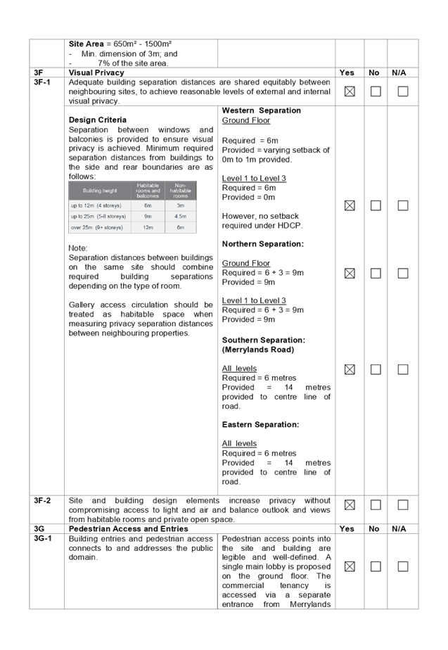
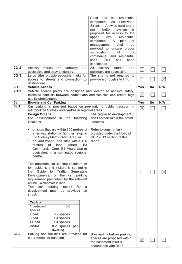
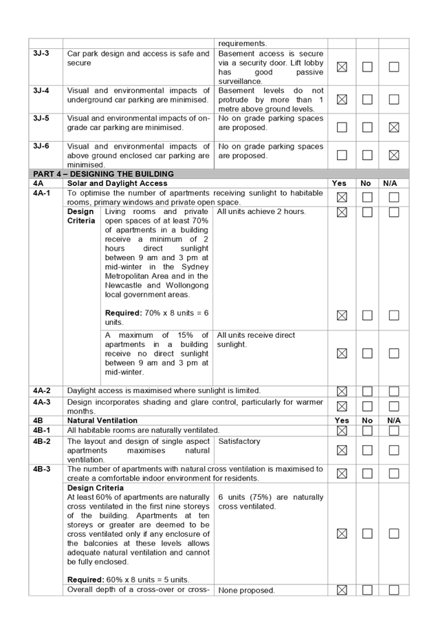
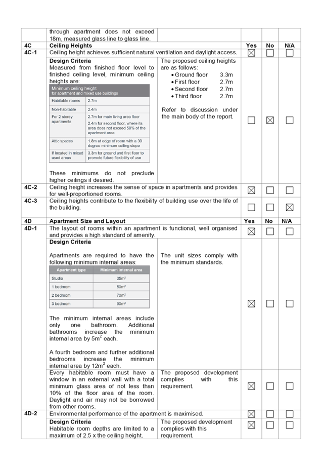
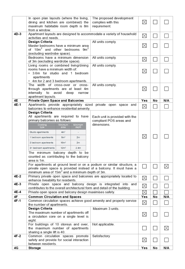
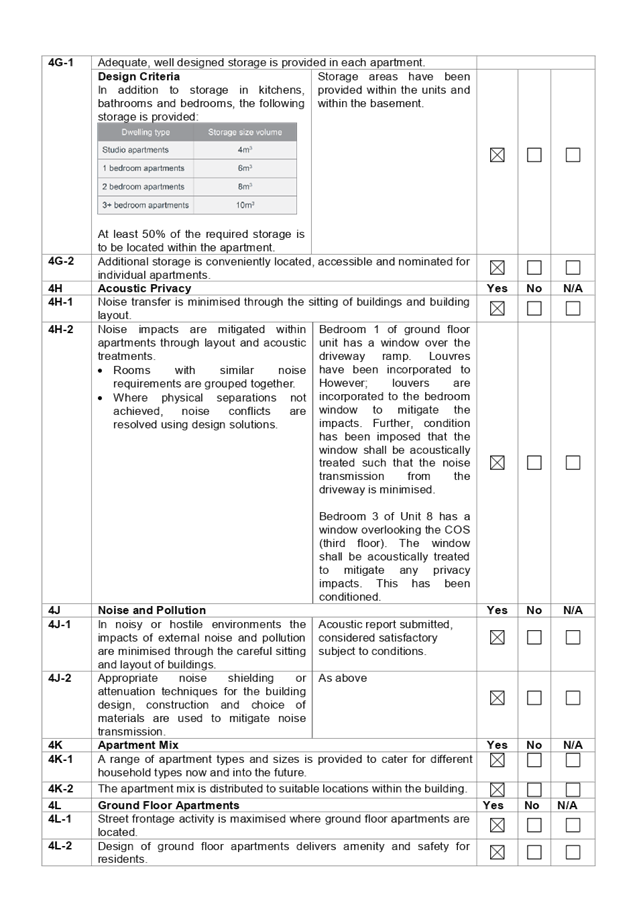
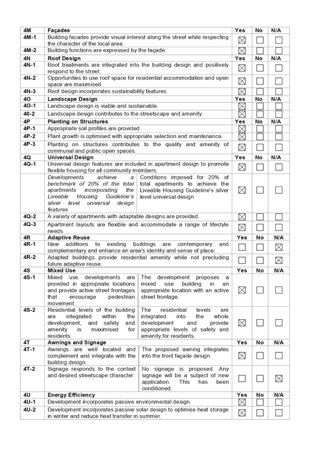

DOCUMENTS
ASSOCIATED WITH
REPORT LPP006/20
Attachment 2
HLEP 2013 Compliance Table
Cumberland Local Planning Panel Meeting
12 February 2020
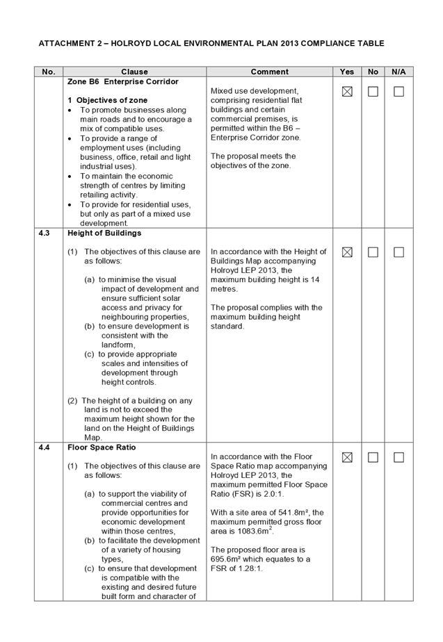
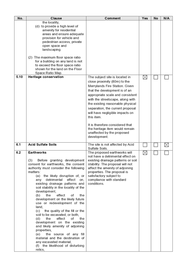
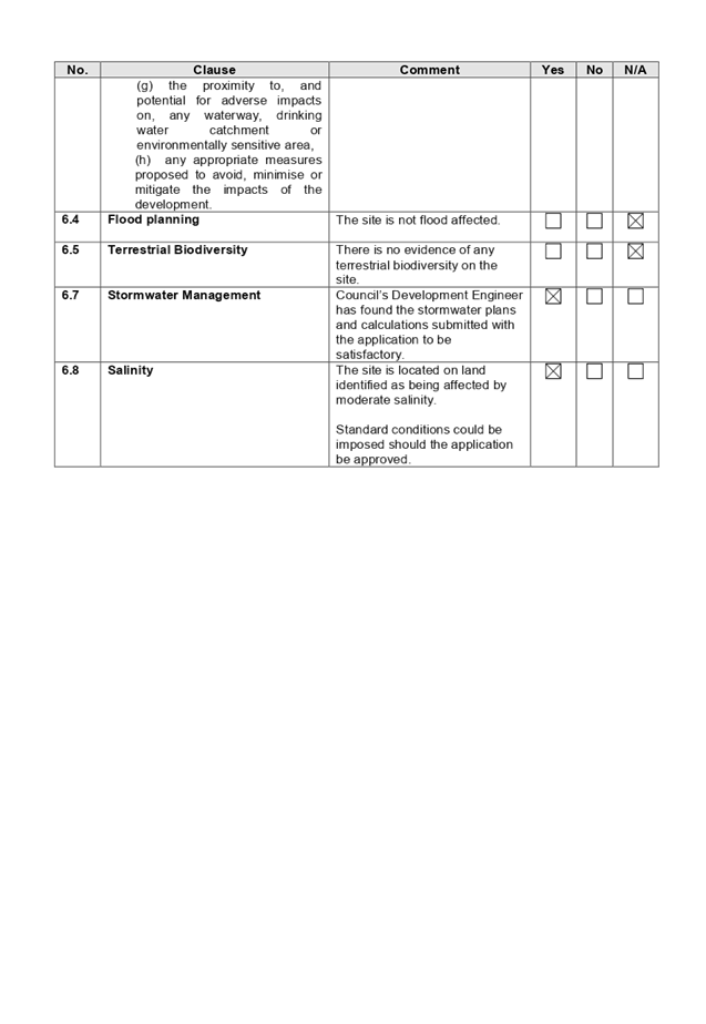
DOCUMENTS
ASSOCIATED WITH
REPORT LPP006/20
Attachment 3
HDCP 2013 Compliance Table
Cumberland Local Planning Panel Meeting
12 February 2020
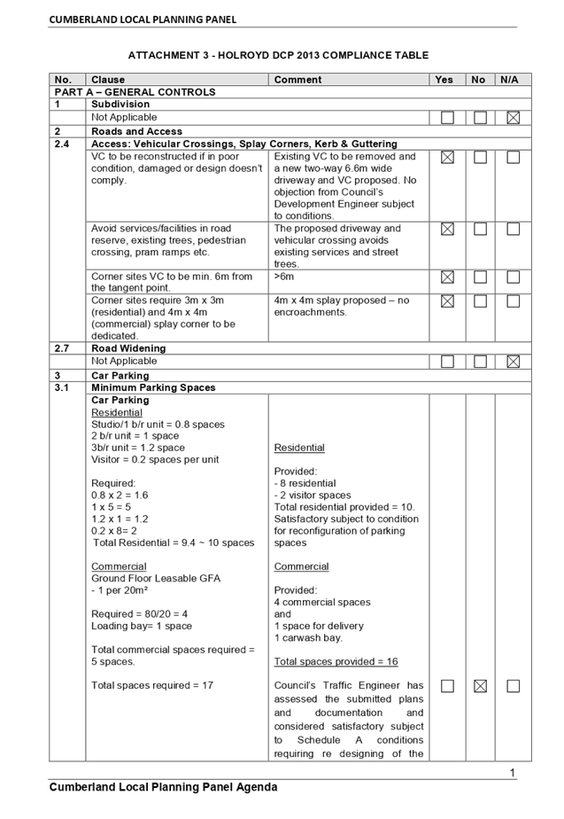
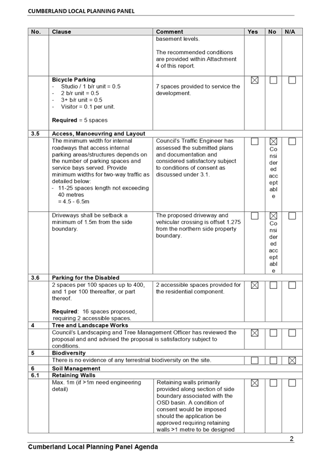
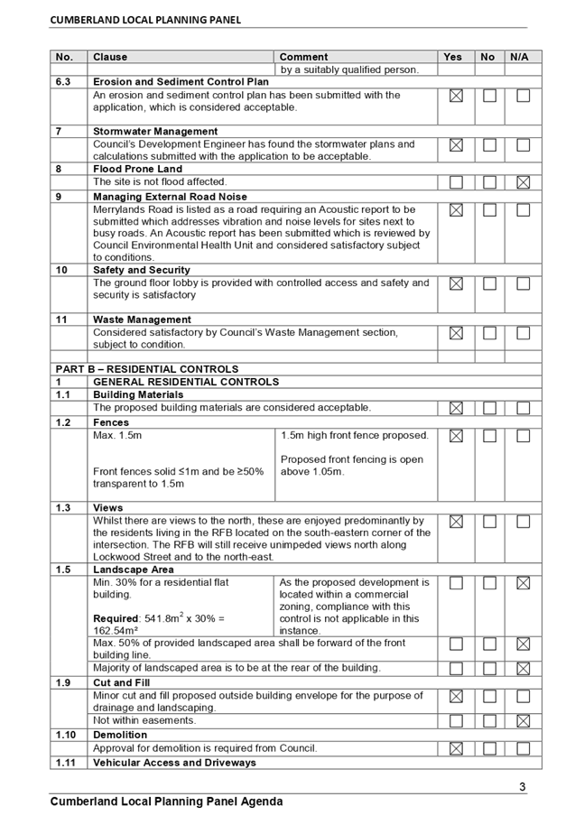
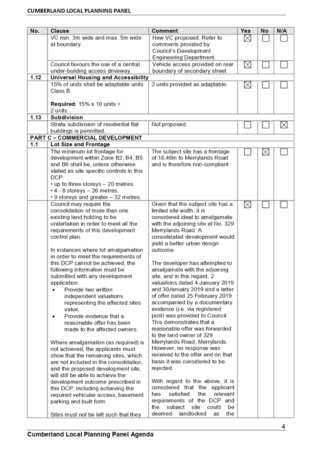
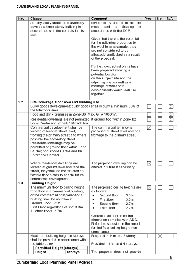
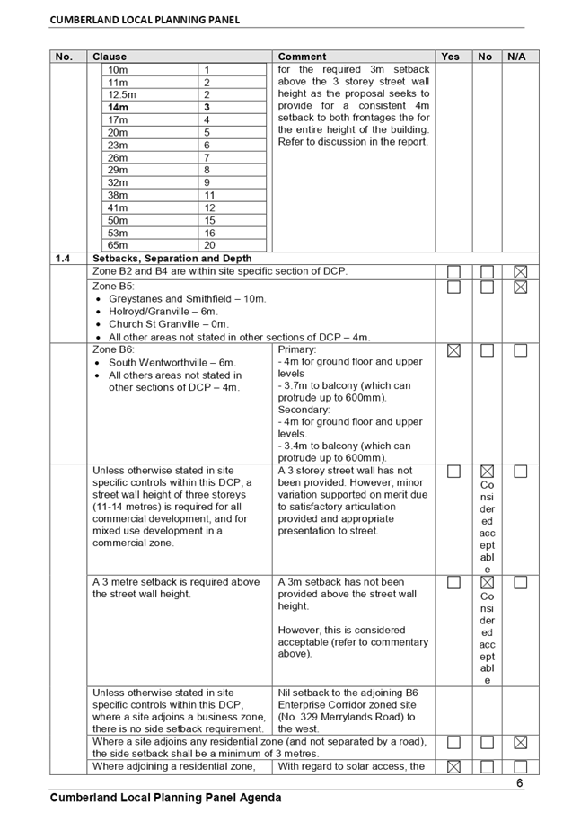
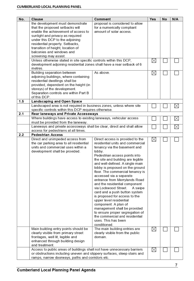
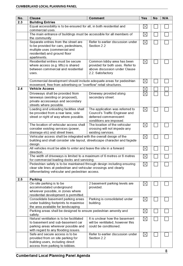
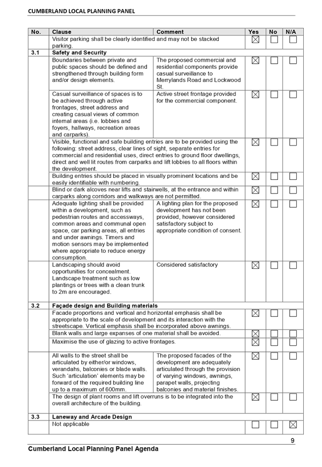
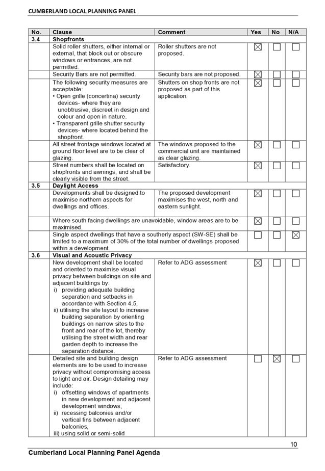
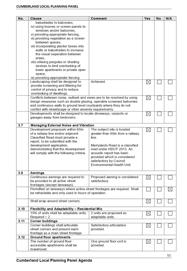
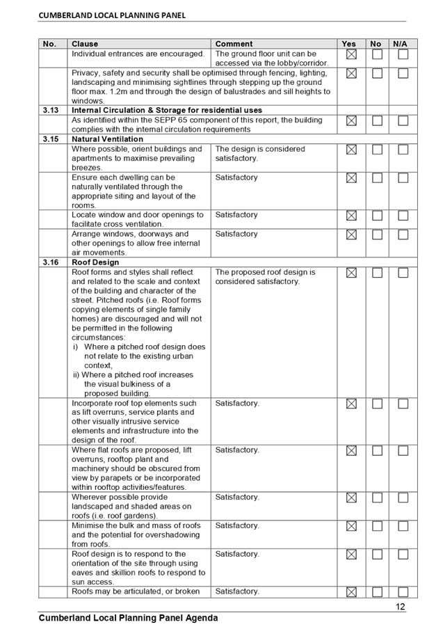
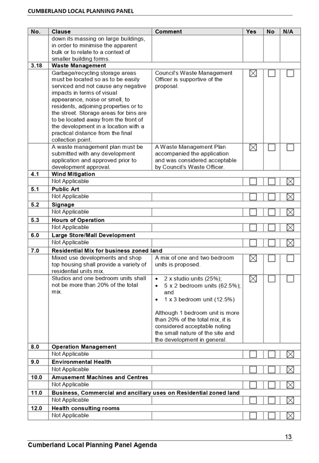

DOCUMENTS
ASSOCIATED WITH
REPORT LPP006/20
Attachment 4
Draft Notice Of Determination
Cumberland Local Planning Panel Meeting
12 February 2020
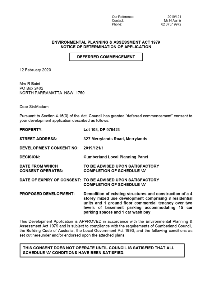
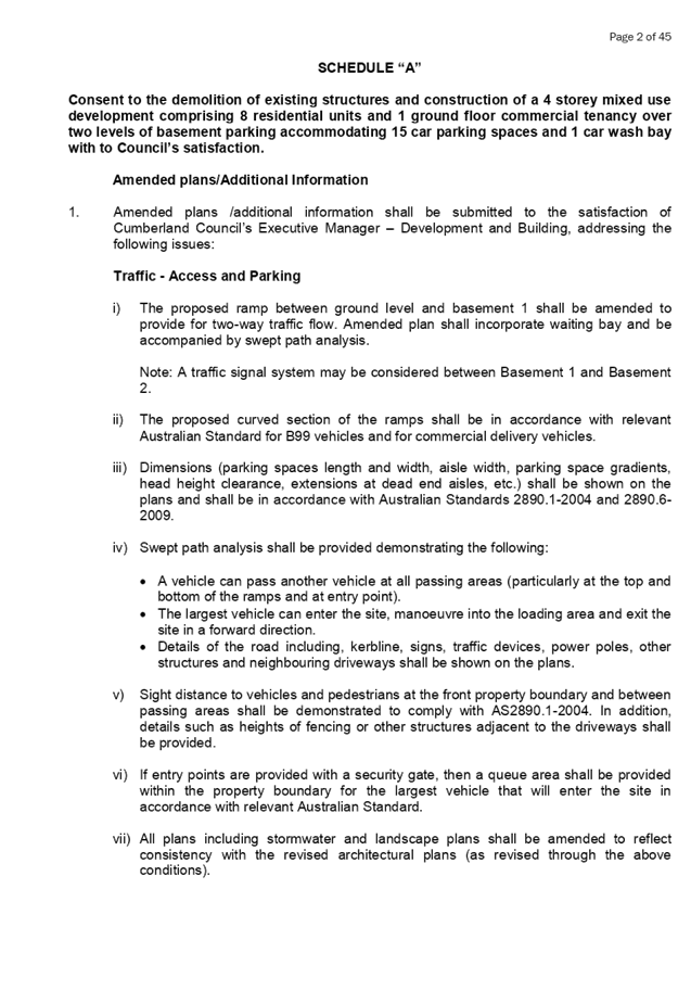
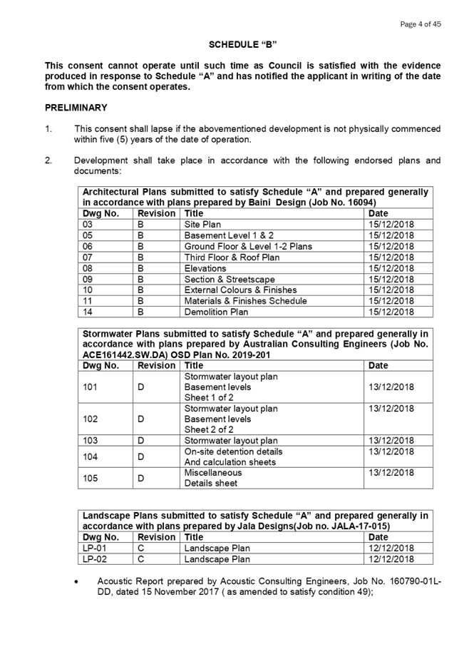


DOCUMENTS
ASSOCIATED WITH
REPORT LPP006/20
Attachment 5
Architectural Plans
Cumberland Local Planning Panel Meeting
12 February 2020
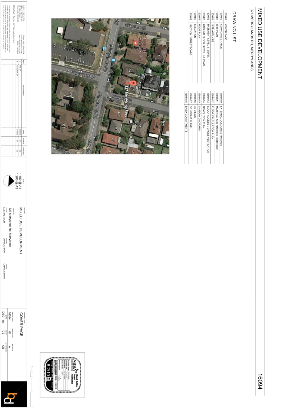
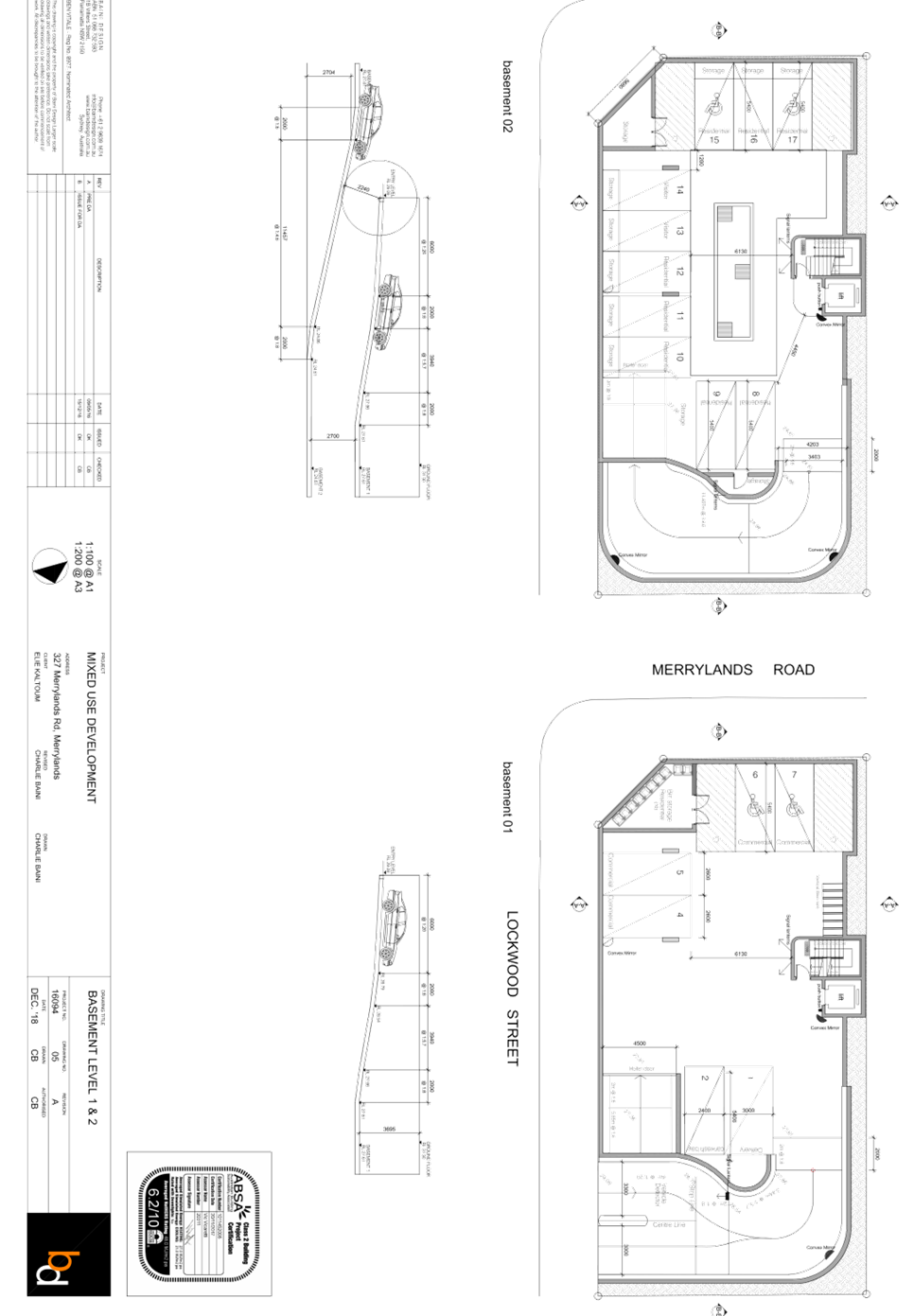
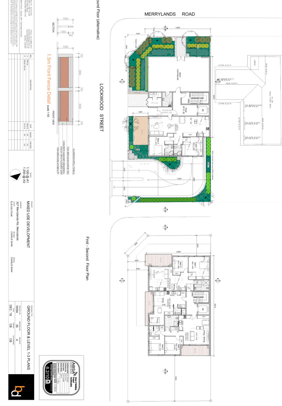
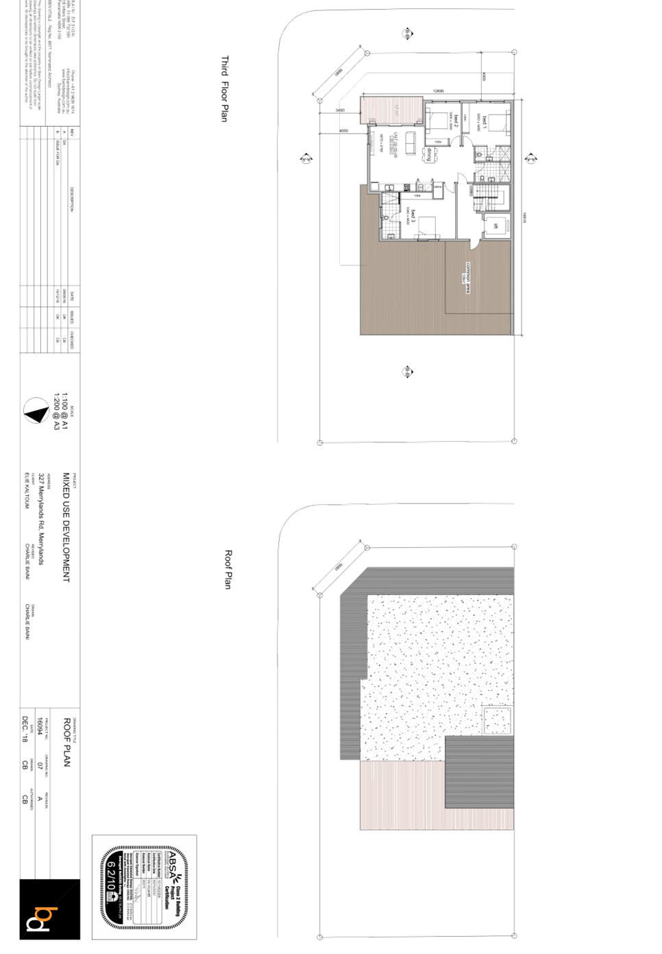
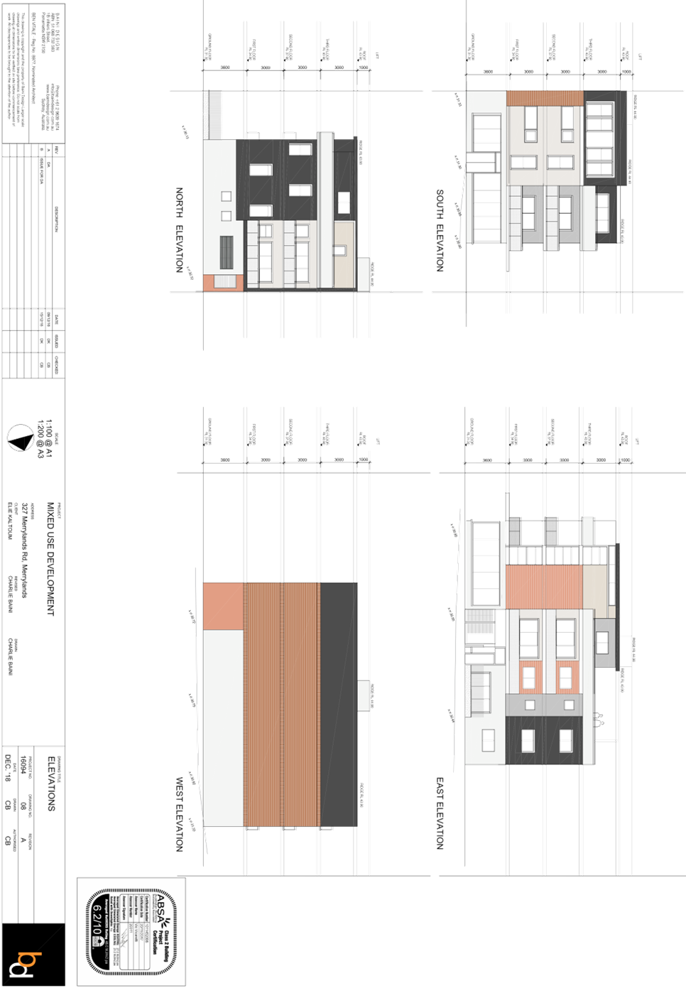
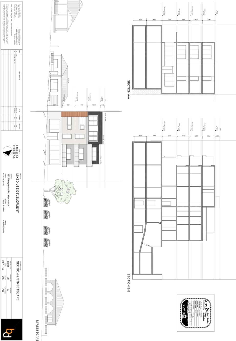
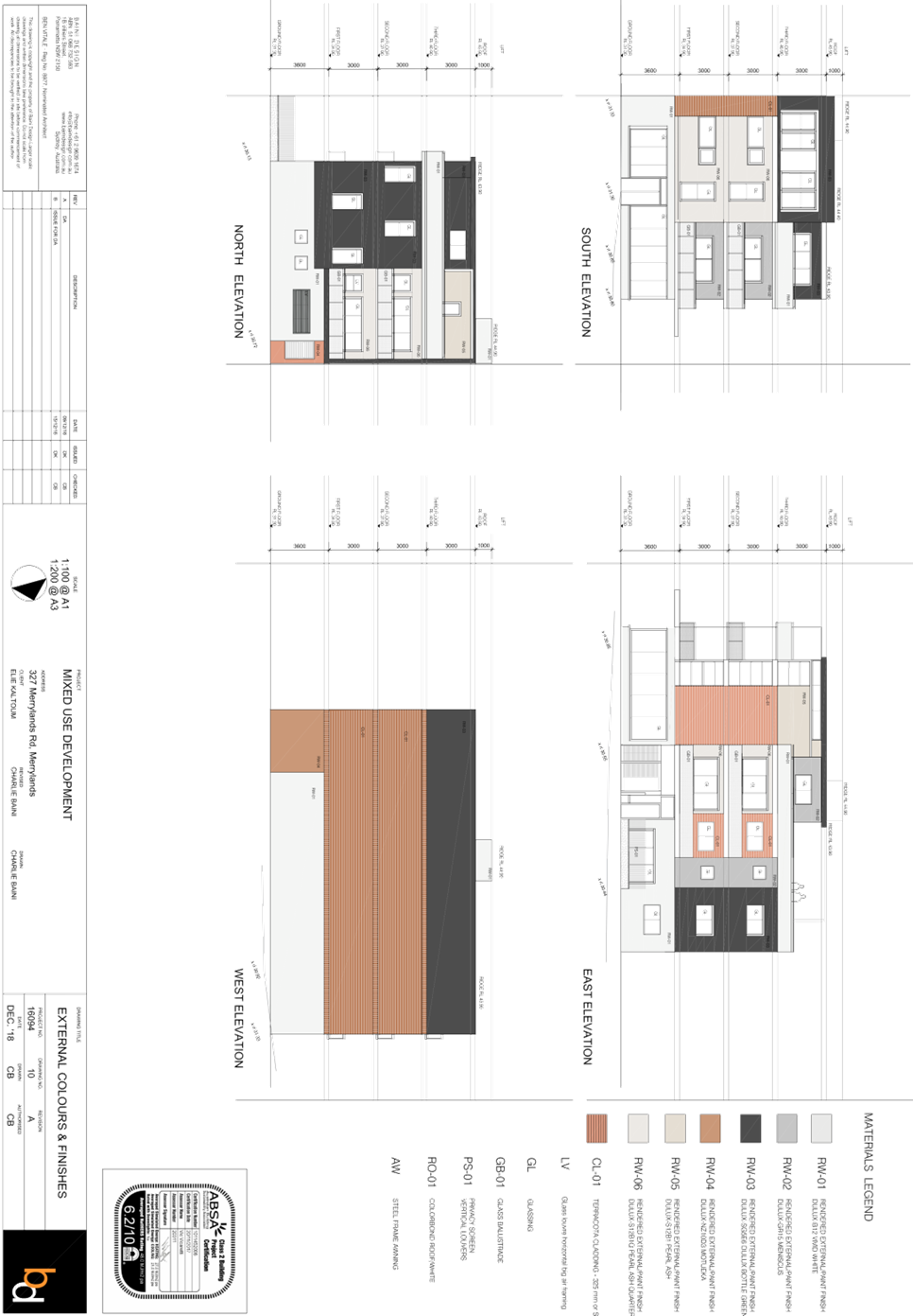
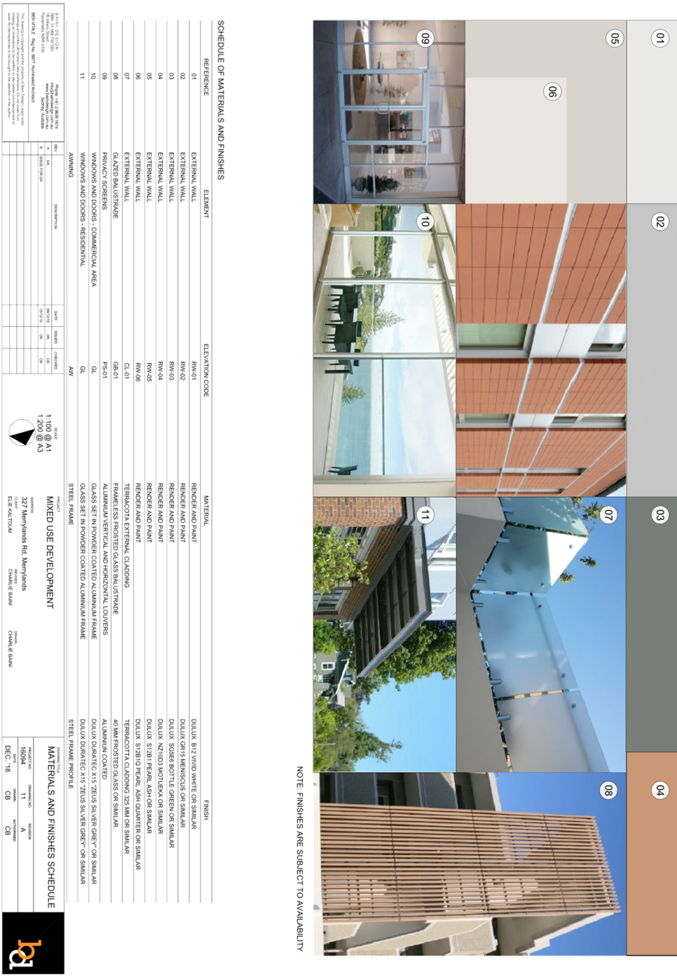
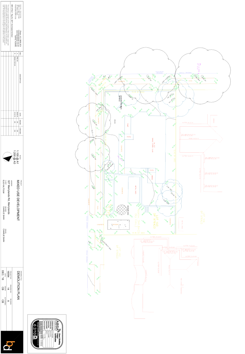
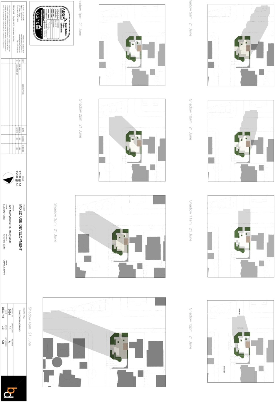
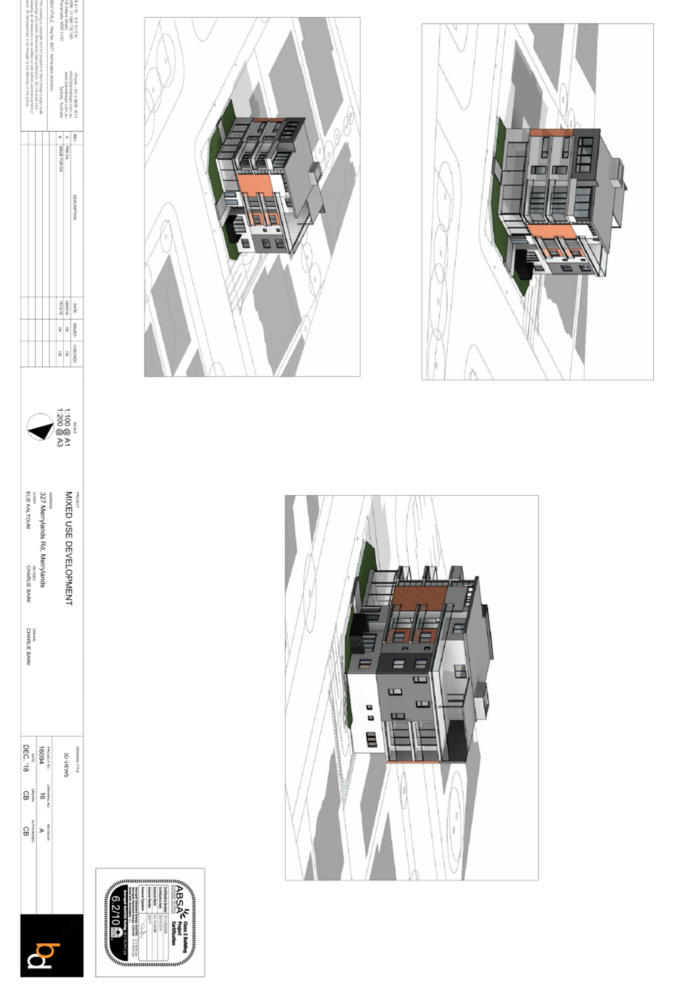
DOCUMENTS
ASSOCIATED WITH
REPORT LPP006/20
Attachment 6
Locality Map
Cumberland Local Planning Panel Meeting
12 February 2020
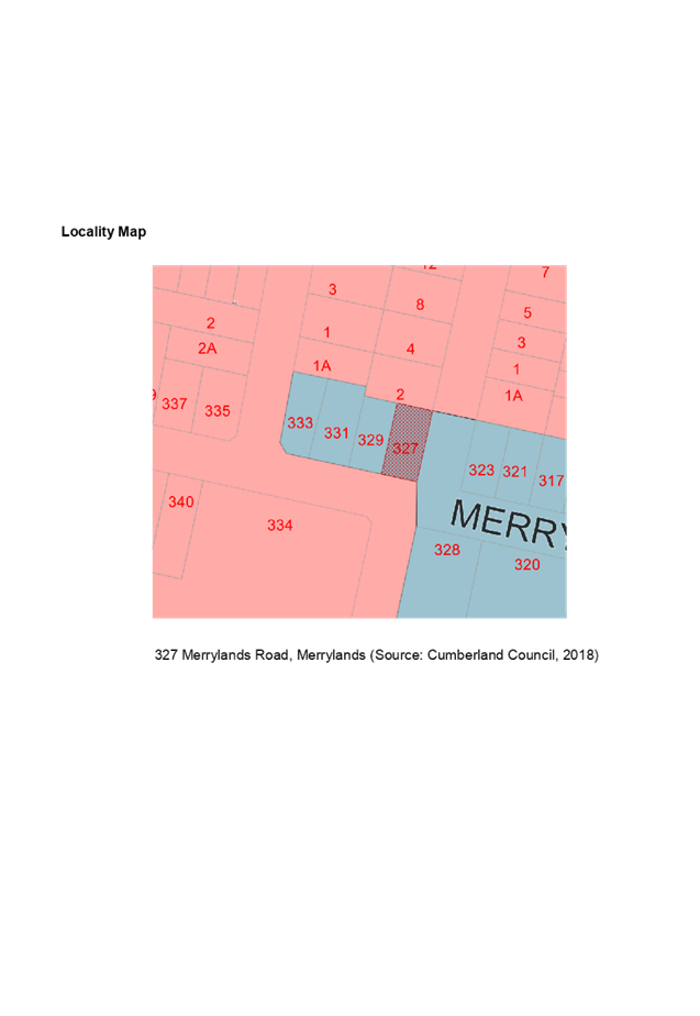
DOCUMENTS
ASSOCIATED WITH
REPORT LPP006/20
Attachment 7
Submissions (x2)
Cumberland Local Planning Panel Meeting
12 February 2020