Extraordinary Cumberland Local Planning
Panel Meeting
5 November 2019
An
Extraordinary Meeting of Cumberland Local Planning Panel will be held at 11:30a.m at the
Merrylands Administration Building, 16 Memorial Avenue, Merrylands on Tuesday,
5 November 2019.
Business as below:
Yours faithfully
Hamish McNulty
General
Manager
ORDER OF BUSINESS
1.
Receipt of Apologies
2.
Declaration of Interest
3.
Address by invited speakers
4.
Reports
- Development
Applications
- Planning
Proposals
5. Closed
Session Reports
Extraordinary Cumberland Local Planning
Panel Meeting
5 November 2019
CONTENTS
Report No. Name of Report Page
No.
Development Applications
LPP067/19... Develpoment Application
277-289 Woodpark Road , Smithfield................. 5
LPP068/19... Development Application -
45-47 Susan Street, Auburn......................... 395
LPP069/19... Wentworthville Town Centre
Planning Proposal and Development Control Plan............................................................................................................................ 509
LPP070/19... Planning Proposal Request
for 55-57 Station Street and 6 Pritchard Street East, Wentworthville.................................................................................................. 705
Extraordinary Cumberland Local Planning
Panel Meeting
5 November 2019
Item No:
LPP067/19
Develpoment
Application 277-289 Woodpark Road , Smithfield
Responsible
Division: Environment
& Planning
Officer: Executive
Manager Development and Building
File
Number: 2018/321/1
|
Application
lodged
|
6 September 2018
|
|
Applicant
|
David Carey Town Planning
& Development
|
|
Owner
|
ALS Limited
|
|
Application
No.
|
DA 2018/321/1
|
|
Description
of Land
|
Lot 1 in DP1024505,
277-289 Woodpark Road Smithfield
|
|
Proposed
Development
|
Extension of hours of
operation of existing manufacturing & warehouse use to carry out
manufacturing 24 hours a day Monday to Friday and 7.00 am to 3.00 pm
Saturday, and truck & external forklift movements 7.00 am to 7.00 pm
Monday to Friday and construction of an acoustic wall.
|
|
Site
Area
|
3.934 ha
|
|
Zoning
|
IN1 – General Industrial
|
|
Disclosure
of political donations and gifts
|
Nil disclosure
|
|
Heritage
|
No
|
|
Principal
Development Standards
|
N/A
|
|
Issues
|
- Number of public submissions received (26)
- Variation to standard hours of operation
stated within Holroyd Development Control Plan 2013
|
1. Development
Application No. DA-2018/321/1 was received by Council on 6 September 2018 for
the extension of hours of operation of existing manufacturing & warehouse
use to carry out manufacturing 24 hours a day Monday to Friday and 7.00 am to
3.00 pm Saturday, and truck & external forklift movements 7.00 am to 7.00
pm Monday to Friday at Lot 1 of DP1024505 (Known as 277-289 Woodpark Road
Smithfield).
2. The
application was publicly notified to occupants and owners of the adjoining
properties for a period of 14 days between 24 October 2018 and 7 November 2018.
In response, 14 submissions were received.
3. Following
clarification from the Environmental Protection Authority (EPA) that the
development application is Integrated Development under division 4.8 of the
EPAA Act 1979, the application was publicly notified to occupants and owners of
the adjoining properties for a second period of 28 days between 20 March 2019
and 17 April 2019. In response, 9 submissions were received.
4. Following
submission of amended plans including an acoustic wall to address the noise
issues; the development application was renotified for a third period from 11
September 2019 to 25 September 2019. In response, 3 submissions were received
by Council. A total of 26 public submissions were received as a result of the
three notification periods.
5. The
application seeks following variations:
|
Control
|
Required
|
Provided
|
Variation
|
|
Holroyd
Development Control Plan 2013 – Part D, Section 4, Control C3
|
The Council,
under normal circumstances, restricts the hours of industrial operations to
the hours of 7.00am to 7.00pm, Monday to Friday; 7.00am to 12 noon, Saturday
and no work on Sunday
|
Internal
manufacturing and internal fork-lift movements
Monday to Friday: 24 hours
Saturday: 7:00am to 3:00pm
Sunday and Public Holidays: No work
Transport
(truck and external fork-lift movements)
Monday to Friday:
7:00am to 7:00pm
Saturday, Sunday and
Public Holidays: No work
|
Maximum
variation of 12 hours (50%) from Holroyd Development Control Plan 2013
standard hours of industrial operation.
|
6. The
application is recommended for approval subject to the conditions as provided
at attachment 3.
7. The
application is referred to the Panel for determination due the number of public
submissions received.
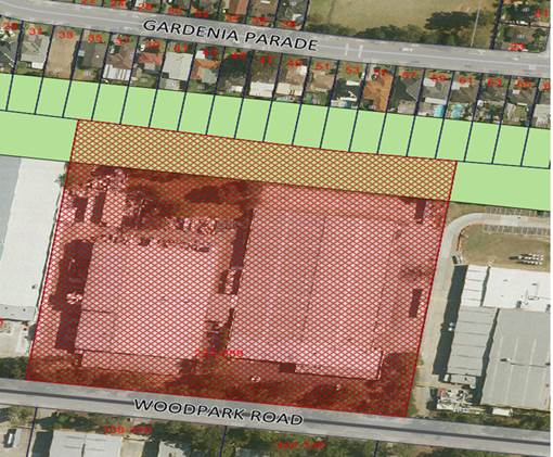
Subject Site And Surrounding
Area
The site forms Lot 1 of DP1024505
and is known as 277-289 Woodpark Road Smithfield. The site has an area of 3.934
ha and frontage to Woodpark Road of approximately 201.17m. The site is located
on the northern boundary of the Smithfield Industrial precinct with industrial
premises located to the south, east and west and R2 – low density
residential zoned land to the north. The current use of the premises was
approved by Council on 12 August 1999 under DA 2000/43 [the application number
was changed due to a change in Council system]. A further development
application DA 2000/263 amended the hours of operation on 4 February 2000 [the
application number was changed due to a change in Council system].
The subject premises and adjoining
residential zoned sites are subject to a ‘buffer area between industrial
and residential zones’ under section 6.9 of Holroyd Local Environmental
Plan 2013 along the northern boundary of the subject site located between the
residential zoned land and industrial zoned land. It is noted that the proposed
acoustic wall as part of the current development application is located within
the ‘‘buffer area between industrial and residential zones”.
The buffer area is highlighted green on Figure 1 below.
Figure
1 – Map of Industrial-Residential buffer area of 277-289 Woodpark Road
Smithfield highlighted green
A site inspection of the premises
carried out in November 2018 and August 2019 confirmed that the site is
currently occupied by two large warehouses with the larger warehouse to the
east of the site currently being used for warehousing and the smaller warehouse
to the west being used for production. The current use of the site was approved
by DA 2000/43 and DA 2000/263.
The applicant states that
approximately 250 staff are employed at the subject site which is broken down
to approximately 110 staff during day hours, 80 during afternoon and 60 staff
overnight. It is noted that the front portion of the larger eastern warehouse
building is used by Australian Laboratory Services (ALS) (Approved under DA
2000/309) and does not form part of the subject application.
The applicant’s Statement of
Environmental Effects states, “The building located on the western
portion of the site, comprises offices along with the powder and liquid
manufacturing areas. Powder and liquid products are formulated within these
areas and the finished products are stored and ready for distribution in the
adjacent warehouse building to the east”.
Figure
2 – Locality map of 277-289 Woodpark Road Smithfield
Figure
3 – Aerial view of subject site
Figure
4 – Street view of subject site November 2018
Description of The Proposed
Development
The subject application seeks
approval for extension of hours of operation of existing manufacturing &
warehouse use to carry out manufacturing 24 hours a day Monday to Friday and
7.00 am to 3.00 pm Saturday, and truck & external forklift movements 7.00
am to 7.00 pm Monday to Friday; and construction of an acoustic wall.
History of Site
The history of the site is as
follows:
1. Development
application DA: 2000/43 was approved by former Holroyd City Council on 12
August 1999 for ‘Minor alterations and use of existing industrial
premises for the warehousing of household laundry, cleansing and personal care
products’. This development application included a condition (condition
No.31) which states that the hours of operation are restricted to 6:00am to
6:30pm Monday to Friday, 7:00am to 4:00pm Saturday and no work Sunday. In this
regard, all truck movements are to occur within the approved hours’.
2. The
premise is subject to an Environmental protection license (license no. 2746)
issued by the NSW Environmental Protection Authority (EPA).
3. Development
Application DA 2000/263 was approved by former Holroyd City Council on 4
February 2000 for ‘Rationalisation & consolidation of associated
activates relating to the manufacture and warehousing of household detergents
and cleaning products on adjoining sites. In addition, alterations and
additions on the respective sites to facilitate the rationalisation, including
an extension in manufacturing activates to include liquid products’.
4. Condition
No. 86 of that development consent restricted the hours of operation as under:
Manufacturing Hours
Monday to Friday: 24 hours
Saturday: 7:00am to 3:00pm
Sunday and Public Holidays: No
Work
Transport (Truck and external fork-lift
movements)
Monday to Friday: 7:00am to 7:00pm
Saturday: No Work
Sunday and Public Holidays: No
Work
The above condition further stated
that following the end of trial period the applicant may lodge a fresh
application seeking approval to continue the extended hours. If not, or if the
fresh application is refused, the use will be revert back to Council’s
standard hours of operation being 7:00am to 6:00pm Monday to Friday, 7:00am to
12:0Noon Saturday and no work on Sundays and Public Holidays.
The applicant failed to lodge a
fresh application to continue the extended hours of operation and continued to
operate under the extended trial period hours. Council’s compliance
section has recently taken regulatory action against the operator of the
premises.
5. Development
Application No. DA-2018/321/1 was received by Council on 6 September 2018 for
the extension of hours of operation of existing manufacturing & warehouse
use to carry out manufacturing 24 hours a day Monday to Friday and 7.00 am to
3.00 pm Saturday, and truck & external forklift movements 7.00 am to 7.00
pm Monday to Friday at Lot 1 of DP1024505 (Known as 277-289 Woodpark Road
Smithfield).
6. The
current application, the subject of this report, seeks similar extended hours
as approved under development application No. 2000/263 for the trial
period.
History
regarding Development Application 2018/321/1
|
Date
|
Action
|
|
6 September 2018
|
Development
Application No. DA 2018/321/1 received by Council for the extension of hours
of operation of existing manufacturing & warehouse use to carry out
manufacturing 24 hours a day Monday to Friday and 7.00 am to 3.00 pm
Saturday, and truck & external forklift movements 7.00 am to 7.00 pm
Monday to Friday at Lot 1 of DP1024505 (known as 277-289 Woodpark Road
Smithfield).
|
|
24 October 2018 and 7
November 2018
|
Application publicly
notified. In response, Council received 14 submissions
|
|
5 March 2019
|
Council deferred the
development application due to issues raised by the EPA
|
|
20 March 2019 and 17
April 2019
|
Due to the development
application being Integrated Development under division 4.8 of the EPAA Act
1979, the application was publicly notified to occupants and owners of the
adjoining properties for a second period of 28 days. In response, Council received
8 submissions.
|
|
18 April 2019, 29
April 2019 and 1 May 2019
|
Applicant submitted to
Council part of the information requested by Council’s deferral letter
dated 5 March 2019.
|
|
17 May 2019
|
Applicant submitted
remaining information requested by Council’s deferral letter dated 5
March 2019.
|
|
24 May 2019
|
Applicant submitted a
Compliance Plan/Plan of Management to Council
|
|
18 June 2019
|
Council received a new
deferral letter from the EPA listing three issues
|
|
16 August 2019
|
Applicant submitted information
to Council 2019 in response to the EPA’s deferral letter dated 18 June
2019
|
|
27 August 2019
|
Applicant submitted to
Council an amended noise report (revision 5)
|
|
4 September 2019
|
Applicant submitted to
Council details of the proposed acoustic wall as stated in the submitted
noise report (revision 5)
|
|
9 September 2019
|
Council received
General Terms of Approval from the EPA
|
|
11 September 2019 to
25 September 2019
|
Council neighbour
notified the development application for a third period of 11 September 2019
to 25 September 2019 due to the proposal of an acoustic wall. In response, 3
submissions were received by Council.
|
|
5 November 2019
|
Development
application is referred to Cumberland Local Planning Panel
|
Applicants Supporting Statement
The applicant has
provided a Statement of Environmental Effects prepared by RPS Australia East
Pty Ltd, Report Number PR140097-1, Version 1, and Dated July 2018, in support
of the application.
Contact With Relevant Parties
The assessing officer has undertaken an inspection of
the subject site and has been in contact with the applicant throughout the
assessment process.
Internal Referrals
The development application was
referred to the following internal Council departments:
|
Department
|
Comments
|
|
Environmental Health Unit (EHU)
|
EHU supports the application subject to conditions,
including all recommendations of the Acoustic Report, (Acoustic Report
prepared by Benbow Environmental, Report No. 191094_NIA_Rev5, Revision 5,
Dated 26 August 2019), endorsed as part of development consent being
implemented on site.
|
|
Tree Management Officer
|
Referred due to inclusion of an acoustic wall within
‘no development buffer area’ within close proximity to existing
mature trees located at the rear of the site (Northern boundary).
Council’s Tree Management Officer responded with no objection, subject
to conditions imposed within development consent.
|
External Referrals
NSW Environment Protection Authority (EPA)
The application was referred to the NSW EPA as the
operations on site are subject to an Environment Protection Licence under the
Protection of the Environment Operations Act and the application and the
development application being Integrated Development under division 4.8 of the
EPAA Act 1979. The NSW EPA issued Council with General Terms of Approval for
the development application on 9 September 2019, subject to conditions and
amendments to the existing NSW EPA License 2746.
Planning Comments
Section 4.15 of the Environmental Planning and Assessment
Act 1979
The provisions of any Environmental Planning Instruments
(EP&A Act s4.15 (1) (a) (i))
The following Environmental Planning Instruments apply to
the proposed development:
(a) State
Environmental Planning Policy No 55 – Remediation of Land (SEPP 55)
The requirement at clause 7 of SEPP 55 for Council to be
satisfied that the site is suitable or can be made suitable for the proposed
development is considered in the following table.
|
Matter
for consideration
|
Yes
|
No
|
|
Does the application involve re-development of the site or
a change of land use?
|
|
|
|
Is the development going to be used for a sensitive land
use (e.g. residential, educational, recreational, childcare or hospital)?
|
|
|
|
Does information available to you indicate that an
activity listed below has ever been approved, or occurred at the
site?
acid/alkali plant and formulation,
agricultural/horticultural activities, airports, asbestos production and
disposal, chemicals manufacture and formulation, defence works, drum
re-conditioning works, dry cleaning establishments, electrical manufacturing
(transformers), electroplating and heat treatment premises, engine works,
explosive industry, gas works, iron and steel works, landfill sites,
metal treatment, mining and extractive industries, oil production and
storage, paint formulation and manufacture, pesticide manufacture and
formulation, power stations, railway yards, scrap yards, service stations,
sheep and cattle dips, smelting and refining, tanning and associated trades,
waste storage and treatment, wood preservation
|
|
|
|
Is the site listed on Council's Contaminated land
database?
|
|
|
|
Is the site subject to EPA clean-up order or other EPA
restrictions?
|
|
|
|
Has the site been the subject of known pollution incidents
or illegal dumping?
|
|
|
|
Does the site adjoin any contaminated land/previously
contaminated land?
|
|
|
|
Has the appropriate level of investigation been carried
out in respect of contamination matters for Council to be satisfied that the
site is suitable to accommodate the proposed development or can be made
suitable to accommodate the proposed development?
|
|
|
|
The development
application is for the extension of hours and construction of an acoustic
wall only with no change of use proposed. The current development application
has also been referred to the EPA who issued to Council General Terms of
Approval on 9 September 2019.
|
(b) Holroyd
Local Environmental Plan 2013
The proposed development
is for extension of manufacturing hours and construction of an acoustic wall
only. The use of the premises was approved by Council under DA 2000/43 and DA
2000/263.
The use is continued to
be defined as ‘general industry’ under the provisions of HLEP 2013.
General industry is permitted with consent in the IN1 – General
Industrial land zone which applies to the land.
The Holroyd LEP 2013
defines general industry as a building or place (other than a heavy industry or
light industry) that is used to carry out an industrial activity.
Zoning of subject
site
The subject site is
zoned IN1 – General Industrial under Holroyd Local Environmental Plan
(HLEP) 2013. The proposal complies with the relevant development standards and
is considered not to be inconsistent with the objectives of the zone.
The objectives of the
IN1 – General Industrial zone are as follows:
· To provide a wide
range of industrial and warehouse land uses.
· To encourage
employment opportunities.
· To minimise any
adverse effect of industry on other land uses.
· To support and
protect industrial land for industrial uses.
· To enable other
land uses that provide facilities or services to meet the day-to-day needs of
workers in the area.
The proposed development
application continues to provide a permissible industrial land use on the site.
The intensification of the industrial activities encourages employment
opportunities.
The application proposes
efficient and effective measures to deal with site management and impacts on
the surrounding land uses. Council’s Environmental Health Unit and the
NSW EPA raised no issues to the proposed development application, subject to
conditions imposed in development consent. Furthermore, the proposal supports
the industrial precinct of Smithfield by generally satisfying the zone
objectives of the IN1 General Industrial zone under the HLEP 2013.
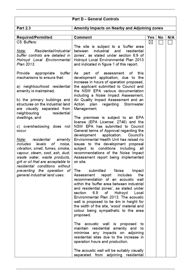
Clause 6.9 –
Buffer area between industrial and residential zones.
The site is subject to
an Industrial-residential buffer area located at the rear (Northern Boundary)
of the site as indicated on Figure 1 above.
Holroyd Local
Environmental Plan 2013 – Clause 6.9 states the following:
Despite any other provision of
this Plan, development must not be carried out on land to which this clause
applies other than:
(a) If
the land is in Zone R2 Low Density Residential—development permitted on
land in that zone in the Land Use Table (excluding residential accommodation),
or
(b) If
the land is in Zone IN1 General Industrial—development permitted on land
in that zone in the Land Use Table, but only if the consent authority is
satisfied that the development is consistent with the objectives of this
clause.
The land is zoned IN1
– General Industrial under HLEP2013 therefore 3(b) above is applicable to
the development application.
The objectives of Clause
6.9 of HLEP 2013 are as follows:
a. To
maintain an adequate separation between general industrial land uses and
residential land uses,
b. To
prevent any likely adverse impacts of outputs of industrial land uses
(including noise, vibrations, odours, fumes, smoke, vapour, steam, soot, ash,
dust, waste water, waste products, grit or oil) on adjacent residential
dwellings,
c. To
ensure that neighbouring residents can enjoy a reasonable level of amenity
without preventing the operation of general industrial land uses,
d. To
provide visual separation of the primary buildings and structures on industrial
land from neighbouring residential dwellings.
The development
application does not seek any alterations or additions to the existing two
warehouses located on the site nor does it seek consent for any existing
structures on site. The Acoustic Report prepared by Benbow Environmental,
Report No. 191094_NIA_Rev5, Revision 5, dated 26 August 2019, recommends the
construction of an acoustic wall within the industrial-residential buffer as
indicated in Figure 5 below:
Figure 5 – Site plan indicating location of proposed acoustic
wall

The proposed acoustic wall is
located on top of an existing ‘mound’ located within the
industrial-residential buffer area applicable to the site as indicate in Figure
6 below:
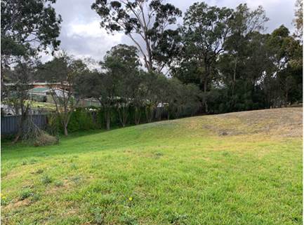
Figure 6 –
Mound location of proposed acoustic wall with residential properties to the
left and Jalco Industrial premises to the right of the mound
Figure
7 – Height of mound in relation to residential backyards
The proposed location of
the acoustic wall is supported by Council, as the acoustic wall complies with
the objectives as listed above of clause 6.9 of Holroyd LEP 2013, particularly
objective B which states, ‘to prevent any likely adverse impacts of
outputs of industrial land uses (including noise, vibrations, odours, fumes,
smoke, vapour, steam, soot, ash, dust, waste water, waste products, grit or oil)
on adjacent residential dwellings’ and objective C which states,
‘To ensure that neighbouring residents can enjoy a reasonable level of
amenity without preventing the operation of general industrial land
uses’. Therefore Council, as the Consent Authority, is satisfied that the
development is consistent with the objectives of this clause.
The proposed acoustic
wall benefits both industrial and residential land uses by allowing the
industrial use to operate with minimal impact to the adjoining residential
developments.
Subject to compliance
with the conditions imposed within the development consent, the use will
satisfy these LEP definitions.
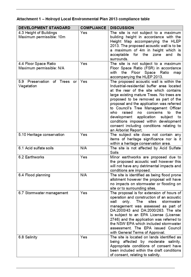
A HLEP 2013 compliance
table is provided at Attachment 1.
(c) Greater
Metropolitan Regional Environmental Plan No 2 — Georges River Catchment
The site is located
within the area covered by the Greater Metropolitan Regional Environmental Plan
No 2 — Georges River Catchment. The development application raises no
issues as the proposal is for extension of operation hours and construction of
an acoustic wall only.
The provisions of any
proposed instrument that is or has been the subject of public consultation
(EP&A Act s4.15 (1) (a) (ii))
There are no draft EPIs
relevant to the proposed development.
The provisions of any
Development Control Plans (EP&A Act s4.15 (1) (a) (iii))
Holroyd Development
Control Plan (HDCP) 2013
Holroyd Development
Control Plan (HDCP) 2013 contains general controls which relate to all
developments under Part A and controls relating to industrial premises under
Part D. Many of the controls within Part A and Part D are not relevant to the
proposal, as there are no changes to the physical structure of the buildings on
site.
The following Parts of
the HDCP 2013 are applicable to the proposed development:
· Part
A – General Controls; and
· Part
D - Industrial Controls
HDCP 2013 Part D states
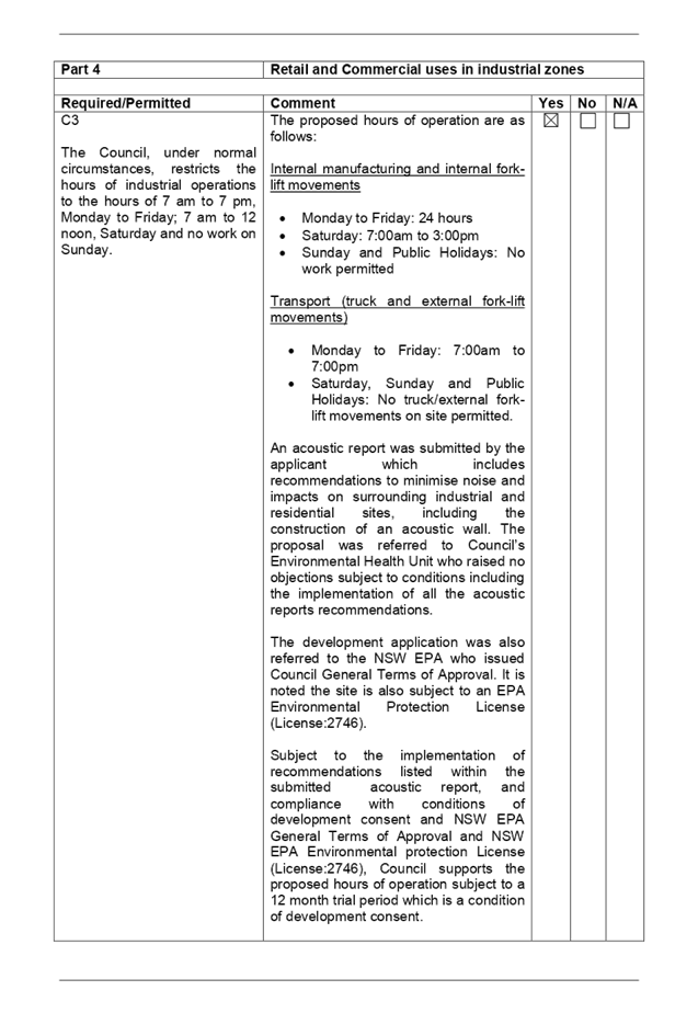
that the Council, under normal circumstances, restricts the hours of industrial
operations to the hours of 7 am to 7 pm, Monday to Friday; 7 am to 12 noon,
Saturday and no work on Sunday.
The development
application proposes the following hours of operation which do not comply with
the hours of operation specified within HDCP 2013:
Internal
manufacturing and internal fork-lift movements
· Monday
to Friday: 24 hours
· Saturday:
7:00am to 3:00pm
· Sunday
and Public Holidays: No work permitted
Transport (truck and
external fork-lift movements)
· Monday
to Friday: 7:00am to 7:00pm
· Saturday,
Sunday and Public Holidays: No truck/external fork-lift movements on site
permitted.
Council has included a
condition in development consent stating that the proposed extended hours of
operation are subject to a 12 month trial period, which is to commence once all
recommendations of the endorsed acoustic report are in place on site, including
the construction of an acoustic wall. A modification application may be
submitted to Council not more than 3 months prior to the expiration of the 12
month trial period seeking the continuation of the extended hours of operation.
Council has imposed various other conditions within development consent to
minimise any amenity impact on neighbouring residential sites.
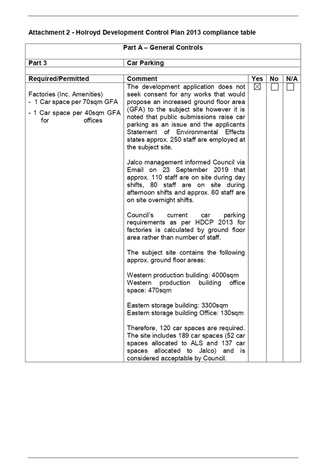
An HDCP 2013 compliance
table is provided at Attachment 2.
The provisions of any
planning agreement that has been entered into under section 7.4, or any draft
planning agreement that a developer has offered to enter into under section 7.4
(EP&A Act s4.15(1)(a)(iiia))
There is no planning
agreement or draft planning agreement associated with the subject application.
The provisions of the
Regulations (EP&A Act s4.15 (1) (a) (iv))
The proposed development
raises no concerns as to the relevant matters arising from the Environmental
Planning and Assessment Regulations 2000 (EP&A Reg).
The Likely
Environmental, Social or Economic Impacts (EP&A Act s4.15 (1) (b))
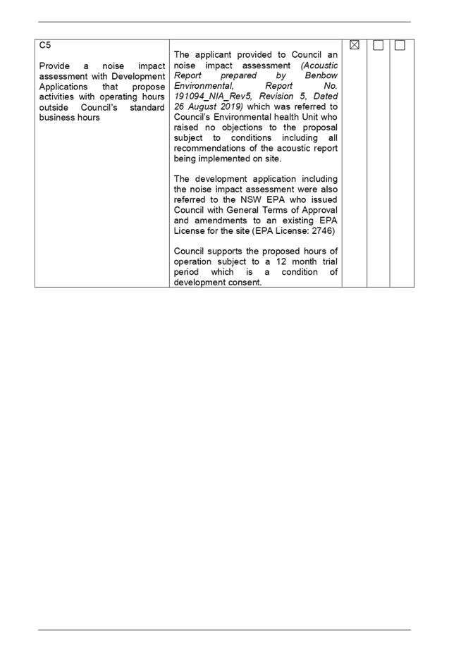
Acoustic Impacts
The submitted Acoustic
report (Acoustic Report prepared by Benbow Environmental, Report No.
191094_NIA_Rev5, Revision 5, dated 26 August 2019) recommends the construction
of an acoustic wall towards the northern (rear) section of the site within the
industrial-residential buffer area listed within Holroyd Local Environmental
Plan 2013. The acoustic wall is proposed on top of a natural mound and to be a
height of 4m to be built entirely within the site’s boundary
This proposal, inclusive
of the acoustic report, was reviewed by Council’s Environmental Health
Unit and the NSW EPA who raised no objections, subject to conditions including
compliance with the recommendations within the acoustic report.
Whilst it has been
assessed that the impacts of the increased hours of operations are minimal to
the surrounding built locality, subject to recommended draft conditions,
Council has received significant objections regarding noise impacts associated
with the development application. Therefore, it is a recommendation of this
report that a trial period of 12 months be granted for 24 hours operation.
Council and nearby land uses can then ascertain the impacts of the increased
operations on the surrounding locality. Prior to the end of the trial period,
the applicant can choose to lodge a subsequent application to Council seeking
continuation of trial period.
Natural Environment
Impacts
The proposed development
application proposes an acoustic wall within the natural landscaped area at the
rear of the site (industrial-residential buffer area). This area contains
significant large mature trees, which are in place to protect adjoining residential
allotments from noise and visual impacts from the industrial area. The proposed
acoustic wall does not propose to remove any trees on site and the application,
including the acoustic wall, was referred to Council’s Tree Management
Officer, who raised no objections to the proposal, subject to the inclusion of
conditions within development consent, including obtaining an Arborist
Report.
Built Environment
Impacts
The proposed development
is not considered to create a significant impact on the built surrounds, noting
the proposed acoustic wall contains a maximum height of 4m on top of an
existing mound. A condition imposed within development consent states that
trees are to be planted between the acoustic wall and rear property boundary,
which will reduce the visual impact of the acoustic wall on adjoining
residential allotments.
Social Impacts
The proposed development
is not considered to provide any adverse social impacts. The acoustic impacts
have been detailed earlier in the report which is a key social issue. A
thorough assessment of the social impacts has revealed that the additional
social impacts created due to the increased operations are minimal on the
surrounding locality.
Economic Impacts
The objectives of the
IN1 General Industrial zone under the Holroyd LEP 2013, encourages employment
opportunities. In this regard, the proposal will have a positive impact as it
continues to support the 250 employees who work at the subject site, which has
a direct economic impact upon the local area.
The suitability of
the site for the development (EP&A Act s4.15 (1)(c))
The use currently
operating on the site is a permissible form of development. The modification
application proposes to intensify the site’s operations which can be
considered for a trial period. The operation of the site meets the zone
objectives of the IN1 General Industrial zone and the site remains suitable for
the proposed modifications.
Submissions made in
accordance with the Act or Regulation (EP&A Act s4.15 (1)(d))
|
Advertised (newspaper)
|
Mail
|
Sign
|
Not Required
|
The application was
notified in accordance with Part E – Public Participation of HDCP 2013
for a period of 14 days from 24 October 2018 to 7 November 2018 and in response
Council received 14 submissions. The application was renotified for a period of
28 days from 20 March 2019 to 17 April 2019 and in response, 9 submissions were
received. The application was further notified for a third notification period
due to the proposal of an acoustic wall for a period of 14 days from 11
September 2019 to 25 September 2019 and in response, 3 submissions were
received.
A total of twenty six
(26) submissions objecting to the proposal were received as a result of the
notification. The issues raised in the submissions are discussed in the table
on the following page:
|
Concern
|
Response
|
|
Minimal information
regarding proposal
|
Council requested additional information and amended plans
from the applicant as part of the assessment of the application, and in
response to feedback from the NSW Environment Protection Authority. Council
is satisfied that there is sufficient information available to determine the
subject application. Consents have previously been issued by Council for
works and uses on the subject site, and those conditions of those consents
continue to apply to the ongoing operations.
The NSW EPA issued Council with a General Terms of
Approval which is to be read in conjunction with an existing active EPA
License (License: 2746) for the premises.
The development application was also referred to
Council’s Environmental Health Unit and Tree Management Officer for
comment and both raised no objections to the proposal, subject to conditions
imposed within development consent.
|
|
Applicant’s SEE and documents don’t indicate
where the truck and forklift movements are proposed on site
|
The development application is seeking consent for
extension of hours of operation, including external truck and fork lift
movements 7:00am to 7:00pm Monday to Friday and construction of an acoustic
wall.
A condition of development consent includes for a plan of
management to be submitted to Council, which includes truck management and
loading and unloading of all vehicles.
All truck and forklift movements are to be carried out in
accordance with the plans and documents endorsed under previous development
applications, subject to the conditions detailed in the notice of
determination at Attachment 3.
|
|
Site management plan
|
A plan of management was submitted to Council as part of
the development assessment process.
Council is seeking further amendments to the plan of
management by way of recommended condition to address loading and unloading
of all vehicles, truck management, forklift refuelling location, forklift
management of noise, accident handling procedure, complaint register, and a
complaints phone line to be in operation 24 hours, 7 days.
|
|
Internal forklift hours of operation
|
The development application is seeking internal
manufacturing and internal fork-lift movements as per the following:
Monday to Friday: 24 hours
Saturday: 7:00am to 3:00pm
Sunday and Public Holidays: No work permitted
Council has recommended a draft condition within
development consent for a 12 month trial period for the proposed hours of
operation. The applicant will be required to seek further approval if they
wish to continue the extended hours. If no application is lodged or if
Council refuses the future application for extended hours; the premises will
be required to operate under Council’s standard hours of operation
which currently as stated within Holroyd Development Control Plan 2013
(HDCP2013) are as follows:
Monday to Friday: 7:00am to 7:00pm
Saturday: 7:00am to 12:00pm
Sunday and Public Holidays: No work permitted
|
|
Current DCP to be used for assessment of hours of
operation and assessment of truck and external forklift movements
|
The development application is seeking an extension to
hours of operation for manufacturing and for truck and external forklift
movements and construction of an acoustic wall only.
As such, Council has assessed the proposed hours of
operation against HDCP 2013 and has recommended a draft condition of
development consent that the extension of operating hours is for a 12 month
trial period only and that a modification application may be submitted to
Council prior to the expiration of the 12 month trial period to seek the
continuation of the extended hours of operation.
If no modification application is lodged with Council, the
hours of operation will revert back to the standard hours as stated within
HDCP 2013 which are as follows:
Monday to Friday: 7.00am to 7.00pm,
Saturday: 7:00am to 12:00pm
Sunday and Public Holidays: No work permitted
The development application is not seeking any approval
for a change to truck and forklift movements on site, with the exception of
hours of operation, from previously approved development applications DA
2000/43 and DA 2000/263.
In this regard, truck and forklift movements/site layout
are to be consistent with previously approved plans including Site Plan of
277-289 Woodpark Road, Smithfield NSW, Dwg No. 352.50-0105, Revision D, Dated
9 December 1999 and Site Plan of 291-303 Woodpark Road, Smithfield NSW, Dwg
No. 352.50-0106, Revision D, dated 10 December 1999, both endorsed by Council
under Development Consent DA: 2000/263.
|
|
Assessment of development application to include the
following sections of HDCP2013:
HDCP2013 Section D: 2.6- Parking and vehicular access
HDCP2013 Section D: 2.3 – Amenity impacts on nearby
and adjoining zones
|
HDCP 2013, Part D, section 2.6 – Parking and
vehicular access is not relevant to the development application as the
development application is for extension to hours of operation and
construction of an acoustic wall only. No changes are proposed to any
buildings on site or change to the number of car parking on site.
Council has undertaken as assessment of HDCP 2013 Section
D: 2.3 – Amenity impacts on nearby and adjoining zones within the HDCP
2013 compliance table provided at Attachment 2.
|
|
Permissibility of acoustic wall
|
The proposed acoustic wall is
permissible with consent and it is also consistent with the objectives of
Clause 6.9 of the LEP. Please refer to Holroyd Local Environmental Plan
2013 assessment section within this report above for Council’s detailed
assessment in relation to the proposed acoustic wall.
|
|
Any existing trees/shrubs to be removed from construction
of acoustic wall
|
The applicant is not seeking consent for removal of any
trees or shrubs as part of this application. Conditions are included in the
draft determination to require trees to be retained and protected during the
construction of the acoustic wall.
|
|
Location of premises operating 24 hours a day in relation
to residential properties
|
The subject industrial site is zoned IN1 – General
Industrial under the Holroyd LEP 2013. The use of the premises was approved
by Council under DA 2000/43 and DA 2000/263.
Holroyd LEP 2013 states the objectives of land zoned IN1
– General Industrial include:
• To encourage employment opportunities;
and
• To
minimise any adverse effect of industry on other land uses
The proposed intensification of operations at the site can
be considered to fulfil an important community need in maintaining employment
in industrial areas.
Council considers that the site can be adequately managed
by the draft conditions recommended to be imposed on any consent.
It is a recommendation of this report that the
modification application be approved for a trial period of 12 months, with
appropriate conditions imposed for Council and adjoining land uses to monitor
compliance.
|
|
Impact of extension of hours on residential area
including:
- Quality of life
- Impacts from noise including
affecting sleep
- Increased air pollution/odour
from trucks/warehouse operations
|
The development application was referred to
Council’s Environmental Health Unit who raised no objections, subject
to conditions, including all recommendations of the submitted acoustic report
being implemented on site.
The application was also referred to the NSW EPA who
reviewed a noise impact assessment report, Air quality impact assessment,
storm water and waste water management plan. The NSW EPA issued Council with
a General Terms of Approval.
Council has imposed various conditions in development
consent to minimise the impact of the increased hours of operation on
adjoining residential sites.
It is a recommendation of this report that the
modification application be approved for a trial period of 12 months, with
appropriate conditions imposed for Council and adjoining land uses to monitor
compliance.
It is a condition of development consent for the subject
site to also have a 24 hour 7 day complaints phone line and details of the
complaints hotline is to be on Jalco’s website and the subject
premises.
If it is observed that the premises is not operating in
accordance with the conditions of consent, Council may be contacted on
8757-9000 (available 24 hours/7 days) and/or the NSW EPA to report a
complaint.
|
|
Concerns of a flow on affect to neighbouring industrial
premises requesting 24 hour operation in the future
|
Council assesses each application on its merits.
|
|
Process alarm constantly producing loud alert noise
for hours when site unmonitored
|
If alarms are audible from the premises whilst the premise
is unattended, please contact Council on 8757-9000 (available 24 hours/7
days) and/or the NSW EPA to report a complaint.
A condition of development consent is imposed for the
subject site to also have a 24 hour 7 day complaints phone line and details
of the complaints hotline are to be on Jalco’s website and the subject
premises.
|
|
Noise from metal bins/containers all hours of the night
|
Conditions are included in the draft determination to
protect adjoining residential amenity, including restriction to external
operations.
Residents can contact Council to lodge a complaint, either
online, by calling 8757-9907 (24 hours/7 days) or speaking to Council’s
Customer Services in person at either Council’s Auburn or Merrylands
service centres (during business hours).
|
|
Noise from forklifts continuously
‘beeping/horns’
|
The applicant has submitted to Council a compliance
plan/plan of management, which proposes to renew the existing forklift fleet
with new vehicles that use different technologies to eliminate the excessive
use of horns. External forklift movements are also restricted to the
following hours for a 12 month trial period:
· Monday to
Friday: 7:00am to 7:00pm
· Saturday, Sunday
and Public Holidays: No truck/external fork-lift movements on site permitted.
NSW EPA General Terms of Approval and EPA License 2746
include maximum noise levels to be permitted on site during specific hours.
Residents can contact Council to lodge a complaint, either
online, by calling 8757-9907 (24 hours/7 days) or speaking to Council’s
Customer Services in person at either Council’s Auburn or Merrylands
service centres (during business hours).
|
|
Increase of noise from premises due to increased
production/shift workers/ noise all hours of the night
|
NSW EPA General Terms of Approval and EPA License 2746
include maximum noise levels to be permitted on site during specific hours.
Residents can contact Council on 8757-9000 (available 24
hours/7 days) and/or the NSW EPA to report a complaint regarding noise from
the premises.
The below hours of operation are recommended at the
subject premises for a trial period of 12 months, which is to commence once
all recommendations of the noise impact assessment report, including
construction of an acoustic wall have been implemented on site:
Internal manufacturing and internal fork-lift movements
· Monday to
Friday: 24 hours
· Saturday: 7:00am
to 3:00pm
· Sunday and
Public Holidays: No work permitted
Transport (truck and external fork-lift movements)
· Monday to
Friday: 7:00am to 7:00pm
· Saturday, Sunday
and Public Holidays: No truck/external fork-lift movements on site permitted.
Council has imposed various other conditions within
development consent to minimise any amenity impact the increased hours of
operation may have on adjoining residential sites.
|
|
Unauthorised structures on site including dust collection
valve
|
The development application does not seek any consent
regarding unauthorised structures on site.
A condition of development consent is for the site to be
maintained in accordance with plans endorsed under previous consents.
|
|
External lighting on rear northern wall/light pollution
shining into residential properties backyards
|
A condition has been recommended in the draft development
consent regarding light over spill. The condition reads as follows, ‘All
external lighting on site shall be directed away from neighbouring
residential properties. In this regard, all light overspill shall be
controlled so as not to unreasonably affect residential amenity. All lighting
shall comply with AS4282-1997 Control of the obtrusive effects of outdoor
lighting’.
|
|
Jalco already operating beyond hours sought/ external
storage movements and vehicle movements including truck and forklifts
operating externally all hours of the night
|
Council is aware of this and its regulatory arm has taken
appropriate actions.
|
|
External storage including chemicals and raw materials
and fire risk from chemical storage and external operational activities
|
A condition of the draft development consent is for the
site to be maintained in accordance with plans previously endorsed by
council, including:
· Site Plan of
277-289 Woodpark Road, Smithfield NSW, Dwg No. 352.50-0105, Revision D, Dated
9 December 1999, Endorsed by Council under Development Consent DA:2000/263;
and
· Site Plan of
291-303 Woodpark Road, Smithfield NSW, Dwg No. 352.50-0106, Revision D, Dated
10 December 1999, Endorsed by Council under Development Consent DA: 2000/263.
·
·
The above plans can be viewed at Council’s services
centres by lodging a GIPA request with Council which can be viewed at the
following link: https://www.cumberland.nsw.gov.au/sites/default/files/2017-10/GIPA-Informal-Access-Application-New-Logo-Cumberland-Council-2017.pdf
·
·
The development application does not seek any change to
external chemical storage from DA 2000/43 and DA 2000/263.
·
|
|
Lack of screening between industrial and residential sites
|
The development application proposes an acoustic wall at
the rear of the site, between the existing industrial buildings and the
adjacent residential properties.
As part of the development assessment process, Council
received information regarding the acoustic wall, including location,
materials, colour and associated planting. The proposed acoustic wall will
contribute to minimise amenity impacts on adjoining residential properties
from the extension of operation hours.
Council’s Tree Management Officer has also
recommended a condition for appropriate screening by planting of trees
between the boundary of adjoining residential sites and location of proposed
acoustic wall.
An assessment of the proposed acoustic wall is within the
HLEP 2013 section of this report, HLEP 2013 compliance table as Attachment 1
and within attachment 2 - HDCP 2013 – Part D- Section 2.3 - Amenity
Impacts on Nearby and Adjoining zones.
|
|
Extension of hours affecting property value/loss of
tenants
|
These are not matters for consideration in the assessment
of a development application pursuant to section 4.15 of the EP&A Act.
|
|
Noise from rear car parks 24 hours a day
|
Conditions are included in the draft determination to require
that all driveways which provide access to the rear of the site/ rear car
parks to have their access gates locked with no vehicle access including
trucks and forklifts between the following hours:
· Monday to
Friday: 12:00am to 7:00am and 7:00pm to 11:59pm
· Saturday:
12:00am to 7:00am and 3:00pm to 11:59pm
· Sunday and
Public Holidays: 24 hours
Council has imposed various other conditions within
development consent to mitigate potential amenity impact on adjoining
residential sites.
|
|
Car parking spaces required
|
Under current HDCP 2013 requirements, the premise is
required to provide a minimum of 120 car spaces on site. The site includes
189 car spaces (52 car spaces allocated to ALS and 137 car spaces allocated
to Jalco) and is considered acceptable by Council.
The proposed development does not require any additional
car parking. Conditions included in the draft determination require that
existing car spaces be maintained in accordance with previous consents.
|
|
Noise from trucks reversing on site
|
A condition has been imposed within the draft development
consent for all vehicle movements on site, including truck movements, to be
in a forward direction when entering and leaving the site.
|
|
Stormwater/waste water treatment
|
The development application is for extension to hours of
operation and construction of an acoustic wall only; however, the application
was referred to the NSW EPA who assessed stormwater/waste water as part of
their assessment process, including reports submitted to Council.
The NSW EPA issued Council with General Terms of Approval
and an EPA License (License: 2746) is applicable to the premises.
|
|
Gas storage. Dangerous goods and treatment plant
|
The development application is for extension to hours of
operation and construction of an acoustic wall only. The development
application does not seek approval for any storage/structures on site, with
the exception of the construction of an acoustic wall.
A condition of development consent is for the site to be
maintained in accordance with plans previously endorsed by council,
including:
· Site Plan of
277-289 Woodpark Road, Smithfield NSW, Dwg No. 352.50-0105, Revision D, Dated
9 December 1999, Endorsed by Council under Development Consent DA:2000/263;
and
· Site Plan of
291-303 Woodpark Road, Smithfield NSW, Dwg No. 352.50-0106, Revision D, Dated
10 December 1999, Endorsed by Council under Development Consent DA: 2000/263.
The above plans can be viewed at Council’s services
centres by lodging a GIPA request with Council which can be viewed at the
following link:
https://www.cumberland.nsw.gov.au/sites/default/files/2017-10/GIPA-Informal-Access-Application-New-Logo-Cumberland-Council-2017.pdf
|
The public interest (EP&A
Act s4.15 (1) (e))
In considering whether a proposal
is in the wider interest of the public, Council must consider the negative and
positive aspects of the proposal. The proposed intensification of operations at
the site can be considered to fulfil an important community need in supporting
employment in industrial areas which has an increased economic benefit which
satisfies the objectives of the IN1 – General industrial zone.
All development will have an
impact and, as long as the impact can be appropriately managed, as is the case
here, they can be considered to be in the interest of the community. It is
noted that there are significant objections received in regard to the
application. Hence, to manage the public interest, it is a recommendation of
this report that the modification application be approved for a trial period of
12 months with appropriate conditions imposed for Council and adjoining land
uses to monitor compliance.
Disclosure of Political
Donations And Gifts
The application and notification
process did not result in any disclosure of political donations or gifts.
The development application has
been assessed in accordance with the relevant requirements of the
Environmental Planning and Assessment Act 1979, Holroyd Local Environmental
Plan 2013 and Holroyd Development Control Plan 2013 and is considered to be
satisfactory for approval subject to conditions including a 12 months trial
period.
The report has provided a detailed
analysis of all the issues associated with the proposal. The HLEP 2013 and HDCP
2013 allow for industrial uses to operate within industrial areas and for
impacts to be appropriately managed. On balance, it is considered that the
potential impacts created by the proposal will be acceptable, if the mitigation
measures detailed in the acoustic report and the recommended conditions are
implemented. It is also recommended that the extended hours of operation be
subject to a trial period of 12 months, to allow for monitoring of compliance
with the consent conditions, and identification of any other issues associated
with the proposal.
For these reasons, it is
considered that the proposal is satisfactory having regard to the matters of
consideration under Section 4.15 of the Environmental Planning and Assessment
Act 1979, and the development may be approved subject to conditions.
There are no consultation
processes for Council associated with this report.
There are no financial
implications for Council associated with this report.
There are no policy implications
for Council associated with this report.
Communication /
Publications:
The final outcome of this matter
will be notified in the newspaper. The objectors will also be notified in
writing of the outcome.
|
1. That
Development Application No. 2018/321/1 for extension of hours of operation of
existing manufacturing & warehouse use to carry out manufacturing 24
hours a day Monday to Friday and 7.00 am to 3.00 pm Saturday, and truck &
external forklift movements 7.00 am to 7.00 pm Monday to Friday and
construction of an acoustic wall on land at 277-289 Woodpark Road, Smithfield
be approved, subject to attached conditions, including a trial period of 12
months.
2. That
the Environmental Protection Authority be advised of this determination.
3. That
those persons who made a submission be advised of the determination.
|
1. Holroyd
Local Environmental Plan 2013 compliance table
2. Holroyd
Development Control Plan 2013 compliance table
3. Draft
Notice of Determination
4. Acoustic
Report
5. Architectural
Plans/Reports
6. Redacted
Public Submissions
DOCUMENTS
ASSOCIATED WITH
REPORT ELPP067/19
Attachment 1
Holroyd Local Environmental Plan 2013 compliance table
Extraordinary Cumberland Local Planning
Panel Meeting
5 November 2019

DOCUMENTS
ASSOCIATED WITH
REPORT ELPP067/19
Attachment 2
Holroyd Development Control Plan 2013 compliance table
Extraordinary Cumberland Local Planning
Panel Meeting
5 November 2019

DOCUMENTS
ASSOCIATED WITH
REPORT ELPP067/19
Attachment 3
Draft Notice of Determination
Extraordinary Cumberland Local Planning
Panel Meeting
5 November 2019
ENVIRONMENTAL PLANNING & ASSESSMENT ACT 1979
NOTICE OF DETERMINATION OF APPLICATION
5 November 2019
David
Carey Town Planning & Development
1/110
Wellington Street
WATERLOO
NSW 2017
Dear Sir,
Pursuant to Section 4.16 of
the Act, Council has granted conditional approval to your Development Application
described as follows:
PROPERTY: Lot:
1 DP: 1024505
STREET ADDRESS: 277-289
Woodpark Road Smithfield
DEVELOPMENT CONSENT NO: 2018/321/1
DECISION:
Cumberland Local Planning Panel
DATE OF EXPIRY OF
CONSENT: 5 November 2024
PROPOSED DEVELOPMENT: Extension
of hours of operation of existing manufacturing & warehouse use to carry
out manufacturing 24 hours a day Monday to Friday and 7.00 am to 3.00 pm
Saturday, and truck & external forklift movements 7.00 am to 7.00 pm Monday
to Friday and construction of an acoustic wall.
This Development Application
is APPROVED in accordance with the Environmental Planning & Assessment Act
1979 and is subject to compliance with the requirements of Cumberland Council,
the Building Code of Australia, the Local Government Act 1993, and the
following conditions as set out hereunder and/or endorsed upon the attached
plans.
PRELIMINARY
1. This
consent shall lapse if the above development is not physically commenced by the
date of expiry shown on the front page of this consent.
2. The
development is to be carried out in accordance with the following endorsed
plans and documents:
· NSW EPA General Terms of Approval notice, Notice No.
1584640, File No. SF19/36142, Dated 9 September 2019;
· Acoustic Report prepared by Benbow Environmental,
Report No. 191094_NIA_Rev5, Revision 5, Dated 26 August 2019;
· Air Quality Impact Assessment prepared by Benbow
Environmental, Report No. 191094-02_AQIA_Rev3, Dated 17 May 2019;
· EPA Action Plan Stage 1 prepared by John Marks,
Document No. 19004-010 Jalco, Revision 4, Dated 5 April 2019;
· Jalco Smithfield Compliance Plan, dated 22 May 2019;
· Site Plan of location of Acoustic wall prepared by
Micheal Fountain Architects Pty Ltd, Job No. 1913, Dwg No. SK-001, Issue C,
Dated September 2019
· Schedule of Colours and Finishes of Acoustic Wall,
Received by Council 4 September 2019;
· Proposed Acoustic Wall Footing detail prepared by BVG
Consultants Pty Ltd, Dwg No. 19-149 SK1, Dated 30 August 2019;
except
as otherwise provided by the conditions of this determination and/or marked in
red
3. All
building work shall be carried out in accordance with the requirements of the
Building Code of Australia. Fully detailed plans including fire safety details
shall be submitted with the Construction Certificate application. No work is to commence until such time as a
Construction Certificate is obtained for the work/building permitted by this
Consent.
Appointment
of Council or a Private Certifier as the Principal Certifying Authority (PCA)
4. Either
Council or a Private Certifier is to be appointed as the Principal Certifying
Authority (PCA) for the development in accordance with Section 6.6 of the Act.
Accordingly,
wherever reference is made to the Principal Certifying Authority in this
Consent, it refers to Council or the Private Certifier as chosen by you.
Note: Once
you have chosen either Council or a Private Certifier as the PCA, you cannot
change from one to the other, or from one Private Certifier or another, without
the approval of Department of Planning & Infrastructure.
5. The
applicant shall consult with, as required:
(a) Sydney Water Corporation
Limited
(b) Integral Energy
(c) Natural Gas Company
(d) A local telecommunications
carrier
regarding
their requirements for the provision of services to the development and the
location of existing services that may be affected by proposed works, either on
site or on the adjacent public road(s).
6. Building
materials, builder’s sheds, waste bins, site fencing, gates or any
material of any description shall not be left or placed on any footway, road or
nature strip. Footways and nature strips shall be maintained, including
the cutting of vegetation, so as not to become unsightly or a hazard for
pedestrians. Offenders will be prosecuted.
Limitation
on consent
7. This
consent relates only to the extension of hours of operation of existing
manufacturing & warehouse use and construction of an acoustic wall. No
consent is granted or implied for any other structures on site.
Acoustic
Recommendations
8. All
recommendations of the endorsed acoustic report that do not require
Construction Certificate approval are to be implemented/completed within three
(3) months of the date of this consent.
9. The
acoustic wall is to be installed and completed within 6 months of the date of
this consent. Note: Compliance with prior to Construction Certificate
conditions is required before construction commences.
NOTE: FEES, BONDS & CONTRIBUTIONS
INDICATED IN CONDITIONS OF THIS CONSENT MAY VARY IN ACCORDANCE WITH THOSE
ADOPTED BY COUNCIL AT SUBSEQUENT ANNUAL REVIEWS OF ITS “FEES AND
CHARGES” AND SUBSEQUENT CHANGES TO THE BUILDING PRICE
INDEX. FEES CHARGED WILL BE THOSE CURRENT AT THE TIME OF PAYMENT.
|
PRIOR TO ISSUE/RELEASE OF
CONSTRUCTION CERTIFICATE
The following conditions
must be complied with prior to the issue of a Construction Certificate, or
where relevant prior to demolition occurring. In many cases the
conditions require certain details to be included with or incorporated in the
detailed plans and specifications which accompany the Construction Certificate:
Amended Plans to Certifying Authority
10. Amended plans/documents shall be submitted to the
Certifying Authority, prior to the issue of a Construction Certificate to
address the following issues:
i. A Waste Management Plan is to be
provided In accordance with section 11, Part A of Holroyd Development Control
Plan 2013; and
ii. A detailed landscape plan
prepared by a qualified Landscape Architect/ Designer at a minimum scale of
1:100 must be prepared, and be consistent with all other endorsed plans and
documents. The plan must also include the following:
Planting of 45 litre minimum
container size trees to be installed within area of the site between the rear
acoustic wall and rear property boundary. The location/tree planting spacing is to be advised by the
Consulting Arborist/Landscape Designer to aesthetically screen the wall from
adjoining residential properties. The species of these trees must be selected from the
following list:
o Eucalyptus moluccana (Grey Box)
o Eucalyptus tereticornis (Forest Red Gum)
o Corymbia maculata (Spotted Gum)
o Eucalyptus amplifolia (Cabbage Gum)
o Eucalyptus longifolia (Woolybutt)
o Syncarpia glomulifera (Turpentine Tree).
Arborist Report/Tree Protection Plan
11. A report from an AQF Level 5 Consulting Arborist with an
accompanying Tree Protection Plan is required to assess the impact of the
proposed acoustic wall construction on all existing trees that will be affected
by the works tree pruning and construction vehicle access. The report must be
written in accordance in with AS 4970 - ‘Protection of Trees on
Development Sites’, and is to be submitted to Council for assessment and
approval by Council’s Tree Management Officer. The arborist report must:
a) state the necessary
tree sensitive construction measures to be implemented and/or any required
design modification to the location of the wall/wall footings, so that the
trees in this area can be retained and protected.
b) Include arborist
recommendations required for any tree sensitive construction measures to be
implemented to retain these trees must relate directly to the specific proposed
works. Simply referring to sections/appendix within the report regarding basic
tree protection information is unacceptable.
c) The Tree Protection
Plan must provide Tree Protection Zone and Structural Root Zone measurements,
including specific offset measurements annotated on the plan for the location
of tree protection fencing and/or any other tree protection measures to be
implemented. This must be prepared on a scale plan and show all proposed works
and correct locations of the subject trees.
Plan of Management
12. A detailed
Plan of Management shall be submitted to the satisfaction of Cumberland
Council’s Executive Manager of Development and Building, within 3 months
from date of this consent. The Plan of Management is to include, but not be
limited to, the following:
· Loading and unloading of all vehicles including
trucks;
· Truck management including truck waiting areas;
· Forklift refuelling location;
· Management of forklift noise during night time hours;
· Accident handling procedure;
· A complaint register is to be maintained noting each
complaint and actions taken to address them. A copy of this register must be
provided to Council with any modification application submitted at the
conclusion of the 12 month trial period; and
· Complaints Phone Hotline as per the following:
The occupier/operator is to develop a specific
complaint procedure program to facilitate communication with neighbouring
properties and the handling of complaints. This is to include at a minimum, a
24 hour, 7 day a week phone hotline to be established.
Details of the specific complaint procedure program
for Jalco’s Smithfield site is to be clearly visible at a minimum on
Jalco’s website, main reception building fronting Woodpark Road,
Smithfield and business identification signage within the front setback of the
premises.
The details shall include at a minimum details stating
the hotline is available 24 hours, 7 days a week to anyone including the
general public and list the contact phone number of the hotline. The details
regarding the specific complaint procedure program including the hotline is to
be updated immediately should the details/ hotline phone number change.
Payment of Bonds, Fees and Long Service Levy
13. The Principal
Certifying Authority is to ensure and obtain written proof that all bonds, fees
and contributions as required by this consent have been paid to the applicable
authority. This includes all Long Service Levy payments to be made to the Long
Service Payments Corporation.
Damage Deposit
14. A cash
bond/bank guarantee of $6,160.00 must be paid/lodged with Council to
cover making good any damage caused to the
property of Council, during the course of construction associated with the
development. This will be held for ‘six (6) months after the
completion of works’ or six (6) months 0fter the issue of ‘Final
Occupation Certificate’ (whichever occurs last) to remedy any defects
that may arise within this time.
Note:- The applicant/owner shall be held
responsible for and may be required to pay the full reinstatement costs for
damage caused to Council’s property unless the applicant/owner notifies
Council in writing and provides photographic proof of any existing damage to
Council’s property. Such notification shall occur prior to
works/demolition commencing. However, if in the opinion of Council,
during the course of construction existing damage has worsened, Council may
require full reinstatement. If damage does occur during the course of
construction, prior to reinstating any damage to Council’s property, the
applicant/owner shall obtain design specifications of all proposed restoration
works. Restoration/construction works within the road reserve shall be carried
out by a licensed construction contractor at the applicant/owners expense and
shall be inspected by Council prior to placement of concrete and/or asphalt.
Consistency with Endorsed Development Consent Plans
15. The Principal
Certifying Authority must ensure that any certified plans forming part of the
Construction Certificate, are in accordance with the Development Consent plans.
Landscape
Inspection Fee
16. Payment of a $382.00
fee for the inspection by Council of landscape works and/or trees to be
retained at the key stages, where Council is the Principal Certifying
Authority.
Required
Submissions to Certifying Authority
17. Structural
engineer’s details prepared and certified by a practising qualified
structural engineer of all reinforced concrete and structural members shall be
submitted to the Principal Certifying Authority.
18. If the
development likely to disturb or impact upon telecommunications infrastructure,
written confirmation from the service provider that they have agreed to the
proposed works must be submitted to the Principal Certifying Authority prior to
the issue of a Construction Certificate or any works commencing, whichever
occurs first.
Salinity
19. The site has
been identified as having a potential salinity hazard. To prevent
moisture/salinity from entering the built structure, appropriate construction
methods are to be incorporated for all dwellings/buildings.
Details
of proposed methods of construction are to be detailed in the engineering plans
and submitted to the PCA.
Note: Further information for building in a
saline environment is available in the following documents:
“Building
in Saline Environment” prepared by DIPNR 2003.
Water
Sensitive Urban Design in the Sydney Regions “Practice Note 12: Urban
Salinity”
Wagga
Wagga City Council’s “Urban Salinity Action” October 1999
“Guide
to Residential Slabs and Footings in Saline Environments” prepared by
Cement Concrete and Aggregates Australia, May 2005.
Sydney Water
20. A building
plan approval must be obtained from Sydney Water Tap In™ to ensure the
development will not affect any sewer, water or stormwater mains or easements.
A
copy of the building plan approval receipt from Sydney Water must be submitted
to the certifying authority, prior to the issue of a construction certificate.
Please
go to sydneywater.com.au/tapin to apply.
PRIOR TO WORKS COMMENCING
The following conditions
are to be complied with prior to demolition / any works commencing on the site:
Appointment of Principal Certifying Authority and
Notification of Commencement of Work
21. The person
having the benefit of the development consent, not the principal contractor
(builder), must:
a) Appoint a Principal
Certifying Authority in accordance with Section 6.6 of the Act.
b) Have the Principal
Certifying Authority complete the ‘Accredited Certifier Details’ on
the approved form provided by Council for this purpose, an original of which is
attached to this Development Consent.
c) Notify Council of the
appointment of the Principal Certifying Authority and of the intention to
commence building work, such notification is to be given to Council at least
two (2) working days prior to the proposed commencement date, and be on the
approved form provided by Council for this purpose, an original of which is
attached to this Development Consent.
If
nominated, Council can provide this service for you and act as the Principal
Certifying Authority.
N.B. The
Principal Certifying Authority must also notify the person having the benefit
of the Development Consent of any mandatory critical stage inspections and
other inspections that are to be carried out in respect of the building work
such notification must comply with Clause 103A of the Regulations.
Notification
of Principal Contractor (Builder)/Owner-Builder
22. The person
having the benefit of the Development Consent must:
(a) Notify the Principal
Certifying Authority that the person will carry out the work as an
owner-builder, if that is the case;
OR
(b) Appoint a Principal
Contractor for the building work (who must be the holder of a contractor
licence if any residential building work is involved), and notify the Principal
Contractor of any mandatory critical stage inspections and other inspections
that are to be carried out in respect of the building work.
(c) Notify the Principal Certifying
Authority of any such appointment.
Where
Council is the Principal Certifying Authority, such notification is to be on
the approved form provided by Council for this purpose, an original of which is
attached to this Development Consent.
Photographic
Record of Council Property – Damage Deposit
23. The applicant
shall submit to Council, for the purposes of the damage deposit bond lodged to
cover making good any damage caused to the property of Council, a full and
satisfactory photographic record of the condition of Council’s property
(i.e., road pavement, kerb and guttering, footway, stormwater drainage, etc.)
adjacent to the subject site. The purpose of the photographic record is
to establish any pre-existing damage to Council’s property to ensure that
you are not liable for any re-instatement works associated with that
damage. However, if in the opinion of Council, the existing damage
has worsened or any new damage is caused during the course of construction, the
Council may require either part or full re-instatement.
Note:
Failure to provide a full and satisfactory photographic record described above,
is likely to render the applicant liable to rectify all damages unless
satisfactory proof can be provided that the damage was pre-existing.
Fencing of Sites
24. Fencing of
sites is required to prevent public access when the site is unoccupied and
building works are not in progress. In this regard the MINIMUM acceptable
standard of fencing to the site is properly constructed chain wire fencing 1.8m
high, clad internally with Hessian or Geotextile fabric. All openings are to be
provided with gates, such gates are not at any time to swing out from the site
or obstruct the footpath or roadway.
Signs
to be Erected on Sites
25. A sign must be
erected in a prominent position on any site on which building work, subdivision
work or demolition work is being carried out:
(a) Showing the name, address
and telephone number of the Principal Certifying Authority for the work, and
(b) Showing the name of the
principal contractor (if any) for any building work and a telephone number on
which that person may be contacted outside working hours and at any time for
business purposes, and
(c) Stating that unauthorised
entry to the work site is prohibited.
The
sign must be rigid and durable and be read easily by anyone in any public road
or other public place adjacent to the site.
Any
such sign is to be maintained while the building work, subdivision work or
demolition work is being carried out, but must be removed when the work has
been completed.
This
clause does not apply in relation to building work, subdivision work or
demolition work that is carried out inside an existing building that does not
affect the external walls of the building.
Note: Principal
Certifying Authorities and Principal Contractors must also ensure that signs
required by this clause are erected and maintained (clause 227A of the
Regulations currently imposes a maximum penalty of $1,100).
Prohibited
Signage
26. Advertising,
Real Estate Agents, Architects, Designers, site suppliers and any other signage
not mentioned in the conditions, is not to be placed or displayed on the site,
such that the signage is visible from any public place. Offenders may be
prosecuted.
Protection
of Public Places
27. A hoarding or
fence must be erected between the work site and any public place, if the work
involved in the erection or demolition of the building; is likely to cause
pedestrian or vehicular traffic in a public place to be obstructed or rendered
inconvenient, or involves the enclosure of a public place.
If
necessary, an awning is to be erected, sufficient to prevent any substance
from, or in connection with, the work falling into the public place.
The
work site must be kept lit between sunset and sunrise if it is likely to be
hazardous to persons in the public place.
Site
Control Measures
28. Suitable
erosion and sediment control measures shall be provided at all vehicular
entry/exit points and all other measures required with and/or shown on plans
accompanying the Construction Certificate, to control soil erosion and
sedimentation, are to be in place prior to the commencement of construction
works. Such controls are to be provided in accordance with Holroyd’s
“Erosion & Sediment Control Policy.”
Note: On-the-spot fines
may be issued by council where measures are absent or inadequate.
Tree
Protection Conditions
29. An Arborist
qualified to at least Australian Qualifications Framework (AQF) Certificate
Level 4 shall be retained throughout all demolition/construction work to ensure
the proper protection and management of the tree/s required to be
retained/transplanted and that any necessary pruning work within 1m of the
building/s approved, is carried out in accordance with Australian Standard
4373-1996 “Pruning of Amenity Trees”. This includes on site
supervision of the erection of tree protection measures and, where necessary,
any works that are required within tree protection zones.
30. The tree/s
identified as per the report prepared to satisfy condition 9(ii), as being
retained/transplanted, shall be protected prior to and throughout the
construction process in accordance with the relevant conditions of this
Consent. All trees not authorised to be removed by this Consent must be
retained. Prior to any work commencing, certification of the installation and
inspection of the required tree protection works is to be provided to the
Principal Certifying Authority by a suitably qualified person or the Arborist
(as appropriate) engaged to ensure the proper protection and management of the
tree/s required to be retained/transplanted. A copy of the Certificate is
to be issued to Council within seven (7) days of the inspection and prior to
any works commencing. Additionally, trees identified for removal are to be
retained until immediately prior to works commencing, to assist with soil
management and erosion control.
Footpaving,
Kerbing and Guttering
31. Protection
must be provided for Council footpaving, kerbing and guttering. Wooden mats
must also be provided at all entrances where the site fronts paved footpaths.
32. The applicant
to arrange with the relevant public utility authority the alteration or removal
of any affected services in connection with the development. Any such work
being carried out at the applicant’s cost.
Works
within Council’s Reserve
33. All works
within the Council reserve shall be completed within three (3) weeks of the
date of commencement. Council’s Development Engineer shall be advised
prior to the commencement of works.
34. Submission to
Council of a Certificate of Currency of the contractor’s Workers’
Compensation Policy prior to the commencement of works.
35. All
construction works shall be in accordance with the WorkCover safety
requirements. Submission of insurance documentation demonstrating a minimum
Public Liability cover of $10,000,000 is to be submitted prior to commencement
of works. Cumberland Council shall be named on the Certificate of Currency as
an interested party.
DURING CONSTRUCTION
The following conditions are applicable during demolition /
construction:
Endorsed
Plans & Specifications
36. A copy of the
endorsed stamped plans and specifications, together with a copy of the
Development Consent, Construction Certificate and approved Traffic Management
Plan are to be retained on site at all times.
Hours
of Work & Display of Council Supplied Sign
37. For the
purpose of preserving the amenity of neighbouring occupations building work
including the delivery of materials to and from the site is to be restricted to
the hours of 7.00am to 6.00pm Mondays to Fridays and 8.00am to 4.00pm
Saturdays. Work on the site on Sundays and Public Holidays is prohibited.
Note: Demolition work is not permitted on weekends or Public Holidays -
refer to specific demolition condition for approved hours.
The
yellow “Hours of Building Work” sign (supplied by Council with the
approval), is to be displayed in a prominent position at the front of the site
for the duration of the work.
Site
Control
38. All soil
erosion measures required in accordance with the approved sediment and erosion
control plan and any other relevant conditions of this Consent are to be put in
place prior to commencement of construction works are to be maintained during
the entire construction period until disturbed areas are restored by turfing,
paving or revegetation. This includes the provision of turf laid on the nature
strip adjacent to the kerb.
39. Builder’s
refuse disposal and storage facilities are to be provided on the development
site for the duration of construction works and all rubbish shall be removed
from the site upon completion of the project.
40. Stockpiles of
sand, soil and other material shall be stored clear of any drainage line or
easement, tree protection zone, water bodies, footpath, kerb or road surface
and shall have erosion and sediment control measures in place to prevent the
movement of such materials onto the aforementioned areas and adjoining land.
Waste
Management Plan
41. The approved
Waste Management Plan must be implemented and complied with during all stages
of works on site.
42. Within seven
(7) days of completion of construction/building works, the applicant shall
submit a signed statement to Council or the Principal Certifying Authority
verifying that demolition work and recycling of materials was undertaken in
compliance with the Waste Management Plan. The Principal Certifying Authority
shall submit a copy of the statement to Council.
In reviewing such documentation Council will require the provision of
actual weighbridge receipts for the recycling/disposal of all materials.
Compliance
with Critical Stage Inspections and other Inspections nominated by the
Principal Certifying Authority
43. Section 6.5 of
the Act requires certain specific inspections (prescribed by clause 162A of the
Regulations) and known as ‘Critical Stage Inspections’ to be
carried out for building work. Prior to permitting commencement of the work
your Principal Certifying Authority is required to give notice of these
inspections pursuant to clause 103A of the Regulations.
N.B. An
Occupation Certificate cannot be issued and the building may not be able to be
used or occupied where any mandatory critical stage inspections or other
inspections required by the Principal Certifying Authority are not carried out.
Where
Council is nominated as Principal Certifying Authority, notification of all
inspections required is provided with the Construction Certificate approval.
Tree
Protection
44. The applicant
shall accept all responsibility for the accuracy of the information provided to
Council for assessment. If any tree/s are not shown on the endorsed
plan or are required to be retained and protected but are threatened by
demolition/construction work through unforeseen construction requirements or
plan inaccuracy, all site and building works so affected are to cease
until the matter is resolved to the satisfaction of Council. Council’s
Environmental and Planning Services Department is to be notified immediately upon
such a problem being encountered.
45. The tree/s
identified as per the report required, as per condition number 9(ii), as being
retained/transplanted shall be protected against damage throughout the
demolition/construction process in accordance with the relevant conditions of
this Consent.
46. Branches of
trees to be retained/transplanted within 1m of the approved building, may be
pruned by an Arborist qualified to at least Australian Qualification Framework
(AQF) Certificate Level 3 in accordance with Australian Standard AS4373-1996
‘Pruning of Amenity Trees’ to enable demolition/construction works
to occur.
Note: Any other pruning works not authorised by this Consent
are subject to the approval of an application for General Tree Works
activities.
47. No works are
to occur within the fenced tree protection zone. All authorised
works/activities within the fenced tree protection zone/s are to be undertaken
by hand held equipment under the supervision of the consulting
Arborist. No roots over 50mm in diameter are to be cut within the
tree protection zone without prior consultation with Council officers or the
consulting Arborist.
All
roots over 50mm in diameter which are encountered outside the fenced tree
protection zone/s are to be cleanly cut and not ripped.
Road
Works and Footpaving
48. Pedestrian
access, including disabled and pram access, is to be maintained as per
Australian Standard AS1742.3 “Part 3 – Traffic Control Devices for
Works on Roads”.
49. All advisory
and regulatory sign posting (for example parking restriction signage,
pedestrian crossing signs, warning signs) are to remain in place during
construction.
Vehicle
Cleansing
50. Concrete
trucks and trucks used for the transportation of building materials shall not
traffic soil, cement or similar materials onto the road. Hosing down of vehicle
tyres shall be conducted in a suitable off-street area where wash water is
prevented from entering the stormwater system or adjoining property.
Importation
of Fill
51. All imported
fill shall be validated in accordance with Council’s Contaminated Land
Policy to ensure that it is suitable for the proposed land use from a
contamination perspective.
Additional
Information during Construction
52. Any new
information which comes to light during demolition or construction works which
has the potential to alter previous conclusions about site contamination shall
be notified to Council immediately.
FOLLOWING
COMPLETION OF WORKS
The following
conditions must be complied with following the completion of all physical
works:
Landscaping/Tree
Protection
53. Certification
is to be provided to the Principal Certifying Authority (PCA), from the
designer of the landscape proposal, that all tree planting/landscape works have
been carried out in accordance with the endorsed plan. If Council is the
PCA, the certification is to be submitted to Council prior to or at the final
landscape inspection. If Council is not the PCA, a copy of the
certification is to be provided to Council.
54. The Arborist
engaged to ensure the proper protection and management of the trees required to
be retained/transplanted is to provide a report to Council concerning the
health and condition of the tree/s and if necessary any remedial works
required. The report should also provide documentary evidence that the tree
protection conditions were complied with throughout the demolition/construction
phases, in the form of site notes and photographs. Should the trees require
remedial works which are not exempt under Council’s Tree Management
Order, an application for General Tree Works will be required to be submitted
and approved before the works are carried out and certified by the
Arborist. Remedial works which are exempt under Council’s Tree
Management Order will also be required to be completed and certified.
Acoustic
Recommendations
55. Within 6
months of date of this consent, following completion of all recommendations in
accordance with this development consent and detailed at section 6 of the
Acoustic Report prepared by Benbow Environmental, Report No. 191094_NIA_Rev5,
Revision 5, Dated 26 August 2019, the site is to be inspected by a suitably
qualified person and a noise compliance report is to be prepared and submitted
to Council to confirm that the attenuation measures required to be
installed/implemented are functioning as intended, and that the premises is
complying with all noise requirements stipulated in this consent, and EPA EPA
General Terms of Approval notice, Notice No. 1584640, File No. SF19/36142,
Dated 9 September 2019.
General
56. Documentary
evidence and/or certificate of compliance must be submitted to Council to show
that all works have been completed in accordance with this Development Consent.
CONDITIONS RELATING TO USE
The following conditions are
applicable to the use of the development:
Safety
and Amenity
57. Where an
intruder alarm is installed on the premises it shall be fitted with a timing
device in accordance with the requirements of the Protection of the Environment
Operations Act 1997.
Council Inspections
58. Access
to the site is to be provided to Council Officers to inspect the site at any
time upon request to confirm compliance with the Plan of Management and
conditions of this consent. Inspections will be undertaken in accordance with
the following schedule, without prior notice:
|
Time period
|
Frequency of inspection
|
|
Within 12 months from date of this consent
|
Minimum one per quarter
|
|
12 months after, and within 3 years from date of this consent
|
Minimum one per six months
|
|
Year 4 onwards from date of this consent
|
Minimum one per annum
|
Note:
Additional site inspections may occur and will be conducted without notice by
Council staff.
Acoustic Report
59. The
recommendations within section 6 of the Acoustic Report prepared by Benbow
Environmental, Report No. 191094_NIA_Rev5, Revision 5, Dated 26 August 2019
must be adhered to at all times.
Noise Emissions – Industrial Development
60. Noise from the development must not exceed levels at
the times and locations stated within the NSW EPA General Terms of Approval
notice, Notice No. 1584640, File No. SF19/36142, Dated 9 September 2019 under
any circumstances.
61. The
use of the premises shall not create ‘offensive noise’ as defined
in the provisions of the Protection of the Environment Operations Act 1997
62. The
operation of the premises shall be conducted in such a manner as not to
interfere with or materially affect the amenity of the neighbourhood including
residential industrial properties by reason of noise, vibration, odour, fumes,
vapour, steam, soot, ash, dust, particulate matter, waste water, waste products
or other impurities which are a nuisance or injurious to health. Special
precautions must be taken to avoid nuisance in neighbouring residential areas,
particularly from warning sirens, intruder alarms, public address systems,
heavy duty compresses and the like.
63. Business is to be conducted and patrons are to be
controlled at all times so that no interference occurs to the amenity of the
adjoining occupations.
Light
Overspill
64. All external
lighting on site shall be directed away from neighbouring residential
properties. In this regard, all light overspill shall be controlled so as not
to unreasonably affect residential amenity. All lighting shall comply with
AS4282-1997 Control of the obtrusive effects of outdoor lighting.
Public
Address System
65. No approval
granted for a public address system or sound amplifying equipment. A public
address system or sound amplifying equipment shall not, without the consent of
Council, be installed in or upon the premises so as to cause or permit the
emission of sound onto any public place or nearby residential area.
Hours
of Operation
66. For the
purposes of preserving the amenity of neighbouring occupations and residents,
the operation of the premises is to be restricted to the following hours:
Monday
to Friday: 7.00am to 7.00pm,
Saturday:
7:00am to 12:00pm
Sunday
and Public Holidays: No work permitted
For
a trial period of 12 months, commencing from the date that Council confirms all
acoustic measures have been installed in accordance with conditions 8, 9 and
55, the hours of operation are restricted to the following:
Internal manufacturing and internal fork-lift
movements
· Monday to Friday: 24 hours
· Saturday: 7:00am to 3:00pm
· Sunday and Public Holidays: No work permitted
Transport (truck and external fork-lift movements)
· Monday to Friday: 7:00am to 7:00pm
· Saturday, Sunday and Public Holidays: No
truck/external fork-lift movements on site permitted.
A
modification application may be submitted to Council not more than 3 months
prior to the expiration of the 12 month trial period seeking the continuation
of the extended hours of operation. If such an application is lodged, the
extended hours of operation will continue to apply until such time as the
application is determined by Council.
It
should be demonstrated that the extended hours of operation have been in effect
for a continuous period of at least 6 months prior to the lodgement of any
modification application to extend or conclude the trial period.
67. All
forklift re-fuelling is to occur during the following hours:
· Monday to Friday: 7:00am to
7:00pm
· Saturday: 7:00am to 3:00pm
· Sunday and Public Holidays: No
re-fuelling
68. The
vehicle/truck access gates located on the western and eastern driveway of the
western warehouse (production warehouse) as shown on Site Plan of 291-303
Woodpark Road, Smithfield NSW, Dwg No. 352.50-0106, Revision D, Dated 10
December 1999 and eastern driveway used exclusively by Jalco of eastern
warehouse (storage warehouse) as shown on Site Plan of 277-289 Woodpark Road,
Smithfield NSW, Dwg No. 352.50-0105, Revision D, Dated 9 December 1999, both
endorsed by Council under Development Consent DA:2000/263 are to be locked with
no vehicle access including trucks and forklifts between the following hours:
· Monday to Friday: 12:00am to 7:00am and 7:00pm to
11:59pm
· Saturday: 12:00am to 7:00am and 3:00pm to 11:59pm
· Sunday and Public Holidays: 24 Hours
69. All
vehicle loading/unloading roller doors used by trucks and forklifts within the
two (2) warehouses, are to be closed during the following hours:
· Monday to Friday: 12:00am to 7:00am and 7:00pm to
11:59pm
· Saturday: 12:00am to 7:00am and 3:00pm to 11:59pm
· Sunday and Public Holidays: 24 Hours
Traffic
and Parking
70. The car
parking spaces, driveways and manoeuvring areas are to be used for employees
and visitors vehicles only and not for the storage of new or used
materials/chemicals, pallets, finished goods, commercial vehicles or the like.
71. All
staff and visitors parking spaces, including all existing car parking spaces,
shall be signposted and clearly line marked at all times in accordance with
Australian Standards AS2890.1-2004, AS2890.2.2002 and the endorsed plans.
72. Pavement
marking is to be provided and maintained within the site to indicate the
direction of travel for all vehicles.
73. No
vehicles including trucks are to Idle on site under any circumstances including
during unloading/loading of any materials/powder/liquids.
74. A total of 189
car parking spaces, as per plans listed under condition 80, are to be provided
and maintained on site, including the existing 52 spaces adjacent to the
southern boundary and allocated to the Australian Laboratory Services tenancy.
75. All entry/exit
driveways shall be indicated with appropriate signage and line marking to avoid
conflict at the driveway.
Intruder
Alarms
76. Any intruder
alarm at the premises shall be fitted with a timing device in accordance with
the requirement of Section 53 of the Protection of the Environment
Operations Act (Noise Control) Regulation 2010.
77. Signage
is to be installed at appropriate locations within the site, including at
driveway entrance/s to ensure that all drivers entering and travelling through
the site are alerted to the following:
· That all vehicles including trucks are required to enter and exit the
site in a forward direction;
· That all truck engines are to be switched off when not in motion
(including during loading and unloading operations);
· On site speed limits for vehicles including trucks/forklifts;
· Minimise truck breaking on site at all times;
· Indicate staff and visitor parking available on site; and
· To implement quiet operations during the night
periods.
Evidence
demonstrating that the required signage has been installed is to be submitted
to Council within 2 months of the date of issue of this consent.
78. All vehicles including trucks shall
enter/leave the site in a forward direction as demonstrated on Site Plan of 277-289 Woodpark Road, Smithfield NSW,
Dwg No. 352.50-0105, Revision D, Dated 9 December 1999 and on Site Plan of
291-303 Woodpark Road, Smithfield NSW, Dwg No. 352.50-0106, Revision D, Dated
10 December 1999, both endorsed by Council under Development Consent
DA:2000/263
Storage
of Materials
79. All industrial
activates including, but not limited to, storage of materials (including
pallets), loading and unloading, cleaning and maintenance and the like are to
be confined within the eastern (storage warehouse) and the western warehouse
(production warehouse) buildings and no such activity shall occur externally to
the buildings unless shown on previously endorsed plans listed as per condition
80.
Compliance
with previous endorsed Architectural Plans and Development Consents
80. The
site and buildings are to be maintained in accordance with the following plans
endorsed under previous consents:
· Site Plan of 277-289 Woodpark Road, Smithfield NSW,
Dwg No. 352.50-0105, Revision D, Dated 9 December 1999, Endorsed by Council
under Development Consent DA:2000/263; and
· Site Plan of 291-303 Woodpark Road, Smithfield NSW,
Dwg No. 352.50-0106, Revision D, Dated 10 December 1999, Endorsed by Council
under Development Consent DA:2000/263.
81. Conditions of
DA 2000/43 and DA 2000/263 continue to apply to the ongoing operations. If
there is an inconsistency between the conditions of this consent and any
previously issued consent, this consent applies to the extent of the
inconsistency.
Acoustic
Wall
82. The acoustic
wall is to remain in place for the life of the development.
ADVISORY NOTES
Other
Necessary Approvals
A. The
applicant’s attention is drawn to the need to obtain Council’s
separate approval for any ancillary activity not approved by this consent,
including:
(a) Works, including the
pruning or removal of any tree(s) not authorised in the preceding conditions or
on the approved plans. Council’s Tree Preservation Order protects trees
by definition taller than 3.5m or having a trunk circumference exceeding 500mm
measured one metre above ground level. If in doubt contact Council’s Tree
Management Officer.
(b) Any fencing located
forward of the proposed building and exceeding the limitations specified in the
State Environmental Planning Policy (Exempt and Complying Development Codes)
2008.
(c) The erection of any
advertising sign, not being exempt from the need to obtain approval.
(d) The installation of any
furnace, kilns, steam boiler, chemical plant, sand blast, spray painting booth
or the like.
B. Modifications to the approved plans will require the
lodgement and consideration by Council of a modification application pursuant
to Section 4.55 of the Environmental Planning and Assessment Act 1979.
C. Section
8.7 of the Act provides that an applicant who is dissatisfied with the
Council’s determination of the Development Application may appeal to the
Land and Environment Court within six (6) months of the date of determination,
or as otherwise prescribed.
D. Section
8.3 of the Act provides that an applicant may request, within six (6) months of
the date of determination of the Development Application, that the Council
review its determination (this does not apply to designated development). A fee
is required for this review.
It
should also be noted that an application under Section 8.3 of the Act cannot be
reviewed/determined after 6 months of the date of determination. Therefore, the
submission of a Section 8.3 Application must allow sufficient time for Council
to complete its review within the prescribed time frame, including the
statutory requirement for public notification.
E. DIAL
BEFORE YOU DIG
Underground
assets may exist in the area that is subject to your application. In the
interests of health and safety and in order to protect damage to third party
assets please contact Dial before you dig at www.1100.com.au or telephone on 1100 before excavating or erecting
structures (This is the law in NSW). If alterations are required to the
configuration, size, form or design of the development upon contacting the Dial
before You Dig service, an amendment to the development consent (or a new
development application) may be necessary. Individuals owe asset owners a duty
of care that must be observed when working in the vicinity of plant or assets.
It is the individual’s responsibility to anticipate and request the
nominal location of plant or assets on the relevant property via contacting the
Dial before you dig service in advance of any construction or planning
activities.
F. A
Construction Certificate shall be obtained in accordance with Section 6.7 of
the Act, prior to the commencement of any work on site. Council can provide
this service for you.
G. CONSTRUCTION
CERTIFICATE FEES
An
administration fee per certificate (in accordance with Council’s adopted
fees and charges) is payable to Council on lodgement of Construction and
Occupation Certificates from Principal Certifying Authorities.
Yours faithfully,
Sohail Faridy
COORDINATOR DEVELOPMENT ASSESSMENT
DOCUMENTS
ASSOCIATED WITH
REPORT ELPP067/19
Attachment 4
Acoustic Report
Extraordinary Cumberland Local Planning Panel
Meeting
5 November 2019


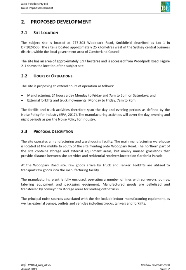
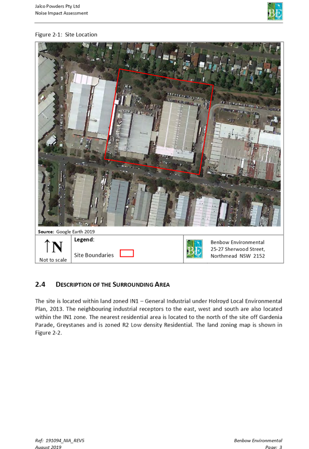
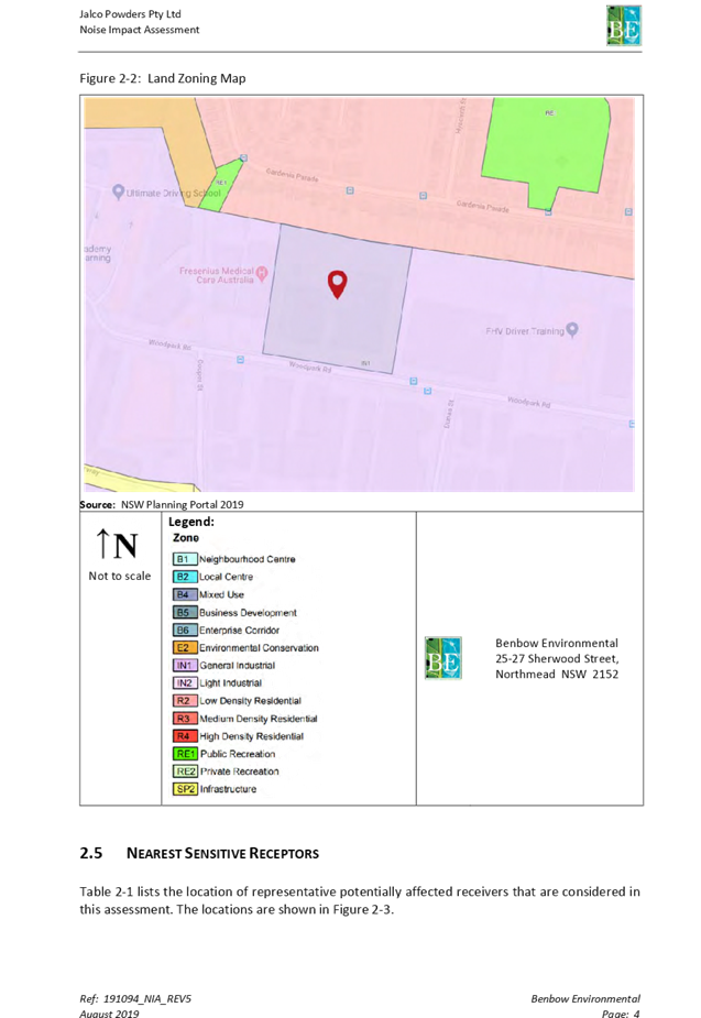
Extraordinary Cumberland Local Planning
Panel Meeting
5 November 2019
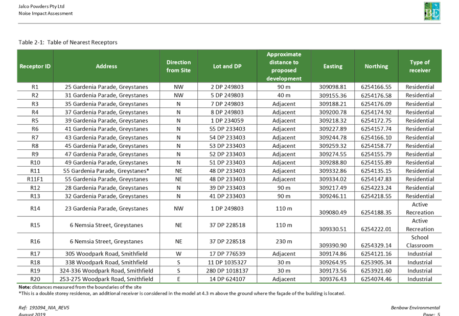
Extraordinary Cumberland Local Planning
Panel Meeting
5 November 2019
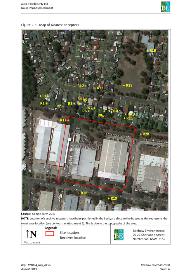

Extraordinary Cumberland Local Planning
Panel Meeting
5 November 2019
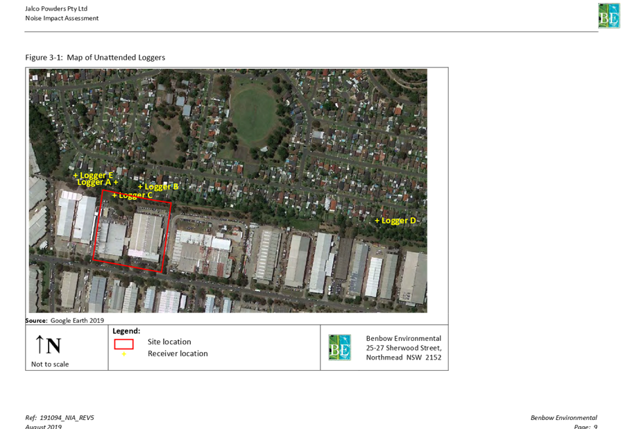

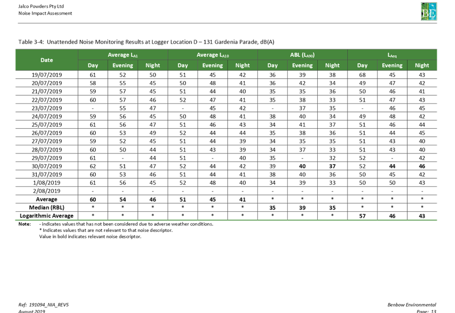
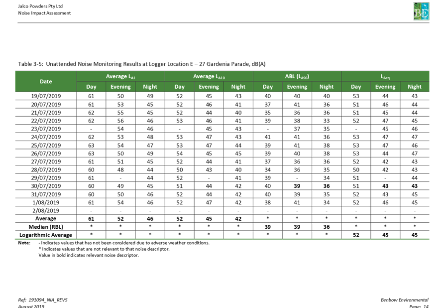
Extraordinary Cumberland Local Planning
Panel Meeting
5 November 2019
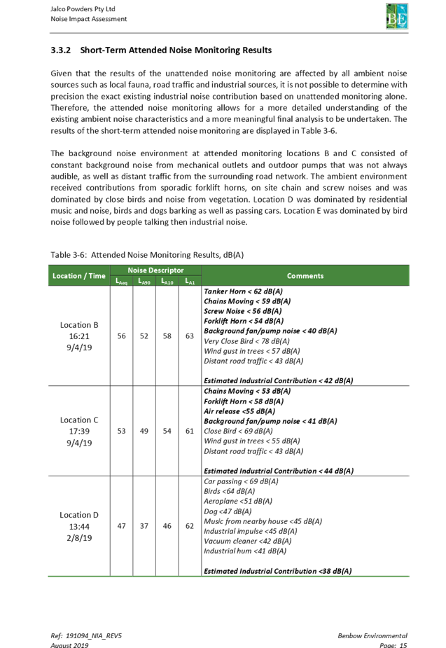

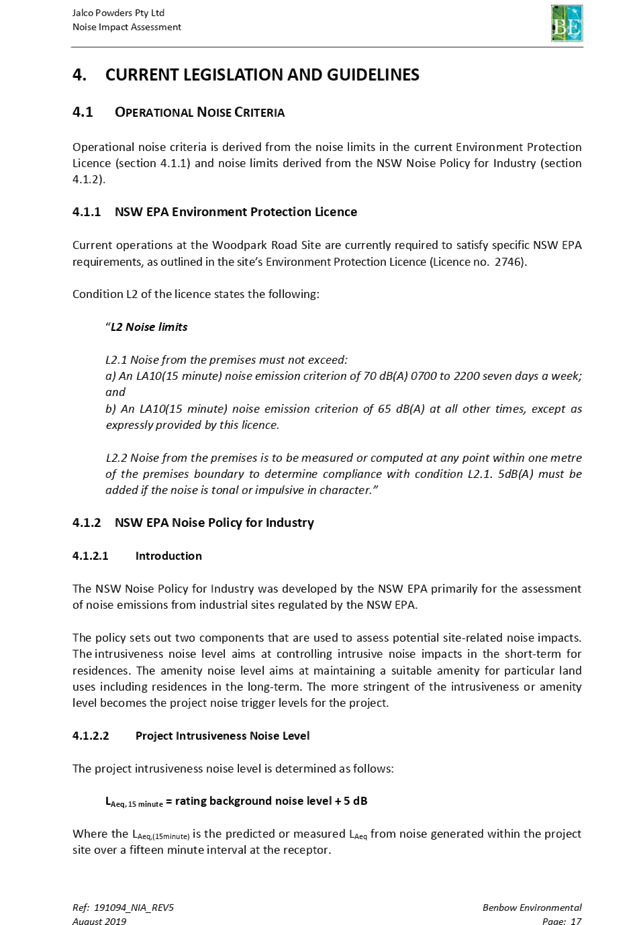
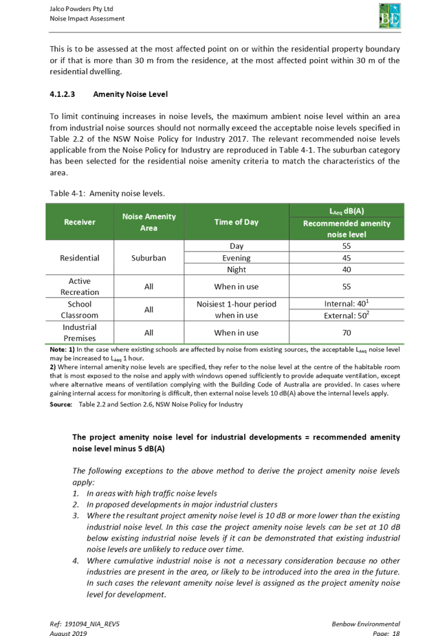

Extraordinary Cumberland Local Planning
Panel Meeting
5 November 2019
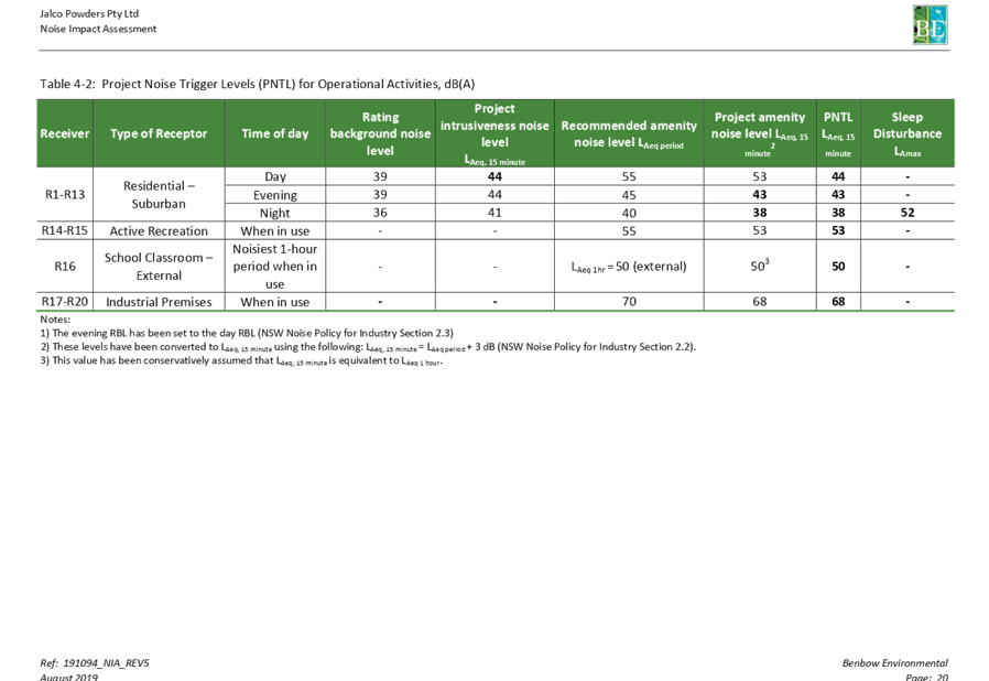
Extraordinary Cumberland Local Planning
Panel Meeting
5 November 2019

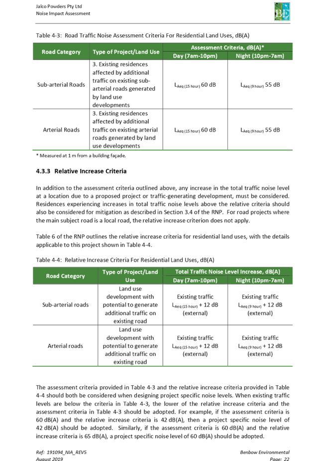
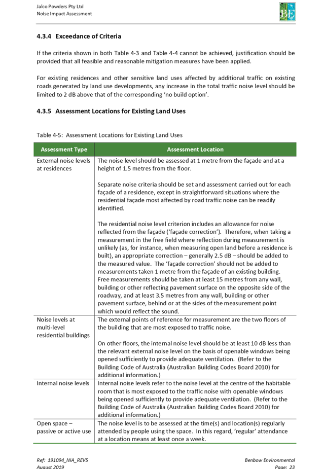
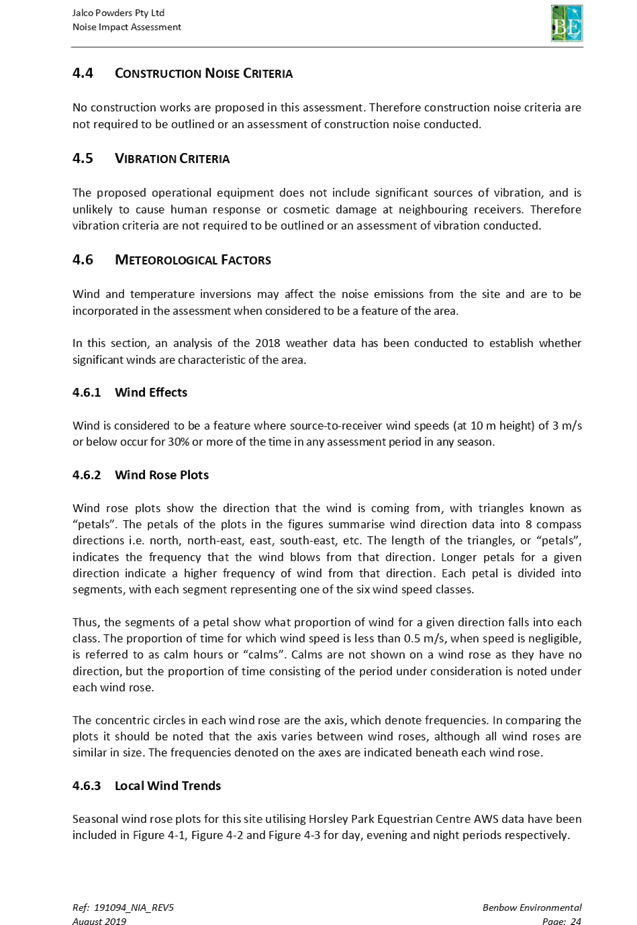
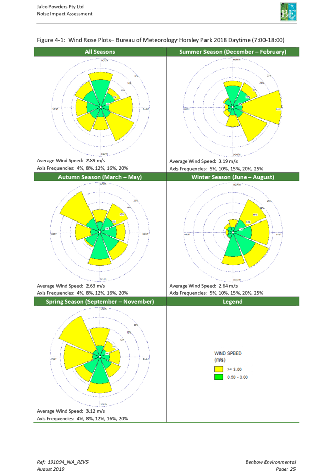
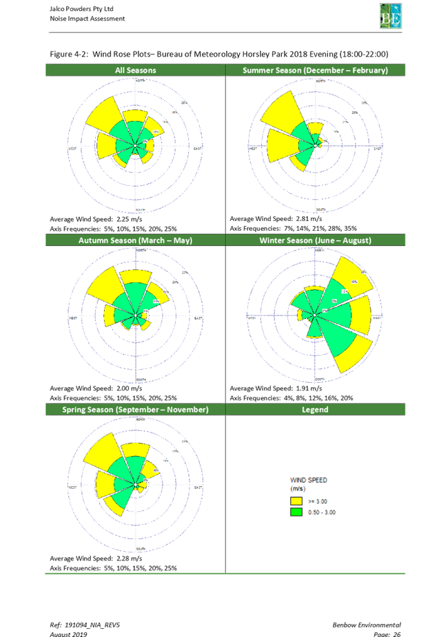

Extraordinary Cumberland Local Planning
Panel Meeting
5 November 2019
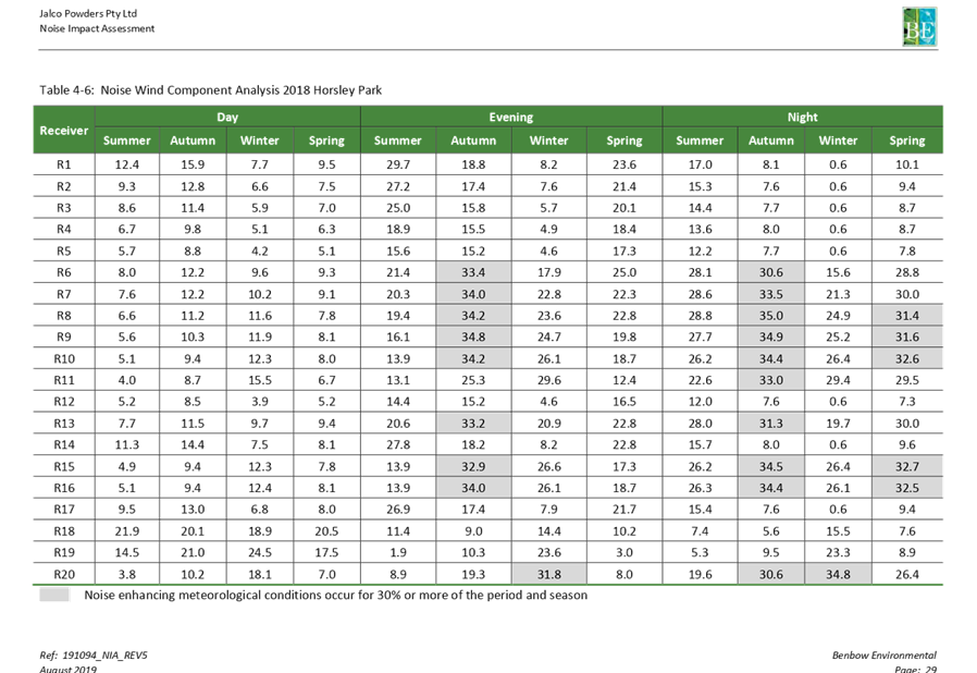
Extraordinary Cumberland Local Planning
Panel Meeting
5 November 2019
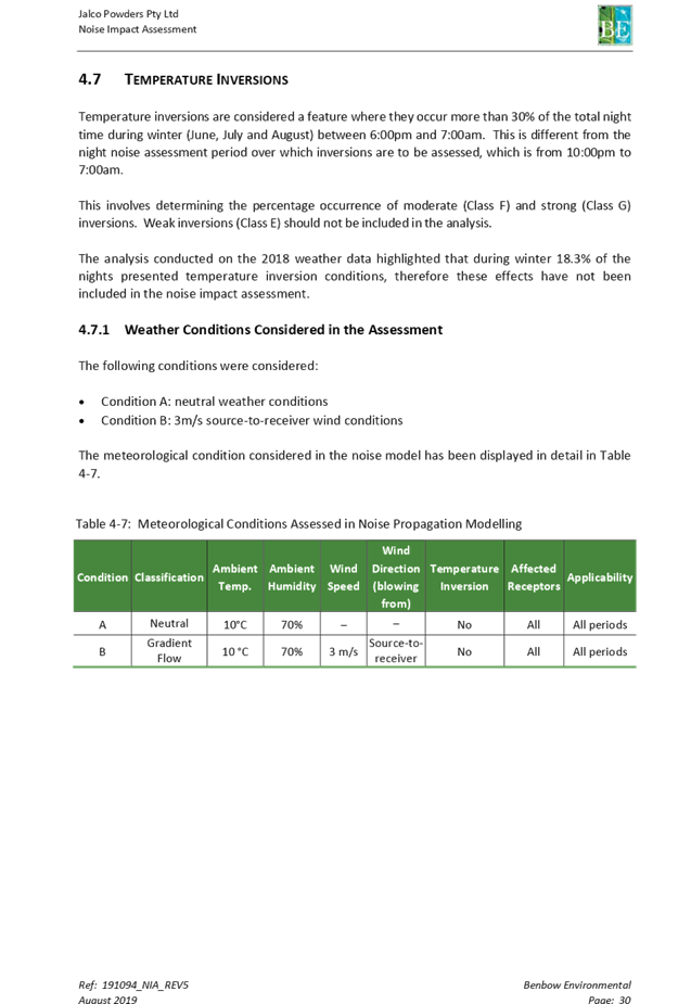
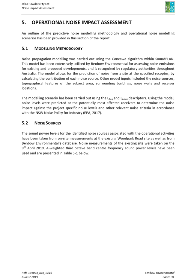
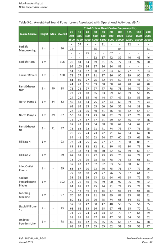
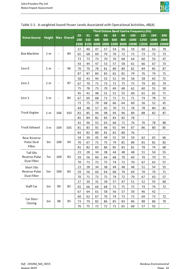
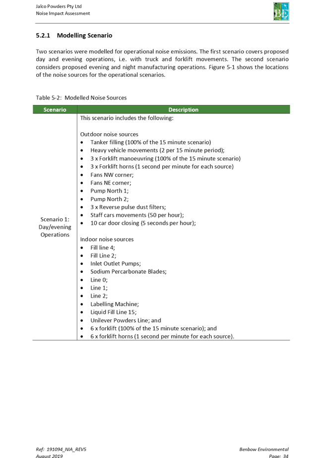

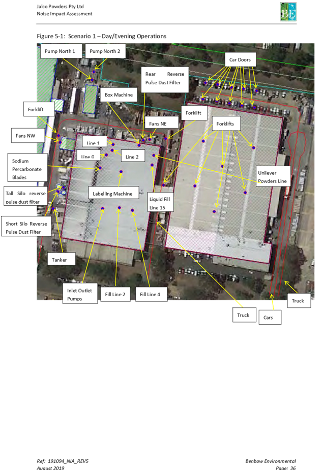
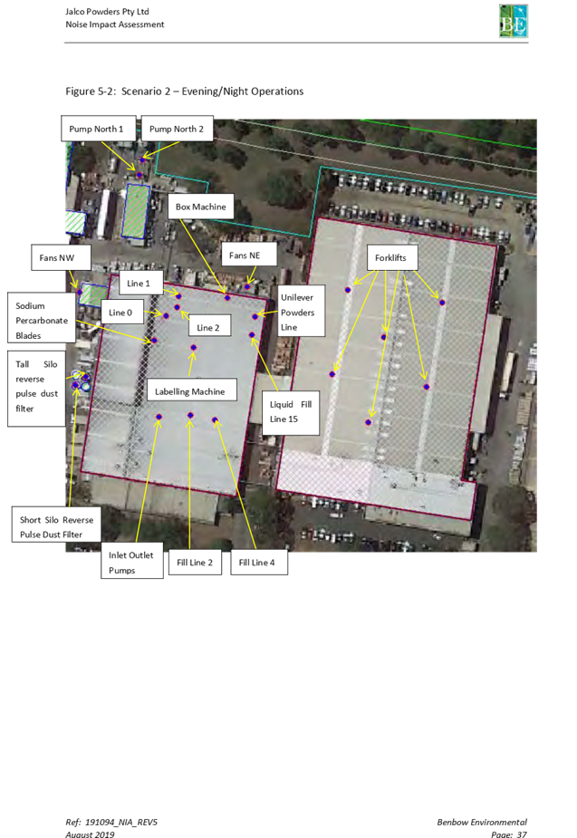
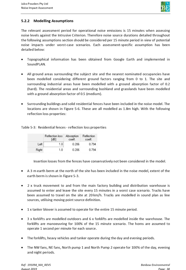

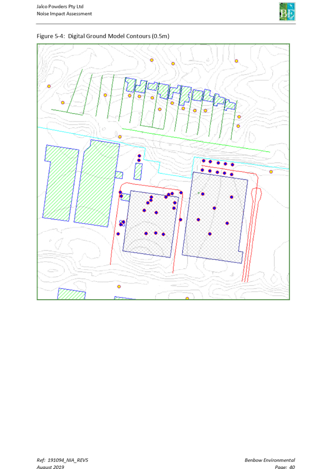
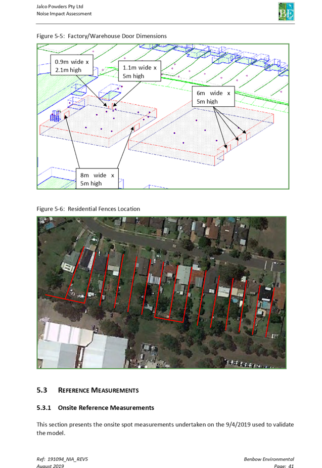
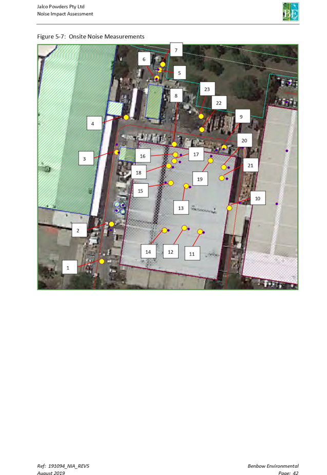
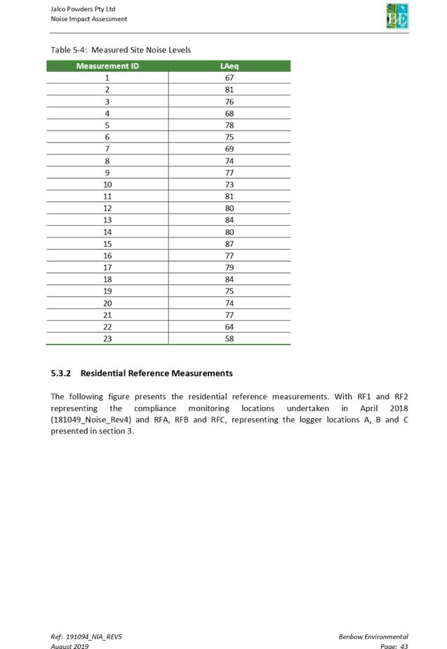
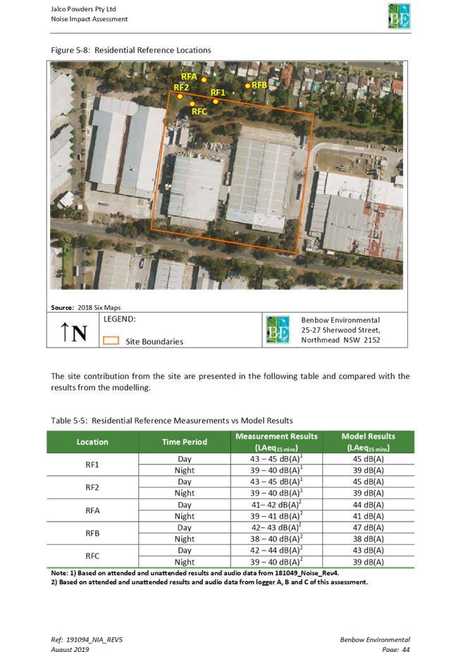

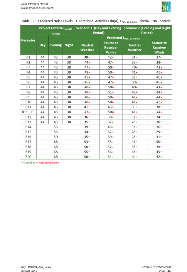
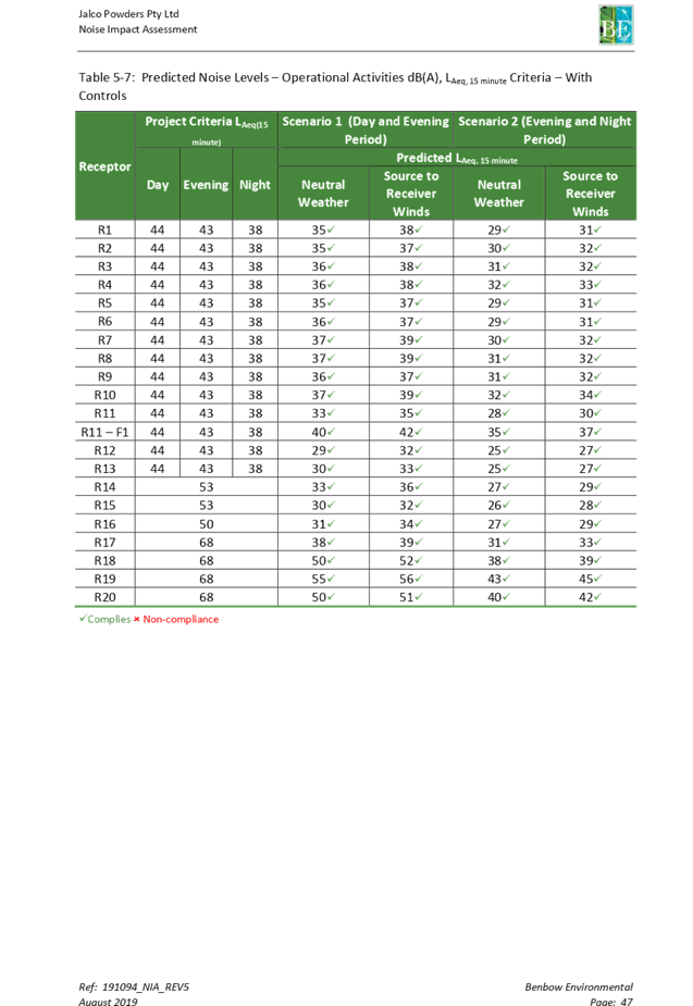
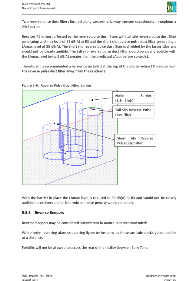


Extraordinary Cumberland Local Planning
Panel Meeting
5 November 2019
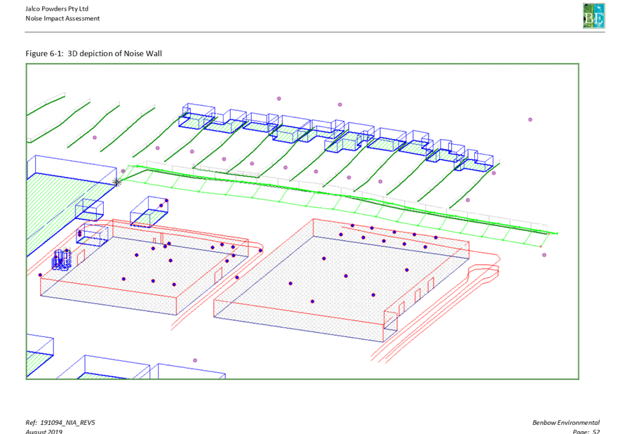
Extraordinary Cumberland Local Planning
Panel Meeting
5 November 2019
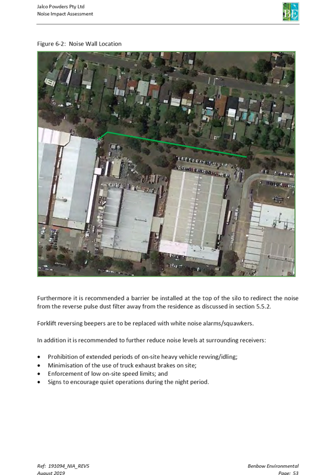


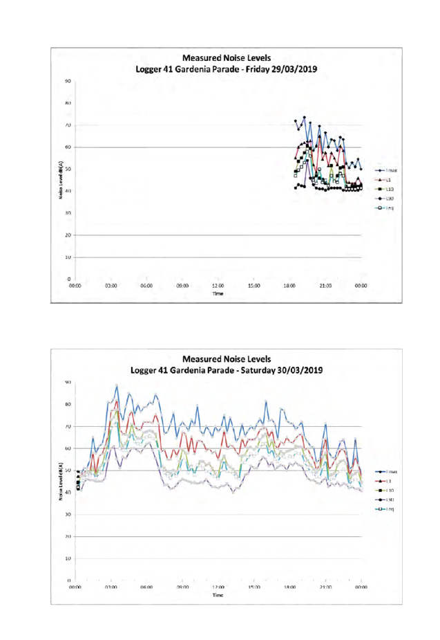


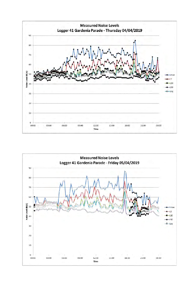


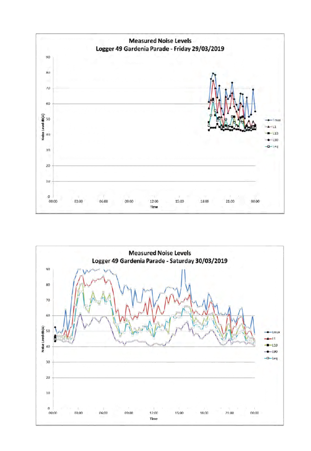
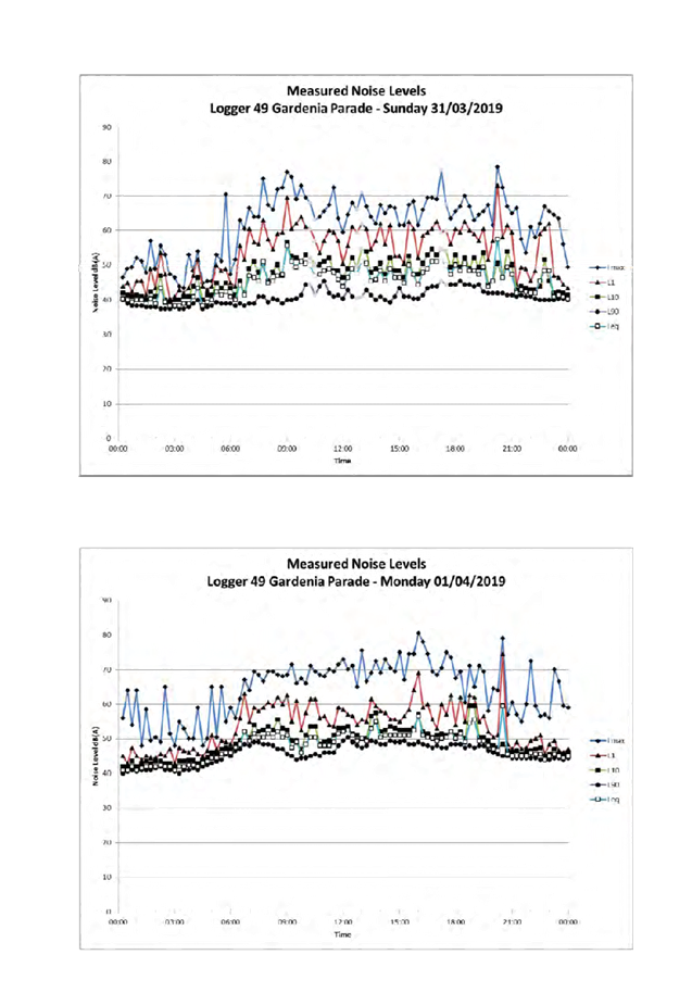
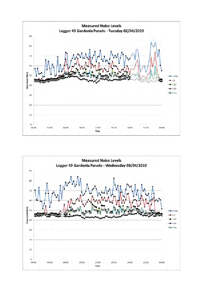
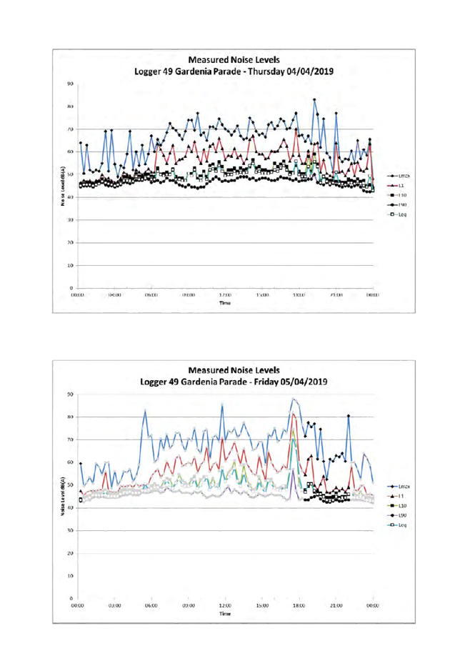

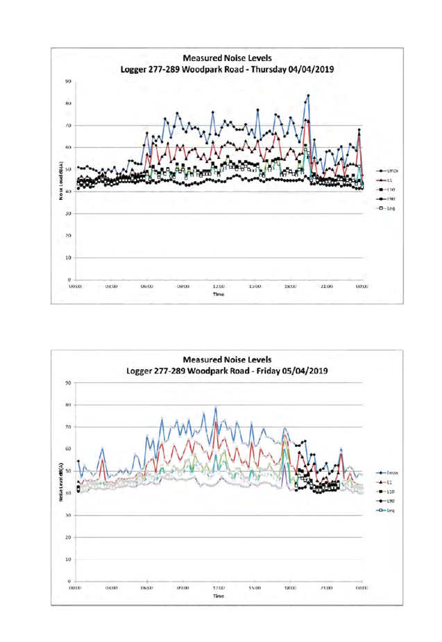
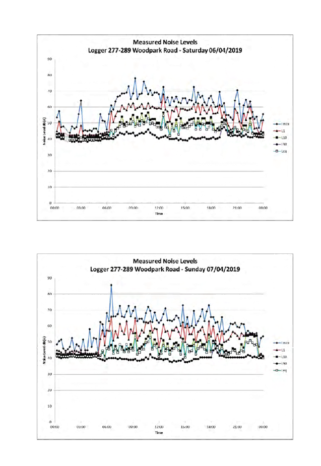
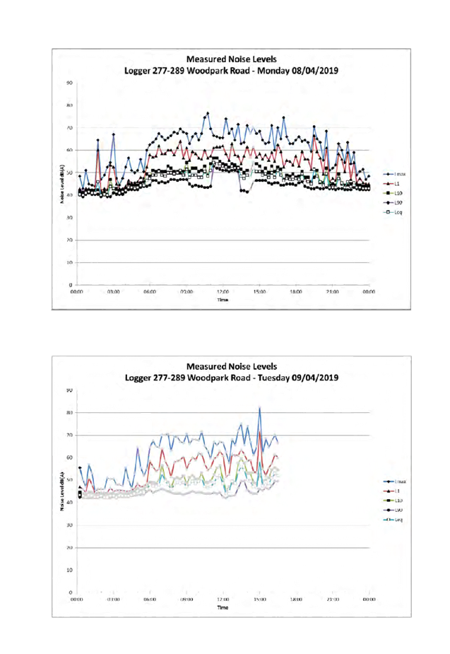
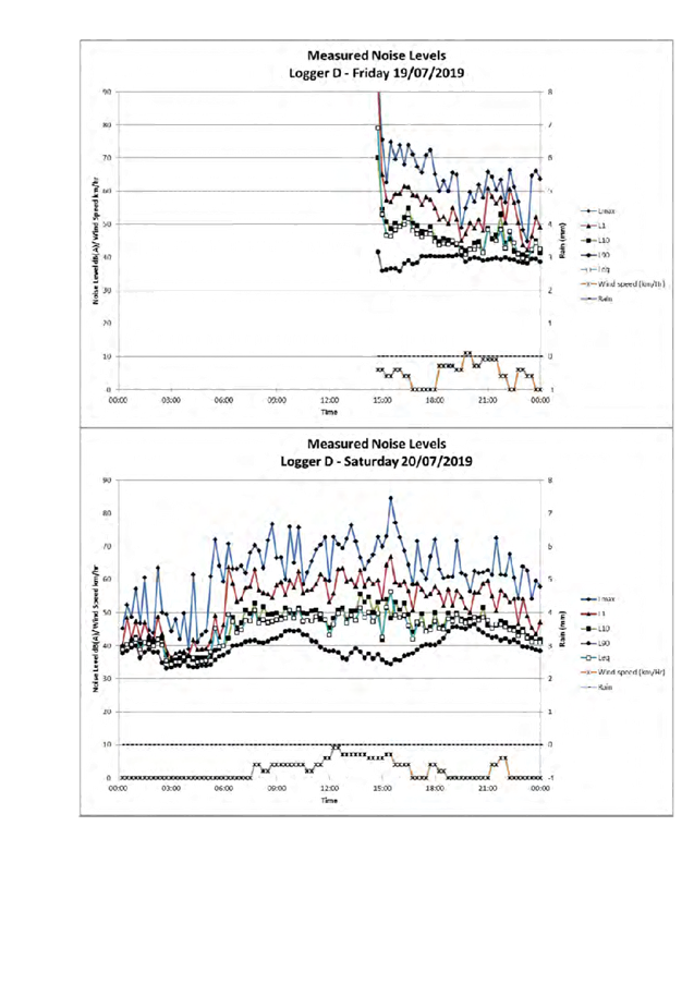


Extraordinary Cumberland Local Planning
Panel Meeting
5 November 2019
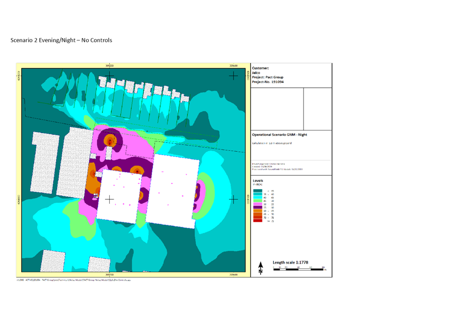
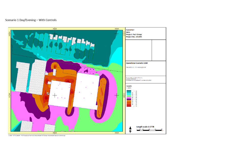
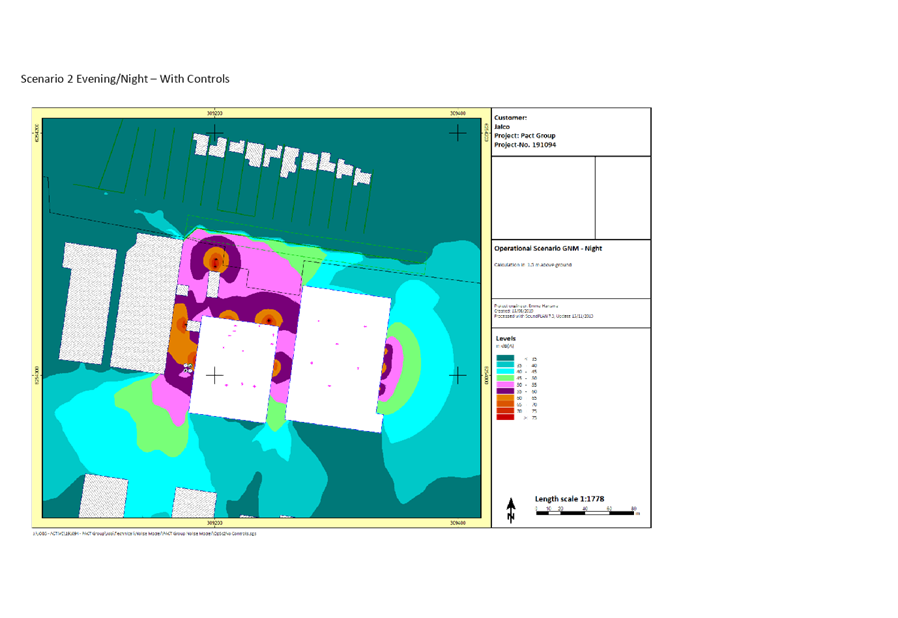
DOCUMENTS
ASSOCIATED WITH
REPORT ELPP067/19
Attachment 5
Architectural Plans/Reports
Extraordinary Cumberland Local Planning
Panel Meeting
5 November 2019
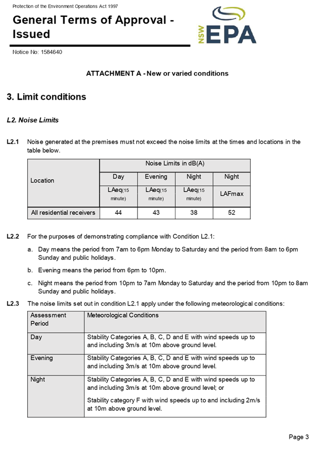


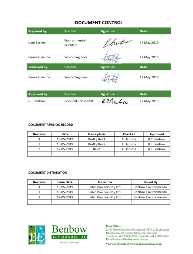


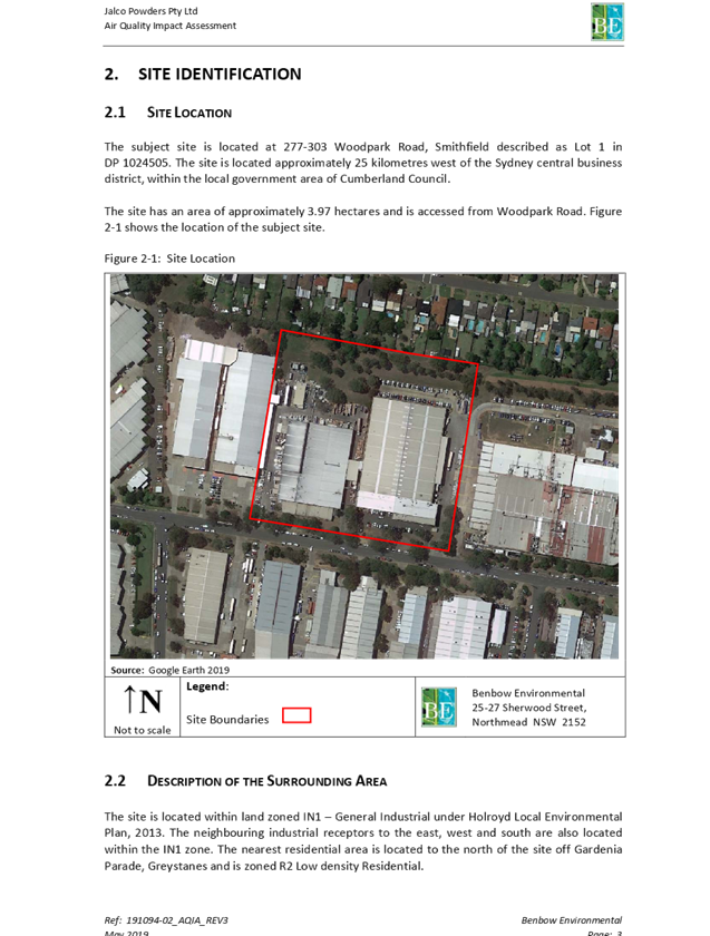


Extraordinary Cumberland Local Planning
Panel Meeting
5 November 2019
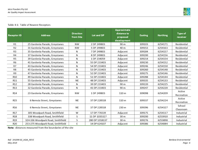
Extraordinary Cumberland Local Planning
Panel Meeting
5 November 2019
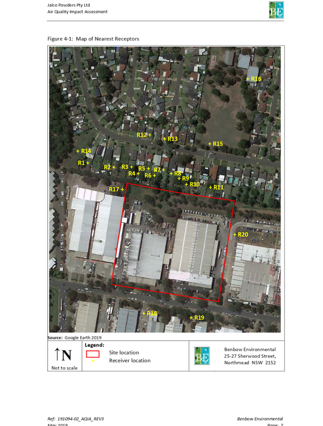
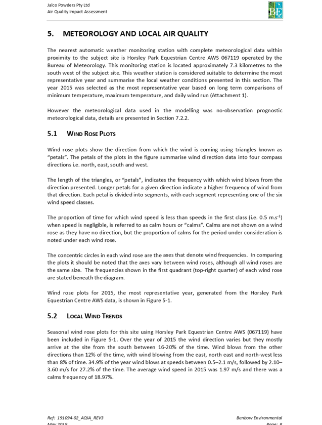

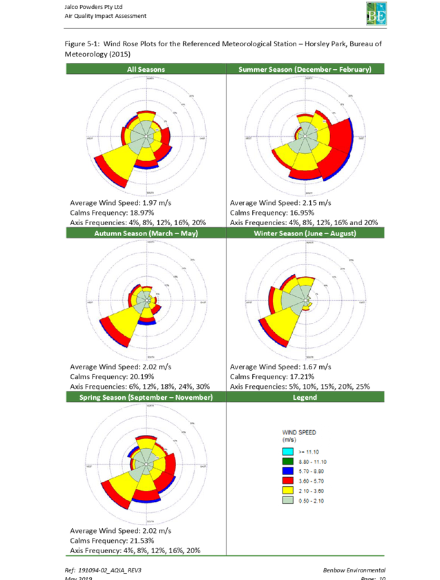
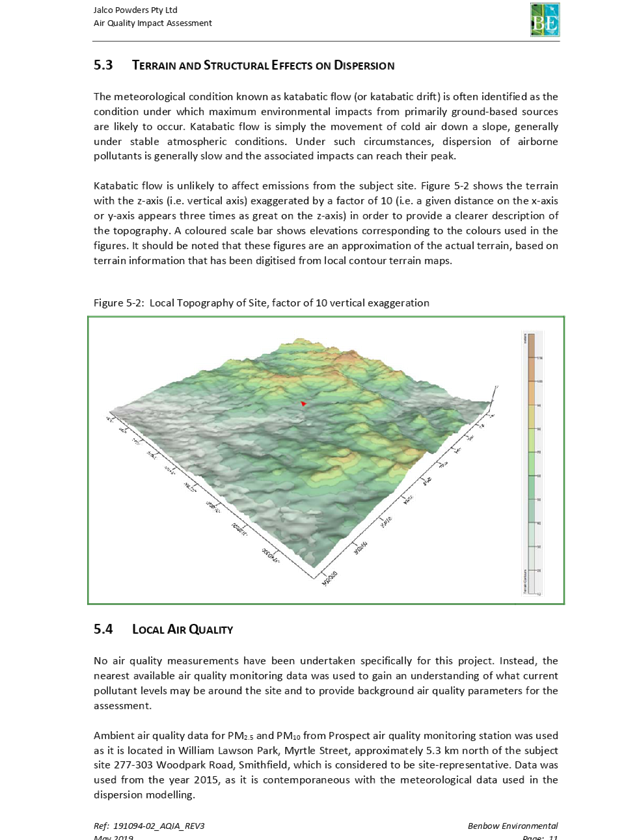
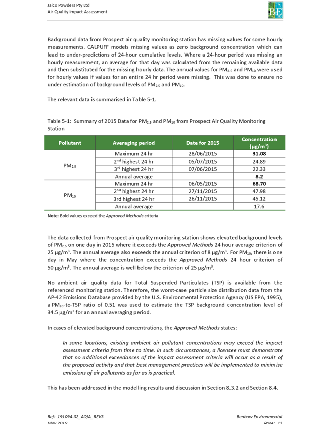
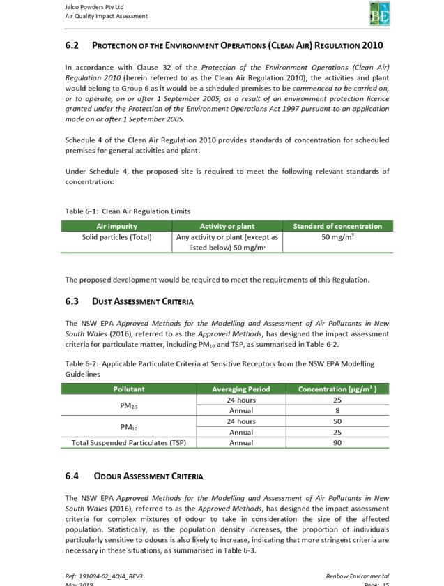

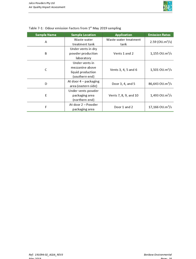
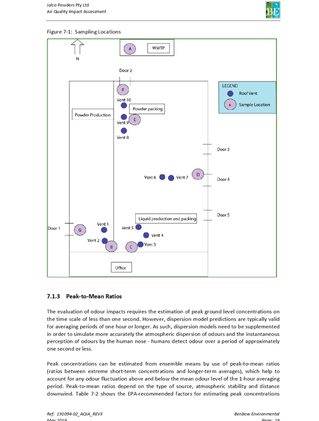
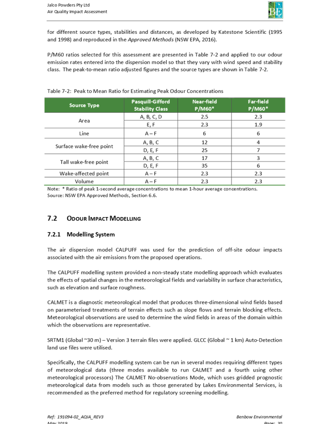

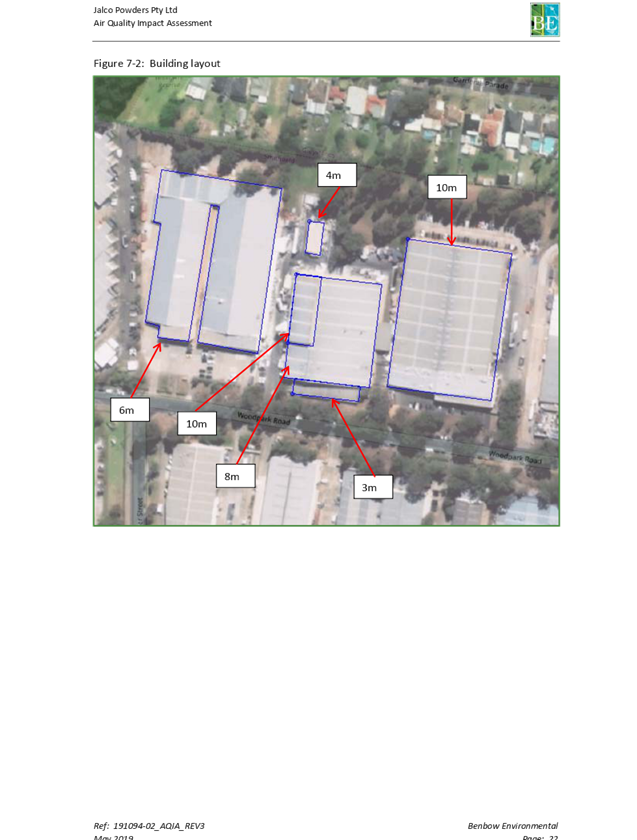
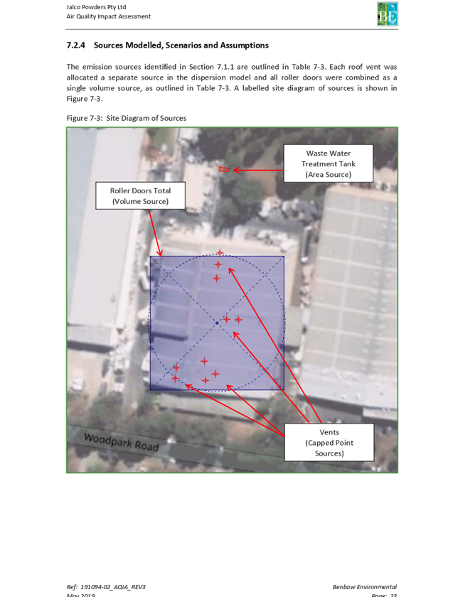
Extraordinary Cumberland Local Planning
Panel Meeting
5 November 2019
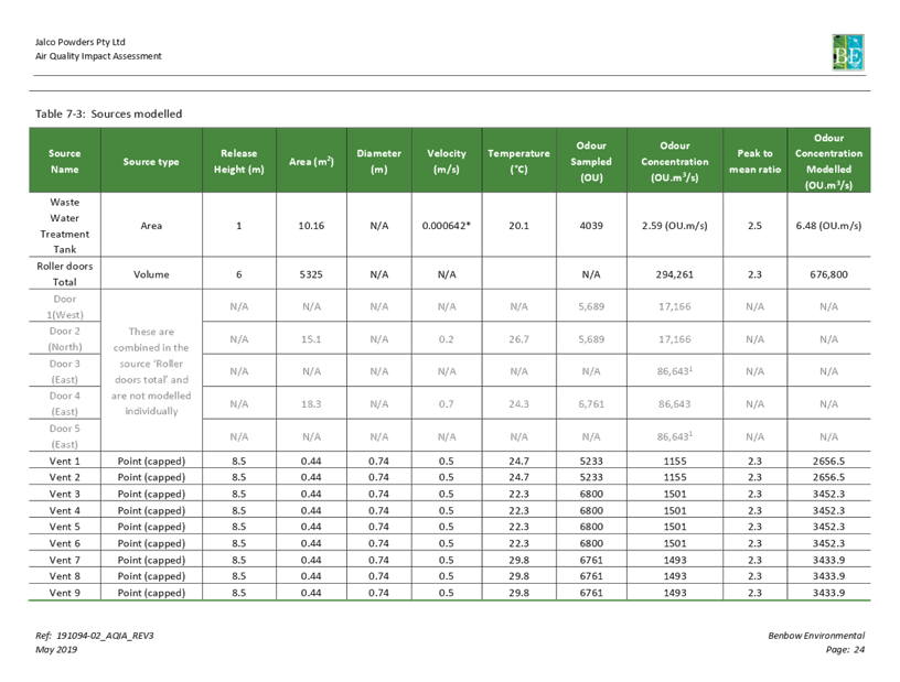
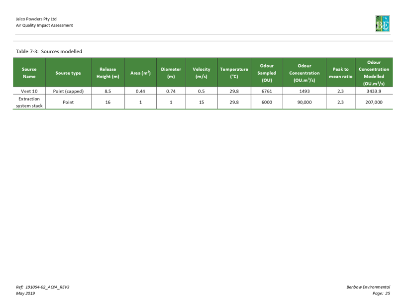
Extraordinary Cumberland Local Planning
Panel Meeting
5 November 2019


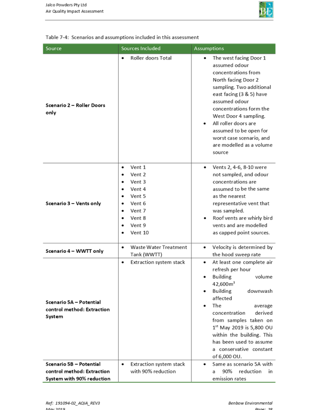

Extraordinary Cumberland Local Planning
Panel Meeting
5 November 2019
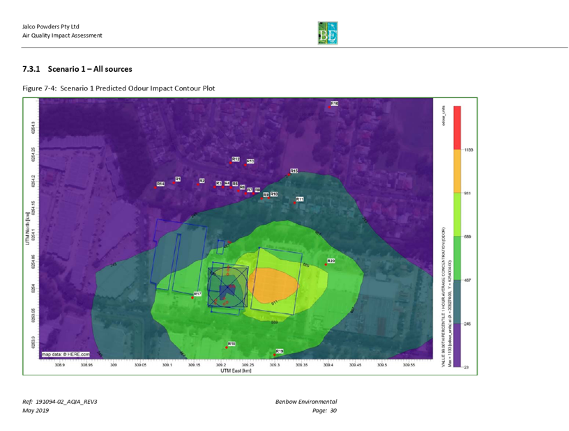
Extraordinary Cumberland Local Planning
Panel Meeting
5 November 2019
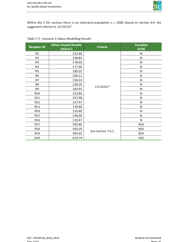
Extraordinary Cumberland Local Planning
Panel Meeting
5 November 2019
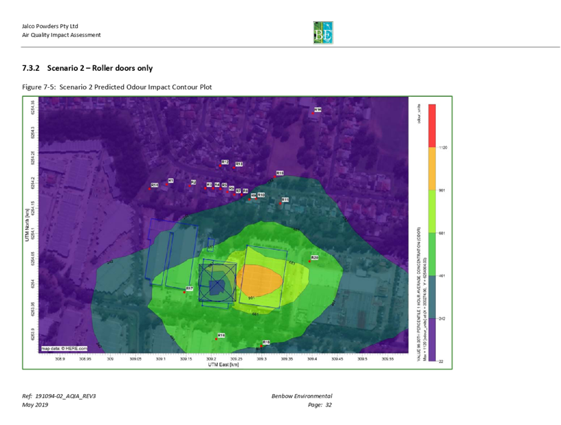
Extraordinary Cumberland Local Planning
Panel Meeting
5 November 2019
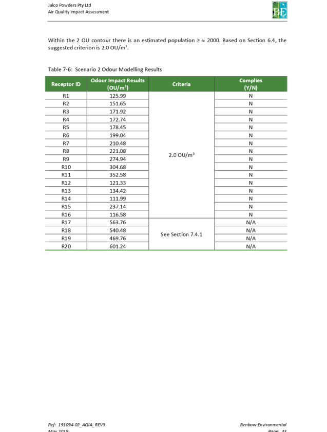
Extraordinary Cumberland Local Planning
Panel Meeting
5 November 2019
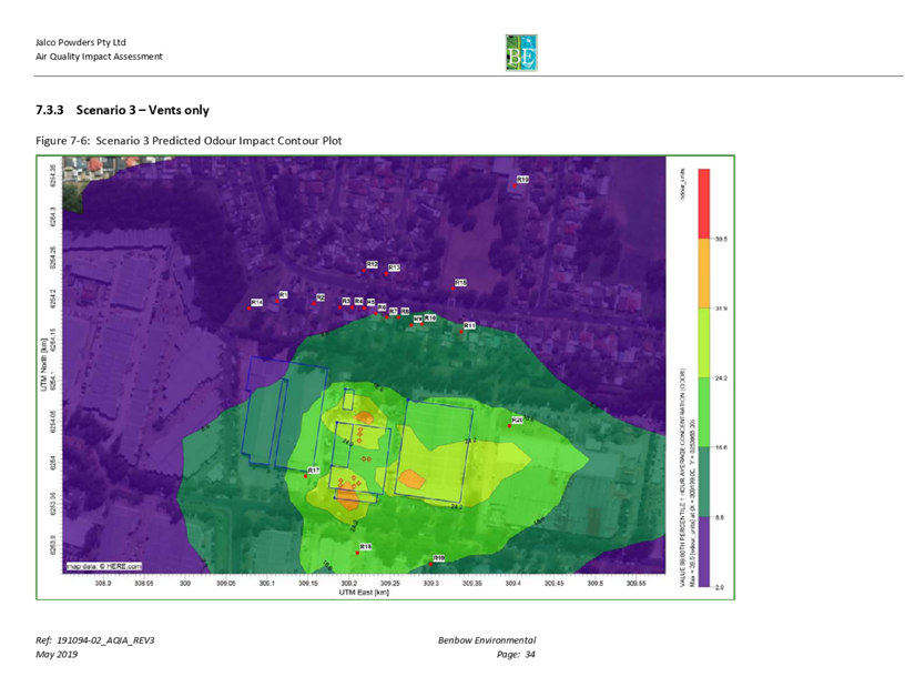
Extraordinary Cumberland Local Planning
Panel Meeting
5 November 2019
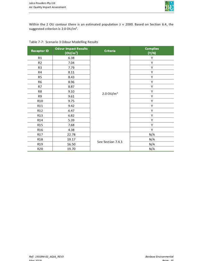
Extraordinary Cumberland Local Planning
Panel Meeting
5 November 2019
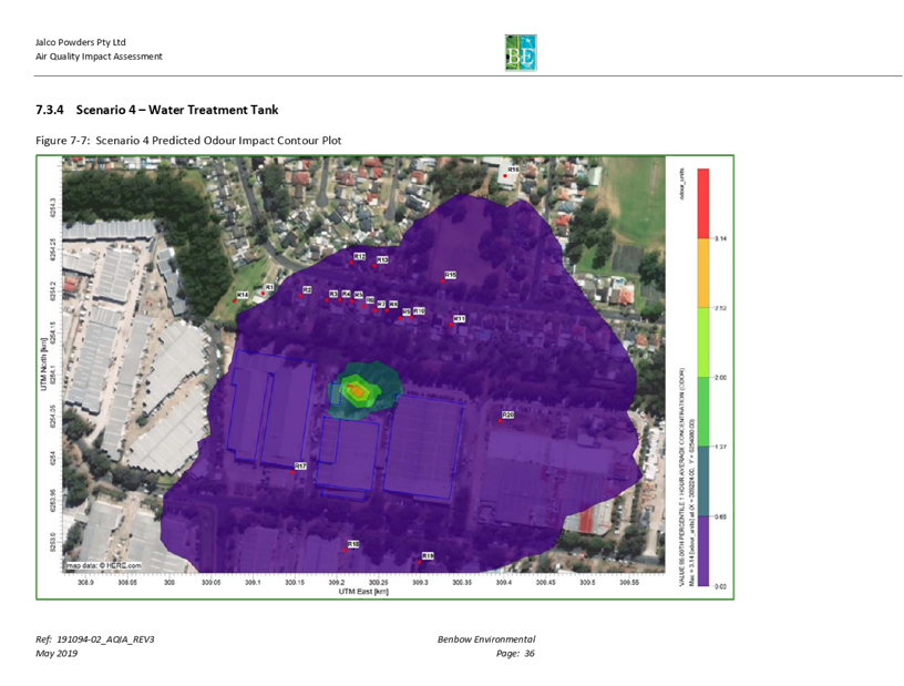
Extraordinary Cumberland Local Planning
Panel Meeting
5 November 2019
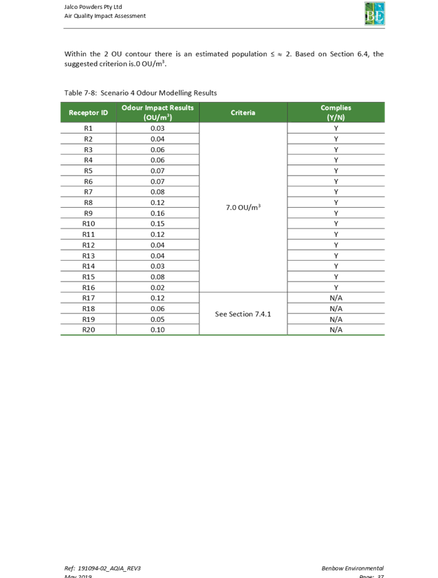
Extraordinary Cumberland Local Planning
Panel Meeting
5 November 2019
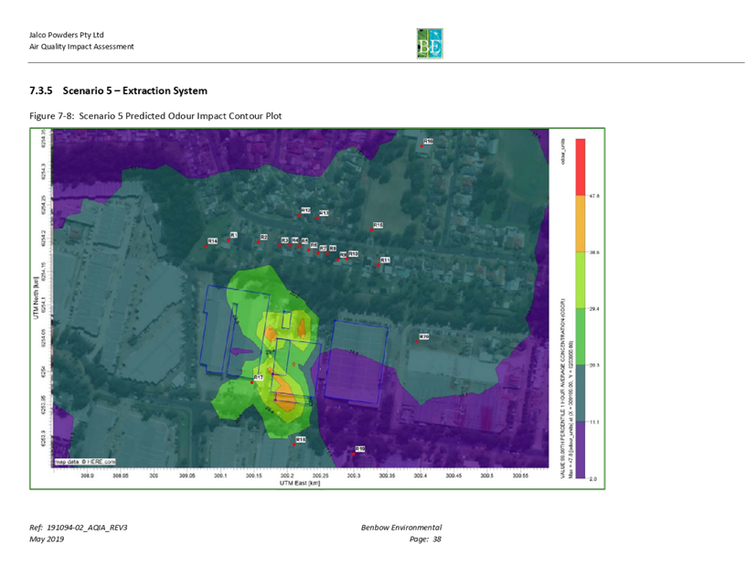
Extraordinary Cumberland Local Planning
Panel Meeting
5 November 2019
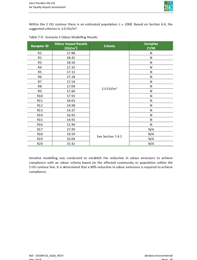
Extraordinary Cumberland Local Planning
Panel Meeting
5 November 2019
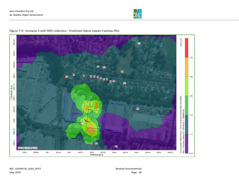
Extraordinary Cumberland Local Planning
Panel Meeting
5 November 2019
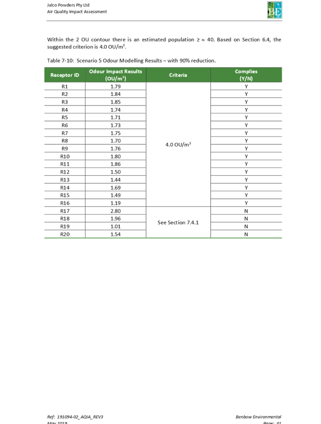

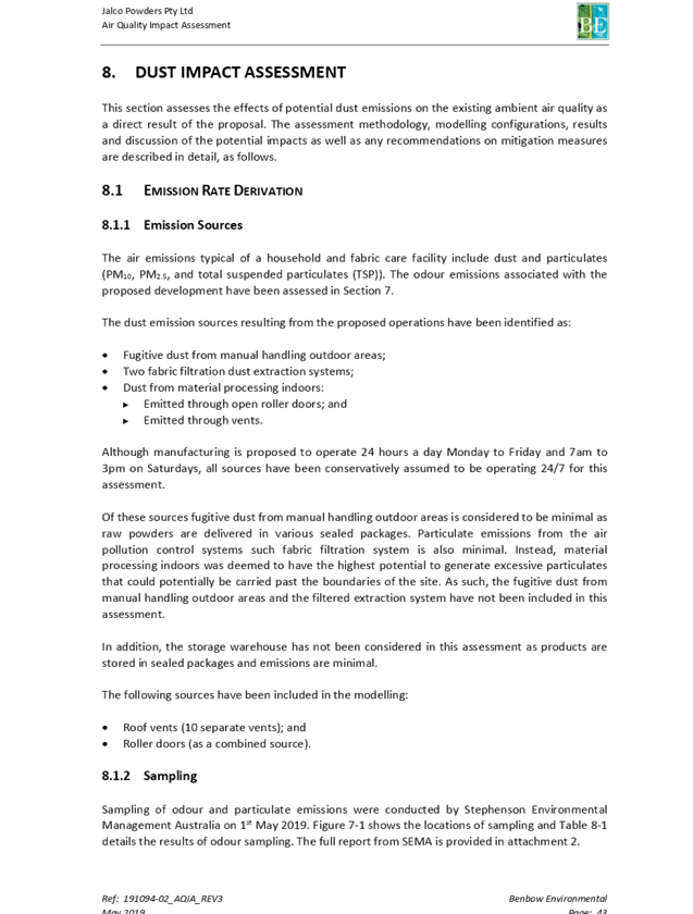

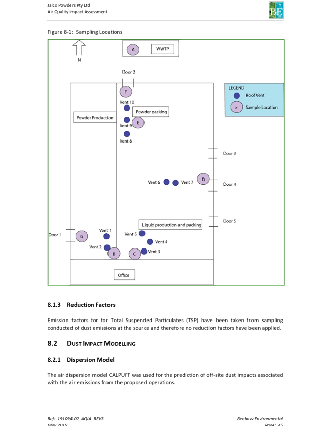
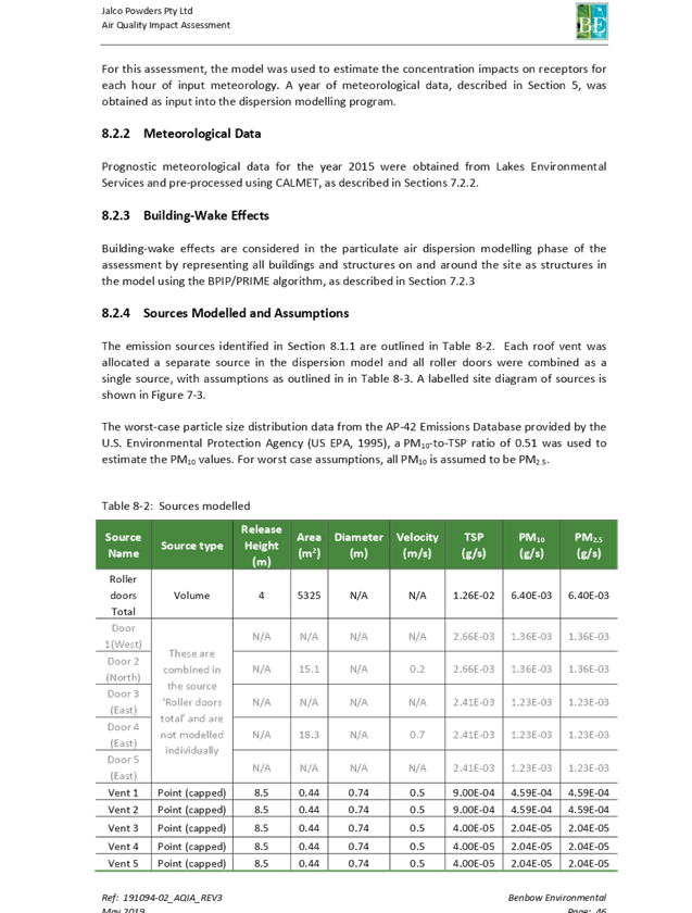
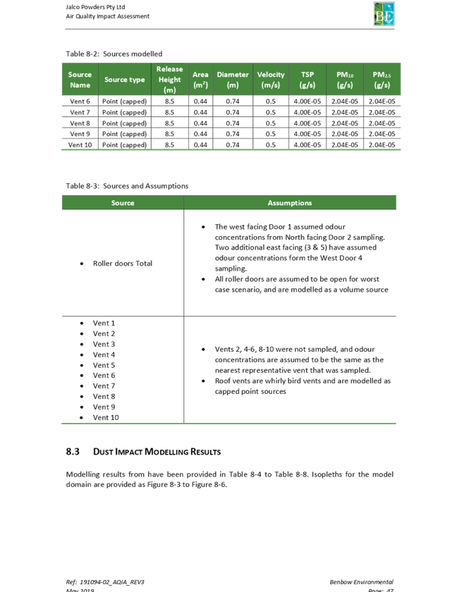
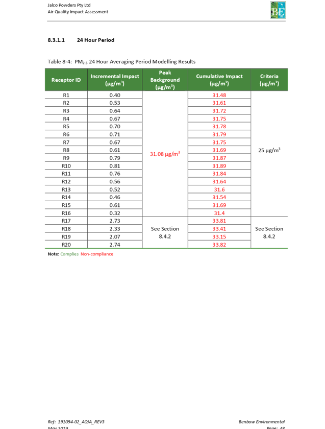
Extraordinary Cumberland Local Planning
Panel Meeting
5 November 2019
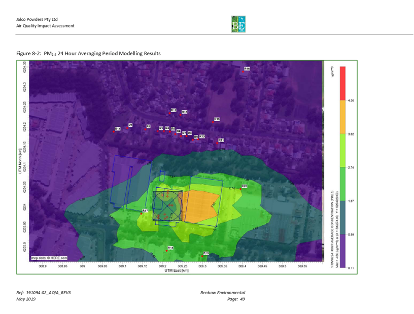
Extraordinary Cumberland Local Planning
Panel Meeting
5 November 2019
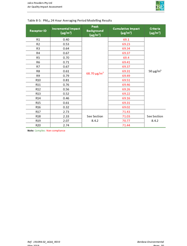
Extraordinary Cumberland Local Planning
Panel Meeting
5 November 2019

Extraordinary Cumberland Local Planning
Panel Meeting
5 November 2019
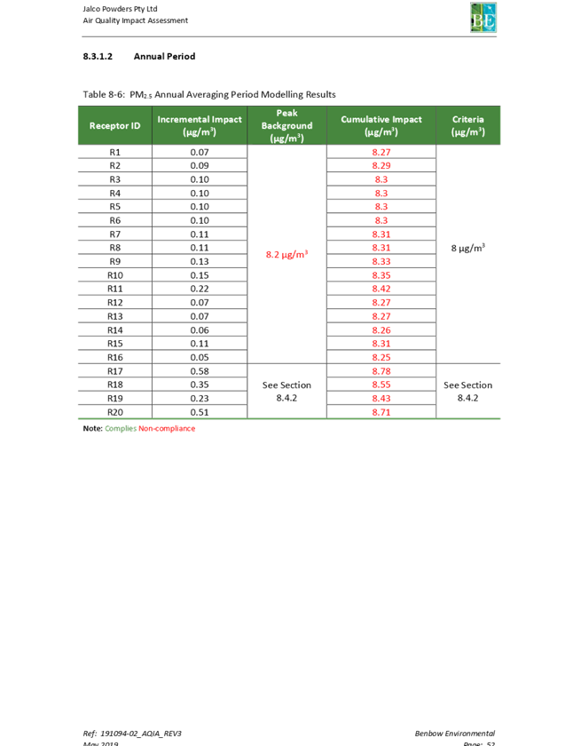
Extraordinary Cumberland Local Planning
Panel Meeting
5 November 2019

Extraordinary Cumberland Local Planning
Panel Meeting
5 November 2019

Extraordinary Cumberland Local Planning
Panel Meeting
5 November 2019
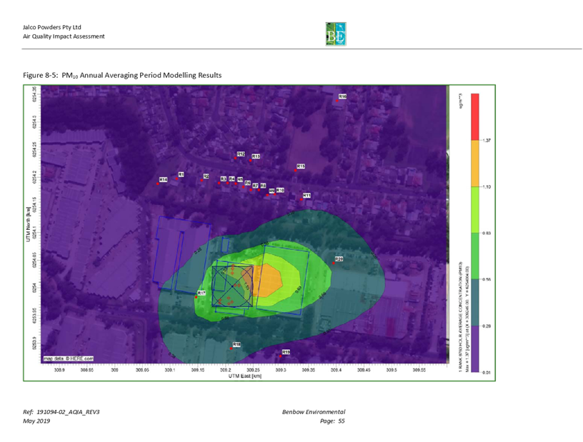
Extraordinary Cumberland Local Planning
Panel Meeting
5 November 2019
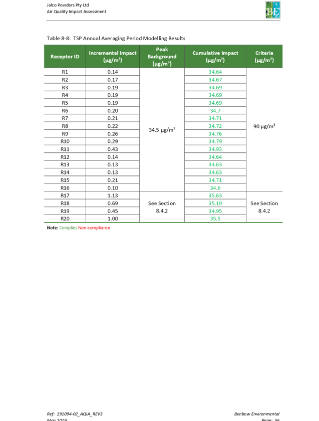
Extraordinary Cumberland Local Planning
Panel Meeting
5 November 2019
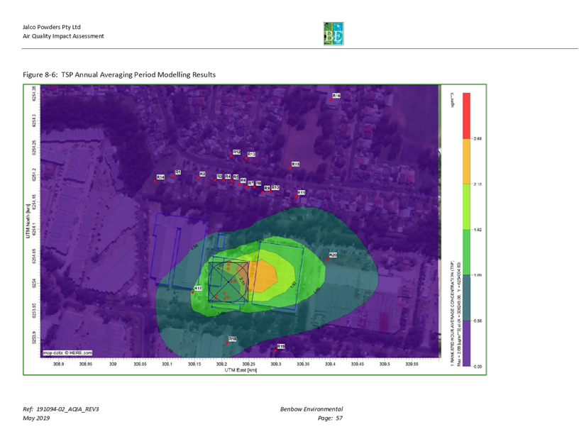
Extraordinary Cumberland Local Planning
Panel Meeting
5 November 2019
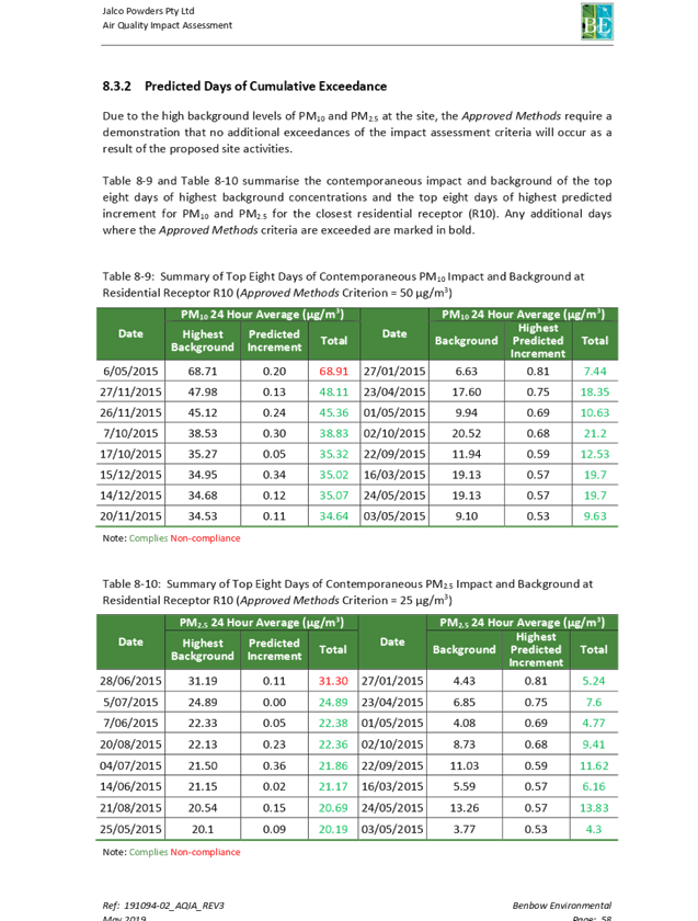


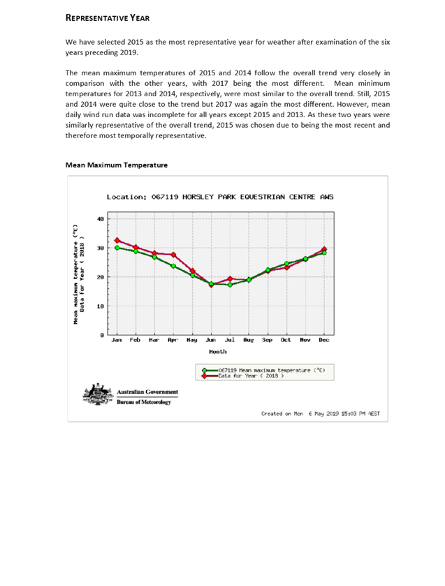


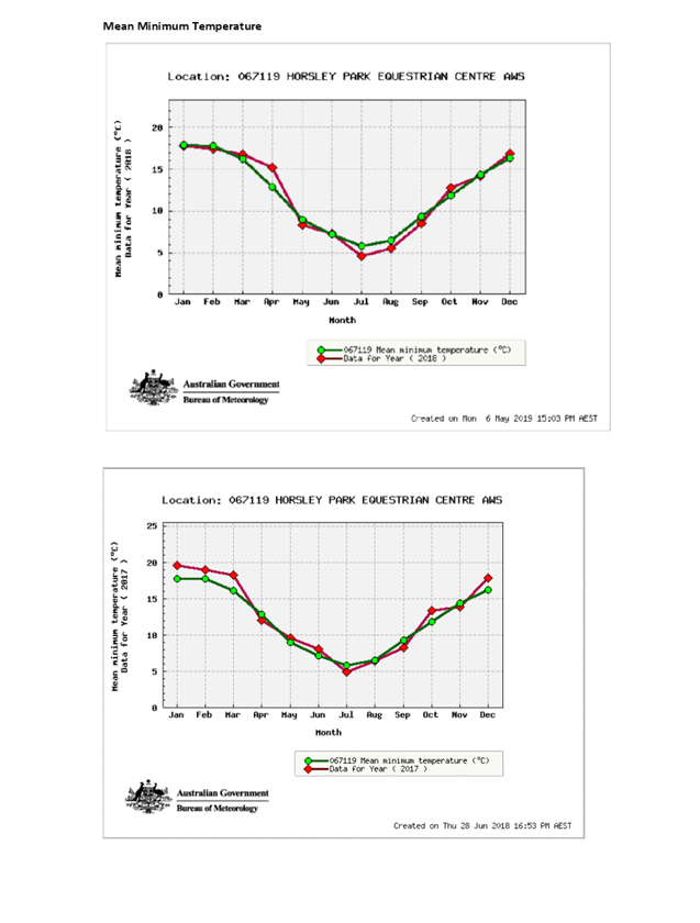
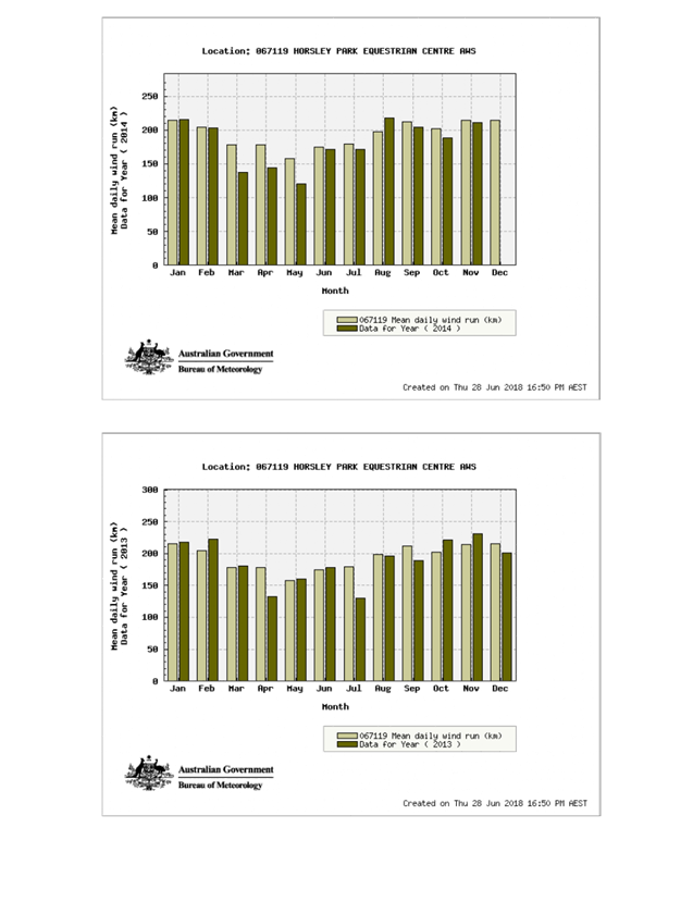

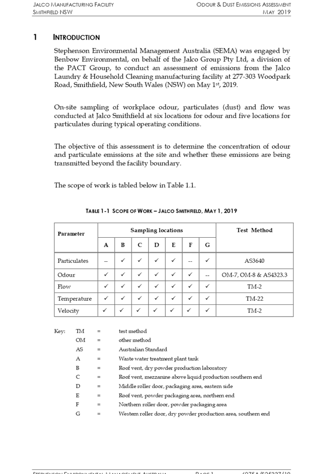

Extraordinary Cumberland Local Planning
Panel Meeting
5 November 2019
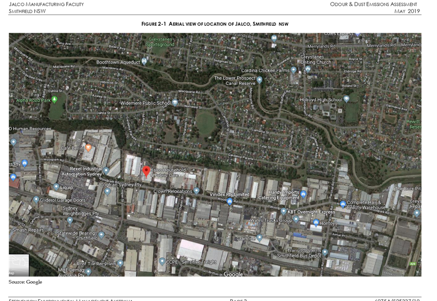
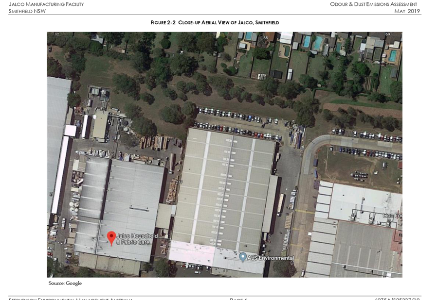
Extraordinary Cumberland Local Planning
Panel Meeting
5 November 2019

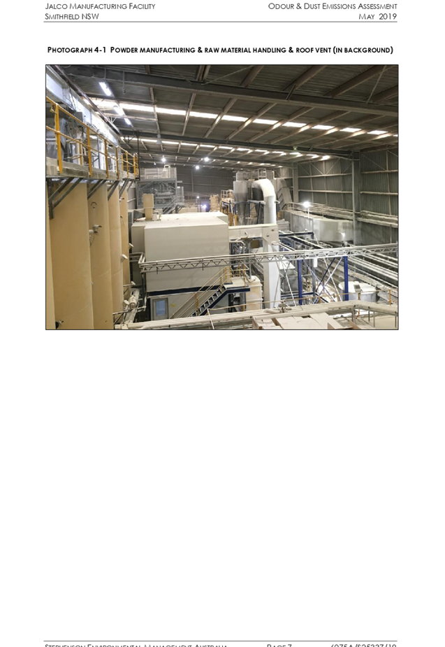
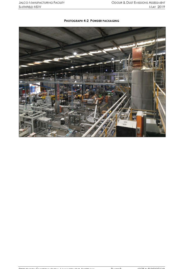
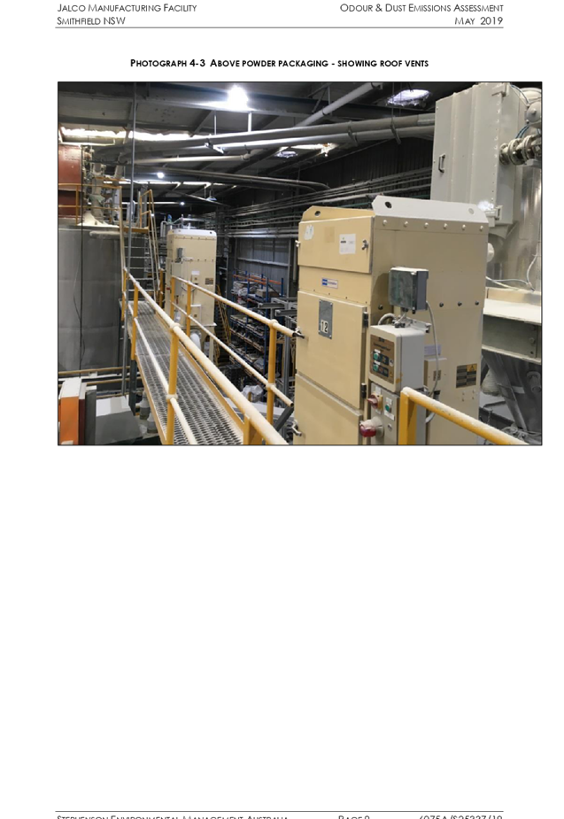
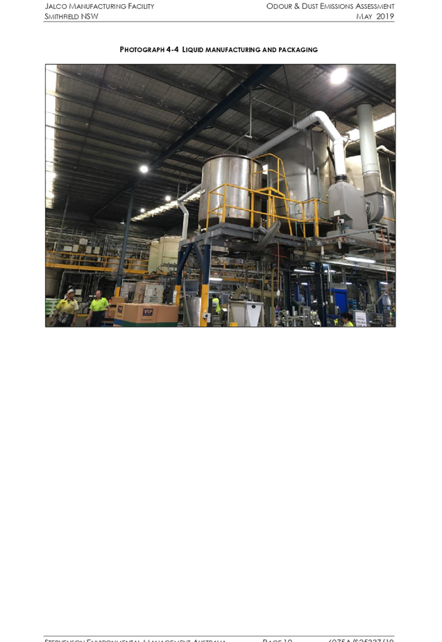
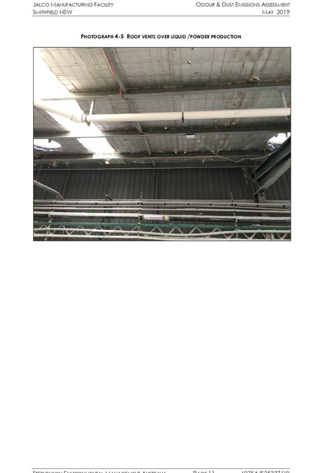
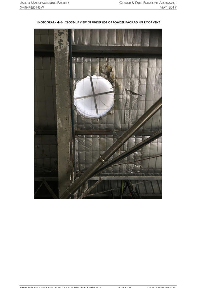
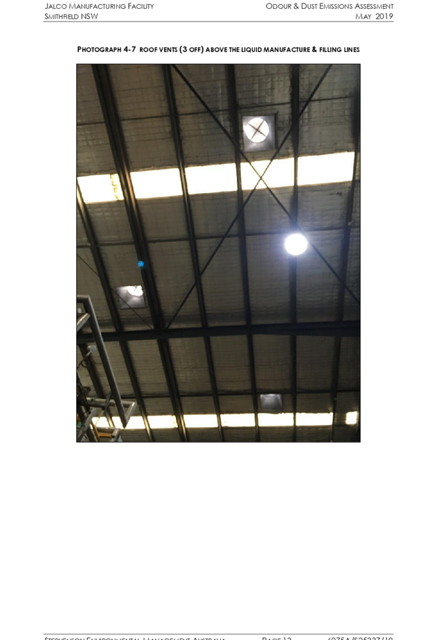
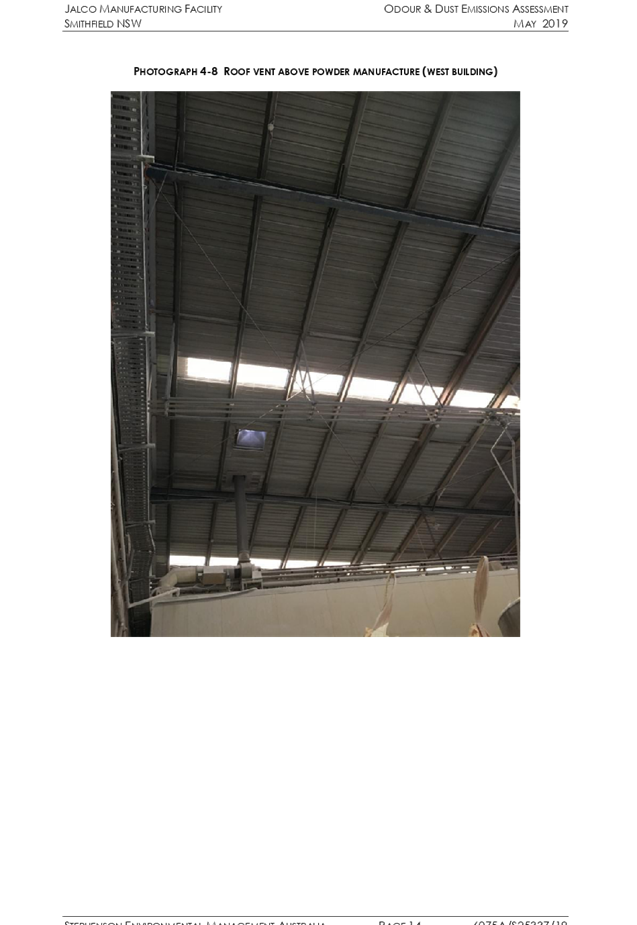
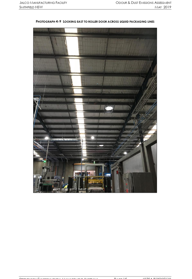
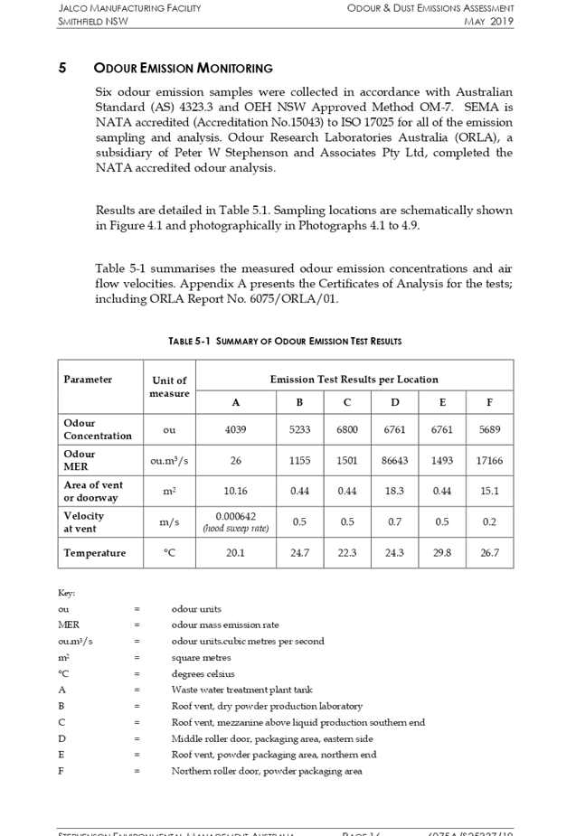
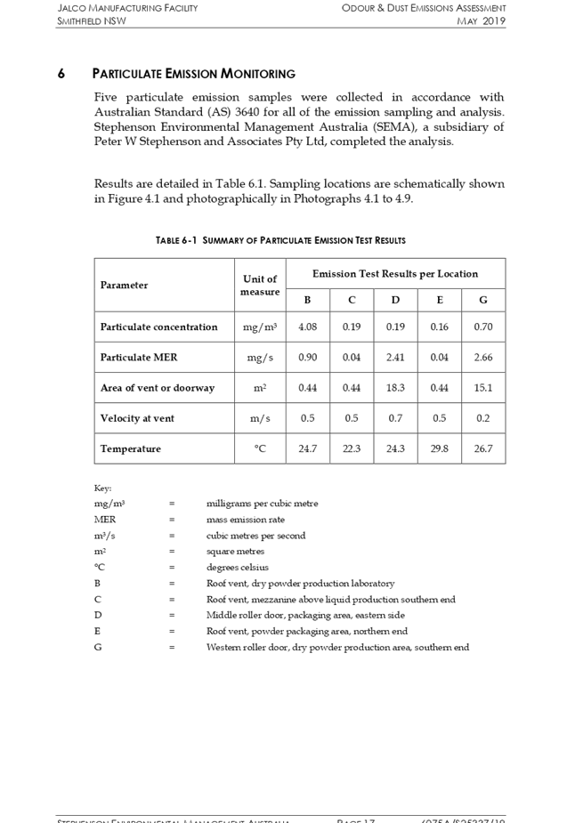


Extraordinary Cumberland Local Planning
Panel Meeting
5 November 2019
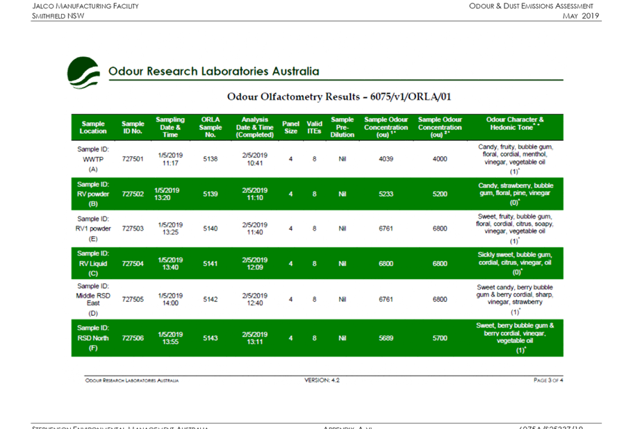
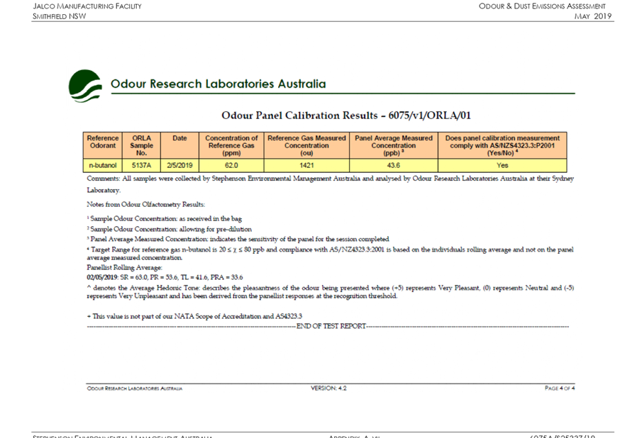
Extraordinary Cumberland Local Planning
Panel Meeting
5 November 2019

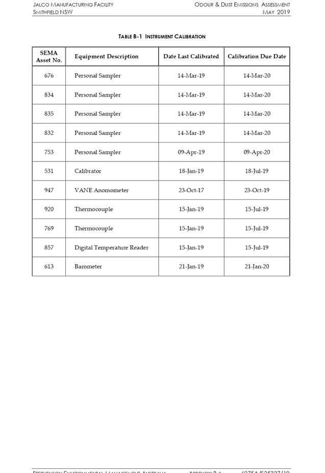

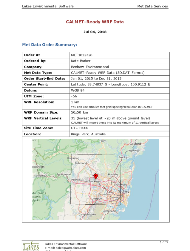
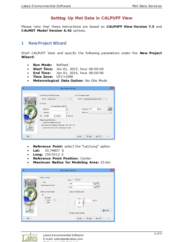
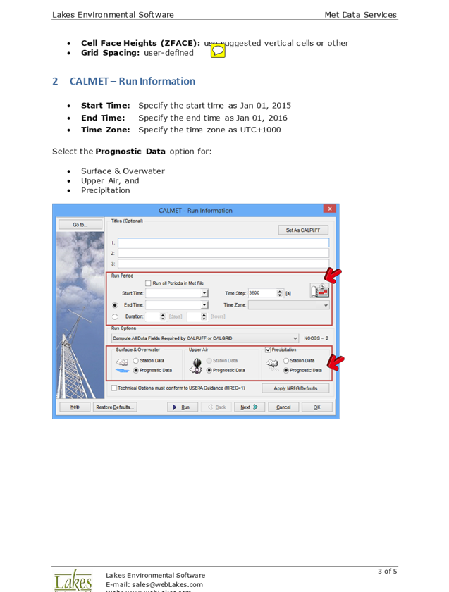
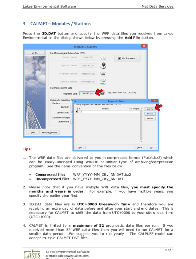
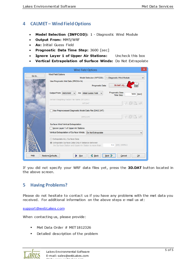
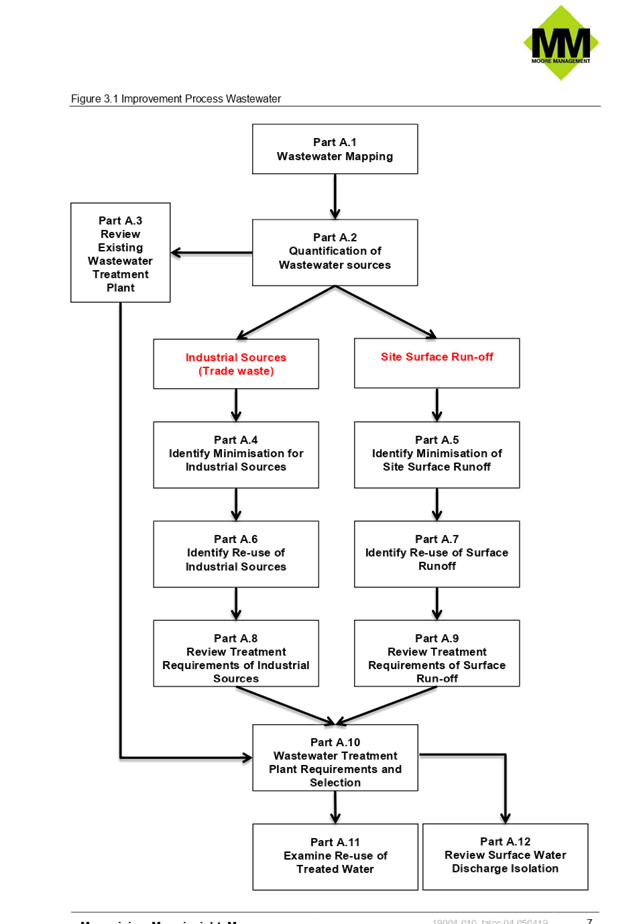
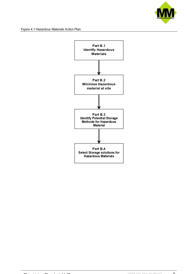
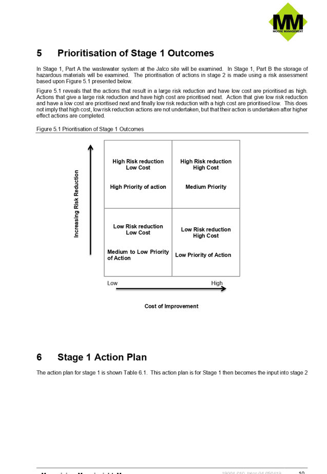
Extraordinary Cumberland Local Planning
Panel Meeting
5 November 2019
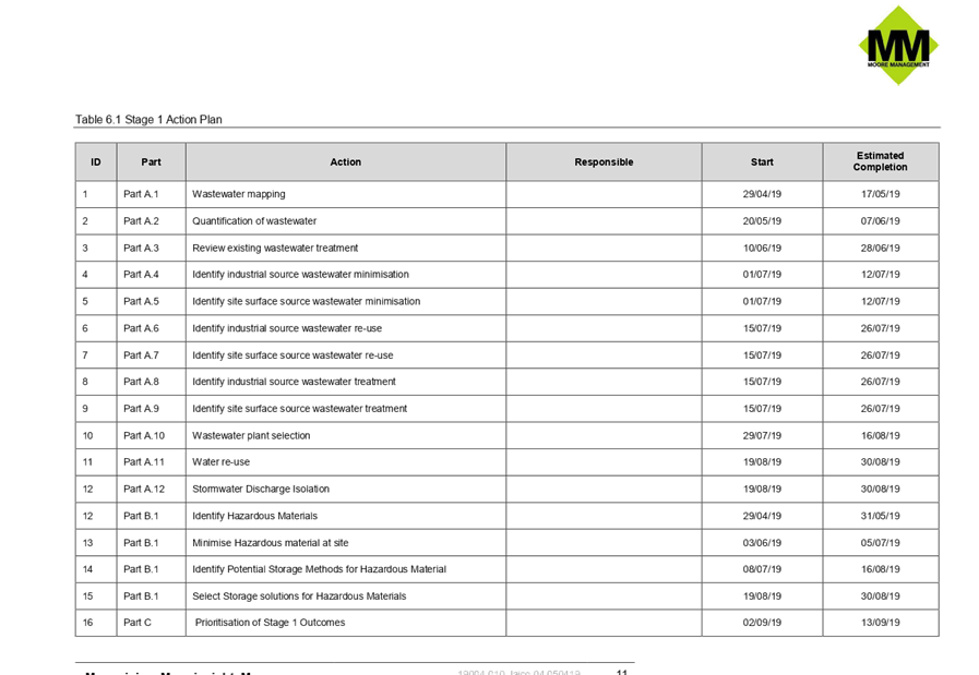
Extraordinary Cumberland Local Planning
Panel Meeting
5 November 2019

Extraordinary Cumberland Local Planning
Panel Meeting
5 November 2019
Extraordinary Cumberland Local Planning
Panel Meeting
5 November 2019

Extraordinary Cumberland Local Planning
Panel Meeting
5 November 2019
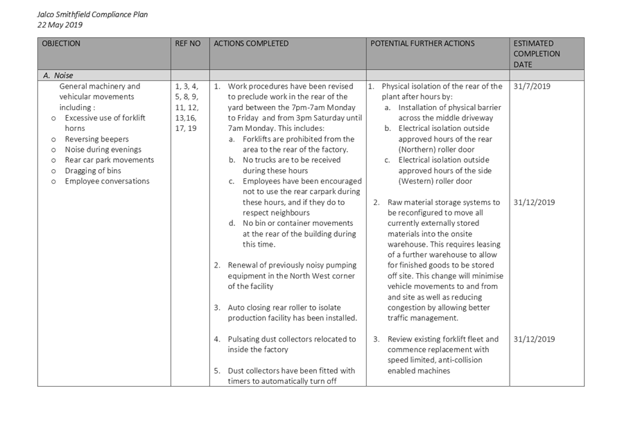
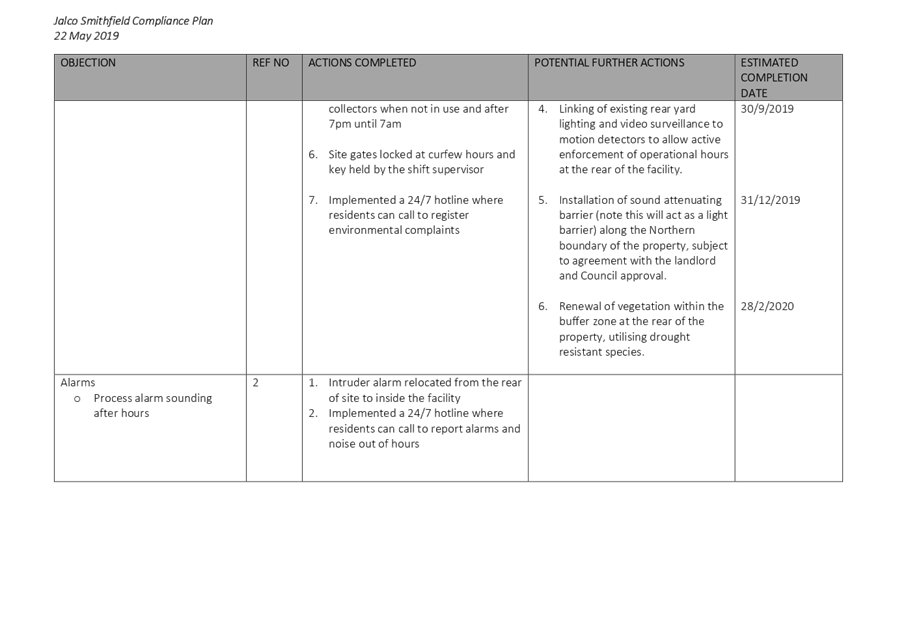
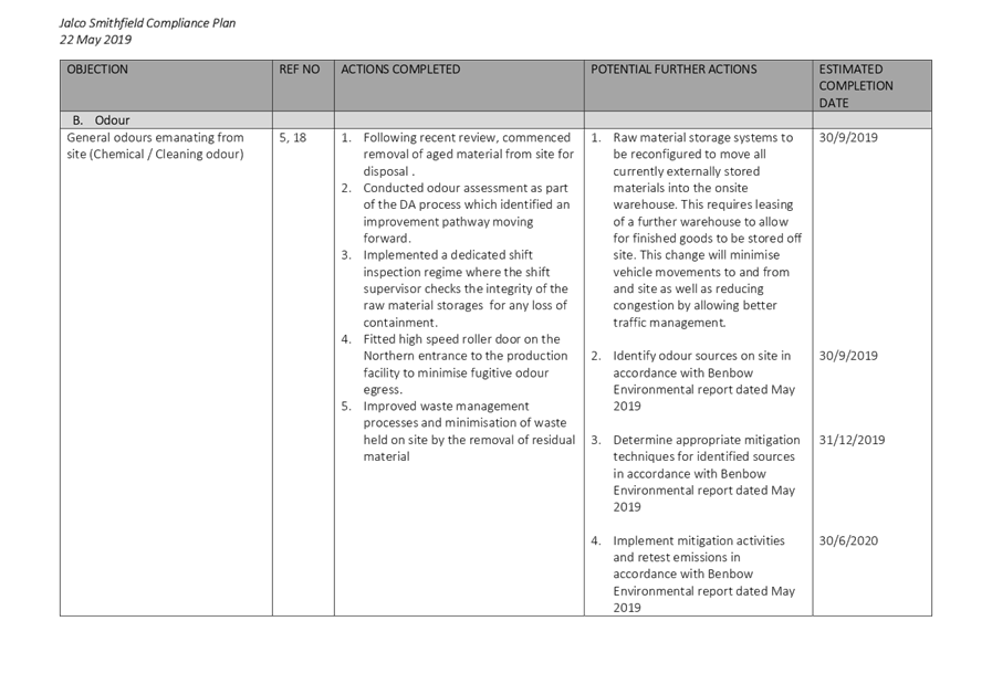
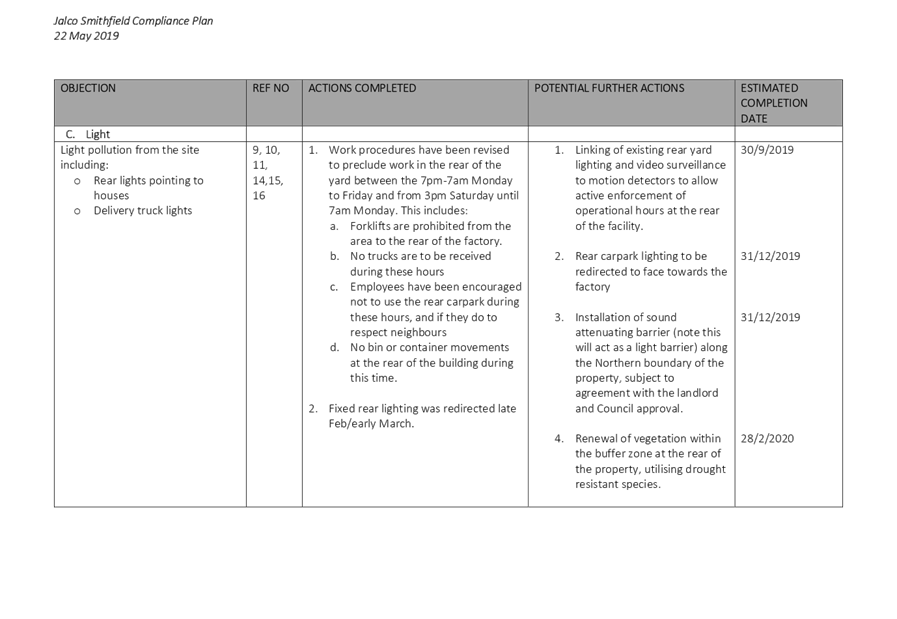
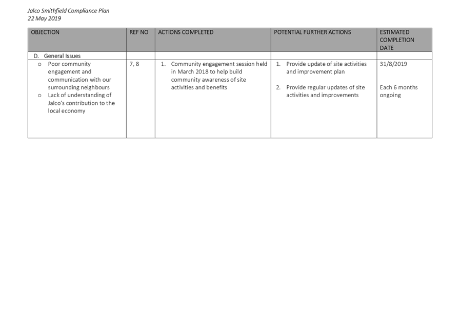
Extraordinary Cumberland Local Planning
Panel Meeting
5 November 2019
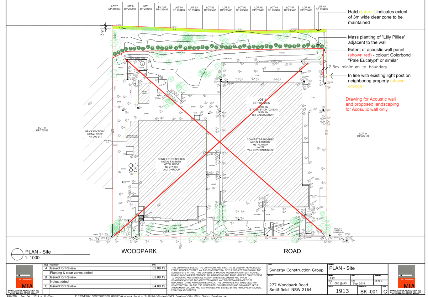
Extraordinary Cumberland Local Planning
Panel Meeting
5 November 2019
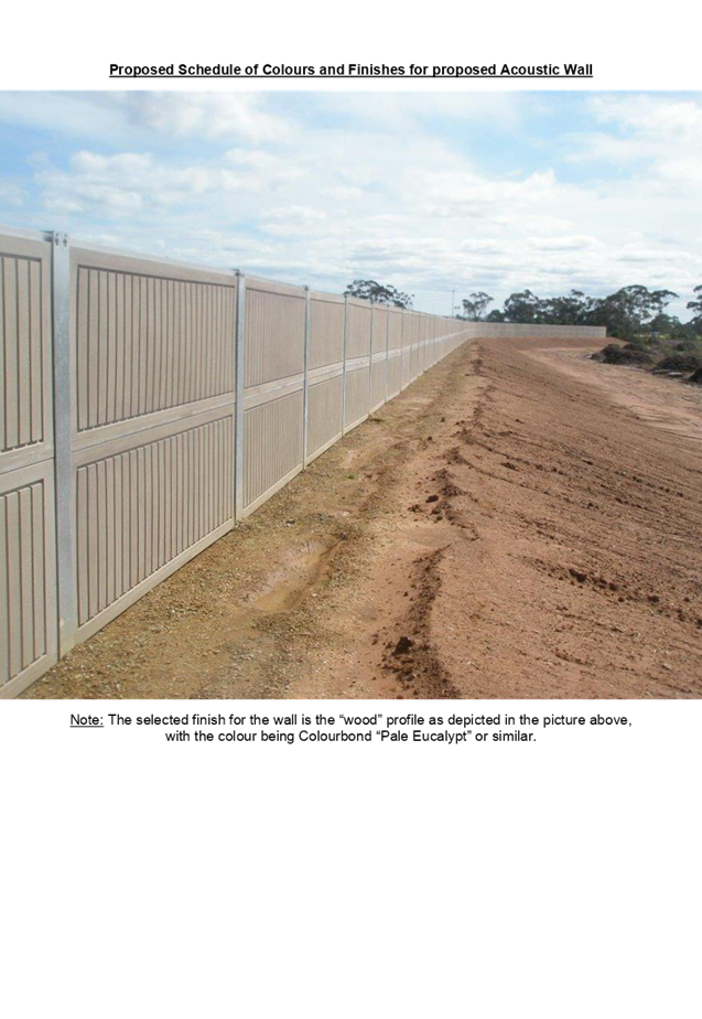
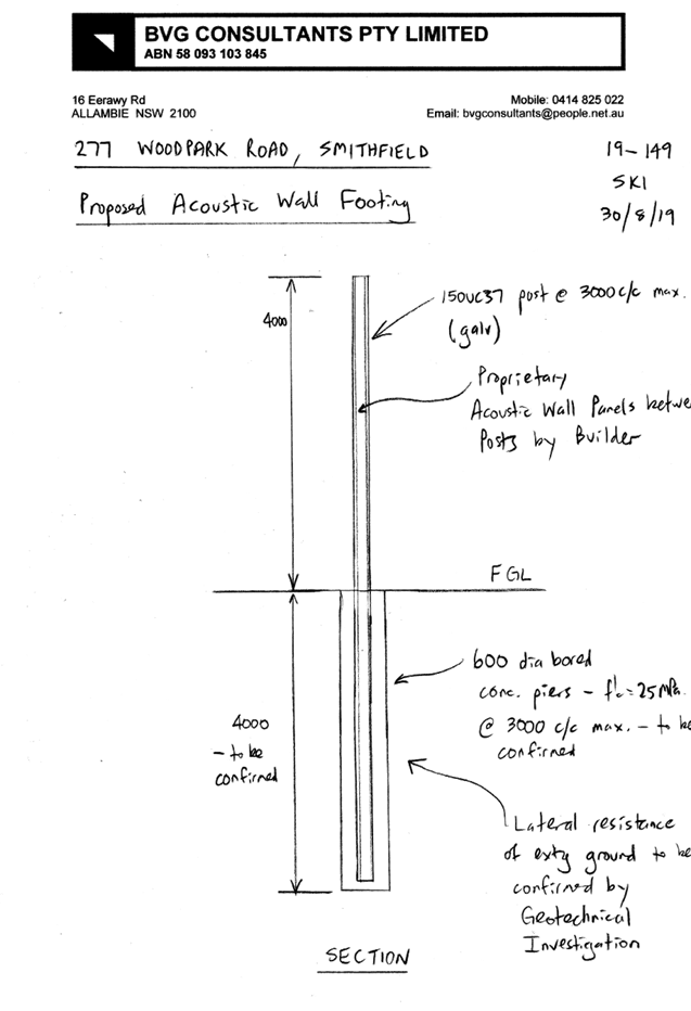
DOCUMENTS
ASSOCIATED WITH
REPORT ELPP067/19
Attachment 6
Redacted Public Submissions
Extraordinary Cumberland Local Planning
Panel Meeting
5 November 2019

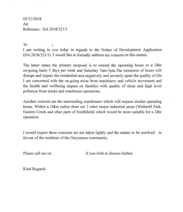


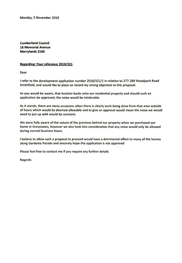


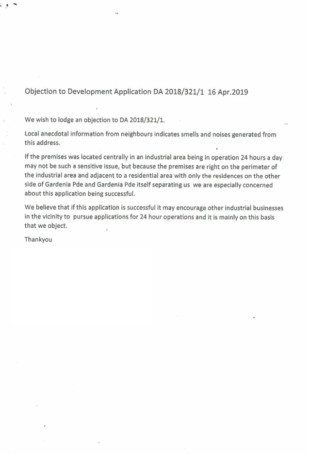
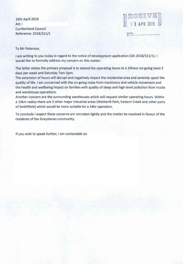


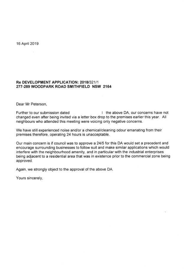


Extraordinary
Cumberland Local Planning Panel Meeting
5 November 2019
Item No: LPP068/19
Development
Application - 45-47 Susan Street, Auburn
Responsible
Division: Environment
& Planning
Officer: Executive
Manager Development and Building
File
Number: DA-251/2019
|
Application
lodged
|
25-Sep-2019
|
|
Applicant
|
Architecture
Design Studio (NSW) Pty Ltd
|
|
Owner
|
Park
Road Project Pty Limited
|
|
Application
No.
|
DA-251/2019
|
|
Description
of Land
|
45-47
Susan Street, AUBURN NSW 2144, Lot 29 Sec 14 DP 1389, Lot 28 Sec
14 DP 1389
|
|
Proposed
Development
|
Demolition
of existing structures and construction of a 2 storey boarding house
comprising 33 single rooms, 2 double rooms, 1 managers room and 1 communal
room over basement level car parking for 20 vehicles
|
|
Site
Area
|
1,226.80m2
|
|
Zoning
|
R3
– Medium Density Zone
|
|
Disclosure
of political donations and gifts
|
Nil
disclosure
|
|
Heritage
|
No
|
|
Principal
Development Standards
|
FSR
Permissible:
0.75:1
Proposed:
0.75:1
Height
of Building
Permissible:
9m
Proposed:
7.5m
|
|
Issues
|
Submissions
received
|
1. Development
Application No.DA-251/2019 was received on 13 August 2019 for the demolition of
existing structures and construction of a 2 storey boarding house comprising 33
single rooms, 2 double rooms, 1 managers room and 1 communal room over basement
level car parking for 20 vehicles
2. The
application was publicly notified to occupants and owners of the adjoining
properties for a period of 14 days between 27 August 2019 and 10 September
2019. In response, 25 submissions were received.
3. The
application is recommended for conditional approval subject to the conditions
as provided in the attached schedule.
4. The
application is referred to the Panel as the proposal is considered to be
contentious development.
Subject Site and Surrounding
Area
The subject site is legally
described as Lot 29 Sec 14 DP 1389 and Lot 28 Sec 14 DP 1389 which is also
known as 45-47 Susan Street, Auburn. The site is a regular shaped lot with a
frontage of 24.38m and a total site area of 1,226.80m2.
The site is located in a
transitioning area which includes a mix of older style single storey dwellings,
two storey walk up residential flat buildings, newer dual occupancy and multi
dwelling housing. The site is approximately 800m to Auburn Train Station. The
site is opposite a child care centre.
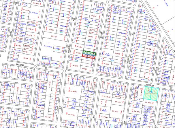
Figure
1 – Locality Plan of subject site
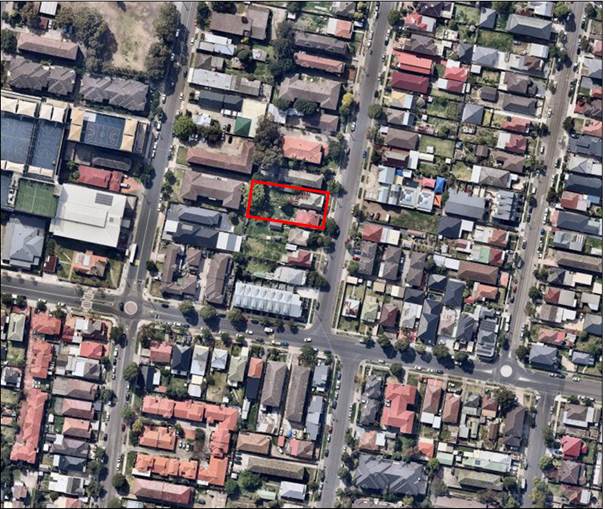
Figure
2 – Aerial view of subject site
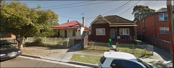
Figure
3 – Street view of subject site
Description of the Proposed
Development
Council has received a development
application for the following:
- The
demolition of existing structures;
- Construction
of a 2 storey boarding house comprising of
o 33 single rooms;
o 2 double rooms;
o 1 managers room;
- Communal
room on the ground floor; and
- Basement
level car parking for 20 vehicles
History
Pre lodgement advice (PL-4/2015)
was issued by Council 4 May 2015.
DA-173/2019 was lodged on 6 June
2019 which was withdrawn on 23 July 2019.
Applicants Supporting
Statement
The applicant has provided a
Statement of Environmental Effects prepared by Think Planners dated 6 February
2019 and was received by Council on 13 August 2019 in support of the
application.
Contact with Relevant
Parties
The assessing officer has
undertaken a site inspection of the subject site and surrounding properties and
has been in regular contact with the applicant throughout the assessment
process.
Internal Referrals
Development Engineer
The development application was
referred to Council’s Development Engineer for comment who has advised
that the development proposal is satisfactory and therefore can be supported,
subject to recommended conditions of consent.
Environment and Health
The development application was
referred to Council’s Environment and Health Officer for comment who has
advised that the development proposal is satisfactory and therefore can be
supported, subject to recommended conditions of consent.
Landscape Officer
The development application was
referred to Council’s Landscape Officer for comment who has advised that
the development proposal is satisfactory and therefore can be supported,
subject to recommended conditions of consent.
Waste Management
The development application was
referred to Council’s Waste Management Officer for comment who has
advised that the development proposal is satisfactory and therefore can be
supported, subject to recommended conditions of consent.
External Referrals
The development application was
referred to a crime prevention officer at the Auburn Police Station who has
advised that the development proposal is satisfactory and therefore can be
supported, subject to recommended conditions of consent.
Planning Comments
The provisions of any
Environmental Planning Instruments (EP&A Act s4.15 (1)(a)(i))
State Environmental Planning
Policies
The proposed development is
affected by the following State Environmental Planning Policies:
(a) State
Environmental Planning Policy No. 55 – Remediation of Land (SEPP 55)
Clause 7 of SEPP 55 requires
Council to be satisfied that the site is suitable or can be made suitable to
accommodate the proposed development. The matters listed within Clause 7 have
been considered in the assessment of the development application.
|
Matter for Consideration
|
Yes/No
|
|
Does the application involve re-development of the site or
a change of land use?
|
Yes
No
|
|
Does
the application involve re-development of the site or a change of land use?
|
Yes
No
|
|
In the development going to be used for a sensitive land
use (e.g.: residential, educational, recreational, childcare or hospital)?
|
Yes
No
|
|
Does information available to you indicate that an
activity listed below has ever been approved, or occurred at the site?
acid/alkali plant and
formulation, agricultural/horticultural activities, airports, asbestos
production and disposal, chemicals manufacture and formulation, defence
works, drum re-conditioning works, dry cleaning establishments, electrical
manufacturing (transformers), electroplating and heat treatment premises,
engine works, explosive industry, gas works, iron and steel works, landfill
sites, metal treatment, mining and extractive industries, oil production and
storage, paint formulation and manufacture, pesticide manufacture and
formulation, power stations, railway yards, scrap yards, service stations,
sheep and cattle dips, smelting and refining, tanning and associated trades,
waste storage and treatment, wood preservation
|
Yes
No
|
|
Is the site listed on
Council’s Contaminated Land database?
|
Yes
No
|
|
Is the site subject to EPA
clean-up order or other EPA restrictions?
|
Yes
No
|
|
Has the site been the subject of
known pollution incidents or illegal dumping?
|
Yes
No
|
|
Does the site adjoin any
contaminated land/previously contaminated land?
|
Yes
No
|
|
Has the appropriate level of
investigation been carried out in respect of contamination matters for
Council to be satisfied that the site is suitable to accommodate the proposed
development or can be made suitable to accommodate the proposed development?
|
Yes
No
|
|
Details of contamination investigations carried out at the
site:
A Preliminary Site Investigation
report prepared by Geotechnical Consultants Australia was submitted with the
application. The report did not reveal any potential matters of concern with
regard to contamination and concludes that the site is suitable for its
intended use.
|
(b) State
Environmental Planning Policy (Infrastructure) 2007 (ISEPP)
The provisions of the ISEPP 2007
have been considered in the assessment of the development application.
(c) State
Environmental Planning Policy (Vegetation in Non-Rural Areas) 2017
The proposal does not exceed the
biodiversity offsets scheme threshold. Therefore, the proposed vegetation
removal is considered acceptable. Please refer to the DCP compliance table for
further discussion.
(d) State
Environmental Planning Policy (Building Sustainability Index: BASIX) 2004
BASIX Certificate 1031848M dated
issued on 8 August 2019 prepared by Taylor Smith Consulting has been submitted
with Council and is considered to be satisfactory.
(e) State
Environmental Planning Policy (Affordable Rental Housing) 2009
The relevant objectives and
provisions of ARHSEPP 2009 have been considered in the following assessment
table.
|
Requirement
|
Yes
|
No
|
N/A
|
Comment
|
|
8 Relationship with other environmental
planning instruments
If there is an inconsistency between this Policy and any
other environmental planning instrument, whether made before or after the
commencement of this Policy, this Policy prevails to the extent of the
inconsistency.
|
|
|
|
Noted
|
|
26 Land to which Division
applies
This Division applies to land within any of the following
land use zones or within a land use zone that is equivalent to any of those
zones:
(a) Zone R1 General Residential,
(b) Zone R2 Low Density Residential,
(c) Zone R3 Medium Density Residential,
(d) Zone R4 High Density Residential,
(e) Zone B1 Neighbourhood Centre,
(f) Zone B2 Local Centre,
(g) Zone B4 Mixed Use.
|
|
|
|
The subject site located within the R3 Medium Density
Residential Zone as identified in the ALEP 2010.
|
|
27 Development to which
Division applies
(1) This Division applies to development, on land to
which this Division applies, for the purposes of boarding houses.
(2) Despite subclause (1), this Division does not
apply to development on land within Zone R2 Low Density Residential or within
a land use zone that is equivalent to that zone in the Sydney region unless
the land is within an accessible area.
(3) Despite subclause (1), this Division does not
apply to development on land within Zone R2 Low Density Residential or within
a land use zone that is equivalent to that zone that is not in the Sydney
region unless all or part of the development is within 400 metres walking
distance of land within Zone B2 Local Centre or Zone B4 Mixed Use or within a
land use zone that is equivalent to any of those zones.
|
|
|
|
The development is proposed on land zoned R3 Medium
Density Residential Zone in the Sydney region. This division applies to the
development.
The site is zoned R3 Medium Density Zone.
|
|
28 Development may be carried
out with consent
Development to which this Division applies may be carried
out with consent.
|
|
|
|
Consent is being sought.
|
|
29 Standards that cannot be
used to refuse consent
(1) A consent authority must not refuse consent to
development to which this Division applies on the grounds of density or scale
if the density and scale of the buildings when expressed as a floor space
ratio are not more than:
(a) the existing maximum floor space ratio for
any form of residential accommodation permitted on the land, or
(b) if the development is on land within a zone
in which no residential accommodation is permitted—the existing maximum
floor space ratio for any form of development permitted on the land, or
(c) if the development is on land within a zone
in which residential flat buildings are permitted and the land does not
contain a heritage item that is identified in an environmental planning
instrument or an interim heritage order or on the State Heritage
Register—the existing maximum floor space ratio for any form of
residential accommodation permitted on the land, plus:
(i) 0.5:1, if the existing maximum floor space
ratio is 2.5:1 or less, or
(ii) 20% of the existing maximum floor space
ratio, if the existing maximum floor space ratio is greater than 2.5:1.
|
|
|
|
The proposed development complies with the prescribed FSR
for the zone being 0.75:1
Residential accommodation is permitted in the zone.
Residential flat buildings are not permitted in the R3
zone.
|
|
(2) A consent authority must not refuse consent to
development to which this Division applies on any of the following grounds:
(a) building height
if the building height of all proposed buildings is not
more than the maximum building height permitted under another environmental
planning instrument for any building on the land,
(b) landscaped area
if the landscape treatment of the front setback area is
compatible with the streetscape in which the building is located,
(c) solar access
where the development provides for one or more communal
living rooms, if at least one of those rooms receives a minimum of 3 hours
direct sunlight between 9am and 3pm in mid-winter,
(d) private open space
if at least the following private open space areas are
provided (other than the front setback area):
(i) one area of at least 20m2 with a
minimum dimension of 3m is provided for the use of the lodgers,
(ii) if accommodation is provided on site for a
boarding house manager—one area of at least 8m2 with a
minimum dimension of 2.5m is provided adjacent to that accommodation,
(e) parking
if:
(i) in the case of development carried out by
or on behalf of a social housing provider in an accessible area—at
least 0.2 parking spaces are provided for each boarding room, and
(ii) in the case of development carried out by
or on behalf of a social housing provider not in an accessible area—at
least 0.4 parking spaces are provided for each boarding room, and
(iia) in the case of development not carried
out by or on behalf of a social housing provider—at least 0.5 parking
spaces are provided for each boarding room, and
(iii) in the case of any development—not
more than 1 parking space is provided for each person employed in connection
with the development and who is resident on site,
(f) accommodation size
if each boarding room has a gross floor area (excluding
any area used for the purposes of private kitchen or bathroom facilities) of
at least:
(i) 12m2 in the case of a boarding
room intended to be used by a single lodger, or
(ii) 16m2 in any other case.
|
|
|
|
The maximum building height for the site permitted under
ALEP 2010 is 9m. The proposed development is 7.5m in height.
The front setback with its landscaping is considered to be
consistent to that of the surrounding streetscape.
There is a communal area on the ground floor towards the
rear of the site which has a north facing sliding door and a west facing
sliding door. This area will receive solar access between 11am and 2pm
meeting this requirement.
Private open space for lodgers has been provided in the
rear of the site which is 63m² in size with minimum dimension of 3m. The
ground floor rooms also have private patios at least 5m² in size (size
varies).
A 66m² area has been provided at the rear attached to
the managers room.
The application is not being carried out by or on behalf
of a social housing provider.
The application is not being carried out by or on behalf
of a social housing provider.
35 rooms are proposed in total which generate 17.5 = 18
spaces.
20 spaces have been proposed to be used by lodgers however
one of those spaces is required to be used a turning bay which leaves a total
of 19 spaces – being one more than the required 18
1 managers space has been proposed.
Total number of spaced needed: 19
Total number of spaces provided: 20
All single rooms are a minimum of 12m² and the two
double rooms are a minimum of 16m²
|
|
(3) A boarding house may have private kitchen or
bathroom facilities in each boarding room but is not required to have those
facilities in any boarding room.
|
|
|
|
All requires services are provided within each boarding
room.
|
|
(4) A consent authority may consent to development
to which this Division applies whether or not the development complies with
the standards set out in subclause (1) or (2).
|
|
|
|
Noted.
|
|
30 Standards for boarding
houses
(1) A consent authority must not consent to
development to which this Division applies unless it is satisfied of each of
the following:
(a) if a boarding house has 5 or more boarding
rooms, at least one communal living room will be provided,
(b) no boarding room will have a gross floor
area (excluding any area used for the purposes of private kitchen or bathroom
facilities) of more than 25m2,
(c) no boarding room will be occupied by more
than 2 adult lodgers,
(d) adequate bathroom and kitchen facilities
will be available within the boarding house for the use of each lodger,
(e) if the boarding house has capacity to
accommodate 20 or more lodgers, a boarding room or on site dwelling will be
provided for a boarding house manager,
(f) (Repealed)
(g) if the boarding house is on land zoned
primarily for commercial purposes, no part of the ground floor of the
boarding house that fronts a street will be used for residential purposes
unless another environmental planning instrument permits such a use,
(h) at least one parking space will be provided
for a bicycle, and one will be provided for a motorcycle, for every 5
boarding rooms.
(2) Subclause (1) does not apply to development for
the purposes of minor alterations or additions to an existing boarding house.
|
|
|
|
There are 35 rooms in total with one communal area on the
ground floor.
None of the boarding rooms are over 25m².
This can form part of a condition of consent. All rooms
are nominated as either single or double rooms.
Small kitchenettes are available in each room with a small
bathroom.
A manager’s room has been proposed.
The development is not on land zoned primarily for
commercial purposes.
Number of boarding rooms = 35
Therefore 7 spaces is needed bicycle/motorcycle
7 motorbike spaces proposed
11 bicycle spaces proposed
New building proposed.
|
|
30AA Boarding houses in Zone R2 Low
Density Residential
A consent authority must not grant development consent to
a boarding house on land within Zone R2 Low Density Residential or within a
land use zone that is equivalent to that zone unless it is satisfied that the
boarding house has no more than 12 boarding rooms.
|
|
|
|
The subject site is zoned R3 – Medium Density Zoning
|
|
30A Character of local area
A consent authority must not consent to development to
which this Division applies unless it has taken into consideration whether
the design of the development is compatible with the character of the local
area.
|
|
|
|
See discussion below.
|
|
Part 4 Miscellaneous
52 No subdivision of boarding
houses
A consent authority must not grant consent to the strata
subdivision or community title subdivision of a boarding house.
|
|
|
|
No subdivision is proposed as part of this application.
This will be reinforced as a condition on any consent issued.
|
A consent authority must not
consent to development to which this Division applies unless it has taken into
consideration whether the design of the development is compatible with the
character of the local area.
Discussion
The ARHSEPP does not provide
guidance in how to determine if a development is compatible with the local
area. In this regard, case law in the Land and Environment Court has considered
the merits assessment of Clause 30A. In addition, the Land and Environment
Court’s Planning Principle ‘Surrounding Development –
Compatibility of proposal with surrounding development’ (Project Venture
Developments Pty Ltd v Pittwater Council [2005] NSWLEC 191) provides for
guidance on how to assess compatibility of development with the character of
local area. Using case law and the Land and Environment Court Planning
Principle, a merit assessment of character of the local area should consider
the following three steps:
Step 1 – Identify the local
area.
Step 2 – Determine the
character (present and future) of the local area.
Step 3 – Determine if the
development is compatible with the character of the local area.
As assessment against each step is
provided below:
Step 1 - Identify the local
area
This assessment identifies the
local area as primarily the visual catchment of the site (as viewed from within
the site and directly adjacent to the site on the street) which is shown in the
aerial view provided earlier in the report.
The local area for the purposes of
this application is outlined on the zoning map below:
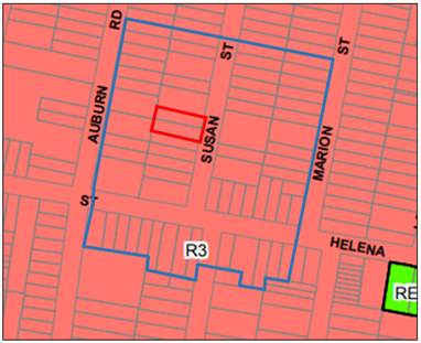
Child
care centre across the road:
Walk
up residential flat buildings immediately to the north:
Older
style single storey dwellings and two storey dual occupancy opposite the subject
site:
Two
storey multi dwelling housing on corner of Helena Street and Susan Street:
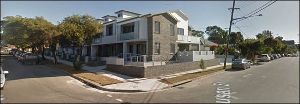
Step 2 – Determine the
character (present and future) of the local area
The identified character area is
within the zone R3 Medium Density Residential and contains primarily one storey
older style dwellings, two storey dual occupancy, two storey (with attics)
multi dwelling housing and two storey walk up older style residential flat
buildings. Immediately opposite the site is a two storey childcare centre (with
a recently approved extension), a single storey dwelling and a two storey dual
occupancy. Adjacent to the site to the north is a two storey walk up
residential flat building. Adjacent to the site to the south is a single storey
dwelling. Immediately to the rear of the site is an older style, two storey
residential flat building. The area is undergoing transition and it is likely
that the existing older building stock of single dwellings will be redeveloped
to large two storey dwellings, dual occupancy and multi dwelling housing
already evident in the area.
Step 3 - Determine if the
development is compatible with the character of the local area.
In accordance with the Land and
Environment Court’s ‘Planning Principle’ and recent case law
on the character test within Clause 30A of the ARHSEPP, compatibility is best
defined as ‘capable of existing together in harmony’. In order to
test compatibility two questions are to be considered. These questions as well
as a response to each are provided below:
Are the proposal’s
physical impacts on surrounding development acceptable? The physical impacts
include constraints on the development potential of surrounding sites.
The above question is relatively
objective. Physical impacts generally include privacy, overshadowing, visual
bulk and compatibility in the streetscape.
In terms of the physical impacts
of the development, the following points are made:
· The
design of the proposal and large side setbacks of the development create
minimal overshadowing impact on adjoining sites.
· Privacy
impacts are mitigated through the use of large setbacks, appropriate fencing on
the ground floor and keeping the communal spaces on the ground floor behind
fences.
· There
are two first floor, rear facing balconies which have a depth of no more than
0.5m and therefore cannot be used for social gatherings.
· Noise
impacts from the common room are reduced through it being located on the ground
floor and have limited hours of access.
· The
development proposal does not result in the constrained development potential
of the adjoining properties to other uses permissible in R3 zones.
· The
car parking is located in the basement so that it does not add to the physical
aspect of the building.
· The
street facing elevation (balcony and large windows) allows for passive
surveillance of Susan Street.
· The
proposal is a purpose built boarding house development which has utilised
architectural and design treatments to ameliorate amenity impacts on
neighbouring properties.
The development will have
acceptable impacts on neighbouring developments.
Is the proposal’s
appearance in harmony with the buildings around it and the character of the
street?
The predominant building types
within the local area are one and two storey residential dwelling houses, dual
occupancy, multi dwelling housing and older style walk up residential flat
buildings. Given that predominant future character of the area is to maintain
the medium density residential use in terms of usage and building type. It is
expected there will be upgrades to the residential housing stock via
alterations and additions, knock down rebuilds and new multi dwelling housing.
As such, the proposed two storey building form and materials and finishes are
considered to be in harmony with the emerging development in the area. The
building has an appearance from the street of a larger, new dwelling or that of
a multi dwelling housing.
In this context, it is considered
that the proposal is considered to be compatible with the existing and future
desired character of the locality.
Regional Environmental Plans
The proposed development is
affected by the following Regional Environmental Plans:
(a) Sydney
Regional Environmental Plan (Sydney Harbour Catchment) 2005
The subject site is identified as
being located within the area affected by the Sydney Regional Environmental
Plan (Sydney Harbour Catchment) 2005. The proposed development raises no issues
as no impact on the catchment is envisaged.
(Note: - the subject site is not
identified in the relevant map as ‘land within the ‘Foreshores and
Waterways Area’ or ‘Wetland Protection zone’, is not a
‘Strategic Foreshore Site’ and does not contain any heritage items.
Hence the majority of the SREP is not directly relevant to the proposed
development).
Local Environmental Plans
Auburn Local Environmental Plan
2010
The provision of the ALEP 2010 is
applicable to the development proposal. It is noted that the development
achieves compliance with the key statutory requirements of the ALEP 2010 and
the objectives of the R3 – Medium Density Residential zoning.
(a) Permissibility:-
The proposed development is
defined as a “Boarding House” and is permissible in the R3 –
Medium Density Residential zone with consent.
boarding house
means a building that:
(a) is
wholly or partly let in lodgings, and
(b) provides
lodgers with a principal place of residence for 3 months or more, and
(c) may
have shared facilities, such as a communal living room, bathroom, kitchen or
laundry, and
(d) has
rooms, some or all of which may have private kitchen and bathroom facilities,
that accommodate one or more lodgers,
but does not include
backpackers’ accommodation, a group home, hotel or motel accommodation,
seniors housing or a serviced apartment.
The relevant matters to be
considered under ALEP 2010 and the applicable clauses for the proposed
development are summarised below.
|
Parramatta Local
Environmental Plan (PLEP) 2011
|
|
Is the development consistent
with the aims of the LEP?
|
Not inconsistent.
|
|
Is the development consistent
with the Zone objectives?
|
Not inconsistent.
|
|
Maximum height of building
– 9m
|
Yes – overall building
height is 7.5m
|
|
Floor space ratio (FSR)
– 0.75:1
|
Yes – the proposal has a
FSR of 0.75:1
|
|
Heritage Conservation
|
N/A – the site is not in
a heritage conservation area nor is it listed as a heritage item.
|
|
Acid Sulphate Soils
|
Yes – Class 5
|
|
Earthworks
|
Yes – Acceptable
|
|
Flood Planning
|
N/A
|
|
Biodiversity Protection
|
N/A
|
|
Water Protection
|
N/A
|
The provisions of any proposed
instrument that is or has been the subject (EP&A Act s4.15 (1)(a)(ii))
(a) Draft
State Environmental Planning Policy (Environment)
The draft SEPP relates to the
protection and management of our natural environment with the aim of
simplifying the planning rules for a number of water catchments, waterways,
urban bushland, and Willandra Lakes World Heritage Property. The changes
proposed include consolidating the following seven existing SEPPs:
· State
Environmental Planning Policy No. 19 – Bushland in Urban Areas
· State
Environmental Planning Policy (Sydney Drinking Water Catchment) 2011
· State
Environmental Planning Policy No. 50 – Canal Estate Development
· Greater
Metropolitan Regional Environmental Plan No. 2 – Georges River Catchment
· Sydney
Regional Environmental Plan No. 20 – Hawkesbury-Nepean River (No.2-1997)
· Sydney
Regional Environmental Plan (Sydney Harbour Catchment) 2005
· Willandra
Lakes Regional Environmental Plan No. 1 – World Heritage Property.
The draft policy will repeal the
above existing SEPPs and certain provisions will be transferred directly to the
new SEPP, amended and transferred, or repealed due to overlaps with other areas
of the NSW planning system.
Changes are also proposed to the
Standard Instrument – Principal Local Environmental Plan. Some provisions
of the existing policies will be transferred to new Section 117 Local Planning
Directions where appropriate.
The provisions of any
Development Control Plans (EP&A Act s4.15 (1)(a)(iii))
The Auburn DCP 2010 provides
guidance for the design and operation of development to achieve the aims and
objectives of the ALEP 2010.
There are no controls under ADCP
2010 that are relevant to a boarding house development. The application has
been assessed against DCP parts relating to stormwater and waste and therefore
the application has found to be worthy of support via conditions of consent.
The provisions of any planning
agreement that has been entered into under section 7.4, or any draft planning
agreement that a developer has offered to enter into under section 7.4
(EP&A Act s4.15(1)(a)(iiia))
There is no draft planning
agreement associated with the subject Development Application.
The provisions of the
Regulations (EP&A Act s4.15 (1)(a)(iv))
The proposed development raises no
concerns as to the relevant matters arising from the Environmental Planning and
Assessment Regulations 2000 (EP&A Reg).
The Likely Environmental,
Social or Economic Impacts (EP&A Act s4.15 (1)(b))
It is considered that the proposed
development will have no significant adverse environmental, social or economic
impacts in the locality.
The suitability of the site for
the development (EP&A Act s4.15 (1)(c))
The subject site and locality is
not known to be affected by any natural hazards or other site constraints
likely to have a significant adverse impact on the proposed development.
Accordingly, it is considered that the development is suitable in the context
of the site and surrounding locality.
Submissions made in accordance
with the Act or Regulation (EP&A Act s4.15 (1)(d))
Advertised (newspaper) Mail Sign Not Required
In accordance with Council’s
Notification requirements contained within the Auburn DCP 2010, the proposal
was publicly notified for a period of 14 days between 27 August 2019 and 10
September 2019. The notification generated 25 (same letter signed by different
households) submissions in respect of the proposal with nil disclosing a
political donation or gift. The issues raised in the public submissions are
summarised and commented on as follows:
|
Issues:
|
Planners Comment:
|
|
1. Another
boarding house was submitted for Chiswick Street
|
There are no restrictions how
many boarding houses can coexist in an area and each application is assessed
separately and independently of other applications.
|
|
2. Precedent of DA opposite a primary school being refused
earlier
|
It is not clear which
application this is referring to but each application is assessed
independently of other applications irrespective of the fact that the site is
opposite a school or not.
|
|
3. Significant
social and amenity risks
|
No evidence has been submitted
to suggest that this boarding house will have a negative impact on the
amenity of the locality. Furthermore, the development application was
referred to the Crime Prevention Officer (Auburn Police Area Command) for
comments who raised no issues with the application and have provided
conditions which have been imposed on the consent.
|
|
4. Boarding
House is redundant, unnecessary and inappropriate for Auburn
|
Boarding houses are a
permissible form of development under the ALEP 2010 and the State
Environmental Planning Policy (Affordable Rental Housing) 2009.
|
|
5. None
of the boarding house residents will have ownership/equity
|
The minimum stay is 3 months,
however residents may choose to stay much longer than that and be part of the
larger community.
|
|
6. Maximum
allowable distance to the railway station
|
The required distance to public
transport is only required for sites in R2 – Low Density zones. The
subject site is zoned R3 – Medium Density Zone.
|
|
7. Gross
over-development (site coverage, number of occupants/density)
|
A boarding house is a
permissible form of development and the size of the development is considered
to be acceptable in this instance. The development complies with
Council’s controls (FSR, height and setbacks) which guides the size of
the development. The development also provides for wide side setbacks and a
front setback compatible to the area. There are no restrictions in regards to
number of occupants/density in a R3 zone.
|
|
8. Occupancy by
questionable/dishonest criminal types
|
The boarders can be any single
person or couple who require accommodation for a minimum of three months. The
boarding house will be managed by an in-house manager who shall report any
illegal activity to the appropriate authority.
|
|
9. Parking
problems
|
The proposed development
complies with parking requirements under the ARH SEPP.
|
|
10. Garbage
disposal/ street pickup/ returned bins
|
The application has been
assessed by Council’s Waste Management Team and they have found the
method of waste disposal satisfactory. The boarding house includes an
enclosed waste storage area which will house all the required bins. The
manager will be responsible to take the bins out on bin day and return them
after.
|
|
11. Maintenance
of building and grounds
|
There is boarding house manager
responsible for the upkeep of the building and keeping residents responsible
in complying with the House Rules. The Plan of Management mentions that a
weekly cleaner will be employed to aid in this matter.
|
|
12. External
noise/ social gatherings
|
An acoustic report was submitted
which outlined any noise emissions from car park and use of the site as a
Boarding House. A condition of consent will be imposed to ensure compliance
with the acoustic reports. The House Rules (part of Plan of Management) are
also conditioned which limits the communal area and outdoor areas to be used
between the hours of 7am and 10pm.
|
|
13. Uncontrolled
subletting
|
The operation of Boarding houses
is managed by the Boarding Houses Regulation 2013. A Plan of Management was
submitted with the application which shall form part of a condition of
consent. All residents are required to sign an occupancy agreement that they
will abide by house rules and by in requirements listed in Boarding Houses
Regulation 2013. There is also a boarding house manager that lives on the
premises to ensure compliance.
|
|
14. Close
proximity to school and child care centre
|
There are no restrictions in
regards to boarding houses and proximity to schools or child care centres.
|
The public interest
(EP&A Act s4.15(1)(e))
In view of the foregoing analysis
it is considered that the development, if carried out subject to the conditions
set out in the recommendation below, will have no significant adverse impacts
on the public interest.
Section 7.11 (Formerly S94)
Contribution Towards Provision or Improvement of Amenities or Services
This part of the Act relates to
the collection of monetary contributions from applicants for use in developing
key local infrastructure.
Comments:
The development requires the
payment of contributions in accordance with Council’s Section 94
Contributions Plans.
As at 30 September 2019, the fee
payable is $100,638.32. This figure is subject to indexation as per the
relevant plan. The draft determination attached includes a condition requiring
payment of the contribution prior to issue of a Construction Certificate.
Disclosure of Political
Donations and Gifts
The applicant and notification
process did not result in any disclosure of Political Donations and Gifts.
The development application has
been assessed in accordance with the relevant requirements of the Environmental
Planning and Assessment Act 1979, State Environmental Planning Policy
(Affordable Rental Housing) 2009, Auburn LEP and Auburn DCP
and is considered to be satisfactory for approval subject to conditions.
The proposed development is
appropriately located within the R3 Medium Density Zone under the relevant
provisions of the Auburn LEP 2010. The proposal is consistent with all
statutory and non-statutory controls applying to the development. The
development is considered to perform adequately in terms of its relationship to
its surrounding built and natural environment, particularly having regard to
impacts on adjoining properties.
For these reasons, it is
considered that the proposal is satisfactory having regard to the matters of
consideration under Section 4.15 of the Environmental Planning and Assessment
Act 1979, and the development may be approved subject to conditions.
There are no consultation
processes for Council associated with this report.
There are no financial
implications for Council associated with this report.
There are no policy implications
for Council associated with this report.
Communication /
Publications:
The final outcome of this matter
will be notified in the newspaper. The objectors will also be notified in
writing of the outcome.
|
1. That
Development Application No. DA-251/2019 for demolition of existing structures
and construction of a 2 storey boarding house comprising 33 single rooms, 2
double rooms, 1 managers room and 1 communal room over basement level car
parking for 20 vehicles on land at 45-47 Susan Street, AUBURN NSW
2144 be approved subject to attached conditions listed in the attached
schedule.
2. Persons
whom have lodged a submission in respect to the application be notified of
the determination of the application.
|
1. Draft Notice
of Determination
2. Architectural
Plans
3. Submissions
Received
4. Plan
of Management
5. Landscape
Plans
6. Stormwater
Plans
DOCUMENTS
ASSOCIATED WITH
REPORT LPP068/19
Attachment 1
Draft Notice of Determination
Extraordinary Cumberland Local Planning
Panel Meeting
5 November 2019
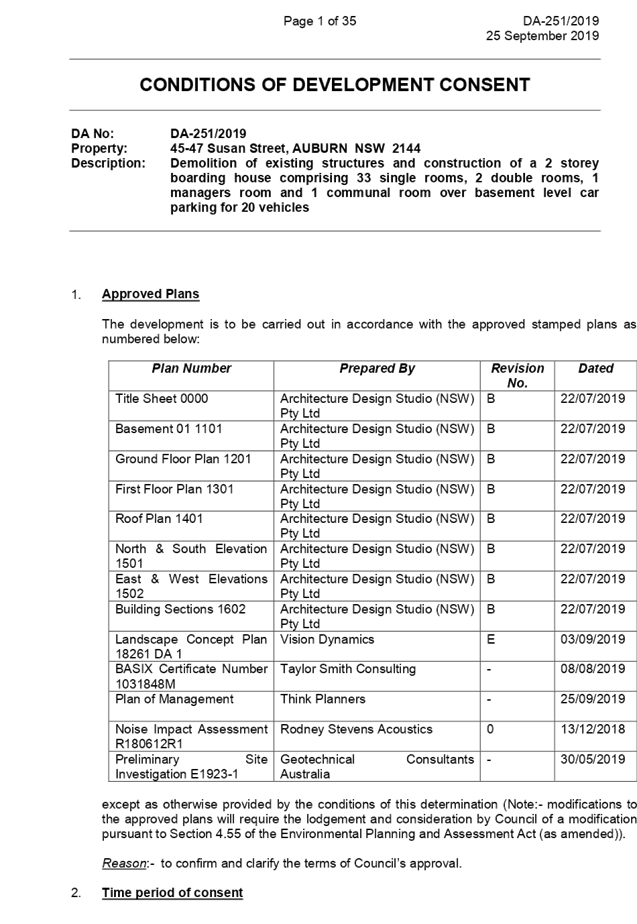
DOCUMENTS
ASSOCIATED WITH
REPORT ELPP068/19
Attachment 2
Architectural Plans
Extraordinary Cumberland Local Planning
Panel Meeting
5 November 2019
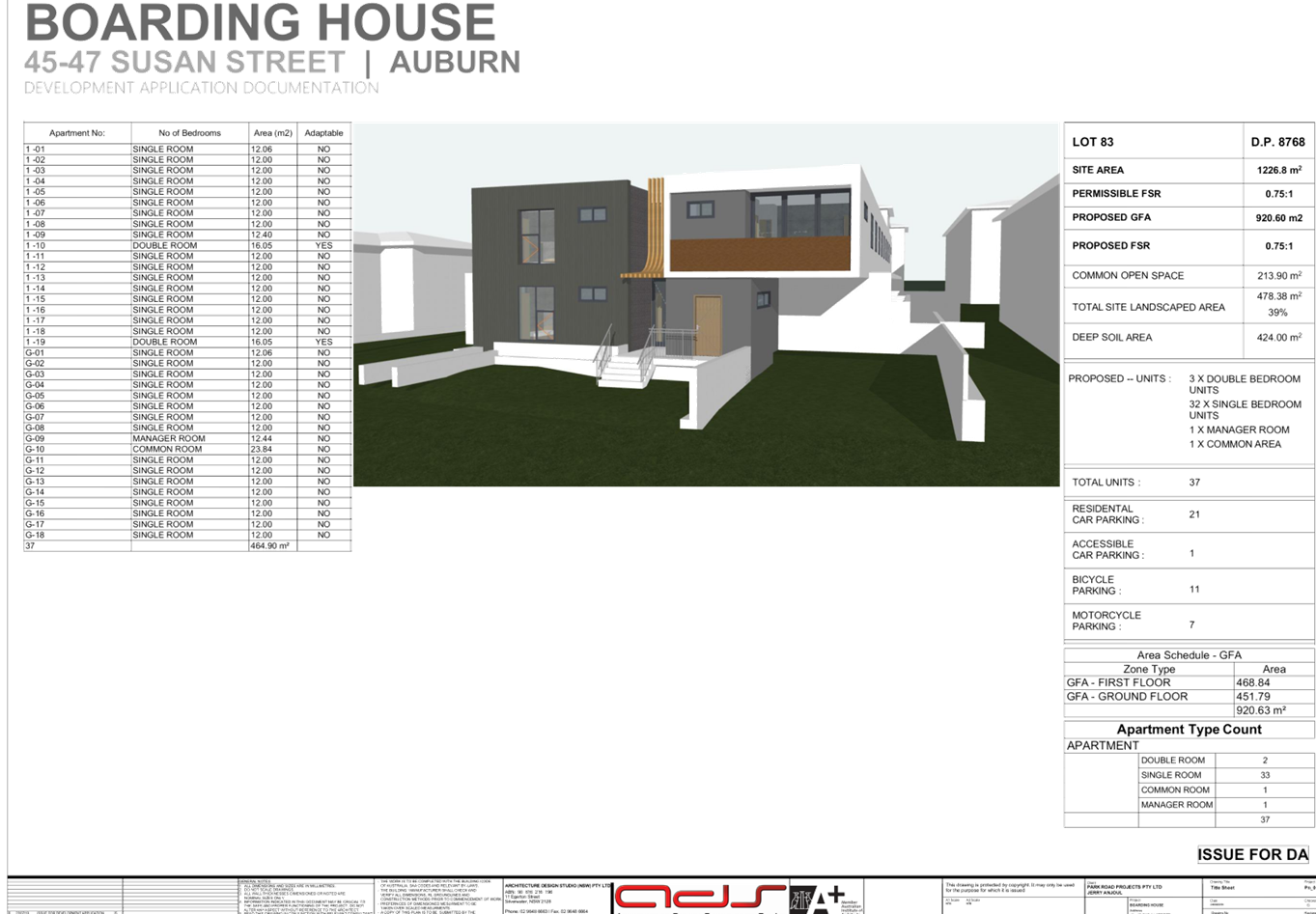
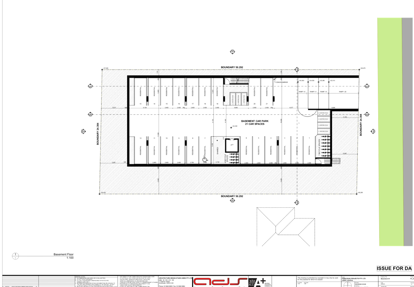
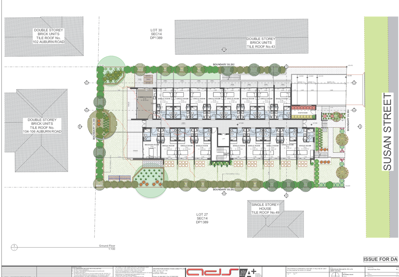
Extraordinary Cumberland Local Planning
Panel Meeting
5 November 2019
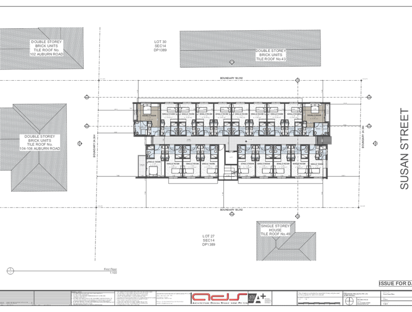
Extraordinary Cumberland Local Planning
Panel Meeting
5 November 2019
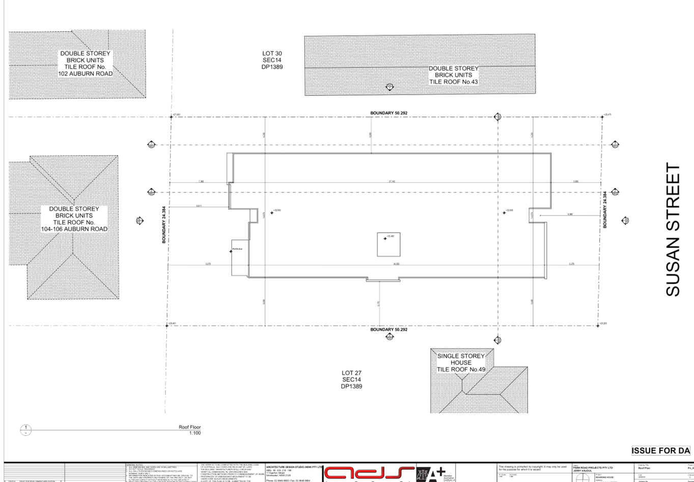
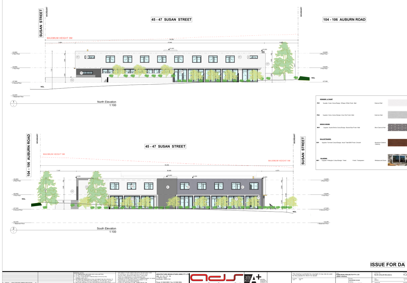
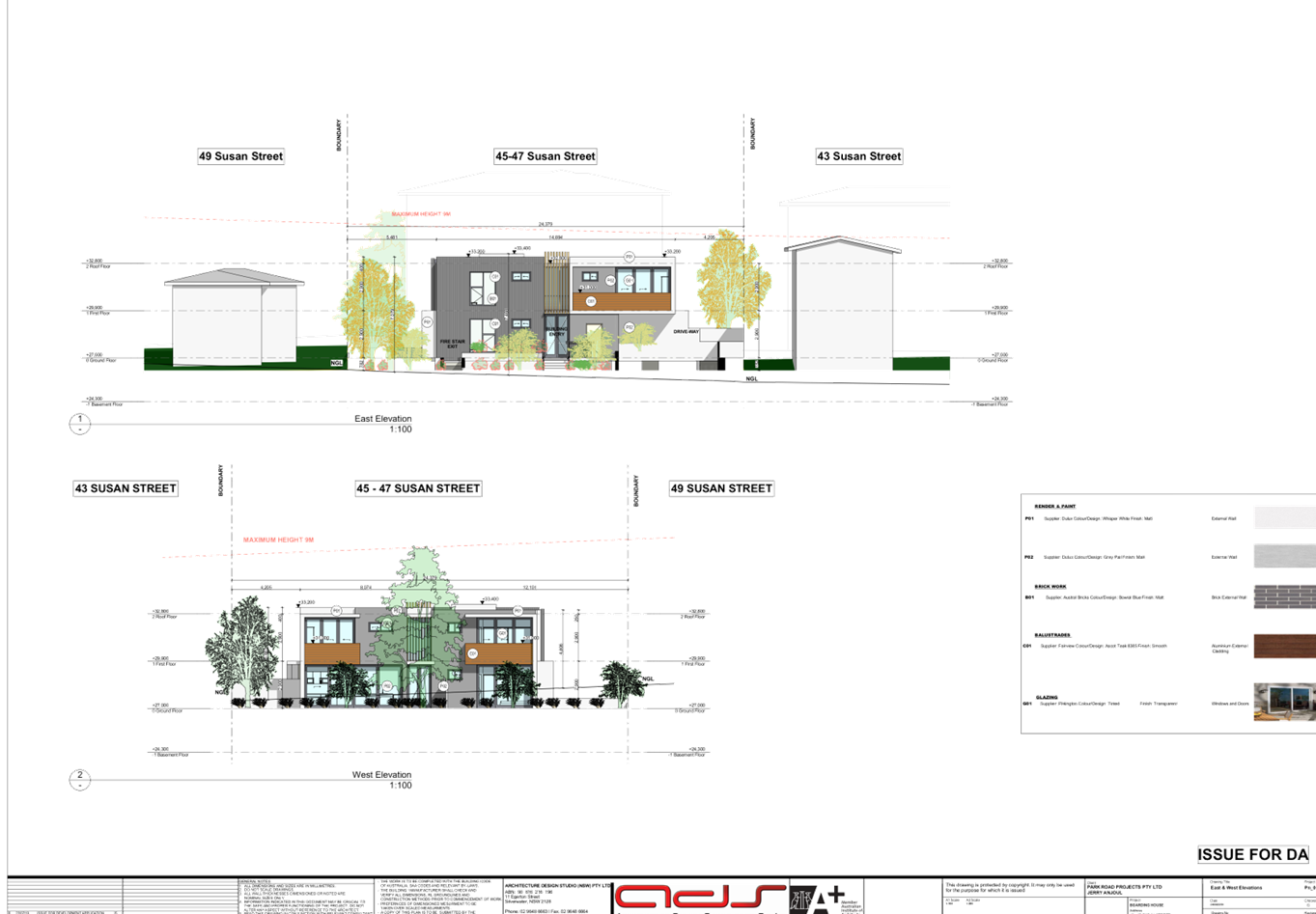
DOCUMENTS
ASSOCIATED WITH
REPORT ELPP068/19
Attachment 3
Submissions Received
Extraordinary Cumberland Local Planning
Panel Meeting
5 November 2019


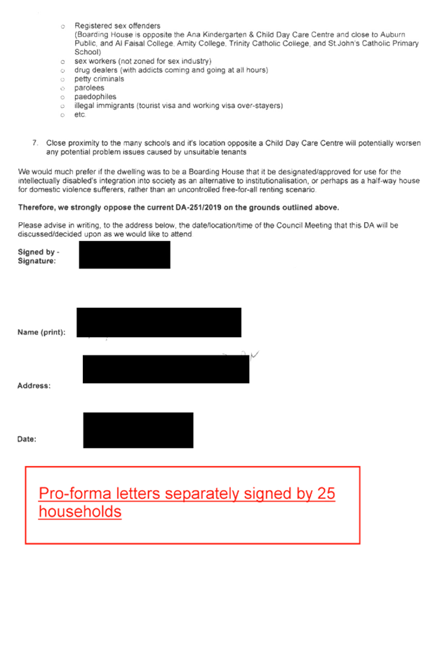

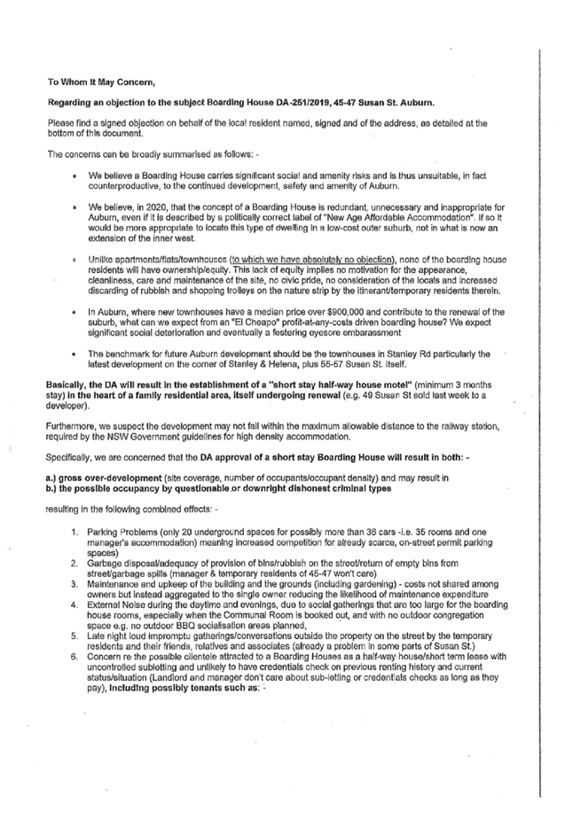
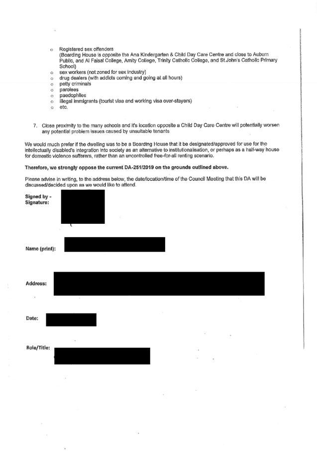
DOCUMENTS
ASSOCIATED WITH
REPORT ELPP068/19
Attachment 4
Plan of Management
Extraordinary Cumberland Local Planning
Panel Meeting
5 November 2019

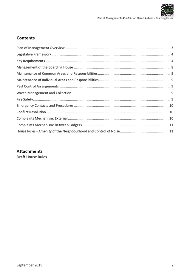


DOCUMENTS
ASSOCIATED WITH
REPORT ELPP068/19
Attachment 5
Landscape Plans
Extraordinary Cumberland Local Planning
Panel Meeting
5 November 2019
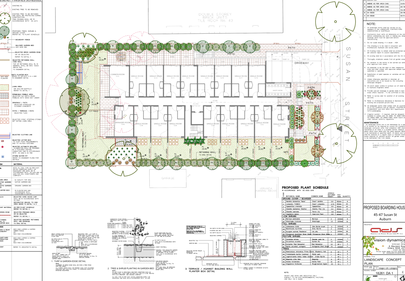
DOCUMENTS
ASSOCIATED WITH
REPORT ELPP068/19
Attachment 6
Stormwater Plans
Extraordinary Cumberland Local Planning
Panel Meeting
5 November 2019
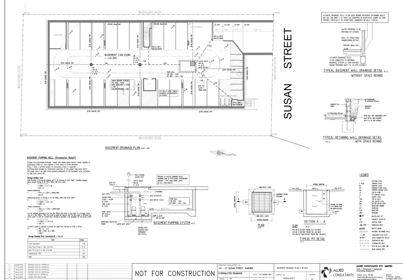
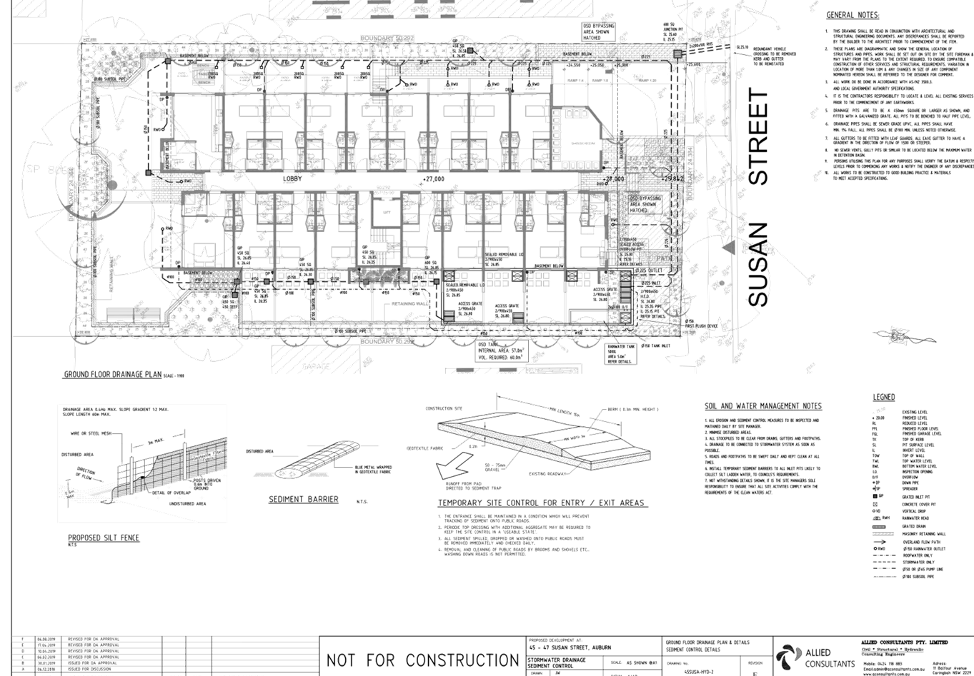
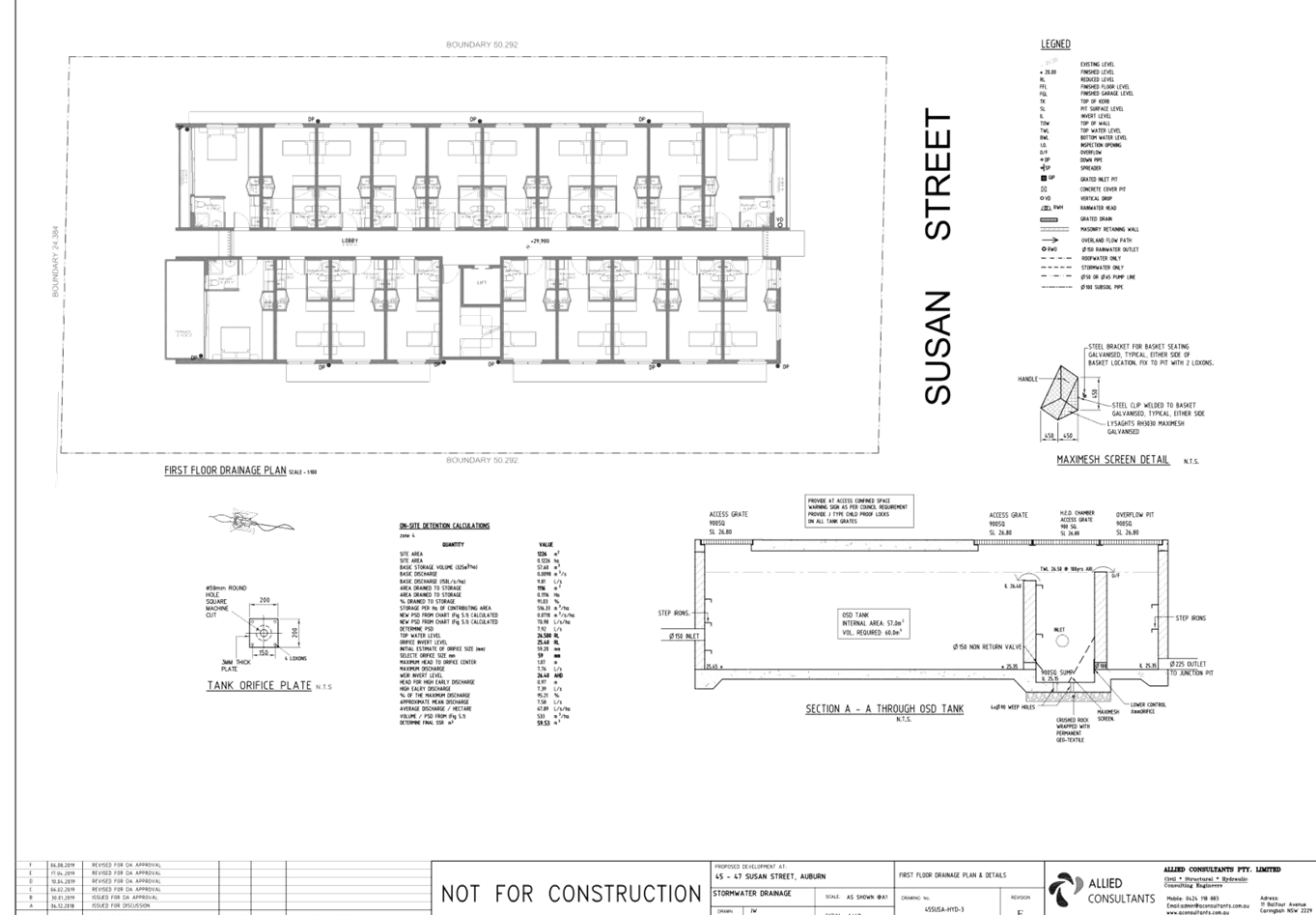
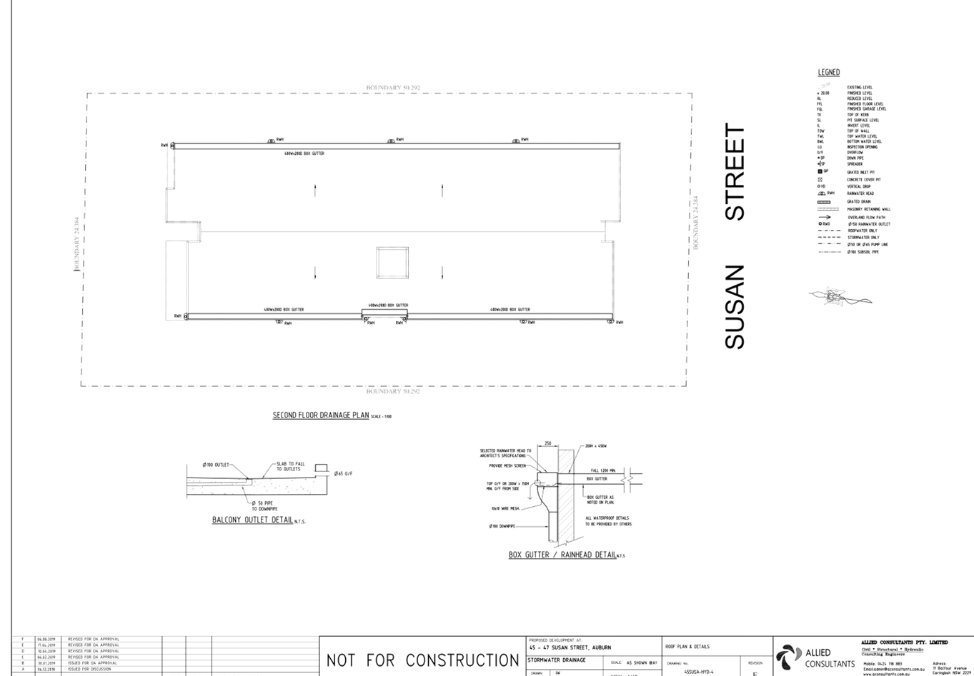
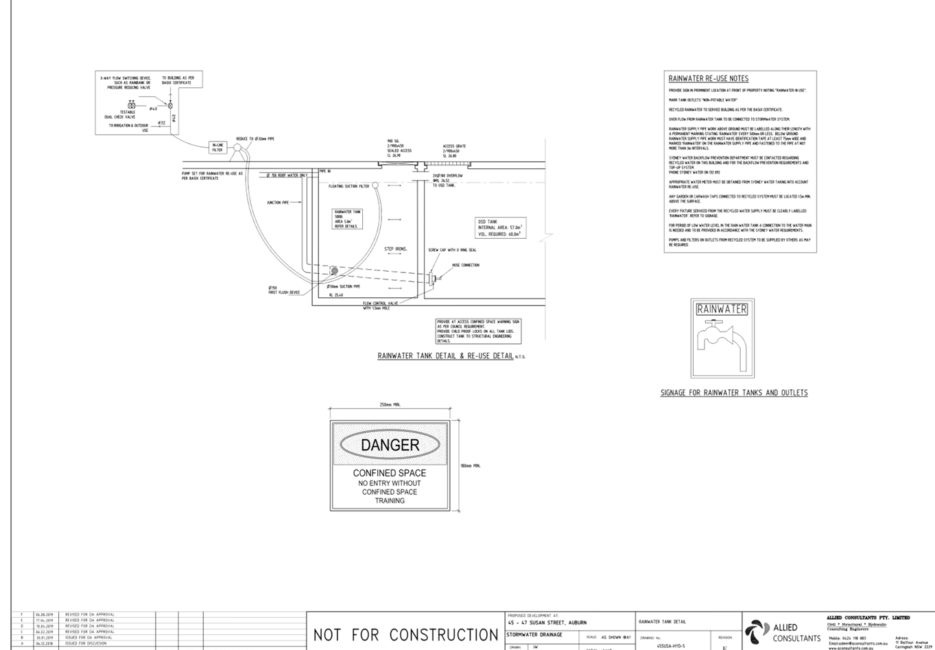
Extraordinary
Cumberland Local Planning Panel Meeting
5 November 2019
Item No:
LPP069/19
Wentworthville
Town Centre Planning Proposal and Development Control Plan
Responsible
Division: Environment
& Planning
Officer: Executive
Manager Environment and Precincts
File
Number: SC661
|
Proponent
|
Cumberland Council
|
|
Site
|
Wentworthville Town Centre
|
|
Zoning
|
Zoning: B2 Local Centre; RE1 Public Recreation
Height: 10m - 23m
FSR: 1.5:1 - 2.4:1
|
|
Proposal
|
Zoning: No change
Height: 11m -
58m
FSR: 2.2:1 -
6:1
|
|
Initial report
to Panel
|
13 July 2016 (C008/16)
|
|
Initial
report to Council
|
3 August 2016 (063/16)
|
|
Gateway
Determination
|
Original 25 May 2018
Revised 7 May 2019
|
|
Update report
to Council
|
5 July 2017 (108/17)
19 December 2018 (C12/18-264)
|
|
Heritage
|
Yes, there are a small number of local heritage
items in Wentworthville town centre
|
|
Disclosure of political donations and gifts
|
Nil
|
The purpose of this report is to
provide the Cumberland Local Planning Panel (CLPP) with an update on the Wentworthville
Town Centre planning proposal and draft Development Control Plan. This
includes work undertaken to date, the outcomes of community consultation,
refinement of planning controls and next steps for the initiative.
Background
Council has undertaken planning
work on the Wentworthville Town Centre for a number of years. The primary
focus of this work is to support the revitalisation of the town centre through
changes in planning controls and precinct based planning activities, such as public
domain and local transport infrastructure. This approach provides a holistic
framework for growth and change of this centre, aligned with strategic planning
for the broader Cumberland area, such as Cumberland 2030: Our Local Strategic
Planning Statement.
A chronology on the work
undertaken on the planning controls for the Wentworthville Town Centre is
provided in Table 1. Further background information from previous Council
and Panel reports is provided in Attachment 7, 8, 9 and 10.
|
Date
|
Milestone
|
|
December 2013
|
Acceptance of grant funding from the Department of
Planning & Infrastructure to undertake the Wentworthville Centre
Revitalisation Planning Project.
|
|
June - July
2014
|
Stage 1 - Community Engagement completed
|
|
February -
July 2015
|
Stage 2 - Completion of expert urban design, economics and
feasibility and traffic and transport studies
|
|
September -
October 2015
|
Stage 3 - Wentworthville Planning and Place Making
Strategy - Exhibition and Community Consultation.
|
|
July 2016
|
Report to CIHAP - Wentworthville Planning and Place Making
Strategy and Planning proposal Request
|
|
August 2016
|
Report to Council - Wentworthville Planning and Place
Making Strategy and Planning proposal Request
|
|
July 2017
|
Report to Council to defer reclassification of Public Land
|
|
November 2017
|
Planning proposal submitted to DPIE
|
|
January 2018
|
Updated Planning proposal is prepared with supplementary
information lodged January 2018 in response to DPIE request for
information
|
|
May 2018
|
Gateway Determination received
|
|
December 2018
|
Report to Council on proposed full bypass
|
|
April 2019
|
Revised planning proposal submitted to DPIE
|
|
May 2019
|
Revised Gateway Determination received
|
|
May - July
2019
|
Public exhibition of draft planning proposal and draft
Development Control Plan
|
|
November 2019
|
Report to CLPP on outcomes of the community consultation
and recommended planning controls
|
|
December 2019
|
Report to Council on Wentworthville Town Centre planning
controls
|
Table
1: Chronology of planning work for Wentworthville Town Centre
Panel Report 13 July 2016
Planning work on the
Wentworthville Town Centre was considered by the then Cumberland Independent
Hearing and Assessment Panel on 13 July 2016. The items and status are
provided in Table 2.
|
Panel Advice
|
Status
|
|
1. Receive
and note the report and the review of the submissions made as part of the
community consultation.
|
Received and noted by CIHAP 13
July 2016.
|
|
2. Recommend
that the Wentworthville Planning and Place Making Strategy be amended as
follows:
a) The
Strategy’s bike path diagram to be amended to indicate existing Lytton
Street Park bike path.
b) To
amend building heights and setbacks for B2 local centre zoned land on
Pritchard Street East and Station Street adjacent to R2 low density
residential under both built form options to:
§ Increase the rear setback for
properties on Pritchard Street East (southern side) to 8m.
§ Reduce the front setback for
properties on Pritchard Street East (southern side) to 6m.
§ Reduce the maximum height of
buildings for all B2 zoned land on Pritchard Street East and Station Street,
adjacent to the R2 zone to 6 storeys at the street and 4 storeys at the rear.
c) That
the proposed building height and FSR for 79-81 Dunmore Street under built
form Option 2 be amended as follows:
§ A building height of 12/13
storeys on the Cumberland Highway/Dunmore Street corner of the site lowering
to 5 storeys on the western setback in order to provide a built form
transition.
§ An FSR of 4:1.
§ That the floorspace bonus for
shared value uplift is applicable to 79-81 Dunmore Street.
§ That the commercial floorspace
bonus is applicable to 79-81 Dunmore Street.
|
The Wentworthville Planning and
Place Making Strategy was updated to address this recommendation.
|
|
3. Recommend
the preparation of a planning proposal, consistent with the Wentworthville
Planning and Place Making Strategy (as amended) for gateway submission and
community consultation, excluding 108 Station Street and 42-44 Dunmore
Street.
|
The planning proposal has been
prepared, a Gateway Determination issued and public exhibition undertaken.
|
|
4. Recommend
based on community feedback, feasibility and infrastructure funding, that
built form Option Two form the basis of the planning proposal – maintaining
a predominant mid-rise height across the Centre with strategically placed
towers of 12-18 storeys in height.
|
The planning proposal implements
built form identified in Option Two of the Strategy.
|
|
5. Recommend
that in addition to the FSR bonuses detailed in the Strategy, where design
excellence is achieved on sites permitted to a height of 17/18 storeys, an
additional FSR of 0.5:1 is available.
|
The planning proposal contains
FSR bonus where design excellence is achieved.
|
|
6. Recommend
that land forming The Kingsway Carpark, Dunmore Street and Garfield Street
Carpark and the Library, Community Centre and Redgum Centre be reclassified
from ‘community’ to ‘operational’.
|
Council resolved defer the
reclassifications, pending the preparation of a Property and Facilities
Strategy.
|
|
7. Recommend
an updated Section 94 Contributions plan be prepared that is consistent with
the Strategy.
|
The draft Cumberland Local
Infrastructure Contributions Plan was endorsed by Council in September 2019,
and identifies works relevant to the Wentworthville Town Centre.
|
|
8. Recommend
a revised Development Control Plan be prepared that is consistent with the
Strategy.
|
The draft Development Control
Plan for Wentworthville Town Centre has been prepared, and is consistent with
the Strategy.
|
|
9. Recommend
provisions for green walls and landscaping on structures to be implemented
through the revised Development Control Plan for the Centre.
|
Part 8 of the draft Development
Control Plan contains provisions for green walls and landscaping on
structures.
|
|
10. Recommend
provisions for safety by design, in accordance with the recommendations of
the safety audit to be implemented through the revised Development Control
Plan for the Centre.
|
Part 9 of the draft Development
Control Plan contains provisions to address safety by design.
|
|
11. Recommend
that a value sharing policy, applicable to sites that have incentives to
achieve heights greater than 8 storeys, be prepared in conjunction with the
updated Section 94 Contributions Plan.
|
Value sharing is included in
Council’s Planning Agreements Policy, which is applicable to the
Wentworthville Town Centre.
|
|
12. Recommend
that this matter is progressed to be considered by Council, seeking a
resolution for the adoption of the recommendations contained in this report.
|
This matter was reported to, and
endorsed by Council at its meeting on 3 August 2016.
|
|
13. Recommend
that Council liaise with the City of Parramatta over the planning proposal
|
Council has liaised with the
City of Parramatta at various times over the planning proposal.
|
|
14. Recommend that Council develop a
design excellence policy to compliment the Strategy.
|
Council has adopted a Design
Excellence Policy across the Cumberland area, including the Wentworthville
Town Centre.
|
Table
2: Status of items following Panel meeting in July 2016
Council Report 3 August 2016
The resolution of the Panel was
considered by Council on 3 August 2016. Council considered the Panel’s
advice at its meeting of and resolved, amongst other things, to support the
Panel’s recommendation and report back to the Panel following
post-Gateway public consultation. It is noted that Council adopted built form
Option 2 as the basis of the planning proposal, subject to height and FSR
amendments and new bonus provisions for design excellence and commercial floor
space at first floor. The items and status are provided in Table 3.
|
Council Resolution
|
Status
|
|
1. To
receive the minutes of CIHAP report C008/16 and adopt the recommendations as
resolved by CIHAP.
|
Adopted
by Council on 3 August 2016
|
|
2. To
adopt the Wentworthville Planning and Place Making Strategy, as amended.
|
The Wentworthville Planning and
Place Making Strategy” was adopted by Council on 3 August 2016
|
|
3. To
undertake community consultation for the Planning proposal as detailed in
report C008/16, in addition to the requirements of the gateway determination
and to exhibit new or revised supporting plans and policies for
Wentworthville Centre being a revised Development Control Plan, revised
Section 94 Development Contributions Plan, a Value Capture Policy and Design
Excellence Policy.
|
Community consultation on the
planning proposal was undertaken between May and July 2019.
|
|
4. Report
the results of the community consultation and post consultation review to CIHAP
and Council.
|
Report to CLPP in November 2019
and Council in December 2019.
|
Table
3: Status of items following Council meeting in August 2016
Council Report 5 July 2017
A report was considered by Council
on the reclassification of the Kingsway Carpark Site and the Lane Street
Community Facilities as part of the Wentworthville Town Centre planning
proposal on 5 July 2017. The items and status are provided in Table 4.
|
Council Resolution
|
Status
|
|
1. Defer
the reclassification of the Kingsway Car Park Site and the Lane Street
Community Facilities site to ‘operational’ pending the
preparation of a Property and Facilities Strategy for the Wentworthville Town
Centre.
|
A Property Strategy is currently
being prepared. A Community Facilities Strategy has been adopted by
Council, and includes information on Wentworthville Town Centre.
|
|
2. Proceed
with the Wentworthville Town Centre Planning proposal as per Council’s
resolution of 3 August 2016, excluding any reclassification of land.
|
Planning proposal does not seek
to reclassification any land within the Wentworthville Town Centre to
‘operational land’.
|
|
3. That
the Property and Facilities Strategy be reported to Council for adoption
prior to preparation of a Planning proposal to reclassify the subject sites
|
Noted. Refer to status of
Items 1 and 2.
|
Table
4: Status of items following Council meeting in July 2017
Council Report 19 December
2018
On 19 December 2018, Council
considered a report on the land that would be required to implement the full
Wentworthville Bypass that was identified as an option in the Wentworthville
Centre Planning and Place Making Strategy. The items and status are provided in
Table 5.
|
Council Resolution
|
Status
|
|
1. Proceed
with the acquisition of the 6 lots required (48-50 Station Street and 53
Station Street, Wentworthville) to facilitate the full bypass option as
outlined in this report;
|
The six lots have been
identified in the draft planning proposal for acquisition. The properties
have been zoned SP2 Infrastructure and identified on the Land Reservation
Acquisition Map.
|
|
2. Amend
the Wentworthville Centre Planning proposal to include the properties
required to implement the full bypass option on the Land Reservation
Acquisition Map and Zoning Map;
|
The Land Reservation Acquisition
Map and Zoning Map have been amended to identify these properties for
acquisition.
|
|
3. Amend
the draft Wentworthville Centre DCP to reflect the full bypass option, prior
to public exhibition; and
|
The draft Development Control
Plan has been amended to respond to the acquisition of these properties.
|
|
4. Progress
the full bypass option in the draft Wentworthville Public Domain Plan.
|
The draft Wentworthville Public
Domain Plan has been amended to address the acquisition of these properties.
|
Table
5: Status of items following Council meeting in December 2018
Community Consultation
A draft planning proposal and
precinct specific Development Control Plan was prepared by Council officers in
accordance with advice from the Panel and resolutions by Council. A
revised Gateway Determination for the planning proposal was received in May
2019.
The planning controls were
exhibited for a period of eight weeks, from 22 May 2019 to 21 July 2019.
Exhibition material was made publicly available in electronic form on
Council’s website, and in hard copy form at its customer service centres
and libraries. Council also wrote directly to landowners and occupiers in and
around the Centre. During the exhibition period, Council Officers held
community drop in sessions at Wentworthville Library on 13 June 2019 and a
public meeting at the Wentworthville Community Centre on 22 June 2019.
A number of State agencies were
notified of the exhibition, including: Crown Land and Water, Office of
Environment and Heritage – Floodplains, Office of Energy, Roads and
Maritime Services, Sydney Trains and Transport for NSW.
Council received 35 community
submission during the statutory exhibition period and no response from public
authorities. Key issues raised included proposed land acquisition for bypass
and laneways, site specific requests to vary planning controls, and
improvements to infrastructure, traffic and parking. Further information on the
submissions is provided in Attachment 4.
Post Consultation Review
Following the completion of the
community consultation process, a post consultation review has been
undertaken. The review considered submissions received and other items
identified by Council, including land acquisition requirements for the
Wentworthville road bypass, site specific requests on planning controls,
placement of height controls for Station Street East / Lane Street, and
provisions for laneways identified in the planning controls.
Land acquisition requirements
for the Wentworthville road bypass
The exhibition of the Wentworthville
Town Centre Planning proposal was the first time the landowners of 53 Station
Street and 48-50 Station Street were notified that their properties had been
identified for acquisition to allow Council to implement the full bypass
option.
Council received a detailed
submission on behalf of the landowner for 53 Station Street, objecting to the
land acquisition required to implement the full bypass. The objection was based
on a number of factors. These include:
· Analysis
by their traffic engineers of the proposed ‘full bypass’ option
indicates that the geometric road design requirements will necessitate greater
land acquisition than anticipated by Council; concerns are raised as to the
ability of the proposed bypass alignment to provide a safe environment for all
road users; significant concerns have been as the validation, calibration and
results of the traffic modelling upon which the bypass alignment has been
based; there is a distinct lack of consideration of alternate options for the
bypass formation and alignment.
· The
valuation provided to Council for the acquisition of six properties within the
town centre is inaccurate, and will likely cause a significant increase in cost
to Council if the full bypass option is pursued.
· The
existing consolidated land holding has an area of 2,824m2 (31
– 53 Station Street). It is a significant single land holding within the
town centre, capable of significant redevelopment with the incentives provided.
Based on the submission provided,
further traffic analysis was undertaken by Council to confirm the need for 53
Station Street as part of the road bypass for the Wentworthville Town
Centre. The analysis focused on the intersection of Station Street /
Pritchard Street / New Road, with a comparison of the Council endorsed option
with the retention of a staggered intersection arrangement (Figure 1).
Figure
1: Road bypass options considered
The analysis found that the travel
times at the intersection are projected to be similar in 2019 and 2026;
however, there would be slightly longer travel times with the staggered
intersection option in 2036. It is noted that further work can be
undertaken in the future that would improve the performance of this
intersection, such as refinements to the intersection design and traffic signal
operations.
It is now proposed that the
planning proposal be amended to rezone 53 Station Street to B2 Local Centre,
and the four lots that make up 53 Station Street no longer be identified on the
Land Reservation Acquisition Map. This is shown in Figure 2.


Figure
2: Proposed amendment to road bypass
As Council did not receive a
submission from the landowner of 48-50 Station Street, these properties will
remain identified for acquisition. Importantly, the acquisition of this
land for the road bypass provides a new access opportunity that would support
the future growth of the Wentworthville Town Centre.
Site specific requests on
planning controls
Submissions were received from
selected landowners for changes to the planning controls on their sites.
Further information on these submissions and Council’s response is
provided in Table 6.
|
Site Specific Request
|
Council Response
|
|
55-57 Station Street and 6
Pritchard Street
Seeking that a height of
building control of 41 metres and a floor space ratio of 3:1 be applied to
the entire site
|
The landowner had been invited
to, and has submitted a planning proposal, which is being assessed and
reported concurrently with the Wentworthville Town Centre planning proposal.
|
|
41-51 Dunmore Street and 15-22
The Kingsway
Seeking to increase the FSR on
the site from 4:1 to 4.5:1 and building heights from 23 metres to 25 metre on
Dunmore Street and 41 to 49 metres on the Kingsway
As this site is identified for
design excellence bonuses, this proposed increase would result in a future
built form of 27.5 metres on Dunmore Street and 53.9 metres on the Kingsway
and the FSR to 5:1
|
The change to the floor space
ratio is not matched by an equivalent change to the building height. This
could lead to the development of a bulkier building than originally planned
could alter the overall urban form outcome. As this is key site at the
forecourt of the Wentworthville Railway Station, the request is not
supported.
|
Table
6: Site specific requests for changes in planning controls
Placement of height controls
for Station Street East / Lane Street
The Wentworthville Planning and
Placemaking Strategy identified split building height controls for the Station
Street East / Lane Street precinct. As part of the draft planning
proposal and draft Development Control Plan, the maximum height was shown in
the planning proposal and the split height shown in the Development Control
Plan (Figure 3).
Following further consideration by
Council, it is proposed that the split heights are included in the planning
proposal, in order to provide greater clarity and certainty of these controls
for landowners and the community. Importantly, no changes are proposed to
these controls, only the placement of this information in the planning control
documents.
Figure
3: Station Street East / Lane Street precinct split building heights
Provisions for laneways
identified in planning controls
As part of the draft planning
controls for Wentworthville Town Centre, Station Lane is to be extended to the
south in order to provide alternative vehicular access for sites on Station
Street (Figure 4). This would assist to support efficient traffic movement and
increase pedestrian amenity by reducing the number of driveways crossing the
footpath.
Council received two submissions
in relation to proposed laneways that were identified as part of the draft
Development Control Plan and that are to be delivered through Planning
Agreements when the sites are redeveloped.
A submission on behalf of the
owners of 84-96 Station Street, Wentworthville expressed support for the
proposed laneways but questioned why affected properties are not proposed to be
identified on the Land Reservation Acquisition Map.
A submission on behalf of the
owners of 82 Station Street objected to the laneways and claimed the proposed
laneways behind Station Street will sterilise the subject site and force land
consolidation with adjoining property owners prevent redevelopment of the town
centre.
Following further consideration by
Council, no changes to be proposed laneways are recommended for the
Wentworthville Town Centre. The inclusion of the proposed laneways is
consistent with the strategic work undertaken at the town centre, and inclusion
in the Development Control Plan provides the basis for further detailed work by
all parties at the development stage.
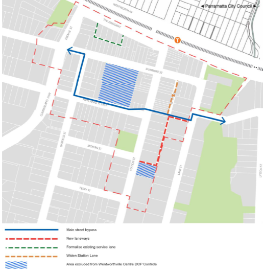
Figure
4: Proposed laneways for town centre
Recommended Planning
Controls for Wentworthville Town Centre
The recommended planning controls
for the Wentworthville Town Centre are provided for consideration and advice by
the Panel.
The recommended planning proposal
is provided is summarised in Table 7 and provided in Attachment 1. The
planning proposal includes controls related to building height, density and
land acquisition. No changes to current zoning controls are proposed. The
controls outlined in the planning proposal are forecast to provide for a total
of 2,500 dwellings within the Wentworthville Town Centre, and include of 1,800
dwellings when compared to current planning controls.
|
Criteria
|
Recommended
Planning Proposal
|
|
Height –
predominant
|
8 storeys
|
|
Height – core
of centre
|
6 towers of 12-13
storeys; 3 towers of 17-18 storeys
|
|
Height –
Dunmore Street (South)
|
6 storeys (23m) height
zone
|
|
Height –
transition
|
5 storeys (20m)
|
|
FSR – core of
centre
|
3:1 – 4.5:1+
|
|
FSR – fringe
of centre
|
2.2:1 – 3:1
|
|
FSR –bonus
– commercial floor space
|
0.5:1 – for
towers providing 1st floor commercial
|
|
Built form - general
|
5 storey street wall
|
|
Land acquisition
|
Selected locations in
town centre
|
Table
7: Recommended controls of Wentworthville Town Centre planning proposal
The recommended Development
Control Plan for the Wentworthville Town Centre is the same that was exhibited,
except for the split height provisions for Station Street East / Lane Street
precinct that have been moved into the planning proposal for inclusion in the
mapping for the Local Environmental Plan. Minor editorial changes have
also been included on the details for the road bypass route in the town centre.
Next Steps
The recommended planning proposal
and precinct based development control plan is provided to the Panel for
consideration. The advice provided by the Panel will inform a future
Council report on the planning controls for the Wentworthville Town Centre.
The purpose of this report is to
provide the Cumberland Local Planning Panel (CLPP) with an update on the
Wentworthville Town Centre planning proposal and draft Development Control
Plan. This includes work undertaken to date, the outcomes of community
consultation, refinement of planning controls and next steps for the initiative.
Advice is sought from the Panel on the recommended planning controls prior to
consideration by Council.
The land acquisition maps
identified in the planning proposal will have a financial implication for
Council if the proposal proceeds to finalisation.
The planning proposal will result
in an amendment to the Holroyd LEP 2013, subject to Council endorsement to
proceed to finalisation.
Communication /
Publications:
The final outcome of this matter
will be notified in the newspaper. The objectors will also be notified in
writing of the outcome.
|
That it is recommended that
the Cumberland Local Planning Panel:
1. Note
the outcomes of community consultation and the post consultation review
2. Provide
advice on the recommended planning controls for the Wentworthville Town
Centre
|
1. Recommended
planning controls on planning proposal for Wentworthville Town Centre
2. Planning
Proposal for Wentworthville Town Centre
3. Development
control plan for Wentworthville Town Centre
4. Summary
of community submissions
5. Revised
Gateway Determination
6. Revised
Wentworthville Planning and Placemaking Strategy
7. Panel
report and minutes 13 July 2016
8. Council
report and minutes 3 August 2016
9. Council
report and minutes 5 July 2017
10. Council
report and minutes 19 December 2018
DOCUMENTS
ASSOCIATED WITH
REPORT ELPP069/19
Attachment 1
Recommended planning controls on planning proposal for
Wentworthville Town Centre
Extraordinary Cumberland Local Planning
Panel Meeting
5 November 2019
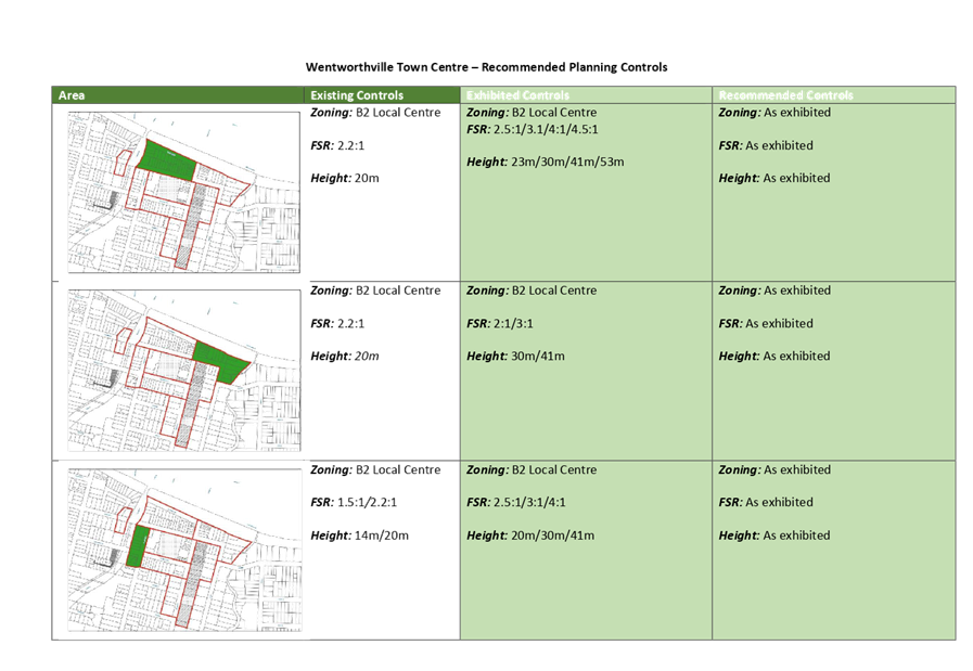
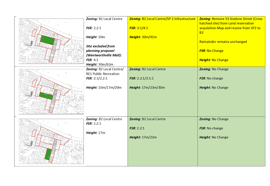
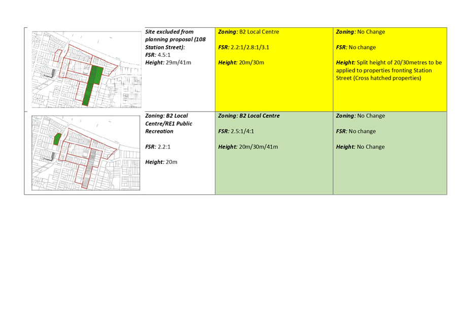
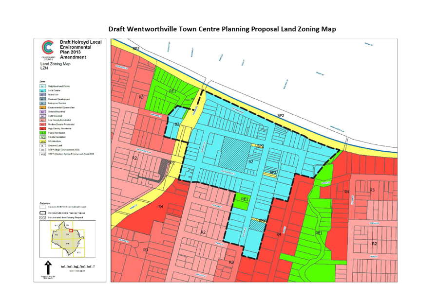
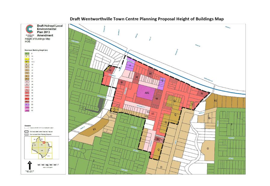
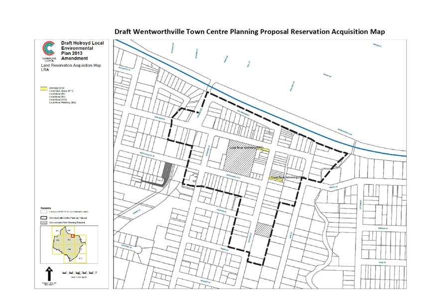
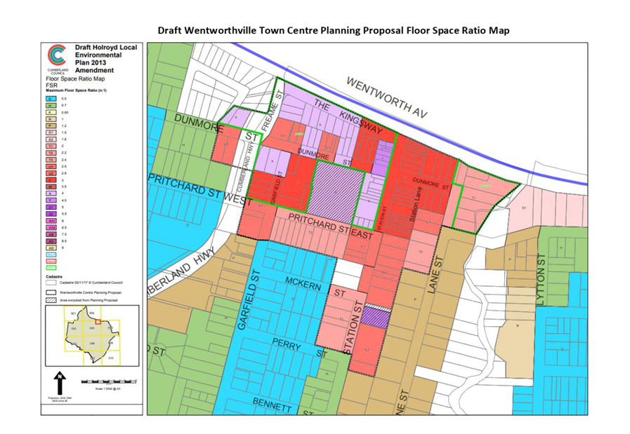
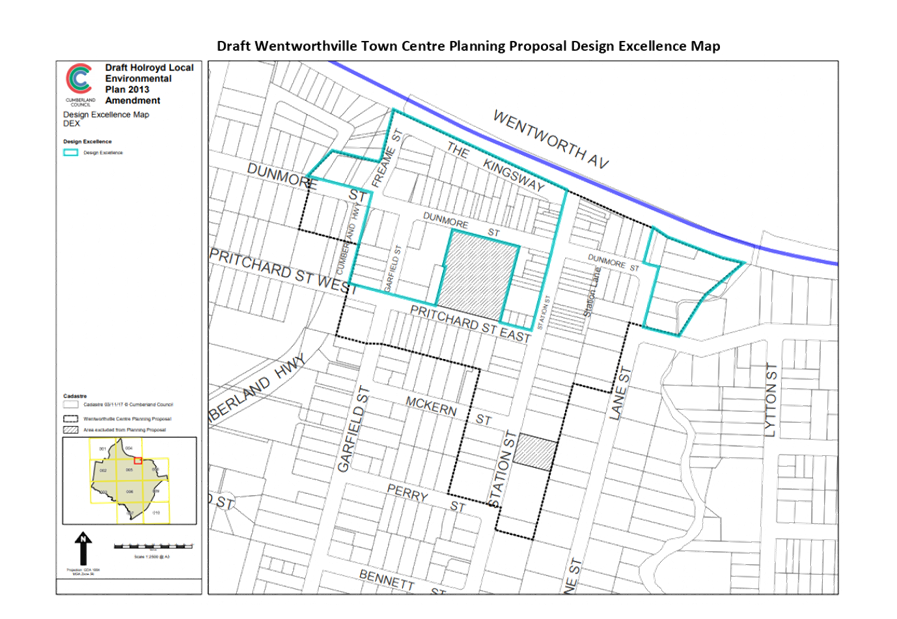
DOCUMENTS
ASSOCIATED WITH
REPORT ELPP069/19
Attachment 2
Planning Proposal for Wentworthville Town Centre
Extraordinary Cumberland Local Planning
Panel Meeting
5 November 2019
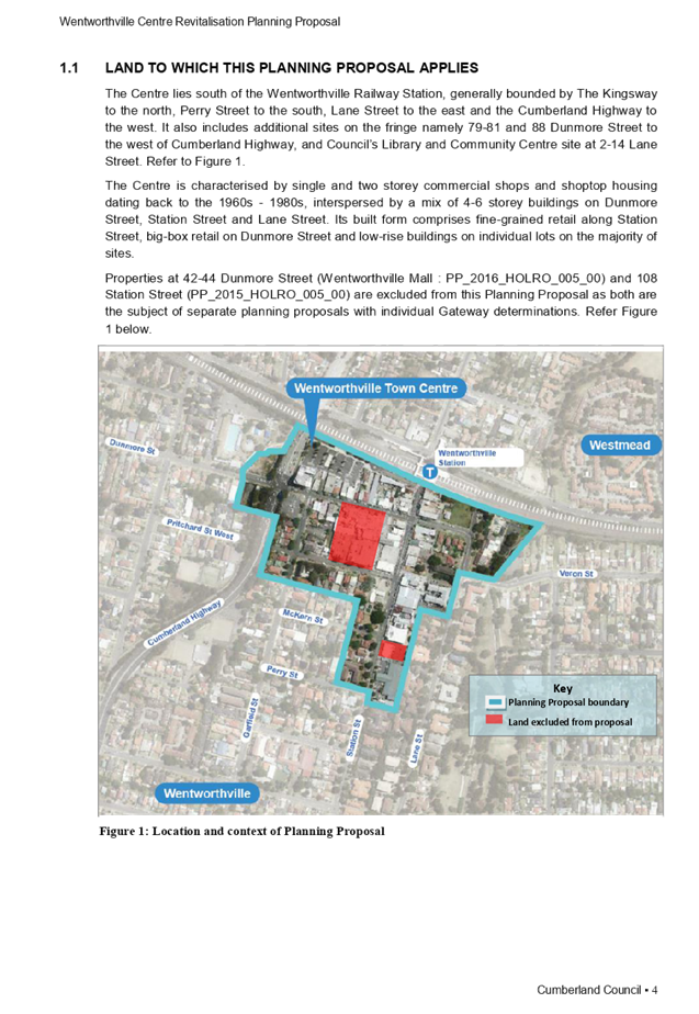
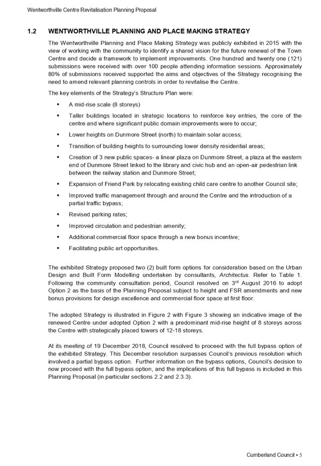
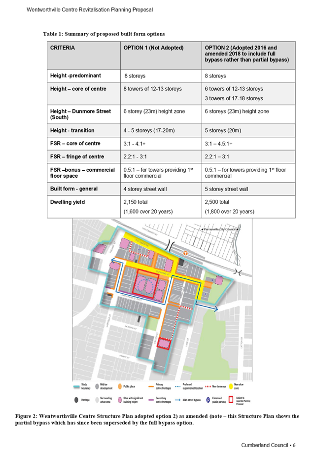
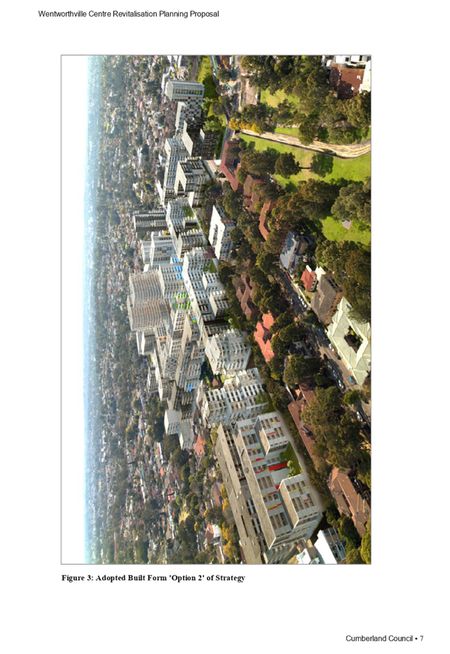
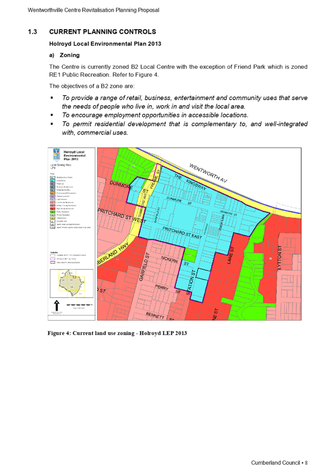
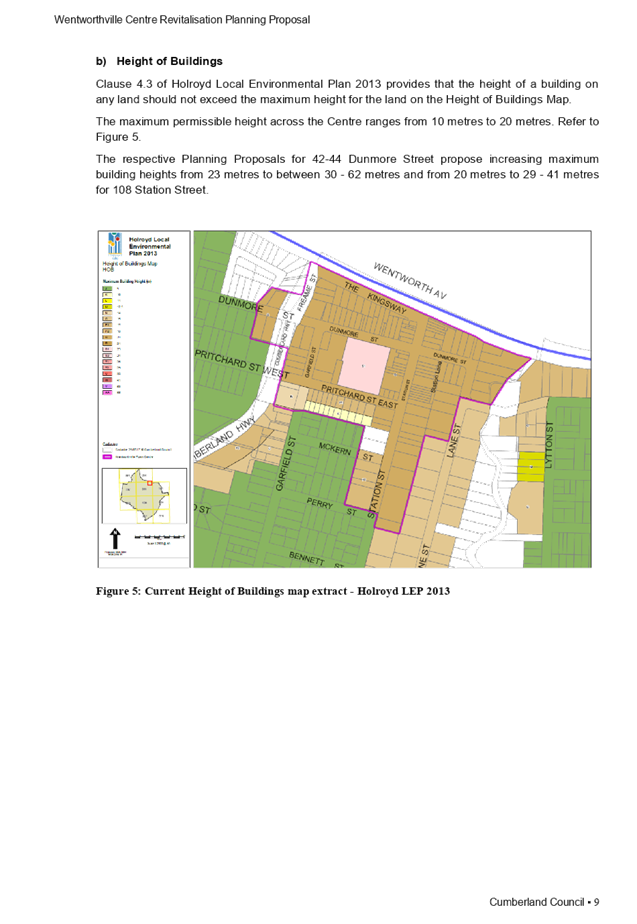
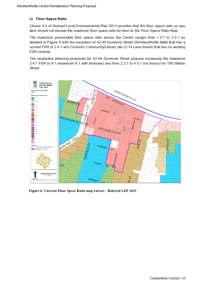


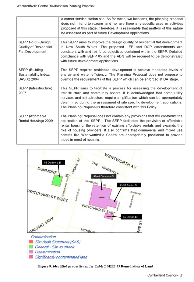

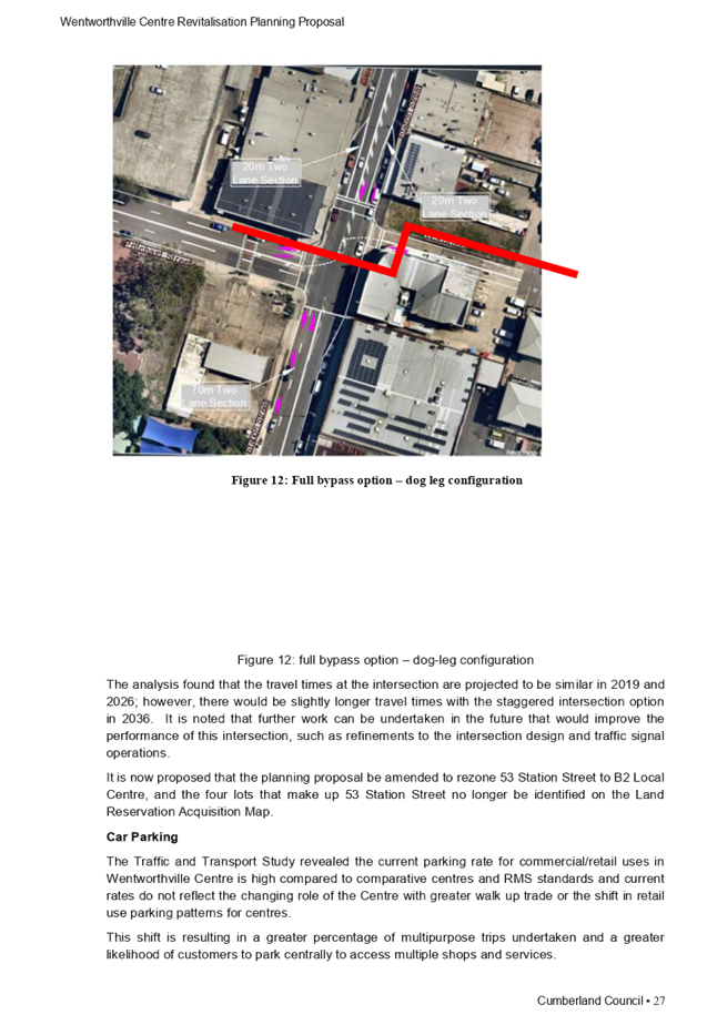


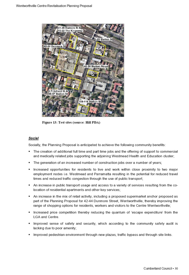


DOCUMENTS
ASSOCIATED WITH
REPORT ELPP069/19
Attachment 3
Development control plan for Wentworthville Town
Centre
Extraordinary Cumberland Local Planning
Panel Meeting
5 November 2019

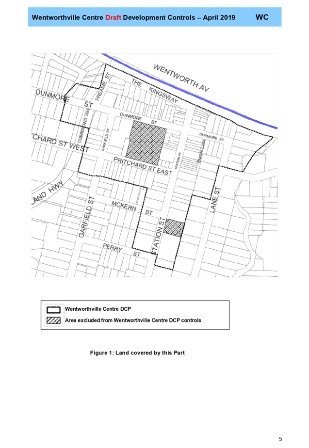
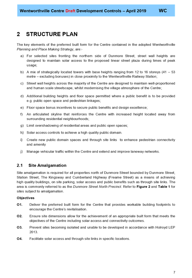
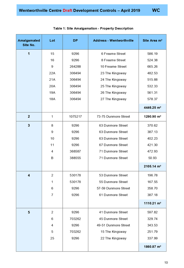
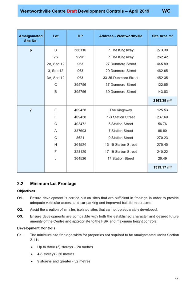
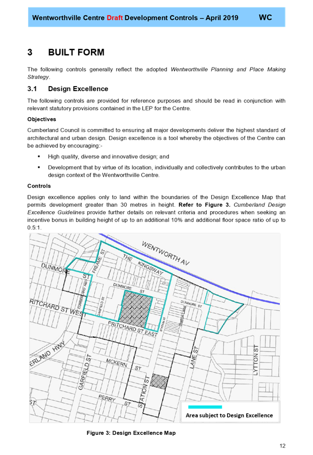
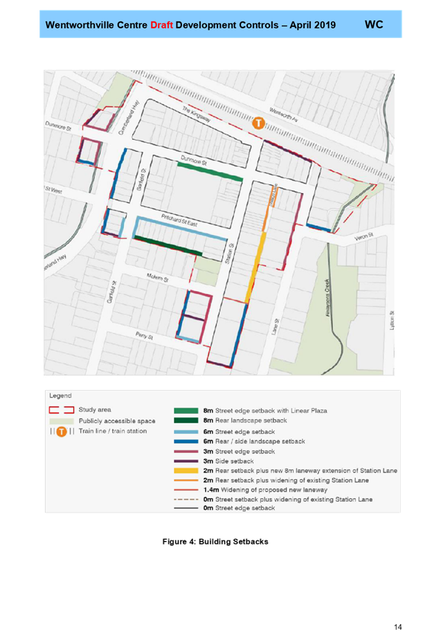
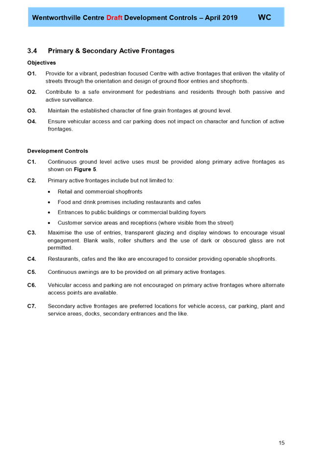
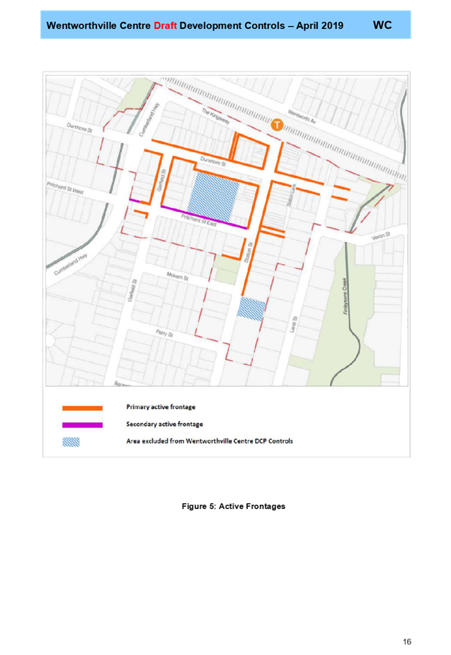
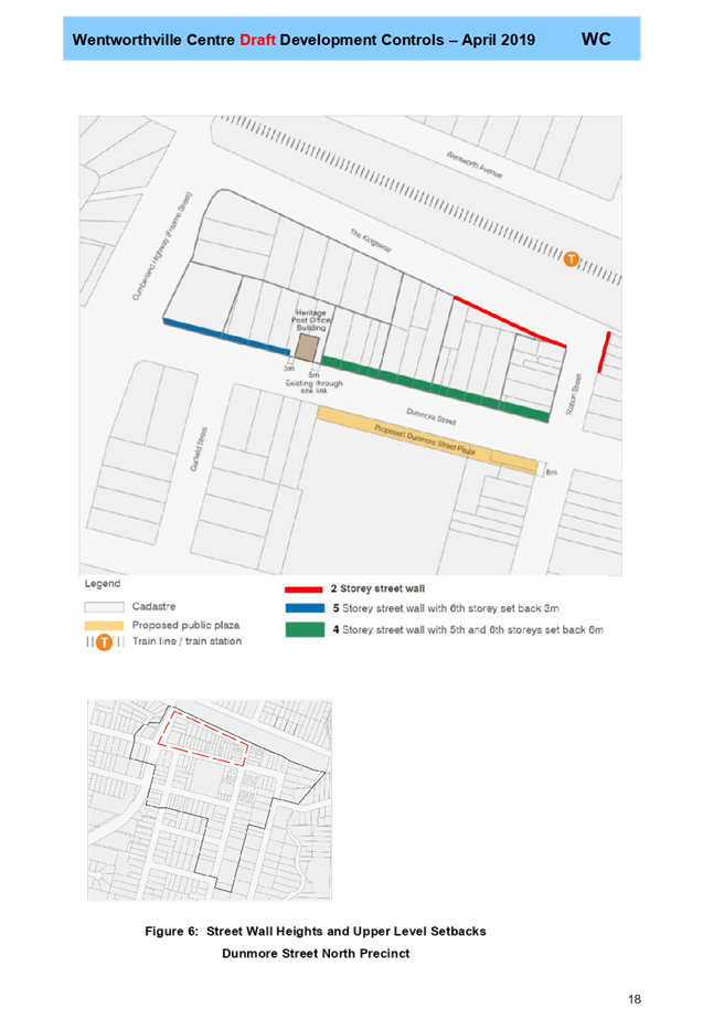
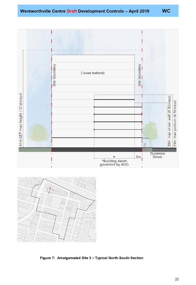
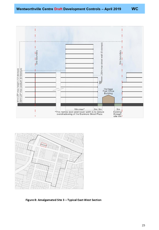
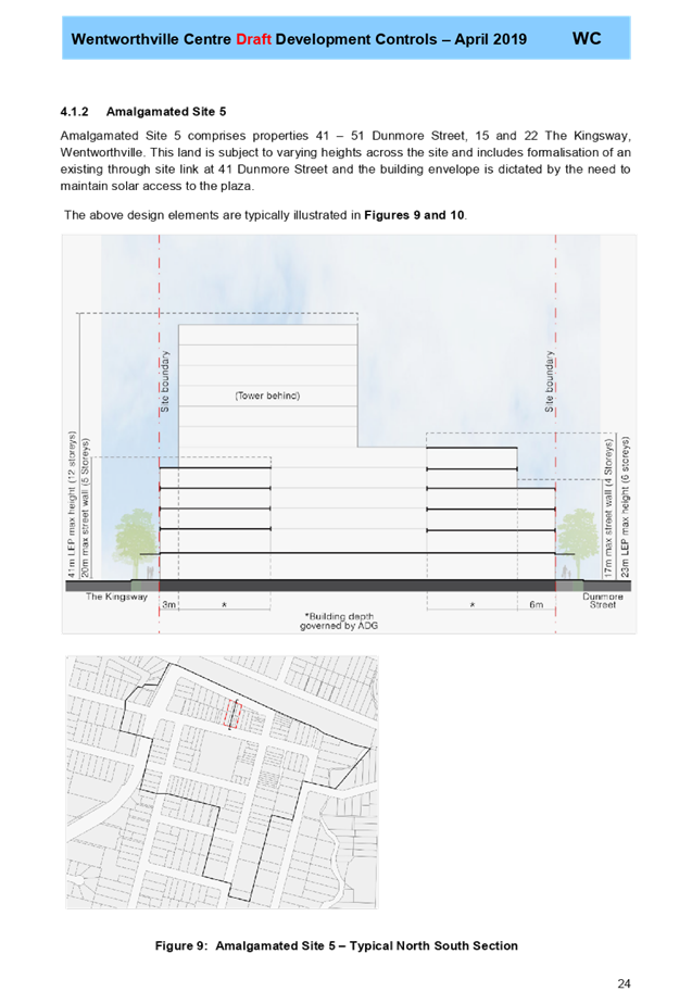
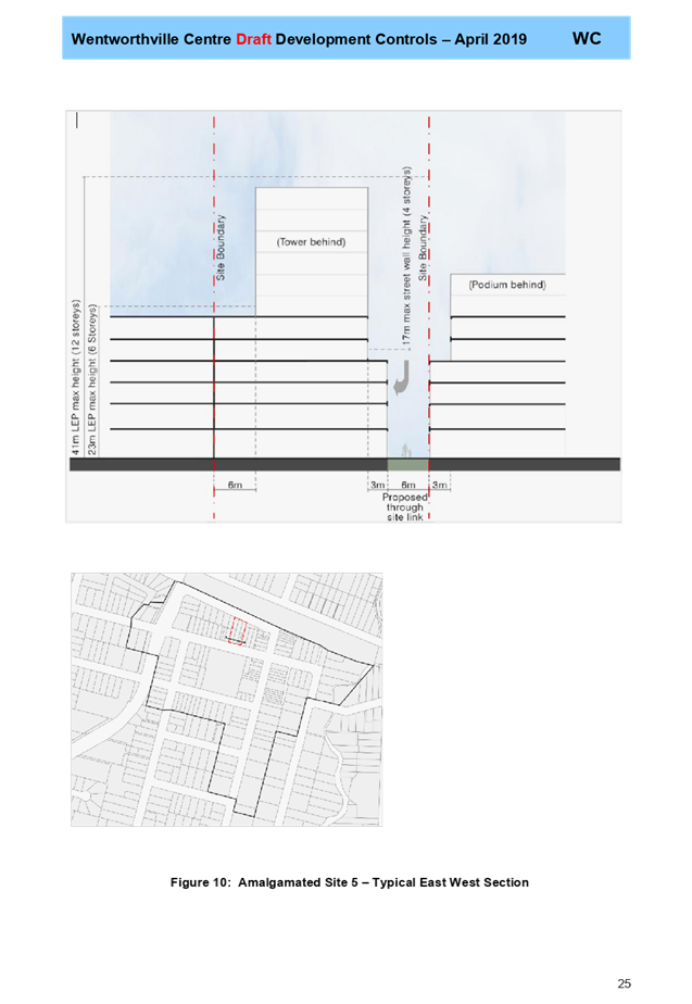
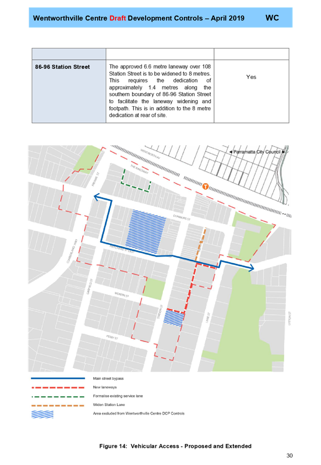
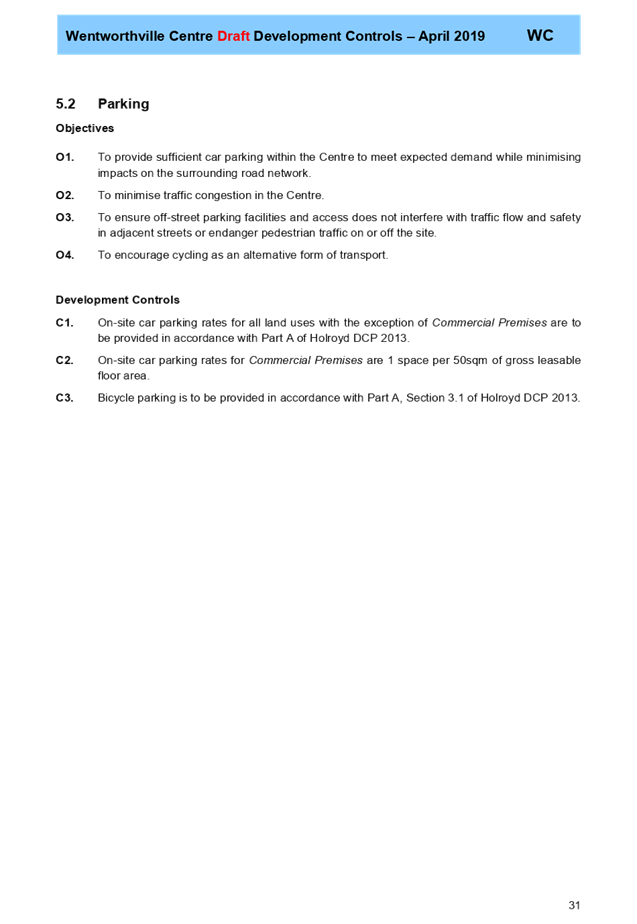
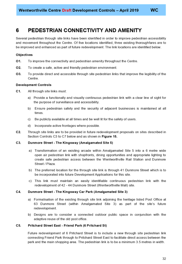
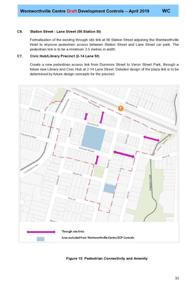
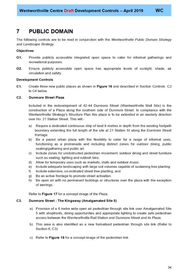
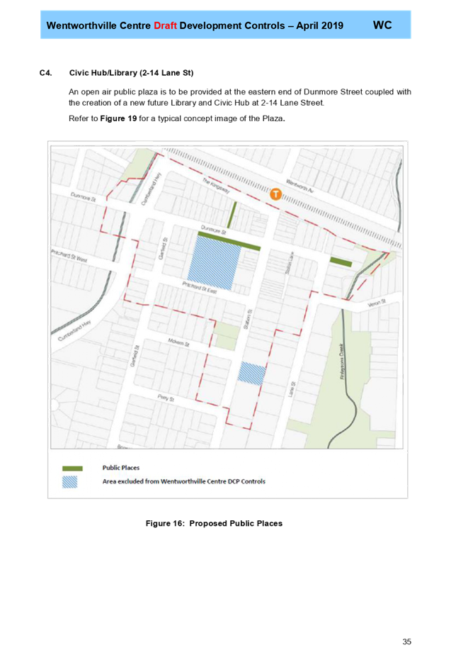
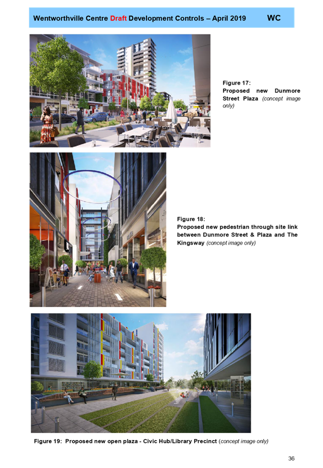
DOCUMENTS
ASSOCIATED WITH
REPORT ELPP069/19
Attachment 4
Summary of community submissions
Extraordinary Cumberland Local Planning
Panel Meeting
5 November 2019
DOCUMENTS
ASSOCIATED WITH
REPORT ELPP069/19
Attachment 5
Revised Gateway Determination
Extraordinary Cumberland Local Planning
Panel Meeting
5 November 2019

DOCUMENTS
ASSOCIATED WITH
REPORT ELPP069/19
Attachment 6
Revised Wentworthville Planning and Placemaking
Strategy
Extraordinary Cumberland Local Planning
Panel Meeting
5 November 2019
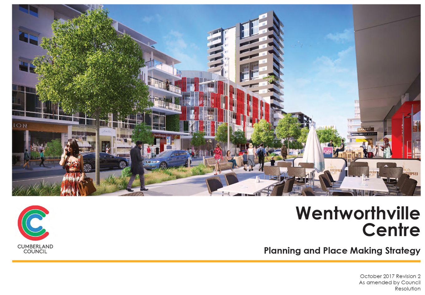
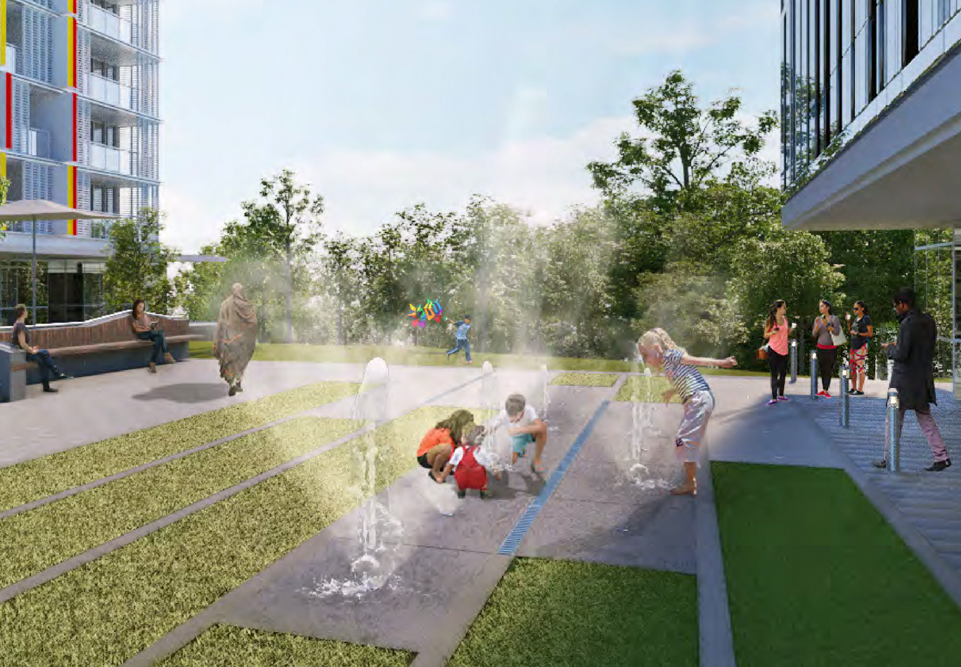

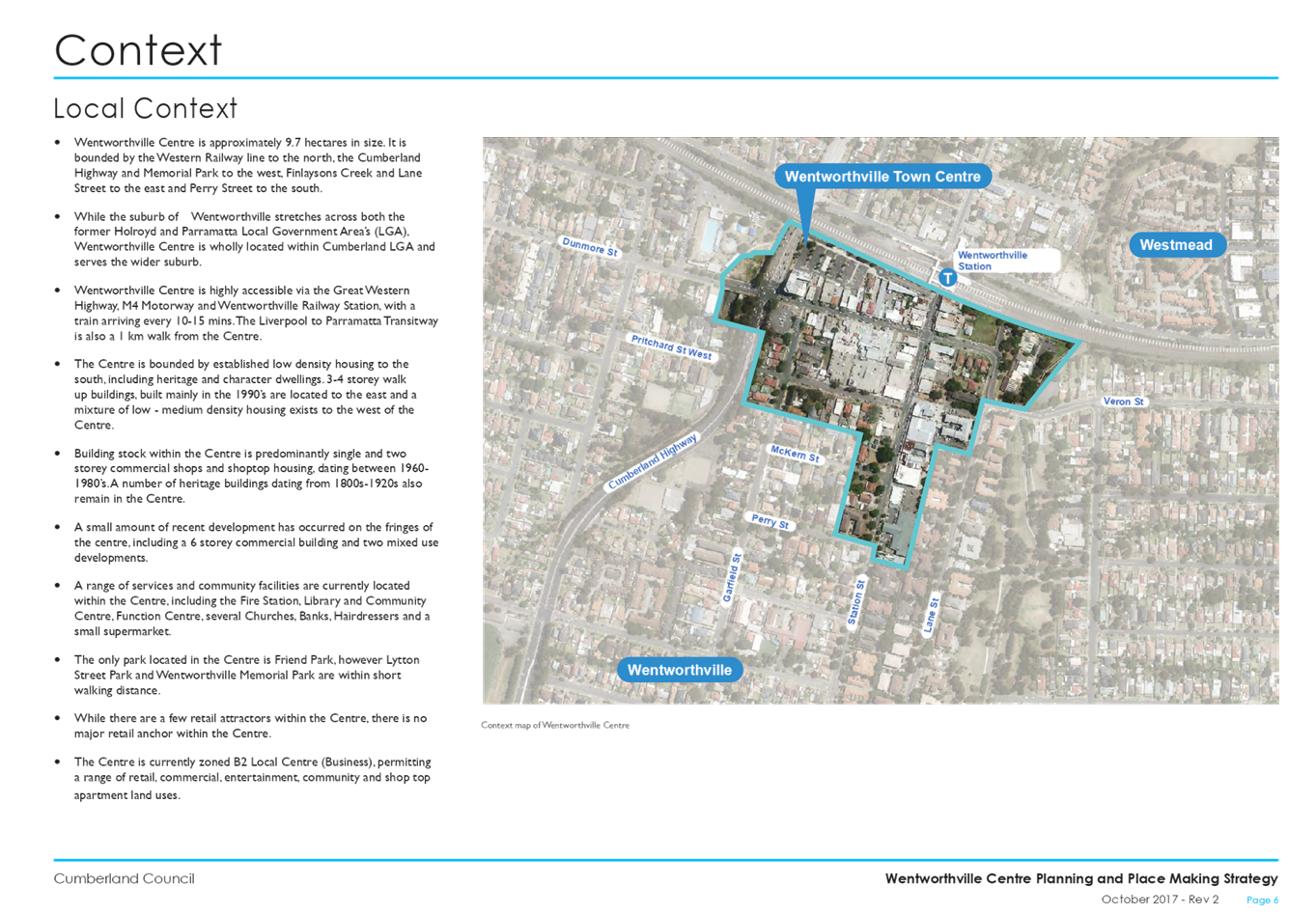
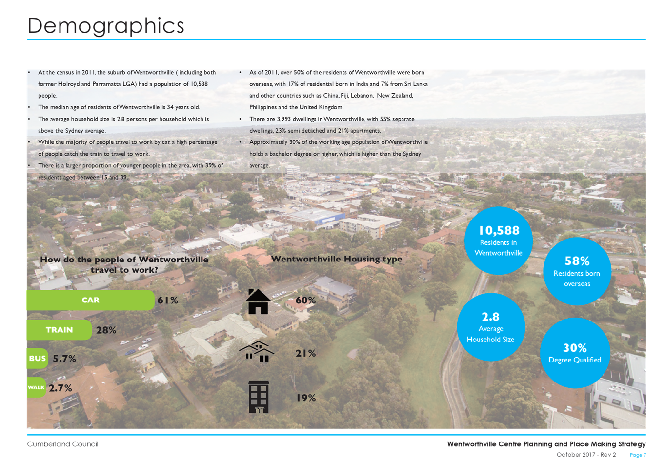
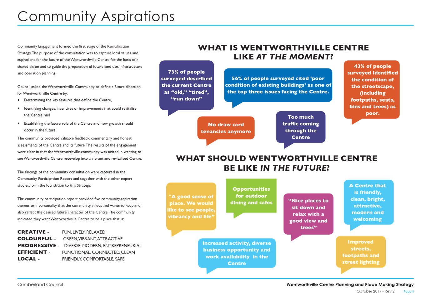

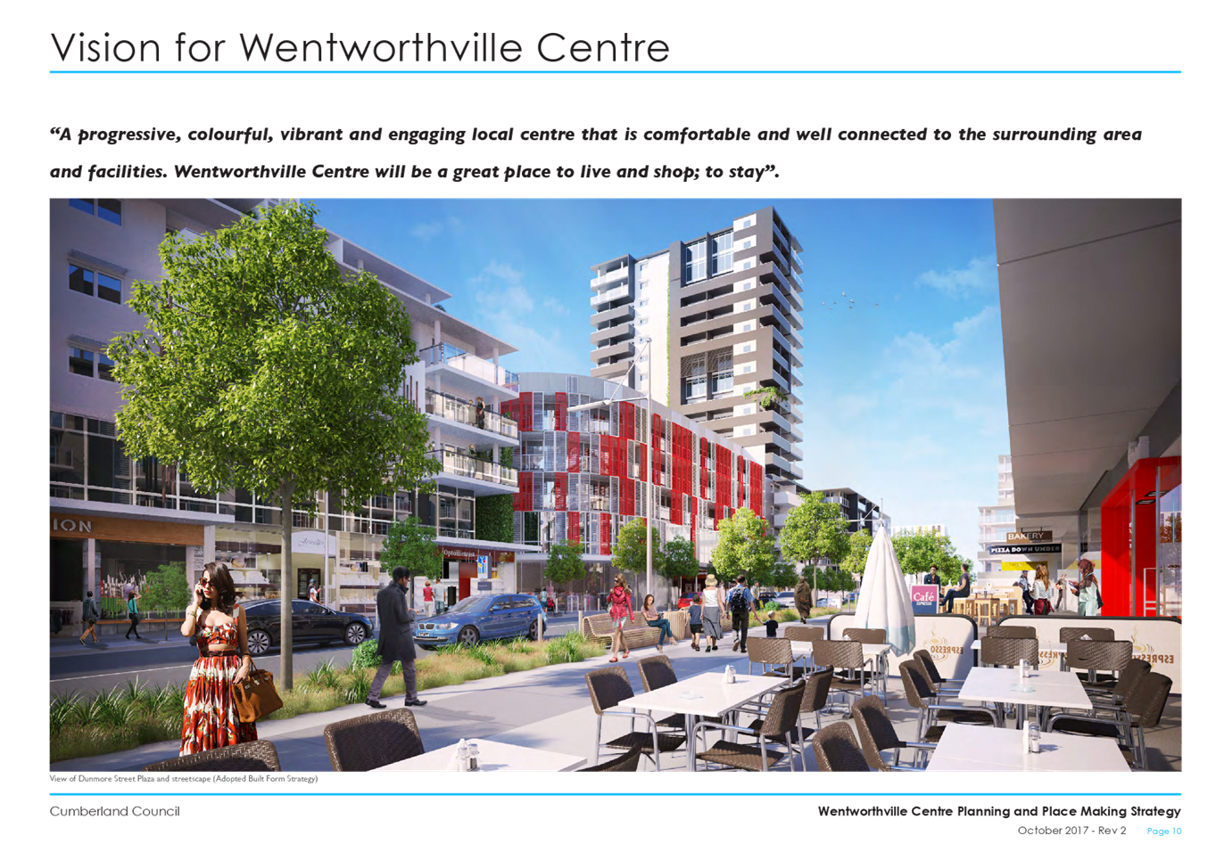
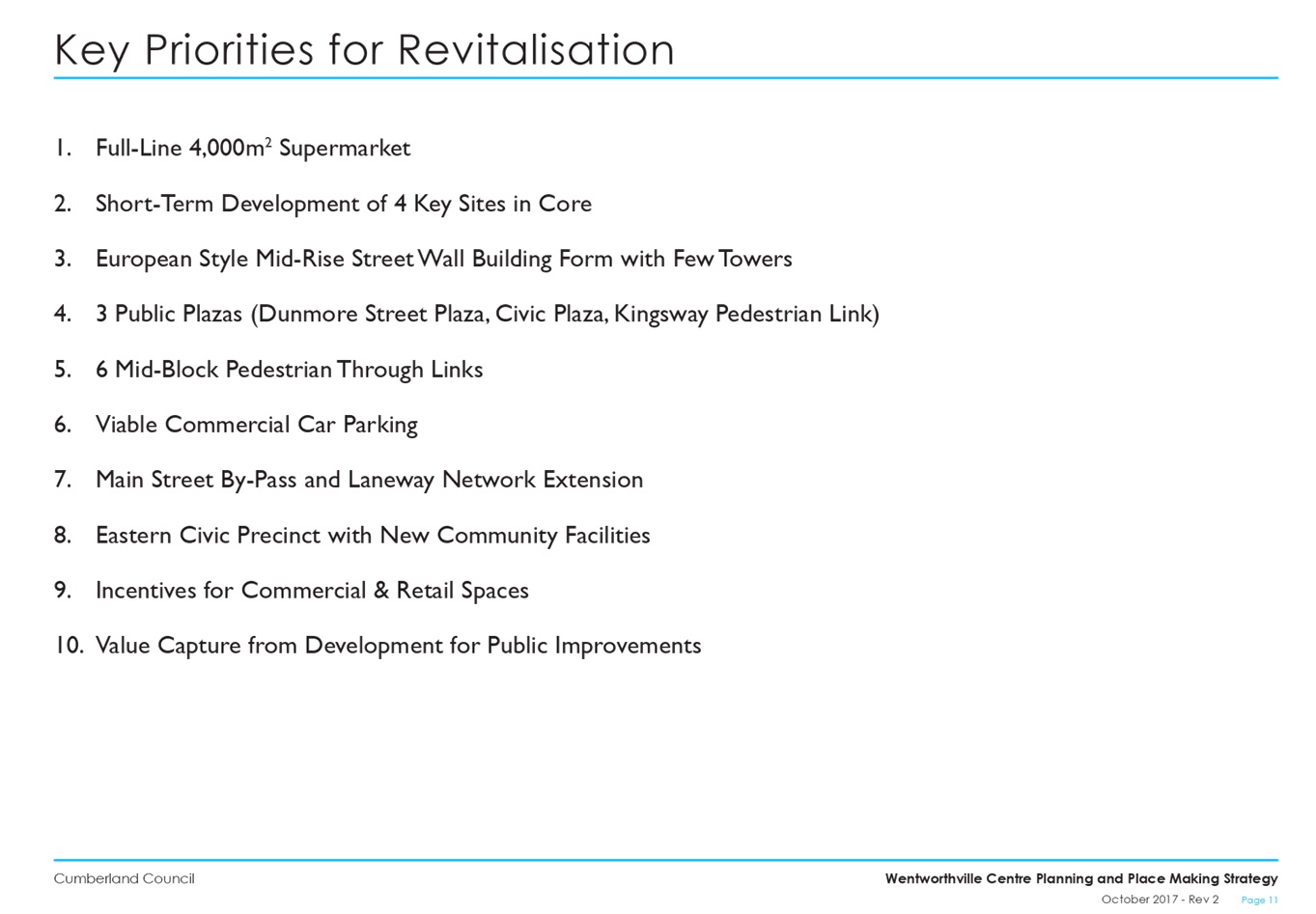
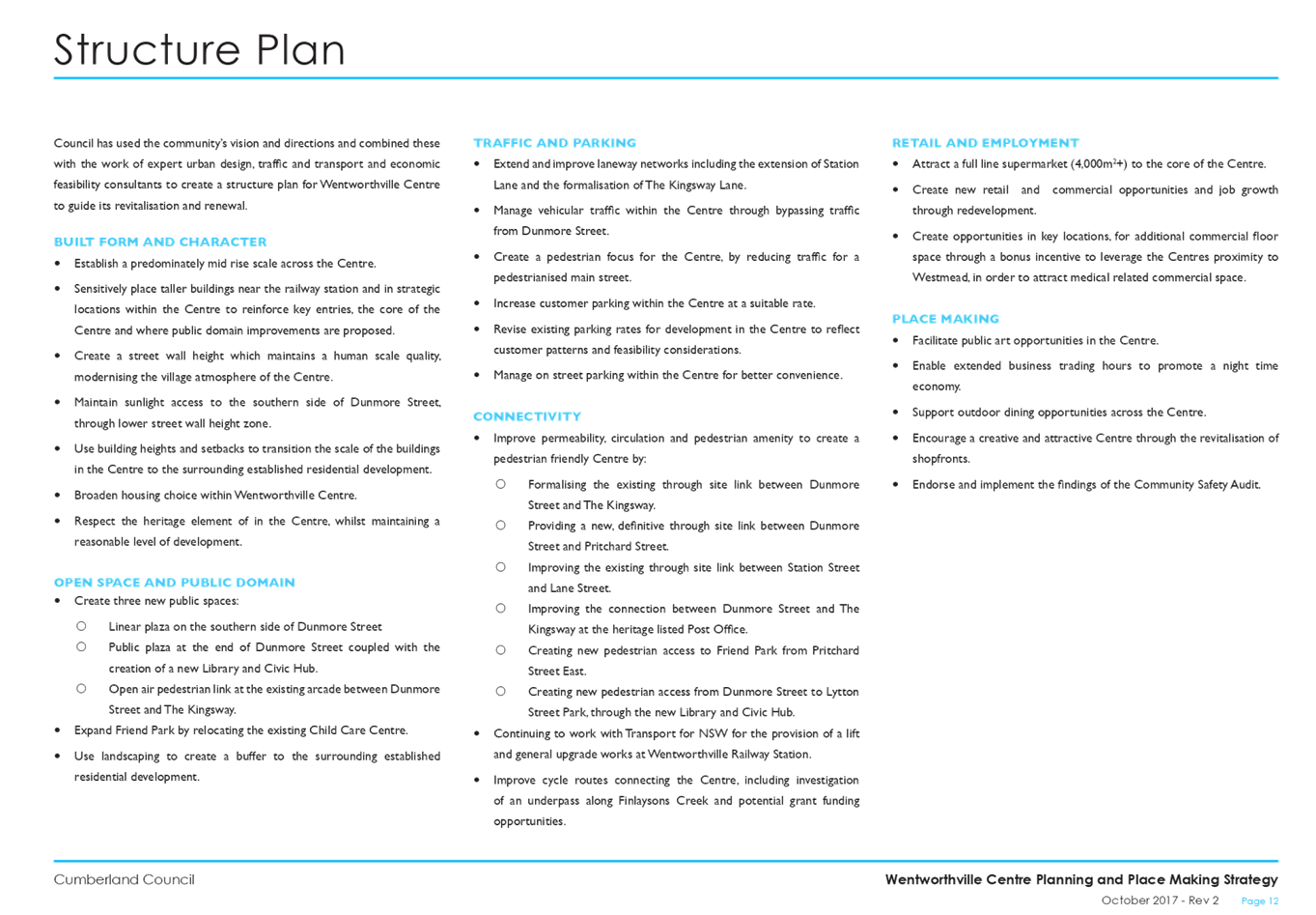
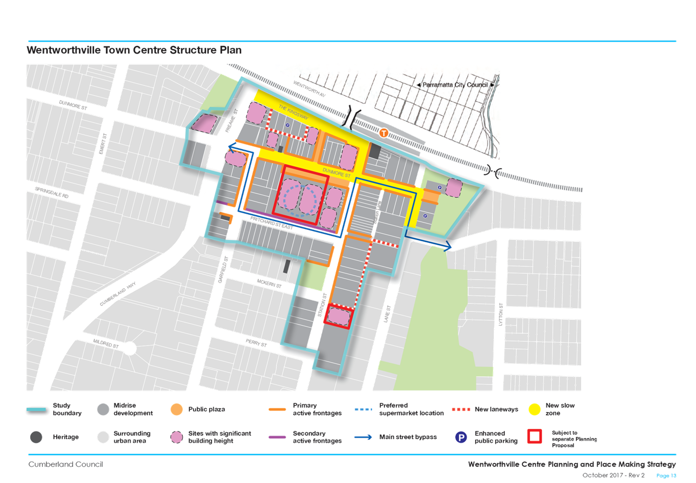

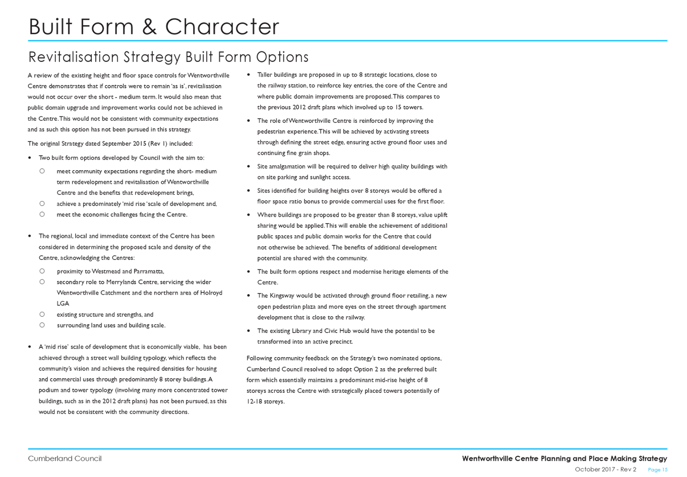
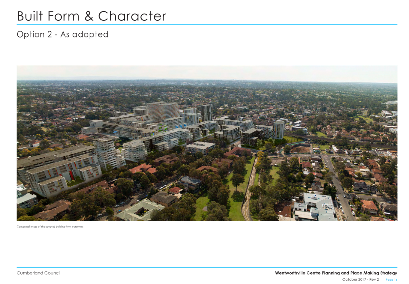
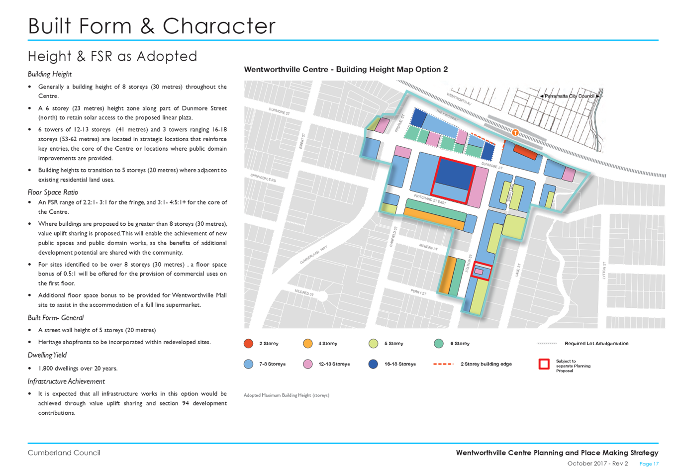

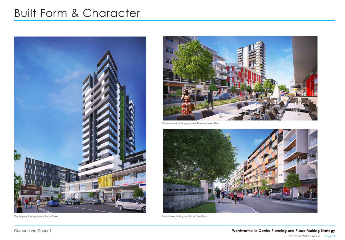
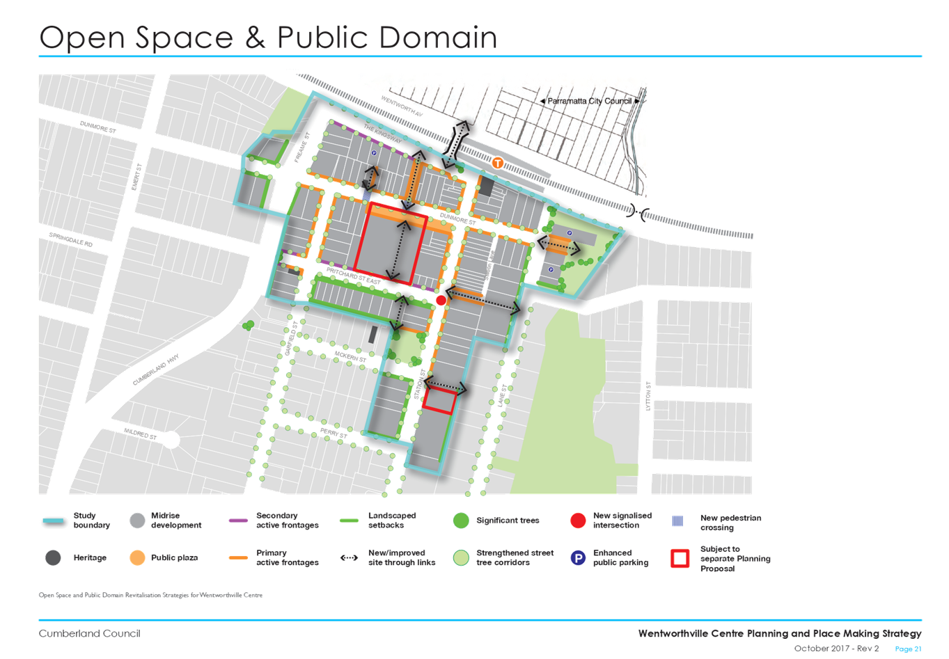
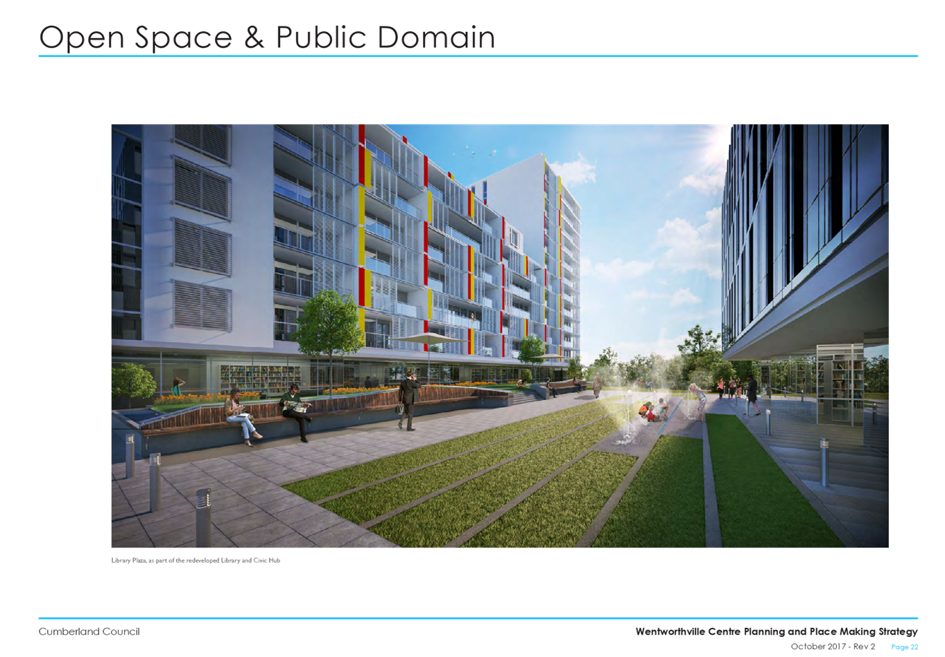
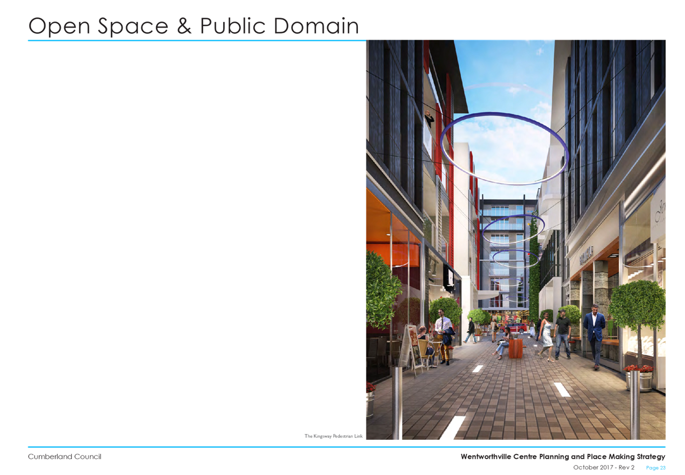

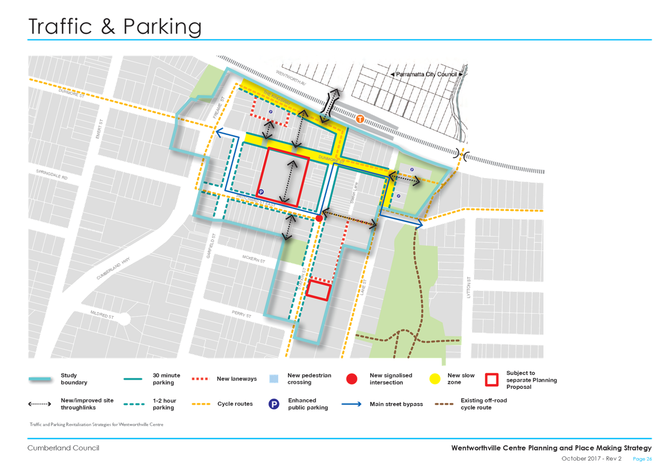


DOCUMENTS
ASSOCIATED WITH
REPORT ELPP069/19
Attachment 7
Panel report and minutes 13 July 2016
Extraordinary Cumberland Local Planning
Panel Meeting
5 November 2019

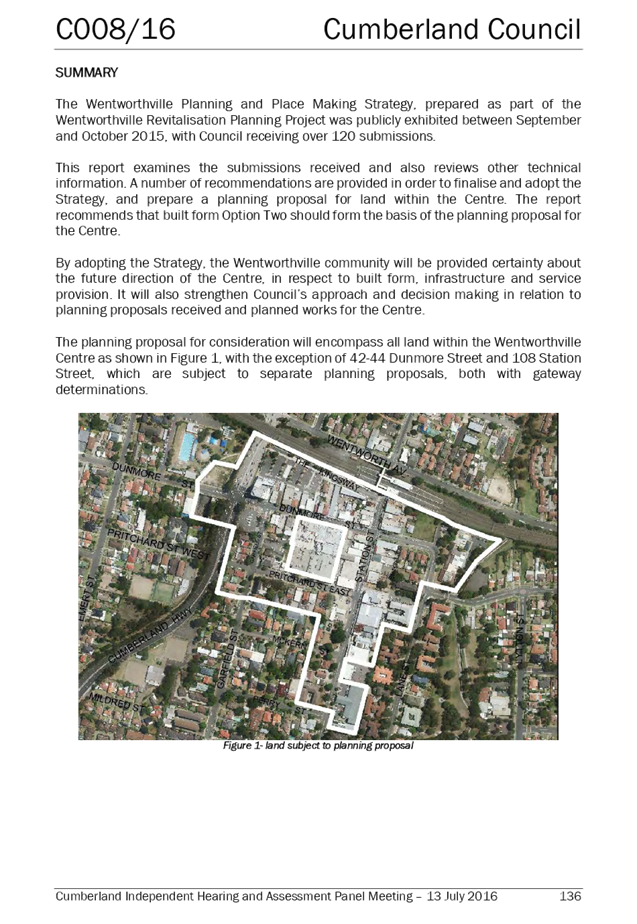
DOCUMENTS
ASSOCIATED WITH
REPORT ELPP069/19
Attachment 8
Council report and minutes 3 August 2016
Extraordinary Cumberland Local Planning
Panel Meeting
5 November 2019


DOCUMENTS
ASSOCIATED WITH
REPORT ELPP069/19
Attachment 9
Council report and minutes 5 July 2017
Extraordinary Cumberland Local Planning
Panel Meeting
5 November 2019
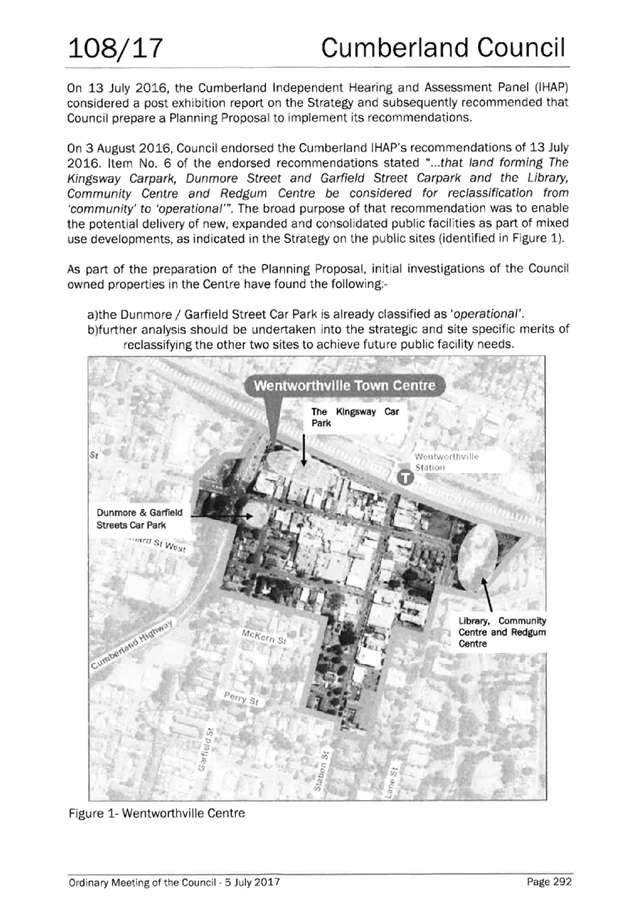
DOCUMENTS
ASSOCIATED WITH
REPORT ELPP069/19
Attachment 10
Council report and minutes 19 December 2018
Extraordinary Cumberland Local Planning
Panel Meeting
5 November 2019
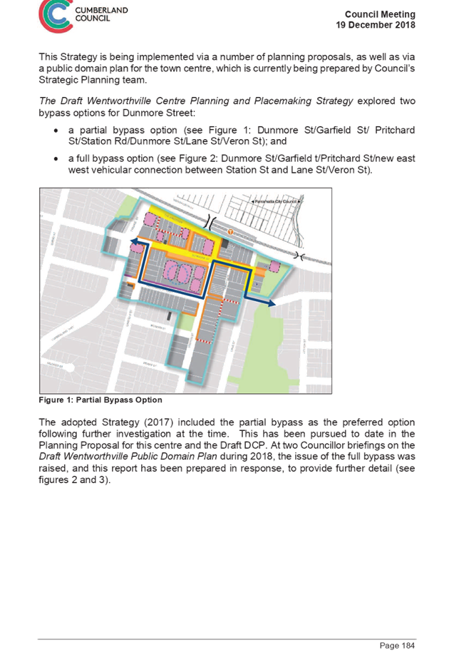
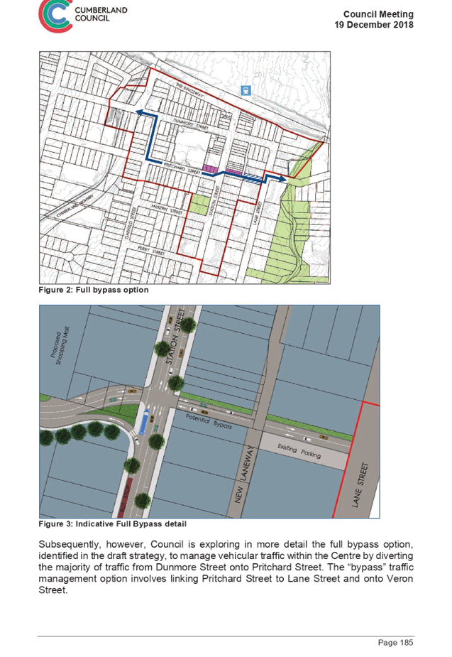


Extraordinary
Cumberland Local Planning Panel Meeting
5 November 2019
Item No: LPP070/19
Planning
Proposal Request for 55-57 Station Street and 6 Pritchard Street East,
Wentworthville
Responsible
Division: Environment
& Planning
Officer: Executive
Manager Environment and Precincts
File
Number: SC531
|
Lodged
|
2 September 2019
|
|
Proponent
|
Nucorp Construction Pty Ltd
|
|
Description of Land
|
55-57 Station Street (Lots 1A, 2B and 2C of DP 305764) and
6 Pritchard Street East (Lots 1 to 6 of SP 19949)
|
|
Site Area
|
Approximately 2,759m2
|
|
Site Description and Existing Use
|
The site is located within the Wentworthville Town Centre
(south of the railway line) on the corner of Pritchard Street East and
Station Street. The site has been consolidated to make a single development
parcel. 55-57 Station Street was originally a service station, but recently
had been operating as an automotive repair shop (now closed) and convenience
store (facing Station Street). 6 Pritchard Street is a standalone retail
premise that faced Pritchard Street East and housed a video store (now
closed).
|
|
Proposal Summary
|
The amended Planning Proposal Request seeks an amendment
to the Holroyd Local Environmental Plan 2013 (Holroyd LEP 2013)
to:
· Amend the
existing floor space ratio (FSR) control for the site from 2:1 and 2.2:1 to
3:1.
· Amend the
existing maximum height of building (HoB) control for the site from (10m and
17m) and 20m to (17m and 23m) to 41m.
· Amend Schedule
1 – Additional Permitted Uses to introduce a 100m2
‘Gymnasium’ at the ground floor of the proposed mixed use
development for use by residential tenants.
The amended proposal further includes a letter of offer of
proposed public benefit.
|
|
Existing and
Proposed Planning Controls
|
Planning Controls
(Holroyd LEP 2013)
|
Existing controls
|
Council’s draft
Went Wentworthville Town Centre PP controls
|
Proposed controls
(Amended proposal)
|
|
|
Zoning
|
N/A
(Currently B2 Local
Centre zone)
|
N/A
(No change proposed to
existing zoning)
|
N/A
(No change proposed to
existing zoning)
|
|
|
Maximum Height of
Building (HoB)
|
(10m and 17m) and 20m
|
(17m and 23m) and 30m
|
(17m and 23m) and 41m
|
|
|
Floor Space Ratio
(FSR)
|
2:1 and
2.2:1
|
2.2:1 and 2.5:1
|
3:1
|
|
|
Additional Permitted
Use (APU)
|
-
|
-
|
Introduces 100m2
Gymnasium use to the ground floor of the proposed development for use by
residential tenants only.
|
|
Design Excellence provisions
|
Design Excellence
|
Does not apply.
|
Does not apply.
|
Does not apply.
|
|
Heritage
|
|
Nil. However, the site is located within close proximity
of a locally significant heritage item that is currently identified under the
Holroyd LEP 2013.
|
|
Disclosure of
political donations and gifts
|
|
Nil.
|
|
Previous considerations
|
|
Nil.
|
|
Pre-lodgement meetings
|
|
On 26 November 2018, the proponent lodged a planning
proposal request for the site. Following preliminary consultation and further
assessment of the proposal, Council requested the proponent to revise the
original proposal request due to significant built form inconsistencies with
Council’s draft Wentworthville Centre Planning Proposal.
Council had further meetings with the proponent in May
2019, on 7 June 2019 and 11 July 2019 to discuss the amended proposal prior
to its formal lodgement for assessment.
|
This report seeks to provide an
overview of an amended Planning Proposal Request (PPR) submitted to Cumberland
Council on 2 September 2019 (refer to Attachment 1 of this report). The
proponent chose to amend the PPR at Council’s request due to the significant
inconsistency that the original PPR had with the proposed built form controls
of the draft Wentworthville Town Centre Planning Proposal.
The amended PPR seeks to amend the
Holroyd Local Environmental Plan 2013 (HLEP 2013) by:
· Amending
the floor space ratio (FSR) control for the site from 2:1 and 2.2:1 to 3:1;
and
· Amending
the maximum height of building (HoB) control of the site from 10m, 17m and 20m
to 17m and 23m (6 Pritchard Street East) and 41m (55-57 Station Street).
· Insert
additional provisions into Schedule 1 - Additional Permitted Uses to permit
development on the site for the purpose of a ground floor 100m2 Gymnasium (gym)
for use by residential tenants only.
The status of the amended PPR is
outlined in Figure 1.
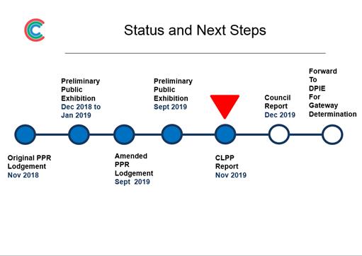
Figure
1: Planning Proposal Request Status
The Site And Its Context
The site is located within the
Wentworthville Town Centre, on the corner of Station Street and Pritchard
Street East. The site has a frontage of approximately 60m to Pritchard Street
East and 46m to Station Street.
The site has been consolidated to
make a single development parcel. 55-57 Station Street was originally a service
station, but had been operating as an automotive repair shop (now closed) and
convenience store (facing Station Street). 6 Pritchard Street is a standalone
retail premise that faces Pritchard Street East and housed a video store (now
closed).
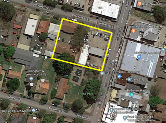
Figure 2: The Site
Local Context
The site is located
approximately 250m from Wentworthville Railway Station (approximately 3-5
minutes walking distance), and is well serviced public bus transport services.
The site adjoins Friend
Park to the south, and is located approximately 100 metres walking distance
from the St Andrews Presbyterian Church and a low density residential area
facing McKern Street. This residential area predominantly includes 1960s style
single storey brick and weather board dwellings.
Regional Context
The site is located in
the suburb of Wentworthville within the Local Government Area of Cumberland
Council approximately 2km west of Parramatta Central Business District (CBD)
and 27km west of the Sydney CBD.
The site is further
located approximately 800m west of the Westmead health and education precinct
which is considered as one of the largest health precincts in New South Wales.
The site is well served
by road infrastructure by the Cumberland Highway to the west, the Great Western
Highway and M4 Motorway to the south.
Planning Controls (Holroyd
LEP 2013)
Current Planning
Controls
Holroyd LEP 2013
applies to the site. The site is currently zoned B2 Local Centre with an FSR of
2:1 and 2.2:1 and Maximum Height of Building control of 10m, 17m and 20m apply
across the site.

Figure 3: Existing Land Zoning (LZN) Map
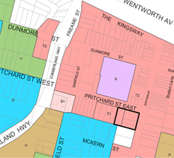
Figure 4: Existing Floor Space Ratio (FSR) Map
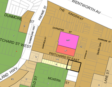
Figure 5: Existing Maximum Height of Buildings (HoB)
Map
Draft Wentworthville
Centre Planning Proposal
In 2013, the former
Holroyd City Council was successful in achieving grant funding under the NSW
Government’s Planning Reform Fund Program to facilitate the urban renewal
and economic revitalisation of the Centre and to provide the planning framework
to deliver redevelopment in this area.
In 2015, the
Wentworthville Planning and Place Making Strategy (the Strategy) was prepared.
The Strategy’s vision was to create a progressive, colourful, vibrant and
engaging local centre that is comfortable and well connected to the surrounding
area and facilities. The Strategy recommended a range of urban design and new
planning controls including increases to building height and floor space ratios
(FSRs) and the introduction of new bonus provisions within the Centre.
In August 2016, Council
endorsed the Cumberland Independent Hearing and Assessment Panel’s (IHAP)
recommendations to adopt the draft Strategy and prepare a planning proposal to
implement the recommended built form controls of the Strategy.
Council prepared a
draft planning proposal for Wentworthville Centre and a Gateway Determination
was issued on 25 May 2018. The draft planning proposal was publicly exhibited
for a two month period from 22 May 2019 until Sunday 21 July 2019. An extended
exhibition period was also considered till Monday 29 July 2019 to allow for
late submissions.
The draft
Wentworthville Centre Planning Proposal proposes an FSR of 2.2:1 and 2.5:1 and
height of building controls of 17m, 23m and 30m to be applied to the site.
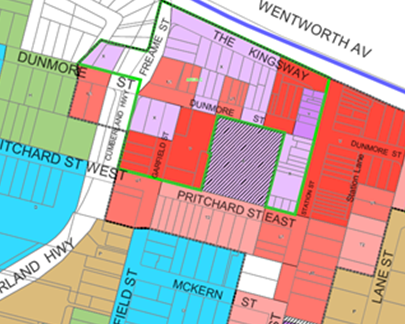
Figure
6: Draft Wentworthville Town Centre Floor Space Ratio (FSR) Map
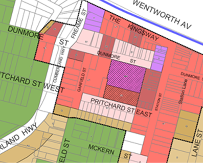
Figure 7: Draft Wentworthville Town Centre Maximum
Height of Buildings (HoB) Map
Original Planning
Proposal Request
A PPR was lodged in
November 2018 that sought to amend Holroyd Local Environmental Plan 2013 (HLEP
2013) by:
· Amending
the floor space ratio (FSR) control of the site from 2:1 and 2.2:1 to 3.5:1;
and
· Amending
the maximum height of building (HoB) control of the site from 10m, 17m and 20m
to 53m.
The proponent chose to amend the
PPR at Council’s request, due to the significant inconsistency that the
original PPR had with the proposed built form controls of the draft
Wentworthville Town Centre planning proposal.
Proposed Planning Controls
The amended PPR (the proposal)
request seeks to:
· Amend
the existing maximum Floor Space Ratio (FSR) control of the site from 2:1 and
2.2:1 to 3:1.
· Amend
the maximum Height of Buildings (HoB) control of the site from 10m, 17m and 20m
to 17m and 23m (6 Pritchard Street East), and 41m (55-57 Station Street).
· Insert
additional provisions into Schedule 1 - Additional Permitted Uses to permit
development on site for the purpose of a 100m2 gymnasium (gym)
located at the ground floor level for use by residential tenants only.
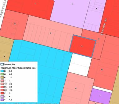
Figure 8: Proposed Floor Space ratio (FSR)
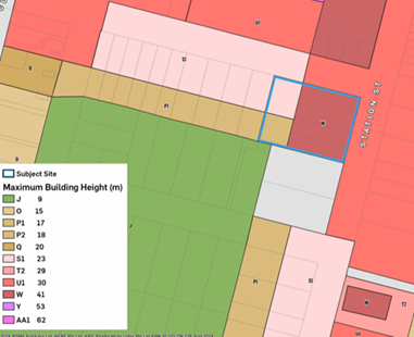
Figure 9: Proposed Maximum Height of Buildings (HOB)
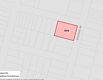
Figure 10: Proposed Additional Permitted Use (APU)
Strategic Merit
Assessment
Alignment with the
adopted Wentworthville Centre Planning and Place Making Strategy and draft
Wentworthville Centre Planning Proposal
There is strategic
merit in progress the proposal as it is not inconsistent with the draft planning
controls to the Wentworthville Town Centre. This includes the following
reasons:
· The
increase in FSR and Building Height will offset the loss of developable land
due to the dedication of 6 Pritchard Street East and 120m2 land
portion of 55-57 Station Street to Council. This will ensure planned dwelling
yields are not reduced.
· A
through site link is identified for this location in the Wentworthville
Centre Planning and Place Making Strategy and Draft Wentworthville Centre
Development Control Plan. The proposal secures the creation of the through site
link.
· The
proponent has worked with Council to reduce the scale of the indicative concept
development from what was originally proposed. This has seen the FSR reduced by
0.5:1 (3.5:1 to 3:1 FSR) across the site and the proposed building height
reduced by 12 metres (53m to 41m) from the original proposal request.
· The
amended proposal also applies a 17m and a 23m maximum building height control
for 6 Pritchard Street East which is consistent with the exhibited draft
Wentworthville Centre planning proposal.
· The
FSR applied is consistent with the 3:1 FSR applied for the north eastern
portion of Station Street.
· The
proposed building height applied is consistent with the 41m building height
applied across the northern portion of Station Street located in the
Wentworthville Centre core area.
There is also greater
strategic merit in progressing the proposal as a standalone item concurrent
with the draft planning controls for the Wentworthville Town Centre, as:
· The
community would not have had opportunity to provide comment on the amended PPR
as required by Cumberland Council Planning Proposals Notification Policy.
· Delay
of the progression of the draft Wentworthville Centre Planning Proposal may
occur should the Panel or Council not support the amended PPR.
Provide for the
orderly and economic development of the land
There is strategic
merit in progressing the proposal as:
· The
Economic Feasibility Analysis prepared by Hill PDA to support Council’s
strategy for Wentworthville Town Centre determined that it was not feasible to
redevelop the site with an FSR of less than 3:1.
· The
strategy also identifies the proposed site for amalgamation. The proponent has
achieved this and is now seeking to redevelop the site.
Overshadowing of
Friend Park
There is strategic
merit in progressing the proposal to the next stage of assessment as the
proponent has submitted shadow analysis that determines that any future
development on the site would achieve:
· 50-90%
solar access of the existing Friend Park between 12pm and 3pm during winter
solstice.
· 70%
solar access to the extended Friend Park between 10am and 3pm.
This analysis has also
been reviewed by Council and identifies similar overshadowing impacts when
compared against the draft planning controls for the Wentworthville Town
Centre.
Overshadowing of
other properties in the Wentworthville Town Centre
The proponent has
submitted shadow analysis that determines that any future development on the
site will not cast any significant shadow onto the surrounding properties that
will result in the proposed built form not achieving the minimum Apartment
Design Guide (ADG) requirements of 70% of solar access for a minimum of 2 hours.
Therefore, there is strategic merit in progressing the proposal to Gateway.
Traffic and parking
There is strategic
merit in progressing the proposal to the next phase, as:
· The
site is located within walking distance to Wentworthville Railway Station that
provides connecting services to Blacktown, Parramatta, Westmead, Merrylands and
Sydney CBD.
· The
proposal is expected to result in additional traffic generation of approximately
30 vehicles per hour during the AM peak and approximately 23 vehicles per hour
during the PM peak for residential and retail/commercial uses.
· The
level of traffic generation is well within typical fluctuations in background
traffic volumes. It is anticipated that no external road works will be required
to facilitate this amended proposal.
· The
projected net change in traffic activity as a result of the proposal will not
have any unacceptable traffic implications on the road network capacity.
Site contamination
The ‘Stage 1
Environmental Assessment’ prepared by Environmental Investigation
Services (August 2018) for the original PPR (refer to Attachment 3 of the
report) has identified that the site includes more potential to be contaminated
due to the proposed site’s past land uses, and the proponent would need
to undertake further detailed site investigations should the proposal proceeds
to a DA stage, given the nature and type of uses proposed. This does not
limit the proposal being progressed further.
Additional Permitted
Use – Gymnasium
The proposed additional
use is unlikely to create or result in any major issues given the size of the
proposed gymnasium. Therefore, there is strategic merit in progressing the
proposal.
Public benefit offer
The proponent has put
forward a public benefit offer to increase the public space in this location
and for embellishment works to Friend Park. The offer is consistent with
Council’s Planning Agreements Policy and strategic outcomes sought for
the area. Therefore, there is strategic merit in progressing the proposal to
Gateway.
Consistency with the
Greater Sydney Region Plan - A Metropolis of Three Cities
The Greater Sydney
Region Plan identifies the Wentworthville area as a potential ‘area for
urban renewal’ and states the following:
· That
‘local centres’ create a strong ‘sense of place’ within
the local community, larger local centres anchored by a supermarket can form
the focus of a neighbourhood. Wentworthville Centre is considered as such a local
centre.
· That
a ‘place based planning approach’ to the development of housing
strategies will help facilitate high quality urban outcomes including the
creation of walkable neighbourhoods. The Wentworthville Centre Planning and
Place Making Strategy is a Council adopted
strategy.
There is strategic merit in
progressing the proposal to the next phase of assessment as it is generally
consistent with the following planning directions of the Greater Sydney Region
Plan – A Metropolis of Three Cities:
· Objective
4. Infrastructure use is optimised - The proposal provides mixed use retail and
residential land uses in proximity to established infrastructure and services
that is accessible to a wider population with public and railway
transport.
· Objective
7. Communities are healthy, resilient and socially connected - The proposal
promotes a healthy community by providing for additional housing in a walkable,
culturally rich and socially cohesive and connected town centre in close
proximity to recreational opportunities at Friend Park.
· Objective
10.Greater Housing Supply - The proposal contributes to approximately 90
residential units to Wentworthville’s growing population which is
expected to increase significantly within the next 15 years.
· Objective
11. Housing is more diverse and affordable - The proposal provides for more
diverse and affordable housing in close proximity to a large range of
employment, education and services in Parramatta CBD and surrounds.
· Objective
12. Great places that bring people together - The proposal includes a
place-based planning approach to facilitate the implementation of
Council’s ‘place based planning controls’ adopted by the
Wentworthville Centre Planning and Place Making Strategy and the proposed draft
Wentworthville Centre Planning Proposal to help facilitate a high quality urban
development outcome for the site and contribute to the revitalisation of the
Centre. This is in keeping with the proposed strategy’s vision for the
Centre, community directions, structure plan provisions such as built form and
character, open space and public domain, traffic and parking, linkages and
connectivity.
· Objective
14. Integrates land use and transport and creates walkable and 30 minute cities
- The proposal provides opportunities for the broader Wentworthville community
and residents, workers, children, seniors to access employment, education,
health and other essential facilities and services within 30 minutes from the
Wentworthville Town Centre.
· Objective
30. Urban tree canopy cover is increased - The proposal facilitates
redevelopment of the site and increases urban tree canopy cover along Pritchard
Street East and Station Street and the embellishment of Friend Park with the
inclusion of communal open space within the proposed development.
Consistency with the
Central City District Plan
There is strategic
merit in forwarding this proposal for a Gateway Determination, as the amended
proposal is generally consistent with the following Planning Priorities of the
Central City District Plan:
· C1.
Planning for a city supported by infrastructure - The proposal facilitates
Cumberland Council with an opportunity to balance population growth with
existing and planned infrastructure to maximise the efficiency of facilities
and services as community benefit.
· C3.
A city for people - The proposal meets this objective by providing medium to
high density housing in walkable neighbourhood in close proximity to public and
rail transport which appeals to a wider population.
· C4.
Fostering healthy, creative, culturally rich and socially connected communities
- The proposal promotes a healthy community by providing for additional housing
in a walkable, culturally rich and socially connected Town Centre in close
proximity to recreational opportunities at Friend Park.
· C5.
Providing housing supply, choice and affordability, with access to jobs and
services - The proposal provides for additional dwellings and affordable
housing in close proximity to a large range of employment, education and
services in Parramatta CBD and surrounds.
· C6.
Creating and Renewing Great Places and Local Centres, and respecting the
district’s heritage - The proposal facilitates redevelopment of an
existing urban site including public and communal open space areas, presenting
opportunities for social interaction and respecting local heritage. The amended
proposal is generally compliant and delivers Council’s adopted
Wentworthville Centre Planning and Place Making Strategy provisions and place
making controls that contribute to the Centre’s rejuvenation and
revitalisation.
· C9.
Delivering integrated land use and transport planning and a 30-minute city -
The amended proposal provides opportunities for the broader Wentworthville
community and residents, workers, children, seniors to access employment,
education, health and other essential facilities and services within 30 minutes
from the Wentworthville Town Centre.
· C16.
Increasing urban tree canopy cover and delivering Green Grid connections - The
proposal facilitates redevelopment of the site and increases urban tree canopy
cover along Pritchard Street East, Station Street and the embellishment of
Friend Park.
· C17.
Delivering high quality open space - The proposal also delivers high quality
open space to extend the existing area of Friend Park (the only park located
within the Wentworthville Town Centre) and achieve a through site link.
Summary of Planning
Proposal Controls
A summary of the
evolution of the proposed planning proposal controls to this point is provided
below.
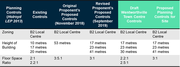
It is recommended that the
amended proposal be reported to Council seeking a resolution that the proposal
be forwarded to the Department of Planning, Industry and Environment for a
Gateway Determination. This recommendation is being made as:
· The
proposal provides for the orderly and economic development of the land.
· The
proposal supports strategic outcomes for the Wentworthville Town Centre,
including increased public space and embellishment of Friend Park.
· The
proposal is generally consistent with the strategic directions set by the
Central City District Plan and the Greater Sydney Region Plan.
Initial Planning Proposal
Request
The initial Planning Proposal
Request was publicly exhibited for a period of 51 days from 12 December 2018 to
31 January 2019, in accordance with Council’s Planning Proposal
Notification Policy. Council considered a longer exhibition period due to the
Christmas and new year holiday period. All owners and occupiers were also
notified. Hardcopies of the original proposal and associated documentation were
exhibited at Auburn and Merrylands customer service centres and Merrylands and
Wentworthville libraries. A summary of submissions received is
provided in Attachment 6.
Amended Planning Proposal
Request
The amended Planning Proposal
Request was placed on public exhibition for a period of 15 days from 18
September to Wednesday 2 October 2019. A shorter exhibition period was
considered appropriate as the amended planning proposal addressed concerns
raised by Council. All owners and occupiers were also notified. Hard copies of
the amended proposal were exhibited at Auburn and Merrylands customer service
centres and Merrylands and Wentworthville libraries.
In response to the exhibition,
Council received four submissions objecting to the amended proposal
request. A summary of submissions received is provided in Attachment 7.
Key issues raised included:
· Proposed
building height 41m and 3:1 FSR.
· The
proposal is out of character with existing development.
· Traffic,
parking and safety concerns.
· Concerns
that the proposal will have solar access and amenity impacts on Friend Park and
residential properties on McKern Street.
· The
proposal for the Additional Permitted Use would reduce commercial uses and the
active frontage at the ground floor level.
· Council
should purchase land for Friend Park through development contributions.
· Issues
raised in the submission do not warrant Council to consider changes to the
amended proposal, as comments made in the submissions:
· Appear
to have considered the proposal in isolation and do not take into consideration
broader development growth that is anticipated as a result of Council’s
draft planning controls for the Wentworthville Town Centre.
· Some
comments are related to the whole of the town centre and not the amended
proposal.
The proposal includes a public
benefit offer for an increase in public space and embellishment of Friend
Park. Should Council support a Gateway Determination for the amended proposal,
a Voluntary Planning Agreement will be negotiated between Council and the
applicant.
This report recommends that this
matter be reported to Council for further consideration. Should Council
resolves to forward this amended proposal request to the Department of
Planning, Industry and Environment for a Gateway Determination, there will be a
number of policy implications associated with the subsequent stages of the
planning proposal request process. These will be outlined in subsequent Council
reports.
Communication /
Publications:
The final outcome of this matter
will be notified in the newspaper. The objectors will also be notified in
writing of the outcome.
|
That Cumberland Local
Planning Panel (CLPP) recommend that:
1. The
Planning Proposal Request proceed to the next stage of assessment and be
reported to Council seeking a resolution to forward the planning proposal to
the Department of Planning, Industry and Environment for a Gateway
Determination.
|
1. Amended
Planning Proposal Request
2. Urban
Design Report
3. Letter
Of Intent
4. Traffic
and Parking Assessment
5. Stage
1- Environmental Site Assessment
6. Summarised
Submission Table- Original Proposal
7. Summarised
Submission Table (amended proposal)
DOCUMENTS
ASSOCIATED WITH
REPORT ELPP070/19
Attachment 1
Amended Planning Proposal Request
Extraordinary Cumberland Local Planning
Panel Meeting
5 November 2019
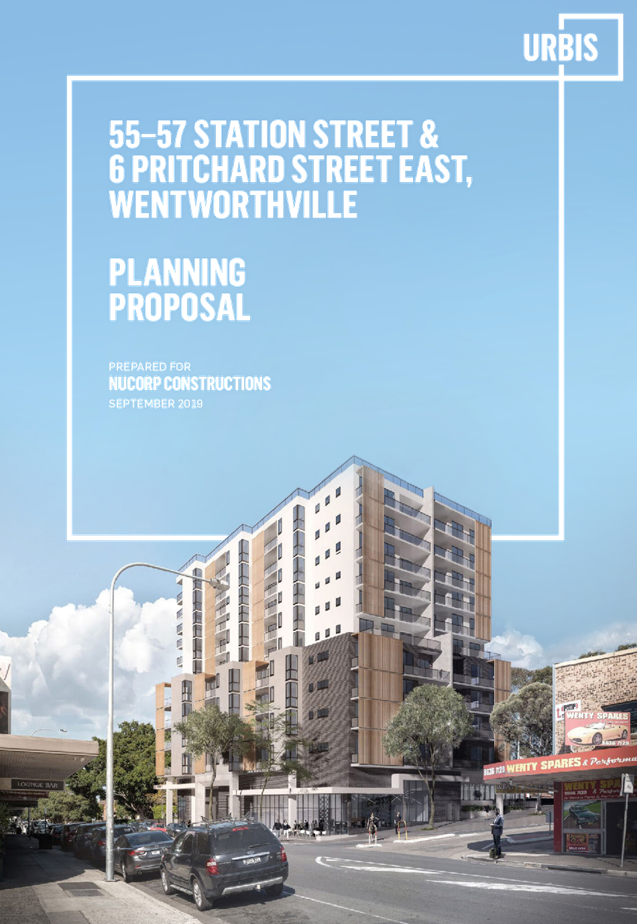


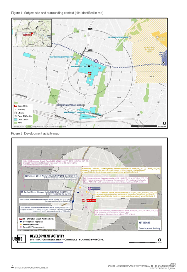
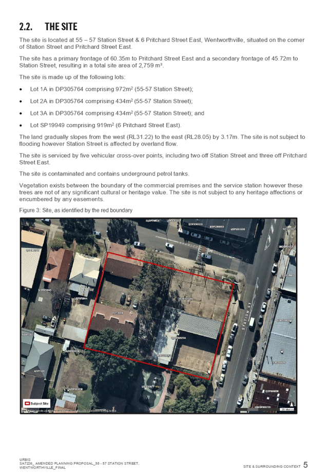
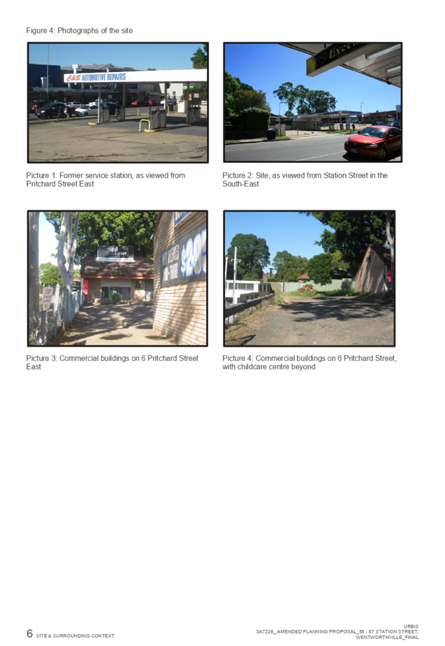
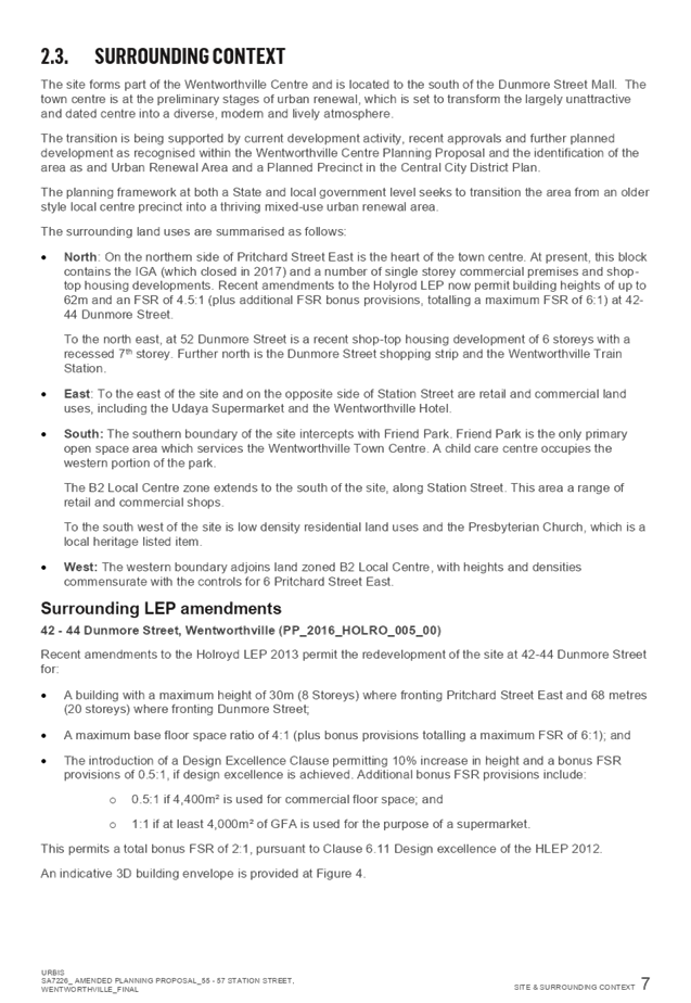
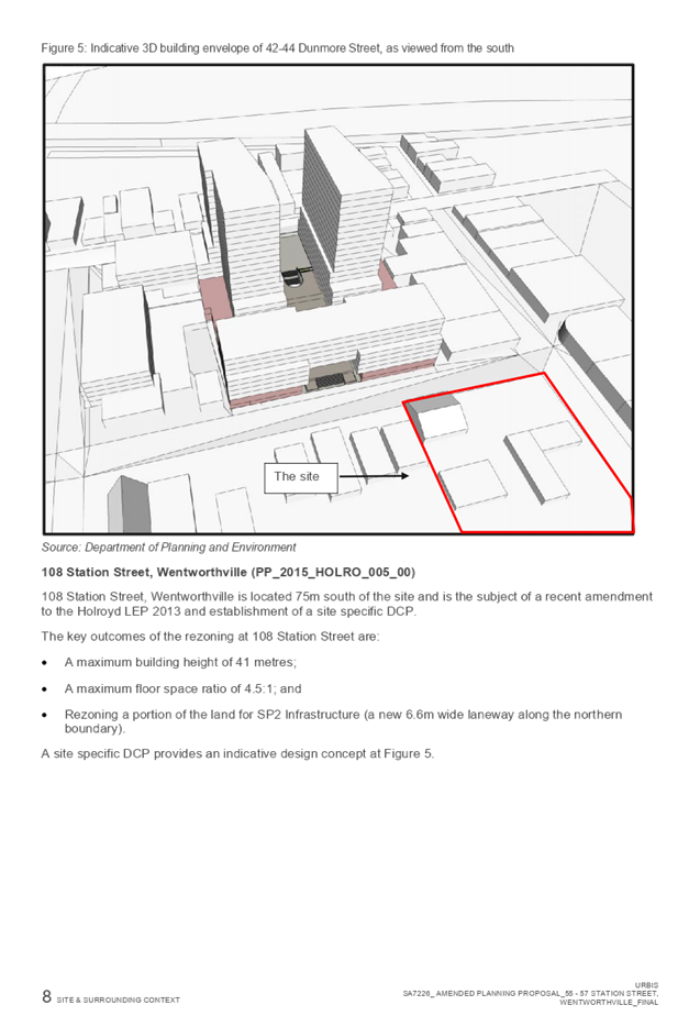
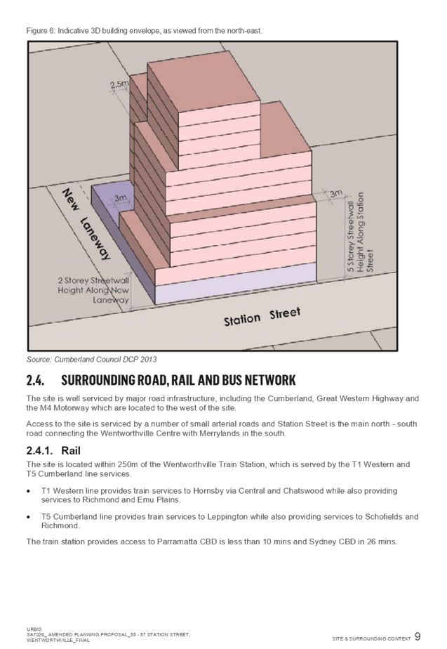
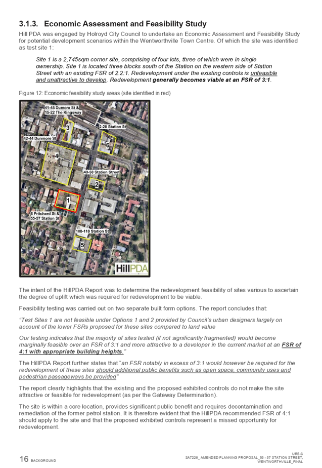
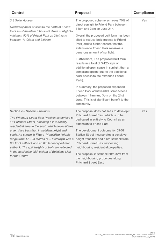
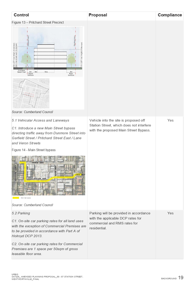
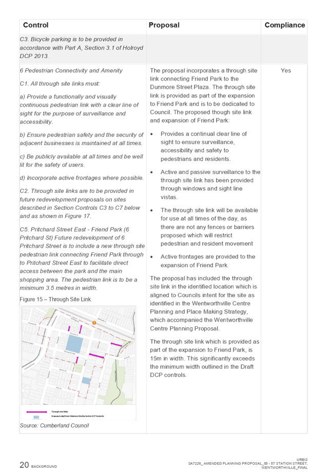

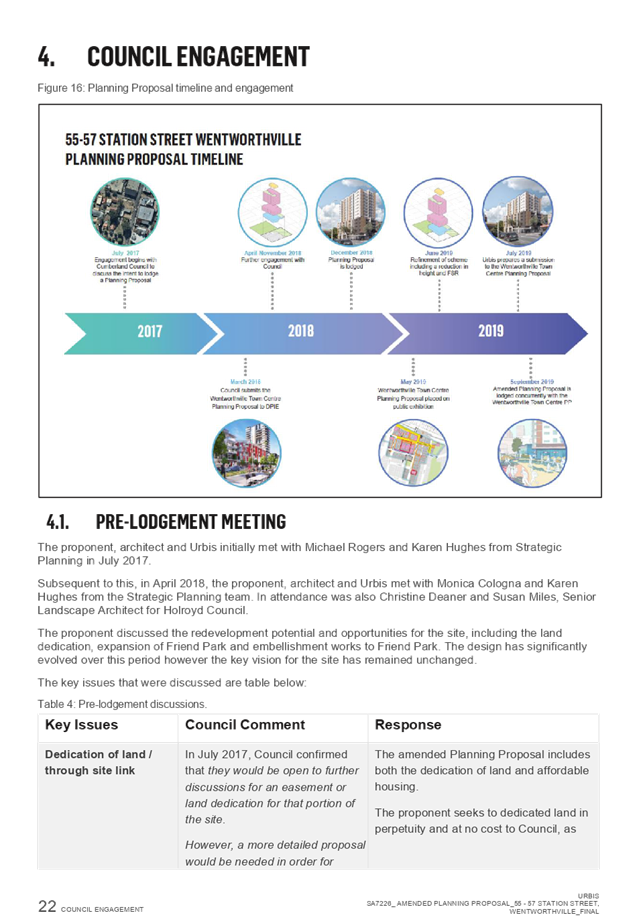
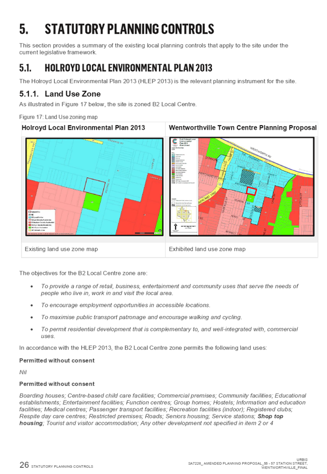
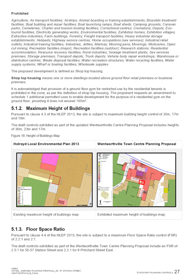
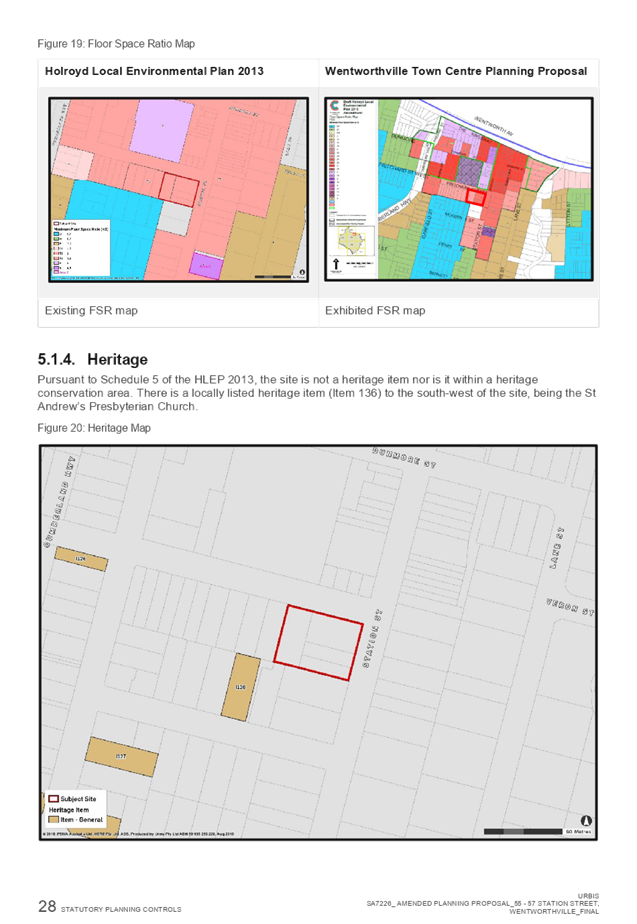
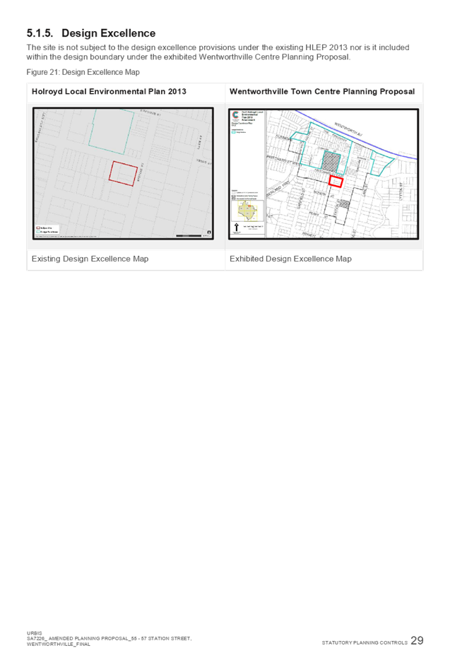
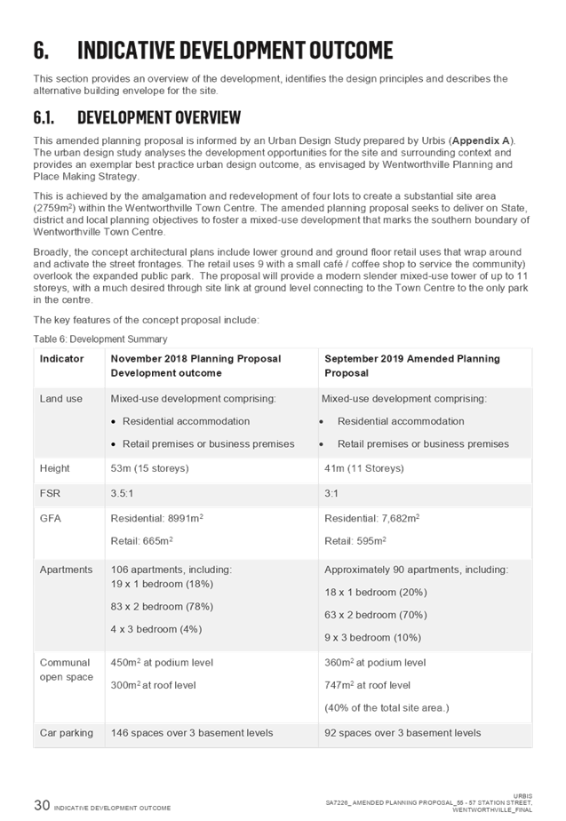
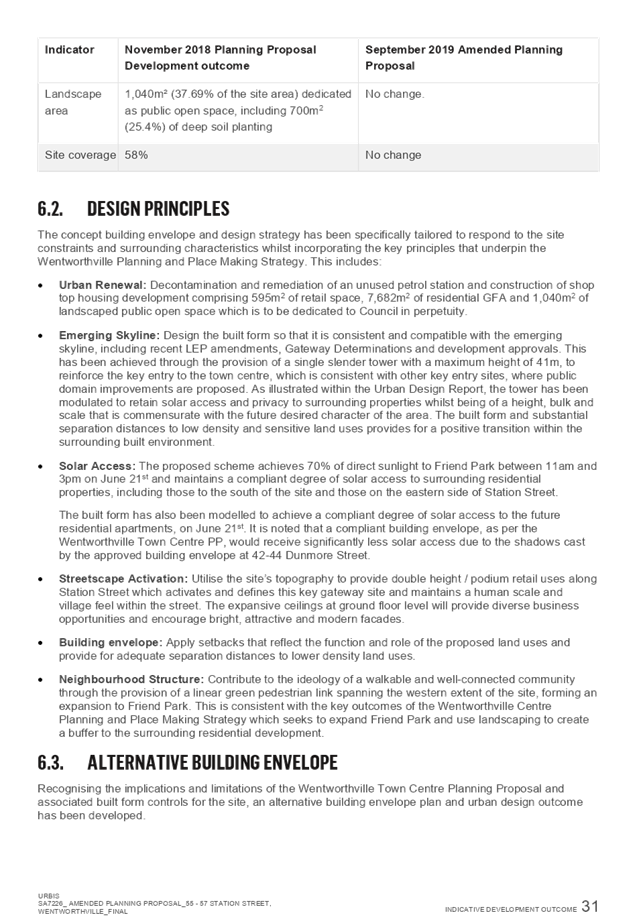
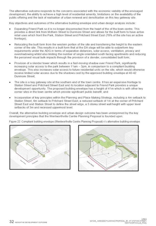
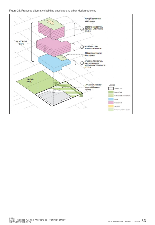
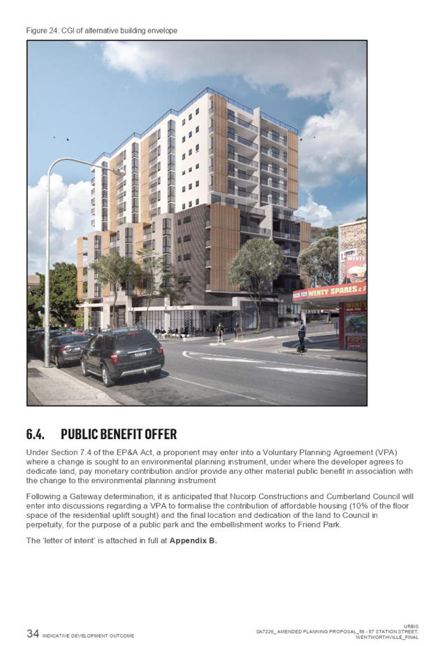

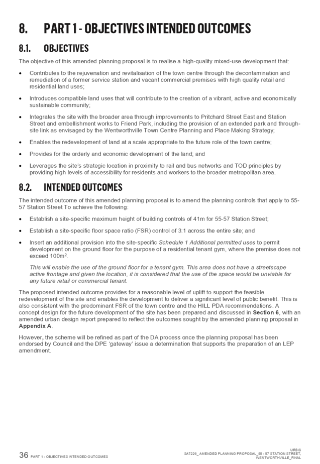
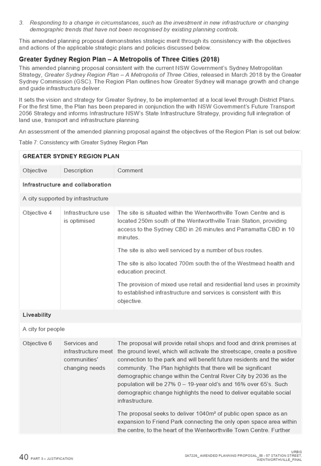
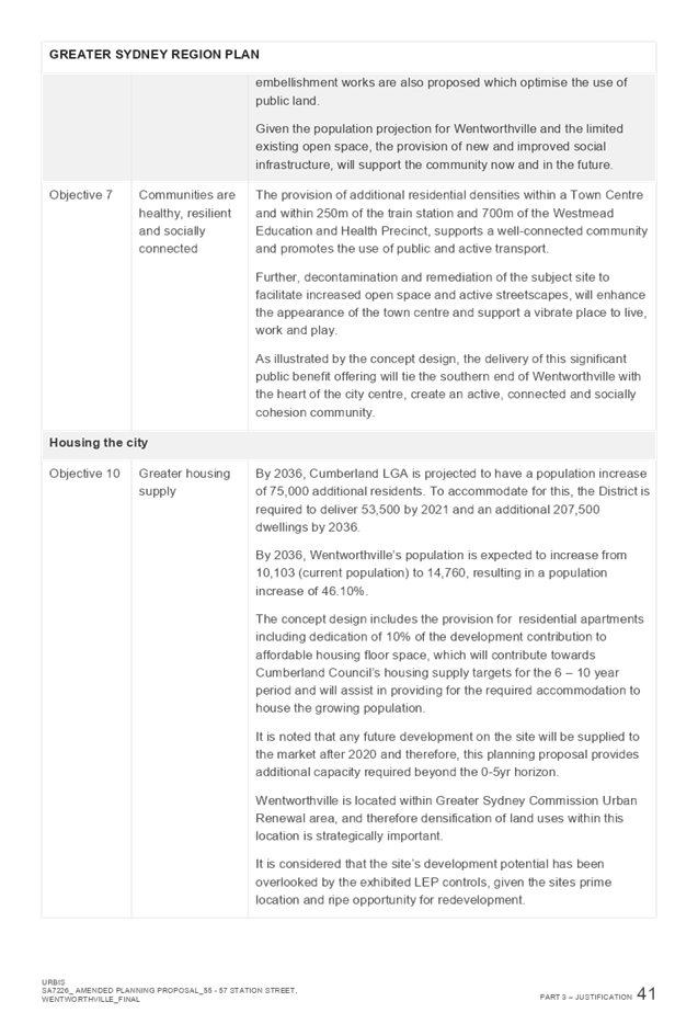
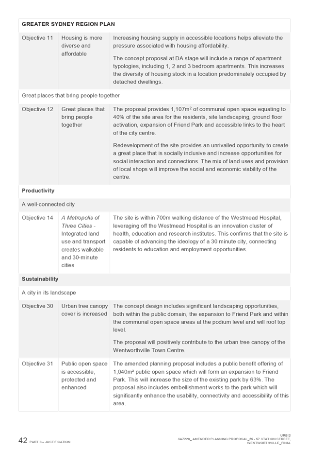
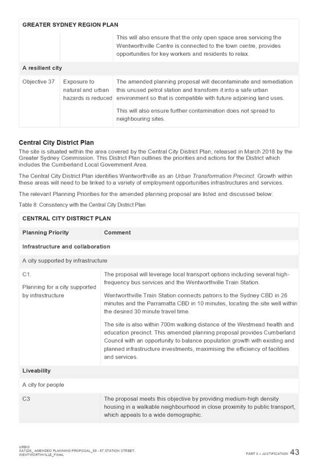
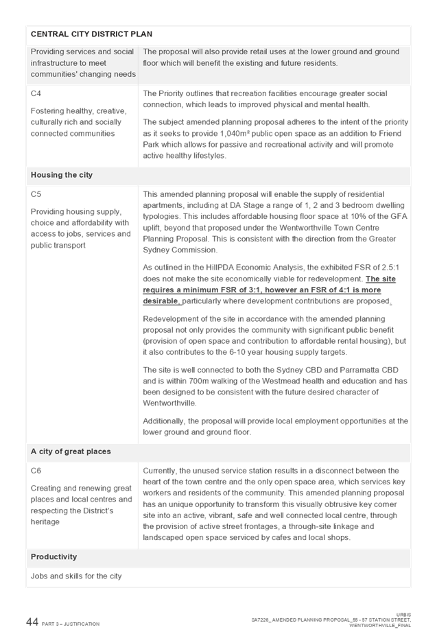
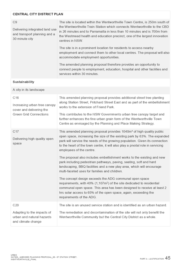
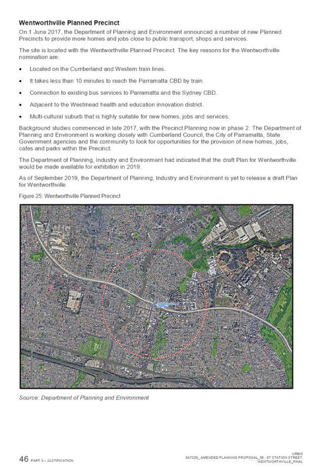


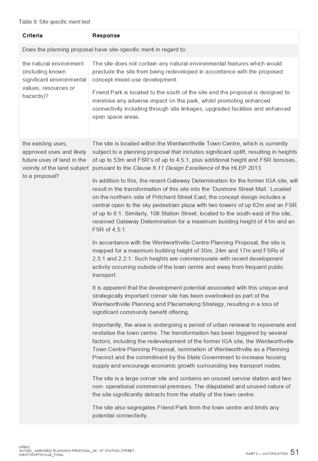
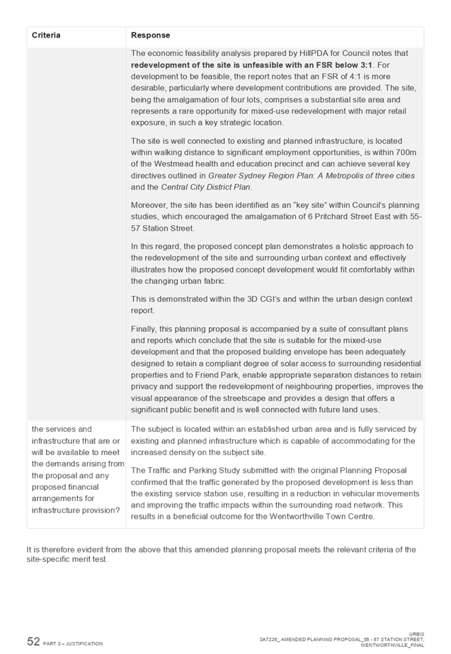
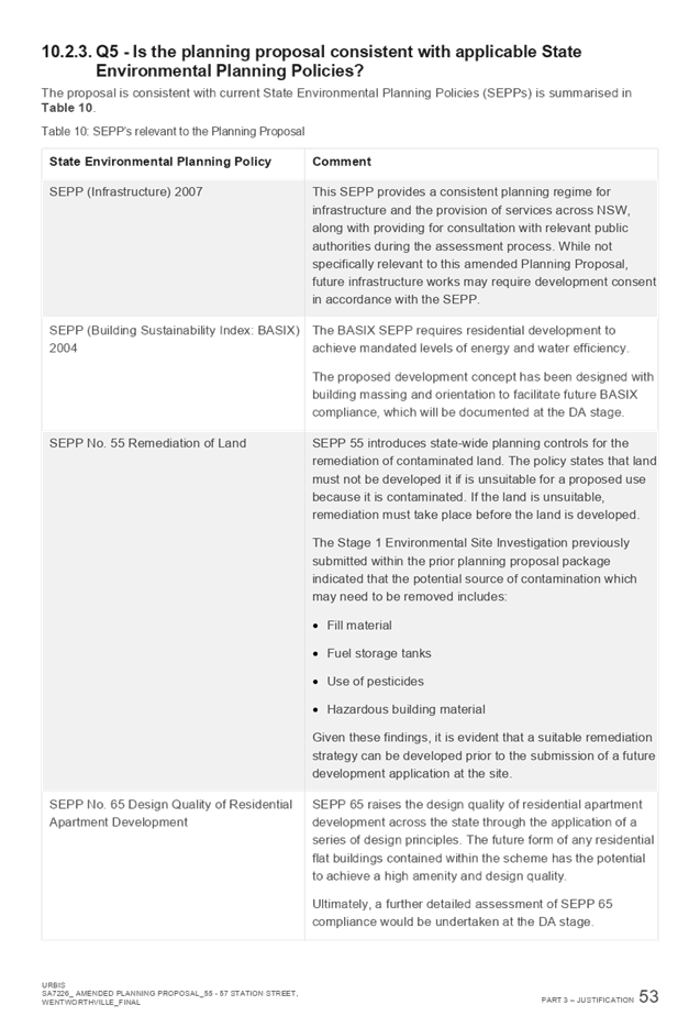
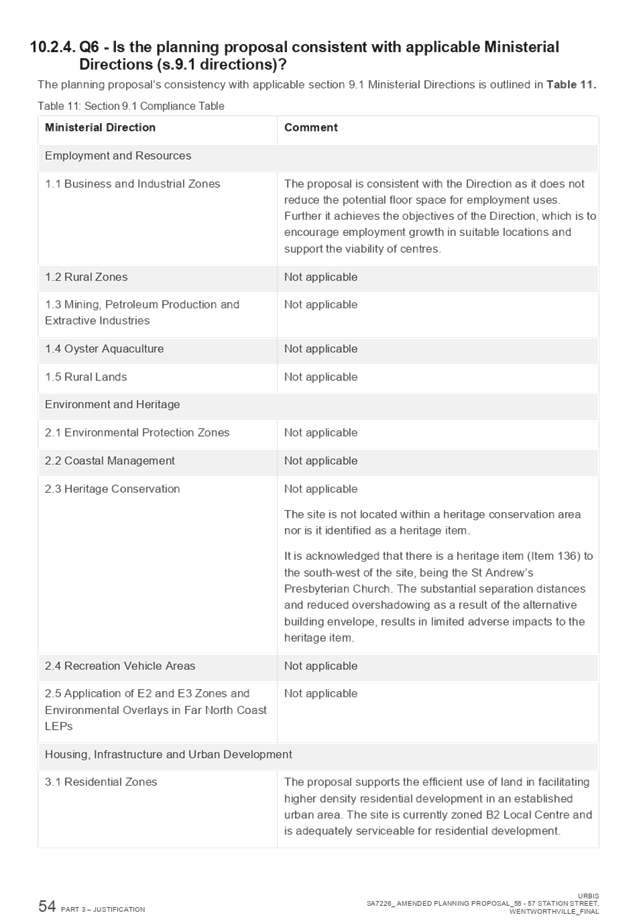
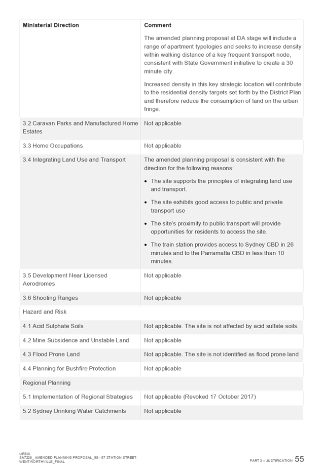
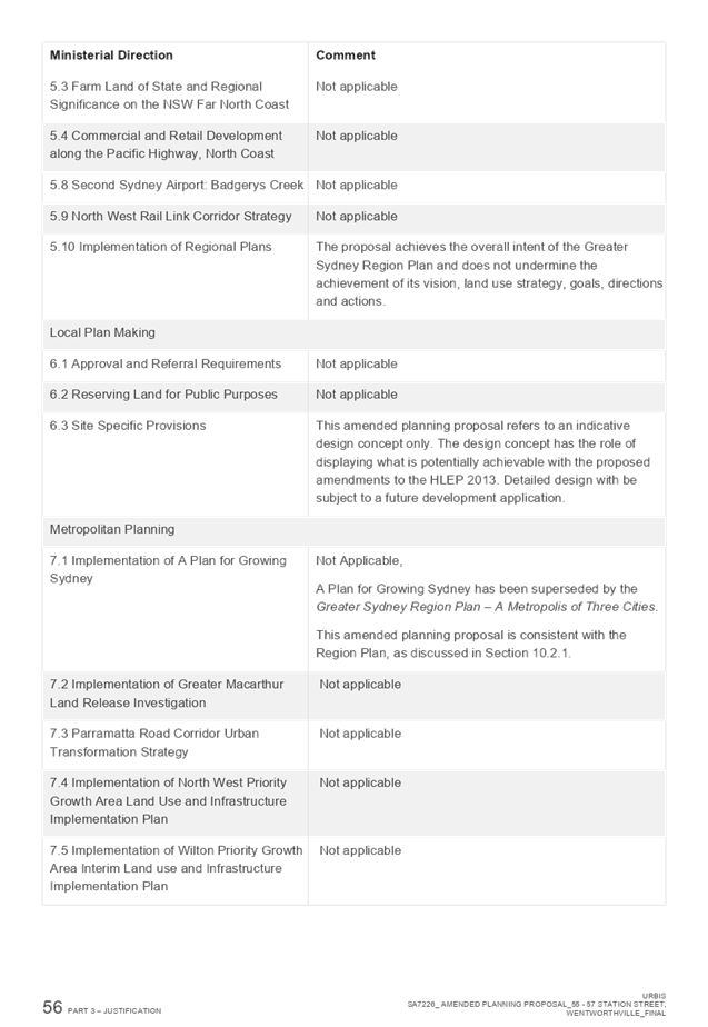
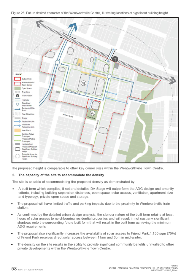
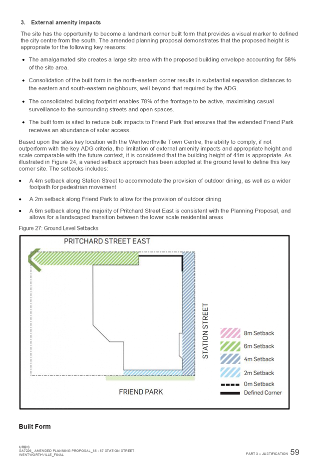
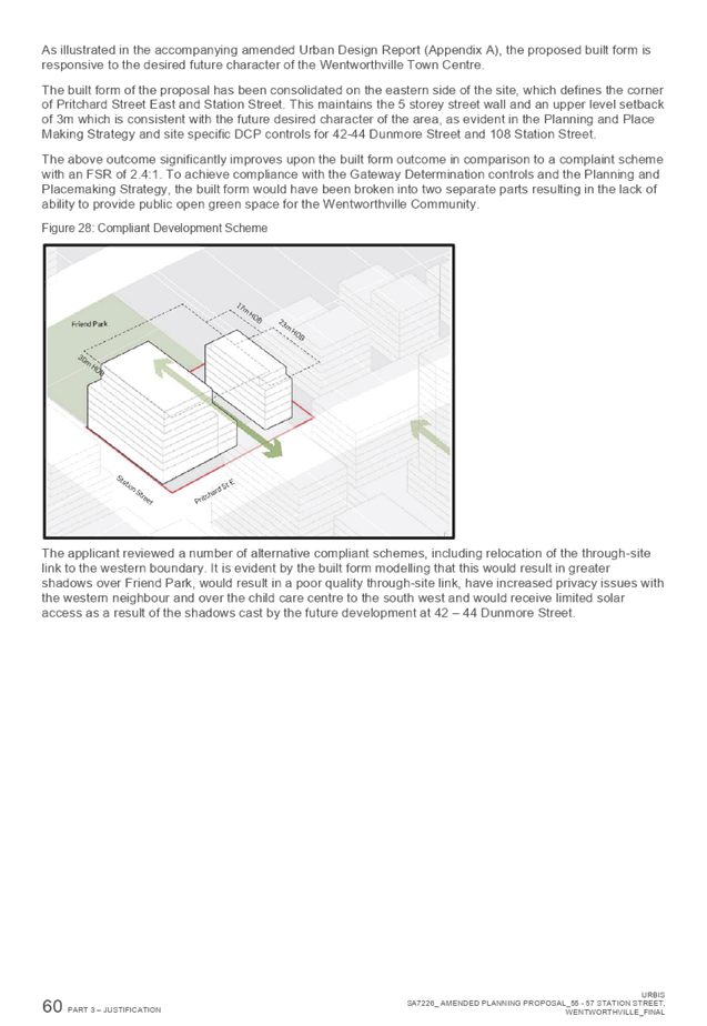
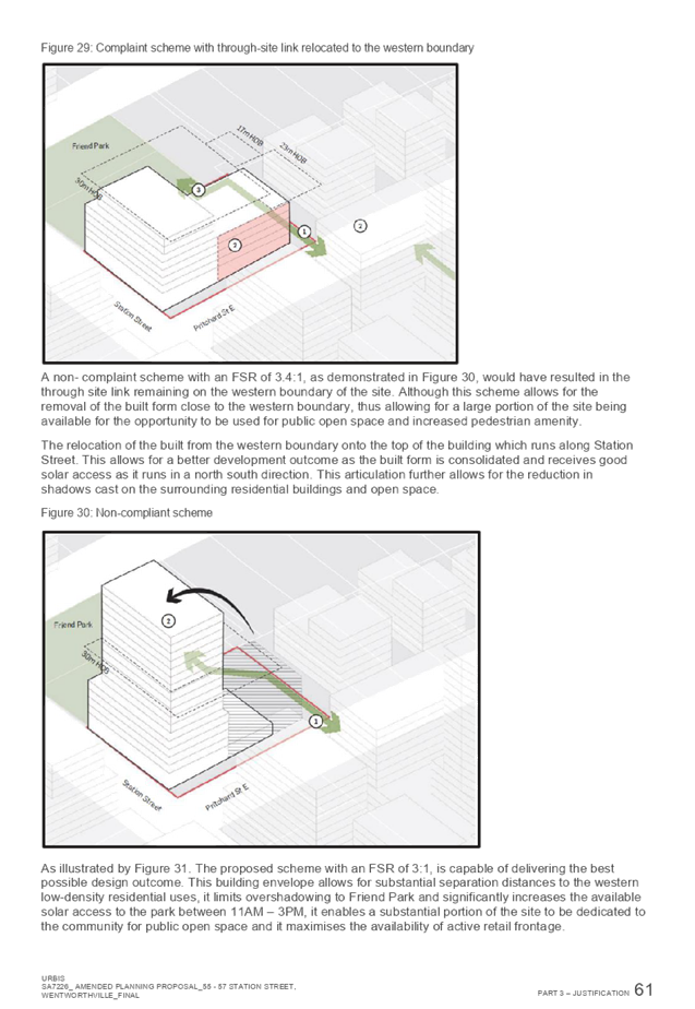
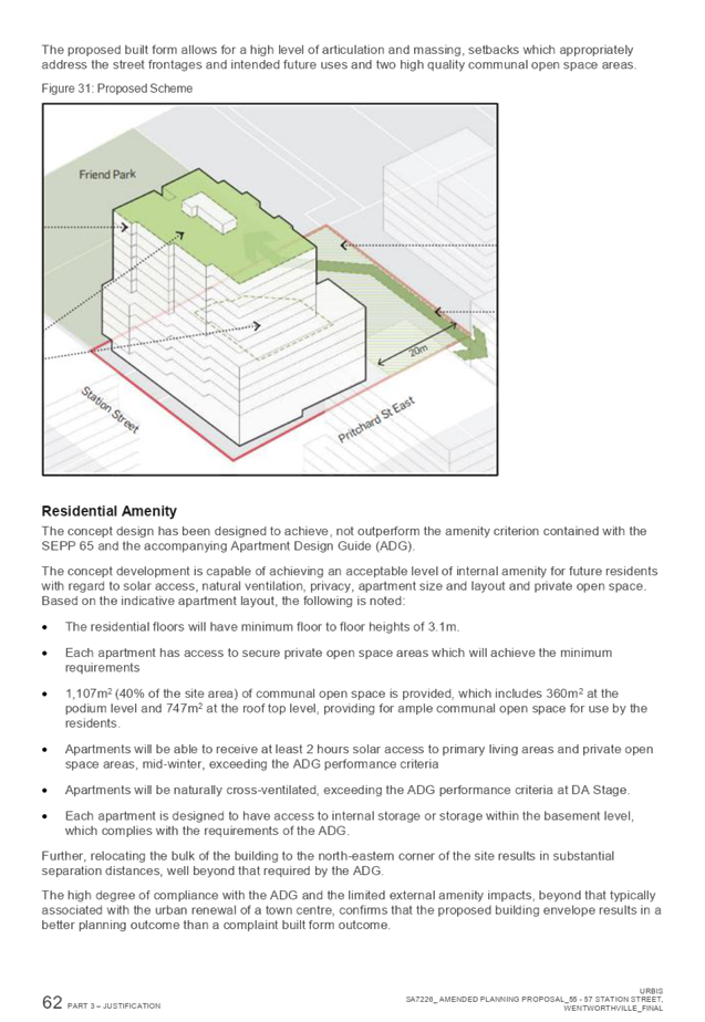
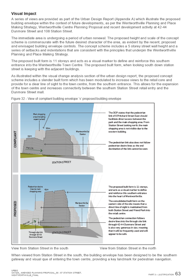

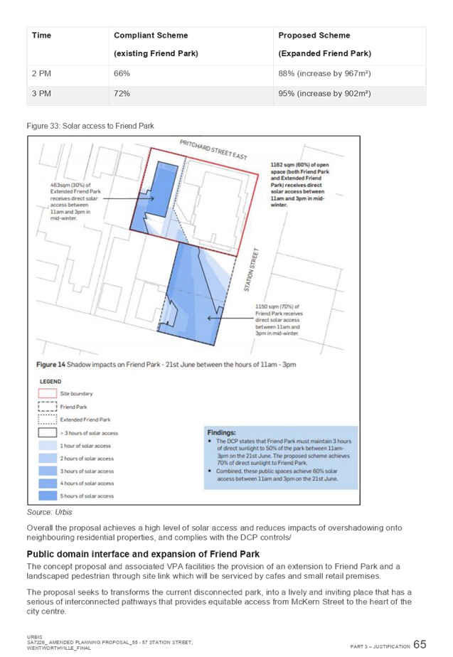


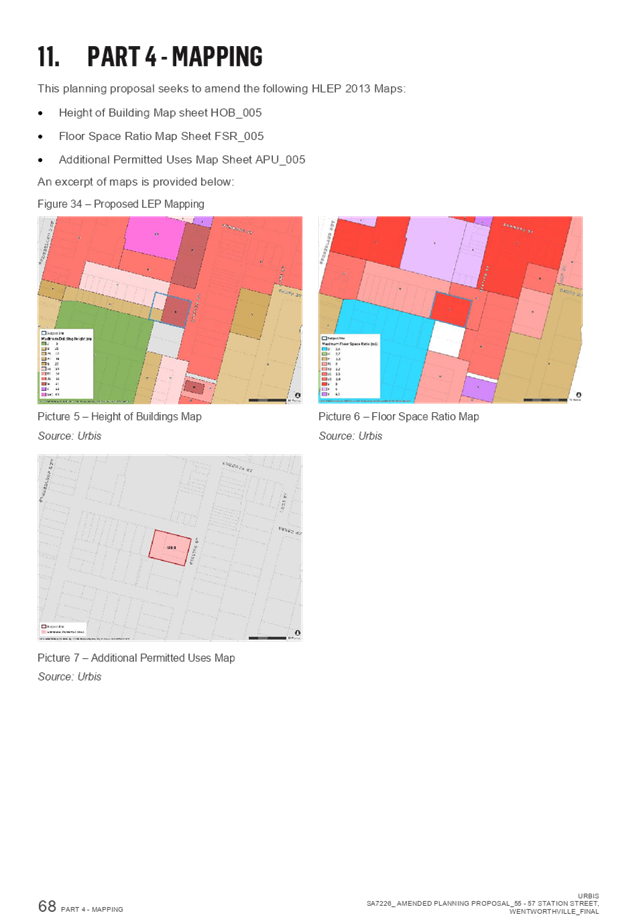


DOCUMENTS
ASSOCIATED WITH
REPORT ELPP070/19
Attachment 2
Urban Design Report
Extraordinary Cumberland Local Planning
Panel Meeting
5 November 2019
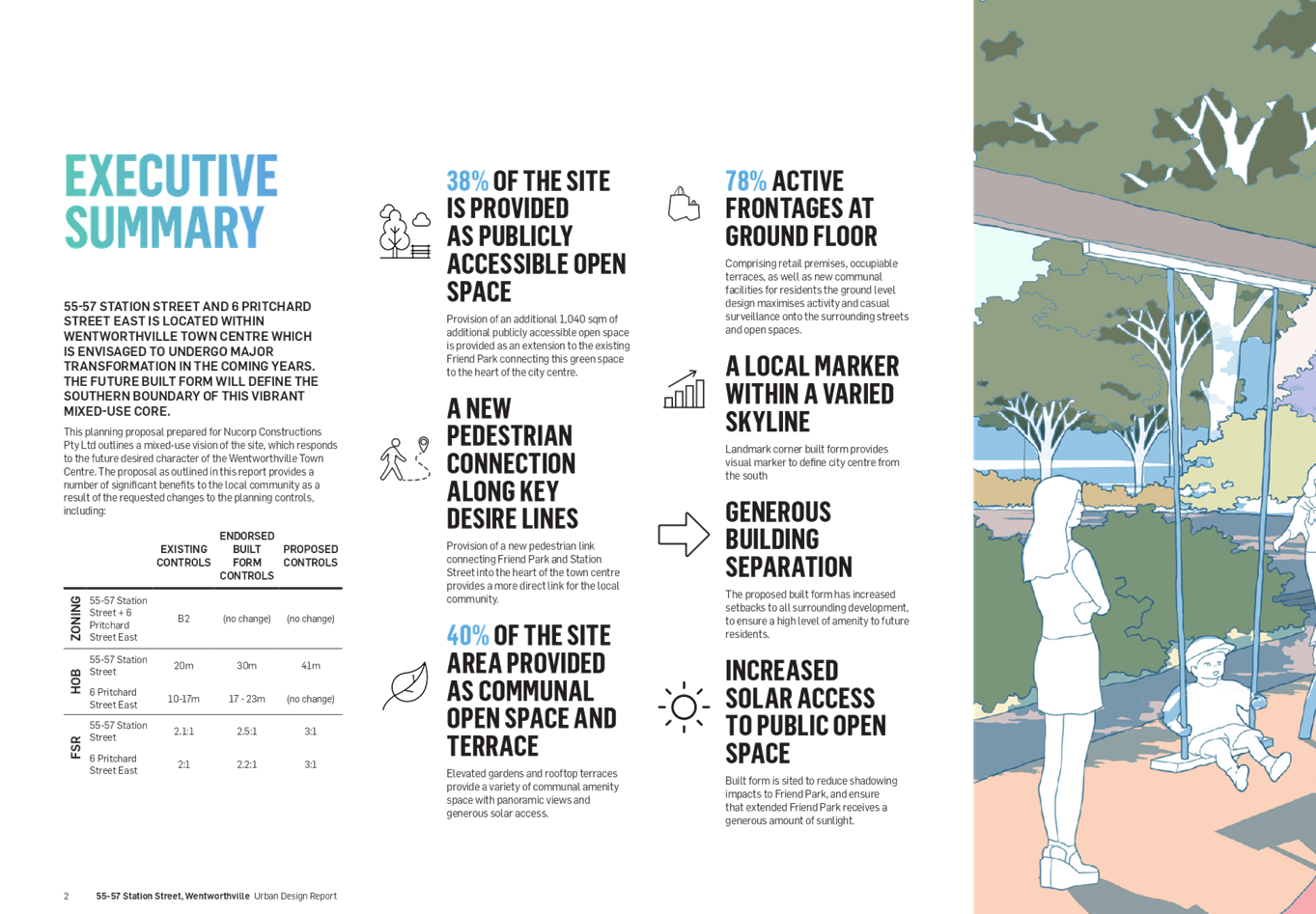
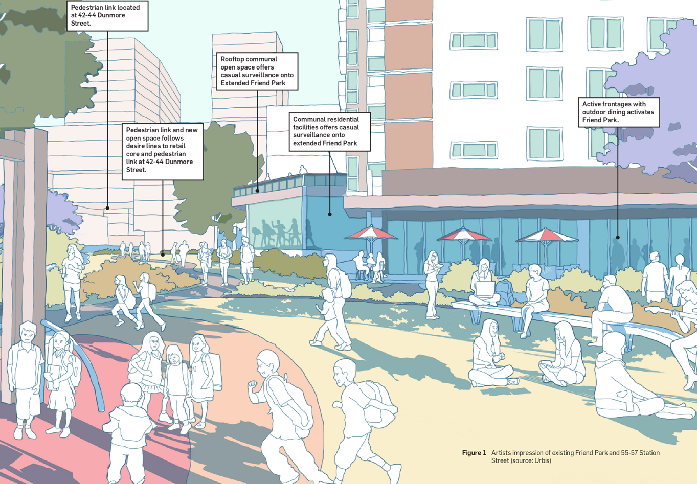

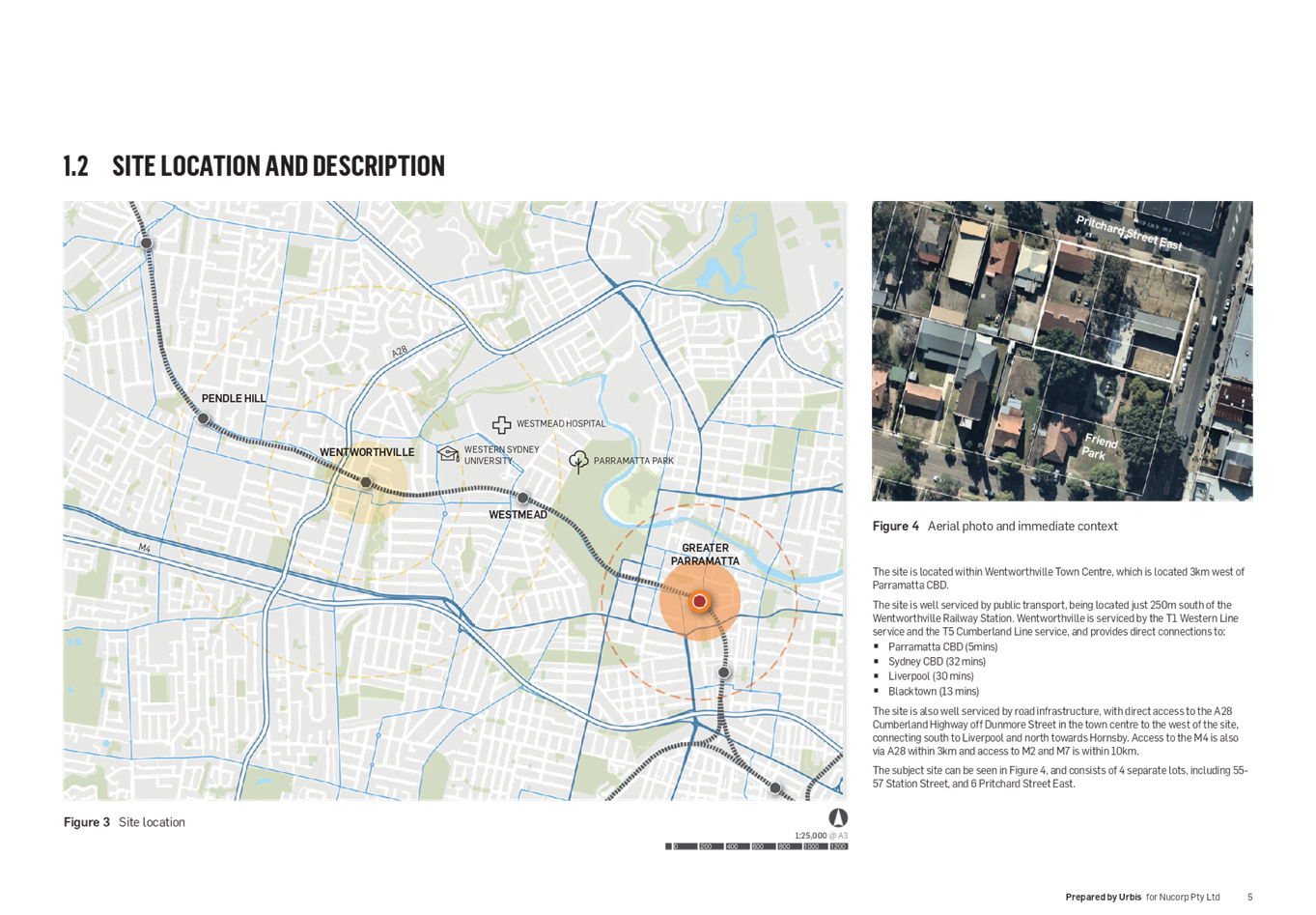
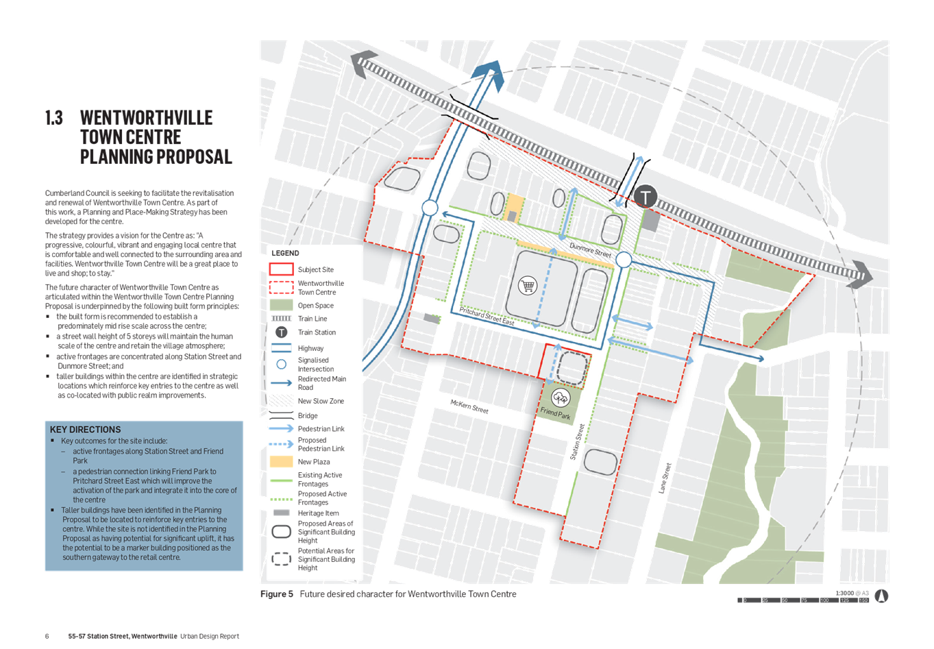
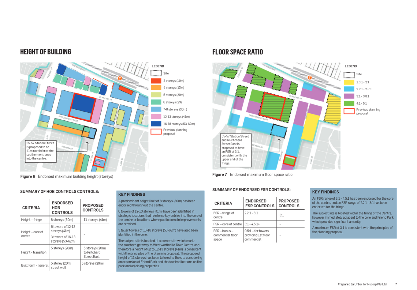
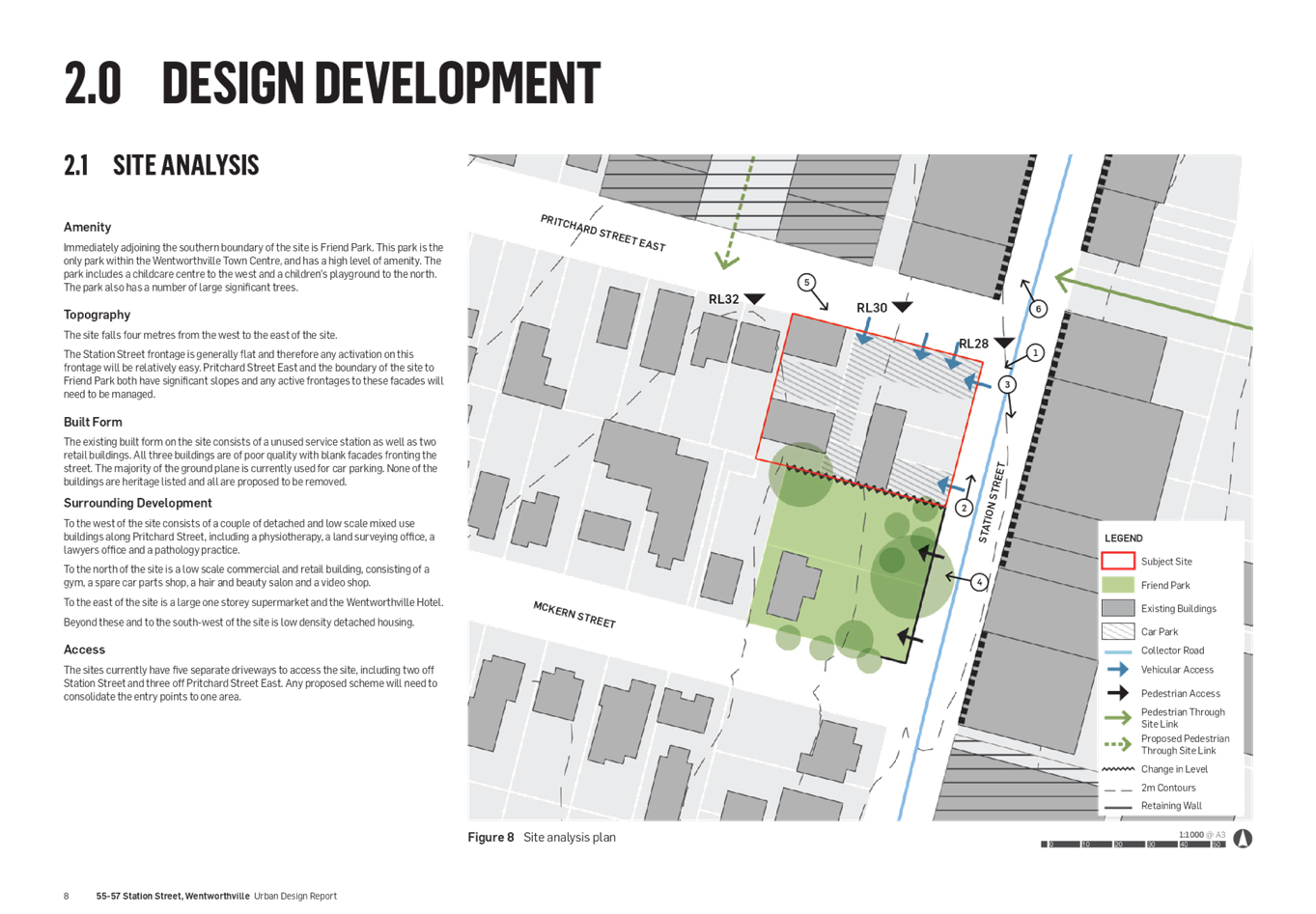
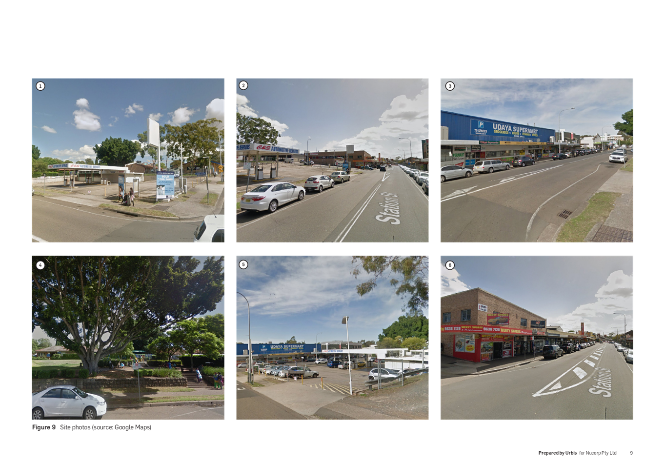
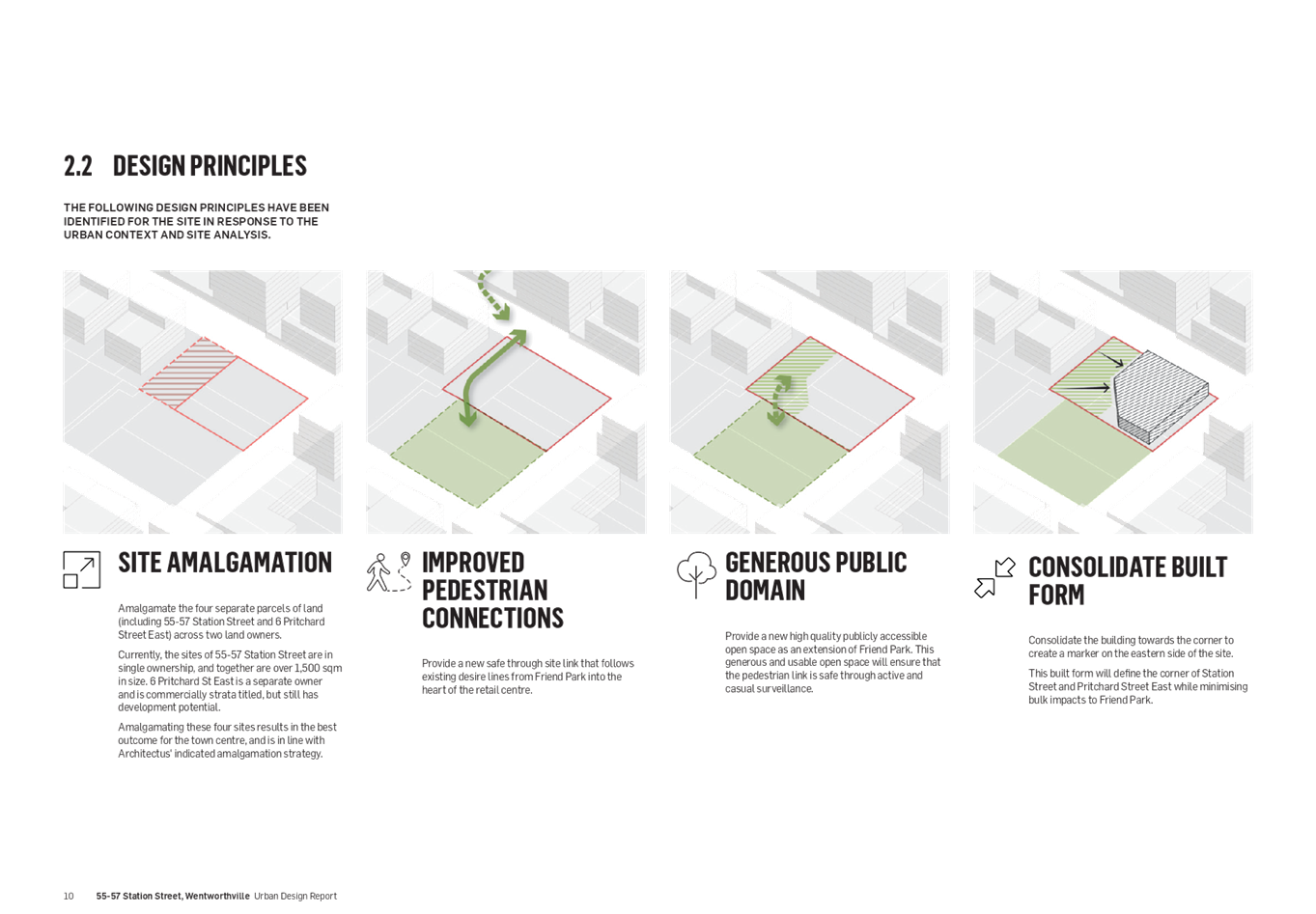
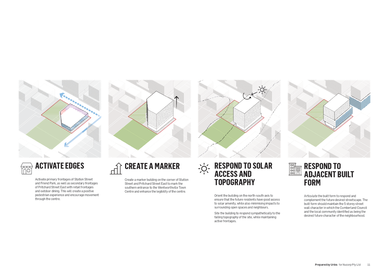
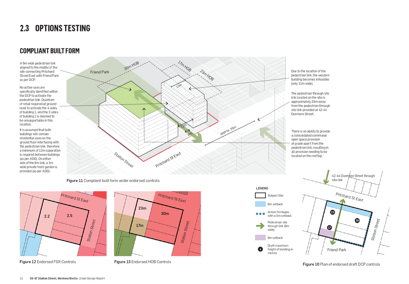
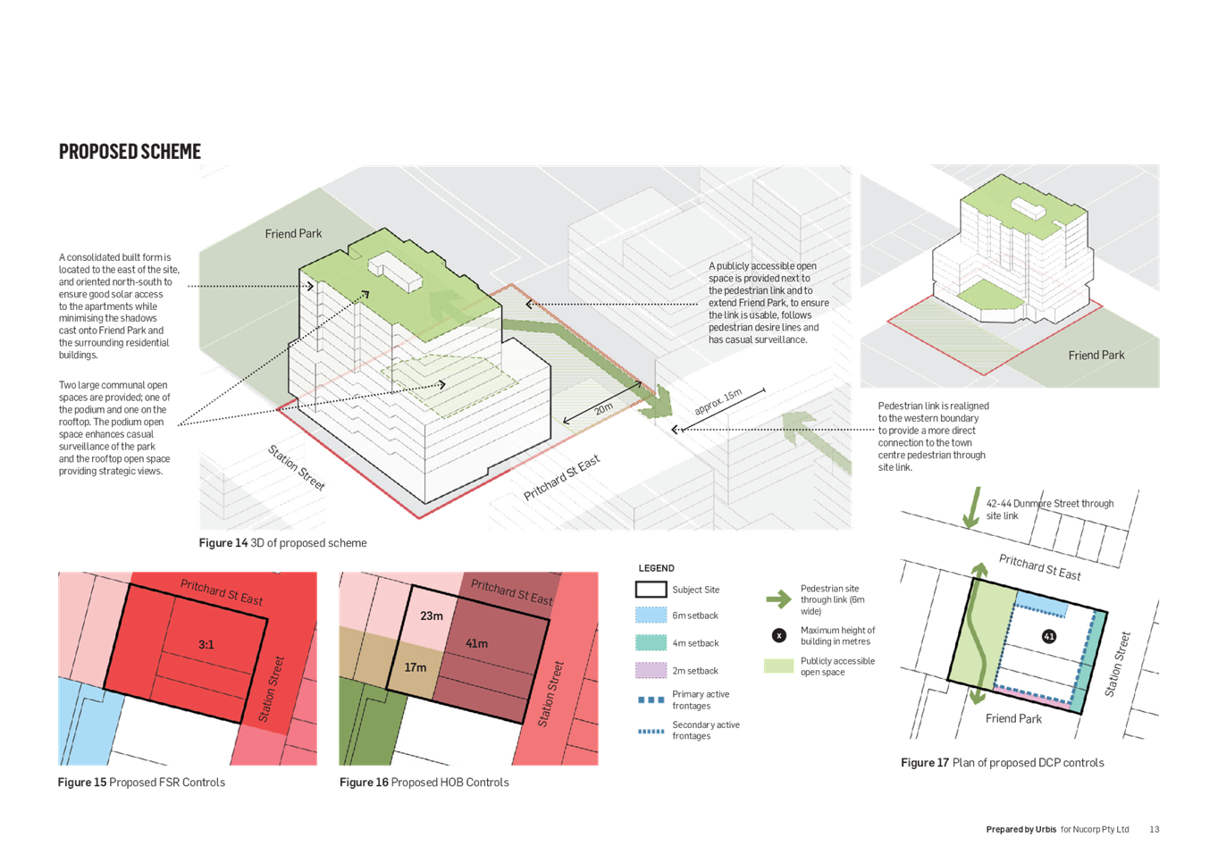
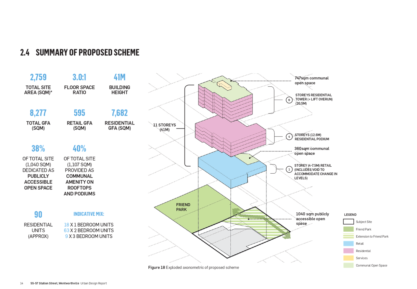
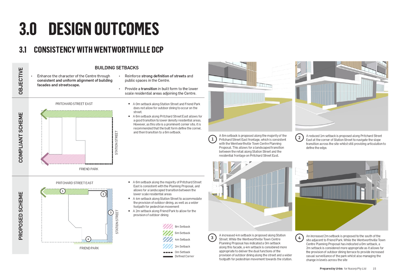
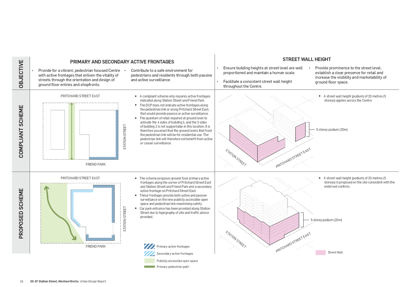
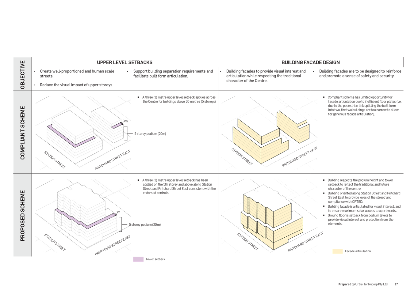
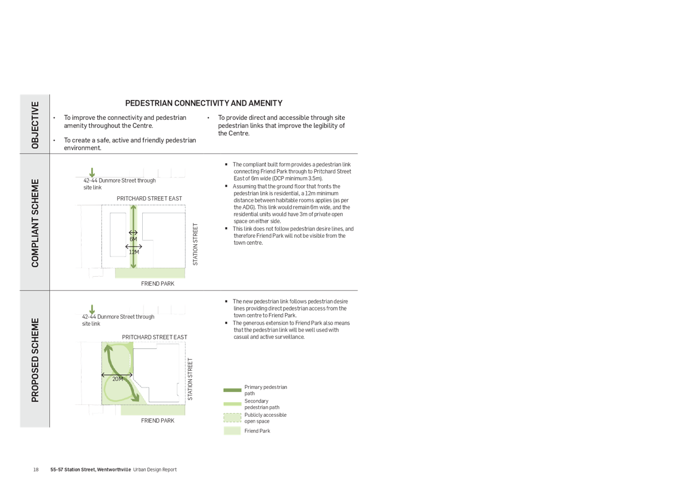
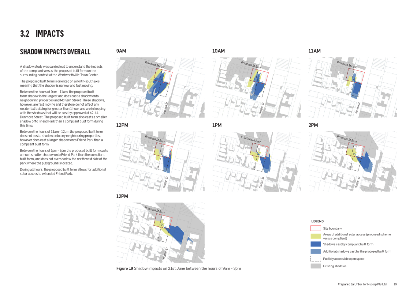
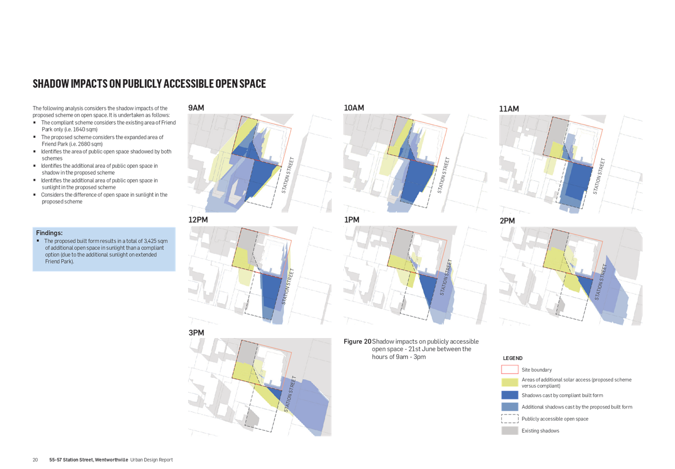
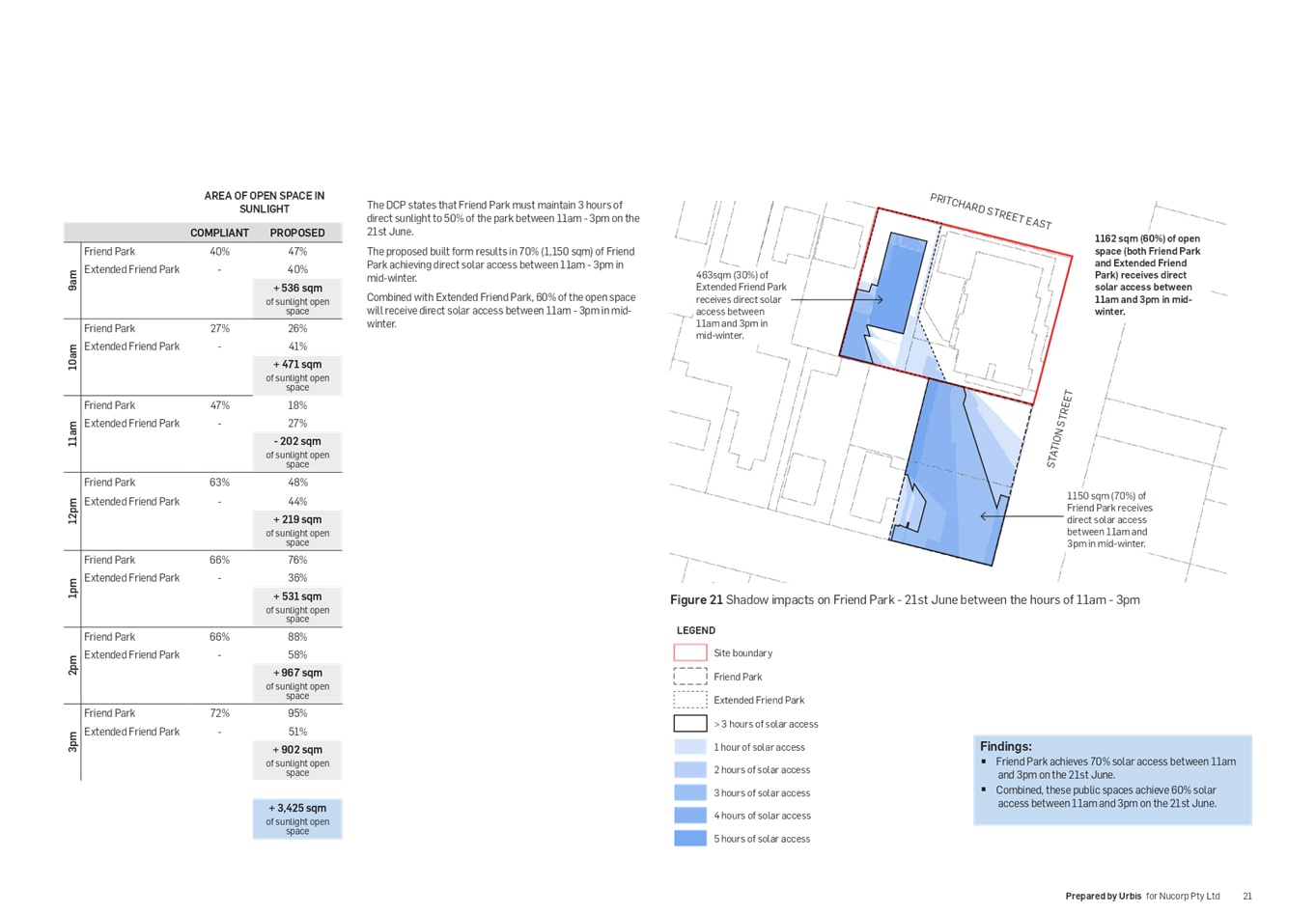
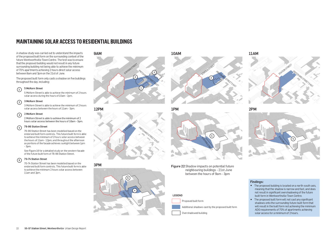
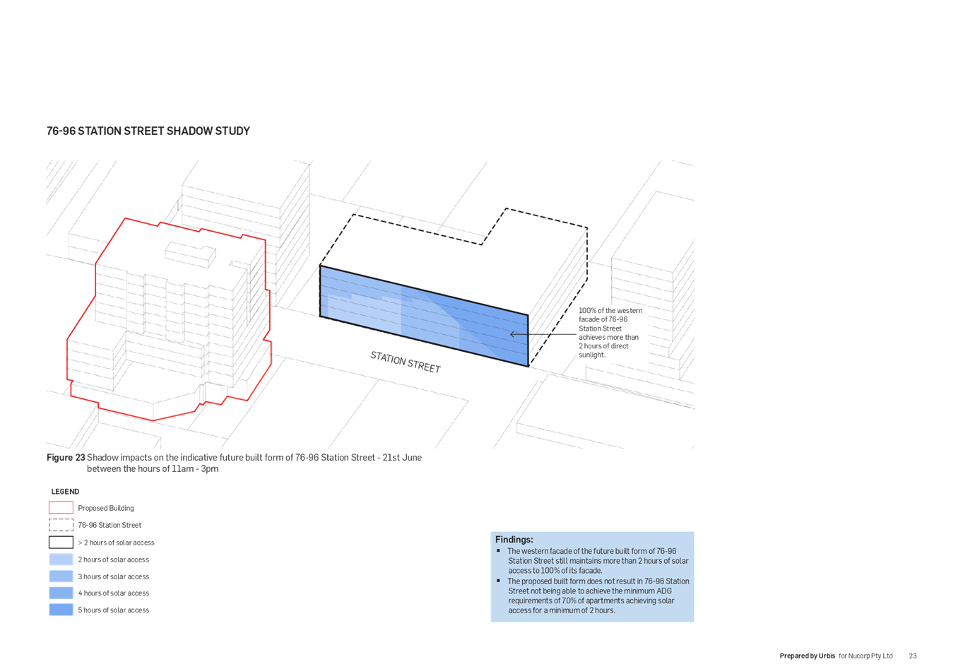
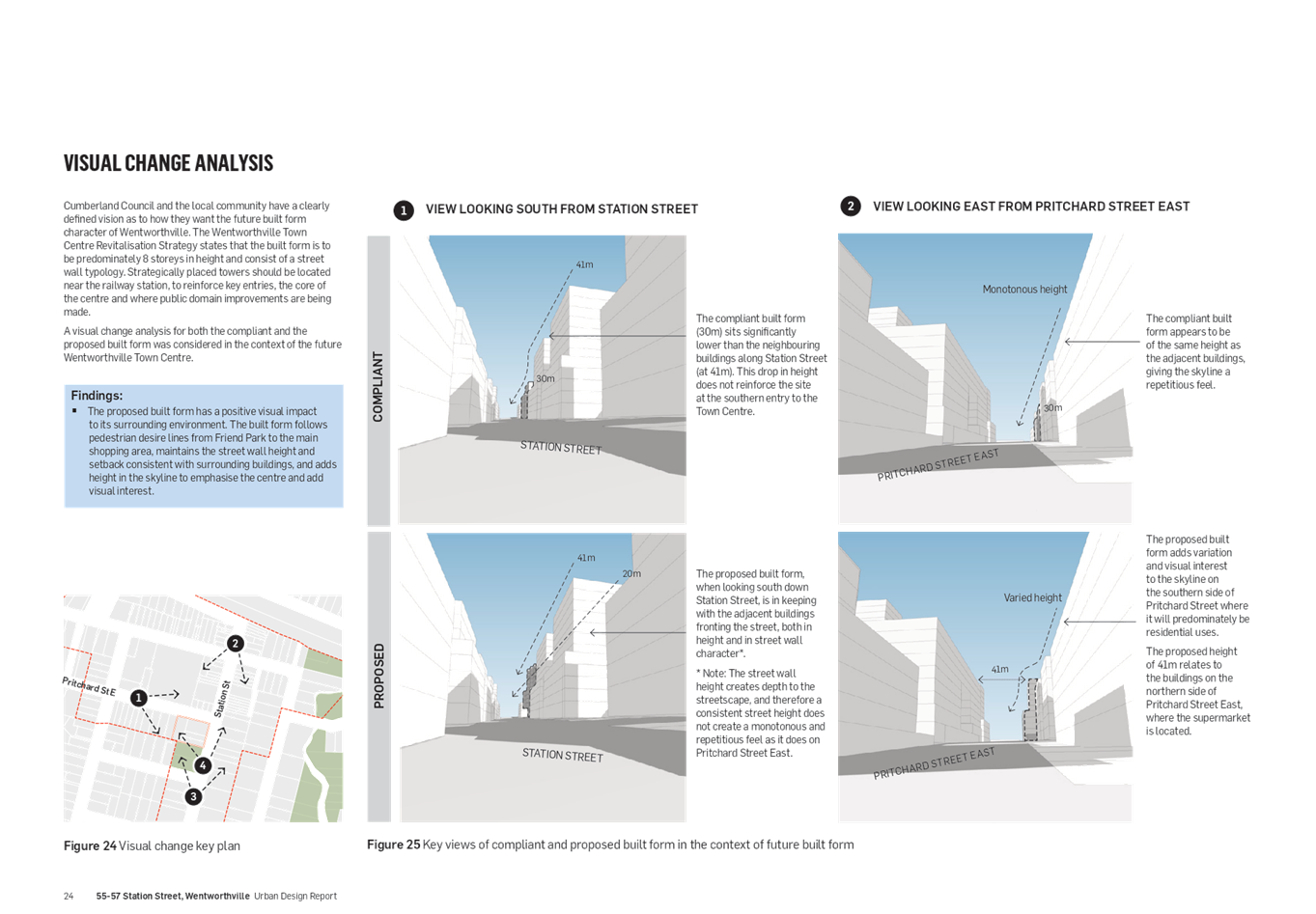
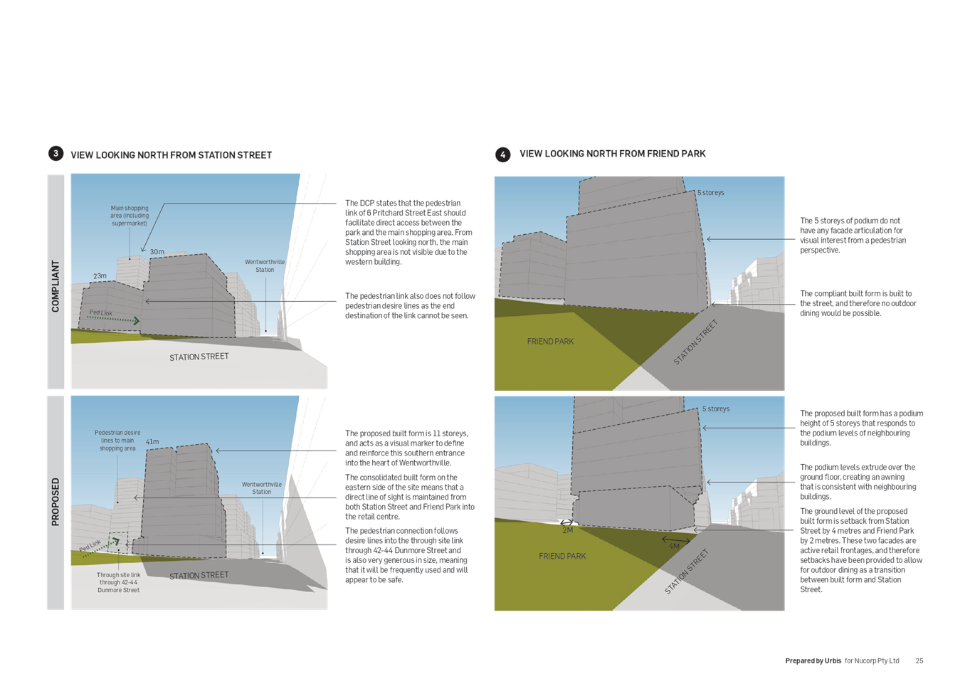

DOCUMENTS
ASSOCIATED WITH
REPORT ELPP070/19
Attachment 3
Letter Of Intent
Extraordinary Cumberland Local Planning
Panel Meeting
5 November 2019
DOCUMENTS
ASSOCIATED WITH
REPORT ELPP070/19
Attachment 4
Traffic and Parking Assessment
Extraordinary Cumberland Local Planning
Panel Meeting
5 November 2019

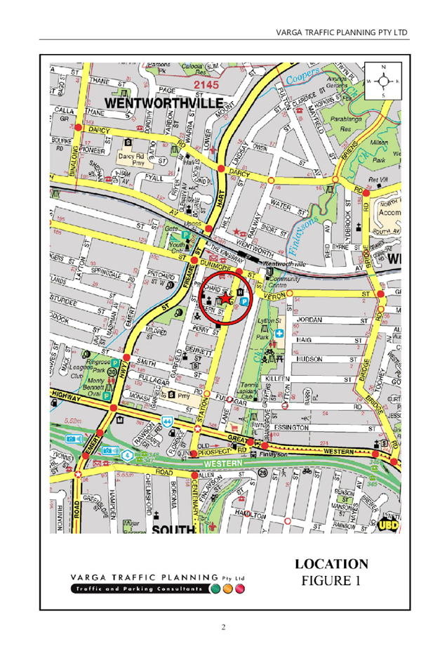
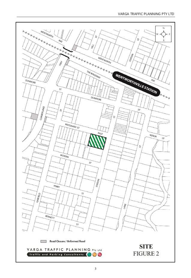
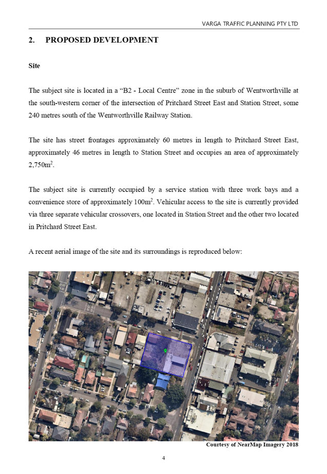

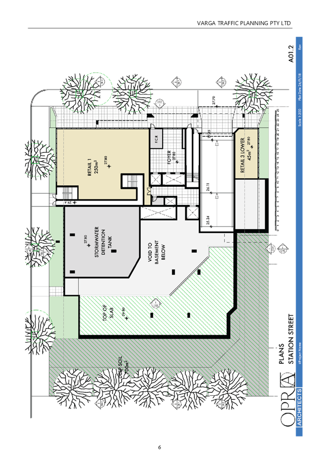
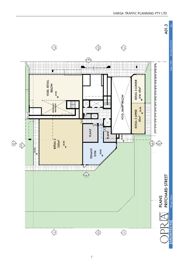
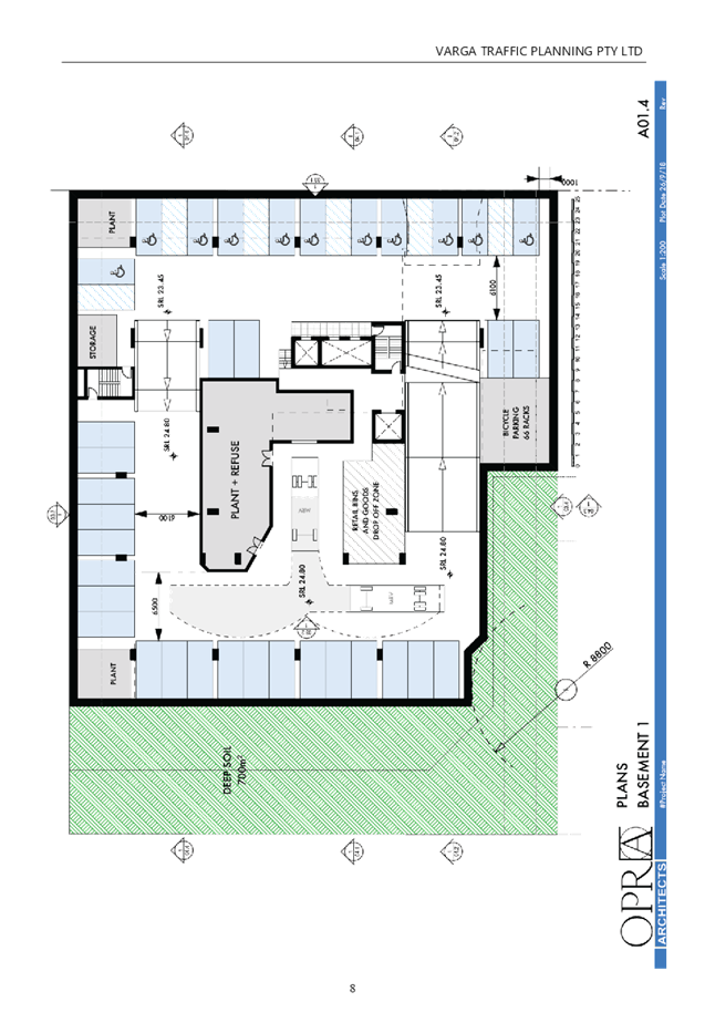
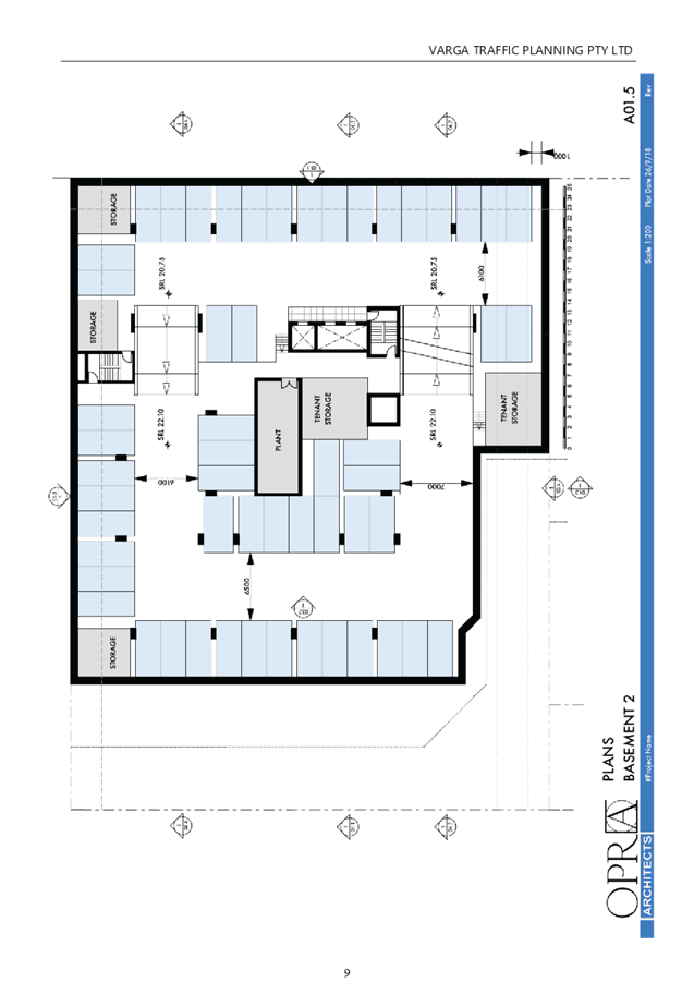
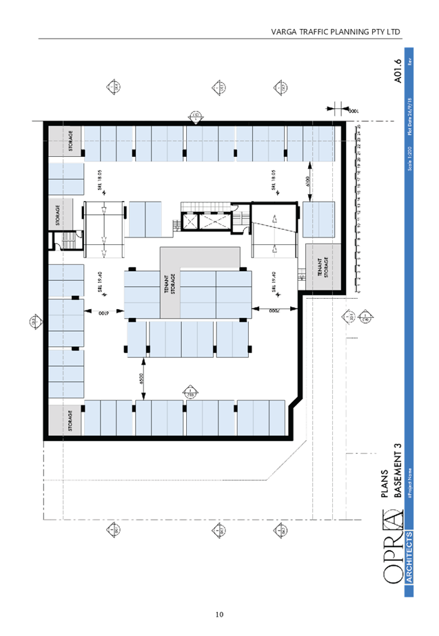
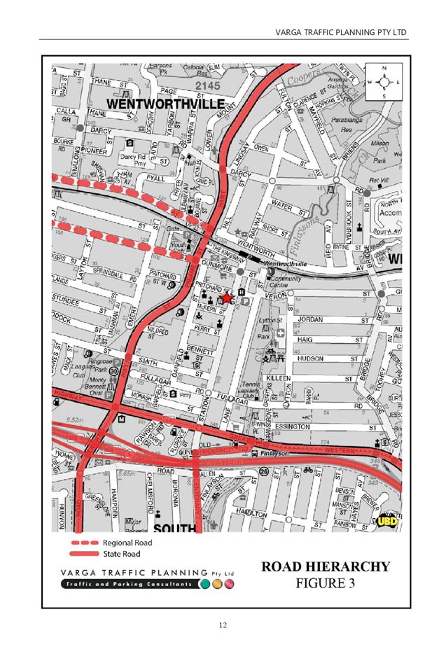
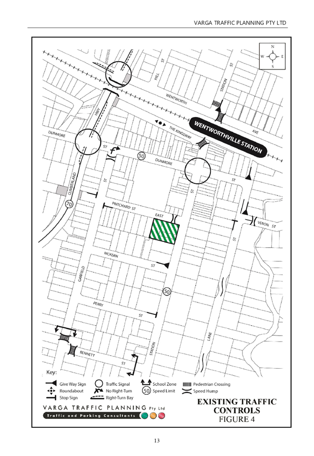

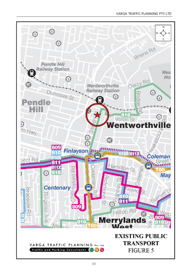


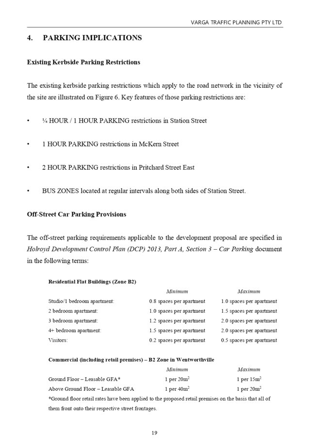
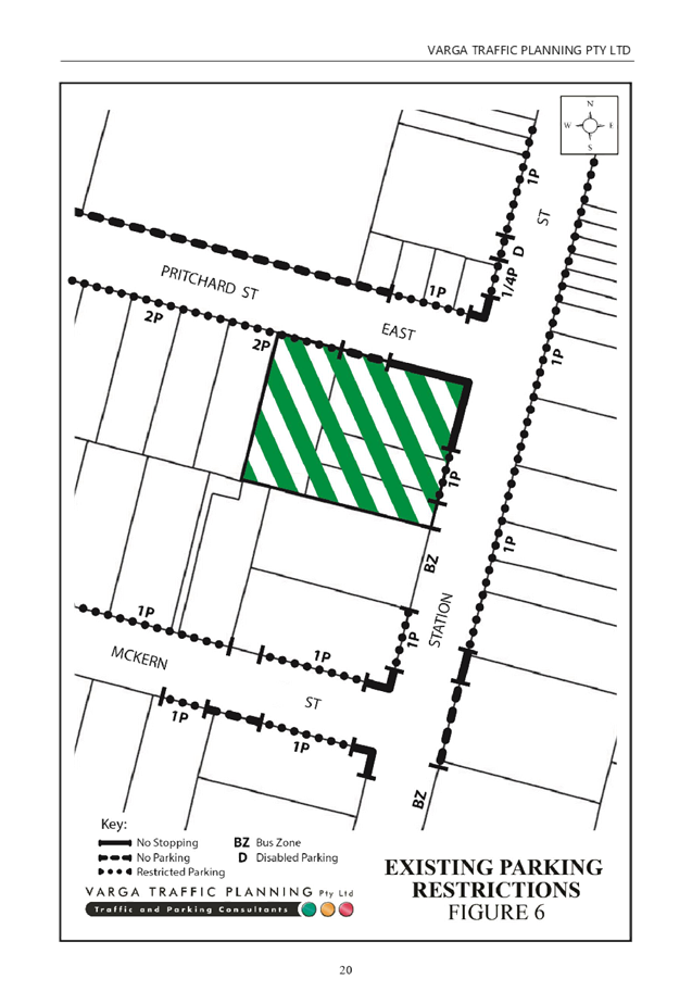

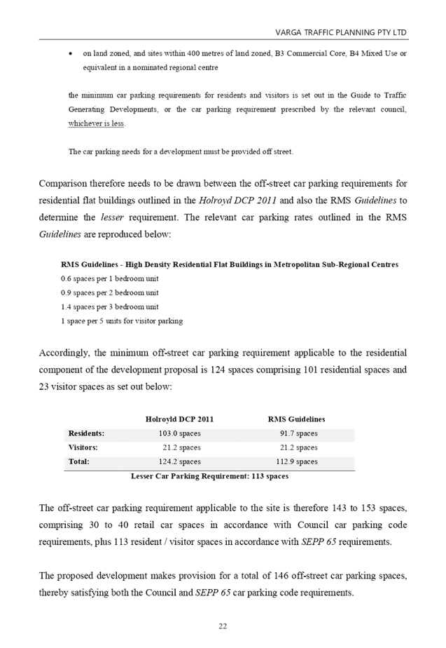


Extraordinary Cumberland Local Planning
Panel Meeting
5 November 2019
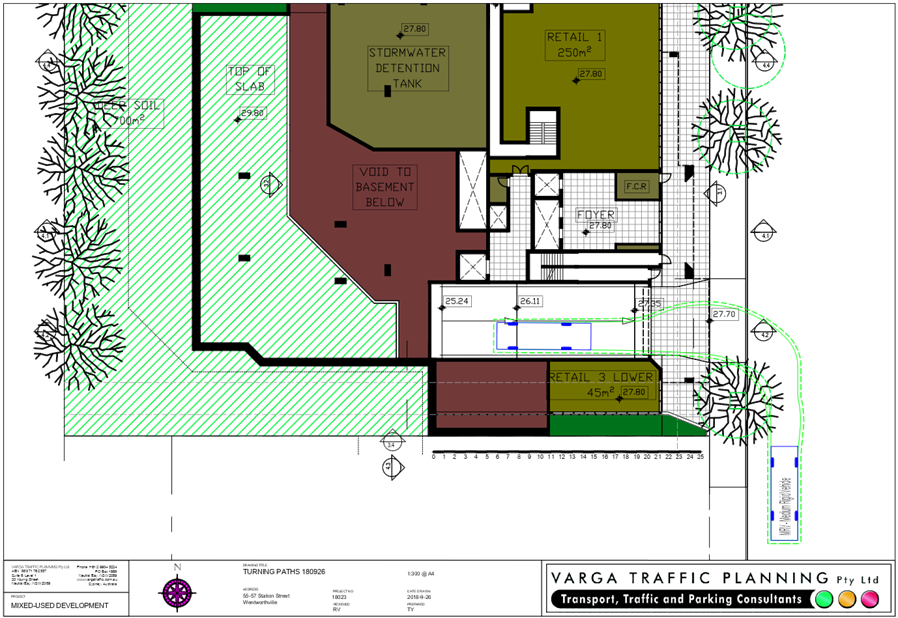
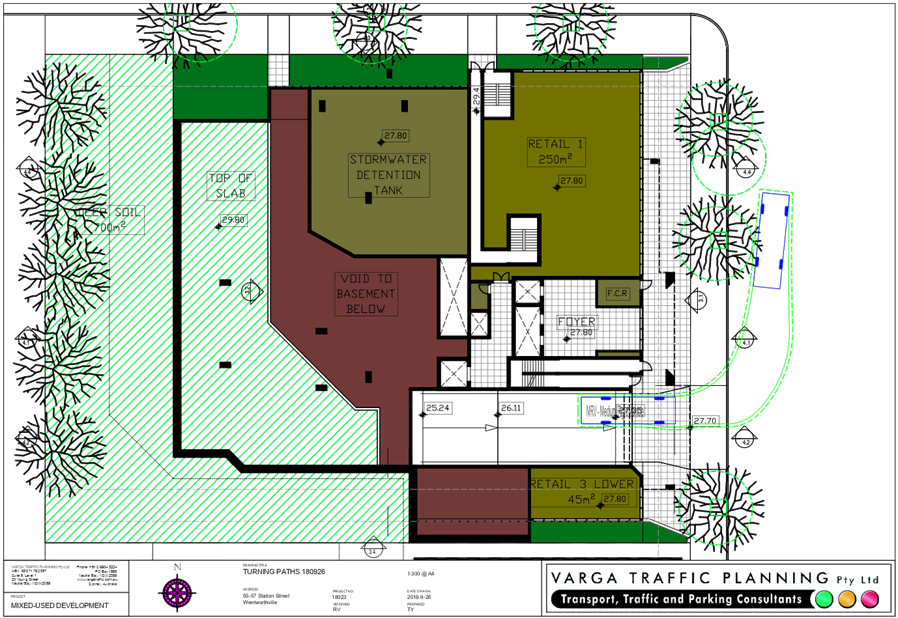
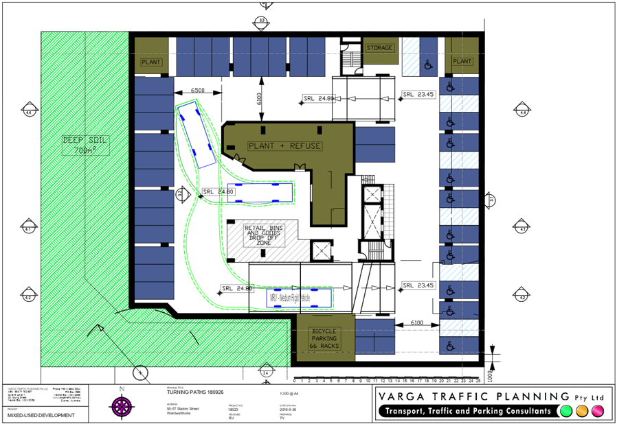
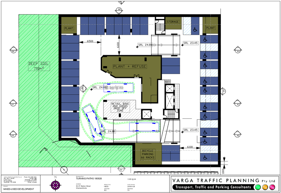
DOCUMENTS
ASSOCIATED WITH
REPORT ELPP070/19
Attachment 5
Stage 1- Environmental Site Assessment
Extraordinary Cumberland Local Planning
Panel Meeting
5 November 2019

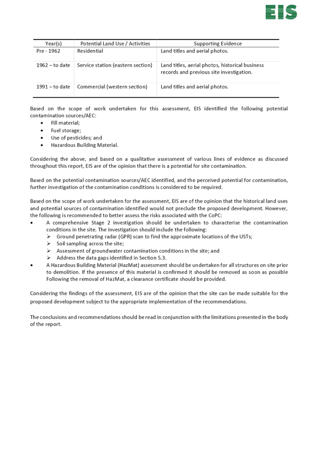


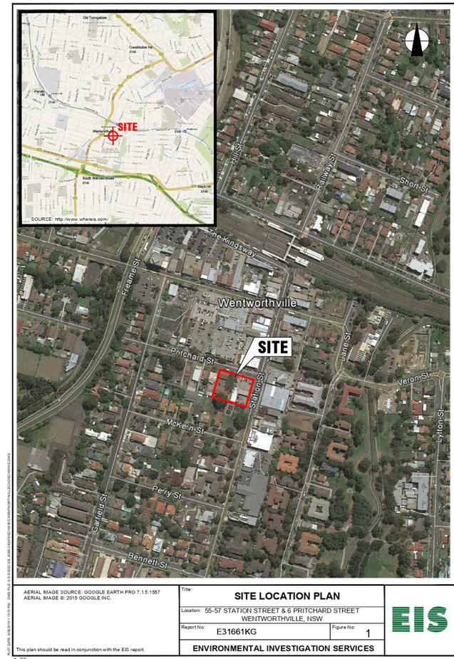
Extraordinary Cumberland Local Planning
Panel Meeting
5 November 2019
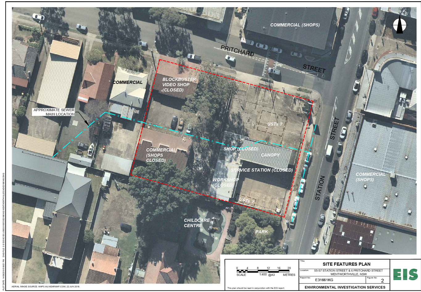
Extraordinary Cumberland Local Planning
Panel Meeting
5 November 2019


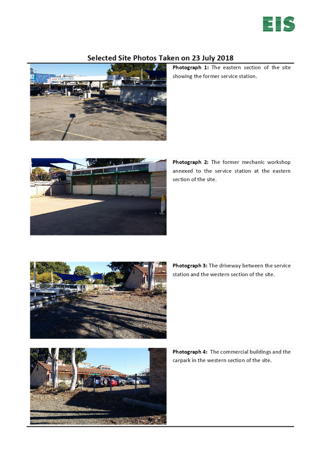
Extraordinary Cumberland Local Planning
Panel Meeting
5 November 2019
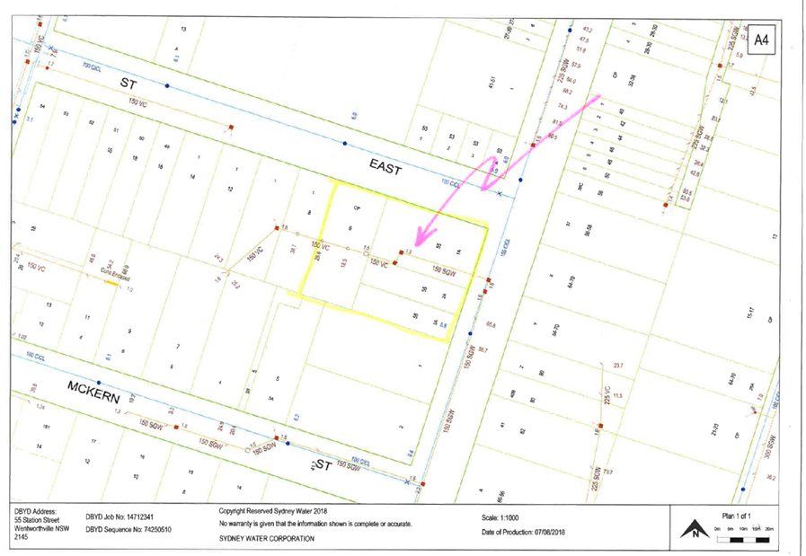
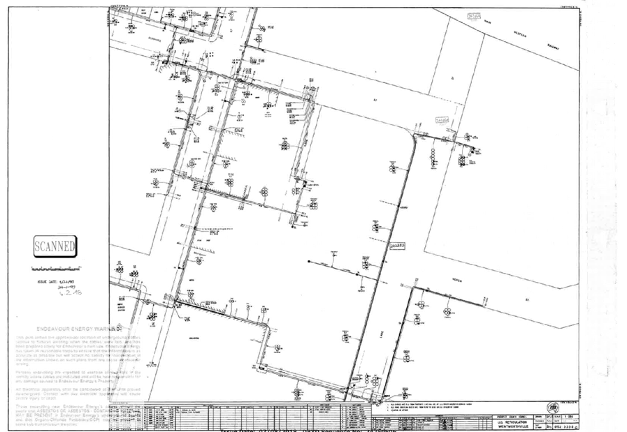

Extraordinary Cumberland Local Planning
Panel Meeting
5 November 2019


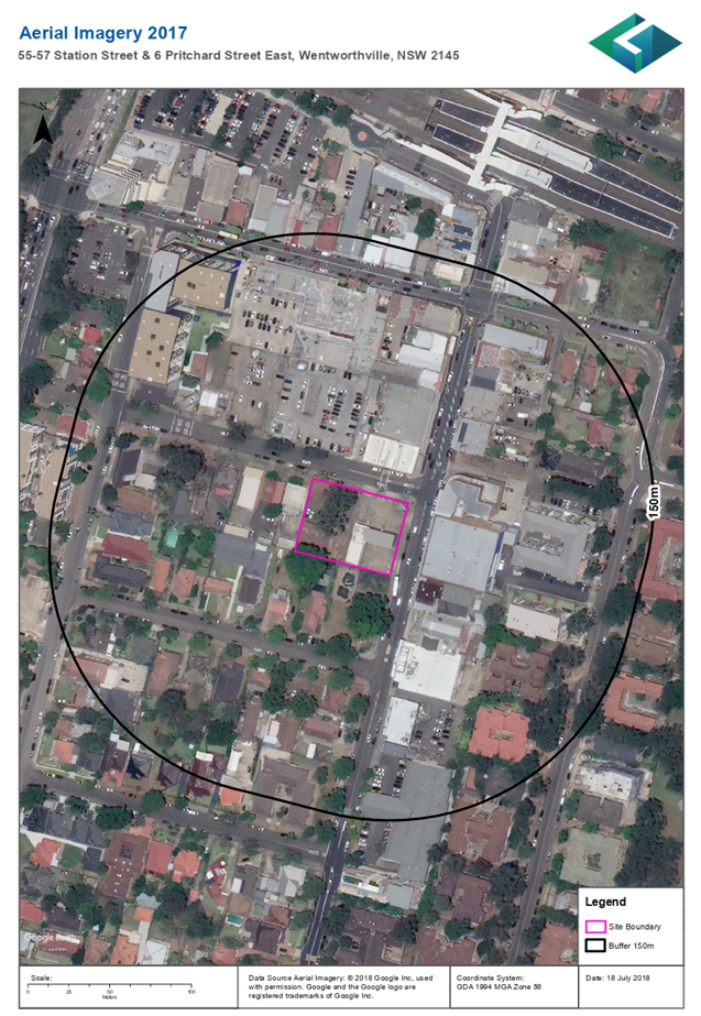
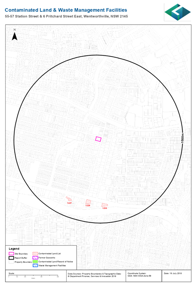
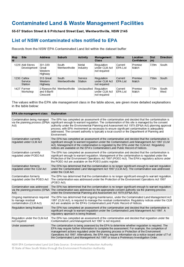
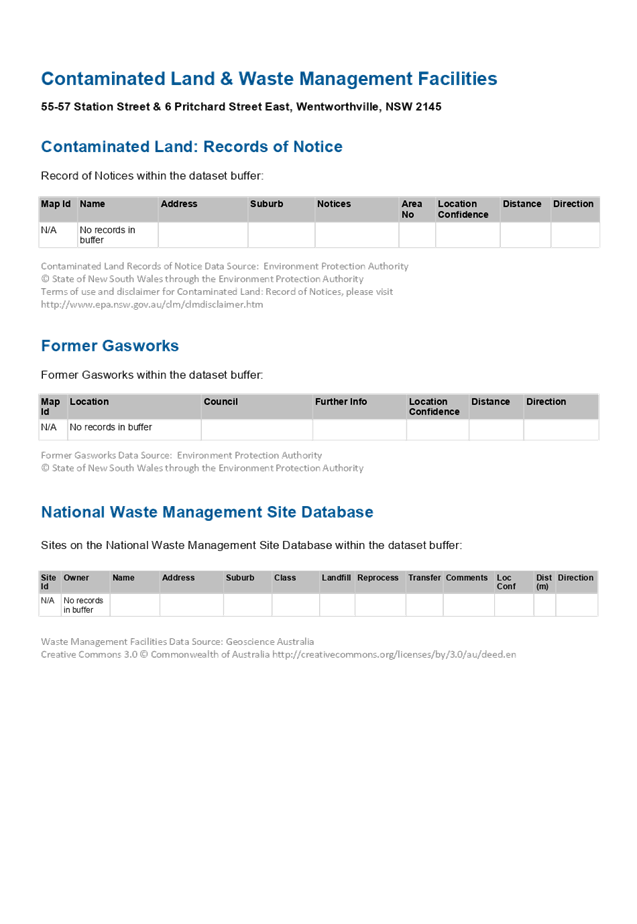


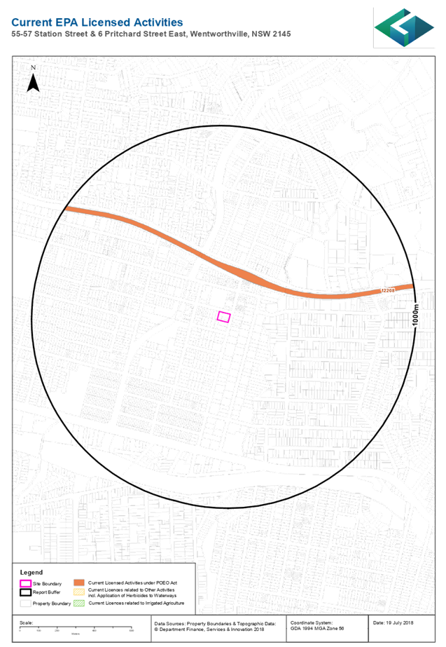

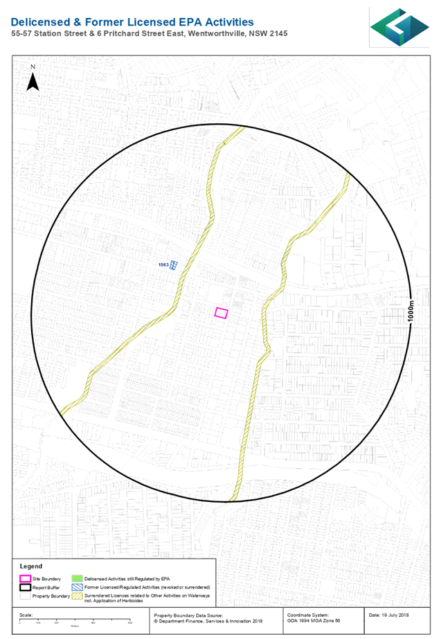
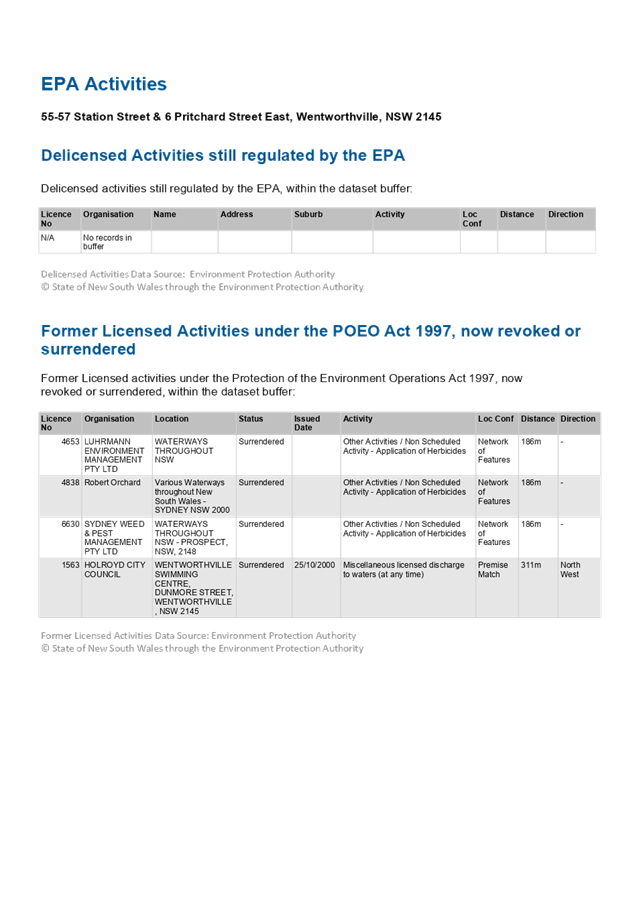
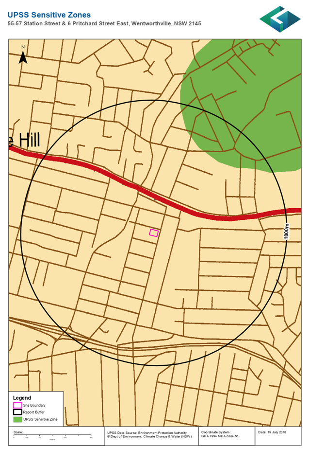
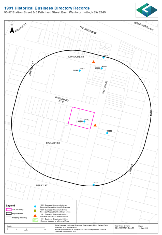
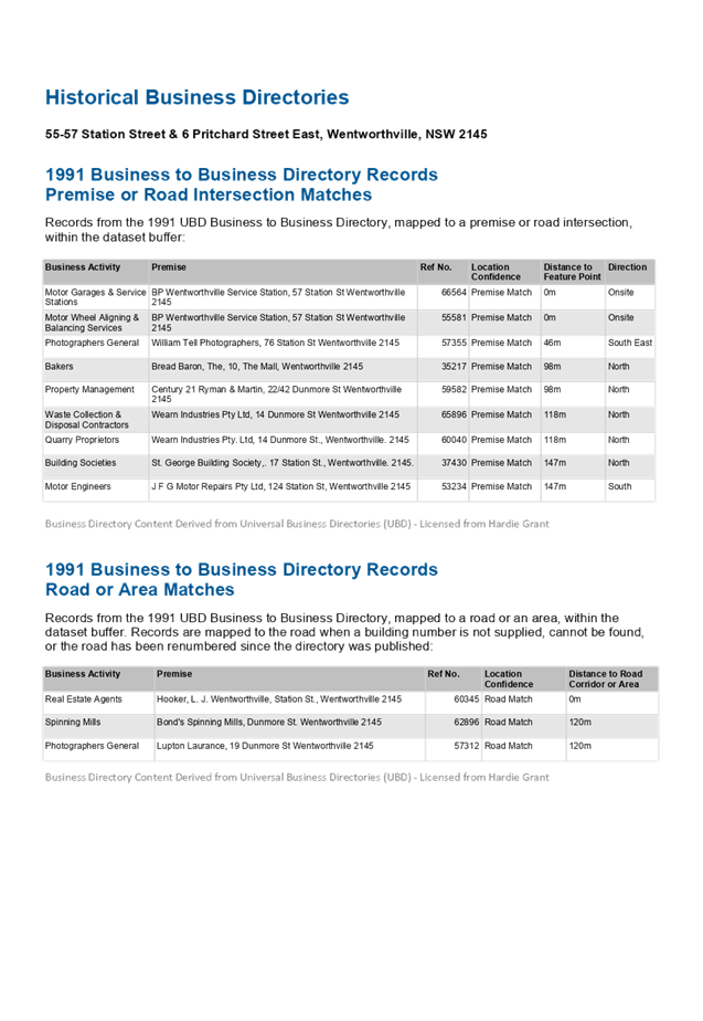
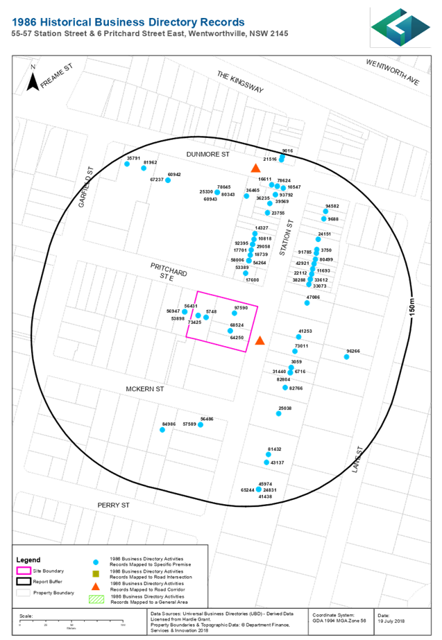
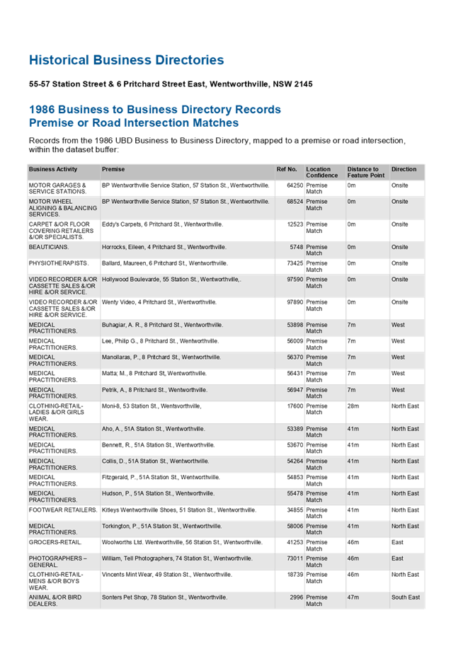
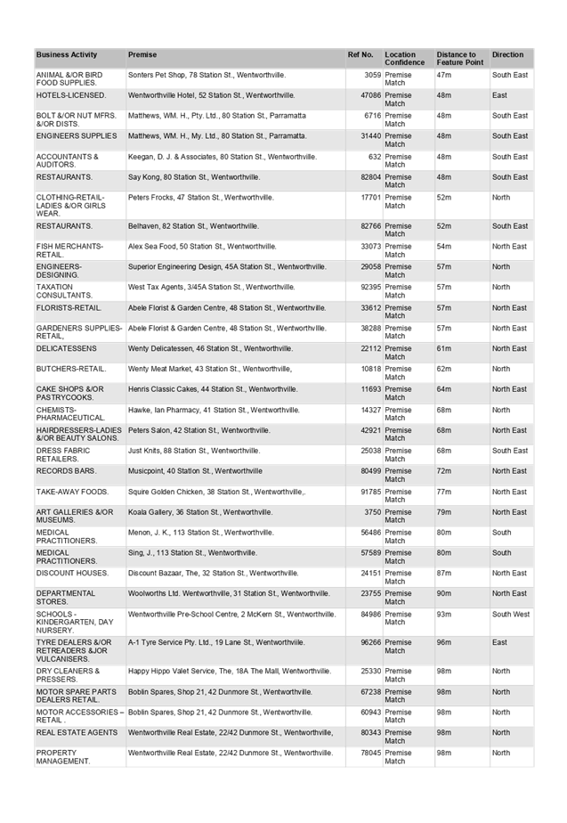
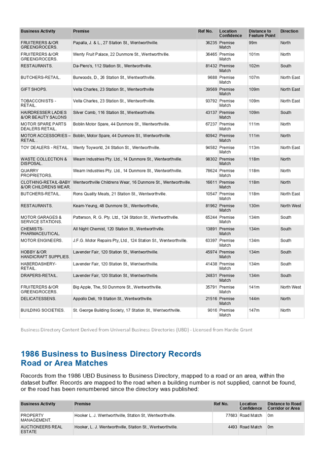

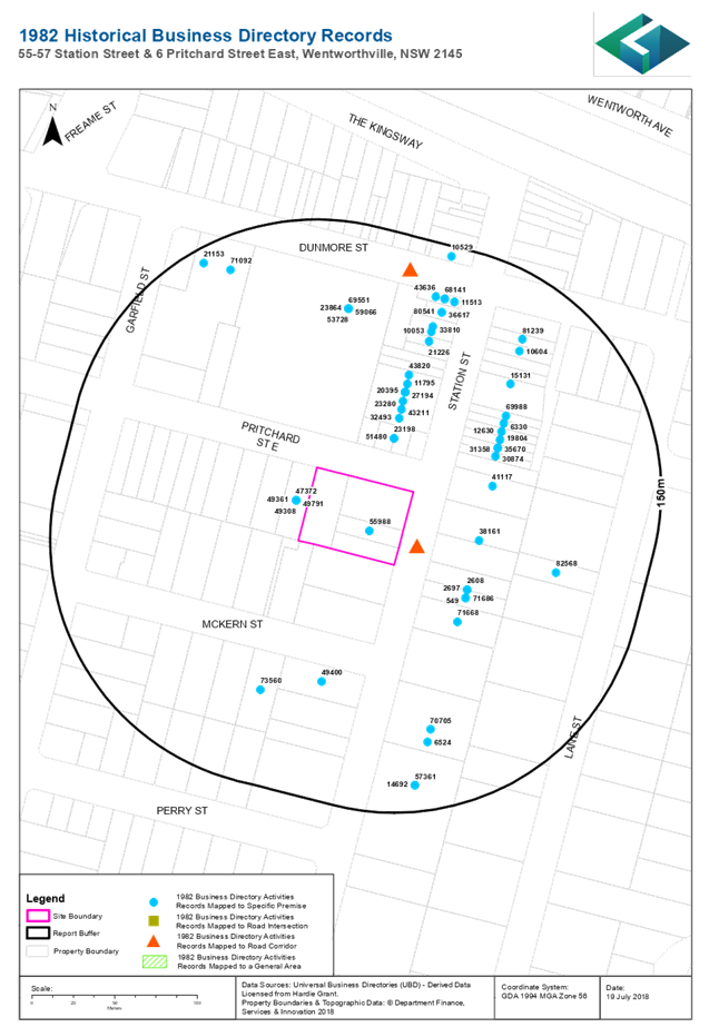
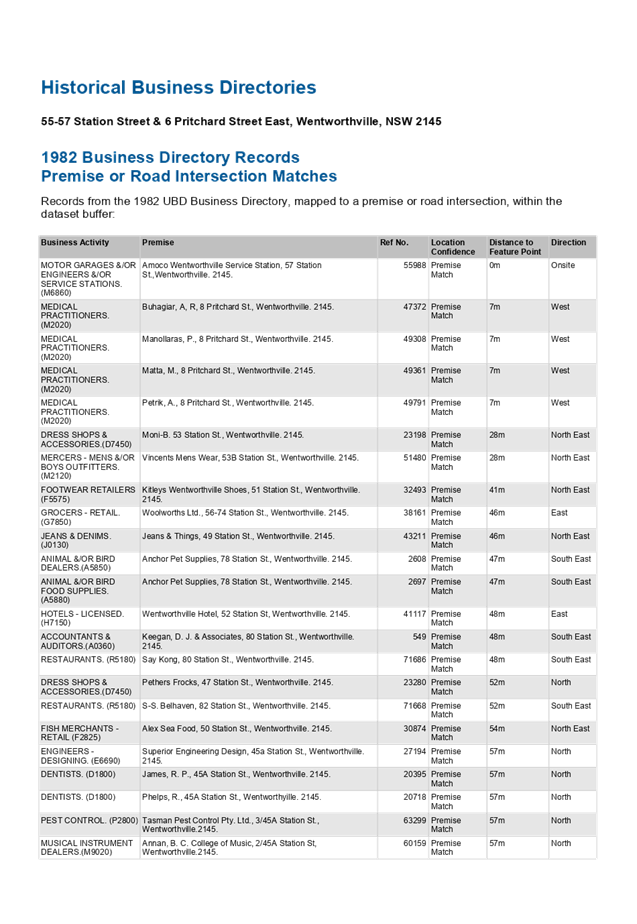
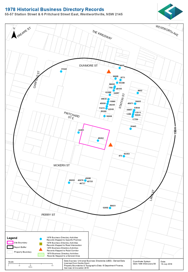
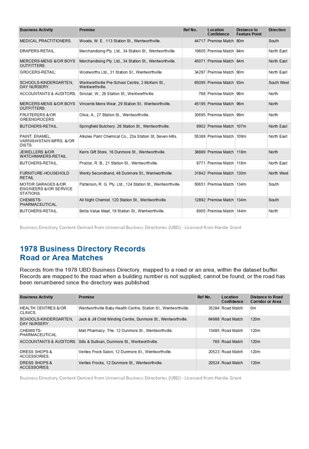
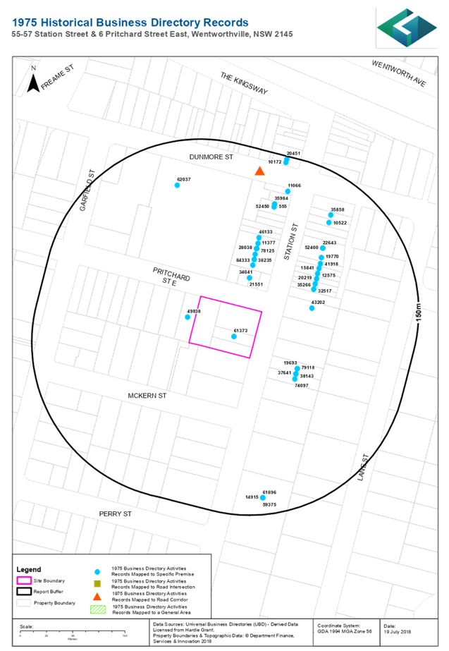
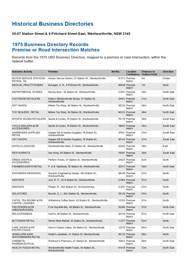
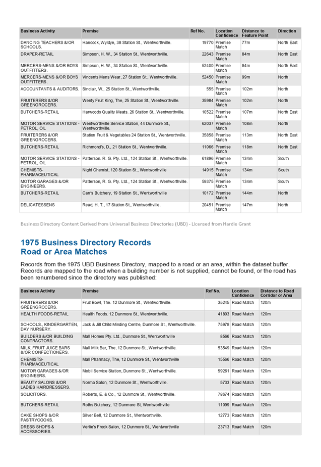

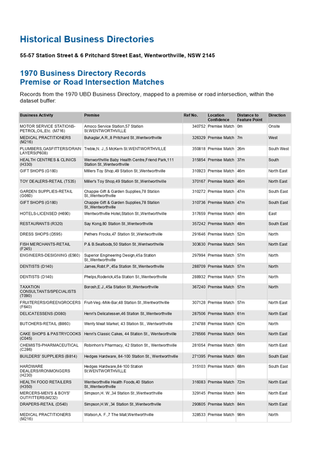

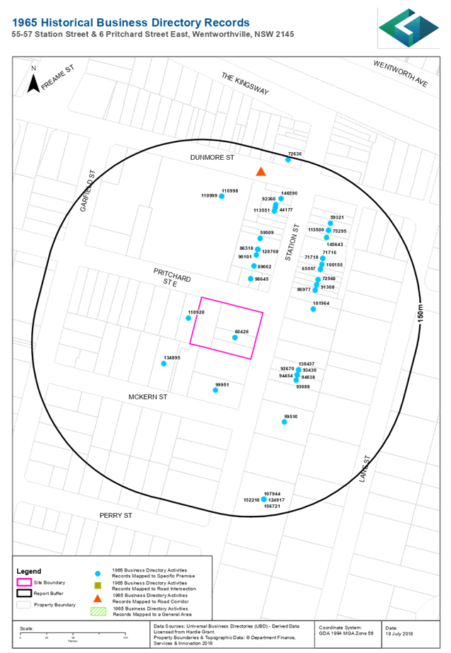
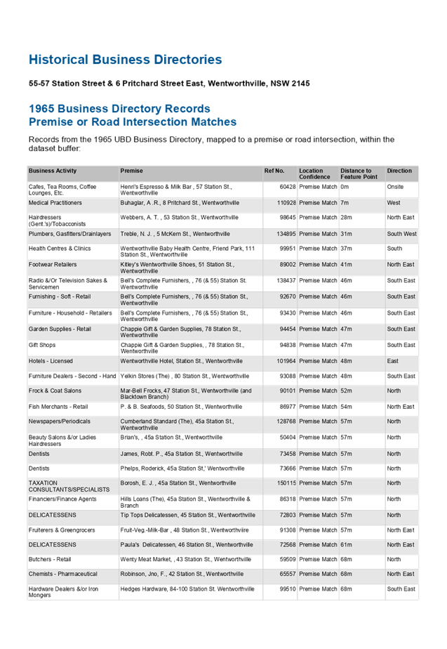
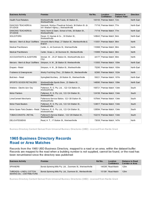
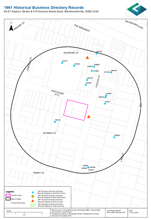


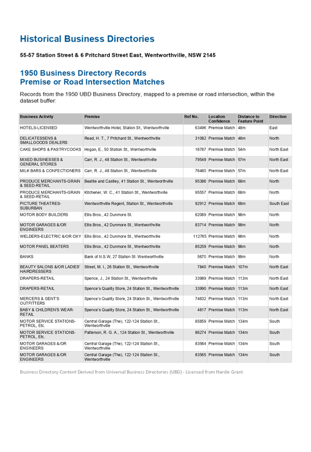
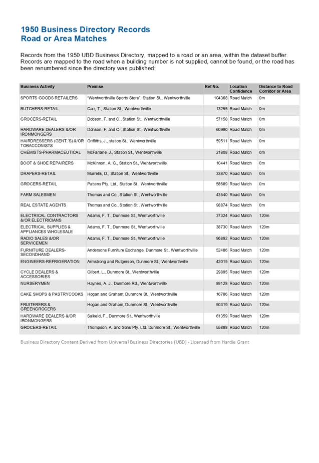
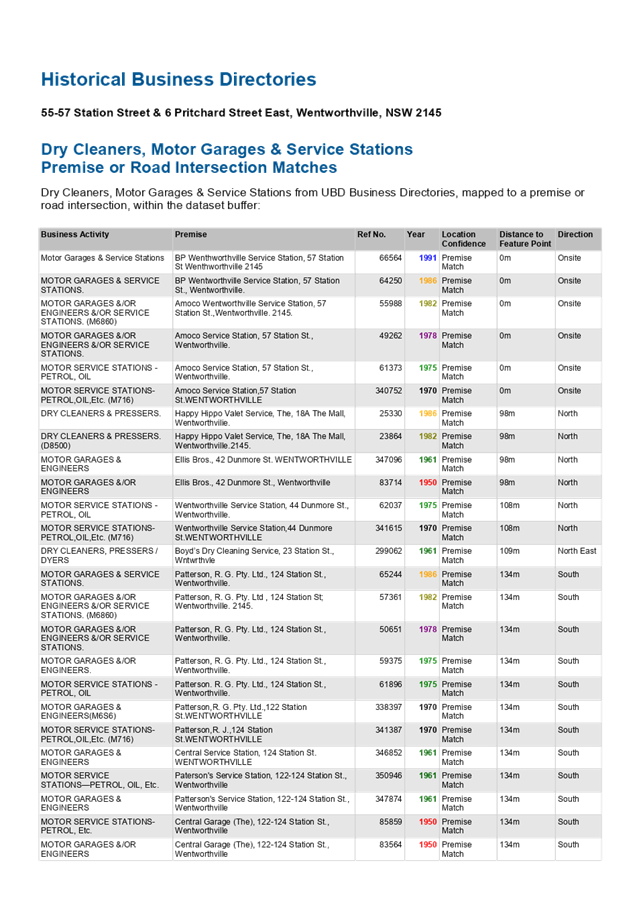
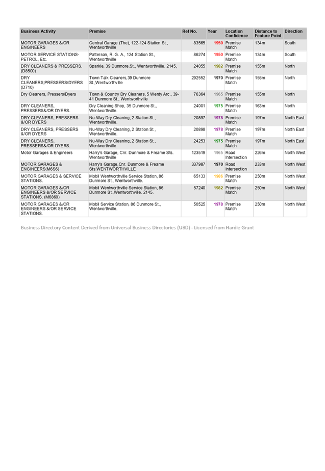
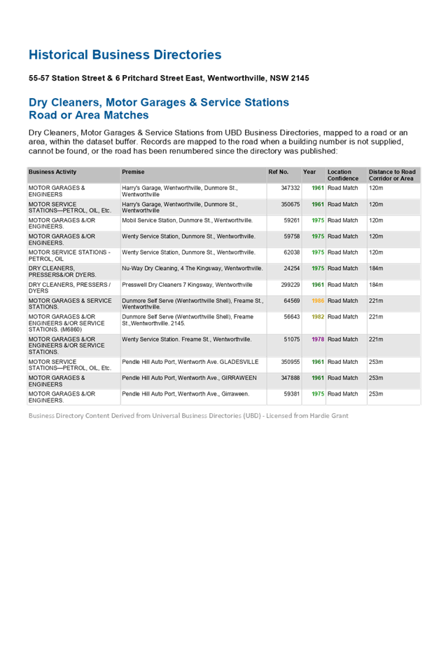
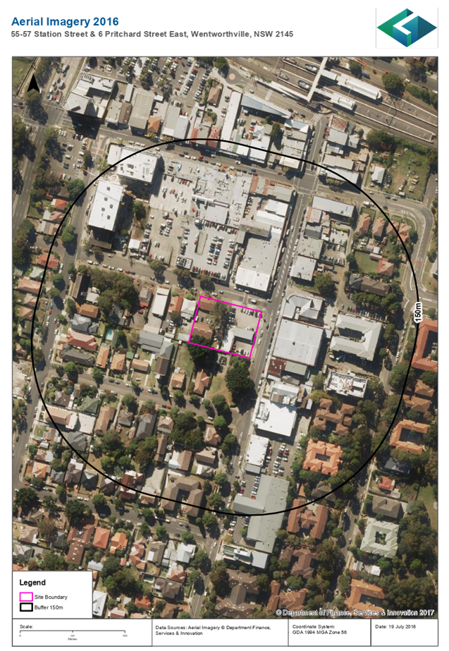
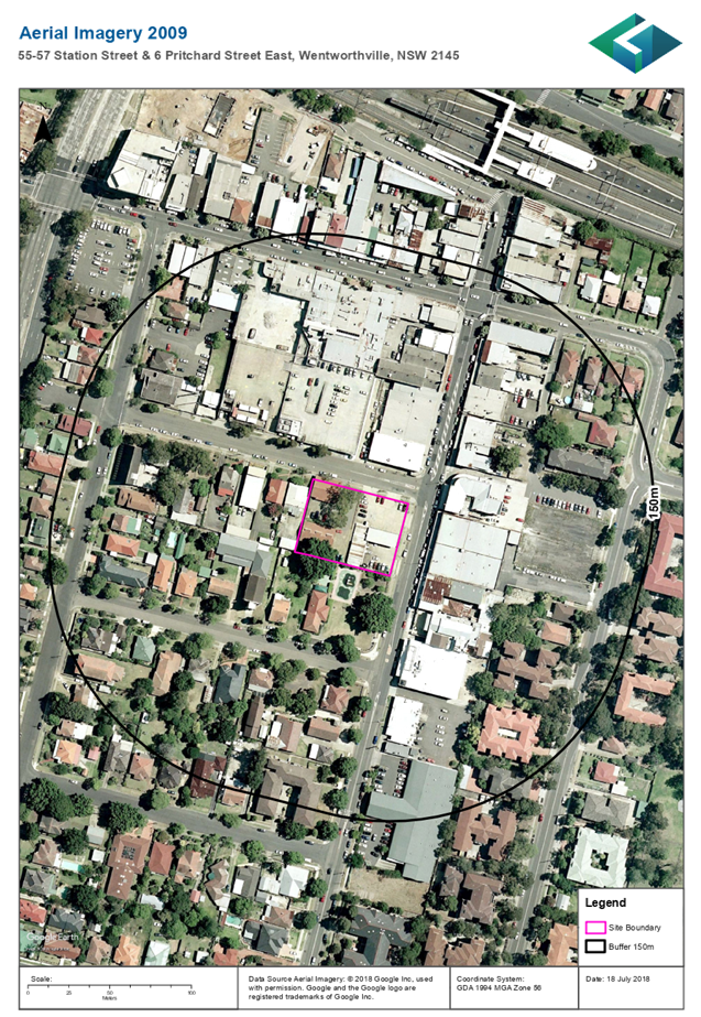
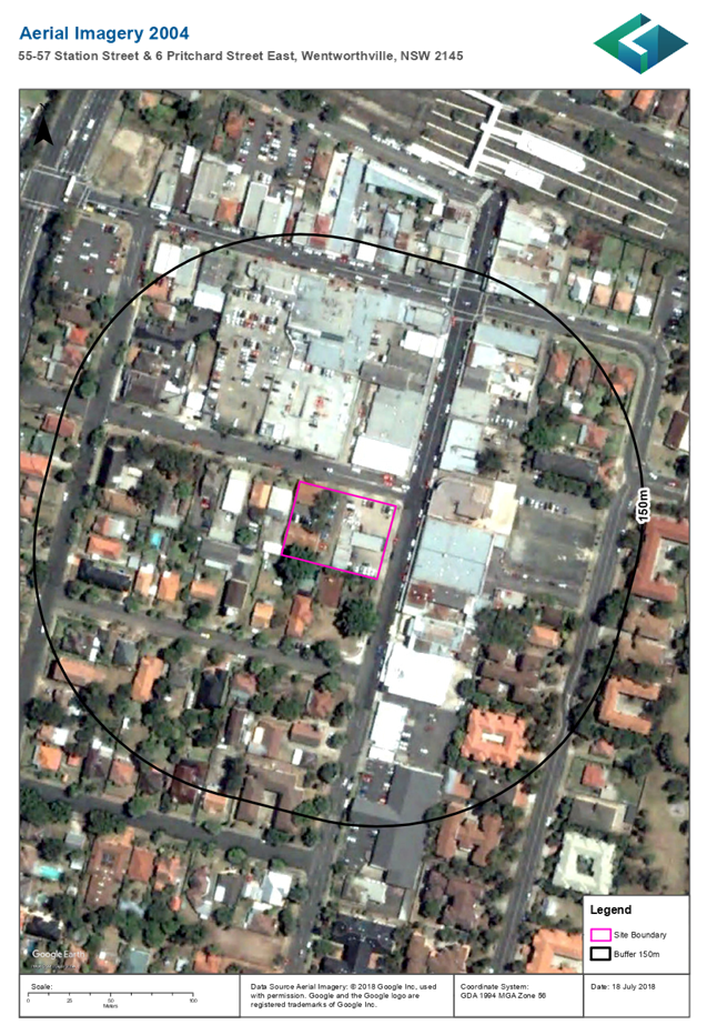
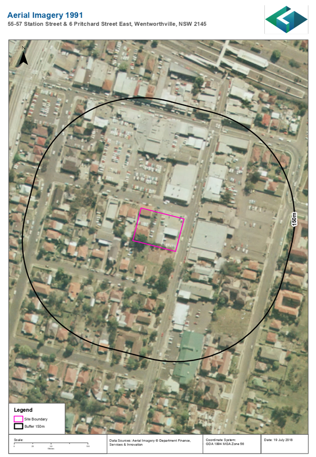
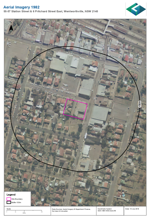
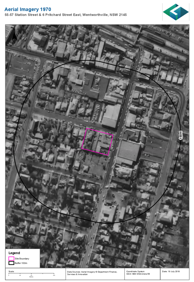
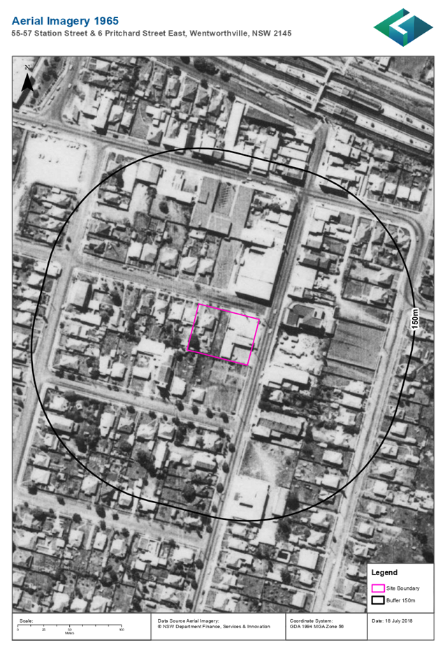
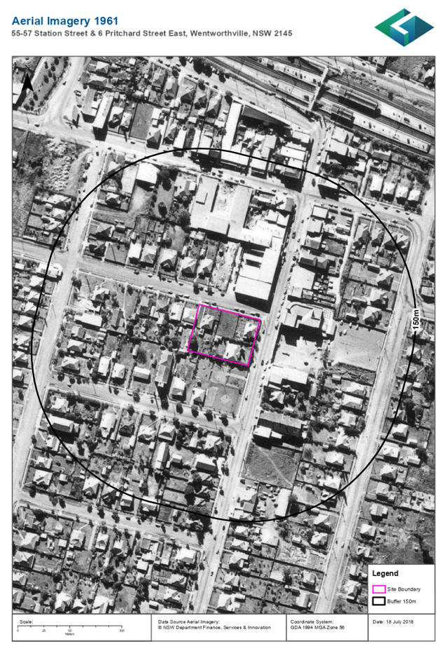
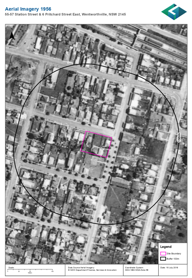
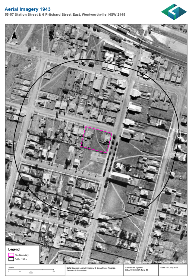
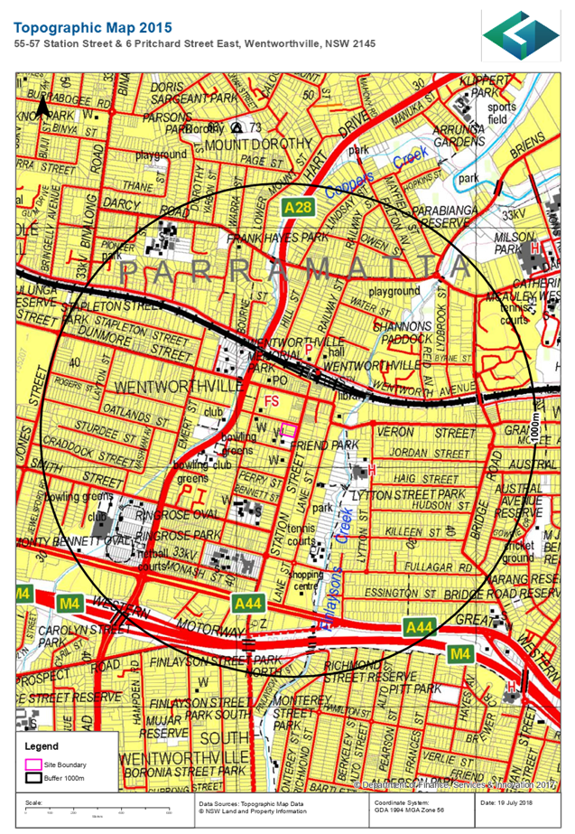
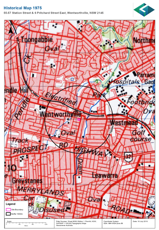

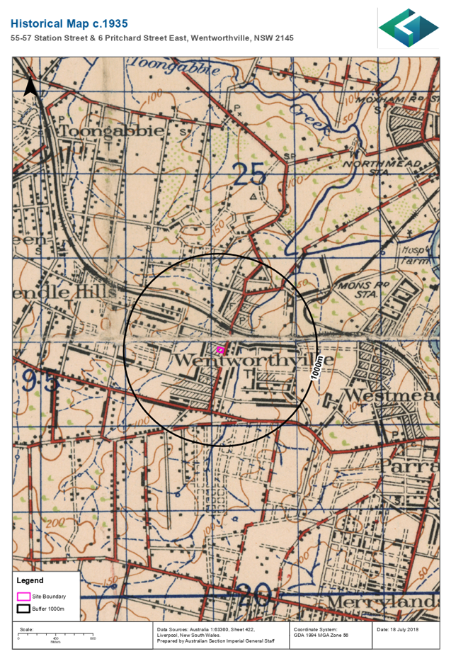
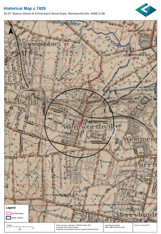
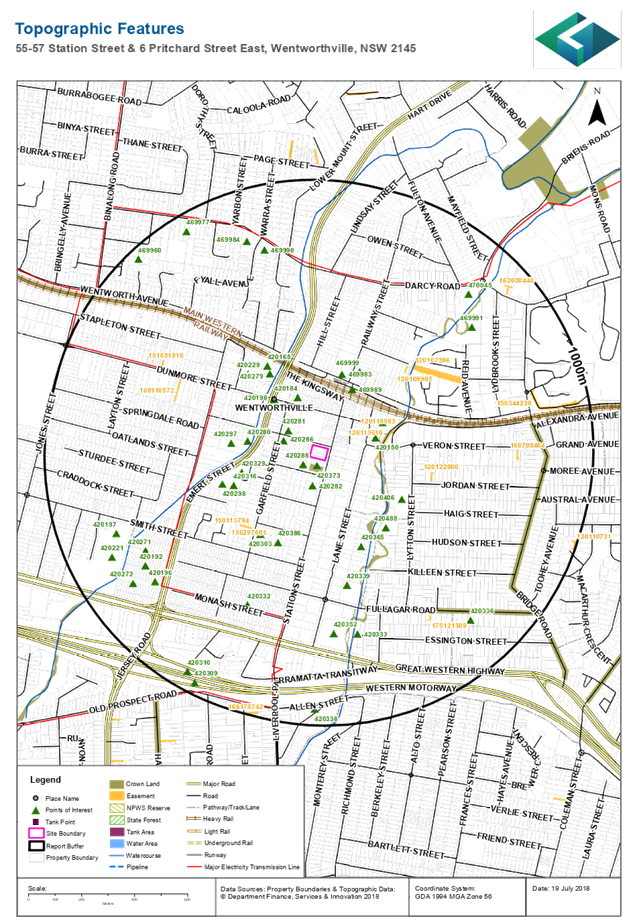


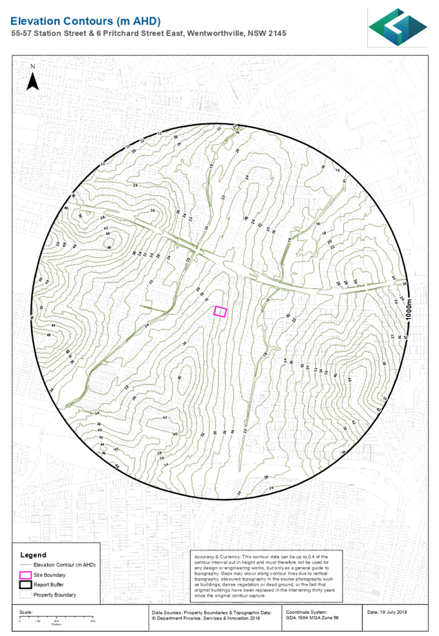

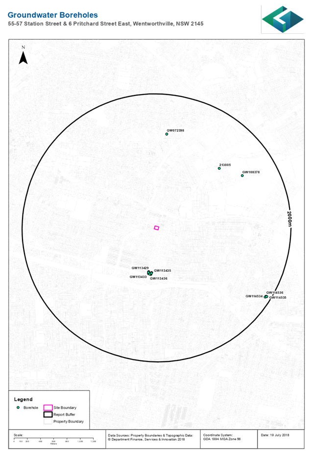

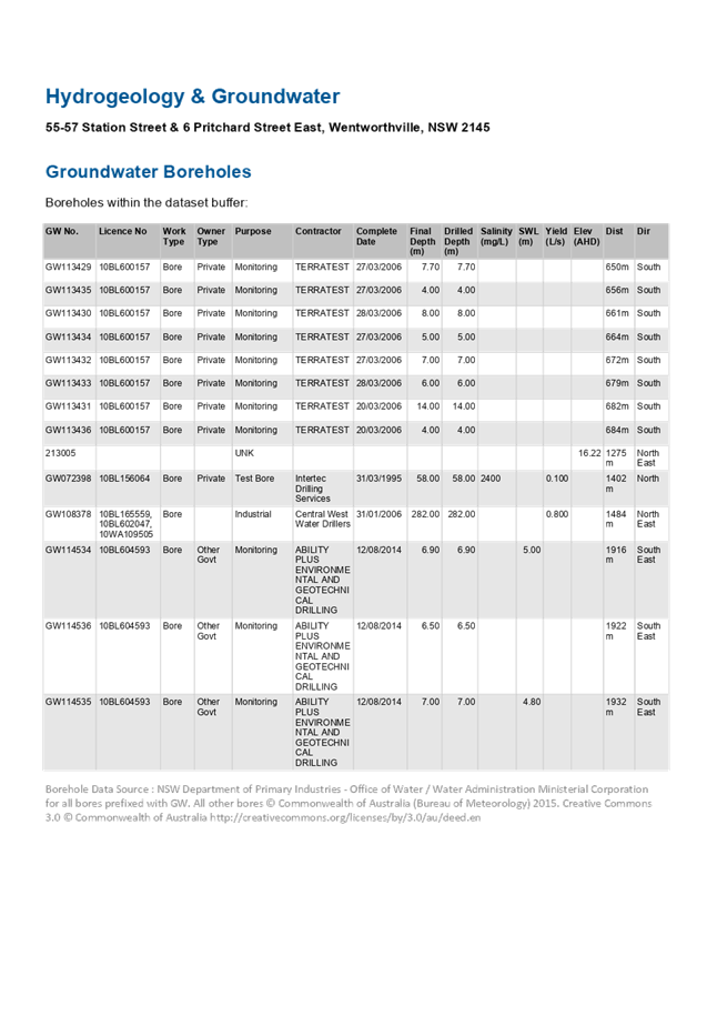
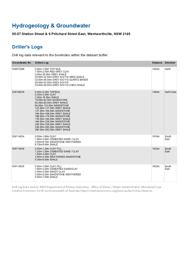
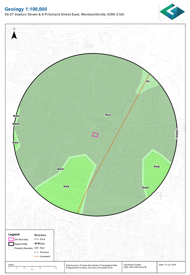
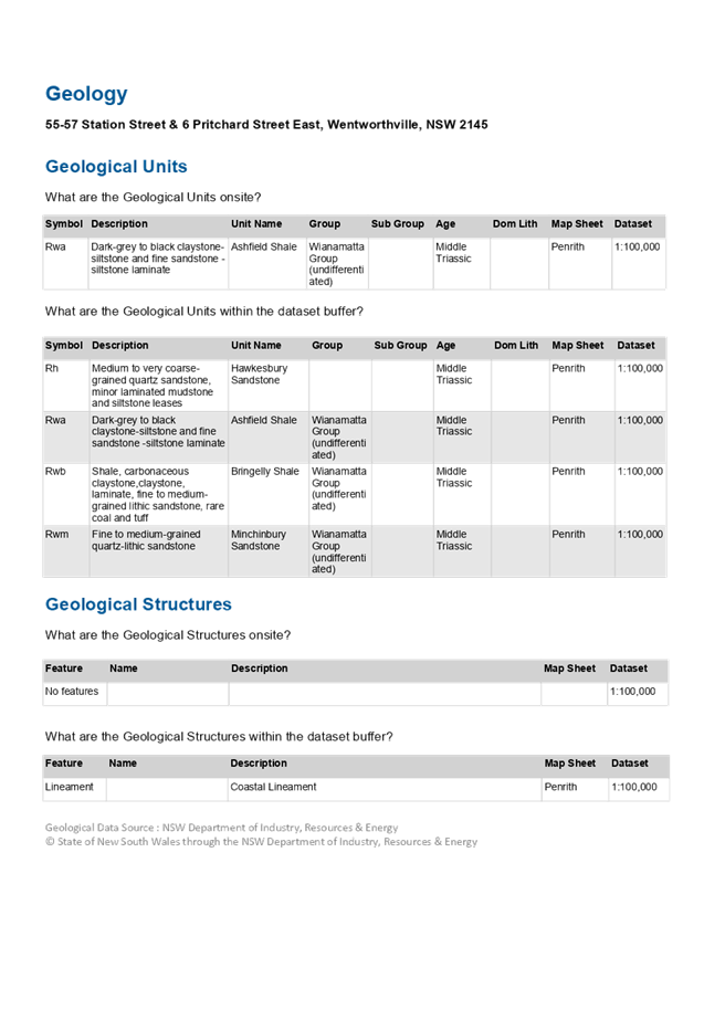

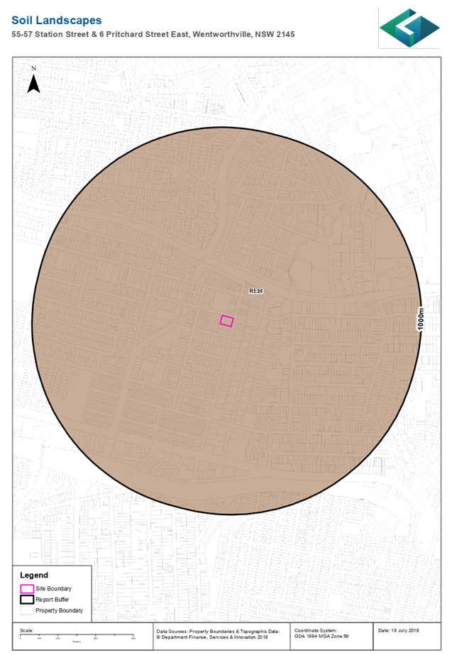

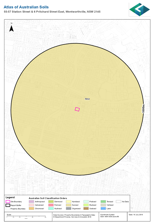


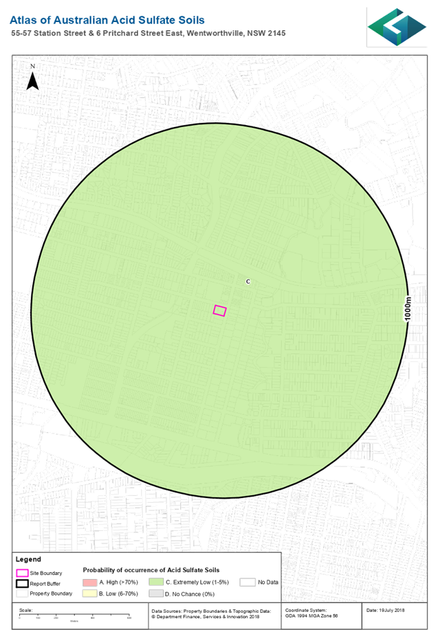

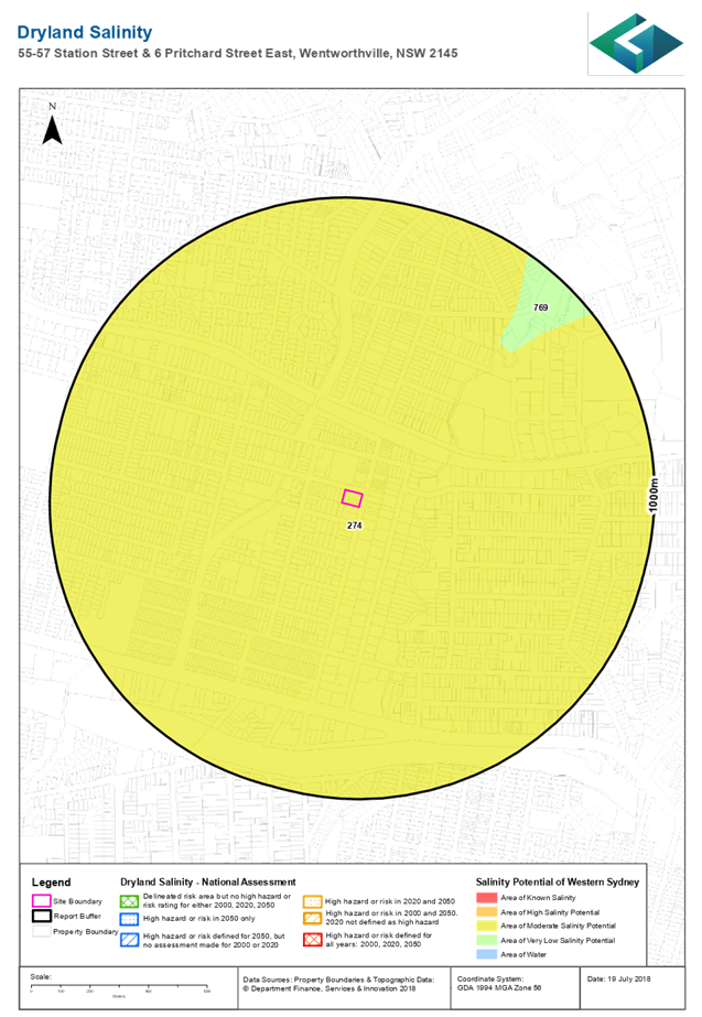
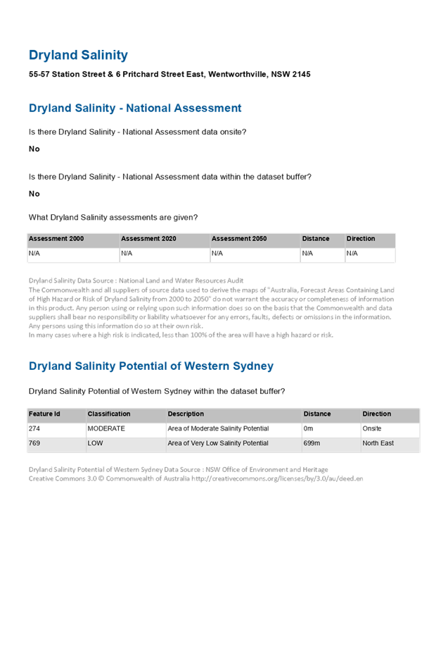

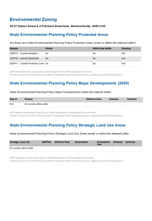
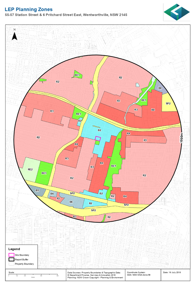
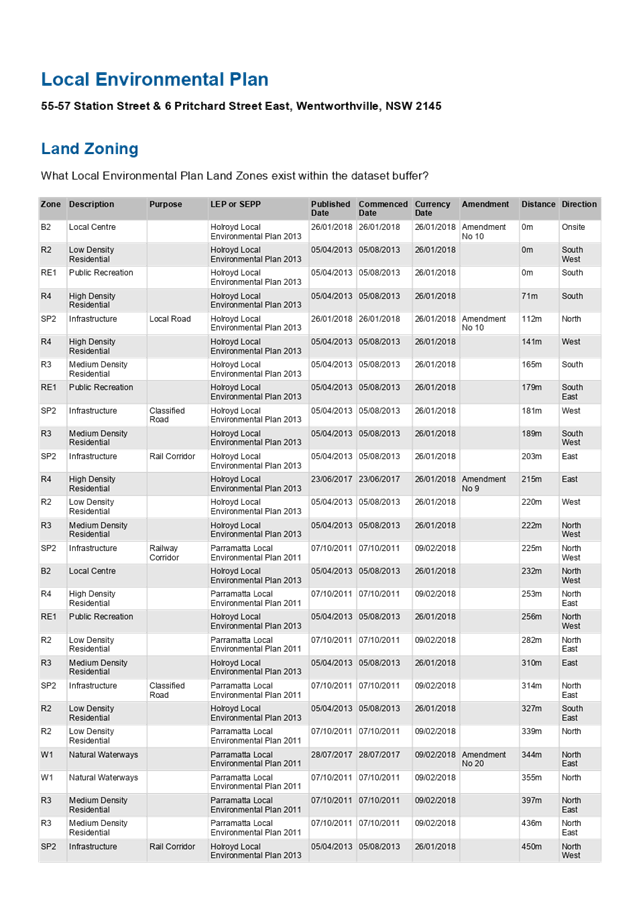
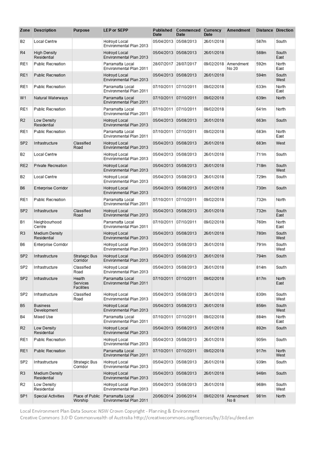
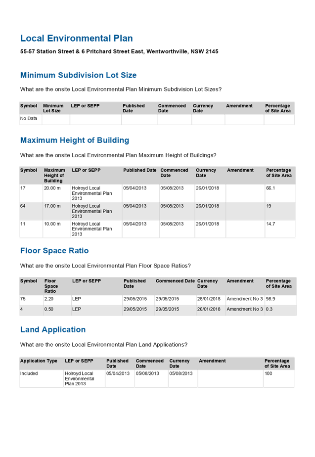

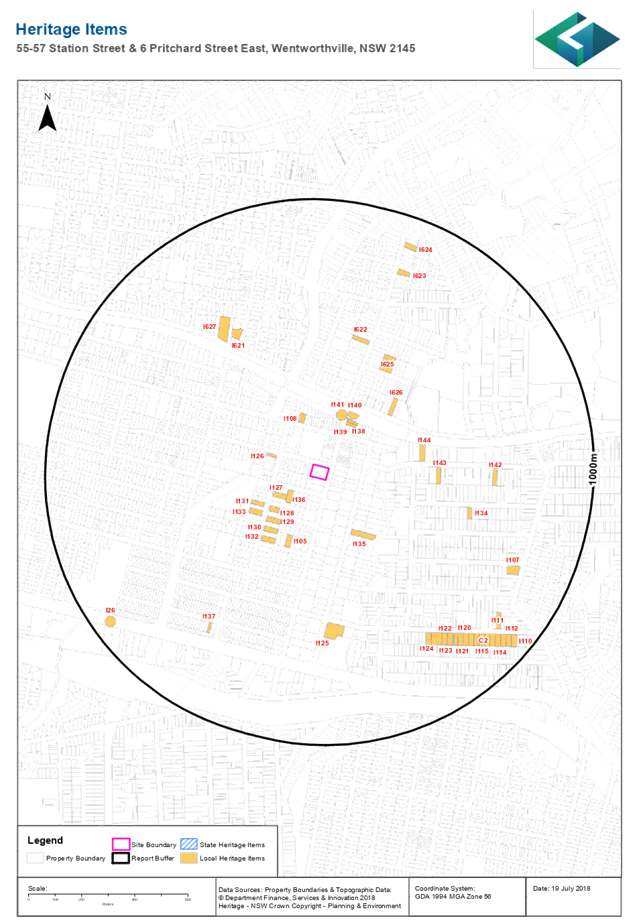


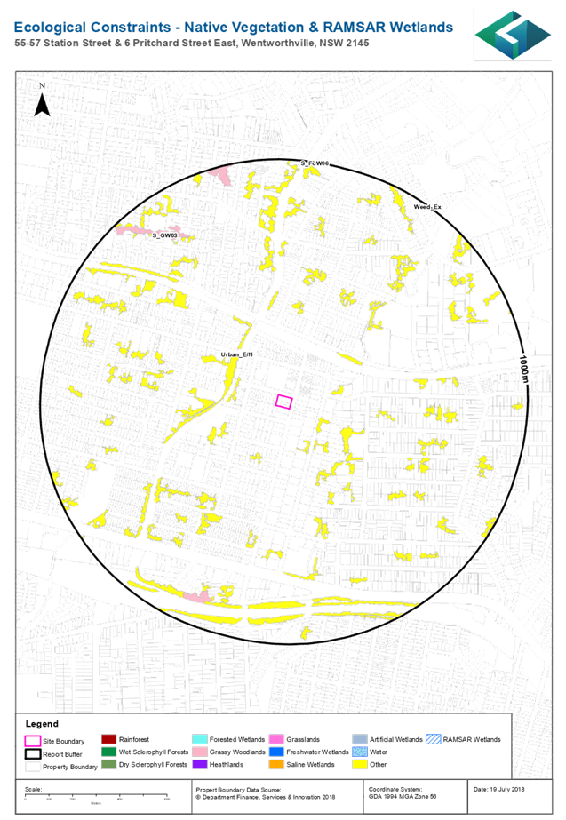
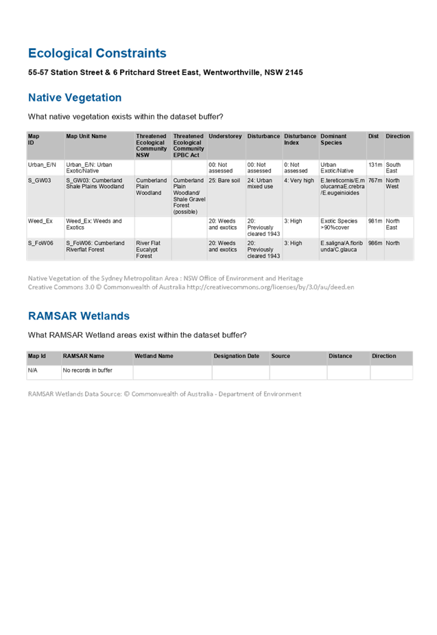


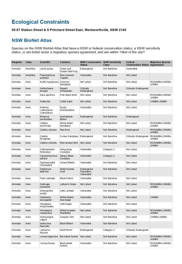
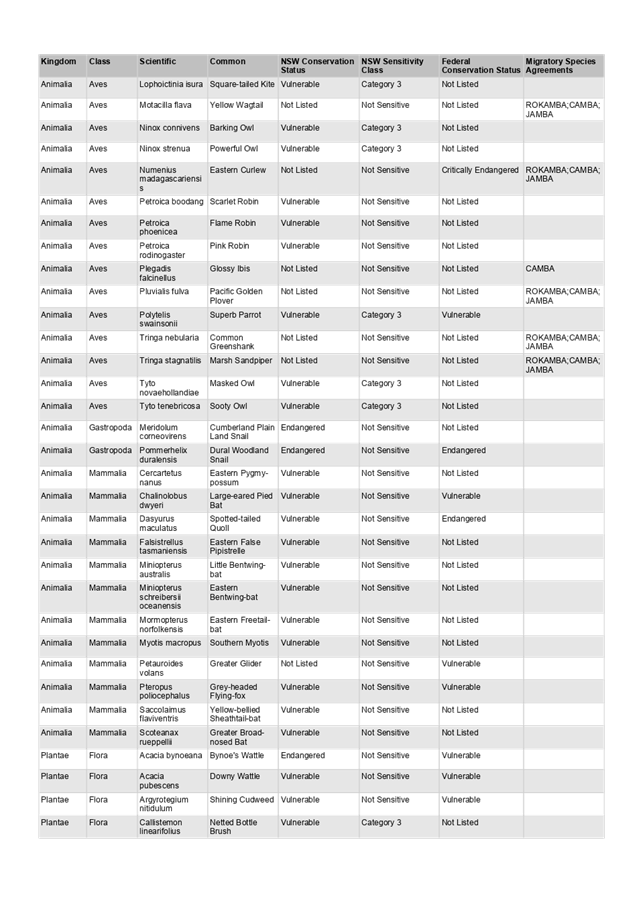
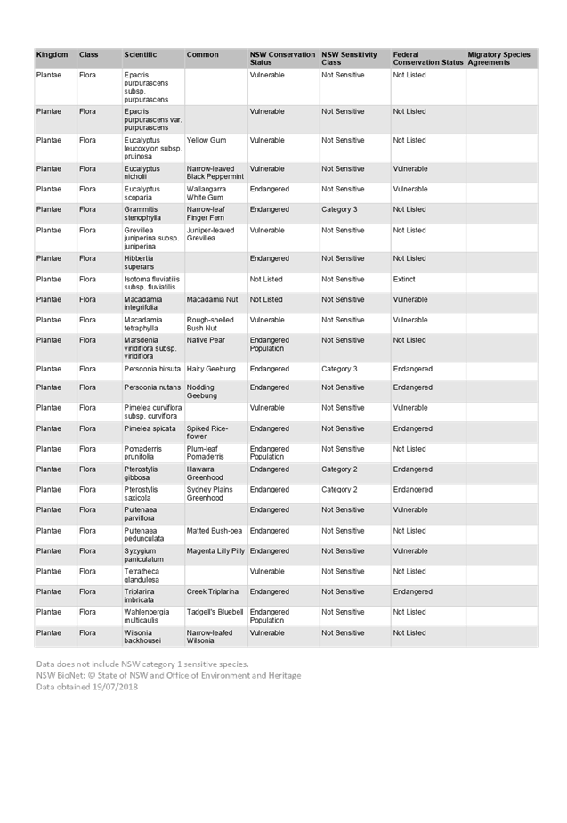


Extraordinary Cumberland Local Planning
Panel Meeting
5 November 2019
Extraordinary Cumberland Local Planning
Panel Meeting
5 November 2019

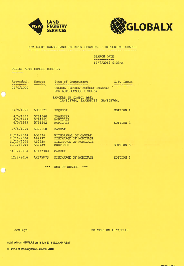

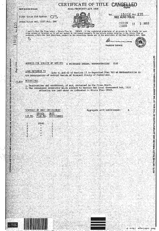
Extraordinary Cumberland Local Planning
Panel Meeting
5 November 2019

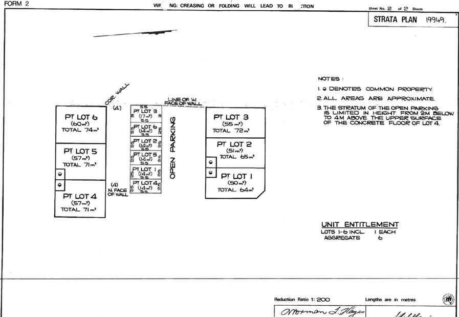
Extraordinary Cumberland Local Planning
Panel Meeting
5 November 2019


DOCUMENTS
ASSOCIATED WITH
REPORT ELPP070/19
Attachment 6
Summarised Submission Table- Original Proposal
Extraordinary Cumberland Local Planning
Panel Meeting
5 November 2019
DOCUMENTS
ASSOCIATED WITH
REPORT ELPP070/19
Attachment 7
Summarised Submission Table (amended proposal)
Extraordinary Cumberland Local Planning
Panel Meeting
5 November 2019