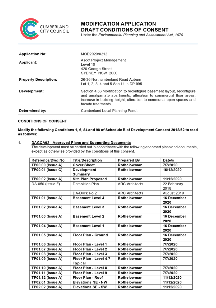
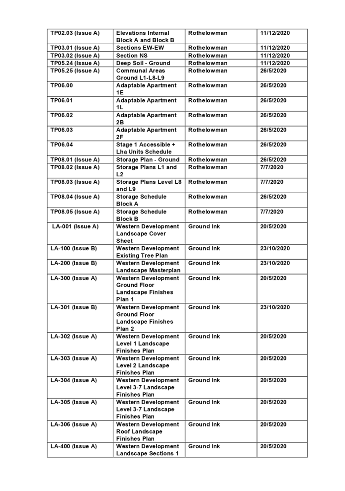
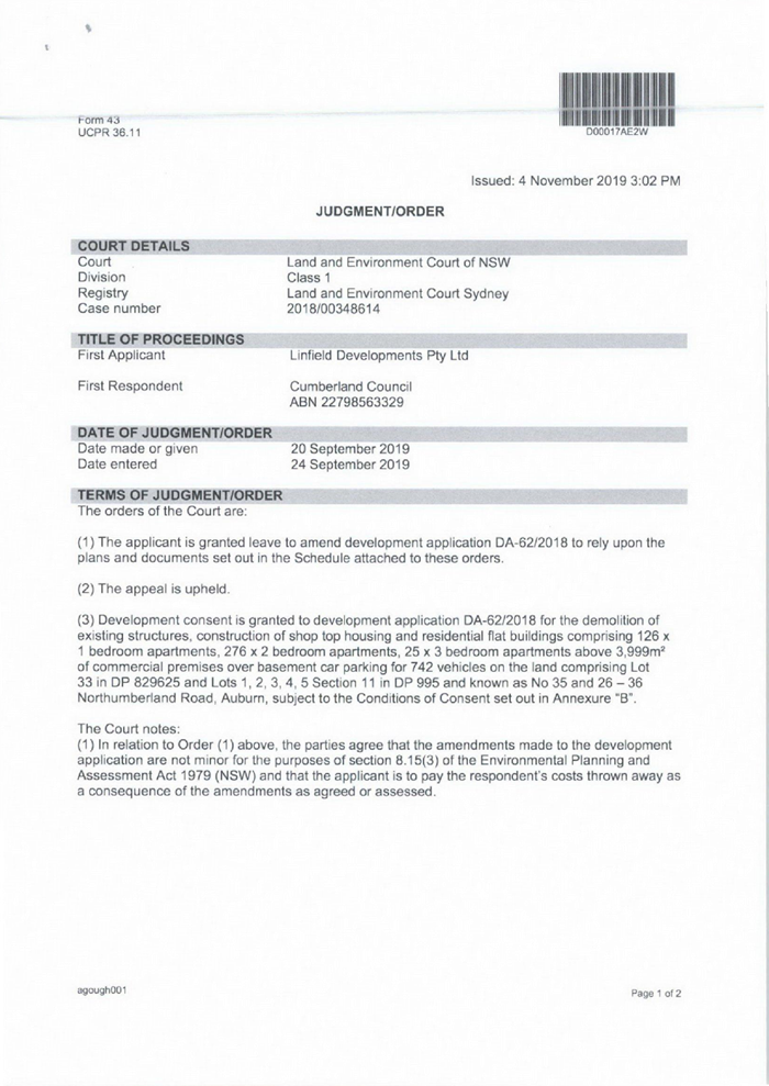
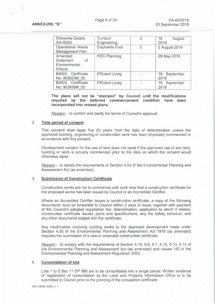
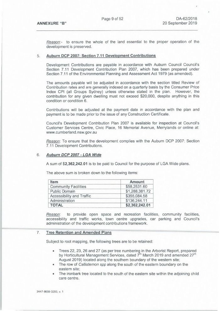
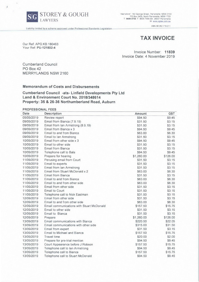
14 April 2021
An electronic meeting of the
Cumberland Local Planning Panel
will be held at 11.30am via Zoom on Wednesday, 14 April 2021.
Business as below:
Yours faithfully
Hamish McNulty
General
Manager
ORDER OF BUSINESS
1. Receipt of Apologies
2. Confirmation of Minutes
3. Declarations of Interest
4. Address by invited
speakers
5. Reports:
- Development
Applications
- Planning
Proposals
6. Closed Session Reports
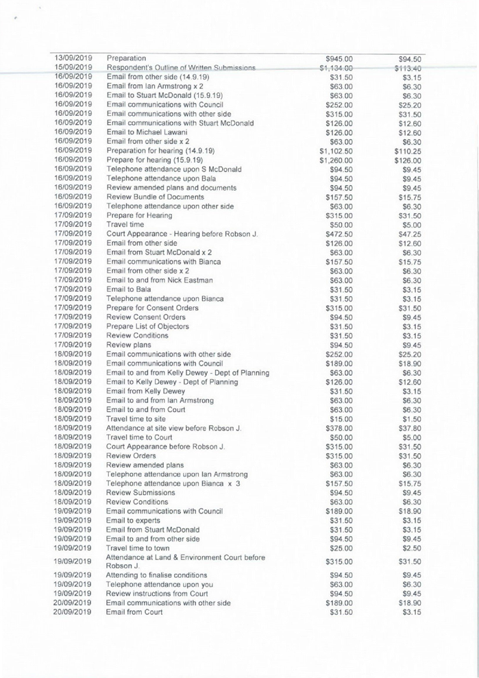
Cumberland Local Planning Panel Meeting
14 April 2021
CONTENTS
Report No. Name of Report Page
No.
Development Applications
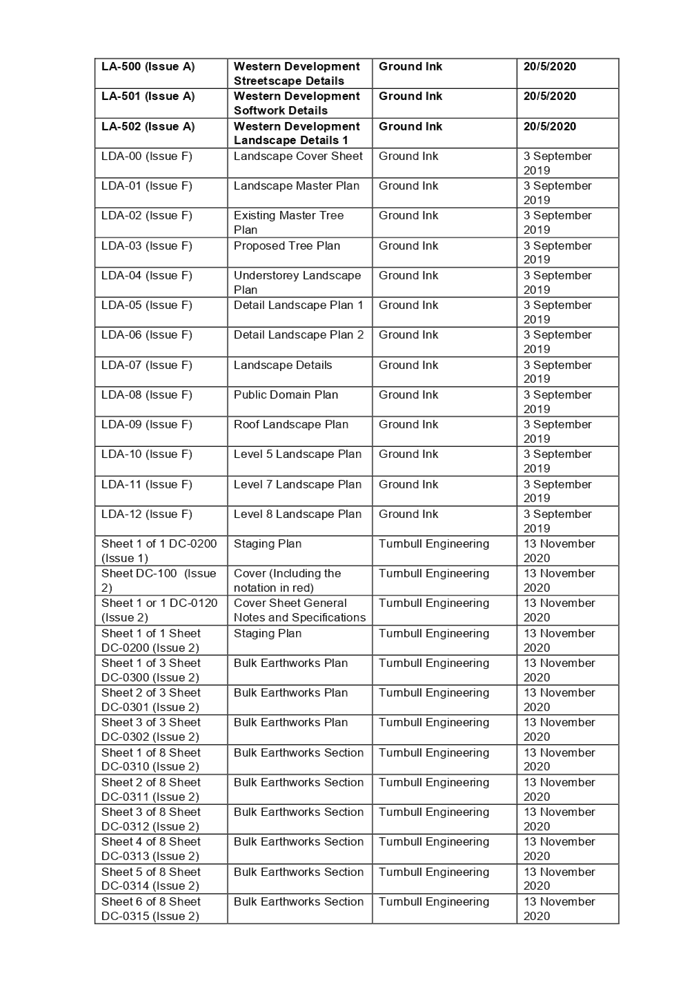
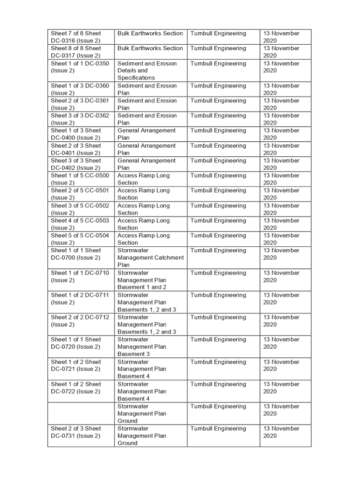
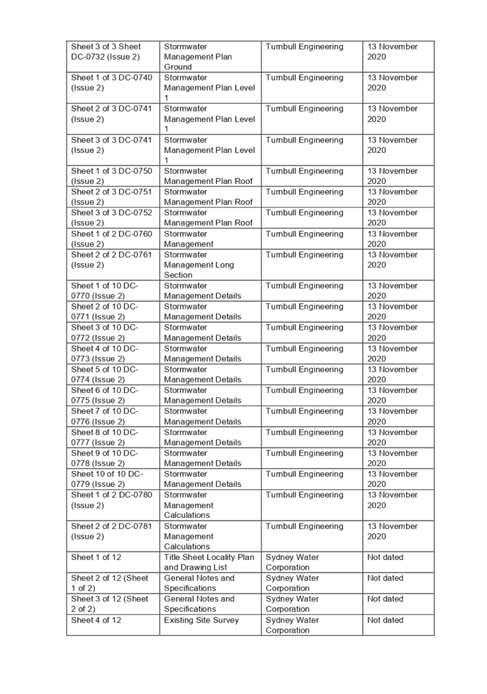
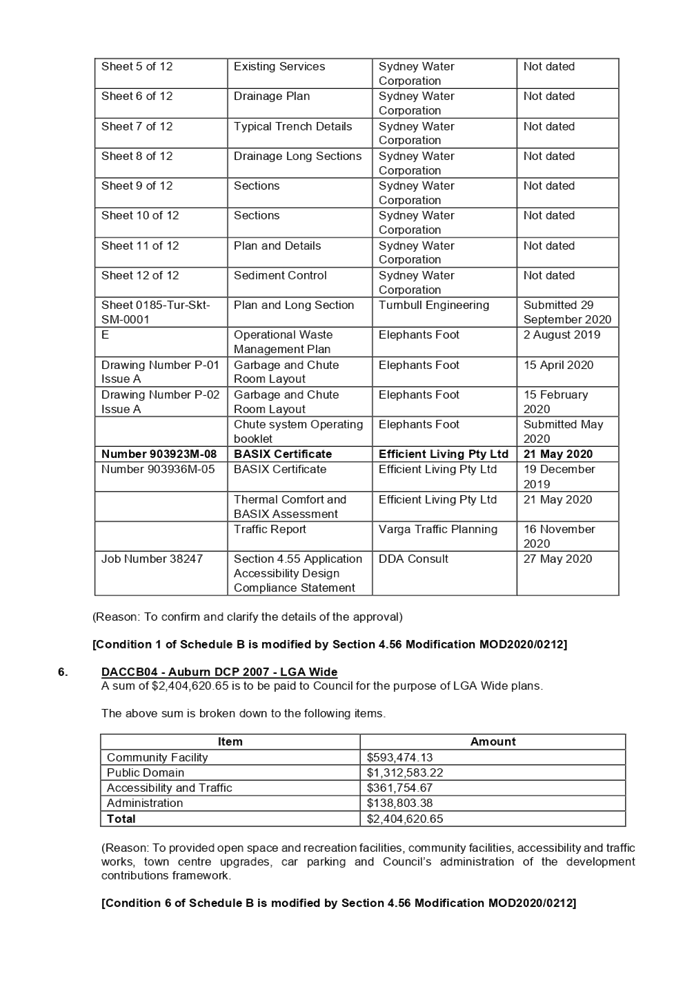
LPP009/21... Modification Application
for 26-36 Northumberland Road, Auburn.............. 5
LPP010/21... Development Application
for 22-24 Park Road, Auburn............................ 277
LPP011/21... Development Application
for 92 Hampden Road, South Wentworthville 449
LPP012/21... Development Application
for 6-10 Manchester Street, Merrylands......... 511
Cumberland Local Planning Panel Meeting
14 April 2021
Cumberland Local Planning Panel Meeting
14 April 2021
Item
No: LPP009/21
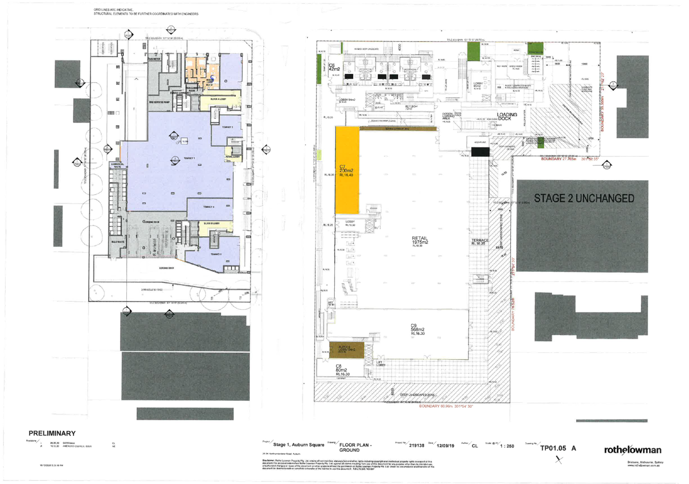
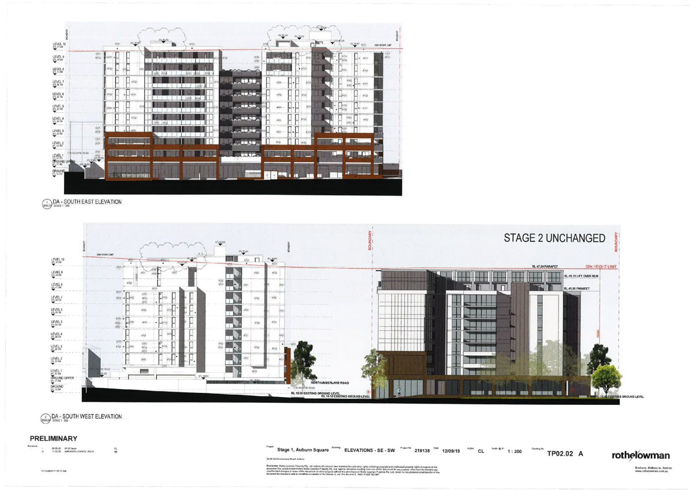
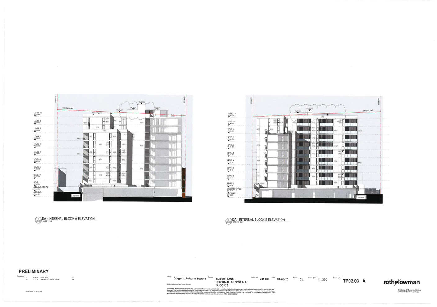
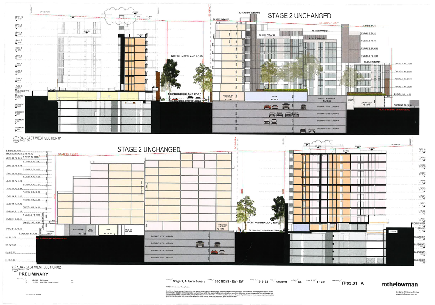
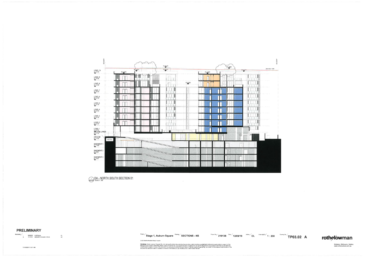
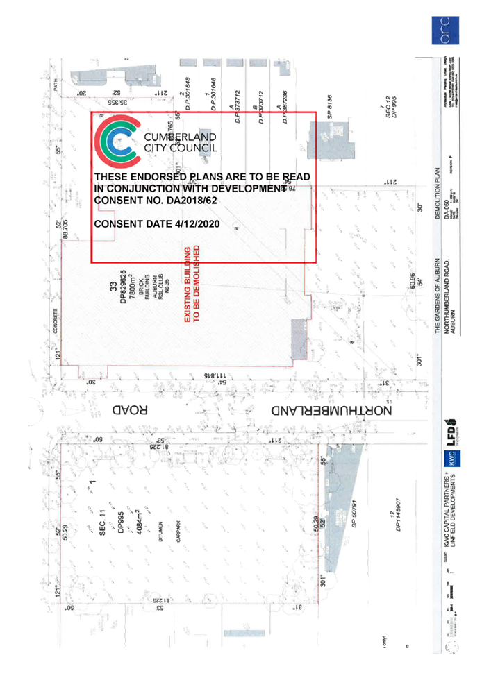
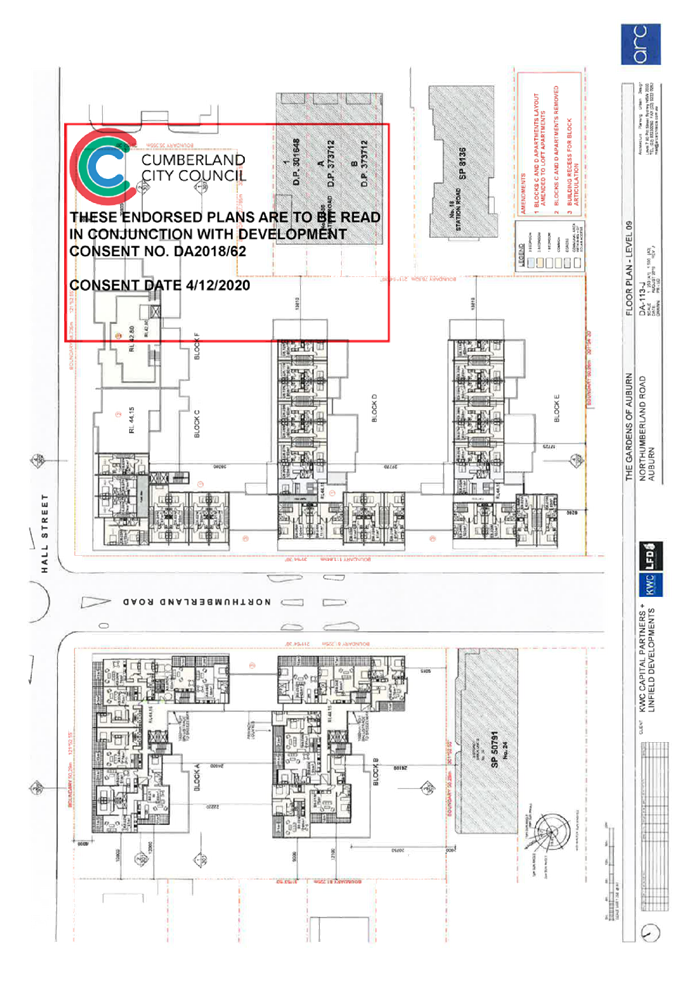
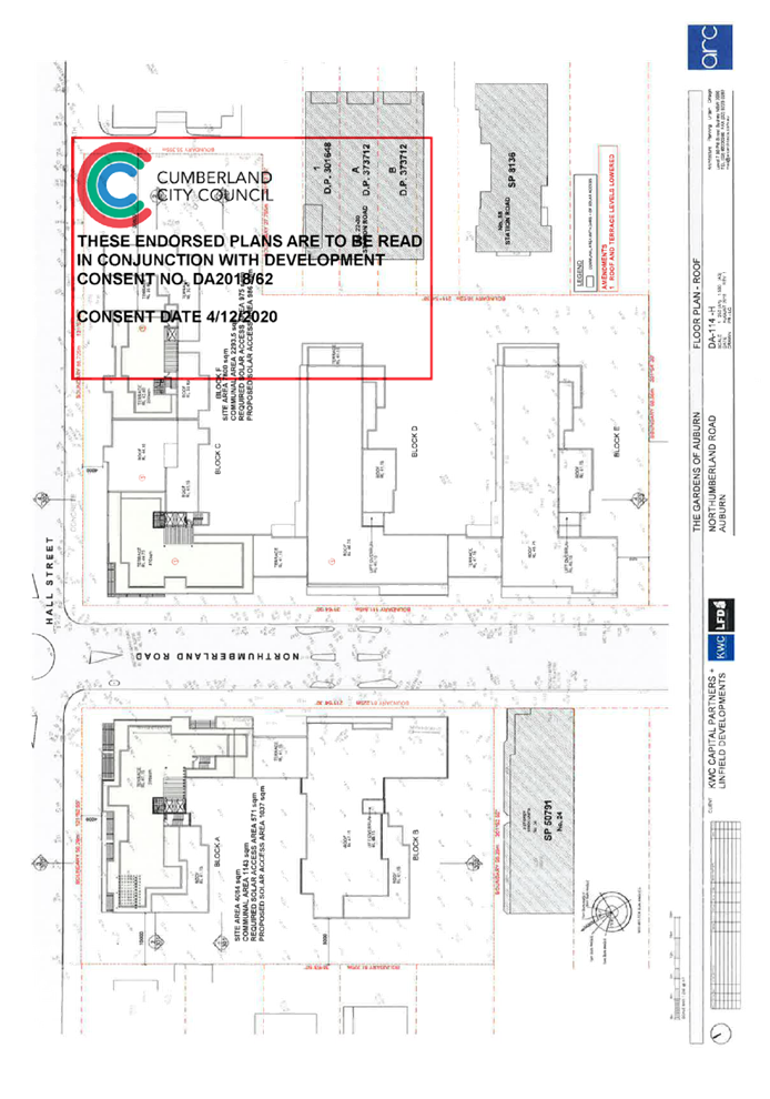
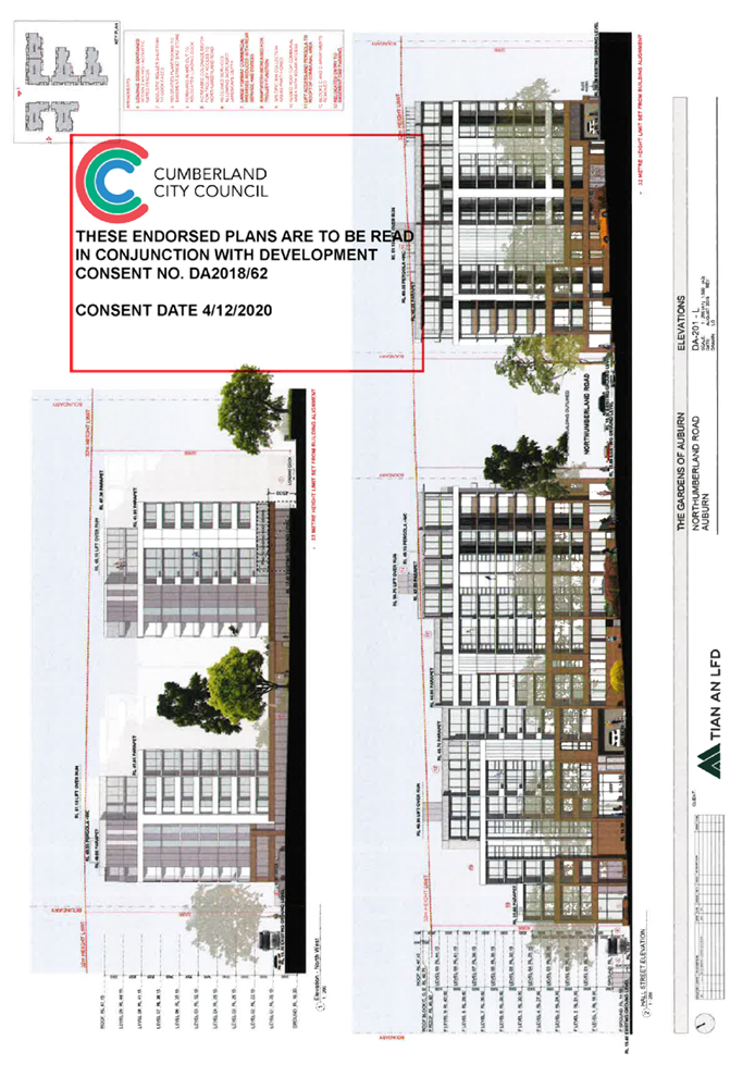
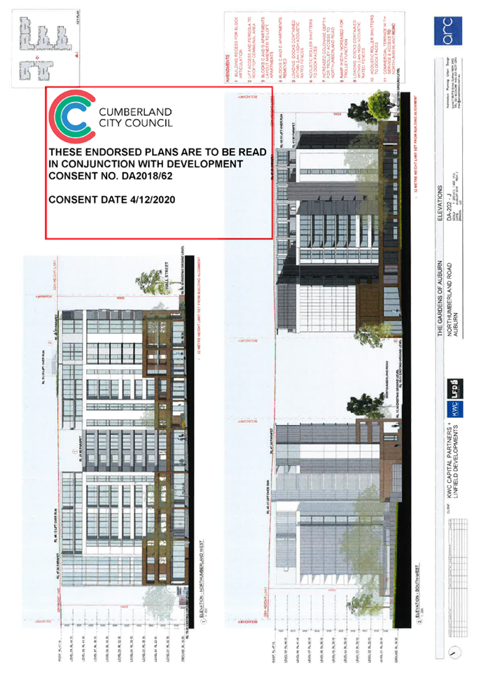
Modification Application for 26-36 Northumberland Road, Auburn
Responsible
Division: Environment
& Planning
Officer: Executive
Manager Development and Building
File
Number: MOD2020/0212
|
Application
lodged
|
1 July 2020
|
|
Applicant
|
Linfield Development C/- H D C
Planning
|
|
Owner
|
Linfield Auburn Pty Ltd
|
|
Application
No.
|
MOD2020/0212
|
|
Description
of Land
|
26 36 Northumberland Road
Auburn being Lot 1, 2, 3, 4 and 5 Sec 11 in DP 996 and 35 Northumberland Road
Auburn being Lot 33 in DP 829625.
|
|
Proposed
Development
|
Section 4.56 Modification to reconfigure the basement layout, reconfigure
and amalgamate apartments, alteration to commercial floor areas and service
areas, increase in building height, alteration to communal open spaces and
facade treatments.
|
|
Site
Area
|
26 - 36 Northumberland Road
Auburn - 4,131 Square metres.
35 Northumberland Road - 7,810
square metres.
|
|
Zoning
|
B4 Mixed use zone.
|
|
Disclosure
of political donations and gifts
|
Nil disclosure.
|
|
Heritage
|
Yes - Number 35 Northumberland
Road is still identified as having the Auburn War Memorial on site
(Archaeological item A49) although this has been relocated to Auburn Memorial
Park in nearby Rawson Street.
|
|
Principal
Development Standards
|
Floor space Ratio
Permissible: 3.6:1.
Proposed 3.247:1.
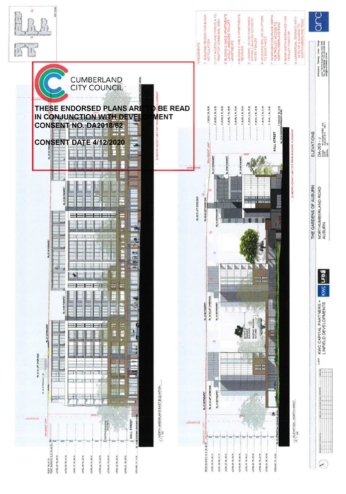
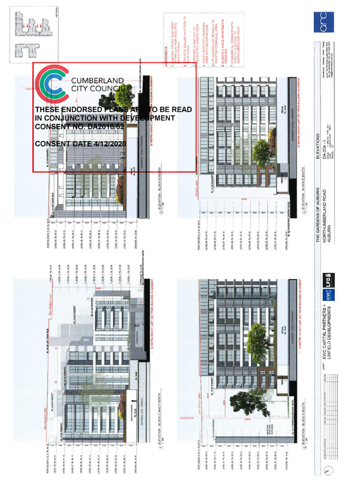
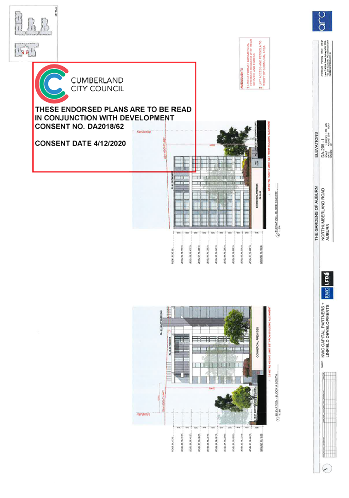
Height of Building
Permissible: 32 Metres.
Proposed: 36.12 Metres.
|
|
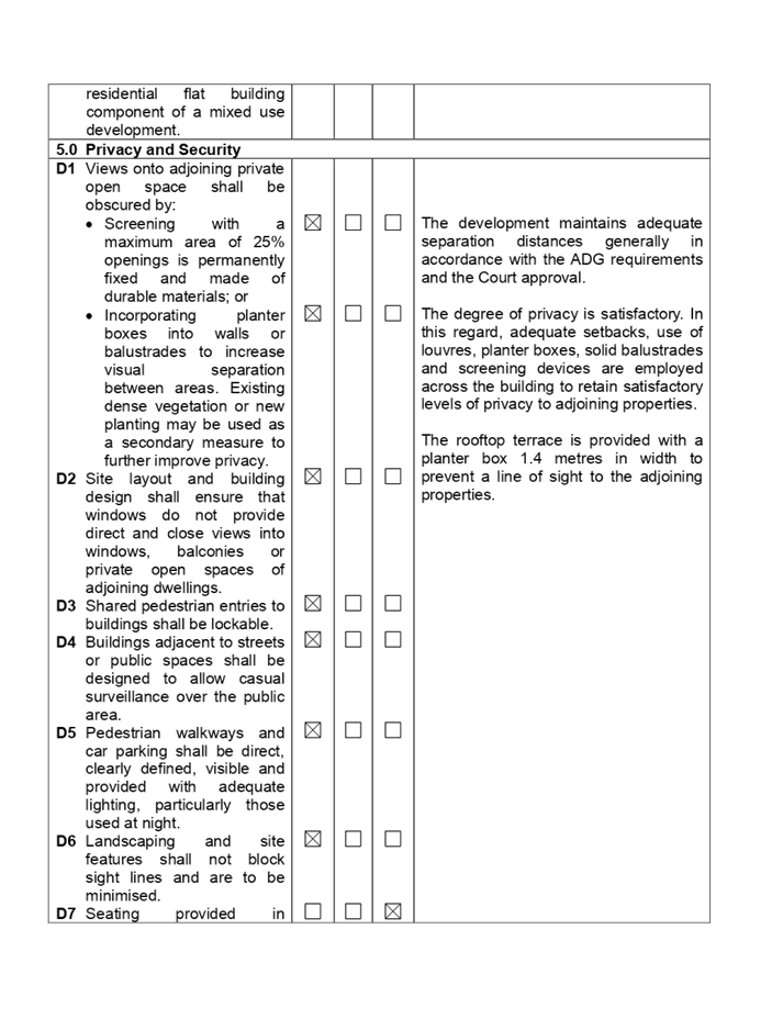
Issues
|
Height of modified building
(Western side).
Dwelling size.
Car parking (Commercial
tenancies).
|
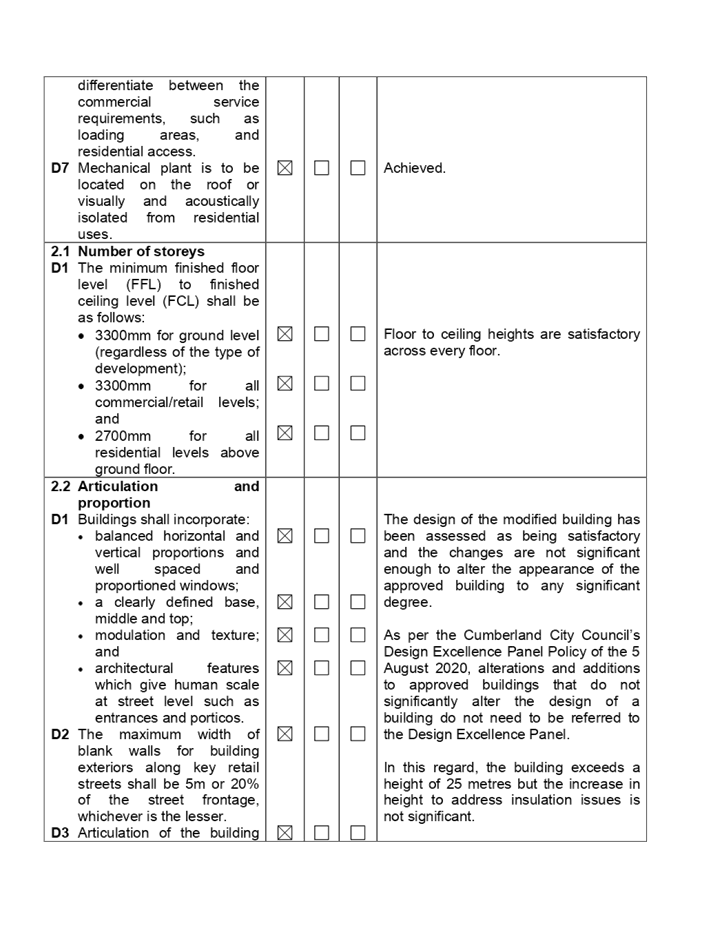
1. Modification
Application MOD2020/0212 was received on the 1 July 2020 being a Section 4.56
Modification to reconfigure the basement layout, reconfigure and amalgamate
apartments, alteration to commercial floor areas and service areas, increase in
building height, alteration to communal open spaces and facade treatments of
the western building of development consent 2018/62.
2. The
modification application was publicly notified to occupants and owners of the
adjoining properties for a period of fourteen (14) days between the 14 August
2020 and the 28 August 2020. In response, there was one submission received.
3. Number
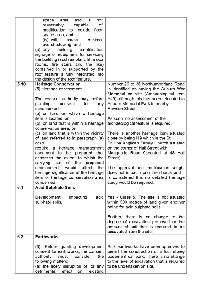
26 to 36 Northumberland Road (Western side) is identified as having the Auburn
War Memorial on site (Archaeological item A49) although this has been relocated
to Auburn Memorial Park in nearby Rawson Street.
4. The
variations are as follows:
|
Control
|
Required
|
Provided
|
% variation
|
|
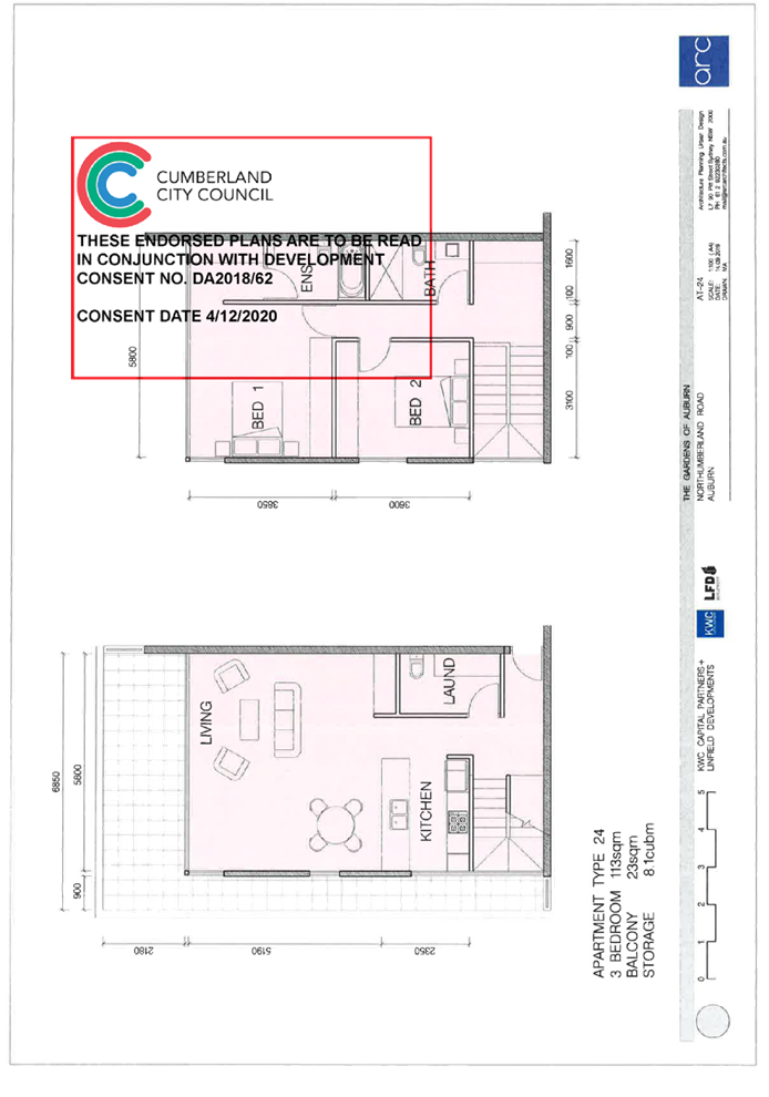
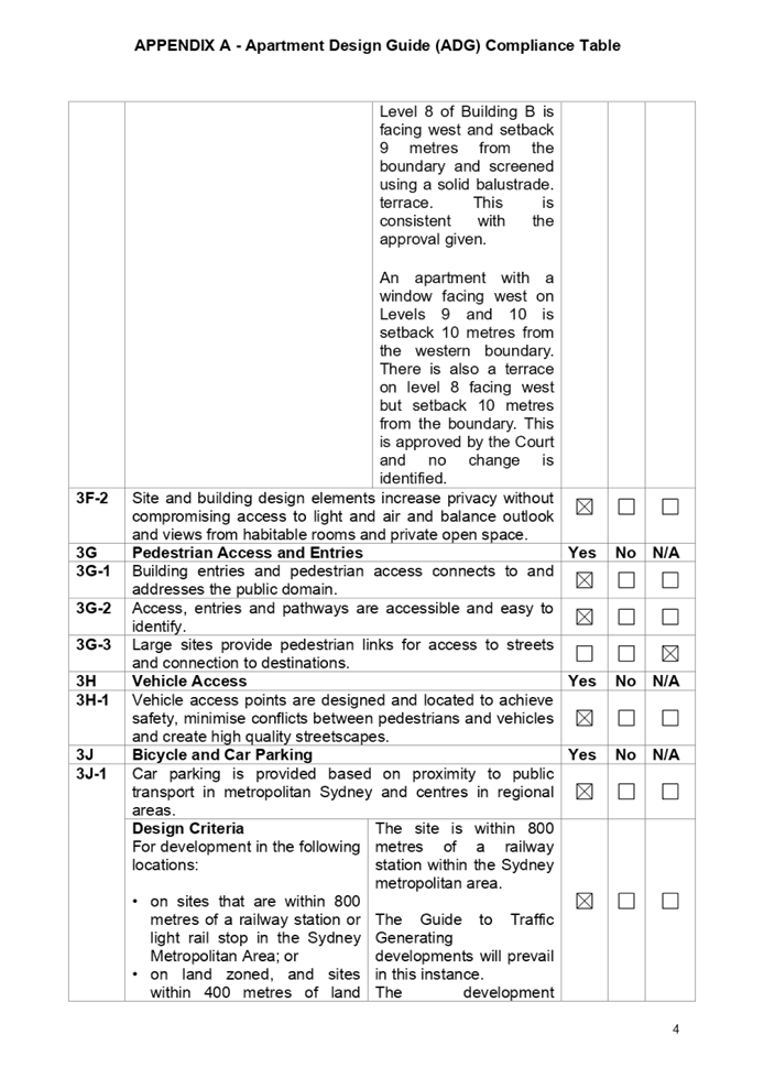
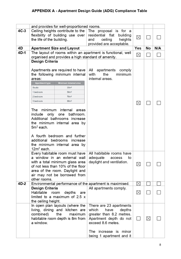
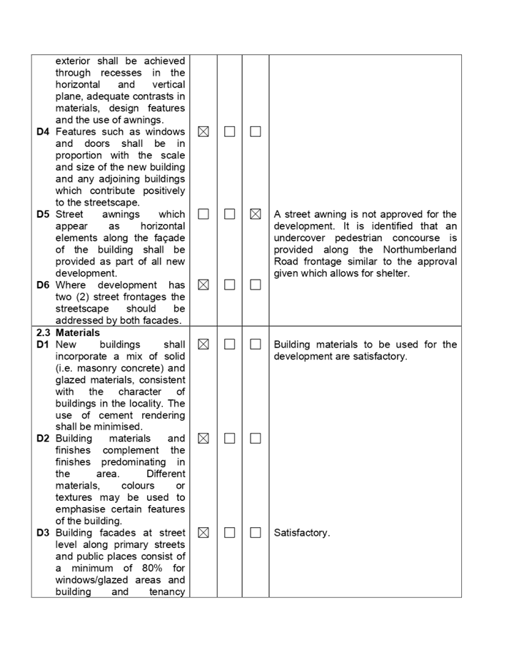
Part 4D-2 Apartment Design Guide.
|
Maximum habitable room depth is 8 metres from a window.
|
23 apartments have room depths of between 8.2 metres and
8.6 metres.
Previously 22 apartments had room depths of between 8.2
metres and 8.6 metres.
|
2.5% to 7.5%.
|
|
Clause 4.3 of the Auburn Local
Environmental Plan 2010 - Building height limit.
|
32 metres.
|
Western tower 36.12 metres.
(Approved height pf western
tower - 34.84 metres)
|
12.8%.
Approved 8.8%.
|
|
Part 2.10 (Subpart D1) of Auburn DCP - Residential Flat
Buildings Chapter.
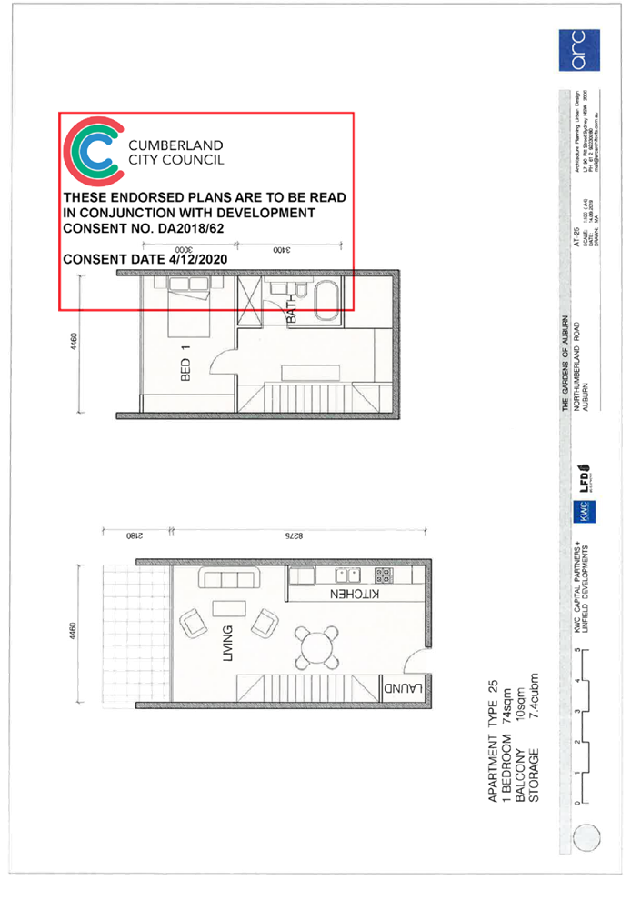
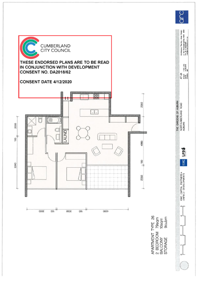
Dwelling size.
|
1 Bedroom single aspect 63 sq. m.
2 Bedrooms 80 sq. m (Corner).
3 Bedrooms 115 sq. m.
|
50.2 sq m to 63 sq m.
78.3 sq m to 87.6 sq m.
99.4 sq m to 109.3 sq m.
All are consistent with the approval granted.
|
0% up to 20.6%.
0% up to 2.1%.
4.9% up to 13.5%.
|
|
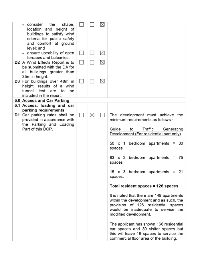
Part 6.1 (Subpart D1) of the Auburn DCP - Local Centres
Chapter.
Access, loading and car parking requirements.
|
1 space per 60 sq m gross floor area.
Require 19.3 spaces or 20 if rounded upwards.
|
19 commercial spaces.
|
5%.
|
5. The
application is referred to the Panel as the proposal incorporates a variation
to a development standard greater than 10%.
6. The
modification application is recommended for conditional approval subject to the
conditions as provided in the attached schedule.
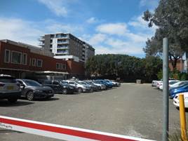
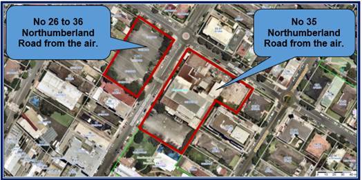
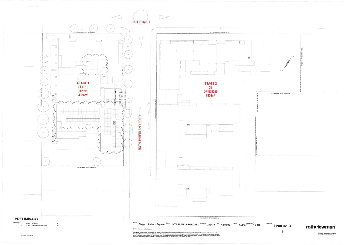
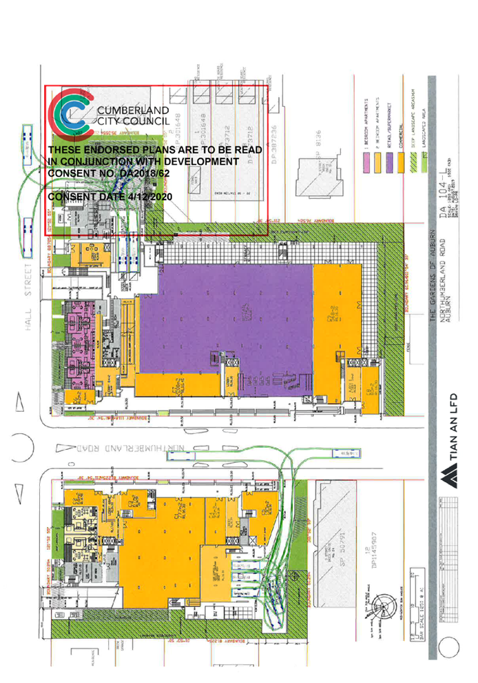
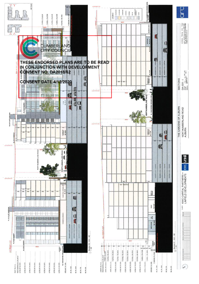
Subject Site and Surrounding
Area
Number 26 to 36 Northumberland
Road
The site known as 26 to 36
Northumberland Road (Western side) comprises 5 allotments. The site is
rectangular in shape and has dimensions of 81 metres to Northumberland Road, 51
metres to Hall Street and occupies an area of 4,131 square metres. The site was
previously used as a car park servicing the RSL club although the car park has
since been closed and construction work recently commenced on the project in
early January 2021.
The site is identified as having
the Auburn War Memorial on site (Archaeological item A49) although this has
been relocated to Auburn Memorial Park in nearby Rawson Street.
Photos of the site are provided
below.
Number 35 Northumberland Road
The site is known as Lot 33 in DP
829625 or 35 Northumberland Road Auburn (Eastern side). The site has a frontage
of approximately 109 metres to Northumberland Road (west) and 87 metres (north)
to Hall Street and occupies an area of 7,810 square metres.
The former two storey Auburn RSL
club is situated on the site although this has now closed and the building is
earmarked for demolition. A car park is situated along the southern side of the
building which is still in use for the general public. The modification
application proposes no changes to the approved development on the site.
Photos of the site are provided
below.
The location of the two sites are
shown below.
Description of the Modified
Development
The modification application is
proposing numerous changes to the approved development to facilitate a more
appropriate development outcome and to achieve an improved level of residential
amenity. The changes only relate to the western portion of the site being
Buildings A and B and no changes are proposed to the eastern portion of the
development being Buildings C, D, E and F.
The changes are highlighted in the
table below.
|
Level
|
Modifications
|
|
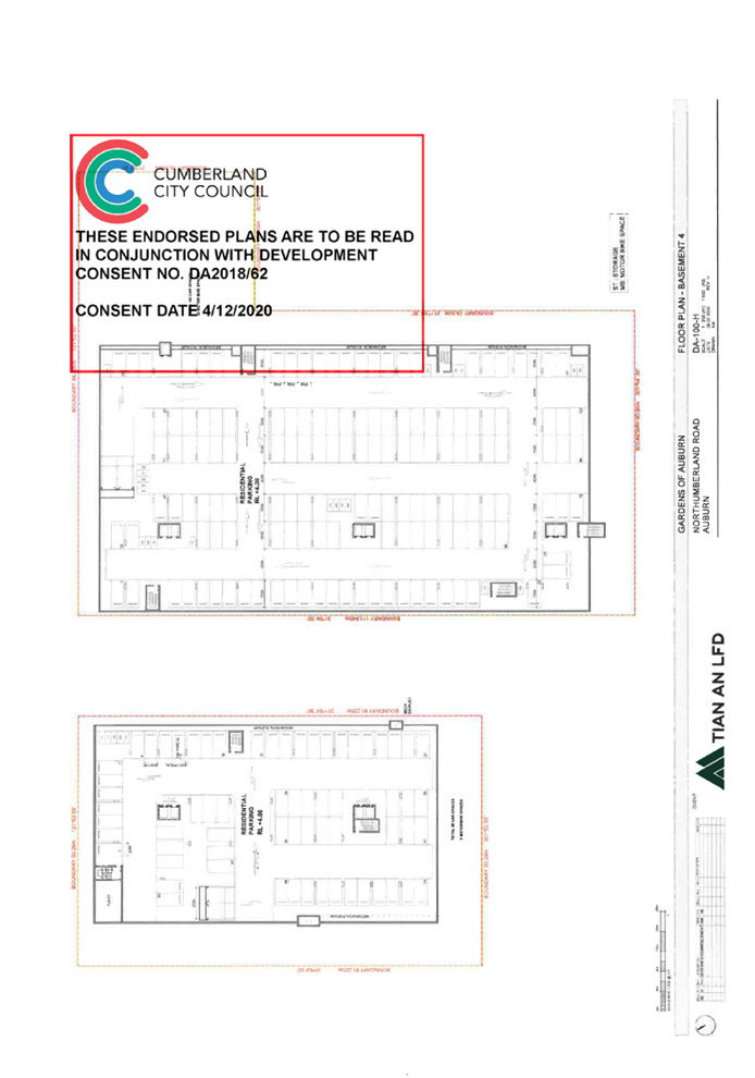
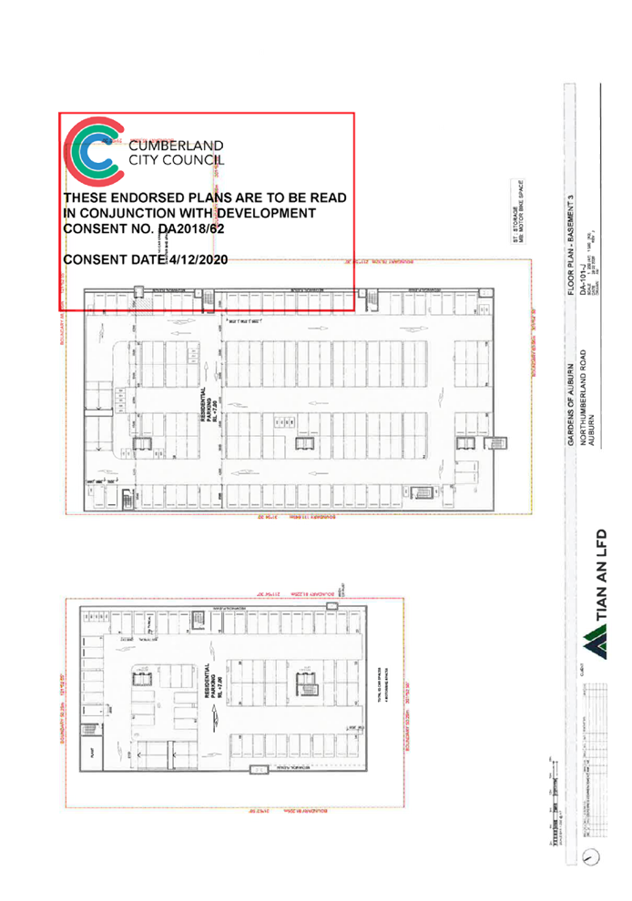
Basement
Level 4.
|
Reduce the
number of vehicle spaces from 65 to 58 and 7 spaces for motorbikes.
The
basement level is reconfigured and plant is relocated.
|
|
Basement
Level 3.
|
Reduce the
number of residential vehicle spaces from 63 to 59 and 2 spaces for
motorbikes.
Provision
is made for 8 accessible spaces and 2 spaces for parking motorbikes.
The
basement level is reconfigured and plant relocated.
|
|
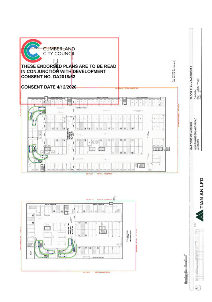
Basement
Level 2.
|
Reduce the
number of residential vehicle spaces from 53 to 49.
Provision
is made for 13 accessible vehicle spaces and 4 spaces for motorbikes.
The
basement level is reconfigured and plant relocated or added.
|
|
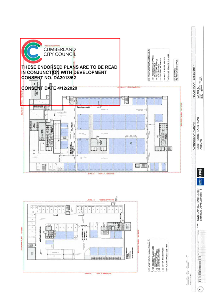
Basement
Level 1.
|
Reduce the
number of vehicle spaces from 54 to 49
Provide 30
vehicle spaces for visitors, 19 vehicle spaces for the commercial tenancies
and 2 spaces for motorbikes.
The
basement level is reconfigured, plant relocated and car charging facilities
added.
|
|
Ground
Floor.
|
Improve
the fire egress from Building A.
Reconfigure
the waste and commercial bin storage area.
Remove a 1
x 2 bedroom apartment to leave one remaining 2 bedroom apartment facing
north.
Reconfigure
the waste storage room and commercial waste bin storage room.
Reconfigure
the commercial floor space with a net increase of 58 square metres.
Reconfigure
the service area to accommodate 3 x 8.8 metre medium rigid vehicles bays.
Enclosure
of the loading bay and incorporate roller shutter doors to comply with the
acoustic requirements as a result of Condition 58 of the development consent.
Improve
the access arrangement.
|
|
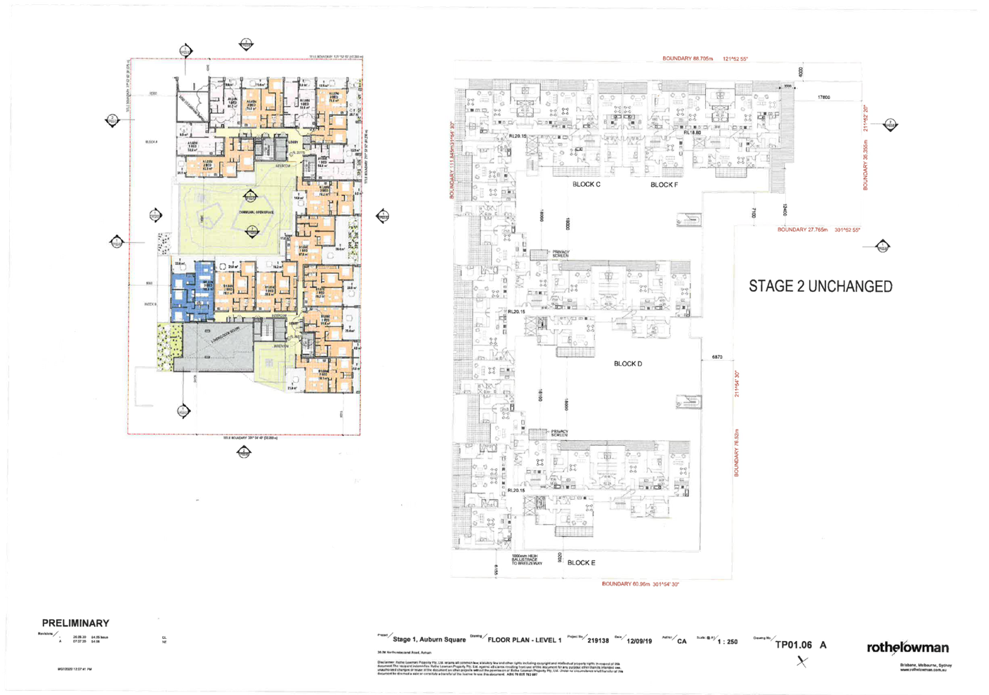
Level
1.
|
Convert a
2 bedroom apartment into a 1 bedroom apartment which affects Apartment
A1.06N.
Modify the
layout of apartments numbered A1.08E, A1.02W, B1.09W, B1.03N and B1.04N.
The floor
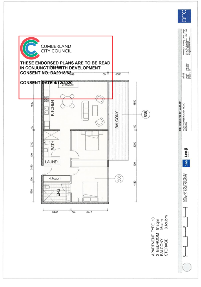
previously had 15 apartments encompassing 4 x 1 bedroom apartments and 11 x 2
bedroom apartments.
The
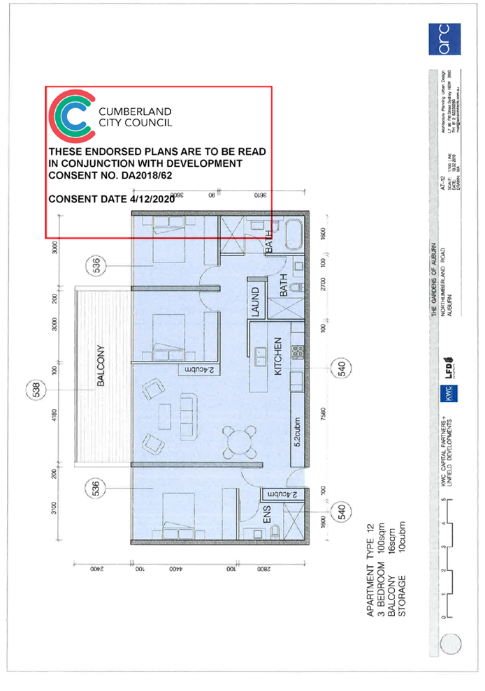
modified development now has 4 x 1 bedroom apartments, 10 x 2 bedroom
apartments and 1 x 3 bedroom apartment.
Reconfigure
the podium planting at the south western corner of the building and modify a
podium outdoor area situated immediately to the west of Apartment Numbered
B1.09W.
Minor
change to the shape of the common open space.
|
|
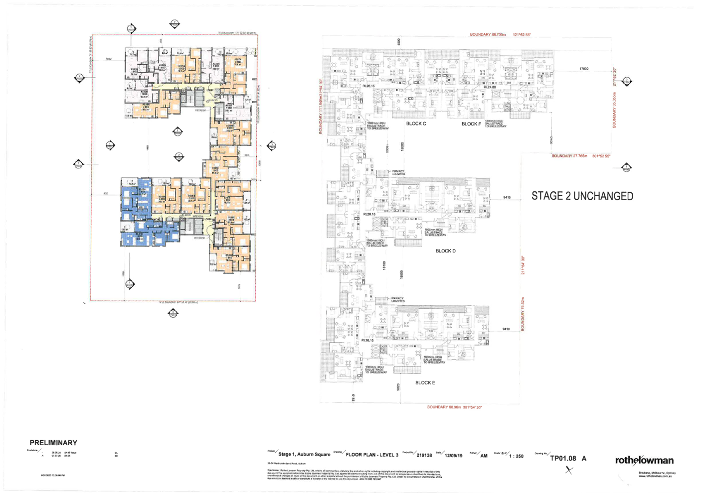
Level 2
to Level 7.
|
Reduce the
number of apartments from 18 to 17 across all levels.
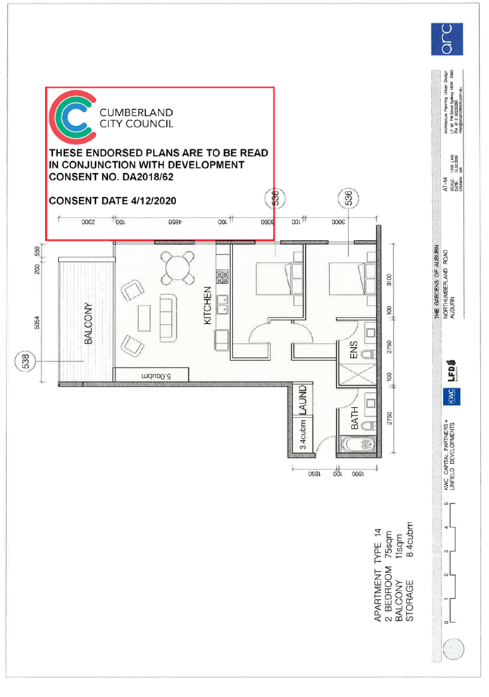
Previously,
there were 6 x 1 bedroom apartments and 12 x 2 bedroom apartments across each
level.
(Total
36 x 1 bedroom apartments and 72 x 2 bedroom apartments).
The
development now has 17 apartments across each level including:-
· 5 x 1 bedroom apartments.
· 10 x 2 bedroom apartments.
· 2 x 3 bedroom apartments.
Total
30 x 1 bedroom apartments, 60 x 2 and 12 x 3 bedroom apartments.
There is a
reduction of 6 apartments.
|
|
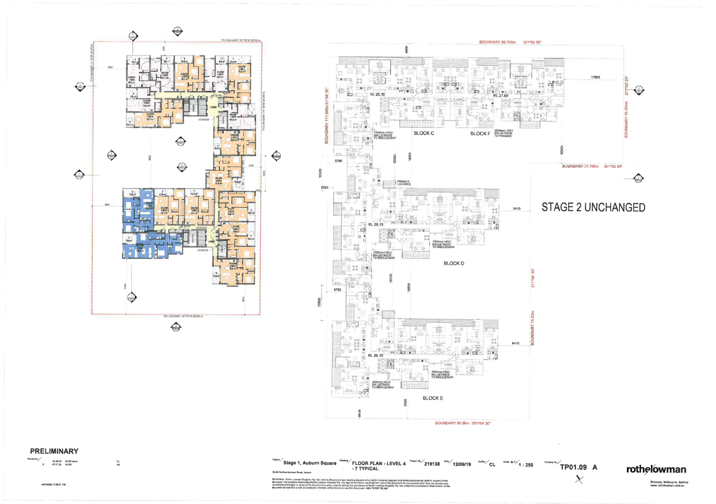
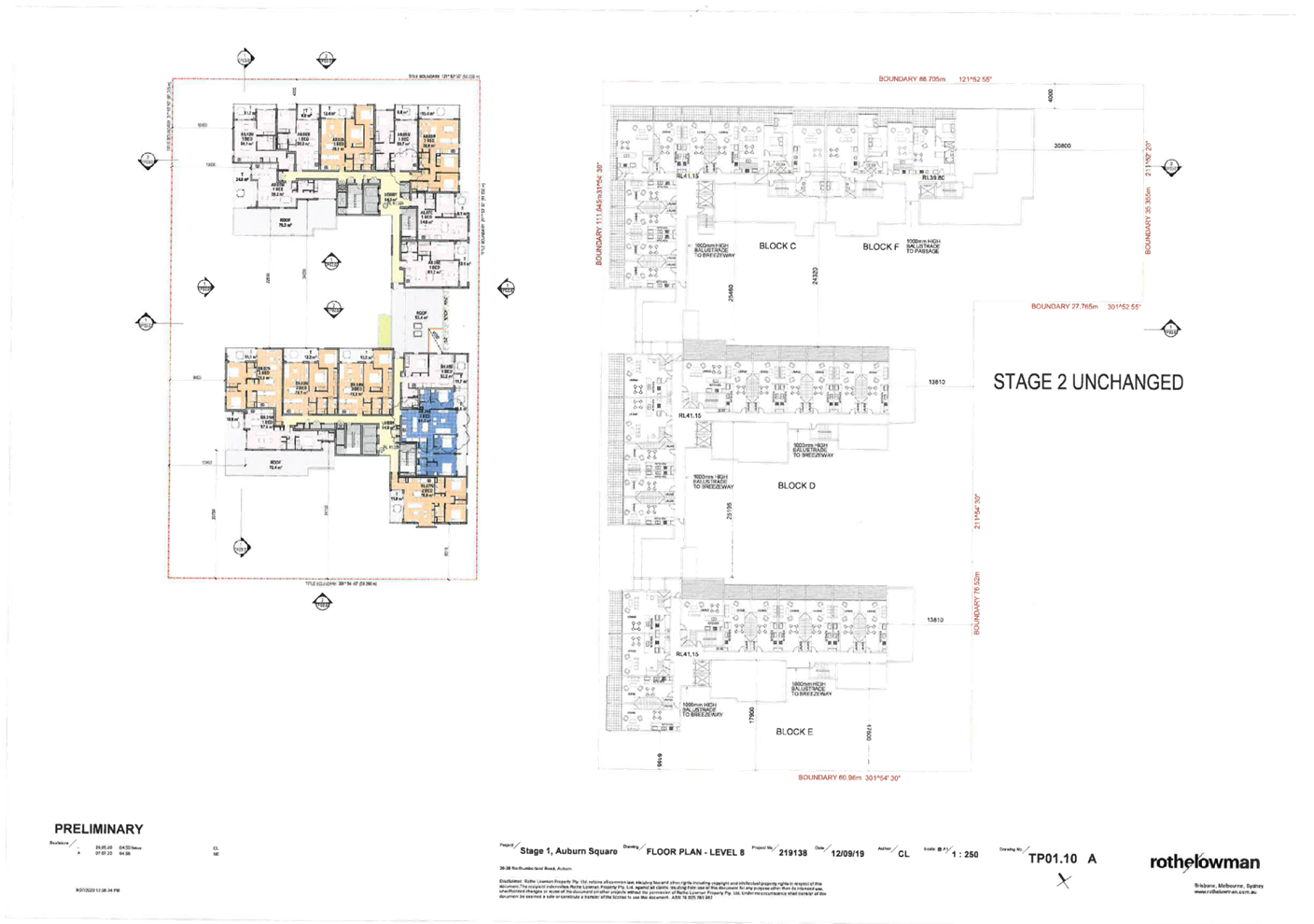
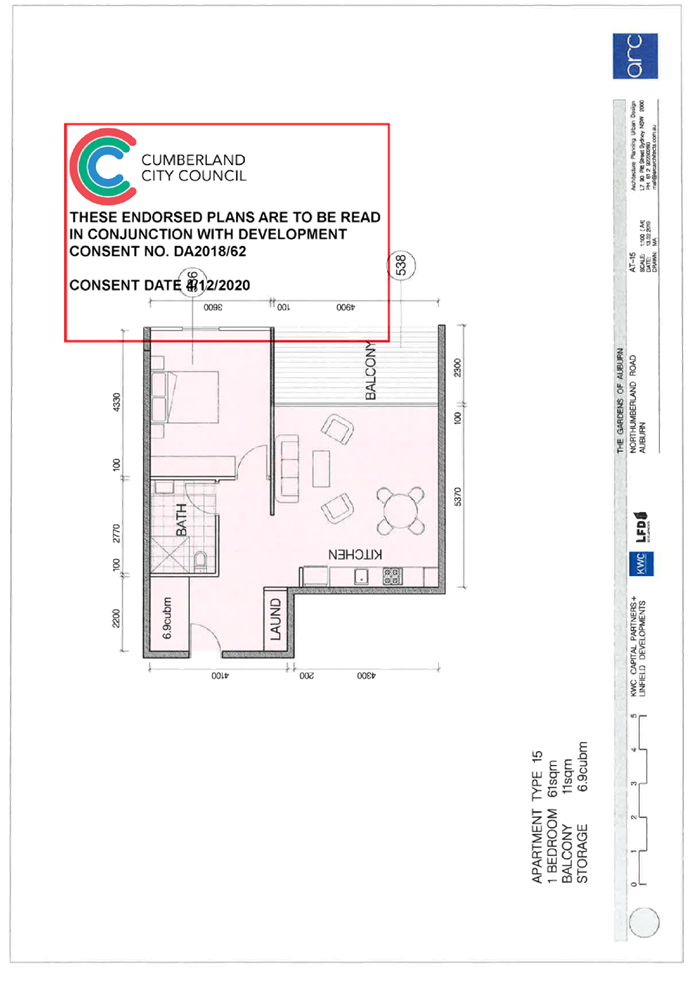
Level
8.
|
Previously,
there were 15 apartments including:-
· 7 x 1 bedroom apartments.
· 8 x 2 bedroom apartments.
The
development now features 15 apartments comprising of:-
· 8 x 1 bedroom apartments.
· 6 x 2 bedroom apartments.
· 1 x 3 bedroom apartments.
A roof
terrace situated between Buildings A and B has been removed although the
pedestrian connecting walkway between the two buildings is retained.
|
|
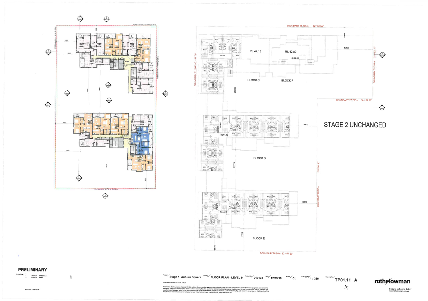
Level
9.
|
Previously,
there were 15 apartments including:-
· 7 x 1 bedroom apartments.
· 8 x 2 bedroom apartments.
The
development now features 15 apartments comprising of:-
· 8 x 1 bedroom apartments.
· 6 x 2 bedroom apartments.
· 1 x 3 bedroom apartments.
|
|
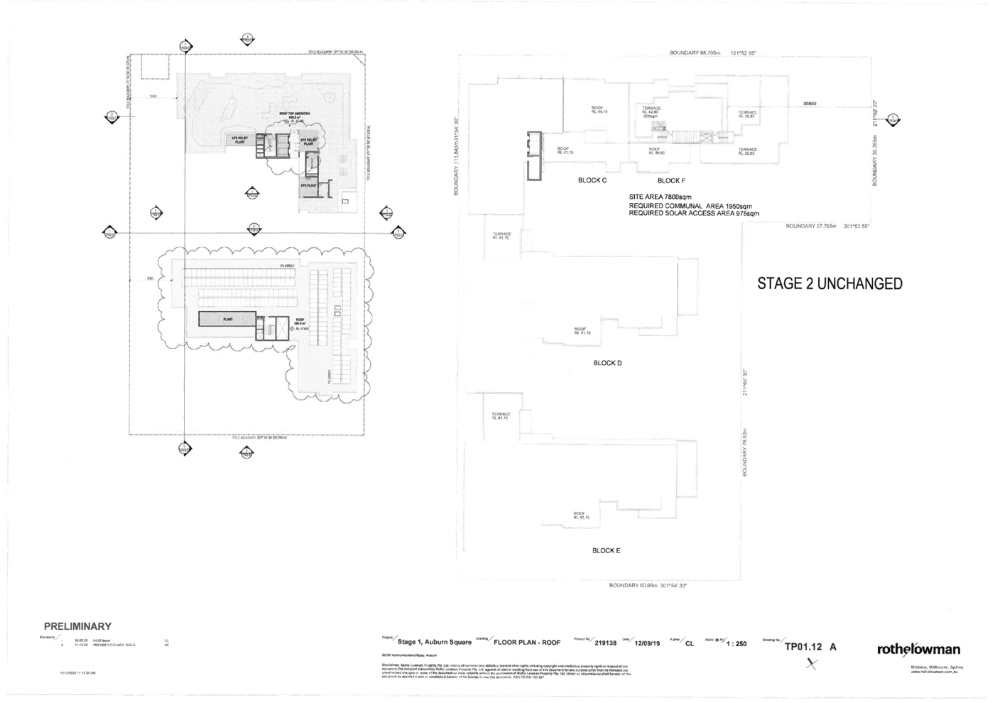
Roof
Plan.
|
Increase
the size of the roof common area from 598 square metres to 606.5 square
metres and alter its shape.
Introduce
a solar panel system onto the roof of the southern part of the building
(Building B).
|
The changes identified above
affects the appearance of the development and there are alterations to the
streetscape appearance, materials and finishes and position of glazed elements.
The changes result in the
following outcomes to the western building known as Building A and Building B.
|
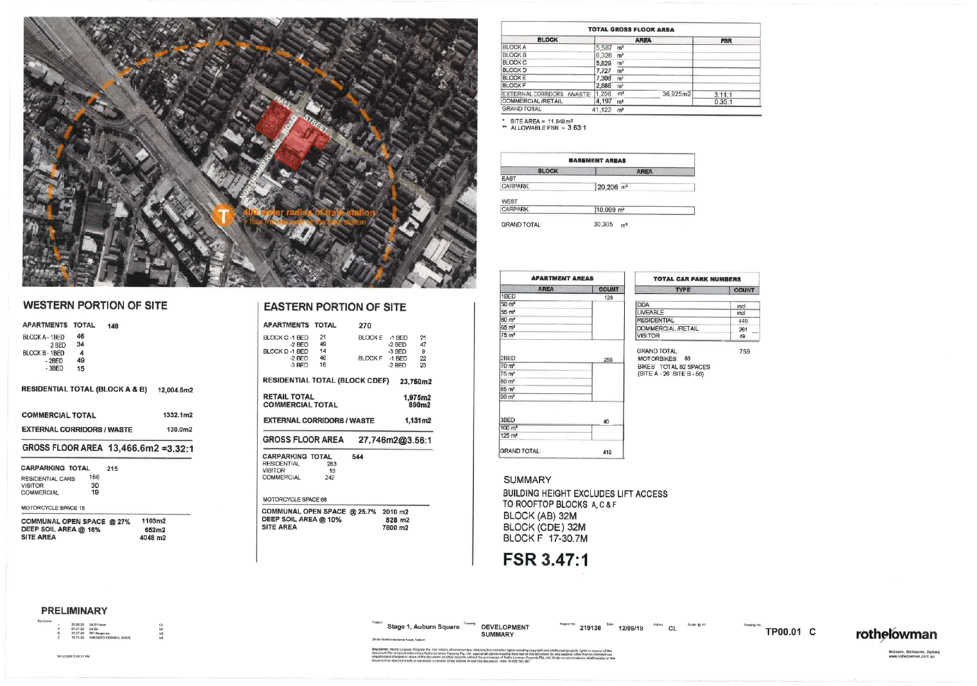
Development
statistics
|
Approved
|
Modification
|
Change
|
|
Floor
area.
|
14,564 Sq
m
|
13,454.6
sq m
|
1,109.4 Sq
m (Decrease).
|
|
Floor
space ratio
|
3.60:1
|
3.247:1
|
0.353:1
(Decrease).
|
|
Retail
floor area
|
1,101 Sq m
|
1,159 Sq m
|
58 Sq m
(Increase).
|
|
Building
height
|
34.84
metres
10
Storeys.
|
36.12
metres
10
Storeys.
|
1.28
metres (Increase).
No change
in storeys.
|
|
Number of
apartments
|
155
|
148
|
7 (Decrease).
|
|
Apartment
breakdown
|
54 x 1
bedroom apartments.
101 x 2
bedroom apartments.
|
50 x 1
bedroom apartments
83 x 2
bedroom apartments
15 x 3
bedroom apartments.
|
There are
less apartments but the number of bedrooms has increased from 256 to 261.
|
|
Car
parking
|
Total 235
spaces.
|
Total 215
spaces
|
20 spaces
(Decrease).
|
Additional minor changes are
requested including:-
· Roof
and doors being added to Building A roof top to enclose the lift lobby.
· Hot
water plant being consolidated within a screened enclosure on the rooftop of
building (B).
· Extend
the Building B stair core to allow for maintenance access to the roof and solar
panel system.
· MSB
room relocated to basement Level 2.
· The
eastern basement stair is removed from Basement levels B2 to B4 as it is not
required for egress.
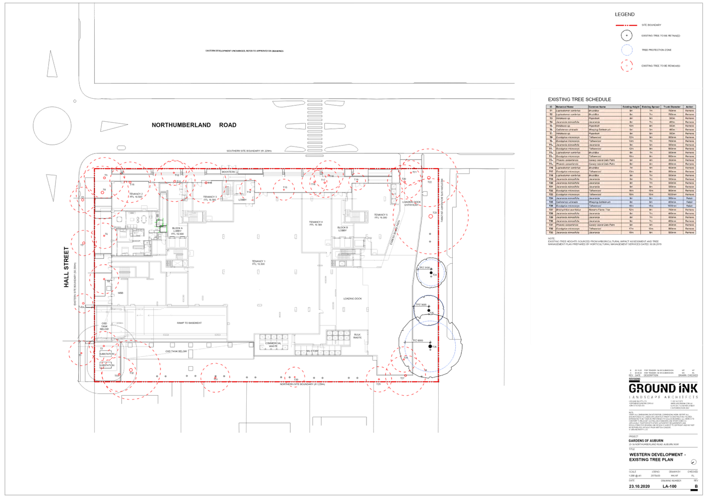
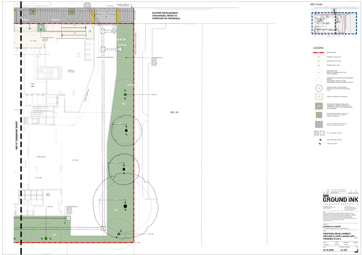
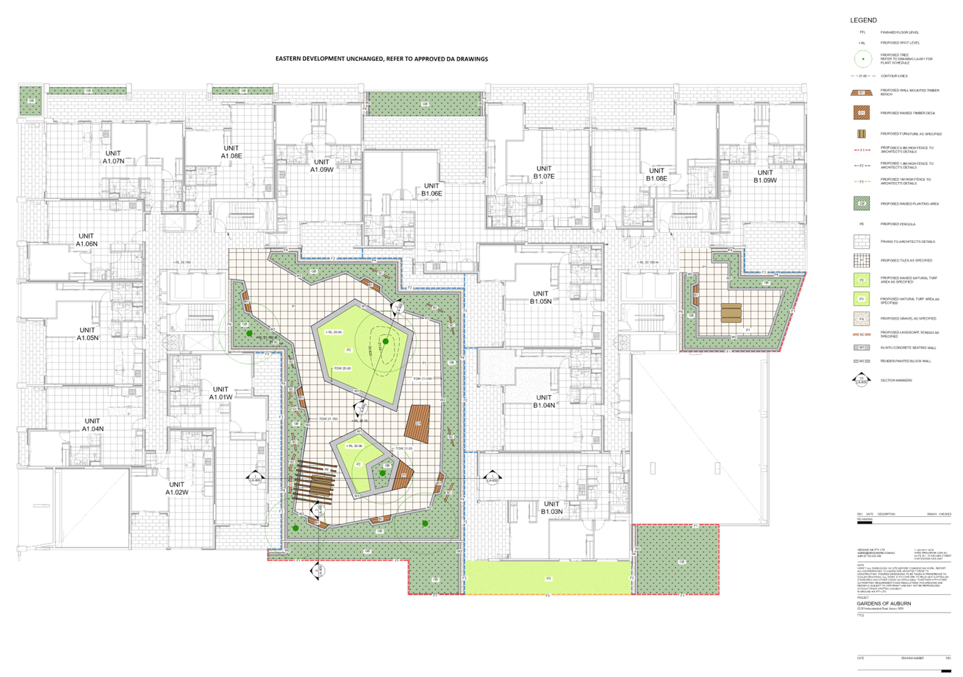
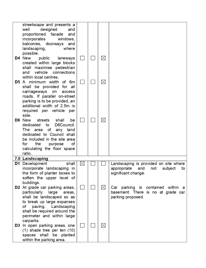
Landscape plans
It was requested that the
landscape plans be updated to identify the retention of Tree 26. The arborist
report prepared by Horticultural Management Services has been updated which
recommends the retention of tree numbered 26. The landscaping plan has now been
updated so that it is consistent with the arborist report and recommendations
made.
Conditions of Consent
Should the modification
application be supported, the following conditions imposed by the Land and
Environment Court would require modification
· Condition
1 - Approved plans.
· Conditions
5 and 6 - Developer contributions.
· Condition
98 - Car parking allocation (Western building).
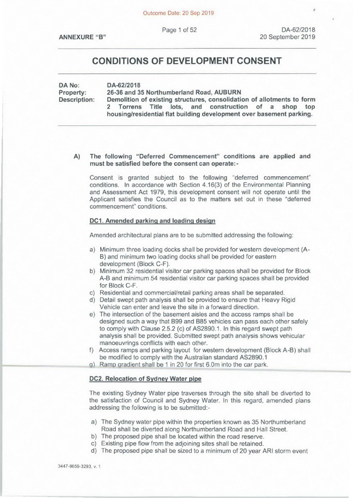
History
The Land and Environment Court
granted deferred commencement consent to development application 2018/62 for
the demolition of the existing structures, consolidation of allotments to form
two Torrens Title allotments and construction of shop top housing / residential
flat building development over basement car parking subject to conditions on
the 20 September 2019.
The deferred commencement consent
was made operational on the 4 December 2020.
Modification application 2020/0157
was approved under delegated authority on the 1 September 2020 for changes to
the wording of various engineering conditions including Conditions 10, 62, 63,
64, 67 and 126.
Modification application 2020/0212
for alterations to the western portion of the development was submitted to the
Council for determination on the 1 July 2020 which is the subject of this
report.
Applicants Supporting
Statement
The applicant has provided a
Statement of Environmental Effects prepared by Willow Tree Planning which is
dated June 2020 in support of the modification application.
A modified statement of effects
was submitted on the 29 January 2021 to clarify the modifications sought and to
address errors made in the original statement that was submitted.
Contact with Relevant
Parties
The assessing officer has
undertaken a site inspection of the subject site and surrounding properties and
has been in regular contact with the applicant throughout the assessment
process.
Internal Referrals
Development Engineer
The modification application was
referred to Council’s Development Engineer for comment who has advised
that the modified development is satisfactory subject to a new condition
addressing columns within the shared zone and vehicle circulation.
Environment and Health
The modification application was
referred to Council’s Environment and Health Officer for comment who has
advised that the modified development proposal is satisfactory.
Landscape Architect/Officer
The modification application was
referred to Council’s Tree Management Officer who has advised that the
changes sought are supported.
Waste Management
The modification application was
referred to Council’s Waste Management Officer for comment who has
advised that the changes to the waste storage provisions are satisfactory
without the need for additional conditions.
External Referrals
No external referrals are required
in this instance.
PLANNING COMMENTS
Section 4.56 Modification by
consent authorities of consents granted by the Court:
|
Requirement
|
Comments
|
|
Council is satisfied that the development to which the
consent as modified relates is substantially the same development as the
development for which the consent was originally granted and before that
consent as originally granted was modified (if at all), and
|
The modified development is substantially the same as that
initially approved. In this regard:-
· The plans are
still showing a development comprising shop top housing / residential
apartment building development situated over a basement car park.
· The form,
footprint, style, streetscape elevation is generally retained.
·
· The number of
basement car park levels remain the same as that approved.
· The street, side
and rear setbacks remain the same.
· The form of the
residential tower/s above the retail floor level is generally retained as per
the approved plans.
· The retail floor
area while slightly larger than that approved is still retained in its
current form, shape and location.
· The loading bay
area while altered slightly is generally retained in its approved location.
There are reductions in the floor space ratio, number of
apartments and car parking spaces which results in various changes to the
built form and elevations but essentially it is considered that the
development meets the test as being “substantially the same”.
This is further reinforced by the fact that the
modifications do not impact the eastern portion of the development situated
on the eastern side of Northumberland Road.
|
|
Council has notified the application in accordance with:
(i) the regulations, if the
regulations so require, and
(ii) a development control plan,
if the consent authority is a council that has made a development control
plan that requires the notification or advertising of applications for
modification of a development consent, and
Council has notified, or made reasonable attempts to
notify, each person who made a submission in respect of the relevant
development application of the proposed modification by sending written
notice to the last address known to the consent authority of the objector or
other person, and
|
The modification application was notified for a period of
fourteen (14) days between the 14 August
2020 and the 28 August 2020. In response, there was one submission received.
The submission is addressed below.
The objectors to the original development application
2018/62 have also been notified of the modification application and no
submissions received.
|
|
Council has considered any submissions made concerning the
proposed modification within any period prescribed by the regulations or
provided by the development control plan, as the case may be.
|
The submission made has been considered and it is
identified that it does not raise any issues in relation to the approved or
modified building.
|
|
Relevant matters referred to in Section 4.15(1) of the act
have been taken into consideration.
Council has considered the reasons given by the consent
authority for the grant of the consent that is sought to be modified.
|
The proposed modification is not contrary to the public
interest and the likely environmental impacts of the development as modified
are considered acceptable.
The Judgement of the Land and Environment Court dated
Friday 20 September 2019 has been considered and the following is provided:-
· The development
still supports Council vision for the locality.
· Residential
amenity is slightly improved as a result of a reduction of floor area and
proposed intensity of use.
· The modified
height of the development is acceptable and has minimal adverse impact to the
locality.
As such, it is considered that the modified development is
still consistent with the Judgment of the Court.
|
|
After determining an application for modification of a
consent under this section, Council must send a notice of its determination
to each person who made a submission in respect of the application for
modification
|
This is noted and would be undertaken once the
modification application is determined.
|
The provisions of any
Environmental Planning Instruments (EP&A Act s4.15 (1)(a)(i))
State Environmental Planning
Policies
The proposed development is
affected by the following State Environmental Planning Policies:
(a) State
Environmental Planning Policy (State and Regional Development) 2011
Development of a type that is
listed in Schedule 7 of SEPP (State and Regional Development) 2011 is defined
as ‘regional significant development’. Such applications require a
referral to a Sydney District Panel for determination as constituted by Part 3
of Schedule 2 under the Environmental Planning and Assessment Act 1979.
The original development had a
capital investment value exceeding $123 million which exceeded the $30 million
threshold. However, the applicant lodged an Appeal for deemed refusal prior to
the original development application being determined and the Land and
Environment Court became the determining authority for the development
application.
Whilst the subject modification
does not fall within those to be referred to the Regional Panel as per Clause
123BA of the Environmental Planning and Assessment Regulations 2000, the
application is however being referred to the Cumberland Local Planning Panel
for determination as Council staff does not have the delegation to determine
applications with more than 10% variation to a development standard.
(b) State
Environmental Planning Policy No. 55 - Remediation of Land (SEPP 55)
Clause 7 of SEPP 55 requires
Council to be satisfied that the site is suitable or can be made suitable to
accommodate the proposed development. The matters listed within Clause 7 have
been considered in the assessment of the modification application.
|
Matter for Consideration
|
Yes/No
|
|
Does the application involve re-development of the site or
a change of land use?
|
Yes
No
|
|
Does
the application involve re-development of the site or a change of land use?
|
Yes
No
|
|
Is the development going to be used for a sensitive land
use (e.g. residential, educational, recreational, childcare or hospital)?
|
Yes
No
|
|
Does information available to you indicate that an activity
listed below has ever been approved, or occurred at the site?
acid/alkali plant and
formulation, agricultural/horticultural activities, airports, asbestos
production and disposal, chemicals manufacture and formulation, defence
works, drum re-conditioning works, dry cleaning establishments, electrical
manufacturing (transformers), electroplating and heat treatment premises,
engine works, explosive industry, gas works, iron and steel works, landfill
sites, metal treatment, mining and extractive industries, oil production and
storage, paint formulation and manufacture, pesticide manufacture and
formulation, power stations, railway yards, scrap yards, service stations,
sheep and cattle dips, smelting and refining, tanning and associated trades,
waste storage and treatment, wood preservation
|
Yes
No
|
|
Is the site listed on
Council’s Contaminated Land database?
|
Yes
No
|
|
Is the site subject to EPA
clean-up order or other EPA restrictions?
|
Yes
No
|
|
Has the site been the subject of
known pollution incidents or illegal dumping?
|
Yes
No
|
|
Does the site adjoin any
contaminated land/previously contaminated land?
|
Yes
No
|
|
Has the appropriate level of
investigation been carried out in respect of contamination matters for
Council to be satisfied that the site is suitable to accommodate the proposed
development or can be made suitable to accommodate the proposed development?
|
Yes
No
|
|
Details of contamination investigations carried out at the
site:
Details concerning land contamination have been addressed
as part of the assessment of development application 2018/62 and the
conclusions made would not have changed. The entire site is to be excavated
as part of the redevelopment and construction of a basement car park. No
changes are proposed or required to the degree of excavation to be
undertaken.
|
(c) State
Environmental Planning Policy No. 65 - Design Quality of Residential Apartment
Development (SEPP 65)
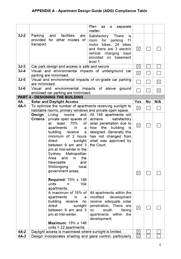
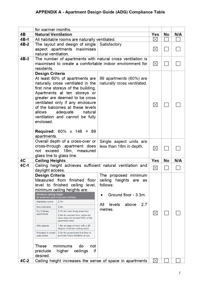
SEPP 65 applies to the modified
development as the building is 3 storeys or more and contains more than 4
dwellings. A design statement addressing the design quality principles
prescribed by SEPP 65 was prepared by the project architect. Integral to SEPP 65
is the Apartment Design Guide (ADG), which sets benchmarks for the appearance,
acceptable impacts and residential amenity of the development.
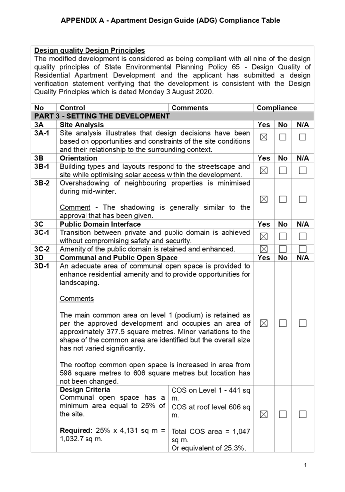
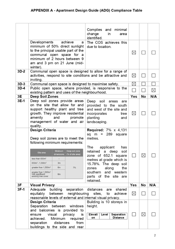
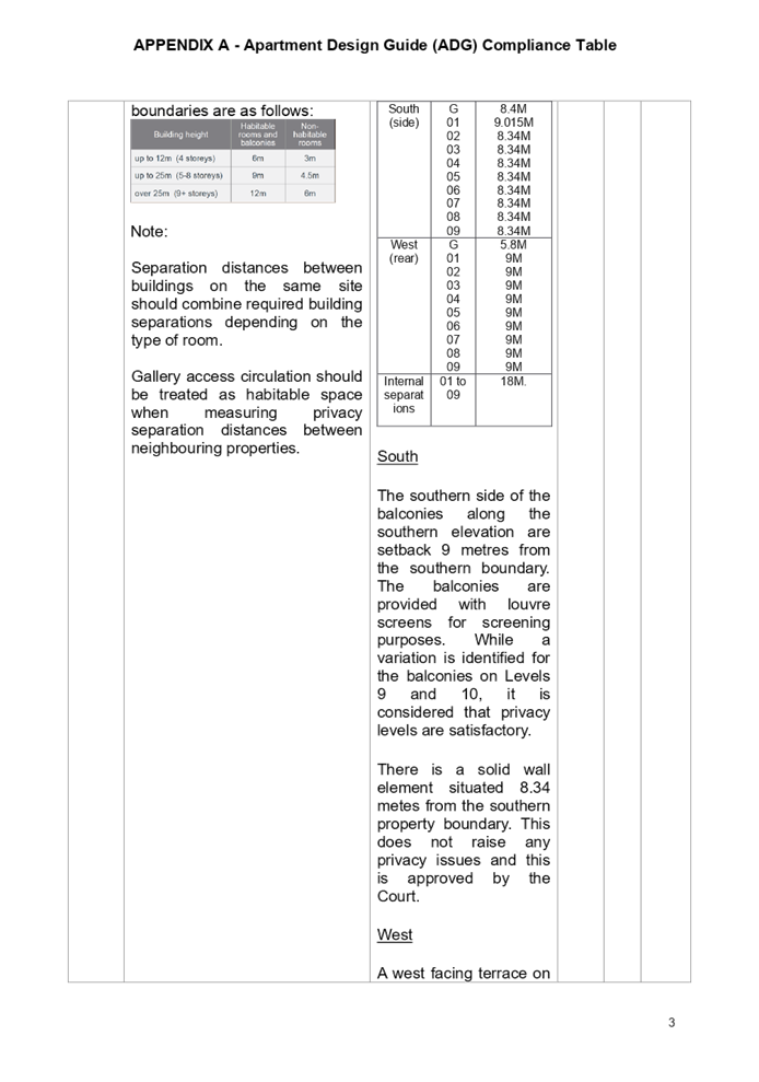
Following a detailed assessment of
the modified proposal against the provisions of SEPP 65 and the ADG, it is considered
that the modified proposal is generally compliant with the provisions as well
as the Court approval given with the exception of Part 4D-2 - Environmental
performance of apartments is maximised as follows.
|
DEVELOPMENT
STANDARD
|
COMPLIANCE
|
DISCUSSION
|
|
Part 4D-2 Maximum habitable room depth is 8 metres from a
window.
|
No
|
It is calculated that 23 apartments have room depths
greater than 8 metres from a window which is an increase of 1 from the Court
approval.
The variation is between 200 and 600 mm.
|
As indicated in the above table,
the modified development departs from Part 4D-2 - Environmental performance of
apartments is maximised.
The Court approved plans presented
22 apartments which had room depths of greater than 8 metres from a window with
the variation ranging from 200 to 600 mm. The modified development presents 23
apartments which have room depths of greater than 8 metres from a window with
depths ranging from 200 mm to 600 mm. The increase is 1 apartment.
Notwithstanding the variation, all the apartments incorporating the bedrooms
and living areas are located on the external face of the building and, as such,
adequate amenity is achieved.
This development presents a high
degree of compliance with the Apartment Design Guide and the Court approval. It
is also identified that residential amenity is retained as per the approval and
minor variations such as the one presented will not have any adverse impact to
the final outcome of the finished development.
A comprehensive assessment of the
changes to the western building against SEPP 65 and the ADG is contained in
Appendix A.
(d) State
Environmental Planning Policy (Infrastructure) 2007 (ISEPP)
The provisions of State
Environmental Planning Policy (Infrastructure) 2007 have been considered in the
assessment of the modification application. It is identified that the site lies
more than 130 metres from the intersection of Rawson Street with Northumberland
Road and Rawson Street is identified as being a Classified Regional Road. The
modification application is not required to be referred to Transport for New
South Wales (Roads and Maritime Services) under Schedule 4 of the State Policy
on the grounds that there is no increase in car parking occurring on site.
Generally, the following clauses
will not apply to the modification application and no formal assessment is
required:-
· Clause
45 - Determination of development applications other development (Development
close to powerlines).
· Clause
101 - Frontage to a Classified Road.
· Clause
102 - Impact of road noise or vibration on non-road development.
· Clause
104 - Traffic generation developments.
Division 4 “Electricity
Generating Works or Solar Energy Systems
The modification plans is showing
a large solar panel array situated on the roof of the southern tower building
encompassing 162 panels. The applicant has sought consent as the matter is not
exempt or complying development under Division 4 of State Environmental
Planning Policy “Infrastructure” 2007.
(e) State
Environmental Planning Policy (Vegetation in Non-Rural Areas) 2017
Approval has already been given
for the removal of most trees on site and a site inspection has identified that
several trees have already been removed as part of site preparation works.
The proposal does not exceed the
biodiversity offsets scheme threshold. Therefore, the proposed vegetation
removal is considered acceptable.
It is identified that Tree
numbered 26 identified in the arborist report prepared by Horticultural
Management Services will now be retained and the revised landscape plans have
been updated to reflect the change sought.
(f) State
Environmental Planning Policy (Building Sustainability Index: BASIX) 2004
BASIX certificate, Certificate
Number 903923M-08 which is dated 21 May 2020 has been submitted with the
modification application. The modified certificate achieves a pass mark for
both water and energy use and is determined as being satisfactory.
Regional Environmental Plans
The proposed development is
affected by the following Regional Environmental Plans:
(a) Sydney
Regional Environmental Plan (Sydney Harbour Catchment) 2005
The subject site is identified as
being located within the area affected by the Sydney Regional Environmental
Plan (Sydney Harbour Catchment) 2005. The modified development raises no issues
as no impact on the catchment is envisaged.
(Note: - the subject site is not
identified in the relevant map as ‘land within the ‘Foreshores and
Waterways Area’ or ‘Wetland Protection zone’, is not a
‘Strategic Foreshore Site’ and does not contain any heritage items.
Hence the majority of the SREP is not directly relevant to the modified
development).
Local Environmental Plans
Auburn Local Environmental Plan
2010
The provision of the Auburn Local
Environmental Plan 2010 is applicable to the modified development. It is
identified that the modified development achieves compliance with most of the
key statutory requirements of the Auburn Local Environmental Plan 2010 and the
objectives of the B4 zone except for Clause 4.3 ‘Height of Buildings”.
(a) Permissibility:-
The approved and modified
development is defined as a mixed use commercial/retail/apartment building. The
development comprises the following as per the definitions contained within the
Auburn Local Environmental Plan 2010:-
a) Commercial
Premises
Defined as “any of the
following-
(a) business
premises,
(b) office
premises,
(c) retail
premises”.
b) Office
Premises
Defined as “a building or
place used for the purpose of administrative, clerical, technical, professional
or similar activities that do not include dealing with members of the public at
the building or place on a direct and regular basis, except where such dealing
is a minor activity (by appointment) that is ancillary to the main purpose for
which the building or place is used.
Note-
Office premises are a type of
commercial premises - See the definition of that term in this
Dictionary”.
c) Residential
flat building
Defined as “a building
containing 3 or more dwellings but does not include an attached dwelling or
multi dwelling housing.
Note-
Residential flat buildings are a
type of residential accommodation— see the definition of that term in
this Dictionary.
d) Retail
Premises
Defined as “a building or
place used for the purpose of selling items by retail, or hiring or displaying
items for the purpose of selling them or hiring them out, whether the items are
goods or materials (or whether also sold by wholesale), and includes any of the
following;
(a) (Repealed)
(b) cellar
door premises,
(c) food
and drink premises,
(d) garden
centres,
(e) hardware
and building supplies,
(f) kiosks,
(g) landscaping
material supplies,
(h) markets,
(i) plant
nurseries,
(j) roadside
stalls,
(k) rural
supplies,
(l) shops,
(m) specialised
retail premises,
(n) timber
yards,
(o) vehicle
sales or hire premises, but does not include highway service centres, service
stations, industrial retail outlets or restricted premises.
Note-
Retail premises are a type of
commercial premises—see the definition of that term in this
Dictionary”.
Comment
The stated land uses being
commercial premises, offices premises, residential flat buildings and retail
premises are permissible land uses with consent within the B4 Mixed Use zone.
The relevant matters to be
considered under the Auburn Local Environmental Plan 2010 and the applicable
clauses are summarised below. A comprehensive LEP assessment is contained in
Appendix B attached to the report.
Auburn Local Environmental Plan
2010 Compliance Table
|
DEVELOPMENT
STANDARD
|
COMPLIANCE
|
DISCUSSION
|
|
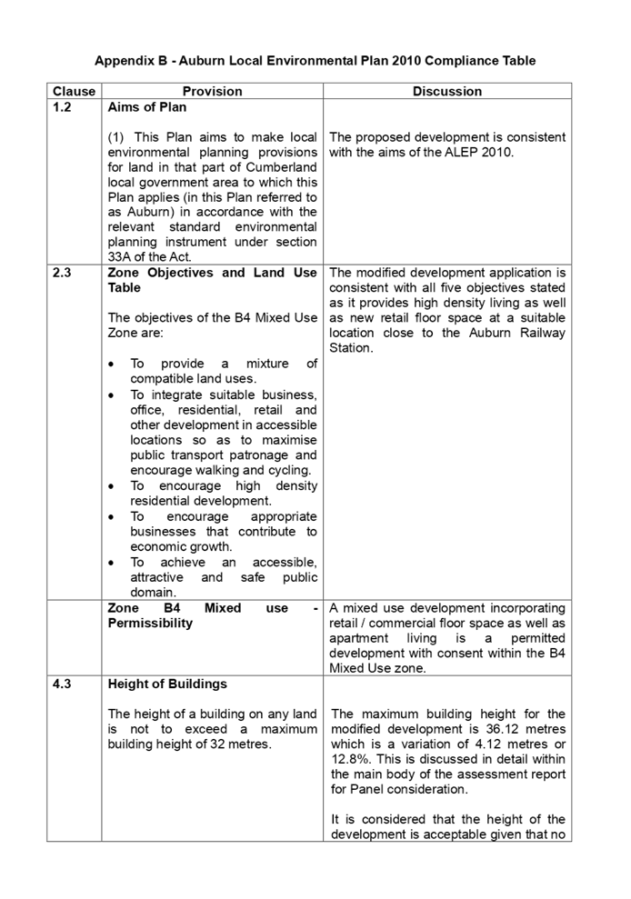
4.3 Height of Buildings
32 Metres.
|
No
|
The modified building has a maximum height of 36.12 metres
which is a variation of 4.12 metres or 12.8%
|
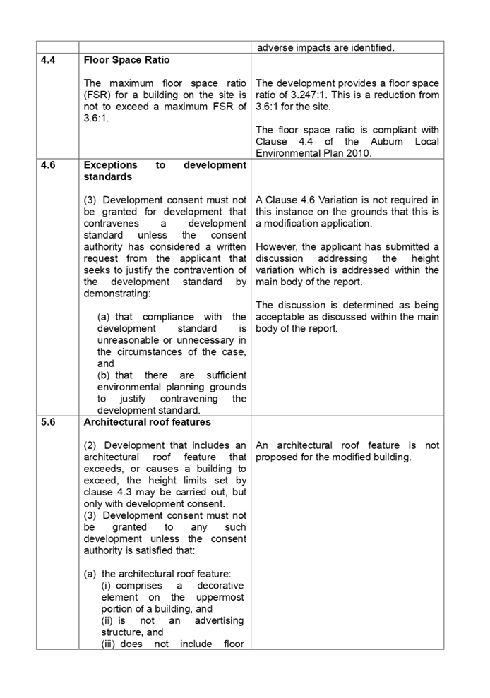
|
4.4 Floor
Space Ratio
3.6:1
|
Yes
|
The floor space ratio of the building (Western side) is
reduced from 3.6:1 to 3.247:1.
|
(b) Clause
4.6 - Variation to Building height limit
The clause will not be applicable
to this application. In accordance with case law, as outlined in the Land
Environment Court Case of Gann & Anor v Sutherland Shire Council [2008]
that there is power to modify a development application where the modification
would result in the breach of development standards. The court took the view
that development standards within an LEP did not operate to prohibit the grant
of consent if they were not complied with (and no objection pursuant to SEPP
No. 1 (now cl 4.6) had been lodged). Notwithstanding, the court held that
despite a SEPP No. 1 Objection not being required, Section 96(3) (now known as
cl 4.55(3)) of the Environmental Planning and Assessment Act 1979 (The Act)
still requires the consent authority to take into consideration those matters
referred to in Section 79C (now Cl4.15) of the Act. This case law has been
applied to Clause 4.6 of the Standard instrument (on which the ALEP 2010 is
derived).
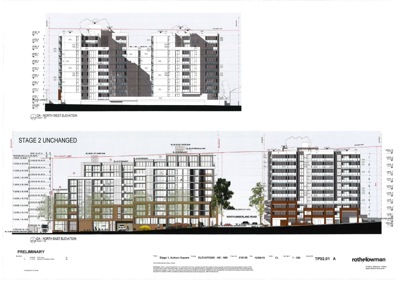
Variation to Building Height
The maximum building height
permitted on the site is 32 metres. The original development application was
approved at 34.84 metres (RL 51.51 Metres AHD) which was a variation of 8.875%.
The Court supported a Clause 4.6 variation request as part of its original
proceedings and approval of the development application which is outlined in
the Judgement dated 20 September 2019.
Under the S4.56 modification
application, the number of storeys within the building remains the same however
there is a minor increase in height of the building. There is an increase in
the floor to ceiling heights of apartments on floors 7, 8 and 9 to allow for
adequate room for insulation. This in turn lifts the overall height of the building
from 34.84 metres to 36.12 metres which is an increase of 1.28 metres maximum.
This results in a variation to Clause 4.3 of 12.8%.
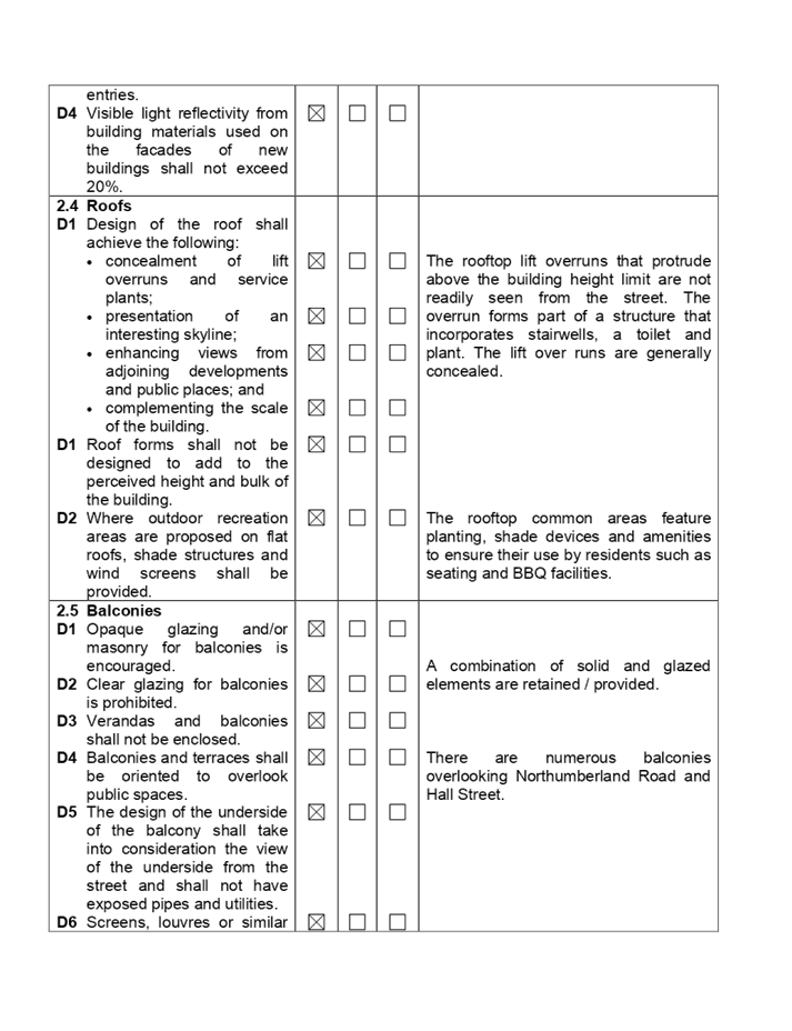
It is identified that the bulk of
the variation is concentrated within the lift over runs, the rooftop plant,
parapets and stair access to the rooftop areas and common open space.
The applicant has addressed the
two objectives of Clause 4.3 as follows:
Applicant comment
Objective (a) and (b):
The element exhibiting the
noncompliance will continue to be a negligible contribution to the building
bulk.
· The
proposal as modified will not result in unreasonable impacts on the local
amenity.
· There
will not be unreasonable impacts to the local amenity and the development will
not result in adverse impacts upon views, solar access and privacy.
The proposed variation will not
impact on the attainment of the objectives of the development standard as the
design outcome will continue to achieve a density and character that is
compatible with the existing and desired character of the surrounding locality.
The proposed modification and further exceedance in the height of the building
development standard continues to satisfy the objectives of both the B4 zone
and Clause 4.3.
Planner comment
The discussion provided by the
applicant is supported. In this regard, the development is consistent with the
objectives of the height standard and the increase is not excessive. It is
identified that the draft Cumberland Local Environmental Plan is providing for
an increase in the height of buildings to 38 metres for the site and as such,
the modified height would be compliant with the provisions of the draft Cumberland
Local Environmental Plan in terms of height.
The variation is limited to the
lift over runs, the rooftop plant, parapets and stair access to the rooftop
areas and common open space. Furthermore:-
· There
is no appreciable increase in shadowing to the south.
· The
development generally retains the footprint of the development already approved
and, hence, there are no increases in bulk and scale of the development.
· The
degree of privacy is satisfactory to all boundaries.
· The
floor space ratio of the development is reduced which has occurred as a result
of a reduction of seven apartments within the development.
· The
modified development is determined as being consistent with the objectives of
Clause 4.3 and no unreasonable amenity impact is identified.
When considering the above, the
variation sought is considered as being acceptable to the site.
The provisions of any proposed
instrument that is or has been the subject (EP&A Act s4.15 (1)(a)(ii))
(a) Draft
Cumberland Local Environmental Plan (Draft CLEP)
The Draft Cumberland Local
Environmental Plan (Draft CLEP) has been prepared by Cumberland City Council to
provide a single planning framework for the future planning of Cumberland City.
The changes proposed seek to harmonise and repeal the three existing LEPs
currently applicable to the Cumberland local government area, those being:
· Holroyd
Local Environmental Plan 2013,
· Parramatta
Local Environmental Plan 2011, and
· Auburn
Local Environmental Plan 2010.
The land use zoning and floor
space ratio provisions are expected to remain the same as those at the present
time; however, the building height limit is expected to increase from 32 metres
to 38 metres. The modified development is consistent with the relevant
provisions of the draft Cumberland Local Environmental Plan.
The provisions of any
Development Control Plans (EP&A Act s4.15 (1)(a)(iii))
The Auburn Development Control
Plan provides guidance for the design and operation of development to achieve
the aims and objectives of the Auburn Local Environmental Plan 2010. The Auburn
Development Control Plan (Residential Flat Buildings Chapter) is relevant to
the modification application and the modification has been assessed against the
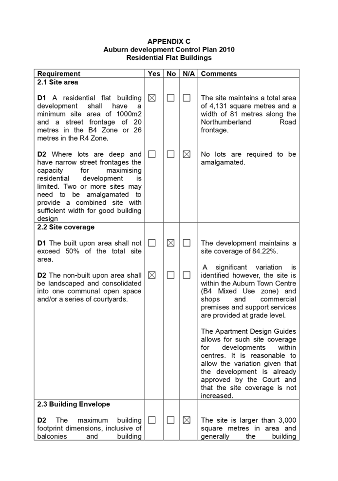
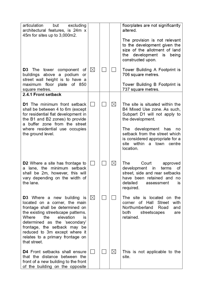
provisions of the Residential Flat Buildings Chapter. The following variations
are identified. A comprehensive assessment is contained in Appendix C attached
to the report.
|
Part
|
Control
|
Proposed
|
Complies
|
|
Part 2.2
|
Size of dwellings
Size of dwelling determine the
maximum number of bedrooms permitted.
1 Bedroom single aspect 63 sq. m.
2 Bedrooms 80 sq. m (Corner).
3 Bedrooms 115 sq. m.
|
·
50.2 sq m to 63 sq m.
·
·
·
78.3 sq m to 87.6 sq m.
·
·
99.4 sq m to 109.3 sq m.
(All apartments comply with the ADG).
|
No
No
No
|
As indicated in the compliance
table above, the proposed development departs from Part 2.2 (Subpart D1)
relating to dwelling size. The variation is determined as being satisfactory
for the following reasons:-
· The
Apartment Design Guide generally overrides Council's controls in relation to
the abovementioned variation.
· The
development is providing satisfactory amenity for residents and the proposed
intensity of use is considered satisfactory for residents.
Irrespective of the variations, it
is considered that the proposal performs adequately from an environmental
planning viewpoint and may be supported.
The Auburn Development Control
Plan (Local Centres Chapter) is relevant to the modification application and
the modification has been assessed against the provisions of the Local Centres
Chapter. The following variations are identified. A comprehensive assessment is
contained in Appendix D attached to the report.
|
Part
|
Control
|
Proposed
|
Complies
|
|
Part 6.1
|
Access, loading and car parking requirements
Car parking rates shall be provided in accordance with the
Parking and Loading Part of this DCP.
|
The development must achieve the minimum requirements as
follows:-
Guide to Traffic Generating Development (For residential
part only)
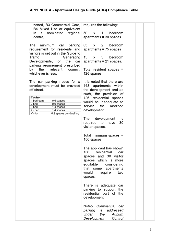
50 x 1
bedroom apartments = 30 spaces.
83 x 2
bedroom apartments = 75 spaces.
15 x 3
bedroom apartments = 21 spaces.
Total resident spaces = 126 spaces.
There are 148 apartments within the development and as
such, 126 residential spaces are inadequate.
The applicant has shown 166 residential car spaces and 30 visitor
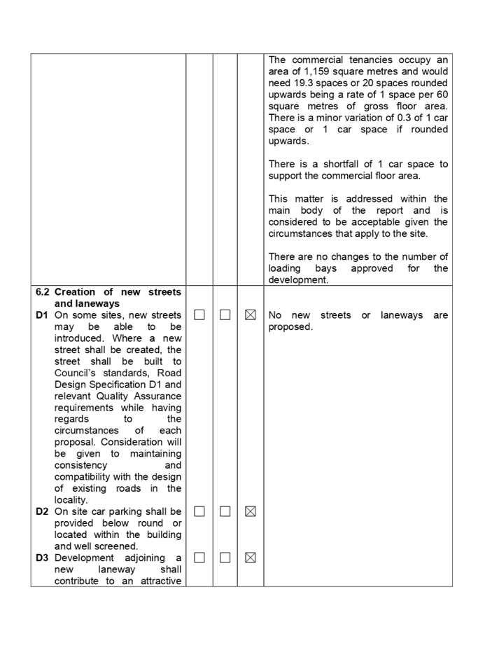
spaces which leaves 19 spaces to service the commercial floor area.
The commercial tenancies occupy 1,159 square metres and
requires 19.3 or 20 spaces at 1 space per 60 square metres of gross floor
area.
There is a variation of 0.3 of 1 car parking space or 1
if rounded upwards.
See discussion below.
|
No for commercial floor space.
|
As indicated in the compliance
table above, the proposed development departs from Part 6.1 (Subpart D1)
relating to the number of car parking spaces required to support the commercial
floor area of the building. The variation is determined as being satisfactory.
The variation is 0.3 of 1 car
parking space or 1 space if the car parking is rounded upwards to 1 space.
A reallocation of 1 residential
car space has been considered to address the issue.
It would be difficult to address
the commercial car parking shortfall because all the commercial and visitor car
parking spaces are situated on Basement Level 1 while the residential car
parking spaces are situated on Basement Levels, 2, 3 and 4. If one additional
residential car parking space is reallocated to commercial spaces, then this
would alter the security measures proposed or provided for the basement car
park levels 2, 3 and 4.
An additional car space cannot be
incorporated on Basement Level 1 to address the shortfall due to inadequate
space on this level.
Council engineers have noted the
variation and consider the matter to be minor in extent. As such, the variation
of 0.3 of 1 space or 1 space if rounded upwards is not excessive to warrant
refusal of the modification application and can be supported.
Furthermore, the development falls
under the following chapters of the Auburn Development Control Plan 2010.
· Parking
and Loading.
· Stormwater
Drainage.
· Access
and Mobility.
· Waste.
In relation to the above, the
matter concerning car parking is addressed at Part 6.1 of the Local Centres
Chapter of the Auburn Development Control Plan 2010 and no further discussion
is required.
The assessment demonstrates that
the modification application achieves full compliance with the remaining
provisions and chapters of the Auburn Development Control Plan 2010.
The provisions of any planning
agreement that has been entered into under section 7.4, or any draft planning
agreement that a developer has offered to enter into under section 7.4
(EP&A Act s4.15(1)(a)(iiia))
There are no planning agreement
associated with the subject Development Application.
The provisions of the
Regulations (EP&A Act s4.15 (1)(a)(iv))
The proposed development raises no
concerns as to the relevant matters arising from the Environmental Planning and
Assessment Regulations 2000 (EP&A Reg).
The Likely Environmental,
Social or Economic Impacts (EP&A Act s4.15 (1)(b))
It is considered that the proposed
development will have no significant adverse environmental, social or economic
impacts in the locality.
The suitability of the site for
the development (EP&A Act s4.15 (1)(c))
The subject site and locality is
not known to be affected by any natural hazards or other site constraints likely
to have a significant adverse impact on the proposed development. Accordingly,
it is considered that the development is suitable in the context of the site
and surrounding locality.
Submissions made in accordance
with the Act or Regulation (EP&A Act s4.15 (1)(d))
|
Advertised
|
Mail
|
Sign
|
Not Required
|
In accordance with Council’s Notification requirements
contained within the Auburn Development Control Plan 2010, the modification was
notified for a period of fourteen (14) days between the 14 August 2020 and the
28 August 2020. There was one submission generated as follows:-
|
·
Issue
|
·
Discussion
|
|
·
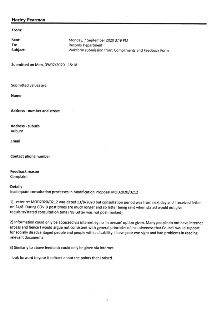
The letter is dated the 13/8/2020 with the consultation period
starting the next day. I received the letter on the 24/8/2020. Post times are
much longer and there is inadequate time for consultation.
·
·
Information could only be accessed via the internet with no in
person option being given. Many people do not have internet access and as
such, the notification is not consistent with Council’s processes
especially for people with a disability.
|
·
Council records show a specific response being provided by the
assessing officer and the notification time was extended for the writer. The
records show no further submission being submitted from the writer.
|
The public interest (EP&A Act s4.15(1)(e))
In view of the foregoing analysis it is considered that the
modified development, if carried out subject to the conditions set out in the
recommendation below, will have no significant adverse impacts on the public
interest.
Cumberland Local
Infrastructure Contributions Plan 2020
Condition 6 of the Court approved development consent
requires payment of $2,262,242.01 to be made. As a result of the changes being
made, the contribution amount will increase to $2,404,620.65. Condition 6 of
the development consent will need to be modified to reflect the changes made.
Disclosure of Political
Donations and Gifts
The applicant and notification
process did not result in any disclosure of Political Donations and Gifts.
The modification application has
been assessed in accordance with the relevant requirements of the Environmental
Planning and Assessment Act 1979 and the following planning controls:-
· State
Environmental Planning Policy 65 - Design Quality of Residential Apartment
Development (SEPP 65).
· State
Environmental Planning Policy (Infrastructure) 2007.
· State
Environmental Planning Policy (Building Sustainability Index: BASIX) 2004.
· Auburn
Local Environmental Plan 2010.
· Draft
Cumberland Local Environmental Plan.
· Auburn
Development Control Plan 2010.
The development as modified is
appropriately located within the B4 Mixed Use zone under the provisions of the
Auburn Local Environmental Plan 2010, however, a variation to Clause 4.3 of the
Auburn Local Environmental Plan 2010 (Height of Buildings), Part 2.2 (Size of
Dwellings) and Part 6.1 (Access, loading and car parking requirements) of the
Auburn Development Control Plan 2010 (Residential Flat Buildings and Local
Centres) chapters is sought.
Having regard to the assessment of
the proposal from a merit perspective, the Panel may be satisfied that the
modified development has been responsibly designed and provides for acceptable
levels of amenity for future residents. It is considered that the modified
development including a reduction of apartments will achieve improved amenity
for the future occupants and the proposal successfully minimises adverse
impacts on the amenity of neighbouring properties. Hence the modified
development, irrespective of the departures noted above, is consistent with the
intentions of Council’s planning controls and represents a form of
development contemplated by the relevant statutory and non-statutory controls
applying to the land.
For these reasons, it is
considered that the modified proposal is satisfactory having regard to the matters
of consideration under Section 4.15 and 4.56 of the Environmental Planning and
Assessment Act 1979, and the modified development may be approved subject to
conditions.
|
1. That
Modification Application MOD2020/0212 being a Section 4.56 Modification
Application to reconfigure the basement layout, reconfigure and amalgamate
apartments, alteration to commercial floor areas and service areas, increase
in building height, alteration to communal open spaces and facade treatments
of development consent 2018/62 on land at 26-36 Northumberland Road Auburn be
approved subject to conditions as listed in the attached Schedule.
·
2. Persons
whom have lodged a submission in respect to the application be notified of
the determination of the application.
|
1. Draft
Notice of Determination
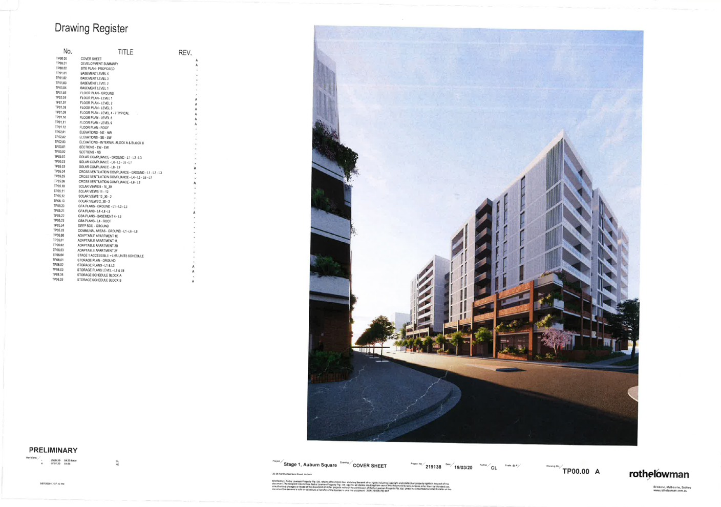
2. Architectural
Plans
3. Modified
Landscape Plans
4. Approved
Architectural Plans
5. Court
Approval Notice of Determination
6. Redacted
Submission
7. Appendix
A - Apartment Design Guide Assessment
8. Appendix
B - Auburn Local Environmental Plan 2010 Compliance Table
9. Appendix
C - Auburn Development Control Plan 2010 (Residential Flat Buildings)
10. Appendix
D - Auburn Development Control Plan 2010 - Local Centres
DOCUMENTS
ASSOCIATED WITH
REPORT LPP009/21
Attachment 1
Draft Notice of Determination
Cumberland Local Planning Panel Meeting
14 April 2021

DOCUMENTS
ASSOCIATED WITH
REPORT LPP009/21
Attachment 2
Architectural Plans
Cumberland Local Planning Panel Meeting
14 April 2021

DOCUMENTS
ASSOCIATED WITH
REPORT LPP009/21
Attachment 3
Modified Landscape Plans
Cumberland Local Planning Panel Meeting
14 April 2021


DOCUMENTS
ASSOCIATED WITH
REPORT LPP009/21
Attachment 4
Approved Architectural Plans
Cumberland Local Planning Panel Meeting
14 April 2021
DOCUMENTS
ASSOCIATED WITH
REPORT LPP009/21
Attachment 5
Court Approval Notice of Determination
Cumberland Local Planning Panel Meeting
14 April 2021

DOCUMENTS
ASSOCIATED WITH
REPORT LPP009/21
Attachment 6
Redacted Submission
Cumberland Local Planning Panel Meeting
14 April 2021
DOCUMENTS
ASSOCIATED WITH
REPORT LPP009/21
Attachment 7
Appendix A - Apartment Design Guide Assessment
Cumberland Local Planning Panel Meeting
14 April 2021


DOCUMENTS
ASSOCIATED WITH
REPORT LPP009/21
Attachment 8
Appendix B - Auburn Local Environmental Plan 2010
Compliance Table
Cumberland Local Planning Panel Meeting
14 April 2021
DOCUMENTS
ASSOCIATED WITH
REPORT LPP009/21
Attachment 9
Appendix C - Auburn Development Control Plan 2010
(Residential Flat Buildings)
Cumberland Local Planning Panel Meeting
14 April 2021
DOCUMENTS
ASSOCIATED WITH
REPORT LPP009/21
Attachment 10
Appendix D - Auburn Development Control Plan 2010 -
Local Centres
Cumberland Local Planning Panel Meeting
14 April 2021

Cumberland
Local Planning Panel Meeting
14 April 2021
Item
No: LPP010/21
Development Application for 22-24 Park Road, Auburn
Responsible
Division: Environment
& Planning
Officer: Executive
Manager Development and Building
File
Number: DA2020/0336
|
Application
lodged
|
17 June 2020
|
|
Applicant
|
A & A Development Pty
Limited
|
|
Owner
|
Mr P Khattar & A & A
Development Pty Limited
|
|
Application
No.
|
DA2020/0336
|
|
Description
of Land
|
22 - 24 Park Road AUBURN
NSW 2144, Lot 17 Sec 4 DP 982836, Lot 18 Sec 4 DP 982836
|
|
Proposed
Development
|
Demolition of existing
structures and construction of an 11 storey mixed use development comprising
10 levels of residential apartment units, ground floor retail/commercial
tenancies and ground floor & basement car parking
|
|
Site
Area
|
1226.32 m2
|
|
Zoning
|
Zone B4 Mixed Use
|
|
Disclosure
of political donations and gifts
|
Nil disclosure
|
|
Heritage
|
The site is not a heritage
item and is not within a heritage conservation area
|
|
Principal
Development Standards
|
FSR
Permissible: 5:1
Proposed: 4.94:1
Height of Building
Permissible: 38m
Proposed: 38m
|
|
Issues
|
ADG non compliances
Submissions
|
1. Development
Application No. DA2020/0336 was received on 17 June 2020 for the Demolition of existing
structures and construction of an 11-storey mixed use development comprising of
residential apartment units, ground floor retail/commercial tenancies and
ground floor & basement car parking.
2. The
application was publicly notified to occupants and owners of the adjoining
properties for a period of 14 days between 13 August 2020 and 27 August 2020.
In response, two (2) unique submissions were received.
3. The
subject site is not listed as a heritage item and is not located within a
heritage conservation area under the Auburn Local Environmental Plan 2010.
4. The
application has been referred to the Cumberland Design Excellence Review Panel
for consideration and conditions have been provided in respect of the proposed
development.
5. Variations
to the ADG and ADCP 2010 are as follows:
|
Control
|
Required
|
Provided
|
% variation
|
|
Apartment Design Guide
|
|
Part 2F and 3F – Building Separation / Visual
Privacy
|
9m to 12m
|
From Side boundaries: 7m (internal balconies and gallery
area)
From rear boundary: 10m
|
(2m to 5m) 16.6% to 41.6%
(2m) 16.6%
|
|
3E – Deep Soil Zone
|
7% of site area with 3m dimensions
|
Nil
|
100%
|
|
Auburn Development Control Plan 2010
|
|
2.3 – Site Coverage
|
Max. 50% of site area
|
100%
|
50%
|
|
3.3 – Deep Soil Zone
|
30% of site area with 5m dimensions
|
Nil
|
100%
|
6. The
application is referred to the Panel as it relates to a development to which
SEPP 65 applies.
7. The
application is recommended for deferred commencement approval subject to the
conditions as provided in the attached schedule.
Subject Site and Surrounding
Area
The site is known as 22 to 24 Park
Road, Auburn and is legally described as Lot 17 and 18 in DP 982836. The site
comprises of two regular shaped allotments with a frontage of 24.38m and an
average side depth of 50.29m resulting in a total site area of 1226m2.
The site is located within the
Auburn Town Centre on land zoned B4 Mixed Use. The site currently accommodates
two single storey residential buildings and other ancillary structures at the
rear. The site is also significantly landscaped containing a number of trees
within the site including two street trees.
The locality is dominated by a
mixture of land uses including:
· Single
detached dwelling houses as well as a recently constructed 12 storey mixed use
development to the south, at 15 Mary Street;
· Three
storey residential flat building with basement parking at 16 to 20 Park Road to
the north,
· Two
and three storey residential flat buildings at 7 to 9 and 11 Harrow Road to the
east, and
· A catholic school known as Trinity
Catholic College is located directly opposite of Park Road to the west.
The site is also located in proximity
to a heritage item (I17) nearby known as 24 Mary Street being the former
Lea’s Temperance Hall.
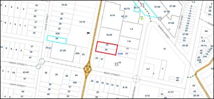
Figure
1 – Locality Plan of subject site
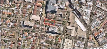
Figure
2 – Aerial view of subject site
Figure
3 – Street view of subject site
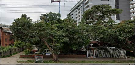
Number
22 and 24 Park Road Auburn
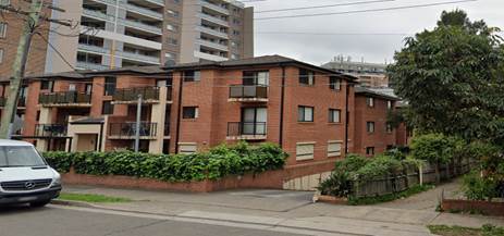
The
Residential Flat Building at 16 to 20 Park Road to the Immediate North
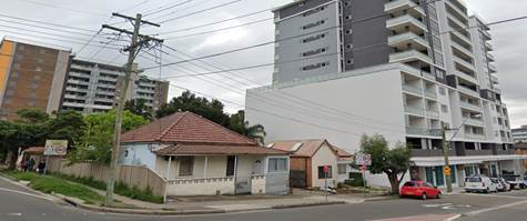
Lots
to the Immediate South Facing Mary Street
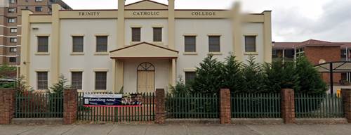
The
Trinity Catholic College on the Western Side of Park Road, Directly Opposite
Subject Site.
Description of the Proposed
Development
Council has received a development
application for the demolition of existing structures and construction of an
11-storey mixed use development comprising 10 levels of residential apartment
units, ground floor retail/commercial tenancies and ground floor & basement
car parking.
A detailed breakdown of the
development is as follows:
· Construction
of 80 (to be revised down to 79) residential apartments at levels 1 to 10
comprising of the following unit mix:
- 1
x studio
- 9
x 1 bedroom units
- 59
x 2 bedroom units and
- 10
x 3 bedroom units
· Construction
of 105 square metres of commercial floor space at ground level
· Construction
of 3 basement level parking including parking at grade, comprising of:
- A
total of 108 car parking spaces including disabled, visitor and commercial,
- 16
bicycle parking spaces within basement level 1 and on ground floor,
- Associated
lift services, stairs wells, residential storage space, plant rooms and garbage
rooms for residential and commercial provided at grade.
· Provision
of a Communal Open Space Areas at level 1.
· Demolition,
site and infrastructure works, stormwater drainage and associated landscaping
works.
History
DA340/2015 was determined by the
Cumberland Independent Hearing and Assessment Panel on the 17 June 2016 by way
of a deferred commencement approval for the demolition of the existing
structures, tree removal and construction of an 11 storey mixed use development
comprising ground floor commercial/retail tenancies and 80 residential apartments
above with a three level basement car park for 106 vehicles.
It was noted that the applicant
had failed to satisfy the terms of the deferred commencement conditions for
compliance under Schedule A which consequently led to the expiry and lapsing of
the consent DA340/2015.
Subsequent to a series of meetings
held with Council officers, the current application is lodged with Council
seeking approval for a similar development comprising of the demolition and
construction of a mixed-use development, initially comprising of 80 residential
apartments and ground floor commercial tenancies over 3 levels of basement
parking.
The subject application and
development proposal was referred to the Cumberland Design Excellence Panel for
consideration on the 16 September 2020. The advice and recommendation provided
by the Panel on the 6 October 2020 raised the following concerns:
1. Although
the proposal, generally, complies with height and floor space controls the
building form compromises the amenity of the units and their occupants leading
to our conclusion that, under the circumstances of the site, the property is an
overdevelopment;
2. The
proposal does not meet the minimum requirements for solar access and cross
ventilation required in the ADG of SEPP65. This, largely, due to the intrusive
impact of the units bridging between the east and west towers;
3. The
presentation to Park Road, at street level, is compromised by the dominance of
the driveway, open passageway to a concealed entry lobby, substation and
booster valves. The effect is that the extent of activated frontage has been
reduced to a minimum;
4. There
is no clear address or point of arrival for the residential lobby. The
concealed entry will have a detrimental impact on the security of residents and
visitors to the apartments; and
5. The
quality of the Communal Open Spaces is compromised by their convoluted access,
location, lack of amenity and utility and conflict with the amenity of the
Private Open Space of adjacent units.
Additional information was
requested from the applicant on the 13 October 2020 to address the concerns
raised by the panel including other planning issues raised by Council officers
relating to provision of a waste garbage chute at all levels and demonstrated
compliance with visual privacy, apartment sizes, balconies and storage
requirements. The requested information was submitted to Council on 14 December
2020 which was then subsequently referred back to the Cumberland Design
Excellence Panel for review on the 16 February 2021.
Consequently, recommended
conditions were provided by the Panel on the 18 February 2021 indicating that
the proposal could be made satisfactory, subject to design changes which is
recommended to form part of the conditions of consent. Notable design changes
recommended by the panel include:
Condition 1: Due
to the visible prominence of the ramp and driveway to the carpark, they are to
be detailed and finished to a higher standard than, generally, found in
commercial or residential developments and are to include planting at either
side of the entry to mitigate the proportional width relative to the overall
width of the property and its proximity to the main point of pedestrian entry
to the building lobby;
Condition 2: The
entry doors to the building lobby are to be brought forward to within 3m of the
property boundary, toward the footpath, to mitigate the length of ramp and potential
risk to the ‘passive safety’ of residents and visitors to the
property;
Condition 3: The
frontage of the commercial space is to be setback 2m to allow a ‘street
activated’ space parallel to the footpath that can be used for commercial
purposes related to the commercial tenancy such as outdoor dining or display;
Condition 4: The
pergola in front of Unit A1.06 is to be relocated to ensure the aural privacy
of the occupants;
Condition 5: Unit
A1.05 is to be deleted to allow an open under croft space at Level 1 to: -
a. allow
expansion of Communal Open Space to eliminate the shortfall currently provided;
b. enable
unfettered reticulation of air through both north and south light wells;
c. improve
visual connection between the hallway containing the Lift Lobby area and the
eastern Communal Open Space;
d. provide
continuous open space from north to south at Level 1.
Condition 6: Provide
details of the prefinished concrete panels proposed for the walls on the north
and south boundaries of the property.
Comment: In
relation to condition 1, it is noted that whilst the Panel recommends planting
to be provided at either side of the entry ramp/driveway, Council is concerned
that any proposed planting adjacent to the entry ramp/driveway would result in
a non-complying ramp width. As such, Council recommends that the latter part of
the condition requesting for planting, be deleted and amended to read
“… ramp and driveway to the carpark are to be detailed and finished
to a higher standard than generally found in commercial or residential
developments.”
Additionally, as a result of
condition 5, it is noted that the total number of apartments for the
development will be revised from 80 to 79 apartments.
Having regard to the above
recommendations from the Cumberland Design Excellence Panel, the proposal is
therefore considered to be satisfactory.
Applicants Supporting
Statement
The applicant has provided a
Statement of Environmental Effects prepared by Think Planners Pty Ltd dated 20
July and was received by Council on 17 June 2020 in support of the application.
Contact with Relevant
Parties
The assessing officer has
undertaken a site inspection of the subject site and surrounding properties and
has been in regular contact with the applicant throughout the assessment
process.
Internal Referrals
Development Engineer
The development application was
referred to Council’s Development Engineer for comment who has advised
that the development proposal is satisfactory and therefore can be supported
subject to recommended conditions of consent.
Building Surveyor
The development application was
referred to Council’s Building Surveyor for comment who has advised that
the development proposal is satisfactory and therefore can be supported subject
to recommended conditions of consent.
Environment and Health
The development application was
referred to Council’s Environment and Health Officer for comment who has
advised that the development proposal is satisfactory and therefore can be
supported subject to recommended conditions of consent.
Landscape Architect/Officer
The development application was
referred to Council’s Landscape Architect/Officer for comment who has
advised that the development proposal is satisfactory and therefore can be
supported subject to recommended conditions of consent.
Waste Management
The development application was
referred to Council’s Waste Management Officer for comment. The advice
provided indicated that subject to the provision of a waste garbage chute
system, the development proposal could be made acceptable. Consequently, the
additional information submitted on the 14 December 2020 provided a redesign of
the internal residential levels which incorporated a garbage waste disposal
chute at every residential level demonstrating compliance. The development
proposal is now considered satisfactory and therefore can be supported subject
to recommended conditions of consent.
External Referrals
· NSW
Police
The development application was
referred to Flemington Police Command mainly for review of the ground floor
area to ensure that it is appropriately designed to reduce the incidence of
crime. Officers from Flemington Police Command responded on 19 August 2020 who
have provided comments in relation to business identification, lighting, closed
circuit television cameras, signage, landscaping, external design features,
fire safety, renovations and overcrowding. A number of conditions are provided
where appropriate to address the recommendations made by Flemington Police
Command.
PLANNING COMMENTS
The provisions of any
Environmental Planning Instruments (EP&A Act s4.15 (1)(a)(i))
The proposed development is
affected by the following Environmental Planning Policies:
(a) State
Environmental Planning Policy No. 55 – Remediation of Land (SEPP 55)
Clause 7 of SEPP 55 requires
Council to be satisfied that the site is suitable or can be made suitable to
accommodate the proposed development. The matters listed within Clause 7 have
been considered in the assessment of the development application.
|
Matter for Consideration
|
Yes/No
|
|
Does the application
involve re-development of the site or a change of land use?
|
Yes
No
|
|
Does the application involve re-development of the site
or a change of land use?
|
Yes
No
|
|
In the development
going to be used for a sensitive land use (e.g.: residential, educational,
recreational, childcare or hospital)?
|
Yes
No
|
|
Does information available to you indicate that an
activity listed below has ever been approved, or occurred at the site?
acid/alkali plant and
formulation, agricultural/horticultural activities, airports, asbestos
production and disposal, chemicals manufacture and formulation, defence
works, drum re-conditioning works, dry cleaning establishments, electrical
manufacturing (transformers), electroplating and heat treatment premises,
engine works, explosive industry, gas works, iron and steel works, landfill
sites, metal treatment, mining and extractive industries, oil production and
storage, paint formulation and manufacture, pesticide manufacture and
formulation, power stations, railway yards, scrap yards, service stations,
sheep and cattle dips, smelting and refining, tanning and associated trades,
waste storage and treatment, wood preservation
|
Yes
No
|
|
Is the site listed on
Council’s Contaminated Land database?
|
Yes
No
|
|
Is the site subject to EPA
clean-up order or other EPA restrictions?
|
Yes
No
|
|
Has the site been the subject of
known pollution incidents or illegal dumping?
|
Yes
No
|
|
Does the site adjoin any
contaminated land/previously contaminated land?
|
Yes
No
|
|
Has the appropriate level of
investigation been carried out in respect of contamination matters for
Council to be satisfied that the site is suitable to accommodate the proposed
development or can be made suitable to accommodate the proposed development?
|
Yes
No
|
|
Details of contamination investigations carried out at the
site:
A Stage 2 Environmental Site
Assessment report prepared by Marten’s Consulting Engineers P/L,
reference P1203588JR03V01, dated November 2012 was submitted with the
application. The report did not reveal any potential matters of concern with
regard to contamination and concludes that the site is suitable for its
intended use. Council’s Environmental Health Officer have reviewed the
reports and determined that the site is suitable to support such a
development given that the report provides that the site is suitable for the
proposed use subject to the preparation of a Hazardous Materials Survey that
is recommended to be conditioned to cover off any potential ACM in the
existing structures on site.
|
(b) Statement
Environmental Planning Policy No. 65 - Design Quality of Residential Apartment
Development (SEPP 65)
SEPP 65 applies to the development
as the building is 3 storeys or more, and contains more than 4 dwellings. A
design statement addressing the design quality principles prescribed by SEPP 65
was prepared by the project architect. Integral to SEPP 65 is the Apartment
Design Guide (ADG), which sets benchmarks for the appearance, acceptable
impacts and residential amenity of the development.
The proposal is generally
compliant with the provisions of SEPP 65 and the ADG, with the exception of
communal open space, building separation distances and deep soil zone. These
variations are discussed below:
|
Design Criteria
|
Compliance
|
Comment
|
|
2F Building Separation
|
|
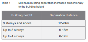
Separation - Building
separation is measured from the outer face of building envelopes which includes
balconies which are considered as habitable space.
Note: Where
applying separation to buildings on adjoining sites, apply half the minimum
separation distance measured to the boundary. This distributes the building
separation equally between sites
|
No
|
The development predominantly has a nil side setback with
no windows. The building form also incorporates a break in the middle
creating an east and west tower configuration.
Given the B4 mixed land use zoning and context of the
site, with Park Road currently undergoing intensification and renewal of its
built form as evident in recent constructions of residential flat buildings
to the north, the proposed development is considered to be appropriately
sited and the size, scale and massing of the development adequately responds
to the height and density controls as set by the zone which supports the
desired future character of the area as intended by the ALEP 2010 and
associated ADCP.
It is noted that a 9m setback is provided from the
building to the northern boundary but only 7m to the balcony for the centre
units located between the east and west towers. A 6.3m setback is provided
from the corridor to the southern boundary and there is a 10m setback to the
rear boundary that is numerically deficient by 2m at levels 9 and 10.
The numerical non-compliance of up to 3m for the upper
levels of the building is considered to acceptable given that the internal
layout of the apartments means that the majority of rooms at the upper levels
that face the side boundaries are bedrooms that are subject to lower use and
the balconies to the north contain privacy screens that will assist in
reducing opportunities for overlooking. This is discussed in further detail
under section 3F below.
In this regard, the development is considered acceptable
on merit.
|
|
3D Communal and public open
space
|
|
|
|
COS should have a minimum
dimension of 3m.
Where COS cannot be provided at ground level, it should
be provided on a podium or roof.
|
|
Design criteria
· Communal
open space has a minimum area equal to 25% of the site (see figure 3D.3)
Required:
25% x 1226m2 = 306.5m2
Developments achieve a minimum
of 50% direct sunlight to the principal usable part of the communal open
space for a minimum of 2 hours between 9 am and 3 pm on 21 June (mid-winter)
|
Yes,
subject to conditions
Yes
|
It is noted that the
development provides a COS area of 273m2 or 22.3% which results in a marginal
non-compliance. However, this can be made acceptable, given that a condition
has been recommended to be imposed by the Cumberland Design Excellence Panel
for the deletion of unit A1.05 so as to allow for:
a. the expansion of COS to eliminate the shortfall
currently provided;
b. enable unfettered reticulation of air through both north
and south light wells;
c. improve visual connection between the hallway containing
the Lift Lobby area and the eastern Communal Open Space; and
d. provide continuous open space from north to south at
Level 1.
Therefore, compliance with the
required amount of COS for the development will be achieved.
The development will achieve the minimum 50% solar access
requirement to the COS area between 11am and 1pm.
|
|
3E Deep soil zones
|
|
Design criteria
1. Deep soil zones are to meet
the following minimum requirements:
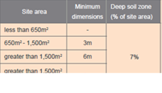
|
No
|
No deep soil zones are
provided on the site, as a result of the basements and building envelopes.
The proposed landscaping and
communal open space areas are provided at the podium level which is
considered to adequately offset the absence of deep soil planting.
The landscape design
incorporates a range of plants, including trees, shrubs and groundcover to
enhance the amenity of the development.
|
|
3F Visual Privacy
|
|
Objective 3F-1. Adequate
building separation distances are shared equitably between neighbouring
sites, to achieve reasonable levels of external and internal visual privacy.
Design criteria
1. Separation between windows
and balconies is provided to ensure visual privacy is achieved. Minimum
required separation distances from buildings to the side and rear boundaries
are as follows:
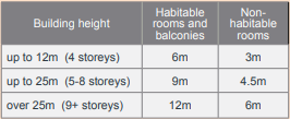
Note: Separation distances
between buildings on the same site should combine required building
separations depending on the type of room (see figure 3F.2) Gallery access
circulation should be treated as habitable space when measuring privacy
separation distances between neighbouring properties
|
No
No
|
The development provides the required minimum 9m
separation between the units of the east and west tower which generally
complies at levels 1 to level 8. However, non-compliance is noted at level 9
and 10.
The variations to the building separation distances noted
at levels 9 and 10, internal to the development (between the east and west
towers), are considered acceptable, on the basis that treatment measures can
be applied to the non-compliant balconies and habitable room windows, in the
form of privacy screening and the like as demonstrated in the plans
submitted, to protect visual amenity within the development.
|
Parking requirements (3J
– ADG)
|
Based on the ADG, as the site
is within 800m of a railway station, the parking rates in the Guide to
Traffic Generating Developments will apply.
Metro Sub-regional centres
for RFB:
|
Rate
|
Units
|
Total
|
|
0.6/1B and Studio
|
10
|
6
|
|
0.9/2B
|
59
|
53.1
|
|
1.4/3B
|
10
|
14
|
|
Total residential
|
74
|
|
1/5 V
|
79
|
15.8
|
|
Total visitor
|
16
|
Required: 74 resident spaces
and 16 visitor spaces = 90 car spaces for RFB component of the development.
In relation to the numerical
parking requirements for commercial space, the proposal is consistent with
Council’s parking requirements which is discussed in further detail
below under the ADCP 2010 section of the report.
The development provides a
total of 108 car spaces which consist of 89 residential, 16 visitors and 3
commercial, inclusive of disabled car spaces. The proposal is therefore
compliant with the numerical parking requirements of the RMS Guide to Traffic
Generating Developments.
|
Following a detailed assessment of
the proposal against the provisions of SEPP 65 and the ADG, the proposal is
generally considered compliant and therefore performs satisfactorily with
respect to the provisions of the NCC, landscape amenity and external and
internal visual privacy.
A comprehensive assessment against
SEPP 65 and the ADG is contained in Attachment 8.
(c) State
Environmental Planning Policy (Infrastructure) 2007 (ISEPP)
The provisions of the ISEPP 2007
have been considered in the assessment of the development application and no
significant issues or inconsistencies are noted regarding the proposed
development. Appropriate conditions are to be included as part of consent in
relation to appropriate approvals and clearance to be obtained from the
relevant service authority regarding the specific design requirements for the
provision of a substation.
(d) State
Environmental Planning Policy (Vegetation in Non-Rural Areas) 2017
The proposal does not exceed the
biodiversity offsets scheme threshold. Therefore, the proposed vegetation
removal is considered acceptable. Please refer to the DCP compliance table for
further discussion.
(e) State
Environmental Planning Policy (Building Sustainability Index: BASIX) 2004
A BASIX Report has been submitted
with the application which demonstrates that the development has been designed
to achieve the required water, thermal comfort and energy scores.
(f) Sydney
Regional Environmental Plan (Sydney Harbour Catchment) 2005
The subject site is identified as
being located within the area affected by the Sydney Regional Environmental
Plan (Sydney Harbour Catchment) 2005. The proposed development raises no issues
as no impact on the catchment is envisaged.
(Note: - the subject site is not
identified in the relevant map as ‘land within the ‘Foreshores and
Waterways Area’ or ‘Wetland Protection zone’, is not a
‘Strategic Foreshore Site’ and does not contain any heritage items.
Hence the majority of the SREP is not directly relevant to the proposed
development).
(g) Auburn
Local Environmental Plan
The provision of the Auburn Local
Environmental Plan 2010 is applicable to the development proposal. It is noted
that the development achieves full compliance with the key statutory
requirements of the ALEP 2010 and the objectives of the B4 Mixed Use land use
zone.
Permissibility:-
The proposed development is
defined as a ‘shop top housing’ which is permissible in the B4 land
use zone with consent.
shop top housing means one
or more dwellings located above ground floor retail premises or business
premises.
The relevant matters to be
considered under ALEP 2010 for the proposed development are detailed below. A
comprehensive ALEP 2010 assessment and compliance table is contained in
Attachment 9.
|
DEVELOPMENT STANDARD
|
COMPLIANCE
|
DISCUSSION
|
|
4.3 Height of
Buildings:
Max. 38m
|
Yes
|
The proposed development
maintains a maximum height of 38m to the highest point of the roof.
|
|
4.4 Floor Space Ratio:
Max. 5:1
|
Yes
|
The development is within the maximum FSR permitted for
the site being 4.94:1. It is noted that the condition to delete one unit
A1.05, inclusive of other design changes regarding relocation of lobby and
commercial areas; as recommended by the CDEP will further reduce the total
GFA from 6,053m2 to 5,978m2 resulting in a revised FSR
of 4.87:1. The proposed development is therefore compliant with the maximum
FSR requirement.
|
|
4.6 Exceptions to
development standard
|
N/A
|
There are no variations proposed
|
The provisions of any proposed
instrument that is or has been the subject (EP&A Act s4.15 (1)(a)(ii))
(a) Draft
State Environmental Planning Policy (Environment)
The draft SEPP relates to the
protection and management of our natural environment with the aim of
simplifying the planning rules for a number of water catchments, waterways,
urban bushland, and Willandra Lakes World Heritage Property. The changes
proposed include consolidating the following seven existing SEPPs:
· State
Environmental Planning Policy No. 19 – Bushland in Urban Areas
· State
Environmental Planning Policy (Sydney Drinking Water Catchment) 2011
· State
Environmental Planning Policy No. 50 – Canal Estate Development
· Greater
Metropolitan Regional Environmental Plan No. 2 – Georges River Catchment
· Sydney
Regional Environmental Plan No. 20 – Hawkesbury-Nepean River (No.2-1997)
· Sydney
Regional Environmental Plan (Sydney Harbour Catchment) 2005
· Willandra
Lakes Regional Environmental Plan No. 1 – World Heritage Property.
The draft policy will repeal the
above existing SEPPs and certain provisions will be transferred directly to the
new SEPP, amended and transferred, or repealed due to overlaps with other areas
of the NSW planning system.
Changes are also proposed to the
Standard Instrument – Principal Local Environmental Plan. Some provisions
of the existing policies will be transferred to new Section 117 Local Planning
Directions where appropriate.
(b) Draft
Cumberland Local Environmental Plan (Draft CLEP)
The Draft Cumberland Local
Environmental Plan (Draft CLEP) has been prepared by Cumberland Council to
provide a single planning framework for the future planning of Cumberland City.
The changes proposed seek to harmonise and repeal the three existing LEPs
currently applicable to the Cumberland local government area, those being:
· Holroyd
Local Environmental Plan 2013,
· Parramatta
Local Environmental Plan 2011, and
· Auburn
Local Environmental Plan 2010.
The current planning controls for
the subject site, as contained within the Auburn Local Environmental Plan 2010,
are not proposed to change under the Draft CLEP, except for the building height
limit which is expected to increase from 38m to 60m. The proposed development
is consistent with the relevant provisions of the draft Cumberland Local
Environmental Plan.
The provisions of any
Development Control Plans (EP&A Act s4.15 (1)(a)(iii))
The Auburn Development Control
Plan 2010 provides guidance for the design and operation of development to
achieve the aims and objectives of the Auburn Local Environmental Plan 2010.
A comprehensive ADCP 2010
assessment and compliance table is contained in Attachment 9.
Local Centres & Residential
Flat Buildings chapter
The proposed development is
considered to perform satisfactory with respect to the Local centres section of
the ADCP 2010. In relation to the Residential Flat Buildings section of the
ADCP 2010, whilst some non-compliances are noted specifically with regard to
the required building setbacks and separation distances, a variation is
considered acceptable as a result of the prevailing requirements established by
the ADG and SEPP 65.
The development also relates to a
mixed use component with commercial/retail at ground level and residential
above. As such, the desired landscaping controls with respect to deep soil
areas, site coverage and landscaped communal open spaces are onerous to achieve
in a commercial/urban context given the need for basement levels to accommodate
parking demand on site. Notwithstanding, the development provides for a
satisfactory level of residential amenity in terms of solar access and
ventilation, apartment sizes, communal and private open space areas.
In this regard, the development
proposed is therefore acceptable. The variations sought which relate primarily
to site coverage and deep soil requirements under the Residential Flat
Buildings section of the ADCP 2010 are considered satisfactory on merit in this
instance:
|
Clause
|
Control
|
Proposed
|
Complies
|
|
2.3 Site coverage
|
Max 50% of site area.
|
The built upon area exceeds 50%
of the total site area due to the provision of basements to accommodate
on-site parking. Given the B4 Mixed use zoning and context of the site, this
requirement is difficult to achieve.
|
No
|
|
3.3 Deep soil zone
|
Min. 30% of site area as consolidated area at rear of building.
Min. 5m dimensions
|
As discussed under the part 3E
of the ADG, no deep soil zone provided on site as a result of basements and
building envelopes.
The
proposed landscaping and communal open space areas are provided at the podium
level which is considered to adequately offset the absence of deep soil
planting.
The landscape design
incorporates a range of plants, including trees, shrubs and groundcover to
enhance the amenity of the development.
|
No
|
Parking and Loading chapter
The Parking and Loading section of
the ADCP 2010 under Table 6A of section 5.1.5, provides the following parking
rates that apply to areas zoned B4 for the residential and commercial
components:
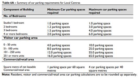
Based on the residential parking
rates provided in Table 6A above, the development requires the following
minimum and maximum car spaces to be accommodated within the site:
Minimum car spaces:
10 x Studio/1 Bedroom @ rate of 1.0 = 10
59 x 2 Bedroom @ rate of 1.2 = 70.8
(rounded up 71)
10 x 3 Bedroom @ rate of 1.5 = 15
Visitors @ rate of 51 – 100 units = 8
Total minimum required for development = 104 spaces
Maximum car spaces:
10 x Studio/1 Bedroom @ rate of 1.0 = 10
59 x 2 Bedroom @ rate of 3.0 = 177
10 x 3 Bedroom @ rate of 4.0 = 40
Visitors @ rate of 51 – 100 units = 25
Total minimum required for development = 252 spaces
It should also be noted that the
development proposal is consistent with the prevailing parking rates
established by the RMS sub-metro parking controls which requires only a minimum
of 90 car spaces; inclusive of visitor spaces. In this instance, the proposed development
which provides a total of 105 car spaces for the residential component (in
excess of the required prevailing parking rates established by RMS) achieves
the minimum required number of parking under the ADCP 2010 and is therefore
satisfactory.
In relation to the commercial
component where a minimum of 1 space/60sqm and a maximum 4 spaces/40sqm is
required for the development, the proposed area of commercial floor space at
105m2/60m2 = 1.75 requires a minimum of 2 commercial car spaces whilst at 105m2/40m2
= 2.625 x 4 = 10.5 requires a maximum of 11 commercial car spaces. The proposed
development provides a total of 3 commercial car spaces at grade towards the
rear of the site, albeit one space is in the form of a tandem/stacked space
which satisfies the minimum parking required for the commercial component.
In this regard, given that the
development provides a total of 108 car spaces within the ground and basement
levels, the proposal satisfies the numerical parking requirements of Table 6A
of the Parking and Loading section of the ADCP 2010.
The provisions of any planning
agreement that has been entered into under section 7.4, or any draft planning
agreement that a developer has offered to enter into under section 7.4
(EP&A Act s4.15(1)(a)(iiia))
There is no draft planning
agreement associated with the subject Development Application.
The provisions of the
Regulations (EP&A Act s4.15 (1)(a)(iv))
The proposed development raises no
concerns as to the relevant matters arising from the Environmental Planning and
Assessment Regulations 2000 (EP&A Reg).
The Likely Environmental,
Social or Economic Impacts (EP&A Act s4.15 (1)(b))
It is considered that the proposed
development will have no significant adverse environmental, social or economic
impacts in the locality.
The suitability of the site for
the development (EP&A Act s4.15 (1)(c))
The subject site and locality is
not known to be affected by any natural hazards or other site constraints
likely to have a significant adverse impact on the proposed development.
Accordingly, it is considered that the development is suitable in the context
of the site and surrounding locality.
Submissions made in accordance
with the Act or Regulation (EP&A Act s4.15 (1)(d))
|
1.
Advertised
|
2.
Mail
|
3.
Sign
|
4.
Not Required
|
In accordance with Council’s
Notification requirements contained within the Auburn DCP 2010, the proposal
was publicly notified for a period of 14 days between 13 August 2020 and 27
August 2020. The notification generated two (2) submissions in respect of the
proposal with nil submissions disclosing a political donation or gift. The
issues raised in the public submissions are summarised and commented on as
follows:
|
Issue
|
Planner’s Comment
|
|
We strongly oppose another apartment block being built
right next to us on 22-24 Park Road. There is already no guest parking for
our residents due to 6-14 Park Road being built with insufficient parking and
their residents double parking on the street and obstructing traffic flow.
|
The development proposes to provide a total of 108 parking
spaces within 3 basement levels which is in excess of the number of parking
spaces required for the development under the RMS – Guide to Traffic
Generating Development. Given compliance has been achieved with the required
number of parking proposed to be provided to accommodate, the development,
the proposal is considered satisfactory.
|
|
The proposed development of an 11-storey building next to
us will stop all chance of sunlight ever entering our windows.
|
The subject site of the proposed development in question
is located directly on the southern side of 16-20 Park Road and as such will
not further contribute to any additional overshadowing of the apartment
blocks to the north being 16-20 Park Road. The proposal will therefore not
further diminish the amount of daylight access being provided to the
apartments to the north.
|
|
Our apartment is already unstable with water leaks
everywhere in the basement due to the apartment block next door at 6-14 Park
Road. When the apartment block at 6-14 Park Road was built, the apartment block
destabilised our apartment soil. If this development goes ahead, it will
destabilise our soil and our apartment block causing unstable foundations.
|
Standard conditions in relation to a dilapidation report,
geotechnical report and other conditions surrounding underpinning works
during basement excavation are recommended to be imposed to ensure
construction of the development is being carried out in a manner that
adequately supports the neighbouring buildings to prevent damage.
|
|
When the apartment block at 6-14 Park Road was built, it
caused massive cracks in our apartment block and caused shifts in our
apartment block foundations.
|
As discussed above.
|
|
The apartment block at 6-14 Park Road has caused our
building to flood which we have filed a lawsuit for. Our apartment block has
water damage, destabilised soil and loose foundation due to the construction
of 6-14 Park Road next door. We are afraid of what will happen to our
building if there is another apartment block being constructed right next to
us on the other side.
|
Appropriate conditions have been recommended by
Council’s engineers to be imposed in relation to stormwater drainage of
the site to adequately manage and dispose stormwater, overflow and ponding
from the site.
|
|
Please stop proposed development at 22-24 Park Road from
being built. We are already over run by apartments in auburn with no parking
anywhere, traffic jams, people parking everywhere, overcrowding etc.
|
The application has been accompanied by a Traffic Report
prepared by ML Traffic Engineers, reference no. A14138916N (Version 2a),
dated July 2020. Council’s engineer have reviewed the traffic report
provided and is satisfied that the development can proceed based on the
conclusion of the report identifying that: a) the proposed development is a
low trip generator for the weekday AM and PM peak hours, b) the additional
trips from the proposed development can be accommodated at the nearby
intersections and road network without noticeably affecting intersection
performance, delays or queues and c) is consistent with redevelopment
objectives of the area.
In addition, the development provides for adequate car
parking in accordance with the RMS – Guide to Traffic Generating
Development. In this regard, the proposal is considered to be satisfactory
with respect to traffic flow and parking.
|
|
The apartment building at 8-14 Park Road has completely
blocked our view and chance of getting even a tiny bit of sunlight. My living
room with all blinds rolled up and a bright sunny day, interior looks as dark
as rainy days.
The only daylight we are receiving is through the bedroom
window which are facing 22-24 Park Road, the house behind our complex. If
this new project is completed, my home will completely loose its daylight
resource from all directions. I am sure the units of this building have the
same concerns.
|
As previously discussed above, the subject site of the
proposed development in question is located directly on the southern side of
16-20 Park Road and as such will not further contribute to any additional
overshadowing of the apartment blocks to the north being 16-20 Park Road. The
proposal will therefore not further diminish the amount of daylight access
being provided to the apartments to the north.
|
|
Further to my previous email, please find attached photos
of my living room and bedroom during daytime hours. You can clearly see the
difference between the brighter in bedrooms vs dark living room.
|
As discussed above, the proposed development being
situated south of 16-20 Park Road will not further diminish the amount of
solar amenity being provided to the units.
|
The public interest (EP&A
Act s4.15(1)(e))
In view of the foregoing analysis
it is considered that the development, if carried out subject to the conditions
set out in the recommendation below, will have no significant adverse impacts
on the public interest.
Cumberland Local
Infrastructure Contributions Plan 2020
This part of the Act relates to
the collection of monetary contributions from applicants for use in developing
key local infrastructure. The Cumberland Local Infrastructure Contribution Plan
2020 (the Contributions Plan) is applicable to the development.
In accordance with Section 4.4 of
the Contributions Plan, Council can only apply either a Section 7.11
(calculated on dwelling yield) or Section 7.12 (calculated on cost of works) to
a mixed development application, not both. The applicable contribution is
whichever generates the greater amount.
Council’s Contributions
Officer has calculated that the applicable contribution is Section 7.11, which
is calculated based on the residential dwelling yield:
· 1
bedroom/studio 10 dwellings
· 2
bedroom 59
dwellings
· 3
bedroom 10
dwellings
As at 16 March 2021, the total
contribution fee payable is $1,235,454.00. This figure is subject to indexation
as per the Contributions Plan.
Disclosure of Political
Donations and Gifts
The applicant and notification process did not result in any
disclosure of Political Donations and Gifts.
The development application has
been assessed in accordance with the relevant requirements of the Environmental
Planning and Assessment Act 1979, SEPP 55, SEPP65, ISEPP, BASIX SEPP, SREP
2005, ALEP 2010, Draft CLEP and ADCP 2010.
The proposed development is
appropriately located within the B4 Mixed Use land use zone pursuant to the
ALEP 2010. Variations are sought from the provisions of the ADG as they relate
to communal open space, building separation distances, and deep soil zone.
Variations are also sought under the ADCP 2010, in relation to site coverage
and provision of deep soil zones.
Having regard to the assessment of
the proposal from a merit perspective, Council may be satisfied that the
development has been responsibly designed and provides for acceptable levels of
amenity for future residents. It is considered that the proposal successfully
minimises adverse impacts on the amenity of neighbouring properties. Hence the
development, irrespective of the departures noted above, is consistent with the
intentions of Council’s planning controls and represents a form of
development contemplated by the relevant statutory and non-statutory controls
applying to the land.
For these reasons, it is
considered that the proposal is satisfactory having regard to the matters of
consideration under Section 4.15 of the Environmental Planning and Assessment
Act 1979, and the development may be approved subject to deferred commencement
conditions.
|
1. That
Development Application No. DA2020/0336 for Demolition of existing structures
and construction of an 11 storey mixed use development comprising 10 levels
of residential apartment units, ground floor retail/commercial tenancies and
ground floor & basement car parking on land at 22 Park Road AUBURN
NSW 2144 be approved as deferred commencement consent subject to
conditions listed in Attachment 1.
2. Persons
whom have lodged a submission in respect to the application be notified of
the determination of the application.
|
1. Draft Notice
of Determination
2. Architectural
Plans including Shadow Diagrams
3. Previous
Approved (Lapsed Plans)
4. Landscape
Plans
5. Stormwater
and Engineering Plans
6. Cumberland
Design Excellence Panel Minutes
7. Submissions
Received
8. ADG
Compliance Table
9. ALEP
2010 and DCP 2010 Compliance Table
DOCUMENTS
ASSOCIATED WITH
REPORT LPP010/21
Attachment 1
Draft Notice of Determination
Cumberland Local Planning Panel Meeting
14 April 2021
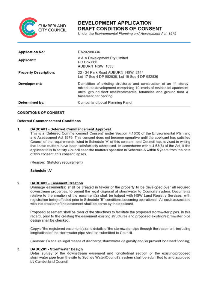
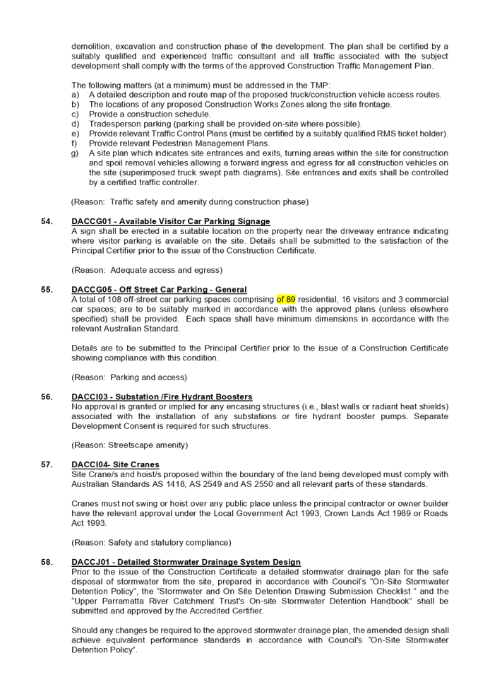
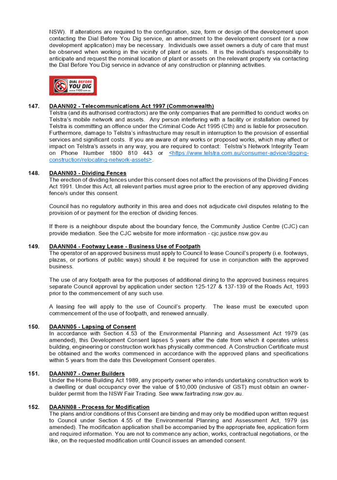
DOCUMENTS
ASSOCIATED WITH
REPORT LPP010/21
Attachment 2
Architectural Plans including Shadow Diagrams
Cumberland Local Planning Panel Meeting
14 April 2021
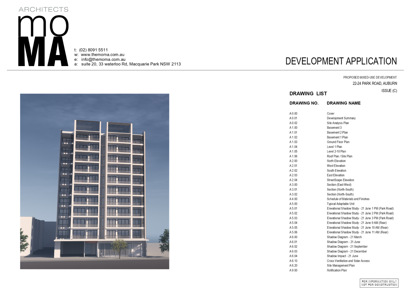
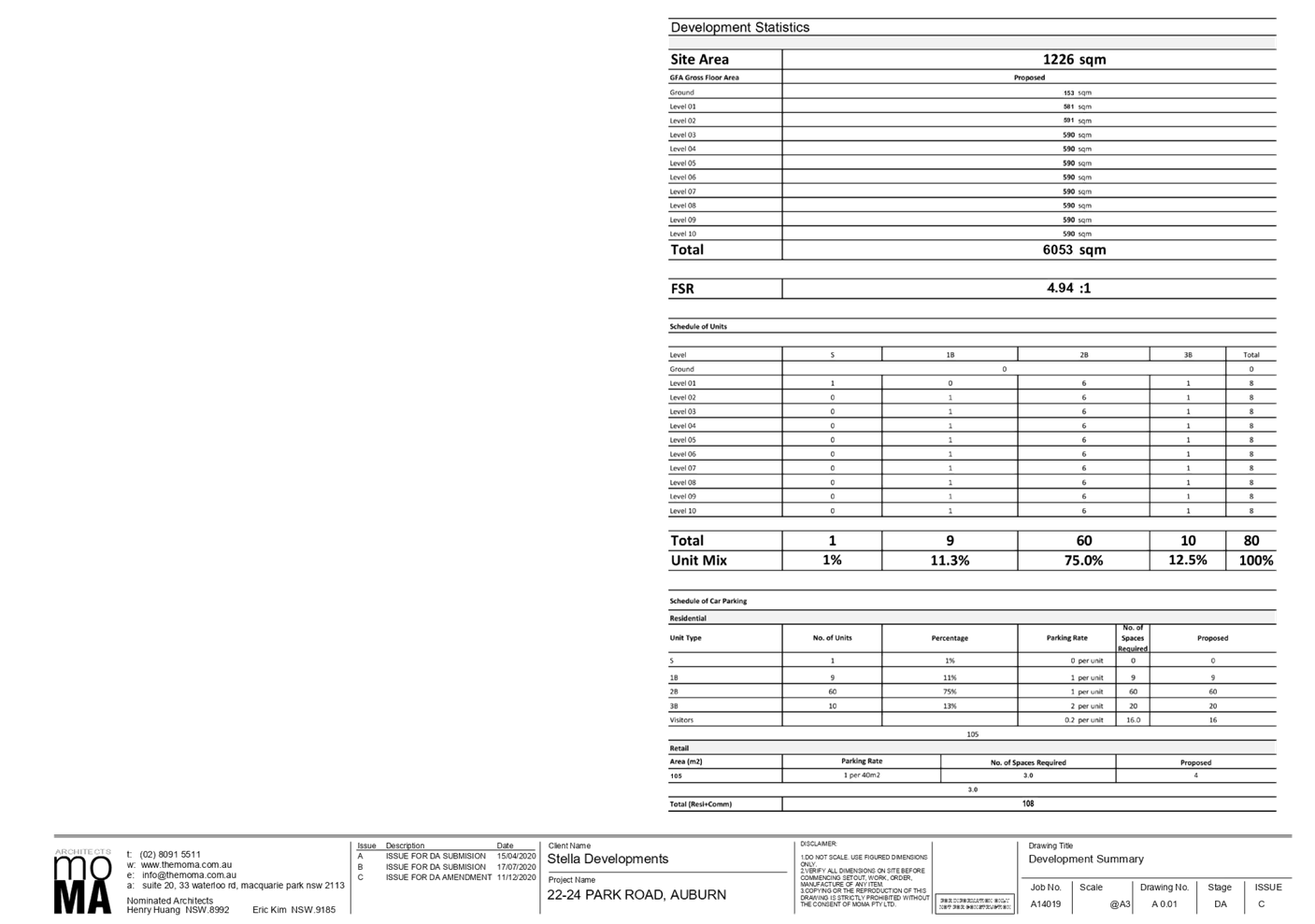
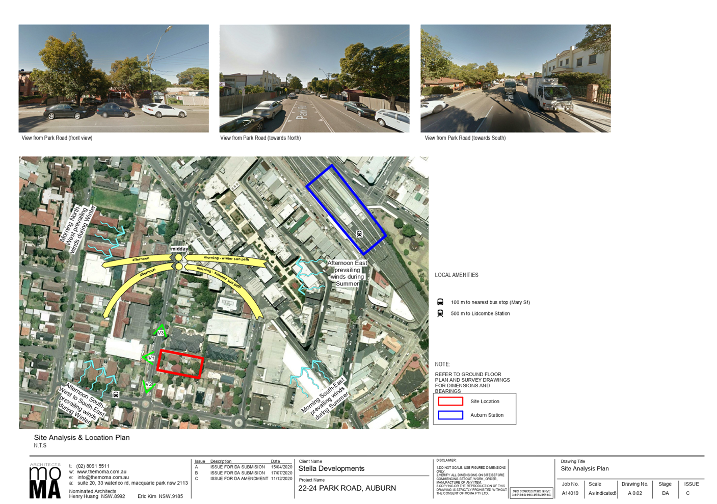
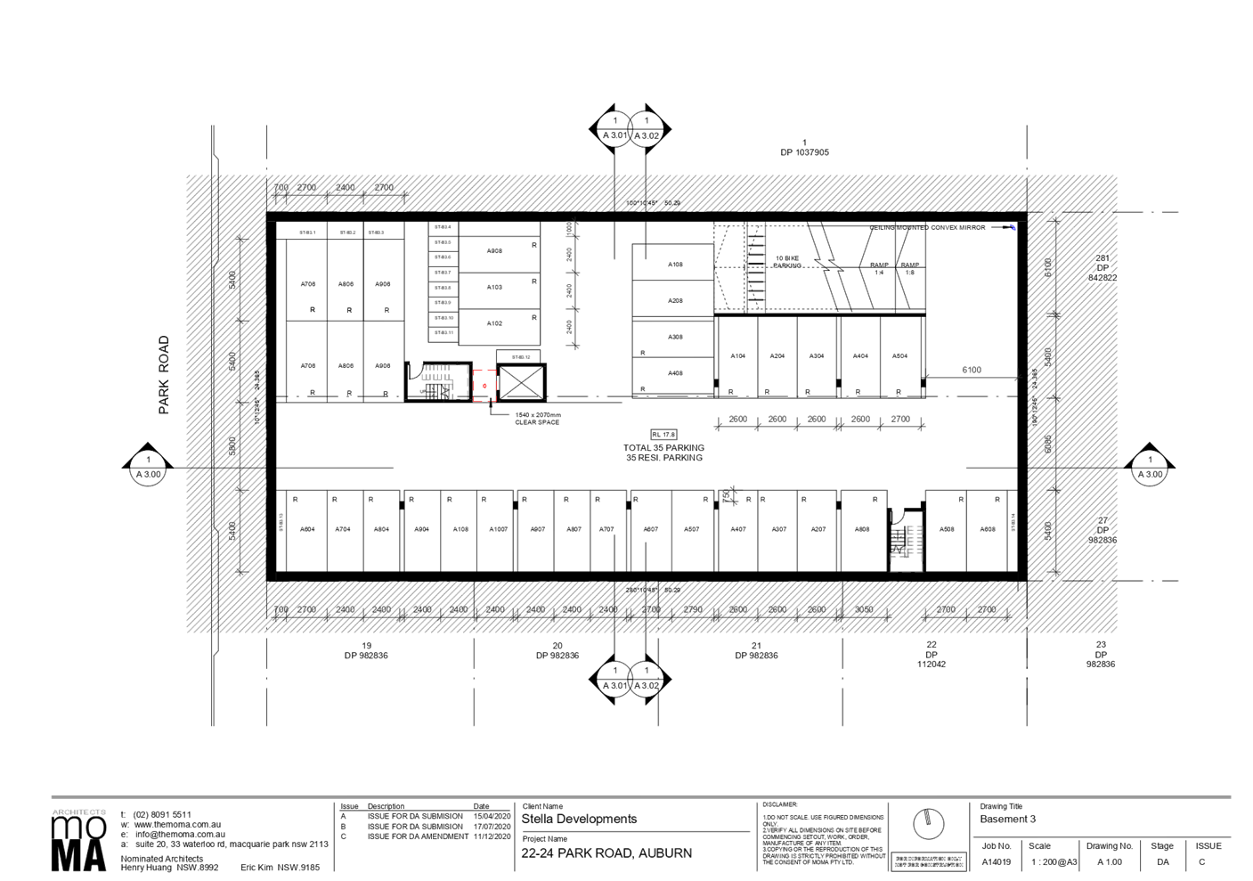
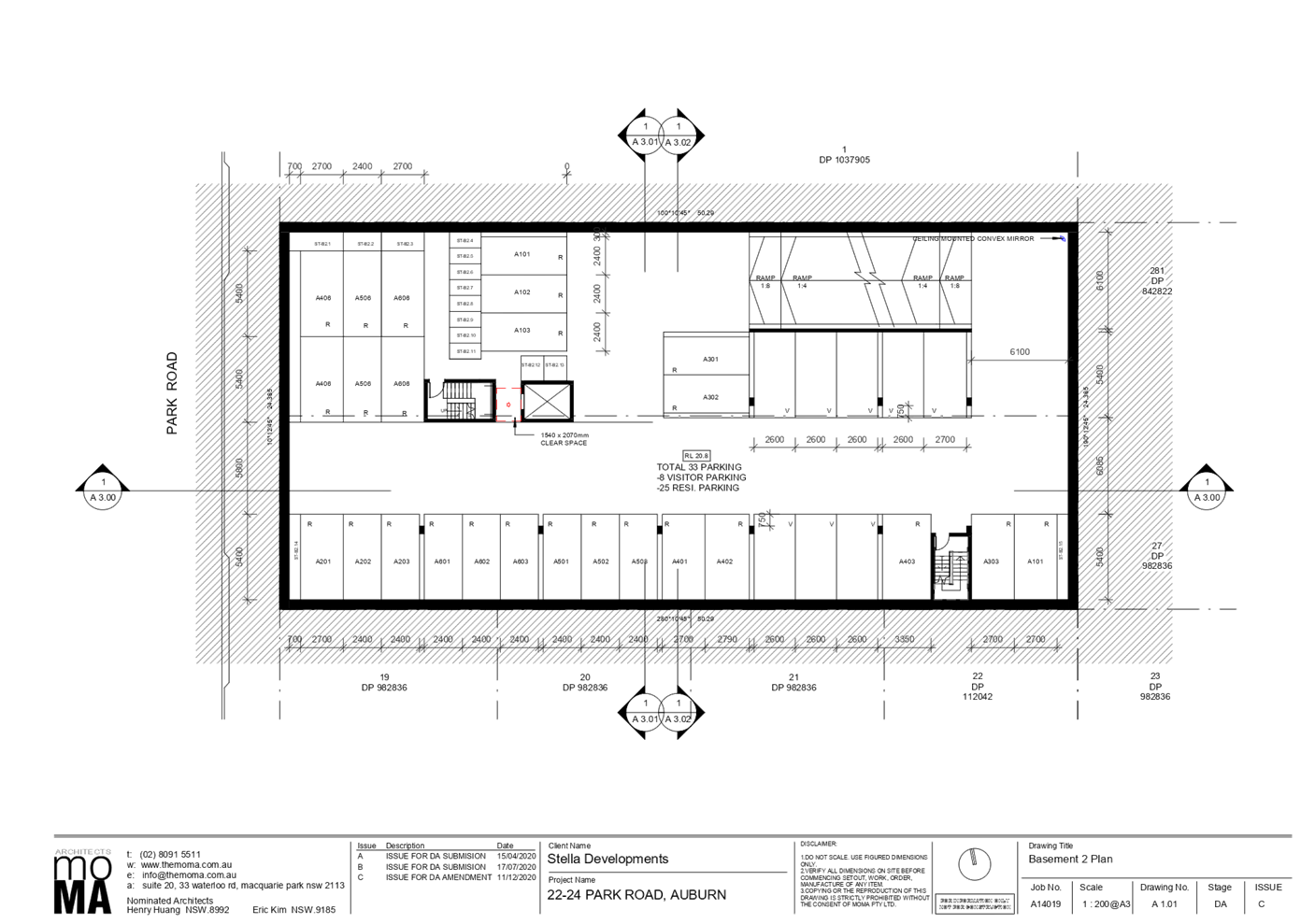
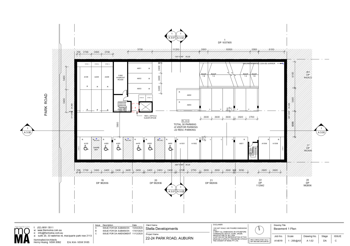
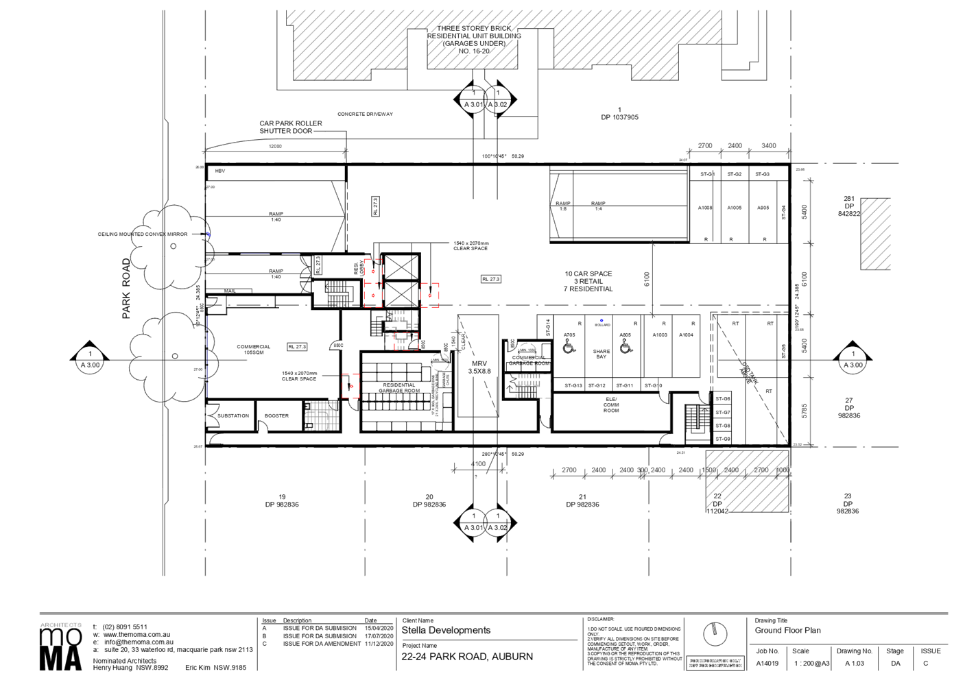
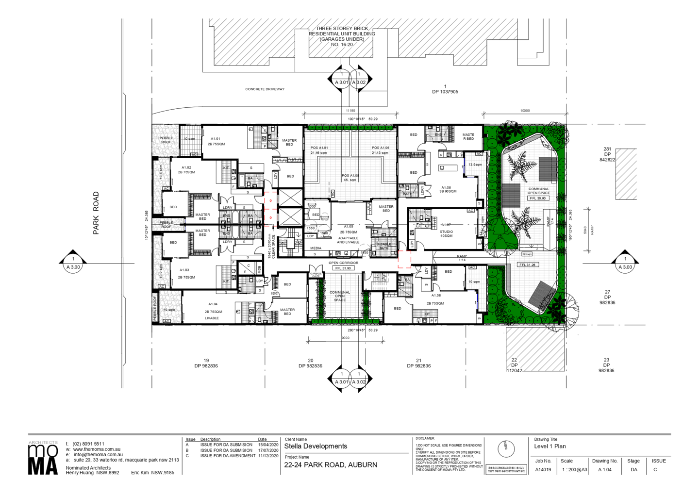
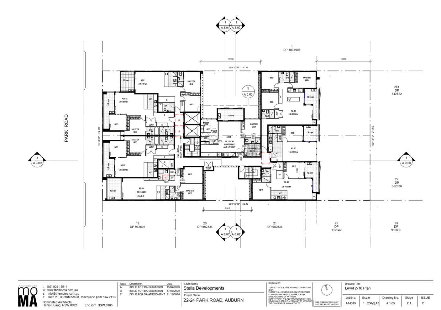
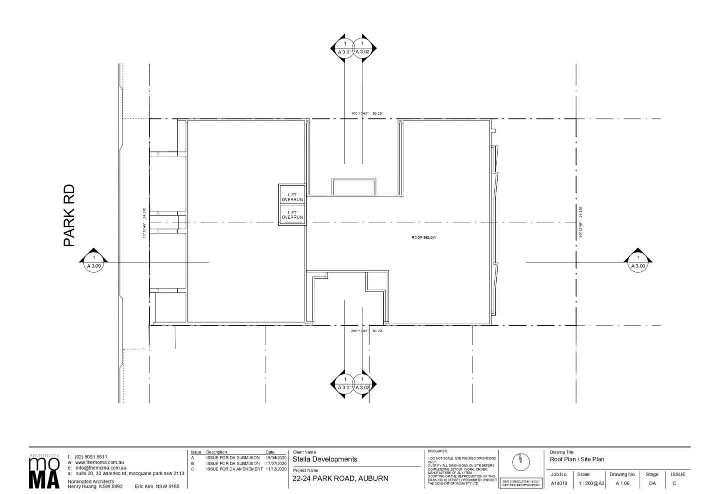
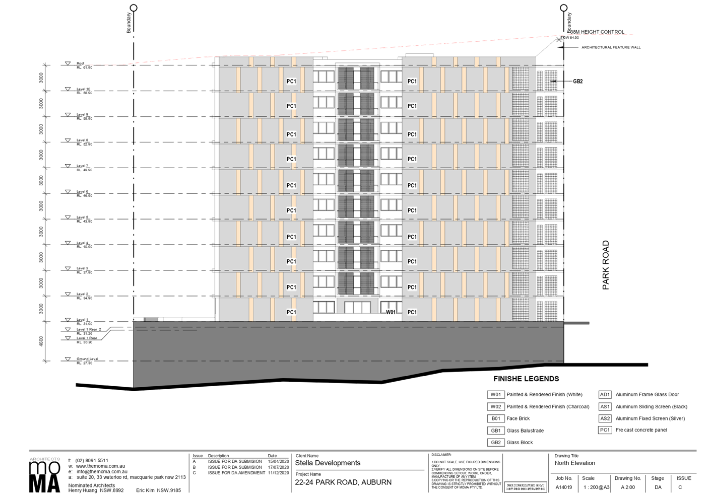
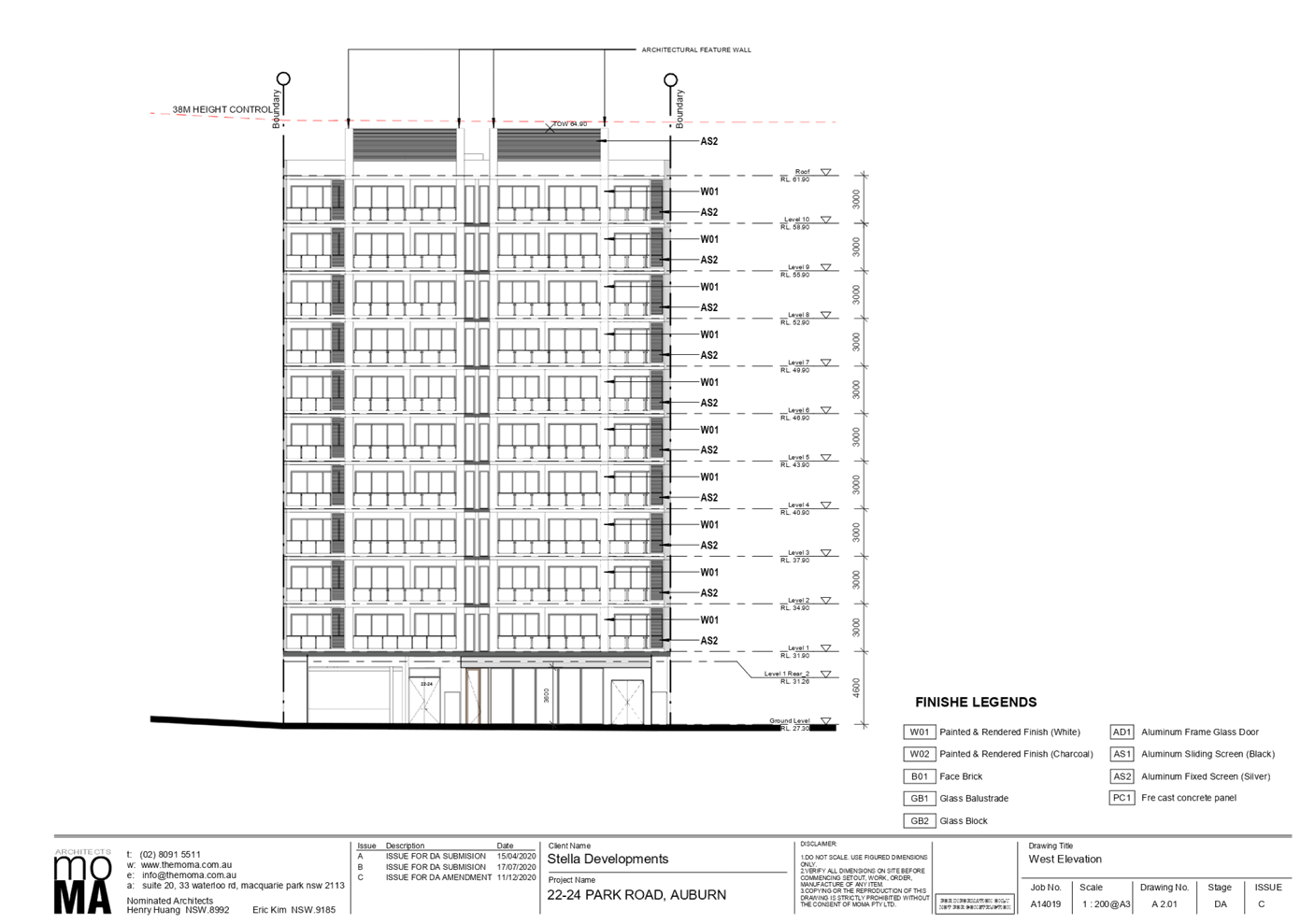
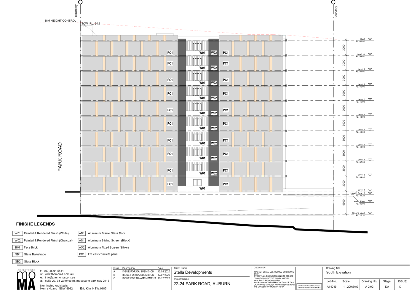
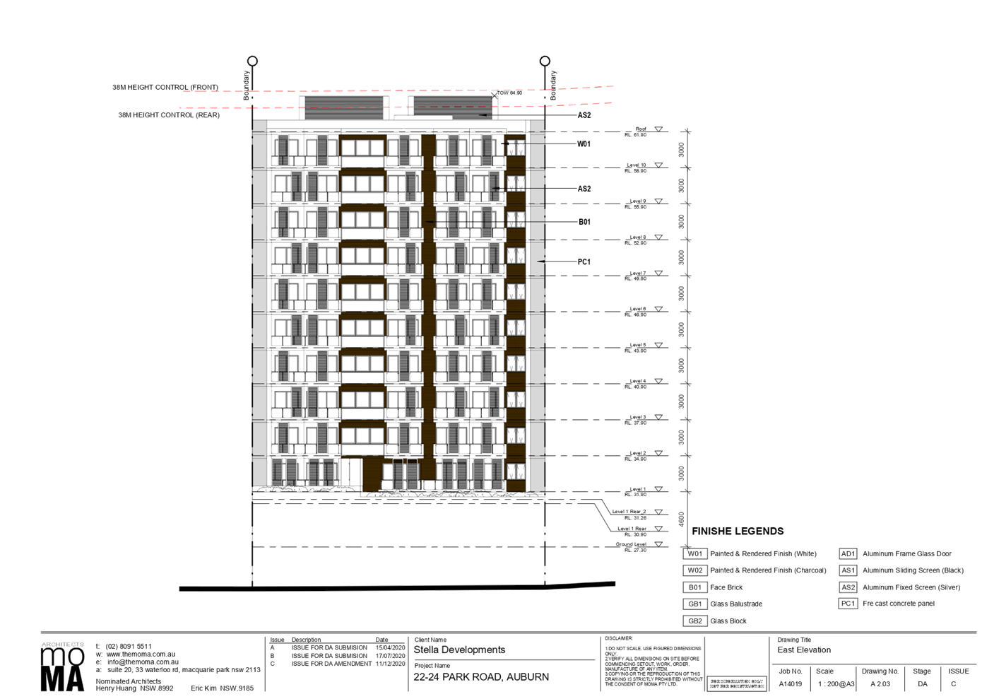
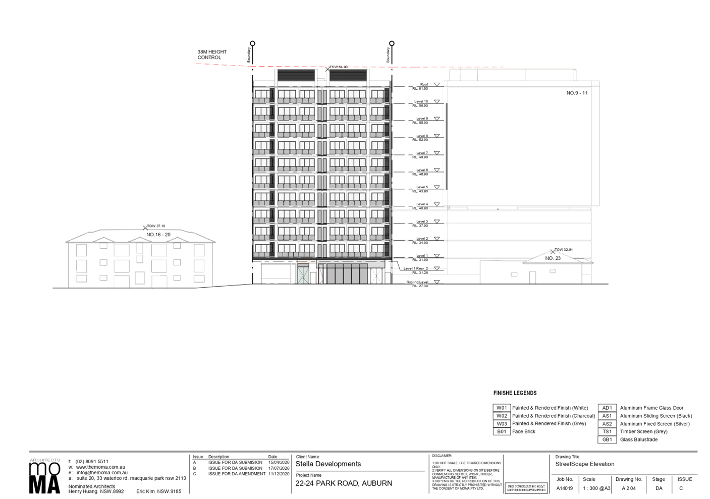
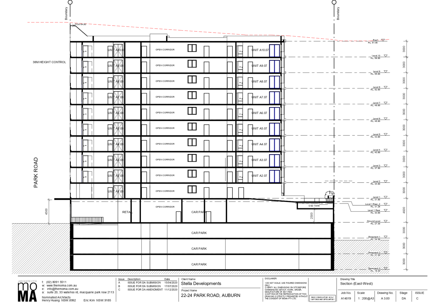
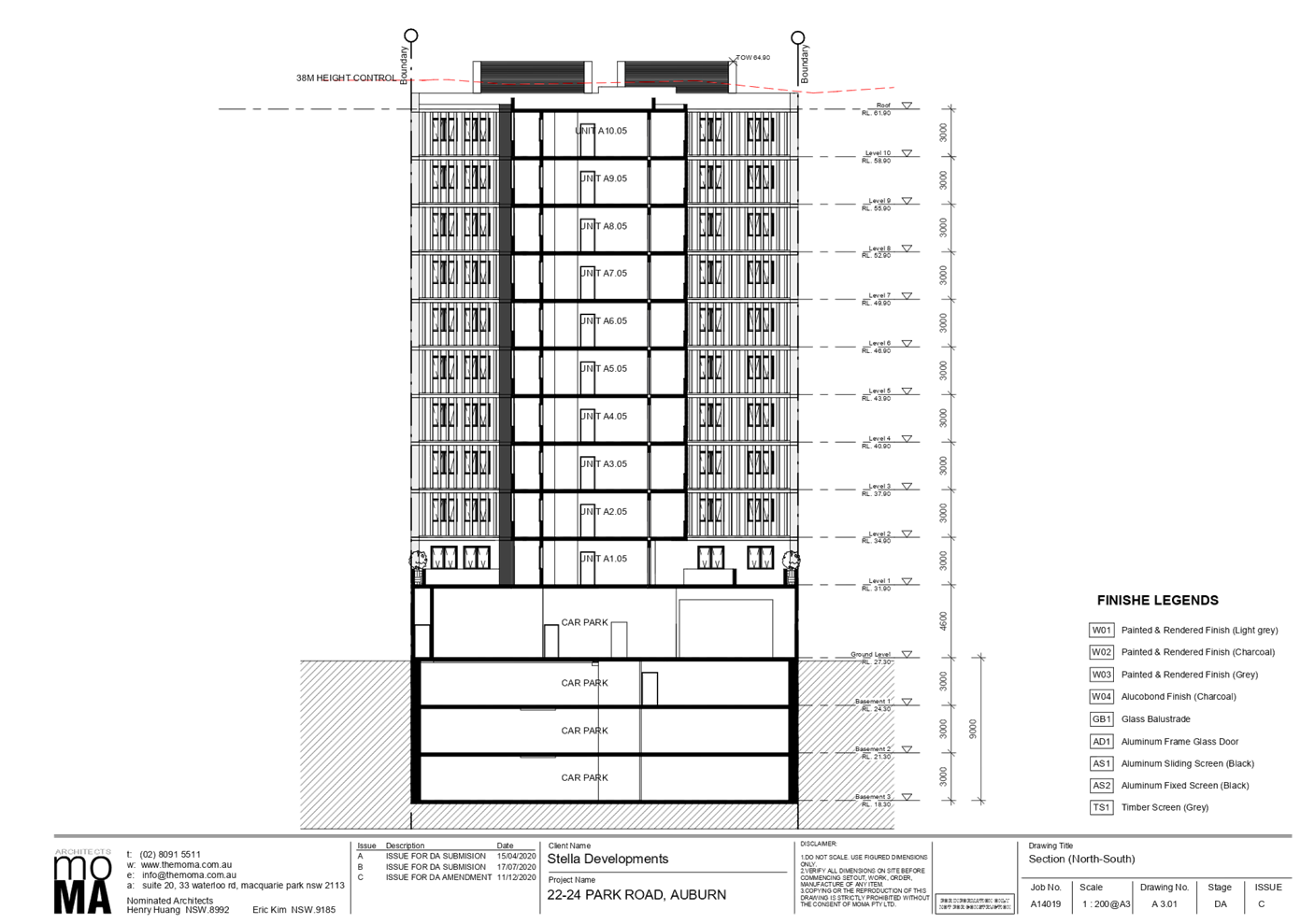
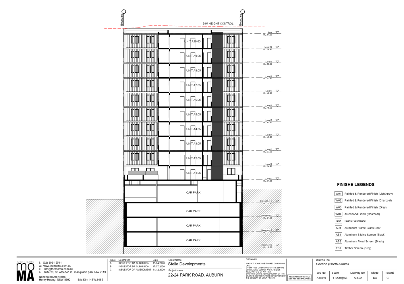
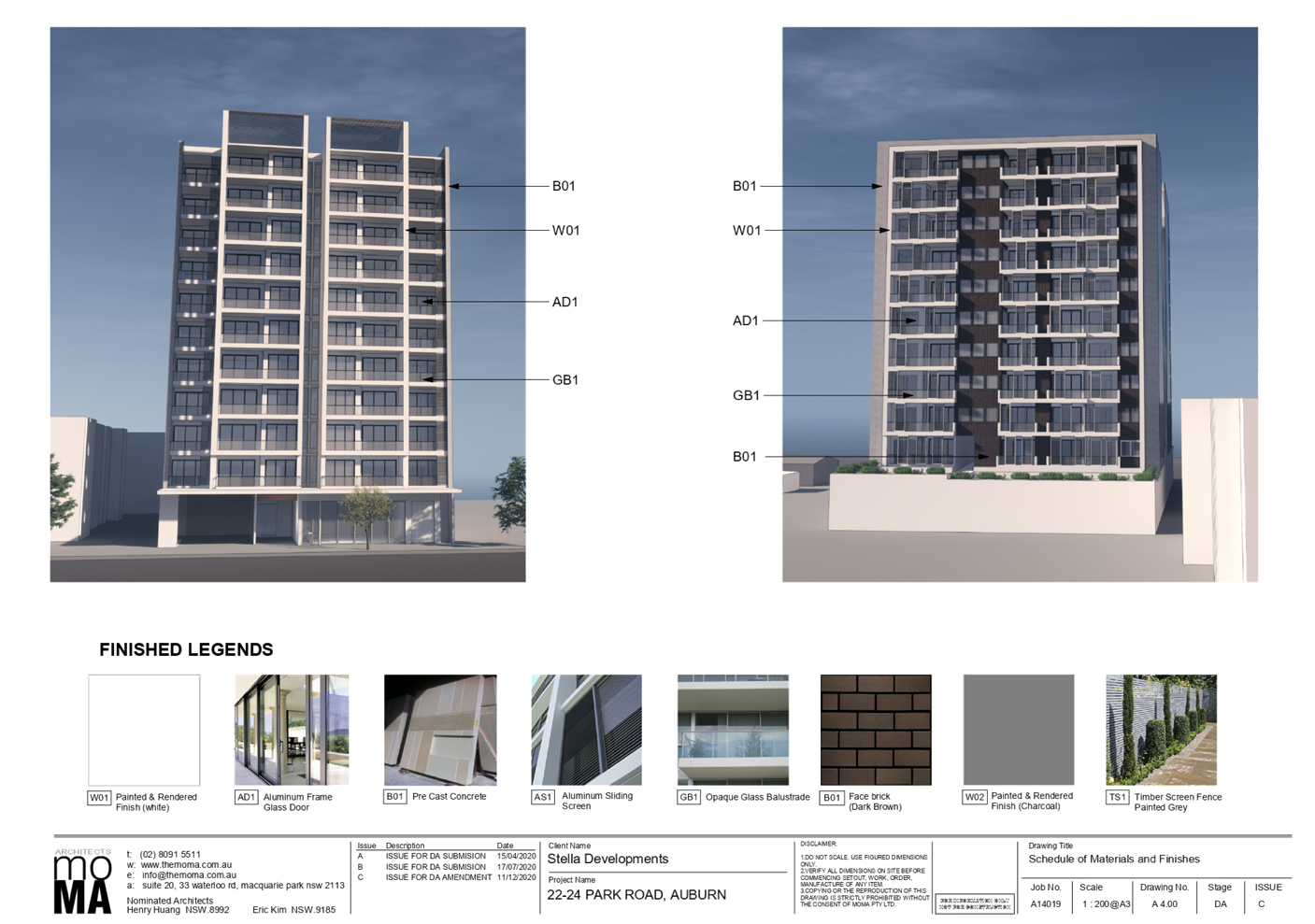
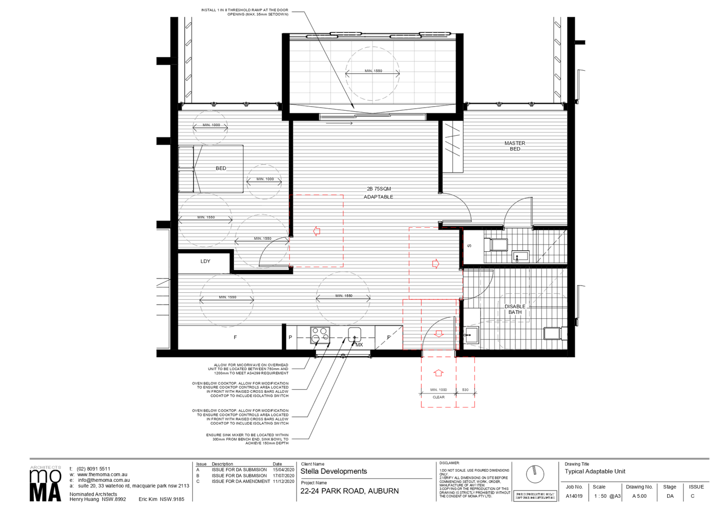
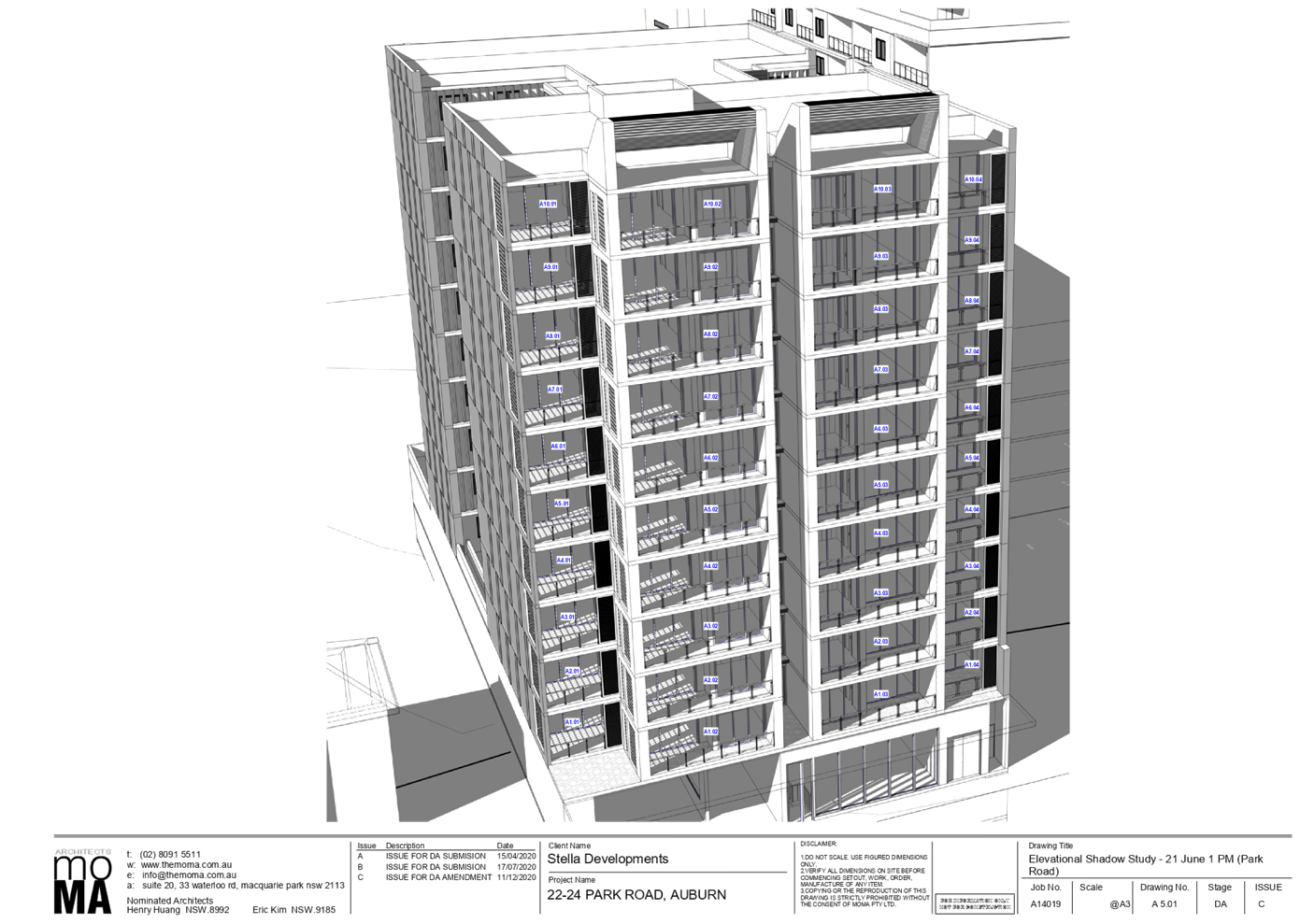
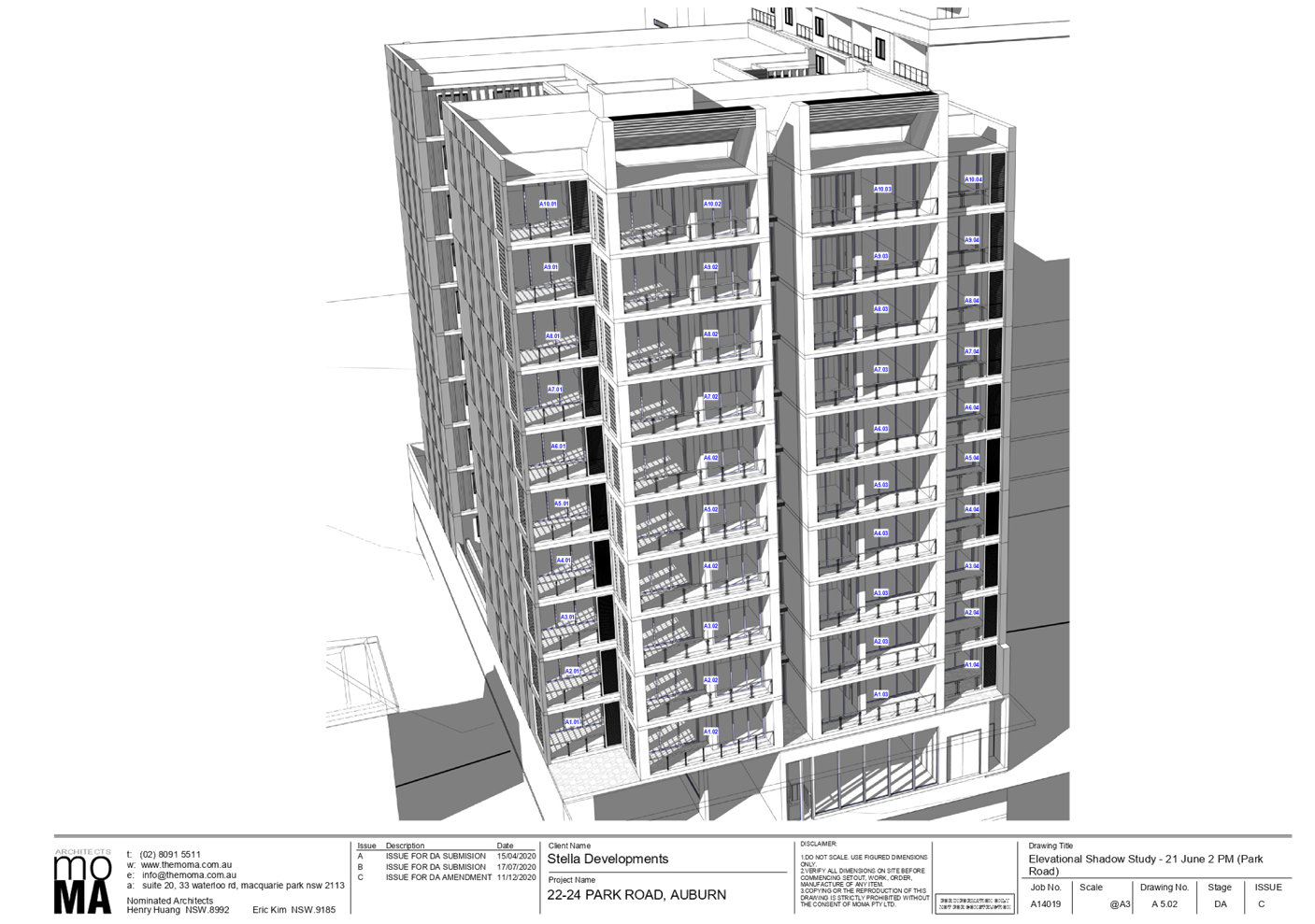
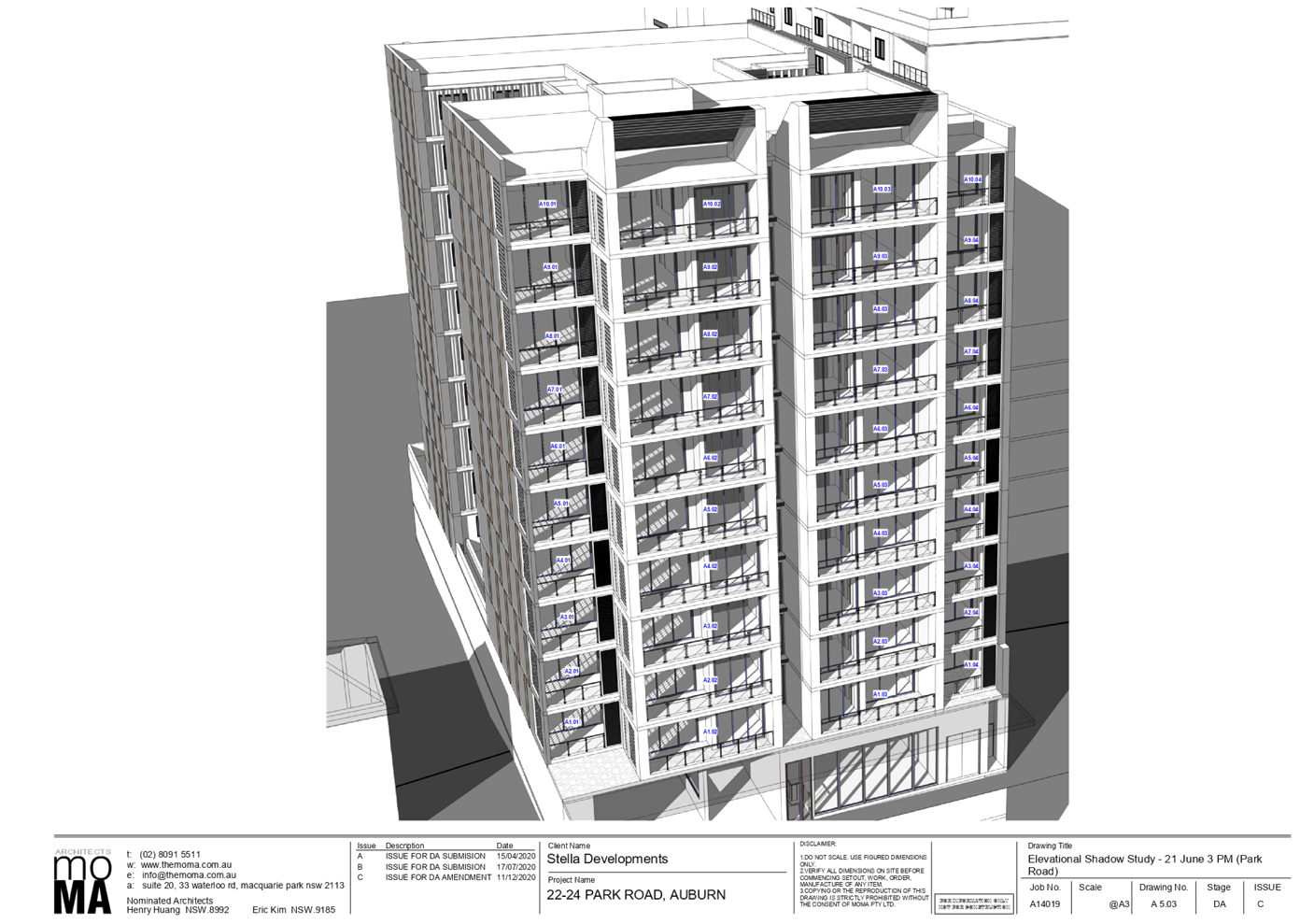
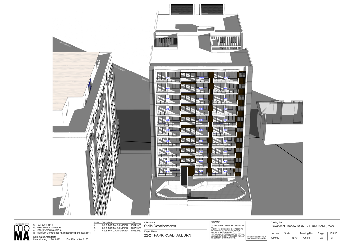
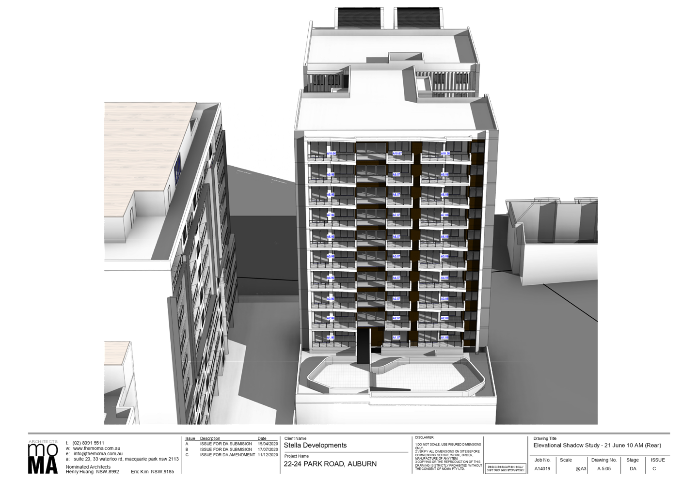
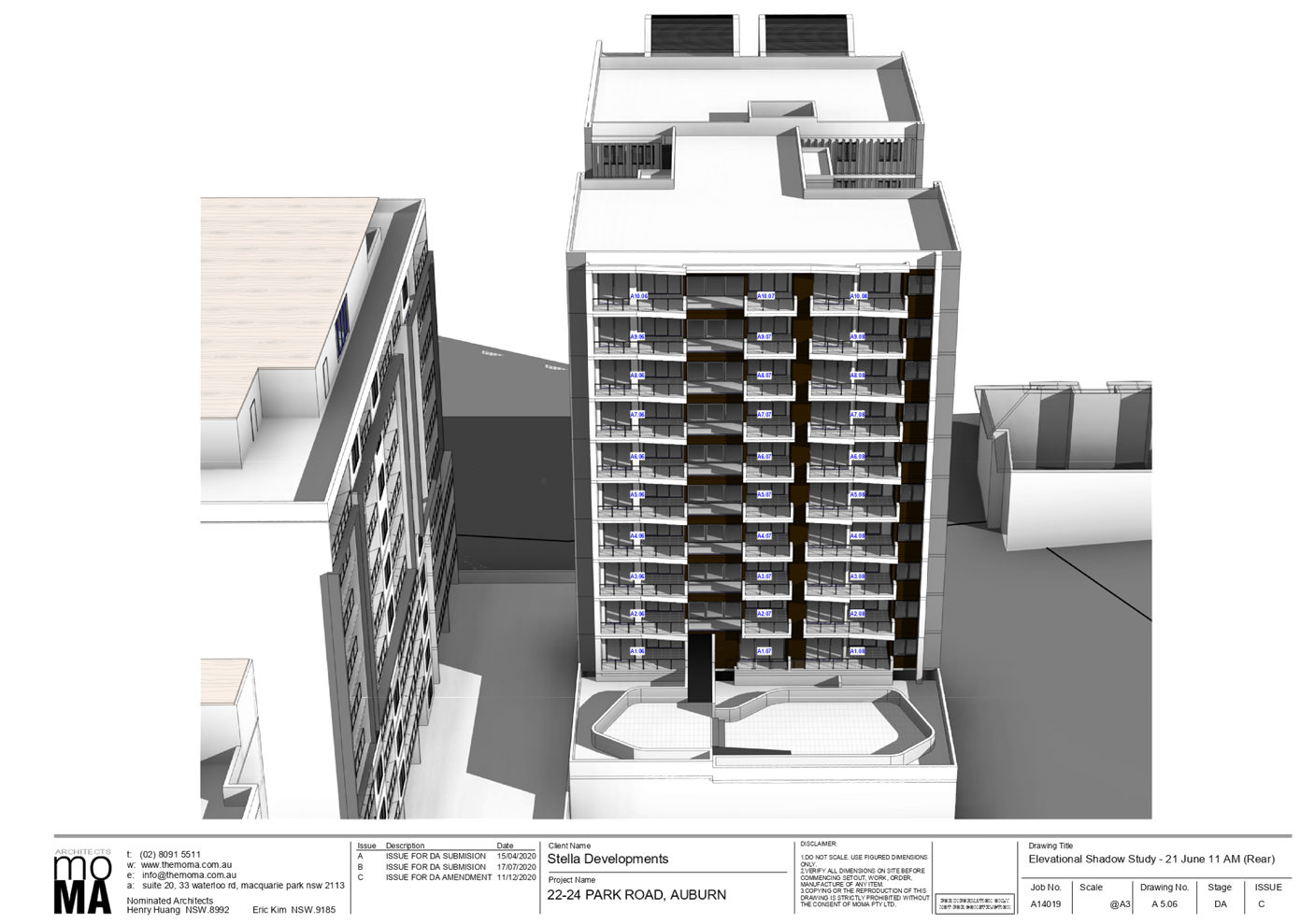
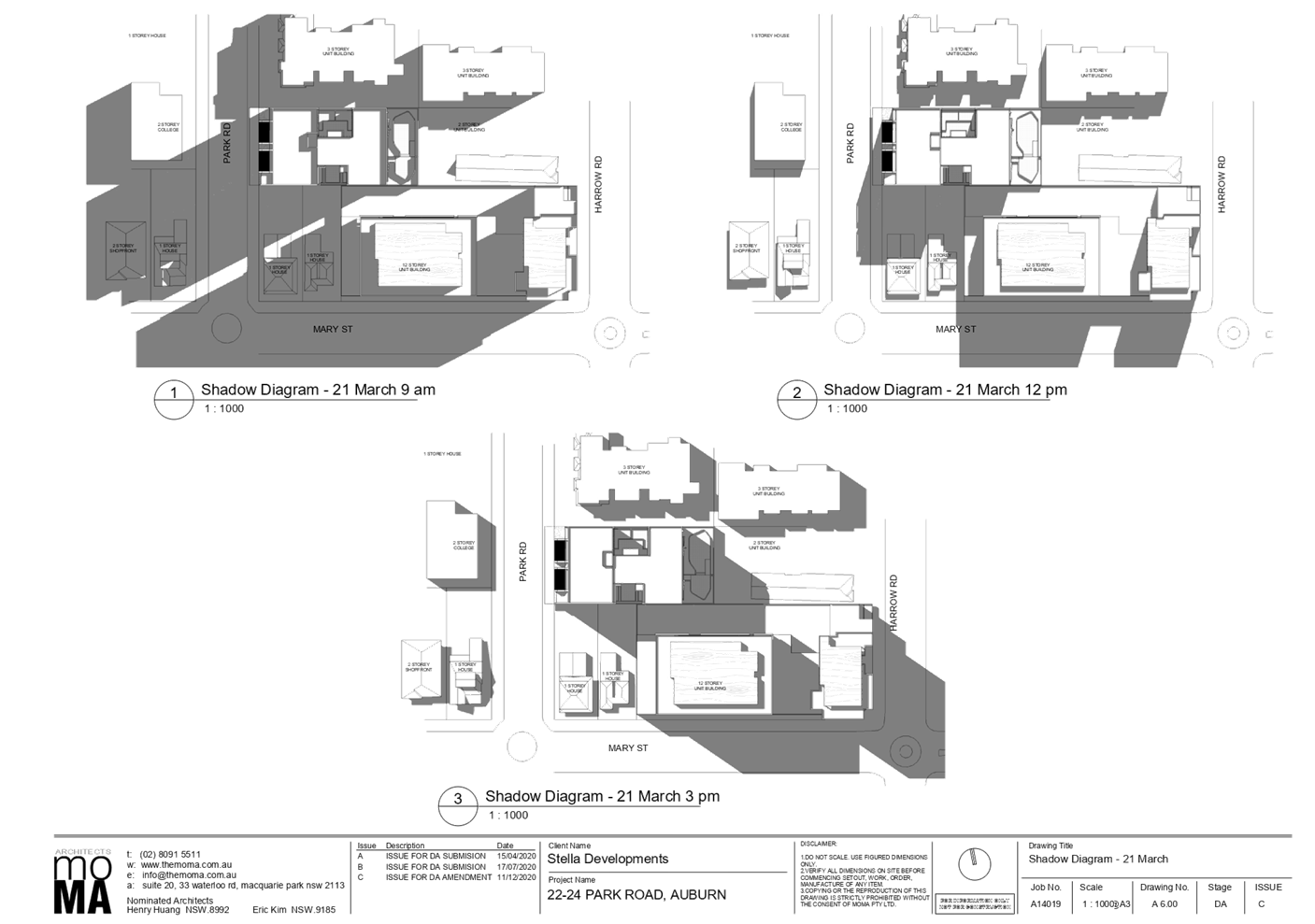
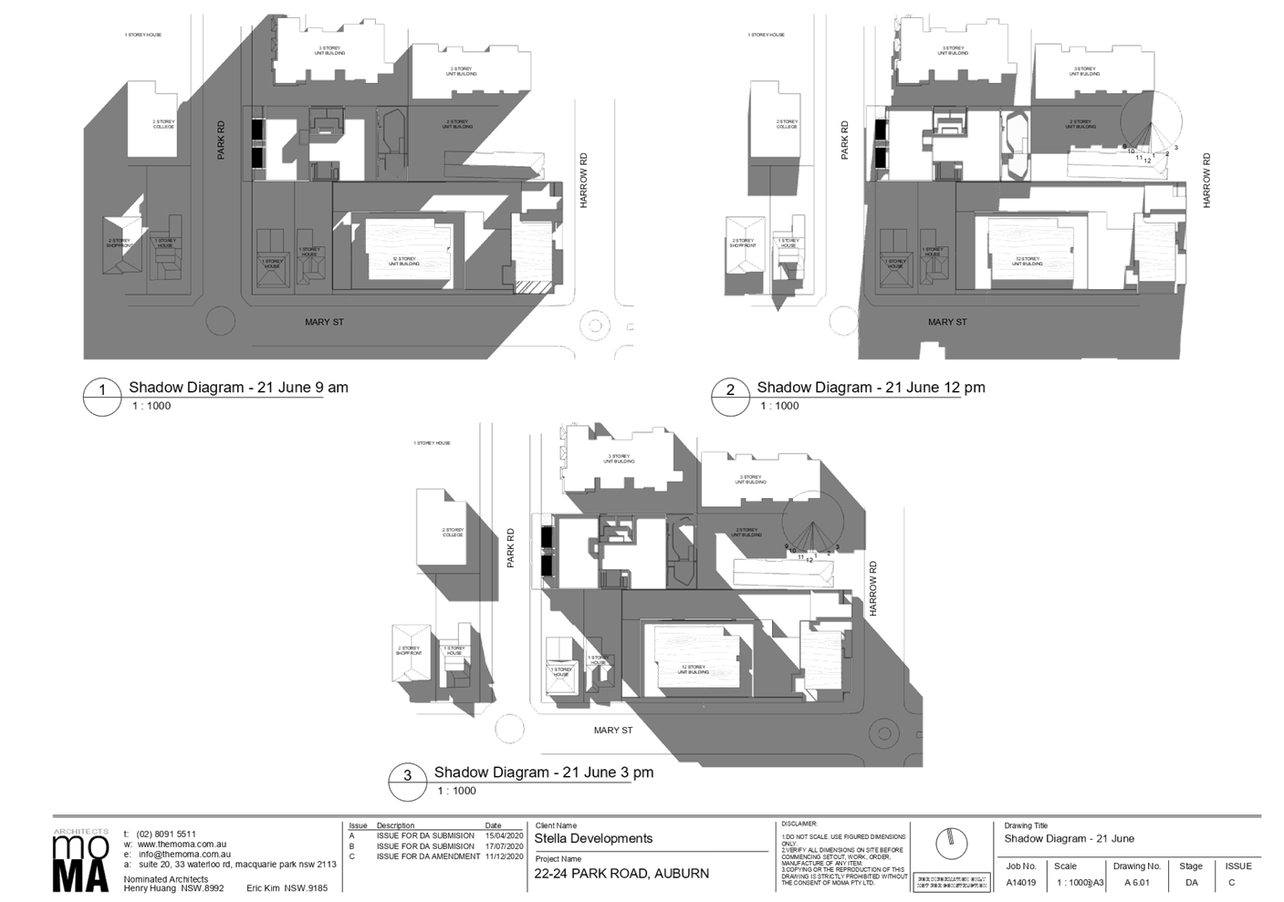
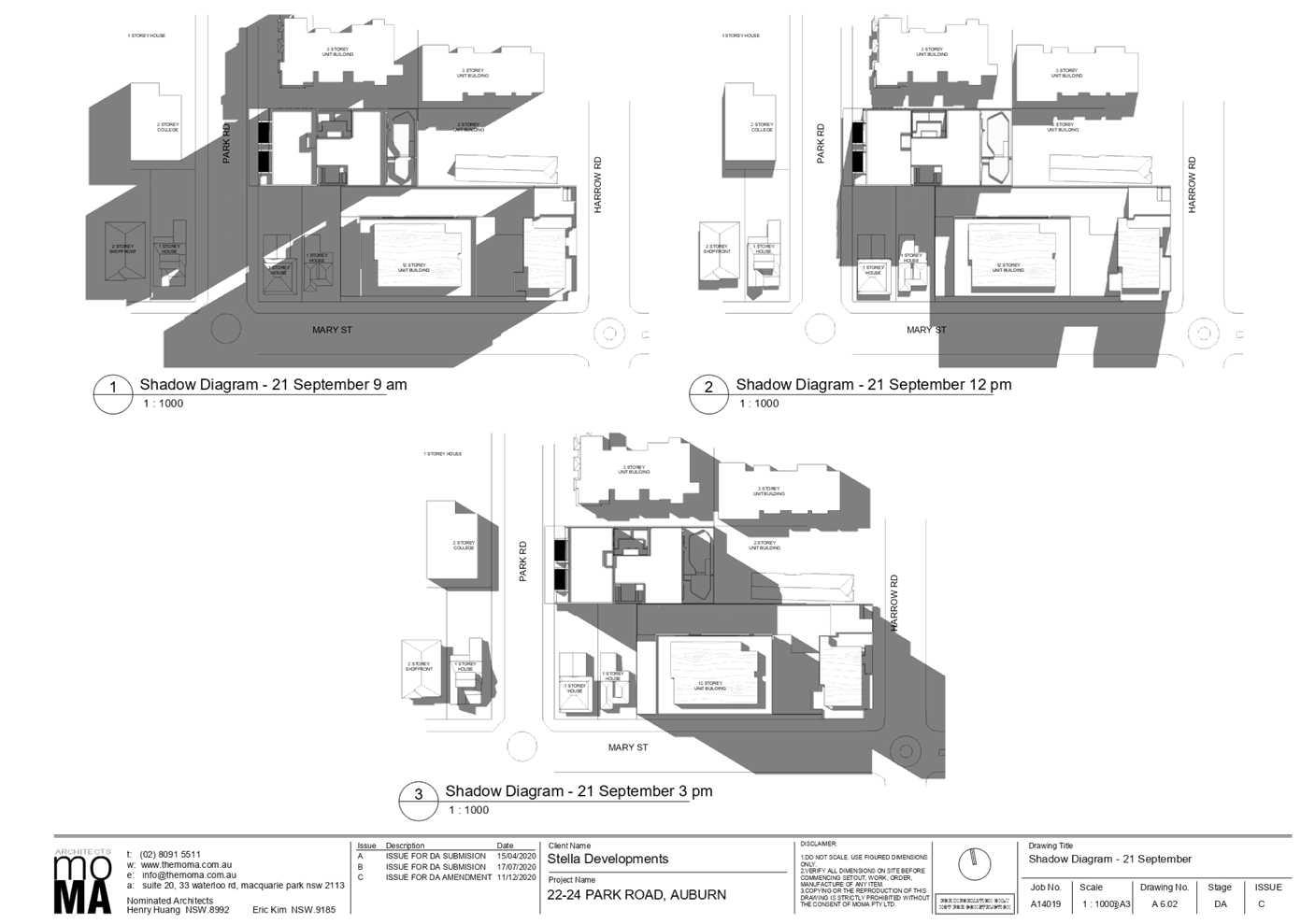
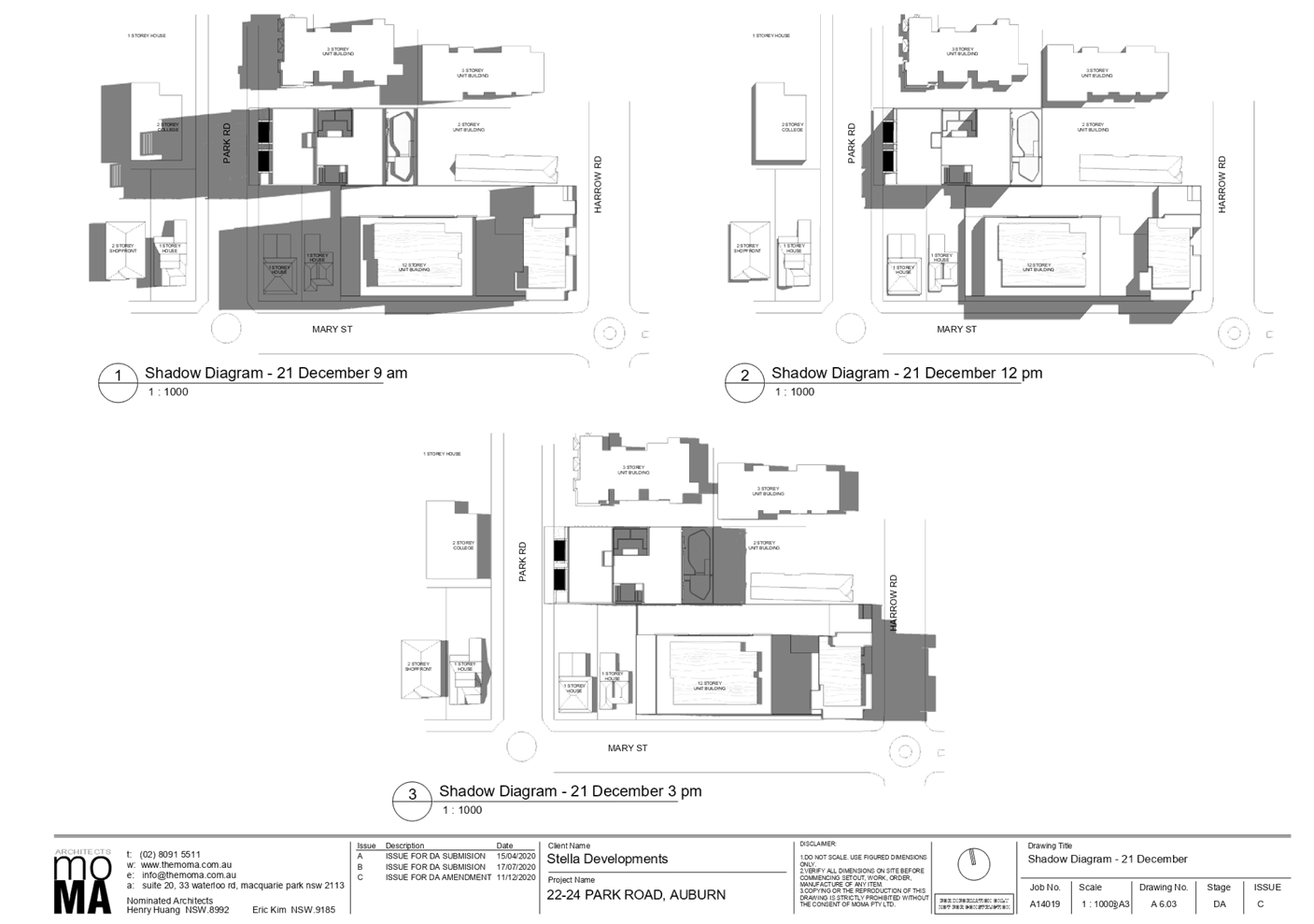
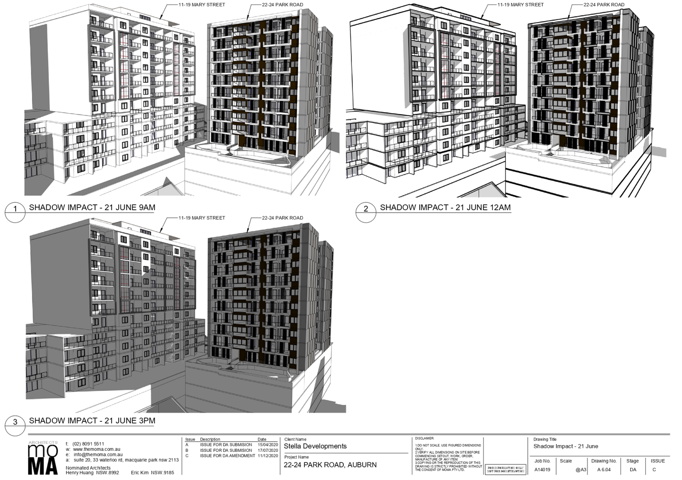
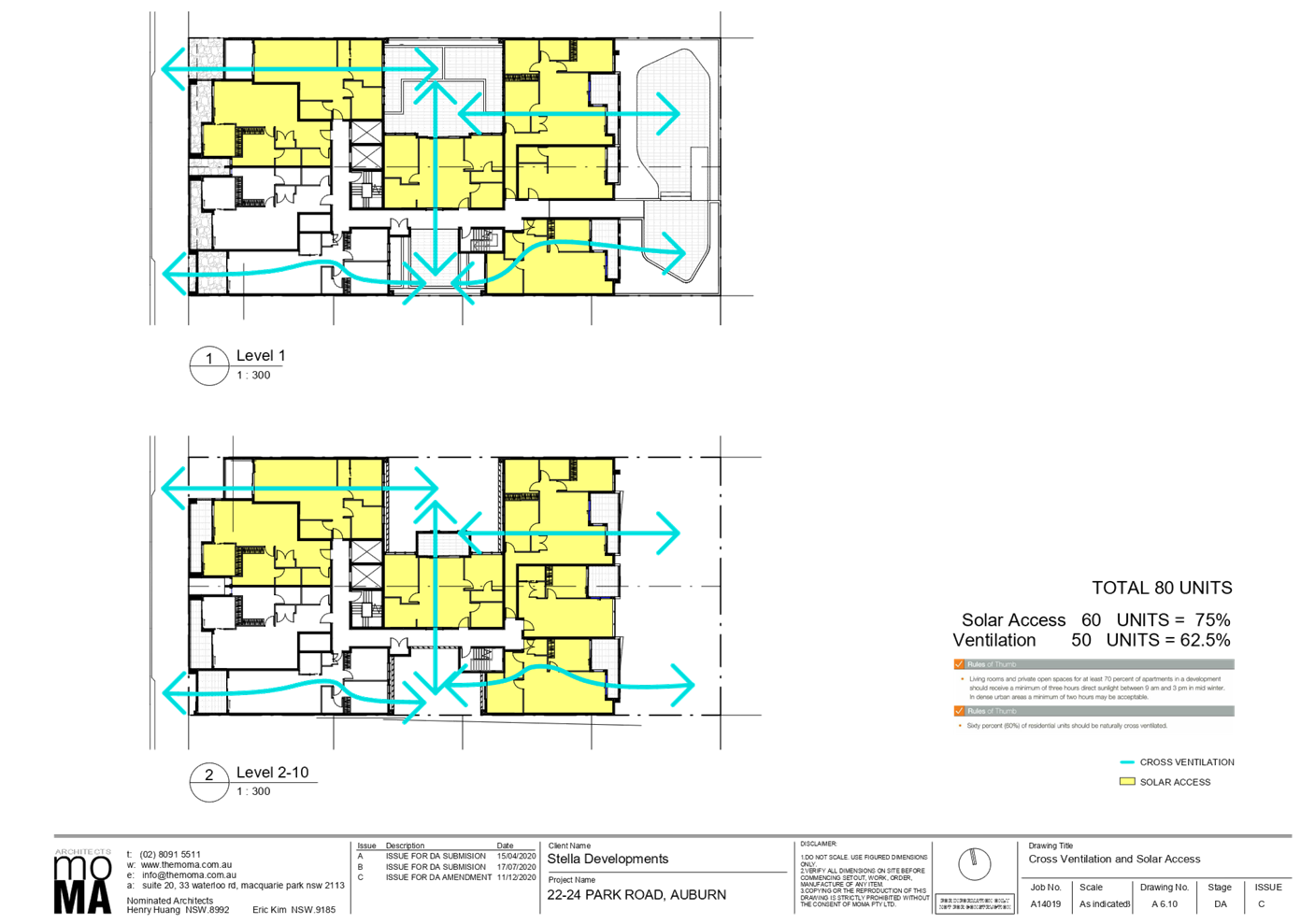
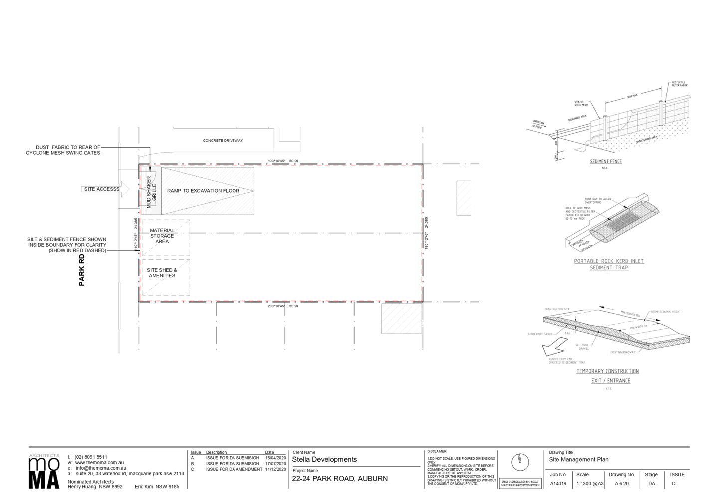
DOCUMENTS
ASSOCIATED WITH
REPORT LPP010/21
Attachment 3
Previous Approved (Lapsed Plans)
Cumberland Local Planning Panel Meeting
14 April 2021
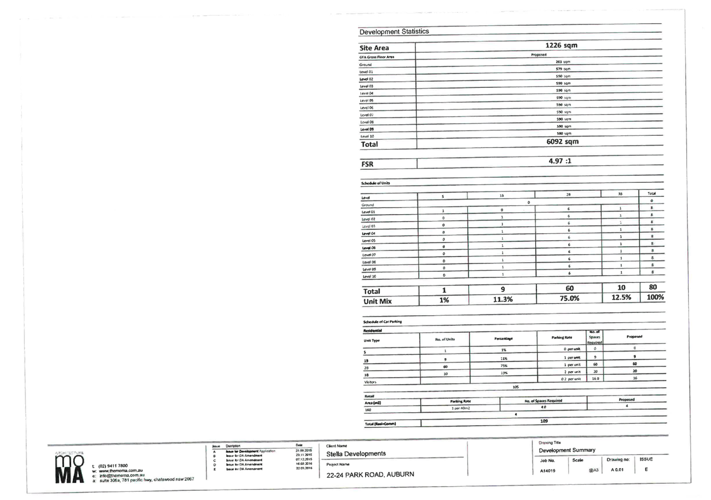
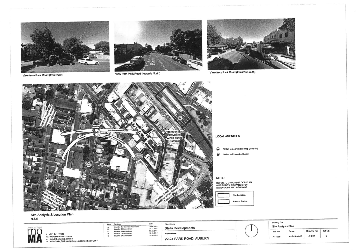
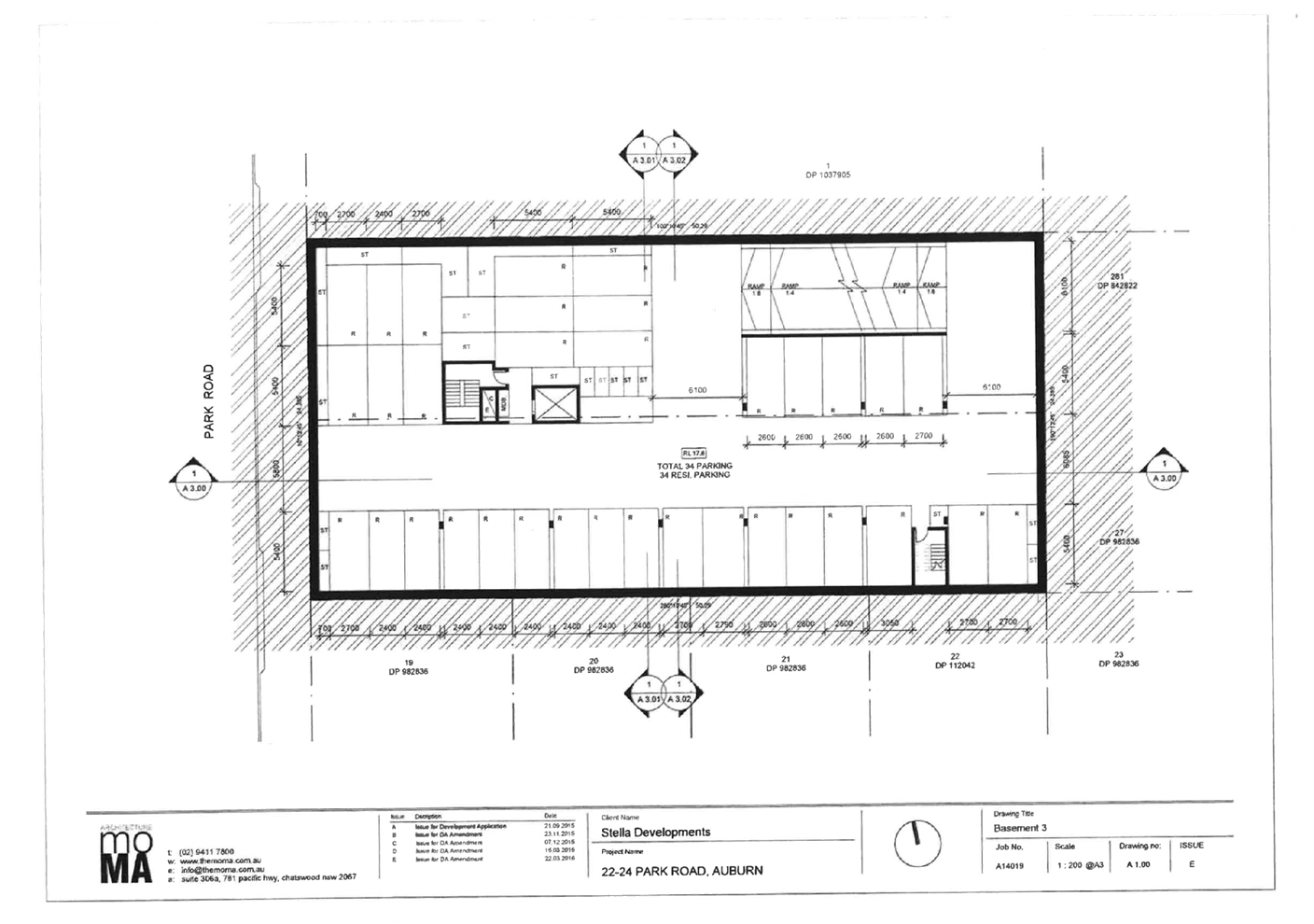
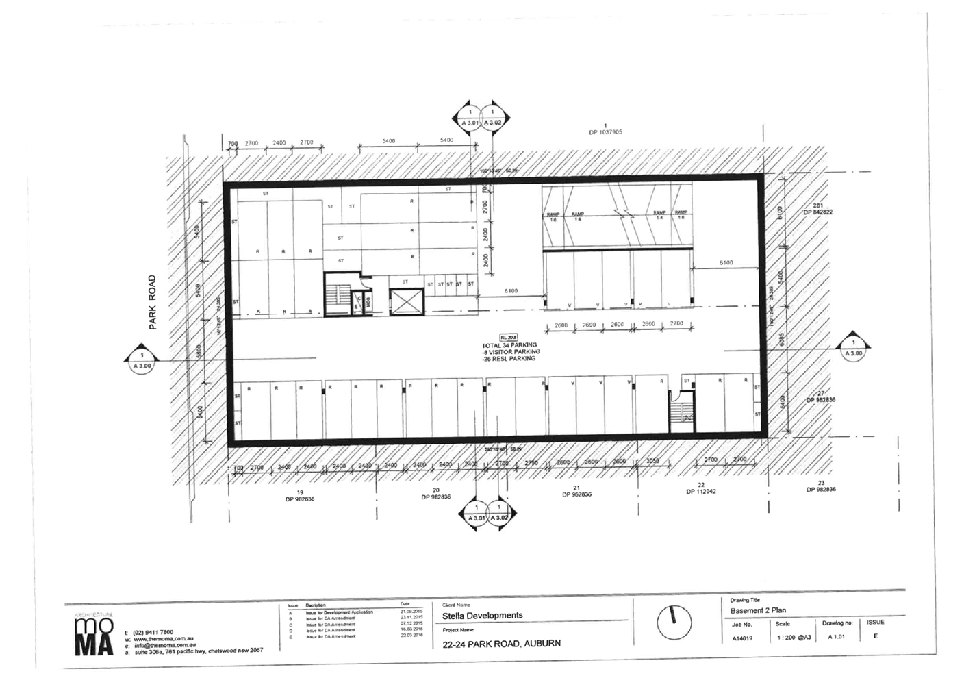
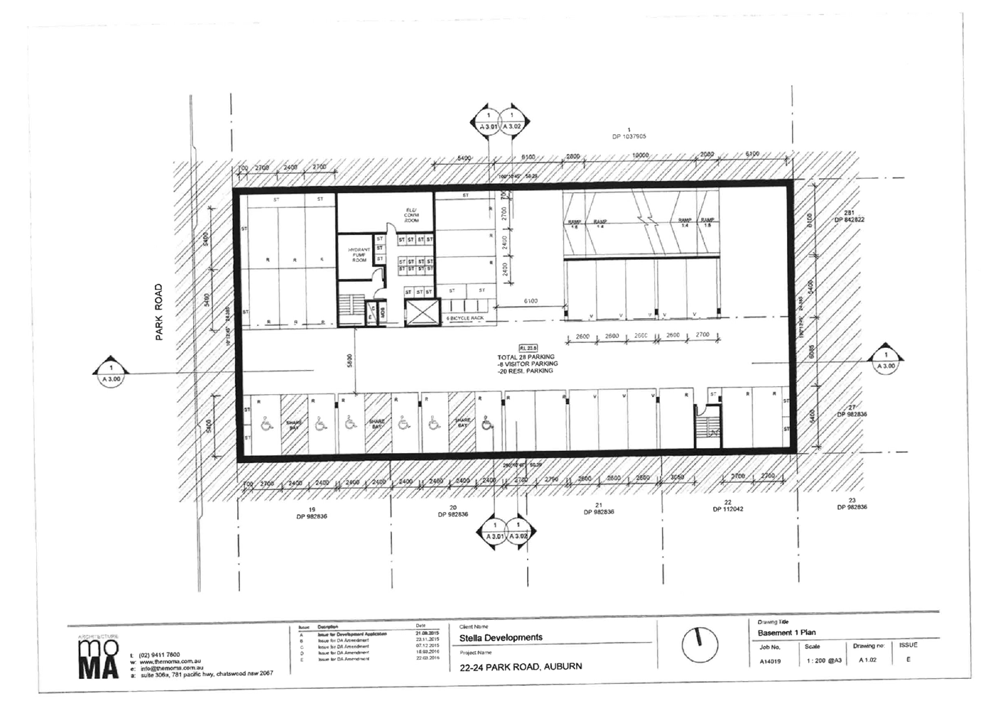
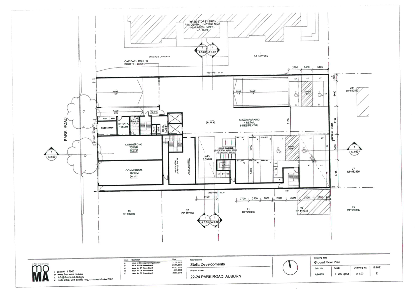
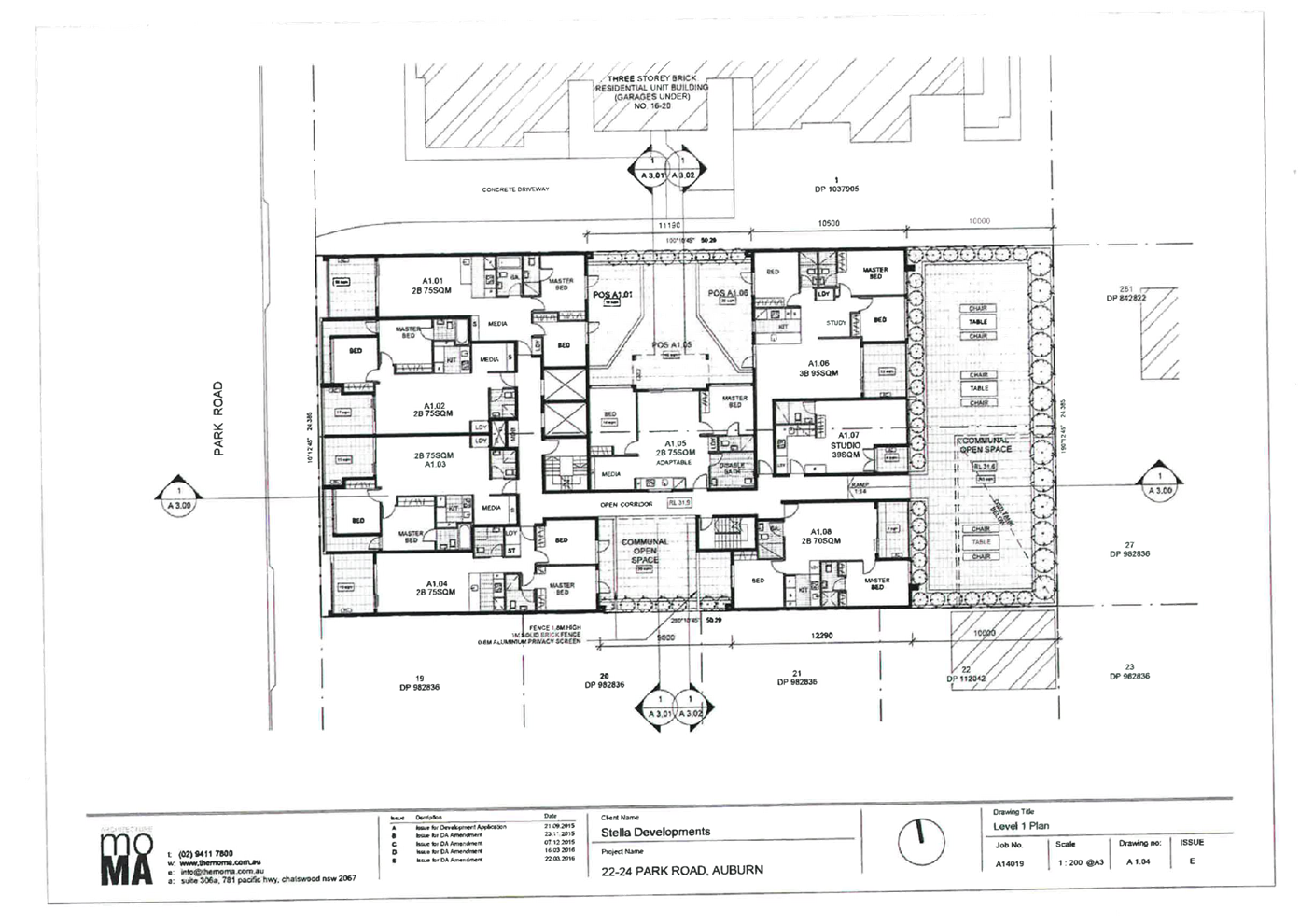
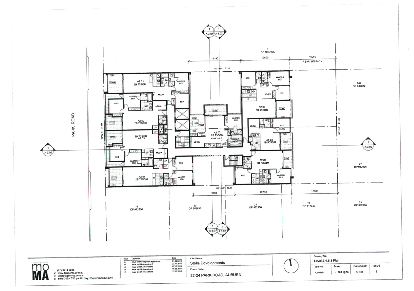
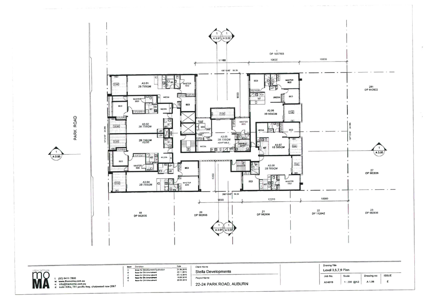
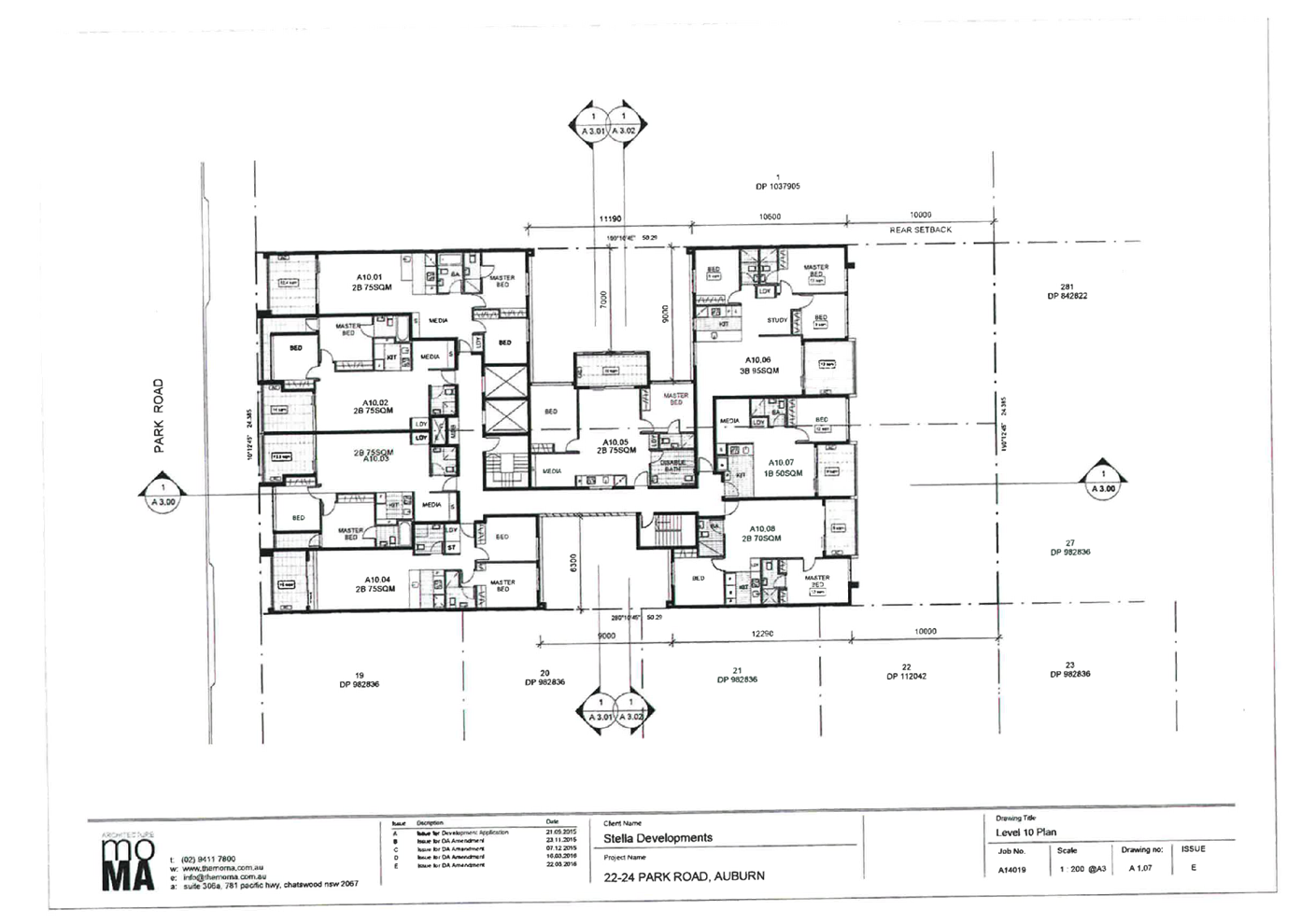
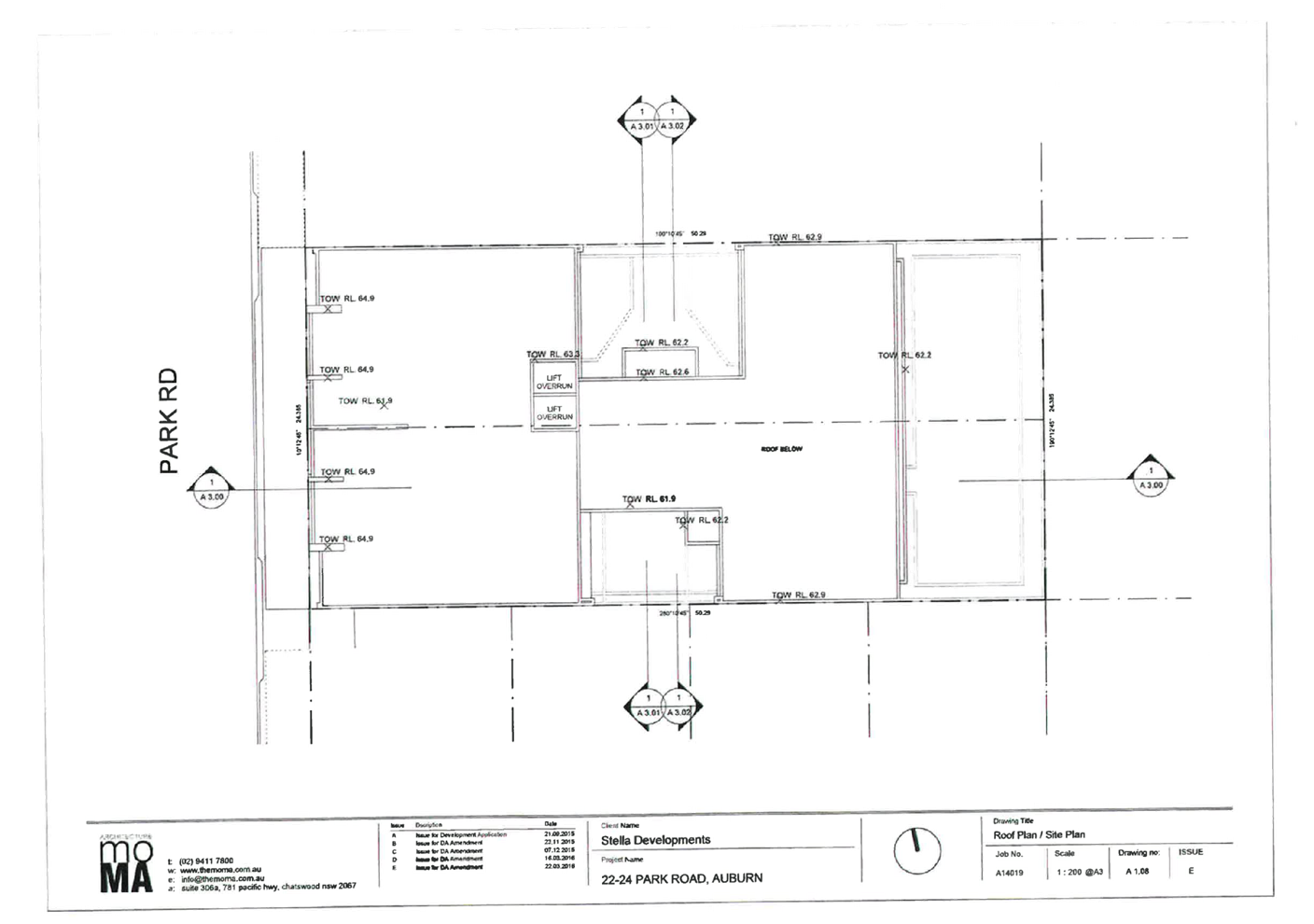
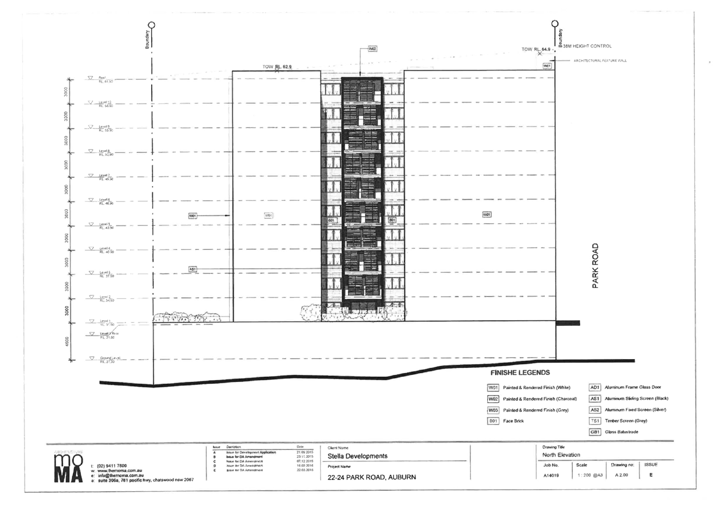
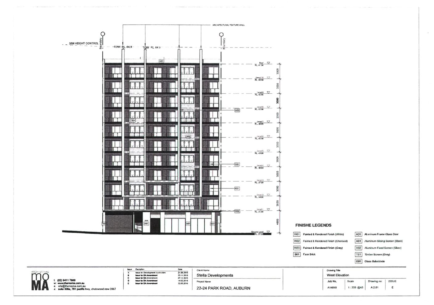
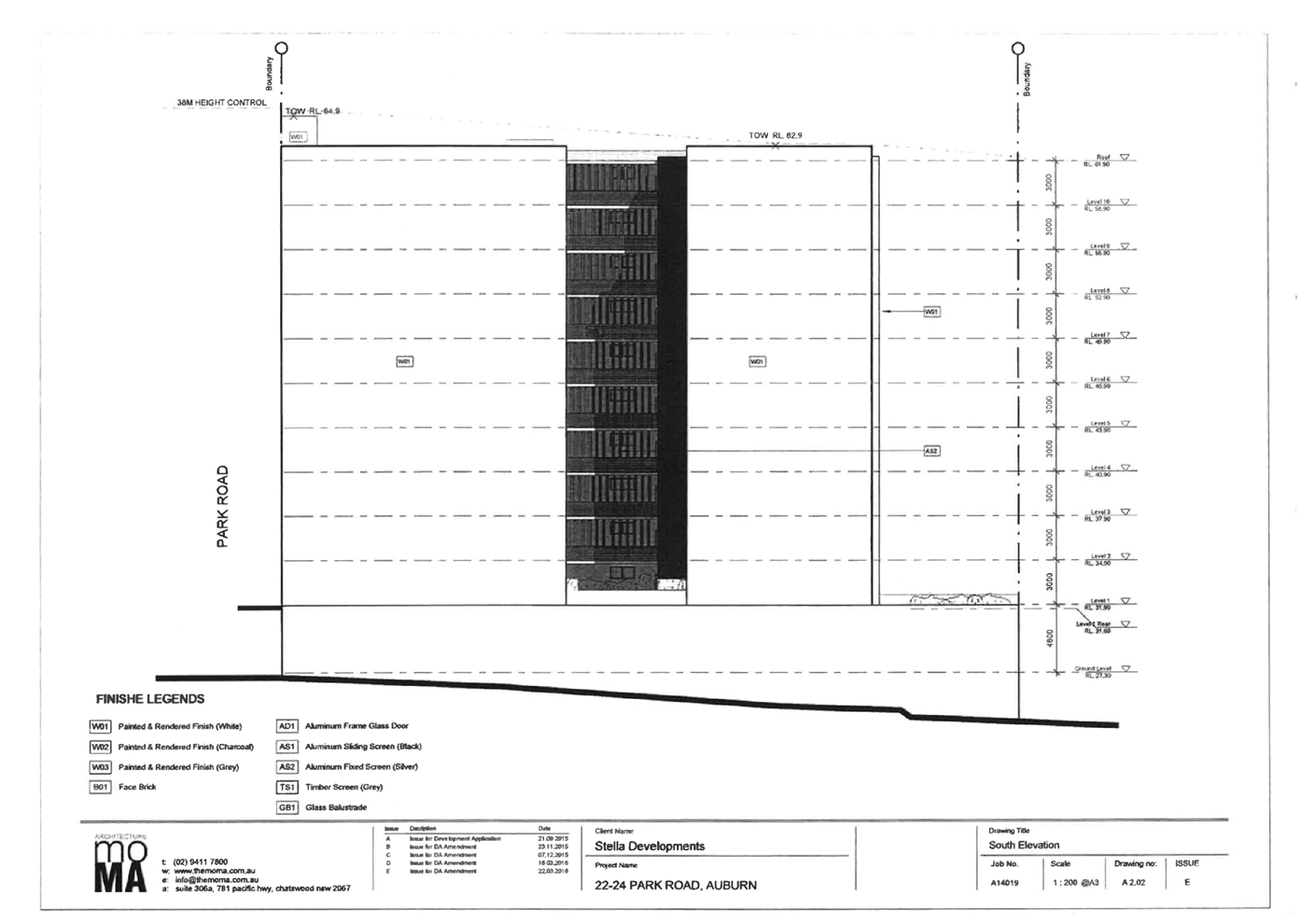
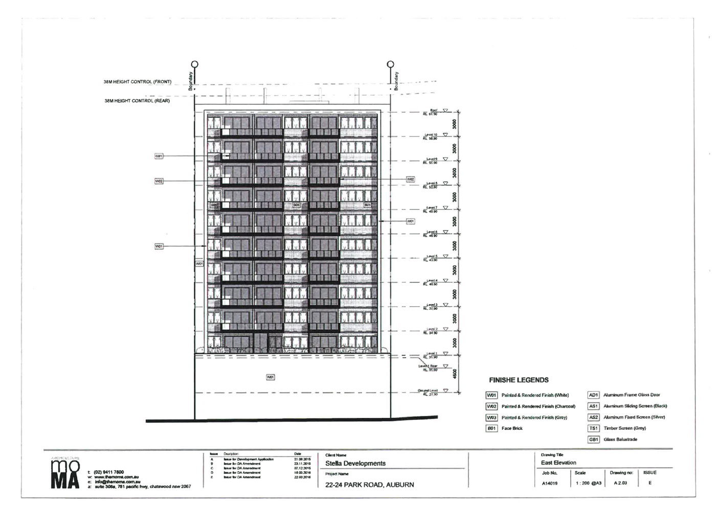
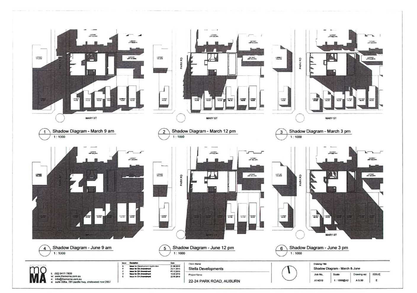
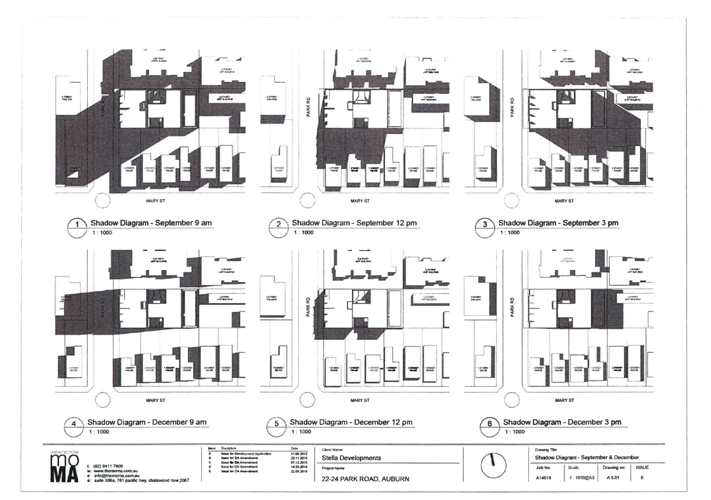
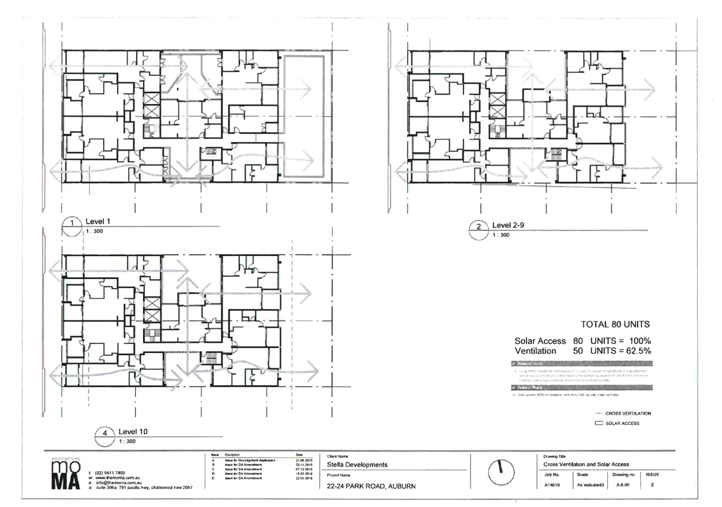
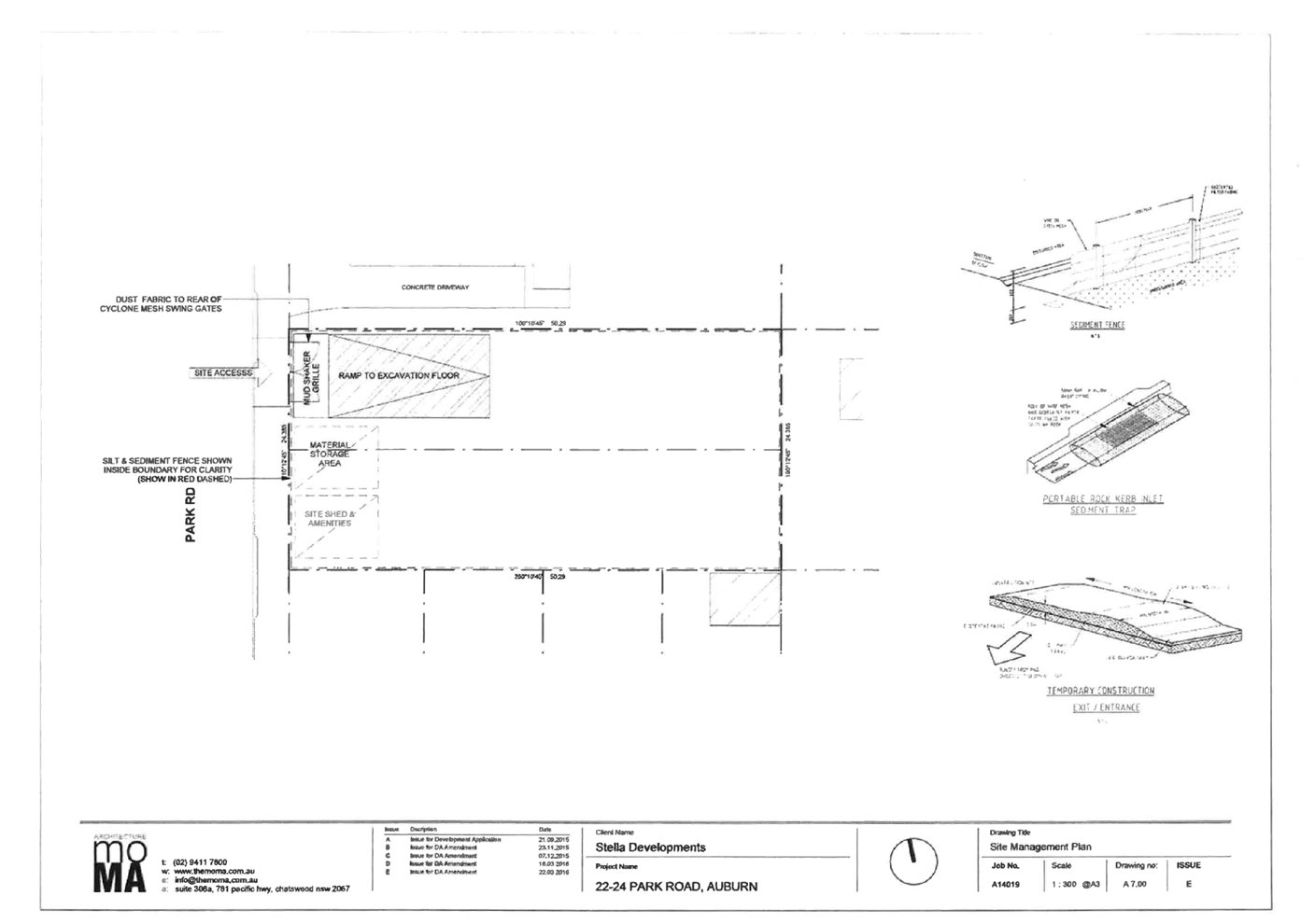
DOCUMENTS
ASSOCIATED WITH
REPORT LPP010/21
Attachment 4
Landscape Plans
Cumberland Local Planning Panel Meeting
14 April 2021
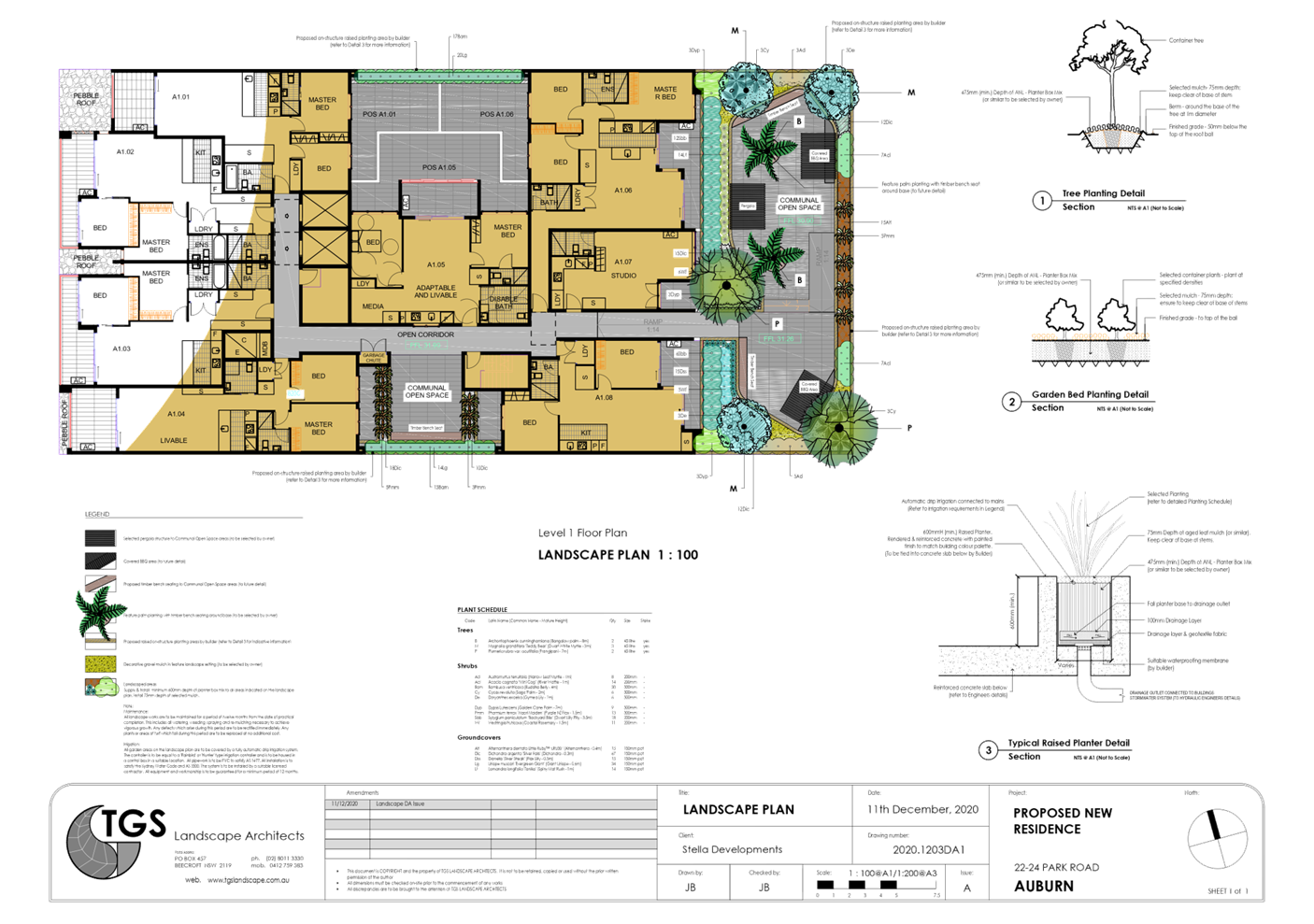
DOCUMENTS
ASSOCIATED WITH
REPORT LPP010/21
Attachment 5
Stormwater and Engineering Plans
Cumberland Local Planning Panel Meeting
14 April 2021

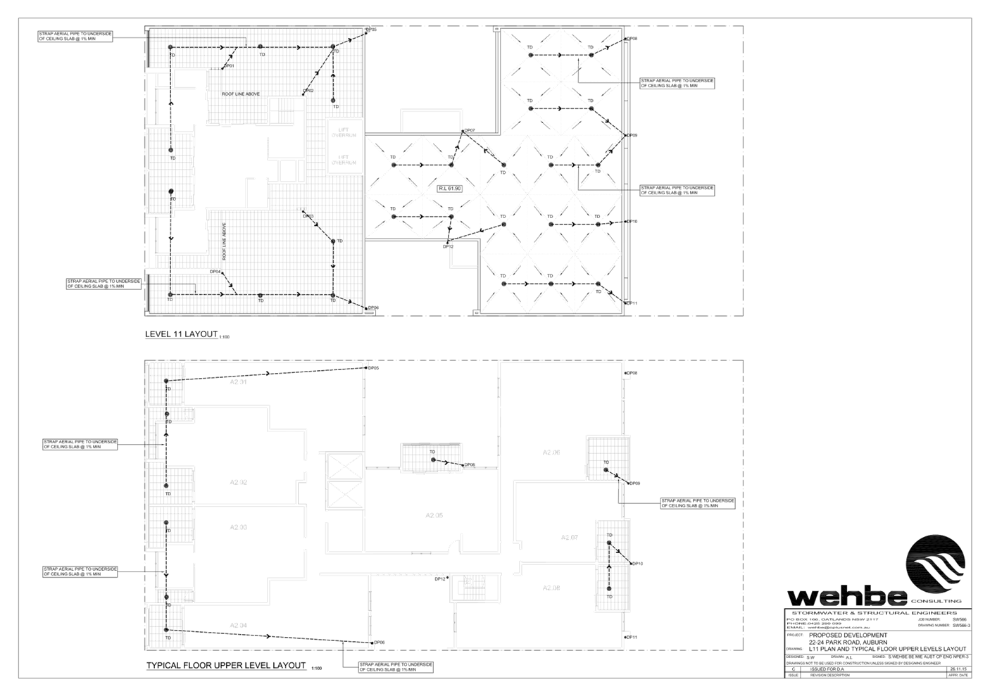
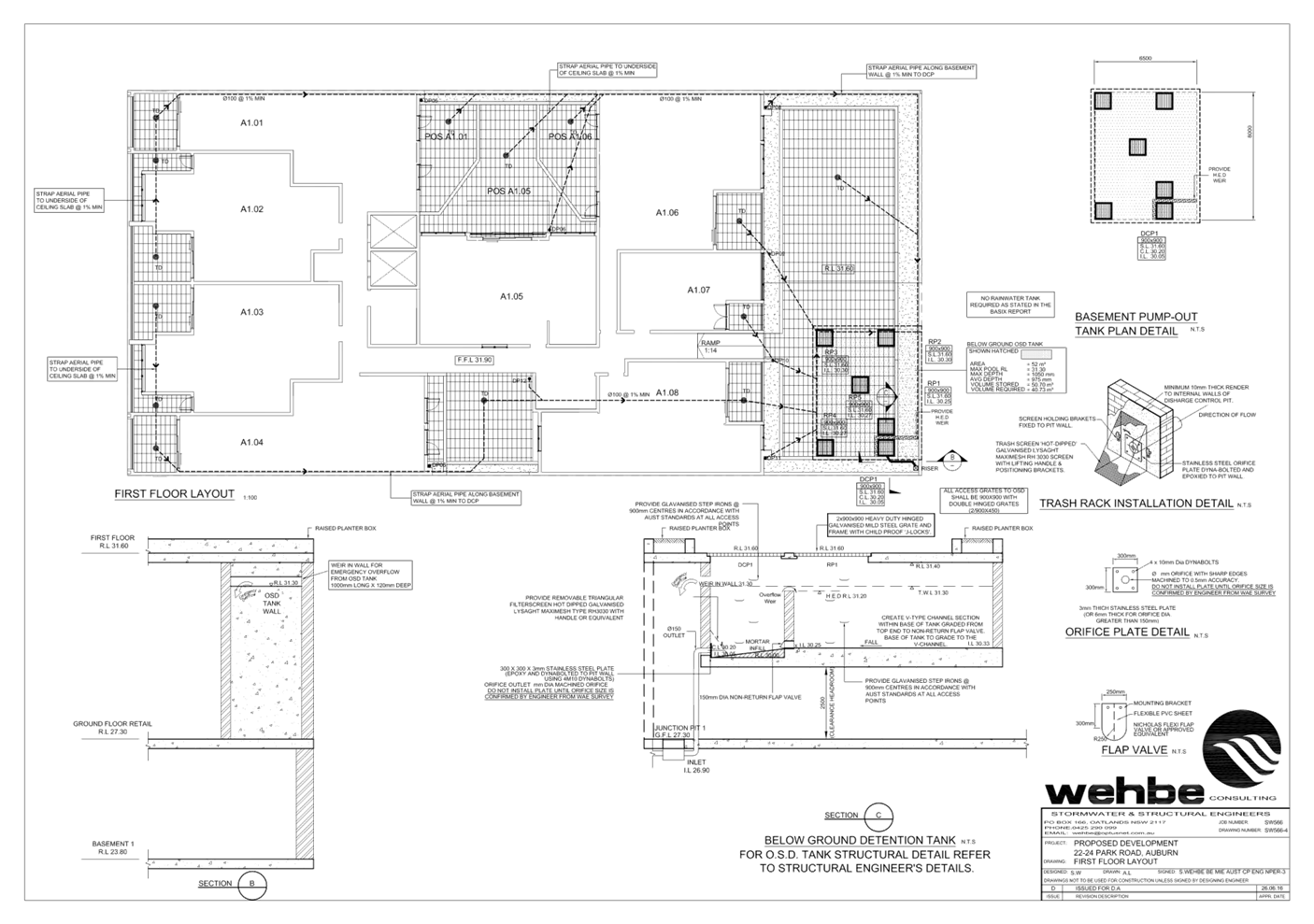
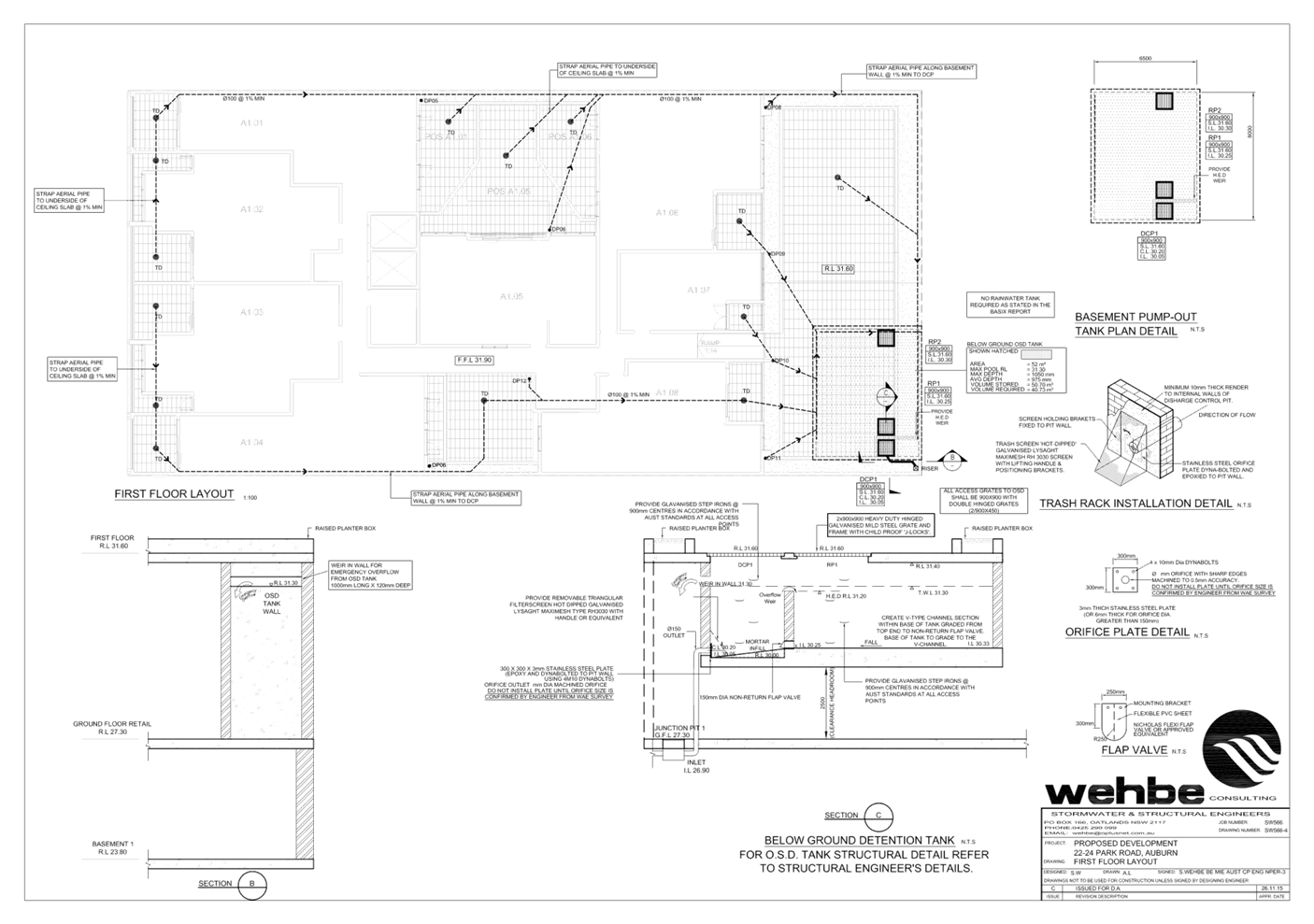
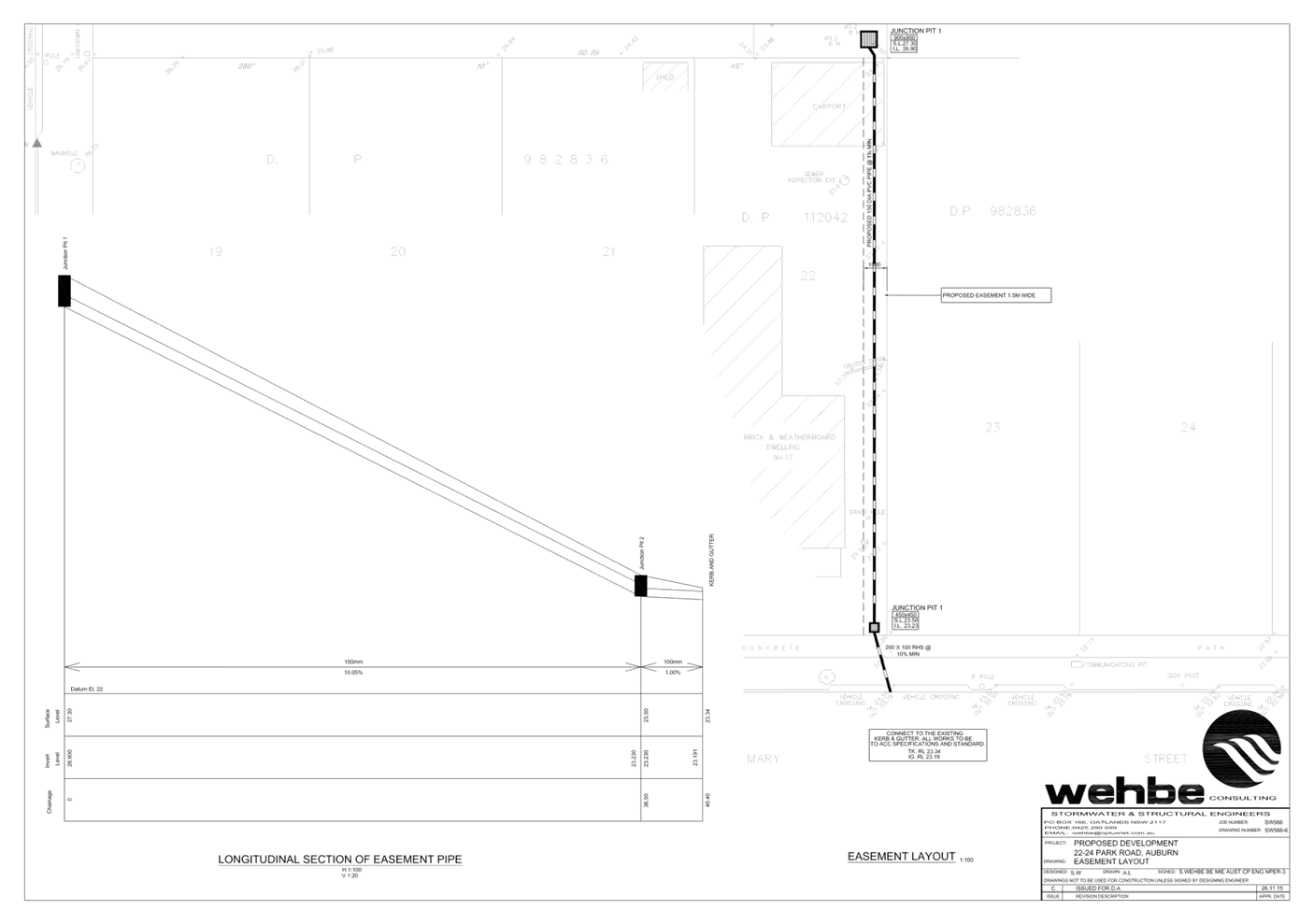
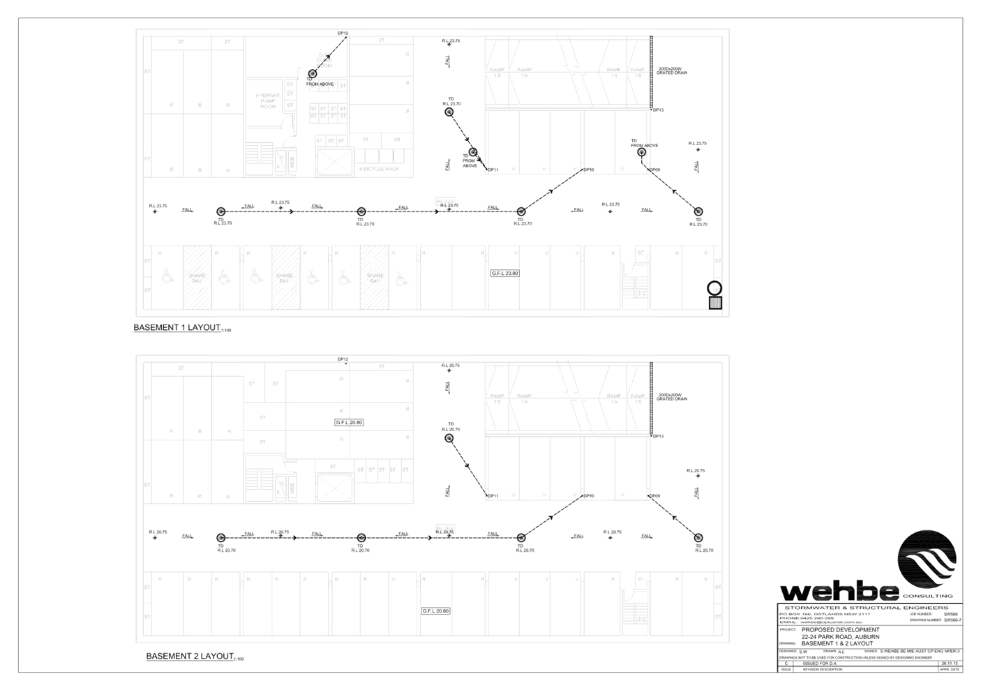
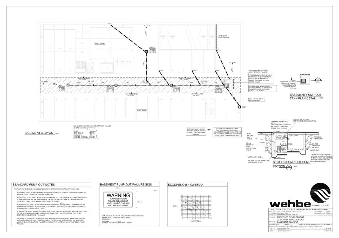
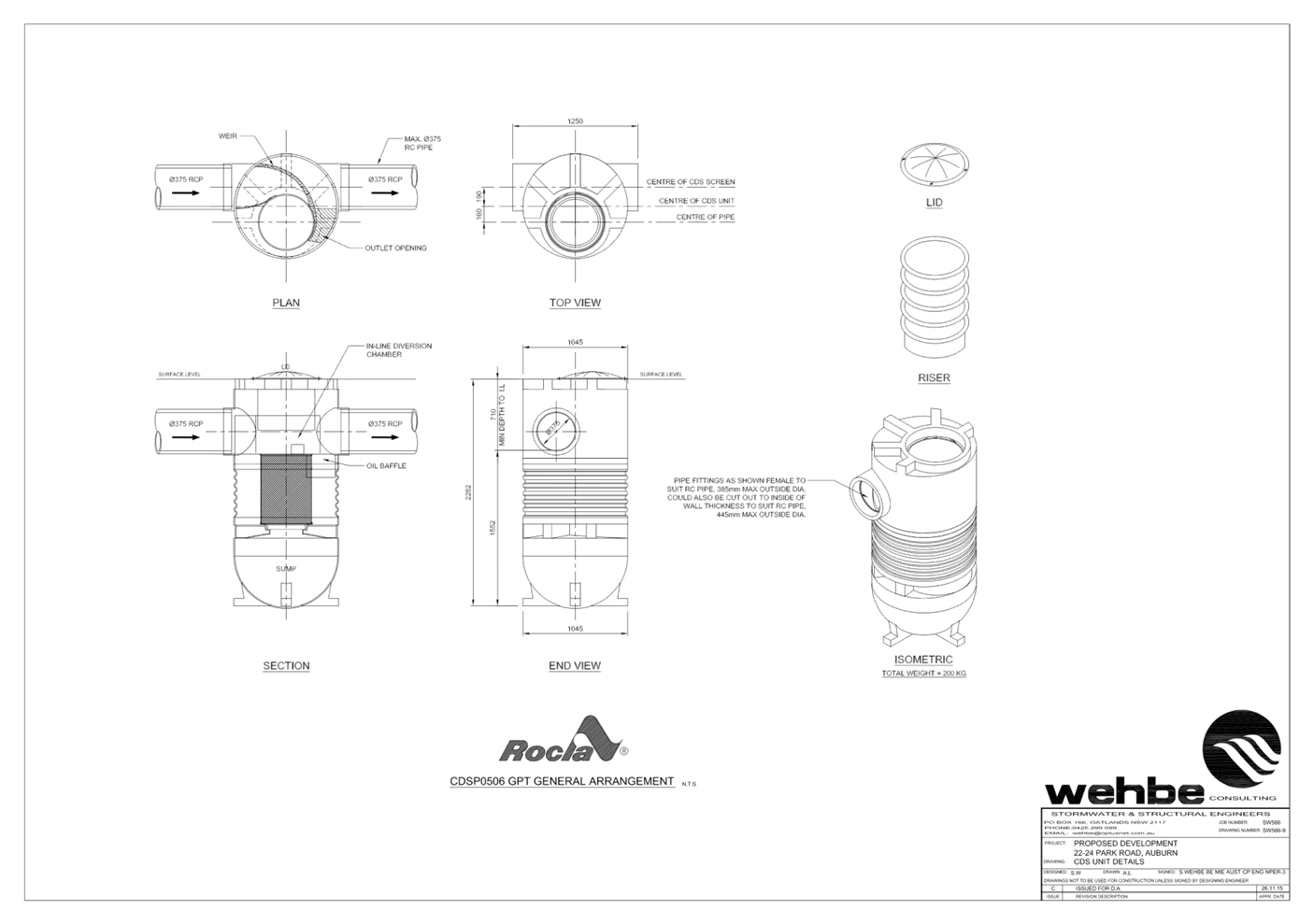
DOCUMENTS
ASSOCIATED WITH
REPORT LPP010/21
Attachment 6
Cumberland Design Excellence Panel Minutes
Cumberland Local Planning Panel Meeting
14 April 2021
DOCUMENTS
ASSOCIATED WITH
REPORT LPP010/21
Attachment 7
Submissions Received
Cumberland Local Planning Panel Meeting
14 April 2021
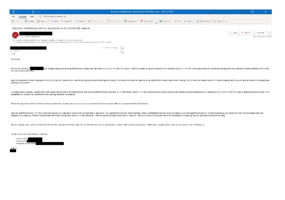
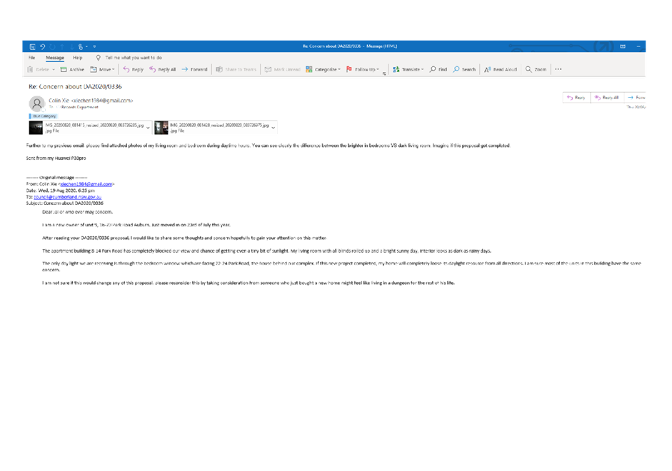
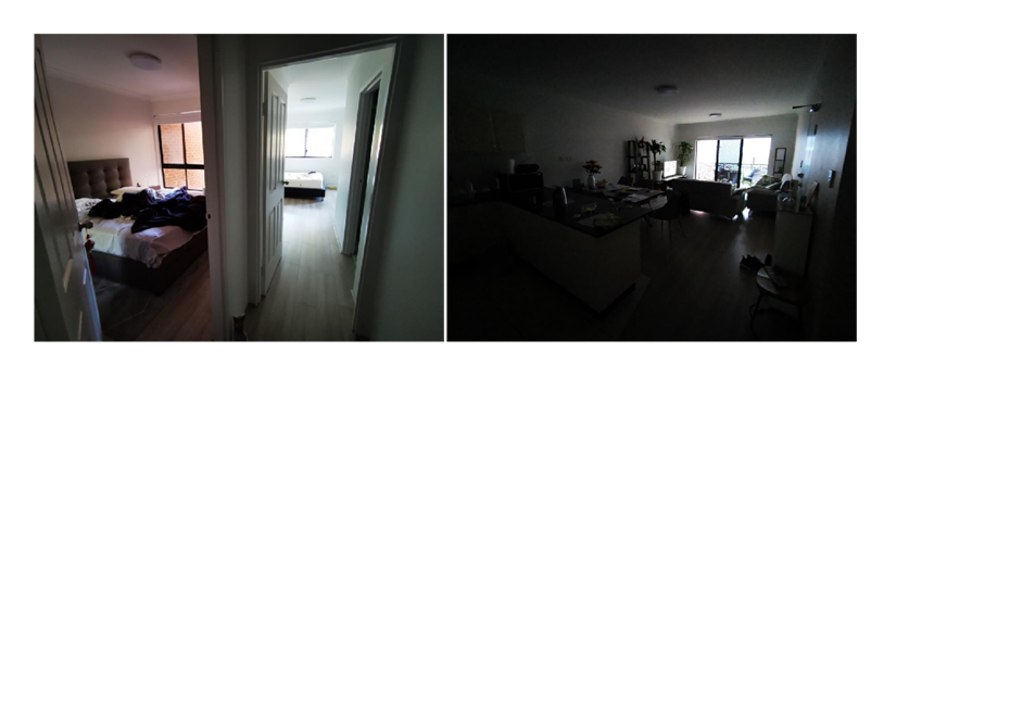
DOCUMENTS
ASSOCIATED WITH
REPORT LPP010/21
Attachment 8
ADG Compliance Table
Cumberland Local Planning Panel Meeting
14 April 2021
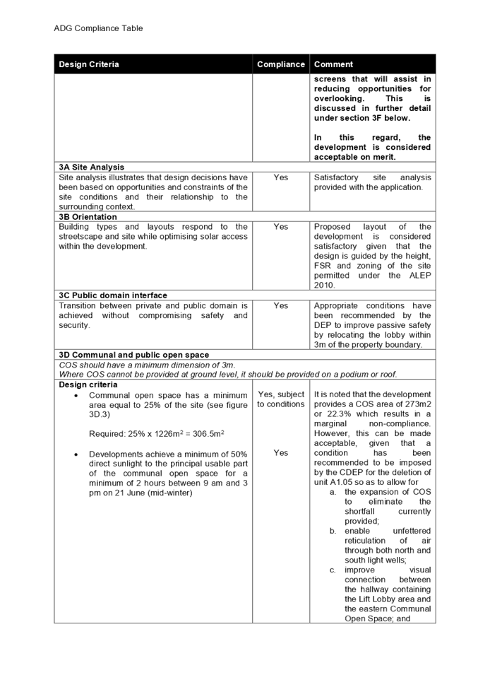
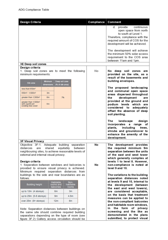
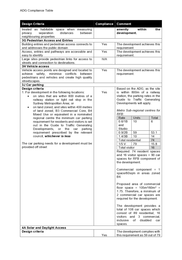
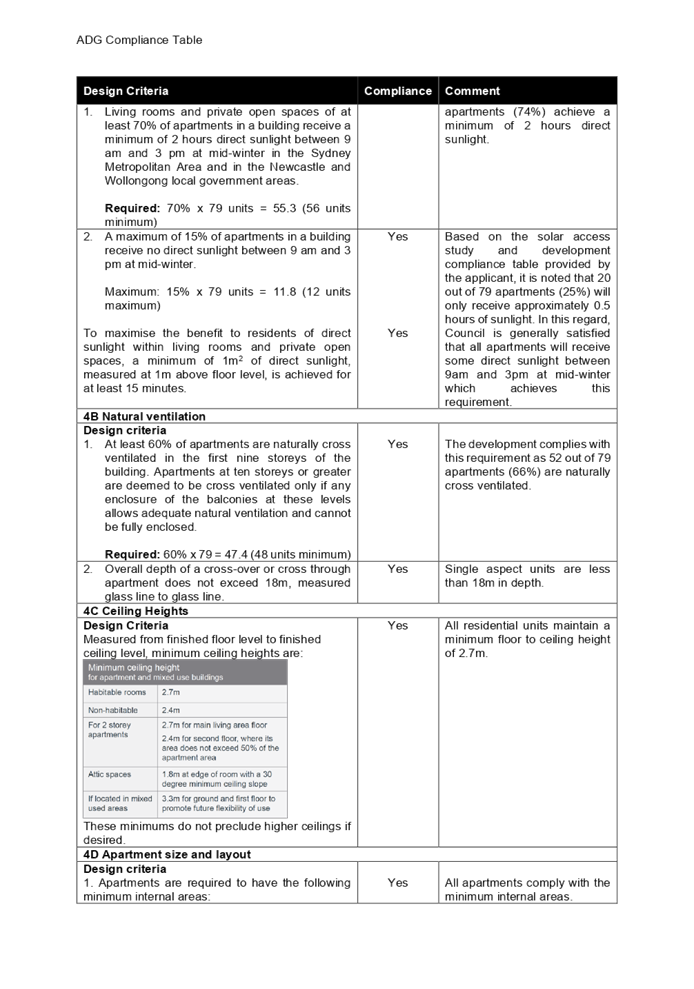
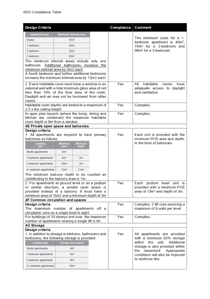
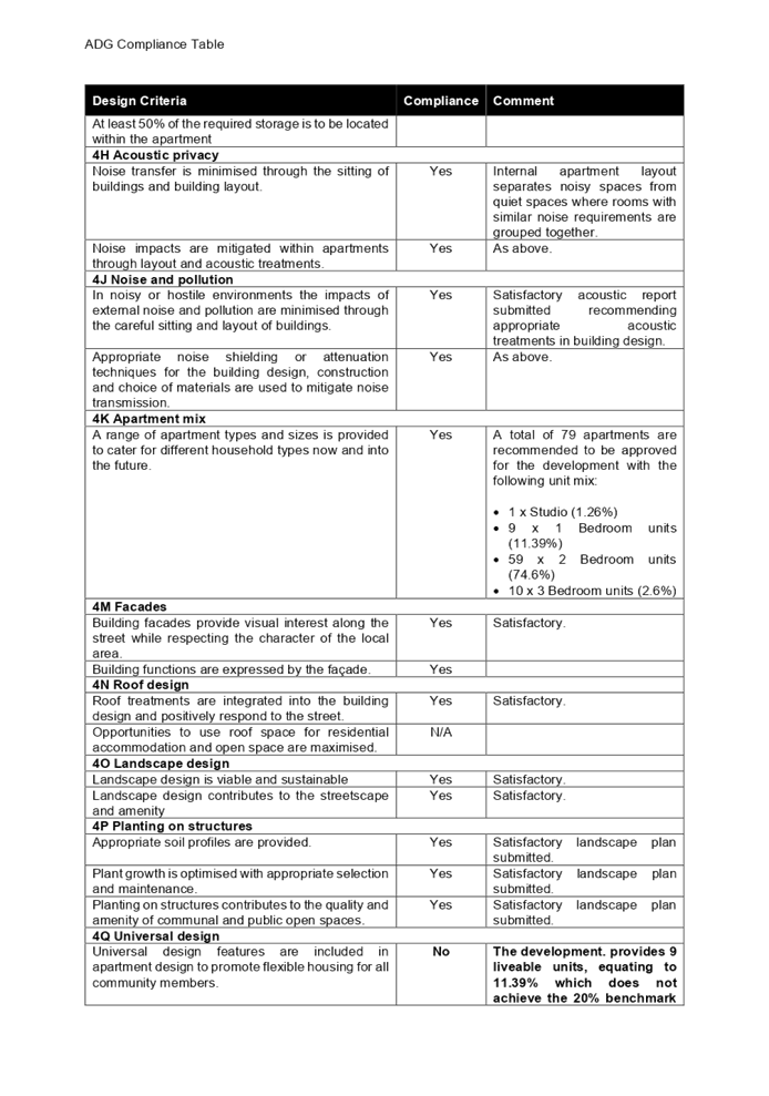
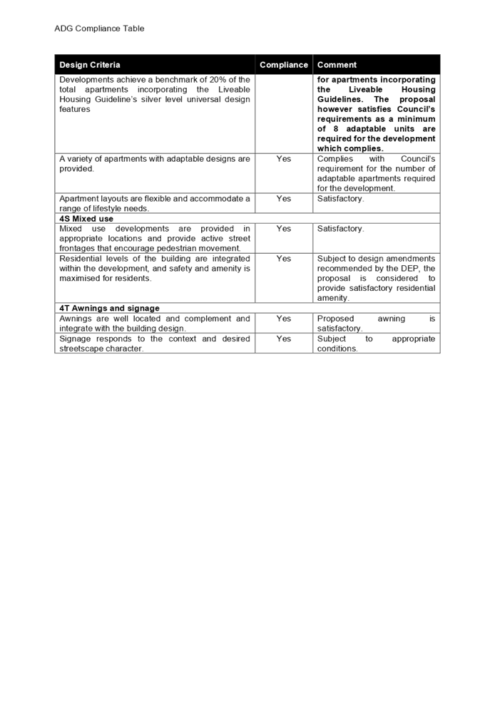
DOCUMENTS
ASSOCIATED WITH
REPORT LPP010/21
Attachment 9
ALEP 2010 and DCP 2010 Compliance Table
Cumberland Local Planning Panel Meeting
14 April 2021
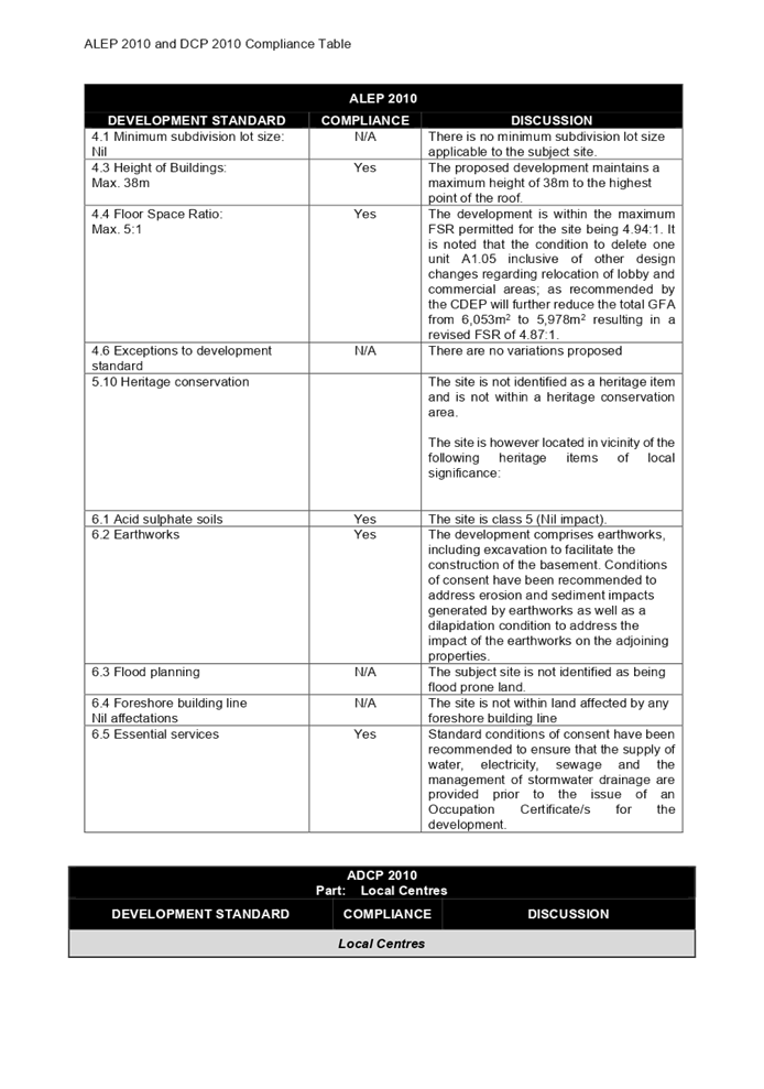
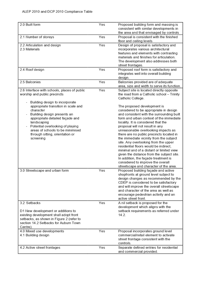
Cumberland
Local Planning Panel Meeting
14 April 2021
Item
No: LPP011/21
Development Application for 92 Hampden Road, South Wentworthville
Responsible
Division: Environment
& Planning
Officer: Executive
Manager Development and Building
File Number: DA2021/0064
|
Application
lodged
|
8 February 2021
|
|
Applicant
|
J Tannous
|
|
Owner
|
Mrs M Attia & Mr M Attia
|
|
Application
No.
|
DA2021/0064
|
|
Description
of Land
|
92 Hampden Road SOUTH
WENTWORTHVILLE NSW 2145, Lot 12 DP 1237763
|
|
Proposed
Development
|
Demolition of existing
structures and construction of a two-storey detached dual occupancy with
Torrens title subdivision into two (2) lots
|
|
Site
Area
|
602.5m2
|
|
Zoning
|
R2 - Low Density
Residential
|
|
Disclosure
of political donations and gifts
|
Nil disclosure
|
|
Heritage
|
The subject site is not
identified as a Heritage Item, and neither is it located within a
Conservation Area.
|
|
Principal
Development Standards
|
N/A
|
|
Issues
|
Non-compliance with
articulation
|
1. Development
Application No. DA2021/0064 was received on 8 February 2021 for the demolition
of existing structures and construction of a two-storey detached dual occupancy
with Torrens title subdivision into two (2) lots.
2. The
application was publicly notified to occupants and owners of the adjoining
properties for a period of 14 days between 19 February 2021 and 5 March 2021.
In response, no submission were received.
3. The
variation is as follows:
|
Control
|
Required
|
Provided
|
% variation
|
|
Articulation
|
Maximum 10m
|
12m
|
20%
|
4. The
application is recommended for approval subject to the conditions as provided
in the attached schedule.
5. The
application has been referred to the Panel for determination as the proposal
development has been identified as a being a ‘conflict of interest’
as identified within Schedule 2, Condition 1 of the Local Planning Panels
Direction.
Subject Site and Surrounding
Area
The site forms Lot 12 Sec 3 DP
1237763 and is known as 92 Hampden Road SOUTH WENTWORTHVILLE NSW 2145. The site
is a corner allotment and has an area of 602.4m2 and a frontage to Hampden Road
of 15.04m and side frontage to Northcott Street of 30.49m. The site has a fall
of approximately 01.32m from southern boundary to northern boundary.
A site inspection of the premises
carried out on 5 March 2021, which confirmed that the site contains a single
storey clad dwelling with three (3) trees located within the front setback of
the allotment and one (1) street tree. The proposal also seeks approval for
removal of a street tree and two (2) trees within the allotment, one (1) tree
is to be retained.
The existing developments
adjoining the site include various single and two storey developments. The site
is located on the eastern side of Hampden Road and northern side of Northcott
Street and is bounded by Chelmsford Road to the east.
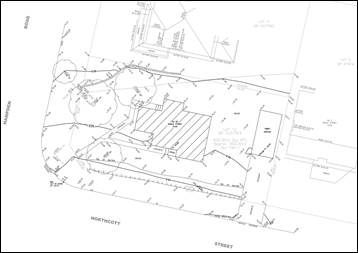
Figure
1 – Locality Plan of subject site 92 Hampden Road, South Wentworthville,
2145
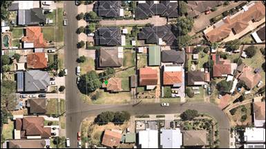
Figure
2 – Aerial view of subject site 92 Hampden Road, South Wentworthville,
2145
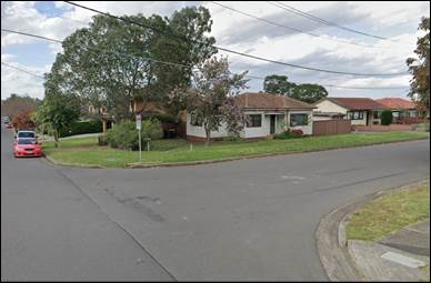
Figure
3 – Street view of subject site
Description of the Proposed
Development
Council is in receipt of a
Development Application seeking consent for the demolition of the existing
structures and construction of a detached dual occupancy with Torrens title
subdivision into two (2) lots. The proposed works are specifically outlined
below:
Note: For the purpose of
this report, Unit/Dwelling 1 is the dwelling located adjacent to the side
western boundary and Unit/Dwelling 2 is the dwelling located adjacent to the
side eastern boundary.
Demolition
· Demolition
of an existing single storey clad dwelling, detached freestanding fibro garage,
ancillary structures and the removal of three (3) trees.
Construction of a detached Dual
Occupancy
Unit/Dwelling 1
Ground Floor:
· Porch
attached to front facade, garage, entry, access stairs, kitchen, living/dining,
study, terrace attached to side and rear facade, bathroom and a laundry.
First Floor:
· Four
(4) bedrooms (master bedroom with walk in robe and ensuite), bathroom, toilet,
access stairs, balcony attached to the front façade with access from the
master bedroom and balcony attached to the front façade with access from
bedroom 3 and 4.
Unit/Dwelling 2
Ground Floor:
· Porch
attached to front facade, garage, entry, access stairs, kitchen, living/dining,
terrace attached to rear facade, bathroom and a laundry.
First Floor:
· Four
(4) bedrooms (master bedroom with walk in robe and ensuite), bathroom, access
stairs, balcony attached to the front façade with access from the master
bedroom and balcony attached to the front façade with access from
bedroom 2.
History
N/A
– Council’s database and internal mapping system identified that
the site has been predominately used as a dwelling house for a significant
period.
Applicants
Supporting Statement
The applicant has provided a
Statement of Environmental Effects prepared by Dvyne Design dated January 2021
and was received by Council on 15 February 2021 in support of the application.
Contact with Relevant
Parties
The assessing officer has undertaken a site inspection of
the subject site and surrounding properties and has been in regular contact
with the applicant throughout the assessment process.
Internal Referrals
The application was referred to
Council’s Tree Management Officer for comment. The application was deemed
satisfactory and supported with conditions on consent.
External Referrals
The application was not required to be referred to any
external government authorities for comment.
PLANNING COMMENTS
The provisions of any
Environmental Planning Instruments (EP&A Act s4.15 (1)(a)(i))
State Environmental Planning
Policies
The proposed development is
affected by the following State Environmental Planning Policies:
(a) State
Environmental Planning Policy No. 55 – Remediation of Land (SEPP 55)
Clause 7 of SEPP 55 requires Council to be satisfied that
the site is suitable or can be made suitable to accommodate the proposed
development. The matters listed within Clause 7 have been considered in the
assessment of the development application.
|
Matter for Consideration
|
Yes/No
|
|
Does
the application involve re-development of the site or a change of land use?
|
Yes
No
|
|
In the development going to be used for a sensitive land
use (e.g.: residential, educational, recreational, childcare or hospital)?
|
Yes
No
|
|
Does information available to you indicate that an
activity listed below has ever been approved, or occurred at the site?
acid/alkali plant and
formulation, agricultural/horticultural activities, airports, asbestos
production and disposal, chemicals manufacture and formulation, defence
works, drum re-conditioning works, dry cleaning establishments, electrical
manufacturing (transformers), electroplating and heat treatment premises,
engine works, explosive industry, gas works, iron and steel works, landfill
sites, metal treatment, mining and extractive industries, oil production and
storage, paint formulation and manufacture, pesticide manufacture and
formulation, power stations, railway yards, scrap yards, service stations,
sheep and cattle dips, smelting and refining, tanning and associated trades,
waste storage and treatment, wood preservation
|
Yes
No
|
|
Is the site listed on
Council’s Contaminated Land database?
|
Yes
No
|
|
Is the site subject to EPA
clean-up order or other EPA restrictions?
|
Yes
No
|
|
Has the site been the subject of
known pollution incidents or illegal dumping?
|
Yes
No
|
|
Does the site adjoin any
contaminated land/previously contaminated land?
|
Yes
No
|
|
Has the appropriate level of
investigation been carried out in respect of contamination matters for
Council to be satisfied that the site is suitable to accommodate the proposed
development or can be made suitable to accommodate the proposed development?
|
Yes
No
|
|
Comment: The site is not identified in Council’s records as
being contaminated. A site inspection reveals the site does not have any
obvious history of a previous land use that may have caused contamination and
there is no specific evidence that indicates the site is contaminated. The
subject site is currently used for residential purposes and contamination is
not expected.
|
(b) Statement
Environmental Planning Policy No 19 - Bushland in Urban Areas (SEPP 19)
N/A – No bushland zoned or
reserved for public open space is affected.
(c) State
Environmental Planning Policy (Vegetation in Non-Rural Areas) 2017
The proposal does not exceed the
biodiversity offsets scheme threshold. Therefore, the proposed vegetation
removal is considered acceptable. Please refer to the DCP compliance table for
further discussion.
(d) State
Environmental Planning Policy (Building Sustainability Index: BASIX) 2004
The trigger for BASIX
Certification is when the estimated cost of works for residential development
(new dwelling(s)/alterations and additions) is equal to or above $50,000. BASIX
Certification is also triggered when proposing a swimming pool with a volume of
40,000 litres.
The estimated cost of development
proposed is $908,200, and two (2) individual BASIX Certificates have been
prepared by Dvyne Design, dated 27/11/2020, certificate numbers 1159143S
(Dwelling 1) and 1159191S (Dwelling 2), has been submitted with the Development
Application satisfying the minimum requirements of SEPP (Building
Sustainability Index: BASIX) 2004.
Regional Environmental Plans
The proposed development is
affected by the following Regional Environmental Plans:
(e) Sydney
Regional Environmental Plan (Sydney Harbour Catchment) 2005
Yes - The site is located within
the area within the Sydney Harbour Catchment and SREP (Sydney Harbour
Catchment) 2005 is applicable to the development application. The development
application raises no issues as it is consistent with the requirements and
objectives of the associated controls.
(f) Greater
Metropolitan Regional Environmental Plan No. 2 – Georges River Catchment
N/A All stormwater from the
proposed development can be treated in accordance existing provisions of the
existing dwelling.
Local Environmental Plans
Holroyd Local Environmental
Plan 2013
The provision of the Holroyd Local
Environmental Plan 2013 is applicable to the development proposal. It is noted
that the development achieves compliance with the key statutory requirements of
the Holroyd Local Environmental Plan 2013 and the objectives of the R2- Low
Density Residential zone.
(a) Permissibility:
-
The proposed development is
defined as a ‘residential’ and is permissible in the R2 land zone
with consent. The proposed development is seeking approval for a ‘dual
occupancy (detached)’. The definition has been identified below;
Dual occupancy (detached) means
two (2) means 2 detached dwellings on one lot of land, but does not include a
secondary dwelling.
The relevant matters to be
considered under Holroyd Local Environmental Plan 2013 and the applicable
clauses for the proposed development are summarised below.
Figure 4 –Holroyd LEP 2013
Compliance Table
|
DEVELOPMENT STANDARD
|
COMPLIANCE
|
DISCUSSION
|
|
4.3 Height of Buildings
· max. 9m
|
Yes
|
Yes – overall building
height is 7.14m for both dwellings
|
|
4.4 Floor Space Ratio
· max.0.5:1
|
Yes
|
Yes – FSR is 0.49:1
|
|
Minimum subdivision lot size
|
Yes
|
N/A –
|
|
Exceptions to minimum lot sizes for certain residential
development
|
Yes
|
Yes – Proposal complies with the minimum size shown
on the Lot Size for Dual Occupancy Development Map, requiring 585m2,
and the proposed development provides 602m2.
|
|
Heritage Conservation
|
N/A
|
N/A – Site has not been
identified as a heritage item and neither is it located in a heritage
conservation area as per HLEP 2013 Heritage Map.
|
|
Stormwater Management
|
Yes
|
Subject to conditions
|
|
Acid Sulphate Soils
|
Yes
|
N/A - The site has not been
identified as being located within a Class of Acid Sulphate Soils.
|
|
Earthworks
|
Yes
|
Yes - Excavation for the
purpose of footings is required. The excavation works are not expected to
disrupt and or detrimental effect the drainage patterns and soil stability on
the site and in the locality.
|
|
Flood Planning
|
N/A
|
N/A – The site is not
identified as being located within a flood planning area.
|
|
Terrestrial Biodiversity
|
N/A
|
N/A – Council maps do
not indicate that the subject site is within any remnant native vegetation.
|
|
Riparian Land and Watercourse
|
N/A
|
N/A – Council maps do
not indicate that the subject site is within the Riparian Land and
Watercourse.
|
|
Salinity
|
Yes
|
Moderate salinity
|
The provisions of any proposed
instrument that is or has been the subject (EP&A Act s4.15 (1)(a)(ii))
(a) Draft
State Environmental Planning Policy (Environment)
The draft SEPP relates to the
protection and management of our natural environment with the aim of
simplifying the planning rules for a number of water catchments, waterways,
urban bushland, and Willandra Lakes World Heritage Property. The changes
proposed include consolidating the following seven existing SEPPs:
· State
Environmental Planning Policy No. 19 – Bushland in Urban Areas
· State
Environmental Planning Policy (Sydney Drinking Water Catchment) 2011
· State
Environmental Planning Policy No. 50 – Canal Estate Development
· Greater
Metropolitan Regional Environmental Plan No. 2 – Georges River Catchment
· Sydney
Regional Environmental Plan No. 20 – Hawkesbury-Nepean River (No.2-1997)
· Sydney
Regional Environmental Plan (Sydney Harbour Catchment) 2005
· Willandra
Lakes Regional Environmental Plan No. 1 – World Heritage Property.
The draft policy will repeal the
above existing SEPPs and certain provisions will be transferred directly to the
new SEPP, amended and transferred, or repealed due to overlaps with other areas
of the NSW planning system.
Changes are also proposed to the
Standard Instrument – Principal Local Environmental Plan. Some provisions
of the existing policies will be transferred to new Section 117 Local Planning
Directions where appropriate.
(b) Draft
Cumberland Local Environmental Plan (Draft CLEP)
The Draft Cumberland Local
Environmental Plan (Draft CLEP) has been prepared by Cumberland Council to
provide a single planning framework for the future planning of Cumberland City.
The changes proposed seek to harmonise and repeal the three existing LEPs
currently applicable to the Cumberland local government area, those being:
· Holroyd
Local Environmental Plan 2013,
· Parramatta
Local Environmental Plan 2011, and
· Auburn
Local Environmental Plan 2010.
The proposed development is not
affected by any relevant Draft Environmental Planning Instruments.
The provisions of any
Development Control Plans (EP&A Act s4.15 (1)(a)(iii))
The Holroyd DCP provides guidance
for the design and operation of development to achieve the aims and objectives
for the desired future character of the area.
A comprehensive assessment and
compliance table is contained in Appendix A.
The following table highlights the
non-compliance with the DCP, which relate primarily to articulation and the
variation sought is considered satisfactory on merit in this instance:
Figure
5 – Holroyd DCP 2013 Compliance Table
|
Control
|
Required
|
Provided
|
% variation
|
|
Articulation
|
Maximum 10m
|
12m
|
20%
|
As indicated in the compliance
table above, the proposed development departs from the articulation provisions
of the Holroyd DCP.
Irrespective of this departure, it
is considered that the proposal performs adequately from an environmental
planning viewpoint and may be supported for the reasons discussed below:
3.8 Building Appearance
The maximum length of walls along
the first-floor side boundaries shall be 10m without any indentations, offsets
or other articulation features.
The site is identified to be
irregular in shape and bounded by narrow frontage and splayed side setbacks.
The proposed building provides a two (2) storey unarticulated wall length on
both the northern and southern sides, being 12m, being a variation of 20%.
The proposed first floor of the
new dwelling, although not numerically compliant, are not visible from the
street. The impact of the non-articulated walls is considered to be of minimal
environmental impact and has been articulated with windows/openings, materials,
colours and finishes. In addition, the proposed works are considered to satisfy
the objectives by proposing works that are in scale with the allotment size and
the immediate surrounding dwellings, provides opportunities for modulation,
which are not inconsistent with dwellings in the immediate surrounding
environment.
The provisions of any planning
agreement that has been entered into under section 7.4, or any draft planning
agreement that a developer has offered to enter into under section 7.4
(EP&A Act s4.15(1)(a)(iiia))
There is no draft planning
agreement associated with the subject Development Application.
The provisions of the
Regulations (EP&A Act s4.15 (1)(a)(iv))
The proposed development raises no
concerns as to the relevant matters arising from the Environmental Planning and
Assessment Regulations 2000 (EP&A Reg).
The Likely Environmental,
Social or Economic Impacts (EP&A Act s4.15 (1)(b))
It is considered that the proposed
development will have no significant adverse environmental, social or economic
impacts in the locality.
The suitability of the site for
the development (EP&A Act s4.15 (1)(c))
The subject site and locality are
not known to be affected by any natural hazards or other site constraints
likely to have a significant adverse impact on the proposed development.
Accordingly, it is considered that the development is suitable in the context
of the site and surrounding locality.
Submissions made in accordance
with the Act or Regulation (EP&A Act s4.15 (1)(d))
|
Advertised
|
Mail
|
Sign
|
Not Required
|
In accordance with Council’s
Notification requirements contained within the Holroyd DCP, the proposal was
publicly notified for a period of 14 days between 19 February 2021 and 5 March
2021. No submissions were received in respect of the proposed development.
The public interest (EP&A
Act s4.15(1)(e))
In view of the foregoing analysis
it is considered that the development, if carried out subject to the conditions
set out in the recommendation below, will have no significant adverse impacts
on the public interest.
Cumberland Local
Infrastructure Contributions Plan 2020
The development would require the
payment of contributions in accordance with Cumberland Local Infrastructure
Contributions Plan 2020.
In accordance with the
Contributions Plan, a contribution is payable, pursuant to Section 7.11 of the
EP&A Act, calculated on the cost of works. A total contribution of
$20,000.00 would be payable prior to the issue of a Construction Certificate.
Disclosure of Political
Donations and Gifts
The applicant and notification
process did not result in any disclosure of Political Donations and Gifts.
The development application has
been assessed in accordance with the relevant requirements of the Environmental
Planning and Assessment Act 1979, State Environmental Planning Policies,
Holroyd LEP and Holroyd DCP and is considered to be satisfactory for approval
subject to conditions.
The proposed development is
appropriately located within the R2 – Low Density Residential under the
relevant provisions of the Holroyd LEP. The proposal is consistent with all
statutory and non-statutory controls applying to the development.
For these reasons, it is
considered that the proposal is satisfactory having regard to the matters of
consideration under Section 4.15 of the Environmental Planning and Assessment
Act 1979, and the development may be approved subject to conditions.
|
That Development Application
No. DA2021/0064 for the demolition of existing structures and the
construction of a two (2) storey detached dual occupancy with Torrens title
subdivision into two (2) lots of land at 92 Hampden Road SOUTH WENTWORTHVILLE
NSW 2145 be approved subject to the attached conditions.
|
1. Draft Notice
of Determination
2. Architectural
Plans
3. Landscape
Plan
4. Appendix
A - DCP Compliance Table
DOCUMENTS
ASSOCIATED WITH
REPORT LPP011/21
Attachment 1
Draft Notice of Determination
Cumberland Local Planning Panel Meeting
14 April 2021
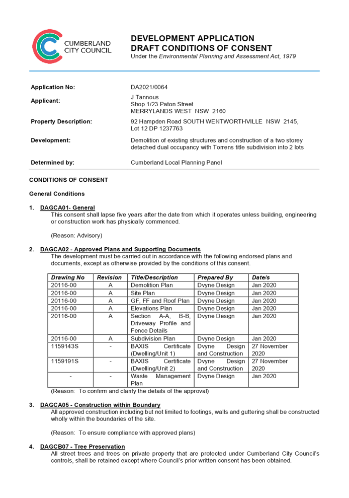

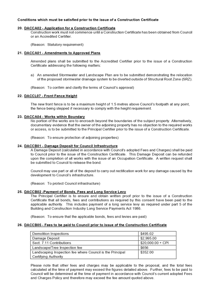


DOCUMENTS
ASSOCIATED WITH
REPORT LPP011/21
Attachment 2
Architectural Plans
Cumberland Local Planning Panel Meeting
14 April 2021
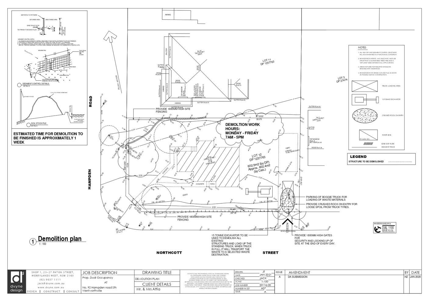
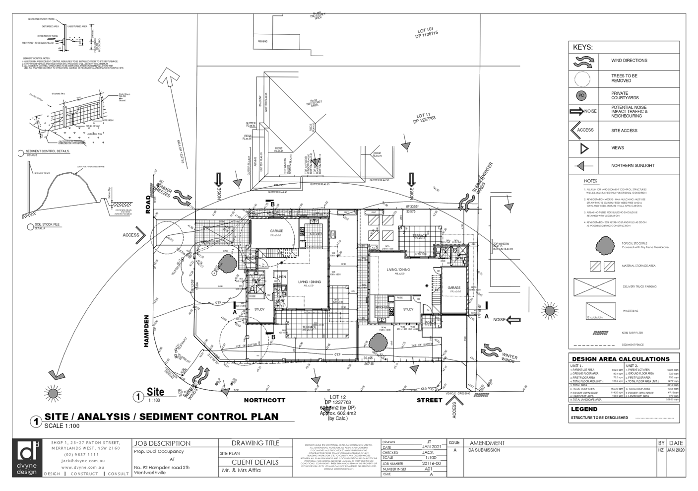
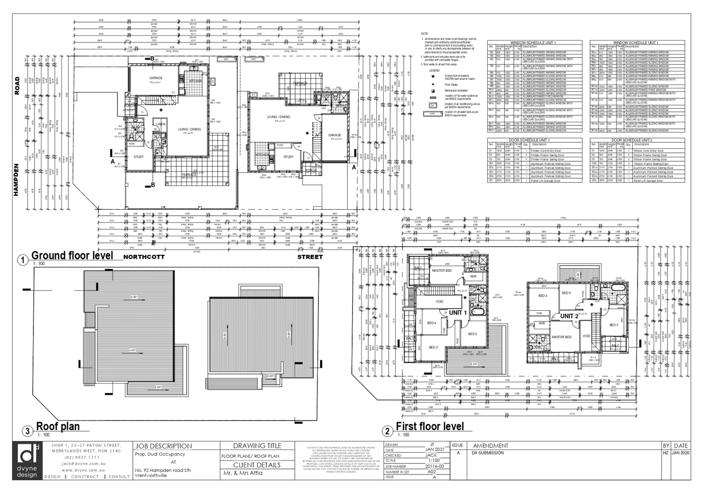
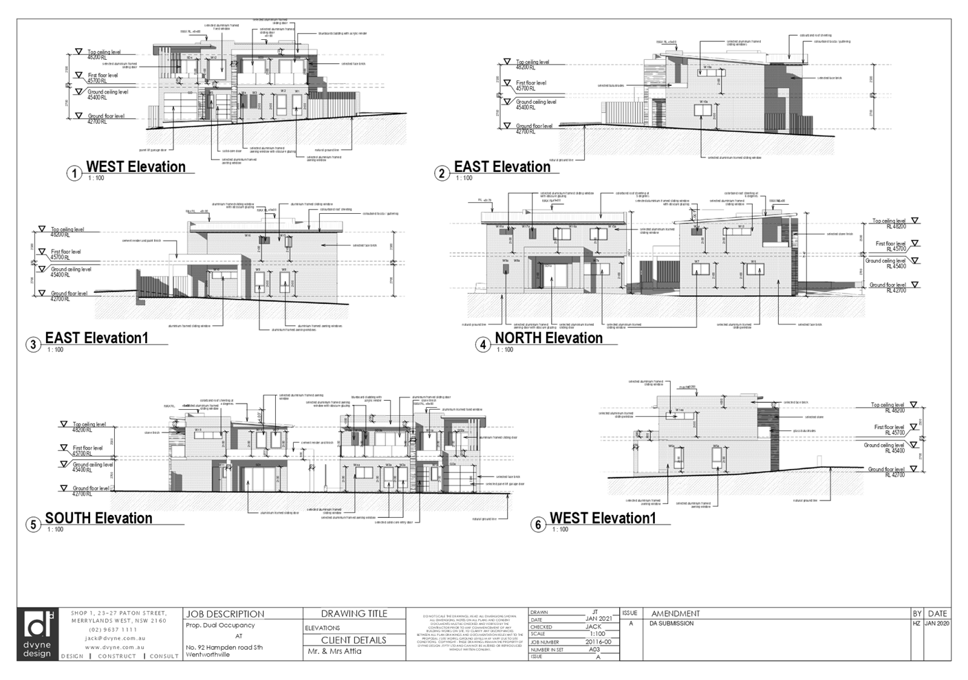
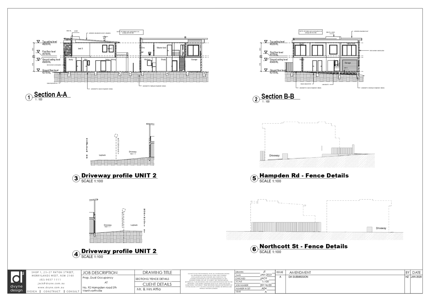
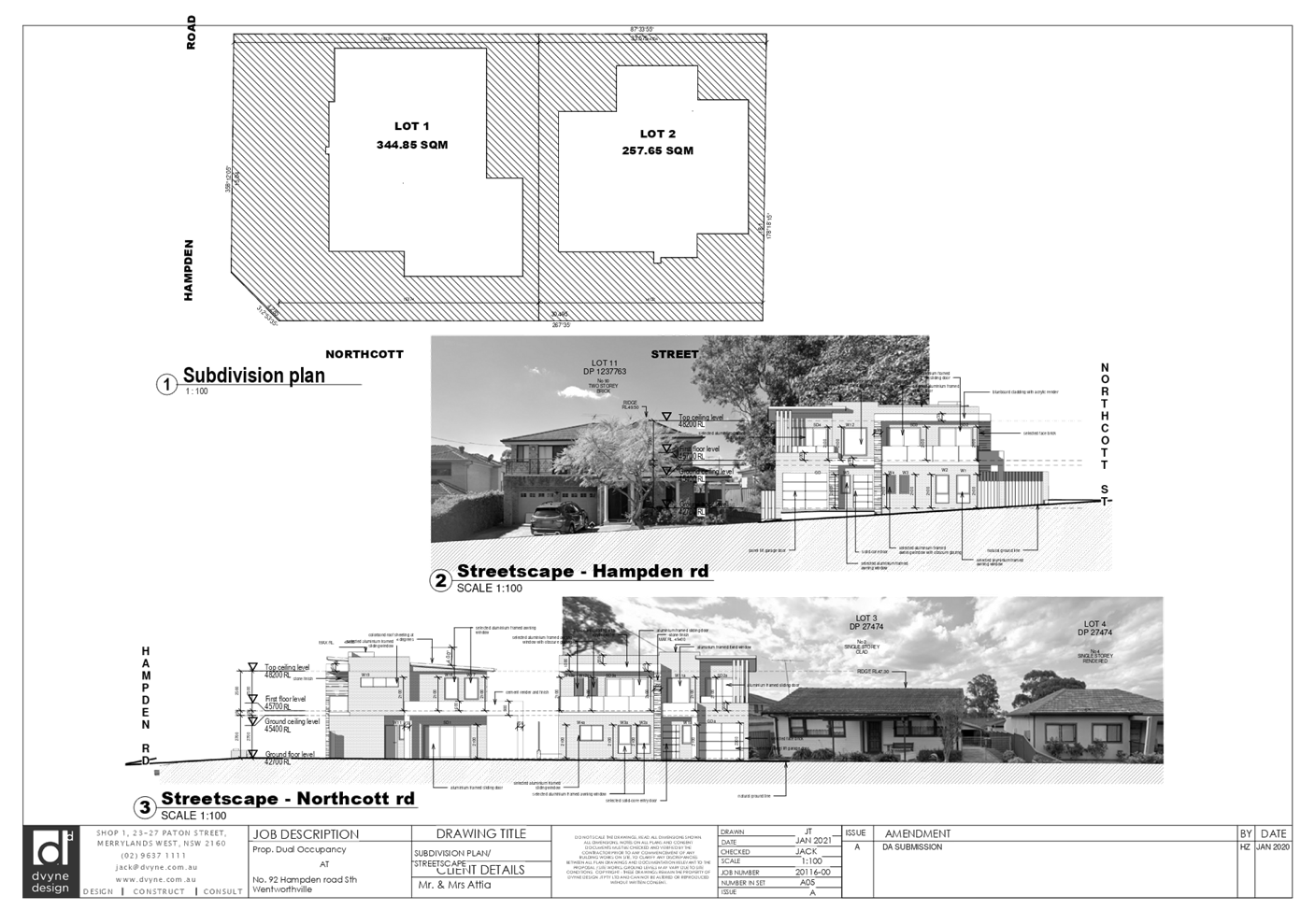
DOCUMENTS
ASSOCIATED WITH
REPORT LPP011/21
Attachment 3
Landscape Plan
Cumberland Local Planning Panel Meeting
14 April 2021
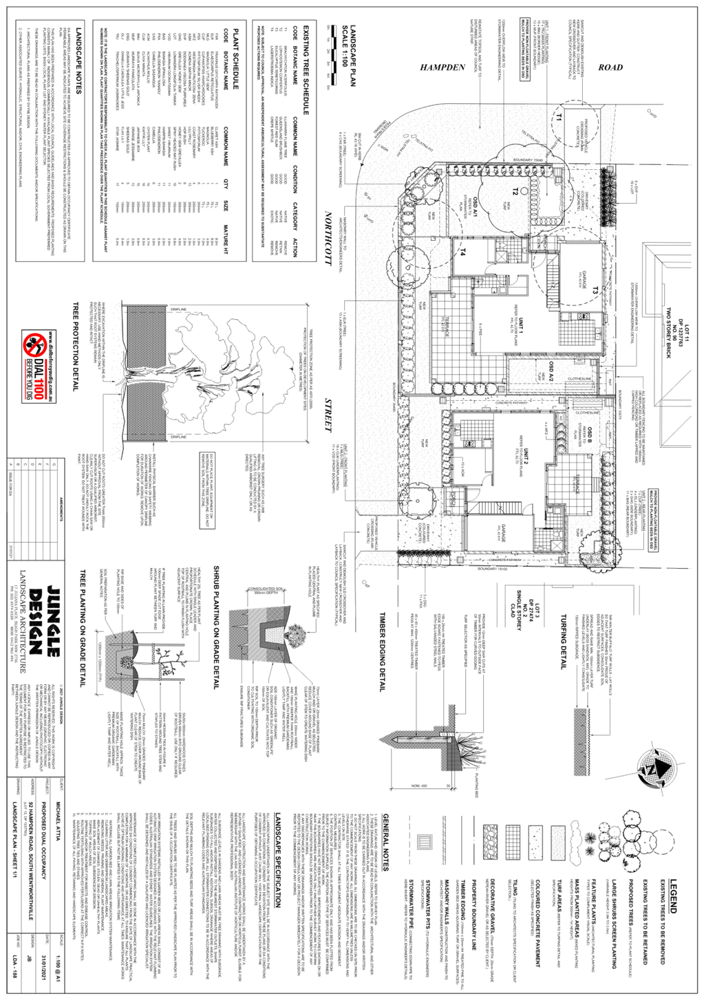
DOCUMENTS
ASSOCIATED WITH
REPORT LPP011/21
Attachment 4
Appendix A - DCP Compliance Table
Cumberland Local Planning Panel Meeting
14 April 2021
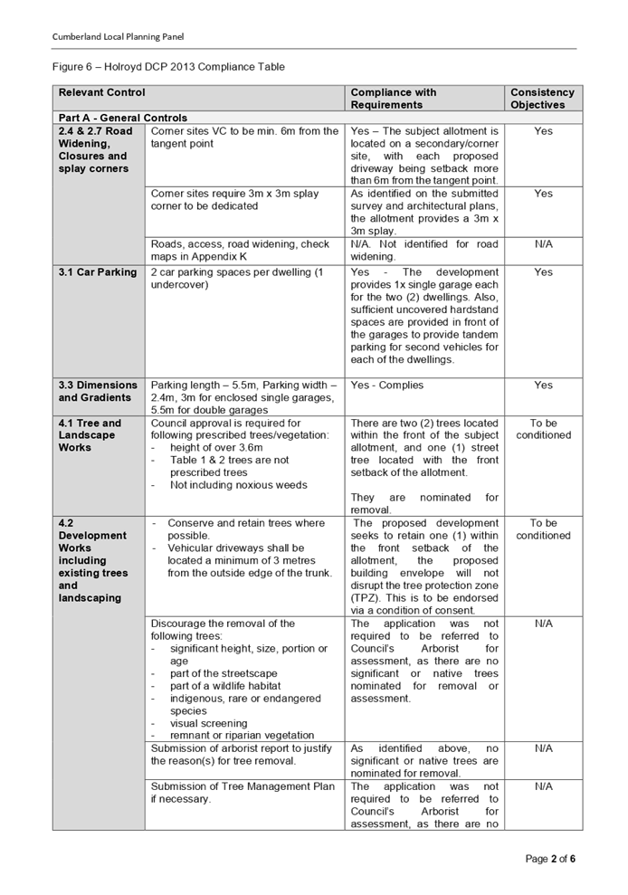
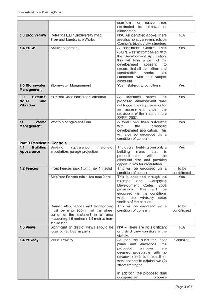
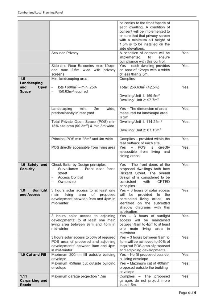
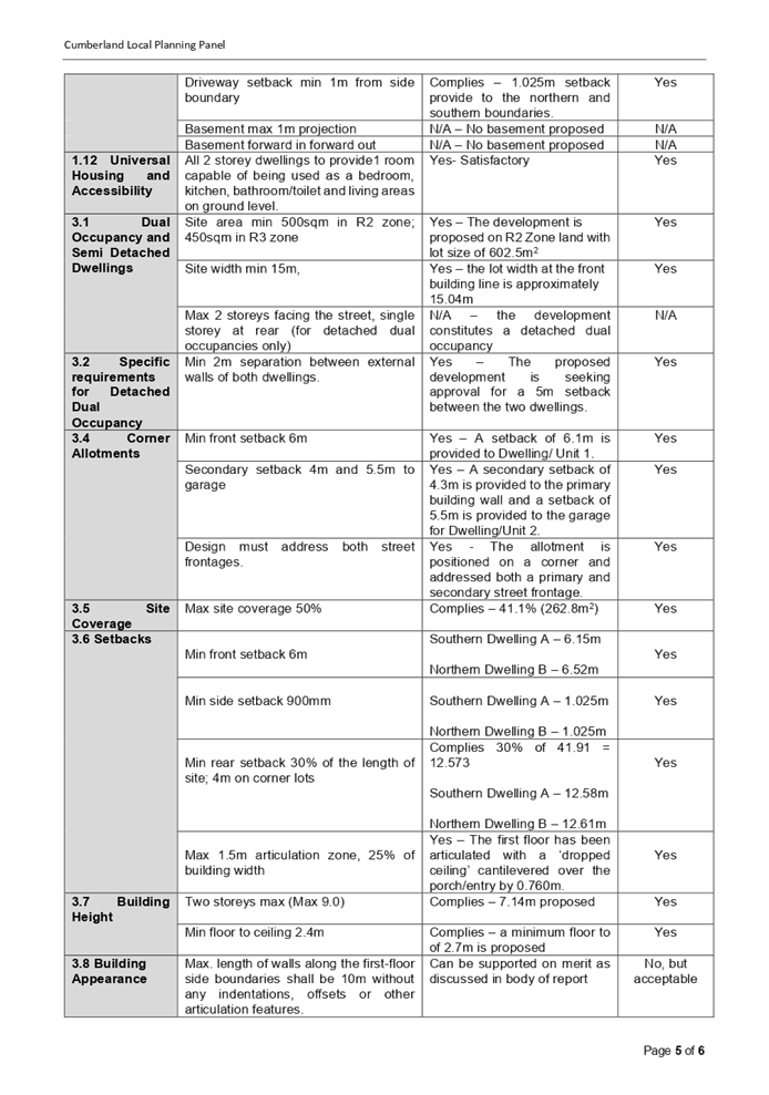

Cumberland
Local Planning Panel Meeting
14 April 2021
Item
No: LPP012/21
Development Application for 6-10 Manchester Street, Merrylands
Responsible
Division: Environment
& Planning
Officer: Executive
Manager Development and Building
File
Number: DA2020/0594
|
Application
lodged
|
9 October 2020
|
|
Applicant
|
Mr P Dionysian
|
|
Owner
|
Mr P Dionysiou & Mrs N
Dionysiou
|
|
Application
No.
|
DA2020/0594
|
|
Description
of Land
|
6-10 Manchester Street
MERRYLANDS NSW 2160, Lots 82, 83 and 84, Sec 1, DP 5714
|
|
Proposed
Development
|
Construction of a five (5)
storey residential flat building comprising 33 units over basement car
parking pursuant to State Environmental Planning Policy (Affordable Rental
Housing) 2009
|
|
Site
Area
|
1,839.00 m2
|
|
Zoning
|
R4
High Density Residential
|
|
Disclosure
of political donations and gifts
|
Nil disclosure
|
|
Heritage
|
No
|
|
Principal
Development Standards
|
Floor Space Ratio:
Max. 1.2:1 permitted (HLEP) + ARH 49.3% Bonus (under
ARHSEPP – max permitted 50%)
· Proposed FSR = 1.693:1- complies with the
ARH SEPP
Height of Buildings:
Max. 15m permitted
· Proposed Max. 18.67m (24.5% variation
sought)
Clause 4.6 Written Variation
Request submitted for the departure sought to building height
|
|
Issues
|
· Variation to
maximum 15m building height (HLEP 2013)
· Building
separation (ADG)
· Number of
building storeys (HDCP 2013)
· Site coverage
(HDCP 2013)
· Setbacks
· Street wall
height
· Solar access
/overshadowing (HDCP 2013)
· Submissions
|
1. Development
Application No. DA2020/0594 was received on 9 October 2020 for the construction
of a five (5) storey residential flat building comprising 33 units over basement
car parking pursuant to State Environmental Planning Policy (Affordable Rental
Housing) 2009.
2. The
application was publicly notified to occupants and owners of the adjoining
properties for a period of 21 days between 11 November 2020 and 2 December
2020. In response, 2 unique submissions were received.
3. The
assessment of the application identified issues including building separation,
height of building, gross floor area, remedial action plan, stormwater, traffic
and parking and as such the application was deferred seeking additional
information on 23 December 2020. Amended plans and documentation were
received on 27 January 2021 and 18 March 2021. The design refinements resulted
in the reduction of overall building height. The amended plans did not warrant
re-notification as they are submitted to address issues raised by Council.
4. The
subject application has been assessed against the relevant provisions of the
Environmental Planning and Assessment Act 1979, State Environmental Planning
Policy (Affordable Rental Housing) 2009, State Environmental Planning Policy No
65 – Design Quality of Residential Apartment Development (SEPP 65),
Apartment Design Guide, Holroyd Local Environmental Plan 2013 (HLEP) and
Holroyd Development Control Plan 2013 (HDCP).
5. The
propsal seeks the following non-compliances which are considered supportable as
discussed in detail elsewhere in the report:
|
Control
|
Required
|
Proposed
|
% Variation
|
|
Building Height
|
Max. 15m
(HLEP 2013)
|
- 18.67m to top of lift core
- 17.12m to top of rooftop toilet
- 17.38m to top of pergola roof canopy
|
24.46%
14.13%
15.8%
|
|
Building Separation
(Between habitable rooms and balconies)
|
6m (4 storeys)
9m (5 storeys)
(ADG)
|
Min 4.5m for habitable rooms and balconies (4 storeys)
Min. 7.5m for bedrooms (5 storey)
|
25%
16.6%
|
|
Basement setback (HDCP)
|
3 metres (basement)
|
1.3m
|
56.6%
|
|
Street wall height requiring an upper storey setback >
4 storeys
|
Additional 3m upper storey front setback along Manchester
Street
i.e.; 9m
|
Min 8m for level 4 and 5.
|
7.8%
|
|
Number of storeys
|
4
|
5
|
25%
|
|
Site coverage
|
30% (551.7m²)
(HDCP 2013)
|
38.4% (707.9m²)
|
28.3%
|
6. The
application is being reported to the Cumberland Local Planning Panel (CLPP) for
determination as it is a development with more than 4 storeys to which the
State Environmental Planning Policy No 65 – Design Quality of Residential
Apartment Developments applies.
7. The
application is recommended for deferred commencement approval subject to the
conditions as provided in Attachment 1.
Subject Site and Surrounding
Area
The subject site is known as 6, 8
and 10 Manchester Street, Merrylands, and is legally described as Lots 82, 83
and 84, Sec 1 in DP 5714. The site is located on the southern side of
Manchester Street within the R4 High Density Residential zone.
The site comprises of three (3)
lots comprising a combined frontage of 45.72 metres to Manchester Street with a
total site area of 1839m². The site is currently a vacant land and being
used for truck storage. The site has a gentle slope of approximately 1.69m from
western boundary to the eastern boundary.
Existing developments adjoining
the site are three to four storey older-style walk-up flats. The adjoining
development to the east at 2 – 4 Manchester Street and 1 Sheffield Street
was approved under DA 2017/380/1 for consolidation of 3 lots into 1 lot;
demolition of existing structures and construction of 1 x 4 storey (Block B)
and 1 x 5 storey (Block A) residential flat buildings with rooftop terrace
(Block A) comprising 29 units over 1 level of basement parking accommodating 33
car parking spaces pursuant to State Environmental Planning Policy (Affordable
Rental Housing). No construction works have yet commenced. Further to the
north east, a vacant lot at 153 Pitt Street situated on the corner of
Manchester Street has been approved with a deferred commencement consent by
Cumberland Local Planning Panel on 11 July 2018 for a 4 storey residential flat
building with basement parking and rooftop common terrace (DA 2017/191). The
adjoining development to the south (7-9 Sheffield Street) comprises of 3 storey
older- style residential flat building.
The subject site is also located
within close proximity of the Merrylands Centre. Merrylands Railway Station and
Stockland Merrylands Shopping Centre are located further south within 400
metres radius of the site. Holroyd Gardens Park is situated to the eastern side
of the site along Pitt Street.
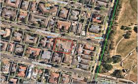
Figure
1 – Aerial view of subject site
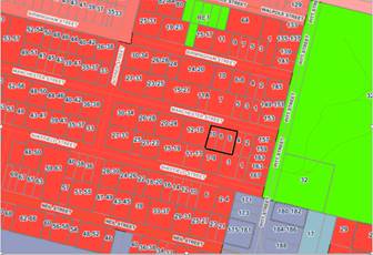
Figure
2 – Locality Plan of subject site
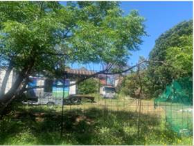
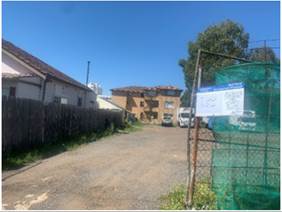
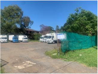
Figure
3, 4 & 5 – Subject Site
Description of the Proposed
Development
Council has received a development
application for construction of a five (5) storey residential flat building
comprising 33 units over basement car parking pursuant to State Environmental
Planning Policy (Affordable Rental Housing) 2009.
Key features of the development
proposal are as follows:-
|
Level
|
Details
|
|
Basement
|
37 residential car spaces (including 5 accessible parking
spaces and 3 visitor car spaces/car wash bay)
20 bicycle spaces
1 motorcycle parking spaces
Storage, plant room, lift and fire stairs
|
|
Ground floor level
|
7 residential units
Communal Open Space (396m2)
|
|
First Floor
|
7 residential units
|
|
Second Floor
|
7 residential units
|
|
Third Floor
|
7 residential units
|
|
Fourth Floor
|
5 residential units
|
|
Rooftop
|
Toilet facility
Communal Open Space (335m2)
|
The dwelling mix of the proposal
is as follows:
- 5
x 1 Bed Unit (15.2%);
- 18
x 2 Bed Unit (54.5%);
- 10
x 3 Bed Unit (30.3%).
The following units are subject to
State Environmental Planning Policy (Affordable Rental Housing) 2009:
o 18 units made of the following:
- G.F
= Units 101, 102, 103, 104, 105, 106 and 107 = 573.75m².
- F.F
= Units 201, 202, 203, 204, 205, 206 and 207 = 613.63m².
- Second
Floor = Units 302 and 303 = 174.31m².
- Third
Floor = Units 402 and 403 = 174.31m².
o Total ARH GFA = 1536m².
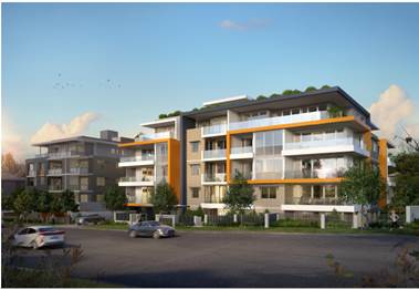
Figure
6- Photomontage
History
DA 2005/686 for demolition of
existing structures and erection of a three storey residential flat building
above basement parking containing 18 units was approved on 13 March 2006.
Demolition works were completed; however, no construction works have commenced
on site. Accordingly, a condition regarding voluntary surrender of this consent
shall be imposed.
|
Date
|
Action
|
|
9 October 2020
|
The subject development application was lodged with
Council.
|
|
2 November 2020
|
The application was referred to Council’s internal
and external departments for review.
|
|
11 November 2020 to 2 December 2020
|
Application placed on public notification. In response,
two submissions were received.
|
|
23 December 2020
|
The application was deferred for the following reasons:
· Floor space
ratio
· Building
separation
· Traffic and
stormwater engineering
· Remedial Action
Plan
|
|
27 January 2021
|
Amended plans and additional information submitted to
Council, addressing the deferral letter dated 23 December 2020. The
application did not warrant re-notification as the amendments were to address
Council’s concerns.
|
|
18 March 2021
|
Further amended plans and Clause 4.6 submitted addressing
the issues in relation to the overall building height.
|
|
14 April 2021
|
Application referred to CLPP for determination.
|
Applicants Supporting
Statement
The applicant has provided a Statement of Environmental
Effects dated 19 July 2019 and Clause 4.6 Variation (amended) dated 18 March
2021, both prepared by Think Planners; and Design Verification Statement,
Reference 08601, dated June 2019 prepared by a registered architect Ian Conry
– Zhinar Architects in support of the application.
Contact with Relevant
Parties
The assessing officer has
undertaken a site inspection of the subject site and surrounding properties and
has been in regular contact with the applicant throughout the assessment
process.
Internal Referrals
Development Engineer
The development application was
referred to Council’s Development Engineer for comment who has advised
that the development proposal is satisfactory having regard to stormwater
management and parking provision, and the proposal can therefore be supported,
subject to the recommended conditions included in the draft notice of
determination.
Waste Management
The development application was
referred to Council’s Waste Management Officer for comment who has
advised that the development proposal is satisfactory in terms of the proposed
waste collection, and therefore can be supported subject to recommended
conditions of consent, which have been included in the draft notice of determination.
Tree Management Officer
The application was referred to
Council’s Tree Management Officer for comment. Response received
indicates that the proposed tree removal and landscape works are satisfactory
subject to the recommended conditions included in the draft notice of
determination.
Environmental Health Officer
The development application was
referred to Council’s Environmental Health Officer for comment who has
advised that the development is supportable in regard to acoustic assessment,
noise attenuation measure, soil assessment, and site contamination, subject to
conditions, should consent be granted.
External Referrals
Endeavour Energy
The development application was
referred to Endeavour Energy for comment who has advised that the development
is supportable in regard to electricity connection and sufficient clearance to
existing electricity asset, subject to conditions.
Transgrid
The development application was
referred to Transgrid for comment who has advised that the development is not affecting
Transgrid’s asset.
PLANNING COMMENTS
The provisions of any
Environmental Planning Instruments (EP&A Act s4.15 (1)(a)(i))
State Environmental Planning
Policies
The proposed development is
affected by the following State Environmental Planning Policies:
(a) State
Environmental Planning Policy (Affordable Rental Housing) 2009
The application has been submitted
under Part 2 New affordable rental housing – Division 1 In-fill
affordable housing of the ARH SEPP. It should be noted that the proposal fully
complies with the key planning controls contained within the ARH SEPP including
site area, landscaped area, parking, accommodation size and prescribed
standards for in-fill affordable housing. Further, the proposal also complies
with the bonus FSR sought under the ARH SEPP. A comprehensive assessment
against ARH SEPP is attached to this report – Attachment 2.
Following is an assessment of the
development against the provisions of Clause 16A (Character of the local area).
16A Character of local area
A consent authority must not
consent to development to which this Division applies unless it has taken into
consideration whether the design of the development is compatible with the
character of the local area. The SEPP (ARH) does not contain any guidance for
assessing whether a proposal is compatible with the character of the local
area. However, a planning principle for assessing compatibility in the urban
environment was established by Senior Commissioner Roseth of the Land and
Environment Court in the judgement for Project Venture Developments Pty Ltd v
Pittwater Council [2005] NSWLEC 191. This involves asking the following two
questions:
· Are
the proposal’s physical impacts on surrounding development acceptable?
The physical impacts include constraints on the development potential of
surrounding sites.
· Is
the proposal’s appearance in harmony with the buildings around it and the
character of the street?
A merit assessment of the
character of the local area should consider the following 3 steps:
· Step
1 – Identify the ‘local area’.
· Step
2 – Determine the character of the ‘local area’.
· Step
3 – Determine whether the design of the proposed development is
compatible with the character of the ‘local area’.
An assessment against each step is
provided below:
Step 1 – Identify the
local area
This assessment identifies the
local area as primarily the visual catchment of the site (outlined in black) as
viewed from within the site and directly adjacent to the site on the street
which is defined by the thick black line in the figure below:
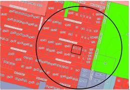
Figure
7 – Local Area catchment
Step 2 – Determine the
character (present and future) of the local area
The zoning of the broader locality
and immediate area comprises R4 High Density Residential, B4 Mixed Use and RE1
Public Recreation under the Holroyd Local Environmental Plan (HLEP) 2013.
Present Character of the area
The character of the local area
comprises the visual catchment of regular shaped allotments viewed from and
surrounding the subject site, which includes:-
1. Holroyd
Gardens along the eastern side of Pitt Street;
2. Existing
2 – 3 storey walk up flats facing Pitt Street bounded by Sheffield Street
to the south and Manchester Street to the north;
3. Single
storey commercial premises with large expanse of concrete area for at grade
parking in the corner of Pitt Street and Sheffield Street;
4. Even
numbered lots on the southern side of Manchester Street comprising a mixture of
3 – 4 storey walk up flats, vacant lot on the subject site and existing
single storey dwelling houses on the adjoining eastern site 2 – 4
Manchester Street and 1 Sheffield Street that has been approved for consolidation
of 3 lots into 1 lot; demolition of existing structures and construction of 1 x
4 storey (Block B) and 1 x 5 storey (Block A) residential flat buildings with
rooftop terrace (Block A) comprising 29 units over 1 level of basement parking
accommodating 33 car parking spaces;
5. Odd
numbered lots on the northern side of Manchester Street comprising a mixture of
2 storey townhouses, 2 - 3 storey walk up flats, a single storey dwelling house
and a vacant lot on the corner of Pitt Street that has been approved recently
for a 4 storey residential flat building with basement parking and rooftop
common terrace.
Figure
8: Existing Streetscape
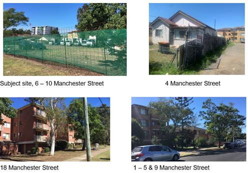
Future character of the area
The locality is in transition
particularly to support the increasing demand of affordable housing within the
close proximity of a public transport hub and major commercial centre. The
transition issue is clear with regard to FSR, height and setbacks for the
proposed development. It is considered that the height, bulk and scale of the
proposed development is similar to the newer residential flat buildings being
constructed and would not be inconsistent with the desired future character of
the locality.
Step 3 - Determine if the
development is compatible with the character of the local area
In accordance with the Land and
Environment Court’s ‘Planning Principle’ and case law
compatibility is best defined as ‘capable of existing together in
harmony’. In order to test compatibility two questions are to be
considered. These questions, as well as a response to each, are provided below:
· Are
the proposal’s physical impacts on surrounding development acceptable?
The physical impacts include constraints on the development potential of
surrounding sites.
The height, FSR and landscaping of
the proposed development are designed to maintain the harmony within the
streetscape, whilst contributing to the site context and constraint. The height
of building breaches the 15m height limit requirement for the lift core as
discussed later in the report. However, the development does not pose any
unreasonable overshadowing impacts on adjoining properties. The proposal
being a permissible land use, meets the FSR requirement (in accordance with ARH
SEPP, subject to the imposition of conditions) and contributes to the provision
of affordable housing within the close proximity of a public transport hub and
major commercial centre. Appropriate setbacks for the rooftop communal open
spaces and privacy treatments are provided to minimise any adverse impacts to
the adjoining properties. Nonetheless, the proposed development is similar to
the newer residential flat buildings being approved on the adjoining eastern
property 2-4 Manchester Street and 1 Sheffield Street and other developments in
the vicinity. The provision of rooftop communal open space will allow better
enjoyment of area with direct solar access at the northerly orientation. Whilst
the development will result in some overshadowing to the adjoining 3 storey
residential flat development on the southern side (9 Sheffield Street), the
impacts are not considered unreasonable given this is a function of the
allotment orientation and R4 context. The overall design represents the form of
development that is envisaged under the planning controls. Refer to further
discussion under DCP section of the report.
· Is
the proposal’s appearance in harmony with the buildings around it and the
character of the street?
To be compatible, a development
should contain, or at least respond to, the key aesthetic elements that make up
the character of the surrounding area. The size of the basement with variation
to the side setbacks maximises landscaping and deep soil zones on site. The
front setbacks are generous and consistent with the existing streetscape. The
proposal is considered to maintain an appropriate residential character which
is consistent with the streetscape. As indicated, the local area has an
established high density residential built form, as such, the proposed
development is not considered to be inconsistent with the existing streetscape
character of the immediate area surrounding the subject site.
In conclusion, the proposal will
maintain the harmony within the general streetscape, and suitably fits in the
local character of the locality.
(b) State
Environmental Planning Policy No 65 – Design Quality of Residential
Apartment Development (SEPP 65)
SEPP 65 applies to the development
as the building is 3 storeys or more, and contains more than 4 dwellings. A
design statement addressing the design quality principles prescribed by SEPP 65
was prepared by the project architect. Integral to SEPP 65 is the Apartment
Design Guide (ADG), which sets benchmarks for the appearance, acceptable
impacts and residential amenity of the development.
A comprehensive assessment against
the Apartment Design Guide (ADG) controls is provided at Attachment 3.
The proposal involves the
following non-compliances with the ADG controls.
|
No.
|
Control
|
Comments
|
Compliance
|
|
3F
|
Visual Privacy
|
Y
|
N
|
NA
|
|
3F-1
|
Design Criteria
Separation
between windows and balconies is provided to ensure visual privacy is
achieved. Minimum required separation distances from buildings to the side
and rear boundaries are as follows:
Note:
Separation distances between
buildings on the same site should combine required building separations depending
on the type of room.
Gallery access circulation
should be treated as habitable space when measuring privacy separation
distances between neighbouring properties.
|
Northern Boundary (along Manchester Street):
Compliant setback is provided.
Levels 1 – 3
6m is required
Eastern boundary:
Setbacks of 4.5m proposed for some habitable rooms and
balconies. However, high light windows and privacy
screen to balconies are proposed which are considered acceptable in this
instance.
Southern boundary (rear):
Comply.
Western Boundary:
5.5m proposed for the
balconies. Minor encroachment considered acceptable as no adverse amenity
impacts.
Levels 4 & 5
9m is required
Western boundary:
7.5m proposed for bedroom
windows. However, high light windows are provided which are considered
acceptable in this instance.
|
|
|
|
(c) State
Environmental Planning Policy No. 55 – Remediation of Land (SEPP 55)
Clause 7 of SEPP 55 requires
Council to be satisfied that the site is suitable or can be made suitable to
accommodate the proposed development. The matters listed within Clause 7 have
been considered in the assessment of the development application.
|
Matter for Consideration
|
Yes
|
No
|
|
Does the application involve re-development of the site or
a change of land use?
|
|
|
|
Does the application involve
re-development of the site or a change of land use?
|
|
|
|
In the development going to be used for a sensitive land
use (e.g.: residential, educational, recreational, childcare or hospital)?
|
|
|
|
Does information available to you indicate that an
activity listed below has ever been approved, or occurred at the site?
acid/alkali plant and
formulation, agricultural/horticultural activities, airports, asbestos
production and disposal, chemicals manufacture and formulation, defence
works, drum re-conditioning works, dry cleaning establishments, electrical
manufacturing (transformers), electroplating and heat treatment premises,
engine works, explosive industry, gas works, iron and steel works, landfill
sites, metal treatment, mining and extractive industries, oil production and
storage, paint formulation and manufacture, pesticide manufacture and
formulation, power stations, railway yards, scrap yards, service stations,
sheep and cattle dips, smelting and refining, tanning and associated trades,
waste storage and treatment, wood preservation
|
|
|
|
Is the site listed on
Council’s Contaminated Land database?
|
|
|
|
Is the site subject to EPA
clean-up order or other EPA restrictions?
|
|
|
|
Has the site been the subject of
known pollution incidents or illegal dumping?
|
|
|
|
Does the site adjoin any
contaminated land/previously contaminated land?
|
|
|
|
Has the appropriate level of
investigation been carried out in respect of contamination matters for
Council to be satisfied that the site is suitable to accommodate the proposed
development or can be made suitable to accommodate the proposed development?
|
|
|
|
Details of contamination investigations carried out at the
site:
-
The site is not identified in Council’s records as being
contaminated. A Detailed Site Investigation assessment was undertaken, which recommended
that the site would require remediation to remove the asbestos present in the
soil. Subsequently a Remedial Action Plan
was submitted, which has been reviewed by Council’s
Environmental Health Officer and appropriate conditions have been included in
the draft determination. Having regard to
the above, Council is satisfied that the site is suitable for the proposed
used as proposed.
|
(d) State
Environmental Planning Policy (Infrastructure) 2007 (ISEPP)
The provisions of the ISEPP 2007
have been considered in the assessment of the development application.
Clause 45 – Development
likely to affect an electricity transmission or distribution network
The development application was
referred to Endeavour Energy for comment, who raised no objections, subject to
conditions, which have included within the draft notice of determination.
(e) Statement
Environmental Planning Policy No 19 - Bushland in Urban Areas
The proposal does not propose to
disturb bushland zoned or reserved for public open space.
(f) State
Environmental Planning Policy (Vegetation in Non-Rural Areas) 2017
The proposal includes removal of
some existing trees within the subject site. However, this does not exceed the
biodiversity offsets scheme threshold. Therefore, the proposed vegetation
removal is considered acceptable. Please refer to the HDCP 2013 compliance
table at Attachment 5 for further comment regarding the proposed tree removal.
(g) State
Environmental Planning Policy (Coastal Management) 2018
The subject site is not identified
as a coastal wetland nor is it ‘land identified as “proximity area
for coastal wetlands” as per Part 2, Division 1 of the SEPP Coastal
Management 2018.
(h) State
Environmental Planning Policy (Building Sustainability Index: BASIX) 2004
BASIX certificate 989372M_02 dated
21 January 2021 was submitted with the application. The certificate achieves
target scores and is consistent with the architectural plans.
Regional Environmental Plans
The proposed development is
affected by the following Regional Environmental Plans:
(a) Sydney
Regional Environmental Plan (Sydney Harbour Catchment) 2005
The subject site is identified as
being located within the area affected by the Sydney Regional Environmental Plan
(Sydney Harbour Catchment) 2005. The proposed development raises no issues as
no impact on the catchment is envisaged.
(Note: - the subject site is not
identified in the relevant map as ‘land within the ‘Foreshores and
Waterways Area’ or ‘Wetland Protection zone’, is not a
‘Strategic Foreshore Site’ and does not contain any heritage items.
Hence the majority of the SREP is not directly relevant to the proposed
development).
Local Environmental Plans
(i) Holroyd
Local Environmental Plan 2013 (HLEP 2013)
The proposed development is
defined as a ‘residential flat building’ under the provisions of
HLEP 2013. Residential flat buildings are permitted with consent in the R4
– High Density Residential zone which applies to the land as follows:
“residential flat building
means a building containing 3 or more dwellings but does not include an
attached dwelling or multi dwelling housing.
Note—
Residential flat buildings are a
type of residential accommodation—see the definition of that term in this
Dictionary.”
The relevant matters to be
considered under Holroyd LEP 2013 and the applicable clauses for the proposed
development are summarised below. A comprehensive LEP assessment is contained
in Attachment 4.
Holroyd
Local Environmental Plan 2013 compliance table
|
Clause
|
Yes
|
No
|
N/A
|
Comment
|
|
Development Standard
|
|
4.3 Height of buildings
(1) The objectives of this
clause are as follows:
(a) to minimise the visual impact
of development and ensure sufficient solar access and privacy for
neighbouring properties,
(b) to ensure development is
consistent with the landform,
(c) to provide appropriate scales
and intensities of development through height controls.
(2) The height of a
building on any land is not to exceed the maximum height shown for the land on
the Height of Buildings Map.
|
|
|
|
In
accordance with the Height of Buildings Map accompanying Holroyd LEP 2013, a
maximum building height of 15 metres is permitted for the site.
The
maximum height of the proposed residential flat building is 18.67 metres as
follows:
- 18.67m to
top of lift core
- 17.12m to
top of rooftop toilet
- 17.38m to
top of pergola roof canopy
1.
The
building breaches the height by maximum 3.67 metres (24.5%). The majority of
the height breach is associated with part of the pergola roof, top of the
lift overrun and top of rooftop
toilet.
2.
It is the view of Council
officers that the applicant’s written request, as stated below, has
adequately addressed the matters required to be demonstrated by clause 4.6
subclause (3).
|
|
4.4 Floor space ratio
(1) The objectives of this
clause are as follows:
(a) to support the viability of
commercial centres and provide opportunities for economic development within
those centres,
(b) to facilitate the development
of a variety of housing types,
(c) to ensure that development is
compatible with the existing and desired future built form and character of
the locality,
(d) to provide a high level of
amenity for residential areas and ensure adequate provision for vehicle and
pedestrian access, private open space and landscaping.
(2) The maximum floor space
ratio for a building on any land is not to exceed the floor space ratio shown
for the land on the Floor Space Ratio Map.
|
|
|
|
In accordance with the
FSR map accompanying HLEP 2013, a maximum FSR of 1.2:1 is applicable to the
site.
Max.
FSR of 1.2:1 equates to GFA of 2206.8m²
+
ARH 49.3% Bonus (GFA of 1536m²)
Represents proposed
GFA of 3113.9m² or FSR of 1.693:1
|
|
4.6 Exceptions to development standards
(2) Development consent may, subject to this clause, be
granted for development even though the development would contravene a
development standard imposed by this or any other environmental planning
instrument. However, this clause does not apply to a development standard
that is expressly excluded from the operation of this clause.
|
|
|
|
Clause 4.6 written request has been submitted for the height
variation. Refer to discussion below.
|
|
5.10 Heritage Conservation
|
|
|
|
The site is not
heritage listed, nor in the vicinity of a heritage item.
|
|
6.2
Earthworks
(3)
Before granting development consent for earthworks, the consent authority
must consider the following matters:
(a) the likely disruption of, or any detrimental
effect on, existing drainage patterns and soil stability in the locality of
the development,
(b) the effect of the development on the likely
future use or redevelopment of the land,
(c) the quality of the fill or the soil to be
excavated, or both,
(d) the effect of the development on the existing and
likely amenity of adjoining properties,
(e) the source of any fill material and the
destination of any excavated material,
(f) the likelihood of disturbing relics,
(g) the proximity to, and potential for adverse
impacts on, any waterway, drinking water catchment or environmentally
sensitive area,
(h) any appropriate measures proposed to avoid,
minimise or mitigate the impacts of the development.
|
|
|
|
The proposed
earthworks will not have a detrimental effect on existing drainage patterns
or soil stability. The proposal will not affect the amenity of adjoining
properties. The proposal is satisfactory subject to compliance with standard
conditions.
|
|
6.4 Flood
planning
(1) The
objectives of this clause are as follows:
(a) to
minimise the flood risk to life and property associated with the use of land,
(b) to
allow development on land that is compatible with the land’s flood
hazard, taking into account projected changes as a result of climate change,
(c) to
avoid significant adverse impacts on flood behaviour and the environment.
(2) This
clause applies to land at or below the flood planning level.
|
|
|
|
The site is not
identified as being flood prone land.
|
|
6.7 Stormwater management
|
|
|
|
The proposed
stormwater management system is satisfactory subject to conditions.
|
|
6.8 Salinity
Consult
the Salinity Map accompanying HLEP 2013
|
|
|
|
The site is identified
as having a moderate salinity potential.
Appropriate conditions
were imposed on the original consent to address this issue.
|
Clause 4.6 Exceptions to
Development Standards
Height of Buildings
The proposal seeks a variation to
Clause 4.3 – Height of Buildings that stipulates that the height of
building is not to exceed 15m on the subject site.
The proposed building has an
overall height of 18.67m to the roof of the lift core, 17.12m to top of rooftop
toilet, 17.38m to top of pergola roof canopy and 17.28m to top of stairs.

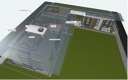
Figure
8 & 9- Elevation and 3D height plane showing the extent of height variation
Clause 4.6 allows the consent
authority to vary development standards in certain circumstances and provides
an appropriate degree of flexibility to achieve better design outcomes. The
consent authority may grant the exception as the Secretary’s concurrence
can be assumed where clause 4.6 is adopted as per the Department of Planning
Circular PS 18-003, dated 21 February 2018.
The applicant has submitted a
written request to vary the development standards for building height. Based on
various case laws established by the Land and Environment Court of NSW such as
Four2five P/L v Ashfield Council [2015] NSWLEC 9, Randwick City Council v
Micaul Holdings P/L [2016] NSW LEC7 and Zhang and anor v Council of the City of
Ryde [2016] NSWLEC 1179, a 3 part assessment framework for a variation request
proposed under clause 4.6 has been considered and an assessment of the proposed
variance, following the 3 part test is discussed in detail below.
The 3 preconditions which must be
satisfied before the application can proceed are as follows:
1. Is
the proposed development consistent with the objectives of the zone?
Applicant’s
justification:
- The
proposal provides for housing needs of the community and contributes to a
variety of housing forms within a high-density urban centre context.
- The
development site is in close proximity to public transport and existing
facilities. The design concept recognises the key site attributes and provides
for an attractive built form that relates to the existing and future site
context.
Planner’s comment:
Residential flat buildings are a
permitted land use and the locality is undergoing a transition particularly to
support the increasing demand of affordable housing within the close proximity
of a public transport hub and major commercial centre. The proposed development
is considered to be consistent with the objectives of the R4 High Density
Residential zone.
2. Is
the proposed development consistent with the objectives of the development
standard which is not met?
Applicant’s
justification:
- The
proposal will provide a high quality urban form that relates well to the
context of the site in terms of the natural topography and adjoining
developments;
- It
is noted that there is a minor variation to the building height control with a
portion of the building encroaches the prescribed height control. The
non-compliance stems from the provision of 18 affordable dwellings that allows
the development to exceed the FSR of 1.2:1 for the site contained in HLEP 2013.
- Council’s
building envelope controls of height, FSR and setbacks are designed to
accommodate a residential flat building with an FSR of 1.2:1. This development
has an allowable FSR of 1.69:1 under the ARH SEPP and the additional floor
space can only be appropriately accommodated by breaching the building envelope
controls.
- The
overall height of the development presents as a compatible form of development
with the fifth storey recessed to downplay visual dominance as viewed from the
public domain and adjoining properties.
- The
proposal has been designed to comply with the maximum permitted FSR on the site
and also complies with key controls pertaining to, open space, and car parking
which indicates an appropriate scale of development on the site;
- The
extent of overshadowing is satisfactory as shown on the shadow diagrams and the
privacy impacts arising from the additional height control are negligible when
having regard to the design of the built form which focuses the 5th storey
living rooms and balconies over the street frontages.
- The
non-compliance to the height control has no impact on the setting of any items
of environmental heritage or view corridors; and
- The
proposal is not located within a low-density area and the proposal represents
an appropriate built form on the site.
Planner’s comment:
The objectives of the building
height standard are to enable appropriate development density to be achieved
and to ensure that the height of the building is compatible with the character
of the locality as outlined above. The proposal is compliant with the maximum
FSR inclusive of the bonus provision under the ARH SEPP. The increased height
does not result in an additional level for residential use, as it comprises a
portion of the roof structures and the top of the lift core.
The departure sought is considered
to be modest and does not unreasonably impact on adjoining properties. The
additional height does not result in the appearance of bulk when viewed from
the existing streetscape and would not impinge on the changing streetscape that
is anticipated for the immediate area. Given that the proposed development
responds to the site and does so without compromising relationships with
adjoining development, the proposal is considered to be consistent with the
objectives of height requirements and development within the R4 zone.
3. a)
Is compliance with the development standard unreasonable or unnecessary in the
circumstances of the case?
Applicant’s
justification:
Strict compliance with the
prescriptive height requirement is unreasonable and unnecessary in the context
of the proposal and its particular circumstances. The proposed development
meets the underlying intent of the control and is a compatible form of
development that does not result in unreasonable environmental amenity impacts.
Planner’s comment:
Council officers are satisfied
that the proposed variation has been appropriately justified and can be
supported in this instance. The height breach is limited to an overall building
height of 18.67m (RL 39.450) for the top of the lift core. The additional
height of the lift core will not be visible from the adjacent streets and
properties. The proposed variation to the development standard is necessary for
the structure containing the lift core and the site being subject to flooding
which requires an elevated ground floor plate. The departure sought is
considered to be modest and does not unreasonably impact on adjoining
properties. The additional height does not result in the appearance of bulk
when viewed from the existing streetscape, would not impinge on the changing
streetscape that is anticipated for the immediate area and does not result in
additional overshadowing to the adjoining properties. It is considered,
therefore, that the non-compliance with the Development Standard is not
unreasonable or unnecessary in the circumstances of the case.
b) Are there sufficient
environmental planning grounds to justify contravening the development standard
and therefore is the applicant’s written justification well founded?
The unique circumstances of the
case are considered to warrant support of the departure. Given that the
proposed development responds to the site and does so without unduly
compromising relationships with adjoining development, and does not unduly
compromise other relevant controls, the proposal is considered to be consistent
with the objectives of building height, and development within the R4 zone. In
this regard, the exception is well founded and can be supported.
Conclusion:
Council is satisfied that the
applicant’s written request has adequately addressed the matters required
to be demonstrated by clause 4.6 subclause (3). Council is further satisfied
that the proposed development will be in the public interest because it is consistent
with the objectives of the particular standard and the objectives for
development within the zone in which the development is proposed to be carried
out.
It is the view of Council officers
that justification provided is satisfactory and having considered the
application on its merit, the exception to the maximum building height
development standard is considered acceptable in this instance.
The provisions of any proposed
instrument that is or has been the subject (EP&A Act s4.15 (1)(a)(ii))
(a) Draft
State Environmental Planning Policy (Environment)
The draft SEPP relates to the
protection and management of our natural environment with the aim of
simplifying the planning rules for a number of water catchments, waterways,
urban bushland, and Willandra Lakes World Heritage Property. The changes
proposed include consolidating the following seven existing SEPPs:
· State
Environmental Planning Policy No. 19 – Bushland in Urban Areas
· State
Environmental Planning Policy (Sydney Drinking Water Catchment) 2011
· State
Environmental Planning Policy No. 50 – Canal Estate Development
· Greater
Metropolitan Regional Environmental Plan No. 2 – Georges River Catchment
· Sydney
Regional Environmental Plan No. 20 – Hawkesbury-Nepean River (No.2-1997)
· Sydney
Regional Environmental Plan (Sydney Harbour Catchment) 2005
· Willandra
Lakes Regional Environmental Plan No. 1 – World Heritage Property.
The draft policy will repeal the
above existing SEPPs and certain provisions will be transferred directly to the
new SEPP, amended and transferred, or repealed due to overlaps with other areas
of the NSW planning system.
Changes are also proposed to the
Standard Instrument – Principal Local Environmental Plan. Some provisions
of the existing policies will be transferred to new Section 117 Local Planning
Directions where appropriate.
(b) Draft
Cumberland Local Environmental Plan (Draft CLEP)
The Draft Cumberland Local
Environmental Plan (Draft CLEP) has been prepared by Cumberland Council to
provide a single planning framework for the future planning of Cumberland City.
The changes proposed seek to harmonise and repeal the three existing LEPs
currently applicable to the Cumberland local government area, those being:
· Holroyd
Local Environmental Plan 2013,
· Parramatta
Local Environmental Plan 2011, and
· Auburn
Local Environmental Plan 2010.
The relevant planning controls for
the subject site, as contained within the Holroyd Local Environment Plan, are
not proposed to change under the Draft CLEP.
The provisions of any
Development Control Plans (EP&A Act s4.15 (1)(a)(iii))
The Holroyd DCP 2013 provides
guidance for the design and operation of development to achieve the aims and
objectives of the DCP. A comprehensive assessment and compliance table is
contained in Attachment 5.
The proposed development generally
complies with the provisions of Holroyd DCP 2013 with the exception of the
following matters which are outlined in the table below.
|
PART B – RESIDENTIAL
CONTROLS
|
|
Clause
|
Control
|
Proposed
|
Complies
|
|
1.8
|
Sunlight Access
|
|
|
1 main living area of existing adjacent dwellings to
receive 3 hours direct sunlight between 9am and 4pm, 22 June
|
The adjoining
southern site (7-9 Sheffield Street) is an existing older style 3 storey
residential flat building. The solar access diagrams submitted with the
application indicate that 6 out of 12 units face the northern elevation which
will be affected by the subject development.
The solar access diagrams
submitted with the application depict that of those six units (facing the
northern elevation), 2 units will achieve less than 3 hours of solar access
during mid winter
However, this is
considered to be reasonable based on the following merits:
· The non-compliance is
a function of the allotment orientation as No.7-9 Sheffield is located
immediately to the south of the site which means that avoiding overshadowing
impacts, whilst enabling development for a residential flat building proposal
is not possible without delivering a significant underdevelopment on the
subject site;
· The
setbacks exceed the 3m control in Holroyd DCP 2013 and the upper levels are
further stepped back to maximise separation to the adjoining
developments. Therefore, it is not possible to achieve the
required levels of solar access, even when fully complying with the building
separation and building height requirements.
· Having
regard to the above, the non-compliance is acceptable when having regard to
the lot orientation, design of the development proposal that meets the
building envelope controls. Therefore, the variation has merit on planning
grounds, and is considered supportable.
|
No – Acceptable in this instance.
|
|
6.2
|
Site Coverage
|
|
|
|
|
Maximum site coverage of any residential flat development
shall not exceed 30% (Max. 551.7m²)
|
707.9m² (38.4%) non-compliance is considered
acceptable as it complies with the building envelope controls including FSR
as well as landscaping, deep soil, and communal & private open space
requirements.
|
No – Acceptable in this instance.
|
|
6.3
|
Setbacks and separation
|
|
|
Basement setback to side and rear boundaries minimum 3m
|
Eastern side boundary: 1.3m
This is considered satisfactory as the proposal complies
with the minimum deep soil requirements, side setbacks and landscaping
requirements and will not result in any impacts on trees on adjacent sites.
|
No – Acceptable in this instance.
|
|
|
All floors >4 storeys to be
setback 3m.
|
The proposed development generally provides a compliant
upper storey setback with the exception of 2 units living rooms that provide
a setback of 8m to Manchester Street. This is considered acceptable noting it
provides articulation and visual relief to the upper levels of the building.
|
No – Acceptable in this instance.
|
|
6.4
|
Building Height
|
|
|
Maximum
building height in storeys shall be provided in accordance with the table
below:
|
Permitted Height (storeys)
|
|
Height
|
Storeys
|
|
9m
|
1
|
|
11m
|
2
|
|
12.5m
|
3
|
|
15m
|
4
|
|
18m
|
5
|
|
21m
|
6
|
|
24 m
|
7
|
|
Max. permitted
= 15m (4 storeys)
Provided – 5 storeys
As
stated earlier in the report the impact of the additional storey is
considered acceptable as the building presents a terraced built form and will
not be discernibly notified from street level.
|
No – Acceptable in this instance.
|
The provisions of any planning
agreement that has been entered into under section 7.4, or any draft planning
agreement that a developer has offered to enter into under section 7.4
(EP&A Act s4.15(1)(a)(iiia))
There is no draft planning
agreement associated with the subject Development Application.
The provisions of the
Regulations (EP&A Act s4.15 (1)(a)(iv))
The proposed development raises no
concerns as to the relevant matters arising from the Environmental Planning and
Assessment Regulations 2000 (EP&A Reg).
The Likely Environmental,
Social or Economic Impacts (EP&A Act s4.15 (1)(b))
It is considered that the proposed
development will have no significant adverse environmental, social or economic
impacts in the locality.
The suitability of the site for
the development (EP&A Act s4.15 (1)(c))
The subject site and locality is
not known to be affected by any natural hazards or other site constraints
likely to have a significant adverse impact on the proposed development.
Accordingly, it is considered that the development is suitable in the context
of the site and surrounding locality.
Submissions made in accordance
with the Act or Regulation (EP&A Act s4.15 (1)(d))

In accordance with Council’s
notification requirements contained within the Holroyd DCP 2013, the proposal
was publicly notified for a period of 21 days between 11 November 2020 and 2
December 2020. The notification generated 2 unique submissions in respect of
the proposal. The issues raised in the public submissions are summarised and
commented on as follows:
The public interest (EP&A
Act s4.15(1)(e))
In view of the foregoing analysis
it is considered that the development, if carried out subject to the conditions
set out in the recommendation below, will have no significant adverse impacts
on the public interest.
Cumberland Local
Infrastructure Contributions Plan 2020
The development would require the
payment of contributions in accordance with Cumberland Local Infrastructure
Contributions Plan 2020 as follows:
In accordance with the
Contributions Plan a contribution is payable, pursuant to Section 7.11 of the
EP&A Act, calculated on the cost of works. A total contribution of
$531,689.00 would be payable prior to the issue of a Construction Certificate.
Disclosure of Political
Donations and Gifts
The applicant and notification
process did not result in any disclosure of Political Donations and Gifts.
The Application has been assessed
in accordance with the relevant requirements of the Environmental Planning and
Assessment Act 1979, State Environmental Planning Policy No. 55 –
Remediation of Land, State Environmental Planning Policy (Affordable Rental
Housing) 2009, State Environmental Planning Policy (Building Sustainability Index:
BASIX) 2004, State Environmental Planning Policy (Infrastructure) 2007, State
Environmental Planning Policy No. 65 (SEPP 65) – Design Quality of
Residential Apartment Development, Draft Cumberland Local Environmental Plan,
Holroyd Local Environmental Plan 2013 and the Holroyd Development Control Plan
2013 and is considered to be satisfactory. However, variation in relation to
the building height is sought.
Having regard to the assessment of
the proposal from a merit perspective, Council may be satisfied that the
development has been responsibly designed and provides for acceptable levels of
amenity for future residents. It is considered that the proposal successfully
minimises adverse impacts on the amenity of neighbouring properties. Hence the
development, irrespective of the departures noted above, is consistent with the
intentions of Council’s planning controls and represents a form of
development contemplated by the relevant statutory and non-statutory controls
applying to the land.
For these reasons, it is considered
that the proposal is satisfactory having regard to the matters of consideration
under Section 4.15 of the Environmental Planning and Assessment Act 1979, and
the proposed development is considered to be satisfactory subject to deferred
commencement conditions.
|
1. That
the Cumberland Local Planning Panel approve the variation to the Development
Standard relating to building height as contained within Clause 4.3 of the
Holroyd Local Environmental Plan 2013 as the applicant’s Clause 4.6
objection has adequately addressed the matters required to be demonstrated by
Clause 4.6 (3) and the development will be in the public interest because it
is consistent with the objectives of the Height Standard and the objectives
of the R4 – High Density Residential zone.
2. That
Development Application No. DA2020/0594 for Construction of a five (5) storey
residential flat building comprising 33 units over basement car parking
pursuant to State Environmental Planning Policy (Affordable Rental Housing)
2009 on land at 6 -10 Manchester Street MERRYLANDS NSW 2160 be
approved as deferred commencement consent subject to attached conditions.
3. Persons
whom have lodged a submission in respect to the application be notified of
the determination of the application.
|
1. Draft Notice
of Determination
2. State
Environmental Planning Policy Affordable Rental Housing) 2009 Compliance Table
3. Apartment
Design Guide Compliance Table
4. Holroyd
Local Environmental Plan Compliance Table
5. Holroyd
Development Control Plan 2013 Compliance Table
6. Architectural
Plans
7. Landscape
Plan
8. Clause
4.6 Variation Height
9. Locality
Map
10. Submissions
x 2
DOCUMENTS
ASSOCIATED WITH
REPORT LPP012/21
Attachment 1
Draft Notice of Determination
Cumberland Local Planning Panel Meeting
14 April 2021
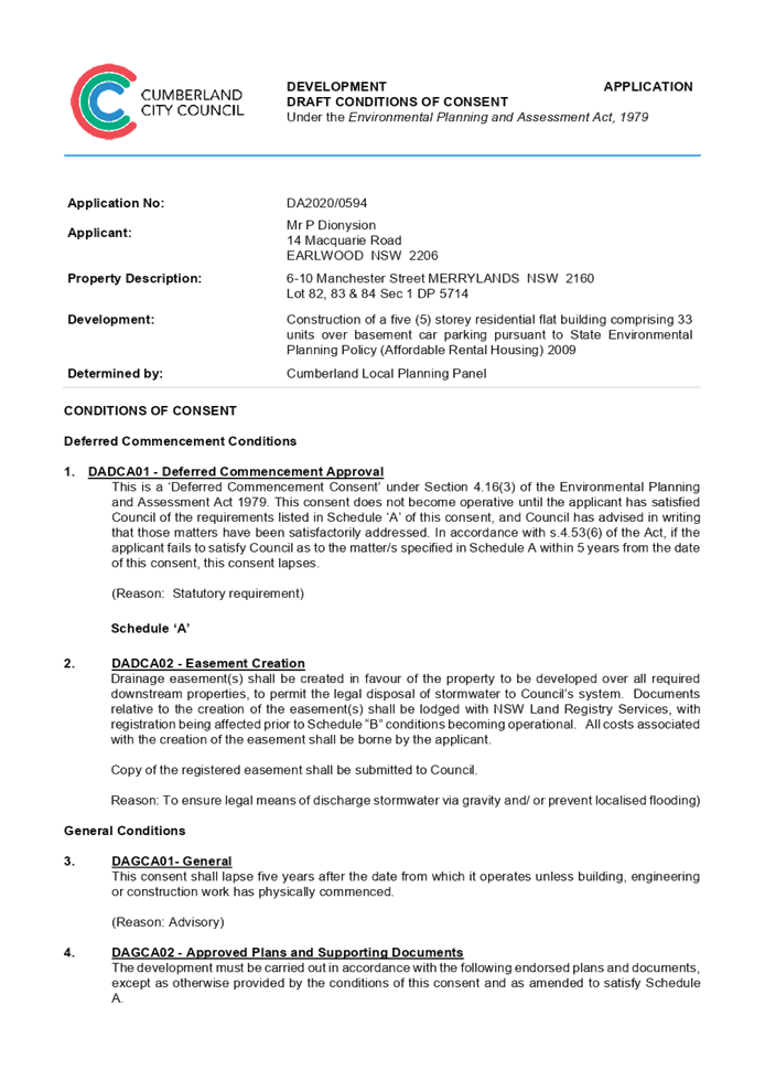
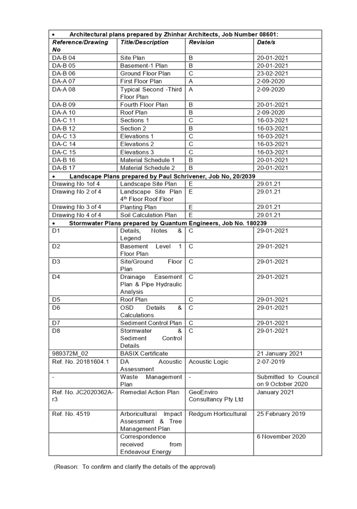
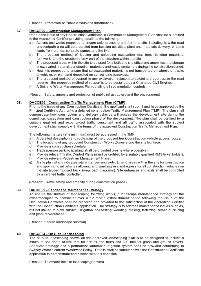
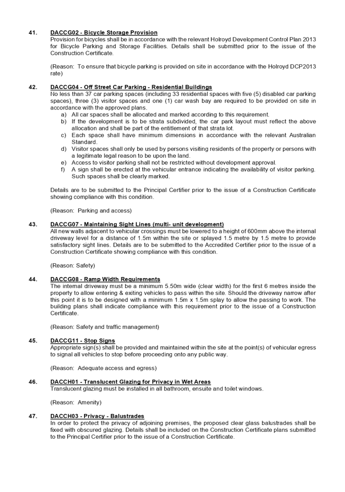

DOCUMENTS
ASSOCIATED WITH
REPORT LPP012/21
Attachment 2
State Environmental Planning Policy Affordable Rental Housing)
2009 Compliance Table
Cumberland Local Planning Panel Meeting
14 April 2021
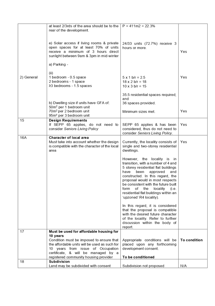
DOCUMENTS
ASSOCIATED WITH
REPORT LPP012/21
Attachment 3
Apartment Design Guide Compliance Table
Cumberland Local Planning Panel Meeting
14 April 2021
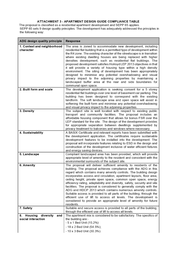

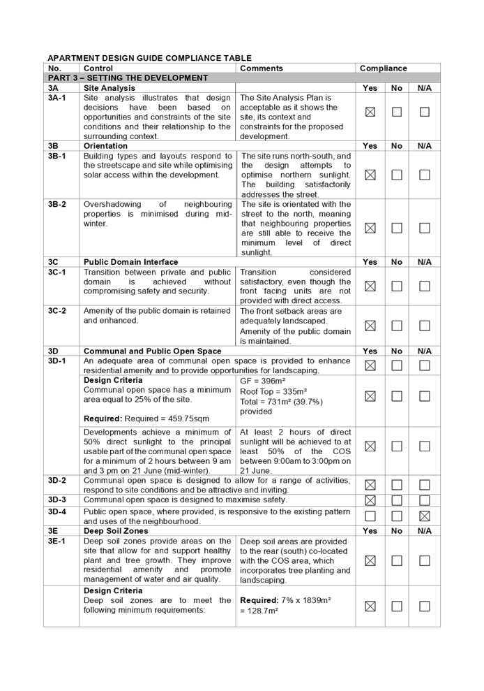
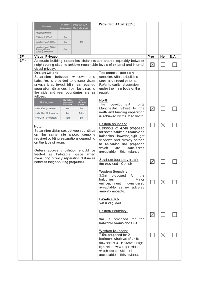
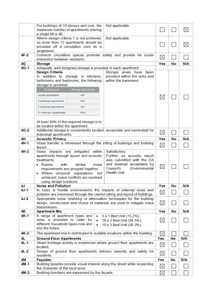
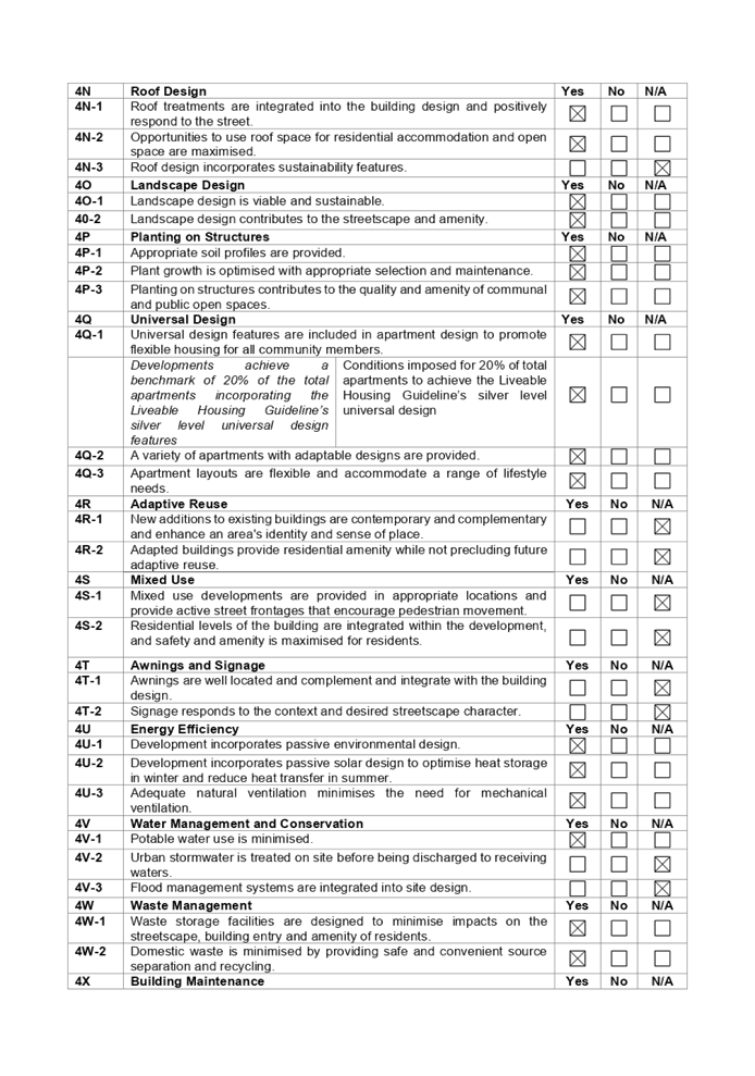

DOCUMENTS
ASSOCIATED WITH
REPORT LPP012/21
Attachment 4
Holroyd Local Environmental Plan Compliance Table
Cumberland Local Planning Panel Meeting
14 April 2021
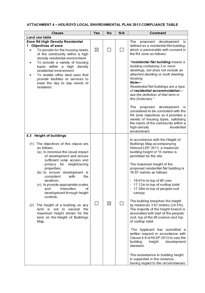
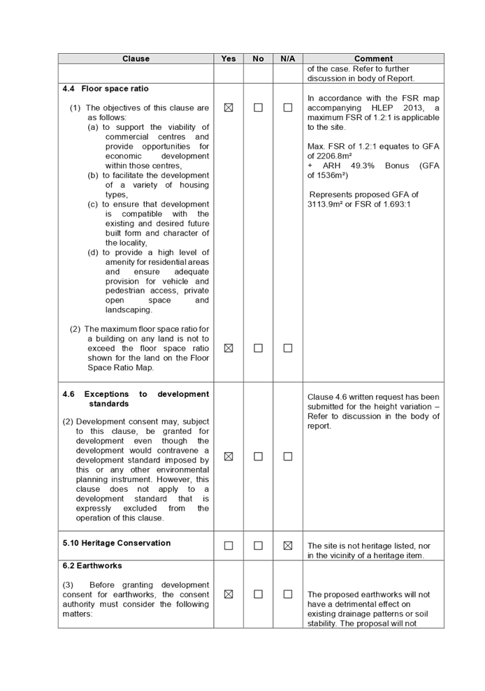
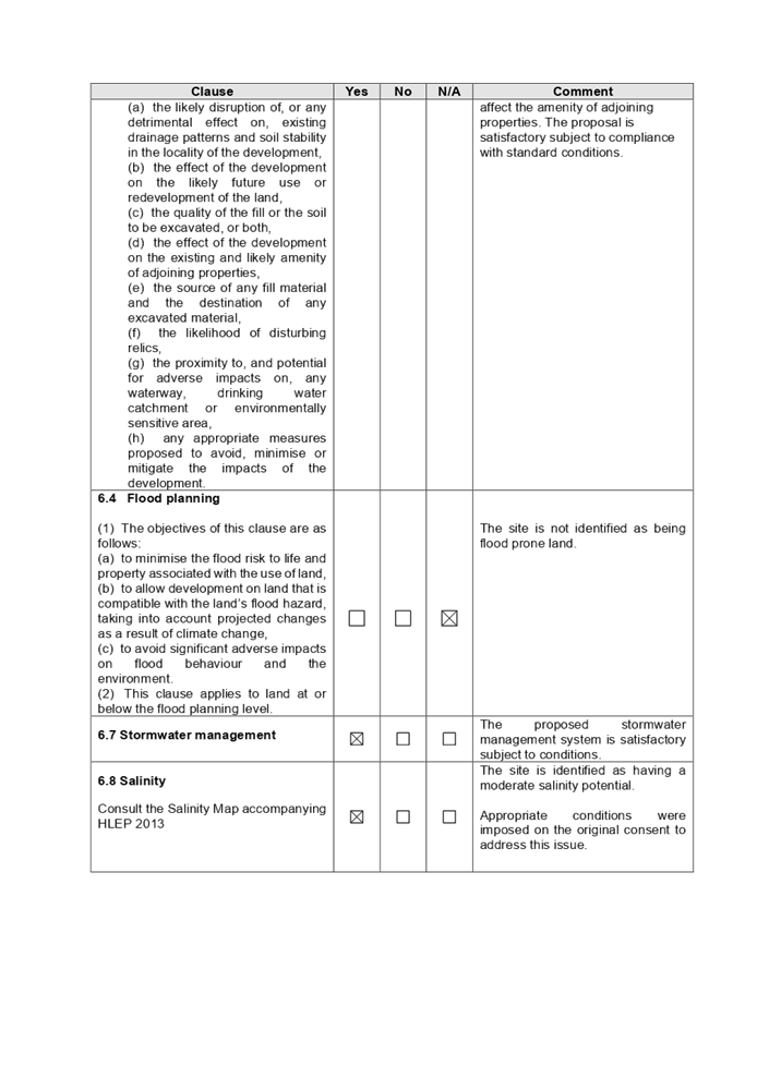
DOCUMENTS
ASSOCIATED WITH
REPORT LPP012/21
Attachment 5
Holroyd Development Control Plan 2013 Compliance Table
Cumberland Local Planning Panel Meeting
14 April 2021

DOCUMENTS
ASSOCIATED WITH
REPORT LPP012/21
Attachment 6
Architectural Plans
Cumberland Local Planning Panel Meeting
14 April 2021
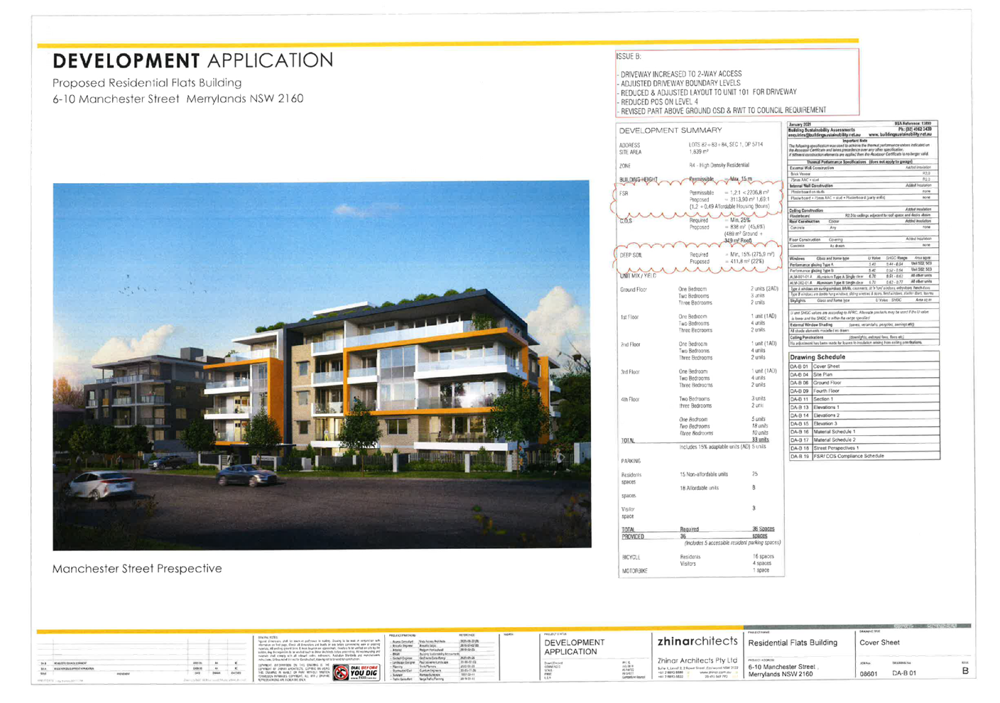
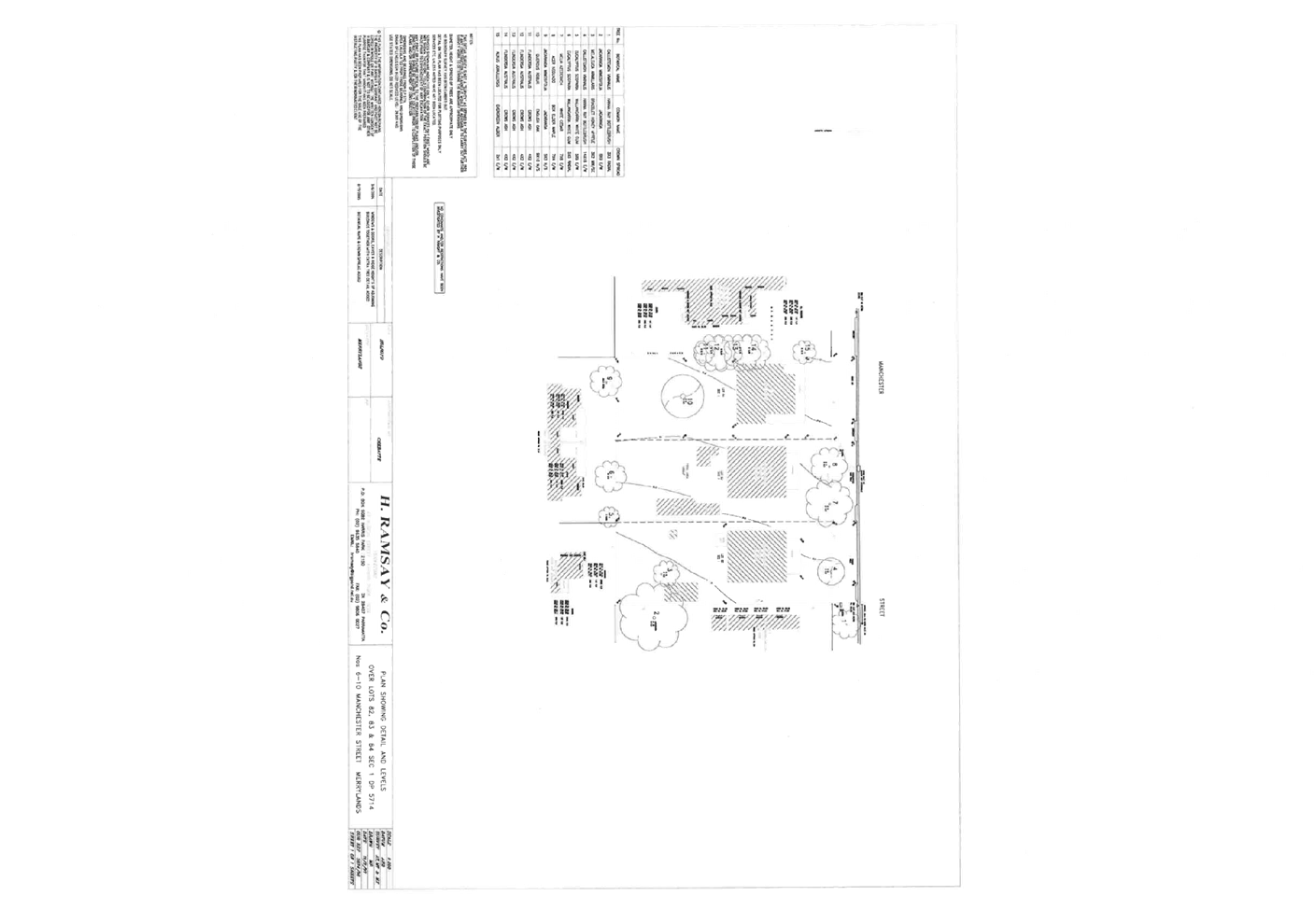
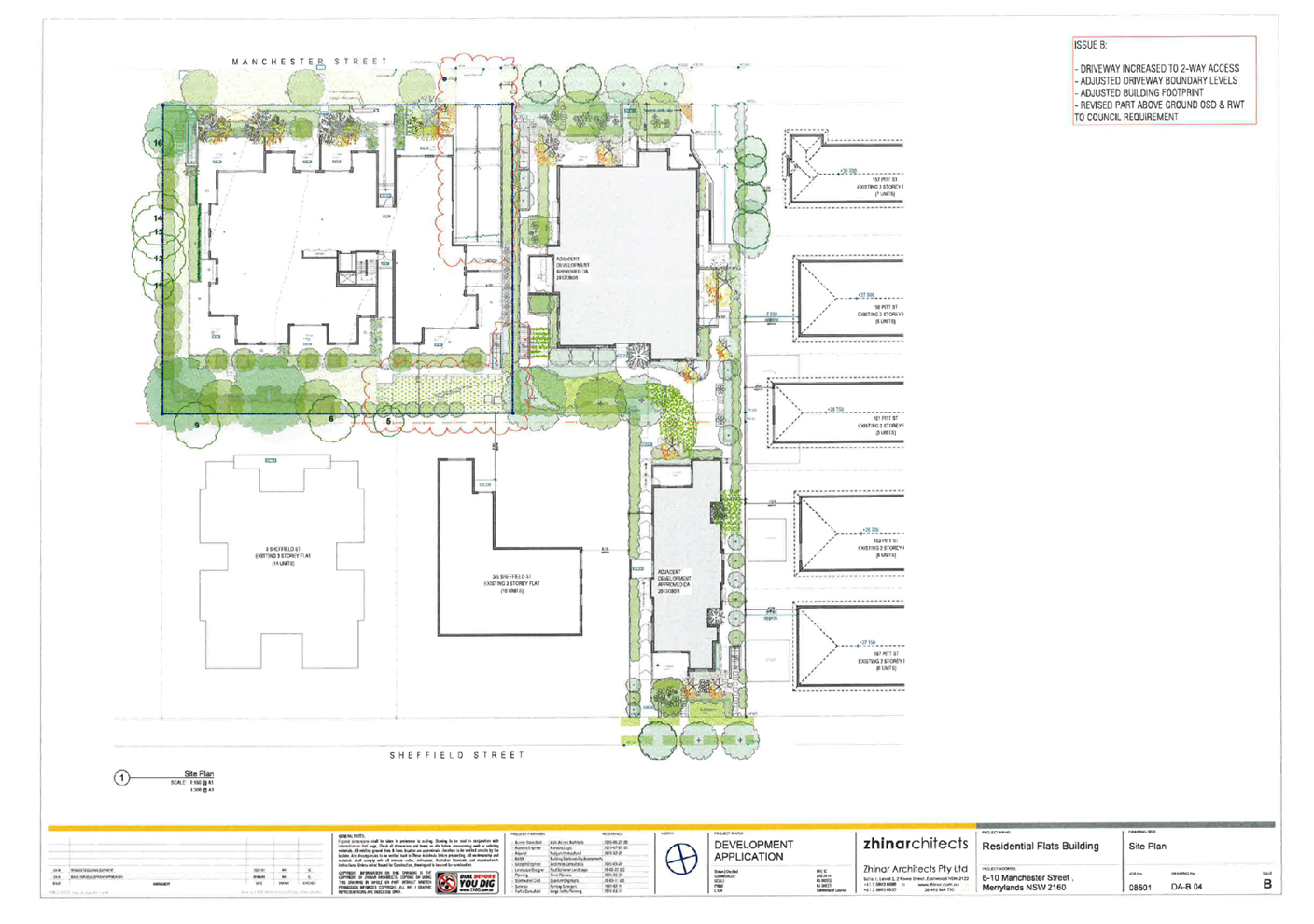
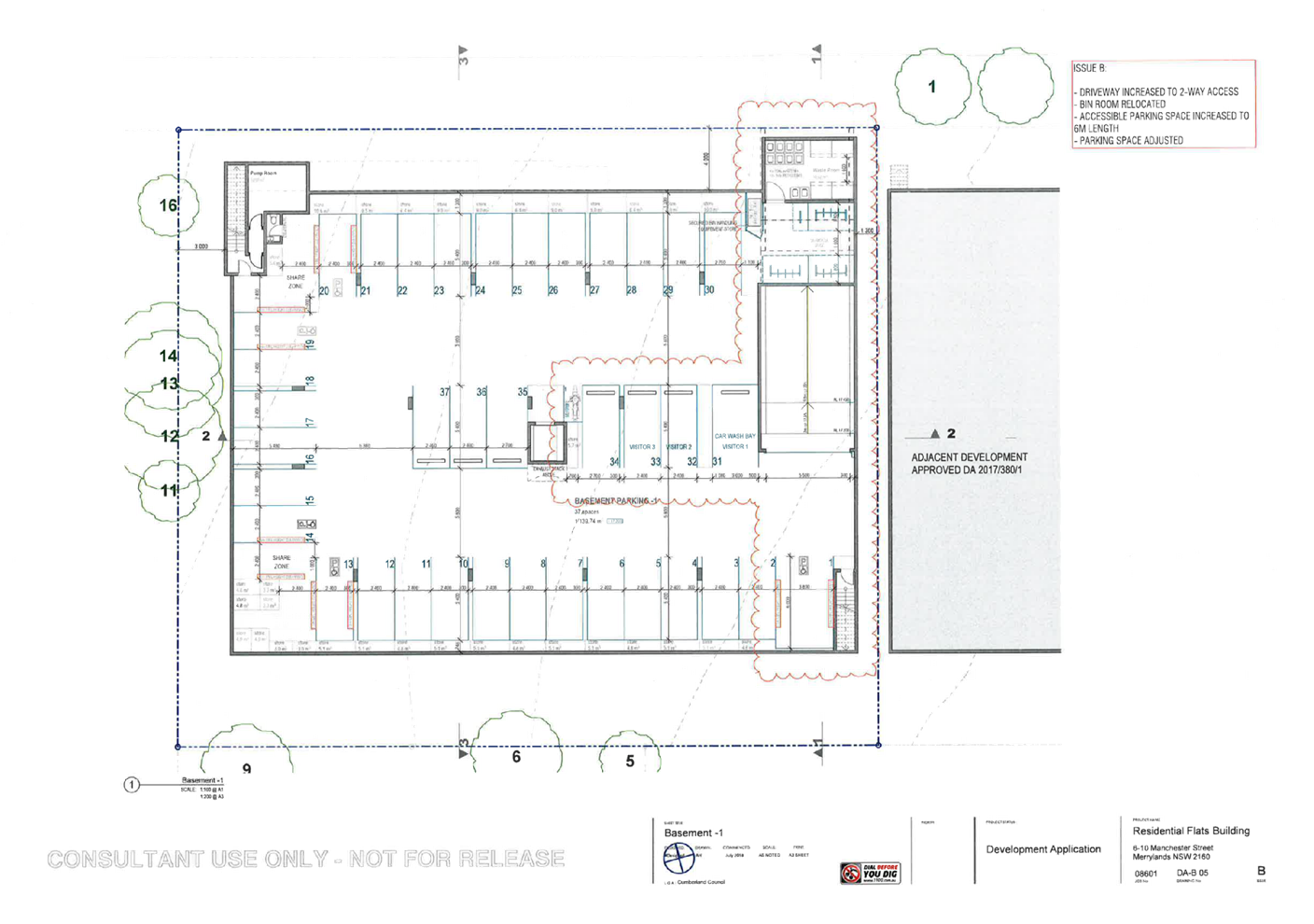
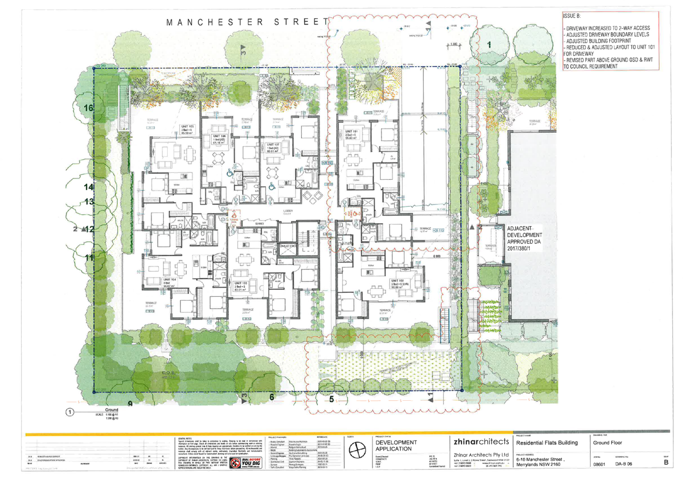
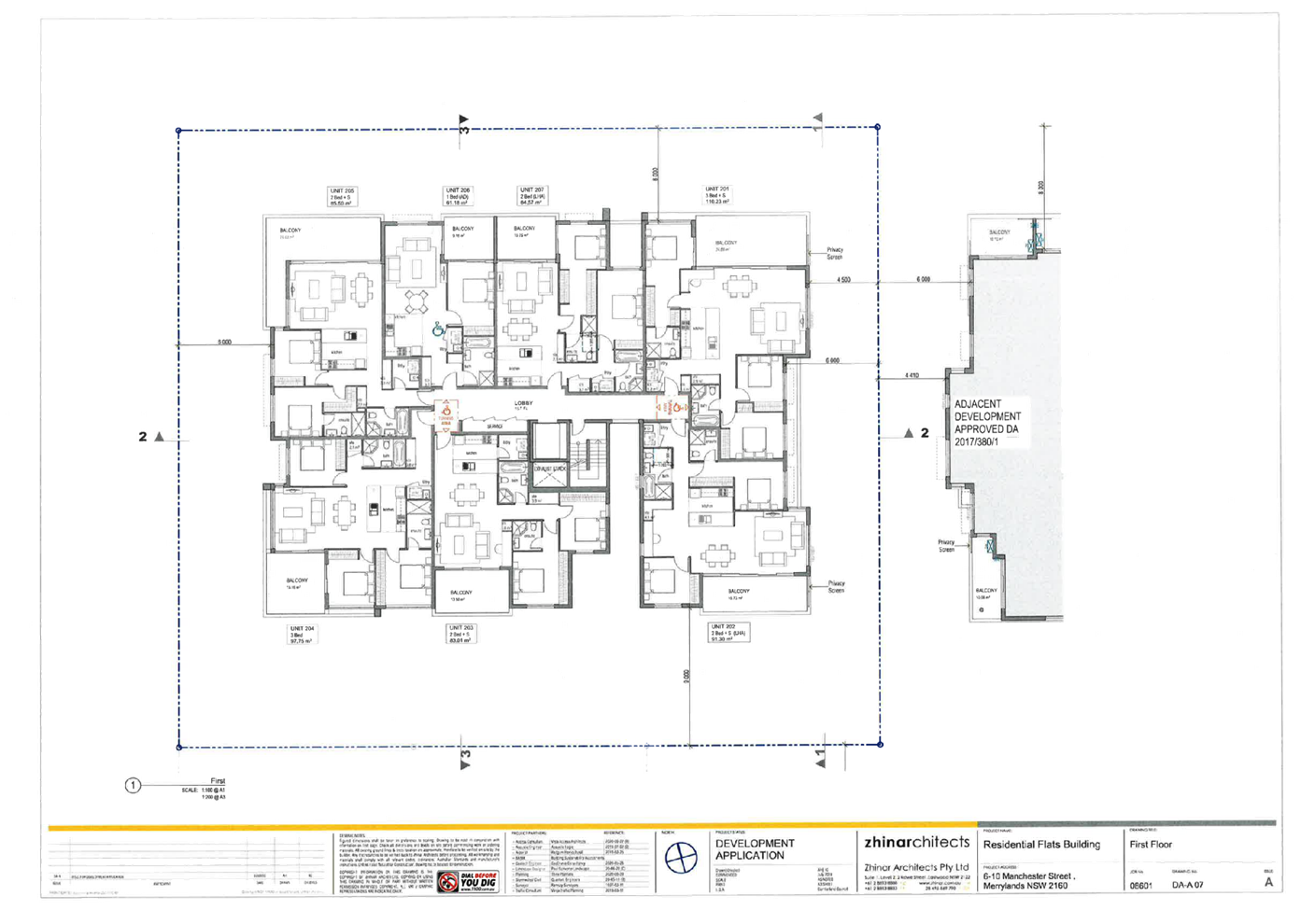
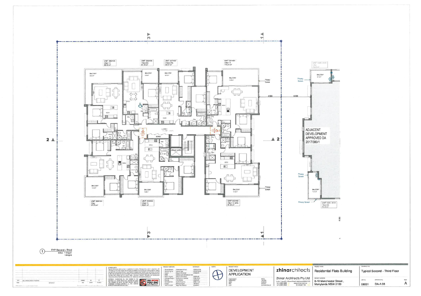
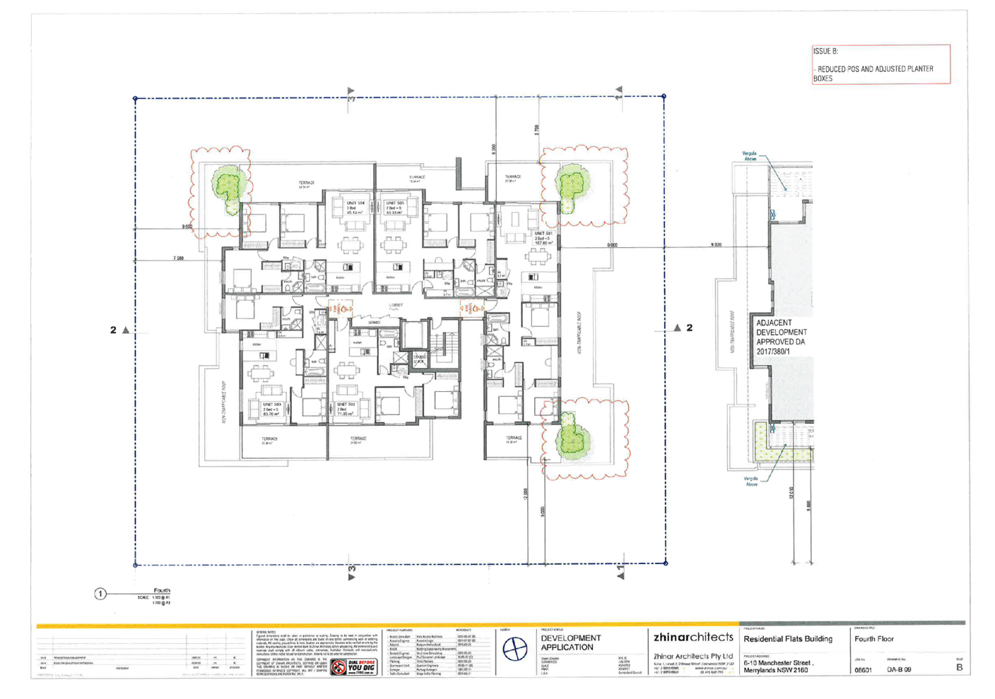
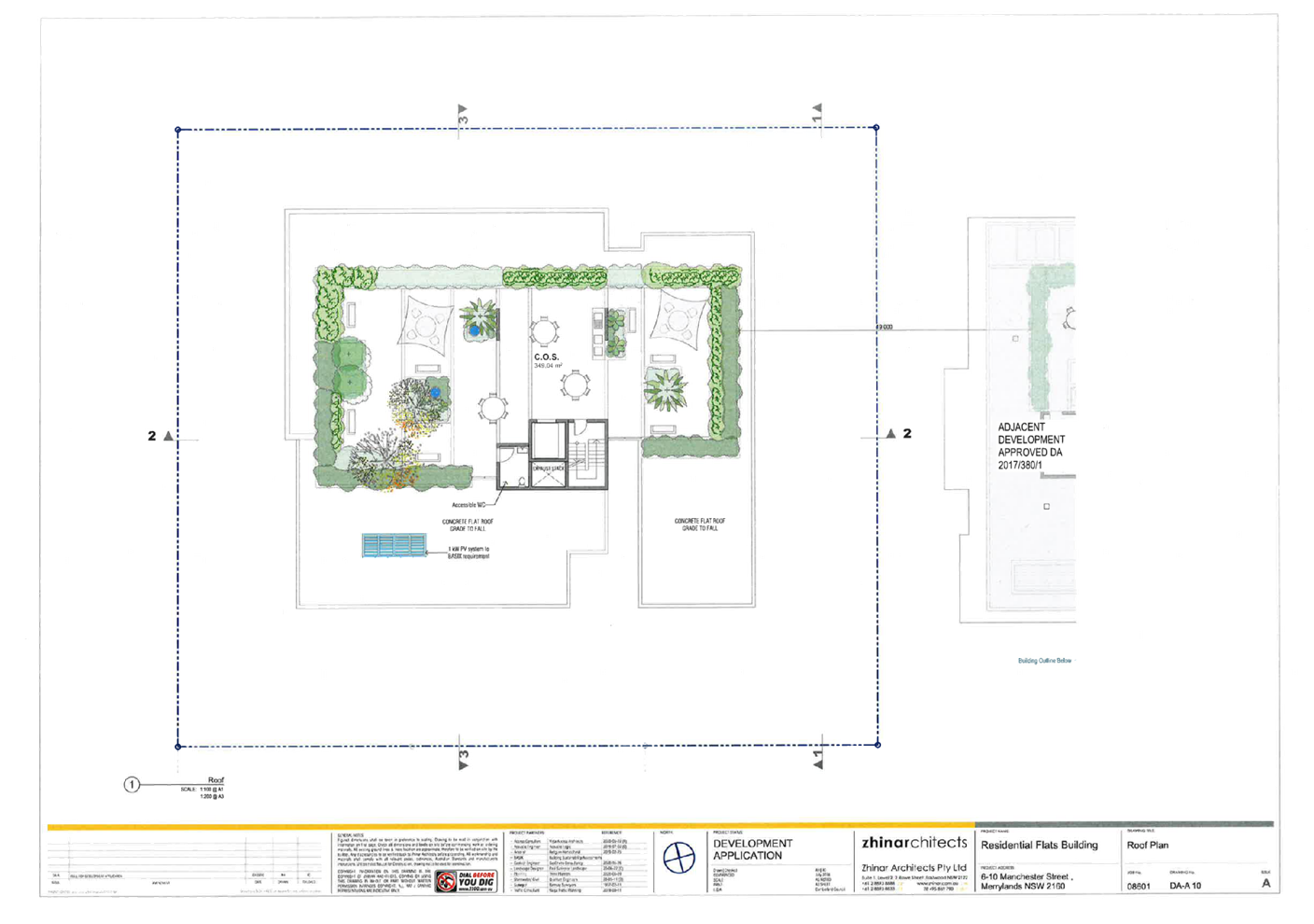
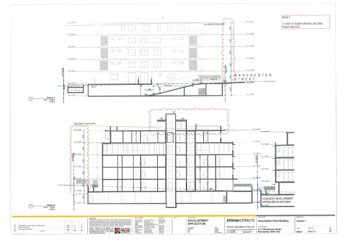
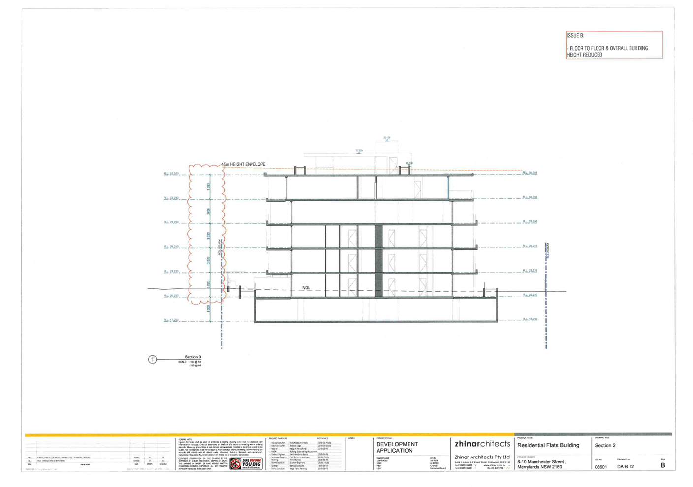
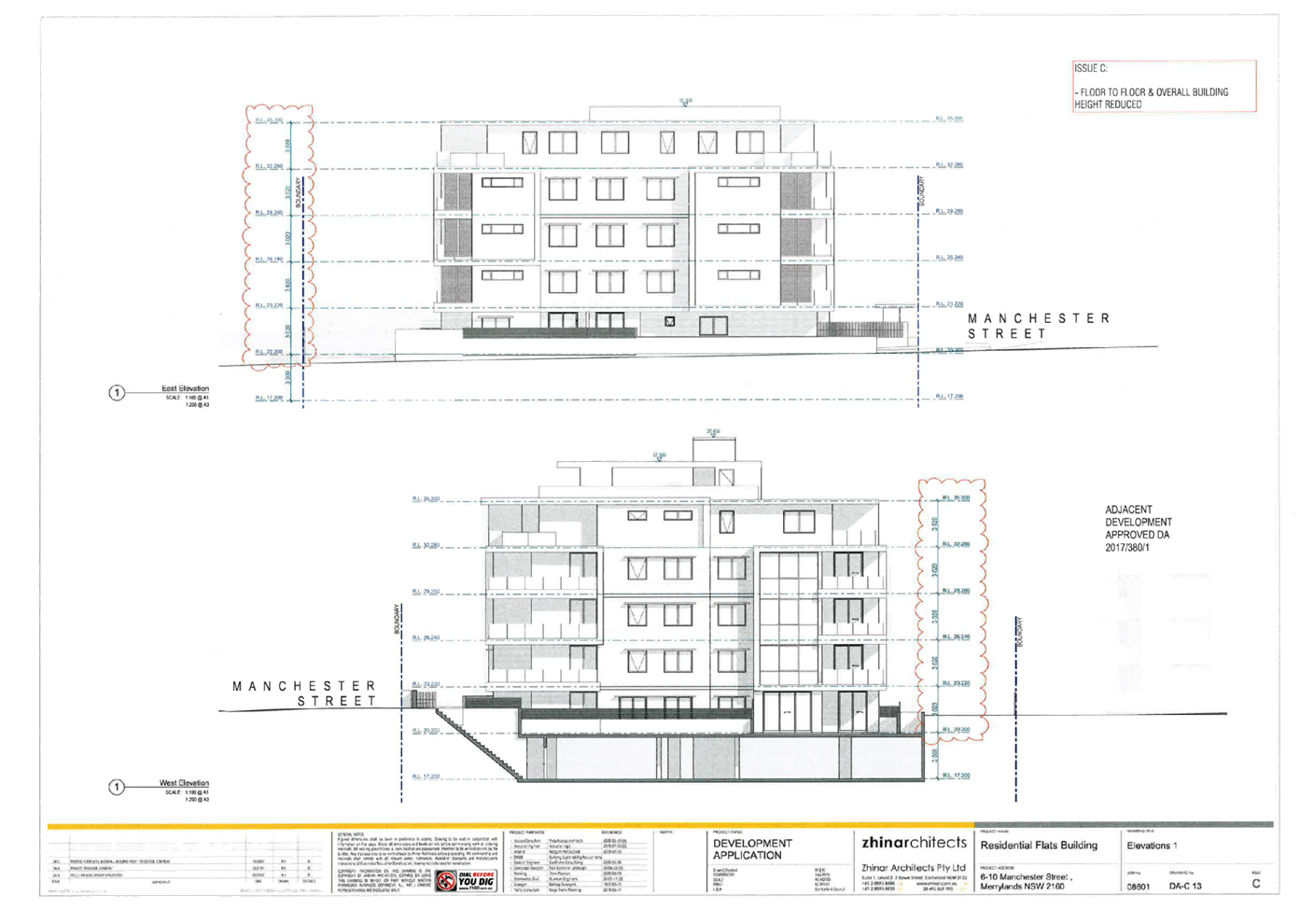
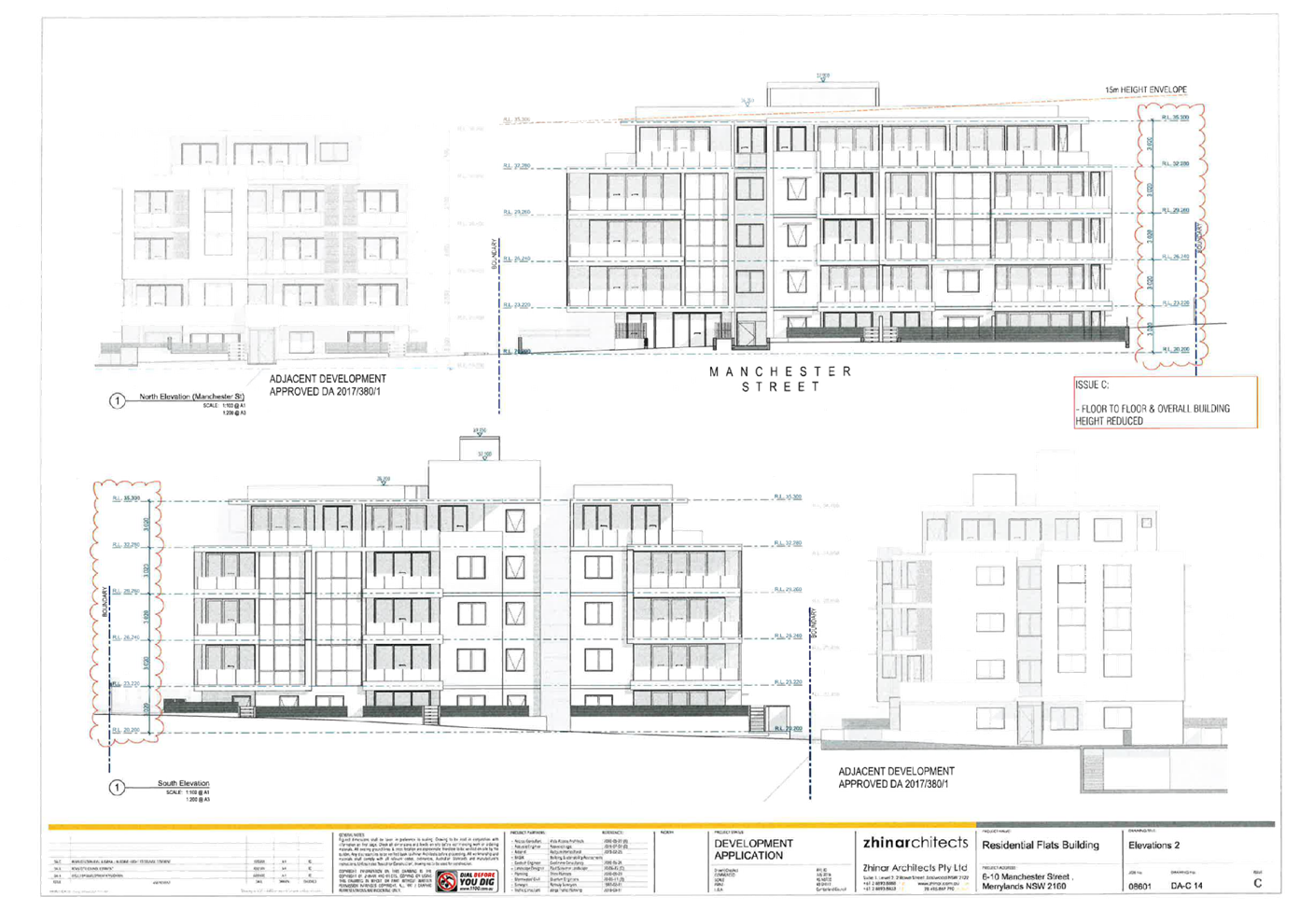
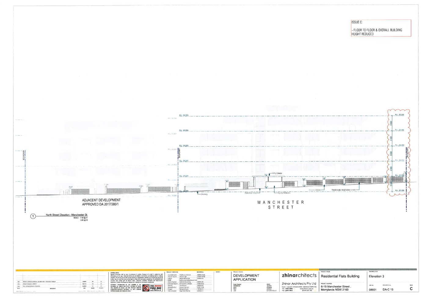
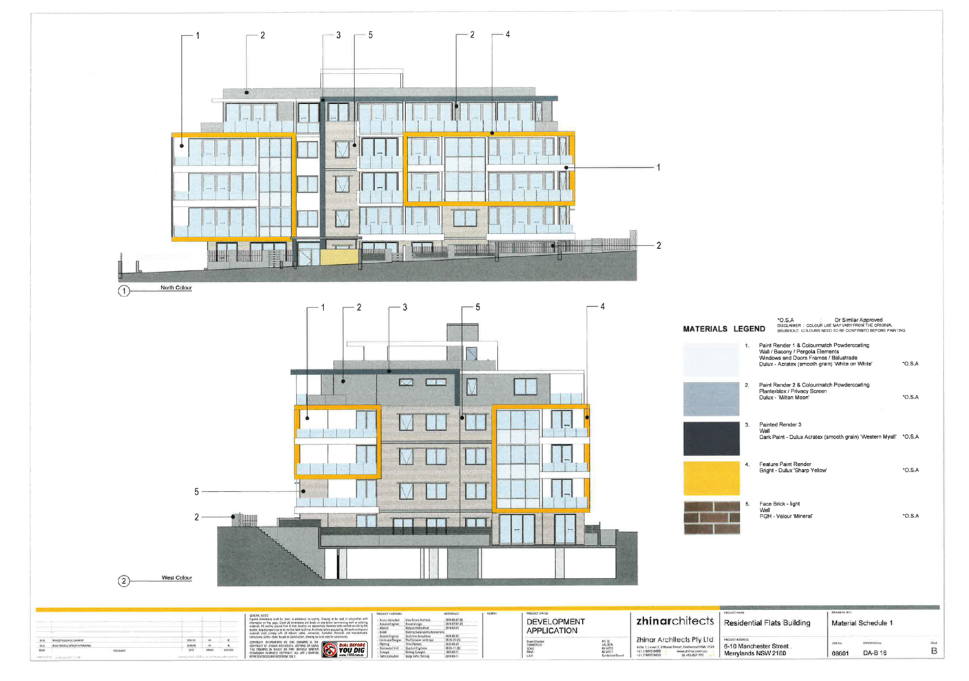
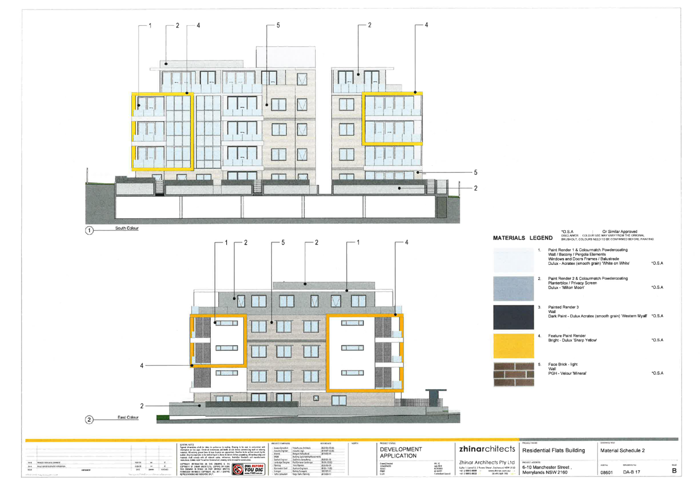
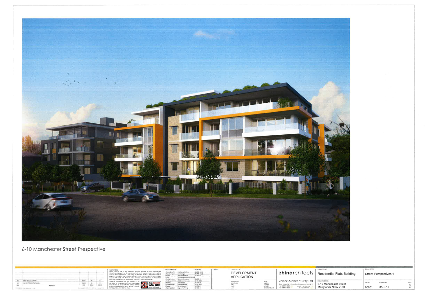
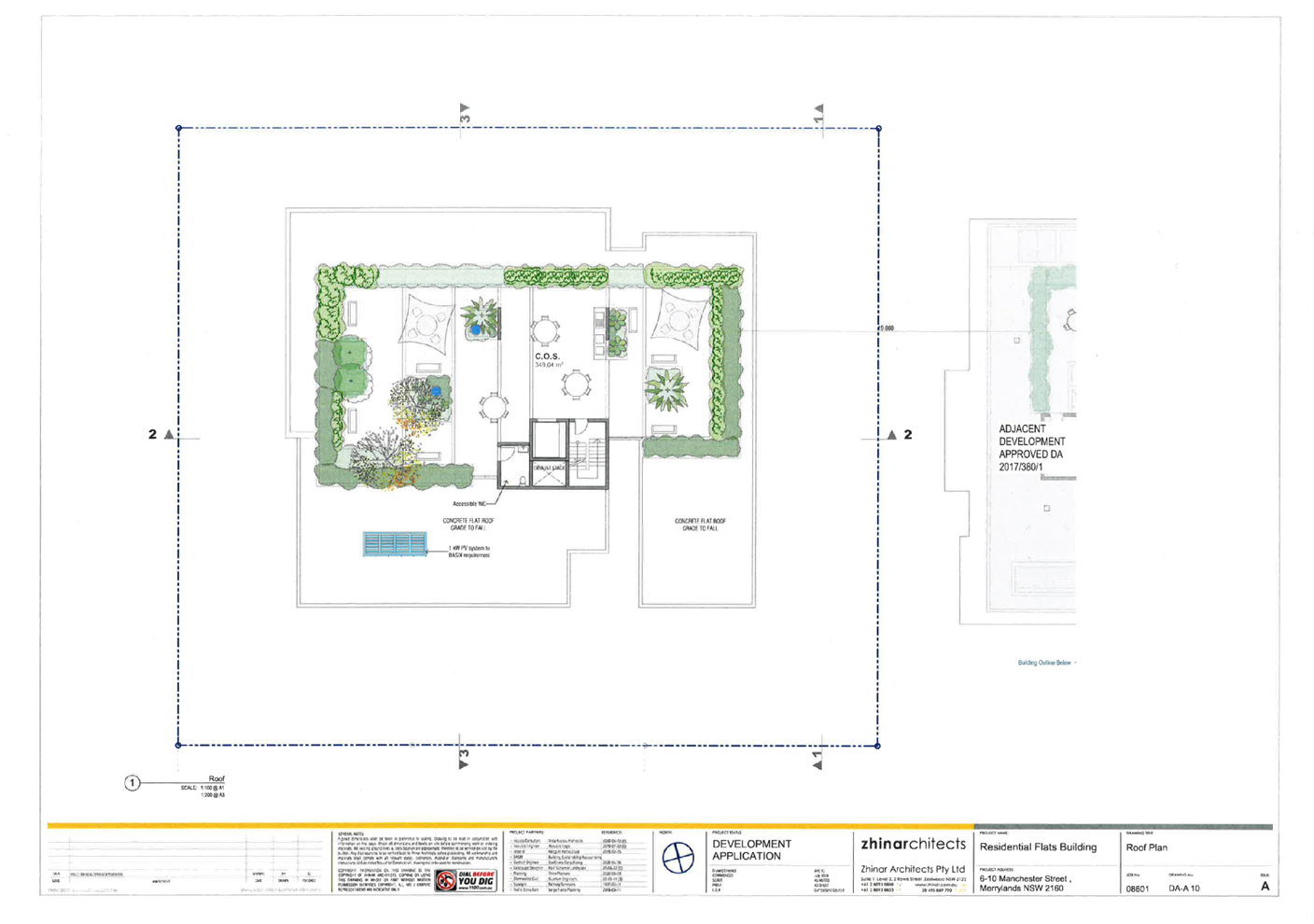
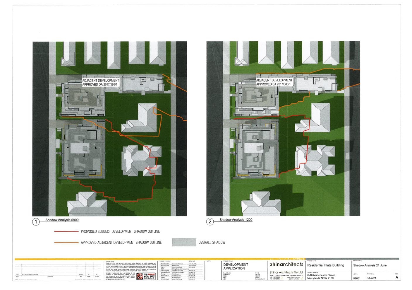
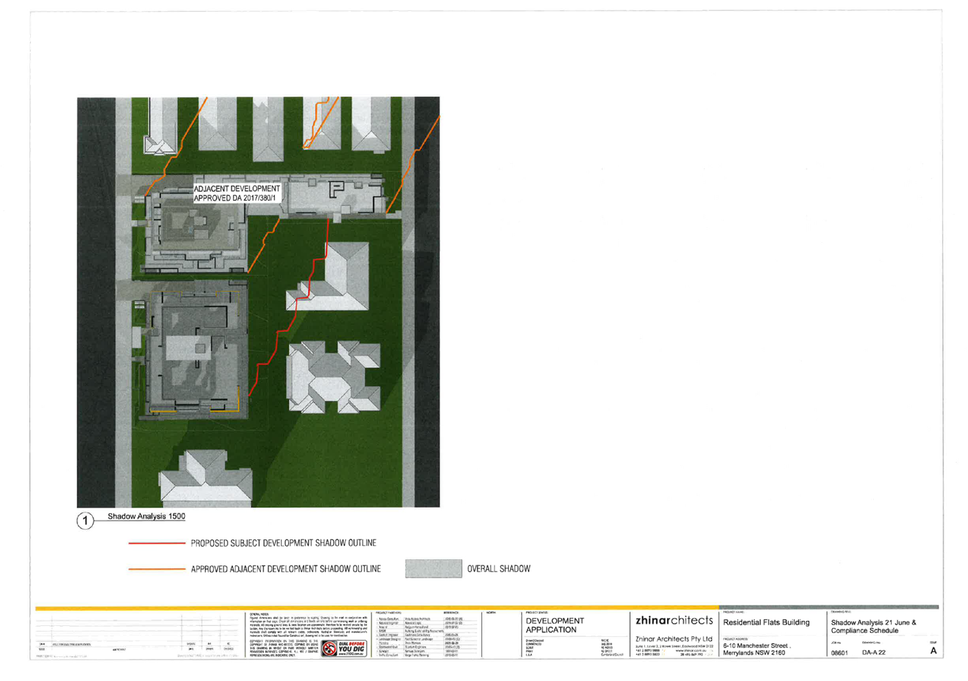
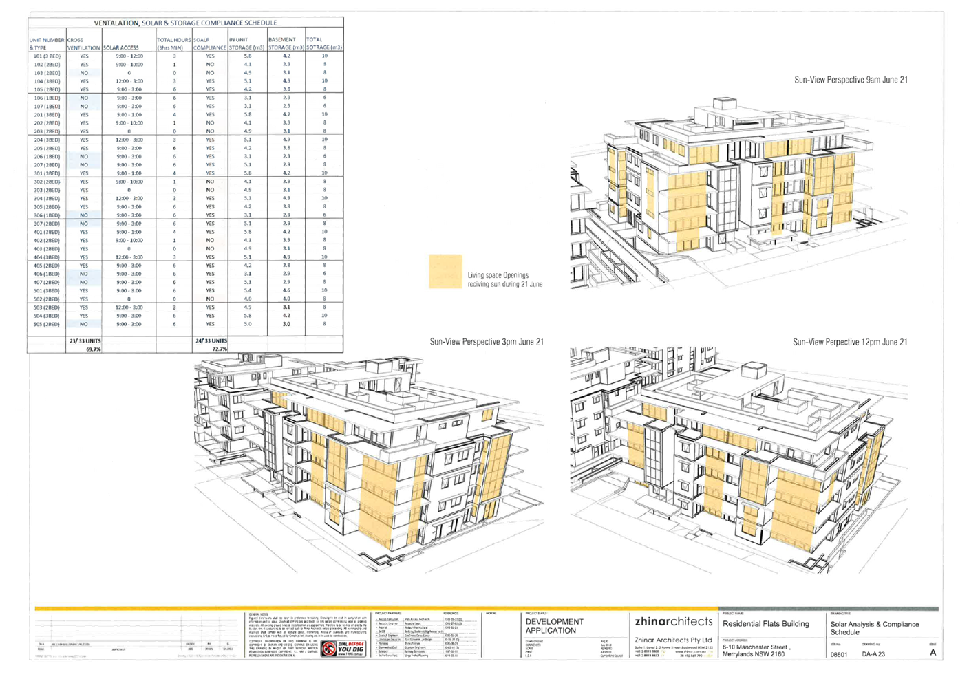
DOCUMENTS
ASSOCIATED WITH
REPORT LPP012/21
Attachment 7
Landscape Plan
Cumberland Local Planning Panel Meeting
14 April 2021
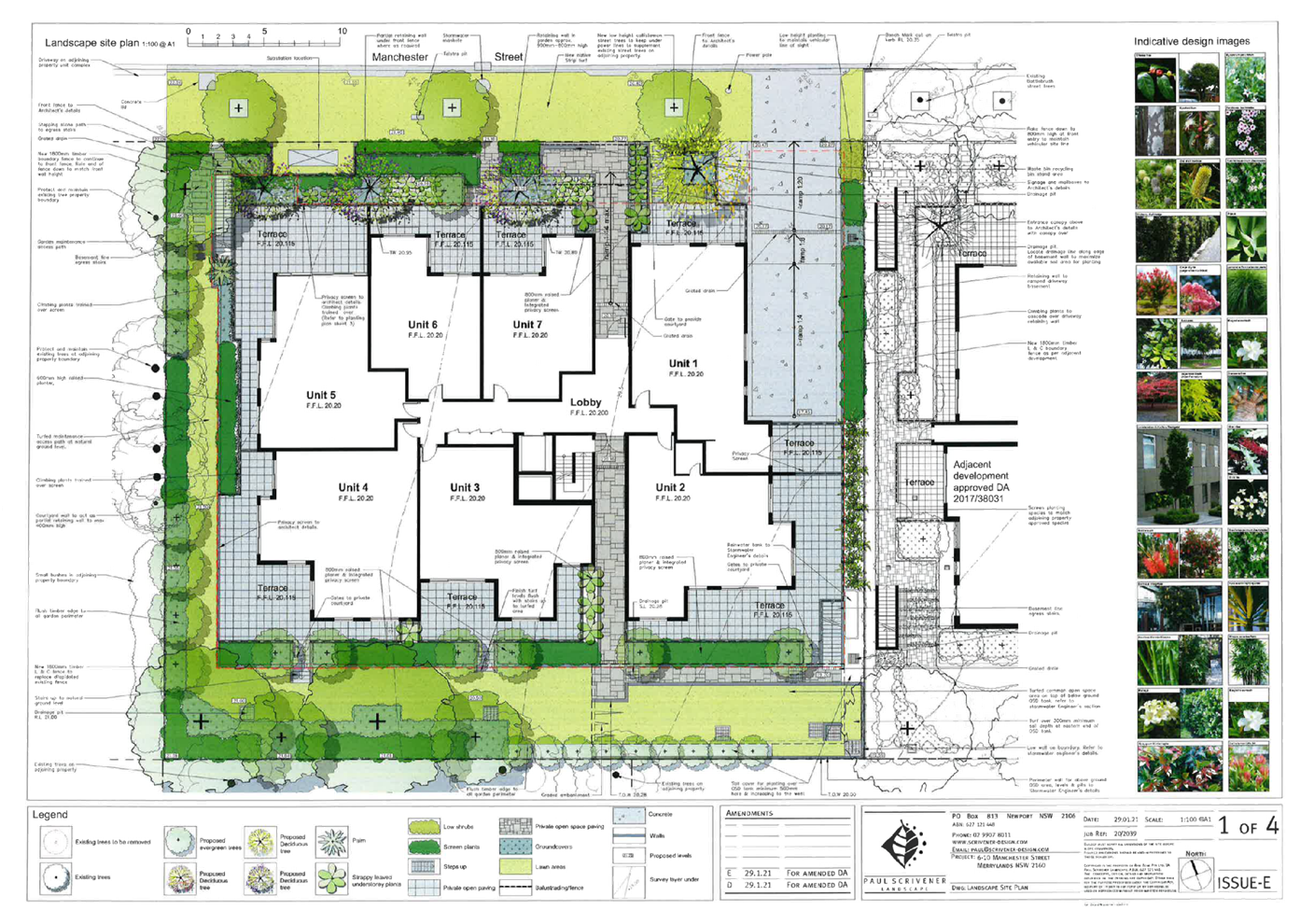
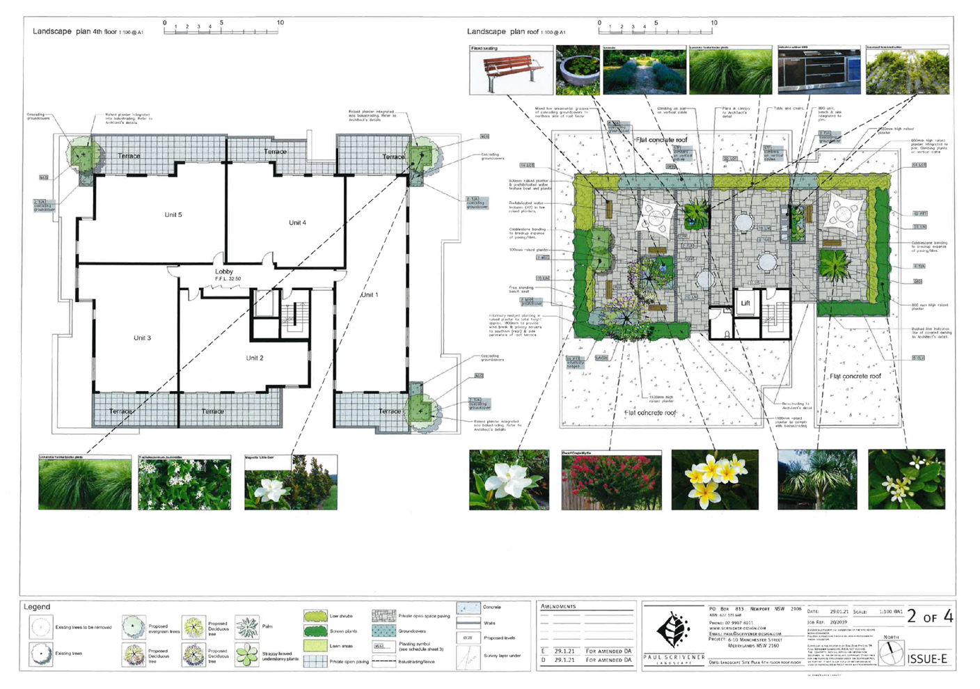
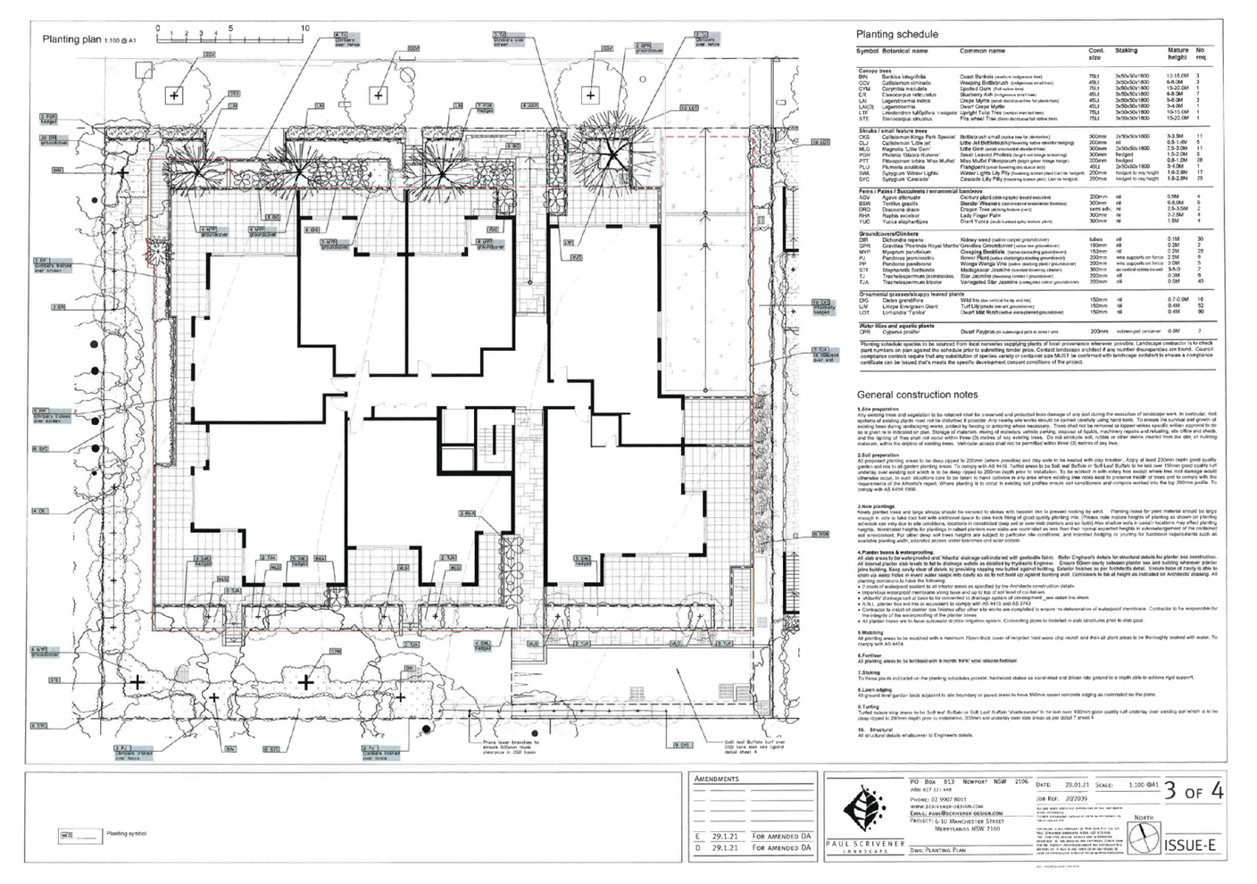
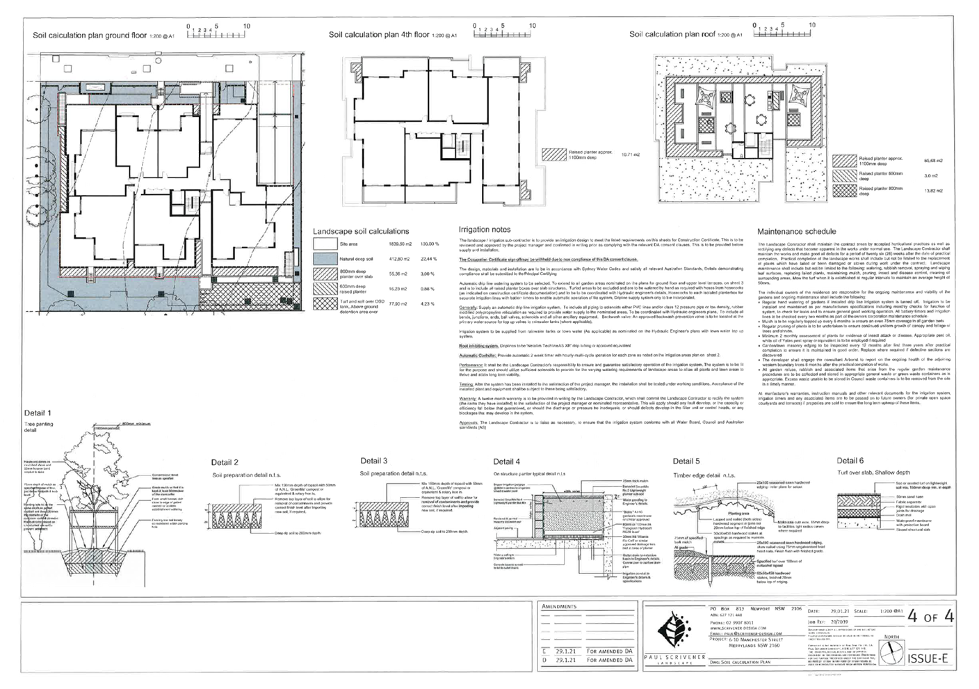
DOCUMENTS
ASSOCIATED WITH
REPORT LPP012/21
Attachment 8
Clause 4.6 Variation Height
Cumberland Local Planning Panel Meeting
14 April 2021

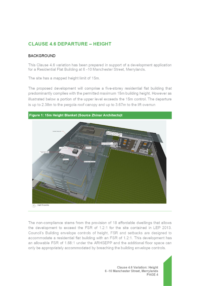

DOCUMENTS
ASSOCIATED WITH
REPORT LPP012/21
Attachment 9
Locality Map
Cumberland Local Planning Panel Meeting
14 April 2021
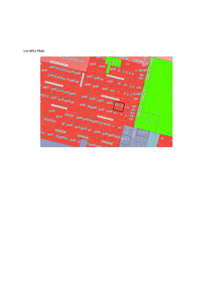
DOCUMENTS
ASSOCIATED WITH
REPORT LPP012/21
Attachment 10
Submissions x 2
Cumberland Local Planning Panel Meeting
14 April 2021