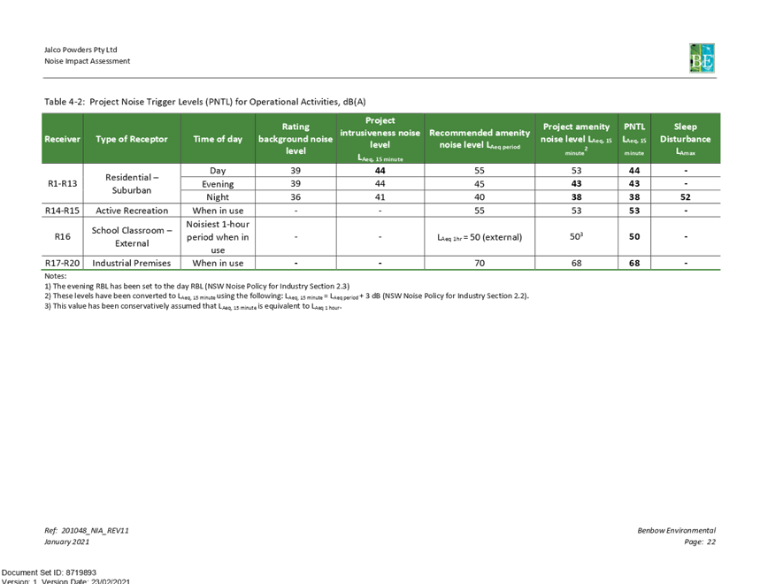
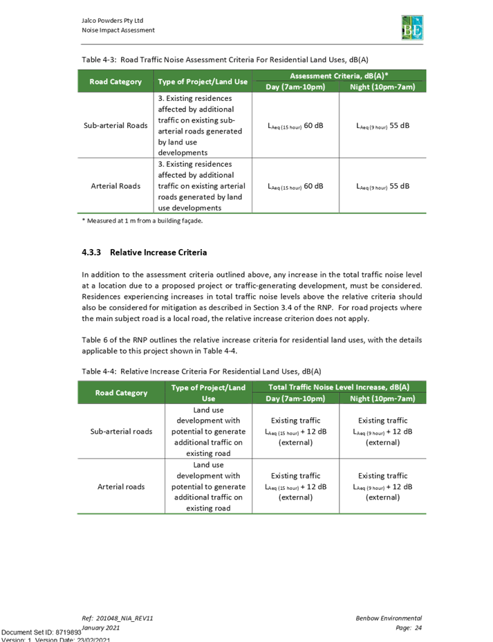
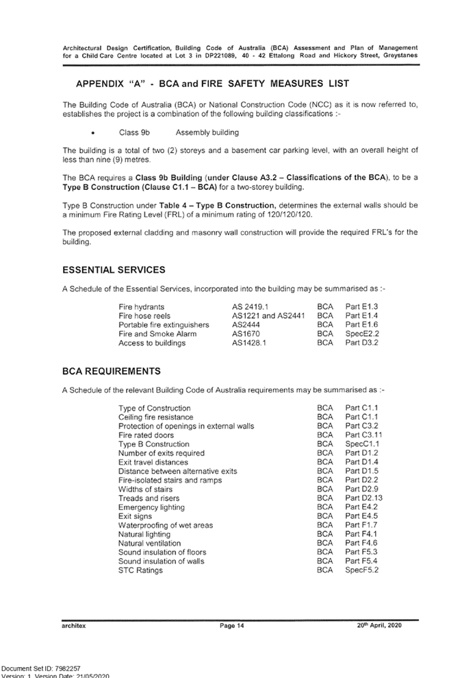
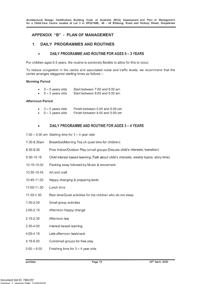
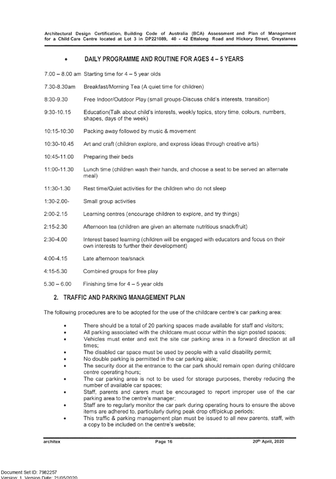
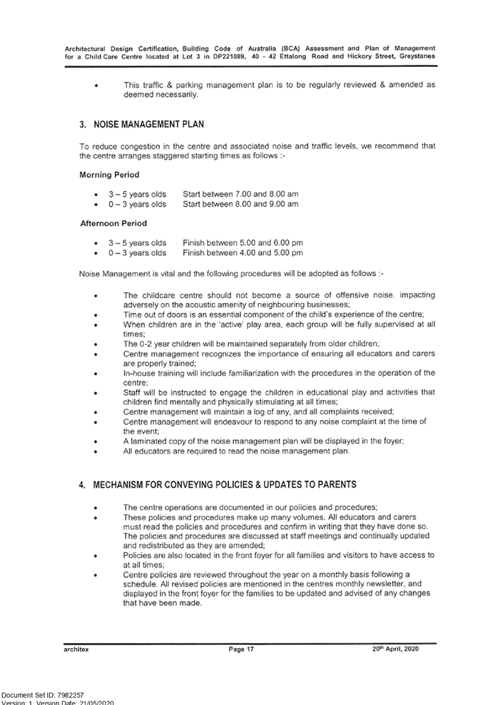
10 March 2021
An Electronic meeting of the
Cumberland Local Planning Panel
will be held via Zoom at 11.30am Wednesday, 10 March 2021.
Business as below:
Yours faithfully
Hamish McNulty
General
Manager
ORDER OF BUSINESS
1. Receipt of Apologies
2. Confirmation of Minutes
3. Declarations of Interest
4. Address by invited
speakers
5. Reports:
- Development
Applications
- Planning
Proposals
6. Closed Session Reports
Cumberland Local Planning Panel Meeting
10 March 2021
CONTENTS
Report No. Name of Report Page
No.
Development Applications
LPP003/21... Development Application
for 40-42 Ettalong Road, Greystanes.................. 5
LPP004/21... Development Application
for 67 Pegler Avenue, South Granville............ 307
LPP005/21... Modification Application
for 25-28 Joyce Street, Pendle Hill.................... 495
LPP006/21... Modification Application
for 277-289 Woodpark Road, Smithfield........... 625
LPP007/21... Development Application
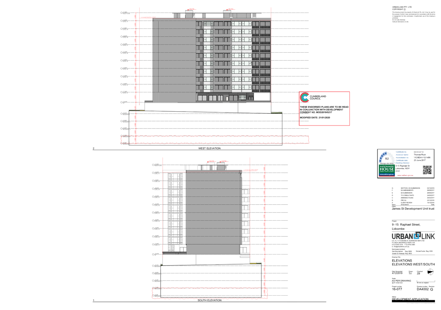
for 9-15 Raphael Street and Laneway 429, Lidcombe 909
Cumberland Local Planning Panel Meeting
10 March 2021
Cumberland Local Planning Panel Meeting
10 March 2021
Item
No: LPP003/21
Development
Application for 40-42 Ettalong Road, Greystanes
Responsible
Division: Environment
& Planning
Officer: Executive
Manager Development and Building
File
Number: DA2020/0292
|
Application
lodged
|
21 May 2020
|
|
Applicant
|
RJ Bentley Pty Ltd
|
|
Owner
|
CCA Investments - Greystanes
Pty Ltd
|
|
Application
No.
|
DA2020/0292
|
|
Description
of Land
|
40-42 Ettalong Road,
Greystanes NSW 2145, Lot 3 DP 221089
|
|
Proposed
Development
|
Demolition of existing
structures and construction of a two storey 76 place childcare centre over
basement car parking
|
|
Site
Area
|
1,138m2
|
|
Zoning
|
R2 Low Density Residential
Zone
|
|
Disclosure
of political donations and gifts
|
Nil disclosure
|
|
Heritage
|
No – Not Heritage Listed
nor within Heritage Conservation Area
|
|
Principal
Development Standards
|
FSR
Permissible: maximum 0.5:1
Proposed: 0.38:1
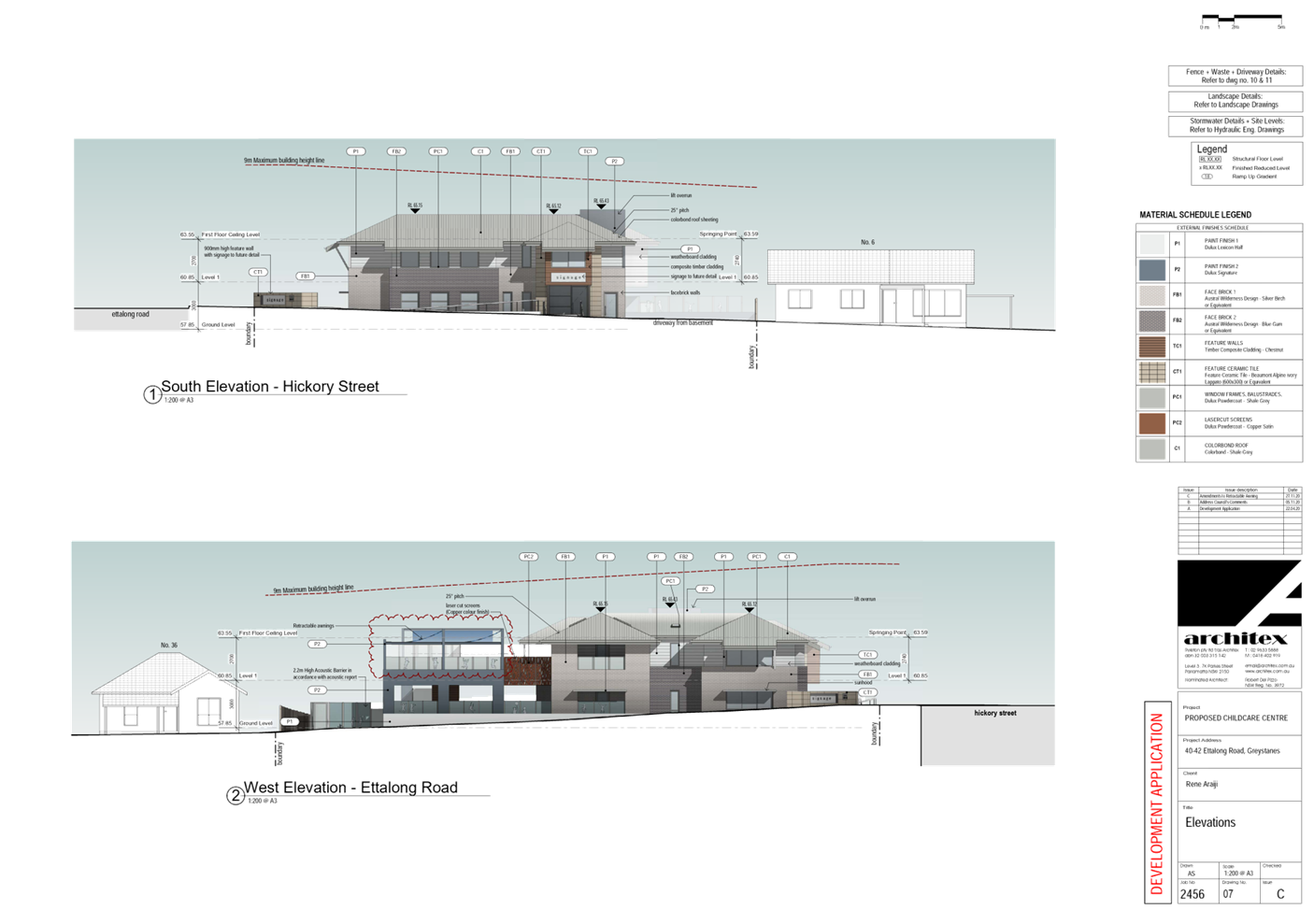
Height of Building
Permissible: maximum 9m
Proposed maximum overall
building height: 8.81m
|
|
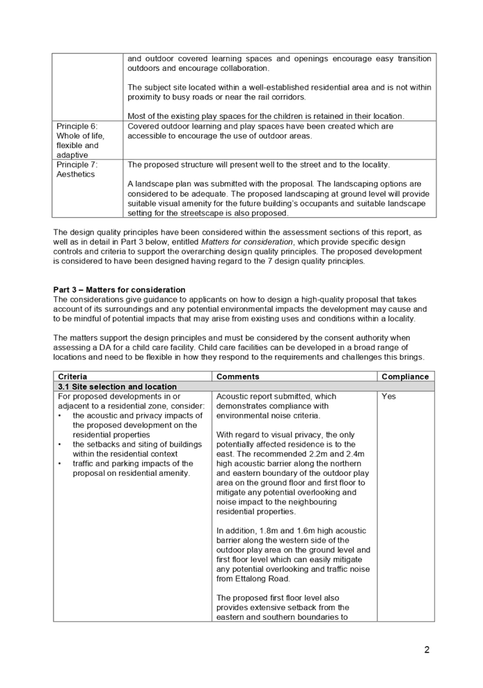
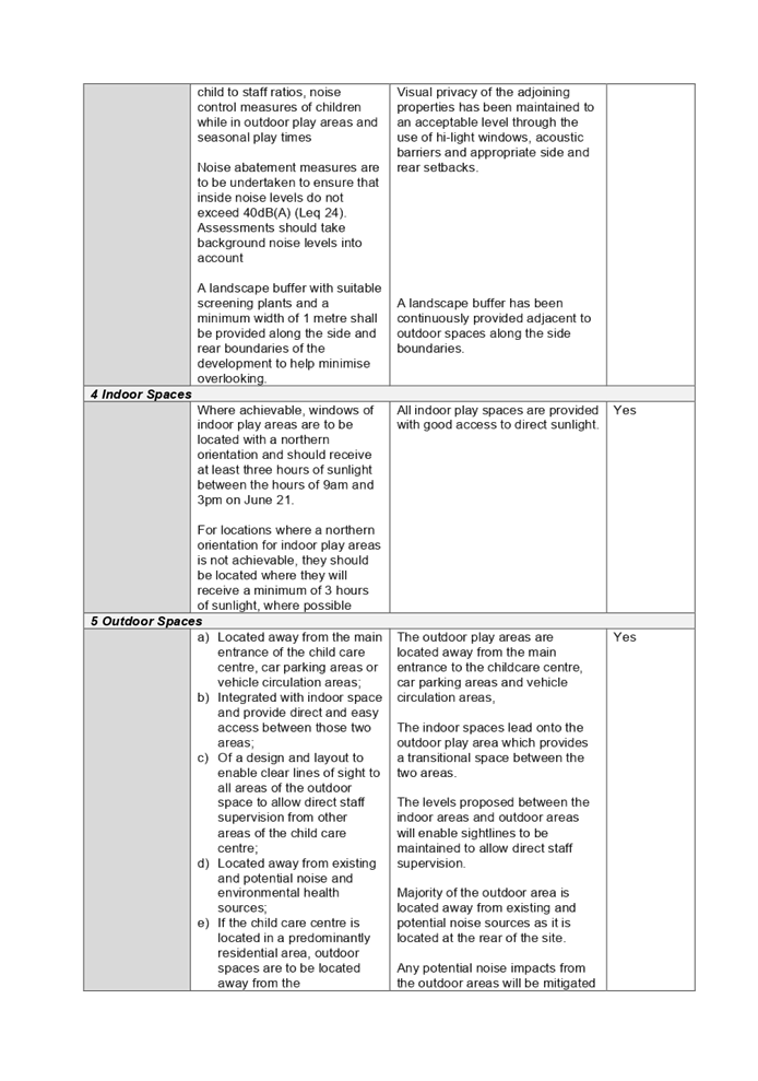
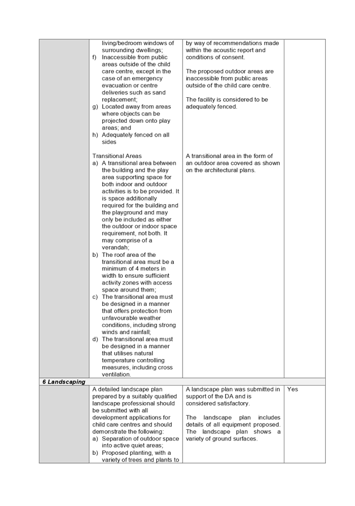
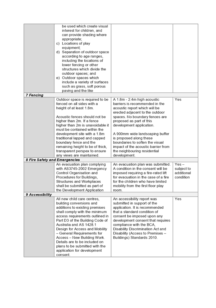
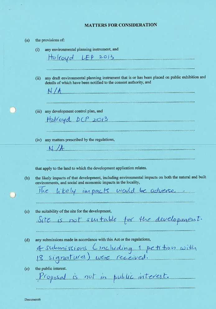
Issues
|
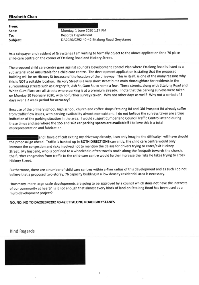
· Submissions
· Unsuitable
location
· Number
of children
· Outdoor
play area
|
1. Development
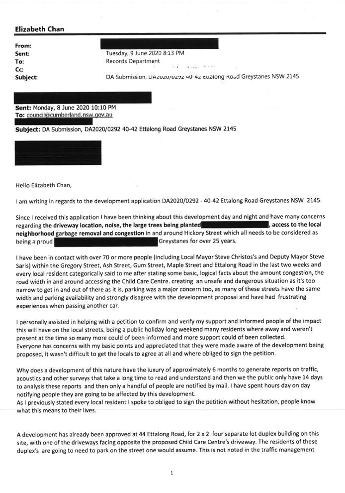
Application No. DA2020/0292 was received on 21 May 2020 for the Demolition of
existing structures and construction of a two storey childcare centre with 76
places over basement car parking for 20 vehicles.
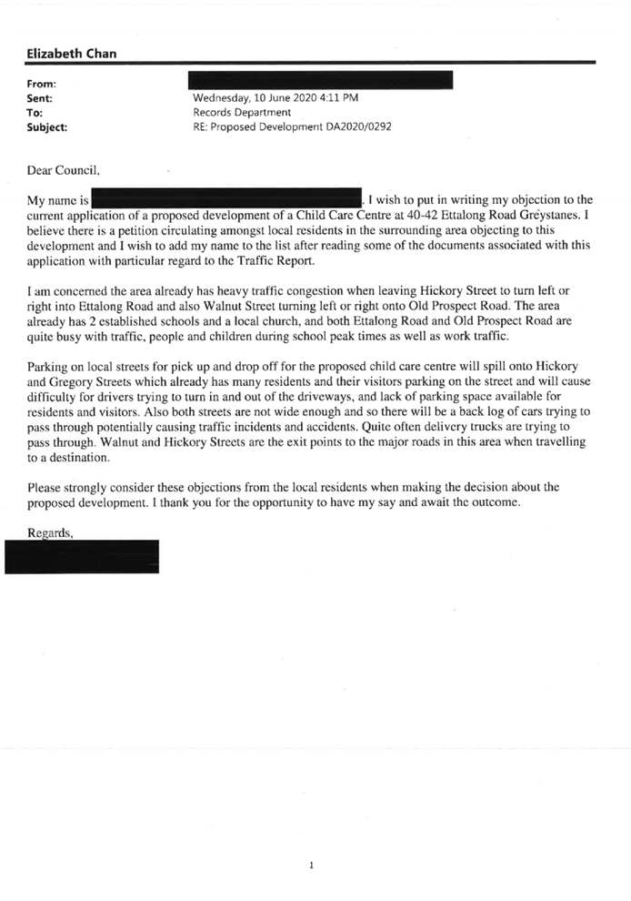
2. The
application was publicly notified to occupants and owners of the adjoining
properties for a period of 14 days between 27 May 2020 and 10 June 2020. In
response, 26 unique submissions and 1 petition including 55 signatures were
received.
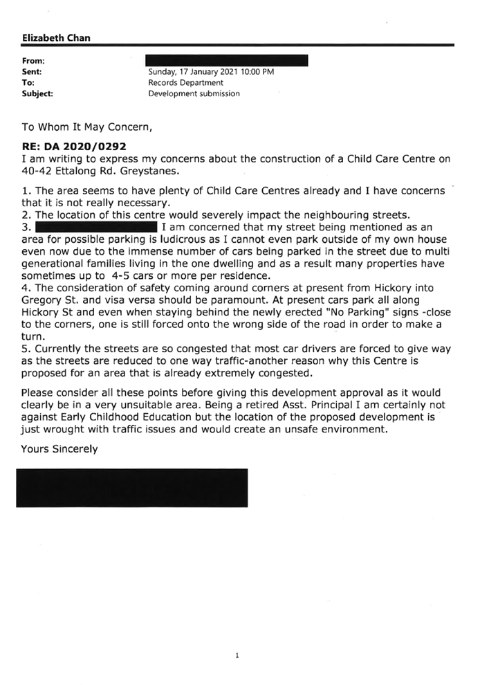
3. Amended
plans were received on 27 November 2020 to provide retracting awnings to the
first floor outdoor play area. The information was publicly renotified to
occupants, owners of the adjoining properties and objectors for a period of 14
days between 13 January 2021 and 27 January 2021. In response, 30 unique
submissions and 1 petition including 55 signatures were received.
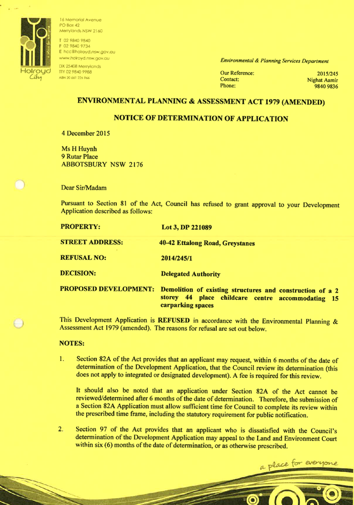
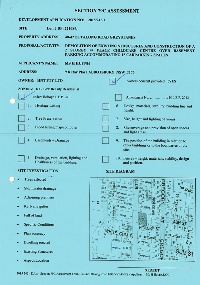
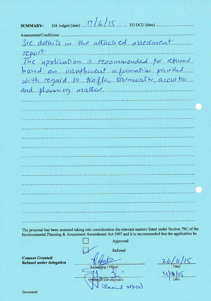
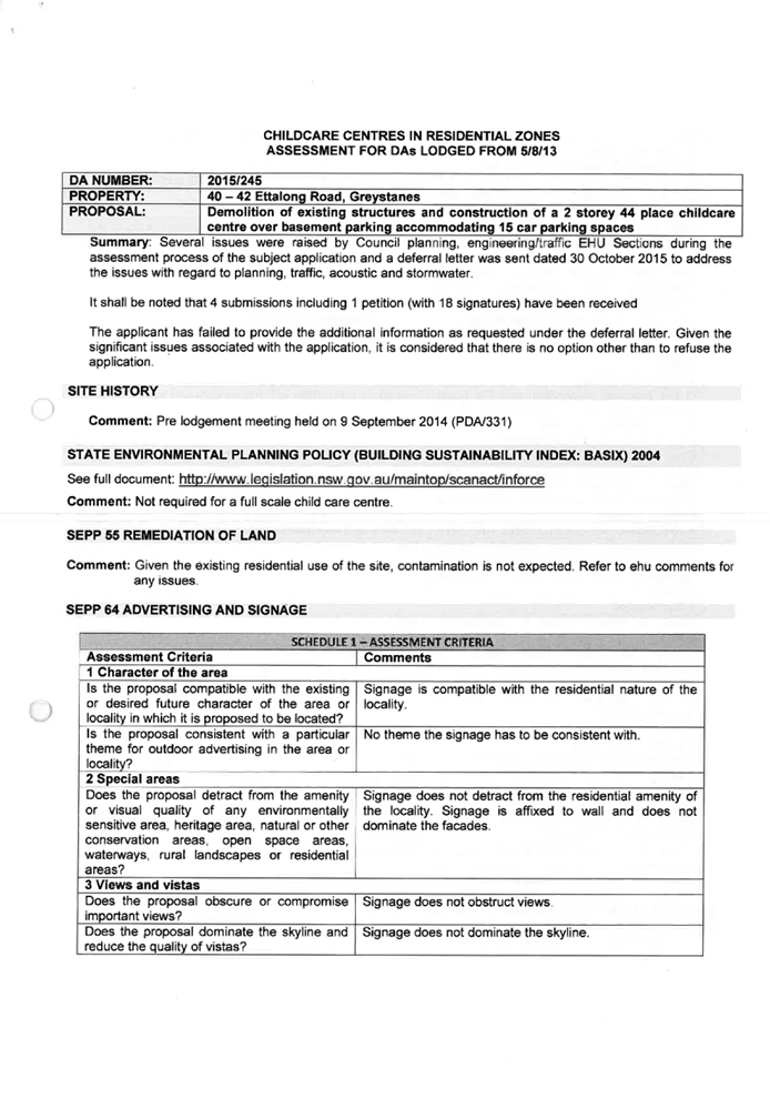
4. Development
Application No. DA2015/245/1 was previously refused by the Council for the
subject site on 4 December 2015 for demolition of the existing structures and
construction of a 2 storey 44 place childcare centre accommodating 15 car
parking spaces.
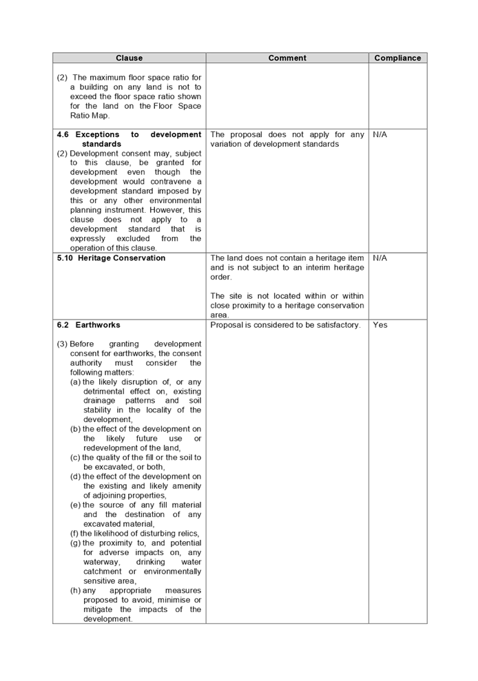
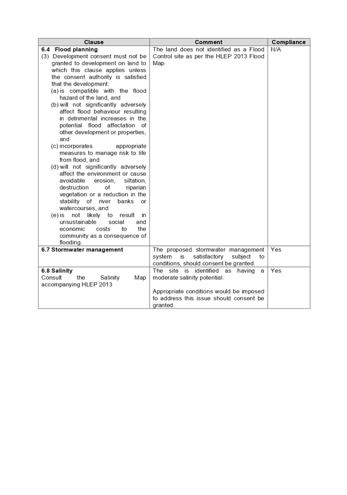
5. The
development as proposed by the applicant involves the following
non-compliances:
|
Control
|
Required
|
Proposed
|
% Variation
|
|
Acoustic fencing height (Holroyd DCP 2013)
|
Max. 2m
|
Max. 2.4m
|
20%
|
|
Car parking (Holroyd DCP 2013)
|
Min. 26 spaces
|
20 spaces
|
23%
|
|
Locality from environmental health hazards facilities (Holroyd DCP
2013)
|
Min. 300m
|
280m
|
6.67%
|
6. The application is
referred to the Cumberland Local Planning Panel as the proposal is considered
to be contentious development.
7. The
application is recommended for approval subject to the conditions as provided
in the attached schedule.
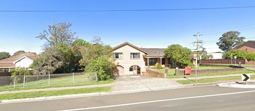
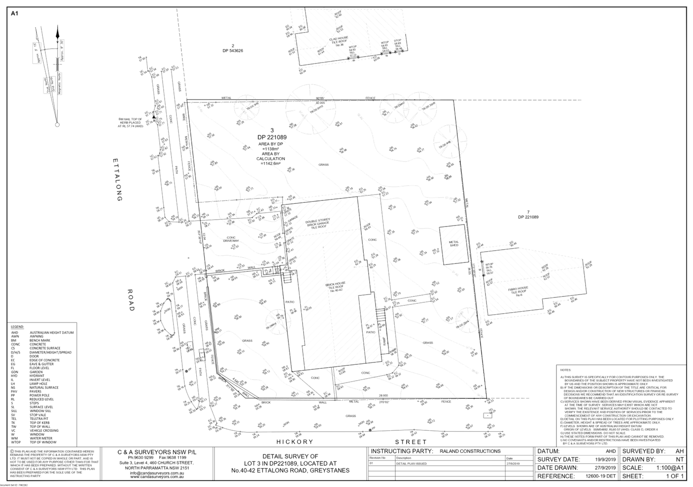
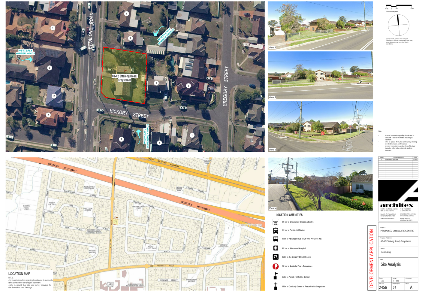
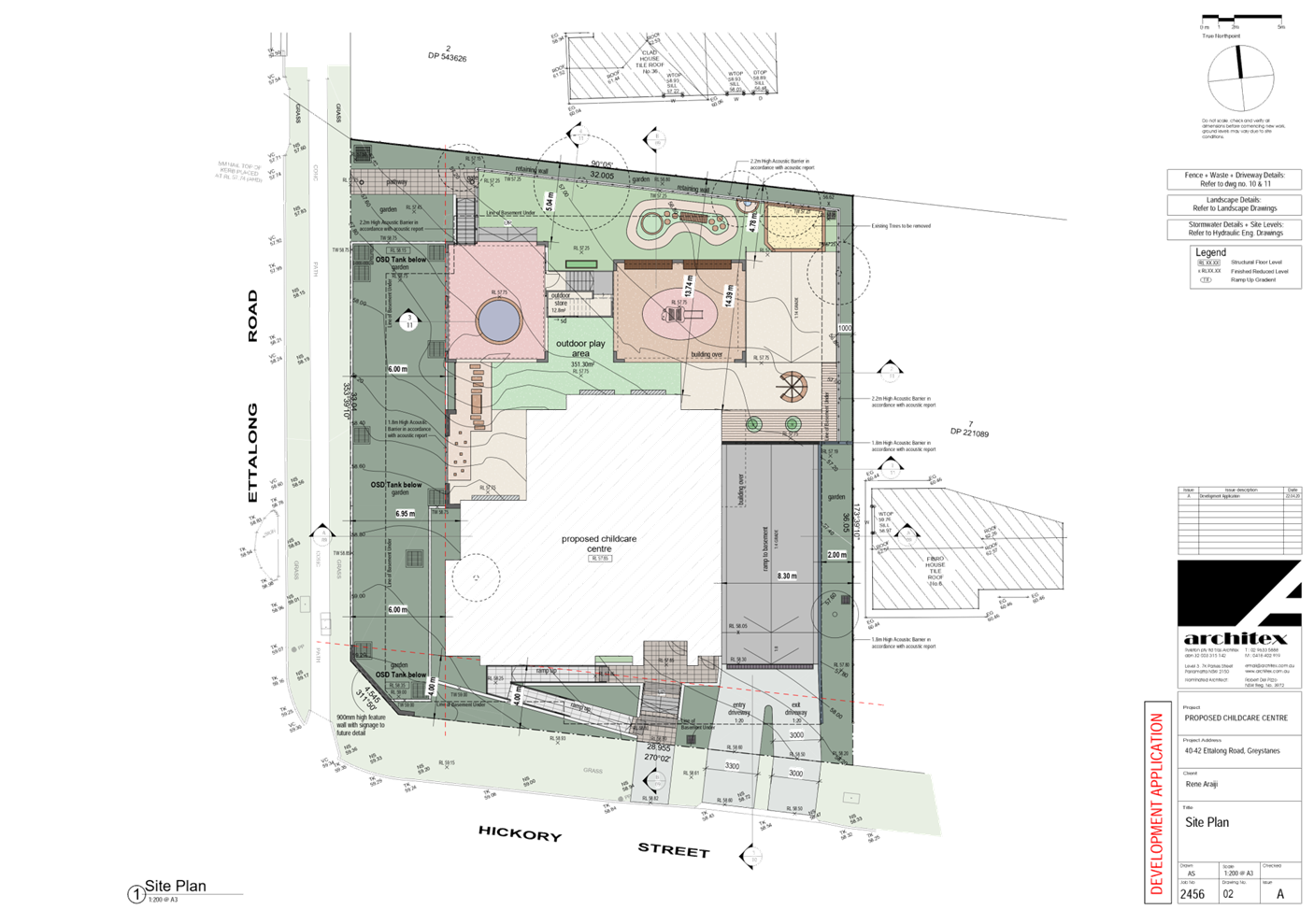
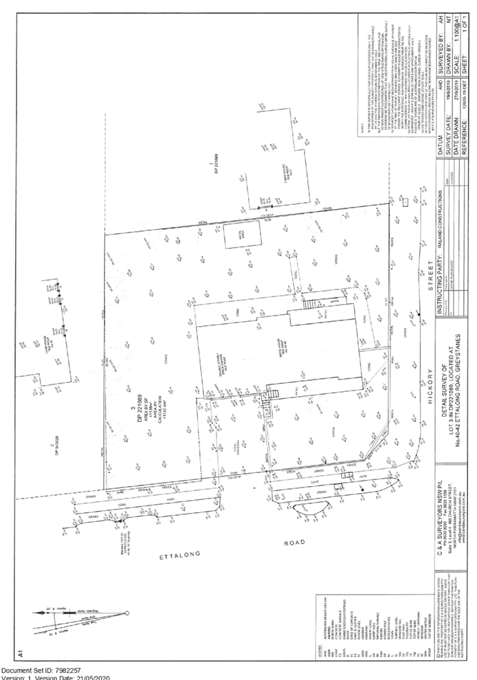
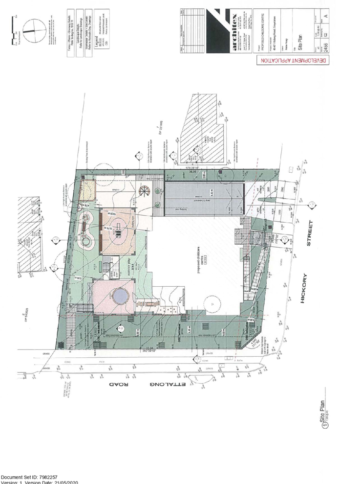
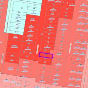
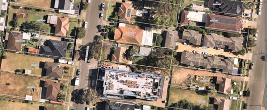
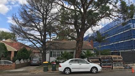
i)
Subject Site and Surrounding
Area
The subject site is Lot 3 in DP
221089, known as 40-42 Ettalong Road, Greystanes. The site has an area of
1,138m2 with a primary street frontage to Ettalong Road of 33.04m and a
secondary street frontage to Hickory Street of 28.955m excluding the splay
corner. It has a fall of approximately 2.63m from the front south-western splay
corner to the rear north-eastern corner of the site. The existing improvements
on site include a 1-2 storey dwelling house with detached outbuildings at the
rear of the site. Vehicular access to the site is currently provided from
Ettalong Road.
The site inspection confirmed no
trees have been identified within Council’s nature strip for the entire
street frontages. The existing developments adjoining the site consist of
single and two storey residential dwellings and the subject allotment is zoned
R2 – Low Density Residential under the Holroyd Local Environmental Plan
2013.
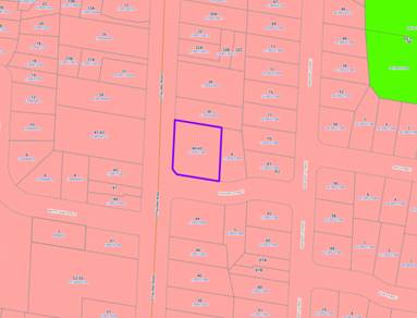
Figure
1 – Locality Plan of subject site from MapInfo
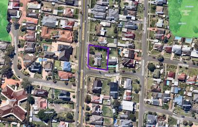
Figure
2 – Aerial view of subject site from Nearmap
Figure
3 – Street view of subject site from Ettalong Road frontage
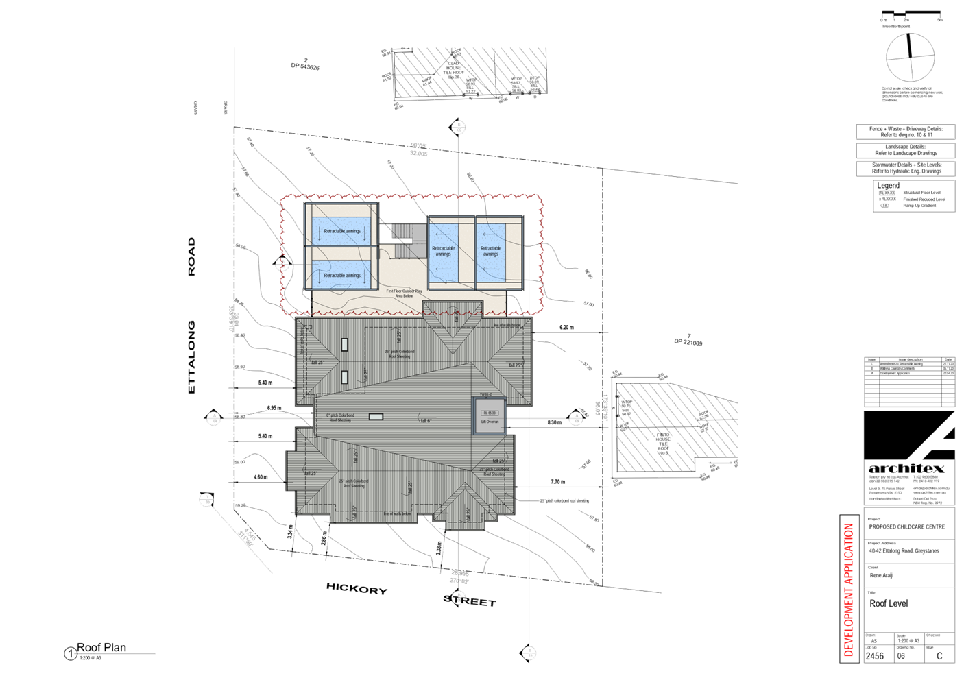
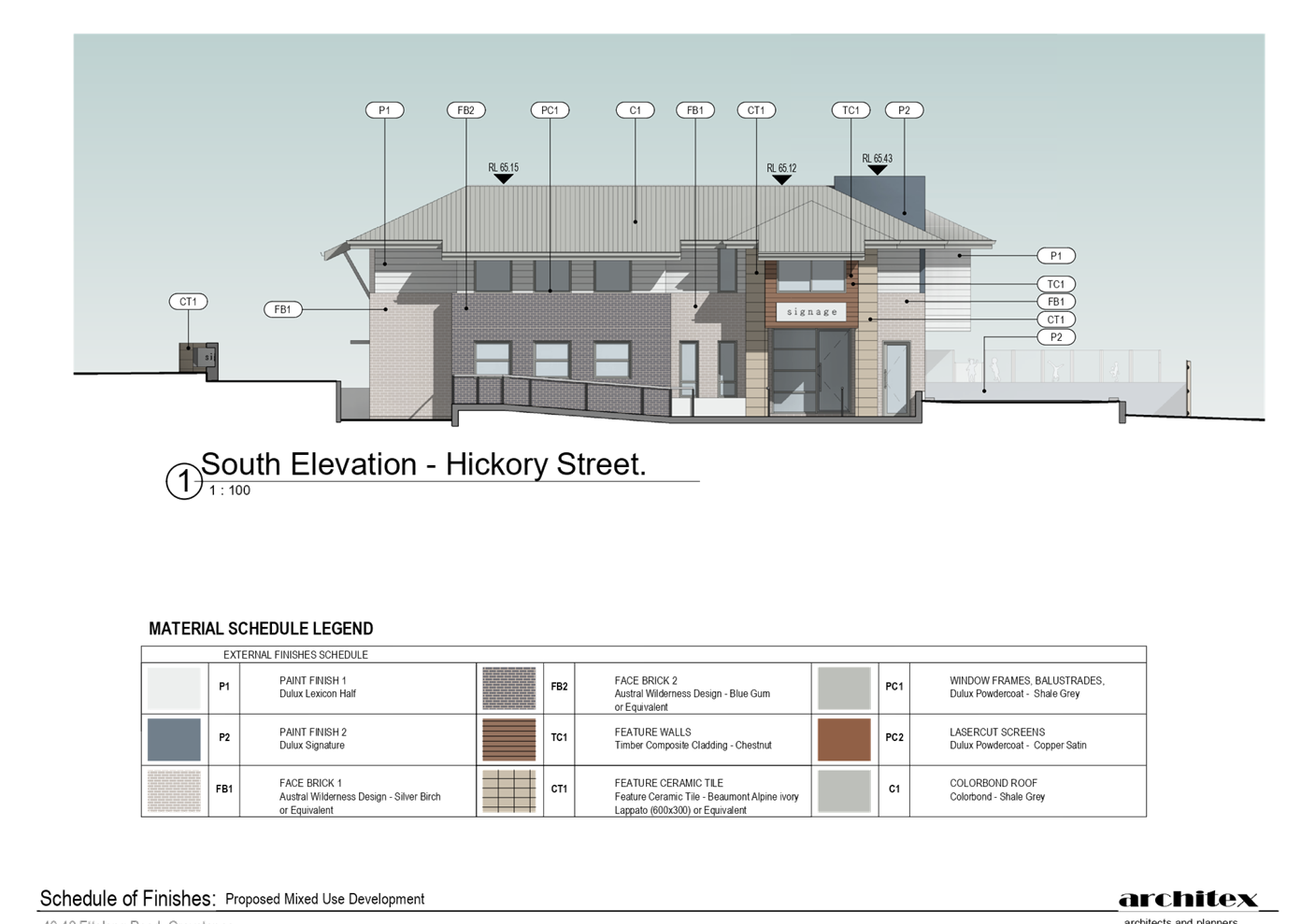
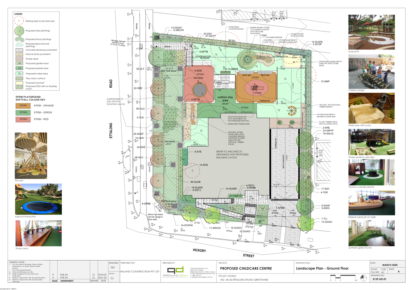
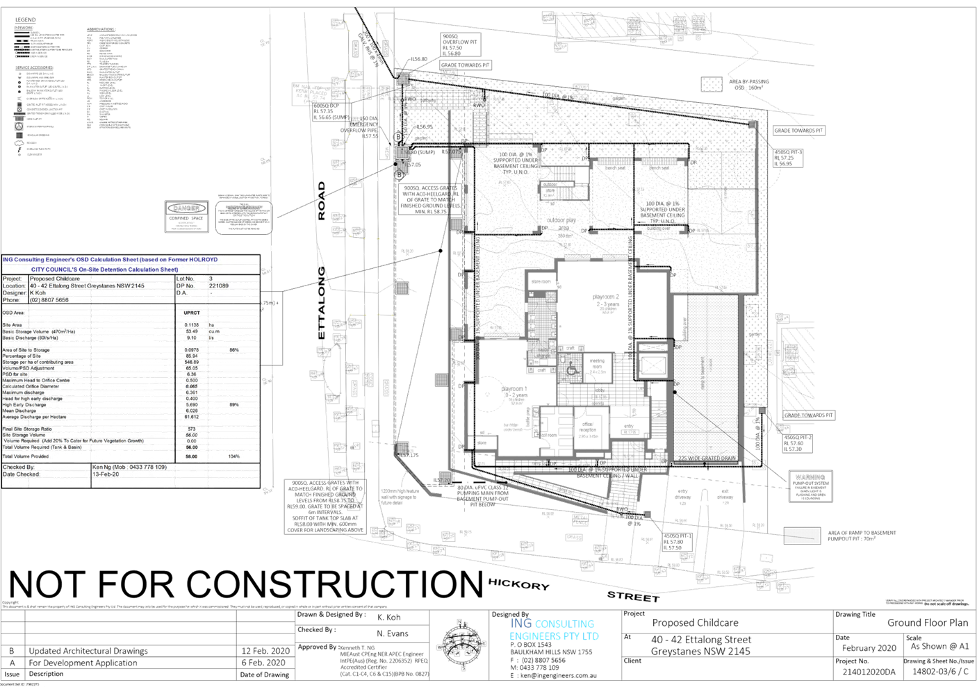
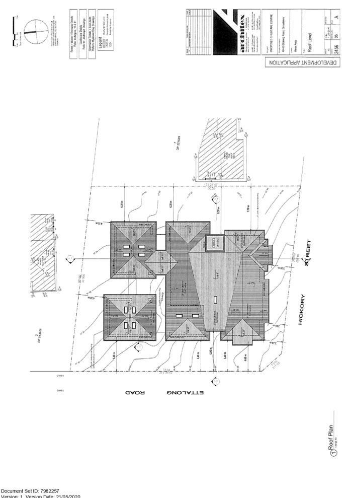
Description of the Proposed
Development
Council has received a development
application for demolition of existing structures and construction of a two
storey centre-based childcare centre for 76 children over basement car parking
accommodating 20 parking spaces. Specific details as provided within the
Statement of Environmental Effects are provided below:
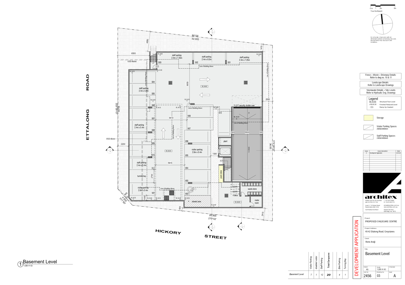
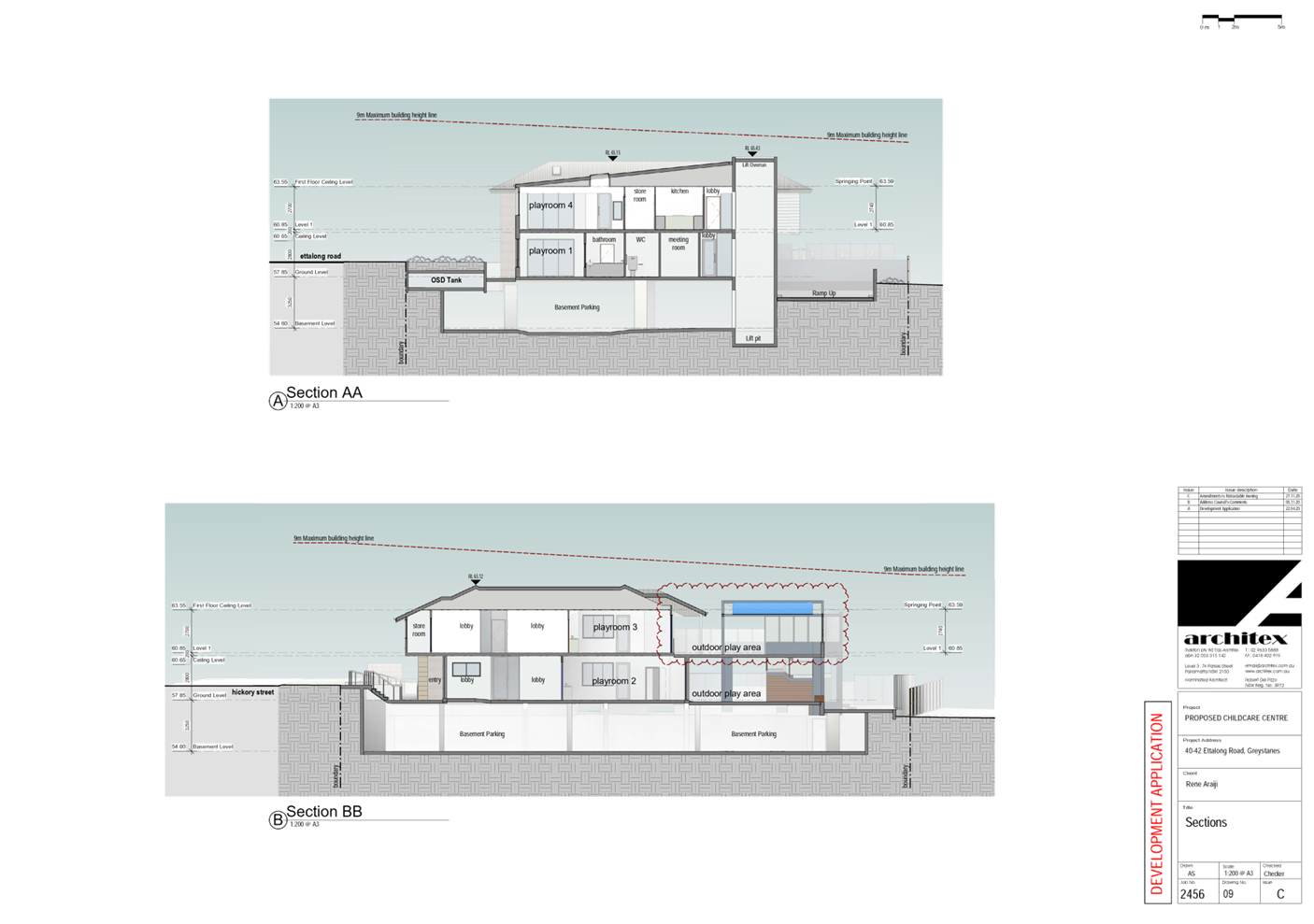
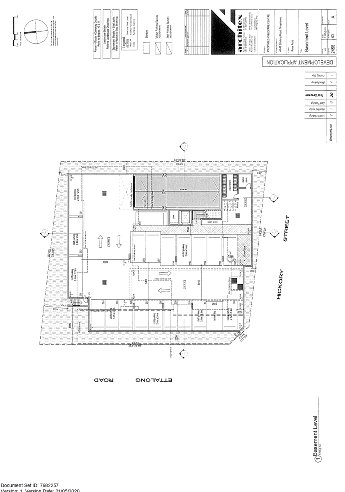
Basement Level:
· A
total of 20 car parking spaces (inclusive of one accessible space);
· Stairs
and lift access to upper levels; and
· Garbage
bin storage room.
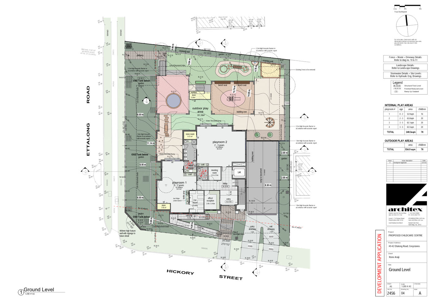
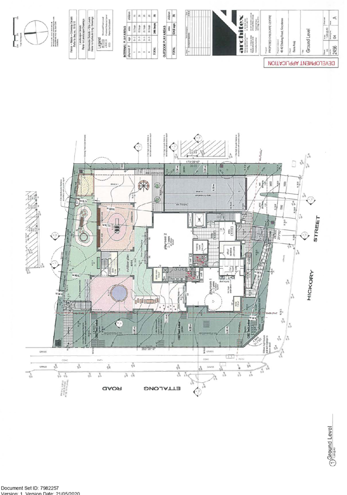
Ground Floor Level:
· Pedestrian
access ramp and stairs located forward of the building line off Hickory Street
frontage;
· Entry
foyer, meeting room, office/reception area to the middle of the building facing
Hickory Street frontage;
· Stairs
and lift access to the basement car park and first floor;
· Ambulant
bathroom;
· Playroom
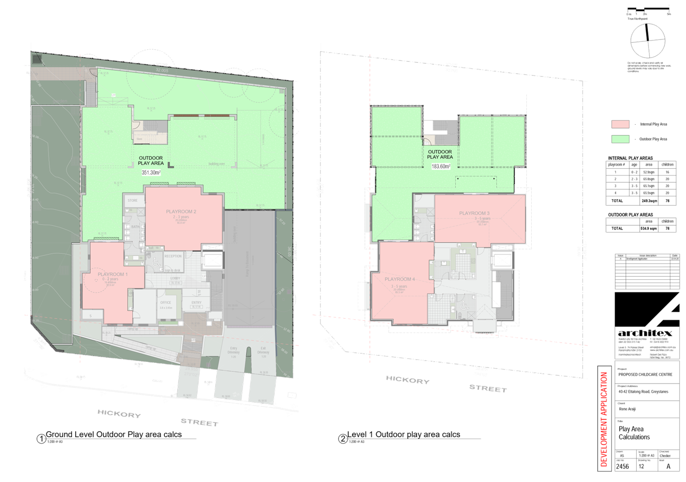
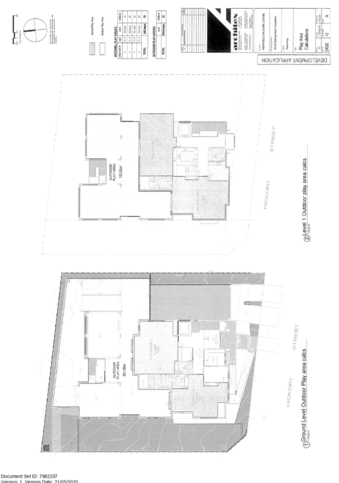
1 (0-2-year-old) for 16 children with the indoor play area of 52.9m2 and
associated cot room, nappy change area and store room;
· Playroom
2 (2-3 year old) for 20 children with the indoor play area of 65.8m2 and
associated store room and children bathroom;
· An
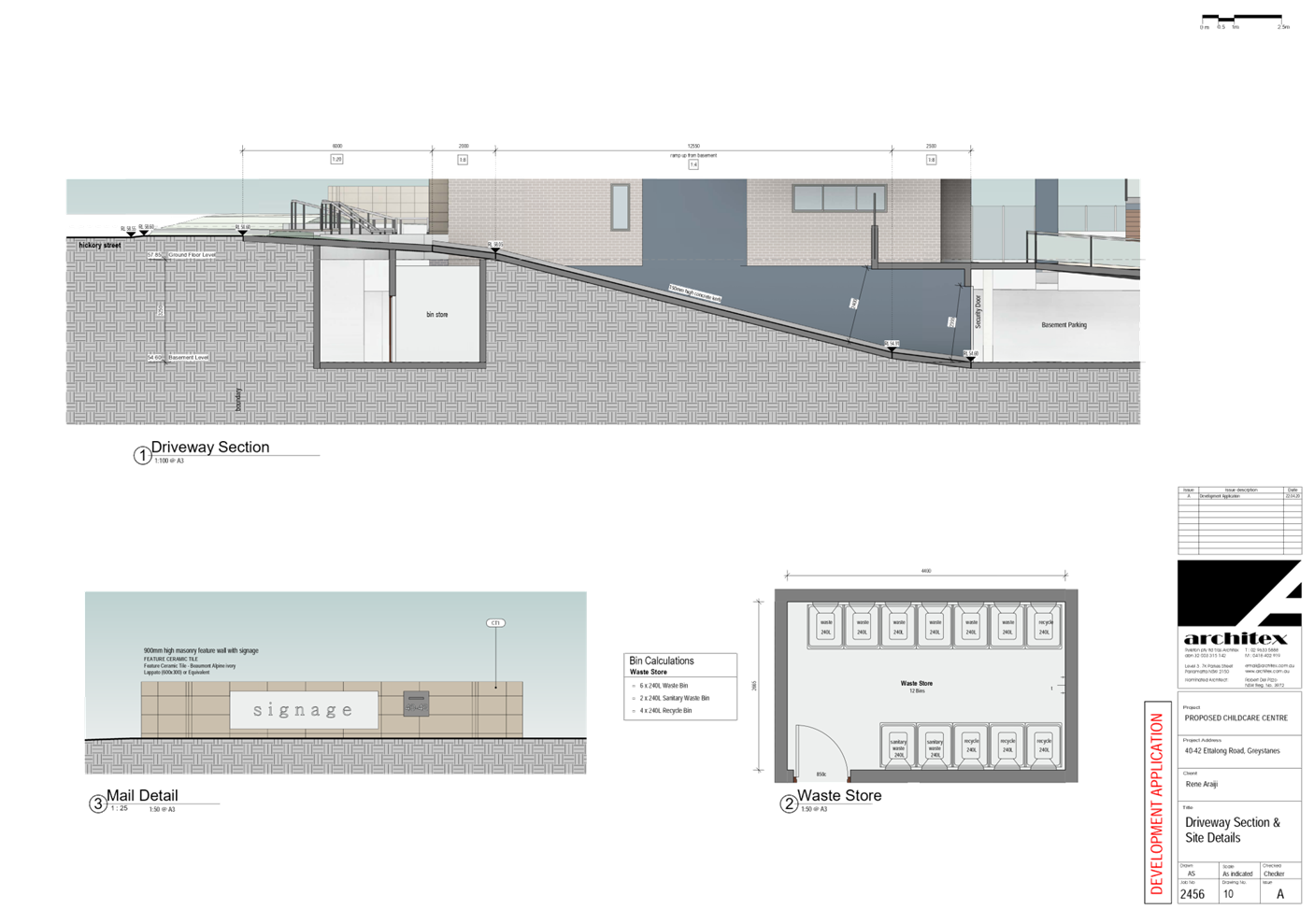
outdoor play area attached to the northern side of the building facing Ettalong
Road frontage of 351.3m2;
· Dual
vehicular access and new crossover at Hickory Street frontage to access the
basement car park;
· Outdoor
storage area of 12.8m3 in size;
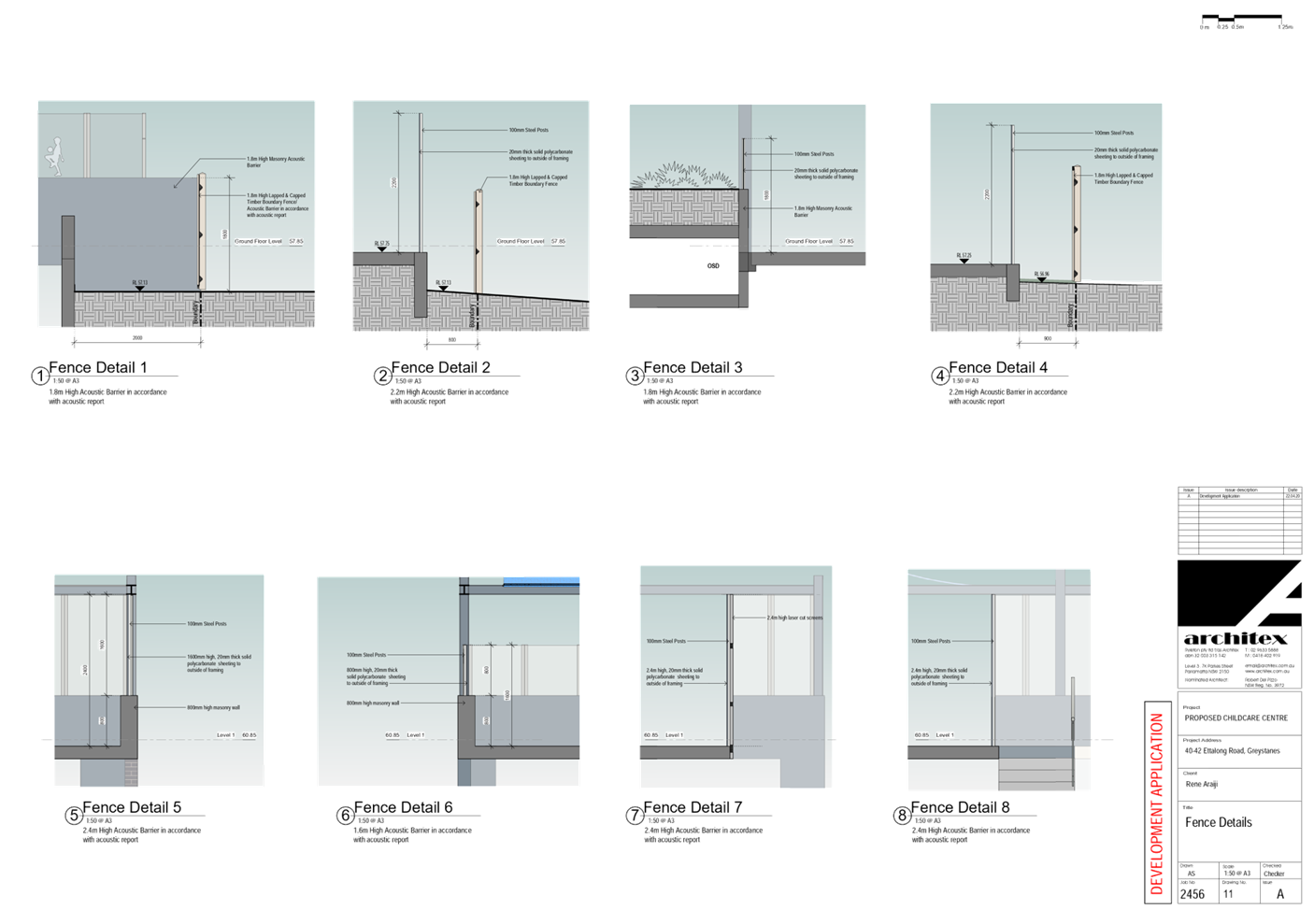
· 1.8m
- 2.2m high acoustic barrier around the outdoor play area;
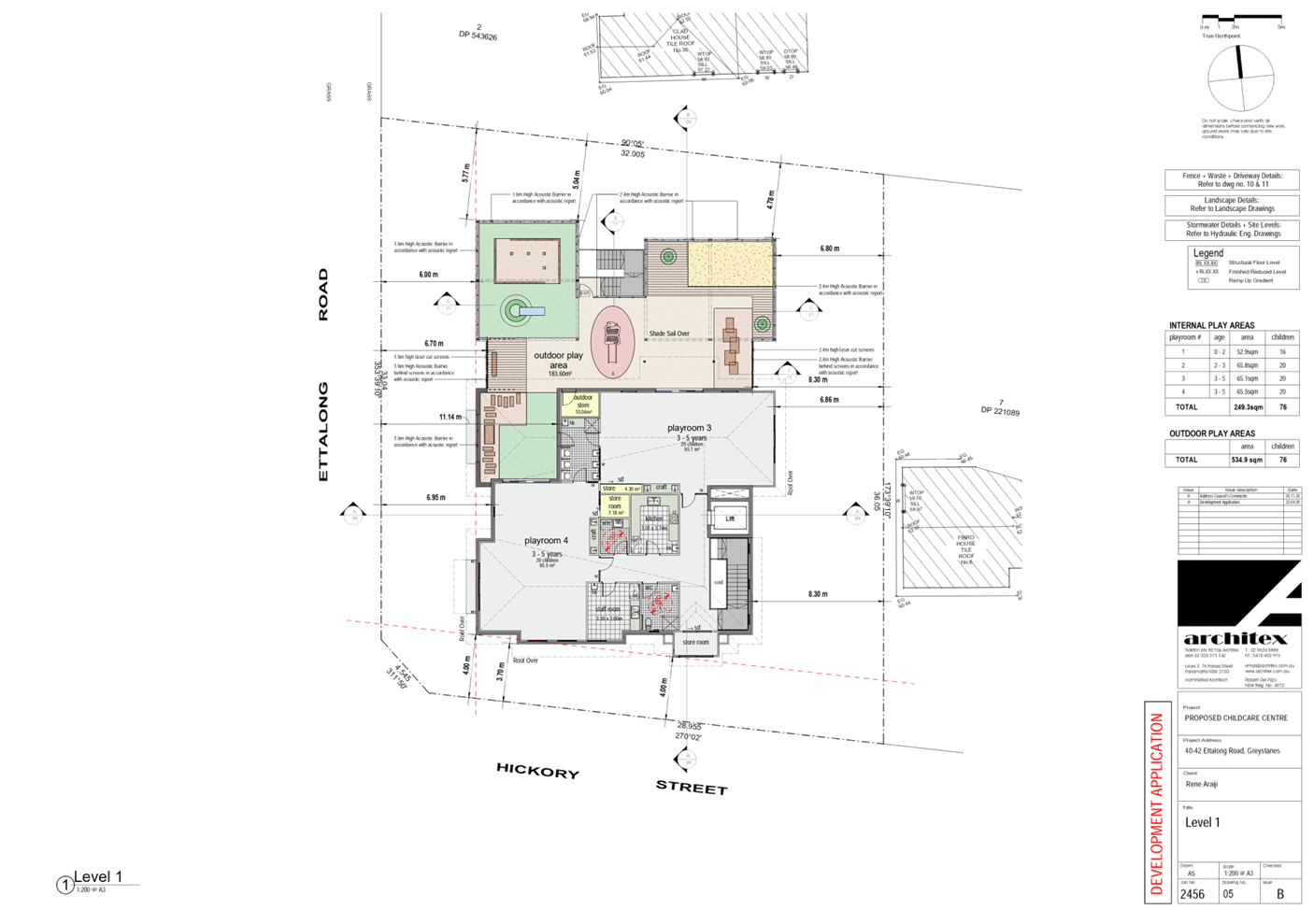
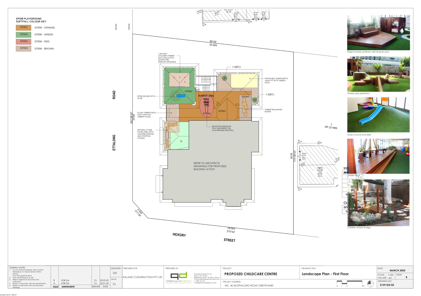
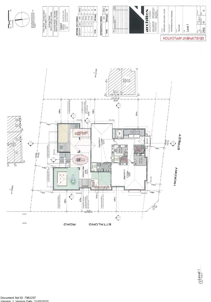
First Floor Level:
· Kitchen
/ Food preparation area;
· Staff
room;
· Stairs
and lift access to lower levels;
· Ambulant
bathroom;
· Laundry
area;
· Playroom
3 (3-5 year old) for 20 children with the indoor play area of 65.1m2 and
associated storage cupboard and children bathroom to share with Playroom 4;
· Playroom
4 (3-5 year old) for 20 children with the indoor play area of 65.5m2 and
associated store room;
· An
outdoor play area attached to the northern side of the building facing Ettalong
Road frontage of 183.6m2;
· 1.6m
- 2.4m high acoustic barrier around the outdoor play area;
· Outdoor
storage area of 10.04m3 in size;
· Alternative
stairs to access the ground floor play area;
Others
· The
proposed centre will operate from 7.00am to 7.00pm Monday to Friday excluding
public holidays and will employ 13 staff;
· A
900mm high feature wall located at the splay corner within the subject site;
· One
(1) business identification sign is proposed attached to the wall of the
childcare centre facing Hickory Street with the dimensions of 2200mm x 600mm;
· One
(1) business identification sign is proposed attached to the feature wall at
the splay corner within the subject site facing the junction of Ettalong Road
and Hickory Street with the dimensions of 2400mm x 600mm.
History
A pre-lodgement meeting with
Council was held 9 September 2014 (PDA/331) for construction of a part 1 part 2
storey centre-based childcare centre for 45 children with 16 car parking spaces
with associated signage. The meeting minutes concluded that the subject site is
considered unsuitable for the establishment of a childcare centre due to the
location of a service station within 300m distance of the subject site.
Development application
(DA2015/245/1) was refused by Council under staff delegation on 4 December 2015
for demolition of existing structures and construction of a 2 storey childcare
centre for 44 children with 15 car parking spaces.
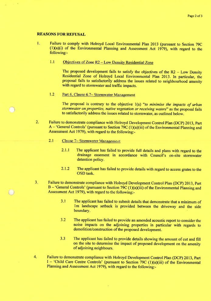
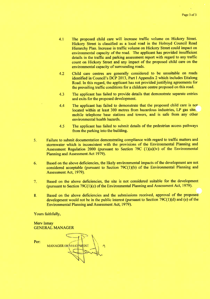
The primary reasons for refusal
comprised:
· Stormwater
issues in relation to the provision of OSD;
· Traffic
issues including access to the site, car parking and pedestrian access;
· Deficient
landscaping provisions;
· Inadequate
Acoustic Report;
· Inadequate
information in relation to cut and fill.
Planner’s Comment:
Although the subject site is
located within 280m of a service station, It is considered that the location of
the service station on the opposite side of Ettalong Road on the corner of
Ettalong and Old Prospect Road with a buffer of over 15 residential allotments,
is sufficiently removed from the childcare centre to pose any appreciable
environmental, health or safety risk to the proposed childcare centre.”
Applicants Supporting
Statement
The applicant has provided a Statement
of Environmental Effects prepared by Think Planners Pty Ltd dated 2 April 2020
and was received by Council on 21 May 2020 in support of the application.
Contact with Relevant
Parties
The assessing officer has
undertaken a site inspection of the subject site and surrounding properties and
has been in regular contact with the applicant throughout the assessment
process.
In view of the foregoing analysis
it is considered that the development, if carried out subject to the conditions
set out, will have no significant adverse impacts on the public interest.
Internal Referrals
Development Engineer
The development application was
referred to Council’s Development Engineer for comment who has advised
that the development proposal is satisfactory with regards to stormwater
disposal and traffic and car parking and therefore can be supported subject to
recommended conditions of consent.
Children Service
The development application was
referred to Council’s Children Services for comment who raised concerns
in relation to insufficient outdoor play area on the upper level to service the
number of children on the first floor level. The review of the proposal
confirmed that the overall outdoor play area within the premises complies with
the Educational SEPP 2017 and Child Care Planning Guideline. As such, a
condition in the consent will be imposed so that the plan of management shall
be amended so that the outdoor play area on the first floor level will have a
maximum of 20 children at any one time as recommended in the Acoustic Report.
Environment Health
The development application was
referred to Council’s Environment and Health Officer for comment who has
advised that the development proposal is satisfactory in relation to the
acoustic impacts and site contamination and the development application can be
supported subject to recommended conditions of consent.
Waste Management
The development application was
referred to Council’s Waste Management Officer for comment who has
advised that the bin transfer path exceeds a slope of 1:8 and that an alternate
bin transfer path or a bin tug should be proposed. In this regard, a condition
of consent has been recommended requiring the provision of a bin tug storage
area.
Tree Management Officer
The development application was
referred to Council’s Tree Management Officer for comment who has advised
that the development proposal is satisfactory and therefore can be supported
subject to recommended conditions of consent.
External Referrals
Department of Education
The development application was
referred to the Department of Education for comment and concurrence in
accordance with Clause 22(b) of the State Environmental Planning Policy
(Educational Establishments and Child Care Facilities) 2017 and Regulation 108
of the Education and care Services National Regulations. Concurrence was
received on 17 December 2020 supporting the proposed simulated outdoor play
area subject to recommended conditions of consent.
Endeavour Energy
The development application was
referred to Endeavour Energy for comment who raised no objection to the
development proposal subject to recommended conditions of consent.
PLANNING COMMENTS
State Environmental Planning
Policies
The proposed development is
affected by the following State Environmental Planning Policies:
(a) State
Environmental Planning Policy No. 55 – Remediation of Land (SEPP 55)
Clause 7 of SEPP 55 requires
Council to be satisfied that the site is suitable or can be made suitable to
accommodate the proposed development. The matters listed within Clause 7 have
been considered in the assessment of the development application.
|
Matter for
Consideration
|
Yes/No
|
|
Does the application
involve re-development of the site or a change of land use?
|
Yes No
|
|
In the development
going to be used for a sensitive land use (e.g.: residential, educational, recreational,
childcare or hospital)?
|
Yes No
|
|
Does information
available to you indicate that an activity listed below has ever been
approved, or occurred at the site?
acid/alkali plant and formulation, agricultural/horticultural
activities, airports, asbestos production and disposal, chemicals manufacture
and formulation, defence works, drum re-conditioning works, dry cleaning
establishments, electrical manufacturing (transformers), electroplating and
heat treatment premises, engine works, explosive industry, gas works, iron
and steel works, landfill sites, metal treatment, mining and extractive
industries, oil production and storage, paint formulation and manufacture,
pesticide manufacture and formulation, power stations, railway yards, scrap
yards, service stations, sheep and cattle dips, smelting and refining,
tanning and associated trades, waste storage and treatment, wood preservation
|
Yes No
|
|
Is
the site listed on Council’s Contaminated Land database?
|
Yes No
|
|
Is
the site subject to EPA clean-up order or other EPA restrictions?
|
Yes No
|
|
Has
the site been the subject of known pollution incidents or illegal dumping?
|
Yes No
|
|
Does
the site adjoin any contaminated land/previously contaminated land?
|
Yes No
|
|
Has
the appropriate level of investigation been carried out in respect of
contamination matters for Council to be satisfied that the site is suitable
to accommodate the proposed development or can be made suitable to
accommodate the proposed development?
|
Yes No
|
|
Details of
contamination investigations carried out at the site:
A Preliminary Site
Investigation (PSI) has been prepared by Geotechnical Consultants Australia
on 27 March 2020 (report no. E2038-1), which confirmed the subject site is
considered suitable for the proposed use subject to the following
recommendations:
· Any
soils requiring excavation, on site reuse and/or removal must be classified
in accordance with Waste Classification Guidelines Part 1: Classifying Waste
NSW EPA (2014);
· All
structures within the site should have a Hazardous Materials Survey (HMS)
conducted by a qualified occupational hygienist and/or environmental
consultant for the site prior to any demolition or renovation works in
accordance with relevant Australian Standards, SafeWork NSW codes of practice
and any other applicable requirements;
· The
demolition of any structures and excavation activity on site be undertaken in
accordance with relevant Australian Standards, SafeWork NSW codes of practice
and any other applicable requirements; and
· A
site specific 'Unexpected Finds Protocol' is to be made available for
reference for all occupants and/or site workers in the event unanticipated
contamination is discovered, including asbestos.
Council’s
Environmental Health Unit has reviewed the reports who raised no concern
regarding the PSI. therefore, the recommendations identified in the PSI will
form part of the condition of the consent should the application be supported
by Council.
|
(b) Statement
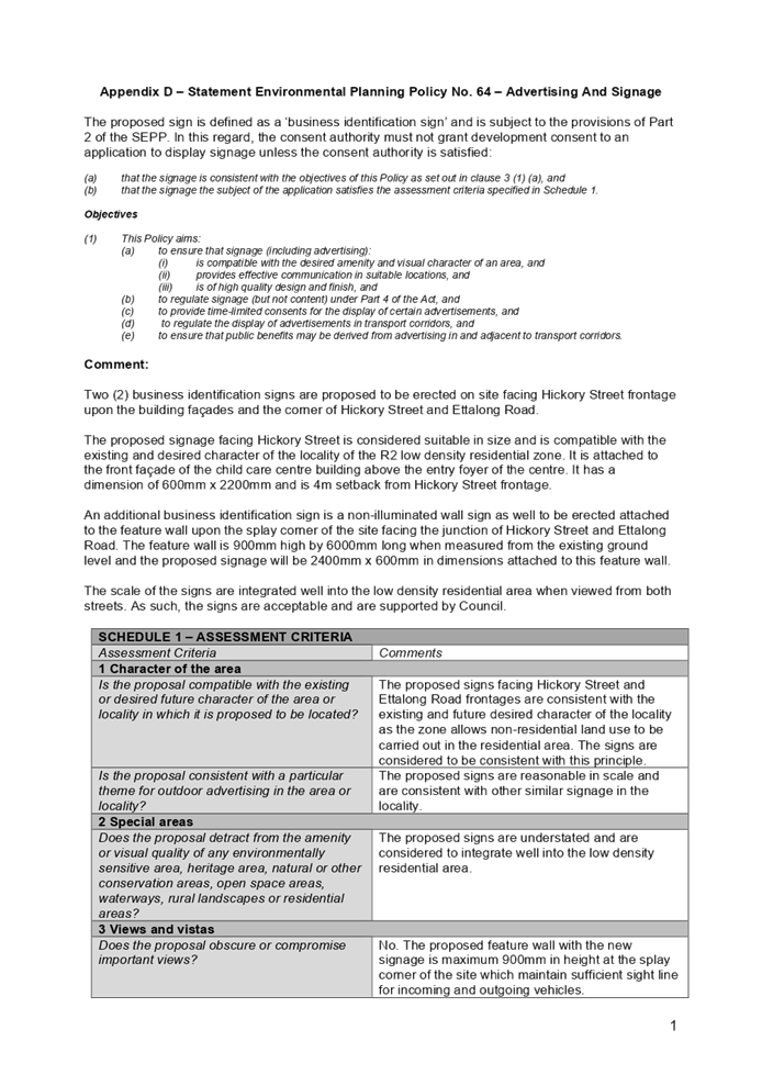
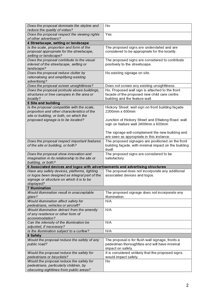
Environmental Planning Policy No. 64 – Advertising and Signage (SEPP 64)
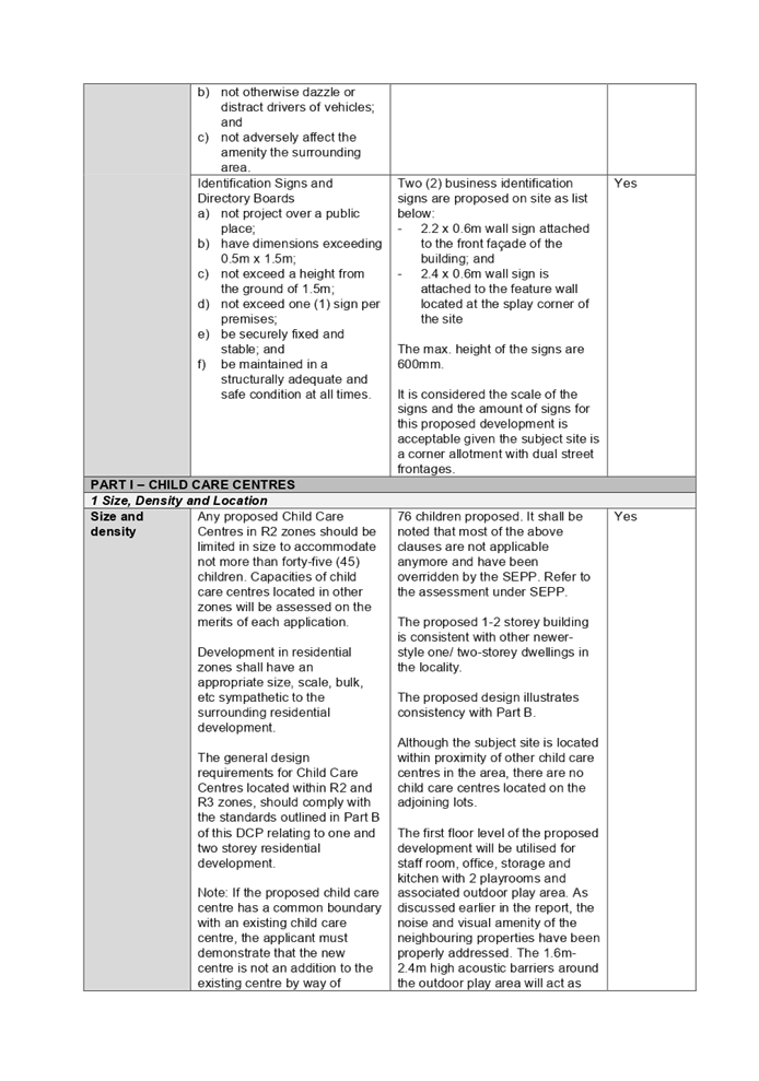
The proposed signage is considered
to be defined as a ‘business identification sign’ and is subject to
the provisions of Part 2 of SEPP 64. Two (2) business identification signs are
proposed to be erected on the site, facing Hickory Street frontage, on the
building façades and the corner of Hickory Street and Ettalong Road.
The signs are integrated well into
the R2 low density residential area when viewed from both streets and are
compatible with the existing and desired character of the locality. As such,
the signs are acceptable and are supported by Council.
A comprehensive assessment of the
development proposal against the SEPP 64 has been considered and discussed at
Appendix D to this report respectively.
(c) State
Environmental Planning Policy (Infrastructure) 2007 (ISEPP)
The relevant provisions of the
ISEPP 2007 has been considered in the assessment of the development application
as listed below: -
Clause 45 - Development likely to
affect an electricity transmission or distribution network
The subject development is located
within 5 metres of an overhead electricity power line. The application was
referred to Endeavour Energy for comment who confirmed on 10 June 2020 that
Endeavour Energy raised no objection to the development proposal subject to the
imposition of conditions of the consent.
(d) State
Environmental Planning Policy (Educational Establishments and Child Care
Facilities) 2017 (Educational SEPP)
Integral to Education SEPP 2017 is
the Child Care Planning Guideline (CCPG), which sets benchmarks for the
appearance and acceptable impacts of the centre-based childcare facility within
the existing locality.
The provisions and design quality
principles of the Educational SEPP 2017 and CCPG have been considered in the
assessment of the application. A comprehensive assessment of the development
proposal against the Education SEPP 2017 and CCPG requirements has been
considered at Appendix B and Appendix C to this report respectively.
|
Control
|
Required
|
Provided
|
|
State
Environmental Planning Policy (Educational Establishments and Child Care
Facilities) 2017
|
|
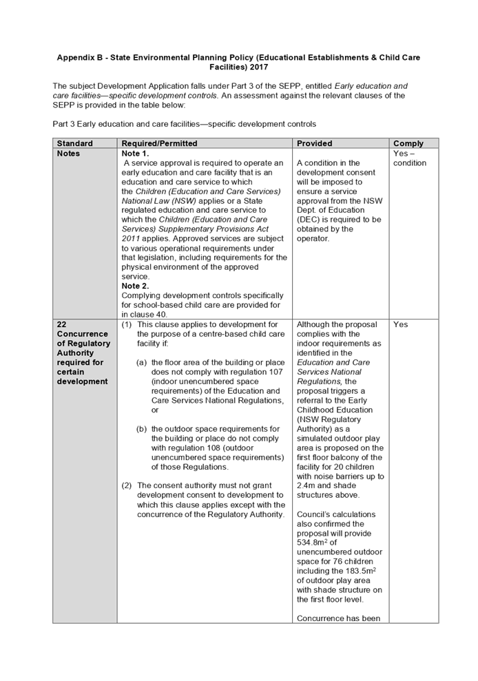
22
Concurrence of Regulatory Authority required for certain
development
|
(1) This clause applies to development
for the purpose of a centre-based childcare facility if:
(a) the floor area of the building or place
does not comply with regulation 107 of the Education and Care Services National
Regulations, or
(b) the
outdoor space requirements for the building or place do not comply with
regulation 108 of those Regulations.
The consent authority must not grant development consent to
development to which this clause applies except with the concurrence of the
Regulatory Authority.
|
Although the proposal complies with the indoor
requirements as identified in the Education and Care Services National
Regulations, the proposal triggers a referral to the Early Childhood
Education (NSW Regulatory Authority) as a simulated outdoor play area is
proposed on the first floor balcony of the facility for 20 children with
noise barriers up to 2.4m and shade structures above.
Council’s calculations
also confirmed the proposal will provide 534.8m2 of unencumbered
outdoor space for 76 children including the 183.5m2 of outdoor
play area with shade structure on the first floor level.
Concurrence has been received
from the Department of Education confirming the proposal can be supported
given the proposed simulated outdoor play area will provide sufficient access
to sunlight, ventilation and natural features.
|
|
Child Care Planning Guideline
|
|
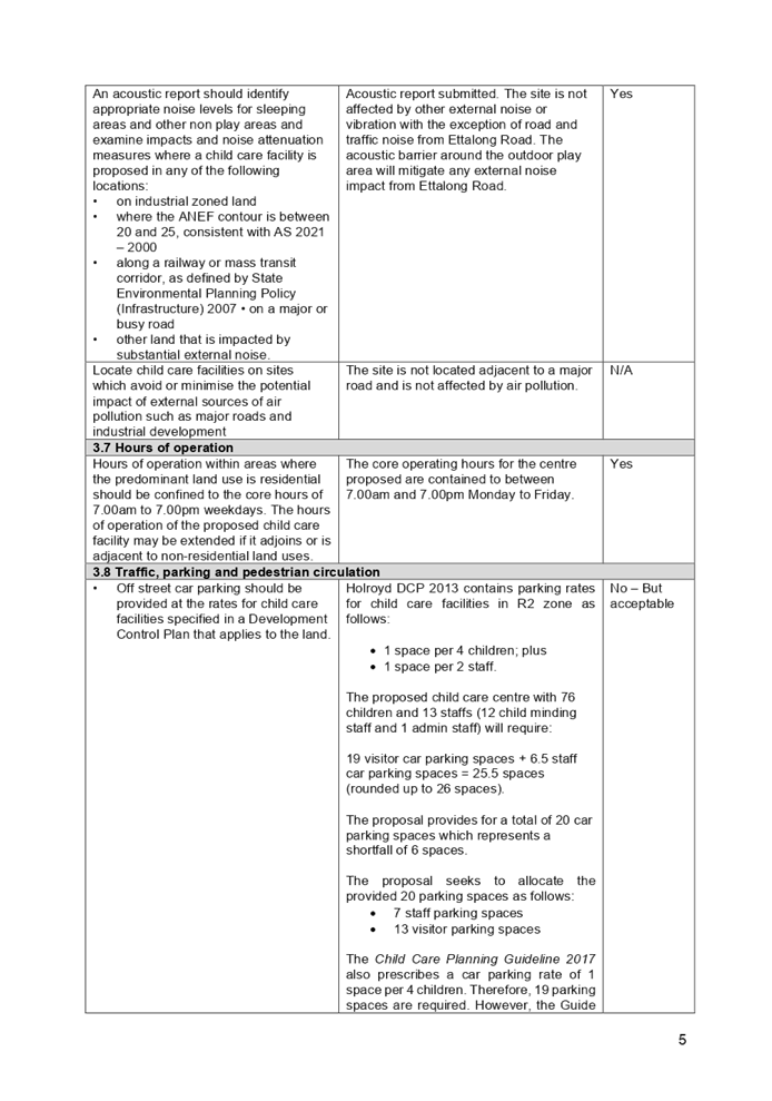
3.8 Traffic, parking and pedestrian circulation
|
Off street car parking should be provided at the rates for
childcare facilities specified in a Development Control Plan that applies to
the land.
Where a Development Control Plan does not specify car
parking rates, off street parking should be provided at the rate of:
· 1 space per 4
children
|
Holroyd DCP 2013 contains parking rates for childcare
facilities in R2 zone as follows:
· 1 space per 4 children; plus
· 1 space per 2 staff.
The proposed childcare centre with 76 children and 13
staffs (12 child minding staff and 1 admin staff) will require:
19 visitor car parking spaces + 6.5 staff car parking
spaces = 25.5 spaces (rounded up to 26 spaces).
The proposal provides for a total of 20 car parking spaces
which represents a shortfall of 6 spaces.
The proposal seeks to allocate the provided 20 parking
spaces as follows:
· 7 staff parking
spaces
· 13 visitor
parking spaces
The Child Care Planning Guideline 2017 also
prescribes a car parking rate of 1 space per 4 children. Therefore, 19
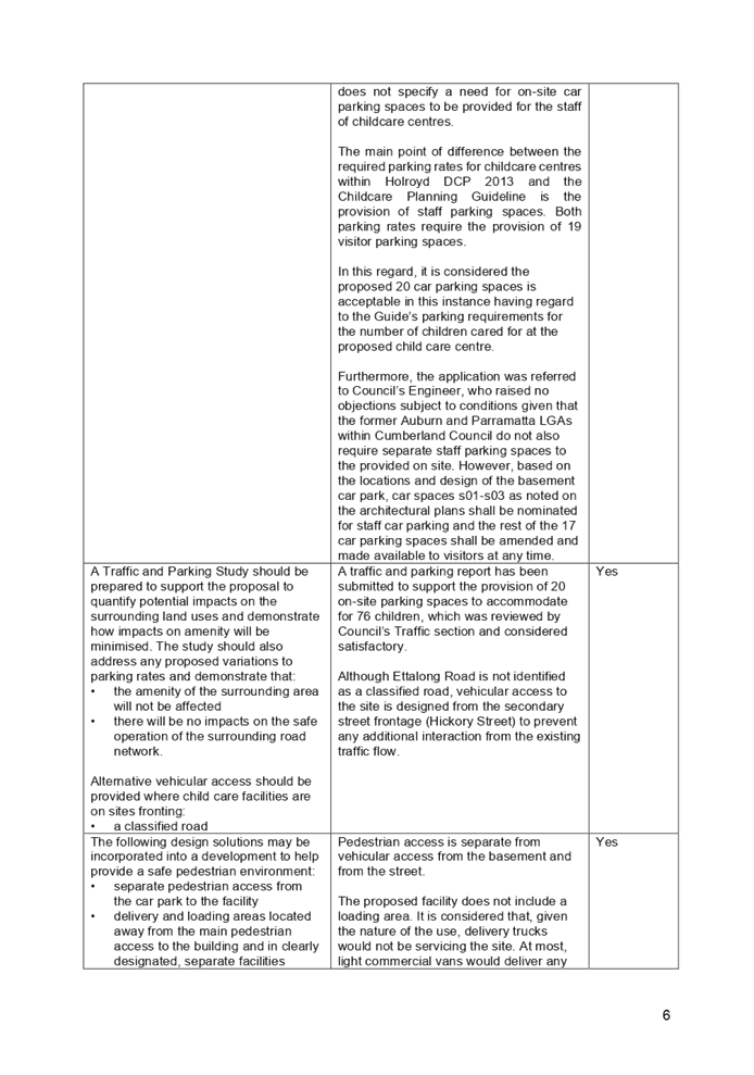
parking spaces are required. However, the Guide does not specify a need for
on-site car parking spaces to be provided for the staff of childcare centres.
The main point of difference between the required parking
rates for childcare centres within Holroyd DCP 2013 and the Childcare
Planning Guideline is the provision of staff parking spaces. Both parking
rates require the provision of 19 visitor parking spaces.
In this regard, it is
considered the proposed 20 car parking spaces is acceptable in this instance
having regard to the Guide’s parking requirements for the number of
children cared for at the proposed childcare centre.
Furthermore, the application
was referred to Council’s Engineer, who raised no objections subject to
conditions given that the former Auburn and Parramatta LGAs within Cumberland
Council do not also require separate staff parking spaces to the provided on
site. However, based on the locations and design of the basement car park,
car spaces s01-s03 as noted on the architectural plans shall be nominated for
staff car parking and the rest of the 17 car parking spaces shall be amended
and made available to visitors at any time.
|
|
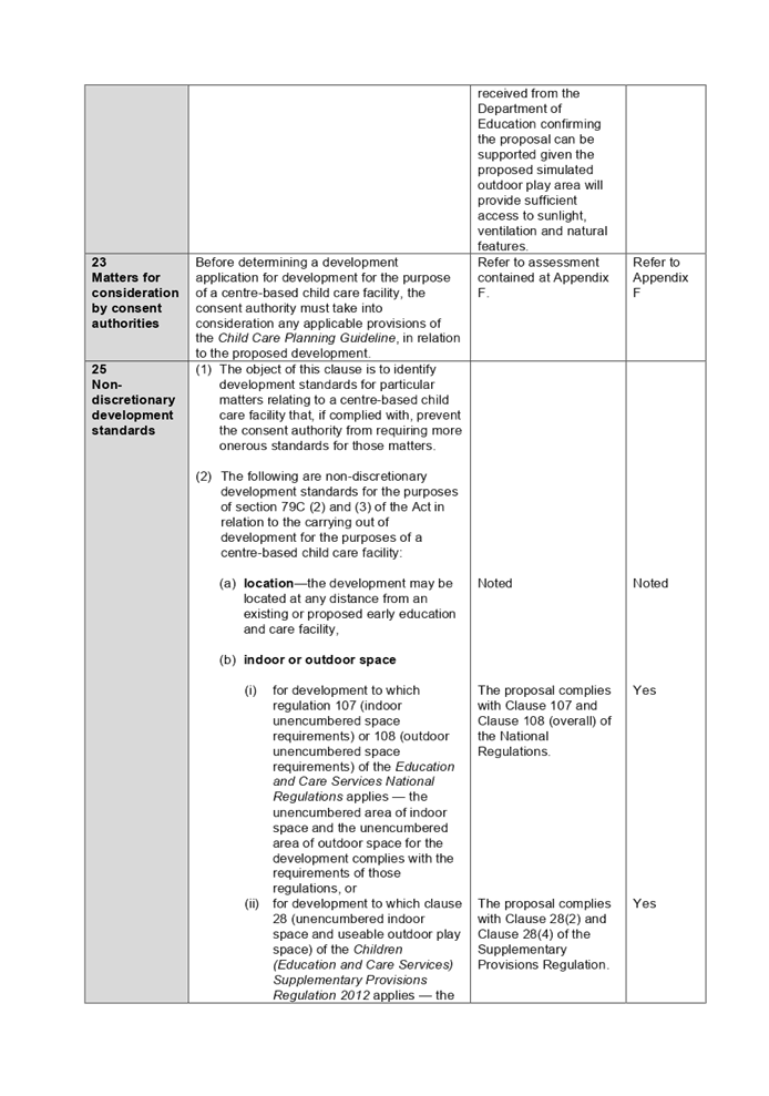
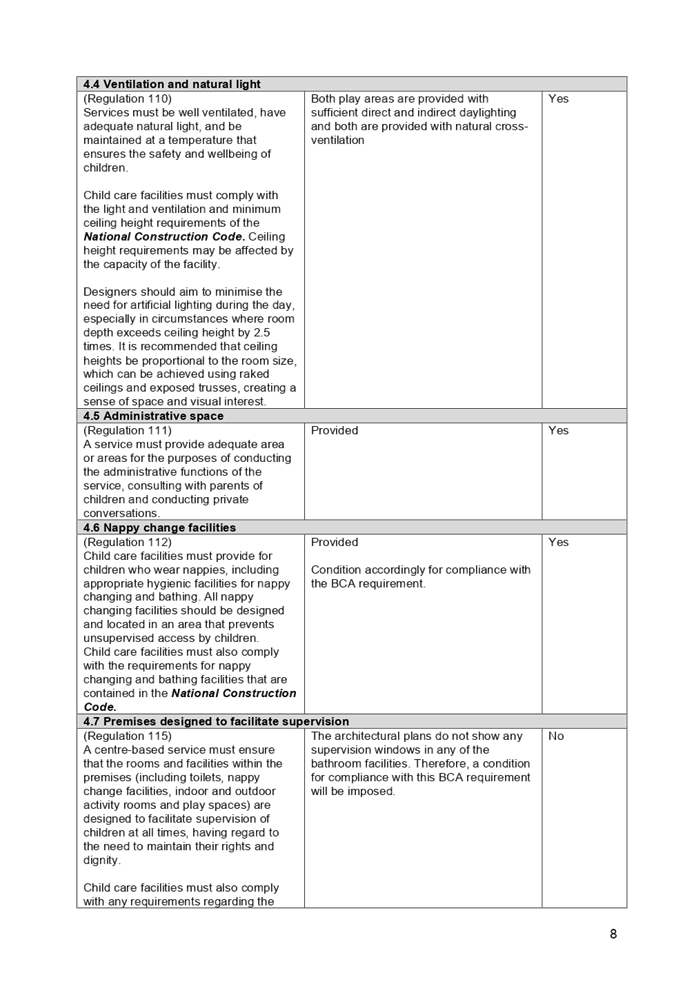
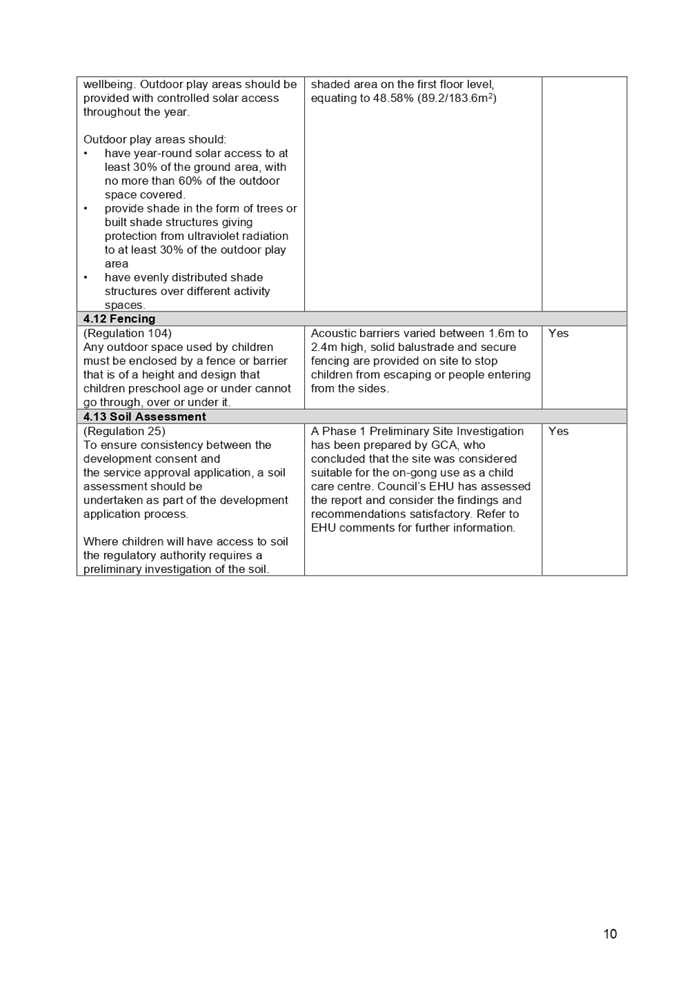
4.9 Outdoor space requirements
|
Min. 7m2 per child
Total 532m2 required.
|
The proposed childcare centre
provides an overall unencumbered outdoor play area of 534.9m2
within the subject site comprising 351.3m2 on the ground floor and
183.6m2 on the first floor.
The proposal provides
sufficient overall unencumbered outdoor play area within the premises.
However, the review of the architectural plans confirmed the outdoor play
area on the first floor level is 183.6m2 only and would not be
sufficient to service all 40 children on first floor level at the same time.
It is advised by
Council’s Children Service Unit that a plan to avoid distraction for
the other group of children can be considered acceptable for the use of this
first floor outdoor play area for a maximum of 20 children.
As such, the plan of
management submitted with the development application will be endorsed and included
in the consent as a condition to ensure the area will service a maximum of 20
children at any one time.
|
(e) Statement
Environmental Planning Policy No 19 - Bushland in Urban Areas (SEPP 19)
Not applicable. The proposal will
not result in disturbance of any bushland.
(f) State
Environmental Planning Policy (Vegetation in Non-Rural Areas) 2017
Complies. The proposal is seeking
consent to remove six (6) trees from the site to accommodate the basement car
park on site to service the proposed new childcare centre. An Arboricultural
Impact Assessment prepare by Redgum Horticultural dated 13 February 2020 (ref.
5671) was submitted as supporting document for the proposed tree removal. It is
confirmed by Council’s Landscape Officer that the proposed tree removal
is acceptable subject to the imposition of conditions in the consent.
(g) State
Environmental Planning Policy (Coastal Management) 2018
Not applicable. The subject site
is not identified as a coastal wetland and/or land identified as
“proximity area for coastal wetlands” and/or land identified as
such by the Coastal Vulnerability Area Map.
(h) State
Environmental Planning Policy (Building Sustainability Index: BASIX) 2004
Not applicable. The proposed
development does not trigger the requirement of a BASIX Certificate.
Regional Environmental Plans
The proposed development is
affected by the following Regional Environmental Plan:
(a) Sydney
Regional Environmental Plan (Sydney Harbour Catchment) 2005
The subject site is identified as
being located within the area affected by the Sydney Regional Environmental
Plan (Sydney Harbour Catchment) 2005. The proposed development raises no issues
as no impact on the catchment is envisaged.
(Note: - the subject site is not
identified in the relevant map as ‘land within the ‘Foreshores and
Waterways Area’ or ‘Wetland Protection zone’, is not a
‘Strategic Foreshore Site’ and does not contain any heritage items.
Hence the majority of this plan is not directly relevant to the proposed
development).
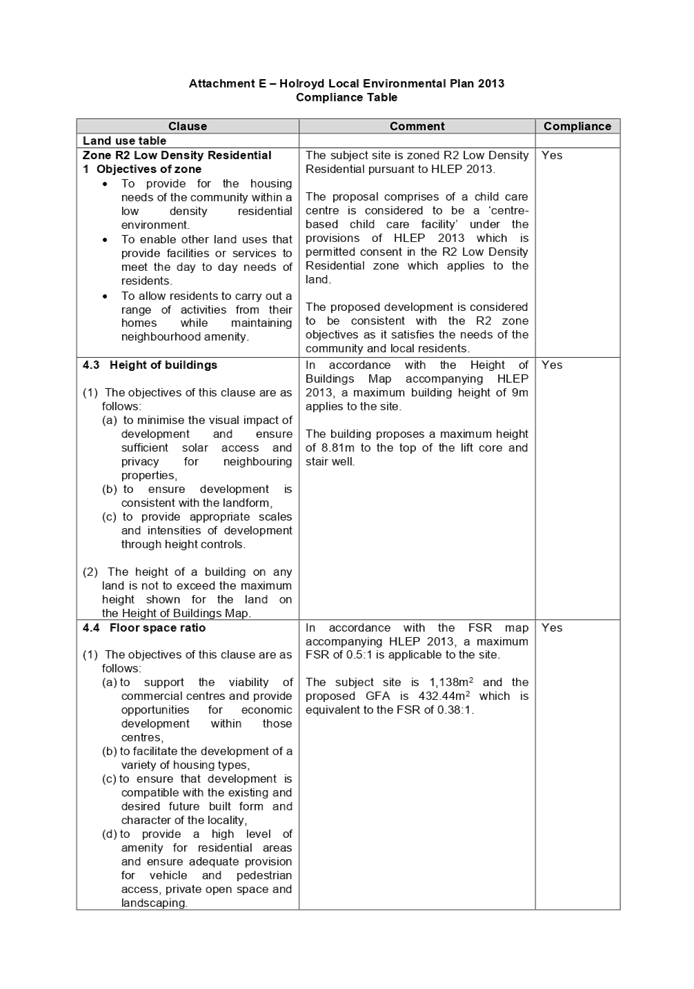
Local Environmental Plans
(a) Holroyd
Local Environmental Plan 2013 (Holroyd LEP)
The provisions of the Holroyd LEP 2013
are applicable to the development proposal. Development for the purpose of a
centre-based childcare centre is permissible with consent in the R2 Low Density
Residential zone.
centre-based childcare facility
means—
(a) a
building or place used for the education and care of children that provides any
one or more of the following—
(i) long
day care,
(ii) (ii) occasional
childcare,
(iii) out-of-school-hours
care (including vacation care),
(iv) preschool
care, or
ii)
(b) an
approved family day care venue (within the meaning of the Children (Education
and Care Services) National Law (NSW)),
Note:
An approved family day care venue
is a place, other than a residence, where an approved family day care service
(within the meaning of the Children (Education and Care Services) National Law
(NSW)) is provided.
but does not include—
(c) a
building or place used for home-based childcare or school-based childcare, or
(d) an
office of a family day care service (within the meanings of the Children
(Education and Care Services) National Law (NSW)), or
(e) a
babysitting, playgroup or child-minding service that is organised informally by
the parents of the children concerned, or
(f) a
child-minding service that is provided in connection with a recreational or
commercial facility (such as a gymnasium) to care for children while the
children’s parents are using the facility, or
(g) a
service that is concerned primarily with providing lessons or coaching in, or
providing for participation in, a cultural, recreational, religious or sporting
activity, or providing private tutoring, or
(h) a
child-minding service that is provided by or in a health services facility, but
only if the service is established, registered or licensed as part of the
institution operating in the facility.
Accordingly, development for the
purpose of a centre-based childcare centre is permissible with consent in the
R2 Low Density Residential zone.
It is noted that the development
achieves compliance with the key statutory requirements of the Holroyd LEP 2013
and the objectives of the R2 Low Density Residential zone. A comprehensive
Holroyd LEP 2013 assessment is contained in Appendix E.
A summary of the major development
standards is listed below:
|
DEVELOPMENT STANDARD
|
COMPLIANCE
|
DISCUSSION
|
|
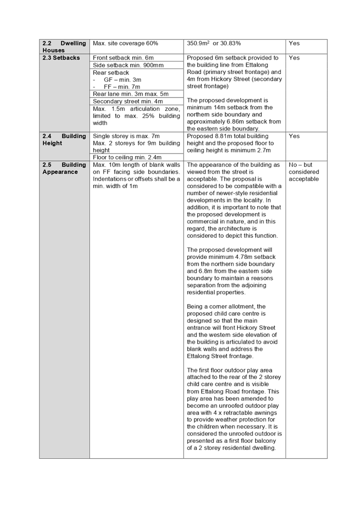
4.3 Height of Buildings
max. 9m
|
Yes
|
The proposed childcare centre is designed to be 8.81m in
height within sits below the maximum allowable height limit. The proposal is
designed to be consistent with the topography of the site and the height of
the development is similar to other 2 storey residential development within
the R2 Low Density Residential zone.
|
|
4.4 Floor Space Ratio
max. 0.5:1
|
Yes
|
The development application proposed a total gross floor
area of 432.44m2 on this 1,138m2 site which is
equivalent to 0.38:1. The proposal therefore complies with this requirement
given the proposal is designed well under the maximum allowable floor space ratio
that applies to this site.
|
The provisions of any proposed
instrument that is or has been the subject (EP&A Act s4.15 (1)(a)(ii))
(a) Draft
State Environmental Planning Policy (Environment)
The draft SEPP relates to the
protection and management of our natural environment with the aim of
simplifying the planning rules for several water catchments, waterways, urban
bushland, and Willandra Lakes World Heritage Property. The changes proposed
include consolidating the following seven existing SEPPs:
· State
Environmental Planning Policy No. 19 – Bushland in Urban Areas
· State
Environmental Planning Policy (Sydney Drinking Water Catchment) 2011
· State
Environmental Planning Policy No. 50 – Canal Estate Development
· Greater
Metropolitan Regional Environmental Plan No. 2 – Georges River Catchment
· Sydney
Regional Environmental Plan No. 20 – Hawkesbury-Nepean River (No.2-1997)
· Sydney
Regional Environmental Plan (Sydney Harbour Catchment) 2005
· Willandra
Lakes Regional Environmental Plan No. 1 – World Heritage Property.
The draft policy will repeal the
above existing SEPPs and certain provisions will be transferred directly to the
new SEPP, amended and transferred, or repealed due to overlaps with other areas
of the NSW planning system.
Changes are also proposed to the
Standard Instrument – Principal Local Environmental Plan. Some provisions
of the existing policies will be transferred to new Section 117 Local Planning
Directions where appropriate.
(b) Draft
Cumberland Local Environmental Plan (Draft CLEP)
The Draft Cumberland Local
Environmental Plan (Draft CLEP) has been prepared by Cumberland Council to
provide a single planning framework for the future planning of Cumberland City.
The changes proposed seek to harmonise and repeal the three existing LEPs
currently applicable to the Cumberland local government area, those being:
· Holroyd
Local Environmental Plan 2013,
· Parramatta
Local Environmental Plan 2011, and
· Auburn
Local Environmental Plan 2010.
The current planning controls for
the subject site, as contained within the Holroyd Local Environmental Plan
2013, are not proposed to change under the Draft CLEP.
The provisions of any
Development Control Plans (EP&A Act s4.15 (1)(a)(iii))
The Holroyd Development Control
Plan 2013 (Holroyd DCP) provides guidance for the design and operation of
development to achieve the aims and objectives of the Holroyd LEP 2013.
Accordingly, Part A General
Controls, Part B Residential Controls, Part F Advertising and Signage Controls
and Part I Child Care Centre Controls are applicable to the proposed
centre-based childcare centre located within the R2 Low Density Residential
zone.
The proposal complies with all the
relevant controls and requirements listed in the Holroyd DCP 2013 with the
exception to the number of car parking, number of children, proximity to LG gas
sites and the subject site fronting to an unsuitable collector and local road.
A comprehensive assessment and
compliance table is contained in Appendix F.
The following table highlights
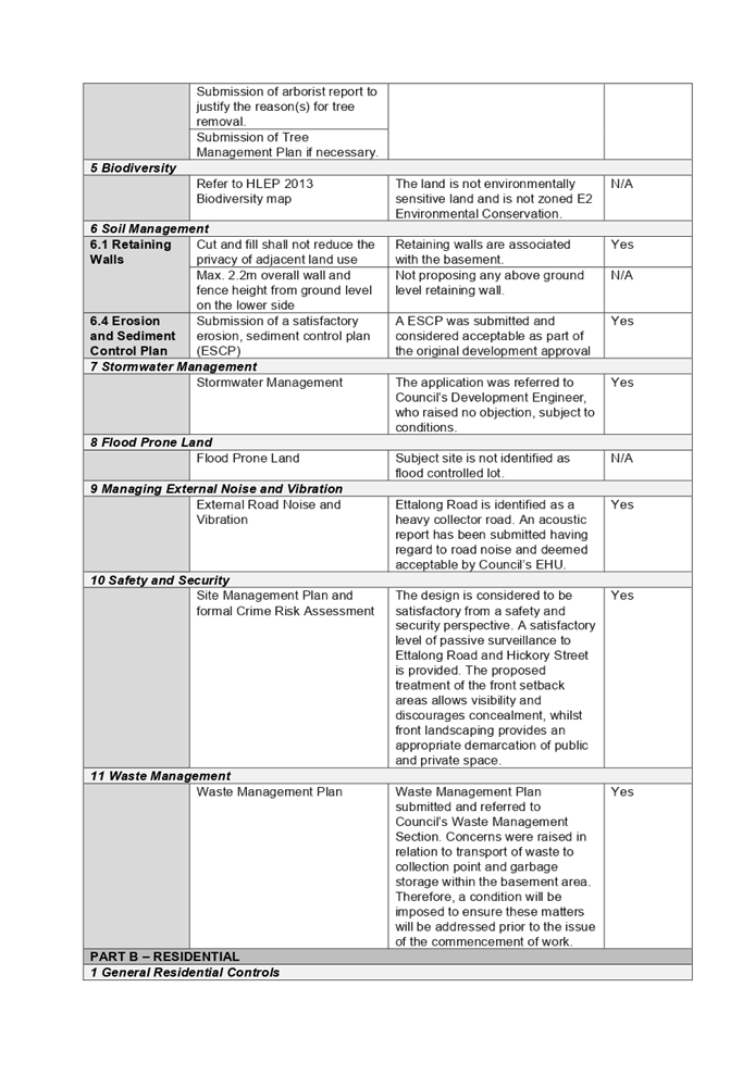
non-compliances with the Holroyd DCP 2013, and the variations sought are
considered satisfactory on merit in this instance:
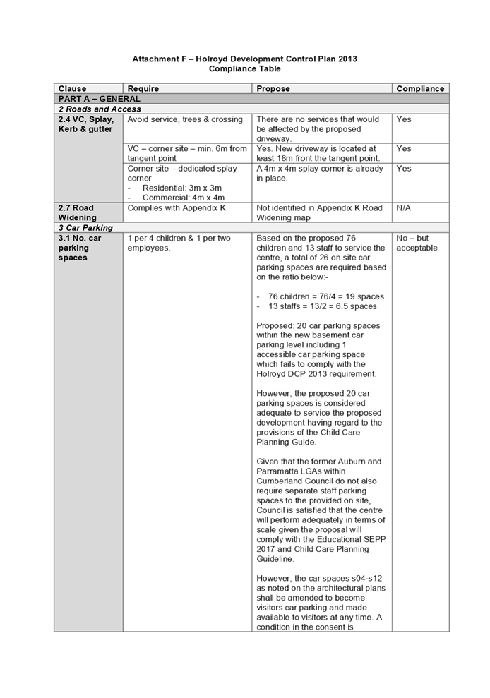
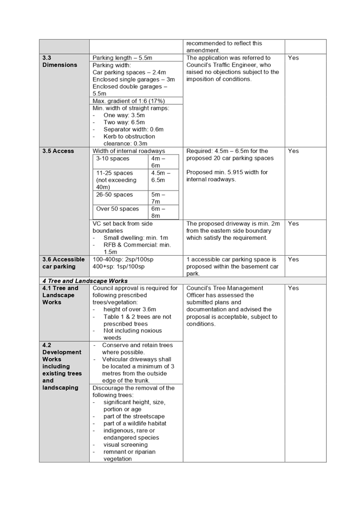
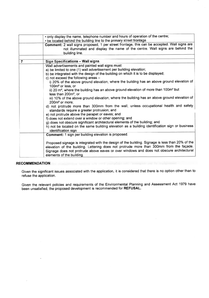
Figure
6 – Holroyd Development Control Plan 2013 Compliance Table
|
PART A – GENERAL
|
|
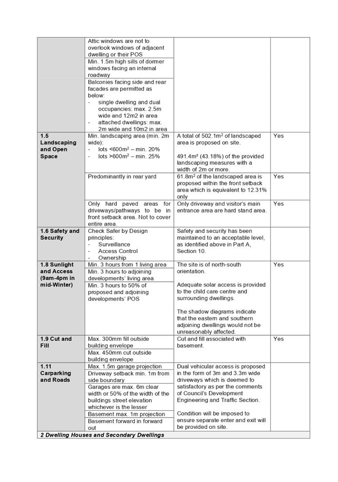
3.1 Number of Car
Parking Spaces
|
|
C1
|
Parking spaces shall be provided in compliance with
Council’s minimum car parking spaces requirements as set out in
Table 3.1.
Car Parking rates for Child
Care Centres/Kindergartens/After
school care facilities in the
R2 zone:
· 1
space per 4 children; plus
· 1
space per 2 staff
|
The childcare centre is proposed with 76 places.
The proposed 20 car parking spaces are also considered
adequate to service the proposed development having regard to the provisions
of the Child Care Planning Guide.
Furthermore, the application was referred to
Council’s Engineer, who raised no objections subject to conditions
given that the former Auburn and Parramatta LGAs within Cumberland Council do
not also require separate staff parking spaces to the provided on site.
However, based on the locations and design of the basement car park, car
spaces s01-s03 as noted on the architectural plans shall be nominated for
staff car parking and the rest of the 17 car parking spaces shall be amended
and made available to visitors at any time.
A condition in the consent is recommended to reflect this
amendment.
|
No – but considered acceptable
|
|
PART B – RESIDENTIAL
|
|
1.1 Building Materials
|
|
C1
|
Building materials must be compatible with the streetscape
and character of its locality.
|
A variety of construction
materials proposed as well as finishing materials and colours provides a good
variety of finishes for the building.
The proposed 2 storey building is generally consistent
with other newer-style 2 storey dwellings in the locality except for the
unroofed outdoor play area facing Ettalong Street.
The proposal is a “purpose
built” childcare centre which will add
visual interest to the street and locality being a corner site.
|
No – but considered acceptable
|
|
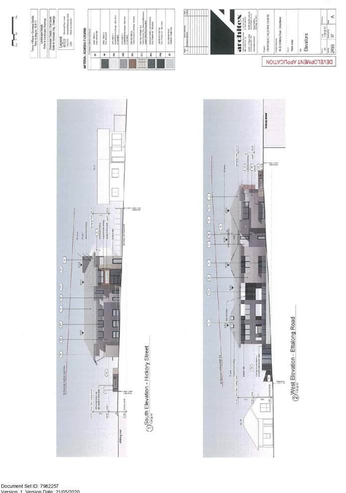
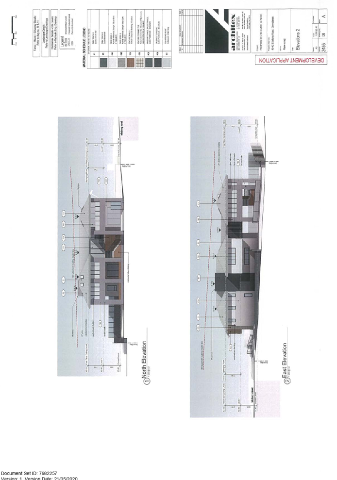
2.5
Building Appearance
|
|
C1
|
Compatible with the existing building appearance,
streetscape, local character, building articulation and garage projection
|
The appearance of the building as viewed from the street
is acceptable. The proposal is considered to be compatible with a number of
newer-style residential developments in the locality. In addition, it is
important to note that the proposed development is a purpose built childcare
centre, and in this regard, the architecture is considered to depict this
function.
The proposed development will provide minimum 4.78m
setback from the northern side boundary and 6.8m from the eastern side
boundary to maintain a reasonable separation from the adjoining residential
properties.
Being a corner allotment, the proposed childcare centre is
designed so that the main entrance will front Hickory Street and the western
side elevation of the building is articulated to avoid blank walls and address
the Ettalong Street frontage.
The first floor outdoor play area is visible from Ettalong
Road frontage. This play area is an unroofed
outdoor play area with retractable awnings to provide weather protection for
the children when necessary. The unroofed outdoor space presents as a first
floor balcony of a 2 storey dwelling.
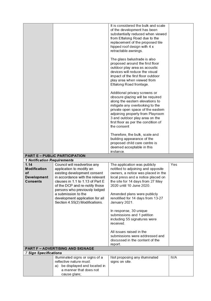
It is considered the bulk and
scale of the development has been substantially reduced when viewed from
Ettalong Road due to the replacement of the proposed tile hipped roof design
with retractable awnings.
Additional privacy screens or obscure glazing will be
required along the eastern elevations to mitigate any overlooking to the
private open space of the eastern adjoining property from Playroom 3 and
outdoor play area on the first floor as per the condition of the consent.
Therefore, the bulk, scale and building appearance of the
proposed childcare centre is deemed acceptable in this instance.
|
No – but considered acceptable
|
|
PART I – CHILD CARE CENTRES
|
|
1 Size, Density and Location
|
|
C1
|
Any
proposed Child Care Centres in R2 zones should be limited in size to
accommodate not more than forty-five (45) children. Capacities of childcare
centres located in other zones will be assessed on the merits of each application.
|
The childcare centre is proposed with 76 places.
The SEPP (Educational Establishments & Child Care
Facilities) 2017 overrides DCP provisions relating to maximum children
placements.
|
No –
but considered acceptable
|
|
C5
|
The site must not be 300m from
hazardous industries, LP gas sites, mobile telephone base stations and
towers, and safe from any other environmental health hazards, such as high
lead levels, chemical spraying in rural areas, or proximity to cooling tower
drift in high rise building areas.
|
An existing service station at
73 Ettalong Road (Corner of Ettalong Road and Old Prospect Road) is located
280m away from the subject site.
The subject site does not
directly adjoin the service station site and despite the numerical non-compliance,
the site is considered sufficiently distanced from the service station site
so as not to pose any unacceptable impact to the development.
As such, the proposal is deemed
to satisfy the requirement of the Holroyd DCP 2013, Educational SEPP 2017 and
Child Care Planning Guideline.
|
No –
but acceptable
|
|
C7
|
Childcare centres should not be
located having frontage to any road, which in the opinion of Council, is
unsuitable for the establishment of a childcare centre having regard to: -
(a) prevailing traffic conditions;
(b) pedestrian and traffic safety; and
(c) the likely impact of development on the flow of
traffic on the surrounding street system.
|
In accordance with the Holroyd DCP 2013, Ettalong Road is
considered an unsuitable location for a childcare centre with regards to the
prevailing traffic and impact of development on the flow of
traffic.
It is noted however that vehicular access to the site will
be from Hickory Street which is not identified as an unsuitable Road.
The facility is designed to ensure the safety of children,
visitors and staff at all times and the traffic report submitted with the
application confirmed the proposal is unlikely results in traffic flow
issues.
A dual driveway is proposed along the Hickory Street
frontage to minimise vehicle queuing along Hickory Street to enter the
basement car park.
In addition, the Child Care Planning Guideline does not
specify any street as unsuitable road for centre-based childcare centres.
Council is satisfied that the centre will perform
adequately in terms of traffic and safety impacts.
|
No –
but acceptable
|
|
C9
|
As a
general guide the roads identified in Appendix 2 are also considered by
Council to be generally unsuitable for the establishment of childcare centres,
without special consideration firstly being given to the prevailing traffic
conditions. All applications are to be supported by a Traffic and Parking
Report prepared by a suitably qualified person addressing the above issues to
Council’s satisfaction.
|
Irrespective of Ettalong Road being listed in Appendix 2
of the Holroyd DCP 2013, the proposal performs adequately from an
environmental planning viewpoint.
A traffic and parking report has been submitted with the
proposal and Council’s development engineer have raised no objection to
the proposal in terms of traffic and parking.
The Child Care Planning Guide does not specify any street
as unsuitable road for centre-based childcare centre which overrides this
control in the Holroyd DCP 2013.
|
No – but acceptable
|
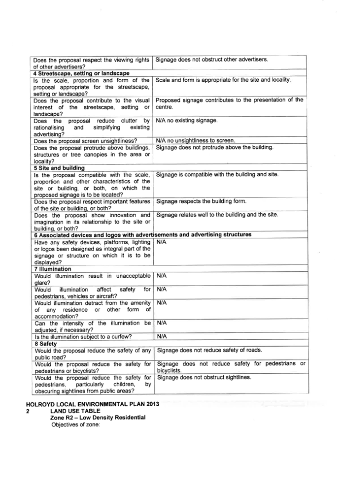
The
provisions of any planning agreement that has been entered into under section
7.4, or any draft planning agreement that a developer has offered to enter into
under section 7.4 (EP&A Act s4.15(1)(a)(iiia))
There is no draft planning
agreement associated with the subject Development Application.
The provisions of the
Regulations (EP&A Act s4.15 (1)(a)(iv))
The proposed development raises no
concerns as to the relevant matters arising from the Environmental Planning and
Assessment Regulations 2000 (EP&A Reg).
The Likely Environmental,
Social or Economic Impacts (EP&A Act s4.15 (1)(b))
It is considered that the proposed
development will have no significant adverse environmental, social or economic
impacts in the locality.
The suitability of the site for
the development (EP&A Act s4.15 (1)(c))
The subject site and locality are
not known to be affected by any natural hazards or other site constraints
likely to have a significant adverse impact on the proposed development.
Accordingly, it is considered that the development is suitable in the context
of the site and surrounding locality.
Submissions made in accordance
with the Act or Regulation (EP&A Act s4.15 (1)(d))
|
Advertised (newspaper)
|
Mail
|
Sign
|
Not Required
|
In
accordance with Council’s Notification requirements contained within Part
E Public Participation of the Holroyd DCP 2013, the proposal was publicly
notified for a period of 14 days between 27 May 2020 and 10 June 2020.
During the course of the initial public notification, a total of 35 submissions
were received including 1 petition with 55 signatures. 27 unique submissions
were identified among the 35 submissions.
The development application was
further renotified for another 14 days between 13 January 2021 and 27 January
2021 to the public as amendments were made to the roof design on the first
floor outdoor play area. Regarding the renotification, Council received a total
of 11 submission letters containing 9 unique submissions.
It is noted that some objections
have resubmitted their submissions several times and reviewing all submissions
between both public notification periods confirmed a total of 31 unique
submissions comprising 30 individuals and 1 petition with 55 signatures among
the total 46 submissions.
The issues raised in the public
submissions are summarised and commented on as follows:
|
Issue
|
Response
|
|
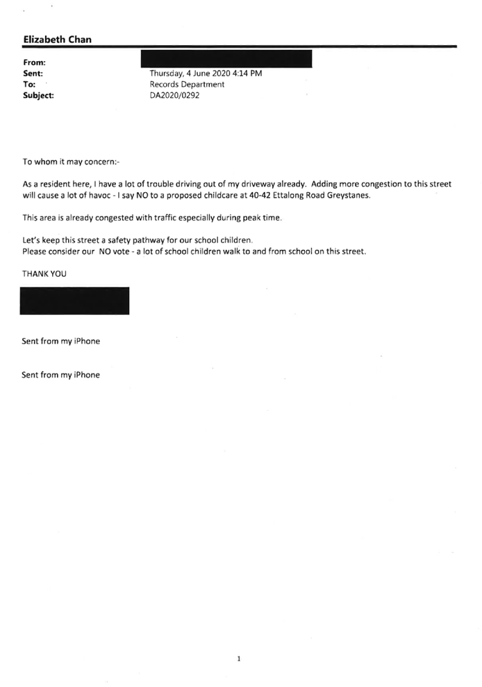
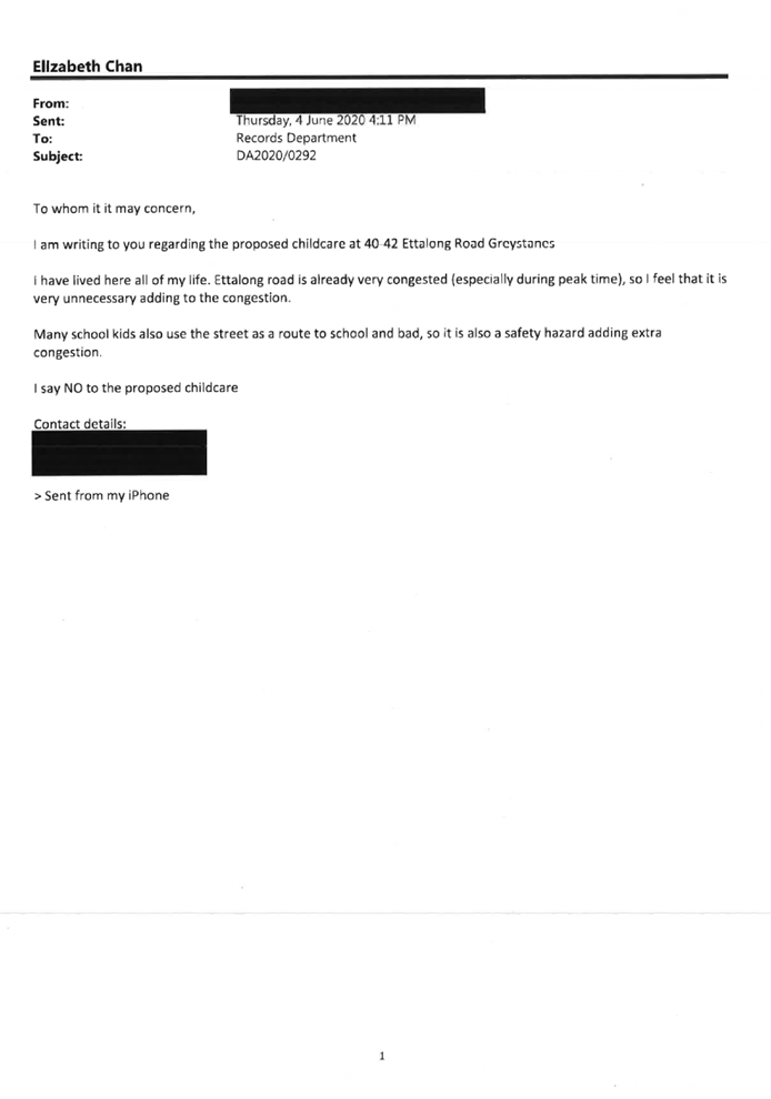
Ettalong Road and Hickory Street is already overloaded and
congested. Hickory Street is a very narrow street which cannot cater the need
for a childcare centre.
|
The application has been referred to Council’s
Traffic Engineer for comment who confirmed Hickory Street and Ettalong Road
can cater for the additional amount of traffic generated by the proposed
centre-based childcare centre. A condition in the consent will be imposed to
ensure an Operational Management Plan to be prepared and adopted to monitor
and manage the parking arrangement of the development on an ongoing basis.
|
|
Ettalong Road is identified as unsuitable sub-arterial
road for childcare centre in the Holroyd Development Control Plan 2013
|
The application has been referred to Council’s
Traffic Engineer for comment who confirmed the location of the proposal is
acceptable given the development has been designed to locate the access
driveway from Hickory Street.
The pedestrian access to the centre faces Hickory Street
as well which is considered to be safe and away from Ettalong Road, which is
identified as a major road.
In addition, the location of the proposed childcare centre
is deemed acceptable in accordance with the locational objective of the
Educational SEPP 2017 and Child Care Planning Guideline.
|
|
The driveway is too close to the traffic corner
|
The application has been referred to Council’s
Development Engineer for comment who confirmed the location of the driveway
is appropriate. The driveway is designed to locate on Hickory Street and away
from the junction of Ettalong Road to provide minimum sight lines for
incoming and outgoing vehicular and pedestrian traffic.
|
|
Too many childcare centres in Greystanes the proposed new
centre is located within walkable distance to other childcare centres.
|
Childcare
centre is a permissible development within the site and the proposed development
generally satisfies the requirements contained within Holroyd DCP 2013, the
criteria under the Child Care Planning Guideline and relevant
regulations stipulated under the Educational SEPP 2017, with respect to site
selection and location.
Although there are other childcare centres in the
locality, this matter is not a reason to refuse the application under Section
4.15 of the Environmental Planning and Assessment Act 1979.
|
|
Already established childcare business will be affected by
this proposal
|
Although there are other childcare centres in the
locality, this matter is not a matter for consideration under Section 4.15 of
the Environmental Planning and Assessment Act 1979.
|
|
The proposed childcare centre is overdevelopment. The
oversized 3 storey building is out of character in that location of Ettalong
Road
|
The proposed childcare centre is 2 storey in height
measured from the existing natural ground level, with maximum overall
building height of 8.81m. The architectural design of the building is modern
and it is a purposely built childcare centre that is generally compatible
with the desired development outcome for future development within the R2 Low
Density Residential zone.
|
|
Inadequate on-site parking available on Hickory Street and
Ettalong Road to cope with the peak time drop-off and pick-up of a childcare
centre
|
The proposal has been designed to provide 20 car parking
spaces including an accessible car parking space within the basement car
parking level. The proposal has been designed so that the amount of car
parking spaces provided on site will be aligned with the controls identified
in the Child Care Planning Guideline for a centre-based childcare centre with
76 children. It is noted that the principle to remove the staff car parking requirement
for childcare centre in R2 Low Density Residential zone is generally
consistent with the approach in the assessment of the parking provisions in
the Cumberland LGA.
|
|
A two-storey childcare centre is not suitable in R2 Low
Density Residential zone
|
Centre-based childcare centre is a permissible development
under the R2 Low Density Residential zone in accordance with the Holroyd LEP
2013.
|
|
Another application for childcare centre was previously
refused by Council on this site
|
The previous application under DA2015/245/1 for demolition
of existing structure and construction of a new 2 storey child care centre
with 44 places and 15 car parking spaces was refused for the main reasons
that there is a shortfall of landscaped area, the subject site is located
within 300m of a service station, the design of the driveway, the absence of
pedestrian footpath along Ettalong Road and Hickory Street frontage to the
child care centre and the visual amenity of acoustic fencing. As discussed in
the report, the reasons for refusal have been addressed in the subject
application. Furthermore, the Educational Establishment SEPP 2017 has since
been adopted after the determination of DA2015/245/1 where the majority of
the development controls listed in Part I of the Holroyd Development Control
Plan 2013 have been overridden by the new Educational SEPP 2017 and
subsequent Child Care Planning Guideline.
|
|
No public notification to residents at Gregory Street,
Greystanes
|
The application was publicly notified in accordance with
the Environmental Planning and Assessment Regulation 2000 and the
requirements of Part E of Holroyd DCP 2013. Letters have been provided to the
owners and occupants of the adjoining properties and immediate across Hickory
Street and Ettalong Road in accordance with the Holroyd DCP 2013. A site
notice is also placed on site facing Ettalong Road frontage on 27 May 2020
accordingly.
It is noted that all relevant document of the application
was made available on the Council’s website during the notification
period.
|
|
Conflicts of use between road users, pedestrians and
children
|
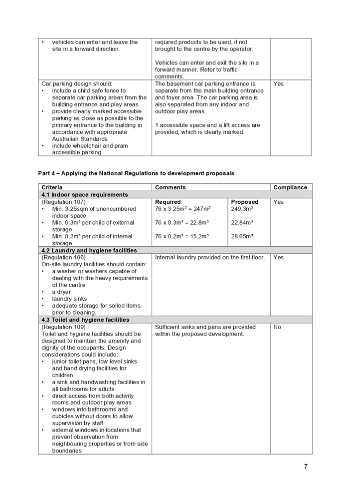
The proposal has been designed to provide sufficient car
parking on site as per the Educational SEPP 2017 and Child Care Planning
Guideline requirement. The turning bay is also provided on site to ensure all
vehicles can enter and exit the site in a forward direction to minimise any
pedestrian/vehicular traffic safety issues along Hickory Street.
|
|
Stormwater drainage from the subject site to Gregory
Street
|
The stormwater concept plan with OSD design was submitted
to Council in support of the development application. The documents have been
referred to Council’s Development Engineer for comment who confirmed
the proposed stormwater drainage as designed on the proposed concept will
drain to Ettalong Road frontage which is acceptable. A condition in the
consent will be imposed to ensure all measures recommended on the concept
plans will be adopted appropriately.
|
|
Driveway is too close to the sleeping area of the nearby
residence
|
The childcare centre is not proposed to operate outside
the normal hours of operations (proposed 7.00am to 7.00pm) for childcare
centres. The driveway to the basement car park level is at least 2m setback
from the eastern side boundary. No openings are proposed along the eastern
side of the driveway and a 2m wide dense landscaping strip is proposed along
the eastern side boundary to mitigate the visual and acoustic amenity to the
neighbouring properties.
|
|
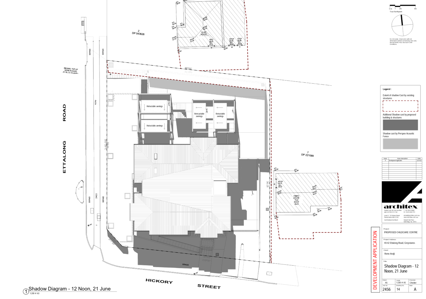
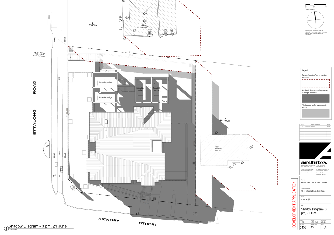
Overshadow from the proposed new trees
|
Five (5) x Blueberry Ash (Elaeocarpus Reticulatus) trees
with a mature height of 6m-8m are proposed to the front portion of the
eastern side boundary to screen the new driveway from the neighbouring
property. Having considered the orientation of the subject site and the
location of the trees, the majority of the shadow created by these trees will
cast onto Hickory Street and within the front setback area of the eastern
adjoining property. The private open space of the eastern and northern
adjoining properties will receive sufficient sunlight as required in the
Holroyd Development Control Plan 2013.
|
|
Acoustic privacy
|
An acoustic report prepared by a suitably qualified
acoustic engineer was submitted with the application. The report was reviewed
by the Environmental Health Officer and confirmed the noise amenity of the
adjoining properties can be mitigated with the construction of the
recommended noise barrier around the property boundary. A condition in the
consent will be imposed to ensure all measures recommended in the acoustic
report will be adopted accordingly.
|
|
Noise from garbage collection and access ramps as driveway
is within proximity to bedrooms of the neighbouring property
|
The application has been referred to Council’s Waste
Services and confirmed the proposed kerbside collection is acceptable which
is not indifferent from other residential development along the street.
The new driveway located away from street corners with
access from the secondary street frontage (Hickory Street) is considered more
appropriate. This is designed to satisfy the Holroyd Development Control Plan
2013.
|
|
Too many large trees planted along the side and rear
property boundaries
|
Landscape planted along the side boundaries are proposed
to soften the visual amenity of the new vehicular access ramps and childcare
centre from the neighbouring residential dwellings. Council’s Tree
Management Officer confirmed the proposed trees are considered suitable and
is not likely result in structure issue to the fencing and basement car park.
|
|
New driveway will remove on-street car parking
|
The subject site is a corner site and relocating the
existing vehicular crossing from Ettalong Road to Hickory Street is deemed to
be more suitable and acceptable.
It is confirmed by Council’s Development Engineer
that the location of the new driveway away from street corners will minimise
traffic impacts and provide maximise sight lines.
In this instance, the design and width of the new driveway
is acceptable and the loss of on-street car parking spaces is unavoidable in
this instance.
|
|
Visual privacy of the neighbouring residential dwellings
from first floor outdoor play area the backyard
|
The first floor level of the proposed development will be
at least 6.8m setback from the eastern side boundary.
A condition in the consent will be imposed to ensure
obscure glazing or similar materials will be installed along the eastern
elevation of the development to minimise any overlooking on to the adjoining
properties.
|
|
The traffic study and acoustic report do not reflect the
real situation as the surveys were undertaken during the pandemic situation
|
Council’s Development Engineer has reviewed the
traffic report and considers the findings of the report to be acceptable. As
discussed in the content of the report, the proposal is designed to provide
enough on-site car parking within the basement level as per the Child Care
Planning Guide and RMS Guide to Traffic Generating Developments 2002 and is
not seeking reliance on on-street parking. Therefore, the on-street car
parking availability is not considered in this development application.
The acoustic report was reviewed by Council’s
Environmental Health Officer and it was confirmed the noise amenity of the
adjoining properties can be mitigated with the construction of the
recommended noise barrier around the property boundary. A condition in the
consent will be imposed accordingly.
|
The public interest (EP&A
Act s4.15(1)(e))
The public interest is served by
permitting the orderly and economic use of land, in a manner that is sensitive
to the surrounding environment and has regard to the reasonable amenity
expectations of surrounding land users. In view of the foregoing analysis, it
is considered that the development, if carried out subject to the conditions
set out in the recommendation below, will have no significant adverse impacts
on the public interest.
Cumberland Local
Infrastructure Contributions Plan 2020
The development would require the
payment of contributions in accordance with Cumberland Local Infrastructure
Contributions Plan 2020.
In accordance with the
Contribution Plan a contribution is payable, pursuant to Section 7.12 of the
Environmental Planning and Assessment Act 1979, calculated on the cost of
works. A total contribution of $28,859.00 would be payable prior to the issue
of a Construction Certificate.
Disclosure of Political
Donations and Gifts
The NSW Government introduced The
Local Government and Planning Legislation Amendment (Political Donations) Act
2008 (NSW). This disclosure requirement is for all members of the public
relating to political donations and gifts. The law introduces disclosure
requirements for individuals or entities with a relevant financial interest as
part of the lodgement of various types of development proposals and requests to
initiate environmental planning instruments or development control plans.
The application and notification
process did not result in any disclosure of Political Donations or Gifts.
The development application has
been assessed in accordance with the relevant requirements of the Environmental
Planning and Assessment Act 1979, State Environmental Planning Policy No. 55
– Remediation of Land, State Environmental Planning Policy No. 64 –
Advertising and Signage, State Environmental Planning Policy (Educational
Establishments and Child Care Facilities) 2017, Education and Care Services
National Regulations, Holroyd Local Environmental Plan 2013 and the Holroyd
Development Control Plan 2013 and is considered to be satisfactory for approval
subject to conditions.
The proposed development is
appropriately located within the R2 Low Density Residential zone under the
relevant provisions of the Holroyd Local Environmental Plan 2013. The proposal
is generally consistent with all statutory and non-statutory controls applying
to the development. Minor non-compliances with Council’s controls have
been discussed in the body of this report. The development is considered to
perform adequately in terms of its relationship to its surrounding built and
natural environment, particularly having regard to impacts on adjoining
properties.
For these reasons, it is
considered that the proposal is satisfactory having regard to the matters of
consideration under Section 4.15 of the Environmental Planning and Assessment
Act 1979, and the development may be approved subject to conditions.
|
1. That
Development Application No. DA2020/0292 for Demolition of existing structures
and construction of a two storey 76 place childcare centre over basement car
parking on land at 40-42 Ettalong Road Greystanes NSW 2145 be approved
subject to conditions listed in the attached schedule.
2. Persons
whom have lodged a submission in respect to the application be notified of
the determination of the application.
|
1. Draft
Notice of Determination
2. Architectural
Plans
3. Landscape
Plans
4. Stormwater
Engineering Plans
5. Plan
of Management
6. Redacted
Submissions
7. Appendix
A - Concurrence from Dept of Education
8. Appendix
B - State Environmental Planning Policy (Educational Establishments & Child
Care Facilities) 2017
9. Appendix
C – Child Care Planning Guideline 2017 Compliance Table
10. Appendix
D – Statement Environmental Planning Policy No. 64 – Advertising
and Signage
11. Attachment
E – Holroyd Local Environmental Plan 2013
12. Attachment
F – Holroyd Development Control Plan 2013
13. Appendix
G – Notice of Determination of DA20152451 and relevant copy of plans
DOCUMENTS
ASSOCIATED WITH
REPORT LPP003/21
Attachment 1
Draft Notice of Determination
Cumberland Local Planning Panel Meeting
10 March 2021


DOCUMENTS
ASSOCIATED WITH
REPORT LPP003/21
Attachment 2
Architectural Plans
Cumberland Local Planning Panel Meeting
10 March 2021
DOCUMENTS
ASSOCIATED WITH
REPORT LPP003/21
Attachment 3
Landscape Plans
Cumberland Local Planning Panel Meeting
10 March 2021
DOCUMENTS
ASSOCIATED WITH
REPORT LPP003/21
Attachment 4
Stormwater Engineering Plans
Cumberland Local Planning Panel Meeting
10 March 2021
DOCUMENTS
ASSOCIATED WITH
REPORT LPP003/21
Attachment 5
Plan of Management
Cumberland Local Planning Panel Meeting
10 March 2021

DOCUMENTS
ASSOCIATED WITH
REPORT LPP003/21
Attachment 6
Redacted Submissions
Cumberland Local Planning Panel Meeting
10 March 2021


DOCUMENTS
ASSOCIATED WITH
REPORT LPP003/21
Attachment 7
Appendix A - Concurrence from Dept of Education
Cumberland Local Planning Panel Meeting
10 March 2021

DOCUMENTS
ASSOCIATED WITH
REPORT LPP003/21
Attachment 8
Appendix B - State Environmental Planning Policy
(Educational Establishments & Child Care Facilities) 2017
Cumberland Local Planning Panel Meeting
10 March 2021

DOCUMENTS
ASSOCIATED WITH
REPORT LPP003/21
Attachment 9
Appendix C – Child Care Planning Guideline 2017
Compliance Table
Cumberland Local Planning Panel Meeting
10 March 2021
DOCUMENTS
ASSOCIATED WITH
REPORT LPP003/21
Attachment 10
Appendix D – Statement Environmental Planning
Policy No. 64 – Advertising And Signage
Cumberland Local Planning Panel Meeting
10 March 2021
DOCUMENTS
ASSOCIATED WITH
REPORT LPP003/21
Attachment 11
Attachment E – Holroyd Local Environmental Plan
2013
Cumberland Local Planning Panel Meeting
10 March 2021
DOCUMENTS
ASSOCIATED WITH
REPORT LPP003/21
Attachment 12
Attachment F – Holroyd Development Control Plan
2013
Cumberland Local Planning Panel Meeting
10 March 2021
DOCUMENTS
ASSOCIATED WITH
REPORT LPP003/21
Attachment 13
Appendix G – Notice of Determination of
DA20152451 and relevant copy of plans
Cumberland Local Planning Panel Meeting
10 March 2021


Cumberland
Local Planning Panel Meeting
10 March 2021
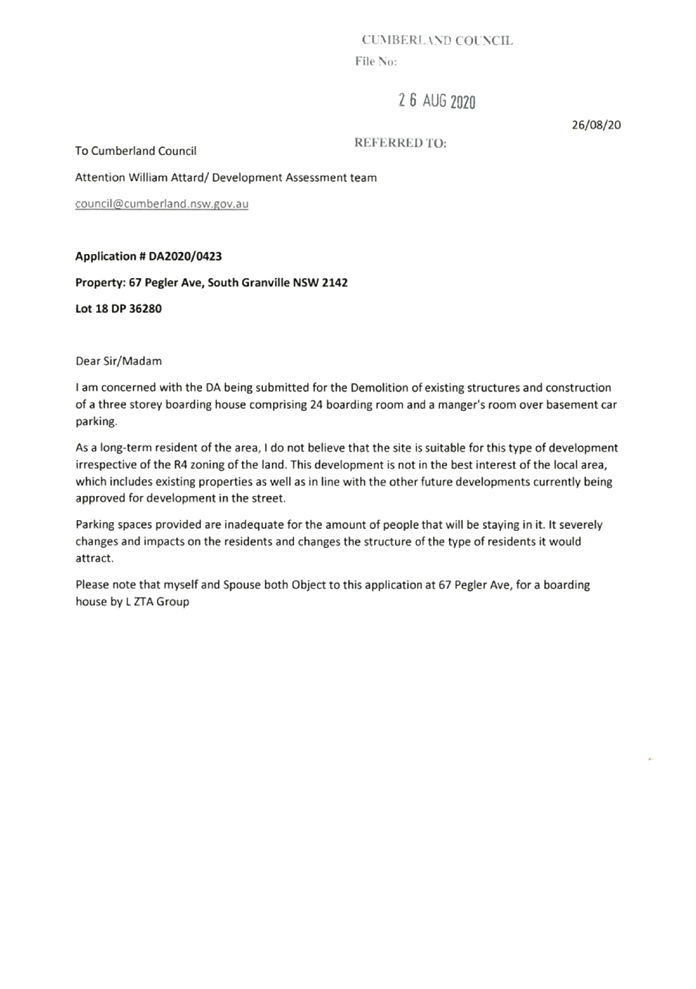
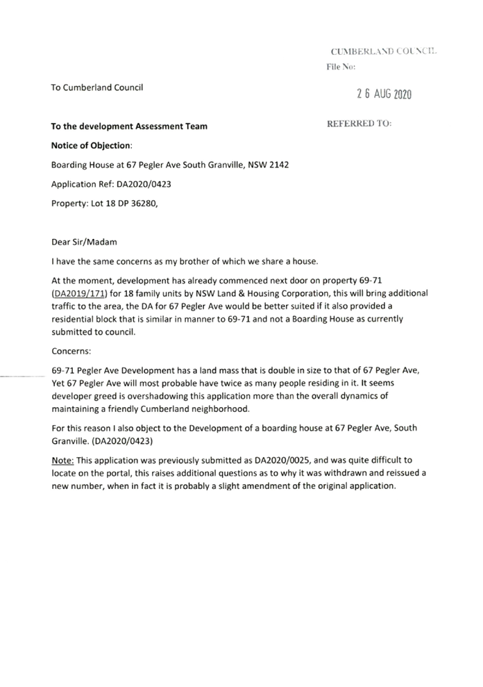
Item No: LPP004/21
Development
Application for 67 Pegler Avenue, South Granville
Responsible
Division: Environment
& Planning
Officer: Executive
Manager Development and Building
File
Number: DA2020/0423
|
Application
lodged
|
21 July 2020
|
|
Applicant
|
L ZTA Group
|
|
Owner
|
Mr Y I Ghaddar & Ms H
Faraj
|
|
Application
No.
|
DA2020/0423
|
|
Description
of Land
|
67 Pegler Avenue SOUTH GRANVILLE
NSW 2142, Lot 18 DP 36280
|
|
Proposed
Development
|
Demolition of existing
structures and construction of a three storey boarding house comprising 24
boarding rooms and a manager's room over basement car parking
|
|
Site
Area
|
758.1m2
|
|
Zoning
|
R4 High Density Residential
Zone
|
|
Disclosure
of political donations and gifts
|
Nil disclosure
|
|
Heritage
|
No – The site is not a
heritage listed item and not located within the vicinity of a heritage item
or a heritage conservation area
|
|
Principal
Development Standards
|
FSR
Permissible: 0.8:1 + (bonus
under ARH SEPP 0.5:1) = 1.3:1
Proposed: 1.053:1
Height of Building
Permissible: 11m
Proposed: 11m
|
|
Issues
|
· Car
parking rate (ARH SEPP)
· Site
isolation (PDCP)
· Submissions
|
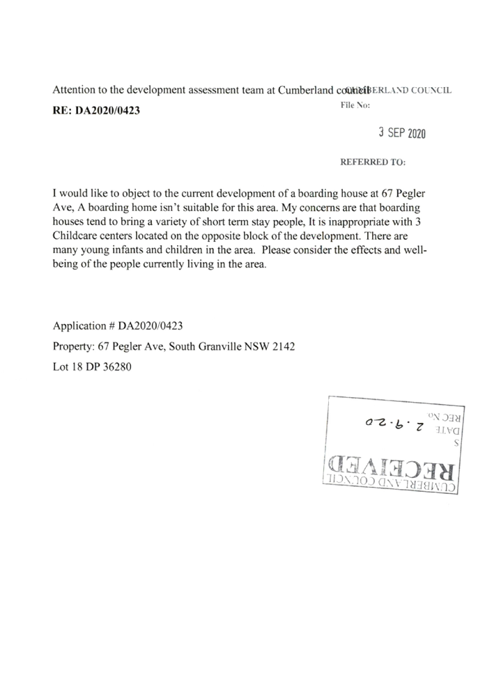
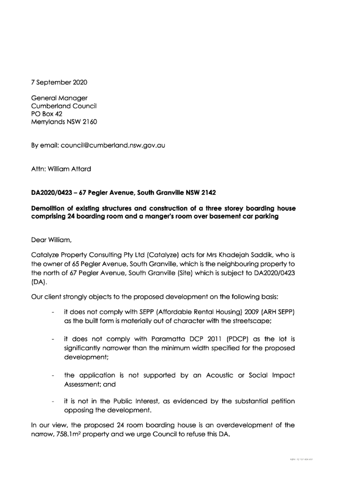
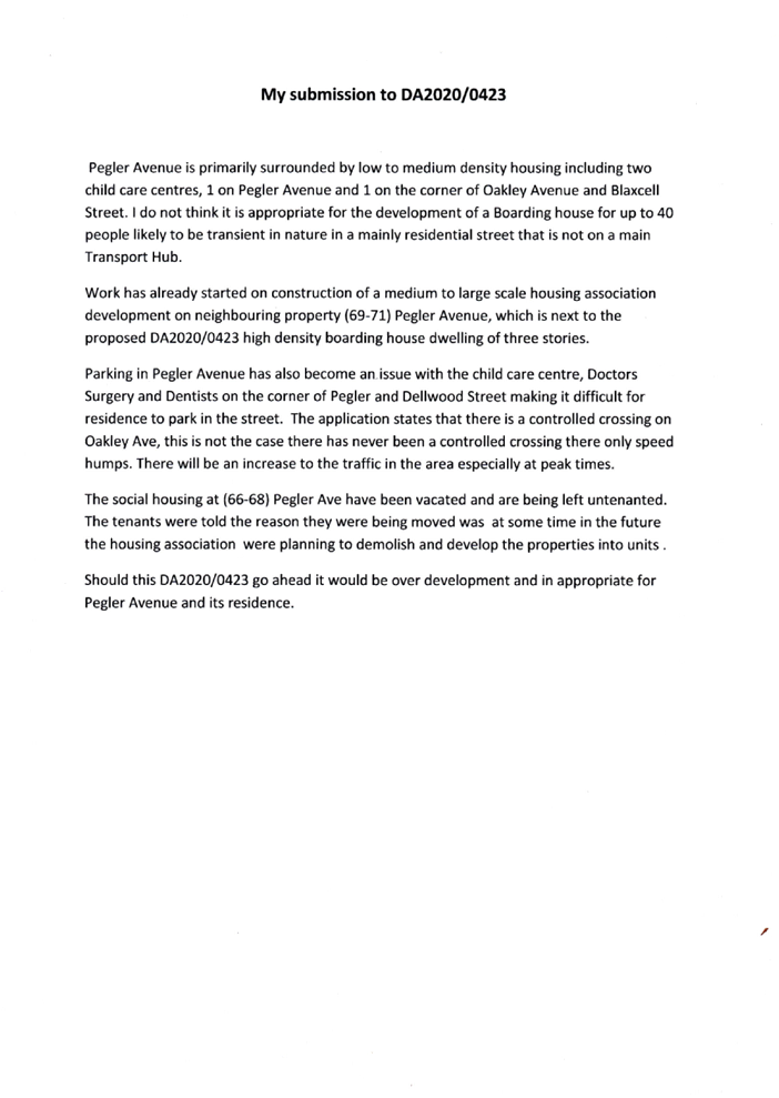
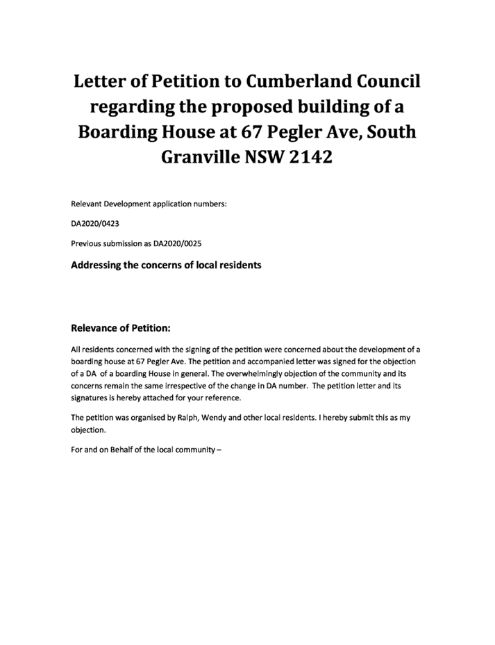
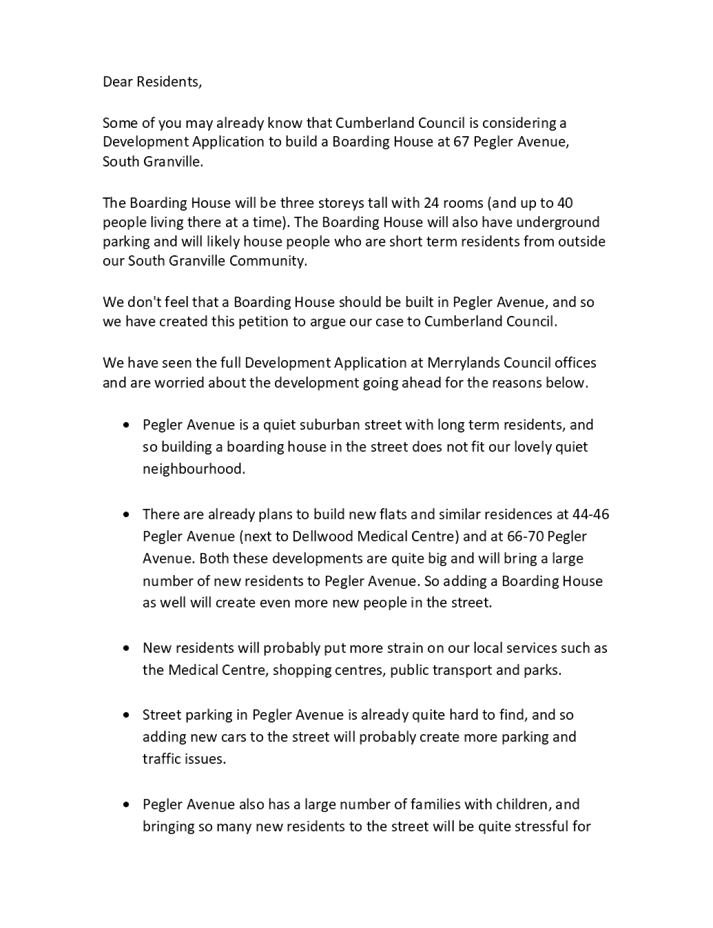
1. Development
Application No. DA2020/0423 was received on 21 July 2020 for the demolition of
existing structures and construction of a three storey boarding house
comprising 24 boarding rooms and a manager's room over basement car parking.
2. The
application was publicly notified to occupants and owners of the adjoining
properties for a period of 21 days between 13 August 2020 and 3 September 2020.
In response, Council received total of 35 submissions, including 1 petition
with 100 signatures, in which 19 of these submissions are unique submissions.
3. There
are non-compliances with the proposed development having considered the
provisions of State Environmental Planning Policy (Affordable Rental Housing)
2009 (ARH SEPP) and Parramatta Development Control Plan (PDCP) 2011, which are
car parking rate and site isolation. The numerical variation is as follows:
|
Control
|
Required
|
Provided
|
% variation
|
|
Car parking (ARH SEPP)
|
13
|
11
|
15.38%
|
Note:
the development proposes 13 car parking spaces within the basement. Due to the
issues with manoeuvring, 2 of the proposed car spaces will be required to be
deleted.
4. The
application is referred to the Panel as the proposal is considered to be contentious
development due to the number of submissions received.
5. The
application is recommended for deferred commencement approval subject to the
conditions as provided in the draft notice of determination in Attachment 1.
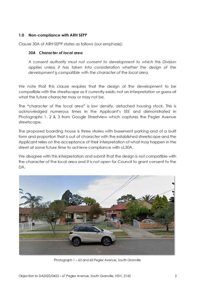
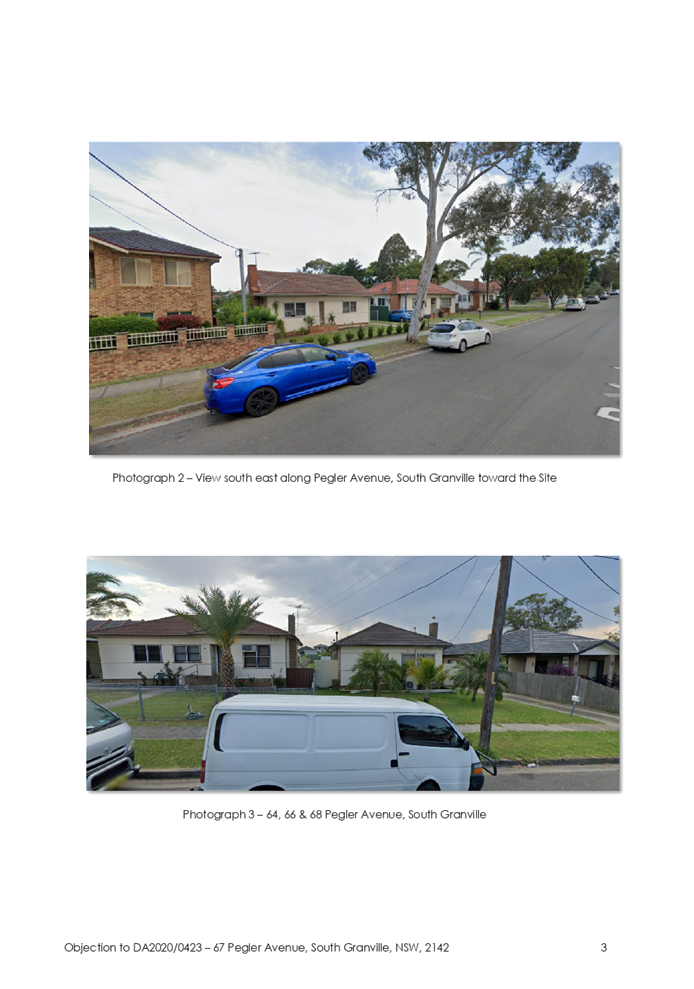
Subject Site and Surrounding
Area
The site forms Lot 18 DP 36280 and
is known as 67 Pegler Avenue, South Granville, NSW 2142. The site has a total
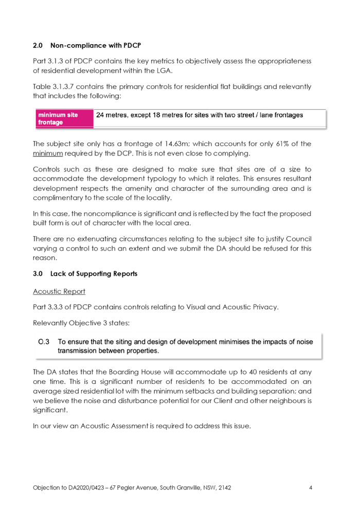
area of 758.1m2 and a frontage to Pegler Avenue of 14.63m. The site has a
gradual fall to the rear and is located within the R4 High Density Residential.
Current improvements on the site
comprise single storey clad and tile roof dwellings and associated
outbuildings. There is also an existing vehicular crossing off Pegler Avenue, a
tree within the front property setback of 67 Pegler Avenue and a street tree
along the site’s frontage.
Existing developments adjoining
and surrounding the site include a mix of low to medium density residential
development, with the area being in the process of transitioning to higher
density land uses. The properties to the north of the site are located within
the R4 High Density Residential zone and the properties to the south of 71
Pegler Avenue are located within the R3 Medium Density Residential zone.
Despite the zoning of these lands, most of the properties along Pegler Avenue
remain as single dwelling houses. The properties to the south known as 69 and
71 Pegler Avenue were approved under DA2019/171 for the demolition of existing
structures and construction of a 3 storey residential flat buildings pursuant
to ARH SEPP 2009 by the Sydney Central City Planning Panel on 11 December 2019.
Construction certificate for this development has been issued and the
construction works have commenced on the site. Neighbourhood shops within the
B1 Neighbourhood Centre zone and local park are located approximately 200m
walking distance towards the north on Dellwood Street and Blaxcell
Street.
Figure
1 – Locality Plan of subject site
Figure
2 – Aerial view of subject site
Figure
3 – Street view of subject site
Description of the Proposed
Development
Council is in receipt of a
development application on 21 July 2020 seeking approval for the demolition of
existing structures and construction of a three storey boarding house
comprising 24 boarding rooms and a manager's room over basement car parking.
The detailed breakdown of the proposal is shown below:
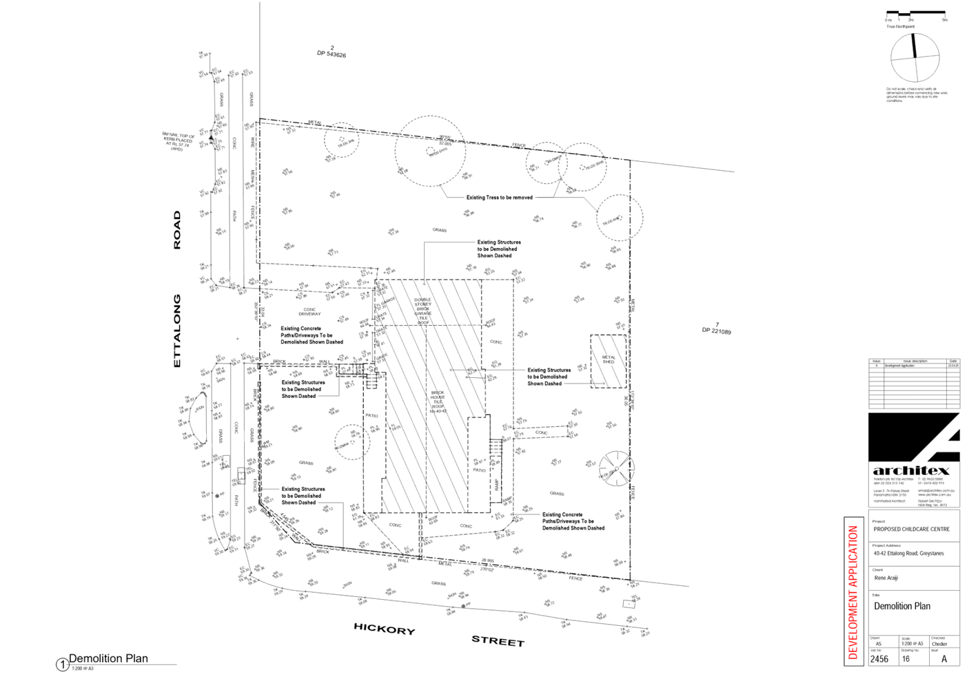
Demolition:
· Single storey
dwelling; and
· Outbuildings at
the rear.
Construction:
· Basement:
o 13 car spaces (including 1
manager‘s and 2 disabled spaces);
o 6 bicycle spaces;
o 5 motorcycle spaces; and
o Circulation (lift and stairs).
· Ground Floor:
o 4 single rooms (including 2
adaptable) with private open space;
o 1 manager’s room with private
open space;
o Lobby;
o Waste storage area;
o Circulation;
o Communal room;
o Communal open space; and
o Drying area.
· Level 1:
o 6 double rooms;
o 4 single rooms; and
o Circulation.
· Level 2:
o 7 double rooms;
o 3 single rooms; and
o Circulation.
The total boarding rooms are 24
(11 single and 13 double) and 1 manager’s room, with the maximum number
of lodgers proposed is 38.
Stormwater works are also proposed
across Lot 43 in DP 36280, 70 Gordon Avenue, South Granville. The stormwater
works proposed on this site comprise a 1.5 metre wide drainage easement
traversing part of the property’s western rear boundary and the
site’s northern side boundary.
History
DA2020/0025 for demolition of
existing structures and construction of a three storey boarding house
comprising 24 boarding room and a manager's room over basement car parking was
withdrawn by applicant on 6 May 2020.
Applicants Supporting
Statement
The applicant has provided a
Statement of Environmental Effects prepared by Rod Logan Planning dated 9
December 2019 and was received by Council on 21 July 2020 in support of the
application.
Contact with Relevant
Parties
The assessing officer has
undertaken a site inspection of the subject site and surrounding properties and
has been in regular contact with the applicant throughout the assessment
process.
Internal Referrals
Development Engineer
The development application was
referred to Council’s Development Engineer for comment who has advised
that the development proposal is satisfactory in terms of car parking and
stormwater management and therefore can be supported subject to recommended
conditions of consent. Due to the issues with manoeuvring, 2 of the proposed
car spaces will be required to be deleted and condition is to be imposed
accordingly.
Environment and Health
The development application was
referred to Council’s Environment and Health Officer for comment who has
advised that the development proposal is satisfactory in regard to the
preliminary site investigation and acoustic impact assessment carried out on
site and therefore can be supported subject to recommended conditions of
consent.
Tree Management Officer
The development application was
referred to Council’s Tree Management Officer for comment who has advised
that the development proposal is satisfactory in terms of the arboricultural
impact assessment on site to retain and remove existing trees and therefore can
be supported subject to recommended conditions of consent. In this regard, the
Landscape Plan needs to be amended to remove all trees, with the exception of
Trees 10 and 11, and to incorporate the new and replacement trees within the
nature strip and front setback of the property.
Waste Management
The development application was
referred to Council’s Waste Management Officer for comment who has
advised that the development proposal is satisfactory in regard to the
provision of waste management room and therefore can be supported subject to
recommended conditions of consent.
External Referrals
NSW Police
The development application was
referred to NSW Police for comment on 7 August 2020. As of the time of writing
this report no comments have been provided. Standard conditions addressing
CPTED principles have been imposed accordingly.
PLANNING COMMENTS
The provisions of any
Environmental Planning Instruments (EP&A Act s4.15 (1)(a)(i))
(a) State
Environmental Planning Policy No. 55 – Remediation of Land (SEPP 55)
Clause 7 of SEPP 55 requires
Council to be satisfied that the site is suitable or can be made suitable to
accommodate the proposed development. The matters listed within Clause 7 have
been considered in the assessment of the development application.
|
Matter for
Consideration
|
Yes/No
|
|
Does the application
involve re-development of the site or a change of land use?
|
Yes No
|
|
Does the application involve re-development of the site
or a change of land use?
|
Yes No
|
|
In the development
going to be used for a sensitive land use (e.g.: residential, educational,
recreational, childcare or hospital)?
|
Yes No
|
|
Does information
available to you indicate that an activity listed below has ever been
approved, or occurred at the site?
acid/alkali plant and formulation, agricultural/horticultural
activities, airports, asbestos production and disposal, chemicals manufacture
and formulation, defence works, drum re-conditioning works, dry cleaning
establishments, electrical manufacturing (transformers), electroplating and
heat treatment premises, engine works, explosive industry, gas works, iron
and steel works, landfill sites, metal treatment, mining and extractive
industries, oil production and storage, paint formulation and manufacture,
pesticide manufacture and formulation, power stations, railway yards, scrap
yards, service stations, sheep and cattle dips, smelting and refining,
tanning and associated trades, waste storage and treatment, wood preservation
|
Yes No
|
|
Is
the site listed on Council’s Contaminated Land database?
|
Yes No
|
|
Is
the site subject to EPA clean-up order or other EPA restrictions?
|
Yes No
|
|
Has
the site been the subject of known pollution incidents or illegal dumping?
|
Yes No
|
|
Does
the site adjoin any contaminated land/previously contaminated land?
|
Yes No
|
|
Has
the appropriate level of investigation been carried out in respect of
contamination matters for Council to be satisfied that the site is suitable
to accommodate the proposed development or can be made suitable to accommodate
the proposed development?
|
Yes No
|
|
Details of
contamination investigations carried out at the site:
A
Preliminary Site Investigation report prepared by EI Australia was submitted
with the application. The report did not reveal any potential matters of
concern with regard to contamination and concludes that the site is suitable
for its intended use subject to recommendation in section 7. Suitable
conditions are to be imposed to reflect the recommendation of the report.
Council’s Environmental Health Officer has also reviewed the reports
and determined that the site is suitable to support such a development.
|
(b) Statement
Environmental Planning Policy No. 65 - Design Quality of Residential Apartment
Development (SEPP 65)
SEPP 65 does not apply to boarding
house; however, the Parramatta DCP 2011 building envelope controls for
residential flat buildings refers to the Apartment Design Guide (ADG)
provisions, which is being used as a guide for the proposed development.
(c) State
Environmental Planning Policy (Infrastructure) 2007 (ISEPP)
The provisions of the ISEPP 2007
do not apply to the development application as the proposal does not result in
a traffic generating development and the site is not located within 5m of an
overhead electricity power line and within the proximity of a railway corridor
or a busy/classified road.
(d) State
Environmental Planning Policy (Affordable Rental Housing) 2009 (ARH SEPP)
The proposal is subject to the
provisions of Part 2 (New affordable rental housing) Division 3 (Boarding
houses) of the ARH SEPP.
Following is a discussion of the
relevant Clauses, a detailed assessment is provided at Appendix A.
29(1)(c)(i) Standards that
cannot be used to refuse consent
1) A consent authority must not
refuse consent to development to which this Division applies on the grounds of
density or scale if the density and scale of the buildings when expressed as a
floor space ratio are not more than—
(c) if the development is on
land within a zone in which residential flat buildings are permitted and the
land does not contain a heritage item that is identified in an environmental
planning instrument or an interim heritage order or on the State Heritage
Register—the existing maximum floor space ratio for any form of
residential accommodation permitted on the land, plus—
(i) 0.5:1, if the existing
maximum floor space ratio is 2.5:1 or less,
A maximum floor space ratio (FSR)
of 0.8:1 is applicable to the subject site, pursuant to the provisions of PLEP
2011. This equates to a maximum gross floor area (GFA) of 606.48m². As the
existing maximum FSR is less than 2.5:1, the FSR bonus of 0.5:1 is applicable
to the development. This equates to a maximum permissible FSR of 1.3:1, or
985.53m². The development proposes a total GFA of 799m², which
equates to a total FSR of 1.053:1. The proposal is compliant with the maximum
FSR, subject to the ARH SEPP bonus.
It should be noted that the
proposal fully complies with the key planning controls contained within the ARH
SEPP including building height, landscaped area, solar access, private open
space, accommodation size and prescribed standards for boarding houses.
29(2)(e)(iia)&(iii) Parking
(iia) in the case of
development not carried out by or on behalf of a social housing provider—at
least 0.5 parking spaces are provided for each boarding room, and
(iii)in the case of any
development—not more than 1 parking space is provided for each person
employed in connection with the development and who is resident on site.
The proposal is not carried out by
or on behalf of a social housing provider. Therefore, 12 car spaces are
required for the proposed 24 boarding rooms plus 1 manager’s car space.
The proposal indicates that a total of 13 car spaces are to be provided within
the basement level. However, during the assessment of the application, 2 of
these car spaces could not be supported due to manoeuvring issues identified
and will be recommended to be deleted. The maximum number of compliant car
parking with the relevant Australian Standards requirements that could feasibly
be accommodated on the site is 11 spaces.
Notwithstanding the above, there
is a car parking requirement contained within the Parramatta Development
Control Plan at Table 3.6.2.3 for boarding houses which is: -
· 1 space per 10
boarding rooms; plus
· 1 space per
resident manager/caretaker (where applicable).
In this regard, the maximum number
of car spaces to be provided on the site is 4 car parking spaces for 24
boarding rooms and 1 resident manager’s accommodation. This would result
in a surplus of 7 car spaces in this instance. If the State Policy were to be
applied, a shortfall of 2 spaces would be observed.
This development satisfies the
minimum development control plan standard for car parking and as such, there is
no scope to require additional parking to meet Clause 29(2)(e).
By virtue of Section 4.15(3A)(a)
of the Environmental Planning and Assessment Act reproduced below, Council may
not require more onerous parking in this instance.
(3A) Development control plans
If a development control plan
contains provisions that relate to the development that is the subject of a
development application, the consent authority:
(a) if
those provisions set standards with respect to an aspect of the development and
the development application complies with those standards—is not to
require more onerous standards with respect to that aspect of the development,
and
In this situation, the applicant
has complied with the development control plan regarding car parking. It is considered
appropriate to support the development given that the applicant has complied
with the car parking provision of the Parramatta Development Control Plan.
Furthermore, it is noted that the
site is within an accessible area and is situated close to the neighbourhood
centre/shops and local park that are located approximately 200m walking
distance towards the north on Dellwood Street and Blaxcell Street, which have a
range of retail, commercial and transport services.
30A Character of local area
A consent authority must not
consent to development to which this Division applies unless it has taken into
consideration whether the design of the development is compatible with the
character of the local area. The SEPP (ARH) does not contain any guidance for assessing
whether a proposal is compatible with the character of the local area. However,
a planning principle for assessing compatibility in the urban environment was
established by Senior Commissioner Roseth of the Land and Environment Court in
the judgement for Project Venture Developments Pty Ltd v Pittwater Council
[2005] NSWLEC 191. This involves asking the following two questions:
· Are
the proposal’s physical impacts on surrounding development acceptable?
The physical impacts include constraints on the development potential of
surrounding sites.
· Is
the proposal’s appearance in harmony with the buildings around it and the
character of the street?
· A
merit assessment of the character of the local area should consider the
following 3 steps:
· Step
1 – Identify the ‘local area’.
· Step
2 – Determine the character of the ‘local area’.
· Step
3 – Determine whether the design of the proposed development is
compatible with the character of the ‘local area’.
An assessment against each step is
provided below:
Step 1 – Identify the
local area.
This assessment identifies the
local area as primarily the visual catchment of the site as viewed from within
the site and directly adjacent to the site on the street which is defined by
the yellow outline in Figure 4.
Figure
4 – Local area catchment
Step 2 – Determine the
character (present and future) of the local area.
The zoning of the broader locality
and immediate area comprises R4 High Density Residential, R3 Medium Density
Residential, R2 Low Density Residential, B1 Neighbourhood Centre and RE1 Public
Recreation under the Parramatta Local Environmental Plan 2011 (PLEP 2011).
Present character of the area
The character of the local area
comprises the visual catchment of predominantly regular shaped allotments
viewed from and surrounding the subject site, which includes:
1. Existing
low to medium density built forms, including dwellings, multi-dwelling
development and dual occupancy development opposite on the western side of
Pegler Avenue, to the east of the site along Gordon Avenue and to the south of
the site along Oakleigh Avenue.
2. Low
rise residential flat building under construction at 69-71 Pegler Avenue.
3. A
childcare centre located to the south of the site on the western side of Pegler
Avenue at 76 Pegler Avenue, South Granville, also within the R4 land use zone.
This development includes an attic component. There is also an approved
childcare centre development under construction at 331 Blaxcell Street, South
Granville, to the west of the site.
4. Terrace
style multi-dwelling Strata development to the west of the site at 335-339
Blaxcell Street, South Granville.
5. Neighbourhood
shops including a post office, newsagency, pharmacy and medical centre, dental
surgery and bottle shop at the corner of Dellwood Street and Blaxcell Street,
which corresponds with the B1 land use zone.
|
|
|
|
Figure 5 – View of existing
established development along Pegler Avenue
|
Figure 6 - View of existing
established development along Pegler Avenue
|
|
|
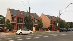
|
|
Figure 7 – Existing childcare
centre at 76Pegler Avenue
|
Figure 8 – Multi dwelling
development at 335-339 Blaxcell Street
|
|
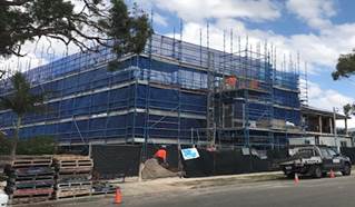
|
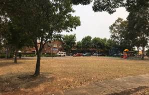
|
|
Figure 9 – 3 storey RFB under
construction at 69-71 Pegler Avenue
|
Figure 10 – View of
neighbourhood shops located at corner of Dellwood Street and Blaxcell Street,
with William Lamb Park in the foreground
|
Future character of the area
Given the proximity of the subject
site to the neighbourhood shops to the north-west and the R4 land use zoning of
the site and surrounding land to the north and west, it is considered that the
height, bulk and scale of the proposed development is not out of character with
the intended future character of the area. The proposed scale and design of the
development is considered to be consistent with the desired future character of
the locality, having regard to the R4 High Density Residential land use
zoning.
The R3 Medium Density Residential
land immediately to the east and south of the site presents a transition from
the higher density built forms envisaged to the north and west; in proximity to
the neighbourhood shops, through to the R2 Low Density Residential land further
south along Oakleigh Avenue and on the eastern side of Blaxcell Street.
Step 3 - Determine if the
development is compatible with the character of the local area.
In accordance with the Land and
Environment Court’s ‘Planning Principle’ and case law
compatibility is best defined as ‘capable of existing together in
harmony’. In order to test compatibility two questions are to be considered.
These questions, as well as a response to each, are provided below:
· Are
the proposal’s physical impacts on surrounding development acceptable?
The physical impacts include constraints on the development potential of
surrounding sites.
The building height, FSR, building
setbacks, deep soil and landscaping of the proposed development are designed to
maintain the harmony within the streetscape, whilst contributing to the site
context and constraints. The proposal being a permissible land use, meets the
FSR requirement (in accordance with ARH SEPP) and contributes to the provision
of affordable housing within close proximity of public transport and the
neighbourhood centre. Appropriate setbacks and privacy treatments are provided
to minimise any adverse impacts to the adjoining properties.
· Is
the proposal’s appearance in harmony with the buildings around it and the
character of the street?
To be compatible, a development
should contain or at least respond to the key aesthetic elements that make up
the character of the surrounding area. The size of the basement maximises
landscaping and deep soil zones on site. The front setback proposed is
consistent with the existing streetscape, a condition is to be imposed for the
planting of mature tree, and the replacement of the street tree at the
site’s Pegler Avenue frontage to ensure the continuity of the established
street tree pattern lining Pegler Avenue. The proposal is considered to
maintain an appropriate residential character which is consistent with the
streetscape.
In conclusion, the proposal will
maintain the harmony within the general streetscape, and suitably fits in the
local character of the locality.
(e) State
Environmental Planning Policy (Vegetation in Non-Rural Areas) 2017
The proposal does not exceed the
biodiversity offsets scheme threshold. Therefore, the proposed vegetation
removal is considered acceptable. Please refer to the DCP compliance table for
further discussion.
(f) State
Environmental Planning Policy (Building Sustainability Index: BASIX) 2004
BASIX Certificate 1051839M_02
dated issued on 17 July 2020 prepared by Building & Energy Consultant
Australia has been submitted with Council and is considered to be satisfactory.
Regional Environmental Plans
The proposed development is
affected by the following Regional Environmental Plans:
(a) Sydney
Regional Environmental Plan (Sydney Harbour Catchment) 2005
The subject site is identified as
being located within the area affected by the Sydney Regional Environmental Plan
(Sydney Harbour Catchment) 2005. The proposed development raises no issues as
no impact on the catchment is envisaged.
(Note: - the subject site is not
identified in the relevant map as ‘land within the ‘Foreshores and
Waterways Area’ or ‘Wetland Protection zone’, is not a
‘Strategic Foreshore Site’ and does not contain any heritage items.
Hence the majority of the SREP is not directly relevant to the proposed
development).
Local Environmental Plans
Parramatta Local Environmental
Plan (PLEP) 2011
The provision of the Parramatta
LEP 2011 is applicable to the development proposal. It is noted that the
development achieves compliance with the key statutory requirements of the
Parramatta LEP 2011 and the objectives of the R4 High Density Residential zone.
(a) Permissibility:
-
The proposed development is
defined as a ‘boarding houses’ and is permissible in the R4 High
Density Residential zone with consent.
boarding house means a building
that—
(a) is
wholly or partly let in lodgings, and
(b) provides
lodgers with a principal place of residence for 3 months or more, and
(c) may
have shared facilities, such as a communal living room, bathroom, kitchen or
laundry, and
(d) has
rooms, some or all of which may have private kitchen and bathroom facilities,
that accommodate one or more lodgers, but does not include backpackers’
accommodation, a group home, hotel or motel accommodation, seniors housing or a
serviced apartment. The relevant matters to be considered under Parramatta LEP
2011 and the applicable clauses for the proposed development are summarised
below.
A comprehensive LEP assessment is
contained in Appendix B.
Figure
11 – Parramatta LEP 2011 Compliance Table
|
DEVELOPMENT
STANDARD
|
COMPLIANCE
|
DISCUSSION
|
|
4.3 Height of Buildings
Maximum 11 metres
|
Y
|
The development proposes a maximum building height of 11m
at the highest point, being the ridge line at the eastern rear portion of the
site (RL29.84m AHD) and the natural ground level below that point (RL18.84m
AHD) as shown on the overlay roof plan.
|
|
4.4 Floor Space Ratio
(FSR)
Maximum 0.8:1
|
N
(but complies with the ARH SEPP)
|
The development maintains a total FSR of 1.053:1, which is
below the maximum FSR permissible under the ARH SEPP, which provides a bonus
for development which provides affordable rental housing.
Refer to the discussion in the ARH SEPP section of this
report.
|
|
5.10 Heritage
Conservation
|
N/A
|
The site is not identified as a heritage item, is not
within a heritage conservation area and is not in the vicinity of any
heritage items.
The site is located in proximity to the Blaxcell Estate
Conservation Area to the south, however the development is considered
sufficiently removed so as not to have an impact on this conservation area.
|
|
6.1 Acid Sulfate soils
Class 5
|
Y
|
The site is identified as
containing Class 5 Acid Sulphate Soils. No deep excavation work is required
or proposed. No detailed assessment is required.
|
|
6.2 Earthworks
|
Y
|
The development includes
earthworks, including excavation to facilitate the construction of the
basement. Conditions of consent have been recommended to address erosion and
sediment impacts generated by earthworks as well as a dilapidation condition
to address the impact of the earthworks on the adjoining properties.
|
|
6.3 Flood planning
|
N/A
|
The site is not flood affected.
|
The provisions of any proposed
instrument that is or has been the subject (EP&A Act s4.15 (1)(a)(ii))
(a) Draft
State Environmental Planning Policy (Environment)
The draft SEPP relates to the
protection and management of our natural environment with the aim of
simplifying the planning rules for a number of water catchments, waterways,
urban bushland, and Willandra Lakes World Heritage Property. The changes
proposed include consolidating the following seven existing SEPPs:
· State
Environmental Planning Policy No. 19 – Bushland in Urban Areas
· State
Environmental Planning Policy (Sydney Drinking Water Catchment) 2011
· State
Environmental Planning Policy No. 50 – Canal Estate Development
· Greater
Metropolitan Regional Environmental Plan No. 2 – Georges River Catchment
· Sydney
Regional Environmental Plan No. 20 – Hawkesbury-Nepean River (No.2-1997)
· Sydney
Regional Environmental Plan (Sydney Harbour Catchment) 2005
· Willandra
Lakes Regional Environmental Plan No. 1 – World Heritage Property.
The draft policy will repeal the
above existing SEPPs and certain provisions will be transferred directly to the
new SEPP, amended and transferred, or repealed due to overlaps with other areas
of the NSW planning system.
Changes are also proposed to the
Standard Instrument – Principal Local Environmental Plan. Some provisions
of the existing policies will be transferred to new Section 117 Local Planning
Directions where appropriate.
(b) Draft
Cumberland Local Environmental Plan (Draft CLEP)
The Draft Cumberland Local
Environmental Plan (Draft CLEP) has been prepared by Cumberland Council to
provide a single planning framework for the future planning of Cumberland City.
The changes proposed seek to harmonise and repeal the three existing LEPs
currently applicable to the Cumberland local government area, those being:
· Holroyd Local
Environmental Plan 2013,
· Parramatta Local
Environmental Plan 2011, and
· Auburn Local
Environmental Plan 2010.
The current planning controls for
the subject site, as contained within the Parramatta LEP 2011 are not proposed
to change under the Draft CLEP.
The provisions of any
Development Control Plans (EP&A Act s4.15 (1)(a)(iii))
The Parramatta DCP 2011 provides
guidance for the design and operation of development to achieve the aims and
objectives of the PLEP 2011. A comprehensive assessment and compliance table is
contained in Appendix C.
The following compliance table
highlights non-compliances with the DCP controls, which relate primarily to
site frontage, side setbacks and building separation, deep soil, and
landscaping. These controls however relate to the preliminary building envelope
designed for residential flat buildings and not specifically for boarding
houses. The development controls under Table 3.1.3.7 of Parramatta DCP 2011
should be used as a guide, given that the assessment against the character of
the local area carried out under the ARH SEPP section has considered the built
form compatibility and that the site constraint due to the inability of the
applicant to purchase the site to the north has been assessed under the site isolation
principles below. The variations sought are considered satisfactory on merit,
in this instance, as discussed in the following table.
Figure
12 –Parramatta DCP 2011 Compliance Table
|
Control
|
Proposed
|
Compliance
|
|
Frontage – min 24m for
sites with single site frontage
|
Existing site frontage 14.63m
|
The
site isolation principles established by the Land and Environment Court have
been considered in the assessment of the development application. Development proposals that create land locking or site
isolation shall provide documentation that demonstrates a reasonable attempt
has been made by the applicants to purchase the land locked site(s),
including written valuation that represent the affected sites potential
value.
Consistent
with the Planning Principle of Karavallas v Sutherland Shire Council [2004]
NSWLEC 251 (Karavellas v Sutherland Shire Council), the
application is supported by an offer to the owner of the isolated property at
65 Pegler Avenue, with the offer being based on two recent independent
valuations. Two valuation reports prepared
by two independent registered valuers indicating the market values of the
subject site were issued, and the highest and best value was considered based
on the likely additional yield the site would be able to generate. On this
basis, the offer was made to purchase the property higher than the valuations
tendered. The owner of 65 Pegler Avenue did not respond to any of offer made.
The offer is deemed a reasonable offer
by the Planning Principle of Karavallas v Sutherland Shire Council.
In
the judgement of Cornerstone Property Group Pty Ltd Vs Warringah Council
[2004] NSWLEC 189, planning principle to site isolation was further
considered as follows: -
Can orderly and economic use
and development of the separate site be achieved if amalgamation is not
feasible.
Future redevelopment sites
There is no specific pattern of
site amalgamation applying on the properties along Pegler Avenue. The
adjoining site at 65 Pegler Avenue, which occupies an area of 458m², is
also located on the R4 High Density Residential zone. The existing properties
located north of 65 Pegler Avenue are also undeveloped and remain as single
dwelling houses despite of their development potential. Future amalgamation
of these properties will allow adequate width and breath for a
significant/larger apartment building that is compliant with the relevant
planning controls. In the event of any future redevelopment, it would need to
be documented as part of any development application. At the present time,
Council officers are not aware of any plans to redevelop the parcel of land.
|
|
Side setback to demonstrate compliance with Section 3F
‘Visual privacy’ of the ADG
|
The proposed 3m side setbacks
|
If Part 3F were to be strictly applied to the development,
the building would need to be setback 6m from the northern and southern
property boundary which is not feasible to achieve given the site width is
only 14.63m. Despite the non-compliant side setbacks proposed, the upper
levels openings facing the side boundaries are to be provided with high
windows with sill height of 1.5m above the finished floor level of the
boarding rooms to minimise overlooking into adjoining properties. A condition
is also to be imposed on the north facing windows of the communal room to be
provided with high windows with sill height of 1.5m above the finished floor
level, and the elevated communal seating area adjoining the northern side
boundary is to be converted into non-accessible landscaping/planter boxes.
|
|
Deep soil zone – minimum 30% of which at least 50%
is to be located at the rear of the site
Minimum dimensions 4m x 4m
|
The development provides a deep soil figure of 22.3%.
|
It is identified that the controls relate primarily to
residential flat buildings and not boarding houses. Notwithstanding this, the
site is significantly constrained due to the inability of the applicant to
purchase the site to the north. Given the circumstances that prevail, it is
considered appropriate to permit the development as the amended plans show an
increase in deep soil zone that did not previously exist.
|
|
Landscaped area – minimum 40% (including deep soil
zone)
|
The development provides a total 30.1%.
|
Given the compliance of the development with the deep soil
requirements of the ADG and the siting and landscaping proposed, a variation
to the landscape requirement is considered acceptable.
|
Irrespective of these departures,
for the reasons discussed above, it is considered that the proposal performs
adequately from an environmental planning viewpoint and may be supported.
The provisions of any planning
agreement that has been entered into under section 7.4, or any draft planning
agreement that a developer has offered to enter into under section 7.4
(EP&A Act s4.15(1)(a)(iiia))
There is no draft planning
agreement associated with the subject Development Application.
The provisions of the
Regulations (EP&A Act s4.15 (1)(a)(iv))
The proposed development raises no
concerns as to the relevant matters arising from the Environmental Planning and
Assessment Regulations 2000 (EP&A Reg).
The Likely Environmental,
Social or Economic Impacts (EP&A Act s4.15 (1)(b))
It is considered that the proposed
development will have no significant adverse environmental, social or economic
impacts in the locality.
The suitability of the site for
the development (EP&A Act s4.15 (1)(c))
The subject site and locality are
not known to be affected by any natural hazards or other site constraints
likely to have a significant adverse impact on the proposed development.
Accordingly, it is considered that the development is suitable in the context
of the site and surrounding locality.
Submissions made in accordance
with the Act or Regulation (EP&A Act s4.15 (1)(d))
|
Advertised (newspaper)
|
Mail
|
Sign
|
Not Required
|
In
accordance with Council’s Notification requirements contained within the
Parramatta DCP 2011, the proposal was publicly notified for a period of
21 days between 13 August 2020 and 3 September 2020. The notification generated
35 submissions, including 1 petition with 100 signatures, in which 19 of these
submissions are unique submissions in respect of the proposal and with none
disclosing a political donation or gift. The issues raised in the public
submissions are summarised and commented on as follows:
Figure
13 – Submissions summary table
|
Issue
|
Planner’s Comment
|
|
Insufficient number of car parking spaces provided for the
development.
|
A total of 11 car parking spaces would be provided within
the basement level, while the PDCP 2011 only requires a minimum of 4 car
parking spaces for the proposed boarding house. The development proposes an
exceedance of 7 car parking spaces above the minimum requirements and is
therefore considered satisfactory.
|
|
Traffic congestion increased by the development will
create issues, including road safety and prevent access of ambulance to
street.
|
Council’s Development Engineer has assessed the
traffic impacts of the development and they are deemed to be satisfactory.
Furthermore, the development provides in excess of the minimum car parking
requirement stipulated by PDCP 2011. When the site can accommodate the
required number of car parking spaces, the development is not anticipated to
result in adverse impacts to the locality and will not prevent the access of
ambulance into the street.
|
|
Nature of boarding house up to 40 people is not suitable
and not appropriate to the locality that is a quiet street and is in vicinity
of existing childcare centres. The development should be located nearby
trains station and public transport.
|
Both boarding houses and childcare facilities are the
types of development permitted within R4 High Density Residential zone. The
purpose of the boarding house is to assist affordable rental within the
locality and the occupants will be subject to house rules contained in the
plan of management, which is considered sufficient to ensure that the
existing development adjoining to the subject site with young children
present will not be affected by any anti-social behaviour from the occupants
of the boarding house. The site is also located within an accessible area,
which is a short walking distance to public transport/bus stops.
|
|
Over supply of housing within the street, ie., one
bedrooms, and over development on the site, not in the public interest given
the number of submissions received.
|
The purpose of the boarding house is to assist the
provision of affordable rental housing within the locality, which is in the
form of self-contained boarding rooms and not an apartment like
accommodation. The issue raised by the submissions have been addressed
throughout the body of this report. The proposal has also been assessed
against the relevant controls and found to be satisfactory.
|
|
Increase crimes and paedophiles, risk, unsociable
behaviours and safety of children. Impact on mental health and family
concerns.
|
The boarding house will be privately run and is not
targeted to cater for people with criminal background. The proposal will
allow the increase in supply of affordable rental within the locality. A Plan
of Management for the boarding house submitted with the application contains
house rules, which will be enforced as part of conditions of the consent. A
manager is proposed on site to monitor the operation of the boarding house.
There is no evidence to suggest that the boarding houses will contribute to
an increased crime rates and mental health issues and attract paedophiles or
unsociable behaviours.
|
|
The proposal will place more strains on existing local
services and medical centre.
|
The site is located in close proximity to an array of
existing local shops in different locations and within a short walking
distance to public transport/bus stops. The proposal is therefore not
anticipated to place more strains on existing local services and medical
centre.
|
|
The economic value of the neighbouring houses will be
negatively affected.
|
This is not a matter for consideration pursuant to Section
4.15 of the Act.
|
|
Noise during construction
|
Standard conditions for construction noise will be imposed
to ensure that noise management and measures to minimise the noise impact to
the neighbouring properties during construction will be implemented shall the
consent be granted for the proposed development.
|
|
Non-compliance with ARH SEPP - out of character.
|
As discussed in the main body of the report, given the
proximity of the subject site to the neighbourhood shops to the north-west
and the R4 High Density Residential zone and surrounding land to the north
and west, it is considered that the height, bulk and scale of the proposed
development is not out of character with the intended future character of the
area.
|
|
Non-compliance with PDCP 2011 - narrow lot width.
|
As discussed in the main body of the report, the site
isolation principles established by the Land and Environment Court have been
considered in the assessment of the development application. The proposed
development satisfies the principles established by the Land and Environment
Court and is supported.
|
|
Privacy concerns – overlooking.
|
The proposed elevations of the development contain high
windows with sill height of 1.5m above the finished floor level, which are
considered to adequately address privacy impacts. A further condition is to
be imposed to minimise any overlooking from the communal room north facing
windows and elevated communal area on the northern side, should consent be
granted for the proposed development.
|
|
Lack of information regarding social impact statement and
acoustic report.
|
The proposal has been accompanied with acoustic report
that has been reviewed by Council’s Environmental Health Officer and is
considered satisfactory in addressing the impact of the proposed development.
A social impact statement is not required to be submitted with the
development application.
|
The public interest (EP&A Act s4.15(1)(e))
In view of the foregoing analysis
it is considered that the development, if carried out subject to the conditions
set out in the recommendation below, will have no significant adverse impacts
on the public interest.
Cumberland Local
Infrastructure Contributions Plan 2020
The development would require the
payment of contributions in accordance with Cumberland Local Infrastructure
Contributions Plan 2020.
In accordance with the
Contribution Plan a contribution is payable, pursuant to Section 7.11 of the
EP&A Act, calculated on the cost of works. A total contribution of
$127,723.00 would be payable prior to the issue of a Construction Certificate.
Condition will be imposed accordingly.
Disclosure of Political
Donations and Gifts
The applicant and notification
process did not result in any disclosure of Political Donations and Gifts.
The development application has
been assessed in accordance with the relevant requirements of the Environmental
Planning and Assessment Act 1979, SEPP 55, ARH SEPP, BASIX SEPP, SREP 2005,
Draft Cumberland LEP, PLEP 2011 and PDCP 2011.
Having regard to the assessment of
the proposal from a merit perspective, Council may be satisfied that the
development has been responsibly designed and provides for acceptable levels of
amenity for future residents. It is considered that the proposal successfully
minimises adverse impacts on the amenity of neighbouring properties. Hence the
development, irrespective of the departures from the ARH SEPP and PDCP 2011, is
consistent with the intentions of Council’s planning controls and
represents a form of development contemplated by the relevant statutory and
non-statutory controls applying to the land.
For these reasons, it is considered
that the proposal is satisfactory having regard to the matters of consideration
under Section 4.15 of the Environmental Planning and Assessment Act 1979, and
the development may be approved subject to deferred commencement approval.
|
1. That
Development Application No. DA2020/0423 for Demolition of existing structures
and construction of a three storey boarding house comprising 24 boarding
rooms and a manager's room over basement car parking on land at 67 Pegler
Avenue SOUTH GRANVILLE NSW 2142 be approved as deferred
commencement consent subject to attached listed in Attachment 1.
2. Persons
whom have lodged a submission in respect to the application be notified of
the determination of the application.
|
1. Draft Notice
of Determination
2. Architectural
Plans
3. Landscape
Plans
4. Stormwater
Plans
5. Plan
of Management
6. Redacted
Submissions
7. Appendix
A - ARH SEPP Compliance Table
8. Appendix
B - Parramatta Local Environmental Plan 2011 Compliance Table
9. Appendix
C - Parramatta Development Control Plan 2011 Compliance Table
DOCUMENTS
ASSOCIATED WITH
REPORT LPP004/21
Attachment 1
Draft Notice of Determination
Cumberland Local Planning Panel Meeting
10 March 2021
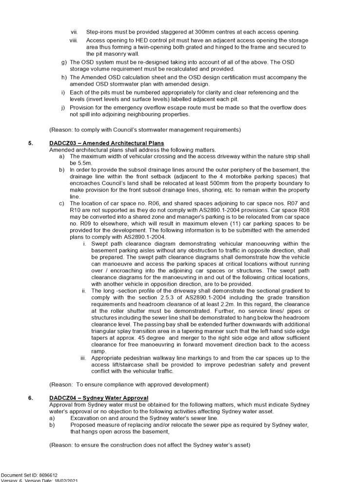
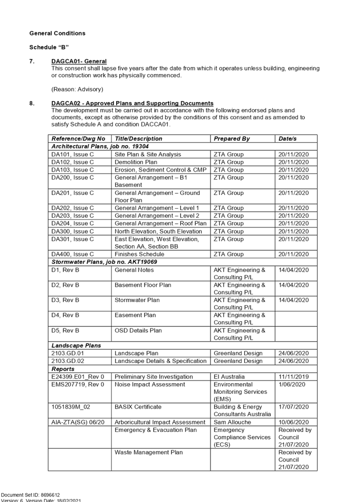


DOCUMENTS
ASSOCIATED WITH
REPORT LPP004/21
Attachment 2
Architectural Plans
Cumberland Local Planning Panel Meeting
10 March 2021
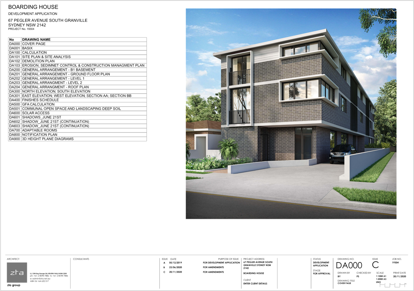
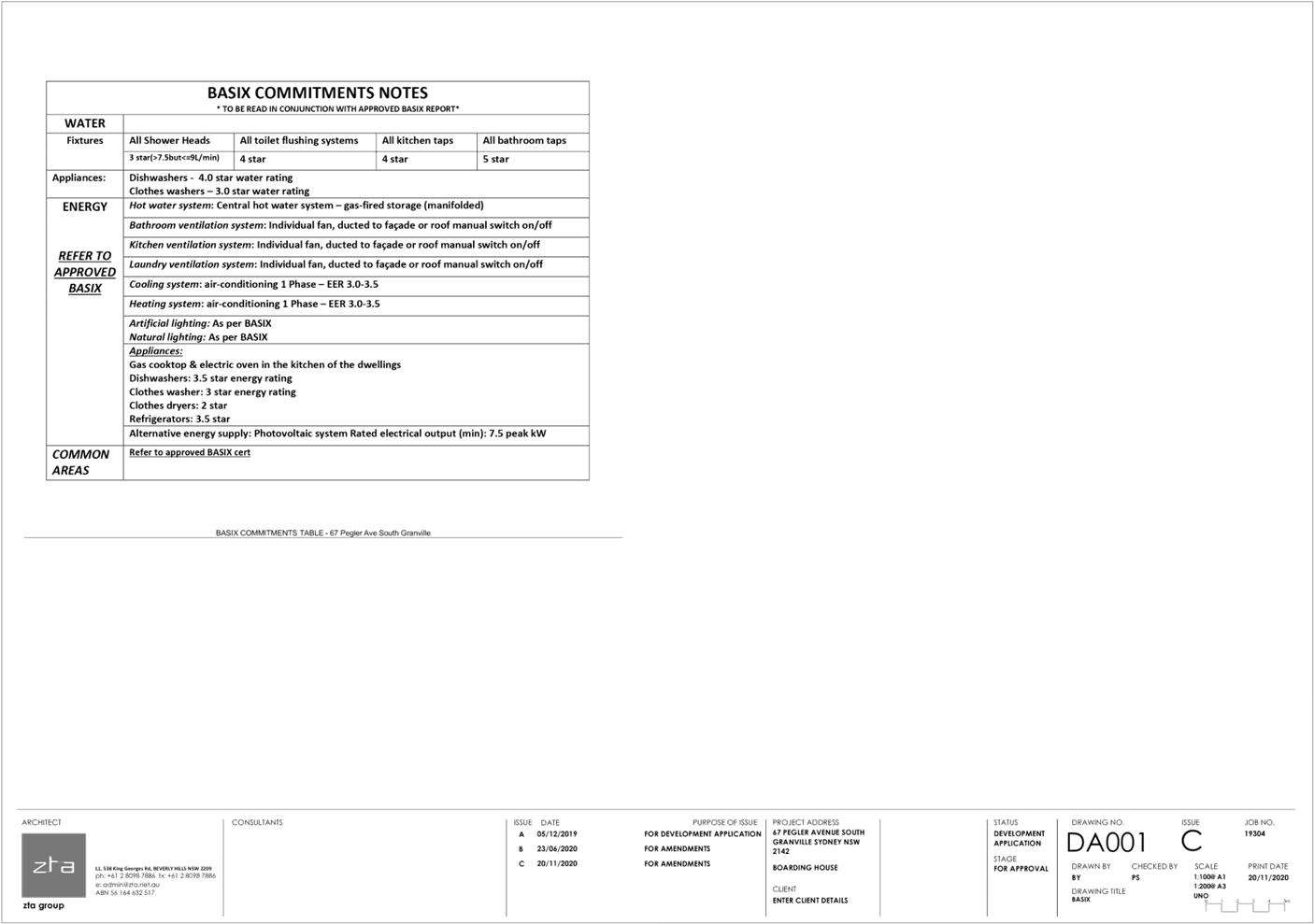
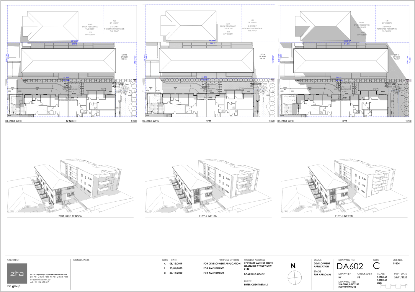
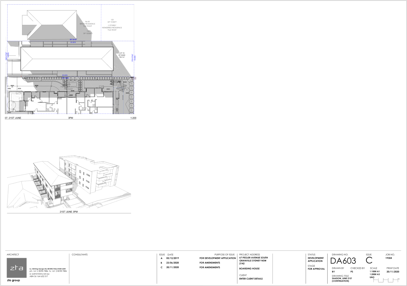
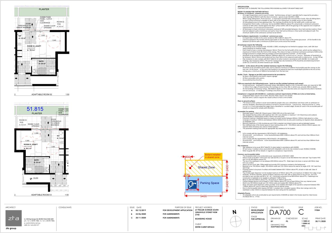
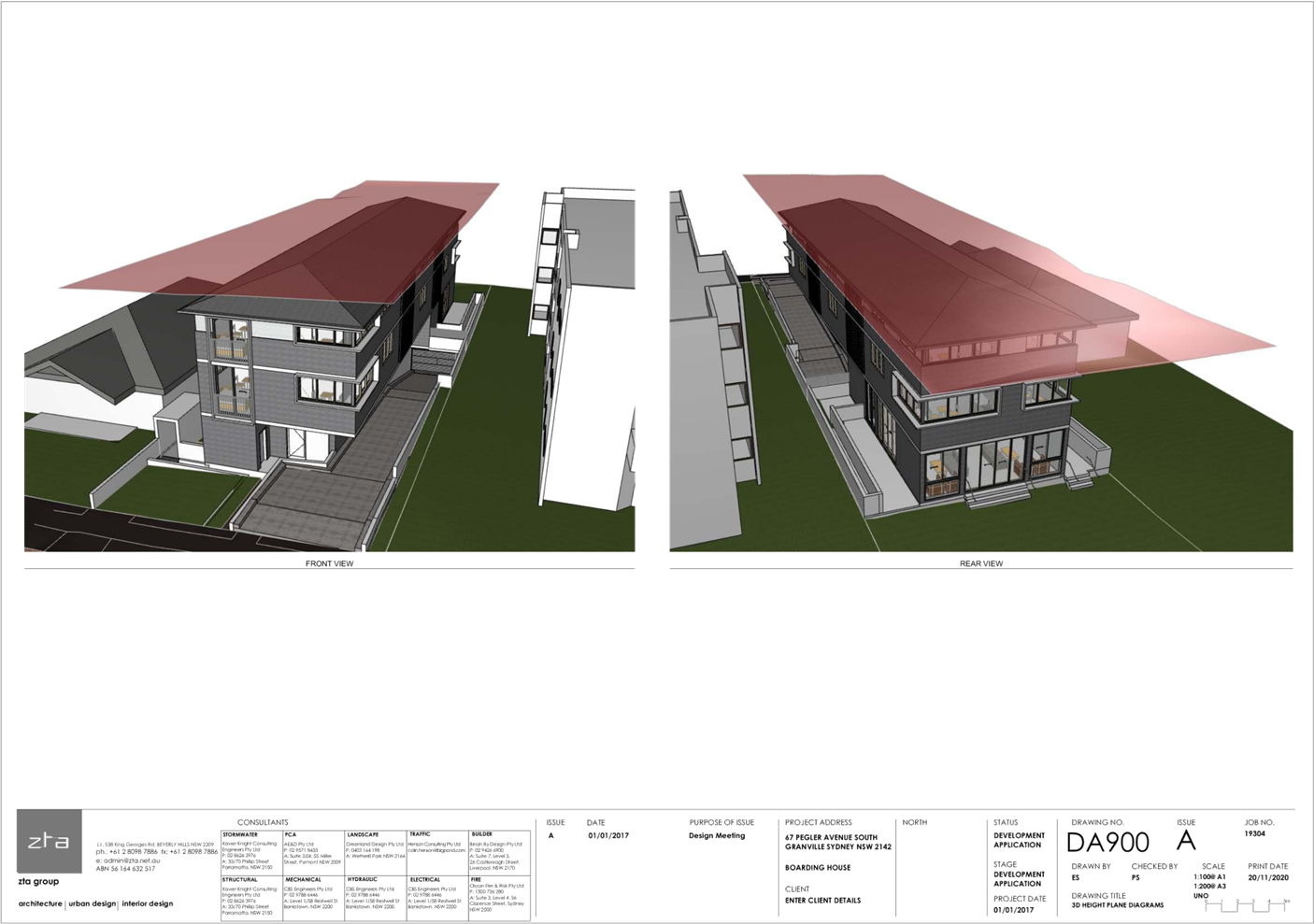
DOCUMENTS
ASSOCIATED WITH
REPORT LPP004/21
Attachment 3
Landscape Plans
Cumberland Local Planning Panel Meeting
10 March 2021
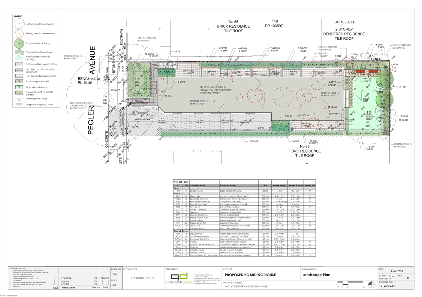
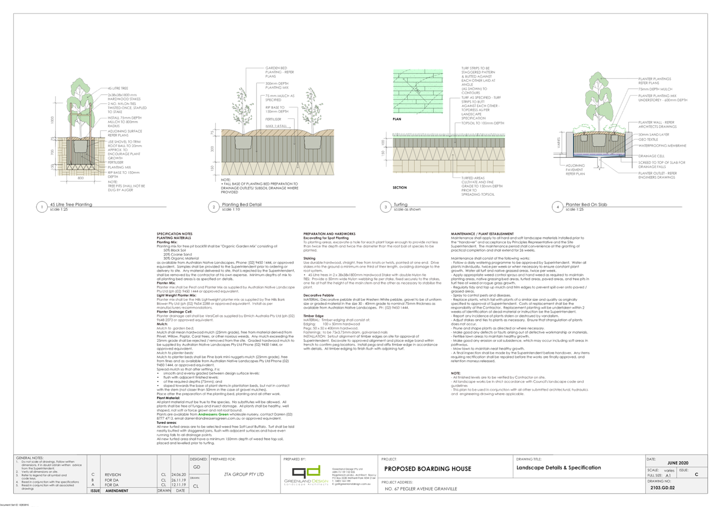
DOCUMENTS
ASSOCIATED WITH
REPORT LPP004/21
Attachment 4
Stormwater Plans
Cumberland Local Planning Panel Meeting
10 March 2021
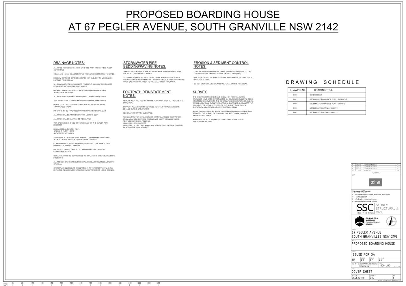
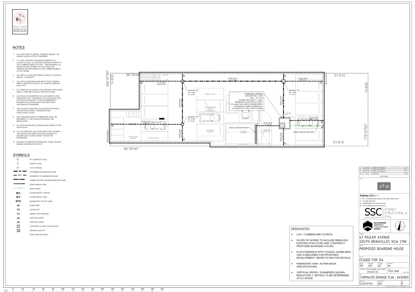
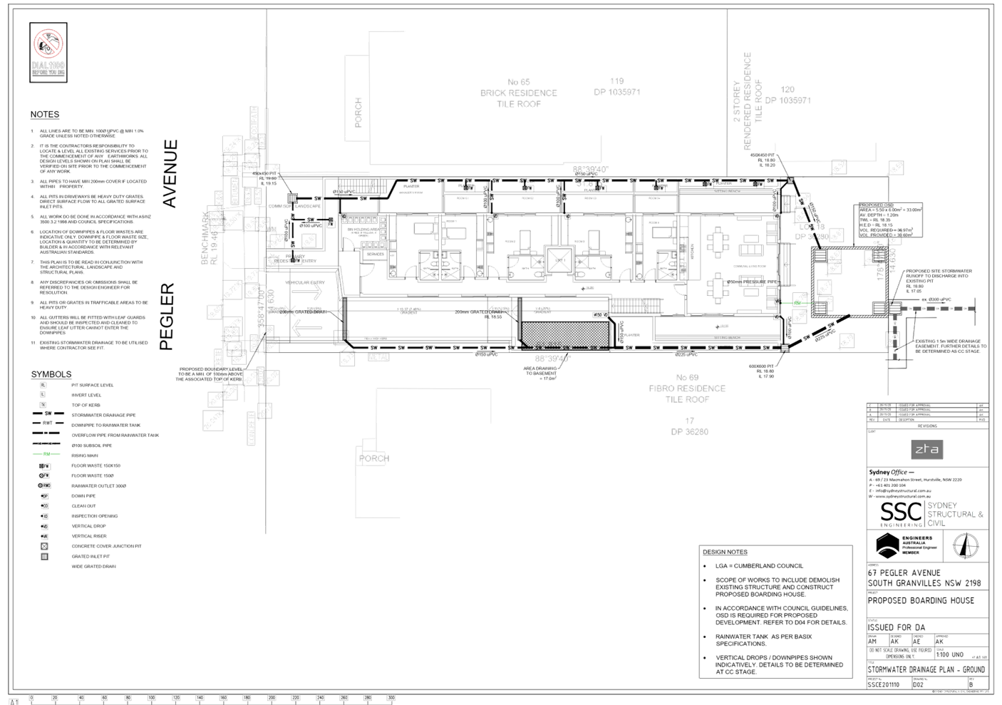
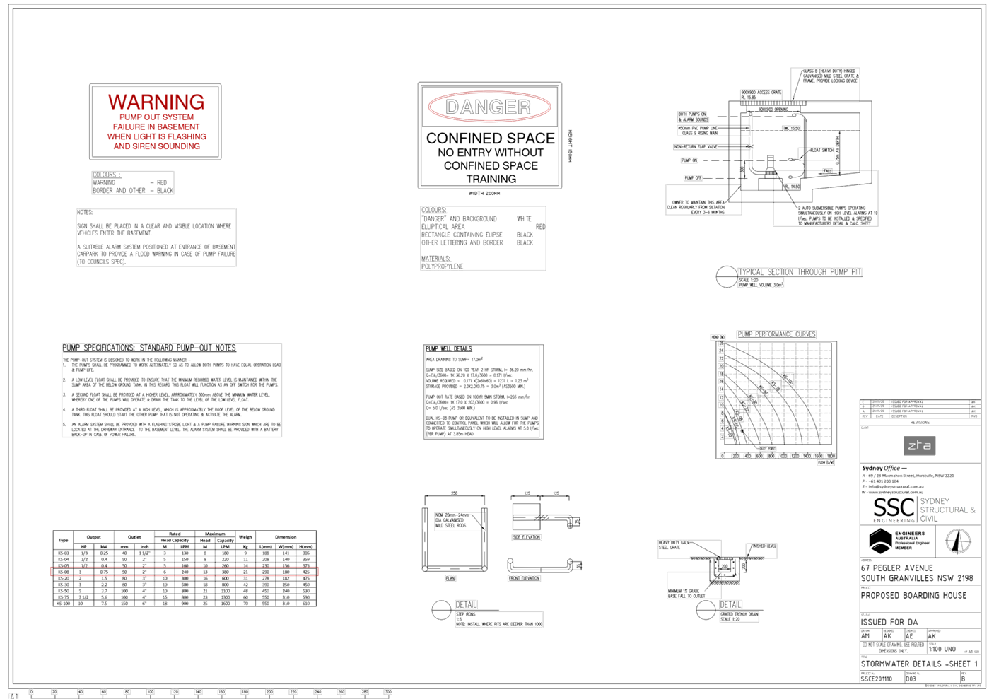
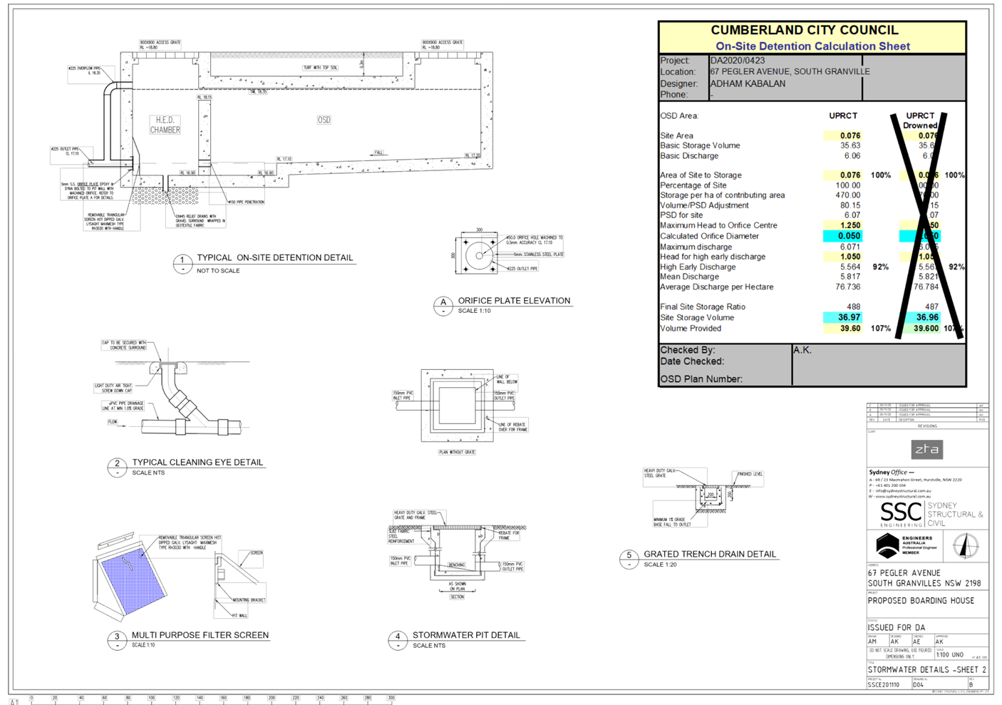
DOCUMENTS
ASSOCIATED WITH
REPORT LPP004/21
Attachment 5
Plan of Management
Cumberland Local Planning Panel Meeting
10 March 2021
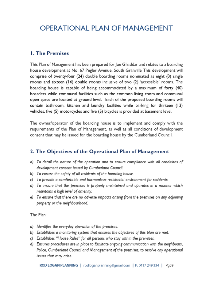


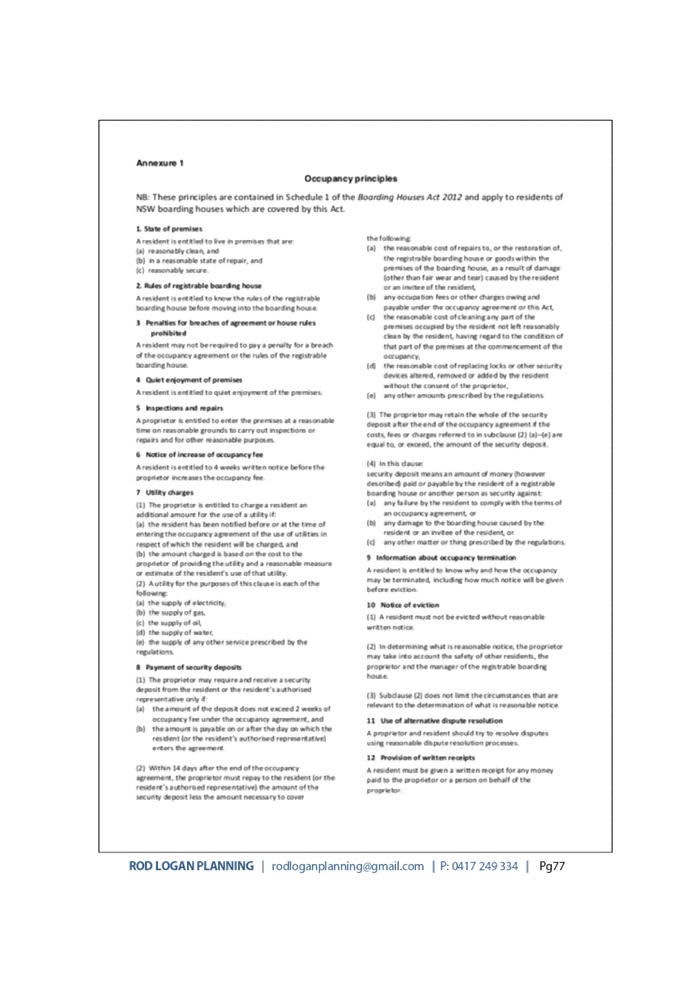
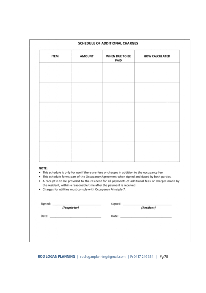
DOCUMENTS
ASSOCIATED WITH
REPORT LPP004/21
Attachment 6
Redacted Submissions
Cumberland Local Planning Panel Meeting
10 March 2021


DOCUMENTS
ASSOCIATED WITH
REPORT LPP004/21
Attachment 7
Appendix A - ARH SEPP Compliance Table
Cumberland Local Planning Panel Meeting
10 March 2021
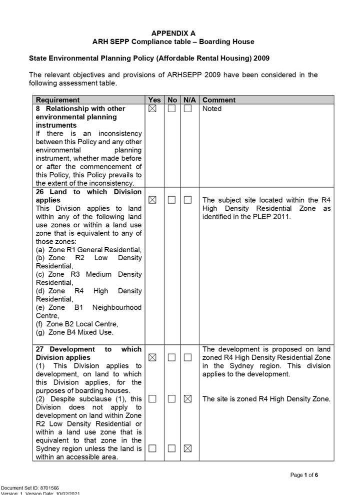
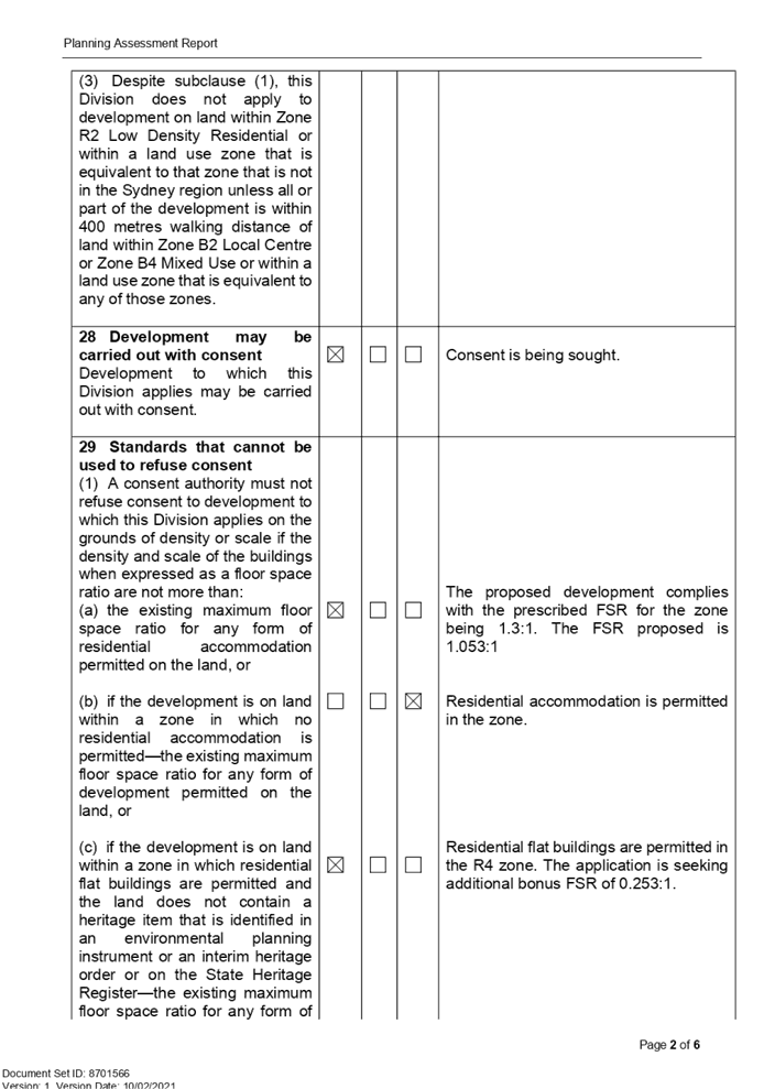
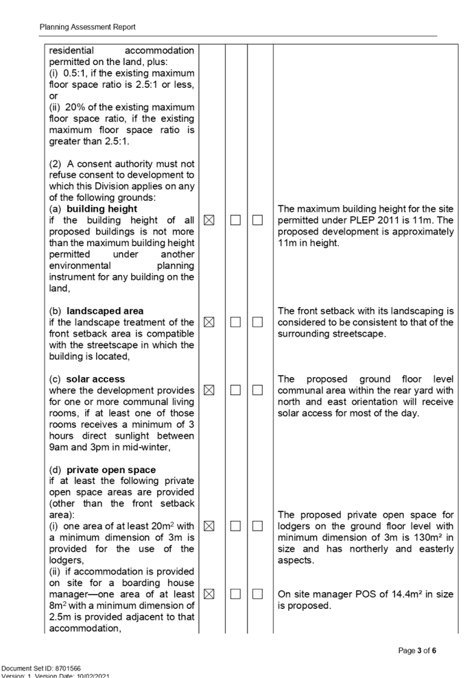
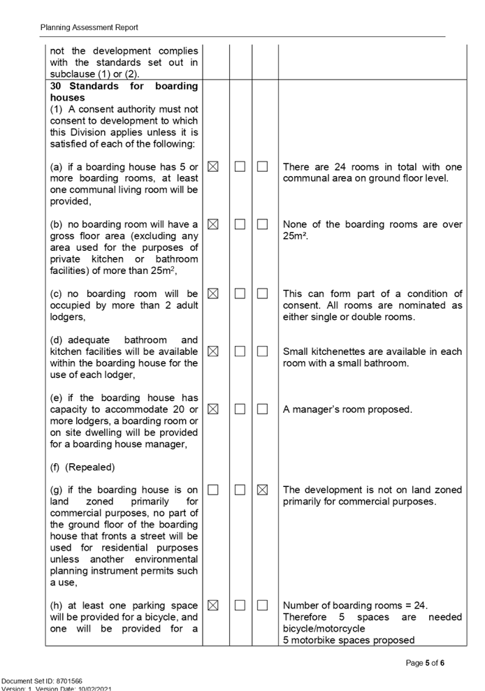
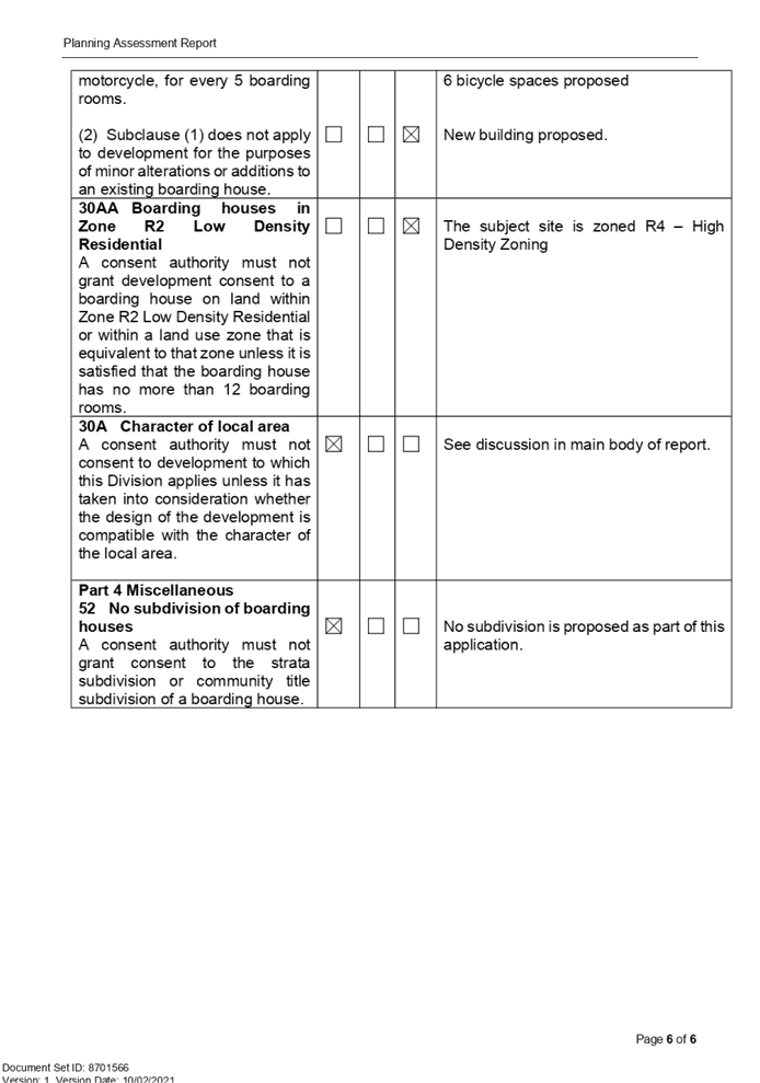
DOCUMENTS
ASSOCIATED WITH
REPORT LPP004/21
Attachment 8
Appendix B - Parramatta Local Environmental Plan 2011
Compliance Table
Cumberland Local Planning Panel Meeting
10 March 2021
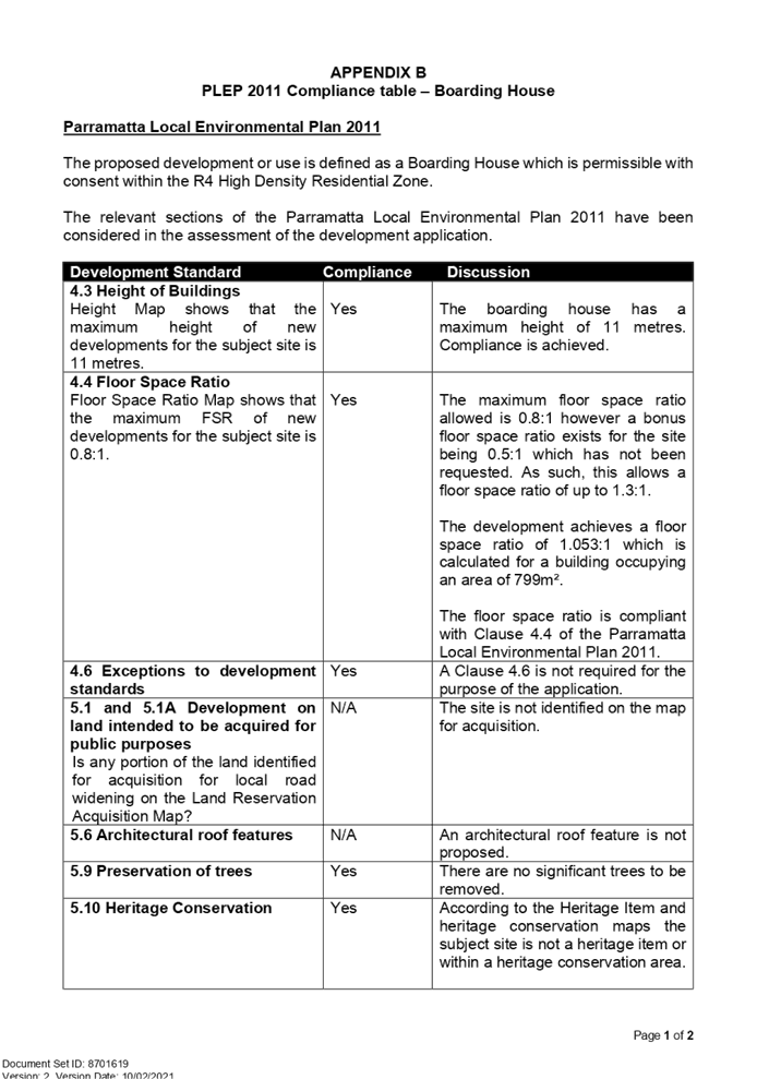
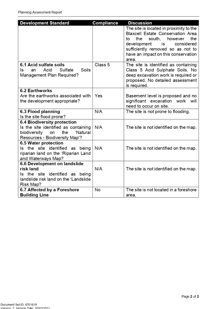
DOCUMENTS
ASSOCIATED WITH
REPORT LPP004/21
Attachment 9
Appendix C - Parramatta Development Control Plan 2011
Compliance Table
Cumberland Local Planning Panel Meeting
10 March 2021
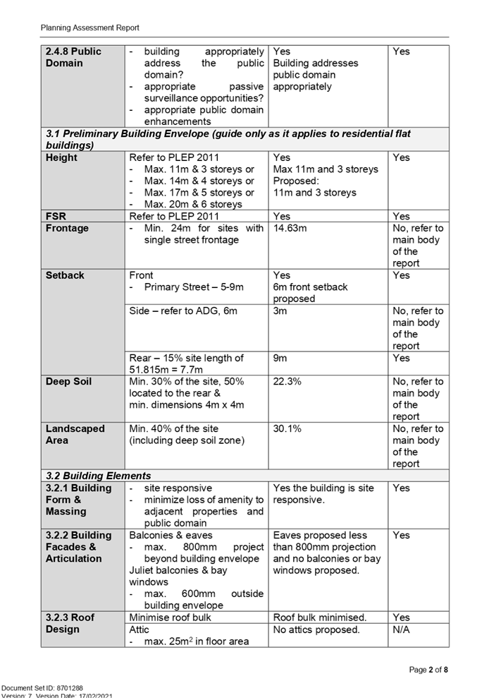
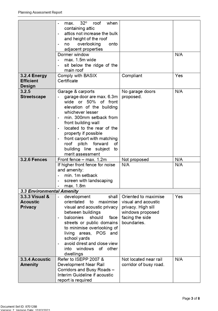
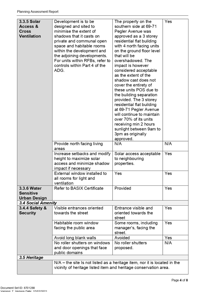
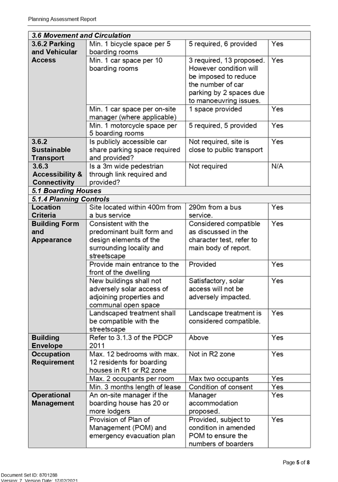
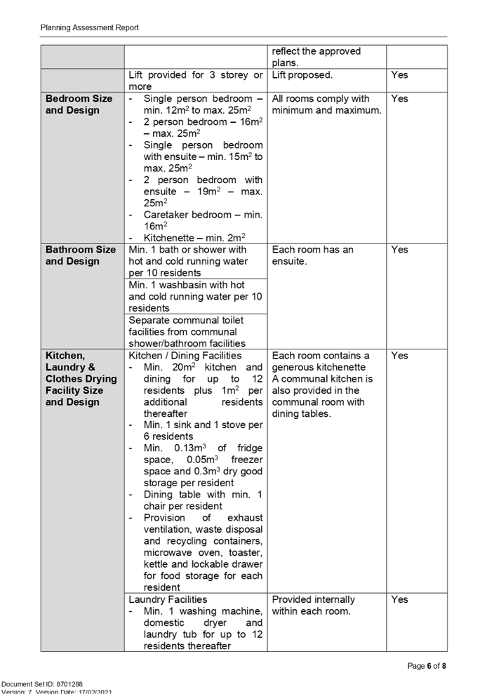
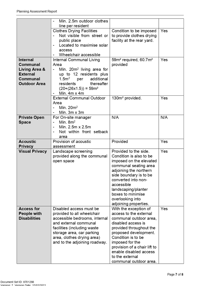
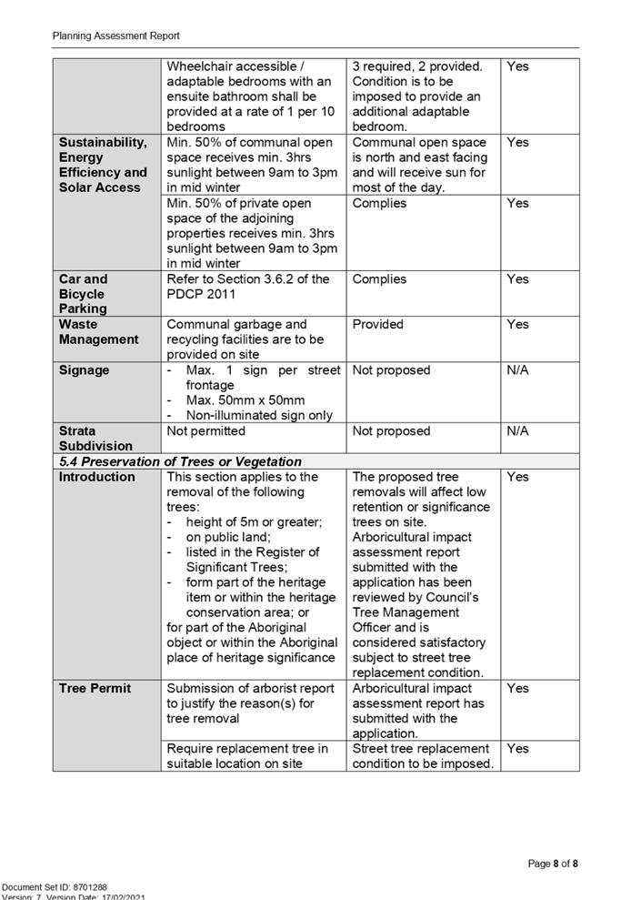
Cumberland
Local Planning Panel Meeting
10 March 2021
Item No: LPP005/21
Modification
Application for 25-28 Joyce Street, Pendle Hill
Responsible
Division: Environment
& Planning
Officer: Executive
Manager Development and Building
File
Number: MOD2020/0296
|
Application
lodged
|
7 September 2020
|
|
Applicant
|
Mr R Shalala - RRX Macquarie
Pty Ltd
|
|
Owner
|
RRX Macquarie Pty Ltd
|
|
Application
No.
|
MOD2020/0296
|
|
Description
of Land
|
25-28 Joyce Street Pendle Hill
- Lot 41 DP 668657, Lot 42 DP 657067
|
|
Proposed
Development
|
Section 4.55(2) modification
to reconfigure the internal layout of apartments, alter floor levels,
increase height of building to facilitate lift overrun and associated rooftop
facilities, introduce rooftop communal open space, façade changes and
built form amendments
|
|
Site
Area
|
935.9m2
|
|
Zoning
|
B2 – Local Centre
|
|
Disclosure
of political donations and gifts
|
Nil disclosure
|
|
Heritage
|
The subject site does not
contain a heritage item nor is the site located within the vicinity of a
heritage item or heritage conservation area.
The nearest heritage item is
Pendle Hill railway station which is approx. 127m from the subject site.
(Local significance and Item number I96 of HLEP2013).
|
|
Principal
Development Standards
|
FSR
Permissible: 2:1
Proposed: 0.198:1
Height of Buildings
Permissible: 17m
Proposed: Max. 19.1m
|
|
Issues
|
- Height of building
- Submissions
|
Summary:
1. Development
application DA2015/21/1 was determined by way of deferred commencement approval
by Council on 4 January 2016 for demolition of existing structures,
consolidation of 2 lots into 1 lot, construction of a 4 storey shop top housing
development over 2 levels of basement car parking accommodation 18 residential
units, 2 commercial tenancies and 31 carparking spaces.
2. Council
issued a deferred commencement letter on 19 March 2019 stating the consent was
operative and expires on 19 March 2023.
3. Modification
application MOD2020/0263 was approved by Council on 11 September 2020 for
amendment to the wording of condition no. 38 to allow for submission of a site
validation report in lieu of a site audit statement.
4. Modification
Application MOD2020/0296 was received on the 7 September 2020 being a Section
4.55(2) modification to reconfigure the internal layout of apartments, alter
floor levels, increase height of building to facilitate lift overrun and
associated rooftop facilities, introduce rooftop communal open space and facade
and built form amendments.
5. The
application was publicly notified to occupants and owners of the adjoining
properties for a period of 21 days between 23 September 2020 and 14 October
2020. In response, two submissions were received.
6. The
variations are as follows:
|
Control
|
Required
|
Provided
|
% Variation
|
|
Height of Buildings (Holroyd Local Environmental Plan)
|
Permissible: Max.
17m
Approved:16.4m (DA2015/21/1)
|
Maximum 19.1m (Lift overrun)
|
12.35%
|
|
Non-Compliances with Apartment Design Guide
|
|
No.
|
Required
|
Provided
|
Compliance
|
|
4D-2
|
In open plan layouts (where the living, dining and kitchen
are combined) the maximum habitable room depth is 8m from a window.
|
All units comply with exception of 106, 206 and 306 which
all propose a depth of approximately 9.10m. The above units include a high
level window on the western elevation living room wall to address privacy and
is considered satisfactory.
|
No (Variation of 13.75%)
|
|
4D-3
|
Bedrooms have a minimum dimension of 3m (excluding
wardrobe space).
|
All units comply with exception of bedroom 1 in units 106,
206 and 306 which include dimensions of 3.6m x 2.9m (excluding wardrobe
space) and is considered satisfactory.
|
No (Variation of 3.33%)
|
|
4E-1
|
All apartments are required to have primary balconies as
follows:
The minimum balcony depth to be counted as contributing to
the balcony area is 1m.
|
No change to the unit mix is proposed as part of the
modification application and the unit mix remains 3 x 1 bedroom units and 15
x 2 bedroom units; however, the layout and size of balconies of the
apartments have been amended.
The amended balcony layouts provide an area for each
balcony in excess of the ADG requirement.
Units 101, 102, 103, 201, 202, 203, 301, 302 and 303
include a balcony depth of 2.2m for majority of the balcony, including the
main access from internal living areas of the units. The balconies include a
depth of 1m for a small portion which is accessed from unit bedrooms to allow
for alternative access to the balconies.
The design of the above balconies is considered
satisfactory, as the balconies and units have been designed to create greater
internal and external amenity for future occupants of the units and the minor
portion of the balconies that is 1m in depth is a walkway to allow alternate
access to the balconies from bedrooms.
|
No for minimum depth
(Variation of 1m/50%)
|
Note: Only new
non-compliances have been discussed within the body of the report which are
proposed under the subject modification application.
7. The
application is being reported to the Cumberland Local Planning Panel (CLPP) for
determination as it is a development that contravenes a development standard by
more than 10% and exceeds Council’s delegation in relation to the
determination of a modification.
8. The
application is recommended for approval subject to the conditions in the draft
notice of determination at Attachment 1.
Report:
Subject Site and Surrounding
Area
The subject site is known as 25-28
Joyce Street, Pendle Hill and is legally described as Lot 41 In DP668657 and
Lot 42 in DP657067. The site has an area of approx. 935.9m2 and has a frontage
to Joyce Street of 31.16m, a western boundary of 29.5m, an eastern boundary of
32.18m and a rear boundary of 31.89m.
A construction certificate was
issued on 16 November 2020 by a Private Certifier and as a result, demolition
of the site is complete. Construction work has commenced on the project and
works are progressing.
The subject site is zoned B2 - Local
Centre and, to the rear (southern elevation), the sites are zoned R4 –
High Density Residential. The site to the east at 29 to 33 Joyce Street
comprises a recently completed four storey mixed use retail / apartment
building which includes a basement car park for 63 vehicles.
Directly adjoining the site to the
west is a single storey dwelling used as a surgery centre and further to the
west is the Pendle Hill commercial area. There are older 3 storey apartment
buildings and newer 4 storey apartment buildings situated on various allotments
to the rear. A railway line is situated to the north of Joyce Street and the
Pendle Hill Railway Station is close by.
The location of the site is shown
below:
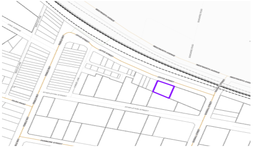
Figure 1 –
Locality Plan of subject site indicated by purple outline.
Source: Cumberland
City Council Intramaps
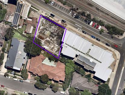
Figure 2 –
Aerial view of subject site as of 27 December 2020 outlined in purple Source:
Cumberland City Council Intramaps
Description of the Proposed
Development
Council has received a
modification application to reconfigure the internal layout of apartments,
alter floor levels, increase height of building to facilitate lift overrun and
associated rooftop facilities, introduce rooftop communal open space and facade
and built form amendments.
The proposed changes include the
following:
|
Level
|
Proposed Modifications
|
|
Basement level 1
|
· Changes to proposed RL Levels
ranging from RL42.10 - RL40.28 to proposed RL42.700 to RL40.625.
· Relocation of the stop/go light
near south-western entry/exit of basement.
· Relocation of the car wash bay to
the south east corner of basement combined with residential visitor space.
· Amendment to the bicycle parking
layout.
· Relocation of the loading zone.
· Removal of storage from central
area and north eastern corner of the basement.
· Addition of storage adjacent to
the central staircase and north west corner of the site.
· Reconfiguration of the MSB room.
· Change of layout and location of
allocated car parking spaces.
|
|
Basement level 2
|
· Changes to proposed RL levels from
RL39.33 – RL37.75 to proposed RL39.700 to RL37.600.
· Change of layout and location of
allocated car parking spaces.
· Modification to car parking
layout, including relocating 2 accessible spaces from south elevation to
north elevation.
· Modification to storage of
south-eastern corner.
· Addition of storage to north west
corner.
· Removal of storage from each
residential unit owner car space.
· Addition and amendments of storage
allocated to units located near the centre of the basement adjacent to
staircase, and western elevation adjacent to lift and under vehicle ramp.
· Addition of stop/go light near
south-western entry/exit ramp of basement level.
|
|
External Ground floor
|
· Deletion of communal drying area
from south western rear corner and proposed to be artificial turf and various
groundcover plantings.
· The Finished Floor Level of the
rear BBQ and communal area is now set at RL 45.580 instead of RL 44.65.
· Modified accessibility ramp on the
Joyce street frontage and eastern side for access to rear BBQ and communal
open space area.
· Modified basement stairwell on
eastern elevation.
· Reduction in NGL for rear communal
open space area from RL 45.18 to RL 45.10.
· Minor level change to vehicle
access ramp on western elevation.
· Façade modifications.
|
|
Internal ground floor
|
· Minor relocation and modification
of size and layout of residential waste area.
· Increase to residential storage
area located near central southern elevation and amendments to storage area
on the south western corner.
· Removal of toilet located near
central southern elevation.
· Fire escape stairs located towards
rear south eastern portion of building amended to be basement stairs.
· Previous basement stairs located
towards centre of building deleted.
· Minor relocation of
electric/services area adjacent to lift.
· Layout change to bathroom and
kitchen located on the eastern and western side elevations.
· Minor floor area amendments to
retail shop 1 and 2 and shop 1 and 2 storage areas.
· Modification of lobby/corridor
layout including to be accessible and a fire escape.
|
|
First floor and second floor
|
· No change to unit mix (Total of 6
units for each floor comprising 5 x 2 bedroom units (Including 1 adaptable
unit being unit 106 and unit 206) and 1x 1 bedroom unit).
· Façade modifications.
· Minor modification to building
envelope near centre of building on eastern side elevation.
· Reduction in corridor width from
1.8m to 1.63m.
· Internal layout reconfiguration
for all units.
· Various External window and door
changes.
· Increase in floor area for units
101, 102 and 103 for level 1 and units 201,202 and 203 for level 2.
· Decrease in floor area for units
104, 105 and 106 for level 1 and units 204,205 and 206 for level 2.
· Introduction of a study area to
units 101, 102 and 103 for level 1 and to units 201, 202 and 203 for level 2.
· Introduction of storage area to
units 102,104,105 and 106 for level 1 and to units 202,204,205 and 206 for level
2.
· Introduction of an ensuite to
units 102,103,104 and 106 for level 1 and to units 202,203,204 and 206 for
level 2.
· Modification of layout of all
balconies mainly for balconies for units 101,102,103 on level 1 and units
201,202 and 203 on level 2 fronting Joyce Street (North elevation) due to
reconfiguration of unit layouts. This includes a reduction in depth of the
balconies in some sections of the balconies and an increase in maximum depth
from 2m to 2.2m for other sections of the balconies.
|
|
Third floor
|
· No change to unit mix (Total of 6
units) comprising 5x 2 bedroom units (Including 1 adaptable unit being unit
306) and 1x 1 bedroom unit.
· Reduction in floor level from
RL56.450 to RL56.350.
· Façade modifications.
· Various External window and door
changes.
· Minor modification to building
envelope near centre of building on eastern and western side elevation.
· Reduction in corridor width from
1.8m to 1.63m.
· Internal layout reconfiguration
for all units.
· Increase in floor area for units
302 and 303.
· Decrease in floor area for units
301, 304, 305 and 306.
· Introduction of storage area to
all units for level 3.
· Introduction of an ensuite to unit
302,303 and 306.
|
|
Roof terrace
|
· Reduction in level from RL59.900
to RL59.700.
· Introduction of a lift overrun
which proposes a maximum ridge RL of RL63.500 and is above the maximum height
of 17m permissible in accordance with HLEP 2013.
· Minor modification to building
envelope near centre of building on eastern and western side elevation.
· Skylights amended.
· Roof material amended from metal
to concrete.
· Introduction of a communal open
space area for the northern portion of the roof (fronting Joyce Street) and
includes 2 x airlock rooms with roof over, artificial turf, various plants/trees/shrubs,
various seating areas and materials and a BBQ area. The communal open space
area is surrounded by a non-trafficable roof.
|
There are no changes to the
apartment mix or the number of apartments. In this regard, the number of
apartments remain at eighteen (18) comprising of 15x 2 bedroom apartments and 3
x 1 bedroom apartments, including 3x adaptable apartments.
There are no changes proposed to
any building setback as a result of the above modifications.
Parking layout
The proposed modifications to the
parking layout are outlined in the table below. The proposed modifications
result in the reduction of 1 commercial parking space and the addition of 1
residential visitor space. The overall number of parking spaces therefore
remains the same at 31 spaces for all commercial, residential visitor and
residential unit owner spaces and 12 bicycle spaces.
|
Type of parking
|
As approved
|
Proposed
|
|
|
Basement Level 1
|
Basement level 1
|
|
Loading Zone
|
1x loading zone
|
1x
loading zone
|
|
Bicycle parking
|
6x bicycle parking spaces
|
6x
bicycle parking spaces
|
|
Commercial parking
|
10x commercial parking spaces including 2 accessible
spaces (No allocation to staff/visitors)
|
3x commercial staff parking spaces,
6x
commercial visitor parking spaces including 1 accessible space
|
|
Residential visitor
|
3x residential visitor spaces including 1
accessible space
|
4x
residential visitor spaces
|
|
Residential unit
owner
|
Nil
|
2 spaces
including 1x accessible space
|
|
Car wash bay
|
1x car wash bay
|
1x car wash bay combined with a residential
visitor parking space
|
|
|
Basement level 2
|
Basement level 2
|
|
Loading Zone
|
Nil
|
Nil
|
|
Bicycle parking
|
6x bicycle parking spaces
|
6x bicycle parking spaces
|
|
Commercial parking
|
Nil
|
Nil
|
|
Residential visitor
|
Nil
|
Nil
|
|
Residential unit
owner
|
16x residential spaces including 2 accessible spaces
|
16x residential spaces including 2 accessible spaces
|
|
Car wash bay
|
Nil
|
Nil
|
History
|
Date
|
Action
|
|
7
September 2020
|
The subject modification application was lodged with
Council.
|
|
23
September 2020 to 14 October 2020
|
The application was placed on public notification. In
response, two submissions were received.
|
|
17
November 2020
|
Council issued a request for information letter to the
applicant.
|
|
4 December
2020
|
Council received amended plans which were referred to Council’s
internal development engineering department for review and externally to
Sydney Trains under clause 85 of State Environmental Planning Policy
(Infrastructure) 2007.
|
|
23
December 2020
|
Council issued a second request for information letter
based on the outstanding engineering issues.
|
|
13 January
2021
|
Council received amended plans which were referred to
Council’s internal development engineering department for review.
|
|
13 January
2021
|
Sydney Trains responded advising that the modification is
satisfactory subject to one condition for certification to be provided from a
qualified Geotechnical and Structural Engineer stating that the proposed
works are to have no negative impact on the rail corridor and associated rail
infrastructure.
|
|
28 January 2021
|
Council’s Development Engineer advised that the
modification application is satisfactory and therefore can be supported
subject to conditions and amendments in red to the plans.
|
|
10 March
2021
|
The application has been referred to CLPP for determination.
|
Applicants Supporting
Statement
The applicant has provided a
Statement of Environmental Effects prepared by Urbanaplan dated 20 August 2020
and was received by Council on 7 September 2020 in support of the application.
Contact with Relevant
Parties
The assessing officer has
undertaken a site inspection of the subject site and surrounding properties and
has been in regular contact with the applicant throughout the assessment
process.
Internal Referrals
Development Engineer
The development application was
referred to Council’s Development Engineer for comment who advised on 28
January 2021 that the modification development proposal is satisfactory and
therefore can be supported subject to conditions and amendments in yellow to
Basement 2 architectural plan.
External Referrals
Sydney Trains
The modification development
application was referred to Sydney Trains under clause 85 of State
Environmental Planning Policy (Infrastructure) 2007. Sydney Trains responded on
13 January 2021 advising that the modification is satisfactory subject to one
condition for certification to be provided from a qualified Geotechnical and
Structural Engineer stating that the proposed works are to have no negative
impact on the rail corridor and associated rail infrastructure.
PLANNING COMMENTS
Section 4.55(2):
|
Requirement
|
Comments
|
|
Council is satisfied that the development to which the
consent as modified relates is substantially the same development as the
development for which the consent was originally granted and before that
consent as originally granted was modified (if at all), and
|
The development as proposed to be modified is
substantially the same as the original consent. That is, demolition of existing structures,
consolidation of 2 lots into 1 lot, construction of a 4 storey shop top
housing development over 2 levels of basement car parking accommodation 18
residential units, 2 commercial tenancies and 31 carparking spaces.
The subject modification application seeks to reconfigure
the internal layout of apartments, alter floor levels, increase height of
building to facilitate lift overrun and associated rooftop facilities,
introduce rooftop communal open space and facade and built form amendments
which are considered substantially the same development as approved under
DA2015/21/1.
|
|
Council has consulted with the relevant Minister, public
authority or approval body (within the meaning of Division 5) in respect of a
condition imposed as a requirement of a concurrence to the consent or in
accordance with the general terms of an approval proposed to be granted by
the approval body and that Minister, authority or body has not, within 21
days after being consulted, objected to the modification of that consent, and
|
The modification application was notified to Sydney Trains
who provided comments on 13 January 2021 raising no objections to the
modification.
|
|
Council has notified the application in accordance with:
(i) the
regulations, if the regulations so require, or
(ii) a
development control plan, if the consent authority is a council that has made
a development control plan that requires the notification or advertising of
applications for modification of a development consent, and
|
The modification application was notified for 21 days
during the period of 23 September 2020 to 14 October 2020.
|
|
Council has considered
any submissions made concerning the proposed modification within any period
prescribed by the regulations or provided by the development control plan, as
the case may be.
|
Council receive two submissions during the notification
period. The submissions are addressed below.
|
|
Relevant matters
referred to in Section 4.15(1) of the act have been taken into consideration
|
Proposed modification is not contrary to the public
interest and the likely environmental impacts of the development as modified
are considered acceptable.
|
|
Council has considered
the reasons given by the consent authority for the grant of the consent that
is sought to be modified
|
The Council supported the original proposal and the intent
of the reason is considered to be maintained under this modification.
|
The provisions of any
Environmental Planning Instruments (EP&A Act s4.15 (1)(a)(i))
State Environmental Planning
Policies
The proposed development is
affected by the following State Environmental Planning Policies:
(a) State
Environmental Planning Policy No. 55 – Remediation of Land (SEPP 55)
Clause 7 of SEPP 55 requires
Council to be satisfied that the site is suitable or can be made suitable to
accommodate the proposed development. The matters listed within Clause 7 have
been considered in the assessment of the original development application and
no changes to the conclusions made are identified.
(b) Statement
Environmental Planning Policy No. 65 - Design Quality of Residential Apartment
Development (SEPP 65)
SEPP 65 applies to the development
as the building is 3 storeys or more and contains more than 4 dwellings. A
design statement addressing the design quality principles prescribed by SEPP 65
was prepared by the project architect and submitted with the modification
application. Integral to SEPP 65 is the Apartment Design Guide (ADG), which
sets benchmarks for the appearance, acceptable impacts and residential amenity
of the development.
Following a detailed assessment of
the proposal against the provisions of SEPP 65 and the ADG, the proposal is
generally considered compliant and therefore performs satisfactorily with
respect to building amenity.
It is noted the original
development application being DA2015/21/1 was lodged with Council on 23 January
2015 and as such was assessed against the previous Residential Flat Design
Code; however, following a detailed assessment of the proposal against the
provisions of SEPP 65 and the ADG, it is considered the proposal is generally
compliant, with the exception of maximum habitable room depth, bedroom minimum
dimensions and minimum balcony depth.
|
Non-Compliances
with Apartment Design Guide
|
|
No.
|
Required
|
Provided
|
Compliance
|
|
4D-2
|
In open plan layouts (where the living, dining and kitchen
are combined) the maximum habitable room depth is 8m from a window.
|
All units comply with exception of 106, 206 and 306 which
all propose a depth of approximately 9.10m. The above units include a high
level window on the western elevation living room wall to address privacy and
is considered satisfactory.
|
No (Variation of 13.75%)
|
|
4D-3
|
Bedrooms have a minimum dimension of 3m (excluding
wardrobe space).
|
All units comply with exception of bedroom 1 in units 106,
206 and 306 which include dimensions of 3.6m x 2.9m (excluding wardrobe
space) and is considered satisfactory.
|
No (Variation of 3.33%)
|
|
4E-1
|
All apartments are required to have primary balconies as
follows:
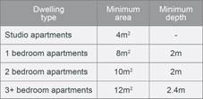
The minimum balcony depth to be counted as contributing to
the balcony area is 1m.
|
No change to the unit mix is proposed as part of the
modification application and the unit mix remains 3 x 1 bedroom units and 15
x 2 bedroom units; however, the layout and size of balconies of the
apartments have been amended.
The amended balcony layouts provide an area for each
balcony in excess of the ADG requirement.
Units 101,102,103,201, 202, 203 and 301, 302, 303 include
a balcony depth of 2.2m for majority of the balcony, including the main
access from internal living areas of the units. The balconies include a depth
of 1m for a small portion which is accessed from unit bedrooms to allow for
alternative access to the balconies.
The design of the above balconies is considered
satisfactory, as the balconies and units have been designed to create greater
internal and external amenity for future occupants of the units and the minor
portion of the balconies that is 1m in depth is a walkway to allow alternate
access to the balconies from bedrooms.
|
No for minimum depth
(Variation of 1m/50%)
|
A
comprehensive assessment against SEPP 65 and the ADG is contained in Attachment
5 and the above variations are all considered acceptable based on merit. It is
noted that the original application was assessed based on the superseded
residential flat design code.
(c) State
Environmental Planning Policy (Infrastructure) 2007 (ISEPP)
The provisions of the ISEPP 2007
have been considered in the assessment of the original development application
and the modification was referred to Sydney Trains in accordance with clause 85
of the ISEPP as the subject site is in or adjacent to a railway corridor.
Sydney Trains provided Council a
response on 13 January 2021 raising no objections subject to one condition for
certification to be provided from a qualified Geotechnical and Structural
Engineer stating that the proposed works are to have no negative impact on the
rail corridor and associated rail infrastructure.
(d) State
Environmental Planning Policy (Vegetation in Non-Rural Areas) 2017
No additional trees or vegetation
is proposed to be removed as part of the subject modification application.
(e) State
Environmental Planning Policy (Building Sustainability Index: BASIX) 2004
A revised BASIX Certificate was
submitted as part of the modification application being Basix Certificate
number 595716M_03, dated 26 August 2020 and is generally consistent with the
architectural plans.
Regional Environmental Plans
The proposed development is
affected by the following Regional Environmental Plans:
(a) Sydney
Regional Environmental Plan (Sydney Harbour Catchment) 2005
The subject site is identified as
being located within the area affected by the Sydney Regional Environmental
Plan (Sydney Harbour Catchment) 2005. The proposed modification development
raises no issues as no impact on the catchment is envisaged.
(Note: - the subject site is not
identified in the relevant map as ‘land within the ‘Foreshores and
Waterways Area’ or ‘Wetland Protection zone’, is not a
‘Strategic Foreshore Site’ and does not contain any heritage items.
Hence the majority of the SREP is not directly relevant to the proposed
development).
Local Environmental Plans
Holroyd Local Environmental
Plan (HLEP) 2013
The provision of the HLEP 2013 is
applicable to the development proposal. It is noted that the development
generally complies with the key statutory requirements of the HLEP 2013 and the
objectives of the B2 – Local Centre zone.
(a) Permissibility:
-
The proposed development is
defined as ‘Shop Top Housing’ and is permissible in the B2 –
Local Centre zone with consent.
Shop top housing is defined as,
‘one or more dwellings located above ground floor retail premises or
business premises’.
The relevant matters to be
considered under HLEP 2013 and the applicable clauses for the proposed
development are summarised below. A comprehensive LEP assessment is contained
in Attachment 3.
Figure
3 – Holroyd LEP 2013 Compliance Table
|
DEVELOPMENT STANDARD
|
COMPLIANCE
|
DISCUSSION
|
|
4.3 Height of Buildings
Max. 17m
|
No – Max 19.1m (12.35%
variation sought)
|
No – The Applicant has submitted an appropriate
response which is addressed below.
|
|
4.6 Floor Space Ratio
Maximum 2:1
|
Yes
|
Permissible:
2:1
Proposed:
0.198:1 (1,856m2/935.9m2)
|
(b) Variation
to Height of Buildings Development Standard
Height variation sought
In accordance with the height of
buildings development standard within the Holroyd Local Environmental Plan, a
maximum building height of 17m applies to the subject site. The original
development application proposed a maximum height of 16.4m.
The proposal seeks to contravene
the development standard by a maximum of 2.1m to propose a maximum height of
19.1m which represents a variation of 12.35%. The breach of the maximum
building height development standard is limited to the proposed lift overrun,
two air lock rooms and the proposed communal open space rooftop area, all of
which are located towards the centre of the building and Joyce Street frontage.
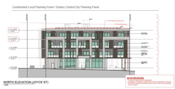
Figure
4 – Northern elevation along Joyce Street frontage showing extent of
height variation sought. Source: Designcorp.
Whilst a clause 4.6 variation is
not required for a s4.55 modification application, the applicant provided a clause
4.6 variation request which provided justification stating:
- The
proposal is consistent with the desired future character of the area.
- The
rooftop communal open space will provide residents with an exceptional standard
of amenity.
- The
built form that exceeds the height limit will not adversely impact upon the
bulk and massing of the building as proposed to be located towards the centre
of the building footprint to avoid any additional overshadowing to neighbouring
properties and minimise their presence when viewed from the surrounding
streetscapes.
- The
site is situated on a site within the Pendle Hill precinct and the development
is for shop-top housing that will provide retail facilities at the ground floor
level. The land is zoned B2 Local Centre and provides for higher density
development close to Pendle Hill train station.
Conclusion:
The proposed modifications that
contravene the height development standard will allow for greater amenity to
future occupants of the residential units through the introduction of rooftop
communal open space and have been designed to have minimal adverse amenity
impacts to the adjoining properties via overshadowing or overlooking and
minimal impact upon the streetscape. The design of the building ensures that
the habitable floor space is contained below the maximum building height line
and the building remains four storeys.
It is the view of Council Officers
that having considered the application on its merit, the variation to the
maximum building height development standard is considered acceptable in this
instance.
The provisions of any proposed instrument
that is or has been the subject (EP&A Act s4.15 (1)(a)(ii))
(a) Draft
State Environmental Planning Policy (Environment)
The draft SEPP relates to the
protection and management of our natural environment with the aim of
simplifying the planning rules for a number of water catchments, waterways,
urban bushland, and Willandra Lakes World Heritage Property. The changes
proposed include consolidating the following seven existing SEPPs:
· State
Environmental Planning Policy No. 19 – Bushland in Urban Areas
· State
Environmental Planning Policy (Sydney Drinking Water Catchment) 2011
· State
Environmental Planning Policy No. 50 – Canal Estate Development
· Greater
Metropolitan Regional Environmental Plan No. 2 – Georges River Catchment
· Sydney
Regional Environmental Plan No. 20 – Hawkesbury-Nepean River (No.2-1997)
· Sydney
Regional Environmental Plan (Sydney Harbour Catchment) 2005
· Willandra
Lakes Regional Environmental Plan No. 1 – World Heritage Property.
The draft policy will repeal the
above existing SEPPs and certain provisions will be transferred directly to the
new SEPP, amended and transferred, or repealed due to overlaps with other areas
of the NSW planning system.
Changes are also proposed to the
Standard Instrument – Principal Local Environmental Plan. Some provisions
of the existing policies will be transferred to new Section 117 Local Planning
Directions where appropriate.
(b) Draft
Cumberland Local Environmental Plan (Draft CLEP)
The Draft Cumberland Local
Environmental Plan (Draft CLEP) has been prepared by Cumberland Council to
provide a single planning framework for the future planning of Cumberland City.
The changes proposed seek to harmonise and repeal the three existing LEPs
currently applicable to the Cumberland local government area, those being:
· Holroyd Local
Environmental Plan 2013,
· Parramatta Local
Environmental Plan 2011, and
· Auburn Local
Environmental Plan 2010.
The current planning controls for
the subject site, as contained within the HLEP, are not proposed to change under
the Draft CLEP.
The provisions of any
Development Control Plans (EP&A Act s4.15 (1)(a)(iii))
The Holroyd DCP 2013 provides
guidance for the design and operation of development to achieve the aims and
objectives of the HLEP 2013.
The proposed modifications do not
raise any new non compliances with Holroyd Development control Plan 2013 from
the original development application being DA2015/21/1 and is considered
satisfactory in this regard.
A comprehensive DCP assessment and
compliance table is contained in Attachment 4.
The provisions of any planning
agreement that has been entered into under section 7.4, or any draft planning
agreement that a developer has offered to enter into under section 7.4
(EP&A Act s4.15(1)(a)(iiia))
There is no draft planning
agreement associated with the subject Development Application.
The provisions of the
Regulations (EP&A Act s4.15 (1)(a)(iv))
The proposed development raises no
concerns as to the relevant matters arising from the Environmental Planning and
Assessment Regulations 2000 (EP&A Reg).
The Likely Environmental,
Social or Economic Impacts (EP&A Act s4.15 (1)(b))
It is considered that the proposed
development will have no significant adverse environmental, social or economic
impacts in the locality.
The suitability of the site for
the development (EP&A Act s4.15 (1)(c))
The subject site and locality is
not known to be affected by any natural hazards or other site constraints
likely to have a significant adverse impact on the proposed development.
Accordingly, it is considered that the development is suitable in the context
of the site and surrounding locality.
Submissions made in accordance
with the Act or Regulation (EP&A Act s4.15 (1)(d))
|
Advertised (newspaper)
|
Mail
|
Sign
|
Not Required
|
In accordance with Council’s Notification requirements
contained within the Holroyd DCP 2013, the proposal was publicly notified for a
period of 21 days between 23 September 2020 to 14 October 2020. It is noted
that no submissions were received for the original development application.
There were two submissions received in respect of the proposed development
which are outlined below.
Submissions summary table
|
Concerns
|
Comment
|
|
Solar access to
adjoining residential properties from increased height
|
The modification application increases the height for the
development by the introduction of a lift overrun, two airlock rooms and
rooftop communal open space shelter which are located approximately in the
centre of the building and in this regard will not increase the overshadowing
impacts to adjoining sites. The roof level of the development is also reduced
by approx. 200mm from DA2015/21/1.
|
|
The building should be
reduced to two storeys as it is too high
|
While there is an increase in height of from 16.4 metres
to 19.1 metres due to the introduction of a lift overrun, two airlock rooms
and rooftop communal open space, the number of storeys has not changed from
the original approval.
|
|
Not in support of underground
carpark, retail floor and 3 residential floors.
|
The modification application is for modification to
DA2015/21/1 which approved 2 levels of basement carparking, commercial use on
the ground floor and 18 units above over 3 floors. The modification application
does not seek to alter this arrangement.
|
The public interest (EP&A
Act s4.15(1)(e))
In view of the foregoing analysis
it is considered that the development, if carried out subject to the conditions
set out in the recommendation below, will have no significant adverse impacts
on the public interest.
Section 7.11 (Formerly S94)
Contribution Towards Provision or Improvement of Amenities or Services
This part of the Act relates to
the collection of monetary contributions from applicants for use in developing
key local infrastructure.
Comments:
Contribution fees were determined
in accordance with the previous Holroyd Contribution Plan during the assessment
of the original development application being, DA2015/21/1 and the modification
development application does not require any modifications to the payment of
contributions.
Disclosure of Political
Donations and Gifts
The applicant and notification process did not result in any
disclosure of Political Donations and Gifts.
Conclusion:
The modification application has
been assessed in accordance with the relevant requirements of the Environmental
Planning and Assessment Act 1979, Statement Environmental Planning Policy No.
65 - Design Quality of Residential Apartment Development (SEPP 65), State
Environmental Planning Policy (Infrastructure) 2007, Holroyd LEP 2013 and
Holroyd DCP 2013 and is considered to be satisfactory for approval subject to
conditions.
The development as modified is
appropriately located within the B2 – Local Centre Zone under the
relevant provisions of the Holroyd LEP 2013; however, a variation in relation
to the Height of Buildings development standard under the Holroyd LEP 2013 is sought.
Having regard to the assessment of
the proposal from a merit perspective, Council may be satisfied that the
development has been responsibly designed and provides for acceptable levels of
amenity for future residents.
It is considered that the proposal
successfully minimises adverse impacts on the amenity of neighbouring properties.
Hence the development, irrespective of the departure noted above, is consistent
with the intentions of Council’s planning controls and represents a form
of development contemplated by the relevant statutory and non-statutory
controls applying to the land.
For these reasons, it is
considered that the proposal is satisfactory having regard to the matters of
consideration under Section 4.15 and 4.55 of the Environmental Planning and
Assessment Act 1979, and the modified development may be approved subject to
conditions.
|
Report Recommendation:
1. That
Modification Application MOD2020/0296 being a Section 4.55(2) modification to
reconfigure the internal layout of apartments, alter floor levels, increase
height of building to facilitate lift overrun and associated rooftop
facilities, introduce rooftop communal open space and facade and built form
amendments on land at 25-28 Joyce Street Pendle Hill be approved subject to
attached conditions.
2. Persons
whom have lodged a submission in respect to the application be notified of
the determination of the application.
|
Attachments
1. Draft Notice
of Determination
2. Architectural
and Landscape Plans
3. Holroyd
Local Environmental Plan 2013 Assessment
4. Holroyd
Development Control Plan 2013 Assessment
5. Apartment
Design Guide Compliance Table
6. Clause
4.6 Statement
7. Redacted
Submissions Recieved
8. Original
Application - DA2015/21/1 - Stamped Architectural Plans
DOCUMENTS
ASSOCIATED WITH
REPORT LPP005/21
Attachment 1
Draft Notice of Determination
Cumberland Local Planning Panel Meeting
10 March 2021
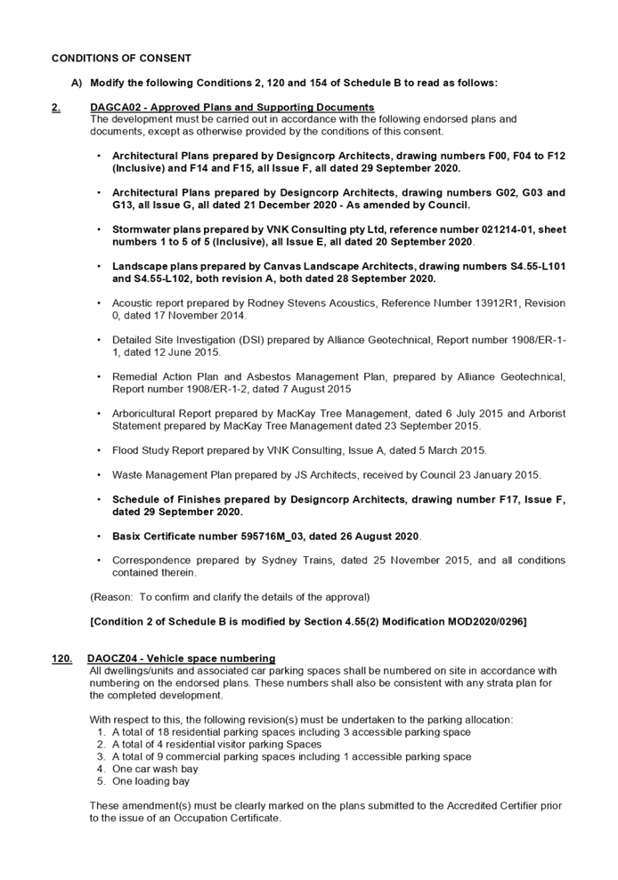
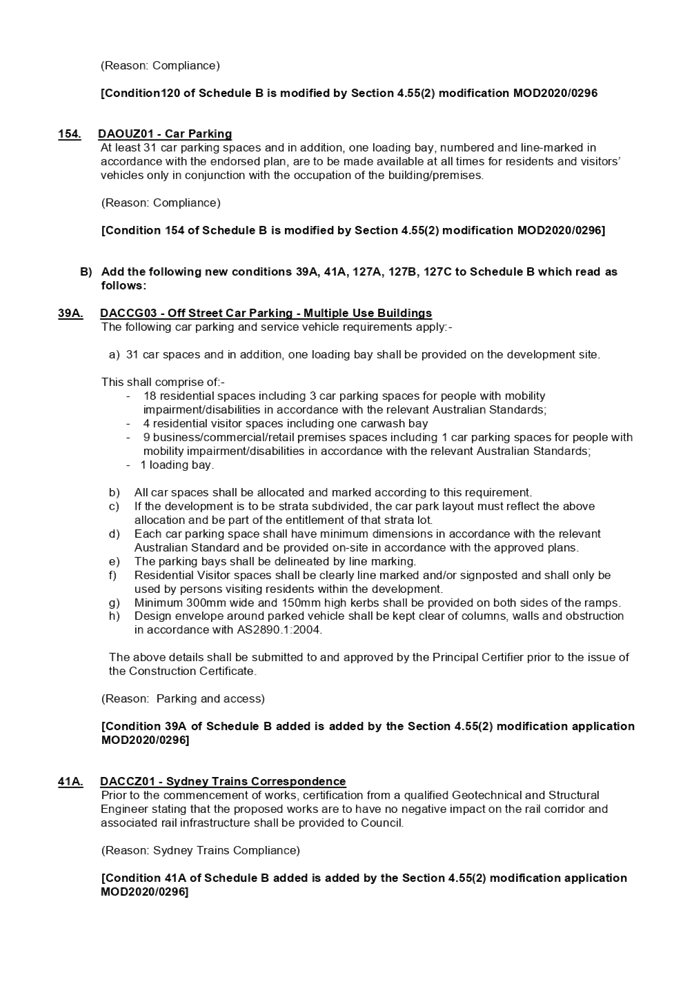
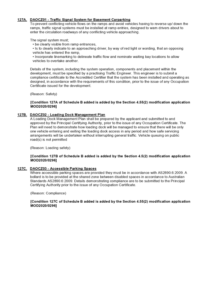
DOCUMENTS
ASSOCIATED WITH
REPORT LPP005/21
Attachment 2
Architectural and Landscape Plans
Cumberland Local Planning Panel Meeting
10 March 2021
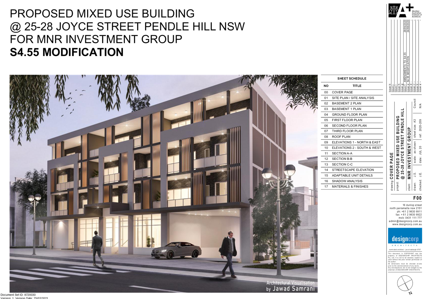
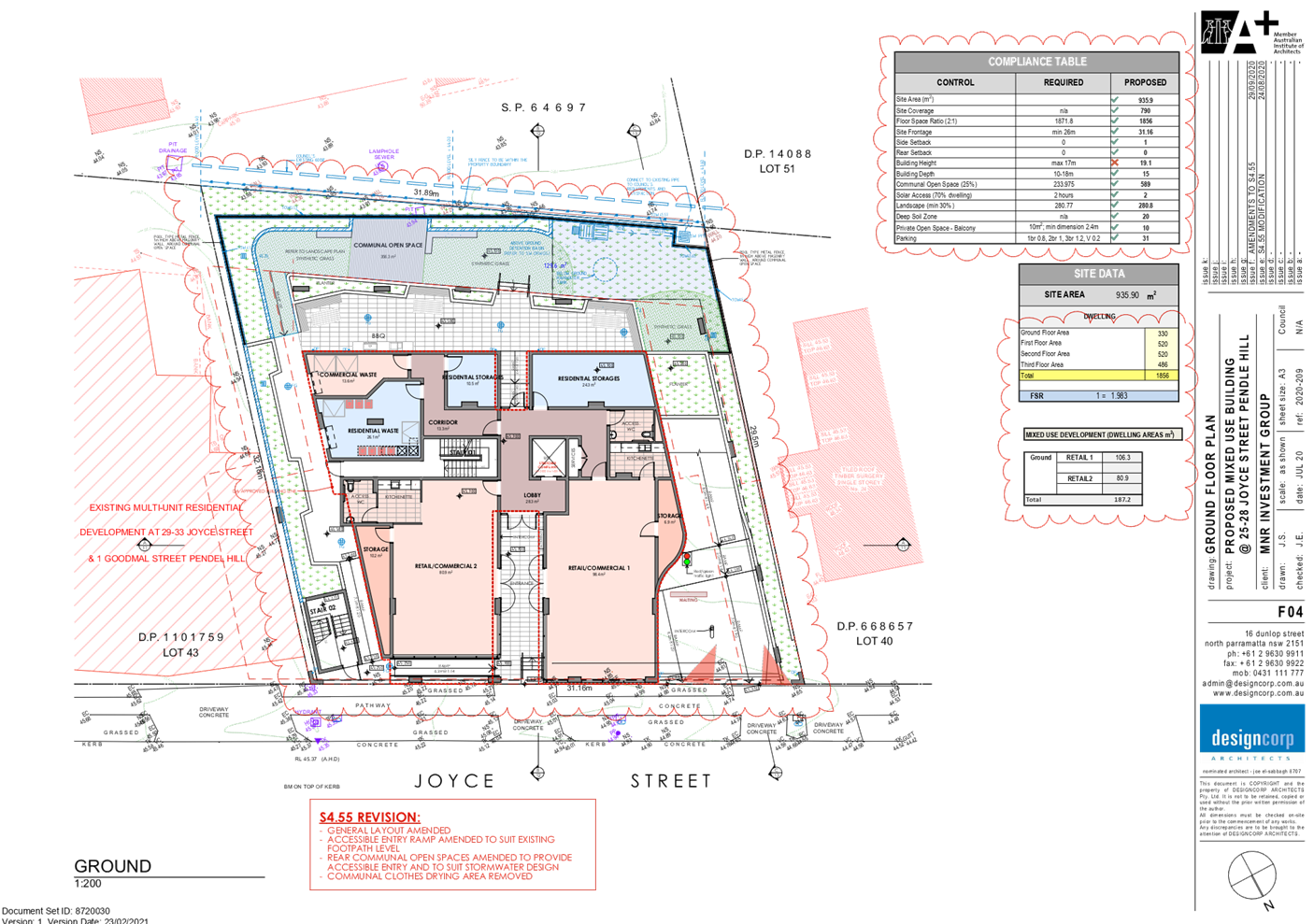
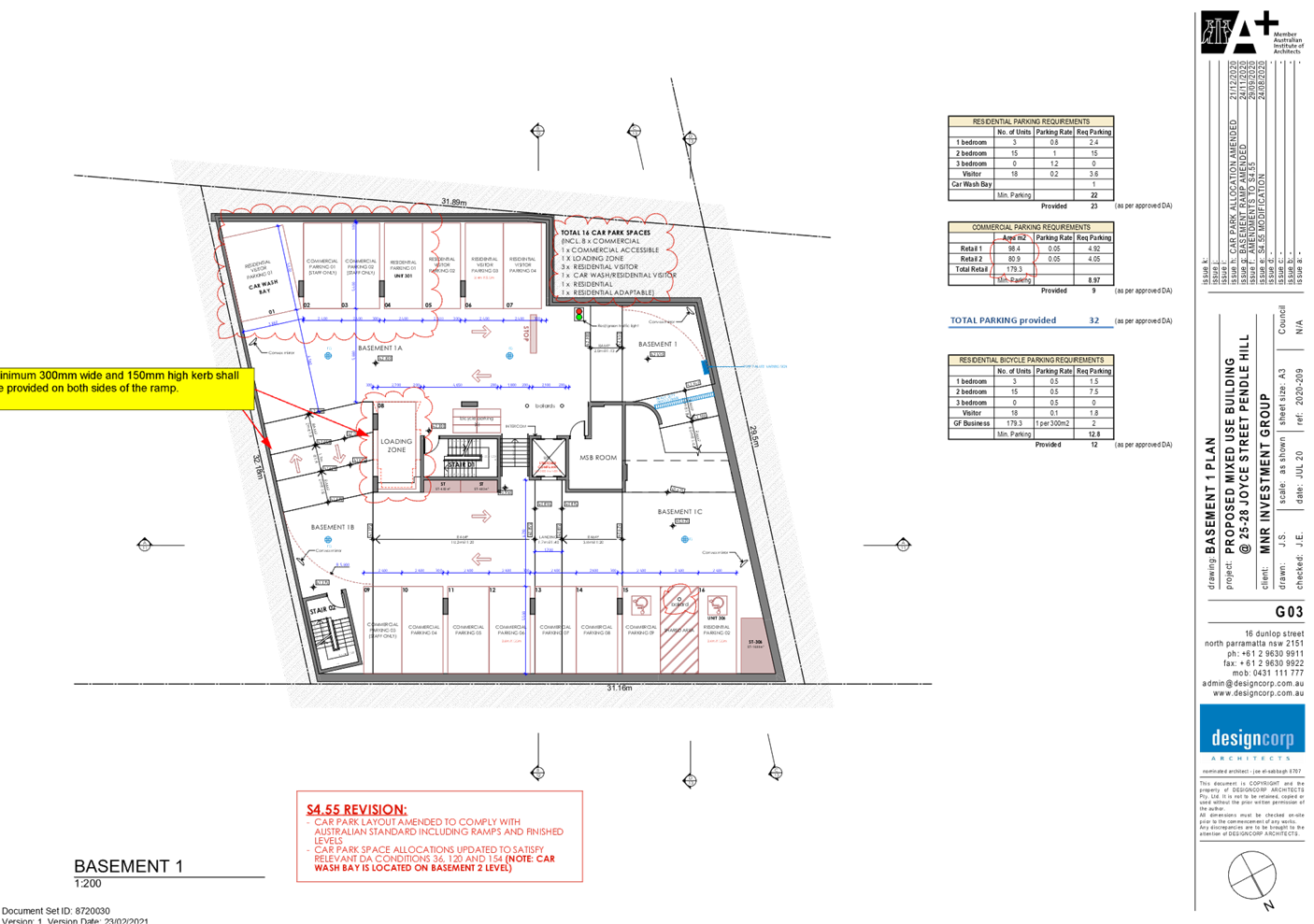
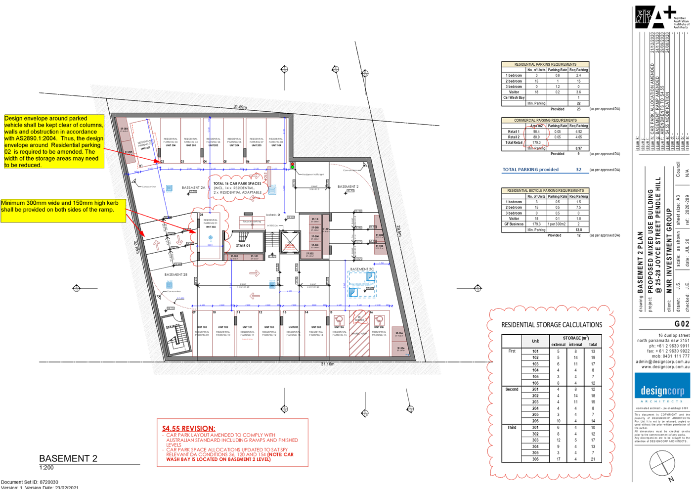
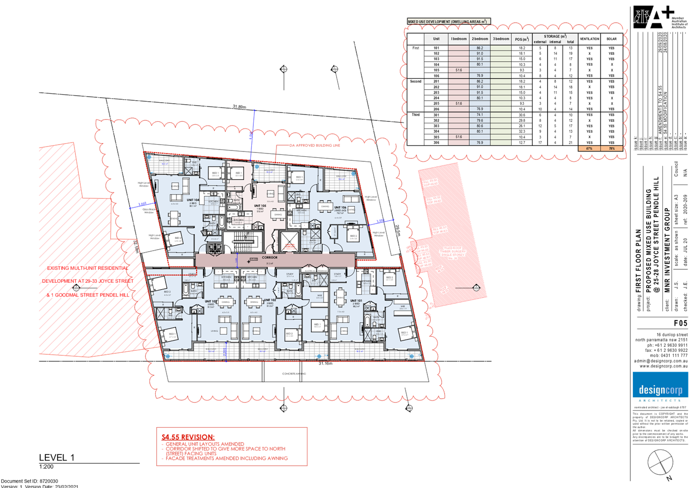
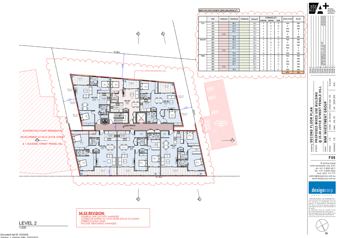
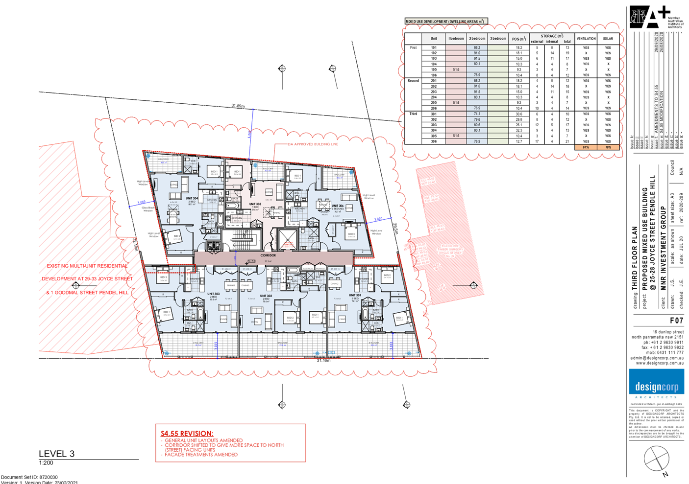
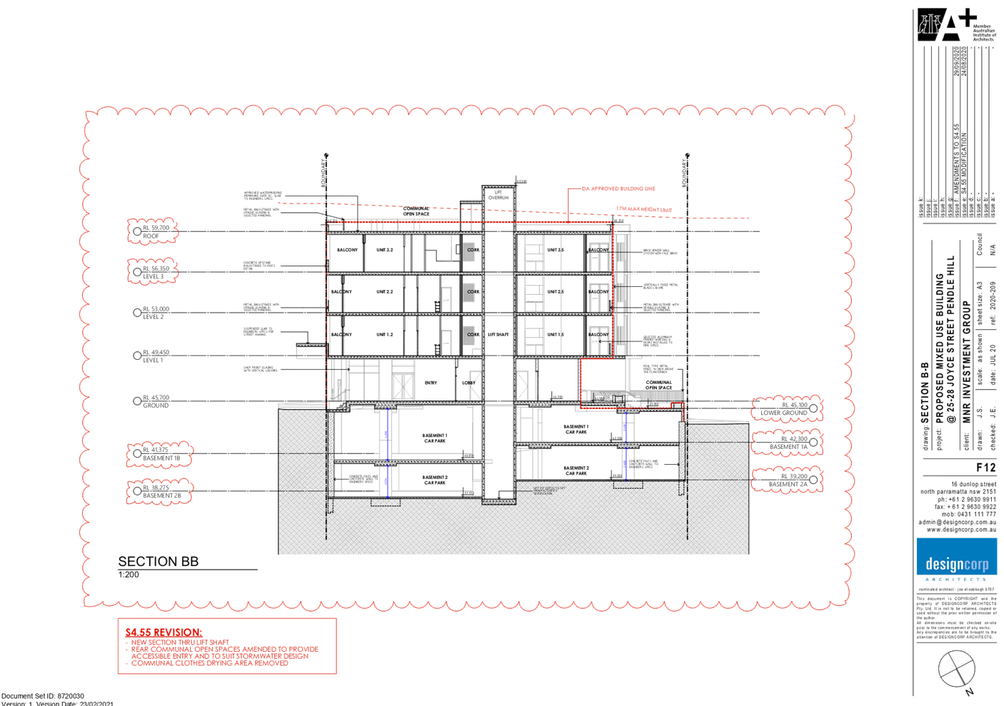
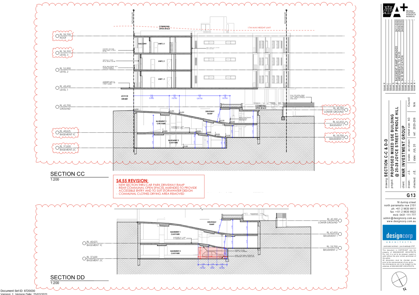
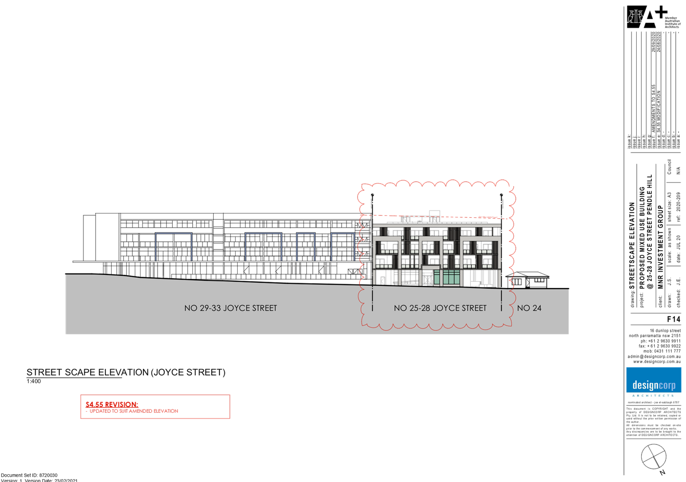
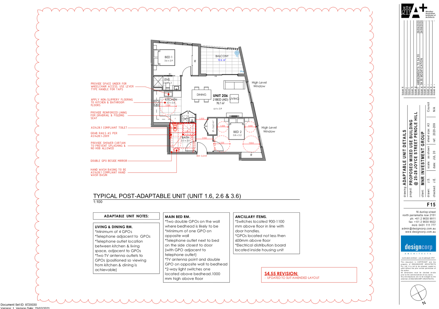
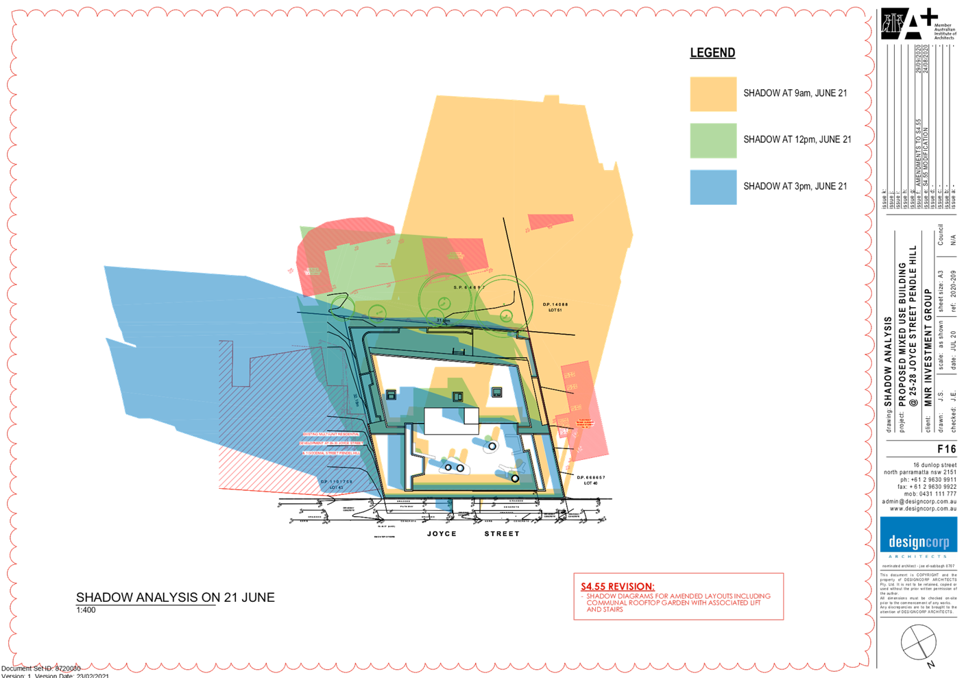
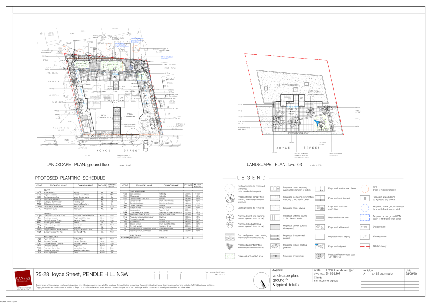
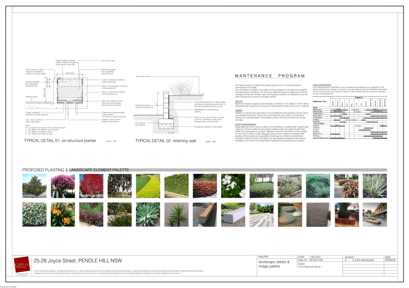
DOCUMENTS
ASSOCIATED WITH
REPORT LPP005/21
Attachment 3
Holroyd Local Environmental Plan 2013 Assessment
Cumberland Local Planning Panel Meeting
10 March 2021
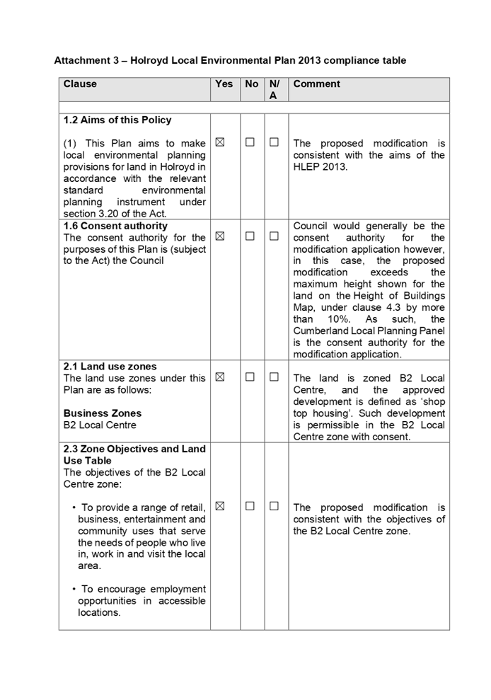
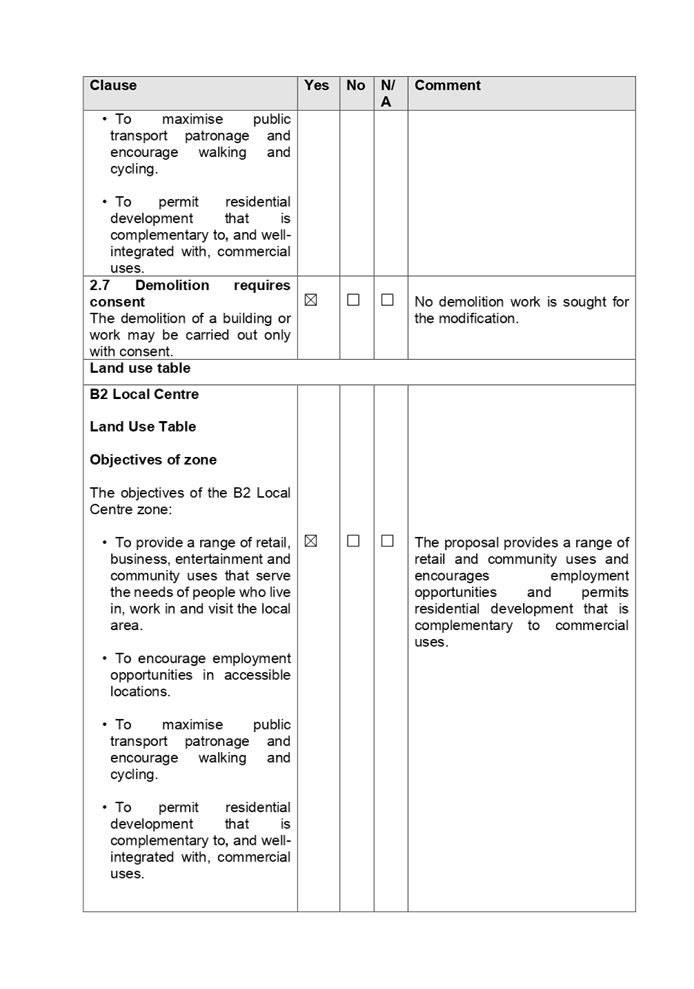
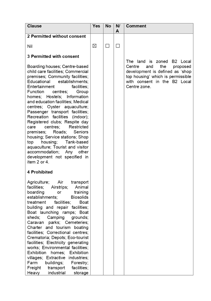
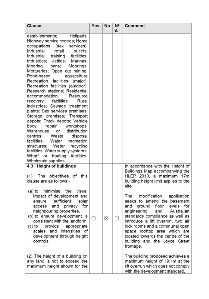
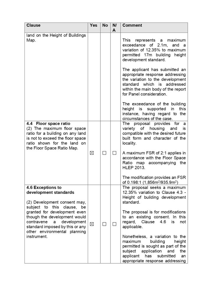
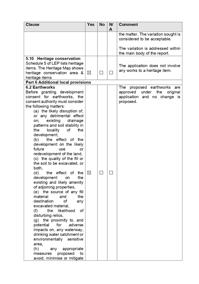
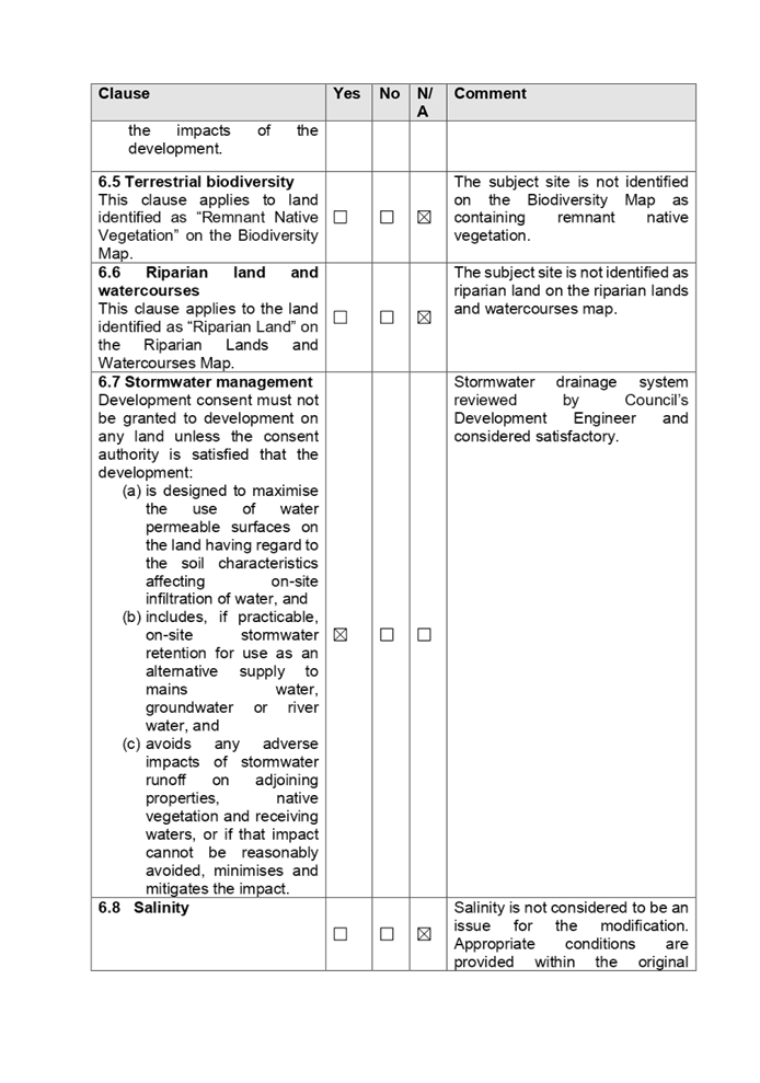

DOCUMENTS
ASSOCIATED WITH
REPORT LPP005/21
Attachment 4
Holroyd Development Control Plan 2013 Assessment
Cumberland Local Planning Panel Meeting
10 March 2021
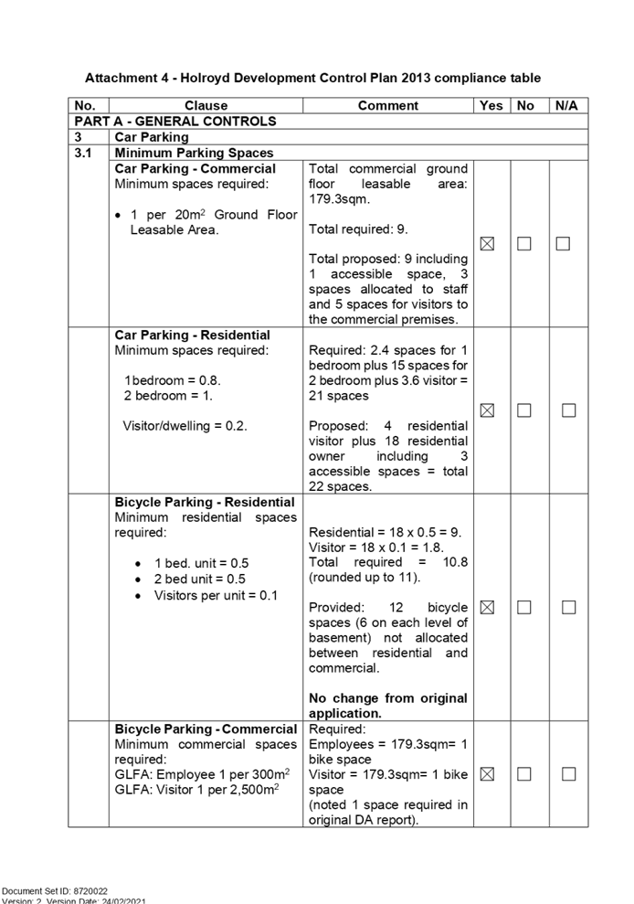
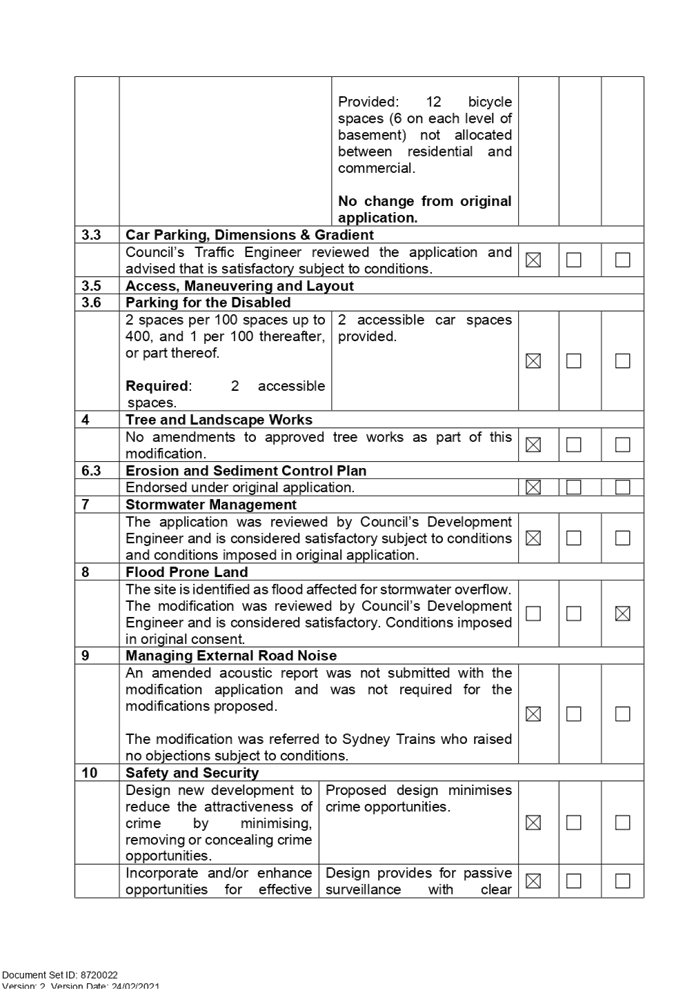
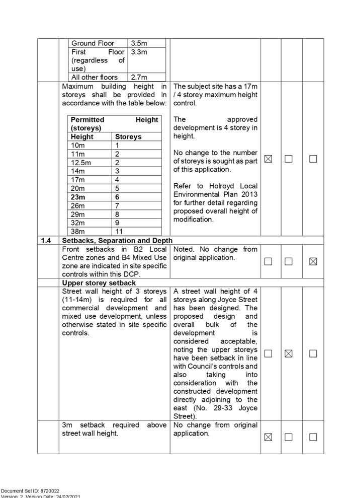
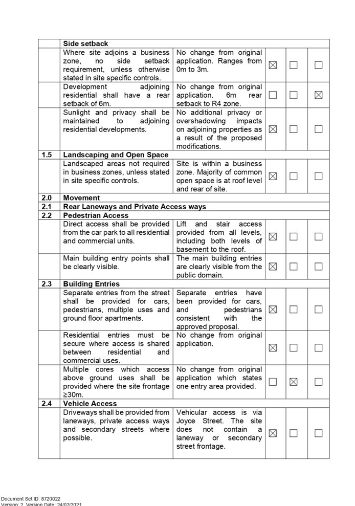
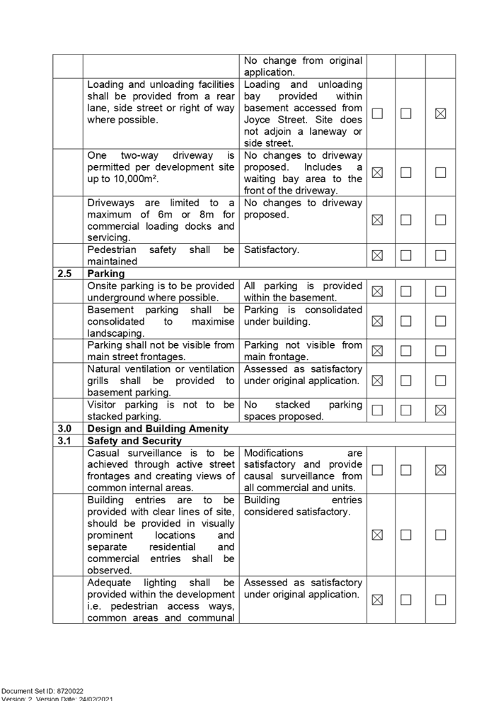
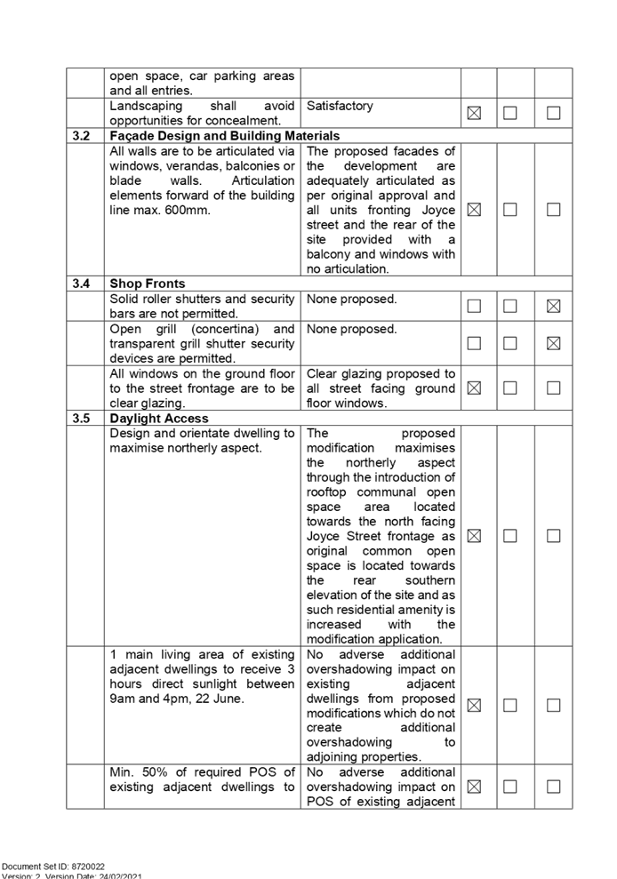
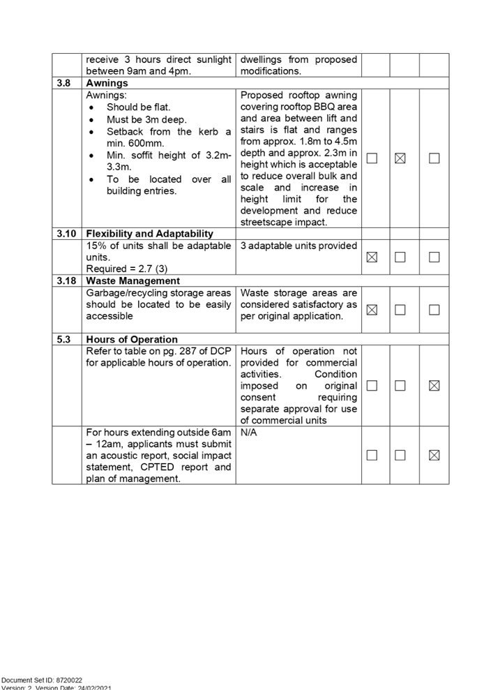
DOCUMENTS
ASSOCIATED WITH
REPORT LPP005/21
Attachment 5
Apartment Design Guide Compliance Table
Cumberland Local Planning Panel Meeting
10 March 2021
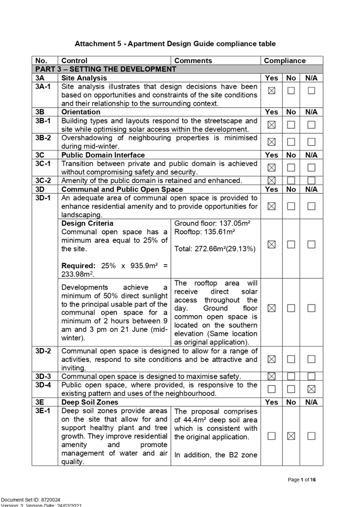
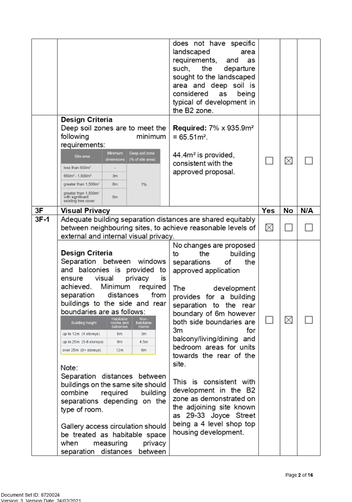
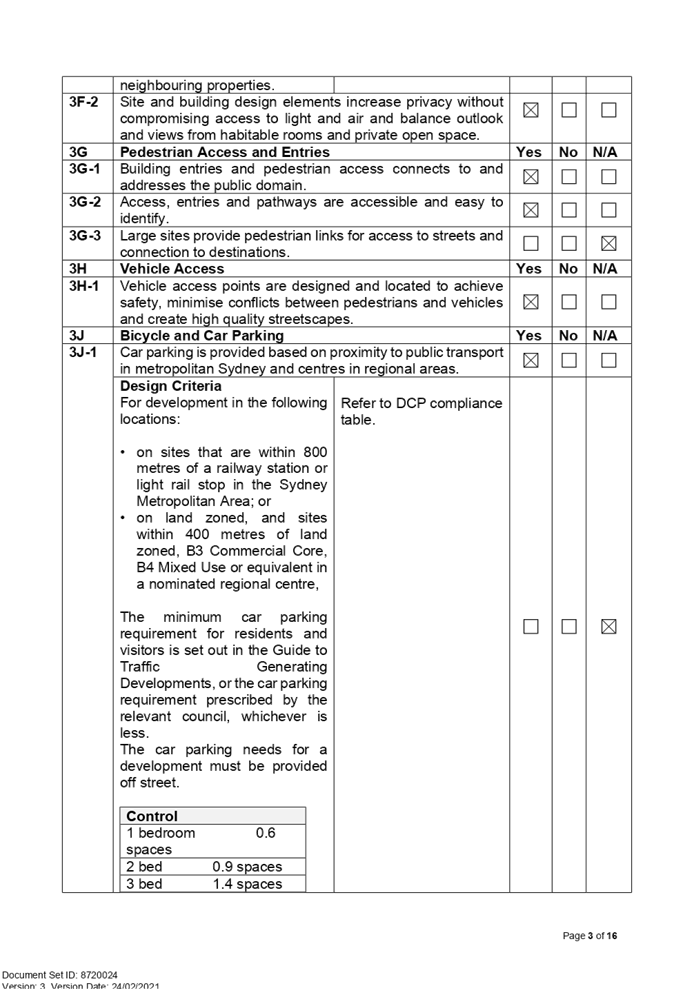
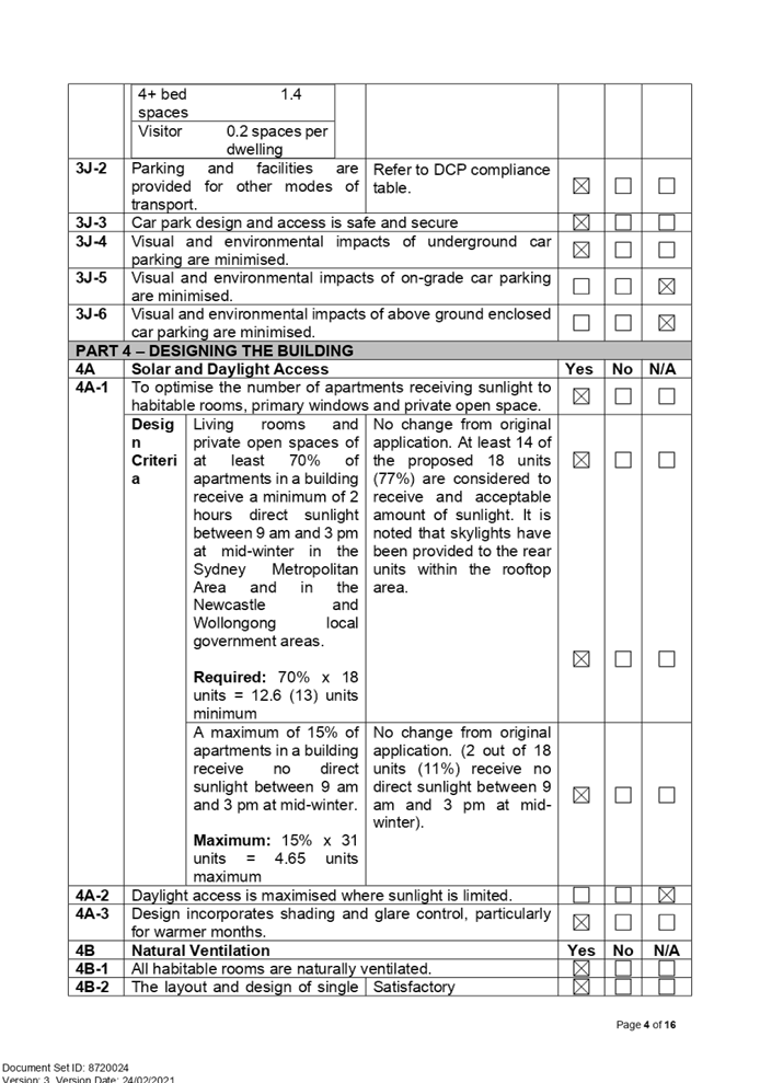
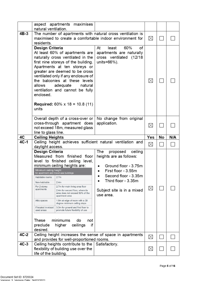
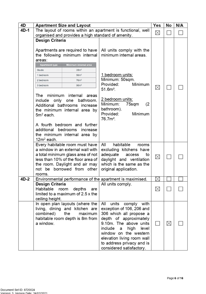
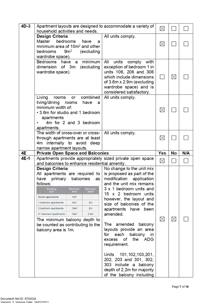
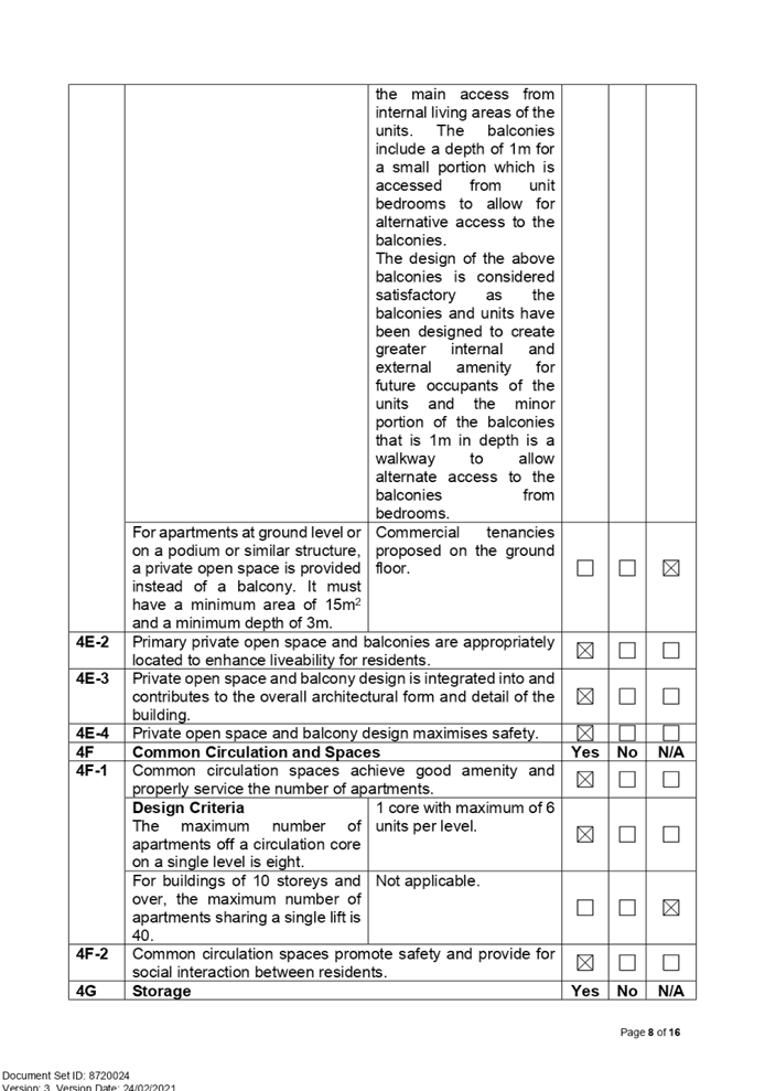
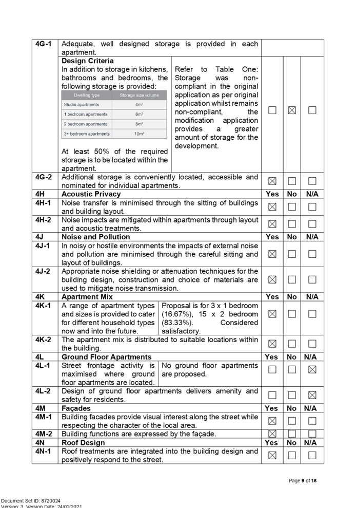
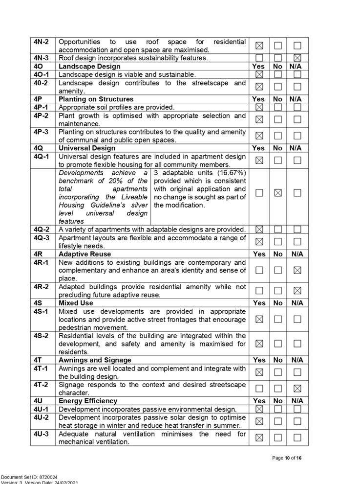
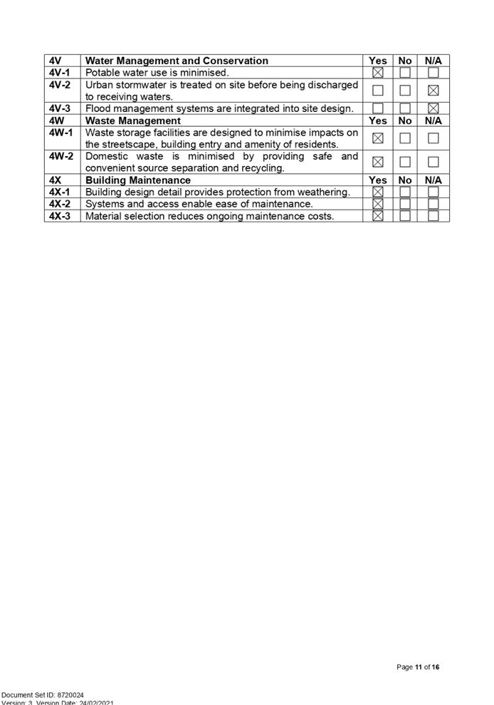
DOCUMENTS
ASSOCIATED WITH
REPORT LPP005/21
Attachment 6
Clause 4.6 Statement
Cumberland Local Planning Panel Meeting
10 March 2021
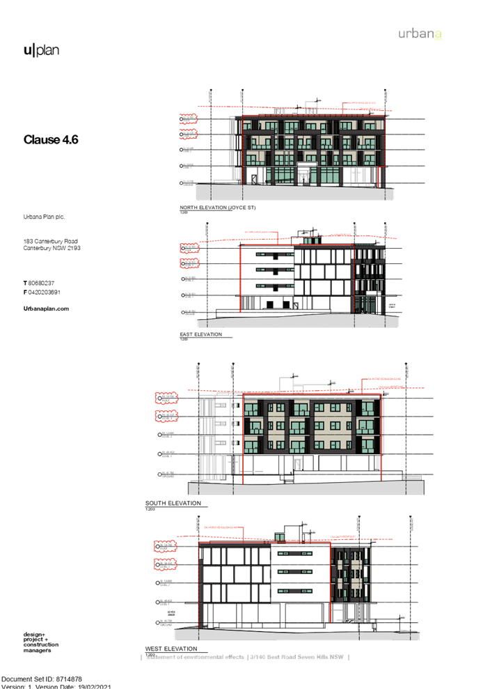
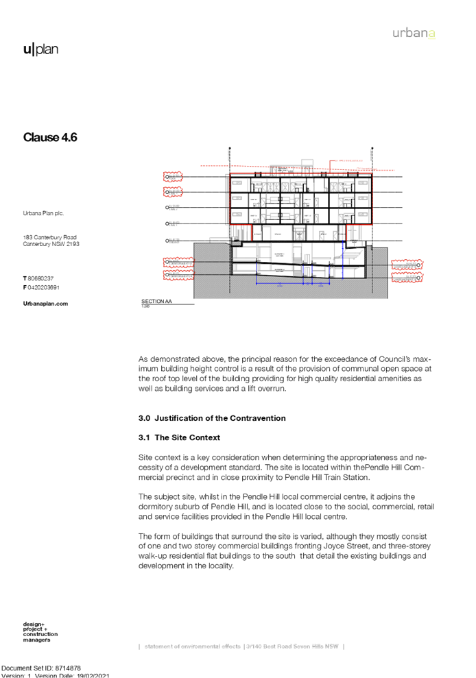
DOCUMENTS
ASSOCIATED WITH
REPORT LPP005/21
Attachment 7
Redacted Submissions Recieved
Cumberland Local Planning Panel Meeting
10 March 2021

DOCUMENTS
ASSOCIATED WITH
REPORT LPP005/21
Attachment 8
Original Application - DA2015/21/1 - Stamped
Architectural Plans
Cumberland Local Planning Panel Meeting
10 March 2021
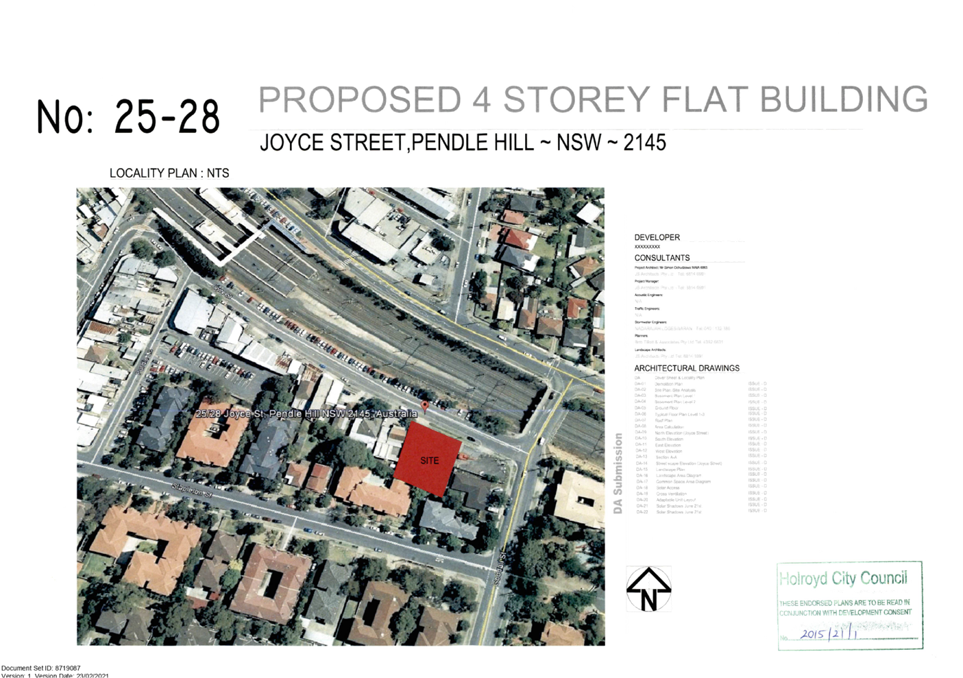
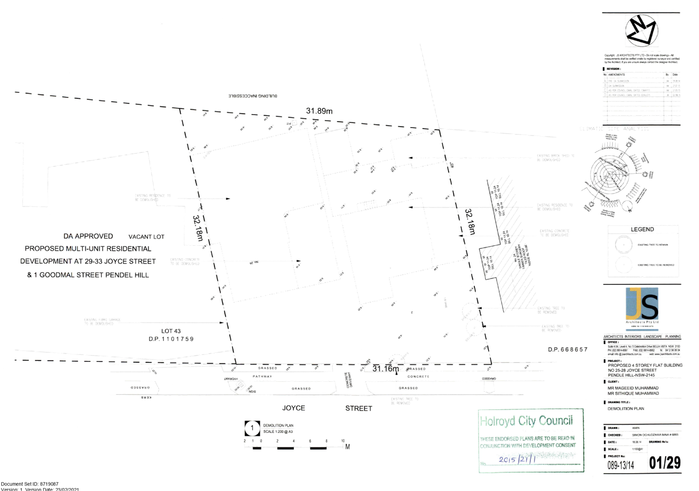
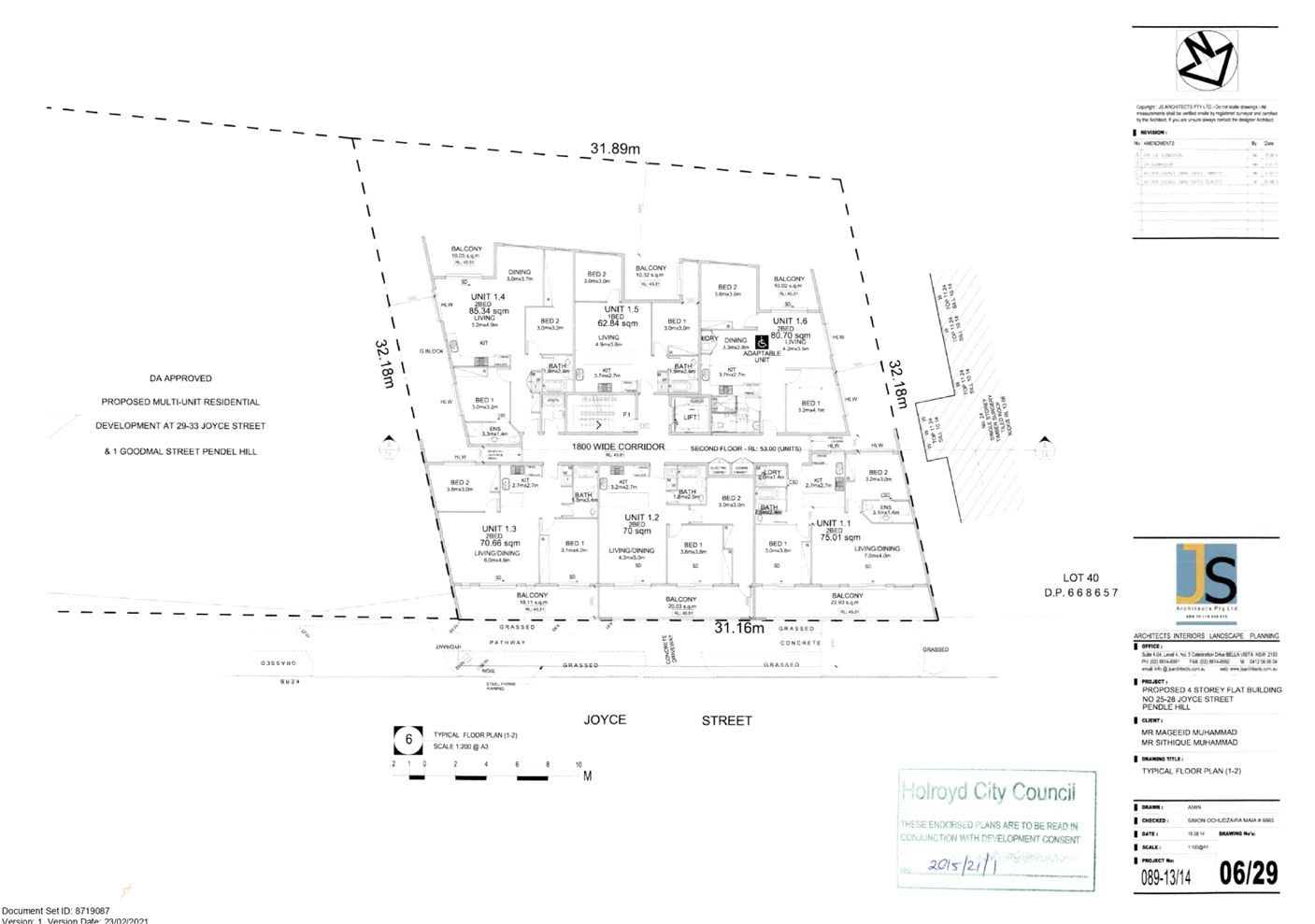
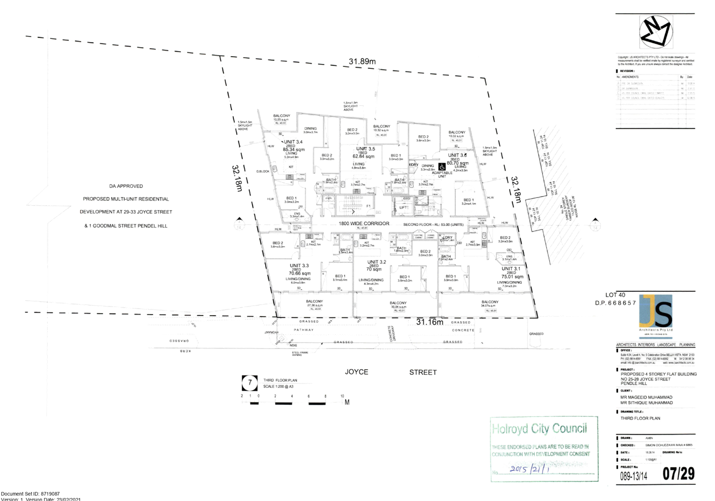
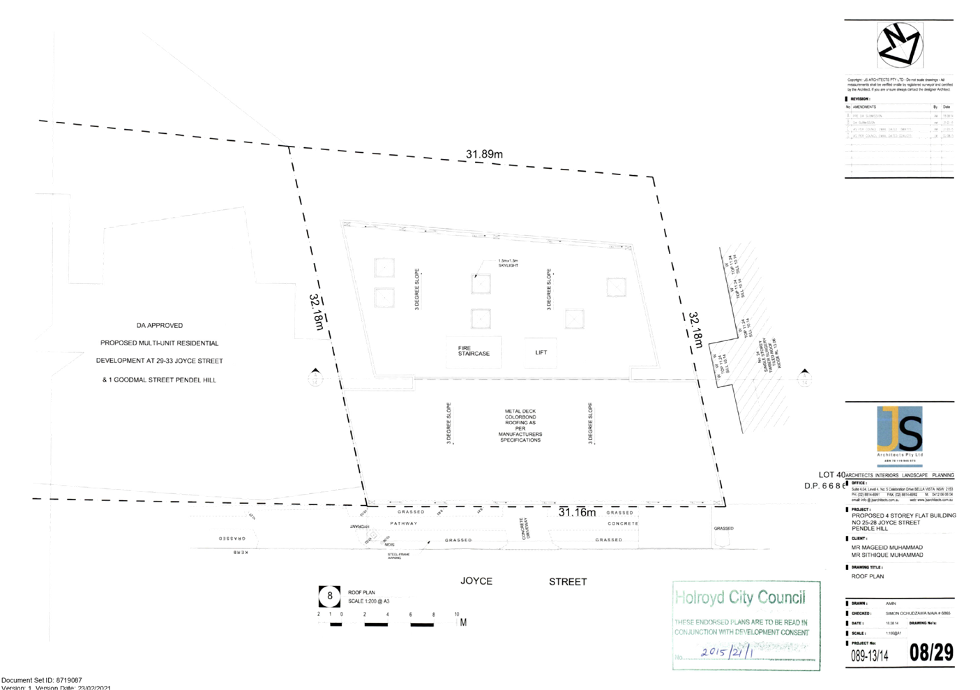
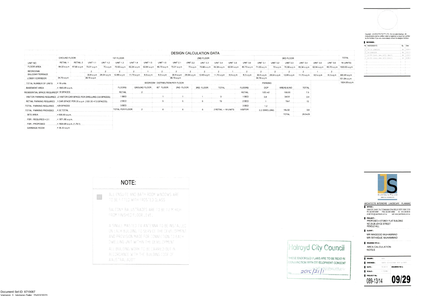
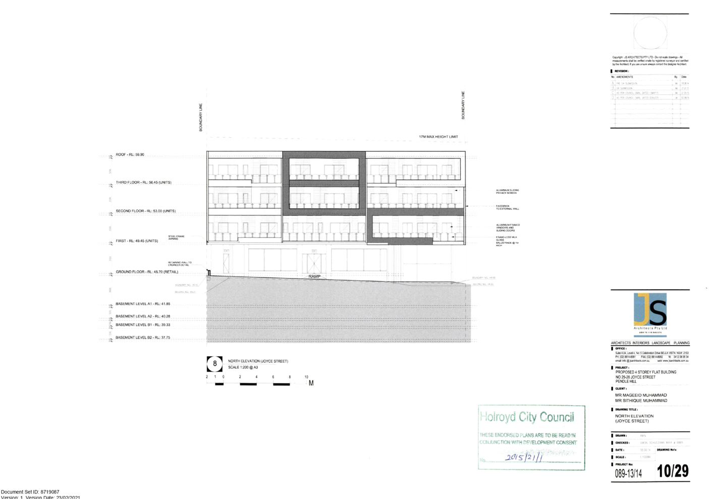
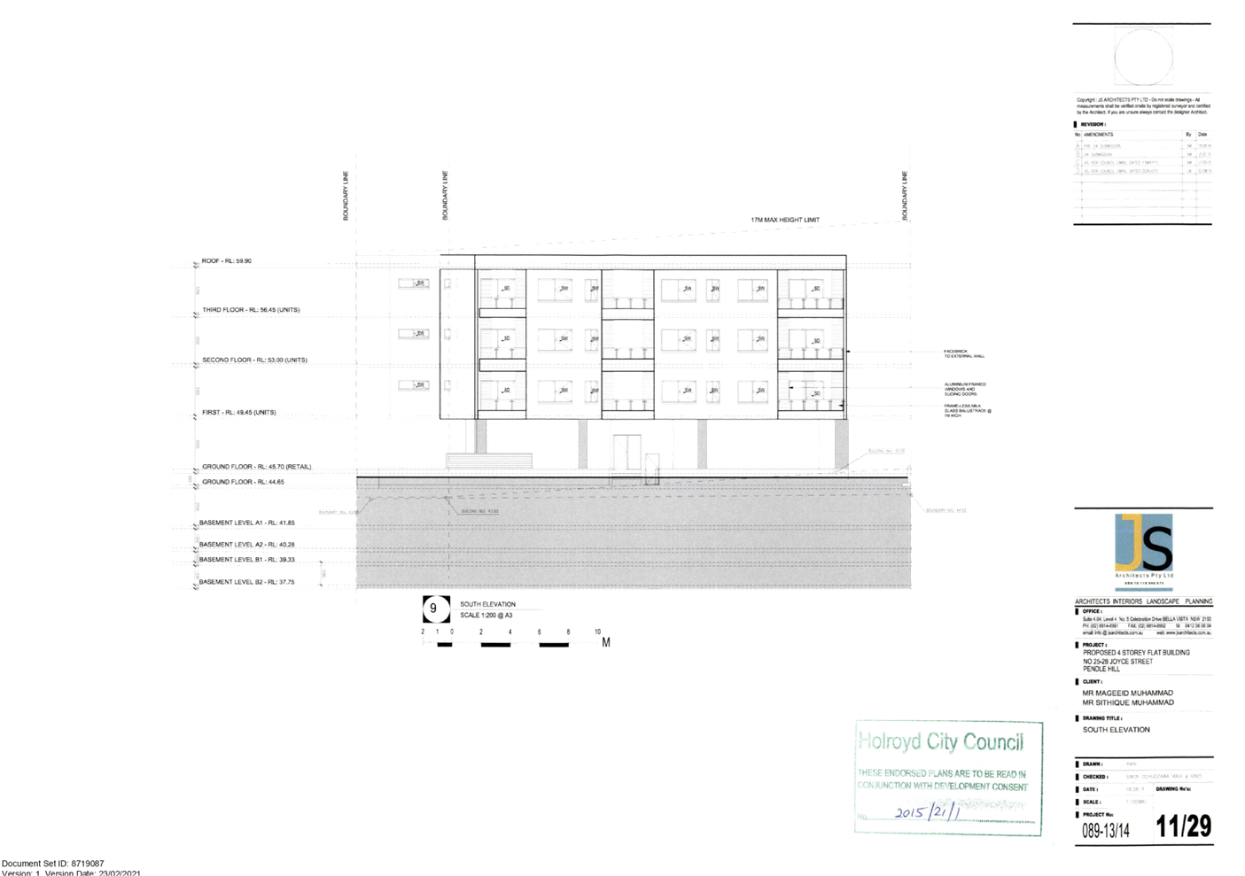
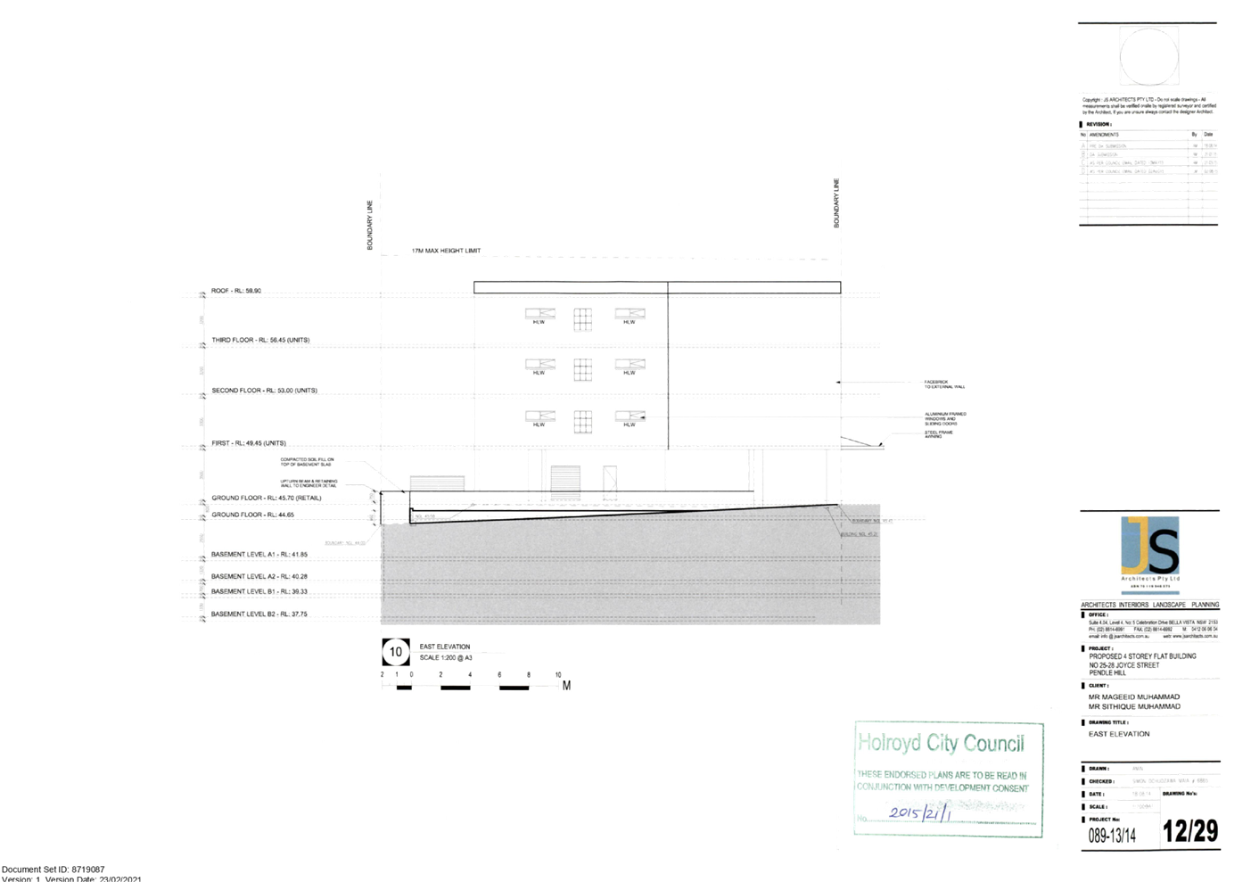
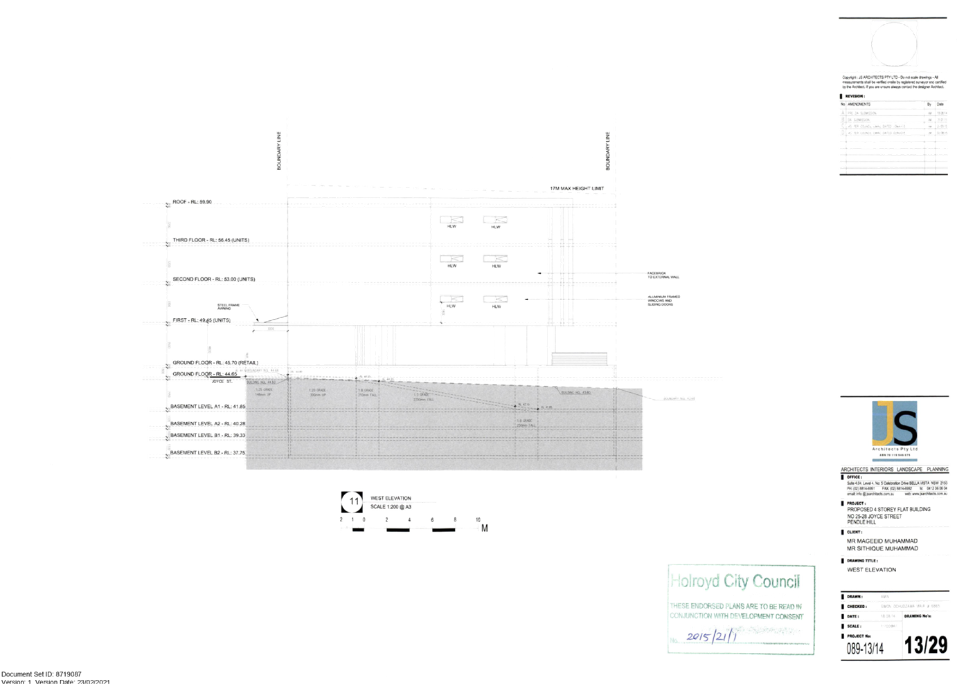
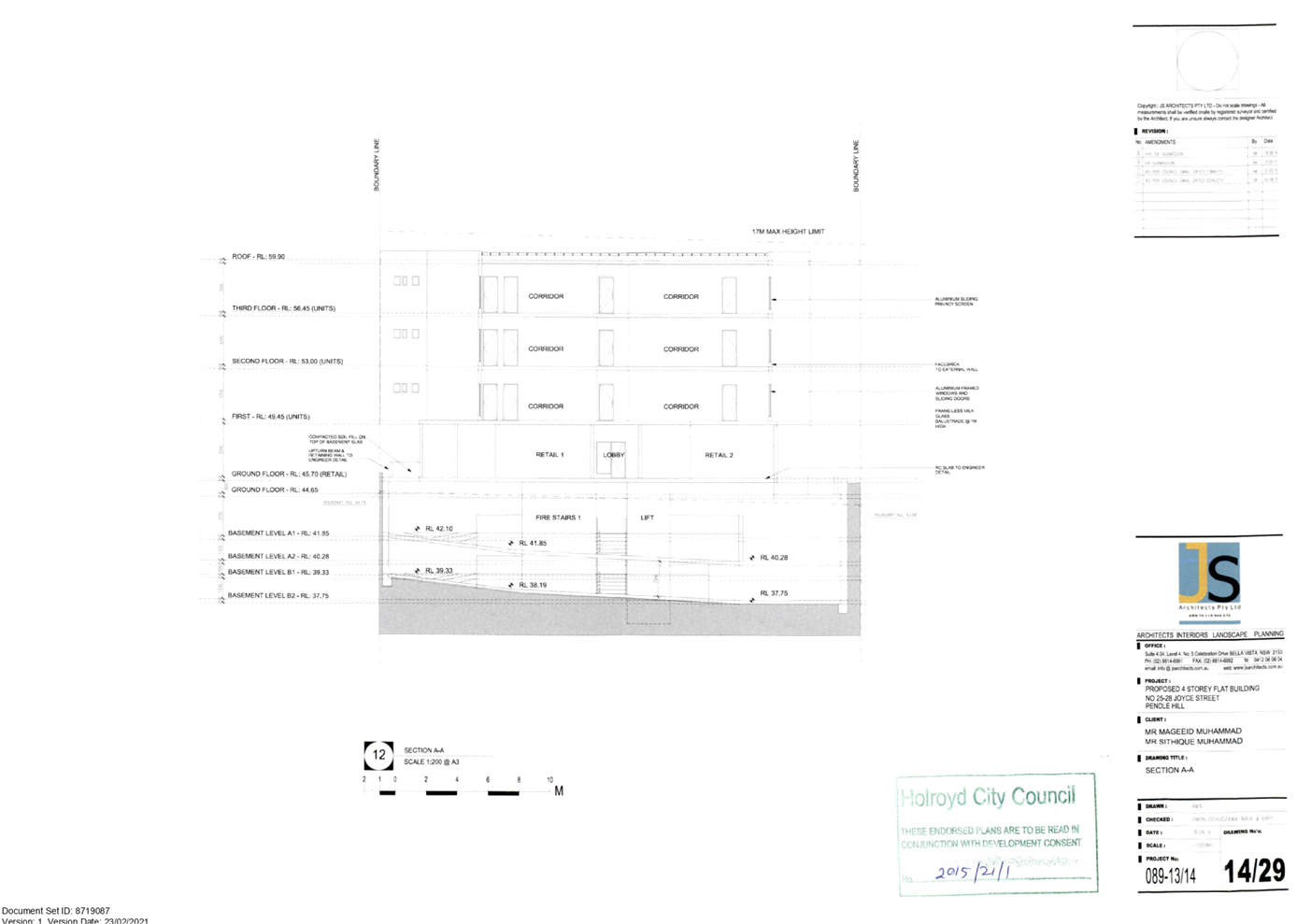
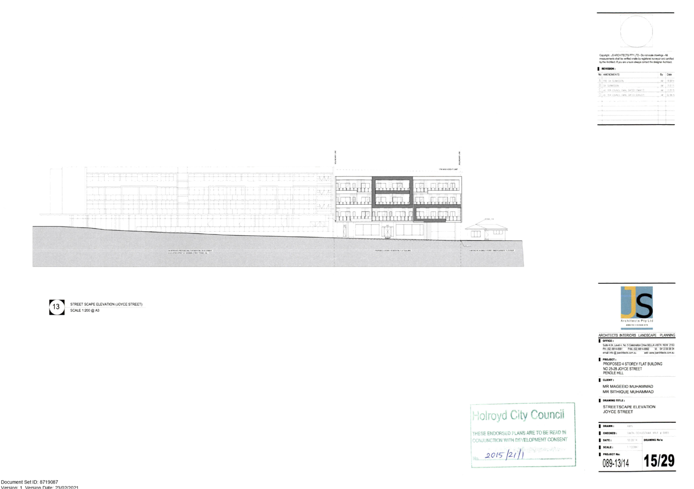
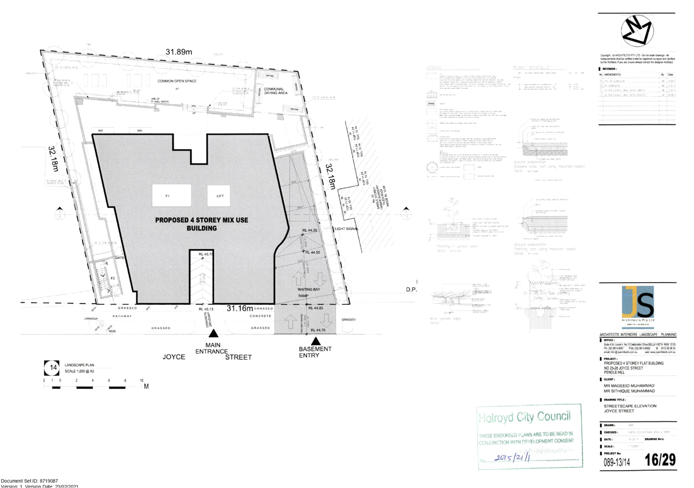
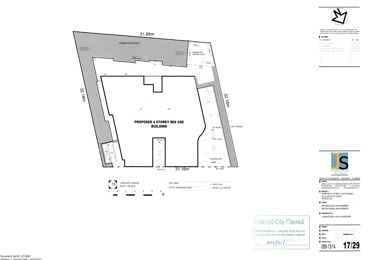
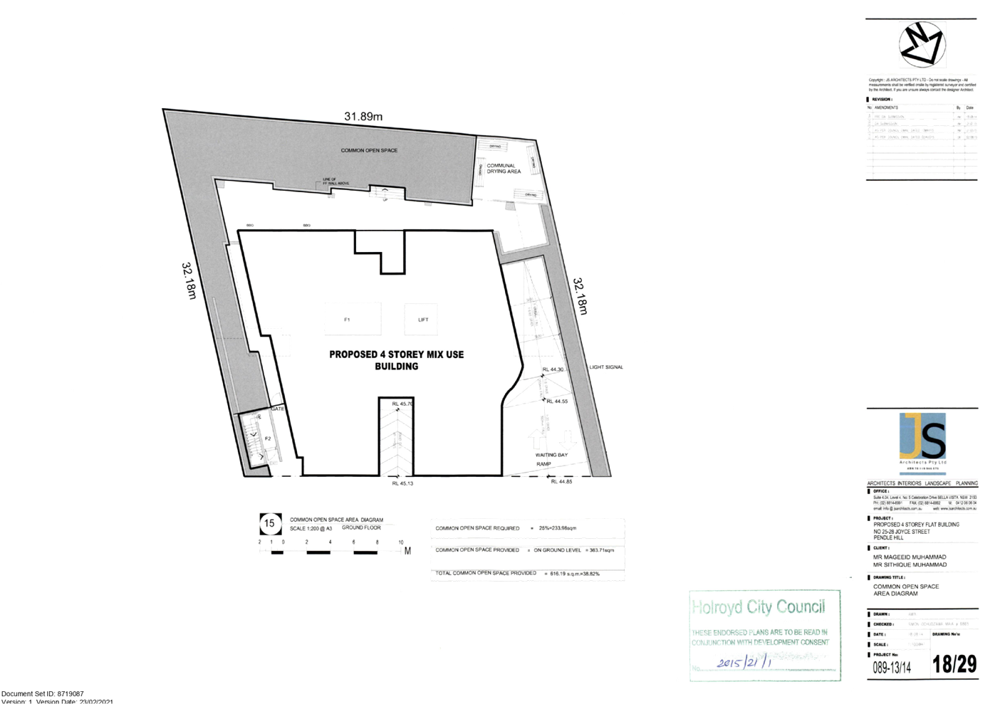
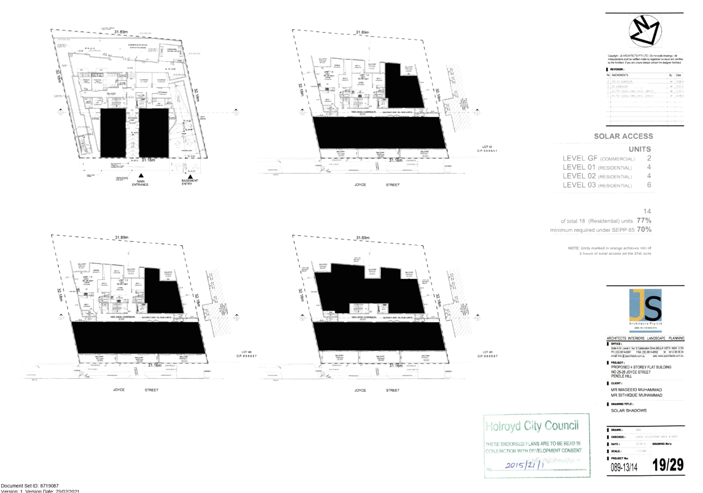
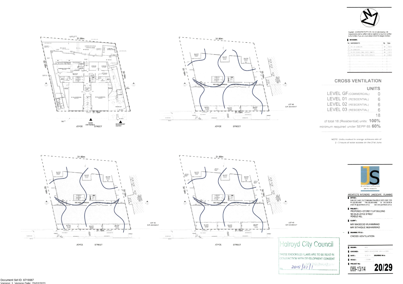
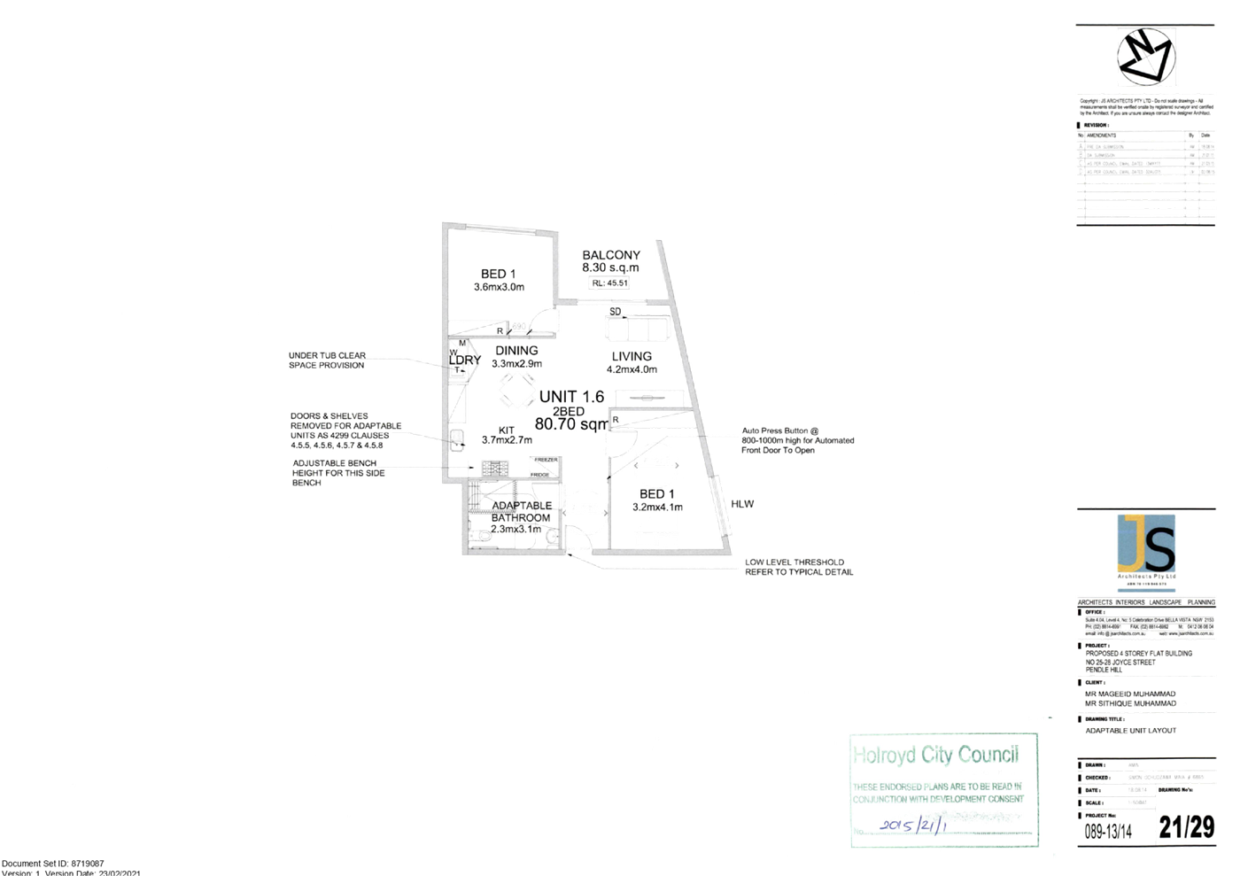
Cumberland
Local Planning Panel Meeting
10 March 2021
Item
No: LPP006/21
Modification
Application for 277-289 Woodpark Road, Smithfield
Responsible
Division: Environment
& Planning
Officer: Executive
Manager Development and Building
File
Number: MOD2020/0147
|
Application
lodged
|
21 May 2020
|
|
Applicant
|
Mecone Pty Ltd – M
Stankovic
|
|
Owner
|
ALS Limited
|
|
Application
No.
|
MOD2020/0147
|
|
Description
of Land
|
277-289 Woodpark Road
Smithfield
Lot 1 DP 1024505
|
|
Proposed
Development
|
Section 4.55(2) modification
to extend the operating hours to allow for additional manufacturing
operation, truck and forklift movements and alter the site layout to improve
site functionality and vehicular movements, including the reduction of
on-site parking - Integrated Development - Section 43(b) of the Protection of
the Environment Operations Act 1997
|
|
Site
Area
|
3.934 ha
|
|
Zoning
|
IN1 – General Industrial
|
|
Disclosure
of political donations and gifts
|
Nil disclosure
|
|
Heritage
|
The subject site does not
contain a heritage item nor is the site located within the vicinity of any
heritage item or heritage conservation area.
|
|
Principal
Development Standards
|
None applicable
|
|
Issues
|
- Variation to
standard hours of operation stated within Holroyd Development Control Pan
2013
1.
- Number of submissions
|
1. Development
application DA2018/321/1 was approved by the Cumberland Local Planning Panel on
5 November 2019 for the extension of hours of operation of an existing
manufacturing & warehouse use to carry out internal manufacturing 24 hours
a day Monday to Friday and 7.00am to 3.00pm Saturday, and truck & external
forklift movements 7.00am to 7.00pm Monday to Friday and construction of an
acoustic wall.
2. Modification
application MOD2020/0147 was received on the 21 May 2020 which seeks to extend
the operating hours on Saturdays for manufacturing operations; external truck
and forklift movements between the two buildings and elsewhere on-site; alter
the site layout to improve functionality and vehicle movement; and reduction of
on-site parking.
3. The
modification application was publicly notified to occupants and owners of the
adjoining properties for a period of 14 days between 27 May 2020 and 10 June
2020. In response, 5 submissions were received. In addition, Council received 7
additional unique submissions throughout the assessment period for a total of
12 unique submissions.
4. The
modification application is being reported to the Cumberland Local Planning
Panel (CLPP) for determination due to number of submissions received and due to
seeking to modify conditions of development consent DA2018/321/1 which were
imposed by the Cumberland Local Planning Panel in the determination of
DA2018/321/1.
5. The
variations are as follows:
|
Control
|
Required
|
Proposed
|
Variation
|
|
Holroyd Development Control Plan 2013 – Part D,
Section 4, Control C3
|
The Council, under normal circumstances, restricts the
hours of industrial operations to the hours of:
Monday to Friday: 7.00am to 7.00pm.
Saturday: 7.00am to 12:00pm
Sunday: No work permitted.
|
24 hour operation Monday – Friday; & 12am to
10pm Saturdays; No work on Sundays and public holidays
Refer to condition 66 of draft modification consent for
all proposed operation hours.
|
12 hours each day Monday to
Friday
Saturday: 17 hours
|
6. The application is
recommended for conditional approval subject to the conditions as provided in
the attached schedule.
Subject Site and Surrounding
Area
The site forms Lot 1 of DP1024505
and is known as 277-289 Woodpark Road Smithfield. The site has an area of
3.934ha and has a frontage to Woodpark Road Smithfield of approximately
201.17m. The site is located on the northern boundary of the Smithfield
Industrial precinct with industrial uses located to the south, east and west
and R2 – Low Density Residential zoned land to the north (rear of site).
The current use of the premises was approved by Council on the 12 August 1999
under DA 2000/43.
The site is currently used by two
separate businesses with the site being owned by ALS Limited and leased by a
separate business being Jalco. The subject modification application relates to
the areas of the site utilised by Jalco only. The site is occupied by two large
warehouses. The smaller warehouse located on the western portion is used
entirely by Jalco and comprises offices fronting Woodpark Road, Smithfield, and
is used for production purposes by Jalco including the manufacturing of powder
and liquid products. The finished products are then transported by forklifts
and stored within the adjacent larger warehouse building to the east until
distribution occurs.
The front portion (fronting
Woodpark Road, Smithfield) of the larger eastern warehouse building is
separately used by the Australian Laboratory Services (ALS) (approved under DA
2000/309). Access to the ALS portion of the site is via separate vehicular
crossover and carpark fronting Woodpark Road.
DA2018/321/1 stated that for the
subject business, Jalco, approximately 250 staff are employed at the subject
site which is broken down to approximately 110 staff during day hours, 80
during afternoon and 60 staff overnight.
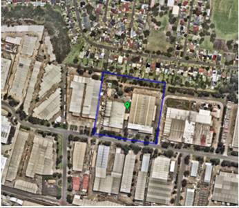
Figure
1 – Aerial view of subject site 277-289 Woodpark Road, Smithfield
outlined in purple.

Figure
2 – Locality map of 277-289 Woodpark Road, Smithfield outlined in purple.
The subject premises and adjoining
residential zoned sites are subject to a ‘buffer area between industrial
and residential zones’ under section 6.9 of Holroyd Local Environmental
Plan 2013 along the northern boundary of the subject site situated between the
residential zoned land and industrial zoned land. The acoustic wall constructed
in accordance with DA2018/321/1 is located within the buffer area between
industrial and residential zones”.
No change to the acoustic wall is
proposed as part of the current modification application. The buffer area is
highlighted green on Figure 3 on the following page and the constructed
acoustic wall is shown on Figures 4 and 5 below.
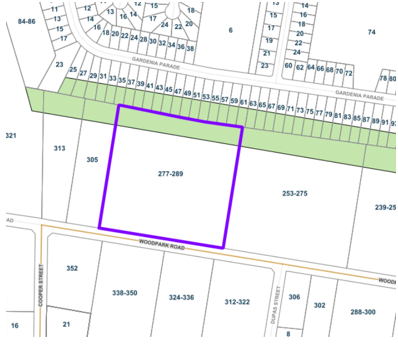
Figure
3 – Industrial-Residential buffer area highlighted green and subject site
277-289 Woodpark Road Smithfield outlined in purple.
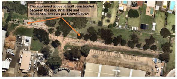
Figure
4 – Aerial view of the approved acoustic wall as part of DA2018/321/1
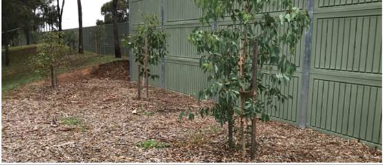
Figure
5 – The constructed acoustic wall and associated tree plantings for
screening approved as part of DA2018/321/1
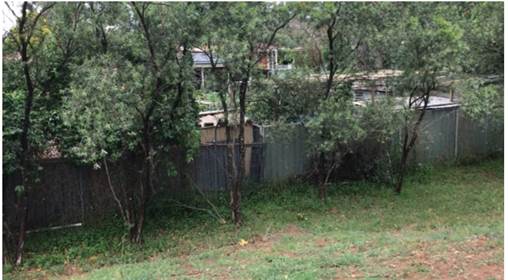
Figure 6 –
Existing tree plantings for screening between industrial and residential zoned
land located between the rear boundary of residential properties and the
acoustic wall.
History of the Site
1. Development
application DA: 2000/43 was approved by the former Holroyd City Council on 12
August 1999 for ‘Minor alterations and use of the existing industrial
premises for the warehousing of household laundry, cleansing and personal care
products’. The development application included a condition (Condition
No.31) which states that the hours of operation are restricted to 6:00am to
6:30pm Monday to Friday, 7:00am to 4:00pm Saturday and no work Sunday. In this
regard, all truck movements are to occur within the approved hours’.
2. The
premise is subject to an Environmental Protection Licence (licence no. 2746)
issued by the NSW Environmental Protection Authority (EPA).
3. Development
Application DA 2000/263 was approved by the former Holroyd City Council on the
4 February 2000 for rationalisation & consolidation of associated
activities relating to the manufacture and warehousing of household detergents
and cleaning products on adjoining sites. In addition, alterations and
additions on the respective sites to facilitate the rationalisation, including
an extension in manufacturing activities to include liquid products.
4. Condition
No. 86 of development consent DA 2000/263 restricted the hours of operation as
under:
Manufacturing Hours
Monday to Friday: 24 hours
Saturday: 7:00am to 3:00pm
Sunday and Public Holidays: No
Work
Transport (Truck and external
fork-lift movements)
Monday to Friday: 7:00am to 7:00pm
Saturday: No Work
Sunday and Public Holidays: No
Work
The above condition further stated
that following the end of a 12 month trial period, the applicant may lodge a
fresh application seeking approval to continue the extended hours. If not, or
if the fresh application is refused, the use will revert back to Council’s
standard hours of operation being 7:00am to 6:00pm Monday to Friday, 7:00am to
12 Noon on Saturdays and no work on Sundays and Public Holidays.
The applicant failed to lodge a
fresh application to continue the extended hours of operation and continued to
operate under the extended trial period hours. Council’s compliance
section took regulatory action against the operator of the premises and, as a
result, DA2018/321/1 was lodged with Council.
5. Development
Application DA2018/321/1 was approved by the Cumberland Local Planning Panel on
the 5 November 2019 for, ‘Extension of hours of operation of existing
manufacturing & warehouse use to carry out manufacturing 24 hours a day
Monday to Friday and 7.00am to 3.00pm Saturday, and truck & external forklift
movements 7.00am to 7.00pm Monday to Friday and construction of an acoustic
wall’.
6. In
accordance with Environment Planning and Assessment Act 1979 – Section
10.17 – COVID-19 pandemic – Ministerial Orders and State
Environmental Planning Policy (Exempt and Complying Development Codes) 2008,
Division 4 – Special Provisions- COVID19, the premises is identified as a
retail supply chain premises (warehouse or distribution centre) for the purpose
of supplying goods directly or indirectly to retail premises and this currently
permits the subject premises to operate outside the hours of operation of
DA2018/321/1 regarding truck movements, permitting 24 hour a day, 7 days a week
truck movements. This is set for repeal on the 25 March 2021.
7. A
pre lodgement meeting was lodged with Council and feedback notes were issued to
the applicant on the 1 May 2020. The pre lodgement meeting discussed the works
proposed as part of the subject modification application.
Description of the Proposed
Development
Council has received a
modification application to extend the hours of operation, modify vehicle
movements and various external operation changes which are listed below.
The modification application
MOD2020/0147 seeks the following external physical modifications as follows: -
- Car
parking space layout changes across the site including a reduction in car
parking spaces from 189 car spaces to 176 car spaces.
- Modification
to the vehicular crossing kerb of the central and western driveways to improve
truck manoeuvring.
- Change
in traffic direction for both warehouses including to propose entry for western
production warehouse to be via central driveway and exit via western driveway.
This maintains forward in and forward out on site and traffic is to move in one
direction on site.
- Introduction
of a wash bay area towards the north west corner of the site. This does not
propose any physical works.
- Install
a pallet transit storage area located towards the northern rear boundary
approximately between the two warehouses.
- Introduction
of three truck waiting areas with one area located between the two warehouses,
one located towards the northern rear boundary and one located towards the
north western portion of the site.
- Install
a material staging area to be situated between the two warehouses.
- Install
a compactor and bailed item staging area to be located between the two
warehouses.
- Install
a bailed item and empty drum staging area to be located adjacent to the rear of
western warehouse.
- Install
an empty drum staging area located towards the rear of the site.
- Install
a raw material storage area to be located on the western elevation of the
building.
- Install
a metal waste bin and general waste bin along western elevation of the
warehouse building.
- Install
two transit storage areas with one situated between the two warehouses and one
situated on the western elevation of the warehouse.
The modification application
MOD2020/0147 additionally seeks to amend condition 66 of DA2018/321/1 to extend
hours of operation including external forklift movements between the two
warehouses as the applicant has stated that this is an essential business
process to permit produced goods within the western warehouse to be transported
to the adjacent eastern warehouse until required to be dispatched off site and
is required to be the same hours as permitted for internal operations. Refer to
table below:
|
Table
of existing and proposed hours of operation
|
|
Existing
condition 66 – Hours of operation and condition 67 – Forklift
refuelling hours as per DA2018/321/1
|
Proposed
condition 66 hours of operation including forklift refuelling as per
MOD2020/0147
|
|
Hours
of Operation
66. For
the purposes of preserving the amenity of neighbouring occupations and
residents, the operation of the premises is to be restricted to the following
hours:
Internal
manufacturing and internal fork-lift movements:
· Monday to Friday: 24 hours
· Saturday: 7:00am to 3:00pm
· Sunday and Public Holidays: No work
permitted.
Transport
(Truck and external fork-lift movements):
· Monday to Friday: 7:00am to 3:00pm
· Saturday, Sunday and Public
Holidays: No truck/external fork-lift movements on site permitted.
67. All
forklift re-fulling is to occur during the following hours:
· Monday to Friday: 7:00am to 7:00pm
· Saturday: 7:00am to 3:00pm
· Sunday and Public Holidays: No work
permitted.
|
Hours
of Operation
66. For
the purposes of preserving the amenity of neighbouring occupations and
residents, the operation of the premises is to be restricted to the following
hours:
Internal
manufacturing and movements of forklifts inside the warehouse and production
building:
· Monday to Friday: 24 hours
· Saturday: 12:00am to 10:00pm
· Sunday and Public Holidays: no work
permitted.
External
forklift movements between the warehouse and production building using only
the
path identified as “Forklifts manoeuvring between buildings” on
Figure 5-3 of the Noise Impact Assessment prepared by Benbow Environmental,
report number 201048_NIA_Rev11, revision 11, dated 11 January 2021:
· Monday to Friday, 24 hours
· Saturday, 12:00am to 10:00pm
· Sunday and Public Holidays: No work
permitted
External forklift and truck movements elsewhere on site
· Monday to Saturday 7:00am to
10:00pm
· Sunday and Public Holidays: No work
permitted
Bulk powder truck deliveries Including rear ISO tanker unloading area, use
of wash bay area and cardboard compactor:
· Monday to Saturday: 7:00am to
6:00pm
· Sunday and Public Holidays: No work
permitted.
All
forklift re-fuelling:
· Monday to Saturday 7:00am to
10:00pm
· Sundays and Public Holidays: no
work permitted.
|
Due to the proposed amended hours
of operation, various other conditions of DA2018/321/1 are also proposed and
required to be amended to align with the amended proposed hours of operation
and the Noise Impact Assessment report submitted as part of the modification
which supersedes the previous Noise Impact Assessment of DA2018/321/1.
As a result of the changes sought,
the following conditions are also required to be modified or deleted: -
A. Condition
2 to be amended relating to endorsed documentation
B. Condition
Number 7 to be amended relating to limitation on consent
C. Condition
8 relating to recommendations of acoustic report is to be deleted and reworded
as part of condition 59 as condition was previously satisfied and due to Noise
Impact Assessment Report being superseded as part of the modification.
D. Condition
9 relating to acoustic wall is to be deleted as condition is satisfied and due
to Noise Impact Assessment Report being superseded as part of the modification.
E. Condition
12 relating to Plan of Management is to be deleted as satisfied and
modification includes an amended Plan of Management included in condition
69A.
F. Condition
55 relating to acoustic measures is to be deleted as the NSW EPA stated the
condition is satisfied and condition 59A is imposed as part of the
modification.
G. Condition
57A is added relating to waste from the site.
H. Condition
57B is added relating to air emissions
I. Condition
57C is added relating to water pollution.
J. Condition
59 is amended relating to Noise Impact Assessment Report
K. Condition
59A is added relating to Noise controls within Noise Impact Assessment Report.
L. Condition
59B is added to incorporate the NSW EPA EPL.
M. Condition
60 relating to Noise is deleted and replaced with condition 59B of
modification.
N. Condition
61A is added for the requirement of an Operational Management Plan.
O. Condition
66 is amended relating to hours of operation.
P. Condition
67 relating to forklift refuelling hours is deleted and replaced under
condition number 66 of the modification.
Q. Conditions
68 and 69 are amended relating to locking of vehicle access gates and roller
doors.
R. Condition
69A is added relating to Plan of Management.
S. Condition
70 is amended relating to use of car spaces.
T. Condition
70A is added regarding swept path analysis for vehicle movements.
U. Conditions
71 and 72 are amended for services to be line marked
V. Condition
73 is amended regarding vehicle idling on site.
W. Condition
74 is amended regarding parking space numbers on site.
X. Condition
75 is amended regarding signage for vehicle movements.
Y. Condition
78 and 79 are amended to reflect amended site operation plan vehicle movements
and operational storage.
Z. Conditions
79A and 79B are added regarding chemical storage and hazardous chemical
storage.
AA. Condition
80 is amended to reflect amended site plan.
BB. Condition
81 is amended to include the modification.
History of the Modification
Development Application
|
·
Date
|
·
Action
|
|
·
21 May 2020
|
·
Modification
application received by Council being a Section 4.55(2) modification to
DA2018/321/1 seeking:
- to extend
the operating hours to allow for additional manufacturing operation,
- amend
truck and forklift movements,
- various
alterations to the site layout to improve site functionality and vehicular
movements, including the reduction of on-site parking.
|
|
·
27 May 2020 and
10 June 2020
|
·
The application
was placed on public notification and, in response, 5 submissions were received.
·
In addition,
Council received 7 additional unique submissions throughout the assessment
period for a total of 12 unique submissions.
|
|
·
27 May 2020
|
·
The
modification application was referred internally to Council’s
Environmental Health Unit, Development Engineering Unit, Tree Management Unit
and Council’s Waste Unit.
·
The
modification application was identified as Integrated Development under
Section 43(b) of the Protection of the Environment Operations Act 1997 and as
such was referred to the NSW Environmental Protection Authority (NSW EPA).
·
The site is
bound by a NSW EPA licence being licence number 2746.
|
|
·
16 June 2020
|
·
Tree
application (Council reference: TA2020/0178) was approved.
·
Note: This
related to a tree proposed to be removed as part of the modification
application located within the middle of the western vehicular crossover and,
as such, is no longer required as part of the modification application.
|
|
·
23 June 2020
|
·
Council
received a response from the NSW EPA raising issues with the modification
application in its current form including unclear justification for proposed
mitigation measures and whether the proposed height of the noise barrier is
feasible.
·
Note: The
modification at time of lodgement proposed to increase the height of the
acoustic wall for partial length of the wall, however, no longer forms part
of the modification.
|
|
·
28 July 2020
|
·
Council issued
a request for information letter (RFI) to the applicant based on comments
received internally and externally.
|
|
·
19 August 2020
|
·
Council
received a response to the RFI dated 28 July 2020 and submitted information
was referred internally and externally to the NSW EPA.
·
It is noted
that the received amended information included an amended noise impact
assessment which no longer proposed any modifications to the acoustic wall
and as such this proponent of the modification application is no longer
required.
|
|
·
24 September
2020
|
·
The NSW EPA
provided a second response to Council indicating issues remain and requests a
meeting with Council and the applicant/site management.
|
|
·
30 September
2020
|
·
Council issued
a second request for information letter to the applicant based on comments
received internally by Environmental Health Unit and externally by the NSW
EPA, including stating that a meeting is required to proceed with the
modification application prior to the applicant submitting a response to
Council.
|
|
·
21 October 2020
|
·
Meeting held
with Council, NSW EPA, Applicant, Jalco management and author of Noise Impact
Assessment to discuss remaining issues raised by the EPA as per the EPA
response to second RFI on 24 September 2020.
|
|
·
11 and 12
November 2020
|
·
Council
received a response to the second RFI dated 30 September 2020 and submitted
information was referred internally and externally to the NSW EPA.
|
|
·
26 November
2020
|
·
Meeting held
with Council and NSW EPA to discuss the modification application, including
the latest information submitted to Council on 11 November 2020.
|
|
·
14 December
2020
|
·
EPA held a
meeting with Jalco management and applicant’s noise consultant. EPA
informed Council that Jalco intends to provide an amended noise impact
assessment to address the outstanding NSW EPA issues raised on 24 September
2020 within the week commencing 11 January 2021 and that the NSW EPA intends
to provide a response to Council within the week of 18 January 2021.
|
|
·
15 December
2020
|
·
The NSW EPA
provided a variation to Licence number 2746, including incorporating noise
limits from general terms of approval and a pollution reduction program to
improve stormwater management at the premises and to reduce risk of any
spills, leaks or escapes of chemicals to land or water.
·
The notice also
varied the scheduled activity for the premises to represent the activities
undertaken at the premises currently.
|
|
·
11 January 2021
|
·
Applicant
provided an amended Noise Impact Assessment to Council which was referred
internally to Council’s Environment Health Unit and Externally to the
NSW EPA.
|
|
·
22 January 2021
|
·
The NSW EPA
provided to Council a response stating that the modification application is
supported based on the latest noise impact assessment (version 11. Dated 11
January 2021) and recommended condition amendments to development consent.
·
The NSW EPA
amended the site licence (Licence number: 2746) on 15 December 2020 and the
licence incorporates and manages noise limits for the site.
|
|
·
10 March 2021
|
·
Modification
application is referred to Cumberland Local Planning Panel for determination
due to amendments to DA2018/321/1 conditions previously amended by the Panel.
|
Applicants Supporting
Statement
The applicant has provided a Statement of Environmental
Effects prepared by Mecone dated May 2020 and was received by Council on 21 May
2020 in support of the application.
Contact with Relevant
Parties
Council has been in regular contact
with the applicant, internal referral units and externally with the NSW EPA as
well as providing updates and addressing concerns raised by the general public
throughout the assessment process.
Internal Referrals
Development Engineer
The modification application was
referred to Council’s Development Engineer for comment who has advised
that the modification application is satisfactory subject to one condition
regarding vehicular crossings which is a recommended condition of modification
consent.
Environment Health Unit
The Modification application was
referred to Council’s Environment Health Unit for comment who advised
that the modification application is satisfactory subject to conditions.
Tree Management Officer
The modification application at
time of lodgement included the proposed removal of one tree located within the
middle of the western vehicular crossover and as such was referred to
Council’s Tree Management Officer for comment who advised that since
lodgement of the modification application, a Tree Application (Council
reference: TA2020/0178) had been approved on 16 June 2020 and as such no
comments were required and the removal of the tree no longer formed part of the
modification application.
Waste Management
The development application was
referred to Council’s Waste Management Officer for comment who has
advised that the modification application is satisfactory.
External Referrals
New South Wales Environment
Protection Authority (NSW EPA)
The site is bound by a NSW EPA Environment
Protection Licence being licence number 2746 and the modification application
was identified as integrated development. As such, the modification application
was referred to the NSW EPA for comment on 27 May 2020.
The NSW EPA raised concerns on 23
June 2020 regarding the Noise Impact Assessment Report, including
inconsistencies between proposed operation hours, non-assessment of all
proposed modifications, discrepancies between predicted noise levels from
DA2018/321/1 Noise Impact Assessment (NIA) report and NIA of subject
modification application, and the feasibility of a proposed recommendation to
increase the wall height of the rear acoustic wall from 4m to 7m for partial
length of the acoustic wall.
Following discussions between the
applicant, Council and the NSW EPA throughout the assessment of the subject
modification application, including the submission of an amended Noise Impact
Assessment report, the NSW EPA provided a response in support of the
modification application on the 22 January 2021 subject to conditions
including:
-
A condition of consent to implement the controls listed in the NIA which relate
to the use of the tanker blowers, horn use from forklifts, and the closure of
doors in the warehouse and production building (included as draft condition
59A)
- That
noise from the development must not exceed levels at the times and locations
stated within Environment Protection Licence No. 2746” (included as draft
condition 59B)
- That
the premises shall implement and adhere to the operational configurations and
noise controls outlined in the NIA. This is including, but is not limited to,
the preparation of an operational noise management plan which would detail how
the operational configurations and noise controls will be implemented on site,
and how to manage them to ensure optimal environmental performance into the
future (included as draft condition 61A).
In addition to the above, the NSW
EPA completed a variation to the Environment Protection Licence on 15 December
2020.
Planning Comments
Section 4.55(2):
|
Requirement
|
Comments
|
|
Council is satisfied that the development to which the
consent as modified relates is substantially the same development as the
development for which the consent was originally granted and before that consent
as originally granted was modified (if at all), and
|
The development as proposed to be modified is
substantially the same as the original consent. In this regard: -
· The use of the
premises is not changing.
· The changes sought to
the site do not impact significantly on the floorplate of the warehouse
building.
· The changes sought to
the hours of operation do not adversely impact on residential amenity.
As such, the modification application is consistent with
the stated requirement.
|
|
Council has consulted with the relevant Minister, public
authority or approval body (within the meaning of Division 4.8) in respect of
a condition imposed as a requirement of a concurrence to the consent or in
accordance with the general terms of an approval proposed to be granted by
the approval body and that Minister, authority or body has not, within 21
days after being consulted, objected to the modification of that consent, and
|
The site is bound by an NSW EPA
Environment Protection Licence being licence number 2746 and the modification
application was identified as integrated development. As a result, the
modification application was referred to the NSW EPA for comment on 27 May
2020.
A formal reply was received from the EPA on 22 January
2021, with no objections raised to the changes sought, subject to conditions.
|
|
Council has notified the application in accordance with:
(i) the regulations, if the
regulations so require, or
(ii) a development control plan,
if the consent authority is a council that has made a development control
plan that requires the notification or advertising of applications for
modification of a development consent, and
|
The modification application was notified between 27 May 2020 and 10 June 2020,
including to persons who made a submission during the notification period of
DA2018/321/1.
As a result, there were 5 objections received, with a
further 7 received during the assessment of the modification application that
are considered unique.
|
|
Council has considered any submissions made concerning the
proposed modification within any period prescribed by the regulations or
provided by the development control plan, as the case may be.
|
Submissions received during the assessment of the
modification application were considered during the assessment of the
modification application and are discussed within the submission section of
the modification report below.
|
|
Relevant matters referred to in Section 4.15(1) of the act
have been taken into consideration.
|
Proposed modification is not contrary to the public
interest and the likely environmental impacts of the development as modified
are considered acceptable subject to conditions.
|
|
Council has considered the reasons given by the consent
authority for the grant of the consent that is sought to be modified.
|
The Panel’s specific recommendations relating to
acoustic measures to be provided and implemented have been satisfied as per
DA2018/321/1.
|
The provisions of any
Environmental Planning Instruments (EP&A Act s4.15 (1)(a)(i))
The proposed development is
affected by the following State Environmental Planning Policies:
(a) State
Environmental Planning Policy No. 55 - Remediation of Land (SEPP 55)
Clause 7 of SEPP 55 requires
Council to be satisfied that the site is suitable or can be made suitable to
accommodate the proposed development. The matters listed within Clause 7 have
been considered in the assessment of the original development application. It
is identified that there is no excavation work or penetration of the underlying
pavement / concrete slab. As such, no detailed assessment is required.
(b) State
Environmental Planning Policy (Vegetation in Non-Rural Areas) 2017
No additional trees or vegetation
is proposed to be removed as part of the subject modification application.
Regional Environmental Plans
The proposed development is
affected by the following Regional Environmental Plans:
(a) Greater
Metropolitan Regional Environmental Plan No. 2 – Georges River Catchment
The subject site is not affected
by acid sulphate soils, does not disturb the bank or foreshore along the
Georges River tributaries and will not cause land degradation by way of
erosion, sedimentation, pollution, salinity or acidity. The proposed
modifications are not expected to cause adverse impacts to the sensitive
natural environments within the Catchment area. It is determined that a
detailed assessment using the planning instrument is not required in this
instance.
Local Environmental Plans
Holroyd Local Environmental
Plan (HLEP) 2013
The provision of the Holroyd Local
Environmental Plan 2013 is applicable to the modification application. It is
noted that the modified development achieves compliance with the key statutory
requirements of the Holroyd Local Environmental Plan 2013 and the objectives of
the IN1 – General Industrial zone.
(a) Permissibility:
The site is situated within the
IN1 General Industrial zone under the provisions of the Holroyd Local
Environmental Plan 2013.
In accordance with Holroyd Local
Environmental Plan 2013, General Industry means a building or place (other than
a heavy industry or light industry) that is used to carry out an industrial
activity.
The use undertaken on site is
defined as ‘general industry’ which is a permitted land use /
development pursuant to the provisions of the Holroyd Local Environmental Plan
2013.
Alterations and additions to a
general industry are permitted with consent on the site.
The provisions of any proposed
instrument that is or has been the subject (EP&A Act s4.15 (1)(a)(ii))
(a) Draft
State Environmental Planning Policy (Environment)
The draft SEPP relates to the
protection and management of our natural environment with the aim of
simplifying the planning rules for a number of water catchments, waterways,
urban bushland, and Willandra Lakes World Heritage Property. The changes
proposed include consolidating the following seven existing SEPPs:
· State
Environmental Planning Policy No. 19 – Bushland in Urban Areas
· State
Environmental Planning Policy (Sydney Drinking Water Catchment) 2011
· State
Environmental Planning Policy No. 50 – Canal Estate Development
· Greater
Metropolitan Regional Environmental Plan No. 2 – Georges River Catchment
· Sydney Regional
Environmental Plan No. 20 – Hawkesbury-Nepean River (No.2-1997)
· Sydney Regional
Environmental Plan (Sydney Harbour Catchment) 2005
· Willandra Lakes
Regional Environmental Plan No. 1 – World Heritage Property.
The draft policy will repeal the
above existing SEPPs and certain provisions will be transferred directly to the
new SEPP, amended and transferred, or repealed due to overlaps with other areas
of the NSW planning system.
Changes are also proposed to the
Standard Instrument – Principal Local Environmental Plan. Some provisions
of the existing policies will be transferred to new Section 117 Local Planning
Directions where appropriate.
(b) Draft
Cumberland Local Environmental Plan (Draft CLEP)
The Draft Cumberland Local
Environmental Plan (Draft CLEP) has been prepared by Cumberland Council to
provide a single planning framework for the future planning of Cumberland City.
The changes proposed seek to harmonise and repeal the three existing LEPs
currently applicable to the Cumberland local government area, those being:
· Holroyd Local
Environmental Plan 2013,
· Parramatta Local
Environmental Plan 2011, and
· Auburn Local
Environmental Plan 2010.
The current planning controls for
the subject site, as contained within the Holroyd Local Environmental Plan
2013, are not proposed to change under the Draft Cumberland Local Environmental
Plan.
The provisions of any
Development Control Plans (EP&A Act s4.15 (1)(a)(iii))
The Holroyd Development Control
Plan 2013 (Holroyd DCP 2013) provides guidance for the design and operation of
development to achieve the aims and objectives of the Holroyd Local
Environmental Plan 2013. A comprehensive assessment and compliance table is
contained in Attachment 3.
The modification application has
been assessed against the relevant controls of Part A (General Controls) and
Part D (Industrial Controls) and the following variations are identified.
|
Clause
|
Control
|
Proposed
|
Complies
|
|
Holroyd Development Control Plan 2013 – Part D,
Section 4, Control C3
|
The Council, under normal circumstances, restricts the
hours of industrial operations to the hours of:
· Monday to Friday: 7.00am to
7.00pm.
· Saturday: 7.00am to 12:00pm
· Sunday: No work permitted.
|
24 hour operation Monday – Friday; & 12am to
10pm Saturdays; No work on Sundays and public holidays
Refer to condition 66 of draft modification consent for
all proposed operation hours
|
No
|
As
indicated in the compliance table above, the proposed development departs from
the standard hours of industrial operations provision of Council’s
Holroyd Development Control Plan 2013.
Irrespective of this departure, it
is considered that the proposal performs adequately from an environmental
planning viewpoint and may be supported for the reasons stated: -
· An
acoustic wall has been constructed at an appropriate location to address noise
impacts between the industrial / warehouse building and nearby residents.
· Council’s
Environment and Health Unit has concluded that the modified use is capable of
operating without adverse impact to the locality.
· The
subject site is bound to operate within the confines of an NSW EPA
Environmental Protection Licence (Licence number 2746) which provides rigorous
conditions of operation that addresses noise, maintenance, pollution controls
and vehicle movements within the site.
· The
NSW EPA has not raised any objections to the proposed hours of operations
subject to conditions that have been included in the draft notice of
determination in Attachment 1.
The proposed operational
modifications will improve functionality of the use of the site as a
manufacturing and warehouse entity and encourage employment opportunities
within the IN1 – General Industrial zoned land.
The provisions of any planning
agreement that has been entered into under section 7.4, or any draft planning
agreement that a developer has offered to enter into under section 7.4
(EP&A Act s4.15(1)(a)(iiia))
There is no draft planning
agreement associated with the subject Development Application.
The provisions of the
Regulations (EP&A Act s4.15 (1)(a)(iv))
The proposed development raises no
concerns as to the relevant matters arising from the Environmental Planning and
Assessment Regulations 2000 (EP&A Reg).
The Likely Environmental,
Social or Economic Impacts (EP&A Act s4.15 (1)(b))
It is considered that the proposed
development will have no significant adverse environmental, social or economic
impacts in the locality.
The suitability of the site for
the development (EP&A Act s4.15 (1)(c))
The subject site and locality is
not known to be affected by any natural hazards or other site constraints
likely to have a significant adverse impact on the proposed development.
Accordingly, it is considered that the development is suitable in the context
of the site and surrounding locality.
Submissions made in accordance
with the Act or Regulation (EP&A Act s4.15 (1)(d))
|
Advertised (Council
website)
|
Mail
|
Sign
|
Not Required
|
In
accordance with Council’s notification requirements contained within the
Holroyd Development Control Plan 2013 the proposal was publicly notified
for a period of 14 days between 27 May 2020 and 10 June 2020. The notification
generated 5 submissions in respect of the proposal. In addition, Council
received 7 additional unique submissions throughout the assessment period for a
total of 12 unique submissions with nil disclosing a political donation or
gift. It is noted that Council has received ongoing concerns regarding the
premises throughout the assessment period of which the issues raised are
summarised and commented in the following table:
Submissions
Summary Table
|
Concern
|
Response
|
|
Visual aspect from rear of residential properties if
height of acoustic wall is increased by 3m to an overall height of 4m
Is there a need for additional height to the acoustic wall
as house is directly behind the factory “noise area” where the
forklifts operate and owner does not have any noise issues with the situation
as it currently is.
|
The applicant has withdrawn this from the modification and
works sought.
Furthermore, it is noted that the amended Acoustic Report,
supported by Council’s Environmental Health Unit and the NSW EPA, has
not recommended increasing the height of the existing acoustic wall.
|
|
Metal poles exist to a height of 7m in anticipation of
proposed height to the acoustic wall being approved.
|
Council’s regulatory section has been notified that
the premises has installed metal support poles to a height of 7m to the
existing acoustic wall. This does not form part of the modification
application and no change to the acoustic wall is proposed as part of the
modification application.
|
|
Residential structures must not be more than 8.5m above
the natural ground level however the application proposes a structure within
the buffer zone that would be at least 1.5m over this restriction.
|
The applicant has withdrawn this from the modification
sought and as such, no changes to the acoustic wall is proposed.
The site is zoned IN1 – General Industrial which is
not restricted by any height limit in accordance with Holroyd Local
Environmental Plan 2013.
|
|
Effectiveness of landscaping in front of acoustic wall in
terms of screening the acoustic wall from residential properties.
Planting along the acoustic wall noted in statement of
environmental effects however no landscape plan submitted.
|
The modification application does not propose any
plantings in addition to those required as per DA2018/321/1, which included
conditions to screen the acoustic wall from residential properties and to
ensure the plantings were maintained for the lifetime of the development. In
this regard, no amended landscape plan was required to be submitted with the
modification application.
Further, the modification application does not propose any
changes to the acoustic wall or the buffer zone separating the industrial
area from the residential area.
|
|
Increased hours of operation impact on quality of life in
that the continual noise and air quality will affect residents everyday
living
Extension of hours of operation will have significant
impact on residential amenity including use of rear decks/yard.
Does the Noise Impact Assessment report consider noise to
second storey areas of two storey dwellings.
|
The applicant submitted a Plan of Management and Traffic
Management Plan with the modification application to manage noise in addition
to the Noise Impact Assessment report.
All documentation including an amended Noise Impact
Assessment report was reviewed by Council’s Environmental Health Unit
and the NSW EPA who raised no objections, subject to conditions which are
included in the draft notice of determination to restrict any adverse impact
to residential amenity.
Further, the NSW EPA have amended the Environmental
Protection Licence for the premises to include noise limits and requirements
regarding pollution, including air and noise.
|
|
Significant increase in noise since uptake in production
due to COVID-19 and concern regarding ongoing health and wellbeing of
residents.
Understanding that hours of operation can be extended
during covid-19 order however other conditions are not being complied with.
|
The site is subject to a current Ministerial Order which
permits truck movements 24 hours a day 7 days a week, which is currently due
to expire on 25 March 2021.
The modification application addresses noise in a
satisfactory manner and an assessment determined that the changes sought are
not likely to pose unacceptable amenity impact on the locality.
|
|
Location of noise monitoring unit as indicated in Noise
Impact assessment report.
|
An amended Nosie Impact Assessment report, which included
noise monitoring locations, was submitted with the modification application
which has been extensively assessed by Council and the NSW EPA. It is
determined that the report is generally satisfactory.
|
|
Proposed external forklift movement area between two
buildings to be enclosed to reduce noise impacts on residential properties.
|
An amended Noise Impact Assessment report was submitted
with the modification application which has been extensively assessed by
Council and the NSW EPA. It is determined that the report is generally
satisfactory with regards to the proposed operating hours and forklift
movement between the two buildings.
|
|
Application should be a new development application and
not a modification application
|
The modification sought has been assessed as being
consistent with Clause 4.55 of the Environmental Planning and Assessment Act
1979 in relation to modification applications.
|
|
Address new changes to the site under the current DCP and
not addressed under existing development or modification to DA2018/321.
|
All proposed changes have been assessed against the
relevant provisions of the Holroyd Development Control Plan 2013 and is
determined as being acceptable.
Refer to Attachment 3 for Holroyd Development Control Plan
2013 assessment of the modification.
|
|
Trucks from 6am whilst sleeping not a desired outcome
|
All truck movements into and out of the site are required
to occur between 7 am to 10 pm Monday to Saturday in accordance with draft
conditions in the notice of determination and the Traffic Management Plan
submitted with the modification application.
|
|
Site operations are continually changing, and further
noise impacts are being proposed
|
The changes sought have been assessed as being generally
satisfactory and not likely to pose unacceptable impact on the amenity of
adjoining residential uses.
|
|
Demolition orders be enforced for removal of the Reverse
Pulse Dust Filter entirely
|
Council’s compliance section has previously
investigated concerns regarding reverse dust pulse filters at the site.
In accordance with the submitted amended Noise Impact
Assessment report, a reverse dust pulse filter located at the rear (northern
elevation) of the site has been removed. Separate reverse pulse dust filters
located on the western elevation are proposed to be restricted to operate
between 7:00am to 10:00pm and a 1.8m barrier has been installed at the top of
the taller silo to restrict noise.
Council and the NSW EPA reviewed the amended Noise Impact
Assessment report and it was determined that the report is generally
satisfactory.
|
|
Traffic management plan and vehicle swept path be revised
as documentation does not show any truck movements in the North Western
corner of the site adjacent to the ISO Tanker unloading. Tankers accessing
this area will need to reverse into position. The constant beeping of
reversing trucks has been raised numerous times by residents to council and
the EPA.
Reversing trucks overnight/early hours of mornings.
The acoustic report sound modelling should be updated to
reflect the impact of reversing vehicles within the site, particular at the
rear of the site adjacent to residential properties.
|
The ISO Tanker unloading area located towards the north
west corner of the site requires the reversing of the truck to access the
dedicated area. The ISO Tanker unloading area was approved previously by
DA2000/263 and is not part of the modification application.
A condition is imposed for an amended swept path analysis
to be submitted to Council to include truck movements to the ISO Tanker
unloading area as car parking spaces are proposed adjacent to the area.
To protect residential amenity, a condition is imposed in
the modification consent for truck movements to the ISO Tanker unloading area
to be restricted between 7:00am and 6:00pm Monday to Saturday.
The beeping by reversing trucks is a requirement of
Safework NSW and noise limits for the site are to comply with the noise
limits set by the NSW EPA and contained within the Environmental Protection
Licence for the site.
|
|
Issue of loud exhaust compression sounds.
Assessment of the modelled scenarios within Noise Impact
Assessment report and determine if they are realistic or as stated in the
acoustic report “worst case scenario”.
|
The Noise Impact Assessment report has been assessed by
Council and the NSW EPA and is determined as being generally satisfactory.
The Environmental Protection Licence (number 2746) for the
site contains noise limits for the site.
Should concerns arise regarding the noise form the
premise, the NSW EPA should be contacted together with the 24/7 phoneline for
the premise.
|
|
Council should undertake independent sound modelling to
indicate effect of acoustic wall
|
Council and EPA have reviewed the documentation submitted
with the modification application, including the amended Noise Impact
Assessment report which included modelling of the effectiveness of the
existing acoustic wall in mitigating noise transmission from the subject
site.
The modelling methodology was considered satisfactory and
there is no requirement to undertake independent modelling.
The EPA amended the Environmental Protection Licence for
the premises to include noise limits which the site is bound to operate
within the confines of at all times.
|
|
DA200/263 included a scope of works document and should be
assessed as part of the modification.
|
The scope of works from DA2000/263 are indicated on the
previous site plans approved under DA2000/263 and are not relevant to the
modification application.
|
|
Fire assessment of site to ensure compliance
|
The site is subject to an annual fire safety certificate
and conditions are proposed for the modification regarding chemical and
hazardous storage.
|
|
The Traffic Management Plan or Vehicle Swept Path does not
indicate how a truck entering the central driveway will leave/enter the site
after 10pm. Acoustic report sound
modelling be amended to indicate truck movements during the night operation
period.
|
The modification application does not propose any truck
movements into and out of the site after 10pm.
|
|
The current Acoustic report does not take into
consideration the Reverse Pulse Dust Filters being in operation during the
Night Period.
|
The Noise Impact Assessment reviewed by the NSW EPA
(prepared by Benbow Environmental, report number: 201048_NIA_Rev11, revision
11 dated 21 January 2021) does not propose to use the reverse pulse dust
filters outside the day and evening hours for the site. Day hours are 7am to
6pm Monday to Saturday and evening hours are listed as 6pm to 10pm in
accordance with the NSW EPA Environmental Protection Licence.
|
|
Previous acoustic report and other supporting documents
used in DA2018/321 be reassessed and if the documents are found to not
disclose the true impact to residential properties, the operation hours be
reverted to councils normal hours of industrial operations to the hours of
7.00am to 7.00pm, Monday to Friday; 7.00am to 12 noon, Saturday and no work
on Sunday.
|
Previous documentation is not required to be reassessed as
part of the modification application.
The modification application was submitted with an amended
Noise Impact Assessment report which was reviewed by the NSW EPA and
considered satisfactory. The NSW EPA has amended the Environmental Protection
Licence for the site.
Conditions of consent are imposed regarding operations of
the site and the site contains an Environmental Protection Licence limiting
noise limits to protect residential amenity.
|
|
The LPG storage tank has not been noted as being approved
in DA2000/43, DA2000/263 or the current DA2018/321.
The LPG refill tank should be relocated away from
residential properties. Hybrid forklifts should be used and enforced on the
site to reduce the impact of additional forklift movements at the rear of the
site
|
The LPG tank is shown on a previous site layout plan
approved as part of DA2000/263 (prepared by PDF Process Design &
Fabrication Pty Ltd, 352.50-0106, revision D, drawing number A1).
The position of the tank does not form part of this
application and no further assessment is required.
|
|
Trucks accessing the site from 6am and after 7pm would
considerably impact residential amenity.
The reversing of trucks and beeping forklifts during the
day and early mornings will Impact upon residents.
Increased number of larger trucks will also affect
residential amenity as they are required to operate at the rear of the site
adjacent to residential properties
Condition 68 regarding vehicle access gate hours is
inconsistent with condition 66.
The gates should remain locked prior to 7am and after 7pm
to prevent trucks and staff parking at the rear of the site in the evening
and early morning to protect residential amenity.
|
Trucks are proposed to enter and exit the site during the
hours of 7:00am to 10:00pm Monday to Saturday.
The Noise Impact Assessment report was reviewed by the NSW
EPA and considered satisfactory.
Strict conditions of consent and conditions within the
Environmental Protection Licence for the site to protect residential amenity,
including restrictions on truck movements to the rear ISO tanker unloading
area adjacent to residential properties and noise limits contained within the
Licence.
A condition is included for a Compliance report to be
submitted to Council quarterly, starting from end of May 2021. This is to
ensure truck and forklift movements are complying with the conditions of
consent and the Noise Impact Assessment report. The Compliance report is also
conditioned to include a complaint register addressing breach concerns raised
and the outcome.
Condition 68 regarding vehicle gate access hours of is
required to be modified to reflect the changes made.
|
|
Smell/odour from the premise
|
The NSW EPA Environmental Protection Licence contains
conditions addressing pollution from the premise. A new condition being
condition 57B is also provided for any consent issued addressing odours.
|
|
Roller doors closed outside proposed hours of operation
|
Condition 69 as amended by the modification application
addresses the opening and closing times of the roller shutter doors.
|
|
The applicant’s vehicle swept path plan does not
show the turning circle of a B Double within the Eastern Driveway and Council
claims that this has previously been approved.
The previous plan shows a “Truck” turning
circle but does not specify a B double.
|
A previous site layout plan approved as part of DA2000/263
(prepared by PDF Process Design & Fabrication Pty Ltd, 352.50-0105,
revision D, drawing number A1), states that the most eastern driveway is to
be widened to meet route assessment guidelines for B Doubles.
The proposed operational site layout plan (Drawing number:
JHF-SM-011-03) Revision 3, dated 17 August 2020), demonstrates an alteration
to the truck turning circle.
The modification application was submitted with a traffic
management plan, including swept path analysis, which was reviewed by
Council’s Development Engineer and no objections were raised.
|
|
Plan of management regarding external storage, external
loading/unloading, parking and operations to the rear of the site does not
comply with previous and current DA conditions of consent
|
The proposed site operations plan and all other
documentation submitted to Council has been assessed as being generally
satisfactory and consistent with the modification sought.
|
|
Operations stated within plan of management have never
been previously approved.
|
The plan of management submitted with the modification
application has been reviewed by Council and the NSW EPA and is considered
satisfactory.
All operations indicated on the modification operations
site plan, were either previously approved under DA2000/263, DA2000/43,
DA2018/321/1 or are proposed as part of MOD2020/0147.
|
|
The plans submitted with the modification application
incorrectly labels the storage areas as “Previously approved”
however, this is incorrect.
If condition 80 of DA2018/321/1 is to be amended to state
the latest existing plan, there would be a number of items noted on the plans
that have not been assessed by council in DA2000/43, DA2000/263 or DA2018.321
including the liquid storage tank, the liquid storage shed, DAF, LPG tank and
the external roller door opening onto the central driveway.
|
The storage areas, DAF area and LPG tank and external
roller doors opening onto the central driveway referred to have been approved
by Council under development consent 2000/263 and no significant change is
occurring.
The proposed operational site layout plan (Drawing number:
JHF-SM-011-03) Revision 3, dated 17 August 2020), indicates two existing
liquid storage areas and a bulk powder storage area on the western elevation
as well as an existing liquid storage shed, DAF area, LPG area and another
liquid storage area to the rear of the site.
The above areas are existing as per a previous site layout
plan approved as part of DA2000/263 (prepared by PDF Process Design &
Fabrication Pty Ltd, 352.50-0105, revision D, drawing number A1).
|
|
Relocate waste storage areas proposed as per the
Modification application, to be located inside either of the 2 warehouses
minimising external forklift movements near residential properties and in
accordance to current and previous conditions of consent.
|
The site operations plan, including waste storage areas,
submitted with the modification application and submitted associated
documentation was reviewed by Council and the NSW EPA and considered
satisfactory, subject to conditions of consent and conditions within the
Environmental Protection Licence to protect residential amenity.
|
|
There is a reduction of car parking spaces from 189 spaces
to 124 spaces.
|
The reduction in car parking has been assessed in
accordance with Holroyd Development Control Plan 2013. The number of car
parking spaces is being reduced from 189 spaces to 176 spaces (a reduction of
13 spaces). The number of spaces on site still complies with the Holroyd
Development Control Plan.
|
|
There is an increase in the width of the driveway at the
kerb.
|
The modification to the driveway has been assessed by
Council’s engineers as being satisfactory and is conditioned to be
subject to a separate application in accordance with Council’s
procedures.
|
|
A mature Gum tree which is located on Western Driveway is
required to be removed to accommodate larger trucks entering and exiting the
site.
|
Tree Application (Council reference: TA2020/0178) was
approved by Council on the 16 June 2020 for the removal of the tree in
question. The trees have since been removed and is not a relevant matter for
consideration as part of the application.
|
|
Modifications to the Waste-Water Treatment process
proposed including installation of an Underground Retention Tank
|
This does not form part of the modification application
and as such is not relevant to the assessment process.
The Environmental Protection Licence contains requirements
for wastewater and pollution as does a Sydney Water Trade Waste Agreement for
the site.
|
|
Residents selling/moving due to increased noise from the
site
|
This is not a requirement for assessment under the
Environmental Planning and Assessment Act 1979.
|
The public interest
(EP&A Act s4.15(1)(e))
In view of the foregoing analysis
it is considered that the development, if carried out subject to the conditions
set out in the draft notice of determination, will have no significant adverse
impacts on the public interest.
Cumberland Local
Infrastructure Contributions Plan 2020
The modification development application does not require
the payment of contributions in accordance with Cumberland Local Infrastructure
Contributions Plan 2020.
Disclosure of Political
Donations and Gifts
The applicant and notification
process did not result in any disclosure of Political Donations and Gifts.
The development as modified is
appropriately located within the IN1 – General Industrial zone under the
relevant provisions of the Holroyd Local Environmental Plan 2013; however,
variations in relation to the standard hours of industrial operation under the
Holroyd Development Control Plan 2013 are sought.
Having regard to the assessment of
the proposal from a merit perspective, Council may be satisfied that the
modified development has been responsibly designed and provides for acceptable
levels of amenity for adjoining business and residential properties, subject to
compliance with the NSW EPA Environmental Protection Licence and conditions of
consent. It is considered that the proposal successfully minimises adverse
impacts on the amenity of neighbouring properties. Hence the development,
irrespective of the departures noted above, is consistent with the intentions
of Council’s planning controls and represents a form of development
contemplated by the relevant statutory and non-statutory controls applying to the
land.
For these reasons, it is
considered that the proposal is satisfactory having regard to the matters of
consideration under Section 4.15 and 4.55 of the Environmental Planning and
Assessment Act 1979, and the modified development may be approved subject to
conditions.
|
1. That
Modification Application MOD2020/0147 being a Section 4.55(2) modification to
extend the operating hours to allow for additional manufacturing operation,
truck and forklift movements and alter the site layout to improve site
functionality and vehicular movements, including the reduction of on-site
parking on land at 277-289 Woodpark Road Smithfield be approved subject to
attached conditions listed in the attached schedule.
2. Persons
whom have lodged a submission in respect to the application be notified of
the determination of the application.
|
1. Draft Notice
of Determination
2. Amended
Plan - Revised Operational Site Plan
3. Holroyd
Local Environmental Plan 2013 Assessment
4. Holroyd
Development Control Plan 2013 Assessment
5. Noise
Impact Assessment Report
6. Plan
of Management - Traffic Management Plan
7. Waste
Management Plan
8. Swept
Path Analysis
9. Stormwater/Tradewaste
Diagram
10. NSW
EPA Environmental Protection License 2746
11. Submissions
Recieved Redacted
DOCUMENTS
ASSOCIATED WITH
REPORT LPP006/21
Attachment 1
Draft Notice of Determination
Cumberland Local Planning Panel Meeting
10 March 2021
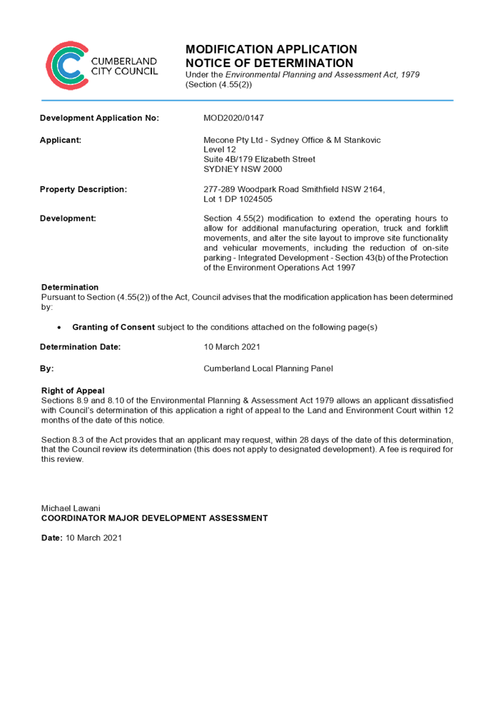
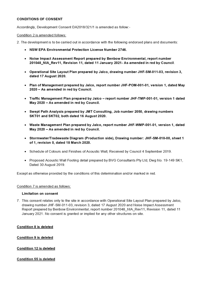
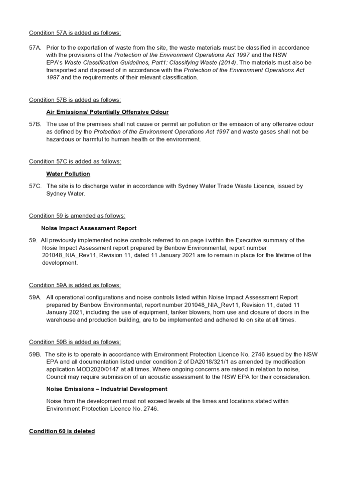
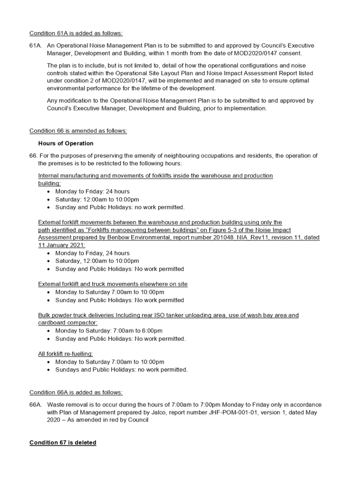
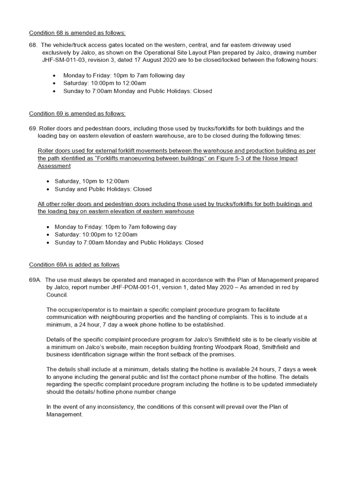
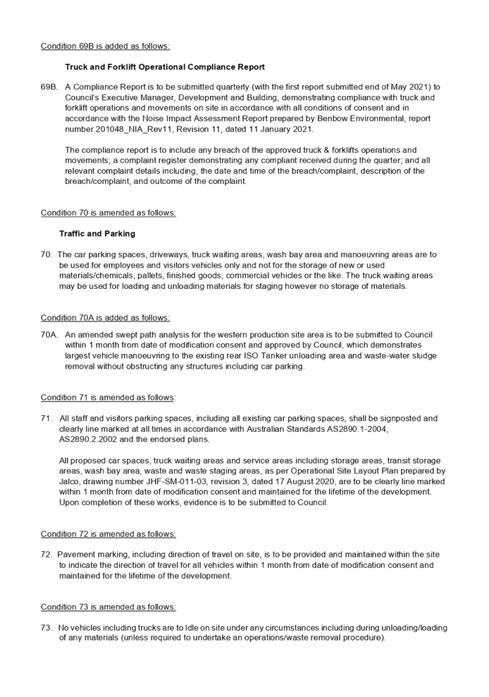
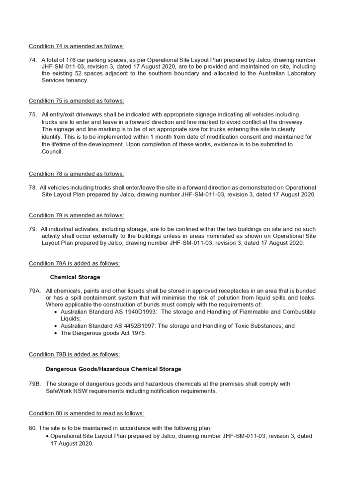

DOCUMENTS
ASSOCIATED WITH
REPORT LPP006/21
Attachment 2
Amended Plan - Revised Operational Site Plan
Cumberland Local Planning Panel Meeting
10 March 2021
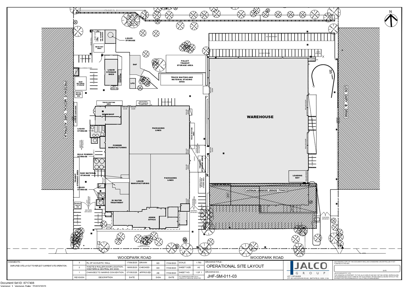
DOCUMENTS
ASSOCIATED WITH
REPORT LPP006/21
Attachment 3
Holroyd Local Environmental Plan 2013 Assessment
Cumberland Local Planning Panel Meeting
10 March 2021
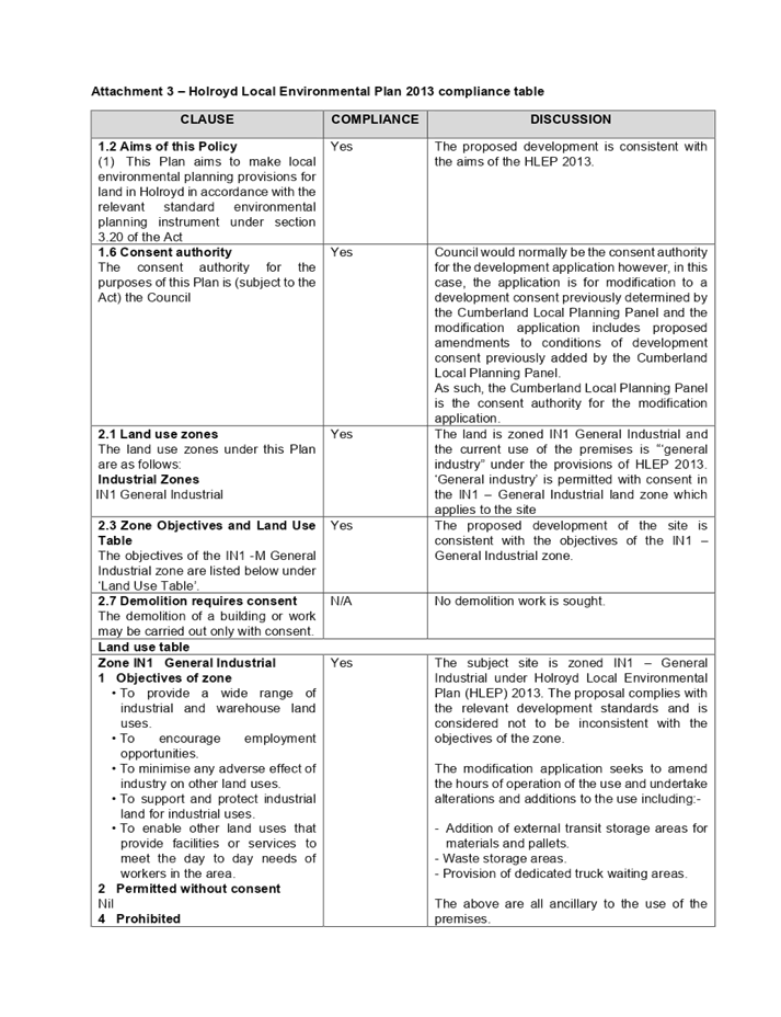

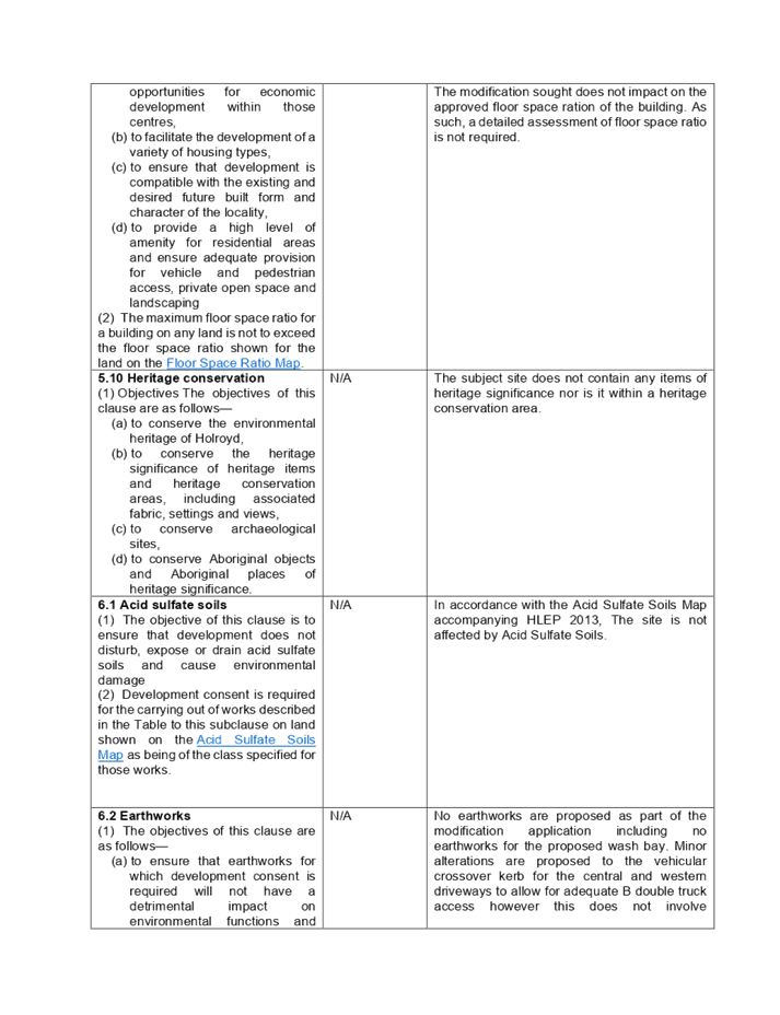
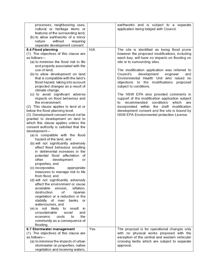

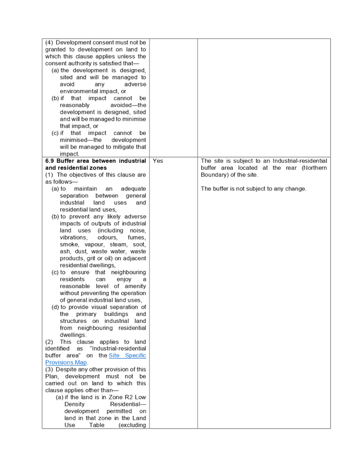

DOCUMENTS
ASSOCIATED WITH
REPORT LPP006/21
Attachment 4
Holroyd Development Control Plan 2013 Assessment
Cumberland Local Planning Panel Meeting
10 March 2021
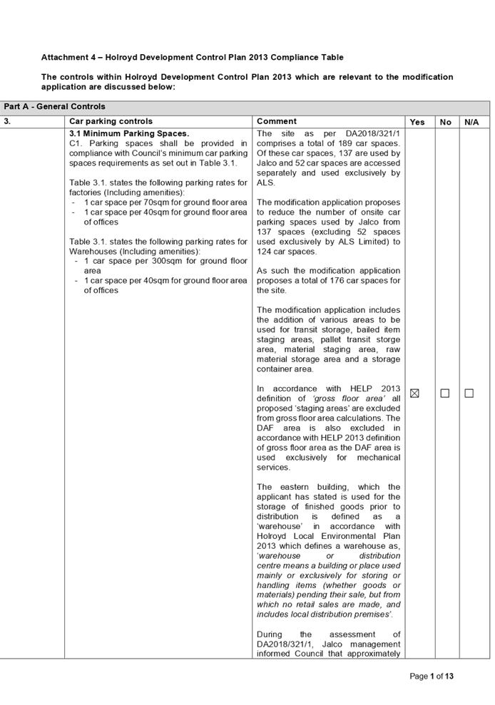
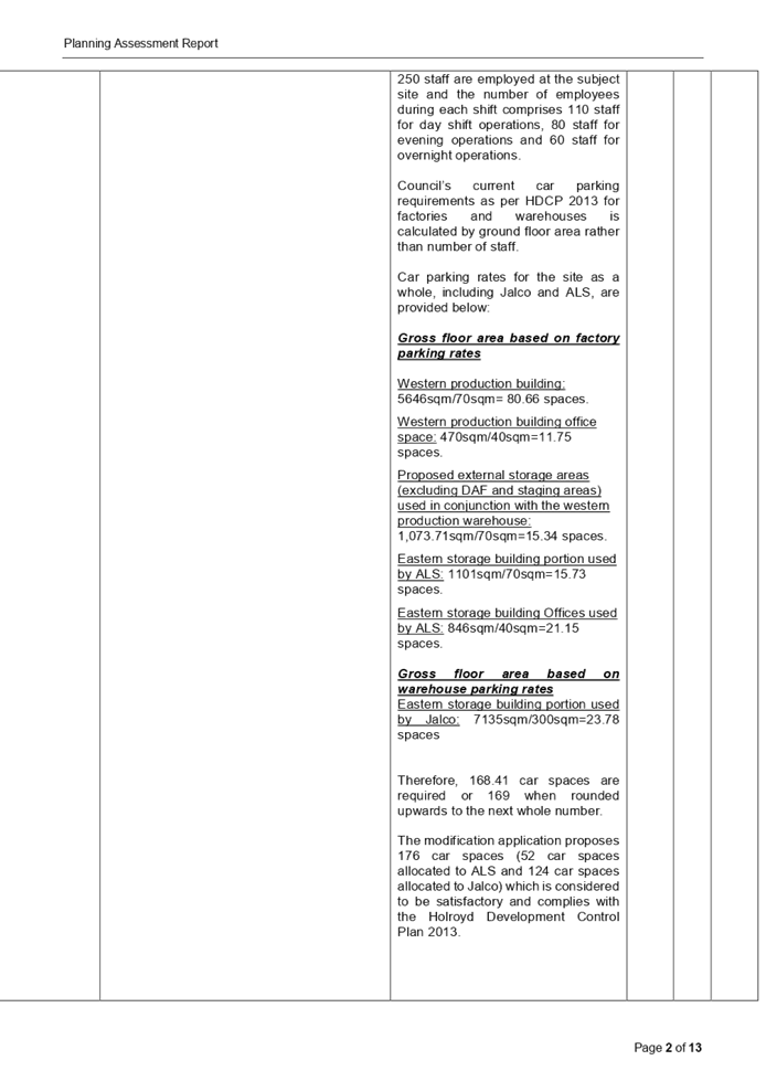
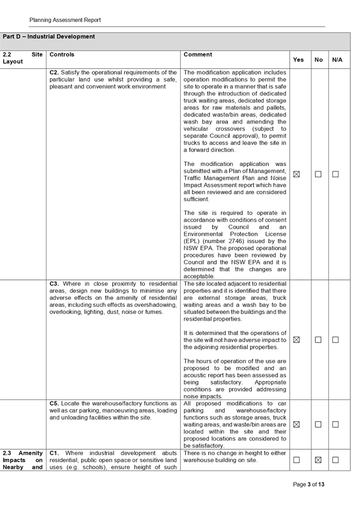
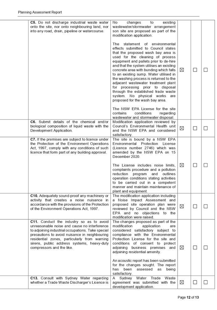

DOCUMENTS
ASSOCIATED WITH
REPORT LPP006/21
Attachment 5
Noise Impact Assessment Report
Cumberland Local Planning Panel Meeting
10 March 2021

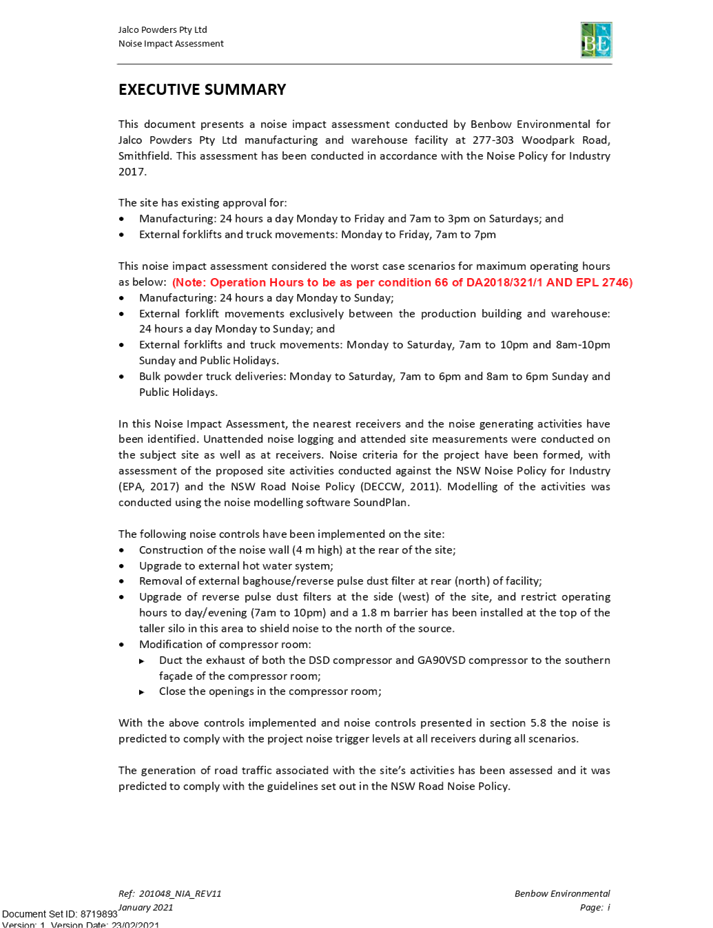
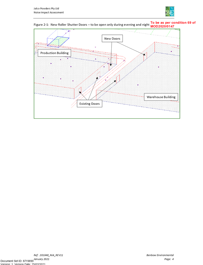
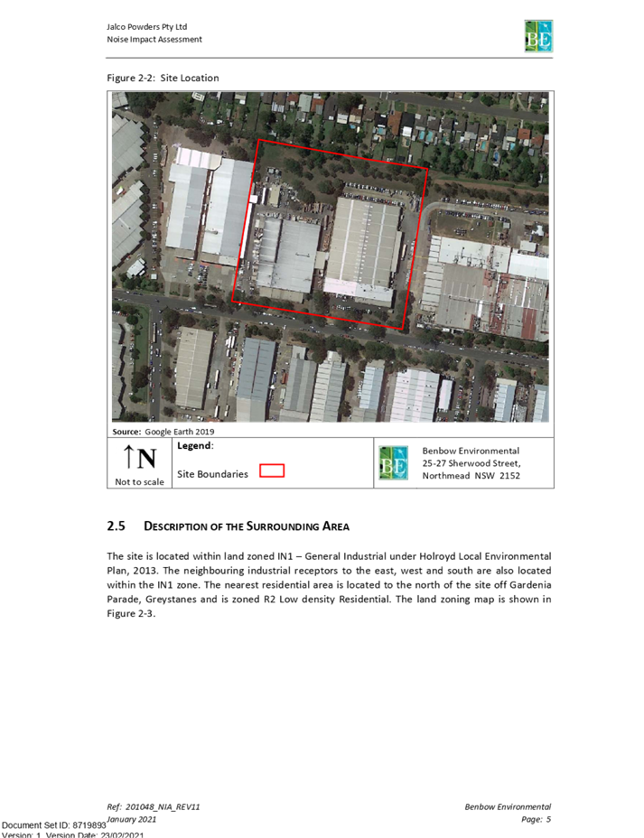
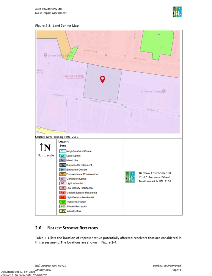
DOCUMENTS
ASSOCIATED WITH
REPORT LPP006/21
Attachment 6
Plan of Management - Traffic Management Plan
Cumberland Local Planning Panel Meeting
10 March 2021

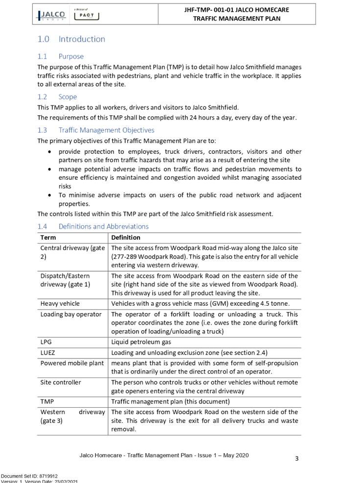
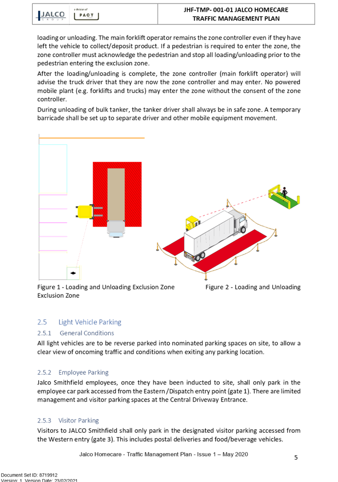
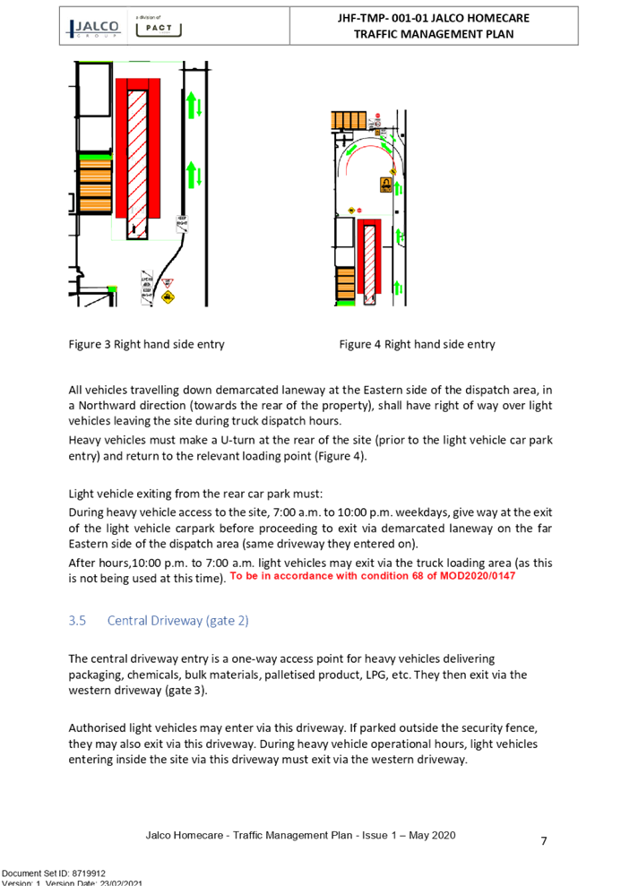

DOCUMENTS
ASSOCIATED WITH
REPORT LPP006/21
Attachment 7
Waste Management Plan
Cumberland Local Planning Panel Meeting
10 March 2021
DOCUMENTS
ASSOCIATED WITH
REPORT LPP006/21
Attachment 8
Swept Path Analysis
Cumberland Local Planning Panel Meeting
10 March 2021
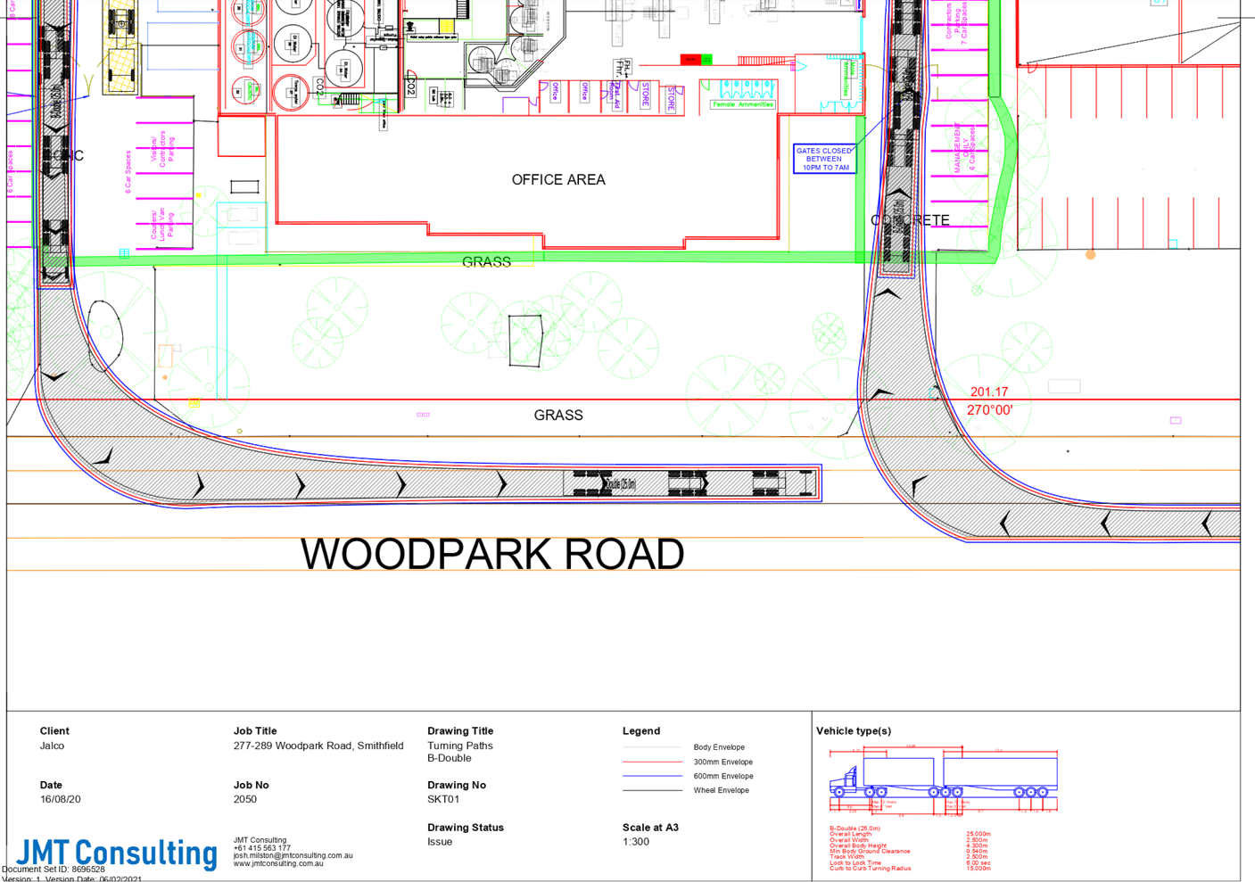
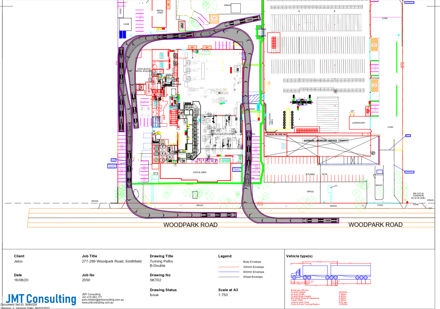
DOCUMENTS
ASSOCIATED WITH
REPORT LPP006/21
Attachment 9
Stormwater/Tradewaste Diagram
Cumberland Local Planning Panel Meeting
10 March 2021
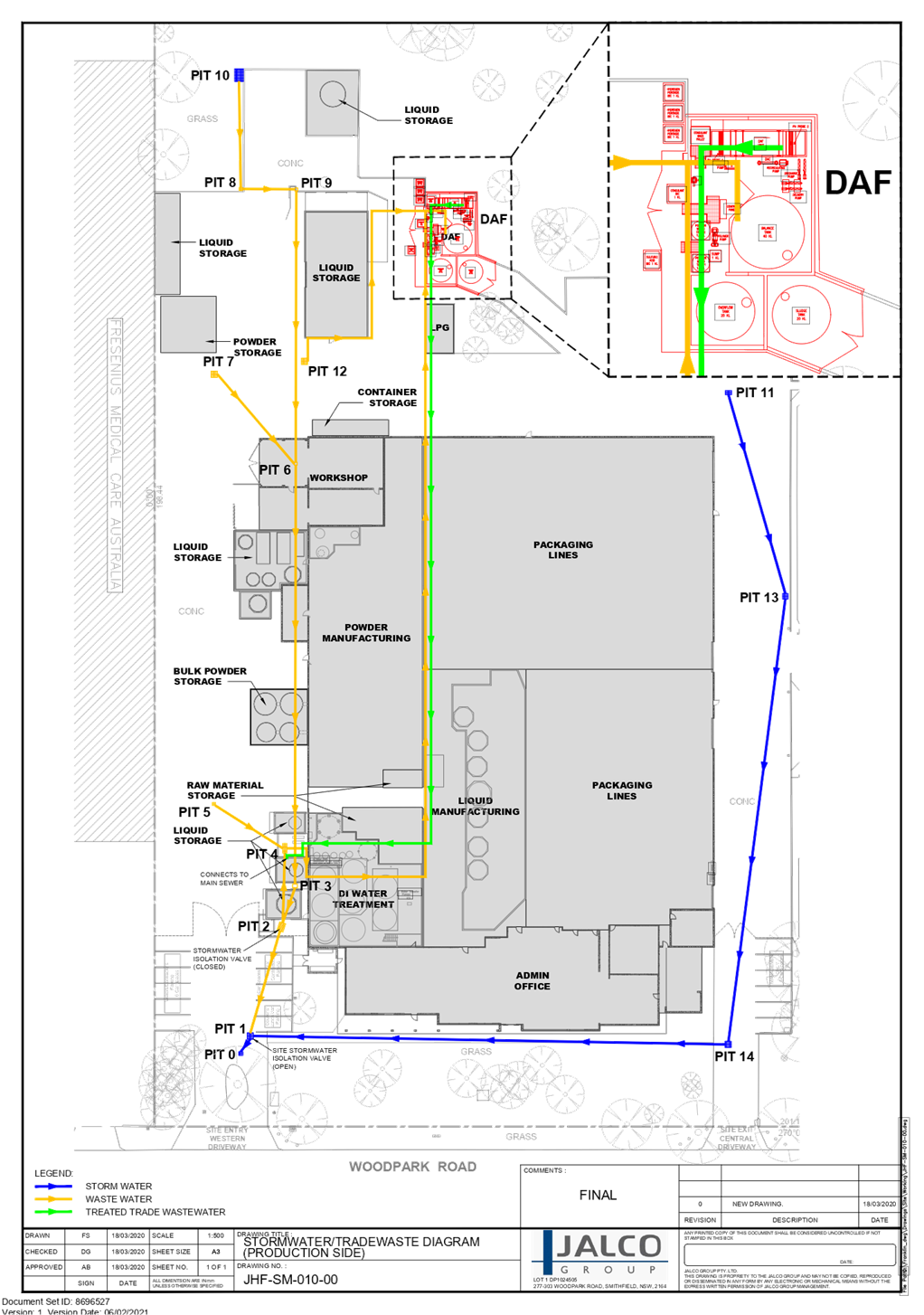
DOCUMENTS
ASSOCIATED WITH
REPORT LPP006/21
Attachment 10
NSW EPA Environmental Protection License 2746
Cumberland Local Planning Panel Meeting
10 March 2021

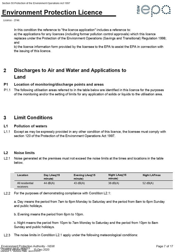
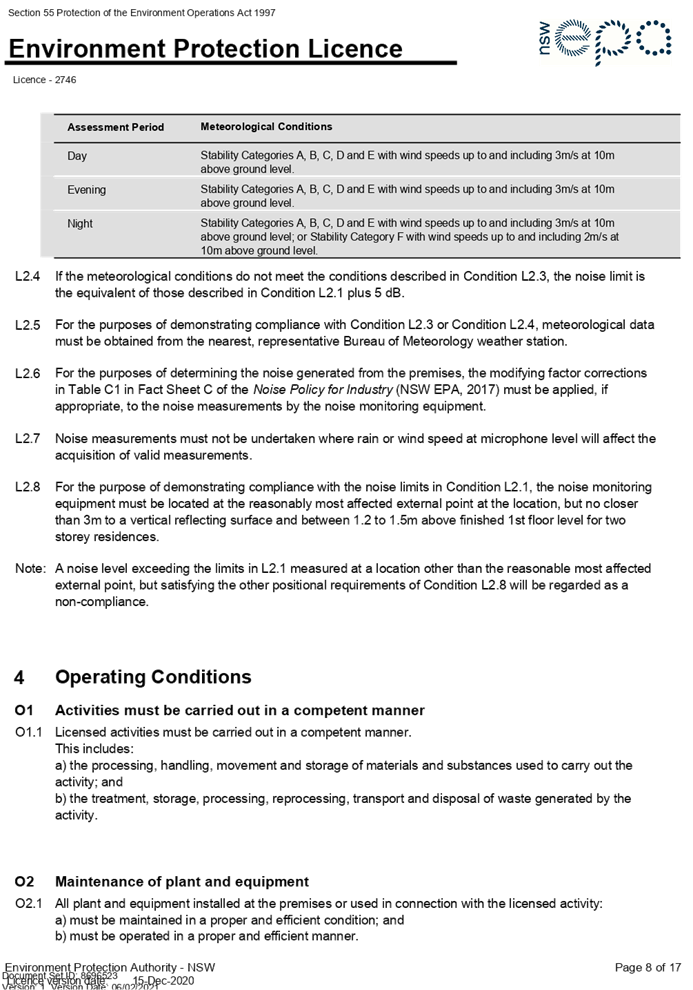
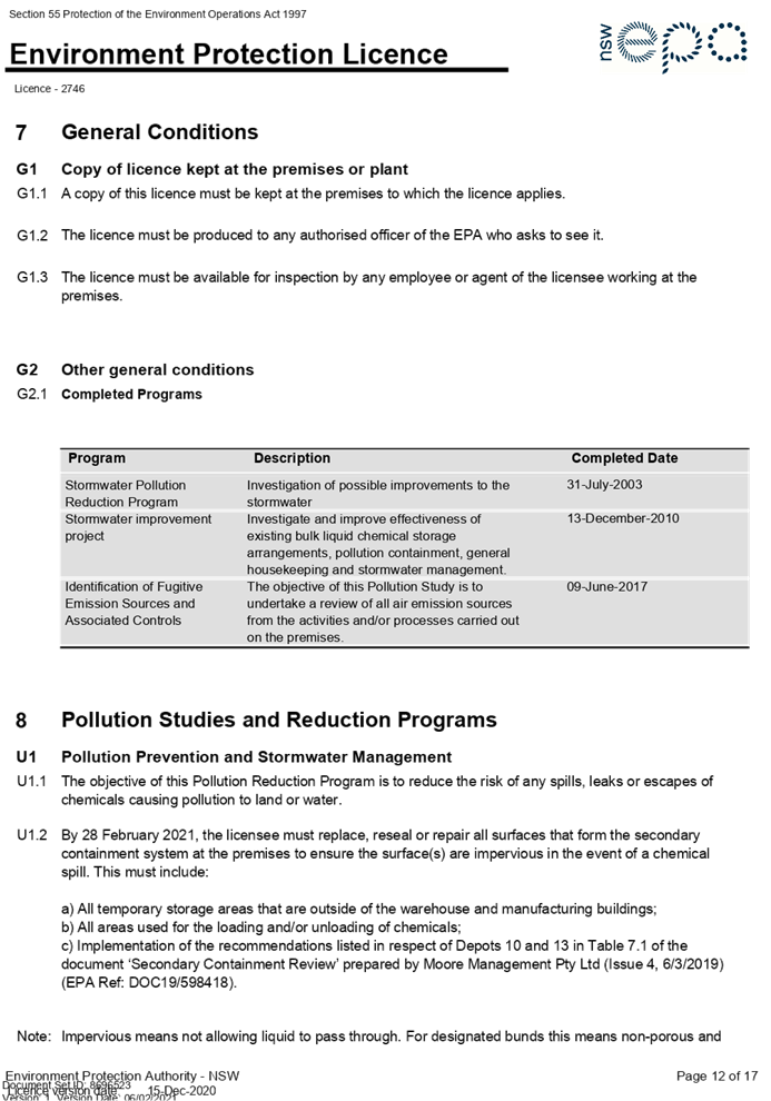

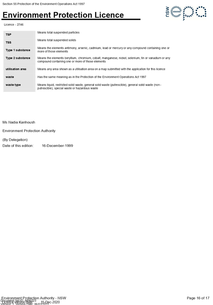
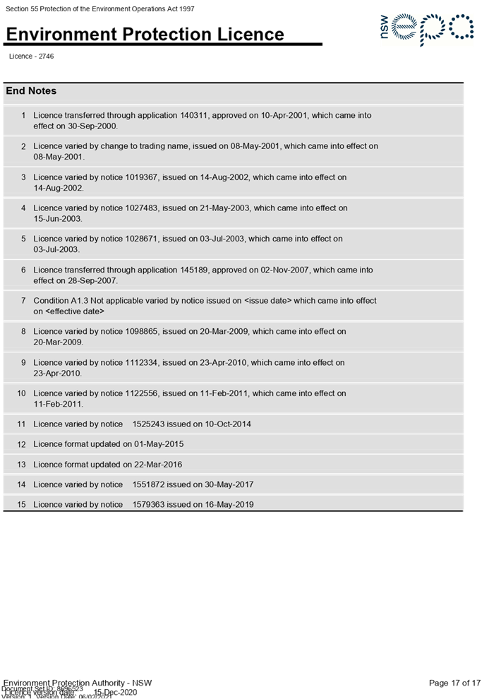
DOCUMENTS
ASSOCIATED WITH
REPORT LPP006/21
Attachment 11
Submissions Recieved Redacted
Cumberland Local Planning Panel Meeting
10 March 2021


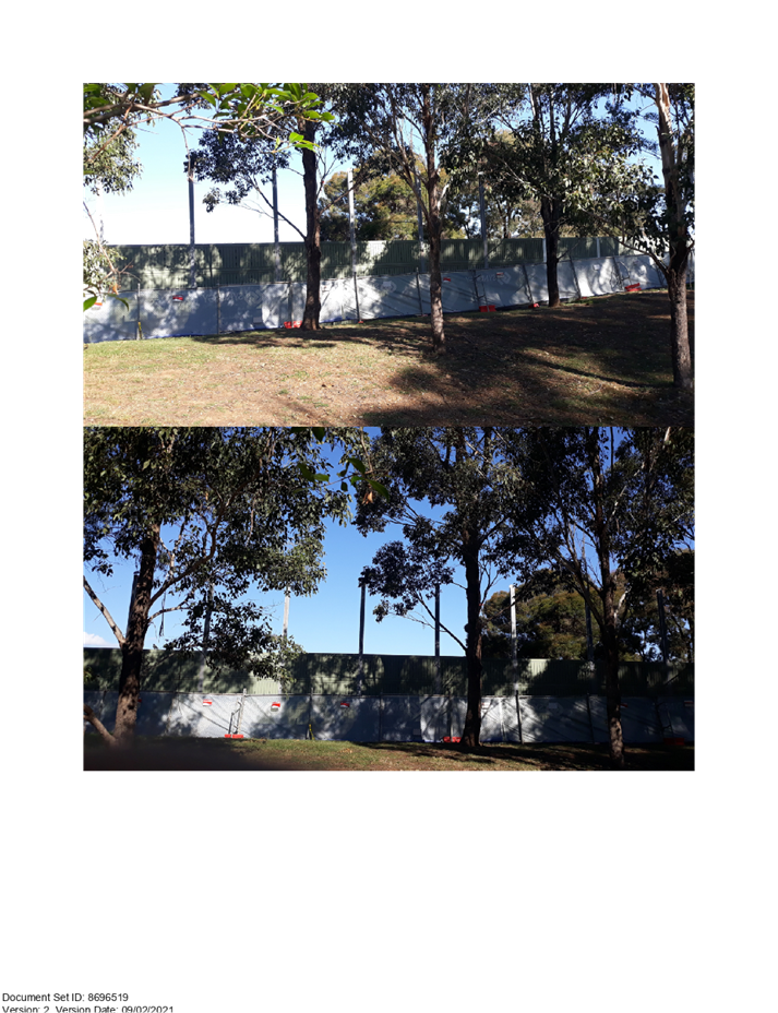

Cumberland
Local Planning Panel Meeting
10 March 2021
Item
No: LPP007/21
Development Application
for 9-15 Raphael Street and Laneway 429, Lidcombe
Responsible
Division: Environment
& Planning
Officer: Executive
Manager Development and Building
File
Number: DA2020/0461
|
Application lodged
|
7
August 2020
|
|
Applicant
|
James
Group Properties Pty Ltd
|
|
Owner
|
James
Group Properties Pty Ltd
|
|
Application No.
|
DA2020/0461
|
|
Description of Land
|
9-15
Raphael Street & Laneway 429, LIDCOMBE NSW 2141
(Lots
9-12 in DP 397)
|
|
Proposed Development
|
Construction
of a 12 storey mixed use development with 5 levels of basement car parking,
comprising ground floor commercial and residential units above including
landscaping, associated site works and site amalgamation of 9-15 Raphael
Street, Lidcombe with land known as Laneway 429
|
|
Site Area
|
1,912.2m2
|
|
Zoning
|
B4
Mixed Use
|
|
Disclosure of political donations and gifts
|
Nil
disclosure
|
|
Heritage
|
The
site does not contain a heritage item and is not located within a heritage
conservation area. The site is located within the vicinity of two heritage
items being 24 James Street, Lidcombe (Item I28) and Rookwood Cemetery (Item
A00718).
|
|
Principal Development Standards
|
FSR
Permissible: Max. 5.0:1
Proposed: Max. 4.98:1
Height of Building
Permissible: Max. 32m
Proposed: Max. 38.99m (RL66.550)
|
|
Issues
|
Building Height
Building Setbacks
Site Coverage
|
1. Development
Application No. DA2020/0461 was received on 7 August 2020 for the construction
of a 12 storey mixed use development with 5 levels of basement car parking, comprising
ground floor commercial and residential units above including landscaping,
associated site works and site amalgamation of 9-15 Raphael Street, Lidcombe
with land known as Laneway 429.
2. The
application was publicly notified to occupants and owners of the adjoining
properties for a period of 14 days between 11 September 2020 and 25 September
2020. In response, no submissions were received.
3. The
application includes a Clause 4.6 variation request to vary the maximum 32m
building height standard applicable to the site. The variation request is not
supported by Council, as discussed in the body of this Report.
4. The
proposal seeks the following non-compliances which are considered supportable
as discussed in detail elsewhere in the report:
|
Control
|
Required
|
Provided
|
% variation
|
|
Deep Soil (ADG)
|
133.85m² (7%)
|
Nil
|
100%
|
|
Building Separation/
Setbacks to Boundary (ADG)
|
Min. setback to
Western Boundary
|
|
Up to 4 storeys
(Ground-Level 3)
= Min. 6m
|
Ground-Level 3 =
Nil-3m
|
50-100%
|
|
5-8 storeys (Levels
4-7)
= Min. 9m
|
Levels 4-7 = Nil-3m
|
66.7%-100%
|
|
9 storeys + (Levels
8-11)
= Min. 12m
|
Level 8 = Nil-3m
Levels 9-11 = 9m
|
25%-100%
|
|
Front Setbacks (ADCP)
|
Raphael St & Davey
St = Min. 4m
|
Raphael St = Min.
3.565m-3.715m
Davey St = Min. 3.5m
|
10.8%-28.5%
12.5%
|
|
Site Coverage (ADCP)
|
Max. 956.1m²
(50%)
|
1,379.3m² (72.1%)
|
44.3%
|
5. The application is
referred to the Panel as the proposal is sensitive development to which State
Environmental Planning Policy No. 65 – Design of Residential Apartment
Development applies.
6. The
application is recommended for a deferred commencement approval subject to the
conditions as provided in the attached schedule.
Subject Site and Surrounding
Area
The subject site is legally
described as Lots 9-12 in DP 397, more commonly known as 9-15 Raphael Street,
Lidcombe. The subject site also includes the existing public laneway between 15
Raphael Street and 21-23 James Street which is subject to road closure and
identified as Laneway 429.
The site is zoned B4 Mixed Use and
is located within the ‘Lidcombe Town Centre’ within the Marsden
Street Precinct, as identified in the Local Centres section of the Auburn
Development Control Plan 2010 (ADCP). The site is located approximately 500
metres south-east from the Lidcombe train station.
The total site area is
1,912.2m² [9-15 Raphael Street (1,761m²) + Laneway 429
(151.2m²)]
The site is adjoined by a 4 storey
residential flat building to the west (7-19 James St), and a part 10 part 11
storey residential flat building to the south (21-23 James St).
Land directly opposite the subject
site, on the eastern side of Raphael Street, are zoned IN2 Light Industrial and
are occupied by industrial premises. Land on the northern side of Davey Street,
immediately opposite the subject site, is zoned RE1 Public Recreation and is
earmarked for acquisition in the ALEP 2010 for public park purposes with
Friends Park and Jewish Park.
It is noted that construction of
the basement levels has been carried out in accordance with DA-280/2017.
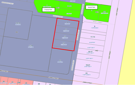
Figure
1 – Locality Plan of subject site indicated in red outline.
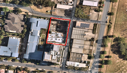
Figure
2 – Aerial view of subject site indicated in red outline (NearMap 24
January 2021)
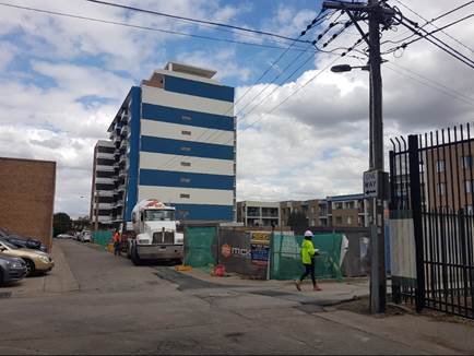
Figure 3 – View of subject site as seen from the corner of
Raphael St & Davey St.
Left: Industrial premises at 9 East St.
Background: Residential flat building at 21-23 James St.
Right: Residential flat building at 7-19 James St.
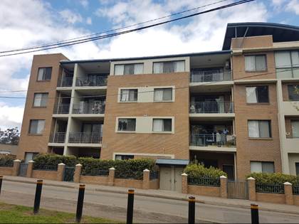
Figure 4 – View of adjoining 4 storey residential flat building
at 7-19 James St (Davey St frontage).
Description of the
Proposed Development
Council has received a
development application for a mixed-use development comprising commercial units
and residential apartments and associated works at 9-15 Raphael Street,
Lidcombe and Laneway 429.
Specifically, the
consent is sought for the following works:
· Construction
of a twelve (12) storey building with a maximum building height of 38.99m and a
Floor Space Ratio of 4.98:1;
· Provision
of a five-level basement car parking comprising 193 car spaces to be accessed
from Raphael Street; - The 5 basement levels have been constructed on site in
accordance with DA2017/280. The internal layout and configuration of the 5
basement levels forms part of the subject development application.
· Ground
floor level will comprise of two (2) commercial tenancy fronting Raphael Street
and Davey Street, waste storage room, 2 residential lobbies, service room and
motorcycle and bicycle parking.
· Levels
1-11 will comprise a mix of residential units and includes 112 apartments in
the following configuration:
o 47 x 1 bedroom;
o 63 x 2 bedroom;
o 2 x 3 bedroom.
· Provision
of communal open space on Level 1 and Level 9 for use by residents.
· A
2.5m and 2m wide pedestrian footpath and widened carriageway will be dedicated
to Council along the Raphael Street and Davey Street frontages respectively.
· A
2.5m x 2.5m splay at the corner of Davey Street and Raphael Street will be
dedicated to Council.
· Council
is currently in the process of finalising the sale of the laneway to the
Applicant, which forms part of the subject site.
iii)
iv) Note: Deferred
commencement conditions are imposed within the Draft Notice of Determination
requiring the following amendments to be made to bring the proposal in line
with the maximum 32m building height standard:
· Levels
10 and 11 be deleted in their entirety;
· The
deletion of all 8 residential apartments on Level 9; and
· The
conversion of Level 9 to communal open space in the form of a roof top terrace.
A total of 24
residential apartments will be deleted from Levels 9, 10 and 11 to satisfy
recommended deferred commencement conditions. As a result, the amended proposal
would comprise a total of 88 residential apartments.
History
On 7 March 2018, the
Sydney (West) Central City Planning Panel granted consent to DA2017/280 for demolition
of existing structures and construction of 10 storey residential flat building
consisting of 117 units with 4 levels of basement parking.
On 21 January 2020,
Section 4.55(1A) modification application (MOD2019/5271) granted consent under
delegated authority for the addition of a fifth level of basement car parking
to an approved residential flat building. A total of 199 car parking spaces
were approved as part of this modification.
On 12 May 2020, a
pre-lodgement meeting (PL2020/0022) was held with the Cumberland Design
Excellence Panel (DEP) for the proposed demolition of existing structures,
construction of a 12 storey mixed use development with basement car parking.
Pre-lodgement advice and DEP minutes were issued on 3 August 2020.
On 5 June 2020, Section
4.55(1A) modification application (MOD2020/0117) to DA2017/280 granted consent
to stage the construction of the approved residential flat building. Stage 1,
being the construction of the basement has been completed and it is the
Applicant’s intention to surrender DA2017/280 upon obtaining development
consent for the development proposed by this application (DA2020/0461). A
condition of consent requiring the surrender of DA2017/280 has been
recommended.
The pre-lodgement
application (PL2020/0022) discussed with Council officers proposed a 38m high
building whereby the applicant was relying on the increased height standard
proposed in the Draft Cumberland LEP. The applicant was advised then, and
during the course of the assessment of the subject application, that the Draft
CLEP was not imminent and therefore cannot be considered by Council at this
stage. The applicant was encouraged to withdraw the application and resubmit at
a later date. However, they have subsequently advised that they wanted to
continue construction works based on the subject plans (DA2020/0461) rather
than the currently approved plans (DA2017/280).
The applicant was
further advised and accepted a deferred commencement condition will be imposed
requiring the proposal to be amended to demonstrate compliance with the maximum
32m building height standard as prescribed in Auburn LEP 2010 which incorporate
the following:
· The
deletion of Levels 10 and 11 in their entirety,
· The
deletion of the 8 residential apartments on Level 9;
· Conversion
of Level 9 as communal open space in the form of a roof top terrace.
Applicants Supporting
Statement
The applicant has provided a
Statement of Environmental Effects prepared by The Planning Hub dated 4 August
2020 and was received by Council in support of the application.
Contact with Relevant
Parties
The assessing officer has
undertaken a site inspection of the subject site and surrounding properties and
has been in regular contact with the applicant throughout the assessment
process.
Internal Referrals
Design Excellence Panel
The development application was
referred to the Cumberland Design Excellence Panel (DEP) in accordance with the
Design Excellence Panel Procedures, which requires any building over 25 metres
in height to be referred to the DEP for comment.
The Cumberland DEP has advised
that the development is satisfactory subject to the recommended conditions,
which address amendments to the building fabric and colours as well as
amendments to the communal open space area and landscaping design of the
development.
Development Engineer
The development application was
referred to Council’s Development Engineer for comment who has advised
that the development proposal is satisfactory with respect to stormwater
disposal, traffic and car parking, and therefore can be supported subject to
recommended conditions of consent.
Environment and Health
The development application was
referred to Council’s Environment and Health Officer for comment who has
advised that the development proposal is satisfactory with respect to
contamination, acoustic measures, and environmental impacts, subject to recommended
conditions of consent.
Waste Management
The development application was
referred to Council’s Waste Management Officer for comment who has
advised that the development proposal should be provided with garbage chutes.
The proposal seeks to provide an alternative method for transportation of
garbage from each level to the waste storage room, which is considered
satisfactory. A space has been allocated for waste vehicles within the
boundaries of the site for waste collection. The waste arrangements proposed
are considered acceptable and appropriate conditions are imposed within the
Draft Notice of Determination.
External Referrals
Ausgrid
The proposal was referred to
Ausgrid in accordance with Clause 45(2) of State Environmental Planning Policy
(Infrastructure) 2007. Correspondence received on 1 October 2020 from Ausgrid
outlined that no objections are raised with respect to the proposed development
and conditions are recommended to be imposed relating to the undergrounding of
cables.
PLANNING COMMENTS
The provisions of any
Environmental Planning Instruments (EP&A Act s4.15 (1)(a)(i))
State Environmental Planning
Policies
The proposed development is not
specifically affected by any relevant State Environmental Planning Policies.
(a) State
Environmental Planning Policy No. 55 – Remediation of Land (SEPP 55)
Clause 7 of SEPP 55 requires
Council to be satisfied that the site is suitable or can be made suitable to
accommodate the proposed development. The matters listed within Clause 7 have
been considered in the assessment of the development application.
|
Matter for Consideration
|
Yes/No
|
|
Does the application involve re-development of the site or a change of
land use?
|
Yes No
|
|
In the development going to be used for a sensitive land use (e.g.:
residential, educational, recreational, childcare or hospital)?
|
Yes No
|
|
Does information available to you indicate that an activity listed
below has ever been approved, or occurred at the site?
acid/alkali plant and formulation,
agricultural/horticultural activities, airports, asbestos production and
disposal, chemicals manufacture and formulation, defence works, drum
re-conditioning works, dry cleaning establishments, electrical manufacturing
(transformers), electroplating and heat treatment premises, engine works,
explosive industry, gas works, iron and steel works, landfill sites, metal
treatment, mining and extractive industries, oil production and storage,
paint formulation and manufacture, pesticide manufacture and formulation,
power stations, railway yards, scrap yards, service stations, sheep and
cattle dips, smelting and refining, tanning and associated trades, waste
storage and treatment, wood preservation
|
Yes No
|
|
Is the site listed on Council’s Contaminated Land
database?
|
Yes No
|
|
Is the site subject to EPA clean-up order or other EPA
restrictions?
|
Yes No
|
|
Has the site been the subject of known pollution
incidents or illegal dumping?
|
Yes No
|
|
Does the site adjoin any contaminated land/previously
contaminated land?
|
Yes No
|
|
Has the appropriate level of investigation been carried
out in respect of contamination matters for Council to be satisfied that the
site is suitable to accommodate the proposed development or can be made
suitable to accommodate the proposed development?
|
Yes No
|
|
Details of contamination investigations carried out at the site:
The subject site was deemed
suitable for its intended use under the previous approval for the site
DA-280/2017.
DA-280/2017 did not require
further investigation subject to the preparation of a Lead Management Plan
prior to the issue of a Construction Certificate and compliance with the
relevant Australian Standards relating to demolition and handling of
materials. This information was provided, and the Construction Certificate
was issued for DA-280/2017 in which works have commenced onsite.
Demolition has been undertaken
onsite with the approved basement levels currently being excavated and
constructed. Those excavation works are largely complete, and the site has
been excavated to approximately 15m to allow for a 5 level basement.
In this regard, it is considered
that matters relating to the suitability of the site for the proposed
development has been addressed and satisfied as part of the previous approval
– DA-280/2017. Notwithstanding, a standard condition of consent, to
manage any unexpected finds during the course of the construction work has
been recommended.
|
(b) Statement
Environmental Planning Policy No. 65 - Design Quality of Residential Apartment
Development (SEPP 65)
SEPP 65 applies to the development
as the building is 3 storeys or more, and contains more than 4 dwellings. A
design statement addressing the design quality principles prescribed by SEPP 65
was prepared by the project architect. Integral to SEPP 65 is the Apartment
Design Guide (ADG), which sets benchmarks for the appearance, acceptable
impacts and residential amenity of the development.
A comprehensive assessment against
the Apartment Design Guide (ADG) controls is provided at Attachment 5.
The following table sets out the
ADG non-compliances.
|
3E
|
Deep
Soil Zones
|
|
3E-1
|
Deep
soil zones provide areas on the site that allow for and support healthy plant
and tree growth. They improve residential amenity and promote management of
water and air quality.
|
No deep
soil is provided. The basement is constructed in accordance with approved
DA2017/280.
|
|
|
Design
Criteria
Deep soil zones are to meet the following minimum
requirements:
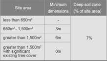
|
Required: 7% x 1,912.2m²
= 133.85m²
Provided: Nil
No deep soil is provided. Given
the subject site is located within the Lidcombe Town Centre, it is considered
impractical to achieve 30% deep soil area. The proposal provides adequate
communal open space areas for residents and landscaped areas are provided to
communal spaces.
|
|
3F
|
Visual
Privacy
|
|
3F-1
|
Adequate
building separation distances are shared equitably between neighbouring
sites, to achieve reasonable levels of external and internal visual privacy.
|
|
Design
Criteria
Separation between windows and balconies is provided to
ensure visual privacy is achieved. Minimum required separation distances from
buildings to the side and rear boundaries are as follows:
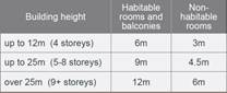
Note:
Separation
distances between buildings on the same site should combine required building
separations depending on the type of room.
Gallery
access circulation should be treated as habitable space when measuring
privacy separation distances between neighbouring properties.
|
Building is 12 storeys in height
West: Adjoins RFB at 7-19 James St (4 storey in height)
Ground-Level 3:
Required = Min. 6m to boundary.
Min. 3m setback to boundary
provided – Windows of proposed unit does not directly overlook into
living room windows of neighbouring dwelling. Proposed balcony includes
screening to mitigate direct overlooking from proposed COS and to maintain
visual privacy for the neighbouring dwelling.
Levels 4-7:
Required = 9m to boundary.
Min. 3m setback to boundary
– Windows of proposed unit does not directly overlook into living room
windows of neighbouring dwelling. Proposed balcony includes screening to
mitigate direct overlooking from proposed COS and to maintain visual privacy
for the neighbouring dwelling.
Level 8:
Required = 12m to boundary.
Min. 3m setback to boundary
– Windows of proposed unit does not directly overlook into living room
windows of neighbouring dwelling. Proposed balcony includes screening to
mitigate direct overlooking from proposed COS and to maintain visual privacy
for the neighbouring dwelling.
Min. 9m setback provided to
boundary.
Level 9:
Required = 12m to boundary.
Min. 9m setback provided to
boundary.
Levels 10 & 11:
Required = 12m to boundary.
Min. 9m setback provided to
boundary.
Whilst
variations are sought to the required building separation between the subject
site and adjoining dwellings at 7-19 James St, this is deemed acceptable
noting that the existing RFB is 4 storeys in height and there are no direct
overlooking and visual privacy impacts that arise between the properties.
|
|
4A
|
Solar
and Daylight Access
|
|
|
To
optimise the number of apartments receiving sunlight to habitable rooms,
primary windows and private open space.
Design
Criteria
Living
rooms and private open spaces of at least 70% of apartments in a building
receive a minimum of 2 hours direct sunlight between 9 am and 3 pm at
mid-winter in the Sydney Metropolitan Area and in the Newcastle and
Wollongong local government areas.
Required: 70% x 112 units = 78.4 (79) units minimum
Based
on deferred commencement conditions resulting in 88 units
=
70% x 88
=
61.6 (62) units minimum
|
55 out of 88 units (62.5%)
achieve 2 hours
This represents a shortfall of 7
apartments to comply with the minimum 70% of all apartments receiving a
minimum of 2 hours direct sunlight between 9am-3pm, mid-winter.
The minor non-compliance is
considered acceptable in this instance as the apartments have been oriented
to optimise the number of apartments receiving sunlight having regard to the
context of the site and designed in a manner whereby all apartments will receive
at least 1 hour of solar access, from 9am-3pm, mid-winter.
In
addition, no single south-facing apartments are proposed.
|
(c) State
Environmental Planning Policy (Infrastructure) 2007 (ISEPP)
The provisions of the ISEPP 2007
have been considered in the assessment of the development application.
Clause 45 - Development likely
to affect an electricity transmission or distribution network
The subject development occurs
within 5 metres of an overhead electricity power line. As such, the proposal
was referred to Ausgrid in accordance with Clause 45(2) of State Environmental
Planning Policy (Infrastructure) 2007. Correspondence received on 1 October
2020 from Ausgrid outlined that no objections are raised with respect to the
proposed development and conditions are recommended to be imposed relating to
the undergrounding of cables.
(d) Statement
Environmental Planning Policy No 19 - Bushland in Urban Areas (SEPP 19)
The subject site is located
adjacent to land zoned and reserved for public open space. The proposed
development does not result in disturbance to land zoned RE1 Public Recreation,
Friends Park or Jewish Park.
(e) State
Environmental Planning Policy (Vegetation in Non-Rural Areas) 2017
Tree removal carried out in
accordance with previous approval – DA-280/2017.
(f) State
Environmental Planning Policy (Coastal Management) 2018
Not applicable. The subject site
is not identified as a coastal wetland and/or land identified as
“proximity area for coastal wetlands” and/or land identified as
such by the Coastal Vulnerability Area Map.
(g) State
Environmental Planning Policy (Building Sustainability Index: BASIX) 2004
BASIX Certificate No. 1109427M_02
dated 23 June 2020 has been submitted with Council and is considered to be
satisfactory.
Deferred commencement conditions
are imposed within the Draft Notice of Determination requiring Levels 10 and 11
be deleted from the proposal, and the conversion of Level 9 to a communal
rooftop terrace, to bring the proposal in line with the maximum 32m building height
standard. Subsequently a condition requiring the submission of a revised BASIX
Certificate corresponding with the amended proposal is also included.
Regional Environmental Plans
The proposed development is
affected by the following Regional Environmental Plans:
(a) Sydney
Regional Environmental Plan (Sydney Harbour Catchment) 2005
The subject site is identified as
being located within the area affected by the Sydney Regional Environmental
Plan (Sydney Harbour Catchment) 2005. The proposed development raises no issues
as no impact on the catchment is envisaged.
(Note: - the subject site is not
identified in the relevant map as ‘land within the ‘Foreshores and
Waterways Area’ or ‘Wetland Protection zone’, is not a
‘Strategic Foreshore Site’ and does not contain any heritage items.
Hence the majority of the SREP is not directly relevant to the proposed
development).
Local Environmental Plans
Auburn Local Environmental Plan
2010
The provisions of the Auburn Local
Environmental Plan (ALEP) 2010 are applicable to the development proposal. It
is noted that the development generally achieves compliance with the key
statutory requirements of the ALEP 2010 and the objectives of the B4 Mixed Use
zone.
A comprehensive assessment and
compliance table is contained in Attachment 6.
(a) Permissibility:
-
The proposed development is
defined as a shop top housing development and is permissible in the B4 Mixed
Use land use zone, with consent.
shop top housing means one or more
dwellings located above ground floor retail premises or business premises.
Note: Shop top housing is a type
of residential accommodation—see the definition of that term in this
Dictionary.
The relevant matters to be
considered under ALEP 2010 and the applicable clauses for the proposed development
are summarised below.
|
DEVELOPMENT STANDARD
|
COMPLIANCE
|
DISCUSSION
|
|
4.3 Height of Buildings
Maximum 32m
|
No
|
The
building maintains a maximum building height of 38.99m (RL66.550), which is a
variation of 6.99m, and represents a total variation percentage of 21.84%.
Variation
to this development standard is sought as part of a Clause 4.6 variation
request, refer to following discussion under Clause 4.6.
|
|
4.4 Floor Space Ratio (FSR)
Maximum 5.0:1 (Max.
9,561m²)
|
Yes
|
The development provides a total
gross floor area (GFA) of 9,516m², which equates to a total FSR of
4.98:1.
|
|
4.6 Exceptions to development
standards
|
No
|
The Applicant has submitted a
Clause 4.6 Variation Request for the departure from the building height
development standard.
The variation request is not
supported by Council, refer to the discussion in the following section of
this Report.
|
(b) Clause
4.3 – Height of Buildings
The proposal seeks a variation to
Clause 4.3 – Height of Buildings that stipulates that the height of
building is not to exceed 32m on the subject site.
The proposed building has an
overall height of 38.99m (RL66.550) to the roof of the lift core and stairwell.
The proposal breaches the height by 6.99m to the roof of the lift core,
representing a significant variation of 21.84%. The majority of the height
breach is a result of the inclusion of Levels 10 and 11 as part of the proposed
development, which comprises of 16 residential apartments. The height breach
also comprises of the 2 lift overruns.
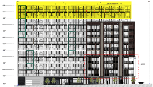
Figure
5 – Plan showing extent of height variation in yellow – Eastern /
Raphael St elevation.
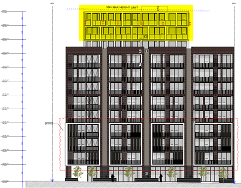
Figure
6 – Plan showing extent of height variation in yellow – Northern /
Davey St elevation.
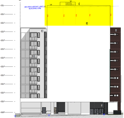
Figure
7 – Plan showing extent of height variation in yellow – Southern
elevation.
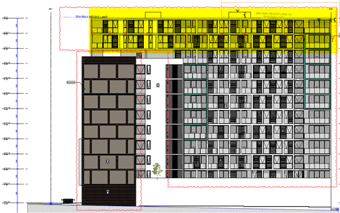
Figure
8 – Plan showing extent of height variation in yellow – Western
elevation.
(c) Clause
4.6 – Variation to Building Height
Clause 4.6 allows the consent
authority to vary development standards in certain circumstances and provides
an appropriate degree of flexibility to achieve better design outcomes. The
consent authority may grant the exception as the Secretary’s concurrence
can be assumed where clause 4.6 is adopted as per the Department of Planning
Circular PS 18-003, dated 21 February 2018.
The applicant has submitted a
written request to vary the development standard for building height –
Refer to Attachment 3.
Based on various case laws
established by the Land and Environment Court of NSW such as Four2five P/L v
Ashfield Council [2015] NSWLEC 9, Randwick City Council v Micaul Holdings P/L
[2016] NSW LEC7 and Zhang and anor v Council of the City of Ryde [2016] NSWLEC
1179, a 3 part assessment framework for a variation request proposed under
clause 4.6 has been considered and an assessment of the proposed variance,
following the 3 part test is discussed in detail below.
The three (3) preconditions which
must be satisfied before the application can proceed are as follows:
1. Is
the proposed development consistent with the objectives of the zone?
Applicant’s
justification:
· To
provide a mixture of compatible land uses
The proposed development provides
a compatible land use that is consistent with the future character of the
Lidcombe Town Centre. It proposes a high density residential and commercial
development designed to contribute to the vitality of the town centre.
· To
integrate suitable business, office, residential, retail and other development
in accessible locations so as to maximise public transport patronage and
encourage walking and cycling
The proposed development provides
high density mixed-use development in an accessible location that maximises
public transport patronage and encourages non-vehicular transport.
· To
encourage high density residential development
The proposal consists of a
high-density residential development that is consistent with the future
character of the area, whilst providing for the housing needs of the wider
community.
· To
encourage appropriate businesses that contribute to economic growth
The proposed development will
generate demand and opportunities for businesses to service the area and
contribute to the economic growth of the area. The commercial tenancies within
the development will provide additional floor space for businesses in the
growing Lidcombe Town Centre.
· To
achieve an accessible, attractive and safe public domain
The proposed development
contributes to creating an accessible, attractive and safe public domain. The
development will provide opportunities for passive surveillance and create a
vibrant street.
Planner’s comment:
Whilst the proposed use of the
site for commercial and residential purposes is consistent with the objectives
of the zone, the proposed height of other development is inconsistent with
height of other developments within the immediate vicinity.
2. Is
the proposed development consistent with the objectives of the development
standard which is not met?
Applicant’s
justification:
· To
establish a maximum height of buildings to enable appropriate development
density to be achieved
The proposal consists of a
high-density mixed-use development that meets the desired future character of
the area. The height exceedance is due to the built form response to the future
height control for the subject site under the Cumberland LEP which is expected
to be adopted this year. The future height control will allow the development
to achieve the desired development density onsite as outlined by the applicable
Floor Space Ratio of 5:1.
· To
ensure that the height of buildings is compatible with the character of the
locality
The height of the proposed
development is consistent with the changing character and desired character of
the Lidcombe Town Centre and has been designed to respond to the future height
control of the site.
Planner’s comment:
The objectives of the building
height standard are to enable appropriate development density to be achieved
and to ensure that the height of the building is compatible with the character
of the locality.
It is noted that the exhibited
Draft Cumberland Local Environmental Plan (CLEP) proposes to increase the
maximum building height standard applicable for development at the subject site
to 38m. However, there is no evidence provided to Council to suggest that the
Draft CLEP is imminent at this stage.
The proposed building height
exceedance includes habitable floor area, being 16 residential apartments on
Levels 10 & 11 in their entirety, and associated lift overruns. Whilst it
is acknowledged that the proposal provides a compliant FSR, the significant
exceedance to the applicable 32m building height standard pursuant to ALEP 2010
is considered to be contrary to the objectives of the clause, having regard to
the uncertainty of the increased height standard.
Furthermore, the exceedance is not
consistent with the existing established principal 10 storey building height of
the residential flat building immediately adjoining the site to the south at
21-23 James St, Lidcombe, which only comprises encroaching maisonette elements
within the 11th storey.
3. A)
Is compliance with the development standard unreasonable or unnecessary in the
circumstances of the case? And;
Applicant’s
justification:
As detailed in the section above,
the proposal maintains the future higher density-built form that is at a scale
comparative to neighbouring buildings of the site's location within the
Lidcombe Town Centre. The numeric increase in building height for the proposed
development is approximately 6.99m and 0.99m once the new control is adopted
which is a result of designing the development to respond to the future
building heat control for the site. This increase is considered reasonable in
the context of the site and its ability to result in no adverse impacts on
adjoining neighbours or visual impacts on the public domain.
The proposed development,
including the proposed building elements that exceed the height limits, will
continue to achieve the objectives of the standard. It is therefore considered
that the objectives of the development standard are met notwithstanding the
breach of the height of buildings standard.
Planner’s comment:
The application of the development
standard is considered reasonable and necessary in this instance, given the
established building height of the adjoining site and immediate areas. The
assertion that the building height exceedance is made to correspond with the
numeric increase in building height as identified in the Draft Cumberland LEP
is not adequate grounds for the variation of the development standard, as the
adoption of the Draft Cumberland LEP is not imminent at this stage.
b) Are there sufficient
environmental planning grounds to justify contravening the development standard
and therefore is the applicant’s written justification well founded?
Applicant’s
justification:
It is our opinion that there are
sufficient environmental planning grounds to justify contravening the building
height standard in this instance. These are as follows:
· The
proposed development is consistent with the objectives of the zone and the
objectives of the building height control.
· The
proposal does not result in any adverse impact from adjoining properties.
· The
height variation once the Cumberland LEP is adopted will only include a minor
portion of the building and will be a maximum exceedance of 0.99m.
· The
area of exceedance once the Cumberland LEP is adopted will only consist of lift
overruns and will not contain any habitable floor space.
It is considered the objectives of
the LEP height standard are achieved in this instance where the proposal
produces a high quality-built form that ensures a high level of amenity for
residents.
Whilst the built form exceeds the
building height control applicable to the site, it is considered that the
proposed design does not unreasonably detract from the amenity of adjacent
residents or the existing quality of the environment as demonstrated in architectural
plans prepared by UrbanLink.
Strict compliance with the
building height development standard would result in a development that does
not achieve the desired development density for the site and would be
inconsistent with the future building height control for the site.
Planner’s comment:
Having regard to the justification
provided for the contravention of the development standard, the variation to
the maximum building height is not supported. The proposed increase in the
building height standard from 32m to 38m identified in the Draft Cumberland LEP
is not adequate grounds to justify the height of building exceedance sought by
the proposal. The proposed building height is considered unnecessarily
excessive for the site, given the height breach includes 2 entire levels of
habitable floor space plus associated lift overruns.
Conclusion:
Council is not satisfied that the
applicant’s written request has adequately addressed the matters required
to be demonstrated by clause 4.6 subclause (3).
Council is not satisfied that the
proposed development will be in the public interest, given the extent of the
height breach.
It is the view of Council Officers
that the justification provided is not satisfactory and having considered the
application on its merit, the exception to the maximum building height
development standard is not supported in this instance and a deferred
commencement condition of consent has been recommended requiring the following
amendments to be made to bring the proposal in line with the maximum 32m
building height standard:
o Levels 10 and 11 be deleted in their
entirety;
o The deletion of all 8 residential
apartments on Level 9; and
o The conversion of Level 9 to
communal open space in the form of a roof top terrace.
The applicant has been advised of
the above deferred commencement condition recommended to be imposed, should
consent be granted, and has raised no objections.
The provisions of any proposed
instrument that is or has been the subject (EP&A Act s4.15 (1)(a)(ii))
(a) Draft
State Environmental Planning Policy (Environment)
The draft SEPP relates to the
protection and management of our natural environment with the aim of
simplifying the planning rules for a number of water catchments, waterways,
urban bushland, and Willandra Lakes World Heritage Property. The changes proposed
include consolidating the following seven existing SEPPs:
· State
Environmental Planning Policy No. 19 – Bushland in Urban Areas
· State
Environmental Planning Policy (Sydney Drinking Water Catchment) 2011
· State
Environmental Planning Policy No. 50 – Canal Estate Development
· Greater
Metropolitan Regional Environmental Plan No. 2 – Georges River Catchment
· Sydney Regional
Environmental Plan No. 20 – Hawkesbury-Nepean River (No.2-1997)
· Sydney Regional
Environmental Plan (Sydney Harbour Catchment) 2005
· Willandra Lakes
Regional Environmental Plan No. 1 – World Heritage Property.
The draft policy will repeal the
above existing SEPPs and certain provisions will be transferred directly to the
new SEPP, amended and transferred, or repealed due to overlaps with other areas
of the NSW planning system.
Changes are also proposed to the
Standard Instrument – Principal Local Environmental Plan. Some provisions
of the existing policies will be transferred to new Section 117 Local Planning
Directions where appropriate.
(b) Draft
Cumberland Local Environmental Plan (Draft CLEP)
The Draft Cumberland Local
Environmental Plan (Draft CLEP) has been prepared by Cumberland Council to
provide a single planning framework for the future planning of Cumberland City.
The changes proposed seek to harmonise and repeal the three existing LEPs
currently applicable to the Cumberland local government area, those being:
· Holroyd Local
Environmental Plan 2013,
· Parramatta Local
Environmental Plan 2011, and
· Auburn Local
Environmental Plan 2010.
The current planning controls for
the subject site, as contained within the ALEP 2010 are not proposed to change
under the Draft CLEP, with exception of the maximum building height standard.
A maximum 32m building height
standard is applicable to the subject site pursuant to ALEP 2010. The Draft
Cumberland LEP seeks to increase the maximum building height standard for
development at the subject site to 38m. As the adoption of the Draft CLEP is
not imminent, the proposed height variation sought is not supported, as
discussed in detail in the body of this report.
The provisions of any
Development Control Plans (EP&A Act s4.15 (1)(a)(iii))
The Auburn Development Control
Plan 2010 (ADCP 2010) provides guidance for the design and operation of
development to achieve the aims and objectives of the ALEP 2010.
A comprehensive assessment and
compliance table is contained in Attachment 7.
The following table highlights
non-compliances with the ADCP in relation to building envelope, building depth,
site coverage, deep soil zone provisions, which are considered satisfactory on
merit in this instance as outlined below:
|
Requirement
|
Comments
|
|
Local
Centres
|
|
3.2 Setbacks
New development or additions to
existing development shall adopt front setbacks, as shown in Figure 2 (refer
to section 14.2 Setbacks for Auburn Town Centre) and Figure 8 (refer to
section 15.2 Setbacks for Lidcombe Town Centre). External walls –
1500mm for two storeys.
Front setback
In accordance with Figure 7
– Building Setbacks within the Lidcombe Town Centre of Section 15.2
Setbacks; a front setback of 4-6m applies to the site along the Raphael St
and Davey St frontages.
Side setback
In accordance with Figure 7
– Building Setbacks within the Lidcombe Town Centre of Section 15.2
Setbacks; Build to Boundary setbacks are allowed for the subject site.
|
All setbacks are measured from
the new lot boundaries created following the land dedication to Council for
the road widening of Raphael St and Davey St. The proposal seeks the
following non-compliances to required setbacks:
Level 1
East/Raphael St = Min. 3.715m
and nil setback provided at corner with Davey St.
North/Davey St = 3.5m to outer
edge framing feature of balustrades.
Levels 2-8
East/Raphael St = Min. 3.565m
and nil setback provided at corner with Davey St.
Level 9
East/Raphael St = Min. 3.565m
and nil setback provided at corner with Davey St.
Levels 10 & 11
East/Raphael St = Min. 3.565m
Front setback – Raphael
St
The non-compliances sought to
the required min. 4m front setback control along Raphael St of 0.285m-0.435m
are considered to be minor in nature and are measured to the outer edge of
the residential balconies and not solid wall elements which would result in
the appearance of visual bulk. In addition, the non-compliance is consistent
with the front setback of balconies of apartments at the adjoining site to
the south – 21-23 James St. In this regard, the setback provided is
considered to compliment the established streetscape along Raphael St.
The nil setback provided along
Raphael St for apartments located at the corner of Davey St is supported as
it articulates the corner of the building and provides an enhanced visual
outlook which is consistent with the desired character of development within
the Lidcombe Town Centre.
Front setback – Davey
St
The outer edge balustrades on
Level 1 provide a setback of 3.5m. The minor non-compliance of 0.5m is
considered acceptable as the balustrades are an architectural design element
provided to frame the balconies of apartments and a 4m setback is provided to
the internal edge of balconies.
Overall, the proposed
development has been designed to complement and integrate well into the
surrounding locality and as such the proposed setbacks are considered
acceptable in this regard.
|
|
Residential Flat Buildings
|
|
2.2 Site coverage
The built upon area shall not
exceed 50% of the total site area.
|
Site coverage = 1,379.3m²
(72.1%)
The development maintains a site
coverage in excess of 50% of the site area. The subject site is located
within the Lidcombe Town Centre and is consistent with the streetscape
character of the locality. The site coverage of the proposal does not result
in privacy issues on surrounding residences or adverse overshadowing impacts.
In this regard, the development is considered acceptable for the site and
this variation is supported.
|
|
2.5 Building depth
The maximum depth of a
residential flat building shall be 24m (inclusive of balconies and building
articulation but excluding architectural features).
|
The building maintains a maximum
building depth of more than 24m. Given that the development achieves acceptable
setbacks and FSR, a variation to this control is supported.
|
|
3.3 Deep soil zone
A minimum of 30% of the site
area shall be a deep soil zone.
|
No deep soil is provided. Given
the subject site is located within the Lidcombe Town Centre, it is considered
not practical to achieve 30% deep soil area. The proposal provides adequate
communal open space areas for residents and landscaped areas are provided to
communal spaces.
|
|
Parking and Loading
|
|
3.1 Bicycle parking
Bicycle racks in safe and convenient
locations are provided throughout all developments with a total gross floor
area exceeding 1000m2 and shall be designed in accordance with AS2890.3
– Bicycle Parking Facilities (see Figure 1 and 2).
|
Location
|
Bicycle parking req
|
|
Newington Business Park
|
1 space / 1,000m² GFA
|
|
Newington Small Village
|
1 space per 300m² of
retail space
|
|
Local Centres – mixed
use development
|
1 storage area for every 5
residential units as part of a mixed use development
|
|
Required = 112 units / 5 units =
22.4 spaces (23 spaces)
Provided = 8 bicycle spaces
provided in Basement 05
Based on 88 units, the required
bicycle spaces are 17.6 (18 spaces)
A condition shall be imposed
requiring a minimum 18 bicycle spaces to be provided for the development.
|
|
5.1.5 Number of car parking
Development in the B4 Mixed Use
and B2 Local Centre zones within 1000 metres of a railway station in Town
Centres (Auburn and Lidcombe) and 800 metres in Villages (Berala and Regents
Park) shall comply with car parking requirements in Table 6A.
Residential
|
Component
|
Min.
|
Max.
|
|
Studio / 1 bedroom
|
1 space per unit
|
1 space per unit
|
|
2 bedrooms
|
1.2 spaces per unit
|
3 spaces per unit
|
|
3 bedrooms
|
1.5 spaces per unit
|
4 spaces per unit
|
|
4+ bedrooms
|
2 spaces per unit
|
6 spaces per unit
|
Visitors
|
Component
|
Min.
|
Max.
|
|
51-100 units
|
8 spaces
|
25 spaces
|
|
101-250 units
|
12 spaces
|
55 spaces
|
Commercial
|
Component
|
Min.
|
Max.
|
|
GFA
|
1 per 60sqm
|
1 per 40sqm
|
|
The proposal comprises 112 units
as follows:
o 47 x 1 bedroom
o 63 x 2 bedroom
o 2 x 3 bedroom
Required residential parking:
= Min.126 spaces & Max. 244
spaces.
Required visitor spaces:
= Min. 12 spaces & Max. 55
spaces
Total required
residential/visitor parking spaces:
= Min. 138 spaces & Max.
299 spaces
Provided = 180
residential/visitor spaces
Based on 88 apartments (40 x 1-bedroom units & 48 x
2-bedroom units), resulting from amendments required to satisfy deferred
commencement conditions
Required residential parking:
= Min. 98 spaces & Max. 184
spaces
Required visitor spaces:
= Min. 8 spaces & Max. 25
spaces.
Total required
residential/visitor parking spaces:
= Min. 106 spaces & Max.
209 spaces
Provided = 180
residential/visitor spaces
In this regard, the proposal
provides the minimum residential and visitor parking required and does not
exceed the maximum parking rates based on both 88 apartments and 112
apartments.
The minimum number of visitor
parking spaces can be allocated from the total residential parking spaces
provided. This can be dealt via the imposition of conditions.
Required commercial spaces:
411m² commercial GFA
proposed
= Min. 7 spaces & Max. 11
spaces
Provided = 12 commercial spaces
(excluding car wash bay)
The proposal exceeds the maximum
commercial parking rate by 1 car space which is supported in this instance
noting that no street parking is available along Davey St and there is
limited parking available along Raphael St.
|
The provisions of any planning
agreement that has been entered into under section 7.4, or any draft planning
agreement that a developer has offered to enter into under section 7.4
(EP&A Act s4.15(1)(a)(iiia))
There is no draft planning
agreement associated with the subject Development Application.
The provisions of the Regulations
(EP&A Act s4.15 (1)(a)(iv))
The proposed development raises no
concerns as to the relevant matters arising from the Environmental Planning and
Assessment Regulations 2000 (EP&A Reg).
The Likely Environmental,
Social or Economic Impacts (EP&A Act s4.15 (1)(b))
It is considered that the proposed
development will have no significant adverse environmental, social or economic
impacts in the locality.
The suitability of the site for
the development (EP&A Act s4.15 (1)(c))
The subject site and locality is
not known to be affected by any natural hazards or other site constraints
likely to have a significant adverse impact on the proposed development.
Accordingly, it is considered that the development is suitable in the context
of the site and surrounding locality.
Submissions made in accordance
with the Act or Regulation (EP&A Act s4.15 (1)(d))
|
Advertised (newspaper)
|
Mail
|
Sign
|
Not Required
|
In
accordance with Council’s Notification requirements contained within the
Auburn DCP 2010, the proposal was publicly notified for a period of 14 days
between 11 September 2020 and 25 September 2020. No submissions were
received in response to the proposed development.
The public interest (EP&A
Act s4.15(1)(e))
In view of the foregoing analysis
it is considered that the development, if carried out subject to the conditions
set out in the recommendation below, will have no significant adverse impacts
on the public interest.
Cumberland Local
Infrastructure Contributions Plan 2020
The development would require the
payment of contributions in accordance with Cumberland Local Infrastructure
Contributions Plan 2020.
In accordance with the Cumberland
Local Infrastructure Contributions Plan 2020, a contribution is payable,
pursuant to Section 7.11 of the EP&A Act, calculated on the number of
residential apartments.
Subject to the deferred
commencement condition recommended to reduce the building height, a total
contribution of $1,076,208.00 would be payable prior to the issue of a
Construction Certificate.
Disclosure of Political
Donations and Gifts
The applicant and notification process
did not result in any disclosure of Political Donations and Gifts.
The development application has
been assessed in accordance with the relevant requirements of the Environmental
Planning and Assessment Act 1979, SEPP 55, SEPP 65, ISEPP 2007, BASIX SEPP,
Draft Environment SEPP, Draft Cumberland LEP, ALEP 2010 and ADCP 2010 and is
considered to be satisfactory for approval subject to deferred commencement
conditions.
The proposed development is
appropriately located within the B4 Mixed Use land use zone under the relevant
provisions of the ALEP 2010. The proposal is generally consistent with all
statutory and non-statutory controls applying to the development. Minor
non-compliances with Council’s controls have been discussed in the body of
this report and addressed through the recommended deferred commencement
conditions of consent. The development is considered to perform adequately in
terms of its relationship to its surrounding built and natural environment,
particularly having regard to impacts on adjoining properties.
For these reasons, it is
considered that the proposal is satisfactory having regard to the matters of
consideration under Section 4.15 of the Environmental Planning and Assessment
Act 1979, and the development may be approved subject to deferred commencement
conditions.
|
That Development Application
No. DA2020/0461 for Construction of a 12 storey mixed use development with 5
level basement car parking, comprising ground floor commercial and residential
units above including landscaping, associated site works and site
amalgamation of 9-15 Raphael Street, Lidcombe with land known as Laneway 429;
on land at 9-15 Raphael Street and Laneway 429, LIDCOMBE be approved as
deferred commencement consent subject to conditions listed in Attachment 1.
|
1. Draft Notice
of Determination
2. Architectural
Plans
3. Accompanying
Clause 4 6 Variation Request to Building Height
4. Landscape
Plans
5. ADG
Compliance Table
6. ALEP
2010 Compliance Table
7. ADCP
2010 Compliance Table
8. Original
Consent - DA2017/280
9. Approved
Architectural Plans
10. Approved
5th Basement Level Plans
DOCUMENTS
ASSOCIATED WITH
REPORT LPP007/21
Attachment 1
Draft Notice of Determination
Cumberland Local Planning Panel Meeting
10 March 2021


DOCUMENTS
ASSOCIATED WITH
REPORT LPP007/21
Attachment 2
Architectural Plans
Cumberland Local Planning Panel Meeting
10 March 2021
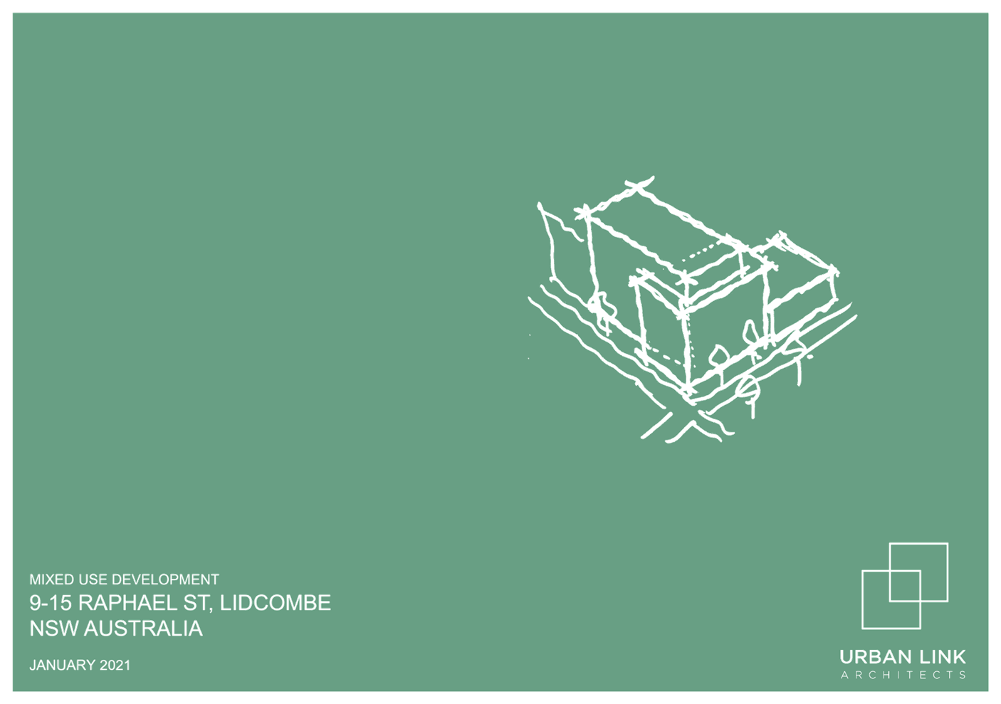
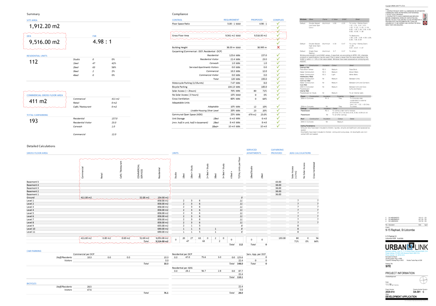
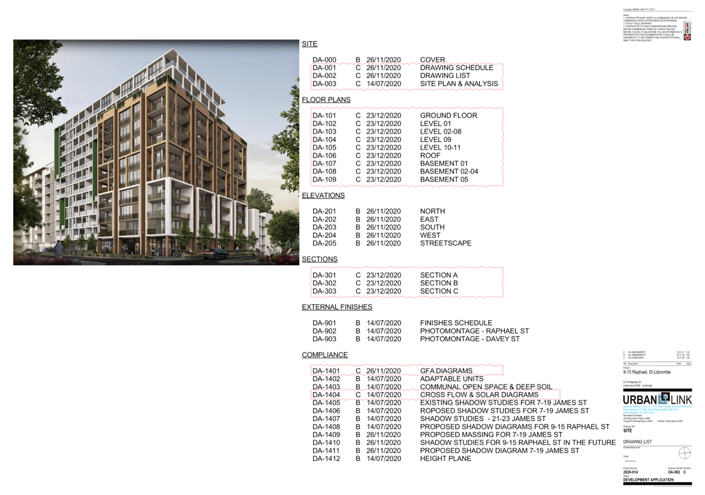
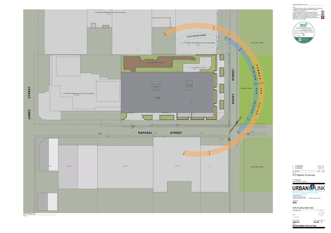
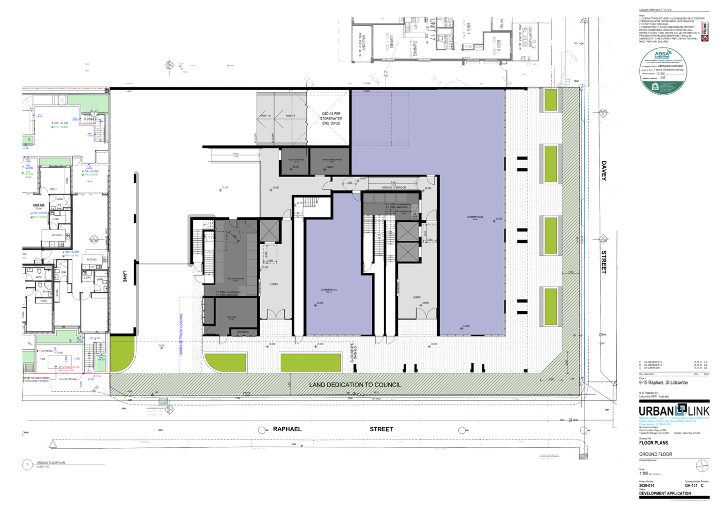
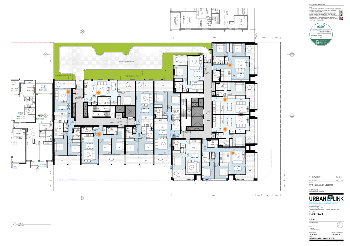
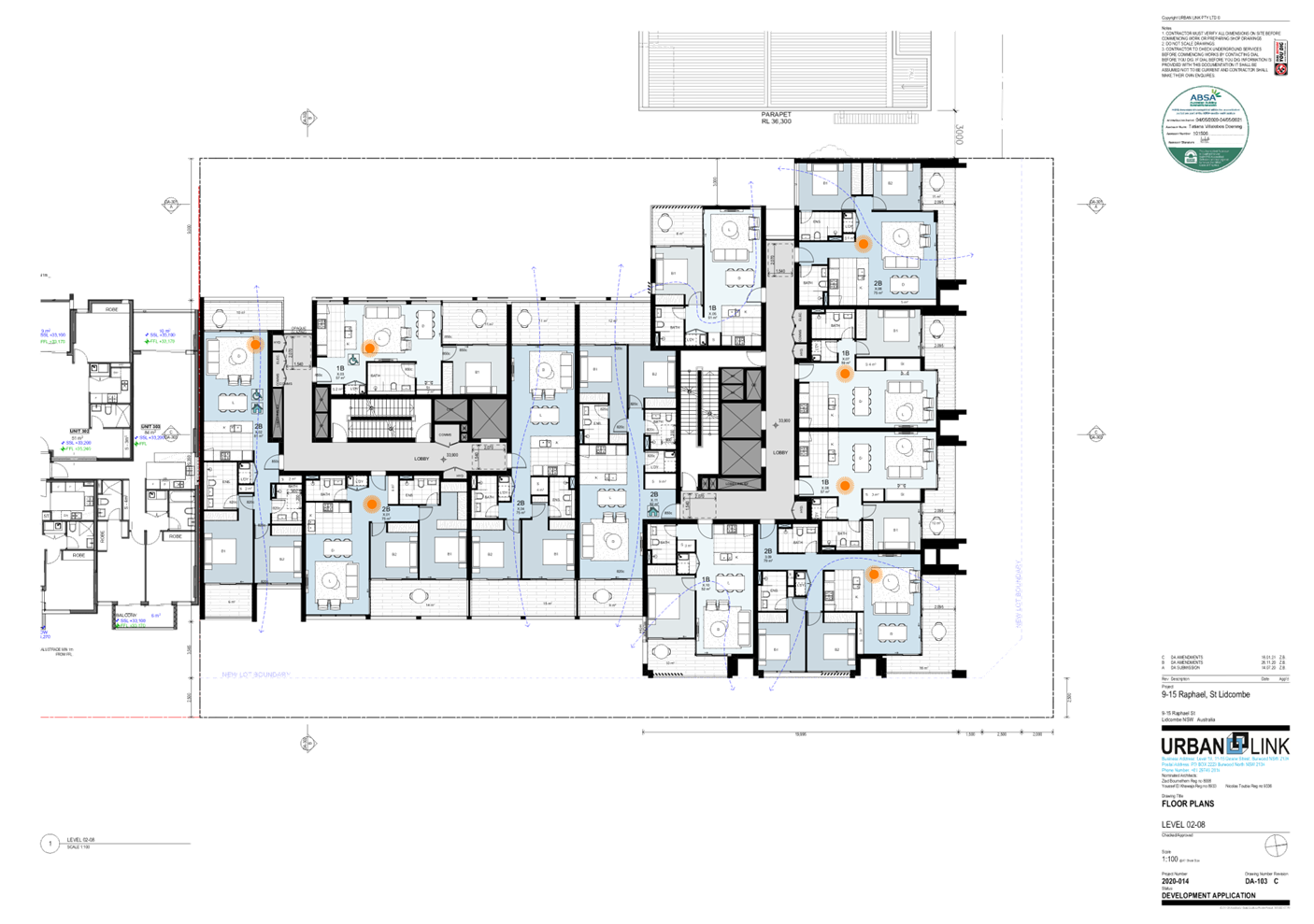
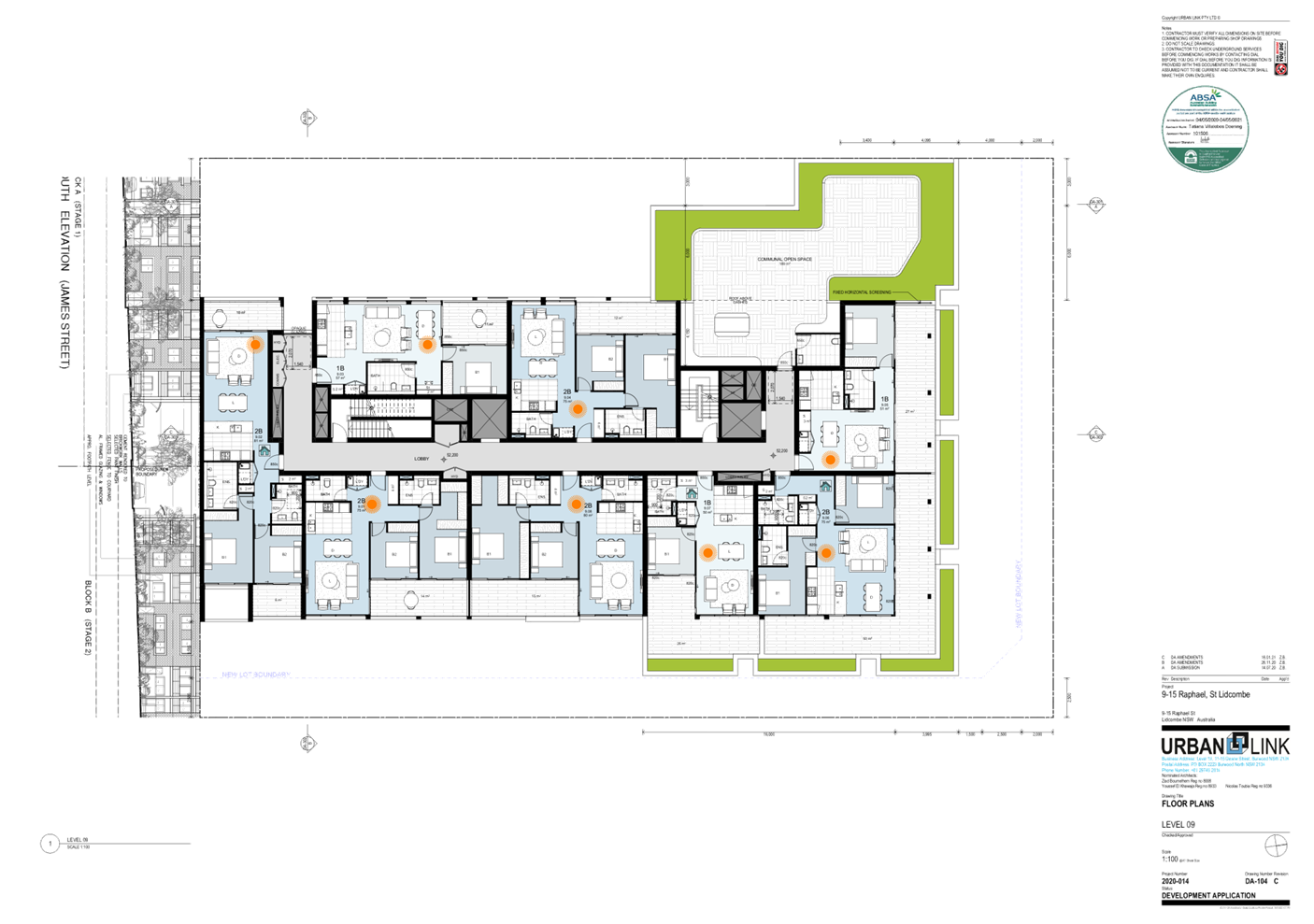
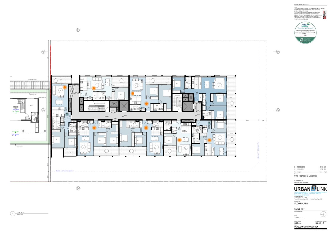
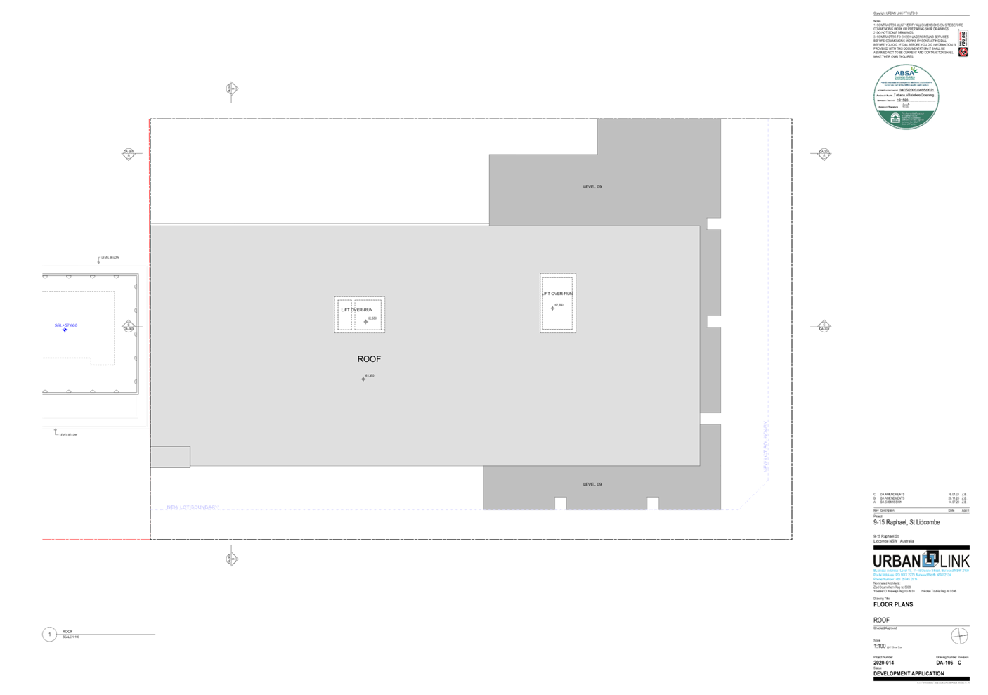
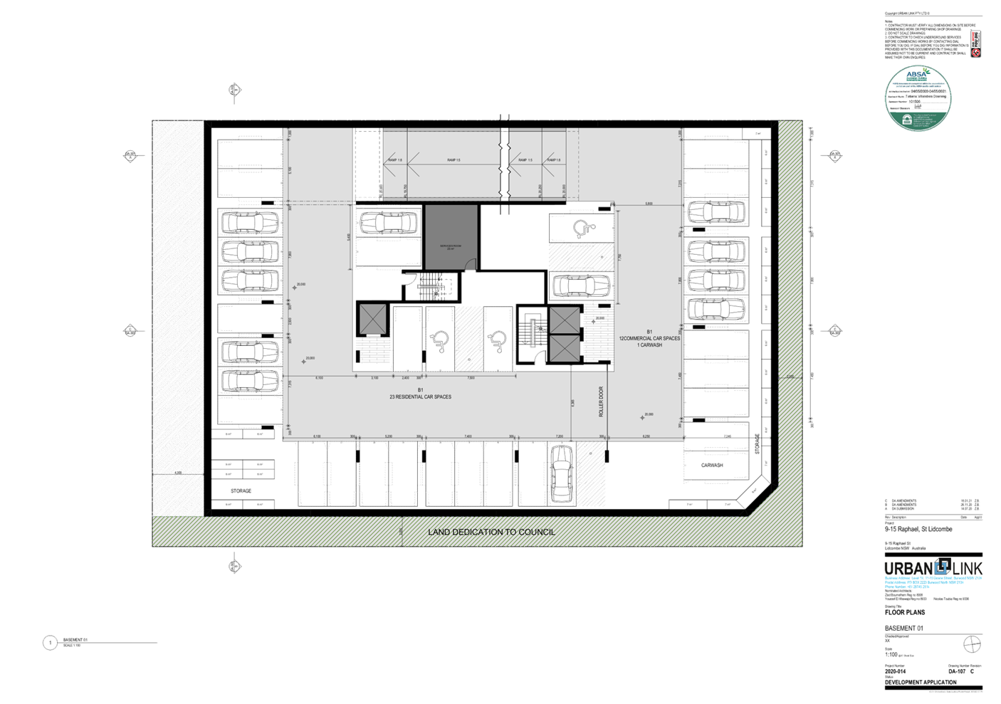
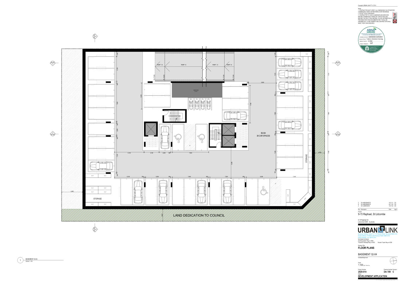
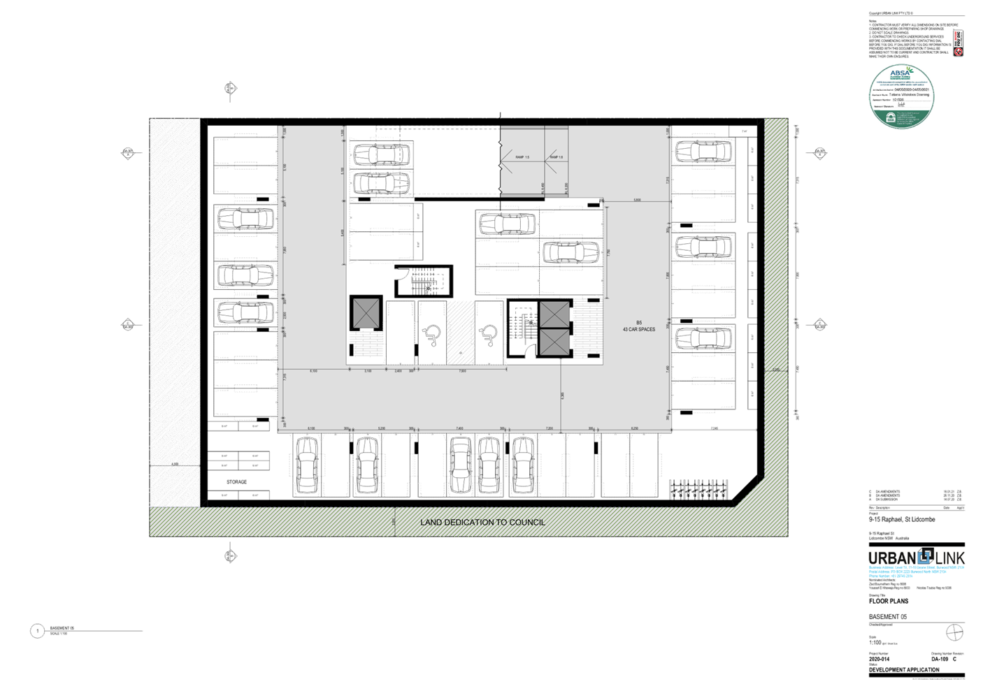
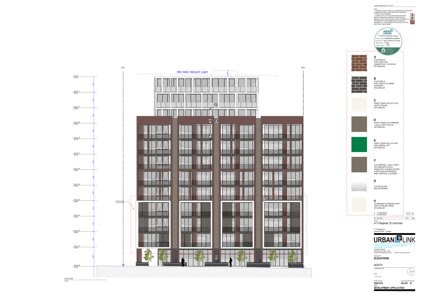
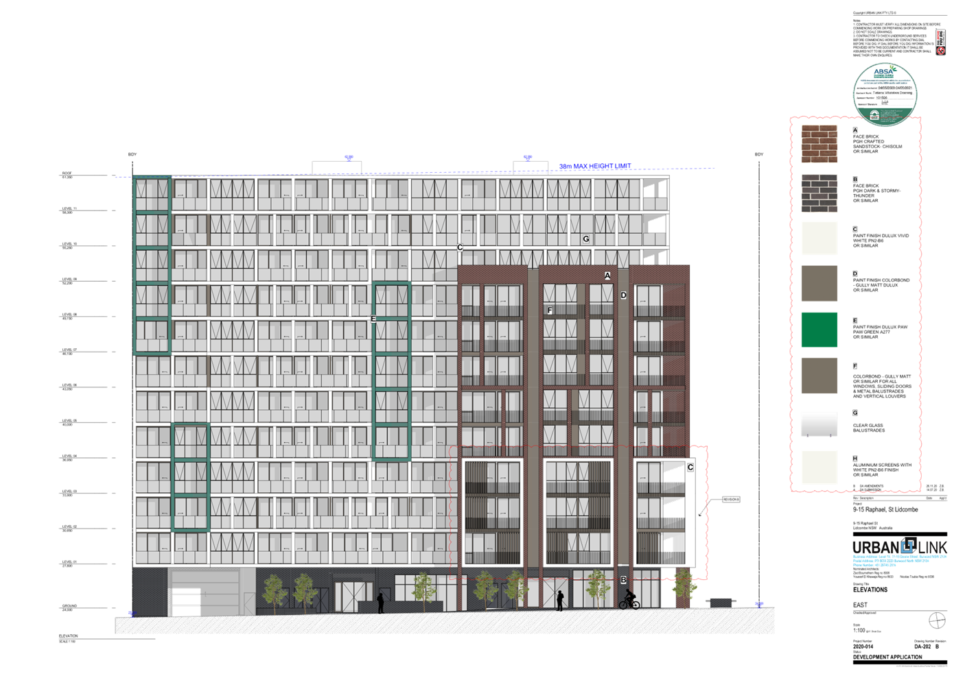
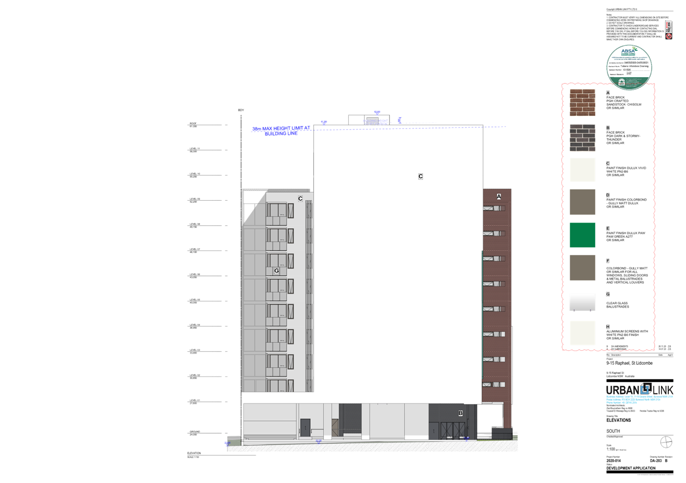
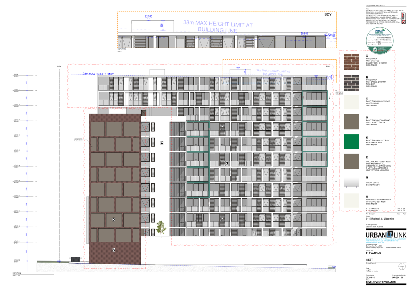
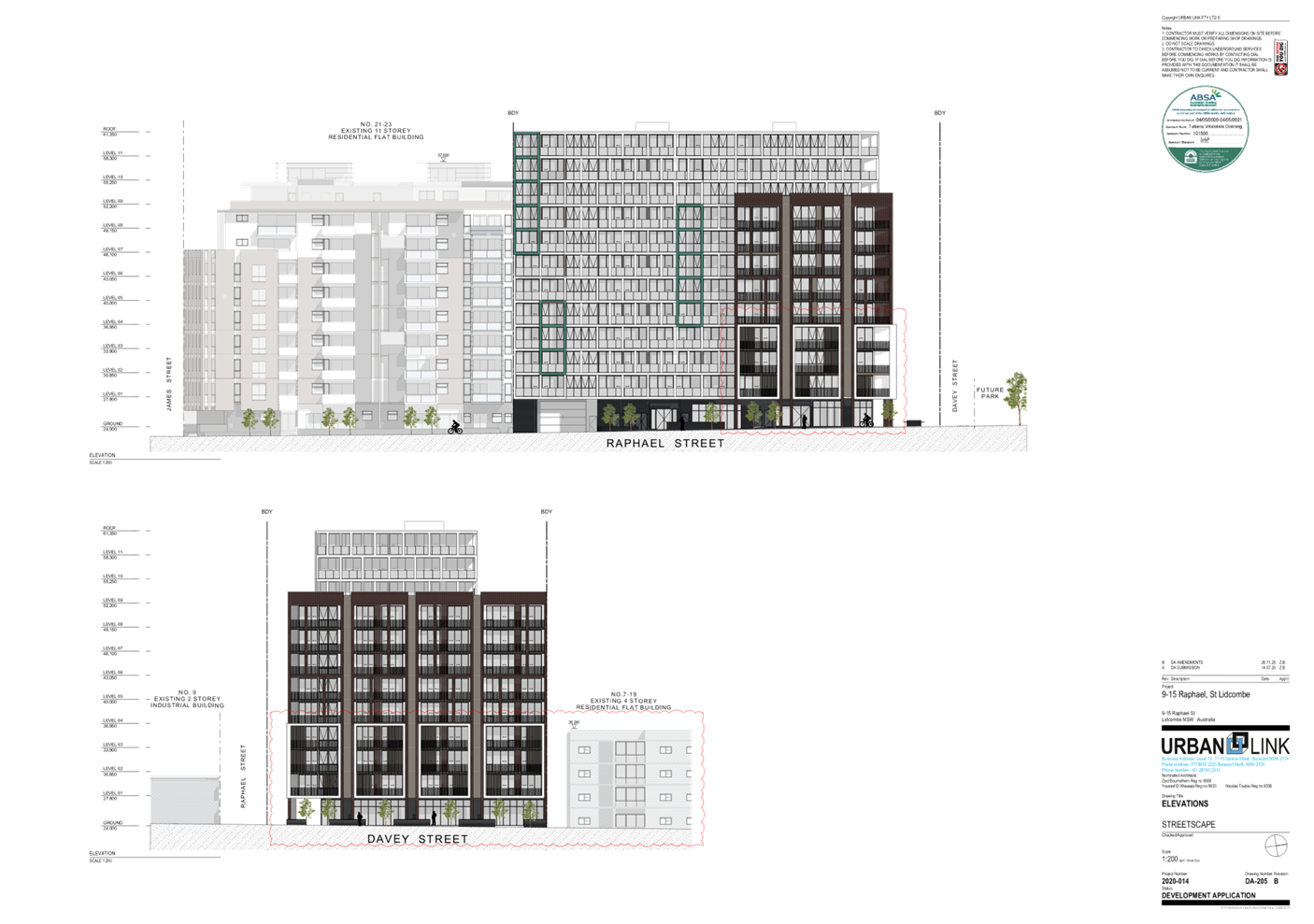
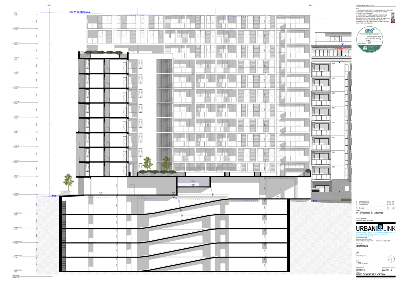
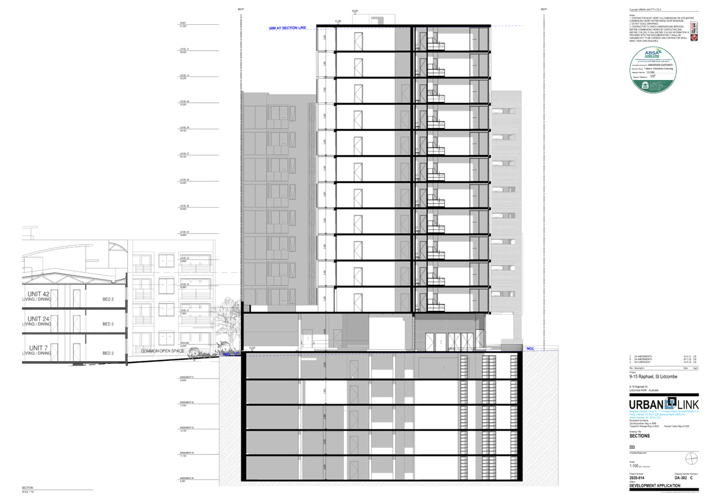
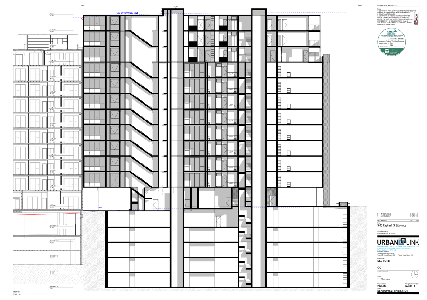
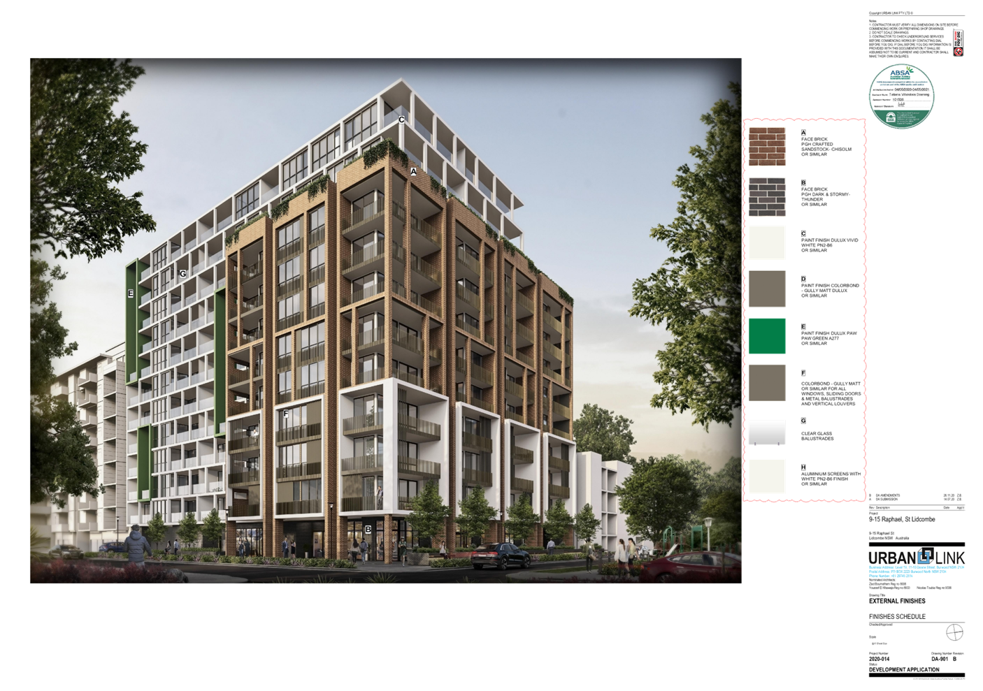
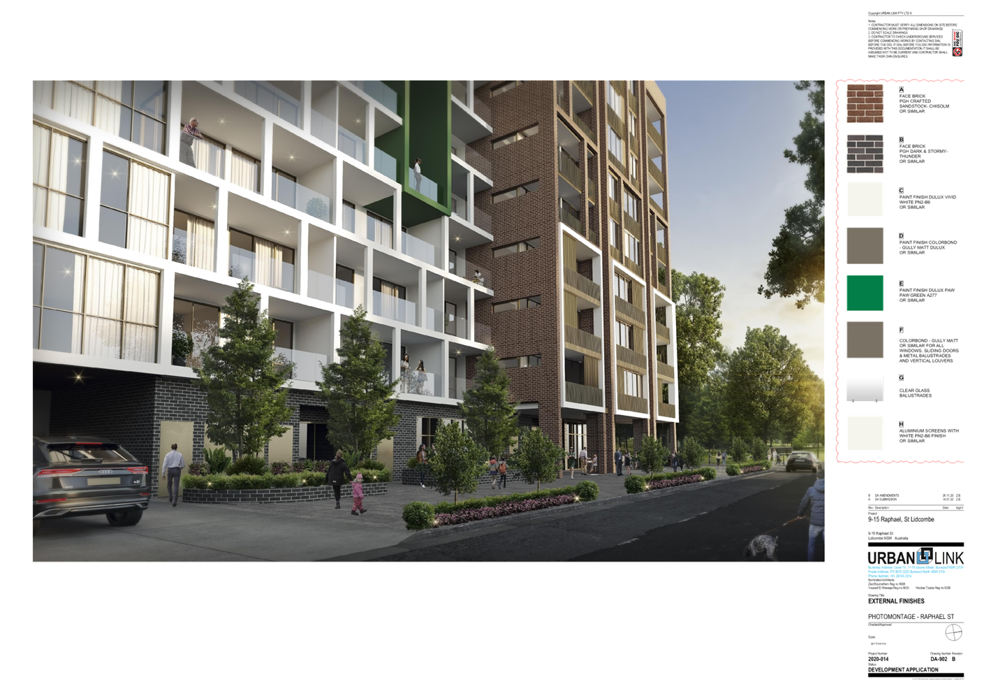
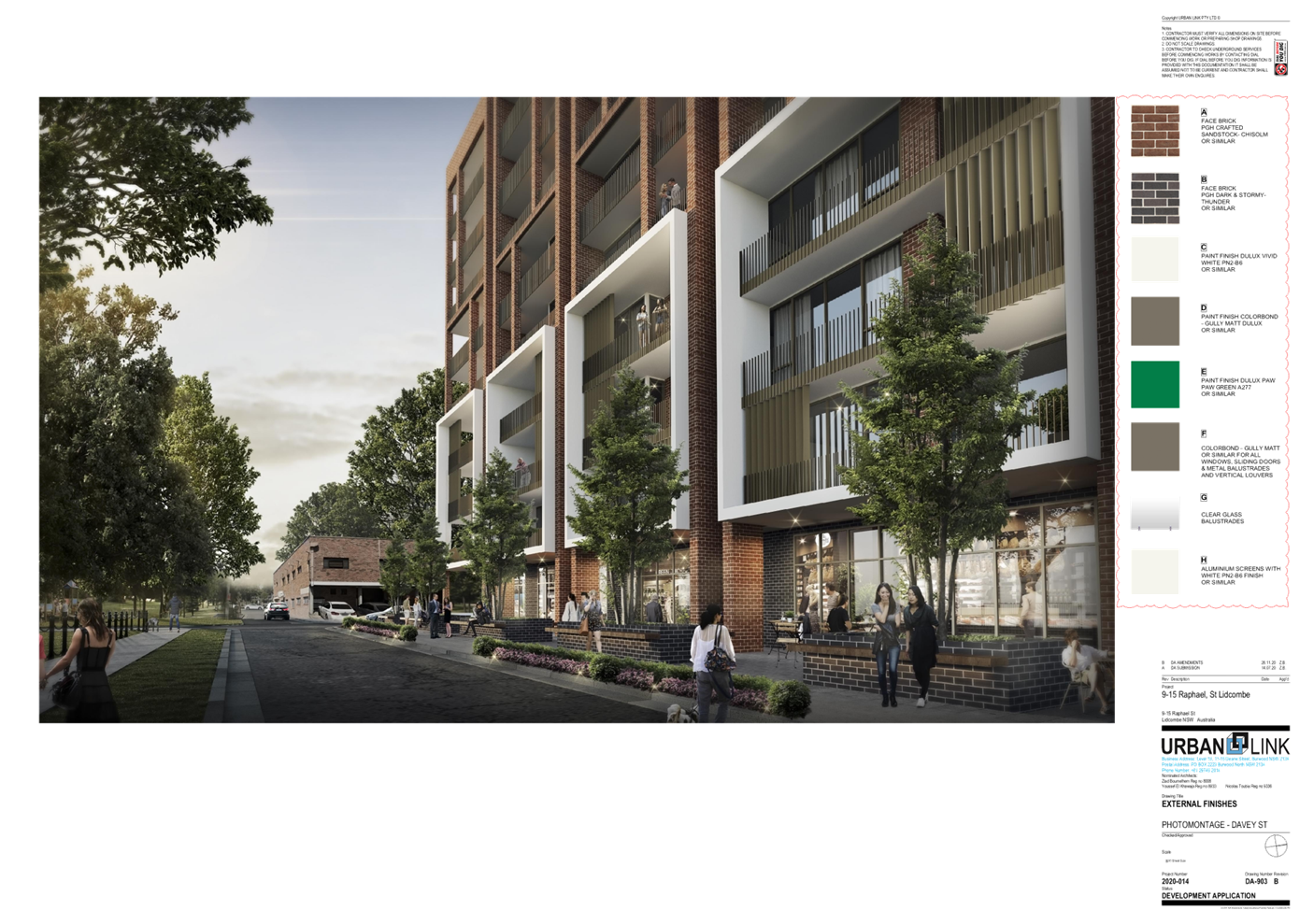
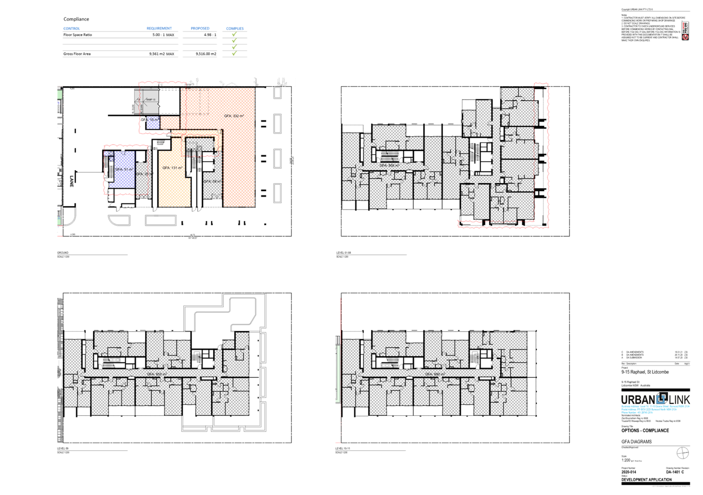
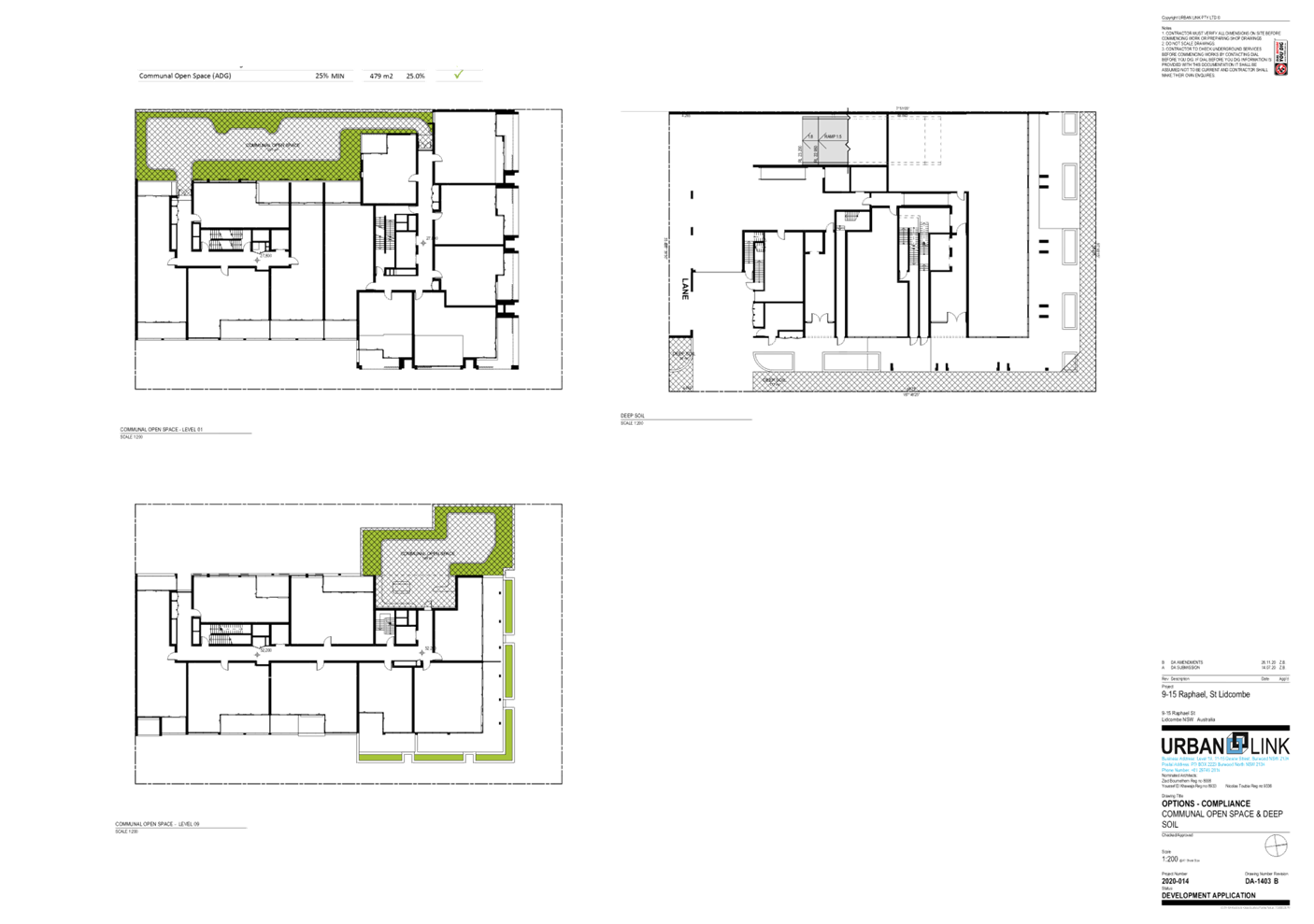
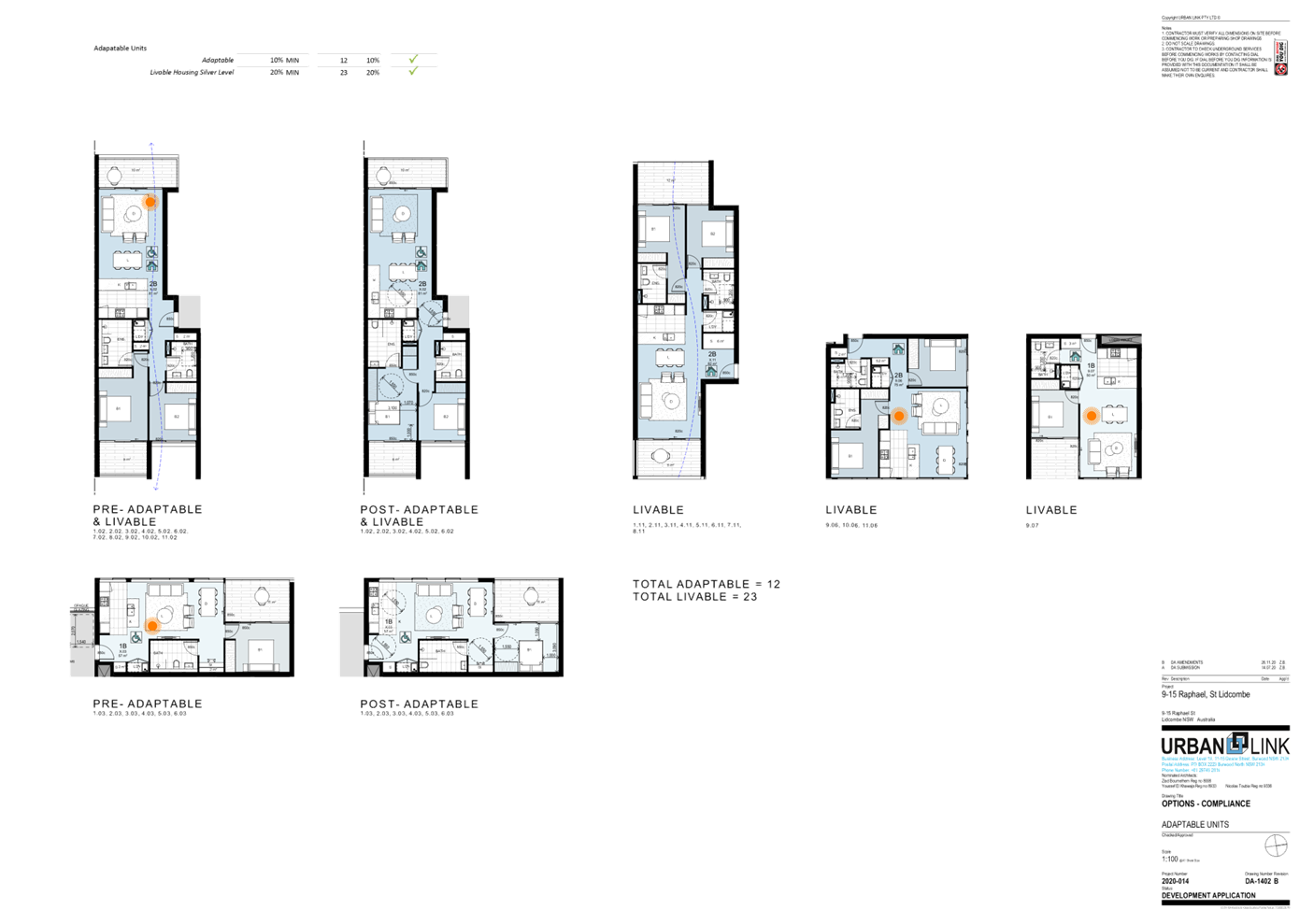
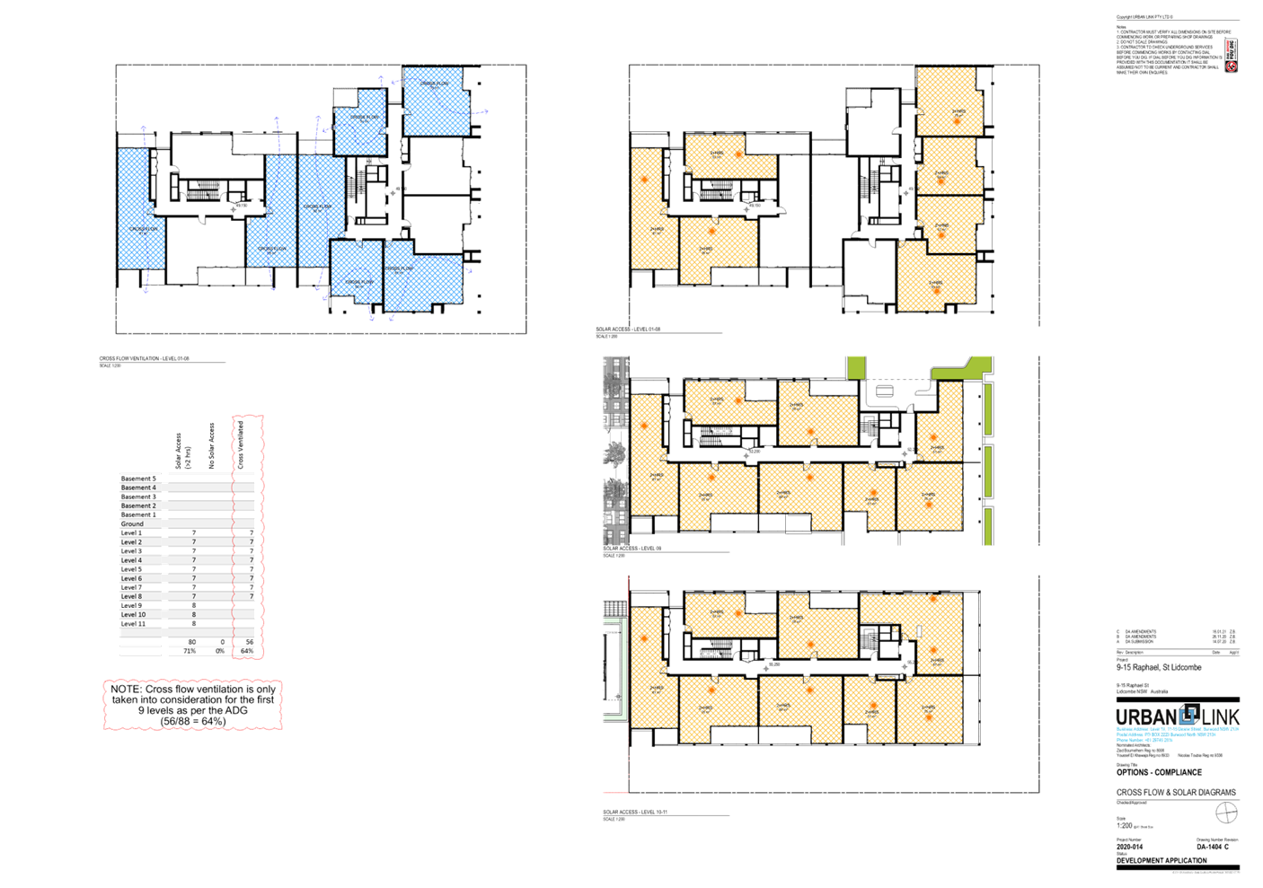
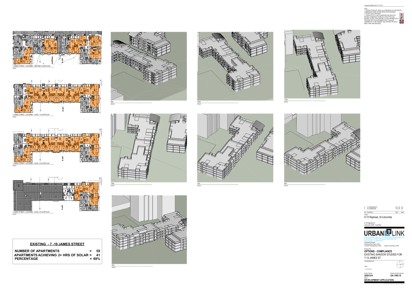
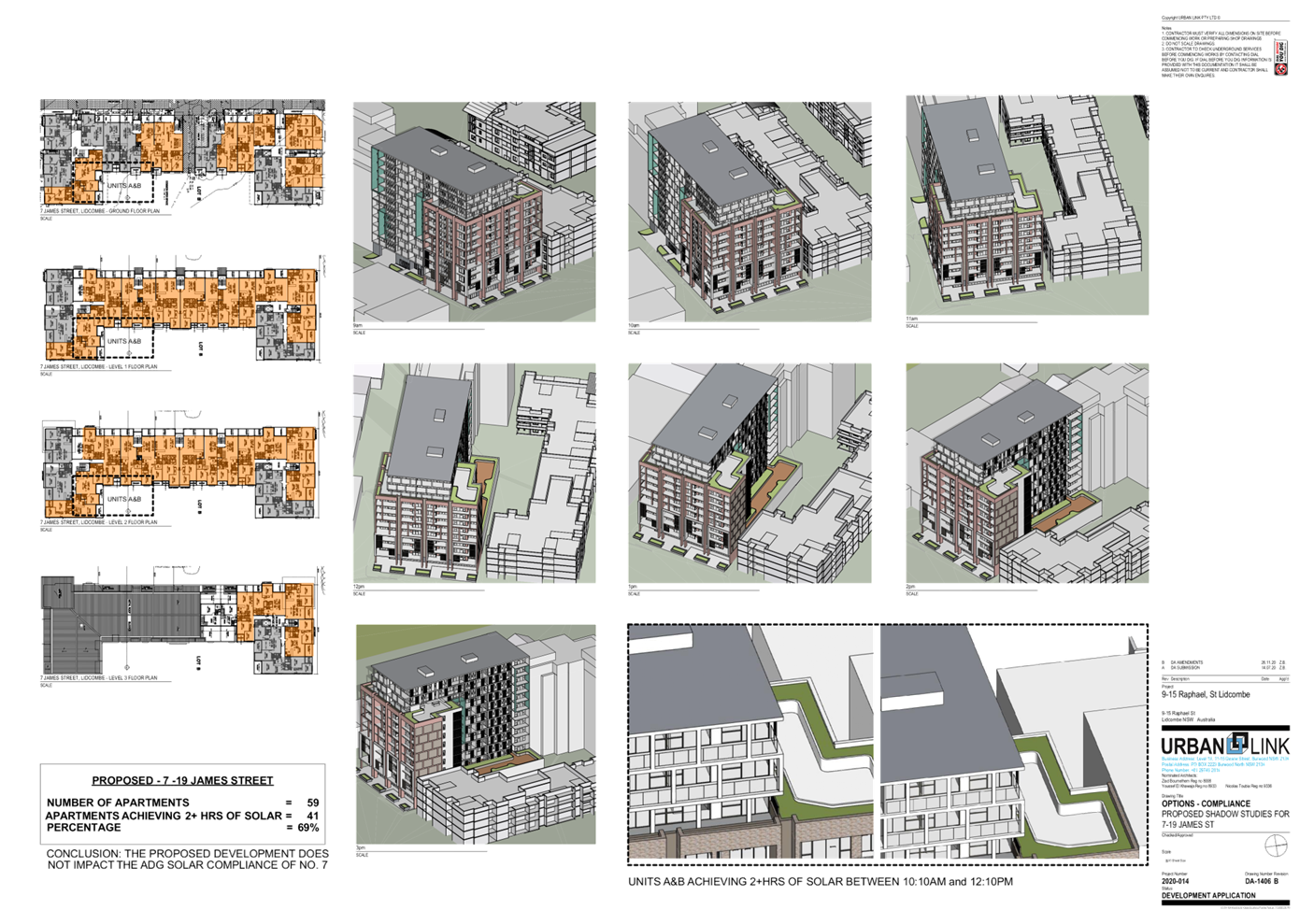
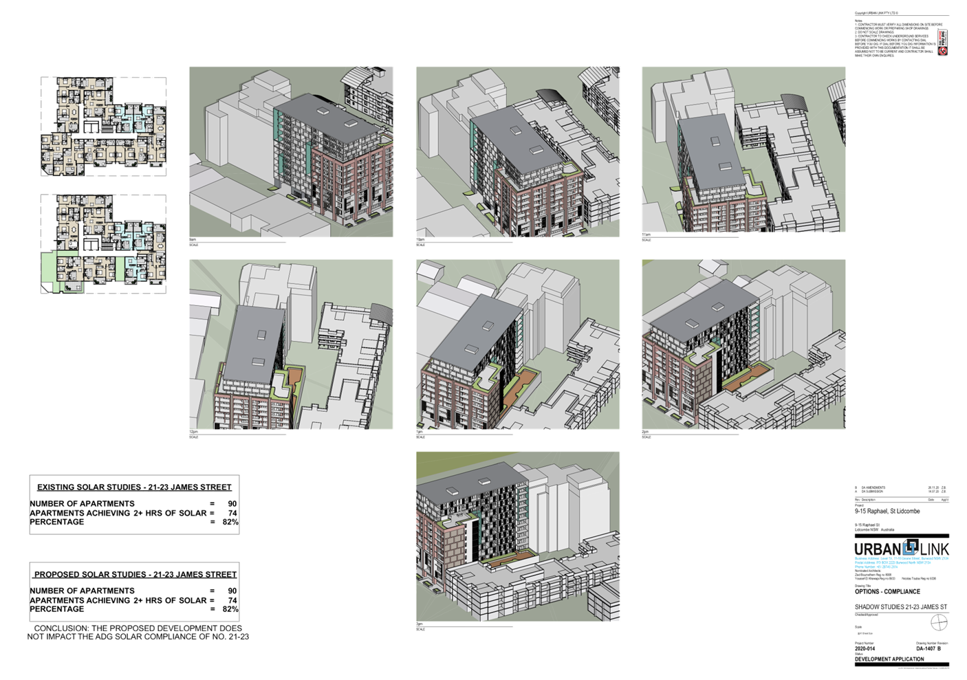
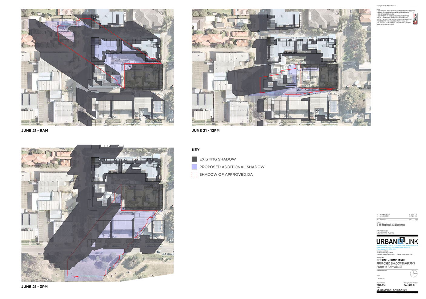
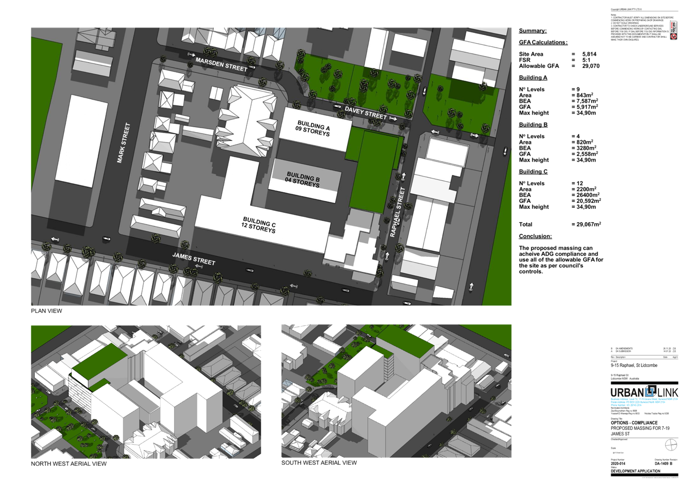
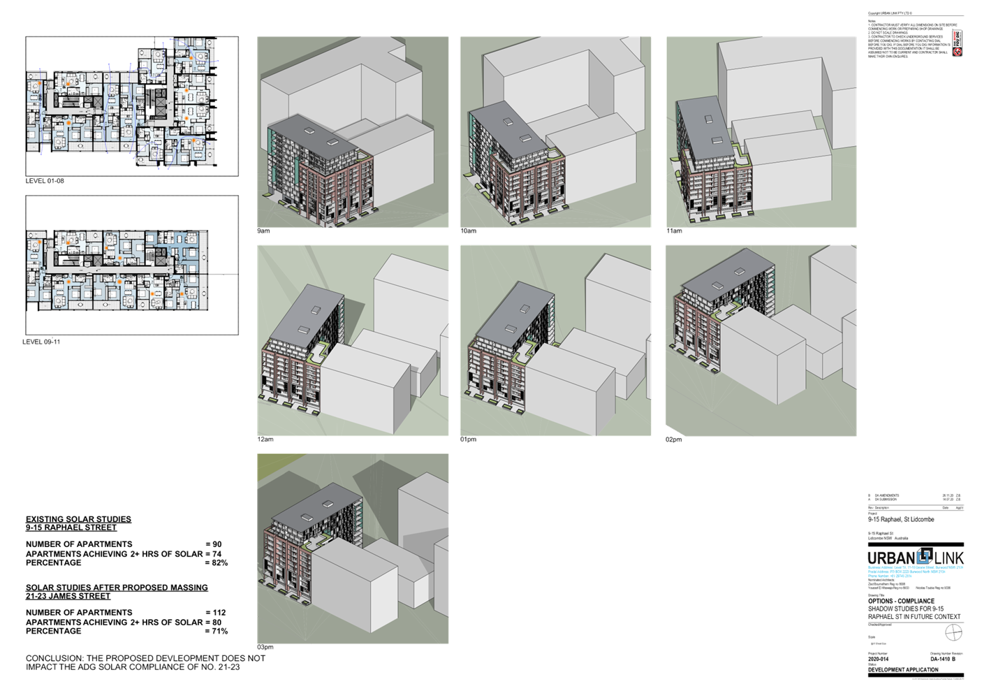
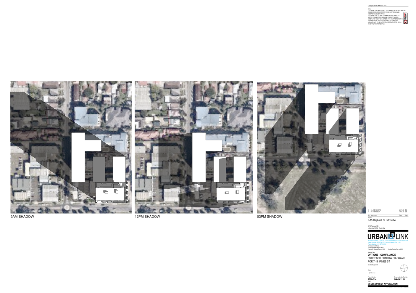
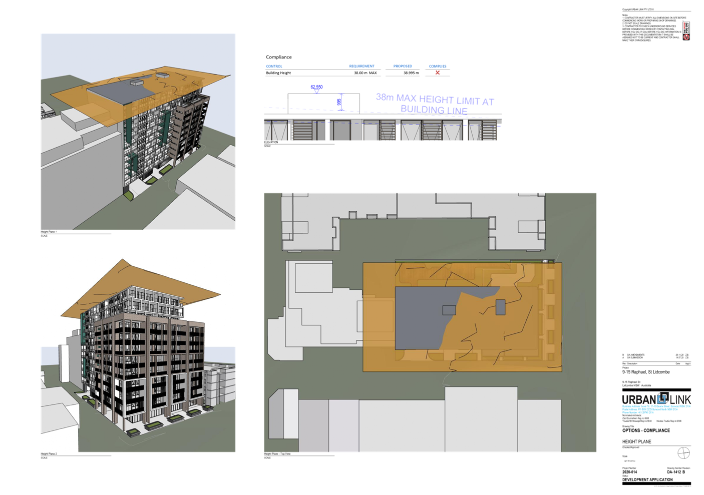
DOCUMENTS
ASSOCIATED WITH
REPORT LPP007/21
Attachment 3
Accompanying Clause 4 6 Variation Request to Building
Height
Cumberland Local Planning Panel Meeting
10 March 2021

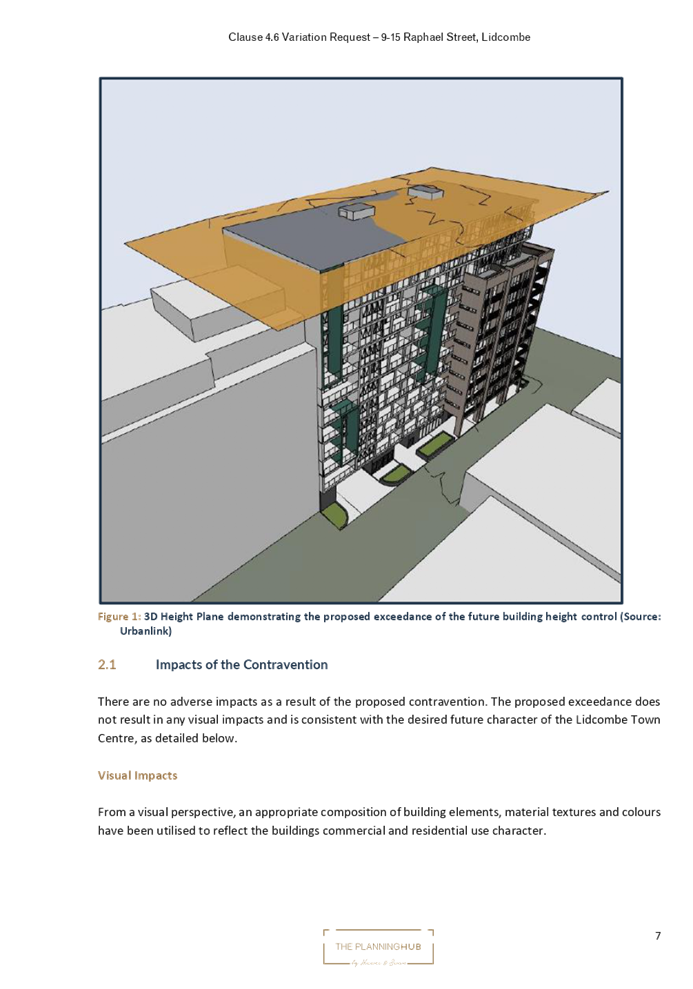

DOCUMENTS
ASSOCIATED WITH
REPORT LPP007/21
Attachment 4
Landscape Plans
Cumberland Local Planning Panel Meeting
10 March 2021
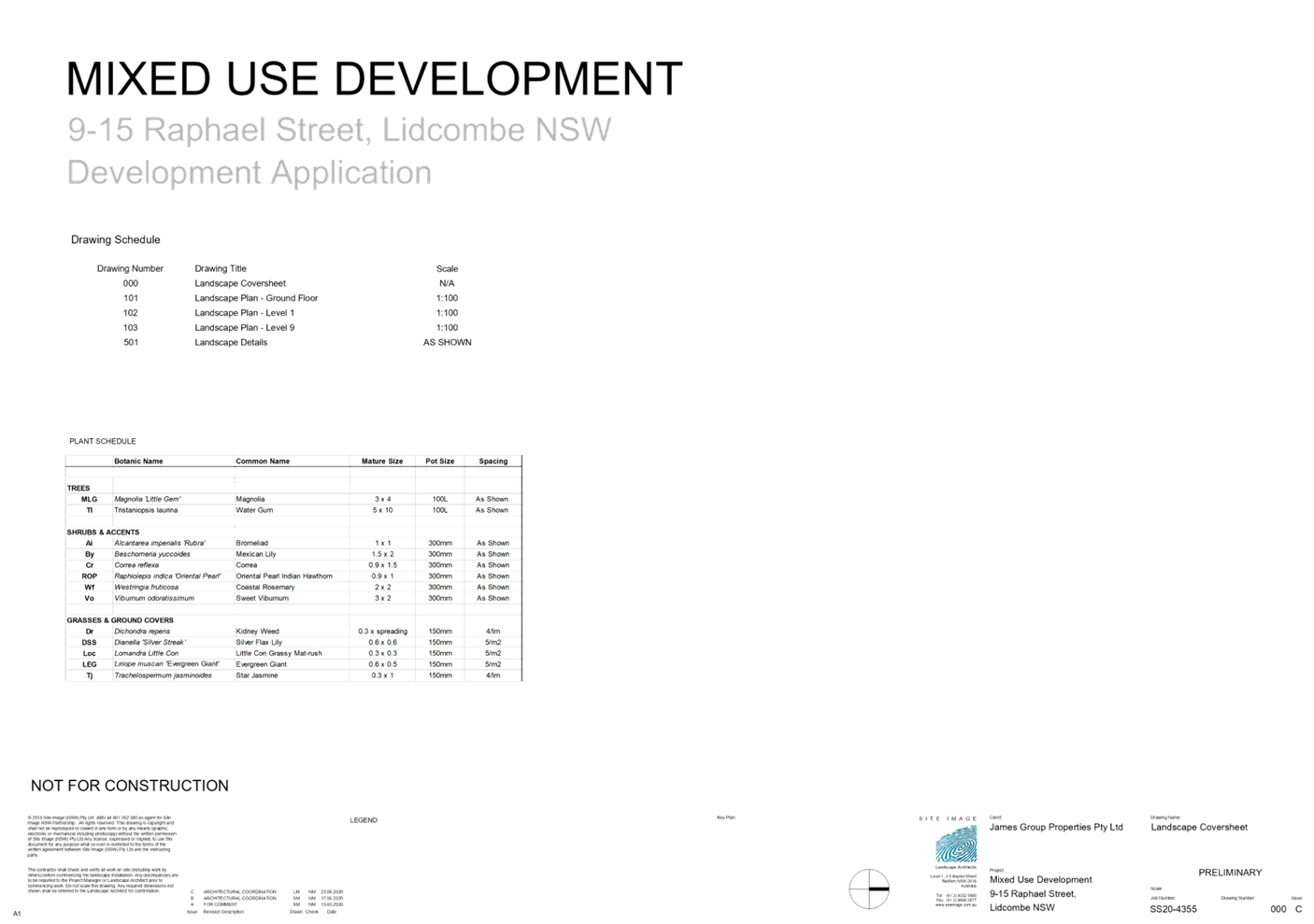
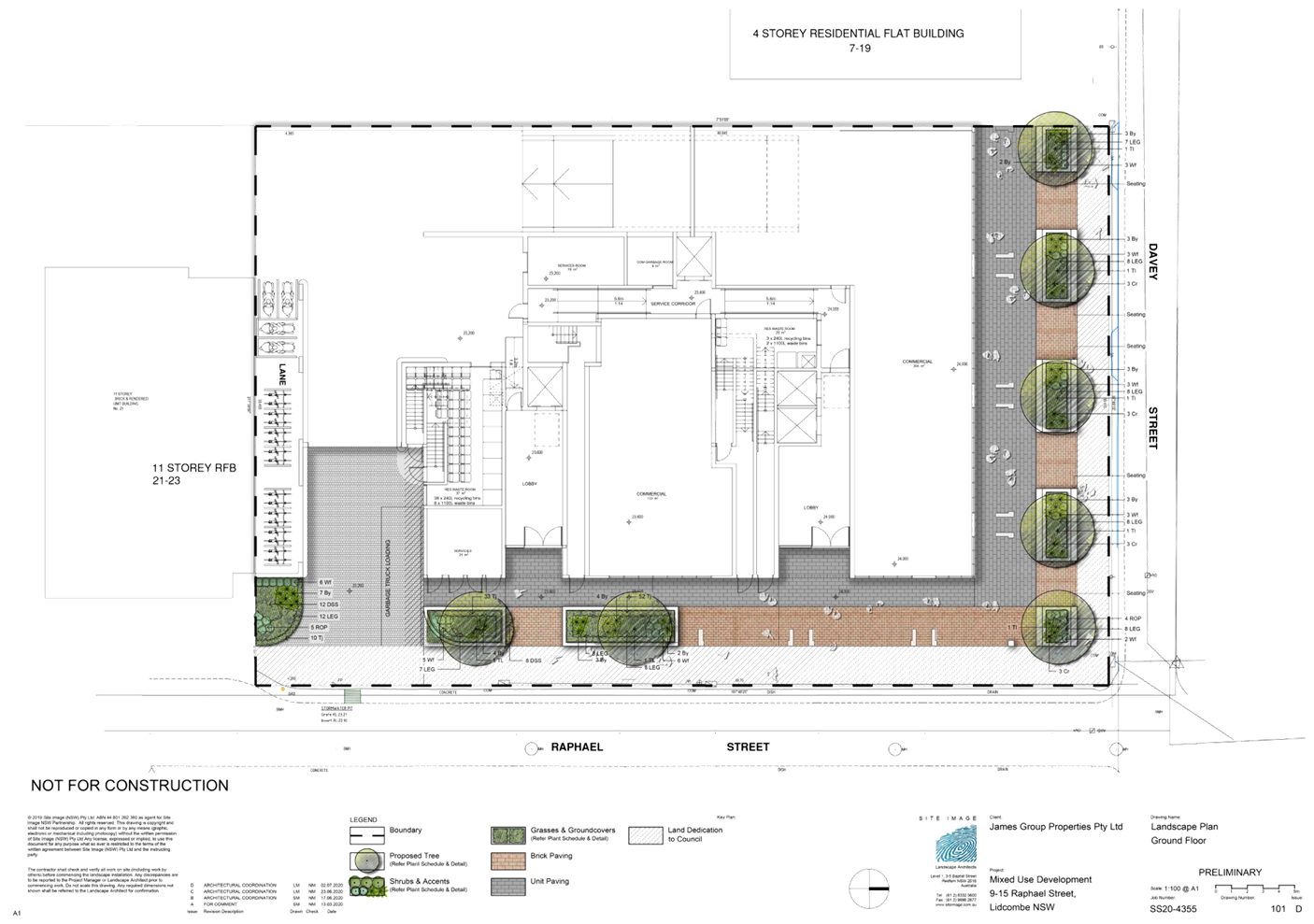
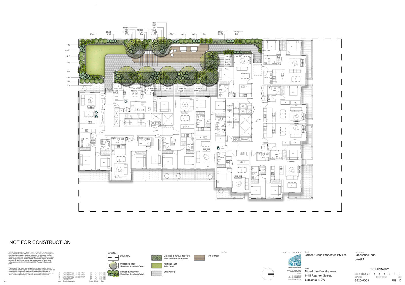
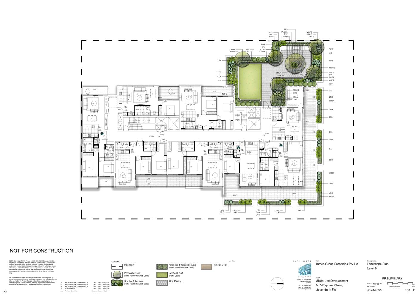
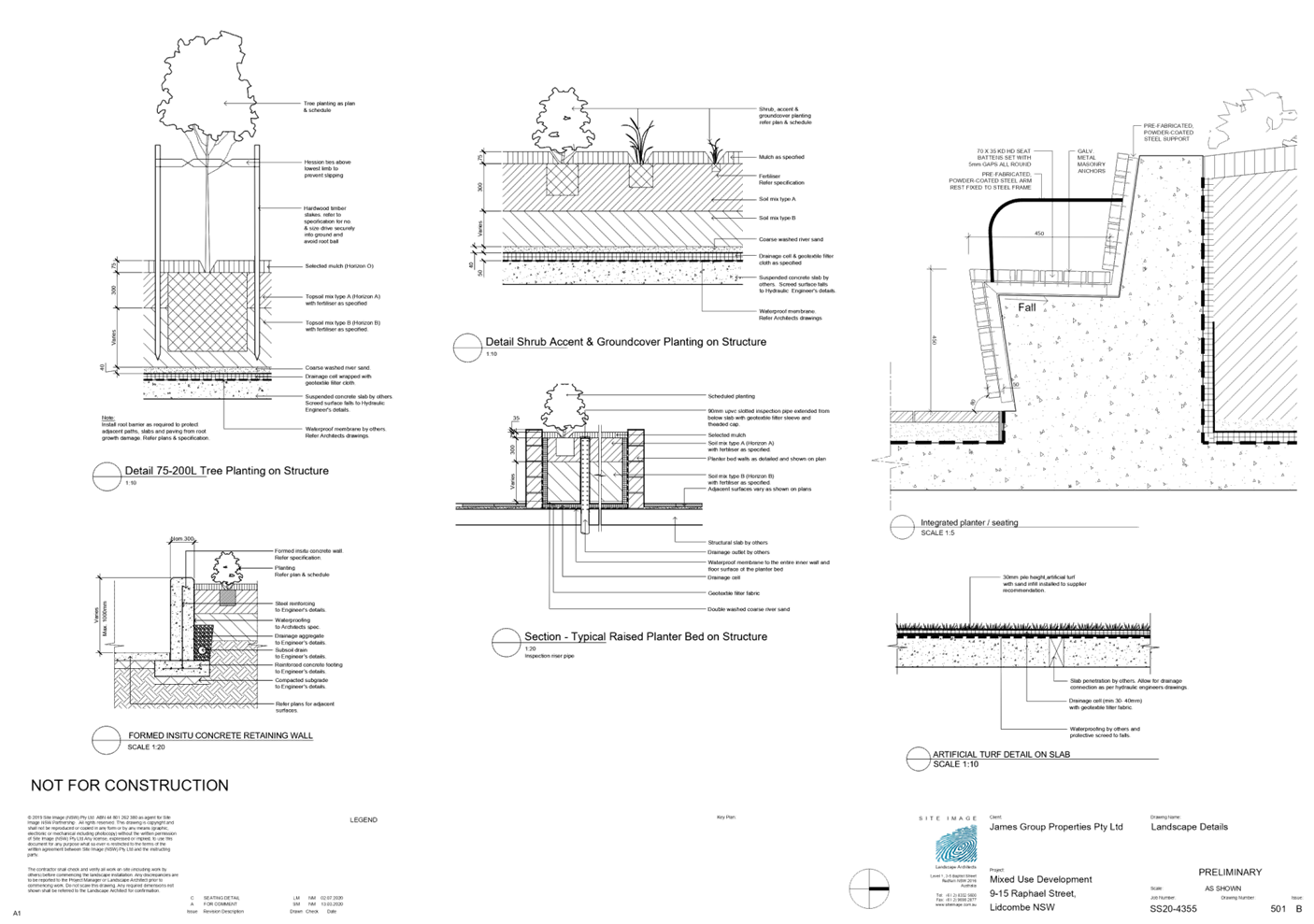
DOCUMENTS
ASSOCIATED WITH
REPORT LPP007/21
Attachment 5
ADG Compliance Table
Cumberland Local Planning Panel Meeting
10 March 2021
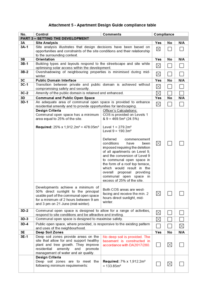
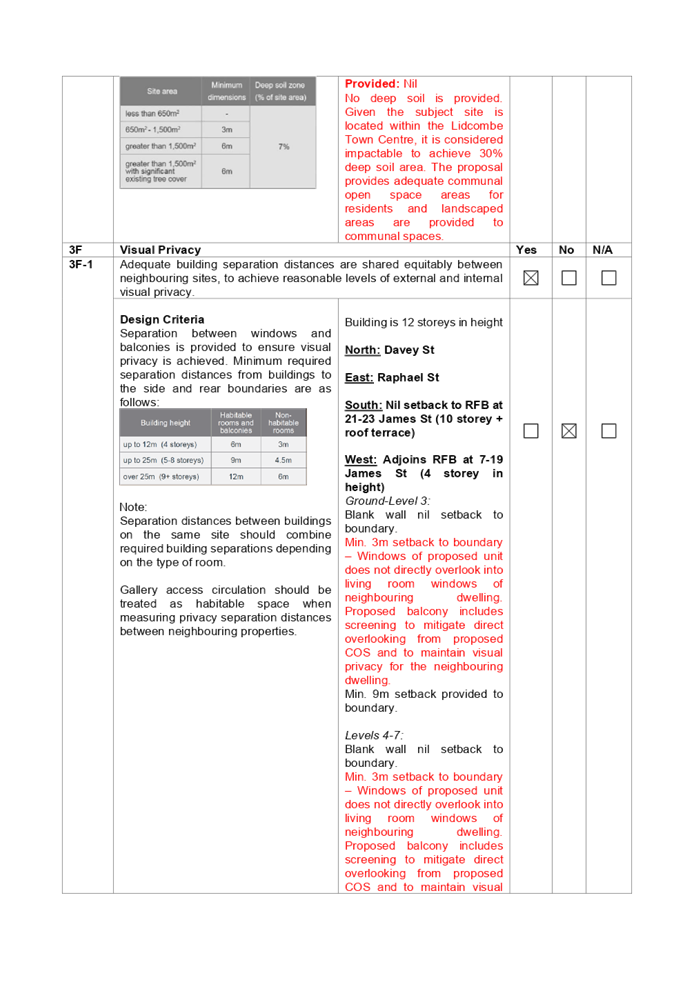
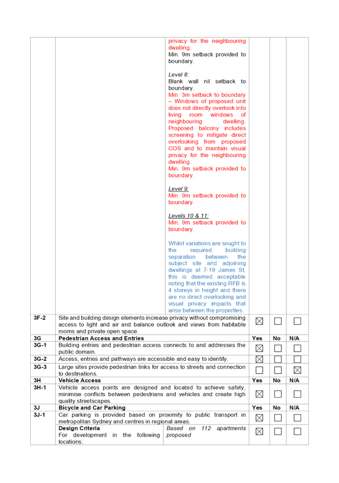
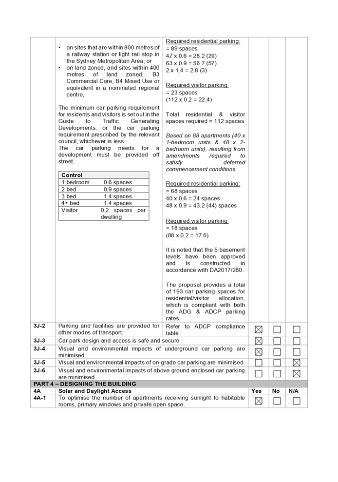
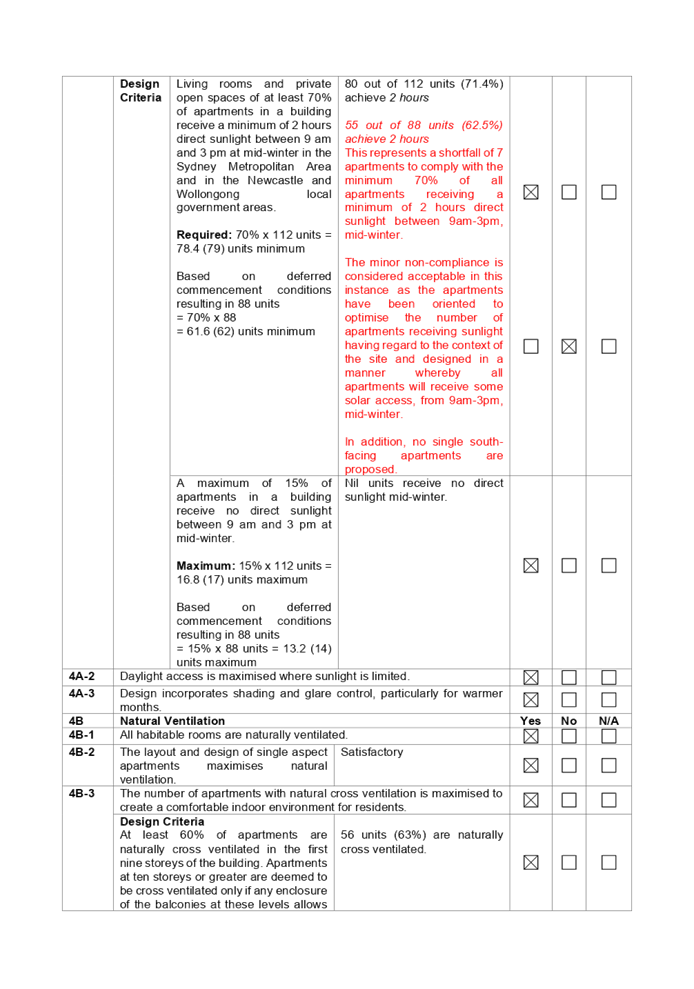
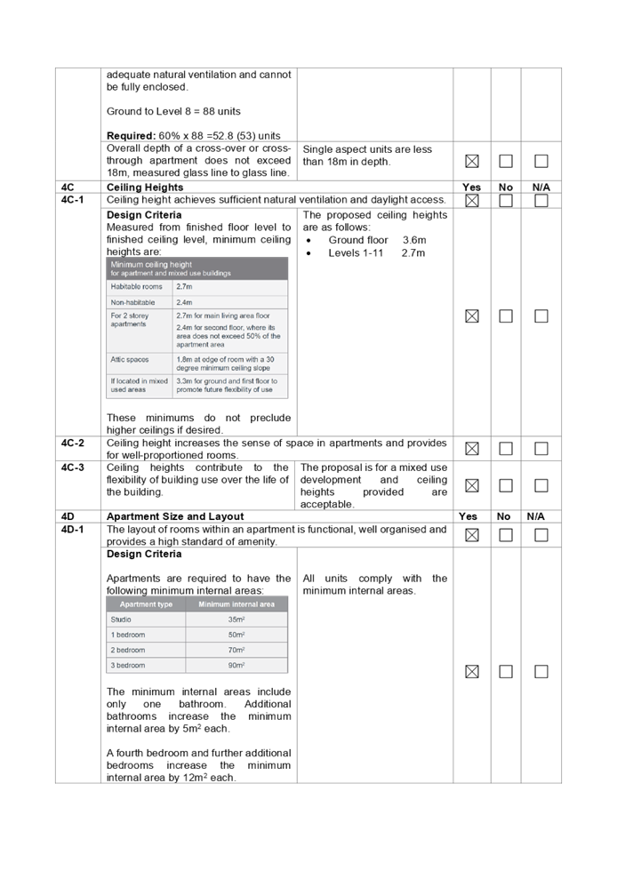
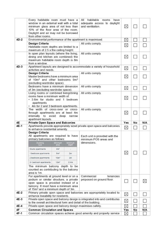
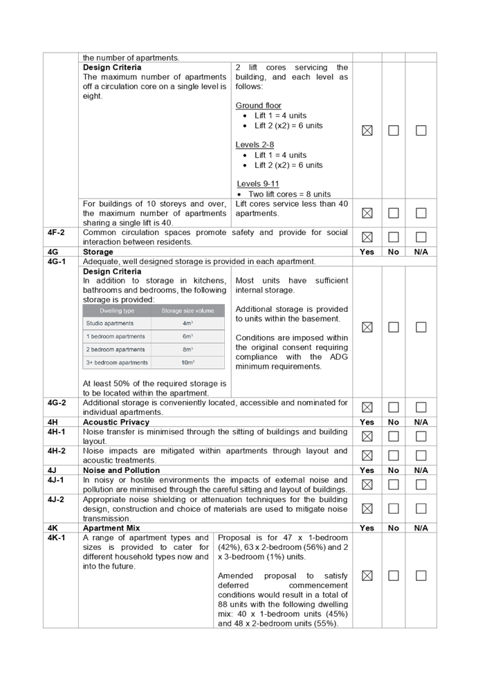
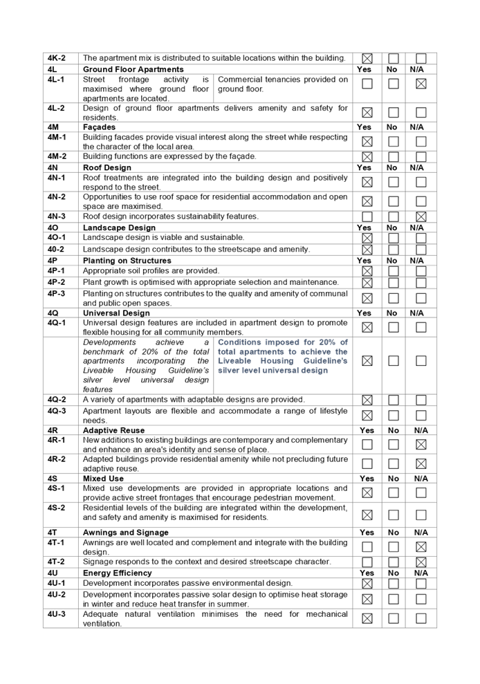

DOCUMENTS
ASSOCIATED WITH
REPORT LPP007/21
Attachment 6
ALEP 2010 Compliance Table
Cumberland Local Planning Panel Meeting
10 March 2021
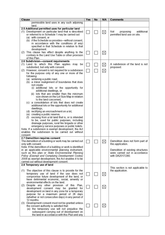
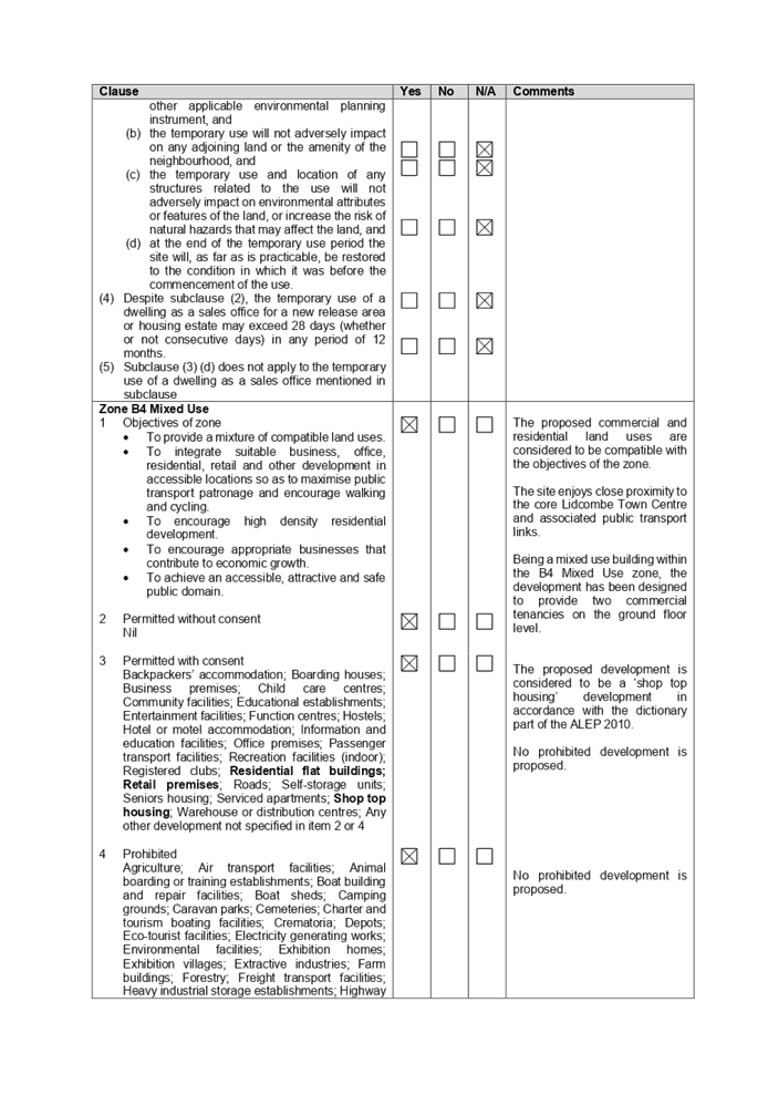
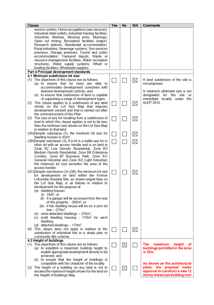
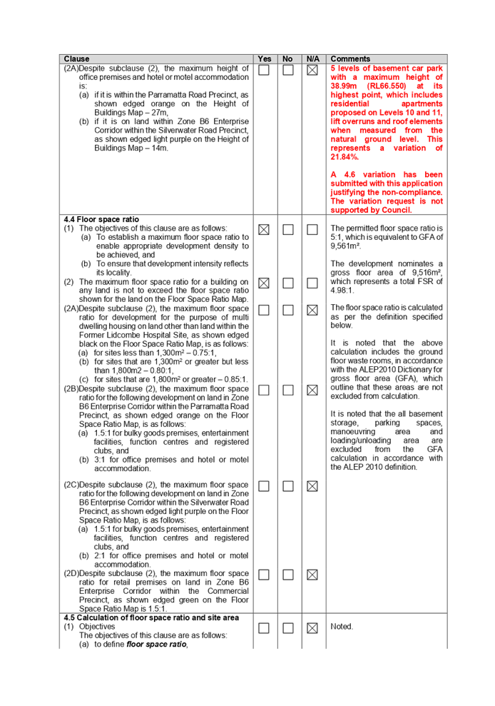
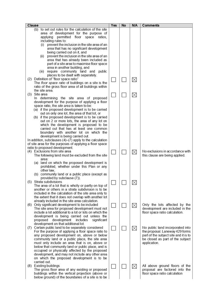
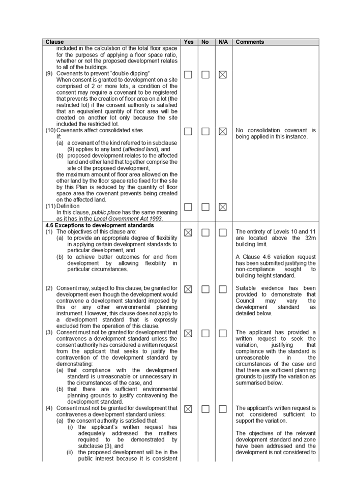
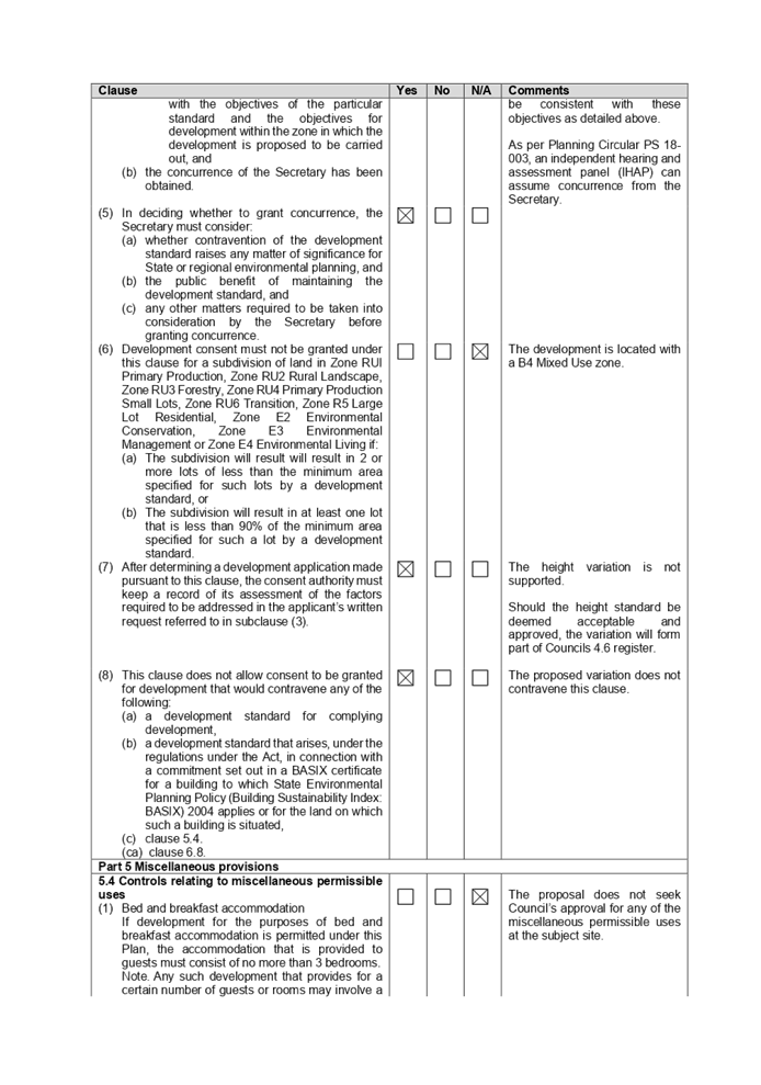
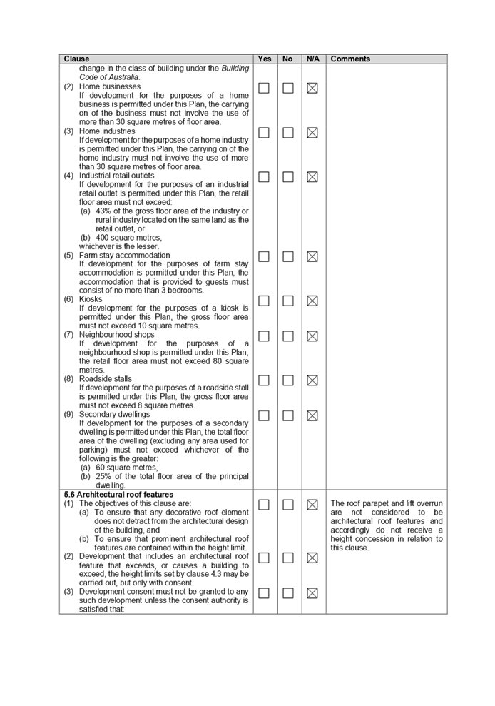
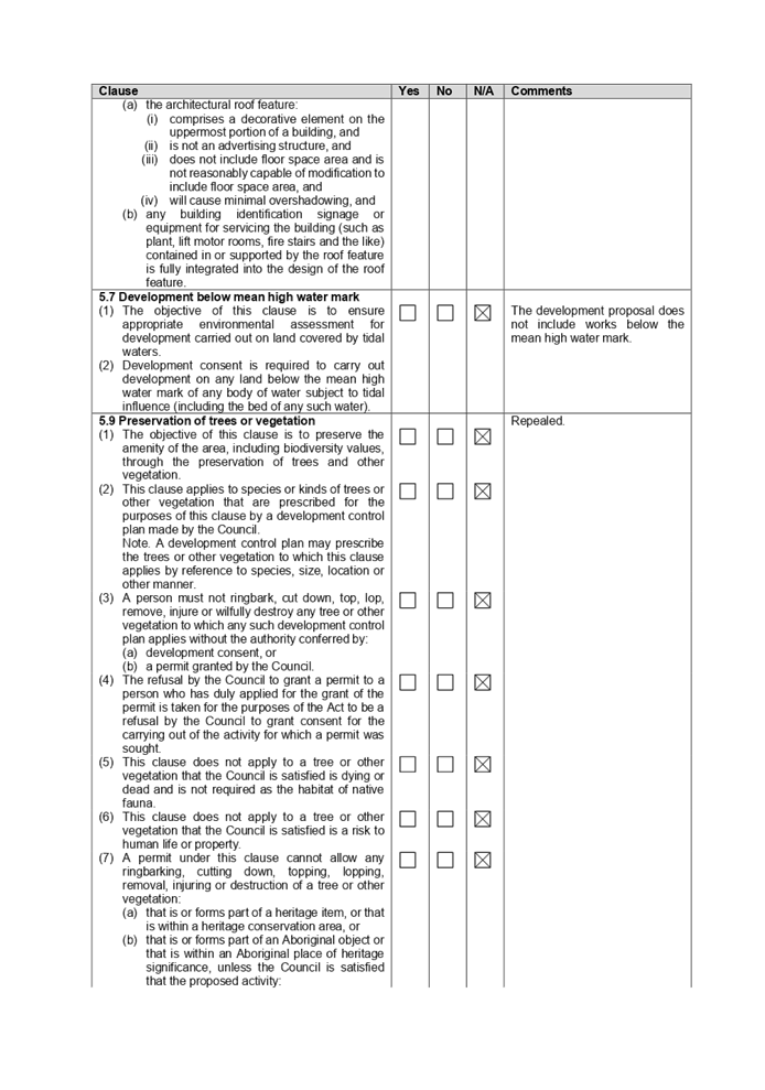
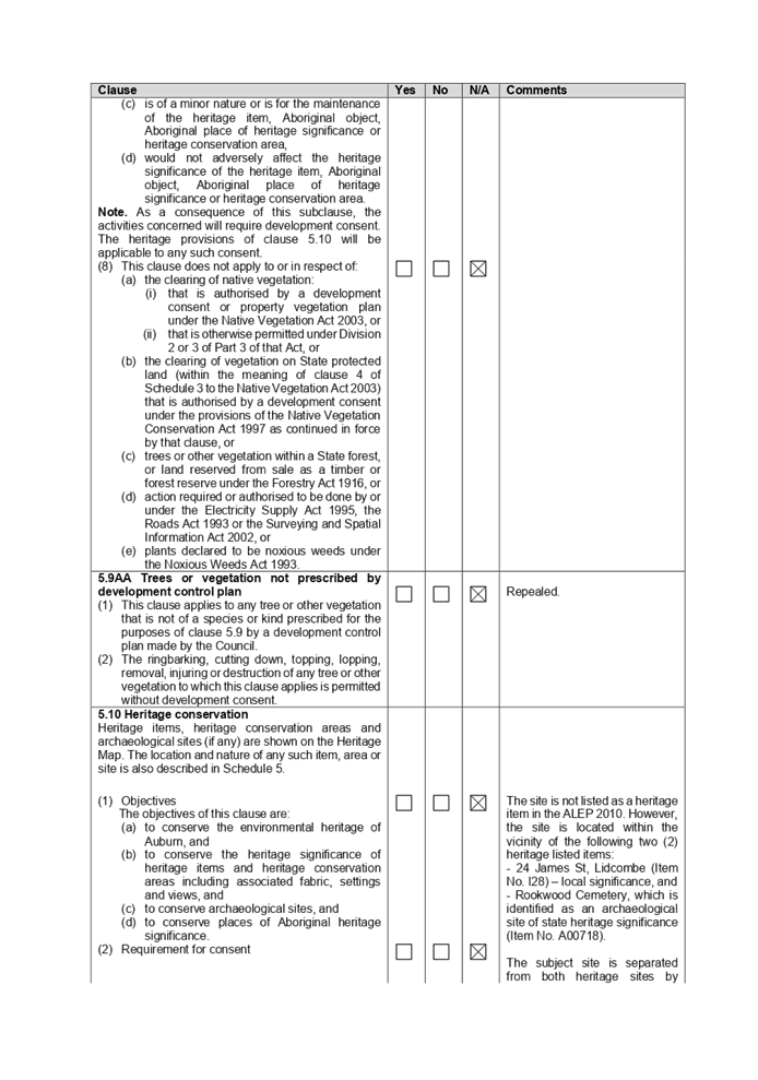
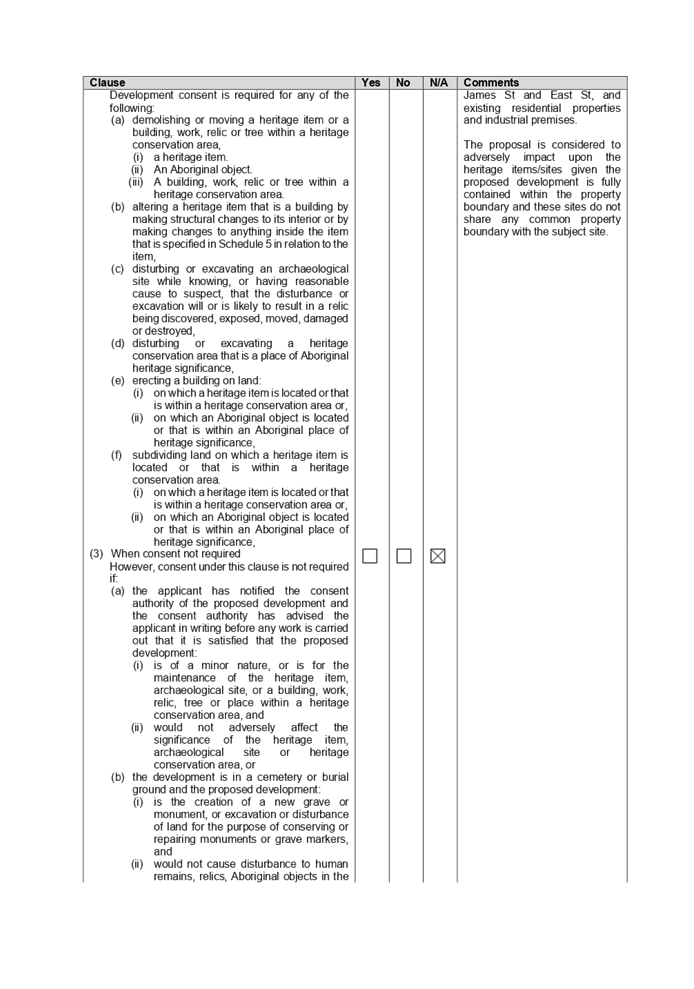
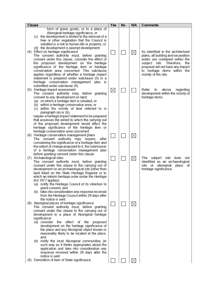
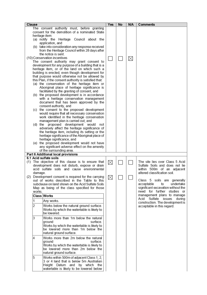
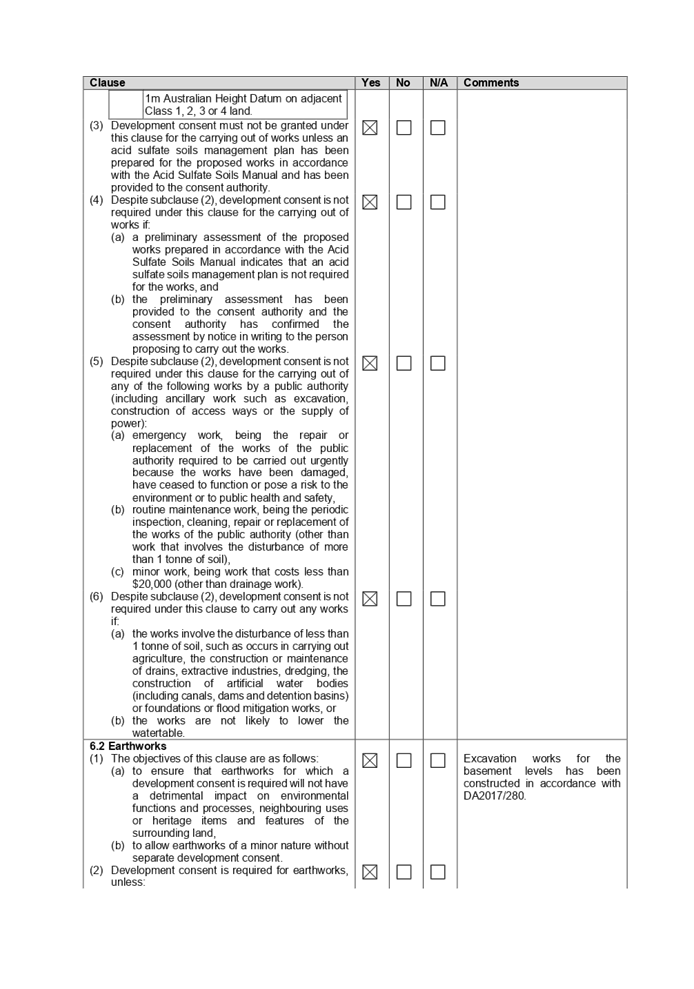
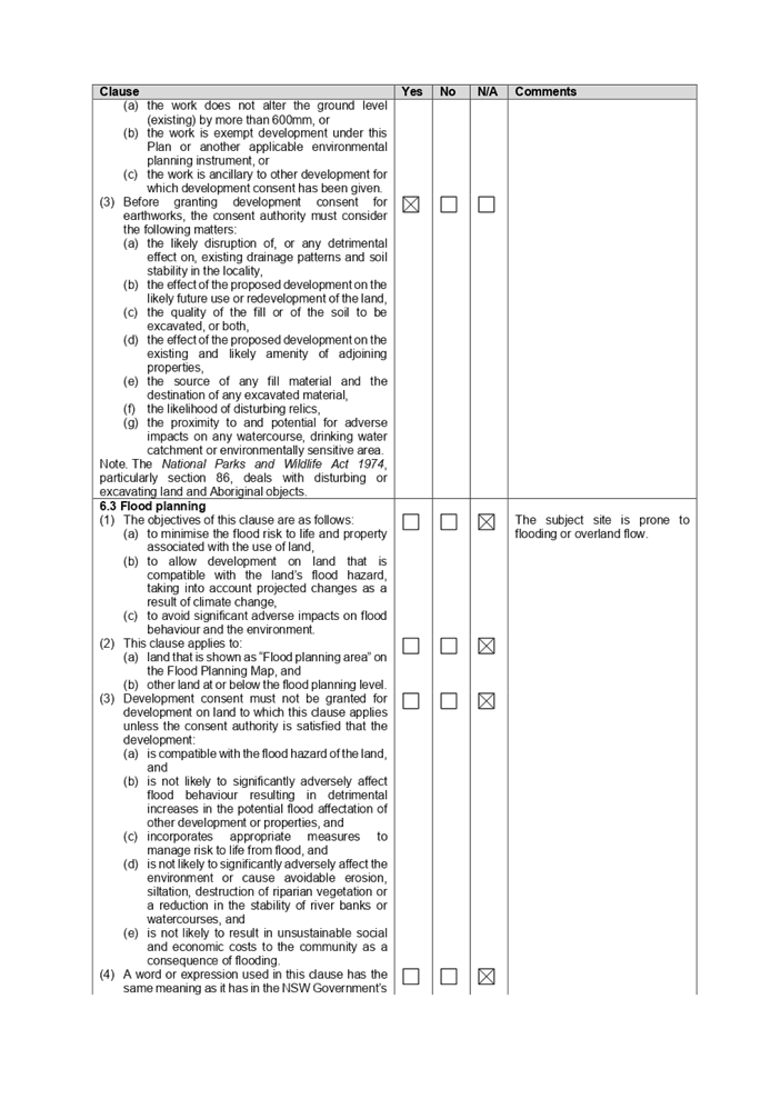
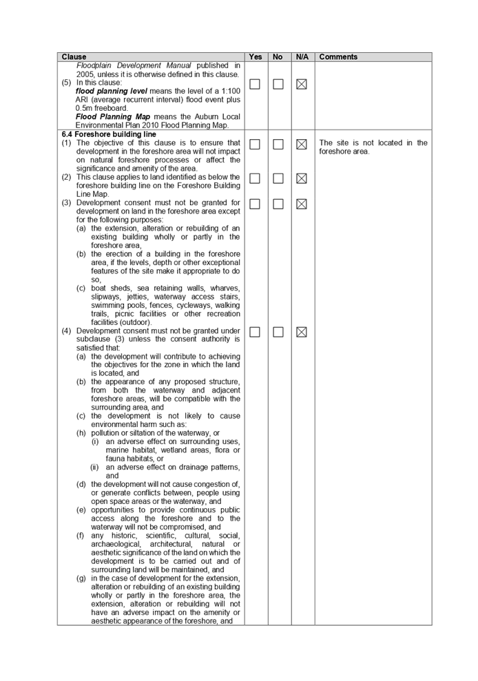
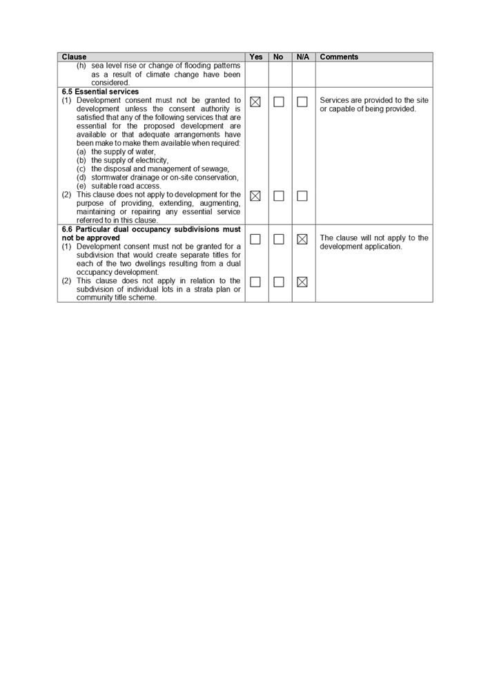
DOCUMENTS
ASSOCIATED WITH
REPORT LPP007/21
Attachment 7
ADCP 2010 Compliance Table
Cumberland Local Planning Panel Meeting
10 March 2021
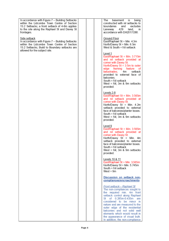
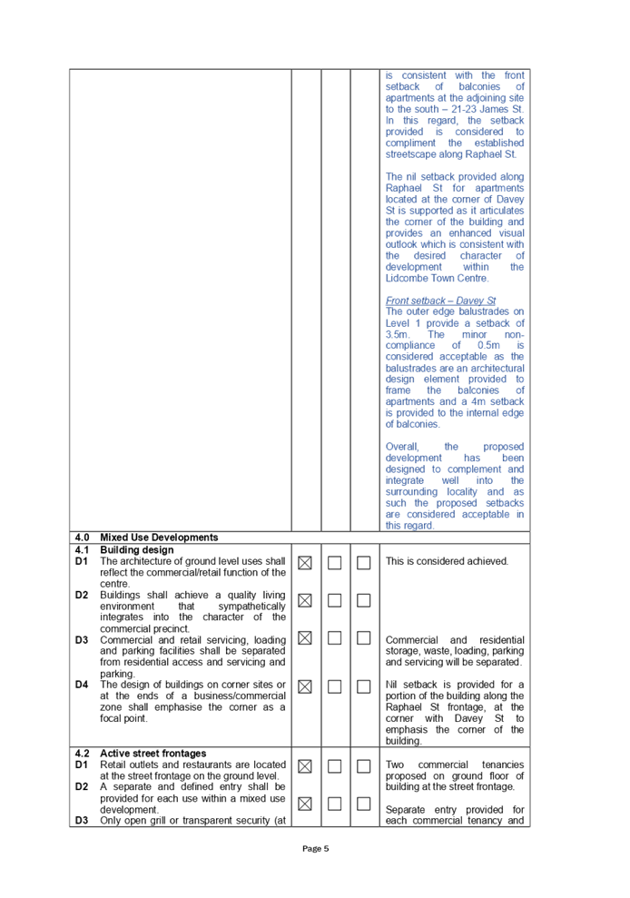
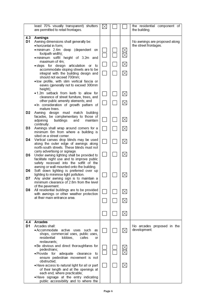
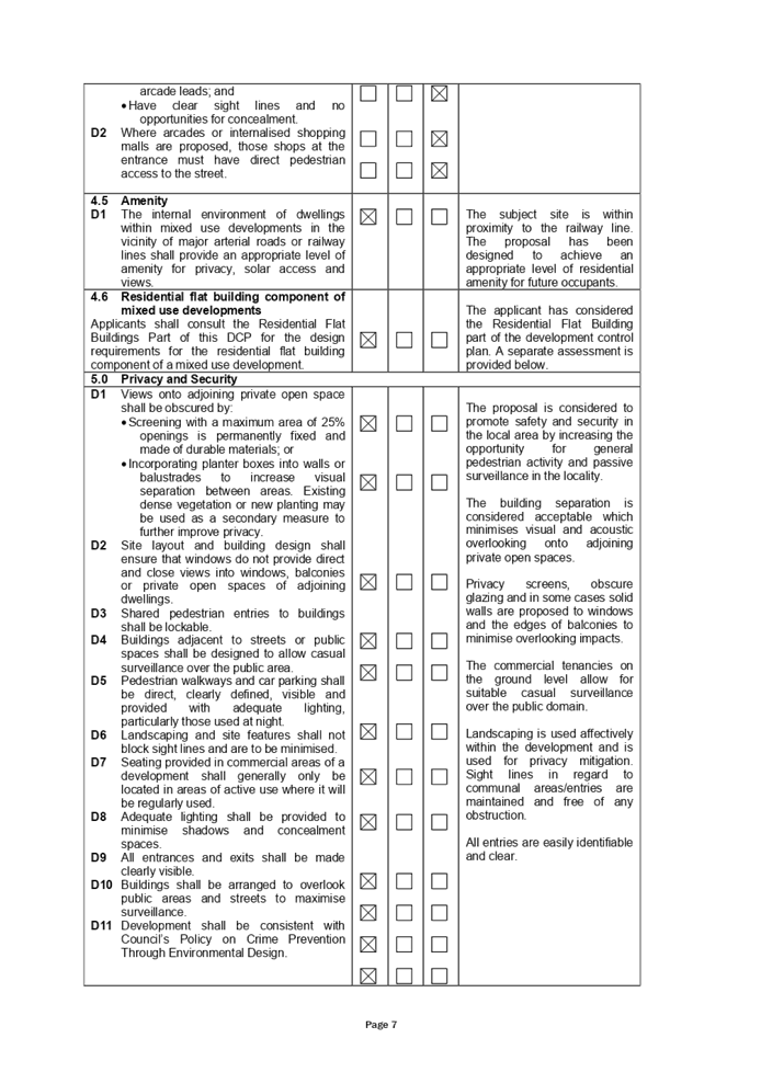
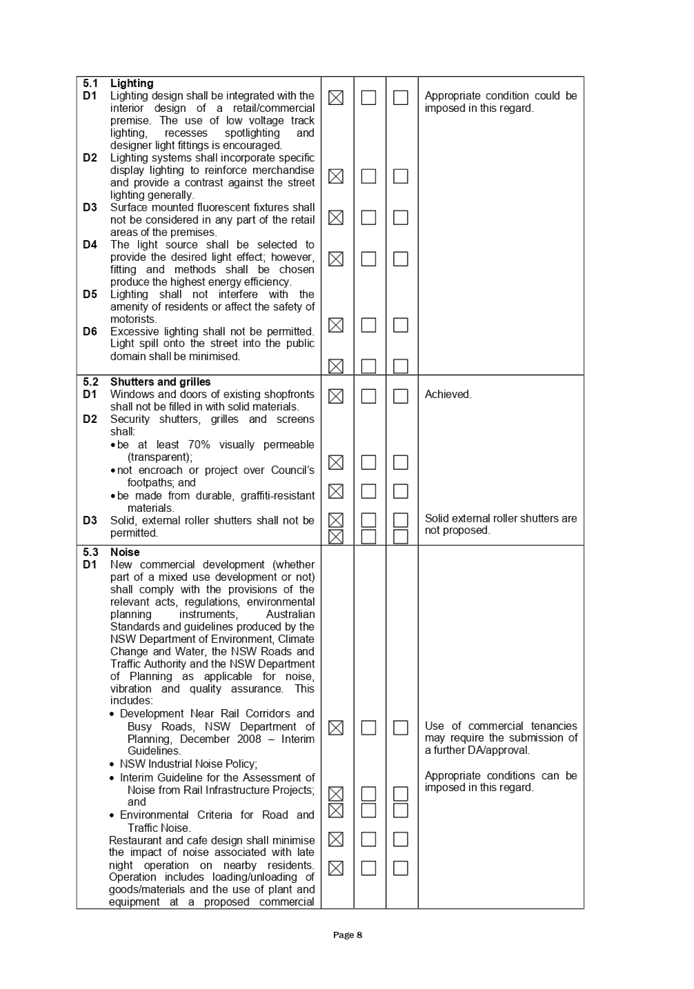
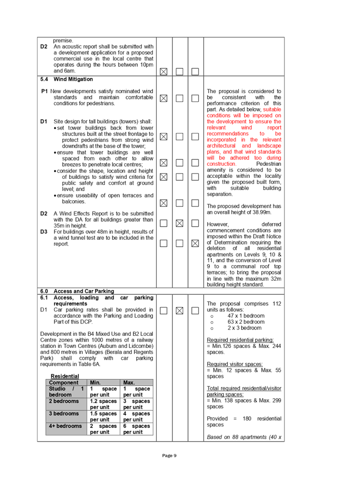
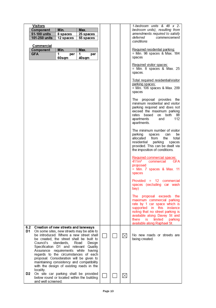
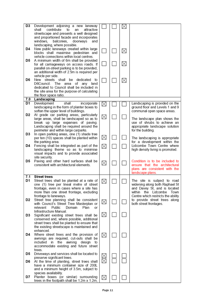
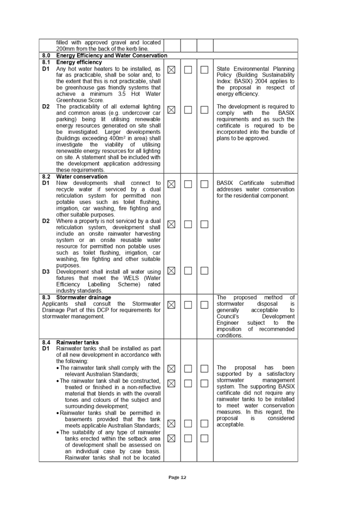
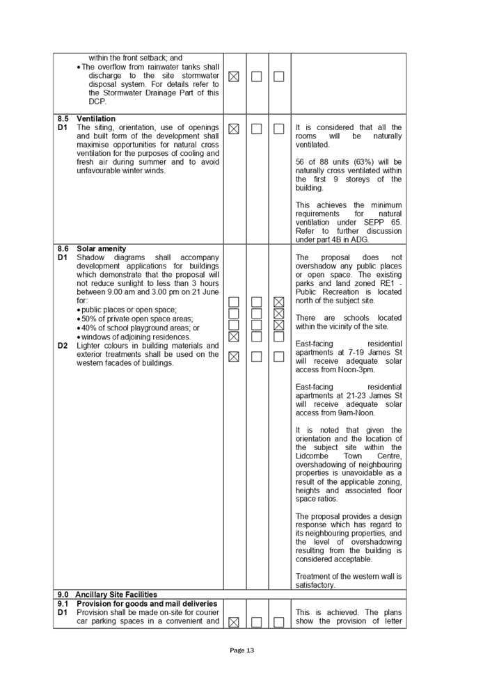
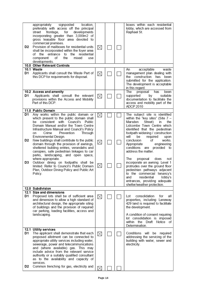
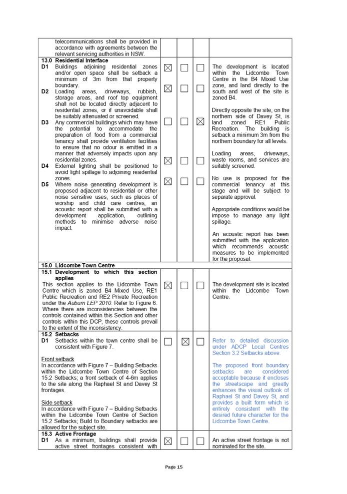
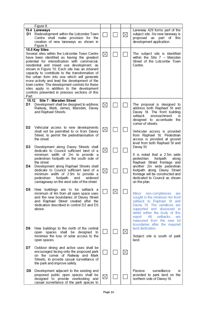

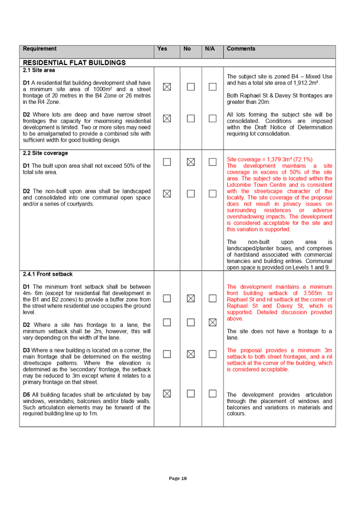
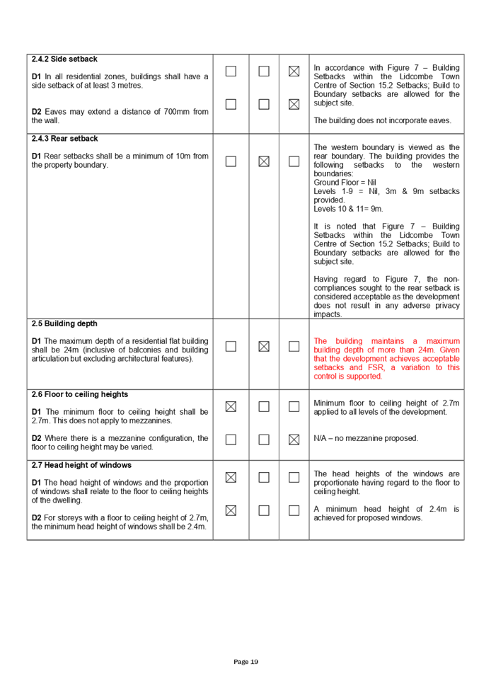
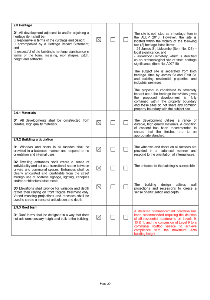
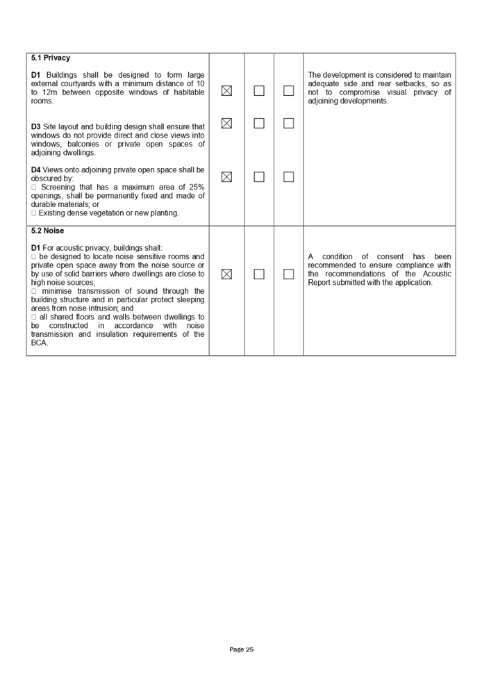
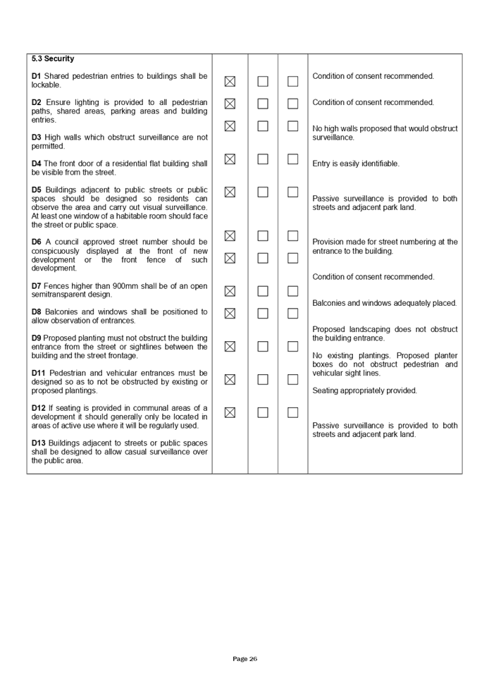
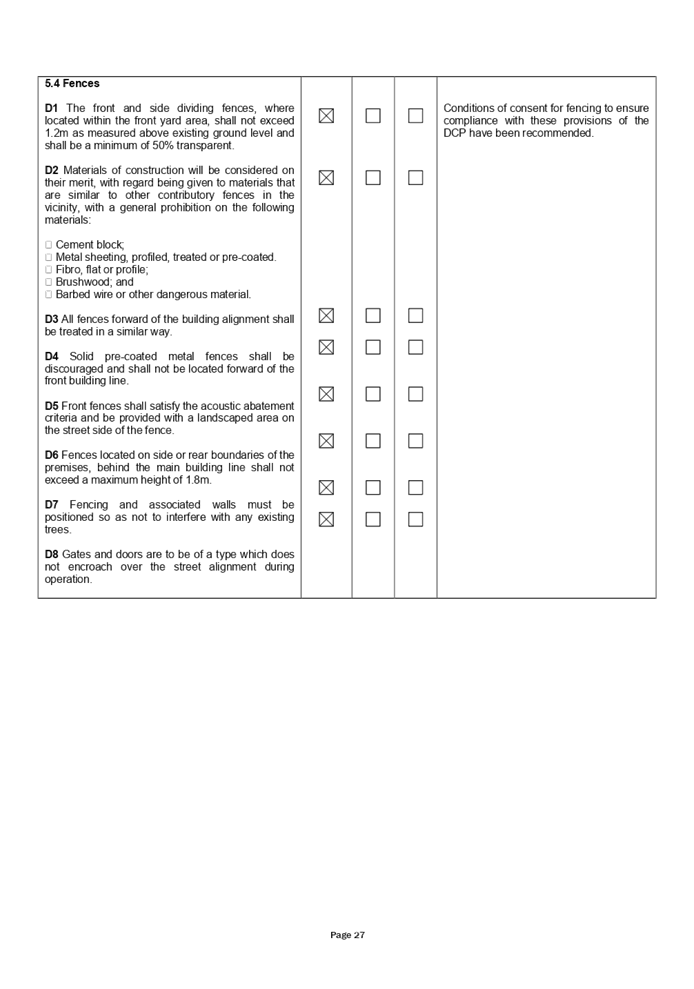
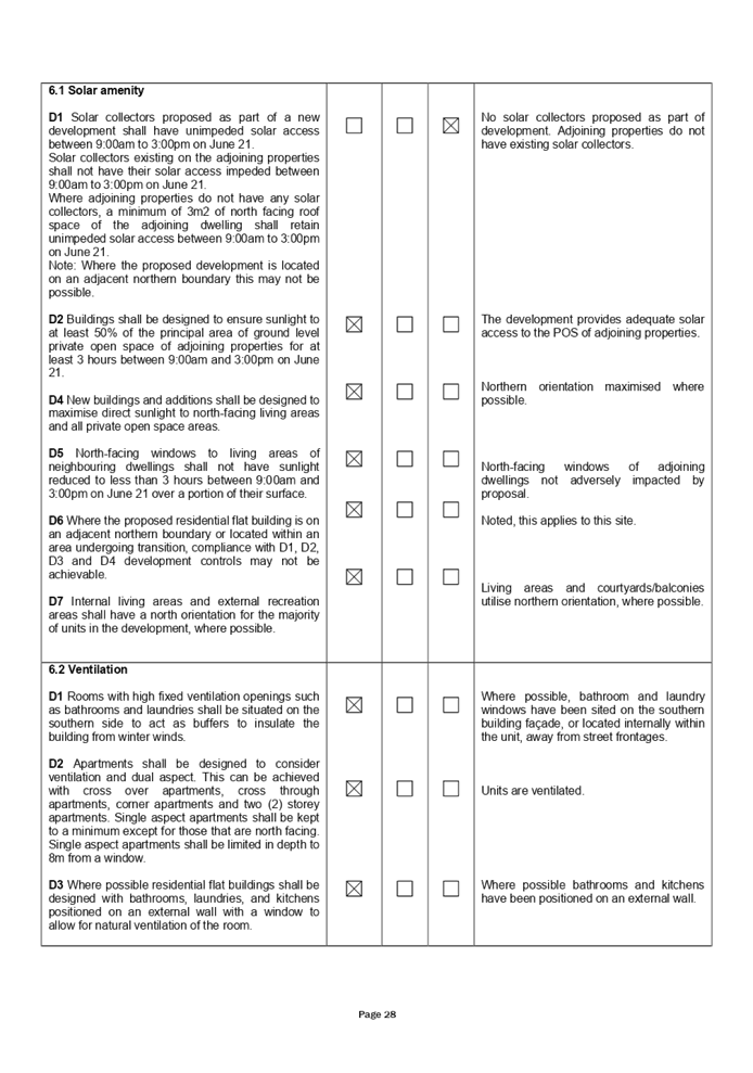
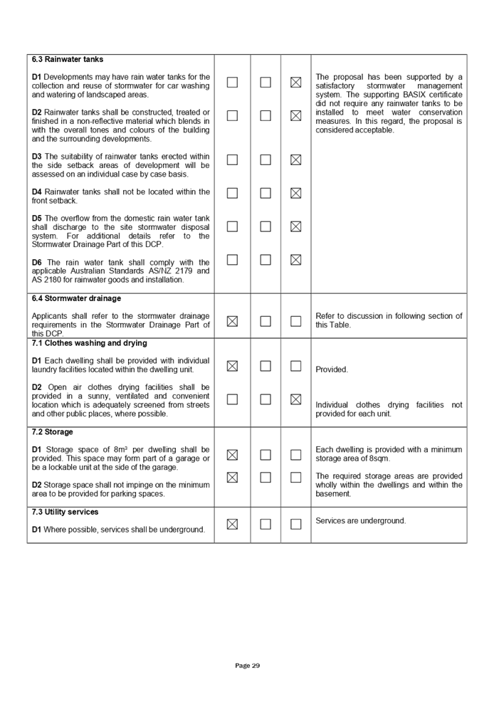
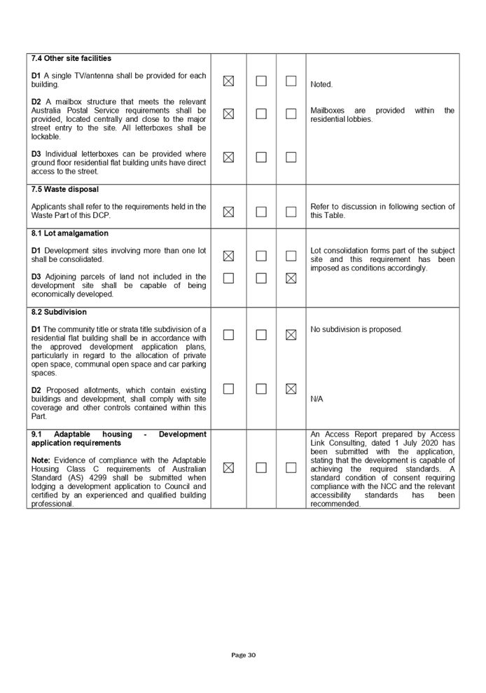
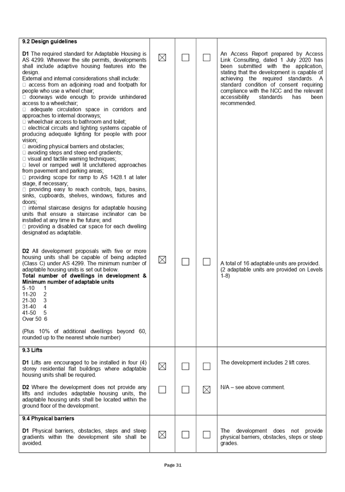
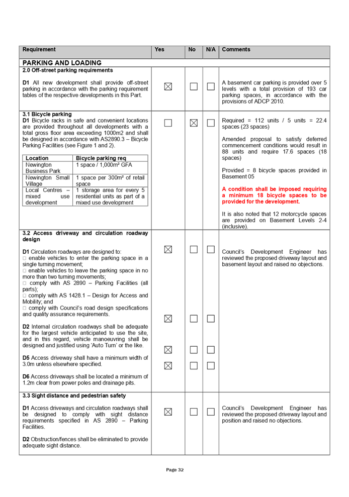
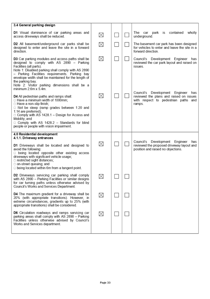
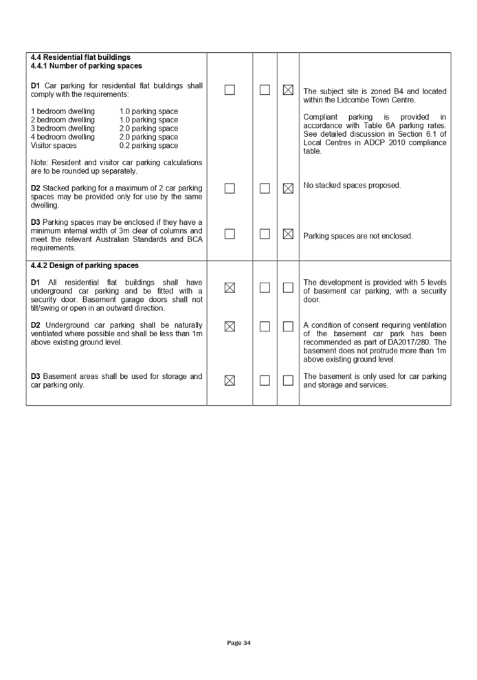
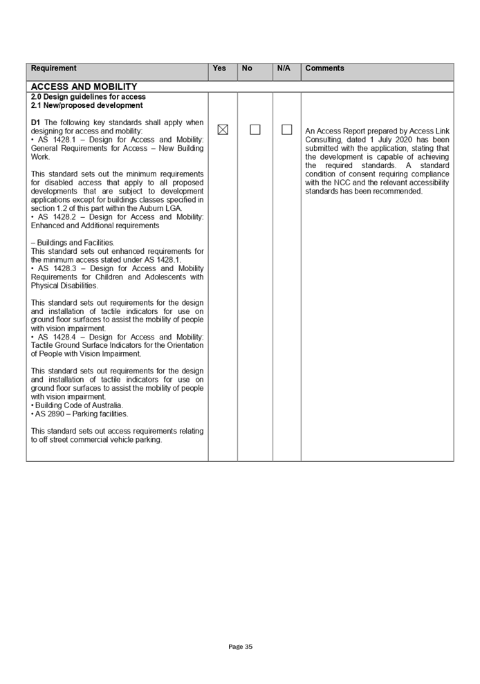
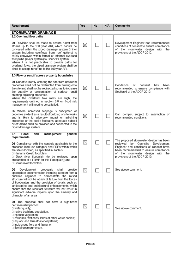
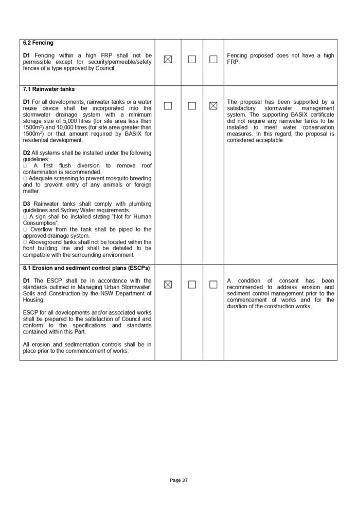

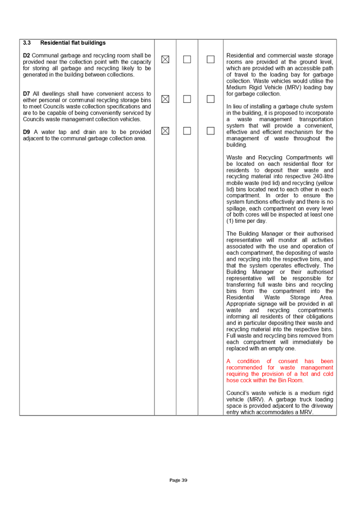
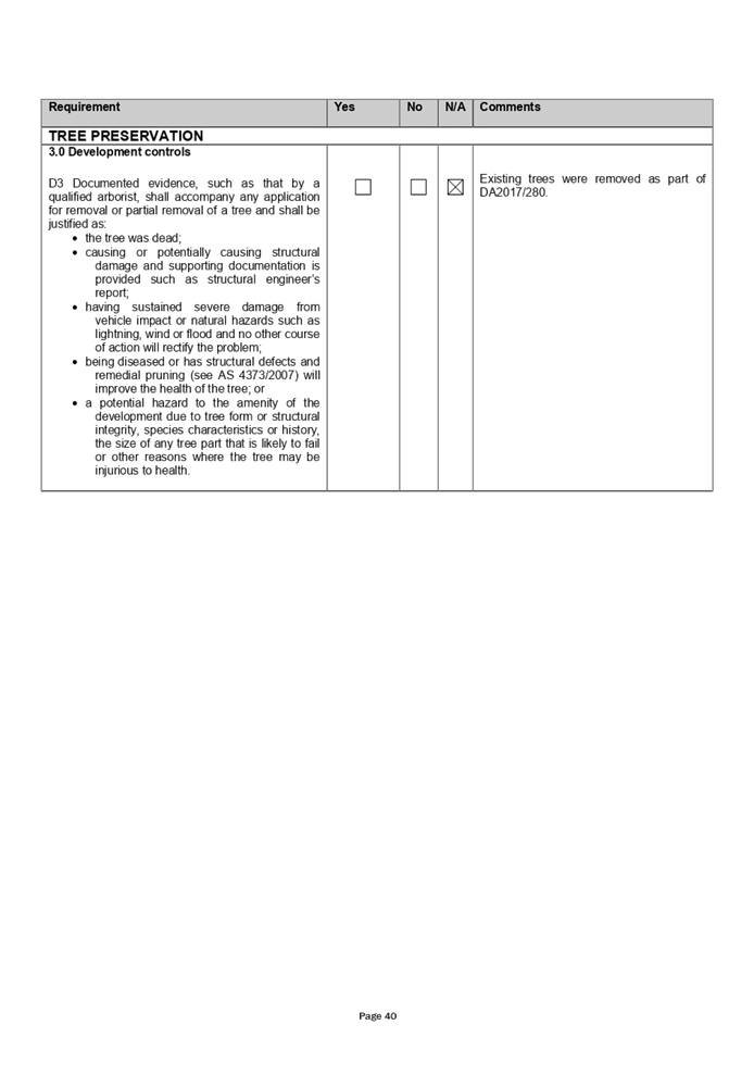
DOCUMENTS
ASSOCIATED WITH
REPORT LPP007/21
Attachment 8
Original Consent - DA2017/280
Cumberland Local Planning Panel Meeting
10 March 2021
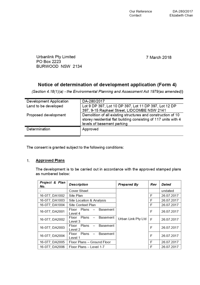
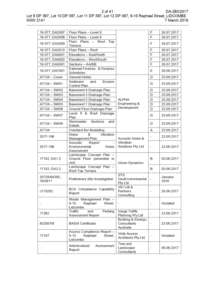


DOCUMENTS
ASSOCIATED WITH
REPORT LPP007/21
Attachment 9
Approved Architectural Plans
Cumberland Local Planning Panel Meeting
10 March 2021
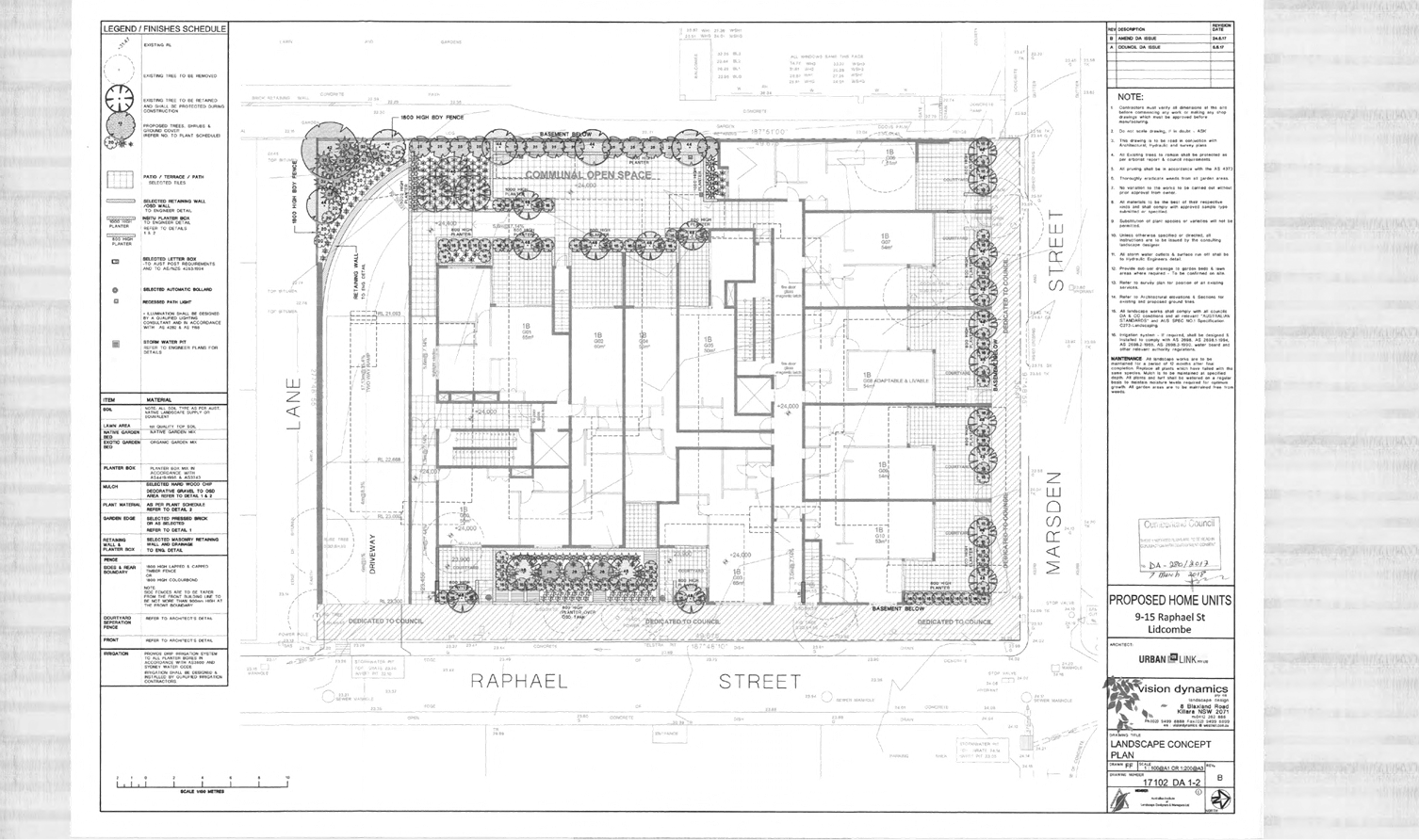
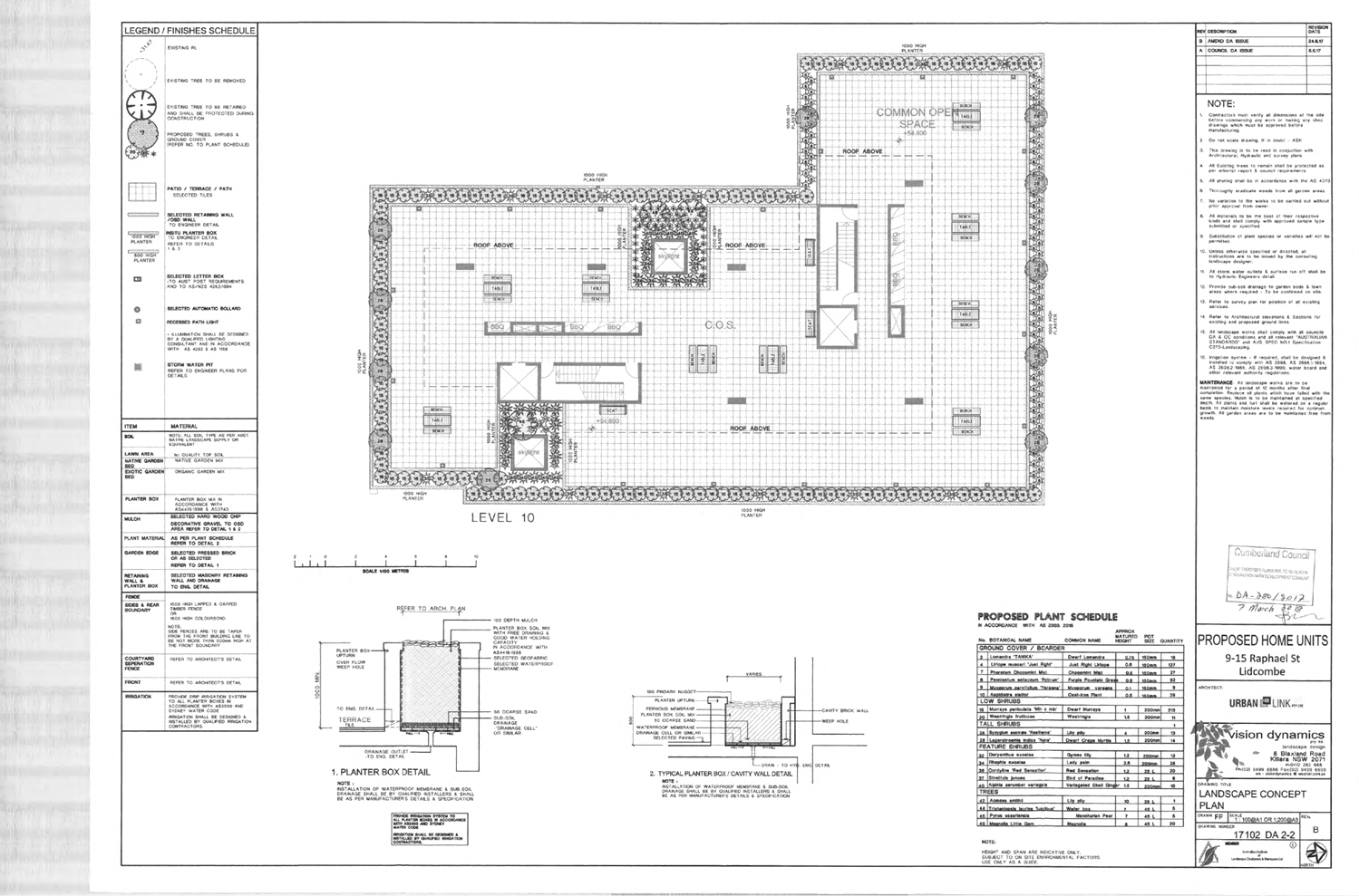
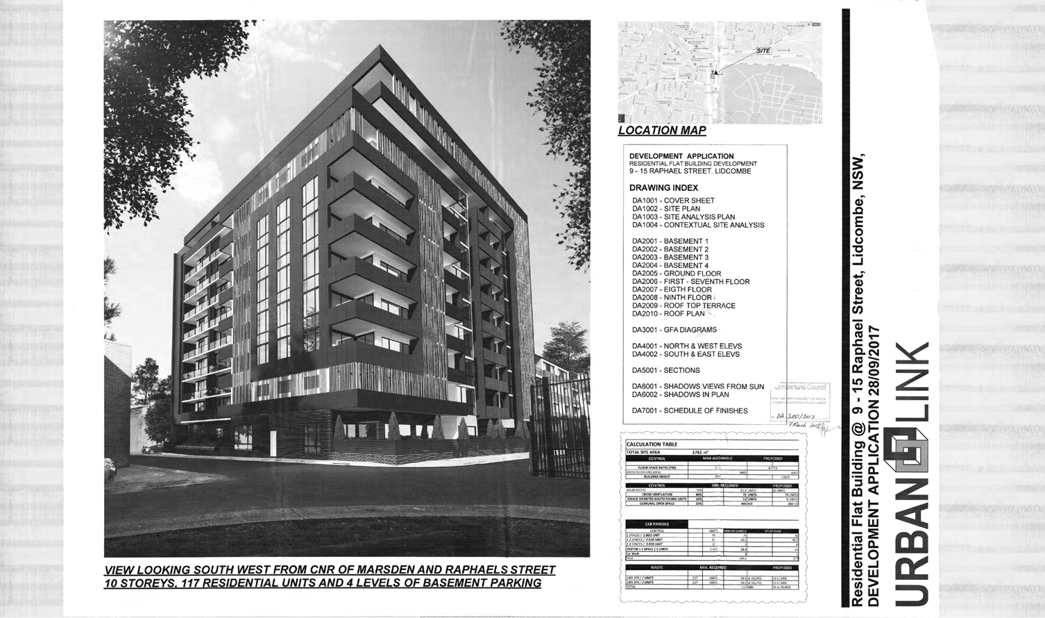
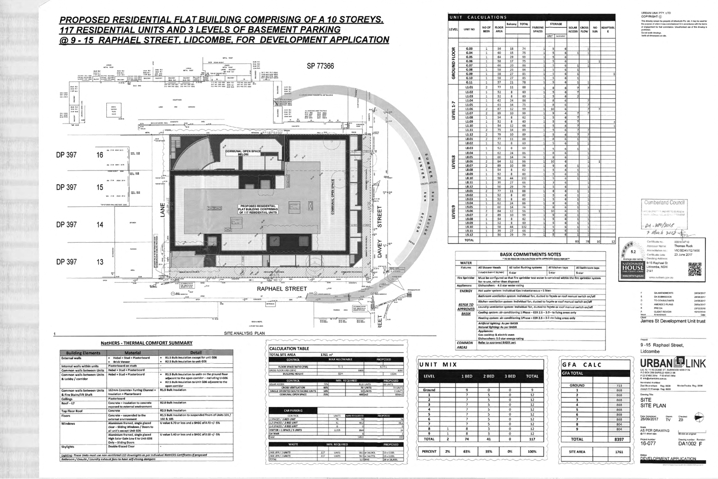
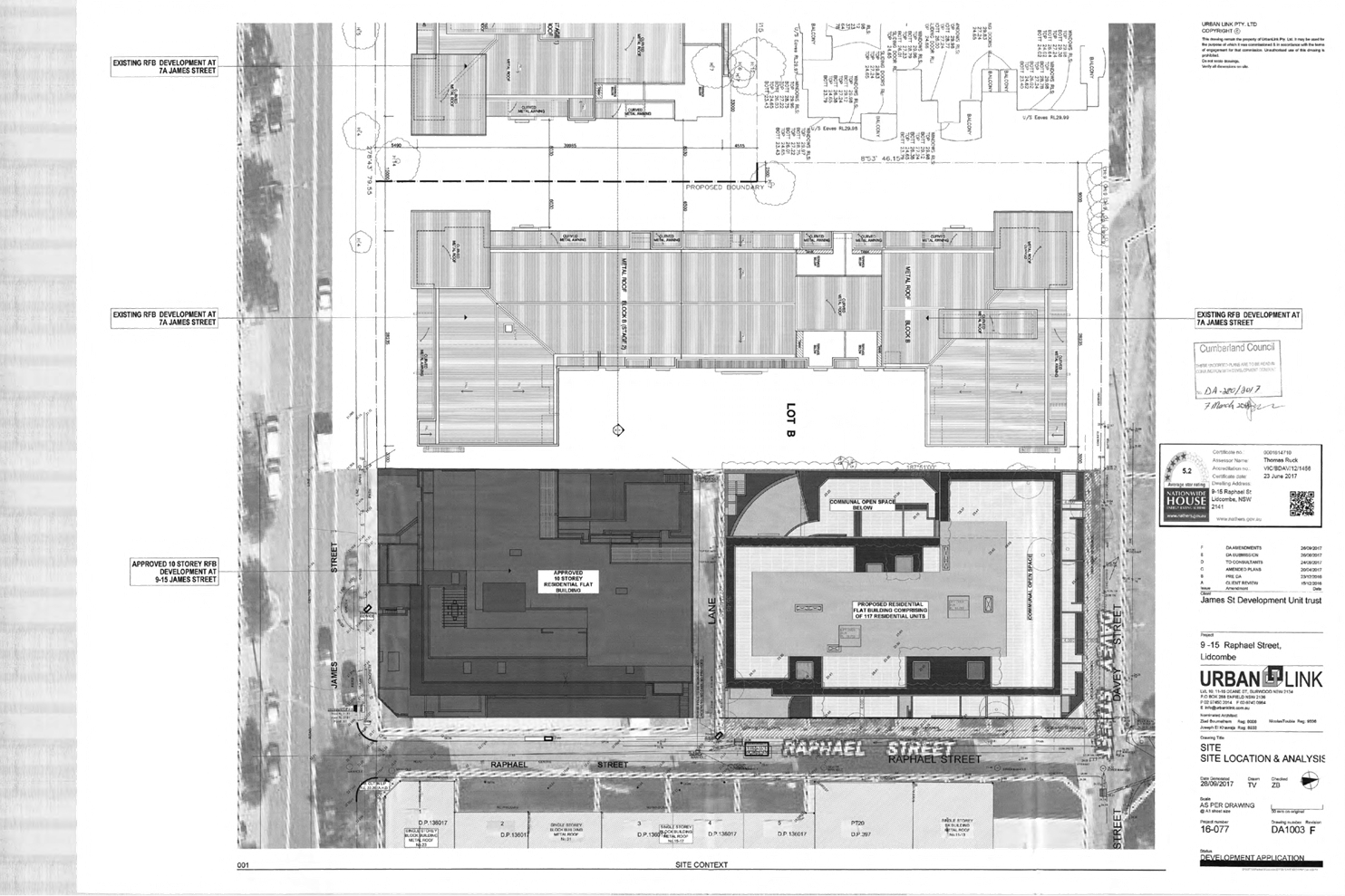
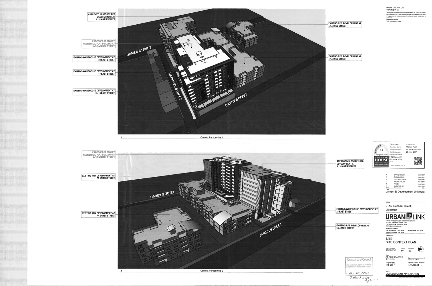
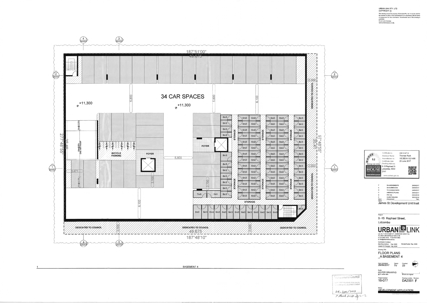
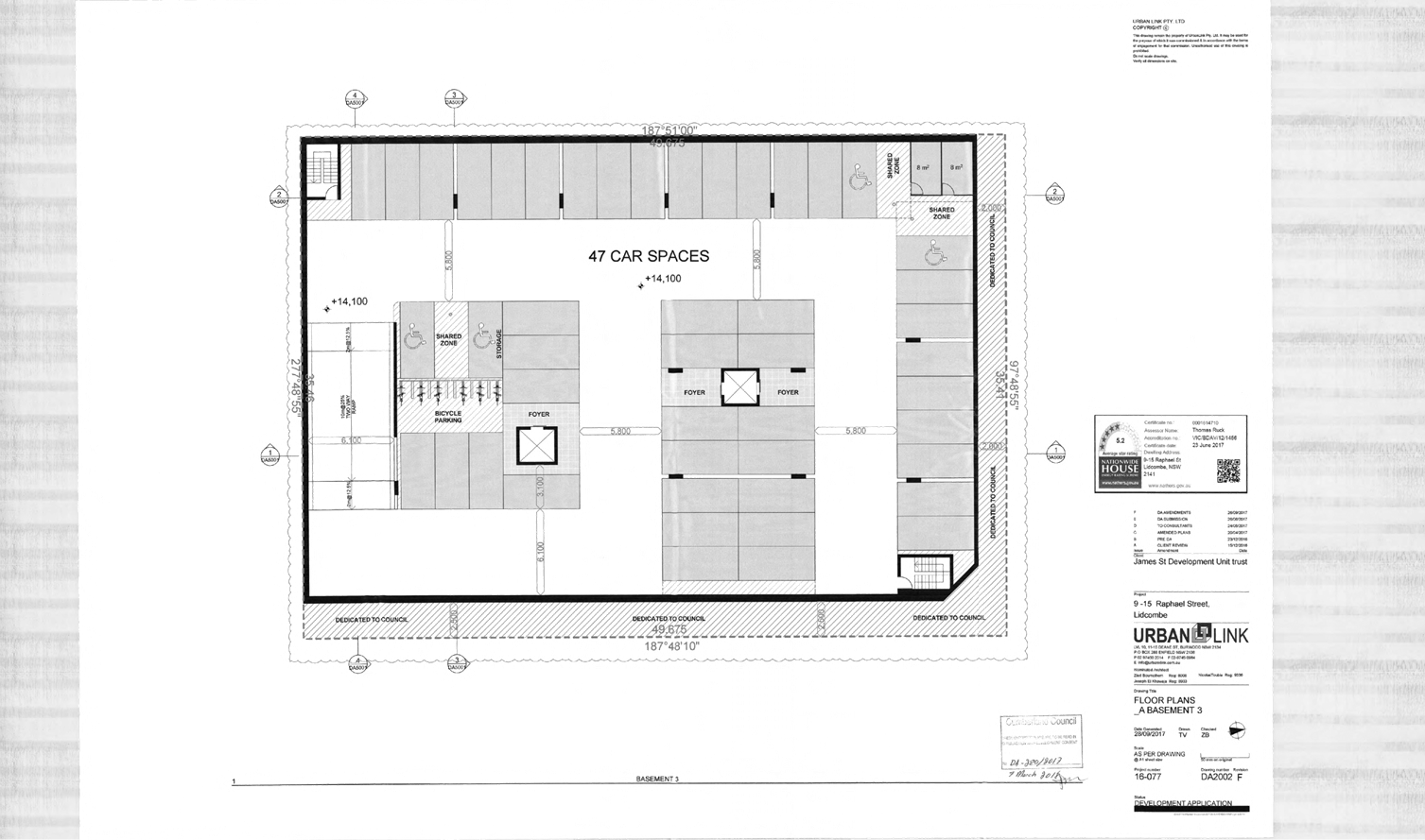
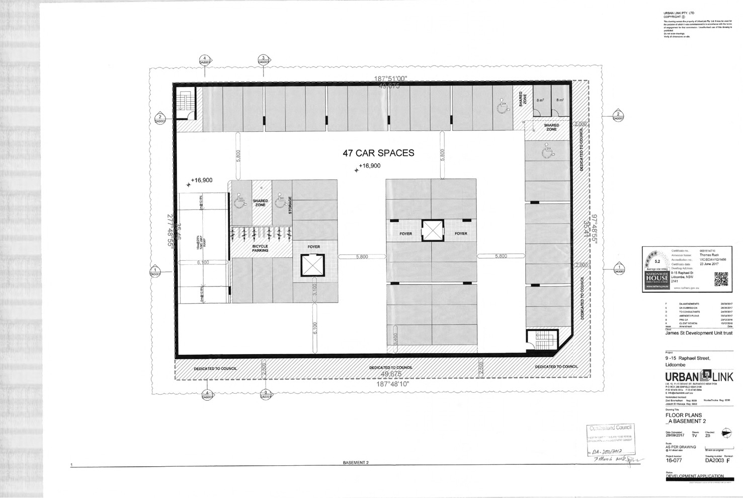
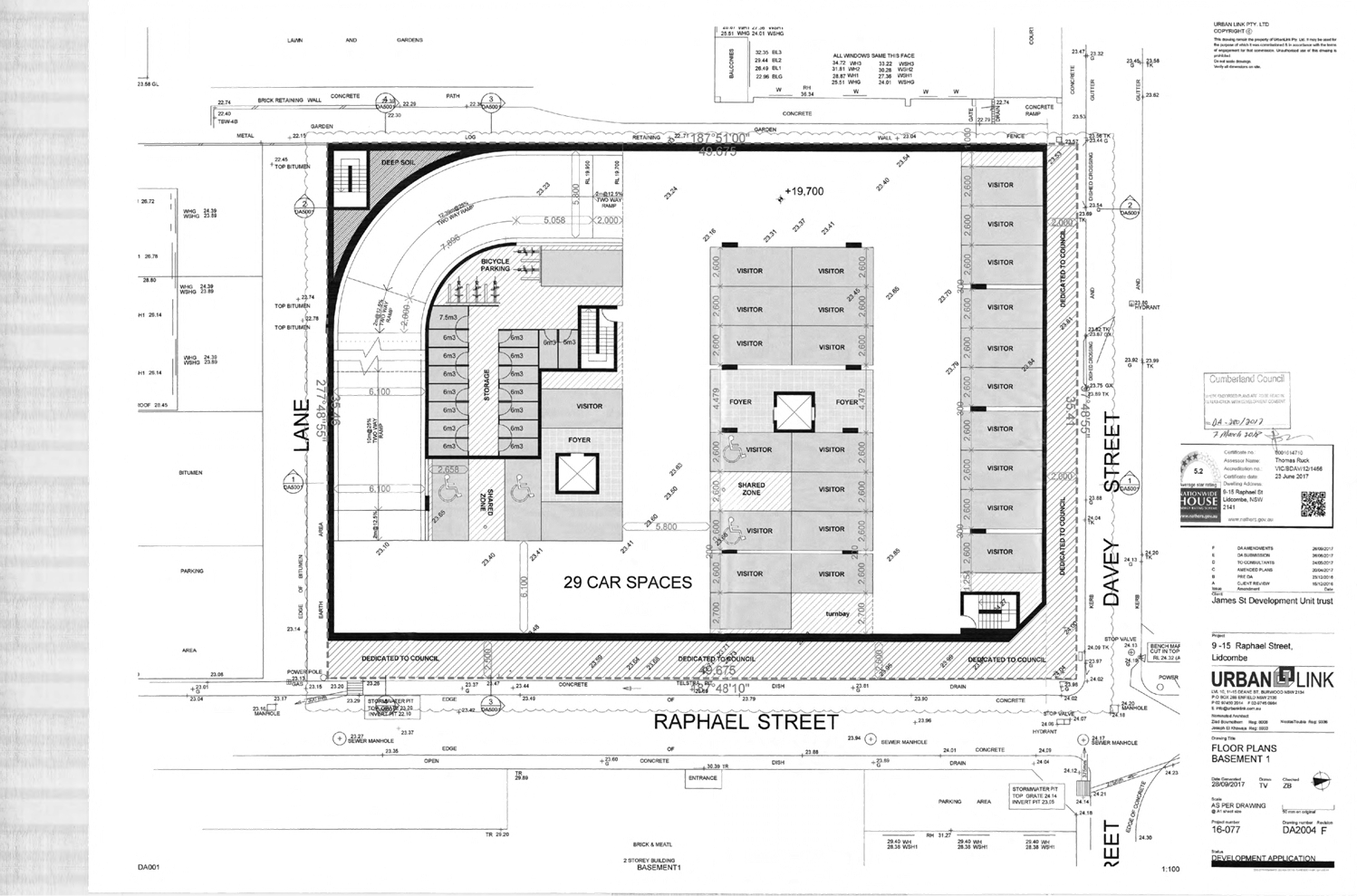
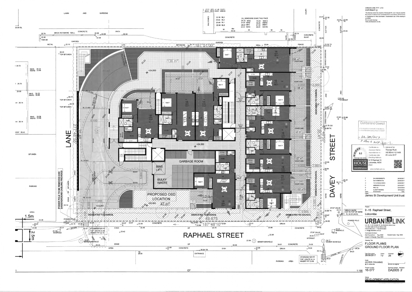
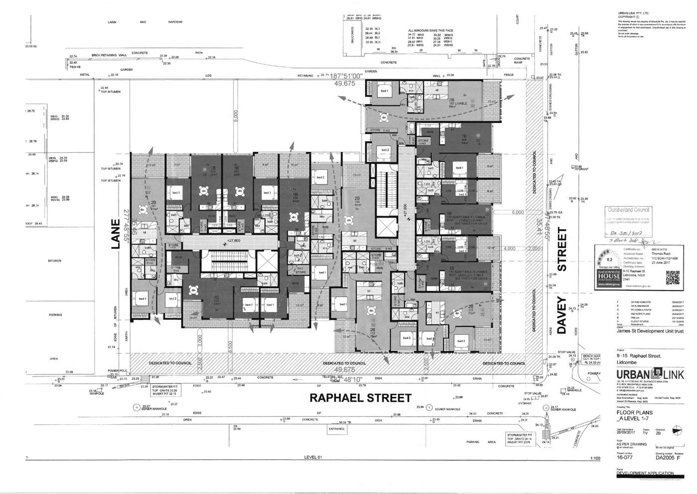
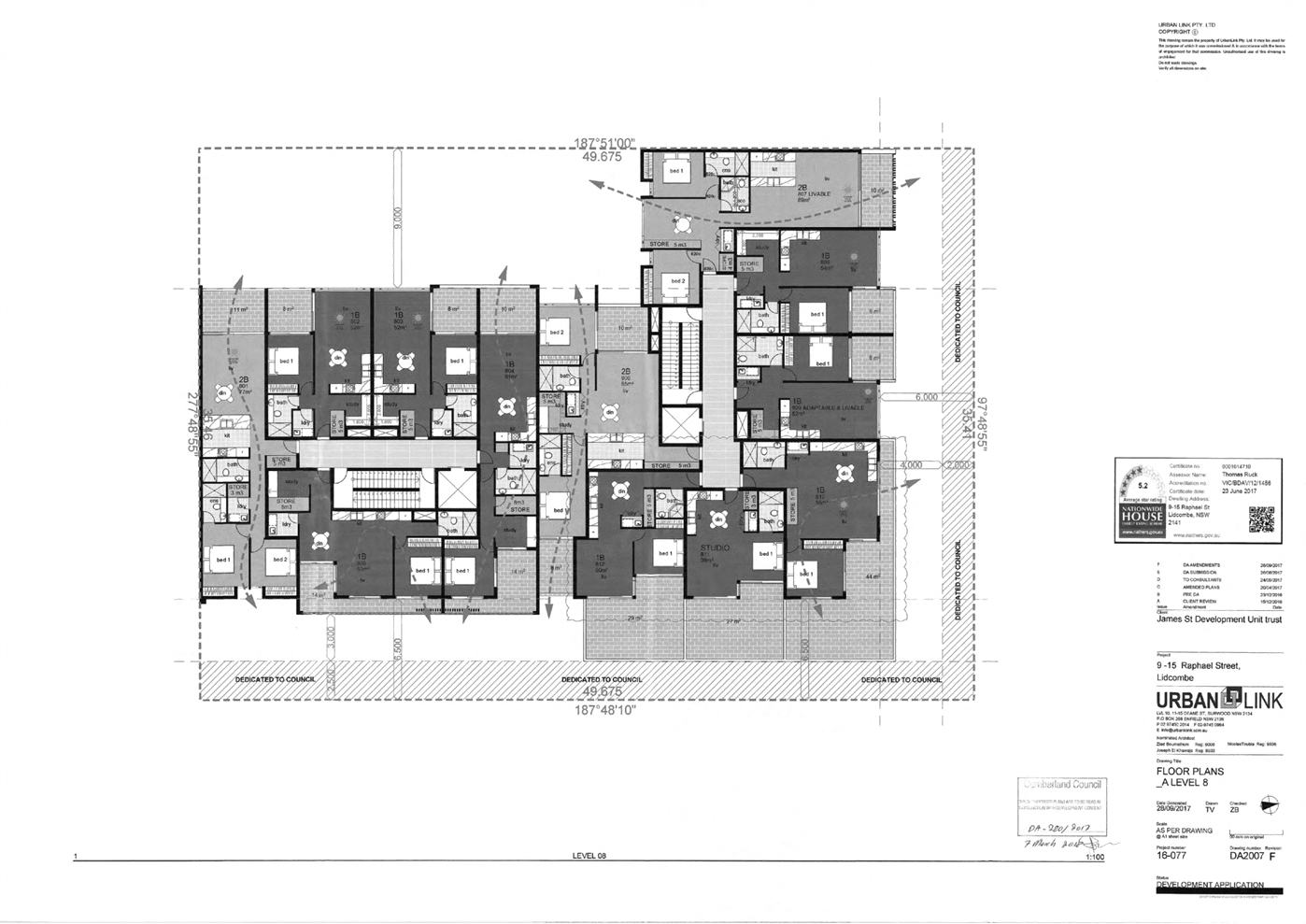
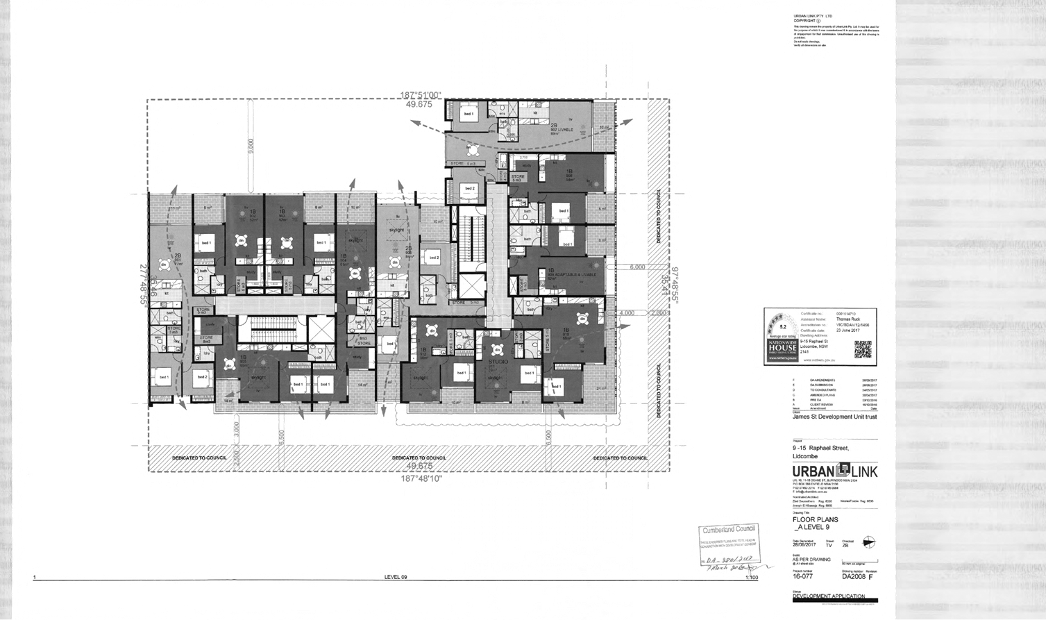
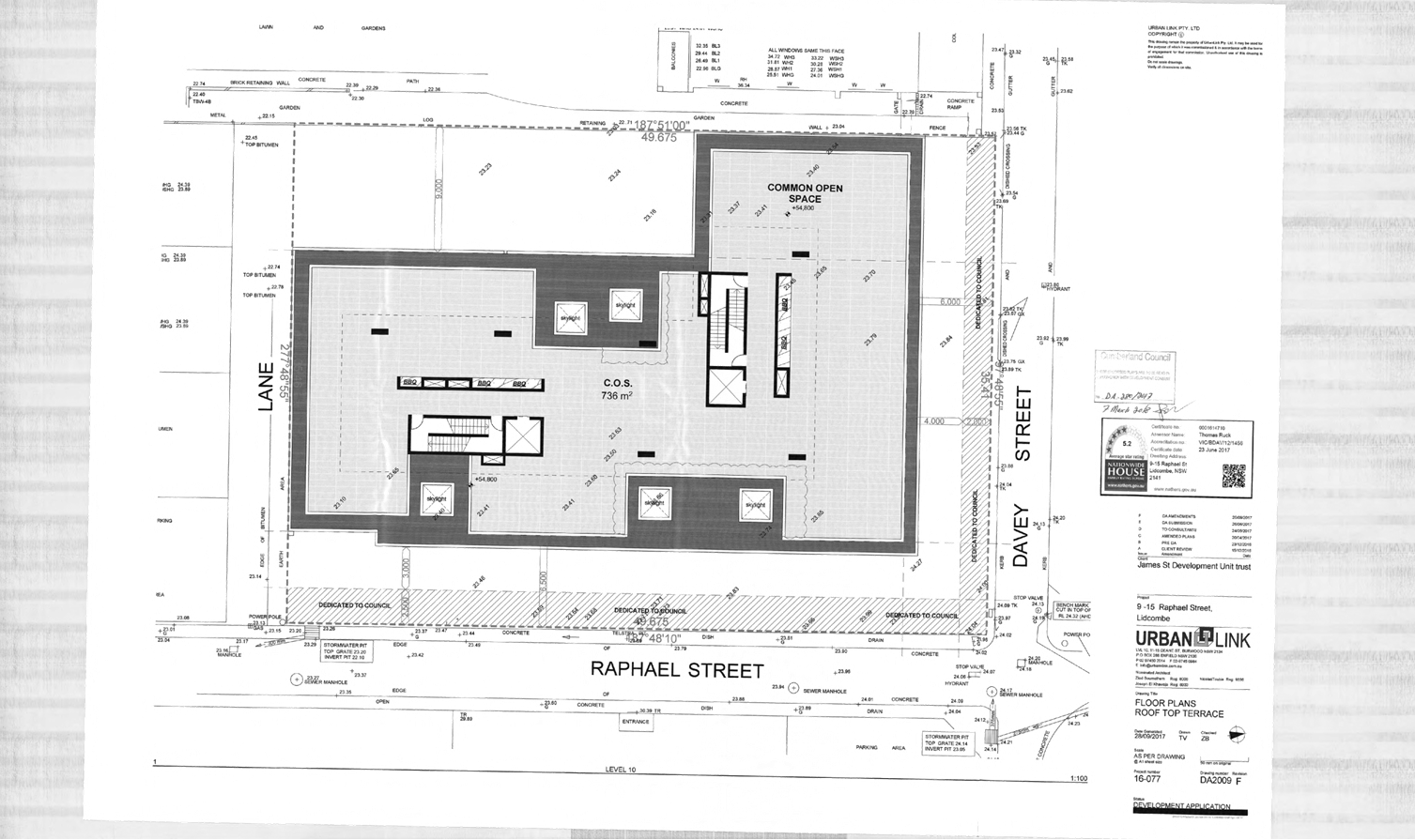
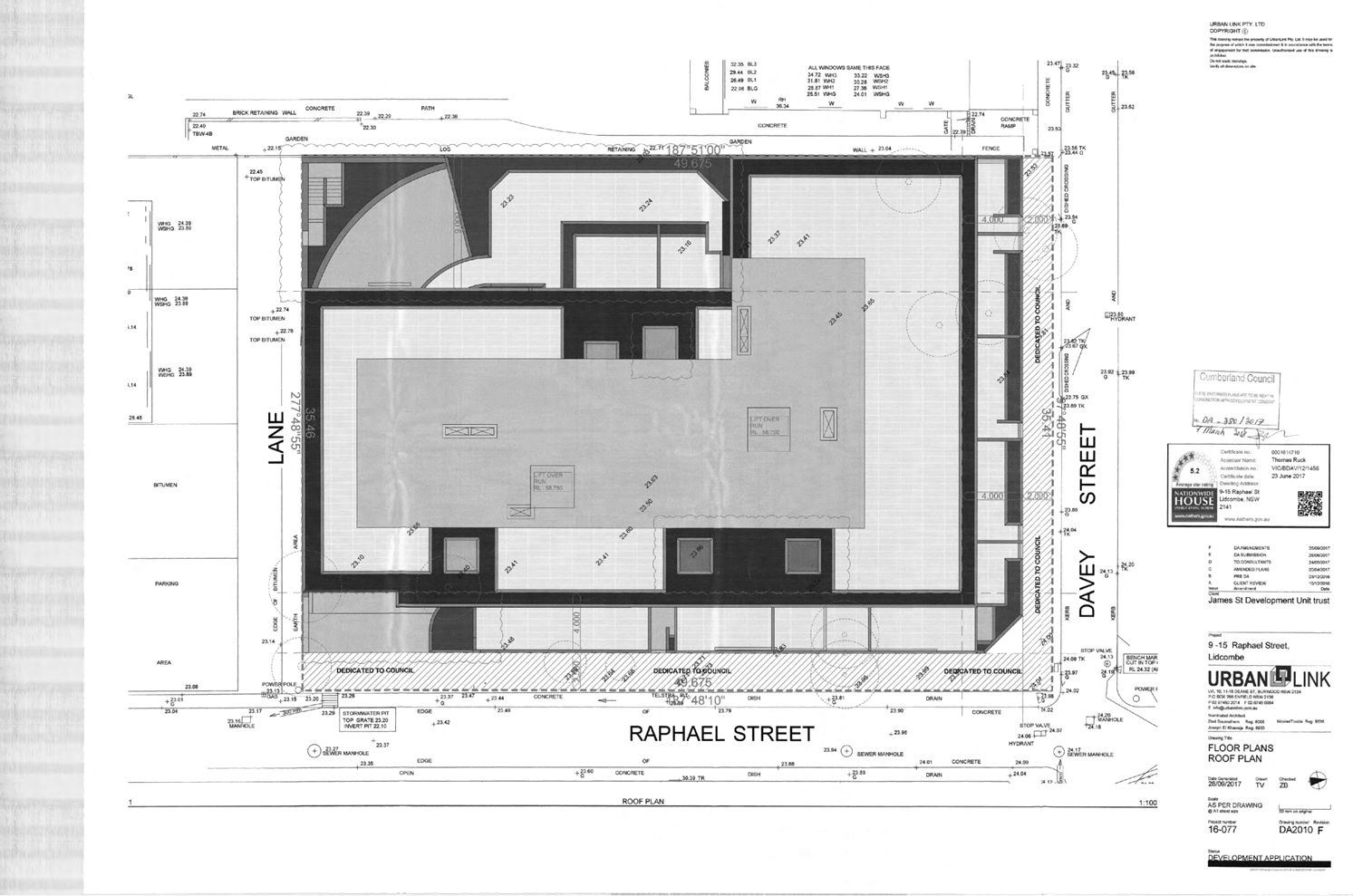
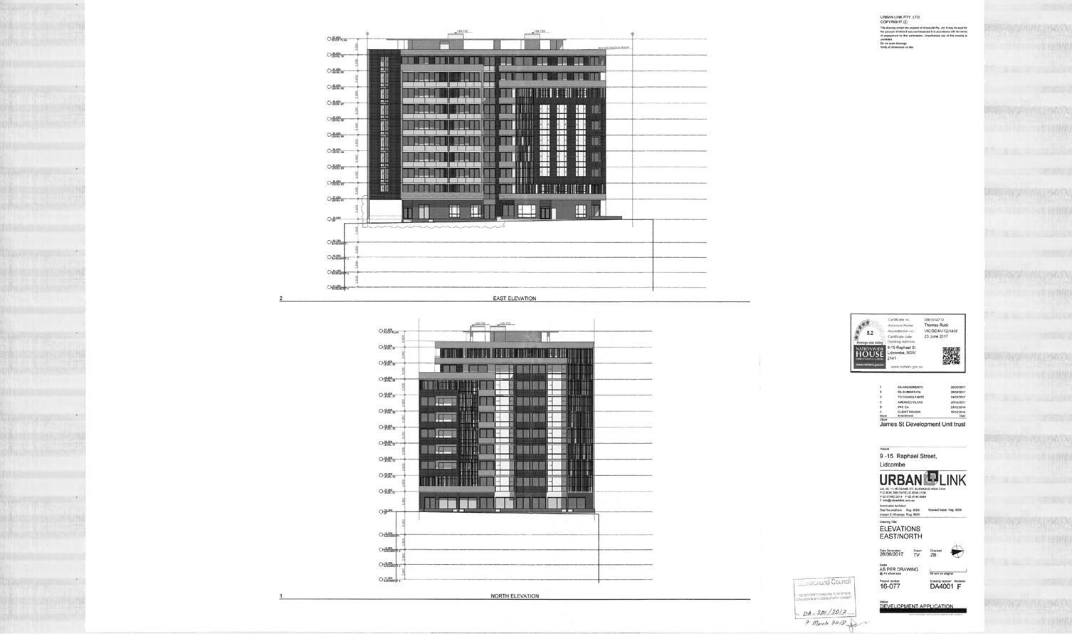
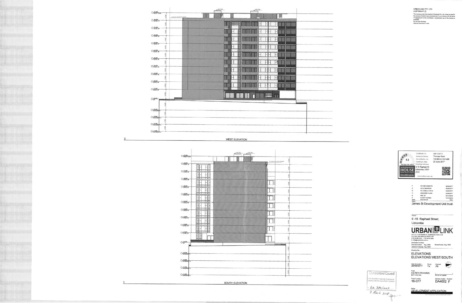
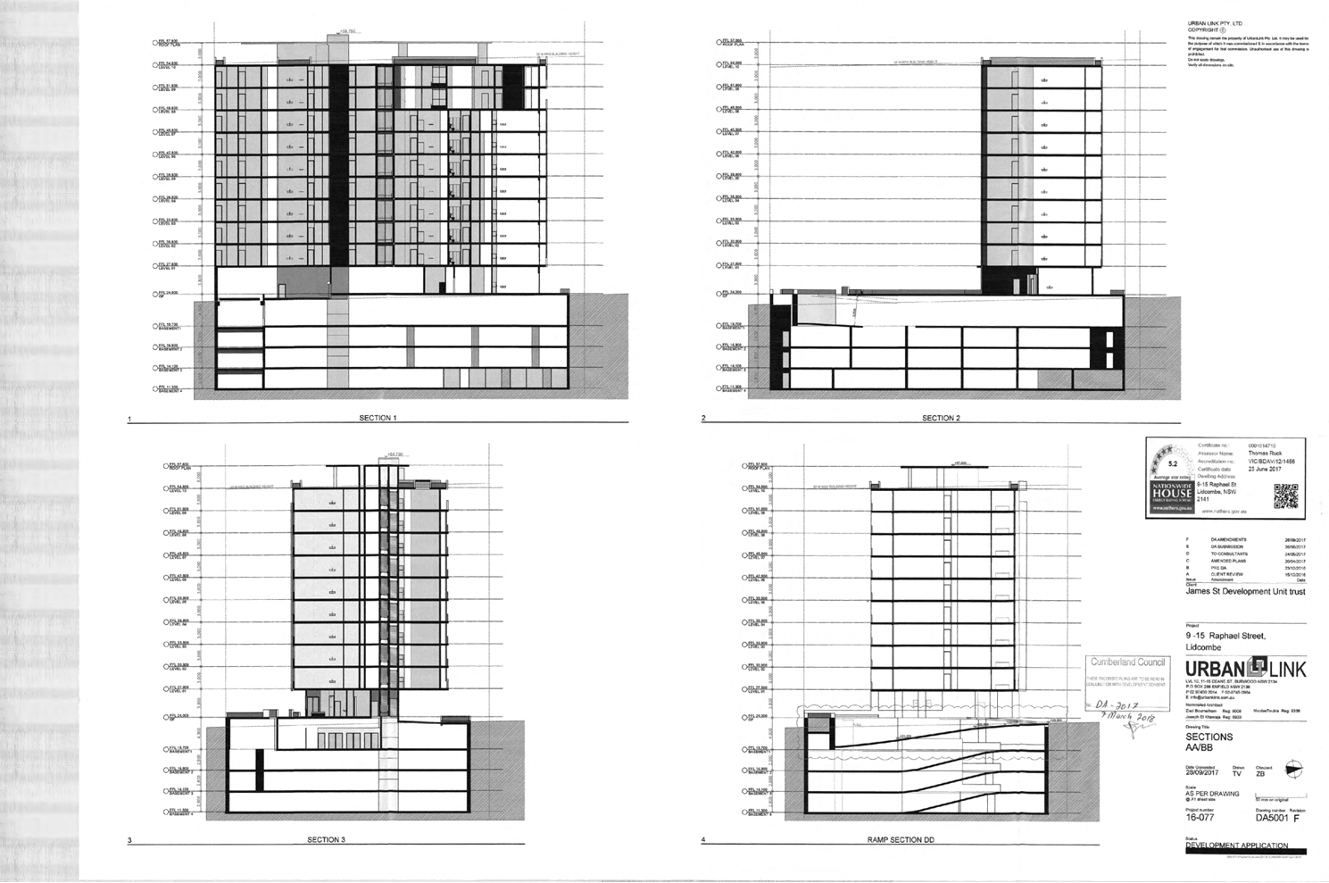
DOCUMENTS
ASSOCIATED WITH
REPORT LPP007/21
Attachment 10
Approved 5th Basement Level Plans
Cumberland Local Planning Panel Meeting
10 March 2021